

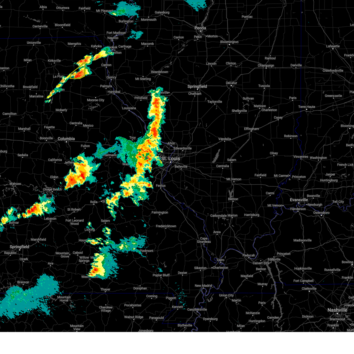
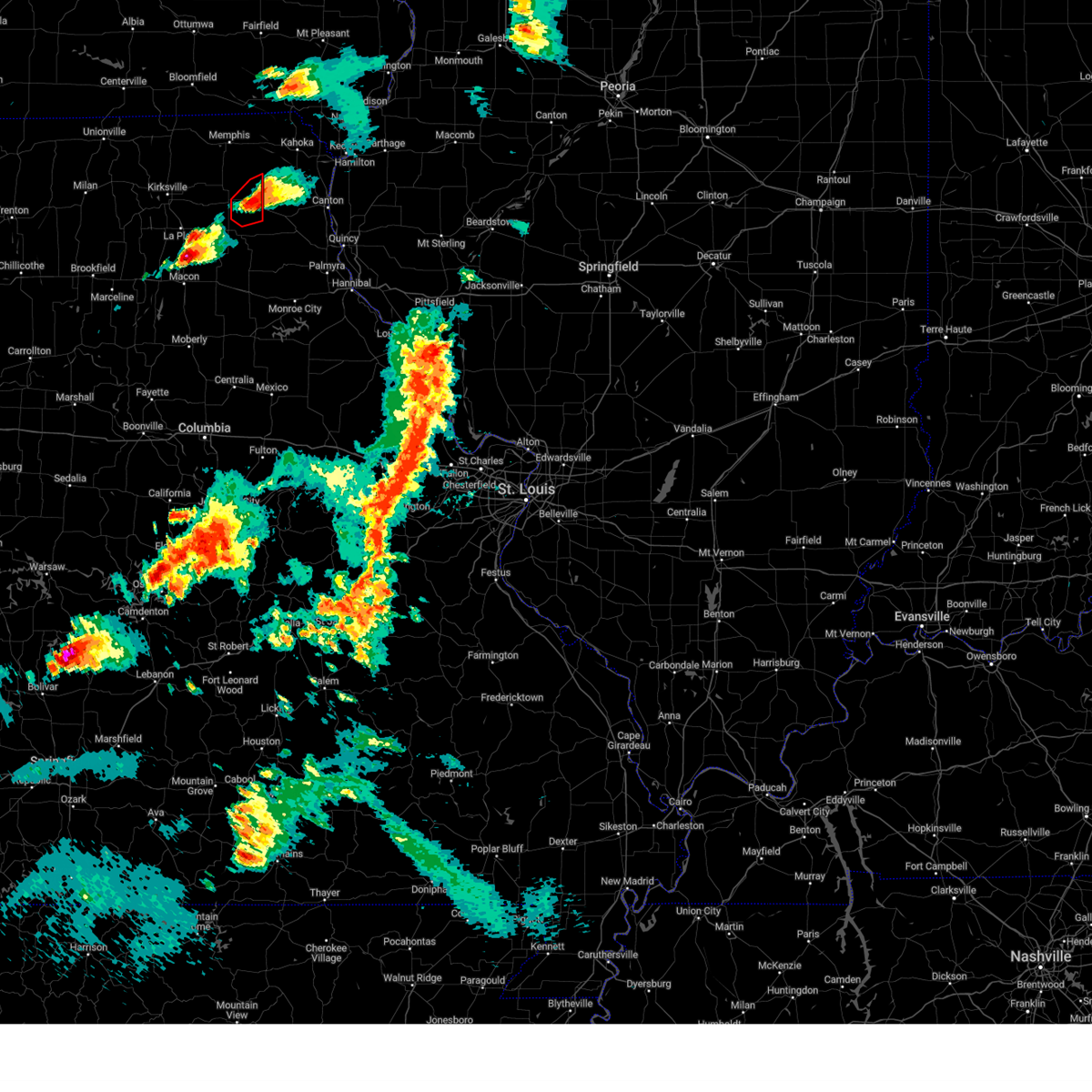
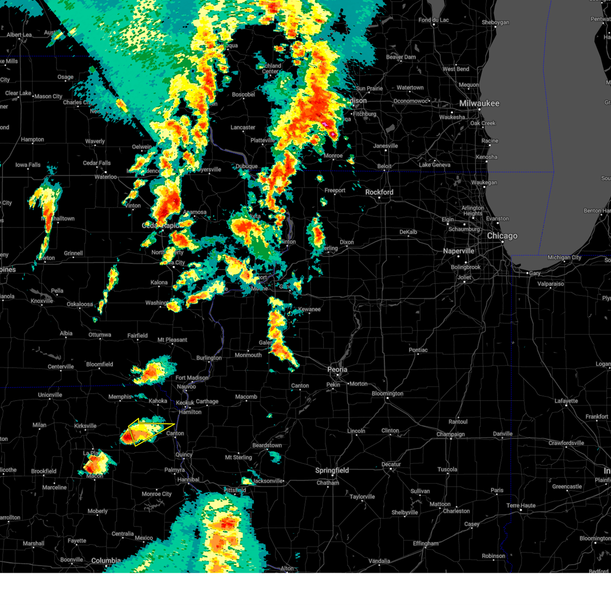
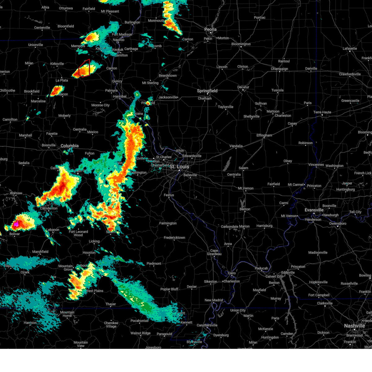
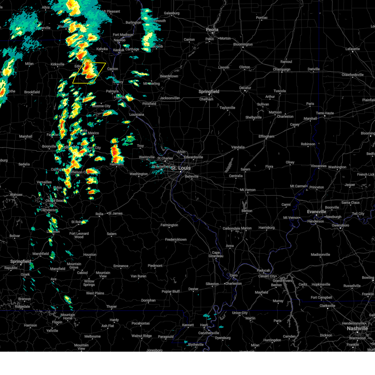
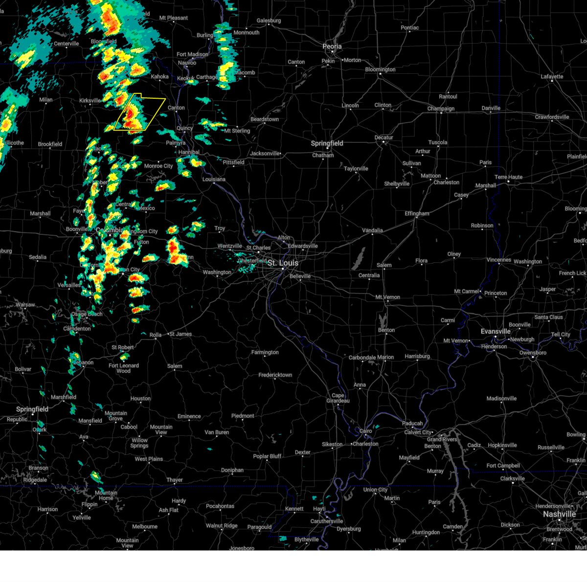
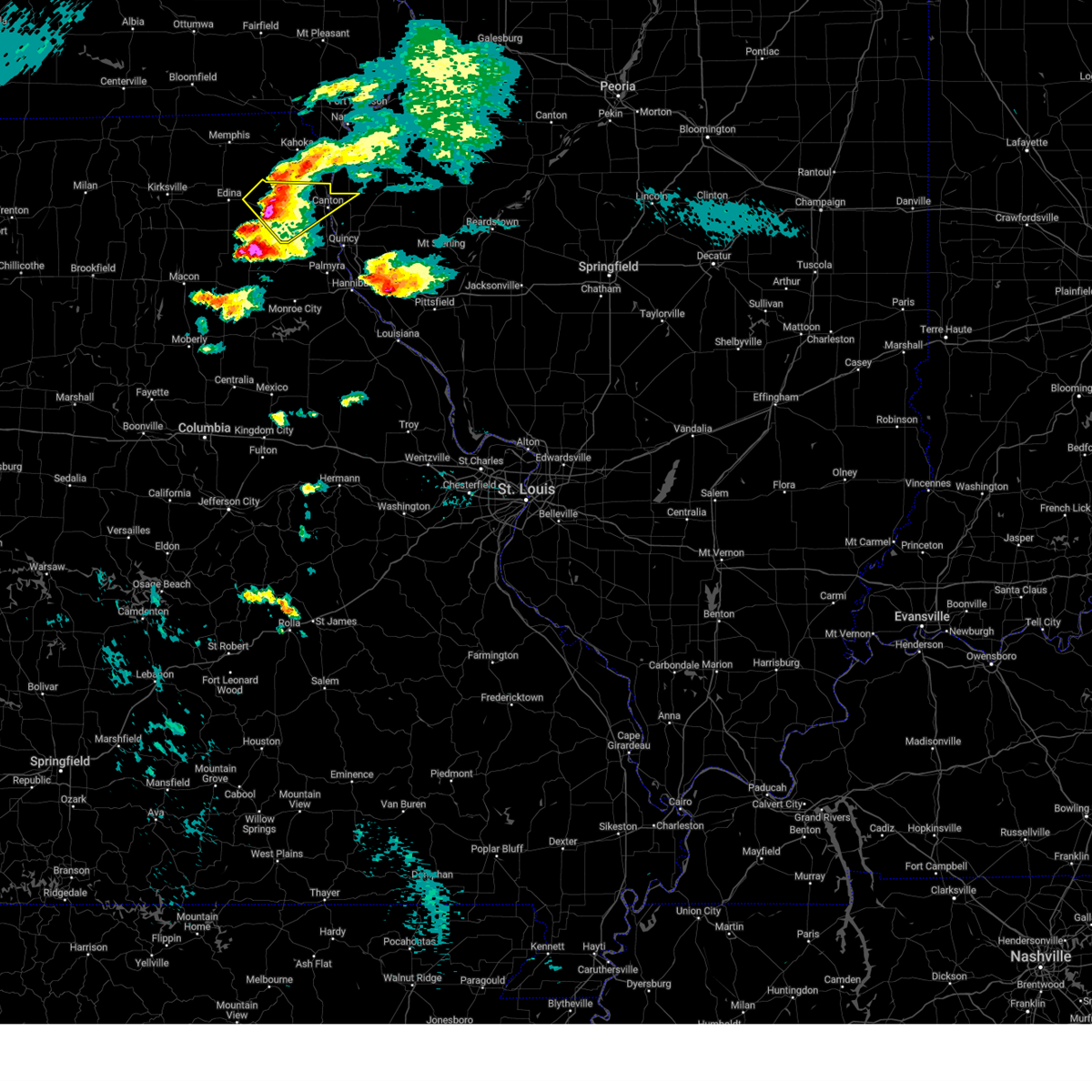
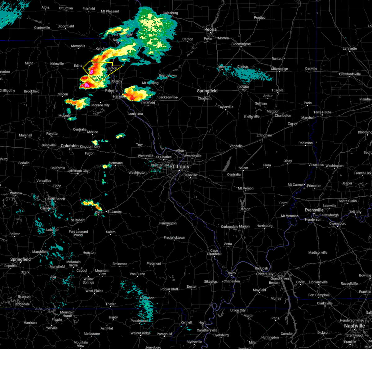
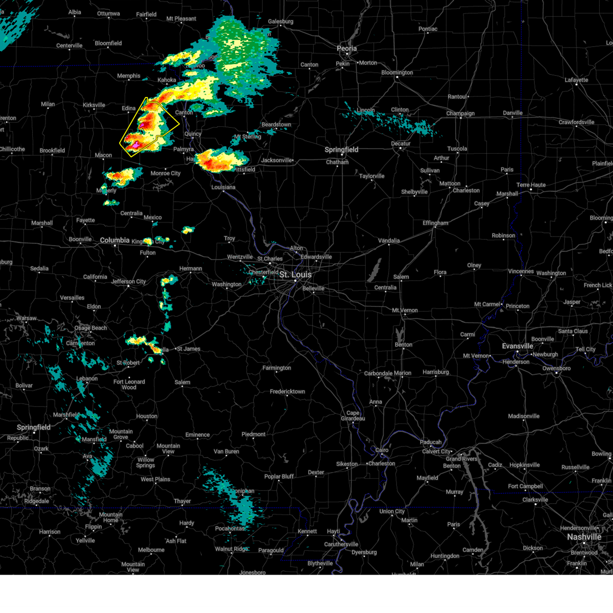
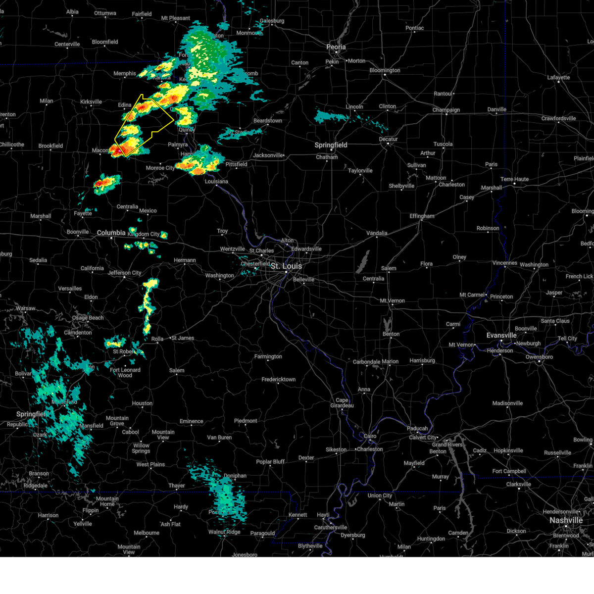
Hail Map for Knox City, MO
The Knox City, MO area has had 1 report of on-the-ground hail by trained spotters, and has been under severe weather warnings 5 times during the past 12 months. Doppler radar has detected hail at or near Knox City, MO on 64 occasions, including 3 occasions during the past year.
| Name: | Knox City, MO |
| Where Located: | 24.5 miles SW of Kahoka, MO |
| Map: | Google Map for Knox City, MO |
| Population: | 216 |
| Housing Units: | 126 |
| More Info: | Search Google for Knox City, MO |
0
The Top Recent Hail Date for Knox City, MO is Friday, July 11, 2025 (47th out of 64)
Hail and Wind Damage Spotted near Knox City, MO
| Date / Time | Report Details |
|---|---|
| 6/3/2025 5:23 PM CDT |
 Svrlsx the national weather service in st louis has issued a * severe thunderstorm warning for, eastern knox county in northeastern missouri, lewis county in northeastern missouri, marion county in northeastern missouri, monroe county in northeastern missouri, ralls county in northeastern missouri, eastern shelby county in northeastern missouri, * until 630 pm cdt. * at 523 pm cdt, severe thunderstorms were located along a line from near colony to 9 miles southeast of madison, or along a line from 15 miles east of edina to 9 miles southwest of paris, moving northeast at 35 mph (radar indicated). Hazards include 60 mph wind gusts and small hail. Expect damage to roofs, siding, and trees. this severe thunderstorm will be near, la belle, shelbina, granville, shelbyville, colony and knox city around 525 pm cdt. paris, steffenville and lewistown around 530 pm cdt. other locations impacted by the severe thunderstorm include newark, holliday, bethel, hunnewell, stoutsville, monticello, indian creek, florida, taylor and the landing. This includes the following state parks, wakonda state park, union covered bridge historic site and mark twain lake recreational area. Svrlsx the national weather service in st louis has issued a * severe thunderstorm warning for, eastern knox county in northeastern missouri, lewis county in northeastern missouri, marion county in northeastern missouri, monroe county in northeastern missouri, ralls county in northeastern missouri, eastern shelby county in northeastern missouri, * until 630 pm cdt. * at 523 pm cdt, severe thunderstorms were located along a line from near colony to 9 miles southeast of madison, or along a line from 15 miles east of edina to 9 miles southwest of paris, moving northeast at 35 mph (radar indicated). Hazards include 60 mph wind gusts and small hail. Expect damage to roofs, siding, and trees. this severe thunderstorm will be near, la belle, shelbina, granville, shelbyville, colony and knox city around 525 pm cdt. paris, steffenville and lewistown around 530 pm cdt. other locations impacted by the severe thunderstorm include newark, holliday, bethel, hunnewell, stoutsville, monticello, indian creek, florida, taylor and the landing. This includes the following state parks, wakonda state park, union covered bridge historic site and mark twain lake recreational area.
|
| 6/3/2025 4:51 PM CDT |
 Svrlsx the national weather service in st louis has issued a * severe thunderstorm warning for, knox county in northeastern missouri, monroe county in northeastern missouri, shelby county in northeastern missouri, * until 530 pm cdt. * at 451 pm cdt, severe thunderstorms were located along a line from 6 miles south of edina to 11 miles west of sturgeon, or along a line from 6 miles south of edina to 19 miles west of centralia, moving northeast at 60 mph (radar indicated). Hazards include 60 mph wind gusts and quarter size hail. Hail damage to vehicles is expected. expect wind damage to roofs, siding, and trees. this severe thunderstorm will be near, clarence and edina around 455 pm cdt. plevna, woodlawn and maud around 505 pm cdt. other locations impacted by the severe thunderstorm include novelty, leonard, duncans bridge, bethel, newark, holliday and hunnewell. This includes the following state parks, union covered bridge historic site. Svrlsx the national weather service in st louis has issued a * severe thunderstorm warning for, knox county in northeastern missouri, monroe county in northeastern missouri, shelby county in northeastern missouri, * until 530 pm cdt. * at 451 pm cdt, severe thunderstorms were located along a line from 6 miles south of edina to 11 miles west of sturgeon, or along a line from 6 miles south of edina to 19 miles west of centralia, moving northeast at 60 mph (radar indicated). Hazards include 60 mph wind gusts and quarter size hail. Hail damage to vehicles is expected. expect wind damage to roofs, siding, and trees. this severe thunderstorm will be near, clarence and edina around 455 pm cdt. plevna, woodlawn and maud around 505 pm cdt. other locations impacted by the severe thunderstorm include novelty, leonard, duncans bridge, bethel, newark, holliday and hunnewell. This includes the following state parks, union covered bridge historic site.
|
| 8/27/2024 7:12 PM CDT |
 the severe thunderstorm warning has been cancelled and is no longer in effect the severe thunderstorm warning has been cancelled and is no longer in effect
|
| 8/27/2024 7:04 PM CDT |
 At 704 pm cdt, a severe thunderstorm was located over colony, or 10 miles northeast of edina, moving east at 15 mph (radar indicated). Hazards include 60 mph wind gusts and small hail. Expect damage to roofs, siding, and trees. Locations impacted include, knox city, colony and baring. At 704 pm cdt, a severe thunderstorm was located over colony, or 10 miles northeast of edina, moving east at 15 mph (radar indicated). Hazards include 60 mph wind gusts and small hail. Expect damage to roofs, siding, and trees. Locations impacted include, knox city, colony and baring.
|
| 8/27/2024 6:39 PM CDT |
 Svrlsx the national weather service in st louis has issued a * severe thunderstorm warning for, knox county in northeastern missouri, northwestern lewis county in northeastern missouri, * until 730 pm cdt. * at 639 pm cdt, severe thunderstorms were located along a line from near colony to 7 miles southwest of edina, or along a line from 8 miles northeast of edina to 7 miles southwest of edina, moving southeast at 10 mph (radar indicated). Hazards include 60 mph wind gusts and small hail. expect damage to roofs, siding, and trees Svrlsx the national weather service in st louis has issued a * severe thunderstorm warning for, knox county in northeastern missouri, northwestern lewis county in northeastern missouri, * until 730 pm cdt. * at 639 pm cdt, severe thunderstorms were located along a line from near colony to 7 miles southwest of edina, or along a line from 8 miles northeast of edina to 7 miles southwest of edina, moving southeast at 10 mph (radar indicated). Hazards include 60 mph wind gusts and small hail. expect damage to roofs, siding, and trees
|
| 7/7/2024 3:45 PM CDT |
 The storm which prompted the warning has weakened below severe limits, and no longer poses an immediate threat to life or property. therefore, the warning has been allowed to expire. however, small hail and gusty winds are still possible with this thunderstorm. The storm which prompted the warning has weakened below severe limits, and no longer poses an immediate threat to life or property. therefore, the warning has been allowed to expire. however, small hail and gusty winds are still possible with this thunderstorm.
|
| 7/7/2024 3:39 PM CDT |
 At 339 pm cdt, a severe thunderstorm was located near lewistown, moving north at 30 mph (radar indicated). Hazards include 60 mph wind gusts and quarter size hail. Hail damage to vehicles is expected. expect wind damage to roofs, siding, and trees. This severe thunderstorm will remain over mainly rural areas of northeastern knox and northwestern lewis counties. At 339 pm cdt, a severe thunderstorm was located near lewistown, moving north at 30 mph (radar indicated). Hazards include 60 mph wind gusts and quarter size hail. Hail damage to vehicles is expected. expect wind damage to roofs, siding, and trees. This severe thunderstorm will remain over mainly rural areas of northeastern knox and northwestern lewis counties.
|
| 7/7/2024 2:52 PM CDT |
 Svrlsx the national weather service in st louis has issued a * severe thunderstorm warning for, northeastern knox county in northeastern missouri, northwestern lewis county in northeastern missouri, * until 345 pm cdt. * at 252 pm cdt, a severe thunderstorm was located near edina, moving northeast at 25 mph (radar indicated). Hazards include 60 mph wind gusts and quarter size hail. Hail damage to vehicles is expected. expect wind damage to roofs, siding, and trees. This severe thunderstorm will be near, colony around 310 pm cdt. Svrlsx the national weather service in st louis has issued a * severe thunderstorm warning for, northeastern knox county in northeastern missouri, northwestern lewis county in northeastern missouri, * until 345 pm cdt. * at 252 pm cdt, a severe thunderstorm was located near edina, moving northeast at 25 mph (radar indicated). Hazards include 60 mph wind gusts and quarter size hail. Hail damage to vehicles is expected. expect wind damage to roofs, siding, and trees. This severe thunderstorm will be near, colony around 310 pm cdt.
|
| 7/2/2024 8:35 PM CDT |
 At 835 pm cdt, a severe thunderstorm was located near plevna, moving east at 40 mph (radar indicated). Hazards include 60 mph wind gusts. Expect damage to roofs, siding, and trees. Locations impacted include, knox city, plevna, novelty, bethel, newark, and leonard. At 835 pm cdt, a severe thunderstorm was located near plevna, moving east at 40 mph (radar indicated). Hazards include 60 mph wind gusts. Expect damage to roofs, siding, and trees. Locations impacted include, knox city, plevna, novelty, bethel, newark, and leonard.
|
| 7/2/2024 8:26 PM CDT |
 At 826 pm cdt, a severe thunderstorm was located near plevna, moving east at 55 mph (radar indicated). Hazards include 60 mph wind gusts. Expect damage to roofs, siding, and trees. Locations impacted include, edina, knox city, plevna, novelty, bethel, newark, and leonard. At 826 pm cdt, a severe thunderstorm was located near plevna, moving east at 55 mph (radar indicated). Hazards include 60 mph wind gusts. Expect damage to roofs, siding, and trees. Locations impacted include, edina, knox city, plevna, novelty, bethel, newark, and leonard.
|
| 7/2/2024 8:07 PM CDT |
 Svrlsx the national weather service in st louis has issued a * severe thunderstorm warning for, knox county in northeastern missouri, northern shelby county in northeastern missouri, * until 845 pm cdt. * at 807 pm cdt, a severe thunderstorm was located near la plata, moving east at 50 mph (radar indicated). Hazards include 60 mph wind gusts and penny size hail. expect damage to roofs, siding, and trees Svrlsx the national weather service in st louis has issued a * severe thunderstorm warning for, knox county in northeastern missouri, northern shelby county in northeastern missouri, * until 845 pm cdt. * at 807 pm cdt, a severe thunderstorm was located near la plata, moving east at 50 mph (radar indicated). Hazards include 60 mph wind gusts and penny size hail. expect damage to roofs, siding, and trees
|
| 6/25/2024 10:35 PM CDT |
 The storm which prompted the warning has weakened below severe limits, and no longer poses an immediate threat to life or property. therefore, the warning will be allowed to expire. The storm which prompted the warning has weakened below severe limits, and no longer poses an immediate threat to life or property. therefore, the warning will be allowed to expire.
|
| 6/25/2024 10:22 PM CDT |
 At 1022 pm cdt, a severe thunderstorm was located near brashear, moving southeast at 30 mph (radar indicated). Hazards include 60 mph wind gusts. Expect damage to roofs, siding, and trees. Locations impacted include, edina, knox city, plevna, colony, hurdland, novelty, and newark. At 1022 pm cdt, a severe thunderstorm was located near brashear, moving southeast at 30 mph (radar indicated). Hazards include 60 mph wind gusts. Expect damage to roofs, siding, and trees. Locations impacted include, edina, knox city, plevna, colony, hurdland, novelty, and newark.
|
| 6/25/2024 10:06 PM CDT |
 Svrlsx the national weather service in st louis has issued a * severe thunderstorm warning for, knox county in northeastern missouri, * until 1045 pm cdt. * at 1006 pm cdt, a severe thunderstorm was located 8 miles north of brashear, moving southeast at 30 mph (radar indicated). Hazards include 60 mph wind gusts. expect damage to roofs, siding, and trees Svrlsx the national weather service in st louis has issued a * severe thunderstorm warning for, knox county in northeastern missouri, * until 1045 pm cdt. * at 1006 pm cdt, a severe thunderstorm was located 8 miles north of brashear, moving southeast at 30 mph (radar indicated). Hazards include 60 mph wind gusts. expect damage to roofs, siding, and trees
|
| 6/13/2024 6:22 PM CDT |
 At 622 pm cdt, a severe thunderstorm was located over lewistown, moving southeast at 35 mph (radar indicated). Hazards include ping pong ball size hail and 60 mph wind gusts. People and animals outdoors will be injured. expect hail damage to roofs, siding, windows, and vehicles. expect wind damage to roofs, siding, and trees. Locations impacted include, la belle, lewistown, knox city, colony, and monticello. At 622 pm cdt, a severe thunderstorm was located over lewistown, moving southeast at 35 mph (radar indicated). Hazards include ping pong ball size hail and 60 mph wind gusts. People and animals outdoors will be injured. expect hail damage to roofs, siding, windows, and vehicles. expect wind damage to roofs, siding, and trees. Locations impacted include, la belle, lewistown, knox city, colony, and monticello.
|
| 6/13/2024 5:55 PM CDT |
 Svrlsx the national weather service in st louis has issued a * severe thunderstorm warning for, northeastern knox county in northeastern missouri, western lewis county in northeastern missouri, * until 645 pm cdt. * at 555 pm cdt, a severe thunderstorm was located near colony, moving southeast at 35 mph (radar indicated). Hazards include golf ball size hail and 60 mph wind gusts. People and animals outdoors will be injured. expect hail damage to roofs, siding, windows, and vehicles. Expect wind damage to roofs, siding, and trees. Svrlsx the national weather service in st louis has issued a * severe thunderstorm warning for, northeastern knox county in northeastern missouri, western lewis county in northeastern missouri, * until 645 pm cdt. * at 555 pm cdt, a severe thunderstorm was located near colony, moving southeast at 35 mph (radar indicated). Hazards include golf ball size hail and 60 mph wind gusts. People and animals outdoors will be injured. expect hail damage to roofs, siding, windows, and vehicles. Expect wind damage to roofs, siding, and trees.
|
| 6/13/2024 5:41 PM CDT |
 At 541 pm cdt, a severe thunderstorm was located near greensburg, moving east at 25 mph (radar indicated). Hazards include ping pong ball size hail and 60 mph wind gusts. People and animals outdoors will be injured. expect hail damage to roofs, siding, windows, and vehicles. expect wind damage to roofs, siding, and trees. Locations impacted include, edina, knox city, colony, greensburg, and baring. At 541 pm cdt, a severe thunderstorm was located near greensburg, moving east at 25 mph (radar indicated). Hazards include ping pong ball size hail and 60 mph wind gusts. People and animals outdoors will be injured. expect hail damage to roofs, siding, windows, and vehicles. expect wind damage to roofs, siding, and trees. Locations impacted include, edina, knox city, colony, greensburg, and baring.
|
| 6/13/2024 5:22 PM CDT |
 Svrlsx the national weather service in st louis has issued a * severe thunderstorm warning for, northern knox county in northeastern missouri, * until 600 pm cdt. * at 522 pm cdt, a severe thunderstorm was located 8 miles west of greensburg, moving east at 40 mph (radar indicated). Hazards include ping pong ball size hail and 60 mph wind gusts. People and animals outdoors will be injured. expect hail damage to roofs, siding, windows, and vehicles. Expect wind damage to roofs, siding, and trees. Svrlsx the national weather service in st louis has issued a * severe thunderstorm warning for, northern knox county in northeastern missouri, * until 600 pm cdt. * at 522 pm cdt, a severe thunderstorm was located 8 miles west of greensburg, moving east at 40 mph (radar indicated). Hazards include ping pong ball size hail and 60 mph wind gusts. People and animals outdoors will be injured. expect hail damage to roofs, siding, windows, and vehicles. Expect wind damage to roofs, siding, and trees.
|
| 6/13/2024 5:20 PM CDT |
 At 520 pm cdt, a severe thunderstorm was located near la belle, moving east at 40 mph (radar indicated). Hazards include tennis ball size hail and 60 mph wind gusts. People and animals outdoors will be injured. expect hail damage to roofs, siding, windows, and vehicles. expect wind damage to roofs, siding, and trees. Locations impacted include, la belle, lewistown, ewing, knox city, steffenville, monticello, and newark. At 520 pm cdt, a severe thunderstorm was located near la belle, moving east at 40 mph (radar indicated). Hazards include tennis ball size hail and 60 mph wind gusts. People and animals outdoors will be injured. expect hail damage to roofs, siding, windows, and vehicles. expect wind damage to roofs, siding, and trees. Locations impacted include, la belle, lewistown, ewing, knox city, steffenville, monticello, and newark.
|
| 6/13/2024 5:10 PM CDT |
 At 509 pm cdt, a severe thunderstorm was located over knox city, moving east at 40 mph (radar indicated). Hazards include ping pong ball size hail and 60 mph wind gusts. People and animals outdoors will be injured. expect hail damage to roofs, siding, windows, and vehicles. expect wind damage to roofs, siding, and trees. Locations impacted include, la belle, lewistown, ewing, knox city, colony, steffenville, monticello, and newark. At 509 pm cdt, a severe thunderstorm was located over knox city, moving east at 40 mph (radar indicated). Hazards include ping pong ball size hail and 60 mph wind gusts. People and animals outdoors will be injured. expect hail damage to roofs, siding, windows, and vehicles. expect wind damage to roofs, siding, and trees. Locations impacted include, la belle, lewistown, ewing, knox city, colony, steffenville, monticello, and newark.
|
| 6/13/2024 4:57 PM CDT |
 Svrlsx the national weather service in st louis has issued a * severe thunderstorm warning for, knox county in northeastern missouri, lewis county in northeastern missouri, * until 545 pm cdt. * at 456 pm cdt, a severe thunderstorm was located over edina, moving southeast at 40 mph (radar indicated). Hazards include 60 mph wind gusts and quarter size hail. Hail damage to vehicles is expected. Expect wind damage to roofs, siding, and trees. Svrlsx the national weather service in st louis has issued a * severe thunderstorm warning for, knox county in northeastern missouri, lewis county in northeastern missouri, * until 545 pm cdt. * at 456 pm cdt, a severe thunderstorm was located over edina, moving southeast at 40 mph (radar indicated). Hazards include 60 mph wind gusts and quarter size hail. Hail damage to vehicles is expected. Expect wind damage to roofs, siding, and trees.
|
| 6/13/2024 4:37 PM CDT |
 At 435 pm cdt, a severe thunderstorm was located near rutledge, moving southeast at 20 mph. another severe storm is located over northeast adair county (radar indicated). Hazards include golf ball size hail and 60 mph wind gusts. People and animals outdoors will be injured. expect hail damage to roofs, siding, windows, and vehicles. expect wind damage to roofs, siding, and trees. Locations impacted include, edina, knox city, colony, greensburg, and baring. At 435 pm cdt, a severe thunderstorm was located near rutledge, moving southeast at 20 mph. another severe storm is located over northeast adair county (radar indicated). Hazards include golf ball size hail and 60 mph wind gusts. People and animals outdoors will be injured. expect hail damage to roofs, siding, windows, and vehicles. expect wind damage to roofs, siding, and trees. Locations impacted include, edina, knox city, colony, greensburg, and baring.
|
| 6/13/2024 4:18 PM CDT |
 At 418 pm cdt, a severe thunderstorm was located over greensburg, moving southeast at 30 mph (trained weather spotters). Hazards include two inch hail and 60 mph wind gusts. People and animals outdoors will be injured. expect hail damage to roofs, siding, windows, and vehicles. expect wind damage to roofs, siding, and trees. Locations impacted include, edina, knox city, colony, greensburg, and baring. At 418 pm cdt, a severe thunderstorm was located over greensburg, moving southeast at 30 mph (trained weather spotters). Hazards include two inch hail and 60 mph wind gusts. People and animals outdoors will be injured. expect hail damage to roofs, siding, windows, and vehicles. expect wind damage to roofs, siding, and trees. Locations impacted include, edina, knox city, colony, greensburg, and baring.
|
| 6/13/2024 3:59 PM CDT |
 Svrlsx the national weather service in st louis has issued a * severe thunderstorm warning for, northern knox county in northeastern missouri, * until 500 pm cdt. * at 359 pm cdt, a severe thunderstorm was located 7 miles south of downing, moving southeast at 30 mph (trained weather spotters). Hazards include tennis ball size hail and 60 mph wind gusts. People and animals outdoors will be injured. expect hail damage to roofs, siding, windows, and vehicles. Expect wind damage to roofs, siding, and trees. Svrlsx the national weather service in st louis has issued a * severe thunderstorm warning for, northern knox county in northeastern missouri, * until 500 pm cdt. * at 359 pm cdt, a severe thunderstorm was located 7 miles south of downing, moving southeast at 30 mph (trained weather spotters). Hazards include tennis ball size hail and 60 mph wind gusts. People and animals outdoors will be injured. expect hail damage to roofs, siding, windows, and vehicles. Expect wind damage to roofs, siding, and trees.
|
| 5/21/2024 8:06 PM CDT |
 The storm which prompted the warning has weakened below severe limits, and has exited the warned area. therefore, the warning will be allowed to expire. a tornado watch remains in effect until midnight cdt for northeastern missouri. The storm which prompted the warning has weakened below severe limits, and has exited the warned area. therefore, the warning will be allowed to expire. a tornado watch remains in effect until midnight cdt for northeastern missouri.
|
| 5/21/2024 7:49 PM CDT |
 the severe thunderstorm warning has been cancelled and is no longer in effect the severe thunderstorm warning has been cancelled and is no longer in effect
|
| 5/21/2024 7:49 PM CDT |
 At 749 pm cdt, a severe thunderstorm was located near plevna, moving northeast at 50 mph (radar indicated). Hazards include 60 mph wind gusts and quarter size hail. Hail damage to vehicles is expected. expect wind damage to roofs, siding, and trees. Locations impacted include, knox city, plevna, novelty, and newark. At 749 pm cdt, a severe thunderstorm was located near plevna, moving northeast at 50 mph (radar indicated). Hazards include 60 mph wind gusts and quarter size hail. Hail damage to vehicles is expected. expect wind damage to roofs, siding, and trees. Locations impacted include, knox city, plevna, novelty, and newark.
|
| 5/21/2024 7:34 PM CDT |
 Svrlsx the national weather service in st louis has issued a * severe thunderstorm warning for, knox county in northeastern missouri, northwestern shelby county in northeastern missouri, * until 815 pm cdt. * at 733 pm cdt, a severe thunderstorm was located 10 miles northeast of atlanta, moving northeast at 50 mph (radar indicated). Hazards include 60 mph wind gusts and quarter size hail. Hail damage to vehicles is expected. Expect wind damage to roofs, siding, and trees. Svrlsx the national weather service in st louis has issued a * severe thunderstorm warning for, knox county in northeastern missouri, northwestern shelby county in northeastern missouri, * until 815 pm cdt. * at 733 pm cdt, a severe thunderstorm was located 10 miles northeast of atlanta, moving northeast at 50 mph (radar indicated). Hazards include 60 mph wind gusts and quarter size hail. Hail damage to vehicles is expected. Expect wind damage to roofs, siding, and trees.
|
| 5/21/2024 7:30 PM CDT |
 The storm which prompted the warning has moved out of the area. therefore, the warning will be allowed to expire. a tornado watch remains in effect until midnight cdt for northeastern missouri. remember, a severe thunderstorm warning still remains in effect for portions of eastern knox county and northwestern lewis county. The storm which prompted the warning has moved out of the area. therefore, the warning will be allowed to expire. a tornado watch remains in effect until midnight cdt for northeastern missouri. remember, a severe thunderstorm warning still remains in effect for portions of eastern knox county and northwestern lewis county.
|
| 5/21/2024 7:28 PM CDT |
 The tornado threat has diminished and the tornado warning has been cancelled. however, large hail and damaging winds remain likely and a severe thunderstorm warning remains in effect for the area. a tornado watch remains in effect until midnight cdt for northeastern missouri. The tornado threat has diminished and the tornado warning has been cancelled. however, large hail and damaging winds remain likely and a severe thunderstorm warning remains in effect for the area. a tornado watch remains in effect until midnight cdt for northeastern missouri.
|
| 5/21/2024 7:22 PM CDT |
 Svrlsx the national weather service in st louis has issued a * severe thunderstorm warning for, northeastern knox county in northeastern missouri, northwestern lewis county in northeastern missouri, * until 815 pm cdt. * at 722 pm cdt, a severe thunderstorm was located over knox city, moving northeast at 50 mph (radar indicated). Hazards include 60 mph wind gusts and quarter size hail. Hail damage to vehicles is expected. Expect wind damage to roofs, siding, and trees. Svrlsx the national weather service in st louis has issued a * severe thunderstorm warning for, northeastern knox county in northeastern missouri, northwestern lewis county in northeastern missouri, * until 815 pm cdt. * at 722 pm cdt, a severe thunderstorm was located over knox city, moving northeast at 50 mph (radar indicated). Hazards include 60 mph wind gusts and quarter size hail. Hail damage to vehicles is expected. Expect wind damage to roofs, siding, and trees.
|
| 5/21/2024 7:20 PM CDT |
 At 719 pm cdt, a severe thunderstorm was located over knox city, moving northeast at 50 mph (radar indicated). Hazards include 60 mph wind gusts and quarter size hail. Hail damage to vehicles is expected. expect wind damage to roofs, siding, and trees. Locations impacted include, edina, knox city, and colony. At 719 pm cdt, a severe thunderstorm was located over knox city, moving northeast at 50 mph (radar indicated). Hazards include 60 mph wind gusts and quarter size hail. Hail damage to vehicles is expected. expect wind damage to roofs, siding, and trees. Locations impacted include, edina, knox city, and colony.
|
| 5/21/2024 7:18 PM CDT |
 At 718 pm cdt, a severe thunderstorm capable of producing a tornado was located over knox city, moving northeast at 50 mph (radar indicated rotation). Hazards include tornado and quarter size hail. Flying debris will be dangerous to those caught without shelter. mobile homes will be damaged or destroyed. damage to roofs, windows, and vehicles will occur. tree damage is likely. Locations impacted include, knox city and colony. At 718 pm cdt, a severe thunderstorm capable of producing a tornado was located over knox city, moving northeast at 50 mph (radar indicated rotation). Hazards include tornado and quarter size hail. Flying debris will be dangerous to those caught without shelter. mobile homes will be damaged or destroyed. damage to roofs, windows, and vehicles will occur. tree damage is likely. Locations impacted include, knox city and colony.
|
| 5/21/2024 7:12 PM CDT |
 At 712 pm cdt, a severe thunderstorm was located near edina, moving northeast at 45 mph (radar indicated). Hazards include 60 mph wind gusts and quarter size hail. Hail damage to vehicles is expected. expect wind damage to roofs, siding, and trees. Locations impacted include, edina, knox city, colony, and novelty. At 712 pm cdt, a severe thunderstorm was located near edina, moving northeast at 45 mph (radar indicated). Hazards include 60 mph wind gusts and quarter size hail. Hail damage to vehicles is expected. expect wind damage to roofs, siding, and trees. Locations impacted include, edina, knox city, colony, and novelty.
|
| 5/21/2024 7:11 PM CDT |
 At 711 pm cdt, a severe thunderstorm capable of producing a tornado was located near edina, moving northeast at 45 mph (radar indicated rotation). Hazards include tornado and quarter size hail. Flying debris will be dangerous to those caught without shelter. mobile homes will be damaged or destroyed. damage to roofs, windows, and vehicles will occur. tree damage is likely. Locations impacted include, edina, knox city, colony, and novelty. At 711 pm cdt, a severe thunderstorm capable of producing a tornado was located near edina, moving northeast at 45 mph (radar indicated rotation). Hazards include tornado and quarter size hail. Flying debris will be dangerous to those caught without shelter. mobile homes will be damaged or destroyed. damage to roofs, windows, and vehicles will occur. tree damage is likely. Locations impacted include, edina, knox city, colony, and novelty.
|
| 5/21/2024 6:55 PM CDT |
 Torlsx the national weather service in st louis has issued a * tornado warning for, knox county in northeastern missouri, * until 730 pm cdt. * at 654 pm cdt, a severe thunderstorm capable of producing a tornado was located 8 miles east of la plata, moving northeast at 50 mph (radar indicated rotation). Hazards include tornado and quarter size hail. Flying debris will be dangerous to those caught without shelter. mobile homes will be damaged or destroyed. damage to roofs, windows, and vehicles will occur. Tree damage is likely. Torlsx the national weather service in st louis has issued a * tornado warning for, knox county in northeastern missouri, * until 730 pm cdt. * at 654 pm cdt, a severe thunderstorm capable of producing a tornado was located 8 miles east of la plata, moving northeast at 50 mph (radar indicated rotation). Hazards include tornado and quarter size hail. Flying debris will be dangerous to those caught without shelter. mobile homes will be damaged or destroyed. damage to roofs, windows, and vehicles will occur. Tree damage is likely.
|
| 5/21/2024 6:44 PM CDT |
 Svrlsx the national weather service in st louis has issued a * severe thunderstorm warning for, knox county in northeastern missouri, * until 730 pm cdt. * at 644 pm cdt, a severe thunderstorm was located near la plata, moving northeast at 50 mph (radar indicated). Hazards include 60 mph wind gusts and quarter size hail. Hail damage to vehicles is expected. Expect wind damage to roofs, siding, and trees. Svrlsx the national weather service in st louis has issued a * severe thunderstorm warning for, knox county in northeastern missouri, * until 730 pm cdt. * at 644 pm cdt, a severe thunderstorm was located near la plata, moving northeast at 50 mph (radar indicated). Hazards include 60 mph wind gusts and quarter size hail. Hail damage to vehicles is expected. Expect wind damage to roofs, siding, and trees.
|
| 5/7/2024 2:48 AM CDT |
 the tornado warning has been cancelled and is no longer in effect the tornado warning has been cancelled and is no longer in effect
|
| 5/7/2024 2:34 AM CDT |
 Torlsx the national weather service in st louis has issued a * tornado warning for, knox county in northeastern missouri, * until 300 am cdt. * at 234 am cdt, a severe thunderstorm capable of producing a tornado was located near edina, moving northeast at 55 mph (radar indicated rotation). Hazards include tornado. Flying debris will be dangerous to those caught without shelter. mobile homes will be damaged or destroyed. damage to roofs, windows, and vehicles will occur. tree damage is likely. This tornadic thunderstorm will remain over mainly rural areas of knox county, including the following locations, hurdland, baring, and novelty. Torlsx the national weather service in st louis has issued a * tornado warning for, knox county in northeastern missouri, * until 300 am cdt. * at 234 am cdt, a severe thunderstorm capable of producing a tornado was located near edina, moving northeast at 55 mph (radar indicated rotation). Hazards include tornado. Flying debris will be dangerous to those caught without shelter. mobile homes will be damaged or destroyed. damage to roofs, windows, and vehicles will occur. tree damage is likely. This tornadic thunderstorm will remain over mainly rural areas of knox county, including the following locations, hurdland, baring, and novelty.
|
| 5/7/2024 2:05 AM CDT |
 Svrlsx the national weather service in st louis has issued a * severe thunderstorm warning for, knox county in northeastern missouri, shelby county in northeastern missouri, * until 315 am cdt. * at 204 am cdt, severe thunderstorms were located along a line extending from 8 miles west of lancaster to near la plata to 6 miles east of cairo, moving east at 30 mph (radar indicated). Hazards include 60 mph wind gusts. expect damage to roofs, siding, and trees Svrlsx the national weather service in st louis has issued a * severe thunderstorm warning for, knox county in northeastern missouri, shelby county in northeastern missouri, * until 315 am cdt. * at 204 am cdt, severe thunderstorms were located along a line extending from 8 miles west of lancaster to near la plata to 6 miles east of cairo, moving east at 30 mph (radar indicated). Hazards include 60 mph wind gusts. expect damage to roofs, siding, and trees
|
| 4/16/2024 12:47 PM CDT |
 Svrlsx the national weather service in st louis has issued a * severe thunderstorm warning for, southeastern knox county in northeastern missouri, northern shelby county in northeastern missouri, western lewis county in northeastern missouri, * until 130 pm cdt. * at 1247 pm cdt, a severe thunderstorm was located near shelbyville, moving northeast at 65 mph (radar indicated). Hazards include 60 mph wind gusts and quarter size hail. Hail damage to vehicles is expected. Expect wind damage to roofs, siding, and trees. Svrlsx the national weather service in st louis has issued a * severe thunderstorm warning for, southeastern knox county in northeastern missouri, northern shelby county in northeastern missouri, western lewis county in northeastern missouri, * until 130 pm cdt. * at 1247 pm cdt, a severe thunderstorm was located near shelbyville, moving northeast at 65 mph (radar indicated). Hazards include 60 mph wind gusts and quarter size hail. Hail damage to vehicles is expected. Expect wind damage to roofs, siding, and trees.
|
| 4/16/2024 12:28 PM CDT |
 the severe thunderstorm warning has been cancelled and is no longer in effect the severe thunderstorm warning has been cancelled and is no longer in effect
|
| 4/16/2024 12:21 PM CDT |
 the severe thunderstorm warning has been cancelled and is no longer in effect the severe thunderstorm warning has been cancelled and is no longer in effect
|
| 4/16/2024 12:21 PM CDT |
 At 1221 pm cdt, a severe thunderstorm was located near plevna, moving northeast at 65 mph (radar indicated). Hazards include 60 mph wind gusts and quarter size hail. Hail damage to vehicles is expected. expect wind damage to roofs, siding, and trees. Locations impacted include, la belle, lewistown, knox city, plevna, colony, steffenville, novelty, and newark. At 1221 pm cdt, a severe thunderstorm was located near plevna, moving northeast at 65 mph (radar indicated). Hazards include 60 mph wind gusts and quarter size hail. Hail damage to vehicles is expected. expect wind damage to roofs, siding, and trees. Locations impacted include, la belle, lewistown, knox city, plevna, colony, steffenville, novelty, and newark.
|
| 4/16/2024 12:14 PM CDT |
 At 1213 pm cdt, a severe thunderstorm was located near plevna, moving northeast at 70 mph (radar indicated). Hazards include 60 mph wind gusts and quarter size hail. Hail damage to vehicles is expected. expect wind damage to roofs, siding, and trees. Locations impacted include, edina, la belle, shelbyville, lewistown, knox city, plevna, colony, steffenville, novelty, bethel, newark, and leonard. At 1213 pm cdt, a severe thunderstorm was located near plevna, moving northeast at 70 mph (radar indicated). Hazards include 60 mph wind gusts and quarter size hail. Hail damage to vehicles is expected. expect wind damage to roofs, siding, and trees. Locations impacted include, edina, la belle, shelbyville, lewistown, knox city, plevna, colony, steffenville, novelty, bethel, newark, and leonard.
|
| 4/16/2024 12:00 PM CDT |
 Svrlsx the national weather service in st louis has issued a * severe thunderstorm warning for, knox county in northeastern missouri, western shelby county in northeastern missouri, western lewis county in northeastern missouri, * until 1245 pm cdt. * at 1200 pm cdt, a severe thunderstorm was located near clarence and another severe thunderstorm was located east of atlanta, moving northeast at 65 mph (radar indicated). Hazards include 60 mph wind gusts and quarter size hail. Hail damage to vehicles is expected. Expect wind damage to roofs, siding, and trees. Svrlsx the national weather service in st louis has issued a * severe thunderstorm warning for, knox county in northeastern missouri, western shelby county in northeastern missouri, western lewis county in northeastern missouri, * until 1245 pm cdt. * at 1200 pm cdt, a severe thunderstorm was located near clarence and another severe thunderstorm was located east of atlanta, moving northeast at 65 mph (radar indicated). Hazards include 60 mph wind gusts and quarter size hail. Hail damage to vehicles is expected. Expect wind damage to roofs, siding, and trees.
|
| 3/14/2024 2:59 AM CDT |
 The storms which prompted the warning have moved out of the area. therefore, the warning will be allowed to expire. a severe thunderstorm watch remains in effect until 600 am cdt for northeastern missouri. to report severe weather, contact your nearest law enforcement agency. they will relay your report to the national weather service st louis. The storms which prompted the warning have moved out of the area. therefore, the warning will be allowed to expire. a severe thunderstorm watch remains in effect until 600 am cdt for northeastern missouri. to report severe weather, contact your nearest law enforcement agency. they will relay your report to the national weather service st louis.
|
| 3/14/2024 2:42 AM CDT |
 At 242 am cdt, severe thunderstorms were located along a line extending from near luray to near steffenville to near paris, moving east at 60 mph (radar indicated). Hazards include 60 mph wind gusts. Expect damage to roofs, siding, and trees. Locations impacted include, monroe city, shelbina, paris, warren, la belle, madison, shelbyville, lewistown, ewing, knox city, steffenville, granville, colony, emden, philadelphia, hunnewell, holliday, monticello, newark, and stoutsville. At 242 am cdt, severe thunderstorms were located along a line extending from near luray to near steffenville to near paris, moving east at 60 mph (radar indicated). Hazards include 60 mph wind gusts. Expect damage to roofs, siding, and trees. Locations impacted include, monroe city, shelbina, paris, warren, la belle, madison, shelbyville, lewistown, ewing, knox city, steffenville, granville, colony, emden, philadelphia, hunnewell, holliday, monticello, newark, and stoutsville.
|
| 3/14/2024 2:22 AM CDT |
 Svrlsx the national weather service in st louis has issued a * severe thunderstorm warning for, knox county in northeastern missouri, shelby county in northeastern missouri, western marion county in northeastern missouri, western lewis county in northeastern missouri, monroe county in northeastern missouri, * until 300 am cdt. * at 220 am cdt, severe thunderstorms were located along a line extending from 7 miles southwest of memphis to 8 miles southwest of plevna to near moberly, moving east at 55 mph (radar indicated. at 215 am, 63 mph wind gusts were measured at kirksville and moberly by automated weather stations). Hazards include 60 mph wind gusts. expect damage to roofs, siding, and trees Svrlsx the national weather service in st louis has issued a * severe thunderstorm warning for, knox county in northeastern missouri, shelby county in northeastern missouri, western marion county in northeastern missouri, western lewis county in northeastern missouri, monroe county in northeastern missouri, * until 300 am cdt. * at 220 am cdt, severe thunderstorms were located along a line extending from 7 miles southwest of memphis to 8 miles southwest of plevna to near moberly, moving east at 55 mph (radar indicated. at 215 am, 63 mph wind gusts were measured at kirksville and moberly by automated weather stations). Hazards include 60 mph wind gusts. expect damage to roofs, siding, and trees
|
| 3/4/2024 6:06 PM CST |
 Svrlsx the national weather service in st louis has issued a * severe thunderstorm warning for, northeastern knox county in northeastern missouri, northwestern lewis county in northeastern missouri, * until 645 pm cst. * at 605 pm cst, a severe thunderstorm was located over knox city, moving northeast at 25 mph (radar indicated). Hazards include quarter size hail. damage to vehicles is expected Svrlsx the national weather service in st louis has issued a * severe thunderstorm warning for, northeastern knox county in northeastern missouri, northwestern lewis county in northeastern missouri, * until 645 pm cst. * at 605 pm cst, a severe thunderstorm was located over knox city, moving northeast at 25 mph (radar indicated). Hazards include quarter size hail. damage to vehicles is expected
|
| 8/5/2023 12:03 AM CDT |
 At 1203 am cdt, severe thunderstorms were located along a line extending from greensburg to near edina to 7 miles northwest of plevna, moving east at 40 mph (radar indicated). Hazards include 60 mph wind gusts. Expect damage to roofs, siding, and trees. Locations impacted include, edina, knox city, greensburg, colony, hurdland, novelty, and baring. At 1203 am cdt, severe thunderstorms were located along a line extending from greensburg to near edina to 7 miles northwest of plevna, moving east at 40 mph (radar indicated). Hazards include 60 mph wind gusts. Expect damage to roofs, siding, and trees. Locations impacted include, edina, knox city, greensburg, colony, hurdland, novelty, and baring.
|
| 8/4/2023 11:52 PM CDT |
 At 1152 pm cdt, severe thunderstorms were located along a line extending from 9 miles west of greensburg to near brashear to 8 miles east of la plata, moving east at 40 mph (radar indicated). Hazards include 60 mph wind gusts. expect damage to roofs, siding, and trees At 1152 pm cdt, severe thunderstorms were located along a line extending from 9 miles west of greensburg to near brashear to 8 miles east of la plata, moving east at 40 mph (radar indicated). Hazards include 60 mph wind gusts. expect damage to roofs, siding, and trees
|
| 6/29/2023 10:05 AM CDT |
 At 1004 am cdt, a severe thunderstorm was located over knox city, moving east at 45 mph (radar indicated). Hazards include 70 mph wind gusts and quarter size hail. Hail damage to vehicles is expected. expect considerable tree damage. wind damage is also likely to mobile homes, roofs, and outbuildings. locations impacted include, la belle, lewistown and canton. This also includes wakonda state park. At 1004 am cdt, a severe thunderstorm was located over knox city, moving east at 45 mph (radar indicated). Hazards include 70 mph wind gusts and quarter size hail. Hail damage to vehicles is expected. expect considerable tree damage. wind damage is also likely to mobile homes, roofs, and outbuildings. locations impacted include, la belle, lewistown and canton. This also includes wakonda state park.
|
| 6/29/2023 9:35 AM CDT |
 At 934 am cdt, a severe thunderstorm was located near brashear, moving east at 50 mph (at 934 am, the kirksville asos measured a 61 mph wind gust). Hazards include 70 mph wind gusts and quarter size hail. Hail damage to vehicles is expected. expect considerable tree damage. wind damage is also likely to mobile homes, roofs, and outbuildings. locations impacted include, canton, edina, la grange, la belle, lewistown, ewing, knox city, greensburg, plevna, steffenville, maywood, colony, hurdland, novelty, baring, monticello, and newark. This also includes wakonda state park. At 934 am cdt, a severe thunderstorm was located near brashear, moving east at 50 mph (at 934 am, the kirksville asos measured a 61 mph wind gust). Hazards include 70 mph wind gusts and quarter size hail. Hail damage to vehicles is expected. expect considerable tree damage. wind damage is also likely to mobile homes, roofs, and outbuildings. locations impacted include, canton, edina, la grange, la belle, lewistown, ewing, knox city, greensburg, plevna, steffenville, maywood, colony, hurdland, novelty, baring, monticello, and newark. This also includes wakonda state park.
|
| 6/29/2023 9:19 AM CDT |
 At 919 am cdt, a severe thunderstorm was located over novinger, moving east at 60 mph (radar indicated). Hazards include 70 mph wind gusts and quarter size hail. Hail damage to vehicles is expected. expect considerable tree damage. Wind damage is also likely to mobile homes, roofs, and outbuildings. At 919 am cdt, a severe thunderstorm was located over novinger, moving east at 60 mph (radar indicated). Hazards include 70 mph wind gusts and quarter size hail. Hail damage to vehicles is expected. expect considerable tree damage. Wind damage is also likely to mobile homes, roofs, and outbuildings.
|
| 4/4/2023 5:21 PM CDT |
 At 520 pm cdt, a severe thunderstorm was located near steffenville, moving northeast at 55 mph (radar indicated). Hazards include golf ball size hail and 60 mph wind gusts. People and animals outdoors will be injured. expect hail damage to roofs, siding, windows, and vehicles. expect wind damage to roofs, siding, and trees. this severe storm will be near, steffenville around 525 pm cdt. la belle around 530 pm cdt. Other locations in the path of this severe thunderstorm include lewistown and ewing. At 520 pm cdt, a severe thunderstorm was located near steffenville, moving northeast at 55 mph (radar indicated). Hazards include golf ball size hail and 60 mph wind gusts. People and animals outdoors will be injured. expect hail damage to roofs, siding, windows, and vehicles. expect wind damage to roofs, siding, and trees. this severe storm will be near, steffenville around 525 pm cdt. la belle around 530 pm cdt. Other locations in the path of this severe thunderstorm include lewistown and ewing.
|
| 4/4/2023 5:19 PM CDT |
 At 518 pm cdt, a severe thunderstorm was located near lewistown, moving northeast at 70 mph (law enforcement. at 516 pm, ping pong ball size hail was reported near la belle). Hazards include golf ball size hail and 60 mph wind gusts. People and animals outdoors will be injured. expect hail damage to roofs, siding, windows, and vehicles. expect wind damage to roofs, siding, and trees. this severe thunderstorm will remain over mainly rural areas of northwestern adams, east central knox and lewis counties, including the following locations, lima, monticello and meyer. thunderstorm damage threat, considerable hail threat, radar indicated max hail size, 1. 75 in wind threat, radar indicated max wind gust, 60 mph. At 518 pm cdt, a severe thunderstorm was located near lewistown, moving northeast at 70 mph (law enforcement. at 516 pm, ping pong ball size hail was reported near la belle). Hazards include golf ball size hail and 60 mph wind gusts. People and animals outdoors will be injured. expect hail damage to roofs, siding, windows, and vehicles. expect wind damage to roofs, siding, and trees. this severe thunderstorm will remain over mainly rural areas of northwestern adams, east central knox and lewis counties, including the following locations, lima, monticello and meyer. thunderstorm damage threat, considerable hail threat, radar indicated max hail size, 1. 75 in wind threat, radar indicated max wind gust, 60 mph.
|
| 4/4/2023 5:10 PM CDT |
 At 509 pm cdt, a severe thunderstorm was located near shelbyville, moving northeast at 50 mph (public. at 453 pm, golf ball size hail was reported in clarence). Hazards include golf ball size hail and 60 mph wind gusts. People and animals outdoors will be injured. expect hail damage to roofs, siding, windows, and vehicles. expect wind damage to roofs, siding, and trees. this severe storm will be near, plevna around 515 pm cdt. Other locations in the path of this severe thunderstorm include steffenville, la belle, lewistown and ewing. At 509 pm cdt, a severe thunderstorm was located near shelbyville, moving northeast at 50 mph (public. at 453 pm, golf ball size hail was reported in clarence). Hazards include golf ball size hail and 60 mph wind gusts. People and animals outdoors will be injured. expect hail damage to roofs, siding, windows, and vehicles. expect wind damage to roofs, siding, and trees. this severe storm will be near, plevna around 515 pm cdt. Other locations in the path of this severe thunderstorm include steffenville, la belle, lewistown and ewing.
|
| 4/4/2023 5:04 PM CDT |
 At 504 pm cdt, a severe thunderstorm was located near shelbyville, moving northeast at 60 mph (radar indicated). Hazards include ping pong ball size hail and 60 mph wind gusts. People and animals outdoors will be injured. expect hail damage to roofs, siding, windows, and vehicles. expect wind damage to roofs, siding, and trees. Locations impacted include, plevna, steffenville, la belle and lewistown. At 504 pm cdt, a severe thunderstorm was located near shelbyville, moving northeast at 60 mph (radar indicated). Hazards include ping pong ball size hail and 60 mph wind gusts. People and animals outdoors will be injured. expect hail damage to roofs, siding, windows, and vehicles. expect wind damage to roofs, siding, and trees. Locations impacted include, plevna, steffenville, la belle and lewistown.
|
| 4/4/2023 4:48 PM CDT |
 At 448 pm cdt, a severe thunderstorm was located near clarence, moving northeast at 65 mph (radar indicated). Hazards include ping pong ball size hail and 60 mph wind gusts. People and animals outdoors will be injured. expect hail damage to roofs, siding, windows, and vehicles. expect wind damage to roofs, siding, and trees. this severe thunderstorm will be near, shelbyville around 505 pm cdt. other locations in the path of this severe thunderstorm include plevna, steffenville, la belle, lewistown and ewing. hail threat, radar indicated max hail size, 1. 50 in wind threat, radar indicated max wind gust, 60 mph. At 448 pm cdt, a severe thunderstorm was located near clarence, moving northeast at 65 mph (radar indicated). Hazards include ping pong ball size hail and 60 mph wind gusts. People and animals outdoors will be injured. expect hail damage to roofs, siding, windows, and vehicles. expect wind damage to roofs, siding, and trees. this severe thunderstorm will be near, shelbyville around 505 pm cdt. other locations in the path of this severe thunderstorm include plevna, steffenville, la belle, lewistown and ewing. hail threat, radar indicated max hail size, 1. 50 in wind threat, radar indicated max wind gust, 60 mph.
|
| 6/17/2022 3:14 AM CDT |
 At 314 am cdt, severe thunderstorms were located along a line extending from near colony to 9 miles west of plevna, moving east at 25 mph (radar indicated). Hazards include 60 mph wind gusts and quarter size hail. Hail damage to vehicles is expected. expect wind damage to roofs, siding, and trees. Locations impacted include, shelbina, clarence, la belle, shelbyville, lewistown, knox city, plevna, steffenville, colony, emden, hunnewell, bethel and newark. At 314 am cdt, severe thunderstorms were located along a line extending from near colony to 9 miles west of plevna, moving east at 25 mph (radar indicated). Hazards include 60 mph wind gusts and quarter size hail. Hail damage to vehicles is expected. expect wind damage to roofs, siding, and trees. Locations impacted include, shelbina, clarence, la belle, shelbyville, lewistown, knox city, plevna, steffenville, colony, emden, hunnewell, bethel and newark.
|
| 6/17/2022 3:04 AM CDT |
 At 303 am cdt, severe thunderstorms were located along a line extending from near rutledge to 8 miles northeast of atlanta, moving east at 25 mph (radar indicated). Hazards include 60 mph wind gusts and quarter size hail. Hail damage to vehicles is expected. expect wind damage to roofs, siding, and trees. Locations impacted include, colony, knox city, plevna, la belle, shelbyville, lewistown and emden. At 303 am cdt, severe thunderstorms were located along a line extending from near rutledge to 8 miles northeast of atlanta, moving east at 25 mph (radar indicated). Hazards include 60 mph wind gusts and quarter size hail. Hail damage to vehicles is expected. expect wind damage to roofs, siding, and trees. Locations impacted include, colony, knox city, plevna, la belle, shelbyville, lewistown and emden.
|
| 6/17/2022 2:40 AM CDT |
 At 239 am cdt, severe thunderstorms were located along a line extending from near greensburg to la plata, moving east at 25 mph (radar indicated). Hazards include 60 mph wind gusts and quarter size hail. Hail damage to vehicles is expected. expect wind damage to roofs, siding, and trees. severe thunderstorms will be near, greensburg around 250 am cdt. other locations in the path of these severe thunderstorms include edina, knox city, colony, la belle, shelbyville and plevna. hail threat, radar indicated max hail size, 1. 00 in wind threat, radar indicated max wind gust, 60 mph. At 239 am cdt, severe thunderstorms were located along a line extending from near greensburg to la plata, moving east at 25 mph (radar indicated). Hazards include 60 mph wind gusts and quarter size hail. Hail damage to vehicles is expected. expect wind damage to roofs, siding, and trees. severe thunderstorms will be near, greensburg around 250 am cdt. other locations in the path of these severe thunderstorms include edina, knox city, colony, la belle, shelbyville and plevna. hail threat, radar indicated max hail size, 1. 00 in wind threat, radar indicated max wind gust, 60 mph.
|
| 6/17/2022 2:27 AM CDT |
 The severe thunderstorm warning for knox county will expire at 230 am cdt, the storms which prompted the warning have weakened below severe limits, and no longer pose an immediate threat to life or property. therefore, the warning will be allowed to expire. however gusty winds are still possible with these thunderstorms. a severe thunderstorm watch remains in effect until 800 am cdt for northeastern missouri. The severe thunderstorm warning for knox county will expire at 230 am cdt, the storms which prompted the warning have weakened below severe limits, and no longer pose an immediate threat to life or property. therefore, the warning will be allowed to expire. however gusty winds are still possible with these thunderstorms. a severe thunderstorm watch remains in effect until 800 am cdt for northeastern missouri.
|
| 6/17/2022 2:08 AM CDT |
 At 207 am cdt, severe thunderstorms were located along a line extending from colony to near greensburg to near brashear, moving southeast at 25 mph (radar indicated). Hazards include 60 mph wind gusts and quarter size hail. Hail damage to vehicles is expected. expect wind damage to roofs, siding, and trees. locations impacted include, edina, colony and knox city. hail threat, radar indicated max hail size, 1. 00 in wind threat, radar indicated max wind gust, 60 mph. At 207 am cdt, severe thunderstorms were located along a line extending from colony to near greensburg to near brashear, moving southeast at 25 mph (radar indicated). Hazards include 60 mph wind gusts and quarter size hail. Hail damage to vehicles is expected. expect wind damage to roofs, siding, and trees. locations impacted include, edina, colony and knox city. hail threat, radar indicated max hail size, 1. 00 in wind threat, radar indicated max wind gust, 60 mph.
|
| 6/17/2022 1:49 AM CDT |
 At 149 am cdt, severe thunderstorms were located along a line extending from near south gorin to greensburg to 8 miles southeast of greentop, moving south at 20 mph (radar indicated). Hazards include 60 mph wind gusts and quarter size hail. Hail damage to vehicles is expected. expect wind damage to roofs, siding, and trees. severe thunderstorms will be near, colony around 205 am cdt. other locations in the path of these severe thunderstorms include edina and knox city. hail threat, radar indicated max hail size, 1. 00 in wind threat, radar indicated max wind gust, 60 mph. At 149 am cdt, severe thunderstorms were located along a line extending from near south gorin to greensburg to 8 miles southeast of greentop, moving south at 20 mph (radar indicated). Hazards include 60 mph wind gusts and quarter size hail. Hail damage to vehicles is expected. expect wind damage to roofs, siding, and trees. severe thunderstorms will be near, colony around 205 am cdt. other locations in the path of these severe thunderstorms include edina and knox city. hail threat, radar indicated max hail size, 1. 00 in wind threat, radar indicated max wind gust, 60 mph.
|
| 4/5/2022 7:20 PM CDT |
 At 720 pm cdt, a severe thunderstorm was located near la belle, moving east at 40 mph (radar indicated). Hazards include 60 mph wind gusts and quarter size hail. Hail damage to vehicles is expected. expect wind damage to roofs, siding, and trees. this severe thunderstorm will be near, la belle around 725 pm cdt. lewistown around 735 pm cdt. ewing around 740 pm cdt. other locations in the path of this severe thunderstorm include canton. hail threat, radar indicated max hail size, 1. 00 in wind threat, radar indicated max wind gust, 60 mph. At 720 pm cdt, a severe thunderstorm was located near la belle, moving east at 40 mph (radar indicated). Hazards include 60 mph wind gusts and quarter size hail. Hail damage to vehicles is expected. expect wind damage to roofs, siding, and trees. this severe thunderstorm will be near, la belle around 725 pm cdt. lewistown around 735 pm cdt. ewing around 740 pm cdt. other locations in the path of this severe thunderstorm include canton. hail threat, radar indicated max hail size, 1. 00 in wind threat, radar indicated max wind gust, 60 mph.
|
| 9/20/2021 8:45 PM CDT |
 At 845 pm cdt, a severe thunderstorm was located near la belle, moving northeast at 30 mph (radar indicated). Hazards include 60 mph wind gusts and quarter size hail. Hail damage to vehicles is expected. expect wind damage to roofs, siding, and trees. this severe thunderstorm will be near, la belle around 855 pm cdt. lewistown around 900 pm cdt. hail threat, radar indicated max hail size, 1. 00 in wind threat, radar indicated max wind gust, 60 mph. At 845 pm cdt, a severe thunderstorm was located near la belle, moving northeast at 30 mph (radar indicated). Hazards include 60 mph wind gusts and quarter size hail. Hail damage to vehicles is expected. expect wind damage to roofs, siding, and trees. this severe thunderstorm will be near, la belle around 855 pm cdt. lewistown around 900 pm cdt. hail threat, radar indicated max hail size, 1. 00 in wind threat, radar indicated max wind gust, 60 mph.
|
| 7/9/2021 9:10 PM CDT |
 At 909 pm cdt, a severe thunderstorm was located over lewistown, moving southeast at 20 mph (radar indicated). Hazards include 60 mph wind gusts and half dollar size hail. Hail damage to vehicles is expected. expect wind damage to roofs, siding, and trees. this severe thunderstorm will be near, ewing around 925 pm cdt. other locations in the path of this severe thunderstorm include maywood, philadelphia and palmyra. this includes interstate 172 near exit 2. This also includes wakonda state park. At 909 pm cdt, a severe thunderstorm was located over lewistown, moving southeast at 20 mph (radar indicated). Hazards include 60 mph wind gusts and half dollar size hail. Hail damage to vehicles is expected. expect wind damage to roofs, siding, and trees. this severe thunderstorm will be near, ewing around 925 pm cdt. other locations in the path of this severe thunderstorm include maywood, philadelphia and palmyra. this includes interstate 172 near exit 2. This also includes wakonda state park.
|
| 6/20/2021 8:41 PM CDT |
 At 840 pm cdt, severe thunderstorms were located along a line extending from near edina to 6 miles south of marceline, moving southeast at 45 mph (trained weather spotters. at 8:32 pm, a 71 mph wind gust was measured at kirksville regional airport). Hazards include 70 mph wind gusts and quarter size hail. Hail damage to vehicles is expected. expect considerable tree damage. wind damage is also likely to mobile homes, roofs, and outbuildings. severe thunderstorms will be near, edina around 845 pm cdt. knox city around 850 pm cdt. la belle around 900 pm cdt. Other locations in the path of these severe thunderstorms include lewistown and ewing. At 840 pm cdt, severe thunderstorms were located along a line extending from near edina to 6 miles south of marceline, moving southeast at 45 mph (trained weather spotters. at 8:32 pm, a 71 mph wind gust was measured at kirksville regional airport). Hazards include 70 mph wind gusts and quarter size hail. Hail damage to vehicles is expected. expect considerable tree damage. wind damage is also likely to mobile homes, roofs, and outbuildings. severe thunderstorms will be near, edina around 845 pm cdt. knox city around 850 pm cdt. la belle around 900 pm cdt. Other locations in the path of these severe thunderstorms include lewistown and ewing.
|
| 4/7/2021 5:20 PM CDT |
 At 520 pm cdt, severe thunderstorms were located along a line extending from near plevna to near steffenville to near monroe city, moving northeast at 50 mph (radar indicated). Hazards include 60 mph wind gusts and nickel size hail. Expect damage to roofs, siding, and trees. locations impacted include, hannibal, palmyra, monroe city, canton, warren, la grange, la belle, lewistown, ewing, rensselaer, knox city, maywood, spaulding, plevna, steffenville, colony, emden, philadelphia, hunnewell and taylor. this also includes wakonda state park and mark twain lake recreational area. This includes interstate 72 near exit 4. At 520 pm cdt, severe thunderstorms were located along a line extending from near plevna to near steffenville to near monroe city, moving northeast at 50 mph (radar indicated). Hazards include 60 mph wind gusts and nickel size hail. Expect damage to roofs, siding, and trees. locations impacted include, hannibal, palmyra, monroe city, canton, warren, la grange, la belle, lewistown, ewing, rensselaer, knox city, maywood, spaulding, plevna, steffenville, colony, emden, philadelphia, hunnewell and taylor. this also includes wakonda state park and mark twain lake recreational area. This includes interstate 72 near exit 4.
|
| 4/7/2021 5:09 PM CDT |
 At 509 pm cdt, severe thunderstorms were located along a line extending from 6 miles northeast of clarence to emden to near perry, moving northeast at 40 mph (radar indicated). Hazards include 60 mph wind gusts and nickel size hail. expect damage to roofs, siding, and trees At 509 pm cdt, severe thunderstorms were located along a line extending from 6 miles northeast of clarence to emden to near perry, moving northeast at 40 mph (radar indicated). Hazards include 60 mph wind gusts and nickel size hail. expect damage to roofs, siding, and trees
|
| 11/10/2020 12:27 PM CST |
 At 1223 pm cst, a severe thunderstorm was located near plevna, moving northeast at 60 mph (radar indicated). Hazards include 60 mph wind gusts. expect damage to roofs, siding, and trees At 1223 pm cst, a severe thunderstorm was located near plevna, moving northeast at 60 mph (radar indicated). Hazards include 60 mph wind gusts. expect damage to roofs, siding, and trees
|
| 11/10/2020 12:14 PM CST |
 At 1213 pm cst, a severe thunderstorm was located 9 miles west of plevna, moving northeast at 55 mph (radar indicated). Hazards include 60 mph wind gusts and penny size hail. Expect damage to roofs, siding, and trees. Locations impacted include, edina, la belle, knox city, plevna, colony, steffenville, novelty and newark. At 1213 pm cst, a severe thunderstorm was located 9 miles west of plevna, moving northeast at 55 mph (radar indicated). Hazards include 60 mph wind gusts and penny size hail. Expect damage to roofs, siding, and trees. Locations impacted include, edina, la belle, knox city, plevna, colony, steffenville, novelty and newark.
|
| 11/10/2020 12:05 PM CST |
 At 1205 pm cst, a severe thunderstorm was located near atlanta, moving northeast at 55 mph (radar indicated). Hazards include 60 mph wind gusts. expect damage to roofs, siding, and trees At 1205 pm cst, a severe thunderstorm was located near atlanta, moving northeast at 55 mph (radar indicated). Hazards include 60 mph wind gusts. expect damage to roofs, siding, and trees
|
| 8/10/2020 2:47 PM CDT |
 At 247 pm cdt, severe thunderstorms were located along a line extending from 8 miles west of greensburg to near plevna, moving northeast at 40 mph (radar indicated). Hazards include 60 mph wind gusts and penny size hail. Expect damage to roofs, siding, and trees. Locations impacted include, edina, la belle, knox city, greensburg, plevna, steffenville, colony, hurdland, novelty, baring, bethel, newark and leonard. At 247 pm cdt, severe thunderstorms were located along a line extending from 8 miles west of greensburg to near plevna, moving northeast at 40 mph (radar indicated). Hazards include 60 mph wind gusts and penny size hail. Expect damage to roofs, siding, and trees. Locations impacted include, edina, la belle, knox city, greensburg, plevna, steffenville, colony, hurdland, novelty, baring, bethel, newark and leonard.
|
| 8/10/2020 2:24 PM CDT |
 At 223 pm cdt, severe thunderstorms were located along a line extending from near kirksville to 7 miles southeast of atlanta, moving northeast at 30 mph (radar indicated). Hazards include 60 mph wind gusts and quarter size hail. Hail damage to vehicles is expected. Expect wind damage to roofs, siding, and trees. At 223 pm cdt, severe thunderstorms were located along a line extending from near kirksville to 7 miles southeast of atlanta, moving northeast at 30 mph (radar indicated). Hazards include 60 mph wind gusts and quarter size hail. Hail damage to vehicles is expected. Expect wind damage to roofs, siding, and trees.
|
| 6/5/2020 7:12 AM CDT |
 At 711 am cdt, a severe thunderstorm was located near clarence, moving east at 35 mph (radar indicated). Hazards include 60 mph wind gusts and quarter size hail. Hail damage to vehicles is expected. Expect wind damage to roofs, siding, and trees. At 711 am cdt, a severe thunderstorm was located near clarence, moving east at 35 mph (radar indicated). Hazards include 60 mph wind gusts and quarter size hail. Hail damage to vehicles is expected. Expect wind damage to roofs, siding, and trees.
|
| 5/24/2020 4:46 PM CDT |
 At 446 pm cdt, a severe thunderstorm was located over la belle, moving northeast at 20 mph (radar indicated). Hazards include 60 mph wind gusts and half dollar size hail. Hail damage to vehicles is expected. expect wind damage to roofs, siding, and trees. Locations impacted include, edina, la belle, knox city, plevna and newark. At 446 pm cdt, a severe thunderstorm was located over la belle, moving northeast at 20 mph (radar indicated). Hazards include 60 mph wind gusts and half dollar size hail. Hail damage to vehicles is expected. expect wind damage to roofs, siding, and trees. Locations impacted include, edina, la belle, knox city, plevna and newark.
|
| 5/24/2020 4:33 PM CDT |
 At 433 pm cdt, a severe thunderstorm was located near la belle, moving northeast at 20 mph (radar indicated). Hazards include 60 mph wind gusts and quarter size hail. Hail damage to vehicles is expected. expect wind damage to roofs, siding, and trees. Locations impacted include, edina, la belle, knox city, plevna, hurdland, novelty and newark. At 433 pm cdt, a severe thunderstorm was located near la belle, moving northeast at 20 mph (radar indicated). Hazards include 60 mph wind gusts and quarter size hail. Hail damage to vehicles is expected. expect wind damage to roofs, siding, and trees. Locations impacted include, edina, la belle, knox city, plevna, hurdland, novelty and newark.
|
| 5/24/2020 4:08 PM CDT |
 At 408 pm cdt, a severe thunderstorm was located near plevna, moving northeast at 20 mph (radar indicated). Hazards include ping pong ball size hail and 60 mph wind gusts. People and animals outdoors will be injured. expect hail damage to roofs, siding, windows, and vehicles. Expect wind damage to roofs, siding, and trees. At 408 pm cdt, a severe thunderstorm was located near plevna, moving northeast at 20 mph (radar indicated). Hazards include ping pong ball size hail and 60 mph wind gusts. People and animals outdoors will be injured. expect hail damage to roofs, siding, windows, and vehicles. Expect wind damage to roofs, siding, and trees.
|
| 9/27/2019 7:34 PM CDT |
 At 734 pm cdt, a severe thunderstorm capable of producing a tornado was located over lewistown, moving east at 40 mph (radar indicated rotation). Hazards include tornado and half dollar size hail. Flying debris will be dangerous to those caught without shelter. mobile homes will be damaged or destroyed. damage to roofs, windows, and vehicles will occur. tree damage is likely. this dangerous storm will be near, canton and la grange around 805 pm cdt. Other locations impacted by this tornadic thunderstorm include monticello, meyer, ursa and lima. At 734 pm cdt, a severe thunderstorm capable of producing a tornado was located over lewistown, moving east at 40 mph (radar indicated rotation). Hazards include tornado and half dollar size hail. Flying debris will be dangerous to those caught without shelter. mobile homes will be damaged or destroyed. damage to roofs, windows, and vehicles will occur. tree damage is likely. this dangerous storm will be near, canton and la grange around 805 pm cdt. Other locations impacted by this tornadic thunderstorm include monticello, meyer, ursa and lima.
|
| 9/27/2019 7:20 PM CDT | Half Dollar sized hail reported 1.1 miles WNW of Knox City, MO, law enforcement report of hail varying in size... pea sized up to half-dollar. |
| 9/27/2019 7:20 PM CDT |
 At 720 pm cdt, a severe thunderstorm was located near plevna, moving east at 35 mph (radar indicated). Hazards include 60 mph wind gusts and half dollar size hail. Hail damage to vehicles is expected. expect wind damage to roofs, siding, and trees. Locations impacted include, knox city, plevna, novelty and newark. At 720 pm cdt, a severe thunderstorm was located near plevna, moving east at 35 mph (radar indicated). Hazards include 60 mph wind gusts and half dollar size hail. Hail damage to vehicles is expected. expect wind damage to roofs, siding, and trees. Locations impacted include, knox city, plevna, novelty and newark.
|
| 9/27/2019 7:06 PM CDT |
 At 706 pm cdt, a severe thunderstorm was located 8 miles northwest of plevna, moving east at 40 mph (radar indicated). Hazards include 60 mph wind gusts and half dollar size hail. Hail damage to vehicles is expected. Expect wind damage to roofs, siding, and trees. At 706 pm cdt, a severe thunderstorm was located 8 miles northwest of plevna, moving east at 40 mph (radar indicated). Hazards include 60 mph wind gusts and half dollar size hail. Hail damage to vehicles is expected. Expect wind damage to roofs, siding, and trees.
|
| 9/27/2019 7:00 PM CDT |
 At 700 pm cdt, a severe thunderstorm capable of producing a tornado was located over la belle, moving east at 30 mph (radar indicated rotation). Hazards include tornado and half dollar size hail. Flying debris will be dangerous to those caught without shelter. mobile homes will be damaged or destroyed. damage to roofs, windows, and vehicles will occur. tree damage is likely. this dangerous storm will be near, la belle around 705 pm cdt. lewistown around 720 pm cdt. canton around 745 pm cdt. Other locations impacted by this tornadic thunderstorm include monticello. At 700 pm cdt, a severe thunderstorm capable of producing a tornado was located over la belle, moving east at 30 mph (radar indicated rotation). Hazards include tornado and half dollar size hail. Flying debris will be dangerous to those caught without shelter. mobile homes will be damaged or destroyed. damage to roofs, windows, and vehicles will occur. tree damage is likely. this dangerous storm will be near, la belle around 705 pm cdt. lewistown around 720 pm cdt. canton around 745 pm cdt. Other locations impacted by this tornadic thunderstorm include monticello.
|
| 9/27/2019 6:52 PM CDT |
 At 652 pm cdt, a severe thunderstorm was located over knox city, moving east at 30 mph (radar indicated). Hazards include 60 mph wind gusts and half dollar size hail. Hail damage to vehicles is expected. Expect wind damage to roofs, siding, and trees. At 652 pm cdt, a severe thunderstorm was located over knox city, moving east at 30 mph (radar indicated). Hazards include 60 mph wind gusts and half dollar size hail. Hail damage to vehicles is expected. Expect wind damage to roofs, siding, and trees.
|
| 9/27/2019 6:49 PM CDT |
 At 647 pm cdt, a severe thunderstorm was located near knox city, moving east at 35 mph (radar indicated. at 635 pm, hail up to one and one quarter inch in size was reported in edina by paramedics). Hazards include ping pong ball size hail and 60 mph wind gusts. People and animals outdoors will be injured. expect hail damage to roofs, siding, windows, and vehicles. expect wind damage to roofs, siding, and trees. Locations impacted include, edina, knox city, colony, hurdland and baring. At 647 pm cdt, a severe thunderstorm was located near knox city, moving east at 35 mph (radar indicated. at 635 pm, hail up to one and one quarter inch in size was reported in edina by paramedics). Hazards include ping pong ball size hail and 60 mph wind gusts. People and animals outdoors will be injured. expect hail damage to roofs, siding, windows, and vehicles. expect wind damage to roofs, siding, and trees. Locations impacted include, edina, knox city, colony, hurdland and baring.
|
| 9/27/2019 6:30 PM CDT |
 At 629 pm cdt, a severe thunderstorm was located near edina, moving east at 35 mph (radar indicated). Hazards include golf ball size hail and 60 mph wind gusts. People and animals outdoors will be injured. expect hail damage to roofs, siding, windows, and vehicles. expect wind damage to roofs, siding, and trees. Locations impacted include, edina, knox city, colony, hurdland and baring. At 629 pm cdt, a severe thunderstorm was located near edina, moving east at 35 mph (radar indicated). Hazards include golf ball size hail and 60 mph wind gusts. People and animals outdoors will be injured. expect hail damage to roofs, siding, windows, and vehicles. expect wind damage to roofs, siding, and trees. Locations impacted include, edina, knox city, colony, hurdland and baring.
|
| 9/27/2019 6:12 PM CDT |
 At 612 pm cdt, a severe thunderstorm was located near brashear, moving east at 40 mph (radar indicated). Hazards include 60 mph wind gusts and half dollar size hail. Hail damage to vehicles is expected. Expect wind damage to roofs, siding, and trees. At 612 pm cdt, a severe thunderstorm was located near brashear, moving east at 40 mph (radar indicated). Hazards include 60 mph wind gusts and half dollar size hail. Hail damage to vehicles is expected. Expect wind damage to roofs, siding, and trees.
|
| 6/21/2019 9:25 AM CDT |
 At 924 am cdt, severe thunderstorms were located along a line extending from 7 miles east of la plata to near midway, moving east at 45 mph (radar indicated hail up to the size of half dollars in western monroe and audrain counties and spotters continue to report wind gusts of 60 mph with the severe line of the thunderstorms). Hazards include 60 mph wind gusts and half dollar size hail. Hail damage to vehicles is expected. expect wind damage to roofs, siding, and trees. locations impacted include, columbia, fulton, mexico, centralia, monroe city, shelbina, paris, edina, santa fe, warren, hallsville, auxvasse, sturgeon, clarence, la belle, madison, shelbyville, lewistown, knox city and murry. this also includes finger lakes state park, union covered bridge historic site, jewell cemetery historic site, and mark twain lake recreational area. This includes interstate 70 in missouri between exits 117 and 148. At 924 am cdt, severe thunderstorms were located along a line extending from 7 miles east of la plata to near midway, moving east at 45 mph (radar indicated hail up to the size of half dollars in western monroe and audrain counties and spotters continue to report wind gusts of 60 mph with the severe line of the thunderstorms). Hazards include 60 mph wind gusts and half dollar size hail. Hail damage to vehicles is expected. expect wind damage to roofs, siding, and trees. locations impacted include, columbia, fulton, mexico, centralia, monroe city, shelbina, paris, edina, santa fe, warren, hallsville, auxvasse, sturgeon, clarence, la belle, madison, shelbyville, lewistown, knox city and murry. this also includes finger lakes state park, union covered bridge historic site, jewell cemetery historic site, and mark twain lake recreational area. This includes interstate 70 in missouri between exits 117 and 148.
|
| 6/21/2019 9:20 AM CDT |
 At 919 am cdt, severe thunderstorms were located along a line extending from near la plata to near rocheport, moving east at 55 mph (spotters in randolph county have estimated wind gusts of 60 mph with this line of thunderstorms). Hazards include 60 mph wind gusts. Expect damage to roofs, siding, and trees. locations impacted include, columbia, fulton, mexico, centralia, monroe city, shelbina, paris, edina, santa fe, warren, hallsville, auxvasse, sturgeon, clarence, la belle, madison, shelbyville, lewistown, knox city and murry. this also includes finger lakes state park, union covered bridge historic site, jewell cemetery historic site, and mark twain lake recreational area. This includes interstate 70 in missouri between exits 117 and 148. At 919 am cdt, severe thunderstorms were located along a line extending from near la plata to near rocheport, moving east at 55 mph (spotters in randolph county have estimated wind gusts of 60 mph with this line of thunderstorms). Hazards include 60 mph wind gusts. Expect damage to roofs, siding, and trees. locations impacted include, columbia, fulton, mexico, centralia, monroe city, shelbina, paris, edina, santa fe, warren, hallsville, auxvasse, sturgeon, clarence, la belle, madison, shelbyville, lewistown, knox city and murry. this also includes finger lakes state park, union covered bridge historic site, jewell cemetery historic site, and mark twain lake recreational area. This includes interstate 70 in missouri between exits 117 and 148.
|
| 6/21/2019 8:51 AM CDT |
 At 850 am cdt, severe thunderstorms were located along a line extending from near kirksville to moberly to marshall, moving east at 55 mph (radar indicated). Hazards include 60 mph wind gusts. expect damage to roofs, siding, and trees At 850 am cdt, severe thunderstorms were located along a line extending from near kirksville to moberly to marshall, moving east at 55 mph (radar indicated). Hazards include 60 mph wind gusts. expect damage to roofs, siding, and trees
|
| 5/22/2019 7:59 PM CDT |
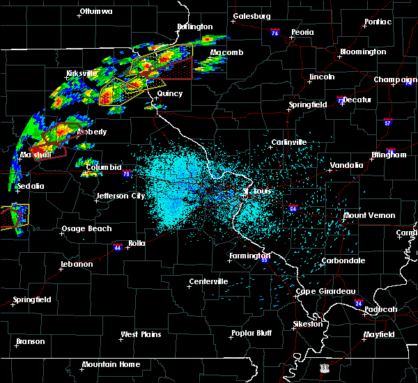 At 758 pm cdt, a severe thunderstorm was located over plevna, moving northeast at 45 mph (radar indicated). Hazards include 60 mph wind gusts and half dollar size hail. Hail damage to vehicles is expected. expect wind damage to roofs, siding, and trees. Locations impacted include, la belle, lewistown, ewing, knox city, plevna, steffenville, bethel and newark. At 758 pm cdt, a severe thunderstorm was located over plevna, moving northeast at 45 mph (radar indicated). Hazards include 60 mph wind gusts and half dollar size hail. Hail damage to vehicles is expected. expect wind damage to roofs, siding, and trees. Locations impacted include, la belle, lewistown, ewing, knox city, plevna, steffenville, bethel and newark.
|
| 5/22/2019 7:45 PM CDT |
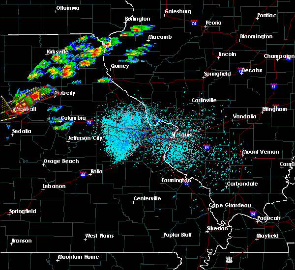 At 745 pm cdt, a severe thunderstorm was located 8 miles north of clarence, moving northeast at 45 mph (radar indicated). Hazards include 60 mph wind gusts and quarter size hail. Hail damage to vehicles is expected. Expect wind damage to roofs, siding, and trees. At 745 pm cdt, a severe thunderstorm was located 8 miles north of clarence, moving northeast at 45 mph (radar indicated). Hazards include 60 mph wind gusts and quarter size hail. Hail damage to vehicles is expected. Expect wind damage to roofs, siding, and trees.
|
| 7/19/2018 7:41 PM CDT |
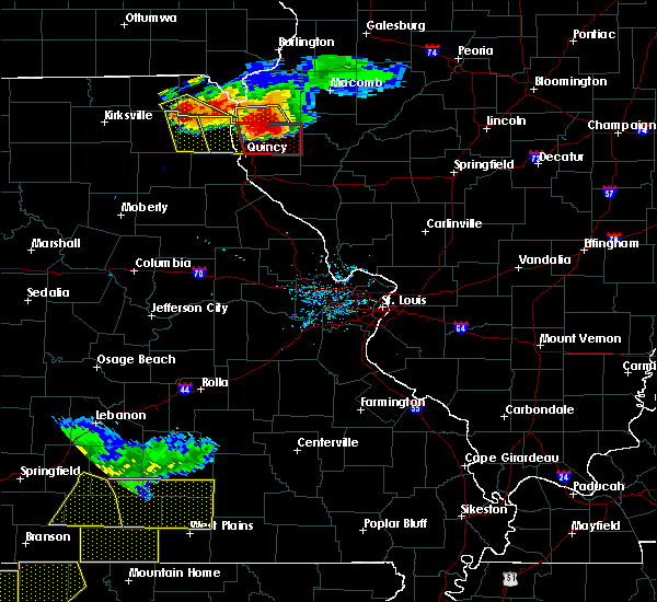 At 740 pm cdt, a severe thunderstorm was located near la belle, moving southeast at 40 mph (radar indicated). Hazards include 60 mph wind gusts and quarter size hail. Hail damage to vehicles is expected. expect wind damage to roofs, siding, and trees. Locations impacted include, la belle, lewistown, ewing, knox city, colony, steffenville and newark. At 740 pm cdt, a severe thunderstorm was located near la belle, moving southeast at 40 mph (radar indicated). Hazards include 60 mph wind gusts and quarter size hail. Hail damage to vehicles is expected. expect wind damage to roofs, siding, and trees. Locations impacted include, la belle, lewistown, ewing, knox city, colony, steffenville and newark.
|
| 7/19/2018 7:12 PM CDT |
 At 712 pm cdt, a severe thunderstorm was located over rutledge, moving southeast at 40 mph (radar indicated). Hazards include 60 mph wind gusts and quarter size hail. Hail damage to vehicles is expected. Expect wind damage to roofs, siding, and trees. At 712 pm cdt, a severe thunderstorm was located over rutledge, moving southeast at 40 mph (radar indicated). Hazards include 60 mph wind gusts and quarter size hail. Hail damage to vehicles is expected. Expect wind damage to roofs, siding, and trees.
|
| 6/28/2018 3:26 PM CDT |
 The severe thunderstorm warning for knox, northern marion, shelby and lewis counties will expire at 330 pm cdt, the storms which prompted the warning have moved out of the area. therefore, the warning will be allowed to expire. a severe thunderstorm watch remains in effect until 700 pm cdt for northeastern missouri. remember, a severe thunderstorm warning still remains in effect for portions of shelby and marion counties until 430 pm cdt. The severe thunderstorm warning for knox, northern marion, shelby and lewis counties will expire at 330 pm cdt, the storms which prompted the warning have moved out of the area. therefore, the warning will be allowed to expire. a severe thunderstorm watch remains in effect until 700 pm cdt for northeastern missouri. remember, a severe thunderstorm warning still remains in effect for portions of shelby and marion counties until 430 pm cdt.
|
| 6/28/2018 2:57 PM CDT |
 The severe thunderstorm warning for knox. northern shelby and lewis counties will expire at 300 pm cdt. the storms which prompted the warning have moved out of the area. therefore, the warning will be allowed to expire. A severe thunderstorm watch remains in effect until 700 pm cdt for northeastern missouri. The severe thunderstorm warning for knox. northern shelby and lewis counties will expire at 300 pm cdt. the storms which prompted the warning have moved out of the area. therefore, the warning will be allowed to expire. A severe thunderstorm watch remains in effect until 700 pm cdt for northeastern missouri.
|
| 6/28/2018 2:50 PM CDT |
 At 249 pm cdt, severe thunderstorms were located along a line extending from 6 miles northeast of lewistown to 6 miles west of plevna, moving southeast at 15 mph (radar indicated). Hazards include 60 mph wind gusts and quarter size hail. Hail damage to vehicles is expected. Expect wind damage to roofs, siding, and trees. At 249 pm cdt, severe thunderstorms were located along a line extending from 6 miles northeast of lewistown to 6 miles west of plevna, moving southeast at 15 mph (radar indicated). Hazards include 60 mph wind gusts and quarter size hail. Hail damage to vehicles is expected. Expect wind damage to roofs, siding, and trees.
|
| 6/28/2018 2:00 PM CDT |
 At 200 pm cdt, severe thunderstorms were located along a line extending from near cantril to near greentop, moving southeast at 70 mph (radar indicated). Hazards include 60 mph wind gusts and quarter size hail. Hail damage to vehicles is expected. Expect wind damage to roofs, siding, and trees. At 200 pm cdt, severe thunderstorms were located along a line extending from near cantril to near greentop, moving southeast at 70 mph (radar indicated). Hazards include 60 mph wind gusts and quarter size hail. Hail damage to vehicles is expected. Expect wind damage to roofs, siding, and trees.
|
| 5/27/2018 6:02 PM CDT |
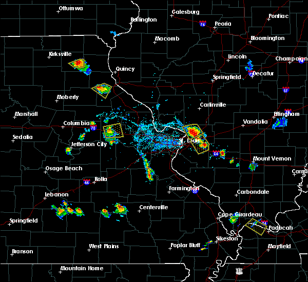 At 602 pm cdt, a severe thunderstorm was located over knox city, moving southwest at 10 mph (radar indicated). Hazards include 60 mph wind gusts and quarter size hail. Hail damage to vehicles is expected. expect wind damage to roofs, siding, and trees. Locations impacted include, knox city. At 602 pm cdt, a severe thunderstorm was located over knox city, moving southwest at 10 mph (radar indicated). Hazards include 60 mph wind gusts and quarter size hail. Hail damage to vehicles is expected. expect wind damage to roofs, siding, and trees. Locations impacted include, knox city.
|
| 5/27/2018 5:46 PM CDT |
 At 546 pm cdt, a severe thunderstorm was located over la belle, moving southwest at 5 mph (radar indicated). Hazards include 60 mph wind gusts and quarter size hail. Hail damage to vehicles is expected. Expect wind damage to roofs, siding, and trees. At 546 pm cdt, a severe thunderstorm was located over la belle, moving southwest at 5 mph (radar indicated). Hazards include 60 mph wind gusts and quarter size hail. Hail damage to vehicles is expected. Expect wind damage to roofs, siding, and trees.
|
| 12/4/2017 4:16 PM CST |
 At 416 pm cst, a severe thunderstorm was located over brashear, moving northeast at 50 mph (trained weather spotters reported 60 mph wind gusts 4 miles west of south gifford in macon county). Hazards include 60 mph wind gusts and quarter size hail. Hail damage to vehicles is expected. expect wind damage to roofs, siding, and trees. Locations impacted include, edina, knox city, greensburg, colony, hurdland and baring. At 416 pm cst, a severe thunderstorm was located over brashear, moving northeast at 50 mph (trained weather spotters reported 60 mph wind gusts 4 miles west of south gifford in macon county). Hazards include 60 mph wind gusts and quarter size hail. Hail damage to vehicles is expected. expect wind damage to roofs, siding, and trees. Locations impacted include, edina, knox city, greensburg, colony, hurdland and baring.
|
| 12/4/2017 4:07 PM CST |
 At 407 pm cst, a severe thunderstorm was located near kirksville, moving northeast at 50 mph (radar indicated). Hazards include 60 mph wind gusts and quarter size hail. Hail damage to vehicles is expected. Expect wind damage to roofs, siding, and trees. At 407 pm cst, a severe thunderstorm was located near kirksville, moving northeast at 50 mph (radar indicated). Hazards include 60 mph wind gusts and quarter size hail. Hail damage to vehicles is expected. Expect wind damage to roofs, siding, and trees.
|
| 10/14/2017 5:14 PM CDT |
 At 513 pm cdt, a severe thunderstorm was located near edina, moving northeast at 60 mph (radar indicated). Hazards include 60 mph wind gusts and penny size hail. Expect damage to roofs, siding, and trees. locations impacted include, edina, knox city, greensburg, colony, hurdland, novelty and baring. A tornado watch remains in effect until 100 am cdt for northeastern missouri. At 513 pm cdt, a severe thunderstorm was located near edina, moving northeast at 60 mph (radar indicated). Hazards include 60 mph wind gusts and penny size hail. Expect damage to roofs, siding, and trees. locations impacted include, edina, knox city, greensburg, colony, hurdland, novelty and baring. A tornado watch remains in effect until 100 am cdt for northeastern missouri.
|
| 10/14/2017 4:58 PM CDT |
 At 457 pm cdt, a severe thunderstorm was located near rutledge, moving east at 65 mph (radar indicated). Hazards include 60 mph wind gusts and penny size hail. Expect damage to roofs, siding, and trees. Locations impacted include, edina, knox city, greensburg, colony, hurdland, novelty and baring. At 457 pm cdt, a severe thunderstorm was located near rutledge, moving east at 65 mph (radar indicated). Hazards include 60 mph wind gusts and penny size hail. Expect damage to roofs, siding, and trees. Locations impacted include, edina, knox city, greensburg, colony, hurdland, novelty and baring.
|
| 10/14/2017 4:45 PM CDT |
 At 444 pm cdt, a severe thunderstorm was located near brashear, moving east at 60 mph (radar indicated). Hazards include 60 mph wind gusts and penny size hail. expect damage to roofs, siding, and trees At 444 pm cdt, a severe thunderstorm was located near brashear, moving east at 60 mph (radar indicated). Hazards include 60 mph wind gusts and penny size hail. expect damage to roofs, siding, and trees
|
| 7/16/2017 5:38 PM CDT |
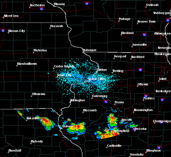 At 538 pm cdt, a severe thunderstorm was located near knox city, moving south at 20 mph (radar indicated). Hazards include 60 mph wind gusts. Expect damage to roofs, siding, and trees. Locations impacted include, la belle, lewistown, knox city and colony. At 538 pm cdt, a severe thunderstorm was located near knox city, moving south at 20 mph (radar indicated). Hazards include 60 mph wind gusts. Expect damage to roofs, siding, and trees. Locations impacted include, la belle, lewistown, knox city and colony.
|
| 7/16/2017 5:12 PM CDT |
 At 512 pm cdt, a severe thunderstorm was located 7 miles east of colony, moving south at 15 mph (radar indicated). Hazards include 60 mph wind gusts and quarter size hail. Hail damage to vehicles is expected. Expect wind damage to roofs, siding, and trees. At 512 pm cdt, a severe thunderstorm was located 7 miles east of colony, moving south at 15 mph (radar indicated). Hazards include 60 mph wind gusts and quarter size hail. Hail damage to vehicles is expected. Expect wind damage to roofs, siding, and trees.
|
| 6/28/2017 5:05 PM CDT |
 At 1004 pm cdt, severe thunderstorms were located along a line extending from near brashear to 8 miles southeast of la plata to near atlanta, moving east at 40 mph (radar indicated. the wind gusted to 51 mph at 955 pm at kirksville, which is on the northern end of the line of severe thunderstorms). Hazards include ping pong ball size hail and 60 mph wind gusts. People and animals outdoors will be injured. expect hail damage to roofs, siding, windows, and vehicles. expect wind damage to roofs, siding, and trees. Locations impacted include, edina, shelbyville, knox city, plevna, hurdland, novelty, bethel, newark and leonard. At 1004 pm cdt, severe thunderstorms were located along a line extending from near brashear to 8 miles southeast of la plata to near atlanta, moving east at 40 mph (radar indicated. the wind gusted to 51 mph at 955 pm at kirksville, which is on the northern end of the line of severe thunderstorms). Hazards include ping pong ball size hail and 60 mph wind gusts. People and animals outdoors will be injured. expect hail damage to roofs, siding, windows, and vehicles. expect wind damage to roofs, siding, and trees. Locations impacted include, edina, shelbyville, knox city, plevna, hurdland, novelty, bethel, newark and leonard.
|
| 6/28/2017 4:41 PM CDT |
 At 941 pm cdt, severe thunderstorms were located along a line extending from kirksville to 6 miles west of la plata to 11 miles northeast of bucklin, moving east at 40 mph (radar indicated). Hazards include ping pong ball size hail and 60 mph wind gusts. People and animals outdoors will be injured. expect hail damage to roofs, siding, windows, and vehicles. Expect wind damage to roofs, siding, and trees. At 941 pm cdt, severe thunderstorms were located along a line extending from kirksville to 6 miles west of la plata to 11 miles northeast of bucklin, moving east at 40 mph (radar indicated). Hazards include ping pong ball size hail and 60 mph wind gusts. People and animals outdoors will be injured. expect hail damage to roofs, siding, windows, and vehicles. Expect wind damage to roofs, siding, and trees.
|
| 6/16/2017 1:06 AM CDT |
 At 105 am cdt, severe thunderstorms were located along a line extending from near colony to near steffenville to near clarence, moving northeast at 45 mph (radar indicated). Hazards include 60 mph wind gusts and penny size hail. expect damage to roofs, siding, and trees At 105 am cdt, severe thunderstorms were located along a line extending from near colony to near steffenville to near clarence, moving northeast at 45 mph (radar indicated). Hazards include 60 mph wind gusts and penny size hail. expect damage to roofs, siding, and trees
|
| 3/6/2017 9:33 PM CST |
 At 932 pm cst, severe thunderstorms were located along a line extending from near memphis to 9 miles northwest of huntsville, moving east at 55 mph (radar indicated). Hazards include 60 mph wind gusts and quarter size hail. Hail damage to vehicles is expected. Expect wind damage to roofs, siding, and trees. At 932 pm cst, severe thunderstorms were located along a line extending from near memphis to 9 miles northwest of huntsville, moving east at 55 mph (radar indicated). Hazards include 60 mph wind gusts and quarter size hail. Hail damage to vehicles is expected. Expect wind damage to roofs, siding, and trees.
|
| 7/7/2016 7:11 AM CDT |
 At 710 am cdt, severe thunderstorms were located along a line extending from near rutledge to near shelbyville, moving east at 45 mph (radar indicated. a 61 mile per hour wind gust was reported 1 mile east of novelty at 7:02 am). Hazards include 60 mph wind gusts. Expect damage to roofs. siding. And trees. At 710 am cdt, severe thunderstorms were located along a line extending from near rutledge to near shelbyville, moving east at 45 mph (radar indicated. a 61 mile per hour wind gust was reported 1 mile east of novelty at 7:02 am). Hazards include 60 mph wind gusts. Expect damage to roofs. siding. And trees.
|
| 4/27/2016 8:27 PM CDT | The severe thunderstorm warning for northern shelby and knox counties will expire at 830 pm cdt, the storms which prompted the warning have weakened below severe limits, and no longer pose an immediate threat to life or property. therefore the warning will be allowed to expire. however small hail and gusty winds up to 50 mph are still possible with these thunderstorms. a tornado watch remains in effect until 900 pm cdt for northeastern missouri. |
| 4/27/2016 7:46 PM CDT |
 At 745 pm cdt, severe thunderstorms were located along a line extending from near greentop to near atlanta, moving east at 30 mph (radar indicated). Hazards include 60 mph wind gusts and quarter size hail. Hail damage to vehicles is expected. Expect wind damage to roofs, siding, and trees. At 745 pm cdt, severe thunderstorms were located along a line extending from near greentop to near atlanta, moving east at 30 mph (radar indicated). Hazards include 60 mph wind gusts and quarter size hail. Hail damage to vehicles is expected. Expect wind damage to roofs, siding, and trees.
|
| 3/15/2016 5:01 PM CDT |
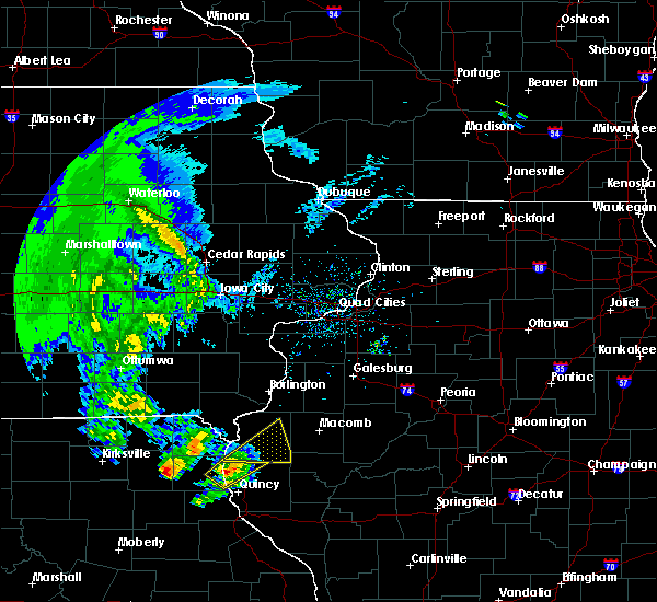 At 501 pm cdt, a severe thunderstorm was located over knox city, moving northeast at 35 mph (radar indicated). Hazards include 60 mph wind gusts and quarter size hail. Hail damage to vehicles is expected. Expect wind damage to roofs, siding and trees. At 501 pm cdt, a severe thunderstorm was located over knox city, moving northeast at 35 mph (radar indicated). Hazards include 60 mph wind gusts and quarter size hail. Hail damage to vehicles is expected. Expect wind damage to roofs, siding and trees.
|
| 11/11/2015 4:41 PM CST |
 At 440 pm cst, severe thunderstorms were located along a line extending from granger to near shelbyville, moving northeast at 60 mph (trained weather spotters). Hazards include 70 mph wind gusts. Expect considerable tree damage. damage is likely to mobile homes, roofs and outbuildings. locations impacted include, shelbina, la belle, shelbyville, lewistown, ewing, knox city, philadelphia, emden, colony, steffenville, bethel, monticello and newark. A tornado watch remains in effect until 900 pm cst for northeastern missouri. At 440 pm cst, severe thunderstorms were located along a line extending from granger to near shelbyville, moving northeast at 60 mph (trained weather spotters). Hazards include 70 mph wind gusts. Expect considerable tree damage. damage is likely to mobile homes, roofs and outbuildings. locations impacted include, shelbina, la belle, shelbyville, lewistown, ewing, knox city, philadelphia, emden, colony, steffenville, bethel, monticello and newark. A tornado watch remains in effect until 900 pm cst for northeastern missouri.
|
| 11/11/2015 4:29 PM CST |
 At 428 pm cst, severe thunderstorms were located along a line extending from near memphis to maud, moving northeast at 50 mph (trained weather spotters and local law enforcement report power outages and wind damage from this line of severe thunderstorms). Hazards include 70 mph wind gusts. Expect considerable tree damage. damage is likely to mobile homes, roofs and outbuildings. locations impacted include, shelbina, edina, warren, clarence, la belle, shelbyville, lewistown, ewing, knox city, maud, emden, philadelphia, plevna, greensburg, colony, steffenville, woodlawn, hunnewell, novelty and baring. A tornado watch remains in effect until 900 pm cst for northeastern missouri. At 428 pm cst, severe thunderstorms were located along a line extending from near memphis to maud, moving northeast at 50 mph (trained weather spotters and local law enforcement report power outages and wind damage from this line of severe thunderstorms). Hazards include 70 mph wind gusts. Expect considerable tree damage. damage is likely to mobile homes, roofs and outbuildings. locations impacted include, shelbina, edina, warren, clarence, la belle, shelbyville, lewistown, ewing, knox city, maud, emden, philadelphia, plevna, greensburg, colony, steffenville, woodlawn, hunnewell, novelty and baring. A tornado watch remains in effect until 900 pm cst for northeastern missouri.
|
| 11/11/2015 3:59 PM CST |
 At 358 pm cst, severe thunderstorms were located along a line extending from kirksville to 6 miles southwest of huntsville, moving northeast at 65 mph (radar indicated). Hazards include 70 mph wind gusts. Expect considerable tree damage. Damage is likely to mobile homes, roofs and outbuildings. At 358 pm cst, severe thunderstorms were located along a line extending from kirksville to 6 miles southwest of huntsville, moving northeast at 65 mph (radar indicated). Hazards include 70 mph wind gusts. Expect considerable tree damage. Damage is likely to mobile homes, roofs and outbuildings.
|
| 7/16/2015 6:06 PM CDT |
 At 606 pm cdt, a severe thunderstorm was located near edina, moving east at 30 mph (radar indicated). Hazards include 60 mph wind gusts and quarter size hail. Hail damage to vehicles is expected. expect wind damage to roofs, siding and trees. Locations impacted include, edina, la belle, lewistown, knox city, plevna, steffenville, hurdland, novelty and newark. At 606 pm cdt, a severe thunderstorm was located near edina, moving east at 30 mph (radar indicated). Hazards include 60 mph wind gusts and quarter size hail. Hail damage to vehicles is expected. expect wind damage to roofs, siding and trees. Locations impacted include, edina, la belle, lewistown, knox city, plevna, steffenville, hurdland, novelty and newark.
|
| 7/16/2015 5:49 PM CDT |
 At 549 pm cdt, a severe thunderstorm was located near edina, moving east at 25 mph (radar indicated). Hazards include 60 mph wind gusts and quarter size hail. Hail damage to vehicles is expected. Expect wind damage to roofs, siding and trees. At 549 pm cdt, a severe thunderstorm was located near edina, moving east at 25 mph (radar indicated). Hazards include 60 mph wind gusts and quarter size hail. Hail damage to vehicles is expected. Expect wind damage to roofs, siding and trees.
|
| 7/13/2015 5:52 PM CDT |
 At 551 pm cdt, a severe thunderstorm was located near lewistown, moving east at 60 mph (trained weather spotters). Hazards include 70 mph wind gusts and quarter size hail. Hail damage to vehicles is expected. expect considerable tree damage. wind damage is also likely to mobile homes, roofs and outbuildings. Locations impacted include, knox city and colony. At 551 pm cdt, a severe thunderstorm was located near lewistown, moving east at 60 mph (trained weather spotters). Hazards include 70 mph wind gusts and quarter size hail. Hail damage to vehicles is expected. expect considerable tree damage. wind damage is also likely to mobile homes, roofs and outbuildings. Locations impacted include, knox city and colony.
|
| 7/13/2015 5:39 PM CDT |
 At 516 pm cdt, a severe thunderstorm was located near brashear, moving east at 55 mph (trained weather spotters). Hazards include 60 mph wind gusts and quarter size hail. Hail damage to vehicles is expected. Expect wind damage to roofs, siding and trees. At 516 pm cdt, a severe thunderstorm was located near brashear, moving east at 55 mph (trained weather spotters). Hazards include 60 mph wind gusts and quarter size hail. Hail damage to vehicles is expected. Expect wind damage to roofs, siding and trees.
|
| 7/13/2015 5:16 PM CDT |
 At 516 pm cdt, a severe thunderstorm was located near brashear, moving east at 55 mph (trained weather spotters). Hazards include 60 mph wind gusts and quarter size hail. Hail damage to vehicles is expected. Expect wind damage to roofs, siding and trees. At 516 pm cdt, a severe thunderstorm was located near brashear, moving east at 55 mph (trained weather spotters). Hazards include 60 mph wind gusts and quarter size hail. Hail damage to vehicles is expected. Expect wind damage to roofs, siding and trees.
|
| 6/25/2015 12:29 AM CDT |
 At 1227 am cdt, severe thunderstorms were located along a line extending from 7 miles northeast of lewistown to steffenville to 7 miles east of la plata, and moving southeast at 30 mph (radar indicated). Hazards include 60 mph wind gusts. Expect damage to roofs. siding and trees. Locations impacted include, plevna, ewing, leonard and bethel. At 1227 am cdt, severe thunderstorms were located along a line extending from 7 miles northeast of lewistown to steffenville to 7 miles east of la plata, and moving southeast at 30 mph (radar indicated). Hazards include 60 mph wind gusts. Expect damage to roofs. siding and trees. Locations impacted include, plevna, ewing, leonard and bethel.
|
| 6/25/2015 12:07 AM CDT |
 At 1204 am cdt, severe thunderstorms were located along a line extending from 7 miles northeast of la belle to 7 miles southwest of knox city to 6 miles southeast of brashear, and moving southeast at 30 mph (radar indicated). Hazards include 60 mph wind gusts and penny size hail. Expect damage to roofs. Siding and trees. At 1204 am cdt, severe thunderstorms were located along a line extending from 7 miles northeast of la belle to 7 miles southwest of knox city to 6 miles southeast of brashear, and moving southeast at 30 mph (radar indicated). Hazards include 60 mph wind gusts and penny size hail. Expect damage to roofs. Siding and trees.
|
| 6/25/2015 12:01 AM CDT |
 At 1157 pm cdt, severe thunderstorms were located along a line extending from 6 miles south of wyaconda to edina to brashear, and moving southeast at 30 mph (radar indicated). Hazards include 60 mph wind gusts and penny size hail. Expect damage to roofs. siding and trees. Locations impacted include, knox city, la belle and newark. At 1157 pm cdt, severe thunderstorms were located along a line extending from 6 miles south of wyaconda to edina to brashear, and moving southeast at 30 mph (radar indicated). Hazards include 60 mph wind gusts and penny size hail. Expect damage to roofs. siding and trees. Locations impacted include, knox city, la belle and newark.
|
| 6/24/2015 11:36 PM CDT |
 At 1135 pm cdt, severe thunderstorms were located along a line extending from south gorin to brashear, and moving southeast at 35 mph (radar indicated). Hazards include 70 mph wind gusts and quarter size hail. Hail damage to vehicles is expected. expect considerable tree damage. wind damage is also likely to mobile homes, roofs and outbuildings. Locations impacted include, edina, colony, knox city, la belle and newark. At 1135 pm cdt, severe thunderstorms were located along a line extending from south gorin to brashear, and moving southeast at 35 mph (radar indicated). Hazards include 70 mph wind gusts and quarter size hail. Hail damage to vehicles is expected. expect considerable tree damage. wind damage is also likely to mobile homes, roofs and outbuildings. Locations impacted include, edina, colony, knox city, la belle and newark.
|
| 6/24/2015 11:11 PM CDT |
 At 1109 pm cdt, a severe thunderstorm was located 11 miles northeast of greentop, and moving southeast at 35 mph (radar indicated). Hazards include 70 mph wind gusts and ping pong ball size hail. People and animals outdoors will be injured. expect hail damage to roofs, siding, windows and vehicles. expect considerable tree damage. Wind damage is also likely to mobile homes, roofs and outbuildings. At 1109 pm cdt, a severe thunderstorm was located 11 miles northeast of greentop, and moving southeast at 35 mph (radar indicated). Hazards include 70 mph wind gusts and ping pong ball size hail. People and animals outdoors will be injured. expect hail damage to roofs, siding, windows and vehicles. expect considerable tree damage. Wind damage is also likely to mobile homes, roofs and outbuildings.
|
| 6/20/2015 9:50 PM CDT |
 The severe thunderstorm warning for northern shelby, northern marion, southern lewis, southern knox, brown and central adams counties will expire at 1000 pm cdt, the line of storms which prompted the warning has weakened below severe limits, and no longer poses an immediate threat to life or property. however, gusty winds and heavy rain are still possible with these thunderstorms. in addition, strong thunderstorms may redevelop, and a tornado watch remains in effect until 11 pm. The severe thunderstorm warning for northern shelby, northern marion, southern lewis, southern knox, brown and central adams counties will expire at 1000 pm cdt, the line of storms which prompted the warning has weakened below severe limits, and no longer poses an immediate threat to life or property. however, gusty winds and heavy rain are still possible with these thunderstorms. in addition, strong thunderstorms may redevelop, and a tornado watch remains in effect until 11 pm.
|
| 6/20/2015 9:24 PM CDT |
 The severe thunderstorm warning for northern lewis, northern knox and northern adams counties will expire at 930 pm cdt, the line of storms which prompted the warning has weakened below severe limits, and no longer poses an immediate threat to life or property. however, gusty winds and heavy rain are still possible with these thunderstorms. in addition, strong thunderstorms may redevelop, and a tornado watch remains in effect until 11 pm. The severe thunderstorm warning for northern lewis, northern knox and northern adams counties will expire at 930 pm cdt, the line of storms which prompted the warning has weakened below severe limits, and no longer poses an immediate threat to life or property. however, gusty winds and heavy rain are still possible with these thunderstorms. in addition, strong thunderstorms may redevelop, and a tornado watch remains in effect until 11 pm.
|
| 6/20/2015 8:55 PM CDT |
 At 853 pm cdt, severe thunderstorms were located along a line extending from vermont to 5 miles southwest of west point to green city, and moving southeast at 25 mph (radar indicated). Hazards include 60 mph wind gusts. Expect damage to roofs. Siding and trees. At 853 pm cdt, severe thunderstorms were located along a line extending from vermont to 5 miles southwest of west point to green city, and moving southeast at 25 mph (radar indicated). Hazards include 60 mph wind gusts. Expect damage to roofs. Siding and trees.
|
| 6/20/2015 8:23 PM CDT |
 At 821 pm cdt, severe thunderstorms were located along a line extending from 13 miles north of industry to alexandria to 9 miles northeast of greentop, and moving southeast at 40 mph (law enforcement in scotland county missouri reported widespread tree damage). Hazards include 60 mph wind gusts. Expect damage to roofs. Siding and trees. At 821 pm cdt, severe thunderstorms were located along a line extending from 13 miles north of industry to alexandria to 9 miles northeast of greentop, and moving southeast at 40 mph (law enforcement in scotland county missouri reported widespread tree damage). Hazards include 60 mph wind gusts. Expect damage to roofs. Siding and trees.
|
| 6/11/2015 9:14 PM CDT |
 At 844 pm cdt, severe thunderstorms were located along a line extending from greentop to 9 miles southwest of kirksville, and moving east at 30 mph (radar indicated). Hazards include 60 mph wind gusts and penny size hail. Expect damage to roofs. Siding and trees. At 844 pm cdt, severe thunderstorms were located along a line extending from greentop to 9 miles southwest of kirksville, and moving east at 30 mph (radar indicated). Hazards include 60 mph wind gusts and penny size hail. Expect damage to roofs. Siding and trees.
|
| 6/11/2015 8:46 PM CDT |
 At 844 pm cdt, severe thunderstorms were located along a line extending from greentop to 9 miles southwest of kirksville, and moving east at 30 mph (radar indicated). Hazards include 60 mph wind gusts and penny size hail. Expect damage to roofs. Siding and trees. At 844 pm cdt, severe thunderstorms were located along a line extending from greentop to 9 miles southwest of kirksville, and moving east at 30 mph (radar indicated). Hazards include 60 mph wind gusts and penny size hail. Expect damage to roofs. Siding and trees.
|
| 6/7/2015 7:16 PM CDT | At 713 pm cdt, an area of intense thunderstorms stretched from near la belle to near novelty, with these storms moving east at 30 mph (radar indicated). Hazards include 60 mph wind gusts and quarter size hail. Hail damage to vehicles is expected. expect wind damage to roofs, siding and trees. Locations impacted include, knox city, la belle, lewistown and newark. |
| 6/7/2015 7:01 PM CDT | At 700 pm cdt, a severe thunderstorm was located near edina, and moving east at 30 mph (radar indicated). Hazards include 60 mph wind gusts and quarter size hail. Hail damage to vehicles is expected. Expect wind damage to roofs, siding and trees. |
Hail Maps for Knox City, MO
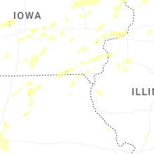
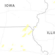


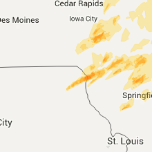


Connect with Interactive Hail Maps