

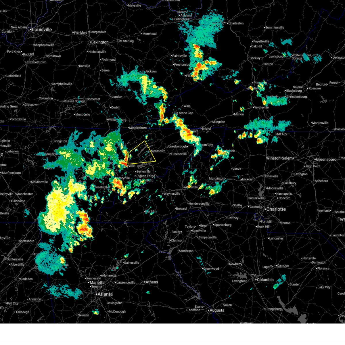
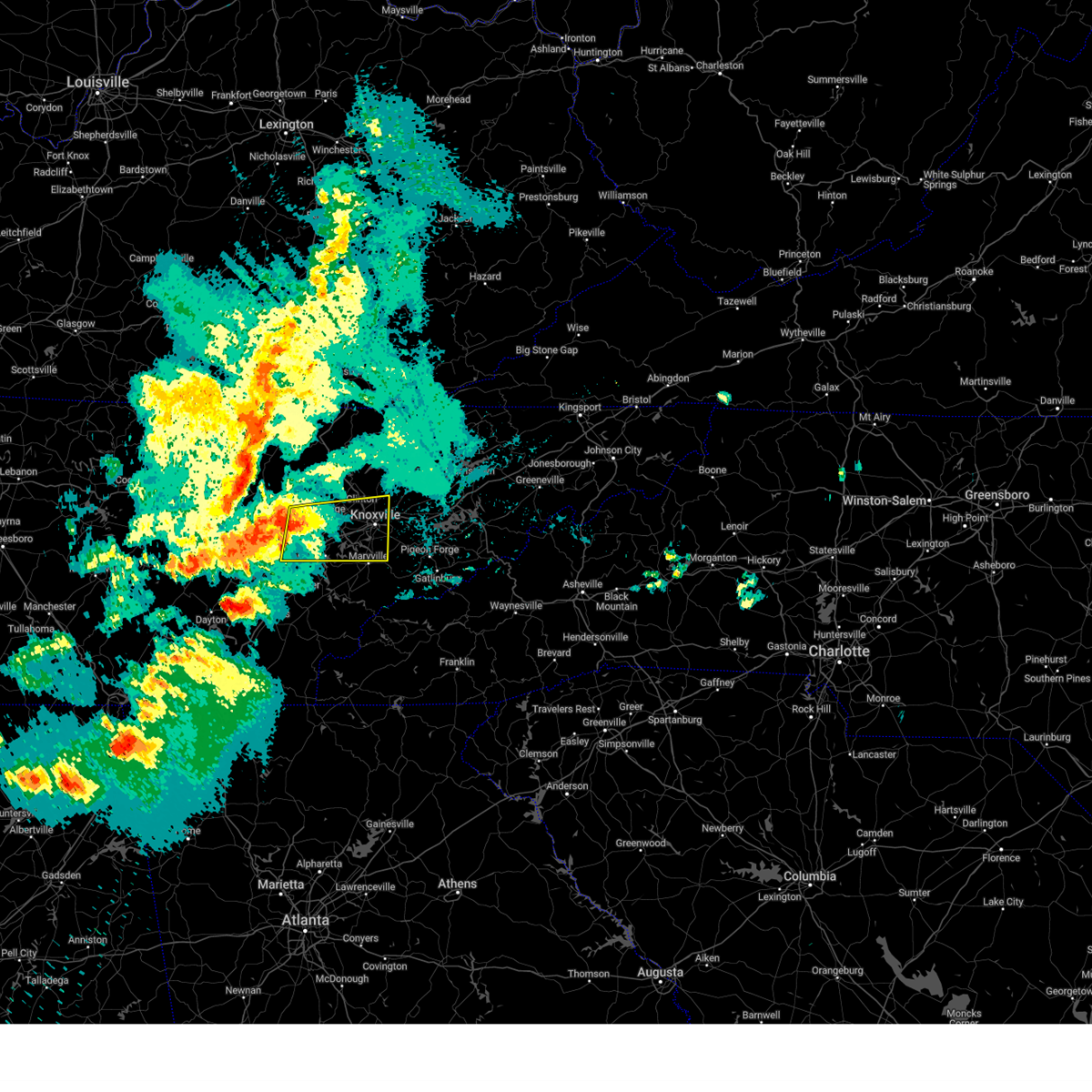
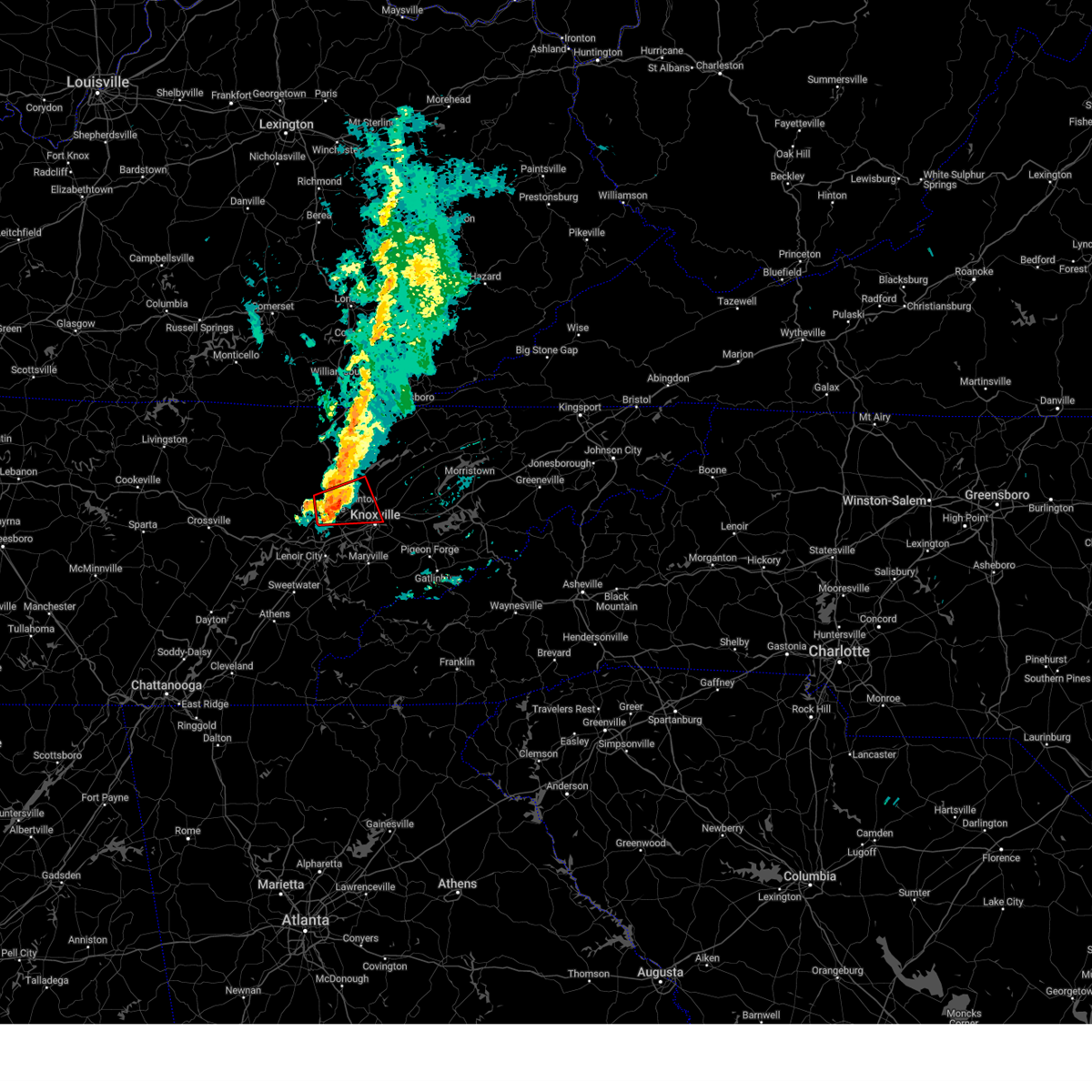
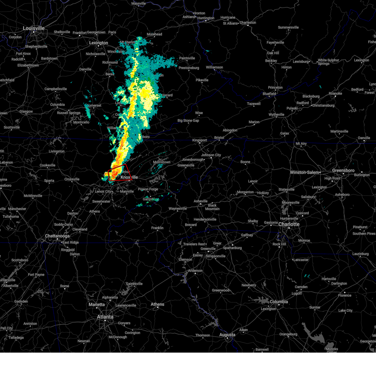
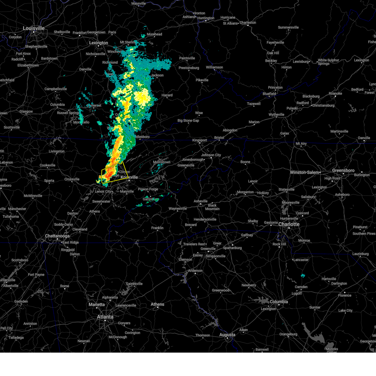
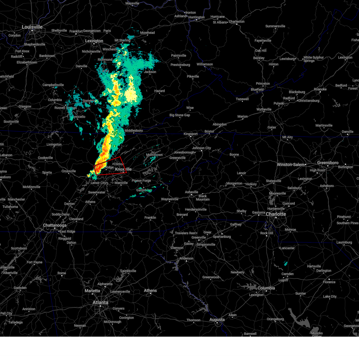
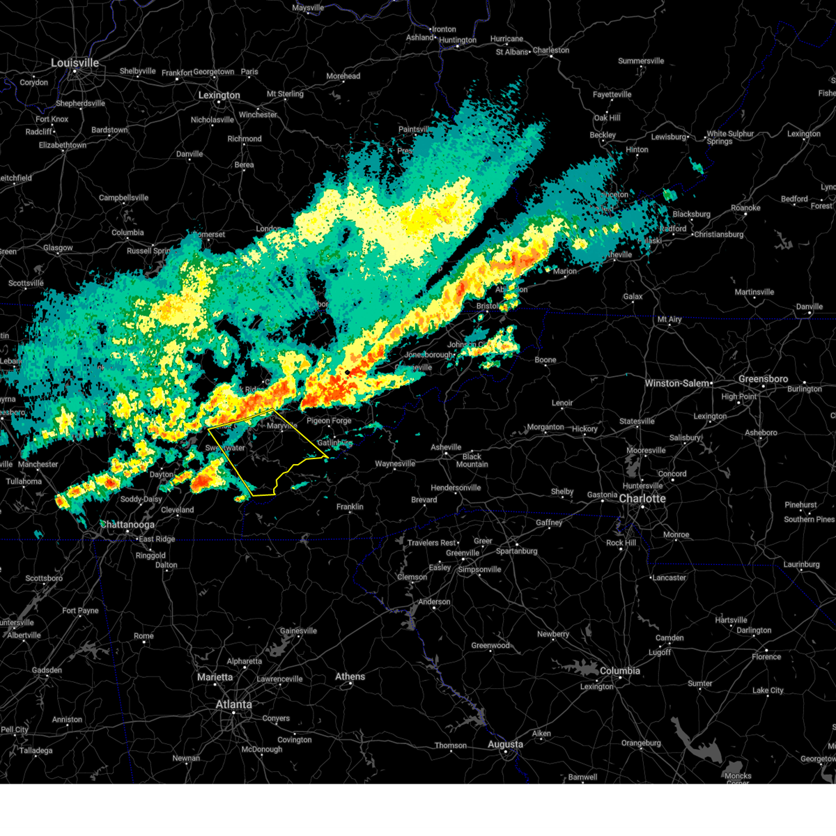
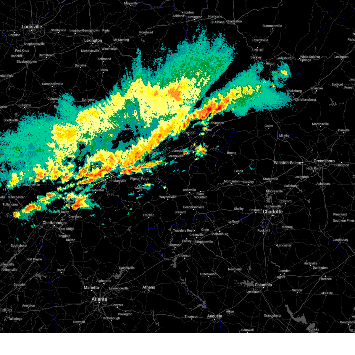
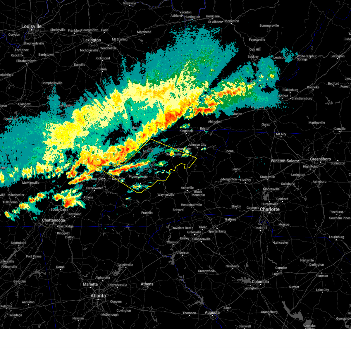
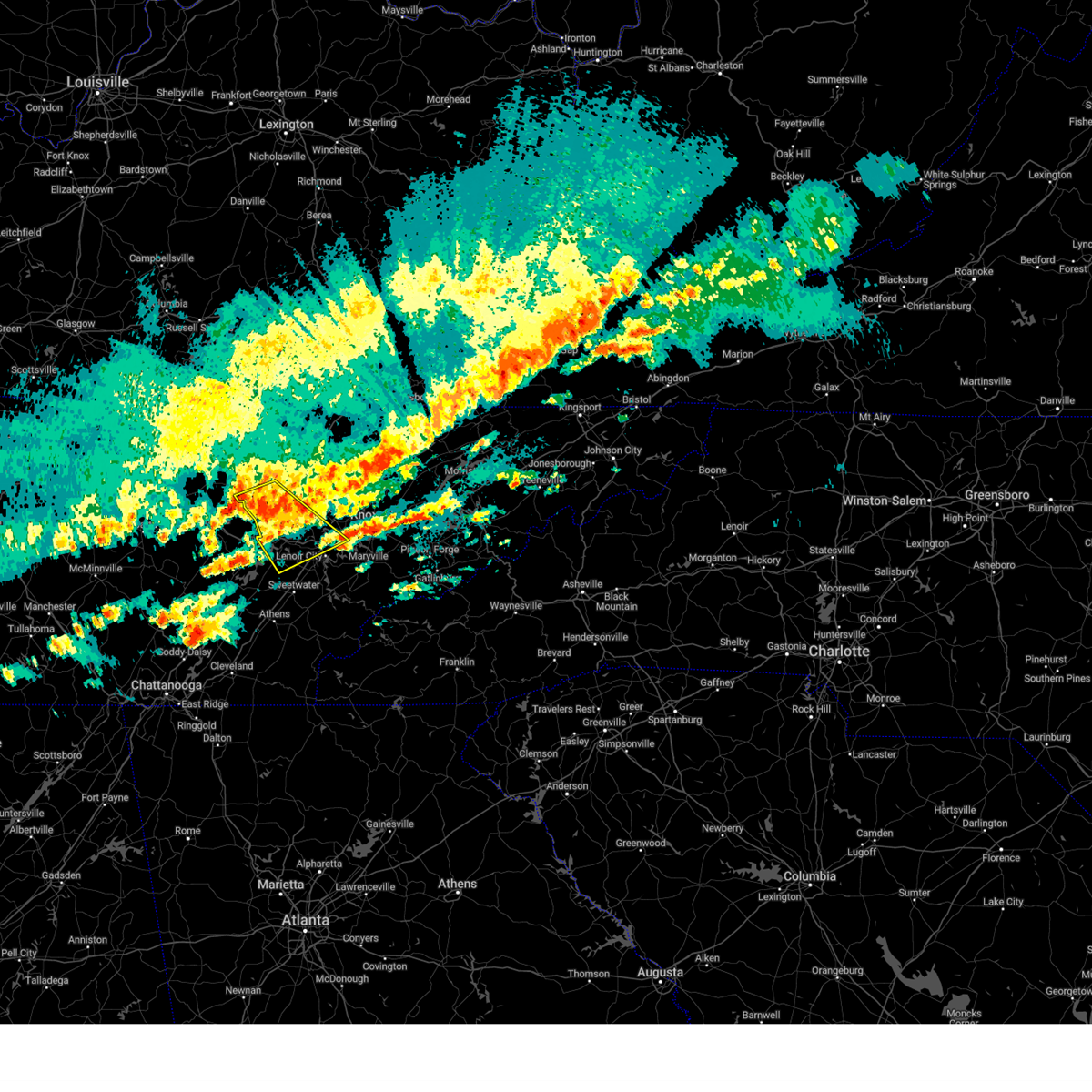
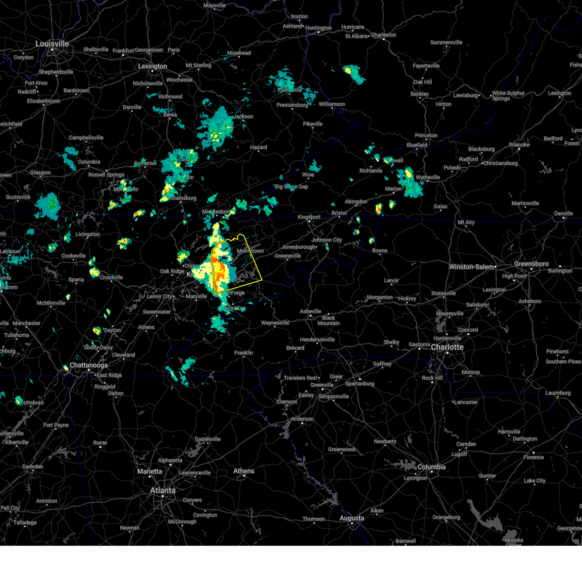
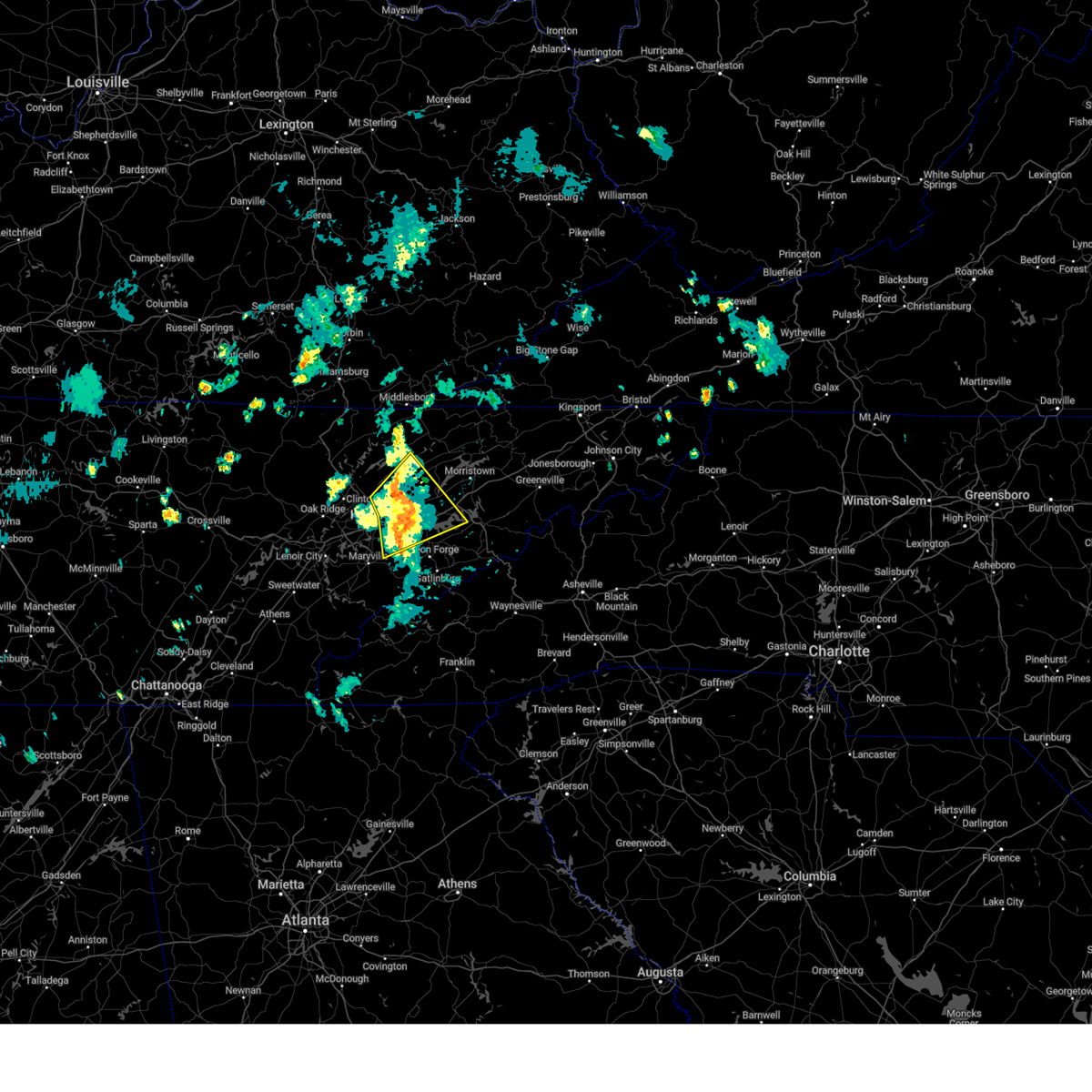
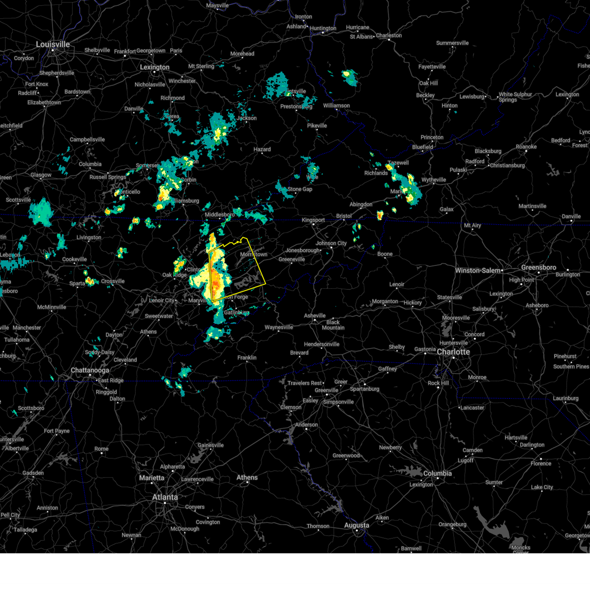
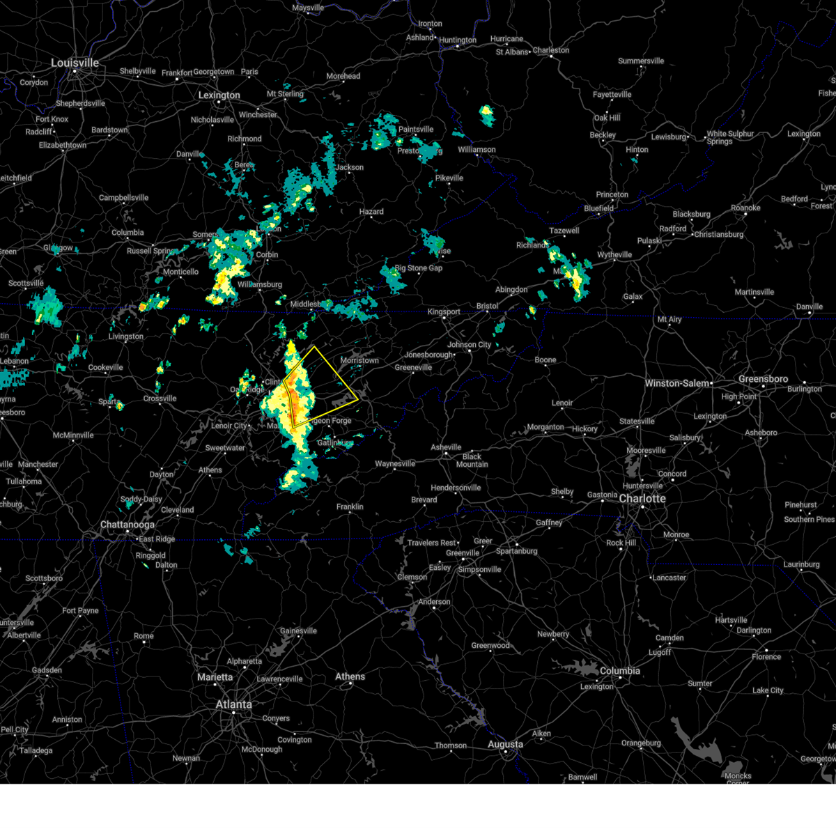
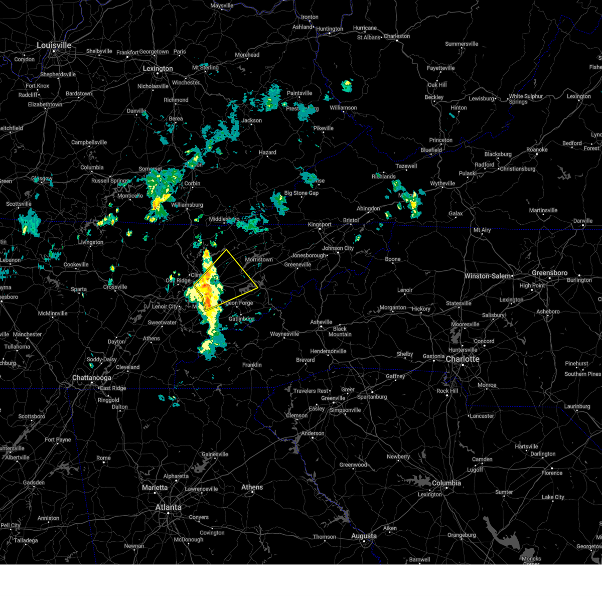
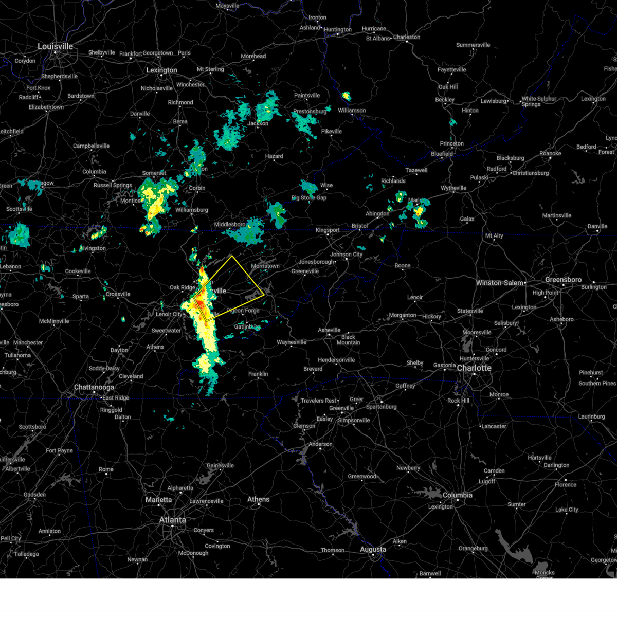
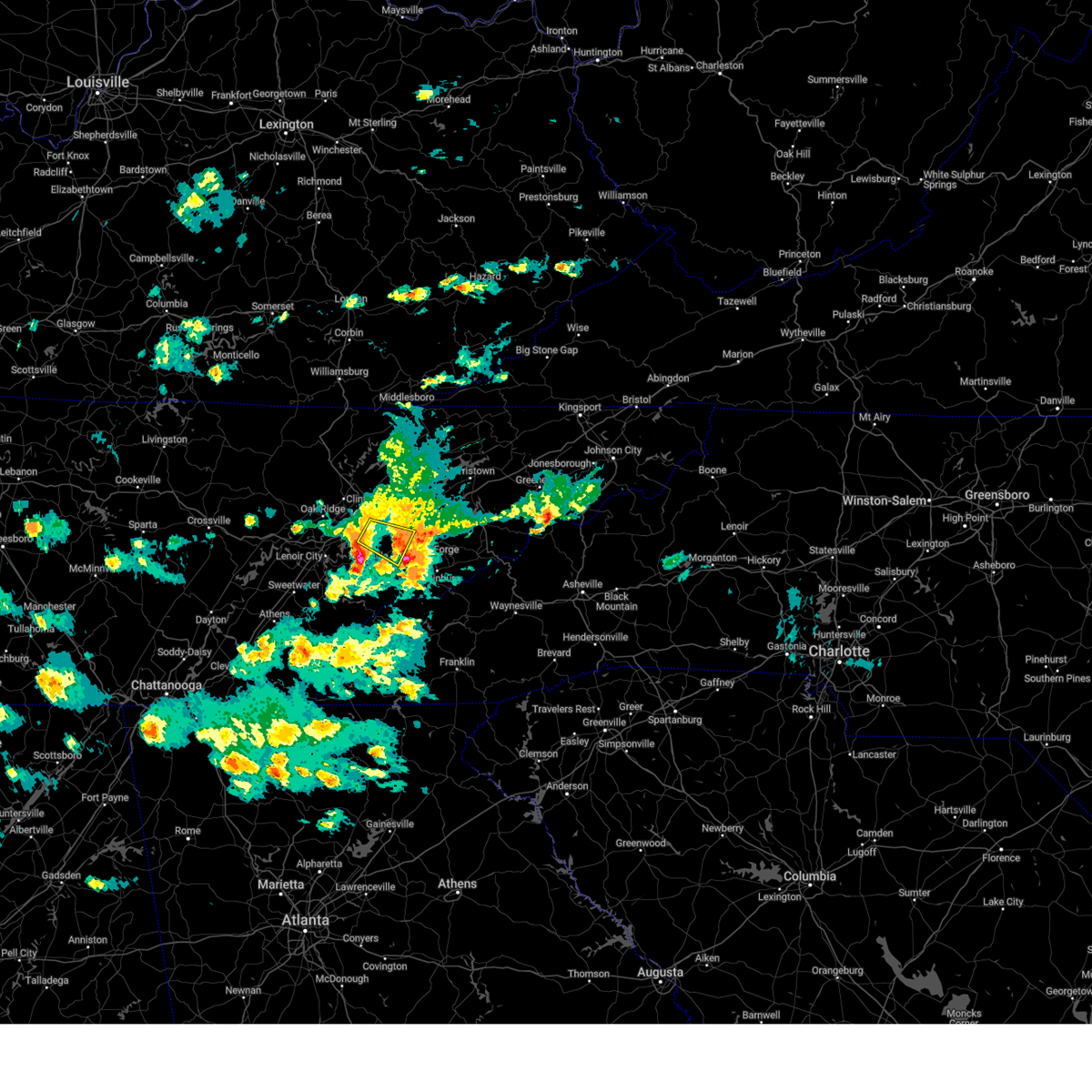
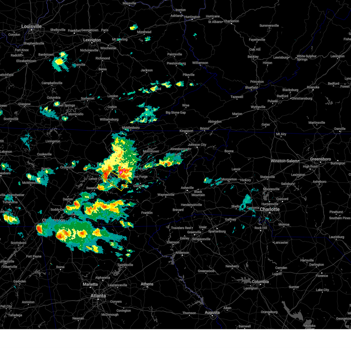
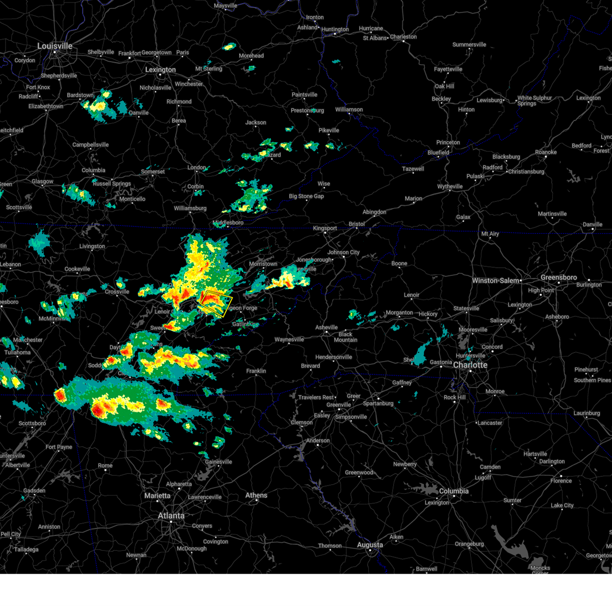
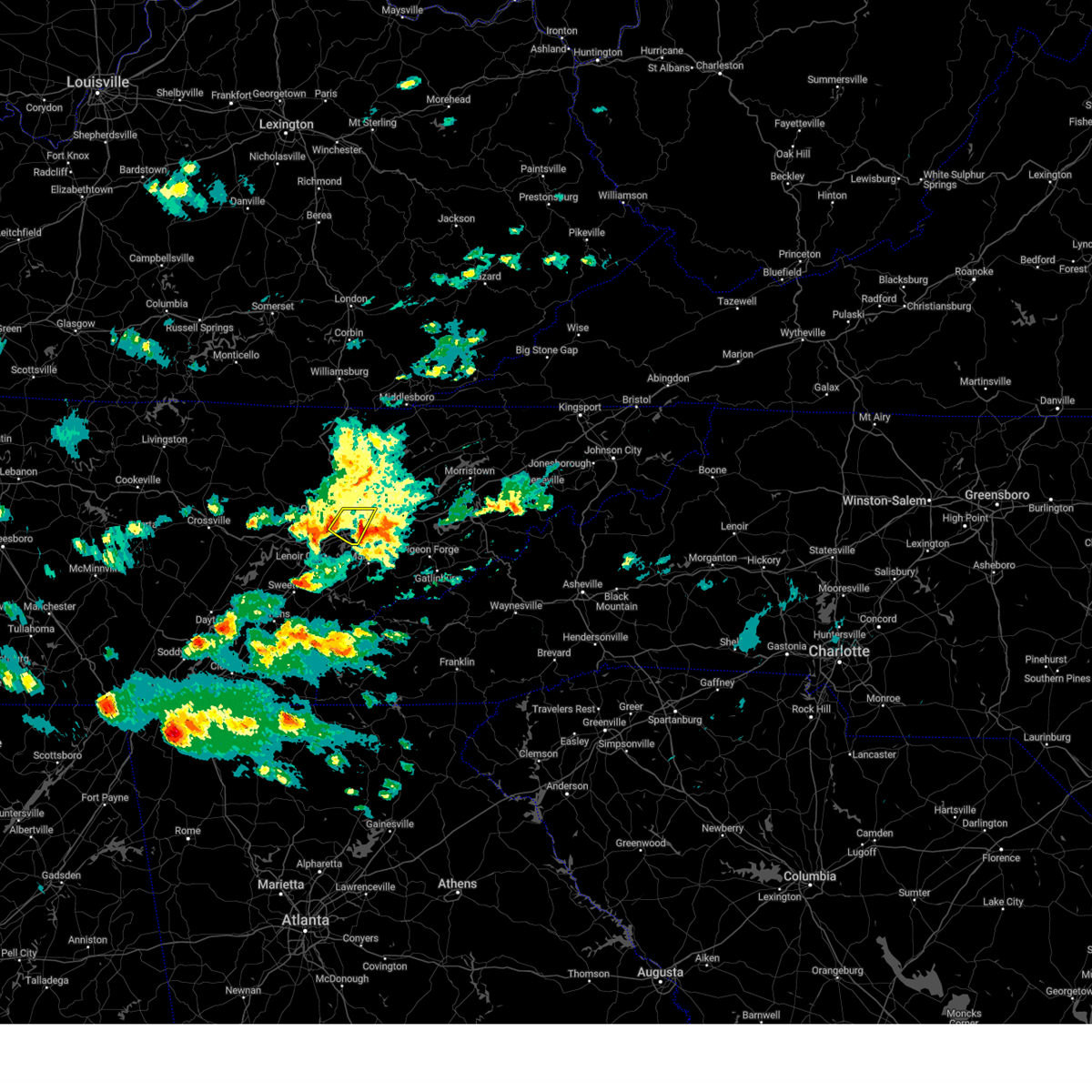
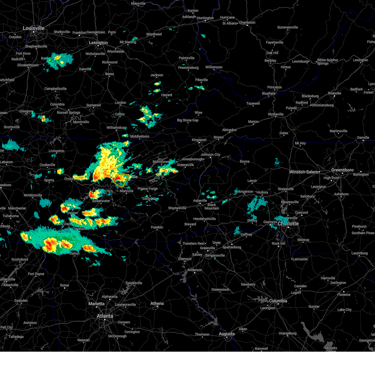
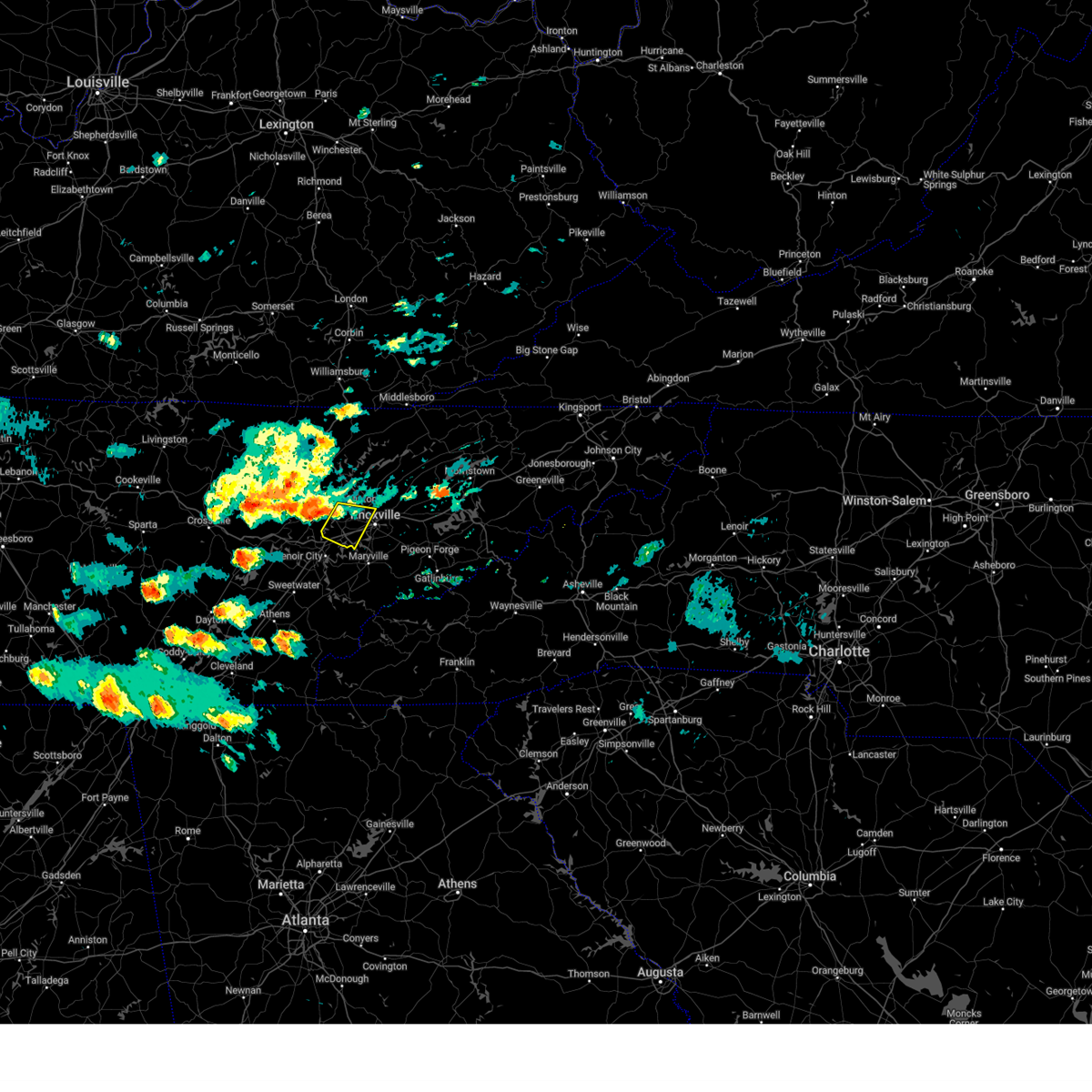
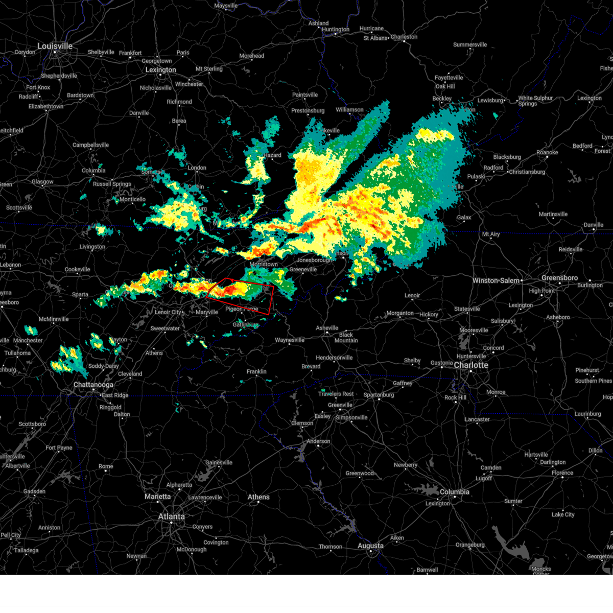
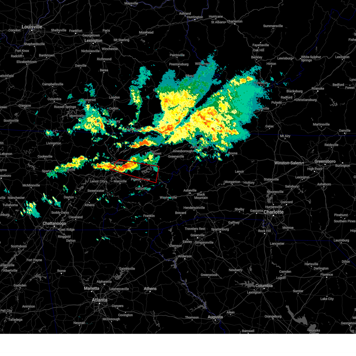
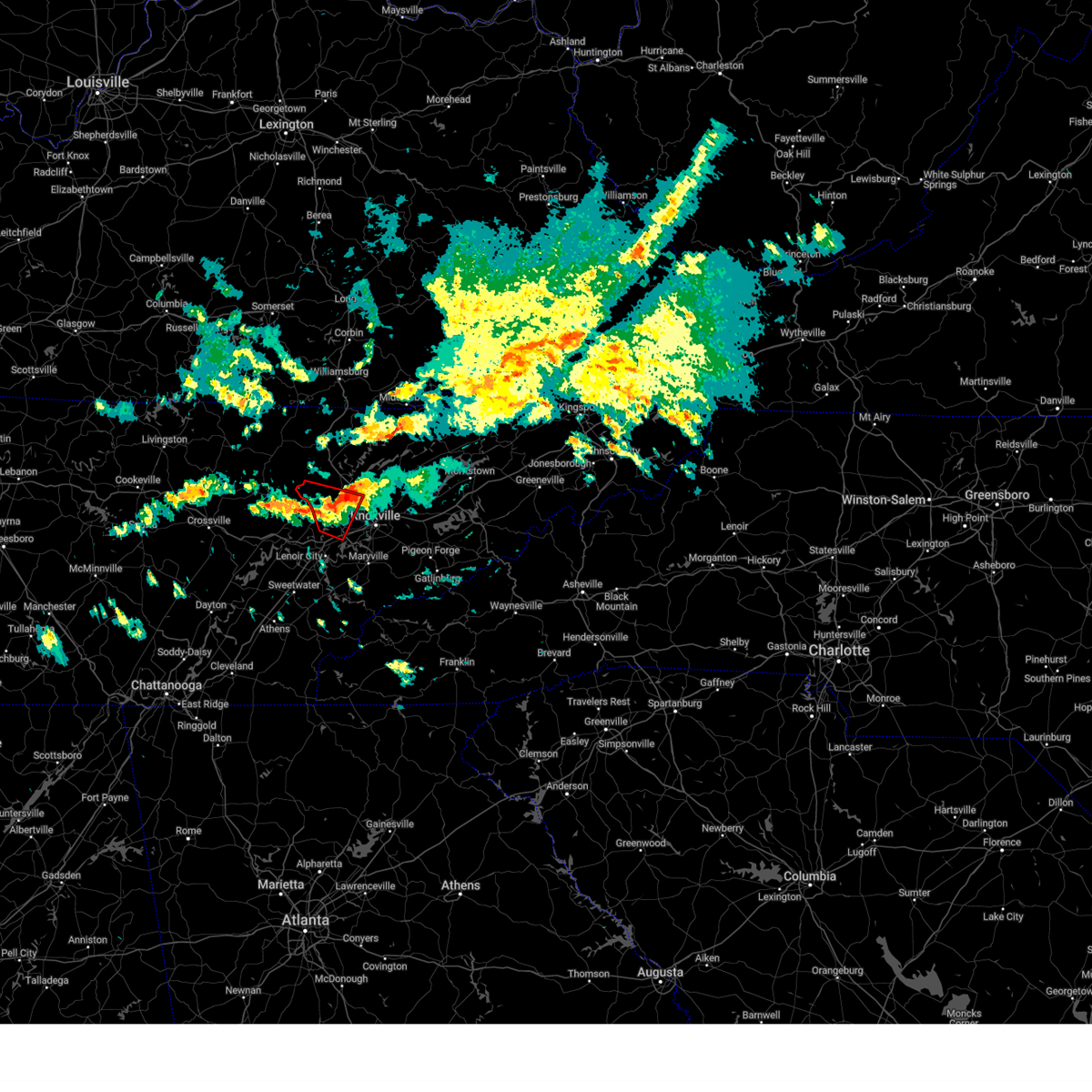
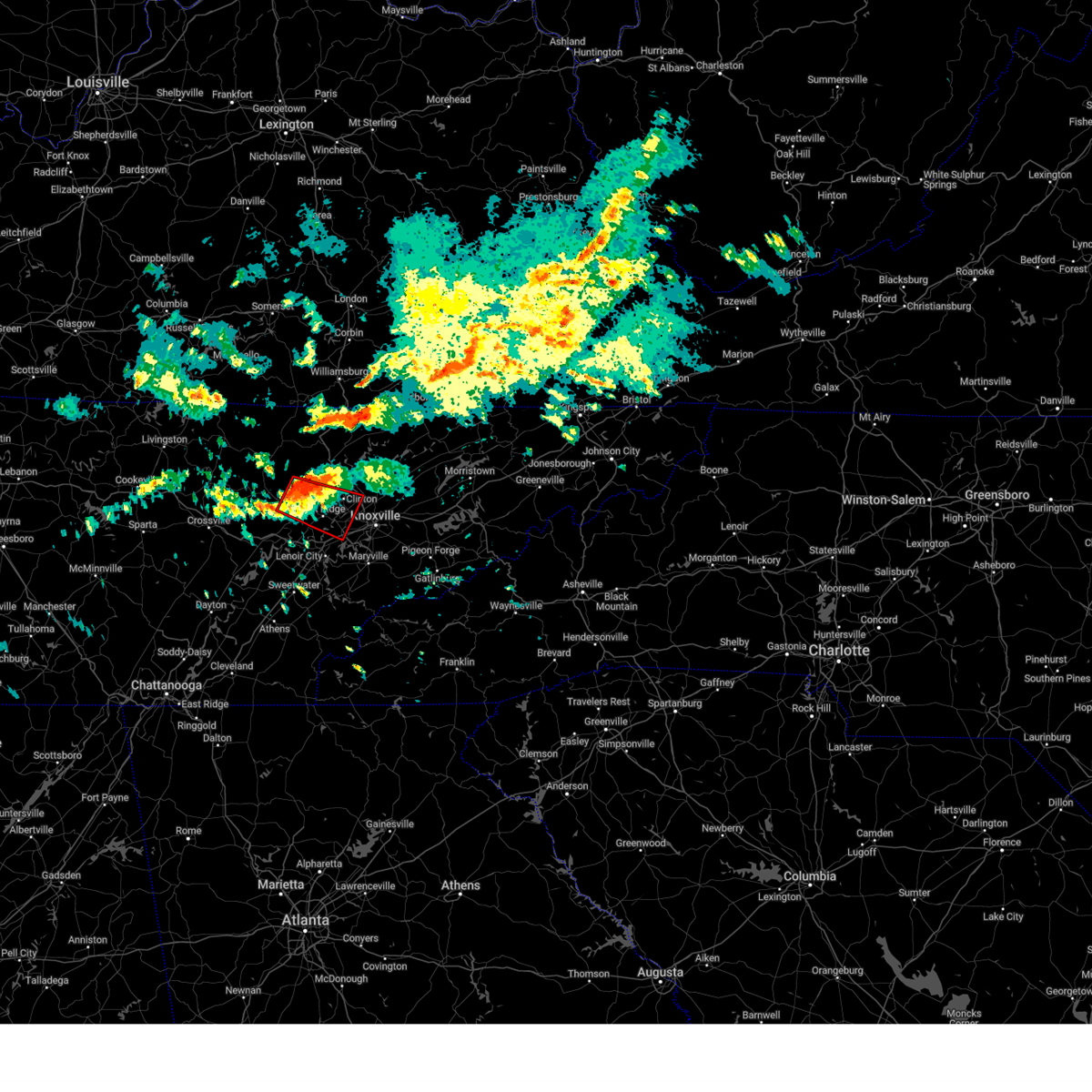
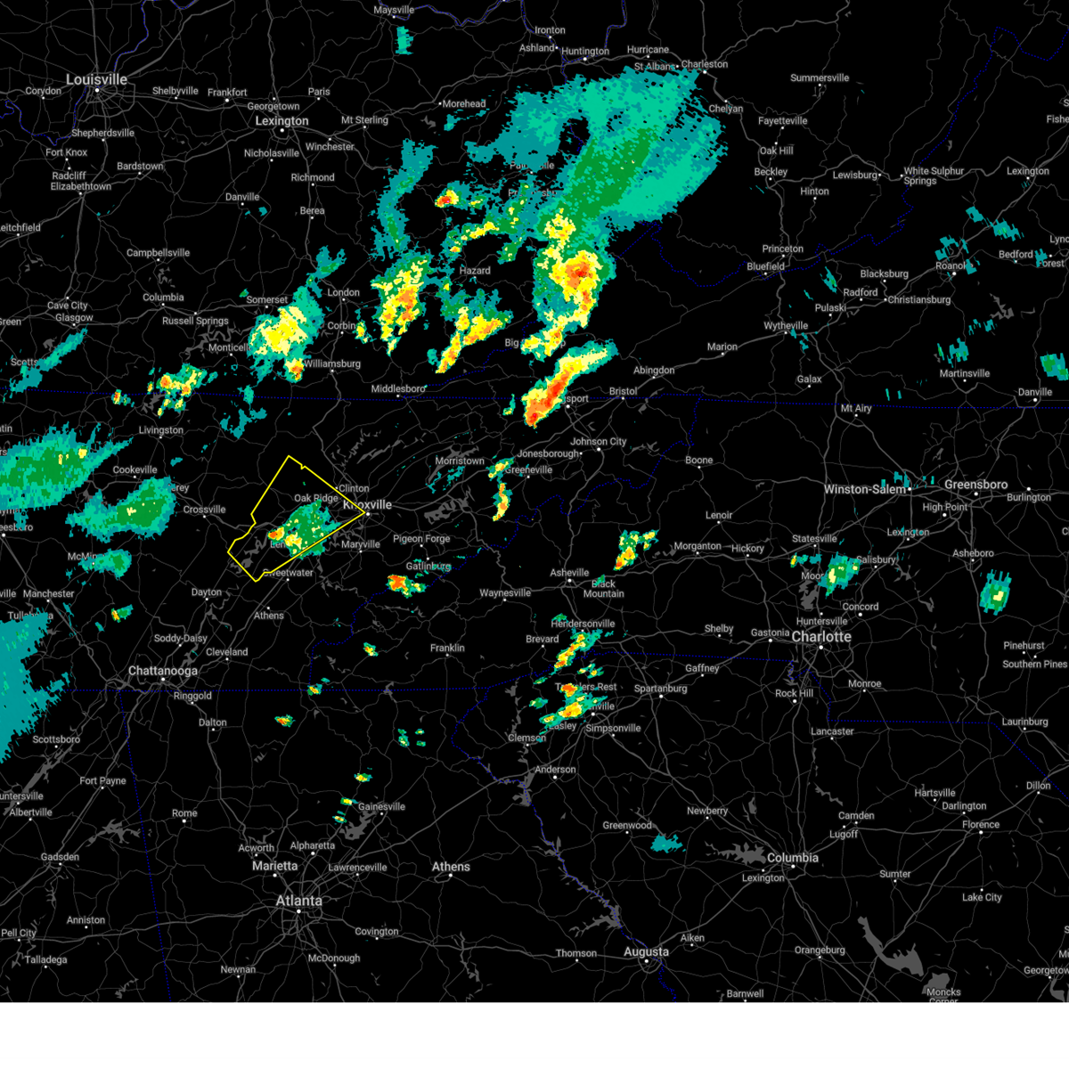
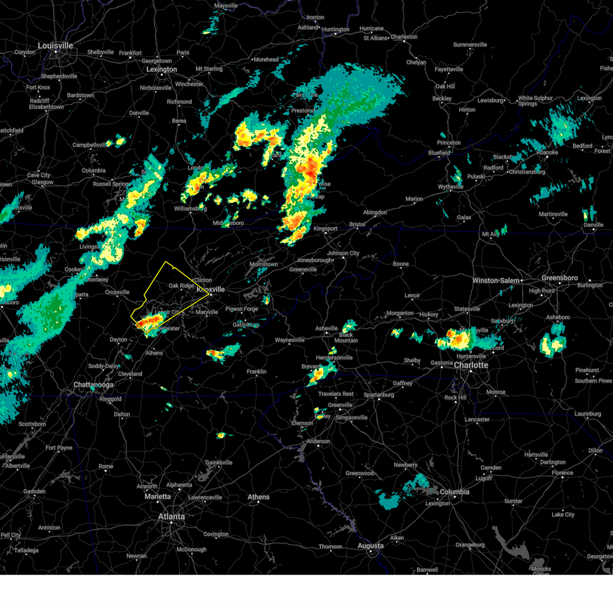
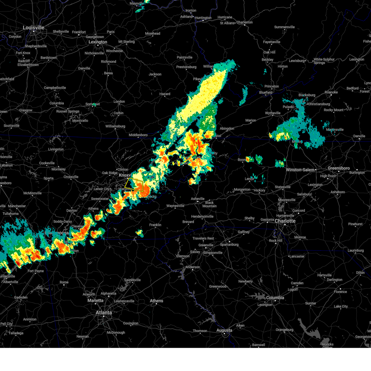
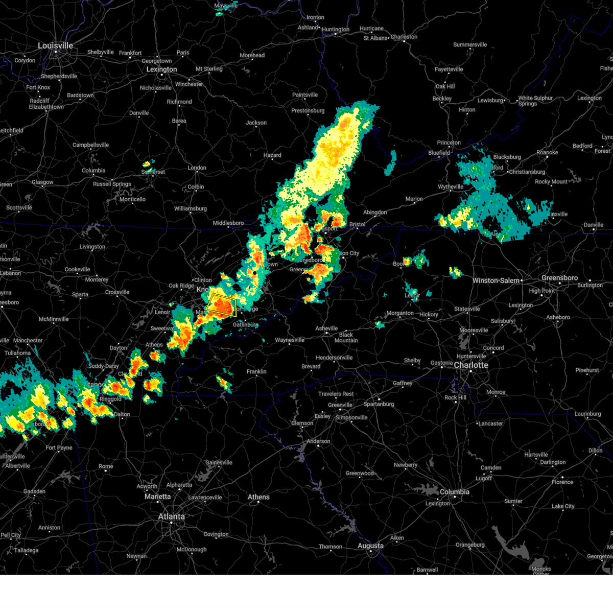
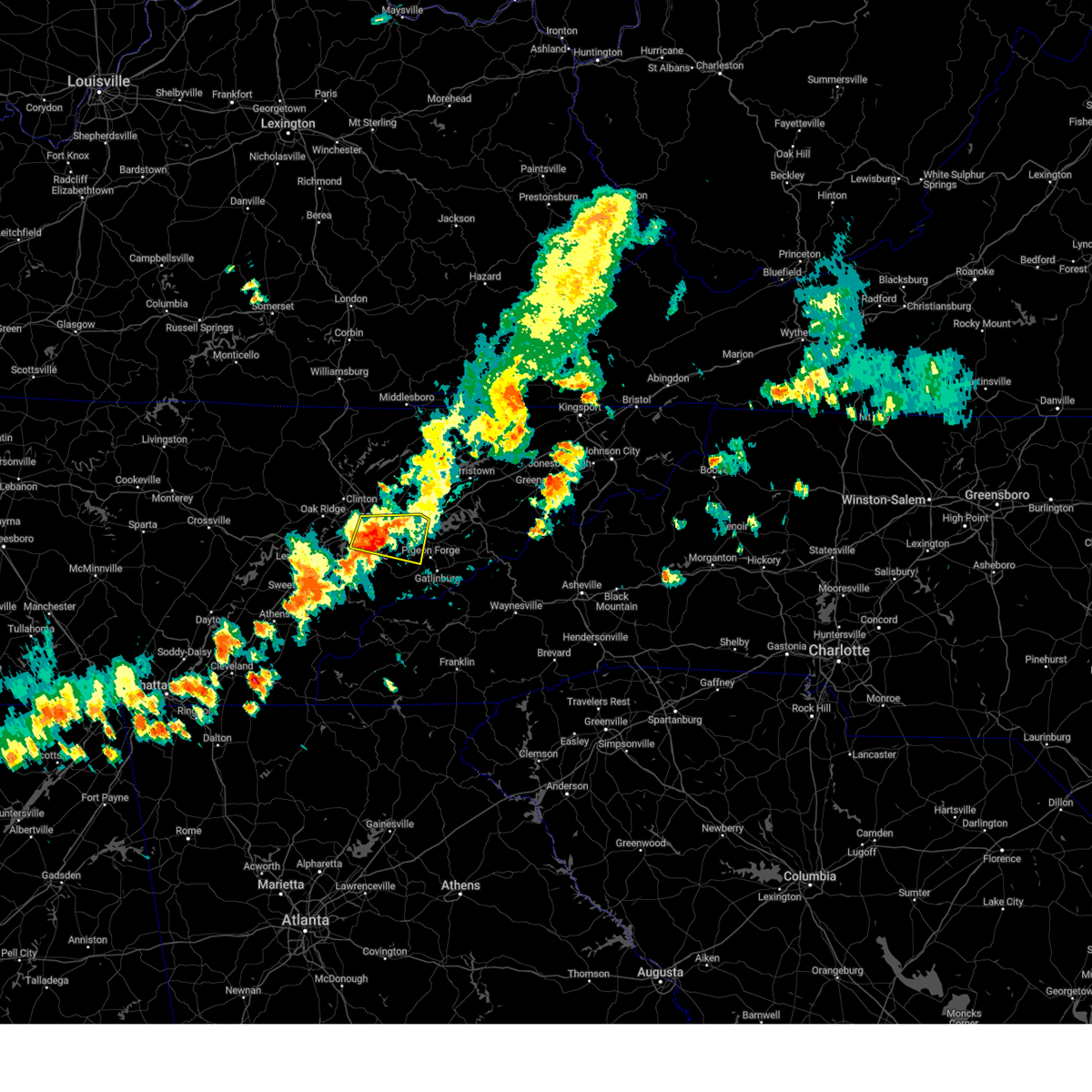
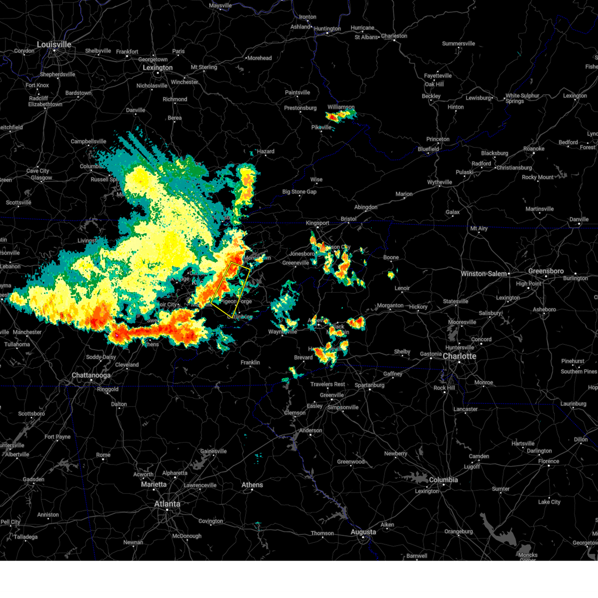
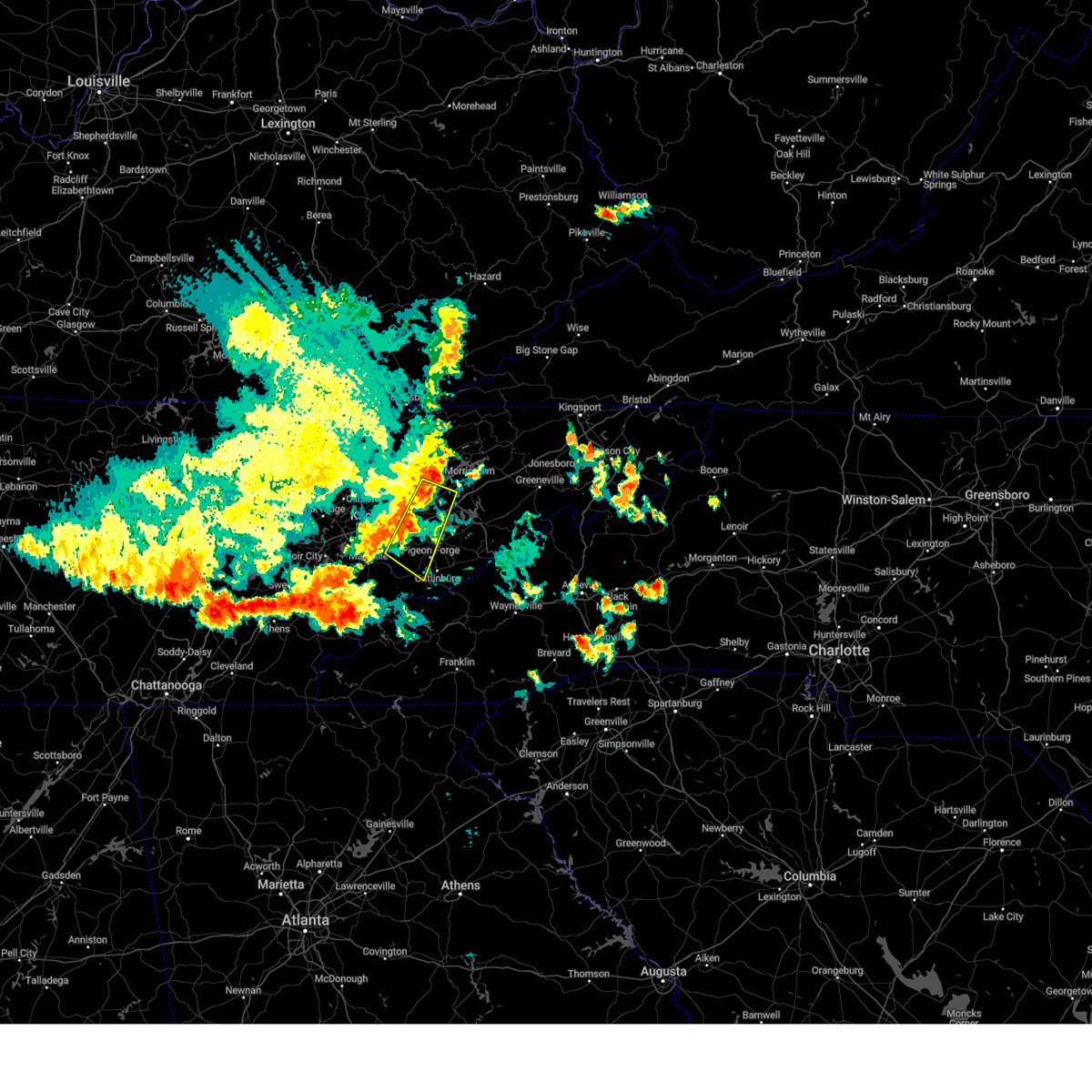
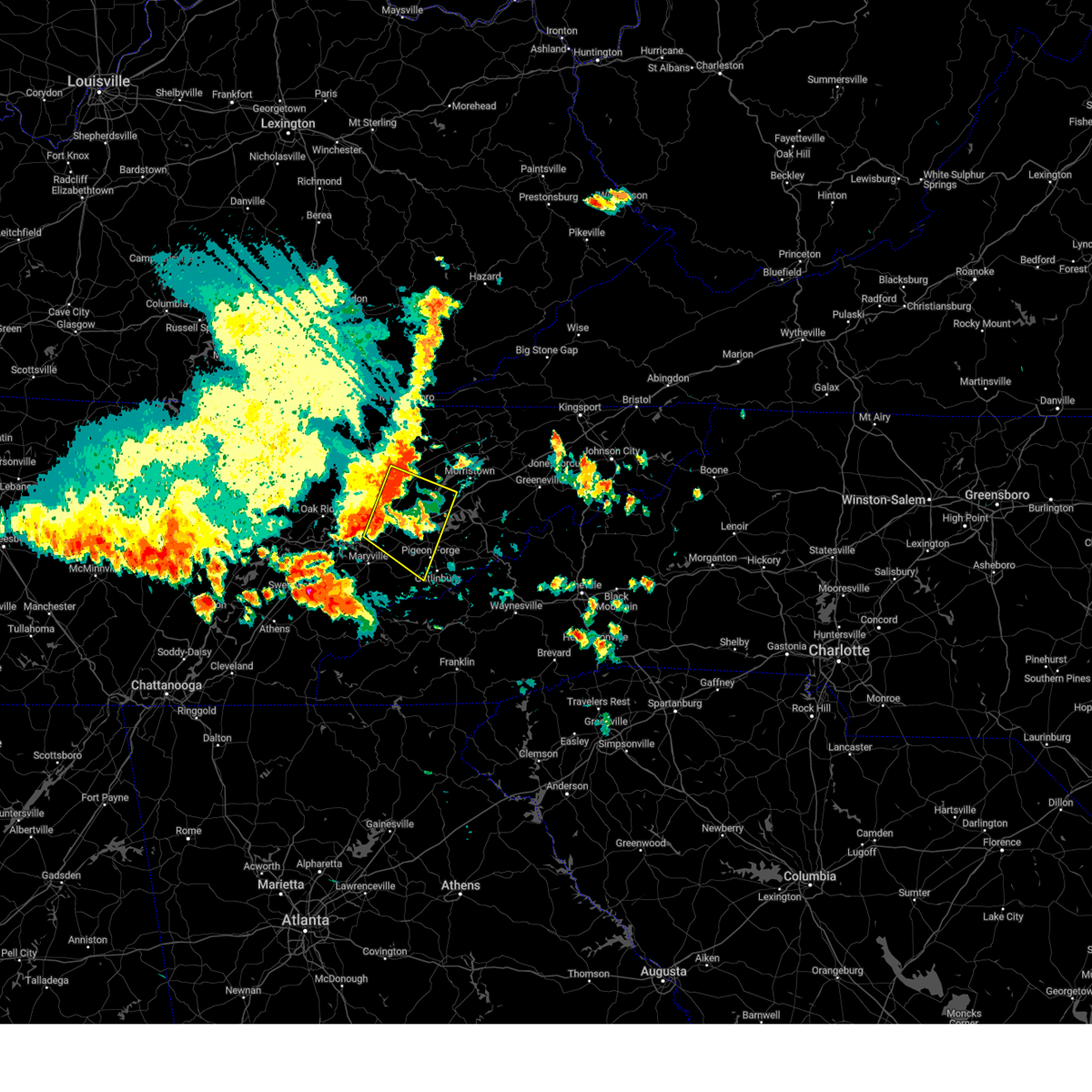
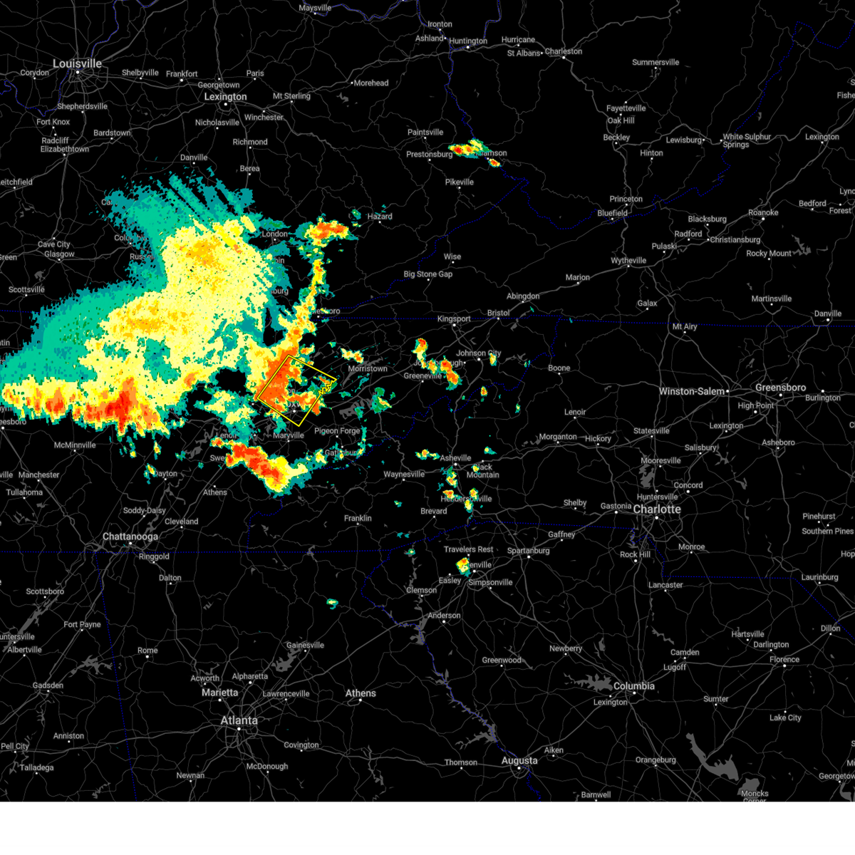
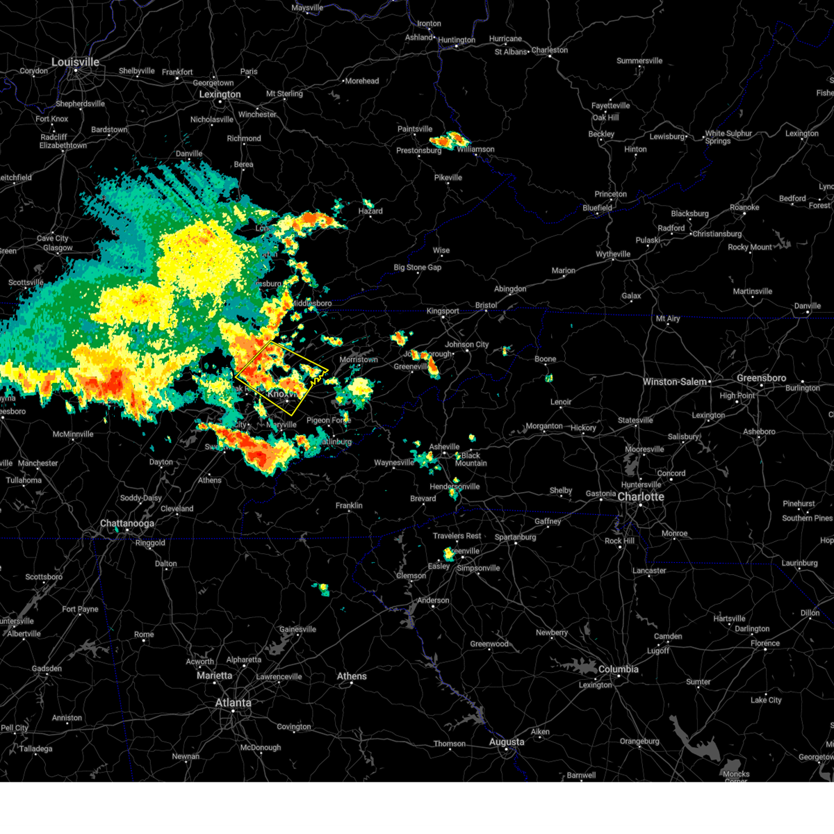
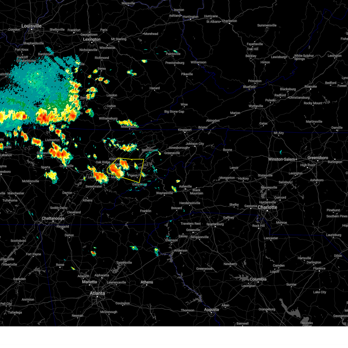
Hail Map for Knoxville, TN
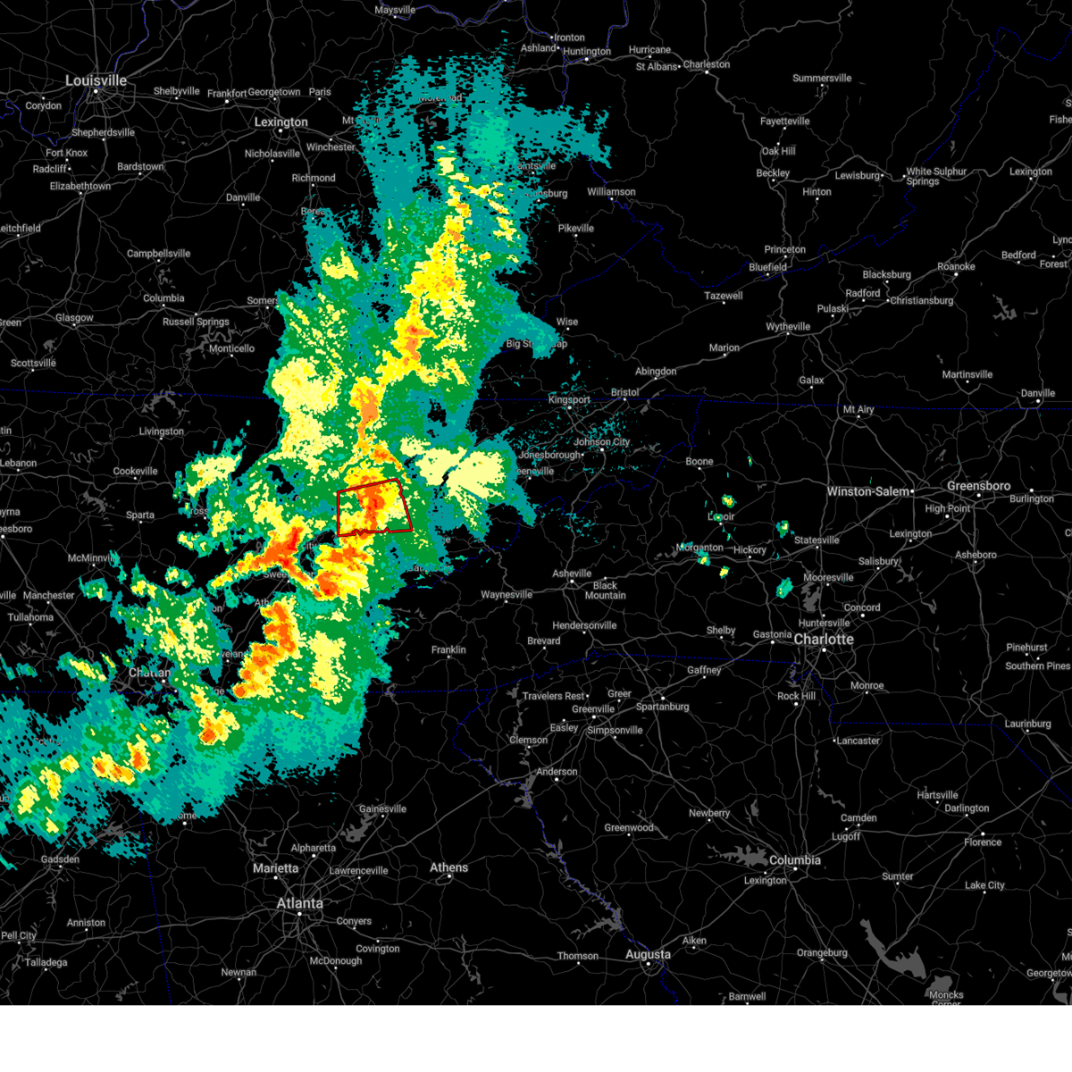
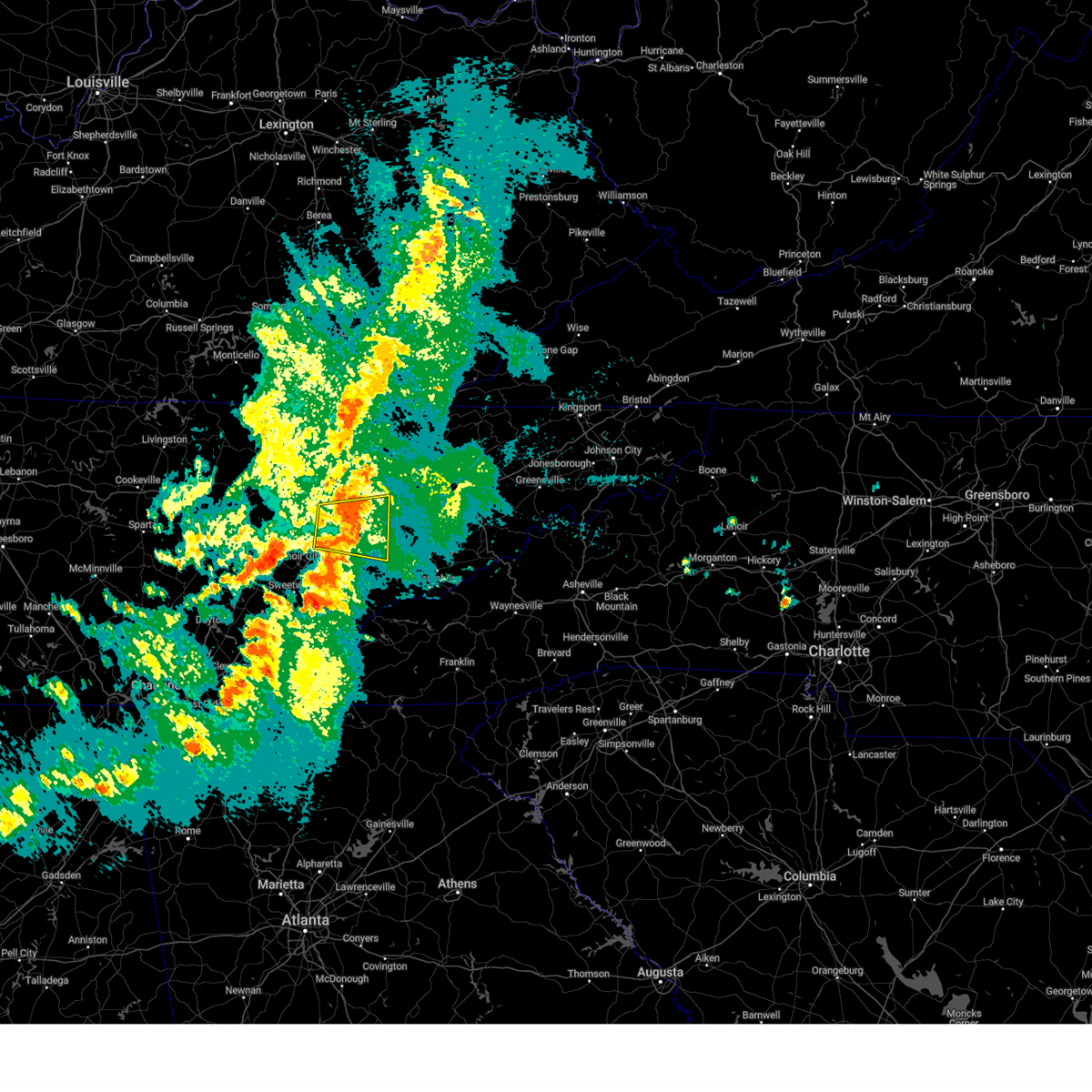
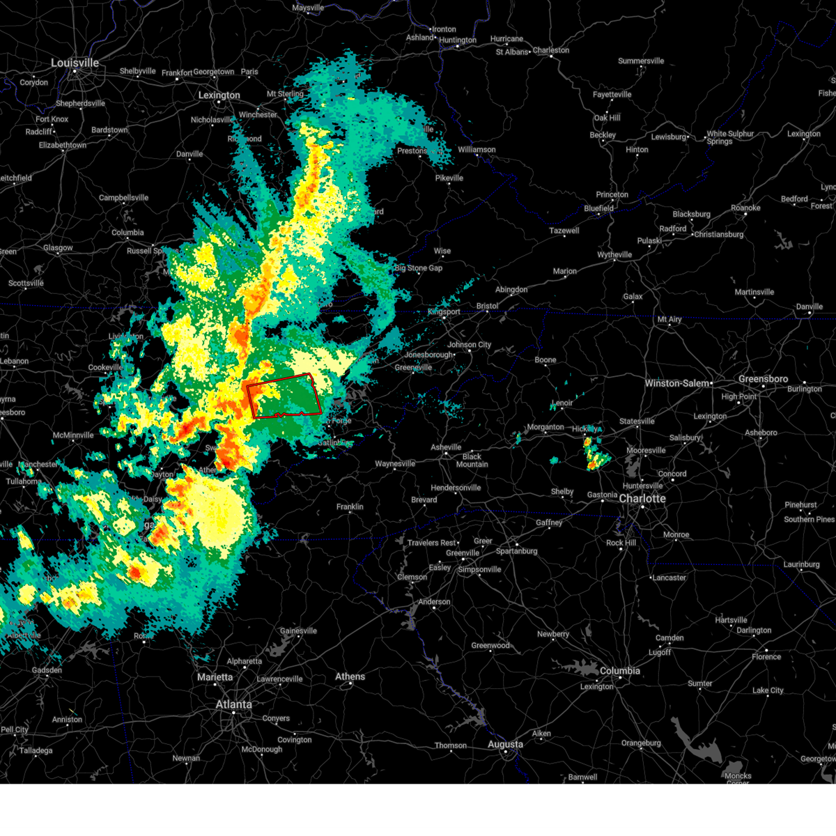
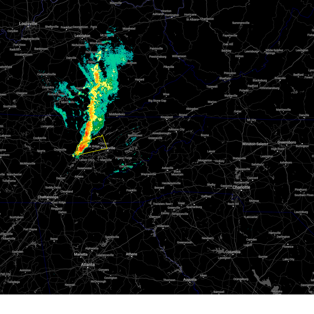
The Knoxville, TN area has had 54 reports of on-the-ground hail by trained spotters, and has been under severe weather warnings 69 times during the past 12 months. Doppler radar has detected hail at or near Knoxville, TN on 92 occasions, including 5 occasions during the past year.
| Name: | Knoxville, TN |
| Where Located: | 2.9 miles WSW of Knoxville, TN |
| Map: | Google Map for Knoxville, TN |
| Population: | 178874 |
| Housing Units: | 88009 |
| More Info: | Search Google for Knoxville, TN |
1
The Top Recent Hail Date for Knoxville, TN is Thursday, April 10, 2025 (7th out of 92)

Hail and Wind Damage Spotted near Knoxville, TN
| Date / Time | Report Details |
|---|---|
| 6/13/2025 8:36 PM EDT |
 Svrmrx the national weather service in morristown has issued a * severe thunderstorm warning for, northeastern knox county in east tennessee, jefferson county in east tennessee, northwestern cocke county in east tennessee, central grainger county in east tennessee, north central sevier county in east tennessee, western hamblen county in east tennessee, * until 915 pm edt. * at 836 pm edt, a severe thunderstorm was located near new market, or near jefferson city, moving east at 30 mph (radar indicated). Hazards include 60 mph wind gusts and quarter size hail. Hail damage to vehicles is expected. Expect wind damage to roofs, siding, and trees. Svrmrx the national weather service in morristown has issued a * severe thunderstorm warning for, northeastern knox county in east tennessee, jefferson county in east tennessee, northwestern cocke county in east tennessee, central grainger county in east tennessee, north central sevier county in east tennessee, western hamblen county in east tennessee, * until 915 pm edt. * at 836 pm edt, a severe thunderstorm was located near new market, or near jefferson city, moving east at 30 mph (radar indicated). Hazards include 60 mph wind gusts and quarter size hail. Hail damage to vehicles is expected. Expect wind damage to roofs, siding, and trees.
|
| 5/20/2025 10:28 PM EDT |
 Svrmrx the national weather service in morristown has issued a * severe thunderstorm warning for, eastern knox county in east tennessee, north central blount county in east tennessee, jefferson county in east tennessee, northwestern cocke county in east tennessee, southwestern grainger county in east tennessee, northern sevier county in east tennessee, southwestern hamblen county in east tennessee, * until 1130 pm edt. * at 1027 pm edt, a severe thunderstorm was located near knoxville, moving east at 40 mph (radar indicated). Hazards include 60 mph wind gusts and penny size hail. expect damage to roofs, siding, and trees Svrmrx the national weather service in morristown has issued a * severe thunderstorm warning for, eastern knox county in east tennessee, north central blount county in east tennessee, jefferson county in east tennessee, northwestern cocke county in east tennessee, southwestern grainger county in east tennessee, northern sevier county in east tennessee, southwestern hamblen county in east tennessee, * until 1130 pm edt. * at 1027 pm edt, a severe thunderstorm was located near knoxville, moving east at 40 mph (radar indicated). Hazards include 60 mph wind gusts and penny size hail. expect damage to roofs, siding, and trees
|
| 5/20/2025 10:22 PM EDT |
 At 1021 pm edt, a severe thunderstorm capable of producing a tornado was located over knoxville, moving east at 40 mph (radar indicated rotation). Hazards include tornado. Flying debris will be dangerous to those caught without shelter. mobile homes will be damaged or destroyed. damage to roofs, windows, and vehicles will occur. tree damage is likely. this dangerous storm will be near, knoxville around 1025 pm edt. other locations impacted by this tornadic thunderstorm include house mountain state park, mcmahan, maloneyville, lake forest, mascot, bearden, powell, seymour, halls, and karns. this includes the following highways, interstate 40 in tennessee between mile markers 376 and 404. Interstate 75 in tennessee between mile markers 108 and 116. At 1021 pm edt, a severe thunderstorm capable of producing a tornado was located over knoxville, moving east at 40 mph (radar indicated rotation). Hazards include tornado. Flying debris will be dangerous to those caught without shelter. mobile homes will be damaged or destroyed. damage to roofs, windows, and vehicles will occur. tree damage is likely. this dangerous storm will be near, knoxville around 1025 pm edt. other locations impacted by this tornadic thunderstorm include house mountain state park, mcmahan, maloneyville, lake forest, mascot, bearden, powell, seymour, halls, and karns. this includes the following highways, interstate 40 in tennessee between mile markers 376 and 404. Interstate 75 in tennessee between mile markers 108 and 116.
|
| 5/20/2025 10:15 PM EDT | Trees down county-wid in knox county TN, 1.5 miles SSE of Knoxville, TN |
| 5/20/2025 10:10 PM EDT | Re-sending report. measured on an at home anemomete in knox county TN, 10.7 miles ENE of Knoxville, TN |
| 5/20/2025 10:09 PM EDT |
 At 1009 pm edt, a severe thunderstorm was located over knoxville, moving east at 35 mph (radar indicated). Hazards include 60 mph wind gusts and quarter size hail. Hail damage to vehicles is expected. expect wind damage to roofs, siding, and trees. locations impacted include, eagleton village, louisville, farragut, alcoa, karns, wildwood, knoxville, rockford, maloneyville, and lake forest. this includes the following highways, interstate 40 in tennessee between mile markers 364 and 394. Interstate 75 in tennessee between mile markers 82 and 116. At 1009 pm edt, a severe thunderstorm was located over knoxville, moving east at 35 mph (radar indicated). Hazards include 60 mph wind gusts and quarter size hail. Hail damage to vehicles is expected. expect wind damage to roofs, siding, and trees. locations impacted include, eagleton village, louisville, farragut, alcoa, karns, wildwood, knoxville, rockford, maloneyville, and lake forest. this includes the following highways, interstate 40 in tennessee between mile markers 364 and 394. Interstate 75 in tennessee between mile markers 82 and 116.
|
| 5/20/2025 10:09 PM EDT |
 the severe thunderstorm warning has been cancelled and is no longer in effect the severe thunderstorm warning has been cancelled and is no longer in effect
|
| 5/20/2025 9:59 PM EDT |
 Tormrx the national weather service in morristown has issued a * tornado warning for, southeastern anderson county in east tennessee, knox county in east tennessee, northwestern sevier county in east tennessee, * until 1045 pm edt. * at 959 pm edt, a severe thunderstorm capable of producing a tornado was located near farragut, or near oak ridge, moving east at 55 mph (radar indicated rotation). Hazards include tornado and quarter size hail. Flying debris will be dangerous to those caught without shelter. mobile homes will be damaged or destroyed. damage to roofs, windows, and vehicles will occur. tree damage is likely. this dangerous storm will be near, knoxville around 1005 pm edt. other locations impacted by this tornadic thunderstorm include house mountain state park, mcmahan, maloneyville, lake forest, mascot, bearden, powell, seymour, halls, and karns. this includes the following highways, interstate 40 in tennessee between mile markers 371 and 404. Interstate 75 in tennessee between mile markers 108 and 117. Tormrx the national weather service in morristown has issued a * tornado warning for, southeastern anderson county in east tennessee, knox county in east tennessee, northwestern sevier county in east tennessee, * until 1045 pm edt. * at 959 pm edt, a severe thunderstorm capable of producing a tornado was located near farragut, or near oak ridge, moving east at 55 mph (radar indicated rotation). Hazards include tornado and quarter size hail. Flying debris will be dangerous to those caught without shelter. mobile homes will be damaged or destroyed. damage to roofs, windows, and vehicles will occur. tree damage is likely. this dangerous storm will be near, knoxville around 1005 pm edt. other locations impacted by this tornadic thunderstorm include house mountain state park, mcmahan, maloneyville, lake forest, mascot, bearden, powell, seymour, halls, and karns. this includes the following highways, interstate 40 in tennessee between mile markers 371 and 404. Interstate 75 in tennessee between mile markers 108 and 117.
|
| 5/20/2025 9:25 PM EDT |
 Svrmrx the national weather service in morristown has issued a * severe thunderstorm warning for, southeastern morgan county in east tennessee, northeastern loudon county in east tennessee, southwestern anderson county in east tennessee, knox county in east tennessee, northwestern blount county in east tennessee, northeastern roane county in east tennessee, * until 1030 pm edt. * at 925 pm edt, a severe thunderstorm was located over kingston, moving east at 45 mph (radar indicated). Hazards include 60 mph wind gusts and quarter size hail. Hail damage to vehicles is expected. Expect wind damage to roofs, siding, and trees. Svrmrx the national weather service in morristown has issued a * severe thunderstorm warning for, southeastern morgan county in east tennessee, northeastern loudon county in east tennessee, southwestern anderson county in east tennessee, knox county in east tennessee, northwestern blount county in east tennessee, northeastern roane county in east tennessee, * until 1030 pm edt. * at 925 pm edt, a severe thunderstorm was located over kingston, moving east at 45 mph (radar indicated). Hazards include 60 mph wind gusts and quarter size hail. Hail damage to vehicles is expected. Expect wind damage to roofs, siding, and trees.
|
| 5/20/2025 3:37 PM EDT | The storm which prompted the warning has weakened below severe limits, and no longer appears capable of producing a tornado. therefore, the warning will be allowed to expire. however, gusty winds and heavy rain are still possible with this thunderstorm. a tornado watch remains in effect until 800 pm edt for east tennessee. |
| 5/20/2025 3:30 PM EDT | Storm damage reported in knox county TN, 6.4 miles SSE of Knoxville, TN |
| 5/20/2025 3:16 PM EDT |
 the tornado warning has been cancelled and is no longer in effect the tornado warning has been cancelled and is no longer in effect
|
| 5/20/2025 3:16 PM EDT |
 At 315 pm edt, a severe thunderstorm capable of producing a tornado was located near clinton, moving east at 35 mph (radar indicated rotation). Hazards include tornado. Flying debris will be dangerous to those caught without shelter. mobile homes will be damaged or destroyed. damage to roofs, windows, and vehicles will occur. tree damage is likely. this dangerous storm will be near, knoxville and clinton around 320 pm edt. other locations impacted by this tornadic thunderstorm include powell, andersonville, halls, karns, and norris. this includes the following highways, interstate 40 in tennessee between mile markers 389 and 391. Interstate 75 in tennessee between mile markers 108 and 124. At 315 pm edt, a severe thunderstorm capable of producing a tornado was located near clinton, moving east at 35 mph (radar indicated rotation). Hazards include tornado. Flying debris will be dangerous to those caught without shelter. mobile homes will be damaged or destroyed. damage to roofs, windows, and vehicles will occur. tree damage is likely. this dangerous storm will be near, knoxville and clinton around 320 pm edt. other locations impacted by this tornadic thunderstorm include powell, andersonville, halls, karns, and norris. this includes the following highways, interstate 40 in tennessee between mile markers 389 and 391. Interstate 75 in tennessee between mile markers 108 and 124.
|
| 5/20/2025 3:08 PM EDT |
 At 308 pm edt, a severe thunderstorm was located near oliver springs, or near oak ridge, moving east at 35 mph (radar indicated). Hazards include 60 mph wind gusts and penny size hail. Expect damage to roofs, siding, and trees. locations impacted include, norris dam state park, norris, coalfield, andersonville, powell, clinton, petros, oliver springs, oak ridge, and rocky top. This includes interstate 75 in tennessee between mile markers 109 and 127. At 308 pm edt, a severe thunderstorm was located near oliver springs, or near oak ridge, moving east at 35 mph (radar indicated). Hazards include 60 mph wind gusts and penny size hail. Expect damage to roofs, siding, and trees. locations impacted include, norris dam state park, norris, coalfield, andersonville, powell, clinton, petros, oliver springs, oak ridge, and rocky top. This includes interstate 75 in tennessee between mile markers 109 and 127.
|
| 5/20/2025 3:00 PM EDT |
 Tormrx the national weather service in morristown has issued a * tornado warning for, southeastern morgan county in east tennessee, anderson county in east tennessee, central knox county in east tennessee, northeastern roane county in east tennessee, * until 345 pm edt. * at 259 pm edt, a severe thunderstorm capable of producing a tornado was located near oliver springs, or near oak ridge, moving east at 35 mph (radar indicated rotation). Hazards include tornado and quarter size hail. Flying debris will be dangerous to those caught without shelter. mobile homes will be damaged or destroyed. damage to roofs, windows, and vehicles will occur. tree damage is likely. this dangerous storm will be near, oliver springs and oak ridge around 305 pm edt. clinton around 320 pm edt. knoxville around 330 pm edt. other locations impacted by this tornadic thunderstorm include coalfield, andersonville, powell, halls, karns, dearmond, norris, and petros. this includes the following highways, interstate 40 in tennessee between mile markers 385 and 391. Interstate 75 in tennessee between mile markers 108 and 124. Tormrx the national weather service in morristown has issued a * tornado warning for, southeastern morgan county in east tennessee, anderson county in east tennessee, central knox county in east tennessee, northeastern roane county in east tennessee, * until 345 pm edt. * at 259 pm edt, a severe thunderstorm capable of producing a tornado was located near oliver springs, or near oak ridge, moving east at 35 mph (radar indicated rotation). Hazards include tornado and quarter size hail. Flying debris will be dangerous to those caught without shelter. mobile homes will be damaged or destroyed. damage to roofs, windows, and vehicles will occur. tree damage is likely. this dangerous storm will be near, oliver springs and oak ridge around 305 pm edt. clinton around 320 pm edt. knoxville around 330 pm edt. other locations impacted by this tornadic thunderstorm include coalfield, andersonville, powell, halls, karns, dearmond, norris, and petros. this includes the following highways, interstate 40 in tennessee between mile markers 385 and 391. Interstate 75 in tennessee between mile markers 108 and 124.
|
| 5/20/2025 2:50 PM EDT |
 At 250 pm edt, a severe thunderstorm was located 8 miles southwest of oliver springs, or 8 miles north of kingston, moving east at 35 mph (radar indicated). Hazards include 60 mph wind gusts and penny size hail. Expect damage to roofs, siding, and trees. locations impacted include, norris dam state park, norris, coalfield, andersonville, pine orchard, oakdale, clinton, oliver springs, dearmond, and rocky top. this includes the following highways, interstate 40 in tennessee between mile markers 343 and 349. Interstate 75 in tennessee between mile markers 109 and 127. At 250 pm edt, a severe thunderstorm was located 8 miles southwest of oliver springs, or 8 miles north of kingston, moving east at 35 mph (radar indicated). Hazards include 60 mph wind gusts and penny size hail. Expect damage to roofs, siding, and trees. locations impacted include, norris dam state park, norris, coalfield, andersonville, pine orchard, oakdale, clinton, oliver springs, dearmond, and rocky top. this includes the following highways, interstate 40 in tennessee between mile markers 343 and 349. Interstate 75 in tennessee between mile markers 109 and 127.
|
| 5/20/2025 2:37 PM EDT |
 Svrmrx the national weather service in morristown has issued a * severe thunderstorm warning for, southeastern morgan county in east tennessee, anderson county in east tennessee, central knox county in east tennessee, northern roane county in east tennessee, * until 330 pm edt. * at 236 pm edt, a severe thunderstorm was located near midtown, or 8 miles northeast of rockwood, moving east at 35 mph (radar indicated). Hazards include 60 mph wind gusts and penny size hail. expect damage to roofs, siding, and trees Svrmrx the national weather service in morristown has issued a * severe thunderstorm warning for, southeastern morgan county in east tennessee, anderson county in east tennessee, central knox county in east tennessee, northern roane county in east tennessee, * until 330 pm edt. * at 236 pm edt, a severe thunderstorm was located near midtown, or 8 miles northeast of rockwood, moving east at 35 mph (radar indicated). Hazards include 60 mph wind gusts and penny size hail. expect damage to roofs, siding, and trees
|
| 5/17/2025 3:01 AM EDT |
 the severe thunderstorm warning has been cancelled and is no longer in effect the severe thunderstorm warning has been cancelled and is no longer in effect
|
| 5/17/2025 3:01 AM EDT |
 At 301 am edt, severe thunderstorms were located along a line extending from near pine crest to near hot springs to 6 miles east of gatlinburg, moving east at 70 mph (radar indicated). Hazards include 70 mph wind gusts and quarter size hail. Hail damage to vehicles is expected. expect considerable tree damage. wind damage is also likely to mobile homes, roofs, and outbuildings. locations impacted include, caney branch, gatlinburg, smoky mountains-newfound gap, banner hill, bird crossing, alcoa, rocky fork, kimberlin heights, sevierville, and pittman center. this includes the following highways, interstate 26 in tennessee between mile markers 37 and 52. interstate 40 in tennessee between mile markers 371 and 451. Interstate 81 in tennessee between mile markers 1 and 2, and between mile markers 16 and 32. At 301 am edt, severe thunderstorms were located along a line extending from near pine crest to near hot springs to 6 miles east of gatlinburg, moving east at 70 mph (radar indicated). Hazards include 70 mph wind gusts and quarter size hail. Hail damage to vehicles is expected. expect considerable tree damage. wind damage is also likely to mobile homes, roofs, and outbuildings. locations impacted include, caney branch, gatlinburg, smoky mountains-newfound gap, banner hill, bird crossing, alcoa, rocky fork, kimberlin heights, sevierville, and pittman center. this includes the following highways, interstate 26 in tennessee between mile markers 37 and 52. interstate 40 in tennessee between mile markers 371 and 451. Interstate 81 in tennessee between mile markers 1 and 2, and between mile markers 16 and 32.
|
| 5/17/2025 2:42 AM EDT |
 Svrmrx the national weather service in morristown has issued a * severe thunderstorm warning for, loudon county in east tennessee, southwestern knox county in east tennessee, blount county in east tennessee, monroe county in east tennessee, southeastern roane county in east tennessee, south central sevier county in east tennessee, * until 330 am edt. * at 242 am edt, severe thunderstorms were located along a line extending from near rockford to near lenoir city to near fairview, moving southeast at 50 mph (radar indicated). Hazards include 60 mph wind gusts. expect damage to roofs, siding, and trees Svrmrx the national weather service in morristown has issued a * severe thunderstorm warning for, loudon county in east tennessee, southwestern knox county in east tennessee, blount county in east tennessee, monroe county in east tennessee, southeastern roane county in east tennessee, south central sevier county in east tennessee, * until 330 am edt. * at 242 am edt, severe thunderstorms were located along a line extending from near rockford to near lenoir city to near fairview, moving southeast at 50 mph (radar indicated). Hazards include 60 mph wind gusts. expect damage to roofs, siding, and trees
|
| 5/17/2025 2:32 AM EDT |
 At 232 am edt, severe thunderstorms were located along a line extending from near oak ridge to near midtown, moving southeast at 25 mph (radar indicated). Hazards include 60 mph wind gusts and nickel size hail. Expect damage to roofs, siding, and trees. locations impacted include, paint rock, coalfield, bradbury, pine orchard, lenoir city, kingston, oakdale, farragut, rockwood, and dearmond. this includes the following highways, interstate 40 in tennessee between mile markers 341 and 375. Interstate 75 in tennessee between mile markers 77 and 84. At 232 am edt, severe thunderstorms were located along a line extending from near oak ridge to near midtown, moving southeast at 25 mph (radar indicated). Hazards include 60 mph wind gusts and nickel size hail. Expect damage to roofs, siding, and trees. locations impacted include, paint rock, coalfield, bradbury, pine orchard, lenoir city, kingston, oakdale, farragut, rockwood, and dearmond. this includes the following highways, interstate 40 in tennessee between mile markers 341 and 375. Interstate 75 in tennessee between mile markers 77 and 84.
|
| 5/17/2025 2:15 AM EDT |
 Svrmrx the national weather service in morristown has issued a * severe thunderstorm warning for, southwestern hawkins county in east tennessee, south central anderson county in east tennessee, knox county in east tennessee, jefferson county in east tennessee, cocke county in east tennessee, greene county in east tennessee, grainger county in east tennessee, southwestern unicoi county in east tennessee, sevier county in east tennessee, northeastern blount county in east tennessee, southwestern washington county in east tennessee, southwestern hancock county in east tennessee, northeastern roane county in east tennessee, hamblen county in east tennessee, * until 315 am edt. * at 214 am edt, severe thunderstorms were located along a line extending from 6 miles south of sneedville to 10 miles northeast of knoxville to near oak ridge, moving east at 70 mph (radar indicated). Hazards include 70 mph wind gusts and nickel size hail. Expect considerable tree damage. Damage is likely to mobile homes, roofs, and outbuildings. Svrmrx the national weather service in morristown has issued a * severe thunderstorm warning for, southwestern hawkins county in east tennessee, south central anderson county in east tennessee, knox county in east tennessee, jefferson county in east tennessee, cocke county in east tennessee, greene county in east tennessee, grainger county in east tennessee, southwestern unicoi county in east tennessee, sevier county in east tennessee, northeastern blount county in east tennessee, southwestern washington county in east tennessee, southwestern hancock county in east tennessee, northeastern roane county in east tennessee, hamblen county in east tennessee, * until 315 am edt. * at 214 am edt, severe thunderstorms were located along a line extending from 6 miles south of sneedville to 10 miles northeast of knoxville to near oak ridge, moving east at 70 mph (radar indicated). Hazards include 70 mph wind gusts and nickel size hail. Expect considerable tree damage. Damage is likely to mobile homes, roofs, and outbuildings.
|
| 5/17/2025 2:08 AM EDT |
 Svrmrx the national weather service in morristown has issued a * severe thunderstorm warning for, southern morgan county in east tennessee, northeastern loudon county in east tennessee, southwestern anderson county in east tennessee, southwestern knox county in east tennessee, roane county in east tennessee, * until 300 am edt. * at 208 am edt, severe thunderstorms were located along a line extending from 7 miles southeast of wartburg to 6 miles northwest of rockwood, moving southeast at 25 mph (radar indicated). Hazards include 60 mph wind gusts and nickel size hail. expect damage to roofs, siding, and trees Svrmrx the national weather service in morristown has issued a * severe thunderstorm warning for, southern morgan county in east tennessee, northeastern loudon county in east tennessee, southwestern anderson county in east tennessee, southwestern knox county in east tennessee, roane county in east tennessee, * until 300 am edt. * at 208 am edt, severe thunderstorms were located along a line extending from 7 miles southeast of wartburg to 6 miles northwest of rockwood, moving southeast at 25 mph (radar indicated). Hazards include 60 mph wind gusts and nickel size hail. expect damage to roofs, siding, and trees
|
| 5/2/2025 4:56 PM EDT | the severe thunderstorm warning has been cancelled and is no longer in effect |
| 5/2/2025 4:37 PM EDT | Svrmrx the national weather service in morristown has issued a * severe thunderstorm warning for, southeastern loudon county in east tennessee, southeastern knox county in east tennessee, central blount county in east tennessee, northwestern sevier county in east tennessee, * until 530 pm edt. * at 437 pm edt, a severe thunderstorm was located 8 miles southwest of maryville, moving northeast at 30 mph (radar indicated). Hazards include 60 mph wind gusts and quarter size hail. Hail damage to vehicles is expected. Expect wind damage to roofs, siding, and trees. |
| 4/25/2025 1:44 PM EDT |
 the severe thunderstorm warning has been cancelled and is no longer in effect the severe thunderstorm warning has been cancelled and is no longer in effect
|
| 4/25/2025 1:44 PM EDT |
 At 143 pm edt, severe thunderstorms were located along a line extending from near maynardville to near new market to 7 miles southwest of jefferson city to near sevierville to 8 miles northwest of pigeon forge, moving northeast at 30 mph (radar indicated). Hazards include 60 mph wind gusts and penny size hail. Expect damage to roofs, siding, and trees. locations impacted include, luttrell, newport, panther creek state park, bird crossing, buffalo springs, strawberry plains, baneberry, sevierville, joppa, and jefferson city. this includes the following highways, interstate 40 in tennessee between mile markers 400 and 435. Interstate 81 in tennessee between mile markers 1 and 10. At 143 pm edt, severe thunderstorms were located along a line extending from near maynardville to near new market to 7 miles southwest of jefferson city to near sevierville to 8 miles northwest of pigeon forge, moving northeast at 30 mph (radar indicated). Hazards include 60 mph wind gusts and penny size hail. Expect damage to roofs, siding, and trees. locations impacted include, luttrell, newport, panther creek state park, bird crossing, buffalo springs, strawberry plains, baneberry, sevierville, joppa, and jefferson city. this includes the following highways, interstate 40 in tennessee between mile markers 400 and 435. Interstate 81 in tennessee between mile markers 1 and 10.
|
| 4/25/2025 1:39 PM EDT |
 The storm which prompted the warning has moved out of the area. therefore, the warning will be allowed to expire. however, gusty winds and heavy rain are still possible with this thunderstorm. to report severe weather, contact your nearest law enforcement agency. they will relay your report to the national weather service morristown. remember, a severe thunderstorm warning still remains in effect for portions of knox, sevier, union, jefferson, and grainger counties in tennessee until 1:45 pm edt. The storm which prompted the warning has moved out of the area. therefore, the warning will be allowed to expire. however, gusty winds and heavy rain are still possible with this thunderstorm. to report severe weather, contact your nearest law enforcement agency. they will relay your report to the national weather service morristown. remember, a severe thunderstorm warning still remains in effect for portions of knox, sevier, union, jefferson, and grainger counties in tennessee until 1:45 pm edt.
|
| 4/25/2025 1:36 PM EDT |
 Svrmrx the national weather service in morristown has issued a * severe thunderstorm warning for, eastern knox county in east tennessee, northeastern blount county in east tennessee, jefferson county in east tennessee, northwestern cocke county in east tennessee, grainger county in east tennessee, southeastern union county in east tennessee, northern sevier county in east tennessee, western hamblen county in east tennessee, * until 200 pm edt. * at 135 pm edt, severe thunderstorms were located along a line extending from 6 miles northeast of maynardville to 7 miles west of new market to 7 miles northwest of sevierville to 8 miles west of pigeon forge, moving northeast at 35 mph (radar indicated). Hazards include 60 mph wind gusts and penny size hail. expect damage to roofs, siding, and trees Svrmrx the national weather service in morristown has issued a * severe thunderstorm warning for, eastern knox county in east tennessee, northeastern blount county in east tennessee, jefferson county in east tennessee, northwestern cocke county in east tennessee, grainger county in east tennessee, southeastern union county in east tennessee, northern sevier county in east tennessee, western hamblen county in east tennessee, * until 200 pm edt. * at 135 pm edt, severe thunderstorms were located along a line extending from 6 miles northeast of maynardville to 7 miles west of new market to 7 miles northwest of sevierville to 8 miles west of pigeon forge, moving northeast at 35 mph (radar indicated). Hazards include 60 mph wind gusts and penny size hail. expect damage to roofs, siding, and trees
|
| 4/25/2025 1:22 PM EDT |
 At 122 pm edt, a severe thunderstorm was located 10 miles south of plainview, or 11 miles east of knoxville, moving northeast at 35 mph (radar indicated). Hazards include 60 mph wind gusts and penny size hail. Expect damage to roofs, siding, and trees. locations impacted include, luttrell, buffalo springs, strawberry plains, kimberlin heights, wildwood, house mountain state park, mcmahan, dandridge, sevierville, and blaine. This includes interstate 40 in tennessee between mile markers 391 and 420. At 122 pm edt, a severe thunderstorm was located 10 miles south of plainview, or 11 miles east of knoxville, moving northeast at 35 mph (radar indicated). Hazards include 60 mph wind gusts and penny size hail. Expect damage to roofs, siding, and trees. locations impacted include, luttrell, buffalo springs, strawberry plains, kimberlin heights, wildwood, house mountain state park, mcmahan, dandridge, sevierville, and blaine. This includes interstate 40 in tennessee between mile markers 391 and 420.
|
| 4/25/2025 1:15 PM EDT |
 At 114 pm edt, a severe thunderstorm was located 8 miles east of knoxville, moving northeast at 40 mph (radar indicated). Hazards include 60 mph wind gusts and penny size hail. Expect damage to roofs, siding, and trees. locations impacted include, luttrell, buffalo springs, strawberry plains, kimberlin heights, sevierville, maloneyville, mascot, joppa, jefferson city, and seymour. this includes the following highways, interstate 40 in tennessee between mile markers 382 and 420. Interstate 75 in tennessee between mile markers 108 and 113. At 114 pm edt, a severe thunderstorm was located 8 miles east of knoxville, moving northeast at 40 mph (radar indicated). Hazards include 60 mph wind gusts and penny size hail. Expect damage to roofs, siding, and trees. locations impacted include, luttrell, buffalo springs, strawberry plains, kimberlin heights, sevierville, maloneyville, mascot, joppa, jefferson city, and seymour. this includes the following highways, interstate 40 in tennessee between mile markers 382 and 420. Interstate 75 in tennessee between mile markers 108 and 113.
|
| 4/25/2025 1:10 PM EDT | A few trees and power poles down in west knoxvill in knox county TN, 3.5 miles NE of Knoxville, TN |
| 4/25/2025 1:10 PM EDT | Large tree limb fell on a semi and possibly another vehicle near intersection of w martin mill pike and brown roa in knox county TN, 4.5 miles WNW of Knoxville, TN |
| 4/25/2025 1:03 PM EDT |
 Svrmrx the national weather service in morristown has issued a * severe thunderstorm warning for, knox county in east tennessee, north central blount county in east tennessee, jefferson county in east tennessee, southwestern grainger county in east tennessee, southeastern union county in east tennessee, northwestern sevier county in east tennessee, * until 145 pm edt. * at 103 pm edt, a severe thunderstorm was located over knoxville, moving northeast at 40 mph (radar indicated). Hazards include 60 mph wind gusts and penny size hail. expect damage to roofs, siding, and trees Svrmrx the national weather service in morristown has issued a * severe thunderstorm warning for, knox county in east tennessee, north central blount county in east tennessee, jefferson county in east tennessee, southwestern grainger county in east tennessee, southeastern union county in east tennessee, northwestern sevier county in east tennessee, * until 145 pm edt. * at 103 pm edt, a severe thunderstorm was located over knoxville, moving northeast at 40 mph (radar indicated). Hazards include 60 mph wind gusts and penny size hail. expect damage to roofs, siding, and trees
|
| 4/25/2025 1:00 PM EDT | Tree down blocking lanes on westland drive and downed powerlines nearby the location as wel in knox county TN, 9.1 miles NE of Knoxville, TN |
| 4/10/2025 6:25 PM EDT |
 The storm which prompted the warning has moved out of the area. therefore, the warning will be allowed to expire. a severe thunderstorm watch remains in effect until midnight edt for east tennessee. The storm which prompted the warning has moved out of the area. therefore, the warning will be allowed to expire. a severe thunderstorm watch remains in effect until midnight edt for east tennessee.
|
| 4/10/2025 6:06 PM EDT |
 Svrmrx the national weather service in morristown has issued a * severe thunderstorm warning for, northeastern loudon county in east tennessee, southwestern knox county in east tennessee, northern blount county in east tennessee, * until 645 pm edt. * at 606 pm edt, a severe thunderstorm was located over farragut, or near lenoir city, moving southeast at 35 mph (radar indicated). Hazards include quarter size hail. damage to vehicles is expected Svrmrx the national weather service in morristown has issued a * severe thunderstorm warning for, northeastern loudon county in east tennessee, southwestern knox county in east tennessee, northern blount county in east tennessee, * until 645 pm edt. * at 606 pm edt, a severe thunderstorm was located over farragut, or near lenoir city, moving southeast at 35 mph (radar indicated). Hazards include quarter size hail. damage to vehicles is expected
|
| 4/10/2025 6:05 PM EDT | Ping Pong Ball sized hail reported 7.3 miles WNW of Knoxville, TN |
| 4/10/2025 6:01 PM EDT |
 At 601 pm edt, a severe thunderstorm was located near rockford, or near knoxville, moving east at 25 mph (trained weather spotters). Hazards include half dollar size hail. Damage to vehicles is expected. locations impacted include, knoxville, rockford, lake forest, seymour, kimberlin heights, wildwood, mcmahan, and alcoa. This includes interstate 40 in tennessee between mile markers 385 and 388. At 601 pm edt, a severe thunderstorm was located near rockford, or near knoxville, moving east at 25 mph (trained weather spotters). Hazards include half dollar size hail. Damage to vehicles is expected. locations impacted include, knoxville, rockford, lake forest, seymour, kimberlin heights, wildwood, mcmahan, and alcoa. This includes interstate 40 in tennessee between mile markers 385 and 388.
|
| 4/10/2025 5:58 PM EDT |
 The storm which prompted the warning has moved out of the area. therefore, the warning will be allowed to expire. a severe thunderstorm watch remains in effect until midnight edt for east tennessee. The storm which prompted the warning has moved out of the area. therefore, the warning will be allowed to expire. a severe thunderstorm watch remains in effect until midnight edt for east tennessee.
|
| 4/10/2025 5:55 PM EDT | Quarter sized hail reported 2.8 miles E of Knoxville, TN |
| 4/10/2025 5:42 PM EDT | Half Dollar sized hail reported 6.7 miles E of Knoxville, TN |
| 4/10/2025 5:38 PM EDT | Golf Ball sized hail reported 11.2 miles E of Knoxville, TN, golf ball sized hail reported by 2 different people in hardin valley area. |
| 4/10/2025 5:37 PM EDT |
 Svrmrx the national weather service in morristown has issued a * severe thunderstorm warning for, southeastern knox county in east tennessee, northeastern blount county in east tennessee, northwestern sevier county in east tennessee, * until 630 pm edt. * at 537 pm edt, a severe thunderstorm was located near knoxville, moving east at 30 mph (radar indicated). Hazards include quarter size hail. damage to vehicles is expected Svrmrx the national weather service in morristown has issued a * severe thunderstorm warning for, southeastern knox county in east tennessee, northeastern blount county in east tennessee, northwestern sevier county in east tennessee, * until 630 pm edt. * at 537 pm edt, a severe thunderstorm was located near knoxville, moving east at 30 mph (radar indicated). Hazards include quarter size hail. damage to vehicles is expected
|
| 4/10/2025 5:35 PM EDT | Ping Pong Ball sized hail reported 5.8 miles ENE of Knoxville, TN, time adjusted by radar... report relayed by ham. |
| 4/10/2025 5:29 PM EDT |
 At 529 pm edt, a severe thunderstorm was located 7 miles north of farragut, or 8 miles south of clinton, moving east at 25 mph (radar indicated). Hazards include 60 mph wind gusts and quarter size hail. Hail damage to vehicles is expected. expect wind damage to roofs, siding, and trees. locations impacted include, bearden, powell, karns, knoxville, farragut, and oak ridge. this includes the following highways, interstate 40 in tennessee between mile markers 374 and 384. Interstate 75 in tennessee between mile markers 108 and 112. At 529 pm edt, a severe thunderstorm was located 7 miles north of farragut, or 8 miles south of clinton, moving east at 25 mph (radar indicated). Hazards include 60 mph wind gusts and quarter size hail. Hail damage to vehicles is expected. expect wind damage to roofs, siding, and trees. locations impacted include, bearden, powell, karns, knoxville, farragut, and oak ridge. this includes the following highways, interstate 40 in tennessee between mile markers 374 and 384. Interstate 75 in tennessee between mile markers 108 and 112.
|
| 4/10/2025 5:20 PM EDT | Golf Ball sized hail reported 11.9 miles E of Knoxville, TN, golf ball sized hail reported near solway... video from report shows fairly slushy hail impacting and disintegrating against car windshield. |
| 4/10/2025 5:07 PM EDT |
 Svrmrx the national weather service in morristown has issued a * severe thunderstorm warning for, south central anderson county in east tennessee, southwestern knox county in east tennessee, * until 600 pm edt. * at 506 pm edt, a severe thunderstorm was located over oliver springs, or near oak ridge, moving east at 20 mph (radar indicated). Hazards include 60 mph wind gusts and quarter size hail. Hail damage to vehicles is expected. Expect wind damage to roofs, siding, and trees. Svrmrx the national weather service in morristown has issued a * severe thunderstorm warning for, south central anderson county in east tennessee, southwestern knox county in east tennessee, * until 600 pm edt. * at 506 pm edt, a severe thunderstorm was located over oliver springs, or near oak ridge, moving east at 20 mph (radar indicated). Hazards include 60 mph wind gusts and quarter size hail. Hail damage to vehicles is expected. Expect wind damage to roofs, siding, and trees.
|
| 2/6/2025 9:31 PM EST |
 At 931 pm est, a severe thunderstorm capable of producing a tornado was located 10 miles northwest of sevierville, moving east at 55 mph (radar indicated rotation). Hazards include tornado and quarter size hail. Flying debris will be dangerous to those caught without shelter. mobile homes will be damaged or destroyed. damage to roofs, windows, and vehicles will occur. tree damage is likely. this dangerous storm will be near, sevierville around 935 pm est. other locations impacted by this tornadic thunderstorm include bird crossing, fairgarden, strawberry plains, kimberlin heights, house mountain state park, mcmahan, chestnut hill, lake forest, mascot, and cosby. This includes interstate 40 in tennessee between mile markers 386 and 435. At 931 pm est, a severe thunderstorm capable of producing a tornado was located 10 miles northwest of sevierville, moving east at 55 mph (radar indicated rotation). Hazards include tornado and quarter size hail. Flying debris will be dangerous to those caught without shelter. mobile homes will be damaged or destroyed. damage to roofs, windows, and vehicles will occur. tree damage is likely. this dangerous storm will be near, sevierville around 935 pm est. other locations impacted by this tornadic thunderstorm include bird crossing, fairgarden, strawberry plains, kimberlin heights, house mountain state park, mcmahan, chestnut hill, lake forest, mascot, and cosby. This includes interstate 40 in tennessee between mile markers 386 and 435.
|
| 2/6/2025 9:19 PM EST |
 At 919 pm est, a severe thunderstorm capable of producing a tornado was located near knoxville, moving east at 60 mph (radar indicated rotation). Hazards include tornado and quarter size hail. Flying debris will be dangerous to those caught without shelter. mobile homes will be damaged or destroyed. damage to roofs, windows, and vehicles will occur. tree damage is likely. this dangerous storm will be near, knoxville and sevierville around 925 pm est. dandridge around 940 pm est. newport and baneberry around 950 pm est. other locations impacted by this tornadic thunderstorm include bird crossing, fairgarden, strawberry plains, karns, kimberlin heights, house mountain state park, mcmahan, chestnut hill, maloneyville, and lake forest. this includes the following highways, interstate 40 in tennessee between mile markers 384 and 435. Interstate 75 in tennessee between mile markers 108 and 117. At 919 pm est, a severe thunderstorm capable of producing a tornado was located near knoxville, moving east at 60 mph (radar indicated rotation). Hazards include tornado and quarter size hail. Flying debris will be dangerous to those caught without shelter. mobile homes will be damaged or destroyed. damage to roofs, windows, and vehicles will occur. tree damage is likely. this dangerous storm will be near, knoxville and sevierville around 925 pm est. dandridge around 940 pm est. newport and baneberry around 950 pm est. other locations impacted by this tornadic thunderstorm include bird crossing, fairgarden, strawberry plains, karns, kimberlin heights, house mountain state park, mcmahan, chestnut hill, maloneyville, and lake forest. this includes the following highways, interstate 40 in tennessee between mile markers 384 and 435. Interstate 75 in tennessee between mile markers 108 and 117.
|
| 2/6/2025 9:19 PM EST |
 the tornado warning has been cancelled and is no longer in effect the tornado warning has been cancelled and is no longer in effect
|
| 2/6/2025 9:02 PM EST |
 the tornado warning has been cancelled and is no longer in effect the tornado warning has been cancelled and is no longer in effect
|
| 2/6/2025 9:02 PM EST |
 At 901 pm est, a severe thunderstorm capable of producing a tornado was located near clinton, moving east at 40 mph (radar indicated rotation). Hazards include tornado and quarter size hail. Flying debris will be dangerous to those caught without shelter. mobile homes will be damaged or destroyed. damage to roofs, windows, and vehicles will occur. tree damage is likely. this dangerous storm will be near, oak ridge and clinton around 905 pm est. other locations impacted by this tornadic thunderstorm include rosedale and karns. this includes the following highways, interstate 40 in tennessee between mile markers 373 and 376. Interstate 75 in tennessee between mile markers 116 and 118. At 901 pm est, a severe thunderstorm capable of producing a tornado was located near clinton, moving east at 40 mph (radar indicated rotation). Hazards include tornado and quarter size hail. Flying debris will be dangerous to those caught without shelter. mobile homes will be damaged or destroyed. damage to roofs, windows, and vehicles will occur. tree damage is likely. this dangerous storm will be near, oak ridge and clinton around 905 pm est. other locations impacted by this tornadic thunderstorm include rosedale and karns. this includes the following highways, interstate 40 in tennessee between mile markers 373 and 376. Interstate 75 in tennessee between mile markers 116 and 118.
|
| 2/6/2025 8:59 PM EST |
 Tormrx the national weather service in morristown has issued a * tornado warning for, central anderson county in east tennessee, knox county in east tennessee, jefferson county in east tennessee, southwestern cocke county in east tennessee, northern sevier county in east tennessee, * until 945 pm est. * at 858 pm est, a severe thunderstorm capable of producing a tornado was located near clinton, moving east at 60 mph (radar indicated rotation). Hazards include tornado and quarter size hail. Flying debris will be dangerous to those caught without shelter. mobile homes will be damaged or destroyed. damage to roofs, windows, and vehicles will occur. tree damage is likely. this dangerous storm will be near, knoxville around 905 pm est. sevierville around 920 pm est. other locations impacted by this tornadic thunderstorm include bird crossing, fairgarden, strawberry plains, karns, kimberlin heights, house mountain state park, mcmahan, chestnut hill, maloneyville, and lake forest. this includes the following highways, interstate 40 in tennessee between mile markers 384 and 435. Interstate 75 in tennessee between mile markers 108 and 122. Tormrx the national weather service in morristown has issued a * tornado warning for, central anderson county in east tennessee, knox county in east tennessee, jefferson county in east tennessee, southwestern cocke county in east tennessee, northern sevier county in east tennessee, * until 945 pm est. * at 858 pm est, a severe thunderstorm capable of producing a tornado was located near clinton, moving east at 60 mph (radar indicated rotation). Hazards include tornado and quarter size hail. Flying debris will be dangerous to those caught without shelter. mobile homes will be damaged or destroyed. damage to roofs, windows, and vehicles will occur. tree damage is likely. this dangerous storm will be near, knoxville around 905 pm est. sevierville around 920 pm est. other locations impacted by this tornadic thunderstorm include bird crossing, fairgarden, strawberry plains, karns, kimberlin heights, house mountain state park, mcmahan, chestnut hill, maloneyville, and lake forest. this includes the following highways, interstate 40 in tennessee between mile markers 384 and 435. Interstate 75 in tennessee between mile markers 108 and 122.
|
| 2/6/2025 8:39 PM EST |
 Tormrx the national weather service in morristown has issued a * tornado warning for, southeastern morgan county in east tennessee, anderson county in east tennessee, northwestern knox county in east tennessee, northeastern roane county in east tennessee, southern scott county in east tennessee, * until 915 pm est. * at 839 pm est, a severe thunderstorm capable of producing a tornado was located 7 miles east of wartburg, moving east at 40 mph (radar indicated rotation). Hazards include tornado and quarter size hail. Flying debris will be dangerous to those caught without shelter. mobile homes will be damaged or destroyed. damage to roofs, windows, and vehicles will occur. tree damage is likely. this dangerous storm will be near, oliver springs around 845 pm est. oak ridge around 850 pm est. clinton around 900 pm est. other locations impacted by this tornadic thunderstorm include coalfield, rosedale, petros, karns, and frozen head state park. this includes the following highways, interstate 40 in tennessee between mile markers 373 and 376. Interstate 75 in tennessee between mile markers 116 and 118. Tormrx the national weather service in morristown has issued a * tornado warning for, southeastern morgan county in east tennessee, anderson county in east tennessee, northwestern knox county in east tennessee, northeastern roane county in east tennessee, southern scott county in east tennessee, * until 915 pm est. * at 839 pm est, a severe thunderstorm capable of producing a tornado was located 7 miles east of wartburg, moving east at 40 mph (radar indicated rotation). Hazards include tornado and quarter size hail. Flying debris will be dangerous to those caught without shelter. mobile homes will be damaged or destroyed. damage to roofs, windows, and vehicles will occur. tree damage is likely. this dangerous storm will be near, oliver springs around 845 pm est. oak ridge around 850 pm est. clinton around 900 pm est. other locations impacted by this tornadic thunderstorm include coalfield, rosedale, petros, karns, and frozen head state park. this includes the following highways, interstate 40 in tennessee between mile markers 373 and 376. Interstate 75 in tennessee between mile markers 116 and 118.
|
| 9/24/2024 7:12 PM EDT |
 the severe thunderstorm warning has been cancelled and is no longer in effect the severe thunderstorm warning has been cancelled and is no longer in effect
|
| 9/24/2024 6:47 PM EDT |
 Svrmrx the national weather service in morristown has issued a * severe thunderstorm warning for, southeastern morgan county in east tennessee, northeastern rhea county in east tennessee, central loudon county in east tennessee, northeastern meigs county in east tennessee, southwestern anderson county in east tennessee, southwestern knox county in east tennessee, roane county in east tennessee, south central scott county in east tennessee, * until 730 pm edt. * at 646 pm edt, a severe thunderstorm was located 8 miles east of spring city, or 10 miles south of rockwood, moving northeast at 45 mph (radar indicated). Hazards include 60 mph wind gusts and penny size hail. expect damage to roofs, siding, and trees Svrmrx the national weather service in morristown has issued a * severe thunderstorm warning for, southeastern morgan county in east tennessee, northeastern rhea county in east tennessee, central loudon county in east tennessee, northeastern meigs county in east tennessee, southwestern anderson county in east tennessee, southwestern knox county in east tennessee, roane county in east tennessee, south central scott county in east tennessee, * until 730 pm edt. * at 646 pm edt, a severe thunderstorm was located 8 miles east of spring city, or 10 miles south of rockwood, moving northeast at 45 mph (radar indicated). Hazards include 60 mph wind gusts and penny size hail. expect damage to roofs, siding, and trees
|
| 8/16/2024 5:55 PM EDT |
 The storm which prompted the warning has moved out of the area. therefore, the warning will be allowed to expire. remember, a severe thunderstorm warning still remains in effect for portions of sevier and blount counties until 6:45 pm edt. The storm which prompted the warning has moved out of the area. therefore, the warning will be allowed to expire. remember, a severe thunderstorm warning still remains in effect for portions of sevier and blount counties until 6:45 pm edt.
|
| 8/16/2024 5:40 PM EDT |
 At 539 pm edt, a severe thunderstorm was located 7 miles east of knoxville, moving east at 25 mph (emergency dispatch continues to report mutliple instances of downed trees and power outages due to severe wind gusts). Hazards include 60 mph wind gusts and penny size hail. Expect damage to roofs, siding, and trees. Locations impacted include, knoxville, alcoa, pigeon forge, rockford, mcmahan, lake forest, seymour, kimberlin heights, and wildwood. At 539 pm edt, a severe thunderstorm was located 7 miles east of knoxville, moving east at 25 mph (emergency dispatch continues to report mutliple instances of downed trees and power outages due to severe wind gusts). Hazards include 60 mph wind gusts and penny size hail. Expect damage to roofs, siding, and trees. Locations impacted include, knoxville, alcoa, pigeon forge, rockford, mcmahan, lake forest, seymour, kimberlin heights, and wildwood.
|
| 8/16/2024 5:28 PM EDT |
 At 528 pm edt, a severe thunderstorm was located over knoxville, moving east at 25 mph (emergency dispatch reports multiple downed trees due to severe wind gusts). Hazards include 60 mph wind gusts and penny size hail. Expect damage to roofs, siding, and trees. locations impacted include, knoxville, sevierville, alcoa, pigeon forge, louisville, rockford, kimberlin heights, wildwood, mcmahan, and lake forest. this includes the following highways, interstate 40 in tennessee between mile markers 380 and 409. Interstate 75 in tennessee near mile marker 108. At 528 pm edt, a severe thunderstorm was located over knoxville, moving east at 25 mph (emergency dispatch reports multiple downed trees due to severe wind gusts). Hazards include 60 mph wind gusts and penny size hail. Expect damage to roofs, siding, and trees. locations impacted include, knoxville, sevierville, alcoa, pigeon forge, louisville, rockford, kimberlin heights, wildwood, mcmahan, and lake forest. this includes the following highways, interstate 40 in tennessee between mile markers 380 and 409. Interstate 75 in tennessee near mile marker 108.
|
| 8/16/2024 5:28 PM EDT |
 the severe thunderstorm warning has been cancelled and is no longer in effect the severe thunderstorm warning has been cancelled and is no longer in effect
|
| 8/16/2024 5:20 PM EDT | Multiple reports of trees down via dispatc in knox county TN, 6.3 miles ENE of Knoxville, TN |
| 8/16/2024 5:12 PM EDT |
 Svrmrx the national weather service in morristown has issued a * severe thunderstorm warning for, south central anderson county in east tennessee, central knox county in east tennessee, northeastern blount county in east tennessee, northwestern sevier county in east tennessee, * until 600 pm edt. * at 511 pm edt, a severe thunderstorm was located near knoxville, moving east at 25 mph (radar indicated). Hazards include 60 mph wind gusts and penny size hail. expect damage to roofs, siding, and trees Svrmrx the national weather service in morristown has issued a * severe thunderstorm warning for, south central anderson county in east tennessee, central knox county in east tennessee, northeastern blount county in east tennessee, northwestern sevier county in east tennessee, * until 600 pm edt. * at 511 pm edt, a severe thunderstorm was located near knoxville, moving east at 25 mph (radar indicated). Hazards include 60 mph wind gusts and penny size hail. expect damage to roofs, siding, and trees
|
| 8/1/2024 9:50 PM EDT | Tree and powerlines down on hammer road. road comes off john sevier highway just south of interstate 4 in knox county TN, 9.4 miles WSW of Knoxville, TN |
| 8/1/2024 9:48 PM EDT |
 Svrmrx the national weather service in morristown has issued a * severe thunderstorm warning for, knox county in east tennessee, northern blount county in east tennessee, jefferson county in east tennessee, western cocke county in east tennessee, west central greene county in east tennessee, southeastern union county in east tennessee, sevier county in east tennessee, southwestern grainger county in east tennessee, southwestern hamblen county in east tennessee, * until 1045 pm edt. * at 948 pm edt, severe thunderstorms were located along a line extending from near new market to near louisville, moving east at 35 mph (radar indicated). Hazards include 60 mph wind gusts. expect damage to roofs, siding, and trees Svrmrx the national weather service in morristown has issued a * severe thunderstorm warning for, knox county in east tennessee, northern blount county in east tennessee, jefferson county in east tennessee, western cocke county in east tennessee, west central greene county in east tennessee, southeastern union county in east tennessee, sevier county in east tennessee, southwestern grainger county in east tennessee, southwestern hamblen county in east tennessee, * until 1045 pm edt. * at 948 pm edt, severe thunderstorms were located along a line extending from near new market to near louisville, moving east at 35 mph (radar indicated). Hazards include 60 mph wind gusts. expect damage to roofs, siding, and trees
|
| 8/1/2024 9:30 PM EDT | Large tree down blocking both lanes of north campbell station road. cross street is yarnell roa in knox county TN, 12.6 miles ENE of Knoxville, TN |
| 8/1/2024 9:25 PM EDT | Tree down on couch mill road. time estimated by rada in knox county TN, 12.9 miles E of Knoxville, TN |
| 8/1/2024 9:04 PM EDT |
 Svrmrx the national weather service in morristown has issued a * severe thunderstorm warning for, northeastern loudon county in east tennessee, southeastern anderson county in east tennessee, knox county in east tennessee, northwestern blount county in east tennessee, * until 945 pm edt. * at 904 pm edt, severe thunderstorms were located along a line extending from near clinton to near farragut, moving east at 15 mph (radar indicated). Hazards include 60 mph wind gusts. expect damage to roofs, siding, and trees Svrmrx the national weather service in morristown has issued a * severe thunderstorm warning for, northeastern loudon county in east tennessee, southeastern anderson county in east tennessee, knox county in east tennessee, northwestern blount county in east tennessee, * until 945 pm edt. * at 904 pm edt, severe thunderstorms were located along a line extending from near clinton to near farragut, moving east at 15 mph (radar indicated). Hazards include 60 mph wind gusts. expect damage to roofs, siding, and trees
|
| 7/30/2024 5:53 PM EDT |
 The storms which prompted the warning have moved out of the area. therefore, the warning will be allowed to expire. however, heavy rain is still possible with these thunderstorms. a severe thunderstorm watch remains in effect until 900 pm edt for east tennessee. The storms which prompted the warning have moved out of the area. therefore, the warning will be allowed to expire. however, heavy rain is still possible with these thunderstorms. a severe thunderstorm watch remains in effect until 900 pm edt for east tennessee.
|
| 7/30/2024 5:36 PM EDT |
 At 536 pm edt, severe thunderstorms were located along a line extending from new market to 8 miles west of pigeon forge, moving southeast at 35 mph (radar indicated). Hazards include 60 mph wind gusts. Expect damage to roofs, siding, and trees. locations impacted include, sevierville, jefferson city, dandridge, pigeon forge, new market, strawberry plains, kimberlin heights, mcmahan, wears valley, and piedmont. This includes interstate 40 in tennessee between mile markers 400 and 418. At 536 pm edt, severe thunderstorms were located along a line extending from new market to 8 miles west of pigeon forge, moving southeast at 35 mph (radar indicated). Hazards include 60 mph wind gusts. Expect damage to roofs, siding, and trees. locations impacted include, sevierville, jefferson city, dandridge, pigeon forge, new market, strawberry plains, kimberlin heights, mcmahan, wears valley, and piedmont. This includes interstate 40 in tennessee between mile markers 400 and 418.
|
| 7/30/2024 5:36 PM EDT |
 the severe thunderstorm warning has been cancelled and is no longer in effect the severe thunderstorm warning has been cancelled and is no longer in effect
|
| 7/30/2024 5:23 PM EDT | Sky warn reports of standing water and impassable traffic through central knoxville and knox county. this included i-75 between exit 108 merchants drive and exit 110 ca in knox county TN, 4.1 miles S of Knoxville, TN |
| 7/30/2024 5:09 PM EDT |
 Svrmrx the national weather service in morristown has issued a * severe thunderstorm warning for, eastern knox county in east tennessee, northeastern blount county in east tennessee, central jefferson county in east tennessee, southeastern union county in east tennessee, western sevier county in east tennessee, southwestern grainger county in east tennessee, * until 600 pm edt. * at 508 pm edt, severe thunderstorms were located along a line extending from maynardville to near knoxville, moving southeast at 35 mph (radar indicated). Hazards include 60 mph wind gusts. expect damage to roofs, siding, and trees Svrmrx the national weather service in morristown has issued a * severe thunderstorm warning for, eastern knox county in east tennessee, northeastern blount county in east tennessee, central jefferson county in east tennessee, southeastern union county in east tennessee, western sevier county in east tennessee, southwestern grainger county in east tennessee, * until 600 pm edt. * at 508 pm edt, severe thunderstorms were located along a line extending from maynardville to near knoxville, moving southeast at 35 mph (radar indicated). Hazards include 60 mph wind gusts. expect damage to roofs, siding, and trees
|
| 7/30/2024 5:05 PM EDT | Several large diameter trees snapped at the trunk along tazewell pike... along with a large branch broken on beverly roa in knox county TN, 7.1 miles SSW of Knoxville, TN |
| 7/30/2024 5:04 PM EDT |
 At 504 pm edt, a severe thunderstorm was located 7 miles southwest of plainview, or 9 miles southwest of maynardville, moving southeast at 40 mph (law enforcement). Hazards include 60 mph wind gusts. Expect damage to roofs, siding, and trees. locations impacted include, knoxville, oak ridge, clinton, maynardville, plainview, halls, blaine, norris, luttrell, and andersonville. this includes the following highways, interstate 40 in tennessee between mile markers 383 and 398. Interstate 75 in tennessee between mile markers 108 and 124. At 504 pm edt, a severe thunderstorm was located 7 miles southwest of plainview, or 9 miles southwest of maynardville, moving southeast at 40 mph (law enforcement). Hazards include 60 mph wind gusts. Expect damage to roofs, siding, and trees. locations impacted include, knoxville, oak ridge, clinton, maynardville, plainview, halls, blaine, norris, luttrell, and andersonville. this includes the following highways, interstate 40 in tennessee between mile markers 383 and 398. Interstate 75 in tennessee between mile markers 108 and 124.
|
| 7/30/2024 4:41 PM EDT |
 Svrmrx the national weather service in morristown has issued a * severe thunderstorm warning for, anderson county in east tennessee, knox county in east tennessee, southeastern campbell county in east tennessee, southern union county in east tennessee, southwestern grainger county in east tennessee, * until 515 pm edt. * at 441 pm edt, a severe thunderstorm was located near jacksboro, or 8 miles southwest of la follette, moving southeast at 50 mph (radar indicated). Hazards include 60 mph wind gusts. expect damage to roofs, siding, and trees Svrmrx the national weather service in morristown has issued a * severe thunderstorm warning for, anderson county in east tennessee, knox county in east tennessee, southeastern campbell county in east tennessee, southern union county in east tennessee, southwestern grainger county in east tennessee, * until 515 pm edt. * at 441 pm edt, a severe thunderstorm was located near jacksboro, or 8 miles southwest of la follette, moving southeast at 50 mph (radar indicated). Hazards include 60 mph wind gusts. expect damage to roofs, siding, and trees
|
| 7/30/2024 4:29 PM EDT |
 the severe thunderstorm warning has been cancelled and is no longer in effect the severe thunderstorm warning has been cancelled and is no longer in effect
|
| 7/30/2024 4:17 PM EDT | the severe thunderstorm warning has been cancelled and is no longer in effect |
| 7/30/2024 4:17 PM EDT | At 417 pm edt, a severe thunderstorm was located 10 miles southwest of maryville, moving southeast at 30 mph (radar indicated). Hazards include 60 mph wind gusts and penny size hail. Expect damage to roofs, siding, and trees. locations impacted include, maryville, lenoir city, alcoa, loudon, farragut, louisville, rockford, eagleton village, greenback, and friendsville. this includes the following highways, interstate 40 in tennessee between mile markers 368 and 371. Interstate 75 in tennessee between mile markers 70 and 84. |
| 7/30/2024 4:10 PM EDT |
 Svrmrx the national weather service in morristown has issued a * severe thunderstorm warning for, eastern knox county in east tennessee, northeastern blount county in east tennessee, southwestern jefferson county in east tennessee, northwestern sevier county in east tennessee, * until 500 pm edt. * at 409 pm edt, a severe thunderstorm was located near dandridge, moving east at 25 mph (radar indicated). Hazards include 60 mph wind gusts and penny size hail. expect damage to roofs, siding, and trees Svrmrx the national weather service in morristown has issued a * severe thunderstorm warning for, eastern knox county in east tennessee, northeastern blount county in east tennessee, southwestern jefferson county in east tennessee, northwestern sevier county in east tennessee, * until 500 pm edt. * at 409 pm edt, a severe thunderstorm was located near dandridge, moving east at 25 mph (radar indicated). Hazards include 60 mph wind gusts and penny size hail. expect damage to roofs, siding, and trees
|
| 7/30/2024 3:47 PM EDT |
 At 347 pm edt, a severe thunderstorm was located 10 miles southwest of new market, or 13 miles northwest of sevierville, moving east at 20 mph (radar indicated). Hazards include 60 mph wind gusts and penny size hail. Expect damage to roofs, siding, and trees. locations impacted include, knoxville, sevierville, alcoa, jefferson city, gatlinburg, dandridge, farragut, pigeon forge, louisville, and new market. this includes the following highways, interstate 40 in tennessee between mile markers 373 and 417. Interstate 75 in tennessee between mile markers 108 and 110. At 347 pm edt, a severe thunderstorm was located 10 miles southwest of new market, or 13 miles northwest of sevierville, moving east at 20 mph (radar indicated). Hazards include 60 mph wind gusts and penny size hail. Expect damage to roofs, siding, and trees. locations impacted include, knoxville, sevierville, alcoa, jefferson city, gatlinburg, dandridge, farragut, pigeon forge, louisville, and new market. this includes the following highways, interstate 40 in tennessee between mile markers 373 and 417. Interstate 75 in tennessee between mile markers 108 and 110.
|
| 7/30/2024 3:33 PM EDT |
 the severe thunderstorm warning has been cancelled and is no longer in effect the severe thunderstorm warning has been cancelled and is no longer in effect
|
| 7/30/2024 3:33 PM EDT |
 At 333 pm edt, a severe thunderstorm was located over knoxville, moving east at 15 mph (radar indicated). Hazards include 60 mph wind gusts and penny size hail. Expect damage to roofs, siding, and trees. locations impacted include, knoxville, sevierville, alcoa, jefferson city, gatlinburg, dandridge, farragut, pigeon forge, louisville, and new market. this includes the following highways, interstate 40 in tennessee between mile markers 373 and 417. Interstate 75 in tennessee between mile markers 108 and 114. At 333 pm edt, a severe thunderstorm was located over knoxville, moving east at 15 mph (radar indicated). Hazards include 60 mph wind gusts and penny size hail. Expect damage to roofs, siding, and trees. locations impacted include, knoxville, sevierville, alcoa, jefferson city, gatlinburg, dandridge, farragut, pigeon forge, louisville, and new market. this includes the following highways, interstate 40 in tennessee between mile markers 373 and 417. Interstate 75 in tennessee between mile markers 108 and 114.
|
| 7/30/2024 3:23 PM EDT |
 Svrmrx the national weather service in morristown has issued a * severe thunderstorm warning for, loudon county in east tennessee, southwestern knox county in east tennessee, western blount county in east tennessee, eastern roane county in east tennessee, * until 430 pm edt. * at 322 pm edt, a severe thunderstorm was located near kingston, moving east at 25 mph (radar indicated). Hazards include 60 mph wind gusts and penny size hail. expect damage to roofs, siding, and trees Svrmrx the national weather service in morristown has issued a * severe thunderstorm warning for, loudon county in east tennessee, southwestern knox county in east tennessee, western blount county in east tennessee, eastern roane county in east tennessee, * until 430 pm edt. * at 322 pm edt, a severe thunderstorm was located near kingston, moving east at 25 mph (radar indicated). Hazards include 60 mph wind gusts and penny size hail. expect damage to roofs, siding, and trees
|
| 7/30/2024 3:22 PM EDT | Several large trees were uprooted and blocking the roa in knox county TN, 7.4 miles SSW of Knoxville, TN |
| 7/30/2024 3:20 PM EDT | Several trees down across the count in knox county TN, 2.2 miles SW of Knoxville, TN |
| 7/30/2024 3:12 PM EDT |
 At 311 pm edt, a severe thunderstorm was located near kingston, moving east at 15 mph (radar indicated). Hazards include 60 mph wind gusts and penny size hail. Expect damage to roofs, siding, and trees. locations impacted include, knoxville, oak ridge, lenoir city, kingston, farragut, bradbury, karns, and dearmond. this includes the following highways, interstate 40 in tennessee between mile markers 356 and 376. Interstate 75 in tennessee between mile markers 80 and 84. At 311 pm edt, a severe thunderstorm was located near kingston, moving east at 15 mph (radar indicated). Hazards include 60 mph wind gusts and penny size hail. Expect damage to roofs, siding, and trees. locations impacted include, knoxville, oak ridge, lenoir city, kingston, farragut, bradbury, karns, and dearmond. this includes the following highways, interstate 40 in tennessee between mile markers 356 and 376. Interstate 75 in tennessee between mile markers 80 and 84.
|
| 7/30/2024 3:09 PM EDT |
 Svrmrx the national weather service in morristown has issued a * severe thunderstorm warning for, southeastern anderson county in east tennessee, knox county in east tennessee, northeastern blount county in east tennessee, southwestern jefferson county in east tennessee, northwestern sevier county in east tennessee, * until 415 pm edt. * at 308 pm edt, a severe thunderstorm was located near knoxville, moving east at 25 mph (radar indicated). Hazards include 60 mph wind gusts and penny size hail. expect damage to roofs, siding, and trees Svrmrx the national weather service in morristown has issued a * severe thunderstorm warning for, southeastern anderson county in east tennessee, knox county in east tennessee, northeastern blount county in east tennessee, southwestern jefferson county in east tennessee, northwestern sevier county in east tennessee, * until 415 pm edt. * at 308 pm edt, a severe thunderstorm was located near knoxville, moving east at 25 mph (radar indicated). Hazards include 60 mph wind gusts and penny size hail. expect damage to roofs, siding, and trees
|
| 7/30/2024 3:00 PM EDT | A large tree fell onto powerlines along garrison drive in karn in knox county TN, 9.1 miles E of Knoxville, TN |
| 7/30/2024 2:54 PM EDT |
 Svrmrx the national weather service in morristown has issued a * severe thunderstorm warning for, northeastern loudon county in east tennessee, south central anderson county in east tennessee, southwestern knox county in east tennessee, northeastern roane county in east tennessee, * until 400 pm edt. * at 254 pm edt, a severe thunderstorm was located near kingston, moving east at 20 mph (radar indicated). Hazards include 60 mph wind gusts and penny size hail. expect damage to roofs, siding, and trees Svrmrx the national weather service in morristown has issued a * severe thunderstorm warning for, northeastern loudon county in east tennessee, south central anderson county in east tennessee, southwestern knox county in east tennessee, northeastern roane county in east tennessee, * until 400 pm edt. * at 254 pm edt, a severe thunderstorm was located near kingston, moving east at 20 mph (radar indicated). Hazards include 60 mph wind gusts and penny size hail. expect damage to roofs, siding, and trees
|
| 5/27/2024 3:35 AM EDT |
 The storms which prompted the warning have moved out of the area. therefore, the warning will be allowed to expire. however, gusty winds are still possible with these thunderstorms. a tornado watch remains in effect until 600 am edt for east tennessee. The storms which prompted the warning have moved out of the area. therefore, the warning will be allowed to expire. however, gusty winds are still possible with these thunderstorms. a tornado watch remains in effect until 600 am edt for east tennessee.
|
| 5/27/2024 3:31 AM EDT |
 At 330 am edt, severe thunderstorms were located along a line extending from 6 miles northeast of rutledge to near knoxville, moving east at 35 mph (radar indicated). Hazards include 60 mph wind gusts and penny size hail. Expect damage to roofs, siding, and trees. locations impacted include, knoxville, rutledge, plainview, strawberry plains, blaine, luttrell, house mountain state park, lone mountain, maloneyville, and mascot. This includes interstate 40 in tennessee between mile markers 390 and 402. At 330 am edt, severe thunderstorms were located along a line extending from 6 miles northeast of rutledge to near knoxville, moving east at 35 mph (radar indicated). Hazards include 60 mph wind gusts and penny size hail. Expect damage to roofs, siding, and trees. locations impacted include, knoxville, rutledge, plainview, strawberry plains, blaine, luttrell, house mountain state park, lone mountain, maloneyville, and mascot. This includes interstate 40 in tennessee between mile markers 390 and 402.
|
| 5/27/2024 3:28 AM EDT |
 Svrmrx the national weather service in morristown has issued a * severe thunderstorm warning for, southwestern hawkins county in east tennessee, east central knox county in east tennessee, jefferson county in east tennessee, northwestern cocke county in east tennessee, northern sevier county in east tennessee, grainger county in east tennessee, hamblen county in east tennessee, * until 415 am edt. * at 328 am edt, severe thunderstorms were located along a line extending from 7 miles northeast of rutledge to 6 miles east of knoxville, moving east at 55 mph (radar indicated). Hazards include 60 mph wind gusts and quarter size hail. Hail damage to vehicles is expected. Expect wind damage to roofs, siding, and trees. Svrmrx the national weather service in morristown has issued a * severe thunderstorm warning for, southwestern hawkins county in east tennessee, east central knox county in east tennessee, jefferson county in east tennessee, northwestern cocke county in east tennessee, northern sevier county in east tennessee, grainger county in east tennessee, hamblen county in east tennessee, * until 415 am edt. * at 328 am edt, severe thunderstorms were located along a line extending from 7 miles northeast of rutledge to 6 miles east of knoxville, moving east at 55 mph (radar indicated). Hazards include 60 mph wind gusts and quarter size hail. Hail damage to vehicles is expected. Expect wind damage to roofs, siding, and trees.
|
| 5/27/2024 3:18 AM EDT |
 the severe thunderstorm warning has been cancelled and is no longer in effect the severe thunderstorm warning has been cancelled and is no longer in effect
|
| 5/27/2024 3:18 AM EDT |
 At 318 am edt, severe thunderstorms were located along a line extending from near new tazewell to near knoxville, moving east at 40 mph (radar indicated). Hazards include 60 mph wind gusts and penny size hail. Expect damage to roofs, siding, and trees. locations impacted include, knoxville, maynardville, rutledge, plainview, strawberry plains, halls, blaine, luttrell, lone mountain, and rose hill. this includes the following highways, interstate 40 in tennessee between mile markers 386 and 402. Interstate 75 in tennessee between mile markers 108 and 118. At 318 am edt, severe thunderstorms were located along a line extending from near new tazewell to near knoxville, moving east at 40 mph (radar indicated). Hazards include 60 mph wind gusts and penny size hail. Expect damage to roofs, siding, and trees. locations impacted include, knoxville, maynardville, rutledge, plainview, strawberry plains, halls, blaine, luttrell, lone mountain, and rose hill. this includes the following highways, interstate 40 in tennessee between mile markers 386 and 402. Interstate 75 in tennessee between mile markers 108 and 118.
|
| 5/27/2024 3:15 AM EDT | Large tree knocked powerlines into a ditch via knox 911 email alerts. time estimated by rada in knox county TN, 8.5 miles E of Knoxville, TN |
| 5/27/2024 2:57 AM EDT |
 Svrmrx the national weather service in morristown has issued a * severe thunderstorm warning for, southeastern morgan county in east tennessee, southeastern claiborne county in east tennessee, anderson county in east tennessee, northern knox county in east tennessee, southeastern campbell county in east tennessee, northeastern roane county in east tennessee, union county in east tennessee, western grainger county in east tennessee, * until 345 am edt. * at 257 am edt, severe thunderstorms were located along a line extending from 9 miles north of maynardville to oliver springs, moving east at 35 mph (radar indicated). Hazards include 60 mph wind gusts and penny size hail. expect damage to roofs, siding, and trees Svrmrx the national weather service in morristown has issued a * severe thunderstorm warning for, southeastern morgan county in east tennessee, southeastern claiborne county in east tennessee, anderson county in east tennessee, northern knox county in east tennessee, southeastern campbell county in east tennessee, northeastern roane county in east tennessee, union county in east tennessee, western grainger county in east tennessee, * until 345 am edt. * at 257 am edt, severe thunderstorms were located along a line extending from 9 miles north of maynardville to oliver springs, moving east at 35 mph (radar indicated). Hazards include 60 mph wind gusts and penny size hail. expect damage to roofs, siding, and trees
|
| 5/26/2024 5:57 PM EDT |
 the severe thunderstorm warning has been cancelled and is no longer in effect the severe thunderstorm warning has been cancelled and is no longer in effect
|
| 5/26/2024 5:53 PM EDT |
 the severe thunderstorm warning has been cancelled and is no longer in effect the severe thunderstorm warning has been cancelled and is no longer in effect
|
| 5/26/2024 5:53 PM EDT |
 At 552 pm edt, a severe thunderstorm was located 7 miles southwest of plainview, or 10 miles north of knoxville, moving northeast at 35 mph (radar indicated). Hazards include 60 mph wind gusts and penny size hail. Expect damage to roofs, siding, and trees. locations impacted include, knoxville, plainview, strawberry plains, halls, blaine, luttrell, house mountain state park, maloneyville, and mascot. this includes the following highways, interstate 40 in tennessee between mile markers 385 and 398. Interstate 75 in tennessee between mile markers 108 and 115. At 552 pm edt, a severe thunderstorm was located 7 miles southwest of plainview, or 10 miles north of knoxville, moving northeast at 35 mph (radar indicated). Hazards include 60 mph wind gusts and penny size hail. Expect damage to roofs, siding, and trees. locations impacted include, knoxville, plainview, strawberry plains, halls, blaine, luttrell, house mountain state park, maloneyville, and mascot. this includes the following highways, interstate 40 in tennessee between mile markers 385 and 398. Interstate 75 in tennessee between mile markers 108 and 115.
|
| 5/26/2024 5:49 PM EDT | Down tree resulted in down powerlines via knox 911 email alert in knox county TN, 10.7 miles SSW of Knoxville, TN |
| 5/26/2024 5:44 PM EDT | Trees down blocking both lanes near dry gap pike and cunningham rd via knox 911 email alert in knox county TN, 7.6 miles S of Knoxville, TN |
| 5/26/2024 5:38 PM EDT |
 The storm which prompted the warning has moved out of the area. therefore, the warning will be allowed to expire. a tornado watch remains in effect until 700 pm edt for east tennessee. a severe thunderstorm watch remains in effect until 900 pm edt for east tennessee. remember, a severe thunderstorm warning still remains in effect for portions of knox county. The storm which prompted the warning has moved out of the area. therefore, the warning will be allowed to expire. a tornado watch remains in effect until 700 pm edt for east tennessee. a severe thunderstorm watch remains in effect until 900 pm edt for east tennessee. remember, a severe thunderstorm warning still remains in effect for portions of knox county.
|
| 5/26/2024 5:37 PM EDT | Couple trees across the entire roadway via knox 911 email alert in knox county TN, 11.8 miles S of Knoxville, TN |
| 5/26/2024 5:36 PM EDT |
 Svrmrx the national weather service in morristown has issued a * severe thunderstorm warning for, southeastern anderson county in east tennessee, northeastern knox county in east tennessee, west central jefferson county in east tennessee, southern union county in east tennessee, southwestern grainger county in east tennessee, * until 615 pm edt. * at 536 pm edt, a severe thunderstorm was located near clinton, moving northeast at 35 mph (radar indicated). Hazards include 60 mph wind gusts and penny size hail. expect damage to roofs, siding, and trees Svrmrx the national weather service in morristown has issued a * severe thunderstorm warning for, southeastern anderson county in east tennessee, northeastern knox county in east tennessee, west central jefferson county in east tennessee, southern union county in east tennessee, southwestern grainger county in east tennessee, * until 615 pm edt. * at 536 pm edt, a severe thunderstorm was located near clinton, moving northeast at 35 mph (radar indicated). Hazards include 60 mph wind gusts and penny size hail. expect damage to roofs, siding, and trees
|
| 5/26/2024 5:24 PM EDT | Couple of trees down along different parts of dry gap pike... blocking traffic and downed a couple powerlines via knox 911 email alert in knox county TN, 6.9 miles S of Knoxville, TN |
| 5/26/2024 5:22 PM EDT |
 At 522 pm edt, a severe thunderstorm was located over oak ridge, moving east at 35 mph (radar indicated). Hazards include 60 mph wind gusts and penny size hail. Expect damage to roofs, siding, and trees. locations impacted include, knoxville, oak ridge, farragut, oliver springs, and karns. This includes interstate 40 in tennessee between mile markers 377 and 378. At 522 pm edt, a severe thunderstorm was located over oak ridge, moving east at 35 mph (radar indicated). Hazards include 60 mph wind gusts and penny size hail. Expect damage to roofs, siding, and trees. locations impacted include, knoxville, oak ridge, farragut, oliver springs, and karns. This includes interstate 40 in tennessee between mile markers 377 and 378.
|
| 5/26/2024 5:22 PM EDT |
 the severe thunderstorm warning has been cancelled and is no longer in effect the severe thunderstorm warning has been cancelled and is no longer in effect
|
| 5/26/2024 5:19 PM EDT | Down powerlines from fallen branches via knox 911 email alert in knox county TN, 2.6 miles WSW of Knoxville, TN |
| 5/26/2024 5:03 PM EDT |
 At 503 pm edt, a severe thunderstorm was located near new market, or 7 miles west of jefferson city, moving northeast at 45 mph (trained weather spotters). Hazards include golf ball size hail and 70 mph wind gusts. People and animals outdoors will be injured. expect hail damage to roofs, siding, windows, and vehicles. expect considerable tree damage. wind damage is also likely to mobile homes, roofs, and outbuildings. locations impacted include, knoxville, sevierville, jefferson city, dandridge, plainview, new market, strawberry plains, halls, blaine, and luttrell. This includes interstate 40 in tennessee between mile markers 392 and 405, and between mile markers 412 and 417. At 503 pm edt, a severe thunderstorm was located near new market, or 7 miles west of jefferson city, moving northeast at 45 mph (trained weather spotters). Hazards include golf ball size hail and 70 mph wind gusts. People and animals outdoors will be injured. expect hail damage to roofs, siding, windows, and vehicles. expect considerable tree damage. wind damage is also likely to mobile homes, roofs, and outbuildings. locations impacted include, knoxville, sevierville, jefferson city, dandridge, plainview, new market, strawberry plains, halls, blaine, and luttrell. This includes interstate 40 in tennessee between mile markers 392 and 405, and between mile markers 412 and 417.
|
| 5/26/2024 5:03 PM EDT |
 the severe thunderstorm warning has been cancelled and is no longer in effect the severe thunderstorm warning has been cancelled and is no longer in effect
|
| 5/26/2024 4:57 PM EDT | Golf Ball sized hail reported 9.2 miles WSW of Knoxville, TN, location approximate. golf ball sized hail reported near i-40 and asheville highway. |
| 5/26/2024 4:57 PM EDT |
 Svrmrx the national weather service in morristown has issued a * severe thunderstorm warning for, southeastern morgan county in east tennessee, north central loudon county in east tennessee, southwestern anderson county in east tennessee, west central knox county in east tennessee, northeastern roane county in east tennessee, * until 545 pm edt. * at 456 pm edt, a severe thunderstorm was located near kingston, moving east at 35 mph (radar indicated). Hazards include 60 mph wind gusts and penny size hail. expect damage to roofs, siding, and trees Svrmrx the national weather service in morristown has issued a * severe thunderstorm warning for, southeastern morgan county in east tennessee, north central loudon county in east tennessee, southwestern anderson county in east tennessee, west central knox county in east tennessee, northeastern roane county in east tennessee, * until 545 pm edt. * at 456 pm edt, a severe thunderstorm was located near kingston, moving east at 35 mph (radar indicated). Hazards include 60 mph wind gusts and penny size hail. expect damage to roofs, siding, and trees
|
| 5/26/2024 4:56 PM EDT |
 The storm which prompted the warning has moved out of the area. therefore, the warning will be allowed to expire. a tornado watch remains in effect until 700 pm edt for east tennessee. a severe thunderstorm watch remains in effect until 900 pm edt for east tennessee. remember, a tornado warning still remains in effect for portions of grainger, hamblen, and jefferson counties. The storm which prompted the warning has moved out of the area. therefore, the warning will be allowed to expire. a tornado watch remains in effect until 700 pm edt for east tennessee. a severe thunderstorm watch remains in effect until 900 pm edt for east tennessee. remember, a tornado warning still remains in effect for portions of grainger, hamblen, and jefferson counties.
|
| 5/26/2024 4:45 PM EDT | Quarter sized hail reported 7.4 miles SSW of Knoxville, TN, multiple public reports of quarter sized hail in the fountain city area. reports occurred via social media. |
| 5/26/2024 4:37 PM EDT |
 At 437 pm edt, a severe thunderstorm was located near knoxville, moving northeast at 45 mph (radar indicated). Hazards include golf ball size hail and 70 mph wind gusts. People and animals outdoors will be injured. expect hail damage to roofs, siding, windows, and vehicles. expect considerable tree damage. wind damage is also likely to mobile homes, roofs, and outbuildings. locations impacted include, knoxville, sevierville, jefferson city, dandridge, plainview, new market, strawberry plains, halls, blaine, and luttrell. this includes the following highways, interstate 40 in tennessee between mile markers 381 and 405, and between mile markers 411 and 417. Interstate 75 in tennessee between mile markers 108 and 116. At 437 pm edt, a severe thunderstorm was located near knoxville, moving northeast at 45 mph (radar indicated). Hazards include golf ball size hail and 70 mph wind gusts. People and animals outdoors will be injured. expect hail damage to roofs, siding, windows, and vehicles. expect considerable tree damage. wind damage is also likely to mobile homes, roofs, and outbuildings. locations impacted include, knoxville, sevierville, jefferson city, dandridge, plainview, new market, strawberry plains, halls, blaine, and luttrell. this includes the following highways, interstate 40 in tennessee between mile markers 381 and 405, and between mile markers 411 and 417. Interstate 75 in tennessee between mile markers 108 and 116.
|
| 5/26/2024 4:24 PM EDT |
 Svrmrx the national weather service in morristown has issued a * severe thunderstorm warning for, south central anderson county in east tennessee, knox county in east tennessee, northwestern jefferson county in east tennessee, southeastern union county in east tennessee, north central sevier county in east tennessee, southwestern grainger county in east tennessee, * until 515 pm edt. * at 424 pm edt, a severe thunderstorm was located 8 miles south of clinton, moving northeast at 45 mph (radar indicated). Hazards include 60 mph wind gusts and quarter size hail. Hail damage to vehicles is expected. Expect wind damage to roofs, siding, and trees. Svrmrx the national weather service in morristown has issued a * severe thunderstorm warning for, south central anderson county in east tennessee, knox county in east tennessee, northwestern jefferson county in east tennessee, southeastern union county in east tennessee, north central sevier county in east tennessee, southwestern grainger county in east tennessee, * until 515 pm edt. * at 424 pm edt, a severe thunderstorm was located 8 miles south of clinton, moving northeast at 45 mph (radar indicated). Hazards include 60 mph wind gusts and quarter size hail. Hail damage to vehicles is expected. Expect wind damage to roofs, siding, and trees.
|
| 5/26/2024 4:18 PM EDT |
 Svrmrx the national weather service in morristown has issued a * severe thunderstorm warning for, southeastern claiborne county in east tennessee, western hawkins county in east tennessee, northeastern anderson county in east tennessee, northeastern knox county in east tennessee, southwestern hancock county in east tennessee, northwestern jefferson county in east tennessee, union county in east tennessee, grainger county in east tennessee, central hamblen county in east tennessee, * until 500 pm edt. * at 417 pm edt, a severe thunderstorm was located near plainview, or 7 miles southwest of maynardville, moving northeast at 45 mph (radar indicated). Hazards include 60 mph wind gusts and quarter size hail. Hail damage to vehicles is expected. Expect wind damage to roofs, siding, and trees. Svrmrx the national weather service in morristown has issued a * severe thunderstorm warning for, southeastern claiborne county in east tennessee, western hawkins county in east tennessee, northeastern anderson county in east tennessee, northeastern knox county in east tennessee, southwestern hancock county in east tennessee, northwestern jefferson county in east tennessee, union county in east tennessee, grainger county in east tennessee, central hamblen county in east tennessee, * until 500 pm edt. * at 417 pm edt, a severe thunderstorm was located near plainview, or 7 miles southwest of maynardville, moving northeast at 45 mph (radar indicated). Hazards include 60 mph wind gusts and quarter size hail. Hail damage to vehicles is expected. Expect wind damage to roofs, siding, and trees.
|
| 5/26/2024 4:04 PM EDT |
 At 404 pm edt, a severe thunderstorm was located near farragut, or near oak ridge, moving northeast at 25 mph (radar indicated). Hazards include 60 mph wind gusts and quarter size hail. Hail damage to vehicles is expected. expect wind damage to roofs, siding, and trees. locations impacted include, knoxville, oak ridge, clinton, lenoir city, alcoa, farragut, bearden, powell, and karns. this includes the following highways, interstate 40 in tennessee between mile markers 363 and 384. Interstate 75 in tennessee between mile markers 80 and 84. At 404 pm edt, a severe thunderstorm was located near farragut, or near oak ridge, moving northeast at 25 mph (radar indicated). Hazards include 60 mph wind gusts and quarter size hail. Hail damage to vehicles is expected. expect wind damage to roofs, siding, and trees. locations impacted include, knoxville, oak ridge, clinton, lenoir city, alcoa, farragut, bearden, powell, and karns. this includes the following highways, interstate 40 in tennessee between mile markers 363 and 384. Interstate 75 in tennessee between mile markers 80 and 84.
|
| 5/26/2024 3:45 PM EDT |
 Svrmrx the national weather service in morristown has issued a * severe thunderstorm warning for, northeastern loudon county in east tennessee, south central anderson county in east tennessee, southwestern knox county in east tennessee, east central roane county in east tennessee, * until 430 pm edt. * at 344 pm edt, a severe thunderstorm was located near lenoir city, moving northeast at 25 mph (radar indicated). Hazards include 60 mph wind gusts and quarter size hail. Hail damage to vehicles is expected. Expect wind damage to roofs, siding, and trees. Svrmrx the national weather service in morristown has issued a * severe thunderstorm warning for, northeastern loudon county in east tennessee, south central anderson county in east tennessee, southwestern knox county in east tennessee, east central roane county in east tennessee, * until 430 pm edt. * at 344 pm edt, a severe thunderstorm was located near lenoir city, moving northeast at 25 mph (radar indicated). Hazards include 60 mph wind gusts and quarter size hail. Hail damage to vehicles is expected. Expect wind damage to roofs, siding, and trees.
|
| 5/23/2024 7:55 PM EDT |
 the severe thunderstorm warning has been cancelled and is no longer in effect the severe thunderstorm warning has been cancelled and is no longer in effect
|
| 5/23/2024 7:55 PM EDT |
 At 754 pm edt, severe thunderstorms were located along a line extending from near la follette to near clinton, moving east at 40 mph (radar indicated). Hazards include 60 mph wind gusts and penny size hail. Expect damage to roofs, siding, and trees. locations impacted include, knoxville, oak ridge, clinton, la follette, maynardville, oliver springs, plainview, jacksboro, jellico, and caryville. This includes interstate 75 in tennessee between mile markers 111 and 156. At 754 pm edt, severe thunderstorms were located along a line extending from near la follette to near clinton, moving east at 40 mph (radar indicated). Hazards include 60 mph wind gusts and penny size hail. Expect damage to roofs, siding, and trees. locations impacted include, knoxville, oak ridge, clinton, la follette, maynardville, oliver springs, plainview, jacksboro, jellico, and caryville. This includes interstate 75 in tennessee between mile markers 111 and 156.
|
| 5/23/2024 7:23 PM EDT |
 Svrmrx the national weather service in morristown has issued a * severe thunderstorm warning for, east central morgan county in east tennessee, western claiborne county in east tennessee, anderson county in east tennessee, northeastern knox county in east tennessee, campbell county in east tennessee, eastern scott county in east tennessee, union county in east tennessee, * until 830 pm edt. * at 723 pm edt, severe thunderstorms were located along a line extending from near huntsville to 6 miles northwest of oliver springs, moving east at 40 mph (radar indicated). Hazards include 60 mph wind gusts and nickel size hail. expect damage to roofs, siding, and trees Svrmrx the national weather service in morristown has issued a * severe thunderstorm warning for, east central morgan county in east tennessee, western claiborne county in east tennessee, anderson county in east tennessee, northeastern knox county in east tennessee, campbell county in east tennessee, eastern scott county in east tennessee, union county in east tennessee, * until 830 pm edt. * at 723 pm edt, severe thunderstorms were located along a line extending from near huntsville to 6 miles northwest of oliver springs, moving east at 40 mph (radar indicated). Hazards include 60 mph wind gusts and nickel size hail. expect damage to roofs, siding, and trees
|
| 5/8/2024 10:34 PM EDT |
 the severe thunderstorm warning has been cancelled and is no longer in effect the severe thunderstorm warning has been cancelled and is no longer in effect
|
| 5/8/2024 10:34 PM EDT |
 At 1034 pm edt, a severe thunderstorm was located over lenoir city, moving east at 35 mph (radar indicated). Hazards include 70 mph wind gusts and quarter size hail. Hail damage to vehicles is expected. expect considerable tree damage. wind damage is also likely to mobile homes, roofs, and outbuildings. locations impacted include, knoxville, maryville, lenoir city, alcoa, sweetwater, loudon, farragut, louisville, rockford, and eagleton village. this includes the following highways, interstate 40 in tennessee between mile markers 366 and 387. Interstate 75 in tennessee between mile markers 61 and 84. At 1034 pm edt, a severe thunderstorm was located over lenoir city, moving east at 35 mph (radar indicated). Hazards include 70 mph wind gusts and quarter size hail. Hail damage to vehicles is expected. expect considerable tree damage. wind damage is also likely to mobile homes, roofs, and outbuildings. locations impacted include, knoxville, maryville, lenoir city, alcoa, sweetwater, loudon, farragut, louisville, rockford, and eagleton village. this includes the following highways, interstate 40 in tennessee between mile markers 366 and 387. Interstate 75 in tennessee between mile markers 61 and 84.
|
| 5/8/2024 10:26 PM EDT |
 Svrmrx the national weather service in morristown has issued a * severe thunderstorm warning for, northeastern loudon county in east tennessee, knox county in east tennessee, northern blount county in east tennessee, southwestern jefferson county in east tennessee, western sevier county in east tennessee, * until 1115 pm edt. * at 1025 pm edt, a severe thunderstorm was located over louisville, or near alcoa, moving east at 45 mph (radar indicated). Hazards include 70 mph wind gusts and quarter size hail. Hail damage to vehicles is expected. expect considerable tree damage. Wind damage is also likely to mobile homes, roofs, and outbuildings. Svrmrx the national weather service in morristown has issued a * severe thunderstorm warning for, northeastern loudon county in east tennessee, knox county in east tennessee, northern blount county in east tennessee, southwestern jefferson county in east tennessee, western sevier county in east tennessee, * until 1115 pm edt. * at 1025 pm edt, a severe thunderstorm was located over louisville, or near alcoa, moving east at 45 mph (radar indicated). Hazards include 70 mph wind gusts and quarter size hail. Hail damage to vehicles is expected. expect considerable tree damage. Wind damage is also likely to mobile homes, roofs, and outbuildings.
|
| 5/8/2024 10:11 PM EDT |
 Svrmrx the national weather service in morristown has issued a * severe thunderstorm warning for, loudon county in east tennessee, southwestern knox county in east tennessee, northeastern mcminn county in east tennessee, northwestern blount county in east tennessee, northwestern monroe county in east tennessee, southeastern roane county in east tennessee, * until 1100 pm edt. * at 1010 pm edt, a severe thunderstorm was located near fairview, or 7 miles north of sweetwater, moving east at 40 mph (radar indicated). Hazards include 60 mph wind gusts and quarter size hail. Hail damage to vehicles is expected. Expect wind damage to roofs, siding, and trees. Svrmrx the national weather service in morristown has issued a * severe thunderstorm warning for, loudon county in east tennessee, southwestern knox county in east tennessee, northeastern mcminn county in east tennessee, northwestern blount county in east tennessee, northwestern monroe county in east tennessee, southeastern roane county in east tennessee, * until 1100 pm edt. * at 1010 pm edt, a severe thunderstorm was located near fairview, or 7 miles north of sweetwater, moving east at 40 mph (radar indicated). Hazards include 60 mph wind gusts and quarter size hail. Hail damage to vehicles is expected. Expect wind damage to roofs, siding, and trees.
|
| 5/8/2024 10:09 PM EDT |
 At 1008 pm edt, a severe thunderstorm was located near oak ridge, moving east at 50 mph (radar indicated). Hazards include 60 mph wind gusts and quarter size hail. Hail damage to vehicles is expected. expect wind damage to roofs, siding, and trees. locations impacted include, knoxville, oak ridge, maryville, lenoir city, alcoa, kingston, farragut, oliver springs, louisville, and rockford. this includes the following highways, interstate 40 in tennessee between mile markers 353 and 390. Interstate 75 in tennessee between mile markers 79 and 112. At 1008 pm edt, a severe thunderstorm was located near oak ridge, moving east at 50 mph (radar indicated). Hazards include 60 mph wind gusts and quarter size hail. Hail damage to vehicles is expected. expect wind damage to roofs, siding, and trees. locations impacted include, knoxville, oak ridge, maryville, lenoir city, alcoa, kingston, farragut, oliver springs, louisville, and rockford. this includes the following highways, interstate 40 in tennessee between mile markers 353 and 390. Interstate 75 in tennessee between mile markers 79 and 112.
|
| 5/8/2024 10:09 PM EDT |
 the severe thunderstorm warning has been cancelled and is no longer in effect the severe thunderstorm warning has been cancelled and is no longer in effect
|
| 5/8/2024 9:51 PM EDT |
 Svrmrx the national weather service in morristown has issued a * severe thunderstorm warning for, southeastern morgan county in east tennessee, northeastern loudon county in east tennessee, southwestern anderson county in east tennessee, southwestern knox county in east tennessee, northwestern blount county in east tennessee, roane county in east tennessee, * until 1030 pm edt. * at 951 pm edt, a severe thunderstorm was located near kingston, moving east at 50 mph (radar indicated). Hazards include 60 mph wind gusts and nickel size hail. expect damage to roofs, siding, and trees Svrmrx the national weather service in morristown has issued a * severe thunderstorm warning for, southeastern morgan county in east tennessee, northeastern loudon county in east tennessee, southwestern anderson county in east tennessee, southwestern knox county in east tennessee, northwestern blount county in east tennessee, roane county in east tennessee, * until 1030 pm edt. * at 951 pm edt, a severe thunderstorm was located near kingston, moving east at 50 mph (radar indicated). Hazards include 60 mph wind gusts and nickel size hail. expect damage to roofs, siding, and trees
|
| 5/8/2024 11:08 AM EDT |
 the severe thunderstorm warning has been cancelled and is no longer in effect the severe thunderstorm warning has been cancelled and is no longer in effect
|
| 5/8/2024 11:05 AM EDT |
 the severe thunderstorm warning has been cancelled and is no longer in effect the severe thunderstorm warning has been cancelled and is no longer in effect
|
| 5/8/2024 11:05 AM EDT |
 At 1105 am edt, a severe thunderstorm was located near plainview, or 10 miles northeast of knoxville, moving east at 40 mph (radar indicated). Hazards include 60 mph wind gusts and quarter size hail. Hail damage to vehicles is expected. expect wind damage to roofs, siding, and trees. locations impacted include, knoxville, plainview, strawberry plains, halls, blaine, house mountain state park, maloneyville, and mascot. this includes the following highways, interstate 40 in tennessee between mile markers 393 and 405. Interstate 75 in tennessee between mile markers 112 and 115. At 1105 am edt, a severe thunderstorm was located near plainview, or 10 miles northeast of knoxville, moving east at 40 mph (radar indicated). Hazards include 60 mph wind gusts and quarter size hail. Hail damage to vehicles is expected. expect wind damage to roofs, siding, and trees. locations impacted include, knoxville, plainview, strawberry plains, halls, blaine, house mountain state park, maloneyville, and mascot. this includes the following highways, interstate 40 in tennessee between mile markers 393 and 405. Interstate 75 in tennessee between mile markers 112 and 115.
|
| 5/8/2024 10:43 AM EDT |
 Svrmrx the national weather service in morristown has issued a * severe thunderstorm warning for, central anderson county in east tennessee, knox county in east tennessee, west central jefferson county in east tennessee, south central union county in east tennessee, northwestern sevier county in east tennessee, southwestern grainger county in east tennessee, * until 1130 am edt. * at 1043 am edt, a severe thunderstorm was located over clinton, moving east at 40 mph (radar indicated). Hazards include 60 mph wind gusts and quarter size hail. Hail damage to vehicles is expected. Expect wind damage to roofs, siding, and trees. Svrmrx the national weather service in morristown has issued a * severe thunderstorm warning for, central anderson county in east tennessee, knox county in east tennessee, west central jefferson county in east tennessee, south central union county in east tennessee, northwestern sevier county in east tennessee, southwestern grainger county in east tennessee, * until 1130 am edt. * at 1043 am edt, a severe thunderstorm was located over clinton, moving east at 40 mph (radar indicated). Hazards include 60 mph wind gusts and quarter size hail. Hail damage to vehicles is expected. Expect wind damage to roofs, siding, and trees.
|
| 5/6/2024 9:05 PM EDT |
 The storm which prompted the warning has weakened below severe limits. therefore, the warning will be allowed to expire. however, gusty winds are still possible with this thunderstorm. The storm which prompted the warning has weakened below severe limits. therefore, the warning will be allowed to expire. however, gusty winds are still possible with this thunderstorm.
|
| 5/6/2024 8:50 PM EDT |
 the severe thunderstorm warning has been cancelled and is no longer in effect the severe thunderstorm warning has been cancelled and is no longer in effect
|
| 5/6/2024 8:50 PM EDT |
 At 850 pm edt, a severe thunderstorm was located near eagleton village, or 7 miles east of alcoa, moving east at 40 mph (radar indicated). Hazards include 60 mph wind gusts. Expect damage to roofs, siding, and trees. Locations impacted include, knoxville, maryville, alcoa, louisville, rockford, eagleton village, wears valley, walland, roundtop mountain state park, and seymour. At 850 pm edt, a severe thunderstorm was located near eagleton village, or 7 miles east of alcoa, moving east at 40 mph (radar indicated). Hazards include 60 mph wind gusts. Expect damage to roofs, siding, and trees. Locations impacted include, knoxville, maryville, alcoa, louisville, rockford, eagleton village, wears valley, walland, roundtop mountain state park, and seymour.
|
| 5/6/2024 8:27 PM EDT |
 Svrmrx the national weather service in morristown has issued a * severe thunderstorm warning for, northeastern loudon county in east tennessee, southern knox county in east tennessee, northern blount county in east tennessee, west central sevier county in east tennessee, * until 915 pm edt. * at 827 pm edt, a severe thunderstorm was located near louisville, or 8 miles west of alcoa, moving east at 40 mph (radar indicated). Hazards include 60 mph wind gusts and penny size hail. expect damage to roofs, siding, and trees Svrmrx the national weather service in morristown has issued a * severe thunderstorm warning for, northeastern loudon county in east tennessee, southern knox county in east tennessee, northern blount county in east tennessee, west central sevier county in east tennessee, * until 915 pm edt. * at 827 pm edt, a severe thunderstorm was located near louisville, or 8 miles west of alcoa, moving east at 40 mph (radar indicated). Hazards include 60 mph wind gusts and penny size hail. expect damage to roofs, siding, and trees
|
| 4/11/2024 5:26 PM EDT |
 The storm which prompted the warning has weakened below severe limits, and no longer poses an immediate threat to life or property. therefore, the warning will be allowed to expire. however, gusty winds and heavy rain are still possible with this thunderstorm. The storm which prompted the warning has weakened below severe limits, and no longer poses an immediate threat to life or property. therefore, the warning will be allowed to expire. however, gusty winds and heavy rain are still possible with this thunderstorm.
|
| 4/11/2024 5:12 PM EDT |
 the severe thunderstorm warning has been cancelled and is no longer in effect the severe thunderstorm warning has been cancelled and is no longer in effect
|
| 4/11/2024 5:12 PM EDT |
 At 512 pm edt, a severe thunderstorm was located near plainview, or 8 miles southeast of maynardville, moving northeast at 45 mph (radar indicated). Hazards include 60 mph wind gusts. Expect damage to roofs, siding, and trees. locations impacted include, knoxville, jefferson city, maynardville, plainview, new market, strawberry plains, halls, blaine, luttrell, and buffalo springs. This includes interstate 40 in tennessee between mile markers 393 and 404. At 512 pm edt, a severe thunderstorm was located near plainview, or 8 miles southeast of maynardville, moving northeast at 45 mph (radar indicated). Hazards include 60 mph wind gusts. Expect damage to roofs, siding, and trees. locations impacted include, knoxville, jefferson city, maynardville, plainview, new market, strawberry plains, halls, blaine, luttrell, and buffalo springs. This includes interstate 40 in tennessee between mile markers 393 and 404.
|
| 4/11/2024 5:06 PM EDT | A few trees dow in knox county TN, 7.6 miles WSW of Knoxville, TN |
| 4/11/2024 4:57 PM EDT |
 The storm which prompted the warning has moved out of the area. therefore, the warning will be allowed to expire. however, gusty winds and heavy rain are still possible with this thunderstorm. remember, a severe thunderstorm warning still remains in effect to the northeast until 530 pm edt. The storm which prompted the warning has moved out of the area. therefore, the warning will be allowed to expire. however, gusty winds and heavy rain are still possible with this thunderstorm. remember, a severe thunderstorm warning still remains in effect to the northeast until 530 pm edt.
|
| 4/11/2024 4:43 PM EDT |
 Svrmrx the national weather service in morristown has issued a * severe thunderstorm warning for, knox county in east tennessee, north central blount county in east tennessee, northwestern jefferson county in east tennessee, southeastern union county in east tennessee, southwestern grainger county in east tennessee, * until 530 pm edt. * at 443 pm edt, a severe thunderstorm was located near knoxville, moving northeast at 45 mph (radar indicated). Hazards include 60 mph wind gusts. expect damage to roofs, siding, and trees Svrmrx the national weather service in morristown has issued a * severe thunderstorm warning for, knox county in east tennessee, north central blount county in east tennessee, northwestern jefferson county in east tennessee, southeastern union county in east tennessee, southwestern grainger county in east tennessee, * until 530 pm edt. * at 443 pm edt, a severe thunderstorm was located near knoxville, moving northeast at 45 mph (radar indicated). Hazards include 60 mph wind gusts. expect damage to roofs, siding, and trees
|
| 4/11/2024 4:40 PM EDT | Few trees dow in knox county TN, 4.3 miles NNW of Knoxville, TN |
| 4/11/2024 4:37 PM EDT |
 the severe thunderstorm warning has been cancelled and is no longer in effect the severe thunderstorm warning has been cancelled and is no longer in effect
|
| 4/11/2024 4:37 PM EDT |
 At 437 pm edt, a severe thunderstorm was located near alcoa, moving northeast at 45 mph (radar indicated). Hazards include 60 mph wind gusts. Expect damage to roofs, siding, and trees. locations impacted include, knoxville, maryville, alcoa, farragut, louisville, rockford, eagleton village, friendsville, wildwood, and lake forest. this includes the following highways, interstate 40 in tennessee between mile markers 377 and 388. Interstate 75 in tennessee between mile markers 108 and 111. At 437 pm edt, a severe thunderstorm was located near alcoa, moving northeast at 45 mph (radar indicated). Hazards include 60 mph wind gusts. Expect damage to roofs, siding, and trees. locations impacted include, knoxville, maryville, alcoa, farragut, louisville, rockford, eagleton village, friendsville, wildwood, and lake forest. this includes the following highways, interstate 40 in tennessee between mile markers 377 and 388. Interstate 75 in tennessee between mile markers 108 and 111.
|
| 4/11/2024 4:15 PM EDT |
 Svrmrx the national weather service in morristown has issued a * severe thunderstorm warning for, southeastern loudon county in east tennessee, southwestern knox county in east tennessee, northwestern blount county in east tennessee, * until 500 pm edt. * at 415 pm edt, a severe thunderstorm was located 11 miles southeast of lenoir city, moving northeast at 45 mph (radar indicated). Hazards include 60 mph wind gusts. expect damage to roofs, siding, and trees Svrmrx the national weather service in morristown has issued a * severe thunderstorm warning for, southeastern loudon county in east tennessee, southwestern knox county in east tennessee, northwestern blount county in east tennessee, * until 500 pm edt. * at 415 pm edt, a severe thunderstorm was located 11 miles southeast of lenoir city, moving northeast at 45 mph (radar indicated). Hazards include 60 mph wind gusts. expect damage to roofs, siding, and trees
|
| 2/28/2024 12:42 PM EST |
 At 1241 pm est, a severe thunderstorm was located near rockford, or 7 miles southeast of knoxville, moving east at 45 mph (radar indicated). Hazards include 70 mph wind gusts and quarter size hail. Hail damage to vehicles is expected. expect considerable tree damage. wind damage is also likely to mobile homes, roofs, and outbuildings. locations impacted include, knoxville, maryville, sevierville, alcoa, pigeon forge, louisville, rockford, eagleton village, strawberry plains, and friendsville. This includes interstate 40 in tennessee between mile markers 384 and 407. At 1241 pm est, a severe thunderstorm was located near rockford, or 7 miles southeast of knoxville, moving east at 45 mph (radar indicated). Hazards include 70 mph wind gusts and quarter size hail. Hail damage to vehicles is expected. expect considerable tree damage. wind damage is also likely to mobile homes, roofs, and outbuildings. locations impacted include, knoxville, maryville, sevierville, alcoa, pigeon forge, louisville, rockford, eagleton village, strawberry plains, and friendsville. This includes interstate 40 in tennessee between mile markers 384 and 407.
|
| 2/28/2024 12:35 PM EST |
 Svrmrx the national weather service in morristown has issued a * severe thunderstorm warning for, southeastern knox county in east tennessee, northeastern blount county in east tennessee, southeastern jefferson county in east tennessee, southwestern cocke county in east tennessee, central sevier county in east tennessee, * until 115 pm est. * at 1235 pm est, a severe thunderstorm was located near louisville, or near maryville, moving east at 60 mph (radar indicated). Hazards include 60 mph wind gusts and penny size hail. expect damage to roofs, siding, and trees Svrmrx the national weather service in morristown has issued a * severe thunderstorm warning for, southeastern knox county in east tennessee, northeastern blount county in east tennessee, southeastern jefferson county in east tennessee, southwestern cocke county in east tennessee, central sevier county in east tennessee, * until 115 pm est. * at 1235 pm est, a severe thunderstorm was located near louisville, or near maryville, moving east at 60 mph (radar indicated). Hazards include 60 mph wind gusts and penny size hail. expect damage to roofs, siding, and trees
|
| 2/28/2024 12:33 PM EST |
 Svrmrx the national weather service in morristown has issued a * severe thunderstorm warning for, south central hawkins county in east tennessee, southeastern knox county in east tennessee, north central blount county in east tennessee, jefferson county in east tennessee, central cocke county in east tennessee, southwestern greene county in east tennessee, northern sevier county in east tennessee, central hamblen county in east tennessee, * until 115 pm est. * at 1232 pm est, a severe thunderstorm was located 10 miles east of knoxville, moving east at 55 mph (radar indicated). Hazards include 70 mph wind gusts and quarter size hail. Hail damage to vehicles is expected. expect considerable tree damage. Wind damage is also likely to mobile homes, roofs, and outbuildings. Svrmrx the national weather service in morristown has issued a * severe thunderstorm warning for, south central hawkins county in east tennessee, southeastern knox county in east tennessee, north central blount county in east tennessee, jefferson county in east tennessee, central cocke county in east tennessee, southwestern greene county in east tennessee, northern sevier county in east tennessee, central hamblen county in east tennessee, * until 115 pm est. * at 1232 pm est, a severe thunderstorm was located 10 miles east of knoxville, moving east at 55 mph (radar indicated). Hazards include 70 mph wind gusts and quarter size hail. Hail damage to vehicles is expected. expect considerable tree damage. Wind damage is also likely to mobile homes, roofs, and outbuildings.
|
| 2/28/2024 12:24 PM EST |
 At 1224 pm est, a severe thunderstorm was located over louisville, or near alcoa, moving east at 40 mph (radar indicated). Hazards include 70 mph wind gusts and quarter size hail. Hail damage to vehicles is expected. expect considerable tree damage. wind damage is also likely to mobile homes, roofs, and outbuildings. locations impacted include, knoxville, maryville, sevierville, lenoir city, alcoa, farragut, pigeon forge, louisville, rockford, and eagleton village. This includes interstate 40 in tennessee between mile markers 369 and 407. At 1224 pm est, a severe thunderstorm was located over louisville, or near alcoa, moving east at 40 mph (radar indicated). Hazards include 70 mph wind gusts and quarter size hail. Hail damage to vehicles is expected. expect considerable tree damage. wind damage is also likely to mobile homes, roofs, and outbuildings. locations impacted include, knoxville, maryville, sevierville, lenoir city, alcoa, farragut, pigeon forge, louisville, rockford, and eagleton village. This includes interstate 40 in tennessee between mile markers 369 and 407.
|
| 2/28/2024 12:15 PM EST |
 Svrmrx the national weather service in morristown has issued a * severe thunderstorm warning for, northeastern loudon county in east tennessee, southern knox county in east tennessee, northern blount county in east tennessee, west central jefferson county in east tennessee, northwestern sevier county in east tennessee, * until 100 pm est. * at 1215 pm est, a severe thunderstorm was located over farragut, or near lenoir city, moving east at 40 mph (radar indicated). Hazards include 70 mph wind gusts and quarter size hail. Hail damage to vehicles is expected. expect considerable tree damage. Wind damage is also likely to mobile homes, roofs, and outbuildings. Svrmrx the national weather service in morristown has issued a * severe thunderstorm warning for, northeastern loudon county in east tennessee, southern knox county in east tennessee, northern blount county in east tennessee, west central jefferson county in east tennessee, northwestern sevier county in east tennessee, * until 100 pm est. * at 1215 pm est, a severe thunderstorm was located over farragut, or near lenoir city, moving east at 40 mph (radar indicated). Hazards include 70 mph wind gusts and quarter size hail. Hail damage to vehicles is expected. expect considerable tree damage. Wind damage is also likely to mobile homes, roofs, and outbuildings.
|
| 2/28/2024 12:09 PM EST |
 At 1209 pm est, severe thunderstorms were located along a line extending from lenoir city to near loudon to near sweetwater, moving east at 40 mph (radar indicated). Hazards include 60 mph wind gusts and penny size hail. Expect damage to roofs, siding, and trees. locations impacted include, maryville, lenoir city, alcoa, sweetwater, loudon, farragut, fairview, louisville, vonore, and greenback. This includes interstate 75 in tennessee between mile markers 58 and 81. At 1209 pm est, severe thunderstorms were located along a line extending from lenoir city to near loudon to near sweetwater, moving east at 40 mph (radar indicated). Hazards include 60 mph wind gusts and penny size hail. Expect damage to roofs, siding, and trees. locations impacted include, maryville, lenoir city, alcoa, sweetwater, loudon, farragut, fairview, louisville, vonore, and greenback. This includes interstate 75 in tennessee between mile markers 58 and 81.
|
| 2/28/2024 11:53 AM EST |
 Svrmrx the national weather service in morristown has issued a * severe thunderstorm warning for, southeastern rhea county in east tennessee, loudon county in east tennessee, meigs county in east tennessee, south central knox county in east tennessee, northern mcminn county in east tennessee, northwestern blount county in east tennessee, northwestern monroe county in east tennessee, southern roane county in east tennessee, * until 1245 pm est. * at 1153 am est, severe thunderstorms were located along a line extending from 8 miles east of spring city to near decatur to near dayton, moving east at 50 mph (radar indicated). Hazards include 60 mph wind gusts and penny size hail. expect damage to roofs, siding, and trees Svrmrx the national weather service in morristown has issued a * severe thunderstorm warning for, southeastern rhea county in east tennessee, loudon county in east tennessee, meigs county in east tennessee, south central knox county in east tennessee, northern mcminn county in east tennessee, northwestern blount county in east tennessee, northwestern monroe county in east tennessee, southern roane county in east tennessee, * until 1245 pm est. * at 1153 am est, severe thunderstorms were located along a line extending from 8 miles east of spring city to near decatur to near dayton, moving east at 50 mph (radar indicated). Hazards include 60 mph wind gusts and penny size hail. expect damage to roofs, siding, and trees
|
| 12/10/2023 12:20 AM EST |
 The severe thunderstorm warning for northeastern knox, central jefferson, north central sevier, southeastern union, southwestern grainger and west central hamblen counties will expire at 1230 am est, the storm which prompted the warning has weakened below severe limits, and no longer poses an immediate threat to life or property. therefore, the warning will be allowed to expire. however, gusty winds are still possible with this thunderstorm. The severe thunderstorm warning for northeastern knox, central jefferson, north central sevier, southeastern union, southwestern grainger and west central hamblen counties will expire at 1230 am est, the storm which prompted the warning has weakened below severe limits, and no longer poses an immediate threat to life or property. therefore, the warning will be allowed to expire. however, gusty winds are still possible with this thunderstorm.
|
| 12/10/2023 12:07 AM EST |
 At 1207 am est, a severe thunderstorm was located near new market, or 7 miles west of jefferson city, moving east at 50 mph (radar indicated). Hazards include 60 mph wind gusts and penny size hail. Expect damage to roofs, siding, and trees. locations impacted include, morristown, sevierville, jefferson city, dandridge, rutledge, plainview, new market, strawberry plains, blaine, and luttrell. this includes the following highways, interstate 40 in tennessee between mile markers 400 and 404, and between mile markers 411 and 425. interstate 81 in tennessee between mile markers 1 and 2. hail threat, radar indicated max hail size, 0. 75 in wind threat, radar indicated max wind gust, 60 mph. At 1207 am est, a severe thunderstorm was located near new market, or 7 miles west of jefferson city, moving east at 50 mph (radar indicated). Hazards include 60 mph wind gusts and penny size hail. Expect damage to roofs, siding, and trees. locations impacted include, morristown, sevierville, jefferson city, dandridge, rutledge, plainview, new market, strawberry plains, blaine, and luttrell. this includes the following highways, interstate 40 in tennessee between mile markers 400 and 404, and between mile markers 411 and 425. interstate 81 in tennessee between mile markers 1 and 2. hail threat, radar indicated max hail size, 0. 75 in wind threat, radar indicated max wind gust, 60 mph.
|
| 12/9/2023 11:51 PM EST |
 The severe thunderstorm warning for central knox, south central anderson and northwestern blount counties will expire at midnight est, the storm which prompted the warning has moved out of the area. therefore, the warning will be allowed to expire. however, heavy rain is still possible with this thunderstorm. The severe thunderstorm warning for central knox, south central anderson and northwestern blount counties will expire at midnight est, the storm which prompted the warning has moved out of the area. therefore, the warning will be allowed to expire. however, heavy rain is still possible with this thunderstorm.
|
| 12/9/2023 11:46 PM EST |
 At 1146 pm est, a severe thunderstorm was located near knoxville, moving east at 50 mph (radar indicated). Hazards include 60 mph wind gusts and penny size hail. expect damage to roofs, siding, and trees At 1146 pm est, a severe thunderstorm was located near knoxville, moving east at 50 mph (radar indicated). Hazards include 60 mph wind gusts and penny size hail. expect damage to roofs, siding, and trees
|
| 12/9/2023 11:41 PM EST |
 At 1141 pm est, a severe thunderstorm was located over knoxville, moving east at 50 mph (radar indicated). Hazards include 60 mph wind gusts and penny size hail. Expect damage to roofs, siding, and trees. locations impacted include, knoxville, oak ridge, alcoa, farragut, louisville, rockford, halls, lake forest, bearden, and powell. this includes the following highways, interstate 40 in tennessee between mile markers 374 and 392. Interstate 75 in tennessee between mile markers 108 and 115. At 1141 pm est, a severe thunderstorm was located over knoxville, moving east at 50 mph (radar indicated). Hazards include 60 mph wind gusts and penny size hail. Expect damage to roofs, siding, and trees. locations impacted include, knoxville, oak ridge, alcoa, farragut, louisville, rockford, halls, lake forest, bearden, and powell. this includes the following highways, interstate 40 in tennessee between mile markers 374 and 392. Interstate 75 in tennessee between mile markers 108 and 115.
|
| 12/9/2023 11:22 PM EST |
 At 1122 pm est, a severe thunderstorm was located near oak ridge, moving east at 30 mph (radar indicated). Hazards include 70 mph wind gusts and nickel size hail. Expect considerable tree damage. Damage is likely to mobile homes, roofs, and outbuildings. At 1122 pm est, a severe thunderstorm was located near oak ridge, moving east at 30 mph (radar indicated). Hazards include 70 mph wind gusts and nickel size hail. Expect considerable tree damage. Damage is likely to mobile homes, roofs, and outbuildings.
|
| 8/14/2023 11:16 PM EDT |
 At 1115 pm edt, a severe thunderstorm was located near clinton, moving east at 30 mph (radar indicated). Hazards include 60 mph wind gusts and penny size hail. Expect damage to roofs, siding, and trees. locations impacted include, oak ridge, clinton, oliver springs, norris, powell, norris dam state park, andersonville, and coalfield. this includes interstate 75 in tennessee between mile markers 117 and 126. hail threat, radar indicated max hail size, 0. 75 in wind threat, radar indicated max wind gust, 60 mph. At 1115 pm edt, a severe thunderstorm was located near clinton, moving east at 30 mph (radar indicated). Hazards include 60 mph wind gusts and penny size hail. Expect damage to roofs, siding, and trees. locations impacted include, oak ridge, clinton, oliver springs, norris, powell, norris dam state park, andersonville, and coalfield. this includes interstate 75 in tennessee between mile markers 117 and 126. hail threat, radar indicated max hail size, 0. 75 in wind threat, radar indicated max wind gust, 60 mph.
|
| 8/14/2023 10:46 PM EDT |
 At 1046 pm edt, a severe thunderstorm was located over oliver springs, or near oak ridge, moving northeast at 20 mph (radar indicated). Hazards include 60 mph wind gusts and quarter size hail. Hail damage to vehicles is expected. Expect wind damage to roofs, siding, and trees. At 1046 pm edt, a severe thunderstorm was located over oliver springs, or near oak ridge, moving northeast at 20 mph (radar indicated). Hazards include 60 mph wind gusts and quarter size hail. Hail damage to vehicles is expected. Expect wind damage to roofs, siding, and trees.
|
| 8/14/2023 9:18 PM EDT |
 At 918 pm edt, a severe thunderstorm was located near lenoir city, moving east at 25 mph (radar indicated). Hazards include 60 mph wind gusts and penny size hail. Expect damage to roofs, siding, and trees. locations impacted include, knoxville, maryville, lenoir city, alcoa, loudon, farragut, louisville, rockford, eagleton village, and greenback. this includes the following highways, interstate 40 in tennessee between mile markers 365 and 368. interstate 75 in tennessee between mile markers 77 and 84. hail threat, radar indicated max hail size, 0. 75 in wind threat, radar indicated max wind gust, 60 mph. At 918 pm edt, a severe thunderstorm was located near lenoir city, moving east at 25 mph (radar indicated). Hazards include 60 mph wind gusts and penny size hail. Expect damage to roofs, siding, and trees. locations impacted include, knoxville, maryville, lenoir city, alcoa, loudon, farragut, louisville, rockford, eagleton village, and greenback. this includes the following highways, interstate 40 in tennessee between mile markers 365 and 368. interstate 75 in tennessee between mile markers 77 and 84. hail threat, radar indicated max hail size, 0. 75 in wind threat, radar indicated max wind gust, 60 mph.
|
| 8/14/2023 8:45 PM EDT |
 At 845 pm edt, a severe thunderstorm was located near loudon, moving east at 30 mph (radar indicated). Hazards include 60 mph wind gusts and quarter size hail. Hail damage to vehicles is expected. Expect wind damage to roofs, siding, and trees. At 845 pm edt, a severe thunderstorm was located near loudon, moving east at 30 mph (radar indicated). Hazards include 60 mph wind gusts and quarter size hail. Hail damage to vehicles is expected. Expect wind damage to roofs, siding, and trees.
|
| 8/14/2023 8:41 PM EDT |
 At 841 pm edt, a severe thunderstorm was located near plainview, or 8 miles south of maynardville, moving east at 20 mph (radar indicated). Hazards include 60 mph wind gusts and quarter size hail. Hail damage to vehicles is expected. expect wind damage to roofs, siding, and trees. Locations impacted include, knoxville, sevierville, plainview, strawberry plains, halls, blaine, luttrell, house mountain state park, maloneyville, and mascot. At 841 pm edt, a severe thunderstorm was located near plainview, or 8 miles south of maynardville, moving east at 20 mph (radar indicated). Hazards include 60 mph wind gusts and quarter size hail. Hail damage to vehicles is expected. expect wind damage to roofs, siding, and trees. Locations impacted include, knoxville, sevierville, plainview, strawberry plains, halls, blaine, luttrell, house mountain state park, maloneyville, and mascot.
|
| 8/14/2023 8:31 PM EDT |
 At 831 pm edt, a severe thunderstorm was located near plainview, or 8 miles south of maynardville, moving east at 20 mph (radar indicated). Hazards include 60 mph wind gusts and quarter size hail. Hail damage to vehicles is expected. Expect wind damage to roofs, siding, and trees. At 831 pm edt, a severe thunderstorm was located near plainview, or 8 miles south of maynardville, moving east at 20 mph (radar indicated). Hazards include 60 mph wind gusts and quarter size hail. Hail damage to vehicles is expected. Expect wind damage to roofs, siding, and trees.
|
| 8/14/2023 8:30 PM EDT | Tree across roa in knox county TN, 11 miles S of Knoxville, TN |
| 8/14/2023 8:20 PM EDT |
 At 820 pm edt, a severe thunderstorm was located near new market, or 7 miles west of jefferson city, moving east at 20 mph (radar indicated). Hazards include 60 mph wind gusts and penny size hail. Expect damage to roofs, siding, and trees. locations impacted include, morristown, sevierville, jefferson city, dandridge, new market, strawberry plains, blaine, alpha, piedmont, and kodak. this includes the following highways, interstate 40 in tennessee between mile markers 403 and 423. Interstate 81 in tennessee between mile markers 1 and 2. At 820 pm edt, a severe thunderstorm was located near new market, or 7 miles west of jefferson city, moving east at 20 mph (radar indicated). Hazards include 60 mph wind gusts and penny size hail. Expect damage to roofs, siding, and trees. locations impacted include, morristown, sevierville, jefferson city, dandridge, new market, strawberry plains, blaine, alpha, piedmont, and kodak. this includes the following highways, interstate 40 in tennessee between mile markers 403 and 423. Interstate 81 in tennessee between mile markers 1 and 2.
|
| 8/14/2023 7:55 PM EDT |
 At 754 pm edt, a severe thunderstorm was located 8 miles southeast of plainview, or 12 miles southeast of maynardville, moving east at 25 mph (radar indicated). Hazards include 60 mph wind gusts and penny size hail. expect damage to roofs, siding, and trees At 754 pm edt, a severe thunderstorm was located 8 miles southeast of plainview, or 12 miles southeast of maynardville, moving east at 25 mph (radar indicated). Hazards include 60 mph wind gusts and penny size hail. expect damage to roofs, siding, and trees
|
| 8/12/2023 4:20 PM EDT | Tree down blocking lane of traffic near s chilhowee dr and green valley d in knox county TN, 7.6 miles WSW of Knoxville, TN |
| 8/12/2023 4:04 PM EDT | Tree down blocking skyview d in knox county TN, 7.4 miles SW of Knoxville, TN |
| 8/12/2023 3:51 PM EDT | Several trees down artella dr and brown r in knox county TN, 4.4 miles NW of Knoxville, TN |
| 8/12/2023 3:48 PM EDT | Tree down blocking traffic at bays mtn rd and pratt r in knox county TN, 11 miles WNW of Knoxville, TN |
| 8/12/2023 3:48 PM EDT | Tree down blocking traffic at bays mtn rd and pratt r in knox county TN, 11 miles WNW of Knoxville, TN |
| 8/12/2023 3:48 PM EDT | Tree down blocking traffic on glenoaks dr and coster r in knox county TN, 4.3 miles SSW of Knoxville, TN |
| 8/12/2023 3:43 PM EDT |
 At 343 pm edt, severe thunderstorms were located along a line extending from 9 miles east of clinton to 8 miles west of maryville, moving east at 35 mph (radar indicated). Hazards include 60 mph wind gusts and penny size hail. expect damage to roofs, siding, and trees At 343 pm edt, severe thunderstorms were located along a line extending from 9 miles east of clinton to 8 miles west of maryville, moving east at 35 mph (radar indicated). Hazards include 60 mph wind gusts and penny size hail. expect damage to roofs, siding, and trees
|
| 8/12/2023 3:29 PM EDT |
 At 328 pm edt, a severe thunderstorm was located near sevierville, moving east at 20 mph (radar indicated). Hazards include 60 mph wind gusts and nickel size hail. Expect damage to roofs, siding, and trees. locations impacted include, knoxville, sevierville, jefferson city, maynardville, pigeon forge, plainview, new market, strawberry plains, blaine, and luttrell. this includes interstate 40 in tennessee between mile markers 393 and 415. hail threat, radar indicated max hail size, 0. 88 in wind threat, radar indicated max wind gust, 60 mph. At 328 pm edt, a severe thunderstorm was located near sevierville, moving east at 20 mph (radar indicated). Hazards include 60 mph wind gusts and nickel size hail. Expect damage to roofs, siding, and trees. locations impacted include, knoxville, sevierville, jefferson city, maynardville, pigeon forge, plainview, new market, strawberry plains, blaine, and luttrell. this includes interstate 40 in tennessee between mile markers 393 and 415. hail threat, radar indicated max hail size, 0. 88 in wind threat, radar indicated max wind gust, 60 mph.
|
| 8/12/2023 3:08 PM EDT |
 At 307 pm edt, severe thunderstorms were located along a line extending from near plainview to 9 miles east of rockford, moving east at 15 mph (radar indicated). Hazards include 60 mph wind gusts and penny size hail. expect damage to roofs, siding, and trees At 307 pm edt, severe thunderstorms were located along a line extending from near plainview to 9 miles east of rockford, moving east at 15 mph (radar indicated). Hazards include 60 mph wind gusts and penny size hail. expect damage to roofs, siding, and trees
|
| 8/12/2023 3:03 PM EDT | Quarter sized hail reported 9.2 miles SSW of Knoxville, TN |
| 8/12/2023 3:02 PM EDT | Quarter sized hail reported 9.4 miles SSW of Knoxville, TN, report from mping: quarter (1.00 in.). |
| 8/12/2023 2:58 PM EDT | Tree down on tazewell pik in knox county TN, 7.6 miles S of Knoxville, TN |
| 8/12/2023 2:58 PM EDT |
 At 258 pm edt, severe thunderstorms were located along a line extending from 7 miles northwest of oliver springs to near kingston to near fairview, moving east at 35 mph (radar indicated). Hazards include 70 mph wind gusts and nickel size hail. Expect considerable tree damage. Damage is likely to mobile homes, roofs, and outbuildings. At 258 pm edt, severe thunderstorms were located along a line extending from 7 miles northwest of oliver springs to near kingston to near fairview, moving east at 35 mph (radar indicated). Hazards include 70 mph wind gusts and nickel size hail. Expect considerable tree damage. Damage is likely to mobile homes, roofs, and outbuildings.
|
| 8/12/2023 2:51 PM EDT | Tree down near chapman hwy and stone r in knox county TN, 4.7 miles WNW of Knoxville, TN |
| 8/12/2023 2:41 PM EDT |
 At 240 pm edt, severe thunderstorms were located along a line extending from near clinton to louisville, moving east at 15 mph (radar indicated). Hazards include 60 mph wind gusts and penny size hail. expect damage to roofs, siding, and trees At 240 pm edt, severe thunderstorms were located along a line extending from near clinton to louisville, moving east at 15 mph (radar indicated). Hazards include 60 mph wind gusts and penny size hail. expect damage to roofs, siding, and trees
|
| 8/7/2023 2:39 PM EDT |
 At 238 pm edt, a severe thunderstorm was located near sevierville, moving east at 50 mph. this is a destructive storm (radar indicated). Hazards include 80 mph wind gusts and quarter size hail. Flying debris will be dangerous to those caught without shelter. mobile homes will be heavily damaged. expect considerable damage to roofs, windows, and vehicles. Extensive tree damage and power outages are likely. At 238 pm edt, a severe thunderstorm was located near sevierville, moving east at 50 mph. this is a destructive storm (radar indicated). Hazards include 80 mph wind gusts and quarter size hail. Flying debris will be dangerous to those caught without shelter. mobile homes will be heavily damaged. expect considerable damage to roofs, windows, and vehicles. Extensive tree damage and power outages are likely.
|
| 8/7/2023 2:32 PM EDT |
 At 232 pm edt, a severe thunderstorm was located 10 miles west of sevierville, moving east at 45 mph. this is a destructive storm (radar indicated). Hazards include 80 mph wind gusts and quarter size hail. Flying debris will be dangerous to those caught without shelter. mobile homes will be heavily damaged. expect considerable damage to roofs, windows, and vehicles. extensive tree damage and power outages are likely. locations impacted include, knoxville, maryville, sevierville, clinton, alcoa, louisville, plainview, rockford, eagleton village and strawberry plains. this includes the following highways, interstate 40 in tennessee between mile markers 381 and 409. Interstate 75 in tennessee between mile markers 108 and 127. At 232 pm edt, a severe thunderstorm was located 10 miles west of sevierville, moving east at 45 mph. this is a destructive storm (radar indicated). Hazards include 80 mph wind gusts and quarter size hail. Flying debris will be dangerous to those caught without shelter. mobile homes will be heavily damaged. expect considerable damage to roofs, windows, and vehicles. extensive tree damage and power outages are likely. locations impacted include, knoxville, maryville, sevierville, clinton, alcoa, louisville, plainview, rockford, eagleton village and strawberry plains. this includes the following highways, interstate 40 in tennessee between mile markers 381 and 409. Interstate 75 in tennessee between mile markers 108 and 127.
|
| 8/7/2023 2:24 PM EDT |
 At 223 pm edt, a severe thunderstorm was located near knoxville, moving east at 45 mph. this is a destructive storm (radar indicated). Hazards include 80 mph wind gusts and quarter size hail. Flying debris will be dangerous to those caught without shelter. mobile homes will be heavily damaged. expect considerable damage to roofs, windows, and vehicles. extensive tree damage and power outages are likely. locations impacted include, knoxville, oak ridge, maryville, sevierville, clinton, alcoa, farragut, oliver springs, louisville and plainview. this includes the following highways, interstate 40 in tennessee between mile markers 370 and 409. Interstate 75 in tennessee between mile markers 108 and 127. At 223 pm edt, a severe thunderstorm was located near knoxville, moving east at 45 mph. this is a destructive storm (radar indicated). Hazards include 80 mph wind gusts and quarter size hail. Flying debris will be dangerous to those caught without shelter. mobile homes will be heavily damaged. expect considerable damage to roofs, windows, and vehicles. extensive tree damage and power outages are likely. locations impacted include, knoxville, oak ridge, maryville, sevierville, clinton, alcoa, farragut, oliver springs, louisville and plainview. this includes the following highways, interstate 40 in tennessee between mile markers 370 and 409. Interstate 75 in tennessee between mile markers 108 and 127.
|
| 8/7/2023 2:15 PM EDT | Tree and roof damage in the neighborhoods north and south of i-40 along lovell roa in knox county TN, 10.4 miles ENE of Knoxville, TN |
| 8/7/2023 2:02 PM EDT |
 At 202 pm edt, a severe thunderstorm was located near farragut, or near oak ridge, moving east at 45 mph (radar indicated). Hazards include 60 mph wind gusts and quarter size hail. Hail damage to vehicles is expected. Expect wind damage to roofs, siding, and trees. At 202 pm edt, a severe thunderstorm was located near farragut, or near oak ridge, moving east at 45 mph (radar indicated). Hazards include 60 mph wind gusts and quarter size hail. Hail damage to vehicles is expected. Expect wind damage to roofs, siding, and trees.
|
| 8/7/2023 1:50 PM EDT | Several trees and power lines dow in knox county TN, 12.7 miles ENE of Knoxville, TN |
| 8/7/2023 1:41 PM EDT |
 At 140 pm edt, a severe thunderstorm was located near plainview, or 10 miles southeast of maynardville, moving east at 35 mph (radar indicated). Hazards include 60 mph wind gusts and quarter size hail. Hail damage to vehicles is expected. Expect wind damage to roofs, siding, and trees. At 140 pm edt, a severe thunderstorm was located near plainview, or 10 miles southeast of maynardville, moving east at 35 mph (radar indicated). Hazards include 60 mph wind gusts and quarter size hail. Hail damage to vehicles is expected. Expect wind damage to roofs, siding, and trees.
|
| 8/7/2023 1:39 PM EDT |
 At 139 pm edt, a severe thunderstorm was located over farragut, or near lenoir city, moving east at 30 mph (radar indicated). Hazards include 60 mph wind gusts and quarter size hail. Hail damage to vehicles is expected. expect wind damage to roofs, siding, and trees. locations impacted include, knoxville, oak ridge, lenoir city, farragut and louisville. this includes the following highways, interstate 40 in tennessee between mile markers 364 and 377. interstate 75 in tennessee between mile markers 79 and 84. hail threat, radar indicated max hail size, 1. 00 in wind threat, radar indicated max wind gust, 60 mph. At 139 pm edt, a severe thunderstorm was located over farragut, or near lenoir city, moving east at 30 mph (radar indicated). Hazards include 60 mph wind gusts and quarter size hail. Hail damage to vehicles is expected. expect wind damage to roofs, siding, and trees. locations impacted include, knoxville, oak ridge, lenoir city, farragut and louisville. this includes the following highways, interstate 40 in tennessee between mile markers 364 and 377. interstate 75 in tennessee between mile markers 79 and 84. hail threat, radar indicated max hail size, 1. 00 in wind threat, radar indicated max wind gust, 60 mph.
|
| 8/7/2023 1:20 PM EDT |
 At 120 pm edt, a severe thunderstorm was located over kingston, moving east at 25 mph (radar indicated). Hazards include 60 mph wind gusts and quarter size hail. Hail damage to vehicles is expected. Expect wind damage to roofs, siding, and trees. At 120 pm edt, a severe thunderstorm was located over kingston, moving east at 25 mph (radar indicated). Hazards include 60 mph wind gusts and quarter size hail. Hail damage to vehicles is expected. Expect wind damage to roofs, siding, and trees.
|
| 7/29/2023 7:43 PM EDT |
 At 743 pm edt, a severe thunderstorm was located near rockford, or 8 miles east of alcoa, moving southeast at 25 mph (radar indicated). Hazards include 60 mph wind gusts and quarter size hail. Hail damage to vehicles is expected. expect wind damage to roofs, siding, and trees. locations impacted include, knoxville, maryville, sevierville, alcoa, pigeon forge, louisville, rockford, eagleton village, kimberlin heights and wildwood. this includes interstate 40 in tennessee between mile markers 386 and 413. hail threat, radar indicated max hail size, 1. 00 in wind threat, radar indicated max wind gust, 60 mph. At 743 pm edt, a severe thunderstorm was located near rockford, or 8 miles east of alcoa, moving southeast at 25 mph (radar indicated). Hazards include 60 mph wind gusts and quarter size hail. Hail damage to vehicles is expected. expect wind damage to roofs, siding, and trees. locations impacted include, knoxville, maryville, sevierville, alcoa, pigeon forge, louisville, rockford, eagleton village, kimberlin heights and wildwood. this includes interstate 40 in tennessee between mile markers 386 and 413. hail threat, radar indicated max hail size, 1. 00 in wind threat, radar indicated max wind gust, 60 mph.
|
| 7/29/2023 7:31 PM EDT |
 At 730 pm edt, a severe thunderstorm was located 10 miles east of knoxville, moving east at 30 mph (radar indicated). Hazards include 60 mph wind gusts and quarter size hail. Hail damage to vehicles is expected. expect wind damage to roofs, siding, and trees. locations impacted include, knoxville, maryville, sevierville, alcoa, jefferson city, dandridge, farragut, pigeon forge, louisville and plainview. this includes the following highways, interstate 40 in tennessee between mile markers 377 and 417. interstate 75 in tennessee between mile markers 108 and 112. hail threat, radar indicated max hail size, 1. 00 in wind threat, radar indicated max wind gust, 60 mph. At 730 pm edt, a severe thunderstorm was located 10 miles east of knoxville, moving east at 30 mph (radar indicated). Hazards include 60 mph wind gusts and quarter size hail. Hail damage to vehicles is expected. expect wind damage to roofs, siding, and trees. locations impacted include, knoxville, maryville, sevierville, alcoa, jefferson city, dandridge, farragut, pigeon forge, louisville and plainview. this includes the following highways, interstate 40 in tennessee between mile markers 377 and 417. interstate 75 in tennessee between mile markers 108 and 112. hail threat, radar indicated max hail size, 1. 00 in wind threat, radar indicated max wind gust, 60 mph.
|
| 7/29/2023 7:25 PM EDT | Multiple tree and power line reports across the county. tree partially blocking roadway near harmony rd and tillery rd. time estimated from rada in knox county TN, 3.4 miles S of Knoxville, TN |
| 7/29/2023 7:15 PM EDT | Multiple reports of trees down across the county. report of tree down blocking the road near turkey cove lane and parkside driv in knox county TN, 11.2 miles ENE of Knoxville, TN |
| 7/29/2023 7:06 PM EDT |
 At 706 pm edt, a severe thunderstorm was located near knoxville, moving east at 30 mph (radar indicated). Hazards include 60 mph wind gusts and quarter size hail. Hail damage to vehicles is expected. Expect wind damage to roofs, siding, and trees. At 706 pm edt, a severe thunderstorm was located near knoxville, moving east at 30 mph (radar indicated). Hazards include 60 mph wind gusts and quarter size hail. Hail damage to vehicles is expected. Expect wind damage to roofs, siding, and trees.
|
| 7/29/2023 4:38 PM EDT |
 At 437 pm edt, a severe thunderstorm was located 7 miles south of plainview, or 11 miles south of maynardville, moving east at 20 mph (radar indicated). Hazards include 60 mph wind gusts and penny size hail. expect damage to roofs, siding, and trees At 437 pm edt, a severe thunderstorm was located 7 miles south of plainview, or 11 miles south of maynardville, moving east at 20 mph (radar indicated). Hazards include 60 mph wind gusts and penny size hail. expect damage to roofs, siding, and trees
|
| 7/29/2023 3:41 PM EDT |
 At 341 pm edt, a severe thunderstorm was located near plainview, or 8 miles south of maynardville, moving southeast at 25 mph (radar indicated). Hazards include 60 mph wind gusts and quarter size hail. Hail damage to vehicles is expected. Expect wind damage to roofs, siding, and trees. At 341 pm edt, a severe thunderstorm was located near plainview, or 8 miles south of maynardville, moving southeast at 25 mph (radar indicated). Hazards include 60 mph wind gusts and quarter size hail. Hail damage to vehicles is expected. Expect wind damage to roofs, siding, and trees.
|
| 7/15/2023 5:08 PM EDT |
 At 507 pm edt, a severe thunderstorm was located near sevierville, moving northeast at 25 mph (radar indicated). Hazards include 60 mph wind gusts and penny size hail. Expect damage to roofs, siding, and trees. locations impacted include, sevierville, pigeon forge, harrisburg and kodak. this includes interstate 40 in tennessee between mile markers 402 and 410. hail threat, radar indicated max hail size, 0. 75 in wind threat, radar indicated max wind gust, 60 mph. At 507 pm edt, a severe thunderstorm was located near sevierville, moving northeast at 25 mph (radar indicated). Hazards include 60 mph wind gusts and penny size hail. Expect damage to roofs, siding, and trees. locations impacted include, sevierville, pigeon forge, harrisburg and kodak. this includes interstate 40 in tennessee between mile markers 402 and 410. hail threat, radar indicated max hail size, 0. 75 in wind threat, radar indicated max wind gust, 60 mph.
|
| 7/15/2023 4:51 PM EDT |
 At 451 pm edt, a severe thunderstorm was located 8 miles west of sevierville, moving northeast at 25 mph (radar indicated). Hazards include 60 mph wind gusts and penny size hail. Expect damage to roofs, siding, and trees. locations impacted include, sevierville, pigeon forge, mcmahan, harrisburg, seymour, kodak and kimberlin heights. this includes interstate 40 in tennessee between mile markers 402 and 410. hail threat, radar indicated max hail size, 0. 75 in wind threat, radar indicated max wind gust, 60 mph. At 451 pm edt, a severe thunderstorm was located 8 miles west of sevierville, moving northeast at 25 mph (radar indicated). Hazards include 60 mph wind gusts and penny size hail. Expect damage to roofs, siding, and trees. locations impacted include, sevierville, pigeon forge, mcmahan, harrisburg, seymour, kodak and kimberlin heights. this includes interstate 40 in tennessee between mile markers 402 and 410. hail threat, radar indicated max hail size, 0. 75 in wind threat, radar indicated max wind gust, 60 mph.
|
| 7/15/2023 4:35 PM EDT |
 At 434 pm edt, a severe thunderstorm was located near eagleton village, or 8 miles east of alcoa, moving northeast at 25 mph (radar indicated). Hazards include 60 mph wind gusts and nickel size hail. expect damage to roofs, siding, and trees At 434 pm edt, a severe thunderstorm was located near eagleton village, or 8 miles east of alcoa, moving northeast at 25 mph (radar indicated). Hazards include 60 mph wind gusts and nickel size hail. expect damage to roofs, siding, and trees
|
| 7/2/2023 5:52 PM EDT | Quarter sized hail reported 11.4 miles SSW of Knoxville, TN, call center employee reported nickel to quarter sized hail. |
| 7/2/2023 5:45 PM EDT |
 At 545 pm edt, a severe thunderstorm was located 9 miles southwest of plainview, or 10 miles east of clinton, moving east at 30 mph (radar indicated). Hazards include 60 mph wind gusts and quarter size hail. Hail damage to vehicles is expected. Expect wind damage to roofs, siding, and trees. At 545 pm edt, a severe thunderstorm was located 9 miles southwest of plainview, or 10 miles east of clinton, moving east at 30 mph (radar indicated). Hazards include 60 mph wind gusts and quarter size hail. Hail damage to vehicles is expected. Expect wind damage to roofs, siding, and trees.
|
| 6/26/2023 2:52 AM EDT |
 The severe thunderstorm warning for southwestern hawkins, knox, central anderson, northeastern blount, jefferson, northwestern cocke, west central greene, central grainger, southeastern union, northern sevier and hamblen counties will expire at 300 am edt, the storms which prompted the warning have moved out of the area. therefore, the warning will be allowed to expire. a severe thunderstorm watch remains in effect until 400 am edt for east tennessee. The severe thunderstorm warning for southwestern hawkins, knox, central anderson, northeastern blount, jefferson, northwestern cocke, west central greene, central grainger, southeastern union, northern sevier and hamblen counties will expire at 300 am edt, the storms which prompted the warning have moved out of the area. therefore, the warning will be allowed to expire. a severe thunderstorm watch remains in effect until 400 am edt for east tennessee.
|
| 6/26/2023 2:21 AM EDT |
 At 220 am edt, severe thunderstorms were located along a line extending from near plainview to near knoxville to near oliver springs to near wartburg, moving southeast at 40 mph (radar indicated). Hazards include 60 mph wind gusts and penny size hail. Expect damage to roofs, siding, and trees. locations impacted include, knoxville, oak ridge, clinton, maynardville, wartburg, oliver springs, plainview, halls, blaine and luttrell. this includes interstate 75 in tennessee between mile markers 108 and 121. hail threat, radar indicated max hail size, 0. 75 in wind threat, radar indicated max wind gust, 60 mph. At 220 am edt, severe thunderstorms were located along a line extending from near plainview to near knoxville to near oliver springs to near wartburg, moving southeast at 40 mph (radar indicated). Hazards include 60 mph wind gusts and penny size hail. Expect damage to roofs, siding, and trees. locations impacted include, knoxville, oak ridge, clinton, maynardville, wartburg, oliver springs, plainview, halls, blaine and luttrell. this includes interstate 75 in tennessee between mile markers 108 and 121. hail threat, radar indicated max hail size, 0. 75 in wind threat, radar indicated max wind gust, 60 mph.
|
| 6/26/2023 2:19 AM EDT |
 At 218 am edt, severe thunderstorms were located along a line extending from near bean station to near plainview to near knoxville to near oak ridge, moving southeast at 40 mph (radar indicated). Hazards include 60 mph wind gusts. expect damage to roofs, siding, and trees At 218 am edt, severe thunderstorms were located along a line extending from near bean station to near plainview to near knoxville to near oak ridge, moving southeast at 40 mph (radar indicated). Hazards include 60 mph wind gusts. expect damage to roofs, siding, and trees
|
| 6/26/2023 1:45 AM EDT |
 At 144 am edt, severe thunderstorms were located along a line extending from near la follette to 8 miles southwest of jacksboro to 9 miles north of wartburg to 8 miles south of jamestown, moving southeast at 40 mph (radar indicated). Hazards include 60 mph wind gusts and penny size hail. expect damage to roofs, siding, and trees At 144 am edt, severe thunderstorms were located along a line extending from near la follette to 8 miles southwest of jacksboro to 9 miles north of wartburg to 8 miles south of jamestown, moving southeast at 40 mph (radar indicated). Hazards include 60 mph wind gusts and penny size hail. expect damage to roofs, siding, and trees
|
| 6/25/2023 2:36 PM EDT |
 The severe thunderstorm warning for loudon, southwestern knox, blount, northeastern monroe, southeastern roane and southern sevier counties will expire at 245 pm edt, the storms which prompted the warning have weakened below severe limits, and no longer pose an immediate threat to life or property. therefore, the warning will be allowed to expire. a severe thunderstorm watch remains in effect until 700 pm edt for east tennessee. The severe thunderstorm warning for loudon, southwestern knox, blount, northeastern monroe, southeastern roane and southern sevier counties will expire at 245 pm edt, the storms which prompted the warning have weakened below severe limits, and no longer pose an immediate threat to life or property. therefore, the warning will be allowed to expire. a severe thunderstorm watch remains in effect until 700 pm edt for east tennessee.
|
| 6/25/2023 2:12 PM EDT |
 At 209 pm edt, severe thunderstorms were located along a line extending from 7 miles east of rockford to near maryville to 15 miles south of louisville, moving southeast at 50 mph (local dispatch reported numerous trees down across loudon county. additionally half inch diameter hail was reported in maryville). Hazards include 60 mph wind gusts. Expect damage to roofs, siding, and trees. locations impacted include, knoxville, maryville, lenoir city, alcoa, loudon, gatlinburg, farragut, pigeon forge, louisville and rockford. this includes the following highways, interstate 40 in tennessee between mile markers 367 and 385. interstate 75 in tennessee between mile markers 73 and 84. hail threat, radar indicated max hail size, <. 75 in wind threat, observed max wind gust, 60 mph. At 209 pm edt, severe thunderstorms were located along a line extending from 7 miles east of rockford to near maryville to 15 miles south of louisville, moving southeast at 50 mph (local dispatch reported numerous trees down across loudon county. additionally half inch diameter hail was reported in maryville). Hazards include 60 mph wind gusts. Expect damage to roofs, siding, and trees. locations impacted include, knoxville, maryville, lenoir city, alcoa, loudon, gatlinburg, farragut, pigeon forge, louisville and rockford. this includes the following highways, interstate 40 in tennessee between mile markers 367 and 385. interstate 75 in tennessee between mile markers 73 and 84. hail threat, radar indicated max hail size, <. 75 in wind threat, observed max wind gust, 60 mph.
|
| 6/25/2023 1:54 PM EDT |
 At 153 pm edt, severe thunderstorms were located along a line extending from near rockford to near louisville to 8 miles south of lenoir city, moving southeast at 50 mph (various reports of trees down across portions of roane and west knox counties). Hazards include 60 mph wind gusts. expect damage to roofs, siding, and trees At 153 pm edt, severe thunderstorms were located along a line extending from near rockford to near louisville to 8 miles south of lenoir city, moving southeast at 50 mph (various reports of trees down across portions of roane and west knox counties). Hazards include 60 mph wind gusts. expect damage to roofs, siding, and trees
|
| 6/25/2023 1:48 PM EDT | Several trees dow in knox county TN, 14.3 miles E of Knoxville, TN |
| 6/25/2023 1:44 PM EDT |
 At 143 pm edt, severe thunderstorms were located along a line extending from louisville to near loudon to near sweetwater, moving southeast at 40 mph (local dispatch reported several trees down in roane county). Hazards include 60 mph wind gusts. Expect damage to roofs, siding, and trees. locations impacted include, knoxville, oak ridge, maryville, lenoir city, alcoa, kingston, loudon, farragut, louisville and eagleton village. this includes the following highways, interstate 40 in tennessee between mile markers 357 and 376. interstate 75 in tennessee between mile markers 71 and 84. hail threat, radar indicated max hail size, <. 75 in wind threat, observed max wind gust, 60 mph. At 143 pm edt, severe thunderstorms were located along a line extending from louisville to near loudon to near sweetwater, moving southeast at 40 mph (local dispatch reported several trees down in roane county). Hazards include 60 mph wind gusts. Expect damage to roofs, siding, and trees. locations impacted include, knoxville, oak ridge, maryville, lenoir city, alcoa, kingston, loudon, farragut, louisville and eagleton village. this includes the following highways, interstate 40 in tennessee between mile markers 357 and 376. interstate 75 in tennessee between mile markers 71 and 84. hail threat, radar indicated max hail size, <. 75 in wind threat, observed max wind gust, 60 mph.
|
| 6/25/2023 1:21 PM EDT |
 At 120 pm edt, severe thunderstorms were located along a line extending from oak ridge to near kingston to near rockwood, moving southeast at 40 mph (radar indicated). Hazards include 60 mph wind gusts. expect damage to roofs, siding, and trees At 120 pm edt, severe thunderstorms were located along a line extending from oak ridge to near kingston to near rockwood, moving southeast at 40 mph (radar indicated). Hazards include 60 mph wind gusts. expect damage to roofs, siding, and trees
|
| 6/11/2023 10:12 PM EDT |
 At 1012 pm edt, a severe thunderstorm was located near knoxville, moving east at 35 mph (radar indicated). Hazards include 60 mph wind gusts. Expect damage to roofs, siding, and trees. locations impacted include, knoxville, oak ridge, clinton, lenoir city, alcoa, farragut, louisville, rockford, halls and karns. this includes the following highways, interstate 40 in tennessee between mile markers 360 and 394. interstate 75 in tennessee between mile markers 82 and 118. hail threat, radar indicated max hail size, <. 75 in wind threat, radar indicated max wind gust, 60 mph. At 1012 pm edt, a severe thunderstorm was located near knoxville, moving east at 35 mph (radar indicated). Hazards include 60 mph wind gusts. Expect damage to roofs, siding, and trees. locations impacted include, knoxville, oak ridge, clinton, lenoir city, alcoa, farragut, louisville, rockford, halls and karns. this includes the following highways, interstate 40 in tennessee between mile markers 360 and 394. interstate 75 in tennessee between mile markers 82 and 118. hail threat, radar indicated max hail size, <. 75 in wind threat, radar indicated max wind gust, 60 mph.
|
| 6/11/2023 10:10 PM EDT | Several trees blown down across knox county... with at least one blocking a roadwa in knox county TN, 2.2 miles NNW of Knoxville, TN |
| 6/11/2023 9:50 PM EDT | Tree blown down blocking two lanes of roa in knox county TN, 12.9 miles E of Knoxville, TN |
| 6/11/2023 9:47 PM EDT |
 At 946 pm edt, a severe thunderstorm was located near oliver springs, or near oak ridge, moving northeast at 45 mph (radar indicated). Hazards include 60 mph wind gusts. expect damage to roofs, siding, and trees At 946 pm edt, a severe thunderstorm was located near oliver springs, or near oak ridge, moving northeast at 45 mph (radar indicated). Hazards include 60 mph wind gusts. expect damage to roofs, siding, and trees
|
| 6/11/2023 9:23 PM EDT |
 At 922 pm edt, a severe thunderstorm was located 10 miles northwest of sevierville, moving east at 40 mph (radar indicated). Hazards include 60 mph wind gusts and quarter size hail. Hail damage to vehicles is expected. expect wind damage to roofs, siding, and trees. locations impacted include, knoxville, sevierville, jefferson city, dandridge, plainview, new market, strawberry plains, blaine, house mountain state park and mascot. this includes interstate 40 in tennessee between mile markers 398 and 417. hail threat, radar indicated max hail size, 1. 00 in wind threat, radar indicated max wind gust, 60 mph. At 922 pm edt, a severe thunderstorm was located 10 miles northwest of sevierville, moving east at 40 mph (radar indicated). Hazards include 60 mph wind gusts and quarter size hail. Hail damage to vehicles is expected. expect wind damage to roofs, siding, and trees. locations impacted include, knoxville, sevierville, jefferson city, dandridge, plainview, new market, strawberry plains, blaine, house mountain state park and mascot. this includes interstate 40 in tennessee between mile markers 398 and 417. hail threat, radar indicated max hail size, 1. 00 in wind threat, radar indicated max wind gust, 60 mph.
|
| 6/11/2023 9:22 PM EDT | Multiple reports of downed trees and power outages around downtown knoxville through east knox count in knox county TN, 3.8 miles SSW of Knoxville, TN |
| 6/11/2023 8:56 PM EDT |
 At 856 pm edt, a severe thunderstorm was located near knoxville, moving east at 40 mph (radar indicated). Hazards include 60 mph wind gusts and quarter size hail. Hail damage to vehicles is expected. Expect wind damage to roofs, siding, and trees. At 856 pm edt, a severe thunderstorm was located near knoxville, moving east at 40 mph (radar indicated). Hazards include 60 mph wind gusts and quarter size hail. Hail damage to vehicles is expected. Expect wind damage to roofs, siding, and trees.
|
| 6/11/2023 8:33 PM EDT |
 At 833 pm edt, a severe thunderstorm was located near oak ridge, moving east at 30 mph (radar indicated). Hazards include 60 mph wind gusts and quarter size hail. Hail damage to vehicles is expected. expect wind damage to roofs, siding, and trees. locations impacted include, knoxville, oak ridge, clinton, lenoir city, farragut, oliver springs, karns and coalfield. this includes the following highways, interstate 40 in tennessee between mile markers 361 and 381. Interstate 75 in tennessee between mile markers 83 and 84. At 833 pm edt, a severe thunderstorm was located near oak ridge, moving east at 30 mph (radar indicated). Hazards include 60 mph wind gusts and quarter size hail. Hail damage to vehicles is expected. expect wind damage to roofs, siding, and trees. locations impacted include, knoxville, oak ridge, clinton, lenoir city, farragut, oliver springs, karns and coalfield. this includes the following highways, interstate 40 in tennessee between mile markers 361 and 381. Interstate 75 in tennessee between mile markers 83 and 84.
|
| 6/11/2023 8:13 PM EDT |
 At 812 pm edt, a severe thunderstorm was located over kingston, moving east at 35 mph (radar indicated). Hazards include 60 mph wind gusts and quarter size hail. Hail damage to vehicles is expected. Expect wind damage to roofs, siding, and trees. At 812 pm edt, a severe thunderstorm was located over kingston, moving east at 35 mph (radar indicated). Hazards include 60 mph wind gusts and quarter size hail. Hail damage to vehicles is expected. Expect wind damage to roofs, siding, and trees.
|
| 6/11/2023 8:03 PM EDT |
 At 803 pm edt, a severe thunderstorm was located near louisville, or near knoxville, moving east at 35 mph (radar indicated). Hazards include 60 mph wind gusts and half dollar size hail. Hail damage to vehicles is expected. expect wind damage to roofs, siding, and trees. locations impacted include, knoxville, alcoa, farragut, louisville, rockford, lake forest and bearden. this includes the following highways, interstate 40 in tennessee between mile markers 372 and 390. Interstate 75 in tennessee between mile markers 108 and 109. At 803 pm edt, a severe thunderstorm was located near louisville, or near knoxville, moving east at 35 mph (radar indicated). Hazards include 60 mph wind gusts and half dollar size hail. Hail damage to vehicles is expected. expect wind damage to roofs, siding, and trees. locations impacted include, knoxville, alcoa, farragut, louisville, rockford, lake forest and bearden. this includes the following highways, interstate 40 in tennessee between mile markers 372 and 390. Interstate 75 in tennessee between mile markers 108 and 109.
|
| 6/11/2023 8:00 PM EDT | Quarter sized hail reported 10.1 miles ENE of Knoxville, TN, quarter sized hail reported at the intersection of lovell road and kingston pike. |
| 6/11/2023 7:45 PM EDT |
 At 745 pm edt, a severe thunderstorm was located over farragut, or near lenoir city, moving east at 35 mph (radar indicated). Hazards include ping pong ball size hail and 60 mph wind gusts. People and animals outdoors will be injured. expect hail damage to roofs, siding, windows, and vehicles. expect wind damage to roofs, siding, and trees. locations impacted include, knoxville, oak ridge, lenoir city, alcoa, farragut, louisville, rockford, eagleton village, bearden and karns. this includes the following highways, interstate 40 in tennessee between mile markers 365 and 390. Interstate 75 in tennessee between mile markers 81 and 109. At 745 pm edt, a severe thunderstorm was located over farragut, or near lenoir city, moving east at 35 mph (radar indicated). Hazards include ping pong ball size hail and 60 mph wind gusts. People and animals outdoors will be injured. expect hail damage to roofs, siding, windows, and vehicles. expect wind damage to roofs, siding, and trees. locations impacted include, knoxville, oak ridge, lenoir city, alcoa, farragut, louisville, rockford, eagleton village, bearden and karns. this includes the following highways, interstate 40 in tennessee between mile markers 365 and 390. Interstate 75 in tennessee between mile markers 81 and 109.
|
| 6/11/2023 7:37 PM EDT |
 At 737 pm edt, a severe thunderstorm was located over lenoir city, moving east at 35 mph (radar indicated). Hazards include 60 mph wind gusts and quarter size hail. Hail damage to vehicles is expected. expect wind damage to roofs, siding, and trees. locations impacted include, knoxville, oak ridge, lenoir city, alcoa, loudon, farragut, louisville, rockford, eagleton village and friendsville. this includes the following highways, interstate 40 in tennessee between mile markers 361 and 390. Interstate 75 in tennessee between mile markers 77 and 109. At 737 pm edt, a severe thunderstorm was located over lenoir city, moving east at 35 mph (radar indicated). Hazards include 60 mph wind gusts and quarter size hail. Hail damage to vehicles is expected. expect wind damage to roofs, siding, and trees. locations impacted include, knoxville, oak ridge, lenoir city, alcoa, loudon, farragut, louisville, rockford, eagleton village and friendsville. this includes the following highways, interstate 40 in tennessee between mile markers 361 and 390. Interstate 75 in tennessee between mile markers 77 and 109.
|
| 6/11/2023 7:26 PM EDT |
 At 725 pm edt, a severe thunderstorm was located near loudon, moving east at 35 mph (radar indicated). Hazards include 60 mph wind gusts and quarter size hail. Hail damage to vehicles is expected. Expect wind damage to roofs, siding, and trees. At 725 pm edt, a severe thunderstorm was located near loudon, moving east at 35 mph (radar indicated). Hazards include 60 mph wind gusts and quarter size hail. Hail damage to vehicles is expected. Expect wind damage to roofs, siding, and trees.
|
| 6/5/2023 4:23 PM EDT |
 At 423 pm edt, a severe thunderstorm was located near knoxville, moving south at 15 mph (trained weather spotters). Hazards include quarter size hail. Damage to vehicles is expected. locations impacted include, knoxville, alcoa, farragut, louisville, rockford, lake forest, bearden and karns. this includes the following highways, interstate 40 in tennessee between mile markers 375 and 390. interstate 75 in tennessee between mile markers 108 and 111. hail threat, observed max hail size, 1. 00 in wind threat, radar indicated max wind gust, <50 mph. At 423 pm edt, a severe thunderstorm was located near knoxville, moving south at 15 mph (trained weather spotters). Hazards include quarter size hail. Damage to vehicles is expected. locations impacted include, knoxville, alcoa, farragut, louisville, rockford, lake forest, bearden and karns. this includes the following highways, interstate 40 in tennessee between mile markers 375 and 390. interstate 75 in tennessee between mile markers 108 and 111. hail threat, observed max hail size, 1. 00 in wind threat, radar indicated max wind gust, <50 mph.
|
| 6/5/2023 3:55 PM EDT | Quarter sized hail reported 6.4 miles SSE of Knoxville, TN |
| 6/5/2023 3:55 PM EDT |
 At 355 pm edt, a severe thunderstorm was located near farragut, or 8 miles east of oak ridge, moving southeast at 20 mph (radar indicated). Hazards include 60 mph wind gusts and penny size hail. Expect damage to roofs, siding, and trees. locations impacted include, knoxville, oak ridge, alcoa, farragut, louisville and karns. this includes interstate 40 in tennessee between mile markers 370 and 380. hail threat, radar indicated max hail size, 0. 75 in wind threat, radar indicated max wind gust, 60 mph. At 355 pm edt, a severe thunderstorm was located near farragut, or 8 miles east of oak ridge, moving southeast at 20 mph (radar indicated). Hazards include 60 mph wind gusts and penny size hail. Expect damage to roofs, siding, and trees. locations impacted include, knoxville, oak ridge, alcoa, farragut, louisville and karns. this includes interstate 40 in tennessee between mile markers 370 and 380. hail threat, radar indicated max hail size, 0. 75 in wind threat, radar indicated max wind gust, 60 mph.
|
| 6/5/2023 3:46 PM EDT |
 At 346 pm edt, a severe thunderstorm was located near clinton, moving south at 15 mph (radar indicated). Hazards include 60 mph wind gusts and half dollar size hail. Hail damage to vehicles is expected. Expect wind damage to roofs, siding, and trees. At 346 pm edt, a severe thunderstorm was located near clinton, moving south at 15 mph (radar indicated). Hazards include 60 mph wind gusts and half dollar size hail. Hail damage to vehicles is expected. Expect wind damage to roofs, siding, and trees.
|
| 6/5/2023 3:44 PM EDT |
 At 344 pm edt, a severe thunderstorm was located near oak ridge, moving southeast at 20 mph (radar indicated). Hazards include 60 mph wind gusts and quarter size hail. Hail damage to vehicles is expected. expect wind damage to roofs, siding, and trees. locations impacted include, knoxville, oak ridge, lenoir city, alcoa, farragut, oliver springs, louisville, karns and tellico village. this includes the following highways, interstate 40 in tennessee between mile markers 363 and 380. interstate 75 in tennessee between mile markers 79 and 84. hail threat, radar indicated max hail size, 1. 00 in wind threat, radar indicated max wind gust, 60 mph. At 344 pm edt, a severe thunderstorm was located near oak ridge, moving southeast at 20 mph (radar indicated). Hazards include 60 mph wind gusts and quarter size hail. Hail damage to vehicles is expected. expect wind damage to roofs, siding, and trees. locations impacted include, knoxville, oak ridge, lenoir city, alcoa, farragut, oliver springs, louisville, karns and tellico village. this includes the following highways, interstate 40 in tennessee between mile markers 363 and 380. interstate 75 in tennessee between mile markers 79 and 84. hail threat, radar indicated max hail size, 1. 00 in wind threat, radar indicated max wind gust, 60 mph.
|
| 6/5/2023 3:23 PM EDT |
 At 322 pm edt, a severe thunderstorm was located over oliver springs, or near oak ridge, moving southeast at 20 mph (radar indicated). Hazards include 60 mph wind gusts and quarter size hail. Hail damage to vehicles is expected. Expect wind damage to roofs, siding, and trees. At 322 pm edt, a severe thunderstorm was located over oliver springs, or near oak ridge, moving southeast at 20 mph (radar indicated). Hazards include 60 mph wind gusts and quarter size hail. Hail damage to vehicles is expected. Expect wind damage to roofs, siding, and trees.
|
| 6/5/2023 2:53 PM EDT |
 At 253 pm edt, a severe thunderstorm was located 8 miles west of plainview, or 8 miles southwest of maynardville, moving southeast at 20 mph (radar indicated). Hazards include 60 mph wind gusts and quarter size hail. Hail damage to vehicles is expected. expect wind damage to roofs, siding, and trees. locations impacted include, clinton, plainview, norris, andersonville, paulette, big ridge state park and norris dam state park. this includes interstate 75 in tennessee between mile markers 113 and 126. hail threat, radar indicated max hail size, 1. 00 in wind threat, radar indicated max wind gust, 60 mph. At 253 pm edt, a severe thunderstorm was located 8 miles west of plainview, or 8 miles southwest of maynardville, moving southeast at 20 mph (radar indicated). Hazards include 60 mph wind gusts and quarter size hail. Hail damage to vehicles is expected. expect wind damage to roofs, siding, and trees. locations impacted include, clinton, plainview, norris, andersonville, paulette, big ridge state park and norris dam state park. this includes interstate 75 in tennessee between mile markers 113 and 126. hail threat, radar indicated max hail size, 1. 00 in wind threat, radar indicated max wind gust, 60 mph.
|
| 6/5/2023 2:33 PM EDT |
 At 233 pm edt, a severe thunderstorm was located 7 miles southeast of la follette, moving southeast at 10 mph (radar indicated). Hazards include 60 mph wind gusts and quarter size hail. Hail damage to vehicles is expected. Expect wind damage to roofs, siding, and trees. At 233 pm edt, a severe thunderstorm was located 7 miles southeast of la follette, moving southeast at 10 mph (radar indicated). Hazards include 60 mph wind gusts and quarter size hail. Hail damage to vehicles is expected. Expect wind damage to roofs, siding, and trees.
|
| 6/4/2023 6:46 PM EDT |
 At 646 pm edt, a severe thunderstorm was located near lenoir city, moving west at 10 mph (radar indicated). Hazards include 60 mph wind gusts and quarter size hail. Hail damage to vehicles is expected. Expect wind damage to roofs, siding, and trees. At 646 pm edt, a severe thunderstorm was located near lenoir city, moving west at 10 mph (radar indicated). Hazards include 60 mph wind gusts and quarter size hail. Hail damage to vehicles is expected. Expect wind damage to roofs, siding, and trees.
|
| 5/16/2023 7:33 PM EDT |
 At 733 pm edt, a severe thunderstorm was located near sevierville, moving east at 35 mph (radar indicated). Hazards include 60 mph wind gusts. Expect damage to roofs, siding, and trees. locations impacted include, sevierville, gatlinburg, dandridge, pigeon forge, mcmahan, harrisburg, piedmont, fairgarden, kodak and seymour. this includes interstate 40 in tennessee between mile markers 402 and 416. hail threat, radar indicated max hail size, <. 75 in wind threat, radar indicated max wind gust, 60 mph. At 733 pm edt, a severe thunderstorm was located near sevierville, moving east at 35 mph (radar indicated). Hazards include 60 mph wind gusts. Expect damage to roofs, siding, and trees. locations impacted include, sevierville, gatlinburg, dandridge, pigeon forge, mcmahan, harrisburg, piedmont, fairgarden, kodak and seymour. this includes interstate 40 in tennessee between mile markers 402 and 416. hail threat, radar indicated max hail size, <. 75 in wind threat, radar indicated max wind gust, 60 mph.
|
| 5/16/2023 7:25 PM EDT | Several trees dow in knox county TN, 5.2 miles SW of Knoxville, TN |
| 5/16/2023 7:15 PM EDT |
 At 714 pm edt, a severe thunderstorm was located near knoxville, moving east at 35 mph (radar indicated). Hazards include 60 mph wind gusts and penny size hail. expect damage to roofs, siding, and trees At 714 pm edt, a severe thunderstorm was located near knoxville, moving east at 35 mph (radar indicated). Hazards include 60 mph wind gusts and penny size hail. expect damage to roofs, siding, and trees
|
| 5/16/2023 6:44 PM EDT |
 At 643 pm edt, a severe thunderstorm was located near knoxville, moving east at 30 mph (radar indicated). Hazards include 60 mph wind gusts and penny size hail. Expect damage to roofs, siding, and trees. locations impacted include, knoxville, oak ridge, clinton, alcoa, farragut, louisville, rockford, eagleton village, halls and karns. this includes the following highways, interstate 40 in tennessee between mile markers 374 and 400. interstate 75 in tennessee between mile markers 108 and 117. hail threat, radar indicated max hail size, 0. 75 in wind threat, radar indicated max wind gust, 60 mph. At 643 pm edt, a severe thunderstorm was located near knoxville, moving east at 30 mph (radar indicated). Hazards include 60 mph wind gusts and penny size hail. Expect damage to roofs, siding, and trees. locations impacted include, knoxville, oak ridge, clinton, alcoa, farragut, louisville, rockford, eagleton village, halls and karns. this includes the following highways, interstate 40 in tennessee between mile markers 374 and 400. interstate 75 in tennessee between mile markers 108 and 117. hail threat, radar indicated max hail size, 0. 75 in wind threat, radar indicated max wind gust, 60 mph.
|
| 5/16/2023 6:30 PM EDT |
 At 629 pm edt, a severe thunderstorm was located near oak ridge, moving east at 35 mph (radar indicated). Hazards include 60 mph wind gusts and penny size hail. expect damage to roofs, siding, and trees At 629 pm edt, a severe thunderstorm was located near oak ridge, moving east at 35 mph (radar indicated). Hazards include 60 mph wind gusts and penny size hail. expect damage to roofs, siding, and trees
|
| 5/16/2023 5:30 PM EDT | Quarter sized hail reported 5.6 miles SSW of Knoxville, TN |
| 5/16/2023 5:00 PM EDT | 3 trees down. one tree on top of ca in knox county TN, 2.1 miles SSE of Knoxville, TN |
| 5/16/2023 4:57 PM EDT |
 At 456 pm edt, a severe thunderstorm was located near knoxville, moving east at 35 mph (radar indicated). Hazards include 60 mph wind gusts and quarter size hail. Hail damage to vehicles is expected. expect wind damage to roofs, siding, and trees. locations impacted include, knoxville, halls, maloneyville, lake forest, mascot, powell, kimberlin heights and seymour. this includes the following highways, interstate 40 in tennessee between mile markers 383 and 401. interstate 75 in tennessee between mile markers 108 and 114. hail threat, radar indicated max hail size, 1. 00 in wind threat, radar indicated max wind gust, 60 mph. At 456 pm edt, a severe thunderstorm was located near knoxville, moving east at 35 mph (radar indicated). Hazards include 60 mph wind gusts and quarter size hail. Hail damage to vehicles is expected. expect wind damage to roofs, siding, and trees. locations impacted include, knoxville, halls, maloneyville, lake forest, mascot, powell, kimberlin heights and seymour. this includes the following highways, interstate 40 in tennessee between mile markers 383 and 401. interstate 75 in tennessee between mile markers 108 and 114. hail threat, radar indicated max hail size, 1. 00 in wind threat, radar indicated max wind gust, 60 mph.
|
| 5/16/2023 4:40 PM EDT |
 At 440 pm edt, a severe thunderstorm was located near clinton, moving east at 35 mph (radar indicated). Hazards include 60 mph wind gusts and quarter size hail. Hail damage to vehicles is expected. Expect wind damage to roofs, siding, and trees. At 440 pm edt, a severe thunderstorm was located near clinton, moving east at 35 mph (radar indicated). Hazards include 60 mph wind gusts and quarter size hail. Hail damage to vehicles is expected. Expect wind damage to roofs, siding, and trees.
|
| 5/16/2023 4:21 PM EDT |
 At 421 pm edt, a severe thunderstorm was located near clinton, moving east at 30 mph (radar indicated). Hazards include 60 mph wind gusts and quarter size hail. Hail damage to vehicles is expected. expect wind damage to roofs, siding, and trees. locations impacted include, knoxville, oak ridge, clinton, oliver springs, plainview, halls, maloneyville, powell and karns. this includes the following highways, interstate 40 in tennessee between mile markers 385 and 396. interstate 75 in tennessee between mile markers 108 and 120. hail threat, radar indicated max hail size, 1. 00 in wind threat, radar indicated max wind gust, 60 mph. At 421 pm edt, a severe thunderstorm was located near clinton, moving east at 30 mph (radar indicated). Hazards include 60 mph wind gusts and quarter size hail. Hail damage to vehicles is expected. expect wind damage to roofs, siding, and trees. locations impacted include, knoxville, oak ridge, clinton, oliver springs, plainview, halls, maloneyville, powell and karns. this includes the following highways, interstate 40 in tennessee between mile markers 385 and 396. interstate 75 in tennessee between mile markers 108 and 120. hail threat, radar indicated max hail size, 1. 00 in wind threat, radar indicated max wind gust, 60 mph.
|
| 5/16/2023 4:05 PM EDT |
 At 405 pm edt, a severe thunderstorm was located over oliver springs, or near oak ridge, moving east at 40 mph (radar indicated). Hazards include 60 mph wind gusts and quarter size hail. Hail damage to vehicles is expected. Expect wind damage to roofs, siding, and trees. At 405 pm edt, a severe thunderstorm was located over oliver springs, or near oak ridge, moving east at 40 mph (radar indicated). Hazards include 60 mph wind gusts and quarter size hail. Hail damage to vehicles is expected. Expect wind damage to roofs, siding, and trees.
|
| 5/16/2023 3:54 PM EDT |
 At 354 pm edt, a severe thunderstorm was located near plainview, or 10 miles south of maynardville, moving east at 30 mph (radar indicated). Hazards include 60 mph wind gusts and quarter size hail. Hail damage to vehicles is expected. Expect wind damage to roofs, siding, and trees. At 354 pm edt, a severe thunderstorm was located near plainview, or 10 miles south of maynardville, moving east at 30 mph (radar indicated). Hazards include 60 mph wind gusts and quarter size hail. Hail damage to vehicles is expected. Expect wind damage to roofs, siding, and trees.
|
| 5/16/2023 3:50 PM EDT | Quarter sized hail reported 12.1 miles SW of Knoxville, TN, report from mping: quarter (1.00 in.). |
| 5/9/2023 6:10 AM EDT |
 At 610 am edt, a severe thunderstorm was located near dandridge, moving southeast at 35 mph (radar indicated). Hazards include 60 mph wind gusts and penny size hail. Expect damage to roofs, siding, and trees. locations impacted include, morristown, sevierville, jefferson city, dandridge, white pine, new market, strawberry plains, blaine, panther creek state park and alpha. this includes the following highways, interstate 40 in tennessee between mile markers 400 and 421. interstate 81 in tennessee between mile markers 1 and 5. hail threat, radar indicated max hail size, 0. 75 in wind threat, radar indicated max wind gust, 60 mph. At 610 am edt, a severe thunderstorm was located near dandridge, moving southeast at 35 mph (radar indicated). Hazards include 60 mph wind gusts and penny size hail. Expect damage to roofs, siding, and trees. locations impacted include, morristown, sevierville, jefferson city, dandridge, white pine, new market, strawberry plains, blaine, panther creek state park and alpha. this includes the following highways, interstate 40 in tennessee between mile markers 400 and 421. interstate 81 in tennessee between mile markers 1 and 5. hail threat, radar indicated max hail size, 0. 75 in wind threat, radar indicated max wind gust, 60 mph.
|
| 5/9/2023 6:04 AM EDT | Tree down in roa in knox county TN, 3.4 miles WSW of Knoxville, TN |
| 5/9/2023 6:02 AM EDT | Tree down on power line in knox county TN, 6.5 miles SW of Knoxville, TN |
| 5/9/2023 5:56 AM EDT |
 At 555 am edt, a severe thunderstorm was located near knoxville, moving southeast at 35 mph (radar indicated). Hazards include 60 mph wind gusts and quarter size hail. Hail damage to vehicles is expected. expect wind damage to roofs, siding, and trees. locations impacted include, knoxville, maryville, alcoa, farragut, louisville, rockford, eagleton village, halls, kimberlin heights and lake forest. this includes the following highways, interstate 40 in tennessee between mile markers 372 and 405. interstate 75 in tennessee between mile markers 108 and 112. hail threat, radar indicated max hail size, 1. 00 in wind threat, radar indicated max wind gust, 60 mph. At 555 am edt, a severe thunderstorm was located near knoxville, moving southeast at 35 mph (radar indicated). Hazards include 60 mph wind gusts and quarter size hail. Hail damage to vehicles is expected. expect wind damage to roofs, siding, and trees. locations impacted include, knoxville, maryville, alcoa, farragut, louisville, rockford, eagleton village, halls, kimberlin heights and lake forest. this includes the following highways, interstate 40 in tennessee between mile markers 372 and 405. interstate 75 in tennessee between mile markers 108 and 112. hail threat, radar indicated max hail size, 1. 00 in wind threat, radar indicated max wind gust, 60 mph.
|
| 5/9/2023 5:47 AM EDT |
 At 546 am edt, a severe thunderstorm was located near plainview, or 7 miles south of maynardville, moving southeast at 35 mph (radar indicated). Hazards include 60 mph wind gusts and nickel size hail. expect damage to roofs, siding, and trees At 546 am edt, a severe thunderstorm was located near plainview, or 7 miles south of maynardville, moving southeast at 35 mph (radar indicated). Hazards include 60 mph wind gusts and nickel size hail. expect damage to roofs, siding, and trees
|
| 5/9/2023 5:39 AM EDT |
 At 539 am edt, a severe thunderstorm was located 8 miles west of knoxville, moving southeast at 35 mph (radar indicated). Hazards include 60 mph wind gusts and quarter size hail. Hail damage to vehicles is expected. Expect wind damage to roofs, siding, and trees. At 539 am edt, a severe thunderstorm was located 8 miles west of knoxville, moving southeast at 35 mph (radar indicated). Hazards include 60 mph wind gusts and quarter size hail. Hail damage to vehicles is expected. Expect wind damage to roofs, siding, and trees.
|
| 5/7/2023 5:09 PM EDT |
 The severe thunderstorm warning for central knox and central anderson counties will expire at 515 pm edt, the storm which prompted the warning has weakened below severe limits, and has exited the warned area. therefore, the warning will be allowed to expire. The severe thunderstorm warning for central knox and central anderson counties will expire at 515 pm edt, the storm which prompted the warning has weakened below severe limits, and has exited the warned area. therefore, the warning will be allowed to expire.
|
| 5/7/2023 5:06 PM EDT | Large 75ft tall (est) tree snapped and fell in baker creek preserve park near the end of james white parkway. tree appeared to be healthy and alive. pea size hai in knox county TN, 4.6 miles W of Knoxville, TN |
| 5/7/2023 4:54 PM EDT | Quarter sized hail reported 4.8 miles S of Knoxville, TN |
| 5/7/2023 4:51 PM EDT |
 At 449 pm edt, a severe thunderstorm was located over clinton, moving southeast at 25 mph (radar indicated. at 439 pm a national weather service employee reported quarter inch hail near clinton). Hazards include 60 mph wind gusts and quarter size hail. Hail damage to vehicles is expected. expect wind damage to roofs, siding, and trees. locations impacted include, knoxville, oak ridge, clinton, halls, powell, karns and bearden. this includes the following highways, interstate 40 in tennessee between mile markers 378 and 384. interstate 75 in tennessee between mile markers 108 and 120. hail threat, observed max hail size, 1. 00 in wind threat, radar indicated max wind gust, 60 mph. At 449 pm edt, a severe thunderstorm was located over clinton, moving southeast at 25 mph (radar indicated. at 439 pm a national weather service employee reported quarter inch hail near clinton). Hazards include 60 mph wind gusts and quarter size hail. Hail damage to vehicles is expected. expect wind damage to roofs, siding, and trees. locations impacted include, knoxville, oak ridge, clinton, halls, powell, karns and bearden. this includes the following highways, interstate 40 in tennessee between mile markers 378 and 384. interstate 75 in tennessee between mile markers 108 and 120. hail threat, observed max hail size, 1. 00 in wind threat, radar indicated max wind gust, 60 mph.
|
| 5/7/2023 4:27 PM EDT |
 At 427 pm edt, a severe thunderstorm was located 7 miles northwest of clinton, moving southeast at 25 mph (radar indicated). Hazards include 60 mph wind gusts and quarter size hail. Hail damage to vehicles is expected. Expect wind damage to roofs, siding, and trees. At 427 pm edt, a severe thunderstorm was located 7 miles northwest of clinton, moving southeast at 25 mph (radar indicated). Hazards include 60 mph wind gusts and quarter size hail. Hail damage to vehicles is expected. Expect wind damage to roofs, siding, and trees.
|
| 4/14/2023 1:30 PM EDT |
 At 128 pm edt, a severe thunderstorm was located over maryville, moving north at 15 mph (radar indicated). Hazards include 60 mph wind gusts and quarter size hail. Hail damage to vehicles is expected. expect wind damage to roofs, siding, and trees. locations impacted include, knoxville, maryville, alcoa, louisville, rockford, eagleton village, friendsville, happy valley, wildwood and clover hill. this includes interstate 40 in tennessee between mile markers 378 and 384. hail threat, radar indicated max hail size, 1. 00 in wind threat, radar indicated max wind gust, 60 mph. At 128 pm edt, a severe thunderstorm was located over maryville, moving north at 15 mph (radar indicated). Hazards include 60 mph wind gusts and quarter size hail. Hail damage to vehicles is expected. expect wind damage to roofs, siding, and trees. locations impacted include, knoxville, maryville, alcoa, louisville, rockford, eagleton village, friendsville, happy valley, wildwood and clover hill. this includes interstate 40 in tennessee between mile markers 378 and 384. hail threat, radar indicated max hail size, 1. 00 in wind threat, radar indicated max wind gust, 60 mph.
|
| 4/14/2023 1:14 PM EDT |
 At 114 pm edt, a severe thunderstorm was located near maryville, moving north at 15 mph (radar indicated). Hazards include 60 mph wind gusts and quarter size hail. Hail damage to vehicles is expected. Expect wind damage to roofs, siding, and trees. At 114 pm edt, a severe thunderstorm was located near maryville, moving north at 15 mph (radar indicated). Hazards include 60 mph wind gusts and quarter size hail. Hail damage to vehicles is expected. Expect wind damage to roofs, siding, and trees.
|
| 4/1/2023 4:30 AM EDT | Numerous trees were blown down around knox count in knox county TN, 1.8 miles SW of Knoxville, TN |
| 3/25/2023 4:41 AM EDT |
 The severe thunderstorm warning for east central knox, eastern blount, jefferson, northwestern cocke, west central greene, southwestern grainger, sevier and hamblen counties will expire at 445 am edt, the storms which prompted the warning have moved out of the warned area. therefore, the warning will be allowed to expire. a severe thunderstorm watch remains in effect until 500 am edt for east tennessee. The severe thunderstorm warning for east central knox, eastern blount, jefferson, northwestern cocke, west central greene, southwestern grainger, sevier and hamblen counties will expire at 445 am edt, the storms which prompted the warning have moved out of the warned area. therefore, the warning will be allowed to expire. a severe thunderstorm watch remains in effect until 500 am edt for east tennessee.
|
| 3/25/2023 4:06 AM EDT |
 At 405 am edt, severe thunderstorms were located along a line extending from near new market to 9 miles east of rockford to 9 miles south of maryville, moving east at 50 mph (radar indicated). Hazards include 60 mph wind gusts. Expect damage to roofs, siding, and trees. locations impacted include, morristown, sevierville, jefferson city, newport, gatlinburg, dandridge, pigeon forge, white pine, new market and baneberry. this includes the following highways, interstate 40 in tennessee between mile markers 400 and 438. interstate 81 in tennessee between mile markers 1 and 18. hail threat, radar indicated max hail size, <. 75 in wind threat, radar indicated max wind gust, 60 mph. At 405 am edt, severe thunderstorms were located along a line extending from near new market to 9 miles east of rockford to 9 miles south of maryville, moving east at 50 mph (radar indicated). Hazards include 60 mph wind gusts. Expect damage to roofs, siding, and trees. locations impacted include, morristown, sevierville, jefferson city, newport, gatlinburg, dandridge, pigeon forge, white pine, new market and baneberry. this includes the following highways, interstate 40 in tennessee between mile markers 400 and 438. interstate 81 in tennessee between mile markers 1 and 18. hail threat, radar indicated max hail size, <. 75 in wind threat, radar indicated max wind gust, 60 mph.
|
| 3/25/2023 3:41 AM EDT |
 At 340 am edt, severe thunderstorms were located along a line extending from 8 miles north of knoxville to near maryville to 7 miles east of madisonville, moving east at 50 mph (radar indicated). Hazards include 60 mph wind gusts. expect damage to roofs, siding, and trees At 340 am edt, severe thunderstorms were located along a line extending from 8 miles north of knoxville to near maryville to 7 miles east of madisonville, moving east at 50 mph (radar indicated). Hazards include 60 mph wind gusts. expect damage to roofs, siding, and trees
|
| 3/25/2023 3:32 AM EDT |
 At 331 am edt, severe thunderstorms were located along a line extending from 6 miles west of knoxville to near madisonville, moving east at 50 mph (radar indicated). Hazards include 60 mph wind gusts. Expect damage to roofs, siding, and trees. locations impacted include, knoxville, oak ridge, maryville, clinton, lenoir city, alcoa, sweetwater, loudon, madisonville and farragut. this includes the following highways, interstate 40 in tennessee between mile markers 368 and 394. interstate 75 in tennessee between mile markers 79 and 117. hail threat, radar indicated max hail size, <. 75 in wind threat, radar indicated max wind gust, 60 mph. At 331 am edt, severe thunderstorms were located along a line extending from 6 miles west of knoxville to near madisonville, moving east at 50 mph (radar indicated). Hazards include 60 mph wind gusts. Expect damage to roofs, siding, and trees. locations impacted include, knoxville, oak ridge, maryville, clinton, lenoir city, alcoa, sweetwater, loudon, madisonville and farragut. this includes the following highways, interstate 40 in tennessee between mile markers 368 and 394. interstate 75 in tennessee between mile markers 79 and 117. hail threat, radar indicated max hail size, <. 75 in wind threat, radar indicated max wind gust, 60 mph.
|
| 3/25/2023 3:03 AM EDT |
 At 302 am edt, severe thunderstorms were located along a line extending from near kingston to near decatur, moving east at 50 mph (radar indicated). Hazards include 60 mph wind gusts. expect damage to roofs, siding, and trees At 302 am edt, severe thunderstorms were located along a line extending from near kingston to near decatur, moving east at 50 mph (radar indicated). Hazards include 60 mph wind gusts. expect damage to roofs, siding, and trees
|
| 3/3/2023 3:41 PM EST |
 The severe thunderstorm warning for northeastern loudon, south central anderson, knox, northern blount, northwestern sevier and southeastern union counties will expire at 345 pm est, the storm which prompted the warning has moved out of the area. therefore, the warning will be allowed to expire. however gusty winds are still possible with this thunderstorm. a tornado watch remains in effect until 500 pm est for east tennessee. a tornado watch also remains in effect until 800 pm est for east tennessee. The severe thunderstorm warning for northeastern loudon, south central anderson, knox, northern blount, northwestern sevier and southeastern union counties will expire at 345 pm est, the storm which prompted the warning has moved out of the area. therefore, the warning will be allowed to expire. however gusty winds are still possible with this thunderstorm. a tornado watch remains in effect until 500 pm est for east tennessee. a tornado watch also remains in effect until 800 pm est for east tennessee.
|
| 3/3/2023 3:33 PM EST |
 At 332 pm est, a severe thunderstorm was located 10 miles northwest of sevierville, moving northeast at 50 mph (radar indicated). Hazards include 70 mph wind gusts and penny size hail. Expect considerable tree damage. Damage is likely to mobile homes, roofs, and outbuildings. At 332 pm est, a severe thunderstorm was located 10 miles northwest of sevierville, moving northeast at 50 mph (radar indicated). Hazards include 70 mph wind gusts and penny size hail. Expect considerable tree damage. Damage is likely to mobile homes, roofs, and outbuildings.
|
| 3/3/2023 3:30 PM EST | Widespread trees and power lines down across the count in knox county TN, 1.8 miles SW of Knoxville, TN |
| 3/3/2023 3:20 PM EST |
 At 319 pm est, a severe thunderstorm was located over rockford, or over alcoa, moving east at 60 mph (radar indicated). Hazards include 70 mph wind gusts and penny size hail. Expect considerable tree damage. damage is likely to mobile homes, roofs, and outbuildings. locations impacted include, knoxville, oak ridge, maryville, sevierville, alcoa, farragut, louisville, plainview, rockford and eagleton village. this includes the following highways, interstate 40 in tennessee between mile markers 369 and 409. interstate 75 in tennessee between mile markers 108 and 115. thunderstorm damage threat, considerable hail threat, radar indicated max hail size, 0. 75 in wind threat, radar indicated max wind gust, 70 mph. At 319 pm est, a severe thunderstorm was located over rockford, or over alcoa, moving east at 60 mph (radar indicated). Hazards include 70 mph wind gusts and penny size hail. Expect considerable tree damage. damage is likely to mobile homes, roofs, and outbuildings. locations impacted include, knoxville, oak ridge, maryville, sevierville, alcoa, farragut, louisville, plainview, rockford and eagleton village. this includes the following highways, interstate 40 in tennessee between mile markers 369 and 409. interstate 75 in tennessee between mile markers 108 and 115. thunderstorm damage threat, considerable hail threat, radar indicated max hail size, 0. 75 in wind threat, radar indicated max wind gust, 70 mph.
|
| 3/3/2023 3:15 PM EST | Tree knocked down power lines... completely blocking robinson road. time estimated by rada in knox county TN, 5 miles E of Knoxville, TN |
| 3/3/2023 2:58 PM EST |
 At 257 pm est, a severe thunderstorm was located near loudon, moving east at 60 mph (radar indicated). Hazards include 70 mph wind gusts and quarter size hail. Hail damage to vehicles is expected. expect considerable tree damage. Wind damage is also likely to mobile homes, roofs, and outbuildings. At 257 pm est, a severe thunderstorm was located near loudon, moving east at 60 mph (radar indicated). Hazards include 70 mph wind gusts and quarter size hail. Hail damage to vehicles is expected. expect considerable tree damage. Wind damage is also likely to mobile homes, roofs, and outbuildings.
|
| 2/27/2023 4:57 PM EST |
 At 456 pm est, a severe thunderstorm was located 8 miles east of eagleton village, or 10 miles east of alcoa, moving east at 55 mph (trained weather spotters. winds in excess of 70 miles per hour recorded at knoxville airport). Hazards include 70 mph wind gusts. Expect considerable tree damage. Damage is likely to mobile homes, roofs, and outbuildings. At 456 pm est, a severe thunderstorm was located 8 miles east of eagleton village, or 10 miles east of alcoa, moving east at 55 mph (trained weather spotters. winds in excess of 70 miles per hour recorded at knoxville airport). Hazards include 70 mph wind gusts. Expect considerable tree damage. Damage is likely to mobile homes, roofs, and outbuildings.
|
| 1/12/2023 1:09 PM EST |
 At 109 pm est, a severe thunderstorm was located near sevierville, moving northeast at 55 mph (radar indicated and observed winds). Hazards include 70 mph wind gusts. Expect considerable tree damage. damage is likely to mobile homes, roofs, and outbuildings. locations impacted include, sevierville, pigeon forge, strawberry plains, blaine, mcmahan, kodak and mascot. this includes interstate 40 in tennessee between mile markers 401 and 408. thunderstorm damage threat, considerable hail threat, radar indicated max hail size, <. 75 in wind threat, observed max wind gust, 70 mph. At 109 pm est, a severe thunderstorm was located near sevierville, moving northeast at 55 mph (radar indicated and observed winds). Hazards include 70 mph wind gusts. Expect considerable tree damage. damage is likely to mobile homes, roofs, and outbuildings. locations impacted include, sevierville, pigeon forge, strawberry plains, blaine, mcmahan, kodak and mascot. this includes interstate 40 in tennessee between mile markers 401 and 408. thunderstorm damage threat, considerable hail threat, radar indicated max hail size, <. 75 in wind threat, observed max wind gust, 70 mph.
|
| 1/12/2023 12:59 PM EST |
 At 1259 pm est, a severe thunderstorm was located 8 miles west of sevierville, moving northeast at 55 mph (radar indicated). Hazards include 70 mph wind gusts. Expect considerable tree damage. damage is likely to mobile homes, roofs, and outbuildings. locations impacted include, knoxville, sevierville, pigeon forge, strawberry plains, blaine, mcmahan, lake forest, mascot, seymour and kodak. This includes interstate 40 in tennessee between mile markers 392 and 408. At 1259 pm est, a severe thunderstorm was located 8 miles west of sevierville, moving northeast at 55 mph (radar indicated). Hazards include 70 mph wind gusts. Expect considerable tree damage. damage is likely to mobile homes, roofs, and outbuildings. locations impacted include, knoxville, sevierville, pigeon forge, strawberry plains, blaine, mcmahan, lake forest, mascot, seymour and kodak. This includes interstate 40 in tennessee between mile markers 392 and 408.
|
| 1/12/2023 12:54 PM EST | Tree was blown down onto power lines and is blocking the roa in knox county TN, 6.3 miles WNW of Knoxville, TN |
| 1/12/2023 12:49 PM EST |
 At 1249 pm est, a severe thunderstorm was located near rockford, or near alcoa, moving northeast at 55 mph (radar indicated and observed wind gusts). Hazards include 70 mph wind gusts. Expect considerable tree damage. damage is likely to mobile homes, roofs, and outbuildings. locations impacted include, knoxville, maryville, sevierville, alcoa, pigeon forge, louisville, rockford, eagleton village, strawberry plains and blaine. This includes interstate 40 in tennessee near mile marker 388, and between mile markers 392 and 408. At 1249 pm est, a severe thunderstorm was located near rockford, or near alcoa, moving northeast at 55 mph (radar indicated and observed wind gusts). Hazards include 70 mph wind gusts. Expect considerable tree damage. damage is likely to mobile homes, roofs, and outbuildings. locations impacted include, knoxville, maryville, sevierville, alcoa, pigeon forge, louisville, rockford, eagleton village, strawberry plains and blaine. This includes interstate 40 in tennessee near mile marker 388, and between mile markers 392 and 408.
|
| 1/12/2023 12:44 PM EST |
 At 1243 pm est, a severe thunderstorm was located over eagleton village, or over alcoa, moving northeast at 55 mph (radar indicated). Hazards include 70 mph wind gusts. Expect considerable tree damage. Damage is likely to mobile homes, roofs, and outbuildings. At 1243 pm est, a severe thunderstorm was located over eagleton village, or over alcoa, moving northeast at 55 mph (radar indicated). Hazards include 70 mph wind gusts. Expect considerable tree damage. Damage is likely to mobile homes, roofs, and outbuildings.
|
| 1/3/2023 3:38 PM EST |
 The severe thunderstorm warning for southeastern claiborne, southwestern hawkins, eastern knox, northeastern blount, jefferson, northwestern cocke, west central greene, grainger, northern sevier, southeastern union and hamblen counties will expire at 345 pm est, the storms which prompted the warning have weakened below severe limits, and have exited the warned area. therefore, the warning will be allowed to expire. however gusty winds are still possible with these thunderstorms. The severe thunderstorm warning for southeastern claiborne, southwestern hawkins, eastern knox, northeastern blount, jefferson, northwestern cocke, west central greene, grainger, northern sevier, southeastern union and hamblen counties will expire at 345 pm est, the storms which prompted the warning have weakened below severe limits, and have exited the warned area. therefore, the warning will be allowed to expire. however gusty winds are still possible with these thunderstorms.
|
| 1/3/2023 3:10 PM EST | Trees down on smith school r in knox county TN, 15.8 miles W of Knoxville, TN |
| 1/3/2023 3:06 PM EST |
 At 305 pm est, severe thunderstorms were located along a line extending from 8 miles west of rutledge to 6 miles southeast of plainview to near rockford, moving east at 55 mph (radar indicated). Hazards include 60 mph wind gusts. expect damage to roofs, siding, and trees At 305 pm est, severe thunderstorms were located along a line extending from 8 miles west of rutledge to 6 miles southeast of plainview to near rockford, moving east at 55 mph (radar indicated). Hazards include 60 mph wind gusts. expect damage to roofs, siding, and trees
|
| 1/3/2023 3:04 PM EST |
 At 303 pm est, severe thunderstorms were located along a line extending from near louisville to 8 miles southeast of lenoir city to 8 miles northeast of madisonville, moving east at 40 mph (radar indicated). Hazards include 60 mph wind gusts. expect damage to roofs, siding, and trees At 303 pm est, severe thunderstorms were located along a line extending from near louisville to 8 miles southeast of lenoir city to 8 miles northeast of madisonville, moving east at 40 mph (radar indicated). Hazards include 60 mph wind gusts. expect damage to roofs, siding, and trees
|
| 1/3/2023 3:00 PM EST | Trees and powerlines down on ellistown r in knox county TN, 11.7 miles SW of Knoxville, TN |
| 1/3/2023 2:57 PM EST |
 At 256 pm est, severe thunderstorms were located along a line extending from near maynardville to 8 miles northeast of knoxville to near louisville, moving east at 35 mph (radar indicated). Hazards include 60 mph wind gusts. Expect damage to roofs, siding, and trees. locations impacted include, knoxville, alcoa, maynardville, farragut, louisville, plainview, rockford, strawberry plains, halls and blaine. this includes the following highways, interstate 40 in tennessee between mile markers 369 and 401. interstate 75 in tennessee between mile markers 108 and 119. hail threat, radar indicated max hail size, <. 75 in wind threat, radar indicated max wind gust, 60 mph. At 256 pm est, severe thunderstorms were located along a line extending from near maynardville to 8 miles northeast of knoxville to near louisville, moving east at 35 mph (radar indicated). Hazards include 60 mph wind gusts. Expect damage to roofs, siding, and trees. locations impacted include, knoxville, alcoa, maynardville, farragut, louisville, plainview, rockford, strawberry plains, halls and blaine. this includes the following highways, interstate 40 in tennessee between mile markers 369 and 401. interstate 75 in tennessee between mile markers 108 and 119. hail threat, radar indicated max hail size, <. 75 in wind threat, radar indicated max wind gust, 60 mph.
|
| 1/3/2023 2:41 PM EST |
 At 241 pm est, severe thunderstorms were located along a line extending from 9 miles southeast of la follette to near clinton to near farragut, moving east at 40 mph (radar indicated). Hazards include 60 mph wind gusts. expect damage to roofs, siding, and trees At 241 pm est, severe thunderstorms were located along a line extending from 9 miles southeast of la follette to near clinton to near farragut, moving east at 40 mph (radar indicated). Hazards include 60 mph wind gusts. expect damage to roofs, siding, and trees
|
| 8/28/2022 6:28 PM EDT | The severe thunderstorm warning for northeastern knox county will expire at 630 pm edt, the storm which prompted the warning has weakened below severe limits, and no longer poses an immediate threat to life or property. therefore, the warning will be allowed to expire. however gusty winds are still possible with this thunderstorm. |
| 8/28/2022 6:19 PM EDT | A few trees dow in knox county TN, 9.4 miles WSW of Knoxville, TN |
| 8/28/2022 6:15 PM EDT | At 615 pm edt, a severe thunderstorm was located near knoxville, moving northwest at 5 mph (radar indicated). Hazards include 60 mph wind gusts. Expect damage to roofs, siding, and trees. locations impacted include, knoxville, house mountain state park, maloneyville, mascot and kimberlin heights. this includes interstate 40 in tennessee between mile markers 389 and 401. hail threat, radar indicated max hail size, <. 75 in wind threat, radar indicated max wind gust, 60 mph. |
| 8/28/2022 6:00 PM EDT | At 559 pm edt, a severe thunderstorm was located 7 miles east of knoxville, moving northwest at 5 mph (radar indicated). Hazards include 60 mph wind gusts. expect damage to roofs, siding, and trees |
| 8/9/2022 5:30 PM EDT |
 At 530 pm edt, a severe thunderstorm was located near oak ridge, moving east at 5 mph (radar indicated). Hazards include 60 mph wind gusts. Expect damage to roofs, siding, and trees. locations impacted include, knoxville, oak ridge, clinton, farragut, bearden, powell and karns. this includes the following highways, interstate 40 in tennessee between mile markers 374 and 387. interstate 75 in tennessee between mile markers 108 and 117. hail threat, radar indicated max hail size, <. 75 in wind threat, radar indicated max wind gust, 60 mph. At 530 pm edt, a severe thunderstorm was located near oak ridge, moving east at 5 mph (radar indicated). Hazards include 60 mph wind gusts. Expect damage to roofs, siding, and trees. locations impacted include, knoxville, oak ridge, clinton, farragut, bearden, powell and karns. this includes the following highways, interstate 40 in tennessee between mile markers 374 and 387. interstate 75 in tennessee between mile markers 108 and 117. hail threat, radar indicated max hail size, <. 75 in wind threat, radar indicated max wind gust, 60 mph.
|
| 8/9/2022 5:20 PM EDT |
 At 519 pm edt, a severe thunderstorm was located near oak ridge, moving east at 10 mph (radar indicated). Hazards include 60 mph wind gusts. expect damage to roofs, siding, and trees At 519 pm edt, a severe thunderstorm was located near oak ridge, moving east at 10 mph (radar indicated). Hazards include 60 mph wind gusts. expect damage to roofs, siding, and trees
|
| 8/6/2022 4:51 PM EDT | Tree fell on vehicle at intersection of creekhead drive and piney grove church road. time estimated from rada in knox county TN, 4.5 miles E of Knoxville, TN |
| 8/6/2022 4:45 PM EDT | Tree down and some power lines across road at intersection of cain and lee road. time estimated from rada in knox county TN, 3.4 miles ESE of Knoxville, TN |
| 8/6/2022 4:45 PM EDT | Tree down on lines on deerwood road. time estimated from rada in knox county TN, 4.5 miles E of Knoxville, TN |
| 8/6/2022 4:35 PM EDT | Several trees downed... blocking roads near pellissippi pkwy and solway r in knox county TN, 11.9 miles E of Knoxville, TN |
| 8/5/2022 6:06 PM EDT |
 At 606 pm edt, severe thunderstorms were located along a line extending from rockford to 8 miles southwest of pigeon forge, moving northeast at 20 mph (radar indicated). Hazards include 60 mph wind gusts and penny size hail. Expect damage to roofs, siding, and trees. locations impacted include, knoxville, maryville, sevierville, alcoa, pigeon forge, rockford, eagleton village, townsend, walland and bird crossing. this includes interstate 40 in tennessee between mile markers 405 and 407. hail threat, radar indicated max hail size, 0. 75 in wind threat, radar indicated max wind gust, 60 mph. At 606 pm edt, severe thunderstorms were located along a line extending from rockford to 8 miles southwest of pigeon forge, moving northeast at 20 mph (radar indicated). Hazards include 60 mph wind gusts and penny size hail. Expect damage to roofs, siding, and trees. locations impacted include, knoxville, maryville, sevierville, alcoa, pigeon forge, rockford, eagleton village, townsend, walland and bird crossing. this includes interstate 40 in tennessee between mile markers 405 and 407. hail threat, radar indicated max hail size, 0. 75 in wind threat, radar indicated max wind gust, 60 mph.
|
| 8/5/2022 5:52 PM EDT |
 At 552 pm edt, severe thunderstorms were located along a line extending from near lenoir city to near maryville to 11 miles southeast of eagleton village, moving northeast at 20 mph (radar indicated). Hazards include 60 mph wind gusts and penny size hail. expect damage to roofs, siding, and trees At 552 pm edt, severe thunderstorms were located along a line extending from near lenoir city to near maryville to 11 miles southeast of eagleton village, moving northeast at 20 mph (radar indicated). Hazards include 60 mph wind gusts and penny size hail. expect damage to roofs, siding, and trees
|
| 8/5/2022 5:39 PM EDT |
 At 539 pm edt, severe thunderstorms were located along a line extending from near louisville to 6 miles south of madisonville, moving east at 15 mph (radar indicated). Hazards include 60 mph wind gusts and nickel size hail. Expect damage to roofs, siding, and trees. locations impacted include, knoxville, maryville, alcoa, madisonville, farragut, louisville, rockford, eagleton village, vonore and greenback. this includes interstate 40 in tennessee between mile markers 374 and 383. hail threat, radar indicated max hail size, 0. 88 in wind threat, radar indicated max wind gust, 60 mph. At 539 pm edt, severe thunderstorms were located along a line extending from near louisville to 6 miles south of madisonville, moving east at 15 mph (radar indicated). Hazards include 60 mph wind gusts and nickel size hail. Expect damage to roofs, siding, and trees. locations impacted include, knoxville, maryville, alcoa, madisonville, farragut, louisville, rockford, eagleton village, vonore and greenback. this includes interstate 40 in tennessee between mile markers 374 and 383. hail threat, radar indicated max hail size, 0. 88 in wind threat, radar indicated max wind gust, 60 mph.
|
| 8/5/2022 5:12 PM EDT |
 At 512 pm edt, severe thunderstorms were located along a line extending from near louisville to near madisonville, moving east at 10 mph (radar indicated). Hazards include 60 mph wind gusts and nickel size hail. expect damage to roofs, siding, and trees At 512 pm edt, severe thunderstorms were located along a line extending from near louisville to near madisonville, moving east at 10 mph (radar indicated). Hazards include 60 mph wind gusts and nickel size hail. expect damage to roofs, siding, and trees
|
| 8/5/2022 4:49 PM EDT |
 At 448 pm edt, severe thunderstorms were located along a line extending from 7 miles south of clinton to near loudon, moving east at 20 mph (radar indicated). Hazards include 60 mph wind gusts and nickel size hail. Expect damage to roofs, siding, and trees. locations impacted include, knoxville, oak ridge, maryville, clinton, lenoir city, alcoa, loudon, farragut, louisville and plainview. this includes the following highways, interstate 40 in tennessee between mile markers 364 and 392. interstate 75 in tennessee between mile markers 74 and 117. hail threat, radar indicated max hail size, 0. 88 in wind threat, radar indicated max wind gust, 60 mph. At 448 pm edt, severe thunderstorms were located along a line extending from 7 miles south of clinton to near loudon, moving east at 20 mph (radar indicated). Hazards include 60 mph wind gusts and nickel size hail. Expect damage to roofs, siding, and trees. locations impacted include, knoxville, oak ridge, maryville, clinton, lenoir city, alcoa, loudon, farragut, louisville and plainview. this includes the following highways, interstate 40 in tennessee between mile markers 364 and 392. interstate 75 in tennessee between mile markers 74 and 117. hail threat, radar indicated max hail size, 0. 88 in wind threat, radar indicated max wind gust, 60 mph.
|
| 8/5/2022 4:46 PM EDT | Tree down and hanging on power line in knox county TN, 6.5 miles SE of Knoxville, TN |
| 8/5/2022 4:45 PM EDT | Tree down on lovell roa in knox county TN, 10.3 miles ENE of Knoxville, TN |
| 8/5/2022 4:34 PM EDT |
 At 434 pm edt, severe thunderstorms were located along a line extending from 6 miles east of oak ridge to loudon, moving east at 20 mph (radar indicated). Hazards include 60 mph wind gusts and nickel size hail. expect damage to roofs, siding, and trees At 434 pm edt, severe thunderstorms were located along a line extending from 6 miles east of oak ridge to loudon, moving east at 20 mph (radar indicated). Hazards include 60 mph wind gusts and nickel size hail. expect damage to roofs, siding, and trees
|
| 8/4/2022 6:23 PM EDT |
 At 623 pm edt, a severe thunderstorm was located near farragut, or 10 miles southeast of oak ridge, moving north at 20 mph (radar indicated). Hazards include 60 mph wind gusts. Expect damage to roofs, siding, and trees. locations impacted include, knoxville, oak ridge, clinton, lenoir city, alcoa, farragut, louisville, bearden, powell and karns. this includes the following highways, interstate 40 in tennessee between mile markers 368 and 394. interstate 75 in tennessee between mile markers 83 and 112. hail threat, radar indicated max hail size, <. 75 in wind threat, radar indicated max wind gust, 60 mph. At 623 pm edt, a severe thunderstorm was located near farragut, or 10 miles southeast of oak ridge, moving north at 20 mph (radar indicated). Hazards include 60 mph wind gusts. Expect damage to roofs, siding, and trees. locations impacted include, knoxville, oak ridge, clinton, lenoir city, alcoa, farragut, louisville, bearden, powell and karns. this includes the following highways, interstate 40 in tennessee between mile markers 368 and 394. interstate 75 in tennessee between mile markers 83 and 112. hail threat, radar indicated max hail size, <. 75 in wind threat, radar indicated max wind gust, 60 mph.
|
| 8/4/2022 6:20 PM EDT | Few trees down. time estimate in knox county TN, 12.3 miles ENE of Knoxville, TN |
| 8/4/2022 6:00 PM EDT |
 At 600 pm edt, a severe thunderstorm was located near farragut, or near lenoir city, moving north at 20 mph (radar indicated). Hazards include 60 mph wind gusts. expect damage to roofs, siding, and trees At 600 pm edt, a severe thunderstorm was located near farragut, or near lenoir city, moving north at 20 mph (radar indicated). Hazards include 60 mph wind gusts. expect damage to roofs, siding, and trees
|
| 8/3/2022 9:31 PM EDT |
 At 930 pm edt, a severe thunderstorm was located near clinton, moving north at 15 mph (radar indicated). Hazards include 60 mph wind gusts and quarter size hail. Hail damage to vehicles is expected. expect wind damage to roofs, siding, and trees. locations impacted include, knoxville, oak ridge, clinton, maynardville, plainview, caryville, halls, rocky top, norris and luttrell. this includes the following highways, interstate 40 in tennessee between mile markers 389 and 397. interstate 75 in tennessee between mile markers 108 and 134. hail threat, radar indicated max hail size, 1. 00 in wind threat, radar indicated max wind gust, 60 mph. At 930 pm edt, a severe thunderstorm was located near clinton, moving north at 15 mph (radar indicated). Hazards include 60 mph wind gusts and quarter size hail. Hail damage to vehicles is expected. expect wind damage to roofs, siding, and trees. locations impacted include, knoxville, oak ridge, clinton, maynardville, plainview, caryville, halls, rocky top, norris and luttrell. this includes the following highways, interstate 40 in tennessee between mile markers 389 and 397. interstate 75 in tennessee between mile markers 108 and 134. hail threat, radar indicated max hail size, 1. 00 in wind threat, radar indicated max wind gust, 60 mph.
|
| 8/3/2022 9:25 PM EDT | Several trees down across roadways throughout the county. most centered west or northwest of knoxvill in knox county TN, 3.5 miles S of Knoxville, TN |
| 8/3/2022 9:16 PM EDT |
 At 916 pm edt, a severe thunderstorm was located near oak ridge, moving northwest at 20 mph (radar indicated). Hazards include 60 mph wind gusts and penny size hail. Expect damage to roofs, siding, and trees. locations impacted include, knoxville, oak ridge, clinton, alcoa, farragut, oliver springs, coalfield, bearden, karns and dearmond. this includes interstate 40 in tennessee between mile markers 372 and 384. hail threat, radar indicated max hail size, 0. 75 in wind threat, radar indicated max wind gust, 60 mph. At 916 pm edt, a severe thunderstorm was located near oak ridge, moving northwest at 20 mph (radar indicated). Hazards include 60 mph wind gusts and penny size hail. Expect damage to roofs, siding, and trees. locations impacted include, knoxville, oak ridge, clinton, alcoa, farragut, oliver springs, coalfield, bearden, karns and dearmond. this includes interstate 40 in tennessee between mile markers 372 and 384. hail threat, radar indicated max hail size, 0. 75 in wind threat, radar indicated max wind gust, 60 mph.
|
| 8/3/2022 9:05 PM EDT |
 At 904 pm edt, a severe thunderstorm was located over knoxville, moving north at 10 mph (radar indicated). Hazards include 60 mph wind gusts and quarter size hail. Hail damage to vehicles is expected. Expect wind damage to roofs, siding, and trees. At 904 pm edt, a severe thunderstorm was located over knoxville, moving north at 10 mph (radar indicated). Hazards include 60 mph wind gusts and quarter size hail. Hail damage to vehicles is expected. Expect wind damage to roofs, siding, and trees.
|
| 8/3/2022 8:49 PM EDT |
 At 848 pm edt, a severe thunderstorm was located near rockford, or 7 miles northeast of alcoa, moving northwest at 10 mph (radar indicated). Hazards include 60 mph wind gusts and quarter size hail. Hail damage to vehicles is expected. expect wind damage to roofs, siding, and trees. locations impacted include, knoxville, maryville, alcoa, louisville, rockford, eagleton village, lake forest, bearden, seymour and kimberlin heights. this includes interstate 40 in tennessee between mile markers 381 and 384, between mile markers 386 and 388, and between mile markers 395 and 401. hail threat, radar indicated max hail size, 1. 00 in wind threat, radar indicated max wind gust, 60 mph. At 848 pm edt, a severe thunderstorm was located near rockford, or 7 miles northeast of alcoa, moving northwest at 10 mph (radar indicated). Hazards include 60 mph wind gusts and quarter size hail. Hail damage to vehicles is expected. expect wind damage to roofs, siding, and trees. locations impacted include, knoxville, maryville, alcoa, louisville, rockford, eagleton village, lake forest, bearden, seymour and kimberlin heights. this includes interstate 40 in tennessee between mile markers 381 and 384, between mile markers 386 and 388, and between mile markers 395 and 401. hail threat, radar indicated max hail size, 1. 00 in wind threat, radar indicated max wind gust, 60 mph.
|
| 8/3/2022 8:42 PM EDT |
 At 842 pm edt, a severe thunderstorm was located over louisville, or near alcoa, moving northwest at 20 mph (radar indicated). Hazards include 60 mph wind gusts and quarter size hail. Hail damage to vehicles is expected. Expect wind damage to roofs, siding, and trees. At 842 pm edt, a severe thunderstorm was located over louisville, or near alcoa, moving northwest at 20 mph (radar indicated). Hazards include 60 mph wind gusts and quarter size hail. Hail damage to vehicles is expected. Expect wind damage to roofs, siding, and trees.
|
| 8/3/2022 8:32 PM EDT |
 At 832 pm edt, severe thunderstorms were located along a line extending from near kingston to 11 miles southwest of maryville, moving north at 15 mph (radar indicated). Hazards include 60 mph wind gusts and penny size hail. Expect damage to roofs, siding, and trees. locations impacted include, oak ridge, lenoir city, alcoa, kingston, loudon, farragut, louisville, midtown, harriman and greenback. this includes the following highways, interstate 40 in tennessee between mile markers 351 and 373. interstate 75 in tennessee between mile markers 72 and 84. hail threat, radar indicated max hail size, 0. 75 in wind threat, radar indicated max wind gust, 60 mph. At 832 pm edt, severe thunderstorms were located along a line extending from near kingston to 11 miles southwest of maryville, moving north at 15 mph (radar indicated). Hazards include 60 mph wind gusts and penny size hail. Expect damage to roofs, siding, and trees. locations impacted include, oak ridge, lenoir city, alcoa, kingston, loudon, farragut, louisville, midtown, harriman and greenback. this includes the following highways, interstate 40 in tennessee between mile markers 351 and 373. interstate 75 in tennessee between mile markers 72 and 84. hail threat, radar indicated max hail size, 0. 75 in wind threat, radar indicated max wind gust, 60 mph.
|
| 8/3/2022 8:23 PM EDT |
 At 823 pm edt, a severe thunderstorm was located near eagleton village, or 8 miles east of alcoa, moving northwest at 10 mph (radar indicated). Hazards include 60 mph wind gusts and quarter size hail. Hail damage to vehicles is expected. Expect wind damage to roofs, siding, and trees. At 823 pm edt, a severe thunderstorm was located near eagleton village, or 8 miles east of alcoa, moving northwest at 10 mph (radar indicated). Hazards include 60 mph wind gusts and quarter size hail. Hail damage to vehicles is expected. Expect wind damage to roofs, siding, and trees.
|
| 8/3/2022 8:12 PM EDT |
 At 811 pm edt, severe thunderstorms were located along a line extending from near loudon to 10 miles east of madisonville, moving north at 15 mph (radar indicated). Hazards include 60 mph wind gusts and nickel size hail. expect damage to roofs, siding, and trees At 811 pm edt, severe thunderstorms were located along a line extending from near loudon to 10 miles east of madisonville, moving north at 15 mph (radar indicated). Hazards include 60 mph wind gusts and nickel size hail. expect damage to roofs, siding, and trees
|
| 7/23/2022 11:50 PM EDT |
 The severe thunderstorm warning for southeastern knox, northeastern blount and northwestern sevier counties will expire at midnight edt, the storm which prompted the warning has weakened below severe limits, and no longer poses an immediate threat to life or property. therefore, the warning will be allowed to expire. however gusty winds and heavy rain are still possible with this thunderstorm. The severe thunderstorm warning for southeastern knox, northeastern blount and northwestern sevier counties will expire at midnight edt, the storm which prompted the warning has weakened below severe limits, and no longer poses an immediate threat to life or property. therefore, the warning will be allowed to expire. however gusty winds and heavy rain are still possible with this thunderstorm.
|
| 7/23/2022 11:19 PM EDT |
 At 1119 pm edt, a severe thunderstorm was located 9 miles east of knoxville, moving east at 5 mph (radar indicated). Hazards include 60 mph wind gusts and quarter size hail. Hail damage to vehicles is expected. Expect wind damage to roofs, siding, and trees. At 1119 pm edt, a severe thunderstorm was located 9 miles east of knoxville, moving east at 5 mph (radar indicated). Hazards include 60 mph wind gusts and quarter size hail. Hail damage to vehicles is expected. Expect wind damage to roofs, siding, and trees.
|
| 7/18/2022 2:45 PM EDT | Multiple trees down across power lines and rr track in knox county TN, 3.9 miles ENE of Knoxville, TN |
| 7/18/2022 2:44 PM EDT |
 At 243 pm edt, a severe thunderstorm was located 8 miles northeast of farragut, or 8 miles south of clinton, moving northeast at 40 mph (radar indicated). Hazards include 60 mph wind gusts. Expect damage to roofs, siding, and trees. locations impacted include, knoxville, oak ridge, clinton, farragut, halls, powell and karns. this includes the following highways, interstate 40 in tennessee between mile markers 373 and 396. interstate 75 in tennessee between mile markers 108 and 119. hail threat, radar indicated max hail size, <. 75 in wind threat, radar indicated max wind gust, 60 mph. At 243 pm edt, a severe thunderstorm was located 8 miles northeast of farragut, or 8 miles south of clinton, moving northeast at 40 mph (radar indicated). Hazards include 60 mph wind gusts. Expect damage to roofs, siding, and trees. locations impacted include, knoxville, oak ridge, clinton, farragut, halls, powell and karns. this includes the following highways, interstate 40 in tennessee between mile markers 373 and 396. interstate 75 in tennessee between mile markers 108 and 119. hail threat, radar indicated max hail size, <. 75 in wind threat, radar indicated max wind gust, 60 mph.
|
| 7/18/2022 2:40 PM EDT | Multiple trees dow in knox county TN, 10.7 miles E of Knoxville, TN |
| 7/18/2022 2:29 PM EDT |
 At 228 pm edt, a severe thunderstorm was located near oak ridge, moving northeast at 40 mph (radar indicated). Hazards include 60 mph wind gusts. expect damage to roofs, siding, and trees At 228 pm edt, a severe thunderstorm was located near oak ridge, moving northeast at 40 mph (radar indicated). Hazards include 60 mph wind gusts. expect damage to roofs, siding, and trees
|
| 7/12/2022 8:40 PM EDT | Several trees and powerlines dow in knox county TN, 2.7 miles SW of Knoxville, TN |
| 7/12/2022 8:35 PM EDT |
 At 835 pm edt, a severe thunderstorm was located over knoxville, moving southeast at 20 mph (radar indicated). Hazards include 60 mph wind gusts and quarter size hail. Hail damage to vehicles is expected. Expect wind damage to roofs, siding, and trees. At 835 pm edt, a severe thunderstorm was located over knoxville, moving southeast at 20 mph (radar indicated). Hazards include 60 mph wind gusts and quarter size hail. Hail damage to vehicles is expected. Expect wind damage to roofs, siding, and trees.
|
| 7/12/2022 8:27 PM EDT |
 At 826 pm edt, a severe thunderstorm was located over knoxville, moving southeast at 30 mph (radar indicated). Hazards include 60 mph wind gusts. Expect damage to roofs, siding, and trees. locations impacted include, knoxville, oak ridge, clinton, lenoir city, alcoa, farragut, oliver springs, halls, norris and coalfield. this includes the following highways, interstate 40 in tennessee between mile markers 363 and 394. interstate 75 in tennessee between mile markers 82 and 124. hail threat, radar indicated max hail size, <. 75 in wind threat, radar indicated max wind gust, 60 mph. At 826 pm edt, a severe thunderstorm was located over knoxville, moving southeast at 30 mph (radar indicated). Hazards include 60 mph wind gusts. Expect damage to roofs, siding, and trees. locations impacted include, knoxville, oak ridge, clinton, lenoir city, alcoa, farragut, oliver springs, halls, norris and coalfield. this includes the following highways, interstate 40 in tennessee between mile markers 363 and 394. interstate 75 in tennessee between mile markers 82 and 124. hail threat, radar indicated max hail size, <. 75 in wind threat, radar indicated max wind gust, 60 mph.
|
| 7/12/2022 8:05 PM EDT |
 At 804 pm edt, a severe thunderstorm was located near clinton, moving southeast at 30 mph (radar indicated). Hazards include 60 mph wind gusts. expect damage to roofs, siding, and trees At 804 pm edt, a severe thunderstorm was located near clinton, moving southeast at 30 mph (radar indicated). Hazards include 60 mph wind gusts. expect damage to roofs, siding, and trees
|
| 7/12/2022 7:52 PM EDT |
 At 751 pm edt, a severe thunderstorm was located near plainview, or near maynardville, moving southeast at 20 mph (radar indicated). Hazards include 60 mph wind gusts and nickel size hail. expect damage to roofs, siding, and trees At 751 pm edt, a severe thunderstorm was located near plainview, or near maynardville, moving southeast at 20 mph (radar indicated). Hazards include 60 mph wind gusts and nickel size hail. expect damage to roofs, siding, and trees
|
| 7/8/2022 5:37 PM EDT |
 The severe thunderstorm warning for northeastern knox, central jefferson and northwestern sevier counties will expire at 545 pm edt, the storm which prompted the warning has weakened below severe limits, and no longer poses an immediate threat to life or property. therefore, the warning will be allowed to expire. however heavy rain is still possible with this thunderstorm. The severe thunderstorm warning for northeastern knox, central jefferson and northwestern sevier counties will expire at 545 pm edt, the storm which prompted the warning has weakened below severe limits, and no longer poses an immediate threat to life or property. therefore, the warning will be allowed to expire. however heavy rain is still possible with this thunderstorm.
|
| 7/8/2022 5:16 PM EDT |
 At 515 pm edt, a severe thunderstorm was located 7 miles southwest of new market, or 10 miles northwest of sevierville, moving east at 25 mph (radar indicated). Hazards include 60 mph wind gusts. Expect damage to roofs, siding, and trees. locations impacted include, knoxville, sevierville, jefferson city, dandridge, new market, strawberry plains, blaine, mascot, piedmont and kodak. this includes the following highways, interstate 40 in tennessee between mile markers 396 and 423. interstate 81 in tennessee between mile markers 1 and 2. hail threat, radar indicated max hail size, <. 75 in wind threat, radar indicated max wind gust, 60 mph. At 515 pm edt, a severe thunderstorm was located 7 miles southwest of new market, or 10 miles northwest of sevierville, moving east at 25 mph (radar indicated). Hazards include 60 mph wind gusts. Expect damage to roofs, siding, and trees. locations impacted include, knoxville, sevierville, jefferson city, dandridge, new market, strawberry plains, blaine, mascot, piedmont and kodak. this includes the following highways, interstate 40 in tennessee between mile markers 396 and 423. interstate 81 in tennessee between mile markers 1 and 2. hail threat, radar indicated max hail size, <. 75 in wind threat, radar indicated max wind gust, 60 mph.
|
| 7/8/2022 4:59 PM EDT |
 At 459 pm edt, a severe thunderstorm was located 8 miles south of plainview, or 11 miles northeast of knoxville, moving east at 30 mph (radar indicated). Hazards include 60 mph wind gusts. expect damage to roofs, siding, and trees At 459 pm edt, a severe thunderstorm was located 8 miles south of plainview, or 11 miles northeast of knoxville, moving east at 30 mph (radar indicated). Hazards include 60 mph wind gusts. expect damage to roofs, siding, and trees
|
| 7/6/2022 2:47 PM EDT |
 At 247 pm edt, a severe thunderstorm was located near maynardville, moving east at 20 mph (radar indicated). Hazards include 60 mph wind gusts and penny size hail. expect damage to roofs, siding, and trees At 247 pm edt, a severe thunderstorm was located near maynardville, moving east at 20 mph (radar indicated). Hazards include 60 mph wind gusts and penny size hail. expect damage to roofs, siding, and trees
|
| 7/6/2022 2:36 PM EDT |
 At 235 pm edt, a severe thunderstorm was located 7 miles west of plainview, or 7 miles southwest of maynardville, moving east at 20 mph (radar indicated). Hazards include 60 mph wind gusts. Expect damage to roofs, siding, and trees. locations impacted include, knoxville, clinton, maynardville, plainview, halls, norris, norris dam state park, andersonville, rose hill and paulette. this includes interstate 75 in tennessee between mile markers 115 and 124. hail threat, radar indicated max hail size, <. 75 in wind threat, radar indicated max wind gust, 60 mph. At 235 pm edt, a severe thunderstorm was located 7 miles west of plainview, or 7 miles southwest of maynardville, moving east at 20 mph (radar indicated). Hazards include 60 mph wind gusts. Expect damage to roofs, siding, and trees. locations impacted include, knoxville, clinton, maynardville, plainview, halls, norris, norris dam state park, andersonville, rose hill and paulette. this includes interstate 75 in tennessee between mile markers 115 and 124. hail threat, radar indicated max hail size, <. 75 in wind threat, radar indicated max wind gust, 60 mph.
|
| 7/6/2022 2:06 PM EDT |
 At 205 pm edt, a severe thunderstorm was located 8 miles southeast of jacksboro, or 9 miles south of la follette, moving east at 20 mph (radar indicated). Hazards include 60 mph wind gusts. expect damage to roofs, siding, and trees At 205 pm edt, a severe thunderstorm was located 8 miles southeast of jacksboro, or 9 miles south of la follette, moving east at 20 mph (radar indicated). Hazards include 60 mph wind gusts. expect damage to roofs, siding, and trees
|
| 7/5/2022 8:35 PM EDT |
 The severe thunderstorm warning for central knox and northwestern blount counties will expire at 845 pm edt, the storm which prompted the warning has weakened below severe limits, and no longer poses an immediate threat to life or property. therefore, the warning will be allowed to expire. however gusty winds are still possible with this thunderstorm. The severe thunderstorm warning for central knox and northwestern blount counties will expire at 845 pm edt, the storm which prompted the warning has weakened below severe limits, and no longer poses an immediate threat to life or property. therefore, the warning will be allowed to expire. however gusty winds are still possible with this thunderstorm.
|
| 7/5/2022 8:25 PM EDT | Tree down on woodson drive. time estimate in knox county TN, 3.1 miles NW of Knoxville, TN |
| 7/5/2022 8:19 PM EDT |
 At 819 pm edt, a severe thunderstorm was located near knoxville, moving south at 30 mph (radar indicated). Hazards include 60 mph wind gusts and quarter size hail. Hail damage to vehicles is expected. expect wind damage to roofs, siding, and trees. locations impacted include, knoxville, alcoa, farragut, louisville, rockford, friendsville, lake forest, bearden, powell and karns. this includes the following highways, interstate 40 in tennessee between mile markers 375 and 392. interstate 75 in tennessee between mile markers 108 and 112. hail threat, radar indicated max hail size, 1. 00 in wind threat, radar indicated max wind gust, 60 mph. At 819 pm edt, a severe thunderstorm was located near knoxville, moving south at 30 mph (radar indicated). Hazards include 60 mph wind gusts and quarter size hail. Hail damage to vehicles is expected. expect wind damage to roofs, siding, and trees. locations impacted include, knoxville, alcoa, farragut, louisville, rockford, friendsville, lake forest, bearden, powell and karns. this includes the following highways, interstate 40 in tennessee between mile markers 375 and 392. interstate 75 in tennessee between mile markers 108 and 112. hail threat, radar indicated max hail size, 1. 00 in wind threat, radar indicated max wind gust, 60 mph.
|
| 7/5/2022 8:15 PM EDT | Half Dollar sized hail reported 6.4 miles SSE of Knoxville, TN, video on social media from broadcast media of half dollar sized hail falling in powell. time estimated. |
| 7/5/2022 8:15 PM EDT | Tree down on west copeland drive in powell. also west emory road and brickyard road. power lines down in the area too. time estimate in knox county TN, 7.6 miles SSE of Knoxville, TN |
| 7/5/2022 8:10 PM EDT | Tree down at heiskell rd. and bullrun valley drive. time estimate in knox county TN, 9.4 miles SSE of Knoxville, TN |
| 7/5/2022 8:10 PM EDT | Tree down at beaver ridge road and oak ridge hwy. time estimate in knox county TN, 6.2 miles ESE of Knoxville, TN |
| 7/5/2022 8:10 PM EDT | Tree down at intersection of emory road and dry gap pike. time estimate in knox county TN, 7.6 miles S of Knoxville, TN |
| 7/5/2022 8:07 PM EDT |
 At 807 pm edt, a severe thunderstorm was located near knoxville, moving south at 30 mph (radar indicated). Hazards include 60 mph wind gusts and half dollar size hail. Hail damage to vehicles is expected. expect wind damage to roofs, siding, and trees. locations impacted include, knoxville, clinton, alcoa, farragut, louisville, rockford, halls, friendsville, karns and lake forest. this includes the following highways, interstate 40 in tennessee between mile markers 375 and 393. interstate 75 in tennessee between mile markers 108 and 118. hail threat, radar indicated max hail size, 1. 25 in wind threat, radar indicated max wind gust, 60 mph. At 807 pm edt, a severe thunderstorm was located near knoxville, moving south at 30 mph (radar indicated). Hazards include 60 mph wind gusts and half dollar size hail. Hail damage to vehicles is expected. expect wind damage to roofs, siding, and trees. locations impacted include, knoxville, clinton, alcoa, farragut, louisville, rockford, halls, friendsville, karns and lake forest. this includes the following highways, interstate 40 in tennessee between mile markers 375 and 393. interstate 75 in tennessee between mile markers 108 and 118. hail threat, radar indicated max hail size, 1. 25 in wind threat, radar indicated max wind gust, 60 mph.
|
| 7/5/2022 7:57 PM EDT |
 At 757 pm edt, a severe thunderstorm was located near clinton, moving south at 25 mph (radar indicated). Hazards include 60 mph wind gusts and penny size hail. expect damage to roofs, siding, and trees At 757 pm edt, a severe thunderstorm was located near clinton, moving south at 25 mph (radar indicated). Hazards include 60 mph wind gusts and penny size hail. expect damage to roofs, siding, and trees
|
| 7/3/2022 3:29 PM EDT |
 At 328 pm edt, a severe thunderstorm was located over oak ridge, moving south at 15 mph (radar indicated). Hazards include 60 mph wind gusts and quarter size hail. Hail damage to vehicles is expected. Expect wind damage to roofs, siding, and trees. At 328 pm edt, a severe thunderstorm was located over oak ridge, moving south at 15 mph (radar indicated). Hazards include 60 mph wind gusts and quarter size hail. Hail damage to vehicles is expected. Expect wind damage to roofs, siding, and trees.
|
| 6/2/2022 3:35 PM EDT | Social media photos of trees/branches down in halls. time is estimated from rada in knox county TN, 9.2 miles SSW of Knoxville, TN |
| 5/6/2022 4:57 PM EDT |
 At 457 pm edt, severe thunderstorms were located along a line extending from near plainview to 8 miles west of pigeon forge, moving northeast at 45 mph (radar indicated). Hazards include 60 mph wind gusts and quarter size hail. Hail damage to vehicles is expected. expect wind damage to roofs, siding, and trees. locations impacted include, knoxville, sevierville, maynardville, plainview, new market, rockford, strawberry plains, halls, blaine and luttrell. this includes the following highways, interstate 40 in tennessee between mile markers 386 and 413. interstate 75 in tennessee near mile marker 108. hail threat, radar indicated max hail size, 1. 00 in wind threat, radar indicated max wind gust, 60 mph. At 457 pm edt, severe thunderstorms were located along a line extending from near plainview to 8 miles west of pigeon forge, moving northeast at 45 mph (radar indicated). Hazards include 60 mph wind gusts and quarter size hail. Hail damage to vehicles is expected. expect wind damage to roofs, siding, and trees. locations impacted include, knoxville, sevierville, maynardville, plainview, new market, rockford, strawberry plains, halls, blaine and luttrell. this includes the following highways, interstate 40 in tennessee between mile markers 386 and 413. interstate 75 in tennessee near mile marker 108. hail threat, radar indicated max hail size, 1. 00 in wind threat, radar indicated max wind gust, 60 mph.
|
| 5/6/2022 4:25 PM EDT | Multiple reports of trees and power lines down west of knoxvill in knox county TN, 13 miles ENE of Knoxville, TN |
| 5/6/2022 4:25 PM EDT |
 At 425 pm edt, severe thunderstorms were located along a line extending from 6 miles south of clinton to 7 miles south of maryville, moving northeast at 45 mph (radar indicated). Hazards include 60 mph wind gusts and quarter size hail. Hail damage to vehicles is expected. Expect wind damage to roofs, siding, and trees. At 425 pm edt, severe thunderstorms were located along a line extending from 6 miles south of clinton to 7 miles south of maryville, moving northeast at 45 mph (radar indicated). Hazards include 60 mph wind gusts and quarter size hail. Hail damage to vehicles is expected. Expect wind damage to roofs, siding, and trees.
|
| 5/6/2022 4:10 PM EDT |
 At 410 pm edt, a severe thunderstorm was located over lenoir city, moving northeast at 40 mph (radar indicated). Hazards include 60 mph wind gusts and quarter size hail. Hail damage to vehicles is expected. expect wind damage to roofs, siding, and trees. locations impacted include, knoxville, oak ridge, clinton, lenoir city, loudon, farragut, louisville, bradbury, bearden and powell. this includes the following highways, interstate 40 in tennessee between mile markers 359 and 391. interstate 75 in tennessee between mile markers 73 and 119. hail threat, radar indicated max hail size, 1. 00 in wind threat, radar indicated max wind gust, 60 mph. At 410 pm edt, a severe thunderstorm was located over lenoir city, moving northeast at 40 mph (radar indicated). Hazards include 60 mph wind gusts and quarter size hail. Hail damage to vehicles is expected. expect wind damage to roofs, siding, and trees. locations impacted include, knoxville, oak ridge, clinton, lenoir city, loudon, farragut, louisville, bradbury, bearden and powell. this includes the following highways, interstate 40 in tennessee between mile markers 359 and 391. interstate 75 in tennessee between mile markers 73 and 119. hail threat, radar indicated max hail size, 1. 00 in wind threat, radar indicated max wind gust, 60 mph.
|
| 5/6/2022 3:45 PM EDT |
 At 344 pm edt, a severe thunderstorm was located 9 miles southwest of fairview, or 12 miles northeast of decatur, moving northeast at 45 mph (radar indicated). Hazards include 60 mph wind gusts and penny size hail. expect damage to roofs, siding, and trees At 344 pm edt, a severe thunderstorm was located 9 miles southwest of fairview, or 12 miles northeast of decatur, moving northeast at 45 mph (radar indicated). Hazards include 60 mph wind gusts and penny size hail. expect damage to roofs, siding, and trees
|
| 5/6/2022 2:56 PM EDT |
 At 255 pm edt, a severe thunderstorm was located over knoxville, moving northeast at 40 mph (radar indicated). Hazards include 60 mph wind gusts and quarter size hail. Hail damage to vehicles is expected. expect wind damage to roofs, siding, and trees. locations impacted include, knoxville, oak ridge, clinton, alcoa, farragut, louisville, rockford, halls, norris and andersonville. this includes the following highways, interstate 40 in tennessee between mile markers 370 and 399. interstate 75 in tennessee between mile markers 108 and 124. hail threat, radar indicated max hail size, 1. 00 in wind threat, radar indicated max wind gust, 60 mph. At 255 pm edt, a severe thunderstorm was located over knoxville, moving northeast at 40 mph (radar indicated). Hazards include 60 mph wind gusts and quarter size hail. Hail damage to vehicles is expected. expect wind damage to roofs, siding, and trees. locations impacted include, knoxville, oak ridge, clinton, alcoa, farragut, louisville, rockford, halls, norris and andersonville. this includes the following highways, interstate 40 in tennessee between mile markers 370 and 399. interstate 75 in tennessee between mile markers 108 and 124. hail threat, radar indicated max hail size, 1. 00 in wind threat, radar indicated max wind gust, 60 mph.
|
| 5/6/2022 2:42 PM EDT | Large tree down in victor ashe par in knox county TN, 2.6 miles SE of Knoxville, TN |
| 5/6/2022 2:40 PM EDT |
 The severe thunderstorm warning for east central knox, jefferson, northwestern sevier and southwestern hamblen counties will expire at 245 pm edt, the storm which prompted the warning has weakened below severe limits, and no longer poses an immediate threat to life or property. therefore, the warning will be allowed to expire. however gusty winds are still possible with this thunderstorm. a tornado watch remains in effect until 800 pm edt for east tennessee. The severe thunderstorm warning for east central knox, jefferson, northwestern sevier and southwestern hamblen counties will expire at 245 pm edt, the storm which prompted the warning has weakened below severe limits, and no longer poses an immediate threat to life or property. therefore, the warning will be allowed to expire. however gusty winds are still possible with this thunderstorm. a tornado watch remains in effect until 800 pm edt for east tennessee.
|
| 5/6/2022 2:36 PM EDT |
 At 235 pm edt, a severe thunderstorm was located near farragut, or 8 miles east of oak ridge, moving northeast at 35 mph (radar indicated). Hazards include 60 mph wind gusts and quarter size hail. Hail damage to vehicles is expected. Expect wind damage to roofs, siding, and trees. At 235 pm edt, a severe thunderstorm was located near farragut, or 8 miles east of oak ridge, moving northeast at 35 mph (radar indicated). Hazards include 60 mph wind gusts and quarter size hail. Hail damage to vehicles is expected. Expect wind damage to roofs, siding, and trees.
|
| 5/6/2022 2:23 PM EDT |
 At 223 pm edt, a severe thunderstorm was located over lenoir city, moving northeast at 35 mph (radar indicated). Hazards include 60 mph wind gusts and quarter size hail. Hail damage to vehicles is expected. expect wind damage to roofs, siding, and trees. locations impacted include, oak ridge, lenoir city, loudon, farragut, louisville, friendsville, philadelphia and tellico village. this includes the following highways, interstate 40 in tennessee between mile markers 361 and 373. Interstate 75 in tennessee between mile markers 67 and 84. At 223 pm edt, a severe thunderstorm was located over lenoir city, moving northeast at 35 mph (radar indicated). Hazards include 60 mph wind gusts and quarter size hail. Hail damage to vehicles is expected. expect wind damage to roofs, siding, and trees. locations impacted include, oak ridge, lenoir city, loudon, farragut, louisville, friendsville, philadelphia and tellico village. this includes the following highways, interstate 40 in tennessee between mile markers 361 and 373. Interstate 75 in tennessee between mile markers 67 and 84.
|
| 5/6/2022 2:02 PM EDT |
 At 202 pm edt, a severe thunderstorm was located near sevierville, moving northeast at 45 mph (radar indicated). Hazards include 60 mph wind gusts and quarter size hail. Hail damage to vehicles is expected. Expect wind damage to roofs, siding, and trees. At 202 pm edt, a severe thunderstorm was located near sevierville, moving northeast at 45 mph (radar indicated). Hazards include 60 mph wind gusts and quarter size hail. Hail damage to vehicles is expected. Expect wind damage to roofs, siding, and trees.
|
| 5/6/2022 2:01 PM EDT |
 At 200 pm edt, a severe thunderstorm was located 10 miles west of sevierville, moving northeast at 40 mph (radar indicated). Hazards include 60 mph wind gusts and half dollar size hail. Hail damage to vehicles is expected. expect wind damage to roofs, siding, and trees. locations impacted include, knoxville, lake forest, mcmahan, seymour and kimberlin heights. This includes interstate 40 in tennessee between mile markers 396 and 398. At 200 pm edt, a severe thunderstorm was located 10 miles west of sevierville, moving northeast at 40 mph (radar indicated). Hazards include 60 mph wind gusts and half dollar size hail. Hail damage to vehicles is expected. expect wind damage to roofs, siding, and trees. locations impacted include, knoxville, lake forest, mcmahan, seymour and kimberlin heights. This includes interstate 40 in tennessee between mile markers 396 and 398.
|
| 5/6/2022 1:56 PM EDT |
 At 155 pm edt, a severe thunderstorm was located near sweetwater, moving northeast at 30 mph (radar indicated). Hazards include 60 mph wind gusts and quarter size hail. Hail damage to vehicles is expected. Expect wind damage to roofs, siding, and trees. At 155 pm edt, a severe thunderstorm was located near sweetwater, moving northeast at 30 mph (radar indicated). Hazards include 60 mph wind gusts and quarter size hail. Hail damage to vehicles is expected. Expect wind damage to roofs, siding, and trees.
|
| 5/6/2022 1:45 PM EDT |
 At 144 pm edt, a severe thunderstorm was located near plainview, or 9 miles south of maynardville, moving northeast at 45 mph (radar indicated). Hazards include 60 mph wind gusts and penny size hail. expect damage to roofs, siding, and trees At 144 pm edt, a severe thunderstorm was located near plainview, or 9 miles south of maynardville, moving northeast at 45 mph (radar indicated). Hazards include 60 mph wind gusts and penny size hail. expect damage to roofs, siding, and trees
|
| 5/6/2022 1:43 PM EDT |
 At 142 pm edt, a severe thunderstorm was located over eagleton village, or over alcoa, moving northeast at 40 mph (radar indicated). Hazards include 60 mph wind gusts and quarter size hail. Hail damage to vehicles is expected. expect wind damage to roofs, siding, and trees. locations impacted include, knoxville, maryville, alcoa, louisville, rockford, eagleton village, mcmahan, lake forest, seymour and kimberlin heights. This includes interstate 40 in tennessee between mile markers 395 and 398. At 142 pm edt, a severe thunderstorm was located over eagleton village, or over alcoa, moving northeast at 40 mph (radar indicated). Hazards include 60 mph wind gusts and quarter size hail. Hail damage to vehicles is expected. expect wind damage to roofs, siding, and trees. locations impacted include, knoxville, maryville, alcoa, louisville, rockford, eagleton village, mcmahan, lake forest, seymour and kimberlin heights. This includes interstate 40 in tennessee between mile markers 395 and 398.
|
| 5/6/2022 1:27 PM EDT |
 At 126 pm edt, a severe thunderstorm was located 8 miles southwest of maryville, moving northeast at 40 mph (radar indicated). Hazards include 60 mph wind gusts and quarter size hail. Hail damage to vehicles is expected. Expect wind damage to roofs, siding, and trees. At 126 pm edt, a severe thunderstorm was located 8 miles southwest of maryville, moving northeast at 40 mph (radar indicated). Hazards include 60 mph wind gusts and quarter size hail. Hail damage to vehicles is expected. Expect wind damage to roofs, siding, and trees.
|
| 5/6/2022 1:25 PM EDT | Beverley road/anderson road in n. knoxville... tree down... 3 diameter total... multi trunk... beverly road partially blocke in knox county TN, 2.3 miles SSW of Knoxville, TN |
| 3/23/2022 2:00 PM EDT | Social media photo of a revolving door damaged at a business in downtown knoxville. time is estimated from rada in knox county TN, 2.4 miles WSW of Knoxville, TN |
| 3/23/2022 1:56 PM EDT |
 At 155 pm edt, a severe thunderstorm was located over knoxville, moving northeast at 50 mph (radar indicated). Hazards include 60 mph wind gusts and quarter size hail. Hail damage to vehicles is expected. Expect wind damage to roofs, siding, and trees. At 155 pm edt, a severe thunderstorm was located over knoxville, moving northeast at 50 mph (radar indicated). Hazards include 60 mph wind gusts and quarter size hail. Hail damage to vehicles is expected. Expect wind damage to roofs, siding, and trees.
|
| 12/11/2021 10:25 AM EST | Several trees dow in knox county TN, 9.2 miles SSW of Knoxville, TN |
| 12/11/2021 10:20 AM EST | Over 20 trees down in the karns community. 1 of the downed trees fell on a hom in knox county TN, 8.6 miles ESE of Knoxville, TN |
| 12/11/2021 10:05 AM EST | *** 1 inj *** tree down off campbell station roa in knox county TN, 12.3 miles ENE of Knoxville, TN |
| 10/21/2021 6:43 PM EDT |
 At 642 pm edt, a severe thunderstorm was located near louisville, or 8 miles east of lenoir city, moving northeast at 45 mph (radar indicated). Hazards include 60 mph wind gusts. expect damage to roofs, siding, and trees At 642 pm edt, a severe thunderstorm was located near louisville, or 8 miles east of lenoir city, moving northeast at 45 mph (radar indicated). Hazards include 60 mph wind gusts. expect damage to roofs, siding, and trees
|
| 8/25/2021 4:55 PM EDT |
 The severe thunderstorm warning for southwestern knox and south central anderson counties will expire at 500 pm edt, the storm which prompted the warning has weakened below severe limits, and no longer poses an immediate threat to life or property. therefore, the warning will be allowed to expire. however gusty winds and heavy rain are still possible with this thunderstorm. The severe thunderstorm warning for southwestern knox and south central anderson counties will expire at 500 pm edt, the storm which prompted the warning has weakened below severe limits, and no longer poses an immediate threat to life or property. therefore, the warning will be allowed to expire. however gusty winds and heavy rain are still possible with this thunderstorm.
|
| 8/25/2021 4:45 PM EDT | Tree across the road on dale avenue between the interstate ramps and n 17th street blocking the entire roadwa in knox county TN, 1.8 miles WSW of Knoxville, TN |
| 8/25/2021 4:45 PM EDT | Tree down on glenoaks drive and hutton roa in knox county TN, 4.2 miles S of Knoxville, TN |
| 8/25/2021 4:40 PM EDT | Tree down on cumberland avenue at henley stree in knox county TN, 2.9 miles WSW of Knoxville, TN |
| 8/25/2021 4:39 PM EDT |
 At 438 pm edt, a severe thunderstorm was located 7 miles northeast of farragut, or 8 miles west of knoxville, moving west at 10 mph (broadcast media). Hazards include 60 mph wind gusts and penny size hail. Expect damage to roofs, siding, and trees. locations impacted include, knoxville, oak ridge, clinton, farragut, bearden and karns. this includes interstate 40 in tennessee between mile markers 372 and 387. hail threat, radar indicated max hail size, 0. 75 in wind threat, radar indicated max wind gust, 60 mph. At 438 pm edt, a severe thunderstorm was located 7 miles northeast of farragut, or 8 miles west of knoxville, moving west at 10 mph (broadcast media). Hazards include 60 mph wind gusts and penny size hail. Expect damage to roofs, siding, and trees. locations impacted include, knoxville, oak ridge, clinton, farragut, bearden and karns. this includes interstate 40 in tennessee between mile markers 372 and 387. hail threat, radar indicated max hail size, 0. 75 in wind threat, radar indicated max wind gust, 60 mph.
|
| 8/25/2021 4:31 PM EDT |
 At 430 pm edt, a severe thunderstorm was located near knoxville, moving west at 10 mph (radar indicated). Hazards include 60 mph wind gusts and nickel size hail. Expect damage to roofs, siding, and trees. locations impacted include, knoxville, oak ridge, clinton, farragut, bearden and karns. this includes interstate 40 in tennessee between mile markers 372 and 387. hail threat, radar indicated max hail size, 0. 88 in wind threat, radar indicated max wind gust, 60 mph. At 430 pm edt, a severe thunderstorm was located near knoxville, moving west at 10 mph (radar indicated). Hazards include 60 mph wind gusts and nickel size hail. Expect damage to roofs, siding, and trees. locations impacted include, knoxville, oak ridge, clinton, farragut, bearden and karns. this includes interstate 40 in tennessee between mile markers 372 and 387. hail threat, radar indicated max hail size, 0. 88 in wind threat, radar indicated max wind gust, 60 mph.
|
| 8/25/2021 4:28 PM EDT | Tree blocking the road at crosby drive and lonas driv in knox county TN, 0.9 miles SE of Knoxville, TN |
| 8/25/2021 4:25 PM EDT | Tree in roadway at fredonia road and blossom roa in knox county TN, 4.3 miles SSE of Knoxville, TN |
| 8/25/2021 4:13 PM EDT |
 At 413 pm edt, a severe thunderstorm was located near knoxville, moving west at 10 mph (radar indicated). Hazards include 60 mph wind gusts and nickel size hail. expect damage to roofs, siding, and trees At 413 pm edt, a severe thunderstorm was located near knoxville, moving west at 10 mph (radar indicated). Hazards include 60 mph wind gusts and nickel size hail. expect damage to roofs, siding, and trees
|
| 8/15/2021 4:30 PM EDT | Time estimated by radar. awning on home damaged and tossed onto roo in knox county TN, 6.8 miles SSE of Knoxville, TN |
| 8/15/2021 4:27 PM EDT |
 At 427 pm edt, a severe thunderstorm was located 8 miles east of clinton, moving north at 10 mph (radar indicated). Hazards include 60 mph wind gusts and penny size hail. expect damage to roofs, siding, and trees At 427 pm edt, a severe thunderstorm was located 8 miles east of clinton, moving north at 10 mph (radar indicated). Hazards include 60 mph wind gusts and penny size hail. expect damage to roofs, siding, and trees
|
| 8/15/2021 4:13 PM EDT | Tree down near pleasant ridge elementary blocking the roa in knox county TN, 3.2 miles SSE of Knoxville, TN |
| 8/14/2021 9:33 PM EDT | Tree down near norris fwy and raccoon valley rd blocking one lane of traffi in knox county TN, 10.3 miles S of Knoxville, TN |
| 8/14/2021 9:07 PM EDT | Tree down blocking road at sevierville pike and lindy d in knox county TN, 5.8 miles WNW of Knoxville, TN |
| 8/14/2021 9:01 PM EDT |
 At 901 pm edt, a severe thunderstorm was located near knoxville, moving northwest at 15 mph (radar indicated). Hazards include 60 mph wind gusts. Expect damage to roofs, siding, and trees. locations impacted include, knoxville, halls and powell. this includes the following highways, interstate 40 in tennessee between mile markers 386 and 395. interstate 75 in tennessee between mile markers 108 and 118. hail threat, observed max hail size, <. 75 in wind threat, radar indicated max wind gust, 60 mph. At 901 pm edt, a severe thunderstorm was located near knoxville, moving northwest at 15 mph (radar indicated). Hazards include 60 mph wind gusts. Expect damage to roofs, siding, and trees. locations impacted include, knoxville, halls and powell. this includes the following highways, interstate 40 in tennessee between mile markers 386 and 395. interstate 75 in tennessee between mile markers 108 and 118. hail threat, observed max hail size, <. 75 in wind threat, radar indicated max wind gust, 60 mph.
|
| 8/14/2021 8:51 PM EDT | Tree down blocking both lanes at chapman hwy and fronda l in knox county TN, 4.2 miles WNW of Knoxville, TN |
| 8/14/2021 8:45 PM EDT | Trees blocking road at mcnutt rd and sevierville pik in knox county TN, 5.7 miles W of Knoxville, TN |
| 8/14/2021 8:42 PM EDT |
 At 842 pm edt, a severe thunderstorm was located near knoxville, moving northwest at 15 mph (radar indicated). Hazards include 60 mph wind gusts and penny size hail. expect damage to roofs, siding, and trees At 842 pm edt, a severe thunderstorm was located near knoxville, moving northwest at 15 mph (radar indicated). Hazards include 60 mph wind gusts and penny size hail. expect damage to roofs, siding, and trees
|
| 8/14/2021 8:30 PM EDT |
 At 830 pm edt, a severe thunderstorm was located near knoxville, moving north at 15 mph (radar indicated). Hazards include 60 mph wind gusts and quarter size hail. Hail damage to vehicles is expected. expect wind damage to roofs, siding, and trees. locations impacted include, knoxville, lake forest and mascot. this includes interstate 40 in tennessee between mile markers 388 and 397. hail threat, radar indicated max hail size, 1. 00 in wind threat, radar indicated max wind gust, 60 mph. At 830 pm edt, a severe thunderstorm was located near knoxville, moving north at 15 mph (radar indicated). Hazards include 60 mph wind gusts and quarter size hail. Hail damage to vehicles is expected. expect wind damage to roofs, siding, and trees. locations impacted include, knoxville, lake forest and mascot. this includes interstate 40 in tennessee between mile markers 388 and 397. hail threat, radar indicated max hail size, 1. 00 in wind threat, radar indicated max wind gust, 60 mph.
|
| 8/14/2021 8:29 PM EDT | Tree down blocking both lanes of traffic along hillwood dr near island home av in knox county TN, 4.6 miles W of Knoxville, TN |
| 8/14/2021 8:27 PM EDT | Tree down across james white pkwy blocking two lane in knox county TN, 3.6 miles WSW of Knoxville, TN |
| 8/14/2021 8:26 PM EDT | Tree down in roadway along becky ln and hendron chapel r in knox county TN, 9.1 miles WNW of Knoxville, TN |
| 8/14/2021 8:26 PM EDT |
 The severe thunderstorm warning for east central knox and northwestern sevier counties will expire at 830 pm edt, the storm which prompted the warning has weakened below severe limits, and no longer poses an immediate threat to life or property. therefore, the warning will be allowed to expire. however gusty winds and heavy rain are still possible with this thunderstorm. The severe thunderstorm warning for east central knox and northwestern sevier counties will expire at 830 pm edt, the storm which prompted the warning has weakened below severe limits, and no longer poses an immediate threat to life or property. therefore, the warning will be allowed to expire. however gusty winds and heavy rain are still possible with this thunderstorm.
|
| 8/14/2021 8:15 PM EDT | Tree down over power lines blocking entire road at echodale and stone r in knox county TN, 4.2 miles WNW of Knoxville, TN |
| 8/14/2021 8:15 PM EDT | Tree down on power lines blocking roa in knox county TN, 4.5 miles W of Knoxville, TN |
| 8/14/2021 8:15 PM EDT |
 At 815 pm edt, a severe thunderstorm was located 8 miles northwest of sevierville, moving northeast at 10 mph (radar indicated). Hazards include 60 mph wind gusts and penny size hail. Expect damage to roofs, siding, and trees. locations impacted include, sevierville, mcmahan and kodak. this includes interstate 40 in tennessee between mile markers 400 and 408. hail threat, radar indicated max hail size, 0. 75 in wind threat, radar indicated max wind gust, 60 mph. At 815 pm edt, a severe thunderstorm was located 8 miles northwest of sevierville, moving northeast at 10 mph (radar indicated). Hazards include 60 mph wind gusts and penny size hail. Expect damage to roofs, siding, and trees. locations impacted include, sevierville, mcmahan and kodak. this includes interstate 40 in tennessee between mile markers 400 and 408. hail threat, radar indicated max hail size, 0. 75 in wind threat, radar indicated max wind gust, 60 mph.
|
| 8/14/2021 8:13 PM EDT |
 At 813 pm edt, a severe thunderstorm was located near knoxville, moving north at 15 mph (radar indicated). Hazards include 60 mph wind gusts and quarter size hail. Hail damage to vehicles is expected. Expect wind damage to roofs, siding, and trees. At 813 pm edt, a severe thunderstorm was located near knoxville, moving north at 15 mph (radar indicated). Hazards include 60 mph wind gusts and quarter size hail. Hail damage to vehicles is expected. Expect wind damage to roofs, siding, and trees.
|
| 8/14/2021 8:11 PM EDT | Tree blocking entire road at cross of kodak and midway r in knox county TN, 15.7 miles W of Knoxville, TN |
| 8/14/2021 7:57 PM EDT |
 At 757 pm edt, a severe thunderstorm was located 8 miles northwest of sevierville, moving east at 10 mph (radar indicated). Hazards include 60 mph wind gusts and penny size hail. expect damage to roofs, siding, and trees At 757 pm edt, a severe thunderstorm was located 8 miles northwest of sevierville, moving east at 10 mph (radar indicated). Hazards include 60 mph wind gusts and penny size hail. expect damage to roofs, siding, and trees
|
| 8/14/2021 7:41 PM EDT | Tree down across fordtown r in knox county TN, 7.4 miles W of Knoxville, TN |
| 8/9/2021 8:13 PM EDT |
 At 813 pm edt, a severe thunderstorm was located near plainview, or 10 miles south of maynardville, moving east at 25 mph (radar indicated). Hazards include 60 mph wind gusts and penny size hail. Expect damage to roofs, siding, and trees. locations impacted include, knoxville, plainview, blaine, maloneyville, house mountain state park and mascot. this includes interstate 40 in tennessee between mile markers 395 and 404. hail threat, radar indicated max hail size, 0. 75 in wind threat, radar indicated max wind gust, 60 mph. At 813 pm edt, a severe thunderstorm was located near plainview, or 10 miles south of maynardville, moving east at 25 mph (radar indicated). Hazards include 60 mph wind gusts and penny size hail. Expect damage to roofs, siding, and trees. locations impacted include, knoxville, plainview, blaine, maloneyville, house mountain state park and mascot. this includes interstate 40 in tennessee between mile markers 395 and 404. hail threat, radar indicated max hail size, 0. 75 in wind threat, radar indicated max wind gust, 60 mph.
|
| 8/9/2021 7:55 PM EDT |
 At 754 pm edt, a severe thunderstorm was located 9 miles east of clinton, moving east at 25 mph (radar indicated). Hazards include 60 mph wind gusts and penny size hail. expect damage to roofs, siding, and trees At 754 pm edt, a severe thunderstorm was located 9 miles east of clinton, moving east at 25 mph (radar indicated). Hazards include 60 mph wind gusts and penny size hail. expect damage to roofs, siding, and trees
|
| 8/7/2021 12:30 PM EDT | A few trees dow in knox county TN, 8.4 miles WSW of Knoxville, TN |
| 8/7/2021 12:20 PM EDT | Corrects previous tstm wnd dmg report from 5 s maloneyville. a few trees dow in knox county TN, 8.4 miles WSW of Knoxville, TN |
| 8/7/2021 12:00 PM EDT |
 At 1200 pm edt, a severe thunderstorm was located near new market, or 9 miles southwest of jefferson city, moving east at 10 mph (radar indicated). Hazards include 60 mph wind gusts and quarter size hail. Hail damage to vehicles is expected. Expect wind damage to roofs, siding, and trees. At 1200 pm edt, a severe thunderstorm was located near new market, or 9 miles southwest of jefferson city, moving east at 10 mph (radar indicated). Hazards include 60 mph wind gusts and quarter size hail. Hail damage to vehicles is expected. Expect wind damage to roofs, siding, and trees.
|
| 6/28/2021 7:17 PM EDT |
 At 716 pm edt, a severe thunderstorm was located 9 miles northeast of clinton, moving west at 15 mph (radar indicated). Hazards include 60 mph wind gusts and penny size hail. Expect damage to roofs, siding, and trees. locations impacted include, clinton, halls, rocky top, norris, norris dam state park, disney, andersonville and paulette. This includes interstate 75 in tennessee between mile markers 114 and 133. At 716 pm edt, a severe thunderstorm was located 9 miles northeast of clinton, moving west at 15 mph (radar indicated). Hazards include 60 mph wind gusts and penny size hail. Expect damage to roofs, siding, and trees. locations impacted include, clinton, halls, rocky top, norris, norris dam state park, disney, andersonville and paulette. This includes interstate 75 in tennessee between mile markers 114 and 133.
|
| 6/28/2021 6:57 PM EDT |
 At 657 pm edt, a severe thunderstorm was located near plainview, or 7 miles southwest of maynardville, moving west at 15 mph (radar indicated). Hazards include 60 mph wind gusts and penny size hail. expect damage to roofs, siding, and trees At 657 pm edt, a severe thunderstorm was located near plainview, or 7 miles southwest of maynardville, moving west at 15 mph (radar indicated). Hazards include 60 mph wind gusts and penny size hail. expect damage to roofs, siding, and trees
|
| 6/21/2021 8:14 PM EDT |
 At 814 pm edt, a severe thunderstorm was located near knoxville, moving east at 50 mph (radar indicated). Hazards include 60 mph wind gusts and penny size hail. Expect damage to roofs, siding, and trees. locations impacted include, knoxville, oak ridge, maryville, clinton, alcoa, farragut, louisville, rockford, eagleton village and friendsville. this includes the following highways, interstate 40 in tennessee between mile markers 372 and 386. Interstate 75 in tennessee between mile markers 108 and 123. At 814 pm edt, a severe thunderstorm was located near knoxville, moving east at 50 mph (radar indicated). Hazards include 60 mph wind gusts and penny size hail. Expect damage to roofs, siding, and trees. locations impacted include, knoxville, oak ridge, maryville, clinton, alcoa, farragut, louisville, rockford, eagleton village and friendsville. this includes the following highways, interstate 40 in tennessee between mile markers 372 and 386. Interstate 75 in tennessee between mile markers 108 and 123.
|
| 6/21/2021 8:05 PM EDT | Tree down on campbell station rd and powerlines down on guinn r in knox county TN, 13.5 miles E of Knoxville, TN |
| 6/21/2021 7:41 PM EDT |
 At 741 pm edt, a severe thunderstorm was located over midtown, or near rockwood, moving east at 45 mph (radar indicated). Hazards include 60 mph wind gusts and nickel size hail. expect damage to roofs, siding, and trees At 741 pm edt, a severe thunderstorm was located over midtown, or near rockwood, moving east at 45 mph (radar indicated). Hazards include 60 mph wind gusts and nickel size hail. expect damage to roofs, siding, and trees
|
| 6/21/2021 7:37 PM EDT |
 The severe thunderstorm warning for southeastern knox, northeastern blount and northwestern sevier counties will expire at 745 pm edt, the storm which prompted the warning has weakened below severe limits, and no longer poses an immediate threat to life or property. therefore, the warning will be allowed to expire. however gusty winds and heavy rain are still possible with this thunderstorm. The severe thunderstorm warning for southeastern knox, northeastern blount and northwestern sevier counties will expire at 745 pm edt, the storm which prompted the warning has weakened below severe limits, and no longer poses an immediate threat to life or property. therefore, the warning will be allowed to expire. however gusty winds and heavy rain are still possible with this thunderstorm.
|
| 6/21/2021 7:13 PM EDT |
 At 713 pm edt, a severe thunderstorm was located near rockford, or 8 miles northeast of alcoa, moving east at 25 mph (radar indicated). Hazards include 60 mph wind gusts and penny size hail. Expect damage to roofs, siding, and trees. locations impacted include, knoxville, pigeon forge, rockford, eagleton village, mcmahan, lake forest, seymour, kodak, kimberlin heights and wildwood. This includes interstate 40 in tennessee between mile markers 388 and 389, and between mile markers 400 and 406. At 713 pm edt, a severe thunderstorm was located near rockford, or 8 miles northeast of alcoa, moving east at 25 mph (radar indicated). Hazards include 60 mph wind gusts and penny size hail. Expect damage to roofs, siding, and trees. locations impacted include, knoxville, pigeon forge, rockford, eagleton village, mcmahan, lake forest, seymour, kodak, kimberlin heights and wildwood. This includes interstate 40 in tennessee between mile markers 388 and 389, and between mile markers 400 and 406.
|
| 6/21/2021 6:54 PM EDT |
 At 653 pm edt, a severe thunderstorm was located near louisville, or near alcoa, moving east at 20 mph (radar indicated). Hazards include 60 mph wind gusts and penny size hail. expect damage to roofs, siding, and trees At 653 pm edt, a severe thunderstorm was located near louisville, or near alcoa, moving east at 20 mph (radar indicated). Hazards include 60 mph wind gusts and penny size hail. expect damage to roofs, siding, and trees
|
| 6/21/2021 6:42 PM EDT |
 The severe thunderstorm warning for loudon, western blount and northeastern monroe counties will expire at 645 pm edt, the storm which prompted the warning has weakened below severe limits, and no longer poses an immediate threat to life or property. therefore, the warning will be allowed to expire. The severe thunderstorm warning for loudon, western blount and northeastern monroe counties will expire at 645 pm edt, the storm which prompted the warning has weakened below severe limits, and no longer poses an immediate threat to life or property. therefore, the warning will be allowed to expire.
|
| 6/21/2021 6:20 PM EDT | At 620 pm edt, a severe thunderstorm was located 8 miles southeast of loudon, moving east at 40 mph (radar indicated). Hazards include 60 mph wind gusts and penny size hail. Expect damage to roofs, siding, and trees. locations impacted include, maryville, lenoir city, alcoa, loudon, madisonville, louisville, rockford, eagleton village, vonore and greenback. This includes interstate 75 in tennessee between mile markers 73 and 80. |
| 6/21/2021 6:09 PM EDT |
 At 609 pm edt, a severe thunderstorm was located 10 miles south of plainview, or 11 miles east of knoxville, moving east at 35 mph (radar indicated). Hazards include 60 mph wind gusts and nickel size hail. Expect damage to roofs, siding, and trees. locations impacted include, knoxville, strawberry plains, maloneyville and mascot. This includes interstate 40 in tennessee between mile markers 395 and 405, and near mile marker 411. At 609 pm edt, a severe thunderstorm was located 10 miles south of plainview, or 11 miles east of knoxville, moving east at 35 mph (radar indicated). Hazards include 60 mph wind gusts and nickel size hail. Expect damage to roofs, siding, and trees. locations impacted include, knoxville, strawberry plains, maloneyville and mascot. This includes interstate 40 in tennessee between mile markers 395 and 405, and near mile marker 411.
|
| 6/21/2021 6:02 PM EDT |
 At 602 pm edt, a severe thunderstorm was located over sweetwater, moving east at 35 mph (radar indicated). Hazards include 60 mph wind gusts and penny size hail. expect damage to roofs, siding, and trees At 602 pm edt, a severe thunderstorm was located over sweetwater, moving east at 35 mph (radar indicated). Hazards include 60 mph wind gusts and penny size hail. expect damage to roofs, siding, and trees
|
| 6/21/2021 5:51 PM EDT | A few trees dow in knox county TN, 9.2 miles SSW of Knoxville, TN |
| 6/21/2021 5:50 PM EDT | Numerous trees down across north knox count in knox county TN, 12 miles SSW of Knoxville, TN |
| 6/21/2021 5:36 PM EDT |
 At 536 pm edt, a severe thunderstorm was located near clinton, moving east at 40 mph (radar indicated). Hazards include 60 mph wind gusts and nickel size hail. expect damage to roofs, siding, and trees At 536 pm edt, a severe thunderstorm was located near clinton, moving east at 40 mph (radar indicated). Hazards include 60 mph wind gusts and nickel size hail. expect damage to roofs, siding, and trees
|
| 6/14/2021 2:31 AM EDT |
 At 231 am edt, a severe thunderstorm was located over louisville, or near alcoa, moving south at 10 mph (radar indicated). Hazards include 60 mph wind gusts and nickel size hail. expect damage to roofs, siding, and trees At 231 am edt, a severe thunderstorm was located over louisville, or near alcoa, moving south at 10 mph (radar indicated). Hazards include 60 mph wind gusts and nickel size hail. expect damage to roofs, siding, and trees
|
| 5/28/2021 4:52 PM EDT |
 At 452 pm edt, a severe thunderstorm was located near rutledge, moving east at 50 mph (radar indicated). Hazards include 60 mph wind gusts. Expect damage to roofs, siding, and trees. Locations impacted include, jefferson city, rutledge, new market, strawberry plains, blaine, luttrell, house mountain state park, mascot, joppa and buffalo springs. At 452 pm edt, a severe thunderstorm was located near rutledge, moving east at 50 mph (radar indicated). Hazards include 60 mph wind gusts. Expect damage to roofs, siding, and trees. Locations impacted include, jefferson city, rutledge, new market, strawberry plains, blaine, luttrell, house mountain state park, mascot, joppa and buffalo springs.
|
| 5/28/2021 4:32 PM EDT |
 At 432 pm edt, a severe thunderstorm was located near plainview, or 7 miles southwest of maynardville, moving east at 50 mph (radar indicated). Hazards include 60 mph wind gusts. expect damage to roofs, siding, and trees At 432 pm edt, a severe thunderstorm was located near plainview, or 7 miles southwest of maynardville, moving east at 50 mph (radar indicated). Hazards include 60 mph wind gusts. expect damage to roofs, siding, and trees
|
| 5/28/2021 4:16 PM EDT |
 At 416 pm edt, a severe thunderstorm was located over clinton, moving east at 45 mph (radar indicated). Hazards include 60 mph wind gusts and penny size hail. Expect damage to roofs, siding, and trees. locations impacted include, knoxville, oak ridge, clinton, halls, norris, powell and andersonville. this includes the following highways, interstate 40 in tennessee between mile markers 390 and 391. Interstate 75 in tennessee between mile markers 108 and 123. At 416 pm edt, a severe thunderstorm was located over clinton, moving east at 45 mph (radar indicated). Hazards include 60 mph wind gusts and penny size hail. Expect damage to roofs, siding, and trees. locations impacted include, knoxville, oak ridge, clinton, halls, norris, powell and andersonville. this includes the following highways, interstate 40 in tennessee between mile markers 390 and 391. Interstate 75 in tennessee between mile markers 108 and 123.
|
| 5/28/2021 3:58 PM EDT |
 At 357 pm edt, a severe thunderstorm was located over oliver springs, or near oak ridge, moving east at 40 mph (radar indicated). Hazards include 60 mph wind gusts and nickel size hail. expect damage to roofs, siding, and trees At 357 pm edt, a severe thunderstorm was located over oliver springs, or near oak ridge, moving east at 40 mph (radar indicated). Hazards include 60 mph wind gusts and nickel size hail. expect damage to roofs, siding, and trees
|
| 5/4/2021 10:41 AM EDT |
 At 1041 am edt, severe thunderstorms were located along a line extending from 8 miles northeast of knoxville to 7 miles east of rockford to near eagleton village to 7 miles south of maryville, moving east at 40 mph (radar indicated). Hazards include 60 mph wind gusts. expect damage to roofs, siding, and trees At 1041 am edt, severe thunderstorms were located along a line extending from 8 miles northeast of knoxville to 7 miles east of rockford to near eagleton village to 7 miles south of maryville, moving east at 40 mph (radar indicated). Hazards include 60 mph wind gusts. expect damage to roofs, siding, and trees
|
| 5/4/2021 10:03 AM EDT |
 The national weather service in morristown has issued a * severe thunderstorm warning for. loudon county in east tennessee. southern knox county in east tennessee. southwestern anderson county in east tennessee. Northwestern blount county in east tennessee. The national weather service in morristown has issued a * severe thunderstorm warning for. loudon county in east tennessee. southern knox county in east tennessee. southwestern anderson county in east tennessee. Northwestern blount county in east tennessee.
|
| 5/4/2021 4:40 AM EDT |
 At 440 am edt, a severe thunderstorm was located over oak ridge, moving east at 30 mph (radar indicated). Hazards include 60 mph wind gusts and quarter size hail. Hail damage to vehicles is expected. Expect wind damage to roofs, siding, and trees. At 440 am edt, a severe thunderstorm was located over oak ridge, moving east at 30 mph (radar indicated). Hazards include 60 mph wind gusts and quarter size hail. Hail damage to vehicles is expected. Expect wind damage to roofs, siding, and trees.
|
| 3/27/2021 9:39 AM EDT |
 At 939 am edt, a severe thunderstorm was located 7 miles northeast of rockford, or 8 miles southeast of knoxville, moving northeast at 45 mph (radar indicated). Hazards include quarter size hail. damage to vehicles is expected At 939 am edt, a severe thunderstorm was located 7 miles northeast of rockford, or 8 miles southeast of knoxville, moving northeast at 45 mph (radar indicated). Hazards include quarter size hail. damage to vehicles is expected
|
| 3/27/2021 9:31 AM EDT |
 At 931 am edt, a severe thunderstorm was located over plainview, or near maynardville, moving northeast at 40 mph (radar indicated). Hazards include quarter size hail. Damage to vehicles is expected. locations impacted include, knoxville, maynardville, plainview, halls, blaine, luttrell, rose hill, paulette, house mountain state park and maloneyville. This includes interstate 75 in tennessee between mile markers 109 and 118. At 931 am edt, a severe thunderstorm was located over plainview, or near maynardville, moving northeast at 40 mph (radar indicated). Hazards include quarter size hail. Damage to vehicles is expected. locations impacted include, knoxville, maynardville, plainview, halls, blaine, luttrell, rose hill, paulette, house mountain state park and maloneyville. This includes interstate 75 in tennessee between mile markers 109 and 118.
|
| 3/27/2021 9:18 AM EDT |
 At 918 am edt, a severe thunderstorm was located 8 miles east of clinton, moving northeast at 40 mph (radar indicated). Hazards include quarter size hail. damage to vehicles is expected At 918 am edt, a severe thunderstorm was located 8 miles east of clinton, moving northeast at 40 mph (radar indicated). Hazards include quarter size hail. damage to vehicles is expected
|
| 3/27/2021 9:00 AM EDT | Quarter sized hail reported 12.7 miles ENE of Knoxville, TN, from social media video. |
| 9/3/2020 3:37 PM EDT |
 At 335 pm edt, severe thunderstorms were located along a line extending from near jefferson city to near sevierville to 6 miles east of eagleton village, moving east at 35 mph (radar indicated). Hazards include 60 mph wind gusts. Expect damage to roofs, siding, and trees. locations impacted include, maryville, sevierville, alcoa, jefferson city, newport, gatlinburg, dandridge, pigeon forge, white pine and new market. this includes the following highways, interstate 40 in tennessee between mile markers 399 and 434. Interstate 81 in tennessee between mile markers 1 and 5. At 335 pm edt, severe thunderstorms were located along a line extending from near jefferson city to near sevierville to 6 miles east of eagleton village, moving east at 35 mph (radar indicated). Hazards include 60 mph wind gusts. Expect damage to roofs, siding, and trees. locations impacted include, maryville, sevierville, alcoa, jefferson city, newport, gatlinburg, dandridge, pigeon forge, white pine and new market. this includes the following highways, interstate 40 in tennessee between mile markers 399 and 434. Interstate 81 in tennessee between mile markers 1 and 5.
|
| 9/3/2020 3:24 PM EDT |
 At 323 pm edt, severe thunderstorms were located along a line extending from near new market to 10 miles northeast of rockford to maryville, moving east at 25 mph (radar indicated). Hazards include 60 mph wind gusts. expect damage to roofs, siding, and trees At 323 pm edt, severe thunderstorms were located along a line extending from near new market to 10 miles northeast of rockford to maryville, moving east at 25 mph (radar indicated). Hazards include 60 mph wind gusts. expect damage to roofs, siding, and trees
|
| 8/5/2020 7:20 PM EDT |
 The severe thunderstorm warning for northeastern knox county will expire at 730 pm edt, the storm which prompted the warning has weakened below severe limits, and no longer poses an immediate threat to life or property. therefore, the warning will be allowed to expire. however gusty winds and heavy rain are still possible with this thunderstorm. The severe thunderstorm warning for northeastern knox county will expire at 730 pm edt, the storm which prompted the warning has weakened below severe limits, and no longer poses an immediate threat to life or property. therefore, the warning will be allowed to expire. however gusty winds and heavy rain are still possible with this thunderstorm.
|
| 8/5/2020 7:05 PM EDT | Tree down on power lines led to an estimated 3607 kub customers without powe in knox county TN, 11.3 miles SW of Knoxville, TN |
| 8/5/2020 7:01 PM EDT |
 At 701 pm edt, a severe thunderstorm was located near knoxville, and is nearly stationary (radar indicated). Hazards include 60 mph wind gusts and quarter size hail. Hail damage to vehicles is expected. expect wind damage to roofs, siding, and trees. locations impacted include, knoxville, plainview, blaine, maloneyville, house mountain state park and mascot. This includes interstate 40 in tennessee between mile markers 388 and 400. At 701 pm edt, a severe thunderstorm was located near knoxville, and is nearly stationary (radar indicated). Hazards include 60 mph wind gusts and quarter size hail. Hail damage to vehicles is expected. expect wind damage to roofs, siding, and trees. locations impacted include, knoxville, plainview, blaine, maloneyville, house mountain state park and mascot. This includes interstate 40 in tennessee between mile markers 388 and 400.
|
| 8/5/2020 6:40 PM EDT |
 At 640 pm edt, a severe thunderstorm was located near knoxville, and is nearly stationary (radar indicated). Hazards include 60 mph wind gusts and penny size hail. expect damage to roofs, siding, and trees At 640 pm edt, a severe thunderstorm was located near knoxville, and is nearly stationary (radar indicated). Hazards include 60 mph wind gusts and penny size hail. expect damage to roofs, siding, and trees
|
| 7/31/2020 5:38 PM EDT |
 At 537 pm edt, a severe thunderstorm was located near plainview, or 9 miles southwest of maynardville, moving east at 25 mph (radar indicated). Hazards include 60 mph wind gusts. Expect damage to roofs, siding, and trees. Locations impacted include, knoxville, plainview, halls, house mountain state park, maloneyville, paulette and mascot. At 537 pm edt, a severe thunderstorm was located near plainview, or 9 miles southwest of maynardville, moving east at 25 mph (radar indicated). Hazards include 60 mph wind gusts. Expect damage to roofs, siding, and trees. Locations impacted include, knoxville, plainview, halls, house mountain state park, maloneyville, paulette and mascot.
|
| 7/31/2020 5:35 PM EDT | Partial barn collapse in halls from strong wind in knox county TN, 9.9 miles SSW of Knoxville, TN |
| 7/31/2020 5:35 PM EDT | Numerous trees down on tell mynatt road in halls. report relayed through social medi in knox county TN, 12.4 miles SSW of Knoxville, TN |
| 7/31/2020 5:24 PM EDT |
 At 524 pm edt, a severe thunderstorm was located near clinton, moving northeast at 10 mph (radar indicated). Hazards include 60 mph wind gusts. expect damage to roofs, siding, and trees At 524 pm edt, a severe thunderstorm was located near clinton, moving northeast at 10 mph (radar indicated). Hazards include 60 mph wind gusts. expect damage to roofs, siding, and trees
|
| 7/24/2020 5:39 PM EDT |
 At 539 pm edt, severe thunderstorms were located along a line extending from near new market to 6 miles east of rockford, moving southeast at 25 mph (radar indicated). Hazards include 60 mph wind gusts. Expect damage to roofs, siding, and trees. locations impacted include, knoxville, sevierville, strawberry plains, mcmahan, lake forest, piedmont, seymour, kodak and kimberlin heights. This includes interstate 40 in tennessee between mile markers 398 and 411. At 539 pm edt, severe thunderstorms were located along a line extending from near new market to 6 miles east of rockford, moving southeast at 25 mph (radar indicated). Hazards include 60 mph wind gusts. Expect damage to roofs, siding, and trees. locations impacted include, knoxville, sevierville, strawberry plains, mcmahan, lake forest, piedmont, seymour, kodak and kimberlin heights. This includes interstate 40 in tennessee between mile markers 398 and 411.
|
| 7/24/2020 4:56 PM EDT |
 The national weather service in morristown has issued a * severe thunderstorm warning for. eastern knox county in east tennessee. northeastern blount county in east tennessee. west central jefferson county in east tennessee. Northwestern sevier county in east tennessee. The national weather service in morristown has issued a * severe thunderstorm warning for. eastern knox county in east tennessee. northeastern blount county in east tennessee. west central jefferson county in east tennessee. Northwestern sevier county in east tennessee.
|
| 7/24/2020 4:43 PM EDT |
 At 443 pm edt, a severe thunderstorm was located near plainview, or 8 miles south of maynardville, moving southeast at 15 mph (radar indicated). Hazards include 60 mph wind gusts and penny size hail. Expect damage to roofs, siding, and trees. locations impacted include, knoxville, plainview, halls, blaine, house mountain state park, lake forest, maloneyville, mascot, powell and paulette. this includes the following highways, interstate 40 in tennessee between mile markers 384 and 400. Interstate 75 in tennessee between mile markers 108 and 114. At 443 pm edt, a severe thunderstorm was located near plainview, or 8 miles south of maynardville, moving southeast at 15 mph (radar indicated). Hazards include 60 mph wind gusts and penny size hail. Expect damage to roofs, siding, and trees. locations impacted include, knoxville, plainview, halls, blaine, house mountain state park, lake forest, maloneyville, mascot, powell and paulette. this includes the following highways, interstate 40 in tennessee between mile markers 384 and 400. Interstate 75 in tennessee between mile markers 108 and 114.
|
| 7/24/2020 4:30 PM EDT | Several trees dow in knox county TN, 15 miles SSW of Knoxville, TN |
| 7/24/2020 4:27 PM EDT |
 At 426 pm edt, a severe thunderstorm was located near plainview, or 7 miles southwest of maynardville, moving southeast at 15 mph (radar indicated). Hazards include 60 mph wind gusts and penny size hail. Expect damage to roofs, siding, and trees. locations impacted include, knoxville, alcoa, plainview, halls, blaine, paulette, big ridge state park, karns, house mountain state park and lake forest. this includes the following highways, interstate 40 in tennessee between mile markers 379 and 400. Interstate 75 in tennessee between mile markers 108 and 119. At 426 pm edt, a severe thunderstorm was located near plainview, or 7 miles southwest of maynardville, moving southeast at 15 mph (radar indicated). Hazards include 60 mph wind gusts and penny size hail. Expect damage to roofs, siding, and trees. locations impacted include, knoxville, alcoa, plainview, halls, blaine, paulette, big ridge state park, karns, house mountain state park and lake forest. this includes the following highways, interstate 40 in tennessee between mile markers 379 and 400. Interstate 75 in tennessee between mile markers 108 and 119.
|
| 7/24/2020 4:15 PM EDT |
 At 414 pm edt, a severe thunderstorm was located 8 miles northeast of clinton, moving southeast at 15 mph (radar indicated). Hazards include 60 mph wind gusts and penny size hail. expect damage to roofs, siding, and trees At 414 pm edt, a severe thunderstorm was located 8 miles northeast of clinton, moving southeast at 15 mph (radar indicated). Hazards include 60 mph wind gusts and penny size hail. expect damage to roofs, siding, and trees
|
| 7/20/2020 9:50 PM EDT |
 At 950 pm edt, a severe thunderstorm was located near clinton, moving north at 10 mph (radar indicated). Hazards include 60 mph wind gusts and quarter size hail. Hail damage to vehicles is expected. expect wind damage to roofs, siding, and trees. locations impacted include, knoxville, oak ridge, clinton, rocky top, norris, andersonville, powell and karns. this includes the following highways, interstate 40 in tennessee between mile markers 380 and 381. Interstate 75 in tennessee between mile markers 110 and 127. At 950 pm edt, a severe thunderstorm was located near clinton, moving north at 10 mph (radar indicated). Hazards include 60 mph wind gusts and quarter size hail. Hail damage to vehicles is expected. expect wind damage to roofs, siding, and trees. locations impacted include, knoxville, oak ridge, clinton, rocky top, norris, andersonville, powell and karns. this includes the following highways, interstate 40 in tennessee between mile markers 380 and 381. Interstate 75 in tennessee between mile markers 110 and 127.
|
| 7/20/2020 9:27 PM EDT |
 At 926 pm edt, a severe thunderstorm was located near clinton, moving north at 15 mph (radar indicated). Hazards include 60 mph wind gusts and quarter size hail. Hail damage to vehicles is expected. expect wind damage to roofs, siding, and trees. locations impacted include, knoxville, oak ridge, clinton, rocky top, norris, andersonville, powell and karns. this includes the following highways, interstate 40 in tennessee between mile markers 380 and 381. Interstate 75 in tennessee between mile markers 110 and 127. At 926 pm edt, a severe thunderstorm was located near clinton, moving north at 15 mph (radar indicated). Hazards include 60 mph wind gusts and quarter size hail. Hail damage to vehicles is expected. expect wind damage to roofs, siding, and trees. locations impacted include, knoxville, oak ridge, clinton, rocky top, norris, andersonville, powell and karns. this includes the following highways, interstate 40 in tennessee between mile markers 380 and 381. Interstate 75 in tennessee between mile markers 110 and 127.
|
| 7/20/2020 9:20 PM EDT | Multiple trees down. traffic blocked in both directions. oak ridge highway at moses lane. time estimated. relayed from trained spotte in knox county TN, 10.3 miles ESE of Knoxville, TN |
| 7/20/2020 9:20 PM EDT | Corrects previous tstm wnd dmg report from 1 n karns. trees down at copper ridge road and emory road. time estimate in knox county TN, 8.8 miles ESE of Knoxville, TN |
| 7/20/2020 9:20 PM EDT | Corrects previous tstm wnd dmg report from 1 n karns. trees down at copper ridge road and emory road. time estimate in knox county TN, 8.8 miles ESE of Knoxville, TN |
| 7/20/2020 9:15 PM EDT |
 At 915 pm edt, a severe thunderstorm was located near clinton, moving north at 15 mph (radar indicated). Hazards include 60 mph wind gusts and quarter size hail. Hail damage to vehicles is expected. Expect wind damage to roofs, siding, and trees. At 915 pm edt, a severe thunderstorm was located near clinton, moving north at 15 mph (radar indicated). Hazards include 60 mph wind gusts and quarter size hail. Hail damage to vehicles is expected. Expect wind damage to roofs, siding, and trees.
|
| 7/5/2020 4:44 PM EDT |
 A severe thunderstorm warning remains in effect until 500 pm edt for northeastern knox county. at 443 pm edt, a severe thunderstorm was located 8 miles east of knoxville, moving west at 15 mph. hazard. 60 mph wind gusts and quarter size hail. source. Radar indicated. A severe thunderstorm warning remains in effect until 500 pm edt for northeastern knox county. at 443 pm edt, a severe thunderstorm was located 8 miles east of knoxville, moving west at 15 mph. hazard. 60 mph wind gusts and quarter size hail. source. Radar indicated.
|
| 7/5/2020 4:15 PM EDT |
 At 415 pm edt, a severe thunderstorm was located 10 miles southwest of new market, or 12 miles northwest of sevierville, and is nearly stationary (radar indicated). Hazards include 60 mph wind gusts and quarter size hail. Hail damage to vehicles is expected. Expect wind damage to roofs, siding, and trees. At 415 pm edt, a severe thunderstorm was located 10 miles southwest of new market, or 12 miles northwest of sevierville, and is nearly stationary (radar indicated). Hazards include 60 mph wind gusts and quarter size hail. Hail damage to vehicles is expected. Expect wind damage to roofs, siding, and trees.
|
| 6/29/2020 7:25 PM EDT |
 The severe thunderstorm warning for northeastern blount county will expire at 730 pm edt, the storm which prompted the warning has weakened below severe limits, and no longer poses an immediate threat to life or property. therefore, the warning will be allowed to expire. however gusty winds and heavy rain are still possible with this thunderstorm. The severe thunderstorm warning for northeastern blount county will expire at 730 pm edt, the storm which prompted the warning has weakened below severe limits, and no longer poses an immediate threat to life or property. therefore, the warning will be allowed to expire. however gusty winds and heavy rain are still possible with this thunderstorm.
|
| 6/29/2020 7:13 PM EDT |
 At 712 pm edt, a severe thunderstorm was located over rockford, or near alcoa, moving southeast at 25 mph (radar indicated). Hazards include 60 mph wind gusts and quarter size hail. Hail damage to vehicles is expected. expect wind damage to roofs, siding, and trees. Locations impacted include, maryville, alcoa, louisville, rockford, eagleton village, townsend, walland and wildwood. At 712 pm edt, a severe thunderstorm was located over rockford, or near alcoa, moving southeast at 25 mph (radar indicated). Hazards include 60 mph wind gusts and quarter size hail. Hail damage to vehicles is expected. expect wind damage to roofs, siding, and trees. Locations impacted include, maryville, alcoa, louisville, rockford, eagleton village, townsend, walland and wildwood.
|
| 6/29/2020 6:44 PM EDT |
 At 644 pm edt, a severe thunderstorm was located near knoxville, moving southeast at 25 mph (radar indicated). Hazards include 60 mph wind gusts and quarter size hail. Hail damage to vehicles is expected. Expect wind damage to roofs, siding, and trees. At 644 pm edt, a severe thunderstorm was located near knoxville, moving southeast at 25 mph (radar indicated). Hazards include 60 mph wind gusts and quarter size hail. Hail damage to vehicles is expected. Expect wind damage to roofs, siding, and trees.
|
| 6/29/2020 6:27 PM EDT |
 The severe thunderstorm warning for south central knox and northeastern blount counties will expire at 630 pm edt, the storm which prompted the warning has weakened below severe limits, and no longer poses an immediate threat to life or property. therefore, the warning will be allowed to expire. however gusty winds and heavy rain are still possible with this thunderstorm. The severe thunderstorm warning for south central knox and northeastern blount counties will expire at 630 pm edt, the storm which prompted the warning has weakened below severe limits, and no longer poses an immediate threat to life or property. therefore, the warning will be allowed to expire. however gusty winds and heavy rain are still possible with this thunderstorm.
|
| 6/29/2020 6:04 PM EDT |
 At 604 pm edt, a severe thunderstorm was located over rockford, or 7 miles northeast of alcoa, moving southeast at 20 mph (radar indicated). Hazards include 60 mph wind gusts and quarter size hail. Hail damage to vehicles is expected. Expect wind damage to roofs, siding, and trees. At 604 pm edt, a severe thunderstorm was located over rockford, or 7 miles northeast of alcoa, moving southeast at 20 mph (radar indicated). Hazards include 60 mph wind gusts and quarter size hail. Hail damage to vehicles is expected. Expect wind damage to roofs, siding, and trees.
|
| 6/22/2020 10:28 PM EDT |
 At 1027 pm edt, severe thunderstorms were located along a line extending from 10 miles southwest of jacksboro to near clinton to near farragut, moving northeast at 45 mph (radar indicated). Hazards include 60 mph wind gusts. Expect damage to roofs, siding, and trees. locations impacted include, knoxville, oak ridge, clinton, la follette, farragut, oliver springs, jacksboro, caryville, halls and rocky top. this includes the following highways, interstate 40 in tennessee between mile markers 371 and 377. Interstate 75 in tennessee between mile markers 109 and 146. At 1027 pm edt, severe thunderstorms were located along a line extending from 10 miles southwest of jacksboro to near clinton to near farragut, moving northeast at 45 mph (radar indicated). Hazards include 60 mph wind gusts. Expect damage to roofs, siding, and trees. locations impacted include, knoxville, oak ridge, clinton, la follette, farragut, oliver springs, jacksboro, caryville, halls and rocky top. this includes the following highways, interstate 40 in tennessee between mile markers 371 and 377. Interstate 75 in tennessee between mile markers 109 and 146.
|
| 6/22/2020 10:10 PM EDT |
 At 1009 pm edt, severe thunderstorms were located along a line extending from 7 miles northeast of wartburg to oak ridge to near lenoir city, moving northeast at 45 mph (radar indicated). Hazards include 60 mph wind gusts. Expect damage to roofs, siding, and trees. locations impacted include, knoxville, oak ridge, clinton, lenoir city, la follette, farragut, oliver springs, jacksboro, caryville and halls. this includes the following highways, interstate 40 in tennessee between mile markers 360 and 377. Interstate 75 in tennessee between mile markers 75 and 84, and between mile markers 109 and 146. At 1009 pm edt, severe thunderstorms were located along a line extending from 7 miles northeast of wartburg to oak ridge to near lenoir city, moving northeast at 45 mph (radar indicated). Hazards include 60 mph wind gusts. Expect damage to roofs, siding, and trees. locations impacted include, knoxville, oak ridge, clinton, lenoir city, la follette, farragut, oliver springs, jacksboro, caryville and halls. this includes the following highways, interstate 40 in tennessee between mile markers 360 and 377. Interstate 75 in tennessee between mile markers 75 and 84, and between mile markers 109 and 146.
|
| 6/22/2020 9:56 PM EDT |
 At 955 pm edt, severe thunderstorms were located along a line extending from near wartburg to near kingston to loudon, moving northeast at 40 mph (radar indicated). Hazards include 60 mph wind gusts. expect damage to roofs, siding, and trees At 955 pm edt, severe thunderstorms were located along a line extending from near wartburg to near kingston to loudon, moving northeast at 40 mph (radar indicated). Hazards include 60 mph wind gusts. expect damage to roofs, siding, and trees
|
| 6/21/2020 3:57 PM EDT |
 At 357 pm edt, a severe thunderstorm was located 9 miles southwest of new market, or 11 miles northwest of sevierville, moving north at 25 mph (radar indicated). Hazards include 60 mph wind gusts and penny size hail. Expect damage to roofs, siding, and trees. locations impacted include, sevierville, jefferson city, new market, strawberry plains, blaine, piedmont and kodak. This includes interstate 40 in tennessee between mile markers 400 and 411. At 357 pm edt, a severe thunderstorm was located 9 miles southwest of new market, or 11 miles northwest of sevierville, moving north at 25 mph (radar indicated). Hazards include 60 mph wind gusts and penny size hail. Expect damage to roofs, siding, and trees. locations impacted include, sevierville, jefferson city, new market, strawberry plains, blaine, piedmont and kodak. This includes interstate 40 in tennessee between mile markers 400 and 411.
|
| 6/21/2020 3:43 PM EDT |
 At 343 pm edt, a severe thunderstorm was located 9 miles west of sevierville, moving north at 25 mph (radar indicated). Hazards include 60 mph wind gusts and penny size hail. expect damage to roofs, siding, and trees At 343 pm edt, a severe thunderstorm was located 9 miles west of sevierville, moving north at 25 mph (radar indicated). Hazards include 60 mph wind gusts and penny size hail. expect damage to roofs, siding, and trees
|
| 6/14/2020 1:18 PM EDT |
 At 118 pm edt, a severe thunderstorm was located 7 miles northwest of sevierville, moving southeast at 15 mph (radar indicated). Hazards include 60 mph wind gusts and quarter size hail. Hail damage to vehicles is expected. expect wind damage to roofs, siding, and trees. locations impacted include, knoxville, sevierville, dandridge, pigeon forge, mcmahan, lake forest, seymour, kodak and kimberlin heights. This includes interstate 40 in tennessee between mile markers 398 and 414. At 118 pm edt, a severe thunderstorm was located 7 miles northwest of sevierville, moving southeast at 15 mph (radar indicated). Hazards include 60 mph wind gusts and quarter size hail. Hail damage to vehicles is expected. expect wind damage to roofs, siding, and trees. locations impacted include, knoxville, sevierville, dandridge, pigeon forge, mcmahan, lake forest, seymour, kodak and kimberlin heights. This includes interstate 40 in tennessee between mile markers 398 and 414.
|
| 6/14/2020 1:15 PM EDT | Quarter sized hail reported 6.8 miles WSW of Knoxville, TN |
| 6/14/2020 1:00 PM EDT |
 At 100 pm edt, a severe thunderstorm was located 10 miles east of knoxville, moving southeast at 15 mph (radar indicated). Hazards include 60 mph wind gusts and quarter size hail. Hail damage to vehicles is expected. Expect wind damage to roofs, siding, and trees. At 100 pm edt, a severe thunderstorm was located 10 miles east of knoxville, moving southeast at 15 mph (radar indicated). Hazards include 60 mph wind gusts and quarter size hail. Hail damage to vehicles is expected. Expect wind damage to roofs, siding, and trees.
|
| 4/29/2020 5:23 PM EDT | Power lines down. time estimated by rada in knox county TN, 3.1 miles ENE of Knoxville, TN |
| 3/29/2020 6:11 AM EDT |
 At 610 am edt, severe thunderstorms were located along a line extending from 7 miles east of tazewell to near maryville, moving northeast at 60 mph (radar indicated). Hazards include 60 mph wind gusts and penny size hail. expect damage to roofs, siding, and trees At 610 am edt, severe thunderstorms were located along a line extending from 7 miles east of tazewell to near maryville, moving northeast at 60 mph (radar indicated). Hazards include 60 mph wind gusts and penny size hail. expect damage to roofs, siding, and trees
|
| 3/29/2020 5:42 AM EDT |
 At 542 am edt, a severe thunderstorm was located 7 miles south of clinton, moving northeast at 70 mph (radar indicated). Hazards include 60 mph wind gusts and nickel size hail. Expect damage to roofs, siding, and trees. locations impacted include, knoxville, oak ridge, clinton, lenoir city, loudon, farragut, halls, rocky top, norris and bradbury. this includes the following highways, interstate 40 in tennessee between mile markers 359 and 396. Interstate 75 in tennessee between mile markers 77 and 127. At 542 am edt, a severe thunderstorm was located 7 miles south of clinton, moving northeast at 70 mph (radar indicated). Hazards include 60 mph wind gusts and nickel size hail. Expect damage to roofs, siding, and trees. locations impacted include, knoxville, oak ridge, clinton, lenoir city, loudon, farragut, halls, rocky top, norris and bradbury. this includes the following highways, interstate 40 in tennessee between mile markers 359 and 396. Interstate 75 in tennessee between mile markers 77 and 127.
|
| 3/29/2020 5:23 AM EDT |
 At 523 am edt, a severe thunderstorm was located over kingston, moving northeast at 75 mph (radar indicated). Hazards include 60 mph wind gusts and quarter size hail. Hail damage to vehicles is expected. Expect wind damage to roofs, siding, and trees. At 523 am edt, a severe thunderstorm was located over kingston, moving northeast at 75 mph (radar indicated). Hazards include 60 mph wind gusts and quarter size hail. Hail damage to vehicles is expected. Expect wind damage to roofs, siding, and trees.
|
| 3/3/2020 4:54 AM EST |
 The tornado warning for northeastern knox county will expire at 500 am est, the storm which prompted the warning has weakened below severe limits, and has exited the warned area. therefore, the warning will be allowed to expire. however gusty winds are still possible with this thunderstorm. The tornado warning for northeastern knox county will expire at 500 am est, the storm which prompted the warning has weakened below severe limits, and has exited the warned area. therefore, the warning will be allowed to expire. however gusty winds are still possible with this thunderstorm.
|
| 3/3/2020 4:47 AM EST |
 At 447 am est, a severe thunderstorm capable of producing a tornado was located 8 miles south of plainview, or 12 miles northeast of knoxville, moving east at 60 mph (radar indicated rotation). Hazards include tornado and quarter size hail. Flying debris will be dangerous to those caught without shelter. mobile homes will be damaged or destroyed. damage to roofs, windows, and vehicles will occur. tree damage is likely. locations impacted include, knoxville, maloneyville, house mountain state park and mascot. This includes interstate 40 in tennessee between mile markers 397 and 404. At 447 am est, a severe thunderstorm capable of producing a tornado was located 8 miles south of plainview, or 12 miles northeast of knoxville, moving east at 60 mph (radar indicated rotation). Hazards include tornado and quarter size hail. Flying debris will be dangerous to those caught without shelter. mobile homes will be damaged or destroyed. damage to roofs, windows, and vehicles will occur. tree damage is likely. locations impacted include, knoxville, maloneyville, house mountain state park and mascot. This includes interstate 40 in tennessee between mile markers 397 and 404.
|
| 3/3/2020 4:41 AM EST |
 At 440 am est, a severe thunderstorm capable of producing a tornado was located 7 miles northeast of knoxville, moving east at 60 mph (radar indicated rotation). Hazards include tornado and quarter size hail. Flying debris will be dangerous to those caught without shelter. mobile homes will be damaged or destroyed. damage to roofs, windows, and vehicles will occur. tree damage is likely. locations impacted include, knoxville, halls, maloneyville, house mountain state park and mascot. This includes interstate 40 in tennessee between mile markers 392 and 405. At 440 am est, a severe thunderstorm capable of producing a tornado was located 7 miles northeast of knoxville, moving east at 60 mph (radar indicated rotation). Hazards include tornado and quarter size hail. Flying debris will be dangerous to those caught without shelter. mobile homes will be damaged or destroyed. damage to roofs, windows, and vehicles will occur. tree damage is likely. locations impacted include, knoxville, halls, maloneyville, house mountain state park and mascot. This includes interstate 40 in tennessee between mile markers 392 and 405.
|
| 3/3/2020 4:35 AM EST |
 At 435 am est, a severe thunderstorm capable of producing a tornado was located near knoxville, moving east at 60 mph (radar indicated rotation). Hazards include tornado and quarter size hail. Flying debris will be dangerous to those caught without shelter. mobile homes will be damaged or destroyed. damage to roofs, windows, and vehicles will occur. tree damage is likely. this tornadic thunderstorm will remain over mainly rural areas of northeastern knox county, including the following locations, maloneyville, house mountain state park, mascot, powell, halls and kimberlin heights. this includes the following highways, interstate 40 in tennessee between mile markers 388 and 405. Interstate 75 in tennessee between mile markers 108 and 117. At 435 am est, a severe thunderstorm capable of producing a tornado was located near knoxville, moving east at 60 mph (radar indicated rotation). Hazards include tornado and quarter size hail. Flying debris will be dangerous to those caught without shelter. mobile homes will be damaged or destroyed. damage to roofs, windows, and vehicles will occur. tree damage is likely. this tornadic thunderstorm will remain over mainly rural areas of northeastern knox county, including the following locations, maloneyville, house mountain state park, mascot, powell, halls and kimberlin heights. this includes the following highways, interstate 40 in tennessee between mile markers 388 and 405. Interstate 75 in tennessee between mile markers 108 and 117.
|
| 2/12/2020 9:41 PM EST |
 At 940 pm est, severe thunderstorms were located along a line extending from near jacksboro to near oak ridge to near loudon, moving east at 45 mph (radar indicated). Hazards include 60 mph wind gusts. Expect damage to roofs, siding, and trees. Locations impacted include, knoxville, oak ridge, maryville, clinton, lenoir city, alcoa, kingston, loudon, maynardville and farragut. At 940 pm est, severe thunderstorms were located along a line extending from near jacksboro to near oak ridge to near loudon, moving east at 45 mph (radar indicated). Hazards include 60 mph wind gusts. Expect damage to roofs, siding, and trees. Locations impacted include, knoxville, oak ridge, maryville, clinton, lenoir city, alcoa, kingston, loudon, maynardville and farragut.
|
| 2/12/2020 9:22 PM EST |
 At 922 pm est, severe thunderstorms were located along a line extending from 7 miles west of jacksboro to near oliver springs to near fairview, moving east at 50 mph (radar indicated). Hazards include 60 mph wind gusts. expect damage to roofs, siding, and trees At 922 pm est, severe thunderstorms were located along a line extending from 7 miles west of jacksboro to near oliver springs to near fairview, moving east at 50 mph (radar indicated). Hazards include 60 mph wind gusts. expect damage to roofs, siding, and trees
|
| 1/11/2020 5:37 PM EST |
 At 536 pm est, severe thunderstorms were located along a line extending from fonde to near plainview, moving northeast at 60 mph (radar indicated). Hazards include 60 mph wind gusts. expect damage to roofs, siding, and trees At 536 pm est, severe thunderstorms were located along a line extending from fonde to near plainview, moving northeast at 60 mph (radar indicated). Hazards include 60 mph wind gusts. expect damage to roofs, siding, and trees
|
| 1/11/2020 5:28 PM EST |
 At 527 pm est, severe thunderstorms were located along a line extending from barbourville to near plainview, moving northeast at 60 mph (radar indicated). Hazards include 70 mph wind gusts. Expect considerable tree damage. damage is likely to mobile homes, roofs, and outbuildings. Locations impacted include, knoxville, morristown, clinton, la follette, maynardville, rutledge, new tazewell, tazewell, plainview and harrogate. At 527 pm est, severe thunderstorms were located along a line extending from barbourville to near plainview, moving northeast at 60 mph (radar indicated). Hazards include 70 mph wind gusts. Expect considerable tree damage. damage is likely to mobile homes, roofs, and outbuildings. Locations impacted include, knoxville, morristown, clinton, la follette, maynardville, rutledge, new tazewell, tazewell, plainview and harrogate.
|
| 1/11/2020 5:23 PM EST |
 At 522 pm est, severe thunderstorms were located along a line extending from near knoxville to 7 miles west of town of santeetlah, moving northeast at 70 mph (radar indicated). Hazards include 70 mph wind gusts. Expect considerable tree damage. Damage is likely to mobile homes, roofs, and outbuildings. At 522 pm est, severe thunderstorms were located along a line extending from near knoxville to 7 miles west of town of santeetlah, moving northeast at 70 mph (radar indicated). Hazards include 70 mph wind gusts. Expect considerable tree damage. Damage is likely to mobile homes, roofs, and outbuildings.
|
| 1/11/2020 4:56 PM EST |
 At 456 pm est, severe thunderstorms were located along a line extending from near strunk to farragut, moving northeast at 60 mph (radar indicated). Hazards include 70 mph wind gusts. Expect considerable tree damage. Damage is likely to mobile homes, roofs, and outbuildings. At 456 pm est, severe thunderstorms were located along a line extending from near strunk to farragut, moving northeast at 60 mph (radar indicated). Hazards include 70 mph wind gusts. Expect considerable tree damage. Damage is likely to mobile homes, roofs, and outbuildings.
|
| 1/11/2020 4:50 PM EST |
 At 449 pm est, severe thunderstorms were located along a line extending from oak ridge to 15 miles northwest of murphy, moving east at 65 mph (radar indicated). Hazards include 70 mph wind gusts. Expect considerable tree damage. Damage is likely to mobile homes, roofs, and outbuildings. At 449 pm est, severe thunderstorms were located along a line extending from oak ridge to 15 miles northwest of murphy, moving east at 65 mph (radar indicated). Hazards include 70 mph wind gusts. Expect considerable tree damage. Damage is likely to mobile homes, roofs, and outbuildings.
|
| 12/30/2019 1:18 AM EST |
 At 118 am est, severe thunderstorms were located along a line extending from near maynardville to near eagleton village, moving northeast at 60 mph (radar indicated). Hazards include 60 mph wind gusts. expect damage to roofs, siding, and trees At 118 am est, severe thunderstorms were located along a line extending from near maynardville to near eagleton village, moving northeast at 60 mph (radar indicated). Hazards include 60 mph wind gusts. expect damage to roofs, siding, and trees
|
| 12/30/2019 1:10 AM EST | Spotter estimated 60 mph thunderstorm wind gus in knox county TN, 1.8 miles SW of Knoxville, TN |
| 12/30/2019 12:53 AM EST |
 At 1253 am est, severe thunderstorms were located along a line extending from farragut to 8 miles northeast of madisonville, moving northeast at 60 mph (radar indicated). Hazards include 60 mph wind gusts. expect damage to roofs, siding, and trees At 1253 am est, severe thunderstorms were located along a line extending from farragut to 8 miles northeast of madisonville, moving northeast at 60 mph (radar indicated). Hazards include 60 mph wind gusts. expect damage to roofs, siding, and trees
|
| 10/31/2019 11:50 AM EDT |
 The severe thunderstorm warning for northeastern knox, northwestern jefferson and southwestern grainger counties will expire at noon edt, the storm which prompted the warning has moved out of the area. therefore, the warning will be allowed to expire. The severe thunderstorm warning for northeastern knox, northwestern jefferson and southwestern grainger counties will expire at noon edt, the storm which prompted the warning has moved out of the area. therefore, the warning will be allowed to expire.
|
| 10/31/2019 11:30 AM EDT | Large tree down on dick lonas rd near the intersection with amherst r in knox county TN, 3.4 miles ESE of Knoxville, TN |
| 10/31/2019 11:25 AM EDT | Trees and power lines dow in knox county TN, 9.2 miles SSW of Knoxville, TN |
| 10/31/2019 11:24 AM EDT |
 At 1124 am edt, a severe thunderstorm was located over knoxville, moving northeast at 60 mph (radar indicated). Hazards include 60 mph wind gusts. expect damage to roofs, siding, and trees At 1124 am edt, a severe thunderstorm was located over knoxville, moving northeast at 60 mph (radar indicated). Hazards include 60 mph wind gusts. expect damage to roofs, siding, and trees
|
| 10/31/2019 11:16 AM EDT |
 At 1116 am edt, a severe thunderstorm was located 8 miles west of plainview, or 9 miles southwest of maynardville, moving northeast at 60 mph (radar indicated). Hazards include 60 mph wind gusts. Expect damage to roofs, siding, and trees. Locations impacted include, clinton, maynardville, plainview, norris, luttrell, andersonville, paulette, rose hill, norris lake and big ridge state park. At 1116 am edt, a severe thunderstorm was located 8 miles west of plainview, or 9 miles southwest of maynardville, moving northeast at 60 mph (radar indicated). Hazards include 60 mph wind gusts. Expect damage to roofs, siding, and trees. Locations impacted include, clinton, maynardville, plainview, norris, luttrell, andersonville, paulette, rose hill, norris lake and big ridge state park.
|
| 10/31/2019 10:58 AM EDT |
 At 1057 am edt, a severe thunderstorm was located near clinton, moving northeast at 55 mph (radar indicated). Hazards include 60 mph wind gusts. expect damage to roofs, siding, and trees At 1057 am edt, a severe thunderstorm was located near clinton, moving northeast at 55 mph (radar indicated). Hazards include 60 mph wind gusts. expect damage to roofs, siding, and trees
|
| 8/22/2019 8:08 PM EDT |
 A severe thunderstorm warning remains in effect until 830 pm edt for east central knox. central jefferson and northwestern sevier counties. at 806 pm edt, a severe thunderstorm was located 8 miles southwest of new market, or 10 miles northwest of sevierville, moving east at 25 mph. Knox county law enforcement reported some tree and power lines. A severe thunderstorm warning remains in effect until 830 pm edt for east central knox. central jefferson and northwestern sevier counties. at 806 pm edt, a severe thunderstorm was located 8 miles southwest of new market, or 10 miles northwest of sevierville, moving east at 25 mph. Knox county law enforcement reported some tree and power lines.
|
| 8/22/2019 8:02 PM EDT | Several trees and poles down. power outages reporte in knox county TN, 12.2 miles WSW of Knoxville, TN |
| 8/22/2019 7:39 PM EDT |
 The national weather service in morristown has issued a * severe thunderstorm warning for. northeastern knox county in east tennessee. jefferson county in east tennessee. southwestern grainger county in east tennessee. Northwestern sevier county in east tennessee. The national weather service in morristown has issued a * severe thunderstorm warning for. northeastern knox county in east tennessee. jefferson county in east tennessee. southwestern grainger county in east tennessee. Northwestern sevier county in east tennessee.
|
| 8/19/2019 7:01 PM EDT |
 At 700 pm edt, a severe thunderstorm was located over knoxville, moving southeast at 10 mph (radar indicated). Hazards include 60 mph wind gusts and quarter size hail. Hail damage to vehicles is expected. expect wind damage to roofs, siding, and trees. Locations impacted include, knoxville, alcoa, louisville, rockford, eagleton village, lake forest, bearden and seymour. At 700 pm edt, a severe thunderstorm was located over knoxville, moving southeast at 10 mph (radar indicated). Hazards include 60 mph wind gusts and quarter size hail. Hail damage to vehicles is expected. expect wind damage to roofs, siding, and trees. Locations impacted include, knoxville, alcoa, louisville, rockford, eagleton village, lake forest, bearden and seymour.
|
| 8/19/2019 6:46 PM EDT |
 At 645 pm edt, a severe thunderstorm was located over knoxville, moving south at 5 mph (radar indicated). Hazards include 60 mph wind gusts and quarter size hail. Hail damage to vehicles is expected. Expect wind damage to roofs, siding, and trees. At 645 pm edt, a severe thunderstorm was located over knoxville, moving south at 5 mph (radar indicated). Hazards include 60 mph wind gusts and quarter size hail. Hail damage to vehicles is expected. Expect wind damage to roofs, siding, and trees.
|
| 8/19/2019 6:38 PM EDT |
 The severe thunderstorm warning for east central knox, southwestern jefferson and northwestern sevier counties will expire at 645 pm edt, the storm which prompted the warning has weakened below severe limits, and no longer poses an immediate threat to life or property. therefore, the warning will be allowed to expire. however gusty winds and heavy rain are still possible with this thunderstorm. to report severe weather, contact your nearest law enforcement agency. they will relay your report to the national weather service morristown. The severe thunderstorm warning for east central knox, southwestern jefferson and northwestern sevier counties will expire at 645 pm edt, the storm which prompted the warning has weakened below severe limits, and no longer poses an immediate threat to life or property. therefore, the warning will be allowed to expire. however gusty winds and heavy rain are still possible with this thunderstorm. to report severe weather, contact your nearest law enforcement agency. they will relay your report to the national weather service morristown.
|
| 8/19/2019 6:13 PM EDT |
 At 611 pm edt, a severe thunderstorm was located near sevierville, moving southwest at 5 mph (radar indicated). Hazards include 60 mph wind gusts and quarter size hail. Hail damage to vehicles is expected. expect wind damage to roofs, siding, and trees. Locations impacted include, knoxville, sevierville, strawberry plains, mcmahan, kodak, kimberlin heights and seymour. At 611 pm edt, a severe thunderstorm was located near sevierville, moving southwest at 5 mph (radar indicated). Hazards include 60 mph wind gusts and quarter size hail. Hail damage to vehicles is expected. expect wind damage to roofs, siding, and trees. Locations impacted include, knoxville, sevierville, strawberry plains, mcmahan, kodak, kimberlin heights and seymour.
|
| 8/19/2019 6:10 PM EDT | High winds downed trees on left and right shoulders and blew a tractor trailer backwards into other cars on interstate 40 between mile markers 400 and 405. time estimat in knox county TN, 16.1 miles WSW of Knoxville, TN |
| 8/19/2019 5:57 PM EDT |
 At 556 pm edt, a severe thunderstorm was located 7 miles north of sevierville, and is nearly stationary (radar indicated). Hazards include 60 mph wind gusts and quarter size hail. Hail damage to vehicles is expected. Expect wind damage to roofs, siding, and trees. At 556 pm edt, a severe thunderstorm was located 7 miles north of sevierville, and is nearly stationary (radar indicated). Hazards include 60 mph wind gusts and quarter size hail. Hail damage to vehicles is expected. Expect wind damage to roofs, siding, and trees.
|
| 8/13/2019 12:24 PM EDT |
 At 1223 pm edt, severe thunderstorms were located along a line extending from 6 miles north of farragut to near loudon, moving southeast at 25 mph (radar indicated). Hazards include 60 mph wind gusts and quarter size hail. Hail damage to vehicles is expected. expect wind damage to roofs, siding, and trees. Locations impacted include, knoxville, oak ridge, lenoir city, alcoa, kingston, loudon, farragut, fairview, oliver springs, louisville, friendsville, philadelphia, paint rock, bradbury and tellico village. At 1223 pm edt, severe thunderstorms were located along a line extending from 6 miles north of farragut to near loudon, moving southeast at 25 mph (radar indicated). Hazards include 60 mph wind gusts and quarter size hail. Hail damage to vehicles is expected. expect wind damage to roofs, siding, and trees. Locations impacted include, knoxville, oak ridge, lenoir city, alcoa, kingston, loudon, farragut, fairview, oliver springs, louisville, friendsville, philadelphia, paint rock, bradbury and tellico village.
|
| 8/13/2019 12:20 PM EDT | A couple of trees were downe in knox county TN, 14 miles ENE of Knoxville, TN |
| 8/13/2019 12:05 PM EDT |
 At 1205 pm edt, severe thunderstorms were located along a line extending from near oak ridge to near fairview, moving southeast at 25 mph (radar indicated). Hazards include 60 mph wind gusts and quarter size hail. Hail damage to vehicles is expected. Expect wind damage to roofs, siding, and trees. At 1205 pm edt, severe thunderstorms were located along a line extending from near oak ridge to near fairview, moving southeast at 25 mph (radar indicated). Hazards include 60 mph wind gusts and quarter size hail. Hail damage to vehicles is expected. Expect wind damage to roofs, siding, and trees.
|
| 8/1/2019 6:11 PM EDT |
 The severe thunderstorm warning for south central knox and north central blount counties will expire at 615 pm edt, the storm which prompted the warning has weakened below severe limits. therefore, the warning will be allowed to expire. however heavy rain is still possible with this thunderstorm in west knoxville. The severe thunderstorm warning for south central knox and north central blount counties will expire at 615 pm edt, the storm which prompted the warning has weakened below severe limits. therefore, the warning will be allowed to expire. however heavy rain is still possible with this thunderstorm in west knoxville.
|
| 8/1/2019 5:52 PM EDT |
 At 551 pm edt, a severe thunderstorm was located near rockford, or near alcoa, moving south at 5 mph. the storm has shown some weakening in the past few minutes (radar indicated). Hazards include 60 mph wind gusts and quarter size hail. Hail damage to vehicles is expected. expect wind damage to roofs, siding, and trees. Locations impacted include, knoxville, alcoa, louisville, rockford and bearden. At 551 pm edt, a severe thunderstorm was located near rockford, or near alcoa, moving south at 5 mph. the storm has shown some weakening in the past few minutes (radar indicated). Hazards include 60 mph wind gusts and quarter size hail. Hail damage to vehicles is expected. expect wind damage to roofs, siding, and trees. Locations impacted include, knoxville, alcoa, louisville, rockford and bearden.
|
| 8/1/2019 5:37 PM EDT |
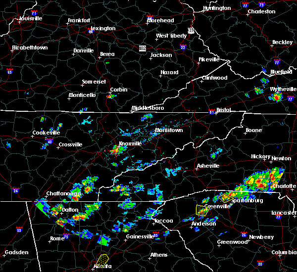 At 536 pm edt, a severe thunderstorm was located near louisville, or near knoxville, and is nearly stationary (radar indicated). Hazards include 60 mph wind gusts and quarter size hail. Hail damage to vehicles is expected. Expect wind damage to roofs, siding, and trees. At 536 pm edt, a severe thunderstorm was located near louisville, or near knoxville, and is nearly stationary (radar indicated). Hazards include 60 mph wind gusts and quarter size hail. Hail damage to vehicles is expected. Expect wind damage to roofs, siding, and trees.
|
| 8/1/2019 5:30 PM EDT | Quarter sized hail reported 6.2 miles NE of Knoxville, TN |
| 7/3/2019 10:46 PM EDT |
 At 1045 pm edt, a severe thunderstorm was located near rockford, or 9 miles east of alcoa, moving east at 10 mph (radar indicated). Hazards include 60 mph wind gusts and penny size hail. expect damage to roofs, siding, and trees At 1045 pm edt, a severe thunderstorm was located near rockford, or 9 miles east of alcoa, moving east at 10 mph (radar indicated). Hazards include 60 mph wind gusts and penny size hail. expect damage to roofs, siding, and trees
|
| 6/28/2019 4:25 PM EDT |
 At 425 pm edt, a severe thunderstorm was located near lenoir city, moving northwest at 10 mph (radar indicated). Hazards include 60 mph wind gusts and quarter size hail. Hail damage to vehicles is expected. Expect wind damage to roofs, siding, and trees. At 425 pm edt, a severe thunderstorm was located near lenoir city, moving northwest at 10 mph (radar indicated). Hazards include 60 mph wind gusts and quarter size hail. Hail damage to vehicles is expected. Expect wind damage to roofs, siding, and trees.
|
| 6/28/2019 4:06 PM EDT | Several trees down along hickory creek road in west knox count in knox county TN, 14.8 miles E of Knoxville, TN |
| 6/28/2019 4:00 PM EDT | Trees down on lonas d in knox county TN, 1.1 miles E of Knoxville, TN |
| 6/28/2019 4:00 PM EDT | Tree and power lines down in karns along oak ridge hwy. time estimated by rada in knox county TN, 7.6 miles ESE of Knoxville, TN |
| 6/28/2019 3:48 PM EDT | Trees down in the hardin valley are in knox county TN, 10.6 miles E of Knoxville, TN |
| 6/28/2019 3:48 PM EDT |
 At 348 pm edt, a severe thunderstorm was located near knoxville, moving northwest at 15 mph (radar indicated). Hazards include 60 mph wind gusts and quarter size hail. Hail damage to vehicles is expected. expect wind damage to roofs, siding, and trees. Locations impacted include, knoxville, oak ridge, clinton, oliver springs, halls, lake city, norris, andersonville, rosedale, karns, bearden, powell and norris dam state park. At 348 pm edt, a severe thunderstorm was located near knoxville, moving northwest at 15 mph (radar indicated). Hazards include 60 mph wind gusts and quarter size hail. Hail damage to vehicles is expected. expect wind damage to roofs, siding, and trees. Locations impacted include, knoxville, oak ridge, clinton, oliver springs, halls, lake city, norris, andersonville, rosedale, karns, bearden, powell and norris dam state park.
|
| 6/28/2019 3:36 PM EDT |
 At 336 pm edt, a severe thunderstorm was located near knoxville, moving northwest at 15 mph (radar indicated). Hazards include 60 mph wind gusts and quarter size hail. Hail damage to vehicles is expected. Expect wind damage to roofs, siding, and trees. At 336 pm edt, a severe thunderstorm was located near knoxville, moving northwest at 15 mph (radar indicated). Hazards include 60 mph wind gusts and quarter size hail. Hail damage to vehicles is expected. Expect wind damage to roofs, siding, and trees.
|
| 6/28/2019 3:14 PM EDT |
 At 314 pm edt, a severe thunderstorm was located 10 miles northwest of sevierville, moving northwest at 15 mph (law enforcement). Hazards include 60 mph wind gusts and quarter size hail. Hail damage to vehicles is expected. expect wind damage to roofs, siding, and trees. Locations impacted include, knoxville, sevierville, pigeon forge, strawberry plains, mcmahan, mascot, kodak, kimberlin heights and seymour. At 314 pm edt, a severe thunderstorm was located 10 miles northwest of sevierville, moving northwest at 15 mph (law enforcement). Hazards include 60 mph wind gusts and quarter size hail. Hail damage to vehicles is expected. expect wind damage to roofs, siding, and trees. Locations impacted include, knoxville, sevierville, pigeon forge, strawberry plains, mcmahan, mascot, kodak, kimberlin heights and seymour.
|
| 6/28/2019 2:54 PM EDT |
 At 253 pm edt, a severe thunderstorm was located near sevierville, moving northwest at 15 mph (law enforcement). Hazards include 60 mph wind gusts and quarter size hail. Hail damage to vehicles is expected. expect wind damage to roofs, siding, and trees. Locations impacted include, knoxville, sevierville, pigeon forge, strawberry plains, mcmahan, mascot, kodak, kimberlin heights and seymour. At 253 pm edt, a severe thunderstorm was located near sevierville, moving northwest at 15 mph (law enforcement). Hazards include 60 mph wind gusts and quarter size hail. Hail damage to vehicles is expected. expect wind damage to roofs, siding, and trees. Locations impacted include, knoxville, sevierville, pigeon forge, strawberry plains, mcmahan, mascot, kodak, kimberlin heights and seymour.
|
| 6/28/2019 2:42 PM EDT |
 At 242 pm edt, a severe thunderstorm was located near sevierville, moving northwest at 15 mph (radar indicated). Hazards include 60 mph wind gusts and quarter size hail. Hail damage to vehicles is expected. Expect wind damage to roofs, siding, and trees. At 242 pm edt, a severe thunderstorm was located near sevierville, moving northwest at 15 mph (radar indicated). Hazards include 60 mph wind gusts and quarter size hail. Hail damage to vehicles is expected. Expect wind damage to roofs, siding, and trees.
|
| 6/24/2019 5:51 PM EDT |
 The severe thunderstorm warning for loudon, southern knox, central mcminn, blount, monroe and east central roane counties will expire at 600 pm edt, the storms which prompted the warning have weakened below severe limits, and have exited the warned area. therefore, the warning will be allowed to expire. however gusty winds are still possible with these thunderstorms. a severe thunderstorm watch remains in effect until 900 pm edt for east tennessee. The severe thunderstorm warning for loudon, southern knox, central mcminn, blount, monroe and east central roane counties will expire at 600 pm edt, the storms which prompted the warning have weakened below severe limits, and have exited the warned area. therefore, the warning will be allowed to expire. however gusty winds are still possible with these thunderstorms. a severe thunderstorm watch remains in effect until 900 pm edt for east tennessee.
|
| 6/24/2019 5:47 PM EDT |
 At 547 pm edt, a severe thunderstorm was located 8 miles east of knoxville, moving east at 30 mph (radar indicated). Hazards include 60 mph wind gusts. Expect damage to roofs, siding, and trees. Locations impacted include, knoxville, sevierville, jefferson city, dandridge, new market, baneberry, strawberry plains, bird crossing, fairgarden, kimberlin heights, mcmahan, chestnut hill, mascot, piedmont and kodak. At 547 pm edt, a severe thunderstorm was located 8 miles east of knoxville, moving east at 30 mph (radar indicated). Hazards include 60 mph wind gusts. Expect damage to roofs, siding, and trees. Locations impacted include, knoxville, sevierville, jefferson city, dandridge, new market, baneberry, strawberry plains, bird crossing, fairgarden, kimberlin heights, mcmahan, chestnut hill, mascot, piedmont and kodak.
|
| 6/24/2019 5:40 PM EDT | Tree down on power lines near robinson rd and middlebrook pike. time of occurrence based on rada in knox county TN, 5.1 miles E of Knoxville, TN |
| 6/24/2019 5:36 PM EDT |
 At 535 pm edt, severe thunderstorms were located along a line extending from near knoxville to near etowah, moving east at 45 mph (radar indicated). Hazards include 60 mph wind gusts. Expect damage to roofs, siding, and trees. Locations impacted include, knoxville, oak ridge, maryville, athens, lenoir city, alcoa, sweetwater, loudon, madisonville, farragut, etowah, louisville, rockford, eagleton village, englewood, vonore, greenback, friendsville, tellico plains and niota. At 535 pm edt, severe thunderstorms were located along a line extending from near knoxville to near etowah, moving east at 45 mph (radar indicated). Hazards include 60 mph wind gusts. Expect damage to roofs, siding, and trees. Locations impacted include, knoxville, oak ridge, maryville, athens, lenoir city, alcoa, sweetwater, loudon, madisonville, farragut, etowah, louisville, rockford, eagleton village, englewood, vonore, greenback, friendsville, tellico plains and niota.
|
| 6/24/2019 5:30 PM EDT |
 At 530 pm edt, a severe thunderstorm was located over knoxville, moving east at 40 mph (radar indicated). Hazards include 60 mph wind gusts. expect damage to roofs, siding, and trees At 530 pm edt, a severe thunderstorm was located over knoxville, moving east at 40 mph (radar indicated). Hazards include 60 mph wind gusts. expect damage to roofs, siding, and trees
|
| 6/24/2019 5:20 PM EDT | Trees down in knoxville. one fell on a vehicl in knox county TN, 0.5 miles E of Knoxville, TN |
| 6/24/2019 5:08 PM EDT |
 At 507 pm edt, severe thunderstorms were located along a line extending from near oak ridge to 6 miles northwest of charleston, moving east at 45 mph (radar indicated). Hazards include 60 mph wind gusts. expect damage to roofs, siding, and trees At 507 pm edt, severe thunderstorms were located along a line extending from near oak ridge to 6 miles northwest of charleston, moving east at 45 mph (radar indicated). Hazards include 60 mph wind gusts. expect damage to roofs, siding, and trees
|
| 6/24/2019 5:03 PM EDT |
 At 502 pm edt, severe thunderstorms were located along a line extending from 6 miles north of maynardville to near farragut, moving east at 45 mph (radar indicated). Hazards include 60 mph wind gusts. Expect damage to roofs, siding, and trees. Locations impacted include, knoxville, oak ridge, clinton, lenoir city, alcoa, kingston, maynardville, farragut, oliver springs, plainview, midtown, strawberry plains, halls, blaine, norris, luttrell, rose hill, big ridge state park, karns and kimberlin heights. At 502 pm edt, severe thunderstorms were located along a line extending from 6 miles north of maynardville to near farragut, moving east at 45 mph (radar indicated). Hazards include 60 mph wind gusts. Expect damage to roofs, siding, and trees. Locations impacted include, knoxville, oak ridge, clinton, lenoir city, alcoa, kingston, maynardville, farragut, oliver springs, plainview, midtown, strawberry plains, halls, blaine, norris, luttrell, rose hill, big ridge state park, karns and kimberlin heights.
|
| 6/24/2019 4:36 PM EDT |
 At 436 pm edt, severe thunderstorms were located along a line extending from 6 miles southeast of la follette to near oak ridge, moving east at 30 mph (radar indicated). Hazards include 60 mph wind gusts and penny size hail. expect damage to roofs, siding, and trees At 436 pm edt, severe thunderstorms were located along a line extending from 6 miles southeast of la follette to near oak ridge, moving east at 30 mph (radar indicated). Hazards include 60 mph wind gusts and penny size hail. expect damage to roofs, siding, and trees
|
| 6/21/2019 11:51 PM EDT |
 At 1151 pm edt, severe thunderstorms were located along a line extending from 7 miles southeast of cubage to 8 miles west of pigeon forge, moving east at 50 mph (radar indicated). Hazards include 60 mph wind gusts. Expect damage to roofs, siding, and trees. Locations impacted include, sevierville, jefferson city, dandridge, rutledge, pigeon forge, new tazewell, bean station, tazewell, new market, strawberry plains, blaine, lone mountain, howard quarter, rose hill, buffalo springs, kimberlin heights, ewing, joppa, seymour and kodak. At 1151 pm edt, severe thunderstorms were located along a line extending from 7 miles southeast of cubage to 8 miles west of pigeon forge, moving east at 50 mph (radar indicated). Hazards include 60 mph wind gusts. Expect damage to roofs, siding, and trees. Locations impacted include, sevierville, jefferson city, dandridge, rutledge, pigeon forge, new tazewell, bean station, tazewell, new market, strawberry plains, blaine, lone mountain, howard quarter, rose hill, buffalo springs, kimberlin heights, ewing, joppa, seymour and kodak.
|
| 6/21/2019 11:50 PM EDT |
 At 1131 pm edt, severe thunderstorms were located along a line extending from near noetown to 7 miles northeast of knoxville, moving east at 50 mph (radar indicated). Hazards include 60 mph wind gusts. Expect damage to roofs, siding, and trees. Locations impacted include, knoxville, maynardville, new tazewell, plainview, harrogate, halls, luttrell, springdale, cumberland gap, arthur, paulette, rose hill, big ridge state park, sharps chapel, sandlick, house mountain state park, clairfield, maloneyville, mascot and norris lake. At 1131 pm edt, severe thunderstorms were located along a line extending from near noetown to 7 miles northeast of knoxville, moving east at 50 mph (radar indicated). Hazards include 60 mph wind gusts. Expect damage to roofs, siding, and trees. Locations impacted include, knoxville, maynardville, new tazewell, plainview, harrogate, halls, luttrell, springdale, cumberland gap, arthur, paulette, rose hill, big ridge state park, sharps chapel, sandlick, house mountain state park, clairfield, maloneyville, mascot and norris lake.
|
| 6/21/2019 11:39 PM EDT | Trees down and power outages near roberts rd and millertown pik in knox county TN, 13.9 miles SW of Knoxville, TN |
| 6/21/2019 11:39 PM EDT | Power lines down and traffic lights without powe in knox county TN, 5 miles SW of Knoxville, TN |
| 6/21/2019 11:38 PM EDT | Power lines dow in knox county TN, 8.7 miles NE of Knoxville, TN |
| 6/21/2019 11:37 PM EDT |
 At 1137 pm edt, severe thunderstorms were located along a line extending from hutch to eagleton village, moving east at 50 mph (radar indicated). Hazards include 60 mph wind gusts. expect damage to roofs, siding, and trees At 1137 pm edt, severe thunderstorms were located along a line extending from hutch to eagleton village, moving east at 50 mph (radar indicated). Hazards include 60 mph wind gusts. expect damage to roofs, siding, and trees
|
| 6/21/2019 11:33 PM EDT |
 At 1133 pm edt, a severe thunderstorm was located near knoxville, moving east at 50 mph (radar indicated). Hazards include 60 mph wind gusts. Expect damage to roofs, siding, and trees. Locations impacted include, knoxville, alcoa, farragut, louisville, rockford, eagleton village, lake forest, bearden, powell, karns, wildwood and seymour. At 1133 pm edt, a severe thunderstorm was located near knoxville, moving east at 50 mph (radar indicated). Hazards include 60 mph wind gusts. Expect damage to roofs, siding, and trees. Locations impacted include, knoxville, alcoa, farragut, louisville, rockford, eagleton village, lake forest, bearden, powell, karns, wildwood and seymour.
|
| 6/21/2019 11:32 PM EDT |
 At 1131 pm edt, severe thunderstorms were located along a line extending from near noetown to 7 miles northeast of knoxville, moving east at 50 mph (radar indicated). Hazards include 60 mph wind gusts. Expect damage to roofs, siding, and trees. Locations impacted include, knoxville, maynardville, new tazewell, plainview, harrogate, halls, luttrell, springdale, cumberland gap, arthur, paulette, rose hill, big ridge state park, sharps chapel, sandlick, house mountain state park, clairfield, maloneyville, mascot and norris lake. At 1131 pm edt, severe thunderstorms were located along a line extending from near noetown to 7 miles northeast of knoxville, moving east at 50 mph (radar indicated). Hazards include 60 mph wind gusts. Expect damage to roofs, siding, and trees. Locations impacted include, knoxville, maynardville, new tazewell, plainview, harrogate, halls, luttrell, springdale, cumberland gap, arthur, paulette, rose hill, big ridge state park, sharps chapel, sandlick, house mountain state park, clairfield, maloneyville, mascot and norris lake.
|
| 6/21/2019 11:19 PM EDT |
 At 1119 pm edt, a severe thunderstorm was located near oak ridge, moving east at 50 mph (radar indicated). Hazards include 60 mph wind gusts. expect damage to roofs, siding, and trees At 1119 pm edt, a severe thunderstorm was located near oak ridge, moving east at 50 mph (radar indicated). Hazards include 60 mph wind gusts. expect damage to roofs, siding, and trees
|
| 6/21/2019 11:15 PM EDT |
 At 1115 pm edt, severe thunderstorms were located along a line extending from wilkerson to clinton, moving east at 50 mph (radar indicated). Hazards include 60 mph wind gusts. expect damage to roofs, siding, and trees At 1115 pm edt, severe thunderstorms were located along a line extending from wilkerson to clinton, moving east at 50 mph (radar indicated). Hazards include 60 mph wind gusts. expect damage to roofs, siding, and trees
|
| 6/20/2019 5:44 PM EDT |
 At 544 pm edt, a severe thunderstorm was located 10 miles northwest of sevierville, moving southeast at 30 mph (radar indicated). Hazards include 60 mph wind gusts and quarter size hail. Hail damage to vehicles is expected. Expect wind damage to roofs, siding, and trees. At 544 pm edt, a severe thunderstorm was located 10 miles northwest of sevierville, moving southeast at 30 mph (radar indicated). Hazards include 60 mph wind gusts and quarter size hail. Hail damage to vehicles is expected. Expect wind damage to roofs, siding, and trees.
|
| 6/20/2019 5:34 PM EDT |
 At 534 pm edt, a severe thunderstorm capable of producing a tornado was located 10 miles northeast of knoxville, moving southeast at 30 mph (radar indicated rotation). Hazards include tornado and quarter size hail. Flying debris will be dangerous to those caught without shelter. mobile homes will be damaged or destroyed. damage to roofs, windows, and vehicles will occur. tree damage is likely. Locations impacted include, knoxville, mascot, kimberlin heights and seymour. At 534 pm edt, a severe thunderstorm capable of producing a tornado was located 10 miles northeast of knoxville, moving southeast at 30 mph (radar indicated rotation). Hazards include tornado and quarter size hail. Flying debris will be dangerous to those caught without shelter. mobile homes will be damaged or destroyed. damage to roofs, windows, and vehicles will occur. tree damage is likely. Locations impacted include, knoxville, mascot, kimberlin heights and seymour.
|
| 6/20/2019 5:32 PM EDT | Tree blocking shannondale roa in knox county TN, 8.3 miles SSW of Knoxville, TN |
| 6/20/2019 5:26 PM EDT |
 At 526 pm edt, a severe thunderstorm capable of producing a tornado was located 7 miles northeast of knoxville, moving southeast at 30 mph (radar indicated rotation). Hazards include tornado and quarter size hail. Flying debris will be dangerous to those caught without shelter. mobile homes will be damaged or destroyed. damage to roofs, windows, and vehicles will occur. tree damage is likely. Locations impacted include, knoxville, maloneyville, house mountain state park, mascot, kimberlin heights and seymour. At 526 pm edt, a severe thunderstorm capable of producing a tornado was located 7 miles northeast of knoxville, moving southeast at 30 mph (radar indicated rotation). Hazards include tornado and quarter size hail. Flying debris will be dangerous to those caught without shelter. mobile homes will be damaged or destroyed. damage to roofs, windows, and vehicles will occur. tree damage is likely. Locations impacted include, knoxville, maloneyville, house mountain state park, mascot, kimberlin heights and seymour.
|
| 6/20/2019 5:19 PM EDT |
 The national weather service in morristown has issued a * tornado warning for. northeastern knox county in east tennessee. until 545 pm edt. At 518 pm edt, a severe thunderstorm capable of producing a tornado was located 7 miles north of knoxville, moving southeast at 30 mph. The national weather service in morristown has issued a * tornado warning for. northeastern knox county in east tennessee. until 545 pm edt. At 518 pm edt, a severe thunderstorm capable of producing a tornado was located 7 miles north of knoxville, moving southeast at 30 mph.
|
| 6/20/2019 8:27 AM EDT |
 The severe thunderstorm warning for knox, eastern blount, jefferson and sevier counties will expire at 830 am edt, the storms which prompted the warning have weakened below severe limits, and have exited the warned area. therefore, the warning will be allowed to expire. The severe thunderstorm warning for knox, eastern blount, jefferson and sevier counties will expire at 830 am edt, the storms which prompted the warning have weakened below severe limits, and have exited the warned area. therefore, the warning will be allowed to expire.
|
| 6/20/2019 8:01 AM EDT |
 At 801 am edt, severe thunderstorms were located along a line extending from near plainview to near sevierville to near pigeon forge to near gatlinburg, moving northeast at 55 mph (radar indicated). Hazards include 60 mph wind gusts. Expect damage to roofs, siding, and trees. Locations impacted include, knoxville, maryville, sevierville, alcoa, jefferson city, gatlinburg, dandridge, pigeon forge, louisville, white pine, plainview, new market, rockford, baneberry, smoky mountains-newfound gap, eagleton village, smoky mountains-fontana area, strawberry plains, halls and blaine. At 801 am edt, severe thunderstorms were located along a line extending from near plainview to near sevierville to near pigeon forge to near gatlinburg, moving northeast at 55 mph (radar indicated). Hazards include 60 mph wind gusts. Expect damage to roofs, siding, and trees. Locations impacted include, knoxville, maryville, sevierville, alcoa, jefferson city, gatlinburg, dandridge, pigeon forge, louisville, white pine, plainview, new market, rockford, baneberry, smoky mountains-newfound gap, eagleton village, smoky mountains-fontana area, strawberry plains, halls and blaine.
|
| 6/20/2019 7:26 AM EDT |
 At 726 am edt, severe thunderstorms were located along a line extending from near oak ridge to 7 miles southwest of louisville to 12 miles southwest of maryville to near smoky mountains-twentymile creek, moving northeast at 45 mph (radar indicated). Hazards include 60 mph wind gusts. expect damage to roofs, siding, and trees At 726 am edt, severe thunderstorms were located along a line extending from near oak ridge to 7 miles southwest of louisville to 12 miles southwest of maryville to near smoky mountains-twentymile creek, moving northeast at 45 mph (radar indicated). Hazards include 60 mph wind gusts. expect damage to roofs, siding, and trees
|
| 5/18/2019 7:00 PM EDT |
 At 700 pm edt, a severe thunderstorm was located 10 miles south of plainview, or 11 miles northeast of knoxville, moving north at 10 mph (radar indicated). Hazards include 60 mph wind gusts and quarter size hail. Hail damage to vehicles is expected. expect wind damage to roofs, siding, and trees. Locations impacted include, knoxville and mascot. At 700 pm edt, a severe thunderstorm was located 10 miles south of plainview, or 11 miles northeast of knoxville, moving north at 10 mph (radar indicated). Hazards include 60 mph wind gusts and quarter size hail. Hail damage to vehicles is expected. expect wind damage to roofs, siding, and trees. Locations impacted include, knoxville and mascot.
|
| 5/18/2019 6:43 PM EDT | Tree across road at the 100 block of richmond avenu in knox county TN, 1.5 miles SSW of Knoxville, TN |
| 5/18/2019 6:34 PM EDT |
 At 633 pm edt, a severe thunderstorm was located 9 miles east of rockford, or 10 miles west of sevierville, moving north at 5 mph (radar indicated). Hazards include 60 mph wind gusts and quarter size hail. Hail damage to vehicles is expected. Expect wind damage to roofs, siding, and trees. At 633 pm edt, a severe thunderstorm was located 9 miles east of rockford, or 10 miles west of sevierville, moving north at 5 mph (radar indicated). Hazards include 60 mph wind gusts and quarter size hail. Hail damage to vehicles is expected. Expect wind damage to roofs, siding, and trees.
|
| 5/18/2019 6:31 PM EDT | Trees down at the corner of forest hill drive and gleason driv in knox county TN, 4.4 miles ENE of Knoxville, TN |
| 5/18/2019 6:09 PM EDT |
 At 609 pm edt, a severe thunderstorm was located over alcoa, moving north at 10 mph (trained weather spotters). Hazards include 60 mph wind gusts and quarter size hail. Hail damage to vehicles is expected. expect wind damage to roofs, siding, and trees. Locations impacted include, maryville, alcoa, louisville, rockford and eagleton village. At 609 pm edt, a severe thunderstorm was located over alcoa, moving north at 10 mph (trained weather spotters). Hazards include 60 mph wind gusts and quarter size hail. Hail damage to vehicles is expected. expect wind damage to roofs, siding, and trees. Locations impacted include, maryville, alcoa, louisville, rockford and eagleton village.
|
| 5/18/2019 5:51 PM EDT |
 At 551 pm edt, a severe thunderstorm was located near maryville, moving northeast at 5 mph (radar indicated). Hazards include 60 mph wind gusts and quarter size hail. Hail damage to vehicles is expected. Expect wind damage to roofs, siding, and trees. At 551 pm edt, a severe thunderstorm was located near maryville, moving northeast at 5 mph (radar indicated). Hazards include 60 mph wind gusts and quarter size hail. Hail damage to vehicles is expected. Expect wind damage to roofs, siding, and trees.
|
| 4/14/2019 6:01 PM EDT |
 At 600 pm edt, a severe thunderstorm was located near sevierville, moving northeast at 65 mph (radar indicated). Hazards include 60 mph wind gusts and penny size hail. expect damage to roofs, siding, and trees At 600 pm edt, a severe thunderstorm was located near sevierville, moving northeast at 65 mph (radar indicated). Hazards include 60 mph wind gusts and penny size hail. expect damage to roofs, siding, and trees
|
| 11/6/2018 4:52 AM EST |
 At 452 am est, severe thunderstorms were located along a line extending from 8 miles east of knoxville to 11 miles southeast of eagleton village, moving northeast at 65 mph (radar indicated). Hazards include 60 mph wind gusts. expect damage to roofs, siding, and trees At 452 am est, severe thunderstorms were located along a line extending from 8 miles east of knoxville to 11 miles southeast of eagleton village, moving northeast at 65 mph (radar indicated). Hazards include 60 mph wind gusts. expect damage to roofs, siding, and trees
|
| 11/6/2018 4:49 AM EST |
 At 449 am est, severe thunderstorms were located along a line extending from 10 miles southeast of la follette to near knoxville, moving northeast at 55 mph (radar indicated). Hazards include 60 mph wind gusts. expect damage to roofs, siding, and trees At 449 am est, severe thunderstorms were located along a line extending from 10 miles southeast of la follette to near knoxville, moving northeast at 55 mph (radar indicated). Hazards include 60 mph wind gusts. expect damage to roofs, siding, and trees
|
| 11/6/2018 4:31 AM EST |
 At 431 am est, severe thunderstorms were located along a line extending from near oak ridge to 9 miles northwest of smoky mountains-twentymile creek, moving northeast at 50 mph (radar indicated). Hazards include 60 mph wind gusts. Expect damage to roofs, siding, and trees. locations impacted include, knoxville, oak ridge, maryville, clinton, alcoa, farragut, louisville, rockford, eagleton village, halls, greenback, friendsville, townsend, walland, karns, clover hill, cades cove, happy valley, wildwood and talassee. A tornado watch remains in effect until 900 am est for east tennessee. At 431 am est, severe thunderstorms were located along a line extending from near oak ridge to 9 miles northwest of smoky mountains-twentymile creek, moving northeast at 50 mph (radar indicated). Hazards include 60 mph wind gusts. Expect damage to roofs, siding, and trees. locations impacted include, knoxville, oak ridge, maryville, clinton, alcoa, farragut, louisville, rockford, eagleton village, halls, greenback, friendsville, townsend, walland, karns, clover hill, cades cove, happy valley, wildwood and talassee. A tornado watch remains in effect until 900 am est for east tennessee.
|
| 11/6/2018 4:16 AM EST |
 At 415 am est, severe thunderstorms were located along a line extending from 6 miles southwest of oak ridge to 8 miles east of madisonville, moving northeast at 65 mph (radar indicated. at 353 am est, damaging wind was reported in athens). Hazards include 60 mph wind gusts. expect damage to roofs, siding, and trees At 415 am est, severe thunderstorms were located along a line extending from 6 miles southwest of oak ridge to 8 miles east of madisonville, moving northeast at 65 mph (radar indicated. at 353 am est, damaging wind was reported in athens). Hazards include 60 mph wind gusts. expect damage to roofs, siding, and trees
|
| 9/9/2018 4:33 PM EDT |
 At 432 pm edt, a severe thunderstorm was located over farragut, or 9 miles southeast of oak ridge, moving northeast at 30 mph (radar indicated). Hazards include 60 mph wind gusts. Expect damage to roofs, siding, and trees. Locations impacted include, knoxville, oak ridge, clinton, lenoir city, alcoa, farragut, louisville, bearden, powell and karns. At 432 pm edt, a severe thunderstorm was located over farragut, or 9 miles southeast of oak ridge, moving northeast at 30 mph (radar indicated). Hazards include 60 mph wind gusts. Expect damage to roofs, siding, and trees. Locations impacted include, knoxville, oak ridge, clinton, lenoir city, alcoa, farragut, louisville, bearden, powell and karns.
|
| 9/9/2018 4:08 PM EDT |
 At 407 pm edt, a severe thunderstorm was located over loudon, moving northeast at 30 mph (radar indicated). Hazards include 60 mph wind gusts and penny size hail. expect damage to roofs, siding, and trees At 407 pm edt, a severe thunderstorm was located over loudon, moving northeast at 30 mph (radar indicated). Hazards include 60 mph wind gusts and penny size hail. expect damage to roofs, siding, and trees
|
| 8/8/2018 2:33 PM EDT |
 At 232 pm edt, a severe thunderstorm was located over lenoir city, moving east at 20 mph (radar indicated). Hazards include 60 mph wind gusts and penny size hail. expect damage to roofs, siding, and trees At 232 pm edt, a severe thunderstorm was located over lenoir city, moving east at 20 mph (radar indicated). Hazards include 60 mph wind gusts and penny size hail. expect damage to roofs, siding, and trees
|
| 7/21/2018 2:41 AM EDT |
 At 241 am edt, a severe thunderstorm was located over maynardville, moving southeast at 30 mph (radar indicated). Hazards include 60 mph wind gusts and penny size hail. Expect damage to roofs, siding, and trees. locations impacted include, knoxville, clinton, maynardville, rutledge, new tazewell, tazewell, plainview, halls, blaine, norris, luttrell, lone mountain, buffalo springs, rose hill, big ridge state park, maloneyville, mascot, joppa, springdale and thorn hill. A tornado watch remains in effect until 400 am edt for east tennessee. At 241 am edt, a severe thunderstorm was located over maynardville, moving southeast at 30 mph (radar indicated). Hazards include 60 mph wind gusts and penny size hail. Expect damage to roofs, siding, and trees. locations impacted include, knoxville, clinton, maynardville, rutledge, new tazewell, tazewell, plainview, halls, blaine, norris, luttrell, lone mountain, buffalo springs, rose hill, big ridge state park, maloneyville, mascot, joppa, springdale and thorn hill. A tornado watch remains in effect until 400 am edt for east tennessee.
|
| 7/21/2018 2:16 AM EDT |
 At 215 am edt, a severe thunderstorm was located 8 miles east of la follette, moving southeast at 30 mph (radar indicated). Hazards include 60 mph wind gusts and penny size hail. expect damage to roofs, siding, and trees At 215 am edt, a severe thunderstorm was located 8 miles east of la follette, moving southeast at 30 mph (radar indicated). Hazards include 60 mph wind gusts and penny size hail. expect damage to roofs, siding, and trees
|
| 7/20/2018 10:53 PM EDT |
 At 1052 pm edt, severe thunderstorms were located along a line extending from near new market to 8 miles east of rockford, moving southeast at 35 mph (radar indicated). Hazards include 60 mph wind gusts and penny size hail. Expect damage to roofs, siding, and trees. locations impacted include, knoxville, sevierville, alcoa, gatlinburg, pigeon forge, rockford, strawberry plains, pittman center, townsend, fairgarden, kimberlin heights, wildwood, mcmahan, wears valley, lake forest, harrisburg, elkmont, great smoky mountains national park, roundtop mountain state park and seymour. A tornado watch remains in effect until 400 am edt for east tennessee. At 1052 pm edt, severe thunderstorms were located along a line extending from near new market to 8 miles east of rockford, moving southeast at 35 mph (radar indicated). Hazards include 60 mph wind gusts and penny size hail. Expect damage to roofs, siding, and trees. locations impacted include, knoxville, sevierville, alcoa, gatlinburg, pigeon forge, rockford, strawberry plains, pittman center, townsend, fairgarden, kimberlin heights, wildwood, mcmahan, wears valley, lake forest, harrisburg, elkmont, great smoky mountains national park, roundtop mountain state park and seymour. A tornado watch remains in effect until 400 am edt for east tennessee.
|
| 7/20/2018 10:45 PM EDT | Several trees down. one tree over a ca in knox county TN, 9.2 miles SSW of Knoxville, TN |
| 7/20/2018 10:17 PM EDT |
 At 1017 pm edt, severe thunderstorms were located along a line extending from near maynardville to 6 miles northwest of knoxville, moving southeast at 45 mph (radar indicated). Hazards include 60 mph wind gusts and penny size hail. expect damage to roofs, siding, and trees At 1017 pm edt, severe thunderstorms were located along a line extending from near maynardville to 6 miles northwest of knoxville, moving southeast at 45 mph (radar indicated). Hazards include 60 mph wind gusts and penny size hail. expect damage to roofs, siding, and trees
|
| 7/1/2018 5:05 PM EDT |
 At 505 pm edt, a severe thunderstorm was located near farragut, or 7 miles east of oak ridge, moving northwest at 15 mph (radar indicated). Hazards include 60 mph wind gusts and penny size hail. Expect damage to roofs, siding, and trees. Locations impacted include, knoxville, oak ridge, farragut, oliver springs and karns. At 505 pm edt, a severe thunderstorm was located near farragut, or 7 miles east of oak ridge, moving northwest at 15 mph (radar indicated). Hazards include 60 mph wind gusts and penny size hail. Expect damage to roofs, siding, and trees. Locations impacted include, knoxville, oak ridge, farragut, oliver springs and karns.
|
| 7/1/2018 4:40 PM EDT |
 At 440 pm edt, a severe thunderstorm was located near louisville, or 8 miles northwest of alcoa, moving northwest at 15 mph (radar indicated). Hazards include 60 mph wind gusts and quarter size hail. Hail damage to vehicles is expected. Expect wind damage to roofs, siding, and trees. At 440 pm edt, a severe thunderstorm was located near louisville, or 8 miles northwest of alcoa, moving northwest at 15 mph (radar indicated). Hazards include 60 mph wind gusts and quarter size hail. Hail damage to vehicles is expected. Expect wind damage to roofs, siding, and trees.
|
| 6/26/2018 5:43 PM EDT |
 At 542 pm edt, severe thunderstorms were located along a line extending from 8 miles north of parrottsville to 6 miles east of sevierville to near eagleton village, moving southeast at 35 mph (law enforcement). Hazards include 60 mph wind gusts and quarter size hail. Hail damage to vehicles is expected. expect wind damage to roofs, siding, and trees. Locations impacted include, knoxville, morristown, sevierville, alcoa, jefferson city, newport, gatlinburg, dandridge, pigeon forge, white pine, new market, rockford, baneberry, parrottsville, russellville, eagleton village, pittman center, townsend, caney branch and del rio. At 542 pm edt, severe thunderstorms were located along a line extending from 8 miles north of parrottsville to 6 miles east of sevierville to near eagleton village, moving southeast at 35 mph (law enforcement). Hazards include 60 mph wind gusts and quarter size hail. Hail damage to vehicles is expected. expect wind damage to roofs, siding, and trees. Locations impacted include, knoxville, morristown, sevierville, alcoa, jefferson city, newport, gatlinburg, dandridge, pigeon forge, white pine, new market, rockford, baneberry, parrottsville, russellville, eagleton village, pittman center, townsend, caney branch and del rio.
|
| 6/26/2018 5:34 PM EDT |
 At 534 pm edt/434 pm cdt/, severe thunderstorms were located along a line extending from near louisville to near spencer, moving southeast at 40 mph (radar indicated). Hazards include 60 mph wind gusts and quarter size hail. Hail damage to vehicles is expected. Expect wind damage to roofs, siding, and trees. At 534 pm edt/434 pm cdt/, severe thunderstorms were located along a line extending from near louisville to near spencer, moving southeast at 40 mph (radar indicated). Hazards include 60 mph wind gusts and quarter size hail. Hail damage to vehicles is expected. Expect wind damage to roofs, siding, and trees.
|
| 6/26/2018 5:33 PM EDT |
 At 532 pm edt, severe thunderstorms were located along a line extending from 7 miles northeast of rockford to near lenoir city to 7 miles southwest of fairview, moving southeast at 45 mph (radar indicated). Hazards include 60 mph wind gusts and quarter size hail. Hail damage to vehicles is expected. expect wind damage to roofs, siding, and trees. Locations impacted include, knoxville, oak ridge, maryville, clinton, lenoir city, alcoa, kingston, rockwood, loudon, farragut, fairview, oliver springs, louisville, rockford, midtown, eagleton village, harriman, friendsville, philadelphia and karns. At 532 pm edt, severe thunderstorms were located along a line extending from 7 miles northeast of rockford to near lenoir city to 7 miles southwest of fairview, moving southeast at 45 mph (radar indicated). Hazards include 60 mph wind gusts and quarter size hail. Hail damage to vehicles is expected. expect wind damage to roofs, siding, and trees. Locations impacted include, knoxville, oak ridge, maryville, clinton, lenoir city, alcoa, kingston, rockwood, loudon, farragut, fairview, oliver springs, louisville, rockford, midtown, eagleton village, harriman, friendsville, philadelphia and karns.
|
| 6/26/2018 5:27 PM EDT |
 At 527 pm edt, severe thunderstorms were located along a line extending from near morristown to 6 miles southwest of new market to near louisville, moving southeast at 35 mph (radar indicated). Hazards include 60 mph wind gusts and quarter size hail. Hail damage to vehicles is expected. Expect wind damage to roofs, siding, and trees. At 527 pm edt, severe thunderstorms were located along a line extending from near morristown to 6 miles southwest of new market to near louisville, moving southeast at 35 mph (radar indicated). Hazards include 60 mph wind gusts and quarter size hail. Hail damage to vehicles is expected. Expect wind damage to roofs, siding, and trees.
|
| 6/26/2018 5:20 PM EDT | Quarter sized hail reported 1.8 miles SW of Knoxville, TN, reported at different locations across knoxville. |
| 6/26/2018 5:17 PM EDT |
 At 516 pm edt, severe thunderstorms were located along a line extending from 6 miles northeast of bean station to near new market to near knoxville, moving southeast at 45 mph (radar indicated). Hazards include 60 mph wind gusts and quarter size hail. Hail damage to vehicles is expected. expect wind damage to roofs, siding, and trees. Locations impacted include, knoxville, morristown, sevierville, jefferson city, dandridge, rutledge, bean station, white pine, plainview, new market, baneberry, russellville, strawberry plains, halls, blaine, bulls gap, panther creek state park, buffalo springs, kimberlin heights and mooresburg. At 516 pm edt, severe thunderstorms were located along a line extending from 6 miles northeast of bean station to near new market to near knoxville, moving southeast at 45 mph (radar indicated). Hazards include 60 mph wind gusts and quarter size hail. Hail damage to vehicles is expected. expect wind damage to roofs, siding, and trees. Locations impacted include, knoxville, morristown, sevierville, jefferson city, dandridge, rutledge, bean station, white pine, plainview, new market, baneberry, russellville, strawberry plains, halls, blaine, bulls gap, panther creek state park, buffalo springs, kimberlin heights and mooresburg.
|
| 6/26/2018 5:15 PM EDT | Several trees dow in knox county TN, 1.8 miles SW of Knoxville, TN |
| 6/26/2018 5:04 PM EDT |
 At 448 pm edt, severe thunderstorms were located along a line extending from near tazewell to near maynardville to 6 miles north of clinton, moving southeast at 45 mph (radar indicated). Hazards include 60 mph wind gusts and quarter size hail. Hail damage to vehicles is expected. Expect wind damage to roofs, siding, and trees. At 448 pm edt, severe thunderstorms were located along a line extending from near tazewell to near maynardville to 6 miles north of clinton, moving southeast at 45 mph (radar indicated). Hazards include 60 mph wind gusts and quarter size hail. Hail damage to vehicles is expected. Expect wind damage to roofs, siding, and trees.
|
| 6/26/2018 4:57 PM EDT |
 The national weather service in morristown has issued a * severe thunderstorm warning for. southeastern morgan county in east tennessee. loudon county in east tennessee. southwestern knox county in east tennessee. Anderson county in east tennessee. The national weather service in morristown has issued a * severe thunderstorm warning for. southeastern morgan county in east tennessee. loudon county in east tennessee. southwestern knox county in east tennessee. Anderson county in east tennessee.
|
| 6/26/2018 4:55 PM EDT | One large tree down in knox county TN, 9.2 miles SSW of Knoxville, TN |
| 6/26/2018 4:49 PM EDT |
 At 448 pm edt, severe thunderstorms were located along a line extending from near tazewell to near maynardville to 6 miles north of clinton, moving southeast at 45 mph (radar indicated). Hazards include 60 mph wind gusts and quarter size hail. Hail damage to vehicles is expected. Expect wind damage to roofs, siding, and trees. At 448 pm edt, severe thunderstorms were located along a line extending from near tazewell to near maynardville to 6 miles north of clinton, moving southeast at 45 mph (radar indicated). Hazards include 60 mph wind gusts and quarter size hail. Hail damage to vehicles is expected. Expect wind damage to roofs, siding, and trees.
|
| 6/26/2018 4:20 PM EDT | Quarter sized hail reported 1.8 miles SW of Knoxville, TN, reported at different locations across knoxville. |
| 6/25/2018 1:45 PM EDT |
 At 145 pm edt, a severe thunderstorm was located near sevierville, moving east at 35 mph (radar indicated). Hazards include 60 mph wind gusts and penny size hail. expect damage to roofs, siding, and trees At 145 pm edt, a severe thunderstorm was located near sevierville, moving east at 35 mph (radar indicated). Hazards include 60 mph wind gusts and penny size hail. expect damage to roofs, siding, and trees
|
| 6/25/2018 1:30 PM EDT | Trees and power lines were reported down in the eastern part of knoxvill in knox county TN, 1.8 miles SW of Knoxville, TN |
| 6/25/2018 1:24 PM EDT |
 At 124 pm edt, a severe thunderstorm was located near lenoir city, moving east at 25 mph (radar indicated). Hazards include 60 mph wind gusts and quarter size hail. Hail damage to vehicles is expected. expect wind damage to roofs, siding, and trees. Locations impacted include, maryville, lenoir city, alcoa, loudon, louisville, rockford, eagleton village, vonore, greenback, friendsville, philadelphia, happy valley, clover hill and tellico village. At 124 pm edt, a severe thunderstorm was located near lenoir city, moving east at 25 mph (radar indicated). Hazards include 60 mph wind gusts and quarter size hail. Hail damage to vehicles is expected. expect wind damage to roofs, siding, and trees. Locations impacted include, maryville, lenoir city, alcoa, loudon, louisville, rockford, eagleton village, vonore, greenback, friendsville, philadelphia, happy valley, clover hill and tellico village.
|
| 6/25/2018 1:22 PM EDT |
 At 122 pm edt, a severe thunderstorm was located over knoxville, moving east at 30 mph (radar indicated). Hazards include 60 mph wind gusts and penny size hail. Expect damage to roofs, siding, and trees. Locations impacted include, knoxville, sevierville, alcoa, louisville, rockford, kimberlin heights, mcmahan, lake forest, bearden, powell, seymour, kodak and mascot. At 122 pm edt, a severe thunderstorm was located over knoxville, moving east at 30 mph (radar indicated). Hazards include 60 mph wind gusts and penny size hail. Expect damage to roofs, siding, and trees. Locations impacted include, knoxville, sevierville, alcoa, louisville, rockford, kimberlin heights, mcmahan, lake forest, bearden, powell, seymour, kodak and mascot.
|
| 6/25/2018 1:05 PM EDT |
 At 105 pm edt, a severe thunderstorm was located over loudon, moving east at 25 mph (radar indicated). Hazards include 60 mph wind gusts and quarter size hail. Hail damage to vehicles is expected. Expect wind damage to roofs, siding, and trees. At 105 pm edt, a severe thunderstorm was located over loudon, moving east at 25 mph (radar indicated). Hazards include 60 mph wind gusts and quarter size hail. Hail damage to vehicles is expected. Expect wind damage to roofs, siding, and trees.
|
| 6/25/2018 1:01 PM EDT |
 At 101 pm edt, a severe thunderstorm was located near farragut, or 8 miles east of oak ridge, moving east at 30 mph (radar indicated). Hazards include 60 mph wind gusts and quarter size hail. Hail damage to vehicles is expected. Expect wind damage to roofs, siding, and trees. At 101 pm edt, a severe thunderstorm was located near farragut, or 8 miles east of oak ridge, moving east at 30 mph (radar indicated). Hazards include 60 mph wind gusts and quarter size hail. Hail damage to vehicles is expected. Expect wind damage to roofs, siding, and trees.
|
| 5/18/2018 5:52 PM EDT |
 At 552 pm edt, a severe thunderstorm was located near knoxville, moving north at 30 mph (radar indicated). Hazards include 60 mph wind gusts and penny size hail. Expect damage to roofs, siding, and trees. Locations impacted include, knoxville, maryville, clinton, alcoa, louisville, rockford, eagleton village, halls, karns, kimberlin heights, wildwood, mcmahan, lake forest, maloneyville, mascot, bearden, powell, seymour, house mountain state park and walland. At 552 pm edt, a severe thunderstorm was located near knoxville, moving north at 30 mph (radar indicated). Hazards include 60 mph wind gusts and penny size hail. Expect damage to roofs, siding, and trees. Locations impacted include, knoxville, maryville, clinton, alcoa, louisville, rockford, eagleton village, halls, karns, kimberlin heights, wildwood, mcmahan, lake forest, maloneyville, mascot, bearden, powell, seymour, house mountain state park and walland.
|
| 5/18/2018 5:34 PM EDT |
 At 533 pm edt, a severe thunderstorm was located over alcoa, moving north at 30 mph (radar indicated). Hazards include 60 mph wind gusts and penny size hail. expect damage to roofs, siding, and trees At 533 pm edt, a severe thunderstorm was located over alcoa, moving north at 30 mph (radar indicated). Hazards include 60 mph wind gusts and penny size hail. expect damage to roofs, siding, and trees
|
| 5/15/2018 6:42 PM EDT |
 At 642 pm edt, a severe thunderstorm was located 9 miles east of knoxville, moving southwest at 5 mph (radar indicated). Hazards include 60 mph wind gusts and quarter size hail. Hail damage to vehicles is expected. expect wind damage to roofs, siding, and trees. Locations impacted include, knoxville, strawberry plains and mascot. At 642 pm edt, a severe thunderstorm was located 9 miles east of knoxville, moving southwest at 5 mph (radar indicated). Hazards include 60 mph wind gusts and quarter size hail. Hail damage to vehicles is expected. expect wind damage to roofs, siding, and trees. Locations impacted include, knoxville, strawberry plains and mascot.
|
| 5/15/2018 6:13 PM EDT |
 At 613 pm edt, a severe thunderstorm was located 10 miles east of knoxville, moving southwest at 5 mph (radar indicated). Hazards include 60 mph wind gusts and quarter size hail. Hail damage to vehicles is expected. Expect wind damage to roofs, siding, and trees. At 613 pm edt, a severe thunderstorm was located 10 miles east of knoxville, moving southwest at 5 mph (radar indicated). Hazards include 60 mph wind gusts and quarter size hail. Hail damage to vehicles is expected. Expect wind damage to roofs, siding, and trees.
|
| 4/4/2018 1:44 AM EDT |
 At 144 am edt, severe thunderstorms were located along a line extending from knoxville to near maryville, moving east at 45 mph (radar indicated). Hazards include 60 mph wind gusts. expect damage to roofs, siding, and trees At 144 am edt, severe thunderstorms were located along a line extending from knoxville to near maryville, moving east at 45 mph (radar indicated). Hazards include 60 mph wind gusts. expect damage to roofs, siding, and trees
|
| 4/4/2018 1:26 AM EDT |
 At 125 am edt, severe thunderstorms were located along a line extending from 7 miles north of maynardville to near knoxville, moving east at 50 mph (radar indicated). Hazards include 60 mph wind gusts. expect damage to roofs, siding, and trees At 125 am edt, severe thunderstorms were located along a line extending from 7 miles north of maynardville to near knoxville, moving east at 50 mph (radar indicated). Hazards include 60 mph wind gusts. expect damage to roofs, siding, and trees
|
| 4/4/2018 12:59 AM EDT |
 The national weather service in morristown has issued a * severe thunderstorm warning for. loudon county in east tennessee. southern anderson county in east tennessee. western knox county in east tennessee. Roane county in east tennessee. The national weather service in morristown has issued a * severe thunderstorm warning for. loudon county in east tennessee. southern anderson county in east tennessee. western knox county in east tennessee. Roane county in east tennessee.
|
| 3/17/2018 7:42 PM EDT |
 At 742 pm edt, a severe thunderstorm was located over alcoa, moving east at 35 mph (radar indicated). Hazards include 60 mph wind gusts and quarter size hail. Hail damage to vehicles is expected. Expect wind damage to roofs, siding, and trees. At 742 pm edt, a severe thunderstorm was located over alcoa, moving east at 35 mph (radar indicated). Hazards include 60 mph wind gusts and quarter size hail. Hail damage to vehicles is expected. Expect wind damage to roofs, siding, and trees.
|
| 3/17/2018 7:35 PM EDT |
 At 735 pm edt, a severe thunderstorm was located over louisville, or near alcoa, moving east at 35 mph (radar indicated). Hazards include 60 mph wind gusts and quarter size hail. Hail damage to vehicles is expected. expect wind damage to roofs, siding, and trees. Locations impacted include, knoxville, maryville, alcoa, farragut, louisville, rockford, eagleton village, friendsville, townsend, walland, wildwood, roundtop mountain state park, seymour and great smoky mountains national park. At 735 pm edt, a severe thunderstorm was located over louisville, or near alcoa, moving east at 35 mph (radar indicated). Hazards include 60 mph wind gusts and quarter size hail. Hail damage to vehicles is expected. expect wind damage to roofs, siding, and trees. Locations impacted include, knoxville, maryville, alcoa, farragut, louisville, rockford, eagleton village, friendsville, townsend, walland, wildwood, roundtop mountain state park, seymour and great smoky mountains national park.
|
| 3/17/2018 7:12 PM EDT |
 At 712 pm edt, a severe thunderstorm was located over lenoir city, moving east at 35 mph (radar indicated). Hazards include 60 mph wind gusts and quarter size hail. Hail damage to vehicles is expected. expect wind damage to roofs, siding, and trees. Locations impacted include, knoxville, maryville, lenoir city, alcoa, loudon, farragut, louisville, rockford, eagleton village, smoky mountains-fontana area, greenback, friendsville, townsend, bradbury, walland, happy valley, wildwood, clover hill, tellico village and cades cove. At 712 pm edt, a severe thunderstorm was located over lenoir city, moving east at 35 mph (radar indicated). Hazards include 60 mph wind gusts and quarter size hail. Hail damage to vehicles is expected. expect wind damage to roofs, siding, and trees. Locations impacted include, knoxville, maryville, lenoir city, alcoa, loudon, farragut, louisville, rockford, eagleton village, smoky mountains-fontana area, greenback, friendsville, townsend, bradbury, walland, happy valley, wildwood, clover hill, tellico village and cades cove.
|
| 3/17/2018 6:59 PM EDT |
 At 659 pm edt, a severe thunderstorm was located near loudon, moving east at 70 mph (radar indicated). Hazards include 60 mph wind gusts and quarter size hail. Hail damage to vehicles is expected. Expect wind damage to roofs, siding, and trees. At 659 pm edt, a severe thunderstorm was located near loudon, moving east at 70 mph (radar indicated). Hazards include 60 mph wind gusts and quarter size hail. Hail damage to vehicles is expected. Expect wind damage to roofs, siding, and trees.
|
| 7/6/2017 7:44 PM EDT |
 At 743 pm edt, severe thunderstorms were located along a line extending from near sneedville to near maynardville to 7 miles north of oliver springs, moving east at 35 mph (radar indicated). Hazards include 60 mph wind gusts. Expect damage to roofs, siding, and trees. Locations impacted include, knoxville, oak ridge, clinton, rogersville, maynardville, sneedville, rutledge, oliver springs, new tazewell, bean station, tazewell, plainview, surgoinsville, church hill, mount carmel, halls, blaine, lake city, norris and luttrell. At 743 pm edt, severe thunderstorms were located along a line extending from near sneedville to near maynardville to 7 miles north of oliver springs, moving east at 35 mph (radar indicated). Hazards include 60 mph wind gusts. Expect damage to roofs, siding, and trees. Locations impacted include, knoxville, oak ridge, clinton, rogersville, maynardville, sneedville, rutledge, oliver springs, new tazewell, bean station, tazewell, plainview, surgoinsville, church hill, mount carmel, halls, blaine, lake city, norris and luttrell.
|
| 7/6/2017 7:12 PM EDT |
 At 711 pm edt, severe thunderstorms were located along a line extending from near hutch to near la follette to 6 miles west of wartburg, moving east at 40 mph (radar indicated). Hazards include 60 mph wind gusts. expect damage to roofs, siding, and trees At 711 pm edt, severe thunderstorms were located along a line extending from near hutch to near la follette to 6 miles west of wartburg, moving east at 40 mph (radar indicated). Hazards include 60 mph wind gusts. expect damage to roofs, siding, and trees
|
| 7/6/2017 1:57 PM EDT |
 At 156 pm edt, a severe thunderstorm was located over knoxville, moving east at 40 mph (radar indicated). Hazards include 60 mph wind gusts and nickel size hail. Expect damage to roofs, siding, and trees. Locations impacted include, knoxville, alcoa, louisville, rockford, halls, karns, kimberlin heights, house mountain state park, lake forest, maloneyville, mascot, bearden, powell and seymour. At 156 pm edt, a severe thunderstorm was located over knoxville, moving east at 40 mph (radar indicated). Hazards include 60 mph wind gusts and nickel size hail. Expect damage to roofs, siding, and trees. Locations impacted include, knoxville, alcoa, louisville, rockford, halls, karns, kimberlin heights, house mountain state park, lake forest, maloneyville, mascot, bearden, powell and seymour.
|
| 7/6/2017 1:55 PM EDT | Tree down on neyland driv in knox county TN, 1.8 miles SW of Knoxville, TN |
| 7/6/2017 1:41 PM EDT |
 At 141 pm edt, a severe thunderstorm was located near farragut, or 10 miles east of oak ridge, moving east at 40 mph (radar indicated). Hazards include 60 mph wind gusts and nickel size hail. expect damage to roofs, siding, and trees At 141 pm edt, a severe thunderstorm was located near farragut, or 10 miles east of oak ridge, moving east at 40 mph (radar indicated). Hazards include 60 mph wind gusts and nickel size hail. expect damage to roofs, siding, and trees
|
| 7/1/2017 5:19 PM EDT |
 At 519 pm edt, a severe thunderstorm was located near plainview, or 8 miles south of maynardville, moving northeast at 30 mph (radar indicated). Hazards include 60 mph wind gusts and quarter size hail. Hail damage to vehicles is expected. expect wind damage to roofs, siding, and trees. Locations impacted include, knoxville, maynardville, plainview, halls, house mountain state park, maloneyville, mascot, paulette and big ridge state park. At 519 pm edt, a severe thunderstorm was located near plainview, or 8 miles south of maynardville, moving northeast at 30 mph (radar indicated). Hazards include 60 mph wind gusts and quarter size hail. Hail damage to vehicles is expected. expect wind damage to roofs, siding, and trees. Locations impacted include, knoxville, maynardville, plainview, halls, house mountain state park, maloneyville, mascot, paulette and big ridge state park.
|
| 7/1/2017 5:14 PM EDT | A few trees down near hall in knox county TN, 9.2 miles SSW of Knoxville, TN |
| 7/1/2017 5:02 PM EDT |
 At 501 pm edt, a severe thunderstorm was located 7 miles northwest of knoxville, moving east at 30 mph (radar indicated). Hazards include 60 mph wind gusts and quarter size hail. Hail damage to vehicles is expected. Expect wind damage to roofs, siding, and trees. At 501 pm edt, a severe thunderstorm was located 7 miles northwest of knoxville, moving east at 30 mph (radar indicated). Hazards include 60 mph wind gusts and quarter size hail. Hail damage to vehicles is expected. Expect wind damage to roofs, siding, and trees.
|
| 5/27/2017 10:41 PM EDT |
 At 1040 pm edt, severe thunderstorms were located along a line extending from 6 miles north of maynardville to near knoxville to alcoa, moving east at 50 mph (multiple reports of trees down throughout east tennessee). Hazards include 70 mph wind gusts and quarter size hail. Hail damage to vehicles is expected. expect considerable tree damage. wind damage is also likely to mobile homes, roofs, and outbuildings. locations impacted include, knoxville, alcoa, maynardville, farragut, new tazewell, tazewell, plainview, harrogate, halls, blaine, luttrell, lone mountain, big ridge s. p. Arthur, rose hill, karns, kimberlin heights, clairfield, maloneyville and mascot. At 1040 pm edt, severe thunderstorms were located along a line extending from 6 miles north of maynardville to near knoxville to alcoa, moving east at 50 mph (multiple reports of trees down throughout east tennessee). Hazards include 70 mph wind gusts and quarter size hail. Hail damage to vehicles is expected. expect considerable tree damage. wind damage is also likely to mobile homes, roofs, and outbuildings. locations impacted include, knoxville, alcoa, maynardville, farragut, new tazewell, tazewell, plainview, harrogate, halls, blaine, luttrell, lone mountain, big ridge s. p. Arthur, rose hill, karns, kimberlin heights, clairfield, maloneyville and mascot.
|
| 5/27/2017 10:40 PM EDT | Numerous trees and power lines down across the count in knox county TN, 1.8 miles SW of Knoxville, TN |
| 5/27/2017 10:40 PM EDT | Extensive damage across west knox county. cars crushed by trees... windows blown out chimney off hom in knox county TN, 1.5 miles SSE of Knoxville, TN |
| 5/27/2017 10:39 PM EDT |
 At 1039 pm edt/939 pm cdt/, severe thunderstorms were located along a line extending from near louisville to 7 miles west of madisonville to 6 miles southwest of athens to near dunlap, moving southeast at 45 mph (radar indicated). Hazards include 70 mph wind gusts and quarter size hail. Hail damage to vehicles is expected. expect considerable tree damage. wind damage is also likely to mobile homes, roofs, and outbuildings. Locations impacted include, chattanooga, cleveland, maryville, athens, alcoa, sweetwater, loudon, madisonville, jasper, decatur, soddy-daisy, signal mountain, etowah, south pittsburg, louisville, walden, lakesite, whitwell, tracy city and kimball. At 1039 pm edt/939 pm cdt/, severe thunderstorms were located along a line extending from near louisville to 7 miles west of madisonville to 6 miles southwest of athens to near dunlap, moving southeast at 45 mph (radar indicated). Hazards include 70 mph wind gusts and quarter size hail. Hail damage to vehicles is expected. expect considerable tree damage. wind damage is also likely to mobile homes, roofs, and outbuildings. Locations impacted include, chattanooga, cleveland, maryville, athens, alcoa, sweetwater, loudon, madisonville, jasper, decatur, soddy-daisy, signal mountain, etowah, south pittsburg, louisville, walden, lakesite, whitwell, tracy city and kimball.
|
| 5/27/2017 10:27 PM EDT |
 At 1026 pm edt, severe thunderstorms were located along a line extending from 8 miles east of la follette to 7 miles south of clinton to near farragut, moving east at 50 mph (radar indicated). Hazards include 70 mph wind gusts and quarter size hail. Hail damage to vehicles is expected. expect considerable tree damage. wind damage is also likely to mobile homes, roofs, and outbuildings. locations impacted include, knoxville, oak ridge, clinton, alcoa, la follette, maynardville, farragut, new tazewell, louisville, tazewell, plainview, harrogate, halls, blaine, lake city, norris, luttrell, lone mountain, howard quarter and big ridge s. P At 1026 pm edt, severe thunderstorms were located along a line extending from 8 miles east of la follette to 7 miles south of clinton to near farragut, moving east at 50 mph (radar indicated). Hazards include 70 mph wind gusts and quarter size hail. Hail damage to vehicles is expected. expect considerable tree damage. wind damage is also likely to mobile homes, roofs, and outbuildings. locations impacted include, knoxville, oak ridge, clinton, alcoa, la follette, maynardville, farragut, new tazewell, louisville, tazewell, plainview, harrogate, halls, blaine, lake city, norris, luttrell, lone mountain, howard quarter and big ridge s. P
|
| 5/27/2017 10:08 PM EDT |
 At 1008 pm edt/908 pm cdt/, severe thunderstorms were located along a line extending from oliver springs to 6 miles east of spring city to 6 miles north of dayton to 7 miles north of gruetli-laager, moving southeast at 45 mph (radar indicated). Hazards include 70 mph wind gusts and quarter size hail. Hail damage to vehicles is expected. expect considerable tree damage. Wind damage is also likely to mobile homes, roofs, and outbuildings. At 1008 pm edt/908 pm cdt/, severe thunderstorms were located along a line extending from oliver springs to 6 miles east of spring city to 6 miles north of dayton to 7 miles north of gruetli-laager, moving southeast at 45 mph (radar indicated). Hazards include 70 mph wind gusts and quarter size hail. Hail damage to vehicles is expected. expect considerable tree damage. Wind damage is also likely to mobile homes, roofs, and outbuildings.
|
| 5/27/2017 10:00 PM EDT |
 At 959 pm edt, severe thunderstorms were located along a line extending from 7 miles northeast of huntsville to 6 miles southeast of wartburg to midtown, moving east at 50 mph (radar indicated). Hazards include 70 mph wind gusts and quarter size hail. Hail damage to vehicles is expected. expect considerable tree damage. Wind damage is also likely to mobile homes, roofs, and outbuildings. At 959 pm edt, severe thunderstorms were located along a line extending from 7 miles northeast of huntsville to 6 miles southeast of wartburg to midtown, moving east at 50 mph (radar indicated). Hazards include 70 mph wind gusts and quarter size hail. Hail damage to vehicles is expected. expect considerable tree damage. Wind damage is also likely to mobile homes, roofs, and outbuildings.
|
| 4/22/2017 5:41 PM EDT |
 At 541 pm edt, a severe thunderstorm was located 9 miles northwest of sevierville, moving east at 35 mph (radar indicated). Hazards include 60 mph wind gusts and quarter size hail. Hail damage to vehicles is expected. expect wind damage to roofs, siding, and trees. locations impacted include, knoxville, mascot, kimberlin heights and house mountain s. P At 541 pm edt, a severe thunderstorm was located 9 miles northwest of sevierville, moving east at 35 mph (radar indicated). Hazards include 60 mph wind gusts and quarter size hail. Hail damage to vehicles is expected. expect wind damage to roofs, siding, and trees. locations impacted include, knoxville, mascot, kimberlin heights and house mountain s. P
|
| 4/22/2017 5:25 PM EDT | Golf Ball sized hail reported 1.8 miles SW of Knoxville, TN, several reports of golfball size hail in and around knoxville. reports from fb and twitter with pictures. |
| 4/22/2017 5:22 PM EDT | Quarter sized hail reported 5.6 miles SSW of Knoxville, TN |
| 4/22/2017 5:18 PM EDT |
 At 517 pm edt, a severe thunderstorm was located near knoxville, moving east at 25 mph (radar indicated). Hazards include 60 mph wind gusts and quarter size hail. Hail damage to vehicles is expected. expect wind damage to roofs, siding, and trees. locations impacted include, knoxville, plainview, halls, blaine, house mountain s. p. Maloneyville, lake forest, mascot, bearden, powell and kimberlin heights. At 517 pm edt, a severe thunderstorm was located near knoxville, moving east at 25 mph (radar indicated). Hazards include 60 mph wind gusts and quarter size hail. Hail damage to vehicles is expected. expect wind damage to roofs, siding, and trees. locations impacted include, knoxville, plainview, halls, blaine, house mountain s. p. Maloneyville, lake forest, mascot, bearden, powell and kimberlin heights.
|
| 4/22/2017 4:56 PM EDT |
 At 455 pm edt, a severe thunderstorm was located near clinton, moving east at 25 mph (radar indicated). Hazards include 60 mph wind gusts and quarter size hail. Hail damage to vehicles is expected. Expect wind damage to roofs, siding, and trees. At 455 pm edt, a severe thunderstorm was located near clinton, moving east at 25 mph (radar indicated). Hazards include 60 mph wind gusts and quarter size hail. Hail damage to vehicles is expected. Expect wind damage to roofs, siding, and trees.
|
| 4/5/2017 9:42 PM EDT |
 At 941 pm edt, a severe thunderstorm was located 7 miles west of new market, or 11 miles west of jefferson city, moving northeast at 50 mph (radar indicated). Hazards include 60 mph wind gusts and nickel size hail. expect damage to roofs, siding, and trees At 941 pm edt, a severe thunderstorm was located 7 miles west of new market, or 11 miles west of jefferson city, moving northeast at 50 mph (radar indicated). Hazards include 60 mph wind gusts and nickel size hail. expect damage to roofs, siding, and trees
|
| 4/5/2017 9:32 PM EDT |
 At 931 pm edt, a severe thunderstorm was located 7 miles northeast of knoxville, moving northeast at 55 mph (radar indicated). Hazards include 60 mph wind gusts and nickel size hail. Expect damage to roofs, siding, and trees. locations impacted include, knoxville, jefferson city, rutledge, plainview, new market, strawberry plains, halls, blaine, luttrell, house mountain s. p. buffalo springs, maloneyville, lake forest, mascot and joppa. A tornado watch remains in effect until 1000 pm edt for eastern tennessee. At 931 pm edt, a severe thunderstorm was located 7 miles northeast of knoxville, moving northeast at 55 mph (radar indicated). Hazards include 60 mph wind gusts and nickel size hail. Expect damage to roofs, siding, and trees. locations impacted include, knoxville, jefferson city, rutledge, plainview, new market, strawberry plains, halls, blaine, luttrell, house mountain s. p. buffalo springs, maloneyville, lake forest, mascot and joppa. A tornado watch remains in effect until 1000 pm edt for eastern tennessee.
|
| 4/5/2017 9:22 PM EDT | Trees down in and around the knoxville area. report seen on knoxville police department twitter accoun in knox county TN, 1.8 miles SW of Knoxville, TN |
| 4/5/2017 9:19 PM EDT |
 At 918 pm edt, a severe thunderstorm was located near knoxville, moving northeast at 55 mph (radar indicated). Hazards include 60 mph wind gusts and nickel size hail. expect damage to roofs, siding, and trees At 918 pm edt, a severe thunderstorm was located near knoxville, moving northeast at 55 mph (radar indicated). Hazards include 60 mph wind gusts and nickel size hail. expect damage to roofs, siding, and trees
|
| 3/27/2017 9:28 PM EDT |
 At 927 pm edt, a severe thunderstorm was located near sevierville, moving northeast at 50 mph (radar indicated). Hazards include 60 mph wind gusts and penny size hail. expect damage to roofs, siding, and trees At 927 pm edt, a severe thunderstorm was located near sevierville, moving northeast at 50 mph (radar indicated). Hazards include 60 mph wind gusts and penny size hail. expect damage to roofs, siding, and trees
|
| 3/27/2017 9:14 PM EDT |
 At 914 pm edt, a severe thunderstorm was located 9 miles west of sevierville, or near seymour, moving northeast at 60 mph (radar indicated). Hazards include 60 mph wind gusts and penny size hail. Expect damage to roofs, siding, and trees. Locations impacted include, knoxville, sevierville, pigeon forge, rockford, mcmahan, walland, lake forest, mascot, seymour, kodak, kimberlin heights and wildwood. At 914 pm edt, a severe thunderstorm was located 9 miles west of sevierville, or near seymour, moving northeast at 60 mph (radar indicated). Hazards include 60 mph wind gusts and penny size hail. Expect damage to roofs, siding, and trees. Locations impacted include, knoxville, sevierville, pigeon forge, rockford, mcmahan, walland, lake forest, mascot, seymour, kodak, kimberlin heights and wildwood.
|
| 3/27/2017 8:58 PM EDT |
 At 858 pm edt, a severe thunderstorm was located over maryville, moving northeast at 50 mph (radar indicated). Hazards include 60 mph wind gusts and penny size hail. expect damage to roofs, siding, and trees At 858 pm edt, a severe thunderstorm was located over maryville, moving northeast at 50 mph (radar indicated). Hazards include 60 mph wind gusts and penny size hail. expect damage to roofs, siding, and trees
|
| 3/21/2017 8:12 PM EDT |
 The severe thunderstorm warning for central knox, northeastern blount and northwestern sevier counties will expire at 815 pm edt, the storms which prompted the warning have weakened below severe limits, and no longer pose an immediate threat to life or property. therefore the warning will be allowed to expire. however small hail and gusty winds are still possible with these thunderstorms. a severe thunderstorm watch remains in effect until 1100 pm edt for eastern tennessee. The severe thunderstorm warning for central knox, northeastern blount and northwestern sevier counties will expire at 815 pm edt, the storms which prompted the warning have weakened below severe limits, and no longer pose an immediate threat to life or property. therefore the warning will be allowed to expire. however small hail and gusty winds are still possible with these thunderstorms. a severe thunderstorm watch remains in effect until 1100 pm edt for eastern tennessee.
|
| 3/21/2017 8:11 PM EDT |
 The severe thunderstorm warning for southwestern knox and northwestern blount counties will expire at 815 pm edt. the storm which prompted the warning has moved out of the area. therefore the warning will be allowed to expire. however hail and gusty winds are still possible with this thunderstorm. A severe thunderstorm watch remains in effect until 1100 pm edt for. The severe thunderstorm warning for southwestern knox and northwestern blount counties will expire at 815 pm edt. the storm which prompted the warning has moved out of the area. therefore the warning will be allowed to expire. however hail and gusty winds are still possible with this thunderstorm. A severe thunderstorm watch remains in effect until 1100 pm edt for.
|
| 3/21/2017 7:53 PM EDT | Tree down in knox county TN, 6.4 miles SSE of Knoxville, TN |
| 3/21/2017 7:34 PM EDT |
 At 733 pm edt, a severe thunderstorm was located near farragut, or near lenoir city, moving east at 25 mph (radar indicated. hail of 2 inches in diameter has been reported with the strongest of these storms). Hazards include two inch hail and 60 mph wind gusts. People and animals outdoors will be injured. expect hail damage to roofs, siding, windows, and vehicles. expect wind damage to roofs, siding, and trees. Locations impacted include, knoxville, maryville, alcoa, farragut, louisville, rockford, eagleton village, friendsville and clover hill. At 733 pm edt, a severe thunderstorm was located near farragut, or near lenoir city, moving east at 25 mph (radar indicated. hail of 2 inches in diameter has been reported with the strongest of these storms). Hazards include two inch hail and 60 mph wind gusts. People and animals outdoors will be injured. expect hail damage to roofs, siding, windows, and vehicles. expect wind damage to roofs, siding, and trees. Locations impacted include, knoxville, maryville, alcoa, farragut, louisville, rockford, eagleton village, friendsville and clover hill.
|
| 3/21/2017 7:33 PM EDT |
 At 732 pm edt, severe thunderstorms were located along a line extending from 10 miles south of plainview to near knoxville, moving southeast at 15 mph (radar indicated). Hazards include 60 mph wind gusts and quarter size hail. Hail damage to vehicles is expected. Expect wind damage to roofs, siding, and trees. At 732 pm edt, severe thunderstorms were located along a line extending from 10 miles south of plainview to near knoxville, moving southeast at 15 mph (radar indicated). Hazards include 60 mph wind gusts and quarter size hail. Hail damage to vehicles is expected. Expect wind damage to roofs, siding, and trees.
|
| 3/21/2017 7:20 PM EDT | Ping Pong Ball sized hail reported 6.4 miles SSE of Knoxville, TN, ping pong size hail |
| 3/21/2017 7:16 PM EDT |
 At 715 pm edt, a severe thunderstorm was located near clinton, moving east at 10 mph (radar indicated). Hazards include 60 mph wind gusts and quarter size hail. Hail damage to vehicles is expected. expect wind damage to roofs, siding, and trees. Locations impacted include, knoxville, halls, bearden, powell and karns. At 715 pm edt, a severe thunderstorm was located near clinton, moving east at 10 mph (radar indicated). Hazards include 60 mph wind gusts and quarter size hail. Hail damage to vehicles is expected. expect wind damage to roofs, siding, and trees. Locations impacted include, knoxville, halls, bearden, powell and karns.
|
| 3/21/2017 7:15 PM EDT | Golf Ball sized hail reported 6.4 miles SSE of Knoxville, TN, golf ball hail near clinton highway and schad road |
| 3/21/2017 7:08 PM EDT |
 At 708 pm edt, a severe thunderstorm was located near kingston, moving east at 20 mph (radar indicated). Hazards include ping pong ball size hail and 60 mph wind gusts. People and animals outdoors will be injured. expect hail damage to roofs, siding, windows, and vehicles. Expect wind damage to roofs, siding, and trees. At 708 pm edt, a severe thunderstorm was located near kingston, moving east at 20 mph (radar indicated). Hazards include ping pong ball size hail and 60 mph wind gusts. People and animals outdoors will be injured. expect hail damage to roofs, siding, windows, and vehicles. Expect wind damage to roofs, siding, and trees.
|
| 3/21/2017 6:55 PM EDT |
 At 655 pm edt, a severe thunderstorm was located near clinton, moving east at 10 mph (radar indicated). Hazards include 60 mph wind gusts and quarter size hail. Hail damage to vehicles is expected. Expect wind damage to roofs, siding, and trees. At 655 pm edt, a severe thunderstorm was located near clinton, moving east at 10 mph (radar indicated). Hazards include 60 mph wind gusts and quarter size hail. Hail damage to vehicles is expected. Expect wind damage to roofs, siding, and trees.
|
| 3/21/2017 5:15 PM EDT | Golf Ball sized hail reported 6.4 miles SSE of Knoxville, TN, golf ball hail near clinton highway and schad road |
| 3/1/2017 3:25 PM EST | Light roof damage in rocky hil in knox county TN, 4.8 miles NE of Knoxville, TN |
| 3/1/2017 3:20 PM EST |
 At 320 pm est, a severe thunderstorm was located over maryville, moving east at60 mph (radar indicated). Hazards include 60 mph wind gusts and quarter size hail. Hail damage to vehicles is expected. Expect wind damage to roofs, siding, and trees. At 320 pm est, a severe thunderstorm was located over maryville, moving east at60 mph (radar indicated). Hazards include 60 mph wind gusts and quarter size hail. Hail damage to vehicles is expected. Expect wind damage to roofs, siding, and trees.
|
| 3/1/2017 2:05 PM EST | Tin roof torn off bar in knox county TN, 3.6 miles NNW of Knoxville, TN |
| 3/1/2017 1:23 PM EST |
 At 122 pm est, a severe thunderstorm was located near rockwood, moving east at 55 mph (radar indicated). Hazards include 70 mph wind gusts and quarter size hail. Hail damage to vehicles is expected. expect considerable tree damage. Wind damage is also likely to mobile homes, roofs, and outbuildings. At 122 pm est, a severe thunderstorm was located near rockwood, moving east at 55 mph (radar indicated). Hazards include 70 mph wind gusts and quarter size hail. Hail damage to vehicles is expected. expect considerable tree damage. Wind damage is also likely to mobile homes, roofs, and outbuildings.
|
| 3/1/2017 11:08 AM EST |
 At 1106 am est, a severe thunderstorm was located near knoxville, moving east at 45 mph. 911 dispatch has reported that this storm has produced wind damage in the oak ridge area of anderson county (law enforcement). Hazards include 70 mph wind gusts and penny size hail. Expect considerable tree damage. damage is likely to mobile homes, roofs, and outbuildings. locations impacted include, knoxville, oak ridge, clinton, la follette, maynardville, rutledge, new tazewell, tazewell, plainview, harrogate, jellico, halls, blaine, norris, luttrell, lone mountain, howard quarter, big ridge s. p. Arthur and rose hill. At 1106 am est, a severe thunderstorm was located near knoxville, moving east at 45 mph. 911 dispatch has reported that this storm has produced wind damage in the oak ridge area of anderson county (law enforcement). Hazards include 70 mph wind gusts and penny size hail. Expect considerable tree damage. damage is likely to mobile homes, roofs, and outbuildings. locations impacted include, knoxville, oak ridge, clinton, la follette, maynardville, rutledge, new tazewell, tazewell, plainview, harrogate, jellico, halls, blaine, norris, luttrell, lone mountain, howard quarter, big ridge s. p. Arthur and rose hill.
|
| 3/1/2017 10:55 AM EST |
 At 1054 am est, a severe thunderstorm was located near wilkerson, or 13 miles northeast of la follette, moving east at 60 mph (radar indicated). Hazards include 60 mph wind gusts and penny size hail. Expect damage to roofs, siding, and trees. locations impacted include, knoxville, oak ridge, clinton, la follette, maynardville, rutledge, oliver springs, new tazewell, tazewell, plainview, harrogate, jellico, halls, blaine, lake city, norris, luttrell, lone mountain, howard quarter and big ridge s. P At 1054 am est, a severe thunderstorm was located near wilkerson, or 13 miles northeast of la follette, moving east at 60 mph (radar indicated). Hazards include 60 mph wind gusts and penny size hail. Expect damage to roofs, siding, and trees. locations impacted include, knoxville, oak ridge, clinton, la follette, maynardville, rutledge, oliver springs, new tazewell, tazewell, plainview, harrogate, jellico, halls, blaine, lake city, norris, luttrell, lone mountain, howard quarter and big ridge s. P
|
| 3/1/2017 10:30 AM EST |
 At 1029 am est, severe thunderstorms were located along a line extending from mountain ash to near la follette to near kingston, moving east at 65 mph (radar indicated). Hazards include 60 mph wind gusts and penny size hail. expect damage to roofs, siding, and trees At 1029 am est, severe thunderstorms were located along a line extending from mountain ash to near la follette to near kingston, moving east at 65 mph (radar indicated). Hazards include 60 mph wind gusts and penny size hail. expect damage to roofs, siding, and trees
|
| 2/25/2017 3:37 AM EST |
 At 336 am est, severe thunderstorms were located along a line extending from near plainview to 7 miles west of new market to 10 miles northwest of sevierville, moving northeast at 65 mph (radar indicated). Hazards include 60 mph wind gusts and quarter size hail. Hail damage to vehicles is expected. expect wind damage to roofs, siding, and trees. locations impacted include, morristown, sevierville, jefferson city, dandridge, rutledge, bean station, white pine, plainview, new market, baneberry, strawberry plains, blaine, luttrell, thorn hill, house mountain s. p. buffalo springs, panther creek s. p. Alpha, piedmont and joppa. At 336 am est, severe thunderstorms were located along a line extending from near plainview to 7 miles west of new market to 10 miles northwest of sevierville, moving northeast at 65 mph (radar indicated). Hazards include 60 mph wind gusts and quarter size hail. Hail damage to vehicles is expected. expect wind damage to roofs, siding, and trees. locations impacted include, morristown, sevierville, jefferson city, dandridge, rutledge, bean station, white pine, plainview, new market, baneberry, strawberry plains, blaine, luttrell, thorn hill, house mountain s. p. buffalo springs, panther creek s. p. Alpha, piedmont and joppa.
|
| 2/25/2017 3:25 AM EST |
 At 325 am est, severe thunderstorms were located along a line extending from 7 miles southwest of plainview to 6 miles east of knoxville to near rockford, moving northeast at 65 mph (radar indicated). Hazards include 60 mph wind gusts and quarter size hail. Hail damage to vehicles is expected. Expect wind damage to roofs, siding, and trees. At 325 am est, severe thunderstorms were located along a line extending from 7 miles southwest of plainview to 6 miles east of knoxville to near rockford, moving northeast at 65 mph (radar indicated). Hazards include 60 mph wind gusts and quarter size hail. Hail damage to vehicles is expected. Expect wind damage to roofs, siding, and trees.
|
| 2/25/2017 3:10 AM EST |
 At 309 am est, a severe thunderstorm was located over louisville, or near alcoa, moving northeast at 55 mph (radar indicated). Hazards include 60 mph wind gusts and quarter size hail. Hail damage to vehicles is expected. expect wind damage to roofs, siding, and trees. Locations impacted include, knoxville, maryville, alcoa, farragut, louisville, rockford, eagleton village, friendsville, lake forest, bearden, wildwood and seymour. At 309 am est, a severe thunderstorm was located over louisville, or near alcoa, moving northeast at 55 mph (radar indicated). Hazards include 60 mph wind gusts and quarter size hail. Hail damage to vehicles is expected. expect wind damage to roofs, siding, and trees. Locations impacted include, knoxville, maryville, alcoa, farragut, louisville, rockford, eagleton village, friendsville, lake forest, bearden, wildwood and seymour.
|
| 2/25/2017 2:58 AM EST |
 At 257 am est, a severe thunderstorm was located near lenoir city, moving northeast at 50 mph (radar indicated). Hazards include 60 mph wind gusts and quarter size hail. Hail damage to vehicles is expected. Expect wind damage to roofs, siding, and trees. At 257 am est, a severe thunderstorm was located near lenoir city, moving northeast at 50 mph (radar indicated). Hazards include 60 mph wind gusts and quarter size hail. Hail damage to vehicles is expected. Expect wind damage to roofs, siding, and trees.
|
| 11/30/2016 5:30 AM EST |
 At 530 am est, severe thunderstorms were located along a line extending from near knoxville to near alcoa to 9 miles east of madisonville, moving east at 30 mph (radar indicated). Hazards include 60 mph wind gusts and penny size hail. Expect damage to roofs. siding. and trees. locations impacted include, knoxville, maryville, alcoa, louisville, rockford, eagleton village, halls, vonore, greenback, friendsville, fort loudon s. p,. mcgee carson peninsula, bearden and clover hill. A tornado watch remains in effect until 1100 am est for eastern tennessee. At 530 am est, severe thunderstorms were located along a line extending from near knoxville to near alcoa to 9 miles east of madisonville, moving east at 30 mph (radar indicated). Hazards include 60 mph wind gusts and penny size hail. Expect damage to roofs. siding. and trees. locations impacted include, knoxville, maryville, alcoa, louisville, rockford, eagleton village, halls, vonore, greenback, friendsville, fort loudon s. p,. mcgee carson peninsula, bearden and clover hill. A tornado watch remains in effect until 1100 am est for eastern tennessee.
|
| 11/30/2016 5:27 AM EST |
 At 527 am est, severe thunderstorms were located along a line extending from 6 miles northeast of knoxville to alcoa to 12 miles east of madisonville, moving east at 45 mph (radar indicated). Hazards include 60 mph wind gusts and quarter size hail. Hail damage to vehicles is expected. Expect wind damage to roofs, siding, and trees. At 527 am est, severe thunderstorms were located along a line extending from 6 miles northeast of knoxville to alcoa to 12 miles east of madisonville, moving east at 45 mph (radar indicated). Hazards include 60 mph wind gusts and quarter size hail. Hail damage to vehicles is expected. Expect wind damage to roofs, siding, and trees.
|
| 11/30/2016 5:11 AM EST |
 At 510 am est, severe thunderstorms were located along a line extending from near clinton to near lenoir city to madisonville, moving east at 35 mph (radar indicated). Hazards include 60 mph wind gusts and penny size hail. Expect damage to roofs. siding. and trees. locations impacted include, knoxville, oak ridge, maryville, clinton, lenoir city, alcoa, sweetwater, loudon, madisonville, farragut, louisville, rockford, eagleton village, halls, vonore, greenback, friendsville, fort loudon s. p,. karns and tellico village. A tornado watch remains in effect until 1100 am est for eastern tennessee. At 510 am est, severe thunderstorms were located along a line extending from near clinton to near lenoir city to madisonville, moving east at 35 mph (radar indicated). Hazards include 60 mph wind gusts and penny size hail. Expect damage to roofs. siding. and trees. locations impacted include, knoxville, oak ridge, maryville, clinton, lenoir city, alcoa, sweetwater, loudon, madisonville, farragut, louisville, rockford, eagleton village, halls, vonore, greenback, friendsville, fort loudon s. p,. karns and tellico village. A tornado watch remains in effect until 1100 am est for eastern tennessee.
|
| 11/30/2016 4:53 AM EST |
 At 453 am est, severe thunderstorms were located along a line extending from near oliver springs to near loudon to near sweetwater, moving east at 30 mph (radar indicated). Hazards include 60 mph wind gusts and penny size hail. Expect damage to roofs. siding. And trees. At 453 am est, severe thunderstorms were located along a line extending from near oliver springs to near loudon to near sweetwater, moving east at 30 mph (radar indicated). Hazards include 60 mph wind gusts and penny size hail. Expect damage to roofs. siding. And trees.
|
| 11/30/2016 3:26 AM EST |
 The severe thunderstorm warning for central knox county will expire at 330 am est, the storm which prompted the warning has weakened below severe limits, and no longer pose an immediate threat to life or property. therefore the warning will be allowed to expire. however gusty winds and heavy rain are still possible with this thunderstorm. The severe thunderstorm warning for central knox county will expire at 330 am est, the storm which prompted the warning has weakened below severe limits, and no longer pose an immediate threat to life or property. therefore the warning will be allowed to expire. however gusty winds and heavy rain are still possible with this thunderstorm.
|
| 11/30/2016 3:20 AM EST | Building damage reported at knox glass compan in knox county TN, 1.8 miles SW of Knoxville, TN |
| 11/30/2016 3:13 AM EST |
 At 313 am est, a severe thunderstorm was located near knoxville, moving northeast at 50 mph (radar indicated). Hazards include 60 mph wind gusts and penny size hail. Expect damage to roofs. siding. and trees. Locations impacted include, knoxville, halls, maloneyville, bearden, powell and mascot. At 313 am est, a severe thunderstorm was located near knoxville, moving northeast at 50 mph (radar indicated). Hazards include 60 mph wind gusts and penny size hail. Expect damage to roofs. siding. and trees. Locations impacted include, knoxville, halls, maloneyville, bearden, powell and mascot.
|
| 11/30/2016 3:03 AM EST |
 At 302 am est, a severe thunderstorm was located near farragut, or 8 miles east of oak ridge, moving northeast at 50 mph (radar indicated). Hazards include 60 mph wind gusts and penny size hail. Expect damage to roofs. siding. And trees. At 302 am est, a severe thunderstorm was located near farragut, or 8 miles east of oak ridge, moving northeast at 50 mph (radar indicated). Hazards include 60 mph wind gusts and penny size hail. Expect damage to roofs. siding. And trees.
|
| 8/28/2016 5:25 PM EDT | A few trees and power lines dow in knox county TN, 14 miles S of Knoxville, TN |
| 8/28/2016 5:20 PM EDT | Couple of trees down along the knox/union county lin in knox county TN, 15.1 miles SSW of Knoxville, TN |
| 8/28/2016 4:46 PM EDT |
 At 445 pm edt, severe thunderstorms were located along a line extending from near new tazewell to near maynardville to 6 miles west of new market, moving west at 15 mph (radar indicated). Hazards include 60 mph wind gusts. Expect damage to roofs. siding. and trees. locations impacted include, knoxville, maynardville, new tazewell, tazewell, plainview, new market, strawberry plains, blaine, luttrell, sharps chapel, big ridge s. p,. paulette, norris lake, maloneyville, rose hill, springdale, joppa, house mountain s. p,. Mascot and sandlick. At 445 pm edt, severe thunderstorms were located along a line extending from near new tazewell to near maynardville to 6 miles west of new market, moving west at 15 mph (radar indicated). Hazards include 60 mph wind gusts. Expect damage to roofs. siding. and trees. locations impacted include, knoxville, maynardville, new tazewell, tazewell, plainview, new market, strawberry plains, blaine, luttrell, sharps chapel, big ridge s. p,. paulette, norris lake, maloneyville, rose hill, springdale, joppa, house mountain s. p,. Mascot and sandlick.
|
| 8/28/2016 4:21 PM EDT |
 At 420 pm edt, severe thunderstorms were located along a line extending from 8 miles south of new tazewell to 6 miles southwest of rutledge to near new market, moving west at 15 mph (radar indicated). Hazards include 60 mph wind gusts. Expect damage to roofs. siding. And trees. At 420 pm edt, severe thunderstorms were located along a line extending from 8 miles south of new tazewell to 6 miles southwest of rutledge to near new market, moving west at 15 mph (radar indicated). Hazards include 60 mph wind gusts. Expect damage to roofs. siding. And trees.
|
| 7/19/2016 4:28 PM EDT | The severe thunderstorm warning for northwestern knox and central anderson counties will expire at 430 pm edt, the storm which prompted the warning has weakened below severe limits, and no longer pose an immediate threat to life or property. therefore, the warning will be allowed to expire. however small hail and gusty winds are still possible with this thunderstorm. |
| 7/19/2016 4:20 PM EDT |
 At 420 pm edt, a severe thunderstorm was located near clinton, moving southeast at 20 mph (radar indicated). Hazards include 60 mph wind gusts and quarter size hail. Hail damage to vehicles is expected. expect wind damage to roofs, siding, and trees. Locations impacted include, oak ridge, clinton, oliver springs, powell and karns. At 420 pm edt, a severe thunderstorm was located near clinton, moving southeast at 20 mph (radar indicated). Hazards include 60 mph wind gusts and quarter size hail. Hail damage to vehicles is expected. expect wind damage to roofs, siding, and trees. Locations impacted include, oak ridge, clinton, oliver springs, powell and karns.
|
| 7/19/2016 4:10 PM EDT |
 At 410 pm edt, a severe thunderstorm was located near clinton, moving southeast at 15 mph (radar indicated). Hazards include 60 mph wind gusts and quarter size hail. Hail damage to vehicles is expected. expect wind damage to roofs, siding, and trees. Locations impacted include, oak ridge, clinton, oliver springs, powell, rosedale and karns. At 410 pm edt, a severe thunderstorm was located near clinton, moving southeast at 15 mph (radar indicated). Hazards include 60 mph wind gusts and quarter size hail. Hail damage to vehicles is expected. expect wind damage to roofs, siding, and trees. Locations impacted include, oak ridge, clinton, oliver springs, powell, rosedale and karns.
|
| 7/19/2016 3:51 PM EDT |
 At 351 pm edt, a severe thunderstorm was located near clinton, moving southeast at 20 mph (radar indicated). Hazards include 60 mph wind gusts and quarter size hail. Hail damage to vehicles is expected. Expect wind damage to roofs, siding, and trees. At 351 pm edt, a severe thunderstorm was located near clinton, moving southeast at 20 mph (radar indicated). Hazards include 60 mph wind gusts and quarter size hail. Hail damage to vehicles is expected. Expect wind damage to roofs, siding, and trees.
|
| 7/14/2016 5:19 PM EDT |
 At 517 pm edt, a severe thunderstorm was located near new market, or 10 miles west of jefferson city, moving northeast at 40 mph. the thunderstorm was showing signs of weakening in the past few minutes (radar indicated). Hazards include 60 mph wind gusts and quarter size hail. Hail damage to vehicles is expected. expect wind damage to roofs, siding, and trees. locations impacted include, jefferson city, dandridge, rutledge, plainview, new market, strawberry plains, blaine, luttrell, buffalo springs, joppa, house mountain s. p,. Mascot and piedmont. At 517 pm edt, a severe thunderstorm was located near new market, or 10 miles west of jefferson city, moving northeast at 40 mph. the thunderstorm was showing signs of weakening in the past few minutes (radar indicated). Hazards include 60 mph wind gusts and quarter size hail. Hail damage to vehicles is expected. expect wind damage to roofs, siding, and trees. locations impacted include, jefferson city, dandridge, rutledge, plainview, new market, strawberry plains, blaine, luttrell, buffalo springs, joppa, house mountain s. p,. Mascot and piedmont.
|
| 7/14/2016 5:00 PM EDT | Multiple large limbs down along edgewood avenue with estimated winds of 60 mp in knox county TN, 5 miles SW of Knoxville, TN |
| 7/14/2016 4:56 PM EDT | Tree down on a home via social medi in knox county TN, 3.6 miles SW of Knoxville, TN |
| 7/14/2016 4:56 PM EDT |
 At 455 pm edt, a severe thunderstorm was located near knoxville, moving northeast at 30 mph (radar indicated). Hazards include 60 mph wind gusts and half dollar size hail. Hail damage to vehicles is possible. Expect wind damage to roofs, siding, and trees. At 455 pm edt, a severe thunderstorm was located near knoxville, moving northeast at 30 mph (radar indicated). Hazards include 60 mph wind gusts and half dollar size hail. Hail damage to vehicles is possible. Expect wind damage to roofs, siding, and trees.
|
| 7/14/2016 4:50 PM EDT |
 At 449 pm edt, a severe thunderstorm was located over knoxville, moving northeast at 30 mph (radar indicated). Hazards include 60 mph wind gusts and half dollar size hail. Hail damage to vehicles is expected. expect wind damage to roofs, siding, and trees. Locations impacted include, knoxville, alcoa, louisville, halls, bearden, powell, karns and lake forest. At 449 pm edt, a severe thunderstorm was located over knoxville, moving northeast at 30 mph (radar indicated). Hazards include 60 mph wind gusts and half dollar size hail. Hail damage to vehicles is expected. expect wind damage to roofs, siding, and trees. Locations impacted include, knoxville, alcoa, louisville, halls, bearden, powell, karns and lake forest.
|
| 7/14/2016 4:40 PM EDT | Ping Pong Ball sized hail reported 9.4 miles ENE of Knoxville, TN |
| 7/14/2016 4:40 PM EDT | Tree on car in knox county TN, 2.2 miles E of Knoxville, TN |
| 7/14/2016 4:31 PM EDT | A couple of large limbs dow in knox county TN, 13 miles ENE of Knoxville, TN |
| 7/14/2016 4:30 PM EDT |
 At 428 pm edt, a severe thunderstorm was located over farragut, or 9 miles southeast of oak ridge, moving northeast at 25 mph. another storm that was increasing in intensity was between powell and clinton (radar indicated). Hazards include 60 mph wind gusts and half dollar size hail. Hail damage to vehicles is possible. Expect wind damage to roofs, siding, and trees. At 428 pm edt, a severe thunderstorm was located over farragut, or 9 miles southeast of oak ridge, moving northeast at 25 mph. another storm that was increasing in intensity was between powell and clinton (radar indicated). Hazards include 60 mph wind gusts and half dollar size hail. Hail damage to vehicles is possible. Expect wind damage to roofs, siding, and trees.
|
| 7/14/2016 4:26 PM EDT | Quarter sized hail reported 13 miles ENE of Knoxville, TN |
| 7/12/2016 3:54 PM EDT |
 At 353 pm edt, a severe thunderstorm was located 9 miles southeast of plainview, or 13 miles south of maynardville, moving east at 40 mph (radar indicated). Hazards include 60 mph wind gusts and nickel size hail. Expect damage to roofs. siding. And trees. At 353 pm edt, a severe thunderstorm was located 9 miles southeast of plainview, or 13 miles south of maynardville, moving east at 40 mph (radar indicated). Hazards include 60 mph wind gusts and nickel size hail. Expect damage to roofs. siding. And trees.
|
| 7/12/2016 3:49 PM EDT | Metal awning on the front of a building was peeled back. location is western ave near i-64 in knox county TN, 1.8 miles SW of Knoxville, TN |
| 7/12/2016 3:47 PM EDT |
 At 347 pm edt, a severe thunderstorm was located 11 miles south of plainview, or 11 miles east of knoxville, moving east at 45 mph (radar indicated). Hazards include 60 mph wind gusts. Expect damage to roofs. siding. and trees. locations impacted include, knoxville, sevierville, plainview, new market, strawberry plains, halls, blaine, mcmahan, maloneyville, kimberlin heights, kodak, house mountain s. p,. Mascot, lake forest and seymour. At 347 pm edt, a severe thunderstorm was located 11 miles south of plainview, or 11 miles east of knoxville, moving east at 45 mph (radar indicated). Hazards include 60 mph wind gusts. Expect damage to roofs. siding. and trees. locations impacted include, knoxville, sevierville, plainview, new market, strawberry plains, halls, blaine, mcmahan, maloneyville, kimberlin heights, kodak, house mountain s. p,. Mascot, lake forest and seymour.
|
| 7/12/2016 3:45 PM EDT | Trees and power lines down across much of the northern half of the county...including downtown knoxville...carter...and koda in knox county TN, 1.8 miles SW of Knoxville, TN |
| 7/12/2016 3:43 PM EDT |
 At 342 pm edt, a severe thunderstorm was located 8 miles northeast of knoxville, moving east at 40 mph (radar indicated). Hazards include 60 mph wind gusts. Expect damage to roofs. siding. and trees. locations impacted include, knoxville, sevierville, plainview, new market, strawberry plains, halls, blaine, mcmahan, maloneyville, kimberlin heights, kodak, house mountain s. p,. Mascot, lake forest and seymour. At 342 pm edt, a severe thunderstorm was located 8 miles northeast of knoxville, moving east at 40 mph (radar indicated). Hazards include 60 mph wind gusts. Expect damage to roofs. siding. and trees. locations impacted include, knoxville, sevierville, plainview, new market, strawberry plains, halls, blaine, mcmahan, maloneyville, kimberlin heights, kodak, house mountain s. p,. Mascot, lake forest and seymour.
|
| 7/12/2016 3:36 PM EDT |
 At 335 pm edt, a severe thunderstorm was located 7 miles north of knoxville, moving east at 35 mph. Hazards include 60 mph wind gusts and nickel size hail. Expect damage to roofs. siding. and trees. Locations impacted include, knoxville, clinton and powell. At 335 pm edt, a severe thunderstorm was located 7 miles north of knoxville, moving east at 35 mph. Hazards include 60 mph wind gusts and nickel size hail. Expect damage to roofs. siding. and trees. Locations impacted include, knoxville, clinton and powell.
|
| 7/12/2016 3:30 PM EDT |
 At 330 pm edt, a severe thunderstorm was located near knoxville, moving east at 40 mph (radar indicated). Hazards include 60 mph wind gusts and nickel size hail. Expect damage to roofs. siding. And trees. At 330 pm edt, a severe thunderstorm was located near knoxville, moving east at 40 mph (radar indicated). Hazards include 60 mph wind gusts and nickel size hail. Expect damage to roofs. siding. And trees.
|
| 7/12/2016 3:25 PM EDT |
 At 325 pm edt, a severe thunderstorm was located near clinton, moving east at 35 mph (radar indicated). Hazards include 60 mph wind gusts and nickel size hail. Expect damage to roofs. siding. and trees. Locations impacted include, knoxville, oak ridge, clinton, norris, andersonville, powell and karns. At 325 pm edt, a severe thunderstorm was located near clinton, moving east at 35 mph (radar indicated). Hazards include 60 mph wind gusts and nickel size hail. Expect damage to roofs. siding. and trees. Locations impacted include, knoxville, oak ridge, clinton, norris, andersonville, powell and karns.
|
| 7/12/2016 3:13 PM EDT |
 At 312 pm edt, a severe thunderstorm was located near clinton, moving east at 35 mph (radar indicated). Hazards include 60 mph wind gusts and nickel size hail. Expect damage to roofs. siding. And trees. At 312 pm edt, a severe thunderstorm was located near clinton, moving east at 35 mph (radar indicated). Hazards include 60 mph wind gusts and nickel size hail. Expect damage to roofs. siding. And trees.
|
| 7/8/2016 6:20 PM EDT | One tree dow in knox county TN, 13 miles ENE of Knoxville, TN |
| 7/8/2016 6:10 PM EDT |
 At 610 pm edt, severe thunderstorms were located along a line extending from near clinton to near oak ridge, moving southeast at 40 mph (radar indicated). Hazards include 60 mph wind gusts. Expect damage to roofs. siding. And trees. At 610 pm edt, severe thunderstorms were located along a line extending from near clinton to near oak ridge, moving southeast at 40 mph (radar indicated). Hazards include 60 mph wind gusts. Expect damage to roofs. siding. And trees.
|
| 7/8/2016 6:07 PM EDT | Large tree down blocking emory road...and it also took out power line in knox county TN, 7.1 miles SE of Knoxville, TN |
| 7/8/2016 5:55 PM EDT |
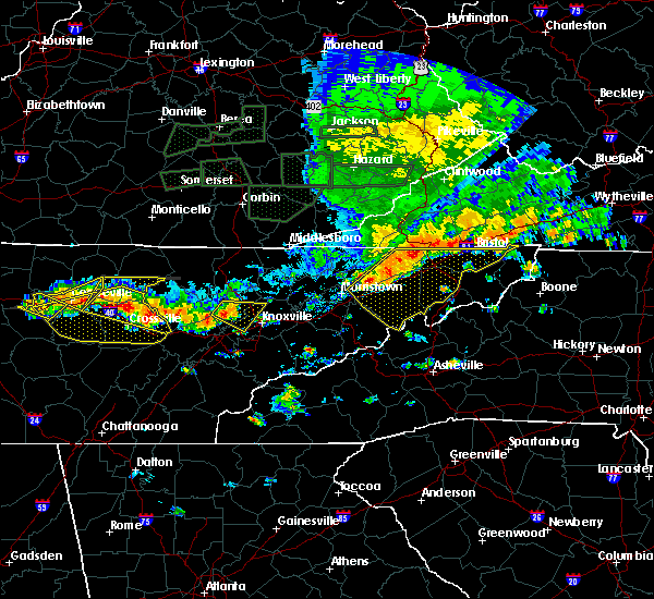 At 555 pm edt, a severe thunderstorm was located near clinton, moving east at 40 mph (radar indicated). Hazards include 60 mph wind gusts. Expect damage to roofs. siding. and trees. Locations impacted include, knoxville, oak ridge, clinton, oliver springs, powell and karns. At 555 pm edt, a severe thunderstorm was located near clinton, moving east at 40 mph (radar indicated). Hazards include 60 mph wind gusts. Expect damage to roofs. siding. and trees. Locations impacted include, knoxville, oak ridge, clinton, oliver springs, powell and karns.
|
| 7/8/2016 5:43 PM EDT |
 At 543 pm edt, a severe thunderstorm was located near oliver springs, or 10 miles north of oak ridge, moving east at 45 mph (radar indicated). Hazards include 60 mph wind gusts. Expect damage to roofs. siding. And trees. At 543 pm edt, a severe thunderstorm was located near oliver springs, or 10 miles north of oak ridge, moving east at 45 mph (radar indicated). Hazards include 60 mph wind gusts. Expect damage to roofs. siding. And trees.
|
| 7/7/2016 7:12 PM EDT |
 At 712 pm edt, severe thunderstorms were located along a line extending from near new market to 6 miles west of sevierville to near eagleton village, moving east at 35 mph (radar indicated). Hazards include 60 mph wind gusts and penny size hail. Expect damage to roofs. siding. and trees. locations impacted include, knoxville, maryville, sevierville, alcoa, jefferson city, new market, rockford, eagleton village, strawberry plains, blaine, townsend, walland, mcmahan, seymour, kimberlin heights, kodak, wildwood, house mountain s. p,. Mascot and piedmont. At 712 pm edt, severe thunderstorms were located along a line extending from near new market to 6 miles west of sevierville to near eagleton village, moving east at 35 mph (radar indicated). Hazards include 60 mph wind gusts and penny size hail. Expect damage to roofs. siding. and trees. locations impacted include, knoxville, maryville, sevierville, alcoa, jefferson city, new market, rockford, eagleton village, strawberry plains, blaine, townsend, walland, mcmahan, seymour, kimberlin heights, kodak, wildwood, house mountain s. p,. Mascot and piedmont.
|
| 7/7/2016 7:05 PM EDT | Several trees downed. many residents without powe in knox county TN, 13 miles ENE of Knoxville, TN |
| 7/7/2016 6:49 PM EDT |
 At 648 pm edt, severe thunderstorms were located along a line extending from 7 miles west of plainview to near knoxville to near farragut, moving east at 30 mph (radar indicated). Hazards include 60 mph wind gusts and penny size hail. Expect damage to roofs. siding. And trees. At 648 pm edt, severe thunderstorms were located along a line extending from 7 miles west of plainview to near knoxville to near farragut, moving east at 30 mph (radar indicated). Hazards include 60 mph wind gusts and penny size hail. Expect damage to roofs. siding. And trees.
|
| 7/7/2016 6:35 PM EDT |
 At 635 pm edt, severe thunderstorms were located along a line extending from 8 miles south of wilkerson to 10 miles northeast of clinton to near farragut, moving east at 35 mph (radar indicated). Hazards include 60 mph wind gusts and penny size hail. Expect damage to roofs. siding. and trees. locations impacted include, knoxville, oak ridge, clinton, alcoa, la follette, maynardville, farragut, louisville, plainview, jacksboro, jellico, caryville, halls, lake city, norris, luttrell, cove lake s. p,. Sharps chapel, andersonville and white oak. At 635 pm edt, severe thunderstorms were located along a line extending from 8 miles south of wilkerson to 10 miles northeast of clinton to near farragut, moving east at 35 mph (radar indicated). Hazards include 60 mph wind gusts and penny size hail. Expect damage to roofs. siding. and trees. locations impacted include, knoxville, oak ridge, clinton, alcoa, la follette, maynardville, farragut, louisville, plainview, jacksboro, jellico, caryville, halls, lake city, norris, luttrell, cove lake s. p,. Sharps chapel, andersonville and white oak.
|
| 7/7/2016 6:24 PM EDT |
 At 623 pm edt, severe thunderstorms were located along a line extending from 7 miles south of lot to 7 miles southeast of jacksboro to near oliver springs, moving east at 40 mph (radar indicated). Hazards include 60 mph wind gusts and penny size hail. Expect damage to roofs. siding. and trees. Locations impacted include, knoxville, oak ridge, clinton, lenoir city, alcoa, la follette, kingston, maynardville, farragut, oliver springs, louisville, plainview, jacksboro, midtown, harriman, jellico, caryville, halls, lake city and norris. At 623 pm edt, severe thunderstorms were located along a line extending from 7 miles south of lot to 7 miles southeast of jacksboro to near oliver springs, moving east at 40 mph (radar indicated). Hazards include 60 mph wind gusts and penny size hail. Expect damage to roofs. siding. and trees. Locations impacted include, knoxville, oak ridge, clinton, lenoir city, alcoa, la follette, kingston, maynardville, farragut, oliver springs, louisville, plainview, jacksboro, midtown, harriman, jellico, caryville, halls, lake city and norris.
|
| 7/7/2016 6:13 PM EDT |
 At 612 pm edt, severe thunderstorms were located along a line extending from 6 miles southwest of zion hill to 9 miles west of jacksboro to near wartburg, moving east at 35 mph (radar indicated). Hazards include 60 mph wind gusts and penny size hail. Expect damage to roofs. siding. And trees. At 612 pm edt, severe thunderstorms were located along a line extending from 6 miles southwest of zion hill to 9 miles west of jacksboro to near wartburg, moving east at 35 mph (radar indicated). Hazards include 60 mph wind gusts and penny size hail. Expect damage to roofs. siding. And trees.
|
| 7/6/2016 7:18 PM EDT |
 At 717 pm edt, a severe thunderstorm was located over jefferson city, moving east at 30 mph (radar indicated). Hazards include 70 mph wind gusts. Expect considerable tree damage. damage is likely to mobile homes, roofs, and outbuildings. locations impacted include, knoxville, sevierville, jefferson city, newport, dandridge, white pine, new market, baneberry, parrottsville, strawberry plains, blaine, fairgarden, mcmahan, chestnut hill, kimberlin heights, del rio, bybee, kodak, house mountain s. p. And mascot. At 717 pm edt, a severe thunderstorm was located over jefferson city, moving east at 30 mph (radar indicated). Hazards include 70 mph wind gusts. Expect considerable tree damage. damage is likely to mobile homes, roofs, and outbuildings. locations impacted include, knoxville, sevierville, jefferson city, newport, dandridge, white pine, new market, baneberry, parrottsville, strawberry plains, blaine, fairgarden, mcmahan, chestnut hill, kimberlin heights, del rio, bybee, kodak, house mountain s. p. And mascot.
|
| 7/6/2016 6:58 PM EDT |
 At 658 pm edt, a severe thunderstorm was located 8 miles west of new market, or 12 miles west of jefferson city, moving east at 35 mph (radar indicated). Hazards include 60 mph wind gusts and penny size hail. Expect damage to roofs. siding. And trees. At 658 pm edt, a severe thunderstorm was located 8 miles west of new market, or 12 miles west of jefferson city, moving east at 35 mph (radar indicated). Hazards include 60 mph wind gusts and penny size hail. Expect damage to roofs. siding. And trees.
|
| 7/6/2016 6:49 PM EDT |
 At 648 pm edt, severe thunderstorms were located along a line extending from near loudon to 8 miles south of lenoir city to 11 miles east of madisonville, moving northeast at 25 mph (radar indicated). Hazards include 60 mph wind gusts and penny size hail. Expect damage to roofs. siding. and trees. locations impacted include, oak ridge, maryville, lenoir city, alcoa, loudon, madisonville, farragut, louisville, vonore, greenback, friendsville, philadelphia, happy valley, bradbury, fort loudon s. p,. Citico beach, tellico village, talassee, tariffville and mcgee carson peninsula. At 648 pm edt, severe thunderstorms were located along a line extending from near loudon to 8 miles south of lenoir city to 11 miles east of madisonville, moving northeast at 25 mph (radar indicated). Hazards include 60 mph wind gusts and penny size hail. Expect damage to roofs. siding. and trees. locations impacted include, oak ridge, maryville, lenoir city, alcoa, loudon, madisonville, farragut, louisville, vonore, greenback, friendsville, philadelphia, happy valley, bradbury, fort loudon s. p,. Citico beach, tellico village, talassee, tariffville and mcgee carson peninsula.
|
| 7/6/2016 6:45 PM EDT |
 At 644 pm edt, severe thunderstorms were located along a line extending from 6 miles west of maynardville to 10 miles southwest of plainview to near knoxville, moving east at 30 mph (radar indicated). Hazards include 60 mph wind gusts. Expect damage to roofs. siding. and trees. locations impacted include, knoxville, clinton, maynardville, farragut, plainview, halls, blaine, norris, luttrell, andersonville, paulette, maloneyville, karns, kimberlin heights, bearden, powell, house mountain s. p,. mascot, lake forest and big ridge s. P At 644 pm edt, severe thunderstorms were located along a line extending from 6 miles west of maynardville to 10 miles southwest of plainview to near knoxville, moving east at 30 mph (radar indicated). Hazards include 60 mph wind gusts. Expect damage to roofs. siding. and trees. locations impacted include, knoxville, clinton, maynardville, farragut, plainview, halls, blaine, norris, luttrell, andersonville, paulette, maloneyville, karns, kimberlin heights, bearden, powell, house mountain s. p,. mascot, lake forest and big ridge s. P
|
| 7/6/2016 6:28 PM EDT |
 At 628 pm edt, severe thunderstorms were located along a line extending from near jacksboro to clinton to near oak ridge, moving east at 20 mph (radar indicated). Hazards include 60 mph wind gusts. Expect damage to roofs. siding. And trees. At 628 pm edt, severe thunderstorms were located along a line extending from near jacksboro to clinton to near oak ridge, moving east at 20 mph (radar indicated). Hazards include 60 mph wind gusts. Expect damage to roofs. siding. And trees.
|
| 7/6/2016 6:25 PM EDT |
 At 624 pm edt, severe thunderstorms were located along a line extending from fairview to near sweetwater to madisonville, moving northeast at 20 mph (radar indicated). Hazards include 60 mph wind gusts and penny size hail. Expect damage to roofs. siding. And trees. At 624 pm edt, severe thunderstorms were located along a line extending from fairview to near sweetwater to madisonville, moving northeast at 20 mph (radar indicated). Hazards include 60 mph wind gusts and penny size hail. Expect damage to roofs. siding. And trees.
|
| 7/6/2016 6:15 PM EDT |
 At 614 pm edt, a severe thunderstorm was located 11 miles southeast of loudon, moving east at 25 mph (radar indicated). Hazards include 60 mph wind gusts and quarter size hail. Hail damage to vehicles is expected. expect wind damage to roofs, siding, and trees. locations impacted include, maryville, alcoa, loudon, louisville, rockford, eagleton village, vonore, greenback, friendsville, happy valley, fort loudon s. p,. Tellico village, mcgee carson peninsula and clover hill. At 614 pm edt, a severe thunderstorm was located 11 miles southeast of loudon, moving east at 25 mph (radar indicated). Hazards include 60 mph wind gusts and quarter size hail. Hail damage to vehicles is expected. expect wind damage to roofs, siding, and trees. locations impacted include, maryville, alcoa, loudon, louisville, rockford, eagleton village, vonore, greenback, friendsville, happy valley, fort loudon s. p,. Tellico village, mcgee carson peninsula and clover hill.
|
| 7/6/2016 6:01 PM EDT |
 At 600 pm edt, a severe thunderstorm was located 7 miles south of loudon, moving northeast at 20 mph (radar indicated). Hazards include 60 mph wind gusts and quarter size hail. Hail damage to vehicles is expected. Expect wind damage to roofs, siding, and trees. At 600 pm edt, a severe thunderstorm was located 7 miles south of loudon, moving northeast at 20 mph (radar indicated). Hazards include 60 mph wind gusts and quarter size hail. Hail damage to vehicles is expected. Expect wind damage to roofs, siding, and trees.
|
| 6/24/2016 1:07 AM EDT | A few trees down across knox count in knox county TN, 1.8 miles SW of Knoxville, TN |
| 6/23/2016 10:25 PM EDT |
 At 1024 pm edt, a severe thunderstorm was located 8 miles southeast of jacksboro, or 8 miles south of la follette, moving southeast at 20 mph (radar indicated). Hazards include 60 mph wind gusts and penny size hail. Expect damage to roofs. siding. and trees. locations impacted include, clinton, maynardville, plainview, caryville, halls, lake city, norris, big ridge s. p,. andersonville, paulette, norris lake, disney, norris dam s. p. and cove lake s. P At 1024 pm edt, a severe thunderstorm was located 8 miles southeast of jacksboro, or 8 miles south of la follette, moving southeast at 20 mph (radar indicated). Hazards include 60 mph wind gusts and penny size hail. Expect damage to roofs. siding. and trees. locations impacted include, clinton, maynardville, plainview, caryville, halls, lake city, norris, big ridge s. p,. andersonville, paulette, norris lake, disney, norris dam s. p. and cove lake s. P
|
| 6/23/2016 10:10 PM EDT |
 At 1010 pm edt, severe thunderstorms were located along a line extending from near la follette to 11 miles northeast of wartburg, moving southeast at 20 mph (radar indicated). Hazards include 60 mph wind gusts. Expect damage to roofs. siding. And trees. At 1010 pm edt, severe thunderstorms were located along a line extending from near la follette to 11 miles northeast of wartburg, moving southeast at 20 mph (radar indicated). Hazards include 60 mph wind gusts. Expect damage to roofs. siding. And trees.
|
| 6/21/2016 8:23 PM EDT |
 At 822 pm edt, a severe thunderstorm was located 7 miles west of new market, or 11 miles west of jefferson city, moving south at 30 mph (radar indicated). Hazards include 60 mph wind gusts and quarter size hail. Hail damage to vehicles is expected. expect wind damage to roofs, siding, and trees. locations impacted include, knoxville, jefferson city, dandridge, maynardville, plainview, new market, strawberry plains, halls, blaine, luttrell, buffalo springs, paulette, maloneyville, rose hill, joppa, house mountain s. p,. mascot and big ridge s. P At 822 pm edt, a severe thunderstorm was located 7 miles west of new market, or 11 miles west of jefferson city, moving south at 30 mph (radar indicated). Hazards include 60 mph wind gusts and quarter size hail. Hail damage to vehicles is expected. expect wind damage to roofs, siding, and trees. locations impacted include, knoxville, jefferson city, dandridge, maynardville, plainview, new market, strawberry plains, halls, blaine, luttrell, buffalo springs, paulette, maloneyville, rose hill, joppa, house mountain s. p,. mascot and big ridge s. P
|
| 6/21/2016 7:47 PM EDT |
 At 747 pm edt, a severe thunderstorm was located near plainview, or 8 miles southeast of maynardville, moving south at 45 mph (radar indicated). Hazards include 60 mph wind gusts and quarter size hail. Hail damage to vehicles is expected. Expect wind damage to roofs, siding, and trees. At 747 pm edt, a severe thunderstorm was located near plainview, or 8 miles southeast of maynardville, moving south at 45 mph (radar indicated). Hazards include 60 mph wind gusts and quarter size hail. Hail damage to vehicles is expected. Expect wind damage to roofs, siding, and trees.
|
| 6/17/2016 1:55 AM EDT |
 At 154 am edt, a severe thunderstorm was located near alcoa, moving southeast at 50 mph (radar indicated). Hazards include 60 mph wind gusts and quarter size hail. Hail damage to vehicles is expected. expect wind damage to roofs, siding, and trees. Locations impacted include, maryville, alcoa, louisville, rockford, eagleton village, friendsville, walland, wildwood and clover hill. At 154 am edt, a severe thunderstorm was located near alcoa, moving southeast at 50 mph (radar indicated). Hazards include 60 mph wind gusts and quarter size hail. Hail damage to vehicles is expected. expect wind damage to roofs, siding, and trees. Locations impacted include, maryville, alcoa, louisville, rockford, eagleton village, friendsville, walland, wildwood and clover hill.
|
| 6/17/2016 1:42 AM EDT | Reports of some larger limbs dow in knox county TN, 13 miles ENE of Knoxville, TN |
| 6/17/2016 1:41 AM EDT |
 At 141 am edt, a severe thunderstorm was located over farragut, or 7 miles northeast of lenoir city, moving southeast at 50 mph (radar indicated). Hazards include 60 mph wind gusts and quarter size hail. Hail damage to vehicles is expected. Expect wind damage to roofs, siding, and trees. At 141 am edt, a severe thunderstorm was located over farragut, or 7 miles northeast of lenoir city, moving southeast at 50 mph (radar indicated). Hazards include 60 mph wind gusts and quarter size hail. Hail damage to vehicles is expected. Expect wind damage to roofs, siding, and trees.
|
| 6/14/2016 6:34 PM EDT |
 At 633 pm edt, a severe thunderstorm was located near sevierville, moving northeast at 25 mph (radar indicated). Hazards include 60 mph wind gusts and nickel size hail. Expect damage to roofs. siding. and trees. Locations impacted include, sevierville, jefferson city, dandridge, pigeon forge, new market, harrisburg, fairgarden, mcmahan, chestnut hill, kimberlin heights, kodak, bird crossing, piedmont and seymour. At 633 pm edt, a severe thunderstorm was located near sevierville, moving northeast at 25 mph (radar indicated). Hazards include 60 mph wind gusts and nickel size hail. Expect damage to roofs. siding. and trees. Locations impacted include, sevierville, jefferson city, dandridge, pigeon forge, new market, harrisburg, fairgarden, mcmahan, chestnut hill, kimberlin heights, kodak, bird crossing, piedmont and seymour.
|
| 6/14/2016 6:22 PM EDT |
 At 621 pm edt, a severe thunderstorm was located near sevierville, moving northeast at 25 mph (radar indicated). Hazards include 60 mph wind gusts and nickel size hail. Expect damage to roofs. siding. And trees. At 621 pm edt, a severe thunderstorm was located near sevierville, moving northeast at 25 mph (radar indicated). Hazards include 60 mph wind gusts and nickel size hail. Expect damage to roofs. siding. And trees.
|
| 6/2/2016 5:45 PM EDT |
 At 544 pm edt, a severe thunderstorm was located 9 miles southwest of new market, or 12 miles northwest of sevierville, moving northeast at 20 mph (radar indicated). Hazards include 60 mph wind gusts and penny size hail. Expect damage to roofs. siding. and trees. Locations impacted include, knoxville, sevierville, new market, strawberry plains, blaine, kodak, mascot, kimberlin heights, piedmont and seymour. At 544 pm edt, a severe thunderstorm was located 9 miles southwest of new market, or 12 miles northwest of sevierville, moving northeast at 20 mph (radar indicated). Hazards include 60 mph wind gusts and penny size hail. Expect damage to roofs. siding. and trees. Locations impacted include, knoxville, sevierville, new market, strawberry plains, blaine, kodak, mascot, kimberlin heights, piedmont and seymour.
|
| 6/2/2016 5:32 PM EDT | Couple of trees down in east knoxvill in knox county TN, 6.2 miles W of Knoxville, TN |
| 6/2/2016 5:27 PM EDT |
 At 527 pm edt, a severe thunderstorm was located near knoxville, moving northeast at 10 mph (radar indicated). Hazards include 60 mph wind gusts and penny size hail. Expect damage to roofs. siding. And trees. At 527 pm edt, a severe thunderstorm was located near knoxville, moving northeast at 10 mph (radar indicated). Hazards include 60 mph wind gusts and penny size hail. Expect damage to roofs. siding. And trees.
|
| 6/1/2016 7:32 PM EDT |
 At 731 pm edt, a severe thunderstorm was located 9 miles west of sevierville, moving northeast at 15 mph (radar indicated). Hazards include 60 mph wind gusts. Expect damage to roofs. siding. and trees. Locations impacted include, sevierville, seymour, mcmahan, kodak and kimberlin heights. At 731 pm edt, a severe thunderstorm was located 9 miles west of sevierville, moving northeast at 15 mph (radar indicated). Hazards include 60 mph wind gusts. Expect damage to roofs. siding. and trees. Locations impacted include, sevierville, seymour, mcmahan, kodak and kimberlin heights.
|
| 6/1/2016 7:15 PM EDT | Tree limbs and a couple of bradford pear trees down in east knoxville in knox county TN, 6.2 miles SW of Knoxville, TN |
| 6/1/2016 7:13 PM EDT |
 At 713 pm edt, a severe thunderstorm was located 9 miles west of sevierville, moving northeast at 15 mph (radar indicated). Hazards include 60 mph wind gusts and quarter size hail. Hail damage to vehicles is expected. Expect wind damage to roofs, siding, and trees. At 713 pm edt, a severe thunderstorm was located 9 miles west of sevierville, moving northeast at 15 mph (radar indicated). Hazards include 60 mph wind gusts and quarter size hail. Hail damage to vehicles is expected. Expect wind damage to roofs, siding, and trees.
|
| 6/1/2016 6:37 PM EDT |
 At 636 pm edt, a severe thunderstorm was located 9 miles southeast of lenoir city, moving northeast at 15 mph (radar indicated). Hazards include 60 mph wind gusts. Expect damage to roofs. siding. and trees. Locations impacted include, maryville, lenoir city, alcoa, loudon, farragut, louisville, vonore, greenback, friendsville and clover hill. At 636 pm edt, a severe thunderstorm was located 9 miles southeast of lenoir city, moving northeast at 15 mph (radar indicated). Hazards include 60 mph wind gusts. Expect damage to roofs. siding. and trees. Locations impacted include, maryville, lenoir city, alcoa, loudon, farragut, louisville, vonore, greenback, friendsville and clover hill.
|
| 6/1/2016 6:16 PM EDT |
 At 615 pm edt, a severe thunderstorm was located 8 miles northeast of madisonville, moving northeast at 15 mph (radar indicated). Hazards include 60 mph wind gusts and quarter size hail. Hail damage to vehicles is expected. Expect wind damage to roofs, siding, and trees. At 615 pm edt, a severe thunderstorm was located 8 miles northeast of madisonville, moving northeast at 15 mph (radar indicated). Hazards include 60 mph wind gusts and quarter size hail. Hail damage to vehicles is expected. Expect wind damage to roofs, siding, and trees.
|
| 5/12/2016 3:55 PM EDT | A couple of trees down halls are in knox county TN, 1.8 miles SW of Knoxville, TN |
| 5/12/2016 3:52 PM EDT |
 At 351 pm edt, a severe thunderstorm was located 8 miles west of new market, or 12 miles west of jefferson city, moving east at 30 mph (radar indicated). Hazards include 60 mph wind gusts. Expect damage to roofs. siding. and trees. Locations impacted include, jefferson city, dandridge, new market, strawberry plains, blaine, kodak, maloneyville, mascot and piedmont. At 351 pm edt, a severe thunderstorm was located 8 miles west of new market, or 12 miles west of jefferson city, moving east at 30 mph (radar indicated). Hazards include 60 mph wind gusts. Expect damage to roofs. siding. and trees. Locations impacted include, jefferson city, dandridge, new market, strawberry plains, blaine, kodak, maloneyville, mascot and piedmont.
|
| 5/12/2016 3:44 PM EDT |
 At 344 pm edt, a severe thunderstorm was located 9 miles south of plainview, or 9 miles northeast of knoxville, moving east at 30 mph (radar indicated). Hazards include 60 mph wind gusts. Expect damage to roofs. siding. and trees. Locations impacted include, knoxville, sevierville, jefferson city, dandridge, new market, strawberry plains, halls, blaine, kodak, maloneyville, lake forest, mascot, mcmahan, kimberlin heights, piedmont and seymour. At 344 pm edt, a severe thunderstorm was located 9 miles south of plainview, or 9 miles northeast of knoxville, moving east at 30 mph (radar indicated). Hazards include 60 mph wind gusts. Expect damage to roofs. siding. and trees. Locations impacted include, knoxville, sevierville, jefferson city, dandridge, new market, strawberry plains, halls, blaine, kodak, maloneyville, lake forest, mascot, mcmahan, kimberlin heights, piedmont and seymour.
|
| 5/12/2016 3:35 PM EDT | 2 trees down western part of knoxville in knox county TN, 1.8 miles SW of Knoxville, TN |
| 5/12/2016 3:29 PM EDT |
 At 329 pm edt, a severe thunderstorm was located over knoxville, moving east at 30 mph (radar indicated). Hazards include 60 mph wind gusts and penny size hail. Expect damage to roofs. siding. And trees. At 329 pm edt, a severe thunderstorm was located over knoxville, moving east at 30 mph (radar indicated). Hazards include 60 mph wind gusts and penny size hail. Expect damage to roofs. siding. And trees.
|
| 5/2/2016 5:08 PM EDT |
 The severe thunderstorm warning for southeastern knox county will expire at 515 pm edt, the storm which prompted the warning has moved out of the area. therefore the warning will be allowed to expire. a severe thunderstorm watch remains in effect until 1000 pm edt for eastern tennessee. The severe thunderstorm warning for southeastern knox county will expire at 515 pm edt, the storm which prompted the warning has moved out of the area. therefore the warning will be allowed to expire. a severe thunderstorm watch remains in effect until 1000 pm edt for eastern tennessee.
|
| 5/2/2016 5:08 PM EDT |
 At 507 pm edt, a severe thunderstorm was located 11 miles northwest of sevierville, moving east at 35 mph (public). Hazards include quarter size hail. Damage to vehicles is expected. Locations impacted include, knoxville, sevierville, jefferson city, dandridge, new market, strawberry plains, mcmahan, kodak, mascot, kimberlin heights, piedmont and seymour. At 507 pm edt, a severe thunderstorm was located 11 miles northwest of sevierville, moving east at 35 mph (public). Hazards include quarter size hail. Damage to vehicles is expected. Locations impacted include, knoxville, sevierville, jefferson city, dandridge, new market, strawberry plains, mcmahan, kodak, mascot, kimberlin heights, piedmont and seymour.
|
| 5/2/2016 4:56 PM EDT |
 At 456 pm edt, a severe thunderstorm was located near knoxville, moving east at 35 mph (public). Hazards include ping pong ball size hail. People and animals outdoors will be injured. expect damage to roofs, siding, windows, and vehicles. Locations impacted include, knoxville, lake forest, kimberlin heights, mascot and seymour. At 456 pm edt, a severe thunderstorm was located near knoxville, moving east at 35 mph (public). Hazards include ping pong ball size hail. People and animals outdoors will be injured. expect damage to roofs, siding, windows, and vehicles. Locations impacted include, knoxville, lake forest, kimberlin heights, mascot and seymour.
|
| 5/2/2016 4:55 PM EDT |
 At 455 pm edt, a severe thunderstorm was located near knoxville, moving east at 35 mph (public). Hazards include ping pong ball size hail. People and animals outdoors will be injured. Expect damage to roofs, siding, windows, and vehicles. At 455 pm edt, a severe thunderstorm was located near knoxville, moving east at 35 mph (public). Hazards include ping pong ball size hail. People and animals outdoors will be injured. Expect damage to roofs, siding, windows, and vehicles.
|
| 5/2/2016 4:41 PM EDT |
 The severe thunderstorm warning for southwestern knox and northwestern blount counties will expire at 445 pm edt, the severe thunderstorm which prompted the warning has moved out of the warned area. therefore the warning will be allowed to expire. a severe thunderstorm watch remains in effect until 1000 pm edt for eastern tennessee. The severe thunderstorm warning for southwestern knox and northwestern blount counties will expire at 445 pm edt, the severe thunderstorm which prompted the warning has moved out of the warned area. therefore the warning will be allowed to expire. a severe thunderstorm watch remains in effect until 1000 pm edt for eastern tennessee.
|
| 5/2/2016 4:40 PM EDT |
 At 440 pm edt, a severe thunderstorm was located near knoxville, moving east at 35 mph (public). Hazards include golf ball size hail. People and animals outdoors will be injured. expect damage to roofs, siding, windows, and vehicles. Locations impacted include, knoxville, alcoa, louisville, rockford, bearden, lake forest, kimberlin heights, seymour and mascot. At 440 pm edt, a severe thunderstorm was located near knoxville, moving east at 35 mph (public). Hazards include golf ball size hail. People and animals outdoors will be injured. expect damage to roofs, siding, windows, and vehicles. Locations impacted include, knoxville, alcoa, louisville, rockford, bearden, lake forest, kimberlin heights, seymour and mascot.
|
| 5/2/2016 4:29 PM EDT | Quarter sized hail reported 13 miles ENE of Knoxville, TN |
| 5/2/2016 4:25 PM EDT | Golf Ball sized hail reported 13 miles ENE of Knoxville, TN |
| 5/2/2016 4:25 PM EDT |
 At 425 pm edt, a severe thunderstorm was located over farragut, or near lenoir city, moving east at 30 mph (radar indicated). Hazards include ping pong ball size hail and 60 mph wind gusts. People and animals outdoors will be injured. expect hail damage to roofs, siding, windows, and vehicles. expect wind damage to roofs, siding, and trees. Locations impacted include, knoxville, alcoa, farragut, louisville, friendsville and karns. At 425 pm edt, a severe thunderstorm was located over farragut, or near lenoir city, moving east at 30 mph (radar indicated). Hazards include ping pong ball size hail and 60 mph wind gusts. People and animals outdoors will be injured. expect hail damage to roofs, siding, windows, and vehicles. expect wind damage to roofs, siding, and trees. Locations impacted include, knoxville, alcoa, farragut, louisville, friendsville and karns.
|
| 5/2/2016 4:24 PM EDT |
 At 424 pm edt, a severe thunderstorm was located over farragut, or near lenoir city, moving east at 40 mph (radar indicated). Hazards include ping pong ball size hail and 60 mph wind gusts. People and animals outdoors will be injured. expect hail damage to roofs, siding, windows, and vehicles. Expect wind damage to roofs, siding, and trees. At 424 pm edt, a severe thunderstorm was located over farragut, or near lenoir city, moving east at 40 mph (radar indicated). Hazards include ping pong ball size hail and 60 mph wind gusts. People and animals outdoors will be injured. expect hail damage to roofs, siding, windows, and vehicles. Expect wind damage to roofs, siding, and trees.
|
| 5/2/2016 4:15 PM EDT |
 At 414 pm edt, a severe thunderstorm was located over lenoir city, moving east at 40 mph (radar indicated). Hazards include 60 mph wind gusts and quarter size hail. Hail damage to vehicles is expected. expect wind damage to roofs, siding, and trees. Locations impacted include, knoxville, oak ridge, lenoir city, alcoa, farragut, louisville, friendsville and karns. At 414 pm edt, a severe thunderstorm was located over lenoir city, moving east at 40 mph (radar indicated). Hazards include 60 mph wind gusts and quarter size hail. Hail damage to vehicles is expected. expect wind damage to roofs, siding, and trees. Locations impacted include, knoxville, oak ridge, lenoir city, alcoa, farragut, louisville, friendsville and karns.
|
| 5/2/2016 3:59 PM EDT |
 At 359 pm edt, a severe thunderstorm was located near kingston, moving east at 30 mph (radar indicated). Hazards include 60 mph wind gusts and quarter size hail. Hail damage to vehicles is expected. Expect wind damage to roofs, siding, and trees. At 359 pm edt, a severe thunderstorm was located near kingston, moving east at 30 mph (radar indicated). Hazards include 60 mph wind gusts and quarter size hail. Hail damage to vehicles is expected. Expect wind damage to roofs, siding, and trees.
|
| 4/22/2016 4:00 PM EDT |
 At 359 pm edt, a severe thunderstorm was located 8 miles east of rockford, or 11 miles southeast of knoxville, moving east at 15 mph (radar indicated). Hazards include 60 mph wind gusts and quarter size hail. Hail damage to vehicles is expected. expect wind damage to roofs, siding, and trees. Locations impacted include, sevierville, pigeon forge, seymour, wears valley and kimberlin heights. At 359 pm edt, a severe thunderstorm was located 8 miles east of rockford, or 11 miles southeast of knoxville, moving east at 15 mph (radar indicated). Hazards include 60 mph wind gusts and quarter size hail. Hail damage to vehicles is expected. expect wind damage to roofs, siding, and trees. Locations impacted include, sevierville, pigeon forge, seymour, wears valley and kimberlin heights.
|
| 4/22/2016 3:47 PM EDT |
 At 346 pm edt, a severe thunderstorm was located near rockford, or 9 miles northeast of alcoa, moving southeast at 20 mph (radar indicated). Hazards include 60 mph wind gusts and quarter size hail. Hail damage to vehicles is expected. Expect wind damage to roofs, siding, and trees. At 346 pm edt, a severe thunderstorm was located near rockford, or 9 miles northeast of alcoa, moving southeast at 20 mph (radar indicated). Hazards include 60 mph wind gusts and quarter size hail. Hail damage to vehicles is expected. Expect wind damage to roofs, siding, and trees.
|
| 2/24/2016 8:40 AM EST | A few trees and power lines down in north knox county in knox county TN, 1.8 miles SW of Knoxville, TN |
| 2/24/2016 8:21 AM EST |
 At 820 am est, severe thunderstorms were located along a line extending from jacksboro to 11 miles south of la follette to near clinton to near knoxville, moving northeast at 60 mph (radar indicated). Hazards include 60 mph wind gusts and penny size hail. Expect damage to roofs. siding. and trees. Locations impacted include, knoxville, clinton, la follette, maynardville, rutledge, new tazewell, tazewell, plainview, jacksboro, harrogate-shawanee, caryville, halls, blaine, lake city, norris, luttrell, maloneyville, white oak, lone mountain and sandlick. At 820 am est, severe thunderstorms were located along a line extending from jacksboro to 11 miles south of la follette to near clinton to near knoxville, moving northeast at 60 mph (radar indicated). Hazards include 60 mph wind gusts and penny size hail. Expect damage to roofs. siding. and trees. Locations impacted include, knoxville, clinton, la follette, maynardville, rutledge, new tazewell, tazewell, plainview, jacksboro, harrogate-shawanee, caryville, halls, blaine, lake city, norris, luttrell, maloneyville, white oak, lone mountain and sandlick.
|
| 2/24/2016 8:11 AM EST |
 At 809 am est, severe thunderstorms were located along a line extending from 8 miles southwest of jacksboro to near oliver springs to near oak ridge to near louisville, moving northeast at 60 mph (radar indicated). Hazards include 60 mph wind gusts and penny size hail. Expect damage to roofs. siding. And trees. At 809 am est, severe thunderstorms were located along a line extending from 8 miles southwest of jacksboro to near oliver springs to near oak ridge to near louisville, moving northeast at 60 mph (radar indicated). Hazards include 60 mph wind gusts and penny size hail. Expect damage to roofs. siding. And trees.
|
| 2/3/2016 4:47 AM EST |
 At 447 am est, a severe thunderstorm was located near farragut, or near oak ridge, moving northeast at 60 mph (radar indicated). Hazards include 60 mph wind gusts. Expect damage to roofs. siding and trees. Locations impacted include, knoxville, oak ridge, maryville, clinton, lenoir city, alcoa, kingston, sweetwater, loudon, farragut, oliver springs, louisville, rockford, eagleton village, halls, lake city, norris, greenback, friendsville and philadelphia. At 447 am est, a severe thunderstorm was located near farragut, or near oak ridge, moving northeast at 60 mph (radar indicated). Hazards include 60 mph wind gusts. Expect damage to roofs. siding and trees. Locations impacted include, knoxville, oak ridge, maryville, clinton, lenoir city, alcoa, kingston, sweetwater, loudon, farragut, oliver springs, louisville, rockford, eagleton village, halls, lake city, norris, greenback, friendsville and philadelphia.
|
| 2/3/2016 4:19 AM EST |
 At 417 am est, a severe thunderstorm was located 11 miles northwest of sweetwater, moving northeast at 65 mph (radar indicated and reports of downed trees across rhea county). Hazards include 60 mph wind gusts. Expect damage to roofs. Siding and trees. At 417 am est, a severe thunderstorm was located 11 miles northwest of sweetwater, moving northeast at 65 mph (radar indicated and reports of downed trees across rhea county). Hazards include 60 mph wind gusts. Expect damage to roofs. Siding and trees.
|
| 8/19/2015 7:51 PM EDT |
 The severe thunderstorm warning for southwestern knox, northwestern blount, south central anderson, central roane and loudon counties will expire at 800 pm edt, the storm which prompted the warning has weakened below severe limits, and no longer pose an immediate threat to life or property. therefore the warning will be allowed to expire. however heavy rain is still possible with this thunderstorm. The severe thunderstorm warning for southwestern knox, northwestern blount, south central anderson, central roane and loudon counties will expire at 800 pm edt, the storm which prompted the warning has weakened below severe limits, and no longer pose an immediate threat to life or property. therefore the warning will be allowed to expire. however heavy rain is still possible with this thunderstorm.
|
| 8/19/2015 7:41 PM EDT |
 At 741 pm edt, a severe thunderstorm was located over lenoir city, moving east at 25 mph (radar indicated). Hazards include 60 mph wind gusts and quarter size hail. Hail damage to vehicles is expected. expect wind damage to roofs, siding and trees. Locations impacted include, oak ridge, lenoir city, kingston, loudon, farragut, midtown, fairview, friendsville, philadelphia, paint rock and bradbury. At 741 pm edt, a severe thunderstorm was located over lenoir city, moving east at 25 mph (radar indicated). Hazards include 60 mph wind gusts and quarter size hail. Hail damage to vehicles is expected. expect wind damage to roofs, siding and trees. Locations impacted include, oak ridge, lenoir city, kingston, loudon, farragut, midtown, fairview, friendsville, philadelphia, paint rock and bradbury.
|
| 8/19/2015 7:20 PM EDT |
 At 720 pm edt, a severe thunderstorm was located near loudon, moving east at 25 mph (radar indicated). Hazards include 60 mph wind gusts and quarter size hail. Hail damage to vehicles is expected. Expect wind damage to roofs, siding and trees. At 720 pm edt, a severe thunderstorm was located near loudon, moving east at 25 mph (radar indicated). Hazards include 60 mph wind gusts and quarter size hail. Hail damage to vehicles is expected. Expect wind damage to roofs, siding and trees.
|
| 8/10/2015 5:58 PM EDT |
 At 557 pm edt, severe thunderstorms were located along a line extending from 9 miles southeast of plainview to near dandridge to 8 miles northeast of gatlinburg, moving east at 10 mph (radar indicated). Hazards include 60 mph wind gusts. Expect damage to roofs. siding and trees. Locations impacted include, knoxville, morristown, sevierville, jefferson city, newport, gatlinburg, dandridge, rutledge, pigeon forge, white pine, new market, baneberry, strawberry plains, blaine, pittman center, lowland, kodak, buffalo springs, bird crossing and cosby. At 557 pm edt, severe thunderstorms were located along a line extending from 9 miles southeast of plainview to near dandridge to 8 miles northeast of gatlinburg, moving east at 10 mph (radar indicated). Hazards include 60 mph wind gusts. Expect damage to roofs. siding and trees. Locations impacted include, knoxville, morristown, sevierville, jefferson city, newport, gatlinburg, dandridge, rutledge, pigeon forge, white pine, new market, baneberry, strawberry plains, blaine, pittman center, lowland, kodak, buffalo springs, bird crossing and cosby.
|
| 8/10/2015 5:39 PM EDT |
 At 538 pm edt, severe thunderstorms were located along a line extending from 8 miles east of knoxville to 6 miles north of sevierville to near gatlinburg, moving northeast at 35 mph (radar indicated). Hazards include 60 mph wind gusts. Expect damage to roofs. Siding and trees. At 538 pm edt, severe thunderstorms were located along a line extending from 8 miles east of knoxville to 6 miles north of sevierville to near gatlinburg, moving northeast at 35 mph (radar indicated). Hazards include 60 mph wind gusts. Expect damage to roofs. Siding and trees.
|
| 8/10/2015 5:23 PM EDT |
 At 522 pm edt, a severe thunderstorm was located 9 miles west of sevierville, or near seymour, moving northeast at 30 mph (radar indicated). Hazards include 60 mph wind gusts. Expect damage to roofs. siding and trees. Locations impacted include, knoxville, maryville, sevierville, alcoa, pigeon forge, louisville, rockford, eagleton village, strawberry plains, wildwood, walland, seymour, kodak, lake forest, mascot, mcmahan, harrisburg and kimberlin heights. At 522 pm edt, a severe thunderstorm was located 9 miles west of sevierville, or near seymour, moving northeast at 30 mph (radar indicated). Hazards include 60 mph wind gusts. Expect damage to roofs. siding and trees. Locations impacted include, knoxville, maryville, sevierville, alcoa, pigeon forge, louisville, rockford, eagleton village, strawberry plains, wildwood, walland, seymour, kodak, lake forest, mascot, mcmahan, harrisburg and kimberlin heights.
|
| 8/10/2015 5:02 PM EDT |
 At 502 pm edt, a severe thunderstorm was located over eagleton village, or near alcoa, moving northeast at 30 mph (radar indicated). Hazards include 60 mph wind gusts. Expect damage to roofs. Siding and trees. At 502 pm edt, a severe thunderstorm was located over eagleton village, or near alcoa, moving northeast at 30 mph (radar indicated). Hazards include 60 mph wind gusts. Expect damage to roofs. Siding and trees.
|
| 8/10/2015 4:40 PM EDT |
 At 440 pm edt, a severe thunderstorm was located 8 miles southwest of maryville, moving east at 35 mph (radar indicated). Hazards include 60 mph wind gusts and penny size hail. Expect damage to roofs. siding and trees. Locations impacted include, maryville, alcoa, louisville, greenback, friendsville, clover hill and happy valley. At 440 pm edt, a severe thunderstorm was located 8 miles southwest of maryville, moving east at 35 mph (radar indicated). Hazards include 60 mph wind gusts and penny size hail. Expect damage to roofs. siding and trees. Locations impacted include, maryville, alcoa, louisville, greenback, friendsville, clover hill and happy valley.
|
| 8/10/2015 4:32 PM EDT |
 At 431 pm edt, a severe thunderstorm was located near loudon, moving east at 30 mph (radar indicated). Hazards include 60 mph wind gusts and penny size hail. Expect damage to roofs. siding and trees. Locations impacted include, knoxville, maryville, lenoir city, alcoa, sweetwater, loudon, farragut, louisville, vonore, greenback, friendsville, philadelphia, clover hill and happy valley. At 431 pm edt, a severe thunderstorm was located near loudon, moving east at 30 mph (radar indicated). Hazards include 60 mph wind gusts and penny size hail. Expect damage to roofs. siding and trees. Locations impacted include, knoxville, maryville, lenoir city, alcoa, sweetwater, loudon, farragut, louisville, vonore, greenback, friendsville, philadelphia, clover hill and happy valley.
|
| 8/10/2015 4:12 PM EDT |
 At 412 pm edt, a severe thunderstorm was located near loudon, moving east at 30 mph (radar indicated). Hazards include 60 mph wind gusts and quarter size hail. Hail damage to vehicles is expected. Expect wind damage to roofs, siding and trees. At 412 pm edt, a severe thunderstorm was located near loudon, moving east at 30 mph (radar indicated). Hazards include 60 mph wind gusts and quarter size hail. Hail damage to vehicles is expected. Expect wind damage to roofs, siding and trees.
|
| 7/20/2015 6:09 PM EDT |
 The severe thunderstorm warning for blount county will expire at 615 pm edt, the storm which prompted the warning has weakened below severe limits and exited the warned area. therefore the warning will be allowed to expire. The severe thunderstorm warning for blount county will expire at 615 pm edt, the storm which prompted the warning has weakened below severe limits and exited the warned area. therefore the warning will be allowed to expire.
|
| 7/20/2015 5:50 PM EDT |
 At 549 pm edt, a severe thunderstorm was located 7 miles south of maryville, moving southeast at 30 mph (radar indicated). Hazards include 60 mph wind gusts and up to quarter size hail. Hail damage to vehicles is expected. expect wind damage to roofs, siding and trees. Locations impacted include, maryville, alcoa, louisville, rockford, eagleton village, friendsville, townsend, wildwood, walland, happy valley, clover hill, talassee, cades cove and seymour. At 549 pm edt, a severe thunderstorm was located 7 miles south of maryville, moving southeast at 30 mph (radar indicated). Hazards include 60 mph wind gusts and up to quarter size hail. Hail damage to vehicles is expected. expect wind damage to roofs, siding and trees. Locations impacted include, maryville, alcoa, louisville, rockford, eagleton village, friendsville, townsend, wildwood, walland, happy valley, clover hill, talassee, cades cove and seymour.
|
| 7/20/2015 5:26 PM EDT |
 At 525 pm edt, a severe thunderstorm was located 8 miles west of maryville, moving southeast at 40 mph (radar indicated). Hazards include 60 mph wind gusts and quarter size hail. Hail damage to vehicles is expected. Expect wind damage to roofs, siding and trees. At 525 pm edt, a severe thunderstorm was located 8 miles west of maryville, moving southeast at 40 mph (radar indicated). Hazards include 60 mph wind gusts and quarter size hail. Hail damage to vehicles is expected. Expect wind damage to roofs, siding and trees.
|
| 7/14/2015 3:50 PM EDT | Tree down on babelay r in knox county TN, 1.8 miles SW of Knoxville, TN |
| 7/14/2015 3:41 PM EDT |
 At 341 pm edt, a severe thunderstorm was located 7 miles northeast of knoxville, moving southeast at 35 mph (radar indicated). Hazards include 60 mph wind gusts and nickel size hail. Expect damage to roofs. siding and trees. Locations impacted include, knoxville, halls, blaine, maloneyville, mascot and kimberlin heights. At 341 pm edt, a severe thunderstorm was located 7 miles northeast of knoxville, moving southeast at 35 mph (radar indicated). Hazards include 60 mph wind gusts and nickel size hail. Expect damage to roofs. siding and trees. Locations impacted include, knoxville, halls, blaine, maloneyville, mascot and kimberlin heights.
|
| 7/14/2015 3:21 PM EDT |
 At 321 pm edt, a severe thunderstorm was located 8 miles northeast of clinton, moving southeast at 35 mph (radar indicated). Hazards include 60 mph wind gusts and quarter size hail. Hail damage to vehicles is expected. expect wind damage to roofs, siding and trees. Locations impacted include, knoxville, clinton, maynardville, plainview, halls, blaine, lake city, norris, luttrell, maloneyville, mascot, paulette and kimberlin heights. At 321 pm edt, a severe thunderstorm was located 8 miles northeast of clinton, moving southeast at 35 mph (radar indicated). Hazards include 60 mph wind gusts and quarter size hail. Hail damage to vehicles is expected. expect wind damage to roofs, siding and trees. Locations impacted include, knoxville, clinton, maynardville, plainview, halls, blaine, lake city, norris, luttrell, maloneyville, mascot, paulette and kimberlin heights.
|
| 7/14/2015 3:05 PM EDT |
 At 305 pm edt, a severe thunderstorm was located near jacksboro, or 9 miles south of la follette, moving southeast at 40 mph (radar indicated). Hazards include 60 mph wind gusts and half dollar size hail. Hail damage to vehicles is expected. Expect wind damage to roofs, siding and trees. At 305 pm edt, a severe thunderstorm was located near jacksboro, or 9 miles south of la follette, moving southeast at 40 mph (radar indicated). Hazards include 60 mph wind gusts and half dollar size hail. Hail damage to vehicles is expected. Expect wind damage to roofs, siding and trees.
|
| 6/30/2015 3:38 PM EDT |
 At 337 pm edt, a severe thunderstorm was located near louisville, or near knoxville, moving east at 30 mph (radar indicated). Hazards include 60 mph wind gusts and penny size hail. Expect damage to roofs. siding and trees. Locations impacted include, knoxville, alcoa, louisville, bearden and lake forest. At 337 pm edt, a severe thunderstorm was located near louisville, or near knoxville, moving east at 30 mph (radar indicated). Hazards include 60 mph wind gusts and penny size hail. Expect damage to roofs. siding and trees. Locations impacted include, knoxville, alcoa, louisville, bearden and lake forest.
|
| 6/30/2015 3:22 PM EDT |
 At 322 pm edt, a severe thunderstorm was located over farragut, or 8 miles northeast of lenoir city, moving east at 30 mph (radar indicated). Hazards include 60 mph wind gusts and quarter size hail. Hail damage to vehicles is expected. expect wind damage to roofs, siding and trees. Locations impacted include, knoxville, oak ridge, lenoir city, alcoa, kingston, loudon, farragut, louisville, bradbury, bearden, karns and lake forest. At 322 pm edt, a severe thunderstorm was located over farragut, or 8 miles northeast of lenoir city, moving east at 30 mph (radar indicated). Hazards include 60 mph wind gusts and quarter size hail. Hail damage to vehicles is expected. expect wind damage to roofs, siding and trees. Locations impacted include, knoxville, oak ridge, lenoir city, alcoa, kingston, loudon, farragut, louisville, bradbury, bearden, karns and lake forest.
|
| 6/30/2015 2:59 PM EDT |
 At 258 pm edt, a severe thunderstorm was located near kingston, moving east at 25 mph (radar indicated). Hazards include 60 mph wind gusts and quarter size hail. Hail damage to vehicles is expected. Expect wind damage to roofs, siding and trees. At 258 pm edt, a severe thunderstorm was located near kingston, moving east at 25 mph (radar indicated). Hazards include 60 mph wind gusts and quarter size hail. Hail damage to vehicles is expected. Expect wind damage to roofs, siding and trees.
|
| 6/26/2015 4:22 PM EDT | At 422 pm edt, a severe thunderstorm was located near kingston, moving northeast at 10 mph (radar indicated). Hazards include 60 mph wind gusts and penny size hail. Expect damage to roofs. Siding and trees. |
| 6/21/2015 7:20 PM EDT |
 At 719 pm edt, a severe thunderstorm was located over plainview, or near maynardville, moving east at 10 mph (radar indicated). Hazards include 60 mph wind gusts and quarter size hail. Hail damage to vehicles is expected. expect wind damage to roofs, siding and trees. locations impacted include, plainview, blaine, luttrell, paulette, maloneyville, house mountain s. p. And mascot. At 719 pm edt, a severe thunderstorm was located over plainview, or near maynardville, moving east at 10 mph (radar indicated). Hazards include 60 mph wind gusts and quarter size hail. Hail damage to vehicles is expected. expect wind damage to roofs, siding and trees. locations impacted include, plainview, blaine, luttrell, paulette, maloneyville, house mountain s. p. And mascot.
|
| 6/21/2015 7:04 PM EDT |
 At 703 pm edt, a severe thunderstorm was located near plainview, or near maynardville, moving southeast at 10 mph (radar indicated). Hazards include 60 mph wind gusts and quarter size hail. Hail damage to vehicles is expected. Expect wind damage to roofs, siding and trees. At 703 pm edt, a severe thunderstorm was located near plainview, or near maynardville, moving southeast at 10 mph (radar indicated). Hazards include 60 mph wind gusts and quarter size hail. Hail damage to vehicles is expected. Expect wind damage to roofs, siding and trees.
|
| 6/18/2015 8:23 PM EDT | At 823 pm edt, a severe thunderstorm was located near baneberry, or 8 miles north of newport, and is nearly stationary (radar indicated). Hazards include 60 mph wind gusts and quarter size hail. Hail damage to vehicles is expected. expect wind damage to roofs, siding and trees. locations impacted include, knoxville, sevierville, mcmahan, kodak, seymour, house mountain s. p,. Mascot, kimberlin heights and lake forest. |
| 6/18/2015 8:14 PM EDT | Trees reported down near seymour and south knoxville. one tree down on house with an injur in knox county TN, 7.4 miles W of Knoxville, TN |
| 6/18/2015 8:04 PM EDT | At 803 pm edt, a severe thunderstorm was located near rockford, or 8 miles southeast of knoxville, moving northeast at 10 mph (radar indicated). Hazards include 60 mph wind gusts and quarter size hail. Hail damage to vehicles is expected. Expect wind damage to roofs, siding and trees. |
| 6/18/2015 7:20 PM EDT | At 718 pm edt, a severe thunderstorm was located over loudon, moving northeast at 25 mph (radar indicated). Hazards include 60 mph wind gusts and quarter size hail. Hail damage to vehicles is expected. expect wind damage to roofs, siding and trees. Locations impacted include, loudon, knoxville, oak ridge, maryville, lenoir city, alcoa, loudon, farragut, louisville, rockford, eagleton village, friendsville, philadelphia, paint rock, karns, tellico village, wildwood, bearden, powell and clover hill. |
| 6/18/2015 7:07 PM EDT | At 706 pm edt, a severe thunderstorm was located over loudon, moving northeast at 35 mph (radar indicated). Hazards include 60 mph wind gusts and quarter size hail. Hail damage to vehicles is expected. Expect wind damage to roofs, siding and trees. |
| 6/8/2015 8:48 PM EDT | At 848 pm edt, severe thunderstorms were located along a line extending from near lenoir city to near sweetwater, moving east at 40 mph (radar indicated). Hazards include 60 mph wind gusts and quarter size hail. Hail damage to vehicles is expected. expect wind damage to roofs, siding and trees. locations impacted include, knoxville, oak ridge, maryville, lenoir city, alcoa, sweetwater, loudon, madisonville, farragut, louisville, rockford, eagleton village, vonore, greenback, friendsville, philadelphia, fort loudon s. p,. Citico beach, tellico village and karns. |
| 6/8/2015 8:08 PM EDT | At 808 pm edt, severe thunderstorms were located along a line extending from rockwood to near decatur, moving east at 40 mph (radar indicated). Hazards include 60 mph wind gusts and quarter size hail. Hail damage to vehicles is expected. Expect wind damage to roofs, siding and trees. |
| 6/8/2015 6:24 PM EDT | At 624 pm edt, a severe thunderstorm was located 8 miles east of rockford, or 11 miles southeast of knoxville, moving east at 45 mph (radar indicated). Hazards include 60 mph wind gusts and penny size hail. Expect damage to roofs. siding and trees. Locations impacted include, knoxville, morristown, sevierville, jefferson city, newport, dandridge, pigeon forge, white pine, new market, rockford, baneberry, parrottsville, strawberry plains, fairgarden, mcmahan, seymour, kimberlin heights, bybee, kodak and harrisburg. |
| 6/8/2015 6:07 PM EDT | At 607 pm edt, a severe thunderstorm was located near sevierville, moving east at 35 mph (radar indicated). Hazards include 60 mph wind gusts and penny size hail. Expect damage to roofs. siding and trees. Locations impacted include, knoxville, morristown, sevierville, jefferson city, newport, dandridge, pigeon forge, white pine, new market, rockford, baneberry, parrottsville, strawberry plains, fairgarden, mcmahan, seymour, kimberlin heights, bybee, kodak and harrisburg. |
| 6/8/2015 5:49 PM EDT | At 549 pm edt, a severe thunderstorm was located 9 miles east of knoxville, moving east at 35 mph (radar indicated). Hazards include 60 mph wind gusts and penny size hail. Expect damage to roofs. Siding and trees. |
| 6/8/2015 5:39 PM EDT | At 538 pm edt, a severe thunderstorm was located near new market, or 8 miles northwest of jefferson city, moving northeast at 35 mph (radar indicated). Hazards include 60 mph wind gusts and nickel size hail. Expect damage to roofs. siding and trees. locations impacted include, morristown, jefferson city, maynardville, rutledge, new tazewell, bean station, tazewell, plainview, new market, strawberry plains, blaine, luttrell, buffalo springs, alpha, lone mountain, rose hill, joppa, house mountain s. p,. Mascot and thorn hill. |
| 6/8/2015 5:23 PM EDT | At 523 pm edt, a severe thunderstorm was located over alcoa, moving east at 40 mph (radar indicated). Hazards include 60 mph wind gusts and penny size hail. Expect damage to roofs. siding and trees. locations impacted include, knoxville, sevierville, alcoa, gatlinburg, pigeon forge, louisville, mcmahan, seymour, roundtop mountain s. p,. Wears valley, kimberlin heights, kodak and lake forest. |
| 6/8/2015 5:21 PM EDT | At 520 pm edt, a severe thunderstorm was located near knoxville, moving northeast at 40 mph (radar indicated). Hazards include 60 mph wind gusts and penny size hail. Expect damage to roofs. siding and trees. locations impacted include, knoxville, oak ridge, lenoir city, alcoa, loudon, maynardville, farragut, louisville, plainview, halls, blaine, luttrell, big ridge s. p,. paulette, norris lake, maloneyville, karns, bearden, powell and house mountain s. P |
| 6/8/2015 5:20 PM EDT | At 519 pm edt, a severe thunderstorm was located over plainview, or near maynardville, moving northeast at 40 mph (radar indicated). Hazards include 60 mph wind gusts and nickel size hail. Expect damage to roofs. Siding and trees. |
| 6/8/2015 5:05 PM EDT | At 504 pm edt, a severe thunderstorm was located near lenoir city, moving east at 45 mph (radar indicated). Hazards include 60 mph wind gusts and penny size hail. Expect damage to roofs. Siding and trees. |
| 6/8/2015 5:01 PM EDT | At 500 pm edt, a severe thunderstorm was located near lenoir city, moving northeast at 30 mph (radar indicated). Hazards include 60 mph wind gusts and penny size hail. Expect damage to roofs. Siding and trees. |
| 6/8/2015 4:37 PM EDT | At 437 pm edt, severe thunderstorms were located along a line extending from 7 miles east of la follette to near oliver springs, moving east at 25 mph (radar indicated). Hazards include 60 mph wind gusts and penny size hail. Expect damage to roofs. siding and trees. locations impacted include, knoxville, oak ridge, clinton, maynardville, oliver springs, halls, lake city, norris, sharps chapel, big ridge s. p,. andersonville, paulette, norris lake, disney, powell, norris dam s. p. And fincastle. |
| 6/8/2015 4:14 PM EDT |
 At 411 pm edt, severe thunderstorms were located along a line extending from near jacksboro to 7 miles north of oliver springs, moving east at 25 mph (radar indicated). Hazards include 60 mph wind gusts and quarter size hail. Hail damage to vehicles is possible. Expect wind damage to roofs, siding and trees. At 411 pm edt, severe thunderstorms were located along a line extending from near jacksboro to 7 miles north of oliver springs, moving east at 25 mph (radar indicated). Hazards include 60 mph wind gusts and quarter size hail. Hail damage to vehicles is possible. Expect wind damage to roofs, siding and trees.
|
| 6/2/2015 5:04 PM EDT | At 504 pm edt, a severe thunderstorm was located near pigeon forge, or 7 miles southwest of sevierville, moving northeast at 15 mph (radar indicated). Hazards include 60 mph wind gusts and quarter size hail. Hail damage to vehicles is expected. expect wind damage to roofs, siding and trees. Locations impacted include, knoxville, sevierville, pigeon forge, strawberry plains, harrisburg, mcmahan, kodak, seymour, wildwood, kimberlin heights, piedmont, fairgarden and mascot. |
| 6/2/2015 4:51 PM EDT | At 450 pm edt, a severe thunderstorm was located 8 miles west of pigeon forge, or 9 miles southwest of sevierville, moving northeast at 20 mph (radar indicated). Hazards include 60 mph wind gusts and quarter size hail. Hail damage to vehicles is expected. Expect wind damage to roofs, siding and trees. |
| 6/1/2015 7:16 PM EDT | At 715 pm edt, a severe thunderstorm was located near oak ridge, moving east at 25 mph (radar indicated). Hazards include 60 mph wind gusts and penny size hail. Expect damage to roofs. siding and trees. Locations impacted include, knoxville, oak ridge, clinton, lenoir city, alcoa, farragut, oliver springs, bradbury, bearden, powell, karns and coalfield. |
| 6/1/2015 7:01 PM EDT | At 700 pm edt, a severe thunderstorm was located near oak ridge, moving east at 25 mph (radar indicated). Hazards include 60 mph wind gusts and penny size hail. Expect damage to roofs. Siding and trees. |
| 5/31/2015 4:04 PM EDT | At 403 pm edt, a severe thunderstorm was located near farragut, or 7 miles east of oak ridge, moving east at 25 mph (radar indicated). Hazards include 60 mph wind gusts and penny size hail. Expect damage to roofs. siding and trees. Locations impacted include, knoxville, oak ridge, clinton, lenoir city, loudon, farragut, oliver springs, louisville, halls, norris, andersonville, paulette, karns, bearden and powell. |
| 5/31/2015 3:42 PM EDT | At 341 pm edt, severe thunderstorms were located along a line extending from near oliver springs to 9 miles northeast of madisonville, moving northeast at 20 mph (radar indicated). Hazards include 60 mph wind gusts and penny size hail. Expect damage to roofs. siding and trees. These severe thunderstorms will remain over mainly rural areas of southern campbell, knox, northeastern roane, anderson, southwestern union and northeastern loudon counties. |
| 5/31/2015 3:31 PM EDT | At 331 pm edt, severe thunderstorms were located along a line extending from 9 miles northeast of wartburg to near loudon, moving northeast at 25 mph (public). Hazards include 60 mph wind gusts and quarter size hail. Hail damage to vehicles is expected. expect wind damage to roofs, siding and trees. These severe thunderstorms will remain over mainly rural areas of west central knox, roane, southwestern anderson, central loudon and southeastern morgan counties. |
| 5/31/2015 3:29 PM EDT | At 329 pm edt, severe thunderstorms were located along a line extending from near loudon to 12 miles southeast of madisonville, moving northeast at 30 mph (radar indicated). Hazards include 60 mph wind gusts and penny size hail. Expect damage to roofs. siding and trees. locations impacted include, knoxville, maryville, athens, lenoir city, alcoa, sweetwater, loudon, madisonville, farragut, louisville, rockford, eagleton village, englewood, vonore, greenback, friendsville, tellico plains, niota, philadelphia and fort loudon s. P |
| 5/31/2015 3:07 PM EDT | At 307 pm edt, a severe thunderstorm was located near kingston, moving northeast at 30 mph (public). Hazards include quarter size hail. Damage to vehicles is expected. This severe thunderstorm will remain over mainly rural areas of west central knox, roane, southwestern anderson, central loudon and southeastern morgan counties. |
| 5/31/2015 3:06 PM EDT | At 306 pm edt, a severe thunderstorm was located near sweetwater, moving northeast at 30 mph (radar indicated). Hazards include 60 mph wind gusts and penny size hail. Expect damage to roofs. Siding and trees. |
| 5/31/2015 1:16 PM EDT | At 115 pm edt, a severe thunderstorm was located 9 miles south of plainview, or 10 miles northeast of knoxville, moving northeast at 25 mph (radar indicated). Hazards include 60 mph wind gusts and penny size hail. Expect damage to roofs. siding and trees. locations impacted include, knoxville, morristown, jefferson city, dandridge, maynardville, rutledge, white pine, plainview, new market, strawberry plains, halls, blaine, luttrell, buffalo springs, alpha, maloneyville, rose hill, lowland, joppa and house mountain s. P |
| 5/31/2015 1:15 PM EDT | Few trees dow in knox county TN, 1.8 miles SW of Knoxville, TN |
| 5/31/2015 12:58 PM EDT | At 1257 pm edt, a severe thunderstorm was located near knoxville, moving northeast at 30 mph (radar indicated). Hazards include 60 mph wind gusts and penny size hail. Expect damage to roofs. Siding and trees. |
| 4/26/2015 12:34 AM EDT | At 1233 am edt, a severe thunderstorm was located over pigeon forge, or near sevierville, moving east at 45 mph (radar indicated). Hazards include quarter size hail and 60 mph wind gusts. Hail damage to vehicles is expected. expect wind damage to roofs, siding and trees. locations impacted include, maryville, sevierville, alcoa, jefferson city, newport, gatlinburg, dandridge, pigeon forge, louisville, white pine, new market, rockford, baneberry, parrottsville, eagleton village, strawberry plains, pittman center, townsend, walland and seymour. 1. 00in. |
| 4/26/2015 12:06 AM EDT | At 1205 am edt, a severe thunderstorm was located near knoxville, moving east at 45 mph (radar indicated). Hazards include half dollar size hail and 60 mph wind gusts. Hail damage to vehicles is expected. Expect wind damage to roofs, siding and trees. |
| 4/26/2015 12:00 AM EDT | Quarter sized hail reported 1.8 miles SW of Knoxville, TN, near intersection of 640 and broadway. |
| 4/25/2015 11:47 PM EDT | At 1146 pm edt, a severe thunderstorm was located near clinton, moving east at 45 mph (radar indicated). Hazards include quarter size hail and 60 mph wind gusts. Hail damage to vehicles is expected. expect wind damage to roofs, siding and trees. locations impacted include, knoxville, oak ridge, maryville, clinton, alcoa, farragut, oliver springs, louisville, rockford, eagleton village, strawberry plains, halls, townsend, wildwood, walland, maloneyville, lake forest, mascot, karns and rosedale. 1. 00in. |
| 4/25/2015 11:22 PM EDT | At 1121 pm edt, a severe thunderstorm was located 7 miles east of wartburg, moving east at 45 mph (radar indicated). Hazards include quarter size hail and 60 mph wind gusts. Hail damage to vehicles is expected. Expect wind damage to roofs, siding and trees. |
| 4/19/2015 9:18 PM EDT | At 917 pm edt, severe thunderstorms were located along a line extending from 9 miles west of harrogate-shawanee to 6 miles southwest of plainview, moving east at 45 mph (radar indicated). Hazards include 60 mph wind gusts and penny size hail. Expect damage to roofs. siding and trees. locations impacted include, clinton, maynardville, new tazewell, plainview, harrogate-shawanee, halls, blaine, norris, luttrell, fincastle, springdale, maloneyville, mascot, paulette, clairfield, rose hill, sandlick, arthur, sharps chapel and norris lake. 0. 75in. |
| 4/19/2015 9:15 PM EDT | The national weather service in morristown has issued a * severe thunderstorm warning for. sevier county in eastern tennessee. western cocke county in eastern tennessee. jefferson county in eastern tennessee. Northeastern knox county in eastern tennessee. |
| 4/19/2015 9:06 PM EDT | Multiple trees and a few power lines down across knox count in knox county TN, 1.8 miles SW of Knoxville, TN |
| 4/19/2015 9:03 PM EDT | At 902 pm edt, severe thunderstorms were located along a line extending from 11 miles northeast of la follette to near clinton, moving east at 45 mph (radar indicated). Hazards include 60 mph wind gusts and penny size hail. Expect damage to roofs. Siding and trees. |
| 4/19/2015 8:50 PM EDT | The national weather service in morristown has issued a * severe thunderstorm warning for. southwestern sevier county in eastern tennessee. knox county in eastern tennessee. blount county in eastern tennessee. Central anderson county in eastern tennessee. |
| 4/3/2015 8:23 PM EDT | A severe thunderstorm warning remains in effect until 845 pm edt for central knox and south central anderson counties. at 822 pm edt. a severe thunderstorm was located near knoxville. moving east at 45 mph. hazard. quarter size hail and 60 mph wind gusts. source. Radar indicated. |
| 4/3/2015 7:20 PM EST | A few trees down across the county in knox county TN, 1.8 miles SW of Knoxville, TN |
| 4/3/2015 8:09 PM EDT | A severe thunderstorm warning remains in effect until 845 pm edt for knox. east central roane. northeastern loudon and southeastern anderson counties. at 808 pm edt. a severe thunderstorm was located near oak ridge. moving east at 40 mph. hazard. Quarter size hail and 60 mph wind gusts. |
| 4/3/2015 7:54 PM EDT | The national weather service in morristown has issued a * severe thunderstorm warning for. knox county in eastern tennessee. northeastern roane county in eastern tennessee. southeastern morgan county in eastern tennessee. Northeastern loudon county in eastern tennessee. |
| 8/20/2014 8:30 PM EDT | A few trees down near ut campu in knox county TN, 1.8 miles SW of Knoxville, TN |
| 7/27/2014 9:15 PM EDT | Trees down and a carport damaged on ford pike near the tennessee river and university height apartment in knox county TN, 1.8 miles SW of Knoxville, TN |
| 7/27/2014 9:12 PM EDT | Quarter sized hail reported 1.8 miles SW of Knoxville, TN, quarter sized hail on alcoa hwy about 1/2 mile from ut medical center. |
| 7/27/2014 8:50 PM EDT | Large tree fell on a bus stop shelter near the university heights apartments...1319 knotty pine way. the bus stop shelter was completely destroye in knox county TN, 1.8 miles SW of Knoxville, TN |
| 7/27/2014 8:42 PM EDT | Quarter sized hail reported 8.6 miles ESE of Knoxville, TN, quarter sized hail 1 mile east of shaad rd. |
| 7/27/2014 7:40 PM EDT | Numerous trees down as the storms passed through knoxvill in knox county TN, 1.8 miles SW of Knoxville, TN |
| 7/8/2014 3:20 PM EDT | Tree down in hall in knox county TN, 3.4 miles S of Knoxville, TN |
| 6/23/2014 4:35 PM EDT | 1 tree down near w beaver creek and clinton hw in knox county TN, 1.8 miles SW of Knoxville, TN |
| 6/23/2014 4:02 PM EDT | 1 tree down near john sevier hw in knox county TN, 1.8 miles SW of Knoxville, TN |
| 6/10/2014 6:20 PM EDT | Trees down countywide in knox county TN, 1.8 miles SW of Knoxville, TN |
| 5/29/2014 3:40 PM EDT | Trees and power lines down on merchants driv in knox county TN, 1.8 miles SW of Knoxville, TN |
| 5/22/2014 7:57 PM EDT | Tree uprooted and fell on 2 story home. moderate structural damage to hous in knox county TN, 7.9 miles ESE of Knoxville, TN |
| 5/13/2014 5:10 PM EDT | Quarter sized hail reported 7 miles S of Knoxville, TN, quarter size hail reported by spotter. |
| 4/29/2014 12:06 AM EDT | Quarter sized hail reported 12.5 miles ENE of Knoxville, TN |
| 9/12/2013 7:10 PM EDT | Five trees were downed across the north and northeast portions of the county in halls and raccoon valley. reported by disatc in knox county TN, 4.4 miles SW of Knoxville, TN |
| 7/10/2013 2:45 PM EDT | A few trees down from knoxville and eastward toward the county lin in knox county TN, 1.8 miles SW of Knoxville, TN |
| 6/27/2013 2:15 AM EDT | Several trees down around knoxvill in knox county TN, 1.8 miles SW of Knoxville, TN |
| 6/27/2013 2:15 AM EDT | Several trees dow in knox county TN, 1.8 miles SW of Knoxville, TN |
| 6/26/2013 2:32 PM EDT | Few trees dow in knox county TN, 12.2 miles WSW of Knoxville, TN |
| 6/26/2013 2:22 PM EDT | Few trees down in knox county TN, 5.5 miles WNW of Knoxville, TN |
| 6/16/2013 10:00 PM EDT | Portion of roof blown off of car dealership. light pole blown over. numerous vehicles damaged. damage occurred along clinton hwy near 64 in knox county TN, 1.8 miles SW of Knoxville, TN |
| 6/10/2013 7:45 PM EDT | Trees down across count in knox county TN, 1.8 miles SW of Knoxville, TN |
| 6/10/2013 7:22 PM EDT | Quarter sized hail reported 8.6 miles ESE of Knoxville, TN |
| 5/19/2013 1:45 PM EDT | Quarter sized hail reported 8.7 miles NE of Knoxville, TN, quarter size hail reported along kingston pike near gallagher road in west knoxville. |
| 5/19/2013 1:40 PM EDT | Half Dollar sized hail reported 2.2 miles NE of Knoxville, TN, half dollar size hail reported by spotter. |
| 5/19/2013 1:20 PM EDT | Quarter sized hail reported 4.8 miles NE of Knoxville, TN |
| 4/11/2013 8:30 PM EDT | Around 1400 people without power. likely due to gusty wind in knox county TN, 1.8 miles SW of Knoxville, TN |
| 8/9/2012 3:35 PM EDT | Trees down across western knox county in knox county TN, 1.8 miles SW of Knoxville, TN |
| 8/9/2012 3:05 PM EDT | Couple of trees down in west knoxvill in knox county TN, 1.8 miles SW of Knoxville, TN |
| 8/1/2012 3:50 PM EDT | Quarter sized hail reported 14.8 miles E of Knoxville, TN |
| 7/18/2012 2:47 PM EDT | Several trees down across cit in knox county TN, 1.8 miles SW of Knoxville, TN |
| 7/17/2012 2:50 PM EDT | Quarter sized hail reported 6.4 miles SSE of Knoxville, TN |
| 7/5/2012 6:00 PM EDT | Few trees down and damage to the roof of a commercial structure on john sevier hw in knox county TN, 1.8 miles SW of Knoxville, TN |
| 7/5/2012 5:35 PM EDT | One tree and numerous limbs down on ruggles ferry roa in knox county TN, 1.8 miles SW of Knoxville, TN |
| 7/2/2012 9:16 PM EDT | Numerous trees dow in knox county TN, 1.8 miles SW of Knoxville, TN |
| 7/2/2012 9:15 PM EDT | Quarter sized hail reported 1.8 miles SW of Knoxville, TN, 1/2 inch to 1 inch size hail. |
| 7/2/2012 9:15 PM EDT | Golf Ball sized hail reported 1.5 miles SSW of Knoxville, TN, 1 inch to 1 3/4 inch hail. |
| 7/2/2012 12:15 AM EDT | Quarter sized hail reported 4.4 miles NW of Knoxville, TN |
| 4/26/2012 7:20 AM EDT | Quarter sized hail reported 1.8 miles SW of Knoxville, TN |
| 4/5/2012 7:30 PM EDT | Ping Pong Ball sized hail reported 14.4 miles NE of Knoxville, TN |
| 4/2/2012 5:20 PM EDT | A few trees down near downtow in knox county TN, 1.8 miles SW of Knoxville, TN |
| 3/31/2012 4:18 PM EDT | Quarter sized hail reported 1.8 miles SW of Knoxville, TN |
| 1/1/0001 12:00 AM | Several trees down in knox county TN, 1.8 miles SW of Knoxville, TN |
| 1/1/0001 12:00 AM | Dispatch reported a few trees down near the university of tennessee medical center near knoxvill in knox county TN, 0 miles NW of Knoxville, TN |
| 1/1/0001 12:00 AM | Power company reported a large tree down on power lines on high school road near knoxvill in knox county TN, 4.2 miles S of Knoxville, TN |
| 1/1/0001 12:00 AM | Dispatch reported a tree down at the intersection of westland drive and sherwood drive near knoxvill in knox county TN, 0.9 miles NE of Knoxville, TN |
| 1/1/0001 12:00 AM | One set of powerlines down on northshor in knox county TN, 8.7 miles NE of Knoxville, TN |
| 1/1/0001 12:00 AM | A couple of trees down on tillery and reaves rd in knox county TN, 5.1 miles SSE of Knoxville, TN |
| 1/1/0001 12:00 AM | Two trees down on maple drive in knox county TN, 7 miles S of Knoxville, TN |
| 1/1/0001 12:00 AM | Numerous trees down. one tree reported down on hous in knox county TN, 1.8 miles SW of Knoxville, TN |
| 1/1/0001 12:00 AM | Several trees and tree limbs dow in knox county TN, 1.8 miles SW of Knoxville, TN |
| 1/1/0001 12:00 AM | Quarter sized hail reported 6.4 miles SSE of Knoxville, TN |
| 1/1/0001 12:00 AM | 12 trees down in the gibbs community of knoxville. reported by spotte in knox county TN, 7.7 miles SSW of Knoxville, TN |
| 4/27/2011 8:32 PM EDT | Half Dollar sized hail reported 1.8 miles SW of Knoxville, TN, occurring at intersection of central and woodland east of interstate 275 and just north of interstate 40. |
| 1/1/0001 12:00 AM | Occurring on the university of tennessee campu in knox county TN, 1.8 miles SW of Knoxville, TN |
| 4/27/2011 8:19 PM EDT | Golf Ball sized hail reported 1.8 miles SW of Knoxville, TN, occurring on the university of tennessee campus. |
| 4/27/2011 8:15 PM EDT | Baseball sized hail reported 2.8 miles W of Knoxville, TN, large hail damaged vehicles in the area. |
| 4/27/2011 8:10 PM EDT | Golf Ball sized hail reported 1.8 miles SW of Knoxville, TN |
| 4/27/2011 8:05 PM EDT | Hen Egg sized hail reported 1.5 miles SSE of Knoxville, TN |
| 1/1/0001 12:00 AM | Several trees down countywide. reported by matt hinke in knox county TN, 1.8 miles SW of Knoxville, TN |
| 1/1/0001 12:00 AM | Several buildings damaged and/or destroyed on u.t. hospital property. reported by ham radio operator via mrxwrkal in knox county TN, 0 miles NW of Knoxville, TN |
| 1/1/0001 12:00 AM | Numerous trees downed and blocking all entrances and exits to martha washington heights subdivision. reported by ham radio operator via mrxwrkal in knox county TN, 0.9 miles NE of Knoxville, TN |
| 1/1/0001 12:00 AM | Two trees down on broadway street near fountain city. reported by dispatc in knox county TN, 5.6 miles SSW of Knoxville, TN |
| 1/1/0001 12:00 AM | One tree down at spring hill and one tree down at buffet mills. reported by dispatc in knox county TN, 1.8 miles SW of Knoxville, TN |
| 1/1/0001 12:00 AM | Couple trees dow in knox county TN, 1.8 miles SW of Knoxville, TN |
| 1/1/0001 12:00 AM | Several trees down and a small carport blown over on conner driv in knox county TN, 7.7 miles S of Knoxville, TN |
| 1/1/0001 12:00 AM | Five trees and two power lines down in and around knoxville. reported by dispatch in knox county TN, 1.8 miles SW of Knoxville, TN |
Hail Maps for Knoxville, TN
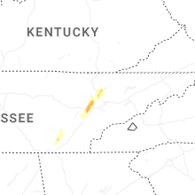


Connect with Interactive Hail Maps