

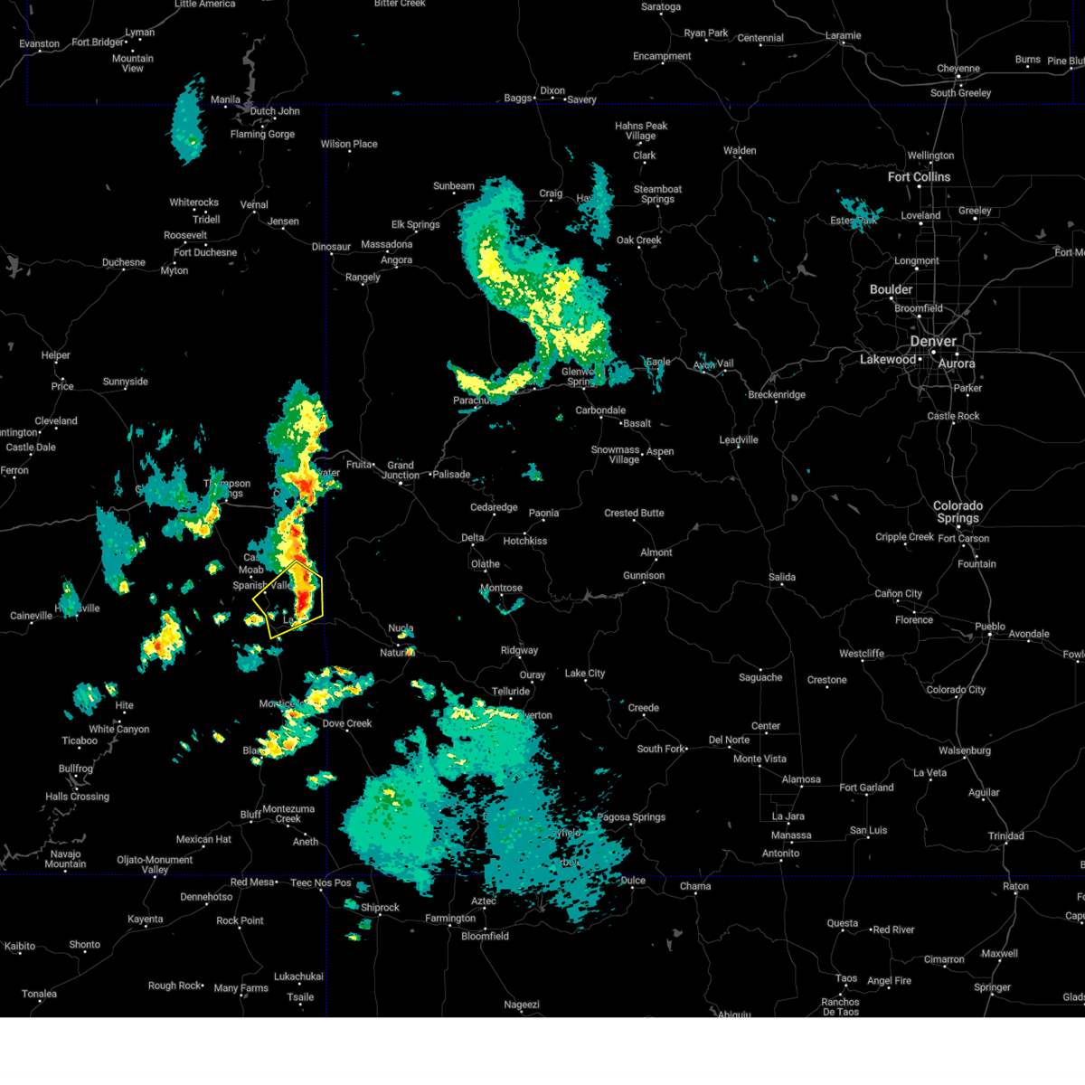
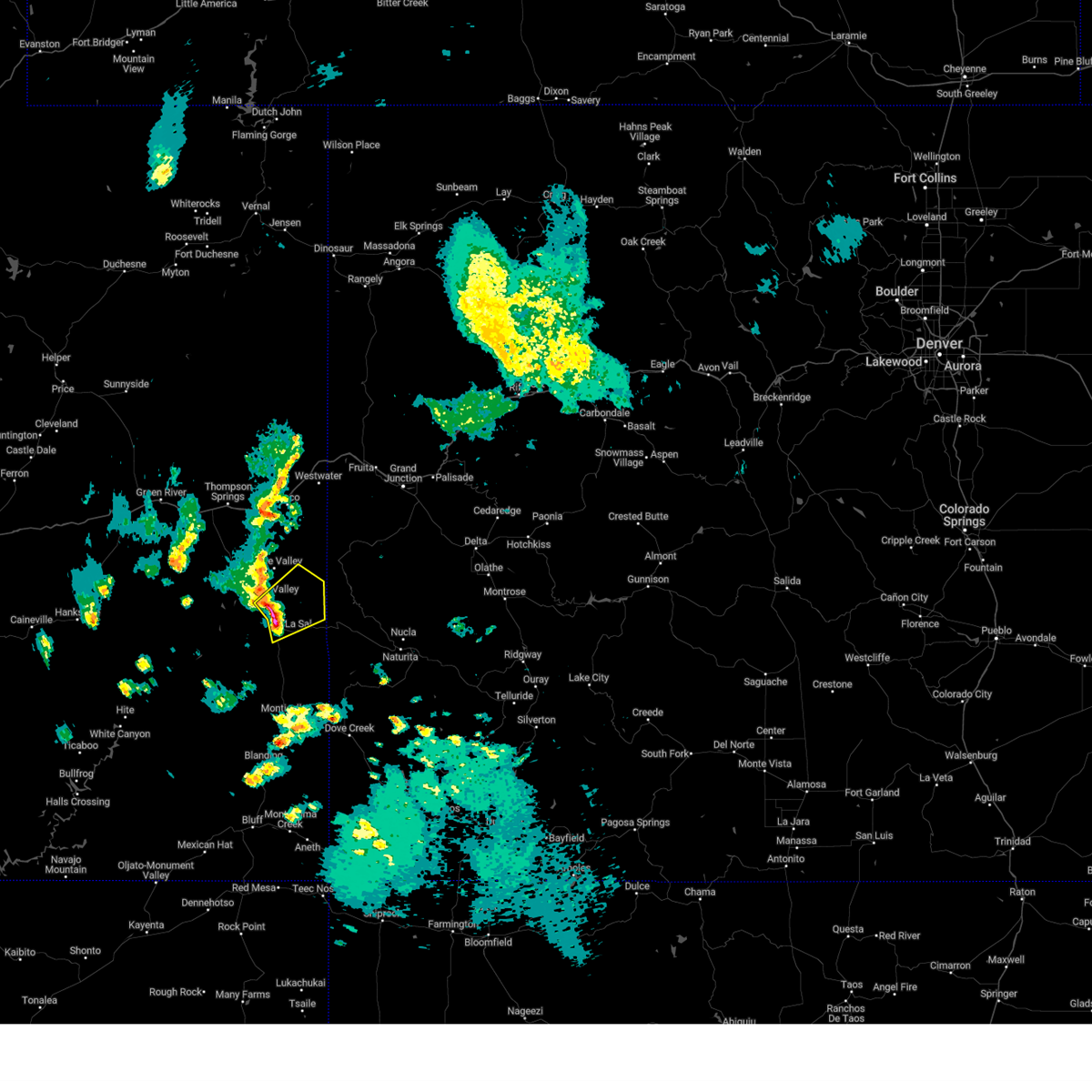
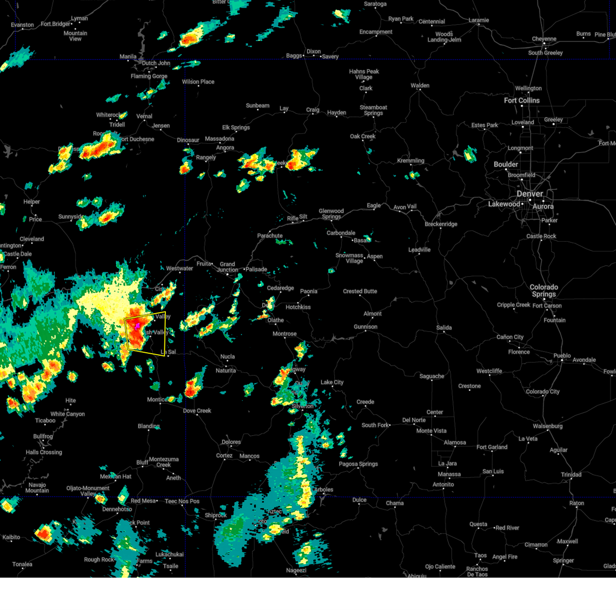
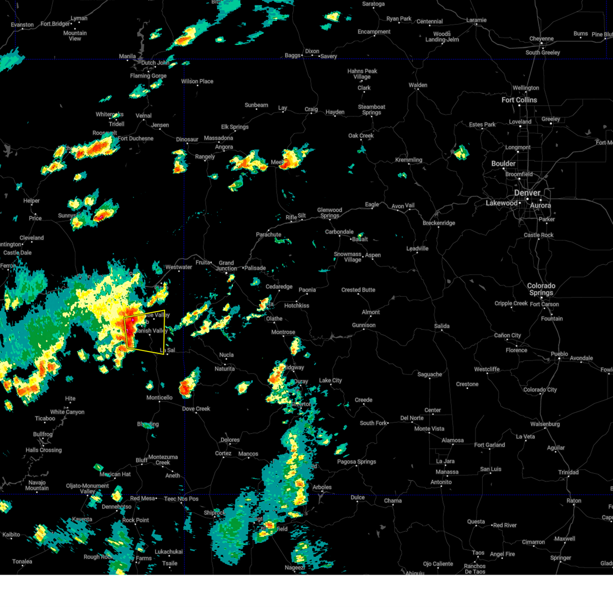
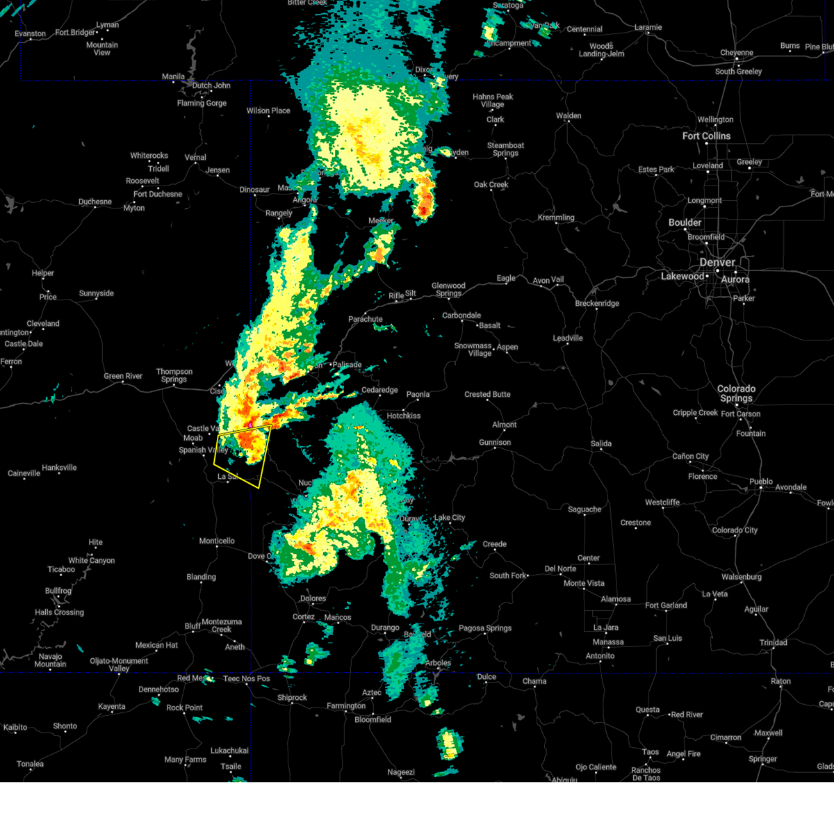
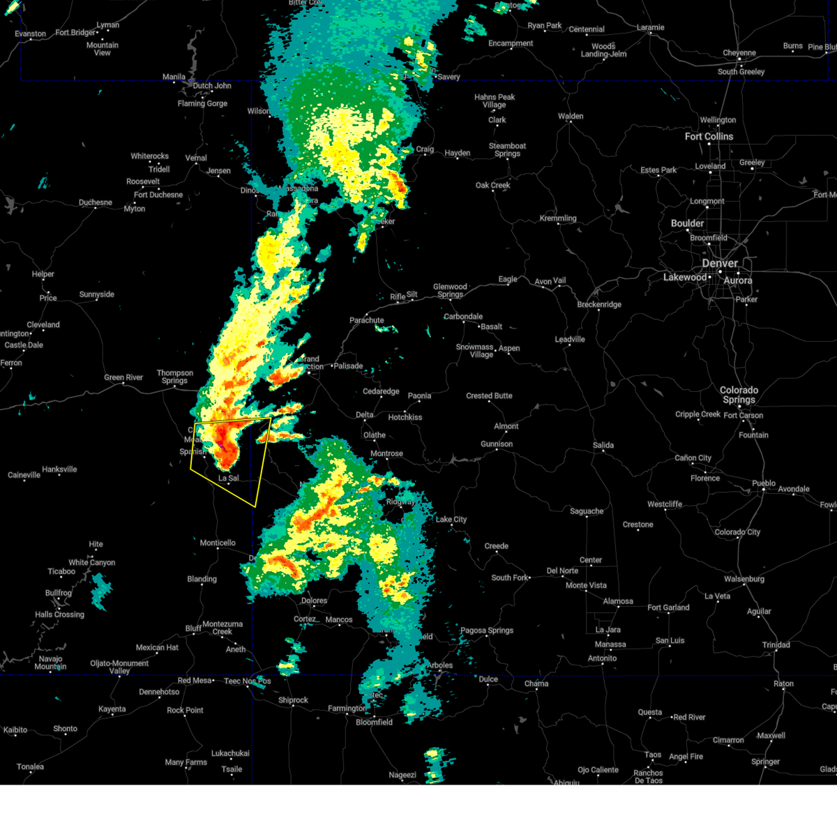
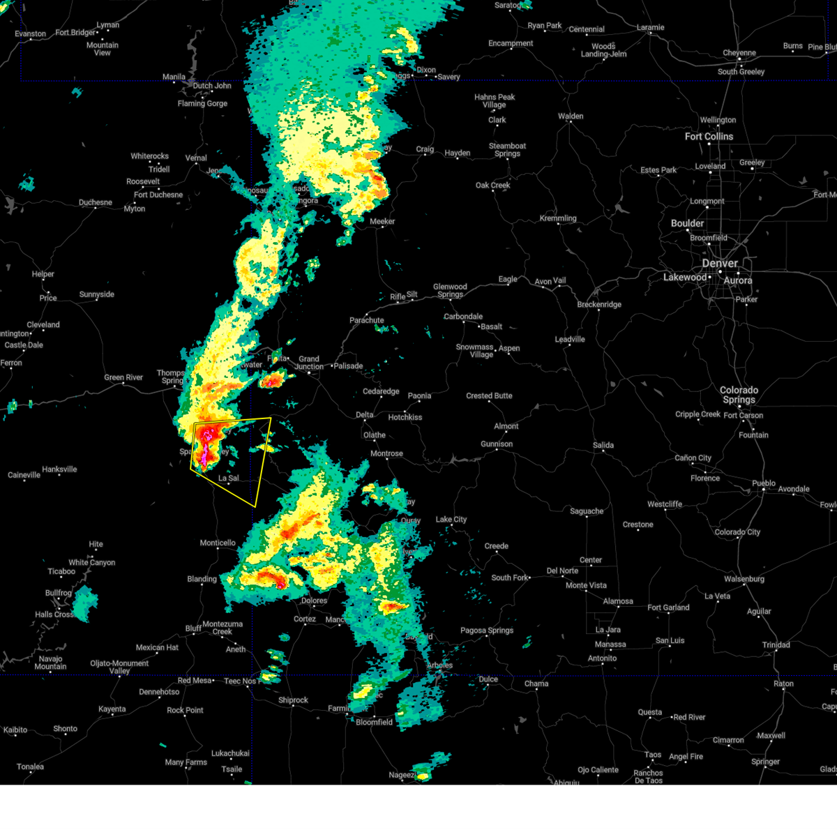
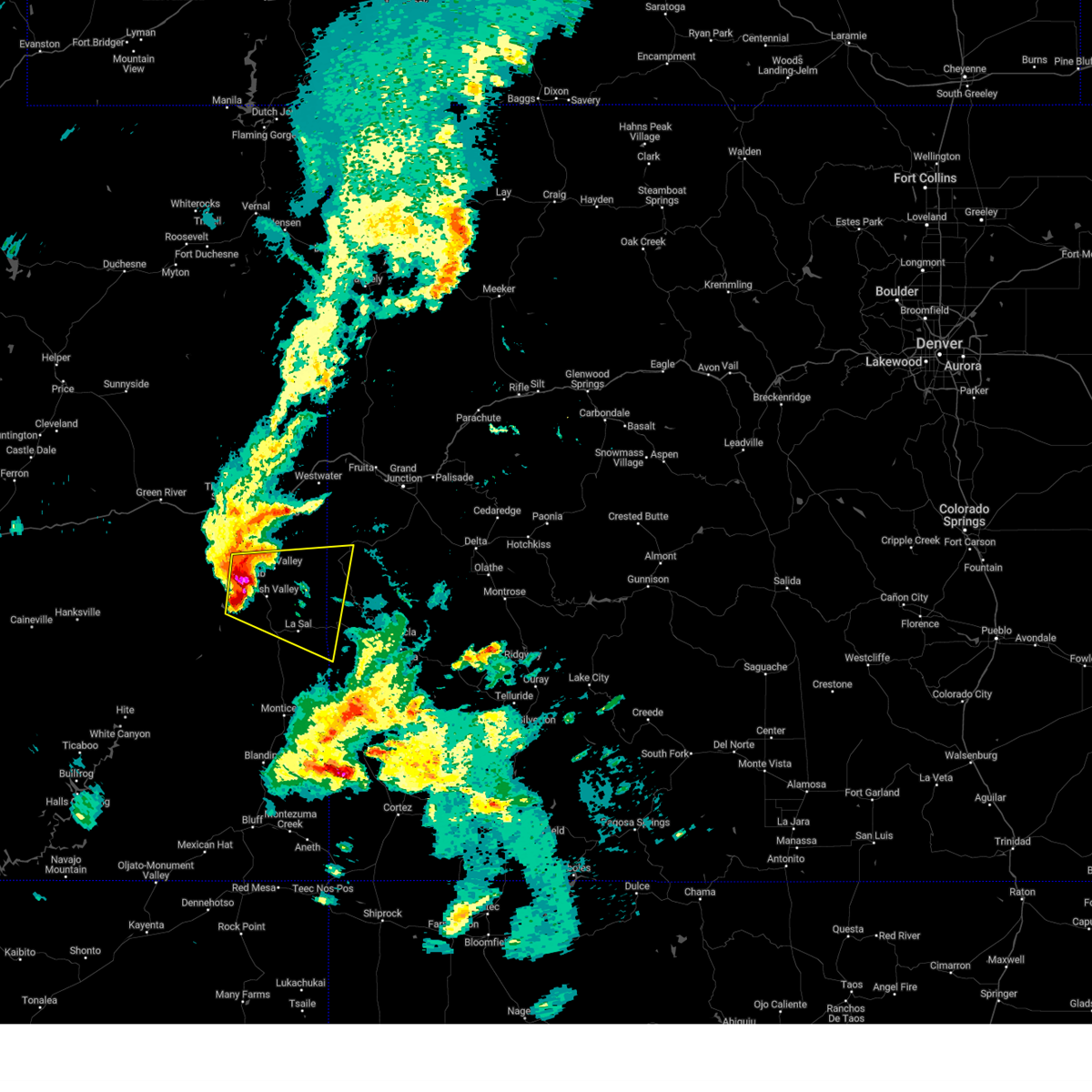
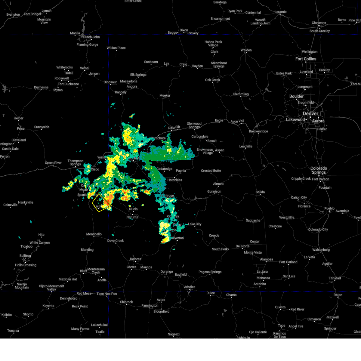
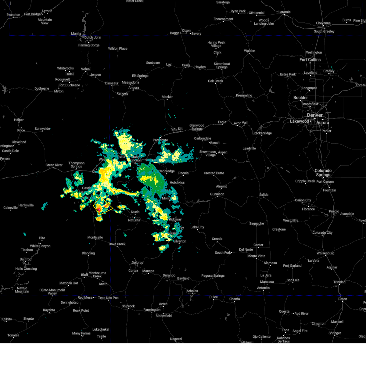
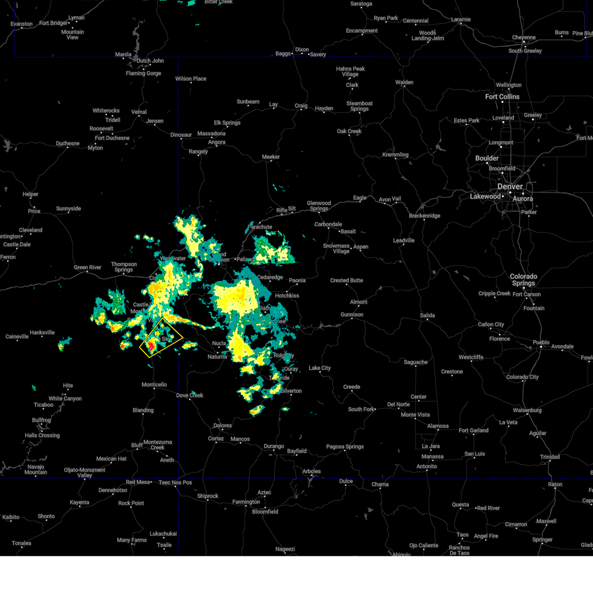
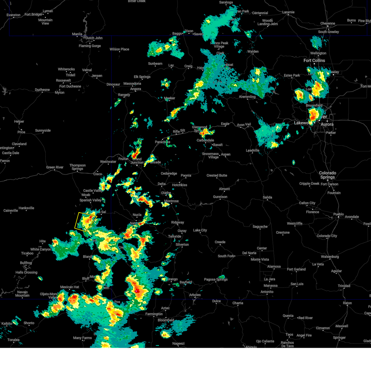
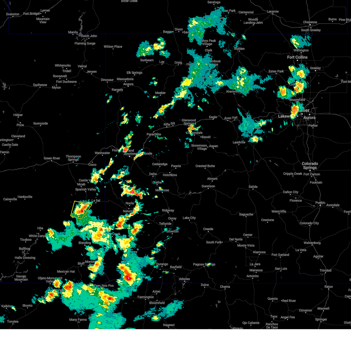
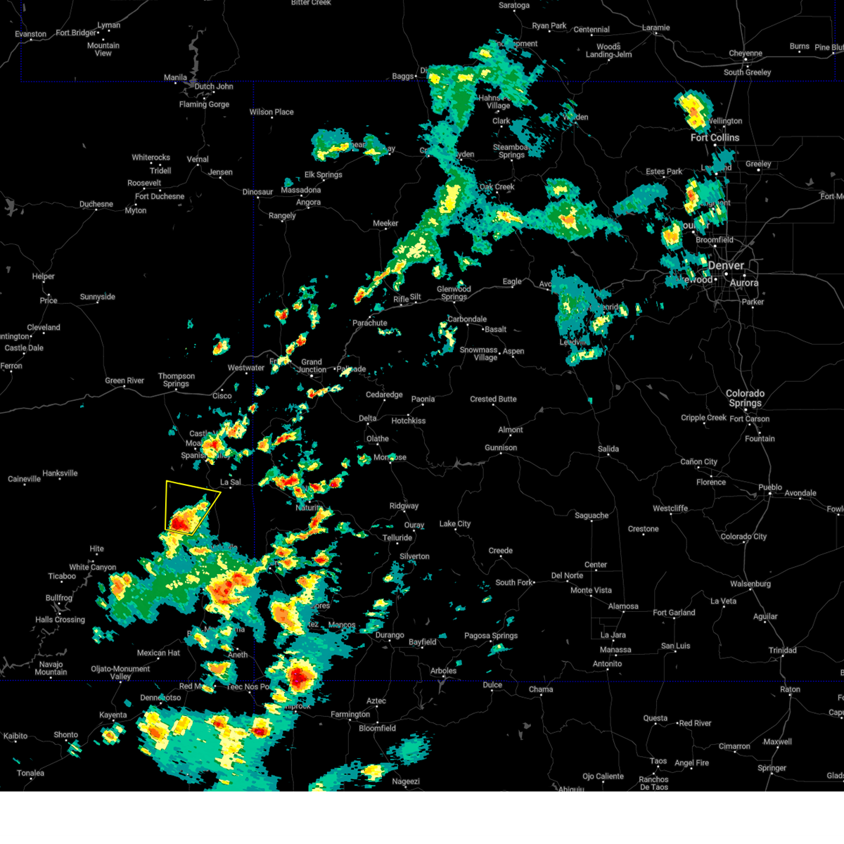
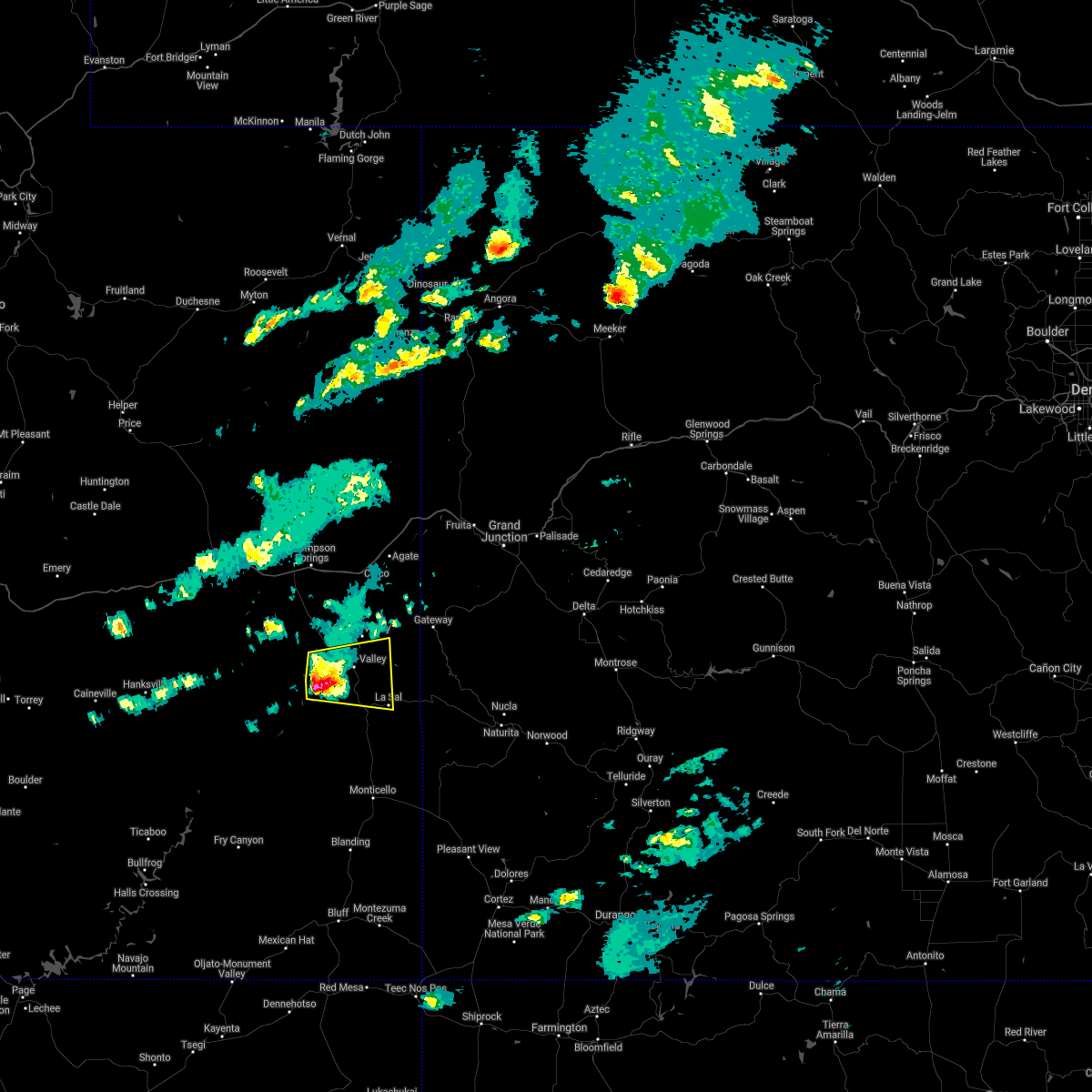
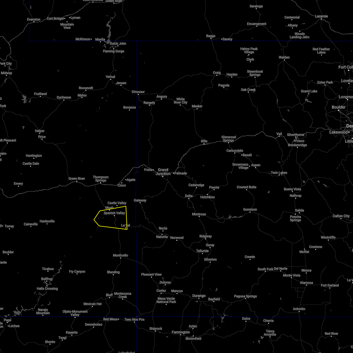
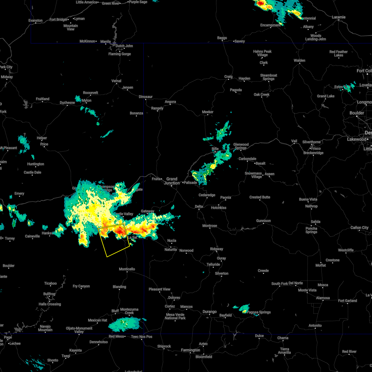
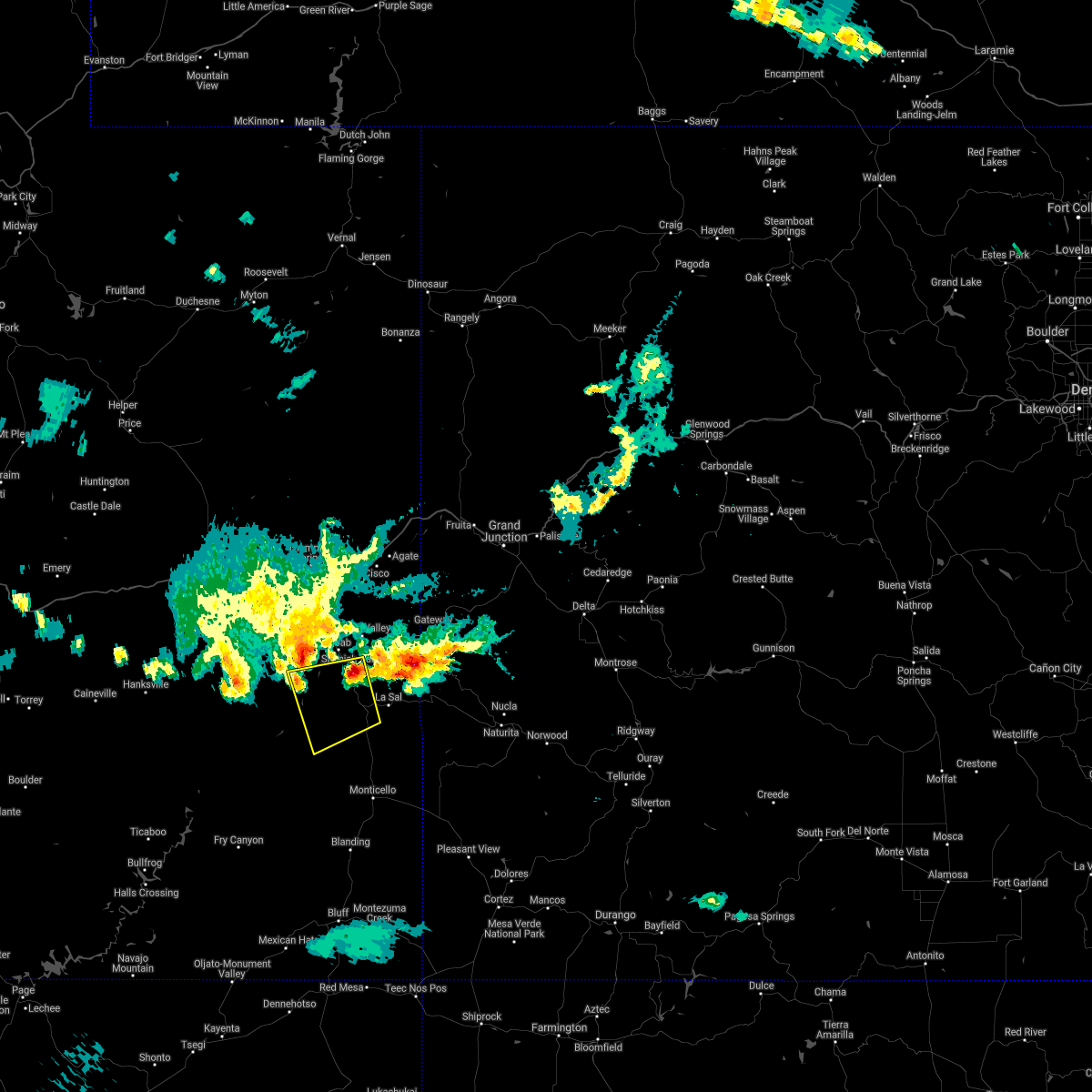
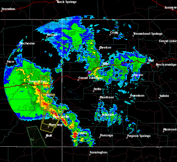
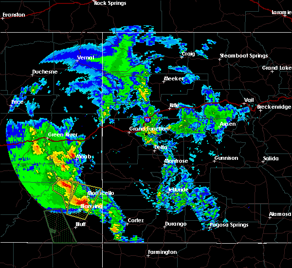
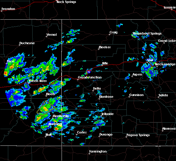
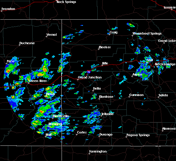
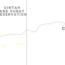
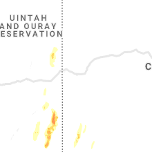
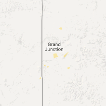
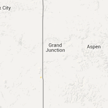
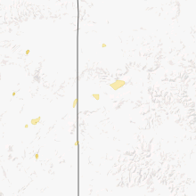
Hail Map for La Sal, UT
The La Sal, UT area has had 0 reports of on-the-ground hail by trained spotters, and has been under severe weather warnings 2 times during the past 12 months. Doppler radar has detected hail at or near La Sal, UT on 8 occasions, including 1 occasion during the past year.
| Name: | La Sal, UT |
| Where Located: | 64.3 miles SW of Grand Junction, CO |
| Map: | Google Map for La Sal, UT |
| Population: | 395 |
| Housing Units: | 185 |
| More Info: | Search Google for La Sal, UT |
0
The Top Recent Hail Date for La Sal, UT is Sunday, August 25, 2024 (8th out of 8)

Hail and Wind Damage Spotted near La Sal, UT
| Date / Time | Report Details |
|---|---|
| 8/23/2024 10:14 PM MDT |
 The storms which prompted the warning have moved out of the area. therefore, the warning will be allowed to expire. The storms which prompted the warning have moved out of the area. therefore, the warning will be allowed to expire.
|
| 8/23/2024 9:52 PM MDT |
 Svrgjt the national weather service in grand junction has issued a * severe thunderstorm warning for, northeastern san juan county in southeastern utah, southeastern grand county in east central utah, * until 1015 pm mdt. * at 952 pm mdt, severe thunderstorms were located along a line extending from near spanish valley to 14 miles southeast of moab to 7 miles west of la sal, moving northeast at 40 mph (radar indicated). Hazards include 60 mph wind gusts and quarter size hail. Hail damage to vehicles is expected. Expect wind damage to roofs, siding, and trees. Svrgjt the national weather service in grand junction has issued a * severe thunderstorm warning for, northeastern san juan county in southeastern utah, southeastern grand county in east central utah, * until 1015 pm mdt. * at 952 pm mdt, severe thunderstorms were located along a line extending from near spanish valley to 14 miles southeast of moab to 7 miles west of la sal, moving northeast at 40 mph (radar indicated). Hazards include 60 mph wind gusts and quarter size hail. Hail damage to vehicles is expected. Expect wind damage to roofs, siding, and trees.
|
| 6/27/2024 3:19 PM MDT |
 At 318 pm mdt, a severe thunderstorm was located near moab, moving east at 35 mph (trained weather spotters reported half dollar sized hail just north of moab). Hazards include ping pong ball size hail and 60 mph wind gusts. People and animals outdoors will be injured. expect hail damage to roofs, siding, windows, and vehicles. expect wind damage to roofs, siding, and trees. Locations impacted include, moab, castle valley, la sal, and spanish valley. At 318 pm mdt, a severe thunderstorm was located near moab, moving east at 35 mph (trained weather spotters reported half dollar sized hail just north of moab). Hazards include ping pong ball size hail and 60 mph wind gusts. People and animals outdoors will be injured. expect hail damage to roofs, siding, windows, and vehicles. expect wind damage to roofs, siding, and trees. Locations impacted include, moab, castle valley, la sal, and spanish valley.
|
| 6/27/2024 3:11 PM MDT |
 Svrgjt the national weather service in grand junction has issued a * severe thunderstorm warning for, northeastern san juan county in southeastern utah, southeastern grand county in east central utah, * until 345 pm mdt. * at 311 pm mdt, a severe thunderstorm was located near moab, moving east at 35 mph (radar indicated). Hazards include 60 mph wind gusts and quarter size hail. Hail damage to vehicles is expected. Expect wind damage to roofs, siding, and trees. Svrgjt the national weather service in grand junction has issued a * severe thunderstorm warning for, northeastern san juan county in southeastern utah, southeastern grand county in east central utah, * until 345 pm mdt. * at 311 pm mdt, a severe thunderstorm was located near moab, moving east at 35 mph (radar indicated). Hazards include 60 mph wind gusts and quarter size hail. Hail damage to vehicles is expected. Expect wind damage to roofs, siding, and trees.
|
| 6/21/2024 6:28 PM MDT |
 The storm which prompted the warning has weakened below severe limits, and no longer poses an immediate threat to life or property. therefore, the warning will be allowed to expire. a severe thunderstorm watch remains in effect until 700 pm mdt for west central colorado, and southeastern and east central utah. to report severe weather, contact your nearest law enforcement agency. they will relay your report to the national weather service grand junction. remember, a severe thunderstorm warning still remains in effect for southeastern grand county, as well as northeastern san juan county, west central montrose county, and southwestern mesa county. The storm which prompted the warning has weakened below severe limits, and no longer poses an immediate threat to life or property. therefore, the warning will be allowed to expire. a severe thunderstorm watch remains in effect until 700 pm mdt for west central colorado, and southeastern and east central utah. to report severe weather, contact your nearest law enforcement agency. they will relay your report to the national weather service grand junction. remember, a severe thunderstorm warning still remains in effect for southeastern grand county, as well as northeastern san juan county, west central montrose county, and southwestern mesa county.
|
| 6/21/2024 6:16 PM MDT |
 The storm which prompted the warning has weakened below severe limits, and no longer poses an immediate threat to life or property. therefore, the warning has been allowed to expire. a severe thunderstorm watch remains in effect until 700 pm mdt for southwestern and west central colorado, and southeastern and east central utah. remember, a severe thunderstorm warning still remains in effect for southeastern grand county, as well as northeastern san juan county, southwestern mesa county, and west central montrose county. The storm which prompted the warning has weakened below severe limits, and no longer poses an immediate threat to life or property. therefore, the warning has been allowed to expire. a severe thunderstorm watch remains in effect until 700 pm mdt for southwestern and west central colorado, and southeastern and east central utah. remember, a severe thunderstorm warning still remains in effect for southeastern grand county, as well as northeastern san juan county, southwestern mesa county, and west central montrose county.
|
| 6/21/2024 6:14 PM MDT |
 Svrgjt the national weather service in grand junction has issued a * severe thunderstorm warning for, west central montrose county in west central colorado, southwestern mesa county in west central colorado, northeastern san juan county in southeastern utah, southeastern grand county in east central utah, * until 630 pm mdt. * at 614 pm mdt, a severe thunderstorm was located 13 miles northeast of la sal, moving east at 40 mph (radar indicated). Hazards include 60 mph wind gusts and quarter size hail. Hail damage to vehicles is expected. Expect wind damage to roofs, siding, and trees. Svrgjt the national weather service in grand junction has issued a * severe thunderstorm warning for, west central montrose county in west central colorado, southwestern mesa county in west central colorado, northeastern san juan county in southeastern utah, southeastern grand county in east central utah, * until 630 pm mdt. * at 614 pm mdt, a severe thunderstorm was located 13 miles northeast of la sal, moving east at 40 mph (radar indicated). Hazards include 60 mph wind gusts and quarter size hail. Hail damage to vehicles is expected. Expect wind damage to roofs, siding, and trees.
|
| 6/21/2024 5:59 PM MDT |
 At 559 pm mdt, a severe thunderstorm was located 9 miles east of spanish valley, or 11 miles southeast of castle valley, moving east at 55 mph (radar indicated). Hazards include 70 mph wind gusts and quarter size hail. Hail damage to vehicles is expected. expect considerable tree damage. wind damage is also likely to mobile homes, roofs, and outbuildings. Locations impacted include, moab, castle valley, la sal, spanish valley, gateway, and la sal junction. At 559 pm mdt, a severe thunderstorm was located 9 miles east of spanish valley, or 11 miles southeast of castle valley, moving east at 55 mph (radar indicated). Hazards include 70 mph wind gusts and quarter size hail. Hail damage to vehicles is expected. expect considerable tree damage. wind damage is also likely to mobile homes, roofs, and outbuildings. Locations impacted include, moab, castle valley, la sal, spanish valley, gateway, and la sal junction.
|
| 6/21/2024 5:48 PM MDT |
 Svrgjt the national weather service in grand junction has issued a * severe thunderstorm warning for, southwestern montrose county in west central colorado, southwestern mesa county in west central colorado, northeastern san juan county in southeastern utah, southeastern grand county in east central utah, * until 615 pm mdt. * at 548 pm mdt, a severe thunderstorm was located near spanish valley, or near moab, moving east at 55 mph (radar indicated). Hazards include 70 mph wind gusts and half dollar size hail. Hail damage to vehicles is expected. expect considerable tree damage. Wind damage is also likely to mobile homes, roofs, and outbuildings. Svrgjt the national weather service in grand junction has issued a * severe thunderstorm warning for, southwestern montrose county in west central colorado, southwestern mesa county in west central colorado, northeastern san juan county in southeastern utah, southeastern grand county in east central utah, * until 615 pm mdt. * at 548 pm mdt, a severe thunderstorm was located near spanish valley, or near moab, moving east at 55 mph (radar indicated). Hazards include 70 mph wind gusts and half dollar size hail. Hail damage to vehicles is expected. expect considerable tree damage. Wind damage is also likely to mobile homes, roofs, and outbuildings.
|
| 6/21/2024 10:15 AM MDT |
 The storm which prompted the warning has weakened below severe limits, and has exited the warned area. therefore, the warning will be allowed to expire. The storm which prompted the warning has weakened below severe limits, and has exited the warned area. therefore, the warning will be allowed to expire.
|
| 6/21/2024 10:02 AM MDT |
 At 1002 am mdt, a severe thunderstorm was located 8 miles northeast of la sal, moving northeast at 40 mph (radar indicated). Hazards include 60 mph wind gusts and quarter size hail. Hail damage to vehicles is expected. expect wind damage to roofs, siding, and trees. Locations impacted include, la sal. At 1002 am mdt, a severe thunderstorm was located 8 miles northeast of la sal, moving northeast at 40 mph (radar indicated). Hazards include 60 mph wind gusts and quarter size hail. Hail damage to vehicles is expected. expect wind damage to roofs, siding, and trees. Locations impacted include, la sal.
|
| 6/21/2024 9:43 AM MDT |
 Svrgjt the national weather service in grand junction has issued a * severe thunderstorm warning for, western montrose county in west central colorado, northeastern san juan county in southeastern utah, southeastern grand county in east central utah, * until 1015 am mdt. * at 942 am mdt, a severe thunderstorm was located near la sal, moving northeast at 40 mph (radar indicated). Hazards include 60 mph wind gusts and quarter size hail. Hail damage to vehicles is expected. Expect wind damage to roofs, siding, and trees. Svrgjt the national weather service in grand junction has issued a * severe thunderstorm warning for, western montrose county in west central colorado, northeastern san juan county in southeastern utah, southeastern grand county in east central utah, * until 1015 am mdt. * at 942 am mdt, a severe thunderstorm was located near la sal, moving northeast at 40 mph (radar indicated). Hazards include 60 mph wind gusts and quarter size hail. Hail damage to vehicles is expected. Expect wind damage to roofs, siding, and trees.
|
| 6/20/2024 3:25 PM MDT |
 The storm which prompted the warning has weakened below severe limits, and no longer poses an immediate threat to life or property. therefore, the warning will be allowed to expire. however, small hail, gusty winds and heavy rain are still possible with this thunderstorm. The storm which prompted the warning has weakened below severe limits, and no longer poses an immediate threat to life or property. therefore, the warning will be allowed to expire. however, small hail, gusty winds and heavy rain are still possible with this thunderstorm.
|
| 6/20/2024 3:14 PM MDT |
 At 313 pm mdt, a severe thunderstorm was located 17 miles southeast of canyonlands national park, or 20 miles west of la sal, moving north at 30 mph (radar indicated). Hazards include 70 mph wind gusts and half dollar size hail. Hail damage to vehicles is expected. expect considerable tree damage. wind damage is also likely to mobile homes, roofs, and outbuildings. This severe thunderstorm will remain over mainly rural areas of northeastern san juan county. At 313 pm mdt, a severe thunderstorm was located 17 miles southeast of canyonlands national park, or 20 miles west of la sal, moving north at 30 mph (radar indicated). Hazards include 70 mph wind gusts and half dollar size hail. Hail damage to vehicles is expected. expect considerable tree damage. wind damage is also likely to mobile homes, roofs, and outbuildings. This severe thunderstorm will remain over mainly rural areas of northeastern san juan county.
|
| 6/20/2024 2:57 PM MDT |
 Svrgjt the national weather service in grand junction has issued a * severe thunderstorm warning for, northeastern san juan county in southeastern utah, * until 330 pm mdt. * at 256 pm mdt, a severe thunderstorm was located 23 miles southeast of canyonlands national park, or 24 miles northwest of monticello, moving north at 35 mph. this includes eastern portions of canyonlands national park (radar indicated). Hazards include 70 mph wind gusts and half dollar size hail. Hail damage to vehicles is expected. expect considerable tree damage. wind damage is also likely to mobile homes, roofs, and outbuildings. This severe thunderstorm will remain over mainly rural areas of northeastern san juan county. Svrgjt the national weather service in grand junction has issued a * severe thunderstorm warning for, northeastern san juan county in southeastern utah, * until 330 pm mdt. * at 256 pm mdt, a severe thunderstorm was located 23 miles southeast of canyonlands national park, or 24 miles northwest of monticello, moving north at 35 mph. this includes eastern portions of canyonlands national park (radar indicated). Hazards include 70 mph wind gusts and half dollar size hail. Hail damage to vehicles is expected. expect considerable tree damage. wind damage is also likely to mobile homes, roofs, and outbuildings. This severe thunderstorm will remain over mainly rural areas of northeastern san juan county.
|
| 8/26/2021 5:15 PM MDT |
 At 514 pm mdt, a severe thunderstorm was located near spanish valley, or 11 miles southeast of moab, moving east at 40 mph (radar indicated). Hazards include 60 mph wind gusts. Expect damage to roofs, siding, and trees. locations impacted include, la sal. this includes the following highways, u. s. highway 191 in utah between mile markers 104 and 126. utah 279 between mile markers 0 and 3, and between mile markers 6 and 13. utah 313 between mile markers 0 and 4. hail threat, radar indicated max hail size, <. 75 in wind threat, radar indicated max wind gust, 60 mph. At 514 pm mdt, a severe thunderstorm was located near spanish valley, or 11 miles southeast of moab, moving east at 40 mph (radar indicated). Hazards include 60 mph wind gusts. Expect damage to roofs, siding, and trees. locations impacted include, la sal. this includes the following highways, u. s. highway 191 in utah between mile markers 104 and 126. utah 279 between mile markers 0 and 3, and between mile markers 6 and 13. utah 313 between mile markers 0 and 4. hail threat, radar indicated max hail size, <. 75 in wind threat, radar indicated max wind gust, 60 mph.
|
| 8/26/2021 5:02 PM MDT |
 At 502 pm mdt, a severe thunderstorm was located 11 miles south of moab, moving east at 40 mph (radar indicated). Hazards include 60 mph wind gusts. Expect damage to roofs, siding, and trees. this severe thunderstorm will be near, spanish valley around 520 pm mdt. other locations in the path of this severe thunderstorm include la sal. this includes the following highways, u. s. highway 191 in utah between mile markers 104 and 126. utah 279 between mile markers 0 and 3, and between mile markers 6 and 13. utah 313 between mile markers 0 and 5. hail threat, radar indicated max hail size, <. 75 in wind threat, radar indicated max wind gust, 60 mph. At 502 pm mdt, a severe thunderstorm was located 11 miles south of moab, moving east at 40 mph (radar indicated). Hazards include 60 mph wind gusts. Expect damage to roofs, siding, and trees. this severe thunderstorm will be near, spanish valley around 520 pm mdt. other locations in the path of this severe thunderstorm include la sal. this includes the following highways, u. s. highway 191 in utah between mile markers 104 and 126. utah 279 between mile markers 0 and 3, and between mile markers 6 and 13. utah 313 between mile markers 0 and 5. hail threat, radar indicated max hail size, <. 75 in wind threat, radar indicated max wind gust, 60 mph.
|
| 7/14/2021 7:45 PM MDT |
 At 744 pm mdt, a severe thunderstorm was located 11 miles east of canyonlands national park, or 15 miles southwest of moab, moving southeast at 30 mph (radar indicated). Hazards include 70 mph wind gusts. Expect considerable tree damage. damage is likely to mobile homes, roofs, and outbuildings. locations impacted include, la sal, spanish valley, dead horse point state park and la sal junction. this includes the following highways, u. s. highway 191 in utah between mile markers 96 and 121. Utah 313 between mile markers 0 and 1. At 744 pm mdt, a severe thunderstorm was located 11 miles east of canyonlands national park, or 15 miles southwest of moab, moving southeast at 30 mph (radar indicated). Hazards include 70 mph wind gusts. Expect considerable tree damage. damage is likely to mobile homes, roofs, and outbuildings. locations impacted include, la sal, spanish valley, dead horse point state park and la sal junction. this includes the following highways, u. s. highway 191 in utah between mile markers 96 and 121. Utah 313 between mile markers 0 and 1.
|
| 7/14/2021 7:34 PM MDT |
 At 733 pm mdt, a severe thunderstorm was located 9 miles east of canyonlands national park, or 12 miles southwest of moab, moving southeast at 30 mph (radar indicated). Hazards include 70 mph wind gusts. Expect considerable tree damage. damage is likely to mobile homes, roofs, and outbuildings. this severe thunderstorm will remain over mainly rural areas of northeastern san juan and south central grand counties, including the following locations, dead horse point state park and la sal junction. this includes the following highways, u. s. highway 191 in utah between mile markers 96 and 121. Utah 313 between mile markers 0 and 1. At 733 pm mdt, a severe thunderstorm was located 9 miles east of canyonlands national park, or 12 miles southwest of moab, moving southeast at 30 mph (radar indicated). Hazards include 70 mph wind gusts. Expect considerable tree damage. damage is likely to mobile homes, roofs, and outbuildings. this severe thunderstorm will remain over mainly rural areas of northeastern san juan and south central grand counties, including the following locations, dead horse point state park and la sal junction. this includes the following highways, u. s. highway 191 in utah between mile markers 96 and 121. Utah 313 between mile markers 0 and 1.
|
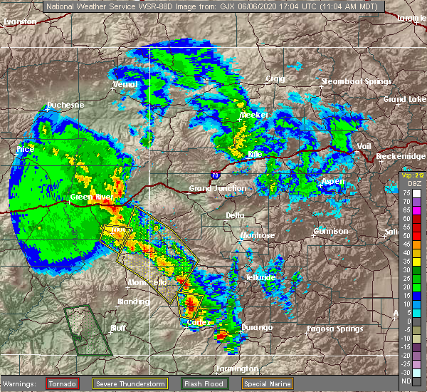
| 6/6/2020 11:06 AM MDT |
 At 1106 am mdt, severe thunderstorms were located along a line extending from near spanish valley to 10 miles north of slick rock to 16 miles northeast of dove creek, moving north at 60 mph. these are very dangerous storms (law enforcement). Hazards include 80 mph wind gusts and quarter size hail. Flying debris will be dangerous to those caught without shelter. mobile homes will be heavily damaged. expect considerable damage to roofs, windows, and vehicles. extensive tree damage and power outages are likely. locations impacted include, la sal, nucla, naturita, slick rock, spanish valley, paradox, gateway, vancorum, bedrock and uravan. this includes the following highways, colorado 90 between mile markers 1 and 33. colorado 141 between mile markers 19 and 115. Colorado 145 between mile markers 112 and 116. At 1106 am mdt, severe thunderstorms were located along a line extending from near spanish valley to 10 miles north of slick rock to 16 miles northeast of dove creek, moving north at 60 mph. these are very dangerous storms (law enforcement). Hazards include 80 mph wind gusts and quarter size hail. Flying debris will be dangerous to those caught without shelter. mobile homes will be heavily damaged. expect considerable damage to roofs, windows, and vehicles. extensive tree damage and power outages are likely. locations impacted include, la sal, nucla, naturita, slick rock, spanish valley, paradox, gateway, vancorum, bedrock and uravan. this includes the following highways, colorado 90 between mile markers 1 and 33. colorado 141 between mile markers 19 and 115. Colorado 145 between mile markers 112 and 116.
|
| 6/6/2020 10:53 AM MDT |
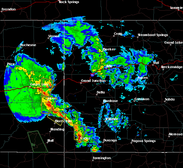 At 1052 am mdt, severe thunderstorms were located along a line extending from 7 miles west of la sal to 8 miles west of slick rock to near dove creek, moving north at 60 mph. these are very dangerous storms (law enforcement). Hazards include 90 mph wind gusts and golf ball size hail. You are in a life-threatening situation. flying debris may be deadly to those caught without shelter. mobile homes will be heavily damaged or destroyed. homes and businesses will have substantial roof and window damage. Expect extensive tree damage and power outages. At 1052 am mdt, severe thunderstorms were located along a line extending from 7 miles west of la sal to 8 miles west of slick rock to near dove creek, moving north at 60 mph. these are very dangerous storms (law enforcement). Hazards include 90 mph wind gusts and golf ball size hail. You are in a life-threatening situation. flying debris may be deadly to those caught without shelter. mobile homes will be heavily damaged or destroyed. homes and businesses will have substantial roof and window damage. Expect extensive tree damage and power outages.
|
| 6/6/2020 10:44 AM MDT |
 At 1044 am mdt, a severe thunderstorm was located 10 miles south of la sal, moving north at 65 mph. this is a very dangerous storm (trained weather spotters). Hazards include 90 mph wind gusts and ping pong ball size hail. You are in a life-threatening situation. flying debris may be deadly to those caught without shelter. mobile homes will be heavily damaged or destroyed. homes and businesses will have substantial roof and window damage. expect extensive tree damage and power outages. locations impacted include, la sal and summit point. this includes the following highways, u. s. highway 191 in utah between mile markers 76 and 99. u. s. Highway 491 in utah between mile markers 5 and 11. At 1044 am mdt, a severe thunderstorm was located 10 miles south of la sal, moving north at 65 mph. this is a very dangerous storm (trained weather spotters). Hazards include 90 mph wind gusts and ping pong ball size hail. You are in a life-threatening situation. flying debris may be deadly to those caught without shelter. mobile homes will be heavily damaged or destroyed. homes and businesses will have substantial roof and window damage. expect extensive tree damage and power outages. locations impacted include, la sal and summit point. this includes the following highways, u. s. highway 191 in utah between mile markers 76 and 99. u. s. Highway 491 in utah between mile markers 5 and 11.
|
| 6/6/2020 10:24 AM MDT |
 At 1023 am mdt, a severe thunderstorm was located near monticello, moving north at 65 mph. this is a very dangerous storm (trained weather spotters). Hazards include 90 mph wind gusts and ping pong ball size hail. You are in a life-threatening situation. flying debris may be deadly to those caught without shelter. mobile homes will be heavily damaged or destroyed. homes and businesses will have substantial roof and window damage. Expect extensive tree damage and power outages. At 1023 am mdt, a severe thunderstorm was located near monticello, moving north at 65 mph. this is a very dangerous storm (trained weather spotters). Hazards include 90 mph wind gusts and ping pong ball size hail. You are in a life-threatening situation. flying debris may be deadly to those caught without shelter. mobile homes will be heavily damaged or destroyed. homes and businesses will have substantial roof and window damage. Expect extensive tree damage and power outages.
|
| 9/13/2016 2:05 PM MDT |
 At 204 pm mdt, doppler radar indicated a severe thunderstorm capable of producing quarter size hail and damaging winds in excess of 60 mph. this storm was located 19 miles south of spanish valley, or 21 miles southwest of la sal. this storm was nearly stationary. this severe thunderstorm will remain over mainly rural areas of northeastern san juan county. At 204 pm mdt, doppler radar indicated a severe thunderstorm capable of producing quarter size hail and damaging winds in excess of 60 mph. this storm was located 19 miles south of spanish valley, or 21 miles southwest of la sal. this storm was nearly stationary. this severe thunderstorm will remain over mainly rural areas of northeastern san juan county.
|
| 9/13/2016 1:41 PM MDT |
 At 140 pm mdt, doppler radar indicated a severe thunderstorm capable of producing quarter size hail and damaging winds in excess of 60 mph. this storm was located 23 miles northwest of monticello, and moving northeast at 30 mph. * this severe thunderstorm will remain over mainly rural areas of northeastern san juan county. At 140 pm mdt, doppler radar indicated a severe thunderstorm capable of producing quarter size hail and damaging winds in excess of 60 mph. this storm was located 23 miles northwest of monticello, and moving northeast at 30 mph. * this severe thunderstorm will remain over mainly rural areas of northeastern san juan county.
|
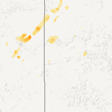
Hail Maps for La Sal, UT


Connect with Interactive Hail Maps