

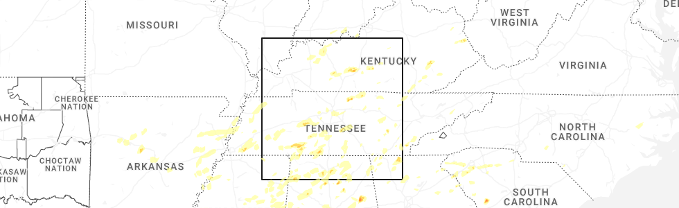
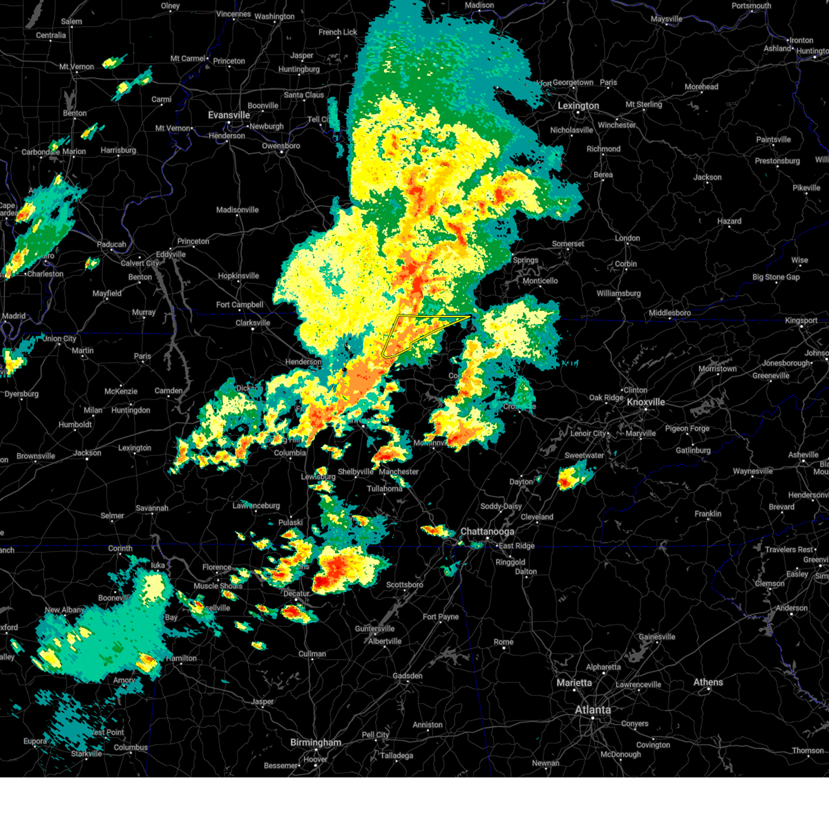
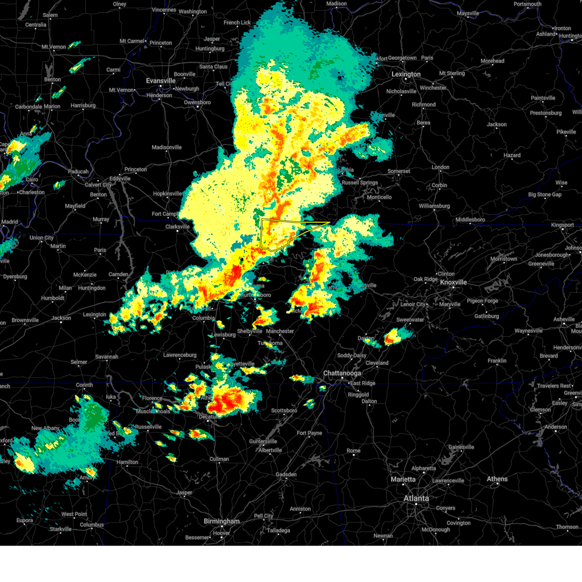
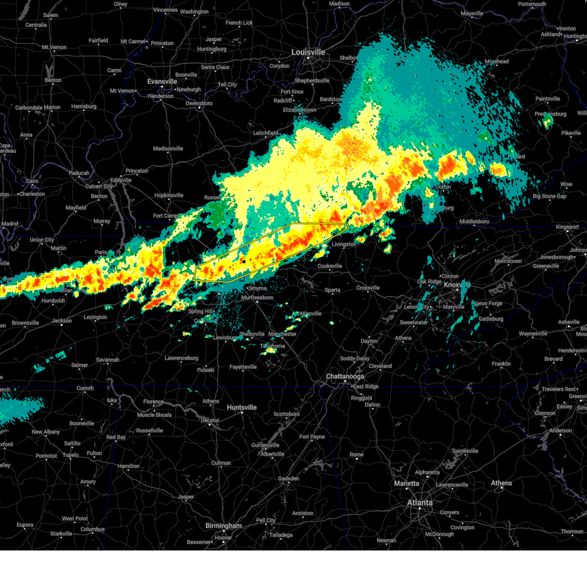
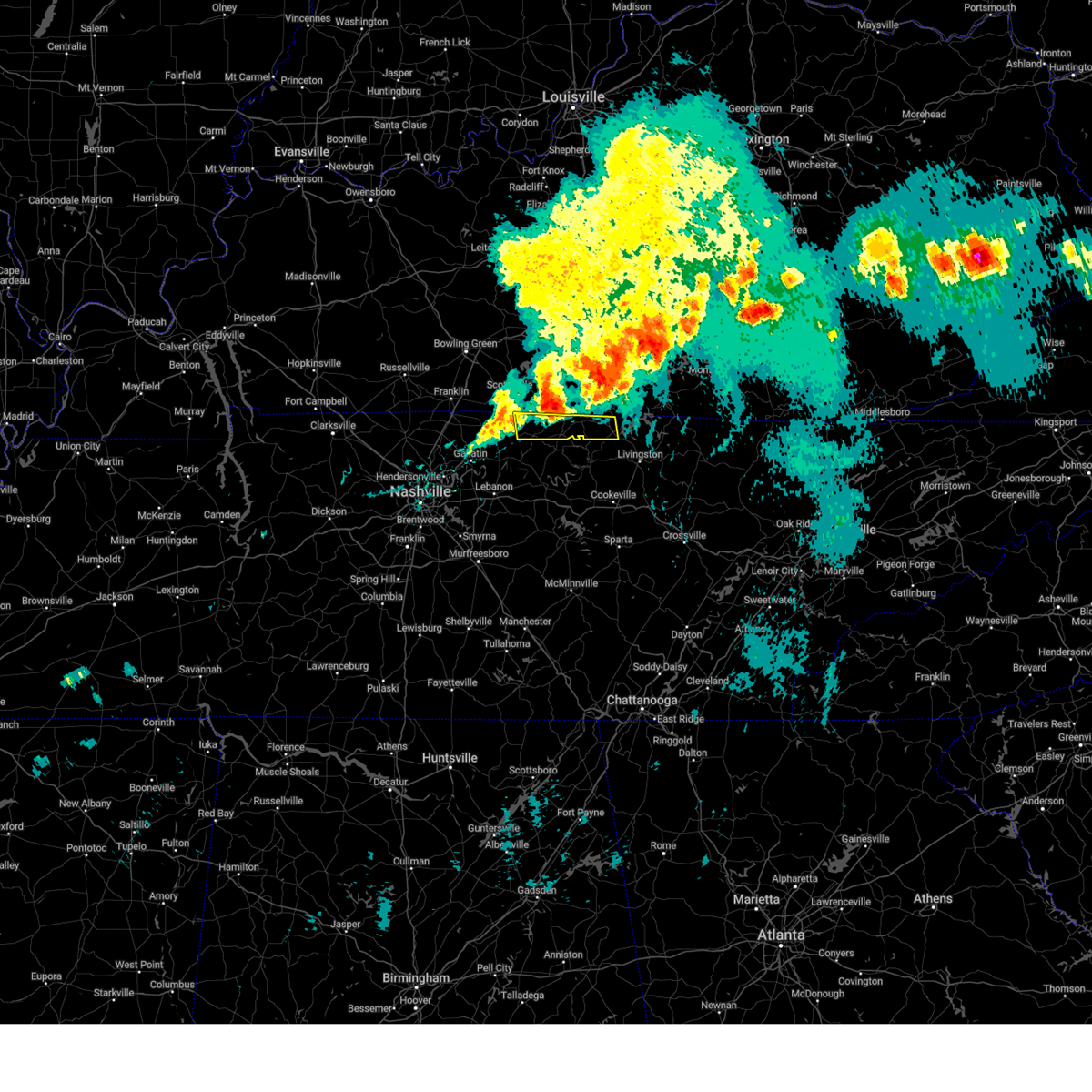
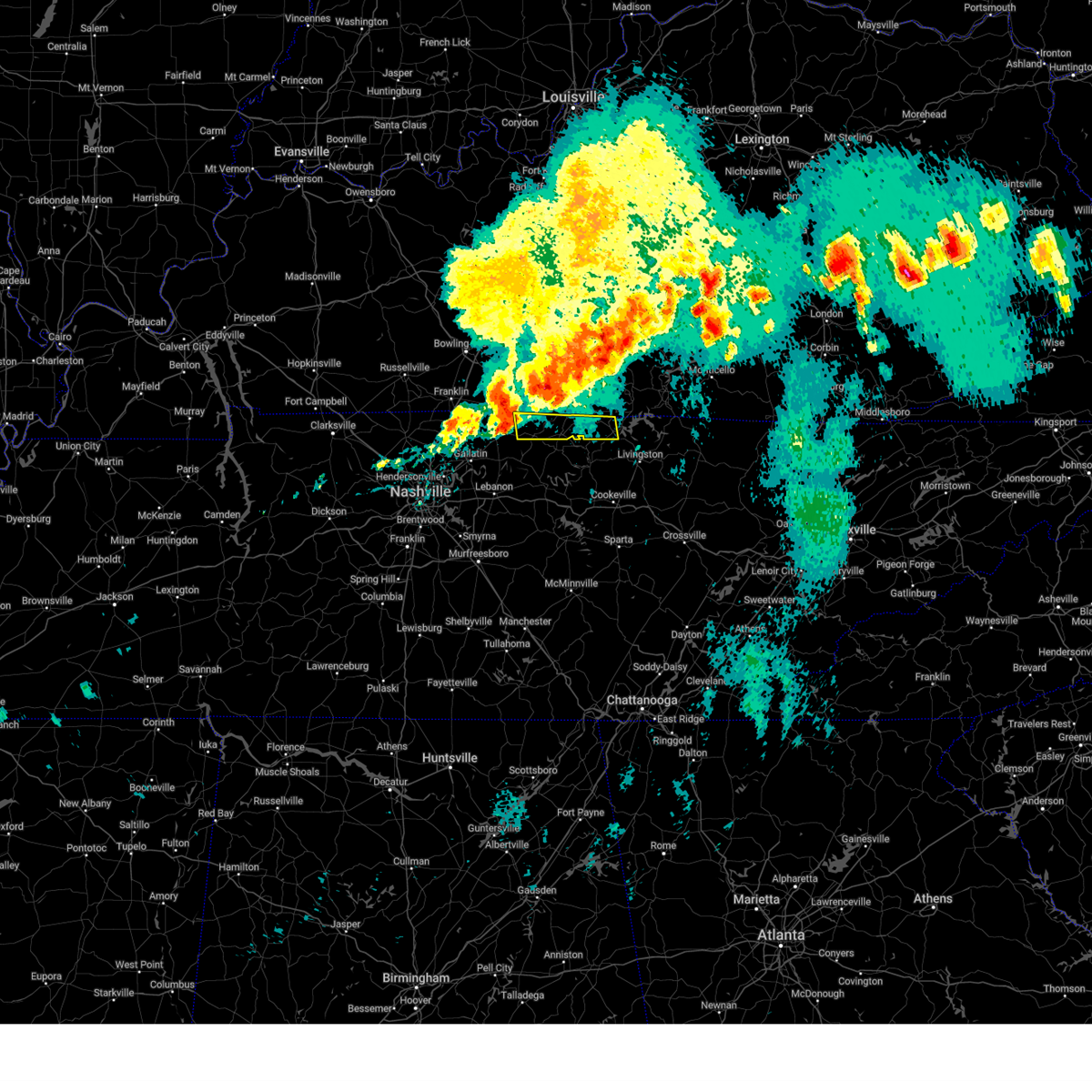
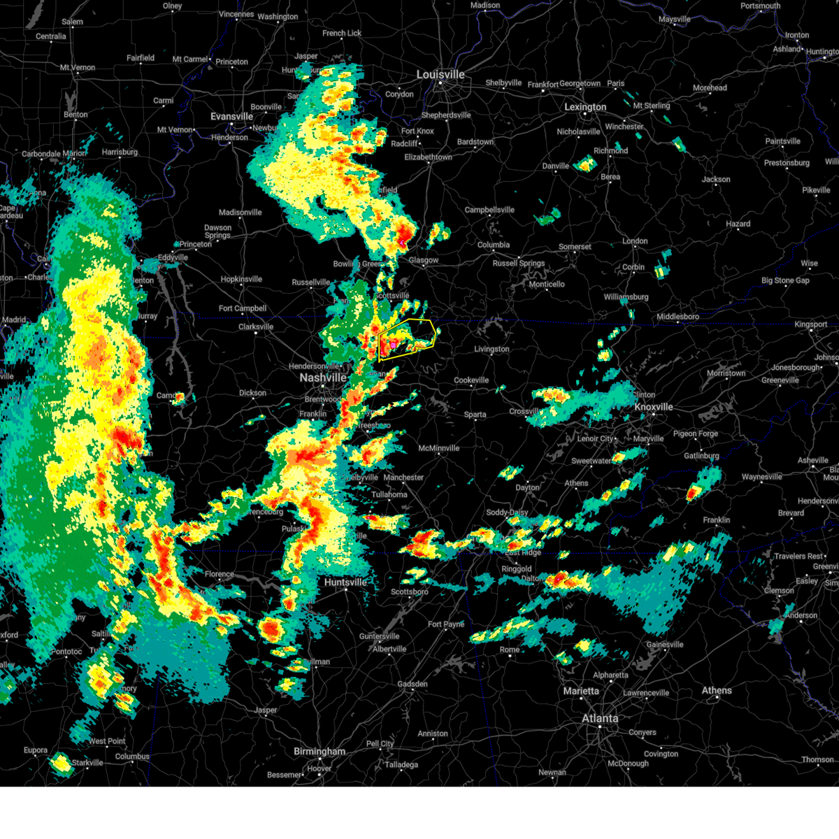
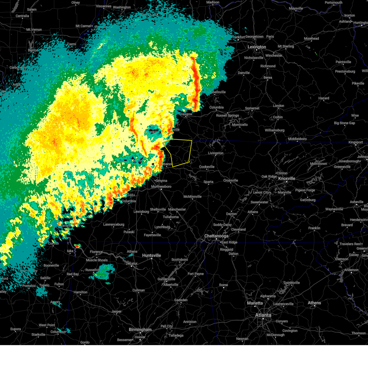
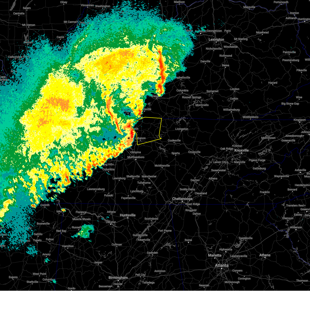
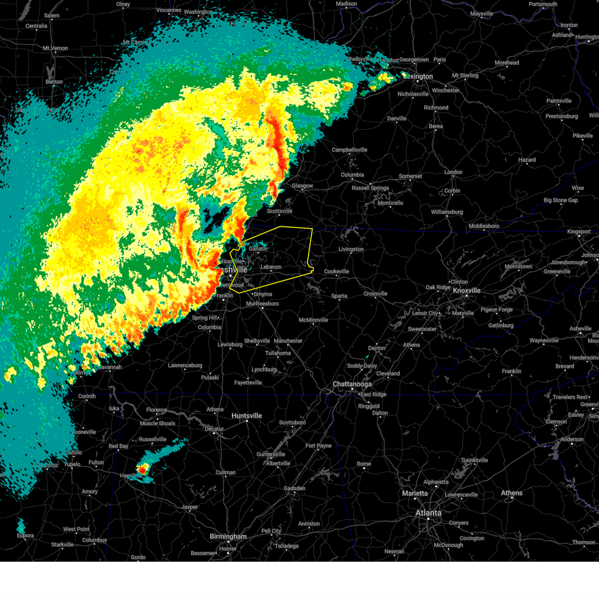
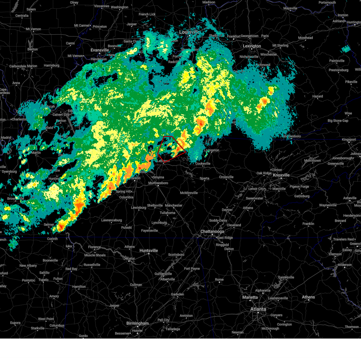
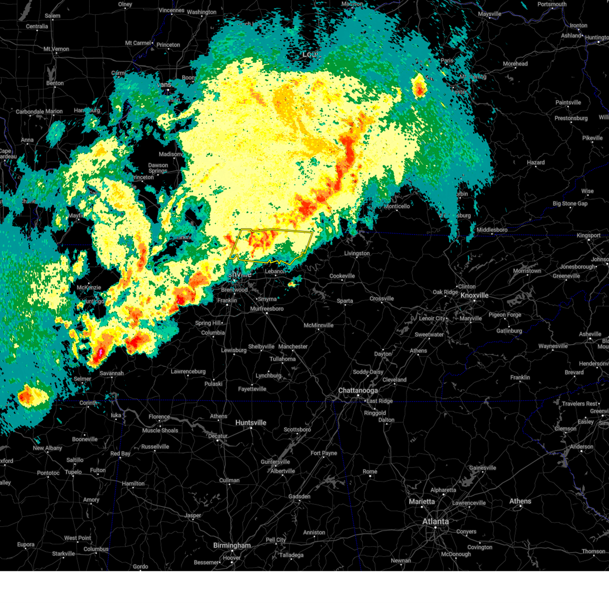
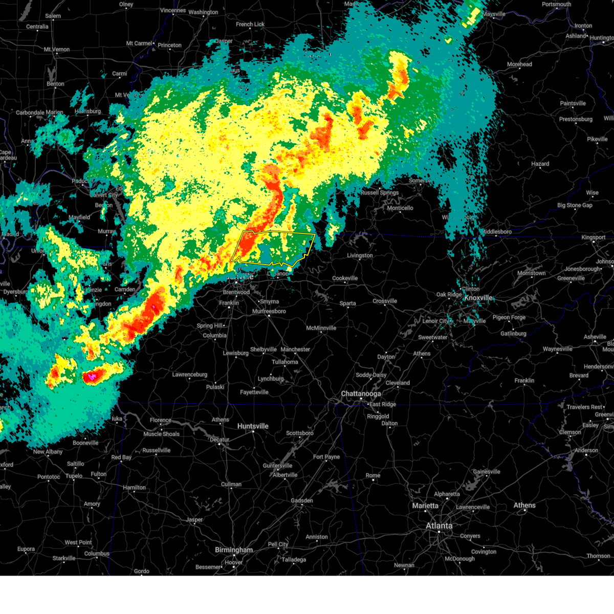
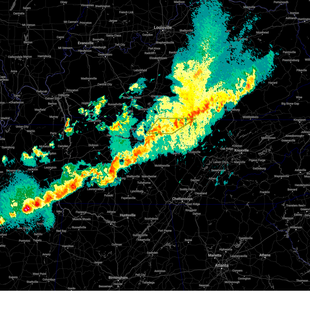
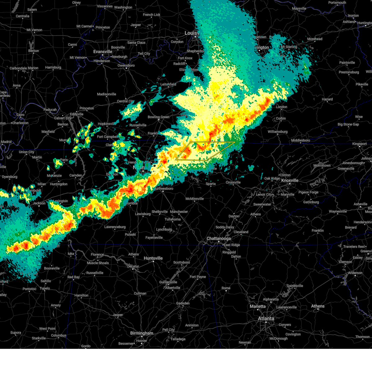
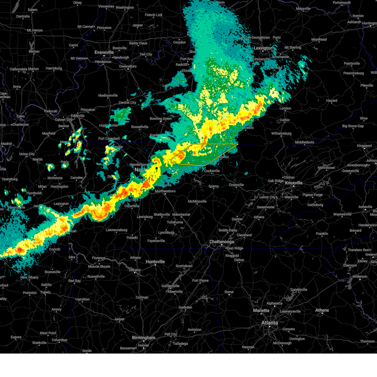
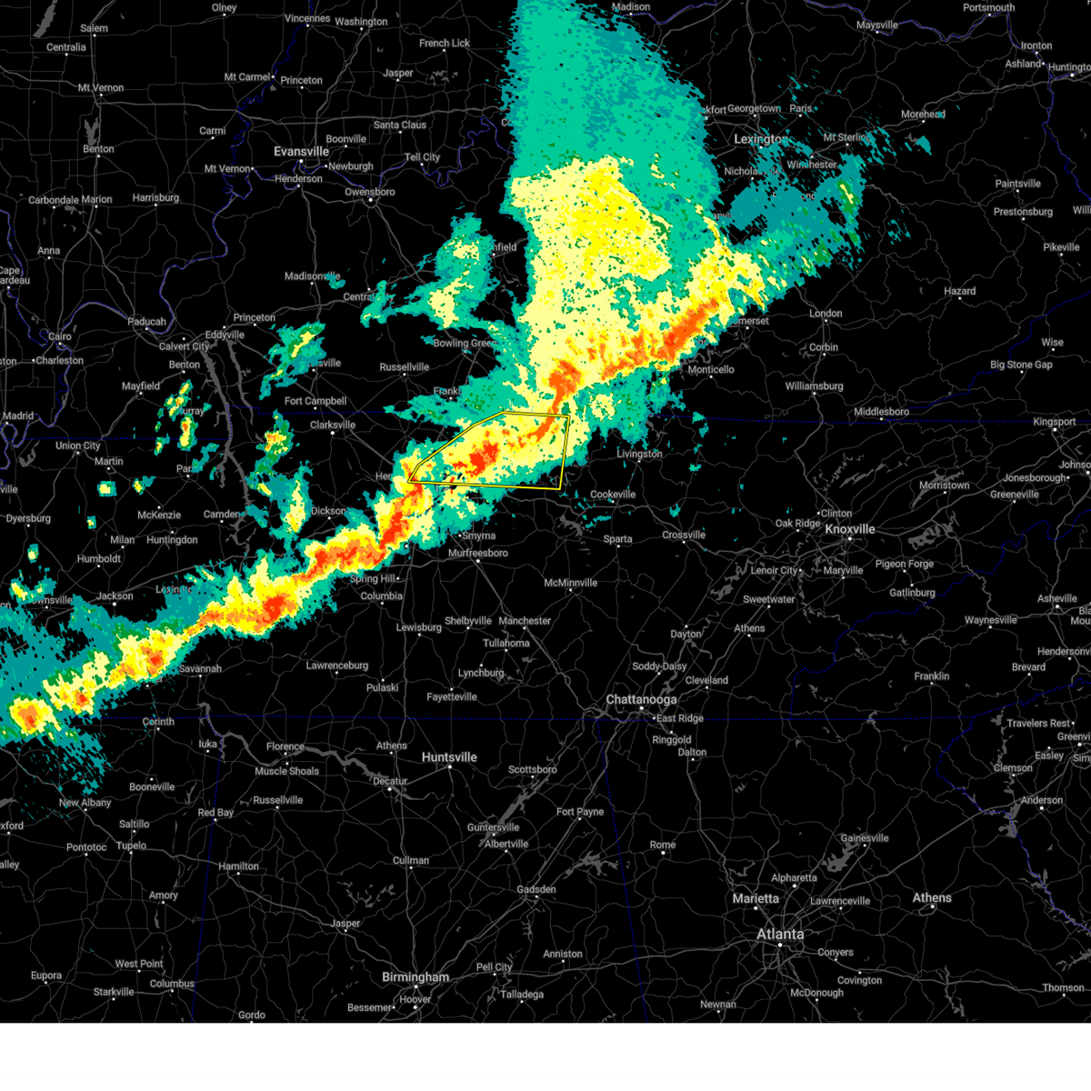
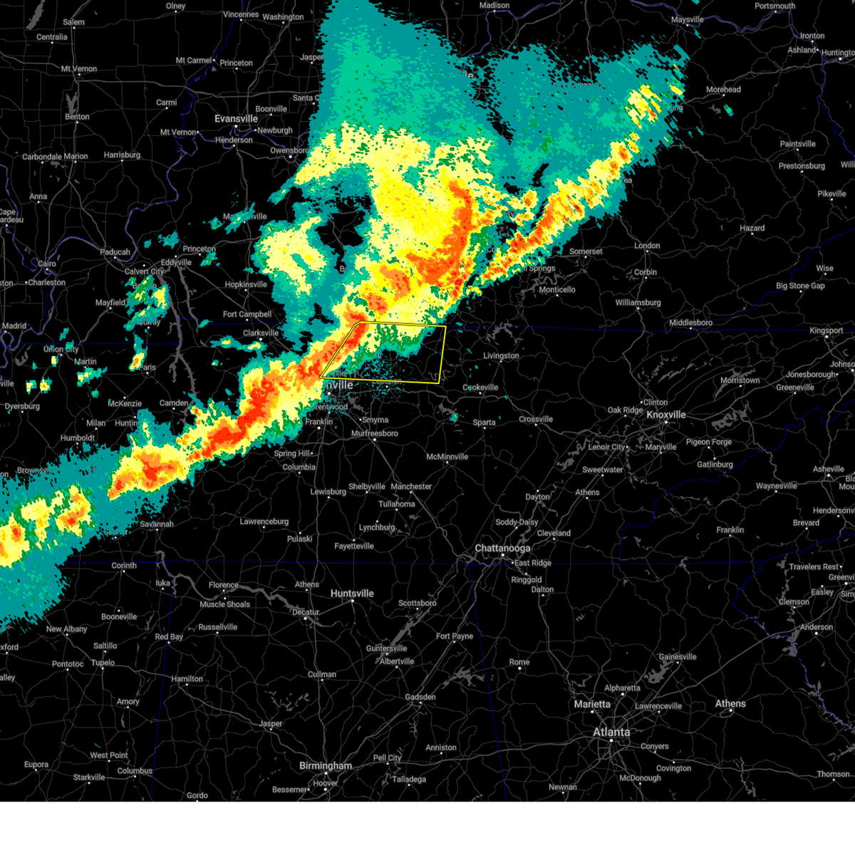
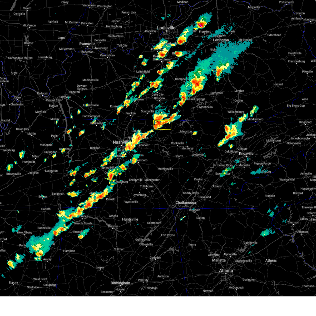
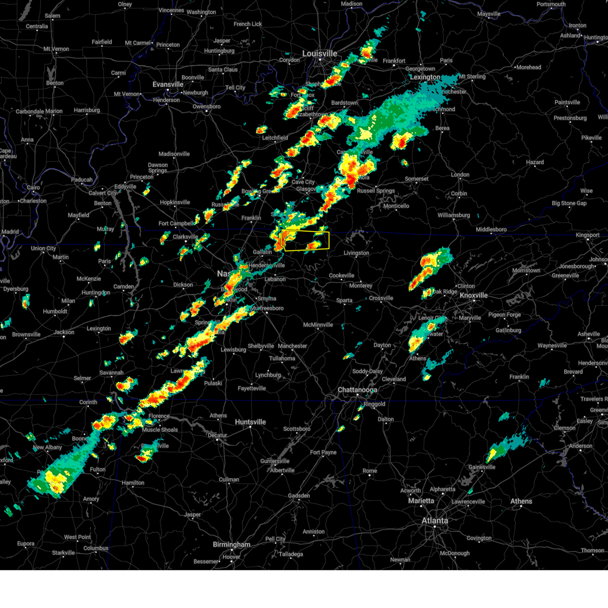
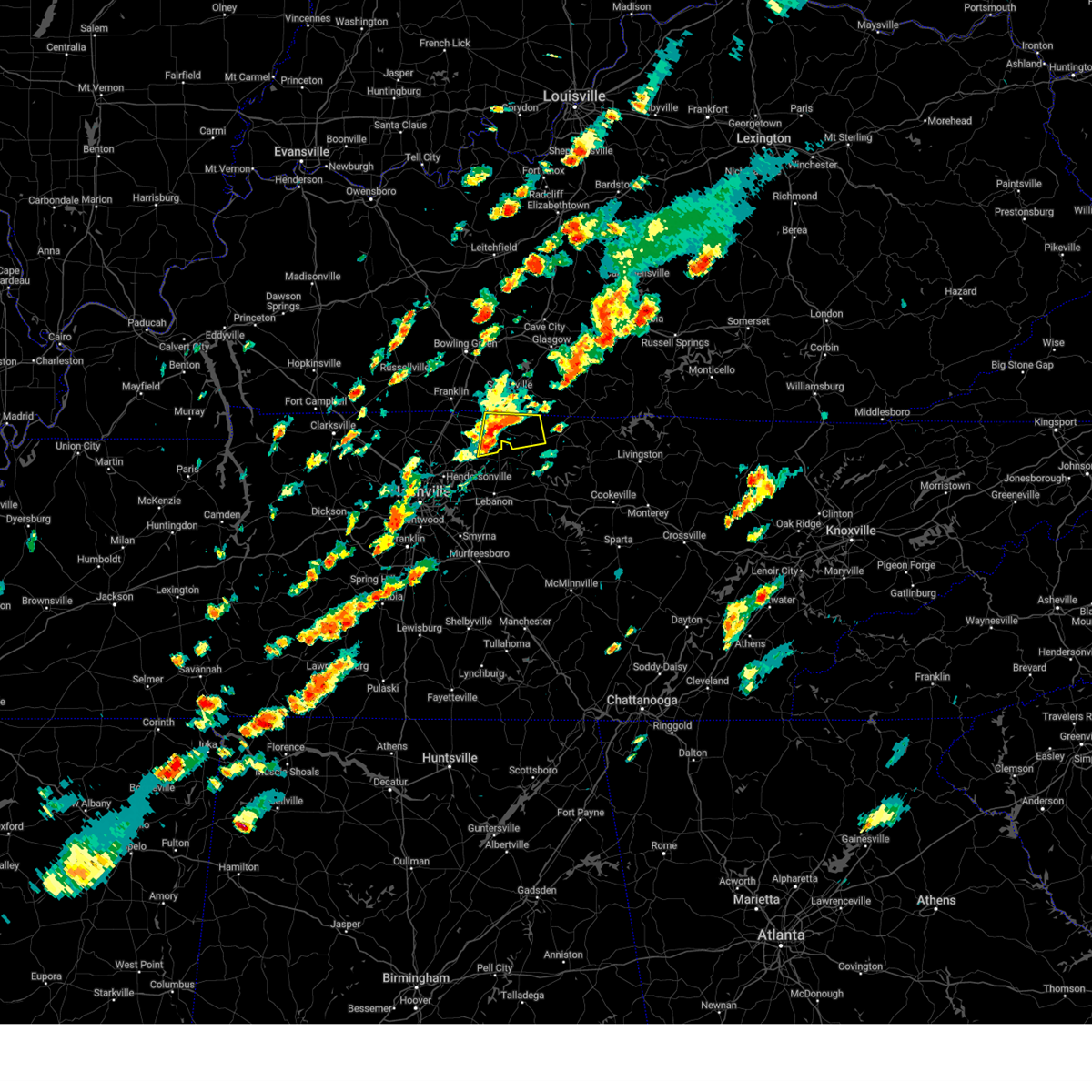
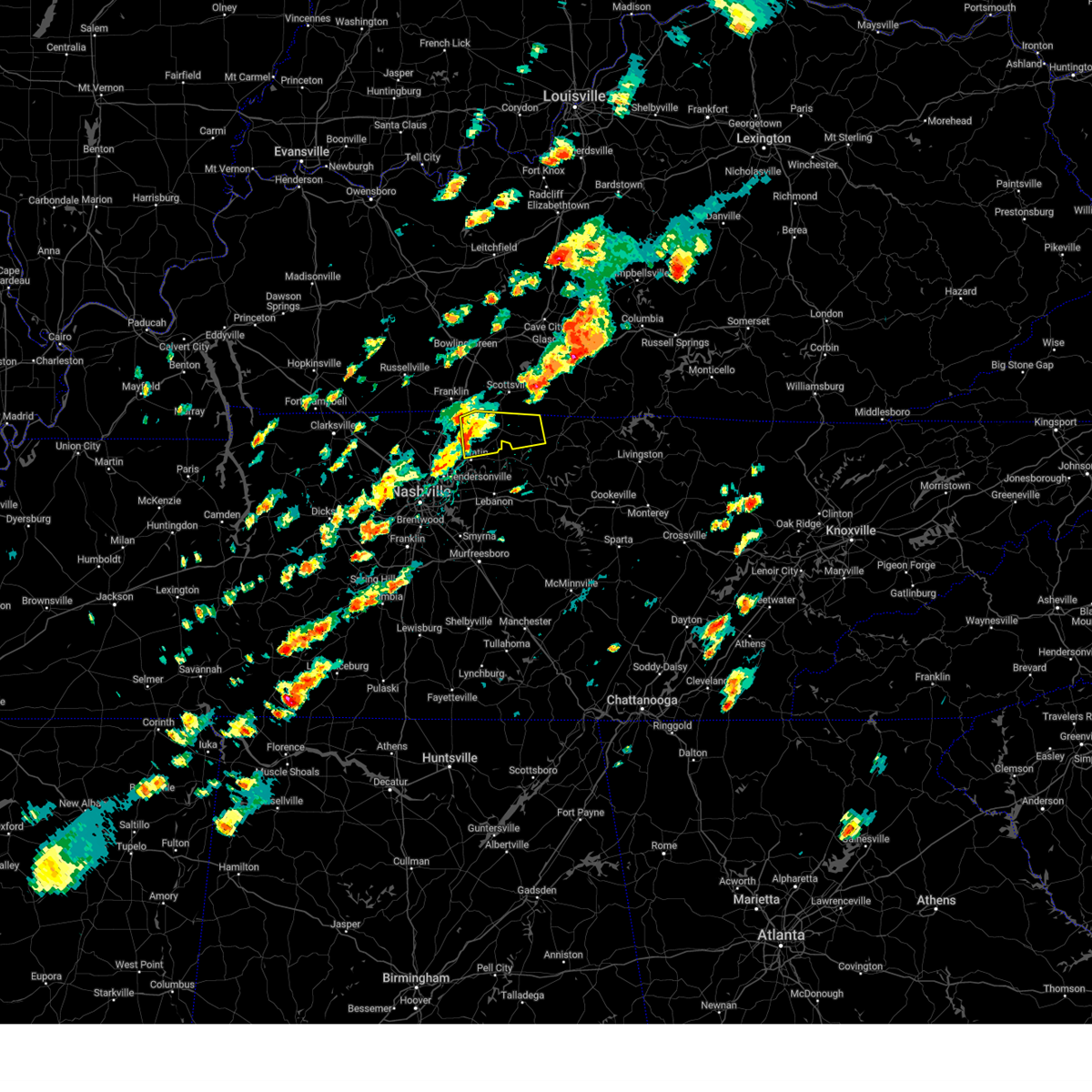
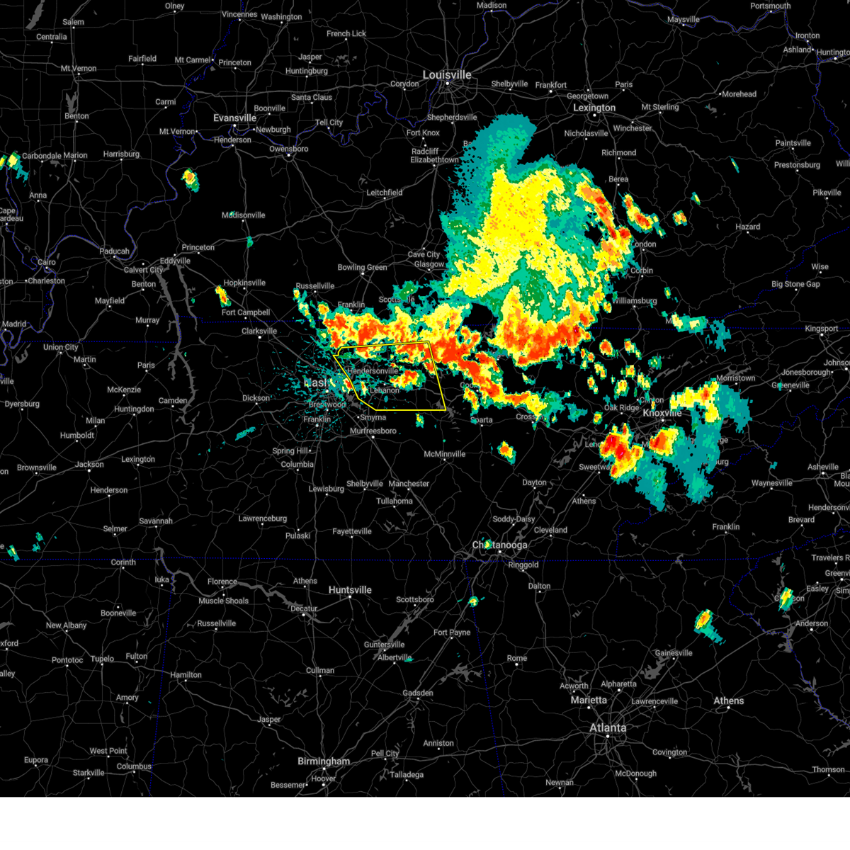
Hail Map for Lafayette, TN
The Lafayette, TN area has had 9 reports of on-the-ground hail by trained spotters, and has been under severe weather warnings 54 times during the past 12 months. Doppler radar has detected hail at or near Lafayette, TN on 79 occasions, including 5 occasions during the past year.
| Name: | Lafayette, TN |
| Where Located: | 48.5 miles ENE of Nashville, TN |
| Map: | Google Map for Lafayette, TN |
| Population: | 4474 |
| Housing Units: | 2142 |
| More Info: | Search Google for Lafayette, TN |
2
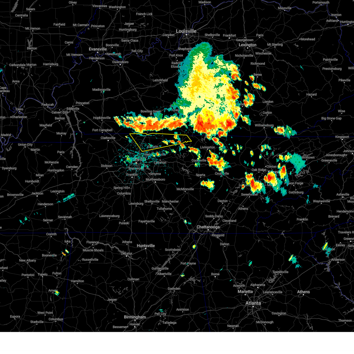
The Top Recent Hail Date for Lafayette, TN is Friday, May 2, 2025 (12th out of 79)
Hail and Wind Damage Spotted near Lafayette, TN
| Date / Time | Report Details |
|---|---|
| 6/27/2025 4:19 PM CDT |
 At 418 pm cdt, severe thunderstorms were located along a line extending from scottsville to red boiling springs, moving northeast at 20 mph (radar indicated). Hazards include 60 mph wind gusts and penny size hail. Expect damage to roofs, siding, and trees. Locations impacted include, lafayette, red boiling springs, boles, moss, and bugtussle. At 418 pm cdt, severe thunderstorms were located along a line extending from scottsville to red boiling springs, moving northeast at 20 mph (radar indicated). Hazards include 60 mph wind gusts and penny size hail. Expect damage to roofs, siding, and trees. Locations impacted include, lafayette, red boiling springs, boles, moss, and bugtussle.
|
| 6/27/2025 4:19 PM CDT |
 the severe thunderstorm warning has been cancelled and is no longer in effect the severe thunderstorm warning has been cancelled and is no longer in effect
|
| 6/27/2025 3:52 PM CDT |
 Svrohx the national weather service in nashville has issued a * severe thunderstorm warning for, northwestern jackson county in middle tennessee, northeastern sumner county in middle tennessee, northwestern clay county in middle tennessee, macon county in middle tennessee, * until 430 pm cdt. * at 351 pm cdt, severe thunderstorms were located along a line extending from 6 miles northwest of westmoreland to 8 miles southwest of red boiling springs, moving northeast at 20 mph (radar indicated). Hazards include 60 mph wind gusts and penny size hail. expect damage to roofs, siding, and trees Svrohx the national weather service in nashville has issued a * severe thunderstorm warning for, northwestern jackson county in middle tennessee, northeastern sumner county in middle tennessee, northwestern clay county in middle tennessee, macon county in middle tennessee, * until 430 pm cdt. * at 351 pm cdt, severe thunderstorms were located along a line extending from 6 miles northwest of westmoreland to 8 miles southwest of red boiling springs, moving northeast at 20 mph (radar indicated). Hazards include 60 mph wind gusts and penny size hail. expect damage to roofs, siding, and trees
|
| 5/20/2025 6:55 PM CDT |
 the severe thunderstorm warning has been cancelled and is no longer in effect the severe thunderstorm warning has been cancelled and is no longer in effect
|
| 5/20/2025 6:46 PM CDT |
 the severe thunderstorm warning has been cancelled and is no longer in effect the severe thunderstorm warning has been cancelled and is no longer in effect
|
| 5/20/2025 6:46 PM CDT |
 At 646 pm cdt, severe thunderstorms were located along a line extending from tompkinsville to near hartsville, moving east at 45 mph (radar indicated). Hazards include 60 mph wind gusts and quarter size hail. Hail damage to vehicles is expected. expect wind damage to roofs, siding, and trees. Locations impacted include, red boiling springs, boles, lafayette, hartsville, and moss. At 646 pm cdt, severe thunderstorms were located along a line extending from tompkinsville to near hartsville, moving east at 45 mph (radar indicated). Hazards include 60 mph wind gusts and quarter size hail. Hail damage to vehicles is expected. expect wind damage to roofs, siding, and trees. Locations impacted include, red boiling springs, boles, lafayette, hartsville, and moss.
|
| 5/20/2025 6:30 PM CDT |
 Svrohx the national weather service in nashville has issued a * severe thunderstorm warning for, northeastern sumner county in middle tennessee, northwestern clay county in middle tennessee, macon county in middle tennessee, trousdale county in middle tennessee, * until 730 pm cdt. * at 630 pm cdt, severe thunderstorms were located along a line extending from near scottsville to near hartsville, moving northeast at 55 mph (radar indicated). Hazards include 60 mph wind gusts and quarter size hail. Hail damage to vehicles is expected. Expect wind damage to roofs, siding, and trees. Svrohx the national weather service in nashville has issued a * severe thunderstorm warning for, northeastern sumner county in middle tennessee, northwestern clay county in middle tennessee, macon county in middle tennessee, trousdale county in middle tennessee, * until 730 pm cdt. * at 630 pm cdt, severe thunderstorms were located along a line extending from near scottsville to near hartsville, moving northeast at 55 mph (radar indicated). Hazards include 60 mph wind gusts and quarter size hail. Hail damage to vehicles is expected. Expect wind damage to roofs, siding, and trees.
|
| 5/16/2025 11:35 PM CDT |
 At 1135 pm cdt, severe thunderstorms were located along a line extending from 6 miles east of celina to forest hills, moving east at 55 mph (radar indicated). Hazards include 60 mph wind gusts and quarter size hail. Hail damage to vehicles is expected. expect wind damage to roofs, siding, and trees. locations impacted include, red boiling springs, madison, hermitage, belle meade, hartsville, moss, pleasant shade, gallatin, bledsoe creek state park, dickerson chapel recreation area, hendersonville, berry hill, mount juliet, boles, oak hill, green hill, forest hills, celina, bethpage, and goodlettsville. this includes the following highways, interstate 40 between mile markers 186 and 235. interstate 65 between mile markers 75 and 98. interstate 24 between mile markers 38 and 57. Interstate 840 near mile marker 76. At 1135 pm cdt, severe thunderstorms were located along a line extending from 6 miles east of celina to forest hills, moving east at 55 mph (radar indicated). Hazards include 60 mph wind gusts and quarter size hail. Hail damage to vehicles is expected. expect wind damage to roofs, siding, and trees. locations impacted include, red boiling springs, madison, hermitage, belle meade, hartsville, moss, pleasant shade, gallatin, bledsoe creek state park, dickerson chapel recreation area, hendersonville, berry hill, mount juliet, boles, oak hill, green hill, forest hills, celina, bethpage, and goodlettsville. this includes the following highways, interstate 40 between mile markers 186 and 235. interstate 65 between mile markers 75 and 98. interstate 24 between mile markers 38 and 57. Interstate 840 near mile marker 76.
|
| 5/16/2025 11:35 PM CDT |
 the severe thunderstorm warning has been cancelled and is no longer in effect the severe thunderstorm warning has been cancelled and is no longer in effect
|
| 5/16/2025 11:08 PM CDT |
 At 1107 pm cdt, severe thunderstorms were located along a line extending from near red boiling springs to near burns, moving east at 55 mph (radar indicated). Hazards include 60 mph wind gusts and quarter size hail. Hail damage to vehicles is expected. expect wind damage to roofs, siding, and trees. locations impacted include, charlotte, black jack, hartsville, moss, pleasant shade, millersville, gallatin, bledsoe creek state park, dickerson chapel recreation area, hendersonville, cottontown, mount juliet, westmoreland, white bluff, forest hills, cheatham dam, goodlettsville, dixon springs, oak grove, and nashville. this includes the following highways, interstate 40 between mile markers 186 and 235. interstate 65 between mile markers 75 and 121. interstate 24 between mile markers 22 and 57. Interstate 840 near mile marker 76. At 1107 pm cdt, severe thunderstorms were located along a line extending from near red boiling springs to near burns, moving east at 55 mph (radar indicated). Hazards include 60 mph wind gusts and quarter size hail. Hail damage to vehicles is expected. expect wind damage to roofs, siding, and trees. locations impacted include, charlotte, black jack, hartsville, moss, pleasant shade, millersville, gallatin, bledsoe creek state park, dickerson chapel recreation area, hendersonville, cottontown, mount juliet, westmoreland, white bluff, forest hills, cheatham dam, goodlettsville, dixon springs, oak grove, and nashville. this includes the following highways, interstate 40 between mile markers 186 and 235. interstate 65 between mile markers 75 and 121. interstate 24 between mile markers 22 and 57. Interstate 840 near mile marker 76.
|
| 5/16/2025 11:08 PM CDT |
 the severe thunderstorm warning has been cancelled and is no longer in effect the severe thunderstorm warning has been cancelled and is no longer in effect
|
| 5/16/2025 10:40 PM CDT | Svrohx the national weather service in nashville has issued a * severe thunderstorm warning for, northern smith county in middle tennessee, southern montgomery county in middle tennessee, sumner county in middle tennessee, southeastern stewart county in middle tennessee, houston county in middle tennessee, northern wilson county in middle tennessee, cheatham county in middle tennessee, clay county in middle tennessee, northern humphreys county in middle tennessee, robertson county in middle tennessee, davidson county in middle tennessee, dickson county in middle tennessee, northern jackson county in middle tennessee, macon county in middle tennessee, trousdale county in middle tennessee, * until 1145 pm cdt. * at 1040 pm cdt, severe thunderstorms were located along a line extending from near westmoreland to near mcewen, moving east at 55 mph (radar indicated). Hazards include 60 mph wind gusts and quarter size hail. Hail damage to vehicles is expected. Expect wind damage to roofs, siding, and trees. |
| 5/16/2025 11:23 AM CDT |
 the severe thunderstorm warning has been cancelled and is no longer in effect the severe thunderstorm warning has been cancelled and is no longer in effect
|
| 5/16/2025 11:11 AM CDT |
 Svrohx the national weather service in nashville has issued a * severe thunderstorm warning for, northwestern clay county in middle tennessee, northern macon county in middle tennessee, * until 1145 am cdt. * at 1110 am cdt, a severe thunderstorm was located near lafayette, moving east at 65 mph (radar indicated). Hazards include 60 mph wind gusts and quarter size hail. Hail damage to vehicles is expected. Expect wind damage to roofs, siding, and trees. Svrohx the national weather service in nashville has issued a * severe thunderstorm warning for, northwestern clay county in middle tennessee, northern macon county in middle tennessee, * until 1145 am cdt. * at 1110 am cdt, a severe thunderstorm was located near lafayette, moving east at 65 mph (radar indicated). Hazards include 60 mph wind gusts and quarter size hail. Hail damage to vehicles is expected. Expect wind damage to roofs, siding, and trees.
|
| 5/2/2025 2:22 PM CDT | The storm which prompted the warning has weakened below severe limits, and no longer poses an immediate threat to life or property. therefore, the warning will be allowed to expire. however, small hail and gusty winds are still possible with this thunderstorm. a severe thunderstorm watch remains in effect until 500 pm cdt for middle tennessee. |
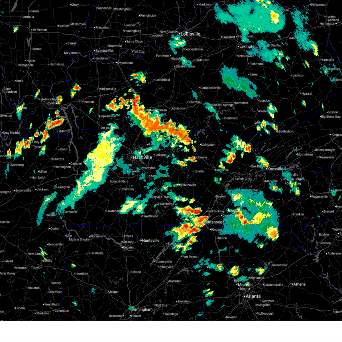
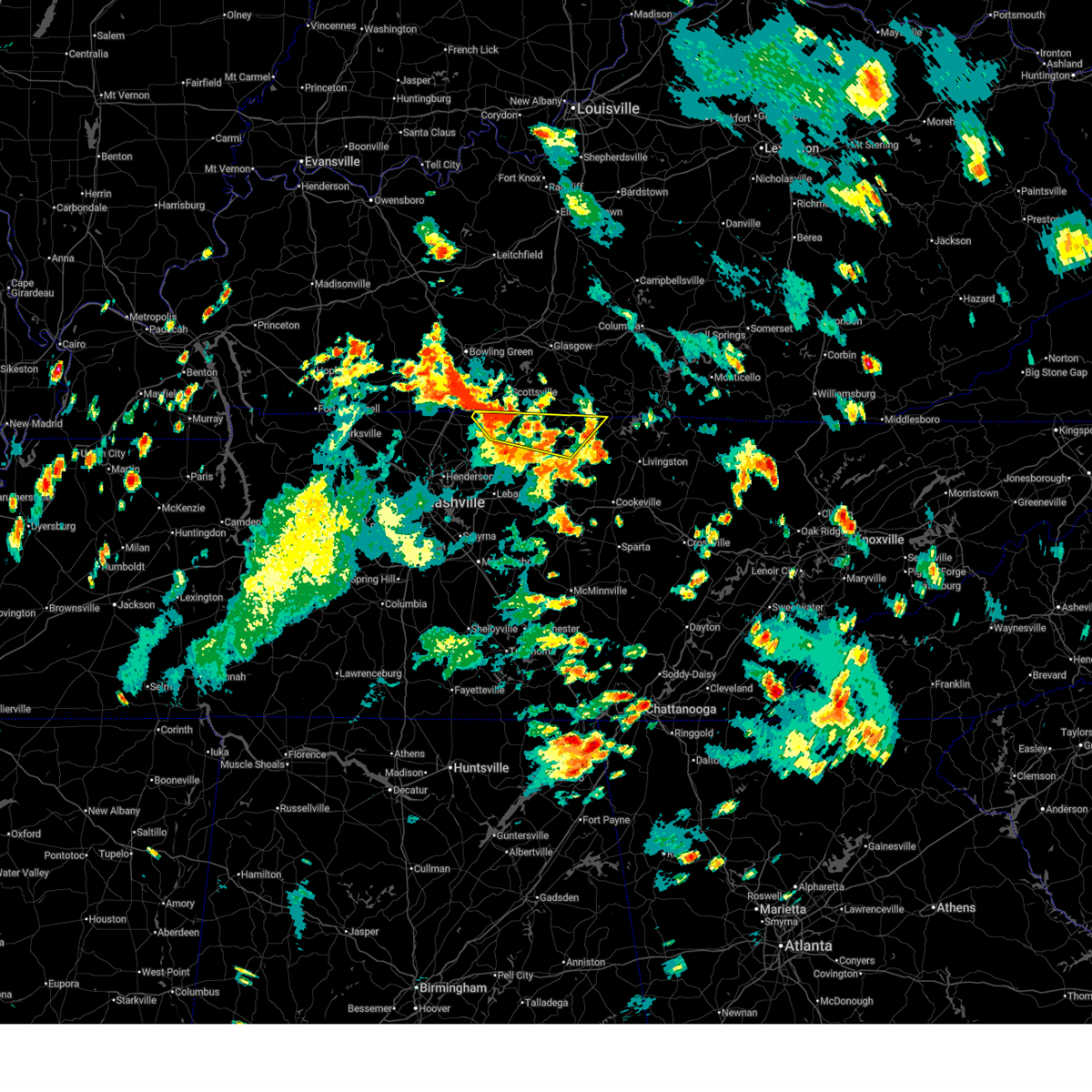
| 5/2/2025 2:14 PM CDT | At 214 pm cdt, a severe thunderstorm was located over lafayette, moving northeast at 20 mph (radar indicated). Hazards include 60 mph wind gusts and quarter size hail. Hail damage to vehicles is expected. expect wind damage to roofs, siding, and trees. Locations impacted include, lafayette and red boiling springs. |
| 5/2/2025 2:14 PM CDT | the severe thunderstorm warning has been cancelled and is no longer in effect |
| 5/2/2025 2:08 PM CDT | Quarter sized hail reported 0.5 miles SSE of Lafayette, TN, public report on social media of mainly small hail with some quarter size hail mixed in. |
| 5/2/2025 2:08 PM CDT | At 208 pm cdt, a severe thunderstorm was located near lafayette, moving northeast at 20 mph (radar indicated). Hazards include 60 mph wind gusts and quarter size hail. Hail damage to vehicles is expected. expect wind damage to roofs, siding, and trees. Locations impacted include, lafayette, red boiling springs, and hartsville. |
| 5/2/2025 2:08 PM CDT | the severe thunderstorm warning has been cancelled and is no longer in effect |
| 5/2/2025 1:52 PM CDT |
 Svrohx the national weather service in nashville has issued a * severe thunderstorm warning for, east central sumner county in middle tennessee, macon county in middle tennessee, trousdale county in middle tennessee, * until 230 pm cdt. * at 152 pm cdt, a severe thunderstorm was located near hartsville, moving northeast at 20 mph (radar indicated). Hazards include 60 mph wind gusts and quarter size hail. Hail damage to vehicles is expected. Expect wind damage to roofs, siding, and trees. Svrohx the national weather service in nashville has issued a * severe thunderstorm warning for, east central sumner county in middle tennessee, macon county in middle tennessee, trousdale county in middle tennessee, * until 230 pm cdt. * at 152 pm cdt, a severe thunderstorm was located near hartsville, moving northeast at 20 mph (radar indicated). Hazards include 60 mph wind gusts and quarter size hail. Hail damage to vehicles is expected. Expect wind damage to roofs, siding, and trees.
|
| 4/10/2025 5:41 PM CDT | Svrohx the national weather service in nashville has issued a * severe thunderstorm warning for, smith county in middle tennessee, southeastern davidson county in middle tennessee, western de kalb county in middle tennessee, northern rutherford county in middle tennessee, southern sumner county in middle tennessee, northeastern williamson county in middle tennessee, wilson county in middle tennessee, southern macon county in middle tennessee, trousdale county in middle tennessee, northern cannon county in middle tennessee, * until 630 pm cdt. * at 541 pm cdt, severe thunderstorms were located along a line extending from 6 miles northeast of gallatin to near murfreesboro, moving east at 35 mph (radar indicated). Hazards include 60 mph wind gusts. expect damage to roofs, siding, and trees |
| 4/5/2025 5:43 PM CDT |
 At 543 pm cdt, severe thunderstorms were located along a line extending from 8 miles northeast of westmoreland to 6 miles south of lafayette to 9 miles north of watertown, moving east at 60 mph (radar indicated). Hazards include 70 mph wind gusts and quarter size hail. Hail damage to vehicles is expected. expect considerable tree damage. wind damage is also likely to mobile homes, roofs, and outbuildings. Locations impacted include, carthage, red boiling springs, lafayette, hartsville, dixon springs, westmoreland, pleasant shade, and south carthage. At 543 pm cdt, severe thunderstorms were located along a line extending from 8 miles northeast of westmoreland to 6 miles south of lafayette to 9 miles north of watertown, moving east at 60 mph (radar indicated). Hazards include 70 mph wind gusts and quarter size hail. Hail damage to vehicles is expected. expect considerable tree damage. wind damage is also likely to mobile homes, roofs, and outbuildings. Locations impacted include, carthage, red boiling springs, lafayette, hartsville, dixon springs, westmoreland, pleasant shade, and south carthage.
|
| 4/5/2025 5:41 PM CDT |
 At 540 pm cdt, a severe thunderstorm capable of producing a tornado was located over lafayette, moving east at 60 mph (radar indicated rotation). Hazards include tornado. Flying debris will be dangerous to those caught without shelter. mobile homes will be damaged or destroyed. damage to roofs, windows, and vehicles will occur. tree damage is likely. This dangerous storm will be near, lafayette around 545 pm cdt. At 540 pm cdt, a severe thunderstorm capable of producing a tornado was located over lafayette, moving east at 60 mph (radar indicated rotation). Hazards include tornado. Flying debris will be dangerous to those caught without shelter. mobile homes will be damaged or destroyed. damage to roofs, windows, and vehicles will occur. tree damage is likely. This dangerous storm will be near, lafayette around 545 pm cdt.
|
| 4/5/2025 5:38 PM CDT |
 Torohx the national weather service in nashville has issued a * tornado warning for, northwestern clay county in middle tennessee, central macon county in middle tennessee, * until 630 pm cdt. * at 537 pm cdt, a severe thunderstorm capable of producing a tornado was located near westmoreland, or 7 miles west of lafayette, moving northeast at 55 mph (radar indicated rotation). Hazards include tornado. Flying debris will be dangerous to those caught without shelter. mobile homes will be damaged or destroyed. damage to roofs, windows, and vehicles will occur. tree damage is likely. this dangerous storm will be near, lafayette around 545 pm cdt. Other locations impacted by this tornadic thunderstorm include moss, bugtussle, and boles. Torohx the national weather service in nashville has issued a * tornado warning for, northwestern clay county in middle tennessee, central macon county in middle tennessee, * until 630 pm cdt. * at 537 pm cdt, a severe thunderstorm capable of producing a tornado was located near westmoreland, or 7 miles west of lafayette, moving northeast at 55 mph (radar indicated rotation). Hazards include tornado. Flying debris will be dangerous to those caught without shelter. mobile homes will be damaged or destroyed. damage to roofs, windows, and vehicles will occur. tree damage is likely. this dangerous storm will be near, lafayette around 545 pm cdt. Other locations impacted by this tornadic thunderstorm include moss, bugtussle, and boles.
|
| 4/5/2025 5:32 PM CDT |
 At 532 pm cdt, severe thunderstorms were located along a line extending from westmoreland to hartsville to near lebanon, moving east at 60 mph (radar indicated). Hazards include 70 mph wind gusts and quarter size hail. Hail damage to vehicles is expected. expect considerable tree damage. wind damage is also likely to mobile homes, roofs, and outbuildings. locations impacted include, red boiling springs, tuckers crossroads, bethpage, hartsville, dixon springs, oak grove, pleasant shade, bledsoe creek state park, dickerson chapel recreation area, carthage, lebanon, lafayette, westmoreland, south carthage, and gallatin. this includes the following highways, interstate 40 between mile markers 235 and 248. Interstate 840 between mile markers 75 and 76. At 532 pm cdt, severe thunderstorms were located along a line extending from westmoreland to hartsville to near lebanon, moving east at 60 mph (radar indicated). Hazards include 70 mph wind gusts and quarter size hail. Hail damage to vehicles is expected. expect considerable tree damage. wind damage is also likely to mobile homes, roofs, and outbuildings. locations impacted include, red boiling springs, tuckers crossroads, bethpage, hartsville, dixon springs, oak grove, pleasant shade, bledsoe creek state park, dickerson chapel recreation area, carthage, lebanon, lafayette, westmoreland, south carthage, and gallatin. this includes the following highways, interstate 40 between mile markers 235 and 248. Interstate 840 between mile markers 75 and 76.
|
| 4/5/2025 5:32 PM CDT |
 the severe thunderstorm warning has been cancelled and is no longer in effect the severe thunderstorm warning has been cancelled and is no longer in effect
|
| 4/5/2025 5:31 PM CDT |
 At 531 pm cdt, a severe thunderstorm capable of producing a tornado was located near westmoreland, or 7 miles northwest of hartsville, moving east at 55 mph (radar indicated rotation). Hazards include tornado. Flying debris will be dangerous to those caught without shelter. mobile homes will be damaged or destroyed. damage to roofs, windows, and vehicles will occur. tree damage is likely. this dangerous storm will be near, lafayette around 535 pm cdt. Other locations impacted by this tornadic thunderstorm include oak grove, bethpage, and bledsoe creek state park. At 531 pm cdt, a severe thunderstorm capable of producing a tornado was located near westmoreland, or 7 miles northwest of hartsville, moving east at 55 mph (radar indicated rotation). Hazards include tornado. Flying debris will be dangerous to those caught without shelter. mobile homes will be damaged or destroyed. damage to roofs, windows, and vehicles will occur. tree damage is likely. this dangerous storm will be near, lafayette around 535 pm cdt. Other locations impacted by this tornadic thunderstorm include oak grove, bethpage, and bledsoe creek state park.
|
| 4/5/2025 5:31 PM CDT |
 the tornado warning has been cancelled and is no longer in effect the tornado warning has been cancelled and is no longer in effect
|
| 4/5/2025 5:24 PM CDT | the severe thunderstorm warning has been cancelled and is no longer in effect |
| 4/5/2025 5:24 PM CDT | At 524 pm cdt, severe thunderstorms were located along a line extending from 6 miles west of westmoreland to 7 miles southwest of hartsville to near rural hill, moving east at 60 mph (radar indicated). Hazards include 70 mph wind gusts and quarter size hail. Hail damage to vehicles is expected. expect considerable tree damage. wind damage is also likely to mobile homes, roofs, and outbuildings. locations impacted include, red boiling springs, gordonsville, hartsville, pleasant shade, millersville, gallatin, bledsoe creek state park, dickerson chapel recreation area, hendersonville, carthage, cottontown, mount juliet, westmoreland, south carthage, green hill, tuckers crossroads, bethpage, rural hill, dixon springs, and oak grove. this includes the following highways, interstate 40 between mile markers 223 and 260. interstate 65 between mile markers 102 and 103. Interstate 840 between mile markers 66 and 76. |
| 4/5/2025 5:10 PM CDT | Torohx the national weather service in nashville has issued a * tornado warning for, sumner county in middle tennessee, northwestern wilson county in middle tennessee, western macon county in middle tennessee, trousdale county in middle tennessee, * until 600 pm cdt. * at 510 pm cdt, a severe thunderstorm capable of producing a tornado was located near gallatin, moving east at 60 mph (radar indicated rotation). Hazards include tornado. Flying debris will be dangerous to those caught without shelter. mobile homes will be damaged or destroyed. damage to roofs, windows, and vehicles will occur. tree damage is likely. this dangerous storm will be near, gallatin around 515 pm cdt. lafayette around 535 pm cdt. Other locations impacted by this tornadic thunderstorm include oak grove, bledsoe creek state park, cottontown, dickerson chapel recreation area, and bethpage. |
| 4/5/2025 5:00 PM CDT |
 Svrohx the national weather service in nashville has issued a * severe thunderstorm warning for, smith county in middle tennessee, eastern davidson county in middle tennessee, northwestern rutherford county in middle tennessee, sumner county in middle tennessee, wilson county in middle tennessee, macon county in middle tennessee, trousdale county in middle tennessee, * until 600 pm cdt. * at 500 pm cdt, severe thunderstorms were located along a line extending from millersville to lakewood to brentwood, moving east at 60 mph (radar indicated). Hazards include 70 mph wind gusts and quarter size hail. Hail damage to vehicles is expected. expect considerable tree damage. Wind damage is also likely to mobile homes, roofs, and outbuildings. Svrohx the national weather service in nashville has issued a * severe thunderstorm warning for, smith county in middle tennessee, eastern davidson county in middle tennessee, northwestern rutherford county in middle tennessee, sumner county in middle tennessee, wilson county in middle tennessee, macon county in middle tennessee, trousdale county in middle tennessee, * until 600 pm cdt. * at 500 pm cdt, severe thunderstorms were located along a line extending from millersville to lakewood to brentwood, moving east at 60 mph (radar indicated). Hazards include 70 mph wind gusts and quarter size hail. Hail damage to vehicles is expected. expect considerable tree damage. Wind damage is also likely to mobile homes, roofs, and outbuildings.
|
| 4/3/2025 4:37 AM CDT |
 The storm which prompted the warning has weakened below severe limits, and no longer poses an immediate threat to life or property. therefore, the warning will be allowed to expire. however, small hail, gusty winds and heavy rain are still possible with this thunderstorm. a tornado watch remains in effect until 600 am cdt for middle tennessee. The storm which prompted the warning has weakened below severe limits, and no longer poses an immediate threat to life or property. therefore, the warning will be allowed to expire. however, small hail, gusty winds and heavy rain are still possible with this thunderstorm. a tornado watch remains in effect until 600 am cdt for middle tennessee.
|
| 4/3/2025 4:27 AM CDT |
 At 427 am cdt, severe thunderstorms were located along a line extending from near lafayette to near antioch, moving east at 40 mph (radar indicated). Hazards include 60 mph wind gusts and nickel size hail. Expect damage to roofs, siding, and trees. locations impacted include, madison, hermitage, hartsville, gallatin, bledsoe creek state park, dickerson chapel recreation area, hendersonville, carthage, berry hill, mount juliet, south carthage, green hill, tuckers crossroads, bethpage, rural hill, dixon springs, nashville, antioch, belinda city, and lakewood. this includes the following highways, interstate 40 between mile markers 207 and 247. interstate 65 between mile markers 79 and 92. interstate 24 between mile markers 44 and 61. Interstate 840 between mile markers 68 and 76. At 427 am cdt, severe thunderstorms were located along a line extending from near lafayette to near antioch, moving east at 40 mph (radar indicated). Hazards include 60 mph wind gusts and nickel size hail. Expect damage to roofs, siding, and trees. locations impacted include, madison, hermitage, hartsville, gallatin, bledsoe creek state park, dickerson chapel recreation area, hendersonville, carthage, berry hill, mount juliet, south carthage, green hill, tuckers crossroads, bethpage, rural hill, dixon springs, nashville, antioch, belinda city, and lakewood. this includes the following highways, interstate 40 between mile markers 207 and 247. interstate 65 between mile markers 79 and 92. interstate 24 between mile markers 44 and 61. Interstate 840 between mile markers 68 and 76.
|
| 4/3/2025 4:07 AM CDT |
 Svrohx the national weather service in nashville has issued a * severe thunderstorm warning for, northwestern smith county in middle tennessee, southeastern davidson county in middle tennessee, southeastern sumner county in middle tennessee, wilson county in middle tennessee, western macon county in middle tennessee, trousdale county in middle tennessee, * until 500 am cdt. * at 407 am cdt, a severe thunderstorm was located over hermitage, or 9 miles east of nashville, moving northeast at 50 mph (radar indicated). Hazards include 60 mph wind gusts and quarter size hail. Hail damage to vehicles is expected. Expect wind damage to roofs, siding, and trees. Svrohx the national weather service in nashville has issued a * severe thunderstorm warning for, northwestern smith county in middle tennessee, southeastern davidson county in middle tennessee, southeastern sumner county in middle tennessee, wilson county in middle tennessee, western macon county in middle tennessee, trousdale county in middle tennessee, * until 500 am cdt. * at 407 am cdt, a severe thunderstorm was located over hermitage, or 9 miles east of nashville, moving northeast at 50 mph (radar indicated). Hazards include 60 mph wind gusts and quarter size hail. Hail damage to vehicles is expected. Expect wind damage to roofs, siding, and trees.
|
| 4/3/2025 3:59 AM CDT |
 the tornado warning has been cancelled and is no longer in effect the tornado warning has been cancelled and is no longer in effect
|
| 4/3/2025 3:58 AM CDT |
 Svrohx the national weather service in nashville has issued a * severe thunderstorm warning for, northern smith county in middle tennessee, northern jackson county in middle tennessee, clay county in middle tennessee, macon county in middle tennessee, central trousdale county in middle tennessee, * until 445 am cdt. * at 358 am cdt, a severe thunderstorm was located near lafayette, moving northeast at 45 mph (radar indicated). Hazards include 60 mph wind gusts and quarter size hail. Hail damage to vehicles is expected. Expect wind damage to roofs, siding, and trees. Svrohx the national weather service in nashville has issued a * severe thunderstorm warning for, northern smith county in middle tennessee, northern jackson county in middle tennessee, clay county in middle tennessee, macon county in middle tennessee, central trousdale county in middle tennessee, * until 445 am cdt. * at 358 am cdt, a severe thunderstorm was located near lafayette, moving northeast at 45 mph (radar indicated). Hazards include 60 mph wind gusts and quarter size hail. Hail damage to vehicles is expected. Expect wind damage to roofs, siding, and trees.
|
| 4/3/2025 3:39 AM CDT |
 At 339 am cdt, a severe thunderstorm capable of producing a tornado was located 7 miles north of lebanon, moving northeast at 45 mph (radar indicated rotation). Hazards include tornado and golf ball size hail. Flying debris will be dangerous to those caught without shelter. mobile homes will be damaged or destroyed. damage to roofs, windows, and vehicles will occur. tree damage is likely. Locations impacted include, lafayette, bethpage, hartsville, dixon springs, westmoreland, pleasant shade, bledsoe creek state park, dickerson chapel recreation area, and lebanon. At 339 am cdt, a severe thunderstorm capable of producing a tornado was located 7 miles north of lebanon, moving northeast at 45 mph (radar indicated rotation). Hazards include tornado and golf ball size hail. Flying debris will be dangerous to those caught without shelter. mobile homes will be damaged or destroyed. damage to roofs, windows, and vehicles will occur. tree damage is likely. Locations impacted include, lafayette, bethpage, hartsville, dixon springs, westmoreland, pleasant shade, bledsoe creek state park, dickerson chapel recreation area, and lebanon.
|
| 4/3/2025 3:25 AM CDT |
 Torohx the national weather service in nashville has issued a * tornado warning for, northwestern smith county in middle tennessee, eastern sumner county in middle tennessee, northeastern wilson county in middle tennessee, western macon county in middle tennessee, trousdale county in middle tennessee, * until 415 am cdt. * at 325 am cdt, a severe thunderstorm capable of producing a tornado was located near mount juliet, or near lebanon, moving northeast at 45 mph (radar indicated rotation). Hazards include tornado and golf ball size hail. Flying debris will be dangerous to those caught without shelter. mobile homes will be damaged or destroyed. damage to roofs, windows, and vehicles will occur. Tree damage is likely. Torohx the national weather service in nashville has issued a * tornado warning for, northwestern smith county in middle tennessee, eastern sumner county in middle tennessee, northeastern wilson county in middle tennessee, western macon county in middle tennessee, trousdale county in middle tennessee, * until 415 am cdt. * at 325 am cdt, a severe thunderstorm capable of producing a tornado was located near mount juliet, or near lebanon, moving northeast at 45 mph (radar indicated rotation). Hazards include tornado and golf ball size hail. Flying debris will be dangerous to those caught without shelter. mobile homes will be damaged or destroyed. damage to roofs, windows, and vehicles will occur. Tree damage is likely.
|
| 4/3/2025 3:07 AM CDT |
 Svrohx the national weather service in nashville has issued a * severe thunderstorm warning for, northeastern sumner county in middle tennessee, northwestern macon county in middle tennessee, northwestern trousdale county in middle tennessee, * until 345 am cdt. * at 307 am cdt, a severe thunderstorm was located over westmoreland, or 10 miles west of lafayette, moving northeast at 45 mph (radar indicated). Hazards include 60 mph wind gusts and quarter size hail. Hail damage to vehicles is expected. Expect wind damage to roofs, siding, and trees. Svrohx the national weather service in nashville has issued a * severe thunderstorm warning for, northeastern sumner county in middle tennessee, northwestern macon county in middle tennessee, northwestern trousdale county in middle tennessee, * until 345 am cdt. * at 307 am cdt, a severe thunderstorm was located over westmoreland, or 10 miles west of lafayette, moving northeast at 45 mph (radar indicated). Hazards include 60 mph wind gusts and quarter size hail. Hail damage to vehicles is expected. Expect wind damage to roofs, siding, and trees.
|
| 4/3/2025 1:32 AM CDT |
 the severe thunderstorm warning has been cancelled and is no longer in effect the severe thunderstorm warning has been cancelled and is no longer in effect
|
| 4/3/2025 12:54 AM CDT |
 Svrohx the national weather service in nashville has issued a * severe thunderstorm warning for, sumner county in middle tennessee, macon county in middle tennessee, trousdale county in middle tennessee, eastern robertson county in middle tennessee, * until 200 am cdt. * at 1254 am cdt, severe thunderstorms were located along a line extending from 7 miles north of portland to near joelton, moving east at 45 mph (radar indicated). Hazards include 60 mph wind gusts and nickel size hail. expect damage to roofs, siding, and trees Svrohx the national weather service in nashville has issued a * severe thunderstorm warning for, sumner county in middle tennessee, macon county in middle tennessee, trousdale county in middle tennessee, eastern robertson county in middle tennessee, * until 200 am cdt. * at 1254 am cdt, severe thunderstorms were located along a line extending from 7 miles north of portland to near joelton, moving east at 45 mph (radar indicated). Hazards include 60 mph wind gusts and nickel size hail. expect damage to roofs, siding, and trees
|
| 3/31/2025 12:27 AM CDT |
 the severe thunderstorm warning has been cancelled and is no longer in effect the severe thunderstorm warning has been cancelled and is no longer in effect
|
| 3/30/2025 11:48 PM CDT |
 At 1148 pm cdt, severe thunderstorms were located along a line extending from near celina to 8 miles east of hartsville, moving east at 45 mph (radar indicated). Hazards include 60 mph wind gusts and penny size hail. Expect damage to roofs, siding, and trees. Locations impacted include, red boiling springs, celina, byrdstown, whitleyville, moss, gainesboro, dixon springs, pleasant shade, dale hollow lake, boles, and standing stone state park. At 1148 pm cdt, severe thunderstorms were located along a line extending from near celina to 8 miles east of hartsville, moving east at 45 mph (radar indicated). Hazards include 60 mph wind gusts and penny size hail. Expect damage to roofs, siding, and trees. Locations impacted include, red boiling springs, celina, byrdstown, whitleyville, moss, gainesboro, dixon springs, pleasant shade, dale hollow lake, boles, and standing stone state park.
|
| 3/30/2025 11:38 PM CDT |
 Svrohx the national weather service in nashville has issued a * severe thunderstorm warning for, northwestern overton county in middle tennessee, northwestern pickett county in middle tennessee, northern smith county in middle tennessee, jackson county in middle tennessee, clay county in middle tennessee, southeastern macon county in middle tennessee, trousdale county in middle tennessee, * until 1245 am cdt. * at 1137 pm cdt, severe thunderstorms were located along a line extending from 6 miles south of tompkinsville to hartsville, moving east at 45 mph (radar indicated). Hazards include 70 mph wind gusts and penny size hail. Expect considerable tree damage. Damage is likely to mobile homes, roofs, and outbuildings. Svrohx the national weather service in nashville has issued a * severe thunderstorm warning for, northwestern overton county in middle tennessee, northwestern pickett county in middle tennessee, northern smith county in middle tennessee, jackson county in middle tennessee, clay county in middle tennessee, southeastern macon county in middle tennessee, trousdale county in middle tennessee, * until 1245 am cdt. * at 1137 pm cdt, severe thunderstorms were located along a line extending from 6 miles south of tompkinsville to hartsville, moving east at 45 mph (radar indicated). Hazards include 70 mph wind gusts and penny size hail. Expect considerable tree damage. Damage is likely to mobile homes, roofs, and outbuildings.
|
| 3/30/2025 11:21 PM CDT |
 At 1121 pm cdt, a severe thunderstorm was located near lafayette, moving east at 45 mph (radar indicated). Hazards include 70 mph wind gusts and penny size hail. Expect considerable tree damage. damage is likely to mobile homes, roofs, and outbuildings. locations impacted include, red boiling springs, bethpage, goodlettsville, hartsville, dixon springs, oak grove, pleasant shade, millersville, gallatin, bledsoe creek state park, dickerson chapel recreation area, hendersonville, carthage, cottontown, lafayette, westmoreland, south carthage, white house, and mount juliet. this includes the following highways, interstate 65 between mile markers 93 and 102. Interstate 24 between mile markers 38 and 41. At 1121 pm cdt, a severe thunderstorm was located near lafayette, moving east at 45 mph (radar indicated). Hazards include 70 mph wind gusts and penny size hail. Expect considerable tree damage. damage is likely to mobile homes, roofs, and outbuildings. locations impacted include, red boiling springs, bethpage, goodlettsville, hartsville, dixon springs, oak grove, pleasant shade, millersville, gallatin, bledsoe creek state park, dickerson chapel recreation area, hendersonville, carthage, cottontown, lafayette, westmoreland, south carthage, white house, and mount juliet. this includes the following highways, interstate 65 between mile markers 93 and 102. Interstate 24 between mile markers 38 and 41.
|
| 3/30/2025 11:21 PM CDT |
 the severe thunderstorm warning has been cancelled and is no longer in effect the severe thunderstorm warning has been cancelled and is no longer in effect
|
| 3/30/2025 10:45 PM CDT |
 Svrohx the national weather service in nashville has issued a * severe thunderstorm warning for, northern smith county in middle tennessee, northeastern davidson county in middle tennessee, sumner county in middle tennessee, northern wilson county in middle tennessee, macon county in middle tennessee, trousdale county in middle tennessee, southeastern robertson county in middle tennessee, * until 1145 pm cdt. * at 1044 pm cdt, a severe thunderstorm was located over portland, or 13 miles north of gallatin, moving east at 55 mph (radar indicated). Hazards include 70 mph wind gusts and penny size hail. Expect considerable tree damage. Damage is likely to mobile homes, roofs, and outbuildings. Svrohx the national weather service in nashville has issued a * severe thunderstorm warning for, northern smith county in middle tennessee, northeastern davidson county in middle tennessee, sumner county in middle tennessee, northern wilson county in middle tennessee, macon county in middle tennessee, trousdale county in middle tennessee, southeastern robertson county in middle tennessee, * until 1145 pm cdt. * at 1044 pm cdt, a severe thunderstorm was located over portland, or 13 miles north of gallatin, moving east at 55 mph (radar indicated). Hazards include 70 mph wind gusts and penny size hail. Expect considerable tree damage. Damage is likely to mobile homes, roofs, and outbuildings.
|
| 9/24/2024 3:14 PM CDT |
 At 314 pm cdt, a severe thunderstorm was located near red boiling springs, or 8 miles northeast of lafayette, moving east at 35 mph (radar indicated). Hazards include 60 mph wind gusts and penny size hail. Expect damage to roofs, siding, and trees. Locations impacted include, lafayette, red boiling springs, boles, and bugtussle. At 314 pm cdt, a severe thunderstorm was located near red boiling springs, or 8 miles northeast of lafayette, moving east at 35 mph (radar indicated). Hazards include 60 mph wind gusts and penny size hail. Expect damage to roofs, siding, and trees. Locations impacted include, lafayette, red boiling springs, boles, and bugtussle.
|
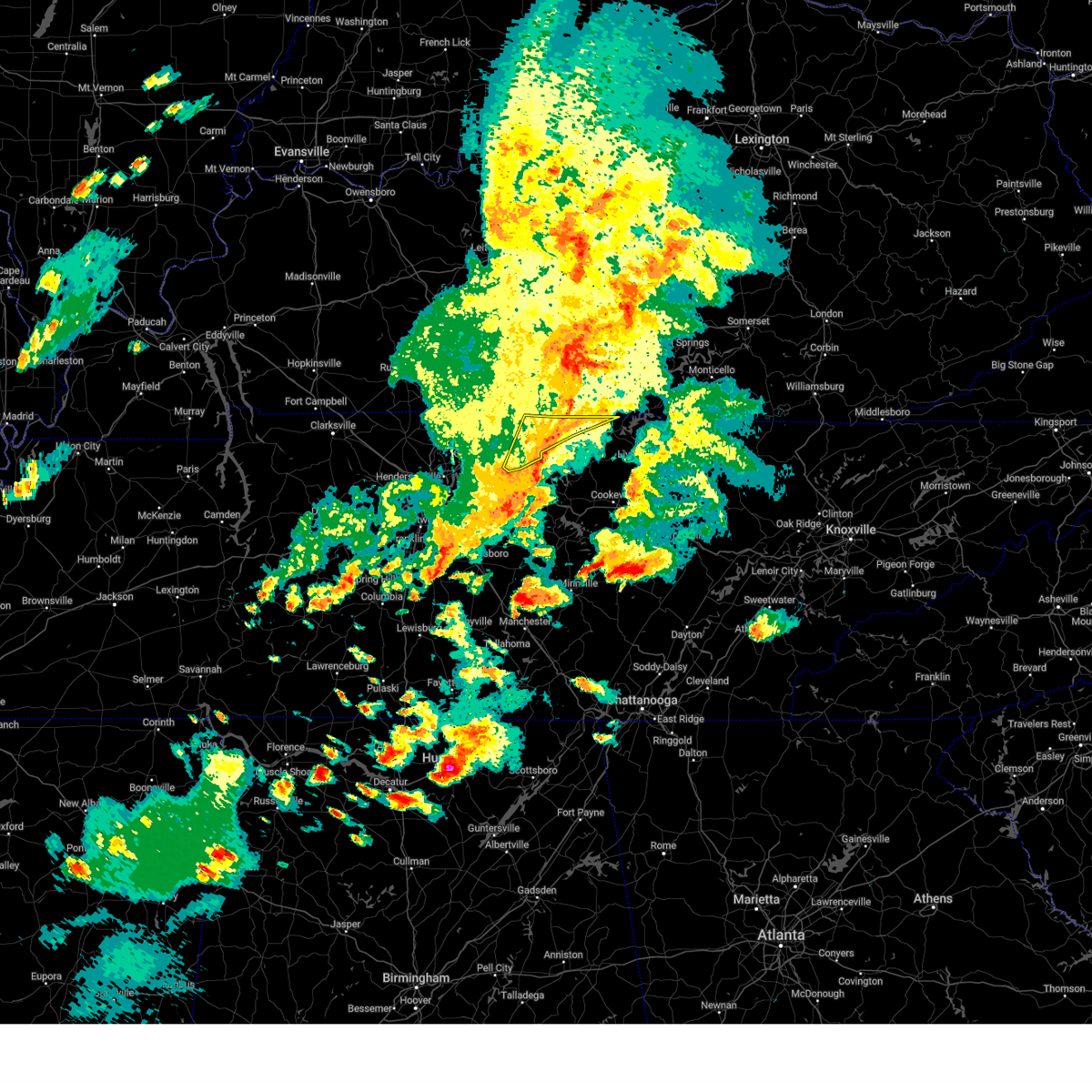
| 9/24/2024 3:00 PM CDT | Trees down in the lafayette are in macon county TN, 2 miles SSE of Lafayette, TN |
| 9/24/2024 2:55 PM CDT |
 Svrohx the national weather service in nashville has issued a * severe thunderstorm warning for, northwestern jackson county in middle tennessee, northwestern clay county in middle tennessee, macon county in middle tennessee, * until 330 pm cdt. * at 254 pm cdt, a severe thunderstorm was located near lafayette, moving east at 35 mph (radar indicated). Hazards include 60 mph wind gusts and penny size hail. expect damage to roofs, siding, and trees Svrohx the national weather service in nashville has issued a * severe thunderstorm warning for, northwestern jackson county in middle tennessee, northwestern clay county in middle tennessee, macon county in middle tennessee, * until 330 pm cdt. * at 254 pm cdt, a severe thunderstorm was located near lafayette, moving east at 35 mph (radar indicated). Hazards include 60 mph wind gusts and penny size hail. expect damage to roofs, siding, and trees
|
| 9/24/2024 2:37 PM CDT |
 At 237 pm cdt, a severe thunderstorm was located over westmoreland, or 13 miles northwest of hartsville, moving northeast at 35 mph (radar indicated). Hazards include 60 mph wind gusts and quarter size hail. Hail damage to vehicles is expected. expect wind damage to roofs, siding, and trees. Locations impacted include, gallatin, lafayette, westmoreland, and bethpage. At 237 pm cdt, a severe thunderstorm was located over westmoreland, or 13 miles northwest of hartsville, moving northeast at 35 mph (radar indicated). Hazards include 60 mph wind gusts and quarter size hail. Hail damage to vehicles is expected. expect wind damage to roofs, siding, and trees. Locations impacted include, gallatin, lafayette, westmoreland, and bethpage.
|
| 9/24/2024 2:24 PM CDT |
 Svrohx the national weather service in nashville has issued a * severe thunderstorm warning for, northeastern sumner county in middle tennessee, western macon county in middle tennessee, * until 300 pm cdt. * at 223 pm cdt, a severe thunderstorm was located near portland, or 9 miles north of gallatin, moving northeast at 35 mph (radar indicated). Hazards include 60 mph wind gusts and quarter size hail. Hail damage to vehicles is expected. Expect wind damage to roofs, siding, and trees. Svrohx the national weather service in nashville has issued a * severe thunderstorm warning for, northeastern sumner county in middle tennessee, western macon county in middle tennessee, * until 300 pm cdt. * at 223 pm cdt, a severe thunderstorm was located near portland, or 9 miles north of gallatin, moving northeast at 35 mph (radar indicated). Hazards include 60 mph wind gusts and quarter size hail. Hail damage to vehicles is expected. Expect wind damage to roofs, siding, and trees.
|
| 7/30/2024 3:02 PM CDT |
 Svrohx the national weather service in nashville has issued a * severe thunderstorm warning for, smith county in middle tennessee, northwestern de kalb county in middle tennessee, southern sumner county in middle tennessee, wilson county in middle tennessee, southwestern macon county in middle tennessee, trousdale county in middle tennessee, * until 400 pm cdt. * at 302 pm cdt, severe thunderstorms were located along a line extending from red boiling springs to near white house, moving southeast at 30 mph (radar indicated). Hazards include 60 mph wind gusts and quarter size hail. Hail damage to vehicles is expected. Expect wind damage to roofs, siding, and trees. Svrohx the national weather service in nashville has issued a * severe thunderstorm warning for, smith county in middle tennessee, northwestern de kalb county in middle tennessee, southern sumner county in middle tennessee, wilson county in middle tennessee, southwestern macon county in middle tennessee, trousdale county in middle tennessee, * until 400 pm cdt. * at 302 pm cdt, severe thunderstorms were located along a line extending from red boiling springs to near white house, moving southeast at 30 mph (radar indicated). Hazards include 60 mph wind gusts and quarter size hail. Hail damage to vehicles is expected. Expect wind damage to roofs, siding, and trees.
|
| 7/30/2024 2:41 PM CDT |
 Svrohx the national weather service in nashville has issued a * severe thunderstorm warning for, sumner county in middle tennessee, northwestern clay county in middle tennessee, macon county in middle tennessee, northwestern trousdale county in middle tennessee, eastern robertson county in middle tennessee, * until 315 pm cdt. * at 241 pm cdt, severe thunderstorms were located along a line extending from 10 miles northwest of cross plains to 12 miles northwest of red boiling springs, moving southeast at 35 mph (radar indicated). Hazards include 60 mph wind gusts. expect damage to roofs, siding, and trees Svrohx the national weather service in nashville has issued a * severe thunderstorm warning for, sumner county in middle tennessee, northwestern clay county in middle tennessee, macon county in middle tennessee, northwestern trousdale county in middle tennessee, eastern robertson county in middle tennessee, * until 315 pm cdt. * at 241 pm cdt, severe thunderstorms were located along a line extending from 10 miles northwest of cross plains to 12 miles northwest of red boiling springs, moving southeast at 35 mph (radar indicated). Hazards include 60 mph wind gusts. expect damage to roofs, siding, and trees
|
| 6/26/2024 6:14 PM CDT |
 the severe thunderstorm warning has been cancelled and is no longer in effect the severe thunderstorm warning has been cancelled and is no longer in effect
|
| 6/26/2024 6:14 PM CDT |
 At 614 pm cdt, severe thunderstorms were located along a line extending from 10 miles west of scottsville to near lafayette, moving northeast at 35 mph (radar indicated). Hazards include 60 mph wind gusts. Expect damage to roofs, siding, and trees. Locations impacted include, lafayette and westmoreland. At 614 pm cdt, severe thunderstorms were located along a line extending from 10 miles west of scottsville to near lafayette, moving northeast at 35 mph (radar indicated). Hazards include 60 mph wind gusts. Expect damage to roofs, siding, and trees. Locations impacted include, lafayette and westmoreland.
|
| 6/26/2024 5:53 PM CDT |
 the severe thunderstorm warning has been cancelled and is no longer in effect the severe thunderstorm warning has been cancelled and is no longer in effect
|
| 6/26/2024 5:53 PM CDT |
 At 552 pm cdt, severe thunderstorms were located along a line extending from near portland to near hartsville, moving northeast at 30 mph (radar indicated). Hazards include 60 mph wind gusts. Expect damage to roofs, siding, and trees. locations impacted include, lafayette, hartsville, westmoreland, cross plains, portland, orlinda, mitchellville, bethpage, and oak grove. This includes interstate 65 between mile markers 113 and 120. At 552 pm cdt, severe thunderstorms were located along a line extending from near portland to near hartsville, moving northeast at 30 mph (radar indicated). Hazards include 60 mph wind gusts. Expect damage to roofs, siding, and trees. locations impacted include, lafayette, hartsville, westmoreland, cross plains, portland, orlinda, mitchellville, bethpage, and oak grove. This includes interstate 65 between mile markers 113 and 120.
|
| 6/26/2024 5:28 PM CDT |
 Svrohx the national weather service in nashville has issued a * severe thunderstorm warning for, sumner county in middle tennessee, northwestern wilson county in middle tennessee, macon county in middle tennessee, trousdale county in middle tennessee, northeastern robertson county in middle tennessee, * until 630 pm cdt. * at 527 pm cdt, severe thunderstorms were located along a line extending from cross plains to near lebanon, moving northeast at 35 mph. these storms have blown down trees and power lines across the nashville metro area (public). Hazards include 60 mph wind gusts. expect damage to roofs, siding, and trees Svrohx the national weather service in nashville has issued a * severe thunderstorm warning for, sumner county in middle tennessee, northwestern wilson county in middle tennessee, macon county in middle tennessee, trousdale county in middle tennessee, northeastern robertson county in middle tennessee, * until 630 pm cdt. * at 527 pm cdt, severe thunderstorms were located along a line extending from cross plains to near lebanon, moving northeast at 35 mph. these storms have blown down trees and power lines across the nashville metro area (public). Hazards include 60 mph wind gusts. expect damage to roofs, siding, and trees
|
| 5/26/2024 2:33 PM CDT |
 At 233 pm cdt, severe thunderstorms were located along a line extending from near westmoreland to near fairview, moving east at 50 mph (radar indicated). Hazards include 60 mph wind gusts and nickel size hail. Expect damage to roofs, siding, and trees. locations impacted include, murfreesboro, franklin, gallatin, lebanon, lafayette, hartsville, nashville, madison, hendersonville, smyrna, brentwood, la vergne, mount juliet, goodlettsville, nolensville, forest hills, oak hill, belle meade, kingston springs, and lakewood. this includes the following highways, interstate 40 between mile markers 182 and 243. interstate 65 between mile markers 67 and 95. interstate 24 between mile markers 41 and 71. Interstate 840 between mile markers 56 and 76. At 233 pm cdt, severe thunderstorms were located along a line extending from near westmoreland to near fairview, moving east at 50 mph (radar indicated). Hazards include 60 mph wind gusts and nickel size hail. Expect damage to roofs, siding, and trees. locations impacted include, murfreesboro, franklin, gallatin, lebanon, lafayette, hartsville, nashville, madison, hendersonville, smyrna, brentwood, la vergne, mount juliet, goodlettsville, nolensville, forest hills, oak hill, belle meade, kingston springs, and lakewood. this includes the following highways, interstate 40 between mile markers 182 and 243. interstate 65 between mile markers 67 and 95. interstate 24 between mile markers 41 and 71. Interstate 840 between mile markers 56 and 76.
|
| 5/26/2024 2:32 PM CDT |
 Svrohx the national weather service in nashville has issued a * severe thunderstorm warning for, northern smith county in middle tennessee, jackson county in middle tennessee, clay county in middle tennessee, macon county in middle tennessee, trousdale county in middle tennessee, * until 315 pm cdt. * at 231 pm cdt, severe thunderstorms were located along a line extending from 10 miles northeast of westmoreland to 6 miles south of lafayette to 8 miles south of hartsville, moving east at 50 mph (radar indicated). Hazards include 60 mph wind gusts and nickel size hail. expect damage to roofs, siding, and trees Svrohx the national weather service in nashville has issued a * severe thunderstorm warning for, northern smith county in middle tennessee, jackson county in middle tennessee, clay county in middle tennessee, macon county in middle tennessee, trousdale county in middle tennessee, * until 315 pm cdt. * at 231 pm cdt, severe thunderstorms were located along a line extending from 10 miles northeast of westmoreland to 6 miles south of lafayette to 8 miles south of hartsville, moving east at 50 mph (radar indicated). Hazards include 60 mph wind gusts and nickel size hail. expect damage to roofs, siding, and trees
|
| 5/26/2024 2:18 PM CDT |
 the severe thunderstorm warning has been cancelled and is no longer in effect the severe thunderstorm warning has been cancelled and is no longer in effect
|
| 5/26/2024 2:18 PM CDT |
 At 218 pm cdt, severe thunderstorms were located along a line extending from 7 miles southwest of westmoreland to near burns, moving east at 50 mph (radar indicated). Hazards include 60 mph wind gusts and nickel size hail. Expect damage to roofs, siding, and trees. locations impacted include, murfreesboro, franklin, gallatin, lebanon, ashland city, lafayette, hartsville, nashville, madison, hendersonville, smyrna, brentwood, la vergne, mount juliet, goodlettsville, millersville, nolensville, forest hills, oak hill, and belle meade. this includes the following highways, interstate 40 between mile markers 182 and 243. interstate 65 between mile markers 67 and 101. interstate 24 between mile markers 33 and 71. Interstate 840 between mile markers 56 and 76. At 218 pm cdt, severe thunderstorms were located along a line extending from 7 miles southwest of westmoreland to near burns, moving east at 50 mph (radar indicated). Hazards include 60 mph wind gusts and nickel size hail. Expect damage to roofs, siding, and trees. locations impacted include, murfreesboro, franklin, gallatin, lebanon, ashland city, lafayette, hartsville, nashville, madison, hendersonville, smyrna, brentwood, la vergne, mount juliet, goodlettsville, millersville, nolensville, forest hills, oak hill, and belle meade. this includes the following highways, interstate 40 between mile markers 182 and 243. interstate 65 between mile markers 67 and 101. interstate 24 between mile markers 33 and 71. Interstate 840 between mile markers 56 and 76.
|
| 5/26/2024 1:53 PM CDT |
 Svrohx the national weather service in nashville has issued a * severe thunderstorm warning for, davidson county in middle tennessee, northwestern rutherford county in middle tennessee, sumner county in middle tennessee, northern williamson county in middle tennessee, wilson county in middle tennessee, cheatham county in middle tennessee, western macon county in middle tennessee, trousdale county in middle tennessee, robertson county in middle tennessee, * until 300 pm cdt. * at 153 pm cdt, severe thunderstorms were located along a line extending from near springfield to 6 miles west of dickson, moving east at 50 mph (radar indicated). Hazards include 60 mph wind gusts and nickel size hail. expect damage to roofs, siding, and trees Svrohx the national weather service in nashville has issued a * severe thunderstorm warning for, davidson county in middle tennessee, northwestern rutherford county in middle tennessee, sumner county in middle tennessee, northern williamson county in middle tennessee, wilson county in middle tennessee, cheatham county in middle tennessee, western macon county in middle tennessee, trousdale county in middle tennessee, robertson county in middle tennessee, * until 300 pm cdt. * at 153 pm cdt, severe thunderstorms were located along a line extending from near springfield to 6 miles west of dickson, moving east at 50 mph (radar indicated). Hazards include 60 mph wind gusts and nickel size hail. expect damage to roofs, siding, and trees
|
| 5/26/2024 10:40 AM CDT |
 Svrohx the national weather service in nashville has issued a * severe thunderstorm warning for, northern overton county in middle tennessee, western pickett county in middle tennessee, northeastern smith county in middle tennessee, northern jackson county in middle tennessee, clay county in middle tennessee, macon county in middle tennessee, trousdale county in middle tennessee, * until 1130 am cdt. * at 1039 am cdt, severe thunderstorms were located along a line extending from 10 miles west of tompkinsville to near red boiling springs to near hartsville, moving east at 65 mph (radar indicated). Hazards include 60 mph wind gusts and nickel size hail. expect damage to roofs, siding, and trees Svrohx the national weather service in nashville has issued a * severe thunderstorm warning for, northern overton county in middle tennessee, western pickett county in middle tennessee, northeastern smith county in middle tennessee, northern jackson county in middle tennessee, clay county in middle tennessee, macon county in middle tennessee, trousdale county in middle tennessee, * until 1130 am cdt. * at 1039 am cdt, severe thunderstorms were located along a line extending from 10 miles west of tompkinsville to near red boiling springs to near hartsville, moving east at 65 mph (radar indicated). Hazards include 60 mph wind gusts and nickel size hail. expect damage to roofs, siding, and trees
|
| 5/26/2024 10:31 AM CDT |
 At 1030 am cdt, severe thunderstorms were located along a line extending from 7 miles east of scottsville to near westmoreland to 9 miles northeast of gallatin, moving east at 60 mph (radar indicated). Hazards include 60 mph wind gusts and nickel size hail. Expect damage to roofs, siding, and trees. Locations impacted include, lafayette, hartsville, westmoreland, red boiling springs, bethpage, pleasant shade, and bledsoe creek state park. At 1030 am cdt, severe thunderstorms were located along a line extending from 7 miles east of scottsville to near westmoreland to 9 miles northeast of gallatin, moving east at 60 mph (radar indicated). Hazards include 60 mph wind gusts and nickel size hail. Expect damage to roofs, siding, and trees. Locations impacted include, lafayette, hartsville, westmoreland, red boiling springs, bethpage, pleasant shade, and bledsoe creek state park.
|
| 5/26/2024 10:31 AM CDT |
 the severe thunderstorm warning has been cancelled and is no longer in effect the severe thunderstorm warning has been cancelled and is no longer in effect
|
| 5/26/2024 10:17 AM CDT |
 At 1017 am cdt, severe thunderstorms were located along a line extending from near scottsville to near portland to near greenbrier, moving east at 65 mph (radar indicated). Hazards include 60 mph wind gusts and nickel size hail. Expect damage to roofs, siding, and trees. locations impacted include, gallatin, lebanon, springfield, lafayette, carthage, hartsville, hendersonville, mount juliet, goodlettsville, white house, millersville, greenbrier, coopertown, westmoreland, ridgetop, cross plains, red boiling springs, portland, pleasant view, and south carthage. this includes the following highways, interstate 65 between mile markers 98 and 121. Interstate 24 between mile markers 18 and 28. At 1017 am cdt, severe thunderstorms were located along a line extending from near scottsville to near portland to near greenbrier, moving east at 65 mph (radar indicated). Hazards include 60 mph wind gusts and nickel size hail. Expect damage to roofs, siding, and trees. locations impacted include, gallatin, lebanon, springfield, lafayette, carthage, hartsville, hendersonville, mount juliet, goodlettsville, white house, millersville, greenbrier, coopertown, westmoreland, ridgetop, cross plains, red boiling springs, portland, pleasant view, and south carthage. this includes the following highways, interstate 65 between mile markers 98 and 121. Interstate 24 between mile markers 18 and 28.
|
| 5/26/2024 10:17 AM CDT |
 the severe thunderstorm warning has been cancelled and is no longer in effect the severe thunderstorm warning has been cancelled and is no longer in effect
|
| 5/26/2024 10:01 AM CDT |
 the severe thunderstorm warning has been cancelled and is no longer in effect the severe thunderstorm warning has been cancelled and is no longer in effect
|
| 5/26/2024 10:01 AM CDT |
 At 1000 am cdt, severe thunderstorms were located along a line extending from 12 miles north of portland to near white house to 9 miles southeast of clarksville, moving east at 65 mph (radar indicated). Hazards include 70 mph wind gusts and nickel size hail. Expect considerable tree damage. damage is likely to mobile homes, roofs, and outbuildings. locations impacted include, clarksville, gallatin, lebanon, springfield, ashland city, lafayette, carthage, hartsville, madison, hendersonville, mount juliet, goodlettsville, white house, millersville, greenbrier, coopertown, lakewood, westmoreland, ridgetop, and cross plains. this includes the following highways, interstate 65 between mile markers 92 and 121. Interstate 24 between mile markers 1 and 42. At 1000 am cdt, severe thunderstorms were located along a line extending from 12 miles north of portland to near white house to 9 miles southeast of clarksville, moving east at 65 mph (radar indicated). Hazards include 70 mph wind gusts and nickel size hail. Expect considerable tree damage. damage is likely to mobile homes, roofs, and outbuildings. locations impacted include, clarksville, gallatin, lebanon, springfield, ashland city, lafayette, carthage, hartsville, madison, hendersonville, mount juliet, goodlettsville, white house, millersville, greenbrier, coopertown, lakewood, westmoreland, ridgetop, and cross plains. this includes the following highways, interstate 65 between mile markers 92 and 121. Interstate 24 between mile markers 1 and 42.
|
| 5/26/2024 9:51 AM CDT |
 Svrohx the national weather service in nashville has issued a * severe thunderstorm warning for, smith county in middle tennessee, northern davidson county in middle tennessee, northeastern dickson county in middle tennessee, montgomery county in middle tennessee, sumner county in middle tennessee, southeastern stewart county in middle tennessee, northern wilson county in middle tennessee, northeastern houston county in middle tennessee, northern cheatham county in middle tennessee, macon county in middle tennessee, trousdale county in middle tennessee, robertson county in middle tennessee, * until 1045 am cdt. * at 951 am cdt, severe thunderstorms were located along a line extending from 12 miles north of cross plains to near coopertown to 13 miles northeast of erin, moving east at 65 mph (radar indicated). Hazards include 70 mph wind gusts and nickel size hail. Expect considerable tree damage. Damage is likely to mobile homes, roofs, and outbuildings. Svrohx the national weather service in nashville has issued a * severe thunderstorm warning for, smith county in middle tennessee, northern davidson county in middle tennessee, northeastern dickson county in middle tennessee, montgomery county in middle tennessee, sumner county in middle tennessee, southeastern stewart county in middle tennessee, northern wilson county in middle tennessee, northeastern houston county in middle tennessee, northern cheatham county in middle tennessee, macon county in middle tennessee, trousdale county in middle tennessee, robertson county in middle tennessee, * until 1045 am cdt. * at 951 am cdt, severe thunderstorms were located along a line extending from 12 miles north of cross plains to near coopertown to 13 miles northeast of erin, moving east at 65 mph (radar indicated). Hazards include 70 mph wind gusts and nickel size hail. Expect considerable tree damage. Damage is likely to mobile homes, roofs, and outbuildings.
|
| 5/22/2024 4:45 PM CDT |
 At 444 pm cdt, a severe thunderstorm was located near red boiling springs, or 7 miles east of lafayette, moving east at 55 mph (radar indicated). Hazards include 60 mph wind gusts and penny size hail. Expect damage to roofs, siding, and trees. Locations impacted include, lafayette, livingston, carthage, celina, gainesboro, red boiling springs, south carthage, whitleyville, moss, bugtussle, dixon springs, pleasant shade, dale hollow lake, boles, and standing stone state park. At 444 pm cdt, a severe thunderstorm was located near red boiling springs, or 7 miles east of lafayette, moving east at 55 mph (radar indicated). Hazards include 60 mph wind gusts and penny size hail. Expect damage to roofs, siding, and trees. Locations impacted include, lafayette, livingston, carthage, celina, gainesboro, red boiling springs, south carthage, whitleyville, moss, bugtussle, dixon springs, pleasant shade, dale hollow lake, boles, and standing stone state park.
|
| 5/22/2024 4:45 PM CDT |
 the severe thunderstorm warning has been cancelled and is no longer in effect the severe thunderstorm warning has been cancelled and is no longer in effect
|
| 5/22/2024 4:36 PM CDT | Several trees down on new harmony road. in addition... a couple trees down along highway 5 in macon county TN, 2.6 miles NNE of Lafayette, TN |
| 5/22/2024 4:35 PM CDT |
 Svrohx the national weather service in nashville has issued a * severe thunderstorm warning for, northwestern overton county in middle tennessee, northern smith county in middle tennessee, jackson county in middle tennessee, northeastern wilson county in middle tennessee, clay county in middle tennessee, macon county in middle tennessee, trousdale county in middle tennessee, * until 515 pm cdt. * at 435 pm cdt, a severe thunderstorm was located near lafayette, moving east at 55 mph (radar indicated). Hazards include 60 mph wind gusts and penny size hail. expect damage to roofs, siding, and trees Svrohx the national weather service in nashville has issued a * severe thunderstorm warning for, northwestern overton county in middle tennessee, northern smith county in middle tennessee, jackson county in middle tennessee, northeastern wilson county in middle tennessee, clay county in middle tennessee, macon county in middle tennessee, trousdale county in middle tennessee, * until 515 pm cdt. * at 435 pm cdt, a severe thunderstorm was located near lafayette, moving east at 55 mph (radar indicated). Hazards include 60 mph wind gusts and penny size hail. expect damage to roofs, siding, and trees
|
| 5/9/2024 1:59 AM CDT |
 The storm which prompted the warning has weakened below severe limits, and no longer poses an immediate threat to life or property. therefore, the warning will be allowed to expire. however, small hail and gusty winds are still possible with this thunderstorm. a tornado watch remains in effect until 300 am cdt for middle tennessee. The storm which prompted the warning has weakened below severe limits, and no longer poses an immediate threat to life or property. therefore, the warning will be allowed to expire. however, small hail and gusty winds are still possible with this thunderstorm. a tornado watch remains in effect until 300 am cdt for middle tennessee.
|
| 5/9/2024 1:46 AM CDT |
 At 145 am cdt, a severe thunderstorm was located over westmoreland, or 14 miles west of lafayette, moving east at 50 mph (radar indicated). Hazards include 60 mph wind gusts and quarter size hail. Hail damage to vehicles is expected. expect wind damage to roofs, siding, and trees. Locations impacted include, lafayette, westmoreland, oak grove, and bethpage. At 145 am cdt, a severe thunderstorm was located over westmoreland, or 14 miles west of lafayette, moving east at 50 mph (radar indicated). Hazards include 60 mph wind gusts and quarter size hail. Hail damage to vehicles is expected. expect wind damage to roofs, siding, and trees. Locations impacted include, lafayette, westmoreland, oak grove, and bethpage.
|
| 5/9/2024 1:46 AM CDT |
 the severe thunderstorm warning has been cancelled and is no longer in effect the severe thunderstorm warning has been cancelled and is no longer in effect
|
| 5/9/2024 1:27 AM CDT |
 Svrohx the national weather service in nashville has issued a * severe thunderstorm warning for, northern sumner county in middle tennessee, macon county in middle tennessee, northeastern robertson county in middle tennessee, * until 200 am cdt. * at 126 am cdt, a severe thunderstorm was located near portland, or 16 miles north of gallatin, moving east at 50 mph (radar indicated). Hazards include 60 mph wind gusts and quarter size hail. Hail damage to vehicles is expected. Expect wind damage to roofs, siding, and trees. Svrohx the national weather service in nashville has issued a * severe thunderstorm warning for, northern sumner county in middle tennessee, macon county in middle tennessee, northeastern robertson county in middle tennessee, * until 200 am cdt. * at 126 am cdt, a severe thunderstorm was located near portland, or 16 miles north of gallatin, moving east at 50 mph (radar indicated). Hazards include 60 mph wind gusts and quarter size hail. Hail damage to vehicles is expected. Expect wind damage to roofs, siding, and trees.
|
| 5/8/2024 6:44 AM CDT |
 At 643 am cdt, a severe thunderstorm was located over lafayette, moving east at 45 mph (radar indicated). Hazards include 60 mph wind gusts and nickel size hail. Expect damage to roofs, siding, and trees. Locations impacted include, lafayette and westmoreland. At 643 am cdt, a severe thunderstorm was located over lafayette, moving east at 45 mph (radar indicated). Hazards include 60 mph wind gusts and nickel size hail. Expect damage to roofs, siding, and trees. Locations impacted include, lafayette and westmoreland.
|
| 5/8/2024 6:27 AM CDT |
 Svrohx the national weather service in nashville has issued a * severe thunderstorm warning for, northeastern sumner county in middle tennessee, macon county in middle tennessee, * until 700 am cdt. * at 627 am cdt, a severe thunderstorm was located near westmoreland, or 13 miles northwest of lafayette, moving east at 40 mph (radar indicated). Hazards include 60 mph wind gusts and nickel size hail. expect damage to roofs, siding, and trees Svrohx the national weather service in nashville has issued a * severe thunderstorm warning for, northeastern sumner county in middle tennessee, macon county in middle tennessee, * until 700 am cdt. * at 627 am cdt, a severe thunderstorm was located near westmoreland, or 13 miles northwest of lafayette, moving east at 40 mph (radar indicated). Hazards include 60 mph wind gusts and nickel size hail. expect damage to roofs, siding, and trees
|
| 12/9/2023 6:11 PM CST |
 The tornado warning for northwestern clay and eastern macon counties will expire at 615 pm cst, the storm which prompted the warning has weakened below severe limits, and no longer appears capable of producing a tornado. therefore, the warning will be allowed to expire. a tornado watch remains in effect until 700 pm cst for middle tennessee. a tornado watch also remains in effect until 1100 pm cst for middle tennessee. The tornado warning for northwestern clay and eastern macon counties will expire at 615 pm cst, the storm which prompted the warning has weakened below severe limits, and no longer appears capable of producing a tornado. therefore, the warning will be allowed to expire. a tornado watch remains in effect until 700 pm cst for middle tennessee. a tornado watch also remains in effect until 1100 pm cst for middle tennessee.
|
| 12/9/2023 5:57 PM CST |
 At 556 pm cst, a severe thunderstorm was located near hartsville, moving northeast at 50 mph (trained weather spotters). Hazards include 60 mph wind gusts and quarter size hail. Hail damage to vehicles is expected. Expect wind damage to roofs, siding, and trees. At 556 pm cst, a severe thunderstorm was located near hartsville, moving northeast at 50 mph (trained weather spotters). Hazards include 60 mph wind gusts and quarter size hail. Hail damage to vehicles is expected. Expect wind damage to roofs, siding, and trees.
|
| 12/9/2023 5:46 PM CST |
 At 546 pm cst, a severe thunderstorm capable of producing a tornado was located over lafayette, moving east at 50 mph (radar indicated rotation). Hazards include tornado. Flying debris will be dangerous to those caught without shelter. mobile homes will be damaged or destroyed. damage to roofs, windows, and vehicles will occur. tree damage is likely. this dangerous storm will be near, red boiling springs around 550 pm cst. Other locations impacted by this tornadic thunderstorm include moss, bugtussle, and boles. At 546 pm cst, a severe thunderstorm capable of producing a tornado was located over lafayette, moving east at 50 mph (radar indicated rotation). Hazards include tornado. Flying debris will be dangerous to those caught without shelter. mobile homes will be damaged or destroyed. damage to roofs, windows, and vehicles will occur. tree damage is likely. this dangerous storm will be near, red boiling springs around 550 pm cst. Other locations impacted by this tornadic thunderstorm include moss, bugtussle, and boles.
|
| 7/29/2023 3:41 PM CDT |
 The severe thunderstorm warning for northern smith, northern jackson, northeastern sumner, macon and central trousdale counties will expire at 345 pm cdt, the storm which prompted the warning has weakened below severe limits, and no longer poses an immediate threat to life or property. therefore, the warning will be allowed to expire. however gusty winds are still possible with this thunderstorm. The severe thunderstorm warning for northern smith, northern jackson, northeastern sumner, macon and central trousdale counties will expire at 345 pm cdt, the storm which prompted the warning has weakened below severe limits, and no longer poses an immediate threat to life or property. therefore, the warning will be allowed to expire. however gusty winds are still possible with this thunderstorm.
|
| 7/29/2023 3:31 PM CDT |
 At 331 pm cdt, a severe thunderstorm was located near westmoreland, or 14 miles northwest of hartsville, moving southeast at 30 mph (radar indicated). Hazards include 60 mph wind gusts and quarter size hail. Hail damage to vehicles is expected. expect wind damage to roofs, siding, and trees. locations impacted include, lafayette, hartsville, westmoreland, bethpage, dixon springs, oak grove and bledsoe creek state park. hail threat, radar indicated max hail size, 1. 00 in wind threat, radar indicated max wind gust, 60 mph. At 331 pm cdt, a severe thunderstorm was located near westmoreland, or 14 miles northwest of hartsville, moving southeast at 30 mph (radar indicated). Hazards include 60 mph wind gusts and quarter size hail. Hail damage to vehicles is expected. expect wind damage to roofs, siding, and trees. locations impacted include, lafayette, hartsville, westmoreland, bethpage, dixon springs, oak grove and bledsoe creek state park. hail threat, radar indicated max hail size, 1. 00 in wind threat, radar indicated max wind gust, 60 mph.
|
| 7/29/2023 3:11 PM CDT |
 At 311 pm cdt, a severe thunderstorm was located 7 miles east of portland, or 15 miles north of gallatin, moving southeast at 30 mph (radar indicated). Hazards include 60 mph wind gusts and quarter size hail. Hail damage to vehicles is expected. Expect wind damage to roofs, siding, and trees. At 311 pm cdt, a severe thunderstorm was located 7 miles east of portland, or 15 miles north of gallatin, moving southeast at 30 mph (radar indicated). Hazards include 60 mph wind gusts and quarter size hail. Hail damage to vehicles is expected. Expect wind damage to roofs, siding, and trees.
|
| 7/29/2023 3:06 PM CDT |
 At 306 pm cdt, a severe thunderstorm was located near westmoreland, or 8 miles northwest of lafayette, moving southeast at 35 mph (radar indicated). Hazards include 60 mph wind gusts and quarter size hail. Hail damage to vehicles is expected. Expect wind damage to roofs, siding, and trees. At 306 pm cdt, a severe thunderstorm was located near westmoreland, or 8 miles northwest of lafayette, moving southeast at 35 mph (radar indicated). Hazards include 60 mph wind gusts and quarter size hail. Hail damage to vehicles is expected. Expect wind damage to roofs, siding, and trees.
|
| 7/18/2023 4:43 PM CDT |
 At 443 pm cdt, severe thunderstorms were located along a line extending from near westmoreland to near lebanon to la vergne, moving east at 50 mph (radar indicated). Hazards include 60 mph wind gusts and penny size hail. Expect damage to roofs, siding, and trees. locations impacted include, murfreesboro, gallatin, lebanon, lafayette, carthage, hartsville, smyrna, la vergne, mount juliet, westmoreland, watertown, gordonsville, red boiling springs, walterhill, rural hill, belinda city, hickman, south carthage, alexandria and liberty. this includes the following highways, interstate 40 between mile markers 223 and 264. interstate 840 between mile markers 58 and 76. hail threat, radar indicated max hail size, 0. 75 in wind threat, radar indicated max wind gust, 60 mph. At 443 pm cdt, severe thunderstorms were located along a line extending from near westmoreland to near lebanon to la vergne, moving east at 50 mph (radar indicated). Hazards include 60 mph wind gusts and penny size hail. Expect damage to roofs, siding, and trees. locations impacted include, murfreesboro, gallatin, lebanon, lafayette, carthage, hartsville, smyrna, la vergne, mount juliet, westmoreland, watertown, gordonsville, red boiling springs, walterhill, rural hill, belinda city, hickman, south carthage, alexandria and liberty. this includes the following highways, interstate 40 between mile markers 223 and 264. interstate 840 between mile markers 58 and 76. hail threat, radar indicated max hail size, 0. 75 in wind threat, radar indicated max wind gust, 60 mph.
|
| 7/18/2023 4:28 PM CDT |
 At 428 pm cdt, severe thunderstorms were located along a line extending from 7 miles northwest of westmoreland to near lebanon to antioch, moving east at 50 mph (radar indicated). Hazards include 60 mph wind gusts and penny size hail. Expect damage to roofs, siding, and trees. locations impacted include, murfreesboro, gallatin, lebanon, lafayette, carthage, hartsville, nashville, hendersonville, smyrna, la vergne, mount juliet, lakewood, westmoreland, watertown, gordonsville, red boiling springs, hermitage, walterhill, rural hill and belinda city. this includes the following highways, interstate 40 between mile markers 207 and 264. interstate 65 between mile markers 82 and 88. interstate 24 between mile markers 47 and 54. interstate 840 between mile markers 58 and 76. hail threat, radar indicated max hail size, 0. 75 in wind threat, radar indicated max wind gust, 60 mph. At 428 pm cdt, severe thunderstorms were located along a line extending from 7 miles northwest of westmoreland to near lebanon to antioch, moving east at 50 mph (radar indicated). Hazards include 60 mph wind gusts and penny size hail. Expect damage to roofs, siding, and trees. locations impacted include, murfreesboro, gallatin, lebanon, lafayette, carthage, hartsville, nashville, hendersonville, smyrna, la vergne, mount juliet, lakewood, westmoreland, watertown, gordonsville, red boiling springs, hermitage, walterhill, rural hill and belinda city. this includes the following highways, interstate 40 between mile markers 207 and 264. interstate 65 between mile markers 82 and 88. interstate 24 between mile markers 47 and 54. interstate 840 between mile markers 58 and 76. hail threat, radar indicated max hail size, 0. 75 in wind threat, radar indicated max wind gust, 60 mph.
|
| 7/18/2023 4:13 PM CDT |
 At 413 pm cdt, severe thunderstorms were located along a line extending from 7 miles northeast of portland to near hendersonville to forest hills, moving east at 50 mph (radar indicated). Hazards include 60 mph wind gusts and penny size hail. expect damage to roofs, siding, and trees At 413 pm cdt, severe thunderstorms were located along a line extending from 7 miles northeast of portland to near hendersonville to forest hills, moving east at 50 mph (radar indicated). Hazards include 60 mph wind gusts and penny size hail. expect damage to roofs, siding, and trees
|
| 7/8/2023 4:27 PM CDT |
 At 427 pm cdt, severe thunderstorms were located along a line extending from near portland to near lafayette, and are nearly stationary (radar indicated). Hazards include 60 mph wind gusts and penny size hail. expect damage to roofs, siding, and trees At 427 pm cdt, severe thunderstorms were located along a line extending from near portland to near lafayette, and are nearly stationary (radar indicated). Hazards include 60 mph wind gusts and penny size hail. expect damage to roofs, siding, and trees
|
| 7/8/2023 4:03 PM CDT |
 At 403 pm cdt, severe thunderstorms were located along a line extending from 6 miles northwest of lafayette to near westmoreland to near portland, moving southeast at 20 mph (radar indicated). Hazards include 60 mph wind gusts. expect damage to roofs, siding, and trees At 403 pm cdt, severe thunderstorms were located along a line extending from 6 miles northwest of lafayette to near westmoreland to near portland, moving southeast at 20 mph (radar indicated). Hazards include 60 mph wind gusts. expect damage to roofs, siding, and trees
|
| 7/1/2023 2:28 PM CDT |
 At 227 pm cdt, severe thunderstorms were located along a line extending from 6 miles southwest of red boiling springs to 8 miles northeast of carthage to 6 miles west of baxter to 8 miles south of smithville, moving east at 45 mph (radar indicated). Hazards include 70 mph wind gusts. Expect considerable tree damage. damage is likely to mobile homes, roofs, and outbuildings. locations impacted include, cookeville, sparta, smithville, lafayette, carthage, gainesboro, algood, baxter, gordonsville, hickman, south carthage, doyle, dowelltown, liberty, hamptons crossroads, bakers crossroads, whitleyville, burgess falls state park, pleasant shade and center hill lake. this includes interstate 40 between mile markers 258 and 294. thunderstorm damage threat, considerable hail threat, radar indicated max hail size, <. 75 in wind threat, observed max wind gust, 70 mph. At 227 pm cdt, severe thunderstorms were located along a line extending from 6 miles southwest of red boiling springs to 8 miles northeast of carthage to 6 miles west of baxter to 8 miles south of smithville, moving east at 45 mph (radar indicated). Hazards include 70 mph wind gusts. Expect considerable tree damage. damage is likely to mobile homes, roofs, and outbuildings. locations impacted include, cookeville, sparta, smithville, lafayette, carthage, gainesboro, algood, baxter, gordonsville, hickman, south carthage, doyle, dowelltown, liberty, hamptons crossroads, bakers crossroads, whitleyville, burgess falls state park, pleasant shade and center hill lake. this includes interstate 40 between mile markers 258 and 294. thunderstorm damage threat, considerable hail threat, radar indicated max hail size, <. 75 in wind threat, observed max wind gust, 70 mph.
|
| 7/1/2023 2:24 PM CDT |
 At 223 pm cdt, a severe thunderstorm was located near lafayette, moving east at 45 mph (radar indicated). Hazards include 60 mph wind gusts. Expect damage to roofs, siding, and trees. locations impacted include, lafayette, hartsville, red boiling springs, pleasant shade, dixon springs and bugtussle. hail threat, radar indicated max hail size, <. 75 in wind threat, radar indicated max wind gust, 60 mph. At 223 pm cdt, a severe thunderstorm was located near lafayette, moving east at 45 mph (radar indicated). Hazards include 60 mph wind gusts. Expect damage to roofs, siding, and trees. locations impacted include, lafayette, hartsville, red boiling springs, pleasant shade, dixon springs and bugtussle. hail threat, radar indicated max hail size, <. 75 in wind threat, radar indicated max wind gust, 60 mph.
|
| 7/1/2023 2:15 PM CDT |
 At 214 pm cdt, severe thunderstorms were located along a line extending from near hartsville to near carthage to near gordonsville to near woodbury, moving east at 45 mph (emergency management). Hazards include 70 mph wind gusts. Expect considerable tree damage. Damage is likely to mobile homes, roofs, and outbuildings. At 214 pm cdt, severe thunderstorms were located along a line extending from near hartsville to near carthage to near gordonsville to near woodbury, moving east at 45 mph (emergency management). Hazards include 70 mph wind gusts. Expect considerable tree damage. Damage is likely to mobile homes, roofs, and outbuildings.
|
| 7/1/2023 2:11 PM CDT |
 At 211 pm cdt, a severe thunderstorm was located near hartsville, moving east at 45 mph (radar indicated). Hazards include 60 mph wind gusts. Expect damage to roofs, siding, and trees. locations impacted include, lafayette, hartsville, westmoreland, red boiling springs, bethpage, dixon springs, pleasant shade and bugtussle. hail threat, radar indicated max hail size, <. 75 in wind threat, radar indicated max wind gust, 60 mph. At 211 pm cdt, a severe thunderstorm was located near hartsville, moving east at 45 mph (radar indicated). Hazards include 60 mph wind gusts. Expect damage to roofs, siding, and trees. locations impacted include, lafayette, hartsville, westmoreland, red boiling springs, bethpage, dixon springs, pleasant shade and bugtussle. hail threat, radar indicated max hail size, <. 75 in wind threat, radar indicated max wind gust, 60 mph.
|
| 7/1/2023 2:00 PM CDT |
 At 200 pm cdt, a severe thunderstorm was located near westmoreland, or 10 miles northwest of hartsville, moving east at 45 mph (radar indicated). Hazards include 60 mph wind gusts. expect damage to roofs, siding, and trees At 200 pm cdt, a severe thunderstorm was located near westmoreland, or 10 miles northwest of hartsville, moving east at 45 mph (radar indicated). Hazards include 60 mph wind gusts. expect damage to roofs, siding, and trees
|
| 6/30/2023 7:23 PM CDT |
 At 723 pm cdt, a severe thunderstorm was located near carthage, moving south at 30 mph (radar indicated). Hazards include 60 mph wind gusts and quarter size hail. Hail damage to vehicles is expected. expect wind damage to roofs, siding, and trees. locations impacted include, lafayette, carthage, hartsville, red boiling springs, south carthage, dixon springs, pleasant shade and granville. hail threat, radar indicated max hail size, 1. 00 in wind threat, radar indicated max wind gust, 60 mph. At 723 pm cdt, a severe thunderstorm was located near carthage, moving south at 30 mph (radar indicated). Hazards include 60 mph wind gusts and quarter size hail. Hail damage to vehicles is expected. expect wind damage to roofs, siding, and trees. locations impacted include, lafayette, carthage, hartsville, red boiling springs, south carthage, dixon springs, pleasant shade and granville. hail threat, radar indicated max hail size, 1. 00 in wind threat, radar indicated max wind gust, 60 mph.
|
| 6/30/2023 6:59 PM CDT |
 At 658 pm cdt, a severe thunderstorm was located near lafayette, moving south at 30 mph (radar indicated). Hazards include 60 mph wind gusts and quarter size hail. Hail damage to vehicles is expected. Expect wind damage to roofs, siding, and trees. At 658 pm cdt, a severe thunderstorm was located near lafayette, moving south at 30 mph (radar indicated). Hazards include 60 mph wind gusts and quarter size hail. Hail damage to vehicles is expected. Expect wind damage to roofs, siding, and trees.
|
| 6/30/2023 6:40 PM CDT |
 At 639 pm cdt, a severe thunderstorm was located near red boiling springs, or near lafayette, moving south at 25 mph (radar indicated). Hazards include ping pong ball size hail and 60 mph wind gusts. People and animals outdoors will be injured. expect hail damage to roofs, siding, windows, and vehicles. expect wind damage to roofs, siding, and trees. locations impacted include, lafayette, gainesboro, red boiling springs, whitleyville, bugtussle, dixon springs and pleasant shade. hail threat, radar indicated max hail size, 1. 50 in wind threat, radar indicated max wind gust, 60 mph. At 639 pm cdt, a severe thunderstorm was located near red boiling springs, or near lafayette, moving south at 25 mph (radar indicated). Hazards include ping pong ball size hail and 60 mph wind gusts. People and animals outdoors will be injured. expect hail damage to roofs, siding, windows, and vehicles. expect wind damage to roofs, siding, and trees. locations impacted include, lafayette, gainesboro, red boiling springs, whitleyville, bugtussle, dixon springs and pleasant shade. hail threat, radar indicated max hail size, 1. 50 in wind threat, radar indicated max wind gust, 60 mph.
|
| 6/30/2023 6:23 PM CDT |
 At 622 pm cdt, a severe thunderstorm was located 11 miles northwest of red boiling springs, or 12 miles northeast of lafayette, moving south at 40 mph (radar indicated). Hazards include 60 mph wind gusts and half dollar size hail. Hail damage to vehicles is expected. Expect wind damage to roofs, siding, and trees. At 622 pm cdt, a severe thunderstorm was located 11 miles northwest of red boiling springs, or 12 miles northeast of lafayette, moving south at 40 mph (radar indicated). Hazards include 60 mph wind gusts and half dollar size hail. Hail damage to vehicles is expected. Expect wind damage to roofs, siding, and trees.
|
| 6/26/2023 2:21 AM CDT |
 The severe thunderstorm warning for overton, northern smith, jackson, clay, macon, trousdale and northwestern putnam counties will expire at 230 am cdt, the storm which prompted the warning has weakened below severe limits, and no longer poses an immediate threat to life or property. therefore, the warning will be allowed to expire. however gusty winds and heavy rain are still possible with this thunderstorm. a severe thunderstorm watch remains in effect until 300 am cdt for middle tennessee. The severe thunderstorm warning for overton, northern smith, jackson, clay, macon, trousdale and northwestern putnam counties will expire at 230 am cdt, the storm which prompted the warning has weakened below severe limits, and no longer poses an immediate threat to life or property. therefore, the warning will be allowed to expire. however gusty winds and heavy rain are still possible with this thunderstorm. a severe thunderstorm watch remains in effect until 300 am cdt for middle tennessee.
|
| 6/26/2023 1:44 AM CDT |
 At 144 am cdt, a severe thunderstorm was located near red boiling springs, or 9 miles southeast of lafayette, moving east at 60 mph (radar indicated). Hazards include 60 mph wind gusts and nickel size hail. expect damage to roofs, siding, and trees At 144 am cdt, a severe thunderstorm was located near red boiling springs, or 9 miles southeast of lafayette, moving east at 60 mph (radar indicated). Hazards include 60 mph wind gusts and nickel size hail. expect damage to roofs, siding, and trees
|
| 6/26/2023 1:25 AM CDT |
 At 125 am cdt, a severe thunderstorm was located over lafayette, moving southeast at 45 mph (radar indicated). Hazards include 60 mph wind gusts and nickel size hail. Expect damage to roofs, siding, and trees. locations impacted include, lafayette, hartsville, westmoreland, red boiling springs and pleasant shade. hail threat, radar indicated max hail size, 0. 88 in wind threat, radar indicated max wind gust, 60 mph. At 125 am cdt, a severe thunderstorm was located over lafayette, moving southeast at 45 mph (radar indicated). Hazards include 60 mph wind gusts and nickel size hail. Expect damage to roofs, siding, and trees. locations impacted include, lafayette, hartsville, westmoreland, red boiling springs and pleasant shade. hail threat, radar indicated max hail size, 0. 88 in wind threat, radar indicated max wind gust, 60 mph.
|
| 6/26/2023 12:55 AM CDT |
 At 1254 am cdt, a severe thunderstorm was located near red boiling springs, or 9 miles northeast of lafayette, moving southeast at 50 mph (radar indicated). Hazards include 60 mph wind gusts and penny size hail. expect damage to roofs, siding, and trees At 1254 am cdt, a severe thunderstorm was located near red boiling springs, or 9 miles northeast of lafayette, moving southeast at 50 mph (radar indicated). Hazards include 60 mph wind gusts and penny size hail. expect damage to roofs, siding, and trees
|
| 5/9/2023 1:57 AM CDT |
 At 157 am cdt, a severe thunderstorm was located near lafayette, moving southeast at 30 mph (radar indicated). Hazards include 60 mph wind gusts and half dollar size hail. Hail damage to vehicles is expected. Expect wind damage to roofs, siding, and trees. At 157 am cdt, a severe thunderstorm was located near lafayette, moving southeast at 30 mph (radar indicated). Hazards include 60 mph wind gusts and half dollar size hail. Hail damage to vehicles is expected. Expect wind damage to roofs, siding, and trees.
|
| 4/1/2023 12:57 AM CDT | Large maple tree down on browns road east of lafayette. time estimated based on rada in macon county TN, 3.6 miles WNW of Lafayette, TN |
| 4/1/2023 12:55 AM CDT | Roof of home collapsed and trees down on rose lane. possible tornad in macon county TN, 6.4 miles N of Lafayette, TN |
| 4/1/2023 12:51 AM CDT | Quarter sized hail reported 4 miles NW of Lafayette, TN |
| 3/3/2023 12:31 PM CST |
 At 1229 pm cst, a severe thunderstorm was located near red boiling springs, or 10 miles northwest of gainesboro, moving northeast at 90 mph (radar indicated). Hazards include 70 mph wind gusts. Expect considerable tree damage. damage is likely to mobile homes, roofs, and outbuildings. locations impacted include, lafayette, gainesboro, red boiling springs, pleasant shade and whitleyville. thunderstorm damage threat, considerable hail threat, radar indicated max hail size, <. 75 in wind threat, radar indicated max wind gust, 70 mph. At 1229 pm cst, a severe thunderstorm was located near red boiling springs, or 10 miles northwest of gainesboro, moving northeast at 90 mph (radar indicated). Hazards include 70 mph wind gusts. Expect considerable tree damage. damage is likely to mobile homes, roofs, and outbuildings. locations impacted include, lafayette, gainesboro, red boiling springs, pleasant shade and whitleyville. thunderstorm damage threat, considerable hail threat, radar indicated max hail size, <. 75 in wind threat, radar indicated max wind gust, 70 mph.
|
| 3/3/2023 12:15 PM CST |
 At 1214 pm cst, a severe thunderstorm was located 7 miles northwest of carthage, moving northeast at 60 mph (radar indicated). Hazards include 70 mph wind gusts. Expect considerable tree damage. Damage is likely to mobile homes, roofs, and outbuildings. At 1214 pm cst, a severe thunderstorm was located 7 miles northwest of carthage, moving northeast at 60 mph (radar indicated). Hazards include 70 mph wind gusts. Expect considerable tree damage. Damage is likely to mobile homes, roofs, and outbuildings.
|
| 7/21/2022 2:43 AM CDT |
 At 242 am cdt, severe thunderstorms were located along a line extending from near tompkinsville to 8 miles northeast of westmoreland, moving southeast at 30 mph (radar indicated). Hazards include 60 mph wind gusts. expect damage to roofs, siding, and trees At 242 am cdt, severe thunderstorms were located along a line extending from near tompkinsville to 8 miles northeast of westmoreland, moving southeast at 30 mph (radar indicated). Hazards include 60 mph wind gusts. expect damage to roofs, siding, and trees
|
| 6/17/2022 10:02 AM CDT |
 At 1001 am cdt, severe thunderstorms were located along a line extending from portland to nashville, moving east at 50 mph (radar indicated). Hazards include 60 mph wind gusts. expect damage to roofs, siding, and trees At 1001 am cdt, severe thunderstorms were located along a line extending from portland to nashville, moving east at 50 mph (radar indicated). Hazards include 60 mph wind gusts. expect damage to roofs, siding, and trees
|
| 5/5/2022 4:08 PM CDT | Quarter sized hail reported 7.8 miles N of Lafayette, TN, quarter size hail reported near hartsville. |
| 5/5/2022 4:08 PM CDT |
 At 408 pm cdt, a severe thunderstorm was located 7 miles south of lafayette, moving east at 35 mph (radar indicated). Hazards include 60 mph wind gusts and quarter size hail. Hail damage to vehicles is expected. Expect wind damage to roofs, siding, and trees. At 408 pm cdt, a severe thunderstorm was located 7 miles south of lafayette, moving east at 35 mph (radar indicated). Hazards include 60 mph wind gusts and quarter size hail. Hail damage to vehicles is expected. Expect wind damage to roofs, siding, and trees.
|
| 1/1/2022 1:02 PM CST |
 At 101 pm cst, severe thunderstorms were located along a line extending from 6 miles south of scottsville to forest hills, moving northeast at 50 mph (radar indicated). Hazards include 60 mph wind gusts. expect damage to roofs, siding, and trees At 101 pm cst, severe thunderstorms were located along a line extending from 6 miles south of scottsville to forest hills, moving northeast at 50 mph (radar indicated). Hazards include 60 mph wind gusts. expect damage to roofs, siding, and trees
|
| 12/6/2021 6:02 AM CST |
 At 601 am cst, severe thunderstorms were located along a line extending from lafayette to near mount juliet, moving east at 45 mph (radar indicated). Hazards include 60 mph wind gusts. expect damage to roofs, siding, and trees At 601 am cst, severe thunderstorms were located along a line extending from lafayette to near mount juliet, moving east at 45 mph (radar indicated). Hazards include 60 mph wind gusts. expect damage to roofs, siding, and trees
|
| 5/6/2021 6:54 PM CDT | Report of trees and powerlins down on spring creek roa in macon county TN, 0.3 miles NE of Lafayette, TN |
| 5/6/2021 5:54 PM CDT | Report of trees and powerlines down on spring creek roa in macon county TN, 0.3 miles NE of Lafayette, TN |
| 5/6/2021 5:52 PM CDT |
 At 552 pm cdt, a severe thunderstorm was located near westmoreland, or 9 miles north of hartsville, moving east at 35 mph (radar indicated). Hazards include 60 mph wind gusts. Expect damage to roofs, siding, and trees. Locations impacted include, gallatin, lafayette, hartsville, westmoreland, bledsoe creek state park and bethpage. At 552 pm cdt, a severe thunderstorm was located near westmoreland, or 9 miles north of hartsville, moving east at 35 mph (radar indicated). Hazards include 60 mph wind gusts. Expect damage to roofs, siding, and trees. Locations impacted include, gallatin, lafayette, hartsville, westmoreland, bledsoe creek state park and bethpage.
|
| 5/6/2021 5:29 PM CDT |
 At 528 pm cdt, a severe thunderstorm was located near portland, or 10 miles north of gallatin, moving east at 35 mph (radar indicated). Hazards include 60 mph wind gusts. expect damage to roofs, siding, and trees At 528 pm cdt, a severe thunderstorm was located near portland, or 10 miles north of gallatin, moving east at 35 mph (radar indicated). Hazards include 60 mph wind gusts. expect damage to roofs, siding, and trees
|
| 5/4/2021 6:52 AM CDT |
 At 651 am cdt, severe thunderstorms were located along a line extending from near lafayette to 6 miles west of watertown, moving east at 45 mph (radar indicated). Hazards include 60 mph wind gusts and penny size hail. expect damage to roofs, siding, and trees At 651 am cdt, severe thunderstorms were located along a line extending from near lafayette to 6 miles west of watertown, moving east at 45 mph (radar indicated). Hazards include 60 mph wind gusts and penny size hail. expect damage to roofs, siding, and trees
|
| 5/4/2021 6:16 AM CDT |
 At 615 am cdt, severe thunderstorms were located along a line extending from near portland to forest hills, moving east at 45 mph (radar indicated). Hazards include 60 mph wind gusts and penny size hail. expect damage to roofs, siding, and trees At 615 am cdt, severe thunderstorms were located along a line extending from near portland to forest hills, moving east at 45 mph (radar indicated). Hazards include 60 mph wind gusts and penny size hail. expect damage to roofs, siding, and trees
|
| 5/4/2021 12:44 AM CDT |
 At 1244 am cdt, a severe thunderstorm was located near red boiling springs, or 14 miles east of lafayette, moving east at 30 mph (radar indicated). Hazards include half dollar size hail. Damage to vehicles is expected. Locations impacted include, lafayette, red boiling springs, boles, bugtussle and whitleyville. At 1244 am cdt, a severe thunderstorm was located near red boiling springs, or 14 miles east of lafayette, moving east at 30 mph (radar indicated). Hazards include half dollar size hail. Damage to vehicles is expected. Locations impacted include, lafayette, red boiling springs, boles, bugtussle and whitleyville.
|
| 5/4/2021 12:25 AM CDT |
 At 1224 am cdt, a severe thunderstorm was located near lafayette, moving east at 30 mph (radar indicated). Hazards include quarter size hail. damage to vehicles is expected At 1224 am cdt, a severe thunderstorm was located near lafayette, moving east at 30 mph (radar indicated). Hazards include quarter size hail. damage to vehicles is expected
|
| 3/27/2021 7:44 AM CDT |
 At 744 am cdt, a severe thunderstorm was located 8 miles east of hartsville, moving northeast at 40 mph (radar indicated). Hazards include 60 mph wind gusts and quarter size hail. Hail damage to vehicles is expected. expect wind damage to roofs, siding, and trees. Locations impacted include, lafayette, carthage, hartsville, south carthage, pleasant shade and dixon springs. At 744 am cdt, a severe thunderstorm was located 8 miles east of hartsville, moving northeast at 40 mph (radar indicated). Hazards include 60 mph wind gusts and quarter size hail. Hail damage to vehicles is expected. expect wind damage to roofs, siding, and trees. Locations impacted include, lafayette, carthage, hartsville, south carthage, pleasant shade and dixon springs.
|
| 3/27/2021 7:19 AM CDT |
 At 719 am cdt, a severe thunderstorm was located near lebanon, moving northeast at 40 mph (radar indicated). Hazards include 60 mph wind gusts and quarter size hail. Hail damage to vehicles is expected. Expect wind damage to roofs, siding, and trees. At 719 am cdt, a severe thunderstorm was located near lebanon, moving northeast at 40 mph (radar indicated). Hazards include 60 mph wind gusts and quarter size hail. Hail damage to vehicles is expected. Expect wind damage to roofs, siding, and trees.
|
| 2/28/2021 8:09 PM CST |
 The severe thunderstorm warning for northwestern jackson, northwestern clay and macon counties will expire at 815 pm cst, the storm which prompted the warning has weakened below severe limits, and no longer poses an immediate threat to life or property. therefore, the warning will be allowed to expire. however heavy rain is still possible with this thunderstorm. a severe thunderstorm watch remains in effect until 1000 pm cst for middle tennessee. The severe thunderstorm warning for northwestern jackson, northwestern clay and macon counties will expire at 815 pm cst, the storm which prompted the warning has weakened below severe limits, and no longer poses an immediate threat to life or property. therefore, the warning will be allowed to expire. however heavy rain is still possible with this thunderstorm. a severe thunderstorm watch remains in effect until 1000 pm cst for middle tennessee.
|
| 2/28/2021 7:39 PM CST |
 At 739 pm cst, a severe thunderstorm was located over lafayette, moving east at 50 mph (radar indicated). Hazards include 60 mph wind gusts and penny size hail. expect damage to roofs, siding, and trees At 739 pm cst, a severe thunderstorm was located over lafayette, moving east at 50 mph (radar indicated). Hazards include 60 mph wind gusts and penny size hail. expect damage to roofs, siding, and trees
|
| 2/28/2021 7:15 PM CST |
 At 715 pm cst, severe thunderstorms were located along a line extending from near westmoreland to near gallatin to millersville, moving east at 45 mph (radar indicated). Hazards include 60 mph wind gusts. expect damage to roofs, siding, and trees At 715 pm cst, severe thunderstorms were located along a line extending from near westmoreland to near gallatin to millersville, moving east at 45 mph (radar indicated). Hazards include 60 mph wind gusts. expect damage to roofs, siding, and trees
|
| 9/1/2020 6:17 PM CDT |
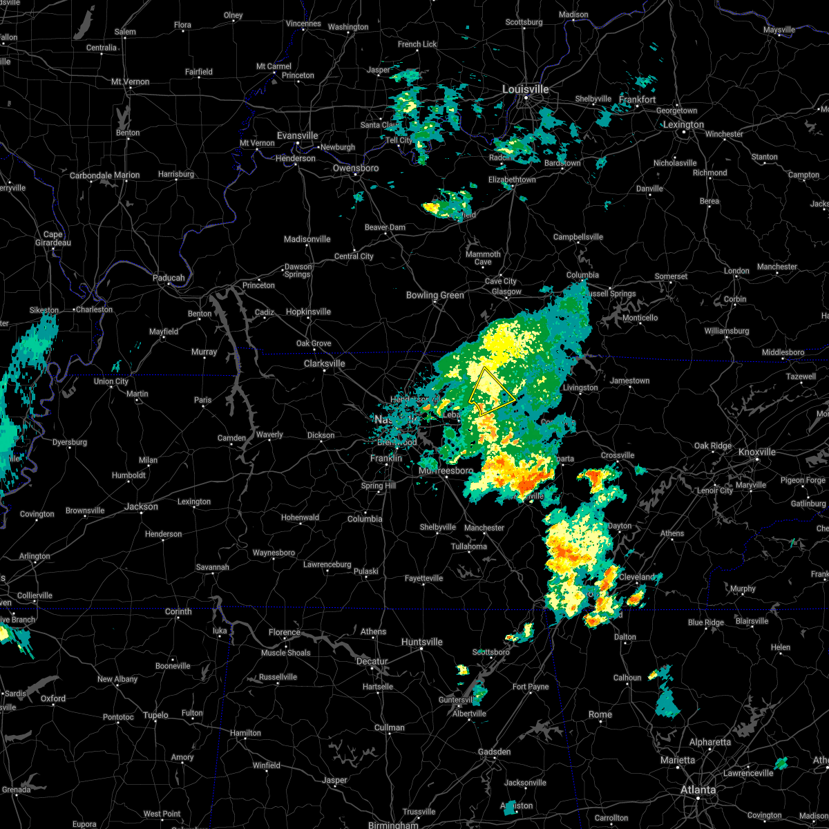 At 617 pm cdt, a severe thunderstorm was located near hartsville, moving northeast at 40 mph (radar indicated). Hazards include 60 mph wind gusts. Expect damage to roofs, siding, and trees. Locations impacted include, lafayette, hartsville, pleasant shade and dixon springs. At 617 pm cdt, a severe thunderstorm was located near hartsville, moving northeast at 40 mph (radar indicated). Hazards include 60 mph wind gusts. Expect damage to roofs, siding, and trees. Locations impacted include, lafayette, hartsville, pleasant shade and dixon springs.
|
| 9/1/2020 5:59 PM CDT |
 The national weather service in nashville has issued a * severe thunderstorm warning for. smith county in middle tennessee. northeastern wilson county in middle tennessee. southwestern macon county in middle tennessee. Trousdale county in middle tennessee. The national weather service in nashville has issued a * severe thunderstorm warning for. smith county in middle tennessee. northeastern wilson county in middle tennessee. southwestern macon county in middle tennessee. Trousdale county in middle tennessee.
|
| 8/29/2020 4:08 PM CDT |
 At 407 pm cdt, a severe thunderstorm was located near red boiling springs, moving southeast at 25 mph (radar indicated). Hazards include 60 mph wind gusts and penny size hail. expect damage to roofs, siding, and trees At 407 pm cdt, a severe thunderstorm was located near red boiling springs, moving southeast at 25 mph (radar indicated). Hazards include 60 mph wind gusts and penny size hail. expect damage to roofs, siding, and trees
|
| 8/10/2020 3:16 PM CDT |
 At 316 pm cdt, a severe thunderstorm was located near hartsville, moving southeast at 10 mph (radar indicated). Hazards include 60 mph wind gusts and quarter size hail. Hail damage to vehicles is expected. Expect wind damage to roofs, siding, and trees. At 316 pm cdt, a severe thunderstorm was located near hartsville, moving southeast at 10 mph (radar indicated). Hazards include 60 mph wind gusts and quarter size hail. Hail damage to vehicles is expected. Expect wind damage to roofs, siding, and trees.
|
| 5/3/2020 5:13 PM CDT |
 At 512 pm cdt, severe thunderstorms were located along a line extending from near westmoreland to near watertown, moving east at 65 mph. these are very dangerous storms (radar indicated). Hazards include 80 mph wind gusts. Flying debris will be dangerous to those caught without shelter. mobile homes will be heavily damaged. expect considerable damage to roofs, windows, and vehicles. extensive tree damage and power outages are likely. locations impacted include, cookeville, lafayette, carthage, gainesboro, hartsville, westmoreland, watertown, baxter, gordonsville, red boiling springs, hickman, south carthage, alexandria, dowelltown, liberty, hamptons crossroads, moss, pleasant shade, dickerson chapel recreation area and center hill lake. This includes interstate 40 between mile markers 241 and 289. At 512 pm cdt, severe thunderstorms were located along a line extending from near westmoreland to near watertown, moving east at 65 mph. these are very dangerous storms (radar indicated). Hazards include 80 mph wind gusts. Flying debris will be dangerous to those caught without shelter. mobile homes will be heavily damaged. expect considerable damage to roofs, windows, and vehicles. extensive tree damage and power outages are likely. locations impacted include, cookeville, lafayette, carthage, gainesboro, hartsville, westmoreland, watertown, baxter, gordonsville, red boiling springs, hickman, south carthage, alexandria, dowelltown, liberty, hamptons crossroads, moss, pleasant shade, dickerson chapel recreation area and center hill lake. This includes interstate 40 between mile markers 241 and 289.
|
| 5/3/2020 5:11 PM CDT |
 At 510 pm cdt, severe thunderstorms were located along a line extending from near westmoreland to near watertown, moving east at 65 mph. these are very dangerous storms (radar indicated). Hazards include 80 mph wind gusts and penny size hail. Flying debris will be dangerous to those caught without shelter. mobile homes will be heavily damaged. expect considerable damage to roofs, windows, and vehicles. Extensive tree damage and power outages are likely. At 510 pm cdt, severe thunderstorms were located along a line extending from near westmoreland to near watertown, moving east at 65 mph. these are very dangerous storms (radar indicated). Hazards include 80 mph wind gusts and penny size hail. Flying debris will be dangerous to those caught without shelter. mobile homes will be heavily damaged. expect considerable damage to roofs, windows, and vehicles. Extensive tree damage and power outages are likely.
|
| 1/11/2020 6:44 PM CST |
 At 644 pm cst, a severe thunderstorm was located near red boiling springs, or 9 miles northeast of lafayette, moving east at 45 mph (radar indicated). Hazards include 60 mph wind gusts. Expect damage to roofs, siding, and trees. Locations impacted include, lafayette and red boiling springs. At 644 pm cst, a severe thunderstorm was located near red boiling springs, or 9 miles northeast of lafayette, moving east at 45 mph (radar indicated). Hazards include 60 mph wind gusts. Expect damage to roofs, siding, and trees. Locations impacted include, lafayette and red boiling springs.
|
| 1/11/2020 6:42 PM CST |
 At 642 pm cst, severe thunderstorms were located along a line extending from 8 miles northwest of red boiling springs to near gordonsville, moving east at 35 mph (radar indicated). Hazards include 70 mph wind gusts. Expect considerable tree damage. Damage is likely to mobile homes, roofs, and outbuildings. At 642 pm cst, severe thunderstorms were located along a line extending from 8 miles northwest of red boiling springs to near gordonsville, moving east at 35 mph (radar indicated). Hazards include 70 mph wind gusts. Expect considerable tree damage. Damage is likely to mobile homes, roofs, and outbuildings.
|
| 1/11/2020 6:34 PM CST |
 At 634 pm cst, severe thunderstorms were located along a line extending from near lafayette to near carthage, moving east at 50 mph (radar indicated). Hazards include 70 mph wind gusts. Expect considerable tree damage. damage is likely to mobile homes, roofs, and outbuildings. Locations impacted include, lafayette, carthage, hartsville, red boiling springs, south carthage, dixon springs, pleasant shade and dickerson chapel recreation area. At 634 pm cst, severe thunderstorms were located along a line extending from near lafayette to near carthage, moving east at 50 mph (radar indicated). Hazards include 70 mph wind gusts. Expect considerable tree damage. damage is likely to mobile homes, roofs, and outbuildings. Locations impacted include, lafayette, carthage, hartsville, red boiling springs, south carthage, dixon springs, pleasant shade and dickerson chapel recreation area.
|
| 1/11/2020 6:26 PM CST |
 At 626 pm cst, a severe thunderstorm was located near lafayette, moving east at 45 mph (radar indicated). Hazards include 60-65 mph wind gusts. expect damage to roofs, siding, and trees At 626 pm cst, a severe thunderstorm was located near lafayette, moving east at 45 mph (radar indicated). Hazards include 60-65 mph wind gusts. expect damage to roofs, siding, and trees
|
| 1/11/2020 6:13 PM CST |
 At 613 pm cst, a severe thunderstorm was located near westmoreland, or 11 miles northwest of lafayette, moving east at 50 mph (radar indicated). Hazards include 60 mph wind gusts. Expect damage to roofs, siding, and trees. Locations impacted include, lafayette, westmoreland and oak grove. At 613 pm cst, a severe thunderstorm was located near westmoreland, or 11 miles northwest of lafayette, moving east at 50 mph (radar indicated). Hazards include 60 mph wind gusts. Expect damage to roofs, siding, and trees. Locations impacted include, lafayette, westmoreland and oak grove.
|
| 1/11/2020 6:09 PM CST |
 At 609 pm cst, severe thunderstorms were located along a line extending from 6 miles southwest of westmoreland to near lebanon, moving east at 50 mph (radar indicated). Hazards include 60 mph wind gusts. expect damage to roofs, siding, and trees At 609 pm cst, severe thunderstorms were located along a line extending from 6 miles southwest of westmoreland to near lebanon, moving east at 50 mph (radar indicated). Hazards include 60 mph wind gusts. expect damage to roofs, siding, and trees
|
| 1/11/2020 5:43 PM CST |
 At 543 pm cst, a severe thunderstorm was located near cross plains, or 14 miles northeast of springfield, moving east at 50 mph (radar indicated). Hazards include 60 mph wind gusts. expect damage to roofs, siding, and trees At 543 pm cst, a severe thunderstorm was located near cross plains, or 14 miles northeast of springfield, moving east at 50 mph (radar indicated). Hazards include 60 mph wind gusts. expect damage to roofs, siding, and trees
|
| 8/13/2019 3:27 PM CDT |
 At 306 pm cdt, severe thunderstorms were located along a line extending from near westmoreland to near gallatin to near hendersonville, moving east at 45 mph (radar indicated). Hazards include 60 mph wind gusts. expect damage to roofs, siding, and trees At 306 pm cdt, severe thunderstorms were located along a line extending from near westmoreland to near gallatin to near hendersonville, moving east at 45 mph (radar indicated). Hazards include 60 mph wind gusts. expect damage to roofs, siding, and trees
|
| 8/13/2019 3:06 PM CDT |
 At 306 pm cdt, severe thunderstorms were located along a line extending from near westmoreland to near gallatin to near hendersonville, moving east at 45 mph (radar indicated). Hazards include 60 mph wind gusts. expect damage to roofs, siding, and trees At 306 pm cdt, severe thunderstorms were located along a line extending from near westmoreland to near gallatin to near hendersonville, moving east at 45 mph (radar indicated). Hazards include 60 mph wind gusts. expect damage to roofs, siding, and trees
|
| 6/21/2019 8:29 PM CDT |
 At 829 pm cdt, severe thunderstorms were located along a line extending from near red boiling springs to near carthage to near watertown, moving east at 45 mph (radar indicated). Hazards include 70 mph wind gusts and nickel size hail. Expect considerable tree damage. damage is likely to mobile homes, roofs, and outbuildings. locations impacted include, lebanon, lafayette, carthage, hartsville, watertown, gordonsville, red boiling springs, hickman, south carthage, alexandria, liberty, tuckers crossroads, moss, whitleyville, dixon springs, pleasant shade, dickerson chapel recreation area and granville. this includes the following highways, interstate 40 between mile markers 234 and 265. Interstate 840 between mile markers 73 and 76. At 829 pm cdt, severe thunderstorms were located along a line extending from near red boiling springs to near carthage to near watertown, moving east at 45 mph (radar indicated). Hazards include 70 mph wind gusts and nickel size hail. Expect considerable tree damage. damage is likely to mobile homes, roofs, and outbuildings. locations impacted include, lebanon, lafayette, carthage, hartsville, watertown, gordonsville, red boiling springs, hickman, south carthage, alexandria, liberty, tuckers crossroads, moss, whitleyville, dixon springs, pleasant shade, dickerson chapel recreation area and granville. this includes the following highways, interstate 40 between mile markers 234 and 265. Interstate 840 between mile markers 73 and 76.
|
| 6/21/2019 8:17 PM CDT | Trees down county wide. damage to barns and houses across the county. *possible* tornado across northern portion of count in macon county TN, 0.3 miles NE of Lafayette, TN |
| 6/21/2019 8:09 PM CDT |
 At 809 pm cdt, a severe thunderstorm capable of producing a tornado was located near lafayette, moving southeast at 50 mph (radar indicated rotation). Hazards include tornado. Flying debris will be dangerous to those caught without shelter. mobile homes will be damaged or destroyed. damage to roofs, windows, and vehicles will occur. tree damage is likely. This dangerous storm will be near, red boiling springs around 820 pm cdt. At 809 pm cdt, a severe thunderstorm capable of producing a tornado was located near lafayette, moving southeast at 50 mph (radar indicated rotation). Hazards include tornado. Flying debris will be dangerous to those caught without shelter. mobile homes will be damaged or destroyed. damage to roofs, windows, and vehicles will occur. tree damage is likely. This dangerous storm will be near, red boiling springs around 820 pm cdt.
|
| 6/21/2019 8:01 PM CDT |
 At 801 pm cdt, severe thunderstorms were located along a line extending from 7 miles northwest of lafayette to 7 miles east of gallatin to mount juliet, moving east at 45 mph (radar indicated). Hazards include 70 mph wind gusts and nickel size hail. Expect considerable tree damage. Damage is likely to mobile homes, roofs, and outbuildings. At 801 pm cdt, severe thunderstorms were located along a line extending from 7 miles northwest of lafayette to 7 miles east of gallatin to mount juliet, moving east at 45 mph (radar indicated). Hazards include 70 mph wind gusts and nickel size hail. Expect considerable tree damage. Damage is likely to mobile homes, roofs, and outbuildings.
|
| 6/17/2019 6:47 PM CDT | Tree down on union camp road in lafayette in macon county TN, 4.1 miles WNW of Lafayette, TN |
| 6/17/2019 6:43 PM CDT |
 At 643 pm cdt, a severe thunderstorm was located near lafayette, moving east at 20 mph (radar indicated). Hazards include 60 mph wind gusts and quarter size hail. Hail damage to vehicles is expected. Expect wind damage to roofs, siding, and trees. At 643 pm cdt, a severe thunderstorm was located near lafayette, moving east at 20 mph (radar indicated). Hazards include 60 mph wind gusts and quarter size hail. Hail damage to vehicles is expected. Expect wind damage to roofs, siding, and trees.
|
| 6/17/2019 6:31 PM CDT |
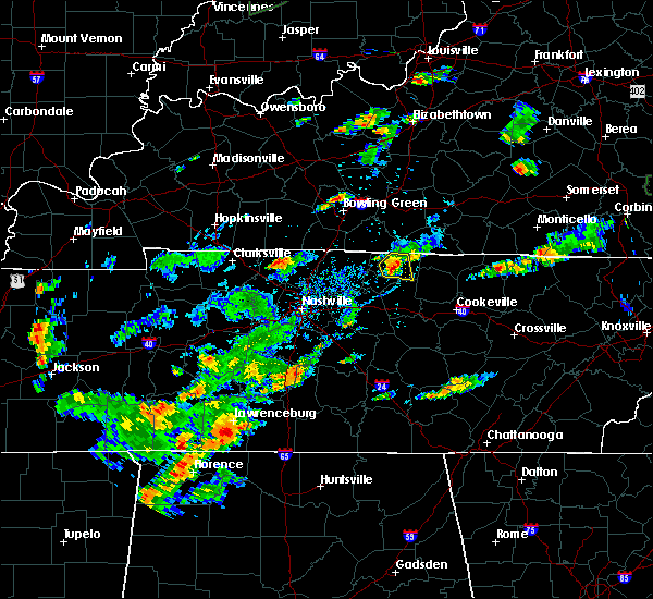 At 630 pm cdt, a severe thunderstorm was located over lafayette, moving east at 20 mph (radar indicated). Hazards include 60 mph wind gusts and quarter size hail. Hail damage to vehicles is expected. expect wind damage to roofs, siding, and trees. Locations impacted include, lafayette. At 630 pm cdt, a severe thunderstorm was located over lafayette, moving east at 20 mph (radar indicated). Hazards include 60 mph wind gusts and quarter size hail. Hail damage to vehicles is expected. expect wind damage to roofs, siding, and trees. Locations impacted include, lafayette.
|
| 6/17/2019 6:26 PM CDT | Multiple trees down on new harmony road and old hwy 52 southwest of lafayett in macon county TN, 3.1 miles ENE of Lafayette, TN |
| 6/17/2019 6:12 PM CDT |
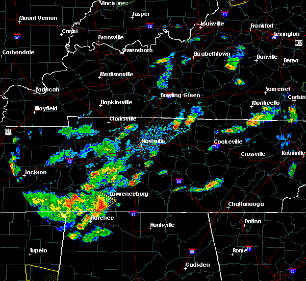 At 611 pm cdt, a severe thunderstorm was located near hartsville, moving east at 20 mph (radar indicated). Hazards include 60 mph wind gusts and quarter size hail. Hail damage to vehicles is expected. Expect wind damage to roofs, siding, and trees. At 611 pm cdt, a severe thunderstorm was located near hartsville, moving east at 20 mph (radar indicated). Hazards include 60 mph wind gusts and quarter size hail. Hail damage to vehicles is expected. Expect wind damage to roofs, siding, and trees.
|
| 3/30/2019 7:19 PM CDT |
 At 719 pm cdt, severe thunderstorms were located along a line extending from near lafayette to near hartsville, moving east at 55 mph (radar indicated). Hazards include 70 mph wind gusts. Expect considerable tree damage. Damage is likely to mobile homes, roofs, and outbuildings. At 719 pm cdt, severe thunderstorms were located along a line extending from near lafayette to near hartsville, moving east at 55 mph (radar indicated). Hazards include 70 mph wind gusts. Expect considerable tree damage. Damage is likely to mobile homes, roofs, and outbuildings.
|
| 3/30/2019 7:12 PM CDT |
 At 711 pm cdt, severe thunderstorms were located along a line extending from 11 miles southeast of scottsville to near hartsville, moving east at 65 mph (radar indicated). Hazards include 60 mph wind gusts. Expect damage to roofs, siding, and trees. locations impacted include, lebanon, lafayette, hartsville, westmoreland and dickerson chapel recreation area. this includes the following highways, interstate 40 between mile markers 232 and 242. Interstate 840 between mile markers 75 and 76. At 711 pm cdt, severe thunderstorms were located along a line extending from 11 miles southeast of scottsville to near hartsville, moving east at 65 mph (radar indicated). Hazards include 60 mph wind gusts. Expect damage to roofs, siding, and trees. locations impacted include, lebanon, lafayette, hartsville, westmoreland and dickerson chapel recreation area. this includes the following highways, interstate 40 between mile markers 232 and 242. Interstate 840 between mile markers 75 and 76.
|
| 3/30/2019 6:46 PM CDT |
 At 646 pm cdt, severe thunderstorms were located along a line extending from near portland to madison, moving east at 65 mph (radar indicated). Hazards include 60 mph wind gusts. expect damage to roofs, siding, and trees At 646 pm cdt, severe thunderstorms were located along a line extending from near portland to madison, moving east at 65 mph (radar indicated). Hazards include 60 mph wind gusts. expect damage to roofs, siding, and trees
|
| 12/31/2018 2:51 PM CST |
 At 250 pm cst, severe thunderstorms were located along a line extending from 9 miles northeast of scottsville to near mount juliet, moving northeast at 70 mph (radar indicated). Hazards include 60 mph wind gusts. Expect damage to roofs, siding, and trees. Locations impacted include, murfreesboro, franklin, gallatin, lebanon, lafayette, hartsville, hendersonville, smyrna, brentwood, la vergne, mount juliet, nolensville, westmoreland, hermitage, walterhill, rural hill, antioch, belinda city, bethpage and oak grove. At 250 pm cst, severe thunderstorms were located along a line extending from 9 miles northeast of scottsville to near mount juliet, moving northeast at 70 mph (radar indicated). Hazards include 60 mph wind gusts. Expect damage to roofs, siding, and trees. Locations impacted include, murfreesboro, franklin, gallatin, lebanon, lafayette, hartsville, hendersonville, smyrna, brentwood, la vergne, mount juliet, nolensville, westmoreland, hermitage, walterhill, rural hill, antioch, belinda city, bethpage and oak grove.
|
| 12/31/2018 2:25 PM CST |
 At 224 pm cst, severe thunderstorms were located along a line extending from portland to near franklin, moving northeast at 60 mph (radar indicated). Hazards include 60 mph wind gusts. expect damage to roofs, siding, and trees At 224 pm cst, severe thunderstorms were located along a line extending from portland to near franklin, moving northeast at 60 mph (radar indicated). Hazards include 60 mph wind gusts. expect damage to roofs, siding, and trees
|
| 8/21/2018 12:44 AM CDT |
 At 1243 am cdt, a severe thunderstorm was located over lafayette, moving northeast at 50 mph (radar indicated). Hazards include 60 mph wind gusts. Expect damage to roofs, siding, and trees. Locations impacted include, lafayette and red boiling springs. At 1243 am cdt, a severe thunderstorm was located over lafayette, moving northeast at 50 mph (radar indicated). Hazards include 60 mph wind gusts. Expect damage to roofs, siding, and trees. Locations impacted include, lafayette and red boiling springs.
|
| 8/21/2018 12:30 AM CDT |
 At 1230 am cdt, a severe thunderstorm was located over hartsville, moving northeast at 50 mph (radar indicated). Hazards include 60 mph wind gusts. Expect damage to roofs, siding, and trees. Locations impacted include, lafayette, hartsville and red boiling springs. At 1230 am cdt, a severe thunderstorm was located over hartsville, moving northeast at 50 mph (radar indicated). Hazards include 60 mph wind gusts. Expect damage to roofs, siding, and trees. Locations impacted include, lafayette, hartsville and red boiling springs.
|
| 8/21/2018 12:27 AM CDT |
 At 1226 am cdt, a severe thunderstorm was located near westmoreland, or 9 miles northwest of lafayette, moving northeast at 50 mph (radar indicated). Hazards include 60 mph wind gusts. Expect damage to roofs, siding, and trees. Locations impacted include, lafayette, westmoreland and oak grove. At 1226 am cdt, a severe thunderstorm was located near westmoreland, or 9 miles northwest of lafayette, moving northeast at 50 mph (radar indicated). Hazards include 60 mph wind gusts. Expect damage to roofs, siding, and trees. Locations impacted include, lafayette, westmoreland and oak grove.
|
| 8/21/2018 12:13 AM CDT |
 At 1213 am cdt, a severe thunderstorm was located over lebanon, moving northeast at 50 mph (radar indicated). Hazards include 60 mph wind gusts. expect damage to roofs, siding, and trees At 1213 am cdt, a severe thunderstorm was located over lebanon, moving northeast at 50 mph (radar indicated). Hazards include 60 mph wind gusts. expect damage to roofs, siding, and trees
|
| 8/21/2018 12:08 AM CDT |
 The national weather service in nashville has issued a * severe thunderstorm warning for. eastern sumner county in middle tennessee. northwestern macon county in middle tennessee. northwestern trousdale county in middle tennessee. Until 1245 am cdt. The national weather service in nashville has issued a * severe thunderstorm warning for. eastern sumner county in middle tennessee. northwestern macon county in middle tennessee. northwestern trousdale county in middle tennessee. Until 1245 am cdt.
|
| 7/30/2018 6:53 PM CDT |
 At 653 pm cdt, a severe thunderstorm was located near lafayette, moving east at 15 mph (radar indicated). Hazards include 70 mph wind gusts and quarter size hail. Hail damage to vehicles is expected. expect considerable tree damage. Wind damage is also likely to mobile homes, roofs, and outbuildings. At 653 pm cdt, a severe thunderstorm was located near lafayette, moving east at 15 mph (radar indicated). Hazards include 70 mph wind gusts and quarter size hail. Hail damage to vehicles is expected. expect considerable tree damage. Wind damage is also likely to mobile homes, roofs, and outbuildings.
|
| 7/21/2018 12:40 AM CDT | Numerous trees and some power lines down across macon county from lafayette eastward in macon county TN, 0.3 miles NE of Lafayette, TN |
| 6/27/2018 4:46 PM CDT |
 At 446 pm cdt, a severe thunderstorm was located near castalian springs, moving east at 45 mph (radar indicated). Hazards include 70 mph wind gusts and penny size hail. Expect considerable tree damage. damage is likely to mobile homes, roofs, and outbuildings. Locations impacted include, gallatin, lafayette, hartsville, westmoreland, bethpage, oak grove, bledsoe creek state park and dickerson chapel recreation area. At 446 pm cdt, a severe thunderstorm was located near castalian springs, moving east at 45 mph (radar indicated). Hazards include 70 mph wind gusts and penny size hail. Expect considerable tree damage. damage is likely to mobile homes, roofs, and outbuildings. Locations impacted include, gallatin, lafayette, hartsville, westmoreland, bethpage, oak grove, bledsoe creek state park and dickerson chapel recreation area.
|
| 6/27/2018 4:39 PM CDT |
 At 439 pm cdt, severe thunderstorms were located along a line extending from near westmoreland to near gallatin, moving east at 50 mph (radar indicated). Hazards include 60 mph wind gusts and penny size hail. Expect damage to roofs, siding, and trees. Locations impacted include, gallatin, lafayette, hartsville, hendersonville, goodlettsville, white house, millersville, westmoreland, portland, mitchellville, bethpage, oak grove, bledsoe creek state park, dickerson chapel recreation area and cottontown. At 439 pm cdt, severe thunderstorms were located along a line extending from near westmoreland to near gallatin, moving east at 50 mph (radar indicated). Hazards include 60 mph wind gusts and penny size hail. Expect damage to roofs, siding, and trees. Locations impacted include, gallatin, lafayette, hartsville, hendersonville, goodlettsville, white house, millersville, westmoreland, portland, mitchellville, bethpage, oak grove, bledsoe creek state park, dickerson chapel recreation area and cottontown.
|
| 6/27/2018 4:24 PM CDT |
 At 424 pm cdt, severe thunderstorms were located along a line extending from near portland to near white house, moving east at 45 mph (radar indicated). Hazards include 60 mph wind gusts and penny size hail. expect damage to roofs, siding, and trees At 424 pm cdt, severe thunderstorms were located along a line extending from near portland to near white house, moving east at 45 mph (radar indicated). Hazards include 60 mph wind gusts and penny size hail. expect damage to roofs, siding, and trees
|
| 6/27/2018 2:49 PM CDT |
 At 248 pm cdt, severe thunderstorms were located along a line extending dale hollow lake to near lafayette, moving southeast at 35 mph (radar indicated). Hazards include 60 mph wind gusts and penny size hail. Expect damage to roofs, siding, and trees. Locations impacted include, lafayette, red boiling springs, hermitage springs and whitleyville. At 248 pm cdt, severe thunderstorms were located along a line extending dale hollow lake to near lafayette, moving southeast at 35 mph (radar indicated). Hazards include 60 mph wind gusts and penny size hail. Expect damage to roofs, siding, and trees. Locations impacted include, lafayette, red boiling springs, hermitage springs and whitleyville.
|
| 6/27/2018 2:31 PM CDT |
 At 230 pm cdt, a severe thunderstorm was located near akersville, kentucky, moving southeast at 40 mph (radar indicated). Hazards include 60 mph wind gusts and penny size hail. expect damage to roofs, siding, and trees At 230 pm cdt, a severe thunderstorm was located near akersville, kentucky, moving southeast at 40 mph (radar indicated). Hazards include 60 mph wind gusts and penny size hail. expect damage to roofs, siding, and trees
|
| 6/24/2018 7:39 PM CDT |
 At 739 pm cdt, a severe thunderstorm was located near hartsville, moving east at 25 mph (radar indicated). Hazards include 60 mph wind gusts and quarter size hail. Hail damage to vehicles is expected. Expect wind damage to roofs, siding, and trees. At 739 pm cdt, a severe thunderstorm was located near hartsville, moving east at 25 mph (radar indicated). Hazards include 60 mph wind gusts and quarter size hail. Hail damage to vehicles is expected. Expect wind damage to roofs, siding, and trees.
|
| 6/11/2018 7:39 PM CDT |
 At 724 pm cdt, a severe thunderstorm was located 7 miles east of gallatin, and is nearly stationary (radar indicated). Hazards include 60 mph wind gusts and quarter size hail. Hail damage to vehicles is expected. Expect wind damage to roofs, siding, and trees. At 724 pm cdt, a severe thunderstorm was located 7 miles east of gallatin, and is nearly stationary (radar indicated). Hazards include 60 mph wind gusts and quarter size hail. Hail damage to vehicles is expected. Expect wind damage to roofs, siding, and trees.
|
| 6/11/2018 7:24 PM CDT |
 At 724 pm cdt, a severe thunderstorm was located 7 miles east of gallatin, and is nearly stationary (radar indicated). Hazards include 60 mph wind gusts and quarter size hail. Hail damage to vehicles is expected. Expect wind damage to roofs, siding, and trees. At 724 pm cdt, a severe thunderstorm was located 7 miles east of gallatin, and is nearly stationary (radar indicated). Hazards include 60 mph wind gusts and quarter size hail. Hail damage to vehicles is expected. Expect wind damage to roofs, siding, and trees.
|
| 5/31/2018 6:36 PM CDT | Ping Pong Ball sized hail reported 7.6 miles NNE of Lafayette, TN, facebook photos showed hail up to ping pong ball size fell on middle fork road between highway 141 and highway 10. |
| 5/31/2018 6:29 PM CDT |
 At 629 pm cdt, a severe thunderstorm was located over hartsville, moving northeast at 25 mph (radar indicated). Hazards include 60 mph wind gusts and quarter size hail. Hail damage to vehicles is expected. Expect wind damage to roofs, siding, and trees. At 629 pm cdt, a severe thunderstorm was located over hartsville, moving northeast at 25 mph (radar indicated). Hazards include 60 mph wind gusts and quarter size hail. Hail damage to vehicles is expected. Expect wind damage to roofs, siding, and trees.
|
| 5/31/2018 3:54 PM CDT | Tree down at union camp and royd roa in macon county TN, 6.5 miles NW of Lafayette, TN |
| 5/20/2018 7:59 PM CDT |
 The national weather service in nashville has issued a * severe thunderstorm warning for. northwestern jackson county in middle tennessee. west central clay county in middle tennessee. macon county in middle tennessee. Until 830 pm cdt. The national weather service in nashville has issued a * severe thunderstorm warning for. northwestern jackson county in middle tennessee. west central clay county in middle tennessee. macon county in middle tennessee. Until 830 pm cdt.
|
| 5/20/2018 7:51 PM CDT |
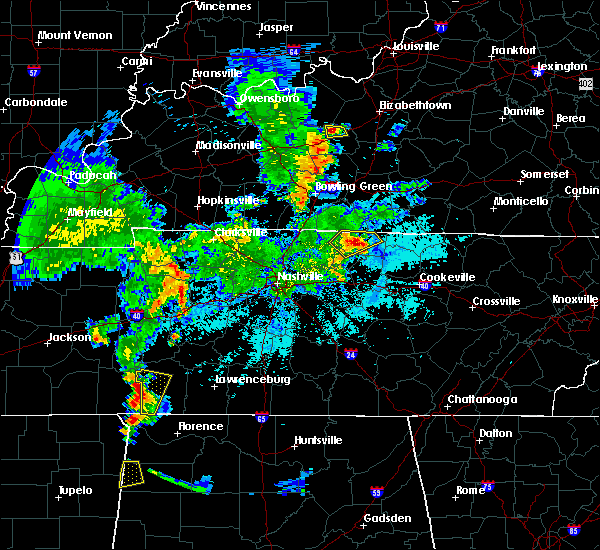 A severe thunderstorm warning remains in effect until 800 pm cdt for central macon county. at 750 pm cdt, a severe thunderstorm was located over lafayette, moving east at 15 mph. hazard. 60 mph wind gusts and quarter size hail. source. Radar indicated. A severe thunderstorm warning remains in effect until 800 pm cdt for central macon county. at 750 pm cdt, a severe thunderstorm was located over lafayette, moving east at 15 mph. hazard. 60 mph wind gusts and quarter size hail. source. Radar indicated.
|
| 5/20/2018 7:28 PM CDT |
 At 728 pm cdt, a severe thunderstorm was located near westmoreland, or 7 miles west of lafayette, moving northeast at 20 mph (radar indicated). Hazards include 60 mph wind gusts and quarter size hail. Hail damage to vehicles is expected. Expect wind damage to roofs, siding, and trees. At 728 pm cdt, a severe thunderstorm was located near westmoreland, or 7 miles west of lafayette, moving northeast at 20 mph (radar indicated). Hazards include 60 mph wind gusts and quarter size hail. Hail damage to vehicles is expected. Expect wind damage to roofs, siding, and trees.
|
| 4/3/2018 9:36 PM CDT |
 At 935 pm cdt, a severe thunderstorm was located near portland, or 14 miles north of gallatin, moving east at 70 mph (radar indicated). Hazards include 70 mph wind gusts and nickel size hail. Expect considerable tree damage. damage is likely to mobile homes, roofs, and outbuildings. Locations impacted include, lafayette, white house, westmoreland, portland, mitchellville, bethpage and oak grove. At 935 pm cdt, a severe thunderstorm was located near portland, or 14 miles north of gallatin, moving east at 70 mph (radar indicated). Hazards include 70 mph wind gusts and nickel size hail. Expect considerable tree damage. damage is likely to mobile homes, roofs, and outbuildings. Locations impacted include, lafayette, white house, westmoreland, portland, mitchellville, bethpage and oak grove.
|
| 4/3/2018 9:26 PM CDT |
 At 926 pm cdt, a severe thunderstorm was located near cross plains, or 12 miles northeast of springfield, moving east at 70 mph (radar indicated). Hazards include 60 mph wind gusts and nickel size hail. expect damage to roofs, siding, and trees At 926 pm cdt, a severe thunderstorm was located near cross plains, or 12 miles northeast of springfield, moving east at 70 mph (radar indicated). Hazards include 60 mph wind gusts and nickel size hail. expect damage to roofs, siding, and trees
|
| 2/24/2018 11:12 PM CST |
 At 1111 pm cst, severe thunderstorms were located along a line extending from 6 miles south of tompkinsville to 12 miles south of nolensville, moving east at 45 mph (radar indicated). Hazards include 60 mph wind gusts. Expect damage to roofs, siding, and trees. locations impacted include, murfreesboro, lebanon, lafayette, carthage, celina, gainesboro, hartsville, smyrna, la vergne, spring hill, mount juliet, nolensville, thompson`s station, watertown, gordonsville, red boiling springs, walterhill, rural hill, belinda city and hickman. A tornado watch remains in effect until 200 am cst for middle tennessee. At 1111 pm cst, severe thunderstorms were located along a line extending from 6 miles south of tompkinsville to 12 miles south of nolensville, moving east at 45 mph (radar indicated). Hazards include 60 mph wind gusts. Expect damage to roofs, siding, and trees. locations impacted include, murfreesboro, lebanon, lafayette, carthage, celina, gainesboro, hartsville, smyrna, la vergne, spring hill, mount juliet, nolensville, thompson`s station, watertown, gordonsville, red boiling springs, walterhill, rural hill, belinda city and hickman. A tornado watch remains in effect until 200 am cst for middle tennessee.
|
| 2/24/2018 10:41 PM CST |
 At 1041 pm cst, severe thunderstorms were located along a line extending from 6 miles north of lafayette to near spring hill, moving east at 45 mph (radar indicated). Hazards include 60 mph wind gusts. expect damage to roofs, siding, and trees At 1041 pm cst, severe thunderstorms were located along a line extending from 6 miles north of lafayette to near spring hill, moving east at 45 mph (radar indicated). Hazards include 60 mph wind gusts. expect damage to roofs, siding, and trees
|
| 2/24/2018 10:15 PM CST |
 At 1014 pm cst, a severe thunderstorm was located 8 miles southwest of westmoreland, or 9 miles northeast of gallatin, moving east at 35 mph (radar indicated). Hazards include 60 mph wind gusts and penny size hail. Expect damage to roofs, siding, and trees. this severe storm will be near, hartsville and westmoreland around 1030 pm cst. other locations impacted by this severe thunderstorm include oak grove, bledsoe creek state park, cottontown and bethpage. A tornado watch remains in effect until 200 am cst for middle tennessee. At 1014 pm cst, a severe thunderstorm was located 8 miles southwest of westmoreland, or 9 miles northeast of gallatin, moving east at 35 mph (radar indicated). Hazards include 60 mph wind gusts and penny size hail. Expect damage to roofs, siding, and trees. this severe storm will be near, hartsville and westmoreland around 1030 pm cst. other locations impacted by this severe thunderstorm include oak grove, bledsoe creek state park, cottontown and bethpage. A tornado watch remains in effect until 200 am cst for middle tennessee.
|
| 2/24/2018 9:59 PM CST |
 At 958 pm cst, a severe thunderstorm was located near white house, or 10 miles northwest of gallatin, moving east at 35 mph (radar indicated). Hazards include 60 mph wind gusts and penny size hail. Expect damage to roofs, siding, and trees. this severe thunderstorm will be near, gallatin around 1010 pm cst. hartsville and westmoreland around 1030 pm cst. other locations impacted by this severe thunderstorm include oak grove, bledsoe creek state park, cottontown and bethpage. A tornado watch remains in effect until 200 am cst for middle tennessee. At 958 pm cst, a severe thunderstorm was located near white house, or 10 miles northwest of gallatin, moving east at 35 mph (radar indicated). Hazards include 60 mph wind gusts and penny size hail. Expect damage to roofs, siding, and trees. this severe thunderstorm will be near, gallatin around 1010 pm cst. hartsville and westmoreland around 1030 pm cst. other locations impacted by this severe thunderstorm include oak grove, bledsoe creek state park, cottontown and bethpage. A tornado watch remains in effect until 200 am cst for middle tennessee.
|
| 11/18/2017 5:12 PM CST | A few trees and power lines down across macon county in macon county TN, 0.3 miles NE of Lafayette, TN |
| 11/18/2017 5:12 PM CST |
 At 511 pm cst, a confirmed tornado was located just north of hartsville, moving east at 50 mph (radar confirmed tornado). Hazards include damaging tornado. Flying debris will be dangerous to those caught without shelter. mobile homes will be damaged or destroyed. damage to roofs, windows, and vehicles will occur. tree damage is likely. Locations impacted include, lafayette, hartsville and pleasant shade. At 511 pm cst, a confirmed tornado was located just north of hartsville, moving east at 50 mph (radar confirmed tornado). Hazards include damaging tornado. Flying debris will be dangerous to those caught without shelter. mobile homes will be damaged or destroyed. damage to roofs, windows, and vehicles will occur. tree damage is likely. Locations impacted include, lafayette, hartsville and pleasant shade.
|
| 11/18/2017 5:09 PM CST |
 At 508 pm cst, severe thunderstorms were located along a line extending from lafayette to murfreesboro, moving east at 55 mph (radar indicated). Hazards include 70 mph wind gusts. Expect considerable tree damage. Damage is likely to mobile homes, roofs, and outbuildings. At 508 pm cst, severe thunderstorms were located along a line extending from lafayette to murfreesboro, moving east at 55 mph (radar indicated). Hazards include 70 mph wind gusts. Expect considerable tree damage. Damage is likely to mobile homes, roofs, and outbuildings.
|
| 11/18/2017 5:07 PM CST |
 At 506 pm cst, a severe thunderstorm capable of producing a tornado was located near hartsville, moving east at 45 mph (radar indicated rotation). Hazards include tornado. Flying debris will be dangerous to those caught without shelter. mobile homes will be damaged or destroyed. damage to roofs, windows, and vehicles will occur. tree damage is likely. this dangerous storm will be near, lafayette around 525 pm cst. Other locations impacted by this tornadic thunderstorm include pleasant shade. At 506 pm cst, a severe thunderstorm capable of producing a tornado was located near hartsville, moving east at 45 mph (radar indicated rotation). Hazards include tornado. Flying debris will be dangerous to those caught without shelter. mobile homes will be damaged or destroyed. damage to roofs, windows, and vehicles will occur. tree damage is likely. this dangerous storm will be near, lafayette around 525 pm cst. Other locations impacted by this tornadic thunderstorm include pleasant shade.
|
| 5/27/2017 7:43 PM CDT |
 At 743 pm cdt, a severe thunderstorm was located 9 miles north of carthage, moving east at 45 mph (radar indicated). Hazards include 70 mph wind gusts and quarter size hail. Hail damage to vehicles is expected. expect considerable tree damage. Wind damage is also likely to mobile homes, roofs, and outbuildings. At 743 pm cdt, a severe thunderstorm was located 9 miles north of carthage, moving east at 45 mph (radar indicated). Hazards include 70 mph wind gusts and quarter size hail. Hail damage to vehicles is expected. expect considerable tree damage. Wind damage is also likely to mobile homes, roofs, and outbuildings.
|
| 5/27/2017 7:31 PM CDT |
 At 730 pm cdt, a severe thunderstorm was located over hartsville, moving east at 45 mph (radar indicated). Hazards include 70 mph wind gusts and quarter size hail. Hail damage to vehicles is expected. expect considerable tree damage. wind damage is also likely to mobile homes, roofs, and outbuildings. Locations impacted include, gallatin, lafayette, hartsville, hendersonville, westmoreland, cottontown, bethpage, dixon springs, oak grove, bledsoe creek state park and dickerson chapel recreation area. At 730 pm cdt, a severe thunderstorm was located over hartsville, moving east at 45 mph (radar indicated). Hazards include 70 mph wind gusts and quarter size hail. Hail damage to vehicles is expected. expect considerable tree damage. wind damage is also likely to mobile homes, roofs, and outbuildings. Locations impacted include, gallatin, lafayette, hartsville, hendersonville, westmoreland, cottontown, bethpage, dixon springs, oak grove, bledsoe creek state park and dickerson chapel recreation area.
|
| 5/27/2017 7:15 PM CDT |
 At 715 pm cdt, a severe thunderstorm was located over gallatin, moving east at 50 mph (radar indicated). Hazards include 70 mph wind gusts and quarter size hail. Hail damage to vehicles is expected. expect considerable tree damage. Wind damage is also likely to mobile homes, roofs, and outbuildings. At 715 pm cdt, a severe thunderstorm was located over gallatin, moving east at 50 mph (radar indicated). Hazards include 70 mph wind gusts and quarter size hail. Hail damage to vehicles is expected. expect considerable tree damage. Wind damage is also likely to mobile homes, roofs, and outbuildings.
|
| 5/24/2017 11:54 AM CDT |
 At 1153 am cdt, a severe thunderstorm was located 9 miles north of carthage, moving northeast at 25 mph (radar indicated). Hazards include 60 mph wind gusts and nickel size hail. expect damage to roofs, siding, and trees At 1153 am cdt, a severe thunderstorm was located 9 miles north of carthage, moving northeast at 25 mph (radar indicated). Hazards include 60 mph wind gusts and nickel size hail. expect damage to roofs, siding, and trees
|
| 4/30/2017 3:47 PM CDT |
 At 346 pm cdt, severe thunderstorms were located along a line extending from 9 miles southwest of scottsville to near westmoreland, moving northeast at 55 mph (radar indicated). Hazards include 60 mph wind gusts. Expect damage to roofs, siding, and trees. locations impacted include, gallatin, lafayette, hartsville, westmoreland, bethpage, oak grove and bledsoe creek state park. A tornado watch remains in effect until 700 pm cdt for middle tennessee. At 346 pm cdt, severe thunderstorms were located along a line extending from 9 miles southwest of scottsville to near westmoreland, moving northeast at 55 mph (radar indicated). Hazards include 60 mph wind gusts. Expect damage to roofs, siding, and trees. locations impacted include, gallatin, lafayette, hartsville, westmoreland, bethpage, oak grove and bledsoe creek state park. A tornado watch remains in effect until 700 pm cdt for middle tennessee.
|
| 4/30/2017 3:29 PM CDT |
 At 329 pm cdt, severe thunderstorms were located along a line extending from 8 miles east of white house to 6 miles southeast of gallatin, moving northeast at 55 mph (radar indicated). Hazards include 60 mph wind gusts. expect damage to roofs, siding, and trees At 329 pm cdt, severe thunderstorms were located along a line extending from 8 miles east of white house to 6 miles southeast of gallatin, moving northeast at 55 mph (radar indicated). Hazards include 60 mph wind gusts. expect damage to roofs, siding, and trees
|
| 4/5/2017 5:02 PM CDT | Quarter sized hail reported 4 miles NW of Lafayette, TN, image of several quarter size hailstones |
| 3/27/2017 5:02 PM CDT |
 At 502 pm cdt, a severe thunderstorm was located near lafayette, moving northeast at 55 mph (radar indicated). Hazards include 60 mph wind gusts and penny size hail. Expect damage to roofs, siding, and trees. Locations impacted include, lafayette and bugtussle. At 502 pm cdt, a severe thunderstorm was located near lafayette, moving northeast at 55 mph (radar indicated). Hazards include 60 mph wind gusts and penny size hail. Expect damage to roofs, siding, and trees. Locations impacted include, lafayette and bugtussle.
|
| 3/27/2017 4:49 PM CDT |
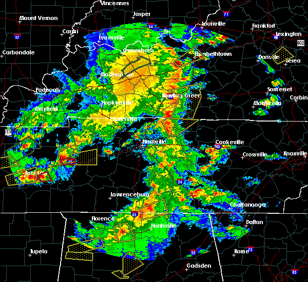 At 449 pm cdt, a severe thunderstorm was located 7 miles north of lafayette, moving northeast at 50 mph (radar indicated). Hazards include 60 mph wind gusts and penny size hail. Expect damage to roofs, siding, and trees. Locations impacted include, lafayette. At 449 pm cdt, a severe thunderstorm was located 7 miles north of lafayette, moving northeast at 50 mph (radar indicated). Hazards include 60 mph wind gusts and penny size hail. Expect damage to roofs, siding, and trees. Locations impacted include, lafayette.
|
| 3/27/2017 4:39 PM CDT |
 The severe thunderstorm warning for sumner, north central wilson, southwestern macon and northwestern trousdale counties will expire at 445 pm cdt, the storm which prompted the warning has been replaced with a new severe thunderstorm warning. a severe thunderstorm watch remains in effect until 1000 pm cdt for middle tennessee. remember, a severe thunderstorm warning still remains in effect for sumner, trousdale, and macon counties. The severe thunderstorm warning for sumner, north central wilson, southwestern macon and northwestern trousdale counties will expire at 445 pm cdt, the storm which prompted the warning has been replaced with a new severe thunderstorm warning. a severe thunderstorm watch remains in effect until 1000 pm cdt for middle tennessee. remember, a severe thunderstorm warning still remains in effect for sumner, trousdale, and macon counties.
|
| 3/27/2017 4:38 PM CDT |
 At 438 pm cdt, a severe thunderstorm was located near westmoreland, or 9 miles northwest of lafayette, moving northeast at 50 mph (radar indicated). Hazards include 60 mph wind gusts and penny size hail. expect damage to roofs, siding, and trees At 438 pm cdt, a severe thunderstorm was located near westmoreland, or 9 miles northwest of lafayette, moving northeast at 50 mph (radar indicated). Hazards include 60 mph wind gusts and penny size hail. expect damage to roofs, siding, and trees
|
| 3/27/2017 4:28 PM CDT |
 At 427 pm cdt, a severe thunderstorm was located near gallatin, moving northeast at 45 mph (radar indicated). Hazards include 60 mph wind gusts and quarter size hail. Hail damage to vehicles is expected. expect wind damage to roofs, siding, and trees. Locations impacted include, gallatin, lafayette, white house, westmoreland, portland, mitchellville, cottontown, bethpage, oak grove and bledsoe creek state park. At 427 pm cdt, a severe thunderstorm was located near gallatin, moving northeast at 45 mph (radar indicated). Hazards include 60 mph wind gusts and quarter size hail. Hail damage to vehicles is expected. expect wind damage to roofs, siding, and trees. Locations impacted include, gallatin, lafayette, white house, westmoreland, portland, mitchellville, cottontown, bethpage, oak grove and bledsoe creek state park.
|
| 3/27/2017 4:19 PM CDT |
 At 418 pm cdt, a severe thunderstorm was located over gallatin, moving northeast at 50 mph (emergency management. radar indicated). Hazards include 70 mph wind gusts and quarter size hail. Hail damage to vehicles is expected. expect considerable tree damage. wind damage is also likely to mobile homes, roofs, and outbuildings. Locations impacted include, gallatin, lafayette, hendersonville, mount juliet, goodlettsville, white house, millersville, westmoreland, portland, mitchellville, bethpage, oak grove, bledsoe creek state park and cottontown. At 418 pm cdt, a severe thunderstorm was located over gallatin, moving northeast at 50 mph (emergency management. radar indicated). Hazards include 70 mph wind gusts and quarter size hail. Hail damage to vehicles is expected. expect considerable tree damage. wind damage is also likely to mobile homes, roofs, and outbuildings. Locations impacted include, gallatin, lafayette, hendersonville, mount juliet, goodlettsville, white house, millersville, westmoreland, portland, mitchellville, bethpage, oak grove, bledsoe creek state park and cottontown.
|
| 3/27/2017 4:14 PM CDT |
 At 413 pm cdt, a severe thunderstorm was located near gallatin, moving northeast at 45 mph (radar indicated). Hazards include 60 mph wind gusts and quarter size hail. Hail damage to vehicles is expected. Expect wind damage to roofs, siding, and trees. At 413 pm cdt, a severe thunderstorm was located near gallatin, moving northeast at 45 mph (radar indicated). Hazards include 60 mph wind gusts and quarter size hail. Hail damage to vehicles is expected. Expect wind damage to roofs, siding, and trees.
|
| 3/1/2017 7:58 AM CST |
 At 758 am cst, severe thunderstorms were located along a line extending from 6 miles north of red boiling springs to 8 miles southwest of smithville, moving east at 75 mph (radar indicated). Hazards include 70 mph wind gusts and penny size hail. Expect considerable tree damage. Damage is likely to mobile homes, roofs, and outbuildings. At 758 am cst, severe thunderstorms were located along a line extending from 6 miles north of red boiling springs to 8 miles southwest of smithville, moving east at 75 mph (radar indicated). Hazards include 70 mph wind gusts and penny size hail. Expect considerable tree damage. Damage is likely to mobile homes, roofs, and outbuildings.
|
| 3/1/2017 7:49 AM CST |
 At 748 am cst, a severe thunderstorm capable of producing a tornado was located over lafayette, moving east at 55 mph (radar indicated rotation). Hazards include tornado. Flying debris will be dangerous to those caught without shelter. mobile homes will be damaged or destroyed. damage to roofs, windows, and vehicles will occur. tree damage is likely. this dangerous storm will be near, red boiling springs around 800 am cst. celina around 815 am cst. Other locations impacted by this tornadic thunderstorm include moss, bugtussle and boles. At 748 am cst, a severe thunderstorm capable of producing a tornado was located over lafayette, moving east at 55 mph (radar indicated rotation). Hazards include tornado. Flying debris will be dangerous to those caught without shelter. mobile homes will be damaged or destroyed. damage to roofs, windows, and vehicles will occur. tree damage is likely. this dangerous storm will be near, red boiling springs around 800 am cst. celina around 815 am cst. Other locations impacted by this tornadic thunderstorm include moss, bugtussle and boles.
|
| 3/1/2017 7:47 AM CST | Damage to metal roof at dt mccalls in lafayette in macon county TN, 1.2 miles S of Lafayette, TN |
| 3/1/2017 7:26 AM CST |
 At 726 am cst, severe thunderstorms were located along a line extending from 7 miles northwest of westmoreland to near murfreesboro, moving east at 70 mph (radar indicated). Hazards include 60 mph wind gusts and penny size hail. expect damage to roofs, siding, and trees At 726 am cst, severe thunderstorms were located along a line extending from 7 miles northwest of westmoreland to near murfreesboro, moving east at 70 mph (radar indicated). Hazards include 60 mph wind gusts and penny size hail. expect damage to roofs, siding, and trees
|
| 11/28/2016 7:10 PM CST |
 At 710 pm cst, severe thunderstorms were located along a line extending from akersvilles to near watertown, moving east at 50 mph (radar indicated). Hazards include 60 mph wind gusts. Expect damage to roofs. siding. and trees. Locations impacted include, lafayette, carthage, hartsville, gordonsville, rlafayette to ed boiling springs, hickman, south carthage, granville, dixon springs, pleasant shade, tuckers crossroads and bugtussle. At 710 pm cst, severe thunderstorms were located along a line extending from akersvilles to near watertown, moving east at 50 mph (radar indicated). Hazards include 60 mph wind gusts. Expect damage to roofs. siding. and trees. Locations impacted include, lafayette, carthage, hartsville, gordonsville, rlafayette to ed boiling springs, hickman, south carthage, granville, dixon springs, pleasant shade, tuckers crossroads and bugtussle.
|
| 11/28/2016 6:57 PM CST |
 At 657 pm cst, severe thunderstorms were located along a line extending from lafayette to near hartsville to lebanon, moving east at 50 mph (radar indicated). Hazards include 60 mph wind gusts. Expect damage to roofs. siding. And trees. At 657 pm cst, severe thunderstorms were located along a line extending from lafayette to near hartsville to lebanon, moving east at 50 mph (radar indicated). Hazards include 60 mph wind gusts. Expect damage to roofs. siding. And trees.
|
| 11/28/2016 6:49 PM CST |
 At 648 pm cst, severe thunderstorms were located along a line extending from near westmoreland to castalian springs to near la vergne, moving east at 45 mph (radar indicated). Hazards include 60 mph wind gusts. Expect damage to roofs. siding. and trees. Locations impacted include, gallatin, lebanon, lafayette, hartsville, smyrna, la vergne, mount juliet, westmoreland, belinda city, walterhill, dickerson chapel recreation area, bledsoe creek state park, cedars of lebanon state park, tuckers crossroads, gladeville and bethpage. At 648 pm cst, severe thunderstorms were located along a line extending from near westmoreland to castalian springs to near la vergne, moving east at 45 mph (radar indicated). Hazards include 60 mph wind gusts. Expect damage to roofs. siding. and trees. Locations impacted include, gallatin, lebanon, lafayette, hartsville, smyrna, la vergne, mount juliet, westmoreland, belinda city, walterhill, dickerson chapel recreation area, bledsoe creek state park, cedars of lebanon state park, tuckers crossroads, gladeville and bethpage.
|
| 11/28/2016 6:34 PM CST |
 At 634 pm cst, severe thunderstorms were located along a line extending from portland to near antioch, moving east at 40 mph (radar indicated). Hazards include 60 mph wind gusts. Expect damage to roofs. siding. And trees. At 634 pm cst, severe thunderstorms were located along a line extending from portland to near antioch, moving east at 40 mph (radar indicated). Hazards include 60 mph wind gusts. Expect damage to roofs. siding. And trees.
|
| 7/27/2016 3:39 PM CDT |
 The severe thunderstorm warning for northeastern smith, southeastern macon and western jackson counties will expire at 345 pm cdt, the storm which prompted the warning has weakened below severe limits, and no longer poses an immediate threat to life or property. therefore the warning will be allowed to expire. however gusty winds are still possible with this thunderstorm. The severe thunderstorm warning for northeastern smith, southeastern macon and western jackson counties will expire at 345 pm cdt, the storm which prompted the warning has weakened below severe limits, and no longer poses an immediate threat to life or property. therefore the warning will be allowed to expire. however gusty winds are still possible with this thunderstorm.
|
| 7/27/2016 3:25 PM CDT |
 At 324 pm cdt, a severe thunderstorm was located 9 miles northeast of carthage, moving north at 15 mph (radar indicated). Hazards include 60 mph wind gusts and nickel size hail. Expect damage to roofs. siding. and trees. Locations impacted include, lafayette, carthage, south carthage, pleasant shade, whitleyville and granville. At 324 pm cdt, a severe thunderstorm was located 9 miles northeast of carthage, moving north at 15 mph (radar indicated). Hazards include 60 mph wind gusts and nickel size hail. Expect damage to roofs. siding. and trees. Locations impacted include, lafayette, carthage, south carthage, pleasant shade, whitleyville and granville.
|
| 7/27/2016 3:09 PM CDT |
 At 308 pm cdt, a severe thunderstorm was located near carthage, moving north at 15 mph (radar indicated). Hazards include 60 mph wind gusts and quarter size hail. Hail damage to vehicles is expected. Expect wind damage to roofs, siding, and trees. At 308 pm cdt, a severe thunderstorm was located near carthage, moving north at 15 mph (radar indicated). Hazards include 60 mph wind gusts and quarter size hail. Hail damage to vehicles is expected. Expect wind damage to roofs, siding, and trees.
|
| 7/8/2016 9:44 PM CDT |
 At 944 pm cdt, severe thunderstorms were located along a line extending from near tompkinsville to gainesboro, moving east at 45 mph (radar indicated). Hazards include 60 mph wind gusts and penny size hail. Expect damage to roofs. siding. and trees. Locations impacted include, lafayette, celina, gainesboro, hartsville, red boiling springs, boles, dixon springs, pleasant shade, whitleyville, bugtussle and moss. At 944 pm cdt, severe thunderstorms were located along a line extending from near tompkinsville to gainesboro, moving east at 45 mph (radar indicated). Hazards include 60 mph wind gusts and penny size hail. Expect damage to roofs. siding. and trees. Locations impacted include, lafayette, celina, gainesboro, hartsville, red boiling springs, boles, dixon springs, pleasant shade, whitleyville, bugtussle and moss.
|
| 7/8/2016 9:22 PM CDT |
 At 922 pm cdt, severe thunderstorms were located along a line extending from red boiling springs to carthage, moving east at 55 mph (radar indicated). Hazards include 70 mph wind gusts and penny size hail. Expect considerable tree damage. Damage is likely to mobile homes, roofs, and outbuildings. At 922 pm cdt, severe thunderstorms were located along a line extending from red boiling springs to carthage, moving east at 55 mph (radar indicated). Hazards include 70 mph wind gusts and penny size hail. Expect considerable tree damage. Damage is likely to mobile homes, roofs, and outbuildings.
|
| 7/8/2016 9:15 PM CDT | Numerous trees and power lines down all across macon county with many falling on homes and outbuildings. one home reportedly destroyed from the number of trees that fel in macon county TN, 0.3 miles NE of Lafayette, TN |
| 7/8/2016 9:10 PM CDT |
 At 909 pm cdt, severe thunderstorms were located along a line extending from lafayette to thompson`s station, moving east at 60 mph (trained weather spotters. numerous trees and power lines have been blown down with these storms all across the nashville metro area). Hazards include 70 mph wind gusts and quarter size hail. Hail damage to vehicles is expected. expect considerable tree damage. wind damage is also likely to mobile homes, roofs, and outbuildings. Locations impacted include, murfreesboro, franklin, gallatin, lebanon, lafayette, carthage, hartsville, nashville, madison, hendersonville, smyrna, brentwood, la vergne, spring hill, mount juliet, goodlettsville, white house, nolensville, forest hills and oak hill. At 909 pm cdt, severe thunderstorms were located along a line extending from lafayette to thompson`s station, moving east at 60 mph (trained weather spotters. numerous trees and power lines have been blown down with these storms all across the nashville metro area). Hazards include 70 mph wind gusts and quarter size hail. Hail damage to vehicles is expected. expect considerable tree damage. wind damage is also likely to mobile homes, roofs, and outbuildings. Locations impacted include, murfreesboro, franklin, gallatin, lebanon, lafayette, carthage, hartsville, nashville, madison, hendersonville, smyrna, brentwood, la vergne, spring hill, mount juliet, goodlettsville, white house, nolensville, forest hills and oak hill.
|
| 7/8/2016 9:09 PM CDT | Tree down on road in pleasant shade in macon county TN, 6.9 miles NNW of Lafayette, TN |
| 7/8/2016 9:06 PM CDT |
 At 905 pm cdt, severe thunderstorms were located along a line extending from westmoreland to near thompson`s station, moving east at 45 mph (trained spotters. at 9 pm cdt...60 mph winds were estimated at the nws nashville office in old hickory. numerous trees and power lines have been blown down with these storms across the nashville metro area). Hazards include 60 mph wind gusts and quarter size hail. Hail damage to vehicles is expected. expect wind damage to roofs, siding, and trees. Locations impacted include, murfreesboro, franklin, gallatin, lebanon, lafayette, carthage, hartsville, nashville, madison, hendersonville, smyrna, brentwood, la vergne, spring hill, mount juliet, goodlettsville, white house, nolensville, forest hills and oak hill. At 905 pm cdt, severe thunderstorms were located along a line extending from westmoreland to near thompson`s station, moving east at 45 mph (trained spotters. at 9 pm cdt...60 mph winds were estimated at the nws nashville office in old hickory. numerous trees and power lines have been blown down with these storms across the nashville metro area). Hazards include 60 mph wind gusts and quarter size hail. Hail damage to vehicles is expected. expect wind damage to roofs, siding, and trees. Locations impacted include, murfreesboro, franklin, gallatin, lebanon, lafayette, carthage, hartsville, nashville, madison, hendersonville, smyrna, brentwood, la vergne, spring hill, mount juliet, goodlettsville, white house, nolensville, forest hills and oak hill.
|
| 7/8/2016 8:50 PM CDT |
 At 849 pm cdt, severe thunderstorms were located along a line extending from portland to near thompson`s station, moving east at 55 mph (radar indicated). Hazards include 60 mph wind gusts and quarter size hail. Hail damage to vehicles is expected. Expect wind damage to roofs, siding, and trees. At 849 pm cdt, severe thunderstorms were located along a line extending from portland to near thompson`s station, moving east at 55 mph (radar indicated). Hazards include 60 mph wind gusts and quarter size hail. Hail damage to vehicles is expected. Expect wind damage to roofs, siding, and trees.
|
| 7/7/2016 3:36 PM CDT |
 At 335 pm cdt, a severe thunderstorm was located near hartsville, moving southeast at 35 mph (radar indicated). Hazards include 60 mph wind gusts. Expect damage to roofs. siding. and trees. Locations impacted include, gallatin, lafayette, hartsville, westmoreland, dickerson chapel recreation area, bledsoe creek state park and bethpage. At 335 pm cdt, a severe thunderstorm was located near hartsville, moving southeast at 35 mph (radar indicated). Hazards include 60 mph wind gusts. Expect damage to roofs. siding. and trees. Locations impacted include, gallatin, lafayette, hartsville, westmoreland, dickerson chapel recreation area, bledsoe creek state park and bethpage.
|
| 7/7/2016 3:32 PM CDT |
 At 331 pm cdt, a severe thunderstorm was located 7 miles south of lafayette, moving southeast at 55 mph (radar indicated). Hazards include 60 mph wind gusts. Expect damage to roofs. siding. And trees. At 331 pm cdt, a severe thunderstorm was located 7 miles south of lafayette, moving southeast at 55 mph (radar indicated). Hazards include 60 mph wind gusts. Expect damage to roofs. siding. And trees.
|
| 7/7/2016 3:24 PM CDT | Several reports of trees down in lafayette. white road... new harmony road... chaffin road. time estimated by rada in macon county TN, 0.3 miles NE of Lafayette, TN |
| 7/7/2016 3:09 PM CDT |
 At 308 pm cdt, a severe thunderstorm was located 8 miles west of westmoreland, or 11 miles north of gallatin, moving east at 40 mph (radar indicated). Hazards include 60 mph wind gusts. Expect damage to roofs. siding. And trees. At 308 pm cdt, a severe thunderstorm was located 8 miles west of westmoreland, or 11 miles north of gallatin, moving east at 40 mph (radar indicated). Hazards include 60 mph wind gusts. Expect damage to roofs. siding. And trees.
|
| 7/6/2016 4:35 PM CDT |
 At 435 pm cdt, severe thunderstorms were located along a line extending from celina to near rural hill, moving east at 60 mph (radar indicated). Hazards include 60 mph wind gusts and penny size hail. Expect damage to roofs. siding. and trees. Locations impacted include, gallatin, lebanon, lafayette, hartsville, nashville, madison, hendersonville, mount juliet, goodlettsville, forest hills, oak hill, belle meade, lakewood, hermitage, belinda city, bellevue, old hickory, antioch, rural hill and berry hill. At 435 pm cdt, severe thunderstorms were located along a line extending from celina to near rural hill, moving east at 60 mph (radar indicated). Hazards include 60 mph wind gusts and penny size hail. Expect damage to roofs. siding. and trees. Locations impacted include, gallatin, lebanon, lafayette, hartsville, nashville, madison, hendersonville, mount juliet, goodlettsville, forest hills, oak hill, belle meade, lakewood, hermitage, belinda city, bellevue, old hickory, antioch, rural hill and berry hill.
|
| 7/6/2016 4:24 PM CDT | Several trees reported down. time estimated from rada in macon county TN, 1 miles WNW of Lafayette, TN |
| 7/6/2016 4:20 PM CDT |
 At 419 pm cdt, severe thunderstorms were located along a line extending from lafayette to oak hill, moving east at 55 mph (radar indicated). Hazards include 60 mph wind gusts and penny size hail. Expect damage to roofs. siding. and trees. Locations impacted include, gallatin, lebanon, lafayette, hartsville, nashville, madison, hendersonville, mount juliet, goodlettsville, white house, millersville, forest hills, oak hill, belle meade, lakewood, westmoreland, hermitage, belinda city, bellevue and old hickory. At 419 pm cdt, severe thunderstorms were located along a line extending from lafayette to oak hill, moving east at 55 mph (radar indicated). Hazards include 60 mph wind gusts and penny size hail. Expect damage to roofs. siding. and trees. Locations impacted include, gallatin, lebanon, lafayette, hartsville, nashville, madison, hendersonville, mount juliet, goodlettsville, white house, millersville, forest hills, oak hill, belle meade, lakewood, westmoreland, hermitage, belinda city, bellevue and old hickory.
|
| 7/6/2016 4:06 PM CDT |
 At 406 pm cdt, severe thunderstorms were located along a line extending from westmoreland to bellevue, moving east at 50 mph (radar indicated and spotter reported. at 350 pm cdt...trees were blown down in cross plains and ashland city with these storms. at 404 pm cdt, dime size hail was reported near portland). Hazards include 60 mph wind gusts and penny size hail. Expect damage to roofs. siding. and trees. Locations impacted include, gallatin, lebanon, springfield, lafayette, hartsville, nashville, madison, hendersonville, mount juliet, goodlettsville, white house, millersville, greenbrier, forest hills, oak hill, belle meade, lakewood, westmoreland, pegram and ridgetop. At 406 pm cdt, severe thunderstorms were located along a line extending from westmoreland to bellevue, moving east at 50 mph (radar indicated and spotter reported. at 350 pm cdt...trees were blown down in cross plains and ashland city with these storms. at 404 pm cdt, dime size hail was reported near portland). Hazards include 60 mph wind gusts and penny size hail. Expect damage to roofs. siding. and trees. Locations impacted include, gallatin, lebanon, springfield, lafayette, hartsville, nashville, madison, hendersonville, mount juliet, goodlettsville, white house, millersville, greenbrier, forest hills, oak hill, belle meade, lakewood, westmoreland, pegram and ridgetop.
|
| 7/6/2016 3:56 PM CDT |
 At 355 pm cdt, severe thunderstorms were located along a line extending from 8 miles northwest of westmoreland to pegram, moving east at 55 mph (radar indicated). Hazards include 60 mph wind gusts and penny size hail. Expect damage to roofs. siding. And trees. At 355 pm cdt, severe thunderstorms were located along a line extending from 8 miles northwest of westmoreland to pegram, moving east at 55 mph (radar indicated). Hazards include 60 mph wind gusts and penny size hail. Expect damage to roofs. siding. And trees.
|
| 7/6/2016 3:38 PM CDT |
 At 337 pm cdt, a severe thunderstorm was located over red boiling springs, or 9 miles east of lafayette, moving east at 45 mph (radar indicated). Hazards include 60 mph wind gusts and nickel size hail. Expect damage to roofs. siding. and trees. Locations impacted include, lafayette and red boiling springs. At 337 pm cdt, a severe thunderstorm was located over red boiling springs, or 9 miles east of lafayette, moving east at 45 mph (radar indicated). Hazards include 60 mph wind gusts and nickel size hail. Expect damage to roofs. siding. and trees. Locations impacted include, lafayette and red boiling springs.
|
| 7/6/2016 3:27 PM CDT |
 At 327 pm cdt, a severe thunderstorm was located over lafayette, moving east at 35 mph (radar indicated). Hazards include 60 mph wind gusts and nickel size hail. Expect damage to roofs. siding. and trees. Locations impacted include, lafayette and red boiling springs. At 327 pm cdt, a severe thunderstorm was located over lafayette, moving east at 35 mph (radar indicated). Hazards include 60 mph wind gusts and nickel size hail. Expect damage to roofs. siding. and trees. Locations impacted include, lafayette and red boiling springs.
|
| 7/6/2016 3:24 PM CDT | Several trees reported down. time estimated from rada in macon county TN, 0.3 miles NE of Lafayette, TN |
| 7/6/2016 3:22 PM CDT | Trees down across of the count in macon county TN, 0.3 miles NE of Lafayette, TN |
| 7/6/2016 3:15 PM CDT |
 At 315 pm cdt, a severe thunderstorm was located near westmoreland, or near lafayette, moving east at 35 mph (radar indicated). Hazards include 60 mph wind gusts and nickel size hail. Expect damage to roofs. siding. and trees. Locations impacted include, lafayette, westmoreland and red boiling springs. At 315 pm cdt, a severe thunderstorm was located near westmoreland, or near lafayette, moving east at 35 mph (radar indicated). Hazards include 60 mph wind gusts and nickel size hail. Expect damage to roofs. siding. and trees. Locations impacted include, lafayette, westmoreland and red boiling springs.
|
| 7/6/2016 3:06 PM CDT |
 At 306 pm cdt, a severe thunderstorm was located near westmoreland, or 7 miles northwest of hartsville, moving east at 35 mph (radar indicated). Hazards include 60 mph wind gusts and nickel size hail. Expect damage to roofs. siding. And trees. At 306 pm cdt, a severe thunderstorm was located near westmoreland, or 7 miles northwest of hartsville, moving east at 35 mph (radar indicated). Hazards include 60 mph wind gusts and nickel size hail. Expect damage to roofs. siding. And trees.
|
| 7/6/2016 2:45 PM CDT |
 At 245 pm cdt, a severe thunderstorm was located 9 miles south of lafayette, moving northeast at 50 mph (radar indicated). Hazards include 60 mph wind gusts. Expect damage to roofs. siding. and trees. Locations impacted include, lafayette, carthage, hartsville, south carthage, dickerson chapel recreation area, dixon springs and pleasant shade. At 245 pm cdt, a severe thunderstorm was located 9 miles south of lafayette, moving northeast at 50 mph (radar indicated). Hazards include 60 mph wind gusts. Expect damage to roofs. siding. and trees. Locations impacted include, lafayette, carthage, hartsville, south carthage, dickerson chapel recreation area, dixon springs and pleasant shade.
|
| 7/6/2016 2:28 PM CDT |
 At 228 pm cdt, a severe thunderstorm was located near hartsville, moving northeast at 35 mph (radar indicated). Hazards include 60 mph wind gusts. Expect damage to roofs. siding. And trees. At 228 pm cdt, a severe thunderstorm was located near hartsville, moving northeast at 35 mph (radar indicated). Hazards include 60 mph wind gusts. Expect damage to roofs. siding. And trees.
|
| 7/4/2016 3:26 PM CDT |
 At 325 pm cdt, a severe thunderstorm was located near lafayette, moving northeast at 45 mph (radar indicated). Hazards include 60 mph wind gusts. Expect damage to roofs. siding. and trees. Locations impacted include, lafayette, red boiling springs, boles and bugtussle. At 325 pm cdt, a severe thunderstorm was located near lafayette, moving northeast at 45 mph (radar indicated). Hazards include 60 mph wind gusts. Expect damage to roofs. siding. and trees. Locations impacted include, lafayette, red boiling springs, boles and bugtussle.
|
| 7/4/2016 3:11 PM CDT |
 At 311 pm cdt, a severe thunderstorm was located near hartsville, moving northeast at 45 mph (radar indicated). Hazards include 60 mph wind gusts. Expect damage to roofs. siding. And trees. At 311 pm cdt, a severe thunderstorm was located near hartsville, moving northeast at 45 mph (radar indicated). Hazards include 60 mph wind gusts. Expect damage to roofs. siding. And trees.
|
| 7/4/2016 2:55 PM CDT |
 At 255 pm cdt, a severe thunderstorm was located 7 miles west of hartsville, moving northeast at 45 mph (radar indicated). Hazards include 60 mph wind gusts. Expect damage to roofs. siding. and trees. Locations impacted include, gallatin, lebanon, lafayette, hartsville, westmoreland, dickerson chapel recreation area, bledsoe creek state park, dixon springs, pleasant shade and bethpage. At 255 pm cdt, a severe thunderstorm was located 7 miles west of hartsville, moving northeast at 45 mph (radar indicated). Hazards include 60 mph wind gusts. Expect damage to roofs. siding. and trees. Locations impacted include, gallatin, lebanon, lafayette, hartsville, westmoreland, dickerson chapel recreation area, bledsoe creek state park, dixon springs, pleasant shade and bethpage.
|
| 7/4/2016 2:48 PM CDT | Many limbs down across the are in trousdale county TN, 9.4 miles N of Lafayette, TN |
| 7/4/2016 2:42 PM CDT |
 At 242 pm cdt, a severe thunderstorm was located near mount juliet, or 7 miles south of gallatin, moving northeast at 45 mph (radar indicated). Hazards include 60 mph wind gusts. Expect damage to roofs. siding. And trees. At 242 pm cdt, a severe thunderstorm was located near mount juliet, or 7 miles south of gallatin, moving northeast at 45 mph (radar indicated). Hazards include 60 mph wind gusts. Expect damage to roofs. siding. And trees.
|
| 6/15/2016 4:25 PM CDT | Several small trees down and minor roof damage to a home in macon county TN, 0.3 miles NE of Lafayette, TN |
| 5/12/2016 2:56 PM CDT |
 The severe thunderstorm warning for western macon county will expire at 300 pm cdt, the storm which prompted the warning has moved out of the area. therefore the warning will be allowed to expire. remember, a severe thunderstorm warning still remains in effect for northeastern macon county until 315 pm cdt. The severe thunderstorm warning for western macon county will expire at 300 pm cdt, the storm which prompted the warning has moved out of the area. therefore the warning will be allowed to expire. remember, a severe thunderstorm warning still remains in effect for northeastern macon county until 315 pm cdt.
|
| 5/12/2016 2:52 PM CDT |
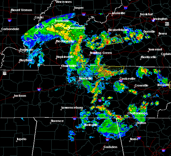 The severe thunderstorm warning for northwestern smith, south central macon, northeastern wilson and central trousdale counties will expire at 300 pm cdt, the storm which prompted the warning has moved out of the area. therefore the warning will be allowed to expire. The severe thunderstorm warning for northwestern smith, south central macon, northeastern wilson and central trousdale counties will expire at 300 pm cdt, the storm which prompted the warning has moved out of the area. therefore the warning will be allowed to expire.
|
| 5/12/2016 2:51 PM CDT |
 At 250 pm cdt, a severe thunderstorm was located over lafayette, moving northeast at 35 mph (radar indicated). Hazards include 60 mph wind gusts and penny size hail. Expect damage to roofs. siding. and trees. Locations impacted include, lafayette. At 250 pm cdt, a severe thunderstorm was located over lafayette, moving northeast at 35 mph (radar indicated). Hazards include 60 mph wind gusts and penny size hail. Expect damage to roofs. siding. and trees. Locations impacted include, lafayette.
|
| 5/12/2016 2:49 PM CDT |
 At 249 pm cdt, a severe thunderstorm was located near lafayette, moving northeast at 50 mph (radar indicated). Hazards include 60 mph wind gusts and penny size hail. Expect damage to roofs. siding. And trees. At 249 pm cdt, a severe thunderstorm was located near lafayette, moving northeast at 50 mph (radar indicated). Hazards include 60 mph wind gusts and penny size hail. Expect damage to roofs. siding. And trees.
|
| 5/12/2016 2:47 PM CDT | Tree down along union camp road in macon county TN, 6.2 miles WNW of Lafayette, TN |
| 5/12/2016 2:43 PM CDT |
 At 243 pm cdt, a severe thunderstorm was located near lafayette, moving northeast at 45 mph (radar indicated). Hazards include 70 mph wind gusts and penny size hail. Expect considerable tree damage. damage is likely to mobile homes, roofs, and outbuildings. Locations impacted include, lafayette and hartsville. At 243 pm cdt, a severe thunderstorm was located near lafayette, moving northeast at 45 mph (radar indicated). Hazards include 70 mph wind gusts and penny size hail. Expect considerable tree damage. damage is likely to mobile homes, roofs, and outbuildings. Locations impacted include, lafayette and hartsville.
|
| 5/12/2016 2:34 PM CDT | Several trees down...some down on homes in trousdale county TN, 9.7 miles NE of Lafayette, TN |
| 5/12/2016 2:29 PM CDT |
 At 229 pm cdt, a severe thunderstorm was located near hartsville, moving northeast at 35 mph (radar indicated). Hazards include 60 mph wind gusts. Expect damage to roofs. siding. And trees. At 229 pm cdt, a severe thunderstorm was located near hartsville, moving northeast at 35 mph (radar indicated). Hazards include 60 mph wind gusts. Expect damage to roofs. siding. And trees.
|
| 5/12/2016 2:26 PM CDT |
 At 225 pm cdt, a severe thunderstorm was located near hartsville, moving northeast at 35 mph (radar indicated). Hazards include 60 mph wind gusts and penny size hail. Expect damage to roofs. siding. And trees. At 225 pm cdt, a severe thunderstorm was located near hartsville, moving northeast at 35 mph (radar indicated). Hazards include 60 mph wind gusts and penny size hail. Expect damage to roofs. siding. And trees.
|
| 5/10/2016 11:04 PM CDT |
 At 1104 pm cdt, a severe thunderstorm was located near hartsville, moving east at 20 mph. this is a very dangerous storm (radar indicated). Hazards include softball size hail. People and animals outdoors will be severely injured. expect shattered windows, extensive damage to roofs, siding, and vehicles. Locations impacted include, lafayette, hartsville and westmoreland. At 1104 pm cdt, a severe thunderstorm was located near hartsville, moving east at 20 mph. this is a very dangerous storm (radar indicated). Hazards include softball size hail. People and animals outdoors will be severely injured. expect shattered windows, extensive damage to roofs, siding, and vehicles. Locations impacted include, lafayette, hartsville and westmoreland.
|
| 5/10/2016 10:40 PM CDT |
 At 1040 pm cdt, a severe thunderstorm was located 7 miles northeast of gallatin, moving east at 20 mph. this is a very dangerous storm (radar indicated). Hazards include softball size hail. People and animals outdoors will be severely injured. Expect shattered windows, extensive damage to roofs, siding, and vehicles. At 1040 pm cdt, a severe thunderstorm was located 7 miles northeast of gallatin, moving east at 20 mph. this is a very dangerous storm (radar indicated). Hazards include softball size hail. People and animals outdoors will be severely injured. Expect shattered windows, extensive damage to roofs, siding, and vehicles.
|
| 4/6/2016 6:04 PM CDT | Tree down on defeated creek r in macon county TN, 9.6 miles NW of Lafayette, TN |
| 4/6/2016 5:53 PM CDT |
 At 552 pm cdt, severe thunderstorms were located along a line extending from 6 miles east of westmoreland to near hartsville, moving northeast at 55 mph (radar indicated. this storm does have a history of producing wind damage, including large trees fallen and power outages). Hazards include 60 mph wind gusts. Expect damage to roofs. siding. and trees. Locations impacted include, lafayette, hartsville, red boiling springs, dickerson chapel recreation area, dixon springs and pleasant shade. At 552 pm cdt, severe thunderstorms were located along a line extending from 6 miles east of westmoreland to near hartsville, moving northeast at 55 mph (radar indicated. this storm does have a history of producing wind damage, including large trees fallen and power outages). Hazards include 60 mph wind gusts. Expect damage to roofs. siding. and trees. Locations impacted include, lafayette, hartsville, red boiling springs, dickerson chapel recreation area, dixon springs and pleasant shade.
|
| 4/6/2016 5:37 PM CDT |
 At 535 pm cdt, severe thunderstorms were located along a line extending from 8 miles southwest of westmoreland to near lebanon, moving northeast at 55 mph (radar indicated. this storm does have a history of producing wind damage, including large trees). Hazards include 60 mph wind gusts. Expect damage to roofs. siding. And trees. At 535 pm cdt, severe thunderstorms were located along a line extending from 8 miles southwest of westmoreland to near lebanon, moving northeast at 55 mph (radar indicated. this storm does have a history of producing wind damage, including large trees). Hazards include 60 mph wind gusts. Expect damage to roofs. siding. And trees.
|
| 2/3/2016 12:10 AM CST |
 At 1208 am cst, a severe thunderstorm was located near lafayette, moving northeast at 45 mph (radar indicated). Hazards include 60 mph wind gusts. Expect damage to roofs. Siding and trees. At 1208 am cst, a severe thunderstorm was located near lafayette, moving northeast at 45 mph (radar indicated). Hazards include 60 mph wind gusts. Expect damage to roofs. Siding and trees.
|
| 7/14/2015 11:23 PM CDT |
 The severe thunderstorm warning for northern smith, sumner, trousdale and southern macon counties will expire at 1130 pm cdt, the storms which prompted the warning have weakened below severe limits, and no longer pose an immediate threat to life or property. therefore the warning will be allowed to expire. however gusty winds are still possible with these thunderstorms. The severe thunderstorm warning for northern smith, sumner, trousdale and southern macon counties will expire at 1130 pm cdt, the storms which prompted the warning have weakened below severe limits, and no longer pose an immediate threat to life or property. therefore the warning will be allowed to expire. however gusty winds are still possible with these thunderstorms.
|
| 7/14/2015 11:16 PM CDT |
 At 1115 pm cdt, severe thunderstorms were located along a line extending from gallatin to 7 miles north of carthage, moving southeast at 40 mph (radar indicated). Hazards include 60 mph wind gusts and penny size hail. Expect damage to roofs. siding and trees. These severe thunderstorms will remain over mainly rural areas of northern smith, sumner, trousdale and southern macon counties, including the following locations, castalian springs, mitchellville, bledsoe creek state park, dixon springs, pleasant shade, cottontown, bethpage and oak grove. At 1115 pm cdt, severe thunderstorms were located along a line extending from gallatin to 7 miles north of carthage, moving southeast at 40 mph (radar indicated). Hazards include 60 mph wind gusts and penny size hail. Expect damage to roofs. siding and trees. These severe thunderstorms will remain over mainly rural areas of northern smith, sumner, trousdale and southern macon counties, including the following locations, castalian springs, mitchellville, bledsoe creek state park, dixon springs, pleasant shade, cottontown, bethpage and oak grove.
|
| 7/14/2015 11:03 PM CDT |
 At 1102 pm cdt, severe thunderstorms were located along a line extending from near portland to near westmoreland to 8 miles south of red boiling springs, moving southeast at 35 mph (radar indicated). Hazards include 60 mph wind gusts and penny size hail. Expect damage to roofs. siding and trees. these severe storms will be near, castalian springs around 1115 pm cdt. hartsville around 1115 pm cdt. Other locations impacted by these severe thunderstorms include mitchellville, bledsoe creek state park, dixon springs, pleasant shade, cottontown, bethpage and oak grove. At 1102 pm cdt, severe thunderstorms were located along a line extending from near portland to near westmoreland to 8 miles south of red boiling springs, moving southeast at 35 mph (radar indicated). Hazards include 60 mph wind gusts and penny size hail. Expect damage to roofs. siding and trees. these severe storms will be near, castalian springs around 1115 pm cdt. hartsville around 1115 pm cdt. Other locations impacted by these severe thunderstorms include mitchellville, bledsoe creek state park, dixon springs, pleasant shade, cottontown, bethpage and oak grove.
|
| 7/14/2015 10:46 PM CDT |
 At 1044 pm cdt, severe thunderstorms were located along a line extending from 7 miles northwest of portland to 7 miles southeast of scottsville, moving southeast at 45 mph (radar indicated. at 1038 pm cdt...trees were blown down in scottsville kentucky with these storms). Hazards include 60 mph wind gusts and nickel size hail. Expect damage to roofs. siding and trees. severe thunderstorms will be near, lafayette around 1045 pm cdt. gallatin, red boiling springs around 1110 pm cdt. hartsville around 1125 pm cdt. Other locations impacted by these severe thunderstorms include mitchellville, bledsoe creek state park, dixon springs, pleasant shade, cottontown, bethpage and oak grove. At 1044 pm cdt, severe thunderstorms were located along a line extending from 7 miles northwest of portland to 7 miles southeast of scottsville, moving southeast at 45 mph (radar indicated. at 1038 pm cdt...trees were blown down in scottsville kentucky with these storms). Hazards include 60 mph wind gusts and nickel size hail. Expect damage to roofs. siding and trees. severe thunderstorms will be near, lafayette around 1045 pm cdt. gallatin, red boiling springs around 1110 pm cdt. hartsville around 1125 pm cdt. Other locations impacted by these severe thunderstorms include mitchellville, bledsoe creek state park, dixon springs, pleasant shade, cottontown, bethpage and oak grove.
|
| 6/19/2015 6:59 PM CDT |
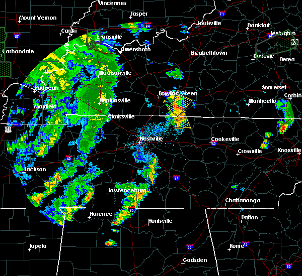 At 658 pm cdt, a severe thunderstorm was located over lafayette, moving northeast at 30 mph (radar indicated). Hazards include 60 mph wind gusts. Expect damage to roofs. siding and trees. This severe thunderstorm will remain over mainly rural areas of central macon and east central trousdale counties. At 658 pm cdt, a severe thunderstorm was located over lafayette, moving northeast at 30 mph (radar indicated). Hazards include 60 mph wind gusts. Expect damage to roofs. siding and trees. This severe thunderstorm will remain over mainly rural areas of central macon and east central trousdale counties.
|
| 6/19/2015 6:51 PM CDT | Trees down across southwestern portions of county in macon county TN, 5.1 miles NE of Lafayette, TN |
| 6/19/2015 6:42 PM CDT |
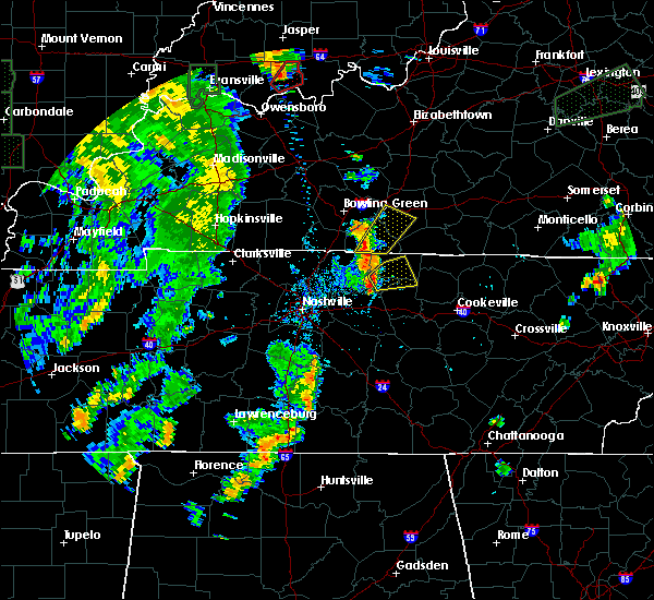 At 642 pm cdt, a severe thunderstorm was located over hartsville, moving northeast at 35 mph (radar indicated). Hazards include 60 mph wind gusts. Expect damage to roofs. siding and trees. this severe thunderstorm will be near, lafayette around 700 pm cdt. Other locations impacted by this severe thunderstorm include pleasant shade and dixon springs. At 642 pm cdt, a severe thunderstorm was located over hartsville, moving northeast at 35 mph (radar indicated). Hazards include 60 mph wind gusts. Expect damage to roofs. siding and trees. this severe thunderstorm will be near, lafayette around 700 pm cdt. Other locations impacted by this severe thunderstorm include pleasant shade and dixon springs.
|
| 6/8/2015 1:41 PM CDT |
 The severe thunderstorm warning for northwestern macon and northeastern sumner counties will expire at 145 pm cdt, the storm which prompted the warning has weakened below severe limits, and no longer poses an immediate threat to life or property. The severe thunderstorm warning for northwestern macon and northeastern sumner counties will expire at 145 pm cdt, the storm which prompted the warning has weakened below severe limits, and no longer poses an immediate threat to life or property.
|
| 6/8/2015 1:23 PM CDT |
 At 120 pm cdt, a severe thunderstorm was located 8 miles east of portland, and moving east at 35 mph (radar indicated). Hazards include 60 mph wind gusts and half dollar size hail. Hail damage to vehicles is expected. expect wind damage to roofs, siding and trees. The severe thunderstorm will be near, westmoreland around 130 pm cdt. At 120 pm cdt, a severe thunderstorm was located 8 miles east of portland, and moving east at 35 mph (radar indicated). Hazards include 60 mph wind gusts and half dollar size hail. Hail damage to vehicles is expected. expect wind damage to roofs, siding and trees. The severe thunderstorm will be near, westmoreland around 130 pm cdt.
|
| 6/8/2015 1:13 PM CDT |
 At 112 pm cdt, a severe thunderstorm was located 5 miles northeast of portland, and moving east at 35 mph (radar indicated). Hazards include 60 mph wind gusts and quarter size hail. Hail damage to vehicles is expected. expect wind damage to roofs, siding and trees. The severe thunderstorm will be near, westmoreland around 130 pm cdt. At 112 pm cdt, a severe thunderstorm was located 5 miles northeast of portland, and moving east at 35 mph (radar indicated). Hazards include 60 mph wind gusts and quarter size hail. Hail damage to vehicles is expected. expect wind damage to roofs, siding and trees. The severe thunderstorm will be near, westmoreland around 130 pm cdt.
|
| 5/26/2015 3:15 PM CDT | At 310 pm cdt, a severe thunderstorm was located 8 miles east of gallatin, and moving northeast at 50 mph (radar indicated). Hazards include 60 mph wind gusts. Expect damage to roofs. siding and trees. The severe thunderstorm will be near, westmoreland around 325 pm cdt. |
| 4/20/2015 1:52 AM CDT | The severe thunderstorm warning for southwestern macon, northern wilson, trousdale, southeastern sumner and west central smith counties will expire at 200 am cdt, the storm which prompted the warning has weakened below severe limits, and no longer poses an immediate threat to life or property. however, gusty winds up to 50 mph are still possible with this thunderstorm. |
| 4/20/2015 1:43 AM CDT | At 140 am cdt, a severe thunderstorm was located 7 miles southwest of hartsville, and moving east at 45 mph (radar indicated). Hazards include 60 mph wind gusts. Expect damage to roofs. siding and trees. the severe thunderstorm will be near, hartsville around 150 am cdt. other locations in the warning include dixon springs. 75in. |
| 4/20/2015 1:29 AM CDT | At 127 am cdt, a severe thunderstorm was located near gallatin, and moving east at 45 mph (radar indicated). Hazards include 60 mph wind gusts. Expect damage to roofs. siding and trees. the severe thunderstorm will be near, hartsville around 150 am cdt. other locations in the warning include bledsoe creek state park, castalian springs, dickerson chapel recreation area and dixon springs. 75in. |
| 4/10/2015 3:15 AM CDT | A severe thunderstorm warning remains in effect for eastern macon and northwestern clay counties until 330 am cdt. at 312 am cdt. severe thunderstorms were located along a line extending from 7 miles southwest of tompkinsville to 5 miles southeast of lafayette. and moving northeast at 45 mph. hazard. 70 mph wind gusts. |
| 4/10/2015 3:02 AM CDT | The national weather service in nashville has issued a * severe thunderstorm warning for. northwestern clay county in middle tennessee. macon county in middle tennessee. until 330 am cdt * at 258 am cdt. Severe thunderstorms were located along a line. |
| 2/20/2014 8:42 PM CST | Trees were reported down across the count in macon county TN, 0.3 miles NE of Lafayette, TN |
| 11/17/2013 7:15 PM CST | Tree down on halltown road in hartsville in trousdale county TN, 9.7 miles NE of Lafayette, TN |
| 1/30/2013 4:05 AM CST | A lot of trees downed across the count in macon county TN, 0.3 miles NE of Lafayette, TN |
| 1/30/2013 3:51 AM CST | Trees down and roof damage reported in dixon springs in smith county TN, 9.2 miles N of Lafayette, TN |
| 10/18/2012 1:40 AM CDT | A tree and several large tree limbs were blown down at 911 trent road in lafayett in macon county TN, 0.3 miles NE of Lafayette, TN |
| 9/5/2012 5:43 PM CDT | Tree fell on moving ca in macon county TN, 0.3 miles NE of Lafayette, TN |
| 7/19/2012 9:40 PM CDT | Tree blown down in lafayette in macon county TN, 0.3 miles NE of Lafayette, TN |
| 7/8/2012 7:00 PM CDT | Trees downed across the count in macon county TN, 0.3 miles NE of Lafayette, TN |
| 4/26/2012 5:30 AM CDT | Ping Pong Ball sized hail reported 3.9 miles S of Lafayette, TN, trained spotter reported ping pong sized hail 4 m north of lafayette near spring creek rd. |
| 3/14/2012 7:43 PM CDT | Quarter sized hail reported 0.3 miles NE of Lafayette, TN |
| 1/1/0001 12:00 AM | Area of metal roofing partially peeled back on a home on williams roa in macon county TN, 3.2 miles S of Lafayette, TN |
| 1/1/0001 12:00 AM | Area of metal roofing partially peeled back on a home on williams roa in macon county TN, 3.2 miles S of Lafayette, TN |
| 1/1/0001 12:00 AM | Tree down 4 miles north of lafayett in macon county TN, 3.9 miles S of Lafayette, TN |
| 1/1/0001 12:00 AM | Quarter sized hail reported 0.3 miles NE of Lafayette, TN, dime to quarter sized hail |
| 1/1/0001 12:00 AM | Quarter sized hail reported 8.6 miles NW of Lafayette, TN, quarter size hail in pleasent shade. |
| 1/1/0001 12:00 AM | Numerous trees down across western macon county. possible tornado 6 miles nnw of lafayette at the scotsville and shiloh road intersectio in macon county TN, 5.8 miles SSE of Lafayette, TN |
| 1/1/0001 12:00 AM | Trees down county-wide in macon county TN, 0.3 miles NE of Lafayette, TN |
| 1/1/0001 12:00 AM | Trees dow in macon county TN, 3.2 miles S of Lafayette, TN |
Hail Maps for Lafayette, TN


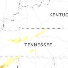


Connect with Interactive Hail Maps