

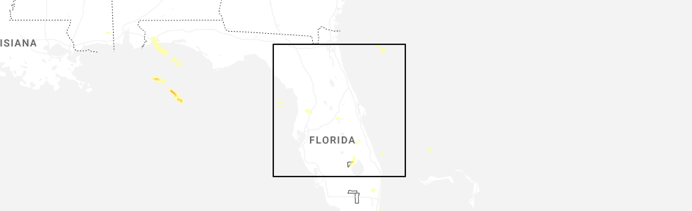
Hail Map for Lake Buena Vista, FL
The Lake Buena Vista, FL area has had 0 reports of on-the-ground hail by trained spotters, and has been under severe weather warnings 7 times during the past 12 months. Doppler radar has detected hail at or near Lake Buena Vista, FL on 64 occasions, including 3 occasions during the past year.
| Name: | Lake Buena Vista, FL |
| Where Located: | 14.2 miles SW of Orlando, FL |
| Map: | Google Map for Lake Buena Vista, FL |
| Population: | 10 |
| Housing Units: | 5 |
| More Info: | Search Google for Lake Buena Vista, FL |
0
The Top Recent Hail Date for Lake Buena Vista, FL is Sunday, March 30, 2025 (51st out of 64)
Hail and Wind Damage Spotted near Lake Buena Vista, FL
| Date / Time | Report Details |
|---|---|
| 1/19/2025 12:42 PM EST |
 Svrmlb the national weather service in melbourne has issued a * severe thunderstorm warning for, southeastern seminole county in east central florida, west central brevard county in east central florida, southern orange county in east central florida, northern osceola county in east central florida, * until 130 pm est. * at 1242 pm est, a severe thunderstorm was located over campbell, or near west lake toho, moving northeast at 55 mph (radar indicated). Hazards include 60 mph wind gusts. expect damage to roofs, siding, and trees Svrmlb the national weather service in melbourne has issued a * severe thunderstorm warning for, southeastern seminole county in east central florida, west central brevard county in east central florida, southern orange county in east central florida, northern osceola county in east central florida, * until 130 pm est. * at 1242 pm est, a severe thunderstorm was located over campbell, or near west lake toho, moving northeast at 55 mph (radar indicated). Hazards include 60 mph wind gusts. expect damage to roofs, siding, and trees
|
| 1/19/2025 12:01 PM EST |
 Svrmlb the national weather service in melbourne has issued a * severe thunderstorm warning for, southwestern lake county in east central florida, southwestern orange county in east central florida, northern osceola county in east central florida, * until 1245 pm est. * at 1201 pm est, a severe thunderstorm was located 7 miles north of auburndale, moving northeast at 45 mph (radar indicated). Hazards include 60 mph wind gusts and penny size hail. expect damage to roofs, siding, and trees Svrmlb the national weather service in melbourne has issued a * severe thunderstorm warning for, southwestern lake county in east central florida, southwestern orange county in east central florida, northern osceola county in east central florida, * until 1245 pm est. * at 1201 pm est, a severe thunderstorm was located 7 miles north of auburndale, moving northeast at 45 mph (radar indicated). Hazards include 60 mph wind gusts and penny size hail. expect damage to roofs, siding, and trees
|
| 8/5/2024 9:08 AM EDT |
 The storm which prompted the warning has weakened below severe limits, and no longer appears capable of producing a tornado. therefore, the warning will be allowed to expire. a tornado watch remains in effect until 400 pm edt for east central florida. The storm which prompted the warning has weakened below severe limits, and no longer appears capable of producing a tornado. therefore, the warning will be allowed to expire. a tornado watch remains in effect until 400 pm edt for east central florida.
|
| 8/5/2024 8:55 AM EDT |
 Tormlb the national weather service in melbourne has issued a * tornado warning for, southwestern orange county in east central florida, * until 915 am edt. * at 855 am edt, a severe thunderstorm capable of producing a tornado was located over bay lake, moving north at 35 mph (radar indicated rotation). Hazards include tornado. Flying debris will be dangerous to those caught without shelter. mobile homes will be damaged or destroyed. damage to roofs, windows, and vehicles will occur. tree damage is likely. this dangerous storm will be near, orlando, ocoee, and winter garden around 900 am edt. pine hills and orlovista around 910 am edt. Other locations impacted by this tornadic thunderstorm include lake butler. Tormlb the national weather service in melbourne has issued a * tornado warning for, southwestern orange county in east central florida, * until 915 am edt. * at 855 am edt, a severe thunderstorm capable of producing a tornado was located over bay lake, moving north at 35 mph (radar indicated rotation). Hazards include tornado. Flying debris will be dangerous to those caught without shelter. mobile homes will be damaged or destroyed. damage to roofs, windows, and vehicles will occur. tree damage is likely. this dangerous storm will be near, orlando, ocoee, and winter garden around 900 am edt. pine hills and orlovista around 910 am edt. Other locations impacted by this tornadic thunderstorm include lake butler.
|
| 7/14/2024 5:54 PM EDT |
 The storm which prompted the warning has weakened below severe limits, and no longer poses an immediate threat to life or property. therefore, the warning will be allowed to expire. however gusty winds are still possible with this thunderstorm. The storm which prompted the warning has weakened below severe limits, and no longer poses an immediate threat to life or property. therefore, the warning will be allowed to expire. however gusty winds are still possible with this thunderstorm.
|
| 7/14/2024 5:47 PM EDT |
 At 547 pm edt, a severe thunderstorm was located over universal studios, or near windermere, moving northwest at 10 mph (radar indicated). Hazards include 60 mph wind gusts and penny size hail. Expect damage to roofs, siding, and trees. Locations impacted include, orlando, windermere, bay lake, and bay hill. At 547 pm edt, a severe thunderstorm was located over universal studios, or near windermere, moving northwest at 10 mph (radar indicated). Hazards include 60 mph wind gusts and penny size hail. Expect damage to roofs, siding, and trees. Locations impacted include, orlando, windermere, bay lake, and bay hill.
|
| 7/14/2024 5:27 PM EDT |
 Svrmlb the national weather service in melbourne has issued a * severe thunderstorm warning for, southwestern orange county in east central florida, * until 600 pm edt. * at 527 pm edt, a severe thunderstorm was located over wet n wild water park, or over oak ridge, moving northwest at 10 mph (radar indicated). Hazards include 60 mph wind gusts and penny size hail. expect damage to roofs, siding, and trees Svrmlb the national weather service in melbourne has issued a * severe thunderstorm warning for, southwestern orange county in east central florida, * until 600 pm edt. * at 527 pm edt, a severe thunderstorm was located over wet n wild water park, or over oak ridge, moving northwest at 10 mph (radar indicated). Hazards include 60 mph wind gusts and penny size hail. expect damage to roofs, siding, and trees
|
| 5/14/2024 12:36 PM EDT |
 At 1236 pm edt, severe thunderstorms were located along a line extending from lake mary to windermere to near bay lake to 6 miles north of auburndale, moving east at 35 mph (radar indicated). Hazards include 60 mph wind gusts and penny size hail. Expect damage to roofs, siding, and trees. Locations impacted include, orlando, sanford, apopka, altamonte springs, and ocoee. At 1236 pm edt, severe thunderstorms were located along a line extending from lake mary to windermere to near bay lake to 6 miles north of auburndale, moving east at 35 mph (radar indicated). Hazards include 60 mph wind gusts and penny size hail. Expect damage to roofs, siding, and trees. Locations impacted include, orlando, sanford, apopka, altamonte springs, and ocoee.
|
| 5/14/2024 12:12 PM EDT |
 Svrmlb the national weather service in melbourne has issued a * severe thunderstorm warning for, southwestern seminole county in east central florida, southwestern lake county in east central florida, western orange county in east central florida, northwestern osceola county in east central florida, * until 1245 pm edt. * at 1211 pm edt, severe thunderstorms were located along a line extending from near zellwood to near groveland to 12 miles southwest of lake louisa to 8 miles southeast of zephyrhills south, moving east at 35 mph (radar indicated). Hazards include 60 mph wind gusts and penny size hail. expect damage to roofs, siding, and trees Svrmlb the national weather service in melbourne has issued a * severe thunderstorm warning for, southwestern seminole county in east central florida, southwestern lake county in east central florida, western orange county in east central florida, northwestern osceola county in east central florida, * until 1245 pm edt. * at 1211 pm edt, severe thunderstorms were located along a line extending from near zellwood to near groveland to 12 miles southwest of lake louisa to 8 miles southeast of zephyrhills south, moving east at 35 mph (radar indicated). Hazards include 60 mph wind gusts and penny size hail. expect damage to roofs, siding, and trees
|
| 5/11/2024 2:32 AM EDT |
 At 231 am edt, a severe thunderstorm was located over orlando international airport, moving southeast at 40 mph (radar indicated). Hazards include 60 mph wind gusts. Expect damage to roofs, siding, and trees. Locations impacted include, orlando, kissimmee, saint cloud, winter park, and casselberry. At 231 am edt, a severe thunderstorm was located over orlando international airport, moving southeast at 40 mph (radar indicated). Hazards include 60 mph wind gusts. Expect damage to roofs, siding, and trees. Locations impacted include, orlando, kissimmee, saint cloud, winter park, and casselberry.
|
| 5/11/2024 2:20 AM EDT |
 At 219 am edt, a severe thunderstorm was located near oak ridge, moving southeast at 35 mph (radar indicated. orlando executive airport reported a wind gust to 56 mph). Hazards include 60 mph wind gusts. Expect damage to roofs, siding, and trees. Locations impacted include, orlando, kissimmee, altamonte springs, ocoee, and winter garden. At 219 am edt, a severe thunderstorm was located near oak ridge, moving southeast at 35 mph (radar indicated. orlando executive airport reported a wind gust to 56 mph). Hazards include 60 mph wind gusts. Expect damage to roofs, siding, and trees. Locations impacted include, orlando, kissimmee, altamonte springs, ocoee, and winter garden.
|
| 5/11/2024 2:08 AM EDT |
 Svrmlb the national weather service in melbourne has issued a * severe thunderstorm warning for, southwestern seminole county in east central florida, orange county in east central florida, north central osceola county in east central florida, * until 245 am edt. * at 207 am edt, a severe thunderstorm was located over orlovista, or over pine hills, moving southeast at 40 mph (radar indicated). Hazards include 60 mph wind gusts. expect damage to roofs, siding, and trees Svrmlb the national weather service in melbourne has issued a * severe thunderstorm warning for, southwestern seminole county in east central florida, orange county in east central florida, north central osceola county in east central florida, * until 245 am edt. * at 207 am edt, a severe thunderstorm was located over orlovista, or over pine hills, moving southeast at 40 mph (radar indicated). Hazards include 60 mph wind gusts. expect damage to roofs, siding, and trees
|
| 1/9/2024 5:55 PM EST |
 The national weather service in melbourne has issued a * severe thunderstorm warning for. seminole county in east central florida. orange county in east central florida. central volusia county in east central florida. northwestern osceola county in east central florida. Until 645 pm est. The national weather service in melbourne has issued a * severe thunderstorm warning for. seminole county in east central florida. orange county in east central florida. central volusia county in east central florida. northwestern osceola county in east central florida. Until 645 pm est.
|
| 1/9/2024 5:53 PM EST |
 A tornado warning remains in effect until 615 pm est for south central orange county. at 552 pm est, a severe thunderstorm capable of producing a tornado was located near oak ridge, moving east at 40 mph. hazard. tornado. source. Radar indicated rotation. A tornado warning remains in effect until 615 pm est for south central orange county. at 552 pm est, a severe thunderstorm capable of producing a tornado was located near oak ridge, moving east at 40 mph. hazard. tornado. source. Radar indicated rotation.
|
| 1/9/2024 5:48 PM EST |
 At 547 pm est, a severe thunderstorm capable of producing a tornado was located over sea world, or near oak ridge, moving east at 40 mph (radar indicated rotation). Hazards include tornado. Flying debris will be dangerous to those caught without shelter. mobile homes will be damaged or destroyed. damage to roofs, windows, and vehicles will occur. tree damage is likely. this dangerous storm will be near, orlando, orlando international airport, and conway around 550 pm est. azalea park, lake hart, and lake nona around 600 pm est. Other locations impacted by this tornadic thunderstorm include meadow woods. At 547 pm est, a severe thunderstorm capable of producing a tornado was located over sea world, or near oak ridge, moving east at 40 mph (radar indicated rotation). Hazards include tornado. Flying debris will be dangerous to those caught without shelter. mobile homes will be damaged or destroyed. damage to roofs, windows, and vehicles will occur. tree damage is likely. this dangerous storm will be near, orlando, orlando international airport, and conway around 550 pm est. azalea park, lake hart, and lake nona around 600 pm est. Other locations impacted by this tornadic thunderstorm include meadow woods.
|
| 1/9/2024 5:44 PM EST |
 At 543 pm est, severe thunderstorms were located along a line extending from near flagler beach to orange city to ocoee, moving northeast at 70 mph (radar indicated). Hazards include 60 mph wind gusts. Expect damage to roofs, siding, and trees. Locations impacted include, orlando, deltona, daytona beach, kissimmee, and port orange. At 543 pm est, severe thunderstorms were located along a line extending from near flagler beach to orange city to ocoee, moving northeast at 70 mph (radar indicated). Hazards include 60 mph wind gusts. Expect damage to roofs, siding, and trees. Locations impacted include, orlando, deltona, daytona beach, kissimmee, and port orange.
|
| 1/9/2024 5:21 PM EST |
 The national weather service in melbourne has issued a * severe thunderstorm warning for. seminole county in east central florida. central lake county in east central florida. orange county in east central florida. Volusia county in east central florida. The national weather service in melbourne has issued a * severe thunderstorm warning for. seminole county in east central florida. central lake county in east central florida. orange county in east central florida. Volusia county in east central florida.
|
| 1/9/2024 5:07 PM EST |
 At 506 pm est, severe thunderstorms were located along a line extending from near pierson to mid florida lakes to 12 miles southwest of lake louisa, moving northeast at 70 mph (radar indicated). Hazards include 60 mph wind gusts. Expect damage to roofs, siding, and trees. Locations impacted include, apopka, ocoee, winter garden, leesburg, and eustis. At 506 pm est, severe thunderstorms were located along a line extending from near pierson to mid florida lakes to 12 miles southwest of lake louisa, moving northeast at 70 mph (radar indicated). Hazards include 60 mph wind gusts. Expect damage to roofs, siding, and trees. Locations impacted include, apopka, ocoee, winter garden, leesburg, and eustis.
|
| 1/9/2024 4:46 PM EST |
 At 446 pm est, severe thunderstorms were located along a line extending from lake george to near leesburg to 6 miles east of dade city, moving northeast at 65 mph (radar indicated). Hazards include 60 mph wind gusts. expect damage to roofs, siding, and trees At 446 pm est, severe thunderstorms were located along a line extending from lake george to near leesburg to 6 miles east of dade city, moving northeast at 65 mph (radar indicated). Hazards include 60 mph wind gusts. expect damage to roofs, siding, and trees
|
| 7/5/2023 3:11 PM EDT |
 At 310 pm edt, a severe thunderstorm was located over hunters creek, or near kissimmee, moving north at 5 mph (radar indicated). Hazards include 60 mph wind gusts and penny size hail. Expect damage to roofs, siding, and trees. locations impacted include, orlando, kissimmee, winter park, windermere and bay lake. hail threat, radar indicated max hail size, 0. 75 in wind threat, radar indicated max wind gust, 60 mph. At 310 pm edt, a severe thunderstorm was located over hunters creek, or near kissimmee, moving north at 5 mph (radar indicated). Hazards include 60 mph wind gusts and penny size hail. Expect damage to roofs, siding, and trees. locations impacted include, orlando, kissimmee, winter park, windermere and bay lake. hail threat, radar indicated max hail size, 0. 75 in wind threat, radar indicated max wind gust, 60 mph.
|
| 7/5/2023 3:01 PM EDT |
 At 301 pm edt, a severe thunderstorm was located over sea world, or near oak ridge, moving north at 15 mph (radar indicated). Hazards include 60 mph wind gusts and penny size hail. expect damage to roofs, siding, and trees At 301 pm edt, a severe thunderstorm was located over sea world, or near oak ridge, moving north at 15 mph (radar indicated). Hazards include 60 mph wind gusts and penny size hail. expect damage to roofs, siding, and trees
|
| 7/5/2023 2:58 PM EDT |
 The severe thunderstorm warning for south central orange and north central osceola counties will expire at 300 pm edt, the storm which prompted the warning has weakened to just below severe limits. therefore, the warning will be allowed to expire. however gusty winds are still possible with this thunderstorm, and it will be monitored for potential restrengthening. The severe thunderstorm warning for south central orange and north central osceola counties will expire at 300 pm edt, the storm which prompted the warning has weakened to just below severe limits. therefore, the warning will be allowed to expire. however gusty winds are still possible with this thunderstorm, and it will be monitored for potential restrengthening.
|
| 7/5/2023 2:50 PM EDT |
 At 250 pm edt, a severe thunderstorm was located over kissimmee, moving northeast at 10 mph (radar indicated). Hazards include 60 mph wind gusts. Expect damage to roofs, siding, and trees. locations impacted include, kissimmee, buena ventura lakes, east lake toho, yeehaw junction and hunters creek. hail threat, radar indicated max hail size, <. 75 in wind threat, radar indicated max wind gust, 60 mph. At 250 pm edt, a severe thunderstorm was located over kissimmee, moving northeast at 10 mph (radar indicated). Hazards include 60 mph wind gusts. Expect damage to roofs, siding, and trees. locations impacted include, kissimmee, buena ventura lakes, east lake toho, yeehaw junction and hunters creek. hail threat, radar indicated max hail size, <. 75 in wind threat, radar indicated max wind gust, 60 mph.
|
| 7/5/2023 2:37 PM EDT |
 At 237 pm edt, a severe thunderstorm was located over campbell, or over intercession city, and is nearly stationary (radar indicated). Hazards include 60 mph wind gusts. expect damage to roofs, siding, and trees At 237 pm edt, a severe thunderstorm was located over campbell, or over intercession city, and is nearly stationary (radar indicated). Hazards include 60 mph wind gusts. expect damage to roofs, siding, and trees
|
| 6/20/2023 2:52 PM EDT |
 At 251 pm edt, a severe thunderstorm was located over sea world, or over oak ridge, moving east at 35 mph (radar indicated). Hazards include 60 mph wind gusts. expect damage to roofs, siding, and trees At 251 pm edt, a severe thunderstorm was located over sea world, or over oak ridge, moving east at 35 mph (radar indicated). Hazards include 60 mph wind gusts. expect damage to roofs, siding, and trees
|
| 4/25/2023 5:40 PM EDT |
 The severe thunderstorm warning for southern lake, southwestern orange and portions of northwestern osceola counties will expire at 545 pm edt, the storm which prompted the warning has moved out of the area. therefore, the warning will be allowed to expire. however gusty winds and heavy rain are still possible with this thunderstorm. remember, a severe thunderstorm warning still remains in effect for northwest osceola county until 615 pm. The severe thunderstorm warning for southern lake, southwestern orange and portions of northwestern osceola counties will expire at 545 pm edt, the storm which prompted the warning has moved out of the area. therefore, the warning will be allowed to expire. however gusty winds and heavy rain are still possible with this thunderstorm. remember, a severe thunderstorm warning still remains in effect for northwest osceola county until 615 pm.
|
| 4/25/2023 5:15 PM EDT |
 At 514 pm edt, a severe thunderstorm was located near four corners, or near bay lake, moving southeast at 25 mph (radar indicated). Hazards include golf ball size hail and 60 mph wind gusts. People and animals outdoors will be injured. expect hail damage to roofs, siding, windows, and vehicles. expect wind damage to roofs, siding, and trees. Locations impacted include, kissimmee, lake buena vista, celebration, intercession city and four corners. At 514 pm edt, a severe thunderstorm was located near four corners, or near bay lake, moving southeast at 25 mph (radar indicated). Hazards include golf ball size hail and 60 mph wind gusts. People and animals outdoors will be injured. expect hail damage to roofs, siding, windows, and vehicles. expect wind damage to roofs, siding, and trees. Locations impacted include, kissimmee, lake buena vista, celebration, intercession city and four corners.
|
| 4/25/2023 5:03 PM EDT |
 At 503 pm edt, a severe thunderstorm was located near lake louisa, or 7 miles west of bay lake, moving southeast at 25 mph (radar indicated). Hazards include golf ball size hail and 60 mph wind gusts. People and animals outdoors will be injured. expect hail damage to roofs, siding, windows, and vehicles. Expect wind damage to roofs, siding, and trees. At 503 pm edt, a severe thunderstorm was located near lake louisa, or 7 miles west of bay lake, moving southeast at 25 mph (radar indicated). Hazards include golf ball size hail and 60 mph wind gusts. People and animals outdoors will be injured. expect hail damage to roofs, siding, windows, and vehicles. Expect wind damage to roofs, siding, and trees.
|
| 9/12/2022 5:56 PM EDT |
 At 555 pm edt, a severe thunderstorm was located 6 miles south of lake louisa, moving east at 15 mph (radar indicated). Hazards include 60 mph wind gusts. expect damage to roofs, siding, and trees At 555 pm edt, a severe thunderstorm was located 6 miles south of lake louisa, moving east at 15 mph (radar indicated). Hazards include 60 mph wind gusts. expect damage to roofs, siding, and trees
|
| 8/20/2022 6:42 PM EDT |
 The severe thunderstorm warning for southwestern orange county will expire at 645 pm edt, the storm which prompted the warning has weakened below severe limits, and no longer poses an immediate threat to life or property. therefore, the warning will be allowed to expire. however small hail and gusty winds are still possible with this thunderstorm. to report severe weather, contact your nearest law enforcement agency. they will relay your report to the national weather service melbourne. The severe thunderstorm warning for southwestern orange county will expire at 645 pm edt, the storm which prompted the warning has weakened below severe limits, and no longer poses an immediate threat to life or property. therefore, the warning will be allowed to expire. however small hail and gusty winds are still possible with this thunderstorm. to report severe weather, contact your nearest law enforcement agency. they will relay your report to the national weather service melbourne.
|
| 8/20/2022 6:29 PM EDT |
 At 628 pm edt, a severe thunderstorm was located over horizon west, or near bay lake, moving southwest at 15 mph (radar indicated). Hazards include 60 mph wind gusts and penny size hail. Expect damage to roofs, siding, and trees. locations impacted include, ocoee, winter garden, windermere, bay lake and oakland. hail threat, radar indicated max hail size, 0. 75 in wind threat, radar indicated max wind gust, 60 mph. At 628 pm edt, a severe thunderstorm was located over horizon west, or near bay lake, moving southwest at 15 mph (radar indicated). Hazards include 60 mph wind gusts and penny size hail. Expect damage to roofs, siding, and trees. locations impacted include, ocoee, winter garden, windermere, bay lake and oakland. hail threat, radar indicated max hail size, 0. 75 in wind threat, radar indicated max wind gust, 60 mph.
|
| 8/20/2022 6:18 PM EDT |
 At 618 pm edt, a severe thunderstorm was located over windermere, moving southwest at 10 mph (radar indicated). Hazards include 60 mph wind gusts and penny size hail. expect damage to roofs, siding, and trees At 618 pm edt, a severe thunderstorm was located over windermere, moving southwest at 10 mph (radar indicated). Hazards include 60 mph wind gusts and penny size hail. expect damage to roofs, siding, and trees
|
| 8/2/2022 7:07 PM EDT |
 The severe thunderstorm warning for southwestern orange and northwestern osceola counties will expire at 715 pm edt, the severe thunderstorm which prompted the warning has weakened. therefore, the warning will be allowed to expire. however, excessive lightning, heavy rain, and gusty winds are still possible with this thunderstorm. The severe thunderstorm warning for southwestern orange and northwestern osceola counties will expire at 715 pm edt, the severe thunderstorm which prompted the warning has weakened. therefore, the warning will be allowed to expire. however, excessive lightning, heavy rain, and gusty winds are still possible with this thunderstorm.
|
| 8/2/2022 6:54 PM EDT |
 At 653 pm edt, a severe thunderstorm was located over bay lake, moving north at 5 mph (radar indicated. at 639 pm, broadcast media relayed report of dime sized hail near four corners). Hazards include 60 mph wind gusts and quarter size hail. Hail damage to vehicles is expected. expect wind damage to roofs, siding, and trees. locations impacted include, bay lake, celebration, intercession city, four corners and doctor phillips. hail threat, observed max hail size, 1. 00 in wind threat, radar indicated max wind gust, 60 mph. At 653 pm edt, a severe thunderstorm was located over bay lake, moving north at 5 mph (radar indicated. at 639 pm, broadcast media relayed report of dime sized hail near four corners). Hazards include 60 mph wind gusts and quarter size hail. Hail damage to vehicles is expected. expect wind damage to roofs, siding, and trees. locations impacted include, bay lake, celebration, intercession city, four corners and doctor phillips. hail threat, observed max hail size, 1. 00 in wind threat, radar indicated max wind gust, 60 mph.
|
| 8/2/2022 6:31 PM EDT |
 At 630 pm edt, a severe thunderstorm was located near bay lake, moving northeast at 10 mph (radar indicated). Hazards include 60 mph wind gusts and quarter size hail. Hail damage to vehicles is expected. Expect wind damage to roofs, siding, and trees. At 630 pm edt, a severe thunderstorm was located near bay lake, moving northeast at 10 mph (radar indicated). Hazards include 60 mph wind gusts and quarter size hail. Hail damage to vehicles is expected. Expect wind damage to roofs, siding, and trees.
|
| 8/1/2022 9:12 PM EDT |
 At 911 pm edt, a severe thunderstorm was located near horizon west, or near bay lake, and is nearly stationary (radar indicated). Hazards include 60 mph wind gusts and quarter size hail. Hail damage to vehicles is expected. expect wind damage to roofs, siding, and trees. locations impacted include, windermere, bay lake, horizon west, bay hill and lake buena vista. hail threat, radar indicated max hail size, 1. 00 in wind threat, radar indicated max wind gust, 60 mph. At 911 pm edt, a severe thunderstorm was located near horizon west, or near bay lake, and is nearly stationary (radar indicated). Hazards include 60 mph wind gusts and quarter size hail. Hail damage to vehicles is expected. expect wind damage to roofs, siding, and trees. locations impacted include, windermere, bay lake, horizon west, bay hill and lake buena vista. hail threat, radar indicated max hail size, 1. 00 in wind threat, radar indicated max wind gust, 60 mph.
|
| 8/1/2022 8:59 PM EDT |
 At 858 pm edt, a severe thunderstorm was located over horizon west, or near bay lake, and is nearly stationary (radar indicated). Hazards include 60 mph wind gusts and quarter size hail. Hail damage to vehicles is expected. expect wind damage to roofs, siding, and trees. locations impacted include, winter garden, windermere, bay lake, horizon west and bay hill. hail threat, radar indicated max hail size, 1. 00 in wind threat, radar indicated max wind gust, 60 mph. At 858 pm edt, a severe thunderstorm was located over horizon west, or near bay lake, and is nearly stationary (radar indicated). Hazards include 60 mph wind gusts and quarter size hail. Hail damage to vehicles is expected. expect wind damage to roofs, siding, and trees. locations impacted include, winter garden, windermere, bay lake, horizon west and bay hill. hail threat, radar indicated max hail size, 1. 00 in wind threat, radar indicated max wind gust, 60 mph.
|
| 8/1/2022 8:52 PM EDT |
 At 852 pm edt, a severe thunderstorm was located over horizon west, or near bay lake, and is nearly stationary (radar indicated). Hazards include 60 mph wind gusts and nickel size hail. expect damage to roofs, siding, and trees At 852 pm edt, a severe thunderstorm was located over horizon west, or near bay lake, and is nearly stationary (radar indicated). Hazards include 60 mph wind gusts and nickel size hail. expect damage to roofs, siding, and trees
|
| 7/14/2022 6:34 PM EDT |
 At 634 pm edt, a severe thunderstorm was located over horizon west, or near bay lake, moving northwest at 15 mph (radar indicated). Hazards include 60 mph wind gusts and penny size hail. Expect damage to roofs, siding, and trees. locations impacted include, orlando, apopka, ocoee, winter garden and windermere. hail threat, radar indicated max hail size, 0. 75 in wind threat, radar indicated max wind gust, 60 mph. At 634 pm edt, a severe thunderstorm was located over horizon west, or near bay lake, moving northwest at 15 mph (radar indicated). Hazards include 60 mph wind gusts and penny size hail. Expect damage to roofs, siding, and trees. locations impacted include, orlando, apopka, ocoee, winter garden and windermere. hail threat, radar indicated max hail size, 0. 75 in wind threat, radar indicated max wind gust, 60 mph.
|
| 7/14/2022 6:20 PM EDT |
 At 620 pm edt, a severe thunderstorm was located over bay lake, moving northwest at 10 mph (radar indicated). Hazards include 60 mph wind gusts and quarter size hail. Hail damage to vehicles is expected. Expect wind damage to roofs, siding, and trees. At 620 pm edt, a severe thunderstorm was located over bay lake, moving northwest at 10 mph (radar indicated). Hazards include 60 mph wind gusts and quarter size hail. Hail damage to vehicles is expected. Expect wind damage to roofs, siding, and trees.
|
| 6/18/2022 2:07 PM EDT |
 At 207 pm edt, a severe thunderstorm was located near horizon west, or near winter garden, moving southeast at 15 mph (radar indicated). Hazards include 60 mph wind gusts and penny size hail. expect damage to roofs, siding, and trees At 207 pm edt, a severe thunderstorm was located near horizon west, or near winter garden, moving southeast at 15 mph (radar indicated). Hazards include 60 mph wind gusts and penny size hail. expect damage to roofs, siding, and trees
|
| 5/29/2022 7:04 PM EDT |
 At 704 pm edt, a severe thunderstorm was located over celebration, moving southwest at 15 mph (radar indicated). Hazards include 60 mph wind gusts and quarter size hail. Hail damage to vehicles is expected. expect wind damage to roofs, siding, and trees. locations impacted include, kissimmee, bay lake, celebration, intercession city and four corners. hail threat, radar indicated max hail size, 1. 00 in wind threat, radar indicated max wind gust, 60 mph. At 704 pm edt, a severe thunderstorm was located over celebration, moving southwest at 15 mph (radar indicated). Hazards include 60 mph wind gusts and quarter size hail. Hail damage to vehicles is expected. expect wind damage to roofs, siding, and trees. locations impacted include, kissimmee, bay lake, celebration, intercession city and four corners. hail threat, radar indicated max hail size, 1. 00 in wind threat, radar indicated max wind gust, 60 mph.
|
| 5/29/2022 6:40 PM EDT |
 At 639 pm edt, a severe thunderstorm was located over sea world, or near oak ridge, moving southwest at 15 mph (radar indicated). Hazards include 60 mph wind gusts and quarter size hail. Hail damage to vehicles is expected. Expect wind damage to roofs, siding, and trees. At 639 pm edt, a severe thunderstorm was located over sea world, or near oak ridge, moving southwest at 15 mph (radar indicated). Hazards include 60 mph wind gusts and quarter size hail. Hail damage to vehicles is expected. Expect wind damage to roofs, siding, and trees.
|
| 5/20/2022 8:29 AM EDT |
 At 828 am edt, a severe thunderstorm was located 7 miles southeast of west lake toho, moving north at 30 mph (radar indicated). Hazards include 60 mph wind gusts. expect damage to roofs, siding, and trees At 828 am edt, a severe thunderstorm was located 7 miles southeast of west lake toho, moving north at 30 mph (radar indicated). Hazards include 60 mph wind gusts. expect damage to roofs, siding, and trees
|
| 4/7/2022 12:42 PM EDT |
 The severe thunderstorm warning for seminole, western orange and northwestern osceola counties will expire at 1245 pm edt, the storms which prompted the warning have weakened below severe limits, and no longer pose an immediate threat to life or property. therefore, the warning will be allowed to expire. however gusty winds are still possible with these thunderstorms. The severe thunderstorm warning for seminole, western orange and northwestern osceola counties will expire at 1245 pm edt, the storms which prompted the warning have weakened below severe limits, and no longer pose an immediate threat to life or property. therefore, the warning will be allowed to expire. however gusty winds are still possible with these thunderstorms.
|
| 4/7/2022 12:30 PM EDT |
 At 1230 pm edt, severe thunderstorms were located along a line extending from apopka to lockhart to orlovista to near bay lake to 9 miles north of auburndale, moving east at 45 mph (radar indicated). Hazards include 60 mph wind gusts and penny size hail. Expect damage to roofs, siding, and trees. locations impacted include, orlando, kissimmee, sanford, apopka and altamonte springs. hail threat, radar indicated max hail size, 0. 75 in wind threat, radar indicated max wind gust, 60 mph. At 1230 pm edt, severe thunderstorms were located along a line extending from apopka to lockhart to orlovista to near bay lake to 9 miles north of auburndale, moving east at 45 mph (radar indicated). Hazards include 60 mph wind gusts and penny size hail. Expect damage to roofs, siding, and trees. locations impacted include, orlando, kissimmee, sanford, apopka and altamonte springs. hail threat, radar indicated max hail size, 0. 75 in wind threat, radar indicated max wind gust, 60 mph.
|
| 4/7/2022 12:22 PM EDT |
 At 1222 pm edt, severe thunderstorms were located along a line extending from near zellwood to near winter garden to ocoee to near bay lake to 9 miles north of combee settlement, moving east at 45 mph (radar indicated). Hazards include 60 mph wind gusts and penny size hail. Expect damage to roofs, siding, and trees. locations impacted include, orlando, kissimmee, sanford, apopka and altamonte springs. hail threat, radar indicated max hail size, 0. 75 in wind threat, radar indicated max wind gust, 60 mph. At 1222 pm edt, severe thunderstorms were located along a line extending from near zellwood to near winter garden to ocoee to near bay lake to 9 miles north of combee settlement, moving east at 45 mph (radar indicated). Hazards include 60 mph wind gusts and penny size hail. Expect damage to roofs, siding, and trees. locations impacted include, orlando, kissimmee, sanford, apopka and altamonte springs. hail threat, radar indicated max hail size, 0. 75 in wind threat, radar indicated max wind gust, 60 mph.
|
| 4/7/2022 12:13 PM EDT |
 At 1212 pm edt, severe thunderstorms were located along a line extending from near ferndale to near lake apopka to near oakland to near four corners to 9 miles northwest of combee settlement, moving east at 45 mph (radar indicated). Hazards include 60 mph wind gusts and penny size hail. expect damage to roofs, siding, and trees At 1212 pm edt, severe thunderstorms were located along a line extending from near ferndale to near lake apopka to near oakland to near four corners to 9 miles northwest of combee settlement, moving east at 45 mph (radar indicated). Hazards include 60 mph wind gusts and penny size hail. expect damage to roofs, siding, and trees
|
| 3/12/2022 10:15 AM EST |
 At 1015 am est, severe thunderstorms were located along a line extending from near bethune beach to maytown to near champions gate, moving east at 60 mph (radar indicated). Hazards include 60 mph wind gusts and penny size hail. expect damage to roofs, siding, and trees At 1015 am est, severe thunderstorms were located along a line extending from near bethune beach to maytown to near champions gate, moving east at 60 mph (radar indicated). Hazards include 60 mph wind gusts and penny size hail. expect damage to roofs, siding, and trees
|
| 3/12/2022 10:02 AM EST |
 At 1002 am est, a severe thunderstorm was located near four corners, or 9 miles southwest of bay lake, moving east at 70 mph (radar indicated). Hazards include 60 mph wind gusts and penny size hail. expect damage to roofs, siding, and trees At 1002 am est, a severe thunderstorm was located near four corners, or 9 miles southwest of bay lake, moving east at 70 mph (radar indicated). Hazards include 60 mph wind gusts and penny size hail. expect damage to roofs, siding, and trees
|
| 3/12/2022 9:49 AM EST |
 At 948 am est, severe thunderstorms were located along a line extending from near ormond beach to altamonte springs to near lake louisa, moving east at 35 mph (radar indicated). Hazards include 60 mph wind gusts and penny size hail. Expect damage to roofs, siding, and trees. Locations impacted include, orlando, deltona, daytona beach, port orange and sanford. At 948 am est, severe thunderstorms were located along a line extending from near ormond beach to altamonte springs to near lake louisa, moving east at 35 mph (radar indicated). Hazards include 60 mph wind gusts and penny size hail. Expect damage to roofs, siding, and trees. Locations impacted include, orlando, deltona, daytona beach, port orange and sanford.
|
| 3/12/2022 9:30 AM EST |
 At 930 am est, severe thunderstorms were located along a line extending from 6 miles northeast of ormond-by-the-sea to near ocoee to 9 miles southwest of lake louisa, moving east at 60 mph (radar indicated). Hazards include 60 mph wind gusts and penny size hail. expect damage to roofs, siding, and trees At 930 am est, severe thunderstorms were located along a line extending from 6 miles northeast of ormond-by-the-sea to near ocoee to 9 miles southwest of lake louisa, moving east at 60 mph (radar indicated). Hazards include 60 mph wind gusts and penny size hail. expect damage to roofs, siding, and trees
|
| 3/12/2022 8:43 AM EST |
 At 842 am est, severe thunderstorms were located along a line extending from near lake george to near lady lake and into sumter county, moving east at 55 mph (radar indicated). Hazards include 60 mph wind gusts and penny size hail. expect damage to roofs, siding, and trees At 842 am est, severe thunderstorms were located along a line extending from near lake george to near lady lake and into sumter county, moving east at 55 mph (radar indicated). Hazards include 60 mph wind gusts and penny size hail. expect damage to roofs, siding, and trees
|
| 7/8/2021 1:26 PM EDT |
 The severe thunderstorm warning for southwestern orange county will expire at 130 pm edt, the storm which prompted the warning has weakened below severe limits, and no longer poses an immediate threat to life or property. therefore, the warning will be allowed to expire. however gusty winds, cloud to ground lightning and heavy rain are still possible with this thunderstorm. The severe thunderstorm warning for southwestern orange county will expire at 130 pm edt, the storm which prompted the warning has weakened below severe limits, and no longer poses an immediate threat to life or property. therefore, the warning will be allowed to expire. however gusty winds, cloud to ground lightning and heavy rain are still possible with this thunderstorm.
|
| 7/8/2021 1:22 PM EDT |
 At 120 pm edt, a severe thunderstorm was located over bay lake, moving east at 25 mph (radar indicated). Hazards include 60 mph wind gusts. Expect damage to roofs, siding, and trees. Locations impacted include, bay lake, lake buena vista, orlando, and windermere. At 120 pm edt, a severe thunderstorm was located over bay lake, moving east at 25 mph (radar indicated). Hazards include 60 mph wind gusts. Expect damage to roofs, siding, and trees. Locations impacted include, bay lake, lake buena vista, orlando, and windermere.
|
| 7/8/2021 1:04 PM EDT |
 At 102 pm edt, a severe thunderstorm was located near lake louisa, or 7 miles west of bay lake, moving east at 25 mph (radar indicated). Hazards include 60 mph wind gusts. expect damage to roofs, siding, and trees At 102 pm edt, a severe thunderstorm was located near lake louisa, or 7 miles west of bay lake, moving east at 25 mph (radar indicated). Hazards include 60 mph wind gusts. expect damage to roofs, siding, and trees
|
| 4/11/2021 1:05 PM EDT |
 The severe thunderstorm warning for southwestern orange and northwestern osceola counties will expire at 115 pm edt, the storm which prompted the warning has weakened below severe limits, and has exited the warned area. therefore, the warning will be allowed to expire. a severe thunderstorm watch remains in effect until 400 pm edt for east central florida. to report severe weather, contact your nearest law enforcement agency. they will relay your report to the national weather service melbourne. The severe thunderstorm warning for southwestern orange and northwestern osceola counties will expire at 115 pm edt, the storm which prompted the warning has weakened below severe limits, and has exited the warned area. therefore, the warning will be allowed to expire. a severe thunderstorm watch remains in effect until 400 pm edt for east central florida. to report severe weather, contact your nearest law enforcement agency. they will relay your report to the national weather service melbourne.
|
| 4/11/2021 12:45 PM EDT |
 At 1244 pm edt, a severe thunderstorm was located near orlando international airport, moving east at 60 mph (radar indicated). Hazards include 70 mph wind gusts and penny size hail. Expect considerable tree damage. damage is likely to mobile homes, roofs, and outbuildings. Locations impacted include, orlando, kissimmee, ocoee, winter garden and saint cloud. At 1244 pm edt, a severe thunderstorm was located near orlando international airport, moving east at 60 mph (radar indicated). Hazards include 70 mph wind gusts and penny size hail. Expect considerable tree damage. damage is likely to mobile homes, roofs, and outbuildings. Locations impacted include, orlando, kissimmee, ocoee, winter garden and saint cloud.
|
| 4/11/2021 12:23 PM EDT |
 At 1223 pm edt, a severe thunderstorm was located over four corners, or near celebration, moving east at 60 mph (radar indicated). Hazards include 70 mph wind gusts and penny size hail. Expect considerable tree damage. Damage is likely to mobile homes, roofs, and outbuildings. At 1223 pm edt, a severe thunderstorm was located over four corners, or near celebration, moving east at 60 mph (radar indicated). Hazards include 70 mph wind gusts and penny size hail. Expect considerable tree damage. Damage is likely to mobile homes, roofs, and outbuildings.
|
| 6/24/2020 7:54 PM EDT |
 At 753 pm edt, a severe thunderstorm was located over four corners, moving northeast at 15 mph (radar indicated). Hazards include 60 mph wind gusts and quarter size hail. Hail damage to vehicles is expected. Expect wind damage to roofs, siding, and trees. At 753 pm edt, a severe thunderstorm was located over four corners, moving northeast at 15 mph (radar indicated). Hazards include 60 mph wind gusts and quarter size hail. Hail damage to vehicles is expected. Expect wind damage to roofs, siding, and trees.
|
| 6/6/2020 8:43 PM EDT |
 At 842 pm edt, severe thunderstorms capable of producing both tornadoes and extensive straight line wind damage were located over horizon west, or over bay lake, moving northeast at 40 mph (radar indicated rotation). Hazards include tornado. Flying debris will be dangerous to those caught without shelter. mobile homes will be damaged or destroyed. damage to roofs, windows, and vehicles will occur. Tree damage is likely. At 842 pm edt, severe thunderstorms capable of producing both tornadoes and extensive straight line wind damage were located over horizon west, or over bay lake, moving northeast at 40 mph (radar indicated rotation). Hazards include tornado. Flying debris will be dangerous to those caught without shelter. mobile homes will be damaged or destroyed. damage to roofs, windows, and vehicles will occur. Tree damage is likely.
|
| 6/6/2020 5:48 PM EDT |
 At 548 pm edt, a severe thunderstorm capable of producing a tornado was located over sea world, or near oak ridge, moving north at 20 mph (radar indicated rotation). Hazards include tornado. Flying debris will be dangerous to those caught without shelter. mobile homes will be damaged or destroyed. damage to roofs, windows, and vehicles will occur. tree damage is likely. Locations impacted include, orlando, windermere, oak ridge, bay hill and universal studios. At 548 pm edt, a severe thunderstorm capable of producing a tornado was located over sea world, or near oak ridge, moving north at 20 mph (radar indicated rotation). Hazards include tornado. Flying debris will be dangerous to those caught without shelter. mobile homes will be damaged or destroyed. damage to roofs, windows, and vehicles will occur. tree damage is likely. Locations impacted include, orlando, windermere, oak ridge, bay hill and universal studios.
|
| 6/6/2020 5:39 PM EDT |
 At 539 pm edt, a severe thunderstorm capable of producing a tornado was located over sea world, or near celebration, moving north at 20 mph (radar indicated rotation). Hazards include tornado. Flying debris will be dangerous to those caught without shelter. mobile homes will be damaged or destroyed. damage to roofs, windows, and vehicles will occur. tree damage is likely. this dangerous storm will be near, sea world around 550 pm edt. doctor phillips, universal studios and bay hill around 600 pm edt. windermere around 610 pm edt. Other locations impacted by this tornadic thunderstorm include lake butler. At 539 pm edt, a severe thunderstorm capable of producing a tornado was located over sea world, or near celebration, moving north at 20 mph (radar indicated rotation). Hazards include tornado. Flying debris will be dangerous to those caught without shelter. mobile homes will be damaged or destroyed. damage to roofs, windows, and vehicles will occur. tree damage is likely. this dangerous storm will be near, sea world around 550 pm edt. doctor phillips, universal studios and bay hill around 600 pm edt. windermere around 610 pm edt. Other locations impacted by this tornadic thunderstorm include lake butler.
|
| 2/7/2020 12:07 AM EST |
 At 1206 am est, severe thunderstorms were located along a line extending from 10 miles east of daytona beach shores to near lone cabbage fish camp, moving east at 50 mph (radar indicated). Hazards include 60 mph wind gusts. expect damage to roofs, siding, and trees At 1206 am est, severe thunderstorms were located along a line extending from 10 miles east of daytona beach shores to near lone cabbage fish camp, moving east at 50 mph (radar indicated). Hazards include 60 mph wind gusts. expect damage to roofs, siding, and trees
|
| 2/7/2020 12:00 AM EST |
 At 1157 pm est, severe thunderstorms were located along a line extending from 9 miles northeast of deleon springs to near debary to near lake apopka to near four corners, moving east at 55 mph. severe storms will cross the attractions area shortly, and are expected to produce damaging wind gusts!! take shelter in a sturdy building now!! (radar indicated). Hazards include 70 mph wind gusts. Expect considerable tree damage. damage is likely to mobile homes, roofs, and outbuildings. Locations impacted include, orlando, deltona, daytona beach, sanford and apopka. At 1157 pm est, severe thunderstorms were located along a line extending from 9 miles northeast of deleon springs to near debary to near lake apopka to near four corners, moving east at 55 mph. severe storms will cross the attractions area shortly, and are expected to produce damaging wind gusts!! take shelter in a sturdy building now!! (radar indicated). Hazards include 70 mph wind gusts. Expect considerable tree damage. damage is likely to mobile homes, roofs, and outbuildings. Locations impacted include, orlando, deltona, daytona beach, sanford and apopka.
|
| 2/6/2020 11:46 PM EST |
 At 1146 pm est, severe thunderstorms were located along a line extending from 6 miles northeast of barberville to 10 miles southwest of lake louisa, moving east at 50 mph (radar indicated). Hazards include 70 mph wind gusts. Expect considerable tree damage. damage is likely to mobile homes, roofs, and outbuildings. Locations impacted include, orlando, deltona, daytona beach, sanford and apopka. At 1146 pm est, severe thunderstorms were located along a line extending from 6 miles northeast of barberville to 10 miles southwest of lake louisa, moving east at 50 mph (radar indicated). Hazards include 70 mph wind gusts. Expect considerable tree damage. damage is likely to mobile homes, roofs, and outbuildings. Locations impacted include, orlando, deltona, daytona beach, sanford and apopka.
|
| 2/6/2020 11:18 PM EST |
 At 1117 pm est, severe thunderstorms were located along a line extending from near pierson to 9 miles west of four corners, moving east at 50 mph (radar indicated). Hazards include 70 mph wind gusts. Expect considerable tree damage. Damage is likely to mobile homes, roofs, and outbuildings. At 1117 pm est, severe thunderstorms were located along a line extending from near pierson to 9 miles west of four corners, moving east at 50 mph (radar indicated). Hazards include 70 mph wind gusts. Expect considerable tree damage. Damage is likely to mobile homes, roofs, and outbuildings.
|
| 7/28/2019 8:45 PM EDT |
 At 844 pm edt, a severe thunderstorm was located over kissimmee, moving southeast at 15 mph. a wind gust of 58 mph was recorded at 831 pm at the kissimmee airport (radar indicated). Hazards include 60 mph wind gusts and quarter size hail. Hail damage to vehicles is expected. expect wind damage to roofs, siding, and trees. Locations impacted include, orlando, kissimmee, bay lake, celebration and west lake toho. At 844 pm edt, a severe thunderstorm was located over kissimmee, moving southeast at 15 mph. a wind gust of 58 mph was recorded at 831 pm at the kissimmee airport (radar indicated). Hazards include 60 mph wind gusts and quarter size hail. Hail damage to vehicles is expected. expect wind damage to roofs, siding, and trees. Locations impacted include, orlando, kissimmee, bay lake, celebration and west lake toho.
|
| 7/28/2019 8:24 PM EDT |
 At 824 pm edt, a severe thunderstorm was located over hunters creek, or near celebration, moving southeast at 15 mph (radar indicated). Hazards include 60 mph wind gusts and quarter size hail. Hail damage to vehicles is expected. Expect wind damage to roofs, siding, and trees. At 824 pm edt, a severe thunderstorm was located over hunters creek, or near celebration, moving southeast at 15 mph (radar indicated). Hazards include 60 mph wind gusts and quarter size hail. Hail damage to vehicles is expected. Expect wind damage to roofs, siding, and trees.
|
| 6/25/2019 7:06 PM EDT |
 At 706 pm edt, a severe thunderstorm was located over bay lake, moving southeast at 25 mph (radar indicated). Hazards include 60 mph wind gusts. expect damage to roofs, siding, and trees At 706 pm edt, a severe thunderstorm was located over bay lake, moving southeast at 25 mph (radar indicated). Hazards include 60 mph wind gusts. expect damage to roofs, siding, and trees
|
| 6/19/2019 5:55 PM EDT |
 The severe thunderstorm warning for southwestern orange and northwestern osceola counties will expire at 600 pm edt, the storm which prompted the warning has weakened below severe limits, and is exiting the warned area. therefore, the warning will be allowed to expire. however strong gusty winds and heavy rain are still possible with this thunderstorm. The severe thunderstorm warning for southwestern orange and northwestern osceola counties will expire at 600 pm edt, the storm which prompted the warning has weakened below severe limits, and is exiting the warned area. therefore, the warning will be allowed to expire. however strong gusty winds and heavy rain are still possible with this thunderstorm.
|
| 6/19/2019 5:37 PM EDT |
 The tornado warning for southwestern orange county will expire at 545 pm edt, the tornado threat has diminished and the tornado warning has been cancelled. however, large hail and damaging winds remain likely and a severe thunderstorm warning remains in effect for the area. The tornado warning for southwestern orange county will expire at 545 pm edt, the tornado threat has diminished and the tornado warning has been cancelled. however, large hail and damaging winds remain likely and a severe thunderstorm warning remains in effect for the area.
|
| 6/19/2019 5:29 PM EDT |
 A tornado warning remains in effect until 545 pm edt for southwestern orange county. at 529 pm edt, a severe thunderstorm capable of producing a tornado was located over sea world, or near oak ridge, moving east at 35 mph. hazard. tornado. source. Radar indicated rotation. A tornado warning remains in effect until 545 pm edt for southwestern orange county. at 529 pm edt, a severe thunderstorm capable of producing a tornado was located over sea world, or near oak ridge, moving east at 35 mph. hazard. tornado. source. Radar indicated rotation.
|
| 6/19/2019 5:18 PM EDT |
 At 518 pm edt, a severe thunderstorm capable of producing a tornado was located over bay lake, moving east at 40 mph (radar indicated rotation). Hazards include tornado. Flying debris will be dangerous to those caught without shelter. mobile homes will be damaged or destroyed. damage to roofs, windows, and vehicles will occur. tree damage is likely. this dangerous storm will be near, sea world, hunters creek and wet n wild water park around 530 pm edt. orlando around 540 pm edt. Other locations impacted by this tornadic thunderstorm include magic kingdom. At 518 pm edt, a severe thunderstorm capable of producing a tornado was located over bay lake, moving east at 40 mph (radar indicated rotation). Hazards include tornado. Flying debris will be dangerous to those caught without shelter. mobile homes will be damaged or destroyed. damage to roofs, windows, and vehicles will occur. tree damage is likely. this dangerous storm will be near, sea world, hunters creek and wet n wild water park around 530 pm edt. orlando around 540 pm edt. Other locations impacted by this tornadic thunderstorm include magic kingdom.
|
| 6/19/2019 5:13 PM EDT |
 At 513 pm edt, a severe thunderstorm was located over four corners, or near bay lake, moving east at 40 mph (radar indicated). Hazards include 60 mph wind gusts. expect damage to roofs, siding, and trees At 513 pm edt, a severe thunderstorm was located over four corners, or near bay lake, moving east at 40 mph (radar indicated). Hazards include 60 mph wind gusts. expect damage to roofs, siding, and trees
|
| 6/19/2019 3:13 PM EDT |
 At 313 pm edt, a severe thunderstorm was located over celebration, moving northeast at 15 mph (radar indicated). Hazards include 60 mph wind gusts. expect damage to roofs, siding, and trees At 313 pm edt, a severe thunderstorm was located over celebration, moving northeast at 15 mph (radar indicated). Hazards include 60 mph wind gusts. expect damage to roofs, siding, and trees
|
| 6/12/2019 1:51 PM EDT |
 The severe thunderstorm warning for southwestern orange and north central osceola counties will expire at 200 pm edt, the storm which prompted the warning has weakened below severe limits, and has exited the warned area. therefore, the warning will be allowed to expire. however gusty winds are still possible with this thunderstorm. The severe thunderstorm warning for southwestern orange and north central osceola counties will expire at 200 pm edt, the storm which prompted the warning has weakened below severe limits, and has exited the warned area. therefore, the warning will be allowed to expire. however gusty winds are still possible with this thunderstorm.
|
| 6/12/2019 1:42 PM EDT |
 At 139 pm edt, a severe thunderstorm was located near the orlando international airport, moving northeast at 30 mph (radar indicated. the orlando international airport reported a wind gust to 67 mph as the storm passed). Hazards include 70 mph wind gusts. Expect considerable tree damage. damage is likely to mobile homes, roofs, and outbuildings. Locations impacted include, orlando, kissimmee, winter park, maitland and bay lake. At 139 pm edt, a severe thunderstorm was located near the orlando international airport, moving northeast at 30 mph (radar indicated. the orlando international airport reported a wind gust to 67 mph as the storm passed). Hazards include 70 mph wind gusts. Expect considerable tree damage. damage is likely to mobile homes, roofs, and outbuildings. Locations impacted include, orlando, kissimmee, winter park, maitland and bay lake.
|
| 6/12/2019 1:27 PM EDT |
 At 127 pm edt, severe thunderstorms were located over vineland and over kissimme, moving northeast at 25 mph (radar indicated). Hazards include 60 mph wind gusts. Expect damage to roofs, siding, and trees. Locations impacted include, orlando, dr phillips, kissimmee, buena ventura lakes and bay hill. At 127 pm edt, severe thunderstorms were located over vineland and over kissimme, moving northeast at 25 mph (radar indicated). Hazards include 60 mph wind gusts. Expect damage to roofs, siding, and trees. Locations impacted include, orlando, dr phillips, kissimmee, buena ventura lakes and bay hill.
|
| 6/12/2019 1:06 PM EDT |
 At 105 pm edt, a severe thunderstorm was located over intercession city, moving northeast at 30 mph (radar indicated). Hazards include 60 mph wind gusts. expect damage to roofs, siding, and trees At 105 pm edt, a severe thunderstorm was located over intercession city, moving northeast at 30 mph (radar indicated). Hazards include 60 mph wind gusts. expect damage to roofs, siding, and trees
|
| 5/14/2019 12:56 PM EDT |
 At 1255 pm edt, a severe thunderstorm was located over doctor phillips, or near bay lake, moving northeast at 35 mph (radar indicated). Hazards include 60 mph wind gusts and penny size hail. Expect damage to roofs, siding, and trees. Locations impacted include, orlando, windermere, bay lake, oak ridge and belle isle. At 1255 pm edt, a severe thunderstorm was located over doctor phillips, or near bay lake, moving northeast at 35 mph (radar indicated). Hazards include 60 mph wind gusts and penny size hail. Expect damage to roofs, siding, and trees. Locations impacted include, orlando, windermere, bay lake, oak ridge and belle isle.
|
| 5/14/2019 12:39 PM EDT |
 At 1238 pm edt, a severe thunderstorm was located over four corners, or near bay lake, moving east at 25 mph (radar indicated). Hazards include 60 mph wind gusts and penny size hail. expect damage to roofs, siding, and trees At 1238 pm edt, a severe thunderstorm was located over four corners, or near bay lake, moving east at 25 mph (radar indicated). Hazards include 60 mph wind gusts and penny size hail. expect damage to roofs, siding, and trees
|
| 5/5/2019 2:14 PM EDT |
 At 213 pm edt, severe thunderstorms were located along a line extending from near zellwood to near winter haven, moving east at 50 mph (radar indicated). Hazards include 60 mph wind gusts and nickel size hail. expect damage to roofs, siding, and trees At 213 pm edt, severe thunderstorms were located along a line extending from near zellwood to near winter haven, moving east at 50 mph (radar indicated). Hazards include 60 mph wind gusts and nickel size hail. expect damage to roofs, siding, and trees
|
| 12/20/2018 12:57 PM EST |
 At 1256 pm est, severe thunderstorms were located along a line extending from sea world to near lake wales, moving northeast at 50 mph (radar indicated). Hazards include 70 mph wind gusts. Expect considerable tree damage. Damage is likely to mobile homes, roofs, and outbuildings. At 1256 pm est, severe thunderstorms were located along a line extending from sea world to near lake wales, moving northeast at 50 mph (radar indicated). Hazards include 70 mph wind gusts. Expect considerable tree damage. Damage is likely to mobile homes, roofs, and outbuildings.
|
| 12/20/2018 9:36 AM EST |
 A tornado warning remains in effect until 1000 am est for southwestern orange county. at 935 am est, a severe squall line capable of producing both tornadoes and straight line wind damage was located over doctor phillips, or near windermere, moving northeast at 45 to 50 mph. hazard. Tornado. A tornado warning remains in effect until 1000 am est for southwestern orange county. at 935 am est, a severe squall line capable of producing both tornadoes and straight line wind damage was located over doctor phillips, or near windermere, moving northeast at 45 to 50 mph. hazard. Tornado.
|
| 12/20/2018 9:25 AM EST |
 At 924 am est, severe thunderstorms capable of producing both tornadoes and straight line wind damage were located over celebration, moving northeast at 50 mph (radar indicated rotation). Hazards include tornado. Flying debris will be dangerous to those caught without shelter. mobile homes will be damaged or destroyed. damage to roofs, windows, and vehicles will occur. tree damage is likely. these dangerous storms will be near, sea world around 930 am est. oak ridge, universal studios and wet n wild water park around 940 am est. college park, conway and belle isle around 950 am est. winter park around 1000 am est. Other locations impacted by this tornadic thunderstorm include edgewood. At 924 am est, severe thunderstorms capable of producing both tornadoes and straight line wind damage were located over celebration, moving northeast at 50 mph (radar indicated rotation). Hazards include tornado. Flying debris will be dangerous to those caught without shelter. mobile homes will be damaged or destroyed. damage to roofs, windows, and vehicles will occur. tree damage is likely. these dangerous storms will be near, sea world around 930 am est. oak ridge, universal studios and wet n wild water park around 940 am est. college park, conway and belle isle around 950 am est. winter park around 1000 am est. Other locations impacted by this tornadic thunderstorm include edgewood.
|
| 12/9/2018 11:09 AM EST |
 At 1108 am est, a severe thunderstorm was located over four corners, moving northeast at 30 mph (radar indicated). Hazards include 60 mph wind gusts. expect damage to roofs, siding, and trees At 1108 am est, a severe thunderstorm was located over four corners, moving northeast at 30 mph (radar indicated). Hazards include 60 mph wind gusts. expect damage to roofs, siding, and trees
|
| 8/28/2018 3:35 PM EDT |
 The severe thunderstorm warning for southwestern orange county will expire at 345 pm edt, the storm which prompted the warning has weakened below severe limits, and no longer poses an immediate threat to life or property. therefore, the warning will be allowed to expire. however gusty winds and heavy rain are still possible with this thunderstorm. The severe thunderstorm warning for southwestern orange county will expire at 345 pm edt, the storm which prompted the warning has weakened below severe limits, and no longer poses an immediate threat to life or property. therefore, the warning will be allowed to expire. however gusty winds and heavy rain are still possible with this thunderstorm.
|
| 8/28/2018 3:22 PM EDT |
 At 322 pm edt, a severe thunderstorm was located over bay lake, moving west at 15 mph (radar indicated). Hazards include 60 mph wind gusts. expect damage to roofs, siding, and trees At 322 pm edt, a severe thunderstorm was located over bay lake, moving west at 15 mph (radar indicated). Hazards include 60 mph wind gusts. expect damage to roofs, siding, and trees
|
| 8/28/2018 3:18 PM EDT |
 At 316 pm edt, a severe thunderstorm was located over hunters creek, or near kissimmee, moving west at 15 mph (radar indicated). Hazards include 60 mph wind gusts. Expect damage to roofs, siding, and trees. Locations impacted include, orlando, kissimmee, saint cloud, bay lake and celebration. At 316 pm edt, a severe thunderstorm was located over hunters creek, or near kissimmee, moving west at 15 mph (radar indicated). Hazards include 60 mph wind gusts. Expect damage to roofs, siding, and trees. Locations impacted include, orlando, kissimmee, saint cloud, bay lake and celebration.
|
| 8/28/2018 3:04 PM EDT |
 At 304 pm edt, a severe thunderstorm was located over hunters creek, or near buena ventura lakes, moving west at 15 mph (radar indicated). Hazards include 60 mph wind gusts. expect damage to roofs, siding, and trees At 304 pm edt, a severe thunderstorm was located over hunters creek, or near buena ventura lakes, moving west at 15 mph (radar indicated). Hazards include 60 mph wind gusts. expect damage to roofs, siding, and trees
|
| 6/8/2018 4:24 PM EDT |
 The severe thunderstorm warning for south central lake and southwestern orange counties will expire at 430 pm edt, the storm which prompted the warning has weakened below severe limits, and no longer poses an immediate threat to life or property. therefore, the warning will be allowed to expire. however gusty winds and heavy rain are still possible with this thunderstorm. The severe thunderstorm warning for south central lake and southwestern orange counties will expire at 430 pm edt, the storm which prompted the warning has weakened below severe limits, and no longer poses an immediate threat to life or property. therefore, the warning will be allowed to expire. however gusty winds and heavy rain are still possible with this thunderstorm.
|
| 6/8/2018 4:07 PM EDT |
 At 407 pm edt, a severe thunderstorm was located over lake louisa, or 9 miles northwest of bay lake, moving east at 25 mph (radar indicated). Hazards include 60 mph wind gusts and penny size hail. Expect damage to roofs, siding, and trees. Locations impacted include, ocoee, winter garden, windermere, bay lake and clermont. At 407 pm edt, a severe thunderstorm was located over lake louisa, or 9 miles northwest of bay lake, moving east at 25 mph (radar indicated). Hazards include 60 mph wind gusts and penny size hail. Expect damage to roofs, siding, and trees. Locations impacted include, ocoee, winter garden, windermere, bay lake and clermont.
|
| 6/8/2018 3:56 PM EDT |
 At 356 pm edt, a severe thunderstorm was located near lake louisa, or 8 miles southeast of groveland, moving east at 25 mph (radar indicated). Hazards include 60 mph wind gusts and quarter size hail. Hail damage to vehicles is expected. Expect wind damage to roofs, siding, and trees. At 356 pm edt, a severe thunderstorm was located near lake louisa, or 8 miles southeast of groveland, moving east at 25 mph (radar indicated). Hazards include 60 mph wind gusts and quarter size hail. Hail damage to vehicles is expected. Expect wind damage to roofs, siding, and trees.
|
| 4/10/2018 11:35 AM EDT |
 At 1134 am edt, a severe thunderstorm was located over lake nona, or near orlando international airport, moving east at 20 mph. there was another potentially severe thunderstorm near kissimmee and doctor phillips (radar indicated). Hazards include 60 mph wind gusts and quarter size hail. Hail damage to vehicles is expected. Expect wind damage to roofs, siding, and trees. At 1134 am edt, a severe thunderstorm was located over lake nona, or near orlando international airport, moving east at 20 mph. there was another potentially severe thunderstorm near kissimmee and doctor phillips (radar indicated). Hazards include 60 mph wind gusts and quarter size hail. Hail damage to vehicles is expected. Expect wind damage to roofs, siding, and trees.
|
| 4/10/2018 11:31 AM EDT |
 At 1130 am edt, a severe thunderstorm was located near sea world, or near bay lake, moving east at 20 mph (radar indicated). Hazards include 60 mph wind gusts and quarter size hail. Hail damage to vehicles is expected. expect wind damage to roofs, siding, and trees. Locations impacted include, orlando, kissimmee, bay lake, celebration and intercession city. At 1130 am edt, a severe thunderstorm was located near sea world, or near bay lake, moving east at 20 mph (radar indicated). Hazards include 60 mph wind gusts and quarter size hail. Hail damage to vehicles is expected. expect wind damage to roofs, siding, and trees. Locations impacted include, orlando, kissimmee, bay lake, celebration and intercession city.
|
| 4/10/2018 11:16 AM EDT |
 At 1115 am edt, a severe thunderstorm was located over bay lake, moving east at 20 mph (radar indicated). Hazards include 60 mph wind gusts and quarter size hail. Hail damage to vehicles is expected. Expect wind damage to roofs, siding, and trees. At 1115 am edt, a severe thunderstorm was located over bay lake, moving east at 20 mph (radar indicated). Hazards include 60 mph wind gusts and quarter size hail. Hail damage to vehicles is expected. Expect wind damage to roofs, siding, and trees.
|
| 3/20/2018 3:03 PM EDT |
 At 302 pm edt, a severe thunderstorm was located over bay hill, or near windermere, moving northeast at 50 mph (radar indicated). Hazards include 60 mph wind gusts and half dollar size hail. Hail damage to vehicles is expected. Expect wind damage to roofs, siding, and trees. At 302 pm edt, a severe thunderstorm was located over bay hill, or near windermere, moving northeast at 50 mph (radar indicated). Hazards include 60 mph wind gusts and half dollar size hail. Hail damage to vehicles is expected. Expect wind damage to roofs, siding, and trees.
|
| 9/10/2017 6:39 PM EDT |
 At 638 pm edt, a severe thunderstorm capable of producing a tornado was located over lake nona, or near orlando international airport, moving west at 55 mph (radar indicated rotation). Hazards include tornado. Flying debris will be dangerous to those caught without shelter. mobile homes will be damaged or destroyed. damage to roofs, windows, and vehicles will occur. Tree damage is likely. At 638 pm edt, a severe thunderstorm capable of producing a tornado was located over lake nona, or near orlando international airport, moving west at 55 mph (radar indicated rotation). Hazards include tornado. Flying debris will be dangerous to those caught without shelter. mobile homes will be damaged or destroyed. damage to roofs, windows, and vehicles will occur. Tree damage is likely.
|
| 7/21/2017 2:25 PM EDT |
 At 225 pm edt, a severe thunderstorm was located over intercession city, moving northeast at 10 mph (radar indicated). Hazards include 60 mph wind gusts and quarter size hail. Hail damage to vehicles is expected. expect wind damage to roofs, siding, and trees. Locations impacted include, kissimmee, bay lake, celebration, intercession city and buena ventura lakes. At 225 pm edt, a severe thunderstorm was located over intercession city, moving northeast at 10 mph (radar indicated). Hazards include 60 mph wind gusts and quarter size hail. Hail damage to vehicles is expected. expect wind damage to roofs, siding, and trees. Locations impacted include, kissimmee, bay lake, celebration, intercession city and buena ventura lakes.
|
| 7/21/2017 2:12 PM EDT |
 At 212 pm edt, a severe thunderstorm was located near champions gate, or near intercession city, moving northeast at 15 mph (radar indicated). Hazards include 60 mph wind gusts and quarter size hail. Hail damage to vehicles is expected. Expect wind damage to roofs, siding, and trees. At 212 pm edt, a severe thunderstorm was located near champions gate, or near intercession city, moving northeast at 15 mph (radar indicated). Hazards include 60 mph wind gusts and quarter size hail. Hail damage to vehicles is expected. Expect wind damage to roofs, siding, and trees.
|
| 7/20/2017 5:05 PM EDT |
 At 505 pm edt, a severe thunderstorm was located over orlando international airport, moving northeast at 10 mph (radar indicated). Hazards include 60 mph wind gusts and quarter size hail. Hail damage to vehicles is expected. Expect wind damage to roofs, siding, and trees. At 505 pm edt, a severe thunderstorm was located over orlando international airport, moving northeast at 10 mph (radar indicated). Hazards include 60 mph wind gusts and quarter size hail. Hail damage to vehicles is expected. Expect wind damage to roofs, siding, and trees.
|
| 6/30/2017 5:43 PM EDT |
 At 542 pm edt, a severe thunderstorm was located over bay lake, moving northwest at 5 mph (radar indicated). Hazards include 60 mph wind gusts and quarter size hail. Hail damage to vehicles is expected. expect wind damage to roofs, siding, and trees. Locations impacted include, winter garden, windermere, bay lake, oakland and bay hill. At 542 pm edt, a severe thunderstorm was located over bay lake, moving northwest at 5 mph (radar indicated). Hazards include 60 mph wind gusts and quarter size hail. Hail damage to vehicles is expected. expect wind damage to roofs, siding, and trees. Locations impacted include, winter garden, windermere, bay lake, oakland and bay hill.
|
| 6/30/2017 5:21 PM EDT |
 At 521 pm edt, a severe thunderstorm was located over celebration, moving northwest at 5 mph (radar indicated). Hazards include 60 mph wind gusts and quarter size hail. Hail damage to vehicles is expected. Expect wind damage to roofs, siding, and trees. At 521 pm edt, a severe thunderstorm was located over celebration, moving northwest at 5 mph (radar indicated). Hazards include 60 mph wind gusts and quarter size hail. Hail damage to vehicles is expected. Expect wind damage to roofs, siding, and trees.
|
| 5/24/2017 3:28 PM EDT |
 At 328 pm edt, a severe thunderstorm was located over four corners, or near celebration, moving northeast at 55 mph (radar indicated). Hazards include 60 mph wind gusts. expect damage to roofs, siding, and trees At 328 pm edt, a severe thunderstorm was located over four corners, or near celebration, moving northeast at 55 mph (radar indicated). Hazards include 60 mph wind gusts. expect damage to roofs, siding, and trees
|
| 1/22/2017 7:00 PM EST |
 At 658 pm est, severe thunderstorms were located over bay hill, near bay lake, and near maitland, moving east at 55 mph (radar indicated). Hazards include 70 mph wind gusts and quarter size hail. Hail damage to vehicles is expected. expect considerable tree damage. Wind damage is also likely to mobile homes, roofs, and outbuildings. At 658 pm est, severe thunderstorms were located over bay hill, near bay lake, and near maitland, moving east at 55 mph (radar indicated). Hazards include 70 mph wind gusts and quarter size hail. Hail damage to vehicles is expected. expect considerable tree damage. Wind damage is also likely to mobile homes, roofs, and outbuildings.
|
| 9/2/2016 5:36 AM EDT |
 At 535 am edt, a severe thunderstorm was located over four corners, moving east at 55 mph (radar indicated). Hazards include 60 mph wind gusts. Expect damage to roofs. siding. And trees. At 535 am edt, a severe thunderstorm was located over four corners, moving east at 55 mph (radar indicated). Hazards include 60 mph wind gusts. Expect damage to roofs. siding. And trees.
|
| 9/1/2016 8:34 PM EDT |
 At 833 pm edt, a severe thunderstorm capable of producing a tornado was located near horizon west, or 7 miles northwest of bay lake, moving north at 30 mph (radar indicated rotation). Hazards include tornado. Flying debris will be dangerous to those caught without shelter. mobile homes will be damaged or destroyed. damage to roofs, windows, and vehicles will occur. tree damage is likely. this dangerous storm will be near, clermont and oakland around 850 pm edt. ferndale and lake apopka around 900 pm edt. Other locations impacted by this tornadic thunderstorm include astatula. At 833 pm edt, a severe thunderstorm capable of producing a tornado was located near horizon west, or 7 miles northwest of bay lake, moving north at 30 mph (radar indicated rotation). Hazards include tornado. Flying debris will be dangerous to those caught without shelter. mobile homes will be damaged or destroyed. damage to roofs, windows, and vehicles will occur. tree damage is likely. this dangerous storm will be near, clermont and oakland around 850 pm edt. ferndale and lake apopka around 900 pm edt. Other locations impacted by this tornadic thunderstorm include astatula.
|
| 9/1/2016 3:25 PM EDT |
 The severe thunderstorm warning for southwestern orange and south central lake counties will expire at 330 pm edt, the storm which prompted the warning has weakened below severe limits, and no longer pose an immediate threat to life or property. therefore, the warning will be allowed to expire. a tornado watch remains in effect until 1100 pm edt for east central florida. The severe thunderstorm warning for southwestern orange and south central lake counties will expire at 330 pm edt, the storm which prompted the warning has weakened below severe limits, and no longer pose an immediate threat to life or property. therefore, the warning will be allowed to expire. a tornado watch remains in effect until 1100 pm edt for east central florida.
|
| 9/1/2016 3:05 PM EDT |
 At 305 pm edt, a severe thunderstorm was located over bay lake, moving north at 45 mph (radar indicated). Hazards include 60 mph wind gusts. Expect damage to roofs. siding. And trees. At 305 pm edt, a severe thunderstorm was located over bay lake, moving north at 45 mph (radar indicated). Hazards include 60 mph wind gusts. Expect damage to roofs. siding. And trees.
|
| 7/18/2016 4:33 PM EDT |
 At 433 pm edt, a severe thunderstorm was located near orlando international airport, moving west at 20 mph (trained weather spotters). Hazards include 60 mph wind gusts. Expect damage to roofs. siding. And trees. At 433 pm edt, a severe thunderstorm was located near orlando international airport, moving west at 20 mph (trained weather spotters). Hazards include 60 mph wind gusts. Expect damage to roofs. siding. And trees.
|
| 7/14/2016 5:46 PM EDT |
 At 545 pm edt, a severe thunderstorm was located over osceola heritage park, or over kissimmee, moving northwest at 10 mph (radar indicated). Hazards include 60 mph wind gusts and penny size hail. Expect damage to roofs. siding. and trees. Locations impacted include, orlando, kissimmee, saint cloud, buena ventura lakes and narcoossee. At 545 pm edt, a severe thunderstorm was located over osceola heritage park, or over kissimmee, moving northwest at 10 mph (radar indicated). Hazards include 60 mph wind gusts and penny size hail. Expect damage to roofs. siding. and trees. Locations impacted include, orlando, kissimmee, saint cloud, buena ventura lakes and narcoossee.
|
| 7/14/2016 5:32 PM EDT |
 At 532 pm edt, a severe thunderstorm was located near saint cloud, moving northwest at 10 mph (radar indicated). Hazards include 60 mph wind gusts and quarter size hail. Hail damage to vehicles is expected. Expect wind damage to roofs, siding, and trees. At 532 pm edt, a severe thunderstorm was located near saint cloud, moving northwest at 10 mph (radar indicated). Hazards include 60 mph wind gusts and quarter size hail. Hail damage to vehicles is expected. Expect wind damage to roofs, siding, and trees.
|
| 6/1/2016 8:21 PM EDT |
 The severe thunderstorm warning for southwestern orange and northwestern osceola counties will expire at 830 pm edt, the storm which prompted the warning has weakened below severe limits, and no longer pose an immediate threat to life or property. therefore the warning will be allowed to expire. The severe thunderstorm warning for southwestern orange and northwestern osceola counties will expire at 830 pm edt, the storm which prompted the warning has weakened below severe limits, and no longer pose an immediate threat to life or property. therefore the warning will be allowed to expire.
|
| 6/1/2016 8:12 PM EDT |
 At 810 pm edt, a severe thunderstorm was located over intercession city, moving southwest at 10 mph (public reported wind damage at 5820 irlo bronson memorial highway in celebration). Hazards include 60 mph wind gusts and quarter size hail. Hail damage to vehicles is expected. expect wind damage to roofs, siding, and trees. Locations impacted include, orlando, kissimmee, bay lake, buena ventura lakes and intercession city. At 810 pm edt, a severe thunderstorm was located over intercession city, moving southwest at 10 mph (public reported wind damage at 5820 irlo bronson memorial highway in celebration). Hazards include 60 mph wind gusts and quarter size hail. Hail damage to vehicles is expected. expect wind damage to roofs, siding, and trees. Locations impacted include, orlando, kissimmee, bay lake, buena ventura lakes and intercession city.
|
| 6/1/2016 7:52 PM EDT |
 At 750 pm edt, a severe thunderstorm was located over hunters creek, or near kissimmee, moving southwest at 10 mph (public reported nickle size hail in the vicinity of sea world). Hazards include 60 mph wind gusts and quarter size hail. Hail damage to vehicles is expected. expect wind damage to roofs, siding, and trees. Locations impacted include, orlando, kissimmee, bay lake, buena ventura lakes and intercession city. At 750 pm edt, a severe thunderstorm was located over hunters creek, or near kissimmee, moving southwest at 10 mph (public reported nickle size hail in the vicinity of sea world). Hazards include 60 mph wind gusts and quarter size hail. Hail damage to vehicles is expected. expect wind damage to roofs, siding, and trees. Locations impacted include, orlando, kissimmee, bay lake, buena ventura lakes and intercession city.
|
| 6/1/2016 7:27 PM EDT |
 At 727 pm edt, a severe thunderstorm was located over hunters creek, or near oak ridge, moving southwest at 10 mph (radar indicated). Hazards include 60 mph wind gusts and quarter size hail. Hail damage to vehicles is expected. Expect wind damage to roofs, siding, and trees. At 727 pm edt, a severe thunderstorm was located over hunters creek, or near oak ridge, moving southwest at 10 mph (radar indicated). Hazards include 60 mph wind gusts and quarter size hail. Hail damage to vehicles is expected. Expect wind damage to roofs, siding, and trees.
|
| 5/4/2016 6:11 AM EDT |
 At 610 am edt, a severe thunderstorm was located over horizon west, or near windermere, moving east at 25 mph (radar indicated). Hazards include 60 mph wind gusts and quarter size hail. Hail damage to vehicles is expected. expect wind damage to roofs, siding, and trees. Locations impacted include, orlando, ocoee, winter garden, winter park and windermere. At 610 am edt, a severe thunderstorm was located over horizon west, or near windermere, moving east at 25 mph (radar indicated). Hazards include 60 mph wind gusts and quarter size hail. Hail damage to vehicles is expected. expect wind damage to roofs, siding, and trees. Locations impacted include, orlando, ocoee, winter garden, winter park and windermere.
|
| 5/4/2016 5:52 AM EDT |
 At 552 am edt, a severe thunderstorm was located near lake louisa, or 7 miles southwest of winter garden, moving east at 30 mph (radar indicated). Hazards include 60 mph wind gusts and quarter size hail. Hail damage to vehicles is expected. Expect wind damage to roofs, siding, and trees. At 552 am edt, a severe thunderstorm was located near lake louisa, or 7 miles southwest of winter garden, moving east at 30 mph (radar indicated). Hazards include 60 mph wind gusts and quarter size hail. Hail damage to vehicles is expected. Expect wind damage to roofs, siding, and trees.
|
| 3/25/2016 2:57 PM EDT |
 At 256 pm edt, severe thunderstorms were located along a line extending from doctor phillips to near kissimmee to near campbell, moving northeast at 60 mph (radar indicated). Hazards include 60 mph wind gusts and penny size hail. Expect damage to roofs. siding. And trees. At 256 pm edt, severe thunderstorms were located along a line extending from doctor phillips to near kissimmee to near campbell, moving northeast at 60 mph (radar indicated). Hazards include 60 mph wind gusts and penny size hail. Expect damage to roofs. siding. And trees.
|
| 1/15/2016 11:52 AM EST |
 The severe thunderstorm warning for orange, seminole and northwestern osceola counties will expire at 1200 pm est, the storm which prompted the warning has moved out of the area. therefore the warning will be allowed to expire. however gusty winds are still possible this afternoon. to report severe weather, contact your nearest law enforcement agency. they will relay your report to the national weather service melbourne. The severe thunderstorm warning for orange, seminole and northwestern osceola counties will expire at 1200 pm est, the storm which prompted the warning has moved out of the area. therefore the warning will be allowed to expire. however gusty winds are still possible this afternoon. to report severe weather, contact your nearest law enforcement agency. they will relay your report to the national weather service melbourne.
|
| 1/15/2016 10:54 AM EST |
 At 1053 am est, a severe thunderstorm was located near horizon west, moving east at 30 mph (radar indicated). Hazards include 60 mph wind gusts. Expect damage to roofs. Siding and trees. At 1053 am est, a severe thunderstorm was located near horizon west, moving east at 30 mph (radar indicated). Hazards include 60 mph wind gusts. Expect damage to roofs. Siding and trees.
|
| 9/5/2015 2:50 PM EDT |
 At 249 pm edt, doppler radar indicated a severe thunderstorm capable of producing damaging winds in excess of 60 mph. this storm was located over orlando international airport, and moving southwest at 15 mph. penny size hail may also accompany the damaging winds. At 249 pm edt, doppler radar indicated a severe thunderstorm capable of producing damaging winds in excess of 60 mph. this storm was located over orlando international airport, and moving southwest at 15 mph. penny size hail may also accompany the damaging winds.
|
| 7/5/2015 5:47 PM EDT |
 At 543 pm edt, doppler radar continued to indicate strong to severe thunderstorms capable of producing quarter size hail and damaging winds in excess of 60 mph. these storms were located near ocoee and windermere, moving east at 10 mph. penny-sized hail was reported by the public around 535 pm edt in vicinity of ocoee. other locations impacted include, apopka, winter garden, bay lake, and places near the attractions area. At 543 pm edt, doppler radar continued to indicate strong to severe thunderstorms capable of producing quarter size hail and damaging winds in excess of 60 mph. these storms were located near ocoee and windermere, moving east at 10 mph. penny-sized hail was reported by the public around 535 pm edt in vicinity of ocoee. other locations impacted include, apopka, winter garden, bay lake, and places near the attractions area.
|
| 7/5/2015 5:36 PM EDT |
 At 531 pm edt, doppler radar indicated that the severe storm that was dropping down out of seminole county had weakened, but it could still re-intensify and produce quarter size hail and damaging winds in excess of 60 mph. the storm complex was was located over winter springs and drifting south, while other strong to severe storms were over western orange county and could build into the metro orlando area. locations impacted include, orlando, altamonte springs and winter springs. At 531 pm edt, doppler radar indicated that the severe storm that was dropping down out of seminole county had weakened, but it could still re-intensify and produce quarter size hail and damaging winds in excess of 60 mph. the storm complex was was located over winter springs and drifting south, while other strong to severe storms were over western orange county and could build into the metro orlando area. locations impacted include, orlando, altamonte springs and winter springs.
|
| 7/5/2015 5:24 PM EDT |
 At 522 pm edt, doppler radar indicated severe thunderstorms capable of producing quarter size hail and damaging winds in excess of 60 mph. these storms were located near apopka and zellwood, and moving east at 10 mph. * other locations impacted include, ocoee, winter garden, windermere, bay lake, .and places near the attractions area. At 522 pm edt, doppler radar indicated severe thunderstorms capable of producing quarter size hail and damaging winds in excess of 60 mph. these storms were located near apopka and zellwood, and moving east at 10 mph. * other locations impacted include, ocoee, winter garden, windermere, bay lake, .and places near the attractions area.
|
| 7/5/2015 4:57 PM EDT |
 At 456 pm edt, doppler radar indicated a severe thunderstorm capable of producing quarter size hail and damaging winds in excess of 60 mph. this storm was located over lake jessup, and moving south at 10 to 15 mph. At 456 pm edt, doppler radar indicated a severe thunderstorm capable of producing quarter size hail and damaging winds in excess of 60 mph. this storm was located over lake jessup, and moving south at 10 to 15 mph.
|
| 6/1/2015 6:38 PM EDT | The severe thunderstorm warning for southern lake, southwestern orange and northwestern osceola counties will expire at 645 pm edt, the storm which prompted the warning has weakened below severe limits, and no longer poses an immediate threat to life or property. therefore the warning will be allowed to expire. however gusty winds and heavy rain are still possible with this thunderstorm. |
| 6/1/2015 6:08 PM EDT | At 607 pm edt, doppler radar indicated a severe thunderstorm capable of producing quarter size hail and damaging winds in excess of 60 mph. this storm was located over horizon west, or near windermere, and moving southeast at 20 mph. |
| 6/1/2015 5:49 PM EDT | At 548 pm edt, doppler radar indicated a severe thunderstorm capable of producing large hail up to ping pong ball size and damaging winds in excess of 60 mph. this storm was located over oakland, or near winter garden, moving south at 10 mph. quarter sized hail was reported with this storm in oakland around 540 pm. locations impacted include, oakland, clermont, winter garden, windermere and bay lake. |
| 6/1/2015 5:32 PM EDT | At 531 pm edt, doppler radar indicated a severe thunderstorm capable of producing quarter size hail and damaging winds in excess of 60 mph. this storm was located over oakland, or near winter garden, and moving southeast at 10 mph. |
Hail Maps for Lake Buena Vista, FL
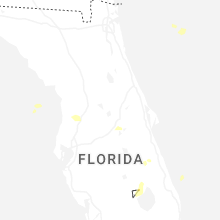


Connect with Interactive Hail Maps