

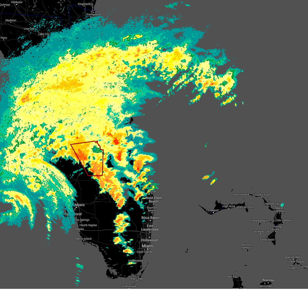
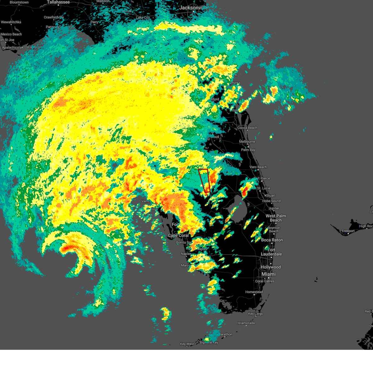
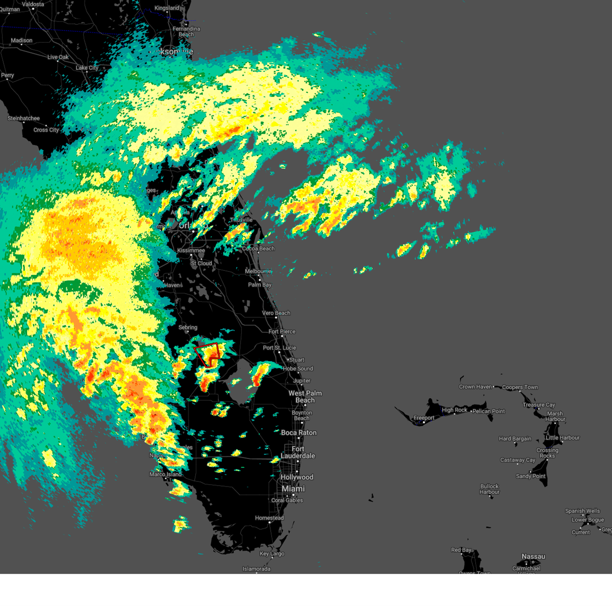
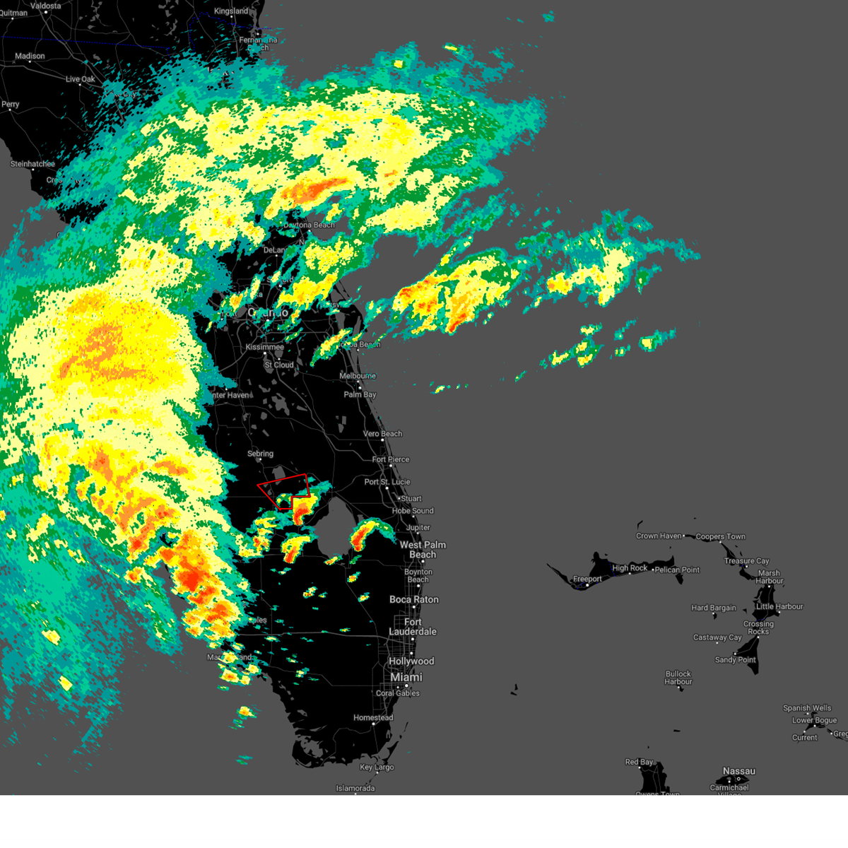
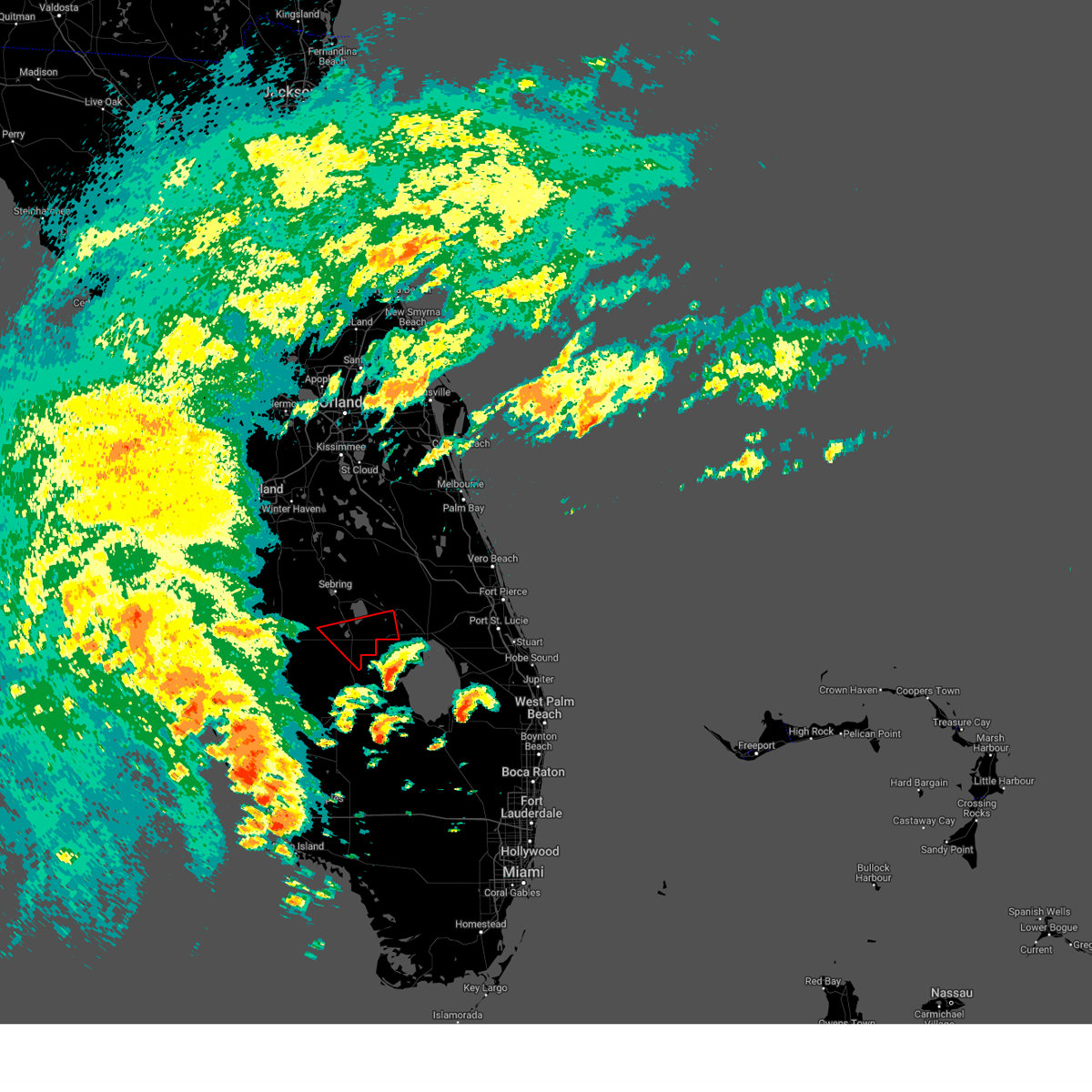
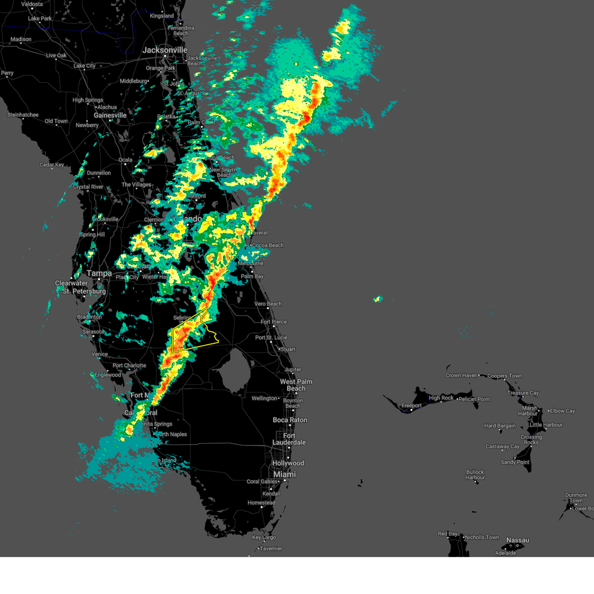
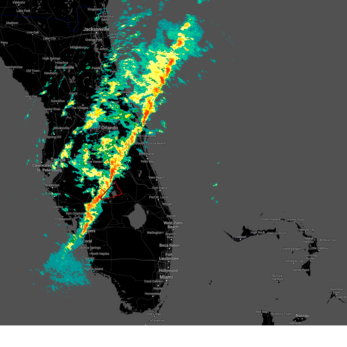
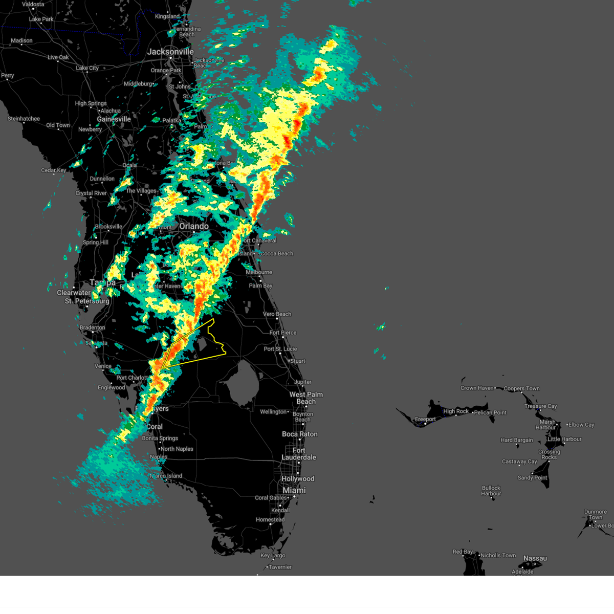
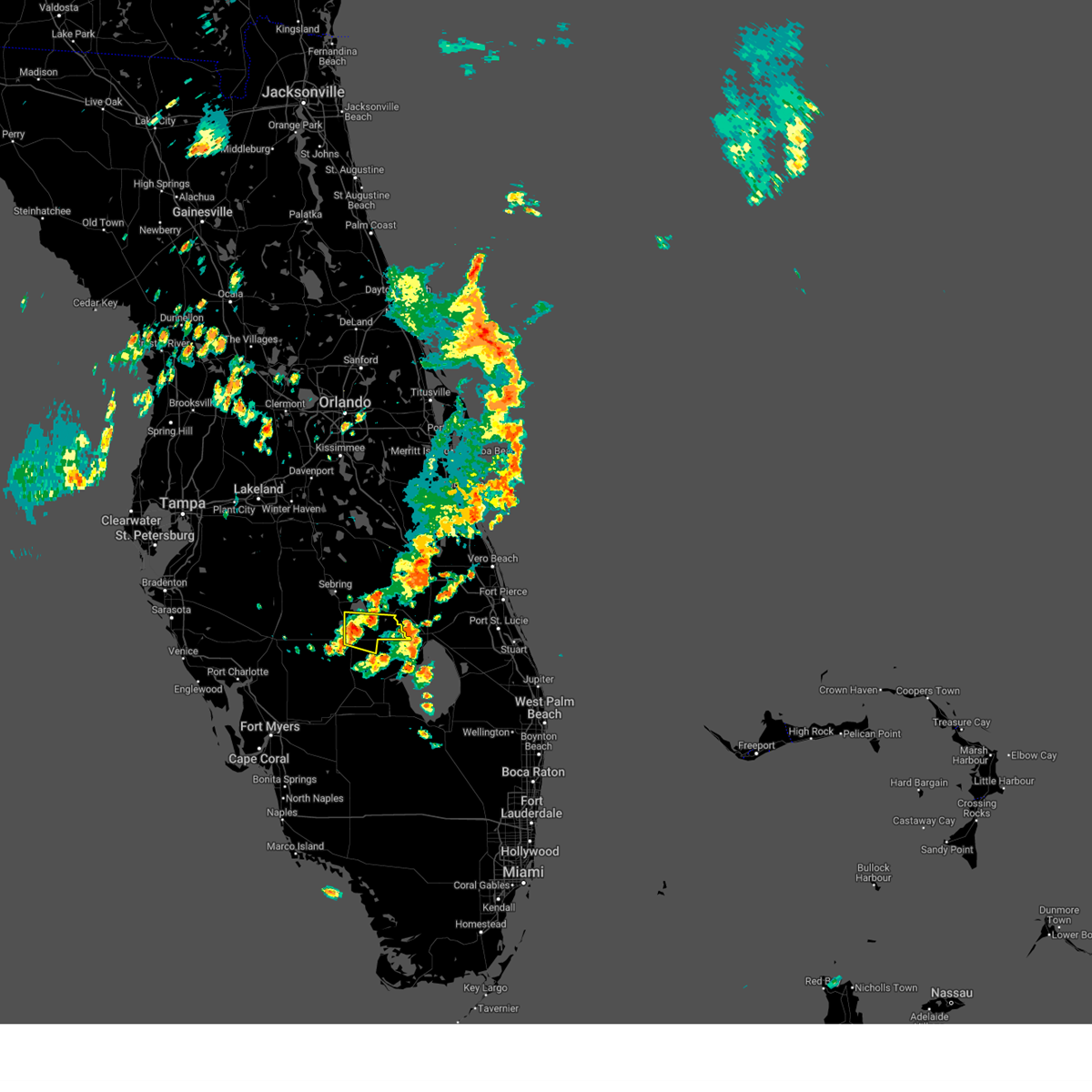
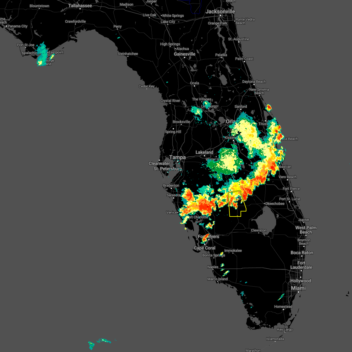
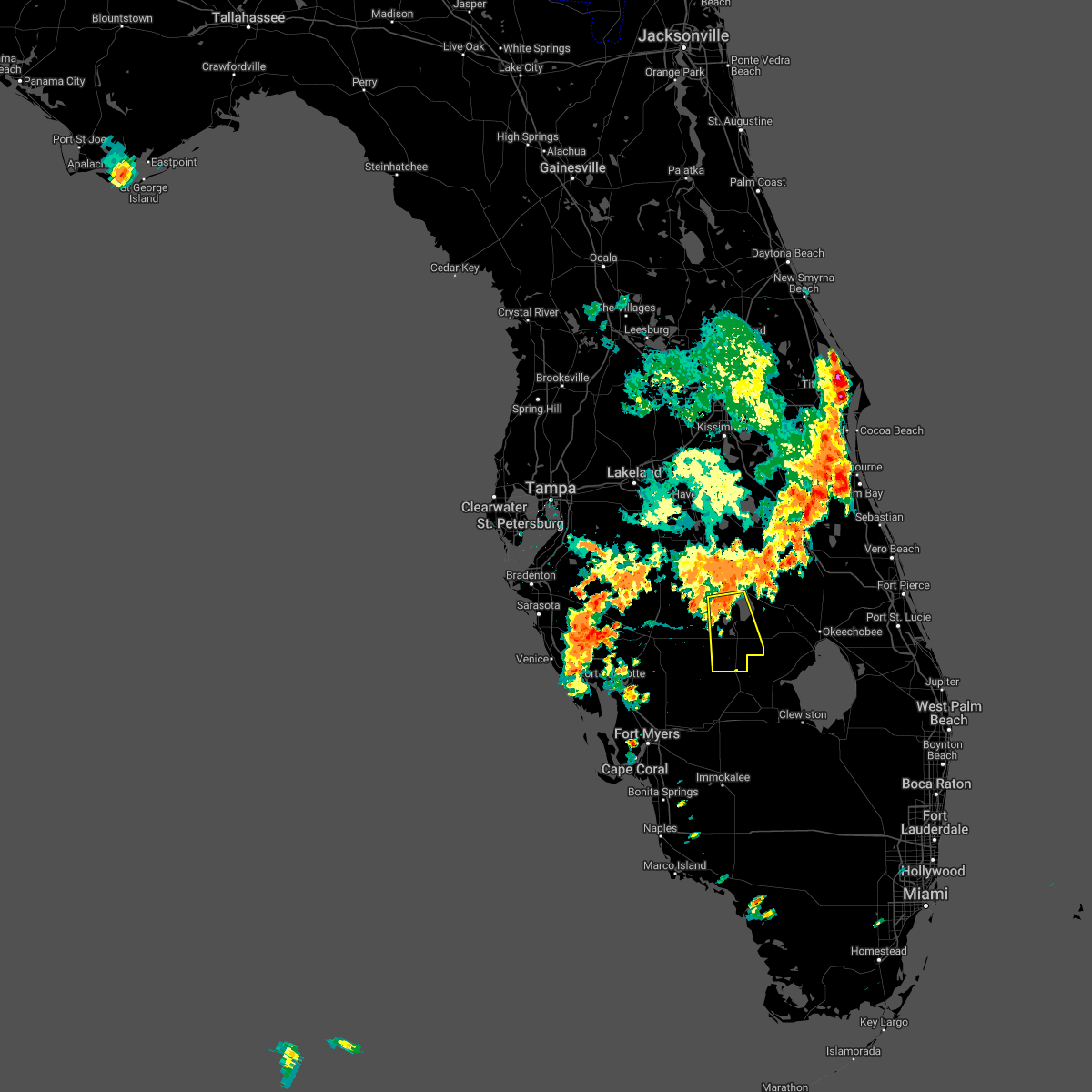
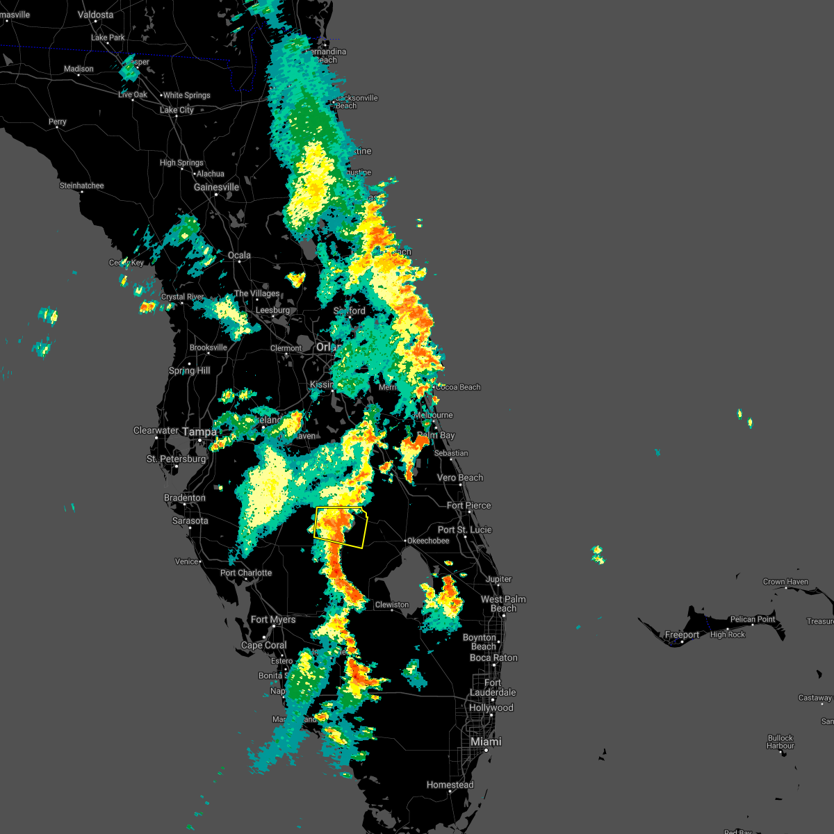
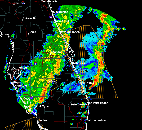
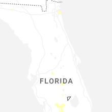
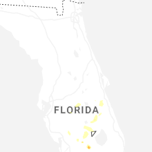
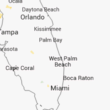
Hail Map for Lake Placid, FL
The Lake Placid, FL area has had 3 reports of on-the-ground hail by trained spotters, and has been under severe weather warnings 12 times during the past 12 months. Doppler radar has detected hail at or near Lake Placid, FL on 37 occasions, including 5 occasions during the past year.
| Name: | Lake Placid, FL |
| Where Located: | 61.8 miles W of Port Saint Lucie, FL |
| Map: | Google Map for Lake Placid, FL |
| Population: | 2223 |
| Housing Units: | 1040 |
| More Info: | Search Google for Lake Placid, FL |
1
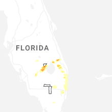
The Top Recent Hail Date for Lake Placid, FL is Saturday, May 10, 2025 (8th out of 37)

Hail and Wind Damage Spotted near Lake Placid, FL
| Date / Time | Report Details |
|---|---|
| 10/9/2024 2:58 PM EDT |
 Tortbw the national weather service in ruskin has issued a * tornado warning for, northwestern highlands county in south central florida, eastern hardee county in central florida, southern polk county in central florida, northeastern desoto county in south central florida, * until 330 pm edt. * at 258 pm edt, a severe thunderstorm capable of producing a tornado was located near sebring, moving north at 55 mph (radar indicated rotation). Hazards include tornado. Flying debris will be dangerous to those caught without shelter. mobile homes will be damaged or destroyed. damage to roofs, windows, and vehicles will occur. tree damage is likely. this dangerous storm will be near, sebring and avon park around 305 pm edt. Other locations impacted by this tornadic thunderstorm include homeland, alturas, indian lake estates, crooked lake park, frostproof, lake josephine, wahneta, fort meade, lorida, and hillcrest heights. Tortbw the national weather service in ruskin has issued a * tornado warning for, northwestern highlands county in south central florida, eastern hardee county in central florida, southern polk county in central florida, northeastern desoto county in south central florida, * until 330 pm edt. * at 258 pm edt, a severe thunderstorm capable of producing a tornado was located near sebring, moving north at 55 mph (radar indicated rotation). Hazards include tornado. Flying debris will be dangerous to those caught without shelter. mobile homes will be damaged or destroyed. damage to roofs, windows, and vehicles will occur. tree damage is likely. this dangerous storm will be near, sebring and avon park around 305 pm edt. Other locations impacted by this tornadic thunderstorm include homeland, alturas, indian lake estates, crooked lake park, frostproof, lake josephine, wahneta, fort meade, lorida, and hillcrest heights.
|
| 10/9/2024 2:24 PM EDT | Tortbw the national weather service in ruskin has issued a * tornado warning for, southwestern highlands county in south central florida, eastern desoto county in south central florida, * until 300 pm edt. * at 223 pm edt, a severe thunderstorm capable of producing a tornado was located near venus, or near palmdale, moving north at 55 mph (radar indicated rotation). Hazards include tornado. Flying debris will be dangerous to those caught without shelter. mobile homes will be damaged or destroyed. damage to roofs, windows, and vehicles will occur. tree damage is likely. this dangerous storm will be near, venus around 230 pm edt. lake placid around 235 pm edt. Other locations impacted by this tornadic thunderstorm include archbold and placid lakes. |
| 10/9/2024 2:22 PM EDT | Tortbw the national weather service in ruskin has issued a * tornado warning for, northwestern highlands county in south central florida, eastern hardee county in central florida, southeastern polk county in central florida, northeastern desoto county in south central florida, * until 300 pm edt. * at 222 pm edt, a severe thunderstorm capable of producing a tornado was located near sylvan shores, or near lake placid, moving north at 30 mph (radar indicated rotation). Hazards include tornado. Flying debris will be dangerous to those caught without shelter. mobile homes will be damaged or destroyed. damage to roofs, windows, and vehicles will occur. tree damage is likely. this dangerous storm will be near, sebring and sebring regional airport around 225 pm edt. avon park around 235 pm edt. Other locations impacted by this tornadic thunderstorm include lake josephine, lorida, avon park executive airport, avon park air force range, crewsville, sebring shores, and placid lakes. |
| 10/9/2024 2:05 PM EDT |
 At 205 pm edt, a confirmed tornado was located 9 miles northeast of venus, or 12 miles southeast of lake placid, moving north at 20 mph (weather spotters confirmed tornado). Hazards include damaging tornado. Flying debris will be dangerous to those caught without shelter. mobile homes will be damaged or destroyed. damage to roofs, windows, and vehicles will occur. tree damage is likely. this tornado will be near, lake placid around 220 pm edt. Other locations impacted by this tornadic thunderstorm include archbold, placid lakes, and brighton. At 205 pm edt, a confirmed tornado was located 9 miles northeast of venus, or 12 miles southeast of lake placid, moving north at 20 mph (weather spotters confirmed tornado). Hazards include damaging tornado. Flying debris will be dangerous to those caught without shelter. mobile homes will be damaged or destroyed. damage to roofs, windows, and vehicles will occur. tree damage is likely. this tornado will be near, lake placid around 220 pm edt. Other locations impacted by this tornadic thunderstorm include archbold, placid lakes, and brighton.
|
| 10/9/2024 2:05 PM EDT |
 Tortbw the national weather service in ruskin has issued a * tornado warning for, central highlands county in south central florida, * until 230 pm edt. * at 205 pm edt, a confirmed large and extremely dangerous tornado was located near lake placid, moving north at 20 mph. this is a particularly dangerous situation. take cover now! (weather spotters confirmed tornado). Hazards include damaging tornado. You are in a life-threatening situation. flying debris may be deadly to those caught without shelter. mobile homes will be destroyed. considerable damage to homes, businesses, and vehicles is likely and complete destruction is possible. the tornado will be near, lake placid, sylvan shores, and lake istokpoga around 210 pm edt. Other locations impacted by this tornadic thunderstorm include lake josephine, archbold, placid lakes, and lorida. Tortbw the national weather service in ruskin has issued a * tornado warning for, central highlands county in south central florida, * until 230 pm edt. * at 205 pm edt, a confirmed large and extremely dangerous tornado was located near lake placid, moving north at 20 mph. this is a particularly dangerous situation. take cover now! (weather spotters confirmed tornado). Hazards include damaging tornado. You are in a life-threatening situation. flying debris may be deadly to those caught without shelter. mobile homes will be destroyed. considerable damage to homes, businesses, and vehicles is likely and complete destruction is possible. the tornado will be near, lake placid, sylvan shores, and lake istokpoga around 210 pm edt. Other locations impacted by this tornadic thunderstorm include lake josephine, archbold, placid lakes, and lorida.
|
| 10/9/2024 1:46 PM EDT |
 Tortbw the national weather service in ruskin has issued a * tornado warning for, southwestern highlands county in south central florida, * until 230 pm edt. * at 146 pm edt, a severe thunderstorm capable of producing a tornado was located 7 miles east of venus, or 8 miles northwest of lakeport, moving north at 20 mph (radar indicated rotation). Hazards include tornado. Flying debris will be dangerous to those caught without shelter. mobile homes will be damaged or destroyed. damage to roofs, windows, and vehicles will occur. tree damage is likely. this dangerous storm will be near, venus around 150 pm edt. lake placid around 220 pm edt. Other locations impacted by this tornadic thunderstorm include archbold, placid lakes, and brighton. Tortbw the national weather service in ruskin has issued a * tornado warning for, southwestern highlands county in south central florida, * until 230 pm edt. * at 146 pm edt, a severe thunderstorm capable of producing a tornado was located 7 miles east of venus, or 8 miles northwest of lakeport, moving north at 20 mph (radar indicated rotation). Hazards include tornado. Flying debris will be dangerous to those caught without shelter. mobile homes will be damaged or destroyed. damage to roofs, windows, and vehicles will occur. tree damage is likely. this dangerous storm will be near, venus around 150 pm edt. lake placid around 220 pm edt. Other locations impacted by this tornadic thunderstorm include archbold, placid lakes, and brighton.
|
| 10/9/2024 1:25 PM EDT |
 The storm which prompted the warning has weakened below severe limits, and no longer appears capable of producing a tornado. therefore, the warning will be allowed to expire. a tornado watch remains in effect until 900 pm edt for south central and central florida. The storm which prompted the warning has weakened below severe limits, and no longer appears capable of producing a tornado. therefore, the warning will be allowed to expire. a tornado watch remains in effect until 900 pm edt for south central and central florida.
|
| 10/9/2024 12:56 PM EDT |
 Tortbw the national weather service in ruskin has issued a * tornado warning for, northwestern highlands county in south central florida, south central polk county in central florida, * until 130 pm edt. * at 1256 pm edt, a severe thunderstorm capable of producing a tornado was located over lake placid, moving north at 40 mph (radar indicated rotation). Hazards include tornado. Flying debris will be dangerous to those caught without shelter. mobile homes will be damaged or destroyed. damage to roofs, windows, and vehicles will occur. tree damage is likely. this dangerous storm will be near, sebring around 100 pm edt. avon park around 110 pm edt. Other locations impacted by this tornadic thunderstorm include lake josephine, sebring shores, avon park executive airport, and placid lakes. Tortbw the national weather service in ruskin has issued a * tornado warning for, northwestern highlands county in south central florida, south central polk county in central florida, * until 130 pm edt. * at 1256 pm edt, a severe thunderstorm capable of producing a tornado was located over lake placid, moving north at 40 mph (radar indicated rotation). Hazards include tornado. Flying debris will be dangerous to those caught without shelter. mobile homes will be damaged or destroyed. damage to roofs, windows, and vehicles will occur. tree damage is likely. this dangerous storm will be near, sebring around 100 pm edt. avon park around 110 pm edt. Other locations impacted by this tornadic thunderstorm include lake josephine, sebring shores, avon park executive airport, and placid lakes.
|
| 10/9/2024 12:20 PM EDT | Tortbw the national weather service in ruskin has issued a * tornado warning for, southwestern highlands county in south central florida, * until 100 pm edt. * at 1219 pm edt, a severe thunderstorm capable of producing a tornado was located near palmdale, moving northwest at 40 mph (radar indicated rotation). Hazards include tornado. Flying debris will be dangerous to those caught without shelter. mobile homes will be damaged or destroyed. damage to roofs, windows, and vehicles will occur. tree damage is likely. this dangerous storm will be near, venus around 1225 pm edt. lake placid around 1240 pm edt. sylvan shores around 1245 pm edt. Other locations impacted by this tornadic thunderstorm include archbold and placid lakes. |
| 10/9/2024 12:16 PM EDT |
 At 1216 pm edt, a severe thunderstorm capable of producing a tornado was located 11 miles south of lake istokpoga, or 12 miles southeast of lake placid, moving northwest at 35 mph (radar indicated rotation). Hazards include tornado. Flying debris will be dangerous to those caught without shelter. mobile homes will be damaged or destroyed. damage to roofs, windows, and vehicles will occur. tree damage is likely. Locations impacted include, lake placid, brighton, and sylvan shores. At 1216 pm edt, a severe thunderstorm capable of producing a tornado was located 11 miles south of lake istokpoga, or 12 miles southeast of lake placid, moving northwest at 35 mph (radar indicated rotation). Hazards include tornado. Flying debris will be dangerous to those caught without shelter. mobile homes will be damaged or destroyed. damage to roofs, windows, and vehicles will occur. tree damage is likely. Locations impacted include, lake placid, brighton, and sylvan shores.
|
| 10/9/2024 12:01 PM EDT |
 At 1201 pm edt, a confirmed tornado was located near brighton seminole reservation, or 7 miles north of lakeport, moving northwest at 25 mph (radar confirmed tornado). Hazards include damaging tornado. Flying debris will be dangerous to those caught without shelter. mobile homes will be damaged or destroyed. damage to roofs, windows, and vehicles will occur. tree damage is likely. This tornadic thunderstorm will remain over mainly rural areas of southern highlands county, including the following locations, archbold, placid lakes, brighton, and cornwell. At 1201 pm edt, a confirmed tornado was located near brighton seminole reservation, or 7 miles north of lakeport, moving northwest at 25 mph (radar confirmed tornado). Hazards include damaging tornado. Flying debris will be dangerous to those caught without shelter. mobile homes will be damaged or destroyed. damage to roofs, windows, and vehicles will occur. tree damage is likely. This tornadic thunderstorm will remain over mainly rural areas of southern highlands county, including the following locations, archbold, placid lakes, brighton, and cornwell.
|
| 10/9/2024 11:45 AM EDT |
 Tortbw the national weather service in ruskin has issued a * tornado warning for, southern highlands county in south central florida, * until 1230 pm edt. * at 1145 am edt, a severe thunderstorm capable of producing a tornado was located over lakeport, moving northwest at 35 mph (radar indicated rotation). Hazards include tornado. Flying debris will be dangerous to those caught without shelter. mobile homes will be damaged or destroyed. damage to roofs, windows, and vehicles will occur. tree damage is likely. this dangerous storm will be near, lake placid and sylvan shores around 1215 pm edt. Other locations impacted by this tornadic thunderstorm include archbold, placid lakes, brighton, and cornwell. Tortbw the national weather service in ruskin has issued a * tornado warning for, southern highlands county in south central florida, * until 1230 pm edt. * at 1145 am edt, a severe thunderstorm capable of producing a tornado was located over lakeport, moving northwest at 35 mph (radar indicated rotation). Hazards include tornado. Flying debris will be dangerous to those caught without shelter. mobile homes will be damaged or destroyed. damage to roofs, windows, and vehicles will occur. tree damage is likely. this dangerous storm will be near, lake placid and sylvan shores around 1215 pm edt. Other locations impacted by this tornadic thunderstorm include archbold, placid lakes, brighton, and cornwell.
|
| 1/9/2024 7:14 PM EST |
 At 714 pm est, severe thunderstorms were located along a line extending from sebring regional airport to 6 miles northwest of sylvan shores to 6 miles west of lake placid, moving northeast at 55 mph (radar indicated). Hazards include 60 mph wind gusts. Expect damage to roofs, siding, and trees. locations impacted include, sebring, lake placid, sebring regional airport, lake josephine, placid lakes, lorida, cornwell, sylvan shores, and lake istokpoga. hail threat, radar indicated max hail size, <. 75 in wind threat, radar indicated max wind gust, 60 mph. At 714 pm est, severe thunderstorms were located along a line extending from sebring regional airport to 6 miles northwest of sylvan shores to 6 miles west of lake placid, moving northeast at 55 mph (radar indicated). Hazards include 60 mph wind gusts. Expect damage to roofs, siding, and trees. locations impacted include, sebring, lake placid, sebring regional airport, lake josephine, placid lakes, lorida, cornwell, sylvan shores, and lake istokpoga. hail threat, radar indicated max hail size, <. 75 in wind threat, radar indicated max wind gust, 60 mph.
|
| 1/9/2024 7:06 PM EST |
 At 705 pm est, a severe thunderstorm capable of producing a tornado was located 7 miles west of lake placid, moving northeast at 55 mph (radar indicated rotation). Hazards include tornado. Flying debris will be dangerous to those caught without shelter. mobile homes will be damaged or destroyed. damage to roofs, windows, and vehicles will occur. tree damage is likely. this dangerous storm will be near, lake placid, sebring regional airport, and sylvan shores around 710 pm est. lake istokpoga around 715 pm est. Other locations impacted by this tornadic thunderstorm include lake josephine and lorida. At 705 pm est, a severe thunderstorm capable of producing a tornado was located 7 miles west of lake placid, moving northeast at 55 mph (radar indicated rotation). Hazards include tornado. Flying debris will be dangerous to those caught without shelter. mobile homes will be damaged or destroyed. damage to roofs, windows, and vehicles will occur. tree damage is likely. this dangerous storm will be near, lake placid, sebring regional airport, and sylvan shores around 710 pm est. lake istokpoga around 715 pm est. Other locations impacted by this tornadic thunderstorm include lake josephine and lorida.
|
| 1/9/2024 6:52 PM EST |
 The national weather service in ruskin has issued a * severe thunderstorm warning for. central highlands county in south central florida. southeastern hardee county in central florida. northeastern desoto county in south central florida. Until 730 pm est. The national weather service in ruskin has issued a * severe thunderstorm warning for. central highlands county in south central florida. southeastern hardee county in central florida. northeastern desoto county in south central florida. Until 730 pm est.
|
| 6/20/2023 2:09 PM EDT |
 At 208 pm edt, a severe thunderstorm was located near sylvan shores, or near lake placid, moving east at 25 mph (radar indicated). Hazards include 60 mph wind gusts and penny size hail. expect damage to roofs, siding, and trees At 208 pm edt, a severe thunderstorm was located near sylvan shores, or near lake placid, moving east at 25 mph (radar indicated). Hazards include 60 mph wind gusts and penny size hail. expect damage to roofs, siding, and trees
|
| 6/18/2022 4:54 PM EDT |
 The severe thunderstorm warning for southwestern highlands county will expire at 500 pm edt, the storm which prompted the warning has weakened below severe limits, and no longer poses an immediate threat to life or property. therefore, the warning will be allowed to expire. however gusty winds and heavy rain are still possible with this thunderstorm. a severe thunderstorm watch remains in effect until 800 pm edt for south central florida. The severe thunderstorm warning for southwestern highlands county will expire at 500 pm edt, the storm which prompted the warning has weakened below severe limits, and no longer poses an immediate threat to life or property. therefore, the warning will be allowed to expire. however gusty winds and heavy rain are still possible with this thunderstorm. a severe thunderstorm watch remains in effect until 800 pm edt for south central florida.
|
| 6/18/2022 4:22 PM EDT |
 At 422 pm edt, a severe thunderstorm was located near sylvan shores, or near lake placid, moving south at 35 mph (radar indicated). Hazards include 60 mph wind gusts and penny size hail. expect damage to roofs, siding, and trees At 422 pm edt, a severe thunderstorm was located near sylvan shores, or near lake placid, moving south at 35 mph (radar indicated). Hazards include 60 mph wind gusts and penny size hail. expect damage to roofs, siding, and trees
|
| 4/11/2021 1:47 PM EDT |
 At 146 pm edt, severe thunderstorms were located along a line extending from 5 miles west of kissimmee prarie preserve to 10 miles southwest of sebring, moving east at 40 mph (trained weather spotters). Hazards include 60 mph wind gusts and quarter size hail. Hail damage to vehicles is expected. Expect wind damage to roofs, siding, and trees. At 146 pm edt, severe thunderstorms were located along a line extending from 5 miles west of kissimmee prarie preserve to 10 miles southwest of sebring, moving east at 40 mph (trained weather spotters). Hazards include 60 mph wind gusts and quarter size hail. Hail damage to vehicles is expected. Expect wind damage to roofs, siding, and trees.
|
| 7/27/2020 6:12 PM EDT |
 The severe thunderstorm warning for west central highlands county will expire at 615 pm edt, the storm which prompted the warning has weakened below severe limits, and no longer poses an immediate threat to life or property. therefore, the warning will be allowed to expire. however gusty winds and heavy rain are still possible with this thunderstorm. The severe thunderstorm warning for west central highlands county will expire at 615 pm edt, the storm which prompted the warning has weakened below severe limits, and no longer poses an immediate threat to life or property. therefore, the warning will be allowed to expire. however gusty winds and heavy rain are still possible with this thunderstorm.
|
| 7/27/2020 5:47 PM EDT |
 At 547 pm edt, a severe thunderstorm was located near sylvan shores, or near lake placid, moving east at 15 mph (radar indicated). Hazards include 60 mph wind gusts and penny size hail. expect damage to roofs, siding, and trees At 547 pm edt, a severe thunderstorm was located near sylvan shores, or near lake placid, moving east at 15 mph (radar indicated). Hazards include 60 mph wind gusts and penny size hail. expect damage to roofs, siding, and trees
|
| 6/9/2019 1:38 PM EDT |
 At 137 pm edt, severe thunderstorms were located along a line extending from near avon park to near sebring regional airport to 5 miles north of venus, moving northeast at 35 mph (radar indicated). Hazards include 60 mph wind gusts and penny size hail. expect damage to roofs, siding, and trees At 137 pm edt, severe thunderstorms were located along a line extending from near avon park to near sebring regional airport to 5 miles north of venus, moving northeast at 35 mph (radar indicated). Hazards include 60 mph wind gusts and penny size hail. expect damage to roofs, siding, and trees
|
| 6/4/2019 4:26 PM EDT |
 The severe thunderstorm warning for central highlands county will expire at 430 pm edt, the storm which prompted the warning has weakened below severe limits, and no longer poses an immediate threat to life or property. therefore, the warning will be allowed to expire. however gusty winds and heavy rain are still possible with this thunderstorm. The severe thunderstorm warning for central highlands county will expire at 430 pm edt, the storm which prompted the warning has weakened below severe limits, and no longer poses an immediate threat to life or property. therefore, the warning will be allowed to expire. however gusty winds and heavy rain are still possible with this thunderstorm.
|
| 6/4/2019 4:01 PM EDT |
 At 401 pm edt, a severe thunderstorm was located near lake istokpoga, or 12 miles west of basinger, moving south at 25 mph (radar indicated). Hazards include 60 mph wind gusts and quarter size hail. Hail damage to vehicles is expected. Expect wind damage to roofs, siding, and trees. At 401 pm edt, a severe thunderstorm was located near lake istokpoga, or 12 miles west of basinger, moving south at 25 mph (radar indicated). Hazards include 60 mph wind gusts and quarter size hail. Hail damage to vehicles is expected. Expect wind damage to roofs, siding, and trees.
|
| 4/19/2019 5:10 PM EDT |
 The severe thunderstorm warning for north central highlands and southeastern polk counties will expire at 515 pm edt, the storm which prompted the warning has moved out of the area. therefore, the warning will be allowed to expire. to report severe weather, contact your nearest law enforcement agency. they will relay your report to the national weather service ruskin. The severe thunderstorm warning for north central highlands and southeastern polk counties will expire at 515 pm edt, the storm which prompted the warning has moved out of the area. therefore, the warning will be allowed to expire. to report severe weather, contact your nearest law enforcement agency. they will relay your report to the national weather service ruskin.
|
| 4/19/2019 5:01 PM EDT |
 At 500 pm edt, a severe thunderstorm was located near sebring regional airport, or 12 miles east of sebring, moving northeast at 55 mph (radar indicated). Hazards include 60 mph wind gusts. Expect damage to roofs, siding, and trees. Locations impacted include, lake placid, sebring regional airport, lake istokpoga, sylvan shores and lorida. At 500 pm edt, a severe thunderstorm was located near sebring regional airport, or 12 miles east of sebring, moving northeast at 55 mph (radar indicated). Hazards include 60 mph wind gusts. Expect damage to roofs, siding, and trees. Locations impacted include, lake placid, sebring regional airport, lake istokpoga, sylvan shores and lorida.
|
| 4/19/2019 4:47 PM EDT |
 At 447 pm edt, a severe thunderstorm was located near sebring regional airport, or near lake placid, moving northeast at 55 mph (radar indicated). Hazards include 60 mph wind gusts. expect damage to roofs, siding, and trees At 447 pm edt, a severe thunderstorm was located near sebring regional airport, or near lake placid, moving northeast at 55 mph (radar indicated). Hazards include 60 mph wind gusts. expect damage to roofs, siding, and trees
|
| 3/20/2018 6:36 PM EDT |
 At 636 pm edt, a severe thunderstorm was located 11 miles west of venus, or 17 miles northwest of palmdale, moving east at 40 mph (radar indicated). Hazards include 60 mph wind gusts and nickel size hail. Expect damage to roofs, siding, and trees. locations impacted include, lake placid, venus, archbold and placid lakes. A tornado watch remains in effect until 700 pm edt for south central florida. At 636 pm edt, a severe thunderstorm was located 11 miles west of venus, or 17 miles northwest of palmdale, moving east at 40 mph (radar indicated). Hazards include 60 mph wind gusts and nickel size hail. Expect damage to roofs, siding, and trees. locations impacted include, lake placid, venus, archbold and placid lakes. A tornado watch remains in effect until 700 pm edt for south central florida.
|
| 3/20/2018 6:21 PM EDT |
 At 621 pm edt, a severe thunderstorm was located 10 miles northeast of babcock ranch, or 13 miles southeast of arcadia, moving east at 40 mph (radar indicated). Hazards include 60 mph wind gusts and nickel size hail. expect damage to roofs, siding, and trees At 621 pm edt, a severe thunderstorm was located 10 miles northeast of babcock ranch, or 13 miles southeast of arcadia, moving east at 40 mph (radar indicated). Hazards include 60 mph wind gusts and nickel size hail. expect damage to roofs, siding, and trees
|
| 3/20/2018 5:15 PM EDT | Highlands county em reported an overturned produce truck on sr 621 and charlie d in highlands county FL, 11.5 miles WSW of Lake Placid, FL |
| 1/17/2016 5:24 AM EST |
 At 523 am est, a severe thunderstorm was located near lake placid, moving east at 45 mph (radar indicated). Hazards include 60 mph wind gusts. Expect damage to roofs. siding and trees. locations impacted include, sebring, lake placid, lake istokpoga, sebring regional airport, venus, sylvan shores, lorida, brighton, placid lakes, lake josephine, cornwell and archbold. A tornado watch remains in effect until 800 am est for south central florida. At 523 am est, a severe thunderstorm was located near lake placid, moving east at 45 mph (radar indicated). Hazards include 60 mph wind gusts. Expect damage to roofs. siding and trees. locations impacted include, sebring, lake placid, lake istokpoga, sebring regional airport, venus, sylvan shores, lorida, brighton, placid lakes, lake josephine, cornwell and archbold. A tornado watch remains in effect until 800 am est for south central florida.
|
| 1/17/2016 5:13 AM EST |
 At 512 am est, a line of severe thunderstorms was located 10 miles southwest of sebring extending southward, moving east at 60 mph (radar indicated). Hazards include 60 mph wind gusts. Expect damage to roofs. Siding and trees. At 512 am est, a line of severe thunderstorms was located 10 miles southwest of sebring extending southward, moving east at 60 mph (radar indicated). Hazards include 60 mph wind gusts. Expect damage to roofs. Siding and trees.
|
| 1/17/2016 4:36 AM EST |
 At 435 am est, severe thunderstorms were located along a line extending from 5 miles southeast of ona to near port charlotte, moving east at 55 mph. these storms have a history of producing damaging winds up to 60 mph (public). Hazards include 60 mph wind gusts. Expect damage to roofs. Siding and trees. At 435 am est, severe thunderstorms were located along a line extending from 5 miles southeast of ona to near port charlotte, moving east at 55 mph. these storms have a history of producing damaging winds up to 60 mph (public). Hazards include 60 mph wind gusts. Expect damage to roofs. Siding and trees.
|
| 4/27/2015 5:17 PM EDT | At 513 pm edt, doppler radar indicated a severe thunderstorm capable of producing large damaging hail up to golf ball size and damaging winds in excess of 60 mph. this storm is approaching lake istokpoga, or 4 miles east of lake placid, moving east at 35 mph. locations impacted include, lake placid, lake istokpoga, sylvan shores, lorida, brighton, cornwell and placid lakes. |
| 4/27/2015 5:08 PM EDT | Quarter sized hail reported 0.2 miles SE of Lake Placid, FL, highlands county emergency management received numerous reports of quarter size hail in downtown lake placid. |
| 4/27/2015 5:08 PM EDT | Golf Ball sized hail reported 0.2 miles SE of Lake Placid, FL, highlands county sherrifs reported quarter to golf ball size hail in lake placid. pictures on social media also show hail in the quarter to golf ball size range. |
| 4/27/2015 5:08 PM EDT | Highlands county sheriffs office reported numerous powerlines down in lake placi in highlands county FL, 0.2 miles SE of Lake Placid, FL |
| 4/27/2015 5:00 PM EDT | At 459 pm edt, doppler radar indicated a severe thunderstorm capable of producing quarter size hail and damaging winds in excess of 60 mph. this storm was located near lake placid, and moving east at 30 mph. |
| 9/15/2013 3:00 PM EDT | Highlands county 911 reported railroad crossing gates downed onto road due to the stor in highlands county FL, 0.2 miles SE of Lake Placid, FL |
| 7/22/2012 2:12 PM EDT | Sfwmd s65cw wind 107/21 gusts 52 kt in okeechobee county FL, 17.4 miles WSW of Lake Placid, FL |
| 5/27/2012 5:34 PM EDT | Quarter sized hail reported 3.7 miles NNW of Lake Placid, FL, public reported quarter sized hail and estimated 50 mph wind gusts near lake placid. |
| 1/1/0001 12:00 AM | Few trees and street signs down on lake june driv in highlands county FL, 0.8 miles S of Lake Placid, FL |
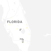
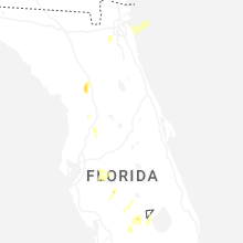
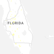
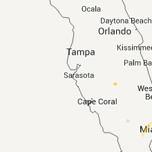
Hail Maps for Lake Placid, FL


Connect with Interactive Hail Maps