

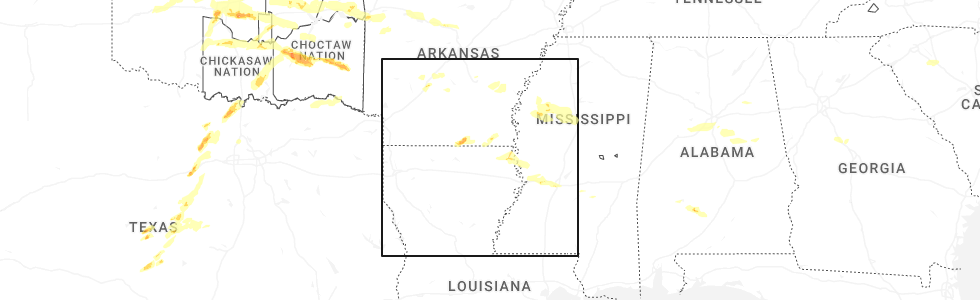
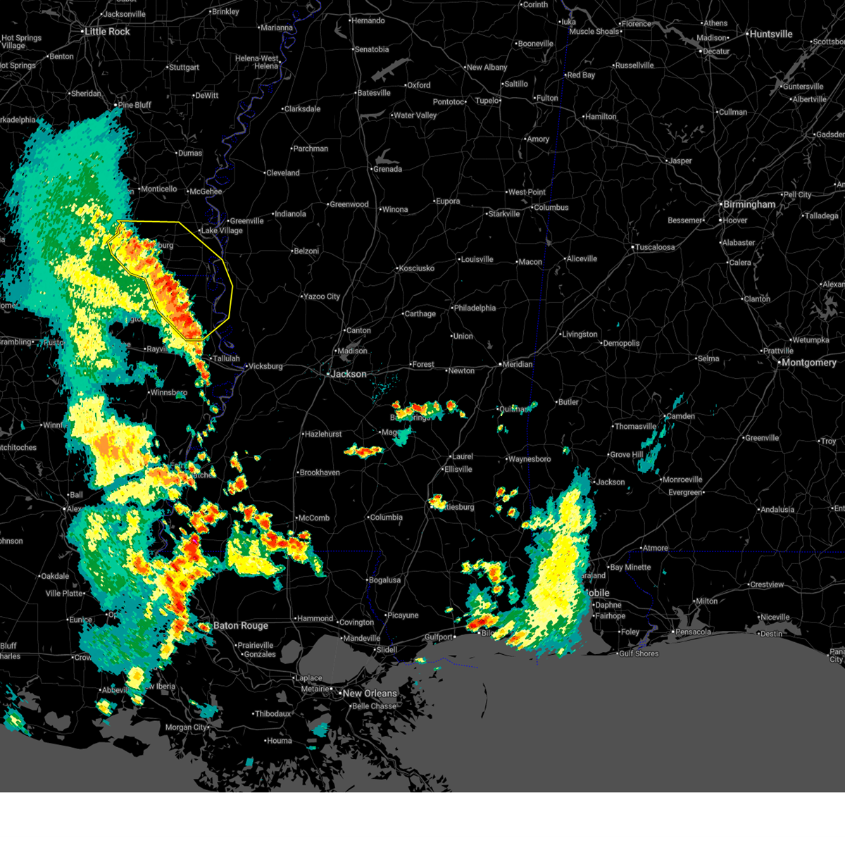
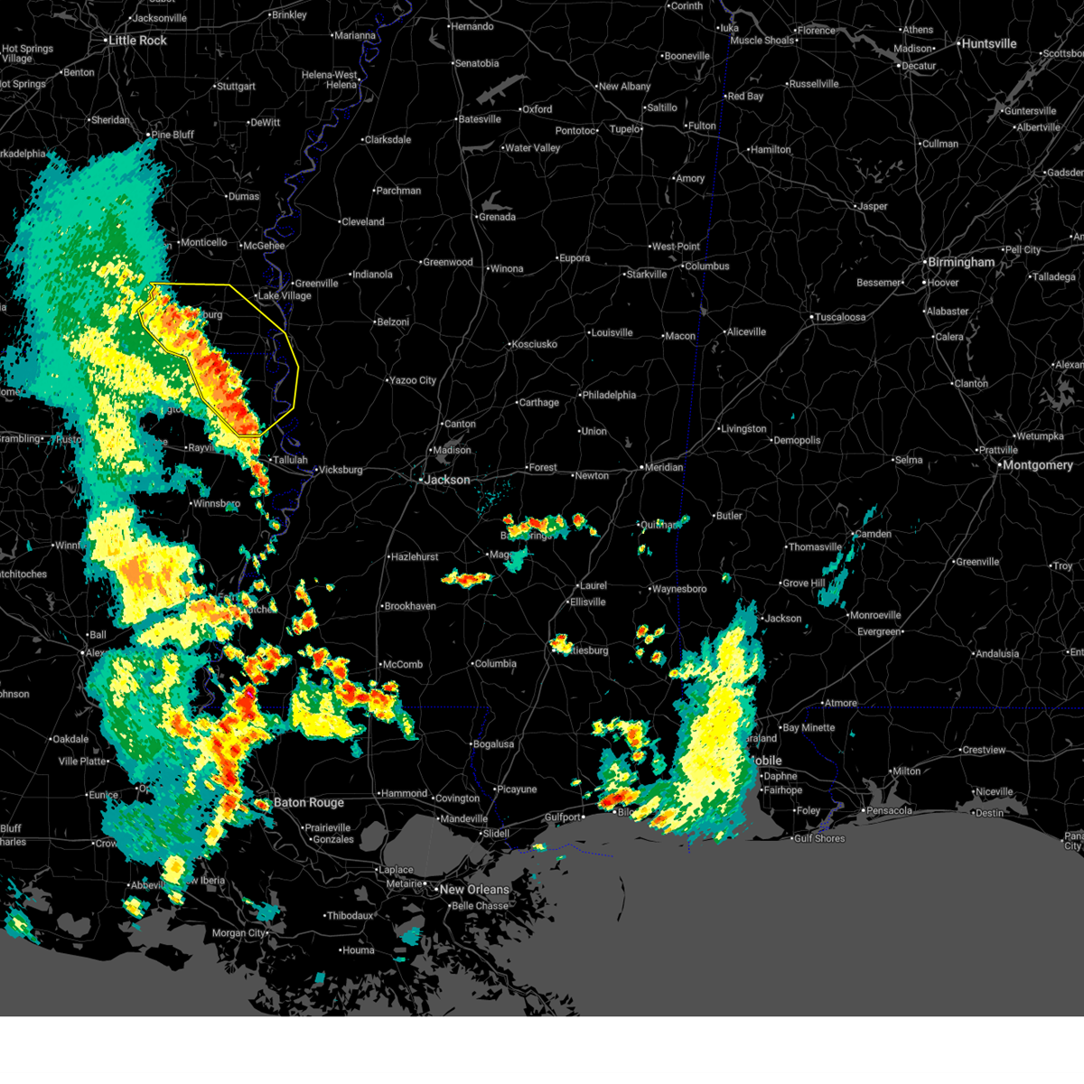
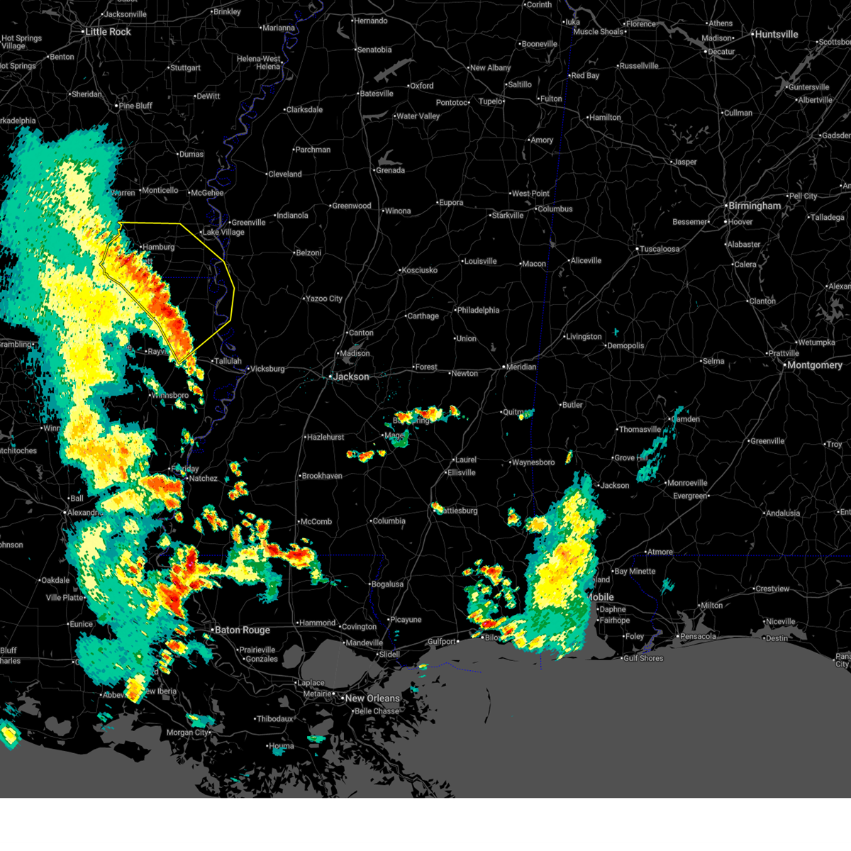
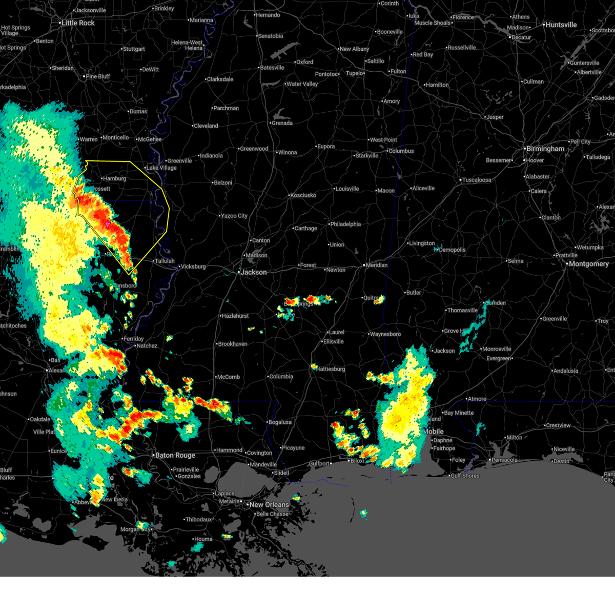
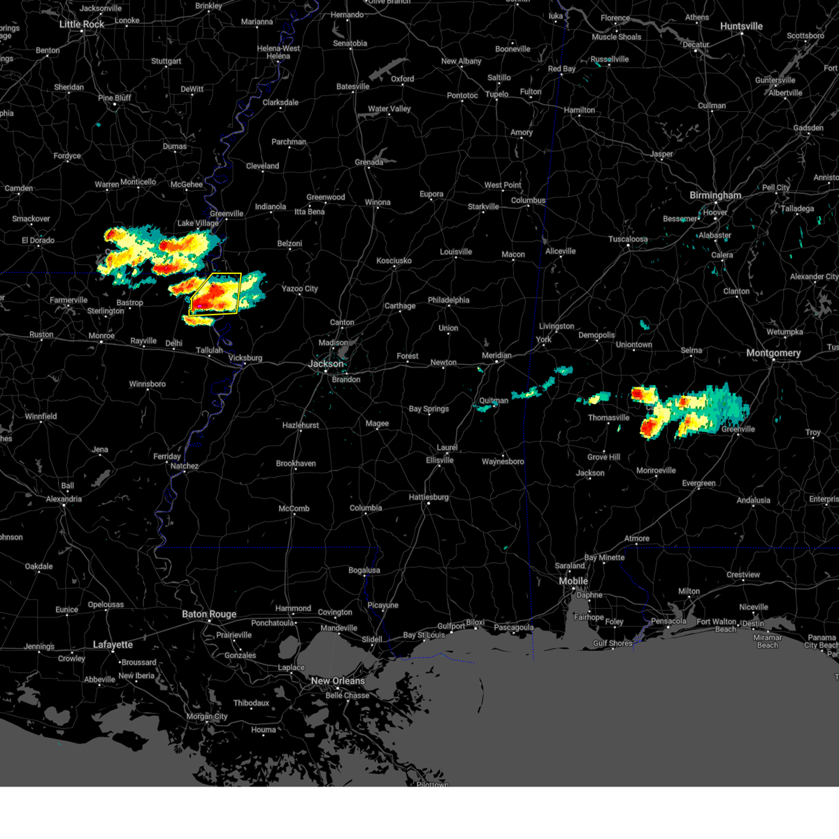
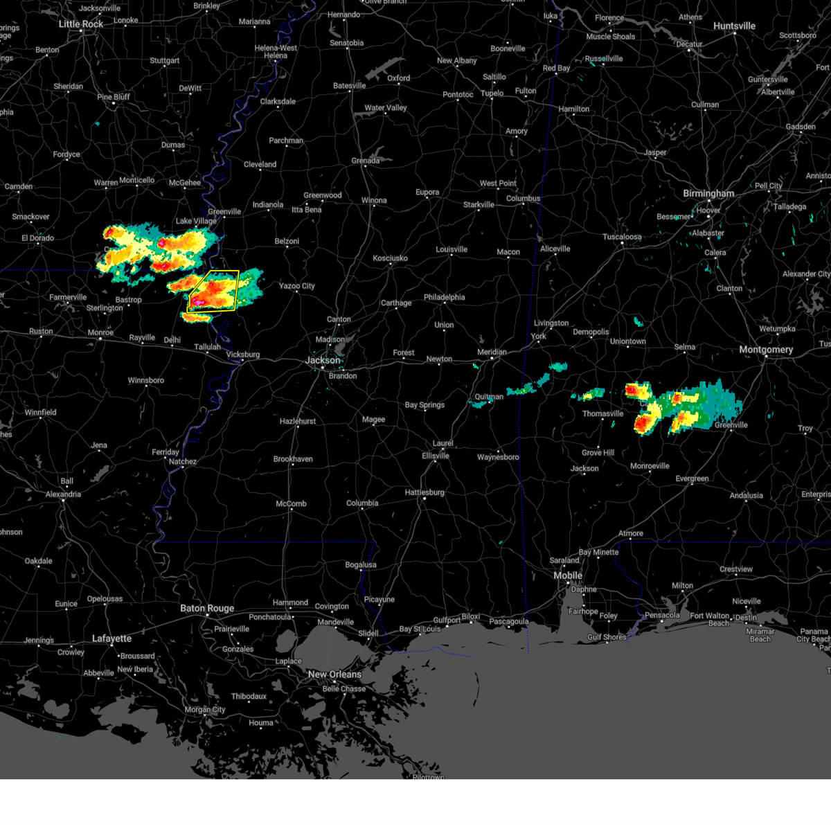
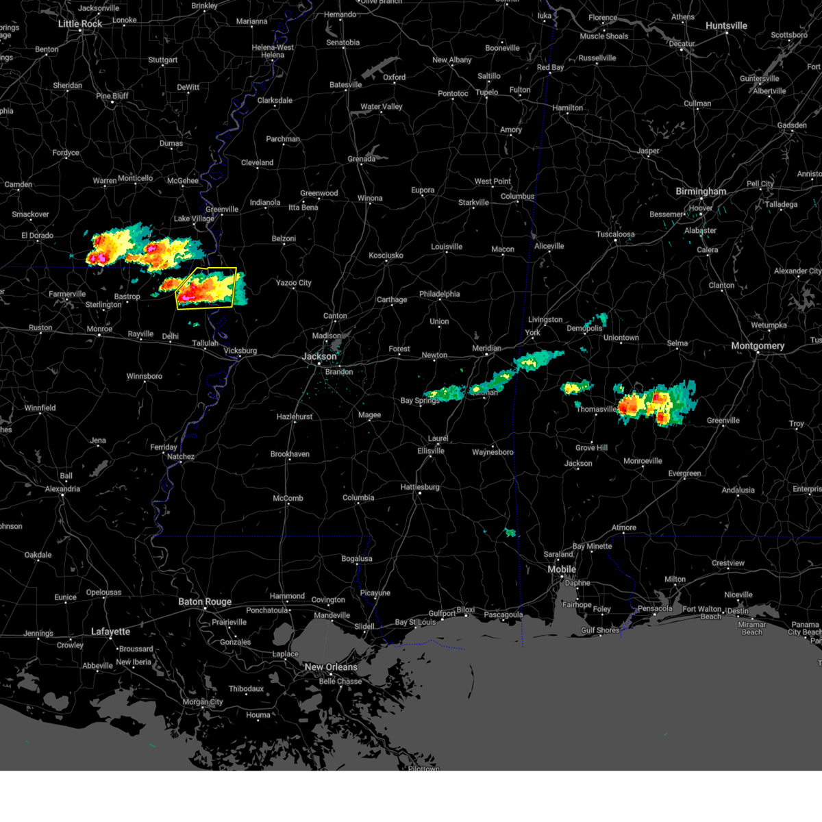
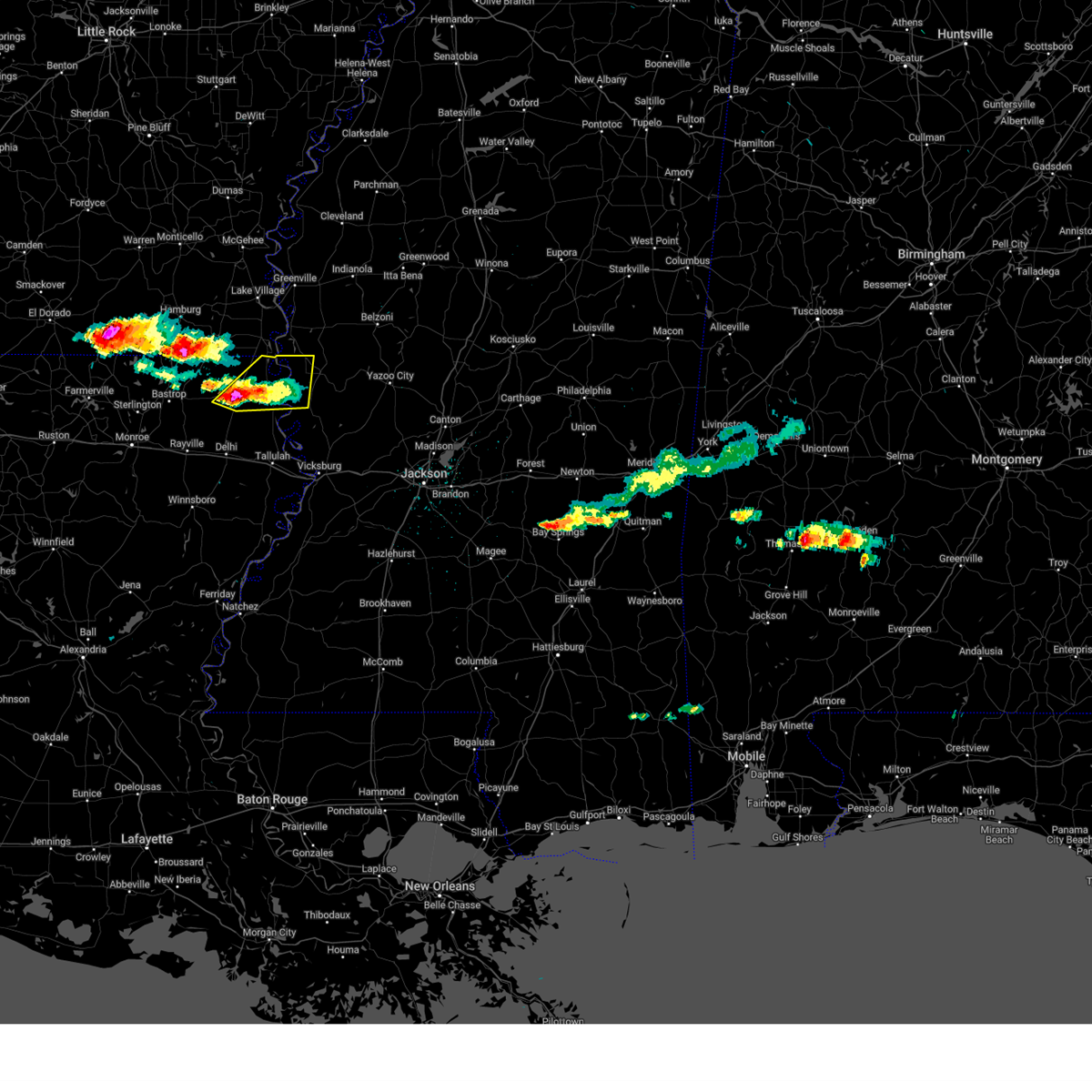
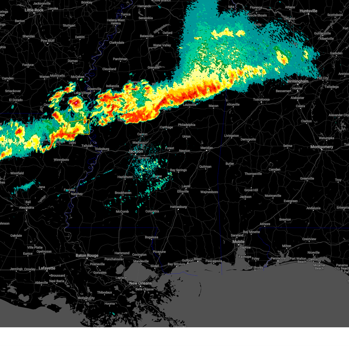
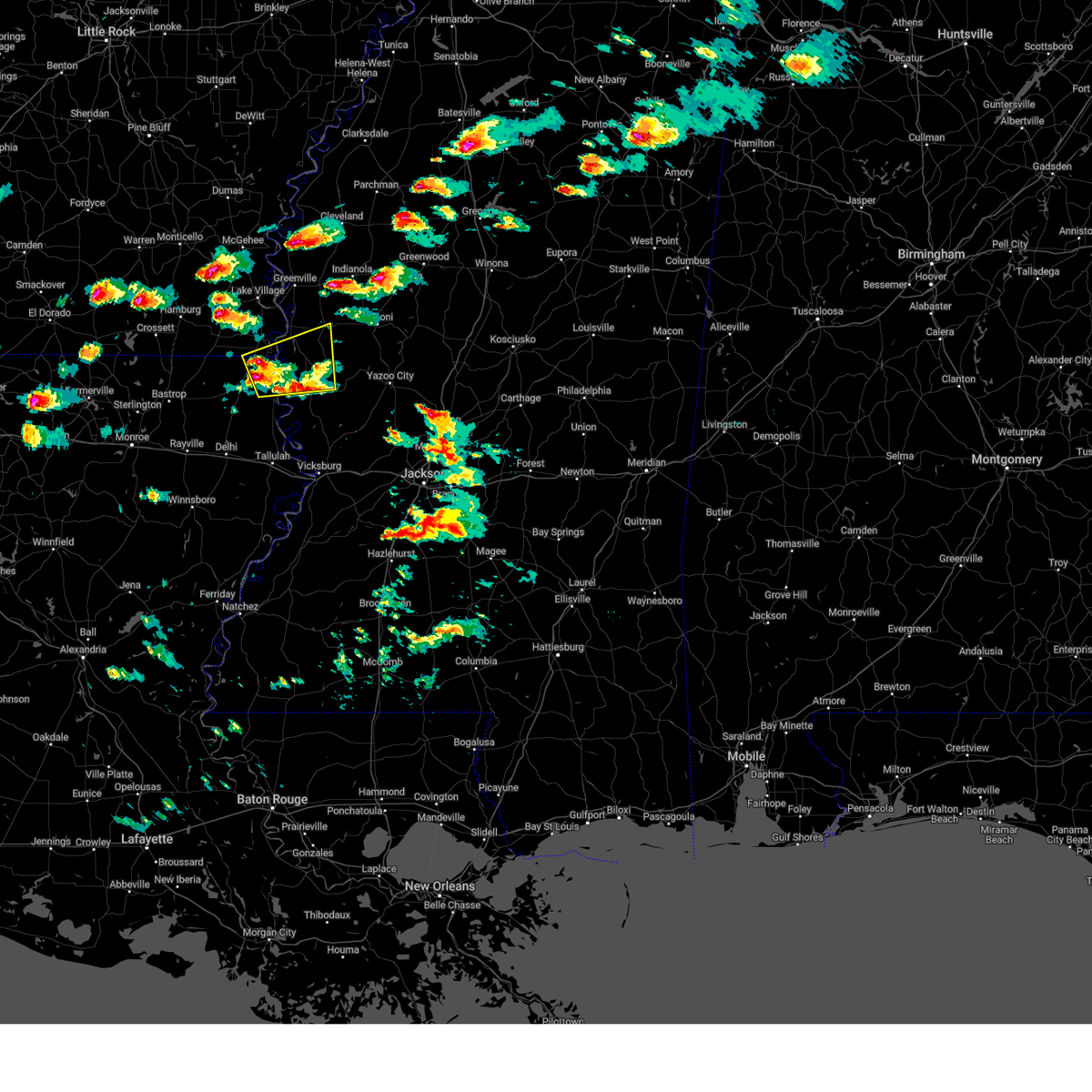
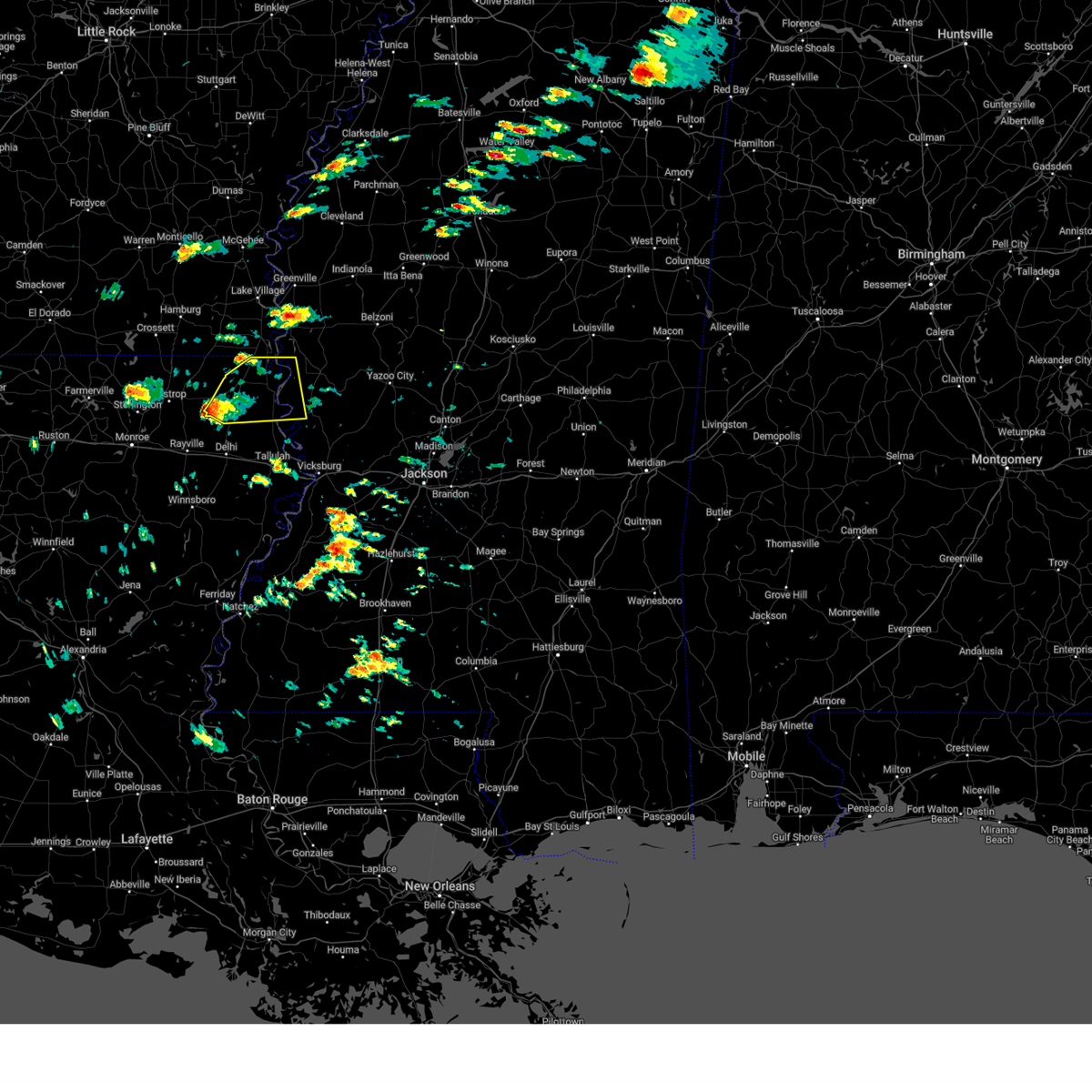
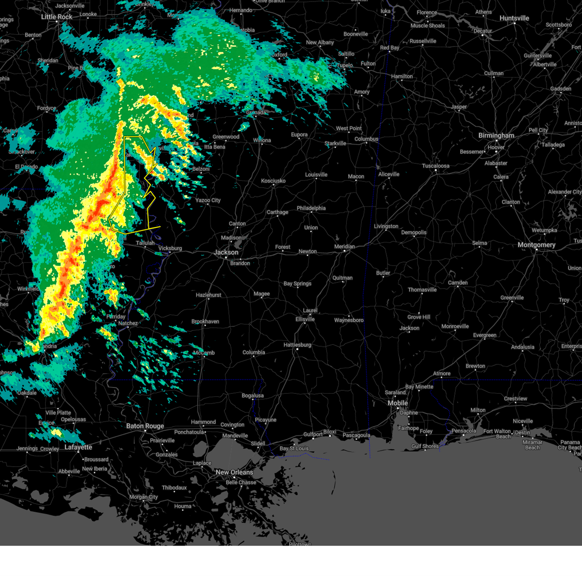
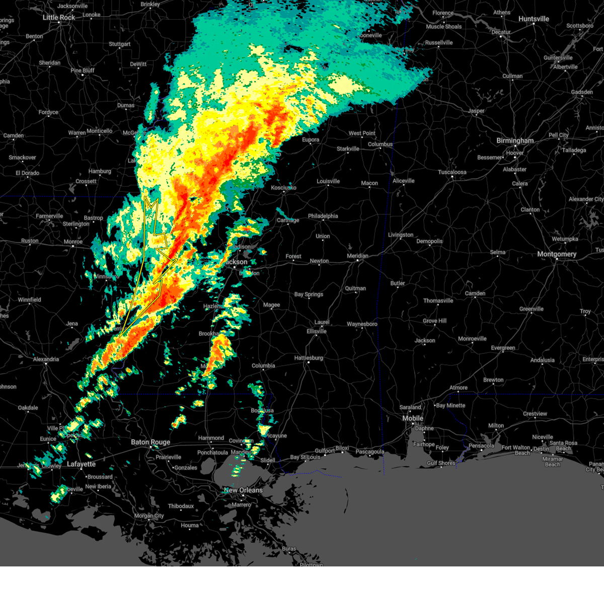
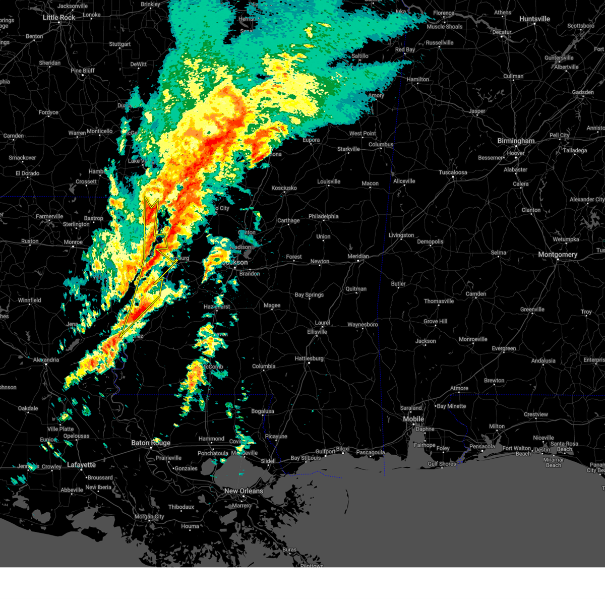
Hail Map for Lake Providence, LA
The Lake Providence, LA area has had 12 reports of on-the-ground hail by trained spotters, and has been under severe weather warnings 81 times during the past 12 months. Doppler radar has detected hail at or near Lake Providence, LA on 65 occasions, including 8 occasions during the past year.
| Name: | Lake Providence, LA |
| Where Located: | 42.4 miles E of Bastrop, LA |
| Map: | Google Map for Lake Providence, LA |
| Population: | 3991 |
| Housing Units: | 1647 |
| More Info: | Search Google for Lake Providence, LA |
2
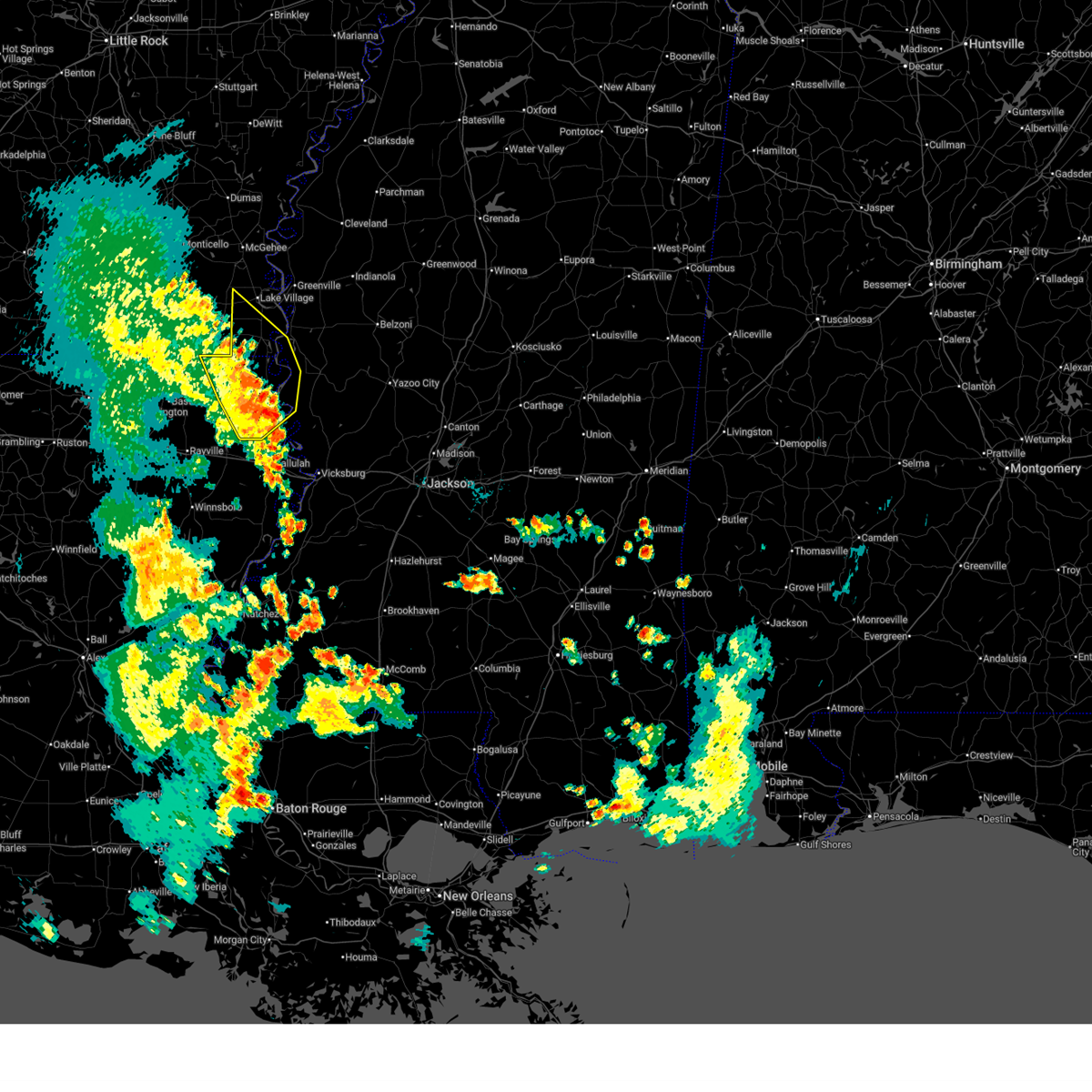
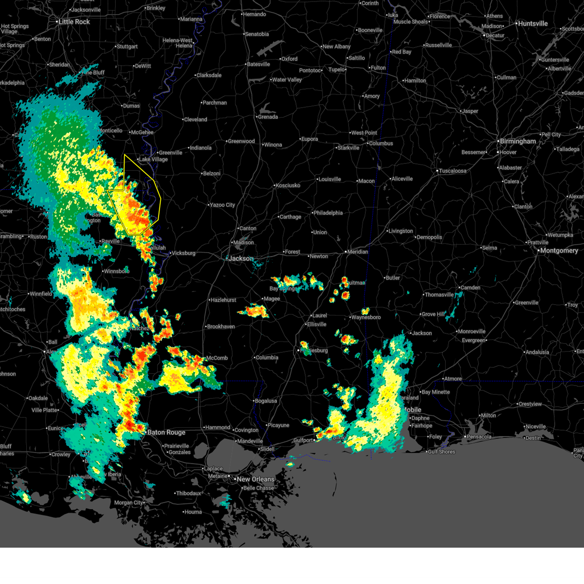
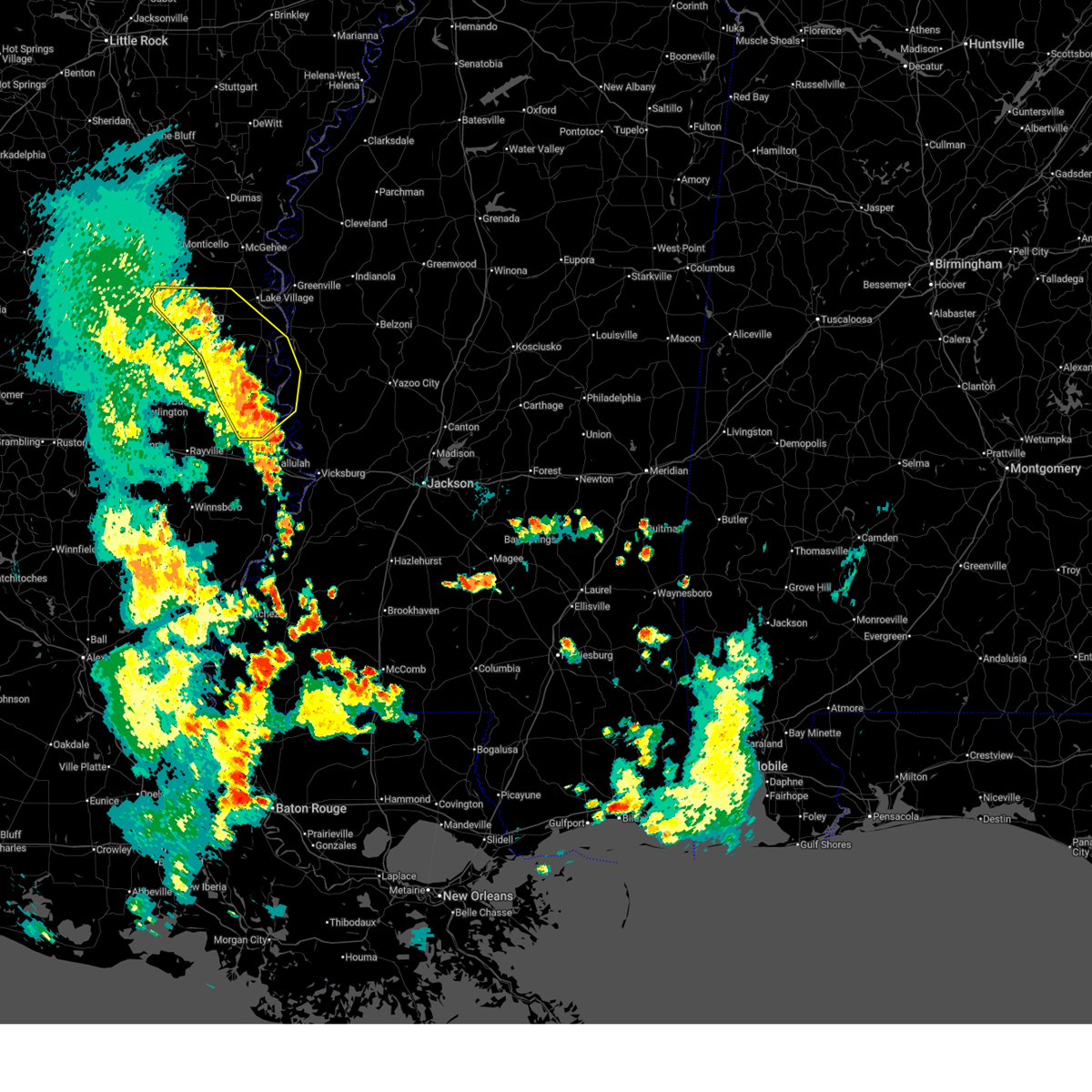
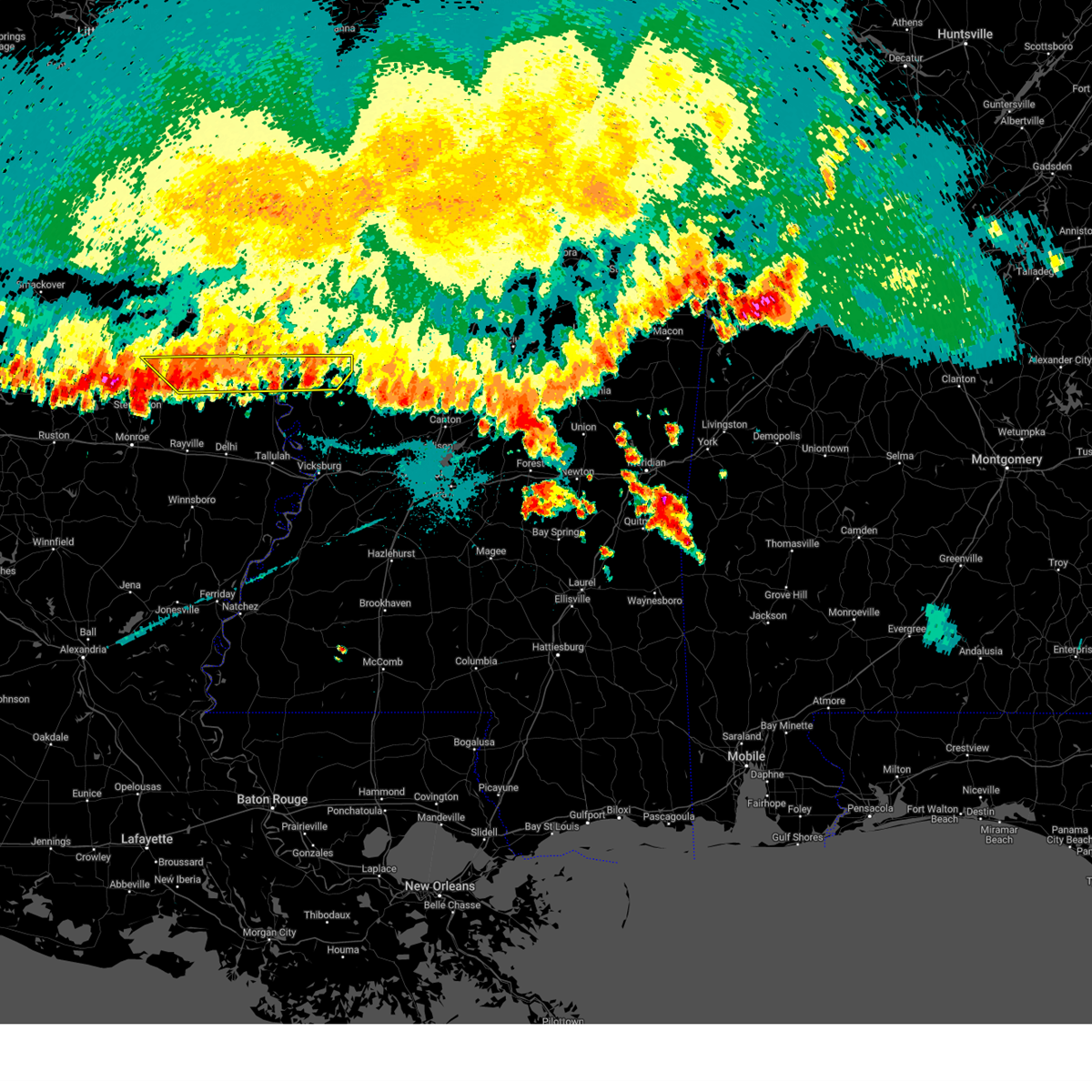
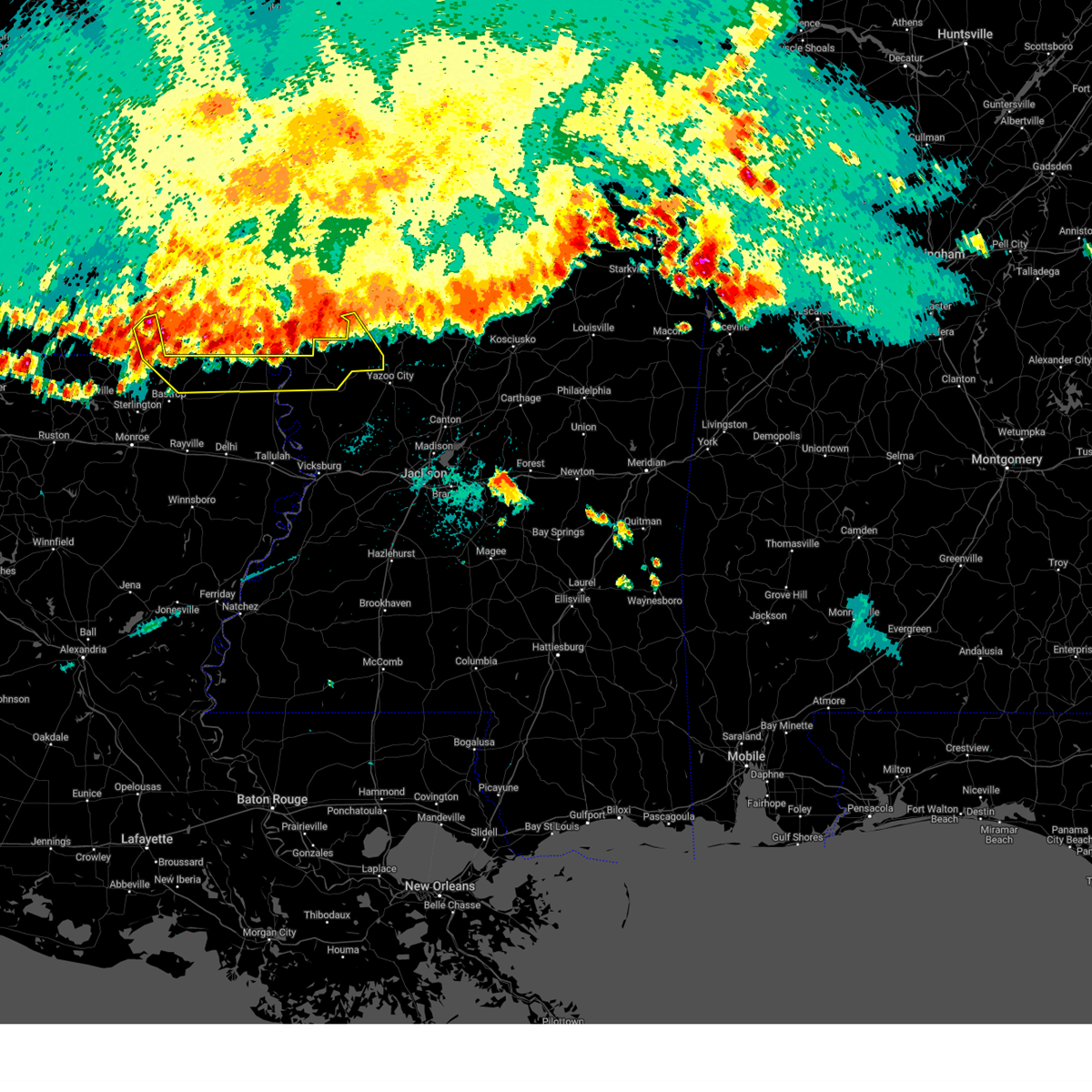
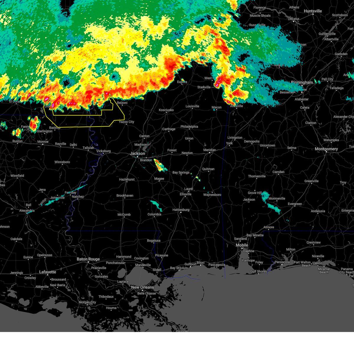
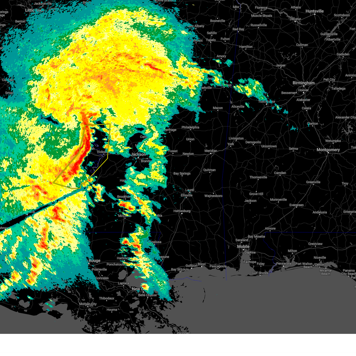
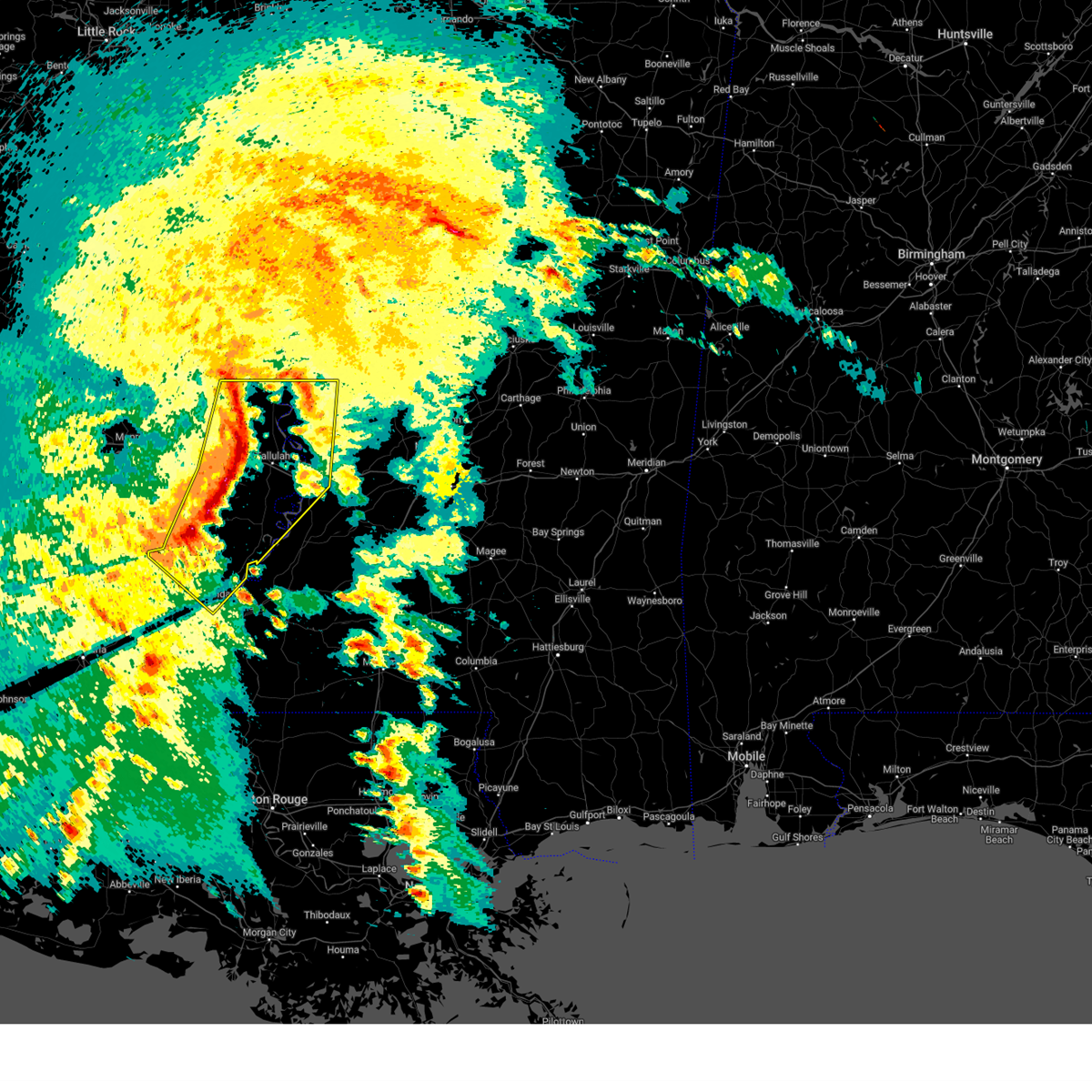
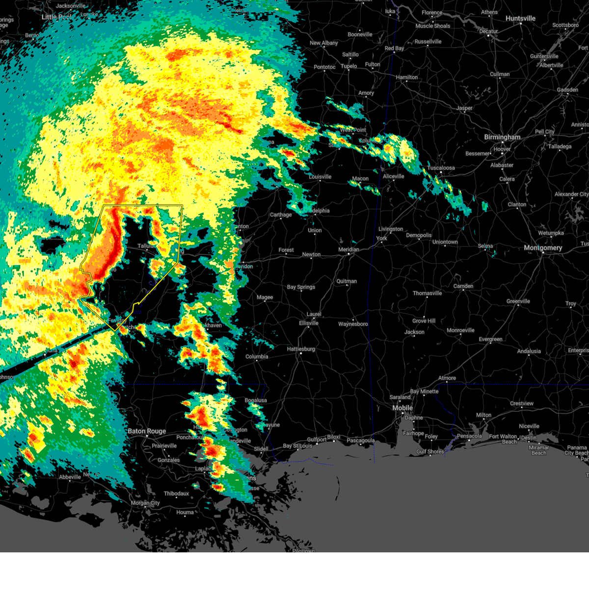
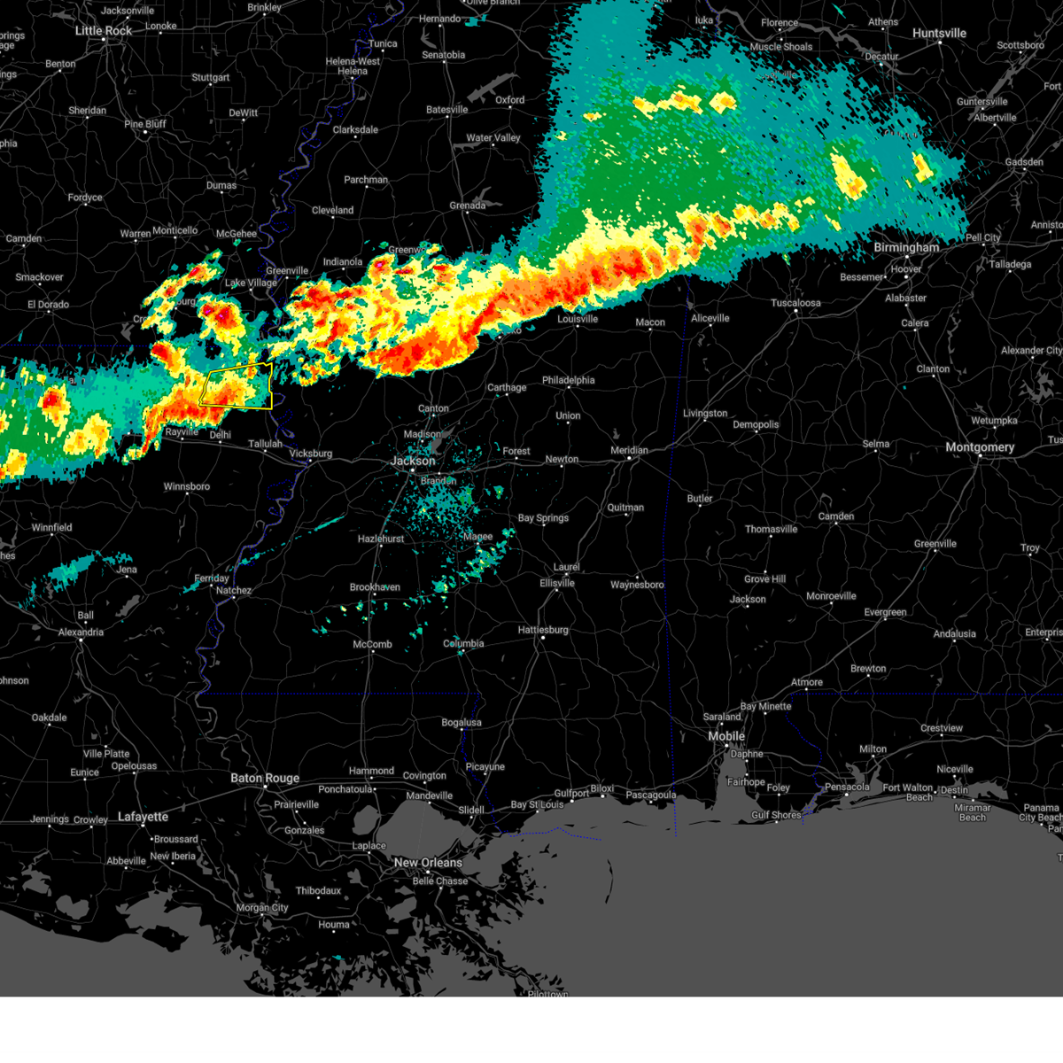
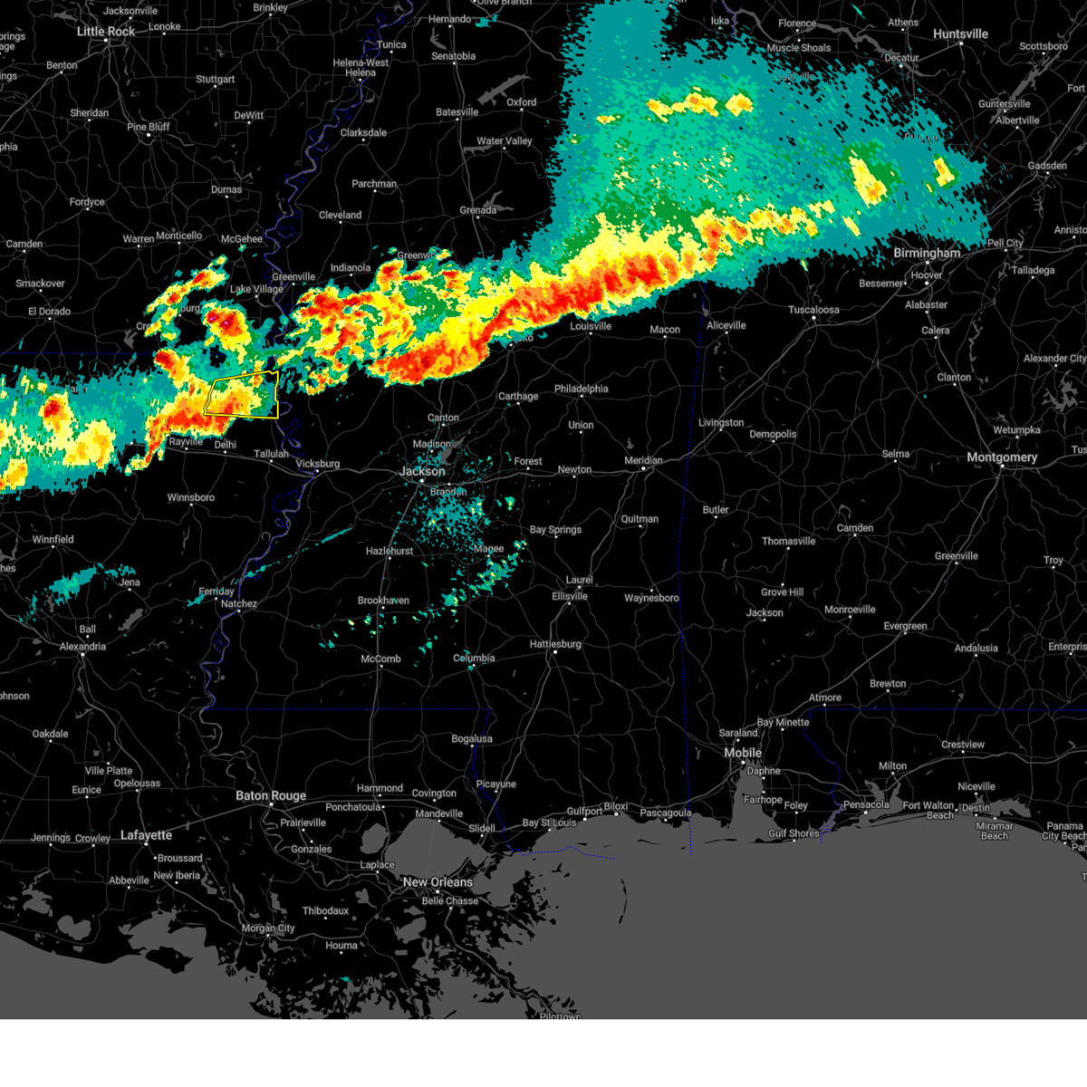
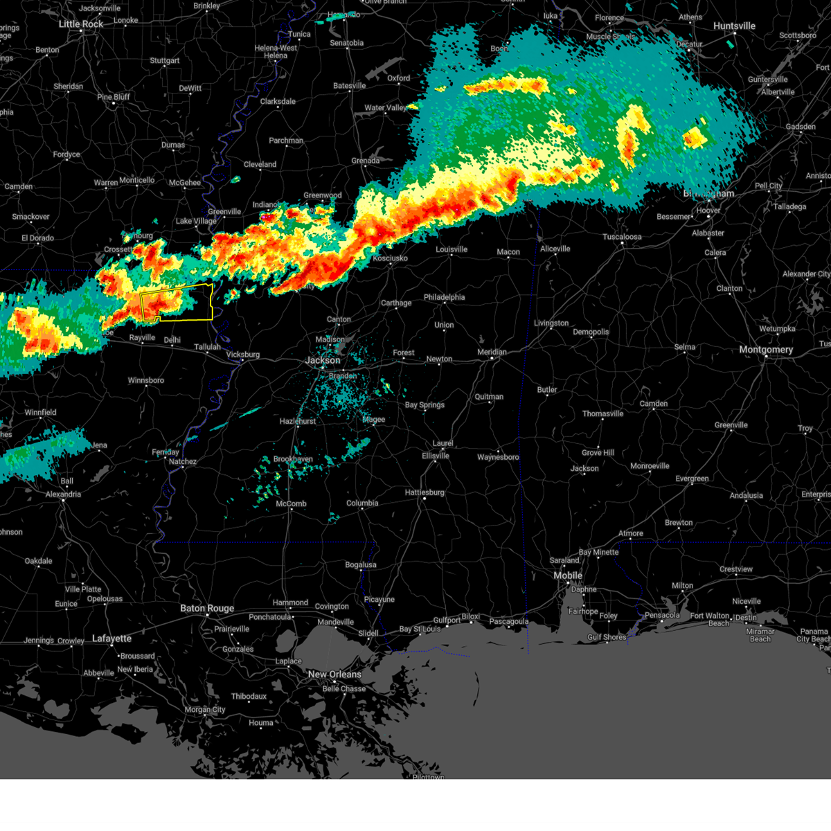
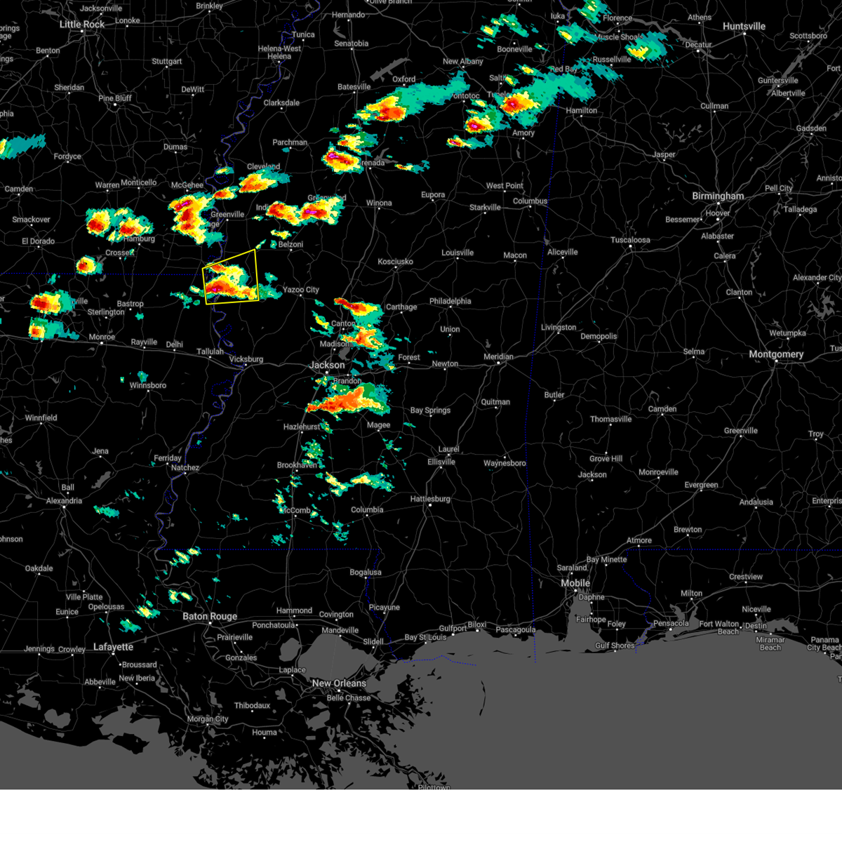
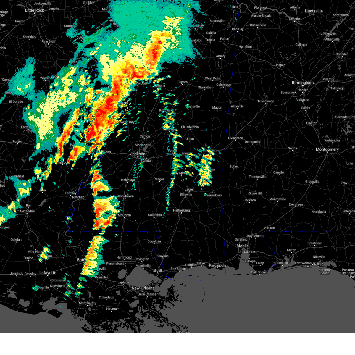
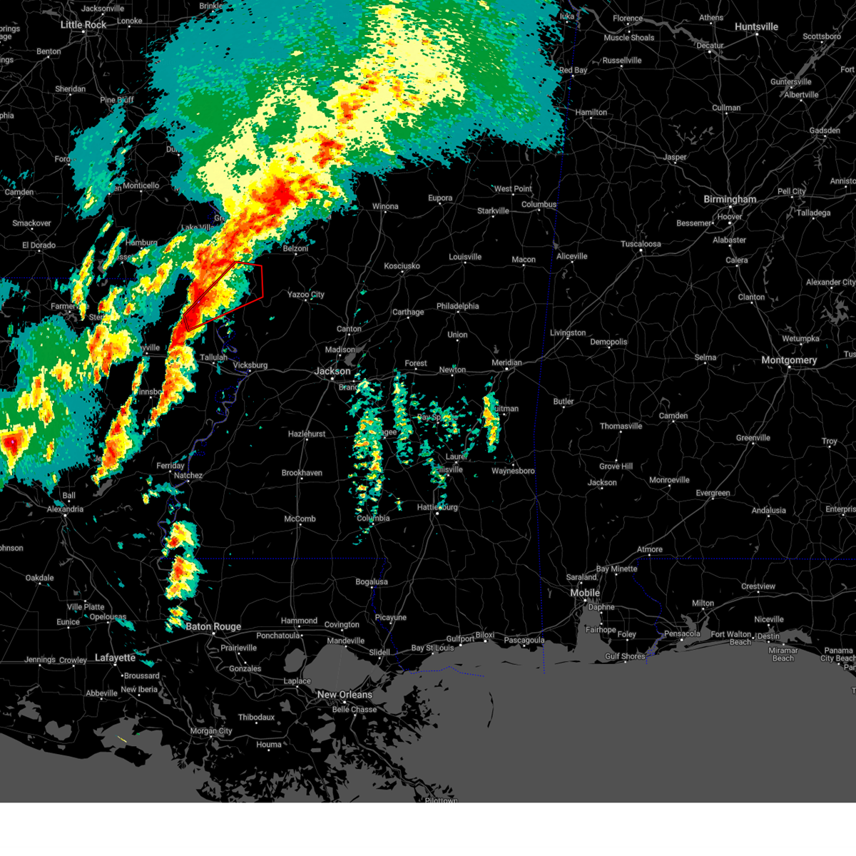
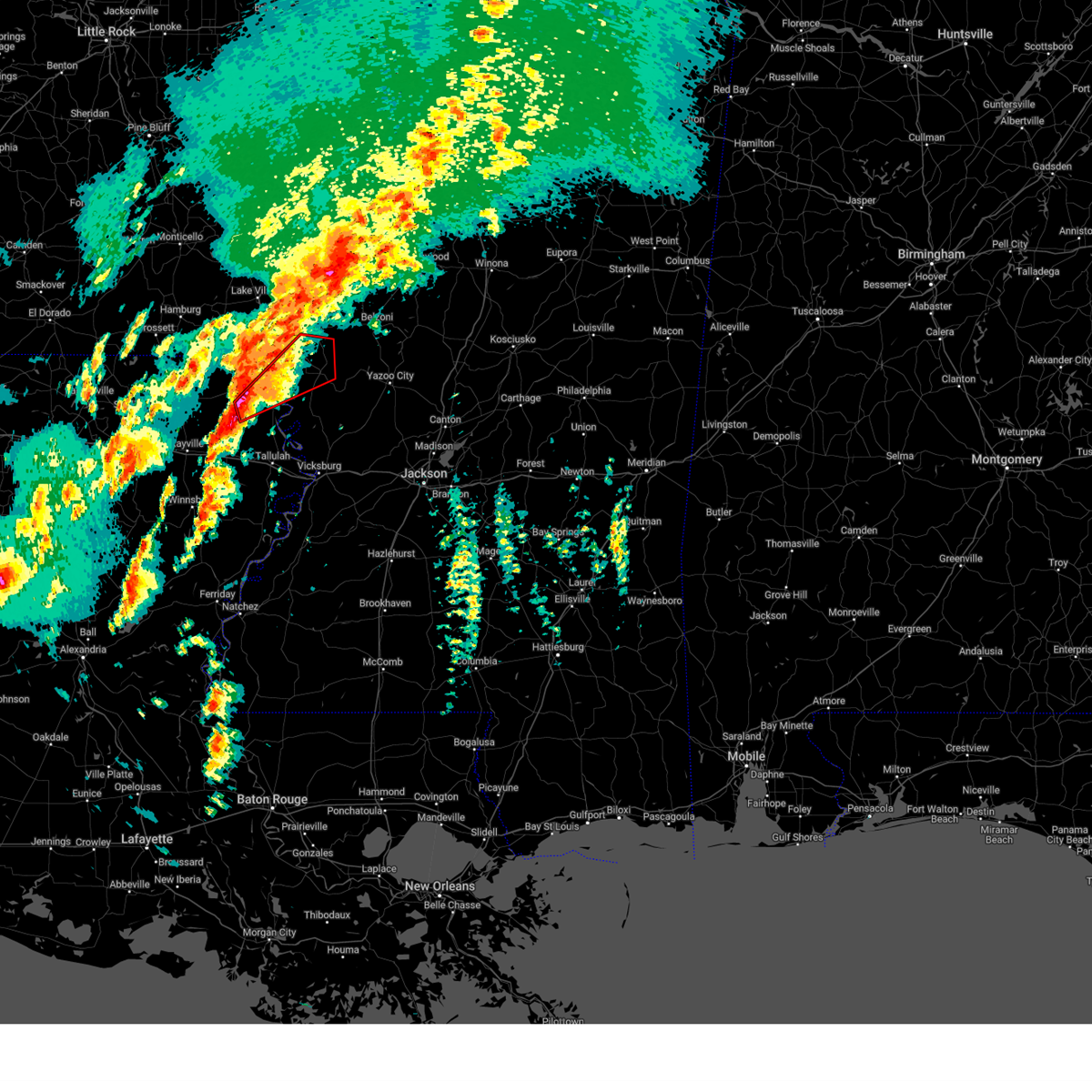
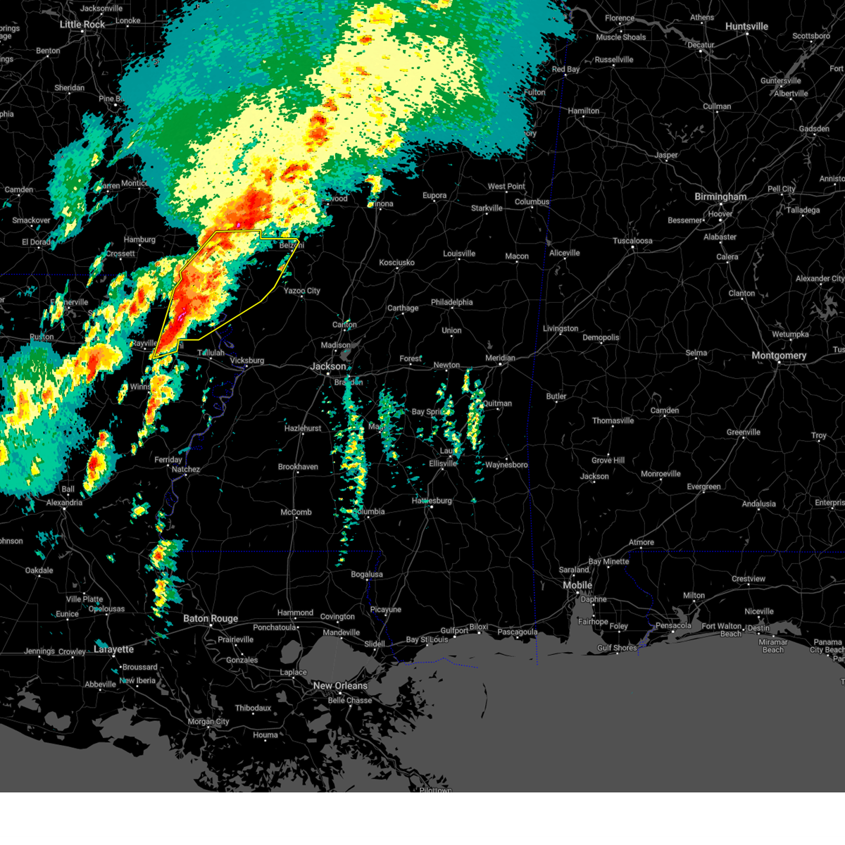
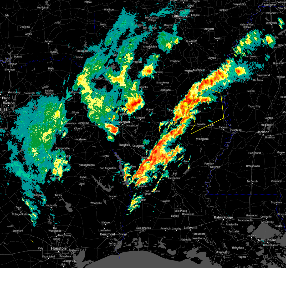
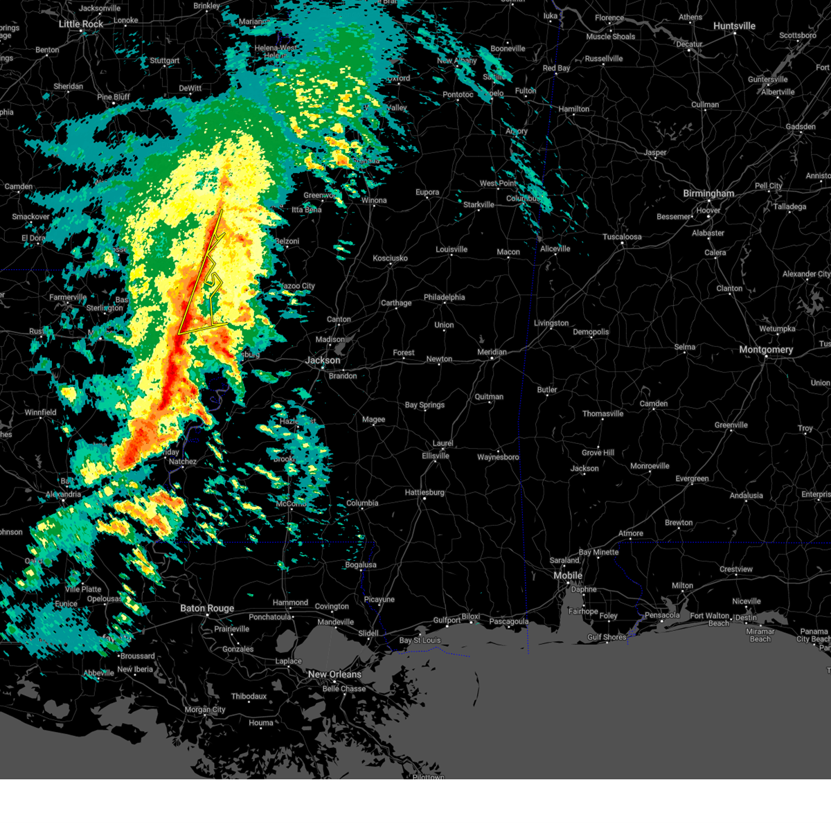
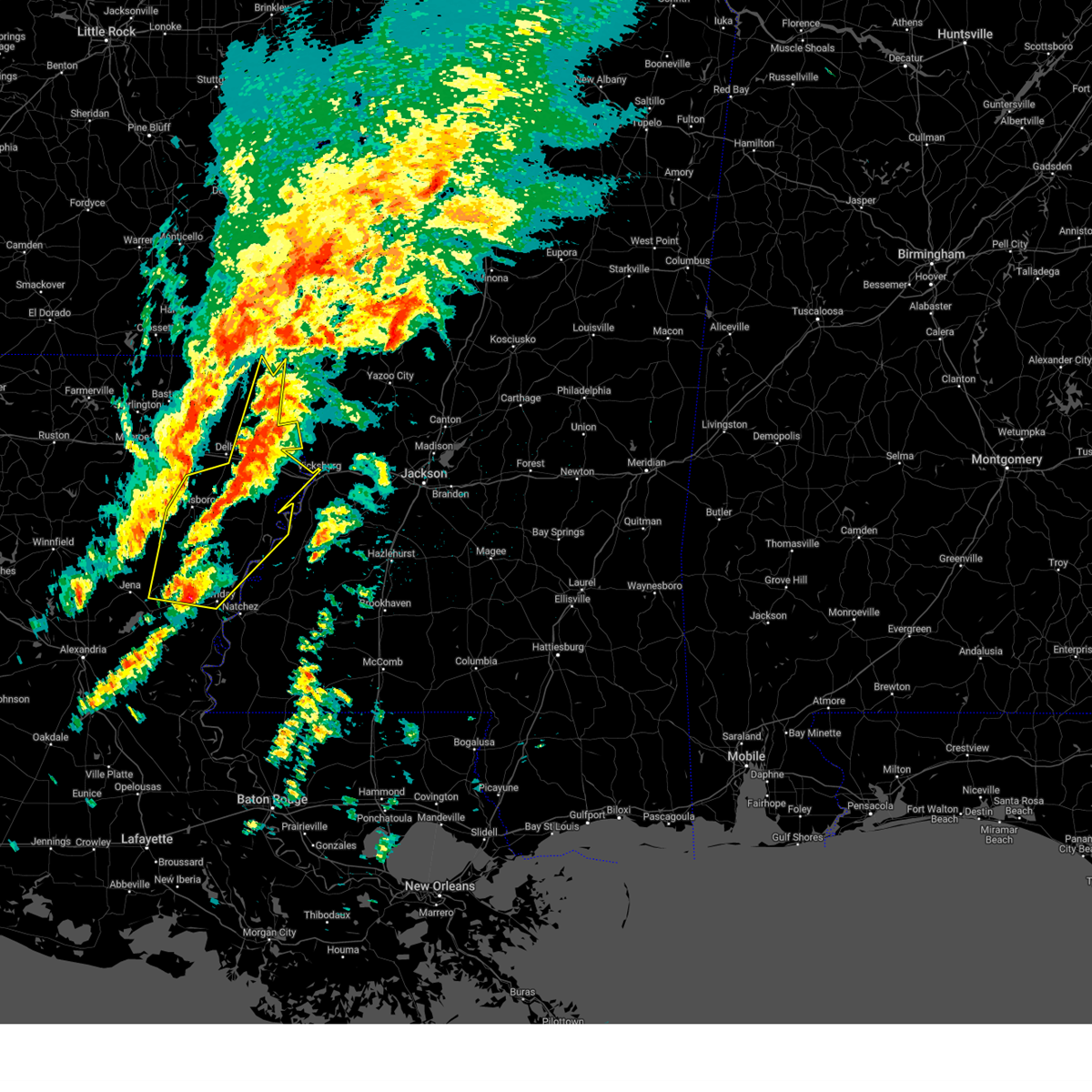
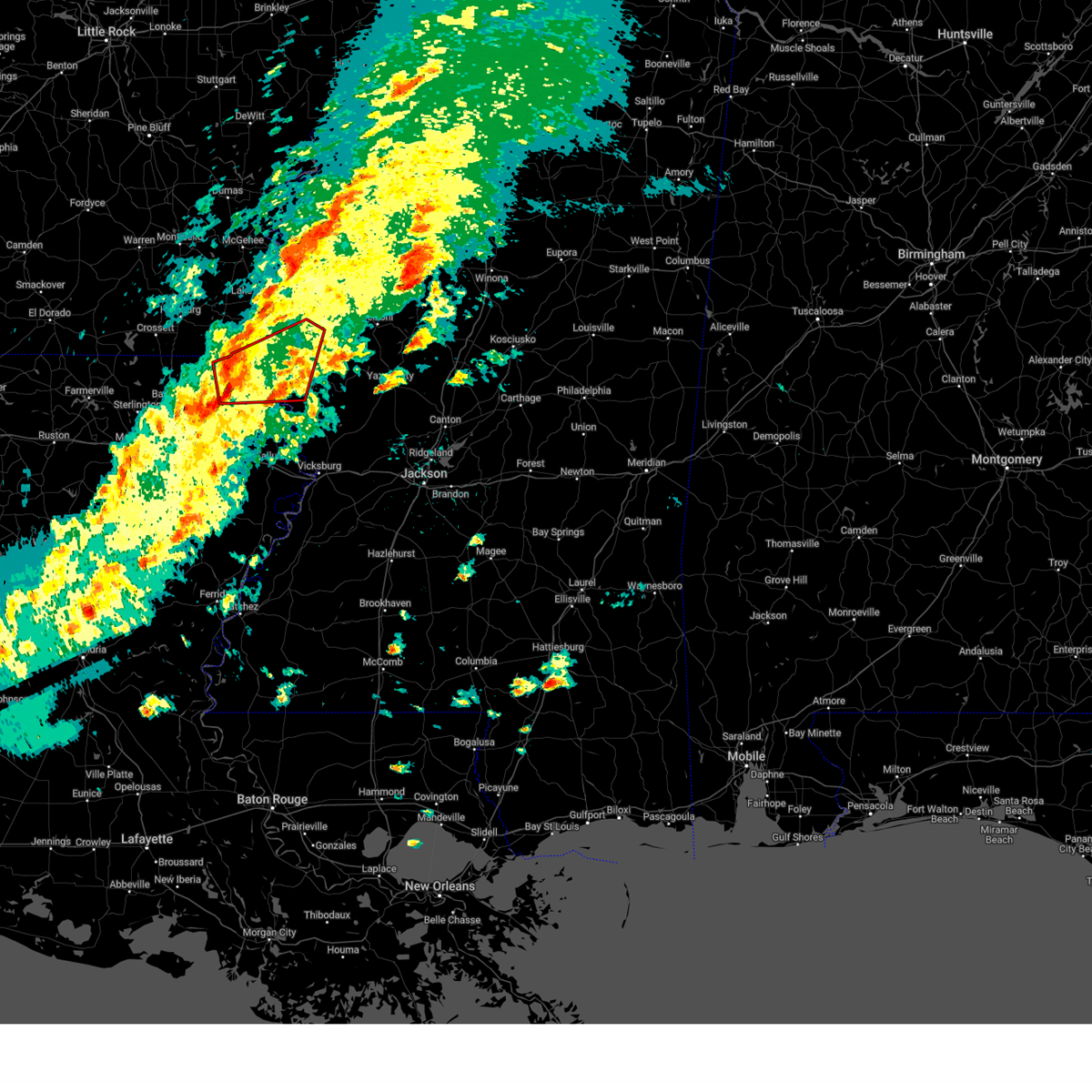
The Top Recent Hail Date for Lake Providence, LA is Saturday, May 17, 2025 (13th out of 65)
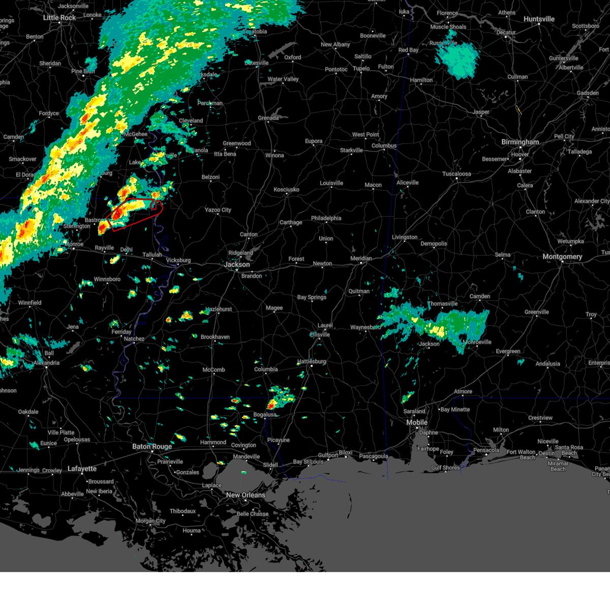
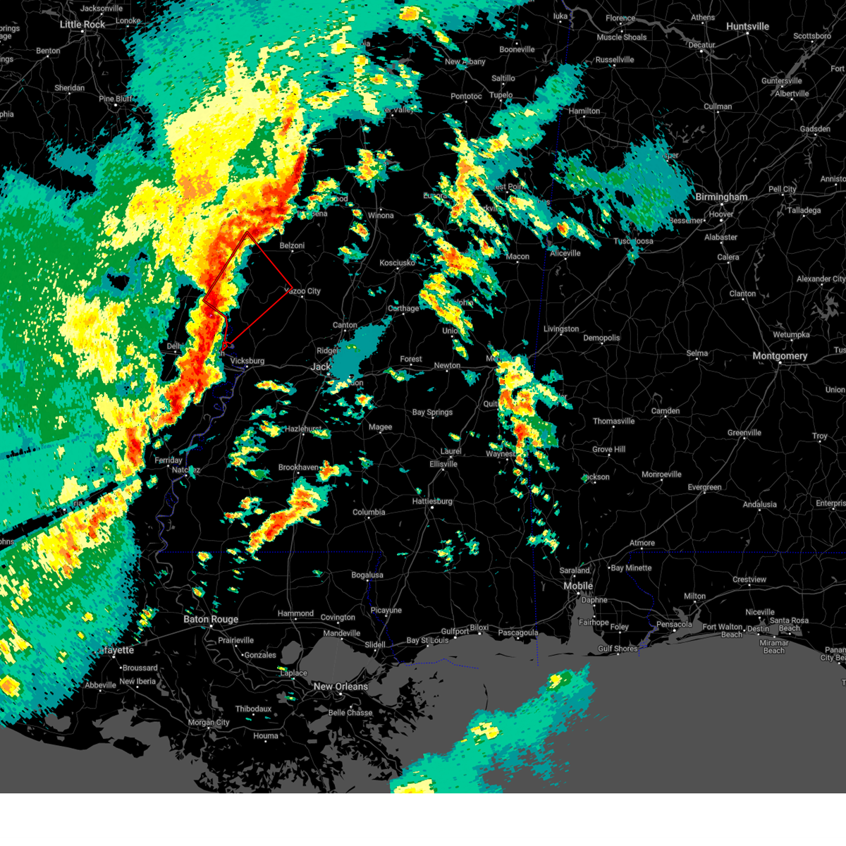
Hail and Wind Damage Spotted near Lake Providence, LA
| Date / Time | Report Details |
|---|---|
| 6/11/2025 7:38 PM CDT |
 At 738 pm cdt, severe thunderstorms were located along a line extending from near hamburg to near millikin, moving northeast at 35 mph (radar indicated). Hazards include 60 mph wind gusts and quarter size hail. Hail damage to vehicles is expected. expect wind damage to roofs, siding, and trees. these severe storms will be near, eudora, gassoway, and millikin around 745 pm cdt. Chicot junction around 755 pm cdt. At 738 pm cdt, severe thunderstorms were located along a line extending from near hamburg to near millikin, moving northeast at 35 mph (radar indicated). Hazards include 60 mph wind gusts and quarter size hail. Hail damage to vehicles is expected. expect wind damage to roofs, siding, and trees. these severe storms will be near, eudora, gassoway, and millikin around 745 pm cdt. Chicot junction around 755 pm cdt.
|
| 6/11/2025 7:38 PM CDT |
 the severe thunderstorm warning has been cancelled and is no longer in effect the severe thunderstorm warning has been cancelled and is no longer in effect
|
| 6/11/2025 7:33 PM CDT |
 At 733 pm cdt, severe thunderstorms were located along a line extending from near hamburg to near shelburn, moving northeast at 35 mph (radar indicated). Hazards include 60 mph wind gusts and quarter size hail. Hail damage to vehicles is expected. expect wind damage to roofs, siding, and trees. these severe storms will be near, portland, kilbourne, snyder, gassoway, and millikin around 740 pm cdt. eudora and montrose around 745 pm cdt. Chicot junction around 750 pm cdt. At 733 pm cdt, severe thunderstorms were located along a line extending from near hamburg to near shelburn, moving northeast at 35 mph (radar indicated). Hazards include 60 mph wind gusts and quarter size hail. Hail damage to vehicles is expected. expect wind damage to roofs, siding, and trees. these severe storms will be near, portland, kilbourne, snyder, gassoway, and millikin around 740 pm cdt. eudora and montrose around 745 pm cdt. Chicot junction around 750 pm cdt.
|
| 6/11/2025 7:19 PM CDT |
 the severe thunderstorm warning has been cancelled and is no longer in effect the severe thunderstorm warning has been cancelled and is no longer in effect
|
| 6/11/2025 7:19 PM CDT |
 At 719 pm cdt, severe thunderstorms were located along a line extending from near hamburg to near oak grove, moving northeast at 35 mph (radar indicated). Hazards include 60 mph wind gusts and quarter size hail. Hail damage to vehicles is expected. expect wind damage to roofs, siding, and trees. these severe storms will be near, hamburg, wilmot, parkdale, and shelburn around 725 pm cdt. kilbourne and millikin around 730 pm cdt. portland, snyder, and gassoway around 735 pm cdt. eudora around 740 pm cdt. montrose around 745 pm cdt. Chicot junction around 750 pm cdt. At 719 pm cdt, severe thunderstorms were located along a line extending from near hamburg to near oak grove, moving northeast at 35 mph (radar indicated). Hazards include 60 mph wind gusts and quarter size hail. Hail damage to vehicles is expected. expect wind damage to roofs, siding, and trees. these severe storms will be near, hamburg, wilmot, parkdale, and shelburn around 725 pm cdt. kilbourne and millikin around 730 pm cdt. portland, snyder, and gassoway around 735 pm cdt. eudora around 740 pm cdt. montrose around 745 pm cdt. Chicot junction around 750 pm cdt.
|
| 6/11/2025 7:04 PM CDT |
 At 704 pm cdt, severe thunderstorms were located along a line extending from crossett to near pioneer, moving east at 35 mph (radar indicated). Hazards include 60 mph wind gusts and quarter size hail. Hail damage to vehicles is expected. expect wind damage to roofs, siding, and trees. these severe storms will be near, oak grove, forest, jones, and berlin around 710 pm cdt. wilmot around 720 pm cdt. lake providence around 725 pm cdt. parkdale and shelburn around 730 pm cdt. kilbourne around 735 pm cdt. millikin and fitler around 740 pm cdt. Gassoway around 745 pm cdt. At 704 pm cdt, severe thunderstorms were located along a line extending from crossett to near pioneer, moving east at 35 mph (radar indicated). Hazards include 60 mph wind gusts and quarter size hail. Hail damage to vehicles is expected. expect wind damage to roofs, siding, and trees. these severe storms will be near, oak grove, forest, jones, and berlin around 710 pm cdt. wilmot around 720 pm cdt. lake providence around 725 pm cdt. parkdale and shelburn around 730 pm cdt. kilbourne around 735 pm cdt. millikin and fitler around 740 pm cdt. Gassoway around 745 pm cdt.
|
| 6/11/2025 7:04 PM CDT |
 the severe thunderstorm warning has been cancelled and is no longer in effect the severe thunderstorm warning has been cancelled and is no longer in effect
|
| 6/11/2025 6:52 PM CDT |
 Svrjan the national weather service in jackson has issued a * severe thunderstorm warning for, southern chicot county in southeastern arkansas, ashley county in southeastern arkansas, morehouse parish in northeastern louisiana, east carroll parish in northeastern louisiana, northwestern madison parish in northeastern louisiana, northeastern richland parish in northeastern louisiana, west carroll parish in northeastern louisiana, northeastern franklin parish in northeastern louisiana, southwestern washington county in northwestern mississippi, northwestern issaquena county in west central mississippi, * until 745 pm cdt. * at 651 pm cdt, severe thunderstorms were located along a line extending from 6 miles south of west crossett to near goodwill, moving northeast at 35 mph (radar indicated). Hazards include 60 mph wind gusts and quarter size hail. Hail damage to vehicles is expected. expect wind damage to roofs, siding, and trees. severe thunderstorms will be near, crossett, bonita, pioneer, and goodwill around 655 pm cdt. north crossett, forest, jones, and berlin around 700 pm cdt. oak grove around 705 pm cdt. hamburg and wilmot around 710 pm cdt. parkdale and shelburn around 720 pm cdt. kilbourne and millikin around 725 pm cdt. Portland, snyder, and gassoway around 730 pm cdt. Svrjan the national weather service in jackson has issued a * severe thunderstorm warning for, southern chicot county in southeastern arkansas, ashley county in southeastern arkansas, morehouse parish in northeastern louisiana, east carroll parish in northeastern louisiana, northwestern madison parish in northeastern louisiana, northeastern richland parish in northeastern louisiana, west carroll parish in northeastern louisiana, northeastern franklin parish in northeastern louisiana, southwestern washington county in northwestern mississippi, northwestern issaquena county in west central mississippi, * until 745 pm cdt. * at 651 pm cdt, severe thunderstorms were located along a line extending from 6 miles south of west crossett to near goodwill, moving northeast at 35 mph (radar indicated). Hazards include 60 mph wind gusts and quarter size hail. Hail damage to vehicles is expected. expect wind damage to roofs, siding, and trees. severe thunderstorms will be near, crossett, bonita, pioneer, and goodwill around 655 pm cdt. north crossett, forest, jones, and berlin around 700 pm cdt. oak grove around 705 pm cdt. hamburg and wilmot around 710 pm cdt. parkdale and shelburn around 720 pm cdt. kilbourne and millikin around 725 pm cdt. Portland, snyder, and gassoway around 730 pm cdt.
|
| 5/25/2025 9:11 PM CDT |
 The storms which prompted the warning have moved out of the area. therefore, the warning will be allowed to expire. a severe thunderstorm watch remains in effect until 300 am cdt for northeastern louisiana, and central and west central mississippi. to report severe weather, contact your nearest law enforcement agency. they will relay your report to the national weather service jackson. The storms which prompted the warning have moved out of the area. therefore, the warning will be allowed to expire. a severe thunderstorm watch remains in effect until 300 am cdt for northeastern louisiana, and central and west central mississippi. to report severe weather, contact your nearest law enforcement agency. they will relay your report to the national weather service jackson.
|
| 5/25/2025 8:53 PM CDT |
 At 853 pm cdt, severe thunderstorms were located along a line extending from near goodwill to near cary to near yazoo city, moving southeast at 30 mph (radar indicated). Hazards include 60 mph wind gusts and penny size hail. Expect damage to roofs, siding, and trees. Locations impacted include, lake providence, rolling fork, oak grove, mayersville, anguilla, kilbourne, bonita, grace, beekman, galion, shelburn, gassoway, jones, and millikin. At 853 pm cdt, severe thunderstorms were located along a line extending from near goodwill to near cary to near yazoo city, moving southeast at 30 mph (radar indicated). Hazards include 60 mph wind gusts and penny size hail. Expect damage to roofs, siding, and trees. Locations impacted include, lake providence, rolling fork, oak grove, mayersville, anguilla, kilbourne, bonita, grace, beekman, galion, shelburn, gassoway, jones, and millikin.
|
| 5/25/2025 8:53 PM CDT |
 the severe thunderstorm warning has been cancelled and is no longer in effect the severe thunderstorm warning has been cancelled and is no longer in effect
|
| 5/25/2025 8:41 PM CDT | Svrjan the national weather service in jackson has issued a * severe thunderstorm warning for, east carroll parish in northeastern louisiana, northern madison parish in northeastern louisiana, southern west carroll parish in northeastern louisiana, northern warren county in west central mississippi, western yazoo county in central mississippi, issaquena county in west central mississippi, southern sharkey county in west central mississippi, * until 1000 pm cdt. * at 840 pm cdt, severe thunderstorms were located along a line extending from near yazoo city to near forest, moving southeast at 35 mph (radar indicated). Hazards include 60 mph wind gusts and penny size hail. expect damage to roofs, siding, and trees |
| 5/25/2025 8:24 PM CDT |
 At 824 pm cdt, severe thunderstorms were located along a line extending from near galion to mayersville to louise, moving southeast at 30 mph (radar indicated). Hazards include 60 mph wind gusts and penny size hail. Expect damage to roofs, siding, and trees. Locations impacted include, lake providence, rolling fork, oak grove, mayersville, anguilla, kilbourne, bonita, louise, panther burn, grace, delta city, nitta yuma, beekman, galion, shelburn, gassoway, jones, millikin, and midnight. At 824 pm cdt, severe thunderstorms were located along a line extending from near galion to mayersville to louise, moving southeast at 30 mph (radar indicated). Hazards include 60 mph wind gusts and penny size hail. Expect damage to roofs, siding, and trees. Locations impacted include, lake providence, rolling fork, oak grove, mayersville, anguilla, kilbourne, bonita, louise, panther burn, grace, delta city, nitta yuma, beekman, galion, shelburn, gassoway, jones, millikin, and midnight.
|
| 5/25/2025 8:24 PM CDT |
 the severe thunderstorm warning has been cancelled and is no longer in effect the severe thunderstorm warning has been cancelled and is no longer in effect
|
| 5/25/2025 8:13 PM CDT |
 At 813 pm cdt, severe thunderstorms were located along a line extending from near jones to glen allan to near isola, moving southeast at 30 mph (radar indicated). Hazards include 60 mph wind gusts and quarter size hail. Hail damage to vehicles is expected. expect wind damage to roofs, siding, and trees. Locations impacted include, crossett, lake providence, rolling fork, oak grove, mayersville, west crossett, anguilla, kilbourne, bonita, louise, panther burn, grace, delta city, nitta yuma, beekman, galion, shelburn, gassoway, jones, and millikin. At 813 pm cdt, severe thunderstorms were located along a line extending from near jones to glen allan to near isola, moving southeast at 30 mph (radar indicated). Hazards include 60 mph wind gusts and quarter size hail. Hail damage to vehicles is expected. expect wind damage to roofs, siding, and trees. Locations impacted include, crossett, lake providence, rolling fork, oak grove, mayersville, west crossett, anguilla, kilbourne, bonita, louise, panther burn, grace, delta city, nitta yuma, beekman, galion, shelburn, gassoway, jones, and millikin.
|
| 5/25/2025 8:13 PM CDT |
 the severe thunderstorm warning has been cancelled and is no longer in effect the severe thunderstorm warning has been cancelled and is no longer in effect
|
| 5/25/2025 7:43 PM CDT |
 Svrjan the national weather service in jackson has issued a * severe thunderstorm warning for, southwestern ashley county in southeastern arkansas, northern morehouse parish in northeastern louisiana, northeastern east carroll parish in northeastern louisiana, northern west carroll parish in northeastern louisiana, southwestern sunflower county in northwestern mississippi, northwestern issaquena county in west central mississippi, western humphreys county in central mississippi, sharkey county in west central mississippi, * until 915 pm cdt. * at 742 pm cdt, severe thunderstorms were located along a line extending from near crossett to eudora to near tribbett, moving southeast at 30 mph (radar indicated). Hazards include 60 mph wind gusts and quarter size hail. Hail damage to vehicles is expected. Expect wind damage to roofs, siding, and trees. Svrjan the national weather service in jackson has issued a * severe thunderstorm warning for, southwestern ashley county in southeastern arkansas, northern morehouse parish in northeastern louisiana, northeastern east carroll parish in northeastern louisiana, northern west carroll parish in northeastern louisiana, southwestern sunflower county in northwestern mississippi, northwestern issaquena county in west central mississippi, western humphreys county in central mississippi, sharkey county in west central mississippi, * until 915 pm cdt. * at 742 pm cdt, severe thunderstorms were located along a line extending from near crossett to eudora to near tribbett, moving southeast at 30 mph (radar indicated). Hazards include 60 mph wind gusts and quarter size hail. Hail damage to vehicles is expected. Expect wind damage to roofs, siding, and trees.
|
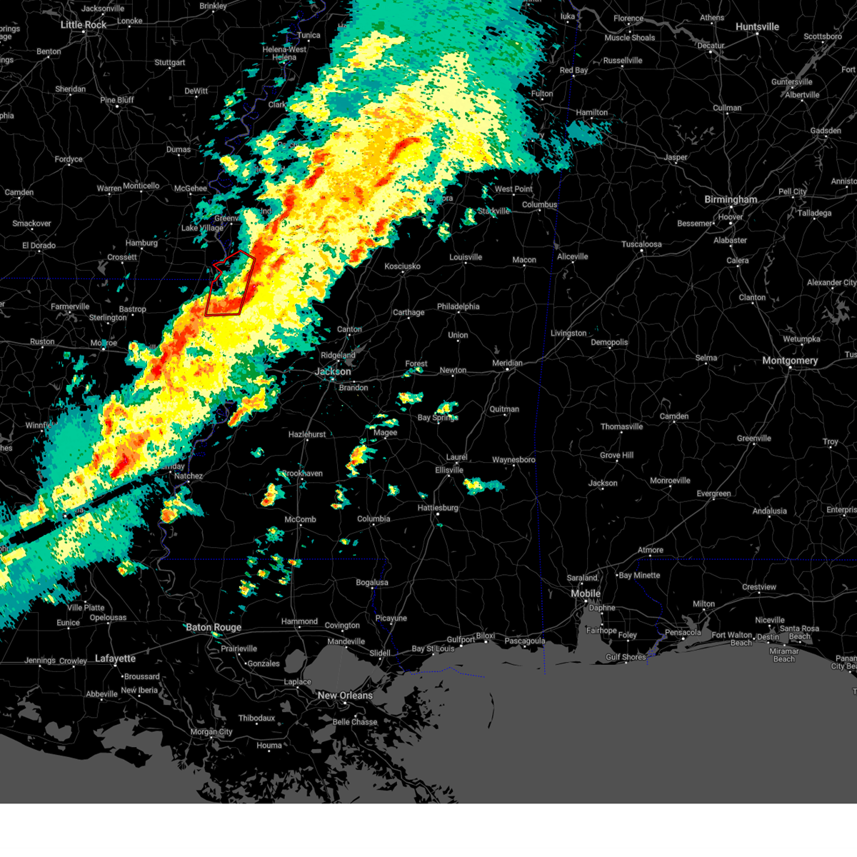
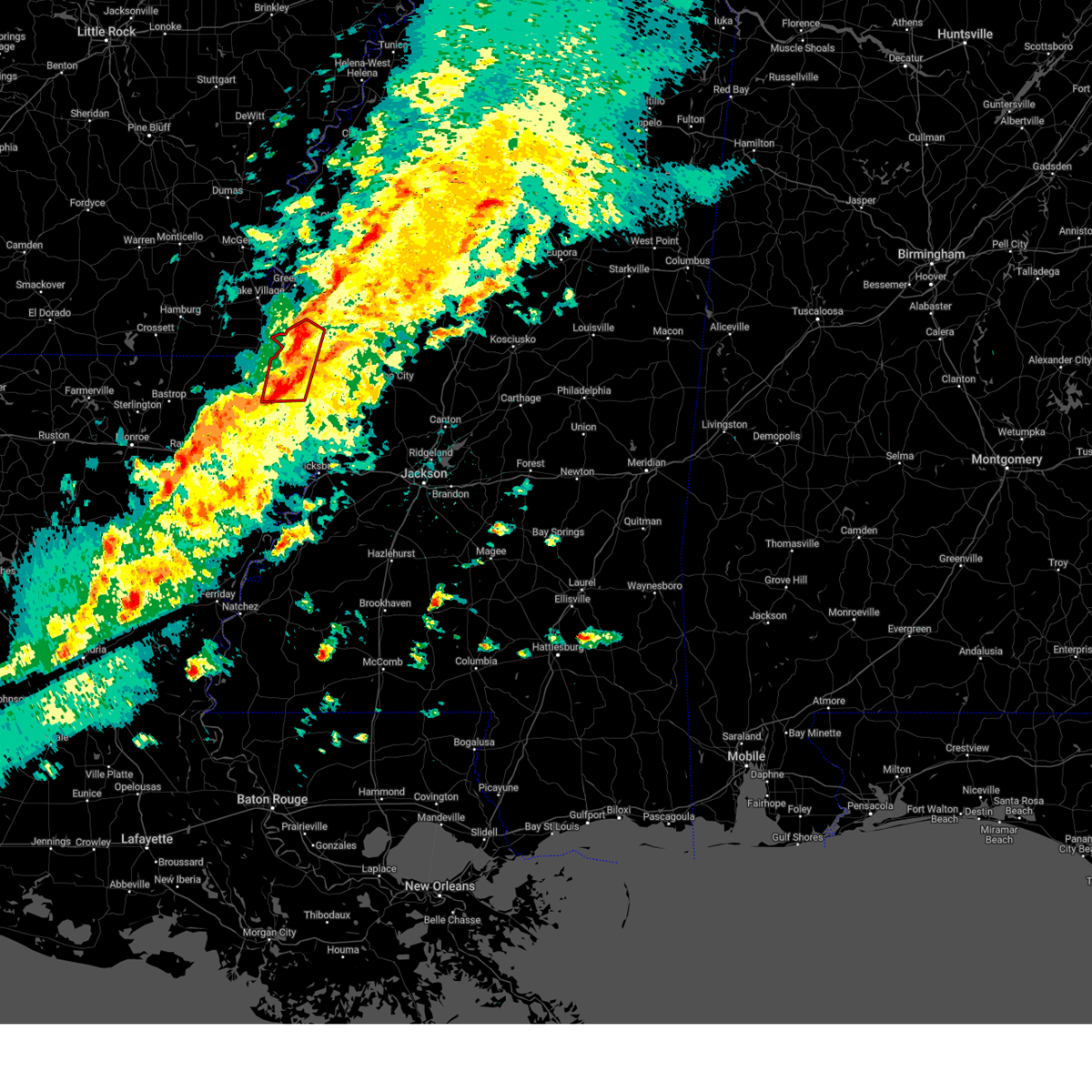
| 5/24/2025 3:00 PM CDT | Few trees downed across the paris in east carroll county LA, 4.1 miles ENE of Lake Providence, LA |
| 5/24/2025 2:36 PM CDT |
 Svrjan the national weather service in jackson has issued a * severe thunderstorm warning for, east carroll parish in northeastern louisiana, issaquena county in west central mississippi, sharkey county in west central mississippi, * until 345 pm cdt. * at 236 pm cdt, severe thunderstorms were located along a line extending from near estill to near glen allan to near oak grove, moving southeast at 25 mph (radar indicated). Hazards include 60 mph wind gusts and quarter size hail. Hail damage to vehicles is expected. Expect wind damage to roofs, siding, and trees. Svrjan the national weather service in jackson has issued a * severe thunderstorm warning for, east carroll parish in northeastern louisiana, issaquena county in west central mississippi, sharkey county in west central mississippi, * until 345 pm cdt. * at 236 pm cdt, severe thunderstorms were located along a line extending from near estill to near glen allan to near oak grove, moving southeast at 25 mph (radar indicated). Hazards include 60 mph wind gusts and quarter size hail. Hail damage to vehicles is expected. Expect wind damage to roofs, siding, and trees.
|
| 5/17/2025 5:26 PM CDT |
 Svrjan the national weather service in jackson has issued a * severe thunderstorm warning for, southeastern east carroll parish in northeastern louisiana, north central warren county in west central mississippi, west central yazoo county in central mississippi, issaquena county in west central mississippi, southern sharkey county in west central mississippi, * until 630 pm cdt. * at 525 pm cdt, a severe thunderstorm was located near lake providence, moving east at 30 mph (radar indicated). Hazards include ping pong ball size hail and 60 mph wind gusts. People and animals outdoors will be injured. expect hail damage to roofs, siding, windows, and vehicles. expect wind damage to roofs, siding, and trees. this severe thunderstorm will be near, fitler around 530 pm cdt. onward around 535 pm cdt. cary around 545 pm cdt. Valley park around 550 pm cdt. Svrjan the national weather service in jackson has issued a * severe thunderstorm warning for, southeastern east carroll parish in northeastern louisiana, north central warren county in west central mississippi, west central yazoo county in central mississippi, issaquena county in west central mississippi, southern sharkey county in west central mississippi, * until 630 pm cdt. * at 525 pm cdt, a severe thunderstorm was located near lake providence, moving east at 30 mph (radar indicated). Hazards include ping pong ball size hail and 60 mph wind gusts. People and animals outdoors will be injured. expect hail damage to roofs, siding, windows, and vehicles. expect wind damage to roofs, siding, and trees. this severe thunderstorm will be near, fitler around 530 pm cdt. onward around 535 pm cdt. cary around 545 pm cdt. Valley park around 550 pm cdt.
|
| 5/17/2025 5:15 PM CDT |
 the severe thunderstorm warning has been cancelled and is no longer in effect the severe thunderstorm warning has been cancelled and is no longer in effect
|
| 5/17/2025 5:15 PM CDT |
 At 514 pm cdt, a severe thunderstorm was located near rolling fork, moving east at 30 mph (radar indicated). Hazards include two inch hail and 60 mph wind gusts. People and animals outdoors will be injured. expect hail damage to roofs, siding, windows, and vehicles. expect wind damage to roofs, siding, and trees. This severe storm will be near, grace around 520 pm cdt. At 514 pm cdt, a severe thunderstorm was located near rolling fork, moving east at 30 mph (radar indicated). Hazards include two inch hail and 60 mph wind gusts. People and animals outdoors will be injured. expect hail damage to roofs, siding, windows, and vehicles. expect wind damage to roofs, siding, and trees. This severe storm will be near, grace around 520 pm cdt.
|
| 5/17/2025 4:51 PM CDT |
 At 451 pm cdt, a severe thunderstorm was located near lake providence, moving east at 30 mph (radar indicated). Hazards include 60 mph wind gusts and half dollar size hail. Hail damage to vehicles is expected. expect wind damage to roofs, siding, and trees. this severe storm will be near, mayersville around 455 pm cdt. Grace around 510 pm cdt. At 451 pm cdt, a severe thunderstorm was located near lake providence, moving east at 30 mph (radar indicated). Hazards include 60 mph wind gusts and half dollar size hail. Hail damage to vehicles is expected. expect wind damage to roofs, siding, and trees. this severe storm will be near, mayersville around 455 pm cdt. Grace around 510 pm cdt.
|
| 5/17/2025 4:28 PM CDT |
 Svrjan the national weather service in jackson has issued a * severe thunderstorm warning for, northern east carroll parish in northeastern louisiana, central west carroll parish in northeastern louisiana, northwestern issaquena county in west central mississippi, west central sharkey county in west central mississippi, * until 530 pm cdt. * at 428 pm cdt, a severe thunderstorm was located over forest, or near oak grove, moving east at 30 mph (radar indicated). Hazards include 60 mph wind gusts and quarter size hail. Hail damage to vehicles is expected. expect wind damage to roofs, siding, and trees. this severe thunderstorm will be near, lake providence and shelburn around 435 pm cdt. mayersville around 455 pm cdt. Grace around 510 pm cdt. Svrjan the national weather service in jackson has issued a * severe thunderstorm warning for, northern east carroll parish in northeastern louisiana, central west carroll parish in northeastern louisiana, northwestern issaquena county in west central mississippi, west central sharkey county in west central mississippi, * until 530 pm cdt. * at 428 pm cdt, a severe thunderstorm was located over forest, or near oak grove, moving east at 30 mph (radar indicated). Hazards include 60 mph wind gusts and quarter size hail. Hail damage to vehicles is expected. expect wind damage to roofs, siding, and trees. this severe thunderstorm will be near, lake providence and shelburn around 435 pm cdt. mayersville around 455 pm cdt. Grace around 510 pm cdt.
|
| 5/6/2025 6:36 PM CDT |
 the severe thunderstorm warning has been cancelled and is no longer in effect the severe thunderstorm warning has been cancelled and is no longer in effect
|
| 5/6/2025 6:36 PM CDT |
 At 636 pm cdt, severe thunderstorms were located along a line extending from transylvania to near tallulah to 6 miles north of cooter point, moving east at 35 mph (radar indicated). Hazards include 60 mph wind gusts. Expect damage to roofs, siding, and trees. these severe storms will be near, mansford, somerset, omega, tallulah, alsatia, transylvania, sondheimer, and afton around 640 pm cdt. eagle bend, mound, and newellton around 645 pm cdt. lake bruin around 650 pm cdt. vicksburg around 655 pm cdt. le tourneau, valley park, and st. joseph around 700 pm cdt. yokena around 705 pm cdt. Other locations impacted by these severe thunderstorms include delta and richmond. At 636 pm cdt, severe thunderstorms were located along a line extending from transylvania to near tallulah to 6 miles north of cooter point, moving east at 35 mph (radar indicated). Hazards include 60 mph wind gusts. Expect damage to roofs, siding, and trees. these severe storms will be near, mansford, somerset, omega, tallulah, alsatia, transylvania, sondheimer, and afton around 640 pm cdt. eagle bend, mound, and newellton around 645 pm cdt. lake bruin around 650 pm cdt. vicksburg around 655 pm cdt. le tourneau, valley park, and st. joseph around 700 pm cdt. yokena around 705 pm cdt. Other locations impacted by these severe thunderstorms include delta and richmond.
|
| 5/6/2025 6:24 PM CDT | the severe thunderstorm warning has been cancelled and is no longer in effect |
| 5/6/2025 6:24 PM CDT | At 623 pm cdt, severe thunderstorms were located along a line extending from near monticello to 7 miles south of tendal to wisner, moving east at 45 mph (radar indicated). Hazards include 60 mph wind gusts. Expect damage to roofs, siding, and trees. these severe storms will be near, mansford, omega, cooter point, tallulah, alsatia, transylvania, newlight, sondheimer, and afton around 630 pm cdt. somerset around 635 pm cdt. eagle bend, mound, and newellton around 640 pm cdt. lake bruin around 645 pm cdt. Other locations impacted by these severe thunderstorms include delta and richmond. |
| 5/6/2025 6:15 PM CDT |
 At 615 pm cdt, severe thunderstorms were located along a line extending from near monticello to near tendal to near gilbert, moving east at 45 mph (radar indicated). Hazards include 60 mph wind gusts and penny size hail. Expect damage to roofs, siding, and trees. these severe storms will be near, newlight around 620 pm cdt. tallulah, alsatia, transylvania, and sondheimer around 625 pm cdt. mansford, somerset, omega, and afton around 630 pm cdt. newellton around 635 pm cdt. lake bruin, eagle bend, and mound around 640 pm cdt. vicksburg around 645 pm cdt. le tourneau and st. joseph around 650 pm cdt. Other locations impacted by these severe thunderstorms include delta and richmond. At 615 pm cdt, severe thunderstorms were located along a line extending from near monticello to near tendal to near gilbert, moving east at 45 mph (radar indicated). Hazards include 60 mph wind gusts and penny size hail. Expect damage to roofs, siding, and trees. these severe storms will be near, newlight around 620 pm cdt. tallulah, alsatia, transylvania, and sondheimer around 625 pm cdt. mansford, somerset, omega, and afton around 630 pm cdt. newellton around 635 pm cdt. lake bruin, eagle bend, and mound around 640 pm cdt. vicksburg around 645 pm cdt. le tourneau and st. joseph around 650 pm cdt. Other locations impacted by these severe thunderstorms include delta and richmond.
|
| 5/6/2025 6:15 PM CDT |
 the severe thunderstorm warning has been cancelled and is no longer in effect the severe thunderstorm warning has been cancelled and is no longer in effect
|
| 5/6/2025 6:04 PM CDT |
 Svrjan the national weather service in jackson has issued a * severe thunderstorm warning for, central morehouse parish in northeastern louisiana, east carroll parish in northeastern louisiana, tensas parish in northeastern louisiana, northeastern concordia parish in northeastern louisiana, northern catahoula parish in northeastern louisiana, richland parish in northeastern louisiana, west carroll parish in northeastern louisiana, franklin parish in northeastern louisiana, madison parish in northeastern louisiana, western warren county in west central mississippi, west central claiborne county in southwestern mississippi, issaquena county in west central mississippi, southwestern sharkey county in west central mississippi, * until 645 pm cdt. * at 603 pm cdt, severe thunderstorms were located along a line extending from 7 miles northwest of epps to near crowville to near grayson, moving east at 50 mph (radar indicated). Hazards include 60 mph wind gusts and penny size hail. Expect damage to roofs, siding, and trees. severe thunderstorms will be near, jigger, monticello, warden, delhi, bakers, waverly, winnsboro, liddieville, crowville, and epps around 610 pm cdt. tendal, gilbert, and pioneer around 615 pm cdt. wisner, tallulah, transylvania, alsatia, and sondheimer around 625 pm cdt. mansford, omega, newlight, and afton around 630 pm cdt. somerset around 635 pm cdt. Other locations impacted by these severe thunderstorms include delta and richmond. Svrjan the national weather service in jackson has issued a * severe thunderstorm warning for, central morehouse parish in northeastern louisiana, east carroll parish in northeastern louisiana, tensas parish in northeastern louisiana, northeastern concordia parish in northeastern louisiana, northern catahoula parish in northeastern louisiana, richland parish in northeastern louisiana, west carroll parish in northeastern louisiana, franklin parish in northeastern louisiana, madison parish in northeastern louisiana, western warren county in west central mississippi, west central claiborne county in southwestern mississippi, issaquena county in west central mississippi, southwestern sharkey county in west central mississippi, * until 645 pm cdt. * at 603 pm cdt, severe thunderstorms were located along a line extending from 7 miles northwest of epps to near crowville to near grayson, moving east at 50 mph (radar indicated). Hazards include 60 mph wind gusts and penny size hail. Expect damage to roofs, siding, and trees. severe thunderstorms will be near, jigger, monticello, warden, delhi, bakers, waverly, winnsboro, liddieville, crowville, and epps around 610 pm cdt. tendal, gilbert, and pioneer around 615 pm cdt. wisner, tallulah, transylvania, alsatia, and sondheimer around 625 pm cdt. mansford, omega, newlight, and afton around 630 pm cdt. somerset around 635 pm cdt. Other locations impacted by these severe thunderstorms include delta and richmond.
|
| 5/2/2025 3:44 PM CDT | At 344 pm cdt, a severe thunderstorm was located over alsatia, or 12 miles south of lake providence, moving east at 20 mph (radar indicated). Hazards include 60 mph wind gusts and quarter size hail. Hail damage to vehicles is expected. expect wind damage to roofs, siding, and trees. this severe storm will be near, transylvania around 350 pm cdt. fitler around 355 pm cdt. onward around 410 pm cdt. Valley park around 415 pm cdt. |
| 5/2/2025 3:28 PM CDT | At 328 pm cdt, a severe thunderstorm was located near alsatia, or 14 miles northwest of tallulah, moving east at 20 mph (radar indicated). Hazards include 60 mph wind gusts and quarter size hail. Hail damage to vehicles is expected. expect wind damage to roofs, siding, and trees. this severe storm will be near, transylvania, alsatia, and sondheimer around 335 pm cdt. omega around 340 pm cdt. fitler around 355 pm cdt. Onward around 410 pm cdt. |
| 5/2/2025 3:28 PM CDT | the severe thunderstorm warning has been cancelled and is no longer in effect |
| 5/2/2025 3:14 PM CDT | Svrjan the national weather service in jackson has issued a * severe thunderstorm warning for, east carroll parish in northeastern louisiana, northern madison parish in northeastern louisiana, east central richland parish in northeastern louisiana, southeastern west carroll parish in northeastern louisiana, northwestern warren county in west central mississippi, issaquena county in west central mississippi, southwestern sharkey county in west central mississippi, * until 415 pm cdt. * at 313 pm cdt, a severe thunderstorm was located over monticello, or 11 miles northeast of delhi, moving east at 20 mph (radar indicated). Hazards include 60 mph wind gusts and quarter size hail. Hail damage to vehicles is expected. expect wind damage to roofs, siding, and trees. this severe thunderstorm will be near, alsatia around 325 pm cdt. transylvania and sondheimer around 330 pm cdt. Omega around 340 pm cdt. |
| 3/23/2025 11:07 PM CDT |
 the severe thunderstorm warning has been cancelled and is no longer in effect the severe thunderstorm warning has been cancelled and is no longer in effect
|
| 3/23/2025 10:54 PM CDT |
 the severe thunderstorm warning has been cancelled and is no longer in effect the severe thunderstorm warning has been cancelled and is no longer in effect
|
| 3/23/2025 10:54 PM CDT |
 At 1053 pm cdt, a severe thunderstorm was located over forest, or near oak grove, moving east at 35 mph (radar indicated). Hazards include 60 mph wind gusts and quarter size hail. Hail damage to vehicles is expected. expect wind damage to roofs, siding, and trees. this severe storm will be near, lake providence around 1100 pm cdt. shelburn around 1105 pm cdt. Transylvania around 1110 pm cdt. At 1053 pm cdt, a severe thunderstorm was located over forest, or near oak grove, moving east at 35 mph (radar indicated). Hazards include 60 mph wind gusts and quarter size hail. Hail damage to vehicles is expected. expect wind damage to roofs, siding, and trees. this severe storm will be near, lake providence around 1100 pm cdt. shelburn around 1105 pm cdt. Transylvania around 1110 pm cdt.
|
| 3/23/2025 10:26 PM CDT |
 Svrjan the national weather service in jackson has issued a * severe thunderstorm warning for, central morehouse parish in northeastern louisiana, central east carroll parish in northeastern louisiana, west carroll parish in northeastern louisiana, * until 1130 pm cdt. * at 1026 pm cdt, a severe thunderstorm was located near goodwill, or 14 miles east of bastrop, moving east at 35 mph (radar indicated). Hazards include 60 mph wind gusts and quarter size hail. Hail damage to vehicles is expected. expect wind damage to roofs, siding, and trees. this severe thunderstorm will be near, goodwill around 1030 pm cdt. pioneer and darnell around 1035 pm cdt. forest around 1040 pm cdt. oak grove around 1045 pm cdt. lake providence around 1100 pm cdt. shelburn around 1105 pm cdt. Transylvania around 1110 pm cdt. Svrjan the national weather service in jackson has issued a * severe thunderstorm warning for, central morehouse parish in northeastern louisiana, central east carroll parish in northeastern louisiana, west carroll parish in northeastern louisiana, * until 1130 pm cdt. * at 1026 pm cdt, a severe thunderstorm was located near goodwill, or 14 miles east of bastrop, moving east at 35 mph (radar indicated). Hazards include 60 mph wind gusts and quarter size hail. Hail damage to vehicles is expected. expect wind damage to roofs, siding, and trees. this severe thunderstorm will be near, goodwill around 1030 pm cdt. pioneer and darnell around 1035 pm cdt. forest around 1040 pm cdt. oak grove around 1045 pm cdt. lake providence around 1100 pm cdt. shelburn around 1105 pm cdt. Transylvania around 1110 pm cdt.
|
| 3/23/2025 6:42 PM CDT |
 the severe thunderstorm warning has been cancelled and is no longer in effect the severe thunderstorm warning has been cancelled and is no longer in effect
|
| 3/23/2025 6:42 PM CDT |
 At 642 pm cdt, a severe thunderstorm was located over mayersville, moving east at 30 mph (radar indicated). Hazards include 60 mph wind gusts and half dollar size hail. Hail damage to vehicles is expected. expect wind damage to roofs, siding, and trees. this severe storm will be near, mayersville, glen allan, and grace around 645 pm cdt. rolling fork around 650 pm cdt. Anguilla and nitta yuma around 700 pm cdt. At 642 pm cdt, a severe thunderstorm was located over mayersville, moving east at 30 mph (radar indicated). Hazards include 60 mph wind gusts and half dollar size hail. Hail damage to vehicles is expected. expect wind damage to roofs, siding, and trees. this severe storm will be near, mayersville, glen allan, and grace around 645 pm cdt. rolling fork around 650 pm cdt. Anguilla and nitta yuma around 700 pm cdt.
|
| 3/23/2025 6:27 PM CDT |
 Svrjan the national weather service in jackson has issued a * severe thunderstorm warning for, south central chicot county in southeastern arkansas, northeastern east carroll parish in northeastern louisiana, northeastern west carroll parish in northeastern louisiana, southern washington county in northwestern mississippi, northwestern issaquena county in west central mississippi, northwestern sharkey county in west central mississippi, * until 730 pm cdt. * at 627 pm cdt, a severe thunderstorm was located over shelburn, or near lake providence, moving east at 30 mph (radar indicated). Hazards include 60 mph wind gusts and quarter size hail. Hail damage to vehicles is expected. expect wind damage to roofs, siding, and trees. this severe thunderstorm will be near, gassoway, lake providence, millikin, and mayersville around 630 pm cdt. glen allan around 640 pm cdt. grace around 645 pm cdt. anguilla, rolling fork, and nitta yuma around 655 pm cdt. panther burn around 700 pm cdt. Delta city around 705 pm cdt. Svrjan the national weather service in jackson has issued a * severe thunderstorm warning for, south central chicot county in southeastern arkansas, northeastern east carroll parish in northeastern louisiana, northeastern west carroll parish in northeastern louisiana, southern washington county in northwestern mississippi, northwestern issaquena county in west central mississippi, northwestern sharkey county in west central mississippi, * until 730 pm cdt. * at 627 pm cdt, a severe thunderstorm was located over shelburn, or near lake providence, moving east at 30 mph (radar indicated). Hazards include 60 mph wind gusts and quarter size hail. Hail damage to vehicles is expected. expect wind damage to roofs, siding, and trees. this severe thunderstorm will be near, gassoway, lake providence, millikin, and mayersville around 630 pm cdt. glen allan around 640 pm cdt. grace around 645 pm cdt. anguilla, rolling fork, and nitta yuma around 655 pm cdt. panther burn around 700 pm cdt. Delta city around 705 pm cdt.
|
| 3/23/2025 5:52 PM CDT | At 552 pm cdt, a severe thunderstorm was located over lake providence, moving northeast at 30 mph (radar indicated). Hazards include 60 mph wind gusts and half dollar size hail. Hail damage to vehicles is expected. expect wind damage to roofs, siding, and trees. This severe storm will be near, mayersville around 555 pm cdt. |
| 3/23/2025 5:52 PM CDT | the severe thunderstorm warning has been cancelled and is no longer in effect |
| 3/23/2025 5:34 PM CDT |
 At 533 pm cdt, a severe thunderstorm was located near forest, or near oak grove, moving east at 30 mph (radar indicated). Hazards include two inch hail and 60 mph wind gusts. People and animals outdoors will be injured. expect hail damage to roofs, siding, windows, and vehicles. expect wind damage to roofs, siding, and trees. this severe storm will be near, lake providence and shelburn around 540 pm cdt. Mayersville around 555 pm cdt. At 533 pm cdt, a severe thunderstorm was located near forest, or near oak grove, moving east at 30 mph (radar indicated). Hazards include two inch hail and 60 mph wind gusts. People and animals outdoors will be injured. expect hail damage to roofs, siding, windows, and vehicles. expect wind damage to roofs, siding, and trees. this severe storm will be near, lake providence and shelburn around 540 pm cdt. Mayersville around 555 pm cdt.
|
| 3/23/2025 5:15 PM CDT |
 At 515 pm cdt, a severe thunderstorm was located over pioneer, or 8 miles south of oak grove, moving northeast at 30 mph (radar indicated). Hazards include two inch hail and 60 mph wind gusts. People and animals outdoors will be injured. expect hail damage to roofs, siding, windows, and vehicles. expect wind damage to roofs, siding, and trees. this severe storm will be near, oak grove and forest around 520 pm cdt. lake providence around 525 pm cdt. shelburn around 530 pm cdt. Mayersville around 545 pm cdt. At 515 pm cdt, a severe thunderstorm was located over pioneer, or 8 miles south of oak grove, moving northeast at 30 mph (radar indicated). Hazards include two inch hail and 60 mph wind gusts. People and animals outdoors will be injured. expect hail damage to roofs, siding, windows, and vehicles. expect wind damage to roofs, siding, and trees. this severe storm will be near, oak grove and forest around 520 pm cdt. lake providence around 525 pm cdt. shelburn around 530 pm cdt. Mayersville around 545 pm cdt.
|
| 3/23/2025 5:10 PM CDT |
 At 510 pm cdt, a severe thunderstorm was located over pioneer, or 8 miles southwest of oak grove, moving northeast at 35 mph (radar indicated). Hazards include golf ball size hail and 60 mph wind gusts. People and animals outdoors will be injured. expect hail damage to roofs, siding, windows, and vehicles. expect wind damage to roofs, siding, and trees. this severe storm will be near, oak grove, pioneer, and forest around 515 pm cdt. lake providence and shelburn around 525 pm cdt. millikin around 535 pm cdt. Mayersville around 545 pm cdt. At 510 pm cdt, a severe thunderstorm was located over pioneer, or 8 miles southwest of oak grove, moving northeast at 35 mph (radar indicated). Hazards include golf ball size hail and 60 mph wind gusts. People and animals outdoors will be injured. expect hail damage to roofs, siding, windows, and vehicles. expect wind damage to roofs, siding, and trees. this severe storm will be near, oak grove, pioneer, and forest around 515 pm cdt. lake providence and shelburn around 525 pm cdt. millikin around 535 pm cdt. Mayersville around 545 pm cdt.
|
| 3/23/2025 5:04 PM CDT |
 Svrjan the national weather service in jackson has issued a * severe thunderstorm warning for, east carroll parish in northeastern louisiana, west carroll parish in northeastern louisiana, northwestern issaquena county in west central mississippi, * until 600 pm cdt. * at 503 pm cdt, a severe thunderstorm was located near goodwill, or 12 miles southwest of oak grove, moving northeast at 35 mph (radar indicated). Hazards include 60 mph wind gusts and half dollar size hail. Hail damage to vehicles is expected. expect wind damage to roofs, siding, and trees. this severe thunderstorm will be near, pioneer, forest, and darnell around 510 pm cdt. oak grove around 515 pm cdt. lake providence and shelburn around 525 pm cdt. millikin around 540 pm cdt. Mayersville around 545 pm cdt. Svrjan the national weather service in jackson has issued a * severe thunderstorm warning for, east carroll parish in northeastern louisiana, west carroll parish in northeastern louisiana, northwestern issaquena county in west central mississippi, * until 600 pm cdt. * at 503 pm cdt, a severe thunderstorm was located near goodwill, or 12 miles southwest of oak grove, moving northeast at 35 mph (radar indicated). Hazards include 60 mph wind gusts and half dollar size hail. Hail damage to vehicles is expected. expect wind damage to roofs, siding, and trees. this severe thunderstorm will be near, pioneer, forest, and darnell around 510 pm cdt. oak grove around 515 pm cdt. lake providence and shelburn around 525 pm cdt. millikin around 540 pm cdt. Mayersville around 545 pm cdt.
|
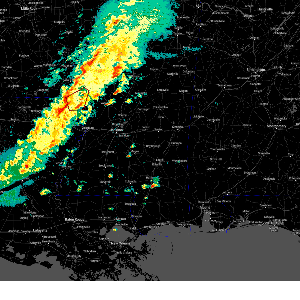
| 3/15/2025 10:56 AM CDT | Report of multiple trees downed along hwy-65s as well as damage to residences and businesses in downtown lake providenc in east carroll county LA, 2 miles NNW of Lake Providence, LA |
| 3/15/2025 10:56 AM CDT |
 Svrjan the national weather service in jackson has issued a * severe thunderstorm warning for, eastern east carroll parish in northeastern louisiana, southern sunflower county in northwestern mississippi, northwestern warren county in west central mississippi, southeastern washington county in northwestern mississippi, northwestern yazoo county in central mississippi, issaquena county in west central mississippi, humphreys county in central mississippi, sharkey county in west central mississippi, * until noon cdt. * at 1056 am cdt, a severe thunderstorm was located over cary, or 7 miles southeast of mayersville, moving northeast at 55 mph (radar indicated). Hazards include 60 mph wind gusts and quarter size hail. Hail damage to vehicles is expected. expect wind damage to roofs, siding, and trees. this severe thunderstorm will be near, rolling fork, cary, and mayersville around 1100 am cdt. anguilla and nitta yuma around 1105 am cdt. panther burn and delta city around 1115 am cdt. murphy around 1120 am cdt. midnight around 1125 am cdt. Belzoni, isola, and silver city around 1130 am cdt. Svrjan the national weather service in jackson has issued a * severe thunderstorm warning for, eastern east carroll parish in northeastern louisiana, southern sunflower county in northwestern mississippi, northwestern warren county in west central mississippi, southeastern washington county in northwestern mississippi, northwestern yazoo county in central mississippi, issaquena county in west central mississippi, humphreys county in central mississippi, sharkey county in west central mississippi, * until noon cdt. * at 1056 am cdt, a severe thunderstorm was located over cary, or 7 miles southeast of mayersville, moving northeast at 55 mph (radar indicated). Hazards include 60 mph wind gusts and quarter size hail. Hail damage to vehicles is expected. expect wind damage to roofs, siding, and trees. this severe thunderstorm will be near, rolling fork, cary, and mayersville around 1100 am cdt. anguilla and nitta yuma around 1105 am cdt. panther burn and delta city around 1115 am cdt. murphy around 1120 am cdt. midnight around 1125 am cdt. Belzoni, isola, and silver city around 1130 am cdt.
|
| 3/15/2025 10:12 AM CDT |
 At 1011 am cdt, a severe thunderstorm was located over millikin, or 9 miles northwest of mayersville, moving northeast at 50 mph (radar indicated). Hazards include two inch hail and 60 mph wind gusts. People and animals outdoors will be injured. expect hail damage to roofs, siding, windows, and vehicles. expect wind damage to roofs, siding, and trees. this severe storm will be near, glen allan around 1015 am cdt. grace around 1020 am cdt. panther burn, hollandale, and avon around 1030 am cdt. arcola and estill around 1035 am cdt. Darlove around 1040 am cdt. At 1011 am cdt, a severe thunderstorm was located over millikin, or 9 miles northwest of mayersville, moving northeast at 50 mph (radar indicated). Hazards include two inch hail and 60 mph wind gusts. People and animals outdoors will be injured. expect hail damage to roofs, siding, windows, and vehicles. expect wind damage to roofs, siding, and trees. this severe storm will be near, glen allan around 1015 am cdt. grace around 1020 am cdt. panther burn, hollandale, and avon around 1030 am cdt. arcola and estill around 1035 am cdt. Darlove around 1040 am cdt.
|
| 3/15/2025 10:12 AM CDT |
 the severe thunderstorm warning has been cancelled and is no longer in effect the severe thunderstorm warning has been cancelled and is no longer in effect
|
| 3/15/2025 10:08 AM CDT | Corrects previous tstm wnd dmg report from 1 sse lake providence. report of multiple trees downed along hwy-65s as well as damage to residences and businesses in downto in east carroll county LA, 2 miles NNW of Lake Providence, LA |
| 3/15/2025 10:08 AM CDT |
 At 1008 am cdt, a large and extremely dangerous tornado was located over lake providence, moving northeast at 45 mph. this is a particularly dangerous situation. take cover now! (radar indicated rotation). Hazards include damaging tornado. You are in a life-threatening situation. flying debris may be deadly to those caught without shelter. mobile homes will be destroyed. considerable damage to homes, businesses, and vehicles is likely and complete destruction is possible. the tornado will be near, mayersville around 1015 am cdt. glen allan and grace around 1020 am cdt. rolling fork around 1025 am cdt. anguilla, panther burn, and nitta yuma around 1030 am cdt. Delta city around 1035 am cdt. At 1008 am cdt, a large and extremely dangerous tornado was located over lake providence, moving northeast at 45 mph. this is a particularly dangerous situation. take cover now! (radar indicated rotation). Hazards include damaging tornado. You are in a life-threatening situation. flying debris may be deadly to those caught without shelter. mobile homes will be destroyed. considerable damage to homes, businesses, and vehicles is likely and complete destruction is possible. the tornado will be near, mayersville around 1015 am cdt. glen allan and grace around 1020 am cdt. rolling fork around 1025 am cdt. anguilla, panther burn, and nitta yuma around 1030 am cdt. Delta city around 1035 am cdt.
|
| 3/15/2025 10:08 AM CDT |
 the tornado warning has been cancelled and is no longer in effect the tornado warning has been cancelled and is no longer in effect
|
| 3/15/2025 10:00 AM CDT |
 At 1000 am cdt, a large and extremely dangerous tornado was located near lake providence, moving northeast at 45 mph. this is a particularly dangerous situation. take cover now! (radar indicated rotation). Hazards include damaging tornado. You are in a life-threatening situation. flying debris may be deadly to those caught without shelter. mobile homes will be destroyed. considerable damage to homes, businesses, and vehicles is likely and complete destruction is possible. the tornado will be near, lake providence and shelburn around 1005 am cdt. mayersville around 1010 am cdt. glen allan and grace around 1020 am cdt. rolling fork around 1025 am cdt. anguilla, panther burn, and nitta yuma around 1030 am cdt. Delta city around 1035 am cdt. At 1000 am cdt, a large and extremely dangerous tornado was located near lake providence, moving northeast at 45 mph. this is a particularly dangerous situation. take cover now! (radar indicated rotation). Hazards include damaging tornado. You are in a life-threatening situation. flying debris may be deadly to those caught without shelter. mobile homes will be destroyed. considerable damage to homes, businesses, and vehicles is likely and complete destruction is possible. the tornado will be near, lake providence and shelburn around 1005 am cdt. mayersville around 1010 am cdt. glen allan and grace around 1020 am cdt. rolling fork around 1025 am cdt. anguilla, panther burn, and nitta yuma around 1030 am cdt. Delta city around 1035 am cdt.
|
| 3/15/2025 9:55 AM CDT |
 At 954 am cdt, a severe thunderstorm capable of producing a tornado was located near forest, or 8 miles southwest of lake providence, moving northeast at 45 mph (radar indicated rotation). Hazards include tornado and golf ball size hail. Flying debris will be dangerous to those caught without shelter. mobile homes will be damaged or destroyed. damage to roofs, windows, and vehicles will occur. tree damage is likely. this dangerous storm will be near, lake providence and shelburn around 1000 am cdt. mayersville around 1010 am cdt. glen allan and grace around 1020 am cdt. rolling fork around 1025 am cdt. Anguilla, panther burn, and nitta yuma around 1030 am cdt. At 954 am cdt, a severe thunderstorm capable of producing a tornado was located near forest, or 8 miles southwest of lake providence, moving northeast at 45 mph (radar indicated rotation). Hazards include tornado and golf ball size hail. Flying debris will be dangerous to those caught without shelter. mobile homes will be damaged or destroyed. damage to roofs, windows, and vehicles will occur. tree damage is likely. this dangerous storm will be near, lake providence and shelburn around 1000 am cdt. mayersville around 1010 am cdt. glen allan and grace around 1020 am cdt. rolling fork around 1025 am cdt. Anguilla, panther burn, and nitta yuma around 1030 am cdt.
|
| 3/15/2025 9:50 AM CDT |
 Torjan the national weather service in jackson has issued a * tornado warning for, central east carroll parish in northeastern louisiana, southeastern west carroll parish in northeastern louisiana, south central washington county in northwestern mississippi, northwestern issaquena county in west central mississippi, northwestern sharkey county in west central mississippi, * until 1045 am cdt. * at 950 am cdt, a severe thunderstorm capable of producing a tornado was located near pioneer, or 10 miles south of oak grove, moving northeast at 45 mph (radar indicated rotation). Hazards include tornado and quarter size hail. Flying debris will be dangerous to those caught without shelter. mobile homes will be damaged or destroyed. damage to roofs, windows, and vehicles will occur. tree damage is likely. this dangerous storm will be near, lake providence around 955 am cdt. shelburn around 1000 am cdt. mayersville around 1010 am cdt. rolling fork and grace around 1020 am cdt. anguilla and glen allan around 1025 am cdt. panther burn and nitta yuma around 1030 am cdt. Delta city around 1035 am cdt. Torjan the national weather service in jackson has issued a * tornado warning for, central east carroll parish in northeastern louisiana, southeastern west carroll parish in northeastern louisiana, south central washington county in northwestern mississippi, northwestern issaquena county in west central mississippi, northwestern sharkey county in west central mississippi, * until 1045 am cdt. * at 950 am cdt, a severe thunderstorm capable of producing a tornado was located near pioneer, or 10 miles south of oak grove, moving northeast at 45 mph (radar indicated rotation). Hazards include tornado and quarter size hail. Flying debris will be dangerous to those caught without shelter. mobile homes will be damaged or destroyed. damage to roofs, windows, and vehicles will occur. tree damage is likely. this dangerous storm will be near, lake providence around 955 am cdt. shelburn around 1000 am cdt. mayersville around 1010 am cdt. rolling fork and grace around 1020 am cdt. anguilla and glen allan around 1025 am cdt. panther burn and nitta yuma around 1030 am cdt. Delta city around 1035 am cdt.
|
| 3/15/2025 9:43 AM CDT |
 Svrjan the national weather service in jackson has issued a * severe thunderstorm warning for, southern chicot county in southeastern arkansas, east carroll parish in northeastern louisiana, northeastern richland parish in northeastern louisiana, west carroll parish in northeastern louisiana, southern washington county in northwestern mississippi, northwestern issaquena county in west central mississippi, western humphreys county in central mississippi, sharkey county in west central mississippi, * until 1045 am cdt. * at 943 am cdt, severe thunderstorms were located along a line extending from near oak grove to near forest to near epps, moving northeast at 50 mph (radar indicated). Hazards include 60 mph wind gusts and quarter size hail. Hail damage to vehicles is expected. expect wind damage to roofs, siding, and trees. severe thunderstorms will be near, monticello, lake providence, millikin, shelburn, kilbourne, and darnell around 950 am cdt. gassoway around 955 am cdt. eudora around 1000 am cdt. glen allan around 1005 am cdt. mayersville around 1010 am cdt. avon and grace around 1015 am cdt. wayside around 1020 am cdt. Arcola, estill, panther burn, and hollandale around 1025 am cdt. Svrjan the national weather service in jackson has issued a * severe thunderstorm warning for, southern chicot county in southeastern arkansas, east carroll parish in northeastern louisiana, northeastern richland parish in northeastern louisiana, west carroll parish in northeastern louisiana, southern washington county in northwestern mississippi, northwestern issaquena county in west central mississippi, western humphreys county in central mississippi, sharkey county in west central mississippi, * until 1045 am cdt. * at 943 am cdt, severe thunderstorms were located along a line extending from near oak grove to near forest to near epps, moving northeast at 50 mph (radar indicated). Hazards include 60 mph wind gusts and quarter size hail. Hail damage to vehicles is expected. expect wind damage to roofs, siding, and trees. severe thunderstorms will be near, monticello, lake providence, millikin, shelburn, kilbourne, and darnell around 950 am cdt. gassoway around 955 am cdt. eudora around 1000 am cdt. glen allan around 1005 am cdt. mayersville around 1010 am cdt. avon and grace around 1015 am cdt. wayside around 1020 am cdt. Arcola, estill, panther burn, and hollandale around 1025 am cdt.
|
| 3/15/2025 6:53 AM CDT | the severe thunderstorm warning has been cancelled and is no longer in effect |
| 3/15/2025 6:53 AM CDT | At 653 am cdt, a severe thunderstorm was located near bastrop, moving northeast at 60 mph (radar indicated). Hazards include 60 mph wind gusts and quarter size hail. Hail damage to vehicles is expected. expect wind damage to roofs, siding, and trees. this severe storm will be near, beekman and galion around 700 am cdt. bonita around 705 am cdt. Jones around 710 am cdt. |
| 3/15/2025 6:43 AM CDT |
 Svrjan the national weather service in jackson has issued a * severe thunderstorm warning for, southwestern chicot county in southeastern arkansas, southeastern ashley county in southeastern arkansas, morehouse parish in northeastern louisiana, central east carroll parish in northeastern louisiana, northern richland parish in northeastern louisiana, west carroll parish in northeastern louisiana, * until 745 am cdt. * at 643 am cdt, a severe thunderstorm was located over sterlington, or 8 miles northwest of swartz, moving northeast at 60 mph (radar indicated). Hazards include 60 mph wind gusts and quarter size hail. Hail damage to vehicles is expected. expect wind damage to roofs, siding, and trees. this severe thunderstorm will be near, bastrop around 650 am cdt. beekman around 655 am cdt. mer rouge and galion around 700 am cdt. bonita around 705 am cdt. jones and berlin around 710 am cdt. wilmot around 715 am cdt. parkdale around 720 am cdt. Portland around 725 am cdt. Svrjan the national weather service in jackson has issued a * severe thunderstorm warning for, southwestern chicot county in southeastern arkansas, southeastern ashley county in southeastern arkansas, morehouse parish in northeastern louisiana, central east carroll parish in northeastern louisiana, northern richland parish in northeastern louisiana, west carroll parish in northeastern louisiana, * until 745 am cdt. * at 643 am cdt, a severe thunderstorm was located over sterlington, or 8 miles northwest of swartz, moving northeast at 60 mph (radar indicated). Hazards include 60 mph wind gusts and quarter size hail. Hail damage to vehicles is expected. expect wind damage to roofs, siding, and trees. this severe thunderstorm will be near, bastrop around 650 am cdt. beekman around 655 am cdt. mer rouge and galion around 700 am cdt. bonita around 705 am cdt. jones and berlin around 710 am cdt. wilmot around 715 am cdt. parkdale around 720 am cdt. Portland around 725 am cdt.
|
| 3/4/2025 1:05 PM CST |
 At 105 pm cst, severe thunderstorms were located along a line extending from near leland to near avon to near alsatia, moving east at 40 mph (radar indicated). Hazards include 60 mph wind gusts. Expect damage to roofs, siding, and trees. These severe storms will be near, transylvania and alsatia around 110 pm cst. At 105 pm cst, severe thunderstorms were located along a line extending from near leland to near avon to near alsatia, moving east at 40 mph (radar indicated). Hazards include 60 mph wind gusts. Expect damage to roofs, siding, and trees. These severe storms will be near, transylvania and alsatia around 110 pm cst.
|
| 3/4/2025 1:05 PM CST |
 the severe thunderstorm warning has been cancelled and is no longer in effect the severe thunderstorm warning has been cancelled and is no longer in effect
|
| 3/4/2025 12:49 PM CST |
 At 1248 pm cst, severe thunderstorms were located along a line extending from near winterville to near chicot junction to near monticello, moving east at 35 mph (radar indicated). Hazards include 60 mph wind gusts. Expect damage to roofs, siding, and trees. these severe storms will be near, lake providence, millikin, shelburn, and greenville around 1255 pm cst. Transylvania and alsatia around 100 pm cst. At 1248 pm cst, severe thunderstorms were located along a line extending from near winterville to near chicot junction to near monticello, moving east at 35 mph (radar indicated). Hazards include 60 mph wind gusts. Expect damage to roofs, siding, and trees. these severe storms will be near, lake providence, millikin, shelburn, and greenville around 1255 pm cst. Transylvania and alsatia around 100 pm cst.
|
| 3/4/2025 12:09 PM CST |
 Svrjan the national weather service in jackson has issued a * severe thunderstorm warning for, chicot county in southeastern arkansas, east carroll parish in northeastern louisiana, west carroll parish in northeastern louisiana, * until 130 pm cst. * at 1209 pm cst, severe thunderstorms were located along a line extending from near mcgehee to parkdale to near mer rouge, moving east at 40 mph (radar indicated). Hazards include 60 mph wind gusts. Expect damage to roofs, siding, and trees. severe thunderstorms will be near, dermott and goodwill around 1215 pm cst. mcmillan corner and lake village around 1220 pm cst. chicot junction around 1225 pm cst. oak grove, kilbourne, pioneer, eudora, forest, and darnell around 1230 pm cst. gassoway around 1235 pm cst. millikin, shelburn, and greenville around 1240 pm cst. lake providence around 1245 pm cst. Other locations impacted by these severe thunderstorms include halley. Svrjan the national weather service in jackson has issued a * severe thunderstorm warning for, chicot county in southeastern arkansas, east carroll parish in northeastern louisiana, west carroll parish in northeastern louisiana, * until 130 pm cst. * at 1209 pm cst, severe thunderstorms were located along a line extending from near mcgehee to parkdale to near mer rouge, moving east at 40 mph (radar indicated). Hazards include 60 mph wind gusts. Expect damage to roofs, siding, and trees. severe thunderstorms will be near, dermott and goodwill around 1215 pm cst. mcmillan corner and lake village around 1220 pm cst. chicot junction around 1225 pm cst. oak grove, kilbourne, pioneer, eudora, forest, and darnell around 1230 pm cst. gassoway around 1235 pm cst. millikin, shelburn, and greenville around 1240 pm cst. lake providence around 1245 pm cst. Other locations impacted by these severe thunderstorms include halley.
|
| 2/15/2025 9:25 PM CST |
 the severe thunderstorm warning has been cancelled and is no longer in effect the severe thunderstorm warning has been cancelled and is no longer in effect
|
| 2/15/2025 9:05 PM CST |
 the severe thunderstorm warning has been cancelled and is no longer in effect the severe thunderstorm warning has been cancelled and is no longer in effect
|
| 2/15/2025 9:05 PM CST |
 At 905 pm cst, severe thunderstorms were located along a line extending from near shelburn to near bakers to wisner, moving east at 30 mph (radar indicated). Hazards include 60 mph wind gusts and nickel size hail. Expect damage to roofs, siding, and trees. these severe storms will be near, lake providence, shelburn, and transylvania around 910 pm cst. alsatia and sondheimer around 915 pm cst. tallulah around 920 pm cst. mansford and omega around 925 pm cst. somerset and afton around 930 pm cst. eagle bend and newellton around 940 pm cst. lake bruin and mound around 945 pm cst. Other locations impacted by these severe thunderstorms include richmond and delta. At 905 pm cst, severe thunderstorms were located along a line extending from near shelburn to near bakers to wisner, moving east at 30 mph (radar indicated). Hazards include 60 mph wind gusts and nickel size hail. Expect damage to roofs, siding, and trees. these severe storms will be near, lake providence, shelburn, and transylvania around 910 pm cst. alsatia and sondheimer around 915 pm cst. tallulah around 920 pm cst. mansford and omega around 925 pm cst. somerset and afton around 930 pm cst. eagle bend and newellton around 940 pm cst. lake bruin and mound around 945 pm cst. Other locations impacted by these severe thunderstorms include richmond and delta.
|
| 2/15/2025 8:26 PM CST |
 Svrjan the national weather service in jackson has issued a * severe thunderstorm warning for, east carroll parish in northeastern louisiana, tensas parish in northeastern louisiana, madison parish in northeastern louisiana, northern concordia parish in northeastern louisiana, northern catahoula parish in northeastern louisiana, franklin parish in northeastern louisiana, * until 945 pm cst. * at 825 pm cst, severe thunderstorms were located along a line extending from near goodwill to archibald to 6 miles north of rosefield, moving east at 30 mph (radar indicated). Hazards include 60 mph wind gusts and nickel size hail. Expect damage to roofs, siding, and trees. severe thunderstorms will be near, winnsboro, liddieville, and baskin around 830 pm cst. jigger and crowville around 840 pm cst. bakers around 845 pm cst. monticello, waverly, and gilbert around 850 pm cst. wisner around 855 pm cst. lake providence and tendal around 900 pm cst. shelburn around 905 pm cst. transylvania and newlight around 910 pm cst. Other locations impacted by these severe thunderstorms include richmond and delta. Svrjan the national weather service in jackson has issued a * severe thunderstorm warning for, east carroll parish in northeastern louisiana, tensas parish in northeastern louisiana, madison parish in northeastern louisiana, northern concordia parish in northeastern louisiana, northern catahoula parish in northeastern louisiana, franklin parish in northeastern louisiana, * until 945 pm cst. * at 825 pm cst, severe thunderstorms were located along a line extending from near goodwill to archibald to 6 miles north of rosefield, moving east at 30 mph (radar indicated). Hazards include 60 mph wind gusts and nickel size hail. Expect damage to roofs, siding, and trees. severe thunderstorms will be near, winnsboro, liddieville, and baskin around 830 pm cst. jigger and crowville around 840 pm cst. bakers around 845 pm cst. monticello, waverly, and gilbert around 850 pm cst. wisner around 855 pm cst. lake providence and tendal around 900 pm cst. shelburn around 905 pm cst. transylvania and newlight around 910 pm cst. Other locations impacted by these severe thunderstorms include richmond and delta.
|
| 2/15/2025 7:21 PM CST | Law enforcement reported down powerlines near hwy 134 s lake providenc in east carroll county LA, 6.5 miles NNE of Lake Providence, LA |
| 2/15/2025 7:21 PM CST | Corrects previous tstm wnd dmg report from 4 nw transylvania. law enforcement reported down powerlines near hwy 134 s lake providenc in east carroll county LA, 10.9 miles N of Lake Providence, LA |
| 1/5/2025 4:26 PM CST |
 the tornado warning has been cancelled and is no longer in effect the tornado warning has been cancelled and is no longer in effect
|
| 1/5/2025 4:13 PM CST |
 the tornado warning has been cancelled and is no longer in effect the tornado warning has been cancelled and is no longer in effect
|
| 1/5/2025 4:13 PM CST |
 At 412 pm cst, a severe thunderstorm capable of producing a tornado was located near glen allan, or 11 miles southwest of hollandale, moving northeast at 50 mph (radar indicated rotation). Hazards include tornado. Flying debris will be dangerous to those caught without shelter. mobile homes will be damaged or destroyed. damage to roofs, windows, and vehicles will occur. tree damage is likely. This dangerous storm will be near, panther burn around 420 pm cst. At 412 pm cst, a severe thunderstorm capable of producing a tornado was located near glen allan, or 11 miles southwest of hollandale, moving northeast at 50 mph (radar indicated rotation). Hazards include tornado. Flying debris will be dangerous to those caught without shelter. mobile homes will be damaged or destroyed. damage to roofs, windows, and vehicles will occur. tree damage is likely. This dangerous storm will be near, panther burn around 420 pm cst.
|
| 1/5/2025 3:47 PM CST |
 the tornado warning has been cancelled and is no longer in effect the tornado warning has been cancelled and is no longer in effect
|
| 1/5/2025 3:47 PM CST |
 At 347 pm cst, a severe thunderstorm capable of producing a tornado was located near kilbourne, or 7 miles north of oak grove, moving northeast at 50 mph (radar indicated rotation). Hazards include tornado. Flying debris will be dangerous to those caught without shelter. mobile homes will be damaged or destroyed. damage to roofs, windows, and vehicles will occur. tree damage is likely. this dangerous storm will be near, gassoway, millikin, shelburn, and kilbourne around 350 pm cst. glen allan around 400 pm cst. grace around 410 pm cst. Panther burn around 415 pm cst. At 347 pm cst, a severe thunderstorm capable of producing a tornado was located near kilbourne, or 7 miles north of oak grove, moving northeast at 50 mph (radar indicated rotation). Hazards include tornado. Flying debris will be dangerous to those caught without shelter. mobile homes will be damaged or destroyed. damage to roofs, windows, and vehicles will occur. tree damage is likely. this dangerous storm will be near, gassoway, millikin, shelburn, and kilbourne around 350 pm cst. glen allan around 400 pm cst. grace around 410 pm cst. Panther burn around 415 pm cst.
|
| 1/5/2025 3:41 PM CST |
 Torjan the national weather service in jackson has issued a * tornado warning for, southern chicot county in southeastern arkansas, northeastern morehouse parish in northeastern louisiana, northeastern east carroll parish in northeastern louisiana, northern west carroll parish in northeastern louisiana, southwestern washington county in northwestern mississippi, northwestern issaquena county in west central mississippi, northwestern sharkey county in west central mississippi, * until 445 pm cst. * at 341 pm cst, a severe thunderstorm capable of producing a tornado was located near oak grove, moving east at 50 mph (radar indicated rotation). Hazards include tornado. Flying debris will be dangerous to those caught without shelter. mobile homes will be damaged or destroyed. damage to roofs, windows, and vehicles will occur. tree damage is likely. this dangerous storm will be near, oak grove and kilbourne around 345 pm cst. gassoway, millikin, and shelburn around 350 pm cst. glen allan around 400 pm cst. grace around 410 pm cst. Panther burn around 415 pm cst. Torjan the national weather service in jackson has issued a * tornado warning for, southern chicot county in southeastern arkansas, northeastern morehouse parish in northeastern louisiana, northeastern east carroll parish in northeastern louisiana, northern west carroll parish in northeastern louisiana, southwestern washington county in northwestern mississippi, northwestern issaquena county in west central mississippi, northwestern sharkey county in west central mississippi, * until 445 pm cst. * at 341 pm cst, a severe thunderstorm capable of producing a tornado was located near oak grove, moving east at 50 mph (radar indicated rotation). Hazards include tornado. Flying debris will be dangerous to those caught without shelter. mobile homes will be damaged or destroyed. damage to roofs, windows, and vehicles will occur. tree damage is likely. this dangerous storm will be near, oak grove and kilbourne around 345 pm cst. gassoway, millikin, and shelburn around 350 pm cst. glen allan around 400 pm cst. grace around 410 pm cst. Panther burn around 415 pm cst.
|
| 1/5/2025 1:38 PM CST |
 Torjan the national weather service in jackson has issued a * tornado warning for, northeastern morehouse parish in northeastern louisiana, northeastern east carroll parish in northeastern louisiana, west carroll parish in northeastern louisiana, * until 245 pm cst. * at 138 pm cst, a severe thunderstorm capable of producing a tornado was located near goodwill, or 12 miles west of oak grove, moving northeast at 45 mph (radar indicated rotation). Hazards include tornado. Flying debris will be dangerous to those caught without shelter. mobile homes will be damaged or destroyed. damage to roofs, windows, and vehicles will occur. tree damage is likely. this dangerous storm will be near, oak grove and forest around 145 pm cst. kilbourne around 155 pm cst. gassoway and millikin around 200 pm cst. Shelburn around 205 pm cst. Torjan the national weather service in jackson has issued a * tornado warning for, northeastern morehouse parish in northeastern louisiana, northeastern east carroll parish in northeastern louisiana, west carroll parish in northeastern louisiana, * until 245 pm cst. * at 138 pm cst, a severe thunderstorm capable of producing a tornado was located near goodwill, or 12 miles west of oak grove, moving northeast at 45 mph (radar indicated rotation). Hazards include tornado. Flying debris will be dangerous to those caught without shelter. mobile homes will be damaged or destroyed. damage to roofs, windows, and vehicles will occur. tree damage is likely. this dangerous storm will be near, oak grove and forest around 145 pm cst. kilbourne around 155 pm cst. gassoway and millikin around 200 pm cst. Shelburn around 205 pm cst.
|
| 12/28/2024 4:57 PM CST |
 Torjan the national weather service in jackson has issued a * tornado warning for, eastern east carroll parish in northeastern louisiana, northwestern warren county in west central mississippi, southeastern washington county in northwestern mississippi, northwestern yazoo county in central mississippi, issaquena county in west central mississippi, southwestern humphreys county in central mississippi, sharkey county in west central mississippi, * until 600 pm cst. * at 457 pm cst, a severe thunderstorm capable of producing a tornado was located near transylvania, or 7 miles southeast of lake providence, moving northeast at 40 mph (radar indicated rotation). Hazards include tornado. Flying debris will be dangerous to those caught without shelter. mobile homes will be damaged or destroyed. damage to roofs, windows, and vehicles will occur. tree damage is likely. this dangerous storm will be near, lake providence and fitler around 500 pm cst. onward and cary around 505 pm cst. mayersville around 510 pm cst. rolling fork around 515 pm cst. anguilla around 520 pm cst. nitta yuma around 525 pm cst. delta city around 535 pm cst. Murphy around 540 pm cst. Torjan the national weather service in jackson has issued a * tornado warning for, eastern east carroll parish in northeastern louisiana, northwestern warren county in west central mississippi, southeastern washington county in northwestern mississippi, northwestern yazoo county in central mississippi, issaquena county in west central mississippi, southwestern humphreys county in central mississippi, sharkey county in west central mississippi, * until 600 pm cst. * at 457 pm cst, a severe thunderstorm capable of producing a tornado was located near transylvania, or 7 miles southeast of lake providence, moving northeast at 40 mph (radar indicated rotation). Hazards include tornado. Flying debris will be dangerous to those caught without shelter. mobile homes will be damaged or destroyed. damage to roofs, windows, and vehicles will occur. tree damage is likely. this dangerous storm will be near, lake providence and fitler around 500 pm cst. onward and cary around 505 pm cst. mayersville around 510 pm cst. rolling fork around 515 pm cst. anguilla around 520 pm cst. nitta yuma around 525 pm cst. delta city around 535 pm cst. Murphy around 540 pm cst.
|
| 8/18/2024 8:33 PM CDT |
 the severe thunderstorm warning has been cancelled and is no longer in effect the severe thunderstorm warning has been cancelled and is no longer in effect
|
| 8/18/2024 8:33 PM CDT |
 At 833 pm cdt, severe thunderstorms were located along a line extending from near oak ridge to near alsatia to onward, moving south at 50 mph (radar indicated). Hazards include 60 mph wind gusts. Expect damage to roofs, siding, and trees. Locations impacted include, bastrop, lake providence, oak grove, mayersville, mer rouge, forest, bonita, pioneer, goodwill, beekman, galion, shelburn, transylvania, and fitler. At 833 pm cdt, severe thunderstorms were located along a line extending from near oak ridge to near alsatia to onward, moving south at 50 mph (radar indicated). Hazards include 60 mph wind gusts. Expect damage to roofs, siding, and trees. Locations impacted include, bastrop, lake providence, oak grove, mayersville, mer rouge, forest, bonita, pioneer, goodwill, beekman, galion, shelburn, transylvania, and fitler.
|
| 8/18/2024 8:27 PM CDT | Downed trees along hwy 580 and hwy 65 in east carroll county LA, 14.3 miles N of Lake Providence, LA |
| 8/18/2024 8:18 PM CDT | At 817 pm cdt, severe thunderstorms were located along a line extending from near mer rouge to near lake providence to near anguilla, moving southeast at 50 mph (radar indicated). Hazards include 60 mph wind gusts and quarter size hail. Hail damage to vehicles is expected. expect wind damage to roofs, siding, and trees. Locations impacted include, bastrop, lake providence, oak grove, mayersville, mer rouge, kilbourne, forest, glen allan, bonita, pioneer, grace, goodwill, beekman, galion, shelburn, gassoway, transylvania, jones, millikin, and fitler. |
| 8/18/2024 8:18 PM CDT | the severe thunderstorm warning has been cancelled and is no longer in effect |
| 8/18/2024 7:59 PM CDT |
 At 759 pm cdt, severe thunderstorms were located along a line extending from 8 miles northwest of beekman to near kilbourne to near hollandale, moving southeast at 45 mph (radar indicated). Hazards include 60 mph wind gusts and penny size hail. Expect damage to roofs, siding, and trees. Locations impacted include, bastrop, crossett, lake providence, oak grove, mayersville, north crossett, eudora, west crossett, mer rouge, wilmot, kilbourne, forest, glen allan, bonita, parkdale, pioneer, grace, wayside, goodwill, and beekman. At 759 pm cdt, severe thunderstorms were located along a line extending from 8 miles northwest of beekman to near kilbourne to near hollandale, moving southeast at 45 mph (radar indicated). Hazards include 60 mph wind gusts and penny size hail. Expect damage to roofs, siding, and trees. Locations impacted include, bastrop, crossett, lake providence, oak grove, mayersville, north crossett, eudora, west crossett, mer rouge, wilmot, kilbourne, forest, glen allan, bonita, parkdale, pioneer, grace, wayside, goodwill, and beekman.
|
| 8/18/2024 7:43 PM CDT |
 Svrjan the national weather service in jackson has issued a * severe thunderstorm warning for, southern chicot county in southeastern arkansas, southwestern ashley county in southeastern arkansas, morehouse parish in northeastern louisiana, east carroll parish in northeastern louisiana, west carroll parish in northeastern louisiana, southwestern washington county in northwestern mississippi, northwestern issaquena county in west central mississippi, * until 845 pm cdt. * at 742 pm cdt, severe thunderstorms were located along a line extending from near west crossett to near parkdale to near wayside, moving southeast at 50 mph (radar indicated). Hazards include 60 mph wind gusts and nickel size hail. expect damage to roofs, siding, and trees Svrjan the national weather service in jackson has issued a * severe thunderstorm warning for, southern chicot county in southeastern arkansas, southwestern ashley county in southeastern arkansas, morehouse parish in northeastern louisiana, east carroll parish in northeastern louisiana, west carroll parish in northeastern louisiana, southwestern washington county in northwestern mississippi, northwestern issaquena county in west central mississippi, * until 845 pm cdt. * at 742 pm cdt, severe thunderstorms were located along a line extending from near west crossett to near parkdale to near wayside, moving southeast at 50 mph (radar indicated). Hazards include 60 mph wind gusts and nickel size hail. expect damage to roofs, siding, and trees
|
| 6/3/2024 9:01 PM CDT |
 the severe thunderstorm warning has been cancelled and is no longer in effect the severe thunderstorm warning has been cancelled and is no longer in effect
|
| 6/3/2024 9:01 PM CDT |
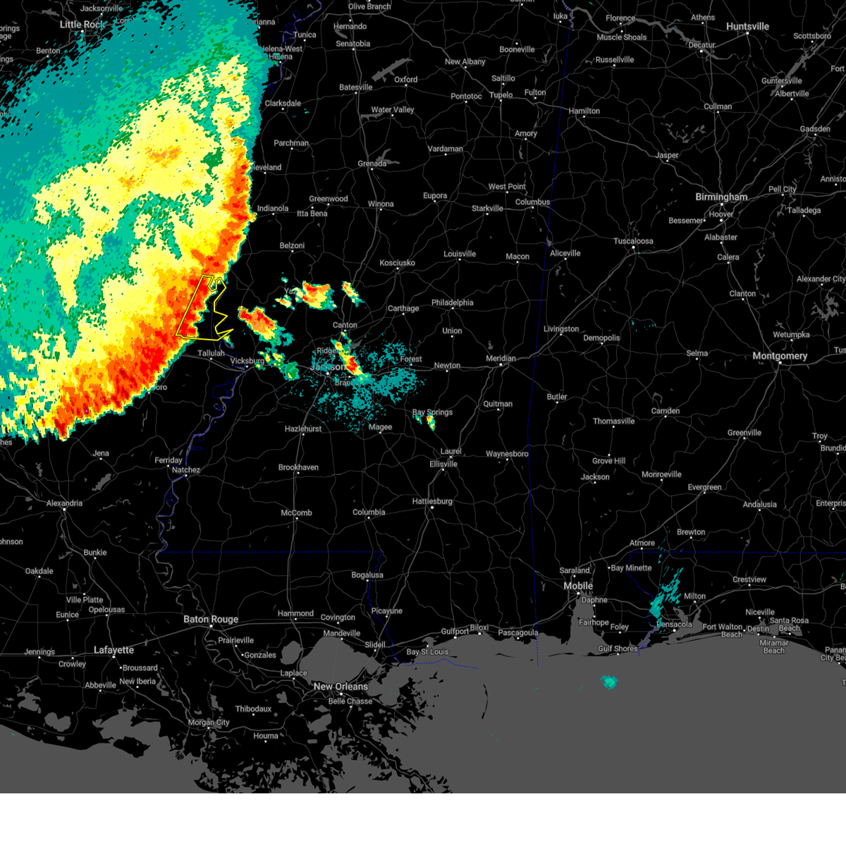 At 901 pm cdt, severe thunderstorms were located along a line extending from near glen allan to near sondheimer, moving east at 35 mph (radar indicated). Hazards include 60 mph wind gusts and penny size hail. Expect damage to roofs, siding, and trees. These severe storms will be near, transylvania, alsatia, and sondheimer around 905 pm cdt. At 901 pm cdt, severe thunderstorms were located along a line extending from near glen allan to near sondheimer, moving east at 35 mph (radar indicated). Hazards include 60 mph wind gusts and penny size hail. Expect damage to roofs, siding, and trees. These severe storms will be near, transylvania, alsatia, and sondheimer around 905 pm cdt.
|
| 6/3/2024 9:00 PM CDT | Several trees were blown down in various parts of the parish... and power outages had been reporte in east carroll county LA, 8.8 miles N of Lake Providence, LA |
| 6/3/2024 8:24 PM CDT |
 At 824 pm cdt, severe thunderstorms were located along a line extending from lake village to near kilbourne to 7 miles southwest of goodwill, moving east at 45 mph (radar indicated). Hazards include 60 mph wind gusts and penny size hail. Expect damage to roofs, siding, and trees. these severe storms will be near, lake village, oak grove, eudora, kilbourne, forest, chicot junction, and goodwill around 830 pm cdt. pioneer, gassoway, and millikin around 835 pm cdt. shelburn and darnell around 840 pm cdt. lake providence around 845 pm cdt. Transylvania around 900 pm cdt. At 824 pm cdt, severe thunderstorms were located along a line extending from lake village to near kilbourne to 7 miles southwest of goodwill, moving east at 45 mph (radar indicated). Hazards include 60 mph wind gusts and penny size hail. Expect damage to roofs, siding, and trees. these severe storms will be near, lake village, oak grove, eudora, kilbourne, forest, chicot junction, and goodwill around 830 pm cdt. pioneer, gassoway, and millikin around 835 pm cdt. shelburn and darnell around 840 pm cdt. lake providence around 845 pm cdt. Transylvania around 900 pm cdt.
|
| 6/3/2024 8:11 PM CDT |
 Svrjan the national weather service in jackson has issued a * severe thunderstorm warning for, chicot county in southeastern arkansas, east carroll parish in northeastern louisiana, west carroll parish in northeastern louisiana, * until 915 pm cdt. * at 810 pm cdt, severe thunderstorms were located along a line extending from near mcmillan corner to near wilmot to near collinston, moving east at 45 mph (radar indicated). Hazards include 60 mph wind gusts and penny size hail. Expect damage to roofs, siding, and trees. severe thunderstorms will be near, lake village and mcmillan corner around 815 pm cdt. eudora, kilbourne, chicot junction, and goodwill around 820 pm cdt. oak grove around 825 pm cdt. forest, gassoway around 830 pm cdt. pioneer around 835 pm cdt. shelburn and darnell around 840 pm cdt. lake providence around 845 pm cdt. Transylvania around 905 pm cdt. Svrjan the national weather service in jackson has issued a * severe thunderstorm warning for, chicot county in southeastern arkansas, east carroll parish in northeastern louisiana, west carroll parish in northeastern louisiana, * until 915 pm cdt. * at 810 pm cdt, severe thunderstorms were located along a line extending from near mcmillan corner to near wilmot to near collinston, moving east at 45 mph (radar indicated). Hazards include 60 mph wind gusts and penny size hail. Expect damage to roofs, siding, and trees. severe thunderstorms will be near, lake village and mcmillan corner around 815 pm cdt. eudora, kilbourne, chicot junction, and goodwill around 820 pm cdt. oak grove around 825 pm cdt. forest, gassoway around 830 pm cdt. pioneer around 835 pm cdt. shelburn and darnell around 840 pm cdt. lake providence around 845 pm cdt. Transylvania around 905 pm cdt.
|
| 5/27/2024 3:25 AM CDT |
 the severe thunderstorm warning has been cancelled and is no longer in effect the severe thunderstorm warning has been cancelled and is no longer in effect
|
| 5/27/2024 3:25 AM CDT |
 At 325 am cdt, severe thunderstorms were located along a line extending from near murphy to grace to near millikin, moving southeast at 35 mph (radar indicated). Hazards include 60 mph wind gusts and penny size hail. Expect damage to roofs, siding, and trees. these severe storms will be near, rolling fork, mayersville, anguilla, grace, delta city, and nitta yuma around 330 am cdt. midnight around 335 am cdt. louise around 340 am cdt. Silver city around 345 am cdt. At 325 am cdt, severe thunderstorms were located along a line extending from near murphy to grace to near millikin, moving southeast at 35 mph (radar indicated). Hazards include 60 mph wind gusts and penny size hail. Expect damage to roofs, siding, and trees. these severe storms will be near, rolling fork, mayersville, anguilla, grace, delta city, and nitta yuma around 330 am cdt. midnight around 335 am cdt. louise around 340 am cdt. Silver city around 345 am cdt.
|
| 5/27/2024 3:03 AM CDT |
 Svrjan the national weather service in jackson has issued a * severe thunderstorm warning for, northeastern east carroll parish in northeastern louisiana, southeastern washington county in northwestern mississippi, northwestern issaquena county in west central mississippi, southern humphreys county in central mississippi, sharkey county in west central mississippi, * until 400 am cdt. * at 302 am cdt, severe thunderstorms were located along a line extending from estill to near glen allan to near kilbourne, moving southeast at 35 mph (radar indicated). Hazards include 60 mph wind gusts and quarter size hail. Hail damage to vehicles is expected. expect wind damage to roofs, siding, and trees. severe thunderstorms will be near, hollandale, glen allan, panther burn, grace, gassoway, and millikin around 310 am cdt. delta city, nitta yuma, and murphy around 315 am cdt. mayersville and anguilla around 325 am cdt. rolling fork and midnight around 330 am cdt. Silver city and louise around 340 am cdt. Svrjan the national weather service in jackson has issued a * severe thunderstorm warning for, northeastern east carroll parish in northeastern louisiana, southeastern washington county in northwestern mississippi, northwestern issaquena county in west central mississippi, southern humphreys county in central mississippi, sharkey county in west central mississippi, * until 400 am cdt. * at 302 am cdt, severe thunderstorms were located along a line extending from estill to near glen allan to near kilbourne, moving southeast at 35 mph (radar indicated). Hazards include 60 mph wind gusts and quarter size hail. Hail damage to vehicles is expected. expect wind damage to roofs, siding, and trees. severe thunderstorms will be near, hollandale, glen allan, panther burn, grace, gassoway, and millikin around 310 am cdt. delta city, nitta yuma, and murphy around 315 am cdt. mayersville and anguilla around 325 am cdt. rolling fork and midnight around 330 am cdt. Silver city and louise around 340 am cdt.
|
| 5/25/2024 2:37 AM CDT |
 The storm which prompted the warning has weakened below severe limits, and no longer poses an immediate threat to life or property. therefore, the warning will be allowed to expire. The storm which prompted the warning has weakened below severe limits, and no longer poses an immediate threat to life or property. therefore, the warning will be allowed to expire.
|
| 5/25/2024 2:10 AM CDT |
 At 209 am cdt, a severe thunderstorm was located near parkdale, or 15 miles north of oak grove, moving east at 60 mph (radar indicated). Hazards include 60 mph wind gusts. Expect damage to roofs, siding, and trees. this severe storm will be near, eudora and kilbourne around 215 am cdt. Gassoway and millikin around 220 am cdt. At 209 am cdt, a severe thunderstorm was located near parkdale, or 15 miles north of oak grove, moving east at 60 mph (radar indicated). Hazards include 60 mph wind gusts. Expect damage to roofs, siding, and trees. this severe storm will be near, eudora and kilbourne around 215 am cdt. Gassoway and millikin around 220 am cdt.
|
| 5/25/2024 1:41 AM CDT |
 Svrjan the national weather service in jackson has issued a * severe thunderstorm warning for, southern chicot county in southeastern arkansas, ashley county in southeastern arkansas, northeastern morehouse parish in northeastern louisiana, north central east carroll parish in northeastern louisiana, northeastern west carroll parish in northeastern louisiana, * until 245 am cdt. * at 140 am cdt, a severe thunderstorm was located over north crossett, or over crossett, moving east at 60 mph (radar indicated). Hazards include 60 mph wind gusts. Expect damage to roofs, siding, and trees. this severe thunderstorm will be near, crossett, hamburg, north crossett, and berlin around 145 am cdt. wilmot and parkdale around 200 am cdt. eudora and kilbourne around 215 am cdt. Gassoway and millikin around 220 am cdt. Svrjan the national weather service in jackson has issued a * severe thunderstorm warning for, southern chicot county in southeastern arkansas, ashley county in southeastern arkansas, northeastern morehouse parish in northeastern louisiana, north central east carroll parish in northeastern louisiana, northeastern west carroll parish in northeastern louisiana, * until 245 am cdt. * at 140 am cdt, a severe thunderstorm was located over north crossett, or over crossett, moving east at 60 mph (radar indicated). Hazards include 60 mph wind gusts. Expect damage to roofs, siding, and trees. this severe thunderstorm will be near, crossett, hamburg, north crossett, and berlin around 145 am cdt. wilmot and parkdale around 200 am cdt. eudora and kilbourne around 215 am cdt. Gassoway and millikin around 220 am cdt.
|
| 5/9/2024 9:45 PM CDT |
 At 945 pm cdt, severe thunderstorms were located along a line extending from near millikin to near eagle bend to 6 miles east of afton, moving east at 30 mph (radar indicated). Hazards include 60 mph wind gusts and quarter size hail. Hail damage to vehicles is expected. expect wind damage to roofs, siding, and trees. these severe storms will be near, vicksburg, valley park, mound, onward, and fitler around 950 pm cdt. mayersville, yokena, and le tourneau around 955 pm cdt. cary and redwood around 1000 pm cdt. bovina and oak ridge around 1010 pm cdt. rolling fork and flowers around 1015 pm cdt. reganton around 1020 pm cdt. holly bluff around 1025 pm cdt. Other locations impacted by these severe thunderstorms include delta. At 945 pm cdt, severe thunderstorms were located along a line extending from near millikin to near eagle bend to 6 miles east of afton, moving east at 30 mph (radar indicated). Hazards include 60 mph wind gusts and quarter size hail. Hail damage to vehicles is expected. expect wind damage to roofs, siding, and trees. these severe storms will be near, vicksburg, valley park, mound, onward, and fitler around 950 pm cdt. mayersville, yokena, and le tourneau around 955 pm cdt. cary and redwood around 1000 pm cdt. bovina and oak ridge around 1010 pm cdt. rolling fork and flowers around 1015 pm cdt. reganton around 1020 pm cdt. holly bluff around 1025 pm cdt. Other locations impacted by these severe thunderstorms include delta.
|
| 5/9/2024 9:21 PM CDT |
 Svrjan the national weather service in jackson has issued a * severe thunderstorm warning for, southeastern east carroll parish in northeastern louisiana, northeastern tensas parish in northeastern louisiana, eastern madison parish in northeastern louisiana, warren county in west central mississippi, northern claiborne county in southwestern mississippi, southwestern yazoo county in central mississippi, issaquena county in west central mississippi, southern sharkey county in west central mississippi, * until 1030 pm cdt. * at 920 pm cdt, severe thunderstorms were located along a line extending from near oak grove to omega to near somerset, moving northeast at 30 mph (radar indicated). Hazards include 70 mph wind gusts and half dollar size hail. Hail damage to vehicles is expected. expect considerable tree damage. wind damage is also likely to mobile homes, roofs, and outbuildings. severe thunderstorms will be near, somerset around 925 pm cdt. lake providence and eagle bend around 930 pm cdt. mound around 935 pm cdt. fitler around 940 pm cdt. vicksburg, mayersville, valley park, and onward around 950 pm cdt. cary and le tourneau around 955 pm cdt. redwood around 1005 pm cdt. rolling fork around 1010 pm cdt. Other locations impacted by these severe thunderstorms include delta. Svrjan the national weather service in jackson has issued a * severe thunderstorm warning for, southeastern east carroll parish in northeastern louisiana, northeastern tensas parish in northeastern louisiana, eastern madison parish in northeastern louisiana, warren county in west central mississippi, northern claiborne county in southwestern mississippi, southwestern yazoo county in central mississippi, issaquena county in west central mississippi, southern sharkey county in west central mississippi, * until 1030 pm cdt. * at 920 pm cdt, severe thunderstorms were located along a line extending from near oak grove to omega to near somerset, moving northeast at 30 mph (radar indicated). Hazards include 70 mph wind gusts and half dollar size hail. Hail damage to vehicles is expected. expect considerable tree damage. wind damage is also likely to mobile homes, roofs, and outbuildings. severe thunderstorms will be near, somerset around 925 pm cdt. lake providence and eagle bend around 930 pm cdt. mound around 935 pm cdt. fitler around 940 pm cdt. vicksburg, mayersville, valley park, and onward around 950 pm cdt. cary and le tourneau around 955 pm cdt. redwood around 1005 pm cdt. rolling fork around 1010 pm cdt. Other locations impacted by these severe thunderstorms include delta.
|
| 5/9/2024 9:00 PM CDT | Report of a tree downed across hwy-877 just north of hwy-58 in east carroll county LA, 16.5 miles NNE of Lake Providence, LA |
| 4/18/2024 4:31 PM CDT |
 At 430 pm cdt, a severe thunderstorm was located near lake providence, moving east at 30 mph (radar indicated). Hazards include 60 mph wind gusts and quarter size hail. Hail damage to vehicles is expected. expect wind damage to roofs, siding, and trees. This severe storm will be near, mayersville and fitler around 435 pm cdt. At 430 pm cdt, a severe thunderstorm was located near lake providence, moving east at 30 mph (radar indicated). Hazards include 60 mph wind gusts and quarter size hail. Hail damage to vehicles is expected. expect wind damage to roofs, siding, and trees. This severe storm will be near, mayersville and fitler around 435 pm cdt.
|
| 4/18/2024 4:28 PM CDT |
 the severe thunderstorm warning has been cancelled and is no longer in effect the severe thunderstorm warning has been cancelled and is no longer in effect
|
| 4/18/2024 4:28 PM CDT |
 At 428 pm cdt, a severe thunderstorm was located near lake providence, moving east at 30 mph (radar indicated). Hazards include 60 mph wind gusts and quarter size hail. Hail damage to vehicles is expected. expect wind damage to roofs, siding, and trees. This severe storm will be near, mayersville and fitler around 435 pm cdt. At 428 pm cdt, a severe thunderstorm was located near lake providence, moving east at 30 mph (radar indicated). Hazards include 60 mph wind gusts and quarter size hail. Hail damage to vehicles is expected. expect wind damage to roofs, siding, and trees. This severe storm will be near, mayersville and fitler around 435 pm cdt.
|
| 4/18/2024 3:55 PM CDT |
 Svrjan the national weather service in jackson has issued a * severe thunderstorm warning for, central east carroll parish in northeastern louisiana, northeastern west carroll parish in northeastern louisiana, northwestern issaquena county in west central mississippi, * until 500 pm cdt. * at 355 pm cdt, a severe thunderstorm was located over oak grove, moving east at 30 mph (radar indicated). Hazards include 60 mph wind gusts and quarter size hail. Hail damage to vehicles is expected. expect wind damage to roofs, siding, and trees. this severe thunderstorm will be near, oak grove and forest around 400 pm cdt. lake providence and shelburn around 405 pm cdt. millikin around 415 pm cdt. mayersville around 425 pm cdt. Fitler around 435 pm cdt. Svrjan the national weather service in jackson has issued a * severe thunderstorm warning for, central east carroll parish in northeastern louisiana, northeastern west carroll parish in northeastern louisiana, northwestern issaquena county in west central mississippi, * until 500 pm cdt. * at 355 pm cdt, a severe thunderstorm was located over oak grove, moving east at 30 mph (radar indicated). Hazards include 60 mph wind gusts and quarter size hail. Hail damage to vehicles is expected. expect wind damage to roofs, siding, and trees. this severe thunderstorm will be near, oak grove and forest around 400 pm cdt. lake providence and shelburn around 405 pm cdt. millikin around 415 pm cdt. mayersville around 425 pm cdt. Fitler around 435 pm cdt.
|
| 4/9/2024 7:02 PM CDT |
 Svrjan the national weather service in jackson has issued a * severe thunderstorm warning for, east carroll parish in northeastern louisiana, madison parish in northeastern louisiana, eastern richland parish in northeastern louisiana, southern west carroll parish in northeastern louisiana, * until 745 pm cdt. * at 702 pm cdt, severe thunderstorms were located along a line extending from near goodwill to near warden to bakers, moving east at 40 mph (radar indicated). Hazards include 60 mph wind gusts and quarter size hail. Hail damage to vehicles is expected. expect wind damage to roofs, siding, and trees. severe thunderstorms will be near, forest, pioneer, monticello, waverly, tendal, and darnell around 705 pm cdt. tallulah, mansford, omega, transylvania, alsatia, and sondheimer around 720 pm cdt. lake providence and afton around 725 pm cdt. mound around 735 pm cdt. Other locations impacted by these severe thunderstorms include delta and richmond. Svrjan the national weather service in jackson has issued a * severe thunderstorm warning for, east carroll parish in northeastern louisiana, madison parish in northeastern louisiana, eastern richland parish in northeastern louisiana, southern west carroll parish in northeastern louisiana, * until 745 pm cdt. * at 702 pm cdt, severe thunderstorms were located along a line extending from near goodwill to near warden to bakers, moving east at 40 mph (radar indicated). Hazards include 60 mph wind gusts and quarter size hail. Hail damage to vehicles is expected. expect wind damage to roofs, siding, and trees. severe thunderstorms will be near, forest, pioneer, monticello, waverly, tendal, and darnell around 705 pm cdt. tallulah, mansford, omega, transylvania, alsatia, and sondheimer around 720 pm cdt. lake providence and afton around 725 pm cdt. mound around 735 pm cdt. Other locations impacted by these severe thunderstorms include delta and richmond.
|
| 3/25/2024 5:52 PM CDT |
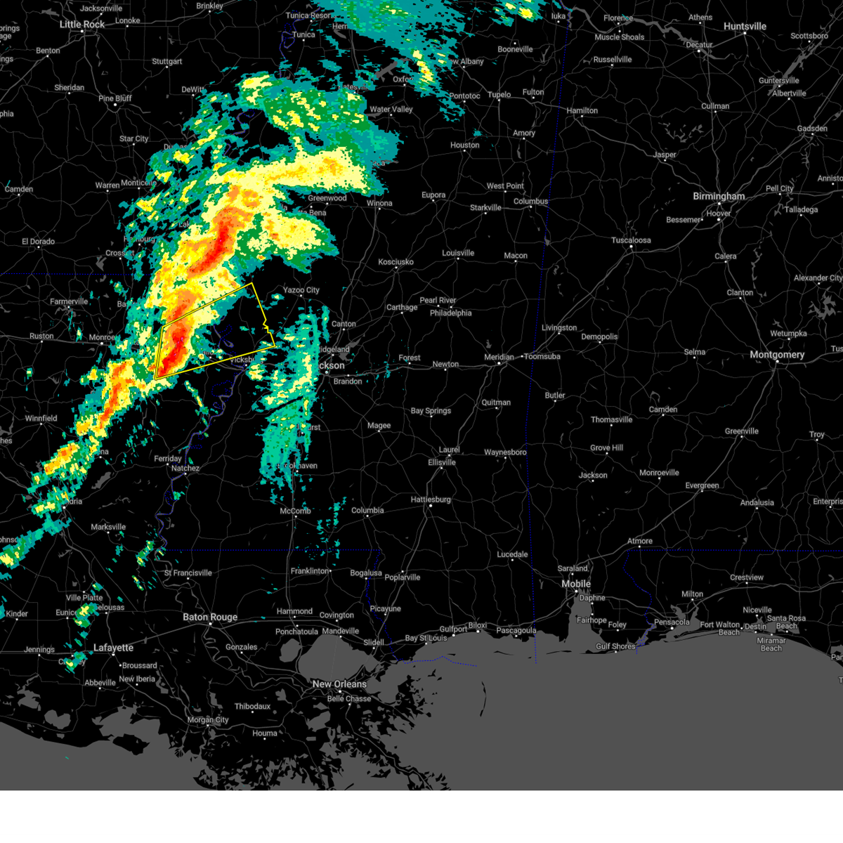 Svrjan the national weather service in jackson has issued a * severe thunderstorm warning for, east carroll parish in northeastern louisiana, northern madison parish in northeastern louisiana, northeastern richland parish in northeastern louisiana, southwestern west carroll parish in northeastern louisiana, northeastern franklin parish in northeastern louisiana, northern warren county in west central mississippi, issaquena county in west central mississippi, southwestern sharkey county in west central mississippi, * until 645 pm cdt. * at 552 pm cdt, a severe thunderstorm was located over waverly, or near delhi, moving east at 45 mph (radar indicated). Hazards include 60 mph wind gusts and penny size hail. Expect damage to roofs, siding, and trees. this severe thunderstorm will be near, waverly and tendal around 555 pm cdt. tallulah around 600 pm cdt. mansford, omega, alsatia, and sondheimer around 605 pm cdt. eagle bend around 615 pm cdt. valley park around 630 pm cdt. Other locations impacted by this severe thunderstorm include richmond. Svrjan the national weather service in jackson has issued a * severe thunderstorm warning for, east carroll parish in northeastern louisiana, northern madison parish in northeastern louisiana, northeastern richland parish in northeastern louisiana, southwestern west carroll parish in northeastern louisiana, northeastern franklin parish in northeastern louisiana, northern warren county in west central mississippi, issaquena county in west central mississippi, southwestern sharkey county in west central mississippi, * until 645 pm cdt. * at 552 pm cdt, a severe thunderstorm was located over waverly, or near delhi, moving east at 45 mph (radar indicated). Hazards include 60 mph wind gusts and penny size hail. Expect damage to roofs, siding, and trees. this severe thunderstorm will be near, waverly and tendal around 555 pm cdt. tallulah around 600 pm cdt. mansford, omega, alsatia, and sondheimer around 605 pm cdt. eagle bend around 615 pm cdt. valley park around 630 pm cdt. Other locations impacted by this severe thunderstorm include richmond.
|
| 1/12/2024 7:25 AM CST | Multiple powerlines snapped along hwy 6 in east carroll county LA, 9.5 miles N of Lake Providence, LA |
| 1/12/2024 7:16 AM CST |
 At 716 am cst, severe thunderstorms were located along a line extending from near mayersville to near delhi, moving east at 80 mph (radar indicated). Hazards include 60 mph wind gusts. Expect damage to roofs, siding, and trees. severe thunderstorms will be near, lake providence, delhi, mayersville, monticello, warden, waverly, and transylvania around 720 am cst. rolling fork, anguilla, cary, grace, fitler, alsatia, and sondheimer around 725 am cst. nitta yuma, onward, and omega around 730 am cst. louise around 735 am cst. valley park, midnight, and holly bluff around 740 am cst. silver city around 745 am cst. yazoo city and thornton around 750 am cst. tchula, eden, tolarville, and howard around 755 am cst. hail threat, radar indicated max hail size, <. 75 in wind threat, radar indicated max wind gust, 60 mph. At 716 am cst, severe thunderstorms were located along a line extending from near mayersville to near delhi, moving east at 80 mph (radar indicated). Hazards include 60 mph wind gusts. Expect damage to roofs, siding, and trees. severe thunderstorms will be near, lake providence, delhi, mayersville, monticello, warden, waverly, and transylvania around 720 am cst. rolling fork, anguilla, cary, grace, fitler, alsatia, and sondheimer around 725 am cst. nitta yuma, onward, and omega around 730 am cst. louise around 735 am cst. valley park, midnight, and holly bluff around 740 am cst. silver city around 745 am cst. yazoo city and thornton around 750 am cst. tchula, eden, tolarville, and howard around 755 am cst. hail threat, radar indicated max hail size, <. 75 in wind threat, radar indicated max wind gust, 60 mph.
|
| 1/12/2024 6:20 AM CST | Reports of powerlines and poles downed on hwy 6 in east carroll county LA, 9.5 miles N of Lake Providence, LA |
| 12/9/2023 6:45 PM CST |
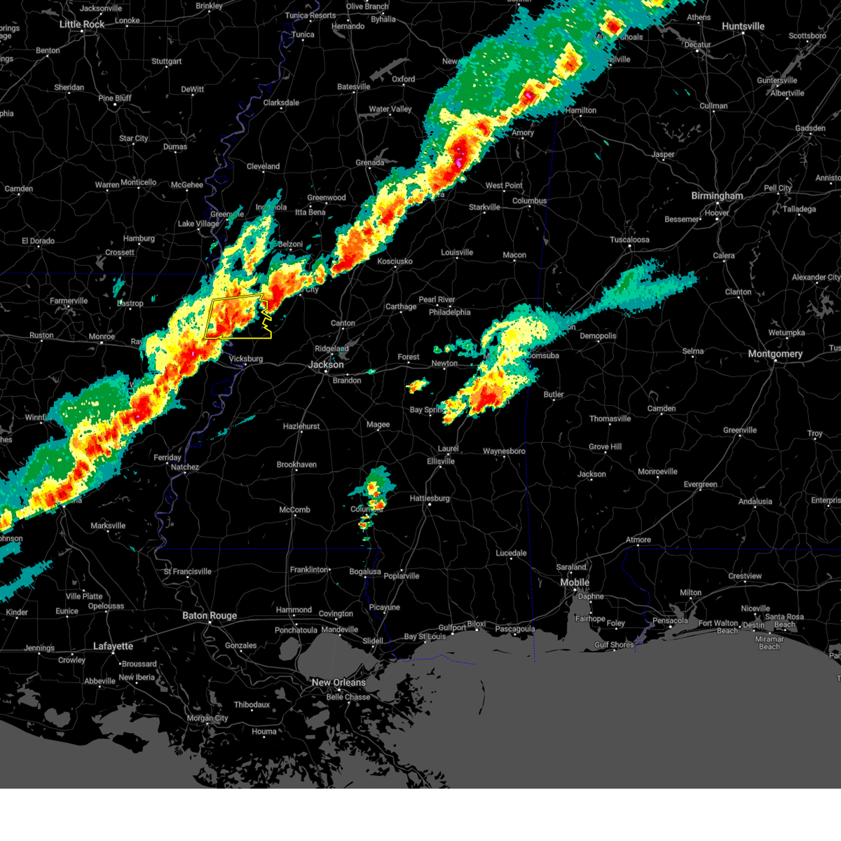 At 645 pm cst, a severe thunderstorm was located over onward, or 13 miles south of rolling fork, moving east at 45 mph (radar indicated). Hazards include 60 mph wind gusts and quarter size hail. Hail damage to vehicles is expected. expect wind damage to roofs, siding, and trees. this severe storm will be near, valley park around 650 pm cst. hail threat, radar indicated max hail size, 1. 00 in wind threat, radar indicated max wind gust, 60 mph. At 645 pm cst, a severe thunderstorm was located over onward, or 13 miles south of rolling fork, moving east at 45 mph (radar indicated). Hazards include 60 mph wind gusts and quarter size hail. Hail damage to vehicles is expected. expect wind damage to roofs, siding, and trees. this severe storm will be near, valley park around 650 pm cst. hail threat, radar indicated max hail size, 1. 00 in wind threat, radar indicated max wind gust, 60 mph.
|
| 12/9/2023 6:18 PM CST |
 At 617 pm cst, a severe thunderstorm was located near transylvania, or 8 miles southwest of lake providence, moving east at 45 mph (radar indicated). Hazards include 60 mph wind gusts and quarter size hail. Hail damage to vehicles is expected. expect wind damage to roofs, siding, and trees. this severe thunderstorm will be near, lake providence, fitler, transylvania, and alsatia around 625 pm cst. onward around 635 pm cst. cary and valley park around 640 pm cst. hail threat, radar indicated max hail size, 1. 00 in wind threat, radar indicated max wind gust, 60 mph. At 617 pm cst, a severe thunderstorm was located near transylvania, or 8 miles southwest of lake providence, moving east at 45 mph (radar indicated). Hazards include 60 mph wind gusts and quarter size hail. Hail damage to vehicles is expected. expect wind damage to roofs, siding, and trees. this severe thunderstorm will be near, lake providence, fitler, transylvania, and alsatia around 625 pm cst. onward around 635 pm cst. cary and valley park around 640 pm cst. hail threat, radar indicated max hail size, 1. 00 in wind threat, radar indicated max wind gust, 60 mph.
|
| 12/9/2023 6:18 PM CST |
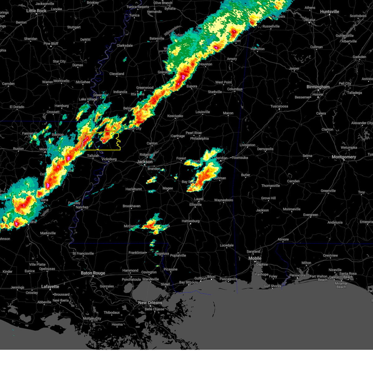 At 617 pm cst, a severe thunderstorm was located near transylvania, or 8 miles southwest of lake providence, moving east at 45 mph (radar indicated). Hazards include 60 mph wind gusts and quarter size hail. Hail damage to vehicles is expected. expect wind damage to roofs, siding, and trees. this severe thunderstorm will be near, lake providence, fitler, transylvania, and alsatia around 625 pm cst. onward around 635 pm cst. cary and valley park around 640 pm cst. hail threat, radar indicated max hail size, 1. 00 in wind threat, radar indicated max wind gust, 60 mph. At 617 pm cst, a severe thunderstorm was located near transylvania, or 8 miles southwest of lake providence, moving east at 45 mph (radar indicated). Hazards include 60 mph wind gusts and quarter size hail. Hail damage to vehicles is expected. expect wind damage to roofs, siding, and trees. this severe thunderstorm will be near, lake providence, fitler, transylvania, and alsatia around 625 pm cst. onward around 635 pm cst. cary and valley park around 640 pm cst. hail threat, radar indicated max hail size, 1. 00 in wind threat, radar indicated max wind gust, 60 mph.
|
| 8/25/2023 5:45 PM CDT |
 At 545 pm cdt, a severe thunderstorm was located near lake providence, moving southwest at 15 mph (radar indicated). Hazards include 60 mph wind gusts. Expect damage to roofs, siding, and trees. this severe storm will be near, lake providence around 550 pm cdt. transylvania around 600 pm cdt. hail threat, radar indicated max hail size, <. 75 in wind threat, radar indicated max wind gust, 60 mph. At 545 pm cdt, a severe thunderstorm was located near lake providence, moving southwest at 15 mph (radar indicated). Hazards include 60 mph wind gusts. Expect damage to roofs, siding, and trees. this severe storm will be near, lake providence around 550 pm cdt. transylvania around 600 pm cdt. hail threat, radar indicated max hail size, <. 75 in wind threat, radar indicated max wind gust, 60 mph.
|
| 8/25/2023 5:31 PM CDT |
 At 531 pm cdt, a severe thunderstorm was located near mayersville, moving southwest at 15 mph (radar indicated). Hazards include 60 mph wind gusts. Expect damage to roofs, siding, and trees. this severe thunderstorm will be near, lake providence and fitler around 535 pm cdt. transylvania around 555 pm cdt. hail threat, radar indicated max hail size, <. 75 in wind threat, radar indicated max wind gust, 60 mph. At 531 pm cdt, a severe thunderstorm was located near mayersville, moving southwest at 15 mph (radar indicated). Hazards include 60 mph wind gusts. Expect damage to roofs, siding, and trees. this severe thunderstorm will be near, lake providence and fitler around 535 pm cdt. transylvania around 555 pm cdt. hail threat, radar indicated max hail size, <. 75 in wind threat, radar indicated max wind gust, 60 mph.
|
| 6/27/2023 5:32 PM CDT |
 At 531 pm cdt, severe thunderstorms were located along a line extending from near holly bluff to near fitler to 6 miles east of monticello to near start, moving southeast at 45 mph (radar indicated). Hazards include 60 mph wind gusts and quarter size hail. Hail damage to vehicles is expected. expect wind damage to roofs, siding, and trees. these severe storms will be near, alsatia and onward around 535 pm cdt. valley park around 540 pm cdt. alto around 545 pm cdt. mangham and archibald around 550 pm cdt. hail threat, radar indicated max hail size, 1. 00 in wind threat, radar indicated max wind gust, 60 mph. At 531 pm cdt, severe thunderstorms were located along a line extending from near holly bluff to near fitler to 6 miles east of monticello to near start, moving southeast at 45 mph (radar indicated). Hazards include 60 mph wind gusts and quarter size hail. Hail damage to vehicles is expected. expect wind damage to roofs, siding, and trees. these severe storms will be near, alsatia and onward around 535 pm cdt. valley park around 540 pm cdt. alto around 545 pm cdt. mangham and archibald around 550 pm cdt. hail threat, radar indicated max hail size, 1. 00 in wind threat, radar indicated max wind gust, 60 mph.
|
| 6/27/2023 5:20 PM CDT | Several trees downed across the paris in east carroll county LA, 6 miles N of Lake Providence, LA |
| 6/27/2023 5:01 PM CDT |
 At 500 pm cdt, severe thunderstorms were located along a line extending from estill to near swartz, moving south at 50 mph (radar indicated). Hazards include 60 mph wind gusts and quarter size hail. Hail damage to vehicles is expected. expect wind damage to roofs, siding, and trees. severe thunderstorms will be near, start around 510 pm cdt. rayville and nitta yuma around 515 pm cdt. anguilla around 520 pm cdt. rolling fork, alto, archibald and buckner around 525 pm cdt. mangham around 530 pm cdt. hail threat, radar indicated max hail size, 1. 00 in wind threat, radar indicated max wind gust, 60 mph. At 500 pm cdt, severe thunderstorms were located along a line extending from estill to near swartz, moving south at 50 mph (radar indicated). Hazards include 60 mph wind gusts and quarter size hail. Hail damage to vehicles is expected. expect wind damage to roofs, siding, and trees. severe thunderstorms will be near, start around 510 pm cdt. rayville and nitta yuma around 515 pm cdt. anguilla around 520 pm cdt. rolling fork, alto, archibald and buckner around 525 pm cdt. mangham around 530 pm cdt. hail threat, radar indicated max hail size, 1. 00 in wind threat, radar indicated max wind gust, 60 mph.
|
| 6/26/2023 2:27 AM CDT |
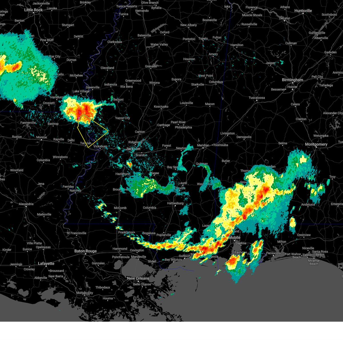 At 226 am cdt, a severe thunderstorm was located near lake providence, moving southeast at 50 mph (radar indicated). Hazards include 60 mph wind gusts and quarter size hail. Hail damage to vehicles is expected. expect wind damage to roofs, siding, and trees. this severe thunderstorm will be near, lake providence around 230 am cdt. transylvania around 240 am cdt. alsatia and fitler around 245 am cdt. omega and sondheimer around 250 am cdt. eagle bend around 255 am cdt. hail threat, radar indicated max hail size, 1. 00 in wind threat, radar indicated max wind gust, 60 mph. At 226 am cdt, a severe thunderstorm was located near lake providence, moving southeast at 50 mph (radar indicated). Hazards include 60 mph wind gusts and quarter size hail. Hail damage to vehicles is expected. expect wind damage to roofs, siding, and trees. this severe thunderstorm will be near, lake providence around 230 am cdt. transylvania around 240 am cdt. alsatia and fitler around 245 am cdt. omega and sondheimer around 250 am cdt. eagle bend around 255 am cdt. hail threat, radar indicated max hail size, 1. 00 in wind threat, radar indicated max wind gust, 60 mph.
|
| 6/26/2023 2:27 AM CDT |
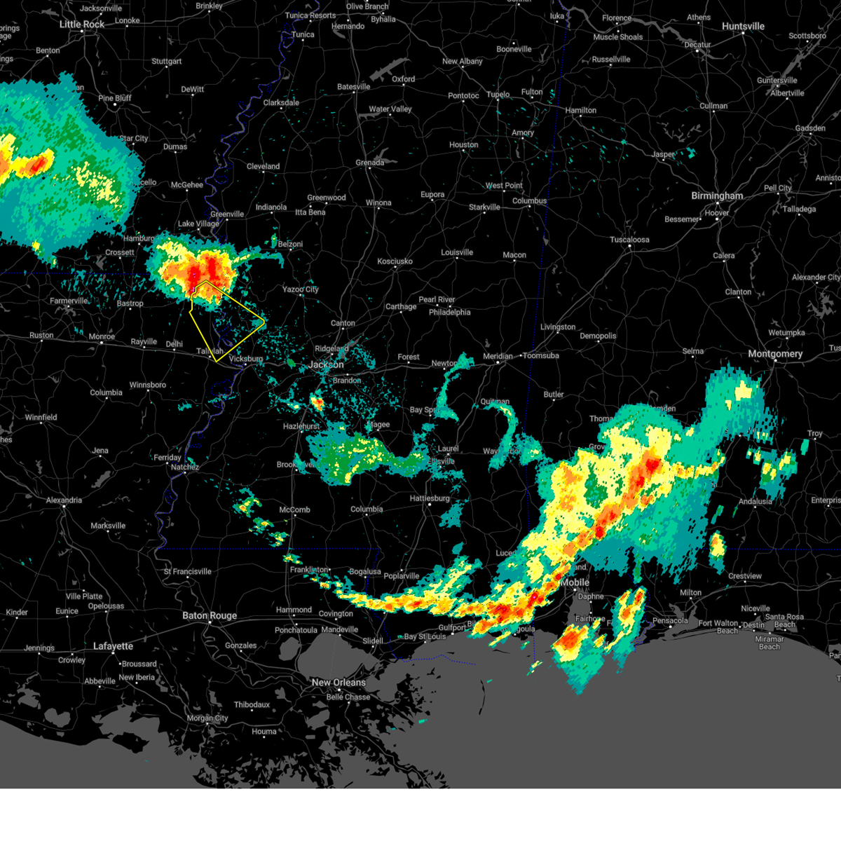 At 226 am cdt, a severe thunderstorm was located near lake providence, moving southeast at 50 mph (radar indicated). Hazards include 60 mph wind gusts and quarter size hail. Hail damage to vehicles is expected. expect wind damage to roofs, siding, and trees. this severe thunderstorm will be near, lake providence around 230 am cdt. transylvania around 240 am cdt. alsatia and fitler around 245 am cdt. omega and sondheimer around 250 am cdt. eagle bend around 255 am cdt. hail threat, radar indicated max hail size, 1. 00 in wind threat, radar indicated max wind gust, 60 mph. At 226 am cdt, a severe thunderstorm was located near lake providence, moving southeast at 50 mph (radar indicated). Hazards include 60 mph wind gusts and quarter size hail. Hail damage to vehicles is expected. expect wind damage to roofs, siding, and trees. this severe thunderstorm will be near, lake providence around 230 am cdt. transylvania around 240 am cdt. alsatia and fitler around 245 am cdt. omega and sondheimer around 250 am cdt. eagle bend around 255 am cdt. hail threat, radar indicated max hail size, 1. 00 in wind threat, radar indicated max wind gust, 60 mph.
|
| 6/25/2023 10:56 PM CDT |
 The severe thunderstorm warning for northeastern morehouse, east carroll and west carroll parishes, western yazoo, issaquena and sharkey counties will expire at 1100 pm cdt, the storms which prompted the warning have moved out of the area. therefore, the warning will be allowed to expire. however gusty winds are still possible with these thunderstorms. a severe thunderstorm watch remains in effect until 200 am cdt for southeastern arkansas, northeastern louisiana, and central, northwestern and west central mississippi. a severe thunderstorm watch also remains in effect until 500 am cdt for northeastern louisiana, and west central mississippi. The severe thunderstorm warning for northeastern morehouse, east carroll and west carroll parishes, western yazoo, issaquena and sharkey counties will expire at 1100 pm cdt, the storms which prompted the warning have moved out of the area. therefore, the warning will be allowed to expire. however gusty winds are still possible with these thunderstorms. a severe thunderstorm watch remains in effect until 200 am cdt for southeastern arkansas, northeastern louisiana, and central, northwestern and west central mississippi. a severe thunderstorm watch also remains in effect until 500 am cdt for northeastern louisiana, and west central mississippi.
|
| 6/25/2023 10:06 PM CDT |
 At 1006 pm cdt, severe thunderstorms were located along a line extending from near yazoo city to near cary to near lake providence, moving southeast at 45 mph (radar indicated). Hazards include 70 mph wind gusts and penny size hail. Expect considerable tree damage. damage is likely to mobile homes, roofs, and outbuildings. these severe storms will be near, yazoo city around 1010 pm cdt. valley park and alsatia around 1020 pm cdt. thunderstorm damage threat, considerable hail threat, radar indicated max hail size, 0. 75 in wind threat, radar indicated max wind gust, 70 mph. At 1006 pm cdt, severe thunderstorms were located along a line extending from near yazoo city to near cary to near lake providence, moving southeast at 45 mph (radar indicated). Hazards include 70 mph wind gusts and penny size hail. Expect considerable tree damage. damage is likely to mobile homes, roofs, and outbuildings. these severe storms will be near, yazoo city around 1010 pm cdt. valley park and alsatia around 1020 pm cdt. thunderstorm damage threat, considerable hail threat, radar indicated max hail size, 0. 75 in wind threat, radar indicated max wind gust, 70 mph.
|
| 6/25/2023 9:32 PM CDT |
 At 931 pm cdt, severe thunderstorms were located along a line extending from near indianola to near avon to near wilmot, moving south at 45 mph (radar indicated). Hazards include 60 mph wind gusts and penny size hail. Expect damage to roofs, siding, and trees. severe thunderstorms will be near, panther burn and grace around 945 pm cdt. oak grove and goodwill around 950 pm cdt. mayersville, anguilla and forest around 955 pm cdt. rolling fork and pioneer around 1000 pm cdt. cary and darnell around 1005 pm cdt. epps, monticello and onward around 1010 pm cdt. yazoo city and valley park around 1025 pm cdt. tinsley around 1035 pm cdt. hail threat, radar indicated max hail size, 0. 75 in wind threat, radar indicated max wind gust, 60 mph. At 931 pm cdt, severe thunderstorms were located along a line extending from near indianola to near avon to near wilmot, moving south at 45 mph (radar indicated). Hazards include 60 mph wind gusts and penny size hail. Expect damage to roofs, siding, and trees. severe thunderstorms will be near, panther burn and grace around 945 pm cdt. oak grove and goodwill around 950 pm cdt. mayersville, anguilla and forest around 955 pm cdt. rolling fork and pioneer around 1000 pm cdt. cary and darnell around 1005 pm cdt. epps, monticello and onward around 1010 pm cdt. yazoo city and valley park around 1025 pm cdt. tinsley around 1035 pm cdt. hail threat, radar indicated max hail size, 0. 75 in wind threat, radar indicated max wind gust, 60 mph.
|
| 6/18/2023 4:39 AM CDT |
 At 439 am cdt, severe thunderstorms were located along a line extending from near wayside to near grace to near fitler, moving east at 45 mph (radar indicated). Hazards include 60 mph wind gusts and nickel size hail. Expect damage to roofs, siding, and trees. these severe storms will be near, nitta yuma around 445 am cdt. hollandale, rolling fork, anguilla and onward around 450 am cdt. valley park and darlove around 455 am cdt. holly bluff around 500 am cdt. murphy around 505 am cdt. hail threat, radar indicated max hail size, 0. 88 in wind threat, radar indicated max wind gust, 60 mph. At 439 am cdt, severe thunderstorms were located along a line extending from near wayside to near grace to near fitler, moving east at 45 mph (radar indicated). Hazards include 60 mph wind gusts and nickel size hail. Expect damage to roofs, siding, and trees. these severe storms will be near, nitta yuma around 445 am cdt. hollandale, rolling fork, anguilla and onward around 450 am cdt. valley park and darlove around 455 am cdt. holly bluff around 500 am cdt. murphy around 505 am cdt. hail threat, radar indicated max hail size, 0. 88 in wind threat, radar indicated max wind gust, 60 mph.
|
| 6/18/2023 4:14 AM CDT |
 At 414 am cdt, severe thunderstorms were located along a line extending from near lake village to near kilbourne to pioneer, moving east at 45 mph (radar indicated). Hazards include 60 mph wind gusts and quarter size hail. Hail damage to vehicles is expected. expect wind damage to roofs, siding, and trees. these severe storms will be near, gassoway and millikin around 420 am cdt. avon and wayside around 430 am cdt. mayersville and glen allan around 435 am cdt. arcola, grace, estill and fitler around 440 am cdt. hollandale, rolling fork, cary and panther burn around 445 am cdt. anguilla, delta city, darlove and onward around 450 am cdt. valley park and murphy around 455 am cdt. holly bluff around 500 am cdt. hail threat, radar indicated max hail size, 1. 00 in wind threat, radar indicated max wind gust, 60 mph. At 414 am cdt, severe thunderstorms were located along a line extending from near lake village to near kilbourne to pioneer, moving east at 45 mph (radar indicated). Hazards include 60 mph wind gusts and quarter size hail. Hail damage to vehicles is expected. expect wind damage to roofs, siding, and trees. these severe storms will be near, gassoway and millikin around 420 am cdt. avon and wayside around 430 am cdt. mayersville and glen allan around 435 am cdt. arcola, grace, estill and fitler around 440 am cdt. hollandale, rolling fork, cary and panther burn around 445 am cdt. anguilla, delta city, darlove and onward around 450 am cdt. valley park and murphy around 455 am cdt. holly bluff around 500 am cdt. hail threat, radar indicated max hail size, 1. 00 in wind threat, radar indicated max wind gust, 60 mph.
|
| 6/18/2023 3:55 AM CDT |
 At 355 am cdt, severe thunderstorms were located along a line extending from near montrose to near parkdale to galion, moving east at 60 mph (radar indicated). Hazards include 60 mph wind gusts and half dollar size hail. Hail damage to vehicles is expected. expect wind damage to roofs, siding, and trees. severe thunderstorms will be near, eudora and kilbourne around 405 am cdt. lake village, gassoway, chicot junction and millikin around 410 am cdt. oak grove and forest around 415 am cdt. glen allan around 420 am cdt. lake providence, mayersville, grace, avon and wayside around 425 am cdt. rolling fork, arcola and nitta yuma around 430 am cdt. hollandale, anguilla, panther burn, fitler, estill and darlove around 435 am cdt. delta city and onward around 440 am cdt. hail threat, radar indicated max hail size, 1. 25 in wind threat, radar indicated max wind gust, 60 mph. At 355 am cdt, severe thunderstorms were located along a line extending from near montrose to near parkdale to galion, moving east at 60 mph (radar indicated). Hazards include 60 mph wind gusts and half dollar size hail. Hail damage to vehicles is expected. expect wind damage to roofs, siding, and trees. severe thunderstorms will be near, eudora and kilbourne around 405 am cdt. lake village, gassoway, chicot junction and millikin around 410 am cdt. oak grove and forest around 415 am cdt. glen allan around 420 am cdt. lake providence, mayersville, grace, avon and wayside around 425 am cdt. rolling fork, arcola and nitta yuma around 430 am cdt. hollandale, anguilla, panther burn, fitler, estill and darlove around 435 am cdt. delta city and onward around 440 am cdt. hail threat, radar indicated max hail size, 1. 25 in wind threat, radar indicated max wind gust, 60 mph.
|
| 6/16/2023 4:22 AM CDT |
 At 421 am cdt, severe thunderstorms were located along a line extending from near oak grove to near monticello, moving east at 60 mph (radar indicated). Hazards include 60 mph wind gusts and quarter size hail. Hail damage to vehicles is expected. expect wind damage to roofs, siding, and trees. severe thunderstorms will be near, alsatia and transylvania around 430 am cdt. shelburn around 435 am cdt. fitler around 440 am cdt. onward around 445 am cdt. valley park around 450 am cdt. grace around 455 am cdt. anguilla around 500 am cdt. hail threat, radar indicated max hail size, 1. 00 in wind threat, radar indicated max wind gust, 60 mph. At 421 am cdt, severe thunderstorms were located along a line extending from near oak grove to near monticello, moving east at 60 mph (radar indicated). Hazards include 60 mph wind gusts and quarter size hail. Hail damage to vehicles is expected. expect wind damage to roofs, siding, and trees. severe thunderstorms will be near, alsatia and transylvania around 430 am cdt. shelburn around 435 am cdt. fitler around 440 am cdt. onward around 445 am cdt. valley park around 450 am cdt. grace around 455 am cdt. anguilla around 500 am cdt. hail threat, radar indicated max hail size, 1. 00 in wind threat, radar indicated max wind gust, 60 mph.
|
| 6/10/2023 4:39 PM CDT |
 The severe thunderstorm warning for east carroll, northwestern madison, richland, south central west carroll parishes in northeastern louisiana and northwestern issaquena counties will expire at 445 pm cdt, the storms which prompted the warning have weakened below severe limits, and have exited the warned area. therefore, the warning will be allowed to expire. a severe thunderstorm watch remains in effect until 1000 pm cdt for northeastern louisiana, and west central mississippi. The severe thunderstorm warning for east carroll, northwestern madison, richland, south central west carroll parishes in northeastern louisiana and northwestern issaquena counties will expire at 445 pm cdt, the storms which prompted the warning have weakened below severe limits, and have exited the warned area. therefore, the warning will be allowed to expire. a severe thunderstorm watch remains in effect until 1000 pm cdt for northeastern louisiana, and west central mississippi.
|
| 6/10/2023 4:30 PM CDT |
 At 430 pm cdt, severe thunderstorms were located along a line extending from midnight to 7 miles north of newlight, moving southeast at 50 mph (radar indicated). Hazards include 60 mph wind gusts. Expect damage to roofs, siding, and trees. locations impacted include, lake providence, rayville, delhi, mayersville, epps, mangham, warden, sondheimer, start, buckner, monticello, omega, transylvania, alsatia, holly ridge, waverly, archibald, alto and fitler. hail threat, radar indicated max hail size, <. 75 in wind threat, radar indicated max wind gust, 60 mph. At 430 pm cdt, severe thunderstorms were located along a line extending from midnight to 7 miles north of newlight, moving southeast at 50 mph (radar indicated). Hazards include 60 mph wind gusts. Expect damage to roofs, siding, and trees. locations impacted include, lake providence, rayville, delhi, mayersville, epps, mangham, warden, sondheimer, start, buckner, monticello, omega, transylvania, alsatia, holly ridge, waverly, archibald, alto and fitler. hail threat, radar indicated max hail size, <. 75 in wind threat, radar indicated max wind gust, 60 mph.
|
| 6/10/2023 4:08 PM CDT |
 At 408 pm cdt, severe thunderstorms were located along a line extending from near hollandale to near mangham, moving southeast at 50 mph (radar indicated). Hazards include 60 mph wind gusts and quarter size hail. Hail damage to vehicles is expected. expect wind damage to roofs, siding, and trees. these severe thunderstorms will remain over mainly rural areas of southeastern chicot county, south central morehouse, east carroll, northwestern madison, richland and west carroll parishes, southwestern washington and issaquena counties. hail threat, radar indicated max hail size, 1. 00 in wind threat, radar indicated max wind gust, 60 mph. At 408 pm cdt, severe thunderstorms were located along a line extending from near hollandale to near mangham, moving southeast at 50 mph (radar indicated). Hazards include 60 mph wind gusts and quarter size hail. Hail damage to vehicles is expected. expect wind damage to roofs, siding, and trees. these severe thunderstorms will remain over mainly rural areas of southeastern chicot county, south central morehouse, east carroll, northwestern madison, richland and west carroll parishes, southwestern washington and issaquena counties. hail threat, radar indicated max hail size, 1. 00 in wind threat, radar indicated max wind gust, 60 mph.
|
| 6/10/2023 3:44 PM CDT |
 At 344 pm cdt, severe thunderstorms were located along a line extending from near avon to 6 miles southwest of start, moving southeast at 50 mph (radar indicated). Hazards include 60 mph wind gusts and quarter size hail. Hail damage to vehicles is expected. expect wind damage to roofs, siding, and trees. severe thunderstorms will be near, avon around 350 pm cdt. mangham around 400 pm cdt. hail threat, radar indicated max hail size, 1. 00 in wind threat, radar indicated max wind gust, 60 mph. At 344 pm cdt, severe thunderstorms were located along a line extending from near avon to 6 miles southwest of start, moving southeast at 50 mph (radar indicated). Hazards include 60 mph wind gusts and quarter size hail. Hail damage to vehicles is expected. expect wind damage to roofs, siding, and trees. severe thunderstorms will be near, avon around 350 pm cdt. mangham around 400 pm cdt. hail threat, radar indicated max hail size, 1. 00 in wind threat, radar indicated max wind gust, 60 mph.
|
| 5/11/2023 1:33 PM CDT |
 At 133 pm cdt, severe thunderstorms were located along a line extending from near kilbourne to near valley park, moving east at 35 mph (radar indicated). Hazards include 60 mph wind gusts. Expect damage to roofs, siding, and trees. locations impacted include, lake providence, mayersville, kilbourne, cary, valley park, millikin, shelburn, fitler, gassoway and onward. hail threat, radar indicated max hail size, <. 75 in wind threat, radar indicated max wind gust, 60 mph. At 133 pm cdt, severe thunderstorms were located along a line extending from near kilbourne to near valley park, moving east at 35 mph (radar indicated). Hazards include 60 mph wind gusts. Expect damage to roofs, siding, and trees. locations impacted include, lake providence, mayersville, kilbourne, cary, valley park, millikin, shelburn, fitler, gassoway and onward. hail threat, radar indicated max hail size, <. 75 in wind threat, radar indicated max wind gust, 60 mph.
|
| 5/11/2023 1:16 PM CDT |
 At 115 pm cdt, severe thunderstorms were located along a line extending from 7 miles northwest of oak grove to 6 miles west of valley park, moving east at 35 mph (radar indicated). Hazards include 60 mph wind gusts. Expect damage to roofs, siding, and trees. these severe storms will be near, onward around 120 pm cdt. valley park around 125 pm cdt. kilbourne around 135 pm cdt. millikin and shelburn around 140 pm cdt. gassoway around 145 pm cdt. mayersville around 155 pm cdt. hail threat, radar indicated max hail size, <. 75 in wind threat, radar indicated max wind gust, 60 mph. At 115 pm cdt, severe thunderstorms were located along a line extending from 7 miles northwest of oak grove to 6 miles west of valley park, moving east at 35 mph (radar indicated). Hazards include 60 mph wind gusts. Expect damage to roofs, siding, and trees. these severe storms will be near, onward around 120 pm cdt. valley park around 125 pm cdt. kilbourne around 135 pm cdt. millikin and shelburn around 140 pm cdt. gassoway around 145 pm cdt. mayersville around 155 pm cdt. hail threat, radar indicated max hail size, <. 75 in wind threat, radar indicated max wind gust, 60 mph.
|
| 5/11/2023 12:50 PM CDT |
 At 1249 pm cdt, severe thunderstorms were located along a line extending from galion to near sondheimer, moving east at 35 mph (radar indicated). Hazards include 60 mph wind gusts. expect damage to roofs, siding, and trees At 1249 pm cdt, severe thunderstorms were located along a line extending from galion to near sondheimer, moving east at 35 mph (radar indicated). Hazards include 60 mph wind gusts. expect damage to roofs, siding, and trees
|
| 5/11/2023 12:50 PM CDT |
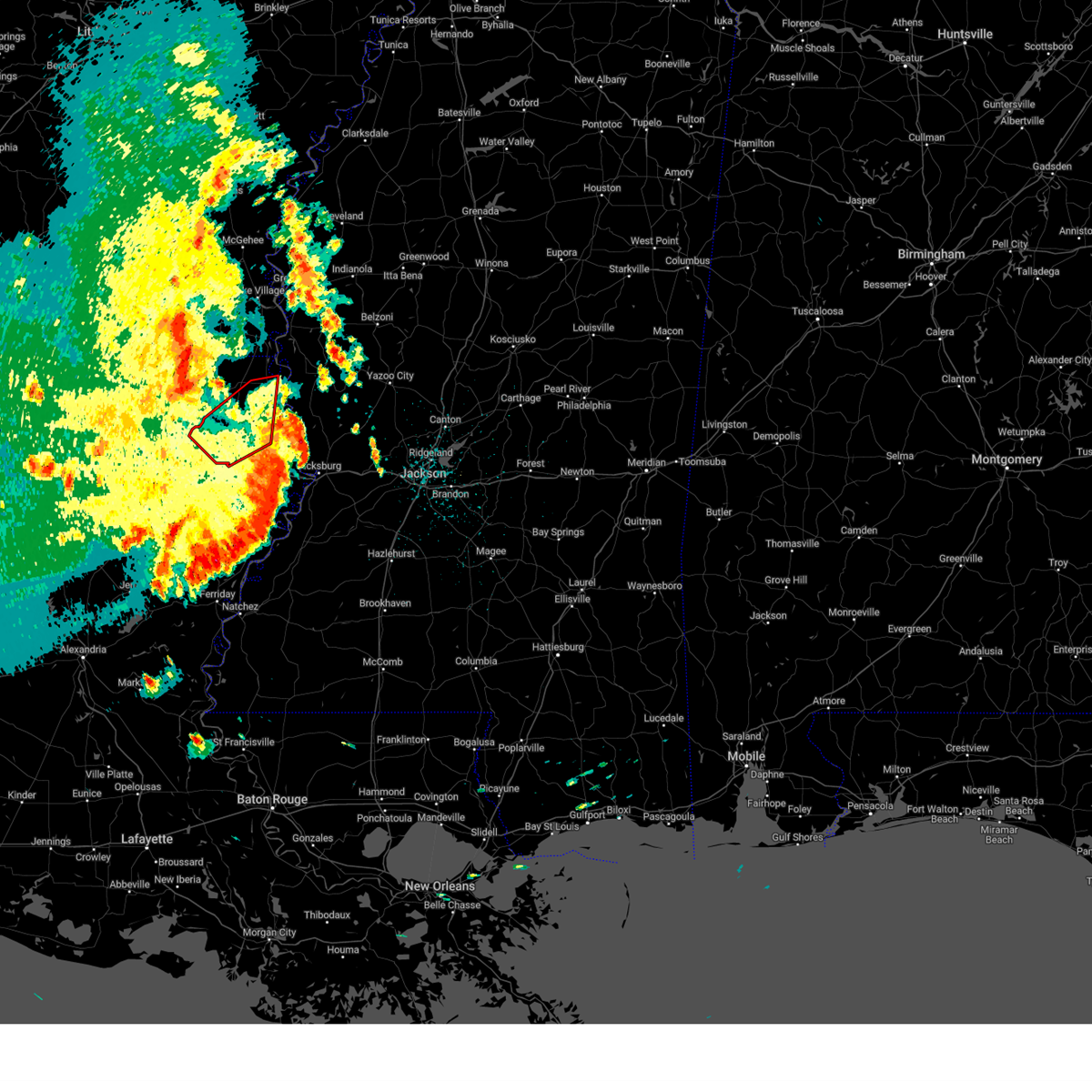 The tornado warning for east carroll, northwestern madison, northeastern richland and southern west carroll parishes will expire at 100 pm cdt, the tornado threat has diminished and the tornado warning has been cancelled. however, damaging winds remain likely and a severe thunderstorm warning remains in effect for the area. a tornado watch remains in effect until 500 pm cdt for northeastern louisiana. to report severe weather, contact your nearest law enforcement agency. they will relay your report to the national weather service jackson. The tornado warning for east carroll, northwestern madison, northeastern richland and southern west carroll parishes will expire at 100 pm cdt, the tornado threat has diminished and the tornado warning has been cancelled. however, damaging winds remain likely and a severe thunderstorm warning remains in effect for the area. a tornado watch remains in effect until 500 pm cdt for northeastern louisiana. to report severe weather, contact your nearest law enforcement agency. they will relay your report to the national weather service jackson.
|
| 5/11/2023 12:50 PM CDT |
 At 1249 pm cdt, severe thunderstorms were located along a line extending from galion to near sondheimer, moving east at 35 mph (radar indicated). Hazards include 60 mph wind gusts. expect damage to roofs, siding, and trees At 1249 pm cdt, severe thunderstorms were located along a line extending from galion to near sondheimer, moving east at 35 mph (radar indicated). Hazards include 60 mph wind gusts. expect damage to roofs, siding, and trees
|
| 5/11/2023 12:19 PM CDT |
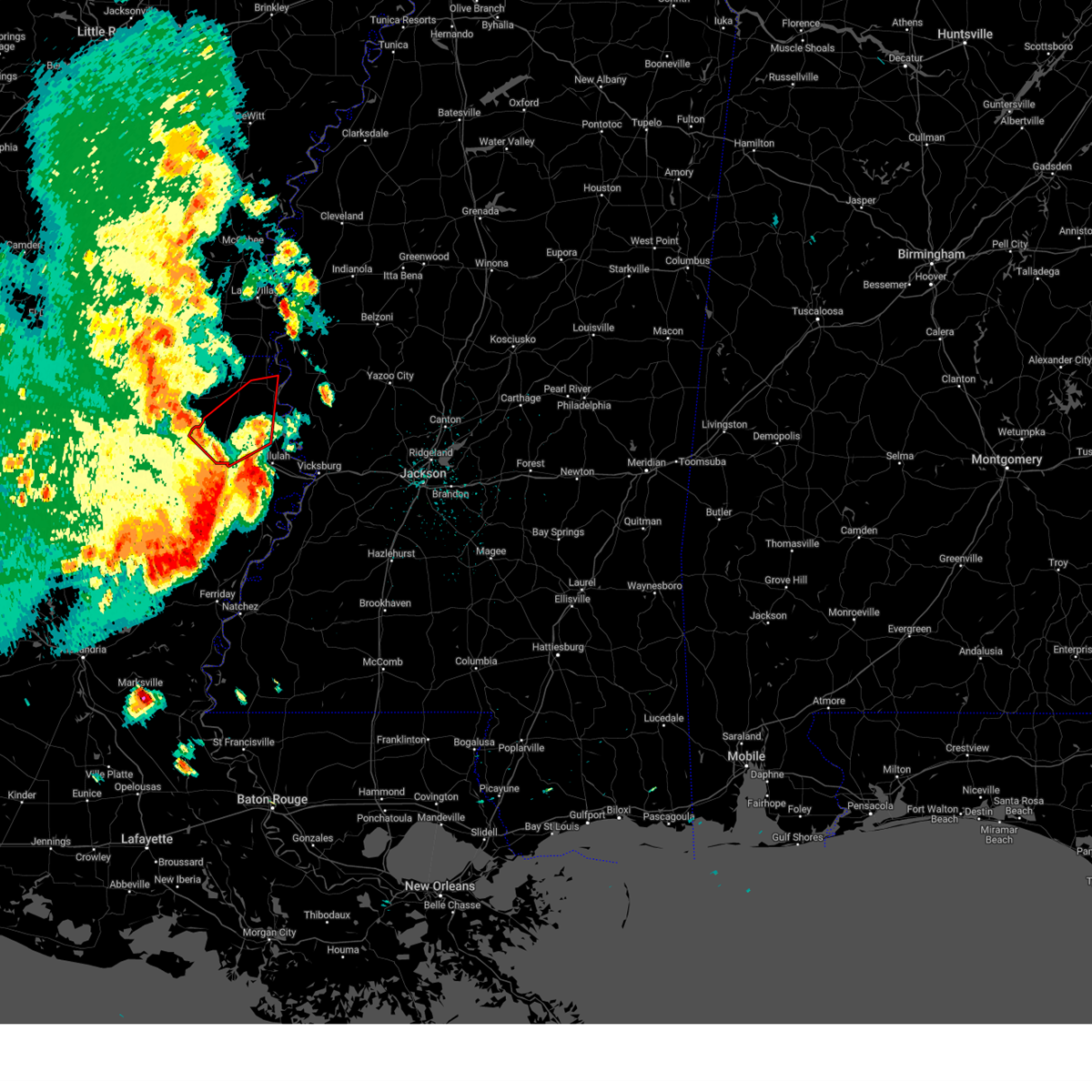 At 1218 pm cdt, a severe thunderstorm capable of producing a tornado was located near holly ridge, or near delhi, moving northeast at 45 mph (radar indicated rotation). Hazards include tornado. Flying debris will be dangerous to those caught without shelter. mobile homes will be damaged or destroyed. damage to roofs, windows, and vehicles will occur. tree damage is likely. this dangerous storm will be near, warden around 1225 pm cdt. epps around 1230 pm cdt. monticello and darnell around 1235 pm cdt. transylvania around 1255 pm cdt. Lake providence around 100 pm cdt. At 1218 pm cdt, a severe thunderstorm capable of producing a tornado was located near holly ridge, or near delhi, moving northeast at 45 mph (radar indicated rotation). Hazards include tornado. Flying debris will be dangerous to those caught without shelter. mobile homes will be damaged or destroyed. damage to roofs, windows, and vehicles will occur. tree damage is likely. this dangerous storm will be near, warden around 1225 pm cdt. epps around 1230 pm cdt. monticello and darnell around 1235 pm cdt. transylvania around 1255 pm cdt. Lake providence around 100 pm cdt.
|
| 5/11/2023 12:07 PM CDT |
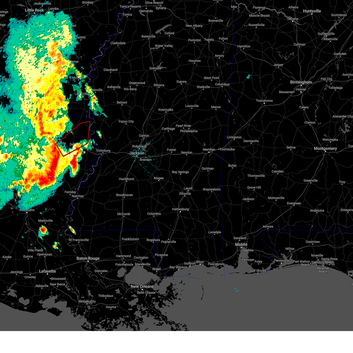 At 1207 pm cdt, a severe thunderstorm capable of producing a tornado was located near rayville, moving northeast at 45 mph (radar indicated rotation). Hazards include tornado. Flying debris will be dangerous to those caught without shelter. mobile homes will be damaged or destroyed. damage to roofs, windows, and vehicles will occur. tree damage is likely. this dangerous storm will be near, holly ridge around 1215 pm cdt. delhi around 1220 pm cdt. warden around 1225 pm cdt. epps around 1230 pm cdt. monticello and darnell around 1235 pm cdt. pioneer around 1240 pm cdt. transylvania around 1250 pm cdt. Lake providence around 100 pm cdt. At 1207 pm cdt, a severe thunderstorm capable of producing a tornado was located near rayville, moving northeast at 45 mph (radar indicated rotation). Hazards include tornado. Flying debris will be dangerous to those caught without shelter. mobile homes will be damaged or destroyed. damage to roofs, windows, and vehicles will occur. tree damage is likely. this dangerous storm will be near, holly ridge around 1215 pm cdt. delhi around 1220 pm cdt. warden around 1225 pm cdt. epps around 1230 pm cdt. monticello and darnell around 1235 pm cdt. pioneer around 1240 pm cdt. transylvania around 1250 pm cdt. Lake providence around 100 pm cdt.
|
| 4/5/2023 3:22 PM CDT |
 At 322 pm cdt, a severe thunderstorm was located near lake providence, moving northeast at 30 mph (radar indicated). Hazards include 60 mph wind gusts and quarter size hail. Hail damage to vehicles is expected. expect wind damage to roofs, siding, and trees. this severe thunderstorm will remain over mainly rural areas of northeastern east carroll parish in northeastern louisiana and northwestern issaquena counties, including the following locations, mayersville. hail threat, radar indicated max hail size, 1. 00 in wind threat, radar indicated max wind gust, 60 mph. At 322 pm cdt, a severe thunderstorm was located near lake providence, moving northeast at 30 mph (radar indicated). Hazards include 60 mph wind gusts and quarter size hail. Hail damage to vehicles is expected. expect wind damage to roofs, siding, and trees. this severe thunderstorm will remain over mainly rural areas of northeastern east carroll parish in northeastern louisiana and northwestern issaquena counties, including the following locations, mayersville. hail threat, radar indicated max hail size, 1. 00 in wind threat, radar indicated max wind gust, 60 mph.
|
| 4/5/2023 3:11 PM CDT |
 At 311 pm cdt, a severe thunderstorm was located near lake providence, moving northeast at 30 mph (radar indicated). Hazards include 60 mph wind gusts and quarter size hail. Hail damage to vehicles is expected. expect wind damage to roofs, siding, and trees. this severe storm will be near, fitler around 320 pm cdt. other locations impacted by this severe thunderstorm include mayersville. hail threat, radar indicated max hail size, 1. 00 in wind threat, radar indicated max wind gust, 60 mph. At 311 pm cdt, a severe thunderstorm was located near lake providence, moving northeast at 30 mph (radar indicated). Hazards include 60 mph wind gusts and quarter size hail. Hail damage to vehicles is expected. expect wind damage to roofs, siding, and trees. this severe storm will be near, fitler around 320 pm cdt. other locations impacted by this severe thunderstorm include mayersville. hail threat, radar indicated max hail size, 1. 00 in wind threat, radar indicated max wind gust, 60 mph.
|
| 4/5/2023 2:53 PM CDT |
 At 253 pm cdt, a severe thunderstorm was located near transylvania, moving northeast at 30 mph (radar indicated). Hazards include 60 mph wind gusts and quarter size hail. Hail damage to vehicles is expected. expect wind damage to roofs, siding, and trees. this severe thunderstorm will be near, transylvania around 305 pm cdt. lake providence around 315 pm cdt. fitler around 320 pm cdt. other locations impacted by this severe thunderstorm include mayersville. hail threat, radar indicated max hail size, 1. 00 in wind threat, radar indicated max wind gust, 60 mph. At 253 pm cdt, a severe thunderstorm was located near transylvania, moving northeast at 30 mph (radar indicated). Hazards include 60 mph wind gusts and quarter size hail. Hail damage to vehicles is expected. expect wind damage to roofs, siding, and trees. this severe thunderstorm will be near, transylvania around 305 pm cdt. lake providence around 315 pm cdt. fitler around 320 pm cdt. other locations impacted by this severe thunderstorm include mayersville. hail threat, radar indicated max hail size, 1. 00 in wind threat, radar indicated max wind gust, 60 mph.
|
| 3/24/2023 7:45 PM CDT |
 At 745 pm cdt, a severe thunderstorm capable of producing a tornado was located near lake providence, moving northeast at 50 mph (radar indicated rotation). Hazards include tornado. Flying debris will be dangerous to those caught without shelter. mobile homes will be damaged or destroyed. damage to roofs, windows, and vehicles will occur. tree damage is likely. this dangerous storm will be near, fitler around 750 pm cdt. Other locations impacted by this tornadic thunderstorm include mayersville. At 745 pm cdt, a severe thunderstorm capable of producing a tornado was located near lake providence, moving northeast at 50 mph (radar indicated rotation). Hazards include tornado. Flying debris will be dangerous to those caught without shelter. mobile homes will be damaged or destroyed. damage to roofs, windows, and vehicles will occur. tree damage is likely. this dangerous storm will be near, fitler around 750 pm cdt. Other locations impacted by this tornadic thunderstorm include mayersville.
|
| 3/24/2023 7:41 PM CDT |
 At 741 pm cdt, a severe thunderstorm was located near lake providence, moving northeast at 55 mph (radar indicated). Hazards include 60 mph wind gusts and quarter size hail. Hail damage to vehicles is expected. expect wind damage to roofs, siding, and trees. this severe storm will be near, grace around 755 pm cdt. other locations impacted by this severe thunderstorm include mayersville. hail threat, radar indicated max hail size, 1. 00 in wind threat, radar indicated max wind gust, 60 mph. At 741 pm cdt, a severe thunderstorm was located near lake providence, moving northeast at 55 mph (radar indicated). Hazards include 60 mph wind gusts and quarter size hail. Hail damage to vehicles is expected. expect wind damage to roofs, siding, and trees. this severe storm will be near, grace around 755 pm cdt. other locations impacted by this severe thunderstorm include mayersville. hail threat, radar indicated max hail size, 1. 00 in wind threat, radar indicated max wind gust, 60 mph.
|
| 3/24/2023 7:33 PM CDT |
 At 733 pm cdt, a severe thunderstorm was located over lake providence, moving northeast at 60 mph (radar indicated). Hazards include 60 mph wind gusts and nickel size hail. Expect damage to roofs, siding, and trees. this severe thunderstorm will be near, grace around 755 pm cdt. other locations impacted by this severe thunderstorm include mayersville and pioneer. hail threat, radar indicated max hail size, 0. 88 in wind threat, radar indicated max wind gust, 60 mph. At 733 pm cdt, a severe thunderstorm was located over lake providence, moving northeast at 60 mph (radar indicated). Hazards include 60 mph wind gusts and nickel size hail. Expect damage to roofs, siding, and trees. this severe thunderstorm will be near, grace around 755 pm cdt. other locations impacted by this severe thunderstorm include mayersville and pioneer. hail threat, radar indicated max hail size, 0. 88 in wind threat, radar indicated max wind gust, 60 mph.
|
| 3/12/2023 2:37 AM CDT |
 At 137 am cst, severe thunderstorms were located along a line extending from near swiftown to near midnight to near shelburn, moving east at 40 mph (radar indicated). Hazards include 60 mph wind gusts and half dollar size hail. Hail damage to vehicles is expected. expect wind damage to roofs, siding, and trees. these severe storms will be near, midnight and swiftown around 145 am cst. tchula around 150 am cst. thornton around 300 am cdt. rolling fork, coxburg, tolarville and howard around 310 am cdt. brozville and ebenezer around 320 am cdt. lexington around 325 am cdt. franklin, goodman and holly bluff around 330 am cdt. other locations impacted by these severe thunderstorms include eden, mayersville, silver city, cary, louise and west. hail threat, radar indicated max hail size, 1. 25 in wind threat, radar indicated max wind gust, 60 mph. At 137 am cst, severe thunderstorms were located along a line extending from near swiftown to near midnight to near shelburn, moving east at 40 mph (radar indicated). Hazards include 60 mph wind gusts and half dollar size hail. Hail damage to vehicles is expected. expect wind damage to roofs, siding, and trees. these severe storms will be near, midnight and swiftown around 145 am cst. tchula around 150 am cst. thornton around 300 am cdt. rolling fork, coxburg, tolarville and howard around 310 am cdt. brozville and ebenezer around 320 am cdt. lexington around 325 am cdt. franklin, goodman and holly bluff around 330 am cdt. other locations impacted by these severe thunderstorms include eden, mayersville, silver city, cary, louise and west. hail threat, radar indicated max hail size, 1. 25 in wind threat, radar indicated max wind gust, 60 mph.
|
| 3/12/2023 2:04 AM CDT |
 At 104 am cst, severe thunderstorms were located along a line extending from indianola to near hollandale to 6 miles east of jones, moving southeast at 40 mph (radar indicated). Hazards include 60 mph wind gusts and quarter size hail. Hail damage to vehicles is expected. expect wind damage to roofs, siding, and trees. severe thunderstorms will be near, hollandale, delta city, panther burn and nitta yuma around 110 am cst. murphy around 115 am cst. swiftown and midnight around 130 am cst. shelburn around 135 am cst. lake providence around 140 am cst. tchula around 150 am cst. yazoo city around 155 am cst. benton, lexington, fitler, onward and howard around 300 am cdt. other locations impacted by these severe thunderstorms include mayersville, silver city, west, eden, kilbourne, cary, louise and cruger. hail threat, radar indicated max hail size, 1. 00 in wind threat, radar indicated max wind gust, 60 mph. At 104 am cst, severe thunderstorms were located along a line extending from indianola to near hollandale to 6 miles east of jones, moving southeast at 40 mph (radar indicated). Hazards include 60 mph wind gusts and quarter size hail. Hail damage to vehicles is expected. expect wind damage to roofs, siding, and trees. severe thunderstorms will be near, hollandale, delta city, panther burn and nitta yuma around 110 am cst. murphy around 115 am cst. swiftown and midnight around 130 am cst. shelburn around 135 am cst. lake providence around 140 am cst. tchula around 150 am cst. yazoo city around 155 am cst. benton, lexington, fitler, onward and howard around 300 am cdt. other locations impacted by these severe thunderstorms include mayersville, silver city, west, eden, kilbourne, cary, louise and cruger. hail threat, radar indicated max hail size, 1. 00 in wind threat, radar indicated max wind gust, 60 mph.
|
| 1/3/2023 7:49 AM CST |
 At 749 am cst, a severe thunderstorm was located over rolling fork, moving northeast at 60 mph (radar indicated). Hazards include 60 mph wind gusts. Expect damage to roofs, siding, and trees. locations impacted include, lake providence, transylvania, fitler, alsatia, sondheimer and mayersville. hail threat, radar indicated max hail size, <. 75 in wind threat, radar indicated max wind gust, 60 mph. At 749 am cst, a severe thunderstorm was located over rolling fork, moving northeast at 60 mph (radar indicated). Hazards include 60 mph wind gusts. Expect damage to roofs, siding, and trees. locations impacted include, lake providence, transylvania, fitler, alsatia, sondheimer and mayersville. hail threat, radar indicated max hail size, <. 75 in wind threat, radar indicated max wind gust, 60 mph.
|
| 1/3/2023 7:35 AM CST |
 At 735 am cst, a severe thunderstorm was located near fitler, or near lake providence, moving northeast at 60 mph (radar indicated). Hazards include 60 mph wind gusts. Expect damage to roofs, siding, and trees. this severe thunderstorm will remain over mainly rural areas of east carroll parish in northeastern louisiana and northwestern issaquena counties, including the following locations, mayersville. hail threat, radar indicated max hail size, <. 75 in wind threat, radar indicated max wind gust, 60 mph. At 735 am cst, a severe thunderstorm was located near fitler, or near lake providence, moving northeast at 60 mph (radar indicated). Hazards include 60 mph wind gusts. Expect damage to roofs, siding, and trees. this severe thunderstorm will remain over mainly rural areas of east carroll parish in northeastern louisiana and northwestern issaquena counties, including the following locations, mayersville. hail threat, radar indicated max hail size, <. 75 in wind threat, radar indicated max wind gust, 60 mph.
|
| 1/3/2023 7:18 AM CST |
 At 718 am cst, a severe thunderstorm was located near monticello, or 10 miles west of transylvania, moving northeast at 60 mph (radar indicated). Hazards include 60 mph wind gusts. Expect damage to roofs, siding, and trees. this severe thunderstorm will be near, alsatia around 725 am cst. transylvania around 730 am cst. lake providence and fitler around 735 am cst. other locations impacted by this severe thunderstorm include mayersville, pioneer and forest. hail threat, radar indicated max hail size, <. 75 in wind threat, radar indicated max wind gust, 60 mph. At 718 am cst, a severe thunderstorm was located near monticello, or 10 miles west of transylvania, moving northeast at 60 mph (radar indicated). Hazards include 60 mph wind gusts. Expect damage to roofs, siding, and trees. this severe thunderstorm will be near, alsatia around 725 am cst. transylvania around 730 am cst. lake providence and fitler around 735 am cst. other locations impacted by this severe thunderstorm include mayersville, pioneer and forest. hail threat, radar indicated max hail size, <. 75 in wind threat, radar indicated max wind gust, 60 mph.
|
| 11/30/2022 12:11 AM CST |
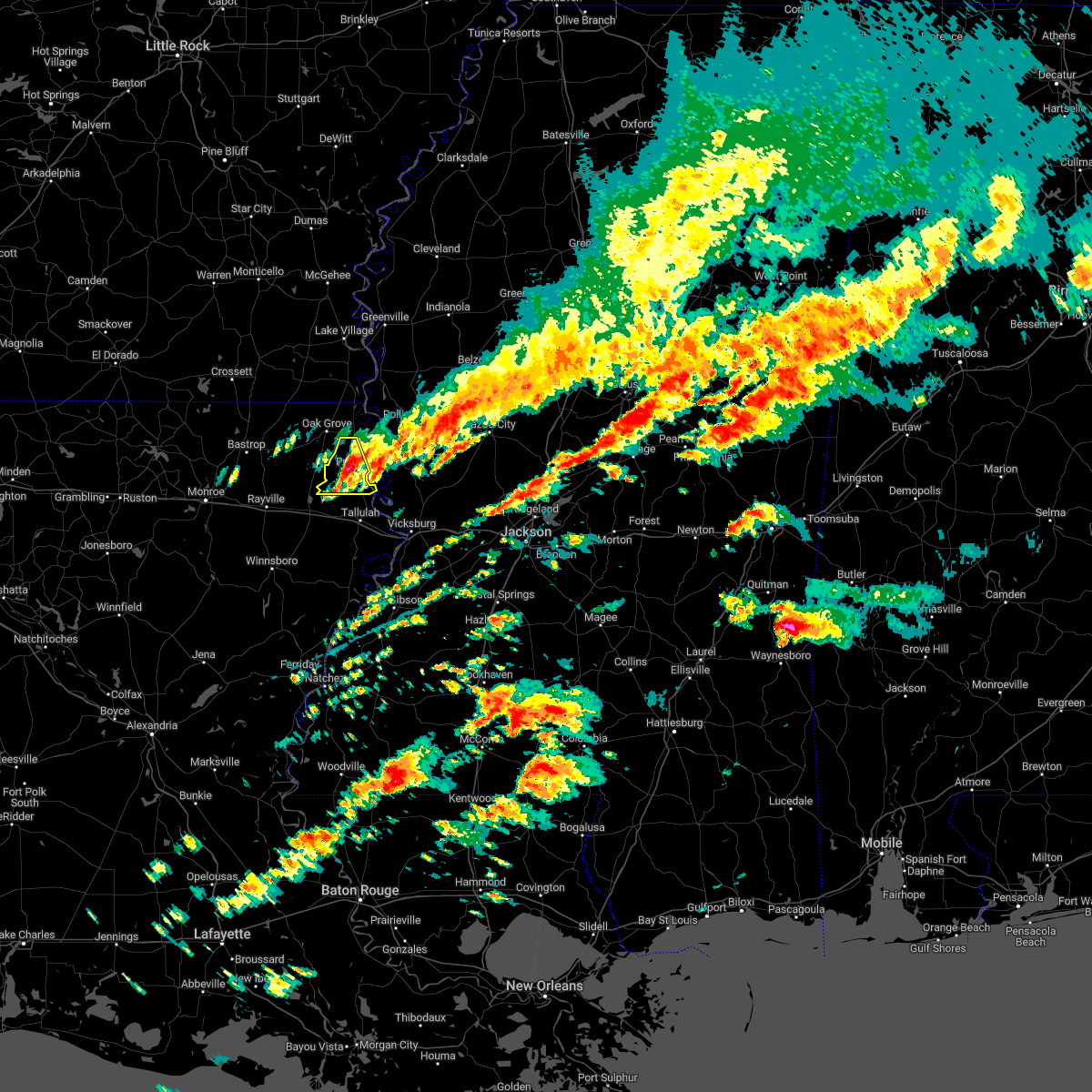 The severe thunderstorm warning for southwestern east carroll parish will expire at 1215 am cst, the storm which prompted the warning has weakened below severe limits, and no longer poses an immediate threat to life or property. therefore, the warning will be allowed to expire. however gusty winds are still possible with this thunderstorm. a tornado watch remains in effect until 200 am cst for northeastern louisiana, and west central mississippi. to report severe weather, contact your nearest law enforcement agency. they will relay your report to the national weather service jackson. The severe thunderstorm warning for southwestern east carroll parish will expire at 1215 am cst, the storm which prompted the warning has weakened below severe limits, and no longer poses an immediate threat to life or property. therefore, the warning will be allowed to expire. however gusty winds are still possible with this thunderstorm. a tornado watch remains in effect until 200 am cst for northeastern louisiana, and west central mississippi. to report severe weather, contact your nearest law enforcement agency. they will relay your report to the national weather service jackson.
|
| 11/30/2022 12:03 AM CST |
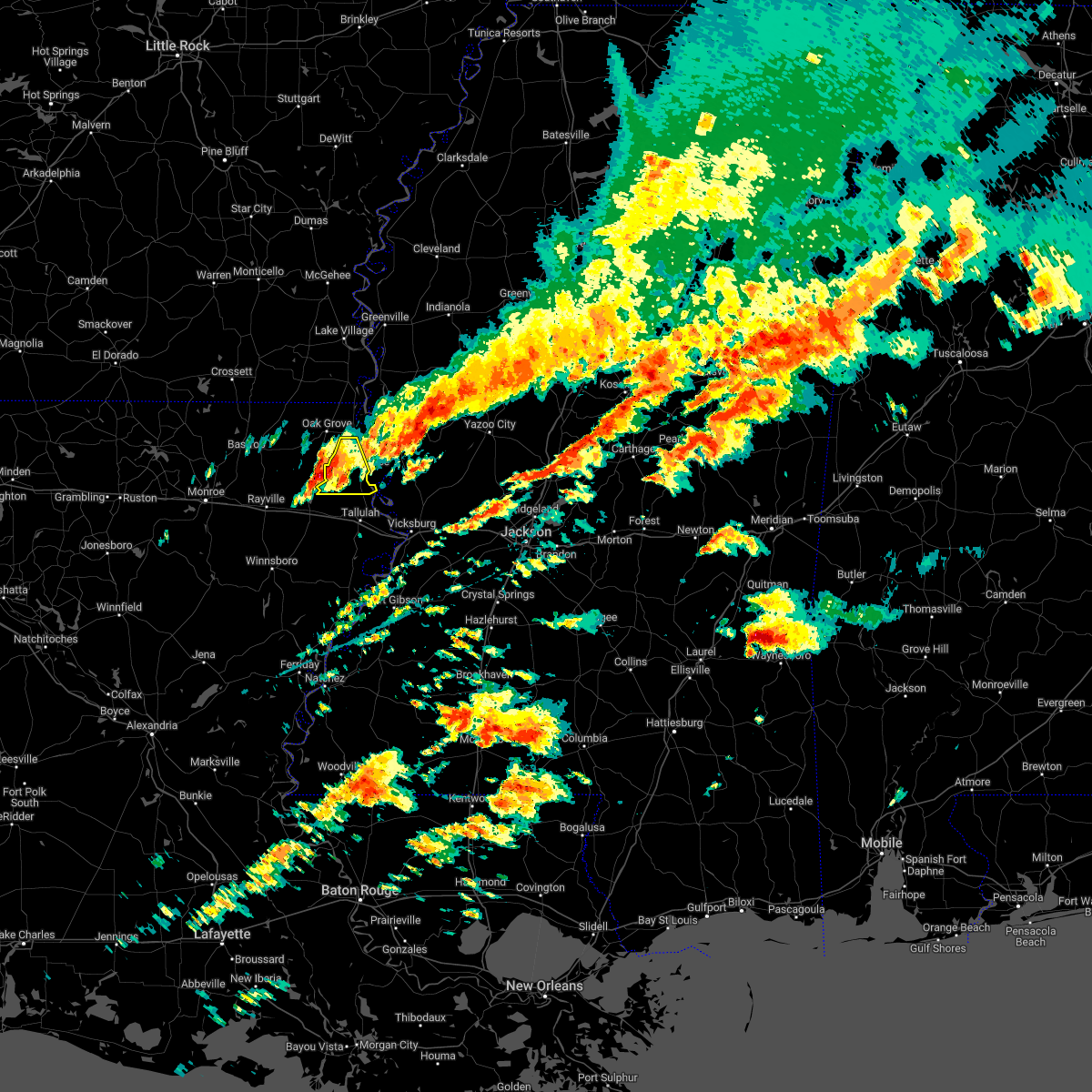 At 1203 am cst, a severe thunderstorm was located near transylvania, moving east at 40 mph (radar indicated). Hazards include 60 mph wind gusts. Expect damage to roofs, siding, and trees. This severe storm will be near, transylvania and alsatia around 1210 am cst. At 1203 am cst, a severe thunderstorm was located near transylvania, moving east at 40 mph (radar indicated). Hazards include 60 mph wind gusts. Expect damage to roofs, siding, and trees. This severe storm will be near, transylvania and alsatia around 1210 am cst.
|
| 11/29/2022 11:48 PM CST |
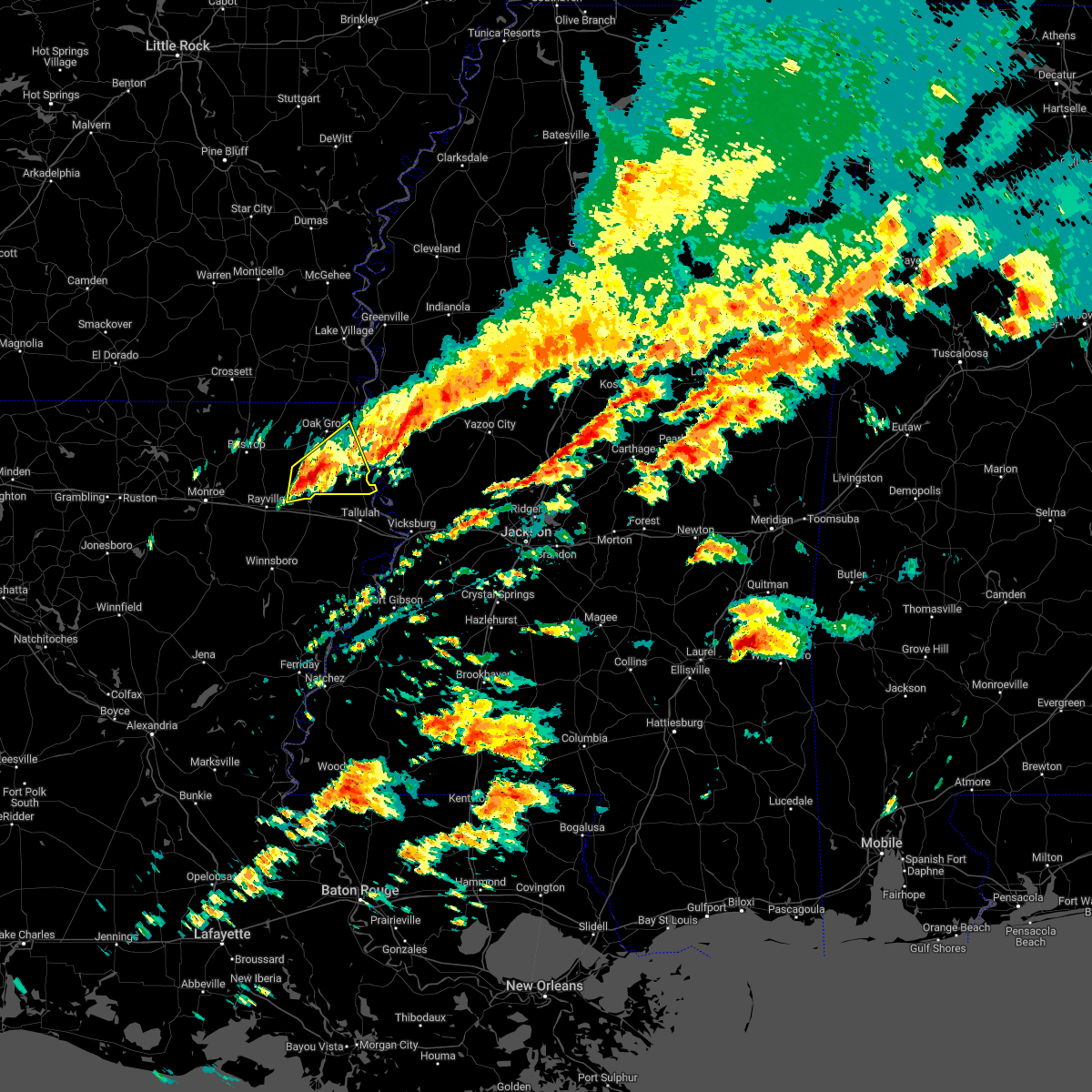 At 1148 pm cst, a severe thunderstorm was located near darnell, or 12 miles west of transylvania, moving east at 55 mph (radar indicated). Hazards include 60 mph wind gusts and quarter size hail. Hail damage to vehicles is expected. expect wind damage to roofs, siding, and trees. this severe storm will be near, transylvania around 1200 am cst. lake providence around 1205 am cst. Other locations impacted by this severe thunderstorm include pioneer, forest and epps. At 1148 pm cst, a severe thunderstorm was located near darnell, or 12 miles west of transylvania, moving east at 55 mph (radar indicated). Hazards include 60 mph wind gusts and quarter size hail. Hail damage to vehicles is expected. expect wind damage to roofs, siding, and trees. this severe storm will be near, transylvania around 1200 am cst. lake providence around 1205 am cst. Other locations impacted by this severe thunderstorm include pioneer, forest and epps.
|
| 11/29/2022 11:14 PM CST |
 At 1114 pm cst, a severe thunderstorm was located near start, moving east at 55 mph (radar indicated). Hazards include 60 mph wind gusts and quarter size hail. Hail damage to vehicles is expected. expect wind damage to roofs, siding, and trees. this severe thunderstorm will be near, goodwill around 1140 pm cst. darnell around 1145 pm cst. transylvania around 1200 am cst. lake providence around 1205 am cst. Other locations impacted by this severe thunderstorm include forest, pioneer, oak ridge and epps. At 1114 pm cst, a severe thunderstorm was located near start, moving east at 55 mph (radar indicated). Hazards include 60 mph wind gusts and quarter size hail. Hail damage to vehicles is expected. expect wind damage to roofs, siding, and trees. this severe thunderstorm will be near, goodwill around 1140 pm cst. darnell around 1145 pm cst. transylvania around 1200 am cst. lake providence around 1205 am cst. Other locations impacted by this severe thunderstorm include forest, pioneer, oak ridge and epps.
|
| 7/13/2022 4:45 PM CDT |
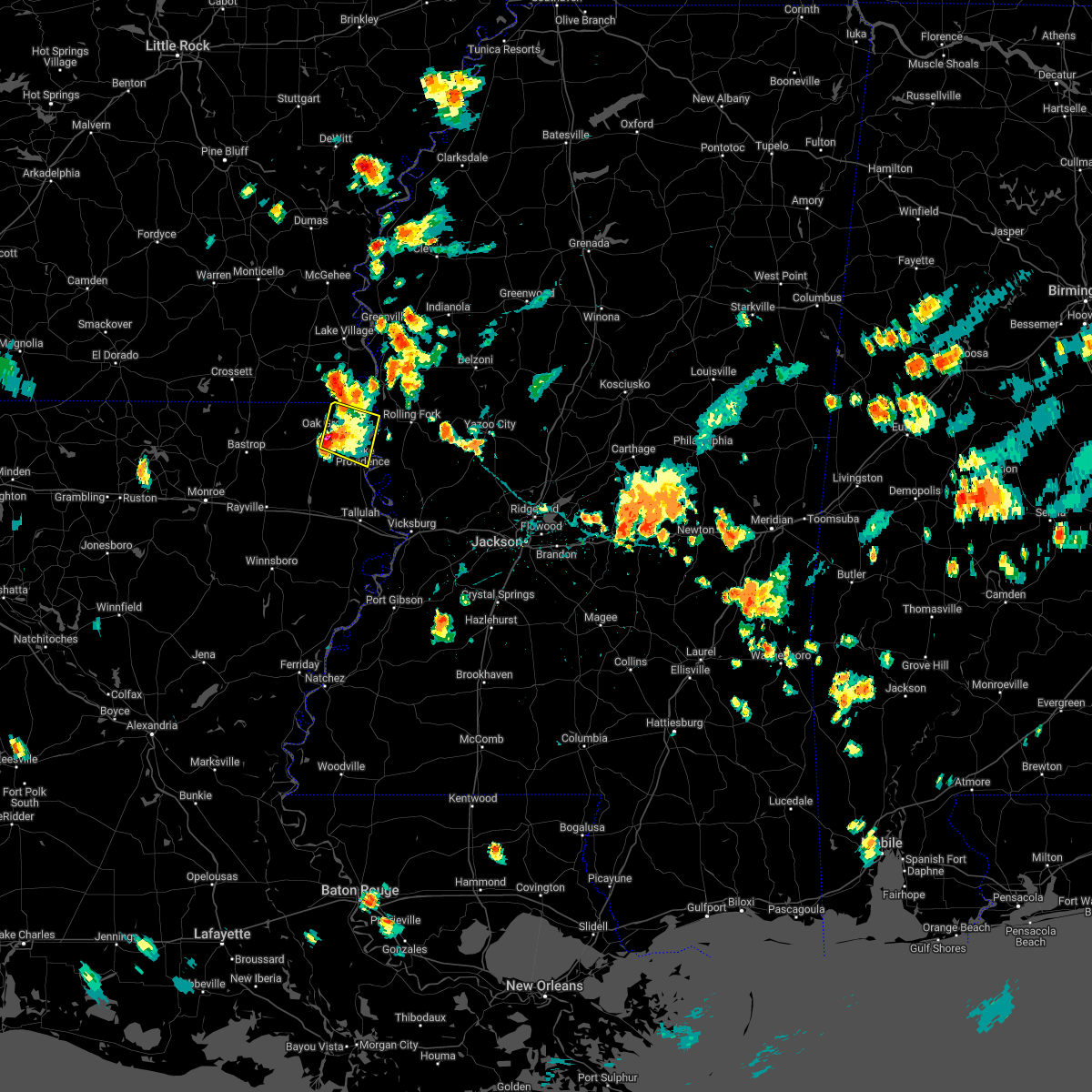 At 445 pm cdt, a severe thunderstorm was located near oak grove, or 12 miles west of lake providence, moving south at 10 mph (radar indicated). Hazards include ping pong ball size hail and 60 mph wind gusts. People and animals outdoors will be injured. expect hail damage to roofs, siding, windows, and vehicles. expect wind damage to roofs, siding, and trees. this severe thunderstorm will remain over mainly rural areas of central east carroll, northeastern west carroll parishes in northeastern louisiana and northwestern issaquena counties, including the following locations, kilbourne and forest. hail threat, radar indicated max hail size, 1. 50 in wind threat, radar indicated max wind gust, 60 mph. At 445 pm cdt, a severe thunderstorm was located near oak grove, or 12 miles west of lake providence, moving south at 10 mph (radar indicated). Hazards include ping pong ball size hail and 60 mph wind gusts. People and animals outdoors will be injured. expect hail damage to roofs, siding, windows, and vehicles. expect wind damage to roofs, siding, and trees. this severe thunderstorm will remain over mainly rural areas of central east carroll, northeastern west carroll parishes in northeastern louisiana and northwestern issaquena counties, including the following locations, kilbourne and forest. hail threat, radar indicated max hail size, 1. 50 in wind threat, radar indicated max wind gust, 60 mph.
|
| 7/13/2022 4:45 PM CDT |
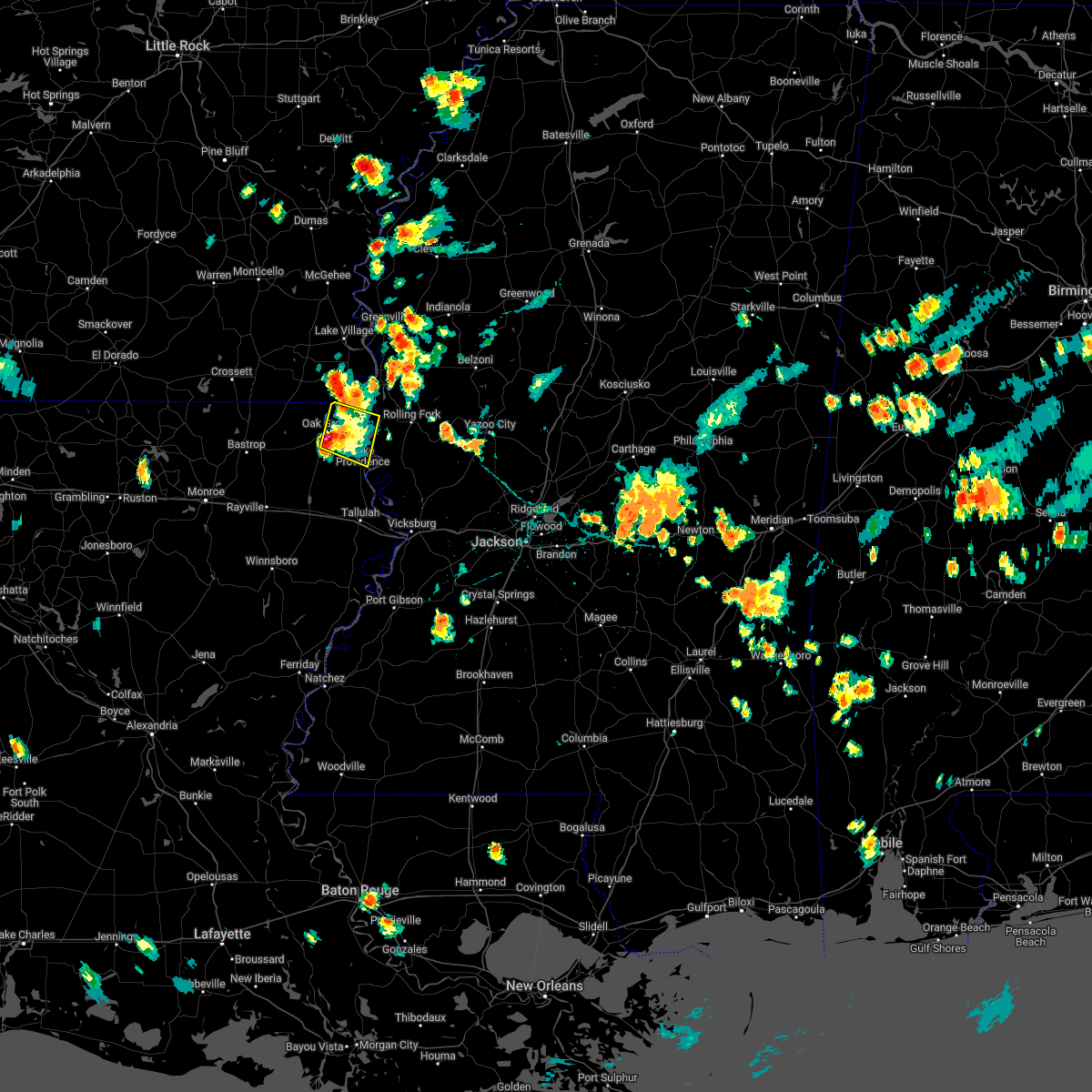 At 445 pm cdt, a severe thunderstorm was located near oak grove, or 12 miles west of lake providence, moving south at 10 mph (radar indicated). Hazards include ping pong ball size hail and 60 mph wind gusts. People and animals outdoors will be injured. expect hail damage to roofs, siding, windows, and vehicles. expect wind damage to roofs, siding, and trees. this severe thunderstorm will remain over mainly rural areas of central east carroll, northeastern west carroll parishes in northeastern louisiana and northwestern issaquena counties, including the following locations, kilbourne and forest. hail threat, radar indicated max hail size, 1. 50 in wind threat, radar indicated max wind gust, 60 mph. At 445 pm cdt, a severe thunderstorm was located near oak grove, or 12 miles west of lake providence, moving south at 10 mph (radar indicated). Hazards include ping pong ball size hail and 60 mph wind gusts. People and animals outdoors will be injured. expect hail damage to roofs, siding, windows, and vehicles. expect wind damage to roofs, siding, and trees. this severe thunderstorm will remain over mainly rural areas of central east carroll, northeastern west carroll parishes in northeastern louisiana and northwestern issaquena counties, including the following locations, kilbourne and forest. hail threat, radar indicated max hail size, 1. 50 in wind threat, radar indicated max wind gust, 60 mph.
|
| 7/13/2022 4:40 PM CDT |
 At 440 pm cdt, a severe thunderstorm was located over oak grove, or 12 miles west of lake providence, moving south at 5 mph (radar indicated). Hazards include 60 mph wind gusts and half dollar size hail. Hail damage to vehicles is expected. expect wind damage to roofs, siding, and trees. this severe thunderstorm will remain over mainly rural areas of central east carroll, northeastern west carroll parishes in northeastern louisiana and northwestern issaquena counties, including the following locations, kilbourne and forest. hail threat, radar indicated max hail size, 1. 25 in wind threat, radar indicated max wind gust, 60 mph. At 440 pm cdt, a severe thunderstorm was located over oak grove, or 12 miles west of lake providence, moving south at 5 mph (radar indicated). Hazards include 60 mph wind gusts and half dollar size hail. Hail damage to vehicles is expected. expect wind damage to roofs, siding, and trees. this severe thunderstorm will remain over mainly rural areas of central east carroll, northeastern west carroll parishes in northeastern louisiana and northwestern issaquena counties, including the following locations, kilbourne and forest. hail threat, radar indicated max hail size, 1. 25 in wind threat, radar indicated max wind gust, 60 mph.
|
| 7/13/2022 4:40 PM CDT |
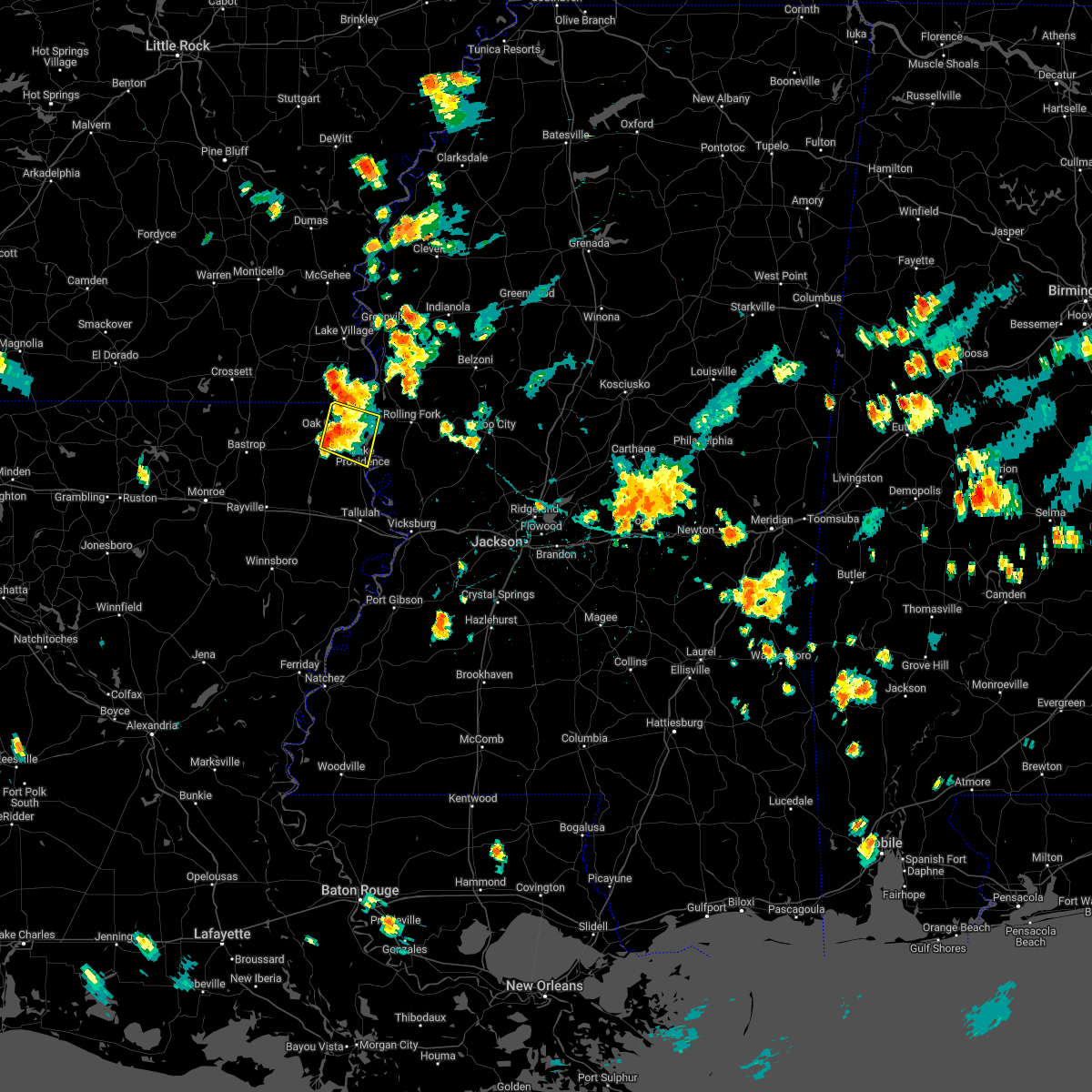 At 440 pm cdt, a severe thunderstorm was located over oak grove, or 12 miles west of lake providence, moving south at 5 mph (radar indicated). Hazards include 60 mph wind gusts and half dollar size hail. Hail damage to vehicles is expected. expect wind damage to roofs, siding, and trees. this severe thunderstorm will remain over mainly rural areas of central east carroll, northeastern west carroll parishes in northeastern louisiana and northwestern issaquena counties, including the following locations, kilbourne and forest. hail threat, radar indicated max hail size, 1. 25 in wind threat, radar indicated max wind gust, 60 mph. At 440 pm cdt, a severe thunderstorm was located over oak grove, or 12 miles west of lake providence, moving south at 5 mph (radar indicated). Hazards include 60 mph wind gusts and half dollar size hail. Hail damage to vehicles is expected. expect wind damage to roofs, siding, and trees. this severe thunderstorm will remain over mainly rural areas of central east carroll, northeastern west carroll parishes in northeastern louisiana and northwestern issaquena counties, including the following locations, kilbourne and forest. hail threat, radar indicated max hail size, 1. 25 in wind threat, radar indicated max wind gust, 60 mph.
|
| 7/13/2022 4:19 PM CDT |
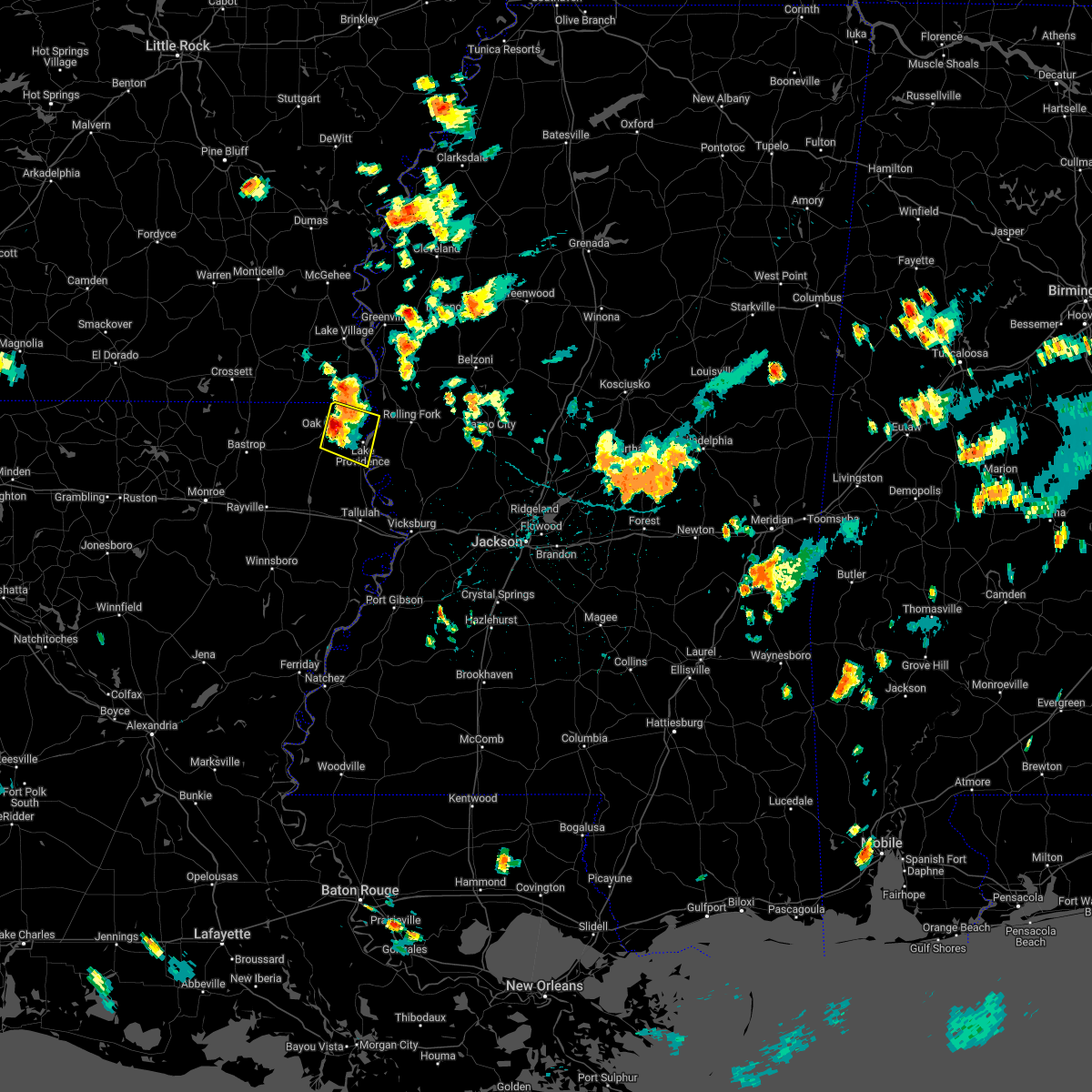 At 418 pm cdt, a severe thunderstorm was located near oak grove, or 10 miles northwest of lake providence, moving east at 10 mph (radar indicated). Hazards include 60 mph wind gusts and quarter size hail. Hail damage to vehicles is expected. expect wind damage to roofs, siding, and trees. this severe thunderstorm will be near, millikin around 440 pm cdt. shelburn around 450 pm cdt. lake providence around 510 pm cdt. other locations impacted by this severe thunderstorm include kilbourne and forest. hail threat, radar indicated max hail size, 1. 00 in wind threat, radar indicated max wind gust, 60 mph. At 418 pm cdt, a severe thunderstorm was located near oak grove, or 10 miles northwest of lake providence, moving east at 10 mph (radar indicated). Hazards include 60 mph wind gusts and quarter size hail. Hail damage to vehicles is expected. expect wind damage to roofs, siding, and trees. this severe thunderstorm will be near, millikin around 440 pm cdt. shelburn around 450 pm cdt. lake providence around 510 pm cdt. other locations impacted by this severe thunderstorm include kilbourne and forest. hail threat, radar indicated max hail size, 1. 00 in wind threat, radar indicated max wind gust, 60 mph.
|
| 7/13/2022 4:19 PM CDT |
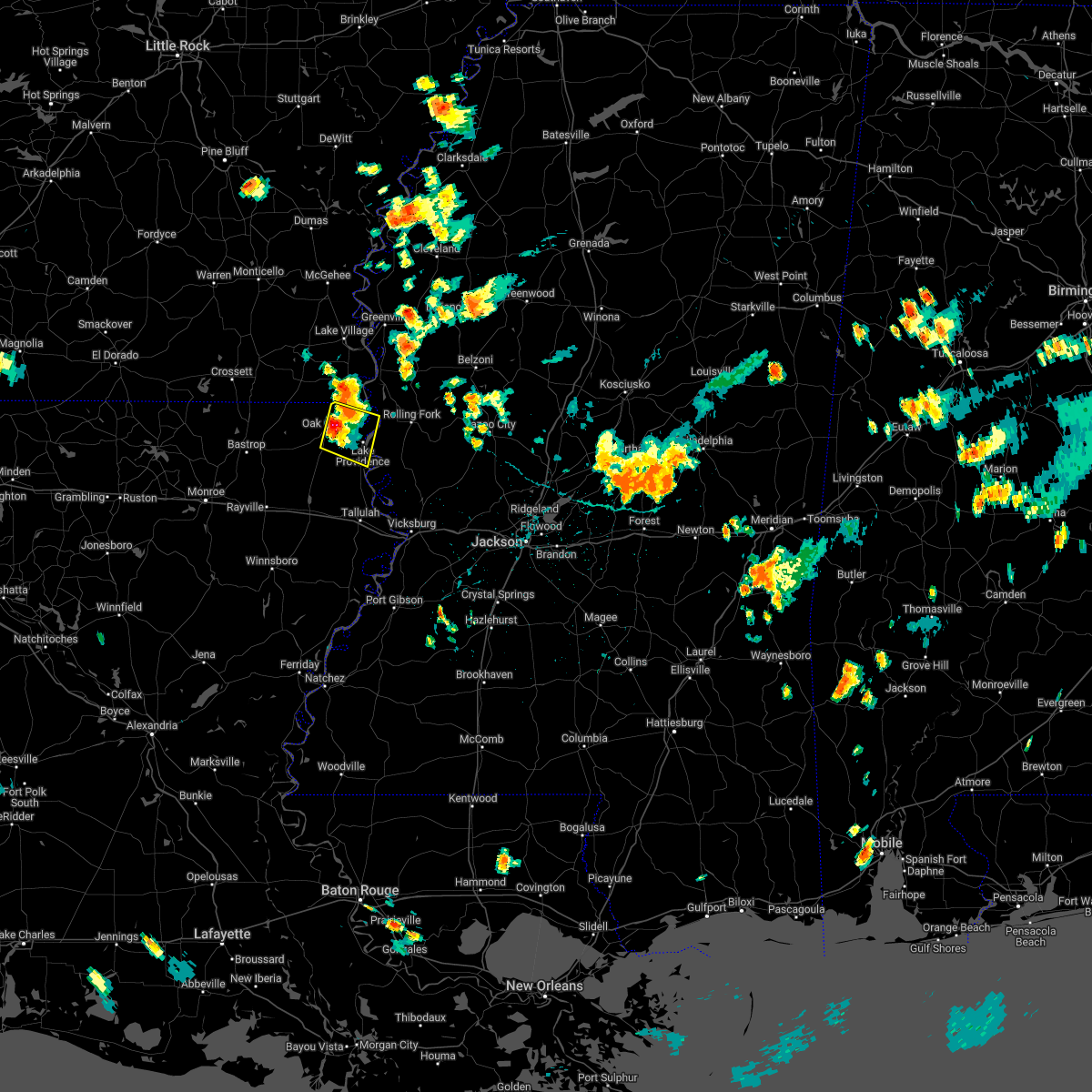 At 418 pm cdt, a severe thunderstorm was located near oak grove, or 10 miles northwest of lake providence, moving east at 10 mph (radar indicated). Hazards include 60 mph wind gusts and quarter size hail. Hail damage to vehicles is expected. expect wind damage to roofs, siding, and trees. this severe thunderstorm will be near, millikin around 440 pm cdt. shelburn around 450 pm cdt. lake providence around 510 pm cdt. other locations impacted by this severe thunderstorm include kilbourne and forest. hail threat, radar indicated max hail size, 1. 00 in wind threat, radar indicated max wind gust, 60 mph. At 418 pm cdt, a severe thunderstorm was located near oak grove, or 10 miles northwest of lake providence, moving east at 10 mph (radar indicated). Hazards include 60 mph wind gusts and quarter size hail. Hail damage to vehicles is expected. expect wind damage to roofs, siding, and trees. this severe thunderstorm will be near, millikin around 440 pm cdt. shelburn around 450 pm cdt. lake providence around 510 pm cdt. other locations impacted by this severe thunderstorm include kilbourne and forest. hail threat, radar indicated max hail size, 1. 00 in wind threat, radar indicated max wind gust, 60 mph.
|
| 6/10/2022 10:20 AM CDT |
 At 1020 am cdt, severe thunderstorms were located along a line extending from ladelle to near lapile to 6 miles southwest of strong, moving east at 60 mph (radar indicated). Hazards include 60 mph wind gusts. Expect damage to roofs, siding, and trees. these severe thunderstorms will remain over mainly rural areas of east carroll, richland and west carroll parishes, including the following locations, kilbourne, forest, pioneer and epps. hail threat, radar indicated max hail size, <. 75 in wind threat, radar indicated max wind gust, 60 mph. At 1020 am cdt, severe thunderstorms were located along a line extending from ladelle to near lapile to 6 miles southwest of strong, moving east at 60 mph (radar indicated). Hazards include 60 mph wind gusts. Expect damage to roofs, siding, and trees. these severe thunderstorms will remain over mainly rural areas of east carroll, richland and west carroll parishes, including the following locations, kilbourne, forest, pioneer and epps. hail threat, radar indicated max hail size, <. 75 in wind threat, radar indicated max wind gust, 60 mph.
|
| 6/10/2022 10:10 AM CDT |
 At 1009 am cdt, severe thunderstorms were located along a line extending from near shelburn to near delhi to near rayville, moving southeast at 55 mph (radar indicated). Hazards include 60 mph wind gusts. Expect damage to roofs, siding, and trees. severe thunderstorms will be near, waverly around 1015 am cdt. tendal around 1020 am cdt. crowville, fitler and bakers around 1025 am cdt. valley park and afton around 1035 am cdt. newlight and somerset around 1040 am cdt. redwood and newellton around 1050 am cdt. lake bruin around 1055 am cdt. other locations impacted by these severe thunderstorms include mound, gilbert, baskin, mayersville, delta and richmond. hail threat, radar indicated max hail size, <. 75 in wind threat, radar indicated max wind gust, 60 mph. At 1009 am cdt, severe thunderstorms were located along a line extending from near shelburn to near delhi to near rayville, moving southeast at 55 mph (radar indicated). Hazards include 60 mph wind gusts. Expect damage to roofs, siding, and trees. severe thunderstorms will be near, waverly around 1015 am cdt. tendal around 1020 am cdt. crowville, fitler and bakers around 1025 am cdt. valley park and afton around 1035 am cdt. newlight and somerset around 1040 am cdt. redwood and newellton around 1050 am cdt. lake bruin around 1055 am cdt. other locations impacted by these severe thunderstorms include mound, gilbert, baskin, mayersville, delta and richmond. hail threat, radar indicated max hail size, <. 75 in wind threat, radar indicated max wind gust, 60 mph.
|
| 6/10/2022 9:38 AM CDT |
 At 937 am cdt, severe thunderstorms were located along a line extending from 8 miles west of eudora to 6 miles south of galion to sterlington, moving southeast at 55 mph (radar indicated). Hazards include 60 mph wind gusts. Expect damage to roofs, siding, and trees. severe thunderstorms will be near, gassoway around 950 am cdt. start, millikin and shelburn around 955 am cdt. lake providence, rayville, warden, holly ridge and alto around 1000 am cdt. delhi and archibald around 1005 am cdt. mangham around 1010 am cdt. other locations impacted by these severe thunderstorms include perryville, collinston, pioneer, kilbourne, forest, oak ridge and epps. hail threat, radar indicated max hail size, <. 75 in wind threat, radar indicated max wind gust, 60 mph. At 937 am cdt, severe thunderstorms were located along a line extending from 8 miles west of eudora to 6 miles south of galion to sterlington, moving southeast at 55 mph (radar indicated). Hazards include 60 mph wind gusts. Expect damage to roofs, siding, and trees. severe thunderstorms will be near, gassoway around 950 am cdt. start, millikin and shelburn around 955 am cdt. lake providence, rayville, warden, holly ridge and alto around 1000 am cdt. delhi and archibald around 1005 am cdt. mangham around 1010 am cdt. other locations impacted by these severe thunderstorms include perryville, collinston, pioneer, kilbourne, forest, oak ridge and epps. hail threat, radar indicated max hail size, <. 75 in wind threat, radar indicated max wind gust, 60 mph.
|
| 6/8/2022 5:04 PM CDT |
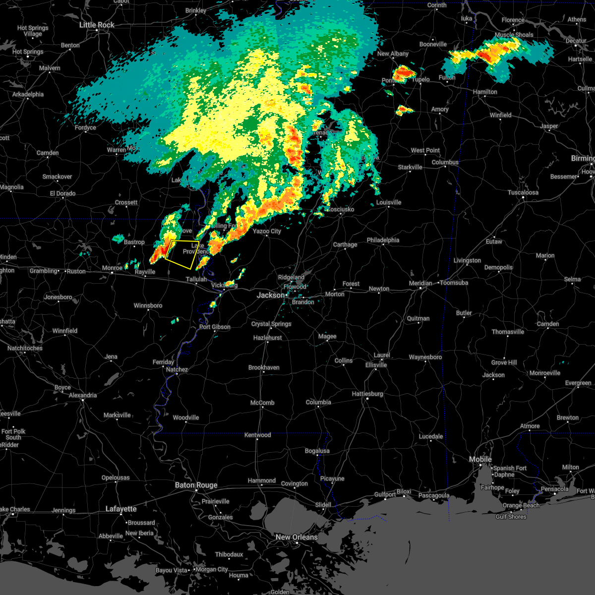 At 504 pm cdt, a severe thunderstorm was located over darnell, or 15 miles west of transylvania, moving east at 30 mph (radar indicated). Hazards include ping pong ball size hail and 60 mph wind gusts. People and animals outdoors will be injured. expect hail damage to roofs, siding, windows, and vehicles. expect wind damage to roofs, siding, and trees. this severe storm will be near, monticello around 515 pm cdt. other locations impacted by this severe thunderstorm include pioneer and forest. hail threat, radar indicated max hail size, 1. 50 in wind threat, radar indicated max wind gust, 60 mph. At 504 pm cdt, a severe thunderstorm was located over darnell, or 15 miles west of transylvania, moving east at 30 mph (radar indicated). Hazards include ping pong ball size hail and 60 mph wind gusts. People and animals outdoors will be injured. expect hail damage to roofs, siding, windows, and vehicles. expect wind damage to roofs, siding, and trees. this severe storm will be near, monticello around 515 pm cdt. other locations impacted by this severe thunderstorm include pioneer and forest. hail threat, radar indicated max hail size, 1. 50 in wind threat, radar indicated max wind gust, 60 mph.
|
| 6/8/2022 4:57 PM CDT |
 At 456 pm cdt, a severe thunderstorm was located near darnell, or 19 miles west of transylvania, moving east at 30 mph (radar indicated). Hazards include 60 mph wind gusts and quarter size hail. Hail damage to vehicles is expected. expect wind damage to roofs, siding, and trees. this severe thunderstorm will be near, darnell around 505 pm cdt. monticello around 515 pm cdt. other locations impacted by this severe thunderstorm include pioneer and forest. hail threat, radar indicated max hail size, 1. 00 in wind threat, radar indicated max wind gust, 60 mph. At 456 pm cdt, a severe thunderstorm was located near darnell, or 19 miles west of transylvania, moving east at 30 mph (radar indicated). Hazards include 60 mph wind gusts and quarter size hail. Hail damage to vehicles is expected. expect wind damage to roofs, siding, and trees. this severe thunderstorm will be near, darnell around 505 pm cdt. monticello around 515 pm cdt. other locations impacted by this severe thunderstorm include pioneer and forest. hail threat, radar indicated max hail size, 1. 00 in wind threat, radar indicated max wind gust, 60 mph.
|
| 5/15/2022 7:39 PM CDT | A tree was blown down near the intersection of us highway 65 and ms highway 58 in east carroll county LA, 14.3 miles N of Lake Providence, LA |
| 5/15/2022 7:22 PM CDT |
 At 721 pm cdt, severe thunderstorms were located along a line extending from near murphy to near shelburn to near galion, moving southeast at 60 mph (radar indicated). Hazards include 60 mph wind gusts and half dollar size hail. Hail damage to vehicles is expected. expect wind damage to roofs, siding, and trees. these severe storms will be near, shelburn around 725 pm cdt. lake providence around 730 pm cdt. transylvania, alsatia and fitler around 740 pm cdt. other locations impacted by these severe thunderstorms include mayersville, perryville, collinston, mer rouge, pioneer, kilbourne, forest, cary, bonita and oak ridge. hail threat, radar indicated max hail size, 1. 25 in wind threat, radar indicated max wind gust, 60 mph. At 721 pm cdt, severe thunderstorms were located along a line extending from near murphy to near shelburn to near galion, moving southeast at 60 mph (radar indicated). Hazards include 60 mph wind gusts and half dollar size hail. Hail damage to vehicles is expected. expect wind damage to roofs, siding, and trees. these severe storms will be near, shelburn around 725 pm cdt. lake providence around 730 pm cdt. transylvania, alsatia and fitler around 740 pm cdt. other locations impacted by these severe thunderstorms include mayersville, perryville, collinston, mer rouge, pioneer, kilbourne, forest, cary, bonita and oak ridge. hail threat, radar indicated max hail size, 1. 25 in wind threat, radar indicated max wind gust, 60 mph.
|
| 5/15/2022 7:06 PM CDT |
 At 706 pm cdt, severe thunderstorms were located along a line extending from near tribbett to 7 miles east of parkdale to near crossett, moving southeast at 50 mph (radar indicated). Hazards include 60 mph wind gusts and quarter size hail. Hail damage to vehicles is expected. expect wind damage to roofs, siding, and trees. severe thunderstorms will be near, millikin and gassoway around 720 pm cdt. oak grove and galion around 725 pm cdt. shelburn around 730 pm cdt. lake providence around 735 pm cdt. transylvania and alsatia around 745 pm cdt. other locations impacted by these severe thunderstorms include mayersville, perryville, collinston, mer rouge, pioneer, kilbourne, forest, cary, bonita and oak ridge. hail threat, radar indicated max hail size, 1. 00 in wind threat, radar indicated max wind gust, 60 mph. At 706 pm cdt, severe thunderstorms were located along a line extending from near tribbett to 7 miles east of parkdale to near crossett, moving southeast at 50 mph (radar indicated). Hazards include 60 mph wind gusts and quarter size hail. Hail damage to vehicles is expected. expect wind damage to roofs, siding, and trees. severe thunderstorms will be near, millikin and gassoway around 720 pm cdt. oak grove and galion around 725 pm cdt. shelburn around 730 pm cdt. lake providence around 735 pm cdt. transylvania and alsatia around 745 pm cdt. other locations impacted by these severe thunderstorms include mayersville, perryville, collinston, mer rouge, pioneer, kilbourne, forest, cary, bonita and oak ridge. hail threat, radar indicated max hail size, 1. 00 in wind threat, radar indicated max wind gust, 60 mph.
|
| 5/13/2022 4:06 PM CDT |
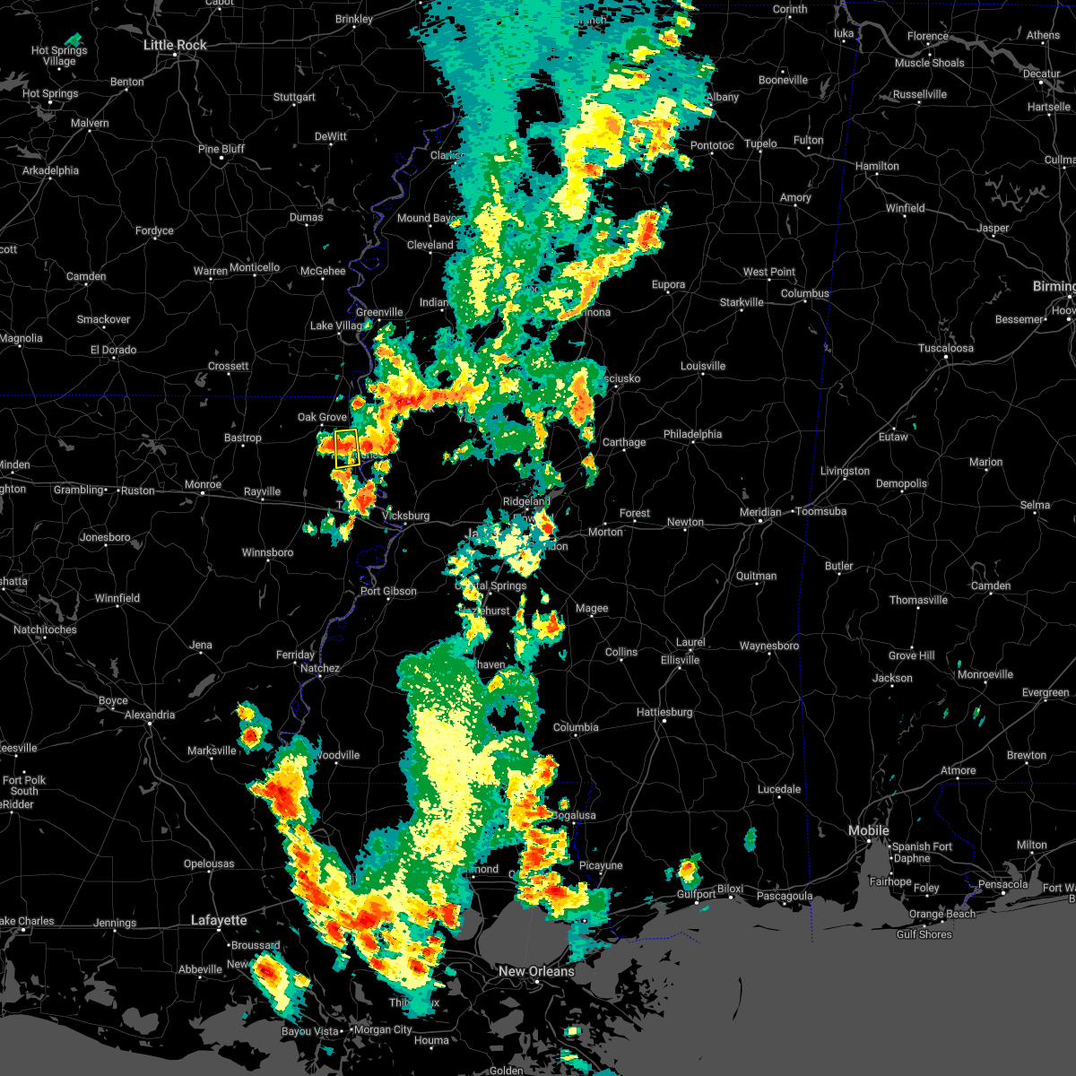 The severe thunderstorm warning for central east carroll parish will expire at 415 pm cdt, the storm which prompted the warning has weakened below severe limits and will be allowed to expire. The severe thunderstorm warning for central east carroll parish will expire at 415 pm cdt, the storm which prompted the warning has weakened below severe limits and will be allowed to expire.
|
| 5/13/2022 3:40 PM CDT |
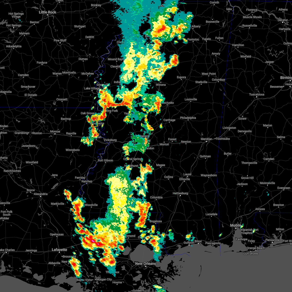 At 340 pm cdt, a severe thunderstorm was located near lake providence, moving south at 15 mph (radar indicated). Hazards include 60 mph wind gusts and nickel size hail. Expect damage to roofs, siding, and trees. this severe thunderstorm will be near, transylvania around 405 pm cdt. hail threat, radar indicated max hail size, 0. 88 in wind threat, radar indicated max wind gust, 60 mph. At 340 pm cdt, a severe thunderstorm was located near lake providence, moving south at 15 mph (radar indicated). Hazards include 60 mph wind gusts and nickel size hail. Expect damage to roofs, siding, and trees. this severe thunderstorm will be near, transylvania around 405 pm cdt. hail threat, radar indicated max hail size, 0. 88 in wind threat, radar indicated max wind gust, 60 mph.
|
| 4/13/2022 4:05 PM CDT |
 At 404 pm cdt, a severe thunderstorm was located over fitler, or 7 miles northeast of transylvania, moving northeast at 40 mph (radar indicated). Hazards include 60 mph wind gusts and quarter size hail. Hail damage to vehicles is expected. expect wind damage to roofs, siding, and trees. this severe thunderstorm will be near, onward around 415 pm cdt. rolling fork around 425 pm cdt. anguilla and holly bluff around 435 pm cdt. Other locations impacted by this severe thunderstorm include mayersville and cary. At 404 pm cdt, a severe thunderstorm was located over fitler, or 7 miles northeast of transylvania, moving northeast at 40 mph (radar indicated). Hazards include 60 mph wind gusts and quarter size hail. Hail damage to vehicles is expected. expect wind damage to roofs, siding, and trees. this severe thunderstorm will be near, onward around 415 pm cdt. rolling fork around 425 pm cdt. anguilla and holly bluff around 435 pm cdt. Other locations impacted by this severe thunderstorm include mayersville and cary.
|
| 4/13/2022 12:52 AM CDT |
 At 1251 am cdt, severe thunderstorms were located along a line extending from 6 miles east of millikin to near transylvania, to 9 miles northwest of somerset, moving east at 45 mph (radar indicated). Hazards include 60 mph wind gusts and penny size hail. Expect damage to roofs, siding, and trees. these severe storms will be near, lake providence and transylvania around 1255 am cdt. tallulah around 105 am cdt. Other locations impacted by these severe thunderstorms include mound, delta and richmond. At 1251 am cdt, severe thunderstorms were located along a line extending from 6 miles east of millikin to near transylvania, to 9 miles northwest of somerset, moving east at 45 mph (radar indicated). Hazards include 60 mph wind gusts and penny size hail. Expect damage to roofs, siding, and trees. these severe storms will be near, lake providence and transylvania around 1255 am cdt. tallulah around 105 am cdt. Other locations impacted by these severe thunderstorms include mound, delta and richmond.
|
| 4/13/2022 12:22 AM CDT |
 At 1222 am cdt, severe thunderstorms were located along a line extending from near jones to near darnell to near mangham, moving east at 50 mph (radar indicated). Hazards include 60 mph wind gusts and penny size hail. Expect damage to roofs, siding, and trees. severe thunderstorms will be near, monticello around 1225 am cdt. transylvania and alsatia around 1240 am cdt. lake providence, millikin and shelburn around 1245 am cdt. tallulah around 100 am cdt. Other locations impacted by these severe thunderstorms include mound, delta and richmond. At 1222 am cdt, severe thunderstorms were located along a line extending from near jones to near darnell to near mangham, moving east at 50 mph (radar indicated). Hazards include 60 mph wind gusts and penny size hail. Expect damage to roofs, siding, and trees. severe thunderstorms will be near, monticello around 1225 am cdt. transylvania and alsatia around 1240 am cdt. lake providence, millikin and shelburn around 1245 am cdt. tallulah around 100 am cdt. Other locations impacted by these severe thunderstorms include mound, delta and richmond.
|
| 4/5/2022 5:01 AM CDT |
 At 501 am cdt, severe thunderstorms were located along a line extending from near transylvania to near crowville, moving east at 60 mph (radar indicated). Hazards include 60 mph wind gusts. Expect damage to roofs, siding, and trees. these severe storms will be near, transylvania and alsatia around 505 am cdt. newlight around 510 am cdt. other locations impacted by these severe thunderstorms include gilbert and richmond. hail threat, radar indicated max hail size, <. 75 in wind threat, radar indicated max wind gust, 60 mph. At 501 am cdt, severe thunderstorms were located along a line extending from near transylvania to near crowville, moving east at 60 mph (radar indicated). Hazards include 60 mph wind gusts. Expect damage to roofs, siding, and trees. these severe storms will be near, transylvania and alsatia around 505 am cdt. newlight around 510 am cdt. other locations impacted by these severe thunderstorms include gilbert and richmond. hail threat, radar indicated max hail size, <. 75 in wind threat, radar indicated max wind gust, 60 mph.
|
| 4/5/2022 4:52 AM CDT |
 At 452 am cdt, severe thunderstorms were located along a line extending from 6 miles northeast of darnell to near crowville, moving east at 60 mph (radar indicated). Hazards include 60 mph wind gusts. Expect damage to roofs, siding, and trees. these severe storms will be near, lake providence and transylvania around 505 am cdt. other locations impacted by these severe thunderstorms include baskin, pioneer, gilbert, kilbourne, forest, richmond and epps. hail threat, radar indicated max hail size, <. 75 in wind threat, radar indicated max wind gust, 60 mph. At 452 am cdt, severe thunderstorms were located along a line extending from 6 miles northeast of darnell to near crowville, moving east at 60 mph (radar indicated). Hazards include 60 mph wind gusts. Expect damage to roofs, siding, and trees. these severe storms will be near, lake providence and transylvania around 505 am cdt. other locations impacted by these severe thunderstorms include baskin, pioneer, gilbert, kilbourne, forest, richmond and epps. hail threat, radar indicated max hail size, <. 75 in wind threat, radar indicated max wind gust, 60 mph.
|
| 4/5/2022 4:30 AM CDT |
 At 430 am cdt, severe thunderstorms were located along a line extending from near bastrop to near columbia, moving east at 55 mph (radar indicated). Hazards include 60 mph wind gusts. Expect damage to roofs, siding, and trees. severe thunderstorms will be near, liddieville around 440 am cdt. goodwill around 445 am cdt. winnsboro and jigger around 450 am cdt. darnell around 455 am cdt. monticello around 500 am cdt. newlight around 505 am cdt. transylvania and alsatia around 510 am cdt. sondheimer and omega around 515 am cdt. other locations impacted by these severe thunderstorms include baskin, pioneer, gilbert, kilbourne, forest, richmond and epps. hail threat, radar indicated max hail size, <. 75 in wind threat, radar indicated max wind gust, 60 mph. At 430 am cdt, severe thunderstorms were located along a line extending from near bastrop to near columbia, moving east at 55 mph (radar indicated). Hazards include 60 mph wind gusts. Expect damage to roofs, siding, and trees. severe thunderstorms will be near, liddieville around 440 am cdt. goodwill around 445 am cdt. winnsboro and jigger around 450 am cdt. darnell around 455 am cdt. monticello around 500 am cdt. newlight around 505 am cdt. transylvania and alsatia around 510 am cdt. sondheimer and omega around 515 am cdt. other locations impacted by these severe thunderstorms include baskin, pioneer, gilbert, kilbourne, forest, richmond and epps. hail threat, radar indicated max hail size, <. 75 in wind threat, radar indicated max wind gust, 60 mph.
|
| 3/30/2022 2:53 PM CDT |
 At 253 pm cdt, severe thunderstorms capable of producing tornadoes were located along a line extending from near wayside to near glen allan to near transylvania, moving northeast at 55 mph (radar indicated rotation). Hazards include tornado. Flying debris will be dangerous to those caught without shelter. mobile homes will be damaged or destroyed. damage to roofs, windows, and vehicles will occur. tree damage is likely. these dangerous storms will be near, grace around 300 pm cdt. panther burn around 305 pm cdt. rolling fork around 315 pm cdt. anguilla around 320 pm cdt. nitta yuma around 325 pm cdt. Other locations impacted by these tornadic storms include mayersville and cary. At 253 pm cdt, severe thunderstorms capable of producing tornadoes were located along a line extending from near wayside to near glen allan to near transylvania, moving northeast at 55 mph (radar indicated rotation). Hazards include tornado. Flying debris will be dangerous to those caught without shelter. mobile homes will be damaged or destroyed. damage to roofs, windows, and vehicles will occur. tree damage is likely. these dangerous storms will be near, grace around 300 pm cdt. panther burn around 305 pm cdt. rolling fork around 315 pm cdt. anguilla around 320 pm cdt. nitta yuma around 325 pm cdt. Other locations impacted by these tornadic storms include mayersville and cary.
|
| 3/30/2022 2:42 PM CDT |
 At 242 pm cdt, severe thunderstorms capable of producing tornadoes were located along a line extending from near chicot junction to near millikin to alsatia, moving northeast at 60 mph (radar indicated rotation). Hazards include tornado. Flying debris will be dangerous to those caught without shelter. mobile homes will be damaged or destroyed. damage to roofs, windows, and vehicles will occur. tree damage is likely. these dangerous storms will be near, glen allan around 250 pm cdt. grace around 255 pm cdt. onward and panther burn around 300 pm cdt. rolling fork around 310 pm cdt. anguilla around 315 pm cdt. nitta yuma around 320 pm cdt. Other locations impacted by these tornadic storms include mayersville and cary. At 242 pm cdt, severe thunderstorms capable of producing tornadoes were located along a line extending from near chicot junction to near millikin to alsatia, moving northeast at 60 mph (radar indicated rotation). Hazards include tornado. Flying debris will be dangerous to those caught without shelter. mobile homes will be damaged or destroyed. damage to roofs, windows, and vehicles will occur. tree damage is likely. these dangerous storms will be near, glen allan around 250 pm cdt. grace around 255 pm cdt. onward and panther burn around 300 pm cdt. rolling fork around 310 pm cdt. anguilla around 315 pm cdt. nitta yuma around 320 pm cdt. Other locations impacted by these tornadic storms include mayersville and cary.
|
| 3/30/2022 2:13 PM CDT |
 At 212 pm cdt, severe thunderstorms capable of producing a tornado were located along a line extending from near jones to near goodwill to near bakers, moving northeast at 65 mph (radar indicated rotation). Hazards include tornado. Flying debris will be dangerous to those caught without shelter. mobile homes will be damaged or destroyed. damage to roofs, windows, and vehicles will occur. tree damage is likely. these dangerous storms will be near, oak grove around 225 pm cdt. eudora and monticello around 230 pm cdt. millikin, gassoway and shelburn around 235 pm cdt. alsatia and sondheimer around 240 pm cdt. transylvania and glen allan around 245 pm cdt. fitler around 250 pm cdt. onward and panther burn around 255 pm cdt. rolling fork around 305 pm cdt. Other locations impacted by these tornadic storms include mayersville, kilbourne, forest and cary. At 212 pm cdt, severe thunderstorms capable of producing a tornado were located along a line extending from near jones to near goodwill to near bakers, moving northeast at 65 mph (radar indicated rotation). Hazards include tornado. Flying debris will be dangerous to those caught without shelter. mobile homes will be damaged or destroyed. damage to roofs, windows, and vehicles will occur. tree damage is likely. these dangerous storms will be near, oak grove around 225 pm cdt. eudora and monticello around 230 pm cdt. millikin, gassoway and shelburn around 235 pm cdt. alsatia and sondheimer around 240 pm cdt. transylvania and glen allan around 245 pm cdt. fitler around 250 pm cdt. onward and panther burn around 255 pm cdt. rolling fork around 305 pm cdt. Other locations impacted by these tornadic storms include mayersville, kilbourne, forest and cary.
|
| 3/22/2022 10:27 AM CDT | Quarter sized hail reported 1.3 miles NNW of Lake Providence, LA |
| 3/22/2022 10:24 AM CDT |
 At 1024 am cdt, severe thunderstorms were located along a line extending from near eudora to near shelburn to sondheimer, moving northeast at 40 mph (radar indicated). Hazards include 60 mph wind gusts and quarter size hail. Hail damage to vehicles is expected. expect wind damage to roofs, siding, and trees. these severe storms will be near, eudora around 1030 am cdt. avon, wayside, glen allan and fitler around 1045 am cdt. rolling fork and grace around 1050 am cdt. anguilla, nitta yuma and estill around 1055 am cdt. panther burn around 1100 am cdt. leland, delta city and darlove around 1105 am cdt. tribbett around 1110 am cdt. murphy around 1115 am cdt. other locations impacted by these severe thunderstorms include mayersville, arcola and cary. hail threat, radar indicated max hail size, 1. 00 in wind threat, radar indicated max wind gust, 60 mph. At 1024 am cdt, severe thunderstorms were located along a line extending from near eudora to near shelburn to sondheimer, moving northeast at 40 mph (radar indicated). Hazards include 60 mph wind gusts and quarter size hail. Hail damage to vehicles is expected. expect wind damage to roofs, siding, and trees. these severe storms will be near, eudora around 1030 am cdt. avon, wayside, glen allan and fitler around 1045 am cdt. rolling fork and grace around 1050 am cdt. anguilla, nitta yuma and estill around 1055 am cdt. panther burn around 1100 am cdt. leland, delta city and darlove around 1105 am cdt. tribbett around 1110 am cdt. murphy around 1115 am cdt. other locations impacted by these severe thunderstorms include mayersville, arcola and cary. hail threat, radar indicated max hail size, 1. 00 in wind threat, radar indicated max wind gust, 60 mph.
|
| 3/22/2022 10:13 AM CDT |
 At 1013 am cdt, severe thunderstorms were located along a line extending from near eudora to near shelburn to 6 miles northeast of tendal, moving northeast at 40 mph (radar indicated). Hazards include 60 mph wind gusts and quarter size hail. Hail damage to vehicles is expected. expect wind damage to roofs, siding, and trees. severe thunderstorms will be near, lake providence, eudora and shelburn around 1020 am cdt. millikin around 1025 am cdt. avon, grace, wayside, glen allan and fitler around 1045 am cdt. rolling fork around 1050 am cdt. hollandale, anguilla, nitta yuma, panther burn and estill around 1055 am cdt. leland and darlove around 1100 am cdt. delta city and tribbett around 1105 am cdt. murphy around 1110 am cdt. other locations impacted by these severe thunderstorms include mayersville, kilbourne, forest, arcola and cary. hail threat, radar indicated max hail size, 1. 00 in wind threat, radar indicated max wind gust, 60 mph. At 1013 am cdt, severe thunderstorms were located along a line extending from near eudora to near shelburn to 6 miles northeast of tendal, moving northeast at 40 mph (radar indicated). Hazards include 60 mph wind gusts and quarter size hail. Hail damage to vehicles is expected. expect wind damage to roofs, siding, and trees. severe thunderstorms will be near, lake providence, eudora and shelburn around 1020 am cdt. millikin around 1025 am cdt. avon, grace, wayside, glen allan and fitler around 1045 am cdt. rolling fork around 1050 am cdt. hollandale, anguilla, nitta yuma, panther burn and estill around 1055 am cdt. leland and darlove around 1100 am cdt. delta city and tribbett around 1105 am cdt. murphy around 1110 am cdt. other locations impacted by these severe thunderstorms include mayersville, kilbourne, forest, arcola and cary. hail threat, radar indicated max hail size, 1. 00 in wind threat, radar indicated max wind gust, 60 mph.
|
| 6/8/2021 4:18 PM CDT |
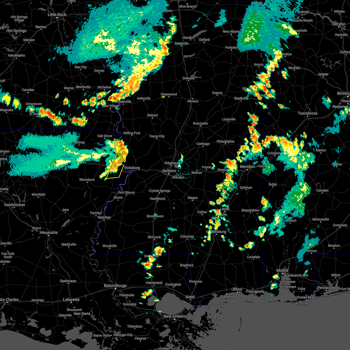 At 418 pm cdt, severe thunderstorms were located along a line extending from 8 miles east of lake providence to near valley park to 8 miles southeast of mansford, moving east at 45 mph (radar indicated). Hazards include 60 mph wind gusts. Expect damage to roofs, siding, and trees. Locations impacted include, tallulah, lake providence, transylvania, mansford, sondheimer, afton, omega and richmond. At 418 pm cdt, severe thunderstorms were located along a line extending from 8 miles east of lake providence to near valley park to 8 miles southeast of mansford, moving east at 45 mph (radar indicated). Hazards include 60 mph wind gusts. Expect damage to roofs, siding, and trees. Locations impacted include, tallulah, lake providence, transylvania, mansford, sondheimer, afton, omega and richmond.
|
| 6/8/2021 4:10 PM CDT | The roof was blown off an apartment and some power lines were blown down in the lake providence area. time estimated from radar. possible significant severe wind report in east carroll county LA, 1.3 miles NNW of Lake Providence, LA |
| 6/8/2021 3:53 PM CDT |
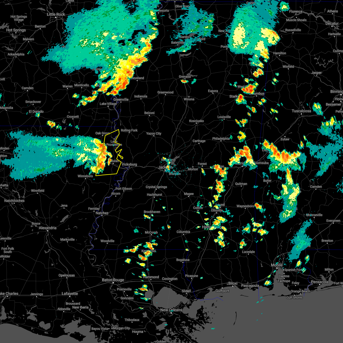 At 352 pm cdt, severe thunderstorms were located along a line extending from 6 miles south of oak grove to near monticello to 8 miles east of bakers, moving east at 45 mph (radar indicated). Hazards include 70 mph wind gusts. Expect considerable tree damage. damage is likely to mobile homes, roofs, and outbuildings. these severe storms will be near, transylvania, alsatia, sondheimer, omega and afton around 405 pm cdt. tallulah, lake providence and shelburn around 410 pm cdt. Other locations impacted by these severe thunderstorms include richmond. At 352 pm cdt, severe thunderstorms were located along a line extending from 6 miles south of oak grove to near monticello to 8 miles east of bakers, moving east at 45 mph (radar indicated). Hazards include 70 mph wind gusts. Expect considerable tree damage. damage is likely to mobile homes, roofs, and outbuildings. these severe storms will be near, transylvania, alsatia, sondheimer, omega and afton around 405 pm cdt. tallulah, lake providence and shelburn around 410 pm cdt. Other locations impacted by these severe thunderstorms include richmond.
|
| 6/8/2021 3:37 PM CDT |
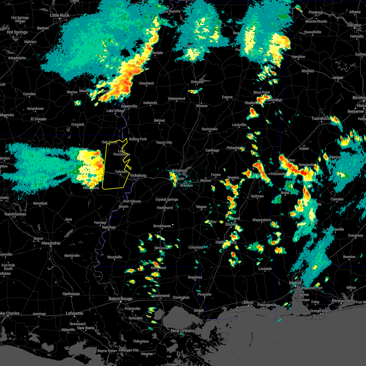 At 336 pm cdt, severe thunderstorms were located along a line extending from near goodwill to near warden to near crowville, moving east at 35 mph (radar indicated). Hazards include 60 mph wind gusts. Expect damage to roofs, siding, and trees. severe thunderstorms will be near, delhi around 340 pm cdt. waverly around 345 pm cdt. monticello, darnell and tendal around 350 pm cdt. oak grove around 400 pm cdt. sondheimer and alsatia around 410 pm cdt. transylvania and omega around 415 pm cdt. lake providence, afton and shelburn around 420 pm cdt. tallulah around 425 pm cdt. Other locations impacted by these severe thunderstorms include pioneer, forest and richmond. At 336 pm cdt, severe thunderstorms were located along a line extending from near goodwill to near warden to near crowville, moving east at 35 mph (radar indicated). Hazards include 60 mph wind gusts. Expect damage to roofs, siding, and trees. severe thunderstorms will be near, delhi around 340 pm cdt. waverly around 345 pm cdt. monticello, darnell and tendal around 350 pm cdt. oak grove around 400 pm cdt. sondheimer and alsatia around 410 pm cdt. transylvania and omega around 415 pm cdt. lake providence, afton and shelburn around 420 pm cdt. tallulah around 425 pm cdt. Other locations impacted by these severe thunderstorms include pioneer, forest and richmond.
|
| 6/7/2021 6:23 PM CDT |
 At 623 pm cdt, severe thunderstorms were located along a line extending from near tillar to 8 miles southeast of parkdale to near darnell, moving northeast at 50 mph (radar indicated). Hazards include 60 mph wind gusts and penny size hail. Expect damage to roofs, siding, and trees. severe thunderstorms will be near, eudora around 635 pm cdt. chicot junction around 640 pm cdt. lake providence and shelburn around 650 pm cdt. avon and wayside around 655 pm cdt. hollandale around 700 pm cdt. gunnison and estill around 705 pm cdt. rolling fork, tribbett, grace and darlove around 710 pm cdt. shelby, mound bayou, anguilla and deeson around 715 pm cdt. Other locations impacted by these severe thunderstorms include mayersville, arcola, alligator, beulah, pace, cary, halley, winstonville, duncan and merigold. At 623 pm cdt, severe thunderstorms were located along a line extending from near tillar to 8 miles southeast of parkdale to near darnell, moving northeast at 50 mph (radar indicated). Hazards include 60 mph wind gusts and penny size hail. Expect damage to roofs, siding, and trees. severe thunderstorms will be near, eudora around 635 pm cdt. chicot junction around 640 pm cdt. lake providence and shelburn around 650 pm cdt. avon and wayside around 655 pm cdt. hollandale around 700 pm cdt. gunnison and estill around 705 pm cdt. rolling fork, tribbett, grace and darlove around 710 pm cdt. shelby, mound bayou, anguilla and deeson around 715 pm cdt. Other locations impacted by these severe thunderstorms include mayersville, arcola, alligator, beulah, pace, cary, halley, winstonville, duncan and merigold.
|
| 5/9/2021 9:06 PM CDT |
 At 906 pm cdt, a severe thunderstorm was located near shelburn, or 7 miles north of lake providence, moving northeast at 25 mph (radar indicated). Hazards include 60 mph wind gusts and quarter size hail. Hail damage to vehicles is expected. expect wind damage to roofs, siding, and trees. this severe thunderstorm will be near, glen allan around 930 pm cdt. grace around 935 pm cdt. Other locations impacted by this severe thunderstorm include mayersville. At 906 pm cdt, a severe thunderstorm was located near shelburn, or 7 miles north of lake providence, moving northeast at 25 mph (radar indicated). Hazards include 60 mph wind gusts and quarter size hail. Hail damage to vehicles is expected. expect wind damage to roofs, siding, and trees. this severe thunderstorm will be near, glen allan around 930 pm cdt. grace around 935 pm cdt. Other locations impacted by this severe thunderstorm include mayersville.
|
| 5/4/2021 1:53 PM CDT |
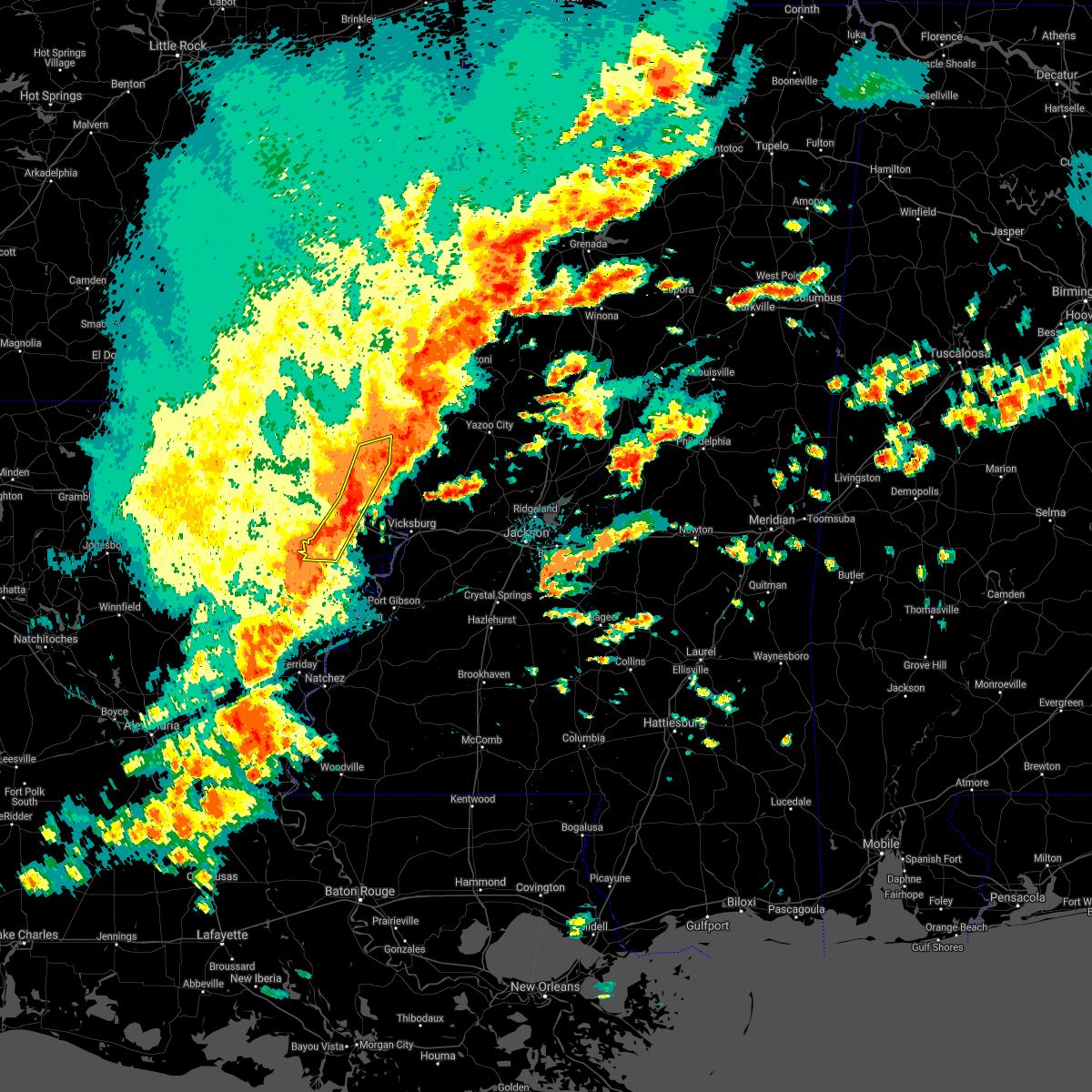 At 153 pm cdt, severe thunderstorms were located along a line extending from 8 miles southwest of rolling fork to near eagle bend to 7 miles northwest of somerset, moving east at 45 mph. these are very dangerous storms (radar indicated). Hazards include 80 mph wind gusts and nickel size hail. Flying debris will be dangerous to those caught without shelter. mobile homes will be heavily damaged. expect considerable damage to roofs, windows, and vehicles. extensive tree damage and power outages are likely. these severe thunderstorms will remain over mainly rural areas of southeastern east carroll, western madison parishes in northeastern louisiana and west central issaquena counties. A tornado watch remains in effect until 600 pm cdt for northeastern louisiana, and west central mississippi. At 153 pm cdt, severe thunderstorms were located along a line extending from 8 miles southwest of rolling fork to near eagle bend to 7 miles northwest of somerset, moving east at 45 mph. these are very dangerous storms (radar indicated). Hazards include 80 mph wind gusts and nickel size hail. Flying debris will be dangerous to those caught without shelter. mobile homes will be heavily damaged. expect considerable damage to roofs, windows, and vehicles. extensive tree damage and power outages are likely. these severe thunderstorms will remain over mainly rural areas of southeastern east carroll, western madison parishes in northeastern louisiana and west central issaquena counties. A tornado watch remains in effect until 600 pm cdt for northeastern louisiana, and west central mississippi.
|
| 5/4/2021 1:47 PM CDT | A tree was down on hwy 6 in east carroll county LA, 1.2 miles WNW of Lake Providence, LA |
| 5/4/2021 1:40 PM CDT |
 At 140 pm cdt, severe thunderstorms were located along a line extending from near lake providence to near mansford to 6 miles northwest of newlight, moving east at 55 mph (radar indicated). Hazards include 70 mph wind gusts and nickel size hail. Expect considerable tree damage. damage is likely to mobile homes, roofs, and outbuildings. these severe storms will be near, lake providence, omega, sondheimer and fitler around 145 pm cdt. other locations impacted by these severe thunderstorms include baskin. A tornado watch remains in effect until 600 pm cdt for northeastern louisiana, and west central mississippi. At 140 pm cdt, severe thunderstorms were located along a line extending from near lake providence to near mansford to 6 miles northwest of newlight, moving east at 55 mph (radar indicated). Hazards include 70 mph wind gusts and nickel size hail. Expect considerable tree damage. damage is likely to mobile homes, roofs, and outbuildings. these severe storms will be near, lake providence, omega, sondheimer and fitler around 145 pm cdt. other locations impacted by these severe thunderstorms include baskin. A tornado watch remains in effect until 600 pm cdt for northeastern louisiana, and west central mississippi.
|
| 5/4/2021 1:35 PM CDT |
 At 134 pm cdt, a severe thunderstorm was located over grace, or 7 miles northwest of rolling fork, moving northeast at 35 mph (radar indicated). Hazards include 60 mph wind gusts. Expect damage to roofs, siding, and trees. this severe thunderstorm will remain over mainly rural areas of northeastern east carroll and central west carroll parishes, south central washington and northwestern issaquena counties, including the following locations, mayersville, pioneer and forest. A tornado watch remains in effect until 600 pm cdt for northeastern louisiana, and northwestern and west central mississippi. At 134 pm cdt, a severe thunderstorm was located over grace, or 7 miles northwest of rolling fork, moving northeast at 35 mph (radar indicated). Hazards include 60 mph wind gusts. Expect damage to roofs, siding, and trees. this severe thunderstorm will remain over mainly rural areas of northeastern east carroll and central west carroll parishes, south central washington and northwestern issaquena counties, including the following locations, mayersville, pioneer and forest. A tornado watch remains in effect until 600 pm cdt for northeastern louisiana, and northwestern and west central mississippi.
|
| 5/4/2021 1:13 PM CDT |
 At 113 pm cdt, severe thunderstorms were located along a line extending from near jones to 6 miles north of rayville to near buckner, moving east at 45 mph (radar indicated). Hazards include 70 mph wind gusts and nickel size hail. Expect considerable tree damage. damage is likely to mobile homes, roofs, and outbuildings. these severe storms will be near, mangham and warden around 130 pm cdt. archibald and darnell around 135 pm cdt. monticello around 140 pm cdt. holly ridge around 145 pm cdt. bakers around 150 pm cdt. transylvania, delhi and alsatia around 155 pm cdt. waverly around 200 pm cdt. tendal around 205 pm cdt. other locations impacted by these severe thunderstorms include baskin and epps. A tornado watch remains in effect until 600 pm cdt for northeastern louisiana, and west central mississippi. At 113 pm cdt, severe thunderstorms were located along a line extending from near jones to 6 miles north of rayville to near buckner, moving east at 45 mph (radar indicated). Hazards include 70 mph wind gusts and nickel size hail. Expect considerable tree damage. damage is likely to mobile homes, roofs, and outbuildings. these severe storms will be near, mangham and warden around 130 pm cdt. archibald and darnell around 135 pm cdt. monticello around 140 pm cdt. holly ridge around 145 pm cdt. bakers around 150 pm cdt. transylvania, delhi and alsatia around 155 pm cdt. waverly around 200 pm cdt. tendal around 205 pm cdt. other locations impacted by these severe thunderstorms include baskin and epps. A tornado watch remains in effect until 600 pm cdt for northeastern louisiana, and west central mississippi.
|
| 5/4/2021 1:11 PM CDT | A few trees dow in east carroll county LA, 4.4 miles SE of Lake Providence, LA |
| 5/4/2021 1:05 PM CDT | A couple trees and power line dow in east carroll county LA, 3.6 miles NE of Lake Providence, LA |
| 5/4/2021 12:57 PM CDT |
 At 1230 pm cdt, a severe thunderstorm was located near goodwill, or 16 miles south of wilmot, moving northeast at 35 mph (radar indicated). Hazards include 70 mph wind gusts and quarter size hail. Hail damage to vehicles is expected. expect considerable tree damage. wind damage is also likely to mobile homes, roofs, and outbuildings. this severe thunderstorm will be near, oak grove around 1250 pm cdt. shelburn around 110 pm cdt. gassoway and millikin around 115 pm cdt. glen allan around 135 pm cdt. other locations impacted by this severe thunderstorm include mayersville, kilbourne, forest and pioneer. A tornado watch remains in effect until 600 pm cdt for southeastern arkansas, northeastern louisiana, and northwestern and west central mississippi. At 1230 pm cdt, a severe thunderstorm was located near goodwill, or 16 miles south of wilmot, moving northeast at 35 mph (radar indicated). Hazards include 70 mph wind gusts and quarter size hail. Hail damage to vehicles is expected. expect considerable tree damage. wind damage is also likely to mobile homes, roofs, and outbuildings. this severe thunderstorm will be near, oak grove around 1250 pm cdt. shelburn around 110 pm cdt. gassoway and millikin around 115 pm cdt. glen allan around 135 pm cdt. other locations impacted by this severe thunderstorm include mayersville, kilbourne, forest and pioneer. A tornado watch remains in effect until 600 pm cdt for southeastern arkansas, northeastern louisiana, and northwestern and west central mississippi.
|
| 5/4/2021 12:57 PM CDT |
 The national weather service in jackson has issued a * severe thunderstorm warning for. southern east carroll parish in northeastern louisiana. western madison parish in northeastern louisiana. richland parish in northeastern louisiana. Southwestern west carroll parish in northeastern louisiana. The national weather service in jackson has issued a * severe thunderstorm warning for. southern east carroll parish in northeastern louisiana. western madison parish in northeastern louisiana. richland parish in northeastern louisiana. Southwestern west carroll parish in northeastern louisiana.
|
| 5/4/2021 12:57 PM CDT |
 At 1230 pm cdt, a severe thunderstorm was located near goodwill, or 16 miles south of wilmot, moving northeast at 35 mph (radar indicated). Hazards include 70 mph wind gusts and quarter size hail. Hail damage to vehicles is expected. expect considerable tree damage. wind damage is also likely to mobile homes, roofs, and outbuildings. this severe thunderstorm will be near, oak grove around 1250 pm cdt. shelburn around 110 pm cdt. gassoway and millikin around 115 pm cdt. glen allan around 135 pm cdt. other locations impacted by this severe thunderstorm include mayersville, kilbourne, forest and pioneer. A tornado watch remains in effect until 600 pm cdt for southeastern arkansas, northeastern louisiana, and northwestern and west central mississippi. At 1230 pm cdt, a severe thunderstorm was located near goodwill, or 16 miles south of wilmot, moving northeast at 35 mph (radar indicated). Hazards include 70 mph wind gusts and quarter size hail. Hail damage to vehicles is expected. expect considerable tree damage. wind damage is also likely to mobile homes, roofs, and outbuildings. this severe thunderstorm will be near, oak grove around 1250 pm cdt. shelburn around 110 pm cdt. gassoway and millikin around 115 pm cdt. glen allan around 135 pm cdt. other locations impacted by this severe thunderstorm include mayersville, kilbourne, forest and pioneer. A tornado watch remains in effect until 600 pm cdt for southeastern arkansas, northeastern louisiana, and northwestern and west central mississippi.
|
| 5/4/2021 12:57 PM CDT |
 At 1230 pm cdt, a severe thunderstorm was located near goodwill, or 16 miles south of wilmot, moving northeast at 35 mph (radar indicated). Hazards include 70 mph wind gusts and quarter size hail. Hail damage to vehicles is expected. expect considerable tree damage. wind damage is also likely to mobile homes, roofs, and outbuildings. this severe thunderstorm will be near, oak grove around 1250 pm cdt. shelburn around 110 pm cdt. gassoway and millikin around 115 pm cdt. glen allan around 135 pm cdt. other locations impacted by this severe thunderstorm include mayersville, kilbourne, forest and pioneer. A tornado watch remains in effect until 600 pm cdt for southeastern arkansas, northeastern louisiana, and northwestern and west central mississippi. At 1230 pm cdt, a severe thunderstorm was located near goodwill, or 16 miles south of wilmot, moving northeast at 35 mph (radar indicated). Hazards include 70 mph wind gusts and quarter size hail. Hail damage to vehicles is expected. expect considerable tree damage. wind damage is also likely to mobile homes, roofs, and outbuildings. this severe thunderstorm will be near, oak grove around 1250 pm cdt. shelburn around 110 pm cdt. gassoway and millikin around 115 pm cdt. glen allan around 135 pm cdt. other locations impacted by this severe thunderstorm include mayersville, kilbourne, forest and pioneer. A tornado watch remains in effect until 600 pm cdt for southeastern arkansas, northeastern louisiana, and northwestern and west central mississippi.
|
| 5/4/2021 12:30 PM CDT |
 The national weather service in jackson has issued a * severe thunderstorm warning for. southern chicot county in southeastern arkansas. northeastern east carroll parish in northeastern louisiana. west carroll parish in northeastern louisiana. Southwestern washington county in northwestern mississippi. The national weather service in jackson has issued a * severe thunderstorm warning for. southern chicot county in southeastern arkansas. northeastern east carroll parish in northeastern louisiana. west carroll parish in northeastern louisiana. Southwestern washington county in northwestern mississippi.
|
| 4/9/2021 7:56 PM CDT |
 The severe thunderstorm warning for southern chicot county, east carroll and northeastern west carroll parishes, southwestern washington and issaquena counties will expire at 800 pm cdt, the storms which prompted the warning have weakened below severe limits, and have exited the warned area. therefore, the warning will be allowed to expire. however small hail, gusty winds and heavy rain are still possible with these thunderstorms. a severe thunderstorm watch remains in effect until 1100 pm cdt for southeastern arkansas, northeastern louisiana, and northwestern and west central mississippi. The severe thunderstorm warning for southern chicot county, east carroll and northeastern west carroll parishes, southwestern washington and issaquena counties will expire at 800 pm cdt, the storms which prompted the warning have weakened below severe limits, and have exited the warned area. therefore, the warning will be allowed to expire. however small hail, gusty winds and heavy rain are still possible with these thunderstorms. a severe thunderstorm watch remains in effect until 1100 pm cdt for southeastern arkansas, northeastern louisiana, and northwestern and west central mississippi.
|
| 4/9/2021 7:20 PM CDT | Couple power lines down on 65 sout in east carroll county LA, 6.7 miles N of Lake Providence, LA |
| 4/9/2021 6:52 PM CDT |
 At 652 pm cdt, severe thunderstorms were located along a line extending from near parkdale to 6 miles northwest of oak grove to near darnell to near holly ridge, moving east at 35 mph (radar indicated). Hazards include 60 mph wind gusts and nickel size hail. Expect damage to roofs, siding, and trees. severe thunderstorms will be near, millikin, gassoway and shelburn around 715 pm cdt. monticello around 720 pm cdt. lake providence, eudora, transylvania and chicot junction around 725 pm cdt. glen allan around 735 pm cdt. fitler, sondheimer and alsatia around 740 pm cdt. Other locations impacted by these severe thunderstorms include mayersville and kilbourne. At 652 pm cdt, severe thunderstorms were located along a line extending from near parkdale to 6 miles northwest of oak grove to near darnell to near holly ridge, moving east at 35 mph (radar indicated). Hazards include 60 mph wind gusts and nickel size hail. Expect damage to roofs, siding, and trees. severe thunderstorms will be near, millikin, gassoway and shelburn around 715 pm cdt. monticello around 720 pm cdt. lake providence, eudora, transylvania and chicot junction around 725 pm cdt. glen allan around 735 pm cdt. fitler, sondheimer and alsatia around 740 pm cdt. Other locations impacted by these severe thunderstorms include mayersville and kilbourne.
|
| 3/30/2021 7:16 PM CDT |
 At 716 pm cdt, a severe thunderstorm capable of producing a tornado was located near oak grove, or 15 miles west of lake providence, moving northeast at 25 mph (radar indicated rotation). Hazards include tornado. Flying debris will be dangerous to those caught without shelter. mobile homes will be damaged or destroyed. damage to roofs, windows, and vehicles will occur. tree damage is likely. this dangerous storm will be near, oak grove around 725 pm cdt. lake providence and shelburn around 750 pm cdt. millikin around 755 pm cdt. gassoway around 800 pm cdt. Other locations impacted by this tornadic thunderstorm include forest. At 716 pm cdt, a severe thunderstorm capable of producing a tornado was located near oak grove, or 15 miles west of lake providence, moving northeast at 25 mph (radar indicated rotation). Hazards include tornado. Flying debris will be dangerous to those caught without shelter. mobile homes will be damaged or destroyed. damage to roofs, windows, and vehicles will occur. tree damage is likely. this dangerous storm will be near, oak grove around 725 pm cdt. lake providence and shelburn around 750 pm cdt. millikin around 755 pm cdt. gassoway around 800 pm cdt. Other locations impacted by this tornadic thunderstorm include forest.
|
| 3/30/2021 7:16 PM CDT |
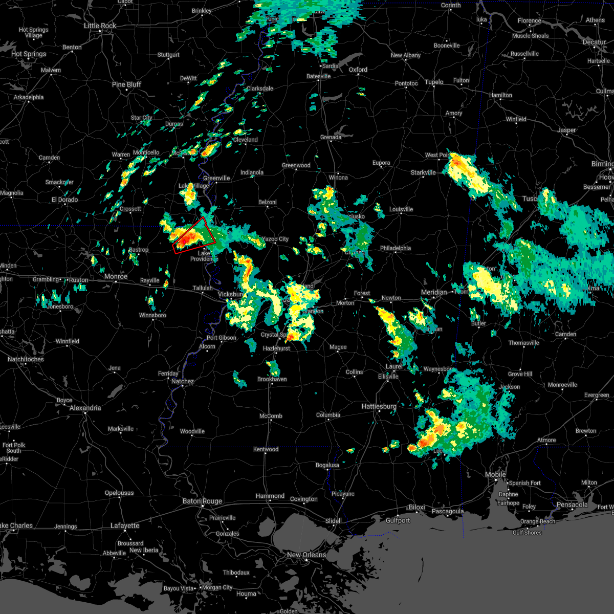 At 716 pm cdt, a severe thunderstorm capable of producing a tornado was located near oak grove, or 15 miles west of lake providence, moving northeast at 25 mph (radar indicated rotation). Hazards include tornado. Flying debris will be dangerous to those caught without shelter. mobile homes will be damaged or destroyed. damage to roofs, windows, and vehicles will occur. tree damage is likely. this dangerous storm will be near, oak grove around 725 pm cdt. lake providence and shelburn around 750 pm cdt. millikin around 755 pm cdt. gassoway around 800 pm cdt. Other locations impacted by this tornadic thunderstorm include forest. At 716 pm cdt, a severe thunderstorm capable of producing a tornado was located near oak grove, or 15 miles west of lake providence, moving northeast at 25 mph (radar indicated rotation). Hazards include tornado. Flying debris will be dangerous to those caught without shelter. mobile homes will be damaged or destroyed. damage to roofs, windows, and vehicles will occur. tree damage is likely. this dangerous storm will be near, oak grove around 725 pm cdt. lake providence and shelburn around 750 pm cdt. millikin around 755 pm cdt. gassoway around 800 pm cdt. Other locations impacted by this tornadic thunderstorm include forest.
|
| 3/16/2021 5:28 PM CDT |
 The severe thunderstorm warning for northeastern east carroll parish in northeastern louisiana and northwestern issaquena counties will expire at 530 pm cdt, the storm which prompted the warning has moved out of the area. therefore, the warning will be allowed to expire. The severe thunderstorm warning for northeastern east carroll parish in northeastern louisiana and northwestern issaquena counties will expire at 530 pm cdt, the storm which prompted the warning has moved out of the area. therefore, the warning will be allowed to expire.
|
| 3/16/2021 5:13 PM CDT |
 At 513 pm cdt, a severe thunderstorm was located over millikin, or 8 miles north of lake providence, moving northeast at 35 mph (radar indicated). Hazards include 60 mph wind gusts and quarter size hail. Hail damage to vehicles is expected. expect wind damage to roofs, siding, and trees. This severe thunderstorm will remain over mainly rural areas of northeastern east carroll parish in northeastern louisiana and northwestern issaquena counties, including the following locations, mayersville. At 513 pm cdt, a severe thunderstorm was located over millikin, or 8 miles north of lake providence, moving northeast at 35 mph (radar indicated). Hazards include 60 mph wind gusts and quarter size hail. Hail damage to vehicles is expected. expect wind damage to roofs, siding, and trees. This severe thunderstorm will remain over mainly rural areas of northeastern east carroll parish in northeastern louisiana and northwestern issaquena counties, including the following locations, mayersville.
|
| 3/16/2021 5:06 PM CDT | Quarter sized hail reported 7.7 miles ESE of Lake Providence, LA, quarter size hail fell along highway 2. a motorist reported some dents from the hail on their car. |
| 3/16/2021 5:06 PM CDT | Power lines were blown down in lake providenc in east carroll county LA, 0.7 miles NW of Lake Providence, LA |
| 3/16/2021 5:00 PM CDT |
 At 500 pm cdt, a severe thunderstorm was located near shelburn, or near lake providence, moving northeast at 40 mph (radar indicated). Hazards include golf ball size hail and 60 mph wind gusts. People and animals outdoors will be injured. expect hail damage to roofs, siding, windows, and vehicles. expect wind damage to roofs, siding, and trees. this severe storm will be near, shelburn around 505 pm cdt. millikin and gassoway around 515 pm cdt. Other locations impacted by this severe thunderstorm include mayersville. At 500 pm cdt, a severe thunderstorm was located near shelburn, or near lake providence, moving northeast at 40 mph (radar indicated). Hazards include golf ball size hail and 60 mph wind gusts. People and animals outdoors will be injured. expect hail damage to roofs, siding, windows, and vehicles. expect wind damage to roofs, siding, and trees. this severe storm will be near, shelburn around 505 pm cdt. millikin and gassoway around 515 pm cdt. Other locations impacted by this severe thunderstorm include mayersville.
|
| 3/16/2021 4:50 PM CDT |
 At 450 pm cdt, a severe thunderstorm was located 8 miles southwest of lake providence, moving northeast at 35 mph (radar indicated). Hazards include 60 mph wind gusts and quarter size hail. Hail damage to vehicles is expected. expect wind damage to roofs, siding, and trees. this severe thunderstorm will be near, lake providence around 505 pm cdt. shelburn around 510 pm cdt. millikin and gassoway around 520 pm cdt. Other locations impacted by this severe thunderstorm include mayersville. At 450 pm cdt, a severe thunderstorm was located 8 miles southwest of lake providence, moving northeast at 35 mph (radar indicated). Hazards include 60 mph wind gusts and quarter size hail. Hail damage to vehicles is expected. expect wind damage to roofs, siding, and trees. this severe thunderstorm will be near, lake providence around 505 pm cdt. shelburn around 510 pm cdt. millikin and gassoway around 520 pm cdt. Other locations impacted by this severe thunderstorm include mayersville.
|
| 7/31/2020 2:53 PM CDT |
 At 252 pm cdt, a severe thunderstorm was located near glen allan, or 11 miles northwest of rolling fork, moving east at 45 mph (radar indicated). Hazards include 60 mph wind gusts and nickel size hail. Expect damage to roofs, siding, and trees. this severe storm will be near, grace around 300 pm cdt. anguilla, nitta yuma and panther burn around 310 pm cdt. delta city around 315 pm cdt. murphy around 325 pm cdt. Other locations impacted by this severe thunderstorm include mayersville and cary. At 252 pm cdt, a severe thunderstorm was located near glen allan, or 11 miles northwest of rolling fork, moving east at 45 mph (radar indicated). Hazards include 60 mph wind gusts and nickel size hail. Expect damage to roofs, siding, and trees. this severe storm will be near, grace around 300 pm cdt. anguilla, nitta yuma and panther burn around 310 pm cdt. delta city around 315 pm cdt. murphy around 325 pm cdt. Other locations impacted by this severe thunderstorm include mayersville and cary.
|
| 7/31/2020 2:50 PM CDT | Tree down in the city of lake providenc in east carroll county LA, 1.3 miles NNW of Lake Providence, LA |
| 7/31/2020 2:47 PM CDT | Tree down near the intersection of hwy 134 and county road 318 in east carroll county LA, 3.1 miles NE of Lake Providence, LA |
| 7/31/2020 2:32 PM CDT |
 At 232 pm cdt, a severe thunderstorm was located near shelburn, or 9 miles northwest of lake providence, moving east at 50 mph (radar indicated). Hazards include ping pong ball size hail and 60 mph wind gusts. People and animals outdoors will be injured. expect hail damage to roofs, siding, windows, and vehicles. expect wind damage to roofs, siding, and trees. this severe thunderstorm will be near, glen allan around 255 pm cdt. rolling fork and grace around 300 pm cdt. anguilla, nitta yuma and panther burn around 305 pm cdt. delta city around 310 pm cdt. murphy around 320 pm cdt. Other locations impacted by this severe thunderstorm include mayersville and cary. At 232 pm cdt, a severe thunderstorm was located near shelburn, or 9 miles northwest of lake providence, moving east at 50 mph (radar indicated). Hazards include ping pong ball size hail and 60 mph wind gusts. People and animals outdoors will be injured. expect hail damage to roofs, siding, windows, and vehicles. expect wind damage to roofs, siding, and trees. this severe thunderstorm will be near, glen allan around 255 pm cdt. rolling fork and grace around 300 pm cdt. anguilla, nitta yuma and panther burn around 305 pm cdt. delta city around 310 pm cdt. murphy around 320 pm cdt. Other locations impacted by this severe thunderstorm include mayersville and cary.
|
| 7/14/2020 3:41 PM CDT |
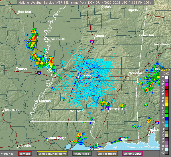 The severe thunderstorm warning for southwestern chicot and southeastern ashley counties, northeastern morehouse, northeastern east carroll, northeastern west carroll parishes in northeastern louisiana and northwestern issaquena counties will expire at 345 pm cdt, the storm which prompted the warning has weakened below severe limits, and no longer poses an immediate threat to life or property. therefore, the warning will be allowed to expire. The severe thunderstorm warning for southwestern chicot and southeastern ashley counties, northeastern morehouse, northeastern east carroll, northeastern west carroll parishes in northeastern louisiana and northwestern issaquena counties will expire at 345 pm cdt, the storm which prompted the warning has weakened below severe limits, and no longer poses an immediate threat to life or property. therefore, the warning will be allowed to expire.
|
| 7/14/2020 3:15 PM CDT |
 At 315 pm cdt, a severe thunderstorm was located over wilmot, moving southeast at 10 mph (radar indicated). Hazards include 60 mph wind gusts and quarter size hail. Hail damage to vehicles is expected. expect wind damage to roofs, siding, and trees. This severe thunderstorm will remain over mainly rural areas of southwestern chicot and southeastern ashley counties, northeastern morehouse, northeastern east carroll, northeastern west carroll parishes in northeastern louisiana and northwestern issaquena counties, including the following locations, kilbourne. At 315 pm cdt, a severe thunderstorm was located over wilmot, moving southeast at 10 mph (radar indicated). Hazards include 60 mph wind gusts and quarter size hail. Hail damage to vehicles is expected. expect wind damage to roofs, siding, and trees. This severe thunderstorm will remain over mainly rural areas of southwestern chicot and southeastern ashley counties, northeastern morehouse, northeastern east carroll, northeastern west carroll parishes in northeastern louisiana and northwestern issaquena counties, including the following locations, kilbourne.
|
| 6/21/2020 6:12 PM CDT |
 At 612 pm cdt, a severe thunderstorm was located near fitler, or near transylvania, moving east at 20 mph (radar indicated). Hazards include 60 mph wind gusts and quarter size hail. Hail damage to vehicles is expected. expect wind damage to roofs, siding, and trees. this severe thunderstorm will be near, fitler around 625 pm cdt. onward around 640 pm cdt. valley park around 655 pm cdt. Other locations impacted by this severe thunderstorm include cary. At 612 pm cdt, a severe thunderstorm was located near fitler, or near transylvania, moving east at 20 mph (radar indicated). Hazards include 60 mph wind gusts and quarter size hail. Hail damage to vehicles is expected. expect wind damage to roofs, siding, and trees. this severe thunderstorm will be near, fitler around 625 pm cdt. onward around 640 pm cdt. valley park around 655 pm cdt. Other locations impacted by this severe thunderstorm include cary.
|
| 6/21/2020 6:12 PM CDT |
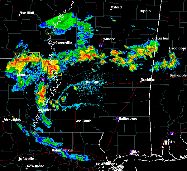 At 612 pm cdt, a severe thunderstorm was located near fitler, or near transylvania, moving east at 20 mph (radar indicated). Hazards include 60 mph wind gusts and quarter size hail. Hail damage to vehicles is expected. expect wind damage to roofs, siding, and trees. this severe thunderstorm will be near, fitler around 625 pm cdt. onward around 640 pm cdt. valley park around 655 pm cdt. Other locations impacted by this severe thunderstorm include cary. At 612 pm cdt, a severe thunderstorm was located near fitler, or near transylvania, moving east at 20 mph (radar indicated). Hazards include 60 mph wind gusts and quarter size hail. Hail damage to vehicles is expected. expect wind damage to roofs, siding, and trees. this severe thunderstorm will be near, fitler around 625 pm cdt. onward around 640 pm cdt. valley park around 655 pm cdt. Other locations impacted by this severe thunderstorm include cary.
|
| 6/5/2020 7:10 PM CDT | A few trees down in the monticello community...reported by east carroll s in east carroll county LA, 8.9 miles ENE of Lake Providence, LA |
| 6/5/2020 6:43 PM CDT |
 At 642 pm cdt, severe thunderstorms were located along a line extending from near alsatia to youngton, moving southwest at 30 mph (radar indicated). Hazards include 60 mph wind gusts. Expect damage to roofs, siding, and trees. these severe storms will be near, sondheimer around 655 pm cdt. bovina and omega around 700 pm cdt. mansford around 705 pm cdt. tallulah around 715 pm cdt. tendal around 720 pm cdt. Other locations impacted by these severe thunderstorms include mound, delta and richmond. At 642 pm cdt, severe thunderstorms were located along a line extending from near alsatia to youngton, moving southwest at 30 mph (radar indicated). Hazards include 60 mph wind gusts. Expect damage to roofs, siding, and trees. these severe storms will be near, sondheimer around 655 pm cdt. bovina and omega around 700 pm cdt. mansford around 705 pm cdt. tallulah around 715 pm cdt. tendal around 720 pm cdt. Other locations impacted by these severe thunderstorms include mound, delta and richmond.
|
| 6/5/2020 6:11 PM CDT |
 At 611 pm cdt, severe thunderstorms were located along a line extending from 8 miles north of fitler to phoenix, moving south at 35 mph (radar indicated). Hazards include 60 mph wind gusts. Expect damage to roofs, siding, and trees. severe thunderstorms will be near, fitler, onward and oak ridge around 625 pm cdt. youngton around 630 pm cdt. transylvania and flowers around 635 pm cdt. alsatia and bovina around 640 pm cdt. sondheimer and eagle bend around 645 pm cdt. omega around 650 pm cdt. mansford around 655 pm cdt. tallulah around 705 pm cdt. Other locations impacted by these severe thunderstorms include mound, delta and richmond. At 611 pm cdt, severe thunderstorms were located along a line extending from 8 miles north of fitler to phoenix, moving south at 35 mph (radar indicated). Hazards include 60 mph wind gusts. Expect damage to roofs, siding, and trees. severe thunderstorms will be near, fitler, onward and oak ridge around 625 pm cdt. youngton around 630 pm cdt. transylvania and flowers around 635 pm cdt. alsatia and bovina around 640 pm cdt. sondheimer and eagle bend around 645 pm cdt. omega around 650 pm cdt. mansford around 655 pm cdt. tallulah around 705 pm cdt. Other locations impacted by these severe thunderstorms include mound, delta and richmond.
|
| 6/3/2020 7:00 PM CDT | Trees and power lines down in alsati in east carroll county LA, 14.3 miles N of Lake Providence, LA |
| 5/23/2020 2:35 PM CDT |
 At 235 pm cdt, severe thunderstorms were located along a line extending from near shelburn to redwood to near carpenter, moving east at 35 mph (radar indicated). Hazards include 60 mph wind gusts and penny size hail. Expect damage to roofs, siding, and trees. these severe storms will be near, redwood around 240 pm cdt. Other locations impacted by these severe thunderstorms include delta. At 235 pm cdt, severe thunderstorms were located along a line extending from near shelburn to redwood to near carpenter, moving east at 35 mph (radar indicated). Hazards include 60 mph wind gusts and penny size hail. Expect damage to roofs, siding, and trees. these severe storms will be near, redwood around 240 pm cdt. Other locations impacted by these severe thunderstorms include delta.
|
| 5/23/2020 2:21 PM CDT |
 At 221 pm cdt, severe thunderstorms were located along a line extending from near oak grove to near eagle bend to near hermanville, moving east at 35 mph (radar indicated). Hazards include 60 mph wind gusts and penny size hail. Expect damage to roofs, siding, and trees. these severe storms will be near, hermanville and eagle bend around 225 pm cdt. redwood and rocky springs around 235 pm cdt. Other locations impacted by these severe thunderstorms include mound, delta and forest. At 221 pm cdt, severe thunderstorms were located along a line extending from near oak grove to near eagle bend to near hermanville, moving east at 35 mph (radar indicated). Hazards include 60 mph wind gusts and penny size hail. Expect damage to roofs, siding, and trees. these severe storms will be near, hermanville and eagle bend around 225 pm cdt. redwood and rocky springs around 235 pm cdt. Other locations impacted by these severe thunderstorms include mound, delta and forest.
|
| 5/23/2020 2:07 PM CDT |
 At 207 pm cdt, severe thunderstorms were located along a line extending from near oak grove to near mansford to port gibson, moving east at 35 mph (radar indicated). Hazards include 60 mph wind gusts and nickel size hail. Expect damage to roofs, siding, and trees. these severe storms will be near, port gibson and omega around 210 pm cdt. eagle bend and pattison around 215 pm cdt. hermanville around 225 pm cdt. shelburn and rocky springs around 230 pm cdt. lake providence and redwood around 235 pm cdt. Other locations impacted by these severe thunderstorms include mound, forest, delta, pioneer and richmond. At 207 pm cdt, severe thunderstorms were located along a line extending from near oak grove to near mansford to port gibson, moving east at 35 mph (radar indicated). Hazards include 60 mph wind gusts and nickel size hail. Expect damage to roofs, siding, and trees. these severe storms will be near, port gibson and omega around 210 pm cdt. eagle bend and pattison around 215 pm cdt. hermanville around 225 pm cdt. shelburn and rocky springs around 230 pm cdt. lake providence and redwood around 235 pm cdt. Other locations impacted by these severe thunderstorms include mound, forest, delta, pioneer and richmond.
|
| 5/23/2020 1:56 PM CDT |
 At 156 pm cdt, severe thunderstorms were located along a line extending from goodwill to tallulah to near alcorn, moving east at 35 mph (radar indicated). Hazards include 60 mph wind gusts and nickel size hail. Expect damage to roofs, siding, and trees. these severe storms will be near, tallulah, mansford and omega around 200 pm cdt. port gibson around 210 pm cdt. oak grove, eagle bend and pattison around 215 pm cdt. hermanville around 225 pm cdt. lake providence, redwood, shelburn and rocky springs around 230 pm cdt. Other locations impacted by these severe thunderstorms include mound, forest, delta, pioneer, richmond and epps. At 156 pm cdt, severe thunderstorms were located along a line extending from goodwill to tallulah to near alcorn, moving east at 35 mph (radar indicated). Hazards include 60 mph wind gusts and nickel size hail. Expect damage to roofs, siding, and trees. these severe storms will be near, tallulah, mansford and omega around 200 pm cdt. port gibson around 210 pm cdt. oak grove, eagle bend and pattison around 215 pm cdt. hermanville around 225 pm cdt. lake providence, redwood, shelburn and rocky springs around 230 pm cdt. Other locations impacted by these severe thunderstorms include mound, forest, delta, pioneer, richmond and epps.
|
| 5/23/2020 1:47 PM CDT |
 At 147 pm cdt, severe thunderstorms were located along a line extending from near goodwill to near tallulah to near st. joseph, moving east at 35 mph (radar indicated). Hazards include 60 mph wind gusts and nickel size hail. Expect damage to roofs, siding, and trees. severe thunderstorms will be near, alcorn around 150 pm cdt. tallulah around 155 pm cdt. mansford, omega and darnell around 200 pm cdt. port gibson around 210 pm cdt. oak grove, eagle bend and pattison around 215 pm cdt. hermanville around 225 pm cdt. lake providence, redwood, shelburn and rocky springs around 230 pm cdt. Other locations impacted by these severe thunderstorms include delta, pioneer, mound, forest, oak ridge, richmond and epps. At 147 pm cdt, severe thunderstorms were located along a line extending from near goodwill to near tallulah to near st. joseph, moving east at 35 mph (radar indicated). Hazards include 60 mph wind gusts and nickel size hail. Expect damage to roofs, siding, and trees. severe thunderstorms will be near, alcorn around 150 pm cdt. tallulah around 155 pm cdt. mansford, omega and darnell around 200 pm cdt. port gibson around 210 pm cdt. oak grove, eagle bend and pattison around 215 pm cdt. hermanville around 225 pm cdt. lake providence, redwood, shelburn and rocky springs around 230 pm cdt. Other locations impacted by these severe thunderstorms include delta, pioneer, mound, forest, oak ridge, richmond and epps.
|
| 4/12/2020 9:52 PM CDT |
 The severe thunderstorm warning for east carroll, northwestern madison, northern richland and southern west carroll parishes, issaquena and sharkey counties will expire at 1000 pm cdt, the storms which prompted the warning have moved out of the area. therefore, the warning will be allowed to expire. however gusty winds are still possible with these thunderstorms. a severe thunderstorm watch remains in effect until 100 am cdt for northeastern louisiana, and northwestern and west central mississippi. The severe thunderstorm warning for east carroll, northwestern madison, northern richland and southern west carroll parishes, issaquena and sharkey counties will expire at 1000 pm cdt, the storms which prompted the warning have moved out of the area. therefore, the warning will be allowed to expire. however gusty winds are still possible with these thunderstorms. a severe thunderstorm watch remains in effect until 100 am cdt for northeastern louisiana, and northwestern and west central mississippi.
|
| 4/12/2020 9:34 PM CDT |
 At 934 pm cdt, severe thunderstorms were located along a line extending from near grace to monticello, moving east at 65 mph (radar indicated). Hazards include 60 mph wind gusts. Expect damage to roofs, siding, and trees. these severe storms will be near, rolling fork, anguilla, nitta yuma, grace and panther burn around 940 pm cdt. transylvania, sondheimer and delta city around 945 pm cdt. Other locations impacted by these severe thunderstorms include mayersville, forest, cary, pioneer and epps. At 934 pm cdt, severe thunderstorms were located along a line extending from near grace to monticello, moving east at 65 mph (radar indicated). Hazards include 60 mph wind gusts. Expect damage to roofs, siding, and trees. these severe storms will be near, rolling fork, anguilla, nitta yuma, grace and panther burn around 940 pm cdt. transylvania, sondheimer and delta city around 945 pm cdt. Other locations impacted by these severe thunderstorms include mayersville, forest, cary, pioneer and epps.
|
| 4/12/2020 9:09 PM CDT |
 At 909 pm cdt, severe thunderstorms were located along a line extending from 8 miles west of eudora to 7 miles south of galion, moving east at 75 mph (radar indicated). Hazards include 60 mph wind gusts and quarter size hail. Hail damage to vehicles is expected. expect wind damage to roofs, siding, and trees. severe thunderstorms will be near, gassoway around 920 pm cdt. oak grove and darnell around 925 pm cdt. grace around 930 pm cdt. lake providence, transylvania, panther burn and nitta yuma around 935 pm cdt. delta city around 940 pm cdt. fitler and onward around 945 pm cdt. Other locations impacted by these severe thunderstorms include mayersville, pioneer, kilbourne, forest, cary, oak ridge and epps. At 909 pm cdt, severe thunderstorms were located along a line extending from 8 miles west of eudora to 7 miles south of galion, moving east at 75 mph (radar indicated). Hazards include 60 mph wind gusts and quarter size hail. Hail damage to vehicles is expected. expect wind damage to roofs, siding, and trees. severe thunderstorms will be near, gassoway around 920 pm cdt. oak grove and darnell around 925 pm cdt. grace around 930 pm cdt. lake providence, transylvania, panther burn and nitta yuma around 935 pm cdt. delta city around 940 pm cdt. fitler and onward around 945 pm cdt. Other locations impacted by these severe thunderstorms include mayersville, pioneer, kilbourne, forest, cary, oak ridge and epps.
|
| 4/12/2020 5:11 PM CDT |
 At 510 pm cdt, severe thunderstorms were located along a line extending from near alsatia to near afton, moving northeast at 70 mph (radar indicated). Hazards include 70 mph wind gusts and quarter size hail. Hail damage to vehicles is expected. expect considerable tree damage. wind damage is also likely to mobile homes, roofs, and outbuildings. these severe storms will be near, transylvania and alsatia around 515 pm cdt. fitler, onward and eagle bend around 525 pm cdt. other locations impacted by these severe thunderstorms include mound, cary and richmond. A tornado watch remains in effect until 800 pm cdt for northeastern louisiana, and west central mississippi. At 510 pm cdt, severe thunderstorms were located along a line extending from near alsatia to near afton, moving northeast at 70 mph (radar indicated). Hazards include 70 mph wind gusts and quarter size hail. Hail damage to vehicles is expected. expect considerable tree damage. wind damage is also likely to mobile homes, roofs, and outbuildings. these severe storms will be near, transylvania and alsatia around 515 pm cdt. fitler, onward and eagle bend around 525 pm cdt. other locations impacted by these severe thunderstorms include mound, cary and richmond. A tornado watch remains in effect until 800 pm cdt for northeastern louisiana, and west central mississippi.
|
| 4/12/2020 4:49 PM CDT |
 At 448 pm cdt, severe thunderstorms were located along a line extending from near delhi to 7 miles southeast of winnsboro, moving northeast at 80 mph (radar indicated). Hazards include 60 mph wind gusts and quarter size hail. Hail damage to vehicles is expected. expect wind damage to roofs, siding, and trees. severe thunderstorms will be near, monticello, warden and waverly around 455 pm cdt. sondheimer around 500 pm cdt. transylvania and alsatia around 505 pm cdt. fitler and afton around 510 pm cdt. tallulah, onward and mansford around 515 pm cdt. eagle bend around 525 pm cdt. other locations impacted by these severe thunderstorms include mound, cary, richmond and epps. A tornado watch remains in effect until 800 pm cdt for northeastern louisiana, and west central mississippi. At 448 pm cdt, severe thunderstorms were located along a line extending from near delhi to 7 miles southeast of winnsboro, moving northeast at 80 mph (radar indicated). Hazards include 60 mph wind gusts and quarter size hail. Hail damage to vehicles is expected. expect wind damage to roofs, siding, and trees. severe thunderstorms will be near, monticello, warden and waverly around 455 pm cdt. sondheimer around 500 pm cdt. transylvania and alsatia around 505 pm cdt. fitler and afton around 510 pm cdt. tallulah, onward and mansford around 515 pm cdt. eagle bend around 525 pm cdt. other locations impacted by these severe thunderstorms include mound, cary, richmond and epps. A tornado watch remains in effect until 800 pm cdt for northeastern louisiana, and west central mississippi.
|
| 4/12/2020 12:42 PM CDT |
 At 1241 pm cdt, a confirmed tornado was located near transylvania, moving east at 35 mph (radar confirmed tornado). Hazards include damaging tornado and quarter size hail. Flying debris will be dangerous to those caught without shelter. mobile homes will be damaged or destroyed. damage to roofs, windows, and vehicles will occur. tree damage is likely. this tornado will be near, fitler around 1255 pm cdt. onward around 105 pm cdt. rolling fork around 115 pm cdt. Other locations impacted by this tornadic thunderstorm include mayersville and cary. At 1241 pm cdt, a confirmed tornado was located near transylvania, moving east at 35 mph (radar confirmed tornado). Hazards include damaging tornado and quarter size hail. Flying debris will be dangerous to those caught without shelter. mobile homes will be damaged or destroyed. damage to roofs, windows, and vehicles will occur. tree damage is likely. this tornado will be near, fitler around 1255 pm cdt. onward around 105 pm cdt. rolling fork around 115 pm cdt. Other locations impacted by this tornadic thunderstorm include mayersville and cary.
|
| 4/12/2020 12:16 PM CDT |
 At 1216 pm cdt, tornado producing storms were located along a line extending from near oak grove to near darnell to near delhi, moving east at 60 mph (radar confirmed tornado). Hazards include damaging tornado and quarter size hail. Flying debris will be dangerous to those caught without shelter. mobile homes will be damaged or destroyed. damage to roofs, windows, and vehicles will occur. tree damage is likely. these tornadic storms will be near, lake providence, transylvania, shelburn and alsatia around 1230 pm cdt. fitler and sondheimer around 1240 pm cdt. onward around 1245 pm cdt. anguilla and nitta yuma around 1250 pm cdt. valley park around 100 pm cdt. Other locations impacted by these tornadic storms include mayersville and cary. At 1216 pm cdt, tornado producing storms were located along a line extending from near oak grove to near darnell to near delhi, moving east at 60 mph (radar confirmed tornado). Hazards include damaging tornado and quarter size hail. Flying debris will be dangerous to those caught without shelter. mobile homes will be damaged or destroyed. damage to roofs, windows, and vehicles will occur. tree damage is likely. these tornadic storms will be near, lake providence, transylvania, shelburn and alsatia around 1230 pm cdt. fitler and sondheimer around 1240 pm cdt. onward around 1245 pm cdt. anguilla and nitta yuma around 1250 pm cdt. valley park around 100 pm cdt. Other locations impacted by these tornadic storms include mayersville and cary.
|
| 4/12/2020 11:40 AM CDT | Power lines down on providence s in east carroll county LA, 1.2 miles WNW of Lake Providence, LA |
| 3/4/2020 1:02 AM CST |
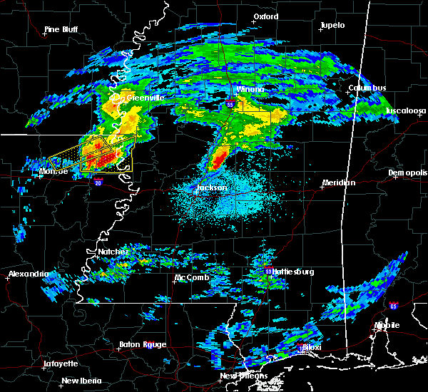 At 101 am cst, a severe thunderstorm was located near oak grove, or 11 miles northwest of lake providence, moving northeast at 55 mph (radar indicated). Hazards include 60 mph wind gusts and quarter size hail. Hail damage to vehicles is expected. expect wind damage to roofs, siding, and trees. This severe thunderstorm will remain over mainly rural areas of central east carroll and central west carroll parishes, including the following locations, pioneer and forest. At 101 am cst, a severe thunderstorm was located near oak grove, or 11 miles northwest of lake providence, moving northeast at 55 mph (radar indicated). Hazards include 60 mph wind gusts and quarter size hail. Hail damage to vehicles is expected. expect wind damage to roofs, siding, and trees. This severe thunderstorm will remain over mainly rural areas of central east carroll and central west carroll parishes, including the following locations, pioneer and forest.
|
| 3/4/2020 12:59 AM CST |
 At 1259 am cst, a severe thunderstorm was located near monticello, or 10 miles southwest of transylvania, moving east at 35 mph (radar indicated). Hazards include 60 mph wind gusts and quarter size hail. Hail damage to vehicles is expected. expect wind damage to roofs, siding, and trees. this severe thunderstorm will be near, transylvania and alsatia around 115 am cst. Other locations impacted by this severe thunderstorm include mayersville, forest, pioneer and epps. At 1259 am cst, a severe thunderstorm was located near monticello, or 10 miles southwest of transylvania, moving east at 35 mph (radar indicated). Hazards include 60 mph wind gusts and quarter size hail. Hail damage to vehicles is expected. expect wind damage to roofs, siding, and trees. this severe thunderstorm will be near, transylvania and alsatia around 115 am cst. Other locations impacted by this severe thunderstorm include mayersville, forest, pioneer and epps.
|
| 3/4/2020 12:27 AM CST |
 At 1227 am cst, a severe thunderstorm was located near bastrop, moving northeast at 55 mph (radar indicated). Hazards include 60 mph wind gusts and quarter size hail. Hail damage to vehicles is expected. expect wind damage to roofs, siding, and trees. this severe thunderstorm will be near, goodwill around 1245 am cst. oak grove around 1255 am cst. Other locations impacted by this severe thunderstorm include forest, collinston, mer rouge, pioneer and oak ridge. At 1227 am cst, a severe thunderstorm was located near bastrop, moving northeast at 55 mph (radar indicated). Hazards include 60 mph wind gusts and quarter size hail. Hail damage to vehicles is expected. expect wind damage to roofs, siding, and trees. this severe thunderstorm will be near, goodwill around 1245 am cst. oak grove around 1255 am cst. Other locations impacted by this severe thunderstorm include forest, collinston, mer rouge, pioneer and oak ridge.
|
| 1/11/2020 5:01 AM CST |
 At 501 am cst, severe thunderstorms were located along a line extending from estill to near fitler, moving northeast at 50 mph (radar indicated). Hazards include 60 mph wind gusts and quarter size hail. Hail damage to vehicles is expected. expect wind damage to roofs, siding, and trees. these severe storms will be near, hollandale and estill around 505 am cst. darlove around 510 am cst. rolling fork around 515 am cst. isola around 520 am cst. holly bluff around 525 am cst. other locations impacted by these severe thunderstorms include mayersville, silver city, cary, louise, pioneer and epps. a tornado watch remains in effect until 700 am cst for southeastern arkansas, and north central and northwestern mississippi. A tornado watch also remains in effect until 900 am cst for northeastern louisiana, and central and west central mississippi. At 501 am cst, severe thunderstorms were located along a line extending from estill to near fitler, moving northeast at 50 mph (radar indicated). Hazards include 60 mph wind gusts and quarter size hail. Hail damage to vehicles is expected. expect wind damage to roofs, siding, and trees. these severe storms will be near, hollandale and estill around 505 am cst. darlove around 510 am cst. rolling fork around 515 am cst. isola around 520 am cst. holly bluff around 525 am cst. other locations impacted by these severe thunderstorms include mayersville, silver city, cary, louise, pioneer and epps. a tornado watch remains in effect until 700 am cst for southeastern arkansas, and north central and northwestern mississippi. A tornado watch also remains in effect until 900 am cst for northeastern louisiana, and central and west central mississippi.
|
| 1/11/2020 4:30 AM CST |
 At 430 am cst, severe thunderstorms were located along a line extending from near eudora to monticello, moving northeast at 50 mph (radar indicated). Hazards include 60 mph wind gusts and quarter size hail. Hail damage to vehicles is expected. expect wind damage to roofs, siding, and trees. severe thunderstorms will be near, gassoway around 435 am cst. sondheimer around 440 am cst. transylvania around 445 am cst. avon around 450 am cst. fitler around 455 am cst. hollandale and estill around 500 am cst. onward and darlove around 505 am cst. isola and holly bluff around 520 am cst. other locations impacted by these severe thunderstorms include mayersville, silver city, pioneer, kilbourne, forest, cary, louise and epps. a tornado watch remains in effect until 700 am cst for southeastern arkansas, and north central and northwestern mississippi. A tornado watch also remains in effect until 900 am cst for northeastern louisiana, and central and west central mississippi. At 430 am cst, severe thunderstorms were located along a line extending from near eudora to monticello, moving northeast at 50 mph (radar indicated). Hazards include 60 mph wind gusts and quarter size hail. Hail damage to vehicles is expected. expect wind damage to roofs, siding, and trees. severe thunderstorms will be near, gassoway around 435 am cst. sondheimer around 440 am cst. transylvania around 445 am cst. avon around 450 am cst. fitler around 455 am cst. hollandale and estill around 500 am cst. onward and darlove around 505 am cst. isola and holly bluff around 520 am cst. other locations impacted by these severe thunderstorms include mayersville, silver city, pioneer, kilbourne, forest, cary, louise and epps. a tornado watch remains in effect until 700 am cst for southeastern arkansas, and north central and northwestern mississippi. A tornado watch also remains in effect until 900 am cst for northeastern louisiana, and central and west central mississippi.
|
| 1/11/2020 3:58 AM CST |
 At 358 am cst, severe thunderstorms were located along a line extending from 6 miles east of lake village to near galion, moving northeast at 65 mph (radar indicated). Hazards include 60 mph wind gusts. Expect damage to roofs, siding, and trees. these severe storms will be near, oak grove around 415 am cst. shelburn around 425 am cst. gassoway and millikin around 430 am cst. other locations impacted by these severe thunderstorms include kilbourne, forest, collinston, pioneer, oak ridge and epps. a tornado watch remains in effect until 700 am cst for southeastern arkansas, and northwestern mississippi. A tornado watch also remains in effect until 900 am cst for northeastern louisiana, and west central mississippi. At 358 am cst, severe thunderstorms were located along a line extending from 6 miles east of lake village to near galion, moving northeast at 65 mph (radar indicated). Hazards include 60 mph wind gusts. Expect damage to roofs, siding, and trees. these severe storms will be near, oak grove around 415 am cst. shelburn around 425 am cst. gassoway and millikin around 430 am cst. other locations impacted by these severe thunderstorms include kilbourne, forest, collinston, pioneer, oak ridge and epps. a tornado watch remains in effect until 700 am cst for southeastern arkansas, and northwestern mississippi. A tornado watch also remains in effect until 900 am cst for northeastern louisiana, and west central mississippi.
|
| 1/11/2020 3:33 AM CST |
 At 333 am cst, severe thunderstorms were located along a line extending from near portland to near sterlington, moving northeast at 65 mph (radar indicated). Hazards include 60 mph wind gusts. Expect damage to roofs, siding, and trees. severe thunderstorms will be near, lake village and chicot junction around 345 am cst. galion around 355 am cst. goodwill around 400 am cst. oak grove around 410 am cst. shelburn around 420 am cst. gassoway and millikin around 425 am cst. other locations impacted by these severe thunderstorms include perryville, collinston, mer rouge, pioneer, kilbourne, forest, bonita, oak ridge and epps. a tornado watch remains in effect until 700 am cst for southeastern arkansas, and northwestern mississippi. A tornado watch also remains in effect until 900 am cst for northeastern louisiana, and west central mississippi. At 333 am cst, severe thunderstorms were located along a line extending from near portland to near sterlington, moving northeast at 65 mph (radar indicated). Hazards include 60 mph wind gusts. Expect damage to roofs, siding, and trees. severe thunderstorms will be near, lake village and chicot junction around 345 am cst. galion around 355 am cst. goodwill around 400 am cst. oak grove around 410 am cst. shelburn around 420 am cst. gassoway and millikin around 425 am cst. other locations impacted by these severe thunderstorms include perryville, collinston, mer rouge, pioneer, kilbourne, forest, bonita, oak ridge and epps. a tornado watch remains in effect until 700 am cst for southeastern arkansas, and northwestern mississippi. A tornado watch also remains in effect until 900 am cst for northeastern louisiana, and west central mississippi.
|
| 12/16/2019 2:59 PM CST |
 At 259 pm cst, a severe thunderstorm was located near glen allan, or 11 miles southeast of eudora, moving northeast at 55 mph (radar indicated). Hazards include 60 mph wind gusts. Expect damage to roofs, siding, and trees. this severe storm will be near, grace around 305 pm cst. panther burn and nitta yuma around 315 pm cst. hollandale, delta city and estill around 320 pm cst. murphy and darlove around 325 pm cst. other locations impacted by this severe thunderstorm include mayersville. A tornado watch remains in effect until 600 pm cst for southeastern arkansas, northeastern louisiana, and central, northwestern and west central mississippi. At 259 pm cst, a severe thunderstorm was located near glen allan, or 11 miles southeast of eudora, moving northeast at 55 mph (radar indicated). Hazards include 60 mph wind gusts. Expect damage to roofs, siding, and trees. this severe storm will be near, grace around 305 pm cst. panther burn and nitta yuma around 315 pm cst. hollandale, delta city and estill around 320 pm cst. murphy and darlove around 325 pm cst. other locations impacted by this severe thunderstorm include mayersville. A tornado watch remains in effect until 600 pm cst for southeastern arkansas, northeastern louisiana, and central, northwestern and west central mississippi.
|
| 12/16/2019 2:32 PM CST |
 At 232 pm cst, a severe thunderstorm was located near oak grove, or 13 miles southeast of wilmot, moving northeast at 55 mph (radar indicated). Hazards include 60 mph wind gusts. Expect damage to roofs, siding, and trees. this severe thunderstorm will be near, shelburn around 245 pm cst. gassoway and millikin around 250 pm cst. glen allan around 300 pm cst. grace around 305 pm cst. panther burn and nitta yuma around 310 pm cst. hollandale, delta city and estill around 315 pm cst. murphy and darlove around 325 pm cst. other locations impacted by this severe thunderstorm include mayersville and kilbourne. A tornado watch remains in effect until 600 pm cst for southeastern arkansas, northeastern louisiana, and central, northwestern and west central mississippi. At 232 pm cst, a severe thunderstorm was located near oak grove, or 13 miles southeast of wilmot, moving northeast at 55 mph (radar indicated). Hazards include 60 mph wind gusts. Expect damage to roofs, siding, and trees. this severe thunderstorm will be near, shelburn around 245 pm cst. gassoway and millikin around 250 pm cst. glen allan around 300 pm cst. grace around 305 pm cst. panther burn and nitta yuma around 310 pm cst. hollandale, delta city and estill around 315 pm cst. murphy and darlove around 325 pm cst. other locations impacted by this severe thunderstorm include mayersville and kilbourne. A tornado watch remains in effect until 600 pm cst for southeastern arkansas, northeastern louisiana, and central, northwestern and west central mississippi.
|
| 12/16/2019 2:32 PM CST |
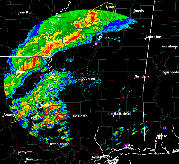 At 232 pm cst, a severe thunderstorm was located near oak grove, or 13 miles southeast of wilmot, moving northeast at 55 mph (radar indicated). Hazards include 60 mph wind gusts. Expect damage to roofs, siding, and trees. this severe thunderstorm will be near, shelburn around 245 pm cst. gassoway and millikin around 250 pm cst. glen allan around 300 pm cst. grace around 305 pm cst. panther burn and nitta yuma around 310 pm cst. hollandale, delta city and estill around 315 pm cst. murphy and darlove around 325 pm cst. other locations impacted by this severe thunderstorm include mayersville and kilbourne. A tornado watch remains in effect until 600 pm cst for southeastern arkansas, northeastern louisiana, and central, northwestern and west central mississippi. At 232 pm cst, a severe thunderstorm was located near oak grove, or 13 miles southeast of wilmot, moving northeast at 55 mph (radar indicated). Hazards include 60 mph wind gusts. Expect damage to roofs, siding, and trees. this severe thunderstorm will be near, shelburn around 245 pm cst. gassoway and millikin around 250 pm cst. glen allan around 300 pm cst. grace around 305 pm cst. panther burn and nitta yuma around 310 pm cst. hollandale, delta city and estill around 315 pm cst. murphy and darlove around 325 pm cst. other locations impacted by this severe thunderstorm include mayersville and kilbourne. A tornado watch remains in effect until 600 pm cst for southeastern arkansas, northeastern louisiana, and central, northwestern and west central mississippi.
|
| 10/21/2019 7:40 AM CDT |
 At 739 am cdt, severe thunderstorms were located along a line extending from near leland to near avon to near lake providence, moving east at 70 mph (radar indicated). Hazards include 60 mph wind gusts. Expect damage to roofs, siding, and trees. severe thunderstorms will be near, hollandale, estill and holly ridge around 745 am cdt. indianola, darlove and tribbett around 750 am cdt. sunflower around 755 am cdt. rolling fork, inverness, isola, blaine and grace around 800 am cdt. anguilla and nitta yuma around 805 am cdt. moorhead and swiftown around 810 am cdt. itta bena, money and quito around 815 am cdt. sidon and midnight around 820 am cdt. Other locations impacted by these severe thunderstorms include mayersville, silver city, arcola, louise and morgan city. At 739 am cdt, severe thunderstorms were located along a line extending from near leland to near avon to near lake providence, moving east at 70 mph (radar indicated). Hazards include 60 mph wind gusts. Expect damage to roofs, siding, and trees. severe thunderstorms will be near, hollandale, estill and holly ridge around 745 am cdt. indianola, darlove and tribbett around 750 am cdt. sunflower around 755 am cdt. rolling fork, inverness, isola, blaine and grace around 800 am cdt. anguilla and nitta yuma around 805 am cdt. moorhead and swiftown around 810 am cdt. itta bena, money and quito around 815 am cdt. sidon and midnight around 820 am cdt. Other locations impacted by these severe thunderstorms include mayersville, silver city, arcola, louise and morgan city.
|
| 7/16/2019 3:14 PM CDT |
 The national weather service in jackson has issued a * severe thunderstorm warning for. northeastern east carroll parish in northeastern louisiana. southern washington county in northwestern mississippi. northwestern issaquena county in west central mississippi. Northern sharkey county in west central mississippi. The national weather service in jackson has issued a * severe thunderstorm warning for. northeastern east carroll parish in northeastern louisiana. southern washington county in northwestern mississippi. northwestern issaquena county in west central mississippi. Northern sharkey county in west central mississippi.
|
| 7/16/2019 3:14 PM CDT |
 At 314 pm cdt, a severe thunderstorm was located near shelburn, or 8 miles northeast of lake providence, moving northeast at 35 mph (radar indicated). Hazards include 60 mph wind gusts. Expect damage to roofs, siding, and trees. this severe thunderstorm will be near, glen allan around 330 pm cdt. grace around 335 pm cdt. anguilla, panther burn and nitta yuma around 345 pm cdt. hollandale and delta city around 355 pm cdt. murphy and darlove around 400 pm cdt. Other locations impacted by this severe thunderstorm include mayersville and arcola. At 314 pm cdt, a severe thunderstorm was located near shelburn, or 8 miles northeast of lake providence, moving northeast at 35 mph (radar indicated). Hazards include 60 mph wind gusts. Expect damage to roofs, siding, and trees. this severe thunderstorm will be near, glen allan around 330 pm cdt. grace around 335 pm cdt. anguilla, panther burn and nitta yuma around 345 pm cdt. hollandale and delta city around 355 pm cdt. murphy and darlove around 400 pm cdt. Other locations impacted by this severe thunderstorm include mayersville and arcola.
|
| 6/24/2019 3:00 AM CDT |
 At 300 am cdt, severe thunderstorms were located along a line extending from panther burn to near mansford, moving northeast at 60 mph (radar indicated). Hazards include 60 mph wind gusts. Expect damage to roofs, siding, and trees. these severe storms will be near, valley park around 315 am cdt. Other locations impacted by these severe thunderstorms include mound, cary, delta and richmond. At 300 am cdt, severe thunderstorms were located along a line extending from panther burn to near mansford, moving northeast at 60 mph (radar indicated). Hazards include 60 mph wind gusts. Expect damage to roofs, siding, and trees. these severe storms will be near, valley park around 315 am cdt. Other locations impacted by these severe thunderstorms include mound, cary, delta and richmond.
|
| 6/24/2019 2:29 AM CDT |
 At 229 am cdt, severe thunderstorms were located along a line extending from near oak grove to near crowville, moving northeast at 55 mph (radar indicated). Hazards include 60 mph wind gusts. Expect damage to roofs, siding, and trees. severe thunderstorms will be near, lake providence and shelburn around 235 am cdt. tendal around 245 am cdt. tallulah and mansford around 255 am cdt. omega around 300 am cdt. eagle bend around 305 am cdt. valley park around 315 am cdt. Other locations impacted by these severe thunderstorms include mound, mayersville, cary, delta and richmond. At 229 am cdt, severe thunderstorms were located along a line extending from near oak grove to near crowville, moving northeast at 55 mph (radar indicated). Hazards include 60 mph wind gusts. Expect damage to roofs, siding, and trees. severe thunderstorms will be near, lake providence and shelburn around 235 am cdt. tendal around 245 am cdt. tallulah and mansford around 255 am cdt. omega around 300 am cdt. eagle bend around 305 am cdt. valley park around 315 am cdt. Other locations impacted by these severe thunderstorms include mound, mayersville, cary, delta and richmond.
|
| 6/20/2019 2:38 AM CDT |
 At 238 am cdt, a severe thunderstorm was located over monticello, or 14 miles southwest of transylvania, moving east at 50 mph (radar indicated). Hazards include 60 mph wind gusts and quarter size hail. Hail damage to vehicles is expected. expect wind damage to roofs, siding, and trees. this severe thunderstorm will be near, transylvania, alsatia, sondheimer and omega around 255 am cdt. eagle bend around 305 am cdt. valley park around 315 am cdt. Other locations impacted by this severe thunderstorm include pioneer and epps. At 238 am cdt, a severe thunderstorm was located over monticello, or 14 miles southwest of transylvania, moving east at 50 mph (radar indicated). Hazards include 60 mph wind gusts and quarter size hail. Hail damage to vehicles is expected. expect wind damage to roofs, siding, and trees. this severe thunderstorm will be near, transylvania, alsatia, sondheimer and omega around 255 am cdt. eagle bend around 305 am cdt. valley park around 315 am cdt. Other locations impacted by this severe thunderstorm include pioneer and epps.
|
| 6/20/2019 2:38 AM CDT |
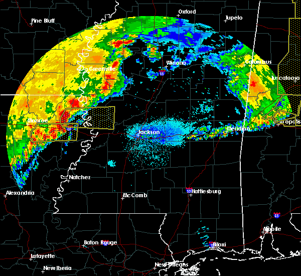 At 238 am cdt, a severe thunderstorm was located over monticello, or 14 miles southwest of transylvania, moving east at 50 mph (radar indicated). Hazards include 60 mph wind gusts and quarter size hail. Hail damage to vehicles is expected. expect wind damage to roofs, siding, and trees. this severe thunderstorm will be near, transylvania, alsatia, sondheimer and omega around 255 am cdt. eagle bend around 305 am cdt. valley park around 315 am cdt. Other locations impacted by this severe thunderstorm include pioneer and epps. At 238 am cdt, a severe thunderstorm was located over monticello, or 14 miles southwest of transylvania, moving east at 50 mph (radar indicated). Hazards include 60 mph wind gusts and quarter size hail. Hail damage to vehicles is expected. expect wind damage to roofs, siding, and trees. this severe thunderstorm will be near, transylvania, alsatia, sondheimer and omega around 255 am cdt. eagle bend around 305 am cdt. valley park around 315 am cdt. Other locations impacted by this severe thunderstorm include pioneer and epps.
|
| 6/19/2019 11:20 PM CDT |
 At 1029 pm cdt, severe thunderstorms were located along a line extending from near greenville to near eudora to 6 miles southeast of wilmot, moving east at 50 mph (radar indicated). Hazards include 60 mph wind gusts and quarter size hail. Hail damage to vehicles is expected. expect wind damage to roofs, siding, and trees. severe thunderstorms will be near, wayside around 1035 pm cdt. millikin, glen allan and gassoway around 1045 pm cdt. shelburn, grace and estill around 1050 pm cdt. panther burn, nitta yuma and darlove around 1055 pm cdt. anguilla and delta city around 1100 pm cdt. isola and murphy around 1105 pm cdt. rolling fork around 1110 pm cdt. belzoni and midnight around 1115 pm cdt. Other locations impacted by these severe thunderstorms include mayersville, silver city, kilbourne, arcola, louise and bonita. At 1029 pm cdt, severe thunderstorms were located along a line extending from near greenville to near eudora to 6 miles southeast of wilmot, moving east at 50 mph (radar indicated). Hazards include 60 mph wind gusts and quarter size hail. Hail damage to vehicles is expected. expect wind damage to roofs, siding, and trees. severe thunderstorms will be near, wayside around 1035 pm cdt. millikin, glen allan and gassoway around 1045 pm cdt. shelburn, grace and estill around 1050 pm cdt. panther burn, nitta yuma and darlove around 1055 pm cdt. anguilla and delta city around 1100 pm cdt. isola and murphy around 1105 pm cdt. rolling fork around 1110 pm cdt. belzoni and midnight around 1115 pm cdt. Other locations impacted by these severe thunderstorms include mayersville, silver city, kilbourne, arcola, louise and bonita.
|
| 6/19/2019 10:29 PM CDT |
 At 1029 pm cdt, severe thunderstorms were located along a line extending from near greenville to near eudora to 6 miles southeast of wilmot, moving east at 50 mph (radar indicated). Hazards include 60 mph wind gusts and quarter size hail. Hail damage to vehicles is expected. expect wind damage to roofs, siding, and trees. severe thunderstorms will be near, wayside around 1035 pm cdt. millikin, glen allan and gassoway around 1045 pm cdt. shelburn, grace and estill around 1050 pm cdt. panther burn, nitta yuma and darlove around 1055 pm cdt. anguilla and delta city around 1100 pm cdt. isola and murphy around 1105 pm cdt. rolling fork around 1110 pm cdt. belzoni and midnight around 1115 pm cdt. Other locations impacted by these severe thunderstorms include mayersville, silver city, kilbourne, arcola, louise and bonita. At 1029 pm cdt, severe thunderstorms were located along a line extending from near greenville to near eudora to 6 miles southeast of wilmot, moving east at 50 mph (radar indicated). Hazards include 60 mph wind gusts and quarter size hail. Hail damage to vehicles is expected. expect wind damage to roofs, siding, and trees. severe thunderstorms will be near, wayside around 1035 pm cdt. millikin, glen allan and gassoway around 1045 pm cdt. shelburn, grace and estill around 1050 pm cdt. panther burn, nitta yuma and darlove around 1055 pm cdt. anguilla and delta city around 1100 pm cdt. isola and murphy around 1105 pm cdt. rolling fork around 1110 pm cdt. belzoni and midnight around 1115 pm cdt. Other locations impacted by these severe thunderstorms include mayersville, silver city, kilbourne, arcola, louise and bonita.
|
| 5/8/2019 7:51 PM CDT |
 At 750 pm cdt, severe thunderstorms were located along a line extending from near metcalfe to 7 miles east of eudora to near lake providence, moving east at 30 mph (radar indicated). Hazards include 60 mph wind gusts. Expect damage to roofs, siding, and trees. these severe storms will be near, greenville around 755 pm cdt. other locations impacted by these severe thunderstorms include kilbourne. a tornado watch remains in effect until 1100 pm cdt for southeastern arkansas, and northeastern louisiana. A tornado watch also remains in effect until midnight cdt for northwestern and west central mississippi. At 750 pm cdt, severe thunderstorms were located along a line extending from near metcalfe to 7 miles east of eudora to near lake providence, moving east at 30 mph (radar indicated). Hazards include 60 mph wind gusts. Expect damage to roofs, siding, and trees. these severe storms will be near, greenville around 755 pm cdt. other locations impacted by these severe thunderstorms include kilbourne. a tornado watch remains in effect until 1100 pm cdt for southeastern arkansas, and northeastern louisiana. A tornado watch also remains in effect until midnight cdt for northwestern and west central mississippi.
|
| 5/8/2019 7:37 PM CDT |
 At 737 pm cdt, severe thunderstorms were located along a line extending from 6 miles west of greenville to eudora to 6 miles southeast of oak grove, moving east at 45 mph (radar indicated). Hazards include 60 mph wind gusts. Expect damage to roofs, siding, and trees. these severe storms will be near, greenville around 750 pm cdt. other locations impacted by these severe thunderstorms include kilbourne, forest, jerome and pioneer. a tornado watch remains in effect until 1100 pm cdt for southeastern arkansas, and northeastern louisiana. A tornado watch also remains in effect until midnight cdt for northwestern and west central mississippi. At 737 pm cdt, severe thunderstorms were located along a line extending from 6 miles west of greenville to eudora to 6 miles southeast of oak grove, moving east at 45 mph (radar indicated). Hazards include 60 mph wind gusts. Expect damage to roofs, siding, and trees. these severe storms will be near, greenville around 750 pm cdt. other locations impacted by these severe thunderstorms include kilbourne, forest, jerome and pioneer. a tornado watch remains in effect until 1100 pm cdt for southeastern arkansas, and northeastern louisiana. A tornado watch also remains in effect until midnight cdt for northwestern and west central mississippi.
|
| 5/8/2019 7:37 PM CDT |
 At 714 pm cdt, severe thunderstorms were located along a line extending from near montrose to wilmot to 7 miles southwest of goodwill, moving east at 30 mph (radar indicated). Hazards include 60 mph wind gusts. Expect damage to roofs, siding, and trees. severe thunderstorms will be near, montrose around 720 pm cdt. parkdale around 725 pm cdt. lake village and mcmillan corner around 730 pm cdt. eudora and oak grove around 750 pm cdt. chicot junction around 755 pm cdt. greenville and shelburn around 805 pm cdt. lake providence and millikin around 810 pm cdt. other locations impacted by these severe thunderstorms include kilbourne, forest, jerome and pioneer. a tornado watch remains in effect until 1100 pm cdt for southeastern arkansas, and northeastern louisiana. A tornado watch also remains in effect until midnight cdt for northwestern and west central mississippi. At 714 pm cdt, severe thunderstorms were located along a line extending from near montrose to wilmot to 7 miles southwest of goodwill, moving east at 30 mph (radar indicated). Hazards include 60 mph wind gusts. Expect damage to roofs, siding, and trees. severe thunderstorms will be near, montrose around 720 pm cdt. parkdale around 725 pm cdt. lake village and mcmillan corner around 730 pm cdt. eudora and oak grove around 750 pm cdt. chicot junction around 755 pm cdt. greenville and shelburn around 805 pm cdt. lake providence and millikin around 810 pm cdt. other locations impacted by these severe thunderstorms include kilbourne, forest, jerome and pioneer. a tornado watch remains in effect until 1100 pm cdt for southeastern arkansas, and northeastern louisiana. A tornado watch also remains in effect until midnight cdt for northwestern and west central mississippi.
|
| 5/8/2019 7:14 PM CDT |
 At 714 pm cdt, severe thunderstorms were located along a line extending from near montrose to wilmot to 7 miles southwest of goodwill, moving east at 30 mph (radar indicated). Hazards include 60 mph wind gusts. Expect damage to roofs, siding, and trees. severe thunderstorms will be near, montrose around 720 pm cdt. parkdale around 725 pm cdt. lake village and mcmillan corner around 730 pm cdt. eudora and oak grove around 750 pm cdt. chicot junction around 755 pm cdt. greenville and shelburn around 805 pm cdt. lake providence and millikin around 810 pm cdt. other locations impacted by these severe thunderstorms include kilbourne, forest, jerome and pioneer. a tornado watch remains in effect until 1100 pm cdt for southeastern arkansas, and northeastern louisiana. A tornado watch also remains in effect until midnight cdt for northwestern and west central mississippi. At 714 pm cdt, severe thunderstorms were located along a line extending from near montrose to wilmot to 7 miles southwest of goodwill, moving east at 30 mph (radar indicated). Hazards include 60 mph wind gusts. Expect damage to roofs, siding, and trees. severe thunderstorms will be near, montrose around 720 pm cdt. parkdale around 725 pm cdt. lake village and mcmillan corner around 730 pm cdt. eudora and oak grove around 750 pm cdt. chicot junction around 755 pm cdt. greenville and shelburn around 805 pm cdt. lake providence and millikin around 810 pm cdt. other locations impacted by these severe thunderstorms include kilbourne, forest, jerome and pioneer. a tornado watch remains in effect until 1100 pm cdt for southeastern arkansas, and northeastern louisiana. A tornado watch also remains in effect until midnight cdt for northwestern and west central mississippi.
|
| 5/8/2019 7:08 PM CDT |
 At 708 pm cdt, a severe thunderstorm capable of producing a tornado was located 9 miles northwest of warden, or 12 miles northeast of rayville, moving northeast at 40 mph (radar indicated rotation). Hazards include tornado and quarter size hail. Flying debris will be dangerous to those caught without shelter. mobile homes will be damaged or destroyed. damage to roofs, windows, and vehicles will occur. tree damage is likely. this dangerous storm will be near, darnell and monticello around 725 pm cdt. lake providence and shelburn around 750 pm cdt. Other locations impacted by this tornadic thunderstorm include pioneer, forest and epps. At 708 pm cdt, a severe thunderstorm capable of producing a tornado was located 9 miles northwest of warden, or 12 miles northeast of rayville, moving northeast at 40 mph (radar indicated rotation). Hazards include tornado and quarter size hail. Flying debris will be dangerous to those caught without shelter. mobile homes will be damaged or destroyed. damage to roofs, windows, and vehicles will occur. tree damage is likely. this dangerous storm will be near, darnell and monticello around 725 pm cdt. lake providence and shelburn around 750 pm cdt. Other locations impacted by this tornadic thunderstorm include pioneer, forest and epps.
|
| 4/25/2019 3:29 AM CDT |
 At 329 am cdt, severe thunderstorms were located along a line extending from near gassoway to near lake providence to near transylvania, moving northeast at 50 mph (radar indicated). Hazards include 60 mph wind gusts. Expect damage to roofs, siding, and trees. these severe storms will be near, glen allan around 340 am cdt. fitler around 345 am cdt. grace around 350 am cdt. Other locations impacted by these severe thunderstorms include mayersville. At 329 am cdt, severe thunderstorms were located along a line extending from near gassoway to near lake providence to near transylvania, moving northeast at 50 mph (radar indicated). Hazards include 60 mph wind gusts. Expect damage to roofs, siding, and trees. these severe storms will be near, glen allan around 340 am cdt. fitler around 345 am cdt. grace around 350 am cdt. Other locations impacted by these severe thunderstorms include mayersville.
|
| 4/25/2019 3:10 AM CDT |
 At 310 am cdt, severe thunderstorms were located along a line extending from 9 miles southeast of wilmot to 6 miles southwest of oak grove to near darnell, moving northeast at 50 mph (radar indicated). Hazards include 60 mph wind gusts. Expect damage to roofs, siding, and trees. severe thunderstorms will be near, oak grove around 315 am cdt. gassoway and millikin around 325 am cdt. lake providence, transylvania and shelburn around 330 am cdt. fitler and glen allan around 340 am cdt. grace around 350 am cdt. Other locations impacted by these severe thunderstorms include mayersville, kilbourne, forest, pioneer and epps. At 310 am cdt, severe thunderstorms were located along a line extending from 9 miles southeast of wilmot to 6 miles southwest of oak grove to near darnell, moving northeast at 50 mph (radar indicated). Hazards include 60 mph wind gusts. Expect damage to roofs, siding, and trees. severe thunderstorms will be near, oak grove around 315 am cdt. gassoway and millikin around 325 am cdt. lake providence, transylvania and shelburn around 330 am cdt. fitler and glen allan around 340 am cdt. grace around 350 am cdt. Other locations impacted by these severe thunderstorms include mayersville, kilbourne, forest, pioneer and epps.
|
| 4/13/2019 4:29 PM CDT |
 At 429 pm cdt, severe thunderstorms were located along a line extending from near gassoway to near fitler, moving northeast at 55 mph (radar indicated). Hazards include 60 mph wind gusts and nickel size hail. Expect damage to roofs, siding, and trees. these severe storms will be near, glen allan around 435 pm cdt. rolling fork and panther burn around 445 pm cdt. hollandale and anguilla around 450 pm cdt. nitta yuma around 455 pm cdt. other locations impacted by these severe thunderstorms include mayersville and cary. A tornado watch remains in effect until 900 pm cdt for southeastern arkansas, northeastern louisiana, and northwestern and west central mississippi. At 429 pm cdt, severe thunderstorms were located along a line extending from near gassoway to near fitler, moving northeast at 55 mph (radar indicated). Hazards include 60 mph wind gusts and nickel size hail. Expect damage to roofs, siding, and trees. these severe storms will be near, glen allan around 435 pm cdt. rolling fork and panther burn around 445 pm cdt. hollandale and anguilla around 450 pm cdt. nitta yuma around 455 pm cdt. other locations impacted by these severe thunderstorms include mayersville and cary. A tornado watch remains in effect until 900 pm cdt for southeastern arkansas, northeastern louisiana, and northwestern and west central mississippi.
|
| 4/13/2019 4:03 PM CDT |
 At 402 pm cdt, severe thunderstorms were located along a line extending from near oak grove to monticello, moving east at 45 mph (radar indicated). Hazards include 60 mph wind gusts and nickel size hail. Expect damage to roofs, siding, and trees. severe thunderstorms will be near, transylvania, millikin and shelburn around 420 pm cdt. gassoway around 425 pm cdt. fitler around 435 pm cdt. glen allan around 440 pm cdt. grace around 445 pm cdt. anguilla, panther burn and nitta yuma around 450 pm cdt. hollandale and delta city around 455 pm cdt. other locations impacted by these severe thunderstorms include mayersville, kilbourne, forest, cary, pioneer and epps. A tornado watch remains in effect until 900 pm cdt for southeastern arkansas, northeastern louisiana, and northwestern and west central mississippi. At 402 pm cdt, severe thunderstorms were located along a line extending from near oak grove to monticello, moving east at 45 mph (radar indicated). Hazards include 60 mph wind gusts and nickel size hail. Expect damage to roofs, siding, and trees. severe thunderstorms will be near, transylvania, millikin and shelburn around 420 pm cdt. gassoway around 425 pm cdt. fitler around 435 pm cdt. glen allan around 440 pm cdt. grace around 445 pm cdt. anguilla, panther burn and nitta yuma around 450 pm cdt. hollandale and delta city around 455 pm cdt. other locations impacted by these severe thunderstorms include mayersville, kilbourne, forest, cary, pioneer and epps. A tornado watch remains in effect until 900 pm cdt for southeastern arkansas, northeastern louisiana, and northwestern and west central mississippi.
|
| 4/13/2019 7:10 AM CDT | An 18 wheeler was flipped over on highway 65 nort in east carroll county LA, 6.2 miles SSE of Lake Providence, LA |
| 4/13/2019 7:03 AM CDT |
 At 703 am cdt, a severe thunderstorm was located near shelburn, or near lake providence, moving northeast at 30 mph (radar indicated). Hazards include 60 mph wind gusts and quarter size hail. Hail damage to vehicles is expected. expect wind damage to roofs, siding, and trees. This severe storm will be near, shelburn around 710 am cdt. At 703 am cdt, a severe thunderstorm was located near shelburn, or near lake providence, moving northeast at 30 mph (radar indicated). Hazards include 60 mph wind gusts and quarter size hail. Hail damage to vehicles is expected. expect wind damage to roofs, siding, and trees. This severe storm will be near, shelburn around 710 am cdt.
|
| 4/13/2019 6:48 AM CDT |
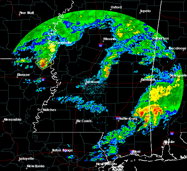 At 647 am cdt, a severe thunderstorm was located near oak grove, or 11 miles west of lake providence, moving northeast at 30 mph (radar indicated). Hazards include 60 mph wind gusts and half dollar size hail. Hail damage to vehicles is expected. expect wind damage to roofs, siding, and trees. this severe storm will be near, lake providence and shelburn around 710 am cdt. Other locations impacted by this severe thunderstorm include forest. At 647 am cdt, a severe thunderstorm was located near oak grove, or 11 miles west of lake providence, moving northeast at 30 mph (radar indicated). Hazards include 60 mph wind gusts and half dollar size hail. Hail damage to vehicles is expected. expect wind damage to roofs, siding, and trees. this severe storm will be near, lake providence and shelburn around 710 am cdt. Other locations impacted by this severe thunderstorm include forest.
|
| 4/13/2019 6:34 AM CDT |
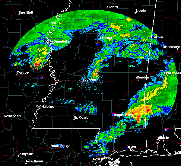 At 634 am cdt, a severe thunderstorm was located near darnell, or 17 miles west of transylvania, moving northeast at 30 mph (radar indicated). Hazards include 60 mph wind gusts and half dollar size hail. Hail damage to vehicles is expected. expect wind damage to roofs, siding, and trees. this severe thunderstorm will be near, lake providence and shelburn around 710 am cdt. Other locations impacted by this severe thunderstorm include pioneer and forest. At 634 am cdt, a severe thunderstorm was located near darnell, or 17 miles west of transylvania, moving northeast at 30 mph (radar indicated). Hazards include 60 mph wind gusts and half dollar size hail. Hail damage to vehicles is expected. expect wind damage to roofs, siding, and trees. this severe thunderstorm will be near, lake providence and shelburn around 710 am cdt. Other locations impacted by this severe thunderstorm include pioneer and forest.
|
| 4/6/2019 8:22 PM CDT |
 At 822 pm cdt, a severe thunderstorm was located near oak grove, or 12 miles northwest of lake providence, moving east at 35 mph (radar indicated). Hazards include 60 mph wind gusts and quarter size hail. Hail damage to vehicles is expected. expect wind damage to roofs, siding, and trees. this severe storm will be near, millikin, gassoway and shelburn around 835 pm cdt. Other locations impacted by this severe thunderstorm include kilbourne, pioneer and forest. At 822 pm cdt, a severe thunderstorm was located near oak grove, or 12 miles northwest of lake providence, moving east at 35 mph (radar indicated). Hazards include 60 mph wind gusts and quarter size hail. Hail damage to vehicles is expected. expect wind damage to roofs, siding, and trees. this severe storm will be near, millikin, gassoway and shelburn around 835 pm cdt. Other locations impacted by this severe thunderstorm include kilbourne, pioneer and forest.
|
| 4/6/2019 7:55 PM CDT |
 At 755 pm cdt, a severe thunderstorm was located near galion, or 15 miles south of wilmot, moving east at 35 mph (radar indicated). Hazards include 60 mph wind gusts and quarter size hail. Hail damage to vehicles is expected. expect wind damage to roofs, siding, and trees. this severe thunderstorm will be near, goodwill around 800 pm cdt. oak grove around 820 pm cdt. millikin, gassoway and shelburn around 835 pm cdt. Other locations impacted by this severe thunderstorm include kilbourne, forest, bonita and pioneer. At 755 pm cdt, a severe thunderstorm was located near galion, or 15 miles south of wilmot, moving east at 35 mph (radar indicated). Hazards include 60 mph wind gusts and quarter size hail. Hail damage to vehicles is expected. expect wind damage to roofs, siding, and trees. this severe thunderstorm will be near, goodwill around 800 pm cdt. oak grove around 820 pm cdt. millikin, gassoway and shelburn around 835 pm cdt. Other locations impacted by this severe thunderstorm include kilbourne, forest, bonita and pioneer.
|
| 8/20/2018 6:52 PM CDT |
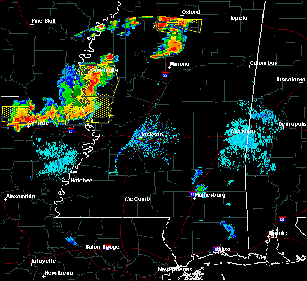 At 651 pm cdt, severe thunderstorms were located along a line extending from near glen allan to near lake providence, moving east at 40 mph (law enforcement. trees were downed across portions of morehouse and west carroll parishes). Hazards include 60 mph wind gusts. Expect damage to roofs, siding, and trees. Locations impacted include, lake providence, transylvania, alsatia, millikin, sondheimer, shelburn, monticello and gassoway. At 651 pm cdt, severe thunderstorms were located along a line extending from near glen allan to near lake providence, moving east at 40 mph (law enforcement. trees were downed across portions of morehouse and west carroll parishes). Hazards include 60 mph wind gusts. Expect damage to roofs, siding, and trees. Locations impacted include, lake providence, transylvania, alsatia, millikin, sondheimer, shelburn, monticello and gassoway.
|
| 8/20/2018 6:08 PM CDT |
 At 608 pm cdt, severe thunderstorms were located along a line extending from near jones to near galion, moving east at 40 mph (radar indicated). Hazards include 60 mph wind gusts and penny size hail. expect damage to roofs, siding, and trees At 608 pm cdt, severe thunderstorms were located along a line extending from near jones to near galion, moving east at 40 mph (radar indicated). Hazards include 60 mph wind gusts and penny size hail. expect damage to roofs, siding, and trees
|
| 8/18/2018 6:40 PM CDT |
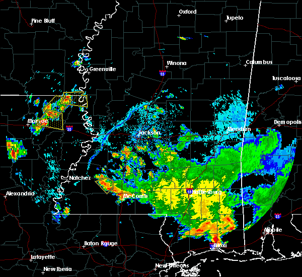 At 640 pm cdt, a severe thunderstorm was located near jones, or 7 miles south of wilmot, moving east at 15 mph (radar indicated). Hazards include 60 mph wind gusts and half dollar size hail. Hail damage to vehicles is expected. Expect wind damage to roofs, siding, and trees. At 640 pm cdt, a severe thunderstorm was located near jones, or 7 miles south of wilmot, moving east at 15 mph (radar indicated). Hazards include 60 mph wind gusts and half dollar size hail. Hail damage to vehicles is expected. Expect wind damage to roofs, siding, and trees.
|
| 7/18/2018 3:37 PM CDT |
 The severe thunderstorm warning for northeastern morehouse, east carroll and west carroll parishes, northwestern yazoo, issaquena and sharkey counties will expire at 345 pm cdt, the storms which prompted the warning have weakened below severe limits, and no longer pose an immediate threat to life or property. therefore, the warning will be allowed to expire. The severe thunderstorm warning for northeastern morehouse, east carroll and west carroll parishes, northwestern yazoo, issaquena and sharkey counties will expire at 345 pm cdt, the storms which prompted the warning have weakened below severe limits, and no longer pose an immediate threat to life or property. therefore, the warning will be allowed to expire.
|
| 7/18/2018 3:21 PM CDT |
 At 318 pm cdt, severe thunderstorms were located along a line extending from near holly bluff to near monticello, moving southeast at 35 mph (radar indicated). Hazards include 60 mph wind gusts and quarter size hail. Hail damage to vehicles is expected. expect wind damage to roofs, siding, and trees. these severe storms will be near, sondheimer around 330 pm cdt. Other locations impacted by these severe thunderstorms include mayersville, forest, cary, pioneer and epps. At 318 pm cdt, severe thunderstorms were located along a line extending from near holly bluff to near monticello, moving southeast at 35 mph (radar indicated). Hazards include 60 mph wind gusts and quarter size hail. Hail damage to vehicles is expected. expect wind damage to roofs, siding, and trees. these severe storms will be near, sondheimer around 330 pm cdt. Other locations impacted by these severe thunderstorms include mayersville, forest, cary, pioneer and epps.
|
| 7/18/2018 2:57 PM CDT |
 At 257 pm cdt, severe thunderstorms were located along a line extending from near anguilla to near oak grove, moving southeast at 35 mph (radar indicated). Hazards include 60 mph wind gusts and quarter size hail. Hail damage to vehicles is expected. expect wind damage to roofs, siding, and trees. severe thunderstorms will be near, holly bluff and monticello around 315 pm cdt. alsatia around 325 pm cdt. sondheimer around 330 pm cdt. Other locations impacted by these severe thunderstorms include mayersville, kilbourne, forest, cary, pioneer and epps. At 257 pm cdt, severe thunderstorms were located along a line extending from near anguilla to near oak grove, moving southeast at 35 mph (radar indicated). Hazards include 60 mph wind gusts and quarter size hail. Hail damage to vehicles is expected. expect wind damage to roofs, siding, and trees. severe thunderstorms will be near, holly bluff and monticello around 315 pm cdt. alsatia around 325 pm cdt. sondheimer around 330 pm cdt. Other locations impacted by these severe thunderstorms include mayersville, kilbourne, forest, cary, pioneer and epps.
|
| 6/22/2018 4:42 PM CDT |
 At 442 pm cdt, a severe thunderstorm was located over transylvania, moving southeast at 30 mph (radar indicated). Hazards include 60 mph wind gusts and quarter size hail. Hail damage to vehicles is expected. expect wind damage to roofs, siding, and trees. this severe storm will be near, alsatia and fitler around 455 pm cdt. sondheimer around 500 pm cdt. Other locations impacted by this severe thunderstorm include mayersville, pioneer and cary. At 442 pm cdt, a severe thunderstorm was located over transylvania, moving southeast at 30 mph (radar indicated). Hazards include 60 mph wind gusts and quarter size hail. Hail damage to vehicles is expected. expect wind damage to roofs, siding, and trees. this severe storm will be near, alsatia and fitler around 455 pm cdt. sondheimer around 500 pm cdt. Other locations impacted by this severe thunderstorm include mayersville, pioneer and cary.
|
| 6/22/2018 4:20 PM CDT |
 At 420 pm cdt, a severe thunderstorm was located near shelburn, or near lake providence, moving southeast at 30 mph (radar indicated). Hazards include 60 mph wind gusts and quarter size hail. Hail damage to vehicles is expected. expect wind damage to roofs, siding, and trees. this severe storm will be near, shelburn around 425 pm cdt. lake providence around 435 pm cdt. transylvania around 445 pm cdt. fitler around 455 pm cdt. onward around 500 pm cdt. Other locations impacted by this severe thunderstorm include mayersville, forest, cary and pioneer. At 420 pm cdt, a severe thunderstorm was located near shelburn, or near lake providence, moving southeast at 30 mph (radar indicated). Hazards include 60 mph wind gusts and quarter size hail. Hail damage to vehicles is expected. expect wind damage to roofs, siding, and trees. this severe storm will be near, shelburn around 425 pm cdt. lake providence around 435 pm cdt. transylvania around 445 pm cdt. fitler around 455 pm cdt. onward around 500 pm cdt. Other locations impacted by this severe thunderstorm include mayersville, forest, cary and pioneer.
|
| 6/22/2018 4:04 PM CDT |
 At 404 pm cdt, a severe thunderstorm was located near oak grove, or 11 miles northwest of lake providence, moving east at 40 mph (radar indicated). Hazards include 60 mph wind gusts and quarter size hail. Hail damage to vehicles is expected. expect wind damage to roofs, siding, and trees. this severe thunderstorm will be near, shelburn and millikin around 415 pm cdt. lake providence around 420 pm cdt. fitler around 440 pm cdt. onward around 445 pm cdt. valley park around 455 pm cdt. Other locations impacted by this severe thunderstorm include mayersville, forest, cary, pioneer, epps and kilbourne. At 404 pm cdt, a severe thunderstorm was located near oak grove, or 11 miles northwest of lake providence, moving east at 40 mph (radar indicated). Hazards include 60 mph wind gusts and quarter size hail. Hail damage to vehicles is expected. expect wind damage to roofs, siding, and trees. this severe thunderstorm will be near, shelburn and millikin around 415 pm cdt. lake providence around 420 pm cdt. fitler around 440 pm cdt. onward around 445 pm cdt. valley park around 455 pm cdt. Other locations impacted by this severe thunderstorm include mayersville, forest, cary, pioneer, epps and kilbourne.
|
| 6/22/2018 1:02 PM CDT |
 The national weather service in jackson has issued a * severe thunderstorm warning for. east carroll parish in northeastern louisiana. northeastern west carroll parish in northeastern louisiana. northwestern issaquena county in west central mississippi. Until 145 pm cdt. The national weather service in jackson has issued a * severe thunderstorm warning for. east carroll parish in northeastern louisiana. northeastern west carroll parish in northeastern louisiana. northwestern issaquena county in west central mississippi. Until 145 pm cdt.
|
| 6/22/2018 1:02 PM CDT |
 At 102 pm cdt, a severe thunderstorm was located over lake providence, moving southeast at 25 mph (radar indicated). Hazards include 60 mph wind gusts and nickel size hail. Expect damage to roofs, siding, and trees. This severe thunderstorm will remain over mainly rural areas of east carroll, northeastern west carroll parishes in northeastern louisiana and northwestern issaquena counties, including the following locations, mayersville, kilbourne, forest and pioneer. At 102 pm cdt, a severe thunderstorm was located over lake providence, moving southeast at 25 mph (radar indicated). Hazards include 60 mph wind gusts and nickel size hail. Expect damage to roofs, siding, and trees. This severe thunderstorm will remain over mainly rural areas of east carroll, northeastern west carroll parishes in northeastern louisiana and northwestern issaquena counties, including the following locations, mayersville, kilbourne, forest and pioneer.
|
| 6/22/2018 11:17 AM CDT |
 At 1117 am cdt, severe thunderstorms were located along a line extending from near onward to alsatia to near warden to near rayville, moving southeast at 30 mph (radar indicated). Hazards include 60 mph wind gusts and penny size hail. Expect damage to roofs, siding, and trees. these severe storms will be near, transylvania, alsatia and fitler around 1120 am cdt. Other locations impacted by these severe thunderstorms include epps and mayersville. At 1117 am cdt, severe thunderstorms were located along a line extending from near onward to alsatia to near warden to near rayville, moving southeast at 30 mph (radar indicated). Hazards include 60 mph wind gusts and penny size hail. Expect damage to roofs, siding, and trees. these severe storms will be near, transylvania, alsatia and fitler around 1120 am cdt. Other locations impacted by these severe thunderstorms include epps and mayersville.
|
| 6/22/2018 11:04 AM CDT |
 At 1104 am cdt, severe thunderstorms were located along a line extending from near fitler to near transylvania to near warden to near start, moving southeast at 30 mph (radar indicated). Hazards include 60 mph wind gusts and penny size hail. Expect damage to roofs, siding, and trees. these severe storms will be near, transylvania around 1110 am cdt. fitler and monticello around 1115 am cdt. alsatia around 1120 am cdt. holly ridge around 1130 am cdt. Other locations impacted by these severe thunderstorms include mayersville, oak ridge and epps. At 1104 am cdt, severe thunderstorms were located along a line extending from near fitler to near transylvania to near warden to near start, moving southeast at 30 mph (radar indicated). Hazards include 60 mph wind gusts and penny size hail. Expect damage to roofs, siding, and trees. these severe storms will be near, transylvania around 1110 am cdt. fitler and monticello around 1115 am cdt. alsatia around 1120 am cdt. holly ridge around 1130 am cdt. Other locations impacted by these severe thunderstorms include mayersville, oak ridge and epps.
|
| 6/22/2018 10:31 AM CDT |
 At 1031 am cdt, severe thunderstorms were located along a line extending from millikin to near oak grove to 7 miles southeast of galion to sterlington, moving southeast at 30 mph (radar indicated). Hazards include 60 mph wind gusts and quarter size hail. Hail damage to vehicles is expected. expect wind damage to roofs, siding, and trees. severe thunderstorms will be near, millikin and gassoway around 1035 am cdt. shelburn and goodwill around 1040 am cdt. lake providence around 1050 am cdt. darnell around 1100 am cdt. start and transylvania around 1110 am cdt. rayville, alsatia, warden, fitler and monticello around 1115 am cdt. holly ridge around 1130 am cdt. Other locations impacted by these severe thunderstorms include mayersville, collinston, mer rouge, oak ridge and epps. At 1031 am cdt, severe thunderstorms were located along a line extending from millikin to near oak grove to 7 miles southeast of galion to sterlington, moving southeast at 30 mph (radar indicated). Hazards include 60 mph wind gusts and quarter size hail. Hail damage to vehicles is expected. expect wind damage to roofs, siding, and trees. severe thunderstorms will be near, millikin and gassoway around 1035 am cdt. shelburn and goodwill around 1040 am cdt. lake providence around 1050 am cdt. darnell around 1100 am cdt. start and transylvania around 1110 am cdt. rayville, alsatia, warden, fitler and monticello around 1115 am cdt. holly ridge around 1130 am cdt. Other locations impacted by these severe thunderstorms include mayersville, collinston, mer rouge, oak ridge and epps.
|
| 4/14/2018 3:53 AM CDT |
 At 353 am cdt, a severe thunderstorm capable of producing a tornado was located near oak grove, or 11 miles northwest of lake providence, moving east at 45 mph (radar indicated rotation). Hazards include tornado. Flying debris will be dangerous to those caught without shelter. mobile homes will be damaged or destroyed. damage to roofs, windows, and vehicles will occur. tree damage is likely. this dangerous storm will be near, shelburn around 400 am cdt. millikin and gassoway around 405 am cdt. Other locations impacted by this tornadic thunderstorm include kilbourne and forest. At 353 am cdt, a severe thunderstorm capable of producing a tornado was located near oak grove, or 11 miles northwest of lake providence, moving east at 45 mph (radar indicated rotation). Hazards include tornado. Flying debris will be dangerous to those caught without shelter. mobile homes will be damaged or destroyed. damage to roofs, windows, and vehicles will occur. tree damage is likely. this dangerous storm will be near, shelburn around 400 am cdt. millikin and gassoway around 405 am cdt. Other locations impacted by this tornadic thunderstorm include kilbourne and forest.
|
| 4/14/2018 3:30 AM CDT |
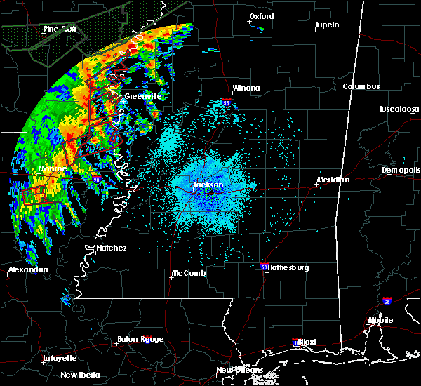 At 330 am cdt, a severe thunderstorm capable of producing a tornado was located near goodwill, or 16 miles south of wilmot, moving east at 45 mph (radar indicated rotation). Hazards include tornado. Flying debris will be dangerous to those caught without shelter. mobile homes will be damaged or destroyed. damage to roofs, windows, and vehicles will occur. tree damage is likely. this dangerous storm will be near, oak grove around 350 am cdt. millikin, gassoway and shelburn around 405 am cdt. Other locations impacted by this tornadic thunderstorm include kilbourne and forest. At 330 am cdt, a severe thunderstorm capable of producing a tornado was located near goodwill, or 16 miles south of wilmot, moving east at 45 mph (radar indicated rotation). Hazards include tornado. Flying debris will be dangerous to those caught without shelter. mobile homes will be damaged or destroyed. damage to roofs, windows, and vehicles will occur. tree damage is likely. this dangerous storm will be near, oak grove around 350 am cdt. millikin, gassoway and shelburn around 405 am cdt. Other locations impacted by this tornadic thunderstorm include kilbourne and forest.
|
| 4/6/2018 6:07 PM CDT |
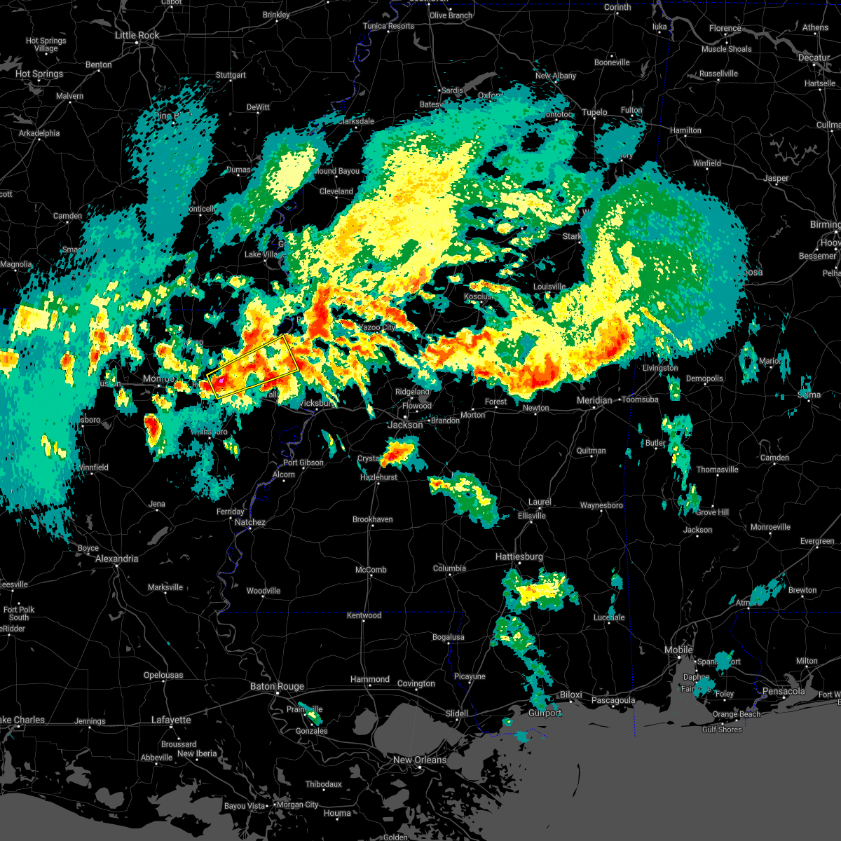 At 607 pm cdt, a severe thunderstorm was located near holly ridge, or 9 miles northeast of rayville, moving northeast at 50 mph (radar indicated). Hazards include golf ball size hail and 60 mph wind gusts. People and animals outdoors will be injured. expect hail damage to roofs, siding, windows, and vehicles. expect wind damage to roofs, siding, and trees. this severe thunderstorm will be near, warden around 615 pm cdt. monticello and darnell around 625 pm cdt. transylvania and alsatia around 640 pm cdt. lake providence around 645 pm cdt. other locations impacted by this severe thunderstorm include epps. A tornado watch remains in effect until 1100 pm cdt for northeastern louisiana, and west central mississippi. At 607 pm cdt, a severe thunderstorm was located near holly ridge, or 9 miles northeast of rayville, moving northeast at 50 mph (radar indicated). Hazards include golf ball size hail and 60 mph wind gusts. People and animals outdoors will be injured. expect hail damage to roofs, siding, windows, and vehicles. expect wind damage to roofs, siding, and trees. this severe thunderstorm will be near, warden around 615 pm cdt. monticello and darnell around 625 pm cdt. transylvania and alsatia around 640 pm cdt. lake providence around 645 pm cdt. other locations impacted by this severe thunderstorm include epps. A tornado watch remains in effect until 1100 pm cdt for northeastern louisiana, and west central mississippi.
|
| 4/6/2018 6:07 PM CDT |
 The national weather service in jackson has issued a * severe thunderstorm warning for. southern east carroll parish in northeastern louisiana. northwestern madison parish in northeastern louisiana. northeastern richland parish in northeastern louisiana. Southwestern west carroll parish in northeastern louisiana. The national weather service in jackson has issued a * severe thunderstorm warning for. southern east carroll parish in northeastern louisiana. northwestern madison parish in northeastern louisiana. northeastern richland parish in northeastern louisiana. Southwestern west carroll parish in northeastern louisiana.
|
| 4/6/2018 3:45 PM CDT | Quarter sized hail reported 2 miles NNW of Lake Providence, LA, pea to quarter size hail. |
| 4/3/2018 7:13 PM CDT | Tree down on a house in alsati in east carroll county LA, 14.3 miles N of Lake Providence, LA |
| 4/3/2018 7:10 PM CDT | Trees and power lines down in lake providenc in east carroll county LA, 1.3 miles NNW of Lake Providence, LA |
| 4/3/2018 7:06 PM CDT | A wire was downed off homestead r in east carroll county LA, 7.9 miles NNW of Lake Providence, LA |
| 4/3/2018 6:54 PM CDT | A wire was downed along highland d in east carroll county LA, 3.5 miles SSE of Lake Providence, LA |
| 4/3/2018 6:43 PM CDT |
 At 642 pm cdt, severe thunderstorms were located along a line extending from near kilbourne to near rayville, moving east at 50 mph (law enforcement. this line of storms downed trees and powerlines in morehouse parish). Hazards include 60 mph wind gusts and nickel size hail. expect damage to roofs, siding, and trees At 642 pm cdt, severe thunderstorms were located along a line extending from near kilbourne to near rayville, moving east at 50 mph (law enforcement. this line of storms downed trees and powerlines in morehouse parish). Hazards include 60 mph wind gusts and nickel size hail. expect damage to roofs, siding, and trees
|
| 3/28/2018 5:54 PM CDT |
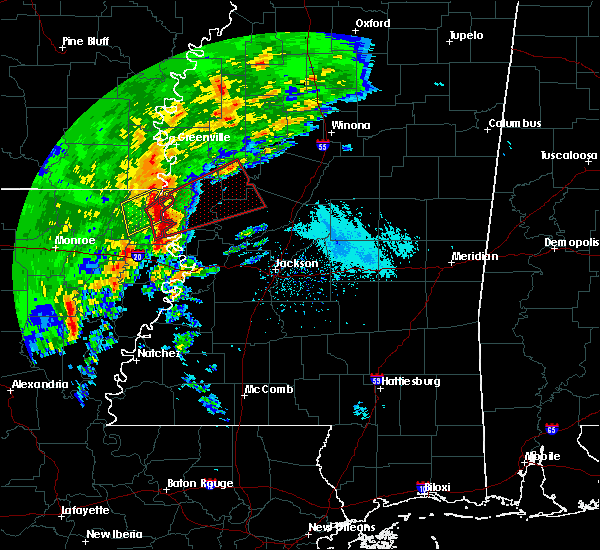 At 554 pm cdt, a severe thunderstorm capable of producing a tornado was located over transylvania, moving northeast at 40 mph (radar indicated rotation). Hazards include tornado and golf ball size hail. Flying debris will be dangerous to those caught without shelter. mobile homes will be damaged or destroyed. damage to roofs, windows, and vehicles will occur. tree damage is likely. Locations impacted include, lake providence, transylvania, shelburn and alsatia. At 554 pm cdt, a severe thunderstorm capable of producing a tornado was located over transylvania, moving northeast at 40 mph (radar indicated rotation). Hazards include tornado and golf ball size hail. Flying debris will be dangerous to those caught without shelter. mobile homes will be damaged or destroyed. damage to roofs, windows, and vehicles will occur. tree damage is likely. Locations impacted include, lake providence, transylvania, shelburn and alsatia.
|
| 3/28/2018 5:52 PM CDT | Quarter sized hail reported 4 miles N of Lake Providence, LA |
| 3/28/2018 5:50 PM CDT | Golf Ball sized hail reported 9.5 miles N of Lake Providence, LA, golf ball sized hail in transylvania reported via social media. |
| 3/28/2018 5:50 PM CDT | Golf Ball sized hail reported 1.3 miles NNW of Lake Providence, LA, golf ball size hail broke some windows of homes. |
| 3/28/2018 5:50 PM CDT | Trees and powerlines blown down with some windows blown ou in east carroll county LA, 1.3 miles NNW of Lake Providence, LA |
| 3/28/2018 5:48 PM CDT |
 At 547 pm cdt, a severe thunderstorm capable of producing a tornado was located over alsatia, or near transylvania, moving east at 50 mph (radar indicated rotation). Hazards include tornado and golf ball size hail. Flying debris will be dangerous to those caught without shelter. mobile homes will be damaged or destroyed. damage to roofs, windows, and vehicles will occur. tree damage is likely. This tornadic thunderstorm will remain over mainly rural areas of east carroll parish. At 547 pm cdt, a severe thunderstorm capable of producing a tornado was located over alsatia, or near transylvania, moving east at 50 mph (radar indicated rotation). Hazards include tornado and golf ball size hail. Flying debris will be dangerous to those caught without shelter. mobile homes will be damaged or destroyed. damage to roofs, windows, and vehicles will occur. tree damage is likely. This tornadic thunderstorm will remain over mainly rural areas of east carroll parish.
|
| 3/28/2018 5:39 PM CDT |
 At 539 pm cdt, a severe thunderstorm was located near oak grove, or 10 miles west of lake providence, moving northeast at 50 mph (radar indicated). Hazards include 60 mph wind gusts. Expect damage to roofs, siding, and trees. this severe storm will be near, lake providence and shelburn around 550 pm cdt. millikin and gassoway around 555 pm cdt. other locations impacted by this severe thunderstorm include pioneer and forest. A tornado watch remains in effect until 1100 pm cdt for southeastern arkansas, northeastern louisiana, and west central mississippi. At 539 pm cdt, a severe thunderstorm was located near oak grove, or 10 miles west of lake providence, moving northeast at 50 mph (radar indicated). Hazards include 60 mph wind gusts. Expect damage to roofs, siding, and trees. this severe storm will be near, lake providence and shelburn around 550 pm cdt. millikin and gassoway around 555 pm cdt. other locations impacted by this severe thunderstorm include pioneer and forest. A tornado watch remains in effect until 1100 pm cdt for southeastern arkansas, northeastern louisiana, and west central mississippi.
|
| 3/28/2018 5:22 PM CDT |
 The national weather service in jackson has issued a * tornado warning for. east carroll parish in northeastern louisiana. northwestern madison parish in northeastern louisiana. southern west carroll parish in northeastern louisiana. Until 615 pm cdt. The national weather service in jackson has issued a * tornado warning for. east carroll parish in northeastern louisiana. northwestern madison parish in northeastern louisiana. southern west carroll parish in northeastern louisiana. Until 615 pm cdt.
|
| 3/28/2018 5:19 PM CDT |
 At 519 pm cdt, a severe thunderstorm was located 8 miles south of goodwill, or 16 miles northeast of rayville, moving northeast at 50 mph (radar indicated). Hazards include 60 mph wind gusts. Expect damage to roofs, siding, and trees. this severe thunderstorm will be near, goodwill around 525 pm cdt. darnell around 530 pm cdt. oak grove around 540 pm cdt. lake providence and shelburn around 550 pm cdt. millikin around 555 pm cdt. other locations impacted by this severe thunderstorm include pioneer, forest and epps. A tornado watch remains in effect until 1100 pm cdt for southeastern arkansas, northeastern louisiana, and west central mississippi. At 519 pm cdt, a severe thunderstorm was located 8 miles south of goodwill, or 16 miles northeast of rayville, moving northeast at 50 mph (radar indicated). Hazards include 60 mph wind gusts. Expect damage to roofs, siding, and trees. this severe thunderstorm will be near, goodwill around 525 pm cdt. darnell around 530 pm cdt. oak grove around 540 pm cdt. lake providence and shelburn around 550 pm cdt. millikin around 555 pm cdt. other locations impacted by this severe thunderstorm include pioneer, forest and epps. A tornado watch remains in effect until 1100 pm cdt for southeastern arkansas, northeastern louisiana, and west central mississippi.
|
| 3/11/2018 2:47 AM CDT |
 At 147 am cst, a severe thunderstorm was located 7 miles north of oak grove, or 12 miles southwest of eudora, moving southeast at 35 mph (radar indicated). Hazards include 60 mph wind gusts. Expect damage to roofs, siding, and trees. this severe storm will be near, millikin around 300 am cdt. shelburn around 305 am cdt. lake providence around 315 am cdt. Other locations impacted by this severe thunderstorm include mayersville and kilbourne. At 147 am cst, a severe thunderstorm was located 7 miles north of oak grove, or 12 miles southwest of eudora, moving southeast at 35 mph (radar indicated). Hazards include 60 mph wind gusts. Expect damage to roofs, siding, and trees. this severe storm will be near, millikin around 300 am cdt. shelburn around 305 am cdt. lake providence around 315 am cdt. Other locations impacted by this severe thunderstorm include mayersville and kilbourne.
|
| 3/11/2018 2:37 AM CDT |
 At 137 am cst, a severe thunderstorm was located 7 miles east of wilmot, moving southeast at 35 mph (radar indicated). Hazards include 60 mph wind gusts and quarter size hail. Hail damage to vehicles is expected. expect wind damage to roofs, siding, and trees. this severe storm will be near, millikin and gassoway around 300 am cdt. shelburn around 305 am cdt. lake providence around 310 am cdt. Other locations impacted by this severe thunderstorm include mayersville and kilbourne. At 137 am cst, a severe thunderstorm was located 7 miles east of wilmot, moving southeast at 35 mph (radar indicated). Hazards include 60 mph wind gusts and quarter size hail. Hail damage to vehicles is expected. expect wind damage to roofs, siding, and trees. this severe storm will be near, millikin and gassoway around 300 am cdt. shelburn around 305 am cdt. lake providence around 310 am cdt. Other locations impacted by this severe thunderstorm include mayersville and kilbourne.
|
| 3/11/2018 2:27 AM CDT |
 At 127 am cst, a severe thunderstorm was located over wilmot, moving southeast at 35 mph (radar indicated). Hazards include golf ball size hail and 60 mph wind gusts. People and animals outdoors will be injured. expect hail damage to roofs, siding, windows, and vehicles. expect wind damage to roofs, siding, and trees. this severe thunderstorm will be near, millikin and gassoway around 300 am cdt. shelburn around 305 am cdt. lake providence around 315 am cdt. Other locations impacted by this severe thunderstorm include mayersville and kilbourne. At 127 am cst, a severe thunderstorm was located over wilmot, moving southeast at 35 mph (radar indicated). Hazards include golf ball size hail and 60 mph wind gusts. People and animals outdoors will be injured. expect hail damage to roofs, siding, windows, and vehicles. expect wind damage to roofs, siding, and trees. this severe thunderstorm will be near, millikin and gassoway around 300 am cdt. shelburn around 305 am cdt. lake providence around 315 am cdt. Other locations impacted by this severe thunderstorm include mayersville and kilbourne.
|
| 11/3/2017 10:27 PM CDT |
 At 1027 pm cdt, a severe thunderstorm was located over lake providence, moving east at 20 mph (radar indicated). Hazards include 60 mph wind gusts and half dollar size hail. Hail damage to vehicles is expected. expect wind damage to roofs, siding, and trees. this severe thunderstorm will be near, fitler around 1100 pm cdt. Other locations impacted by this severe thunderstorm include mayersville. At 1027 pm cdt, a severe thunderstorm was located over lake providence, moving east at 20 mph (radar indicated). Hazards include 60 mph wind gusts and half dollar size hail. Hail damage to vehicles is expected. expect wind damage to roofs, siding, and trees. this severe thunderstorm will be near, fitler around 1100 pm cdt. Other locations impacted by this severe thunderstorm include mayersville.
|
| 11/3/2017 5:57 PM CDT |
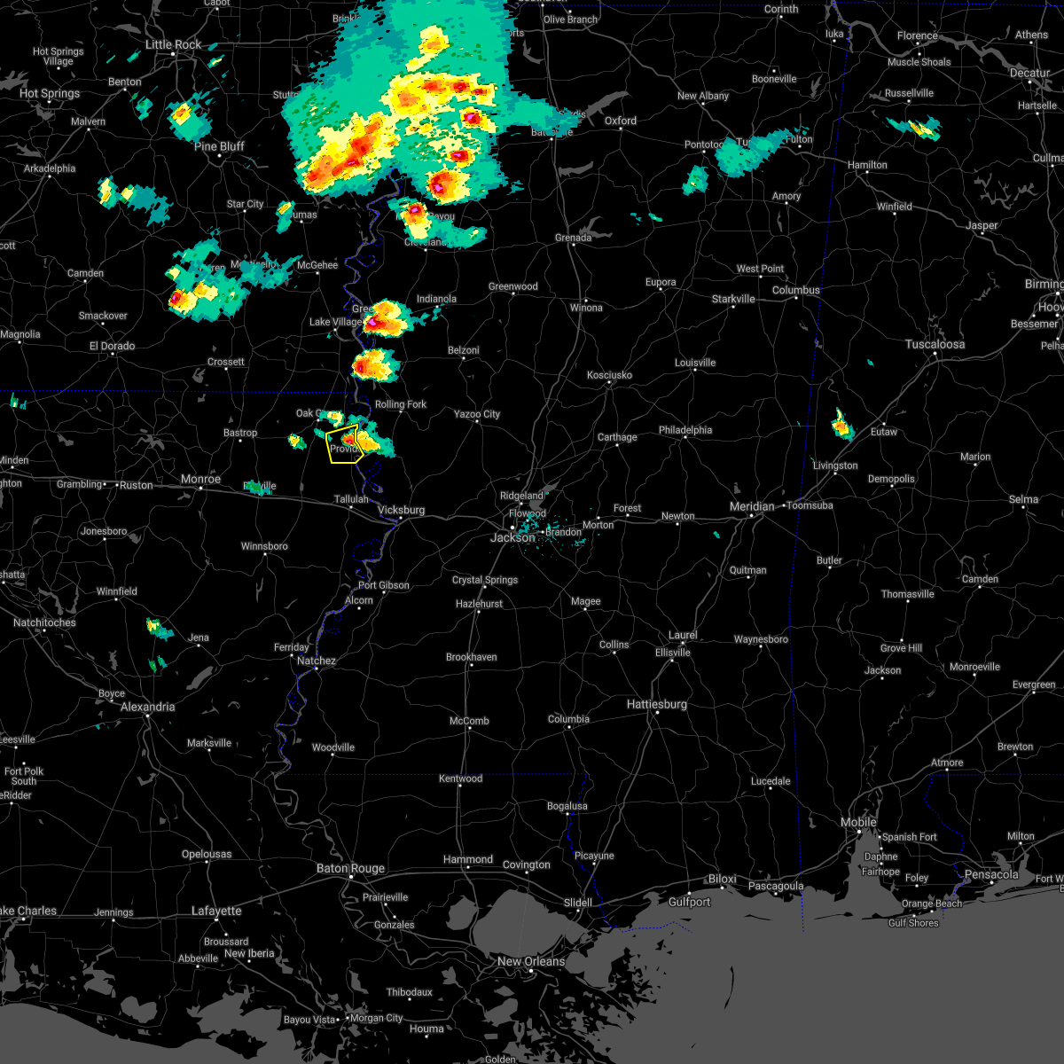 The severe thunderstorm warning for central east carroll parish will expire at 600 pm cdt. the storm which prompted the warning has weakened below severe limits, and no longer poses an immediate threat to life or property. therefore the warning will be allowed to expire. However small hail and gusty winds are still possible with this thunderstorm. The severe thunderstorm warning for central east carroll parish will expire at 600 pm cdt. the storm which prompted the warning has weakened below severe limits, and no longer poses an immediate threat to life or property. therefore the warning will be allowed to expire. However small hail and gusty winds are still possible with this thunderstorm.
|
| 11/3/2017 5:31 PM CDT |
 At 531 pm cdt, a severe thunderstorm was located near lake providence, moving east at 15 mph (radar indicated). Hazards include 60 mph wind gusts and quarter size hail. Hail damage to vehicles is expected. expect wind damage to roofs, siding, and trees. this severe thunderstorm will be near, transylvania around 545 pm cdt. Lake providence around 550 pm cdt. At 531 pm cdt, a severe thunderstorm was located near lake providence, moving east at 15 mph (radar indicated). Hazards include 60 mph wind gusts and quarter size hail. Hail damage to vehicles is expected. expect wind damage to roofs, siding, and trees. this severe thunderstorm will be near, transylvania around 545 pm cdt. Lake providence around 550 pm cdt.
|
| 6/22/2017 3:06 PM CDT |
 At 305 pm cdt, severe thunderstorms were located along a line extending from 6 miles southwest of eudora to near lake providence, moving north at 30 mph (radar indicated). Hazards include 60 mph wind gusts. Expect damage to roofs, siding, and trees. severe thunderstorms will be near, eudora around 315 pm cdt. chicot junction around 325 pm cdt. millikin and gassoway around 335 pm cdt. lake village around 340 pm cdt. glen allan around 345 pm cdt. mcmillan corner around 350 pm cdt. avon and wayside around 415 pm cdt. other locations impacted by these severe thunderstorms include mayersville, kilbourne and arcola. A tornado watch remains in effect until 1000 pm cdt for southeastern arkansas, northeastern louisiana, and northwestern and west central mississippi. At 305 pm cdt, severe thunderstorms were located along a line extending from 6 miles southwest of eudora to near lake providence, moving north at 30 mph (radar indicated). Hazards include 60 mph wind gusts. Expect damage to roofs, siding, and trees. severe thunderstorms will be near, eudora around 315 pm cdt. chicot junction around 325 pm cdt. millikin and gassoway around 335 pm cdt. lake village around 340 pm cdt. glen allan around 345 pm cdt. mcmillan corner around 350 pm cdt. avon and wayside around 415 pm cdt. other locations impacted by these severe thunderstorms include mayersville, kilbourne and arcola. A tornado watch remains in effect until 1000 pm cdt for southeastern arkansas, northeastern louisiana, and northwestern and west central mississippi.
|
| 5/21/2017 2:09 PM CDT | Report of a tree down on sand rd. some powerlines reported down in the are in east carroll county LA, 13.6 miles N of Lake Providence, LA |
| 5/21/2017 2:09 PM CDT |
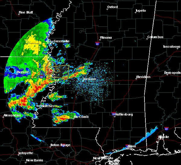 At 209 pm cdt, a severe thunderstorm was located near transylvania, moving northeast at 20 mph (radar indicated). Hazards include 60 mph wind gusts and quarter size hail. Hail damage to vehicles is expected. Expect wind damage to roofs, siding, and trees. At 209 pm cdt, a severe thunderstorm was located near transylvania, moving northeast at 20 mph (radar indicated). Hazards include 60 mph wind gusts and quarter size hail. Hail damage to vehicles is expected. Expect wind damage to roofs, siding, and trees.
|
| 5/21/2017 1:48 PM CDT |
 At 148 pm cdt, a severe thunderstorm was located near darnell, or 10 miles west of transylvania, moving northeast at 20 mph (radar indicated). Hazards include 60 mph wind gusts and quarter size hail. Hail damage to vehicles is expected. expect wind damage to roofs, siding, and trees. this severe thunderstorm will be near, transylvania around 220 pm cdt. lake providence around 230 pm cdt. Other locations impacted by this severe thunderstorm include mayersville and pioneer. At 148 pm cdt, a severe thunderstorm was located near darnell, or 10 miles west of transylvania, moving northeast at 20 mph (radar indicated). Hazards include 60 mph wind gusts and quarter size hail. Hail damage to vehicles is expected. expect wind damage to roofs, siding, and trees. this severe thunderstorm will be near, transylvania around 220 pm cdt. lake providence around 230 pm cdt. Other locations impacted by this severe thunderstorm include mayersville and pioneer.
|
| 4/26/2017 7:51 PM CDT |
 At 751 pm cdt, severe thunderstorms were located along a line extending from near grace to 9 miles southeast of bakers, moving east at 50 mph (radar indicated). Hazards include 60 mph wind gusts and quarter size hail. Hail damage to vehicles is expected. expect wind damage to roofs, siding, and trees. these severe storms will be near, grace around 755 pm cdt. tallulah around 800 pm cdt. other locations impacted by these severe thunderstorms include mayersville and richmond. A tornado watch remains in effect until 1100 pm cdt for northeastern louisiana, and northwestern and west central mississippi. At 751 pm cdt, severe thunderstorms were located along a line extending from near grace to 9 miles southeast of bakers, moving east at 50 mph (radar indicated). Hazards include 60 mph wind gusts and quarter size hail. Hail damage to vehicles is expected. expect wind damage to roofs, siding, and trees. these severe storms will be near, grace around 755 pm cdt. tallulah around 800 pm cdt. other locations impacted by these severe thunderstorms include mayersville and richmond. A tornado watch remains in effect until 1100 pm cdt for northeastern louisiana, and northwestern and west central mississippi.
|
| 4/26/2017 7:06 PM CDT |
 At 705 pm cdt, severe thunderstorms were located along a line extending from near jones to buckner, moving northeast at 50 mph (radar indicated). Hazards include 60 mph wind gusts and quarter size hail. Hail damage to vehicles is expected. expect wind damage to roofs, siding, and trees. severe thunderstorms will be near, rayville around 715 pm cdt. holly ridge around 720 pm cdt. warden around 730 pm cdt. darnell and monticello around 735 pm cdt. transylvania around 745 pm cdt. lake providence and shelburn around 750 pm cdt. grace around 800 pm cdt. other locations impacted by these severe thunderstorms include baskin, mayersville, pioneer, kilbourne, forest, richmond and epps. A tornado watch remains in effect until 1100 pm cdt for southeastern arkansas, northeastern louisiana, and northwestern and west central mississippi. At 705 pm cdt, severe thunderstorms were located along a line extending from near jones to buckner, moving northeast at 50 mph (radar indicated). Hazards include 60 mph wind gusts and quarter size hail. Hail damage to vehicles is expected. expect wind damage to roofs, siding, and trees. severe thunderstorms will be near, rayville around 715 pm cdt. holly ridge around 720 pm cdt. warden around 730 pm cdt. darnell and monticello around 735 pm cdt. transylvania around 745 pm cdt. lake providence and shelburn around 750 pm cdt. grace around 800 pm cdt. other locations impacted by these severe thunderstorms include baskin, mayersville, pioneer, kilbourne, forest, richmond and epps. A tornado watch remains in effect until 1100 pm cdt for southeastern arkansas, northeastern louisiana, and northwestern and west central mississippi.
|
| 4/2/2017 5:14 PM CDT |
 At 514 pm cdt, a severe thunderstorm capable of producing a tornado was located over lake providence, moving northeast at 40 mph (radar indicated rotation). Hazards include tornado and quarter size hail. Flying debris will be dangerous to those caught without shelter. mobile homes will be damaged or destroyed. damage to roofs, windows, and vehicles will occur. tree damage is likely. this dangerous storm will be near, millikin around 525 pm cdt. glen allan around 540 pm cdt. Other locations impacted by this tornadic thunderstorm include mayersville. At 514 pm cdt, a severe thunderstorm capable of producing a tornado was located over lake providence, moving northeast at 40 mph (radar indicated rotation). Hazards include tornado and quarter size hail. Flying debris will be dangerous to those caught without shelter. mobile homes will be damaged or destroyed. damage to roofs, windows, and vehicles will occur. tree damage is likely. this dangerous storm will be near, millikin around 525 pm cdt. glen allan around 540 pm cdt. Other locations impacted by this tornadic thunderstorm include mayersville.
|
| 3/29/2017 9:24 PM CDT |
 At 923 pm cdt, severe thunderstorms were located along a line extending from near eudora to near shelburn to near alsatia, moving northeast at 50 mph (radar indicated). Hazards include 60 mph wind gusts and quarter size hail. Hail damage to vehicles is expected. expect wind damage to roofs, siding, and trees. severe thunderstorms will be near, eudora and chicot junction around 930 pm cdt. glen allan around 935 pm cdt. grace around 940 pm cdt. avon, anguilla, wayside and nitta yuma around 945 pm cdt. rolling fork and panther burn around 950 pm cdt. greenville, hollandale, delta city and estill around 955 pm cdt. leland, metcalfe, murphy and darlove around 1000 pm cdt. tribbett around 1005 pm cdt. other locations impacted by these severe thunderstorms include mayersville, kilbourne, arcola and cary. A tornado watch remains in effect until 300 am cdt for southeastern arkansas, northeastern louisiana, and central, northwestern and west central mississippi. At 923 pm cdt, severe thunderstorms were located along a line extending from near eudora to near shelburn to near alsatia, moving northeast at 50 mph (radar indicated). Hazards include 60 mph wind gusts and quarter size hail. Hail damage to vehicles is expected. expect wind damage to roofs, siding, and trees. severe thunderstorms will be near, eudora and chicot junction around 930 pm cdt. glen allan around 935 pm cdt. grace around 940 pm cdt. avon, anguilla, wayside and nitta yuma around 945 pm cdt. rolling fork and panther burn around 950 pm cdt. greenville, hollandale, delta city and estill around 955 pm cdt. leland, metcalfe, murphy and darlove around 1000 pm cdt. tribbett around 1005 pm cdt. other locations impacted by these severe thunderstorms include mayersville, kilbourne, arcola and cary. A tornado watch remains in effect until 300 am cdt for southeastern arkansas, northeastern louisiana, and central, northwestern and west central mississippi.
|
| 3/29/2017 9:22 PM CDT | Power line down at intersection of 2nd and millikin street. in east carroll county LA, 1.3 miles NNW of Lake Providence, LA |
| 3/29/2017 9:07 PM CDT |
 At 907 pm cdt, a severe thunderstorm was located near darnell, or 13 miles west of lake providence, moving northeast at 45 mph (radar indicated). Hazards include 60 mph wind gusts and quarter size hail. Hail damage to vehicles is expected. expect wind damage to roofs, siding, and trees. this severe storm will be near, oak grove around 915 pm cdt. lake providence and shelburn around 925 pm cdt. millikin and gassoway around 930 pm cdt. other locations impacted by this severe thunderstorm include kilbourne, pioneer and forest. A tornado watch remains in effect until 300 am cdt for southeastern arkansas, northeastern louisiana, and west central mississippi. At 907 pm cdt, a severe thunderstorm was located near darnell, or 13 miles west of lake providence, moving northeast at 45 mph (radar indicated). Hazards include 60 mph wind gusts and quarter size hail. Hail damage to vehicles is expected. expect wind damage to roofs, siding, and trees. this severe storm will be near, oak grove around 915 pm cdt. lake providence and shelburn around 925 pm cdt. millikin and gassoway around 930 pm cdt. other locations impacted by this severe thunderstorm include kilbourne, pioneer and forest. A tornado watch remains in effect until 300 am cdt for southeastern arkansas, northeastern louisiana, and west central mississippi.
|
| 3/29/2017 8:36 PM CDT |
 At 836 pm cdt, a severe thunderstorm was located over holly ridge, or near rayville, moving northeast at 40 mph (radar indicated). Hazards include 60 mph wind gusts and quarter size hail. Hail damage to vehicles is expected. expect wind damage to roofs, siding, and trees. this severe thunderstorm will be near, warden around 845 pm cdt. darnell around 900 pm cdt. goodwill around 905 pm cdt. oak grove around 920 pm cdt. millikin and gassoway around 930 pm cdt. other locations impacted by this severe thunderstorm include kilbourne, forest, pioneer and epps. A tornado watch remains in effect until 300 am cdt for southeastern arkansas, northeastern louisiana, and west central mississippi. At 836 pm cdt, a severe thunderstorm was located over holly ridge, or near rayville, moving northeast at 40 mph (radar indicated). Hazards include 60 mph wind gusts and quarter size hail. Hail damage to vehicles is expected. expect wind damage to roofs, siding, and trees. this severe thunderstorm will be near, warden around 845 pm cdt. darnell around 900 pm cdt. goodwill around 905 pm cdt. oak grove around 920 pm cdt. millikin and gassoway around 930 pm cdt. other locations impacted by this severe thunderstorm include kilbourne, forest, pioneer and epps. A tornado watch remains in effect until 300 am cdt for southeastern arkansas, northeastern louisiana, and west central mississippi.
|
| 3/27/2017 3:13 PM CDT | A tree was downed along la highway 877 near monticell in east carroll county LA, 14.4 miles NNE of Lake Providence, LA |
| 3/25/2017 1:28 AM CDT |
 At 126 am cdt, severe thunderstorms were located along a line extending from hamburg to near goodwill to near rayville, moving northeast at 55 mph (radar indicated). Hazards include 60 mph wind gusts and penny size hail. Expect damage to roofs, siding, and trees. severe thunderstorms will be near, snyder around 135 am cdt. montrose around 145 am cdt. darnell around 150 am cdt. dermott around 155 am cdt. eudora and oak grove around 200 am cdt. chicot junction around 205 am cdt. lake providence and shelburn around 210 am cdt. millikin and gassoway around 215 am cdt. Other locations impacted by these severe thunderstorms include kilbourne, forest, halley and pioneer. At 126 am cdt, severe thunderstorms were located along a line extending from hamburg to near goodwill to near rayville, moving northeast at 55 mph (radar indicated). Hazards include 60 mph wind gusts and penny size hail. Expect damage to roofs, siding, and trees. severe thunderstorms will be near, snyder around 135 am cdt. montrose around 145 am cdt. darnell around 150 am cdt. dermott around 155 am cdt. eudora and oak grove around 200 am cdt. chicot junction around 205 am cdt. lake providence and shelburn around 210 am cdt. millikin and gassoway around 215 am cdt. Other locations impacted by these severe thunderstorms include kilbourne, forest, halley and pioneer.
|
| 1/21/2017 10:13 PM CST |
 At 1012 pm cst, severe thunderstorms were located along a line extending from near shelburn to near goodwill, moving east at 45 mph (radar indicated). Hazards include 60 mph wind gusts. Expect damage to roofs, siding, and trees. these severe storms will be near, lake providence, shelburn, millikin and gassoway around 1020 pm cst. other locations impacted by these severe thunderstorms include forest and pioneer. A tornado watch remains in effect until 300 am cst for northeastern louisiana, and west central mississippi. At 1012 pm cst, severe thunderstorms were located along a line extending from near shelburn to near goodwill, moving east at 45 mph (radar indicated). Hazards include 60 mph wind gusts. Expect damage to roofs, siding, and trees. these severe storms will be near, lake providence, shelburn, millikin and gassoway around 1020 pm cst. other locations impacted by these severe thunderstorms include forest and pioneer. A tornado watch remains in effect until 300 am cst for northeastern louisiana, and west central mississippi.
|
| 1/21/2017 9:43 PM CST |
 At 943 pm cst, severe thunderstorms were located along a line extending from near jones to bastrop, moving east at 35 mph (radar indicated). Hazards include 60 mph wind gusts and quarter size hail. Hail damage to vehicles is expected. expect wind damage to roofs, siding, and trees. severe thunderstorms will be near, jones around 950 pm cst. goodwill around 1020 pm cst. gassoway and millikin around 1030 pm cst. oak grove around 1040 pm cst. shelburn around 1045 pm cst. other locations impacted by these severe thunderstorms include forest, collinston, bonita, pioneer, oak ridge, mer rouge and kilbourne. A tornado watch remains in effect until 300 am cst for northeastern louisiana, and west central mississippi. At 943 pm cst, severe thunderstorms were located along a line extending from near jones to bastrop, moving east at 35 mph (radar indicated). Hazards include 60 mph wind gusts and quarter size hail. Hail damage to vehicles is expected. expect wind damage to roofs, siding, and trees. severe thunderstorms will be near, jones around 950 pm cst. goodwill around 1020 pm cst. gassoway and millikin around 1030 pm cst. oak grove around 1040 pm cst. shelburn around 1045 pm cst. other locations impacted by these severe thunderstorms include forest, collinston, bonita, pioneer, oak ridge, mer rouge and kilbourne. A tornado watch remains in effect until 300 am cst for northeastern louisiana, and west central mississippi.
|
| 1/2/2017 1:23 PM CST |
 At 123 pm cst, a severe thunderstorm was located near alsatia, or near transylvania, moving northeast at 55 mph (radar indicated). Hazards include 60 mph wind gusts. Expect damage to roofs, siding, and trees. this severe thunderstorm will be near, fitler around 130 pm cst. onward around 135 pm cst. rolling fork around 150 pm cst. anguilla around 155 pm cst. other locations impacted by this severe thunderstorm include mayersville and cary. A tornado watch remains in effect until 800 pm cst for northeastern louisiana, and west central mississippi. At 123 pm cst, a severe thunderstorm was located near alsatia, or near transylvania, moving northeast at 55 mph (radar indicated). Hazards include 60 mph wind gusts. Expect damage to roofs, siding, and trees. this severe thunderstorm will be near, fitler around 130 pm cst. onward around 135 pm cst. rolling fork around 150 pm cst. anguilla around 155 pm cst. other locations impacted by this severe thunderstorm include mayersville and cary. A tornado watch remains in effect until 800 pm cst for northeastern louisiana, and west central mississippi.
|
| 7/14/2016 9:10 PM CDT |
 At 909 pm cdt, severe thunderstorms were located along a line extending from near moorhead to sondheimer, moving east at 30 mph (radar indicated). Hazards include 70 mph wind gusts. Expect considerable tree damage. damage is likely to mobile homes, roofs, and outbuildings. These severe thunderstorms will remain over mainly rural areas of east carroll parish, sharkey and issaquena counties, including the following locations: mayersville and cary. At 909 pm cdt, severe thunderstorms were located along a line extending from near moorhead to sondheimer, moving east at 30 mph (radar indicated). Hazards include 70 mph wind gusts. Expect considerable tree damage. damage is likely to mobile homes, roofs, and outbuildings. These severe thunderstorms will remain over mainly rural areas of east carroll parish, sharkey and issaquena counties, including the following locations: mayersville and cary.
|
| 7/14/2016 9:00 PM CDT | Trees and power lines down across the paris in east carroll county LA, 12 miles S of Lake Providence, LA |
| 7/14/2016 8:43 PM CDT |
 At 842 pm cdt, severe thunderstorms were located along a line extending from shelburn to 6 miles north of start, moving southeast at 25 mph (law enforcement. at 840 pm...morehouse parish sheriffs office reported numerous trees downed across the parish). Hazards include 70 mph wind gusts and quarter size hail. Hail damage to vehicles is expected. expect considerable tree damage. wind damage is also likely to mobile homes, roofs, and outbuildings. Locations impacted include, lake providence, transylvania, oak grove, shelburn, alsatia, darnell, warden, monticello, sondheimer, millikin, gassoway, goodwill, epps, kilbourne, forest, collinston, pioneer and oak ridge. At 842 pm cdt, severe thunderstorms were located along a line extending from shelburn to 6 miles north of start, moving southeast at 25 mph (law enforcement. at 840 pm...morehouse parish sheriffs office reported numerous trees downed across the parish). Hazards include 70 mph wind gusts and quarter size hail. Hail damage to vehicles is expected. expect considerable tree damage. wind damage is also likely to mobile homes, roofs, and outbuildings. Locations impacted include, lake providence, transylvania, oak grove, shelburn, alsatia, darnell, warden, monticello, sondheimer, millikin, gassoway, goodwill, epps, kilbourne, forest, collinston, pioneer and oak ridge.
|
| 7/14/2016 8:38 PM CDT |
 At 838 pm cdt, severe thunderstorms were located along a line extending from holly ridge to monticello, moving east at 30 mph (radar indicated). Hazards include 70 mph wind gusts and quarter size hail. Hail damage to vehicles is expected. expect considerable tree damage. wind damage is also likely to mobile homes, roofs, and outbuildings. severe thunderstorms will be near, alsatia around 905 pm cdt. Other locations impacted by these severe thunderstorms include epps, mayersville, pioneer and cary. At 838 pm cdt, severe thunderstorms were located along a line extending from holly ridge to monticello, moving east at 30 mph (radar indicated). Hazards include 70 mph wind gusts and quarter size hail. Hail damage to vehicles is expected. expect considerable tree damage. wind damage is also likely to mobile homes, roofs, and outbuildings. severe thunderstorms will be near, alsatia around 905 pm cdt. Other locations impacted by these severe thunderstorms include epps, mayersville, pioneer and cary.
|
| 7/14/2016 8:30 PM CDT | Trees and power lines down across the paris in east carroll county LA, 12 miles S of Lake Providence, LA |
| 7/14/2016 8:19 PM CDT |
 At 818 pm cdt, severe thunderstorms were located along a line extending from near lake village to near jones to near swartz, moving east at 40 mph (radar indicated). Hazards include 70 mph wind gusts and quarter size hail. Hail damage to vehicles is expected. expect considerable tree damage. wind damage is also likely to mobile homes, roofs, and outbuildings. severe thunderstorms will be near, lake village around 825 pm cdt. wilmot around 830 pm cdt. oak grove around 845 pm cdt. warden around 855 pm cdt. gassoway, millikin, darnell, monticello and shelburn around 900 pm cdt. Other locations impacted by these severe thunderstorms include forest, collinston, epps, kilbourne, bonita, pioneer, oak ridge and mer rouge. At 818 pm cdt, severe thunderstorms were located along a line extending from near lake village to near jones to near swartz, moving east at 40 mph (radar indicated). Hazards include 70 mph wind gusts and quarter size hail. Hail damage to vehicles is expected. expect considerable tree damage. wind damage is also likely to mobile homes, roofs, and outbuildings. severe thunderstorms will be near, lake village around 825 pm cdt. wilmot around 830 pm cdt. oak grove around 845 pm cdt. warden around 855 pm cdt. gassoway, millikin, darnell, monticello and shelburn around 900 pm cdt. Other locations impacted by these severe thunderstorms include forest, collinston, epps, kilbourne, bonita, pioneer, oak ridge and mer rouge.
|
| 4/29/2016 4:20 PM CDT |
 At 420 pm cdt, a severe thunderstorm was located near oak grove, or 15 miles southeast of wilmot, moving east at 30 mph (radar indicated). Hazards include golf ball size hail and 60 mph wind gusts. People and animals outdoors will be injured. expect hail damage to roofs, siding, windows, and vehicles. expect wind damage to roofs, siding, and trees. this severe thunderstorm will be near, oak grove around 430 pm cdt. shelburn around 450 pm cdt. lake providence, millikin and gassoway around 455 pm cdt. Other locations impacted by this severe thunderstorm include mayersville, forest and kilbourne. At 420 pm cdt, a severe thunderstorm was located near oak grove, or 15 miles southeast of wilmot, moving east at 30 mph (radar indicated). Hazards include golf ball size hail and 60 mph wind gusts. People and animals outdoors will be injured. expect hail damage to roofs, siding, windows, and vehicles. expect wind damage to roofs, siding, and trees. this severe thunderstorm will be near, oak grove around 430 pm cdt. shelburn around 450 pm cdt. lake providence, millikin and gassoway around 455 pm cdt. Other locations impacted by this severe thunderstorm include mayersville, forest and kilbourne.
|
| 3/30/2016 11:24 PM CDT |
 At 1124 pm cdt, a severe thunderstorm was located near lake providence, moving northeast at 45 mph (radar indicated). Hazards include 60 mph wind gusts and penny size hail. Expect damage to roofs. siding and trees. this severe storm will be near, fitler around 1130 pm cdt. other locations impacted by this severe thunderstorm include mayersville. A tornado watch remains in effect until 500 am cdt for northeastern louisiana and northwestern mississippi. At 1124 pm cdt, a severe thunderstorm was located near lake providence, moving northeast at 45 mph (radar indicated). Hazards include 60 mph wind gusts and penny size hail. Expect damage to roofs. siding and trees. this severe storm will be near, fitler around 1130 pm cdt. other locations impacted by this severe thunderstorm include mayersville. A tornado watch remains in effect until 500 am cdt for northeastern louisiana and northwestern mississippi.
|
| 3/30/2016 11:02 PM CDT |
 At 1102 pm cdt, a severe thunderstorm was located 7 miles northeast of darnell, or 9 miles west of transylvania, moving northeast at 55 mph (radar indicated). Hazards include 60 mph wind gusts and nickel size hail. Expect damage to roofs. siding and trees. this severe thunderstorm will be near, transylvania around 1110 pm cdt. lake providence and shelburn around 1115 pm cdt. grace around 1135 pm cdt. other locations impacted by this severe thunderstorm include mayersville. A tornado watch remains in effect until 500 am cdt for northeastern louisiana and northwestern mississippi. At 1102 pm cdt, a severe thunderstorm was located 7 miles northeast of darnell, or 9 miles west of transylvania, moving northeast at 55 mph (radar indicated). Hazards include 60 mph wind gusts and nickel size hail. Expect damage to roofs. siding and trees. this severe thunderstorm will be near, transylvania around 1110 pm cdt. lake providence and shelburn around 1115 pm cdt. grace around 1135 pm cdt. other locations impacted by this severe thunderstorm include mayersville. A tornado watch remains in effect until 500 am cdt for northeastern louisiana and northwestern mississippi.
|
| 3/18/2016 2:31 PM CDT |
 At 229 pm cdt, a severe thunderstorm was located over transylvania, moving east at 35 mph (radar indicated). Hazards include golf ball size hail and 60 mph wind gusts. People and animals outdoors will be injured. expect hail damage to roofs, siding, windows and vehicles. expect wind damage to roofs, siding and trees. This severe storm will be near, fitler around 240 pm cdt. At 229 pm cdt, a severe thunderstorm was located over transylvania, moving east at 35 mph (radar indicated). Hazards include golf ball size hail and 60 mph wind gusts. People and animals outdoors will be injured. expect hail damage to roofs, siding, windows and vehicles. expect wind damage to roofs, siding and trees. This severe storm will be near, fitler around 240 pm cdt.
|
| 3/18/2016 2:31 PM CDT |
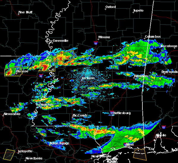 At 229 pm cdt, a severe thunderstorm was located over transylvania, moving east at 35 mph (radar indicated). Hazards include golf ball size hail and 60 mph wind gusts. People and animals outdoors will be injured. expect hail damage to roofs, siding, windows and vehicles. expect wind damage to roofs, siding and trees. This severe storm will be near, fitler around 240 pm cdt. At 229 pm cdt, a severe thunderstorm was located over transylvania, moving east at 35 mph (radar indicated). Hazards include golf ball size hail and 60 mph wind gusts. People and animals outdoors will be injured. expect hail damage to roofs, siding, windows and vehicles. expect wind damage to roofs, siding and trees. This severe storm will be near, fitler around 240 pm cdt.
|
| 3/18/2016 2:12 PM CDT |
 At 211 pm cdt, a severe thunderstorm was located near darnell, or 10 miles west of transylvania, moving east at 35 mph (radar indicated). Hazards include golf ball size hail and 60 mph wind gusts. People and animals outdoors will be injured. expect hail damage to roofs, siding, windows and vehicles. expect wind damage to roofs, siding and trees. this severe thunderstorm will be near, lake providence, transylvania and alsatia around 230 pm cdt. Fitler around 245 pm cdt. At 211 pm cdt, a severe thunderstorm was located near darnell, or 10 miles west of transylvania, moving east at 35 mph (radar indicated). Hazards include golf ball size hail and 60 mph wind gusts. People and animals outdoors will be injured. expect hail damage to roofs, siding, windows and vehicles. expect wind damage to roofs, siding and trees. this severe thunderstorm will be near, lake providence, transylvania and alsatia around 230 pm cdt. Fitler around 245 pm cdt.
|
| 3/18/2016 2:12 PM CDT |
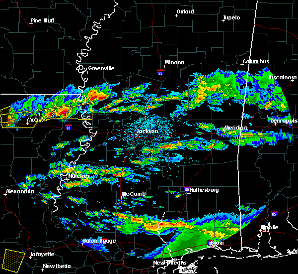 At 211 pm cdt, a severe thunderstorm was located near darnell, or 10 miles west of transylvania, moving east at 35 mph (radar indicated). Hazards include golf ball size hail and 60 mph wind gusts. People and animals outdoors will be injured. expect hail damage to roofs, siding, windows and vehicles. expect wind damage to roofs, siding and trees. this severe thunderstorm will be near, lake providence, transylvania and alsatia around 230 pm cdt. Fitler around 245 pm cdt. At 211 pm cdt, a severe thunderstorm was located near darnell, or 10 miles west of transylvania, moving east at 35 mph (radar indicated). Hazards include golf ball size hail and 60 mph wind gusts. People and animals outdoors will be injured. expect hail damage to roofs, siding, windows and vehicles. expect wind damage to roofs, siding and trees. this severe thunderstorm will be near, lake providence, transylvania and alsatia around 230 pm cdt. Fitler around 245 pm cdt.
|
| 3/13/2016 11:28 PM CDT |
 The national weather service in jackson has issued a * severe thunderstorm warning for. northeastern east carroll parish in northeastern louisiana. central sharkey county in west central mississippi. northwestern issaquena county in west central mississippi. Until 1215 am cdt. The national weather service in jackson has issued a * severe thunderstorm warning for. northeastern east carroll parish in northeastern louisiana. central sharkey county in west central mississippi. northwestern issaquena county in west central mississippi. Until 1215 am cdt.
|
| 3/13/2016 11:28 PM CDT |
 At 1128 pm cdt, a severe thunderstorm was located 7 miles northeast of lake providence, moving east at 35 mph (radar indicated). Hazards include golf ball size hail and 60 mph wind gusts. People and animals outdoors will be injured. expect hail damage to roofs, siding, windows and vehicles. expect wind damage to roofs, siding and trees. this severe thunderstorm will be near, rolling fork around 1150 pm cdt. anguilla around 1155 pm cdt. other locations impacted by this severe thunderstorm include cary and mayersville. A tornado watch remains in effect until 200 am cdt for northeastern louisiana and west central mississippi. At 1128 pm cdt, a severe thunderstorm was located 7 miles northeast of lake providence, moving east at 35 mph (radar indicated). Hazards include golf ball size hail and 60 mph wind gusts. People and animals outdoors will be injured. expect hail damage to roofs, siding, windows and vehicles. expect wind damage to roofs, siding and trees. this severe thunderstorm will be near, rolling fork around 1150 pm cdt. anguilla around 1155 pm cdt. other locations impacted by this severe thunderstorm include cary and mayersville. A tornado watch remains in effect until 200 am cdt for northeastern louisiana and west central mississippi.
|
| 3/13/2016 11:02 PM CDT |
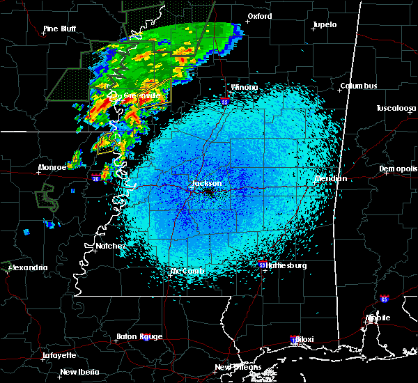 At 1101 pm cdt, a severe thunderstorm was located near shelburn, or 8 miles northwest of lake providence, moving northeast at 45 mph (radar indicated). Hazards include 60 mph wind gusts and quarter size hail. Hail damage to vehicles is expected. expect wind damage to roofs, siding and trees. this severe storm will be near, millikin around 1105 pm cdt. gassoway around 1110 pm cdt. A tornado watch remains in effect until 200 am cdt for northeastern louisiana and west central mississippi. At 1101 pm cdt, a severe thunderstorm was located near shelburn, or 8 miles northwest of lake providence, moving northeast at 45 mph (radar indicated). Hazards include 60 mph wind gusts and quarter size hail. Hail damage to vehicles is expected. expect wind damage to roofs, siding and trees. this severe storm will be near, millikin around 1105 pm cdt. gassoway around 1110 pm cdt. A tornado watch remains in effect until 200 am cdt for northeastern louisiana and west central mississippi.
|
| 3/13/2016 10:44 PM CDT |
 At 1044 pm cdt, a severe thunderstorm was located near oak grove, or 15 miles west of lake providence, moving northeast at 45 mph (radar indicated). Hazards include 60 mph wind gusts and quarter size hail. Hail damage to vehicles is expected. expect wind damage to roofs, siding and trees. this severe thunderstorm will be near, oak grove around 1050 pm cdt. millikin and shelburn around 1105 pm cdt. gassoway around 1110 pm cdt. other locations impacted by this severe thunderstorm include forest, kilbourne and pioneer. A tornado watch remains in effect until 200 am cdt for southeastern arkansas, northeastern louisiana and west central mississippi. At 1044 pm cdt, a severe thunderstorm was located near oak grove, or 15 miles west of lake providence, moving northeast at 45 mph (radar indicated). Hazards include 60 mph wind gusts and quarter size hail. Hail damage to vehicles is expected. expect wind damage to roofs, siding and trees. this severe thunderstorm will be near, oak grove around 1050 pm cdt. millikin and shelburn around 1105 pm cdt. gassoway around 1110 pm cdt. other locations impacted by this severe thunderstorm include forest, kilbourne and pioneer. A tornado watch remains in effect until 200 am cdt for southeastern arkansas, northeastern louisiana and west central mississippi.
|
| 3/3/2016 3:23 PM CST |
 The national weather service in jackson has issued a * severe thunderstorm warning for. southeastern east carroll parish in northeastern louisiana. northwestern warren county in west central mississippi. southwestern sharkey county in west central mississippi. Southern issaquena county in west central mississippi. The national weather service in jackson has issued a * severe thunderstorm warning for. southeastern east carroll parish in northeastern louisiana. northwestern warren county in west central mississippi. southwestern sharkey county in west central mississippi. Southern issaquena county in west central mississippi.
|
| 12/26/2015 12:46 AM CST |
 At 1246 am cst, a severe thunderstorm was located over shelburn, or 7 miles northwest of lake providence, moving northeast at 35 mph (radar indicated). Hazards include 60 mph wind gusts. Expect damage to roofs. siding and trees. this severe thunderstorm will be near, shelburn around 1250 am cst. millikin around 1255 am cst. gassoway around 100 am cst. Grace around 115 am cst. At 1246 am cst, a severe thunderstorm was located over shelburn, or 7 miles northwest of lake providence, moving northeast at 35 mph (radar indicated). Hazards include 60 mph wind gusts. Expect damage to roofs. siding and trees. this severe thunderstorm will be near, shelburn around 1250 am cst. millikin around 1255 am cst. gassoway around 100 am cst. Grace around 115 am cst.
|
| 12/26/2015 12:46 AM CST |
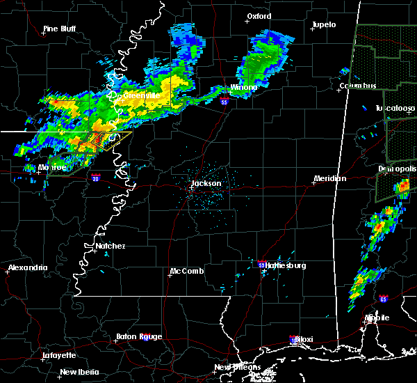 At 1246 am cst, a severe thunderstorm was located over shelburn, or 7 miles northwest of lake providence, moving northeast at 35 mph (radar indicated). Hazards include 60 mph wind gusts. Expect damage to roofs. siding and trees. this severe thunderstorm will be near, shelburn around 1250 am cst. millikin around 1255 am cst. gassoway around 100 am cst. Grace around 115 am cst. At 1246 am cst, a severe thunderstorm was located over shelburn, or 7 miles northwest of lake providence, moving northeast at 35 mph (radar indicated). Hazards include 60 mph wind gusts. Expect damage to roofs. siding and trees. this severe thunderstorm will be near, shelburn around 1250 am cst. millikin around 1255 am cst. gassoway around 100 am cst. Grace around 115 am cst.
|
| 12/13/2015 4:00 PM CST | Utility poles and wires were downed in east carroll county LA, 10.9 miles N of Lake Providence, LA |
| 12/13/2015 3:46 PM CST |
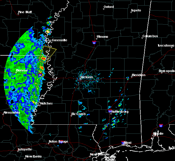 At 346 pm cst, a severe thunderstorm was located near shelburn, or 8 miles northwest of lake providence, moving northeast at 65 mph (radar indicated). Hazards include 60 mph wind gusts. Expect damage to roofs. siding and trees. this severe thunderstorm will be near, millikin around 350 pm cst. gassoway around 355 pm cst. eudora around 400 pm cst. chicot junction around 405 pm cst. avon around 410 pm cst. Other locations impacted by this severe thunderstorm include kilbourne. At 346 pm cst, a severe thunderstorm was located near shelburn, or 8 miles northwest of lake providence, moving northeast at 65 mph (radar indicated). Hazards include 60 mph wind gusts. Expect damage to roofs. siding and trees. this severe thunderstorm will be near, millikin around 350 pm cst. gassoway around 355 pm cst. eudora around 400 pm cst. chicot junction around 405 pm cst. avon around 410 pm cst. Other locations impacted by this severe thunderstorm include kilbourne.
|
| 8/11/2015 4:00 AM CDT |
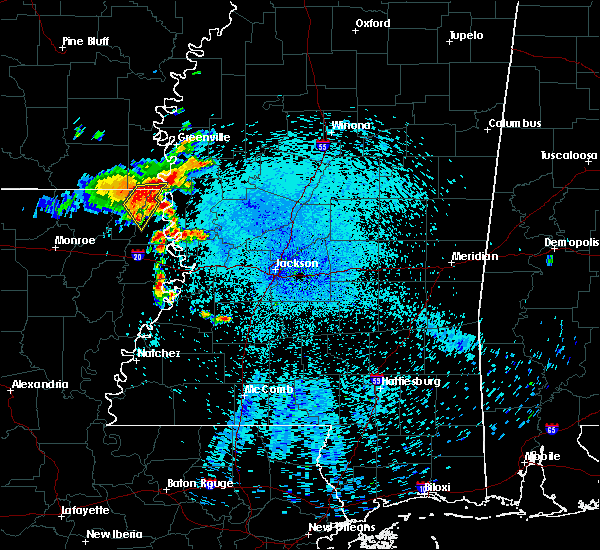 At 359 am cdt, a severe thunderstorm was located near oak grove, or 10 miles northwest of lake providence, moving southeast at 25 mph (radar indicated). Hazards include 60 mph wind gusts and nickel size hail. Expect damage to roofs. siding and trees. this severe storm will be near, gassoway around 405 am cdt. millikin around 410 am cdt. lake providence and shelburn around 415 am cdt. Other locations impacted by this severe thunderstorm include forest and kilbourne. At 359 am cdt, a severe thunderstorm was located near oak grove, or 10 miles northwest of lake providence, moving southeast at 25 mph (radar indicated). Hazards include 60 mph wind gusts and nickel size hail. Expect damage to roofs. siding and trees. this severe storm will be near, gassoway around 405 am cdt. millikin around 410 am cdt. lake providence and shelburn around 415 am cdt. Other locations impacted by this severe thunderstorm include forest and kilbourne.
|
| 8/11/2015 3:36 AM CDT |
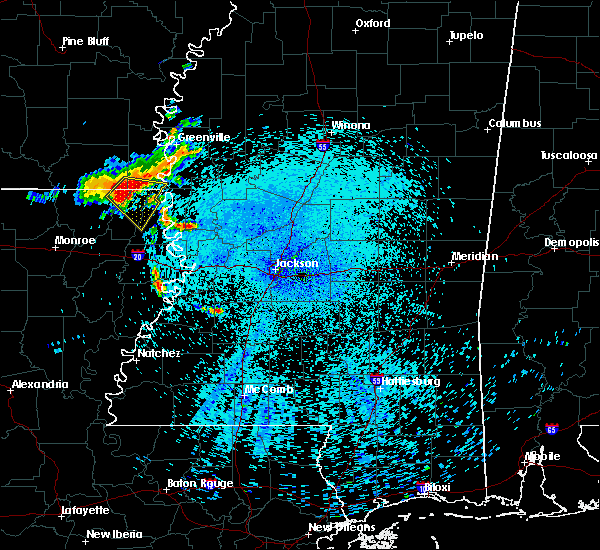 At 336 am cdt, a severe thunderstorm was located 8 miles southeast of wilmot, moving southeast at 25 mph (radar indicated). Hazards include 60 mph wind gusts and nickel size hail. Expect damage to roofs. siding and trees. this severe thunderstorm will be near, oak grove around 355 am cdt. gassoway around 405 am cdt. millikin around 410 am cdt. lake providence and shelburn around 415 am cdt. Other locations impacted by this severe thunderstorm include forest and kilbourne. At 336 am cdt, a severe thunderstorm was located 8 miles southeast of wilmot, moving southeast at 25 mph (radar indicated). Hazards include 60 mph wind gusts and nickel size hail. Expect damage to roofs. siding and trees. this severe thunderstorm will be near, oak grove around 355 am cdt. gassoway around 405 am cdt. millikin around 410 am cdt. lake providence and shelburn around 415 am cdt. Other locations impacted by this severe thunderstorm include forest and kilbourne.
|
| 7/25/2015 6:20 PM CDT |
 The severe thunderstorm warning for northeastern east carroll parish in northeastern louisiana and northwestern issaquena counties will expire at 630 pm cdt, the storm which prompted the warning has moved out of the area. therefore the warning will be allowed to expire. however gusty winds are still possible with this thunderstorm. The severe thunderstorm warning for northeastern east carroll parish in northeastern louisiana and northwestern issaquena counties will expire at 630 pm cdt, the storm which prompted the warning has moved out of the area. therefore the warning will be allowed to expire. however gusty winds are still possible with this thunderstorm.
|
| 7/25/2015 5:48 PM CDT |
 At 547 pm cdt, a severe thunderstorm was located near millikin, or 9 miles north of lake providence, moving southeast at 25 mph (radar indicated). Hazards include 60 mph wind gusts. Expect damage to roofs. siding and trees. This severe thunderstorm will remain over mainly rural areas of northeastern east carroll parish in northeastern louisiana and northwestern issaquena counties, including the following locations, mayersville. At 547 pm cdt, a severe thunderstorm was located near millikin, or 9 miles north of lake providence, moving southeast at 25 mph (radar indicated). Hazards include 60 mph wind gusts. Expect damage to roofs. siding and trees. This severe thunderstorm will remain over mainly rural areas of northeastern east carroll parish in northeastern louisiana and northwestern issaquena counties, including the following locations, mayersville.
|
| 7/5/2015 8:01 AM CDT | A few trees were reported dow in east carroll county LA, 9.8 miles NNE of Lake Providence, LA |
| 7/5/2015 7:48 AM CDT |
 At 747 am cdt, severe thunderstorms were located along a line extending from 6 miles west of valley park to tallulah, moving southeast at 35 mph (radar indicated). Hazards include 60 mph wind gusts. Expect damage to roofs. siding and trees. these severe thunderstorms will remain over mainly rural areas of south central west carroll, southern east carroll parishes in northeastern louisiana and west central issaquena counties, including the following locations, epps. Time, mot, loc 1247z 312deg 303kt 3262 9097 3240 9121. At 747 am cdt, severe thunderstorms were located along a line extending from 6 miles west of valley park to tallulah, moving southeast at 35 mph (radar indicated). Hazards include 60 mph wind gusts. Expect damage to roofs. siding and trees. these severe thunderstorms will remain over mainly rural areas of south central west carroll, southern east carroll parishes in northeastern louisiana and west central issaquena counties, including the following locations, epps. Time, mot, loc 1247z 312deg 303kt 3262 9097 3240 9121.
|
| 7/5/2015 7:48 AM CDT |
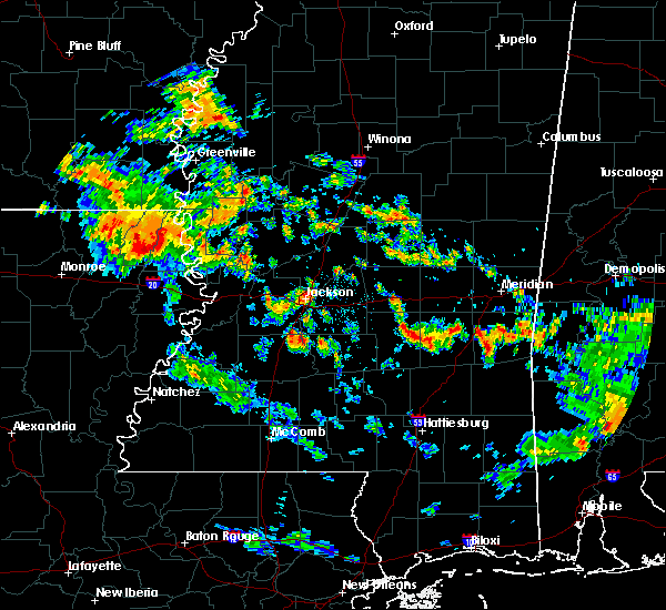 At 747 am cdt, severe thunderstorms were located along a line extending from 6 miles west of valley park to tallulah, moving southeast at 35 mph (radar indicated). Hazards include 60 mph wind gusts. Expect damage to roofs. siding and trees. these severe thunderstorms will remain over mainly rural areas of south central west carroll, southern east carroll parishes in northeastern louisiana and west central issaquena counties, including the following locations, epps. Time, mot, loc 1247z 312deg 303kt 3262 9097 3240 9121. At 747 am cdt, severe thunderstorms were located along a line extending from 6 miles west of valley park to tallulah, moving southeast at 35 mph (radar indicated). Hazards include 60 mph wind gusts. Expect damage to roofs. siding and trees. these severe thunderstorms will remain over mainly rural areas of south central west carroll, southern east carroll parishes in northeastern louisiana and west central issaquena counties, including the following locations, epps. Time, mot, loc 1247z 312deg 303kt 3262 9097 3240 9121.
|
| 6/24/2015 6:30 PM CDT | Power lines down in town in east carroll county LA, 0.7 miles NW of Lake Providence, LA |
| 6/24/2015 6:30 PM CDT | Power lines down in east carroll county LA, 10.9 miles N of Lake Providence, LA |
| 6/9/2015 3:15 PM CDT |
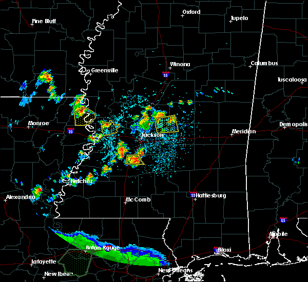 At 314 pm cdt, a severe thunderstorm was located near transylvania, moving southeast at 15 mph (radar indicated). Hazards include 60 mph wind gusts. Expect damage to roofs. siding and trees. this severe storm will be near, transylvania around 325 pm cdt. Fitler and alsatia around 335 pm cdt. At 314 pm cdt, a severe thunderstorm was located near transylvania, moving southeast at 15 mph (radar indicated). Hazards include 60 mph wind gusts. Expect damage to roofs. siding and trees. this severe storm will be near, transylvania around 325 pm cdt. Fitler and alsatia around 335 pm cdt.
|
| 6/9/2015 2:59 PM CDT |
 At 259 pm cdt, a severe thunderstorm was located near transylvania, moving southeast at 30 mph (radar indicated). Hazards include 60 mph wind gusts and quarter size hail. Hail damage to vehicles is expected. expect wind damage to roofs, siding and trees. This severe thunderstorm will be near, fitler and alsatia around 310 pm cdt. At 259 pm cdt, a severe thunderstorm was located near transylvania, moving southeast at 30 mph (radar indicated). Hazards include 60 mph wind gusts and quarter size hail. Hail damage to vehicles is expected. expect wind damage to roofs, siding and trees. This severe thunderstorm will be near, fitler and alsatia around 310 pm cdt.
|
| 6/9/2015 2:59 PM CDT |
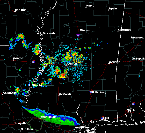 At 259 pm cdt, a severe thunderstorm was located near transylvania, moving southeast at 30 mph (radar indicated). Hazards include 60 mph wind gusts and quarter size hail. Hail damage to vehicles is expected. expect wind damage to roofs, siding and trees. This severe thunderstorm will be near, fitler and alsatia around 310 pm cdt. At 259 pm cdt, a severe thunderstorm was located near transylvania, moving southeast at 30 mph (radar indicated). Hazards include 60 mph wind gusts and quarter size hail. Hail damage to vehicles is expected. expect wind damage to roofs, siding and trees. This severe thunderstorm will be near, fitler and alsatia around 310 pm cdt.
|
| 5/24/2015 4:28 PM CDT | At 427 pm cdt, severe thunderstorms were located along a line extending from jones to shelburn to near valley park, moving north at 50 mph (radar indicated). Hazards include 60 mph wind gusts. Expect damage to roofs. siding and trees. these severe storms will be near, gassoway and millikin around 435 pm cdt. wilmot around 440 pm cdt. eudora and parkdale around 445 pm cdt. rolling fork and chicot junction around 450 pm cdt. avon, anguilla, portland and grace around 455 pm cdt. montrose, delta city, nitta yuma, panther burn and wayside around 500 pm cdt. other locations impacted by these severe thunderstorms include kilbourne, mayersville, cary and arcola. A tornado watch remains in effect until 800 pm cdt for southeastern arkansas, northeastern louisiana and northwestern mississippi. |
| 5/24/2015 4:28 PM CDT | At 427 pm cdt, severe thunderstorms were located along a line extending from jones to shelburn to near valley park, moving north at 50 mph (radar indicated). Hazards include 60 mph wind gusts. Expect damage to roofs. siding and trees. these severe storms will be near, gassoway and millikin around 435 pm cdt. wilmot around 440 pm cdt. eudora and parkdale around 445 pm cdt. rolling fork and chicot junction around 450 pm cdt. avon, anguilla, portland and grace around 455 pm cdt. montrose, delta city, nitta yuma, panther burn and wayside around 500 pm cdt. other locations impacted by these severe thunderstorms include kilbourne, mayersville, cary and arcola. A tornado watch remains in effect until 800 pm cdt for southeastern arkansas, northeastern louisiana and northwestern mississippi. |
| 5/24/2015 4:28 PM CDT | At 427 pm cdt, severe thunderstorms were located along a line extending from jones to shelburn to near valley park, moving north at 50 mph (radar indicated). Hazards include 60 mph wind gusts. Expect damage to roofs. siding and trees. these severe storms will be near, gassoway and millikin around 435 pm cdt. wilmot around 440 pm cdt. eudora and parkdale around 445 pm cdt. rolling fork and chicot junction around 450 pm cdt. avon, anguilla, portland and grace around 455 pm cdt. montrose, delta city, nitta yuma, panther burn and wayside around 500 pm cdt. other locations impacted by these severe thunderstorms include kilbourne, mayersville, cary and arcola. A tornado watch remains in effect until 800 pm cdt for southeastern arkansas, northeastern louisiana and northwestern mississippi. |
| 5/24/2015 4:13 PM CDT | At 413 pm cdt, severe thunderstorms were located along a line extending from near galion to 8 miles southwest of lake providence to near eagle bend, moving northeast at 50 mph (radar indicated). Hazards include 60 mph wind gusts. Expect damage to roofs. siding and trees. severe thunderstorms will be near, valley park around 420 pm cdt. lake providence, shelburn and onward around 425 pm cdt. jones and millikin around 430 pm cdt. gassoway around 435 pm cdt. rolling fork, wilmot and glen allan around 440 pm cdt. anguilla and parkdale around 445 pm cdt. avon and portland around 455 pm cdt. montrose, wayside, murphy and estill around 500 pm cdt. other locations impacted by these severe thunderstorms include forest, mayersville, arcola, kilbourne, bonita, pioneer, cary and mer rouge. A tornado watch remains in effect until 800 pm cdt for southeastern arkansas, northeastern louisiana and northwestern mississippi. |
| 5/24/2015 4:13 PM CDT | At 413 pm cdt, severe thunderstorms were located along a line extending from near galion to 8 miles southwest of lake providence to near eagle bend, moving northeast at 50 mph (radar indicated). Hazards include 60 mph wind gusts. Expect damage to roofs. siding and trees. severe thunderstorms will be near, valley park around 420 pm cdt. lake providence, shelburn and onward around 425 pm cdt. jones and millikin around 430 pm cdt. gassoway around 435 pm cdt. rolling fork, wilmot and glen allan around 440 pm cdt. anguilla and parkdale around 445 pm cdt. avon and portland around 455 pm cdt. montrose, wayside, murphy and estill around 500 pm cdt. other locations impacted by these severe thunderstorms include forest, mayersville, arcola, kilbourne, bonita, pioneer, cary and mer rouge. A tornado watch remains in effect until 800 pm cdt for southeastern arkansas, northeastern louisiana and northwestern mississippi. |
| 5/24/2015 4:13 PM CDT | At 413 pm cdt, severe thunderstorms were located along a line extending from near galion to 8 miles southwest of lake providence to near eagle bend, moving northeast at 50 mph (radar indicated). Hazards include 60 mph wind gusts. Expect damage to roofs. siding and trees. severe thunderstorms will be near, valley park around 420 pm cdt. lake providence, shelburn and onward around 425 pm cdt. jones and millikin around 430 pm cdt. gassoway around 435 pm cdt. rolling fork, wilmot and glen allan around 440 pm cdt. anguilla and parkdale around 445 pm cdt. avon and portland around 455 pm cdt. montrose, wayside, murphy and estill around 500 pm cdt. other locations impacted by these severe thunderstorms include forest, mayersville, arcola, kilbourne, bonita, pioneer, cary and mer rouge. A tornado watch remains in effect until 800 pm cdt for southeastern arkansas, northeastern louisiana and northwestern mississippi. |
| 5/17/2015 5:27 PM CDT | At 525 pm cdt, severe thunderstorms were located along a line extending from near montrose to near eudora to near oak grove, moving northeast at 40 mph (radar indicated). Hazards include 60 mph wind gusts and penny size hail. Expect damage to roofs. siding and trees. these severe storms will be near, eudora around 530 pm cdt. lake village and chicot junction around 535 pm cdt. mcmillan corner and millikin around 540 pm cdt. gassoway around 545 pm cdt. other locations impacted by these severe thunderstorms include forest and kilbourne. 0. 75in. |
| 5/17/2015 5:27 PM CDT | At 525 pm cdt, severe thunderstorms were located along a line extending from near montrose to near eudora to near oak grove, moving northeast at 40 mph (radar indicated). Hazards include 60 mph wind gusts and penny size hail. Expect damage to roofs. siding and trees. these severe storms will be near, eudora around 530 pm cdt. lake village and chicot junction around 535 pm cdt. mcmillan corner and millikin around 540 pm cdt. gassoway around 545 pm cdt. other locations impacted by these severe thunderstorms include forest and kilbourne. 0. 75in. |
| 5/17/2015 5:01 PM CDT | At 501 pm cdt, severe thunderstorms were located along a line extending from near berlin to near goodwill to near darnell, moving northeast at 50 mph (radar indicated). Hazards include 60 mph wind gusts and penny size hail. Expect damage to roofs. siding and trees. severe thunderstorms will be near, wilmot around 505 pm cdt. oak grove and parkdale around 510 pm cdt. portland around 520 pm cdt. lake providence, montrose and gassoway around 525 pm cdt. eudora and shelburn around 530 pm cdt. lake village, chicot junction and millikin around 535 pm cdt. mcmillan corner around 540 pm cdt. other locations impacted by these severe thunderstorms include epps, forest, kilbourne, bonita and pioneer. 0. 75in. |
| 5/17/2015 5:01 PM CDT | At 501 pm cdt, severe thunderstorms were located along a line extending from near berlin to near goodwill to near darnell, moving northeast at 50 mph (radar indicated). Hazards include 60 mph wind gusts and penny size hail. Expect damage to roofs. siding and trees. severe thunderstorms will be near, wilmot around 505 pm cdt. oak grove and parkdale around 510 pm cdt. portland around 520 pm cdt. lake providence, montrose and gassoway around 525 pm cdt. eudora and shelburn around 530 pm cdt. lake village, chicot junction and millikin around 535 pm cdt. mcmillan corner around 540 pm cdt. other locations impacted by these severe thunderstorms include epps, forest, kilbourne, bonita and pioneer. 0. 75in. |
| 5/17/2015 2:00 PM CDT | At 200 pm cdt, a severe thunderstorm was located near glen allan, or 11 miles northeast of lake providence, moving north at 25 mph (radar indicated). Hazards include 60 mph wind gusts and quarter size hail. Hail damage to vehicles is expected. expect wind damage to roofs, siding and trees. this severe storm will be near, grace around 210 pm cdt. glen allan around 215 pm cdt. other locations impacted by this severe thunderstorm include mayersville. 1. 00in. |
| 5/17/2015 2:00 PM CDT | At 200 pm cdt, a severe thunderstorm was located near glen allan, or 11 miles northeast of lake providence, moving north at 25 mph (radar indicated). Hazards include 60 mph wind gusts and quarter size hail. Hail damage to vehicles is expected. expect wind damage to roofs, siding and trees. this severe storm will be near, grace around 210 pm cdt. glen allan around 215 pm cdt. other locations impacted by this severe thunderstorm include mayersville. 1. 00in. |
| 5/17/2015 2:00 PM CDT | At 200 pm cdt, a severe thunderstorm was located near glen allan, or 11 miles northeast of lake providence, moving north at 25 mph (radar indicated). Hazards include 60 mph wind gusts and quarter size hail. Hail damage to vehicles is expected. expect wind damage to roofs, siding and trees. this severe storm will be near, grace around 210 pm cdt. glen allan around 215 pm cdt. other locations impacted by this severe thunderstorm include mayersville. 1. 00in. |
| 5/17/2015 1:44 PM CDT | At 144 pm cdt, a severe thunderstorm was located near lake providence, moving north at 25 mph (radar indicated). Hazards include 60 mph wind gusts and quarter size hail. Hail damage to vehicles is expected. expect wind damage to roofs, siding and trees. this severe thunderstorm will be near, glen allan and grace around 215 pm cdt. other locations impacted by this severe thunderstorm include mayersville. 1. 00in. |
| 5/17/2015 1:44 PM CDT | At 144 pm cdt, a severe thunderstorm was located near lake providence, moving north at 25 mph (radar indicated). Hazards include 60 mph wind gusts and quarter size hail. Hail damage to vehicles is expected. expect wind damage to roofs, siding and trees. this severe thunderstorm will be near, glen allan and grace around 215 pm cdt. other locations impacted by this severe thunderstorm include mayersville. 1. 00in. |
| 5/17/2015 1:44 PM CDT | At 144 pm cdt, a severe thunderstorm was located near lake providence, moving north at 25 mph (radar indicated). Hazards include 60 mph wind gusts and quarter size hail. Hail damage to vehicles is expected. expect wind damage to roofs, siding and trees. this severe thunderstorm will be near, glen allan and grace around 215 pm cdt. other locations impacted by this severe thunderstorm include mayersville. 1. 00in. |
| 4/25/2015 12:35 AM CDT | Downed utility lines and snapped utility poles in east carroll parish in east carroll county LA, 0.7 miles NW of Lake Providence, LA |
| 4/25/2015 12:35 AM CDT | At 1235 am cdt, a severe thunderstorm capable of producing a tornado was located near lake providence, moving east at 65 mph (radar indicated rotation). Hazards include tornado. Flying debris will be dangerous to those caught without shelter. mobile homes will be damaged or destroyed. damage to roofs, windows and vehicles will occur. tree damage is likely. this dangerous storm will be near, fitler around 1240 am cdt. other locations impacted by this tornadic thunderstorm include mayersville. Radar indicated. |
| 4/25/2015 12:35 AM CDT | At 1235 am cdt, a severe thunderstorm capable of producing a tornado was located near lake providence, moving east at 65 mph (radar indicated rotation). Hazards include tornado. Flying debris will be dangerous to those caught without shelter. mobile homes will be damaged or destroyed. damage to roofs, windows and vehicles will occur. tree damage is likely. this dangerous storm will be near, fitler around 1240 am cdt. other locations impacted by this tornadic thunderstorm include mayersville. Radar indicated. |
| 4/25/2015 12:29 AM CDT | At 1229 am cdt, a severe thunderstorm capable of producing a tornado was located near lake providence, moving east at 65 mph (radar indicated rotation). Hazards include tornado. Flying debris will be dangerous to those caught without shelter. mobile homes will be damaged or destroyed. damage to roofs, windows and vehicles will occur. tree damage is likely. this dangerous storm will be near, fitler around 1240 am cdt. other locations impacted by this tornadic thunderstorm include kilbourne and mayersville. Radar indicated. |
| 4/25/2015 12:29 AM CDT | At 1229 am cdt, a severe thunderstorm capable of producing a tornado was located near lake providence, moving east at 65 mph (radar indicated rotation). Hazards include tornado. Flying debris will be dangerous to those caught without shelter. mobile homes will be damaged or destroyed. damage to roofs, windows and vehicles will occur. tree damage is likely. this dangerous storm will be near, fitler around 1240 am cdt. other locations impacted by this tornadic thunderstorm include kilbourne and mayersville. Radar indicated. |
| 4/25/2015 12:29 AM CDT | At 1229 am cdt, a severe thunderstorm capable of producing a tornado was located near lake providence, moving east at 65 mph (radar indicated rotation). Hazards include tornado. Flying debris will be dangerous to those caught without shelter. mobile homes will be damaged or destroyed. damage to roofs, windows and vehicles will occur. tree damage is likely. this dangerous storm will be near, fitler around 1240 am cdt. other locations impacted by this tornadic thunderstorm include kilbourne and mayersville. Radar indicated. |
| 4/25/2015 12:22 AM CDT | At 1222 am cdt, a severe thunderstorm capable of producing a tornado was located near oak grove, or 13 miles west of lake providence, moving east at 55 mph (radar indicated rotation). Hazards include tornado. Flying debris will be dangerous to those caught without shelter. mobile homes will be damaged or destroyed. damage to roofs, windows and vehicles will occur. tree damage is likely. this dangerous storm will be near, lake providence and shelburn around 1235 am cdt. grace around 1255 am cdt. other locations impacted by this tornadic thunderstorm include forest, kilbourne, mayersville and pioneer. Radar indicated. |
| 4/25/2015 12:22 AM CDT | At 1222 am cdt, a severe thunderstorm capable of producing a tornado was located near oak grove, or 13 miles west of lake providence, moving east at 55 mph (radar indicated rotation). Hazards include tornado. Flying debris will be dangerous to those caught without shelter. mobile homes will be damaged or destroyed. damage to roofs, windows and vehicles will occur. tree damage is likely. this dangerous storm will be near, lake providence and shelburn around 1235 am cdt. grace around 1255 am cdt. other locations impacted by this tornadic thunderstorm include forest, kilbourne, mayersville and pioneer. Radar indicated. |
| 4/25/2015 12:22 AM CDT | At 1222 am cdt, a severe thunderstorm capable of producing a tornado was located near oak grove, or 13 miles west of lake providence, moving east at 55 mph (radar indicated rotation). Hazards include tornado. Flying debris will be dangerous to those caught without shelter. mobile homes will be damaged or destroyed. damage to roofs, windows and vehicles will occur. tree damage is likely. this dangerous storm will be near, lake providence and shelburn around 1235 am cdt. grace around 1255 am cdt. other locations impacted by this tornadic thunderstorm include forest, kilbourne, mayersville and pioneer. Radar indicated. |
| 4/25/2015 12:09 AM CDT | At 1208 am cdt, a severe thunderstorm capable of producing a tornado was located near goodwill, or 12 miles south of wilmot, moving east at 65 mph (radar indicated rotation). Hazards include tornado. Flying debris will be dangerous to those caught without shelter. mobile homes will be damaged or destroyed. damage to roofs, windows and vehicles will occur. tree damage is likely. this dangerous storm will be near, oak grove around 1220 am cdt. lake providence, shelburn, millikin and gassoway around 1230 am cdt. glen allan around 1240 am cdt. grace around 1245 am cdt. other locations impacted by this tornadic thunderstorm include forest, kilbourne, mayersville and pioneer. Radar indicated. |
| 4/25/2015 12:09 AM CDT | At 1208 am cdt, a severe thunderstorm capable of producing a tornado was located near goodwill, or 12 miles south of wilmot, moving east at 65 mph (radar indicated rotation). Hazards include tornado. Flying debris will be dangerous to those caught without shelter. mobile homes will be damaged or destroyed. damage to roofs, windows and vehicles will occur. tree damage is likely. this dangerous storm will be near, oak grove around 1220 am cdt. lake providence, shelburn, millikin and gassoway around 1230 am cdt. glen allan around 1240 am cdt. grace around 1245 am cdt. other locations impacted by this tornadic thunderstorm include forest, kilbourne, mayersville and pioneer. Radar indicated. |
| 4/25/2015 12:09 AM CDT | At 1208 am cdt, a severe thunderstorm capable of producing a tornado was located near goodwill, or 12 miles south of wilmot, moving east at 65 mph (radar indicated rotation). Hazards include tornado. Flying debris will be dangerous to those caught without shelter. mobile homes will be damaged or destroyed. damage to roofs, windows and vehicles will occur. tree damage is likely. this dangerous storm will be near, oak grove around 1220 am cdt. lake providence, shelburn, millikin and gassoway around 1230 am cdt. glen allan around 1240 am cdt. grace around 1245 am cdt. other locations impacted by this tornadic thunderstorm include forest, kilbourne, mayersville and pioneer. Radar indicated. |
| 4/19/2015 10:46 PM CDT | At 1045 pm cdt, a severe thunderstorm was located near shelburn, or near lake providence, moving east at 35 mph (radar indicated). Hazards include 60 mph wind gusts and quarter size hail. Hail damage to vehicles is expected. expect wind damage to roofs, siding and trees. this severe storm will be near, lake providence and shelburn around 1055 pm cdt. other locations impacted by this severe thunderstorm include mayersville. a tornado watch remains in effect until 100 am cdt for northeastern louisiana. a tornado watch also remains in effect until 300 am cdt for west central mississippi. 1. 00in. |
| 4/19/2015 10:46 PM CDT | At 1045 pm cdt, a severe thunderstorm was located near shelburn, or near lake providence, moving east at 35 mph (radar indicated). Hazards include 60 mph wind gusts and quarter size hail. Hail damage to vehicles is expected. expect wind damage to roofs, siding and trees. this severe storm will be near, lake providence and shelburn around 1055 pm cdt. other locations impacted by this severe thunderstorm include mayersville. a tornado watch remains in effect until 100 am cdt for northeastern louisiana. a tornado watch also remains in effect until 300 am cdt for west central mississippi. 1. 00in. |
| 4/19/2015 10:32 PM CDT | At 1031 pm cdt, a severe thunderstorm was located near oak grove, or 13 miles west of lake providence, moving east at 35 mph (radar indicated). Hazards include 60 mph wind gusts and quarter size hail. Hail damage to vehicles is expected. expect wind damage to roofs, siding and trees. this severe storm will be near, oak grove around 1040 pm cdt. lake providence and shelburn around 1055 pm cdt. other locations impacted by this severe thunderstorm include forest, mayersville and pioneer. a tornado watch remains in effect until 100 am cdt for northeastern louisiana. a tornado watch also remains in effect until 300 am cdt for west central mississippi. 1. 00in. |
| 4/19/2015 10:32 PM CDT | At 1031 pm cdt, a severe thunderstorm was located near oak grove, or 13 miles west of lake providence, moving east at 35 mph (radar indicated). Hazards include 60 mph wind gusts and quarter size hail. Hail damage to vehicles is expected. expect wind damage to roofs, siding and trees. this severe storm will be near, oak grove around 1040 pm cdt. lake providence and shelburn around 1055 pm cdt. other locations impacted by this severe thunderstorm include forest, mayersville and pioneer. a tornado watch remains in effect until 100 am cdt for northeastern louisiana. a tornado watch also remains in effect until 300 am cdt for west central mississippi. 1. 00in. |
| 4/19/2015 10:14 PM CDT | At 1014 pm cdt, a severe thunderstorm was located near darnell, or 18 miles west of transylvania, moving east at 35 mph (radar indicated). Hazards include 60 mph wind gusts and quarter size hail. Hail damage to vehicles is expected. expect wind damage to roofs, siding and trees. this severe thunderstorm will be near, oak grove around 1030 pm cdt. shelburn around 1045 pm cdt. lake providence around 1050 pm cdt. fitler around 1100 pm cdt. other locations impacted by this severe thunderstorm include epps, forest, mayersville and pioneer. a tornado watch remains in effect until 100 am cdt for northeastern louisiana. a tornado watch also remains in effect until 300 am cdt for west central mississippi. 1. 00in. |
| 4/19/2015 10:14 PM CDT | At 1014 pm cdt, a severe thunderstorm was located near darnell, or 18 miles west of transylvania, moving east at 35 mph (radar indicated). Hazards include 60 mph wind gusts and quarter size hail. Hail damage to vehicles is expected. expect wind damage to roofs, siding and trees. this severe thunderstorm will be near, oak grove around 1030 pm cdt. shelburn around 1045 pm cdt. lake providence around 1050 pm cdt. fitler around 1100 pm cdt. other locations impacted by this severe thunderstorm include epps, forest, mayersville and pioneer. a tornado watch remains in effect until 100 am cdt for northeastern louisiana. a tornado watch also remains in effect until 300 am cdt for west central mississippi. 1. 00in. |
| 4/19/2015 9:30 PM CDT | At 930 pm cdt, a severe thunderstorm was located near darnell, or 13 miles west of lake providence, moving northeast at 35 mph (radar indicated). Hazards include golf ball size hail and 60 mph wind gusts. People and animals outdoors will be injured. expect hail damage to roofs, siding, windows and vehicles. expect wind damage to roofs, siding and trees. locations impacted include, lake providence, oak grove, shelburn, millikin, forest and pioneer. a tornado watch remains in effect until 100 am cdt for northeastern louisiana. a tornado watch also remains in effect until 300 am cdt for west central mississippi. Possible. |
| 4/19/2015 9:19 PM CDT | A severe thunderstorm warning remains in effect until 1015 pm cdt for west carroll and central east carroll parishes. at 918 pm cdt. a severe thunderstorm was located near darnell. or 20 miles west of transylvania. moving east at 30 mph. hazard. golf ball size hail and 60 mph wind gusts. source. Radar indicated. |
| 4/19/2015 9:09 PM CDT | At 909 pm cdt, a severe thunderstorm was located near goodwill, or 17 miles east of bastrop, moving northeast at 30 mph (radar indicated). Hazards include ping pong ball size hail and 60 mph wind gusts. People and animals outdoors will be injured. expect hail damage to roofs, siding, windows and vehicles. expect wind damage to roofs, siding and trees. this severe thunderstorm will be near, goodwill around 920 pm cdt. darnell around 925 pm cdt. oak grove around 945 pm cdt. shelburn around 1000 pm cdt. lake providence and millikin around 1005 pm cdt. other locations impacted by this severe thunderstorm include forest, kilbourne and pioneer. a tornado watch remains in effect until 100 am cdt for southeastern arkansas and northeastern louisiana. a tornado watch also remains in effect until 300 am cdt for west central mississippi. 1. 50in. |
| 2/1/2015 3:47 PM CST | Quarter sized hail reported 9.5 miles N of Lake Providence, LA, marble to quarter size hail occurred along with very gusty winds. some small limbs were downed. |
| 6/9/2014 3:53 PM CDT | A few trees down in town...on hwy 134 sw of town and others on hwy 65 just n of tow in east carroll county LA, 0.7 miles NW of Lake Providence, LA |
| 4/28/2014 1:05 PM CDT | Quarter sized hail reported 11.6 miles N of Lake Providence, LA, quarter size hail south of translvania |
| 3/28/2014 9:45 PM CDT | Quarter sized hail reported 0.7 miles NW of Lake Providence, LA |
| 12/21/2013 5:33 PM CST | A few trees down in the are in east carroll county LA, 14.3 miles N of Lake Providence, LA |
| 12/21/2013 5:28 PM CST | A couple power lines dow in east carroll county LA, 0.7 miles NW of Lake Providence, LA |
| 5/21/2013 10:10 PM CDT | Reports of 4 powerlines down at 6289 highway 580 and a tree down on highway 13 in east carroll county LA, 7.2 miles NNE of Lake Providence, LA |
| 3/23/2013 6:45 PM CDT | Trees downed and a barn was damaged in lake providence in east carroll county LA, 0.7 miles NW of Lake Providence, LA |
| 3/23/2013 6:45 PM CDT | Trees downed in lake providence in east carroll county LA, 0.7 miles NW of Lake Providence, LA |
| 3/18/2013 2:30 PM CDT | Baseball sized hail reported 9.5 miles N of Lake Providence, LA, reported via facebook |
| 3/18/2013 2:19 PM CDT | Quarter sized hail reported 10.8 miles ENE of Lake Providence, LA |
| 12/20/2012 3:50 AM CST | Tree down in lake providenc in east carroll county LA, 0.7 miles NW of Lake Providence, LA |
| 5/7/2012 12:36 PM CDT | Tree blown down along sand road in east carroll county LA, 14.3 miles N of Lake Providence, LA |
| 4/2/2012 3:50 PM CDT | Tree downed blocking 4th street in east carroll county LA, 0.7 miles NW of Lake Providence, LA |
| 3/11/2012 8:28 PM CDT | Trees fell in the lake providence area...including one that blocked la highway 59 in east carroll county LA, 5.1 miles SSW of Lake Providence, LA |
| 3/11/2012 8:20 PM CDT | Powerlines down in east carroll county LA, 10.1 miles NNE of Lake Providence, LA |
| 1/1/0001 12:00 AM | Tree downed on foster street behind jones grocer in east carroll county LA, 0.7 miles NW of Lake Providence, LA |
| 1/1/0001 12:00 AM | Trees and powerlines down parish wide. tree down on a house in lake providence. still getting report in east carroll county LA, 0.7 miles NW of Lake Providence, LA |
| 1/1/0001 12:00 AM | A tractor shed was destroyed and the fire station in the bowie community was heavily damaged. trees and power lines were down as well...possible tornad in east carroll county LA, 6.3 miles NE of Lake Providence, LA |
| 1/1/0001 12:00 AM | Ping Pong Ball sized hail reported 0.7 miles NW of Lake Providence, LA |
| 1/1/0001 12:00 AM | Two trees and a power line down along hwy 65 n near shelbur in east carroll county LA, 4.9 miles SSE of Lake Providence, LA |
Hail Maps for Lake Providence, LA

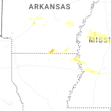
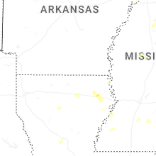
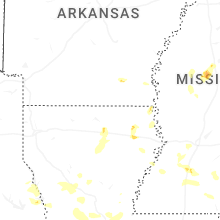


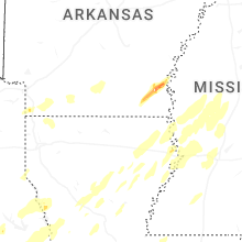


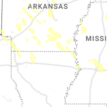


Connect with Interactive Hail Maps