

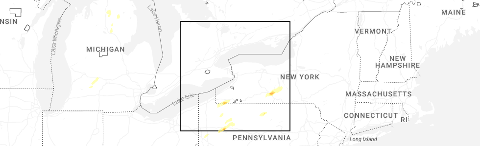
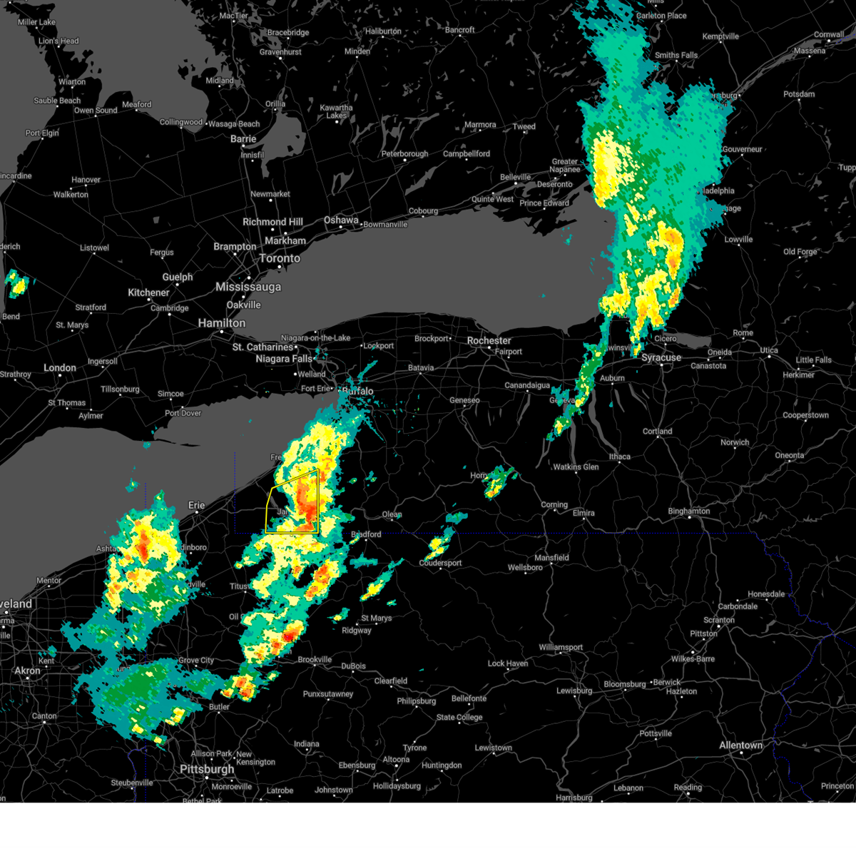
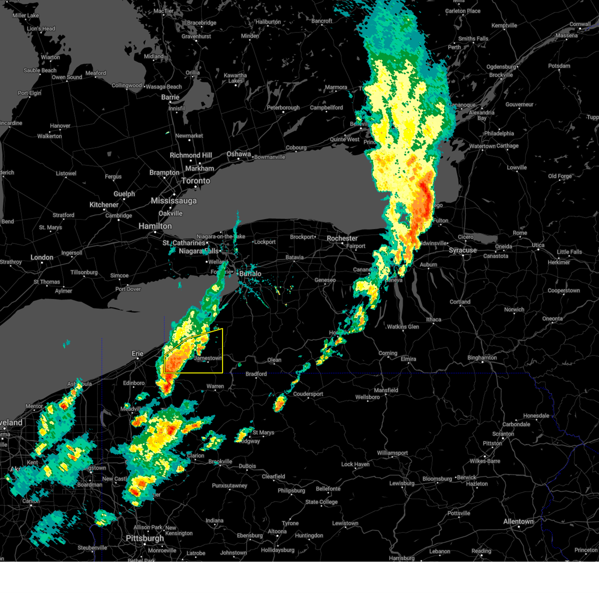
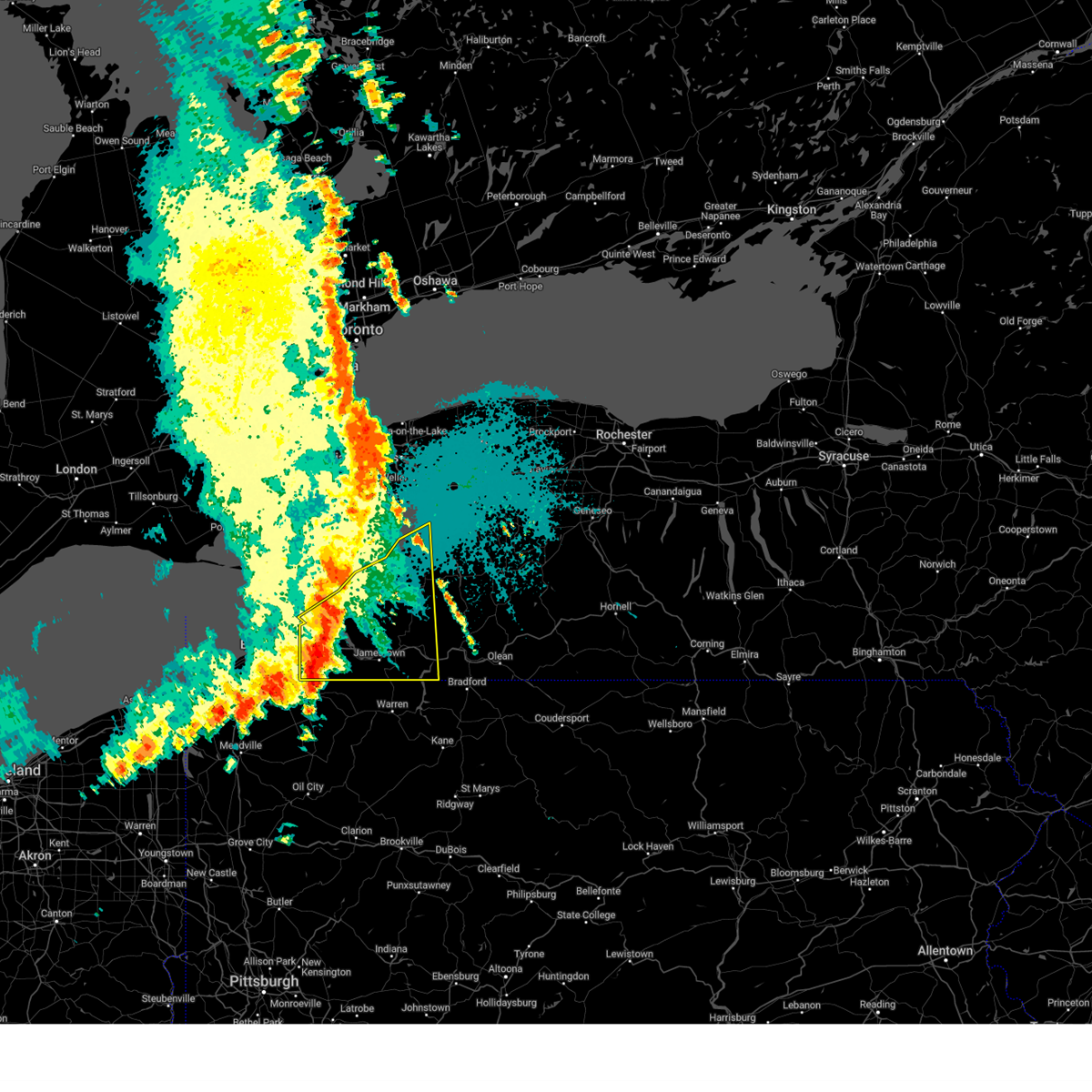
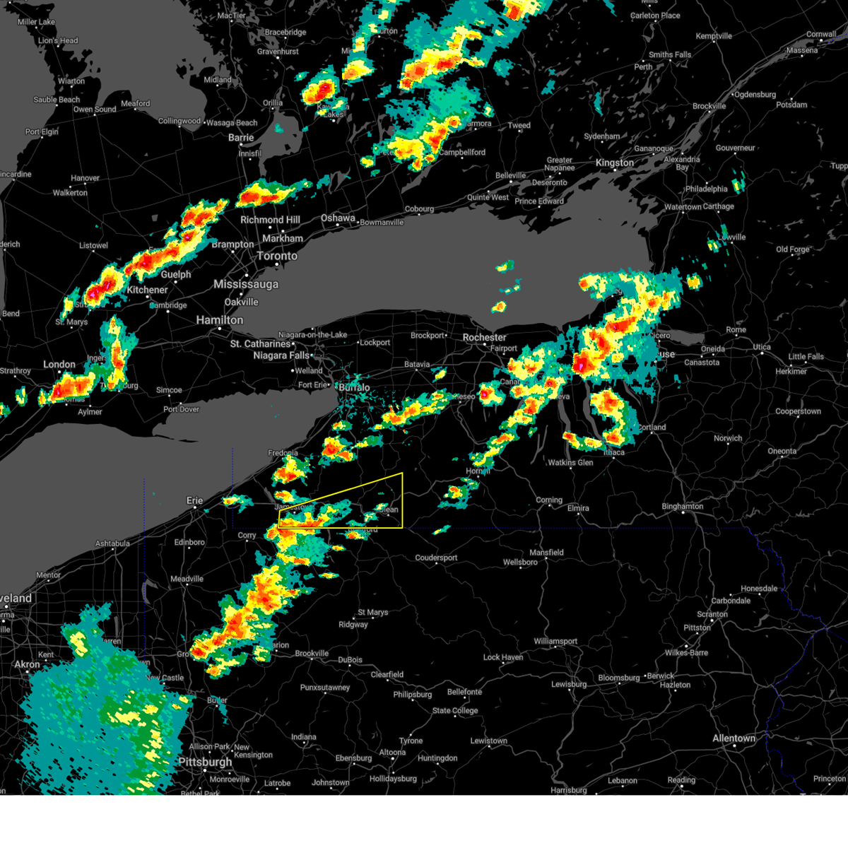
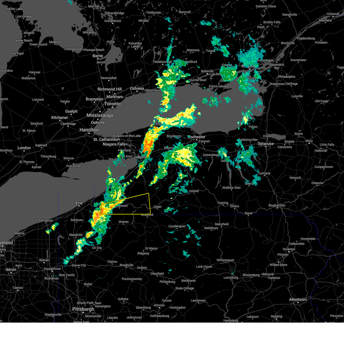
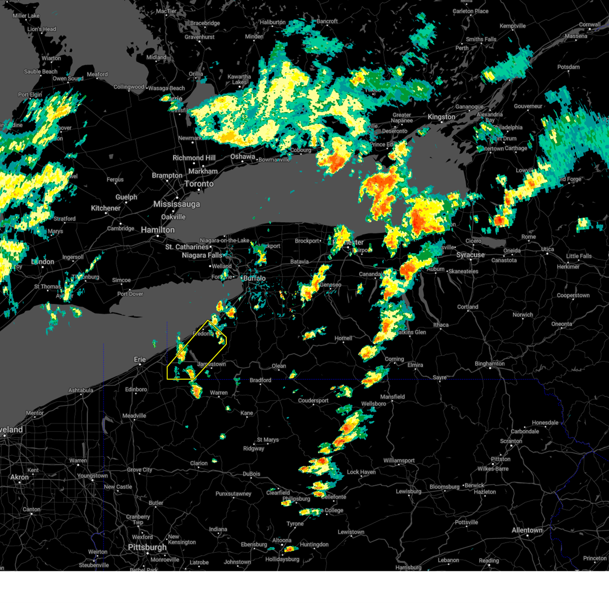
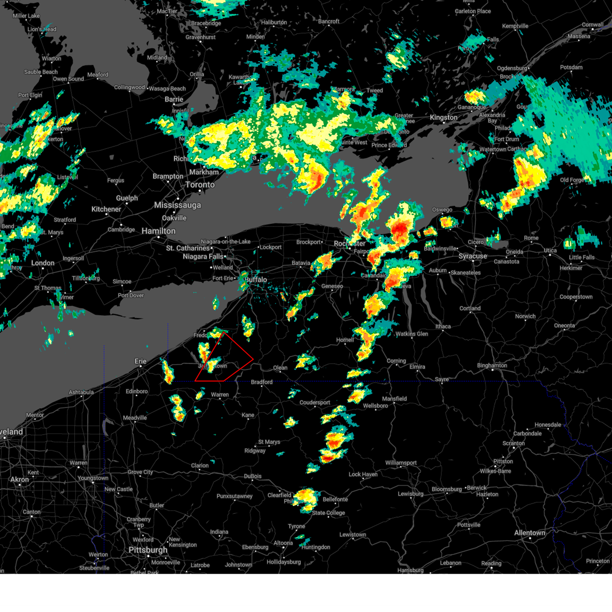
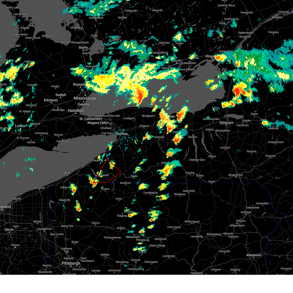
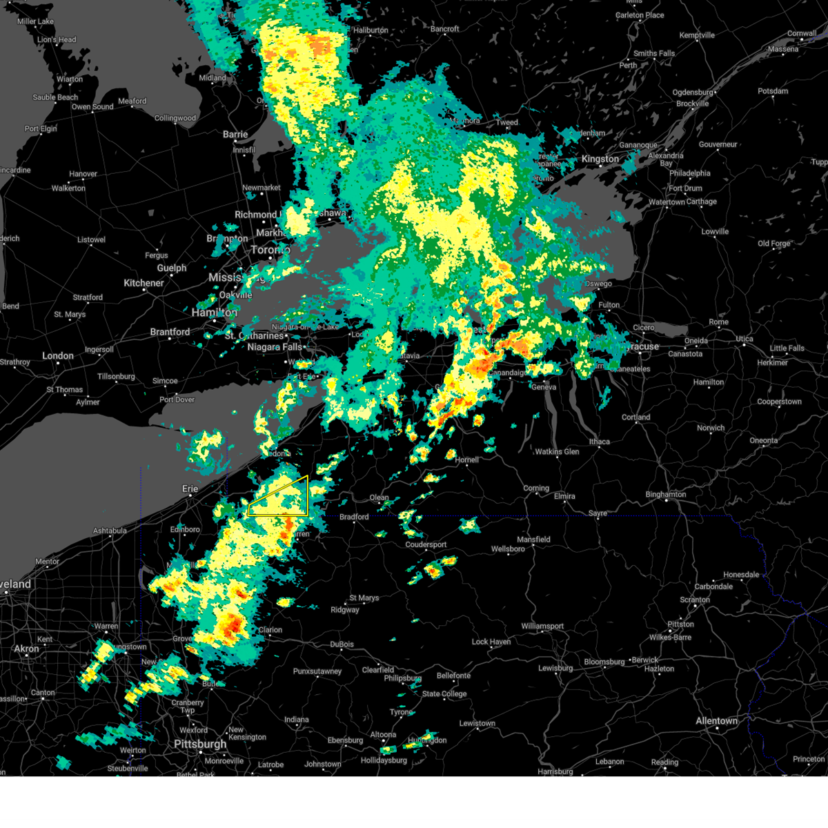
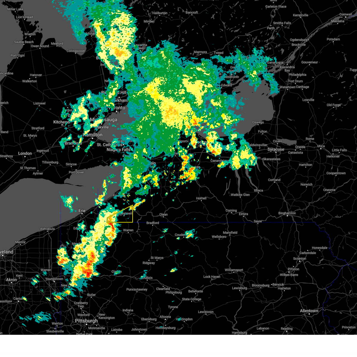
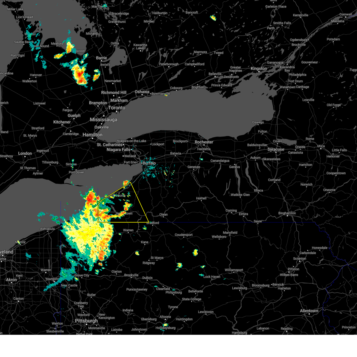
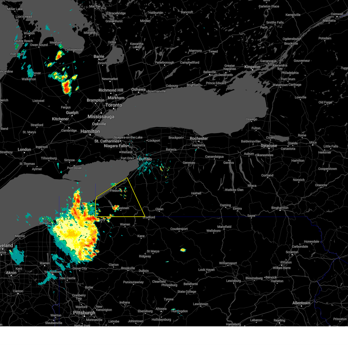
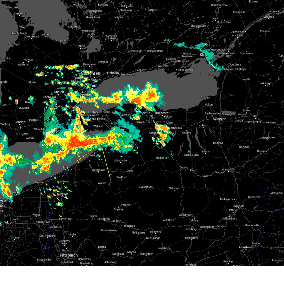
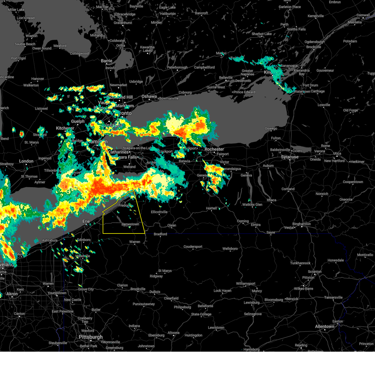
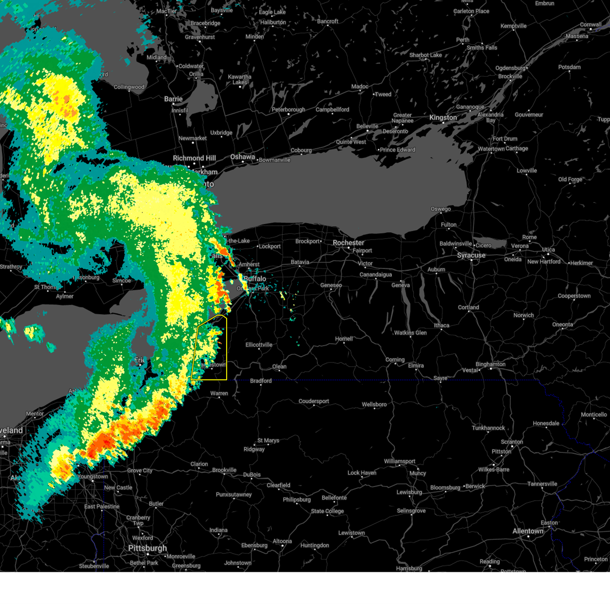
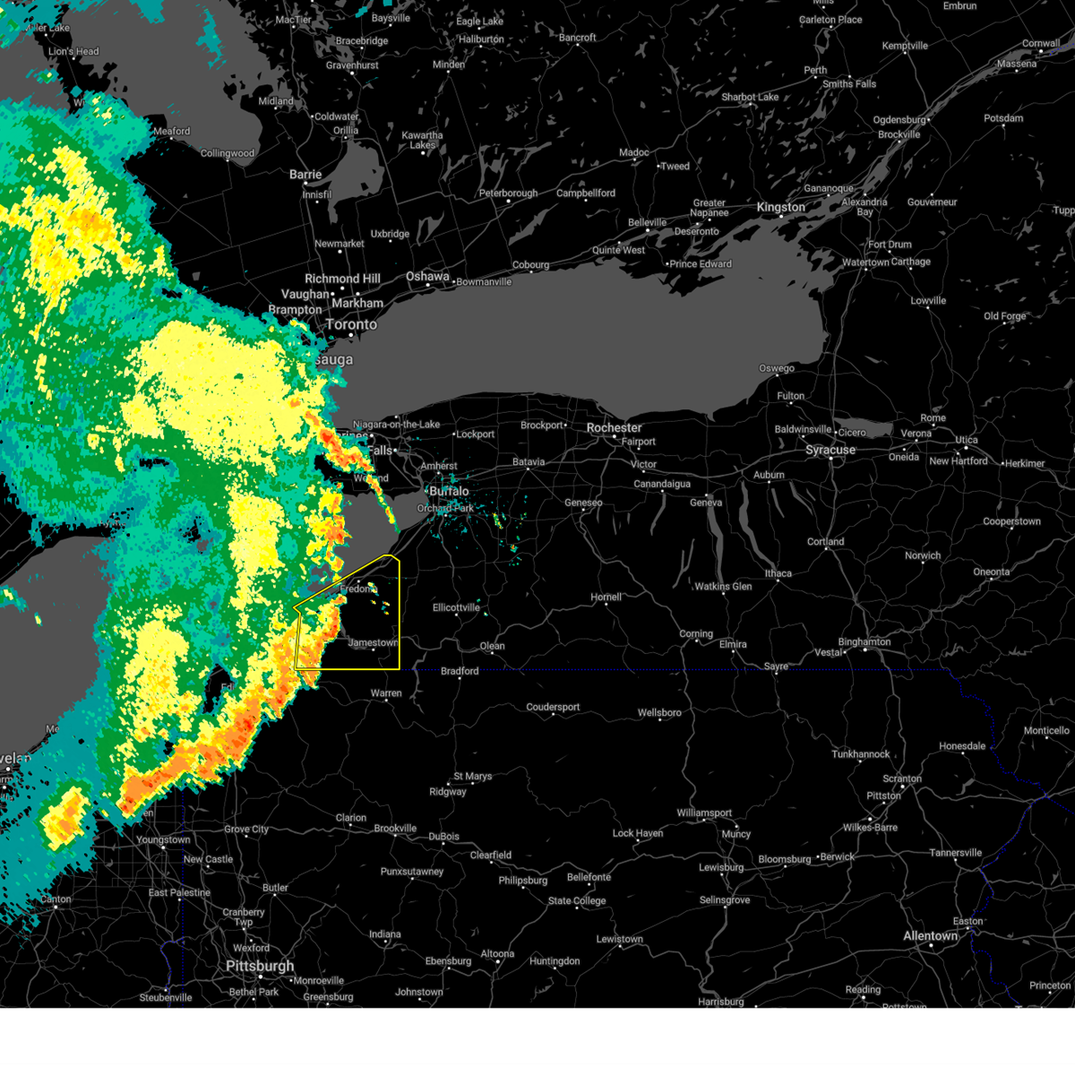
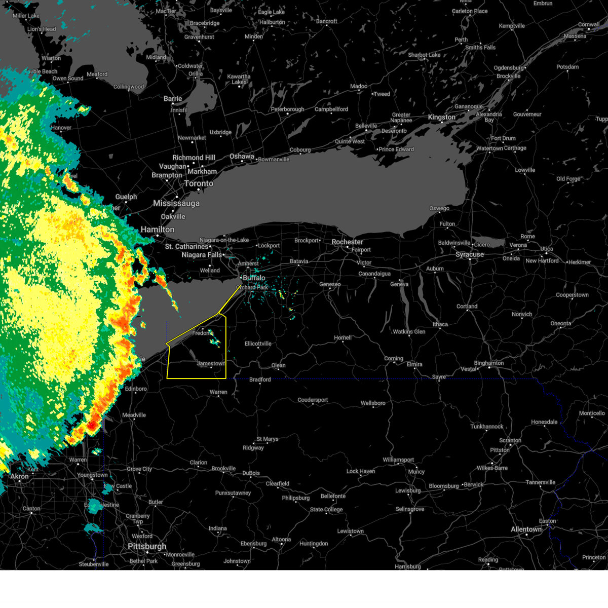
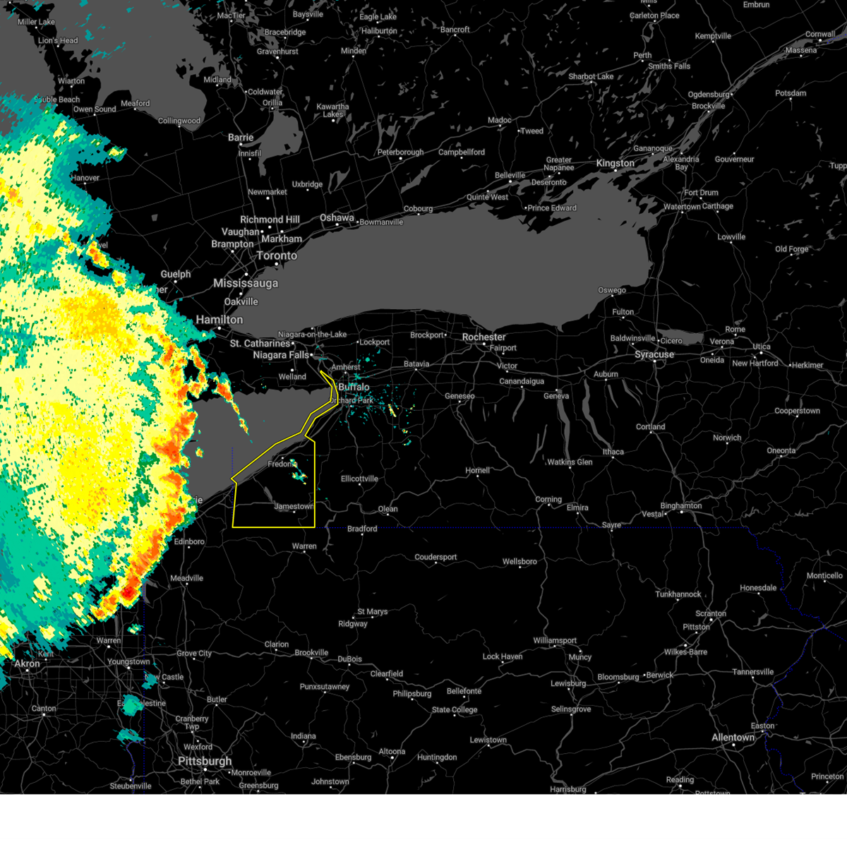
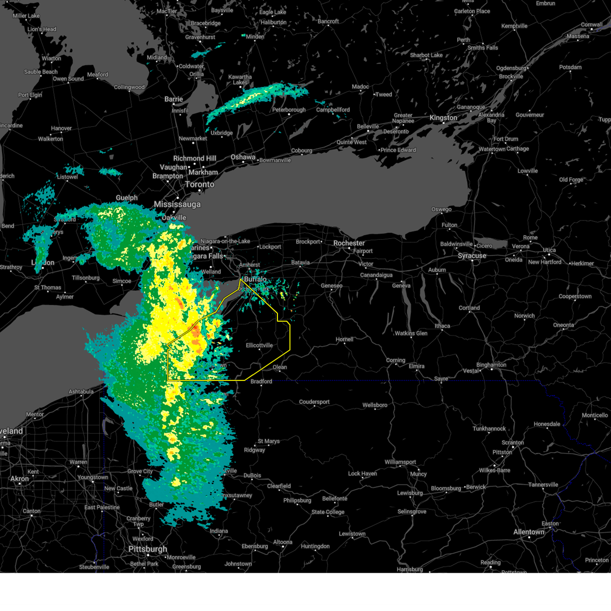
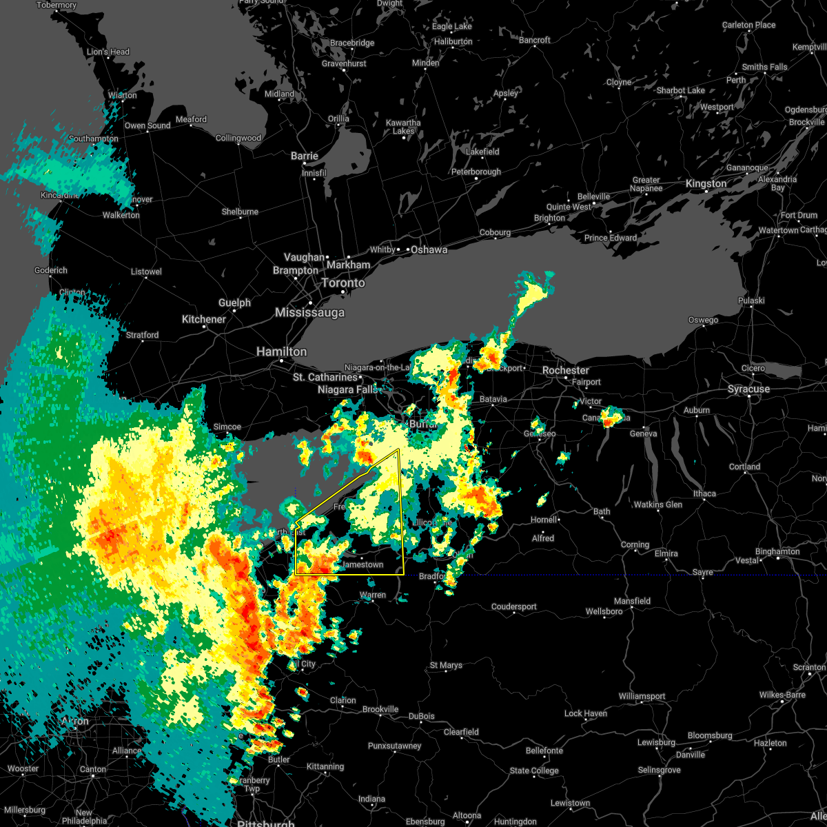
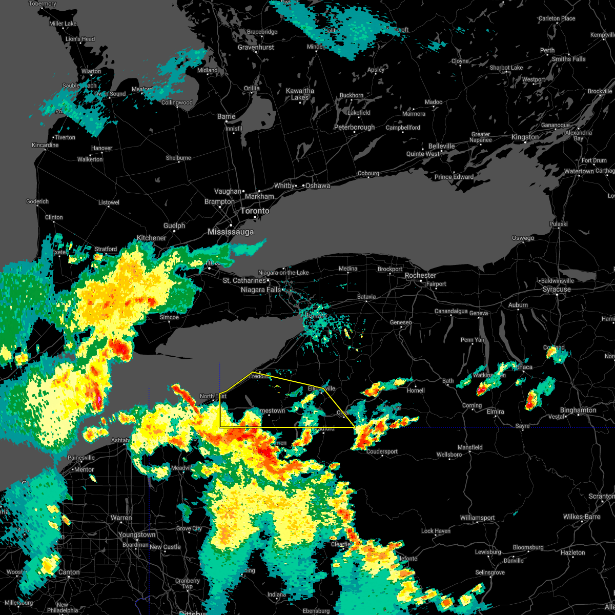
Hail Map for Lakewood, NY
The Lakewood, NY area has had 4 reports of on-the-ground hail by trained spotters, and has been under severe weather warnings 12 times during the past 12 months. Doppler radar has detected hail at or near Lakewood, NY on 18 occasions, including 2 occasions during the past year.
| Name: | Lakewood, NY |
| Where Located: | 58.4 miles SSW of Buffalo, NY |
| Map: | Google Map for Lakewood, NY |
| Population: | 3002 |
| Housing Units: | 1698 |
| More Info: | Search Google for Lakewood, NY |
2
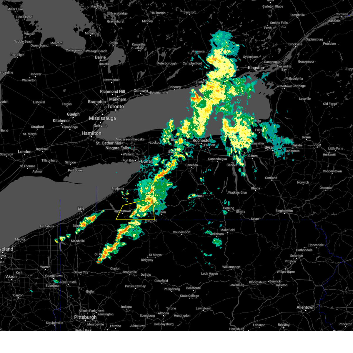
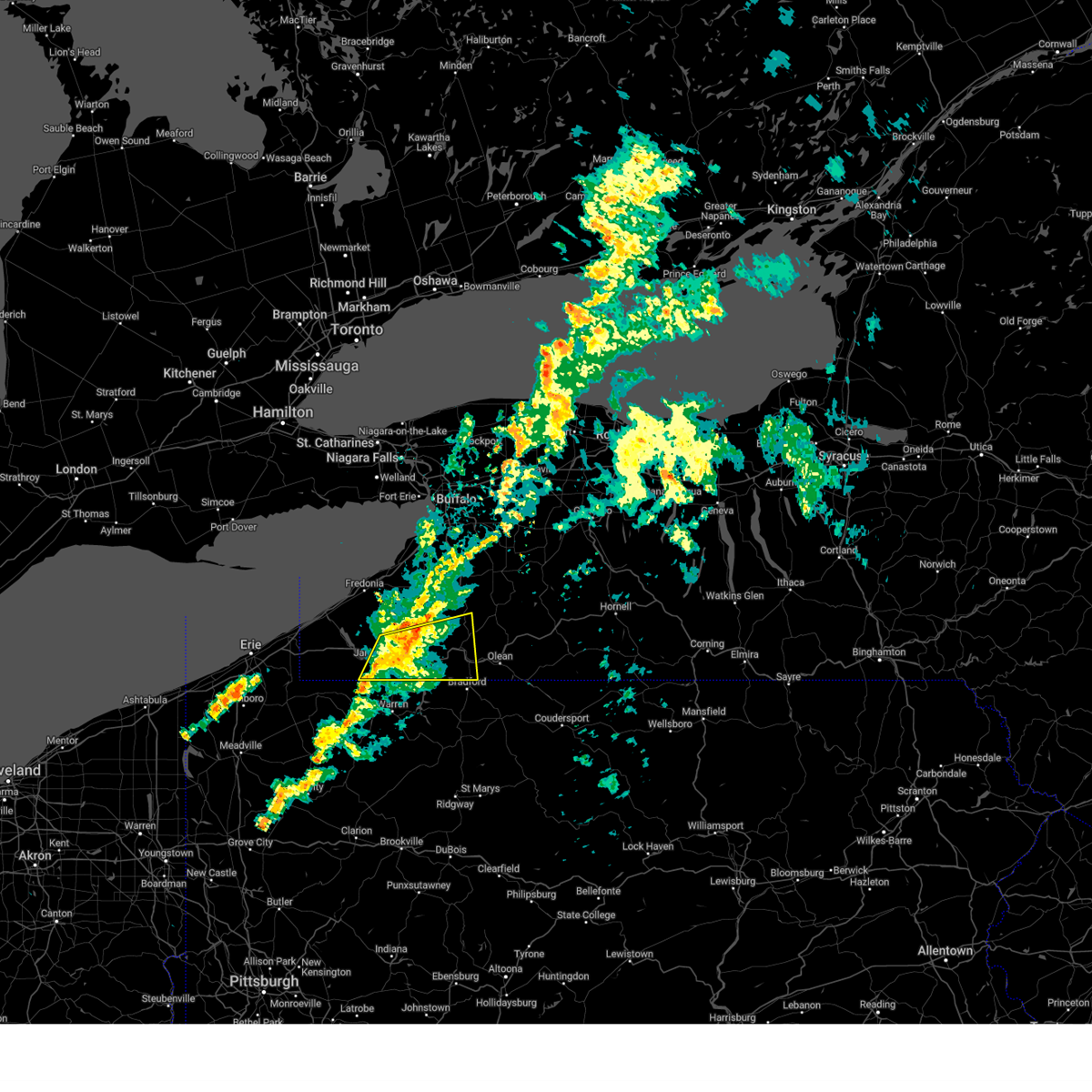
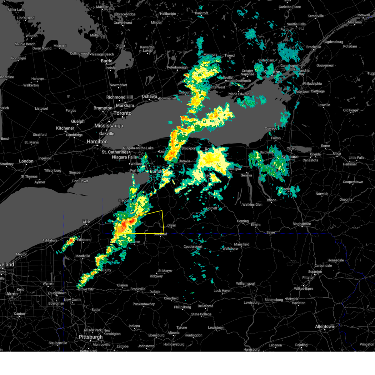
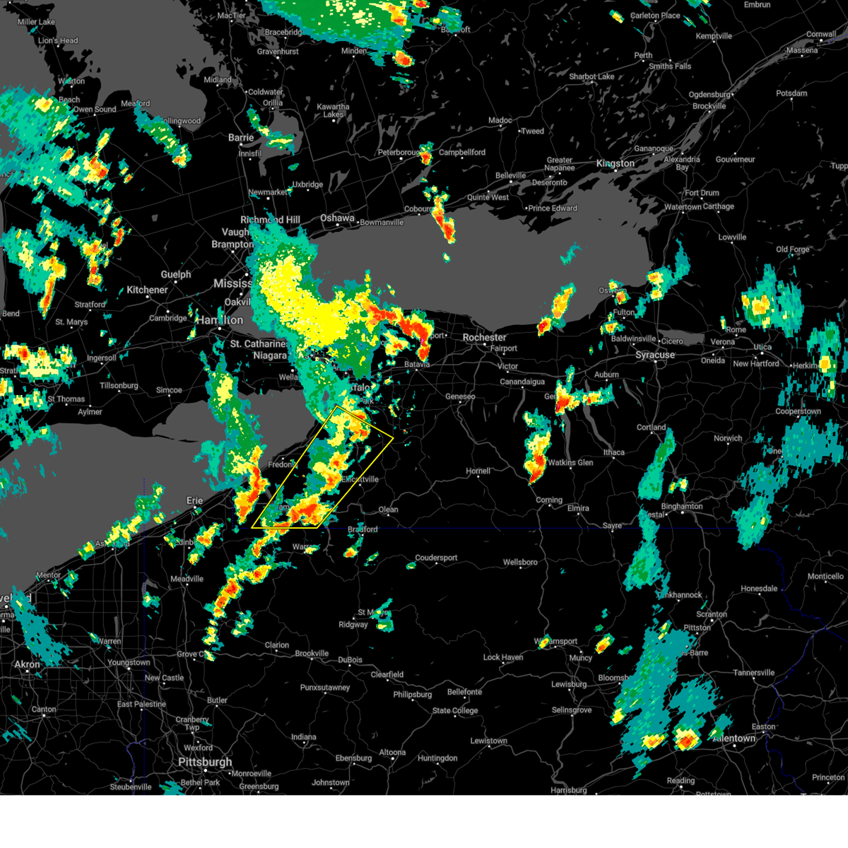
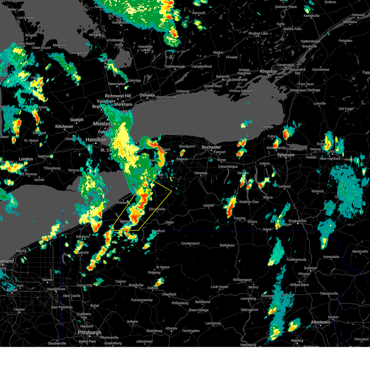
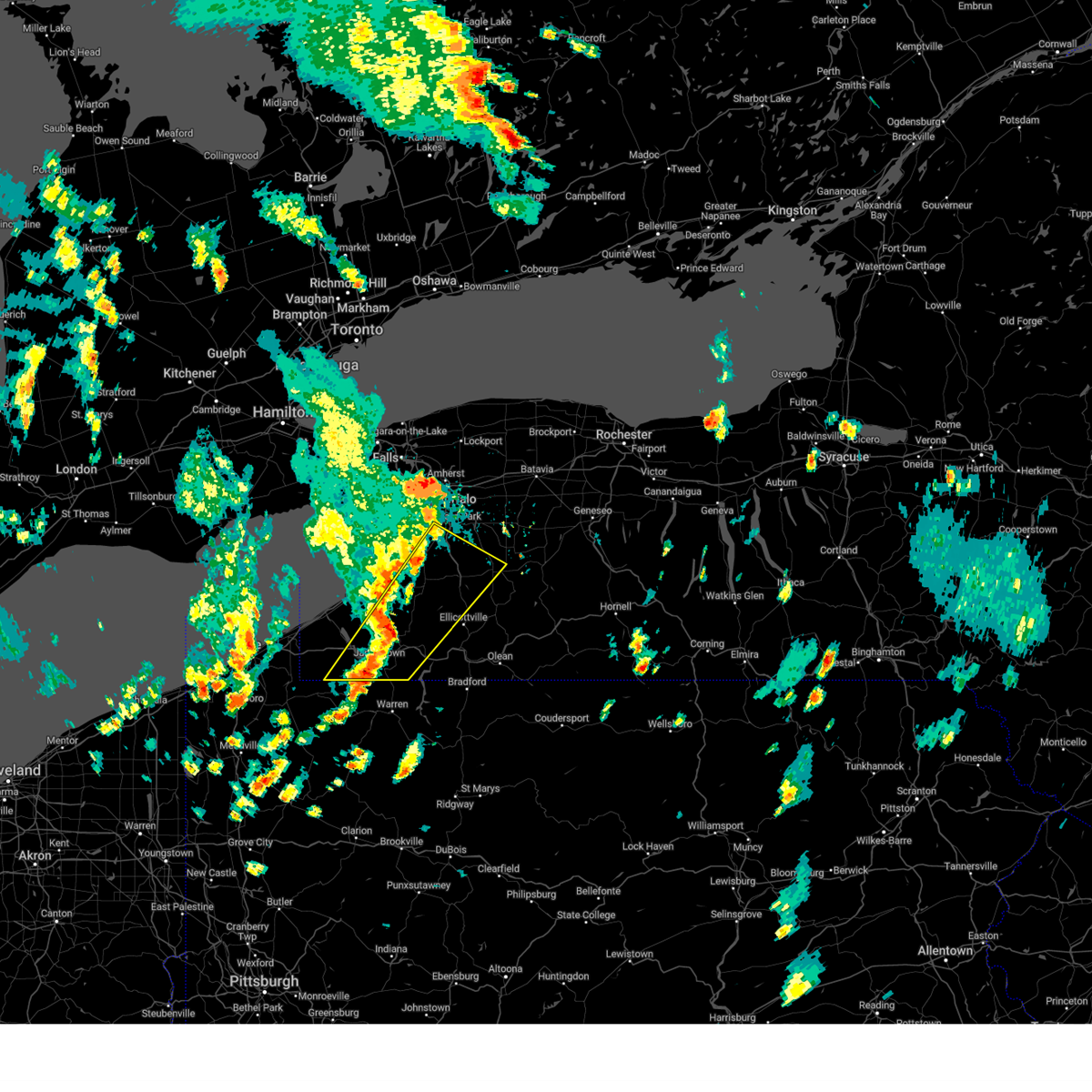
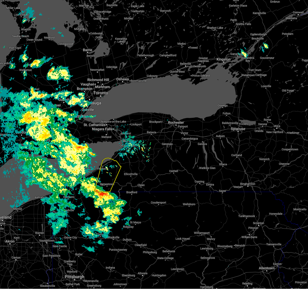
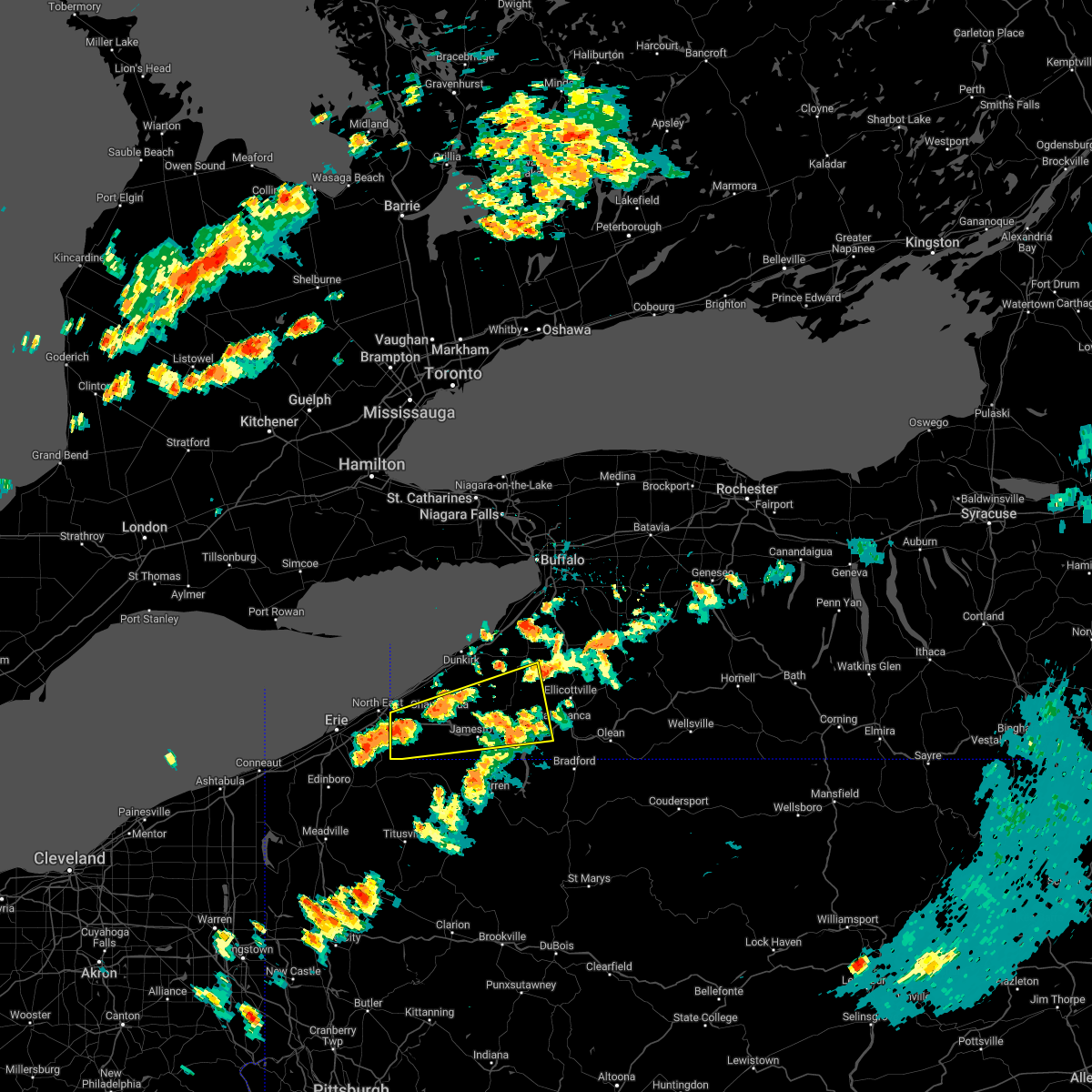
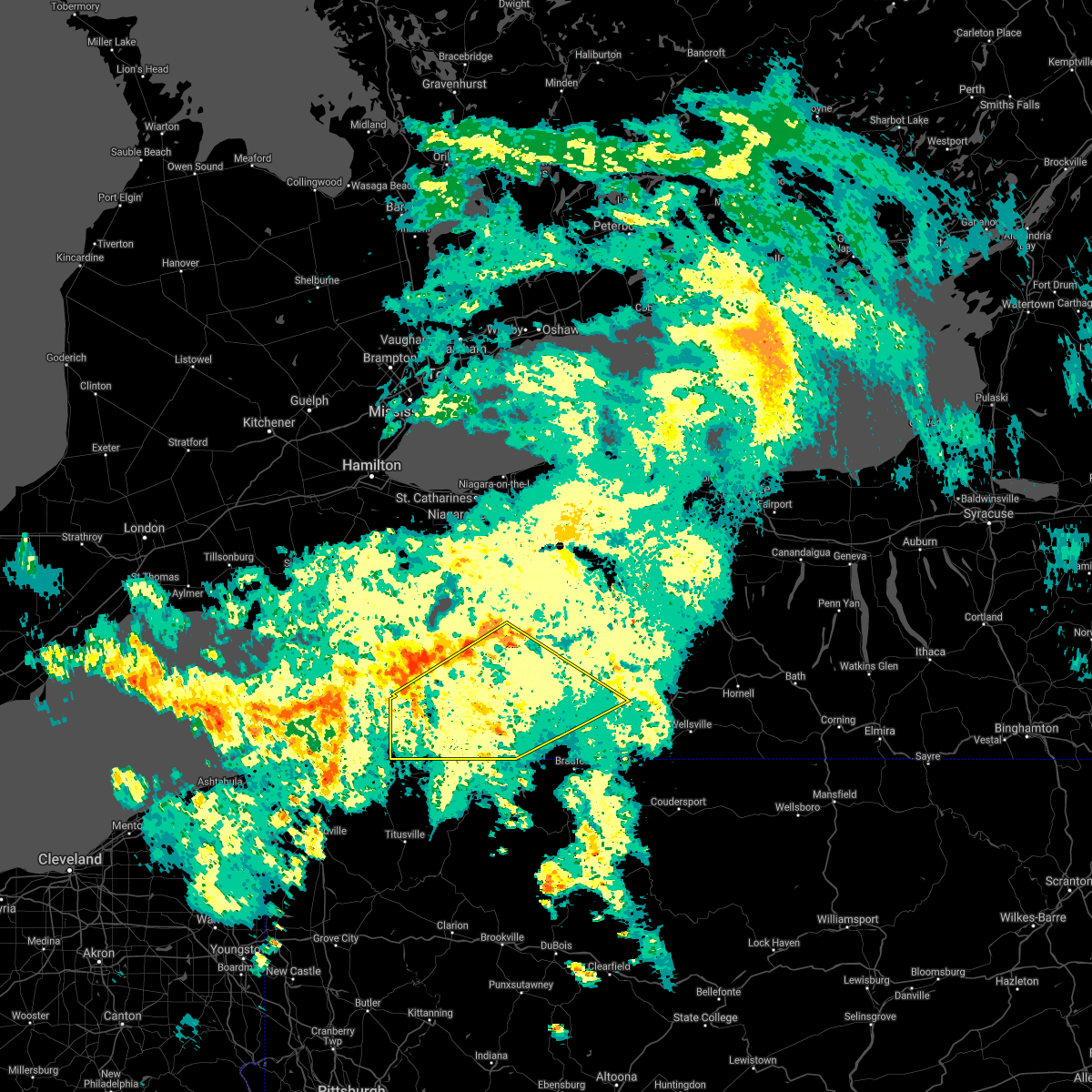
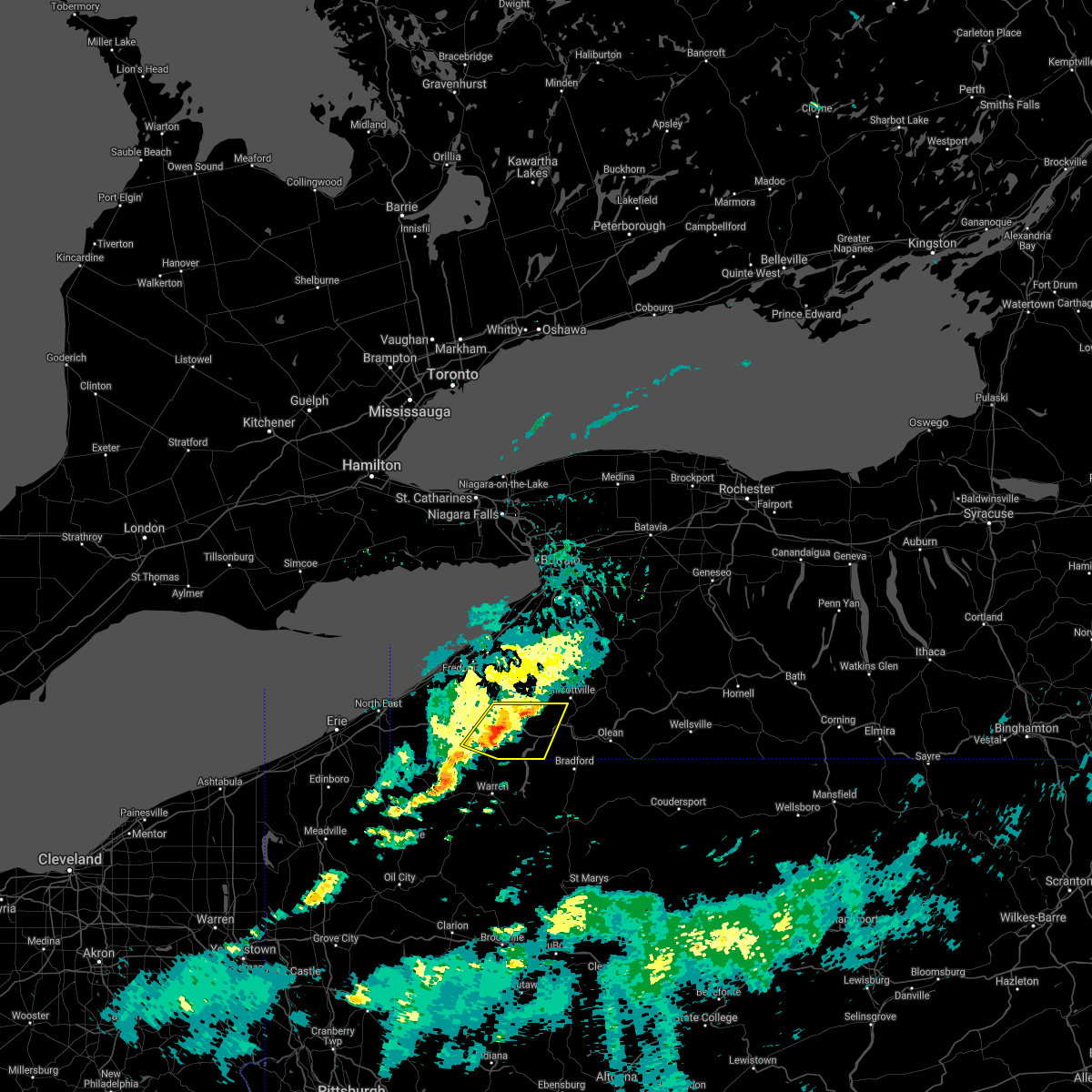
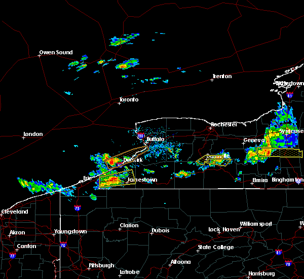
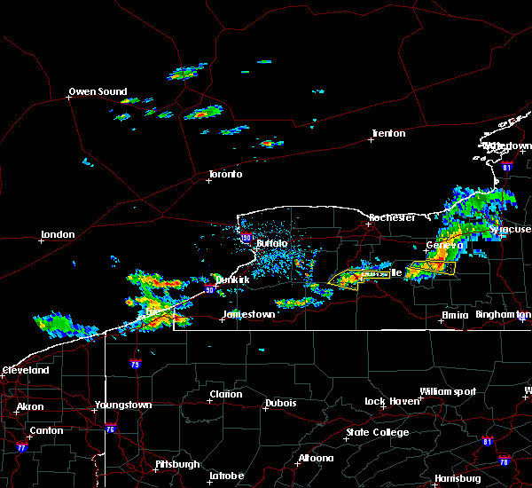
The Top Recent Hail Date for Lakewood, NY is Monday, June 9, 2025 (4th out of 18)
Hail and Wind Damage Spotted near Lakewood, NY
| Date / Time | Report Details |
|---|---|
| 6/9/2025 4:48 PM EDT |
 The severe thunderstorm which prompted the warning has moved into eastern chautauqua county. therefore, the current warning has been allowed to expire, and is replaced by a new warning for eastern chautauqua county. a severe thunderstorm watch remains in effect until 1000 pm edt for western new york. The severe thunderstorm which prompted the warning has moved into eastern chautauqua county. therefore, the current warning has been allowed to expire, and is replaced by a new warning for eastern chautauqua county. a severe thunderstorm watch remains in effect until 1000 pm edt for western new york.
|
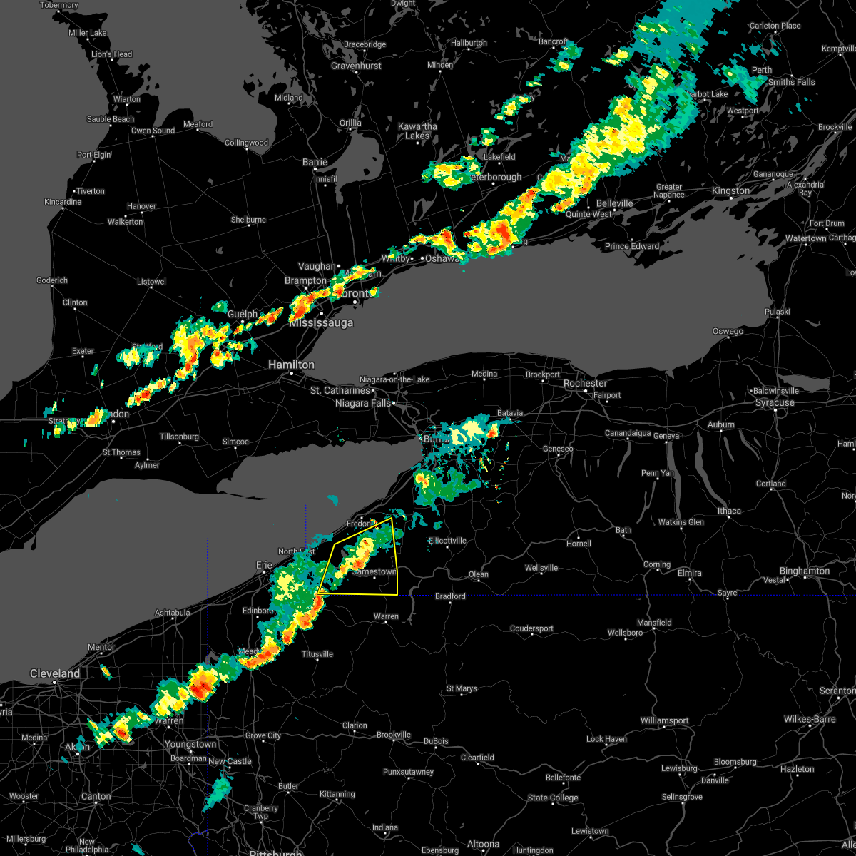
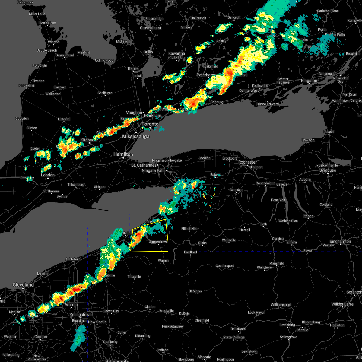
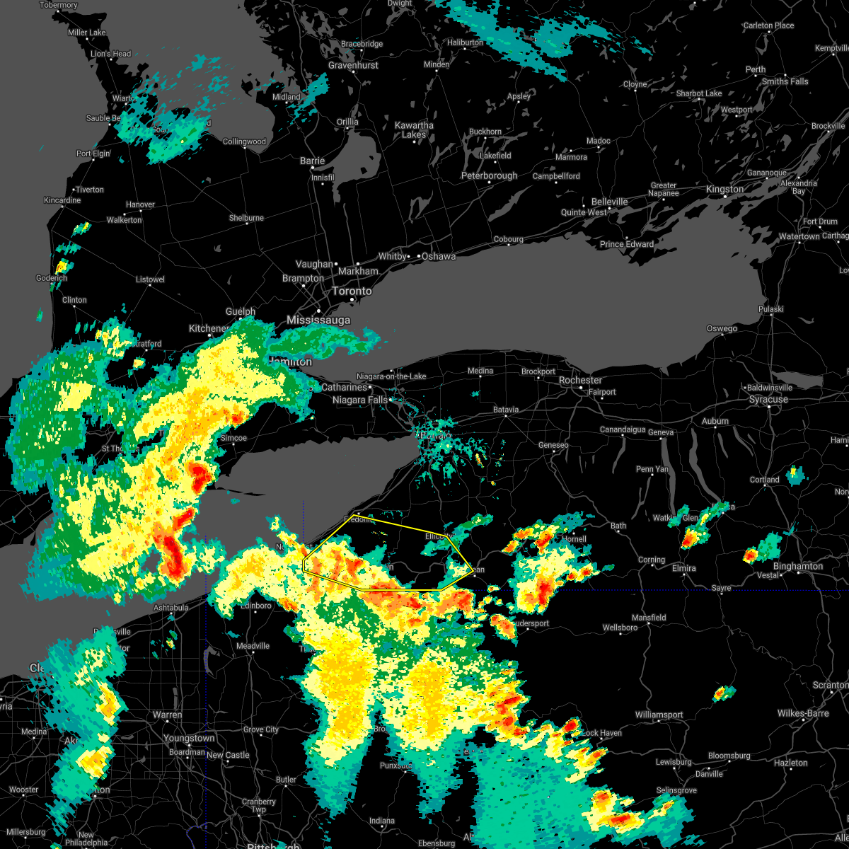
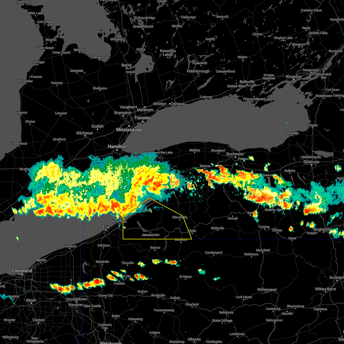
| 6/9/2025 4:24 PM EDT | At 423 pm edt, a severe thunderstorm was located near southern lakewood moving northeast at 40 mph (radar indicated). Hazards include 60 mph wind gusts and quarter size hail. Hail damage to vehicles is expected. expect wind damage to roofs, siding, and trees. locations impacted include, jamestown, lakewood, falconer, long point state park, jamestown west, chautauqua institution, frewsburg, chautauqua, busti, and gerry. This includes interstate 86 between exits 7 and 14. |
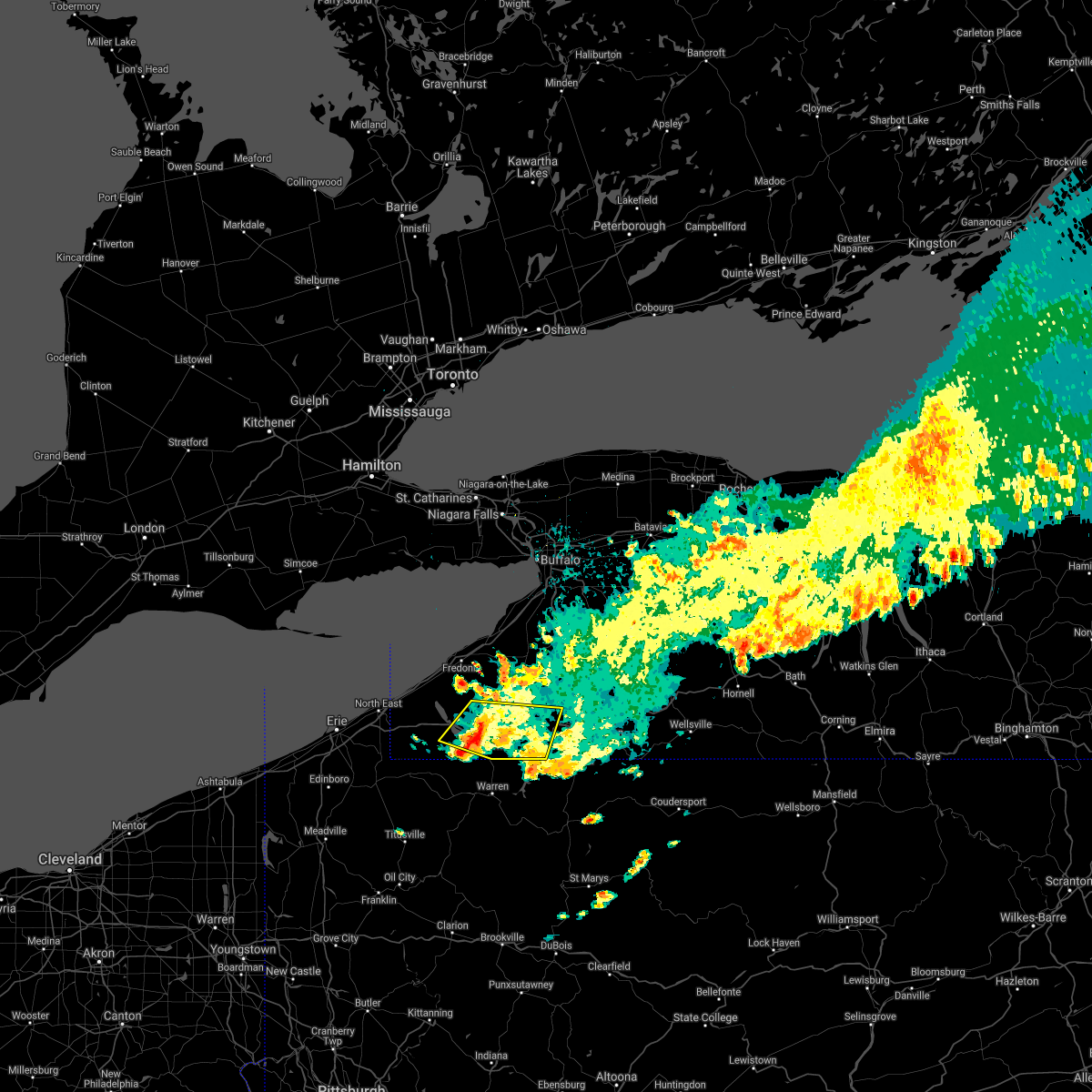
| 6/9/2025 3:56 PM EDT |
 Svrbuf the national weather service in buffalo has issued a * severe thunderstorm warning for, chautauqua county in western new york, * until 445 pm edt. * at 355 pm edt, a severe thunderstorm was located over clymer, or 22 miles southeast of erie, moving northeast at 45 mph (radar indicated). Hazards include 60 mph wind gusts and quarter size hail. Hail damage to vehicles is expected. Expect wind damage to roofs, siding, and trees. Svrbuf the national weather service in buffalo has issued a * severe thunderstorm warning for, chautauqua county in western new york, * until 445 pm edt. * at 355 pm edt, a severe thunderstorm was located over clymer, or 22 miles southeast of erie, moving northeast at 45 mph (radar indicated). Hazards include 60 mph wind gusts and quarter size hail. Hail damage to vehicles is expected. Expect wind damage to roofs, siding, and trees.
|
| 5/16/2025 4:55 AM EDT |
 Svrbuf the national weather service in buffalo has issued a * severe thunderstorm warning for, western cattaraugus county in western new york, southwestern erie county in western new york, chautauqua county in western new york, * until 545 am edt. * at 454 am edt, a severe thunderstorm was located near mayville, or 9 miles southwest of fredonia, moving northeast at 40 mph (radar indicated). Hazards include 60 mph wind gusts and quarter size hail. Hail damage to vehicles is expected. Expect wind damage to roofs, siding, and trees. Svrbuf the national weather service in buffalo has issued a * severe thunderstorm warning for, western cattaraugus county in western new york, southwestern erie county in western new york, chautauqua county in western new york, * until 545 am edt. * at 454 am edt, a severe thunderstorm was located near mayville, or 9 miles southwest of fredonia, moving northeast at 40 mph (radar indicated). Hazards include 60 mph wind gusts and quarter size hail. Hail damage to vehicles is expected. Expect wind damage to roofs, siding, and trees.
|
| 5/1/2025 4:00 PM EDT | Tree down on house in lakewood ny near squires av in chautauqua county NY, 0.8 miles WNW of Lakewood, NY |
| 4/29/2025 5:05 PM EDT |
 Svrbuf the national weather service in buffalo has issued a * severe thunderstorm warning for, southern cattaraugus county in western new york, southeastern chautauqua county in western new york, * until 600 pm edt. * at 505 pm edt, a severe thunderstorm was located 8 miles east of frewsburg, or 11 miles west of allegany state park, moving east at 40 mph (radar indicated). Hazards include 60 mph wind gusts and penny size hail. expect damage to roofs, siding, and trees Svrbuf the national weather service in buffalo has issued a * severe thunderstorm warning for, southern cattaraugus county in western new york, southeastern chautauqua county in western new york, * until 600 pm edt. * at 505 pm edt, a severe thunderstorm was located 8 miles east of frewsburg, or 11 miles west of allegany state park, moving east at 40 mph (radar indicated). Hazards include 60 mph wind gusts and penny size hail. expect damage to roofs, siding, and trees
|
| 4/21/2025 6:57 PM EDT |
 The storm which prompted the warning has moved out of the area. therefore, the warning will be allowed to expire. however, gusty winds and heavy rain are still possible with this thunderstorm. remember, a severe thunderstorm warning still remains in effect for north-central cattaraugus county. The storm which prompted the warning has moved out of the area. therefore, the warning will be allowed to expire. however, gusty winds and heavy rain are still possible with this thunderstorm. remember, a severe thunderstorm warning still remains in effect for north-central cattaraugus county.
|
| 4/21/2025 6:33 PM EDT |
 At 632 pm edt, a severe thunderstorm was located 12 miles west of salamanca, moving east at 50 mph (radar indicated). Hazards include 60 mph wind gusts and quarter size hail. Hail damage to vehicles is expected. expect wind damage to roofs, siding, and trees. locations impacted include, jamestown, salamanca, allegany state park, falconer, jamestown west, frewsburg, busti, great valley, conewango, and ellington. This includes interstate 86 between exits 11 and 23. At 632 pm edt, a severe thunderstorm was located 12 miles west of salamanca, moving east at 50 mph (radar indicated). Hazards include 60 mph wind gusts and quarter size hail. Hail damage to vehicles is expected. expect wind damage to roofs, siding, and trees. locations impacted include, jamestown, salamanca, allegany state park, falconer, jamestown west, frewsburg, busti, great valley, conewango, and ellington. This includes interstate 86 between exits 11 and 23.
|
| 4/21/2025 6:17 PM EDT |
 At 617 pm edt, a severe thunderstorm was located over jamestown, moving east at 50 mph (radar indicated). Hazards include 60 mph wind gusts and quarter size hail. Hail damage to vehicles is expected. expect wind damage to roofs, siding, and trees. locations impacted include, jamestown, salamanca, allegany state park, lakewood, falconer, long point state park, jamestown west, frewsburg, busti, and great valley. This includes interstate 86 between exits 7 and 23. At 617 pm edt, a severe thunderstorm was located over jamestown, moving east at 50 mph (radar indicated). Hazards include 60 mph wind gusts and quarter size hail. Hail damage to vehicles is expected. expect wind damage to roofs, siding, and trees. locations impacted include, jamestown, salamanca, allegany state park, lakewood, falconer, long point state park, jamestown west, frewsburg, busti, and great valley. This includes interstate 86 between exits 7 and 23.
|
| 4/21/2025 6:15 PM EDT | Tree on a house. multiple wires down. time estimated based on rada in chautauqua county NY, 0.3 miles NE of Lakewood, NY |
| 4/21/2025 6:04 PM EDT |
 Svrbuf the national weather service in buffalo has issued a * severe thunderstorm warning for, southwestern cattaraugus county in western new york, southern chautauqua county in western new york, * until 700 pm edt. * at 603 pm edt, a severe thunderstorm was located 7 miles west of lakewood, or 12 miles west of jamestown, moving east at 50 mph (radar indicated). Hazards include 60 mph wind gusts and quarter size hail. Hail damage to vehicles is expected. Expect wind damage to roofs, siding, and trees. Svrbuf the national weather service in buffalo has issued a * severe thunderstorm warning for, southwestern cattaraugus county in western new york, southern chautauqua county in western new york, * until 700 pm edt. * at 603 pm edt, a severe thunderstorm was located 7 miles west of lakewood, or 12 miles west of jamestown, moving east at 50 mph (radar indicated). Hazards include 60 mph wind gusts and quarter size hail. Hail damage to vehicles is expected. Expect wind damage to roofs, siding, and trees.
|
| 3/16/2025 2:15 PM EDT |
 The storm which prompted the warning has weakened below severe limits, and has exited the warned area. therefore, the warning has been allowed to expire. a severe thunderstorm watch remains in effect until 700 pm edt for western new york. The storm which prompted the warning has weakened below severe limits, and has exited the warned area. therefore, the warning has been allowed to expire. a severe thunderstorm watch remains in effect until 700 pm edt for western new york.
|
| 3/16/2025 1:44 PM EDT |
 At 143 pm edt, a severe thunderstorm was located 7 miles south of fredonia, moving northeast at 35 mph (radar indicated). Hazards include 60 mph wind gusts and quarter size hail. Hail damage to vehicles is expected. expect wind damage to roofs, siding, and trees. locations impacted include, silver creek reservoir, east randolph, south dayton, onoville, perrysburg, ellington, mayville, busti, stow, and long point state park. this includes the following highways, interstate 90 between exits 58 and 61. Interstate 86 between exits 4 and 17. At 143 pm edt, a severe thunderstorm was located 7 miles south of fredonia, moving northeast at 35 mph (radar indicated). Hazards include 60 mph wind gusts and quarter size hail. Hail damage to vehicles is expected. expect wind damage to roofs, siding, and trees. locations impacted include, silver creek reservoir, east randolph, south dayton, onoville, perrysburg, ellington, mayville, busti, stow, and long point state park. this includes the following highways, interstate 90 between exits 58 and 61. Interstate 86 between exits 4 and 17.
|
| 3/16/2025 1:22 PM EDT |
 Svrbuf the national weather service in buffalo has issued a * severe thunderstorm warning for, western cattaraugus county in western new york, chautauqua county in western new york, * until 215 pm edt. * at 122 pm edt, a severe thunderstorm was located near lottsville, or 11 miles southwest of jamestown, moving northeast at 85 mph (radar indicated). Hazards include 60 mph wind gusts. expect damage to roofs, siding, and trees Svrbuf the national weather service in buffalo has issued a * severe thunderstorm warning for, western cattaraugus county in western new york, chautauqua county in western new york, * until 215 pm edt. * at 122 pm edt, a severe thunderstorm was located near lottsville, or 11 miles southwest of jamestown, moving northeast at 85 mph (radar indicated). Hazards include 60 mph wind gusts. expect damage to roofs, siding, and trees
|
| 7/10/2024 3:12 PM EDT |
 the severe thunderstorm warning has been cancelled and is no longer in effect the severe thunderstorm warning has been cancelled and is no longer in effect
|
| 7/10/2024 2:52 PM EDT |
 the tornado warning has been cancelled and is no longer in effect the tornado warning has been cancelled and is no longer in effect
|
| 7/10/2024 2:43 PM EDT | Svrbuf the national weather service in buffalo has issued a * severe thunderstorm warning for, chautauqua county in western new york, * until 345 pm edt. * at 243 pm edt, a severe thunderstorm was located near wattsburg, or 20 miles southeast of erie, moving northeast at 35 mph (radar indicated). Hazards include 60 mph wind gusts. expect damage to roofs, siding, and trees |
| 7/10/2024 2:24 PM EDT |
 Torbuf the national weather service in buffalo has issued a * tornado warning for, southwestern cattaraugus county in western new york, southeastern chautauqua county in western new york, * until 315 pm edt. * at 224 pm edt, a severe thunderstorm capable of producing a tornado was located near lottsville, or 11 miles southwest of jamestown, moving northeast at 35 mph (radar indicated rotation). Hazards include tornado. Flying debris will be dangerous to those caught without shelter. mobile homes will be damaged or destroyed. damage to roofs, windows, and vehicles will occur. Tree damage is likely. Torbuf the national weather service in buffalo has issued a * tornado warning for, southwestern cattaraugus county in western new york, southeastern chautauqua county in western new york, * until 315 pm edt. * at 224 pm edt, a severe thunderstorm capable of producing a tornado was located near lottsville, or 11 miles southwest of jamestown, moving northeast at 35 mph (radar indicated rotation). Hazards include tornado. Flying debris will be dangerous to those caught without shelter. mobile homes will be damaged or destroyed. damage to roofs, windows, and vehicles will occur. Tree damage is likely.
|
| 5/25/2024 1:47 PM EDT |
 the severe thunderstorm warning has been cancelled and is no longer in effect the severe thunderstorm warning has been cancelled and is no longer in effect
|
| 5/25/2024 1:21 PM EDT |
 Svrbuf the national weather service in buffalo has issued a * severe thunderstorm warning for, southeastern chautauqua county in western new york, * until 200 pm edt. * at 121 pm edt, a severe thunderstorm was located near lottsville, or 13 miles southwest of jamestown, moving northeast at 25 mph (radar indicated). Hazards include 60 mph wind gusts and penny size hail. expect damage to roofs, siding, and trees Svrbuf the national weather service in buffalo has issued a * severe thunderstorm warning for, southeastern chautauqua county in western new york, * until 200 pm edt. * at 121 pm edt, a severe thunderstorm was located near lottsville, or 13 miles southwest of jamestown, moving northeast at 25 mph (radar indicated). Hazards include 60 mph wind gusts and penny size hail. expect damage to roofs, siding, and trees
|
| 5/22/2024 12:59 PM EDT |
 At 1258 pm edt, a severe thunderstorm was located near long point state park, or 12 miles west of jamestown, moving northeast at 40 mph (radar indicated). Hazards include 60 mph wind gusts. Expect damage to roofs, siding, and trees. locations impacted include, jamestown, dunkirk, fredonia, allegany state park, westfield, lakewood, silver creek, falconer, mayville, and clymer. this includes the following highways, interstate 90 between exits 58 and 61. Interstate 86 between exits 4 and 18. At 1258 pm edt, a severe thunderstorm was located near long point state park, or 12 miles west of jamestown, moving northeast at 40 mph (radar indicated). Hazards include 60 mph wind gusts. Expect damage to roofs, siding, and trees. locations impacted include, jamestown, dunkirk, fredonia, allegany state park, westfield, lakewood, silver creek, falconer, mayville, and clymer. this includes the following highways, interstate 90 between exits 58 and 61. Interstate 86 between exits 4 and 18.
|
| 5/22/2024 12:53 PM EDT | A few trees down in the lakewood are in chautauqua county NY, 0.3 miles NE of Lakewood, NY |
| 5/22/2024 12:37 PM EDT |
 Svrbuf the national weather service in buffalo has issued a * severe thunderstorm warning for, western cattaraugus county in western new york, western erie county in western new york, chautauqua county in western new york, * until 130 pm edt. * at 1237 pm edt, a severe thunderstorm was located near wattsburg, or 19 miles southeast of erie, moving east at 55 mph (radar indicated). Hazards include 60 mph wind gusts. expect damage to roofs, siding, and trees Svrbuf the national weather service in buffalo has issued a * severe thunderstorm warning for, western cattaraugus county in western new york, western erie county in western new york, chautauqua county in western new york, * until 130 pm edt. * at 1237 pm edt, a severe thunderstorm was located near wattsburg, or 19 miles southeast of erie, moving east at 55 mph (radar indicated). Hazards include 60 mph wind gusts. expect damage to roofs, siding, and trees
|
| 8/25/2023 12:12 AM EDT |
 The severe thunderstorm warning for southwestern cattaraugus and chautauqua counties will expire at 1215 am edt, the storms which prompted the warning have weakened below severe limits, and no longer pose an immediate threat to life or property. therefore, the warning will be allowed to expire. however, gusty winds and torrential rain are still possible with these thunderstorms. The severe thunderstorm warning for southwestern cattaraugus and chautauqua counties will expire at 1215 am edt, the storms which prompted the warning have weakened below severe limits, and no longer pose an immediate threat to life or property. therefore, the warning will be allowed to expire. however, gusty winds and torrential rain are still possible with these thunderstorms.
|
| 8/24/2023 11:49 PM EDT |
 At 1149 pm edt, severe thunderstorms were located along a line extending from 11 miles southwest of gowanda to 6 miles north of findley lake, moving south at 30 mph (radar indicated). Hazards include 60 mph wind gusts. Expect damage to roofs, siding, and trees. locations impacted include, jamestown, dunkirk, fredonia, westfield, lakewood, silver creek, falconer, mayville, clymer, and long point state park. this includes the following highways, interstate 90 between exits 59 and 61. interstate 86 between exits 4 and 15. hail threat, radar indicated max hail size, <. 75 in wind threat, radar indicated max wind gust, 60 mph. At 1149 pm edt, severe thunderstorms were located along a line extending from 11 miles southwest of gowanda to 6 miles north of findley lake, moving south at 30 mph (radar indicated). Hazards include 60 mph wind gusts. Expect damage to roofs, siding, and trees. locations impacted include, jamestown, dunkirk, fredonia, westfield, lakewood, silver creek, falconer, mayville, clymer, and long point state park. this includes the following highways, interstate 90 between exits 59 and 61. interstate 86 between exits 4 and 15. hail threat, radar indicated max hail size, <. 75 in wind threat, radar indicated max wind gust, 60 mph.
|
| 8/24/2023 11:22 PM EDT |
 At 1121 pm edt, severe thunderstorms were located along a line extending from near silver creek to 13 miles north of north east, moving south at 25 mph (radar indicated). Hazards include 60 mph wind gusts. expect damage to roofs, siding, and trees At 1121 pm edt, severe thunderstorms were located along a line extending from near silver creek to 13 miles north of north east, moving south at 25 mph (radar indicated). Hazards include 60 mph wind gusts. expect damage to roofs, siding, and trees
|
| 7/26/2023 7:51 PM EDT |
 At 750 pm edt, severe thunderstorms were located along a line extending from derby to near falconer to spring creek, moving east at 45 mph (radar indicated). Hazards include 60 mph wind gusts. Expect damage to roofs, siding, and trees. locations impacted include, jamestown, dunkirk, fredonia, lakewood, silver creek, falconer, long point state park, jamestown west, suny fredonia, and frewsburg. this includes the following highways, interstate 90 between exits 58 and 59. interstate 86 between exits 8 and 14. hail threat, radar indicated max hail size, <. 75 in wind threat, radar indicated max wind gust, 60 mph. At 750 pm edt, severe thunderstorms were located along a line extending from derby to near falconer to spring creek, moving east at 45 mph (radar indicated). Hazards include 60 mph wind gusts. Expect damage to roofs, siding, and trees. locations impacted include, jamestown, dunkirk, fredonia, lakewood, silver creek, falconer, long point state park, jamestown west, suny fredonia, and frewsburg. this includes the following highways, interstate 90 between exits 58 and 59. interstate 86 between exits 8 and 14. hail threat, radar indicated max hail size, <. 75 in wind threat, radar indicated max wind gust, 60 mph.
|
| 7/26/2023 7:41 PM EDT |
 At 739 pm edt, severe thunderstorms were located along a line extending from 20 miles west of fort niagara state park to 11 miles northwest of angola on the lake to 6 miles northeast of lottsville, moving east at 50 mph (radar indicated). Hazards include 60 mph wind gusts. expect damage to roofs, siding, and trees At 739 pm edt, severe thunderstorms were located along a line extending from 20 miles west of fort niagara state park to 11 miles northwest of angola on the lake to 6 miles northeast of lottsville, moving east at 50 mph (radar indicated). Hazards include 60 mph wind gusts. expect damage to roofs, siding, and trees
|
| 7/26/2023 7:27 PM EDT |
 At 726 pm edt, severe thunderstorms were located along a line extending from 16 miles northwest of dunkirk to chautauqua institution to near meadville, moving east at 45 mph (radar indicated). Hazards include 60 mph wind gusts. Expect damage to roofs, siding, and trees. locations impacted include, jamestown, dunkirk, fredonia, westfield, lakewood, silver creek, falconer, mayville, clymer, and long point state park. this includes the following highways, interstate 90 between exits 58 and 60. interstate 86 between exits 4 and 14. hail threat, radar indicated max hail size, <. 75 in wind threat, radar indicated max wind gust, 60 mph. At 726 pm edt, severe thunderstorms were located along a line extending from 16 miles northwest of dunkirk to chautauqua institution to near meadville, moving east at 45 mph (radar indicated). Hazards include 60 mph wind gusts. Expect damage to roofs, siding, and trees. locations impacted include, jamestown, dunkirk, fredonia, westfield, lakewood, silver creek, falconer, mayville, clymer, and long point state park. this includes the following highways, interstate 90 between exits 58 and 60. interstate 86 between exits 4 and 14. hail threat, radar indicated max hail size, <. 75 in wind threat, radar indicated max wind gust, 60 mph.
|
| 7/26/2023 6:51 PM EDT |
 At 650 pm edt, severe thunderstorms were located along a line extending from 35 miles northwest of westfield to near erie to andover, moving east at 45 mph (radar indicated). Hazards include 60 mph wind gusts. Expect damage to roofs, siding, and trees. locations impacted include, jamestown, dunkirk, fredonia, westfield, lakewood, silver creek, falconer, mayville, clymer, and long point state park. this includes the following highways, interstate 90 between exits 58 and 60. interstate 86 between exits 4 and 14. hail threat, radar indicated max hail size, <. 75 in wind threat, radar indicated max wind gust, 60 mph. At 650 pm edt, severe thunderstorms were located along a line extending from 35 miles northwest of westfield to near erie to andover, moving east at 45 mph (radar indicated). Hazards include 60 mph wind gusts. Expect damage to roofs, siding, and trees. locations impacted include, jamestown, dunkirk, fredonia, westfield, lakewood, silver creek, falconer, mayville, clymer, and long point state park. this includes the following highways, interstate 90 between exits 58 and 60. interstate 86 between exits 4 and 14. hail threat, radar indicated max hail size, <. 75 in wind threat, radar indicated max wind gust, 60 mph.
|
| 7/26/2023 6:43 PM EDT |
 At 641 pm edt, severe thunderstorms were located along a line extending from 37 miles north of north east to near erie to near andover, moving east at 45 mph (radar indicated). Hazards include 60 mph wind gusts. expect damage to roofs, siding, and trees At 641 pm edt, severe thunderstorms were located along a line extending from 37 miles north of north east to near erie to near andover, moving east at 45 mph (radar indicated). Hazards include 60 mph wind gusts. expect damage to roofs, siding, and trees
|
| 7/20/2023 7:28 PM EDT |
 At 727 pm edt, severe thunderstorms were located along a line extending from near dunkirk to near lakewood, moving east at 50 mph (radar indicated). Hazards include 70 mph wind gusts. Expect considerable tree damage. damage is likely to mobile homes, roofs, and outbuildings. locations impacted include, jamestown, salamanca, allegany state park, boston, eden, springville, colden, lakewood, gowanda, silver creek, randolph, little valley, ellicottville, south dayton, cherry creek, and cassadaga. this includes the following highways, interstate 90 near exit 58. interstate 86 between exits 11 and 24. thunderstorm damage threat, considerable hail threat, radar indicated max hail size, <. 75 in wind threat, radar indicated max wind gust, 70 mph. At 727 pm edt, severe thunderstorms were located along a line extending from near dunkirk to near lakewood, moving east at 50 mph (radar indicated). Hazards include 70 mph wind gusts. Expect considerable tree damage. damage is likely to mobile homes, roofs, and outbuildings. locations impacted include, jamestown, salamanca, allegany state park, boston, eden, springville, colden, lakewood, gowanda, silver creek, randolph, little valley, ellicottville, south dayton, cherry creek, and cassadaga. this includes the following highways, interstate 90 near exit 58. interstate 86 between exits 11 and 24. thunderstorm damage threat, considerable hail threat, radar indicated max hail size, <. 75 in wind threat, radar indicated max wind gust, 70 mph.
|
| 7/20/2023 7:14 PM EDT |
 At 714 pm edt, severe thunderstorms were located along a line extending from near lake erie state park to near clymer, moving east at 50 mph (radar indicated). Hazards include 60 mph wind gusts. expect damage to trees and power lines At 714 pm edt, severe thunderstorms were located along a line extending from near lake erie state park to near clymer, moving east at 50 mph (radar indicated). Hazards include 60 mph wind gusts. expect damage to trees and power lines
|
| 7/20/2023 7:04 PM EDT |
 At 703 pm edt, severe thunderstorms were located along a line extending from 20 miles northwest of north east to near girard, moving east at 50 mph (radar indicated). Hazards include 60 mph wind gusts. Expect damage to trees and power lines. locations impacted include, jamestown, dunkirk, fredonia, westfield, lakewood, silver creek, falconer, mayville, clymer, and long point state park. this includes the following highways, interstate 90 between exits 59 and 61. interstate 86 between exits 4 and 13. hail threat, radar indicated max hail size, <. 75 in wind threat, radar indicated max wind gust, 60 mph. At 703 pm edt, severe thunderstorms were located along a line extending from 20 miles northwest of north east to near girard, moving east at 50 mph (radar indicated). Hazards include 60 mph wind gusts. Expect damage to trees and power lines. locations impacted include, jamestown, dunkirk, fredonia, westfield, lakewood, silver creek, falconer, mayville, clymer, and long point state park. this includes the following highways, interstate 90 between exits 59 and 61. interstate 86 between exits 4 and 13. hail threat, radar indicated max hail size, <. 75 in wind threat, radar indicated max wind gust, 60 mph.
|
| 7/20/2023 6:34 PM EDT |
 At 633 pm edt, severe thunderstorms were located along a line extending from 27 miles northwest of north east to near girard, moving east at 45 mph (radar indicated). Hazards include 60 mph wind gusts. expect damage to trees and power lines At 633 pm edt, severe thunderstorms were located along a line extending from 27 miles northwest of north east to near girard, moving east at 45 mph (radar indicated). Hazards include 60 mph wind gusts. expect damage to trees and power lines
|
| 6/26/2023 2:11 PM EDT |
 The severe thunderstorm warning for southwestern wyoming, western cattaraugus, southern erie and southeastern chautauqua counties will expire at 215 pm edt, the storm which prompted the warning has weakened below severe limits, and no longer poses an immediate threat to life or property. therefore, the warning will be allowed to expire. however small hail, gusty winds and heavy rain are still possible with this thunderstorm. a severe thunderstorm watch remains in effect until 900 pm edt for western new york. The severe thunderstorm warning for southwestern wyoming, western cattaraugus, southern erie and southeastern chautauqua counties will expire at 215 pm edt, the storm which prompted the warning has weakened below severe limits, and no longer poses an immediate threat to life or property. therefore, the warning will be allowed to expire. however small hail, gusty winds and heavy rain are still possible with this thunderstorm. a severe thunderstorm watch remains in effect until 900 pm edt for western new york.
|
| 6/26/2023 1:51 PM EDT |
 At 151 pm edt, a line of severe thunderstorms was located near gowanda, or 19 miles northwest of salamanca, moving northeast at 20 mph (radar indicated). Hazards include 60 mph wind gusts and penny size hail. Expect damage to trees and power lines. locations impacted include, jamestown, hamburg, boston, eden, springville, colden, lakewood, gowanda, falconer, and arcade. this includes the following highways, interstate 90 between exits 57 and 57a. interstate 86 between exits 8 and 16. hail threat, radar indicated max hail size, 0. 75 in wind threat, radar indicated max wind gust, 60 mph. At 151 pm edt, a line of severe thunderstorms was located near gowanda, or 19 miles northwest of salamanca, moving northeast at 20 mph (radar indicated). Hazards include 60 mph wind gusts and penny size hail. Expect damage to trees and power lines. locations impacted include, jamestown, hamburg, boston, eden, springville, colden, lakewood, gowanda, falconer, and arcade. this includes the following highways, interstate 90 between exits 57 and 57a. interstate 86 between exits 8 and 16. hail threat, radar indicated max hail size, 0. 75 in wind threat, radar indicated max wind gust, 60 mph.
|
| 6/26/2023 1:15 PM EDT |
 At 114 pm edt, a line of severe thunderstorms was located 13 miles north of falconer, or 14 miles southeast of fredonia, moving northeast at 35 mph (radar indicated). Hazards include 60 mph wind gusts. expect damage to trees and power lines At 114 pm edt, a line of severe thunderstorms was located 13 miles north of falconer, or 14 miles southeast of fredonia, moving northeast at 35 mph (radar indicated). Hazards include 60 mph wind gusts. expect damage to trees and power lines
|
| 4/16/2023 7:02 PM EDT |
 At 701 pm edt, a severe thunderstorm was located over jamestown west, or near jamestown, moving north at 45 mph (radar indicated). Hazards include 60 mph wind gusts and quarter size hail. Minor damage to vehicles is possible. Expect wind damage to trees and power lines. At 701 pm edt, a severe thunderstorm was located over jamestown west, or near jamestown, moving north at 45 mph (radar indicated). Hazards include 60 mph wind gusts and quarter size hail. Minor damage to vehicles is possible. Expect wind damage to trees and power lines.
|
| 4/1/2023 2:26 PM EDT |
 At 225 pm edt, a severe thunderstorm was located 9 miles northwest of derby, or 12 miles west of lackawanna, moving northeast at 55 mph (radar indicated). Hazards include 60 mph wind gusts and penny size hail. expect damage to trees and power lines At 225 pm edt, a severe thunderstorm was located 9 miles northwest of derby, or 12 miles west of lackawanna, moving northeast at 55 mph (radar indicated). Hazards include 60 mph wind gusts and penny size hail. expect damage to trees and power lines
|
| 4/1/2023 2:08 PM EDT |
 At 205 pm edt, a severe thunderstorm was located 9 miles north of falconer, or 10 miles north of jamestown, moving northeast at 65 mph (radar indicated). Hazards include 70 mph wind gusts and penny size hail. Expect considerable tree damage. damage is likely to mobile homes, roofs, and outbuildings. locations impacted include, buffalo, west seneca, jamestown, lackawanna, dunkirk, fredonia, hamburg, salamanca, allegany state park and evans. this includes the following highways, interstate 90 between exits 56 and 61. interstate 86 between exits 4 and 21. thunderstorm damage threat, considerable hail threat, radar indicated max hail size, 0. 75 in wind threat, radar indicated max wind gust, 70 mph. At 205 pm edt, a severe thunderstorm was located 9 miles north of falconer, or 10 miles north of jamestown, moving northeast at 65 mph (radar indicated). Hazards include 70 mph wind gusts and penny size hail. Expect considerable tree damage. damage is likely to mobile homes, roofs, and outbuildings. locations impacted include, buffalo, west seneca, jamestown, lackawanna, dunkirk, fredonia, hamburg, salamanca, allegany state park and evans. this includes the following highways, interstate 90 between exits 56 and 61. interstate 86 between exits 4 and 21. thunderstorm damage threat, considerable hail threat, radar indicated max hail size, 0. 75 in wind threat, radar indicated max wind gust, 70 mph.
|
| 4/1/2023 1:35 PM EDT |
 At 133 pm edt, a severe thunderstorm was located near northwest harborcreek, or 7 miles east of erie, moving northeast at 80 mph (radar indicated). Hazards include 70 mph wind gusts and penny size hail. Expect considerable tree damage. Damage is likely to mobile homes, roofs, and outbuildings. At 133 pm edt, a severe thunderstorm was located near northwest harborcreek, or 7 miles east of erie, moving northeast at 80 mph (radar indicated). Hazards include 70 mph wind gusts and penny size hail. Expect considerable tree damage. Damage is likely to mobile homes, roofs, and outbuildings.
|
| 8/29/2022 3:05 PM EDT | At 304 pm edt, severe thunderstorms were located along a line extending from near colden to near frewsburg, moving northeast at 35 mph (radar indicated). Hazards include 60 mph wind gusts. expect damage to trees and power lines |
| 8/29/2022 2:47 PM EDT | At 246 pm edt, a line of severe thunderstorms was located near falconer, or near jamestown, moving northeast at 40 mph (radar indicated). Hazards include 60 mph wind gusts. Expect damage to trees and power lines. locations impacted include, jamestown, dunkirk, fredonia, allegany state park, westfield, lakewood, silver creek, falconer, mayville and long point state park. this includes the following highways, interstate 90 between exits 58 and 59. interstate 86 between exits 7 and 18. hail threat, radar indicated max hail size, <. 75 in wind threat, radar indicated max wind gust, 60 mph. |
| 8/29/2022 2:40 PM EDT | Multiple trees down. time estimated by rada in chautauqua county NY, 1.8 miles E of Lakewood, NY |
| 8/29/2022 2:23 PM EDT | At 222 pm edt, a line of severe thunderstorms was located 7 miles northeast of clymer, or 13 miles west of jamestown, moving northeast at 30 mph (radar indicated). Hazards include 60 mph wind gusts. expect damage to trees and power lines |
| 8/8/2022 8:37 PM EDT |
 At 837 pm edt, severe thunderstorms were located along a line extending from near dunkirk to near lakewood, moving east at 40 mph (radar indicated). Hazards include 60 mph wind gusts. Expect damage to trees and power lines. locations impacted include, jamestown, salamanca, allegany state park, springville, lakewood, gowanda, falconer, ashford hollow, jamestown west and east concord. this includes interstate 86 between exits 11 and 21. hail threat, radar indicated max hail size, <. 75 in wind threat, radar indicated max wind gust, 60 mph. At 837 pm edt, severe thunderstorms were located along a line extending from near dunkirk to near lakewood, moving east at 40 mph (radar indicated). Hazards include 60 mph wind gusts. Expect damage to trees and power lines. locations impacted include, jamestown, salamanca, allegany state park, springville, lakewood, gowanda, falconer, ashford hollow, jamestown west and east concord. this includes interstate 86 between exits 11 and 21. hail threat, radar indicated max hail size, <. 75 in wind threat, radar indicated max wind gust, 60 mph.
|
| 8/8/2022 8:06 PM EDT |
 At 806 pm edt, severe thunderstorms were located along a line extending from westfield to near clymer, moving east at 40 mph (radar indicated). Hazards include 60 mph wind gusts. expect damage to trees and power lines At 806 pm edt, severe thunderstorms were located along a line extending from westfield to near clymer, moving east at 40 mph (radar indicated). Hazards include 60 mph wind gusts. expect damage to trees and power lines
|
| 7/25/2022 1:04 AM EDT |
 At 104 am edt, severe thunderstorms were located along a line extending from near gowanda to near clymer, moving east at 30 mph. another strong thunderstorm was located near bollivar (radar indicated). Hazards include 60 mph wind gusts. Expect damage to trees and power lines. locations impacted include, jamestown, olean, salamanca, wellsville, allegany state park, alfred, lakewood, falconer, ashford and allegany. this includes interstate 86 between exits 11 and 33. hail threat, radar indicated max hail size, <. 75 in wind threat, radar indicated max wind gust, 60 mph. At 104 am edt, severe thunderstorms were located along a line extending from near gowanda to near clymer, moving east at 30 mph. another strong thunderstorm was located near bollivar (radar indicated). Hazards include 60 mph wind gusts. Expect damage to trees and power lines. locations impacted include, jamestown, olean, salamanca, wellsville, allegany state park, alfred, lakewood, falconer, ashford and allegany. this includes interstate 86 between exits 11 and 33. hail threat, radar indicated max hail size, <. 75 in wind threat, radar indicated max wind gust, 60 mph.
|
| 7/25/2022 12:31 AM EDT |
 At 1231 am edt, severe thunderstorms were located along a line extending from 6 miles west of ashford hollow to columbus, moving east at 55 mph (radar indicated). Hazards include 60 mph wind gusts. expect damage to trees and power lines At 1231 am edt, severe thunderstorms were located along a line extending from 6 miles west of ashford hollow to columbus, moving east at 55 mph (radar indicated). Hazards include 60 mph wind gusts. expect damage to trees and power lines
|
| 7/24/2022 7:07 PM EDT |
 At 707 pm edt, a severe thunderstorm was located over long point state park, or 10 miles northwest of jamestown, moving east at 45 mph (radar indicated). Hazards include 60 mph wind gusts. Expect damage to trees and power lines. locations impacted include, jamestown, allegany state park, lakewood, falconer, long point state park, jamestown west, frewsburg, chautauqua institution, chautauqua and busti. this includes interstate 86 between exits 7 and 18. hail threat, radar indicated max hail size, <. 75 in wind threat, radar indicated max wind gust, 60 mph. At 707 pm edt, a severe thunderstorm was located over long point state park, or 10 miles northwest of jamestown, moving east at 45 mph (radar indicated). Hazards include 60 mph wind gusts. Expect damage to trees and power lines. locations impacted include, jamestown, allegany state park, lakewood, falconer, long point state park, jamestown west, frewsburg, chautauqua institution, chautauqua and busti. this includes interstate 86 between exits 7 and 18. hail threat, radar indicated max hail size, <. 75 in wind threat, radar indicated max wind gust, 60 mph.
|
| 7/24/2022 6:42 PM EDT |
 At 641 pm edt, a severe thunderstorm was located near findley lake, or 14 miles east of erie, moving east at 45 mph (radar indicated). Hazards include 60 mph wind gusts and quarter size hail. Minor damage to vehicles is possible. Expect wind damage to trees and power lines. At 641 pm edt, a severe thunderstorm was located near findley lake, or 14 miles east of erie, moving east at 45 mph (radar indicated). Hazards include 60 mph wind gusts and quarter size hail. Minor damage to vehicles is possible. Expect wind damage to trees and power lines.
|
| 6/16/2022 3:14 PM EDT |
 At 314 pm edt, severe thunderstorms were located along a line extending from 9 miles north of falconer to near wattsburg, moving east at 40 mph (radar indicated). Hazards include 60 mph wind gusts and half dollar size hail. Minor damage to vehicles is possible. expect wind damage to trees and power lines. locations impacted include, jamestown, lakewood, gowanda, falconer, ashford, mayville, clymer, long point state park, jamestown west and frewsburg. This includes interstate 86 between exits 4 and 16. At 314 pm edt, severe thunderstorms were located along a line extending from 9 miles north of falconer to near wattsburg, moving east at 40 mph (radar indicated). Hazards include 60 mph wind gusts and half dollar size hail. Minor damage to vehicles is possible. expect wind damage to trees and power lines. locations impacted include, jamestown, lakewood, gowanda, falconer, ashford, mayville, clymer, long point state park, jamestown west and frewsburg. This includes interstate 86 between exits 4 and 16.
|
| 6/16/2022 2:35 PM EDT |
 At 234 pm edt, severe thunderstorms were located along a line extending from near findley lake to cranesville, pennsylvania, moving east at 40 mph (radar indicated). Hazards include 60 mph wind gusts and quarter size hail. Minor damage to vehicles is possible. Expect wind damage to trees and power lines. At 234 pm edt, severe thunderstorms were located along a line extending from near findley lake to cranesville, pennsylvania, moving east at 40 mph (radar indicated). Hazards include 60 mph wind gusts and quarter size hail. Minor damage to vehicles is possible. Expect wind damage to trees and power lines.
|
| 5/21/2022 9:12 PM EDT |
 At 912 pm edt, a severe thunderstorm was located near lake erie state park, or near fredonia, moving northeast at 45 mph (radar indicated). Hazards include 60 mph wind gusts and quarter size hail. Minor damage to vehicles is possible. expect wind damage to trees and power lines. locations impacted include, jamestown, dunkirk, fredonia, allegany state park, evans, westfield, lakewood, gowanda, silver creek and falconer. this includes the following highways, interstate 90 between exits 61 and 57a. interstate 86 between exits 6 and 16. hail threat, radar indicated max hail size, 1. 00 in wind threat, radar indicated max wind gust, 60 mph. At 912 pm edt, a severe thunderstorm was located near lake erie state park, or near fredonia, moving northeast at 45 mph (radar indicated). Hazards include 60 mph wind gusts and quarter size hail. Minor damage to vehicles is possible. expect wind damage to trees and power lines. locations impacted include, jamestown, dunkirk, fredonia, allegany state park, evans, westfield, lakewood, gowanda, silver creek and falconer. this includes the following highways, interstate 90 between exits 61 and 57a. interstate 86 between exits 6 and 16. hail threat, radar indicated max hail size, 1. 00 in wind threat, radar indicated max wind gust, 60 mph.
|
| 5/21/2022 8:16 PM EDT |
 At 814 pm edt, a cluster of severe thunderstorms is moving northeast at 45 mph (radar indicated). Hazards include 60 mph wind gusts and quarter size hail. Minor damage to vehicles is possible. Expect wind damage to trees and power lines. At 814 pm edt, a cluster of severe thunderstorms is moving northeast at 45 mph (radar indicated). Hazards include 60 mph wind gusts and quarter size hail. Minor damage to vehicles is possible. Expect wind damage to trees and power lines.
|
| 5/21/2022 6:24 PM EDT |
 At 623 pm edt, a severe thunderstorm was located near lakewood, or 8 miles west of jamestown, moving northeast at 30 mph (radar indicated). Hazards include 60 mph wind gusts and quarter size hail. Minor damage to vehicles is possible. expect wind damage to trees and power lines. locations impacted include, jamestown, lakewood, falconer, clymer, long point state park, jamestown west, frewsburg, chautauqua, busti and gerry. this includes interstate 86 between exits 6 and 15. hail threat, radar indicated max hail size, 1. 00 in wind threat, radar indicated max wind gust, 60 mph. At 623 pm edt, a severe thunderstorm was located near lakewood, or 8 miles west of jamestown, moving northeast at 30 mph (radar indicated). Hazards include 60 mph wind gusts and quarter size hail. Minor damage to vehicles is possible. expect wind damage to trees and power lines. locations impacted include, jamestown, lakewood, falconer, clymer, long point state park, jamestown west, frewsburg, chautauqua, busti and gerry. this includes interstate 86 between exits 6 and 15. hail threat, radar indicated max hail size, 1. 00 in wind threat, radar indicated max wind gust, 60 mph.
|
| 5/21/2022 5:53 PM EDT |
 At 552 pm edt, a severe thunderstorm was located near clymer, or 22 miles southeast of erie, moving northeast at 30 mph (radar indicated). Hazards include 60 mph wind gusts and quarter size hail. Minor damage to vehicles is possible. Expect wind damage to trees and power lines. At 552 pm edt, a severe thunderstorm was located near clymer, or 22 miles southeast of erie, moving northeast at 30 mph (radar indicated). Hazards include 60 mph wind gusts and quarter size hail. Minor damage to vehicles is possible. Expect wind damage to trees and power lines.
|
| 4/25/2022 5:25 PM EDT |
 At 523 pm edt, a severe thunderstorm was located near long point state park, or 12 miles northwest of jamestown, moving northeast at 45 mph (radar indicated). Hazards include 70 mph wind gusts. Expect considerable tree damage. Damage is likely to mobile homes, roofs, and outbuildings. At 523 pm edt, a severe thunderstorm was located near long point state park, or 12 miles northwest of jamestown, moving northeast at 45 mph (radar indicated). Hazards include 70 mph wind gusts. Expect considerable tree damage. Damage is likely to mobile homes, roofs, and outbuildings.
|
| 4/25/2022 5:20 PM EDT |
 At 519 pm edt, a severe thunderstorm was located over long point state park, or 12 miles northwest of jamestown, moving northeast at 45 mph (radar indicated). Hazards include 70 mph wind gusts. Expect considerable tree damage. damage is likely to mobile homes, roofs, and outbuildings. locations impacted include, jamestown, fredonia, westfield, lakewood, falconer, mayville, clymer, long point state park, bemus point, and chautauqua institution. this includes interstate 86 between exits 6 and 12. thunderstorm damage threat, considerable hail threat, radar indicated max hail size, <. 75 in wind threat, radar indicated max wind gust, 70 mph. At 519 pm edt, a severe thunderstorm was located over long point state park, or 12 miles northwest of jamestown, moving northeast at 45 mph (radar indicated). Hazards include 70 mph wind gusts. Expect considerable tree damage. damage is likely to mobile homes, roofs, and outbuildings. locations impacted include, jamestown, fredonia, westfield, lakewood, falconer, mayville, clymer, long point state park, bemus point, and chautauqua institution. this includes interstate 86 between exits 6 and 12. thunderstorm damage threat, considerable hail threat, radar indicated max hail size, <. 75 in wind threat, radar indicated max wind gust, 70 mph.
|
| 4/25/2022 4:57 PM EDT |
 At 456 pm edt, a severe thunderstorm was located near findley lake, or 17 miles east of erie, moving northeast at 50 mph (radar indicated). Hazards include 70 mph wind gusts. Expect considerable tree damage. damage is likely to mobile homes, roofs, and outbuildings. locations impacted include, findley lake, jamestown, westfield, lakewood, falconer, mayville, clymer, sherman, bemus point, and chautauqua institution. this includes interstate 86 between exits 4 and 13. thunderstorm damage threat, considerable hail threat, radar indicated max hail size, <. 75 in wind threat, observed max wind gust, 70 mph. At 456 pm edt, a severe thunderstorm was located near findley lake, or 17 miles east of erie, moving northeast at 50 mph (radar indicated). Hazards include 70 mph wind gusts. Expect considerable tree damage. damage is likely to mobile homes, roofs, and outbuildings. locations impacted include, findley lake, jamestown, westfield, lakewood, falconer, mayville, clymer, sherman, bemus point, and chautauqua institution. this includes interstate 86 between exits 4 and 13. thunderstorm damage threat, considerable hail threat, radar indicated max hail size, <. 75 in wind threat, observed max wind gust, 70 mph.
|
| 4/25/2022 4:38 PM EDT |
 At 436 pm edt, a severe thunderstorm was located near waterford, or 8 miles southeast of erie, moving northeast at 50 mph (radar indicated. this storm has a history of producing strong wind gusts and wind damage across northwest pennsylvania). Hazards include 60 mph wind gusts. expect damage to trees and power lines At 436 pm edt, a severe thunderstorm was located near waterford, or 8 miles southeast of erie, moving northeast at 50 mph (radar indicated. this storm has a history of producing strong wind gusts and wind damage across northwest pennsylvania). Hazards include 60 mph wind gusts. expect damage to trees and power lines
|
| 9/12/2021 11:23 PM EDT |
 At 1122 pm edt, severe thunderstorms were located along a line extending from 34 miles northwest of dunkirk to 22 miles northwest of westfield to 15 miles north of northwest harborcreek, moving east at 70 mph (radar indicated). Hazards include 70 mph wind gusts. Expect considerable tree damage. damage is likely to mobile homes, roofs, and outbuildings. locations impacted include, buffalo, cheektowaga, west seneca, jamestown, clarence, lackawanna, kenmore, depew, amherst and tonawanda. this includes the following highways, interstate 90 between exits 61 and 49. Interstate 86 between exits 4 and 21. At 1122 pm edt, severe thunderstorms were located along a line extending from 34 miles northwest of dunkirk to 22 miles northwest of westfield to 15 miles north of northwest harborcreek, moving east at 70 mph (radar indicated). Hazards include 70 mph wind gusts. Expect considerable tree damage. damage is likely to mobile homes, roofs, and outbuildings. locations impacted include, buffalo, cheektowaga, west seneca, jamestown, clarence, lackawanna, kenmore, depew, amherst and tonawanda. this includes the following highways, interstate 90 between exits 61 and 49. Interstate 86 between exits 4 and 21.
|
| 9/12/2021 11:00 PM EDT |
 At 1100 pm edt, severe thunderstorms were located along a line extending from 38 miles northwest of erie to 32 miles northwest of girard, moving east at 65 mph (radar indicated). Hazards include 70 mph wind gusts. Expect considerable tree damage. Damage is likely to mobile homes, roofs, and outbuildings. At 1100 pm edt, severe thunderstorms were located along a line extending from 38 miles northwest of erie to 32 miles northwest of girard, moving east at 65 mph (radar indicated). Hazards include 70 mph wind gusts. Expect considerable tree damage. Damage is likely to mobile homes, roofs, and outbuildings.
|
| 7/29/2021 11:10 AM EDT |
 The severe thunderstorm warning for cattaraugus, southwestern erie and chautauqua counties will expire at 1115 am edt, the storms which prompted the warning have weakened below severe limits, and no longer pose an immediate threat to life or property. therefore, the warning will be allowed to expire. however heavy rain is still possible with these thunderstorms. The severe thunderstorm warning for cattaraugus, southwestern erie and chautauqua counties will expire at 1115 am edt, the storms which prompted the warning have weakened below severe limits, and no longer pose an immediate threat to life or property. therefore, the warning will be allowed to expire. however heavy rain is still possible with these thunderstorms.
|
| 7/29/2021 10:47 AM EDT |
 At 1046 am edt, severe thunderstorms were located along a line extending from near springville to 8 miles southwest of gowanda to near clymer, moving southeast at 30 mph (radar indicated). Hazards include 60 mph wind gusts. Expect damage to trees and power lines. locations impacted include, jamestown, dunkirk, fredonia, salamanca, allegany state park, westfield, lakewood, gowanda, silver creek and falconer. this includes the following highways, interstate 90 between exits 61 and 58. Interstate 86 between exits 4 and 21. At 1046 am edt, severe thunderstorms were located along a line extending from near springville to 8 miles southwest of gowanda to near clymer, moving southeast at 30 mph (radar indicated). Hazards include 60 mph wind gusts. Expect damage to trees and power lines. locations impacted include, jamestown, dunkirk, fredonia, salamanca, allegany state park, westfield, lakewood, gowanda, silver creek and falconer. this includes the following highways, interstate 90 between exits 61 and 58. Interstate 86 between exits 4 and 21.
|
| 7/29/2021 10:15 AM EDT |
 At 1015 am edt, severe thunderstorms were located along a line extending from near north collins to near dunkirk to near westfield to near northwest harborcreek, moving southeast at 30 mph (radar indicated). Hazards include 60 mph wind gusts. expect damage to trees and power lines At 1015 am edt, severe thunderstorms were located along a line extending from near north collins to near dunkirk to near westfield to near northwest harborcreek, moving southeast at 30 mph (radar indicated). Hazards include 60 mph wind gusts. expect damage to trees and power lines
|
| 7/20/2021 10:58 PM EDT |
 At 1058 pm edt, a severe thunderstorm was located near lakewood, or near jamestown, moving southeast at 45 mph (radar indicated). Hazards include 60 mph wind gusts. Expect damage to roofs, siding, and trees. locations impacted include, jamestown, fredonia, lakewood, falconer, mayville, long point state park, jamestown west, chautauqua institution, frewsburg and chautauqua. this includes the following highways, interstate 90 near exit 59. Interstate 86 between exits 6 and 14. At 1058 pm edt, a severe thunderstorm was located near lakewood, or near jamestown, moving southeast at 45 mph (radar indicated). Hazards include 60 mph wind gusts. Expect damage to roofs, siding, and trees. locations impacted include, jamestown, fredonia, lakewood, falconer, mayville, long point state park, jamestown west, chautauqua institution, frewsburg and chautauqua. this includes the following highways, interstate 90 near exit 59. Interstate 86 between exits 6 and 14.
|
| 7/20/2021 10:19 PM EDT |
 At 1018 pm edt, a severe thunderstorm was located 9 miles northwest of westfield, or 18 miles west of fredonia, moving southeast at 45 mph (radar indicated). Hazards include 60 mph wind gusts. expect damage to roofs, siding, and trees At 1018 pm edt, a severe thunderstorm was located 9 miles northwest of westfield, or 18 miles west of fredonia, moving southeast at 45 mph (radar indicated). Hazards include 60 mph wind gusts. expect damage to roofs, siding, and trees
|
| 7/15/2021 8:42 PM EDT |
 At 842 pm edt, a severe thunderstorm was located 8 miles northeast of long point state park, or 9 miles north of jamestown and moving east at 45 mph (radar indicated). Hazards include 60 mph wind gusts. Expect damage to roofs, siding, and trees. locations impacted include, jamestown, lakewood, falconer, mayville, clymer, long point state park, jamestown west, chautauqua institution, frewsburg and chautauqua. This includes interstate 86 between exits 6 and 14. At 842 pm edt, a severe thunderstorm was located 8 miles northeast of long point state park, or 9 miles north of jamestown and moving east at 45 mph (radar indicated). Hazards include 60 mph wind gusts. Expect damage to roofs, siding, and trees. locations impacted include, jamestown, lakewood, falconer, mayville, clymer, long point state park, jamestown west, chautauqua institution, frewsburg and chautauqua. This includes interstate 86 between exits 6 and 14.
|
| 7/15/2021 8:18 PM EDT |
 At 818 pm edt, a severe thunderstorm was located 7 miles west of chautauqua institution, or 19 miles west of jamestown and moving east at 45 mph (radar indicated). Hazards include 60 mph wind gusts. expect damage to roofs, siding, and trees At 818 pm edt, a severe thunderstorm was located 7 miles west of chautauqua institution, or 19 miles west of jamestown and moving east at 45 mph (radar indicated). Hazards include 60 mph wind gusts. expect damage to roofs, siding, and trees
|
| 7/13/2021 5:19 PM EDT |
 At 516 pm edt, severe thunderstorms were located along a line extending from near mayville to near long point state park to near busti, moving northeast at 45 mph (radar indicated). Hazards include 60 mph wind gusts. Expect damage to roofs, siding, and trees. locations impacted include, jamestown, dunkirk, fredonia, westfield, lakewood, silver creek, falconer, mayville, long point state park and jamestown west. this includes the following highways, interstate 90 between exits 60 and 58. Interstate 86 between exits 7 and 14. At 516 pm edt, severe thunderstorms were located along a line extending from near mayville to near long point state park to near busti, moving northeast at 45 mph (radar indicated). Hazards include 60 mph wind gusts. Expect damage to roofs, siding, and trees. locations impacted include, jamestown, dunkirk, fredonia, westfield, lakewood, silver creek, falconer, mayville, long point state park and jamestown west. this includes the following highways, interstate 90 between exits 60 and 58. Interstate 86 between exits 7 and 14.
|
| 7/13/2021 4:41 PM EDT |
 At 439 pm edt, severe thunderstorms were located along a line extending from near northwest harborcreek to near riceville to rimersburg, moving northeast at 45 mph (radar indicated). Hazards include 60 mph wind gusts. expect damage to roofs, siding, and trees At 439 pm edt, severe thunderstorms were located along a line extending from near northwest harborcreek to near riceville to rimersburg, moving northeast at 45 mph (radar indicated). Hazards include 60 mph wind gusts. expect damage to roofs, siding, and trees
|
| 7/7/2021 7:15 PM EDT |
 At 714 pm edt, severe thunderstorms were located along a line extending from findley lake to near scandia, moving northeast at 40 mph (radar indicated). Hazards include 60 mph wind gusts and penny size hail. Expect damage to roofs, siding, and trees. locations impacted include, jamestown, salamanca, allegany state park, lakewood, falconer, allegany, mayville, busti, frewsburg, randolph, and bemus point. This includes interstate 86 between exits 4 and 24. At 714 pm edt, severe thunderstorms were located along a line extending from findley lake to near scandia, moving northeast at 40 mph (radar indicated). Hazards include 60 mph wind gusts and penny size hail. Expect damage to roofs, siding, and trees. locations impacted include, jamestown, salamanca, allegany state park, lakewood, falconer, allegany, mayville, busti, frewsburg, randolph, and bemus point. This includes interstate 86 between exits 4 and 24.
|
| 7/7/2021 6:47 PM EDT |
 At 646 pm edt, severe thunderstorms were located along a line extending from wattsburg to near sheffield, moving northeast at 45 mph (radar indicated). Hazards include 60 mph wind gusts and penny size hail. expect damage to roofs, siding, and trees At 646 pm edt, severe thunderstorms were located along a line extending from wattsburg to near sheffield, moving northeast at 45 mph (radar indicated). Hazards include 60 mph wind gusts and penny size hail. expect damage to roofs, siding, and trees
|
| 7/1/2021 8:37 AM EDT |
 The severe thunderstorm warning for southwestern cattaraugus and southeastern chautauqua counties will expire at 845 am edt, the storm which prompted the warning has weakened below severe limits, and no longer poses an immediate threat to life or property. therefore, the warning will be allowed to expire. The severe thunderstorm warning for southwestern cattaraugus and southeastern chautauqua counties will expire at 845 am edt, the storm which prompted the warning has weakened below severe limits, and no longer poses an immediate threat to life or property. therefore, the warning will be allowed to expire.
|
| 7/1/2021 8:09 AM EDT |
 At 809 am edt, a severe thunderstorm was located near falconer, or 7 miles east of jamestown and moving east at 25 mph (radar indicated). Hazards include 60 mph wind gusts and quarter size hail. Minor damage to vehicles is possible. expect wind damage to roofs, siding, and trees. locations impacted include, jamestown, salamanca, allegany state park, falconer, jamestown west, frewsburg, conewango, ellington, randolph and napoli. This includes interstate 86 between exits 12 and 20. At 809 am edt, a severe thunderstorm was located near falconer, or 7 miles east of jamestown and moving east at 25 mph (radar indicated). Hazards include 60 mph wind gusts and quarter size hail. Minor damage to vehicles is possible. expect wind damage to roofs, siding, and trees. locations impacted include, jamestown, salamanca, allegany state park, falconer, jamestown west, frewsburg, conewango, ellington, randolph and napoli. This includes interstate 86 between exits 12 and 20.
|
| 7/1/2021 7:49 AM EDT |
 At 749 am edt, a severe thunderstorm was located near falconer, or near jamestown and moving east at 25 mph (radar indicated). Hazards include 60 mph wind gusts and quarter size hail. Minor damage to vehicles is possible. Expect wind damage to roofs, siding, and trees. At 749 am edt, a severe thunderstorm was located near falconer, or near jamestown and moving east at 25 mph (radar indicated). Hazards include 60 mph wind gusts and quarter size hail. Minor damage to vehicles is possible. Expect wind damage to roofs, siding, and trees.
|
| 6/9/2021 5:58 PM EDT |
 The severe thunderstorm warning for south central chautauqua county will expire at 600 pm edt, the storm which prompted the warning has weakened below severe limits, and has exited the warned area. therefore, the warning will be allowed to expire. however heavy rain is still possible with this storm. The severe thunderstorm warning for south central chautauqua county will expire at 600 pm edt, the storm which prompted the warning has weakened below severe limits, and has exited the warned area. therefore, the warning will be allowed to expire. however heavy rain is still possible with this storm.
|
| 6/9/2021 5:33 PM EDT |
 At 533 pm edt, a severe thunderstorm was located over long point state park, or 7 miles northwest of jamestown, moving west at 20 mph (radar indicated). Hazards include 60 mph wind gusts and penny size hail. Expect damage to roofs, siding, and trees. locations impacted include, jamestown, lakewood, jamestown west, long point state park, busti, celoron, bemus point, ellery center, ashville and stow. This includes interstate 86 between exits 8 and 11. At 533 pm edt, a severe thunderstorm was located over long point state park, or 7 miles northwest of jamestown, moving west at 20 mph (radar indicated). Hazards include 60 mph wind gusts and penny size hail. Expect damage to roofs, siding, and trees. locations impacted include, jamestown, lakewood, jamestown west, long point state park, busti, celoron, bemus point, ellery center, ashville and stow. This includes interstate 86 between exits 8 and 11.
|
| 6/9/2021 5:13 PM EDT |
 At 511 pm edt, a severe thunderstorm was located over jamestown, moving west at 15 mph (radar indicated). Hazards include 60 mph wind gusts and quarter size hail. Minor damage to vehicles is possible. Expect wind damage to roofs, siding, and trees. At 511 pm edt, a severe thunderstorm was located over jamestown, moving west at 15 mph (radar indicated). Hazards include 60 mph wind gusts and quarter size hail. Minor damage to vehicles is possible. Expect wind damage to roofs, siding, and trees.
|
| 5/26/2021 2:05 PM EDT |
 At 205 pm edt, a severe thunderstorm was located over lakewood, or near jamestown, moving east at 45 mph (radar indicated). Hazards include 60 mph wind gusts and penny size hail. expect damage to roofs, siding, and trees At 205 pm edt, a severe thunderstorm was located over lakewood, or near jamestown, moving east at 45 mph (radar indicated). Hazards include 60 mph wind gusts and penny size hail. expect damage to roofs, siding, and trees
|
| 11/15/2020 3:24 PM EST |
 At 323 pm est, severe thunderstorms were located along a line extending from 6 miles west of newfane to 6 miles south of jamestown west, moving east at 65 mph (radar indicated). Hazards include 70 mph wind gusts. Expect considerable tree damage. Damage is likely to mobile homes, roofs, and outbuildings. At 323 pm est, severe thunderstorms were located along a line extending from 6 miles west of newfane to 6 miles south of jamestown west, moving east at 65 mph (radar indicated). Hazards include 70 mph wind gusts. Expect considerable tree damage. Damage is likely to mobile homes, roofs, and outbuildings.
|
| 11/15/2020 3:08 PM EST |
 At 306 pm est, severe thunderstorms were located along a line extending from near lewiston to mayville, moving northeast at 60 mph (radar indicated). Hazards include 70 mph wind gusts. Expect considerable tree damage. damage is likely to mobile homes, roofs, and outbuildings. locations impacted include, niagara falls, lewiston, youngstown, buffalo, cheektowaga, niagara falls, west seneca, north tonawanda, jamestown, clarence, lockport, lackawanna, kenmore, ripley, westfield, dunkirk, and silver creek. this includes the following highways, interstate 90 between exits 61 and 49. Interstate 86 between exits 4 and 16. At 306 pm est, severe thunderstorms were located along a line extending from near lewiston to mayville, moving northeast at 60 mph (radar indicated). Hazards include 70 mph wind gusts. Expect considerable tree damage. damage is likely to mobile homes, roofs, and outbuildings. locations impacted include, niagara falls, lewiston, youngstown, buffalo, cheektowaga, niagara falls, west seneca, north tonawanda, jamestown, clarence, lockport, lackawanna, kenmore, ripley, westfield, dunkirk, and silver creek. this includes the following highways, interstate 90 between exits 61 and 49. Interstate 86 between exits 4 and 16.
|
| 11/15/2020 2:39 PM EST |
 At 237 pm est, severe thunderstorms were located along a line extending from 31 miles west of niagara falls to 10 miles west of ripley, moving east at 60 mph (radar indicated). Hazards include 70 mph wind gusts. Expect considerable tree damage. Damage is likely to mobile homes, roofs, and outbuildings. At 237 pm est, severe thunderstorms were located along a line extending from 31 miles west of niagara falls to 10 miles west of ripley, moving east at 60 mph (radar indicated). Hazards include 70 mph wind gusts. Expect considerable tree damage. Damage is likely to mobile homes, roofs, and outbuildings.
|
| 8/27/2020 4:58 PM EDT |
 The severe thunderstorm warning for western cattaraugus and chautauqua counties will expire at 500 pm edt, the storm which prompted the warning has weakened below severe limits, and has exited the warned area. therefore, the warning will be allowed to expire. a severe thunderstorm watch remains in effect until 800 pm edt for western new york. The severe thunderstorm warning for western cattaraugus and chautauqua counties will expire at 500 pm edt, the storm which prompted the warning has weakened below severe limits, and has exited the warned area. therefore, the warning will be allowed to expire. a severe thunderstorm watch remains in effect until 800 pm edt for western new york.
|
| 8/27/2020 4:46 PM EDT | Trees and wires down in chautauqua county NY, 0.3 miles NE of Lakewood, NY |
| 8/27/2020 4:33 PM EDT |
 At 433 pm edt, a severe thunderstorm was located near long point state park, or 8 miles north of jamestown, moving southeast at 45 mph (radar indicated). Hazards include 60 mph wind gusts. Expect damage to roofs, siding, and trees. locations impacted include, jamestown, dunkirk, fredonia, salamanca, allegany state park, westfield, lakewood, gowanda, silver creek and falconer. this includes the following highways, interstate 90 between exits 61 and 59. Interstate 86 between exits 4 and 24. At 433 pm edt, a severe thunderstorm was located near long point state park, or 8 miles north of jamestown, moving southeast at 45 mph (radar indicated). Hazards include 60 mph wind gusts. Expect damage to roofs, siding, and trees. locations impacted include, jamestown, dunkirk, fredonia, salamanca, allegany state park, westfield, lakewood, gowanda, silver creek and falconer. this includes the following highways, interstate 90 between exits 61 and 59. Interstate 86 between exits 4 and 24.
|
| 8/27/2020 4:06 PM EDT |
 At 405 pm edt, a severe thunderstorm was located near westfield, or 12 miles west of fredonia, moving southeast at 70 mph (radar indicated). Hazards include 60 mph wind gusts and quarter size hail. Minor damage to vehicles is possible. Expect wind damage to roofs, siding, and trees. At 405 pm edt, a severe thunderstorm was located near westfield, or 12 miles west of fredonia, moving southeast at 70 mph (radar indicated). Hazards include 60 mph wind gusts and quarter size hail. Minor damage to vehicles is possible. Expect wind damage to roofs, siding, and trees.
|
| 8/25/2020 4:24 AM EDT |
 At 423 am edt, a severe thunderstorm was located over jamestown west, or over jamestown, moving southeast at 35 mph (radar indicated). Hazards include 60 mph wind gusts. Expect damage to roofs, siding, and trees. locations impacted include, jamestown, salamanca, allegany state park, lakewood, falconer, jamestown west, frewsburg, busti, gerry and conewango. This includes interstate 86 between exits 9 and 19. At 423 am edt, a severe thunderstorm was located over jamestown west, or over jamestown, moving southeast at 35 mph (radar indicated). Hazards include 60 mph wind gusts. Expect damage to roofs, siding, and trees. locations impacted include, jamestown, salamanca, allegany state park, lakewood, falconer, jamestown west, frewsburg, busti, gerry and conewango. This includes interstate 86 between exits 9 and 19.
|
| 8/25/2020 3:45 AM EDT |
 At 344 am edt, a severe thunderstorm was located over westfield, or 15 miles southwest of fredonia, moving southeast at 35 mph (radar indicated). Hazards include 60 mph wind gusts and quarter size hail. Minor damage to vehicles is possible. Expect wind damage to roofs, siding, and trees. At 344 am edt, a severe thunderstorm was located over westfield, or 15 miles southwest of fredonia, moving southeast at 35 mph (radar indicated). Hazards include 60 mph wind gusts and quarter size hail. Minor damage to vehicles is possible. Expect wind damage to roofs, siding, and trees.
|
| 7/29/2020 1:51 PM EDT |
 At 151 pm edt, a severe thunderstorm was located over long point state park, or 11 miles northwest of jamestown, moving east at 40 mph (radar indicated). Hazards include 60 mph wind gusts and quarter size hail. Minor damage to vehicles is possible. expect wind damage to roofs, siding, and trees. locations impacted include, jamestown, lakewood, falconer, mayville, long point state park, chautauqua institution, jamestown west, chautauqua, gerry and ellington. This includes interstate 86 between exits 7 and 14. At 151 pm edt, a severe thunderstorm was located over long point state park, or 11 miles northwest of jamestown, moving east at 40 mph (radar indicated). Hazards include 60 mph wind gusts and quarter size hail. Minor damage to vehicles is possible. expect wind damage to roofs, siding, and trees. locations impacted include, jamestown, lakewood, falconer, mayville, long point state park, chautauqua institution, jamestown west, chautauqua, gerry and ellington. This includes interstate 86 between exits 7 and 14.
|
| 7/29/2020 1:28 PM EDT |
 At 128 pm edt, a severe thunderstorm was located near findley lake, or 22 miles east of erie, moving east at 25 mph (radar indicated). Hazards include 60 mph wind gusts and quarter size hail. Minor damage to vehicles is possible. Expect wind damage to roofs, siding, and trees. At 128 pm edt, a severe thunderstorm was located near findley lake, or 22 miles east of erie, moving east at 25 mph (radar indicated). Hazards include 60 mph wind gusts and quarter size hail. Minor damage to vehicles is possible. Expect wind damage to roofs, siding, and trees.
|
| 7/19/2020 2:48 PM EDT |
 At 247 pm edt, severe thunderstorms were located along a line extending from near houghton to near lottsville, moving east at 50 mph (radar indicated). Hazards include 60 mph wind gusts. expect damage to roofs, siding, and trees At 247 pm edt, severe thunderstorms were located along a line extending from near houghton to near lottsville, moving east at 50 mph (radar indicated). Hazards include 60 mph wind gusts. expect damage to roofs, siding, and trees
|
| 7/19/2020 2:16 PM EDT | Trees dow in chautauqua county NY, 3.8 miles E of Lakewood, NY |
| 7/16/2020 4:13 PM EDT |
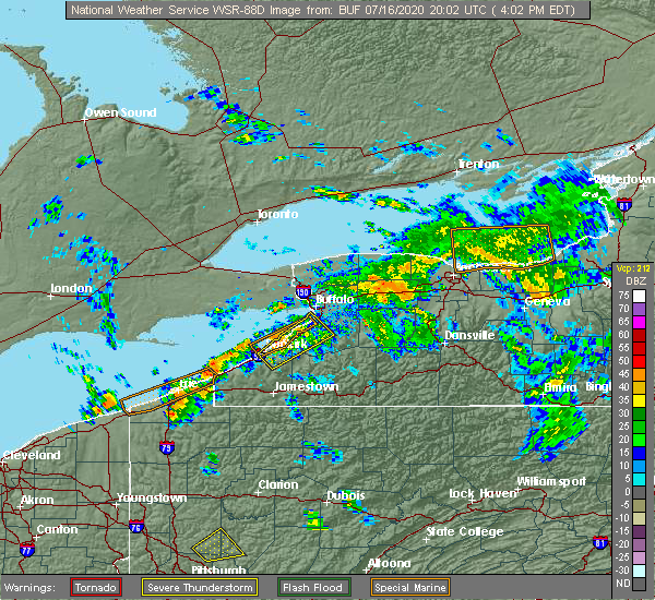 At 413 pm edt, a severe thunderstorm was located near westfield, or 20 miles southwest of fredonia, moving northeast at 35 mph (radar indicated). Hazards include 60 mph wind gusts. expect damage to roofs, siding, and trees At 413 pm edt, a severe thunderstorm was located near westfield, or 20 miles southwest of fredonia, moving northeast at 35 mph (radar indicated). Hazards include 60 mph wind gusts. expect damage to roofs, siding, and trees
|
| 6/10/2020 11:17 PM EDT | Trees down on bentley av in chautauqua county NY, 0.3 miles NE of Lakewood, NY |
| 6/10/2020 11:02 PM EDT |
 At 1102 pm edt, severe thunderstorms were located along a line extending from near lake erie state park to near mayville, moving east at 40 mph (radar indicated). Hazards include 60 mph wind gusts. Expect damage to roofs, siding, and trees. locations impacted include, jamestown, dunkirk, fredonia, westfield, lakewood, silver creek, falconer, mayville, clymer and long point state park. this includes the following highways, interstate 90 between exits 61 and 59. Interstate 86 between exits 4 and 13. At 1102 pm edt, severe thunderstorms were located along a line extending from near lake erie state park to near mayville, moving east at 40 mph (radar indicated). Hazards include 60 mph wind gusts. Expect damage to roofs, siding, and trees. locations impacted include, jamestown, dunkirk, fredonia, westfield, lakewood, silver creek, falconer, mayville, clymer and long point state park. this includes the following highways, interstate 90 between exits 61 and 59. Interstate 86 between exits 4 and 13.
|
| 6/10/2020 10:35 PM EDT |
 At 1035 pm edt, severe thunderstorms were located along a line extending from 13 miles northwest of westfield to near north east, moving east at 40 mph (radar indicated). Hazards include 60 mph wind gusts. expect damage to roofs, siding, and trees At 1035 pm edt, severe thunderstorms were located along a line extending from 13 miles northwest of westfield to near north east, moving east at 40 mph (radar indicated). Hazards include 60 mph wind gusts. expect damage to roofs, siding, and trees
|
| 4/8/2020 12:06 AM EDT |
 The severe thunderstorm warning for chautauqua county will expire at 1215 am edt, the storm which prompted the warning has moved out of the area. therefore, the warning will be allowed to expire. The severe thunderstorm warning for chautauqua county will expire at 1215 am edt, the storm which prompted the warning has moved out of the area. therefore, the warning will be allowed to expire.
|
| 4/7/2020 11:43 PM EDT |
 At 1143 pm edt, a severe thunderstorm was located 10 miles northeast of long point state park, or 10 miles south of fredonia, moving east at 55 mph (radar indicated). Hazards include 60 mph wind gusts and quarter size hail. Minor damage to vehicles is possible. expect wind damage to roofs, siding, and trees. locations impacted include, jamestown, fredonia, westfield, lakewood, falconer, mayville, long point state park, jamestown west, chautauqua institution and chautauqua. this includes the following highways, interstate 90 near exit 59. Interstate 86 between exits 6 and 13. At 1143 pm edt, a severe thunderstorm was located 10 miles northeast of long point state park, or 10 miles south of fredonia, moving east at 55 mph (radar indicated). Hazards include 60 mph wind gusts and quarter size hail. Minor damage to vehicles is possible. expect wind damage to roofs, siding, and trees. locations impacted include, jamestown, fredonia, westfield, lakewood, falconer, mayville, long point state park, jamestown west, chautauqua institution and chautauqua. this includes the following highways, interstate 90 near exit 59. Interstate 86 between exits 6 and 13.
|
| 4/7/2020 11:14 PM EDT |
 At 1114 pm edt, a severe thunderstorm was located 12 miles northwest of westfield and moving southeast at 55 mph (radar indicated). Hazards include 60 mph wind gusts and quarter size hail. Minor damage to vehicles is possible. Expect wind damage to roofs, siding, and trees. At 1114 pm edt, a severe thunderstorm was located 12 miles northwest of westfield and moving southeast at 55 mph (radar indicated). Hazards include 60 mph wind gusts and quarter size hail. Minor damage to vehicles is possible. Expect wind damage to roofs, siding, and trees.
|
| 9/14/2019 12:54 AM EDT |
 At 1254 am edt, severe thunderstorms were located along a line extending from near chautauqua institute to near jamestown west, moving east at 55 mph (radar indicated). Hazards include 60 mph wind gusts. Expect damage to roofs, siding, and trees. locations impacted include, jamestown, fredonia, lakewood, falconer, long point state park, jamestown west, frewsburg, chautauqua, busti and sheridan. This includes interstate 86 between exits 8 and 14. At 1254 am edt, severe thunderstorms were located along a line extending from near chautauqua institute to near jamestown west, moving east at 55 mph (radar indicated). Hazards include 60 mph wind gusts. Expect damage to roofs, siding, and trees. locations impacted include, jamestown, fredonia, lakewood, falconer, long point state park, jamestown west, frewsburg, chautauqua, busti and sheridan. This includes interstate 86 between exits 8 and 14.
|
| 9/14/2019 12:36 AM EDT |
 At 1236 am edt, severe thunderstorms were located along a line extending from 7 miles northeast of findley lake to near clymer, moving northeast at 40 mph (radar indicated). Hazards include 60 mph wind gusts. expect damage to roofs, siding, and trees At 1236 am edt, severe thunderstorms were located along a line extending from 7 miles northeast of findley lake to near clymer, moving northeast at 40 mph (radar indicated). Hazards include 60 mph wind gusts. expect damage to roofs, siding, and trees
|
| 8/8/2019 11:40 AM EDT |
 The severe thunderstorm warning for northwestern cattaraugus, southern erie and chautauqua counties will expire at 1145 am edt, the storms which prompted the warning have moved out of the area. therefore, the warning will be allowed to expire. The severe thunderstorm warning for northwestern cattaraugus, southern erie and chautauqua counties will expire at 1145 am edt, the storms which prompted the warning have moved out of the area. therefore, the warning will be allowed to expire.
|
| 8/8/2019 11:14 AM EDT |
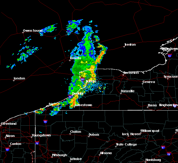 At 1112 am edt, severe thunderstorms were located along a line extending from near eden to jamestown, with additional storms developing near ripley. these storms were moving east at 45 mph (radar indicated). Hazards include 60 mph wind gusts. Expect damage to roofs, siding, and trees. locations impacted include, west seneca, jamestown, lackawanna, dunkirk, fredonia, hamburg, east aurora, evans, boston and eden. this includes the following highways, interstate 90 between exits 60 and 56. Interstate 86 between exits 4 and 16. At 1112 am edt, severe thunderstorms were located along a line extending from near eden to jamestown, with additional storms developing near ripley. these storms were moving east at 45 mph (radar indicated). Hazards include 60 mph wind gusts. Expect damage to roofs, siding, and trees. locations impacted include, west seneca, jamestown, lackawanna, dunkirk, fredonia, hamburg, east aurora, evans, boston and eden. this includes the following highways, interstate 90 between exits 60 and 56. Interstate 86 between exits 4 and 16.
|
| 8/8/2019 10:39 AM EDT |
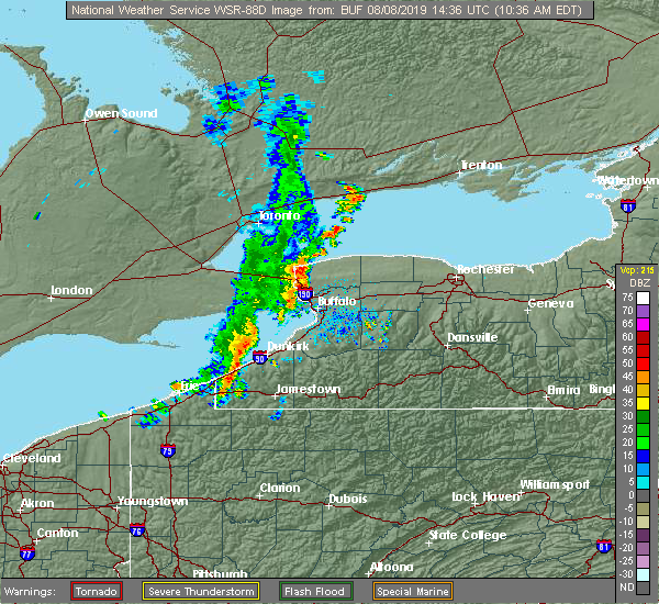 At 1039 am edt, severe thunderstorms were located along a line extending from 17 miles northwest of angola on the lake to findley lake, moving east at 35 mph (radar indicated). Hazards include 60 mph wind gusts. expect damage to roofs, siding, and trees At 1039 am edt, severe thunderstorms were located along a line extending from 17 miles northwest of angola on the lake to findley lake, moving east at 35 mph (radar indicated). Hazards include 60 mph wind gusts. expect damage to roofs, siding, and trees
|
| 6/1/2019 3:37 PM EDT |
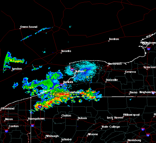 At 336 pm edt, a severe thunderstorm was located over jamestown west, or near jamestown, moving east at 20 mph (radar indicated). Hazards include 60 mph wind gusts and quarter size hail. Minor damage to vehicles is possible. expect wind damage to roofs, siding, and trees. locations impacted include, jamestown, lakewood, falconer, jamestown west, frewsburg, busti, celoron, panama, bemus point and niobe. This includes interstate 86 between exits 8 and 14. At 336 pm edt, a severe thunderstorm was located over jamestown west, or near jamestown, moving east at 20 mph (radar indicated). Hazards include 60 mph wind gusts and quarter size hail. Minor damage to vehicles is possible. expect wind damage to roofs, siding, and trees. locations impacted include, jamestown, lakewood, falconer, jamestown west, frewsburg, busti, celoron, panama, bemus point and niobe. This includes interstate 86 between exits 8 and 14.
|
| 6/1/2019 3:18 PM EDT |
 At 317 pm edt, a severe thunderstorm was located near lakewood, or 9 miles west of jamestown, moving east at 20 mph (radar indicated). Hazards include 60 mph wind gusts and quarter size hail. Minor damage to vehicles is possible. Expect wind damage to roofs, siding, and trees. At 317 pm edt, a severe thunderstorm was located near lakewood, or 9 miles west of jamestown, moving east at 20 mph (radar indicated). Hazards include 60 mph wind gusts and quarter size hail. Minor damage to vehicles is possible. Expect wind damage to roofs, siding, and trees.
|
| 5/25/2019 7:02 PM EDT |
 At 702 pm edt, a severe thunderstorm was located near frewsburg, or 10 miles east of jamestown, moving east at 40 mph (radar indicated). Hazards include 60 mph wind gusts and quarter size hail. Minor damage to vehicles is possible. expect wind damage to roofs, siding, and trees. locations impacted include, jamestown, salamanca, allegany state park, lakewood, falconer, jamestown west, frewsburg, busti, new albion and conewango. This includes interstate 86 between exits 11 and 21. At 702 pm edt, a severe thunderstorm was located near frewsburg, or 10 miles east of jamestown, moving east at 40 mph (radar indicated). Hazards include 60 mph wind gusts and quarter size hail. Minor damage to vehicles is possible. expect wind damage to roofs, siding, and trees. locations impacted include, jamestown, salamanca, allegany state park, lakewood, falconer, jamestown west, frewsburg, busti, new albion and conewango. This includes interstate 86 between exits 11 and 21.
|
| 5/25/2019 6:50 PM EDT |
 At 650 pm edt, a severe thunderstorm was located over frewsburg, or near jamestown, moving east at 40 mph (radar indicated). Hazards include 60 mph wind gusts and quarter size hail. Minor damage to vehicles is possible. expect wind damage to roofs, siding, and trees. locations impacted include, jamestown, salamanca, allegany state park, lakewood, falconer, clymer, jamestown west, frewsburg, busti and new albion. This includes interstate 86 between exits 8 and 21. At 650 pm edt, a severe thunderstorm was located over frewsburg, or near jamestown, moving east at 40 mph (radar indicated). Hazards include 60 mph wind gusts and quarter size hail. Minor damage to vehicles is possible. expect wind damage to roofs, siding, and trees. locations impacted include, jamestown, salamanca, allegany state park, lakewood, falconer, clymer, jamestown west, frewsburg, busti and new albion. This includes interstate 86 between exits 8 and 21.
|
| 5/25/2019 6:28 PM EDT |
 At 628 pm edt, a severe thunderstorm was located 7 miles east of clymer, or 14 miles west of jamestown, moving east at 40 mph (radar indicated). Hazards include 60 mph wind gusts and quarter size hail. Minor damage to vehicles is possible. Expect wind damage to roofs, siding, and trees. At 628 pm edt, a severe thunderstorm was located 7 miles east of clymer, or 14 miles west of jamestown, moving east at 40 mph (radar indicated). Hazards include 60 mph wind gusts and quarter size hail. Minor damage to vehicles is possible. Expect wind damage to roofs, siding, and trees.
|
| 5/25/2019 4:39 PM EDT | Multiple large tree limbs broken off... up to six inches in diamete in chautauqua county NY, 3.3 miles E of Lakewood, NY |
| 5/23/2019 9:59 AM EDT |
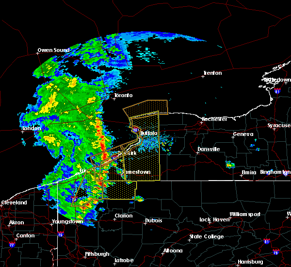 At 958 am edt, severe thunderstorms were located along a line extending from near lake erie state park to near clymer, moving east at 55 mph (radar indicated). Hazards include 60 mph wind gusts and nickel size hail. Expect damage to roofs, siding, and trees. locations impacted include, jamestown, dunkirk, fredonia, westfield, lakewood, falconer, mayville, clymer, long point state park and jamestown west. this includes the following highways, interstate 90 between exits 60 and 59. Interstate 86 between exits 6 and 13. At 958 am edt, severe thunderstorms were located along a line extending from near lake erie state park to near clymer, moving east at 55 mph (radar indicated). Hazards include 60 mph wind gusts and nickel size hail. Expect damage to roofs, siding, and trees. locations impacted include, jamestown, dunkirk, fredonia, westfield, lakewood, falconer, mayville, clymer, long point state park and jamestown west. this includes the following highways, interstate 90 between exits 60 and 59. Interstate 86 between exits 6 and 13.
|
| 5/23/2019 9:27 AM EDT |
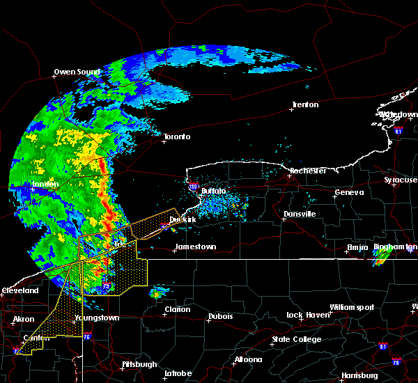 At 926 am edt, severe thunderstorms were located along a line extending from 20 miles northwest of north east to near edinboro, moving east at 55 mph (radar indicated). Hazards include 60 mph wind gusts and nickel size hail. expect damage to roofs, siding, and trees At 926 am edt, severe thunderstorms were located along a line extending from 20 miles northwest of north east to near edinboro, moving east at 55 mph (radar indicated). Hazards include 60 mph wind gusts and nickel size hail. expect damage to roofs, siding, and trees
|
| 4/14/2019 8:32 PM EDT |
 At 831 pm edt, a severe thunderstorm was located 9 miles southeast of fredonia, moving northeast at 45 mph (radar indicated). Hazards include 60 mph wind gusts. Expect damage to roofs, siding, and trees. locations impacted include, jamestown, allegany state park, lakewood, gowanda, falconer, jamestown west, frewsburg, busti, collins and new albion. A tornado watch remains in effect until 300 am edt for western new york. At 831 pm edt, a severe thunderstorm was located 9 miles southeast of fredonia, moving northeast at 45 mph (radar indicated). Hazards include 60 mph wind gusts. Expect damage to roofs, siding, and trees. locations impacted include, jamestown, allegany state park, lakewood, gowanda, falconer, jamestown west, frewsburg, busti, collins and new albion. A tornado watch remains in effect until 300 am edt for western new york.
|
| 4/14/2019 8:03 PM EDT |
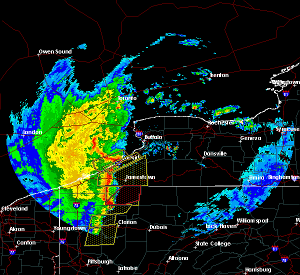 At 802 pm edt, a line of severe thunderstorms located in western chautauqua county, moving northeast at 45 mph (radar indicated). Hazards include 60 mph wind gusts. expect damage to roofs, siding, and trees At 802 pm edt, a line of severe thunderstorms located in western chautauqua county, moving northeast at 45 mph (radar indicated). Hazards include 60 mph wind gusts. expect damage to roofs, siding, and trees
|
| 4/14/2019 7:28 PM EDT |
 At 727 pm edt, a severe thunderstorm was located over findley lake, or 20 miles east of erie, moving northeast at 55 mph (radar indicated). Hazards include 70 mph wind gusts and ping pong ball size hail. People and animals outdoors will be injured. expect hail damage to roofs, siding, windows, and vehicles. expect considerable tree damage. wind damage is also likely to mobile homes, roofs, and outbuildings. locations impacted include, jamestown, fredonia, westfield, lakewood, falconer, mayville, clymer, long point state park, jamestown west and findley lake. A tornado watch remains in effect until 300 am edt for western new york. At 727 pm edt, a severe thunderstorm was located over findley lake, or 20 miles east of erie, moving northeast at 55 mph (radar indicated). Hazards include 70 mph wind gusts and ping pong ball size hail. People and animals outdoors will be injured. expect hail damage to roofs, siding, windows, and vehicles. expect considerable tree damage. wind damage is also likely to mobile homes, roofs, and outbuildings. locations impacted include, jamestown, fredonia, westfield, lakewood, falconer, mayville, clymer, long point state park, jamestown west and findley lake. A tornado watch remains in effect until 300 am edt for western new york.
|
| 4/14/2019 7:07 PM EDT |
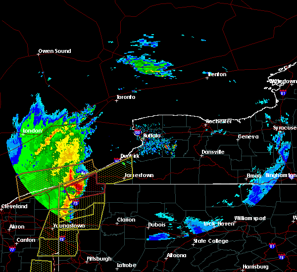 At 707 pm edt, a severe thunderstorm was located over waterford, or 15 miles southeast of erie, moving northeast at 65 mph (radar indicated). Hazards include 60 mph wind gusts and quarter size hail. Minor damage to vehicles is possible. Expect wind damage to roofs, siding, and trees. At 707 pm edt, a severe thunderstorm was located over waterford, or 15 miles southeast of erie, moving northeast at 65 mph (radar indicated). Hazards include 60 mph wind gusts and quarter size hail. Minor damage to vehicles is possible. Expect wind damage to roofs, siding, and trees.
|
| 9/21/2018 6:11 PM EDT |
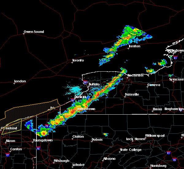 A severe thunderstorm warning remains in effect until 700 pm edt for wyoming. cattaraugus. southeastern erie. southeastern chautauqua and western allegany counties. At 611 pm edt, severe thunderstorms were located along a line extending from near darien lakes state park to near lakewood, moving east at 60 mph. A severe thunderstorm warning remains in effect until 700 pm edt for wyoming. cattaraugus. southeastern erie. southeastern chautauqua and western allegany counties. At 611 pm edt, severe thunderstorms were located along a line extending from near darien lakes state park to near lakewood, moving east at 60 mph.
|
| 9/21/2018 5:54 PM EDT |
 At 553 pm edt, severe thunderstorms were located along a line extending from west seneca to near clymer, moving east at 60 mph (radar indicated). Hazards include 60 mph wind gusts. expect damage to roofs, siding, and trees At 553 pm edt, severe thunderstorms were located along a line extending from west seneca to near clymer, moving east at 60 mph (radar indicated). Hazards include 60 mph wind gusts. expect damage to roofs, siding, and trees
|
| 9/21/2018 5:42 PM EDT |
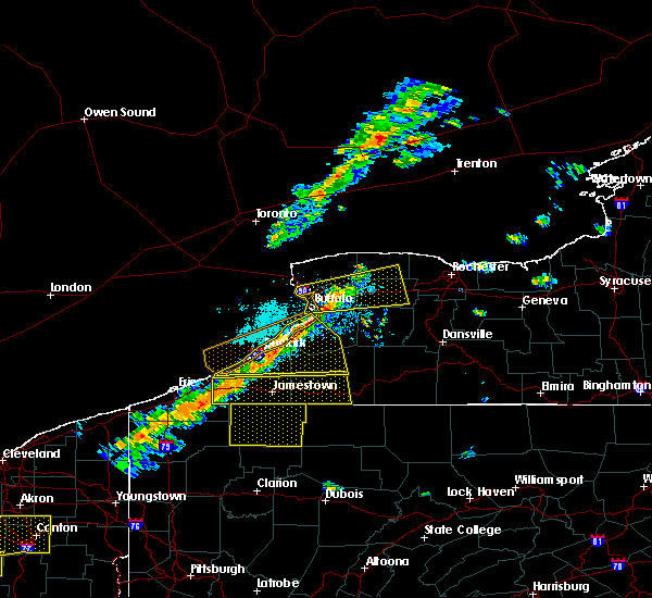 At 541 pm edt, severe thunderstorms were located along a line extending from near fredonia to near findley lake, moving east at 70 mph (radar indicated). Hazards include 60 mph wind gusts. Expect damage to roofs, siding, and trees. Locations impacted include, jamestown, salamanca, allegany state park, lakewood, falconer, mayville, clymer, long point state park, jamestown west and findley lake. At 541 pm edt, severe thunderstorms were located along a line extending from near fredonia to near findley lake, moving east at 70 mph (radar indicated). Hazards include 60 mph wind gusts. Expect damage to roofs, siding, and trees. Locations impacted include, jamestown, salamanca, allegany state park, lakewood, falconer, mayville, clymer, long point state park, jamestown west and findley lake.
|
| 9/21/2018 5:22 PM EDT |
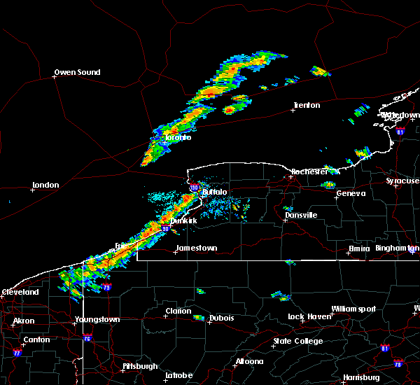 The national weather service in buffalo has issued a * severe thunderstorm warning for. southwestern cattaraugus county in western new york. chautauqua county in western new york. until 600 pm edt. At 522 pm edt, severe thunderstorms were located along a line. The national weather service in buffalo has issued a * severe thunderstorm warning for. southwestern cattaraugus county in western new york. chautauqua county in western new york. until 600 pm edt. At 522 pm edt, severe thunderstorms were located along a line.
|
| 8/21/2018 4:53 PM EDT |
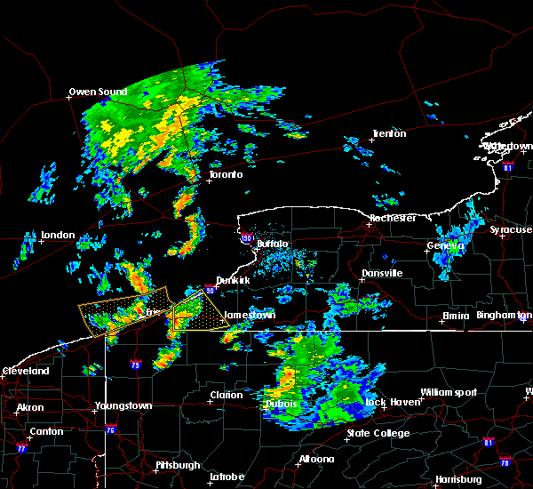 The severe thunderstorm warning for southern chautauqua county will expire at 500 pm edt, the storm which prompted the warning has weakened below severe limits, and no longer poses an immediate threat to life or property. therefore, the warning will be allowed to expire. however gusty winds are still possible with this thunderstorm. to report severe weather, contact your nearest law enforcement agency. they will relay your report to the national weather service buffalo. The severe thunderstorm warning for southern chautauqua county will expire at 500 pm edt, the storm which prompted the warning has weakened below severe limits, and no longer poses an immediate threat to life or property. therefore, the warning will be allowed to expire. however gusty winds are still possible with this thunderstorm. to report severe weather, contact your nearest law enforcement agency. they will relay your report to the national weather service buffalo.
|
| 8/21/2018 4:35 PM EDT |
 At 435 pm edt, a severe thunderstorm was located over findley lake, or 21 miles east of erie, moving northeast at 25 mph (radar indicated). Hazards include 60 mph wind gusts. Expect damage to roofs, siding, and trees. Locations impacted include, jamestown, westfield, lakewood, falconer, mayville, clymer, long point state park and jamestown west. At 435 pm edt, a severe thunderstorm was located over findley lake, or 21 miles east of erie, moving northeast at 25 mph (radar indicated). Hazards include 60 mph wind gusts. Expect damage to roofs, siding, and trees. Locations impacted include, jamestown, westfield, lakewood, falconer, mayville, clymer, long point state park and jamestown west.
|
| 8/21/2018 4:07 PM EDT |
 At 407 pm edt, a severe thunderstorm was located near wattsburg, or 15 miles southeast of erie, moving east at 35 mph (radar indicated). Hazards include 60 mph wind gusts. expect damage to roofs, siding, and trees At 407 pm edt, a severe thunderstorm was located near wattsburg, or 15 miles southeast of erie, moving east at 35 mph (radar indicated). Hazards include 60 mph wind gusts. expect damage to roofs, siding, and trees
|
| 7/16/2018 8:47 PM EDT |
 At 846 pm edt, a severe thunderstorm was located near russell, or 8 miles south of jamestown, moving northeast at 30 mph (radar indicated). Hazards include 60 mph wind gusts. expect damage to roofs, siding, and trees At 846 pm edt, a severe thunderstorm was located near russell, or 8 miles south of jamestown, moving northeast at 30 mph (radar indicated). Hazards include 60 mph wind gusts. expect damage to roofs, siding, and trees
|
| 7/16/2018 8:20 PM EDT |
 At 820 pm edt, a severe thunderstorm was located over clymer, or 20 miles west of jamestown, moving northeast at 30 mph (radar indicated). Hazards include 60 mph wind gusts and penny size hail. Expect damage to roofs, siding, and trees. Locations impacted include, lakewood, mayville, clymer, findley lake, long point state park, chautauqua institute, chautauqua and busti. At 820 pm edt, a severe thunderstorm was located over clymer, or 20 miles west of jamestown, moving northeast at 30 mph (radar indicated). Hazards include 60 mph wind gusts and penny size hail. Expect damage to roofs, siding, and trees. Locations impacted include, lakewood, mayville, clymer, findley lake, long point state park, chautauqua institute, chautauqua and busti.
|
| 7/16/2018 7:59 PM EDT |
 The national weather service in buffalo has issued a * severe thunderstorm warning for. southwestern chautauqua county in western new york. until 845 pm edt. At 757 pm edt, a severe thunderstorm was located 20 miles southeast of erie, moving northeast at 45 mph. The national weather service in buffalo has issued a * severe thunderstorm warning for. southwestern chautauqua county in western new york. until 845 pm edt. At 757 pm edt, a severe thunderstorm was located 20 miles southeast of erie, moving northeast at 45 mph.
|
| 6/18/2018 7:19 PM EDT |
 At 716 pm edt, a severe thunderstorm was located 10 miles northeast of long point state park, or 11 miles north of jamestown, moving east at 55 mph (radar indicated). Hazards include 60 mph wind gusts. Expect damage to roofs, siding, and trees. Locations impacted include, jamestown, dunkirk, fredonia, lakewood, falconer, mayville, clymer and long point state park. At 716 pm edt, a severe thunderstorm was located 10 miles northeast of long point state park, or 11 miles north of jamestown, moving east at 55 mph (radar indicated). Hazards include 60 mph wind gusts. Expect damage to roofs, siding, and trees. Locations impacted include, jamestown, dunkirk, fredonia, lakewood, falconer, mayville, clymer and long point state park.
|
| 6/18/2018 6:39 PM EDT |
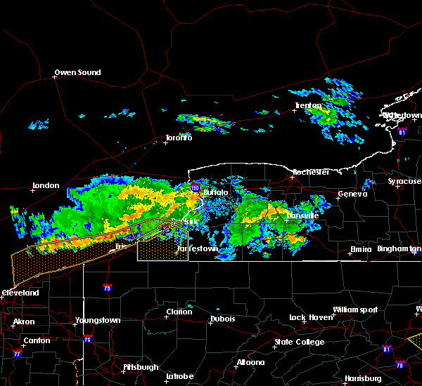 At 637 pm edt, a severe thunderstorm was located 11 miles northwest of north east, or 18 miles northeast of erie, moving east at 50 mph (radar indicated). Hazards include 60 mph wind gusts. expect damage to roofs, siding, and trees At 637 pm edt, a severe thunderstorm was located 11 miles northwest of north east, or 18 miles northeast of erie, moving east at 50 mph (radar indicated). Hazards include 60 mph wind gusts. expect damage to roofs, siding, and trees
|
| 5/4/2018 4:04 PM EDT |
 At 403 pm edt, a severe thunderstorm was located 8 miles north of falconer, or 9 miles north of jamestown, moving east at 65 mph (radar indicated). Hazards include 60 mph wind gusts. Expect wind damage to trees and power lines. locations impacted include, jamestown, salamanca, allegany state park, lakewood, falconer, ashford, franklinville and mayville. This includes interstate 86 between exits 4 and 23. At 403 pm edt, a severe thunderstorm was located 8 miles north of falconer, or 9 miles north of jamestown, moving east at 65 mph (radar indicated). Hazards include 60 mph wind gusts. Expect wind damage to trees and power lines. locations impacted include, jamestown, salamanca, allegany state park, lakewood, falconer, ashford, franklinville and mayville. This includes interstate 86 between exits 4 and 23.
|
| 5/4/2018 3:35 PM EDT |
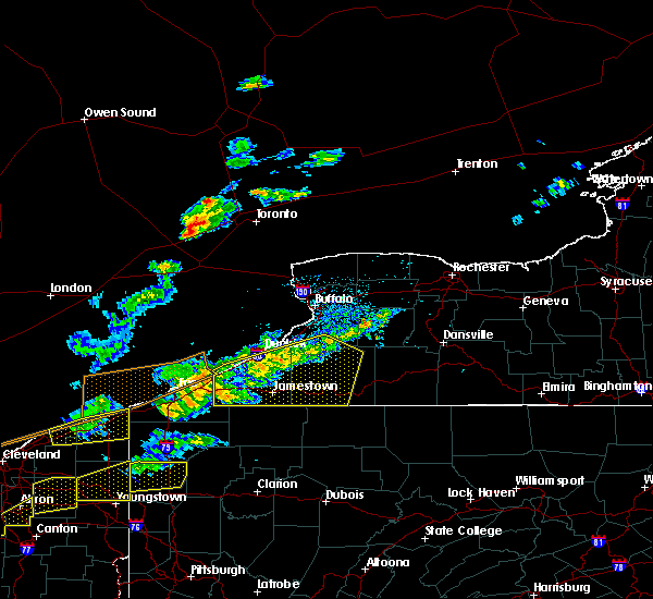 At 334 pm edt, a severe thunderstorm was located near findley lake, or 14 miles east of erie, moving east at 65 mph (radar indicated). Hazards include 60 mph wind gusts. expect wind damage to trees and power lines At 334 pm edt, a severe thunderstorm was located near findley lake, or 14 miles east of erie, moving east at 65 mph (radar indicated). Hazards include 60 mph wind gusts. expect wind damage to trees and power lines
|
| 11/5/2017 7:16 PM EST |
 At 712 pm est, a severe thunderstorm was located 11 miles southwest of gowanda, or 12 miles southeast of fredonia, moving east at 30 mph. additional severe thunderstorms may move into the warned area from the west (radar indicated). Hazards include 60 mph wind gusts. Expect wind damage to trees and power lines. locations impacted include, jamestown, dunkirk, fredonia, salamanca, allegany state park, westfield, lakewood and gowanda. this includes the following highways, interstate 90 between exits 61 and 58. Interstate 86 between exits 4 and 21. At 712 pm est, a severe thunderstorm was located 11 miles southwest of gowanda, or 12 miles southeast of fredonia, moving east at 30 mph. additional severe thunderstorms may move into the warned area from the west (radar indicated). Hazards include 60 mph wind gusts. Expect wind damage to trees and power lines. locations impacted include, jamestown, dunkirk, fredonia, salamanca, allegany state park, westfield, lakewood and gowanda. this includes the following highways, interstate 90 between exits 61 and 58. Interstate 86 between exits 4 and 21.
|
| 11/5/2017 7:38 PM EDT |
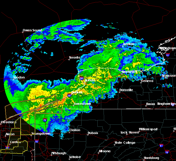 At 637 pm est, a severe thunderstorm was located near mayville, or 12 miles southwest of fredonia, moving east at 45 mph (radar indicated). Hazards include 60 mph wind gusts. expect wind damage to trees and power lines At 637 pm est, a severe thunderstorm was located near mayville, or 12 miles southwest of fredonia, moving east at 45 mph (radar indicated). Hazards include 60 mph wind gusts. expect wind damage to trees and power lines
|
| 9/4/2017 11:21 PM EDT |
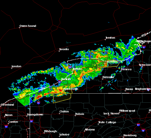 At 1121 pm edt, a severe thunderstorm was located over jamestown west, or near jamestown, moving east at 55 mph (radar indicated). Hazards include 60 mph wind gusts. Expect wind damage to trees and power lines. locations impacted include, jamestown, allegany state park, lakewood, falconer, clymer, long point state park, jamestown west and frewsburg. This includes interstate 86 between exits 7 and 17. At 1121 pm edt, a severe thunderstorm was located over jamestown west, or near jamestown, moving east at 55 mph (radar indicated). Hazards include 60 mph wind gusts. Expect wind damage to trees and power lines. locations impacted include, jamestown, allegany state park, lakewood, falconer, clymer, long point state park, jamestown west and frewsburg. This includes interstate 86 between exits 7 and 17.
|
| 9/4/2017 11:15 PM EDT | Trees down in chautauqua county NY, 0.3 miles NE of Lakewood, NY |
| 9/4/2017 10:59 PM EDT |
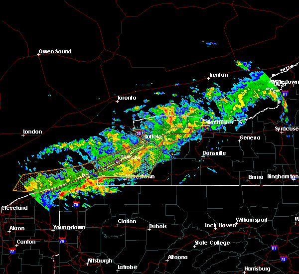 At 1059 pm edt, a severe thunderstorm was located near findley lake, or 21 miles west of jamestown, moving east at 60 mph (radar indicated). Hazards include 60 mph wind gusts. expect wind damage to trees and power lines At 1059 pm edt, a severe thunderstorm was located near findley lake, or 21 miles west of jamestown, moving east at 60 mph (radar indicated). Hazards include 60 mph wind gusts. expect wind damage to trees and power lines
|
| 8/22/2017 3:09 PM EDT |
 At 309 pm edt, severe thunderstorms were located along a line extending from near attica to near lottsville, moving east at 30 mph (radar indicated). Hazards include 60 mph wind gusts. Expect wind damage to trees and power lines. locations impacted include, jamestown, geneseo, salamanca, letchworth state park, allegany state park, springville, perry and warsaw. this includes the following highways, interstate 390 between exits 9 and 10. interstate 86 between exits 11 and 21. A tornado watch remains in effect until 900 pm edt for western new york. At 309 pm edt, severe thunderstorms were located along a line extending from near attica to near lottsville, moving east at 30 mph (radar indicated). Hazards include 60 mph wind gusts. Expect wind damage to trees and power lines. locations impacted include, jamestown, geneseo, salamanca, letchworth state park, allegany state park, springville, perry and warsaw. this includes the following highways, interstate 390 between exits 9 and 10. interstate 86 between exits 11 and 21. A tornado watch remains in effect until 900 pm edt for western new york.
|
| 8/22/2017 2:48 PM EDT |
 At 248 pm edt, severe thunderstorms were located along a line extending from near bennington to near columbus, moving east at 25 mph (radar indicated). Hazards include 60 mph wind gusts. expect wind damage to trees and power lines At 248 pm edt, severe thunderstorms were located along a line extending from near bennington to near columbus, moving east at 25 mph (radar indicated). Hazards include 60 mph wind gusts. expect wind damage to trees and power lines
|
| 8/4/2017 1:13 PM EDT |
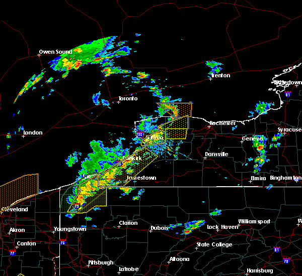 At 112 pm edt, a severe thunderstorm was located over silver creek, or 9 miles east of dunkirk, moving northeast at 50 mph (radar indicated). Hazards include 60 mph wind gusts and penny size hail. Expect wind damage to trees and power lines. locations impacted include, jamestown, dunkirk, fredonia, hamburg, evans, boston, eden and springville. this includes the following highways, interstate 90 between exits 59 and 57. Interstate 86 between exits 4 and 13. At 112 pm edt, a severe thunderstorm was located over silver creek, or 9 miles east of dunkirk, moving northeast at 50 mph (radar indicated). Hazards include 60 mph wind gusts and penny size hail. Expect wind damage to trees and power lines. locations impacted include, jamestown, dunkirk, fredonia, hamburg, evans, boston, eden and springville. this includes the following highways, interstate 90 between exits 59 and 57. Interstate 86 between exits 4 and 13.
|
| 8/4/2017 12:55 PM EDT |
 At 1255 pm edt, a severe thunderstorm was located near mayville, or 12 miles southwest of fredonia, moving northeast at 50 mph (radar indicated). Hazards include 60 mph wind gusts and quarter size hail. Minor damage to vehicles is possible. Expect wind damage to trees and power lines. At 1255 pm edt, a severe thunderstorm was located near mayville, or 12 miles southwest of fredonia, moving northeast at 50 mph (radar indicated). Hazards include 60 mph wind gusts and quarter size hail. Minor damage to vehicles is possible. Expect wind damage to trees and power lines.
|
| 6/18/2017 7:36 PM EDT |
 At 736 pm edt, severe thunderstorms were located along a line extending from mayville to near lottsville, moving northeast at 40 mph (radar indicated). Hazards include 60 mph wind gusts. expect wind damage to trees and power lines At 736 pm edt, severe thunderstorms were located along a line extending from mayville to near lottsville, moving northeast at 40 mph (radar indicated). Hazards include 60 mph wind gusts. expect wind damage to trees and power lines
|
| 6/18/2017 7:14 PM EDT |
 At 641 pm edt, severe thunderstorms were located along a line extending from near erie to near harmonsburg, moving northeast at 75 mph (radar indicated). Hazards include 60 mph wind gusts. expect wind damage to trees and power lines At 641 pm edt, severe thunderstorms were located along a line extending from near erie to near harmonsburg, moving northeast at 75 mph (radar indicated). Hazards include 60 mph wind gusts. expect wind damage to trees and power lines
|
| 6/18/2017 6:41 PM EDT |
 At 641 pm edt, severe thunderstorms were located along a line extending from near erie to near harmonsburg, moving northeast at 75 mph (radar indicated). Hazards include 60 mph wind gusts. expect wind damage to trees and power lines At 641 pm edt, severe thunderstorms were located along a line extending from near erie to near harmonsburg, moving northeast at 75 mph (radar indicated). Hazards include 60 mph wind gusts. expect wind damage to trees and power lines
|
| 6/18/2017 4:14 PM EDT |
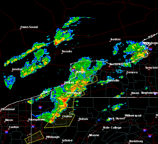 At 413 pm edt, severe thunderstorms were located along a line extending from frewsburg to chapman state park, moving northeast at 55 mph (radar indicated). Hazards include 70 mph wind gusts. Expect considerable tree damage. damage is likely to mobile homes, roofs, and outbuildings. locations impacted include, jamestown, salamanca, allegany state park, lakewood, falconer, jamestown west, frewsburg and busti. This includes interstate 86 between exits 11 and 23. At 413 pm edt, severe thunderstorms were located along a line extending from frewsburg to chapman state park, moving northeast at 55 mph (radar indicated). Hazards include 70 mph wind gusts. Expect considerable tree damage. damage is likely to mobile homes, roofs, and outbuildings. locations impacted include, jamestown, salamanca, allegany state park, lakewood, falconer, jamestown west, frewsburg and busti. This includes interstate 86 between exits 11 and 23.
|
| 6/18/2017 3:45 PM EDT |
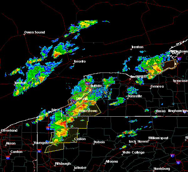 At 345 pm edt, a severe thunderstorm was located over lottsville, or 13 miles southwest of jamestown, moving northeast at 50 mph (radar indicated). Hazards include 70 mph wind gusts. Expect considerable tree damage. Damage is likely to mobile homes, roofs, and outbuildings. At 345 pm edt, a severe thunderstorm was located over lottsville, or 13 miles southwest of jamestown, moving northeast at 50 mph (radar indicated). Hazards include 70 mph wind gusts. Expect considerable tree damage. Damage is likely to mobile homes, roofs, and outbuildings.
|
| 6/18/2017 2:42 PM EDT |
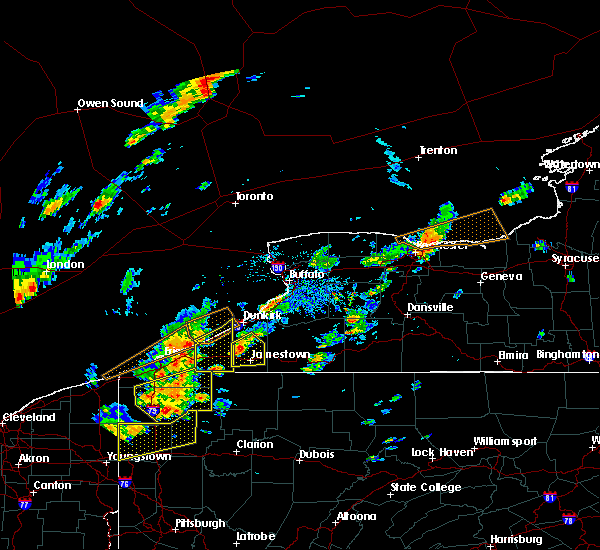 At 242 pm edt, a severe thunderstorm was located near long point state park, or 9 miles northwest of jamestown, moving northeast at 35 mph (radar indicated). Hazards include 60 mph wind gusts. Expect wind damage to trees and power lines. locations impacted include, jamestown, lakewood, falconer, jamestown west, long point state park, frewsburg, gerry and ellington. This includes interstate 86 between exits 8 and 14. At 242 pm edt, a severe thunderstorm was located near long point state park, or 9 miles northwest of jamestown, moving northeast at 35 mph (radar indicated). Hazards include 60 mph wind gusts. Expect wind damage to trees and power lines. locations impacted include, jamestown, lakewood, falconer, jamestown west, long point state park, frewsburg, gerry and ellington. This includes interstate 86 between exits 8 and 14.
|
| 6/18/2017 2:23 PM EDT |
 At 221 pm edt, a severe thunderstorm was located 7 miles south of chautauqua institute, or 14 miles west of jamestown, moving northeast at 35 mph (radar indicated). Hazards include 60 mph wind gusts and penny size hail. expect wind damage to trees and power lines At 221 pm edt, a severe thunderstorm was located 7 miles south of chautauqua institute, or 14 miles west of jamestown, moving northeast at 35 mph (radar indicated). Hazards include 60 mph wind gusts and penny size hail. expect wind damage to trees and power lines
|
| 5/18/2017 9:01 PM EDT |
 At 901 pm edt, a severe thunderstorm was located near clymer, or 19 miles west of jamestown, moving east at 50 mph (radar indicated). Hazards include 60 mph wind gusts and quarter size hail. Minor damage to vehicles is possible. Expect wind damage to trees and power lines. At 901 pm edt, a severe thunderstorm was located near clymer, or 19 miles west of jamestown, moving east at 50 mph (radar indicated). Hazards include 60 mph wind gusts and quarter size hail. Minor damage to vehicles is possible. Expect wind damage to trees and power lines.
|
| 5/1/2017 3:32 PM EDT |
 At 330 pm edt, severe thunderstorms were located along a line extending from near dunkirk to jamestown, moving northeast at 60 mph (law enforcement reported numerous downed trees and powerlines across chautuauqua county). Hazards include 70 mph wind gusts. Expect considerable tree damage. damage is likely to mobile homes, roofs, and outbuildings. locations impacted include, jamestown, dunkirk, fredonia, hamburg, east aurora, salamanca, allegany state park and evans. this includes the following highways, interstate 90 between exits 59 and 57a. interstate 86 between exits 11 and 21. A tornado watch remains in effect until 1000 pm edt for western new york. At 330 pm edt, severe thunderstorms were located along a line extending from near dunkirk to jamestown, moving northeast at 60 mph (law enforcement reported numerous downed trees and powerlines across chautuauqua county). Hazards include 70 mph wind gusts. Expect considerable tree damage. damage is likely to mobile homes, roofs, and outbuildings. locations impacted include, jamestown, dunkirk, fredonia, hamburg, east aurora, salamanca, allegany state park and evans. this includes the following highways, interstate 90 between exits 59 and 57a. interstate 86 between exits 11 and 21. A tornado watch remains in effect until 1000 pm edt for western new york.
|
| 5/1/2017 3:06 PM EDT |
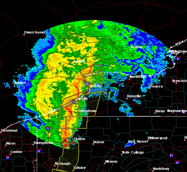 At 306 pm edt, severe thunderstorms were located along a line extending from near lake erie state park to near lottsville, moving northeast at 75 mph (radar indicated). Hazards include 70 mph wind gusts. Expect considerable tree damage. Damage is likely to mobile homes, roofs, and outbuildings. At 306 pm edt, severe thunderstorms were located along a line extending from near lake erie state park to near lottsville, moving northeast at 75 mph (radar indicated). Hazards include 70 mph wind gusts. Expect considerable tree damage. Damage is likely to mobile homes, roofs, and outbuildings.
|
| 5/1/2017 2:44 PM EDT |
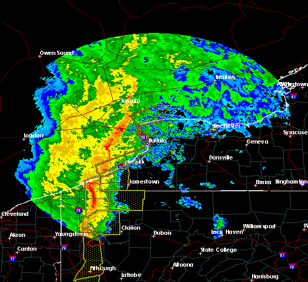 At 243 pm edt, severe thunderstorms were located along a line extending from near northwest harborcreek to union city to near guys mills, moving northeast at 60 mph (radar indicated). Hazards include 70 mph wind gusts. Expect considerable tree damage. damage is likely to mobile homes, roofs, and outbuildings. locations impacted include, jamestown, dunkirk, fredonia, westfield, lakewood, mayville, clymer and long point state park. this includes the following highways, interstate 90 between exits 61 and 59. interstate 86 between exits 4 and 12. A tornado watch remains in effect until 1000 pm edt for western new york. At 243 pm edt, severe thunderstorms were located along a line extending from near northwest harborcreek to union city to near guys mills, moving northeast at 60 mph (radar indicated). Hazards include 70 mph wind gusts. Expect considerable tree damage. damage is likely to mobile homes, roofs, and outbuildings. locations impacted include, jamestown, dunkirk, fredonia, westfield, lakewood, mayville, clymer and long point state park. this includes the following highways, interstate 90 between exits 61 and 59. interstate 86 between exits 4 and 12. A tornado watch remains in effect until 1000 pm edt for western new york.
|
| 5/1/2017 2:20 PM EDT |
 At 219 pm edt, severe thunderstorms were located along a line extending from near girard to near meadville to 8 miles southeast of atlantic, moving northeast at 60 mph (radar indicated). Hazards include 70 mph wind gusts. Expect considerable tree damage. Damage is likely to mobile homes, roofs, and outbuildings. At 219 pm edt, severe thunderstorms were located along a line extending from near girard to near meadville to 8 miles southeast of atlantic, moving northeast at 60 mph (radar indicated). Hazards include 70 mph wind gusts. Expect considerable tree damage. Damage is likely to mobile homes, roofs, and outbuildings.
|
| 9/10/2016 7:59 PM EDT |
 At 759 pm edt, severe thunderstorms were located along a line extending from near orchard park to 6 miles west of gowanda to near fredonia to near lottsville, moving northeast at 40 mph (radar indicated). Hazards include 60 mph wind gusts. Expect damage to roofs. siding. And trees. At 759 pm edt, severe thunderstorms were located along a line extending from near orchard park to 6 miles west of gowanda to near fredonia to near lottsville, moving northeast at 40 mph (radar indicated). Hazards include 60 mph wind gusts. Expect damage to roofs. siding. And trees.
|
| 9/10/2016 7:47 PM EDT |
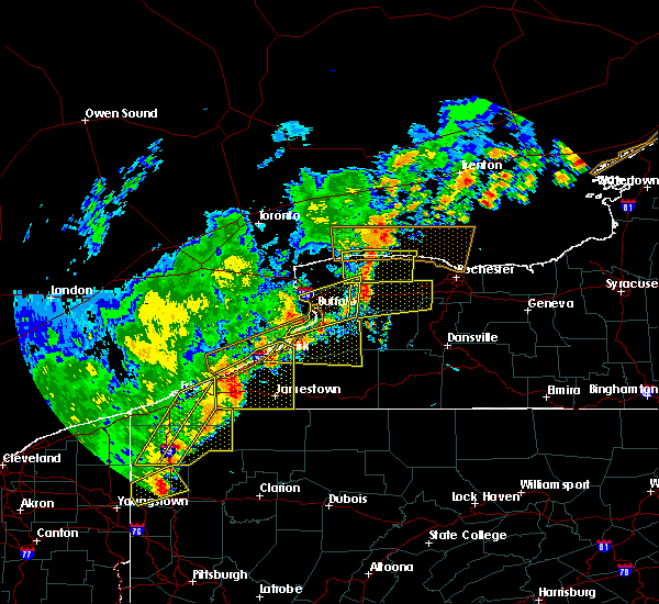 At 747 pm edt, a severe thunderstorm was located over long point state park, or 11 miles northwest of jamestown, moving northeast at 55 mph (radar indicated). Hazards include 60 mph wind gusts and penny size hail. Expect damage to roofs. siding. and trees. locations impacted include, jamestown, dunkirk, fredonia, westfield, lakewood, silver creek, falconer and mayville. this includes the following highways, interstate 90 between exits 61 and 58. Interstate 86 between exits 4 and 14. At 747 pm edt, a severe thunderstorm was located over long point state park, or 11 miles northwest of jamestown, moving northeast at 55 mph (radar indicated). Hazards include 60 mph wind gusts and penny size hail. Expect damage to roofs. siding. and trees. locations impacted include, jamestown, dunkirk, fredonia, westfield, lakewood, silver creek, falconer and mayville. this includes the following highways, interstate 90 between exits 61 and 58. Interstate 86 between exits 4 and 14.
|
| 9/10/2016 7:32 PM EDT |
 At 732 pm edt, severe thunderstorms were located along a line extending from silver creek to near wattsburg, moving northeast at 45 mph (radar indicated). Hazards include 60 mph wind gusts. Expect damage to roofs. siding. and trees. locations impacted include, jamestown, dunkirk, fredonia, westfield, lakewood, silver creek, falconer and mayville. this includes the following highways, interstate 90 between exits 61 and 58. Interstate 86 between exits 4 and 14. At 732 pm edt, severe thunderstorms were located along a line extending from silver creek to near wattsburg, moving northeast at 45 mph (radar indicated). Hazards include 60 mph wind gusts. Expect damage to roofs. siding. and trees. locations impacted include, jamestown, dunkirk, fredonia, westfield, lakewood, silver creek, falconer and mayville. this includes the following highways, interstate 90 between exits 61 and 58. Interstate 86 between exits 4 and 14.
|
| 9/10/2016 6:56 PM EDT |
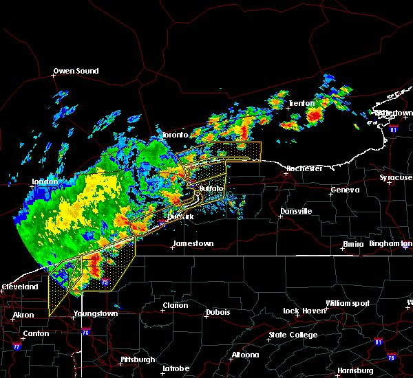 At 655 pm edt, severe thunderstorms were located along a line extending from near westfield to near albion ohio, moving east at 50 mph (radar indicated). Hazards include 60 mph wind gusts. Expect damage to roofs. siding. And trees. At 655 pm edt, severe thunderstorms were located along a line extending from near westfield to near albion ohio, moving east at 50 mph (radar indicated). Hazards include 60 mph wind gusts. Expect damage to roofs. siding. And trees.
|
| 9/8/2016 4:36 PM EDT |
 At 435 pm edt, a severe thunderstorm was located over long point state park, or 10 miles northwest of jamestown, moving east at 40 mph (radar indicated). Hazards include 60 mph wind gusts. Expect damage to roofs. siding. and trees. locations impacted include, jamestown, fredonia, westfield, lakewood, falconer, mayville, clymer and jamestown west. This includes interstate 86 between exits 4 and 13. At 435 pm edt, a severe thunderstorm was located over long point state park, or 10 miles northwest of jamestown, moving east at 40 mph (radar indicated). Hazards include 60 mph wind gusts. Expect damage to roofs. siding. and trees. locations impacted include, jamestown, fredonia, westfield, lakewood, falconer, mayville, clymer and jamestown west. This includes interstate 86 between exits 4 and 13.
|
| 9/8/2016 3:56 PM EDT |
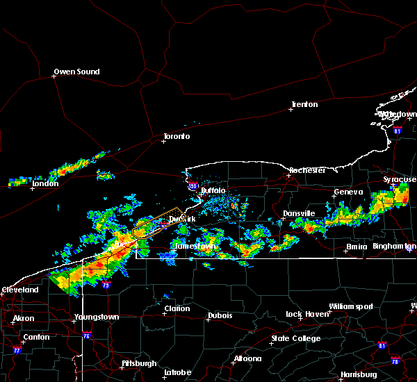 At 356 pm edt, a severe thunderstorm was located near north east, or 13 miles east of erie, moving northeast at 45 mph (radar indicated). Hazards include 60 mph wind gusts. Expect damage to roofs. siding. And trees. At 356 pm edt, a severe thunderstorm was located near north east, or 13 miles east of erie, moving northeast at 45 mph (radar indicated). Hazards include 60 mph wind gusts. Expect damage to roofs. siding. And trees.
|
| 8/13/2016 5:56 PM EDT |
 The severe thunderstorm warning for eastern chautauqua county will expire at 600 pm edt, the storms which prompted the warning have weakened below severe limits, and no longer pose an immediate threat to life or property. therefore, the warning will be allowed to expire. however heavy rain is still possible with these thunderstorms. The severe thunderstorm warning for eastern chautauqua county will expire at 600 pm edt, the storms which prompted the warning have weakened below severe limits, and no longer pose an immediate threat to life or property. therefore, the warning will be allowed to expire. however heavy rain is still possible with these thunderstorms.
|
| 8/13/2016 5:39 PM EDT |
 At 538 pm edt, severe thunderstorms were located along a line extending from 6 miles northeast of mayville to near lakewood, moving east at 45 mph (radar indicated). Hazards include 60 mph wind gusts. Expect damage to roofs. siding. and trees. locations impacted include, jamestown, fredonia, lakewood, falconer, mayville, chautauqua institute, long point state park and jamestown west. This includes interstate 86 between exits 7 and 14. At 538 pm edt, severe thunderstorms were located along a line extending from 6 miles northeast of mayville to near lakewood, moving east at 45 mph (radar indicated). Hazards include 60 mph wind gusts. Expect damage to roofs. siding. and trees. locations impacted include, jamestown, fredonia, lakewood, falconer, mayville, chautauqua institute, long point state park and jamestown west. This includes interstate 86 between exits 7 and 14.
|
| 8/13/2016 5:17 PM EDT |
 At 516 pm edt, a severe thunderstorm was located over chautauqua institute, or 16 miles northwest of jamestown, moving east at 55 mph (radar indicated). Hazards include 60 mph wind gusts. Expect damage to roofs. siding. And trees. At 516 pm edt, a severe thunderstorm was located over chautauqua institute, or 16 miles northwest of jamestown, moving east at 55 mph (radar indicated). Hazards include 60 mph wind gusts. Expect damage to roofs. siding. And trees.
|
| 7/25/2016 1:17 PM EDT |
 At 116 pm edt, a severe thunderstorm was located 10 miles east of frewsburg, or 11 miles west of allegany state park, moving east at 20 mph (radar indicated). Hazards include 60 mph wind gusts. Expect damage to roofs. siding. and trees. Locations impacted include, jamestown, salamanca, allegany state park, falconer, jamestown west, frewsburg, carrollton and randolph. At 116 pm edt, a severe thunderstorm was located 10 miles east of frewsburg, or 11 miles west of allegany state park, moving east at 20 mph (radar indicated). Hazards include 60 mph wind gusts. Expect damage to roofs. siding. and trees. Locations impacted include, jamestown, salamanca, allegany state park, falconer, jamestown west, frewsburg, carrollton and randolph.
|
| 7/25/2016 12:38 PM EDT |
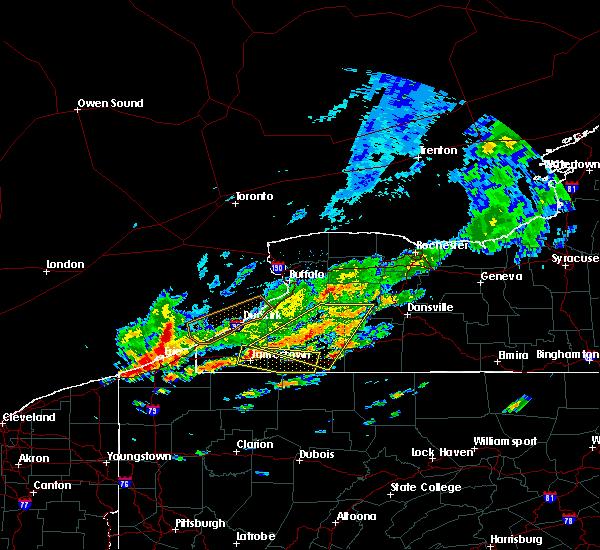 At 1237 pm edt, a severe thunderstorm was located near falconer, or near jamestown, moving east at 30 mph (radar indicated). Hazards include 60 mph wind gusts. Expect damage to roofs. siding. And trees. At 1237 pm edt, a severe thunderstorm was located near falconer, or near jamestown, moving east at 30 mph (radar indicated). Hazards include 60 mph wind gusts. Expect damage to roofs. siding. And trees.
|
| 6/5/2016 5:00 PM EDT | Twitter post of tree on house in lakewood in chautauqua county NY, 0.3 miles NE of Lakewood, NY |
| 6/5/2016 4:34 PM EDT |
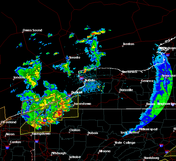 At 434 pm edt, a severe thunderstorm was located near long point state park, or 12 miles west of jamestown, moving northeast at 40 mph (radar indicated). Hazards include 60 mph wind gusts. Expect damage to roofs. siding. and trees. Locations impacted include, jamestown, lakewood, falconer, mayville, jamestown west, chautauqua institute, long point state park and frewsburg. At 434 pm edt, a severe thunderstorm was located near long point state park, or 12 miles west of jamestown, moving northeast at 40 mph (radar indicated). Hazards include 60 mph wind gusts. Expect damage to roofs. siding. and trees. Locations impacted include, jamestown, lakewood, falconer, mayville, jamestown west, chautauqua institute, long point state park and frewsburg.
|
| 6/5/2016 4:03 PM EDT |
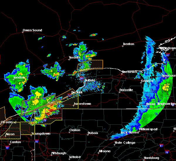 At 403 pm edt, a severe thunderstorm was located over wattsburg, or 16 miles southeast of erie, moving northeast at 50 mph. Hazards include 60 mph wind gusts and quarter size hail. Hail damage to vehicles is expected. Expect wind damage to roofs, siding, and trees. At 403 pm edt, a severe thunderstorm was located over wattsburg, or 16 miles southeast of erie, moving northeast at 50 mph. Hazards include 60 mph wind gusts and quarter size hail. Hail damage to vehicles is expected. Expect wind damage to roofs, siding, and trees.
|
| 6/23/2015 5:11 AM EDT |
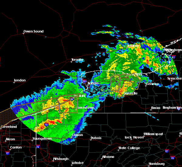 At 511 am edt, doppler radar indicated a line of severe thunderstorms capable of producing damaging winds in excess of 60 mph. these storms were located along a line extending from near lake erie state park to 6 miles east of clymer, moving northeast at 60 mph. locations impacted include, jamestown, dunkirk, fredonia, westfield, lakewood, silver creek, falconer and mayville. At 511 am edt, doppler radar indicated a line of severe thunderstorms capable of producing damaging winds in excess of 60 mph. these storms were located along a line extending from near lake erie state park to 6 miles east of clymer, moving northeast at 60 mph. locations impacted include, jamestown, dunkirk, fredonia, westfield, lakewood, silver creek, falconer and mayville.
|
| 6/23/2015 4:44 AM EDT |
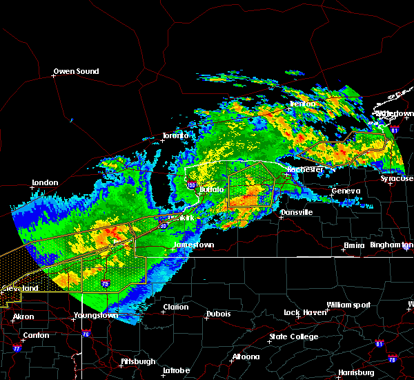 At 443 am edt, doppler radar indicated a severe thunderstorm capable of producing damaging winds in excess of 60 mph. this storm was located near north east, or 28 miles west of jamestown, and moving east at 70 mph. At 443 am edt, doppler radar indicated a severe thunderstorm capable of producing damaging winds in excess of 60 mph. this storm was located near north east, or 28 miles west of jamestown, and moving east at 70 mph.
|
| 6/12/2015 4:06 PM EDT |
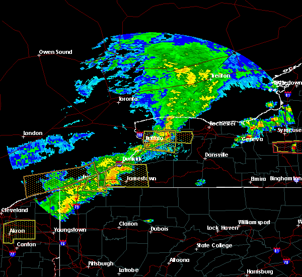 At 405 pm edt, doppler radar indicated a line of severe thunderstorms capable of producing quarter size hail and damaging winds in excess of 60 mph. these storms were located along a line extending from 8 miles southeast of lake erie state park to 6 miles north of lottsville, moving east at 50 mph. locations impacted include, jamestown, fredonia, allegany state park, westfield, lakewood, falconer, mayville and clymer. At 405 pm edt, doppler radar indicated a line of severe thunderstorms capable of producing quarter size hail and damaging winds in excess of 60 mph. these storms were located along a line extending from 8 miles southeast of lake erie state park to 6 miles north of lottsville, moving east at 50 mph. locations impacted include, jamestown, fredonia, allegany state park, westfield, lakewood, falconer, mayville and clymer.
|
| 6/12/2015 3:30 PM EDT |
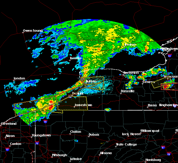 At 329 pm edt, doppler radar indicated a line of severe thunderstorms capable of producing quarter size hail and damaging winds in excess of 60 mph. these storms were located along a line extending from 7 miles northwest of north east to near waterford, and moving east at 50 mph. At 329 pm edt, doppler radar indicated a line of severe thunderstorms capable of producing quarter size hail and damaging winds in excess of 60 mph. these storms were located along a line extending from 7 miles northwest of north east to near waterford, and moving east at 50 mph.
|
| 5/11/2015 9:08 PM EDT | At 907 pm edt, doppler radar indicated a severe thunderstorm capable of producing damaging winds in excess of 60 mph. this storm was located 12 miles southeast of fredonia, moving east at 50 mph. penny size hail may also accompany the damaging winds. locations impacted include, jamestown, dunkirk, fredonia, westfield, lakewood, falconer, mayville and clymer. |
| 5/11/2015 8:26 PM EDT | At 825 pm edt, trained weather spotters reported a severe thunderstorm producing damaging winds in excess of 60 mph. this storm was located near findley lake, or 30 miles west of jamestown, and moving east at 40 mph. penny size hail may also accompany the damaging winds. |
| 7/8/2014 3:36 PM EDT | Trees and powerlines down in chautauqua county NY, 0.3 miles NE of Lakewood, NY |
| 9/2/2013 1:00 PM EDT | Sailboats in lake and on shore flipped... trees and power lines down at chautauqua lake yacht club in chautauqua county NY, 0.5 miles SSE of Lakewood, NY |
| 9/2/2013 1:00 PM EDT | Quarter sized hail reported 1.2 miles SSE of Lakewood, NY, from wivb. |
| 9/2/2013 1:00 PM EDT | Quarter sized hail reported 0.3 miles NE of Lakewood, NY, one diameter hail covered the green at sunset valley golf course |
| 9/2/2013 12:57 PM EDT | Quarter sized hail reported 2.3 miles E of Lakewood, NY, from wivb at ashville. |
| 9/2/2013 12:57 PM EDT | Golf Ball sized hail reported 0.3 miles NE of Lakewood, NY, time estimated based on radar |
| 9/2/2013 12:50 PM EDT | Trees down near chautauqua lake...time estimated...from wjtn in chautauqua county NY, 0.3 miles NE of Lakewood, NY |
| 7/10/2013 5:15 PM EDT | Large tree down...time estimated based on radar in chautauqua county NY, 0.3 miles NE of Lakewood, NY |
Hail Maps for Lakewood, NY
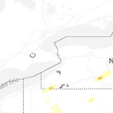
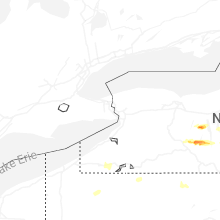
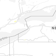


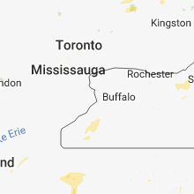
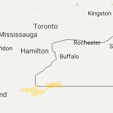


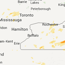


Connect with Interactive Hail Maps