

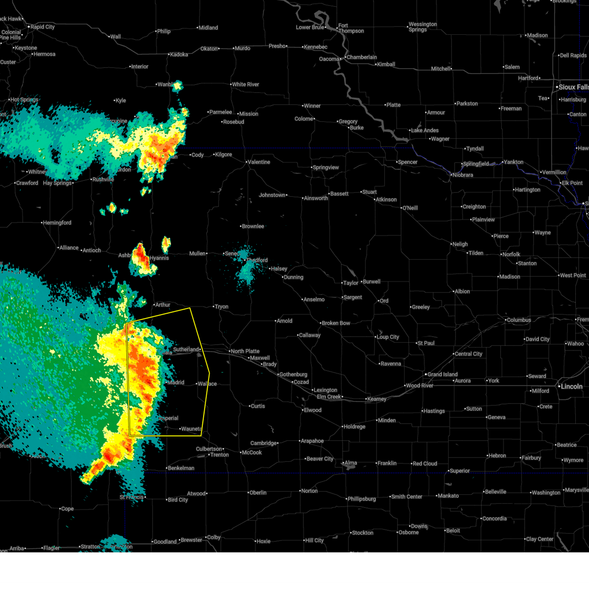
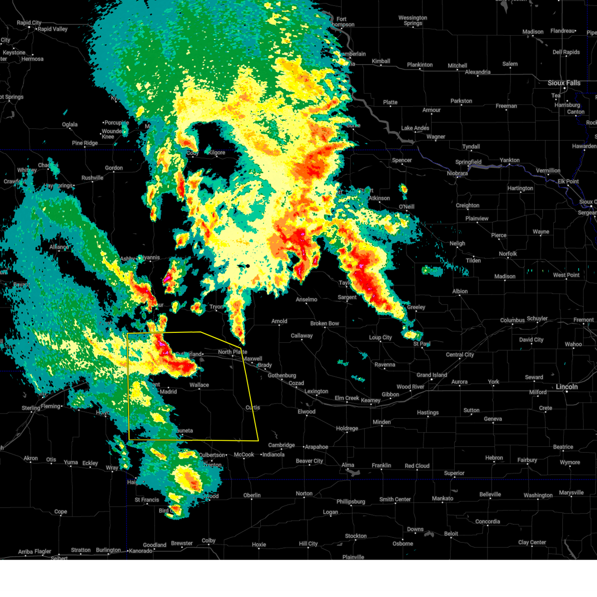
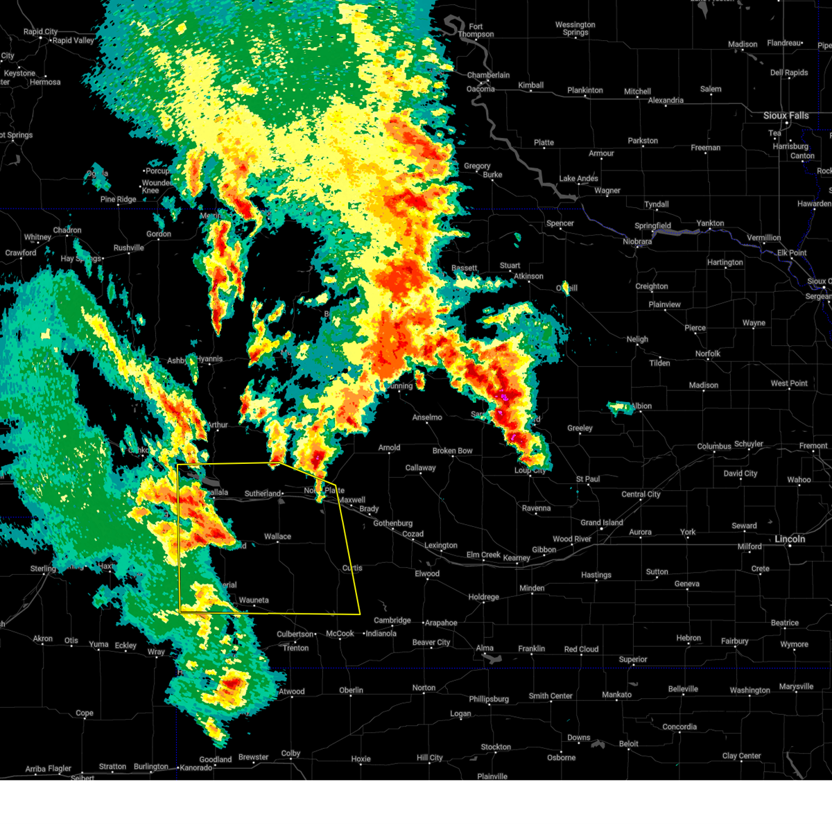
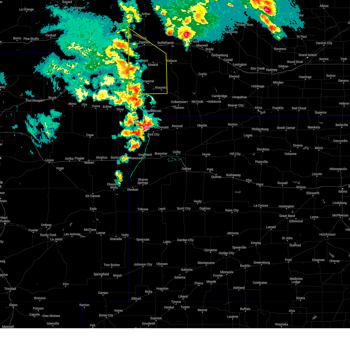
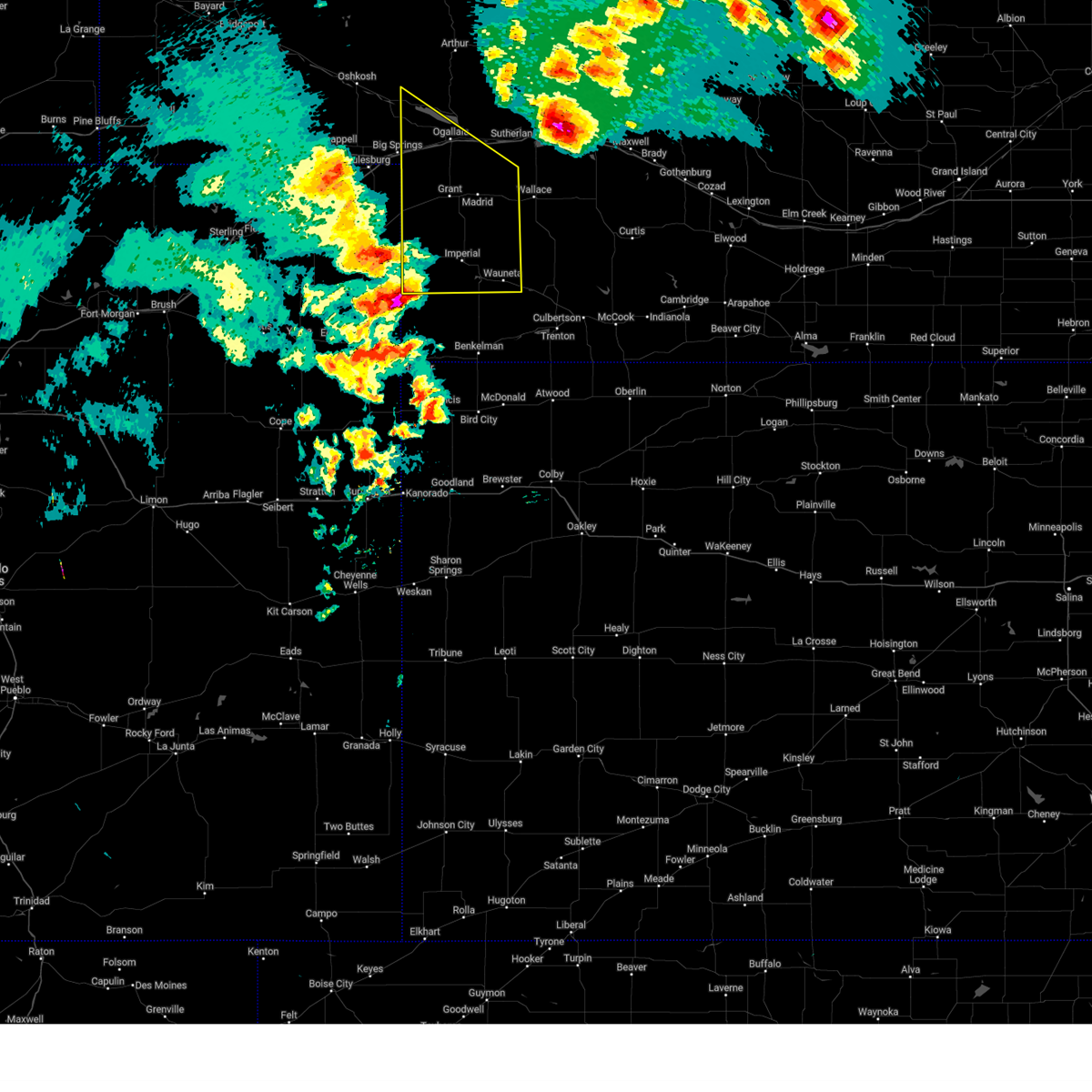
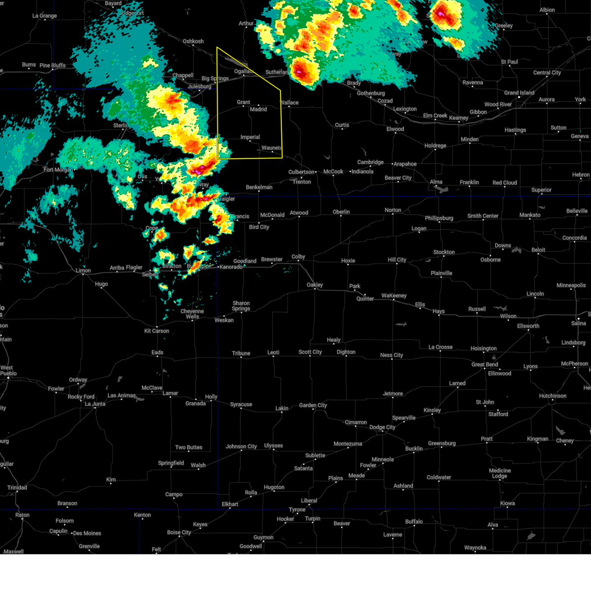
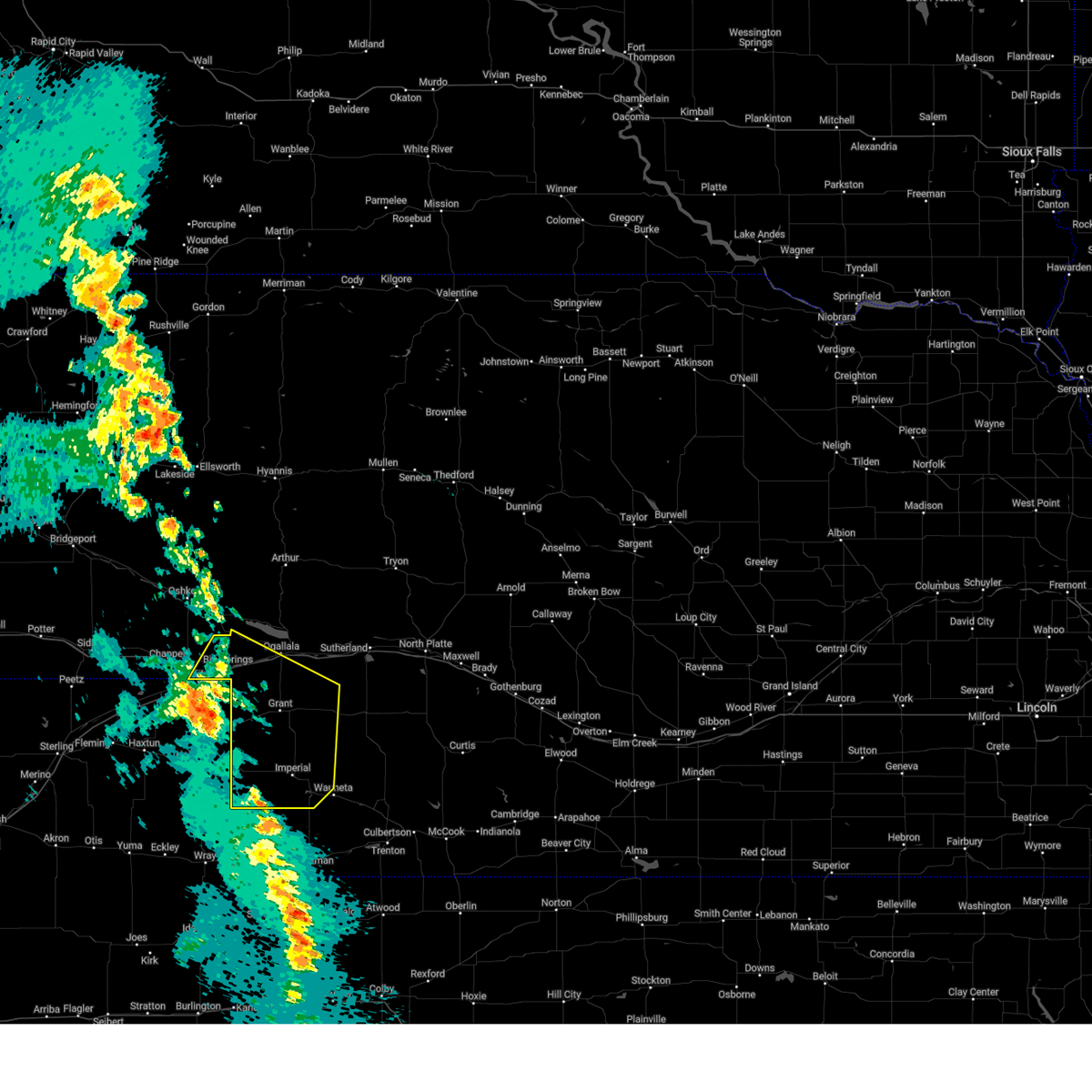
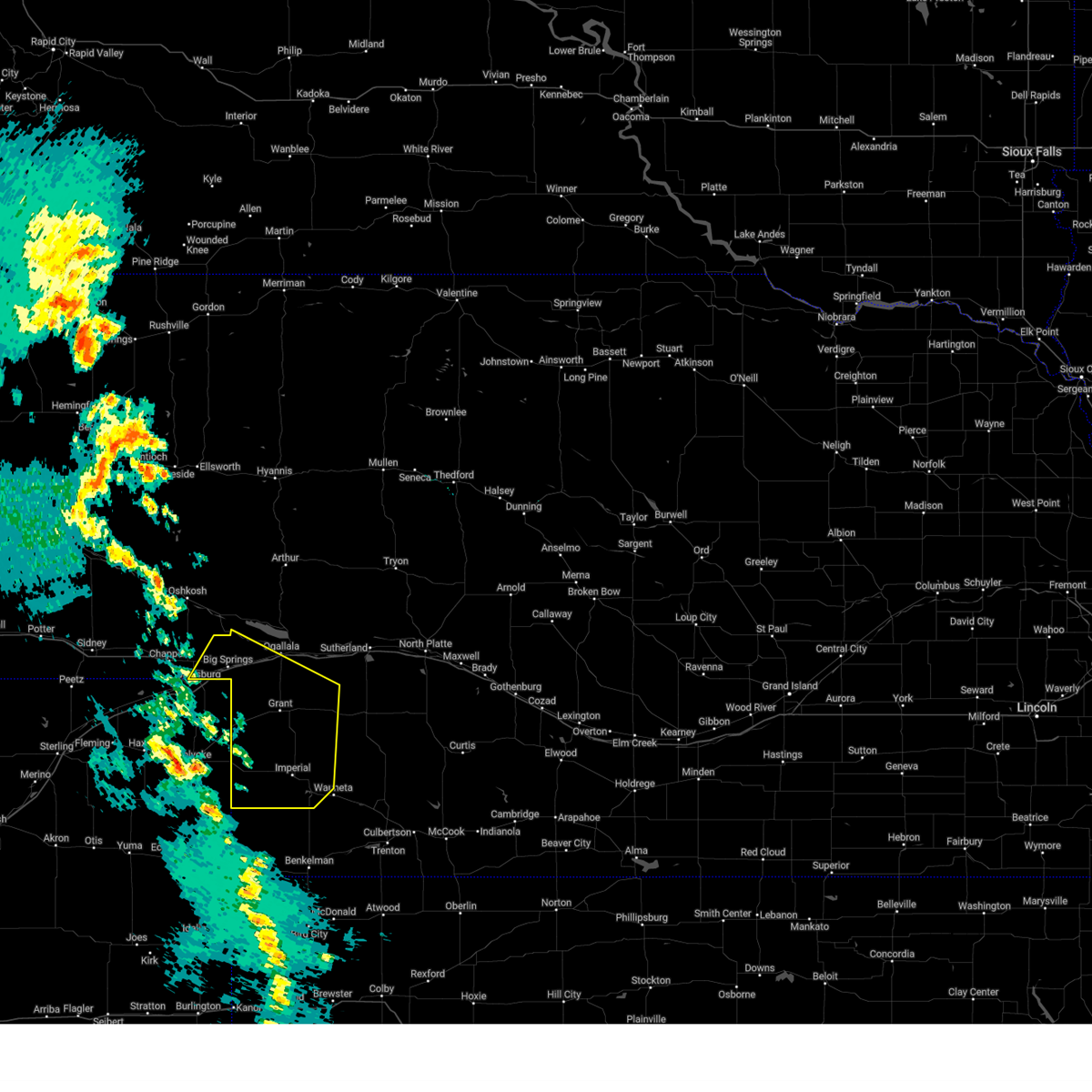
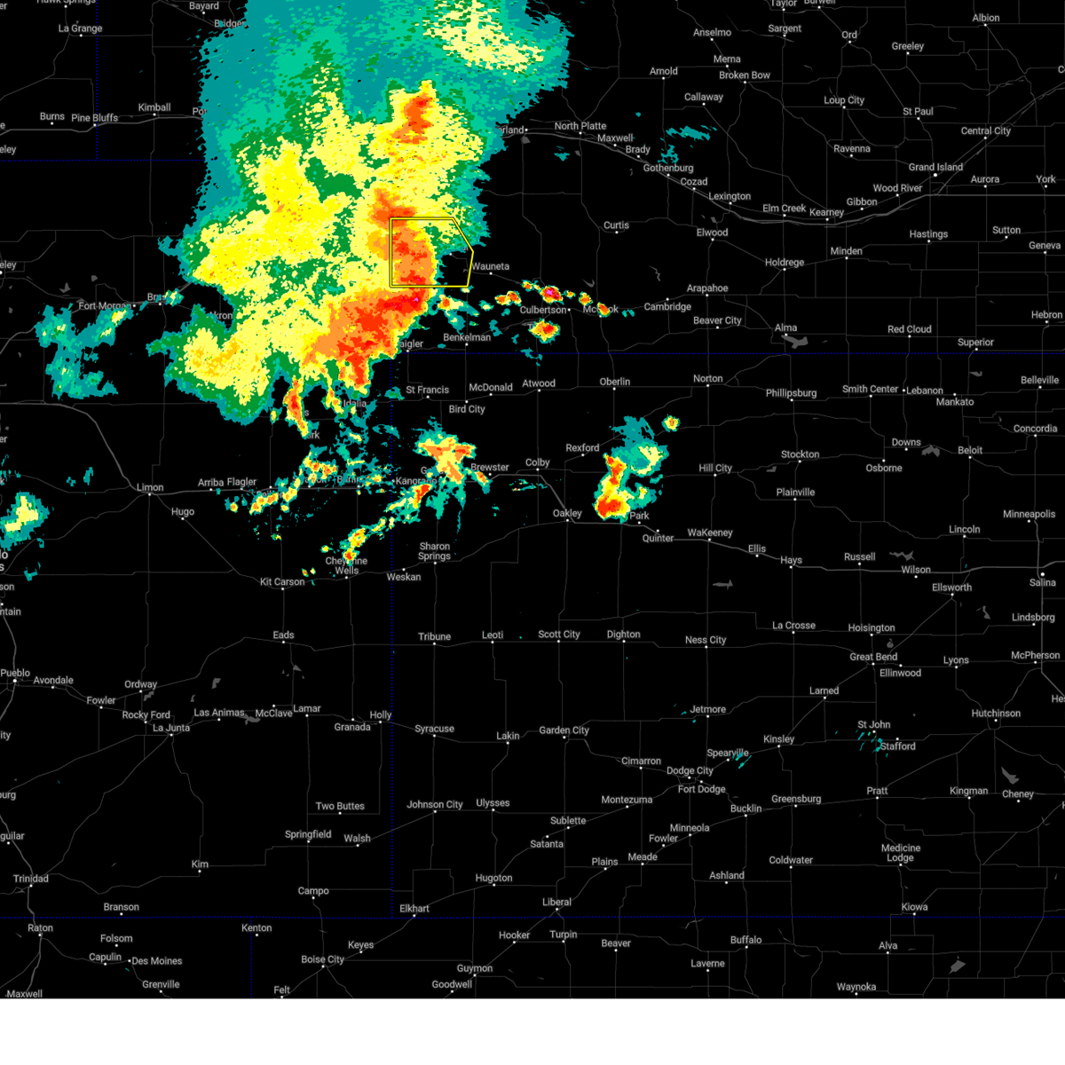
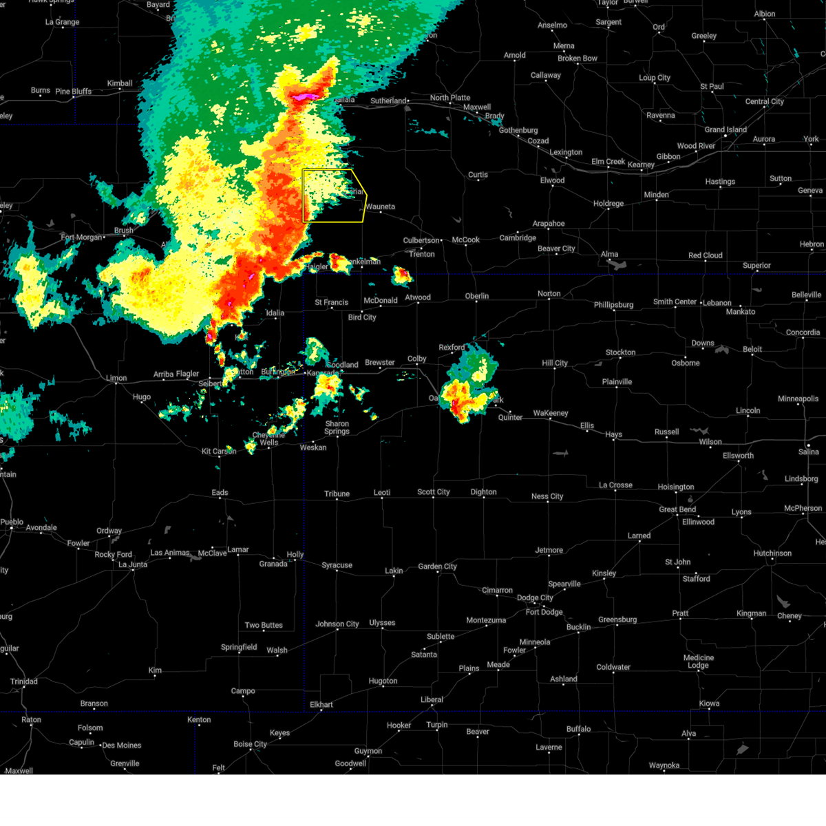
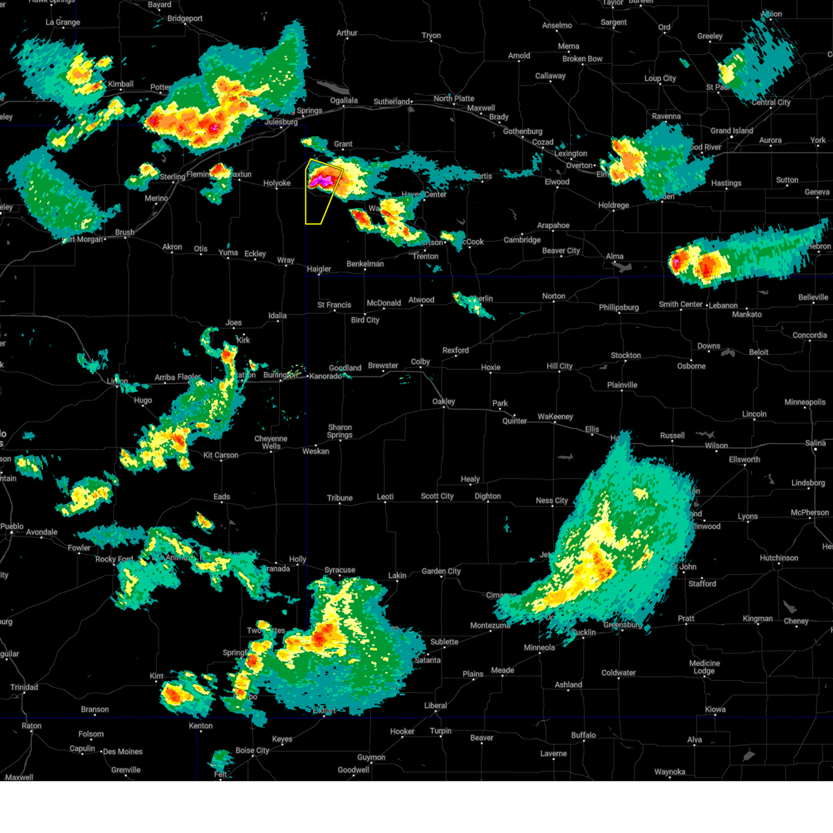
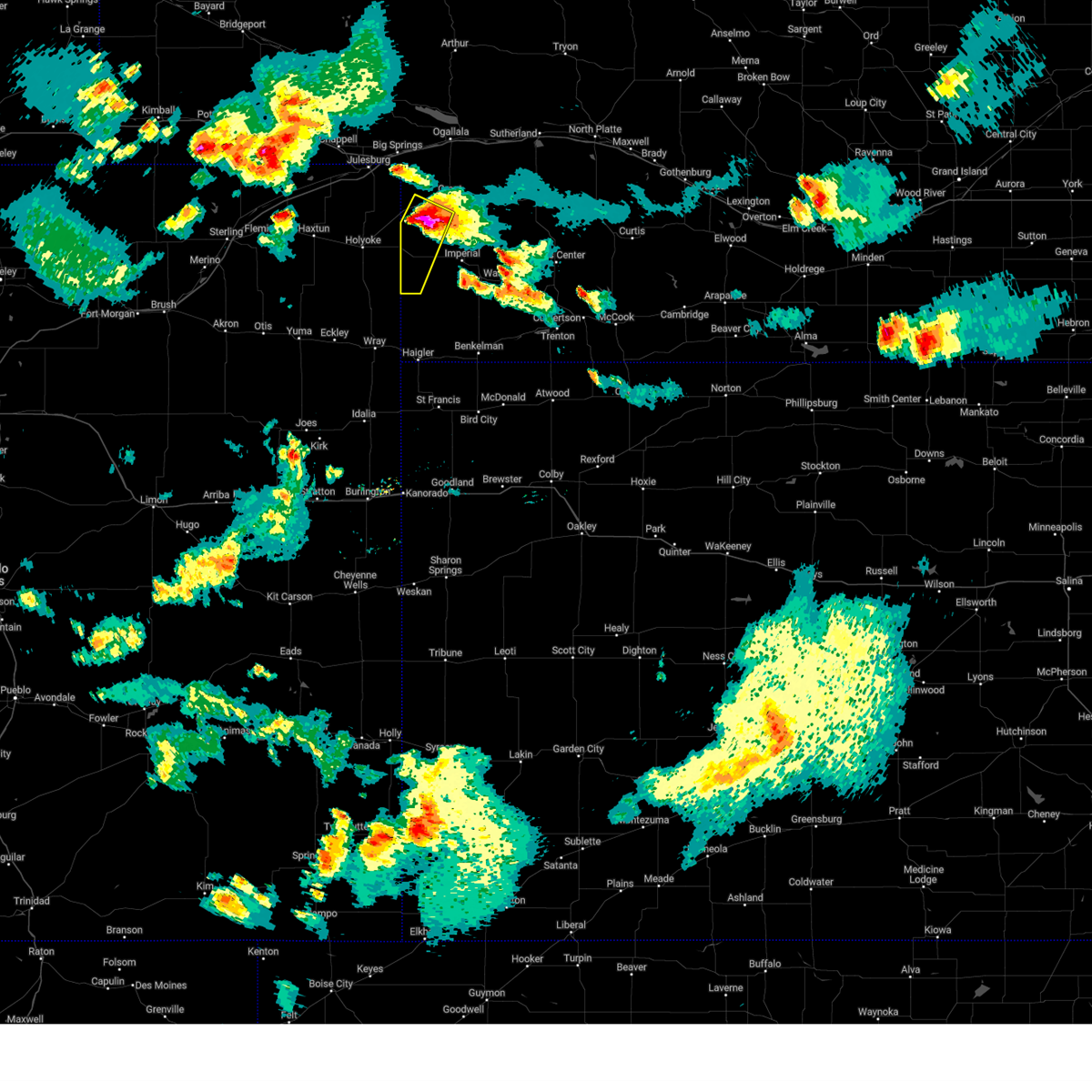
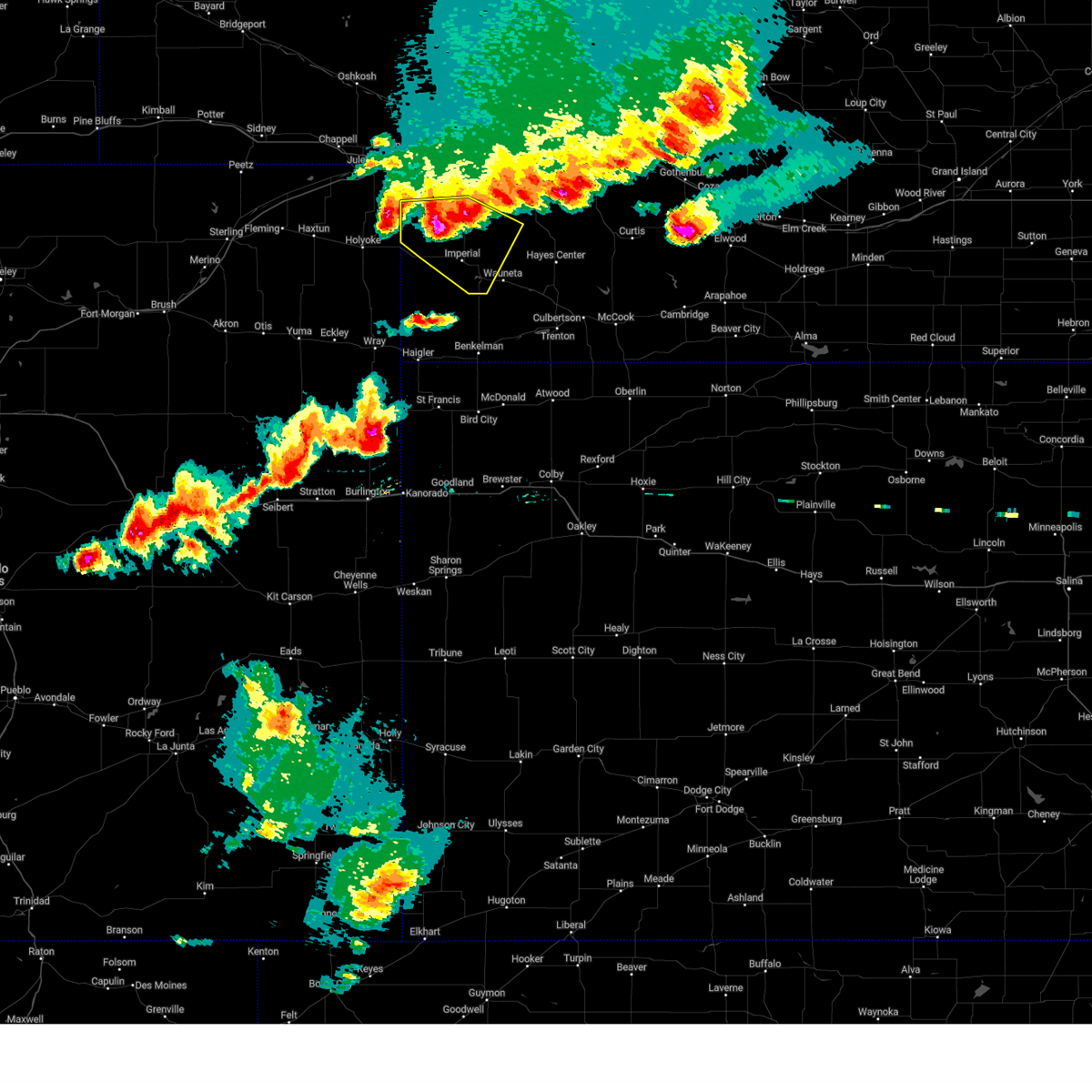
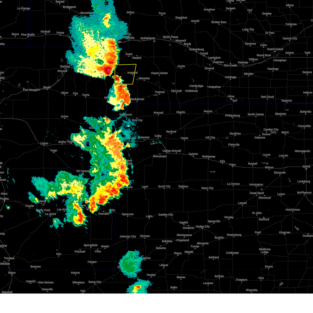
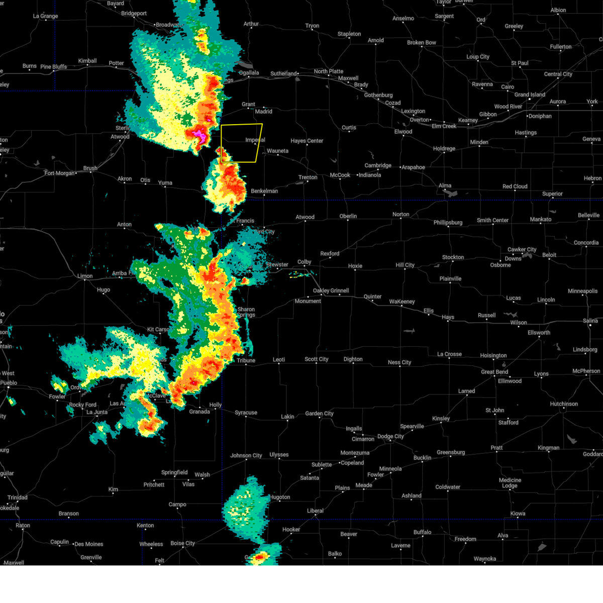
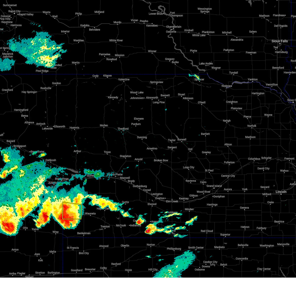
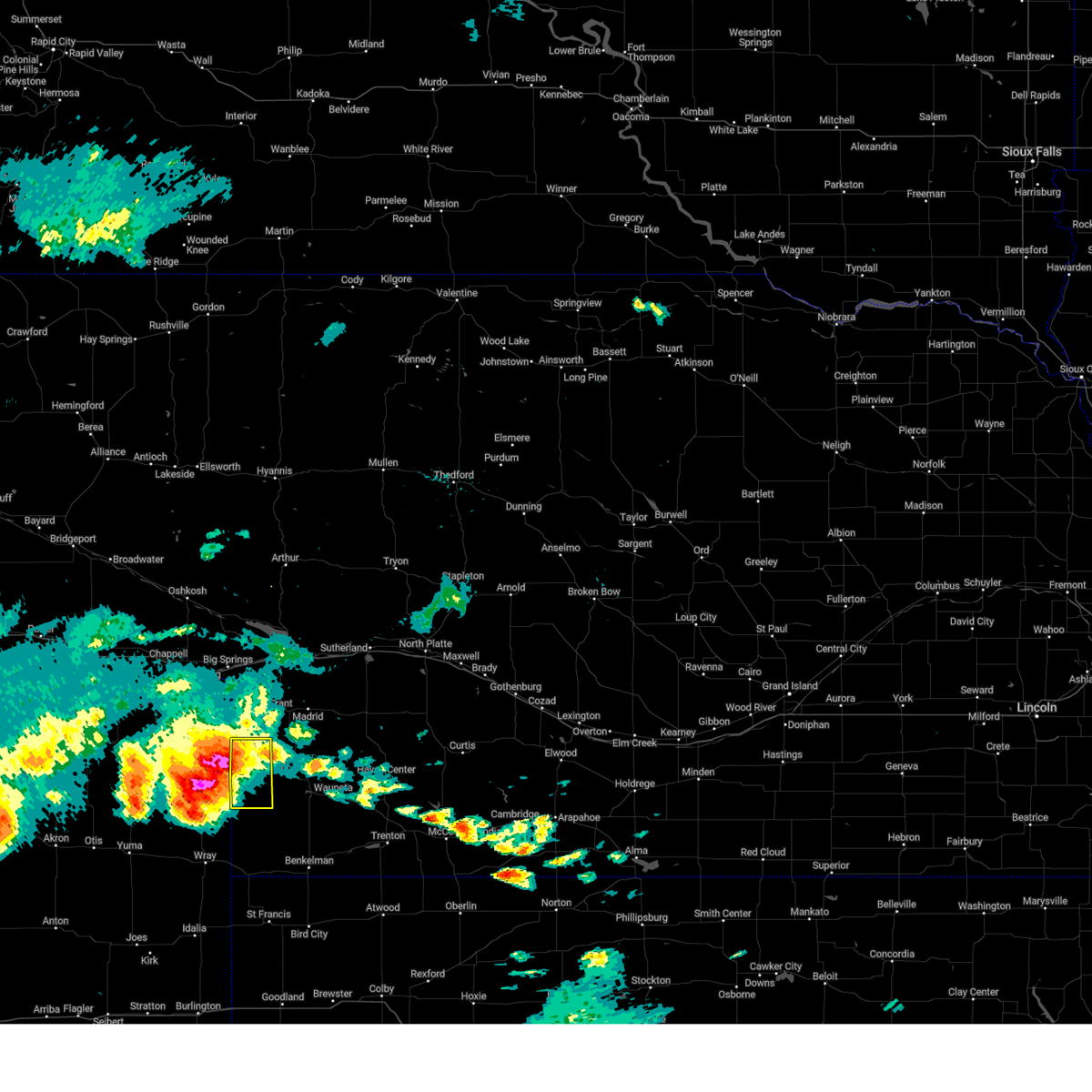
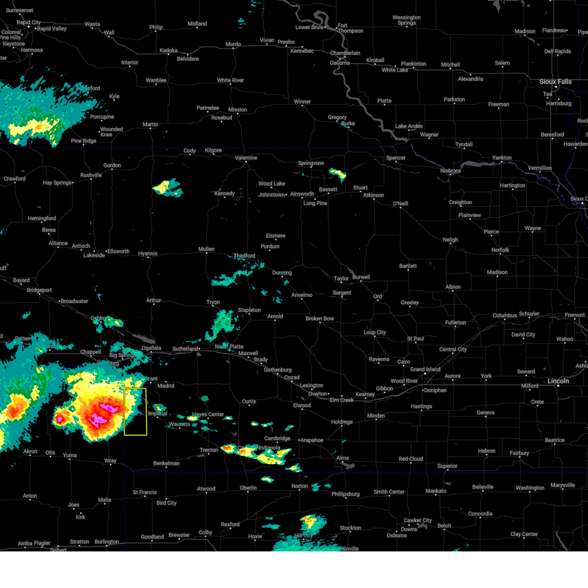
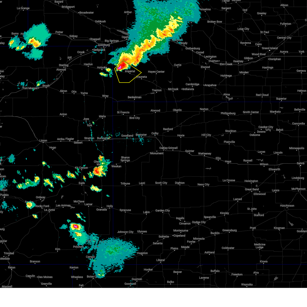
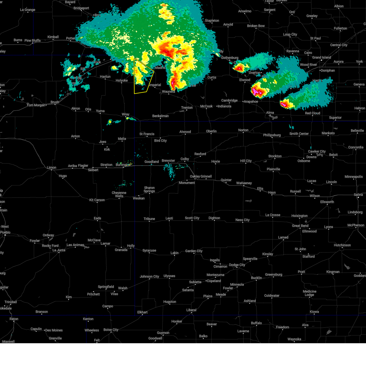
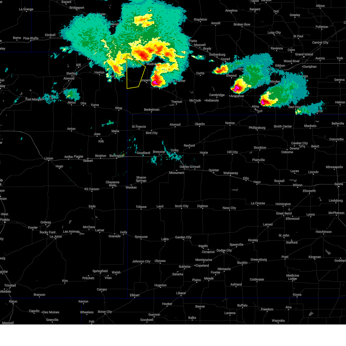
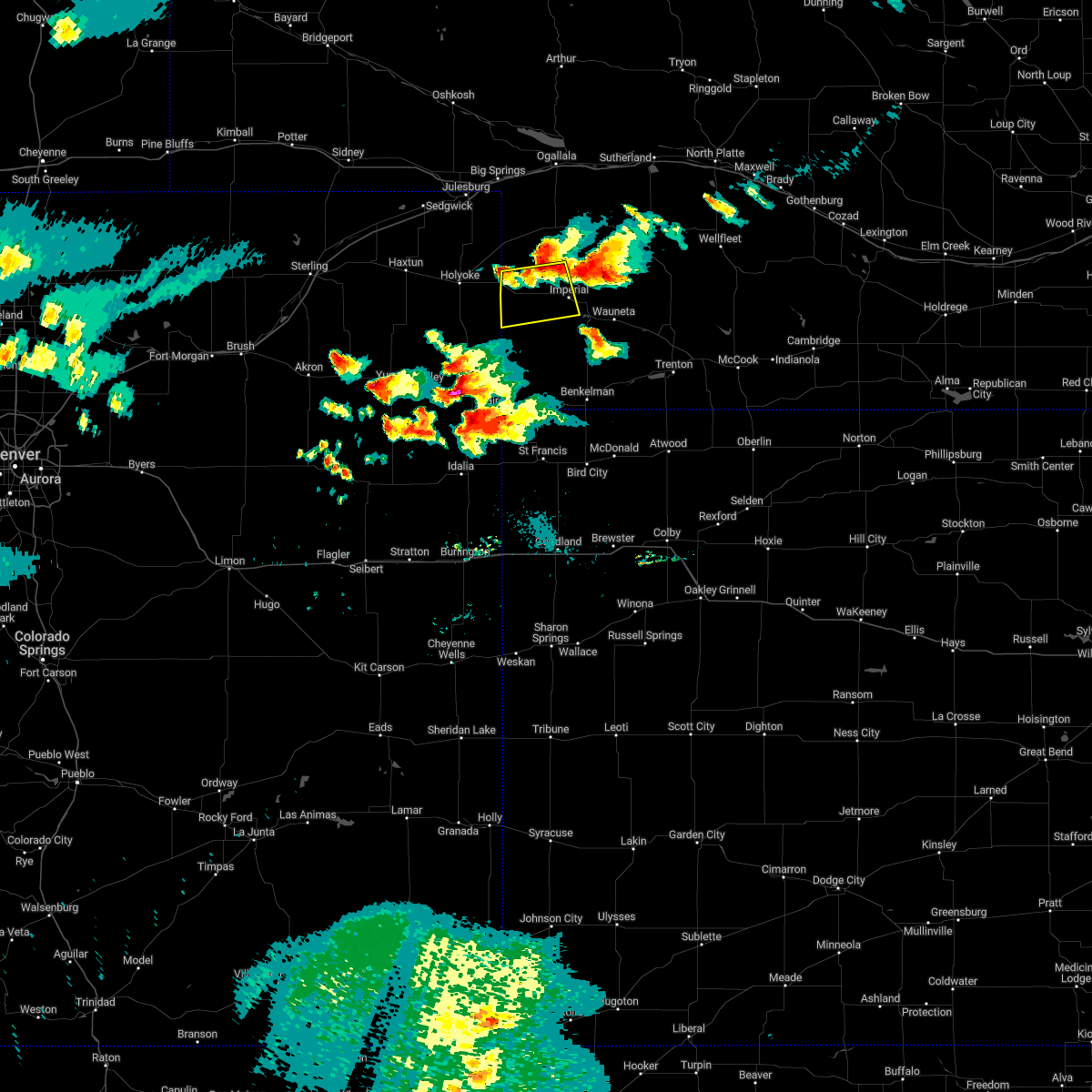
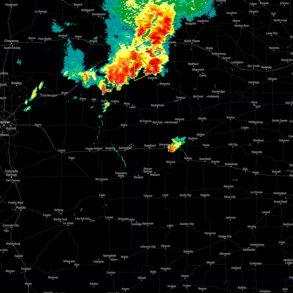
Hail Map for Lamar, NE
The Lamar, NE area has had 0 reports of on-the-ground hail by trained spotters, and has been under severe weather warnings 21 times during the past 12 months. Doppler radar has detected hail at or near Lamar, NE on 83 occasions, including 2 occasions during the past year.
| Name: | Lamar, NE |
| Where Located: | 50.2 miles NE of Yuma, CO |
| Map: | Google Map for Lamar, NE |
| Population: | 23 |
| Housing Units: | 12 |
| More Info: | Search Google for Lamar, NE |
3
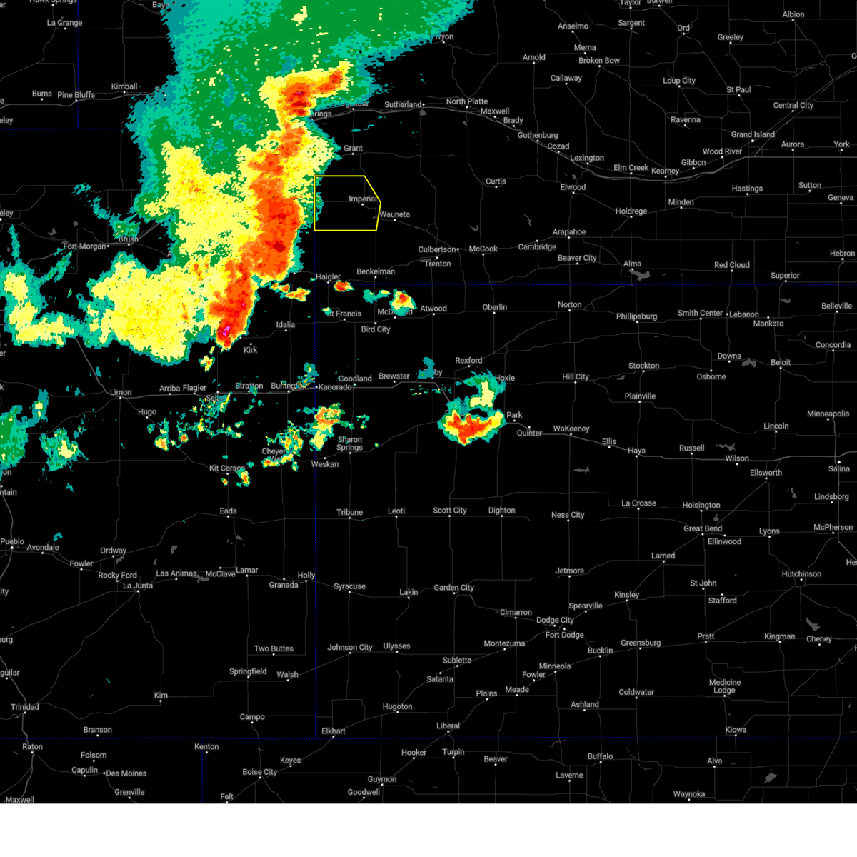
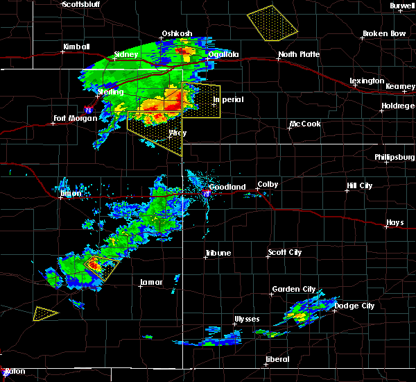
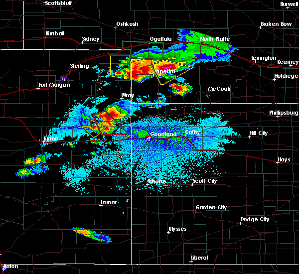
The Top Recent Hail Date for Lamar, NE is Friday, July 19, 2024 (3rd out of 83)

Hail and Wind Damage Spotted near Lamar, NE
| Date / Time | Report Details |
|---|---|
| 6/13/2025 9:54 PM MDT |
 Svrlbf the national weather service in north platte has issued a * severe thunderstorm warning for, southern arthur county in west central nebraska, perkins county in southwestern nebraska, keith county in southwestern nebraska, chase county in southwestern nebraska, western lincoln county in southwestern nebraska, southwestern mcpherson county in west central nebraska, western hayes county in southwestern nebraska, * until 1145 pm cdt/1045 pm mdt/. * at 1053 pm cdt/953 pm mdt/, severe thunderstorms were located along a line extending from near lemoyne to near grant to near champion, moving east at 35 mph (radar indicated. at 950 pm mdt, a 66 mph gust was reported at the ogallala airport). Hazards include 70 mph wind gusts and nickel size hail. Expect considerable tree damage. Damage is likely to mobile homes, roofs, and outbuildings. Svrlbf the national weather service in north platte has issued a * severe thunderstorm warning for, southern arthur county in west central nebraska, perkins county in southwestern nebraska, keith county in southwestern nebraska, chase county in southwestern nebraska, western lincoln county in southwestern nebraska, southwestern mcpherson county in west central nebraska, western hayes county in southwestern nebraska, * until 1145 pm cdt/1045 pm mdt/. * at 1053 pm cdt/953 pm mdt/, severe thunderstorms were located along a line extending from near lemoyne to near grant to near champion, moving east at 35 mph (radar indicated. at 950 pm mdt, a 66 mph gust was reported at the ogallala airport). Hazards include 70 mph wind gusts and nickel size hail. Expect considerable tree damage. Damage is likely to mobile homes, roofs, and outbuildings.
|
| 6/13/2025 9:31 PM MDT |
 Svrlbf the national weather service in north platte has issued a * severe thunderstorm warning for, perkins county in southwestern nebraska, chase county in southwestern nebraska, * until 1000 pm mdt. * at 930 pm mdt, severe thunderstorms were located along a line extending from near big springs to near lamar, moving east at 30 mph (radar indicated). Hazards include 70 mph wind gusts and quarter size hail. Hail damage to vehicles is expected. expect considerable tree damage. Wind damage is also likely to mobile homes, roofs, and outbuildings. Svrlbf the national weather service in north platte has issued a * severe thunderstorm warning for, perkins county in southwestern nebraska, chase county in southwestern nebraska, * until 1000 pm mdt. * at 930 pm mdt, severe thunderstorms were located along a line extending from near big springs to near lamar, moving east at 30 mph (radar indicated). Hazards include 70 mph wind gusts and quarter size hail. Hail damage to vehicles is expected. expect considerable tree damage. Wind damage is also likely to mobile homes, roofs, and outbuildings.
|
| 6/2/2025 8:10 PM MDT |
 The storms which prompted the warning have weakened below severe limits, and no longer pose an immediate threat to life or property. therefore, the warning will be allowed to expire. however, gusty winds and heavy rain are still possible with these thunderstorms. a severe thunderstorm watch remains in effect until 100 am cdt/midnight mdt/ for southwestern nebraska. The storms which prompted the warning have weakened below severe limits, and no longer pose an immediate threat to life or property. therefore, the warning will be allowed to expire. however, gusty winds and heavy rain are still possible with these thunderstorms. a severe thunderstorm watch remains in effect until 100 am cdt/midnight mdt/ for southwestern nebraska.
|
| 6/2/2025 7:44 PM MDT | At 842 pm cdt/742 pm mdt/, severe thunderstorms were located along a line extending from 7 miles southeast of lamar to 6 miles north of wauneta to 6 miles north of culbertson, moving north at 60 mph (automated weather sensor. a 58 mile per hour wind gust was reported at imperial airport at 740 pm mdt). Hazards include 70 mph wind gusts and blowing dust. Expect considerable tree damage. damage is likely to mobile homes, roofs, and outbuildings. locations impacted include, imperial, hayes center, wauneta, lamar, enders, enders reservoir state recreation area, champion, crete, chase, hamlet, center dam campground, hayes center state wildlife management area, wanamaker state wildfire management area, area a campground, and church grove campground. this includes the following highways, highway 61 between mile markers 25 and 46. Highway 83 between mile markers 38 and 43. |
| 6/2/2025 7:20 PM MDT |
 Svrlbf the national weather service in north platte has issued a * severe thunderstorm warning for, southwestern frontier county in southwestern nebraska, chase county in southwestern nebraska, hayes county in southwestern nebraska, * until 915 pm cdt/815 pm mdt/. * at 819 pm cdt/719 pm mdt/, severe thunderstorms were located along a line extending from 12 miles northeast of wray to 11 miles north of benkelman to 11 miles northwest of herndon, moving north at 60 mph (radar indicated). Hazards include 70 mph wind gusts. blowing dust has also been reported across portions of northwest kansas and southwest nebraska with the damaging winds. Expect considerable tree damage. Damage is likely to mobile homes, roofs, and outbuildings. Svrlbf the national weather service in north platte has issued a * severe thunderstorm warning for, southwestern frontier county in southwestern nebraska, chase county in southwestern nebraska, hayes county in southwestern nebraska, * until 915 pm cdt/815 pm mdt/. * at 819 pm cdt/719 pm mdt/, severe thunderstorms were located along a line extending from 12 miles northeast of wray to 11 miles north of benkelman to 11 miles northwest of herndon, moving north at 60 mph (radar indicated). Hazards include 70 mph wind gusts. blowing dust has also been reported across portions of northwest kansas and southwest nebraska with the damaging winds. Expect considerable tree damage. Damage is likely to mobile homes, roofs, and outbuildings.
|
| 5/14/2025 7:57 PM MDT |
 At 855 pm cdt/755 pm mdt/, damaging winds were located along a line extending from 14 miles north of sarben to 8 miles west of lake maloney state recreation area to 8 miles west of stockville, moving northeast at 55 mph (radar indicated). Hazards include 80 mph wind gusts. Flying debris will be dangerous to those caught without shelter. mobile homes will be heavily damaged. expect considerable damage to roofs, windows, and vehicles. extensive tree damage and power outages are likely. locations impacted include, north platte, ogallala, imperial, grant, curtis, hayes center, sutherland, hershey, wauneta, paxton, wallace, brule, madrid, elsie, wellfleet, lamar, dickens, lake maloney state recreation area, kingsley dam, and enders. this includes the following highways, highway 61 between mile markers 26 and 107. highway 92 between mile markers 120 and 138. highway 97 between mile markers 1 and 5. interstate 80 in nebraska between mile markers 110 and 184. Highway 83 between mile markers 28 and 90. At 855 pm cdt/755 pm mdt/, damaging winds were located along a line extending from 14 miles north of sarben to 8 miles west of lake maloney state recreation area to 8 miles west of stockville, moving northeast at 55 mph (radar indicated). Hazards include 80 mph wind gusts. Flying debris will be dangerous to those caught without shelter. mobile homes will be heavily damaged. expect considerable damage to roofs, windows, and vehicles. extensive tree damage and power outages are likely. locations impacted include, north platte, ogallala, imperial, grant, curtis, hayes center, sutherland, hershey, wauneta, paxton, wallace, brule, madrid, elsie, wellfleet, lamar, dickens, lake maloney state recreation area, kingsley dam, and enders. this includes the following highways, highway 61 between mile markers 26 and 107. highway 92 between mile markers 120 and 138. highway 97 between mile markers 1 and 5. interstate 80 in nebraska between mile markers 110 and 184. Highway 83 between mile markers 28 and 90.
|
| 5/14/2025 7:28 PM MDT |
 Svrlbf the national weather service in north platte has issued a * severe thunderstorm warning for, western frontier county in southwestern nebraska, perkins county in southwestern nebraska, keith county in southwestern nebraska, chase county in southwestern nebraska, western lincoln county in southwestern nebraska, hayes county in southwestern nebraska, * until 930 pm cdt/830 pm mdt/. * at 827 pm cdt/727 pm mdt/, severe thunderstorms were located along a line extending from roscoe to 7 miles northwest of palisade, moving east at 55 mph (radar indicated). Hazards include 80 mph wind gusts. Flying debris will be dangerous to those caught without shelter. mobile homes will be heavily damaged. expect considerable damage to roofs, windows, and vehicles. Extensive tree damage and power outages are likely. Svrlbf the national weather service in north platte has issued a * severe thunderstorm warning for, western frontier county in southwestern nebraska, perkins county in southwestern nebraska, keith county in southwestern nebraska, chase county in southwestern nebraska, western lincoln county in southwestern nebraska, hayes county in southwestern nebraska, * until 930 pm cdt/830 pm mdt/. * at 827 pm cdt/727 pm mdt/, severe thunderstorms were located along a line extending from roscoe to 7 miles northwest of palisade, moving east at 55 mph (radar indicated). Hazards include 80 mph wind gusts. Flying debris will be dangerous to those caught without shelter. mobile homes will be heavily damaged. expect considerable damage to roofs, windows, and vehicles. Extensive tree damage and power outages are likely.
|
| 5/14/2025 7:16 PM MDT |
 At 816 pm cdt/716 pm mdt/, severe thunderstorms were located along a line extending from brule to near enders, moving east at 65 mph (radar indicated). Hazards include 70 mph wind gusts. Expect considerable tree damage. damage is likely to mobile homes, roofs, and outbuildings. locations impacted include, ogallala, imperial, grant, wauneta, brule, madrid, venango, elsie, lamar, enders reservoir state recreation area, enders, champion, roscoe. this includes the following highways, highway 61 between mile markers 25 and 94. highway 92 between mile markers 119 and 130. Interstate 80 in nebraska between mile markers 109 and 138. At 816 pm cdt/716 pm mdt/, severe thunderstorms were located along a line extending from brule to near enders, moving east at 65 mph (radar indicated). Hazards include 70 mph wind gusts. Expect considerable tree damage. damage is likely to mobile homes, roofs, and outbuildings. locations impacted include, ogallala, imperial, grant, wauneta, brule, madrid, venango, elsie, lamar, enders reservoir state recreation area, enders, champion, roscoe. this includes the following highways, highway 61 between mile markers 25 and 94. highway 92 between mile markers 119 and 130. Interstate 80 in nebraska between mile markers 109 and 138.
|
| 5/14/2025 6:50 PM MDT |
 At 749 pm cdt/649 pm mdt/, severe thunderstorms were located along a line extending from near julesburg to 11 miles south of champion, moving east at 55 mph (radar indicated). Hazards include 70 mph wind gusts. Expect considerable tree damage. damage is likely to mobile homes, roofs, and outbuildings. locations impacted include, ogallala, imperial, grant, wauneta, brule, madrid, venango, elsie, lamar, enders reservoir state recreation area, enders, champion, roscoe, crete, chase, center dam campground, megeath, wanamaker state wildfire management area, eagle gulch campground, and ruthon. this includes the following highways, highway 61 between mile markers 25 and 94. highway 92 between mile markers 119 and 130. Interstate 80 in nebraska between mile markers 109 and 138. At 749 pm cdt/649 pm mdt/, severe thunderstorms were located along a line extending from near julesburg to 11 miles south of champion, moving east at 55 mph (radar indicated). Hazards include 70 mph wind gusts. Expect considerable tree damage. damage is likely to mobile homes, roofs, and outbuildings. locations impacted include, ogallala, imperial, grant, wauneta, brule, madrid, venango, elsie, lamar, enders reservoir state recreation area, enders, champion, roscoe, crete, chase, center dam campground, megeath, wanamaker state wildfire management area, eagle gulch campground, and ruthon. this includes the following highways, highway 61 between mile markers 25 and 94. highway 92 between mile markers 119 and 130. Interstate 80 in nebraska between mile markers 109 and 138.
|
| 5/14/2025 6:38 PM MDT |
 Svrlbf the national weather service in north platte has issued a * severe thunderstorm warning for, perkins county in southwestern nebraska, western keith county in southwestern nebraska, chase county in southwestern nebraska, western hayes county in southwestern nebraska, * until 845 pm cdt/745 pm mdt/. * at 738 pm cdt/638 pm mdt/, severe thunderstorms were located along a line extending from near sedgwick to 15 miles southwest of champion, moving east at 55 mph (radar indicated). Hazards include 60 mph wind gusts. expect damage to roofs, siding, and trees Svrlbf the national weather service in north platte has issued a * severe thunderstorm warning for, perkins county in southwestern nebraska, western keith county in southwestern nebraska, chase county in southwestern nebraska, western hayes county in southwestern nebraska, * until 845 pm cdt/745 pm mdt/. * at 738 pm cdt/638 pm mdt/, severe thunderstorms were located along a line extending from near sedgwick to 15 miles southwest of champion, moving east at 55 mph (radar indicated). Hazards include 60 mph wind gusts. expect damage to roofs, siding, and trees
|
| 9/17/2024 7:04 PM MDT |
 At 702 pm mdt, severe thunderstorms were located along a line extending from near barton to near venango to near champion, moving north at 40 mph (radar indicated). Hazards include 60 mph wind gusts. Expect damage to roofs, siding, and trees. locations impacted include, ogallala, imperial, grant, big springs, brule, madrid, venango, elsie, lamar, barton, enders, enders reservoir state recreation area, champion, crete, chase, center dam campground, brandon, megeath, wild horse spring, and goldeneye state wildlife management area. this includes the following highways, highway 61 between mile markers 25 and 86. Interstate 80 in nebraska between mile markers 95 and 127. At 702 pm mdt, severe thunderstorms were located along a line extending from near barton to near venango to near champion, moving north at 40 mph (radar indicated). Hazards include 60 mph wind gusts. Expect damage to roofs, siding, and trees. locations impacted include, ogallala, imperial, grant, big springs, brule, madrid, venango, elsie, lamar, barton, enders, enders reservoir state recreation area, champion, crete, chase, center dam campground, brandon, megeath, wild horse spring, and goldeneye state wildlife management area. this includes the following highways, highway 61 between mile markers 25 and 86. Interstate 80 in nebraska between mile markers 95 and 127.
|
| 9/17/2024 6:33 PM MDT |
 Svrlbf the national weather service in north platte has issued a * severe thunderstorm warning for, perkins county in southwestern nebraska, southwestern keith county in southwestern nebraska, chase county in southwestern nebraska, eastern deuel county in the panhandle of nebraska, * until 715 pm mdt. * at 631 pm mdt, severe thunderstorms were located along a line extending from near fairfield to 6 miles south of pleasant valley to 10 miles north of haigler, moving northeast at 45 mph (radar indicated). Hazards include 60 mph wind gusts. expect damage to roofs, siding, and trees Svrlbf the national weather service in north platte has issued a * severe thunderstorm warning for, perkins county in southwestern nebraska, southwestern keith county in southwestern nebraska, chase county in southwestern nebraska, eastern deuel county in the panhandle of nebraska, * until 715 pm mdt. * at 631 pm mdt, severe thunderstorms were located along a line extending from near fairfield to 6 miles south of pleasant valley to 10 miles north of haigler, moving northeast at 45 mph (radar indicated). Hazards include 60 mph wind gusts. expect damage to roofs, siding, and trees
|
| 8/13/2024 8:36 PM MDT |
 At 836 pm mdt, severe thunderstorms were located along a line extending from 10 miles northeast of lamar to near imperial to 12 miles south of champion, moving east at 40 mph (radar indicated). Hazards include 60 mph wind gusts and penny size hail. Expect damage to roofs, siding, and trees. locations impacted include, imperial, lamar, enders, enders reservoir state recreation area, champion, crete, chase, center dam campground, wanamaker state wildfire management area, area a campground, and church grove campground. This includes highway 61 between mile markers 25 and 53. At 836 pm mdt, severe thunderstorms were located along a line extending from 10 miles northeast of lamar to near imperial to 12 miles south of champion, moving east at 40 mph (radar indicated). Hazards include 60 mph wind gusts and penny size hail. Expect damage to roofs, siding, and trees. locations impacted include, imperial, lamar, enders, enders reservoir state recreation area, champion, crete, chase, center dam campground, wanamaker state wildfire management area, area a campground, and church grove campground. This includes highway 61 between mile markers 25 and 53.
|
| 8/13/2024 8:12 PM MDT |
 At 811 pm mdt, severe thunderstorms were located along a line extending from near amherst to near lamar to 17 miles northeast of wray, moving east at 35 mph (radar indicated). Hazards include 70 mph wind gusts and penny size hail. Expect considerable tree damage. damage is likely to mobile homes, roofs, and outbuildings. locations impacted include, imperial, lamar, enders, enders reservoir state recreation area, champion, crete, chase, center dam campground, wanamaker state wildfire management area, area a campground, and church grove campground. This includes highway 61 between mile markers 25 and 53. At 811 pm mdt, severe thunderstorms were located along a line extending from near amherst to near lamar to 17 miles northeast of wray, moving east at 35 mph (radar indicated). Hazards include 70 mph wind gusts and penny size hail. Expect considerable tree damage. damage is likely to mobile homes, roofs, and outbuildings. locations impacted include, imperial, lamar, enders, enders reservoir state recreation area, champion, crete, chase, center dam campground, wanamaker state wildfire management area, area a campground, and church grove campground. This includes highway 61 between mile markers 25 and 53.
|
| 8/13/2024 7:55 PM MDT |
 Svrlbf the national weather service in north platte has issued a * severe thunderstorm warning for, chase county in southwestern nebraska, * until 900 pm mdt. * at 754 pm mdt, severe thunderstorms were located along a line extending from near holyoke to near pleasant valley to 6 miles north of wray, moving east at 40 mph (radar indicated). Hazards include 60 mph wind gusts and penny size hail. expect damage to roofs, siding, and trees Svrlbf the national weather service in north platte has issued a * severe thunderstorm warning for, chase county in southwestern nebraska, * until 900 pm mdt. * at 754 pm mdt, severe thunderstorms were located along a line extending from near holyoke to near pleasant valley to 6 miles north of wray, moving east at 40 mph (radar indicated). Hazards include 60 mph wind gusts and penny size hail. expect damage to roofs, siding, and trees
|
| 7/19/2024 7:51 PM MDT |
 At 748 pm mdt, a severe thunderstorm was located near lamar, or 17 miles east of holyoke, moving south at 35 mph. this is a destructive storm for lamar and southwest chase county (radar indicated). Hazards include three inch hail. People and animals outdoors will be severely injured. expect shattered windows, extensive damage to roofs, siding, and vehicles. Locations impacted include, lamar and chase. At 748 pm mdt, a severe thunderstorm was located near lamar, or 17 miles east of holyoke, moving south at 35 mph. this is a destructive storm for lamar and southwest chase county (radar indicated). Hazards include three inch hail. People and animals outdoors will be severely injured. expect shattered windows, extensive damage to roofs, siding, and vehicles. Locations impacted include, lamar and chase.
|
| 7/19/2024 7:51 PM MDT |
 the severe thunderstorm warning has been cancelled and is no longer in effect the severe thunderstorm warning has been cancelled and is no longer in effect
|
| 7/19/2024 7:42 PM MDT |
 At 741 pm mdt, a severe thunderstorm was located over lamar, or 17 miles west of imperial, moving southwest at 40 mph (public). Hazards include tennis ball size hail. People and animals outdoors will be injured. expect damage to roofs, siding, windows, and vehicles. Locations impacted include, lamar and chase. At 741 pm mdt, a severe thunderstorm was located over lamar, or 17 miles west of imperial, moving southwest at 40 mph (public). Hazards include tennis ball size hail. People and animals outdoors will be injured. expect damage to roofs, siding, windows, and vehicles. Locations impacted include, lamar and chase.
|
| 7/19/2024 7:26 PM MDT |
 Svrlbf the national weather service in north platte has issued a * severe thunderstorm warning for, southwestern perkins county in southwestern nebraska, western chase county in southwestern nebraska, * until 815 pm mdt. * at 725 pm mdt, a severe thunderstorm was located 7 miles east of venango, or 12 miles southwest of grant, moving southwest at 35 mph. this is a destructive storm for southwest perkins and northwest chase counties (radar indicated). Hazards include baseball size hail. People and animals outdoors will be severely injured. Expect shattered windows, extensive damage to roofs, siding, and vehicles. Svrlbf the national weather service in north platte has issued a * severe thunderstorm warning for, southwestern perkins county in southwestern nebraska, western chase county in southwestern nebraska, * until 815 pm mdt. * at 725 pm mdt, a severe thunderstorm was located 7 miles east of venango, or 12 miles southwest of grant, moving southwest at 35 mph. this is a destructive storm for southwest perkins and northwest chase counties (radar indicated). Hazards include baseball size hail. People and animals outdoors will be severely injured. Expect shattered windows, extensive damage to roofs, siding, and vehicles.
|
| 7/3/2024 5:41 PM MDT |
 At 641 pm cdt/541 pm mdt/, a severe thunderstorm was located 12 miles south of grant, moving southeast at 40 mph (radar indicated). Hazards include two inch hail and 60 mph wind gusts. People and animals outdoors will be injured. expect hail damage to roofs, siding, windows, and vehicles. expect wind damage to roofs, siding, and trees. locations impacted include, imperial, venango, lamar, enders, enders reservoir state recreation area, champion, chase, center dam campground, brandon, wanamaker state wildfire management area, area a campground, and church grove campground. This includes highway 61 between mile markers 25 and 63. At 641 pm cdt/541 pm mdt/, a severe thunderstorm was located 12 miles south of grant, moving southeast at 40 mph (radar indicated). Hazards include two inch hail and 60 mph wind gusts. People and animals outdoors will be injured. expect hail damage to roofs, siding, windows, and vehicles. expect wind damage to roofs, siding, and trees. locations impacted include, imperial, venango, lamar, enders, enders reservoir state recreation area, champion, chase, center dam campground, brandon, wanamaker state wildfire management area, area a campground, and church grove campground. This includes highway 61 between mile markers 25 and 63.
|
| 7/3/2024 5:23 PM MDT |
 Svrlbf the national weather service in north platte has issued a * severe thunderstorm warning for, southern perkins county in southwestern nebraska, chase county in southwestern nebraska, northwestern hayes county in southwestern nebraska, * until 715 pm cdt/615 pm mdt/. * at 623 pm cdt/523 pm mdt/, a severe thunderstorm was located near venango, or 14 miles southwest of grant, moving southeast at 40 mph (radar indicated. at 514 pm mdt, trained spotters reported ping pong ball size hail in brandon). Hazards include two inch hail and 60 mph wind gusts. People and animals outdoors will be injured. expect hail damage to roofs, siding, windows, and vehicles. Expect wind damage to roofs, siding, and trees. Svrlbf the national weather service in north platte has issued a * severe thunderstorm warning for, southern perkins county in southwestern nebraska, chase county in southwestern nebraska, northwestern hayes county in southwestern nebraska, * until 715 pm cdt/615 pm mdt/. * at 623 pm cdt/523 pm mdt/, a severe thunderstorm was located near venango, or 14 miles southwest of grant, moving southeast at 40 mph (radar indicated. at 514 pm mdt, trained spotters reported ping pong ball size hail in brandon). Hazards include two inch hail and 60 mph wind gusts. People and animals outdoors will be injured. expect hail damage to roofs, siding, windows, and vehicles. Expect wind damage to roofs, siding, and trees.
|
| 6/2/2024 5:56 PM MDT |
 The storms which prompted the warning remain severe so a new warning has been issued. a severe thunderstorm watch remains in effect until 1100 pm cdt/1000 pm mdt/ for southwestern nebraska. The storms which prompted the warning remain severe so a new warning has been issued. a severe thunderstorm watch remains in effect until 1100 pm cdt/1000 pm mdt/ for southwestern nebraska.
|
| 6/2/2024 5:15 PM MDT |
 At 614 pm cdt/514 pm mdt/, severe thunderstorms were located along a line extending from 9 miles north of keystone to near madrid to near lamar, moving east at 35 mph (radar indicated). Hazards include 70 mph wind gusts and half dollar size hail. Hail damage to vehicles is expected. expect considerable tree damage. wind damage is also likely to mobile homes, roofs, and outbuildings. locations impacted include, ogallala, imperial, grant, sutherland, hershey, wauneta, paxton, wallace, madrid, elsie, lamar, keystone, enders reservoir state recreation area, kingsley dam, sarben, enders, sutherland reservoir state recreation area, champion, roscoe, and crete. this includes the following highways, highway 61 between mile markers 25 and 109. highway 92 between mile markers 136 and 138. Interstate 80 in nebraska between mile markers 124 and 166. At 614 pm cdt/514 pm mdt/, severe thunderstorms were located along a line extending from 9 miles north of keystone to near madrid to near lamar, moving east at 35 mph (radar indicated). Hazards include 70 mph wind gusts and half dollar size hail. Hail damage to vehicles is expected. expect considerable tree damage. wind damage is also likely to mobile homes, roofs, and outbuildings. locations impacted include, ogallala, imperial, grant, sutherland, hershey, wauneta, paxton, wallace, madrid, elsie, lamar, keystone, enders reservoir state recreation area, kingsley dam, sarben, enders, sutherland reservoir state recreation area, champion, roscoe, and crete. this includes the following highways, highway 61 between mile markers 25 and 109. highway 92 between mile markers 136 and 138. Interstate 80 in nebraska between mile markers 124 and 166.
|
| 6/2/2024 5:09 PM MDT |
 Svrlbf the national weather service in north platte has issued a * severe thunderstorm warning for, perkins county in southwestern nebraska, keith county in southwestern nebraska, chase county in southwestern nebraska, western lincoln county in southwestern nebraska, northwestern hayes county in southwestern nebraska, * until 700 pm cdt/600 pm mdt/. * at 608 pm cdt/508 pm mdt/, severe thunderstorms were located along a line extending from 9 miles northeast of lemoyne to near grant to near lamar, moving east at 35 mph (radar indicated). Hazards include 60 mph wind gusts and half dollar size hail. Hail damage to vehicles is expected. Expect wind damage to roofs, siding, and trees. Svrlbf the national weather service in north platte has issued a * severe thunderstorm warning for, perkins county in southwestern nebraska, keith county in southwestern nebraska, chase county in southwestern nebraska, western lincoln county in southwestern nebraska, northwestern hayes county in southwestern nebraska, * until 700 pm cdt/600 pm mdt/. * at 608 pm cdt/508 pm mdt/, severe thunderstorms were located along a line extending from 9 miles northeast of lemoyne to near grant to near lamar, moving east at 35 mph (radar indicated). Hazards include 60 mph wind gusts and half dollar size hail. Hail damage to vehicles is expected. Expect wind damage to roofs, siding, and trees.
|
| 8/4/2023 6:26 PM MDT |
 The severe thunderstorm warning for perkins and western chase counties will expire at 630 pm mdt, the storms which prompted the warning have moved out of the area. therefore, the warning will be allowed to expire. however gusty winds are still possible with these thunderstorms. a severe thunderstorm watch remains in effect until midnight mdt for southwestern nebraska. remember, a severe thunderstorm warning still remains in effect for southeastern perkins and eastern chase county until 7 pm mdt. The severe thunderstorm warning for perkins and western chase counties will expire at 630 pm mdt, the storms which prompted the warning have moved out of the area. therefore, the warning will be allowed to expire. however gusty winds are still possible with these thunderstorms. a severe thunderstorm watch remains in effect until midnight mdt for southwestern nebraska. remember, a severe thunderstorm warning still remains in effect for southeastern perkins and eastern chase county until 7 pm mdt.
|
| 8/4/2023 5:59 PM MDT |
 At 559 pm mdt, severe thunderstorms were located along a line extending from 7 miles south of brule to 12 miles southeast of venango to 6 miles south of lamar, moving east-southeast at 35 mph (radar indicated). Hazards include 60 mph wind gusts and nickel size hail. Expect damage to roofs, siding, and trees. locations impacted include, grant, madrid, venango, lamar, crete, chase, wild horse spring, brandon and wanamaker state wildfire management area. this includes highway 61 between mile markers 44 and 77. hail threat, radar indicated max hail size, 0. 88 in wind threat, radar indicated max wind gust, 60 mph. At 559 pm mdt, severe thunderstorms were located along a line extending from 7 miles south of brule to 12 miles southeast of venango to 6 miles south of lamar, moving east-southeast at 35 mph (radar indicated). Hazards include 60 mph wind gusts and nickel size hail. Expect damage to roofs, siding, and trees. locations impacted include, grant, madrid, venango, lamar, crete, chase, wild horse spring, brandon and wanamaker state wildfire management area. this includes highway 61 between mile markers 44 and 77. hail threat, radar indicated max hail size, 0. 88 in wind threat, radar indicated max wind gust, 60 mph.
|
| 8/4/2023 5:39 PM MDT |
 At 539 pm mdt, severe thunderstorms were located along a line extending from near big springs to near venango to 11 miles southwest of holyoke, moving east at 40 mph (radar indicated). Hazards include 70 mph wind gusts and quarter size hail. Hail damage to vehicles is expected. expect considerable tree damage. Wind damage is also likely to mobile homes, roofs, and outbuildings. At 539 pm mdt, severe thunderstorms were located along a line extending from near big springs to near venango to 11 miles southwest of holyoke, moving east at 40 mph (radar indicated). Hazards include 70 mph wind gusts and quarter size hail. Hail damage to vehicles is expected. expect considerable tree damage. Wind damage is also likely to mobile homes, roofs, and outbuildings.
|
| 8/3/2023 9:46 PM MDT |
 At 945 pm mdt, severe thunderstorms were located along a line extending from 6 miles southeast of venango to near lamar to 6 miles southwest of champion, moving east at 30 mph (radar indicated). Hazards include 60 mph wind gusts and quarter size hail. Hail damage to vehicles is expected. expect wind damage to roofs, siding, and trees. locations impacted include, imperial, lamar, champion, crete, chase and wanamaker state wildfire management area. this includes highway 61 between mile markers 41 and 53. hail threat, radar indicated max hail size, 1. 00 in wind threat, radar indicated max wind gust, 60 mph. At 945 pm mdt, severe thunderstorms were located along a line extending from 6 miles southeast of venango to near lamar to 6 miles southwest of champion, moving east at 30 mph (radar indicated). Hazards include 60 mph wind gusts and quarter size hail. Hail damage to vehicles is expected. expect wind damage to roofs, siding, and trees. locations impacted include, imperial, lamar, champion, crete, chase and wanamaker state wildfire management area. this includes highway 61 between mile markers 41 and 53. hail threat, radar indicated max hail size, 1. 00 in wind threat, radar indicated max wind gust, 60 mph.
|
| 8/3/2023 9:33 PM MDT |
 At 932 pm mdt, a severe thunderstorm was located near holyoke, moving east at 40 mph (radar indicated). Hazards include ping pong ball size hail and 60 mph wind gusts. People and animals outdoors will be injured. expect hail damage to roofs, siding, windows, and vehicles. Expect wind damage to roofs, siding, and trees. At 932 pm mdt, a severe thunderstorm was located near holyoke, moving east at 40 mph (radar indicated). Hazards include ping pong ball size hail and 60 mph wind gusts. People and animals outdoors will be injured. expect hail damage to roofs, siding, windows, and vehicles. Expect wind damage to roofs, siding, and trees.
|
| 6/28/2023 11:29 PM MDT |
 At 1129 pm mdt, a severe thunderstorm was located near lamar, or 17 miles east of holyoke, moving east at 15 mph (radar indicated). Hazards include two inch hail and 70 mph wind gusts. People and animals outdoors will be injured. expect hail damage to roofs, siding, windows, and vehicles. expect considerable tree damage. wind damage is also likely to mobile homes, roofs, and outbuildings. locations impacted include, imperial, lamar, champion, crete, chase and wanamaker state wildfire management area. this includes highway 61 between mile markers 41 and 48. thunderstorm damage threat, considerable hail threat, observed max hail size, 2. 00 in wind threat, observed max wind gust, 70 mph. At 1129 pm mdt, a severe thunderstorm was located near lamar, or 17 miles east of holyoke, moving east at 15 mph (radar indicated). Hazards include two inch hail and 70 mph wind gusts. People and animals outdoors will be injured. expect hail damage to roofs, siding, windows, and vehicles. expect considerable tree damage. wind damage is also likely to mobile homes, roofs, and outbuildings. locations impacted include, imperial, lamar, champion, crete, chase and wanamaker state wildfire management area. this includes highway 61 between mile markers 41 and 48. thunderstorm damage threat, considerable hail threat, observed max hail size, 2. 00 in wind threat, observed max wind gust, 70 mph.
|
| 6/28/2023 11:07 PM MDT |
 At 1106 pm mdt, a severe thunderstorm was located over pleasant valley, or 12 miles east of holyoke, moving southeast at 15 mph. this is a destructive storm for western chase county (mesonet station and weather spotters). Hazards include 80 mph wind gusts and two inch hail. Flying debris will be dangerous to those caught without shelter. mobile homes will be heavily damaged. expect considerable damage to roofs, windows, and vehicles. Extensive tree damage and power outages are likely. At 1106 pm mdt, a severe thunderstorm was located over pleasant valley, or 12 miles east of holyoke, moving southeast at 15 mph. this is a destructive storm for western chase county (mesonet station and weather spotters). Hazards include 80 mph wind gusts and two inch hail. Flying debris will be dangerous to those caught without shelter. mobile homes will be heavily damaged. expect considerable damage to roofs, windows, and vehicles. Extensive tree damage and power outages are likely.
|
| 6/28/2023 11:04 PM MDT |
 At 1103 pm mdt, a severe thunderstorm was located over lamar, or 15 miles east of holyoke, moving east at 20 mph (radar indicated). Hazards include two inch hail and 60 mph wind gusts. People and animals outdoors will be injured. expect hail damage to roofs, siding, windows, and vehicles. expect wind damage to roofs, siding, and trees. locations impacted include, lamar, crete and chase. thunderstorm damage threat, considerable hail threat, radar indicated max hail size, 2. 00 in wind threat, observed max wind gust, 60 mph. At 1103 pm mdt, a severe thunderstorm was located over lamar, or 15 miles east of holyoke, moving east at 20 mph (radar indicated). Hazards include two inch hail and 60 mph wind gusts. People and animals outdoors will be injured. expect hail damage to roofs, siding, windows, and vehicles. expect wind damage to roofs, siding, and trees. locations impacted include, lamar, crete and chase. thunderstorm damage threat, considerable hail threat, radar indicated max hail size, 2. 00 in wind threat, observed max wind gust, 60 mph.
|
| 6/28/2023 10:45 PM MDT |
 At 1045 pm mdt, a severe thunderstorm was located near pleasant valley, or 8 miles east of holyoke, moving east at 20 mph (radar indicated). Hazards include two inch hail and 60 mph wind gusts. People and animals outdoors will be injured. expect hail damage to roofs, siding, windows, and vehicles. Expect wind damage to roofs, siding, and trees. At 1045 pm mdt, a severe thunderstorm was located near pleasant valley, or 8 miles east of holyoke, moving east at 20 mph (radar indicated). Hazards include two inch hail and 60 mph wind gusts. People and animals outdoors will be injured. expect hail damage to roofs, siding, windows, and vehicles. Expect wind damage to roofs, siding, and trees.
|
| 5/30/2023 8:09 PM MDT |
 At 808 pm mdt, severe thunderstorms were located along a line extending from near sixteen-mile corner to pleasant valley to 15 miles southwest of champion, moving northeast at 25 mph (radar indicated). Hazards include 60 mph wind gusts and quarter size hail. Hail damage to vehicles is expected. Expect wind damage to roofs, siding, and trees. At 808 pm mdt, severe thunderstorms were located along a line extending from near sixteen-mile corner to pleasant valley to 15 miles southwest of champion, moving northeast at 25 mph (radar indicated). Hazards include 60 mph wind gusts and quarter size hail. Hail damage to vehicles is expected. Expect wind damage to roofs, siding, and trees.
|
| 5/17/2023 5:26 PM MDT |
 At 526 pm mdt, a severe thunderstorm was located 7 miles northeast of lamar, or 13 miles northwest of imperial, moving southeast at 20 mph (radar indicated). Hazards include 60 mph wind gusts and quarter size hail. Hail damage to vehicles is expected. Expect wind damage to roofs, siding, and trees. At 526 pm mdt, a severe thunderstorm was located 7 miles northeast of lamar, or 13 miles northwest of imperial, moving southeast at 20 mph (radar indicated). Hazards include 60 mph wind gusts and quarter size hail. Hail damage to vehicles is expected. Expect wind damage to roofs, siding, and trees.
|
| 5/16/2023 6:02 PM MDT |
 At 602 pm mdt, a severe thunderstorm was located 7 miles south of lamar, or 16 miles west of imperial, moving south at 30 mph (radar indicated). Hazards include 60 mph wind gusts and quarter size hail. Hail damage to vehicles is expected. Expect wind damage to roofs, siding, and trees. At 602 pm mdt, a severe thunderstorm was located 7 miles south of lamar, or 16 miles west of imperial, moving south at 30 mph (radar indicated). Hazards include 60 mph wind gusts and quarter size hail. Hail damage to vehicles is expected. Expect wind damage to roofs, siding, and trees.
|
| 5/10/2023 5:11 PM MDT |
 The severe thunderstorm warning for western chase county will expire at 515 pm mdt, the storm which prompted the warning has moved out of the area. therefore, the warning will be allowed to expire. a tornado watch remains in effect until 900 pm mdt for southwestern nebraska. The severe thunderstorm warning for western chase county will expire at 515 pm mdt, the storm which prompted the warning has moved out of the area. therefore, the warning will be allowed to expire. a tornado watch remains in effect until 900 pm mdt for southwestern nebraska.
|
| 5/10/2023 4:58 PM MDT |
 At 456 pm mdt, a severe thunderstorm was located 9 miles south of lamar, or 15 miles west of imperial, moving north at 40 mph (at 448 pm mdt, the public reported golf ball sized hail 14 miles south of lamar). Hazards include golf ball size hail and 60 mph wind gusts. People and animals outdoors will be injured. expect hail damage to roofs, siding, windows, and vehicles. expect wind damage to roofs, siding, and trees. locations impacted include, imperial, lamar, champion, crete, chase and wanamaker state wildfire management area. this includes highway 61 between mile markers 41 and 49. thunderstorm damage threat, considerable hail threat, observed max hail size, 1. 75 in wind threat, radar indicated max wind gust, 60 mph. At 456 pm mdt, a severe thunderstorm was located 9 miles south of lamar, or 15 miles west of imperial, moving north at 40 mph (at 448 pm mdt, the public reported golf ball sized hail 14 miles south of lamar). Hazards include golf ball size hail and 60 mph wind gusts. People and animals outdoors will be injured. expect hail damage to roofs, siding, windows, and vehicles. expect wind damage to roofs, siding, and trees. locations impacted include, imperial, lamar, champion, crete, chase and wanamaker state wildfire management area. this includes highway 61 between mile markers 41 and 49. thunderstorm damage threat, considerable hail threat, observed max hail size, 1. 75 in wind threat, radar indicated max wind gust, 60 mph.
|
| 5/10/2023 4:34 PM MDT |
 At 434 pm mdt, a severe thunderstorm was located 16 miles north of haigler, or 21 miles northeast of wray, moving north at 25 mph (radar indicated). Hazards include ping pong ball size hail and 60 mph wind gusts. People and animals outdoors will be injured. expect hail damage to roofs, siding, windows, and vehicles. Expect wind damage to roofs, siding, and trees. At 434 pm mdt, a severe thunderstorm was located 16 miles north of haigler, or 21 miles northeast of wray, moving north at 25 mph (radar indicated). Hazards include ping pong ball size hail and 60 mph wind gusts. People and animals outdoors will be injured. expect hail damage to roofs, siding, windows, and vehicles. Expect wind damage to roofs, siding, and trees.
|
| 5/5/2023 7:21 PM MDT |
 At 721 pm mdt, severe thunderstorms were located along a line extending from 6 miles north of venango to near lamar, moving east at 30 mph (radar indicated). Hazards include 70 mph wind gusts. Expect considerable tree damage. damage is likely to mobile homes, roofs, and outbuildings. locations impacted include, venango, lamar, crete, chase and brandon. thunderstorm damage threat, considerable hail threat, radar indicated max hail size, <. 75 in wind threat, radar indicated max wind gust, 70 mph. At 721 pm mdt, severe thunderstorms were located along a line extending from 6 miles north of venango to near lamar, moving east at 30 mph (radar indicated). Hazards include 70 mph wind gusts. Expect considerable tree damage. damage is likely to mobile homes, roofs, and outbuildings. locations impacted include, venango, lamar, crete, chase and brandon. thunderstorm damage threat, considerable hail threat, radar indicated max hail size, <. 75 in wind threat, radar indicated max wind gust, 70 mph.
|
| 5/5/2023 6:57 PM MDT |
 At 657 pm mdt, severe thunderstorms were located along a line extending from near sixteen-mile corner to pleasant valley, moving northeast at 25 mph (radar indicated). Hazards include 70 mph wind gusts and penny size hail. Expect considerable tree damage. Damage is likely to mobile homes, roofs, and outbuildings. At 657 pm mdt, severe thunderstorms were located along a line extending from near sixteen-mile corner to pleasant valley, moving northeast at 25 mph (radar indicated). Hazards include 70 mph wind gusts and penny size hail. Expect considerable tree damage. Damage is likely to mobile homes, roofs, and outbuildings.
|
| 7/27/2022 8:57 PM MDT |
 At 857 pm mdt, severe thunderstorms were located along a line extending from near imperial to 8 miles northwest of champion to near lamar, moving south at 40 mph (radar indicated). Hazards include 60 mph wind gusts and quarter size hail. Hail damage to vehicles is expected. Expect wind damage to roofs, siding, and trees. At 857 pm mdt, severe thunderstorms were located along a line extending from near imperial to 8 miles northwest of champion to near lamar, moving south at 40 mph (radar indicated). Hazards include 60 mph wind gusts and quarter size hail. Hail damage to vehicles is expected. Expect wind damage to roofs, siding, and trees.
|
| 6/7/2022 5:54 PM MDT |
 At 554 pm mdt, a severe thunderstorm was located 8 miles northeast of lamar, or 14 miles southwest of grant, moving southeast at 35 mph (radar indicated). Hazards include tennis ball size hail. People and animals outdoors will be injured. expect damage to roofs, siding, windows, and vehicles. locations impacted include, imperial, venango, lamar, crete, chase, brandon and wanamaker state wildfire management area. This includes highway 61 between mile markers 43 and 59. At 554 pm mdt, a severe thunderstorm was located 8 miles northeast of lamar, or 14 miles southwest of grant, moving southeast at 35 mph (radar indicated). Hazards include tennis ball size hail. People and animals outdoors will be injured. expect damage to roofs, siding, windows, and vehicles. locations impacted include, imperial, venango, lamar, crete, chase, brandon and wanamaker state wildfire management area. This includes highway 61 between mile markers 43 and 59.
|
| 6/7/2022 5:38 PM MDT |
 At 538 pm mdt, a severe thunderstorm was located over venango, or 15 miles southwest of grant, moving southeast at 40 mph (radar indicated). Hazards include two inch hail. People and animals outdoors will be injured. expect damage to roofs, siding, windows, and vehicles. locations impacted include, imperial, venango, lamar, crete, chase, brandon and wanamaker state wildfire management area. This includes highway 61 between mile markers 43 and 59. At 538 pm mdt, a severe thunderstorm was located over venango, or 15 miles southwest of grant, moving southeast at 40 mph (radar indicated). Hazards include two inch hail. People and animals outdoors will be injured. expect damage to roofs, siding, windows, and vehicles. locations impacted include, imperial, venango, lamar, crete, chase, brandon and wanamaker state wildfire management area. This includes highway 61 between mile markers 43 and 59.
|
| 6/7/2022 5:27 PM MDT |
 At 527 pm mdt, a severe thunderstorm was located near venango, or 13 miles southeast of julesburg, moving southeast at 35 mph (radar indicated). Hazards include two inch hail. People and animals outdoors will be injured. Expect damage to roofs, siding, windows, and vehicles. At 527 pm mdt, a severe thunderstorm was located near venango, or 13 miles southeast of julesburg, moving southeast at 35 mph (radar indicated). Hazards include two inch hail. People and animals outdoors will be injured. Expect damage to roofs, siding, windows, and vehicles.
|
| 5/16/2022 8:54 PM MDT |
 At 953 pm cdt/853 pm mdt/, severe thunderstorms were located along a line extending from near wallace to champion, moving east at 30 mph (radar indicated). Hazards include 70 mph wind gusts. Expect considerable tree damage. Damage is likely to mobile homes, roofs, and outbuildings. At 953 pm cdt/853 pm mdt/, severe thunderstorms were located along a line extending from near wallace to champion, moving east at 30 mph (radar indicated). Hazards include 70 mph wind gusts. Expect considerable tree damage. Damage is likely to mobile homes, roofs, and outbuildings.
|
| 4/22/2022 11:42 PM MDT |
 The severe thunderstorm warning for perkins and chase counties will expire at 1145 pm mdt, the storms which prompted the warning have weakened below severe limits, and no longer pose an immediate threat to life or property. therefore, the warning will be allowed to expire. however gusty winds are still possible with these thunderstorms. a severe thunderstorm watch remains in effect until 400 am mdt for southwestern nebraska. The severe thunderstorm warning for perkins and chase counties will expire at 1145 pm mdt, the storms which prompted the warning have weakened below severe limits, and no longer pose an immediate threat to life or property. therefore, the warning will be allowed to expire. however gusty winds are still possible with these thunderstorms. a severe thunderstorm watch remains in effect until 400 am mdt for southwestern nebraska.
|
| 4/22/2022 11:27 PM MDT |
 At 1127 pm mdt, severe thunderstorms were located along a line extending from 9 miles north of grant to near champion, moving east at 30 mph (radar indicated). Hazards include 70 mph wind gusts. Expect considerable tree damage. damage is likely to mobile homes, roofs, and outbuildings. locations impacted include, imperial, grant, wauneta, madrid, venango, elsie, lamar, enders, enders reservoir state recreation area, champion, crete, chase, center dam campground, brandon, wild horse spring, wanamaker state wildfire management area, area a campground and church grove campground. this includes highway 61 between mile markers 27 and 77. thunderstorm damage threat, considerable hail threat, radar indicated max hail size, <. 75 in wind threat, radar indicated max wind gust, 70 mph. At 1127 pm mdt, severe thunderstorms were located along a line extending from 9 miles north of grant to near champion, moving east at 30 mph (radar indicated). Hazards include 70 mph wind gusts. Expect considerable tree damage. damage is likely to mobile homes, roofs, and outbuildings. locations impacted include, imperial, grant, wauneta, madrid, venango, elsie, lamar, enders, enders reservoir state recreation area, champion, crete, chase, center dam campground, brandon, wild horse spring, wanamaker state wildfire management area, area a campground and church grove campground. this includes highway 61 between mile markers 27 and 77. thunderstorm damage threat, considerable hail threat, radar indicated max hail size, <. 75 in wind threat, radar indicated max wind gust, 70 mph.
|
| 4/22/2022 10:47 PM MDT |
 At 1047 pm mdt, severe thunderstorms were located along a line extending from 6 miles south of big springs to 9 miles southeast of holyoke, moving east at 30 mph (radar indicated). Hazards include 70 mph wind gusts and penny size hail. Expect considerable tree damage. Damage is likely to mobile homes, roofs, and outbuildings. At 1047 pm mdt, severe thunderstorms were located along a line extending from 6 miles south of big springs to 9 miles southeast of holyoke, moving east at 30 mph (radar indicated). Hazards include 70 mph wind gusts and penny size hail. Expect considerable tree damage. Damage is likely to mobile homes, roofs, and outbuildings.
|
| 10/12/2021 6:57 PM MDT |
 The severe thunderstorm warning for western perkins and western chase counties will expire at 700 pm mdt, the storms which prompted the warning have weakened below severe limits, and no longer pose an immediate threat to life or property. therefore, the warning will be allowed to expire. however gusty winds are still possible with these thunderstorms. a tornado watch remains in effect until 1000 pm mdt for southwestern nebraska. to report severe weather, contact your nearest law enforcement agency. they will relay your report to the national weather service north platte. The severe thunderstorm warning for western perkins and western chase counties will expire at 700 pm mdt, the storms which prompted the warning have weakened below severe limits, and no longer pose an immediate threat to life or property. therefore, the warning will be allowed to expire. however gusty winds are still possible with these thunderstorms. a tornado watch remains in effect until 1000 pm mdt for southwestern nebraska. to report severe weather, contact your nearest law enforcement agency. they will relay your report to the national weather service north platte.
|
| 10/12/2021 6:28 PM MDT |
 At 628 pm mdt, severe thunderstorms were located along a line extending from near venango to near lamar to 17 miles southwest of champion, moving northeast at 35 mph (radar indicated). Hazards include 60 mph wind gusts and quarter size hail. Hail damage to vehicles is expected. expect wind damage to roofs, siding, and trees. locations impacted include, imperial, grant, venango, lamar, crete, chase, brandon and wanamaker state wildfire management area. this includes highway 61 between mile markers 42 and 69. hail threat, radar indicated max hail size, 1. 00 in wind threat, radar indicated max wind gust, 60 mph. At 628 pm mdt, severe thunderstorms were located along a line extending from near venango to near lamar to 17 miles southwest of champion, moving northeast at 35 mph (radar indicated). Hazards include 60 mph wind gusts and quarter size hail. Hail damage to vehicles is expected. expect wind damage to roofs, siding, and trees. locations impacted include, imperial, grant, venango, lamar, crete, chase, brandon and wanamaker state wildfire management area. this includes highway 61 between mile markers 42 and 69. hail threat, radar indicated max hail size, 1. 00 in wind threat, radar indicated max wind gust, 60 mph.
|
| 10/12/2021 6:02 PM MDT |
 At 601 pm mdt, severe thunderstorms were located along a line extending from 6 miles southwest of holyoke to 14 miles south of pleasant valley to 19 miles southwest of lamar to near wray, moving northeast at 45 mph (radar indicated). Hazards include 70 mph wind gusts and quarter size hail. Hail damage to vehicles is expected. expect considerable tree damage. Wind damage is also likely to mobile homes, roofs, and outbuildings. At 601 pm mdt, severe thunderstorms were located along a line extending from 6 miles southwest of holyoke to 14 miles south of pleasant valley to 19 miles southwest of lamar to near wray, moving northeast at 45 mph (radar indicated). Hazards include 70 mph wind gusts and quarter size hail. Hail damage to vehicles is expected. expect considerable tree damage. Wind damage is also likely to mobile homes, roofs, and outbuildings.
|
| 8/19/2021 7:01 PM MDT |
 At 701 pm mdt, a severe thunderstorm was located 7 miles southeast of venango, or 13 miles southwest of grant, moving northeast at 30 mph (radar indicated). Hazards include 60 mph wind gusts and half dollar size hail. Hail damage to vehicles is expected. expect wind damage to roofs, siding, and trees. locations impacted include, venango, lamar and brandon. hail threat, radar indicated max hail size, 1. 25 in wind threat, radar indicated max wind gust, 60 mph. At 701 pm mdt, a severe thunderstorm was located 7 miles southeast of venango, or 13 miles southwest of grant, moving northeast at 30 mph (radar indicated). Hazards include 60 mph wind gusts and half dollar size hail. Hail damage to vehicles is expected. expect wind damage to roofs, siding, and trees. locations impacted include, venango, lamar and brandon. hail threat, radar indicated max hail size, 1. 25 in wind threat, radar indicated max wind gust, 60 mph.
|
| 8/19/2021 6:42 PM MDT |
 At 642 pm mdt, a severe thunderstorm was located near pleasant valley, or 14 miles east of holyoke, moving northeast at 15 mph (radar indicated). Hazards include 60 mph wind gusts and quarter size hail. Hail damage to vehicles is expected. Expect wind damage to roofs, siding, and trees. At 642 pm mdt, a severe thunderstorm was located near pleasant valley, or 14 miles east of holyoke, moving northeast at 15 mph (radar indicated). Hazards include 60 mph wind gusts and quarter size hail. Hail damage to vehicles is expected. Expect wind damage to roofs, siding, and trees.
|
| 8/19/2021 5:43 PM MDT |
 At 543 pm mdt, a severe thunderstorm capable of producing a tornado was located near lamar, or 16 miles northwest of imperial, moving northeast at 15 mph (radar indicated rotation). Hazards include tornado and ping pong ball size hail. Flying debris will be dangerous to those caught without shelter. mobile homes will be damaged or destroyed. damage to roofs, windows, and vehicles will occur. tree damage is likely. locations impacted include, venango, lamar, chase and brandon. This includes highway 61 between mile markers 47 and 50. At 543 pm mdt, a severe thunderstorm capable of producing a tornado was located near lamar, or 16 miles northwest of imperial, moving northeast at 15 mph (radar indicated rotation). Hazards include tornado and ping pong ball size hail. Flying debris will be dangerous to those caught without shelter. mobile homes will be damaged or destroyed. damage to roofs, windows, and vehicles will occur. tree damage is likely. locations impacted include, venango, lamar, chase and brandon. This includes highway 61 between mile markers 47 and 50.
|
| 8/19/2021 5:27 PM MDT |
 At 526 pm mdt, a severe thunderstorm capable of producing a tornado was located near lamar, or 15 miles east of holyoke, moving northeast at 15 mph (radar indicated rotation). Hazards include tornado and ping pong ball size hail. Flying debris will be dangerous to those caught without shelter. mobile homes will be damaged or destroyed. damage to roofs, windows, and vehicles will occur. tree damage is likely. locations impacted include, venango, lamar, chase and brandon. This includes highway 61 between mile markers 47 and 50. At 526 pm mdt, a severe thunderstorm capable of producing a tornado was located near lamar, or 15 miles east of holyoke, moving northeast at 15 mph (radar indicated rotation). Hazards include tornado and ping pong ball size hail. Flying debris will be dangerous to those caught without shelter. mobile homes will be damaged or destroyed. damage to roofs, windows, and vehicles will occur. tree damage is likely. locations impacted include, venango, lamar, chase and brandon. This includes highway 61 between mile markers 47 and 50.
|
| 8/19/2021 5:10 PM MDT |
 At 509 pm mdt, a severe thunderstorm capable of producing a tornado was located near pleasant valley, or 11 miles east of holyoke, moving northeast at 20 mph (radar indicated rotation). Hazards include tornado and ping pong ball size hail. Flying debris will be dangerous to those caught without shelter. mobile homes will be damaged or destroyed. damage to roofs, windows, and vehicles will occur. Tree damage is likely. At 509 pm mdt, a severe thunderstorm capable of producing a tornado was located near pleasant valley, or 11 miles east of holyoke, moving northeast at 20 mph (radar indicated rotation). Hazards include tornado and ping pong ball size hail. Flying debris will be dangerous to those caught without shelter. mobile homes will be damaged or destroyed. damage to roofs, windows, and vehicles will occur. Tree damage is likely.
|
| 6/19/2021 6:07 PM MDT |
 At 606 pm mdt, severe thunderstorms were located along a line extending from 6 miles northwest of imperial to 12 miles southwest of champion, moving southeast at 40 mph (radar indicated). Hazards include 60 mph wind gusts. Expect damage to roofs, siding, and trees. locations impacted include, imperial, grant, madrid, venango, elsie, lamar, enders, enders reservoir state recreation area, champion, crete, chase, center dam campground, brandon, wild horse spring, wanamaker state wildfire management area, area a campground and church grove campground. This includes highway 61 between mile markers 25 and 76. At 606 pm mdt, severe thunderstorms were located along a line extending from 6 miles northwest of imperial to 12 miles southwest of champion, moving southeast at 40 mph (radar indicated). Hazards include 60 mph wind gusts. Expect damage to roofs, siding, and trees. locations impacted include, imperial, grant, madrid, venango, elsie, lamar, enders, enders reservoir state recreation area, champion, crete, chase, center dam campground, brandon, wild horse spring, wanamaker state wildfire management area, area a campground and church grove campground. This includes highway 61 between mile markers 25 and 76.
|
| 6/19/2021 5:24 PM MDT |
 At 522 pm mdt, severe thunderstorms were located along a line extending from 8 miles north of venango to 13 miles south of pleasant valley, moving southeast at 35 mph (radar indicated). Hazards include 60 mph wind gusts. expect damage to roofs, siding, and trees At 522 pm mdt, severe thunderstorms were located along a line extending from 8 miles north of venango to 13 miles south of pleasant valley, moving southeast at 35 mph (radar indicated). Hazards include 60 mph wind gusts. expect damage to roofs, siding, and trees
|
| 5/23/2021 7:31 PM MDT |
 At 731 pm mdt, severe thunderstorms were located along a line extending from 8 miles east of keystone to near lamar, moving northeast at 45 mph (radar indicated). Hazards include 60 mph wind gusts and quarter size hail. Hail damage to vehicles is expected. expect wind damage to roofs, siding, and trees. locations impacted include, ogallala, grant, madrid, lamar, keystone, roscoe, kingsley dam, chase, brandon, nevens, broganville, big bald hill and wild horse spring. this includes the following highways, highway 61 between mile markers 51 and 99. Interstate 80 in nebraska between mile markers 123 and 142. At 731 pm mdt, severe thunderstorms were located along a line extending from 8 miles east of keystone to near lamar, moving northeast at 45 mph (radar indicated). Hazards include 60 mph wind gusts and quarter size hail. Hail damage to vehicles is expected. expect wind damage to roofs, siding, and trees. locations impacted include, ogallala, grant, madrid, lamar, keystone, roscoe, kingsley dam, chase, brandon, nevens, broganville, big bald hill and wild horse spring. this includes the following highways, highway 61 between mile markers 51 and 99. Interstate 80 in nebraska between mile markers 123 and 142.
|
| 5/23/2021 6:57 PM MDT |
 The national weather service in north platte has issued a * severe thunderstorm warning for. central perkins county in southwestern nebraska. central keith county in southwestern nebraska. northwestern chase county in southwestern nebraska. Until 800 pm mdt. The national weather service in north platte has issued a * severe thunderstorm warning for. central perkins county in southwestern nebraska. central keith county in southwestern nebraska. northwestern chase county in southwestern nebraska. Until 800 pm mdt.
|
| 8/13/2020 12:36 AM MDT |
 At 135 am cdt/1235 am mdt/, a severe thunderstorm was located near champion, or near imperial, moving east at 30 mph (radar indicated). Hazards include 60 mph wind gusts. Expect damage to roofs, siding, and trees. locations impacted include, imperial, wauneta, venango, lamar, enders, enders reservoir state recreation area, champion, crete, chase, hamlet, center dam campground, wanamaker state wildfire management area, area a campground and church grove campground. This includes highway 61 between mile markers 25 and 55. At 135 am cdt/1235 am mdt/, a severe thunderstorm was located near champion, or near imperial, moving east at 30 mph (radar indicated). Hazards include 60 mph wind gusts. Expect damage to roofs, siding, and trees. locations impacted include, imperial, wauneta, venango, lamar, enders, enders reservoir state recreation area, champion, crete, chase, hamlet, center dam campground, wanamaker state wildfire management area, area a campground and church grove campground. This includes highway 61 between mile markers 25 and 55.
|
| 8/13/2020 12:04 AM MDT |
 At 103 am cdt/1203 am mdt/, a severe thunderstorm was located near pleasant valley, or 12 miles east of holyoke, moving east at 30 mph (radar indicated). Hazards include 60 mph wind gusts. expect damage to roofs, siding, and trees At 103 am cdt/1203 am mdt/, a severe thunderstorm was located near pleasant valley, or 12 miles east of holyoke, moving east at 30 mph (radar indicated). Hazards include 60 mph wind gusts. expect damage to roofs, siding, and trees
|
| 8/11/2020 4:23 PM MDT |
 At 422 pm mdt, a severe thunderstorm was located 7 miles northeast of lamar, or 15 miles southwest of grant, moving east at 25 mph (radar indicated). Hazards include 60 mph wind gusts. Expect damage to roofs, siding, and trees. locations impacted include, grant, venango, lamar, champion, chase and brandon. This includes highway 61 between mile markers 53 and 63, and between mile markers 68 and 69. At 422 pm mdt, a severe thunderstorm was located 7 miles northeast of lamar, or 15 miles southwest of grant, moving east at 25 mph (radar indicated). Hazards include 60 mph wind gusts. Expect damage to roofs, siding, and trees. locations impacted include, grant, venango, lamar, champion, chase and brandon. This includes highway 61 between mile markers 53 and 63, and between mile markers 68 and 69.
|
| 8/11/2020 3:57 PM MDT |
 The national weather service in north platte has issued a * severe thunderstorm warning for. southwestern perkins county in southwestern nebraska. northwestern chase county in southwestern nebraska. until 500 pm mdt. At 356 pm mdt, a severe thunderstorm was located over amherst, or 9. The national weather service in north platte has issued a * severe thunderstorm warning for. southwestern perkins county in southwestern nebraska. northwestern chase county in southwestern nebraska. until 500 pm mdt. At 356 pm mdt, a severe thunderstorm was located over amherst, or 9.
|
| 7/19/2020 7:09 PM MDT |
 At 708 pm mdt, a severe thunderstorm was located over lamar, or 17 miles east of holyoke, moving east at 35 mph (radar indicated). Hazards include 70 mph wind gusts and quarter size hail. Hail damage to vehicles is expected. expect considerable tree damage. wind damage is also likely to mobile homes, roofs, and outbuildings. locations impacted include, imperial, venango, lamar, champion, enders reservoir state recreation area, crete, chase, wanamaker state wildfire management area and church grove campground. This includes highway 61 between mile markers 41 and 57. At 708 pm mdt, a severe thunderstorm was located over lamar, or 17 miles east of holyoke, moving east at 35 mph (radar indicated). Hazards include 70 mph wind gusts and quarter size hail. Hail damage to vehicles is expected. expect considerable tree damage. wind damage is also likely to mobile homes, roofs, and outbuildings. locations impacted include, imperial, venango, lamar, champion, enders reservoir state recreation area, crete, chase, wanamaker state wildfire management area and church grove campground. This includes highway 61 between mile markers 41 and 57.
|
| 7/19/2020 6:47 PM MDT |
 At 647 pm mdt, a severe thunderstorm was located over pleasant valley, or 7 miles east of holyoke, moving east at 40 mph (radar indicated). Hazards include 70 mph wind gusts and quarter size hail. Hail damage to vehicles is expected. expect considerable tree damage. Wind damage is also likely to mobile homes, roofs, and outbuildings. At 647 pm mdt, a severe thunderstorm was located over pleasant valley, or 7 miles east of holyoke, moving east at 40 mph (radar indicated). Hazards include 70 mph wind gusts and quarter size hail. Hail damage to vehicles is expected. expect considerable tree damage. Wind damage is also likely to mobile homes, roofs, and outbuildings.
|
| 7/13/2020 6:38 PM MDT |
 At 738 pm cdt/638 pm mdt/, severe thunderstorms were located along a line extending from near elsie to champion, moving east at 40 mph (radar indicated). Hazards include 60 mph wind gusts and quarter size hail. Hail damage to vehicles is expected. expect wind damage to roofs, siding, and trees. locations impacted include, imperial, wauneta, lamar, enders, enders reservoir state recreation area, champion, crete, chase, center dam campground, wanamaker state wildfire management area, area a campground and church grove campground. This includes highway 61 between mile markers 28 and 57. At 738 pm cdt/638 pm mdt/, severe thunderstorms were located along a line extending from near elsie to champion, moving east at 40 mph (radar indicated). Hazards include 60 mph wind gusts and quarter size hail. Hail damage to vehicles is expected. expect wind damage to roofs, siding, and trees. locations impacted include, imperial, wauneta, lamar, enders, enders reservoir state recreation area, champion, crete, chase, center dam campground, wanamaker state wildfire management area, area a campground and church grove campground. This includes highway 61 between mile markers 28 and 57.
|
| 7/13/2020 6:13 PM MDT |
 At 713 pm cdt/613 pm mdt/, severe thunderstorms were located along a line extending from 7 miles south of grant to 16 miles south of lamar, moving east at 40 mph (radar indicated). Hazards include golf ball size hail and 70 mph wind gusts. People and animals outdoors will be injured. expect hail damage to roofs, siding, windows, and vehicles. expect considerable tree damage. Wind damage is also likely to mobile homes, roofs, and outbuildings. At 713 pm cdt/613 pm mdt/, severe thunderstorms were located along a line extending from 7 miles south of grant to 16 miles south of lamar, moving east at 40 mph (radar indicated). Hazards include golf ball size hail and 70 mph wind gusts. People and animals outdoors will be injured. expect hail damage to roofs, siding, windows, and vehicles. expect considerable tree damage. Wind damage is also likely to mobile homes, roofs, and outbuildings.
|
| 6/26/2020 8:59 PM MDT |
 At 858 pm mdt, a severe thunderstorm was located near pleasant valley, or 8 miles west of lamar, moving east at 30 mph (radar indicated). Hazards include half dollar size hail. damage to vehicles is expected At 858 pm mdt, a severe thunderstorm was located near pleasant valley, or 8 miles west of lamar, moving east at 30 mph (radar indicated). Hazards include half dollar size hail. damage to vehicles is expected
|
| 6/3/2020 4:42 PM MDT |
 At 442 pm mdt, a severe thunderstorm was located near champion, or 10 miles southwest of imperial, moving east at 25 mph (radar indicated). Hazards include 60 mph wind gusts and half dollar size hail. Hail damage to vehicles is expected. Expect wind damage to roofs, siding, and trees. At 442 pm mdt, a severe thunderstorm was located near champion, or 10 miles southwest of imperial, moving east at 25 mph (radar indicated). Hazards include 60 mph wind gusts and half dollar size hail. Hail damage to vehicles is expected. Expect wind damage to roofs, siding, and trees.
|
| 9/11/2019 5:47 PM MDT |
 At 547 pm mdt, a severe thunderstorm was located 8 miles west of champion, or 12 miles west of imperial, moving northeast at 25 mph (radar indicated). Hazards include two inch hail. People and animals outdoors will be injured. expect damage to roofs, siding, windows, and vehicles. locations impacted include, lamar, crete and chase. This includes highway 61 between mile markers 51 and 53. At 547 pm mdt, a severe thunderstorm was located 8 miles west of champion, or 12 miles west of imperial, moving northeast at 25 mph (radar indicated). Hazards include two inch hail. People and animals outdoors will be injured. expect damage to roofs, siding, windows, and vehicles. locations impacted include, lamar, crete and chase. This includes highway 61 between mile markers 51 and 53.
|
| 9/11/2019 5:22 PM MDT |
 At 521 pm mdt, a severe thunderstorm was located 15 miles south of lamar, or 19 miles southeast of holyoke, moving northeast at 35 mph (radar indicated). Hazards include ping pong ball size hail. People and animals outdoors will be injured. Expect damage to roofs, siding, windows, and vehicles. At 521 pm mdt, a severe thunderstorm was located 15 miles south of lamar, or 19 miles southeast of holyoke, moving northeast at 35 mph (radar indicated). Hazards include ping pong ball size hail. People and animals outdoors will be injured. Expect damage to roofs, siding, windows, and vehicles.
|
| 8/13/2019 2:39 PM MDT |
 At 238 pm mdt, a severe thunderstorm was located 9 miles south of lamar, or 15 miles west of imperial, moving southeast at 25 mph (radar indicated). Hazards include golf ball size hail and 70 mph wind gusts. People and animals outdoors will be injured. expect hail damage to roofs, siding, windows, and vehicles. expect considerable tree damage. wind damage is also likely to mobile homes, roofs, and outbuildings. this severe storm will be near, champion around 300 pm mdt. other locations impacted by this severe thunderstorm include crete, wanamaker state wildfire management area and chase. this includes highway 61 between mile markers 46 and 47. A tornado watch remains in effect until 700 pm mdt for southwestern nebraska. At 238 pm mdt, a severe thunderstorm was located 9 miles south of lamar, or 15 miles west of imperial, moving southeast at 25 mph (radar indicated). Hazards include golf ball size hail and 70 mph wind gusts. People and animals outdoors will be injured. expect hail damage to roofs, siding, windows, and vehicles. expect considerable tree damage. wind damage is also likely to mobile homes, roofs, and outbuildings. this severe storm will be near, champion around 300 pm mdt. other locations impacted by this severe thunderstorm include crete, wanamaker state wildfire management area and chase. this includes highway 61 between mile markers 46 and 47. A tornado watch remains in effect until 700 pm mdt for southwestern nebraska.
|
| 8/13/2019 2:21 PM MDT |
 At 220 pm mdt, a severe thunderstorm was located near lamar, or 13 miles east of holyoke, moving east at 20 mph (radar indicated). Hazards include golf ball size hail and 60 mph wind gusts. People and animals outdoors will be injured. expect hail damage to roofs, siding, windows, and vehicles. expect wind damage to roofs, siding, and trees. this severe thunderstorm will be near, lamar around 230 pm mdt. champion around 300 pm mdt. other locations impacted by this severe thunderstorm include crete, wanamaker state wildfire management area and chase. this includes highway 61 between mile markers 46 and 47. A tornado watch remains in effect until 700 pm mdt for southwestern nebraska. At 220 pm mdt, a severe thunderstorm was located near lamar, or 13 miles east of holyoke, moving east at 20 mph (radar indicated). Hazards include golf ball size hail and 60 mph wind gusts. People and animals outdoors will be injured. expect hail damage to roofs, siding, windows, and vehicles. expect wind damage to roofs, siding, and trees. this severe thunderstorm will be near, lamar around 230 pm mdt. champion around 300 pm mdt. other locations impacted by this severe thunderstorm include crete, wanamaker state wildfire management area and chase. this includes highway 61 between mile markers 46 and 47. A tornado watch remains in effect until 700 pm mdt for southwestern nebraska.
|
| 7/7/2019 12:50 AM MDT |
 At 149 am cdt/1249 am mdt/, severe thunderstorms were located along a line extending from 11 miles north of sutherland to near elsie to 11 miles south of grant, moving southeast at 40 mph (radar indicated). Hazards include 60 mph wind gusts and penny size hail. Expect damage to roofs, siding, and trees. locations impacted include, imperial, grant, sutherland, hershey, paxton, wallace, madrid, venango, elsie, lamar, dickens, sarben, sutherland reservoir state recreation area, chase, o`fallons, wanamaker state wildfire management area, somerset, grainton, brandon and coker. this includes the following highways, highway 61 between mile markers 41 and 75. highway 97 between mile markers 5 and 9. Interstate 80 in nebraska between mile markers 134 and 174. At 149 am cdt/1249 am mdt/, severe thunderstorms were located along a line extending from 11 miles north of sutherland to near elsie to 11 miles south of grant, moving southeast at 40 mph (radar indicated). Hazards include 60 mph wind gusts and penny size hail. Expect damage to roofs, siding, and trees. locations impacted include, imperial, grant, sutherland, hershey, paxton, wallace, madrid, venango, elsie, lamar, dickens, sarben, sutherland reservoir state recreation area, chase, o`fallons, wanamaker state wildfire management area, somerset, grainton, brandon and coker. this includes the following highways, highway 61 between mile markers 41 and 75. highway 97 between mile markers 5 and 9. Interstate 80 in nebraska between mile markers 134 and 174.
|
| 7/7/2019 12:22 AM MDT |
 At 121 am cdt/1221 am mdt/, severe thunderstorms were located along a line extending from 14 miles north of keystone to 6 miles north of madrid to near venango, moving east at 40 mph (radar indicated). Hazards include 60 mph wind gusts and penny size hail. expect damage to roofs, siding, and trees At 121 am cdt/1221 am mdt/, severe thunderstorms were located along a line extending from 14 miles north of keystone to 6 miles north of madrid to near venango, moving east at 40 mph (radar indicated). Hazards include 60 mph wind gusts and penny size hail. expect damage to roofs, siding, and trees
|
| 5/27/2019 7:06 PM MDT |
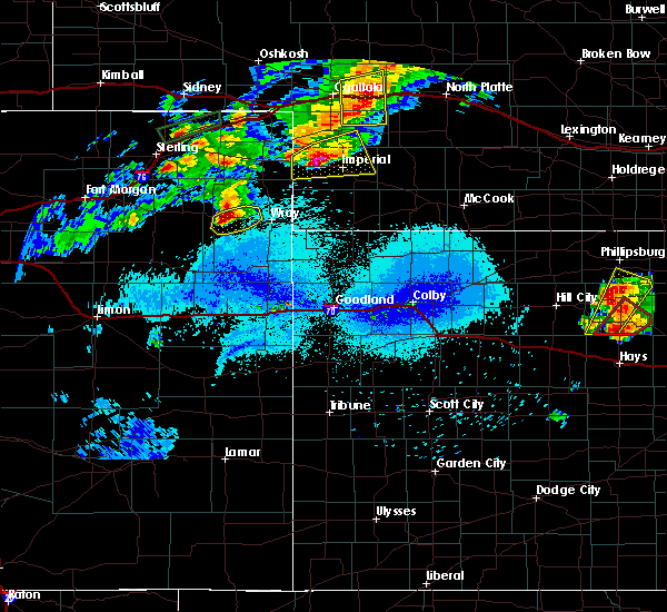 At 706 pm mdt, a severe thunderstorm was located near lamar, or 11 miles west of imperial, moving east at 25 mph (radar indicated). Hazards include golf ball size hail and 60 mph wind gusts. People and animals outdoors will be injured. expect hail damage to roofs, siding, windows, and vehicles. expect wind damage to roofs, siding, and trees. locations impacted include, imperial, lamar, champion, crete, chase and wanamaker state wildfire management area. This includes highway 61 between mile markers 41 and 60. At 706 pm mdt, a severe thunderstorm was located near lamar, or 11 miles west of imperial, moving east at 25 mph (radar indicated). Hazards include golf ball size hail and 60 mph wind gusts. People and animals outdoors will be injured. expect hail damage to roofs, siding, windows, and vehicles. expect wind damage to roofs, siding, and trees. locations impacted include, imperial, lamar, champion, crete, chase and wanamaker state wildfire management area. This includes highway 61 between mile markers 41 and 60.
|
| 5/27/2019 6:46 PM MDT |
 At 646 pm mdt, a severe thunderstorm was located near lamar, or 14 miles west of imperial, moving east at 25 mph (radar indicated). Hazards include golf ball size hail and 60 mph wind gusts. People and animals outdoors will be injured. expect hail damage to roofs, siding, windows, and vehicles. expect wind damage to roofs, siding, and trees. locations impacted include, imperial, lamar, champion, crete, chase and wanamaker state wildfire management area. This includes highway 61 between mile markers 41 and 60. At 646 pm mdt, a severe thunderstorm was located near lamar, or 14 miles west of imperial, moving east at 25 mph (radar indicated). Hazards include golf ball size hail and 60 mph wind gusts. People and animals outdoors will be injured. expect hail damage to roofs, siding, windows, and vehicles. expect wind damage to roofs, siding, and trees. locations impacted include, imperial, lamar, champion, crete, chase and wanamaker state wildfire management area. This includes highway 61 between mile markers 41 and 60.
|
| 5/27/2019 6:31 PM MDT |
 At 630 pm mdt, a severe thunderstorm was located near lamar, or 14 miles east of holyoke, moving east at 40 mph (radar indicated). Hazards include golf ball size hail and 60 mph wind gusts. People and animals outdoors will be injured. expect hail damage to roofs, siding, windows, and vehicles. Expect wind damage to roofs, siding, and trees. At 630 pm mdt, a severe thunderstorm was located near lamar, or 14 miles east of holyoke, moving east at 40 mph (radar indicated). Hazards include golf ball size hail and 60 mph wind gusts. People and animals outdoors will be injured. expect hail damage to roofs, siding, windows, and vehicles. Expect wind damage to roofs, siding, and trees.
|
| 4/28/2019 3:48 PM MDT |
 At 348 pm mdt, a severe thunderstorm was located near venango, or 16 miles southwest of grant, moving east at 30 mph (radar indicated). Hazards include 60 mph wind gusts and penny size hail. expect damage to roofs, siding, and trees At 348 pm mdt, a severe thunderstorm was located near venango, or 16 miles southwest of grant, moving east at 30 mph (radar indicated). Hazards include 60 mph wind gusts and penny size hail. expect damage to roofs, siding, and trees
|
| 7/28/2018 8:59 PM MDT |
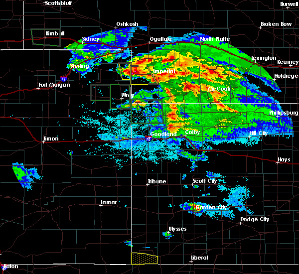 At 858 pm mdt, a severe thunderstorm was located over lamar, or 17 miles west of imperial, moving south at 30 mph (radar indicated). Hazards include tennis ball size hail and 70 mph wind gusts. People and animals outdoors will be injured. expect hail damage to roofs, siding, windows, and vehicles. expect considerable tree damage. wind damage is also likely to mobile homes, roofs, and outbuildings. Locations impacted include, imperial, lamar, champion, crete, chase and wanamaker state wildfire management area. At 858 pm mdt, a severe thunderstorm was located over lamar, or 17 miles west of imperial, moving south at 30 mph (radar indicated). Hazards include tennis ball size hail and 70 mph wind gusts. People and animals outdoors will be injured. expect hail damage to roofs, siding, windows, and vehicles. expect considerable tree damage. wind damage is also likely to mobile homes, roofs, and outbuildings. Locations impacted include, imperial, lamar, champion, crete, chase and wanamaker state wildfire management area.
|
| 7/28/2018 8:49 PM MDT |
 At 848 pm mdt, a severe thunderstorm was located over lamar, or 17 miles east of holyoke, moving southeast at 40 mph. this is a very dangerous storm (radar indicated). Hazards include 80 mph wind gusts and baseball size hail. Flying debris will be dangerous to those caught without shelter. mobile homes will be heavily damaged. expect considerable damage to roofs, windows, and vehicles. extensive tree damage and power outages are likely. Locations impacted include, imperial, venango, lamar, champion, crete, chase and wanamaker state wildfire management area. At 848 pm mdt, a severe thunderstorm was located over lamar, or 17 miles east of holyoke, moving southeast at 40 mph. this is a very dangerous storm (radar indicated). Hazards include 80 mph wind gusts and baseball size hail. Flying debris will be dangerous to those caught without shelter. mobile homes will be heavily damaged. expect considerable damage to roofs, windows, and vehicles. extensive tree damage and power outages are likely. Locations impacted include, imperial, venango, lamar, champion, crete, chase and wanamaker state wildfire management area.
|
| 7/28/2018 8:31 PM MDT |
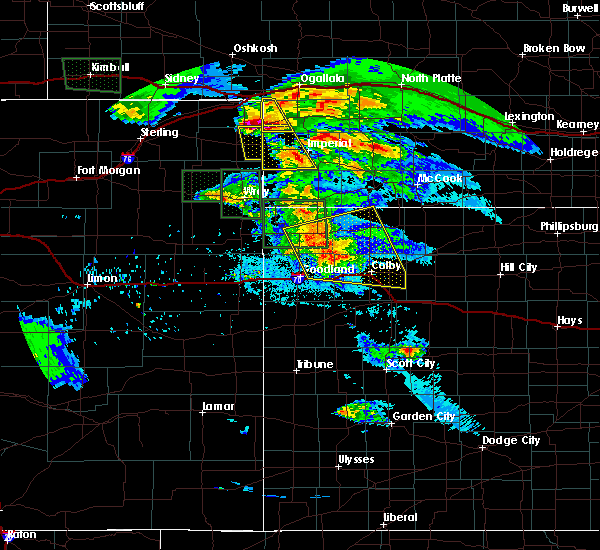 At 830 pm mdt, a severe thunderstorm was located over venango, or 16 miles southwest of grant, moving southeast at 35 mph. this is a very dangerous storm (radar indicated). Hazards include 80 mph wind gusts and baseball size hail. Flying debris will be dangerous to those caught without shelter. mobile homes will be heavily damaged. expect considerable damage to roofs, windows, and vehicles. Extensive tree damage and power outages are likely. At 830 pm mdt, a severe thunderstorm was located over venango, or 16 miles southwest of grant, moving southeast at 35 mph. this is a very dangerous storm (radar indicated). Hazards include 80 mph wind gusts and baseball size hail. Flying debris will be dangerous to those caught without shelter. mobile homes will be heavily damaged. expect considerable damage to roofs, windows, and vehicles. Extensive tree damage and power outages are likely.
|
| 7/22/2018 7:58 PM MDT |
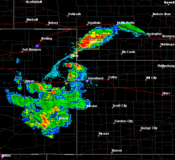 At 858 pm cdt/758 pm mdt/, a severe thunderstorm was located near champion, or 11 miles southwest of imperial, moving south at 20 mph (radar indicated). Hazards include 60 mph wind gusts and quarter size hail. Hail damage to vehicles is expected. expect wind damage to roofs, siding, and trees. locations impacted include, imperial, wauneta, lamar, enders, enders reservoir state recreation area, champion, crete, chase, center dam campground, wanamaker state wildfire management area, area a campground and church grove campground. This includes highway 61 between mile markers 25 and 54. At 858 pm cdt/758 pm mdt/, a severe thunderstorm was located near champion, or 11 miles southwest of imperial, moving south at 20 mph (radar indicated). Hazards include 60 mph wind gusts and quarter size hail. Hail damage to vehicles is expected. expect wind damage to roofs, siding, and trees. locations impacted include, imperial, wauneta, lamar, enders, enders reservoir state recreation area, champion, crete, chase, center dam campground, wanamaker state wildfire management area, area a campground and church grove campground. This includes highway 61 between mile markers 25 and 54.
|
| 7/22/2018 7:36 PM MDT |
 At 835 pm cdt/735 pm mdt/, a severe thunderstorm was located near lamar, or 13 miles west of imperial, moving south at 25 mph (radar indicated). Hazards include 60 mph wind gusts and half dollar size hail. Hail damage to vehicles is expected. Expect wind damage to roofs, siding, and trees. At 835 pm cdt/735 pm mdt/, a severe thunderstorm was located near lamar, or 13 miles west of imperial, moving south at 25 mph (radar indicated). Hazards include 60 mph wind gusts and half dollar size hail. Hail damage to vehicles is expected. Expect wind damage to roofs, siding, and trees.
|
| 6/23/2018 10:13 PM MDT |
 At 1113 pm cdt/1013 pm mdt/, severe thunderstorms were located along a line extending from 9 miles south of ringgold to 8 miles northeast of wallace to 8 miles east of lamar, moving east at 40 mph (radar indicated). Hazards include 60 mph wind gusts and penny size hail. Expect damage to roofs, siding, and trees. locations impacted include, north platte, imperial, sutherland, hershey, wallace, madrid, elsie, lamar, sutherland reservoir state recreation area, champion, crete, chase, grainton, coker, o`fallons, wanamaker state wildfire management area and birdwood. this includes the following highways, highway 61 between mile markers 41 and 61. highway 97 between mile markers 1 and 16. interstate 80 in nebraska between mile markers 151 and 177. Highway 83 between mile markers 82 and 91. At 1113 pm cdt/1013 pm mdt/, severe thunderstorms were located along a line extending from 9 miles south of ringgold to 8 miles northeast of wallace to 8 miles east of lamar, moving east at 40 mph (radar indicated). Hazards include 60 mph wind gusts and penny size hail. Expect damage to roofs, siding, and trees. locations impacted include, north platte, imperial, sutherland, hershey, wallace, madrid, elsie, lamar, sutherland reservoir state recreation area, champion, crete, chase, grainton, coker, o`fallons, wanamaker state wildfire management area and birdwood. this includes the following highways, highway 61 between mile markers 41 and 61. highway 97 between mile markers 1 and 16. interstate 80 in nebraska between mile markers 151 and 177. Highway 83 between mile markers 82 and 91.
|
| 6/23/2018 9:52 PM MDT |
 At 1052 pm cdt/952 pm mdt/, severe thunderstorms were located along a line extending from 14 miles south of tryon to near elsie to near lamar, moving east at 30 mph (radar indicated). Hazards include 60 mph wind gusts and penny size hail. expect damage to roofs, siding, and trees At 1052 pm cdt/952 pm mdt/, severe thunderstorms were located along a line extending from 14 miles south of tryon to near elsie to near lamar, moving east at 30 mph (radar indicated). Hazards include 60 mph wind gusts and penny size hail. expect damage to roofs, siding, and trees
|
| 6/14/2018 8:23 PM MDT |
 At 920 pm cdt/820 pm mdt/, a severe thunderstorm was located over kansas and sending out flow winds into southwest nebraska (asos). Hazards include 60 mph wind gusts. Expect damage to roofs, siding, and trees. locations impacted include, imperial, grant, wauneta, madrid, lamar, enders, enders reservoir state recreation area, champion, chase, center dam campground, wild horse spring, wanamaker state wildfire management area, area a campground and church grove campground. This includes highway 61 between mile markers 27 and 75. At 920 pm cdt/820 pm mdt/, a severe thunderstorm was located over kansas and sending out flow winds into southwest nebraska (asos). Hazards include 60 mph wind gusts. Expect damage to roofs, siding, and trees. locations impacted include, imperial, grant, wauneta, madrid, lamar, enders, enders reservoir state recreation area, champion, chase, center dam campground, wild horse spring, wanamaker state wildfire management area, area a campground and church grove campground. This includes highway 61 between mile markers 27 and 75.
|
| 6/14/2018 8:04 PM MDT |
 At 902 pm cdt/802 pm mdt/, a severe thunderstorm was located south in kansas and was sending outflow winds into southwest nebraska (asos). Hazards include 60 mph wind gusts at imperial. expect damage to roofs, siding, and trees At 902 pm cdt/802 pm mdt/, a severe thunderstorm was located south in kansas and was sending outflow winds into southwest nebraska (asos). Hazards include 60 mph wind gusts at imperial. expect damage to roofs, siding, and trees
|
| 5/29/2018 4:30 PM MDT |
 The national weather service in north platte has issued a * severe thunderstorm warning for. northwestern chase county in southwestern nebraska. until 515 pm mdt. At 430 pm mdt, a severe thunderstorm was located over lamar, or 17 miles east of holyoke, moving northeast at 15 mph. The national weather service in north platte has issued a * severe thunderstorm warning for. northwestern chase county in southwestern nebraska. until 515 pm mdt. At 430 pm mdt, a severe thunderstorm was located over lamar, or 17 miles east of holyoke, moving northeast at 15 mph.
|
| 5/27/2018 7:03 PM MDT |
 At 702 pm mdt, a severe thunderstorm was located 12 miles south of grant, moving north at 55 mph (radar indicated). Hazards include 60 mph wind gusts and penny size hail. Expect damage to roofs, siding, and trees. locations impacted include, imperial, grant, madrid, lamar, enders, enders reservoir state recreation area, champion, crete, chase, center dam campground, brandon, wild horse spring, wanamaker state wildfire management area, area a campground and church grove campground. This includes highway 61 between mile markers 25 and 74. At 702 pm mdt, a severe thunderstorm was located 12 miles south of grant, moving north at 55 mph (radar indicated). Hazards include 60 mph wind gusts and penny size hail. Expect damage to roofs, siding, and trees. locations impacted include, imperial, grant, madrid, lamar, enders, enders reservoir state recreation area, champion, crete, chase, center dam campground, brandon, wild horse spring, wanamaker state wildfire management area, area a campground and church grove campground. This includes highway 61 between mile markers 25 and 74.
|
| 5/27/2018 6:46 PM MDT |
 At 646 pm mdt, a severe thunderstorm was located near champion, or 8 miles southwest of imperial, moving north at 55 mph (radar indicated). Hazards include 60 mph wind gusts and quarter size hail. Hail damage to vehicles is expected. Expect wind damage to roofs, siding, and trees. At 646 pm mdt, a severe thunderstorm was located near champion, or 8 miles southwest of imperial, moving north at 55 mph (radar indicated). Hazards include 60 mph wind gusts and quarter size hail. Hail damage to vehicles is expected. Expect wind damage to roofs, siding, and trees.
|
| 5/27/2018 5:49 PM MDT |
 At 549 pm mdt, a severe thunderstorm was located 7 miles southeast of lamar, or 11 miles west of imperial, moving north at 45 mph (radar indicated). Hazards include quarter size hail. Damage to vehicles is expected. Locations impacted include, lamar, champion, crete and chase. At 549 pm mdt, a severe thunderstorm was located 7 miles southeast of lamar, or 11 miles west of imperial, moving north at 45 mph (radar indicated). Hazards include quarter size hail. Damage to vehicles is expected. Locations impacted include, lamar, champion, crete and chase.
|
| 5/27/2018 5:28 PM MDT |
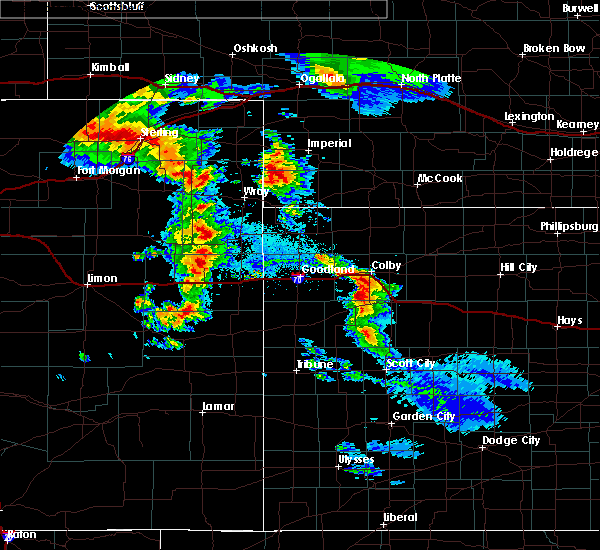 At 528 pm mdt, a severe thunderstorm was located 14 miles southwest of champion, or 19 miles southwest of imperial, moving north at 40 mph (radar indicated). Hazards include quarter size hail. damage to vehicles is expected At 528 pm mdt, a severe thunderstorm was located 14 miles southwest of champion, or 19 miles southwest of imperial, moving north at 40 mph (radar indicated). Hazards include quarter size hail. damage to vehicles is expected
|
| 5/27/2018 3:03 PM MDT |
 The national weather service in north platte has issued a * severe thunderstorm warning for. southwestern perkins county in southwestern nebraska. northwestern chase county in southwestern nebraska. until 345 pm mdt. At 303 pm mdt, a severe thunderstorm was located over lamar, or 16. The national weather service in north platte has issued a * severe thunderstorm warning for. southwestern perkins county in southwestern nebraska. northwestern chase county in southwestern nebraska. until 345 pm mdt. At 303 pm mdt, a severe thunderstorm was located over lamar, or 16.
|
| 10/1/2017 4:20 PM MDT |
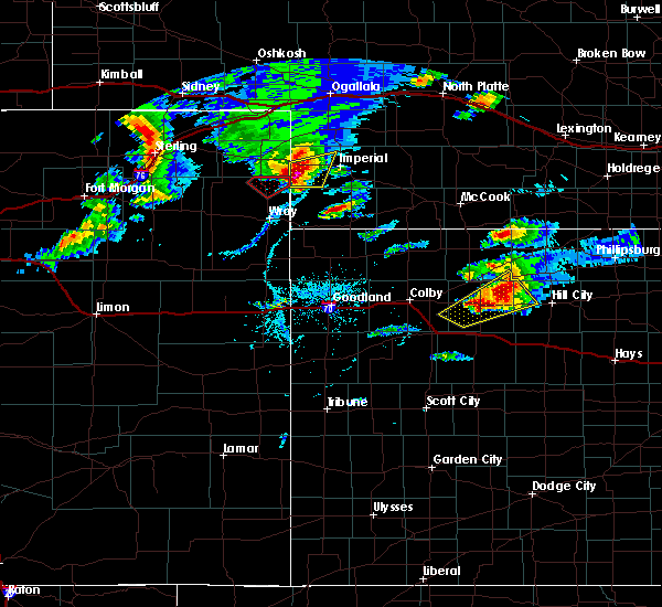 At 420 pm mdt, a severe thunderstorm was located 8 miles south of lamar, or 18 miles west of imperial, moving northeast at 35 mph (radar indicated). Hazards include golf ball size hail and 60 mph wind gusts. People and animals outdoors will be injured. expect hail damage to roofs, siding, windows, and vehicles. expect wind damage to roofs, siding, and trees. locations impacted include, lamar, crete and chase. A tornado watch remains in effect until 1000 pm mdt for southwestern nebraska. At 420 pm mdt, a severe thunderstorm was located 8 miles south of lamar, or 18 miles west of imperial, moving northeast at 35 mph (radar indicated). Hazards include golf ball size hail and 60 mph wind gusts. People and animals outdoors will be injured. expect hail damage to roofs, siding, windows, and vehicles. expect wind damage to roofs, siding, and trees. locations impacted include, lamar, crete and chase. A tornado watch remains in effect until 1000 pm mdt for southwestern nebraska.
|
| 10/1/2017 4:07 PM MDT |
 At 407 pm mdt, a severe thunderstorm was located 12 miles southwest of lamar, or 15 miles southeast of holyoke, moving northeast at 15 mph (radar indicated). Hazards include golf ball size hail and 60 mph wind gusts. People and animals outdoors will be injured. expect hail damage to roofs, siding, windows, and vehicles. Expect wind damage to roofs, siding, and trees. At 407 pm mdt, a severe thunderstorm was located 12 miles southwest of lamar, or 15 miles southeast of holyoke, moving northeast at 15 mph (radar indicated). Hazards include golf ball size hail and 60 mph wind gusts. People and animals outdoors will be injured. expect hail damage to roofs, siding, windows, and vehicles. Expect wind damage to roofs, siding, and trees.
|
| 7/18/2017 6:28 PM MDT |
 At 628 pm mdt, a severe thunderstorm was located over lamar, or 17 miles west of imperial, moving southeast at 20 mph (radar indicated). Hazards include 60 mph wind gusts and quarter size hail. Hail damage to vehicles is expected. expect wind damage to roofs, siding, and trees. locations impacted include, lamar, crete, chase and wanamaker state wildfire management area. This includes highway 61 between mile markers 45 and 48. At 628 pm mdt, a severe thunderstorm was located over lamar, or 17 miles west of imperial, moving southeast at 20 mph (radar indicated). Hazards include 60 mph wind gusts and quarter size hail. Hail damage to vehicles is expected. expect wind damage to roofs, siding, and trees. locations impacted include, lamar, crete, chase and wanamaker state wildfire management area. This includes highway 61 between mile markers 45 and 48.
|
| 7/18/2017 6:01 PM MDT |
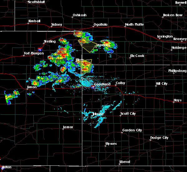 At 601 pm mdt, a severe thunderstorm was located near venango, or 15 miles northeast of holyoke, moving southeast at 25 mph (radar indicated). Hazards include 60 mph wind gusts and quarter size hail. Hail damage to vehicles is expected. Expect wind damage to roofs, siding, and trees. At 601 pm mdt, a severe thunderstorm was located near venango, or 15 miles northeast of holyoke, moving southeast at 25 mph (radar indicated). Hazards include 60 mph wind gusts and quarter size hail. Hail damage to vehicles is expected. Expect wind damage to roofs, siding, and trees.
|
| 5/16/2017 5:13 PM MDT |
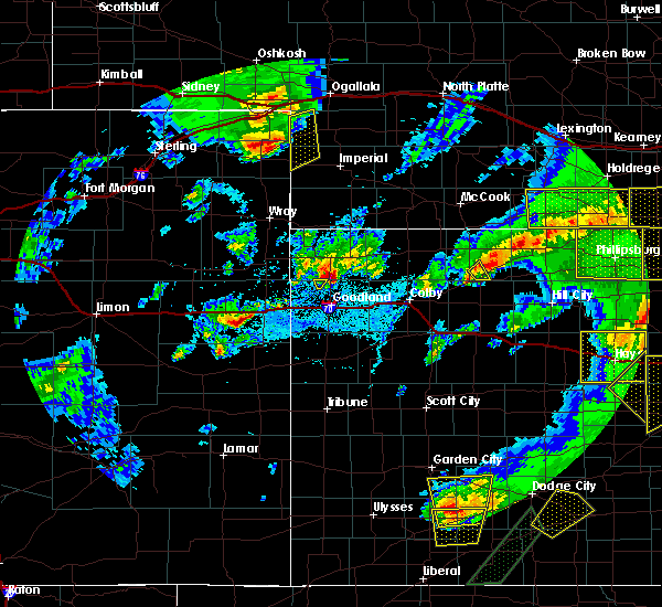 At 512 pm mdt, a severe thunderstorm was located near venango, or 14 miles northeast of holyoke, moving northeast at 15 mph (radar indicated). Hazards include 60 mph wind gusts and quarter size hail. Hail damage to vehicles is expected. Expect wind damage to roofs, siding, and trees. At 512 pm mdt, a severe thunderstorm was located near venango, or 14 miles northeast of holyoke, moving northeast at 15 mph (radar indicated). Hazards include 60 mph wind gusts and quarter size hail. Hail damage to vehicles is expected. Expect wind damage to roofs, siding, and trees.
|
| 9/4/2016 4:25 PM MDT |
 At 425 pm mdt, a severe thunderstorm was located near lamar, or 14 miles east of holyoke, moving north at 40 mph (radar indicated). Hazards include ping pong ball size hail and 60 mph wind gusts. People and animals outdoors will be injured. expect hail damage to roofs, siding, windows, and vehicles. Expect wind damage to roofs, siding, and trees. At 425 pm mdt, a severe thunderstorm was located near lamar, or 14 miles east of holyoke, moving north at 40 mph (radar indicated). Hazards include ping pong ball size hail and 60 mph wind gusts. People and animals outdoors will be injured. expect hail damage to roofs, siding, windows, and vehicles. Expect wind damage to roofs, siding, and trees.
|
| 9/4/2016 4:12 PM MDT |
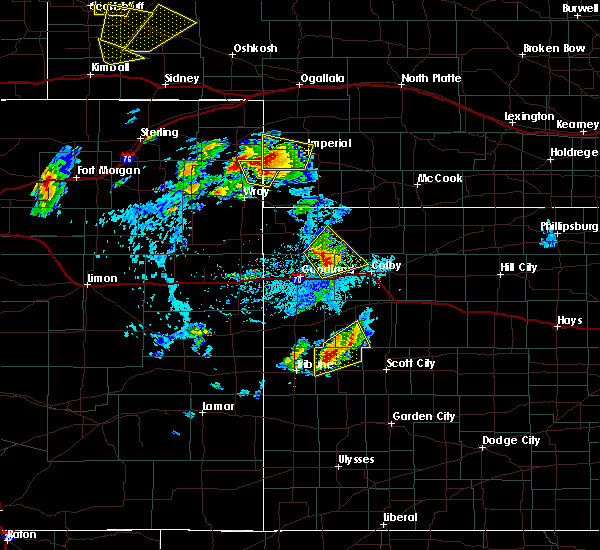 At 412 pm mdt, a severe thunderstorm was located 7 miles south of lamar, or 16 miles southeast of holyoke, moving north at 55 mph (radar indicated). Hazards include ping pong ball size hail and 60 mph wind gusts. People and animals outdoors will be injured. expect hail damage to roofs, siding, windows, and vehicles. expect wind damage to roofs, siding, and trees. locations impacted include, imperial, lamar, champion, chase, crete and wanamaker state wildfire management area. This includes highway 61 between mile markers 41 and 45. At 412 pm mdt, a severe thunderstorm was located 7 miles south of lamar, or 16 miles southeast of holyoke, moving north at 55 mph (radar indicated). Hazards include ping pong ball size hail and 60 mph wind gusts. People and animals outdoors will be injured. expect hail damage to roofs, siding, windows, and vehicles. expect wind damage to roofs, siding, and trees. locations impacted include, imperial, lamar, champion, chase, crete and wanamaker state wildfire management area. This includes highway 61 between mile markers 41 and 45.
|
| 9/4/2016 3:50 PM MDT |
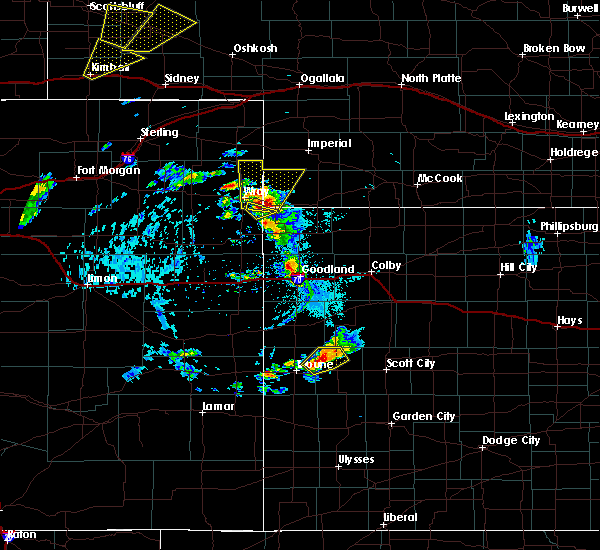 At 350 pm mdt, a severe thunderstorm was located 8 miles northwest of haigler, or 10 miles east of wray, moving north at 50 mph (radar indicated). Hazards include ping pong ball size hail and 60 mph wind gusts. People and animals outdoors will be injured. expect hail damage to roofs, siding, windows, and vehicles. Expect wind damage to roofs, siding, and trees. At 350 pm mdt, a severe thunderstorm was located 8 miles northwest of haigler, or 10 miles east of wray, moving north at 50 mph (radar indicated). Hazards include ping pong ball size hail and 60 mph wind gusts. People and animals outdoors will be injured. expect hail damage to roofs, siding, windows, and vehicles. Expect wind damage to roofs, siding, and trees.
|
| 7/7/2016 5:40 PM MDT |
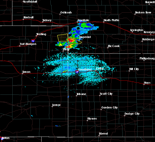 At 540 pm mdt, a severe thunderstorm was located 8 miles south of lamar, or 18 miles west of imperial, moving southeast at 30 mph (radar indicated). Hazards include 60 mph wind gusts and quarter size hail. Hail damage to vehicles is expected. expect wind damage to roofs, siding, and trees. Locations impacted include, lamar, champion and crete. At 540 pm mdt, a severe thunderstorm was located 8 miles south of lamar, or 18 miles west of imperial, moving southeast at 30 mph (radar indicated). Hazards include 60 mph wind gusts and quarter size hail. Hail damage to vehicles is expected. expect wind damage to roofs, siding, and trees. Locations impacted include, lamar, champion and crete.
|
| 7/7/2016 5:22 PM MDT |
 At 522 pm mdt, a severe thunderstorm was located near pleasant valley, or 7 miles southeast of holyoke, moving southeast at 30 mph (radar indicated). Hazards include 60 mph wind gusts and quarter size hail. Hail damage to vehicles is expected. Expect wind damage to roofs, siding, and trees. At 522 pm mdt, a severe thunderstorm was located near pleasant valley, or 7 miles southeast of holyoke, moving southeast at 30 mph (radar indicated). Hazards include 60 mph wind gusts and quarter size hail. Hail damage to vehicles is expected. Expect wind damage to roofs, siding, and trees.
|
| 6/28/2016 8:27 PM MDT |
 At 927 pm cdt/827 pm mdt/, severe thunderstorms were located along a line extending from 6 miles northwest of sutherland to near venango, moving southeast at 75 mph (radar indicated). Hazards include 60 mph wind gusts and nickel size hail. Expect damage to roofs. siding. And trees. At 927 pm cdt/827 pm mdt/, severe thunderstorms were located along a line extending from 6 miles northwest of sutherland to near venango, moving southeast at 75 mph (radar indicated). Hazards include 60 mph wind gusts and nickel size hail. Expect damage to roofs. siding. And trees.
|
| 6/27/2016 6:42 PM MDT |
 The severe thunderstorm warning for central chase county will expire at 645 pm mdt, the severe thunderstorm which prompted the warning has weakened. therefore the warning will be allowed to expire. however gusty winds and heavy rain are still possible with this thunderstorm. a severe thunderstorm watch remains in effect until 800 pm mdt for southwestern nebraska. to report severe weather, contact your nearest law enforcement agency. they will relay your report to the national weather service north platte. The severe thunderstorm warning for central chase county will expire at 645 pm mdt, the severe thunderstorm which prompted the warning has weakened. therefore the warning will be allowed to expire. however gusty winds and heavy rain are still possible with this thunderstorm. a severe thunderstorm watch remains in effect until 800 pm mdt for southwestern nebraska. to report severe weather, contact your nearest law enforcement agency. they will relay your report to the national weather service north platte.
|
| 6/27/2016 6:10 PM MDT |
 At 610 pm mdt, a severe thunderstorm was located over champion, or 8 miles southwest of imperial, moving southeast at 25 mph (radar indicated). Hazards include 60 mph wind gusts and quarter size hail. Hail damage to vehicles is expected. expect wind damage to roofs, siding, and trees. locations impacted include, imperial, lamar, champion, enders reservoir state recreation area, enders, crete, chase, church grove campground, center dam campground, area a campground and wanamaker state wildfire management area. This includes highway 61 between mile markers 29 and 43. At 610 pm mdt, a severe thunderstorm was located over champion, or 8 miles southwest of imperial, moving southeast at 25 mph (radar indicated). Hazards include 60 mph wind gusts and quarter size hail. Hail damage to vehicles is expected. expect wind damage to roofs, siding, and trees. locations impacted include, imperial, lamar, champion, enders reservoir state recreation area, enders, crete, chase, church grove campground, center dam campground, area a campground and wanamaker state wildfire management area. This includes highway 61 between mile markers 29 and 43.
|
| 6/27/2016 5:58 PM MDT |
 At 556 pm mdt, a severe thunderstorm was located near champion, or near imperial, moving southeast at 20 mph (radar indicated). Hazards include 60 mph wind gusts and quarter size hail. Hail damage to vehicles is expected. expect wind damage to roofs, siding, and trees. locations impacted include, imperial, lamar, champion, enders reservoir state recreation area, enders, crete, chase, church grove campground, center dam campground, area a campground and wanamaker state wildfire management area. This includes highway 61 between mile markers 29 and 43. At 556 pm mdt, a severe thunderstorm was located near champion, or near imperial, moving southeast at 20 mph (radar indicated). Hazards include 60 mph wind gusts and quarter size hail. Hail damage to vehicles is expected. expect wind damage to roofs, siding, and trees. locations impacted include, imperial, lamar, champion, enders reservoir state recreation area, enders, crete, chase, church grove campground, center dam campground, area a campground and wanamaker state wildfire management area. This includes highway 61 between mile markers 29 and 43.
|
| 6/27/2016 5:40 PM MDT |
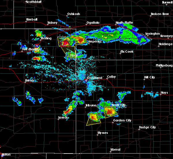 At 539 pm mdt, a severe thunderstorm was located 8 miles east of lamar, or 10 miles northwest of imperial, moving southeast at 30 mph (radar indicated). Hazards include golf ball size hail and 60 mph wind gusts. People and animals outdoors will be injured. expect hail damage to roofs, siding, windows, and vehicles. Expect wind damage to roofs, siding, and trees. At 539 pm mdt, a severe thunderstorm was located 8 miles east of lamar, or 10 miles northwest of imperial, moving southeast at 30 mph (radar indicated). Hazards include golf ball size hail and 60 mph wind gusts. People and animals outdoors will be injured. expect hail damage to roofs, siding, windows, and vehicles. Expect wind damage to roofs, siding, and trees.
|
| 6/27/2016 5:35 PM MDT |
 At 534 pm mdt, a severe thunderstorm was located near lamar, or 14 miles northwest of imperial, moving southeast at 25 mph (radar indicated). Hazards include two inch hail and 60 mph wind gusts. People and animals outdoors will be injured. expect hail damage to roofs, siding, windows, and vehicles. expect wind damage to roofs, siding, and trees. Locations impacted include, lamar and chase. At 534 pm mdt, a severe thunderstorm was located near lamar, or 14 miles northwest of imperial, moving southeast at 25 mph (radar indicated). Hazards include two inch hail and 60 mph wind gusts. People and animals outdoors will be injured. expect hail damage to roofs, siding, windows, and vehicles. expect wind damage to roofs, siding, and trees. Locations impacted include, lamar and chase.
|
| 6/27/2016 5:14 PM MDT |
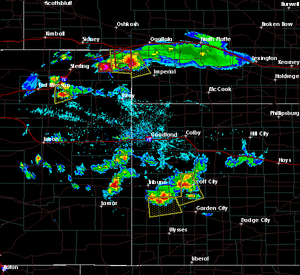 At 513 pm mdt, a severe thunderstorm was located near venango, or 16 miles northeast of holyoke, moving southeast at 40 mph (radar indicated). Hazards include two inch hail and 60 mph wind gusts. People and animals outdoors will be injured. expect hail damage to roofs, siding, windows, and vehicles. expect wind damage to roofs, siding, and trees. Locations impacted include, venango, lamar, chase and brandon. At 513 pm mdt, a severe thunderstorm was located near venango, or 16 miles northeast of holyoke, moving southeast at 40 mph (radar indicated). Hazards include two inch hail and 60 mph wind gusts. People and animals outdoors will be injured. expect hail damage to roofs, siding, windows, and vehicles. expect wind damage to roofs, siding, and trees. Locations impacted include, venango, lamar, chase and brandon.
|
| 6/27/2016 4:44 PM MDT |
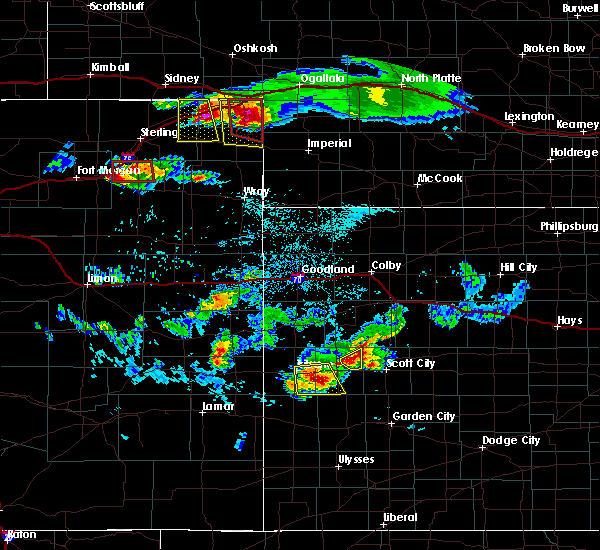 At 443 pm mdt, a severe thunderstorm was located near venango, or 14 miles southeast of julesburg, moving southeast at 25 mph (radar indicated). Hazards include golf ball size hail and 60 mph wind gusts. People and animals outdoors will be injured. expect hail damage to roofs, siding, windows, and vehicles. Expect wind damage to roofs, siding, and trees. At 443 pm mdt, a severe thunderstorm was located near venango, or 14 miles southeast of julesburg, moving southeast at 25 mph (radar indicated). Hazards include golf ball size hail and 60 mph wind gusts. People and animals outdoors will be injured. expect hail damage to roofs, siding, windows, and vehicles. Expect wind damage to roofs, siding, and trees.
|
| 5/7/2016 7:17 PM MDT |
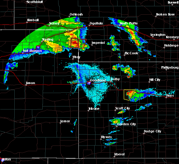 At 717 pm mdt, a severe thunderstorm capable of producing a tornado was located 7 miles southwest of lamar, or 15 miles southeast of holyoke, moving north at 35 mph (radar indicated rotation). Hazards include tornado and quarter size hail. Flying debris will be dangerous to those caught without shelter. mobile homes will be damaged or destroyed. damage to roofs, windows, and vehicles will occur. tree damage is likely. This dangerous storm will be near, lamar around 730 pm mdt. At 717 pm mdt, a severe thunderstorm capable of producing a tornado was located 7 miles southwest of lamar, or 15 miles southeast of holyoke, moving north at 35 mph (radar indicated rotation). Hazards include tornado and quarter size hail. Flying debris will be dangerous to those caught without shelter. mobile homes will be damaged or destroyed. damage to roofs, windows, and vehicles will occur. tree damage is likely. This dangerous storm will be near, lamar around 730 pm mdt.
|
| 5/7/2016 7:04 PM MDT |
 At 703 pm mdt, a severe thunderstorm capable of producing a tornado was located 11 miles south of lamar, or 16 miles southeast of holyoke, moving north at 45 mph (radar indicated rotation). Hazards include tornado and quarter size hail. Flying debris will be dangerous to those caught without shelter. mobile homes will be damaged or destroyed. damage to roofs, windows, and vehicles will occur. tree damage is likely. This dangerous storm will be near, lamar around 715 pm mdt. At 703 pm mdt, a severe thunderstorm capable of producing a tornado was located 11 miles south of lamar, or 16 miles southeast of holyoke, moving north at 45 mph (radar indicated rotation). Hazards include tornado and quarter size hail. Flying debris will be dangerous to those caught without shelter. mobile homes will be damaged or destroyed. damage to roofs, windows, and vehicles will occur. tree damage is likely. This dangerous storm will be near, lamar around 715 pm mdt.
|
| 9/7/2015 6:25 PM MDT |
 The severe thunderstorm warning for southeastern keith, northwestern chase and perkins counties will expire at 630 pm mdt, the storms which prompted the warning have weakened below severe limits, and no longer pose an immediate threat to life or property. therefore the warning will be allowed to expire. however gusty winds are still possible with these thunderstorms. a severe thunderstorm watch remains in effect until midnight mdt for southwestern nebraska. to report severe weather, contact your nearest law enforcement agency. they will relay your report to the national weather service north platte. The severe thunderstorm warning for southeastern keith, northwestern chase and perkins counties will expire at 630 pm mdt, the storms which prompted the warning have weakened below severe limits, and no longer pose an immediate threat to life or property. therefore the warning will be allowed to expire. however gusty winds are still possible with these thunderstorms. a severe thunderstorm watch remains in effect until midnight mdt for southwestern nebraska. to report severe weather, contact your nearest law enforcement agency. they will relay your report to the national weather service north platte.
|
| 9/7/2015 6:10 PM MDT |
 At 610 pm mdt, severe thunderstorms were located along a line extending from 8 miles south of roscoe to near lamar, moving east at 35 mph (radar indicated). Hazards include 60 mph wind gusts and quarter size hail. Hail damage to vehicles is expected. expect wind damage to roofs, siding and trees. this includes the following highways, highway 61 between mile markers 52 and 86. interstate 80 in nebraska between mile markers 120 and 124, and between mile markers 138 and 145. Locations impacted include, lamar, chase, grant, crete, brandon, madrid, venango and wild horse spring. At 610 pm mdt, severe thunderstorms were located along a line extending from 8 miles south of roscoe to near lamar, moving east at 35 mph (radar indicated). Hazards include 60 mph wind gusts and quarter size hail. Hail damage to vehicles is expected. expect wind damage to roofs, siding and trees. this includes the following highways, highway 61 between mile markers 52 and 86. interstate 80 in nebraska between mile markers 120 and 124, and between mile markers 138 and 145. Locations impacted include, lamar, chase, grant, crete, brandon, madrid, venango and wild horse spring.
|
| 9/7/2015 5:48 PM MDT |
 At 547 pm mdt, severe thunderstorms were located along a line extending from near brule to near pleasant valley, moving east at 35 mph (radar indicated). Hazards include 60 mph wind gusts and quarter size hail. Hail damage to vehicles is expected. Expect wind damage to roofs, siding and trees. At 547 pm mdt, severe thunderstorms were located along a line extending from near brule to near pleasant valley, moving east at 35 mph (radar indicated). Hazards include 60 mph wind gusts and quarter size hail. Hail damage to vehicles is expected. Expect wind damage to roofs, siding and trees.
|
| 8/7/2015 8:28 PM MDT | The severe thunderstorm warning for chase and western perkins counties will expire at 830 pm mdt, the storms which prompted the warning have moved out of the area. therefore the warning will be allowed to expire. however gusty winds and heavy rain are still possible with these thunderstorms. a severe thunderstorm watch remains in effect until 1100 pm mdt for southwestern nebraska. remember, a severe thunderstorm warning still remains in effect for eastern chase county. |
| 8/7/2015 8:10 PM MDT |
 At 809 pm mdt, severe thunderstorms were located along a line extending from near grant to 6 miles southwest of champion, moving east at 35 mph (radar indicated). Hazards include 60 mph wind gusts and penny size hail. Expect damage to roofs. siding and trees. this includes highway 61 between mile markers 41 and 75. Locations impacted include, champion, lamar, chase, grant, crete, church grove campground, brandon, madrid, imperial, wild horse spring, venango and wanamaker state wildfire management area. At 809 pm mdt, severe thunderstorms were located along a line extending from near grant to 6 miles southwest of champion, moving east at 35 mph (radar indicated). Hazards include 60 mph wind gusts and penny size hail. Expect damage to roofs. siding and trees. this includes highway 61 between mile markers 41 and 75. Locations impacted include, champion, lamar, chase, grant, crete, church grove campground, brandon, madrid, imperial, wild horse spring, venango and wanamaker state wildfire management area.
|
| 8/7/2015 7:49 PM MDT |
 At 749 pm mdt, severe thunderstorms were located along a line extending from 9 miles north of venango to 14 miles south of lamar, moving east at 35 mph (radar indicated). Hazards include 60 mph wind gusts and penny size hail. Expect damage to roofs. Siding and trees. At 749 pm mdt, severe thunderstorms were located along a line extending from 9 miles north of venango to 14 miles south of lamar, moving east at 35 mph (radar indicated). Hazards include 60 mph wind gusts and penny size hail. Expect damage to roofs. Siding and trees.
|
| 8/7/2015 7:14 PM MDT |
 At 714 pm mdt, a severe thunderstorm was located near champion, or 9 miles west of imperial, moving northeast at 40 mph (radar indicated). Hazards include 60 mph wind gusts and penny size hail. Expect damage to roofs. siding and trees. Locations impacted include, crete, lamar and chase. At 714 pm mdt, a severe thunderstorm was located near champion, or 9 miles west of imperial, moving northeast at 40 mph (radar indicated). Hazards include 60 mph wind gusts and penny size hail. Expect damage to roofs. siding and trees. Locations impacted include, crete, lamar and chase.
|
| 8/7/2015 7:00 PM MDT |
 At 700 pm mdt, a severe thunderstorm was located 11 miles south of lamar, or 18 miles southwest of imperial, moving north at 20 mph (radar indicated). Hazards include ping pong ball size hail and 60 mph wind gusts. People and animals outdoors will be injured. expect hail damage to roofs, siding, windows and vehicles. Expect wind damage to roofs, siding and trees. At 700 pm mdt, a severe thunderstorm was located 11 miles south of lamar, or 18 miles southwest of imperial, moving north at 20 mph (radar indicated). Hazards include ping pong ball size hail and 60 mph wind gusts. People and animals outdoors will be injured. expect hail damage to roofs, siding, windows and vehicles. Expect wind damage to roofs, siding and trees.
|
| 8/7/2015 6:55 PM MDT |
 At 655 pm mdt, a severe thunderstorm was located near lamar, or 15 miles east of holyoke, moving north at 35 mph (public). Hazards include golf ball size hail and 60 mph wind gusts. People and animals outdoors will be injured. expect hail damage to roofs, siding, windows and vehicles. expect wind damage to roofs, siding and trees. Locations impacted include, brandon, lamar and venango. At 655 pm mdt, a severe thunderstorm was located near lamar, or 15 miles east of holyoke, moving north at 35 mph (public). Hazards include golf ball size hail and 60 mph wind gusts. People and animals outdoors will be injured. expect hail damage to roofs, siding, windows and vehicles. expect wind damage to roofs, siding and trees. Locations impacted include, brandon, lamar and venango.
|
| 8/7/2015 6:51 PM MDT |
 At 651 pm mdt, a severe thunderstorm was located over lamar, or 14 miles east of holyoke, moving north at 35 mph (radar indicated). Hazards include 60 mph wind gusts and quarter size hail. Hail damage to vehicles is expected. Expect wind damage to roofs, siding and trees. At 651 pm mdt, a severe thunderstorm was located over lamar, or 14 miles east of holyoke, moving north at 35 mph (radar indicated). Hazards include 60 mph wind gusts and quarter size hail. Hail damage to vehicles is expected. Expect wind damage to roofs, siding and trees.
|
| 8/4/2015 12:03 PM MDT |
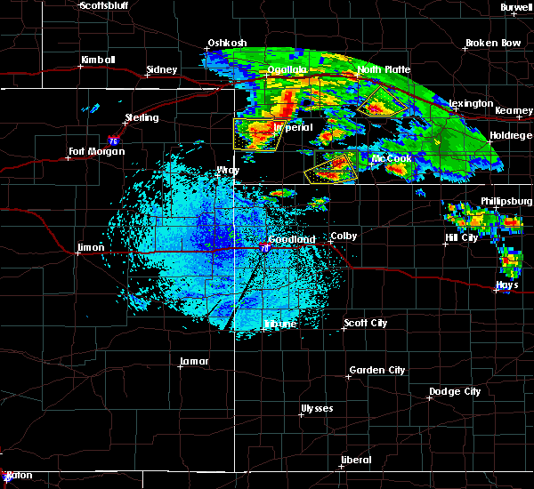 At 1202 pm mdt, a severe thunderstorm was located over champion, or near imperial, moving east at 35 mph (radar indicated). Hazards include quarter size hail. Damage to vehicles is expected. this includes highway 61 between mile markers 41 and 51. Locations impacted include, champion, lamar, chase, crete, church grove campground, imperial and wanamaker state wildfire management area. At 1202 pm mdt, a severe thunderstorm was located over champion, or near imperial, moving east at 35 mph (radar indicated). Hazards include quarter size hail. Damage to vehicles is expected. this includes highway 61 between mile markers 41 and 51. Locations impacted include, champion, lamar, chase, crete, church grove campground, imperial and wanamaker state wildfire management area.
|
| 8/4/2015 11:41 AM MDT |
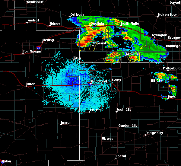 At 1140 am mdt, a severe thunderstorm was located near lamar, or 17 miles west of imperial, moving east at 25 mph (radar indicated). Hazards include quarter size hail. damage to vehicles is expected At 1140 am mdt, a severe thunderstorm was located near lamar, or 17 miles west of imperial, moving east at 25 mph (radar indicated). Hazards include quarter size hail. damage to vehicles is expected
|
| 6/7/2015 4:28 PM MDT | At 426 pm mdt, a severe thunderstorm was located 5 miles south of pleasant valley, and moving southeast at 35 mph (radar indicated). Hazards include 60 mph wind gusts and quarter size hail. Hail damage to vehicles is expected. Expect wind damage to roofs, siding and trees. |
| 5/24/2015 6:27 PM MDT | At 625 pm mdt, a severe thunderstorm was located 8 miles west of champion, and moving northwest at 30 mph (radar indicated). Hazards include 60 mph wind gusts and quarter size hail. Hail damage to vehicles is expected. Expect wind damage to roofs, siding and trees. |
Hail Maps for Lamar, NE


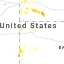


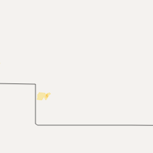


Connect with Interactive Hail Maps