

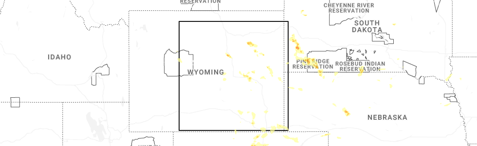
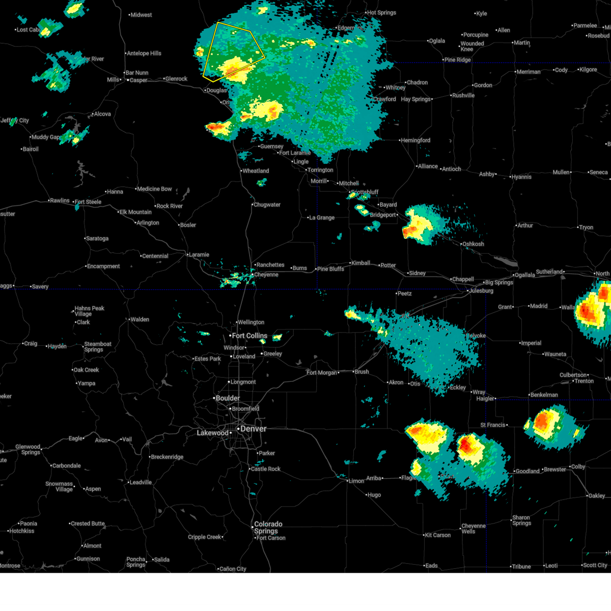
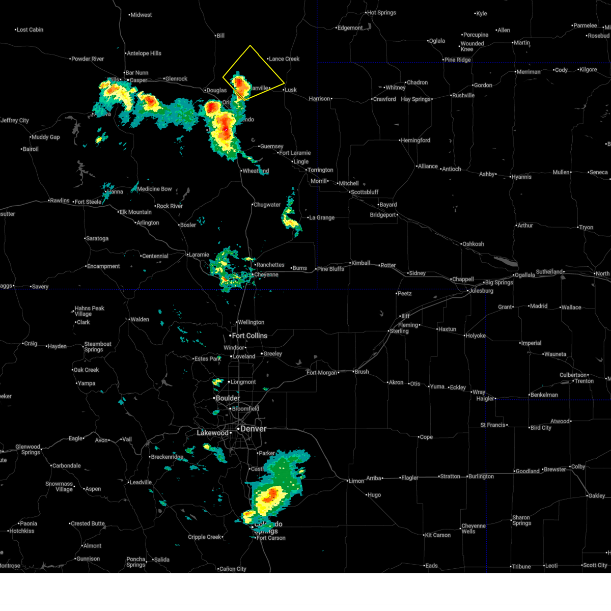
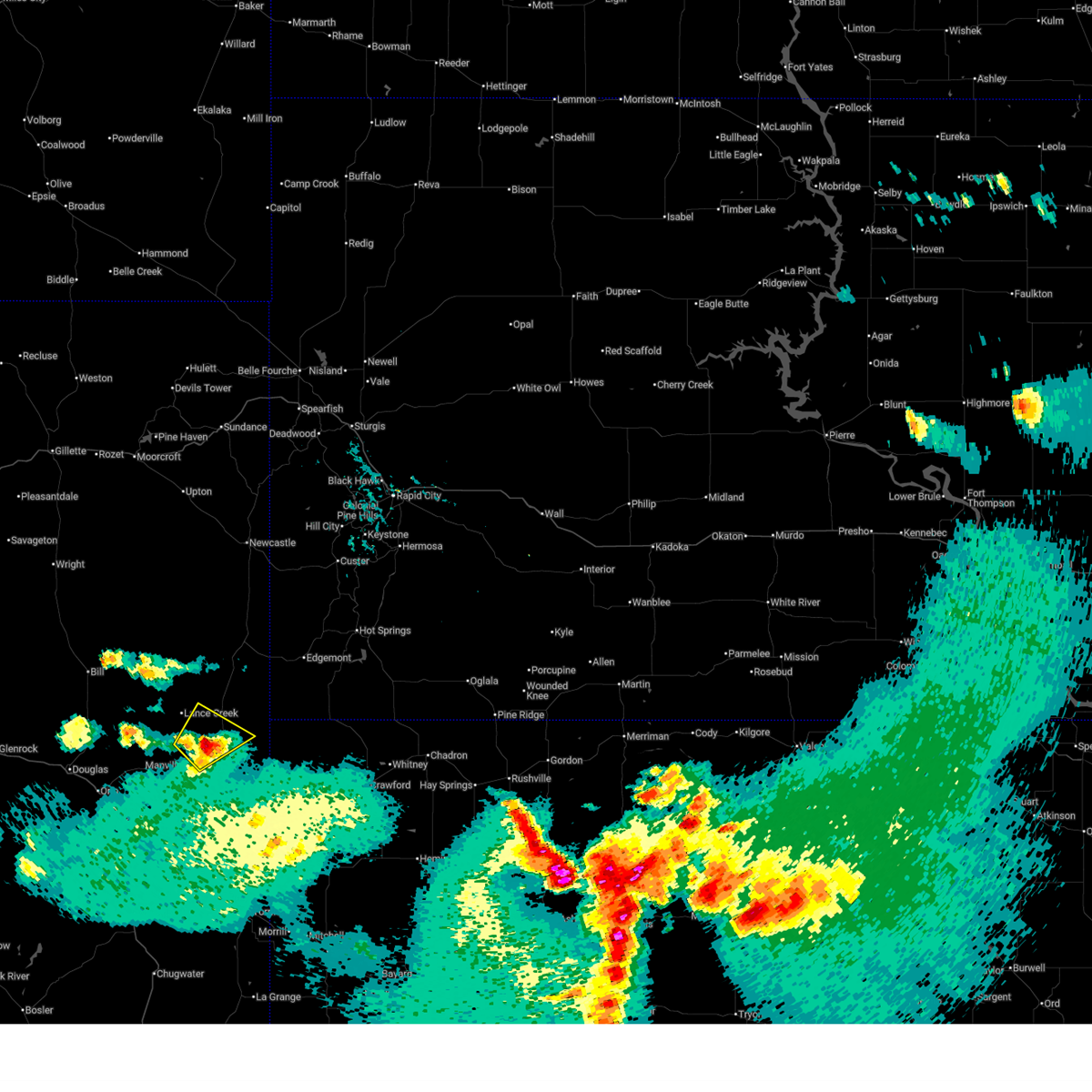
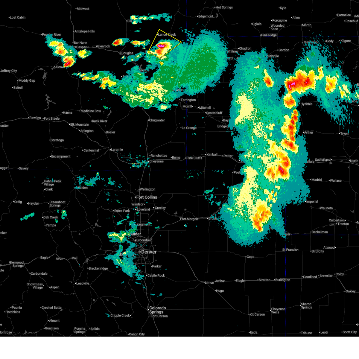
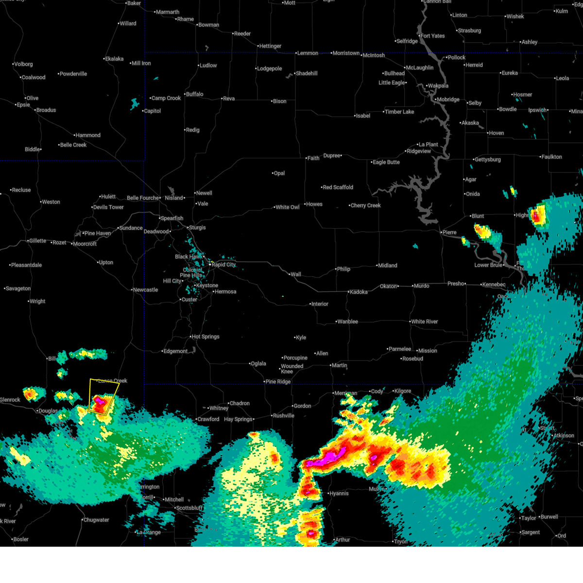
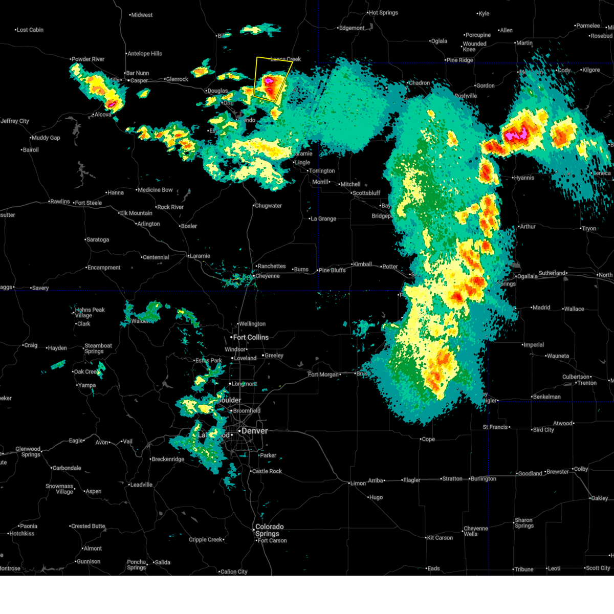
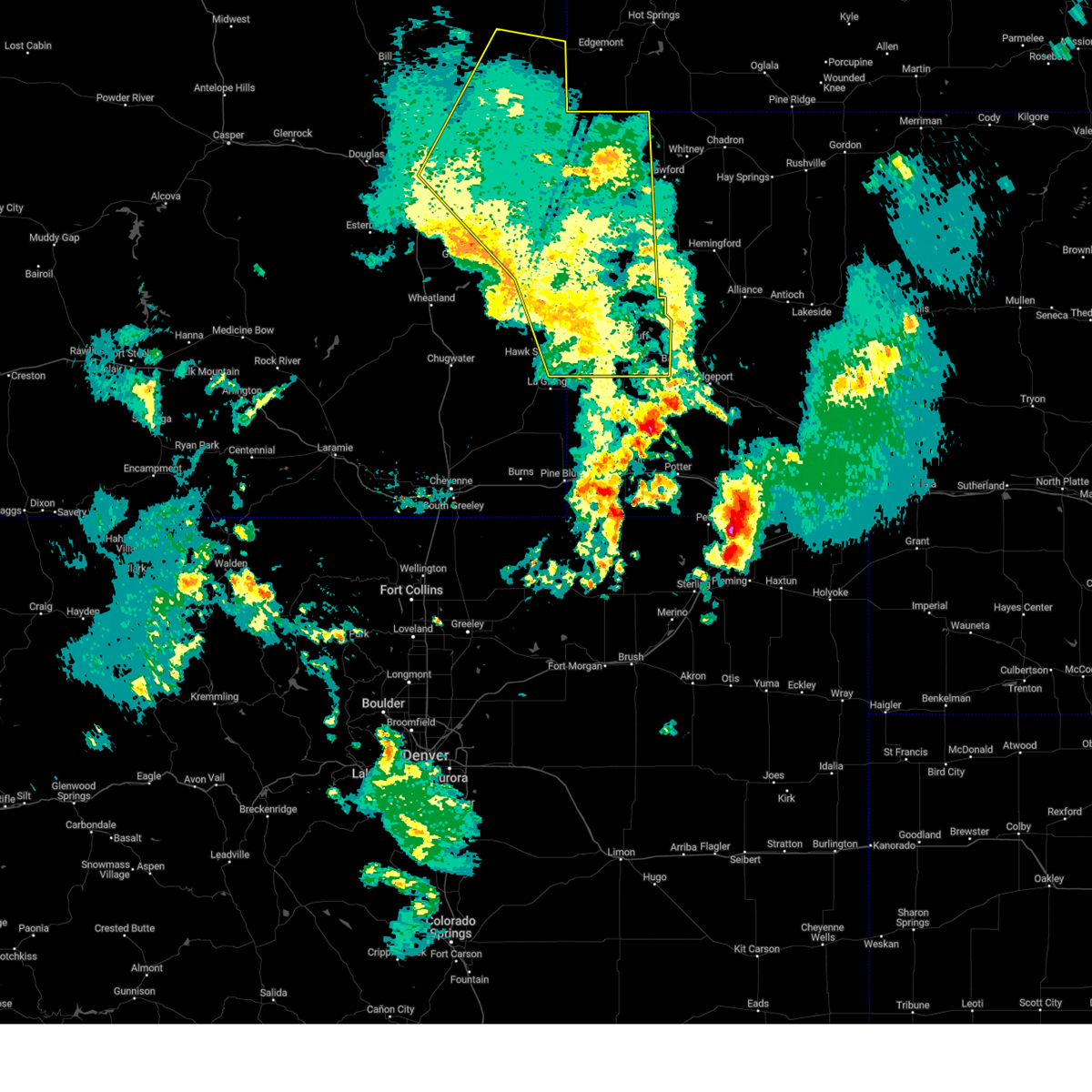
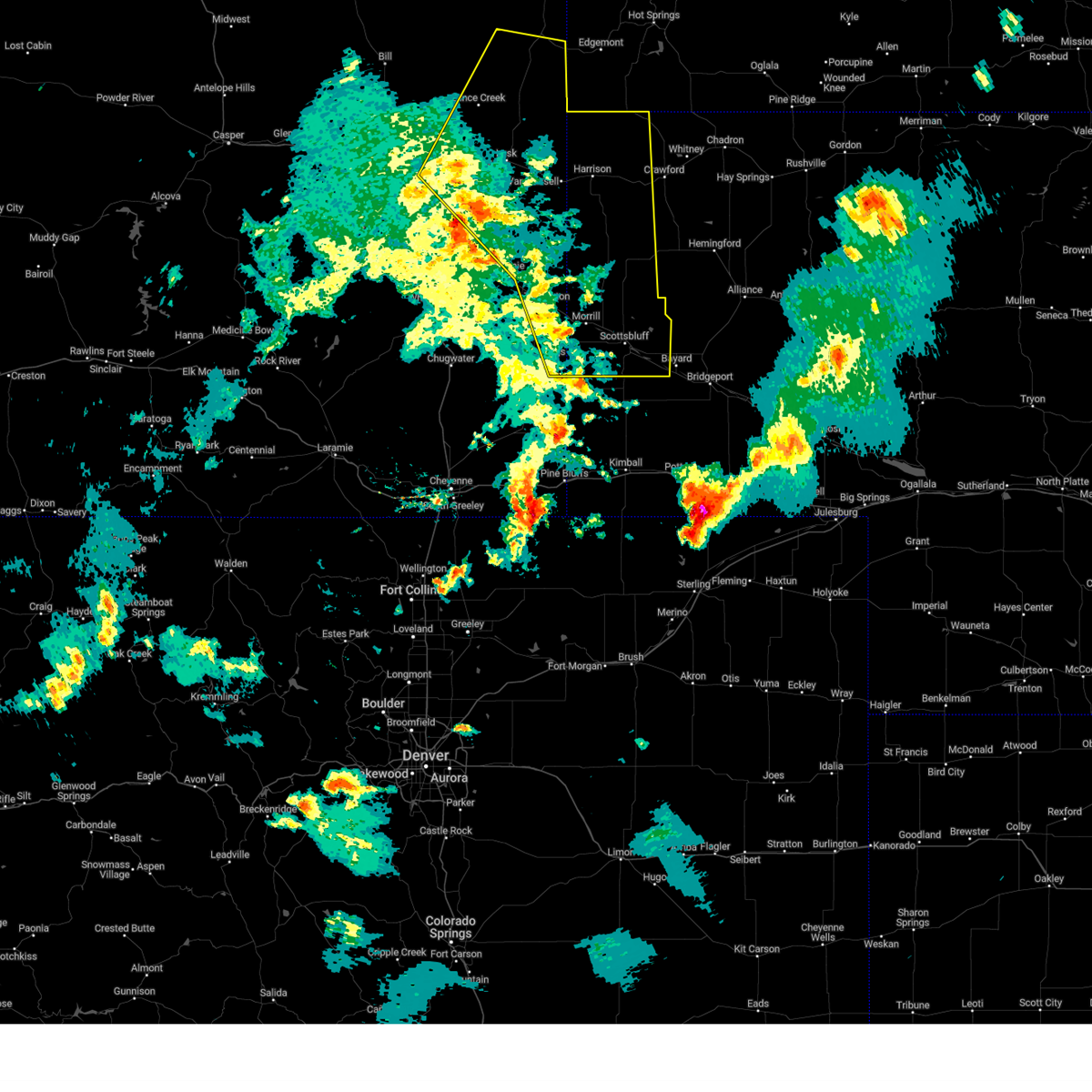
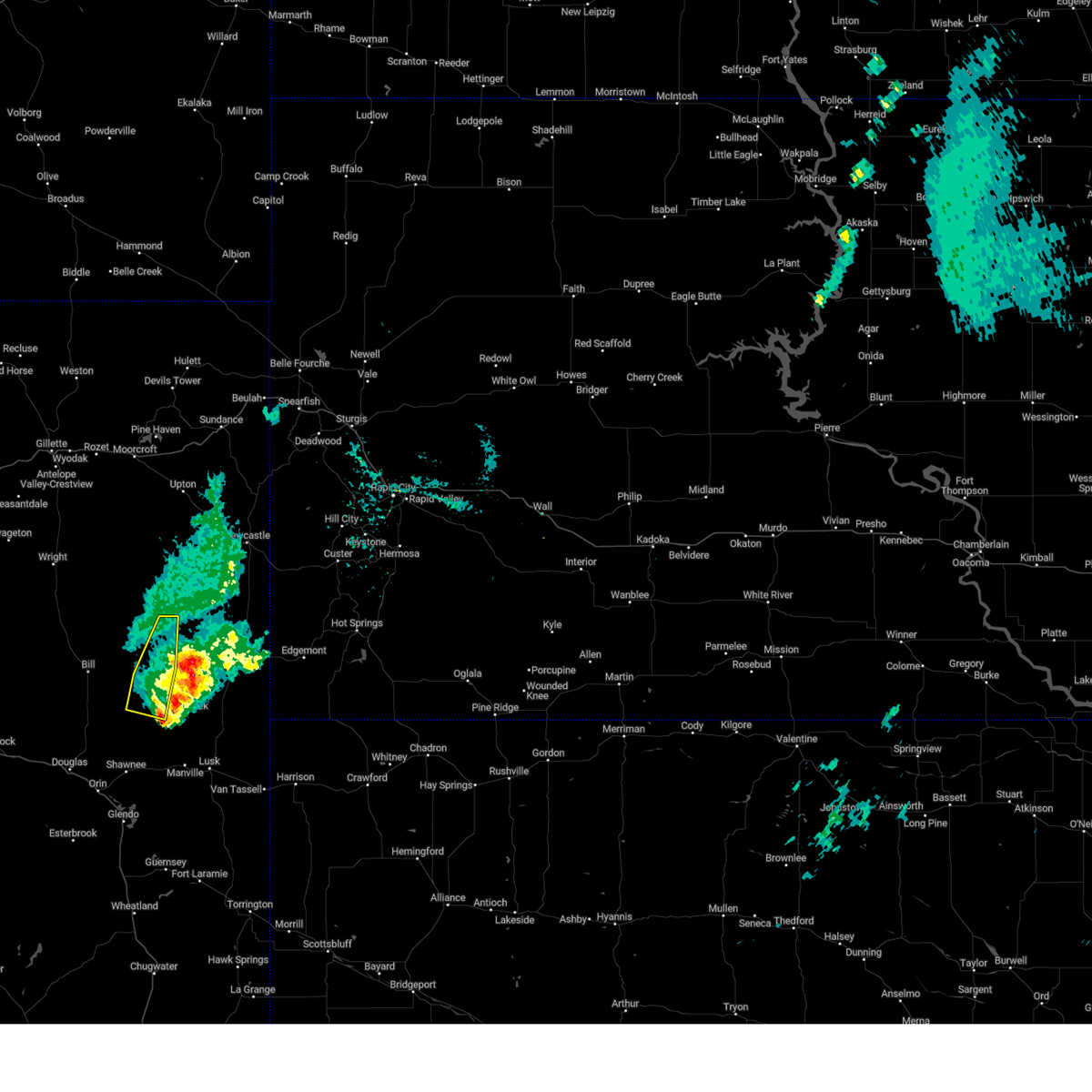
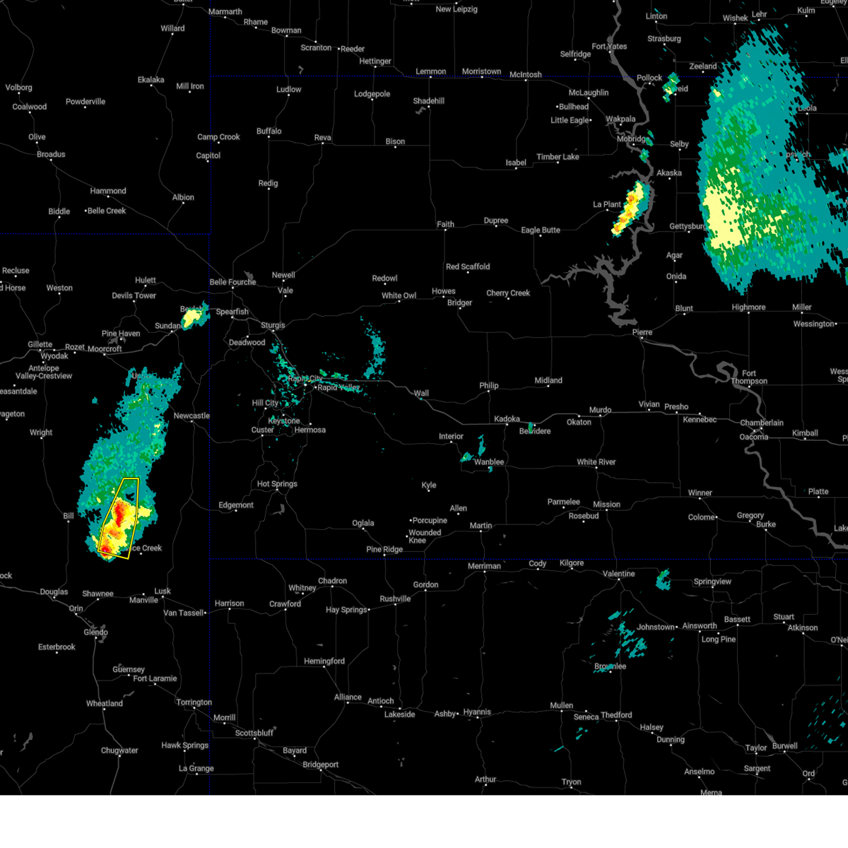
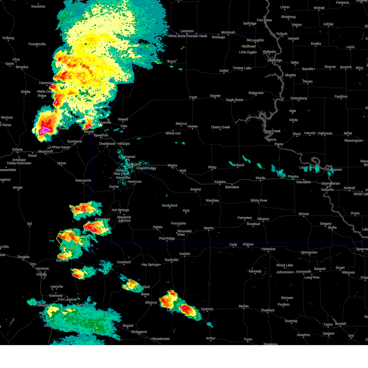
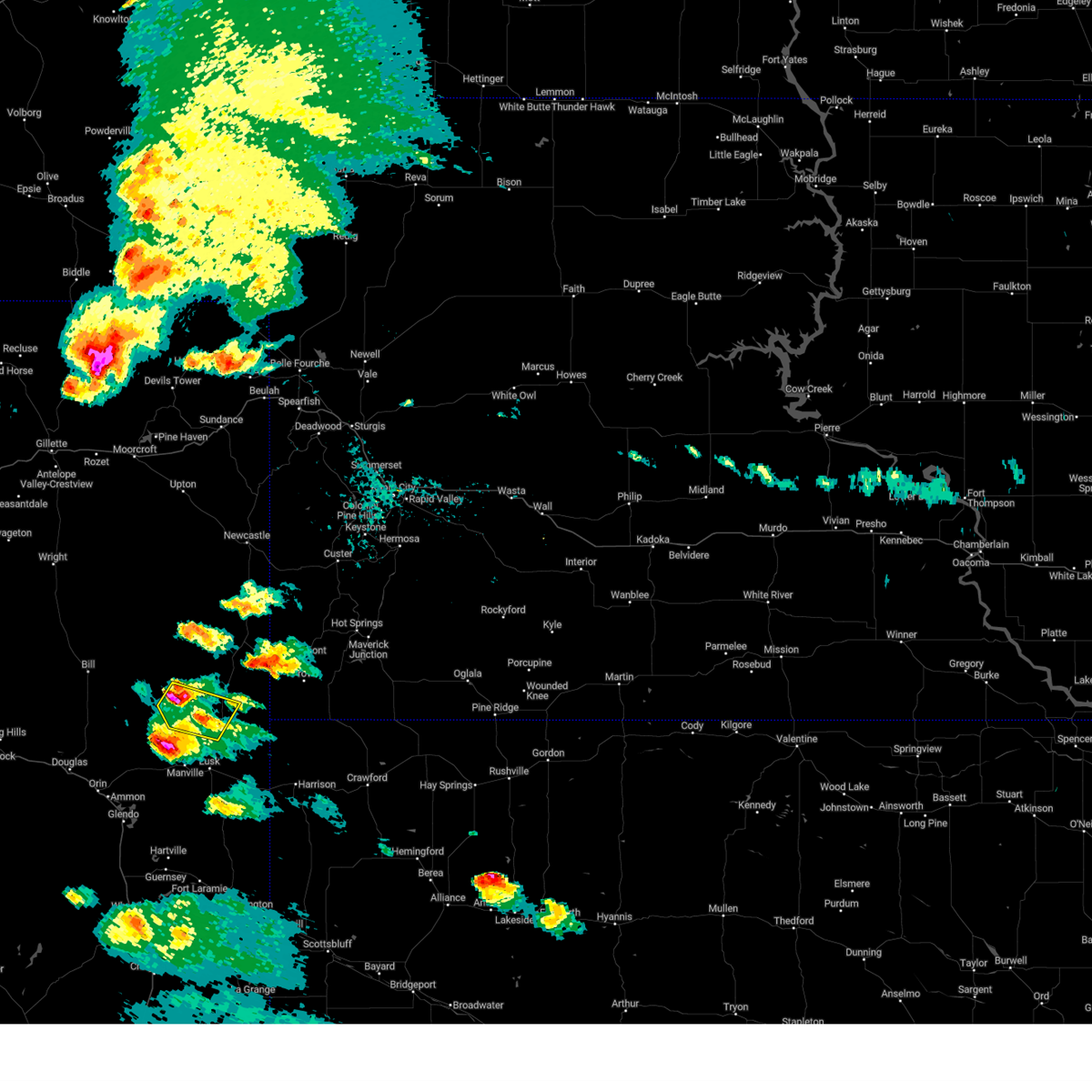
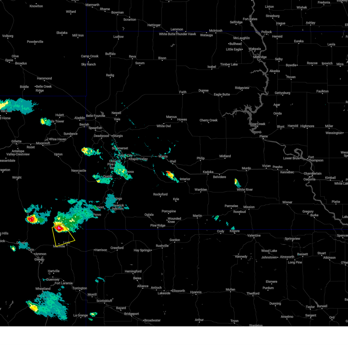
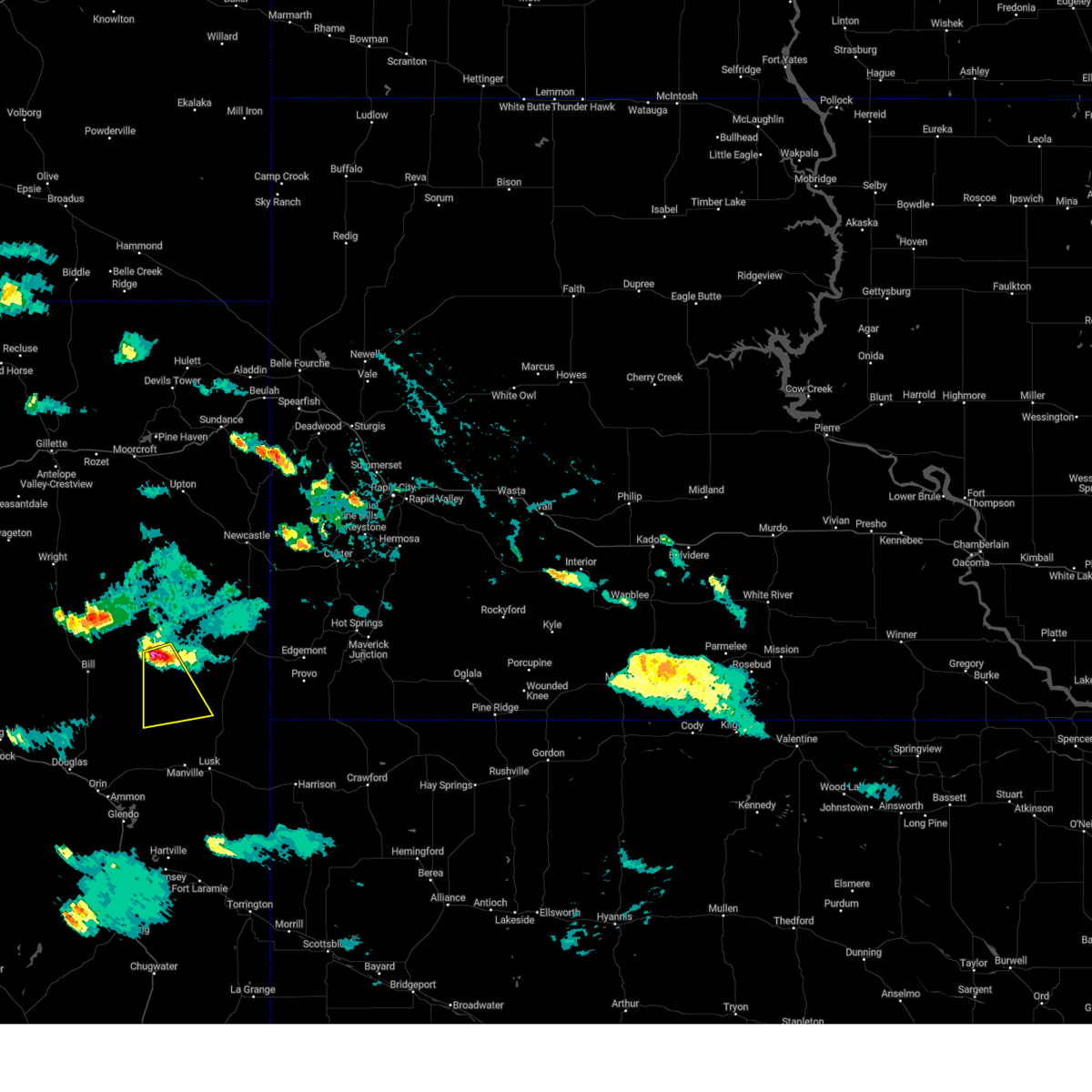
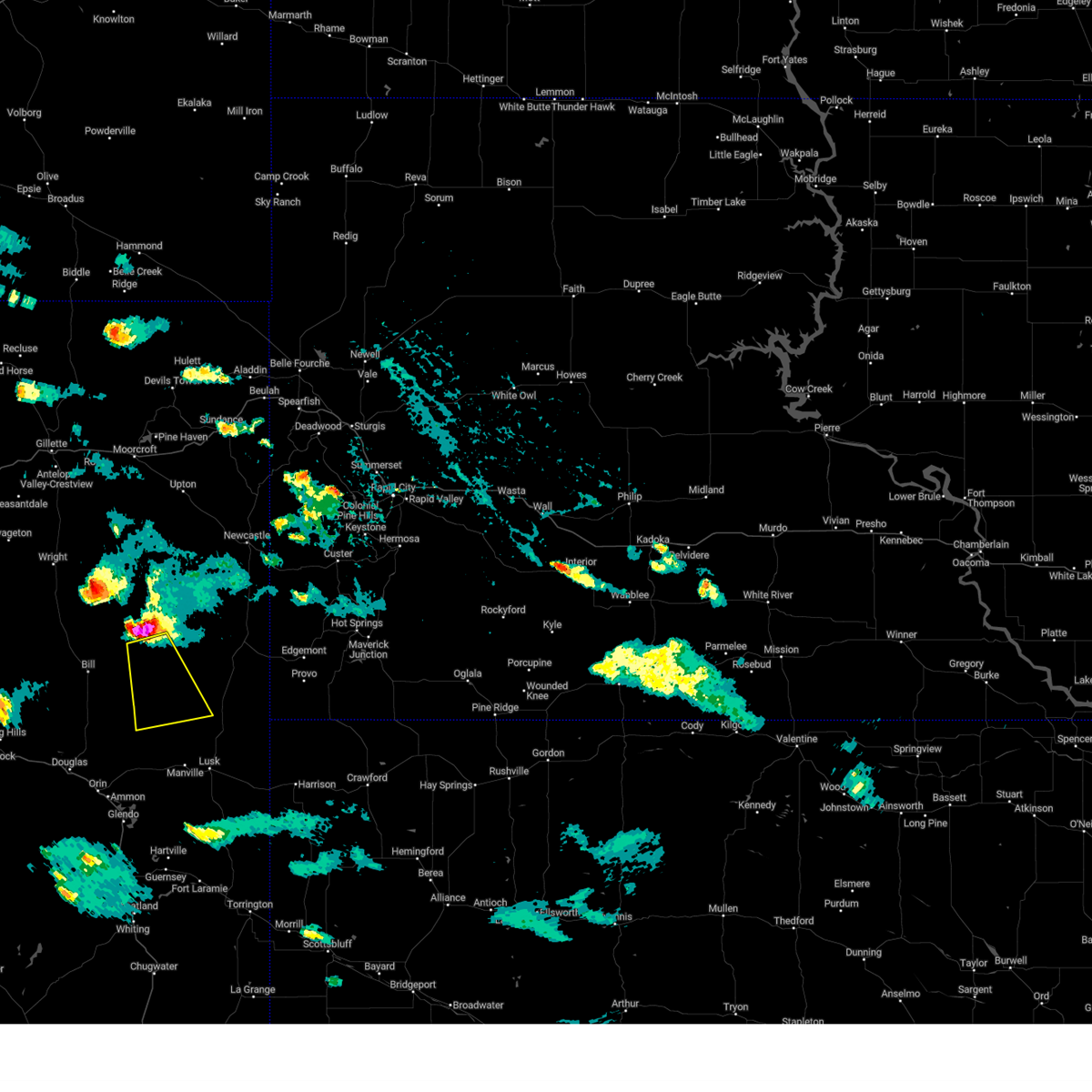
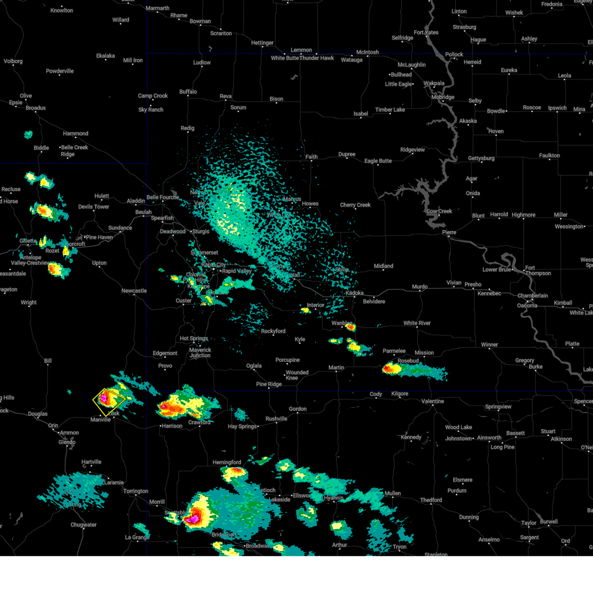
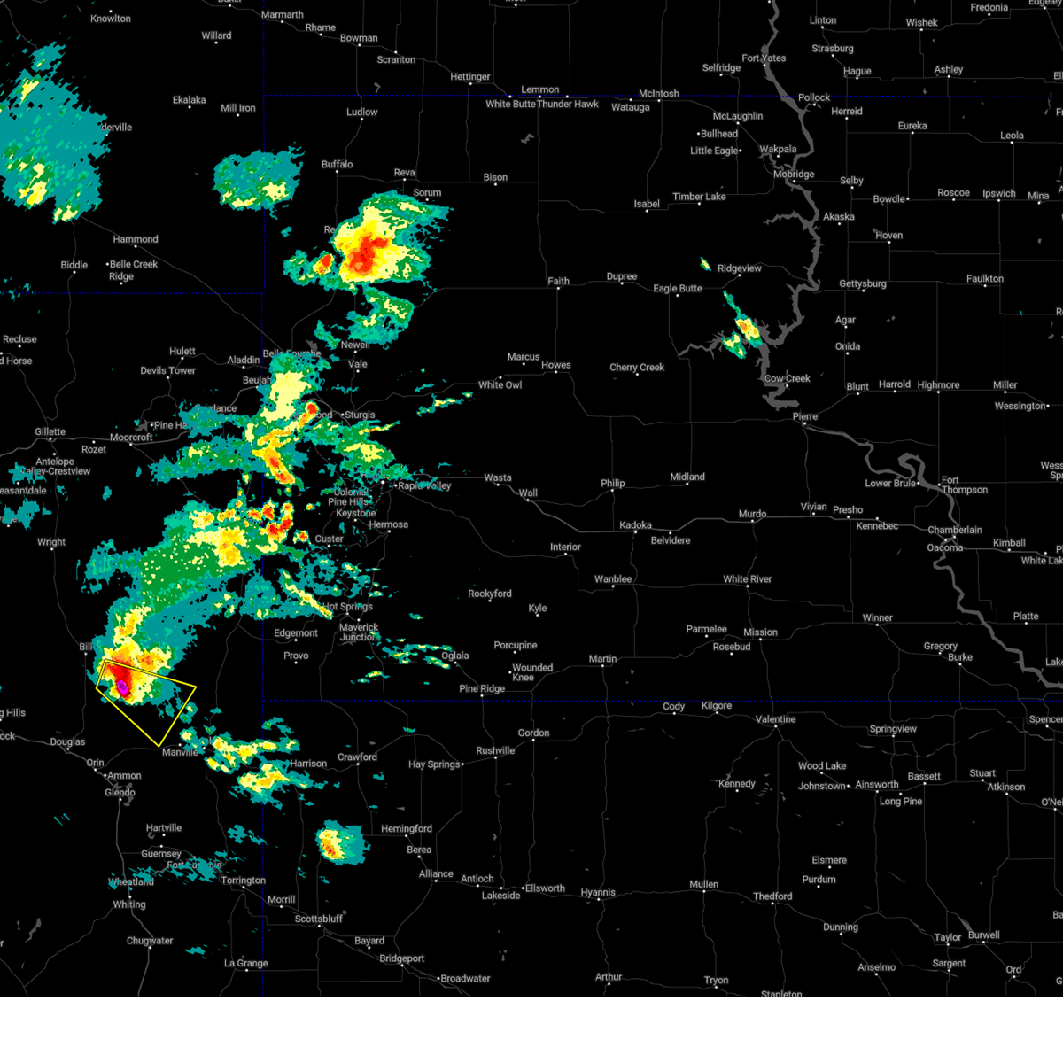
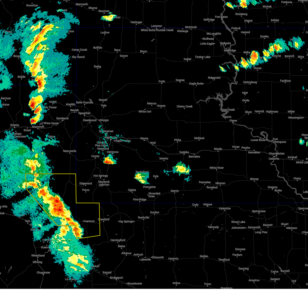
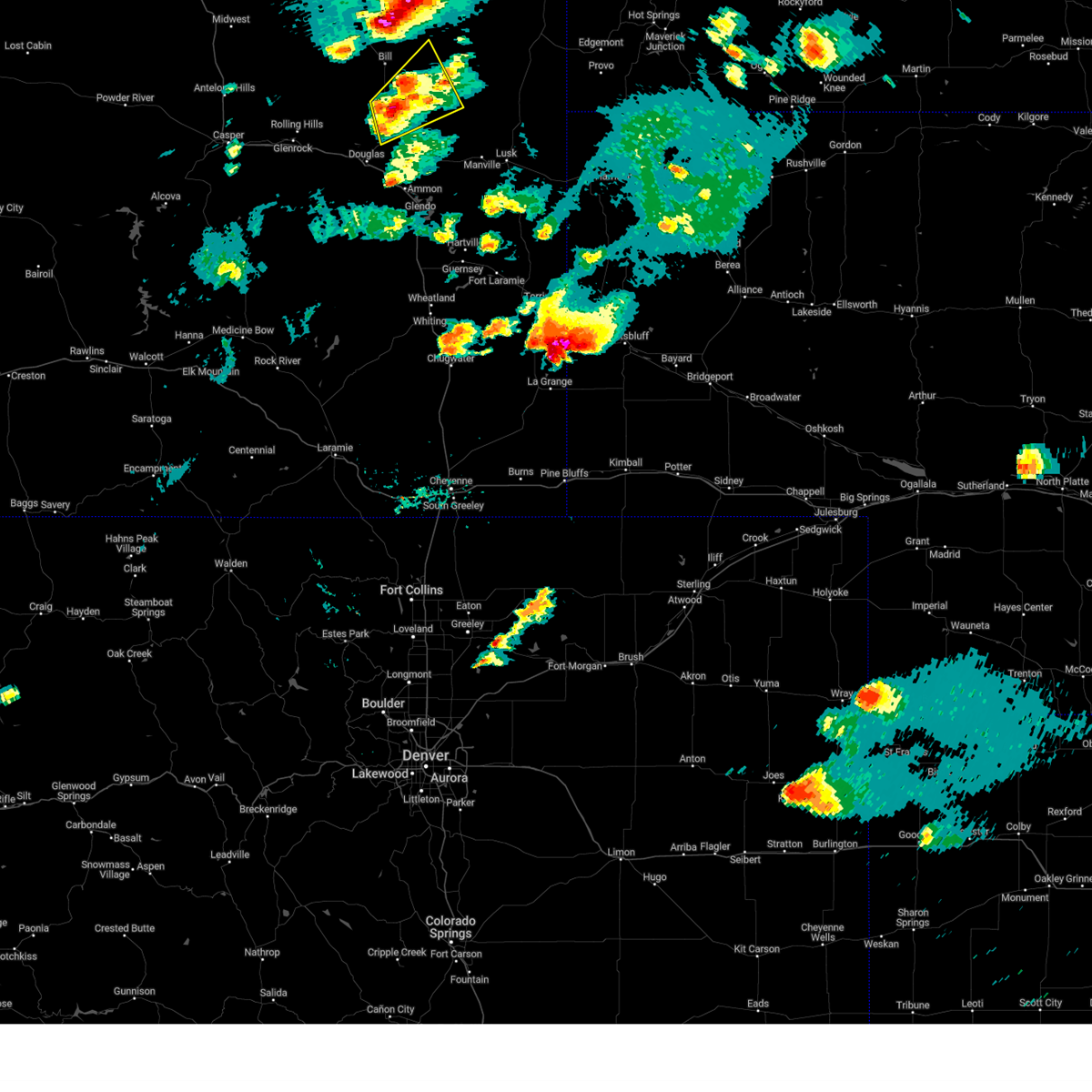
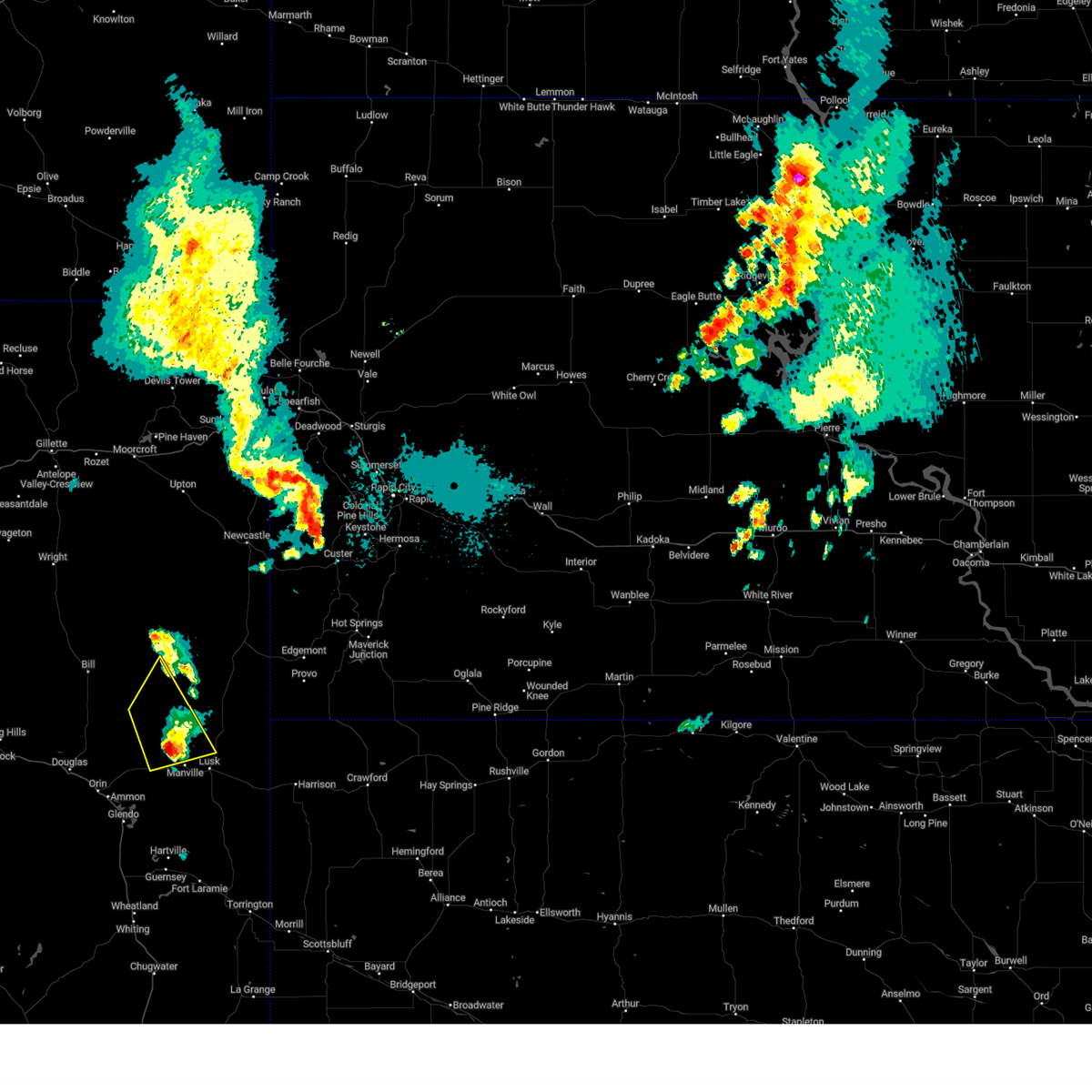
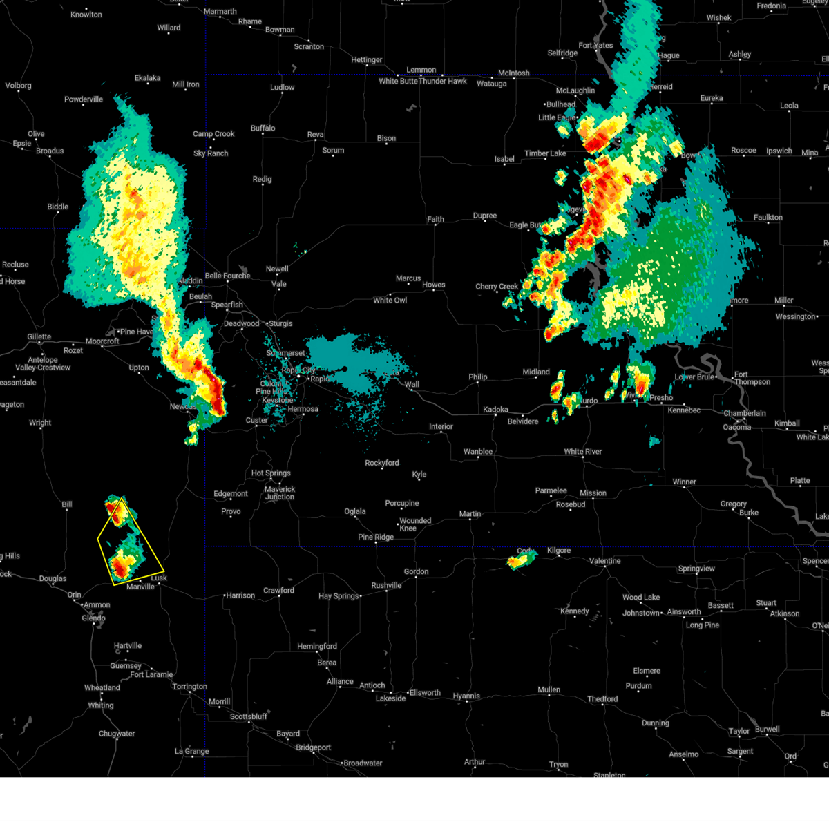
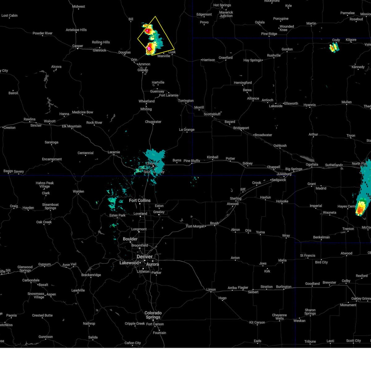
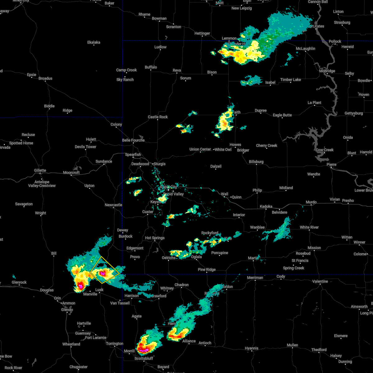
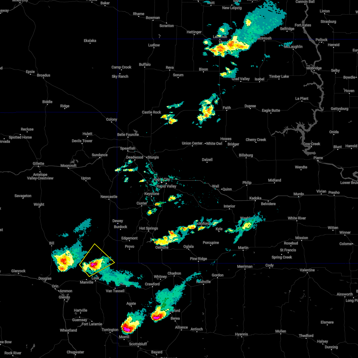
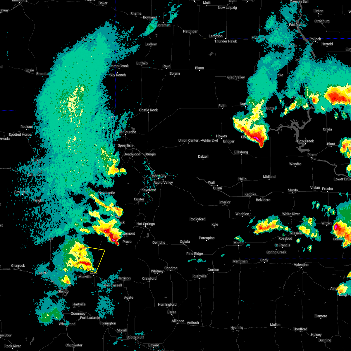
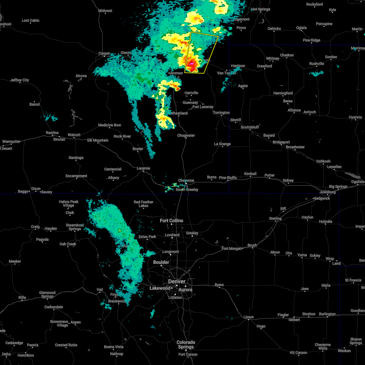
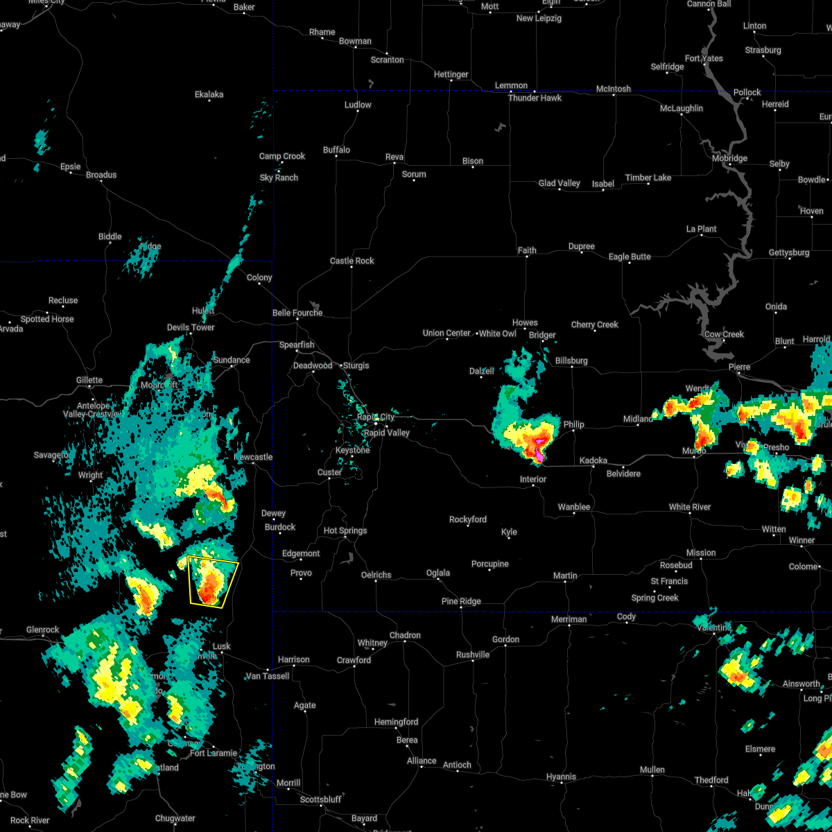
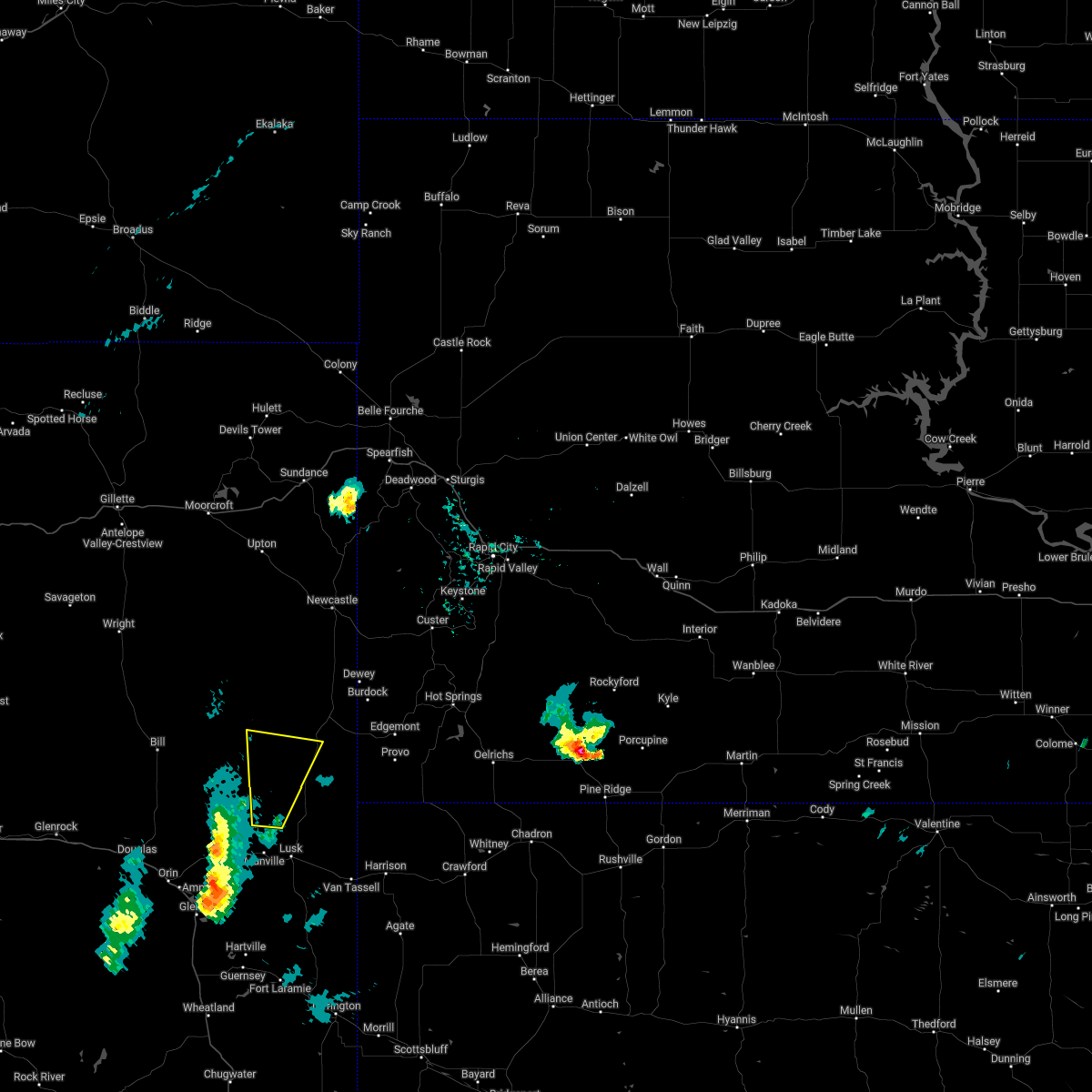
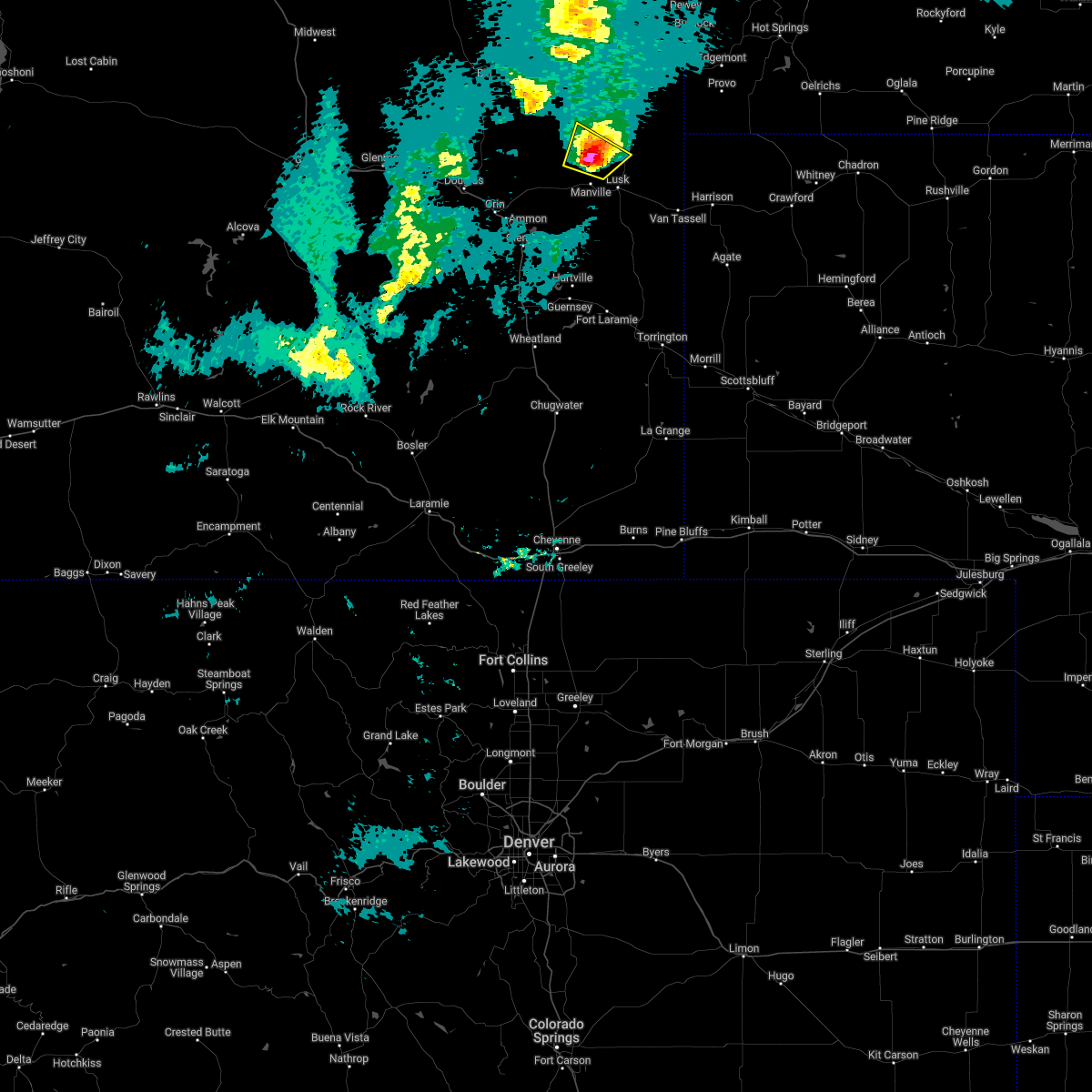
Hail Map for Lance Creek, WY
The Lance Creek, WY area has had 5 reports of on-the-ground hail by trained spotters, and has been under severe weather warnings 25 times during the past 12 months. Doppler radar has detected hail at or near Lance Creek, WY on 70 occasions, including 2 occasions during the past year.
| Name: | Lance Creek, WY |
| Where Located: | 86.4 miles E of Casper, WY |
| Map: | Google Map for Lance Creek, WY |
| Population: | 43 |
| Housing Units: | 45 |
| More Info: | Search Google for Lance Creek, WY |
1
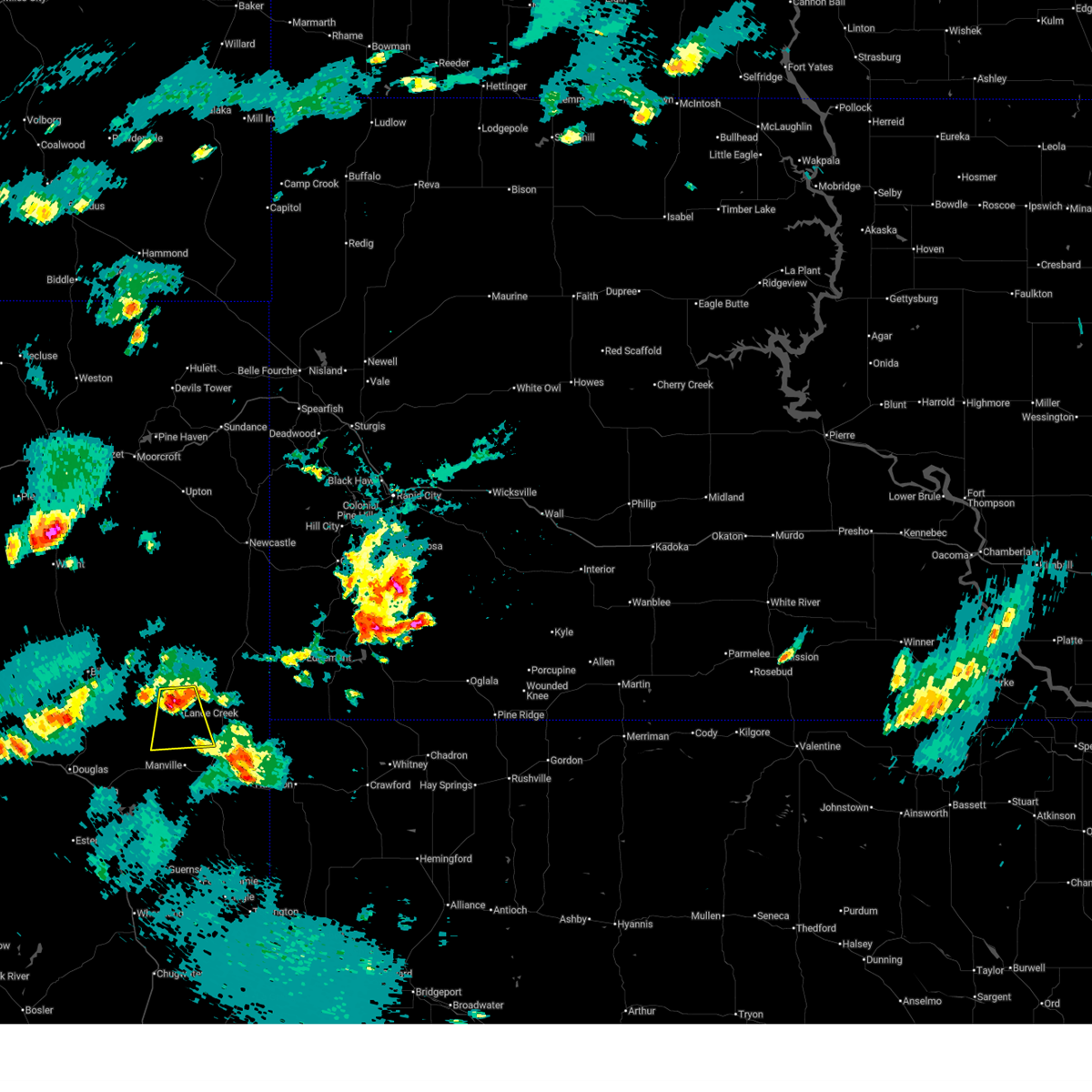
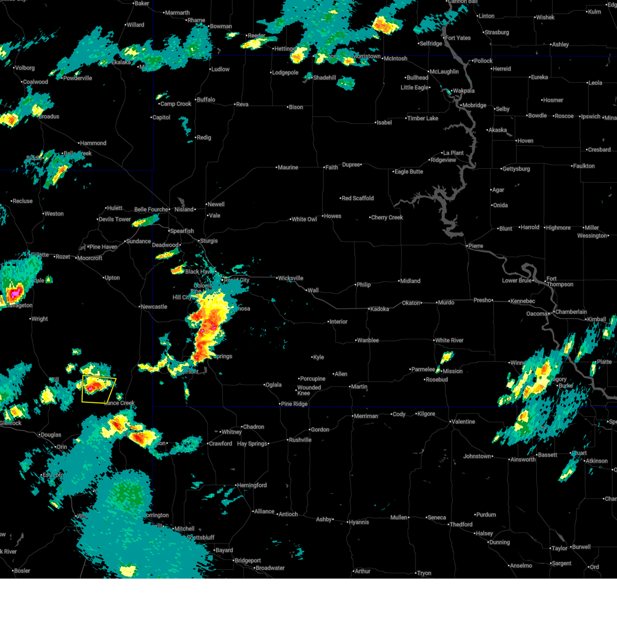
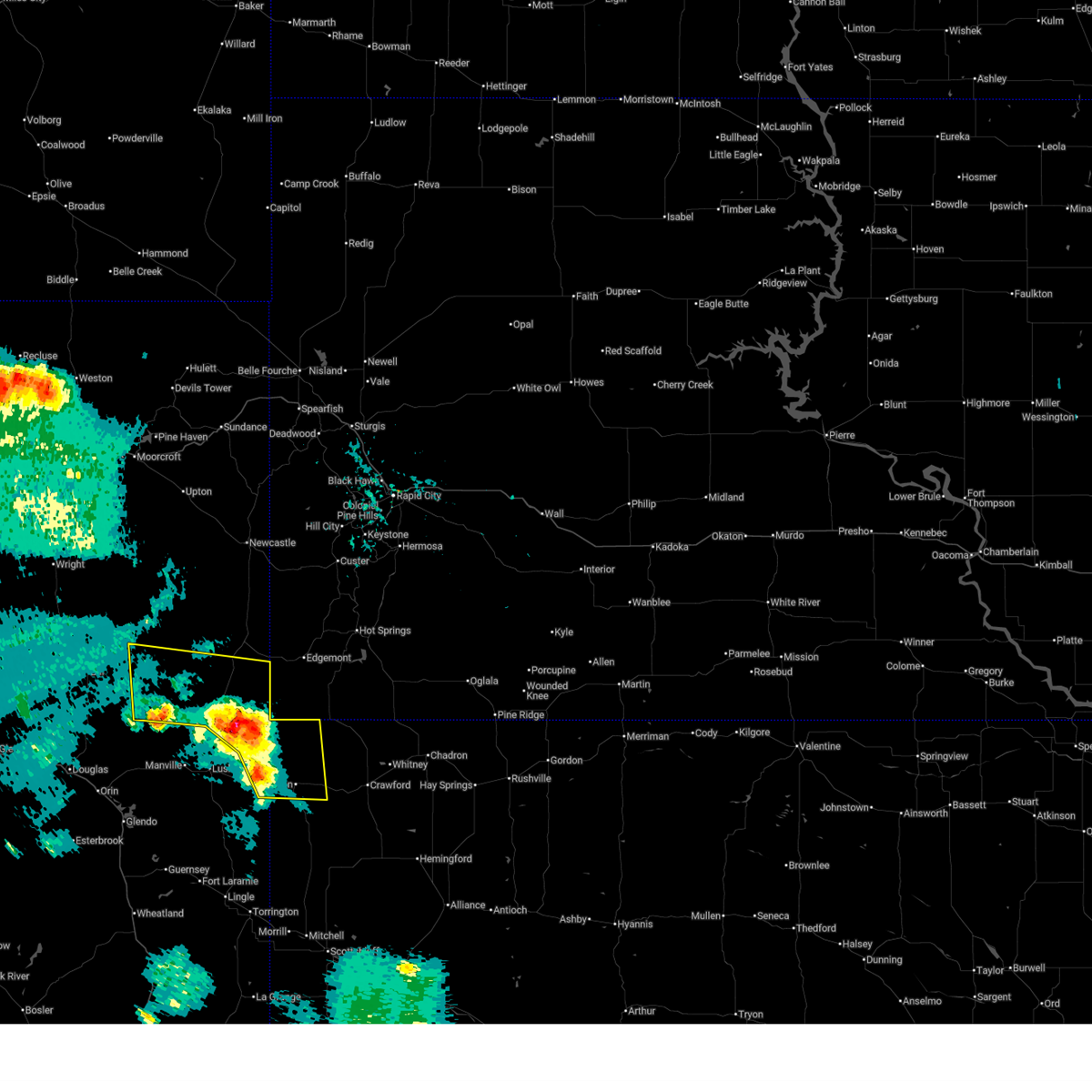
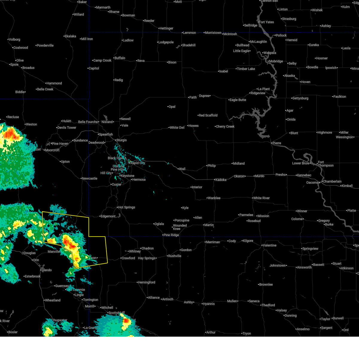
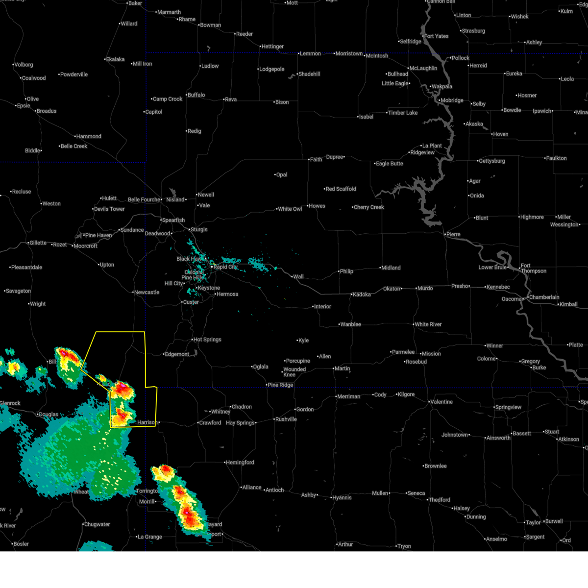
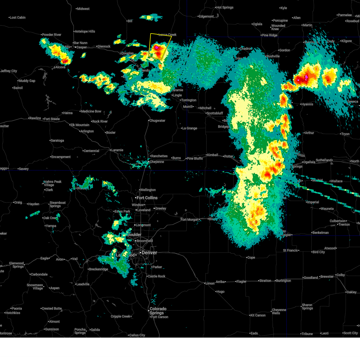
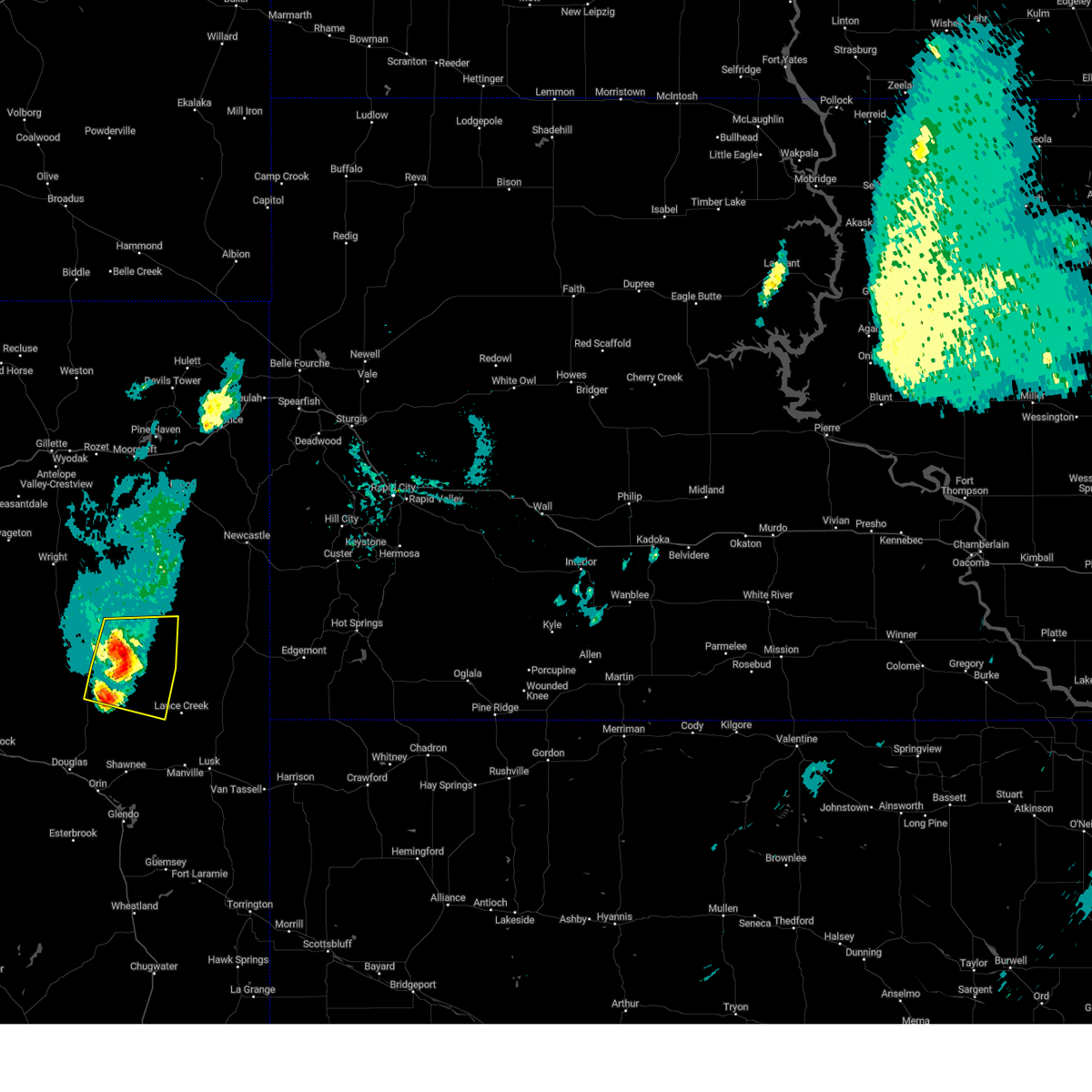
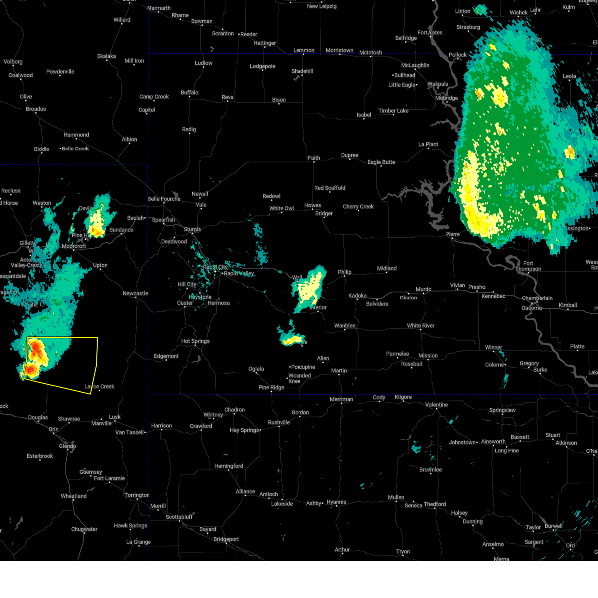
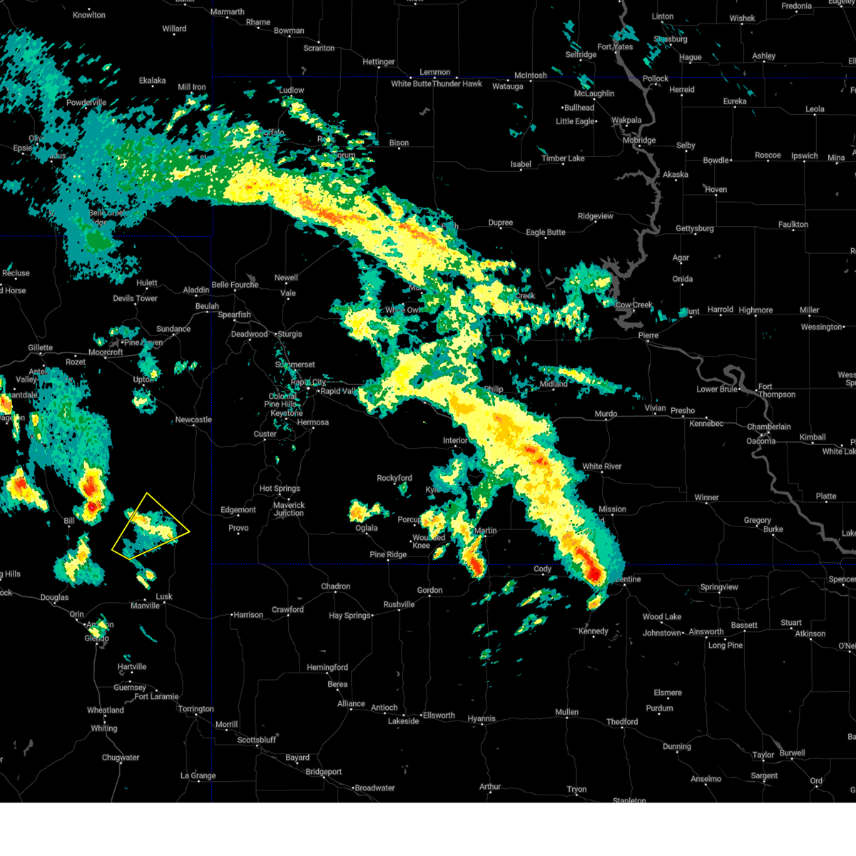
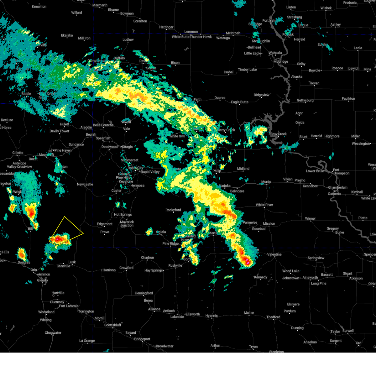
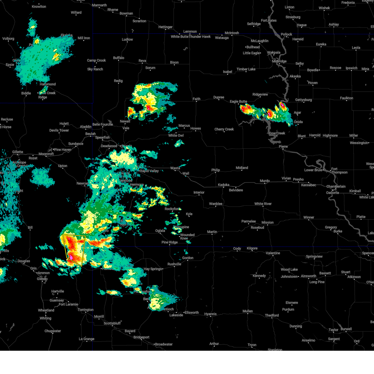
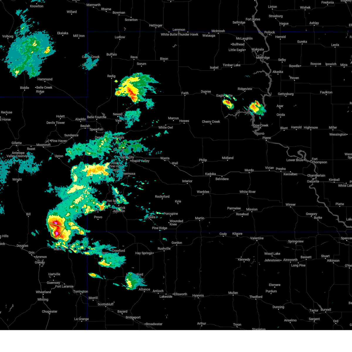
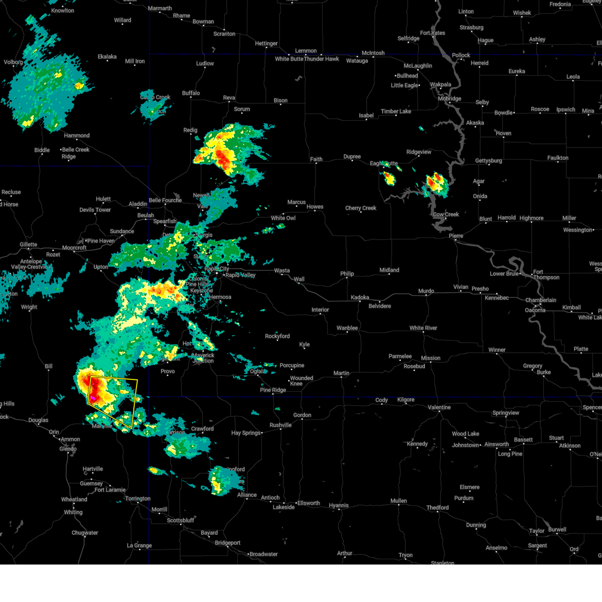
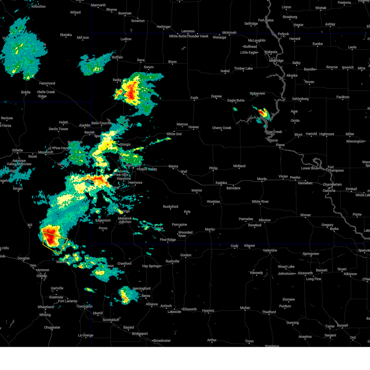
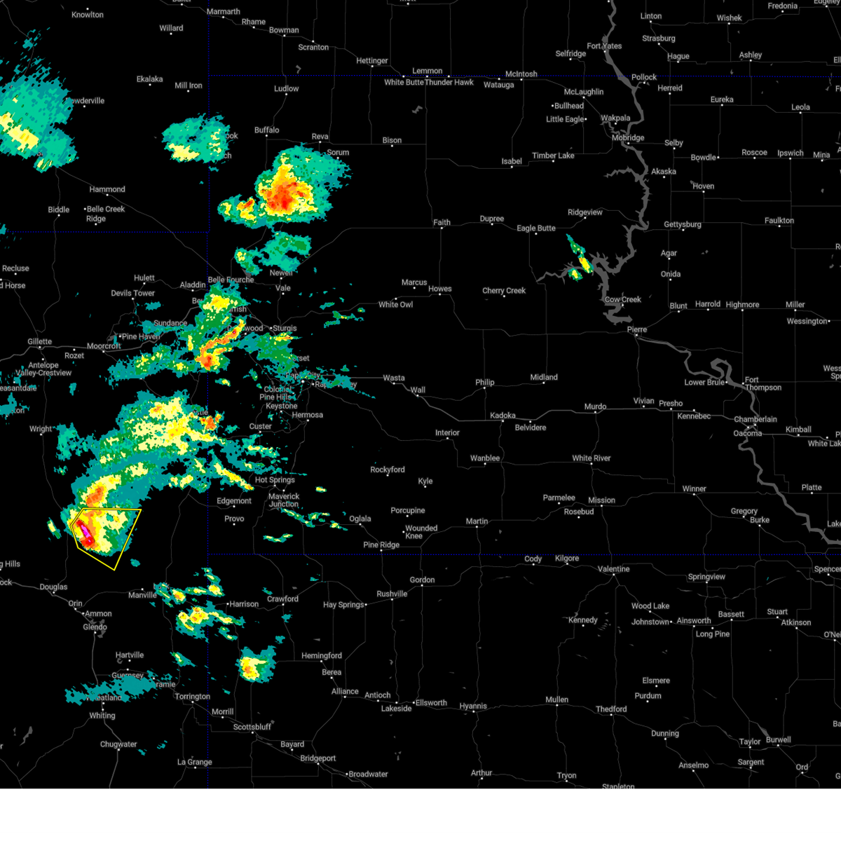
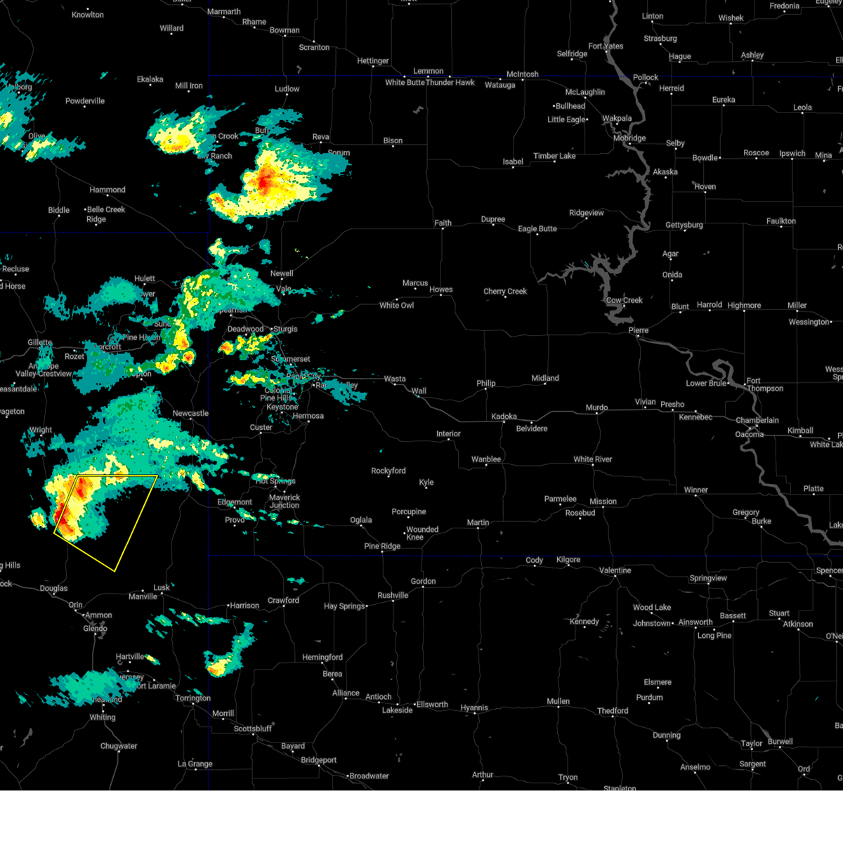
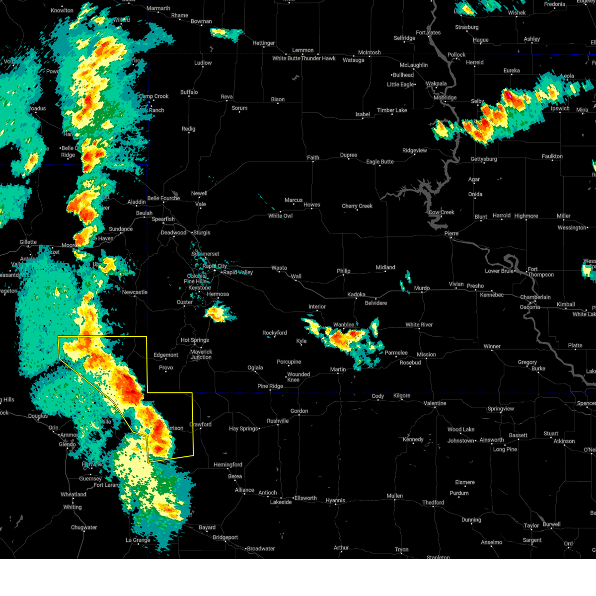
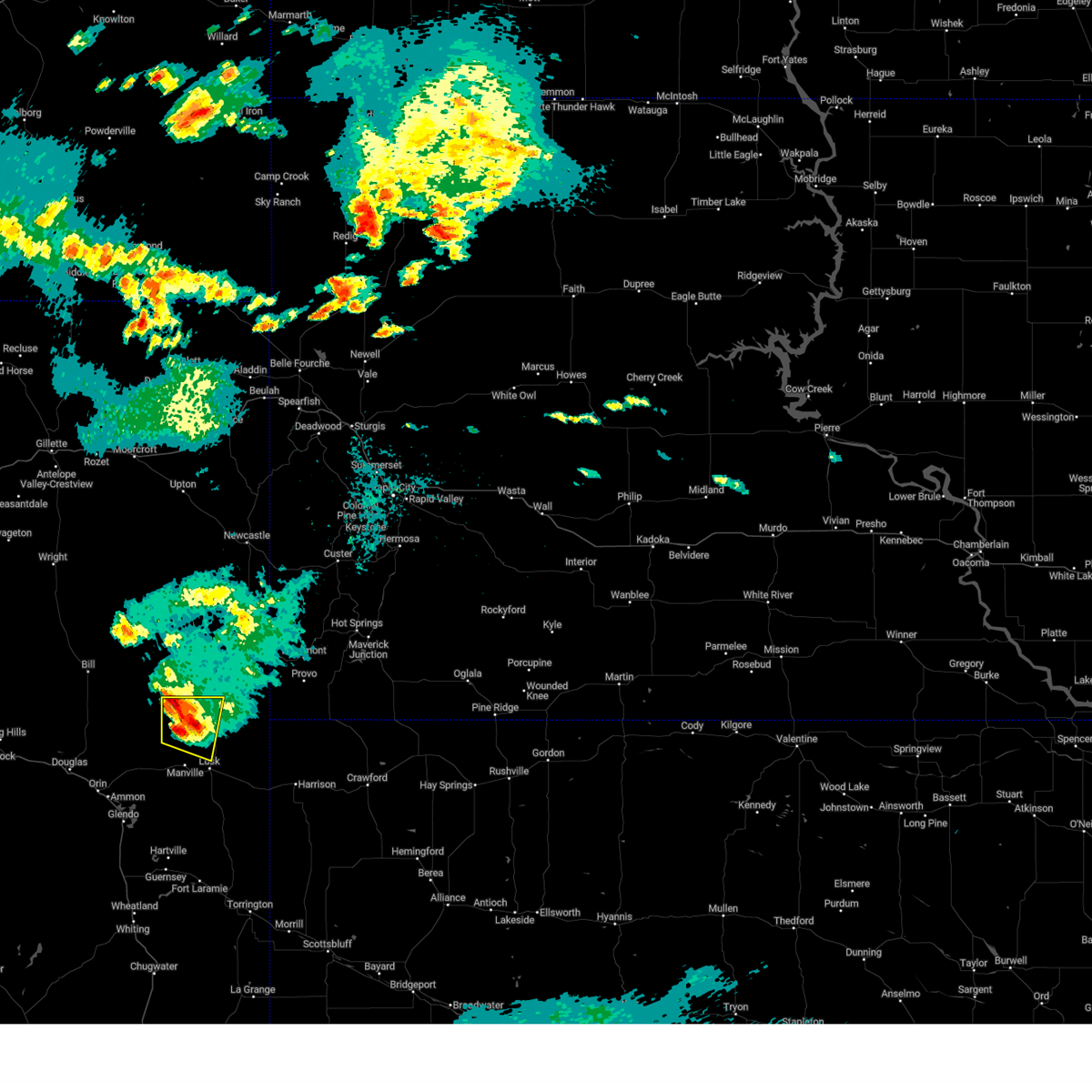
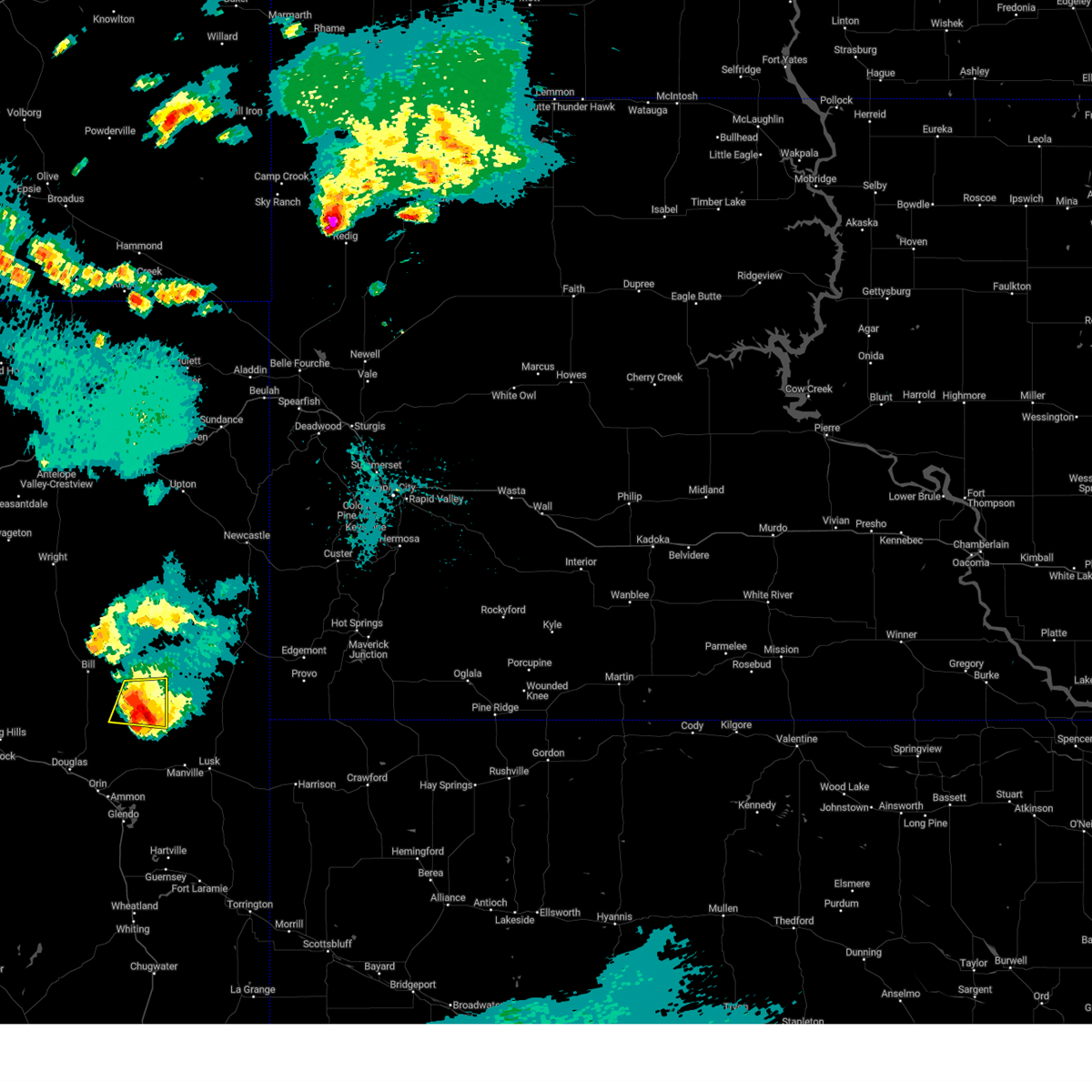
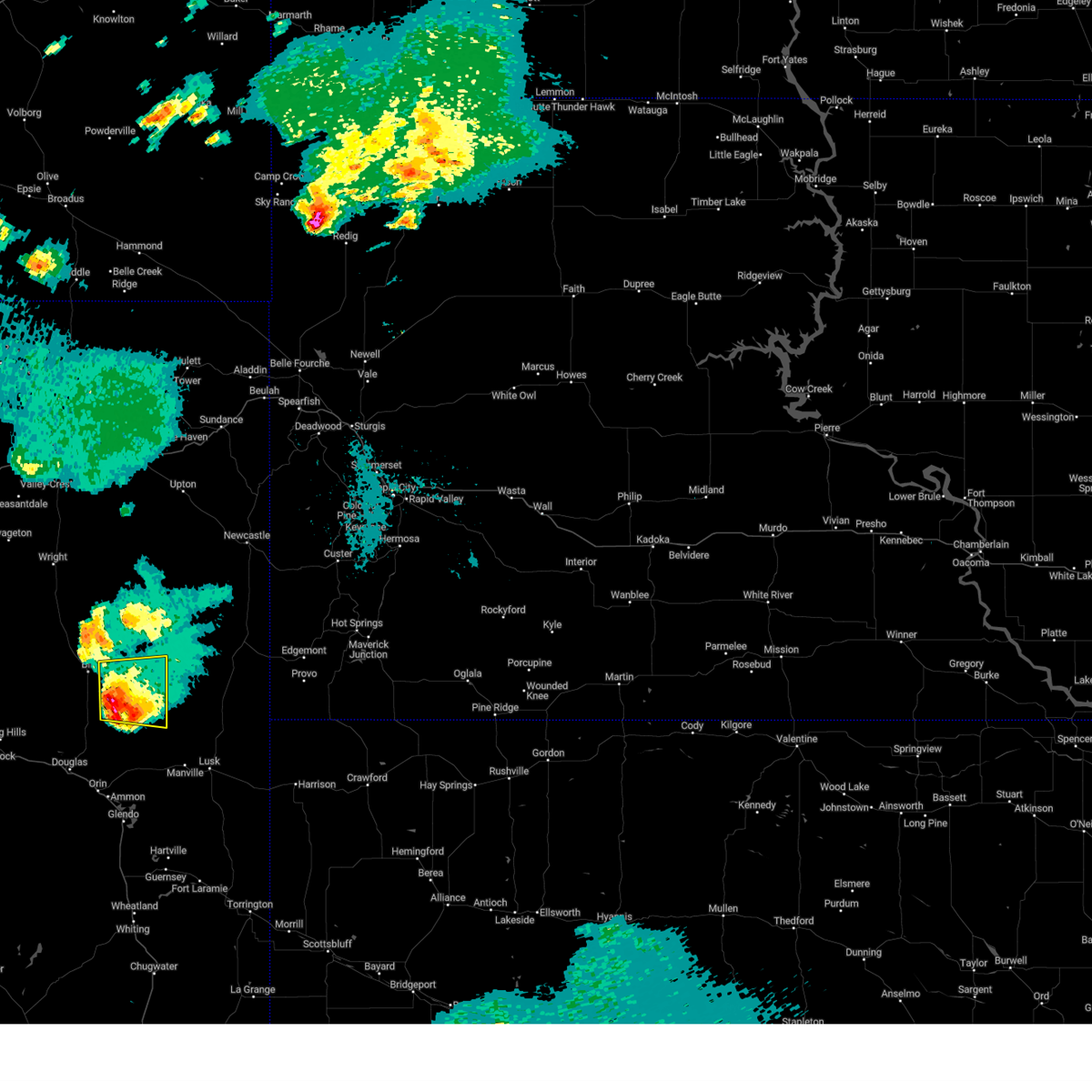
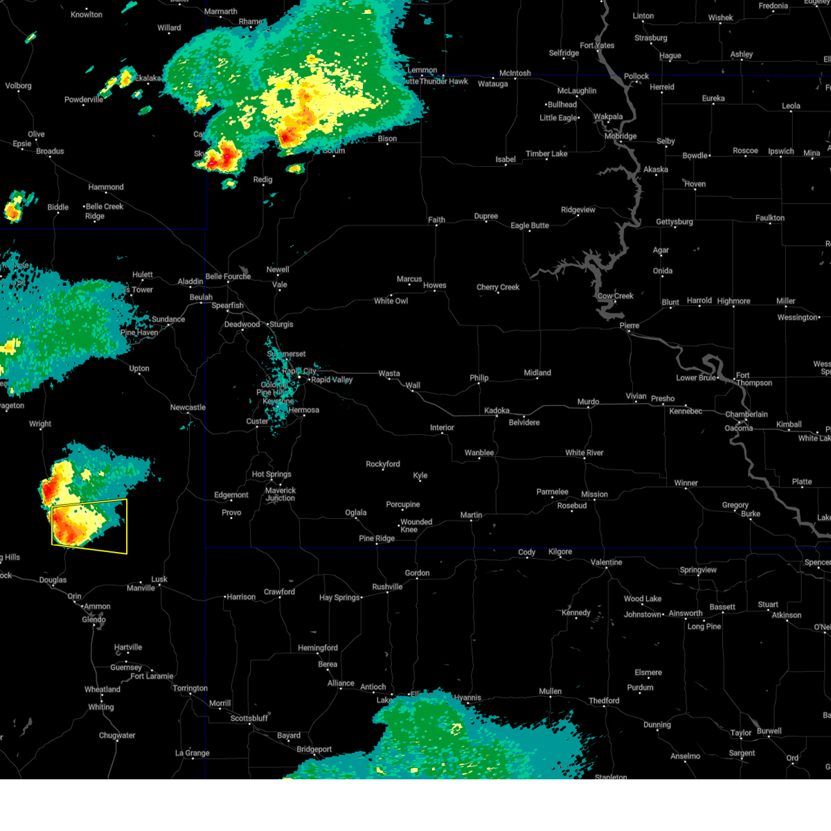
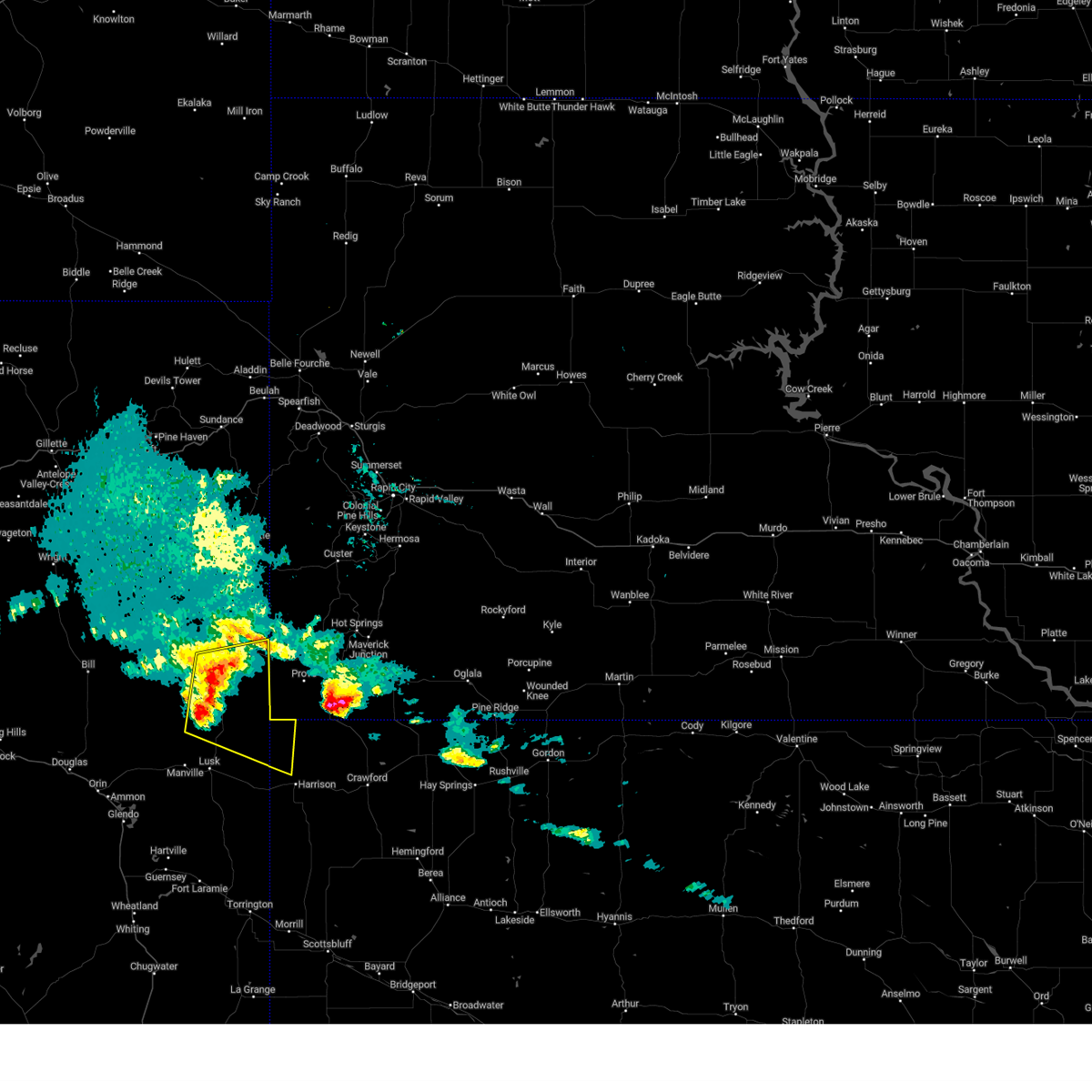
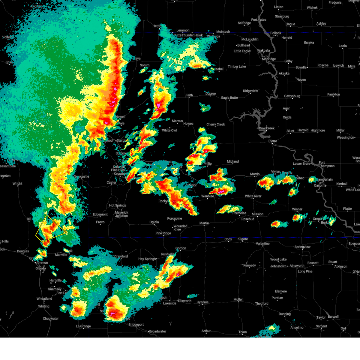
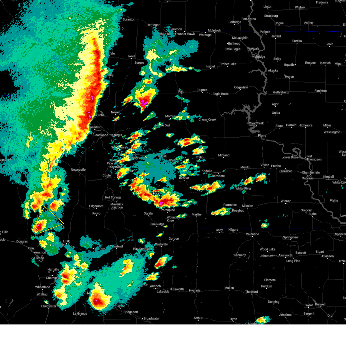
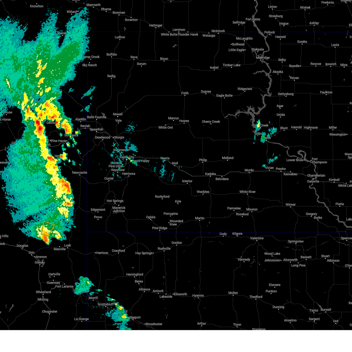
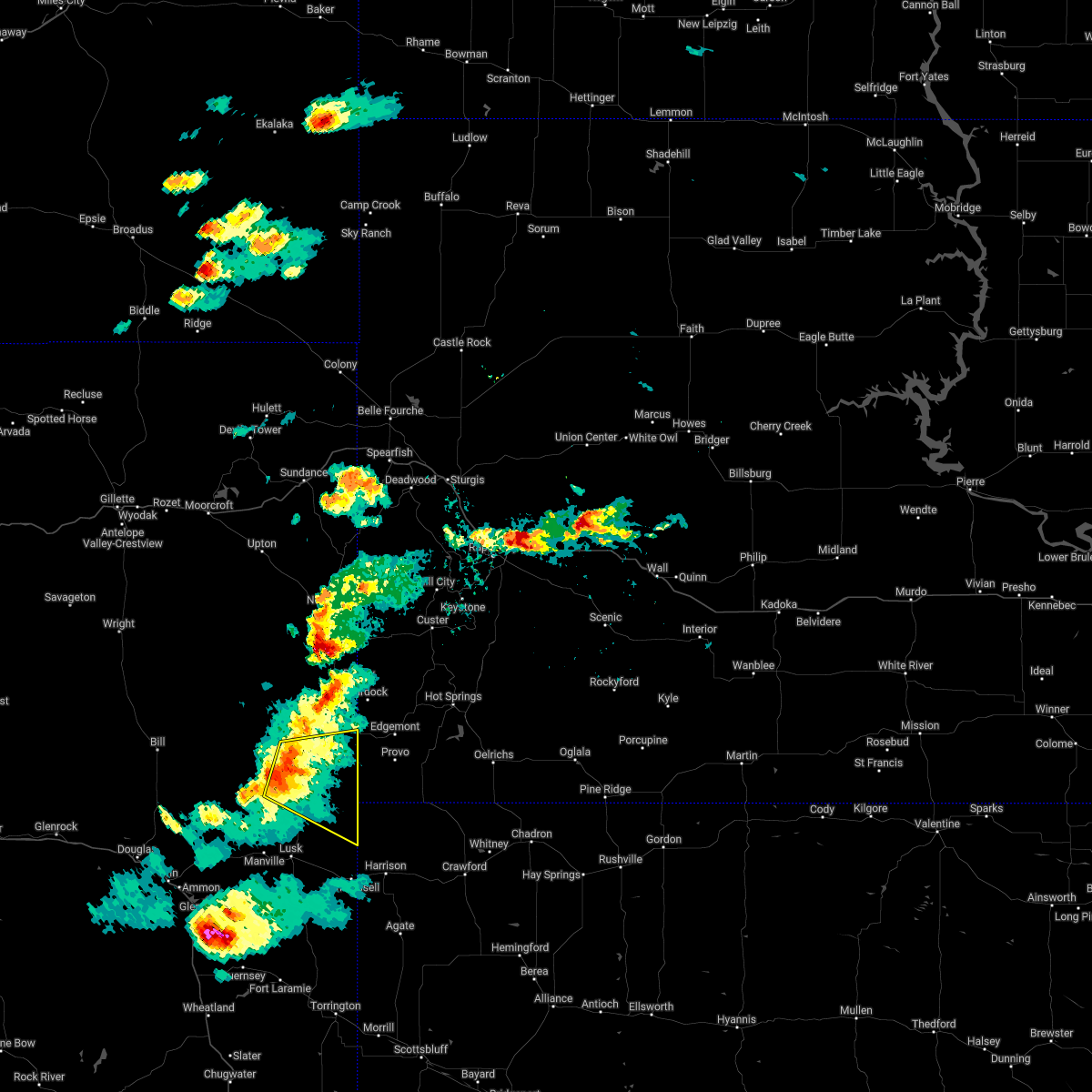
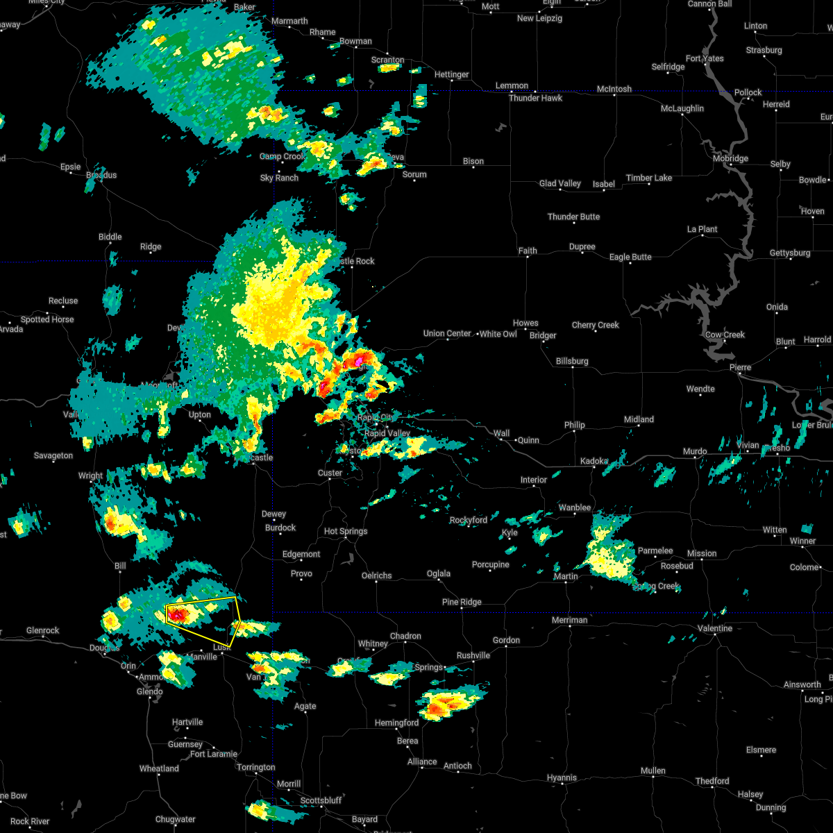
The Top Recent Hail Date for Lance Creek, WY is Tuesday, June 17, 2025 (8th out of 70)
Hail and Wind Damage Spotted near Lance Creek, WY
| Date / Time | Report Details |
|---|---|
| 6/17/2025 3:56 PM MDT |
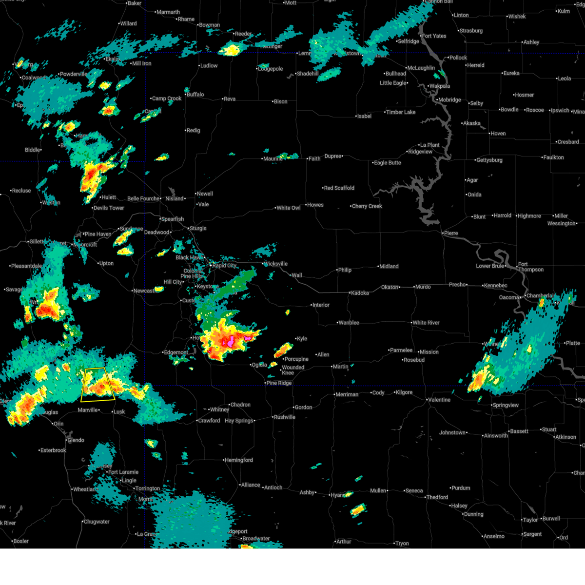 The severe thunderstorm which prompted the warning has weakened. therefore, the warning will be allowed to expire. however, small hail and gusty winds are still possible with this thunderstorm. a severe thunderstorm watch remains in effect until 500 pm mdt for east central wyoming. The severe thunderstorm which prompted the warning has weakened. therefore, the warning will be allowed to expire. however, small hail and gusty winds are still possible with this thunderstorm. a severe thunderstorm watch remains in effect until 500 pm mdt for east central wyoming.
|
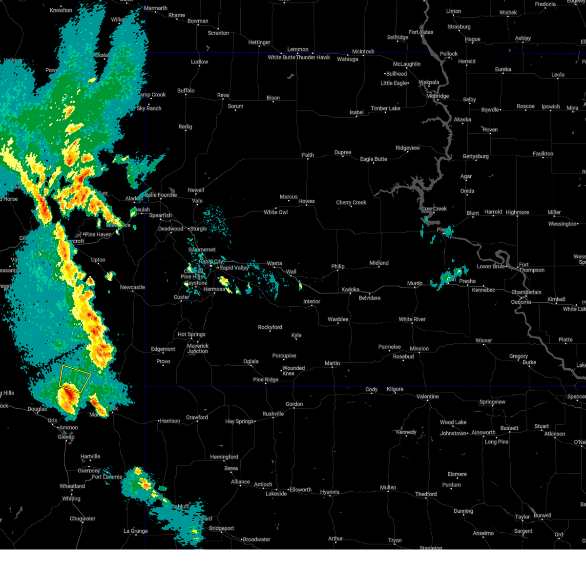
| 6/17/2025 3:16 PM MDT |
 Svrcys the national weather service in cheyenne has issued a * severe thunderstorm warning for, west central niobrara county in east central wyoming, * until 400 pm mdt. * at 315 pm mdt, a severe thunderstorm was located over lance creek, or 23 miles northwest of lusk, moving south at 15 mph (radar indicated). Hazards include ping pong ball size hail and 60 mph wind gusts. People and animals outdoors will be injured. expect hail damage to roofs, siding, windows, and vehicles. Expect wind damage to roofs, siding, and trees. Svrcys the national weather service in cheyenne has issued a * severe thunderstorm warning for, west central niobrara county in east central wyoming, * until 400 pm mdt. * at 315 pm mdt, a severe thunderstorm was located over lance creek, or 23 miles northwest of lusk, moving south at 15 mph (radar indicated). Hazards include ping pong ball size hail and 60 mph wind gusts. People and animals outdoors will be injured. expect hail damage to roofs, siding, windows, and vehicles. Expect wind damage to roofs, siding, and trees.
|
| 6/17/2025 3:05 PM MDT |
 At 305 pm mdt, a severe thunderstorm was located near lance creek, or 26 miles northwest of lusk, moving southeast at 15 mph (radar indicated). Hazards include golf ball size hail and 60 mph wind gusts. People and animals outdoors will be injured. expect hail damage to roofs, siding, windows, and vehicles. expect wind damage to roofs, siding, and trees. Locations impacted include, lance creek. At 305 pm mdt, a severe thunderstorm was located near lance creek, or 26 miles northwest of lusk, moving southeast at 15 mph (radar indicated). Hazards include golf ball size hail and 60 mph wind gusts. People and animals outdoors will be injured. expect hail damage to roofs, siding, windows, and vehicles. expect wind damage to roofs, siding, and trees. Locations impacted include, lance creek.
|
| 6/17/2025 2:44 PM MDT |
 Svrcys the national weather service in cheyenne has issued a * severe thunderstorm warning for, west central niobrara county in east central wyoming, * until 330 pm mdt. * at 243 pm mdt, a severe thunderstorm was located 10 miles northwest of lance creek, or 32 miles northwest of lusk, moving east at 10 mph (radar indicated). Hazards include 60 mph wind gusts and half dollar size hail. Hail damage to vehicles is expected. Expect wind damage to roofs, siding, and trees. Svrcys the national weather service in cheyenne has issued a * severe thunderstorm warning for, west central niobrara county in east central wyoming, * until 330 pm mdt. * at 243 pm mdt, a severe thunderstorm was located 10 miles northwest of lance creek, or 32 miles northwest of lusk, moving east at 10 mph (radar indicated). Hazards include 60 mph wind gusts and half dollar size hail. Hail damage to vehicles is expected. Expect wind damage to roofs, siding, and trees.
|
| 6/16/2025 6:26 PM MDT |
 the severe thunderstorm warning has been cancelled and is no longer in effect the severe thunderstorm warning has been cancelled and is no longer in effect
|
| 6/16/2025 5:40 PM MDT | Svrcys the national weather service in cheyenne has issued a * severe thunderstorm warning for, west central niobrara county in east central wyoming, northeastern converse county in east central wyoming, * until 645 pm mdt. * at 540 pm mdt, a severe thunderstorm was located 13 miles northeast of converse county airport, or 16 miles northeast of douglas, moving northeast at 25 mph (radar indicated). Hazards include 60 mph wind gusts and quarter size hail. Hail damage to vehicles is expected. Expect wind damage to roofs, siding, and trees. |
| 6/14/2025 6:56 PM MDT |
 At 656 pm mdt, severe thunderstorms were located along a line extending from near lance creek to 17 miles south of redbird to near van tassell, moving northeast at 20 mph (radar indicated). Hazards include 60 mph wind gusts and quarter size hail. Hail damage to vehicles is expected. expect wind damage to roofs, siding, and trees. Locations impacted include, harrison, van tassell, montrose, redbird, and lance creek. At 656 pm mdt, severe thunderstorms were located along a line extending from near lance creek to 17 miles south of redbird to near van tassell, moving northeast at 20 mph (radar indicated). Hazards include 60 mph wind gusts and quarter size hail. Hail damage to vehicles is expected. expect wind damage to roofs, siding, and trees. Locations impacted include, harrison, van tassell, montrose, redbird, and lance creek.
|
| 6/14/2025 6:56 PM MDT |
 the severe thunderstorm warning has been cancelled and is no longer in effect the severe thunderstorm warning has been cancelled and is no longer in effect
|
| 6/14/2025 6:30 PM MDT |
 Svrcys the national weather service in cheyenne has issued a * severe thunderstorm warning for, northwestern sioux county in the panhandle of nebraska, niobrara county in east central wyoming, northeastern goshen county in southeastern wyoming, east central converse county in east central wyoming, * until 730 pm mdt. * at 630 pm mdt, severe thunderstorms were located along a line extending from 7 miles southwest of lance creek to 9 miles north of lusk to 8 miles northwest of prairie center, moving northeast at 35 mph (radar indicated). Hazards include 60 mph wind gusts and quarter size hail. Hail damage to vehicles is expected. Expect wind damage to roofs, siding, and trees. Svrcys the national weather service in cheyenne has issued a * severe thunderstorm warning for, northwestern sioux county in the panhandle of nebraska, niobrara county in east central wyoming, northeastern goshen county in southeastern wyoming, east central converse county in east central wyoming, * until 730 pm mdt. * at 630 pm mdt, severe thunderstorms were located along a line extending from 7 miles southwest of lance creek to 9 miles north of lusk to 8 miles northwest of prairie center, moving northeast at 35 mph (radar indicated). Hazards include 60 mph wind gusts and quarter size hail. Hail damage to vehicles is expected. Expect wind damage to roofs, siding, and trees.
|
| 6/13/2025 4:48 PM MDT |
 Svrcys the national weather service in cheyenne has issued a * severe thunderstorm warning for, northwestern sioux county in the panhandle of nebraska, niobrara county in east central wyoming, * until 600 pm mdt. * at 448 pm mdt, severe thunderstorms were located along a line extending from near lance creek to 15 miles north of lusk to 7 miles northeast of rawhide buttes, moving northeast at 30 mph (radar indicated). Hazards include 60 mph wind gusts and quarter size hail. Hail damage to vehicles is expected. Expect wind damage to roofs, siding, and trees. Svrcys the national weather service in cheyenne has issued a * severe thunderstorm warning for, northwestern sioux county in the panhandle of nebraska, niobrara county in east central wyoming, * until 600 pm mdt. * at 448 pm mdt, severe thunderstorms were located along a line extending from near lance creek to 15 miles north of lusk to 7 miles northeast of rawhide buttes, moving northeast at 30 mph (radar indicated). Hazards include 60 mph wind gusts and quarter size hail. Hail damage to vehicles is expected. Expect wind damage to roofs, siding, and trees.
|
| 6/13/2025 4:05 PM MDT | The storm which prompted the warning has weakened below severe limits, and no longer poses an immediate threat to life or property. therefore, the warning will be allowed to expire. a severe thunderstorm watch remains in effect until 1000 pm mdt for east central wyoming. |
| 6/13/2025 3:28 PM MDT |
 Svrcys the national weather service in cheyenne has issued a * severe thunderstorm warning for, southwestern niobrara county in east central wyoming, east central converse county in east central wyoming, * until 415 pm mdt. * at 328 pm mdt, a severe thunderstorm was located 10 miles south of manning ranch, or 23 miles east of douglas, moving northeast at 25 mph (radar indicated). Hazards include 60 mph wind gusts and half dollar size hail. Hail damage to vehicles is expected. Expect wind damage to roofs, siding, and trees. Svrcys the national weather service in cheyenne has issued a * severe thunderstorm warning for, southwestern niobrara county in east central wyoming, east central converse county in east central wyoming, * until 415 pm mdt. * at 328 pm mdt, a severe thunderstorm was located 10 miles south of manning ranch, or 23 miles east of douglas, moving northeast at 25 mph (radar indicated). Hazards include 60 mph wind gusts and half dollar size hail. Hail damage to vehicles is expected. Expect wind damage to roofs, siding, and trees.
|
| 6/12/2025 8:15 PM MDT |
 At 815 pm mdt, a severe thunderstorm was located 8 miles north of lusk, moving east at 20 mph (radar indicated). Hazards include golf ball size hail and 60 mph wind gusts. People and animals outdoors will be injured. expect hail damage to roofs, siding, windows, and vehicles. expect wind damage to roofs, siding, and trees. This severe thunderstorm will remain over mainly rural areas of southeastern niobrara county. At 815 pm mdt, a severe thunderstorm was located 8 miles north of lusk, moving east at 20 mph (radar indicated). Hazards include golf ball size hail and 60 mph wind gusts. People and animals outdoors will be injured. expect hail damage to roofs, siding, windows, and vehicles. expect wind damage to roofs, siding, and trees. This severe thunderstorm will remain over mainly rural areas of southeastern niobrara county.
|
| 6/12/2025 7:57 PM MDT |
 Svrcys the national weather service in cheyenne has issued a * severe thunderstorm warning for, southern niobrara county in east central wyoming, * until 845 pm mdt. * at 757 pm mdt, a severe thunderstorm was located near manville, or 8 miles northwest of lusk, moving east at 20 mph (radar indicated). Hazards include golf ball size hail and 60 mph wind gusts. People and animals outdoors will be injured. expect hail damage to roofs, siding, windows, and vehicles. Expect wind damage to roofs, siding, and trees. Svrcys the national weather service in cheyenne has issued a * severe thunderstorm warning for, southern niobrara county in east central wyoming, * until 845 pm mdt. * at 757 pm mdt, a severe thunderstorm was located near manville, or 8 miles northwest of lusk, moving east at 20 mph (radar indicated). Hazards include golf ball size hail and 60 mph wind gusts. People and animals outdoors will be injured. expect hail damage to roofs, siding, windows, and vehicles. Expect wind damage to roofs, siding, and trees.
|
| 6/12/2025 7:51 PM MDT |
 At 751 pm mdt, a severe thunderstorm was located 9 miles north of manville, or 12 miles northwest of lusk, moving northeast at 35 mph (radar indicated). Hazards include golf ball size hail and 60 mph wind gusts. People and animals outdoors will be injured. expect hail damage to roofs, siding, windows, and vehicles. expect wind damage to roofs, siding, and trees. Locations impacted include, manville and lance creek. At 751 pm mdt, a severe thunderstorm was located 9 miles north of manville, or 12 miles northwest of lusk, moving northeast at 35 mph (radar indicated). Hazards include golf ball size hail and 60 mph wind gusts. People and animals outdoors will be injured. expect hail damage to roofs, siding, windows, and vehicles. expect wind damage to roofs, siding, and trees. Locations impacted include, manville and lance creek.
|
| 6/12/2025 7:46 PM MDT |
 At 746 pm mdt, a severe thunderstorm was located near manville, or 10 miles northwest of lusk, moving northeast at 25 mph (radar indicated). Hazards include ping pong ball size hail and 60 mph wind gusts. People and animals outdoors will be injured. expect hail damage to roofs, siding, windows, and vehicles. expect wind damage to roofs, siding, and trees. Locations impacted include, manville, keeline, and lance creek. At 746 pm mdt, a severe thunderstorm was located near manville, or 10 miles northwest of lusk, moving northeast at 25 mph (radar indicated). Hazards include ping pong ball size hail and 60 mph wind gusts. People and animals outdoors will be injured. expect hail damage to roofs, siding, windows, and vehicles. expect wind damage to roofs, siding, and trees. Locations impacted include, manville, keeline, and lance creek.
|
| 6/12/2025 7:38 PM MDT |
 At 737 pm mdt, a severe thunderstorm was located near manville, or 10 miles northwest of lusk, moving northeast at 25 mph (radar indicated). Hazards include 60 mph wind gusts and quarter size hail. Hail damage to vehicles is expected. expect wind damage to roofs, siding, and trees. Locations impacted include, manville, keeline, and lance creek. At 737 pm mdt, a severe thunderstorm was located near manville, or 10 miles northwest of lusk, moving northeast at 25 mph (radar indicated). Hazards include 60 mph wind gusts and quarter size hail. Hail damage to vehicles is expected. expect wind damage to roofs, siding, and trees. Locations impacted include, manville, keeline, and lance creek.
|
| 6/12/2025 7:25 PM MDT |
 At 724 pm mdt, a severe thunderstorm was located near manville, or 11 miles west of lusk, moving northeast at 25 mph (radar indicated). Hazards include ping pong ball size hail and 60 mph wind gusts. People and animals outdoors will be injured. expect hail damage to roofs, siding, windows, and vehicles. expect wind damage to roofs, siding, and trees. Locations impacted include, manville, lance creek, and keeline. At 724 pm mdt, a severe thunderstorm was located near manville, or 11 miles west of lusk, moving northeast at 25 mph (radar indicated). Hazards include ping pong ball size hail and 60 mph wind gusts. People and animals outdoors will be injured. expect hail damage to roofs, siding, windows, and vehicles. expect wind damage to roofs, siding, and trees. Locations impacted include, manville, lance creek, and keeline.
|
| 6/12/2025 7:08 PM MDT |
 Svrcys the national weather service in cheyenne has issued a * severe thunderstorm warning for, southwestern niobrara county in east central wyoming, * until 800 pm mdt. * at 707 pm mdt, a severe thunderstorm was located over keeline, or 14 miles west of lusk, moving northeast at 35 mph (radar indicated). Hazards include two inch hail and 60 mph wind gusts. People and animals outdoors will be injured. expect hail damage to roofs, siding, windows, and vehicles. Expect wind damage to roofs, siding, and trees. Svrcys the national weather service in cheyenne has issued a * severe thunderstorm warning for, southwestern niobrara county in east central wyoming, * until 800 pm mdt. * at 707 pm mdt, a severe thunderstorm was located over keeline, or 14 miles west of lusk, moving northeast at 35 mph (radar indicated). Hazards include two inch hail and 60 mph wind gusts. People and animals outdoors will be injured. expect hail damage to roofs, siding, windows, and vehicles. Expect wind damage to roofs, siding, and trees.
|
| 7/27/2024 6:45 PM MDT |
 The storms which prompted the warning have weakened below severe limits, and no longer pose an immediate threat to life or property. therefore, the warning has been allowed to expire. however, gusty winds and heavy rain are still possible with these thunderstorms. The storms which prompted the warning have weakened below severe limits, and no longer pose an immediate threat to life or property. therefore, the warning has been allowed to expire. however, gusty winds and heavy rain are still possible with these thunderstorms.
|
| 7/27/2024 5:58 PM MDT |
 Svrcys the national weather service in cheyenne has issued a * severe thunderstorm warning for, scotts bluff county in the panhandle of nebraska, sioux county in the panhandle of nebraska, niobrara county in east central wyoming, northeastern goshen county in southeastern wyoming, northeastern platte county in southeastern wyoming, east central converse county in east central wyoming, * until 645 pm mdt. * at 558 pm mdt, severe thunderstorms were located along a line extending from near keeline to near prairie center to stegall, moving northeast at 65 mph (public). Hazards include 60 mph wind gusts. expect damage to roofs, siding, and trees Svrcys the national weather service in cheyenne has issued a * severe thunderstorm warning for, scotts bluff county in the panhandle of nebraska, sioux county in the panhandle of nebraska, niobrara county in east central wyoming, northeastern goshen county in southeastern wyoming, northeastern platte county in southeastern wyoming, east central converse county in east central wyoming, * until 645 pm mdt. * at 558 pm mdt, severe thunderstorms were located along a line extending from near keeline to near prairie center to stegall, moving northeast at 65 mph (public). Hazards include 60 mph wind gusts. expect damage to roofs, siding, and trees
|
| 7/1/2024 7:52 PM MDT |
 The storms which prompted the warning have moved out of the area. therefore, the warning will be allowed to expire. however, gusty winds are still possible with these thunderstorms. The storms which prompted the warning have moved out of the area. therefore, the warning will be allowed to expire. however, gusty winds are still possible with these thunderstorms.
|
| 7/1/2024 7:39 PM MDT |
 At 739 pm mdt, severe thunderstorms were located along a line extending from 13 miles southeast of dull center to 10 miles northwest of lance creek to near manning ranch, moving southeast at 45 mph (radar indicated). Hazards include 60 mph wind gusts and half dollar size hail. Hail damage to vehicles is expected. expect wind damage to roofs, siding, and trees. Locations impacted include, lance creek. At 739 pm mdt, severe thunderstorms were located along a line extending from 13 miles southeast of dull center to 10 miles northwest of lance creek to near manning ranch, moving southeast at 45 mph (radar indicated). Hazards include 60 mph wind gusts and half dollar size hail. Hail damage to vehicles is expected. expect wind damage to roofs, siding, and trees. Locations impacted include, lance creek.
|
| 7/1/2024 7:19 PM MDT |
 At 719 pm mdt, severe thunderstorms were located along a line extending from 6 miles southwest of dull center to 16 miles northwest of manning ranch to 8 miles southeast of bill, moving east at 50 mph (radar indicated). Hazards include 60 mph wind gusts and half dollar size hail. Hail damage to vehicles is expected. expect wind damage to roofs, siding, and trees. Locations impacted include, dull center and lance creek. At 719 pm mdt, severe thunderstorms were located along a line extending from 6 miles southwest of dull center to 16 miles northwest of manning ranch to 8 miles southeast of bill, moving east at 50 mph (radar indicated). Hazards include 60 mph wind gusts and half dollar size hail. Hail damage to vehicles is expected. expect wind damage to roofs, siding, and trees. Locations impacted include, dull center and lance creek.
|
| 7/1/2024 6:56 PM MDT |
 Svrcys the national weather service in cheyenne has issued a * severe thunderstorm warning for, northwestern niobrara county in east central wyoming, northeastern converse county in east central wyoming, * until 800 pm mdt. * at 656 pm mdt, severe thunderstorms were located along a line extending from 10 miles southwest of narm mine to 10 miles west of bill, moving east at 40 mph (radar indicated). Hazards include 60 mph wind gusts and quarter size hail. Hail damage to vehicles is expected. Expect wind damage to roofs, siding, and trees. Svrcys the national weather service in cheyenne has issued a * severe thunderstorm warning for, northwestern niobrara county in east central wyoming, northeastern converse county in east central wyoming, * until 800 pm mdt. * at 656 pm mdt, severe thunderstorms were located along a line extending from 10 miles southwest of narm mine to 10 miles west of bill, moving east at 40 mph (radar indicated). Hazards include 60 mph wind gusts and quarter size hail. Hail damage to vehicles is expected. Expect wind damage to roofs, siding, and trees.
|
| 9/22/2023 1:36 PM MDT |
 The severe thunderstorm warning for northwestern niobrara county will expire at 145 pm mdt, the storm which prompted the warning has weakened below severe limits, and no longer poses an immediate threat to life or property. therefore, the warning will be allowed to expire. however small hail, gusty winds and heavy rain are still possible with this thunderstorm. a severe thunderstorm watch remains in effect until 900 pm mdt for east central wyoming. to report severe weather, contact your nearest law enforcement agency. they will relay your report to the national weather service cheyenne. The severe thunderstorm warning for northwestern niobrara county will expire at 145 pm mdt, the storm which prompted the warning has weakened below severe limits, and no longer poses an immediate threat to life or property. therefore, the warning will be allowed to expire. however small hail, gusty winds and heavy rain are still possible with this thunderstorm. a severe thunderstorm watch remains in effect until 900 pm mdt for east central wyoming. to report severe weather, contact your nearest law enforcement agency. they will relay your report to the national weather service cheyenne.
|
| 9/22/2023 1:07 PM MDT |
 At 107 pm mdt, a severe thunderstorm was located near lance creek, or 28 miles northwest of lusk, moving northeast at 30 mph (radar indicated). Hazards include 60 mph wind gusts and quarter size hail. Hail damage to vehicles is expected. Expect wind damage to roofs, siding, and trees. At 107 pm mdt, a severe thunderstorm was located near lance creek, or 28 miles northwest of lusk, moving northeast at 30 mph (radar indicated). Hazards include 60 mph wind gusts and quarter size hail. Hail damage to vehicles is expected. Expect wind damage to roofs, siding, and trees.
|
| 7/30/2023 5:50 PM MDT |
 At 550 pm mdt, a severe thunderstorm was located near lance creek, or 21 miles north of lusk, moving southeast at 15 mph (radar indicated). Hazards include 60 mph wind gusts and quarter size hail. Hail damage to vehicles is expected. expect wind damage to roofs, siding, and trees. locations impacted include, lance creek. hail threat, radar indicated max hail size, 1. 00 in wind threat, radar indicated max wind gust, 60 mph. At 550 pm mdt, a severe thunderstorm was located near lance creek, or 21 miles north of lusk, moving southeast at 15 mph (radar indicated). Hazards include 60 mph wind gusts and quarter size hail. Hail damage to vehicles is expected. expect wind damage to roofs, siding, and trees. locations impacted include, lance creek. hail threat, radar indicated max hail size, 1. 00 in wind threat, radar indicated max wind gust, 60 mph.
|
| 7/30/2023 5:29 PM MDT |
 At 529 pm mdt, a severe thunderstorm was located near lance creek, or 25 miles northwest of lusk, moving southeast at 20 mph (radar indicated). Hazards include two inch hail and 60 mph wind gusts. People and animals outdoors will be injured. expect hail damage to roofs, siding, windows, and vehicles. Expect wind damage to roofs, siding, and trees. At 529 pm mdt, a severe thunderstorm was located near lance creek, or 25 miles northwest of lusk, moving southeast at 20 mph (radar indicated). Hazards include two inch hail and 60 mph wind gusts. People and animals outdoors will be injured. expect hail damage to roofs, siding, windows, and vehicles. Expect wind damage to roofs, siding, and trees.
|
| 7/30/2023 4:59 PM MDT |
 At 459 pm mdt, a severe thunderstorm was located near manning ranch, or 24 miles northwest of lusk, moving southeast at 35 mph (radar indicated). Hazards include 60 mph wind gusts and quarter size hail. Hail damage to vehicles is expected. Expect wind damage to roofs, siding, and trees. At 459 pm mdt, a severe thunderstorm was located near manning ranch, or 24 miles northwest of lusk, moving southeast at 35 mph (radar indicated). Hazards include 60 mph wind gusts and quarter size hail. Hail damage to vehicles is expected. Expect wind damage to roofs, siding, and trees.
|
| 7/17/2023 5:10 PM MDT |
 At 510 pm mdt, a severe thunderstorm was located near lance creek, or 28 miles northwest of lusk, moving east at 40 mph (radar indicated). Hazards include 60 mph wind gusts and quarter size hail. Hail damage to vehicles is expected. expect wind damage to roofs, siding, and trees. locations impacted include, lance creek, redbird and manning ranch. hail threat, radar indicated max hail size, 1. 00 in wind threat, radar indicated max wind gust, 60 mph. At 510 pm mdt, a severe thunderstorm was located near lance creek, or 28 miles northwest of lusk, moving east at 40 mph (radar indicated). Hazards include 60 mph wind gusts and quarter size hail. Hail damage to vehicles is expected. expect wind damage to roofs, siding, and trees. locations impacted include, lance creek, redbird and manning ranch. hail threat, radar indicated max hail size, 1. 00 in wind threat, radar indicated max wind gust, 60 mph.
|
| 7/17/2023 4:58 PM MDT |
 At 457 pm mdt, a severe thunderstorm was located 10 miles northwest of manning ranch, or 31 miles northeast of douglas, moving east at 40 mph (radar indicated). Hazards include 60 mph wind gusts and quarter size hail. Hail damage to vehicles is expected. Expect wind damage to roofs, siding, and trees. At 457 pm mdt, a severe thunderstorm was located 10 miles northwest of manning ranch, or 31 miles northeast of douglas, moving east at 40 mph (radar indicated). Hazards include 60 mph wind gusts and quarter size hail. Hail damage to vehicles is expected. Expect wind damage to roofs, siding, and trees.
|
| 7/8/2023 6:07 PM MDT |
 At 607 pm mdt, a severe thunderstorm was located near lance creek, or 17 miles northwest of lusk, moving south at 35 mph (radar indicated). Hazards include 60 mph wind gusts and quarter size hail. Hail damage to vehicles is expected. Expect wind damage to roofs, siding, and trees. At 607 pm mdt, a severe thunderstorm was located near lance creek, or 17 miles northwest of lusk, moving south at 35 mph (radar indicated). Hazards include 60 mph wind gusts and quarter size hail. Hail damage to vehicles is expected. Expect wind damage to roofs, siding, and trees.
|
| 7/8/2023 5:18 PM MDT |
 At 517 pm mdt, a severe thunderstorm was located 10 miles northwest of lance creek, or 32 miles northwest of lusk, moving south at 35 mph (radar indicated). Hazards include ping pong ball size hail and 60 mph wind gusts. People and animals outdoors will be injured. expect hail damage to roofs, siding, windows, and vehicles. expect wind damage to roofs, siding, and trees. locations impacted include, lance creek. hail threat, radar indicated max hail size, 1. 50 in wind threat, radar indicated max wind gust, 60 mph. At 517 pm mdt, a severe thunderstorm was located 10 miles northwest of lance creek, or 32 miles northwest of lusk, moving south at 35 mph (radar indicated). Hazards include ping pong ball size hail and 60 mph wind gusts. People and animals outdoors will be injured. expect hail damage to roofs, siding, windows, and vehicles. expect wind damage to roofs, siding, and trees. locations impacted include, lance creek. hail threat, radar indicated max hail size, 1. 50 in wind threat, radar indicated max wind gust, 60 mph.
|
| 7/8/2023 4:58 PM MDT |
 At 458 pm mdt, a severe thunderstorm was located 8 miles southeast of dull center, or 43 miles northwest of lusk, moving south at 35 mph (radar indicated). Hazards include ping pong ball size hail and 60 mph wind gusts. People and animals outdoors will be injured. expect hail damage to roofs, siding, windows, and vehicles. Expect wind damage to roofs, siding, and trees. At 458 pm mdt, a severe thunderstorm was located 8 miles southeast of dull center, or 43 miles northwest of lusk, moving south at 35 mph (radar indicated). Hazards include ping pong ball size hail and 60 mph wind gusts. People and animals outdoors will be injured. expect hail damage to roofs, siding, windows, and vehicles. Expect wind damage to roofs, siding, and trees.
|
| 7/8/2023 1:37 PM MDT |
 At 136 pm mdt, a severe thunderstorm was located 9 miles southeast of lance creek, or 12 miles northwest of lusk, moving southeast at 20 mph (radar indicated). Hazards include quarter size hail. Damage to vehicles is expected. this severe thunderstorm will remain over mainly rural areas of south central niobrara county. hail threat, radar indicated max hail size, 1. 00 in wind threat, radar indicated max wind gust, <50 mph. At 136 pm mdt, a severe thunderstorm was located 9 miles southeast of lance creek, or 12 miles northwest of lusk, moving southeast at 20 mph (radar indicated). Hazards include quarter size hail. Damage to vehicles is expected. this severe thunderstorm will remain over mainly rural areas of south central niobrara county. hail threat, radar indicated max hail size, 1. 00 in wind threat, radar indicated max wind gust, <50 mph.
|
| 7/6/2023 9:24 PM MDT |
 The severe thunderstorm warning for central niobrara county will expire at 930 pm mdt, the storms which prompted the warning have weakened below severe limits, and no longer pose an immediate threat to life or property. therefore, the warning will be allowed to expire. however heavy rain is still possible with these thunderstorms. a severe thunderstorm watch remains in effect until 300 am mdt for east central wyoming. remember, a severe thunderstorm warning still remains in effect for southeast niobrara county until 945 pm. The severe thunderstorm warning for central niobrara county will expire at 930 pm mdt, the storms which prompted the warning have weakened below severe limits, and no longer pose an immediate threat to life or property. therefore, the warning will be allowed to expire. however heavy rain is still possible with these thunderstorms. a severe thunderstorm watch remains in effect until 300 am mdt for east central wyoming. remember, a severe thunderstorm warning still remains in effect for southeast niobrara county until 945 pm.
|
| 7/6/2023 9:11 PM MDT |
 At 911 pm mdt, severe thunderstorms were located along a line extending from 10 miles northeast of lance creek to 12 miles northeast of manville to lusk, moving southeast at 35 mph (radar indicated). Hazards include 60 mph wind gusts and half dollar size hail. Hail damage to vehicles is expected. expect wind damage to roofs, siding, and trees. locations impacted include, lance creek. hail threat, radar indicated max hail size, 1. 25 in wind threat, radar indicated max wind gust, 60 mph. At 911 pm mdt, severe thunderstorms were located along a line extending from 10 miles northeast of lance creek to 12 miles northeast of manville to lusk, moving southeast at 35 mph (radar indicated). Hazards include 60 mph wind gusts and half dollar size hail. Hail damage to vehicles is expected. expect wind damage to roofs, siding, and trees. locations impacted include, lance creek. hail threat, radar indicated max hail size, 1. 25 in wind threat, radar indicated max wind gust, 60 mph.
|
| 7/6/2023 8:42 PM MDT |
 At 842 pm mdt, a severe thunderstorm was located near lance creek, or 19 miles northwest of lusk, moving east at 30 mph (radar indicated). Hazards include ping pong ball size hail and 60 mph wind gusts. People and animals outdoors will be injured. expect hail damage to roofs, siding, windows, and vehicles. expect wind damage to roofs, siding, and trees. locations impacted include, lance creek. hail threat, radar indicated max hail size, 1. 50 in wind threat, radar indicated max wind gust, 60 mph. At 842 pm mdt, a severe thunderstorm was located near lance creek, or 19 miles northwest of lusk, moving east at 30 mph (radar indicated). Hazards include ping pong ball size hail and 60 mph wind gusts. People and animals outdoors will be injured. expect hail damage to roofs, siding, windows, and vehicles. expect wind damage to roofs, siding, and trees. locations impacted include, lance creek. hail threat, radar indicated max hail size, 1. 50 in wind threat, radar indicated max wind gust, 60 mph.
|
| 7/6/2023 8:41 PM MDT |
 At 840 pm mdt, severe thunderstorms were located along a line extending from 14 miles northeast of manning ranch to near lance creek, moving southeast at 35 mph (radar indicated). Hazards include ping pong ball size hail and 60 mph wind gusts. People and animals outdoors will be injured. expect hail damage to roofs, siding, windows, and vehicles. Expect wind damage to roofs, siding, and trees. At 840 pm mdt, severe thunderstorms were located along a line extending from 14 miles northeast of manning ranch to near lance creek, moving southeast at 35 mph (radar indicated). Hazards include ping pong ball size hail and 60 mph wind gusts. People and animals outdoors will be injured. expect hail damage to roofs, siding, windows, and vehicles. Expect wind damage to roofs, siding, and trees.
|
| 7/6/2023 8:24 PM MDT |
 At 824 pm mdt, a severe thunderstorm was located near manning ranch, or 26 miles northwest of lusk, moving east at 30 mph (radar indicated). Hazards include ping pong ball size hail and 60 mph wind gusts. People and animals outdoors will be injured. expect hail damage to roofs, siding, windows, and vehicles. expect wind damage to roofs, siding, and trees. locations impacted include, lance creek and manning ranch. hail threat, radar indicated max hail size, 1. 50 in wind threat, radar indicated max wind gust, 60 mph. At 824 pm mdt, a severe thunderstorm was located near manning ranch, or 26 miles northwest of lusk, moving east at 30 mph (radar indicated). Hazards include ping pong ball size hail and 60 mph wind gusts. People and animals outdoors will be injured. expect hail damage to roofs, siding, windows, and vehicles. expect wind damage to roofs, siding, and trees. locations impacted include, lance creek and manning ranch. hail threat, radar indicated max hail size, 1. 50 in wind threat, radar indicated max wind gust, 60 mph.
|
| 7/6/2023 8:09 PM MDT |
 At 809 pm mdt, a severe thunderstorm was located near manning ranch, or 29 miles northeast of douglas, moving southeast at 25 mph (radar indicated). Hazards include tennis ball size hail and 60 mph wind gusts. People and animals outdoors will be injured. expect hail damage to roofs, siding, windows, and vehicles. Expect wind damage to roofs, siding, and trees. At 809 pm mdt, a severe thunderstorm was located near manning ranch, or 29 miles northeast of douglas, moving southeast at 25 mph (radar indicated). Hazards include tennis ball size hail and 60 mph wind gusts. People and animals outdoors will be injured. expect hail damage to roofs, siding, windows, and vehicles. Expect wind damage to roofs, siding, and trees.
|
| 7/6/2023 7:59 PM MDT |
 At 759 pm mdt, a severe thunderstorm was located 9 miles southeast of bill, or 31 miles northeast of douglas, moving southeast at 35 mph (radar indicated). Hazards include ping pong ball size hail and 60 mph wind gusts. People and animals outdoors will be injured. expect hail damage to roofs, siding, windows, and vehicles. expect wind damage to roofs, siding, and trees. locations impacted include, manning ranch. hail threat, radar indicated max hail size, 1. 50 in wind threat, radar indicated max wind gust, 60 mph. At 759 pm mdt, a severe thunderstorm was located 9 miles southeast of bill, or 31 miles northeast of douglas, moving southeast at 35 mph (radar indicated). Hazards include ping pong ball size hail and 60 mph wind gusts. People and animals outdoors will be injured. expect hail damage to roofs, siding, windows, and vehicles. expect wind damage to roofs, siding, and trees. locations impacted include, manning ranch. hail threat, radar indicated max hail size, 1. 50 in wind threat, radar indicated max wind gust, 60 mph.
|
| 7/6/2023 7:34 PM MDT |
 At 733 pm mdt, severe thunderstorms were located along a line extending from 7 miles west of dull center to bill, moving east at 35 mph (radar indicated). Hazards include 60 mph wind gusts and quarter size hail. Hail damage to vehicles is expected. Expect wind damage to roofs, siding, and trees. At 733 pm mdt, severe thunderstorms were located along a line extending from 7 miles west of dull center to bill, moving east at 35 mph (radar indicated). Hazards include 60 mph wind gusts and quarter size hail. Hail damage to vehicles is expected. Expect wind damage to roofs, siding, and trees.
|
| 7/3/2023 8:48 PM MDT |
 At 847 pm mdt, severe thunderstorms were located along a line extending from 6 miles southeast of rochelle to near redbird to 10 miles north of agate bed national monument, moving northeast at 50 mph. these are destructive storms for northern and eastern niobrara county in wyoming and northern sioux county in nebraska! (emergency management). Hazards include 80 mph wind gusts and half dollar size hail. Flying debris will be dangerous to those caught without shelter. mobile homes will be heavily damaged. expect considerable damage to roofs, windows, and vehicles. extensive tree damage and power outages are likely. locations impacted include, harrison, mule creek junction, dull center, agate bed national monument, montrose, lance creek, redbird and van tassell. thunderstorm damage threat, destructive hail threat, radar indicated max hail size, 1. 25 in wind threat, radar indicated max wind gust, 80 mph. At 847 pm mdt, severe thunderstorms were located along a line extending from 6 miles southeast of rochelle to near redbird to 10 miles north of agate bed national monument, moving northeast at 50 mph. these are destructive storms for northern and eastern niobrara county in wyoming and northern sioux county in nebraska! (emergency management). Hazards include 80 mph wind gusts and half dollar size hail. Flying debris will be dangerous to those caught without shelter. mobile homes will be heavily damaged. expect considerable damage to roofs, windows, and vehicles. extensive tree damage and power outages are likely. locations impacted include, harrison, mule creek junction, dull center, agate bed national monument, montrose, lance creek, redbird and van tassell. thunderstorm damage threat, destructive hail threat, radar indicated max hail size, 1. 25 in wind threat, radar indicated max wind gust, 80 mph.
|
| 7/3/2023 8:32 PM MDT |
 At 831 pm mdt, severe thunderstorms were located along a line extending from near dull center to 13 miles south of redbird to 12 miles northwest of agate bed national monument, moving northeast at 50 mph. these are destructive storms for northern and eastern niobrara county in wyoming and northern sioux county in nebraska with confirmed reports of significant tree damage in the city of lusk due to winds in excess of 80 mph (emergency management). Hazards include 80 mph wind gusts. Flying debris will be dangerous to those caught without shelter. mobile homes will be heavily damaged. expect considerable damage to roofs, windows, and vehicles. Extensive tree damage and power outages are likely. At 831 pm mdt, severe thunderstorms were located along a line extending from near dull center to 13 miles south of redbird to 12 miles northwest of agate bed national monument, moving northeast at 50 mph. these are destructive storms for northern and eastern niobrara county in wyoming and northern sioux county in nebraska with confirmed reports of significant tree damage in the city of lusk due to winds in excess of 80 mph (emergency management). Hazards include 80 mph wind gusts. Flying debris will be dangerous to those caught without shelter. mobile homes will be heavily damaged. expect considerable damage to roofs, windows, and vehicles. Extensive tree damage and power outages are likely.
|
| 7/3/2023 8:18 PM MDT |
 At 817 pm mdt, severe thunderstorms were located along a line extending from 13 miles north of bill to 9 miles south of dull center to near lance creek to near lusk, moving northeast at 45 mph (trained weather spotters. wind gusts to 60 mph were reported in bill with this storm). Hazards include 60 mph wind gusts and nickel size hail. Expect damage to roofs, siding, and trees. locations impacted include, mule creek junction, bill, dull center, lance creek, redbird, manning ranch and lost springs. hail threat, radar indicated max hail size, 0. 88 in wind threat, radar indicated max wind gust, 60 mph. At 817 pm mdt, severe thunderstorms were located along a line extending from 13 miles north of bill to 9 miles south of dull center to near lance creek to near lusk, moving northeast at 45 mph (trained weather spotters. wind gusts to 60 mph were reported in bill with this storm). Hazards include 60 mph wind gusts and nickel size hail. Expect damage to roofs, siding, and trees. locations impacted include, mule creek junction, bill, dull center, lance creek, redbird, manning ranch and lost springs. hail threat, radar indicated max hail size, 0. 88 in wind threat, radar indicated max wind gust, 60 mph.
|
| 7/3/2023 8:05 PM MDT |
 At 805 pm mdt, severe thunderstorms were located along a line extending from 24 miles west of dull center to 10 miles east of bill to near lance creek to manville, moving northeast at 45 mph (radar indicated). Hazards include 70 mph wind gusts and nickel size hail. Expect considerable tree damage. damage is likely to mobile homes, roofs, and outbuildings. locations impacted include, mule creek junction, bill, dull center, lance creek, redbird, manning ranch and lost springs. thunderstorm damage threat, considerable hail threat, radar indicated max hail size, 0. 88 in wind threat, radar indicated max wind gust, 70 mph. At 805 pm mdt, severe thunderstorms were located along a line extending from 24 miles west of dull center to 10 miles east of bill to near lance creek to manville, moving northeast at 45 mph (radar indicated). Hazards include 70 mph wind gusts and nickel size hail. Expect considerable tree damage. damage is likely to mobile homes, roofs, and outbuildings. locations impacted include, mule creek junction, bill, dull center, lance creek, redbird, manning ranch and lost springs. thunderstorm damage threat, considerable hail threat, radar indicated max hail size, 0. 88 in wind threat, radar indicated max wind gust, 70 mph.
|
| 7/3/2023 7:43 PM MDT |
 At 742 pm mdt, severe thunderstorms were located along a line extending from 19 miles south of pine tree junction to near bill to 6 miles south of manning ranch to 7 miles southwest of keeline, moving northeast at 45 mph (radar indicated). Hazards include 70 mph wind gusts. Expect considerable tree damage. Damage is likely to mobile homes, roofs, and outbuildings. At 742 pm mdt, severe thunderstorms were located along a line extending from 19 miles south of pine tree junction to near bill to 6 miles south of manning ranch to 7 miles southwest of keeline, moving northeast at 45 mph (radar indicated). Hazards include 70 mph wind gusts. Expect considerable tree damage. Damage is likely to mobile homes, roofs, and outbuildings.
|
| 6/28/2023 2:55 PM MDT |
 At 255 pm mdt, a severe thunderstorm was located over manville, or 10 miles west of lusk, moving east at 25 mph (radar indicated). Hazards include ping pong ball size hail and 60 mph wind gusts. People and animals outdoors will be injured. expect hail damage to roofs, siding, windows, and vehicles. expect wind damage to roofs, siding, and trees. this severe storm will be near, lusk around 320 pm mdt. other locations impacted by this severe thunderstorm include lost springs. hail threat, radar indicated max hail size, 1. 50 in wind threat, radar indicated max wind gust, 60 mph. At 255 pm mdt, a severe thunderstorm was located over manville, or 10 miles west of lusk, moving east at 25 mph (radar indicated). Hazards include ping pong ball size hail and 60 mph wind gusts. People and animals outdoors will be injured. expect hail damage to roofs, siding, windows, and vehicles. expect wind damage to roofs, siding, and trees. this severe storm will be near, lusk around 320 pm mdt. other locations impacted by this severe thunderstorm include lost springs. hail threat, radar indicated max hail size, 1. 50 in wind threat, radar indicated max wind gust, 60 mph.
|
| 6/28/2023 2:34 PM MDT |
 At 233 pm mdt, a severe thunderstorm was located near keeline, or 18 miles west of lusk, moving east at 25 mph (radar indicated). Hazards include two inch hail and 60 mph wind gusts. People and animals outdoors will be injured. expect hail damage to roofs, siding, windows, and vehicles. expect wind damage to roofs, siding, and trees. this severe storm will be near, keeline around 240 pm mdt. manville around 255 pm mdt. lusk around 315 pm mdt. other locations impacted by this severe thunderstorm include lost springs. thunderstorm damage threat, considerable hail threat, radar indicated max hail size, 2. 00 in wind threat, radar indicated max wind gust, 60 mph. At 233 pm mdt, a severe thunderstorm was located near keeline, or 18 miles west of lusk, moving east at 25 mph (radar indicated). Hazards include two inch hail and 60 mph wind gusts. People and animals outdoors will be injured. expect hail damage to roofs, siding, windows, and vehicles. expect wind damage to roofs, siding, and trees. this severe storm will be near, keeline around 240 pm mdt. manville around 255 pm mdt. lusk around 315 pm mdt. other locations impacted by this severe thunderstorm include lost springs. thunderstorm damage threat, considerable hail threat, radar indicated max hail size, 2. 00 in wind threat, radar indicated max wind gust, 60 mph.
|
| 6/28/2023 2:22 PM MDT |
 At 221 pm mdt, a severe thunderstorm was located 9 miles west of keeline, or 23 miles east of douglas, moving east at 25 mph (radar indicated). Hazards include 60 mph wind gusts and quarter size hail. Hail damage to vehicles is expected. expect wind damage to roofs, siding, and trees. this severe thunderstorm will be near, keeline around 240 pm mdt. manville around 255 pm mdt. lusk around 315 pm mdt. other locations impacted by this severe thunderstorm include lost springs. this includes interstate 25 in wyoming near mile marker 125. hail threat, radar indicated max hail size, 1. 00 in wind threat, radar indicated max wind gust, 60 mph. At 221 pm mdt, a severe thunderstorm was located 9 miles west of keeline, or 23 miles east of douglas, moving east at 25 mph (radar indicated). Hazards include 60 mph wind gusts and quarter size hail. Hail damage to vehicles is expected. expect wind damage to roofs, siding, and trees. this severe thunderstorm will be near, keeline around 240 pm mdt. manville around 255 pm mdt. lusk around 315 pm mdt. other locations impacted by this severe thunderstorm include lost springs. this includes interstate 25 in wyoming near mile marker 125. hail threat, radar indicated max hail size, 1. 00 in wind threat, radar indicated max wind gust, 60 mph.
|
| 6/26/2023 10:13 PM MDT |
 At 1013 pm mdt, a severe thunderstorm was located near lance creek, or 17 miles north of lusk, moving southeast at 30 mph (radar indicated). Hazards include ping pong ball size hail and 60 mph wind gusts. People and animals outdoors will be injured. expect hail damage to roofs, siding, windows, and vehicles. expect wind damage to roofs, siding, and trees. Locations impacted include, lance creek. At 1013 pm mdt, a severe thunderstorm was located near lance creek, or 17 miles north of lusk, moving southeast at 30 mph (radar indicated). Hazards include ping pong ball size hail and 60 mph wind gusts. People and animals outdoors will be injured. expect hail damage to roofs, siding, windows, and vehicles. expect wind damage to roofs, siding, and trees. Locations impacted include, lance creek.
|
| 6/26/2023 9:56 PM MDT |
 At 956 pm mdt, a severe thunderstorm was located near lance creek, or 23 miles northwest of lusk, moving east-southeast at 30 mph (radar indicated). Hazards include two inch hail and 60 mph wind gusts. People and animals outdoors will be injured. expect hail damage to roofs, siding, windows, and vehicles. Expect wind damage to roofs, siding, and trees. At 956 pm mdt, a severe thunderstorm was located near lance creek, or 23 miles northwest of lusk, moving east-southeast at 30 mph (radar indicated). Hazards include two inch hail and 60 mph wind gusts. People and animals outdoors will be injured. expect hail damage to roofs, siding, windows, and vehicles. Expect wind damage to roofs, siding, and trees.
|
| 6/26/2023 9:50 PM MDT |
 At 950 pm mdt, a severe thunderstorm was located 12 miles north of manning ranch, or 36 miles northeast of douglas, moving east at 30 mph (radar indicated). Hazards include two inch hail and 60 mph wind gusts. People and animals outdoors will be injured. expect hail damage to roofs, siding, windows, and vehicles. expect wind damage to roofs, siding, and trees. locations impacted include, manning ranch and lance creek. thunderstorm damage threat, considerable hail threat, radar indicated max hail size, 2. 00 in wind threat, radar indicated max wind gust, 60 mph. At 950 pm mdt, a severe thunderstorm was located 12 miles north of manning ranch, or 36 miles northeast of douglas, moving east at 30 mph (radar indicated). Hazards include two inch hail and 60 mph wind gusts. People and animals outdoors will be injured. expect hail damage to roofs, siding, windows, and vehicles. expect wind damage to roofs, siding, and trees. locations impacted include, manning ranch and lance creek. thunderstorm damage threat, considerable hail threat, radar indicated max hail size, 2. 00 in wind threat, radar indicated max wind gust, 60 mph.
|
| 6/26/2023 9:36 PM MDT |
 At 935 pm mdt, a severe thunderstorm was located 9 miles east of bill, or 33 miles northeast of douglas, moving east at 30 mph. this is a destructive storm for areas east of bill (radar indicated). Hazards include baseball size hail and 70 mph wind gusts. People and animals outdoors will be severely injured. expect shattered windows, extensive damage to roofs, siding, and vehicles. locations impacted include, manning ranch and lance creek. thunderstorm damage threat, destructive hail threat, radar indicated max hail size, 2. 75 in wind threat, radar indicated max wind gust, 70 mph. At 935 pm mdt, a severe thunderstorm was located 9 miles east of bill, or 33 miles northeast of douglas, moving east at 30 mph. this is a destructive storm for areas east of bill (radar indicated). Hazards include baseball size hail and 70 mph wind gusts. People and animals outdoors will be severely injured. expect shattered windows, extensive damage to roofs, siding, and vehicles. locations impacted include, manning ranch and lance creek. thunderstorm damage threat, destructive hail threat, radar indicated max hail size, 2. 75 in wind threat, radar indicated max wind gust, 70 mph.
|
| 6/26/2023 9:14 PM MDT |
 At 914 pm mdt, a severe thunderstorm was located over bill, or 29 miles north of douglas, moving east at 30 mph (radar indicated). Hazards include golf ball size hail and 60 mph wind gusts. People and animals outdoors will be injured. expect hail damage to roofs, siding, windows, and vehicles. Expect wind damage to roofs, siding, and trees. At 914 pm mdt, a severe thunderstorm was located over bill, or 29 miles north of douglas, moving east at 30 mph (radar indicated). Hazards include golf ball size hail and 60 mph wind gusts. People and animals outdoors will be injured. expect hail damage to roofs, siding, windows, and vehicles. Expect wind damage to roofs, siding, and trees.
|
| 6/26/2023 4:47 AM MDT |
 At 447 am mdt, severe thunderstorms were located along a line extending from redbird to 13 miles southeast of lance creek, moving east at 40 mph (radar indicated). Hazards include 60 mph wind gusts and quarter size hail. Hail damage to vehicles is expected. Expect wind damage to roofs, siding, and trees. At 447 am mdt, severe thunderstorms were located along a line extending from redbird to 13 miles southeast of lance creek, moving east at 40 mph (radar indicated). Hazards include 60 mph wind gusts and quarter size hail. Hail damage to vehicles is expected. Expect wind damage to roofs, siding, and trees.
|
| 6/23/2023 7:57 PM MDT |
 At 756 pm mdt, a severe thunderstorm was located 11 miles north of lance creek, or 33 miles northwest of lusk, moving northeast at 30 mph (radar indicated). Hazards include ping pong ball size hail and 60 mph wind gusts. People and animals outdoors will be injured. expect hail damage to roofs, siding, windows, and vehicles. expect wind damage to roofs, siding, and trees. this severe thunderstorm will remain over mainly rural areas of west central niobrara and east central converse counties. hail threat, radar indicated max hail size, 1. 50 in wind threat, radar indicated max wind gust, 60 mph. At 756 pm mdt, a severe thunderstorm was located 11 miles north of lance creek, or 33 miles northwest of lusk, moving northeast at 30 mph (radar indicated). Hazards include ping pong ball size hail and 60 mph wind gusts. People and animals outdoors will be injured. expect hail damage to roofs, siding, windows, and vehicles. expect wind damage to roofs, siding, and trees. this severe thunderstorm will remain over mainly rural areas of west central niobrara and east central converse counties. hail threat, radar indicated max hail size, 1. 50 in wind threat, radar indicated max wind gust, 60 mph.
|
| 6/23/2023 7:26 PM MDT |
 At 726 pm mdt, a severe thunderstorm was located near manning ranch, or 29 miles northeast of douglas, moving northeast at 40 mph (radar indicated). Hazards include ping pong ball size hail and 60 mph wind gusts. People and animals outdoors will be injured. expect hail damage to roofs, siding, windows, and vehicles. Expect wind damage to roofs, siding, and trees. At 726 pm mdt, a severe thunderstorm was located near manning ranch, or 29 miles northeast of douglas, moving northeast at 40 mph (radar indicated). Hazards include ping pong ball size hail and 60 mph wind gusts. People and animals outdoors will be injured. expect hail damage to roofs, siding, windows, and vehicles. Expect wind damage to roofs, siding, and trees.
|
| 6/23/2023 6:48 PM MDT |
 At 648 pm mdt, a severe thunderstorm was located 12 miles south of bill, or 21 miles northeast of douglas, moving northeast at 25 mph (radar indicated). Hazards include 60 mph wind gusts and quarter size hail. Hail damage to vehicles is expected. Expect wind damage to roofs, siding, and trees. At 648 pm mdt, a severe thunderstorm was located 12 miles south of bill, or 21 miles northeast of douglas, moving northeast at 25 mph (radar indicated). Hazards include 60 mph wind gusts and quarter size hail. Hail damage to vehicles is expected. Expect wind damage to roofs, siding, and trees.
|
| 6/20/2023 10:36 PM MDT |
 The severe thunderstorm warning for southwestern niobrara and east central converse counties will expire at 1045 pm mdt, the storm which prompted the warning has weakened below severe limits, and no longer poses an immediate threat to life or property. therefore, the warning will be allowed to expire. however heavy rain is still possible with this thunderstorm. to report severe weather, contact your nearest law enforcement agency. they will relay your report to the national weather service cheyenne. The severe thunderstorm warning for southwestern niobrara and east central converse counties will expire at 1045 pm mdt, the storm which prompted the warning has weakened below severe limits, and no longer poses an immediate threat to life or property. therefore, the warning will be allowed to expire. however heavy rain is still possible with this thunderstorm. to report severe weather, contact your nearest law enforcement agency. they will relay your report to the national weather service cheyenne.
|
| 6/20/2023 10:23 PM MDT |
 At 1022 pm mdt, a severe thunderstorm was located 9 miles southeast of manning ranch, or 18 miles northwest of lusk, moving northeast at 20 mph (radar indicated). Hazards include golf ball size hail and 60 mph wind gusts. People and animals outdoors will be injured. expect hail damage to roofs, siding, windows, and vehicles. expect wind damage to roofs, siding, and trees. locations impacted include, lance creek and manning ranch. thunderstorm damage threat, considerable hail threat, radar indicated max hail size, 1. 75 in wind threat, radar indicated max wind gust, 60 mph. At 1022 pm mdt, a severe thunderstorm was located 9 miles southeast of manning ranch, or 18 miles northwest of lusk, moving northeast at 20 mph (radar indicated). Hazards include golf ball size hail and 60 mph wind gusts. People and animals outdoors will be injured. expect hail damage to roofs, siding, windows, and vehicles. expect wind damage to roofs, siding, and trees. locations impacted include, lance creek and manning ranch. thunderstorm damage threat, considerable hail threat, radar indicated max hail size, 1. 75 in wind threat, radar indicated max wind gust, 60 mph.
|
| 6/20/2023 10:06 PM MDT |
 At 1005 pm mdt, a severe thunderstorm was located 9 miles south of manning ranch, or 21 miles west of lusk, moving northeast at 20 mph (radar indicated). Hazards include ping pong ball size hail and 60 mph wind gusts. People and animals outdoors will be injured. expect hail damage to roofs, siding, windows, and vehicles. Expect wind damage to roofs, siding, and trees. At 1005 pm mdt, a severe thunderstorm was located 9 miles south of manning ranch, or 21 miles west of lusk, moving northeast at 20 mph (radar indicated). Hazards include ping pong ball size hail and 60 mph wind gusts. People and animals outdoors will be injured. expect hail damage to roofs, siding, windows, and vehicles. Expect wind damage to roofs, siding, and trees.
|
| 5/26/2023 7:19 PM MDT |
 At 719 pm mdt, a severe thunderstorm was located near manning ranch, or 29 miles northeast of douglas, moving north at 15 mph (radar indicated). Hazards include 60 mph wind gusts and nickel size hail. Expect damage to roofs, siding, and trees. locations impacted include, manning ranch. hail threat, radar indicated max hail size, 0. 88 in wind threat, radar indicated max wind gust, 60 mph. At 719 pm mdt, a severe thunderstorm was located near manning ranch, or 29 miles northeast of douglas, moving north at 15 mph (radar indicated). Hazards include 60 mph wind gusts and nickel size hail. Expect damage to roofs, siding, and trees. locations impacted include, manning ranch. hail threat, radar indicated max hail size, 0. 88 in wind threat, radar indicated max wind gust, 60 mph.
|
| 5/26/2023 6:57 PM MDT |
 At 656 pm mdt, a severe thunderstorm was located near manning ranch, or 24 miles northeast of douglas, moving north at 15 mph (radar indicated). Hazards include ping pong ball size hail and 60 mph wind gusts. People and animals outdoors will be injured. expect hail damage to roofs, siding, windows, and vehicles. Expect wind damage to roofs, siding, and trees. At 656 pm mdt, a severe thunderstorm was located near manning ranch, or 24 miles northeast of douglas, moving north at 15 mph (radar indicated). Hazards include ping pong ball size hail and 60 mph wind gusts. People and animals outdoors will be injured. expect hail damage to roofs, siding, windows, and vehicles. Expect wind damage to roofs, siding, and trees.
|
| 8/25/2022 7:11 PM MDT | At 710 pm mdt, a severe thunderstorm was located 9 miles southeast of manning ranch, or 18 miles northwest of lusk, moving east at 20 mph (radar indicated). Hazards include ping pong ball size hail. People and animals outdoors will be injured. expect damage to roofs, siding, windows, and vehicles. locations impacted include, manville and lance creek. hail threat, radar indicated max hail size, 1. 50 in wind threat, radar indicated max wind gust, <50 mph. |
| 8/25/2022 6:54 PM MDT | At 654 pm mdt, a severe thunderstorm was located near manning ranch, or 23 miles northwest of lusk, moving east at 25 mph (radar indicated). Hazards include two inch hail. People and animals outdoors will be injured. Expect damage to roofs, siding, windows, and vehicles. |
| 8/25/2022 6:36 PM MDT | At 635 pm mdt, a severe thunderstorm was located near lance creek, or 23 miles northwest of lusk, moving east at 30 mph (radar indicated). Hazards include ping pong ball size hail. People and animals outdoors will be injured. expect damage to roofs, siding, windows, and vehicles. locations impacted include, manning ranch and lance creek. hail threat, radar indicated max hail size, 1. 50 in wind threat, radar indicated max wind gust, <50 mph. |
| 8/25/2022 6:13 PM MDT | At 613 pm mdt, a severe thunderstorm was located near manning ranch, or 30 miles northeast of douglas, moving east at 30 mph (radar indicated). Hazards include two inch hail. People and animals outdoors will be injured. Expect damage to roofs, siding, windows, and vehicles. |
| 7/1/2022 4:26 PM MDT |
 At 425 pm mdt, a severe thunderstorm was located 8 miles northeast of lance creek, or 23 miles north of lusk, moving east at 25 mph (radar indicated). Hazards include 60 mph wind gusts and quarter size hail. Hail damage to vehicles is expected. Expect wind damage to roofs, siding, and trees. At 425 pm mdt, a severe thunderstorm was located 8 miles northeast of lance creek, or 23 miles north of lusk, moving east at 25 mph (radar indicated). Hazards include 60 mph wind gusts and quarter size hail. Hail damage to vehicles is expected. Expect wind damage to roofs, siding, and trees.
|
| 6/7/2022 1:30 PM MDT |
 At 129 pm mdt, a severe thunderstorm was located near lance creek, or 16 miles northwest of lusk, moving east at 30 mph (radar indicated). Hazards include ping pong ball size hail and 60 mph wind gusts. People and animals outdoors will be injured. expect hail damage to roofs, siding, windows, and vehicles. expect wind damage to roofs, siding, and trees. locations impacted include, lance creek. hail threat, radar indicated max hail size, 1. 50 in wind threat, radar indicated max wind gust, 60 mph. At 129 pm mdt, a severe thunderstorm was located near lance creek, or 16 miles northwest of lusk, moving east at 30 mph (radar indicated). Hazards include ping pong ball size hail and 60 mph wind gusts. People and animals outdoors will be injured. expect hail damage to roofs, siding, windows, and vehicles. expect wind damage to roofs, siding, and trees. locations impacted include, lance creek. hail threat, radar indicated max hail size, 1. 50 in wind threat, radar indicated max wind gust, 60 mph.
|
| 6/7/2022 1:15 PM MDT |
 At 114 pm mdt, a severe thunderstorm was located near manning ranch, or 22 miles northwest of lusk, moving east at 30 mph (radar indicated). Hazards include ping pong ball size hail and 60 mph wind gusts. People and animals outdoors will be injured. expect hail damage to roofs, siding, windows, and vehicles. Expect wind damage to roofs, siding, and trees. At 114 pm mdt, a severe thunderstorm was located near manning ranch, or 22 miles northwest of lusk, moving east at 30 mph (radar indicated). Hazards include ping pong ball size hail and 60 mph wind gusts. People and animals outdoors will be injured. expect hail damage to roofs, siding, windows, and vehicles. Expect wind damage to roofs, siding, and trees.
|
| 5/17/2022 5:13 PM MDT |
 The severe thunderstorm warning for central niobrara county will expire at 515 pm mdt, the storm which prompted the warning has weakened below severe limits, and no longer poses an immediate threat to life or property. therefore, the warning will be allowed to expire. however small hail and gusty winds are still possible with this thunderstorm. The severe thunderstorm warning for central niobrara county will expire at 515 pm mdt, the storm which prompted the warning has weakened below severe limits, and no longer poses an immediate threat to life or property. therefore, the warning will be allowed to expire. however small hail and gusty winds are still possible with this thunderstorm.
|
| 5/17/2022 5:00 PM MDT |
 At 459 pm mdt, a severe thunderstorm producing golf ball sized hail was located 10 miles east of lance creek, or 19 miles north of lusk, moving northeast at 20 mph (radar indicated). Hazards include golf ball size hail and 60 mph wind gusts. People and animals outdoors will be injured. expect hail damage to roofs, siding, windows, and vehicles. expect wind damage to roofs, siding, and trees. locations impacted include, lance creek. thunderstorm damage threat, considerable hail threat, observed max hail size, 1. 75 in wind threat, radar indicated max wind gust, 60 mph. At 459 pm mdt, a severe thunderstorm producing golf ball sized hail was located 10 miles east of lance creek, or 19 miles north of lusk, moving northeast at 20 mph (radar indicated). Hazards include golf ball size hail and 60 mph wind gusts. People and animals outdoors will be injured. expect hail damage to roofs, siding, windows, and vehicles. expect wind damage to roofs, siding, and trees. locations impacted include, lance creek. thunderstorm damage threat, considerable hail threat, observed max hail size, 1. 75 in wind threat, radar indicated max wind gust, 60 mph.
|
| 5/17/2022 4:47 PM MDT |
 At 446 pm mdt, a severe thunderstorm was located 8 miles east of lance creek, or 16 miles north of lusk, moving northeast at 20 mph. this storm is producing golf ball sized hail 12 miles north of manville (radar indicated). Hazards include golf ball size hail and 60 mph wind gusts. People and animals outdoors will be injured. expect hail damage to roofs, siding, windows, and vehicles. expect wind damage to roofs, siding, and trees. locations impacted include, lance creek. thunderstorm damage threat, considerable hail threat, observed max hail size, 1. 75 in wind threat, radar indicated max wind gust, 60 mph. At 446 pm mdt, a severe thunderstorm was located 8 miles east of lance creek, or 16 miles north of lusk, moving northeast at 20 mph. this storm is producing golf ball sized hail 12 miles north of manville (radar indicated). Hazards include golf ball size hail and 60 mph wind gusts. People and animals outdoors will be injured. expect hail damage to roofs, siding, windows, and vehicles. expect wind damage to roofs, siding, and trees. locations impacted include, lance creek. thunderstorm damage threat, considerable hail threat, observed max hail size, 1. 75 in wind threat, radar indicated max wind gust, 60 mph.
|
| 5/17/2022 4:40 PM MDT | Golf Ball sized hail reported 5.6 miles NNW of Lance Creek, WY, reports of shredded leaves and car dents. |
| 5/17/2022 4:36 PM MDT |
 At 435 pm mdt, a severe thunderstorm was located near lance creek, or 15 miles north of lusk, moving northeast at 20 mph (radar indicated). Hazards include ping pong ball size hail and 60 mph wind gusts. People and animals outdoors will be injured. expect hail damage to roofs, siding, windows, and vehicles. Expect wind damage to roofs, siding, and trees. At 435 pm mdt, a severe thunderstorm was located near lance creek, or 15 miles north of lusk, moving northeast at 20 mph (radar indicated). Hazards include ping pong ball size hail and 60 mph wind gusts. People and animals outdoors will be injured. expect hail damage to roofs, siding, windows, and vehicles. Expect wind damage to roofs, siding, and trees.
|
| 4/22/2022 7:50 PM MDT |
 The severe thunderstorm warning for central niobrara county will expire at 800 pm mdt, the storm which prompted the warning has weakened below severe limits, and has exited the warned area. therefore, the warning will be allowed to expire. The severe thunderstorm warning for central niobrara county will expire at 800 pm mdt, the storm which prompted the warning has weakened below severe limits, and has exited the warned area. therefore, the warning will be allowed to expire.
|
| 4/22/2022 7:30 PM MDT |
 At 730 pm mdt, a severe thunderstorm was located 14 miles north of lusk, moving north at 25 mph (radar indicated). Hazards include 60 mph wind gusts and half dollar size hail. Hail damage to vehicles is expected. Expect wind damage to roofs, siding, and trees. At 730 pm mdt, a severe thunderstorm was located 14 miles north of lusk, moving north at 25 mph (radar indicated). Hazards include 60 mph wind gusts and half dollar size hail. Hail damage to vehicles is expected. Expect wind damage to roofs, siding, and trees.
|
| 4/22/2022 7:16 PM MDT |
 At 716 pm mdt, a severe thunderstorm was located 10 miles north of lusk, moving northeast at 40 mph (radar indicated). Hazards include 60 mph wind gusts and quarter size hail. Hail damage to vehicles is expected. expect wind damage to roofs, siding, and trees. Locations impacted include, lance creek. At 716 pm mdt, a severe thunderstorm was located 10 miles north of lusk, moving northeast at 40 mph (radar indicated). Hazards include 60 mph wind gusts and quarter size hail. Hail damage to vehicles is expected. expect wind damage to roofs, siding, and trees. Locations impacted include, lance creek.
|
| 4/22/2022 6:47 PM MDT |
 At 646 pm mdt, a severe thunderstorm was located near manville, or 8 miles southwest of lusk, moving north at 40 mph (radar indicated). Hazards include 60 mph wind gusts and quarter size hail. Hail damage to vehicles is expected. Expect wind damage to roofs, siding, and trees. At 646 pm mdt, a severe thunderstorm was located near manville, or 8 miles southwest of lusk, moving north at 40 mph (radar indicated). Hazards include 60 mph wind gusts and quarter size hail. Hail damage to vehicles is expected. Expect wind damage to roofs, siding, and trees.
|
| 4/22/2022 6:12 PM MDT |
 The severe thunderstorm warning for central niobrara county will expire at 615 pm mdt, the storm which prompted the warning has moved out of the area. therefore, the warning will be allowed to expire. remember, a severe thunderstorm warning still remains in effect for portions of niobrara county including redbird until 700 pm mdt. The severe thunderstorm warning for central niobrara county will expire at 615 pm mdt, the storm which prompted the warning has moved out of the area. therefore, the warning will be allowed to expire. remember, a severe thunderstorm warning still remains in effect for portions of niobrara county including redbird until 700 pm mdt.
|
| 4/22/2022 5:45 PM MDT |
 At 545 pm mdt, a severe thunderstorm was located near lance creek moving north at 25 mph (radar indicated). Hazards include 60 mph wind gusts and half dollar size hail. Hail damage to vehicles is expected. expect wind damage to roofs, siding, and trees. locations impacted include, lance creek. hail threat, radar indicated max hail size, 1. 25 in wind threat, radar indicated max wind gust, 60 mph. At 545 pm mdt, a severe thunderstorm was located near lance creek moving north at 25 mph (radar indicated). Hazards include 60 mph wind gusts and half dollar size hail. Hail damage to vehicles is expected. expect wind damage to roofs, siding, and trees. locations impacted include, lance creek. hail threat, radar indicated max hail size, 1. 25 in wind threat, radar indicated max wind gust, 60 mph.
|
| 4/22/2022 5:27 PM MDT |
 At 526 pm mdt, a severe thunderstorm was located near lance creek, or 16 miles northwest of lusk, moving north at 25 mph (radar indicated). Hazards include 60 mph wind gusts and half dollar size hail. Hail damage to vehicles is expected. Expect wind damage to roofs, siding, and trees. At 526 pm mdt, a severe thunderstorm was located near lance creek, or 16 miles northwest of lusk, moving north at 25 mph (radar indicated). Hazards include 60 mph wind gusts and half dollar size hail. Hail damage to vehicles is expected. Expect wind damage to roofs, siding, and trees.
|
| 4/22/2022 5:15 PM MDT |
 At 514 pm mdt, a severe thunderstorm was located 8 miles south of lance creek, or 13 miles northwest of lusk, moving north at 30 mph (public. around 500 pm mdt quarter sized hail was reported 5 miles north of manville). Hazards include 60 mph wind gusts and quarter size hail. Hail damage to vehicles is expected. expect wind damage to roofs, siding, and trees. locations impacted include, lance creek. hail threat, radar indicated max hail size, 1. 00 in wind threat, radar indicated max wind gust, 60 mph. At 514 pm mdt, a severe thunderstorm was located 8 miles south of lance creek, or 13 miles northwest of lusk, moving north at 30 mph (public. around 500 pm mdt quarter sized hail was reported 5 miles north of manville). Hazards include 60 mph wind gusts and quarter size hail. Hail damage to vehicles is expected. expect wind damage to roofs, siding, and trees. locations impacted include, lance creek. hail threat, radar indicated max hail size, 1. 00 in wind threat, radar indicated max wind gust, 60 mph.
|
| 4/22/2022 5:02 PM MDT |
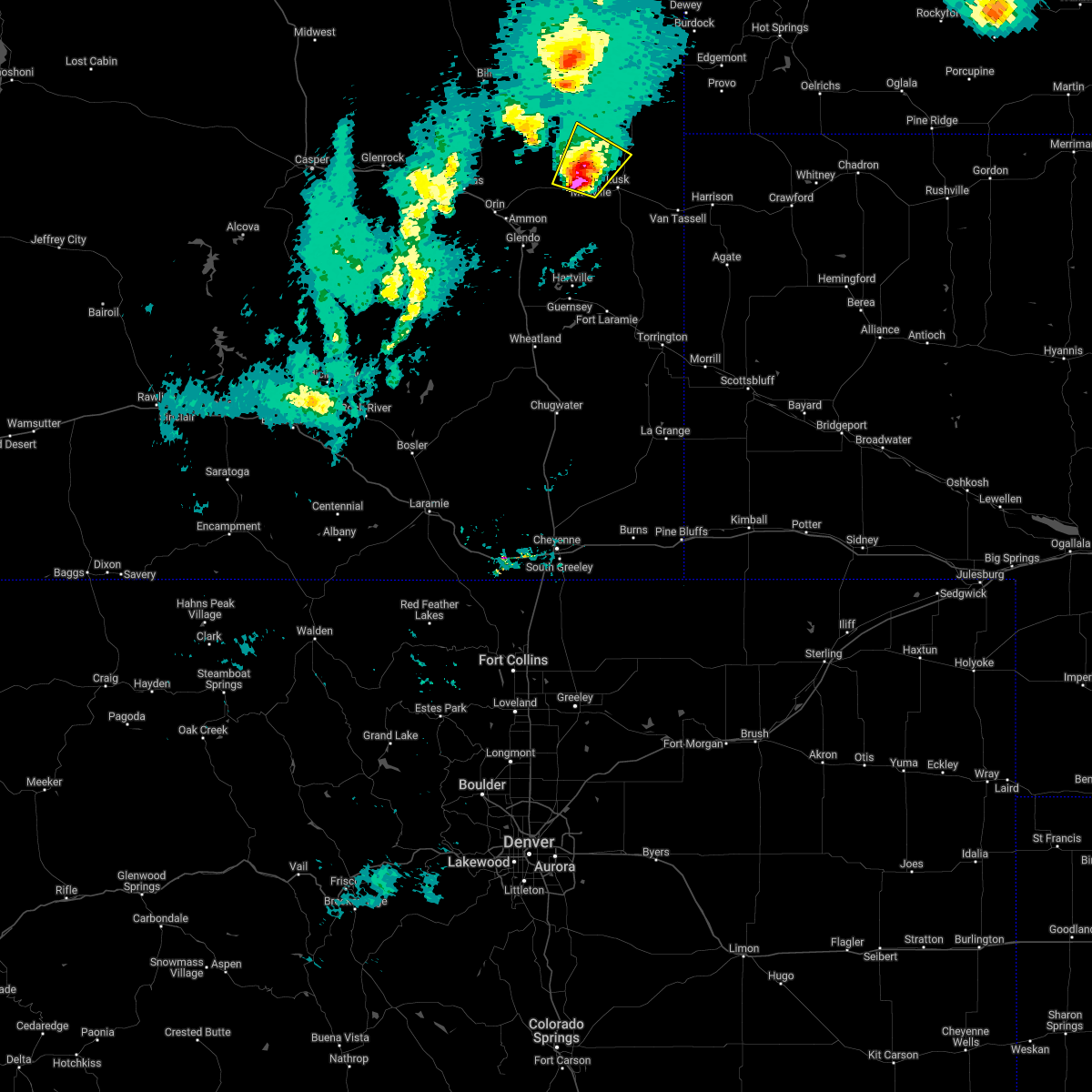 At 501 pm mdt, a severe thunderstorm was located near manville, or 10 miles northwest of lusk, moving northeast at 35 mph (public. around 455 pm mdt quarter sized hail was reported on highway 20 near manville). Hazards include 60 mph wind gusts and quarter size hail. Hail damage to vehicles is expected. expect wind damage to roofs, siding, and trees. locations impacted include, manville and lance creek. hail threat, radar indicated max hail size, 1. 00 in wind threat, radar indicated max wind gust, 60 mph. At 501 pm mdt, a severe thunderstorm was located near manville, or 10 miles northwest of lusk, moving northeast at 35 mph (public. around 455 pm mdt quarter sized hail was reported on highway 20 near manville). Hazards include 60 mph wind gusts and quarter size hail. Hail damage to vehicles is expected. expect wind damage to roofs, siding, and trees. locations impacted include, manville and lance creek. hail threat, radar indicated max hail size, 1. 00 in wind threat, radar indicated max wind gust, 60 mph.
|
| 4/22/2022 4:48 PM MDT |
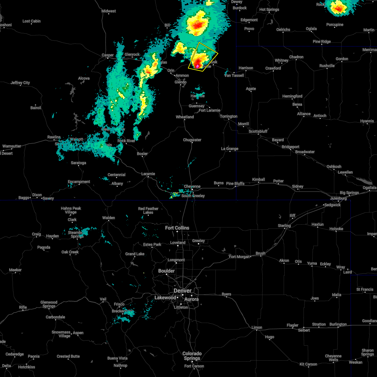 At 448 pm mdt, a severe thunderstorm was located over keeline, or 12 miles west of lusk, moving northeast at 25 mph (radar indicated). Hazards include 60 mph wind gusts and quarter size hail. Hail damage to vehicles is expected. Expect wind damage to roofs, siding, and trees. At 448 pm mdt, a severe thunderstorm was located over keeline, or 12 miles west of lusk, moving northeast at 25 mph (radar indicated). Hazards include 60 mph wind gusts and quarter size hail. Hail damage to vehicles is expected. Expect wind damage to roofs, siding, and trees.
|
| 8/6/2021 4:21 PM MDT |
 The severe thunderstorm warning for western niobrara, northwestern goshen, northeastern platte and northeastern converse counties will expire at 430 pm mdt, the storms which prompted the warning have moved out of the area. therefore, the warning will be allowed to expire. a severe thunderstorm watch remains in effect until 800 pm mdt for east central wyoming. The severe thunderstorm warning for western niobrara, northwestern goshen, northeastern platte and northeastern converse counties will expire at 430 pm mdt, the storms which prompted the warning have moved out of the area. therefore, the warning will be allowed to expire. a severe thunderstorm watch remains in effect until 800 pm mdt for east central wyoming.
|
| 8/6/2021 3:50 PM MDT |
 At 349 pm mdt, severe thunderstorms were located along a line extending from 12 miles north of bill to near two moon campground, moving northeast at 45 mph (radar indicated). Hazards include 70 mph wind gusts and penny size hail. Expect considerable tree damage. damage is likely to mobile homes, roofs, and outbuildings. these severe storms will be near, dull center around 405 pm mdt. rawhide buttes around 415 pm mdt. other locations impacted by these severe thunderstorms include lost springs. this includes interstate 25 in wyoming between mile markers 104 and 121. thunderstorm damage threat, considerable hail threat, radar indicated max hail size, 0. 75 in wind threat, radar indicated max wind gust, 70 mph. At 349 pm mdt, severe thunderstorms were located along a line extending from 12 miles north of bill to near two moon campground, moving northeast at 45 mph (radar indicated). Hazards include 70 mph wind gusts and penny size hail. Expect considerable tree damage. damage is likely to mobile homes, roofs, and outbuildings. these severe storms will be near, dull center around 405 pm mdt. rawhide buttes around 415 pm mdt. other locations impacted by these severe thunderstorms include lost springs. this includes interstate 25 in wyoming between mile markers 104 and 121. thunderstorm damage threat, considerable hail threat, radar indicated max hail size, 0. 75 in wind threat, radar indicated max wind gust, 70 mph.
|
| 8/6/2021 3:29 PM MDT |
 At 328 pm mdt, severe thunderstorms were located along a line extending from 12 miles west of bill to 6 miles east of esterbrook campground, moving northeast at 45 mph (radar indicated). Hazards include 70 mph wind gusts and penny size hail. Expect considerable tree damage. damage is likely to mobile homes, roofs, and outbuildings. severe thunderstorms will be near, glendo reservoir and two moon campground around 345 pm mdt. dull center around 405 pm mdt. keeline around 410 pm mdt. manville around 420 pm mdt. other locations impacted by these severe thunderstorms include lost springs. this includes interstate 25 in wyoming between mile markers 104 and 143. thunderstorm damage threat, considerable hail threat, radar indicated max hail size, 0. 75 in wind threat, radar indicated max wind gust, 70 mph. At 328 pm mdt, severe thunderstorms were located along a line extending from 12 miles west of bill to 6 miles east of esterbrook campground, moving northeast at 45 mph (radar indicated). Hazards include 70 mph wind gusts and penny size hail. Expect considerable tree damage. damage is likely to mobile homes, roofs, and outbuildings. severe thunderstorms will be near, glendo reservoir and two moon campground around 345 pm mdt. dull center around 405 pm mdt. keeline around 410 pm mdt. manville around 420 pm mdt. other locations impacted by these severe thunderstorms include lost springs. this includes interstate 25 in wyoming between mile markers 104 and 143. thunderstorm damage threat, considerable hail threat, radar indicated max hail size, 0. 75 in wind threat, radar indicated max wind gust, 70 mph.
|
| 7/9/2021 8:04 PM MDT |
 At 804 pm mdt, a severe thunderstorm was located near redbird, or 24 miles southwest of edgemont, moving southeast at 60 mph (radar indicated). Hazards include golf ball size hail and 70 mph wind gusts. People and animals outdoors will be injured. expect hail damage to roofs, siding, windows, and vehicles. expect considerable tree damage. Wind damage is also likely to mobile homes, roofs, and outbuildings. At 804 pm mdt, a severe thunderstorm was located near redbird, or 24 miles southwest of edgemont, moving southeast at 60 mph (radar indicated). Hazards include golf ball size hail and 70 mph wind gusts. People and animals outdoors will be injured. expect hail damage to roofs, siding, windows, and vehicles. expect considerable tree damage. Wind damage is also likely to mobile homes, roofs, and outbuildings.
|
| 6/8/2021 8:35 PM MDT |
 At 835 pm mdt, severe thunderstorms were located along a line extending from morrisey to near manville, moving east at 20 mph (radar indicated). Hazards include 60 mph wind gusts and quarter size hail. Hail damage to vehicles is expected. expect wind damage to roofs, siding, and trees. Severe thunderstorms will be near, lusk around 900 pm mdt. At 835 pm mdt, severe thunderstorms were located along a line extending from morrisey to near manville, moving east at 20 mph (radar indicated). Hazards include 60 mph wind gusts and quarter size hail. Hail damage to vehicles is expected. expect wind damage to roofs, siding, and trees. Severe thunderstorms will be near, lusk around 900 pm mdt.
|
| 7/19/2020 7:57 PM MDT |
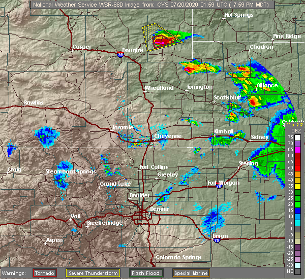 At 757 pm mdt, a severe thunderstorm capable of producing a tornado was located near lance creek, or 15 miles northwest of lusk, moving south at 30 mph (radar indicated rotation). Hazards include tornado and tennis ball size hail. Flying debris will be dangerous to those caught without shelter. mobile homes will be damaged or destroyed. damage to roofs, windows, and vehicles will occur. tree damage is likely. this dangerous storm will be near, manville around 820 pm mdt. Lusk around 825 pm mdt. At 757 pm mdt, a severe thunderstorm capable of producing a tornado was located near lance creek, or 15 miles northwest of lusk, moving south at 30 mph (radar indicated rotation). Hazards include tornado and tennis ball size hail. Flying debris will be dangerous to those caught without shelter. mobile homes will be damaged or destroyed. damage to roofs, windows, and vehicles will occur. tree damage is likely. this dangerous storm will be near, manville around 820 pm mdt. Lusk around 825 pm mdt.
|
| 7/19/2020 7:47 PM MDT |
 At 746 pm mdt, a severe thunderstorm capable of producing a tornado was located over lance creek, or 20 miles northwest of lusk, moving southeast at 30 mph (radar indicated rotation). Hazards include tornado and tennis ball size hail. Flying debris will be dangerous to those caught without shelter. mobile homes will be damaged or destroyed. damage to roofs, windows, and vehicles will occur. tree damage is likely. This tornadic thunderstorm will remain over mainly rural areas of west central niobrara county. At 746 pm mdt, a severe thunderstorm capable of producing a tornado was located over lance creek, or 20 miles northwest of lusk, moving southeast at 30 mph (radar indicated rotation). Hazards include tornado and tennis ball size hail. Flying debris will be dangerous to those caught without shelter. mobile homes will be damaged or destroyed. damage to roofs, windows, and vehicles will occur. tree damage is likely. This tornadic thunderstorm will remain over mainly rural areas of west central niobrara county.
|
| 7/19/2020 7:31 PM MDT |
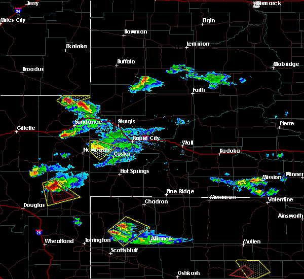 At 731 pm mdt, a severe thunderstorm capable of producing a tornado was located 8 miles northwest of lance creek, or 27 miles northwest of lusk, moving south at 25 mph (radar indicated rotation). Hazards include tornado and two inch hail. Flying debris will be dangerous to those caught without shelter. mobile homes will be damaged or destroyed. damage to roofs, windows, and vehicles will occur. tree damage is likely. This dangerous storm will be near, lance creek around 735 pm mdt. At 731 pm mdt, a severe thunderstorm capable of producing a tornado was located 8 miles northwest of lance creek, or 27 miles northwest of lusk, moving south at 25 mph (radar indicated rotation). Hazards include tornado and two inch hail. Flying debris will be dangerous to those caught without shelter. mobile homes will be damaged or destroyed. damage to roofs, windows, and vehicles will occur. tree damage is likely. This dangerous storm will be near, lance creek around 735 pm mdt.
|
| 7/19/2020 7:24 PM MDT |
 At 723 pm mdt, a severe thunderstorm capable of producing a tornado was located 11 miles northwest of lance creek, or 31 miles northwest of lusk, moving southeast at 30 mph (radar indicated rotation). Hazards include tornado and hail up to two inches in diameter. Flying debris will be dangerous to those caught without shelter. mobile homes will be damaged or destroyed. damage to roofs, windows, and vehicles will occur. tree damage is likely. This dangerous storm will be near, lance creek around 740 pm mdt. At 723 pm mdt, a severe thunderstorm capable of producing a tornado was located 11 miles northwest of lance creek, or 31 miles northwest of lusk, moving southeast at 30 mph (radar indicated rotation). Hazards include tornado and hail up to two inches in diameter. Flying debris will be dangerous to those caught without shelter. mobile homes will be damaged or destroyed. damage to roofs, windows, and vehicles will occur. tree damage is likely. This dangerous storm will be near, lance creek around 740 pm mdt.
|
| 7/19/2020 7:14 PM MDT |
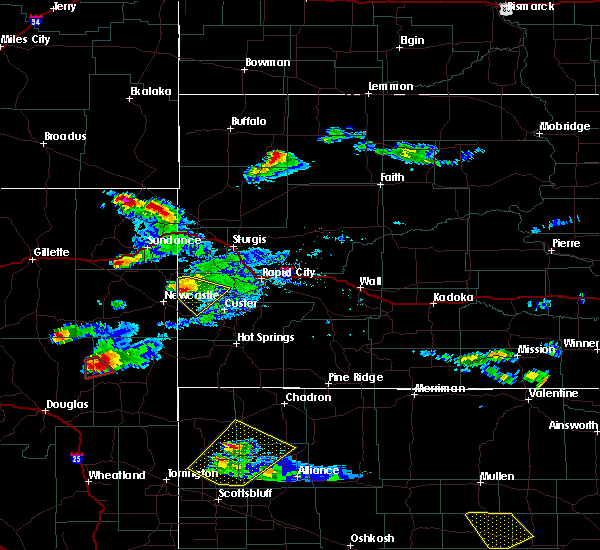 At 714 pm mdt, a severe thunderstorm was located 13 miles north of manning ranch, or 34 miles northwest of lusk, moving south at 25 mph (radar indicated). Hazards include tennis ball size hail and 60 mph wind gusts. People and animals outdoors will be injured. expect hail damage to roofs, siding, windows, and vehicles. Expect wind damage to roofs, siding, and trees. At 714 pm mdt, a severe thunderstorm was located 13 miles north of manning ranch, or 34 miles northwest of lusk, moving south at 25 mph (radar indicated). Hazards include tennis ball size hail and 60 mph wind gusts. People and animals outdoors will be injured. expect hail damage to roofs, siding, windows, and vehicles. Expect wind damage to roofs, siding, and trees.
|
| 6/6/2020 5:06 PM MDT |
 At 505 pm mdt, severe thunderstorms were located along a line extending from 14 miles southeast of dull center to 8 miles northeast of fort laramie, moving northeast at 70 mph (radar indicated). Hazards include 70 mph wind gusts. Expect considerable tree damage. damage is likely to mobile homes, roofs, and outbuildings. locations impacted include, lusk, guernsey, lingle, fort laramie, glendo, manville, sibley peak, dull center, two moon campground, keeline, jay em, fort laramie national historic site, bill, grayrocks reservoir, guernsey campground, rawhide buttes, glendo reservoir, lance creek, manning ranch and chugcreek. This includes interstate 25 in wyoming between mile markers 103 and 124. At 505 pm mdt, severe thunderstorms were located along a line extending from 14 miles southeast of dull center to 8 miles northeast of fort laramie, moving northeast at 70 mph (radar indicated). Hazards include 70 mph wind gusts. Expect considerable tree damage. damage is likely to mobile homes, roofs, and outbuildings. locations impacted include, lusk, guernsey, lingle, fort laramie, glendo, manville, sibley peak, dull center, two moon campground, keeline, jay em, fort laramie national historic site, bill, grayrocks reservoir, guernsey campground, rawhide buttes, glendo reservoir, lance creek, manning ranch and chugcreek. This includes interstate 25 in wyoming between mile markers 103 and 124.
|
| 6/6/2020 4:57 PM MDT |
 At 456 pm mdt, severe thunderstorms were located along a line extending from 13 miles north of manning ranch to near fort laramie national historic site, moving northeast at 60 mph. these are very dangerous storms (radar indicated). Hazards include 80 mph wind gusts. Flying debris will be dangerous to those caught without shelter. mobile homes will be heavily damaged. expect considerable damage to roofs, windows, and vehicles. extensive tree damage and power outages are likely. locations impacted include, lusk, guernsey, lingle, fort laramie, glendo, manville, sibley peak, dull center, two moon campground, keeline, jay em, fort laramie national historic site, bill, grayrocks reservoir, guernsey campground, rawhide buttes, glendo reservoir, lance creek, manning ranch and chugcreek. This includes interstate 25 in wyoming between mile markers 103 and 124. At 456 pm mdt, severe thunderstorms were located along a line extending from 13 miles north of manning ranch to near fort laramie national historic site, moving northeast at 60 mph. these are very dangerous storms (radar indicated). Hazards include 80 mph wind gusts. Flying debris will be dangerous to those caught without shelter. mobile homes will be heavily damaged. expect considerable damage to roofs, windows, and vehicles. extensive tree damage and power outages are likely. locations impacted include, lusk, guernsey, lingle, fort laramie, glendo, manville, sibley peak, dull center, two moon campground, keeline, jay em, fort laramie national historic site, bill, grayrocks reservoir, guernsey campground, rawhide buttes, glendo reservoir, lance creek, manning ranch and chugcreek. This includes interstate 25 in wyoming between mile markers 103 and 124.
|
| 6/6/2020 4:39 PM MDT |
 At 439 pm mdt, severe thunderstorms were located along a line extending from 16 miles north of douglas to lakeview north, moving northeast at 60 mph. these are very dangerous storms (radar indicated). Hazards include 80 mph wind gusts. Flying debris will be dangerous to those caught without shelter. mobile homes will be heavily damaged. expect considerable damage to roofs, windows, and vehicles. Extensive tree damage and power outages are likely. At 439 pm mdt, severe thunderstorms were located along a line extending from 16 miles north of douglas to lakeview north, moving northeast at 60 mph. these are very dangerous storms (radar indicated). Hazards include 80 mph wind gusts. Flying debris will be dangerous to those caught without shelter. mobile homes will be heavily damaged. expect considerable damage to roofs, windows, and vehicles. Extensive tree damage and power outages are likely.
|
| 6/5/2020 5:00 PM MDT |
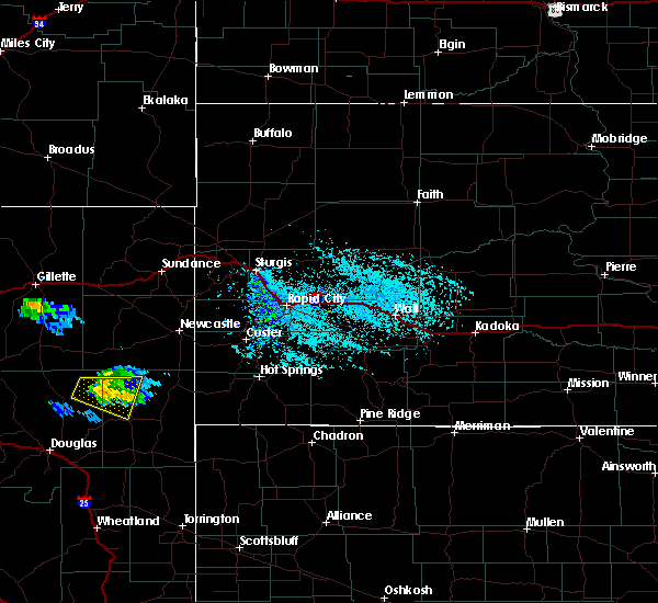 At 458 pm mdt, a severe thunderstorm was located 15 miles southeast of dull center, or 36 miles northwest of lusk, moving east at 40 mph (radar indicated). Hazards include 60 mph wind gusts and quarter size hail. Hail damage to vehicles is expected. Expect wind damage to roofs, siding, and trees. At 458 pm mdt, a severe thunderstorm was located 15 miles southeast of dull center, or 36 miles northwest of lusk, moving east at 40 mph (radar indicated). Hazards include 60 mph wind gusts and quarter size hail. Hail damage to vehicles is expected. Expect wind damage to roofs, siding, and trees.
|
| 6/5/2020 4:43 PM MDT |
 At 443 pm mdt, a severe thunderstorm was located 9 miles south of dull center, or 42 miles northwest of lusk, moving east at 35 mph (radar indicated). Hazards include 60 mph wind gusts and quarter size hail. Hail damage to vehicles is expected. Expect wind damage to roofs, siding, and trees. At 443 pm mdt, a severe thunderstorm was located 9 miles south of dull center, or 42 miles northwest of lusk, moving east at 35 mph (radar indicated). Hazards include 60 mph wind gusts and quarter size hail. Hail damage to vehicles is expected. Expect wind damage to roofs, siding, and trees.
|
| 9/20/2019 5:22 PM MDT |
 At 522 pm mdt, a severe thunderstorm was located near manning ranch, or 28 miles northwest of lusk, moving north at 35 mph (radar indicated). Hazards include quarter size hail. damage to vehicles is expected At 522 pm mdt, a severe thunderstorm was located near manning ranch, or 28 miles northwest of lusk, moving north at 35 mph (radar indicated). Hazards include quarter size hail. damage to vehicles is expected
|
| 9/20/2019 5:11 PM MDT |
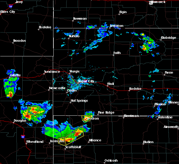 The severe thunderstorm warning for west central niobrara county will expire at 515 pm mdt, the storm which prompted the warning has weakened below severe limits, and no longer poses an immediate threat to life or property. therefore, the warning will be allowed to expire. however small hail is still possible with this thunderstorm. a severe thunderstorm watch remains in effect until 100 am mdt for east central wyoming. The severe thunderstorm warning for west central niobrara county will expire at 515 pm mdt, the storm which prompted the warning has weakened below severe limits, and no longer poses an immediate threat to life or property. therefore, the warning will be allowed to expire. however small hail is still possible with this thunderstorm. a severe thunderstorm watch remains in effect until 100 am mdt for east central wyoming.
|
| 9/20/2019 4:57 PM MDT |
 At 457 pm mdt, a severe thunderstorm was located 9 miles northwest of lance creek, or 29 miles northwest of lusk, moving north at 40 mph (radar indicated). Hazards include 60 mph wind gusts and quarter size hail. Hail damage to vehicles is expected. expect wind damage to roofs, siding, and trees. Locations impacted include, lance creek. At 457 pm mdt, a severe thunderstorm was located 9 miles northwest of lance creek, or 29 miles northwest of lusk, moving north at 40 mph (radar indicated). Hazards include 60 mph wind gusts and quarter size hail. Hail damage to vehicles is expected. expect wind damage to roofs, siding, and trees. Locations impacted include, lance creek.
|
| 9/20/2019 4:50 PM MDT | Quarter sized hail reported 3 miles ENE of Lance Creek, WY, still getting pea sized hail at 505 pm. |
| 9/20/2019 4:39 PM MDT |
 At 438 pm mdt, a severe thunderstorm was located 7 miles southwest of lance creek, or 20 miles northwest of lusk, moving north at 40 mph (radar indicated). Hazards include 60 mph wind gusts and quarter size hail. Hail damage to vehicles is expected. Expect wind damage to roofs, siding, and trees. At 438 pm mdt, a severe thunderstorm was located 7 miles southwest of lance creek, or 20 miles northwest of lusk, moving north at 40 mph (radar indicated). Hazards include 60 mph wind gusts and quarter size hail. Hail damage to vehicles is expected. Expect wind damage to roofs, siding, and trees.
|
| 9/20/2019 4:20 PM MDT |
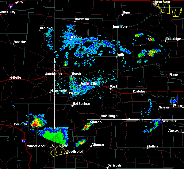 At 420 pm mdt, a severe thunderstorm was located near manville, or 12 miles west of lusk, moving north at 25 mph (radar indicated). Hazards include 60 mph wind gusts and half dollar size hail. Hail damage to vehicles is expected. Expect wind damage to roofs, siding, and trees. At 420 pm mdt, a severe thunderstorm was located near manville, or 12 miles west of lusk, moving north at 25 mph (radar indicated). Hazards include 60 mph wind gusts and half dollar size hail. Hail damage to vehicles is expected. Expect wind damage to roofs, siding, and trees.
|
| 8/23/2019 6:28 PM MDT |
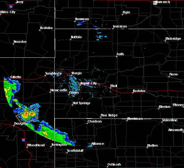 At 627 pm mdt, severe thunderstorms were located along a line extending from 10 miles southeast of bill to 10 miles northwest of lance creek, moving north at 15 mph (radar indicated). Hazards include ping pong ball size hail and 60 mph wind gusts. People and animals outdoors will be injured. expect hail damage to roofs, siding, windows, and vehicles. expect wind damage to roofs, siding, and trees. Locations impacted include, manning ranch and lance creek. At 627 pm mdt, severe thunderstorms were located along a line extending from 10 miles southeast of bill to 10 miles northwest of lance creek, moving north at 15 mph (radar indicated). Hazards include ping pong ball size hail and 60 mph wind gusts. People and animals outdoors will be injured. expect hail damage to roofs, siding, windows, and vehicles. expect wind damage to roofs, siding, and trees. Locations impacted include, manning ranch and lance creek.
|
| 8/23/2019 6:17 PM MDT |
 At 616 pm mdt, severe thunderstorms were located along a line extending from 15 miles west of manning ranch to 11 miles northwest of lance creek, moving north at 15 mph (radar indicated). Hazards include ping pong ball size hail and 60 mph wind gusts. People and animals outdoors will be injured. expect hail damage to roofs, siding, windows, and vehicles. expect wind damage to roofs, siding, and trees. Locations impacted include, manning ranch and lance creek. At 616 pm mdt, severe thunderstorms were located along a line extending from 15 miles west of manning ranch to 11 miles northwest of lance creek, moving north at 15 mph (radar indicated). Hazards include ping pong ball size hail and 60 mph wind gusts. People and animals outdoors will be injured. expect hail damage to roofs, siding, windows, and vehicles. expect wind damage to roofs, siding, and trees. Locations impacted include, manning ranch and lance creek.
|
| 8/23/2019 6:01 PM MDT |
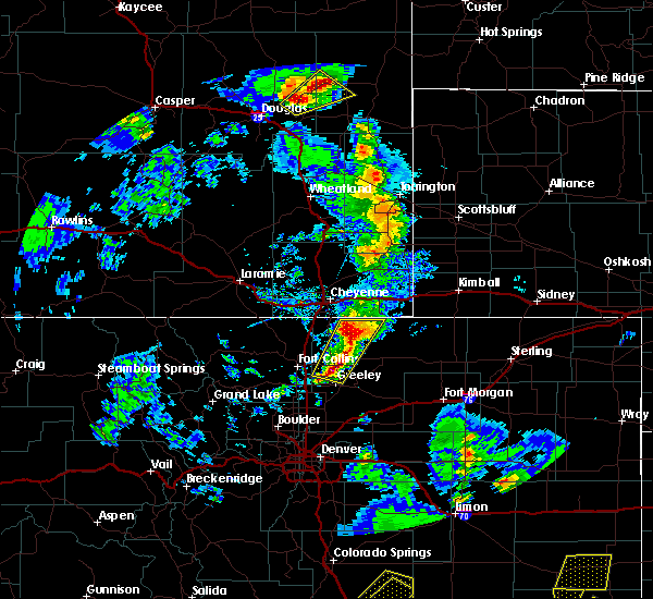 The national weather service in cheyenne has issued a * severe thunderstorm warning for. northwestern niobrara county in east central wyoming. east central converse county in east central wyoming. until 645 pm mdt. At 601 pm mdt, severe thunderstorms were located along a line. The national weather service in cheyenne has issued a * severe thunderstorm warning for. northwestern niobrara county in east central wyoming. east central converse county in east central wyoming. until 645 pm mdt. At 601 pm mdt, severe thunderstorms were located along a line.
|
| 8/23/2019 5:55 PM MDT |
 At 554 pm mdt, a severe thunderstorm was located near manning ranch, or 24 miles northwest of lusk, moving northeast at 25 mph (radar indicated). Hazards include 60 mph wind gusts and half dollar size hail. Hail damage to vehicles is expected. expect wind damage to roofs, siding, and trees. Locations impacted include, manning ranch and lance creek. At 554 pm mdt, a severe thunderstorm was located near manning ranch, or 24 miles northwest of lusk, moving northeast at 25 mph (radar indicated). Hazards include 60 mph wind gusts and half dollar size hail. Hail damage to vehicles is expected. expect wind damage to roofs, siding, and trees. Locations impacted include, manning ranch and lance creek.
|
| 8/23/2019 5:36 PM MDT |
 At 536 pm mdt, a severe thunderstorm was located 8 miles south of manning ranch, or 23 miles east of douglas, moving northeast at 25 mph (radar indicated). Hazards include ping pong ball size hail and 60 mph wind gusts. People and animals outdoors will be injured. expect hail damage to roofs, siding, windows, and vehicles. Expect wind damage to roofs, siding, and trees. At 536 pm mdt, a severe thunderstorm was located 8 miles south of manning ranch, or 23 miles east of douglas, moving northeast at 25 mph (radar indicated). Hazards include ping pong ball size hail and 60 mph wind gusts. People and animals outdoors will be injured. expect hail damage to roofs, siding, windows, and vehicles. Expect wind damage to roofs, siding, and trees.
|
| 8/15/2019 2:58 AM MDT |
 At 258 am mdt, a severe thunderstorm was located 15 miles north of lance creek, or 33 miles north of lusk, moving southeast at 35 mph (radar indicated). Hazards include two inch hail and 60 mph wind gusts. People and animals outdoors will be injured. expect hail damage to roofs, siding, windows, and vehicles. expect wind damage to roofs, siding, and trees. Locations impacted include, redbird. At 258 am mdt, a severe thunderstorm was located 15 miles north of lance creek, or 33 miles north of lusk, moving southeast at 35 mph (radar indicated). Hazards include two inch hail and 60 mph wind gusts. People and animals outdoors will be injured. expect hail damage to roofs, siding, windows, and vehicles. expect wind damage to roofs, siding, and trees. Locations impacted include, redbird.
|
| 8/15/2019 2:53 AM MDT |
 At 252 am mdt, a severe thunderstorm was located 17 miles west of redbird, or 37 miles north of lusk, moving southeast at 35 mph (radar indicated). Hazards include 60 mph wind gusts and half dollar size hail. Hail damage to vehicles is expected. Expect wind damage to roofs, siding, and trees. At 252 am mdt, a severe thunderstorm was located 17 miles west of redbird, or 37 miles north of lusk, moving southeast at 35 mph (radar indicated). Hazards include 60 mph wind gusts and half dollar size hail. Hail damage to vehicles is expected. Expect wind damage to roofs, siding, and trees.
|
| 8/11/2019 4:21 PM MDT |
 At 421 pm mdt, a severe thunderstorm was located 11 miles north of lance creek, or 29 miles north of lusk, moving east at 20 mph (radar indicated). Hazards include 70 mph wind gusts and half dollar size hail. Hail damage to vehicles is expected. expect considerable tree damage. wind damage is also likely to mobile homes, roofs, and outbuildings. Locations impacted include, lance creek. At 421 pm mdt, a severe thunderstorm was located 11 miles north of lance creek, or 29 miles north of lusk, moving east at 20 mph (radar indicated). Hazards include 70 mph wind gusts and half dollar size hail. Hail damage to vehicles is expected. expect considerable tree damage. wind damage is also likely to mobile homes, roofs, and outbuildings. Locations impacted include, lance creek.
|
| 8/11/2019 4:11 PM MDT |
 At 341 pm mdt, severe thunderstorms were located along a line extending from 12 miles west of morrisey to 12 miles east of douglas, moving northeast at 20 mph (radar indicated). Hazards include 60 mph wind gusts and half dollar size hail. Hail damage to vehicles is expected. Expect wind damage to roofs, siding, and trees. At 341 pm mdt, severe thunderstorms were located along a line extending from 12 miles west of morrisey to 12 miles east of douglas, moving northeast at 20 mph (radar indicated). Hazards include 60 mph wind gusts and half dollar size hail. Hail damage to vehicles is expected. Expect wind damage to roofs, siding, and trees.
|
| 8/11/2019 4:10 PM MDT |
 At 410 pm mdt, a severe thunderstorm was located 10 miles north of lance creek, or 30 miles north of lusk, moving east at 20 mph (radar indicated). Hazards include 70 mph wind gusts and half dollar size hail. Hail damage to vehicles is expected. expect considerable tree damage. Wind damage is also likely to mobile homes, roofs, and outbuildings. At 410 pm mdt, a severe thunderstorm was located 10 miles north of lance creek, or 30 miles north of lusk, moving east at 20 mph (radar indicated). Hazards include 70 mph wind gusts and half dollar size hail. Hail damage to vehicles is expected. expect considerable tree damage. Wind damage is also likely to mobile homes, roofs, and outbuildings.
|
| 8/11/2019 3:41 PM MDT |
 At 341 pm mdt, severe thunderstorms were located along a line extending from 12 miles west of morrisey to 12 miles east of douglas, moving northeast at 20 mph (radar indicated). Hazards include 60 mph wind gusts and half dollar size hail. Hail damage to vehicles is expected. Expect wind damage to roofs, siding, and trees. At 341 pm mdt, severe thunderstorms were located along a line extending from 12 miles west of morrisey to 12 miles east of douglas, moving northeast at 20 mph (radar indicated). Hazards include 60 mph wind gusts and half dollar size hail. Hail damage to vehicles is expected. Expect wind damage to roofs, siding, and trees.
|
| 7/31/2019 6:29 PM MDT |
 At 628 pm mdt, a severe thunderstorm was located near manning ranch, or 30 miles northwest of lusk, moving east at 25 mph (radar indicated). Hazards include 60 mph wind gusts and quarter size hail. Hail damage to vehicles is expected. expect wind damage to roofs, siding, and trees. Locations impacted include, lance creek. At 628 pm mdt, a severe thunderstorm was located near manning ranch, or 30 miles northwest of lusk, moving east at 25 mph (radar indicated). Hazards include 60 mph wind gusts and quarter size hail. Hail damage to vehicles is expected. expect wind damage to roofs, siding, and trees. Locations impacted include, lance creek.
|
| 7/31/2019 6:19 PM MDT |
 At 619 pm mdt, a severe thunderstorm was located near manning ranch, or 30 miles northeast of douglas, moving east at 25 mph (radar indicated). Hazards include 60 mph wind gusts and quarter size hail. Hail damage to vehicles is expected. Expect wind damage to roofs, siding, and trees. At 619 pm mdt, a severe thunderstorm was located near manning ranch, or 30 miles northeast of douglas, moving east at 25 mph (radar indicated). Hazards include 60 mph wind gusts and quarter size hail. Hail damage to vehicles is expected. Expect wind damage to roofs, siding, and trees.
|
| 7/30/2019 5:10 PM MDT |
 At 509 pm mdt, a severe thunderstorm was located 9 miles east of lance creek, or 20 miles north of lusk, moving east at 35 mph (radar indicated). Hazards include 60 mph wind gusts and quarter size hail. Hail damage to vehicles is expected. expect wind damage to roofs, siding, and trees. This severe thunderstorm will remain over mainly rural areas of northwestern sioux and east central niobrara counties. At 509 pm mdt, a severe thunderstorm was located 9 miles east of lance creek, or 20 miles north of lusk, moving east at 35 mph (radar indicated). Hazards include 60 mph wind gusts and quarter size hail. Hail damage to vehicles is expected. expect wind damage to roofs, siding, and trees. This severe thunderstorm will remain over mainly rural areas of northwestern sioux and east central niobrara counties.
|
| 7/30/2019 4:57 PM MDT |
 At 457 pm mdt, a severe thunderstorm was located over lance creek, or 21 miles north of lusk, moving east at 35 mph (radar indicated). Hazards include 60 mph wind gusts and quarter size hail. Hail damage to vehicles is expected. Expect wind damage to roofs, siding, and trees. At 457 pm mdt, a severe thunderstorm was located over lance creek, or 21 miles north of lusk, moving east at 35 mph (radar indicated). Hazards include 60 mph wind gusts and quarter size hail. Hail damage to vehicles is expected. Expect wind damage to roofs, siding, and trees.
|
| 7/17/2019 5:28 PM MDT |
 At 527 pm mdt, a severe thunderstorm was located 11 miles northeast of lance creek, or 23 miles north of lusk, moving east at 30 mph. at 520 pm mdt, a trained spotter reported golfball size hail 11 miles north of lance creek (trained weather spotters). Hazards include two inch hail and 60 mph wind gusts. People and animals outdoors will be injured. expect hail damage to roofs, siding, windows, and vehicles. expect wind damage to roofs, siding, and trees. Locations impacted include, redbird and lance creek. At 527 pm mdt, a severe thunderstorm was located 11 miles northeast of lance creek, or 23 miles north of lusk, moving east at 30 mph. at 520 pm mdt, a trained spotter reported golfball size hail 11 miles north of lance creek (trained weather spotters). Hazards include two inch hail and 60 mph wind gusts. People and animals outdoors will be injured. expect hail damage to roofs, siding, windows, and vehicles. expect wind damage to roofs, siding, and trees. Locations impacted include, redbird and lance creek.
|
| 7/17/2019 5:23 PM MDT | Quarter sized hail reported 6.6 miles SW of Lance Creek, WY |
| 7/17/2019 5:20 PM MDT | Golf Ball sized hail reported 10.4 miles S of Lance Creek, WY, duration 10 minutes. window damaged. |
| 7/17/2019 5:15 PM MDT |
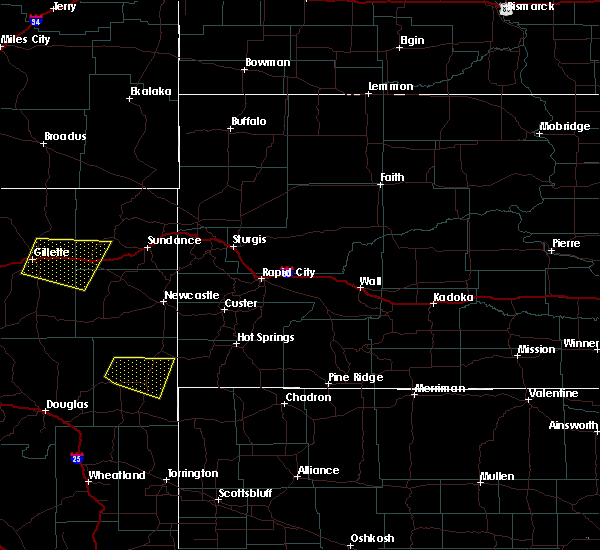 At 515 pm mdt, a severe thunderstorm was located 8 miles northeast of lance creek, or 25 miles north of lusk, moving east at 30 mph (radar indicated). Hazards include two inch hail and 60 mph wind gusts. People and animals outdoors will be injured. expect hail damage to roofs, siding, windows, and vehicles. expect wind damage to roofs, siding, and trees. Locations impacted include, redbird and lance creek. At 515 pm mdt, a severe thunderstorm was located 8 miles northeast of lance creek, or 25 miles north of lusk, moving east at 30 mph (radar indicated). Hazards include two inch hail and 60 mph wind gusts. People and animals outdoors will be injured. expect hail damage to roofs, siding, windows, and vehicles. expect wind damage to roofs, siding, and trees. Locations impacted include, redbird and lance creek.
|
| 7/17/2019 5:06 PM MDT |
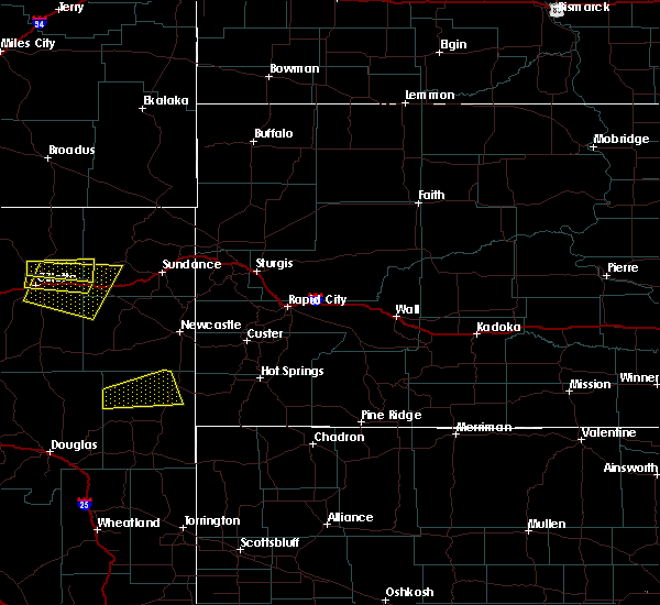 At 506 pm mdt, a severe thunderstorm was located 9 miles north of lance creek, or 28 miles north of lusk, moving east at 30 mph (radar indicated). Hazards include ping pong ball size hail and 60 mph wind gusts. People and animals outdoors will be injured. expect hail damage to roofs, siding, windows, and vehicles. Expect wind damage to roofs, siding, and trees. At 506 pm mdt, a severe thunderstorm was located 9 miles north of lance creek, or 28 miles north of lusk, moving east at 30 mph (radar indicated). Hazards include ping pong ball size hail and 60 mph wind gusts. People and animals outdoors will be injured. expect hail damage to roofs, siding, windows, and vehicles. Expect wind damage to roofs, siding, and trees.
|
| 7/1/2019 4:44 PM MDT |
 At 444 pm mdt, a severe thunderstorm was located near manning ranch, or 25 miles northwest of lusk, moving southeast at 20 mph (radar indicated). Hazards include two inch hail and 60 mph wind gusts. People and animals outdoors will be injured. expect hail damage to roofs, siding, windows, and vehicles. Expect wind damage to roofs, siding, and trees. At 444 pm mdt, a severe thunderstorm was located near manning ranch, or 25 miles northwest of lusk, moving southeast at 20 mph (radar indicated). Hazards include two inch hail and 60 mph wind gusts. People and animals outdoors will be injured. expect hail damage to roofs, siding, windows, and vehicles. Expect wind damage to roofs, siding, and trees.
|
| 7/1/2019 4:33 PM MDT |
 At 432 pm mdt, a severe thunderstorm was located over manning ranch, or 29 miles northwest of lusk, moving southeast at 25 mph (radar indicated). Hazards include two inch hail and 60 mph wind gusts. People and animals outdoors will be injured. expect hail damage to roofs, siding, windows, and vehicles. expect wind damage to roofs, siding, and trees. Locations impacted include, manning ranch and lance creek. At 432 pm mdt, a severe thunderstorm was located over manning ranch, or 29 miles northwest of lusk, moving southeast at 25 mph (radar indicated). Hazards include two inch hail and 60 mph wind gusts. People and animals outdoors will be injured. expect hail damage to roofs, siding, windows, and vehicles. expect wind damage to roofs, siding, and trees. Locations impacted include, manning ranch and lance creek.
|
| 7/1/2019 4:21 PM MDT |
 At 421 pm mdt, a severe thunderstorm was located near manning ranch, or 30 miles northeast of douglas, moving southeast at 25 mph (radar indicated). Hazards include two inch hail and 60 mph wind gusts. People and animals outdoors will be injured. expect hail damage to roofs, siding, windows, and vehicles. expect wind damage to roofs, siding, and trees. Locations impacted include, manning ranch and lance creek. At 421 pm mdt, a severe thunderstorm was located near manning ranch, or 30 miles northeast of douglas, moving southeast at 25 mph (radar indicated). Hazards include two inch hail and 60 mph wind gusts. People and animals outdoors will be injured. expect hail damage to roofs, siding, windows, and vehicles. expect wind damage to roofs, siding, and trees. Locations impacted include, manning ranch and lance creek.
|
| 7/1/2019 4:09 PM MDT |
 At 408 pm mdt, a severe thunderstorm was located 10 miles northwest of manning ranch, or 30 miles northeast of douglas, moving southeast at 25 mph (radar indicated). Hazards include two inch hail and 60 mph wind gusts. People and animals outdoors will be injured. expect hail damage to roofs, siding, windows, and vehicles. Expect wind damage to roofs, siding, and trees. At 408 pm mdt, a severe thunderstorm was located 10 miles northwest of manning ranch, or 30 miles northeast of douglas, moving southeast at 25 mph (radar indicated). Hazards include two inch hail and 60 mph wind gusts. People and animals outdoors will be injured. expect hail damage to roofs, siding, windows, and vehicles. Expect wind damage to roofs, siding, and trees.
|
| 6/25/2019 6:35 PM MDT |
 At 634 pm mdt, a severe thunderstorm was located near manning ranch, or 25 miles northeast of douglas, moving east at 20 mph (radar indicated). Hazards include 60 mph wind gusts and quarter size hail. Hail damage to vehicles is expected. Expect wind damage to roofs, siding, and trees. At 634 pm mdt, a severe thunderstorm was located near manning ranch, or 25 miles northeast of douglas, moving east at 20 mph (radar indicated). Hazards include 60 mph wind gusts and quarter size hail. Hail damage to vehicles is expected. Expect wind damage to roofs, siding, and trees.
|
| 6/19/2019 8:51 PM MDT |
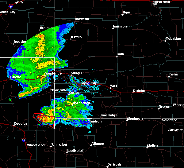 At 851 pm mdt, a severe thunderstorm capable of producing a tornado was located near lance creek, or 18 miles north of lusk, moving southeast at 35 mph (radar indicated rotation). Hazards include tornado and golf ball size hail. Flying debris will be dangerous to those caught without shelter. mobile homes will be damaged or destroyed. damage to roofs, windows, and vehicles will occur. tree damage is likely. This tornadic thunderstorm will remain over mainly rural areas of southeastern niobrara county. At 851 pm mdt, a severe thunderstorm capable of producing a tornado was located near lance creek, or 18 miles north of lusk, moving southeast at 35 mph (radar indicated rotation). Hazards include tornado and golf ball size hail. Flying debris will be dangerous to those caught without shelter. mobile homes will be damaged or destroyed. damage to roofs, windows, and vehicles will occur. tree damage is likely. This tornadic thunderstorm will remain over mainly rural areas of southeastern niobrara county.
|
| 6/19/2019 8:40 PM MDT |
 At 840 pm mdt, a severe thunderstorm capable of producing a tornado was located near lance creek, or 22 miles north of lusk, moving southeast at 35 mph (radar indicated rotation). Hazards include tornado and golf ball size hail. Flying debris will be dangerous to those caught without shelter. mobile homes will be damaged or destroyed. damage to roofs, windows, and vehicles will occur. tree damage is likely. This tornadic thunderstorm will remain over mainly rural areas of central niobrara county. At 840 pm mdt, a severe thunderstorm capable of producing a tornado was located near lance creek, or 22 miles north of lusk, moving southeast at 35 mph (radar indicated rotation). Hazards include tornado and golf ball size hail. Flying debris will be dangerous to those caught without shelter. mobile homes will be damaged or destroyed. damage to roofs, windows, and vehicles will occur. tree damage is likely. This tornadic thunderstorm will remain over mainly rural areas of central niobrara county.
|
| 6/19/2019 8:38 PM MDT |
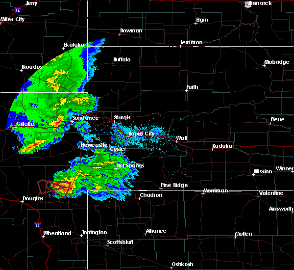 The tornado warning for west central niobrara and east central converse counties will expire at 845 pm mdt, the tornadic thunderstorm which prompted the warning continues to move east southeast into west central niobrara county. it has been replaced with a new tornado warning until 9pm. to report severe weather, contact your nearest law enforcement agency. they will relay your report to the national weather service cheyenne. remember, a tornado warning still remains in effect for west central niobrara county until 9 pm this evening. The tornado warning for west central niobrara and east central converse counties will expire at 845 pm mdt, the tornadic thunderstorm which prompted the warning continues to move east southeast into west central niobrara county. it has been replaced with a new tornado warning until 9pm. to report severe weather, contact your nearest law enforcement agency. they will relay your report to the national weather service cheyenne. remember, a tornado warning still remains in effect for west central niobrara county until 9 pm this evening.
|
| 6/19/2019 8:28 PM MDT |
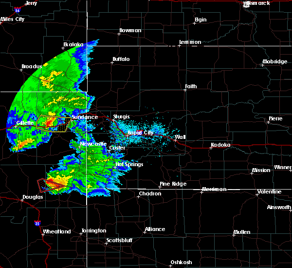 At 827 pm mdt, a confirmed tornado was located 8 miles northwest of lance creek, or 28 miles northwest of lusk, moving southeast at 35 mph (law enforcement confirmed tornado). Hazards include damaging tornado and golf ball size hail. Flying debris will be dangerous to those caught without shelter. mobile homes will be damaged or destroyed. damage to roofs, windows, and vehicles will occur. tree damage is likely. The tornado will be near, lance creek around 840 pm mdt. At 827 pm mdt, a confirmed tornado was located 8 miles northwest of lance creek, or 28 miles northwest of lusk, moving southeast at 35 mph (law enforcement confirmed tornado). Hazards include damaging tornado and golf ball size hail. Flying debris will be dangerous to those caught without shelter. mobile homes will be damaged or destroyed. damage to roofs, windows, and vehicles will occur. tree damage is likely. The tornado will be near, lance creek around 840 pm mdt.
|
| 6/19/2019 8:19 PM MDT |
 At 818 pm mdt, a confirmed tornado was located 9 miles north of manning ranch, or 33 miles northwest of lusk, moving southeast at 40 mph (law enforcement confirmed tornado). Hazards include damaging tornado and golf ball size hail. Flying debris will be dangerous to those caught without shelter. mobile homes will be damaged or destroyed. damage to roofs, windows, and vehicles will occur. tree damage is likely. This tornado will be near, lance creek around 840 pm mdt. At 818 pm mdt, a confirmed tornado was located 9 miles north of manning ranch, or 33 miles northwest of lusk, moving southeast at 40 mph (law enforcement confirmed tornado). Hazards include damaging tornado and golf ball size hail. Flying debris will be dangerous to those caught without shelter. mobile homes will be damaged or destroyed. damage to roofs, windows, and vehicles will occur. tree damage is likely. This tornado will be near, lance creek around 840 pm mdt.
|
| 6/19/2019 8:08 PM MDT |
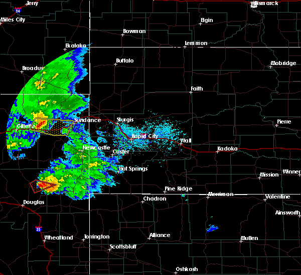 At 807 pm mdt, a confirmed tornado was located 11 miles southeast of bill, or 32 miles northeast of douglas, moving southeast at 35 mph (law enforcement confirmed tornado). Hazards include damaging tornado and golf ball size hail. Flying debris will be dangerous to those caught without shelter. mobile homes will be damaged or destroyed. damage to roofs, windows, and vehicles will occur. tree damage is likely. The tornado will be near, manning ranch around 830 pm mdt. At 807 pm mdt, a confirmed tornado was located 11 miles southeast of bill, or 32 miles northeast of douglas, moving southeast at 35 mph (law enforcement confirmed tornado). Hazards include damaging tornado and golf ball size hail. Flying debris will be dangerous to those caught without shelter. mobile homes will be damaged or destroyed. damage to roofs, windows, and vehicles will occur. tree damage is likely. The tornado will be near, manning ranch around 830 pm mdt.
|
| 6/7/2019 4:52 PM MDT |
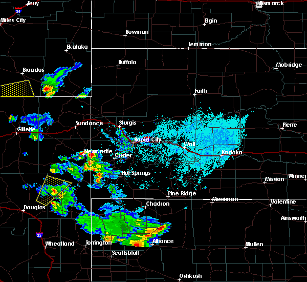 At 450 pm mdt, a severe thunderstorm was located 13 miles north of manning ranch, or 34 miles northwest of lusk, moving northeast at 40 mph (radar indicated). Hazards include 60 mph wind gusts and quarter size hail. Hail damage to vehicles is expected. expect wind damage to roofs, siding, and trees. Locations impacted include, lance creek. At 450 pm mdt, a severe thunderstorm was located 13 miles north of manning ranch, or 34 miles northwest of lusk, moving northeast at 40 mph (radar indicated). Hazards include 60 mph wind gusts and quarter size hail. Hail damage to vehicles is expected. expect wind damage to roofs, siding, and trees. Locations impacted include, lance creek.
|
| 6/7/2019 4:27 PM MDT |
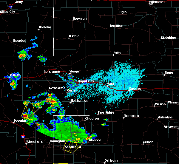 At 427 pm mdt, a severe thunderstorm was located near manning ranch, or 26 miles northeast of douglas, moving northeast at 40 mph (radar indicated). Hazards include 60 mph wind gusts and quarter size hail. Hail damage to vehicles is expected. Expect wind damage to roofs, siding, and trees. At 427 pm mdt, a severe thunderstorm was located near manning ranch, or 26 miles northeast of douglas, moving northeast at 40 mph (radar indicated). Hazards include 60 mph wind gusts and quarter size hail. Hail damage to vehicles is expected. Expect wind damage to roofs, siding, and trees.
|
| 7/29/2018 3:52 PM MDT |
 The severe thunderstorm warning for southern niobrara county will expire at 400 pm mdt, the storm which prompted the warning has moved out of the area. therefore, the warning will be allowed to expire. a severe thunderstorm warning remains in effect for south eastern niobrara and northern goshen counties until 4:15 pm mdt. a tornado watch remains in effect until 900 pm mdt for east central wyoming. The severe thunderstorm warning for southern niobrara county will expire at 400 pm mdt, the storm which prompted the warning has moved out of the area. therefore, the warning will be allowed to expire. a severe thunderstorm warning remains in effect for south eastern niobrara and northern goshen counties until 4:15 pm mdt. a tornado watch remains in effect until 900 pm mdt for east central wyoming.
|
| 7/29/2018 3:31 PM MDT |
 At 331 pm mdt, a severe thunderstorm was located 7 miles southeast of lance creek, or 12 miles northwest of lusk, moving southeast at 35 mph (radar indicated). Hazards include 60 mph wind gusts and quarter size hail. Hail damage to vehicles is expected. expect wind damage to roofs, siding, and trees. locations impacted include, lusk, manville and lance creek. A tornado watch remains in effect until 900 pm mdt for east central wyoming. At 331 pm mdt, a severe thunderstorm was located 7 miles southeast of lance creek, or 12 miles northwest of lusk, moving southeast at 35 mph (radar indicated). Hazards include 60 mph wind gusts and quarter size hail. Hail damage to vehicles is expected. expect wind damage to roofs, siding, and trees. locations impacted include, lusk, manville and lance creek. A tornado watch remains in effect until 900 pm mdt for east central wyoming.
|
| 7/29/2018 3:19 PM MDT |
 At 319 pm mdt, a severe thunderstorm was located near lance creek, or 26 miles northwest of lusk, moving southeast at 25 mph (radar indicated). Hazards include 60 mph wind gusts and quarter size hail. Hail damage to vehicles is expected. Expect wind damage to roofs, siding, and trees. At 319 pm mdt, a severe thunderstorm was located near lance creek, or 26 miles northwest of lusk, moving southeast at 25 mph (radar indicated). Hazards include 60 mph wind gusts and quarter size hail. Hail damage to vehicles is expected. Expect wind damage to roofs, siding, and trees.
|
| 7/17/2018 9:08 PM MDT |
 At 908 pm mdt, severe thunderstorms were located along a line extending from near manning ranch to near curtis gulch campground, moving southeast at 30 mph (trained weather spotters). Hazards include 60 mph wind gusts and quarter size hail. Hail damage to vehicles is expected. expect wind damage to roofs, siding, and trees. locations impacted include, douglas, esterbrook campground, esterbrook, lance creek, harris park, manning ranch and lost springs. This includes interstate 25 in wyoming between mile markers 115 and 145. At 908 pm mdt, severe thunderstorms were located along a line extending from near manning ranch to near curtis gulch campground, moving southeast at 30 mph (trained weather spotters). Hazards include 60 mph wind gusts and quarter size hail. Hail damage to vehicles is expected. expect wind damage to roofs, siding, and trees. locations impacted include, douglas, esterbrook campground, esterbrook, lance creek, harris park, manning ranch and lost springs. This includes interstate 25 in wyoming between mile markers 115 and 145.
|
| 7/17/2018 8:43 PM MDT |
 At 843 pm mdt, severe thunderstorms were located along a line extending from 7 miles southeast of bill to near campbell creek campground, moving southeast at 30 mph (trained weather spotters reported a 66 mph wind gust near douglas ). Hazards include 60 mph wind gusts and quarter size hail. Hail damage to vehicles is expected. Expect wind damage to roofs, siding, and trees. At 843 pm mdt, severe thunderstorms were located along a line extending from 7 miles southeast of bill to near campbell creek campground, moving southeast at 30 mph (trained weather spotters reported a 66 mph wind gust near douglas ). Hazards include 60 mph wind gusts and quarter size hail. Hail damage to vehicles is expected. Expect wind damage to roofs, siding, and trees.
|
| 7/3/2018 4:57 PM MDT |
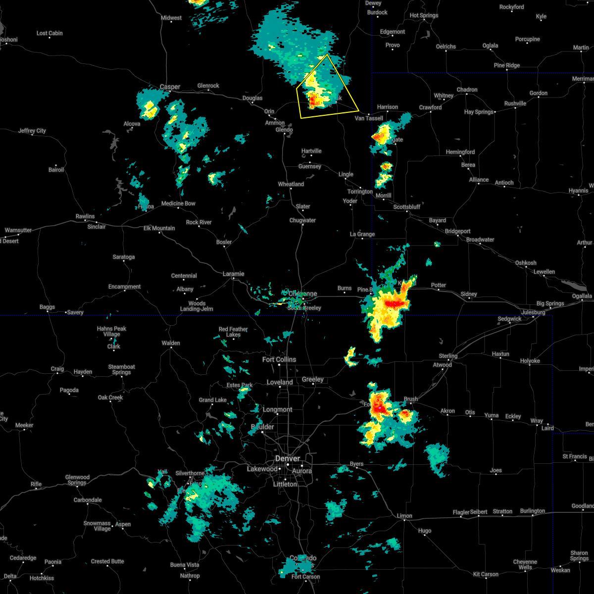 The severe thunderstorm warning for southwestern niobrara county will expire at 500 pm mdt, the storm which prompted the warning has weakened below severe limits, and no longer poses an immediate threat to life or property. therefore, the warning will be allowed to expire. however gusty winds up to 50 mph are still possible with this thunderstorm. a severe thunderstorm watch remains in effect until midnight mdt for east central wyoming. The severe thunderstorm warning for southwestern niobrara county will expire at 500 pm mdt, the storm which prompted the warning has weakened below severe limits, and no longer poses an immediate threat to life or property. therefore, the warning will be allowed to expire. however gusty winds up to 50 mph are still possible with this thunderstorm. a severe thunderstorm watch remains in effect until midnight mdt for east central wyoming.
|
| 7/3/2018 4:46 PM MDT |
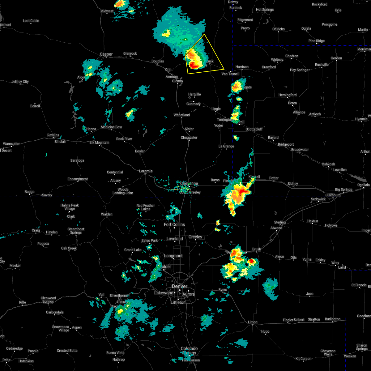 At 445 pm mdt, a severe thunderstorm was located over keeline, or 13 miles west of lusk, moving northeast at 25 mph (radar indicated). Hazards include ping pong ball size hail and 60 mph wind gusts. People and animals outdoors will be injured. expect hail damage to roofs, siding, windows, and vehicles. expect wind damage to roofs, siding, and trees. Locations impacted include, lusk, manville, keeline and lance creek. At 445 pm mdt, a severe thunderstorm was located over keeline, or 13 miles west of lusk, moving northeast at 25 mph (radar indicated). Hazards include ping pong ball size hail and 60 mph wind gusts. People and animals outdoors will be injured. expect hail damage to roofs, siding, windows, and vehicles. expect wind damage to roofs, siding, and trees. Locations impacted include, lusk, manville, keeline and lance creek.
|
| 7/3/2018 4:22 PM MDT |
 At 422 pm mdt, a severe thunderstorm was located near keeline, or 20 miles west of lusk, moving northeast at 40 mph (radar indicated). Hazards include ping pong ball size hail and 60 mph wind gusts. People and animals outdoors will be injured. expect hail damage to roofs, siding, windows, and vehicles. Expect wind damage to roofs, siding, and trees. At 422 pm mdt, a severe thunderstorm was located near keeline, or 20 miles west of lusk, moving northeast at 40 mph (radar indicated). Hazards include ping pong ball size hail and 60 mph wind gusts. People and animals outdoors will be injured. expect hail damage to roofs, siding, windows, and vehicles. Expect wind damage to roofs, siding, and trees.
|
| 6/23/2018 3:28 PM MDT |
 The severe thunderstorm warning for west central niobrara county will expire at 330 pm mdt, the storm which prompted the warning has weakened below severe limits, and no longer poses an immediate threat to life or property. therefore, the warning will be allowed to expire. however small hail, gusty winds and heavy rain are still possible with this thunderstorm. The severe thunderstorm warning for west central niobrara county will expire at 330 pm mdt, the storm which prompted the warning has weakened below severe limits, and no longer poses an immediate threat to life or property. therefore, the warning will be allowed to expire. however small hail, gusty winds and heavy rain are still possible with this thunderstorm.
|
| 6/23/2018 3:22 PM MDT |
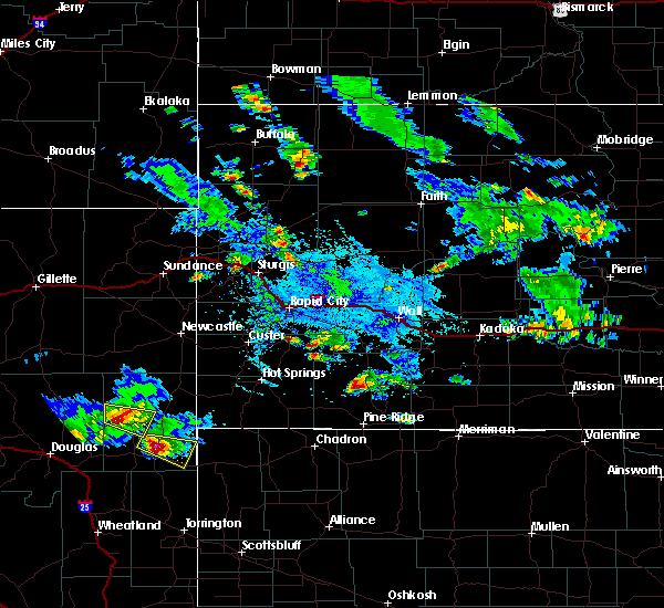 At 322 pm mdt, a severe thunderstorm was located near lance creek, or 26 miles northwest of lusk, moving east at 20 mph (radar indicated). Hazards include golf ball size hail and 60 mph wind gusts. People and animals outdoors will be injured. expect hail damage to roofs, siding, windows, and vehicles. expect wind damage to roofs, siding, and trees. This severe storm will be near, lance creek around 330 pm mdt. At 322 pm mdt, a severe thunderstorm was located near lance creek, or 26 miles northwest of lusk, moving east at 20 mph (radar indicated). Hazards include golf ball size hail and 60 mph wind gusts. People and animals outdoors will be injured. expect hail damage to roofs, siding, windows, and vehicles. expect wind damage to roofs, siding, and trees. This severe storm will be near, lance creek around 330 pm mdt.
|
| 6/23/2018 3:07 PM MDT |
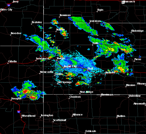 At 307 pm mdt, a severe thunderstorm was located 9 miles northeast of manning ranch, or 30 miles northwest of lusk, moving southeast at 40 mph (radar indicated). Hazards include ping pong ball size hail and 60 mph wind gusts. People and animals outdoors will be injured. expect hail damage to roofs, siding, windows, and vehicles. expect wind damage to roofs, siding, and trees. This severe thunderstorm will be near, lance creek around 320 pm mdt. At 307 pm mdt, a severe thunderstorm was located 9 miles northeast of manning ranch, or 30 miles northwest of lusk, moving southeast at 40 mph (radar indicated). Hazards include ping pong ball size hail and 60 mph wind gusts. People and animals outdoors will be injured. expect hail damage to roofs, siding, windows, and vehicles. expect wind damage to roofs, siding, and trees. This severe thunderstorm will be near, lance creek around 320 pm mdt.
|
| 6/23/2018 2:51 PM MDT |
 At 250 pm mdt, a severe thunderstorm was located near lance creek, or 14 miles northwest of lusk, moving east-southeast at 30 mph (radar indicated). Hazards include half dollar size hail. damage to vehicles is expected At 250 pm mdt, a severe thunderstorm was located near lance creek, or 14 miles northwest of lusk, moving east-southeast at 30 mph (radar indicated). Hazards include half dollar size hail. damage to vehicles is expected
|
| 8/13/2017 7:22 PM MDT |
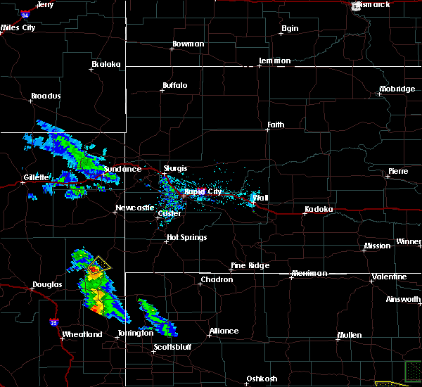 At 722 pm mdt, a severe thunderstorm was located 9 miles northeast of lance creek, or 21 miles north of lusk, moving northeast at 30 mph (radar indicated). Hazards include 60 mph wind gusts and quarter size hail. Hail damage to vehicles is expected. expect wind damage to roofs, siding, and trees. This severe thunderstorm will remain over mainly rural areas of central niobrara county. At 722 pm mdt, a severe thunderstorm was located 9 miles northeast of lance creek, or 21 miles north of lusk, moving northeast at 30 mph (radar indicated). Hazards include 60 mph wind gusts and quarter size hail. Hail damage to vehicles is expected. expect wind damage to roofs, siding, and trees. This severe thunderstorm will remain over mainly rural areas of central niobrara county.
|
| 8/13/2017 7:13 PM MDT |
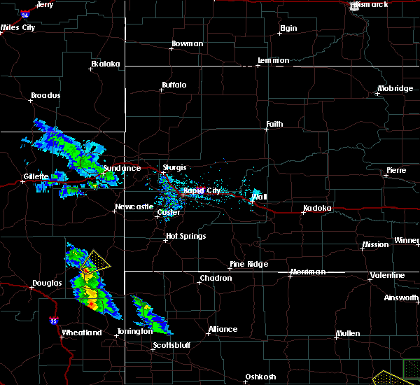 At 713 pm mdt, a severe thunderstorm was located over lance creek, or 19 miles north of lusk, moving northeast at 20 mph (radar indicated). Hazards include 60 mph wind gusts and quarter size hail. Hail damage to vehicles is expected. Expect wind damage to roofs, siding, and trees. At 713 pm mdt, a severe thunderstorm was located over lance creek, or 19 miles north of lusk, moving northeast at 20 mph (radar indicated). Hazards include 60 mph wind gusts and quarter size hail. Hail damage to vehicles is expected. Expect wind damage to roofs, siding, and trees.
|
| 9/23/2016 4:56 PM MDT |
 The severe thunderstorm warning for central niobrara county will expire at 500 pm mdt, the storms which prompted the warning have weakened. moved out of the warned area. therefore, the warning will be allowed to expire. however gusty winds are still possible with these thunderstorms. a severe thunderstorm watch remains in effect until 1000 pm mdt for east central wyoming. to report severe weather, contact your nearest law enforcement agency. they will relay your report to the national weather service cheyenne. The severe thunderstorm warning for central niobrara county will expire at 500 pm mdt, the storms which prompted the warning have weakened. moved out of the warned area. therefore, the warning will be allowed to expire. however gusty winds are still possible with these thunderstorms. a severe thunderstorm watch remains in effect until 1000 pm mdt for east central wyoming. to report severe weather, contact your nearest law enforcement agency. they will relay your report to the national weather service cheyenne.
|
| 9/23/2016 4:43 PM MDT |
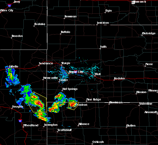 At 424 pm mdt, severe thunderstorms were located along a line extending from near lance creek to 8 miles north of lusk to 6 miles northeast of rawhide buttes, moving northeast at 60 mph (radar indicated). Hazards include 60 mph wind gusts and quarter size hail. Hail damage to vehicles is expected. expect wind damage to roofs, siding, and trees. Locations impacted include, lusk, manville, redbird, lance creek and van tassell. At 424 pm mdt, severe thunderstorms were located along a line extending from near lance creek to 8 miles north of lusk to 6 miles northeast of rawhide buttes, moving northeast at 60 mph (radar indicated). Hazards include 60 mph wind gusts and quarter size hail. Hail damage to vehicles is expected. expect wind damage to roofs, siding, and trees. Locations impacted include, lusk, manville, redbird, lance creek and van tassell.
|
| 9/23/2016 4:24 PM MDT |
 At 424 pm mdt, severe thunderstorms were located along a line extending from near lance creek to 8 miles north of lusk to 6 miles northeast of rawhide buttes, moving northeast at 60 mph (radar indicated). Hazards include 60 mph wind gusts and quarter size hail. Hail damage to vehicles is expected. expect wind damage to roofs, siding, and trees. Locations impacted include, lusk, manville, redbird, lance creek and van tassell. At 424 pm mdt, severe thunderstorms were located along a line extending from near lance creek to 8 miles north of lusk to 6 miles northeast of rawhide buttes, moving northeast at 60 mph (radar indicated). Hazards include 60 mph wind gusts and quarter size hail. Hail damage to vehicles is expected. expect wind damage to roofs, siding, and trees. Locations impacted include, lusk, manville, redbird, lance creek and van tassell.
|
| 9/23/2016 4:08 PM MDT |
 At 408 pm mdt, severe thunderstorms were located along a line extending from 8 miles southwest of lance creek to near manville to 6 miles south of rawhide buttes, moving northeast at 60 mph (radar indicated). Hazards include 60 mph wind gusts and quarter size hail. Hail damage to vehicles is expected. Expect wind damage to roofs, siding, and trees. At 408 pm mdt, severe thunderstorms were located along a line extending from 8 miles southwest of lance creek to near manville to 6 miles south of rawhide buttes, moving northeast at 60 mph (radar indicated). Hazards include 60 mph wind gusts and quarter size hail. Hail damage to vehicles is expected. Expect wind damage to roofs, siding, and trees.
|
| 9/14/2016 5:22 PM MDT |
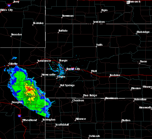 The severe thunderstorm warning for northern niobrara county will expire at 530 pm mdt, the storm which prompted the warning has weakened below severe limits, and no longer pose an immediate threat to life or property. therefore, the warning will be allowed to expire. however small hail is still possible with this thunderstorm. to report severe weather, contact your nearest law enforcement agency. they will relay your report to the national weather service cheyenne. The severe thunderstorm warning for northern niobrara county will expire at 530 pm mdt, the storm which prompted the warning has weakened below severe limits, and no longer pose an immediate threat to life or property. therefore, the warning will be allowed to expire. however small hail is still possible with this thunderstorm. to report severe weather, contact your nearest law enforcement agency. they will relay your report to the national weather service cheyenne.
|
| 9/14/2016 5:10 PM MDT |
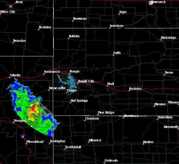 At 510 pm mdt, a severe thunderstorm was located 12 miles north of lance creek, or 32 miles north of lusk, moving northeast at 35 mph (radar indicated). Hazards include 60 mph wind gusts and quarter size hail. Hail damage to vehicles is expected. expect wind damage to roofs, siding, and trees. Locations impacted include, lance creek. At 510 pm mdt, a severe thunderstorm was located 12 miles north of lance creek, or 32 miles north of lusk, moving northeast at 35 mph (radar indicated). Hazards include 60 mph wind gusts and quarter size hail. Hail damage to vehicles is expected. expect wind damage to roofs, siding, and trees. Locations impacted include, lance creek.
|
| 9/14/2016 4:56 PM MDT |
 At 455 pm mdt, a severe thunderstorm was located near lance creek, or 26 miles northwest of lusk, moving northeast at 40 mph (radar indicated). Hazards include 60 mph wind gusts and quarter size hail. Hail damage to vehicles is expected. expect wind damage to roofs, siding, and trees. Locations impacted include, lance creek. At 455 pm mdt, a severe thunderstorm was located near lance creek, or 26 miles northwest of lusk, moving northeast at 40 mph (radar indicated). Hazards include 60 mph wind gusts and quarter size hail. Hail damage to vehicles is expected. expect wind damage to roofs, siding, and trees. Locations impacted include, lance creek.
|
| 9/14/2016 4:42 PM MDT |
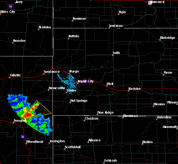 At 441 pm mdt, a severe thunderstorm was located over manning ranch, or 27 miles northwest of lusk, moving northeast at 40 mph (radar indicated). Hazards include 60 mph wind gusts and quarter size hail. Hail damage to vehicles is expected. Expect wind damage to roofs, siding, and trees. At 441 pm mdt, a severe thunderstorm was located over manning ranch, or 27 miles northwest of lusk, moving northeast at 40 mph (radar indicated). Hazards include 60 mph wind gusts and quarter size hail. Hail damage to vehicles is expected. Expect wind damage to roofs, siding, and trees.
|
| 7/27/2016 8:03 PM MDT |
 At 802 pm mdt, a severe thunderstorm capable of producing a tornado was located over manville, or 8 miles west of lusk, moving southeast at 30 mph (radar indicated rotation). Hazards include tornado and baseball size hail. 80 mph winds are also possible. Flying debris will be dangerous to those caught without shelter. mobile homes will be damaged or destroyed. damage to roofs, windows, and vehicles will occur. tree damage is likely. This dangerous storm will be near, lusk around 810 pm mdt. At 802 pm mdt, a severe thunderstorm capable of producing a tornado was located over manville, or 8 miles west of lusk, moving southeast at 30 mph (radar indicated rotation). Hazards include tornado and baseball size hail. 80 mph winds are also possible. Flying debris will be dangerous to those caught without shelter. mobile homes will be damaged or destroyed. damage to roofs, windows, and vehicles will occur. tree damage is likely. This dangerous storm will be near, lusk around 810 pm mdt.
|
| 7/27/2016 7:54 PM MDT |
 At 753 pm mdt, a severe thunderstorm capable of producing a tornado was located over manville, or 10 miles west of lusk, moving south at 35 mph (radar indicated rotation). Hazards include tornado and golf ball size hail. 70-80 mph wind also possible. Flying debris will be dangerous to those caught without shelter. mobile homes will be damaged or destroyed. damage to roofs, windows, and vehicles will occur. tree damage is likely. This tornadic thunderstorm will remain over mainly rural areas of southwestern niobrara county. At 753 pm mdt, a severe thunderstorm capable of producing a tornado was located over manville, or 10 miles west of lusk, moving south at 35 mph (radar indicated rotation). Hazards include tornado and golf ball size hail. 70-80 mph wind also possible. Flying debris will be dangerous to those caught without shelter. mobile homes will be damaged or destroyed. damage to roofs, windows, and vehicles will occur. tree damage is likely. This tornadic thunderstorm will remain over mainly rural areas of southwestern niobrara county.
|
| 7/27/2016 7:42 PM MDT | The severe thunderstorm warning for northeastern converse and west central niobrara counties will expire at 745 pm mdt, the storm which prompted the warning has moved out of the area. therefore the warning will be allowed to expire. however small hail and gusty winds are still possible with this thunderstorm. remember, a tornado warning still remains in effect for the southern portion of niobrara county until 815 pm. |
| 7/27/2016 7:37 PM MDT |
 At 736 pm mdt, a severe thunderstorm capable of producing a tornado was located 7 miles southwest of lance creek, or 17 miles northwest of lusk, moving south at 35 mph (radar indicated rotation). Hazards include tornado and golf ball size hail. 70-80 mph winds also possible. Flying debris will be dangerous to those caught without shelter. mobile homes will be damaged or destroyed. damage to roofs, windows, and vehicles will occur. tree damage is likely. This dangerous storm will be near, manville and keeline around 755 pm mdt. At 736 pm mdt, a severe thunderstorm capable of producing a tornado was located 7 miles southwest of lance creek, or 17 miles northwest of lusk, moving south at 35 mph (radar indicated rotation). Hazards include tornado and golf ball size hail. 70-80 mph winds also possible. Flying debris will be dangerous to those caught without shelter. mobile homes will be damaged or destroyed. damage to roofs, windows, and vehicles will occur. tree damage is likely. This dangerous storm will be near, manville and keeline around 755 pm mdt.
|
| 7/27/2016 7:20 PM MDT |
 At 719 pm mdt, a severe thunderstorm was located 8 miles northwest of lance creek, or 28 miles northwest of lusk, moving southeast at 35 mph (radar indicated). Hazards include golf ball size hail and 70 mph wind gusts. People and animals outdoors will be injured. expect hail damage to roofs, siding, windows, and vehicles. expect considerable tree damage. wind damage is also likely to mobile homes, roofs, and outbuildings. Locations impacted include, lance creek. At 719 pm mdt, a severe thunderstorm was located 8 miles northwest of lance creek, or 28 miles northwest of lusk, moving southeast at 35 mph (radar indicated). Hazards include golf ball size hail and 70 mph wind gusts. People and animals outdoors will be injured. expect hail damage to roofs, siding, windows, and vehicles. expect considerable tree damage. wind damage is also likely to mobile homes, roofs, and outbuildings. Locations impacted include, lance creek.
|
| 7/27/2016 6:59 PM MDT |
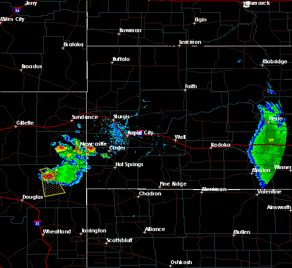 At 659 pm mdt, a severe thunderstorm was located 13 miles southeast of dull center, or 37 miles northwest of lusk, moving south at 40 mph (radar indicated). Hazards include ping pong ball size hail and 60 mph wind gusts. People and animals outdoors will be injured. expect hail damage to roofs, siding, windows, and vehicles. Expect wind damage to roofs, siding, and trees. At 659 pm mdt, a severe thunderstorm was located 13 miles southeast of dull center, or 37 miles northwest of lusk, moving south at 40 mph (radar indicated). Hazards include ping pong ball size hail and 60 mph wind gusts. People and animals outdoors will be injured. expect hail damage to roofs, siding, windows, and vehicles. Expect wind damage to roofs, siding, and trees.
|
| 7/6/2016 7:36 PM MDT |
 At 735 pm mdt, a line of strong to severe thunderstorms were located along a line extending from 19 miles north of bill to near manning ranch, moving northeast at 55 mph (law enforcement report as it moved through douglas). Hazards include 60 to 70 mph wind gusts. Expect tree damage. damage is possible to mobile homes, roofs, and outbuildings. Locations impacted include, dull center, bill, manning ranch and lance creek. At 735 pm mdt, a line of strong to severe thunderstorms were located along a line extending from 19 miles north of bill to near manning ranch, moving northeast at 55 mph (law enforcement report as it moved through douglas). Hazards include 60 to 70 mph wind gusts. Expect tree damage. damage is possible to mobile homes, roofs, and outbuildings. Locations impacted include, dull center, bill, manning ranch and lance creek.
|
| 7/6/2016 7:04 PM MDT |
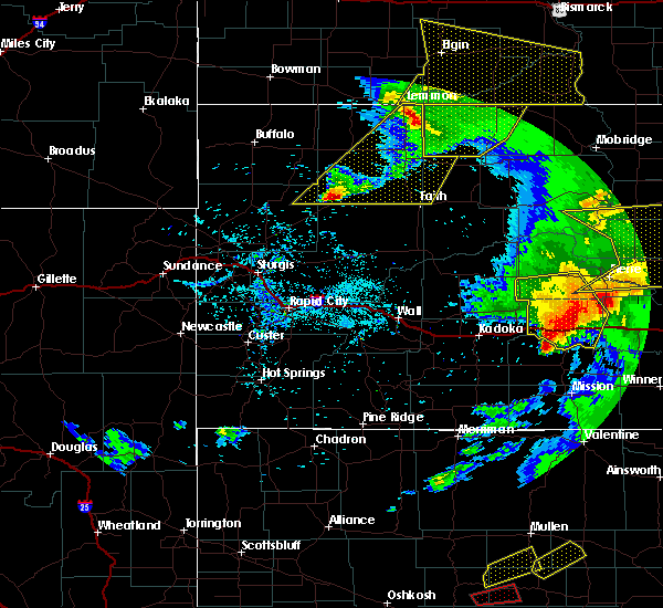 At 702 pm mdt, a line of showers and thunderstorms extended from 15 miles south of pine tree junction to 7 miles southeast of douglas, moving northeast at 60 mph. law enforcement in converse county is reporting 60 to 70 mph winds with these storms (law enforcement). Hazards include 70 mph wind gusts. Expect tree damage. Damage is possible to mobile homes, roofs, and outbuildings. At 702 pm mdt, a line of showers and thunderstorms extended from 15 miles south of pine tree junction to 7 miles southeast of douglas, moving northeast at 60 mph. law enforcement in converse county is reporting 60 to 70 mph winds with these storms (law enforcement). Hazards include 70 mph wind gusts. Expect tree damage. Damage is possible to mobile homes, roofs, and outbuildings.
|
| 7/6/2016 4:01 PM MDT |
 At 400 pm mdt, severe thunderstorms were located along a line extending from near dewey to near redbird to near lusk, moving east at 40 mph (radar indicated). Hazards include 60 mph wind gusts and quarter size hail. at 350 pm mdt...a 60 mph wind gust was reported 2 miles southwest of redbird. Hail damage to vehicles is expected. expect wind damage to roofs, siding, and trees. These severe thunderstorms will remain over mainly rural areas of eastern niobrara county. At 400 pm mdt, severe thunderstorms were located along a line extending from near dewey to near redbird to near lusk, moving east at 40 mph (radar indicated). Hazards include 60 mph wind gusts and quarter size hail. at 350 pm mdt...a 60 mph wind gust was reported 2 miles southwest of redbird. Hail damage to vehicles is expected. expect wind damage to roofs, siding, and trees. These severe thunderstorms will remain over mainly rural areas of eastern niobrara county.
|
| 7/6/2016 3:47 PM MDT |
 At 346 pm mdt, severe thunderstorms were located along a line extending from 8 miles north of mule creek junction to near redbird to near manville, moving east at 40 mph (radar indicated). Hazards include 60 mph wind gusts and quarter size hail. Hail damage to vehicles is expected. expect wind damage to roofs, siding, and trees. severe thunderstorms will be near, redbird around 350 pm mdt. Other locations impacted by these severe thunderstorms include van tassell. At 346 pm mdt, severe thunderstorms were located along a line extending from 8 miles north of mule creek junction to near redbird to near manville, moving east at 40 mph (radar indicated). Hazards include 60 mph wind gusts and quarter size hail. Hail damage to vehicles is expected. expect wind damage to roofs, siding, and trees. severe thunderstorms will be near, redbird around 350 pm mdt. Other locations impacted by these severe thunderstorms include van tassell.
|
| 6/28/2016 4:55 PM MDT |
 At 455 pm mdt, a severe thunderstorm was located near manning ranch, or 28 miles northwest of lusk, moving southeast at 45 mph (trained weather spotters). Hazards include 60 mph wind gusts and penny size hail. Expect damage to roofs. siding. and trees. This severe thunderstorm will remain over mainly rural areas of east central converse and west central niobrara counties, including the following locations: lost springs. At 455 pm mdt, a severe thunderstorm was located near manning ranch, or 28 miles northwest of lusk, moving southeast at 45 mph (trained weather spotters). Hazards include 60 mph wind gusts and penny size hail. Expect damage to roofs. siding. and trees. This severe thunderstorm will remain over mainly rural areas of east central converse and west central niobrara counties, including the following locations: lost springs.
|
| 6/28/2016 4:34 PM MDT |
 At 433 pm mdt, a severe thunderstorm was located near bill, or 31 miles north of douglas, moving southeast at 25 mph (trained weather spotters). Hazards include 60 mph wind gusts and quarter size hail. Hail damage to vehicles is expected. expect wind damage to roofs, siding, and trees. this severe thunderstorm will be near, manning ranch around 515 pm mdt. Other locations impacted by this severe thunderstorm include lost springs. At 433 pm mdt, a severe thunderstorm was located near bill, or 31 miles north of douglas, moving southeast at 25 mph (trained weather spotters). Hazards include 60 mph wind gusts and quarter size hail. Hail damage to vehicles is expected. expect wind damage to roofs, siding, and trees. this severe thunderstorm will be near, manning ranch around 515 pm mdt. Other locations impacted by this severe thunderstorm include lost springs.
|
| 6/12/2016 5:08 PM MDT |
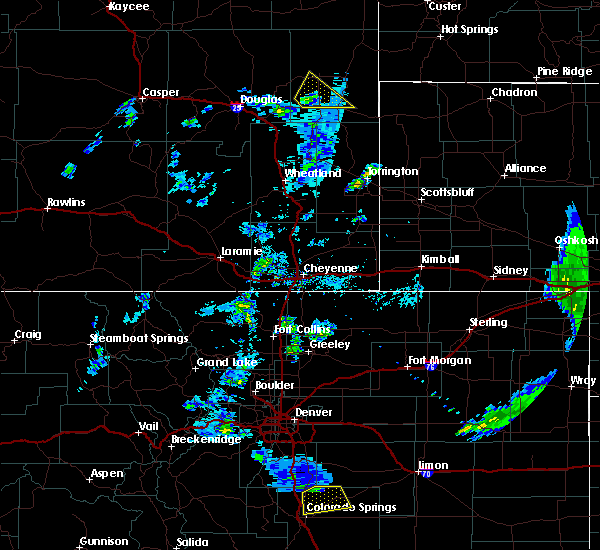 At 508 pm mdt, a severe thunderstorm was located near keeline, or 16 miles west of lusk, moving northeast at 20 mph (radar indicated). Hazards include 60 mph wind gusts and quarter size hail. Hail damage to vehicles is expected. expect wind damage to roofs, siding, and trees. Locations impacted include, lusk, manville, lance creek and keeline. At 508 pm mdt, a severe thunderstorm was located near keeline, or 16 miles west of lusk, moving northeast at 20 mph (radar indicated). Hazards include 60 mph wind gusts and quarter size hail. Hail damage to vehicles is expected. expect wind damage to roofs, siding, and trees. Locations impacted include, lusk, manville, lance creek and keeline.
|
| 6/12/2016 4:53 PM MDT |
 At 453 pm mdt, a severe thunderstorm was located near keeline, or 18 miles west of lusk, moving northeast at 25 mph (radar indicated). Hazards include 60 mph wind gusts and quarter size hail. Hail damage to vehicles is expected. Expect wind damage to roofs, siding, and trees. At 453 pm mdt, a severe thunderstorm was located near keeline, or 18 miles west of lusk, moving northeast at 25 mph (radar indicated). Hazards include 60 mph wind gusts and quarter size hail. Hail damage to vehicles is expected. Expect wind damage to roofs, siding, and trees.
|
| 7/15/2015 8:11 PM MDT |
 The severe thunderstorm warning for northwestern niobrara and northeastern converse counties will expire at 815 pm mdt, the line of storms which prompted the warning have weakened below severe limits, and no longer pose an immediate threat to life or property. therefore the warning will be allowed to expire. The severe thunderstorm warning for northwestern niobrara and northeastern converse counties will expire at 815 pm mdt, the line of storms which prompted the warning have weakened below severe limits, and no longer pose an immediate threat to life or property. therefore the warning will be allowed to expire.
|
| 7/15/2015 7:52 PM MDT |
 At 752 pm mdt, severe thunderstorms were located along a line extending from 13 miles north of manning ranch to near manville, moving east at 35 mph (radar indicated). Hazards include quarter size hail and 60 mph wind gusts. Hail damage to vehicles is expected. expect wind damage to roofs, siding and trees. Locations impacted include, dull center and lance creek. At 752 pm mdt, severe thunderstorms were located along a line extending from 13 miles north of manning ranch to near manville, moving east at 35 mph (radar indicated). Hazards include quarter size hail and 60 mph wind gusts. Hail damage to vehicles is expected. expect wind damage to roofs, siding and trees. Locations impacted include, dull center and lance creek.
|
| 7/15/2015 7:35 PM MDT |
 At 734 pm mdt, severe thunderstorms were located along a line extending from 9 miles east of bill to 8 miles southeast of manning ranch, moving east at 35 mph (radar indicated). Hazards include quarter size hail and 60 mph wind gusts. Hail damage to vehicles is expected. expect wind damage to roofs, siding and trees. Locations impacted include, dull center, manning ranch and lance creek. At 734 pm mdt, severe thunderstorms were located along a line extending from 9 miles east of bill to 8 miles southeast of manning ranch, moving east at 35 mph (radar indicated). Hazards include quarter size hail and 60 mph wind gusts. Hail damage to vehicles is expected. expect wind damage to roofs, siding and trees. Locations impacted include, dull center, manning ranch and lance creek.
|
| 7/15/2015 7:17 PM MDT |
 At 717 pm mdt, severe thunderstorms were located along a line extending from bill to 9 miles south of manning ranch, moving east at 35 mph (radar indicated). Hazards include quarter size hail and 60 mph wind gusts. Hail damage to vehicles is expected. Expect wind damage to roofs, siding and trees. At 717 pm mdt, severe thunderstorms were located along a line extending from bill to 9 miles south of manning ranch, moving east at 35 mph (radar indicated). Hazards include quarter size hail and 60 mph wind gusts. Hail damage to vehicles is expected. Expect wind damage to roofs, siding and trees.
|
| 7/1/2015 10:24 PM MDT |
 At 1024 pm mdt, severe thunderstorms were located along a line extending from 7 miles north of morrisey to 17 miles west of rochelle, moving southeast at 70 mph (radar indicated). Hazards include ping pong size hail and 60 mph wind gusts. People and animals outdoors will be injured. expect hail damage to roofs, siding, windows and vehicles. Expect wind damage to roofs, siding and trees. At 1024 pm mdt, severe thunderstorms were located along a line extending from 7 miles north of morrisey to 17 miles west of rochelle, moving southeast at 70 mph (radar indicated). Hazards include ping pong size hail and 60 mph wind gusts. People and animals outdoors will be injured. expect hail damage to roofs, siding, windows and vehicles. Expect wind damage to roofs, siding and trees.
|
| 7/1/2015 10:01 PM MDT |
 At 1000 pm mdt, a severe thunderstorm was located 9 miles north of lusk, moving east at 35 mph (radar indicated). Hazards include ping pong ball size hail and 70 mph wind gusts. People and animals outdoors will be injured. expect hail damage to roofs, siding, windows and vehicles. expect considerable tree damage. wind damage is also likely to mobile homes, roofs and outbuildings. Locations impacted include, lusk, manville and lance creek. At 1000 pm mdt, a severe thunderstorm was located 9 miles north of lusk, moving east at 35 mph (radar indicated). Hazards include ping pong ball size hail and 70 mph wind gusts. People and animals outdoors will be injured. expect hail damage to roofs, siding, windows and vehicles. expect considerable tree damage. wind damage is also likely to mobile homes, roofs and outbuildings. Locations impacted include, lusk, manville and lance creek.
|
| 7/1/2015 9:43 PM MDT |
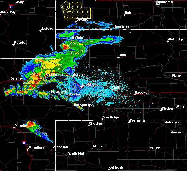 At 943 pm mdt, a severe thunderstorm was located 9 miles northwest of manville, or 16 miles northwest of lusk, moving east at 35 mph (radar indicated). Hazards include quarter size hail and 60 mph wind gusts. Hail damage to vehicles is expected. Expect wind damage to roofs, siding and trees. At 943 pm mdt, a severe thunderstorm was located 9 miles northwest of manville, or 16 miles northwest of lusk, moving east at 35 mph (radar indicated). Hazards include quarter size hail and 60 mph wind gusts. Hail damage to vehicles is expected. Expect wind damage to roofs, siding and trees.
|
| 6/3/2015 10:59 PM MDT | At 1058 pm mdt, severe thunderstorms were located along a line extending from 12 miles east of lance creek to near manville to near keeline to 13 miles northeast of glendo, moving northeast at 10 mph (radar indicated. these storms have a history of producing very large and destructive hail). Hazards include golf ball size hail. People and animals outdoors will be injured. Expect damage to roofs, siding, windows and vehicles. |
| 6/3/2015 10:50 PM MDT | At 1049 pm mdt, severe thunderstorms were located along a line extending from 11 miles southwest of keeline to manville to 11 miles north of lusk, moving northeast at 10 mph (radar indicated. this storm has a history of producing golf ball sized hail). Hazards include golf ball size hail. People and animals outdoors will be injured. expect damage to roofs, siding, windows and vehicles. Locations impacted include, lusk, manville, keeline, lance creek and lost springs. |
| 6/3/2015 10:36 PM MDT | At 1035 pm mdt, severe thunderstorms were located along a line extending from near glendo to manville to 10 miles east of lance creek, moving northeast at 15 mph (public. golf ball sized hail has been reported near manville with this storm). Hazards include two inch hail. People and animals outdoors will be injured. expect damage to roofs, siding, windows and vehicles. locations impacted include, lusk, manville, keeline, lance creek and lost springs. This includes interstate 25 in wyoming between mile markers 113 and 118. |
| 6/3/2015 10:16 PM MDT | At 1015 pm mdt, a cluster of severe thunderstorms extended from near glendo to lance creek. the strongest storm was located over manville, or 8 miles west of lusk. the storms were moving to the northeast at 10 mph (radar indicated). Hazards include golf ball size hail and 60 mph wind gusts. People and animals outdoors will be injured. expect hail damage to roofs, siding, windows and vehicles. Expect wind damage to roofs, siding and trees. |
| 6/3/2015 9:58 PM MDT | At 958 pm mdt, a severe thunderstorm was located over manville, or 9 miles west of lusk, moving north at 20 mph (radar indicated). Hazards include tennis ball size hail and 60 mph wind gusts. People and animals outdoors will be injured. expect hail damage to roofs, siding, windows and vehicles. expect wind damage to roofs, siding and trees. Locations impacted include, lusk, manville, manning ranch, keeline, lance creek and lost springs. |
| 6/3/2015 9:34 PM MDT | At 933 pm mdt, a severe thunderstorm was located near keeline, or 13 miles southwest of lusk, moving northeast at 20 mph (radar indicated. this storm has a history of producing hail in excess of two inches in diameter). Hazards include tennis ball size hail and 60 mph wind gusts. People and animals outdoors will be injured. expect hail damage to roofs, siding, windows and vehicles. Expect wind damage to roofs, siding and trees. |
| 7/22/2013 9:34 PM MDT | Brief very strong wind gusts reported by trained spotter in niobrara county WY, 15.1 miles WSW of Lance Creek, WY |
| 6/22/2012 6:45 PM MDT | Tennis Ball sized hail reported 32.2 miles SW of Lance Creek, WY, broken windows and damage to vehicles |
| 1/1/0001 12:00 AM | Very heavy rain with dime sized hail. winds of 50 to 60 mp in niobrara county WY, 10.4 miles S of Lance Creek, WY |
| 1/1/0001 12:00 AM | Accompanied by pea sized hai in niobrara county WY, 10.3 miles WSW of Lance Creek, WY |
Hail Maps for Lance Creek, WY


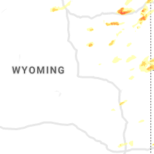


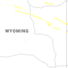


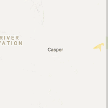


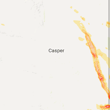


Connect with Interactive Hail Maps