

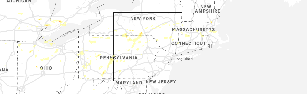
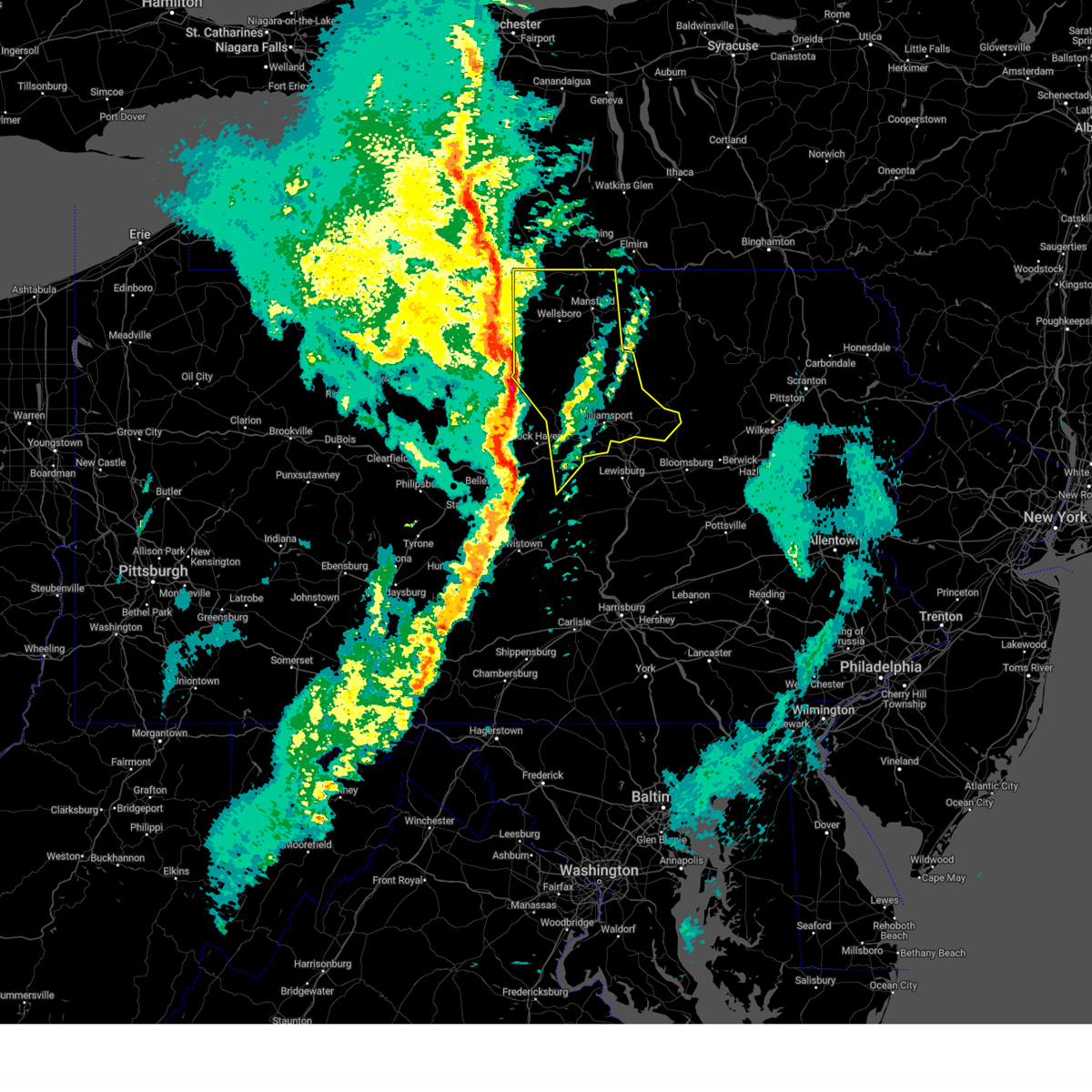
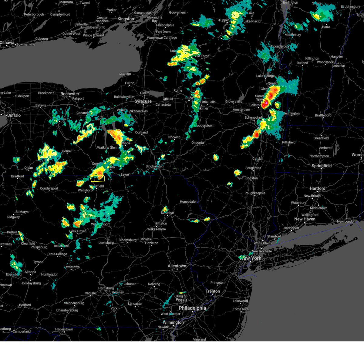
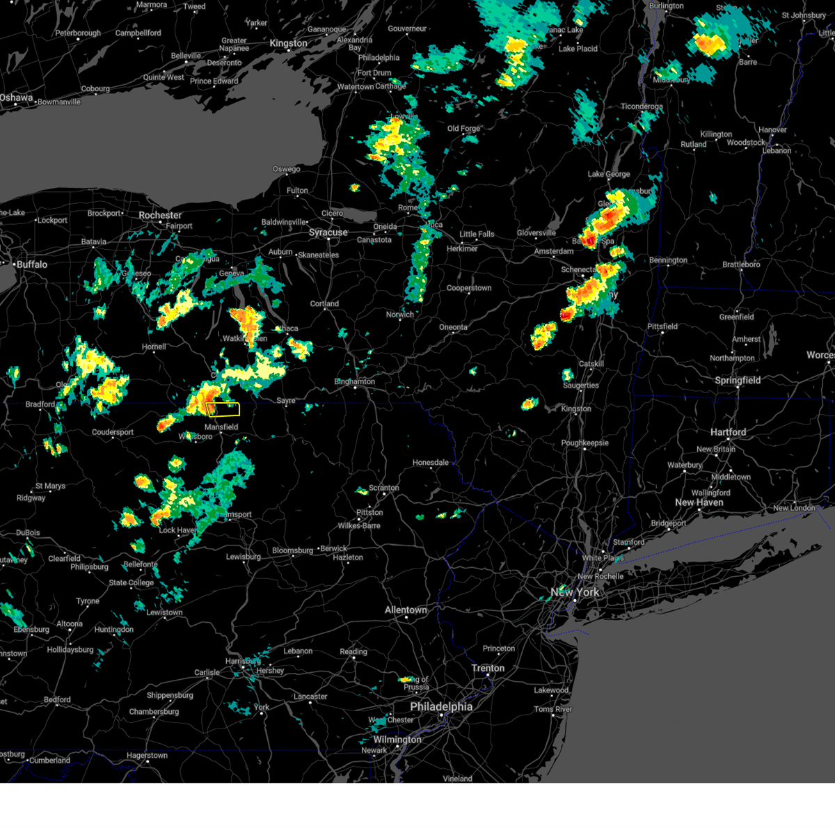
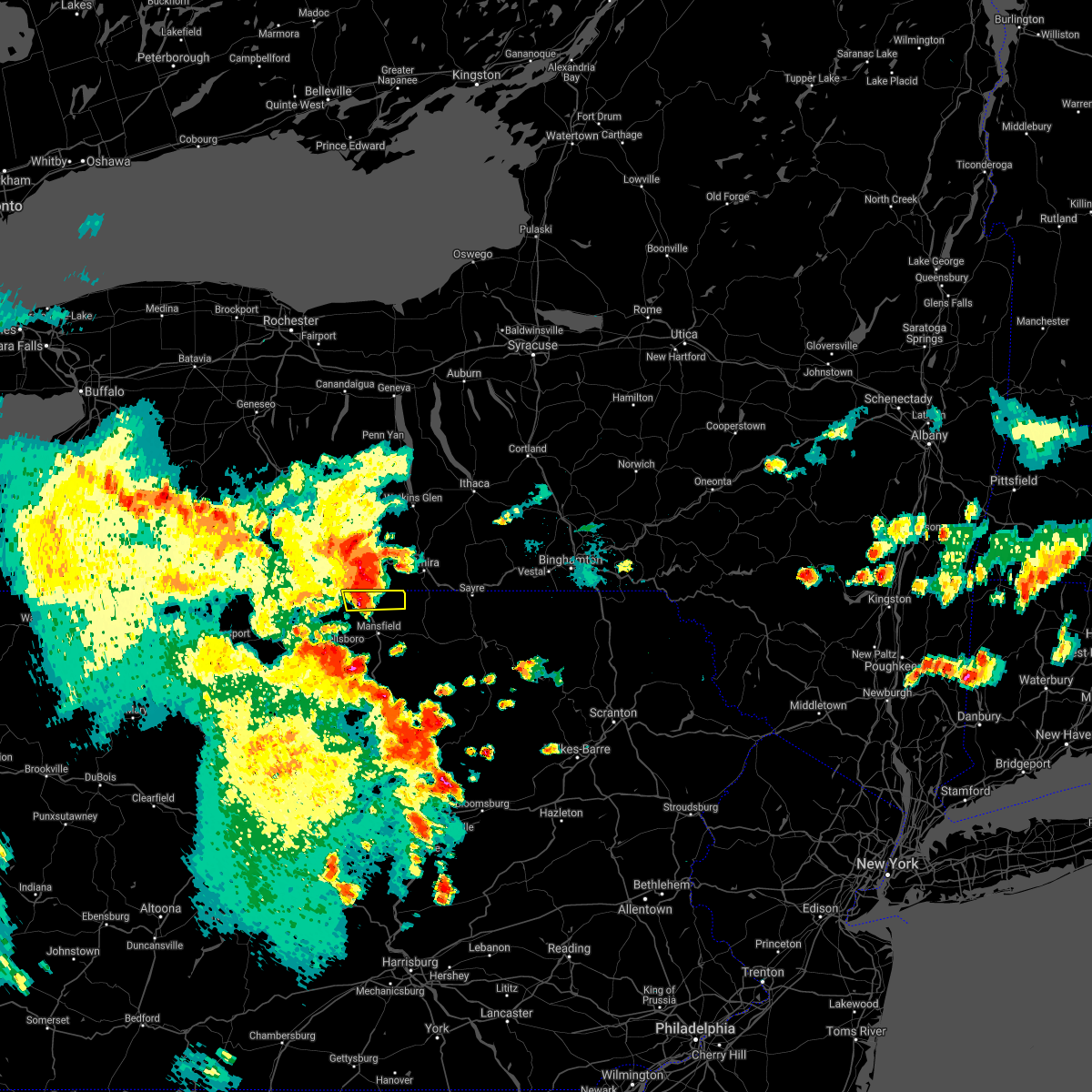
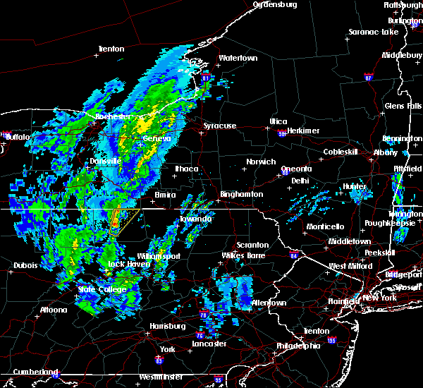
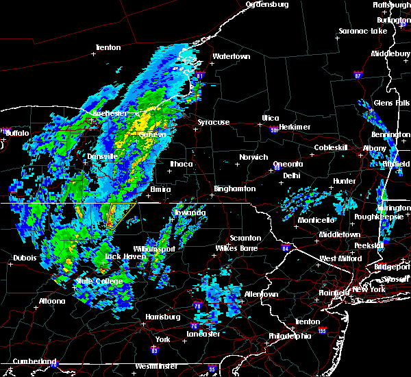
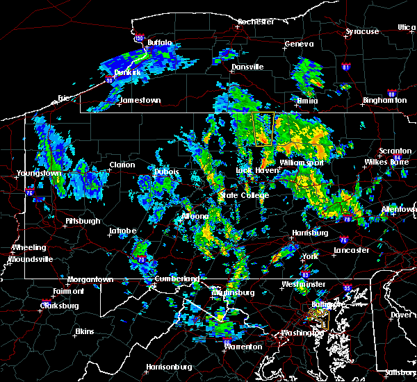
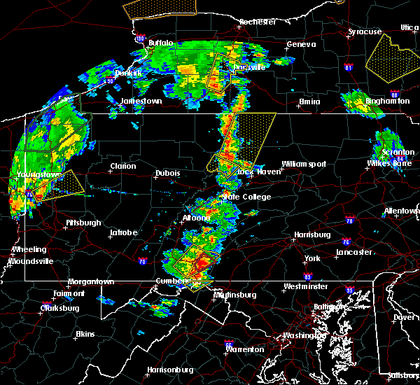
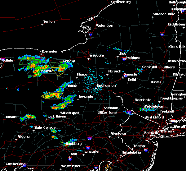
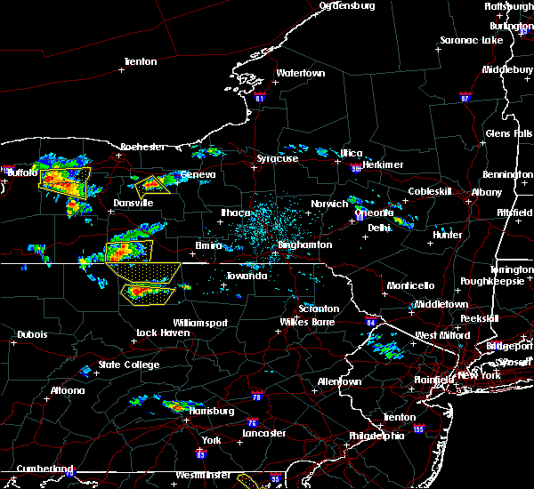
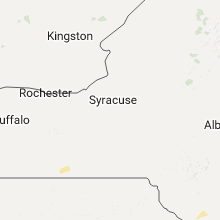
Hail Map for Lawrenceville, PA
The Lawrenceville, PA area has had 0 reports of on-the-ground hail by trained spotters, and has been under severe weather warnings 11 times during the past 12 months. Doppler radar has detected hail at or near Lawrenceville, PA on 20 occasions.
| Name: | Lawrenceville, PA |
| Where Located: | 85.9 miles WNW of Scranton, PA |
| Map: | Google Map for Lawrenceville, PA |
| Population: | 581 |
| Housing Units: | 264 |
| More Info: | Search Google for Lawrenceville, PA |
5
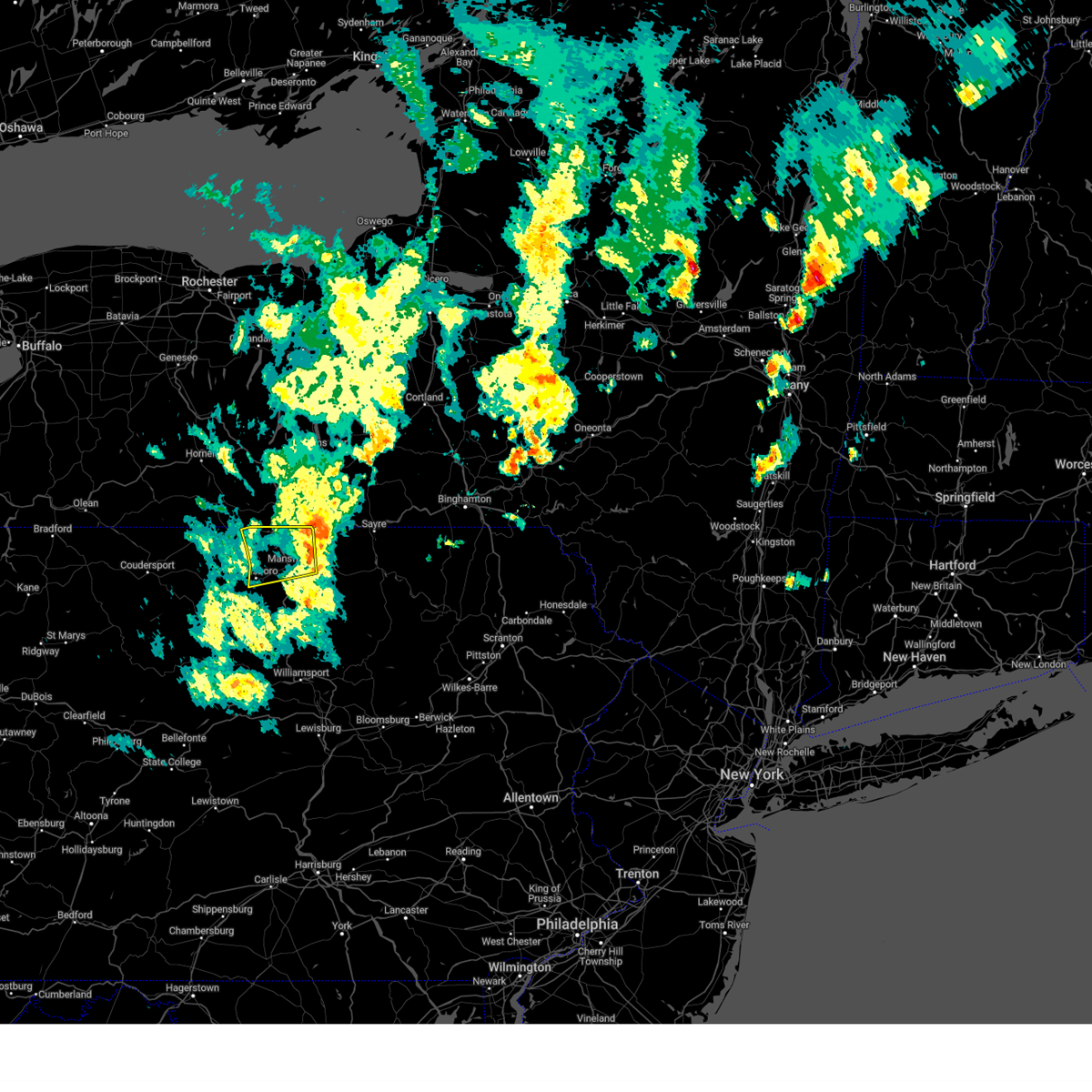
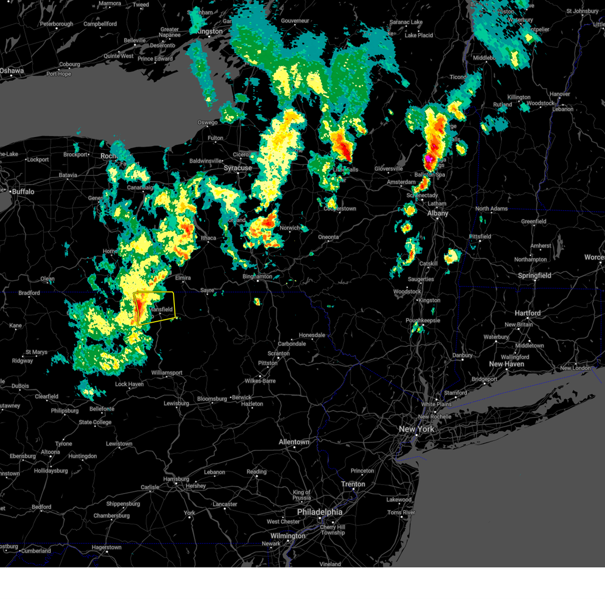
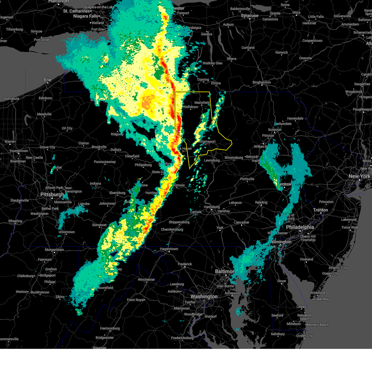
The Top Recent Hail Date for Lawrenceville, PA is Wednesday, July 7, 2021 (4th out of 20)
Hail and Wind Damage Spotted near Lawrenceville, PA
| Date / Time | Report Details |
|---|---|
| 5/17/2025 5:04 PM EDT |
 the severe thunderstorm warning has been cancelled and is no longer in effect the severe thunderstorm warning has been cancelled and is no longer in effect
|
| 5/17/2025 4:26 PM EDT |
 Svrctp the national weather service in state college pa has issued a * severe thunderstorm warning for, northeastern tioga county in north central pennsylvania, * until 515 pm edt. * at 425 pm edt, severe thunderstorms were located along a line extending from elkland to keeneyville to near mansfield to wellsboro, moving east at 45 mph (radar indicated). Hazards include 60 mph wind gusts. Expect damage to roofs, siding, and trees. severe thunderstorms will be near, wellsboro, mansfield, and lawrenceville around 430 pm edt. millerton around 440 pm edt. Other locations impacted by these severe thunderstorms include osceola, tioga, tioga junction, roseville, and mansfield university. Svrctp the national weather service in state college pa has issued a * severe thunderstorm warning for, northeastern tioga county in north central pennsylvania, * until 515 pm edt. * at 425 pm edt, severe thunderstorms were located along a line extending from elkland to keeneyville to near mansfield to wellsboro, moving east at 45 mph (radar indicated). Hazards include 60 mph wind gusts. Expect damage to roofs, siding, and trees. severe thunderstorms will be near, wellsboro, mansfield, and lawrenceville around 430 pm edt. millerton around 440 pm edt. Other locations impacted by these severe thunderstorms include osceola, tioga, tioga junction, roseville, and mansfield university.
|
| 4/29/2025 7:12 PM EDT |
 Svrctp the national weather service in state college pa has issued a * severe thunderstorm warning for, central tioga county in north central pennsylvania, * until 745 pm edt. * at 711 pm edt, severe thunderstorms were located along a line extending from elkland to near keeneyville to wellsboro to leetonia, moving east at 65 mph (radar indicated). Hazards include 70 mph wind gusts. Expect considerable tree damage. damage is likely to mobile homes, roofs, and outbuildings. severe thunderstorms will be near, lawrenceville, morris, and covington around 720 pm edt. Other locations impacted by these severe thunderstorms include mansfield university, tioga, tioga junction, and roseville. Svrctp the national weather service in state college pa has issued a * severe thunderstorm warning for, central tioga county in north central pennsylvania, * until 745 pm edt. * at 711 pm edt, severe thunderstorms were located along a line extending from elkland to near keeneyville to wellsboro to leetonia, moving east at 65 mph (radar indicated). Hazards include 70 mph wind gusts. Expect considerable tree damage. damage is likely to mobile homes, roofs, and outbuildings. severe thunderstorms will be near, lawrenceville, morris, and covington around 720 pm edt. Other locations impacted by these severe thunderstorms include mansfield university, tioga, tioga junction, and roseville.
|
| 3/16/2025 4:14 PM EDT | The storms which prompted the warning have weakened below severe limits, and have exited the warned area. therefore, the warning will be allowed to expire. however, gusty winds and heavy rain are still possible with these thunderstorms. a tornado watch remains in effect until 700 pm edt for central and north central pennsylvania. to report severe weather, contact your nearest law enforcement agency. they will relay your report to the national weather service state college pa. |
| 3/16/2025 3:20 PM EDT |
 At 320 pm edt, severe thunderstorms were located along a line extending from harrison valley to slate run to madisonburg, moving northeast at 55 mph (trained weather spotters). Hazards include 60 mph wind gusts and penny size hail. Expect damage to roofs, siding, and trees. locations impacted include, elkland, tioga, mcelhattan, montoursville, lairdsville, wellsboro, williamsport airport, leonard harrison state park, covington, ralston, osceola, and cedar run. for those driving on interstate 80, this includes areas between the lock haven and mile run exits, specifically from mile markers 183 to 195. This includes interstate 180 from mile markers 9 to 29. At 320 pm edt, severe thunderstorms were located along a line extending from harrison valley to slate run to madisonburg, moving northeast at 55 mph (trained weather spotters). Hazards include 60 mph wind gusts and penny size hail. Expect damage to roofs, siding, and trees. locations impacted include, elkland, tioga, mcelhattan, montoursville, lairdsville, wellsboro, williamsport airport, leonard harrison state park, covington, ralston, osceola, and cedar run. for those driving on interstate 80, this includes areas between the lock haven and mile run exits, specifically from mile markers 183 to 195. This includes interstate 180 from mile markers 9 to 29.
|
| 3/16/2025 3:18 PM EDT |
 Svrctp the national weather service in state college pa has issued a * severe thunderstorm warning for, east central centre county in central pennsylvania, eastern clinton county in north central pennsylvania, lycoming county in north central pennsylvania, tioga county in north central pennsylvania, * until 415 pm edt. * at 317 pm edt, severe thunderstorms were located along a line extending from harrison valley to slate run to madisonburg, moving northeast at 55 mph (trained weather spotters). Hazards include 60 mph wind gusts and quarter size hail. Hail damage to vehicles is expected. Expect wind damage to roofs, siding, and trees. Svrctp the national weather service in state college pa has issued a * severe thunderstorm warning for, east central centre county in central pennsylvania, eastern clinton county in north central pennsylvania, lycoming county in north central pennsylvania, tioga county in north central pennsylvania, * until 415 pm edt. * at 317 pm edt, severe thunderstorms were located along a line extending from harrison valley to slate run to madisonburg, moving northeast at 55 mph (trained weather spotters). Hazards include 60 mph wind gusts and quarter size hail. Hail damage to vehicles is expected. Expect wind damage to roofs, siding, and trees.
|
| 7/15/2024 5:27 PM EDT | Multiple reports of trees and wires down in lindley. time estimated from rada in steuben county NY, 3 miles S of Lawrenceville, PA |
| 7/15/2024 5:17 PM EDT | At 517 pm edt, severe thunderstorms were located along a line extending from west cameron to elkland to morris, moving northeast at 50 mph (radar indicated). Hazards include 70 mph wind gusts. Expect considerable tree damage. damage is likely to mobile homes, roofs, and outbuildings. Locations impacted include, mansfield, wellsboro, morris, elkland, blossburg, westfield, covington, arnot, millerton, keeneyville, leonard harrison state park, and tioga. |
| 7/15/2024 5:17 PM EDT | the severe thunderstorm warning has been cancelled and is no longer in effect |
| 7/15/2024 5:09 PM EDT | At 509 pm edt, severe thunderstorms were located along a line extending from greenwood to elkland to near cedar run, moving northeast at 50 mph (radar indicated). Hazards include 60 mph wind gusts. Expect damage to roofs, siding, and trees. Locations impacted include, mansfield, wellsboro, morris, elkland, blossburg, westfield, gaines, covington, arnot, millerton, keeneyville, and leetonia. |
| 7/15/2024 5:09 PM EDT | the severe thunderstorm warning has been cancelled and is no longer in effect |
| 7/15/2024 4:40 PM EDT | Svrctp the national weather service in state college pa has issued a * severe thunderstorm warning for, north central clinton county in north central pennsylvania, northwestern lycoming county in north central pennsylvania, potter county in north central pennsylvania, tioga county in north central pennsylvania, * until 545 pm edt. * at 440 pm edt, severe thunderstorms were located along a line extending from near genesee to denton hill state park to ole bull state park, moving northeast at 50 mph (radar indicated). Hazards include 60 mph wind gusts. expect damage to roofs, siding, and trees |
| 6/23/2024 2:41 PM EDT |
 The storm which prompted the warning has moved out of the area. therefore, the warning will be allowed to expire. The storm which prompted the warning has moved out of the area. therefore, the warning will be allowed to expire.
|
| 6/23/2024 2:31 PM EDT |
 At 230 pm edt, a severe thunderstorm was located over lindley, moving east at 40 mph (law enforcement). Hazards include 60 mph wind gusts. Expect damage to roofs, siding, and trees. Locations impacted include, lawrenceville, millerton, tioga, and tioga junction. At 230 pm edt, a severe thunderstorm was located over lindley, moving east at 40 mph (law enforcement). Hazards include 60 mph wind gusts. Expect damage to roofs, siding, and trees. Locations impacted include, lawrenceville, millerton, tioga, and tioga junction.
|
| 6/23/2024 2:20 PM EDT |
 Svrctp the national weather service in state college pa has issued a * severe thunderstorm warning for, northeastern tioga county in north central pennsylvania, * until 245 pm edt. * at 219 pm edt, a severe thunderstorm was located over elkland, moving east at 40 mph (radar indicated). Hazards include 60 mph wind gusts. expect damage to roofs, siding, and trees Svrctp the national weather service in state college pa has issued a * severe thunderstorm warning for, northeastern tioga county in north central pennsylvania, * until 245 pm edt. * at 219 pm edt, a severe thunderstorm was located over elkland, moving east at 40 mph (radar indicated). Hazards include 60 mph wind gusts. expect damage to roofs, siding, and trees
|
| 5/22/2024 5:37 PM EDT |
 At 536 pm edt, a severe thunderstorm was located over keeneyville, moving northeast at 35 mph (radar indicated). Hazards include 60 mph wind gusts and quarter size hail. Hail damage to vehicles is expected. expect wind damage to roofs, siding, and trees. Locations impacted include, mansfield, wellsboro, morris, elkland, blossburg, westfield, gaines, covington, arnot, millerton, leonard harrison state park, and ralston. At 536 pm edt, a severe thunderstorm was located over keeneyville, moving northeast at 35 mph (radar indicated). Hazards include 60 mph wind gusts and quarter size hail. Hail damage to vehicles is expected. expect wind damage to roofs, siding, and trees. Locations impacted include, mansfield, wellsboro, morris, elkland, blossburg, westfield, gaines, covington, arnot, millerton, leonard harrison state park, and ralston.
|
| 5/22/2024 5:12 PM EDT |
 Svrctp the national weather service in state college pa has issued a * severe thunderstorm warning for, northwestern lycoming county in north central pennsylvania, tioga county in north central pennsylvania, * until 630 pm edt. * at 511 pm edt, a severe thunderstorm was located over leonard harrison state park, moving east at 40 mph (radar indicated). Hazards include 60 mph wind gusts and quarter size hail. Hail damage to vehicles is expected. Expect wind damage to roofs, siding, and trees. Svrctp the national weather service in state college pa has issued a * severe thunderstorm warning for, northwestern lycoming county in north central pennsylvania, tioga county in north central pennsylvania, * until 630 pm edt. * at 511 pm edt, a severe thunderstorm was located over leonard harrison state park, moving east at 40 mph (radar indicated). Hazards include 60 mph wind gusts and quarter size hail. Hail damage to vehicles is expected. Expect wind damage to roofs, siding, and trees.
|
| 4/1/2023 4:22 PM EDT |
 At 421 pm edt, severe thunderstorms were located along a line extending from erin to east smithfield to lincoln falls to loyalsockville, moving east at 65 mph (radar and automated observing system). Hazards include 70 mph wind gusts. Expect considerable tree damage. damage is likely to mobile homes, roofs, and outbuildings. locations impacted include, williamsport, montoursville, mansfield, muncy, elkland, blossburg, duboistown, covington, arnot, millerton, ralston and trout run. this includes interstate 180 from mile markers 14 to 29. thunderstorm damage threat, considerable hail threat, radar indicated max hail size, <. 75 in wind threat, radar indicated max wind gust, 70 mph. At 421 pm edt, severe thunderstorms were located along a line extending from erin to east smithfield to lincoln falls to loyalsockville, moving east at 65 mph (radar and automated observing system). Hazards include 70 mph wind gusts. Expect considerable tree damage. damage is likely to mobile homes, roofs, and outbuildings. locations impacted include, williamsport, montoursville, mansfield, muncy, elkland, blossburg, duboistown, covington, arnot, millerton, ralston and trout run. this includes interstate 180 from mile markers 14 to 29. thunderstorm damage threat, considerable hail threat, radar indicated max hail size, <. 75 in wind threat, radar indicated max wind gust, 70 mph.
|
| 4/1/2023 3:31 PM EDT |
 At 331 pm edt, severe thunderstorms were located along a line extending from greenwood to near galeton to near slate run to near keating, moving east at 65 mph (radar indicated). Hazards include 70 mph wind gusts. Expect considerable tree damage. Damage is likely to mobile homes, roofs, and outbuildings. At 331 pm edt, severe thunderstorms were located along a line extending from greenwood to near galeton to near slate run to near keating, moving east at 65 mph (radar indicated). Hazards include 70 mph wind gusts. Expect considerable tree damage. Damage is likely to mobile homes, roofs, and outbuildings.
|
| 3/7/2022 5:59 PM EST |
 At 559 pm est, severe thunderstorms were located along a line extending from south corning to blanchard to williamsburg, moving east at 50 mph (radar indicated). Hazards include 60 mph wind gusts. expect damage to roofs, siding, and trees At 559 pm est, severe thunderstorms were located along a line extending from south corning to blanchard to williamsburg, moving east at 50 mph (radar indicated). Hazards include 60 mph wind gusts. expect damage to roofs, siding, and trees
|
| 3/7/2022 5:39 PM EST |
 At 538 pm est, severe thunderstorms were located along a line extending from bath to near keating to ogletown, moving northeast at 75 mph (radar indicated). Hazards include 60 mph wind gusts. Expect damage to roofs, siding, and trees. locations impacted include, state college, lock haven, bellefonte, mansfield, wellsboro, philipsburg, renovo, park forest village, boalsburg, wharton, keating, morris, pleasant gap, lamar, stormstown, lemont, zion, elkland, houserville and mill hall. for those driving on interstate 80, this includes areas between the kylertown and lock haven exits, specifically from mile markers 139 to 176. this includes interstate 99 from mile markers 56 to 85. hail threat, radar indicated max hail size, <. 75 in wind threat, radar indicated max wind gust, 60 mph. At 538 pm est, severe thunderstorms were located along a line extending from bath to near keating to ogletown, moving northeast at 75 mph (radar indicated). Hazards include 60 mph wind gusts. Expect damage to roofs, siding, and trees. locations impacted include, state college, lock haven, bellefonte, mansfield, wellsboro, philipsburg, renovo, park forest village, boalsburg, wharton, keating, morris, pleasant gap, lamar, stormstown, lemont, zion, elkland, houserville and mill hall. for those driving on interstate 80, this includes areas between the kylertown and lock haven exits, specifically from mile markers 139 to 176. this includes interstate 99 from mile markers 56 to 85. hail threat, radar indicated max hail size, <. 75 in wind threat, radar indicated max wind gust, 60 mph.
|
| 3/7/2022 5:22 PM EST |
 At 522 pm est, severe thunderstorms were located along a line extending from canisteo to near karthaus to near boswell, moving northeast at 60 mph (radar indicated). Hazards include 60 mph wind gusts. expect damage to roofs, siding, and trees At 522 pm est, severe thunderstorms were located along a line extending from canisteo to near karthaus to near boswell, moving northeast at 60 mph (radar indicated). Hazards include 60 mph wind gusts. expect damage to roofs, siding, and trees
|
| 7/7/2021 8:28 PM EDT |
 At 828 pm edt, a severe thunderstorm was located near lawrenceville, moving east at 25 mph (radar indicated). Hazards include 70 mph wind gusts and half dollar size hail. Hail damage to vehicles is expected. expect considerable tree damage. wind damage is also likely to mobile homes, roofs, and outbuildings. Locations impacted include, elkland, millerton, tioga and tioga junction. At 828 pm edt, a severe thunderstorm was located near lawrenceville, moving east at 25 mph (radar indicated). Hazards include 70 mph wind gusts and half dollar size hail. Hail damage to vehicles is expected. expect considerable tree damage. wind damage is also likely to mobile homes, roofs, and outbuildings. Locations impacted include, elkland, millerton, tioga and tioga junction.
|
| 7/7/2021 8:04 PM EDT |
 At 804 pm edt, a severe thunderstorm was located near elkland, moving east at 20 mph (radar indicated). Hazards include 60 mph wind gusts and quarter size hail. Hail damage to vehicles is expected. Expect wind damage to roofs, siding, and trees. At 804 pm edt, a severe thunderstorm was located near elkland, moving east at 20 mph (radar indicated). Hazards include 60 mph wind gusts and quarter size hail. Hail damage to vehicles is expected. Expect wind damage to roofs, siding, and trees.
|
| 8/27/2020 6:19 PM EDT |
 At 618 pm edt, severe thunderstorms were located along a line extending from near keeneyville to near ole bull state park, moving east at 60 mph (radar indicated). Hazards include 60 mph wind gusts. Expect damage to trees, roofs, and siding. these severe storms will be near, keeneyville and elkland around 620 pm edt. mansfield around 630 pm edt. Other locations impacted by these severe thunderstorms include knoxville, osceola, tioga, tioga junction, roseville and mansfield university. At 618 pm edt, severe thunderstorms were located along a line extending from near keeneyville to near ole bull state park, moving east at 60 mph (radar indicated). Hazards include 60 mph wind gusts. Expect damage to trees, roofs, and siding. these severe storms will be near, keeneyville and elkland around 620 pm edt. mansfield around 630 pm edt. Other locations impacted by these severe thunderstorms include knoxville, osceola, tioga, tioga junction, roseville and mansfield university.
|
| 8/27/2020 5:58 PM EDT |
 At 558 pm edt, severe thunderstorms were located along a line extending from harrison valley to wharton, moving east at 50 mph (radar indicated). Hazards include 70 mph wind gusts. Expect considerable tree damage. damage is likely to mobile homes, roofs, and outbuildings. severe thunderstorms will be near, westfield around 610 pm edt. wellsboro and keeneyville around 620 pm edt. mansfield, covington and blossburg around 640 pm edt. Other locations impacted by these severe thunderstorms include knoxville, osceola, tioga, tioga junction, roseville and mansfield university. At 558 pm edt, severe thunderstorms were located along a line extending from harrison valley to wharton, moving east at 50 mph (radar indicated). Hazards include 70 mph wind gusts. Expect considerable tree damage. damage is likely to mobile homes, roofs, and outbuildings. severe thunderstorms will be near, westfield around 610 pm edt. wellsboro and keeneyville around 620 pm edt. mansfield, covington and blossburg around 640 pm edt. Other locations impacted by these severe thunderstorms include knoxville, osceola, tioga, tioga junction, roseville and mansfield university.
|
| 5/15/2020 7:49 PM EDT |
 At 749 pm edt, a severe thunderstorm was located over harrison valley, moving east at 60 mph (radar indicated). Hazards include 60 mph wind gusts. Expect damage to trees, roofs, and siding. this severe thunderstorm will be near, westfield around 800 pm edt. keeneyville and elkland around 810 pm edt. mansfield around 820 pm edt. millerton around 830 pm edt. Other locations impacted by this severe thunderstorm include knoxville, osceola, tioga, roseville, tioga junction, mansfield university and ulysses. At 749 pm edt, a severe thunderstorm was located over harrison valley, moving east at 60 mph (radar indicated). Hazards include 60 mph wind gusts. Expect damage to trees, roofs, and siding. this severe thunderstorm will be near, westfield around 800 pm edt. keeneyville and elkland around 810 pm edt. mansfield around 820 pm edt. millerton around 830 pm edt. Other locations impacted by this severe thunderstorm include knoxville, osceola, tioga, roseville, tioga junction, mansfield university and ulysses.
|
| 8/18/2019 2:54 PM EDT |
 A severe thunderstorm warning remains in effect until 330 pm edt for tioga county. at 252 pm edt, severe thunderstorms were located along a line extending from near millerton to near morris, moving east at 35 mph. hazard. 60 mph wind gusts and quarter size hail. source. Radar indicated. A severe thunderstorm warning remains in effect until 330 pm edt for tioga county. at 252 pm edt, severe thunderstorms were located along a line extending from near millerton to near morris, moving east at 35 mph. hazard. 60 mph wind gusts and quarter size hail. source. Radar indicated.
|
| 8/18/2019 2:43 PM EDT | Multiple trees and wires down in lawrence township in tioga county PA, 1.8 miles N of Lawrenceville, PA |
| 8/18/2019 2:09 PM EDT |
 The national weather service in state college pa has issued a * severe thunderstorm warning for. tioga county in north central pennsylvania. until 330 pm edt. At 209 pm edt, severe thunderstorms were located along a line extending from near woodhull to near ole bull state park, moving. The national weather service in state college pa has issued a * severe thunderstorm warning for. tioga county in north central pennsylvania. until 330 pm edt. At 209 pm edt, severe thunderstorms were located along a line extending from near woodhull to near ole bull state park, moving.
|
| 8/15/2019 6:41 PM EDT | Large tree down on marsh roa in steuben county NY, 5.8 miles WSW of Lawrenceville, PA |
| 7/30/2019 3:06 PM EDT | Tree down on a parked ca in steuben county NY, 3 miles S of Lawrenceville, PA |
| 4/14/2019 11:46 PM EDT |
 At 1145 pm edt, severe thunderstorms were located along a line extending from near woodhull to 6 miles north of hyner, moving east at 35 mph (radar indicated). Hazards include 60 mph wind gusts. expect damage to roofs, siding, and trees At 1145 pm edt, severe thunderstorms were located along a line extending from near woodhull to 6 miles north of hyner, moving east at 35 mph (radar indicated). Hazards include 60 mph wind gusts. expect damage to roofs, siding, and trees
|
| 4/14/2019 10:50 PM EDT |
 At 1049 pm edt, a severe thunderstorm was located near denton hill state park, moving east at 35 mph (radar indicated). Hazards include 60 mph wind gusts and penny size hail. expect damage to roofs, siding, and trees At 1049 pm edt, a severe thunderstorm was located near denton hill state park, moving east at 35 mph (radar indicated). Hazards include 60 mph wind gusts and penny size hail. expect damage to roofs, siding, and trees
|
| 12/21/2018 4:28 PM EST |
 At 427 pm est, a severe thunderstorm was located over wellsboro, moving north at 30 mph (radar indicated). Hazards include 60 mph wind gusts. Expect damage to roofs, siding, and trees. Locations impacted include, wellsboro, elkland, keeneyville, tioga and tioga junction. At 427 pm est, a severe thunderstorm was located over wellsboro, moving north at 30 mph (radar indicated). Hazards include 60 mph wind gusts. Expect damage to roofs, siding, and trees. Locations impacted include, wellsboro, elkland, keeneyville, tioga and tioga junction.
|
| 12/21/2018 4:15 PM EST |
 At 415 pm est, a severe thunderstorm was located near leonard harrison state park, moving north at 30 mph (radar indicated). Hazards include 60 mph wind gusts. expect damage to roofs, siding, and trees At 415 pm est, a severe thunderstorm was located near leonard harrison state park, moving north at 30 mph (radar indicated). Hazards include 60 mph wind gusts. expect damage to roofs, siding, and trees
|
| 9/21/2018 9:23 PM EDT |
 A severe thunderstorm warning remains in effect until 945 pm edt for northwestern lycoming. southeastern potter and central tioga counties. At 922 pm edt, severe thunderstorms were located along a line extending from millerton to near mansfield to near leonard harrison state park to near slate run, moving east at 40 mph. A severe thunderstorm warning remains in effect until 945 pm edt for northwestern lycoming. southeastern potter and central tioga counties. At 922 pm edt, severe thunderstorms were located along a line extending from millerton to near mansfield to near leonard harrison state park to near slate run, moving east at 40 mph.
|
| 9/21/2018 8:58 PM EDT |
 At 856 pm edt, severe thunderstorms were located along a line extending from elkland to near westfield to near cherry springs state park to near wharton, moving east at 40 mph (radar indicated). Hazards include 60 mph wind gusts. expect damage to roofs, siding, and trees At 856 pm edt, severe thunderstorms were located along a line extending from elkland to near westfield to near cherry springs state park to near wharton, moving east at 40 mph (radar indicated). Hazards include 60 mph wind gusts. expect damage to roofs, siding, and trees
|
| 7/23/2018 2:18 PM EDT |
 At 217 pm edt, a severe thunderstorm was located near morris, moving north at 35 mph (radar indicated). Hazards include 60 mph wind gusts. Expect damage to roofs, siding, and trees. this severe thunderstorm will be near, morris around 220 pm edt. arnot around 230 pm edt. wellsboro around 240 pm edt. keeneyville around 250 pm edt. Other locations impacted by this severe thunderstorm include tioga, osceola and tioga junction. At 217 pm edt, a severe thunderstorm was located near morris, moving north at 35 mph (radar indicated). Hazards include 60 mph wind gusts. Expect damage to roofs, siding, and trees. this severe thunderstorm will be near, morris around 220 pm edt. arnot around 230 pm edt. wellsboro around 240 pm edt. keeneyville around 250 pm edt. Other locations impacted by this severe thunderstorm include tioga, osceola and tioga junction.
|
| 7/16/2018 10:38 PM EDT |
 The severe thunderstorm warning for eastern tioga county will expire at 1045 pm edt, the storms which prompted the warning have moved east and out of the warned area. therefore, the warning will be allowed to expire. The severe thunderstorm warning for eastern tioga county will expire at 1045 pm edt, the storms which prompted the warning have moved east and out of the warned area. therefore, the warning will be allowed to expire.
|
| 7/16/2018 10:04 PM EDT |
 At 1004 pm edt, severe thunderstorms were located along a line extending from lindley to near mansfield to ogdensburg, moving northeast at 30 mph (radar indicated). Hazards include 60 mph wind gusts and quarter size hail. Hail damage to vehicles is expected. Expect wind damage to roofs, siding, and trees. At 1004 pm edt, severe thunderstorms were located along a line extending from lindley to near mansfield to ogdensburg, moving northeast at 30 mph (radar indicated). Hazards include 60 mph wind gusts and quarter size hail. Hail damage to vehicles is expected. Expect wind damage to roofs, siding, and trees.
|
| 6/13/2018 7:31 PM EDT |
 At 731 pm edt, severe thunderstorms were located along a line extending from near millerton to near galeton, moving east at 45 mph (radar indicated). Hazards include 60 mph wind gusts and quarter size hail. Hail damage to vehicles is expected. Expect wind damage to roofs, siding, and trees. At 731 pm edt, severe thunderstorms were located along a line extending from near millerton to near galeton, moving east at 45 mph (radar indicated). Hazards include 60 mph wind gusts and quarter size hail. Hail damage to vehicles is expected. Expect wind damage to roofs, siding, and trees.
|
| 6/13/2018 7:22 PM EDT | Trees down near lawrenceville in tioga county PA, 0.3 miles SSE of Lawrenceville, PA |
| 5/15/2018 1:14 PM EDT |
 At 114 pm edt, severe thunderstorms were located along a line extending from near lawrenceville to near keeneyville to near leetonia, moving east at 45 mph (radar indicated). Hazards include 60 mph wind gusts and nickel size hail. expect damage to trees and power lines At 114 pm edt, severe thunderstorms were located along a line extending from near lawrenceville to near keeneyville to near leetonia, moving east at 45 mph (radar indicated). Hazards include 60 mph wind gusts and nickel size hail. expect damage to trees and power lines
|
| 5/4/2018 7:08 PM EDT |
 The severe thunderstorm warning for tioga county will expire at 715 pm edt, the storms which prompted the warning have moved out of the area. therefore the warning will be allowed to expire. a severe thunderstorm watch remains in effect until 900 pm edt for north central pennsylvania. The severe thunderstorm warning for tioga county will expire at 715 pm edt, the storms which prompted the warning have moved out of the area. therefore the warning will be allowed to expire. a severe thunderstorm watch remains in effect until 900 pm edt for north central pennsylvania.
|
| 5/4/2018 5:54 PM EDT |
 At 553 pm edt, severe thunderstorms were located along a line extending from near troupsburg to near sizerville, moving east at 50 mph (radar indicated). Hazards include 70 mph wind gusts. Expect considerable tree damage. Damage is likely to mobile homes, roofs, and outbuildings. At 553 pm edt, severe thunderstorms were located along a line extending from near troupsburg to near sizerville, moving east at 50 mph (radar indicated). Hazards include 70 mph wind gusts. Expect considerable tree damage. Damage is likely to mobile homes, roofs, and outbuildings.
|
| 8/22/2017 6:52 PM EDT |
 At 652 pm edt, severe thunderstorms were located along a line extending from near lawrenceville to near covington to near morris, moving east at 30 mph (radar indicated). Hazards include 60 mph wind gusts. Expect damage to trees and power lines. locations impacted include, mansfield, blossburg, lawrenceville, arnot, covington, millerton, tioga, roseville, liberty and tioga junction. A tornado watch remains in effect until 900 pm edt for north central pennsylvania. At 652 pm edt, severe thunderstorms were located along a line extending from near lawrenceville to near covington to near morris, moving east at 30 mph (radar indicated). Hazards include 60 mph wind gusts. Expect damage to trees and power lines. locations impacted include, mansfield, blossburg, lawrenceville, arnot, covington, millerton, tioga, roseville, liberty and tioga junction. A tornado watch remains in effect until 900 pm edt for north central pennsylvania.
|
| 8/22/2017 6:40 PM EDT |
 At 637 pm edt, severe thunderstorms were located along a line extending from near elkland to wellsboro to near cedar run, moving east at 30 mph (radar indicated). Hazards include 60 mph wind gusts. Expect localized damage to trees and power lines. Locations impacted include, mansfield, wellsboro, keeneyville, arnot, covington, blossburg, morris, lawrenceville, millerton and tioga. At 637 pm edt, severe thunderstorms were located along a line extending from near elkland to wellsboro to near cedar run, moving east at 30 mph (radar indicated). Hazards include 60 mph wind gusts. Expect localized damage to trees and power lines. Locations impacted include, mansfield, wellsboro, keeneyville, arnot, covington, blossburg, morris, lawrenceville, millerton and tioga.
|
| 8/22/2017 6:13 PM EDT |
 At 612 pm edt, severe thunderstorms were located along a line extending from near harrison valley to near galeton to near ole bull state park, moving east at 25 mph (radar indicated). Hazards include 60 mph wind gusts. expect damage to trees and power lines At 612 pm edt, severe thunderstorms were located along a line extending from near harrison valley to near galeton to near ole bull state park, moving east at 25 mph (radar indicated). Hazards include 60 mph wind gusts. expect damage to trees and power lines
|
| 8/22/2017 4:00 PM EDT |
 At 359 pm edt, severe thunderstorms were located along a line extending from near westfield to near gaines to near leonard harrison state park to near ole bull state park to near kettle creek state park, moving east at 55 mph (radar indicated). Hazards include 60 mph wind gusts. Expect damage to trees and power lines. locations impacted include, mansfield, wellsboro, cross fork, galeton, leonard harrison state park, covington, tamarack, cedar run, ole bull state park and blossburg. A tornado watch remains in effect until 900 pm edt for north central pennsylvania. At 359 pm edt, severe thunderstorms were located along a line extending from near westfield to near gaines to near leonard harrison state park to near ole bull state park to near kettle creek state park, moving east at 55 mph (radar indicated). Hazards include 60 mph wind gusts. Expect damage to trees and power lines. locations impacted include, mansfield, wellsboro, cross fork, galeton, leonard harrison state park, covington, tamarack, cedar run, ole bull state park and blossburg. A tornado watch remains in effect until 900 pm edt for north central pennsylvania.
|
| 8/22/2017 3:14 PM EDT |
 At 313 pm edt, severe thunderstorms were located along a line extending from near keating summit to near roulette to near coudersport to 8 miles east of sizerville to near wharton to near cameron to near benezette, moving east at 55 mph (radar indicated). Hazards include 70 mph wind gusts. Expect considerable tree damage. Damage is likely to mobile homes, roofs, and outbuildings. At 313 pm edt, severe thunderstorms were located along a line extending from near keating summit to near roulette to near coudersport to 8 miles east of sizerville to near wharton to near cameron to near benezette, moving east at 55 mph (radar indicated). Hazards include 70 mph wind gusts. Expect considerable tree damage. Damage is likely to mobile homes, roofs, and outbuildings.
|
| 8/4/2017 6:44 PM EDT |
 At 644 pm edt, severe thunderstorms were located along a line extending from elkland to near arnot to near dunnstown, moving northeast at 40 mph (radar indicated). Hazards include one inch hail and 60 mph wind gusts. People and animals outdoors will be injured. expect hail damage to roofs, siding, windows, and vehicles. Expect wind damage to trees and power lines. At 644 pm edt, severe thunderstorms were located along a line extending from elkland to near arnot to near dunnstown, moving northeast at 40 mph (radar indicated). Hazards include one inch hail and 60 mph wind gusts. People and animals outdoors will be injured. expect hail damage to roofs, siding, windows, and vehicles. Expect wind damage to trees and power lines.
|
| 8/4/2017 6:39 PM EDT |
 At 638 pm edt, a severe thunderstorm was located over wellsboro, moving north at 55 mph (radar indicated). Hazards include 60 mph wind gusts and quarter size hail. Hail damage to vehicles is possible. expect wind damage to trees and power lines. Locations impacted include, wellsboro, elkland, keeneyville, leetonia, leonard harrison state park, westfield, cedar run, cammal, slate run and morris. At 638 pm edt, a severe thunderstorm was located over wellsboro, moving north at 55 mph (radar indicated). Hazards include 60 mph wind gusts and quarter size hail. Hail damage to vehicles is possible. expect wind damage to trees and power lines. Locations impacted include, wellsboro, elkland, keeneyville, leetonia, leonard harrison state park, westfield, cedar run, cammal, slate run and morris.
|
| 8/4/2017 5:59 PM EDT |
 At 558 pm edt, a severe thunderstorm was located near cross fork, moving north at 40 mph (radar indicated). Hazards include 60 mph wind gusts and quarter size hail. Hail damage to vehicles is possible. Expect wind damage to trees and power lines. At 558 pm edt, a severe thunderstorm was located near cross fork, moving north at 40 mph (radar indicated). Hazards include 60 mph wind gusts and quarter size hail. Hail damage to vehicles is possible. Expect wind damage to trees and power lines.
|
| 7/23/2017 4:44 PM EDT |
 At 443 pm edt, a severe thunderstorm was located near keeneyville, moving east at 15 mph (radar indicated). Hazards include 60 mph wind gusts. Expect damage to trees and power lines. Locations impacted include, mansfield, elkland, keeneyville, millerton, lawrenceville, osceola, tioga, tioga junction and mansfield university. At 443 pm edt, a severe thunderstorm was located near keeneyville, moving east at 15 mph (radar indicated). Hazards include 60 mph wind gusts. Expect damage to trees and power lines. Locations impacted include, mansfield, elkland, keeneyville, millerton, lawrenceville, osceola, tioga, tioga junction and mansfield university.
|
| 7/23/2017 3:40 PM EDT |
 At 339 pm edt, a severe thunderstorm was located near troupsburg, moving southeast at 25 mph (radar indicated). Hazards include 60 mph wind gusts and quarter size hail. Hail damage to vehicles is possible. expect wind damage to trees and power lines. this severe thunderstorm will be near, harrison valley around 340 pm edt. westfield around 400 pm edt. elkland around 420 pm edt. keeneyville around 430 pm edt. mansfield at 450 pm edt. other locations impacted by this severe thunderstorm include knoxville, osceola, tioga, tioga junction and mansfield university. this includes the following highways, route 6 near northwest of wellsboro, and from west of mansfield to mansfield. Route 15 from mansfield to lawrenceville. At 339 pm edt, a severe thunderstorm was located near troupsburg, moving southeast at 25 mph (radar indicated). Hazards include 60 mph wind gusts and quarter size hail. Hail damage to vehicles is possible. expect wind damage to trees and power lines. this severe thunderstorm will be near, harrison valley around 340 pm edt. westfield around 400 pm edt. elkland around 420 pm edt. keeneyville around 430 pm edt. mansfield at 450 pm edt. other locations impacted by this severe thunderstorm include knoxville, osceola, tioga, tioga junction and mansfield university. this includes the following highways, route 6 near northwest of wellsboro, and from west of mansfield to mansfield. Route 15 from mansfield to lawrenceville.
|
| 7/20/2017 3:31 PM EDT |
 At 330 pm edt, a severe thunderstorm was located near genesee, moving southeast at 40 mph (radar indicated). Hazards include 70 mph wind gusts and quarter size hail. Hail damage to vehicles is possible. Expect wind damage to trees and power lines. At 330 pm edt, a severe thunderstorm was located near genesee, moving southeast at 40 mph (radar indicated). Hazards include 70 mph wind gusts and quarter size hail. Hail damage to vehicles is possible. Expect wind damage to trees and power lines.
|
| 7/20/2017 3:15 PM EDT | Numerous large trees down in lawrenceville in tioga county PA, 0.3 miles SSE of Lawrenceville, PA |
| 7/20/2017 3:15 PM EDT | Wires down across east lawrence road in tioga county PA, 2.3 miles NW of Lawrenceville, PA |
| 7/20/2017 3:13 PM EDT | Roof partially blown off house on ryon circle in tioga county PA, 0.3 miles SSE of Lawrenceville, PA |
| 7/20/2017 3:00 PM EDT | Numerous trees dow in steuben county NY, 2.4 miles S of Lawrenceville, PA |
| 7/20/2017 2:49 PM EDT |
 The national weather service in state college pa has issued a * severe thunderstorm warning for. tioga county in north central pennsylvania. Until 345 pm edt * at 247 pm edt, severe thunderstorms were located along a line extending from troupsburg to near caton, moving southeast at 35. The national weather service in state college pa has issued a * severe thunderstorm warning for. tioga county in north central pennsylvania. Until 345 pm edt * at 247 pm edt, severe thunderstorms were located along a line extending from troupsburg to near caton, moving southeast at 35.
|
| 5/1/2017 6:17 PM EDT |
 At 617 pm edt, severe thunderstorms were located along a line extending from south corning to 6 miles north of english center, moving east at 40 mph (radar indicated). Hazards include 70 mph wind gusts. Expect considerable tree damage. damage is likely to mobile homes, roofs, and outbuildings. locations impacted include, mansfield, wellsboro, keeneyville, millerton, arnot, covington, ogdensburg, blossburg, morris and lawrenceville. A tornado watch remains in effect until 1000 pm edt for north central pennsylvania. At 617 pm edt, severe thunderstorms were located along a line extending from south corning to 6 miles north of english center, moving east at 40 mph (radar indicated). Hazards include 70 mph wind gusts. Expect considerable tree damage. damage is likely to mobile homes, roofs, and outbuildings. locations impacted include, mansfield, wellsboro, keeneyville, millerton, arnot, covington, ogdensburg, blossburg, morris and lawrenceville. A tornado watch remains in effect until 1000 pm edt for north central pennsylvania.
|
| 5/1/2017 5:25 PM EDT |
 At 525 pm edt, severe thunderstorms were located along a line extending from near jasper to near tamarack, moving east at 40 mph (radar indicated). Hazards include 60 mph wind gusts. expect damage to roofs, siding, and trees At 525 pm edt, severe thunderstorms were located along a line extending from near jasper to near tamarack, moving east at 40 mph (radar indicated). Hazards include 60 mph wind gusts. expect damage to roofs, siding, and trees
|
| 7/14/2015 6:38 PM EDT |
 At 637 pm edt, doppler radar indicated a line of severe thunderstorms capable of producing damaging winds in excess of 60 mph. these storms were located along a line extending from near lawrenceville to near covington to near waterville, moving east at 25 mph. penny size hail may also accompany the damaging winds. locations impacted include, mansfield, wellsboro, arnot, blossburg, buttonwood, cammal, cedar run, covington, english center, leetonia, little pine state park, millerton, morris, ogdensburg, ralston, slate run, waterville, liberty, roseville and tioga. At 637 pm edt, doppler radar indicated a line of severe thunderstorms capable of producing damaging winds in excess of 60 mph. these storms were located along a line extending from near lawrenceville to near covington to near waterville, moving east at 25 mph. penny size hail may also accompany the damaging winds. locations impacted include, mansfield, wellsboro, arnot, blossburg, buttonwood, cammal, cedar run, covington, english center, leetonia, little pine state park, millerton, morris, ogdensburg, ralston, slate run, waterville, liberty, roseville and tioga.
|
| 7/14/2015 6:02 PM EDT |
 At 601 pm edt, doppler radar indicated a line of severe thunderstorms capable of producing damaging winds in excess of 60 mph. these storms were located along a line extending from elkland to near morris to near cammal, moving east at 25 mph. locations impacted include, mansfield, wellsboro, arnot, blossburg, buttonwood, cammal, cedar run, covington, elkland, english center, keeneyville, lawrenceville, leetonia, leonard harrison state park, little pine state park, millerton, morris, ogdensburg, ralston and slate run. At 601 pm edt, doppler radar indicated a line of severe thunderstorms capable of producing damaging winds in excess of 60 mph. these storms were located along a line extending from elkland to near morris to near cammal, moving east at 25 mph. locations impacted include, mansfield, wellsboro, arnot, blossburg, buttonwood, cammal, cedar run, covington, elkland, english center, keeneyville, lawrenceville, leetonia, leonard harrison state park, little pine state park, millerton, morris, ogdensburg, ralston and slate run.
|
| 7/14/2015 5:30 PM EDT |
 At 530 pm edt, doppler radar indicated a line of severe thunderstorms capable of producing damaging winds around 60 mph. these storms were located along a line extending from near troupsburg to near leetonia to near slate run, and moving east at 25 mph. nickel size hail may also accompany the damaging winds. At 530 pm edt, doppler radar indicated a line of severe thunderstorms capable of producing damaging winds around 60 mph. these storms were located along a line extending from near troupsburg to near leetonia to near slate run, and moving east at 25 mph. nickel size hail may also accompany the damaging winds.
|
| 6/23/2015 7:19 AM EDT |
 At 719 am edt, doppler radar indicated a line of severe thunderstorms capable of producing destructive winds in excess of 70 mph. these storms were located along a line extending from near millerton to near morris to near cammal, moving east at 60 mph. locations impacted include, mansfield, wellsboro, arnot, blossburg, buttonwood, cammal, cedar run, covington, elkland, english center, gaines, glen union, hyner, keating, keeneyville, kettle creek state park, leetonia, leonard harrison state park, little pine state park and millerton. At 719 am edt, doppler radar indicated a line of severe thunderstorms capable of producing destructive winds in excess of 70 mph. these storms were located along a line extending from near millerton to near morris to near cammal, moving east at 60 mph. locations impacted include, mansfield, wellsboro, arnot, blossburg, buttonwood, cammal, cedar run, covington, elkland, english center, gaines, glen union, hyner, keating, keeneyville, kettle creek state park, leetonia, leonard harrison state park, little pine state park and millerton.
|
| 6/23/2015 6:36 AM EDT |
 At 635 am edt, doppler radar indicated a line of severe thunderstorms capable of producing damaging winds of 60 to 70 mph. these storms were located along a line extending from near genesee to near coudersport to near truman, and moving east at 60 mph. At 635 am edt, doppler radar indicated a line of severe thunderstorms capable of producing damaging winds of 60 to 70 mph. these storms were located along a line extending from near genesee to near coudersport to near truman, and moving east at 60 mph.
|
| 6/12/2015 7:39 PM EDT |
 At 738 pm edt, doppler radar indicated a line of severe thunderstorms capable of producing destructive winds in excess of 70 mph. these storms were located along a line extending from near genesee to near cherry springs state park to near wharton to near hicks run. these storms were nearly stationary. penny size hail may also accompany the damaging winds. locations impacted include, mansfield, wellsboro, arnot, blossburg, buttonwood, cammal, cedar run, covington, elkland, english center, keeneyville, lawrenceville, leetonia, leonard harrison state park, millerton, morris, ogdensburg, ralston, slate run and trout run. At 738 pm edt, doppler radar indicated a line of severe thunderstorms capable of producing destructive winds in excess of 70 mph. these storms were located along a line extending from near genesee to near cherry springs state park to near wharton to near hicks run. these storms were nearly stationary. penny size hail may also accompany the damaging winds. locations impacted include, mansfield, wellsboro, arnot, blossburg, buttonwood, cammal, cedar run, covington, elkland, english center, keeneyville, lawrenceville, leetonia, leonard harrison state park, millerton, morris, ogdensburg, ralston, slate run and trout run.
|
| 6/12/2015 6:40 PM EDT |
 At 638 pm edt, doppler radar indicated a line of severe thunderstorms capable of producing destructive winds greater than 70 mph. these storms were located along a line extending from near genesee to near cherry springs state park to near wharton to near hicks run, and moving east at 50 mph. penny size hail may also accompany the damaging winds. At 638 pm edt, doppler radar indicated a line of severe thunderstorms capable of producing destructive winds greater than 70 mph. these storms were located along a line extending from near genesee to near cherry springs state park to near wharton to near hicks run, and moving east at 50 mph. penny size hail may also accompany the damaging winds.
|
| 5/11/2015 11:36 PM EDT | At 1133 pm edt, doppler radar indicated a line of severe thunderstorms capable of producing damaging winds in excess of 60 mph. these storms were located along a line extending from near greenwood to near galeton to near cherry springs state park, moving east at 40 mph. in addition, at 945 pm wires were reported down just south of austin. locations impacted include, wellsboro, wharton, morris, coudersport, elkland, galeton, westfield, genesee, gaines, leonard harrison state park, keeneyville, leetonia, denton hill state park, cherry springs state park, ole bull state park, lyman run state park, harrison valley, cedar run, knoxville and ulysses. |
| 5/11/2015 10:59 PM EDT | At 1059 pm edt, doppler radar indicated a line of severe thunderstorms capable of producing damaging winds around 60 mph. these storms were located along a line extending from near wellsville to near coudersport to near sizerville, and moving east at 40 mph. |
| 4/20/2015 7:42 PM EDT | At 741 pm edt, doppler radar indicated a severe thunderstorm capable of producing quarter size hail and damaging winds around 60 mph. this storm was located near coudersport, and moving east at 40 mph. |
| 6/28/2013 3:28 PM EDT | Trees and wires down on main street in tioga county PA, 0.3 miles SSE of Lawrenceville, PA |
| 7/26/2012 3:50 PM EDT | Trees reported down near lawrencevill in tioga county PA, 0.3 miles SSE of Lawrenceville, PA |
| 1/1/0001 12:00 AM | Gas station under construction was flattened in tioga county PA, 0.3 miles SSE of Lawrenceville, PA |
Hail Maps for Lawrenceville, PA


Connect with Interactive Hail Maps