

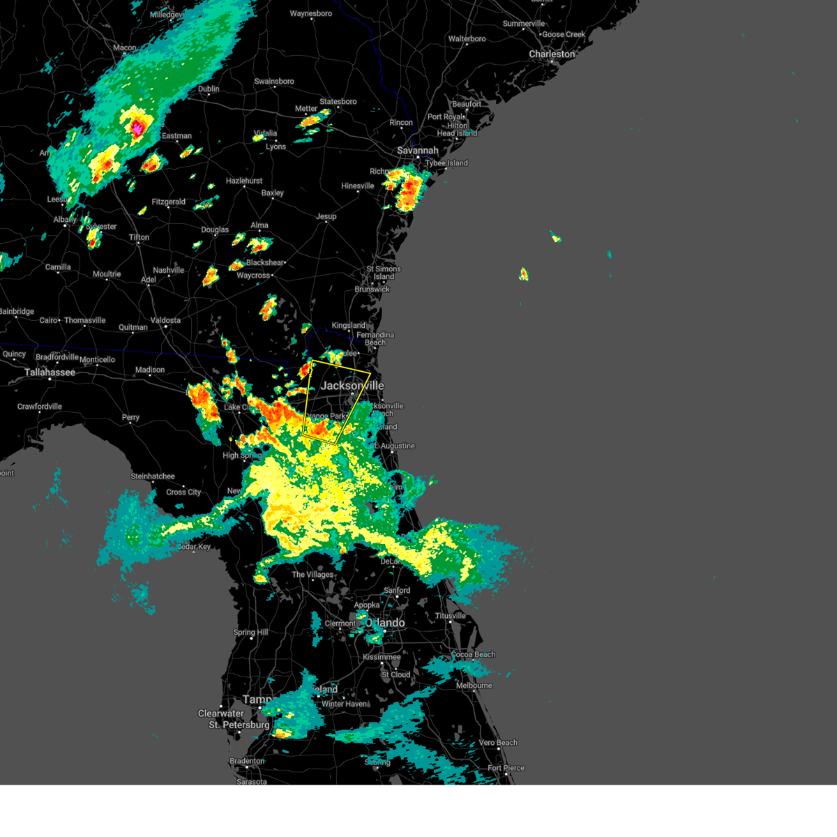
Hail Map for Lawtey, FL
The Lawtey, FL area has had 1 report of on-the-ground hail by trained spotters, and has been under severe weather warnings 6 times during the past 12 months. Doppler radar has detected hail at or near Lawtey, FL on 49 occasions, including 2 occasions during the past year.
| Name: | Lawtey, FL |
| Where Located: | 31.7 miles SW of Jacksonville, FL |
| Map: | Google Map for Lawtey, FL |
| Population: | 730 |
| Housing Units: | 341 |
| More Info: | Search Google for Lawtey, FL |
0
The Top Recent Hail Date for Lawtey, FL is Thursday, June 12, 2025 (16th out of 49)

Hail and Wind Damage Spotted near Lawtey, FL
| Date / Time | Report Details |
|---|---|
| 5/10/2025 6:52 PM EDT |
 Svrjax the national weather service in jacksonville has issued a * severe thunderstorm warning for, southwestern nassau county in northeastern florida, northeastern bradford county in northern florida, southeastern baker county in northeastern florida, northwestern clay county in northeastern florida, central duval county in northeastern florida, * until 715 pm edt. * at 651 pm edt, a severe thunderstorm was located near middleburg, moving north at 25 mph (radar indicated). Hazards include 60 mph wind gusts. expect damage to roofs, siding, and trees Svrjax the national weather service in jacksonville has issued a * severe thunderstorm warning for, southwestern nassau county in northeastern florida, northeastern bradford county in northern florida, southeastern baker county in northeastern florida, northwestern clay county in northeastern florida, central duval county in northeastern florida, * until 715 pm edt. * at 651 pm edt, a severe thunderstorm was located near middleburg, moving north at 25 mph (radar indicated). Hazards include 60 mph wind gusts. expect damage to roofs, siding, and trees
|
| 5/10/2025 6:35 PM EDT |
 the severe thunderstorm warning has been cancelled and is no longer in effect the severe thunderstorm warning has been cancelled and is no longer in effect
|
| 5/10/2025 6:35 PM EDT |
 At 635 pm edt, severe thunderstorms were located along a line extending from near keystone heights to near palestine community, moving north at 20 mph (radar indicated). Hazards include 60 mph wind gusts and penny size hail. Expect damage to roofs, siding, and trees. Locations impacted include, starke, keystone heights, middleburg, kingsley, camp blanding, penney farms, lawtey, hampton, asbury lake, and ellerbee. At 635 pm edt, severe thunderstorms were located along a line extending from near keystone heights to near palestine community, moving north at 20 mph (radar indicated). Hazards include 60 mph wind gusts and penny size hail. Expect damage to roofs, siding, and trees. Locations impacted include, starke, keystone heights, middleburg, kingsley, camp blanding, penney farms, lawtey, hampton, asbury lake, and ellerbee.
|
| 5/10/2025 6:19 PM EDT |
 Svrjax the national weather service in jacksonville has issued a * severe thunderstorm warning for, bradford county in northern florida, northeastern alachua county in northern florida, southern baker county in northeastern florida, northwestern putnam county in northeastern florida, union county in northern florida, western clay county in northeastern florida, east central columbia county in northern florida, * until 645 pm edt. * at 619 pm edt, severe thunderstorms were located along a line extending from lake geneva to groves, moving north at 20 mph (radar indicated). Hazards include 60 mph wind gusts and penny size hail. expect damage to roofs, siding, and trees Svrjax the national weather service in jacksonville has issued a * severe thunderstorm warning for, bradford county in northern florida, northeastern alachua county in northern florida, southern baker county in northeastern florida, northwestern putnam county in northeastern florida, union county in northern florida, western clay county in northeastern florida, east central columbia county in northern florida, * until 645 pm edt. * at 619 pm edt, severe thunderstorms were located along a line extending from lake geneva to groves, moving north at 20 mph (radar indicated). Hazards include 60 mph wind gusts and penny size hail. expect damage to roofs, siding, and trees
|
| 7/22/2024 4:07 PM EDT |
 The storm which prompted the warning has weakened below severe limits, and no longer poses an immediate threat to life or property. therefore, the warning will be allowed to expire. however, gusty winds and heavy rain are still possible with this thunderstorm. The storm which prompted the warning has weakened below severe limits, and no longer poses an immediate threat to life or property. therefore, the warning will be allowed to expire. however, gusty winds and heavy rain are still possible with this thunderstorm.
|
| 7/22/2024 3:51 PM EDT |
 Svrjax the national weather service in jacksonville has issued a * severe thunderstorm warning for, northeastern bradford county in northern florida, northeastern union county in northern florida, west central clay county in northeastern florida, * until 415 pm edt. * at 351 pm edt, a severe thunderstorm was located over starke, moving northeast at 10 mph (radar indicated). Hazards include 60 mph wind gusts. expect damage to roofs, siding, and trees Svrjax the national weather service in jacksonville has issued a * severe thunderstorm warning for, northeastern bradford county in northern florida, northeastern union county in northern florida, west central clay county in northeastern florida, * until 415 pm edt. * at 351 pm edt, a severe thunderstorm was located over starke, moving northeast at 10 mph (radar indicated). Hazards include 60 mph wind gusts. expect damage to roofs, siding, and trees
|
| 5/10/2024 8:44 AM EDT |
 Svrjax the national weather service in jacksonville has issued a * severe thunderstorm warning for, nassau county in northeastern florida, bradford county in northern florida, alachua county in northern florida, north central marion county in northern florida, baker county in northeastern florida, northwestern putnam county in northeastern florida, union county in northern florida, western clay county in northeastern florida, western duval county in northeastern florida, southwestern camden county in southeastern georgia, southeastern ware county in southeastern georgia, charlton county in southeastern georgia, * until 915 am edt. * at 843 am edt, severe thunderstorms were located along a line extending from 9 miles south of argyle to near lulu to 7 miles southeast of cross city, moving east at 70 mph. these are destructive storms for lake butler, starke, gainesville, macclenny, baldwin, and hilliard. (radar indicated). Hazards include 80 mph wind gusts and quarter size hail. Flying debris will be dangerous to those caught without shelter. mobile homes will be heavily damaged. expect considerable damage to roofs, windows, and vehicles. Extensive tree damage and power outages are likely. Svrjax the national weather service in jacksonville has issued a * severe thunderstorm warning for, nassau county in northeastern florida, bradford county in northern florida, alachua county in northern florida, north central marion county in northern florida, baker county in northeastern florida, northwestern putnam county in northeastern florida, union county in northern florida, western clay county in northeastern florida, western duval county in northeastern florida, southwestern camden county in southeastern georgia, southeastern ware county in southeastern georgia, charlton county in southeastern georgia, * until 915 am edt. * at 843 am edt, severe thunderstorms were located along a line extending from 9 miles south of argyle to near lulu to 7 miles southeast of cross city, moving east at 70 mph. these are destructive storms for lake butler, starke, gainesville, macclenny, baldwin, and hilliard. (radar indicated). Hazards include 80 mph wind gusts and quarter size hail. Flying debris will be dangerous to those caught without shelter. mobile homes will be heavily damaged. expect considerable damage to roofs, windows, and vehicles. Extensive tree damage and power outages are likely.
|
| 4/3/2024 11:44 AM EDT |
 The storms which prompted the warning have weakened below severe limits, and no longer pose an immediate threat to life or property. therefore, the warning will be allowed to expire. however, gusty winds and heavy rain are still possible with these thunderstorms. a tornado watch remains in effect until 500 pm edt for northern and northeastern florida. The storms which prompted the warning have weakened below severe limits, and no longer pose an immediate threat to life or property. therefore, the warning will be allowed to expire. however, gusty winds and heavy rain are still possible with these thunderstorms. a tornado watch remains in effect until 500 pm edt for northern and northeastern florida.
|
| 4/3/2024 11:21 AM EDT |
 the severe thunderstorm warning has been cancelled and is no longer in effect the severe thunderstorm warning has been cancelled and is no longer in effect
|
| 4/3/2024 11:21 AM EDT |
 At 1120 am edt, severe thunderstorms were located along a line extending from near normandy to near starke, moving east at 40 mph (radar indicated). Hazards include 60 mph wind gusts. Expect damage to roofs, siding, and trees. Locations impacted include, orange park, green cove springs, starke, keystone heights, unf, mandarin, fruit cove, middleburg, ponte vedra beach, and jacksonville beach. At 1120 am edt, severe thunderstorms were located along a line extending from near normandy to near starke, moving east at 40 mph (radar indicated). Hazards include 60 mph wind gusts. Expect damage to roofs, siding, and trees. Locations impacted include, orange park, green cove springs, starke, keystone heights, unf, mandarin, fruit cove, middleburg, ponte vedra beach, and jacksonville beach.
|
| 4/3/2024 11:04 AM EDT |
 Svrjax the national weather service in jacksonville has issued a * severe thunderstorm warning for, bradford county in northern florida, northeastern alachua county in northern florida, northwestern st. johns county in northeastern florida, southeastern baker county in northeastern florida, north central putnam county in northeastern florida, northeastern union county in northern florida, clay county in northeastern florida, southern duval county in northeastern florida, * until 1145 am edt. * at 1103 am edt, severe thunderstorms were located along a line extending from near maxville to sampson, moving east at 40 mph (radar indicated). Hazards include 60 mph wind gusts. expect damage to roofs, siding, and trees Svrjax the national weather service in jacksonville has issued a * severe thunderstorm warning for, bradford county in northern florida, northeastern alachua county in northern florida, northwestern st. johns county in northeastern florida, southeastern baker county in northeastern florida, north central putnam county in northeastern florida, northeastern union county in northern florida, clay county in northeastern florida, southern duval county in northeastern florida, * until 1145 am edt. * at 1103 am edt, severe thunderstorms were located along a line extending from near maxville to sampson, moving east at 40 mph (radar indicated). Hazards include 60 mph wind gusts. expect damage to roofs, siding, and trees
|
| 2/4/2024 4:13 PM EST | Multiple trees down along cr-225. possible tornado damag in clay county FL, 4.2 miles NW of Lawtey, FL |
| 2/4/2024 4:13 PM EST |
 At 412 pm est, a severe thunderstorm capable of producing a tornado was located near camp blanding, or near middleburg, moving northeast at 20 mph (radar indicated rotation). Hazards include tornado. Flying debris will be dangerous to those caught without shelter. mobile homes will be damaged or destroyed. damage to roofs, windows, and vehicles will occur. tree damage is likely. this dangerous storm will be near, middleburg around 420 pm est. Other locations impacted by this tornadic thunderstorm include lawtey. At 412 pm est, a severe thunderstorm capable of producing a tornado was located near camp blanding, or near middleburg, moving northeast at 20 mph (radar indicated rotation). Hazards include tornado. Flying debris will be dangerous to those caught without shelter. mobile homes will be damaged or destroyed. damage to roofs, windows, and vehicles will occur. tree damage is likely. this dangerous storm will be near, middleburg around 420 pm est. Other locations impacted by this tornadic thunderstorm include lawtey.
|
| 2/4/2024 4:06 PM EST |
 At 406 pm est, a severe thunderstorm was located near camp blanding, or near starke, moving northeast at 25 mph (radar indicated). Hazards include 60 mph wind gusts and quarter size hail. Hail damage to vehicles is expected. Expect wind damage to roofs, siding, and trees. At 406 pm est, a severe thunderstorm was located near camp blanding, or near starke, moving northeast at 25 mph (radar indicated). Hazards include 60 mph wind gusts and quarter size hail. Hail damage to vehicles is expected. Expect wind damage to roofs, siding, and trees.
|
| 1/9/2024 3:12 PM EST |
 At 311 pm est, severe thunderstorms were located along a line extending from near hilliard to near sampson, moving east at 35 mph (radar indicated). Hazards include 60 mph wind gusts. Expect damage to roofs, siding, and trees. locations impacted include, jacksonville, st. Marys, fernandina beach, orange park, green cove springs, starke, hilliard, keystone heights, callahan, and jacksonville international arpt. At 311 pm est, severe thunderstorms were located along a line extending from near hilliard to near sampson, moving east at 35 mph (radar indicated). Hazards include 60 mph wind gusts. Expect damage to roofs, siding, and trees. locations impacted include, jacksonville, st. Marys, fernandina beach, orange park, green cove springs, starke, hilliard, keystone heights, callahan, and jacksonville international arpt.
|
| 1/9/2024 3:12 PM EST |
 A severe thunderstorm warning remains in effect until 345 pm est for nassau. eastern bradford. northeastern alachua. west central st. johns. north central putnam. clay. duval and southeastern camden counties. At 311 pm est, severe thunderstorms were located along a line extending from near hilliard to near sampson, moving east at 35 mph. A severe thunderstorm warning remains in effect until 345 pm est for nassau. eastern bradford. northeastern alachua. west central st. johns. north central putnam. clay. duval and southeastern camden counties. At 311 pm est, severe thunderstorms were located along a line extending from near hilliard to near sampson, moving east at 35 mph.
|
| 1/9/2024 2:44 PM EST |
 At 244 pm est, severe thunderstorms were located along a line extending from 11 miles northwest of st. george to near alachua, moving east at 35 mph (radar indicated). Hazards include 60 mph wind gusts. expect damage to roofs, siding, and trees At 244 pm est, severe thunderstorms were located along a line extending from 11 miles northwest of st. george to near alachua, moving east at 35 mph (radar indicated). Hazards include 60 mph wind gusts. expect damage to roofs, siding, and trees
|
| 1/9/2024 2:02 PM EST |
 At 201 pm est, severe thunderstorms were located along a line extending from 7 miles north of taylor to near high springs, moving east at 40 mph (radar indicated). Hazards include 60 mph wind gusts. expect damage to roofs, siding, and trees At 201 pm est, severe thunderstorms were located along a line extending from 7 miles north of taylor to near high springs, moving east at 40 mph (radar indicated). Hazards include 60 mph wind gusts. expect damage to roofs, siding, and trees
|
| 8/15/2023 1:42 PM EDT |
 At 142 pm edt, a severe thunderstorm was located over raiford, moving northeast at 15 mph (radar indicated). Hazards include 60 mph wind gusts. expect damage to roofs, siding, and trees At 142 pm edt, a severe thunderstorm was located over raiford, moving northeast at 15 mph (radar indicated). Hazards include 60 mph wind gusts. expect damage to roofs, siding, and trees
|
| 7/30/2023 8:28 PM EDT |
 At 828 pm edt, severe thunderstorms were located along a line extending from near raiford to near florahome, moving southwest at 10 mph (radar indicated). Hazards include 60 mph wind gusts. expect damage to roofs, siding, and trees At 828 pm edt, severe thunderstorms were located along a line extending from near raiford to near florahome, moving southwest at 10 mph (radar indicated). Hazards include 60 mph wind gusts. expect damage to roofs, siding, and trees
|
| 7/30/2023 8:02 PM EDT |
 At 801 pm edt, a severe thunderstorm was located over starke, moving southwest at 15 mph (radar indicated). Hazards include 60 mph wind gusts and penny size hail. expect damage to roofs, siding, and trees At 801 pm edt, a severe thunderstorm was located over starke, moving southwest at 15 mph (radar indicated). Hazards include 60 mph wind gusts and penny size hail. expect damage to roofs, siding, and trees
|
| 7/30/2023 6:51 PM EDT |
 At 650 pm edt, severe thunderstorms were located along a line extending from 7 miles south of maxville to bostwick, moving southeast at 5 mph (radar indicated). Hazards include 60 mph wind gusts and nickel size hail. expect damage to roofs, siding, and trees At 650 pm edt, severe thunderstorms were located along a line extending from 7 miles south of maxville to bostwick, moving southeast at 5 mph (radar indicated). Hazards include 60 mph wind gusts and nickel size hail. expect damage to roofs, siding, and trees
|
| 6/27/2023 7:02 PM EDT |
 At 702 pm edt, a severe thunderstorm was located near raiford, moving east at 30 mph (radar indicated). Hazards include golf ball size hail and 70 mph wind gusts. People and animals outdoors will be injured. expect hail damage to roofs, siding, windows, and vehicles. expect considerable tree damage. wind damage is also likely to mobile homes, roofs, and outbuildings. locations impacted include, orange park, green cove springs, starke, raiford, middleburg, maxville, fleming island, oakleaf plantation, bellair-meadowbrook terrace and camp blanding. thunderstorm damage threat, considerable hail threat, radar indicated max hail size, 1. 75 in wind threat, radar indicated max wind gust, 70 mph. At 702 pm edt, a severe thunderstorm was located near raiford, moving east at 30 mph (radar indicated). Hazards include golf ball size hail and 70 mph wind gusts. People and animals outdoors will be injured. expect hail damage to roofs, siding, windows, and vehicles. expect considerable tree damage. wind damage is also likely to mobile homes, roofs, and outbuildings. locations impacted include, orange park, green cove springs, starke, raiford, middleburg, maxville, fleming island, oakleaf plantation, bellair-meadowbrook terrace and camp blanding. thunderstorm damage threat, considerable hail threat, radar indicated max hail size, 1. 75 in wind threat, radar indicated max wind gust, 70 mph.
|
| 6/27/2023 6:55 PM EDT |
 At 654 pm edt, a severe thunderstorm was located 7 miles northeast of raiford, moving east at 30 mph (radar indicated). Hazards include 70 mph wind gusts and ping pong ball size hail. People and animals outdoors will be injured. expect hail damage to roofs, siding, windows, and vehicles. expect considerable tree damage. Wind damage is also likely to mobile homes, roofs, and outbuildings. At 654 pm edt, a severe thunderstorm was located 7 miles northeast of raiford, moving east at 30 mph (radar indicated). Hazards include 70 mph wind gusts and ping pong ball size hail. People and animals outdoors will be injured. expect hail damage to roofs, siding, windows, and vehicles. expect considerable tree damage. Wind damage is also likely to mobile homes, roofs, and outbuildings.
|
| 6/14/2023 10:55 PM EDT |
 At 1054 pm edt, severe thunderstorms were located along a line extending from near watertown to 6 miles southwest of high springs to 8 miles south of cross city, moving southeast at 40 mph (radar indicated). Hazards include 60 mph wind gusts. expect damage to roofs, siding, and trees At 1054 pm edt, severe thunderstorms were located along a line extending from near watertown to 6 miles southwest of high springs to 8 miles south of cross city, moving southeast at 40 mph (radar indicated). Hazards include 60 mph wind gusts. expect damage to roofs, siding, and trees
|
| 1/4/2023 3:44 PM EST |
 At 344 pm est, severe thunderstorms were located along a line extending from near ratliff to near middleburg to 6 miles north of gainesville airport, moving northeast at 55 mph (radar indicated). Hazards include 70 mph wind gusts and penny size hail. Expect considerable tree damage. Damage is likely to mobile homes, roofs, and outbuildings. At 344 pm est, severe thunderstorms were located along a line extending from near ratliff to near middleburg to 6 miles north of gainesville airport, moving northeast at 55 mph (radar indicated). Hazards include 70 mph wind gusts and penny size hail. Expect considerable tree damage. Damage is likely to mobile homes, roofs, and outbuildings.
|
| 1/4/2023 3:36 PM EST |
 At 336 pm est, severe thunderstorms were located along a line extending from near bryceville to near camp blanding to near sampson, moving east at 40 mph (radar indicated). Hazards include 70 mph wind gusts and quarter size hail. possible tornado. Hail damage to vehicles is expected. expect considerable tree damage. wind damage is also likely to mobile homes, roofs, and outbuildings. Locations impacted include, starke, callahan, middleburg, macclenny, maxville, bryceville, camp blanding, cecil field, kingsley and sampson. At 336 pm est, severe thunderstorms were located along a line extending from near bryceville to near camp blanding to near sampson, moving east at 40 mph (radar indicated). Hazards include 70 mph wind gusts and quarter size hail. possible tornado. Hail damage to vehicles is expected. expect considerable tree damage. wind damage is also likely to mobile homes, roofs, and outbuildings. Locations impacted include, starke, callahan, middleburg, macclenny, maxville, bryceville, camp blanding, cecil field, kingsley and sampson.
|
| 1/4/2023 3:11 PM EST |
 At 310 pm est, a severe thunderstorm was located near lake butler, moving northeast at 50 mph (radar indicated). Hazards include 70 mph wind gusts and quarter size hail. possible tornado. Hail damage to vehicles is expected. expect considerable tree damage. Wind damage is also likely to mobile homes, roofs, and outbuildings. At 310 pm est, a severe thunderstorm was located near lake butler, moving northeast at 50 mph (radar indicated). Hazards include 70 mph wind gusts and quarter size hail. possible tornado. Hail damage to vehicles is expected. expect considerable tree damage. Wind damage is also likely to mobile homes, roofs, and outbuildings.
|
| 9/9/2022 9:37 PM EDT |
 The severe thunderstorm warning for northeastern bradford, northwestern clay and southwestern duval counties will expire at 945 pm edt, the storm which prompted the warning has weakened below severe limits, and no longer poses an immediate threat to life or property. therefore, the warning will be allowed to expire. however gusty winds are still possible with this thunderstorm. The severe thunderstorm warning for northeastern bradford, northwestern clay and southwestern duval counties will expire at 945 pm edt, the storm which prompted the warning has weakened below severe limits, and no longer poses an immediate threat to life or property. therefore, the warning will be allowed to expire. however gusty winds are still possible with this thunderstorm.
|
| 9/9/2022 9:16 PM EDT |
 At 916 pm edt, a severe thunderstorm capable of producing a tornado was located near camp blanding, or 7 miles west of middleburg, moving northeast at 20 mph (radar indicated rotation). Hazards include tornado. Flying debris will be dangerous to those caught without shelter. mobile homes will be damaged or destroyed. damage to roofs, windows, and vehicles will occur. tree damage is likely. this dangerous storm will be near, middleburg and maxville around 940 pm edt. oakleaf plantation and cecil field around 945 pm edt. Other locations impacted by this tornadic thunderstorm include asbury lake and lawtey. At 916 pm edt, a severe thunderstorm capable of producing a tornado was located near camp blanding, or 7 miles west of middleburg, moving northeast at 20 mph (radar indicated rotation). Hazards include tornado. Flying debris will be dangerous to those caught without shelter. mobile homes will be damaged or destroyed. damage to roofs, windows, and vehicles will occur. tree damage is likely. this dangerous storm will be near, middleburg and maxville around 940 pm edt. oakleaf plantation and cecil field around 945 pm edt. Other locations impacted by this tornadic thunderstorm include asbury lake and lawtey.
|
| 9/9/2022 9:10 PM EDT |
 At 910 pm edt, a severe thunderstorm was located near starke, moving northeast at 20 mph (radar indicated). Hazards include 60 mph wind gusts. expect damage to roofs, siding, and trees At 910 pm edt, a severe thunderstorm was located near starke, moving northeast at 20 mph (radar indicated). Hazards include 60 mph wind gusts. expect damage to roofs, siding, and trees
|
| 9/9/2022 8:45 PM EDT |
 At 845 pm edt, a severe thunderstorm was located near sampson, or 8 miles southwest of starke, moving northeast at 25 mph (radar indicated). Hazards include 60 mph wind gusts. expect damage to roofs, siding, and trees At 845 pm edt, a severe thunderstorm was located near sampson, or 8 miles southwest of starke, moving northeast at 25 mph (radar indicated). Hazards include 60 mph wind gusts. expect damage to roofs, siding, and trees
|
| 5/6/2022 10:21 PM EDT |
 The severe thunderstorm warning for northeastern bradford and northwestern clay counties will expire at 1030 pm edt, the storm which prompted the warning has moved out of the area. therefore, the warning will be allowed to expire. however gusty winds and heavy rain are still possible with this thunderstorm. remember, a severe thunderstorm warning still remains in effect for eastern clay county until 1100 pm edt. The severe thunderstorm warning for northeastern bradford and northwestern clay counties will expire at 1030 pm edt, the storm which prompted the warning has moved out of the area. therefore, the warning will be allowed to expire. however gusty winds and heavy rain are still possible with this thunderstorm. remember, a severe thunderstorm warning still remains in effect for eastern clay county until 1100 pm edt.
|
| 5/6/2022 10:01 PM EDT |
 At 1000 pm edt, a severe thunderstorm was located near kingsley, or near keystone heights, moving east at 40 mph (radar indicated). Hazards include 60 mph wind gusts and penny size hail. Expect damage to roofs, siding, and trees. Locations impacted include, starke, middleburg, kingsley, camp blanding, penney farms, lawtey, hampton and asbury lake. At 1000 pm edt, a severe thunderstorm was located near kingsley, or near keystone heights, moving east at 40 mph (radar indicated). Hazards include 60 mph wind gusts and penny size hail. Expect damage to roofs, siding, and trees. Locations impacted include, starke, middleburg, kingsley, camp blanding, penney farms, lawtey, hampton and asbury lake.
|
| 5/6/2022 9:49 PM EDT |
 At 949 pm edt, a severe thunderstorm was located near sampson, or near starke, moving east at 40 mph (radar indicated). Hazards include 60 mph wind gusts and penny size hail. Expect damage to roofs, siding, and trees. Locations impacted include, starke, middleburg, kingsley, sampson, camp blanding, penney farms, lawtey, hampton and asbury lake. At 949 pm edt, a severe thunderstorm was located near sampson, or near starke, moving east at 40 mph (radar indicated). Hazards include 60 mph wind gusts and penny size hail. Expect damage to roofs, siding, and trees. Locations impacted include, starke, middleburg, kingsley, sampson, camp blanding, penney farms, lawtey, hampton and asbury lake.
|
| 5/6/2022 9:40 PM EDT |
 At 940 pm edt, a severe thunderstorm was located near sampson, or 9 miles southwest of starke, moving east at 40 mph (radar indicated). Hazards include 60 mph wind gusts and penny size hail. expect damage to roofs, siding, and trees At 940 pm edt, a severe thunderstorm was located near sampson, or 9 miles southwest of starke, moving east at 40 mph (radar indicated). Hazards include 60 mph wind gusts and penny size hail. expect damage to roofs, siding, and trees
|
| 7/23/2021 5:44 PM EDT |
 At 544 pm edt, a severe thunderstorm was located near camp blanding, or near middleburg, moving south at 25 mph (radar indicated). Hazards include 60 mph wind gusts. Expect damage to roofs, siding, and trees. Locations impacted include, keystone heights, kingsley, camp blanding and lawtey. At 544 pm edt, a severe thunderstorm was located near camp blanding, or near middleburg, moving south at 25 mph (radar indicated). Hazards include 60 mph wind gusts. Expect damage to roofs, siding, and trees. Locations impacted include, keystone heights, kingsley, camp blanding and lawtey.
|
| 7/23/2021 5:20 PM EDT |
 At 520 pm edt, a severe thunderstorm was located near middleburg, moving south at 15 mph (radar indicated). Hazards include 60 mph wind gusts. expect damage to roofs, siding, and trees At 520 pm edt, a severe thunderstorm was located near middleburg, moving south at 15 mph (radar indicated). Hazards include 60 mph wind gusts. expect damage to roofs, siding, and trees
|
| 7/22/2021 7:15 PM EDT |
 At 715 pm edt, a severe thunderstorm was located near macclenny, or 13 miles northeast of raiford, moving southeast at 25 mph (radar indicated). Hazards include 60 mph wind gusts and quarter size hail. Hail damage to vehicles is expected. expect wind damage to roofs, siding, and trees. locations impacted include, macclenny, glen st. Mary, sanderson, maxville, baldwin and lawtey. At 715 pm edt, a severe thunderstorm was located near macclenny, or 13 miles northeast of raiford, moving southeast at 25 mph (radar indicated). Hazards include 60 mph wind gusts and quarter size hail. Hail damage to vehicles is expected. expect wind damage to roofs, siding, and trees. locations impacted include, macclenny, glen st. Mary, sanderson, maxville, baldwin and lawtey.
|
| 7/22/2021 7:09 PM EDT |
 At 708 pm edt, a severe thunderstorm was located over glen st. mary, or 14 miles north of raiford, moving southeast at 25 mph (radar indicated). Hazards include 60 mph wind gusts and quarter size hail. Hail damage to vehicles is expected. expect wind damage to roofs, siding, and trees. locations impacted include, macclenny, glen st. Mary, sanderson, maxville, baldwin and lawtey. At 708 pm edt, a severe thunderstorm was located over glen st. mary, or 14 miles north of raiford, moving southeast at 25 mph (radar indicated). Hazards include 60 mph wind gusts and quarter size hail. Hail damage to vehicles is expected. expect wind damage to roofs, siding, and trees. locations impacted include, macclenny, glen st. Mary, sanderson, maxville, baldwin and lawtey.
|
| 7/22/2021 6:59 PM EDT |
 At 659 pm edt, a severe thunderstorm was located near glen st. mary, or 15 miles north of raiford, moving southeast at 25 mph (radar indicated). Hazards include 60 mph wind gusts. expect damage to roofs, siding, and trees At 659 pm edt, a severe thunderstorm was located near glen st. mary, or 15 miles north of raiford, moving southeast at 25 mph (radar indicated). Hazards include 60 mph wind gusts. expect damage to roofs, siding, and trees
|
| 6/22/2021 12:52 PM EDT |
 The severe thunderstorm warning for northern bradford, southeastern baker and eastern union counties will expire at 100 pm edt, the storm which prompted the warning has weakened below severe limits, and no longer poses an immediate threat to life or property. therefore, the warning will be allowed to expire. however gusty winds and heavy rain are still possible with this thunderstorm. The severe thunderstorm warning for northern bradford, southeastern baker and eastern union counties will expire at 100 pm edt, the storm which prompted the warning has weakened below severe limits, and no longer poses an immediate threat to life or property. therefore, the warning will be allowed to expire. however gusty winds and heavy rain are still possible with this thunderstorm.
|
| 6/22/2021 12:47 PM EDT |
 At 1247 pm edt, a severe thunderstorm was located over raiford, moving east at 20 mph (radar indicated). Hazards include 60 mph wind gusts. Expect damage to roofs, siding, and trees. Locations impacted include, starke, lake butler, raiford, beasley, new river, lawtey, ellerbee and johnstown. At 1247 pm edt, a severe thunderstorm was located over raiford, moving east at 20 mph (radar indicated). Hazards include 60 mph wind gusts. Expect damage to roofs, siding, and trees. Locations impacted include, starke, lake butler, raiford, beasley, new river, lawtey, ellerbee and johnstown.
|
| 6/22/2021 12:22 PM EDT |
 At 1222 pm edt, a severe thunderstorm was located over lake butler, moving east at 20 mph (radar indicated). Hazards include 60 mph wind gusts. expect damage to roofs, siding, and trees At 1222 pm edt, a severe thunderstorm was located over lake butler, moving east at 20 mph (radar indicated). Hazards include 60 mph wind gusts. expect damage to roofs, siding, and trees
|
| 6/15/2021 4:34 PM EDT |
 At 434 pm edt, severe thunderstorms were located along a line extending from raiford to 7 miles southeast of worthington spring, moving east at 20 mph (radar indicated). Hazards include 60 mph wind gusts and quarter size hail. Hail damage to vehicles is expected. expect wind damage to roofs, siding, and trees. Locations impacted include, starke, lake butler, raiford, beasley, new river, sampson, hampton, la crosse, brooker and johnstown. At 434 pm edt, severe thunderstorms were located along a line extending from raiford to 7 miles southeast of worthington spring, moving east at 20 mph (radar indicated). Hazards include 60 mph wind gusts and quarter size hail. Hail damage to vehicles is expected. expect wind damage to roofs, siding, and trees. Locations impacted include, starke, lake butler, raiford, beasley, new river, sampson, hampton, la crosse, brooker and johnstown.
|
| 6/15/2021 4:19 PM EDT |
 At 419 pm edt, severe thunderstorms were located along a line extending from near raiford to 6 miles south of worthington spring, moving east at 20 mph (radar indicated). Hazards include 60 mph wind gusts and quarter size hail. Hail damage to vehicles is expected. Expect wind damage to roofs, siding, and trees. At 419 pm edt, severe thunderstorms were located along a line extending from near raiford to 6 miles south of worthington spring, moving east at 20 mph (radar indicated). Hazards include 60 mph wind gusts and quarter size hail. Hail damage to vehicles is expected. Expect wind damage to roofs, siding, and trees.
|
| 6/15/2021 4:15 PM EDT |
 At 414 pm edt, severe thunderstorms were located along a line extending from 6 miles southwest of maxville to near keystone heights, moving east at 15 mph (radar indicated). Hazards include 60 mph wind gusts and quarter size hail. Hail damage to vehicles is expected. Expect wind damage to roofs, siding, and trees. At 414 pm edt, severe thunderstorms were located along a line extending from 6 miles southwest of maxville to near keystone heights, moving east at 15 mph (radar indicated). Hazards include 60 mph wind gusts and quarter size hail. Hail damage to vehicles is expected. Expect wind damage to roofs, siding, and trees.
|
| 6/15/2021 4:00 PM EDT |
 At 400 pm edt, a severe thunderstorm was located over raiford, moving east at 25 mph (radar indicated). Hazards include 60 mph wind gusts and quarter size hail. Hail damage to vehicles is expected. expect wind damage to roofs, siding, and trees. Locations impacted include, lake butler, raiford, beasley, new river, johnstown and ellerbee. At 400 pm edt, a severe thunderstorm was located over raiford, moving east at 25 mph (radar indicated). Hazards include 60 mph wind gusts and quarter size hail. Hail damage to vehicles is expected. expect wind damage to roofs, siding, and trees. Locations impacted include, lake butler, raiford, beasley, new river, johnstown and ellerbee.
|
| 6/15/2021 3:49 PM EDT |
 At 349 pm edt, a severe thunderstorm was located over palestine community, or near lake butler, moving east at 15 mph (radar indicated). Hazards include 60 mph wind gusts and quarter size hail. Hail damage to vehicles is expected. Expect wind damage to roofs, siding, and trees. At 349 pm edt, a severe thunderstorm was located over palestine community, or near lake butler, moving east at 15 mph (radar indicated). Hazards include 60 mph wind gusts and quarter size hail. Hail damage to vehicles is expected. Expect wind damage to roofs, siding, and trees.
|
| 3/18/2021 3:57 PM EDT |
 At 356 pm edt, a severe thunderstorm was located near maxville, or 10 miles northwest of middleburg, moving northeast at 55 mph (radar indicated). Hazards include 60 mph wind gusts. possible tornado. expect damage to roofs, siding, and trees At 356 pm edt, a severe thunderstorm was located near maxville, or 10 miles northwest of middleburg, moving northeast at 55 mph (radar indicated). Hazards include 60 mph wind gusts. possible tornado. expect damage to roofs, siding, and trees
|
| 3/18/2021 3:53 PM EDT |
 At 352 pm edt, a severe thunderstorm was located near starke, moving northeast at 50 mph (radar indicated). Hazards include 60 mph wind gusts. Expect damage to roofs, siding, and trees. Locations impacted include, starke, middleburg, kingsley, camp blanding and lawtey. At 352 pm edt, a severe thunderstorm was located near starke, moving northeast at 50 mph (radar indicated). Hazards include 60 mph wind gusts. Expect damage to roofs, siding, and trees. Locations impacted include, starke, middleburg, kingsley, camp blanding and lawtey.
|
| 3/18/2021 3:46 PM EDT |
 At 346 pm edt, a severe thunderstorm was located near camp blanding, or 8 miles west of middleburg, moving northeast at 50 mph (radar indicated). Hazards include 60 mph wind gusts. Expect damage to roofs, siding, and trees. Locations impacted include, starke, middleburg, kingsley, camp blanding and lawtey. At 346 pm edt, a severe thunderstorm was located near camp blanding, or 8 miles west of middleburg, moving northeast at 50 mph (radar indicated). Hazards include 60 mph wind gusts. Expect damage to roofs, siding, and trees. Locations impacted include, starke, middleburg, kingsley, camp blanding and lawtey.
|
| 3/18/2021 3:22 PM EDT |
 At 322 pm edt, a severe thunderstorm was located over new river, or near starke, moving northeast at 55 mph (radar indicated). Hazards include 60 mph wind gusts. expect damage to roofs, siding, and trees At 322 pm edt, a severe thunderstorm was located over new river, or near starke, moving northeast at 55 mph (radar indicated). Hazards include 60 mph wind gusts. expect damage to roofs, siding, and trees
|
| 2/6/2021 5:43 PM EST |
 The severe thunderstorm warning for bradford, northern alachua and southern union counties will expire at 545 pm est, the storm which prompted the warning has weakened below severe limits, and no longer poses an immediate threat to life or property. therefore, the warning will be allowed to expire. however small hail and heavy rain are still possible with this thunderstorm. a tornado watch remains in effect until midnight est for northern florida. to report severe weather, contact your nearest law enforcement agency. they will relay your report to the national weather service jacksonville. The severe thunderstorm warning for bradford, northern alachua and southern union counties will expire at 545 pm est, the storm which prompted the warning has weakened below severe limits, and no longer poses an immediate threat to life or property. therefore, the warning will be allowed to expire. however small hail and heavy rain are still possible with this thunderstorm. a tornado watch remains in effect until midnight est for northern florida. to report severe weather, contact your nearest law enforcement agency. they will relay your report to the national weather service jacksonville.
|
| 2/6/2021 5:23 PM EST |
 At 523 pm est, a severe thunderstorm was located near worthington spring, moving northeast at 50 mph (radar indicated). Hazards include quarter size hail. Damage to vehicles is expected. Locations impacted include, starke, lake butler, raiford, worthington spring, alachua, high springs, worthington springs, groves, new river and beasley. At 523 pm est, a severe thunderstorm was located near worthington spring, moving northeast at 50 mph (radar indicated). Hazards include quarter size hail. Damage to vehicles is expected. Locations impacted include, starke, lake butler, raiford, worthington spring, alachua, high springs, worthington springs, groves, new river and beasley.
|
| 2/6/2021 5:08 PM EST |
 At 508 pm est, a severe thunderstorm was located near high springs, or 11 miles southwest of worthington spring, moving northeast at 55 mph (radar indicated). Hazards include quarter size hail. Damage to vehicles is expected. Locations impacted include, starke, trenton, lake butler, bell, raiford, worthington spring, alachua, high springs, worthington springs and groves. At 508 pm est, a severe thunderstorm was located near high springs, or 11 miles southwest of worthington spring, moving northeast at 55 mph (radar indicated). Hazards include quarter size hail. Damage to vehicles is expected. Locations impacted include, starke, trenton, lake butler, bell, raiford, worthington spring, alachua, high springs, worthington springs and groves.
|
| 2/6/2021 4:59 PM EST |
 At 459 pm est, a severe thunderstorm was located near high springs, or 13 miles east of bell, moving northeast at 55 mph (radar indicated). Hazards include 60 mph wind gusts and quarter size hail. Hail damage to vehicles is expected. Expect wind damage to roofs, siding, and trees. At 459 pm est, a severe thunderstorm was located near high springs, or 13 miles east of bell, moving northeast at 55 mph (radar indicated). Hazards include 60 mph wind gusts and quarter size hail. Hail damage to vehicles is expected. Expect wind damage to roofs, siding, and trees.
|
| 12/24/2020 6:28 PM EST |
 At 627 pm est, severe thunderstorms were located along a line extending from 10 miles west of woodbine to near orange heights, moving northeast at 55 mph (radar indicated). Hazards include 60 mph wind gusts. expect damage to roofs, siding, and trees At 627 pm est, severe thunderstorms were located along a line extending from 10 miles west of woodbine to near orange heights, moving northeast at 55 mph (radar indicated). Hazards include 60 mph wind gusts. expect damage to roofs, siding, and trees
|
| 12/24/2020 6:03 PM EST |
 At 602 pm est, severe thunderstorms were located along a line extending from 10 miles southeast of stephen foster state park to near sanderson to alachua, moving east at 60 mph (radar indicated). Hazards include 60 mph wind gusts. Expect damage to roofs, siding, and trees. Locations impacted include, starke, hilliard, lake butler, keystone heights, callahan, raiford, worthington spring, taylor, alachua and macclenny. At 602 pm est, severe thunderstorms were located along a line extending from 10 miles southeast of stephen foster state park to near sanderson to alachua, moving east at 60 mph (radar indicated). Hazards include 60 mph wind gusts. Expect damage to roofs, siding, and trees. Locations impacted include, starke, hilliard, lake butler, keystone heights, callahan, raiford, worthington spring, taylor, alachua and macclenny.
|
| 12/24/2020 5:42 PM EST |
 At 542 pm est, severe thunderstorms were located along a line extending from 6 miles southeast of fargo to near watertown to 6 miles northeast of trenton, moving east at 55 mph (radar indicated). Hazards include 60 mph wind gusts. expect damage to roofs, siding, and trees At 542 pm est, severe thunderstorms were located along a line extending from 6 miles southeast of fargo to near watertown to 6 miles northeast of trenton, moving east at 55 mph (radar indicated). Hazards include 60 mph wind gusts. expect damage to roofs, siding, and trees
|
| 6/12/2020 10:38 PM EDT |
 At 1038 pm edt, a severe thunderstorm was located over cecil field, or 9 miles north of middleburg, moving southwest at 30 mph (radar indicated). Hazards include 60 mph wind gusts. expect damage to roofs, siding, and trees At 1038 pm edt, a severe thunderstorm was located over cecil field, or 9 miles north of middleburg, moving southwest at 30 mph (radar indicated). Hazards include 60 mph wind gusts. expect damage to roofs, siding, and trees
|
| 4/23/2020 10:39 PM EDT |
 The tornado warning for bradford, northeastern alachua and west central clay counties will expire at 1045 pm edt, the storm which prompted the warning has weakened below severe limits, and no longer appears capable of producing a tornado. therefore, the warning will be allowed to expire. however gusty winds and heavy rain are still possible with this thunderstorm. a tornado watch remains in effect until midnight edt for northern and northeastern florida. The tornado warning for bradford, northeastern alachua and west central clay counties will expire at 1045 pm edt, the storm which prompted the warning has weakened below severe limits, and no longer appears capable of producing a tornado. therefore, the warning will be allowed to expire. however gusty winds and heavy rain are still possible with this thunderstorm. a tornado watch remains in effect until midnight edt for northern and northeastern florida.
|
| 4/23/2020 10:30 PM EDT |
 At 1029 pm edt, a severe thunderstorm was located over maxville, or 11 miles northwest of middleburg, moving east at 45 mph (radar indicated). Hazards include 60 mph wind gusts. Expect damage to roofs, siding, and trees. Locations impacted include, orange park, maxville, cisco gardens, ortega, oakleaf plantation, bellair-meadowbrook terrace, bryceville, cecil field, nas jax and normandy. At 1029 pm edt, a severe thunderstorm was located over maxville, or 11 miles northwest of middleburg, moving east at 45 mph (radar indicated). Hazards include 60 mph wind gusts. Expect damage to roofs, siding, and trees. Locations impacted include, orange park, maxville, cisco gardens, ortega, oakleaf plantation, bellair-meadowbrook terrace, bryceville, cecil field, nas jax and normandy.
|
| 4/23/2020 10:23 PM EDT |
 At 1022 pm edt, a severe thunderstorm capable of producing a tornado was located over sampson, or 8 miles southwest of starke, moving east at 45 mph (radar indicated rotation). Hazards include tornado. Flying debris will be dangerous to those caught without shelter. mobile homes will be damaged or destroyed. damage to roofs, windows, and vehicles will occur. tree damage is likely. this dangerous storm will be near, starke around 1035 pm edt. camp blanding and kingsley around 1045 pm edt. Other locations impacted by this tornadic thunderstorm include lawtey, la crosse, waldo, hampton and brooker. At 1022 pm edt, a severe thunderstorm capable of producing a tornado was located over sampson, or 8 miles southwest of starke, moving east at 45 mph (radar indicated rotation). Hazards include tornado. Flying debris will be dangerous to those caught without shelter. mobile homes will be damaged or destroyed. damage to roofs, windows, and vehicles will occur. tree damage is likely. this dangerous storm will be near, starke around 1035 pm edt. camp blanding and kingsley around 1045 pm edt. Other locations impacted by this tornadic thunderstorm include lawtey, la crosse, waldo, hampton and brooker.
|
| 4/23/2020 10:11 PM EDT |
 At 1011 pm edt, a severe thunderstorm was located near raiford, moving northeast at 35 mph (radar indicated). Hazards include 60 mph wind gusts. expect damage to roofs, siding, and trees At 1011 pm edt, a severe thunderstorm was located near raiford, moving northeast at 35 mph (radar indicated). Hazards include 60 mph wind gusts. expect damage to roofs, siding, and trees
|
| 4/23/2020 10:09 PM EDT |
 At 1008 pm edt, a severe thunderstorm capable of producing a tornado was located near worthington spring, moving east at 40 mph (radar indicated rotation). Hazards include tornado. Flying debris will be dangerous to those caught without shelter. mobile homes will be damaged or destroyed. damage to roofs, windows, and vehicles will occur. tree damage is likely. this dangerous storm will be near, new river and beasley around 1020 pm edt. sampson around 1025 pm edt. starke around 1040 pm edt. kingsley and camp blanding around 1045 pm edt. Other locations impacted by this tornadic thunderstorm include lawtey, la crosse, waldo, hampton and brooker. At 1008 pm edt, a severe thunderstorm capable of producing a tornado was located near worthington spring, moving east at 40 mph (radar indicated rotation). Hazards include tornado. Flying debris will be dangerous to those caught without shelter. mobile homes will be damaged or destroyed. damage to roofs, windows, and vehicles will occur. tree damage is likely. this dangerous storm will be near, new river and beasley around 1020 pm edt. sampson around 1025 pm edt. starke around 1040 pm edt. kingsley and camp blanding around 1045 pm edt. Other locations impacted by this tornadic thunderstorm include lawtey, la crosse, waldo, hampton and brooker.
|
| 3/31/2020 6:41 PM EDT |
 The severe thunderstorm warning for northeastern bradford, baker and northeastern union counties will expire at 645 pm edt, the storm which prompted the warning has moved out of the area. therefore, the warning will be allowed to expire. a tornado watch remains in effect until 900 pm edt for northern and northeastern florida, and southeastern georgia. The severe thunderstorm warning for northeastern bradford, baker and northeastern union counties will expire at 645 pm edt, the storm which prompted the warning has moved out of the area. therefore, the warning will be allowed to expire. a tornado watch remains in effect until 900 pm edt for northern and northeastern florida, and southeastern georgia.
|
| 3/31/2020 6:31 PM EDT |
 At 630 pm edt, a severe thunderstorm was located 8 miles southwest of maxville, or 8 miles northeast of raiford, moving east at 35 mph (radar indicated). Hazards include 70 mph wind gusts. Expect considerable tree damage. damage is likely to mobile homes, roofs, and outbuildings. Locations impacted include, jacksonville, orange park, green cove springs, starke, unf, mandarin, fruit cove, arlington, middleburg and world golf village. At 630 pm edt, a severe thunderstorm was located 8 miles southwest of maxville, or 8 miles northeast of raiford, moving east at 35 mph (radar indicated). Hazards include 70 mph wind gusts. Expect considerable tree damage. damage is likely to mobile homes, roofs, and outbuildings. Locations impacted include, jacksonville, orange park, green cove springs, starke, unf, mandarin, fruit cove, arlington, middleburg and world golf village.
|
| 3/31/2020 6:28 PM EDT |
 At 628 pm edt, a severe thunderstorm was located 7 miles southwest of maxville, or 8 miles northeast of raiford, moving east at 50 mph (radar indicated). Hazards include 60 mph wind gusts. expect damage to roofs, siding, and trees At 628 pm edt, a severe thunderstorm was located 7 miles southwest of maxville, or 8 miles northeast of raiford, moving east at 50 mph (radar indicated). Hazards include 60 mph wind gusts. expect damage to roofs, siding, and trees
|
| 3/31/2020 6:14 PM EDT |
 At 614 pm edt, a severe thunderstorm was located near olustee, or 9 miles north of lake butler, moving east at 50 mph (radar indicated). Hazards include 60 mph wind gusts. expect damage to roofs, siding, and trees At 614 pm edt, a severe thunderstorm was located near olustee, or 9 miles north of lake butler, moving east at 50 mph (radar indicated). Hazards include 60 mph wind gusts. expect damage to roofs, siding, and trees
|
| 2/6/2020 10:22 PM EST |
 At 1021 pm est, severe thunderstorms were located along a line extending from near yulee to near hawthorne, moving east at 45 mph (radar indicated. at 1012 pm, jacksonville international airport reported a gust to 58 mph). Hazards include 70 mph wind gusts. Expect considerable tree damage. damage is likely to mobile homes, roofs, and outbuildings. Locations impacted include, jacksonville, saint augustine, fernandina beach, palatka, orange park, green cove springs, starke, interlachen, keystone heights and callahan. At 1021 pm est, severe thunderstorms were located along a line extending from near yulee to near hawthorne, moving east at 45 mph (radar indicated. at 1012 pm, jacksonville international airport reported a gust to 58 mph). Hazards include 70 mph wind gusts. Expect considerable tree damage. damage is likely to mobile homes, roofs, and outbuildings. Locations impacted include, jacksonville, saint augustine, fernandina beach, palatka, orange park, green cove springs, starke, interlachen, keystone heights and callahan.
|
| 2/6/2020 9:56 PM EST |
 At 955 pm est, severe thunderstorms were located along a line extending from near callahan to rochelle, moving east at 50 mph (radar indicated). Hazards include 70 mph wind gusts. Expect considerable tree damage. Damage is likely to mobile homes, roofs, and outbuildings. At 955 pm est, severe thunderstorms were located along a line extending from near callahan to rochelle, moving east at 50 mph (radar indicated). Hazards include 70 mph wind gusts. Expect considerable tree damage. Damage is likely to mobile homes, roofs, and outbuildings.
|
| 2/6/2020 9:44 PM EST |
 At 944 pm est, severe thunderstorms were located along a line extending from near st. george to 6 miles northeast of archer, moving east at 35 mph. some storms could potentially produce brief tornadoes (radar indicated). Hazards include 70 mph wind gusts. Expect considerable tree damage. damage is likely to mobile homes, roofs, and outbuildings. Locations impacted include, gainesville, starke, lake butler, keystone heights, callahan, raiford, melrose, worthington spring, taylor and alachua. At 944 pm est, severe thunderstorms were located along a line extending from near st. george to 6 miles northeast of archer, moving east at 35 mph. some storms could potentially produce brief tornadoes (radar indicated). Hazards include 70 mph wind gusts. Expect considerable tree damage. damage is likely to mobile homes, roofs, and outbuildings. Locations impacted include, gainesville, starke, lake butler, keystone heights, callahan, raiford, melrose, worthington spring, taylor and alachua.
|
| 2/6/2020 9:22 PM EST |
 At 920 pm est, severe thunderstorms were located along a line extending from 10 miles northwest of taylor to near high springs, moving east at 45 mph. some storms could potentially produce brief tornadoes (radar indicated). Hazards include 70 mph wind gusts. Expect considerable tree damage. Damage is likely to mobile homes, roofs, and outbuildings. At 920 pm est, severe thunderstorms were located along a line extending from 10 miles northwest of taylor to near high springs, moving east at 45 mph. some storms could potentially produce brief tornadoes (radar indicated). Hazards include 70 mph wind gusts. Expect considerable tree damage. Damage is likely to mobile homes, roofs, and outbuildings.
|
| 5/5/2019 11:15 AM EDT |
 At 1114 am edt, severe thunderstorms were located along a line extending from sanderson to near glen st. mary to near maxville to near starke, moving northeast at 45 mph (radar indicated). Hazards include 60 to 70 mph wind gusts. Expect considerable tree damage. Damage is likely to mobile homes, roofs, and outbuildings. At 1114 am edt, severe thunderstorms were located along a line extending from sanderson to near glen st. mary to near maxville to near starke, moving northeast at 45 mph (radar indicated). Hazards include 60 to 70 mph wind gusts. Expect considerable tree damage. Damage is likely to mobile homes, roofs, and outbuildings.
|
| 5/5/2019 11:04 AM EDT |
 At 1104 am edt, a severe thunderstorm was located near raiford, moving northeast at 45 mph (radar indicated). Hazards include 60 mph wind gusts. Expect damage to roofs, siding, and trees. Locations impacted include, raiford, middleburg, macclenny, maxville, lawtey, ellerbee and johnstown. At 1104 am edt, a severe thunderstorm was located near raiford, moving northeast at 45 mph (radar indicated). Hazards include 60 mph wind gusts. Expect damage to roofs, siding, and trees. Locations impacted include, raiford, middleburg, macclenny, maxville, lawtey, ellerbee and johnstown.
|
| 5/5/2019 10:53 AM EDT |
 At 1053 am edt, a severe thunderstorm was located over beasley, or near lake butler, moving northeast at 40 mph (radar indicated). Hazards include 60 mph wind gusts. expect damage to roofs, siding, and trees At 1053 am edt, a severe thunderstorm was located over beasley, or near lake butler, moving northeast at 40 mph (radar indicated). Hazards include 60 mph wind gusts. expect damage to roofs, siding, and trees
|
| 4/19/2019 11:29 AM EDT |
 At 1129 am edt, severe thunderstorms were located along a line extending from near raybon to near raiford, moving northeast at 55 mph (radar indicated). Hazards include 70 mph wind gusts. Expect considerable tree damage. damage is likely to mobile homes, roofs, and outbuildings. Locations impacted include, gainesville, starke, folkston, lake butler, raiford, worthington spring, stephen foster state park, taylor, alachua and macclenny. At 1129 am edt, severe thunderstorms were located along a line extending from near raybon to near raiford, moving northeast at 55 mph (radar indicated). Hazards include 70 mph wind gusts. Expect considerable tree damage. damage is likely to mobile homes, roofs, and outbuildings. Locations impacted include, gainesville, starke, folkston, lake butler, raiford, worthington spring, stephen foster state park, taylor, alachua and macclenny.
|
| 4/19/2019 11:15 AM EDT |
 At 1114 am edt, severe thunderstorms were located along a line extending from near braganza to near alachua, moving northeast at 55 mph (radar indicated). Hazards include 70 mph wind gusts. Expect considerable tree damage. damage is likely to mobile homes, roofs, and outbuildings. Locations impacted include, gainesville, starke, folkston, lake butler, raiford, worthington spring, stephen foster state park, taylor, alachua and macclenny. At 1114 am edt, severe thunderstorms were located along a line extending from near braganza to near alachua, moving northeast at 55 mph (radar indicated). Hazards include 70 mph wind gusts. Expect considerable tree damage. damage is likely to mobile homes, roofs, and outbuildings. Locations impacted include, gainesville, starke, folkston, lake butler, raiford, worthington spring, stephen foster state park, taylor, alachua and macclenny.
|
| 4/19/2019 11:00 AM EDT |
 At 1100 am edt, severe thunderstorms were located along a line extending from 8 miles west of stephen foster state park to 7 miles north of bronson, moving northeast at 55 mph (radar indicated). Hazards include 70 mph wind gusts. Expect considerable tree damage. Damage is likely to mobile homes, roofs, and outbuildings. At 1100 am edt, severe thunderstorms were located along a line extending from 8 miles west of stephen foster state park to 7 miles north of bronson, moving northeast at 55 mph (radar indicated). Hazards include 70 mph wind gusts. Expect considerable tree damage. Damage is likely to mobile homes, roofs, and outbuildings.
|
| 10/10/2018 3:10 PM EDT |
 At 310 pm edt, a confirmed tornado was located near camp blanding, or 7 miles northeast of starke, moving north at 30 mph (emergency management confirmed tornado). Hazards include damaging tornado. Flying debris will be dangerous to those caught without shelter. mobile homes will be damaged or destroyed. damage to roofs, windows, and vehicles will occur. tree damage is likely. the tornado will be near, maxville around 335 pm edt. Other locations impacted by this tornadic thunderstorm include lawtey and baldwin. At 310 pm edt, a confirmed tornado was located near camp blanding, or 7 miles northeast of starke, moving north at 30 mph (emergency management confirmed tornado). Hazards include damaging tornado. Flying debris will be dangerous to those caught without shelter. mobile homes will be damaged or destroyed. damage to roofs, windows, and vehicles will occur. tree damage is likely. the tornado will be near, maxville around 335 pm edt. Other locations impacted by this tornadic thunderstorm include lawtey and baldwin.
|
| 10/10/2018 2:53 PM EDT |
 At 252 pm edt, a severe thunderstorm capable of producing a tornado was located near starke, moving north at 40 mph (radar indicated rotation). Hazards include tornado. Flying debris will be dangerous to those caught without shelter. mobile homes will be damaged or destroyed. damage to roofs, windows, and vehicles will occur. tree damage is likely. this dangerous storm will be near, kingsley around 300 pm edt. Other locations impacted by this tornadic thunderstorm include lawtey. At 252 pm edt, a severe thunderstorm capable of producing a tornado was located near starke, moving north at 40 mph (radar indicated rotation). Hazards include tornado. Flying debris will be dangerous to those caught without shelter. mobile homes will be damaged or destroyed. damage to roofs, windows, and vehicles will occur. tree damage is likely. this dangerous storm will be near, kingsley around 300 pm edt. Other locations impacted by this tornadic thunderstorm include lawtey.
|
| 10/10/2018 2:42 PM EDT |
 At 242 pm edt, a severe thunderstorm capable of producing a tornado was located near keystone heights, moving north at 35 mph (radar indicated rotation). Hazards include tornado. Flying debris will be dangerous to those caught without shelter. mobile homes will be damaged or destroyed. damage to roofs, windows, and vehicles will occur. tree damage is likely. this dangerous storm will be near, starke around 300 pm edt. kingsley around 305 pm edt. Other locations impacted by this tornadic thunderstorm include hampton and lawtey. At 242 pm edt, a severe thunderstorm capable of producing a tornado was located near keystone heights, moving north at 35 mph (radar indicated rotation). Hazards include tornado. Flying debris will be dangerous to those caught without shelter. mobile homes will be damaged or destroyed. damage to roofs, windows, and vehicles will occur. tree damage is likely. this dangerous storm will be near, starke around 300 pm edt. kingsley around 305 pm edt. Other locations impacted by this tornadic thunderstorm include hampton and lawtey.
|
| 7/22/2018 2:32 PM EDT |
 At 232 pm edt, a severe thunderstorm was located over lulu, or 10 miles northwest of lake butler, moving east at 25 mph (radar indicated). Hazards include 60 mph wind gusts and quarter size hail. Hail damage to vehicles is expected. Expect wind damage to roofs, siding, and trees. At 232 pm edt, a severe thunderstorm was located over lulu, or 10 miles northwest of lake butler, moving east at 25 mph (radar indicated). Hazards include 60 mph wind gusts and quarter size hail. Hail damage to vehicles is expected. Expect wind damage to roofs, siding, and trees.
|
| 6/2/2018 5:55 PM EDT |
 At 555 pm edt, a severe thunderstorm was located near raiford, moving northeast at 20 mph (radar indicated). Hazards include 60 mph wind gusts and nickel size hail. Expect damage to roofs, siding, and trees. Locations impacted include, starke, raiford, middleburg, kingsley, sampson, camp blanding, lawtey, ellerbee and johnstown. At 555 pm edt, a severe thunderstorm was located near raiford, moving northeast at 20 mph (radar indicated). Hazards include 60 mph wind gusts and nickel size hail. Expect damage to roofs, siding, and trees. Locations impacted include, starke, raiford, middleburg, kingsley, sampson, camp blanding, lawtey, ellerbee and johnstown.
|
| 6/2/2018 5:40 PM EDT |
 At 539 pm edt, a clustered of severe thunderstorm were located near new river, or near raiford, moving east at 15 mph (radar indicated). Hazards include 60 mph wind gusts and nickel size hail. expect damage to roofs, siding, and trees At 539 pm edt, a clustered of severe thunderstorm were located near new river, or near raiford, moving east at 15 mph (radar indicated). Hazards include 60 mph wind gusts and nickel size hail. expect damage to roofs, siding, and trees
|
| 5/16/2018 3:21 PM EDT |
 At 321 pm edt, a severe thunderstorm was located near starke, moving northeast at 30 mph (radar indicated). Hazards include 60 mph wind gusts. expect damage to roofs, siding, and trees At 321 pm edt, a severe thunderstorm was located near starke, moving northeast at 30 mph (radar indicated). Hazards include 60 mph wind gusts. expect damage to roofs, siding, and trees
|
| 4/15/2018 2:16 PM EDT |
 At 216 pm edt, a severe thunderstorm was located over sampson, or 7 miles southwest of starke, moving northeast at 45 mph (radar indicated). Hazards include 60 mph wind gusts. expect damage to roofs, siding, and trees At 216 pm edt, a severe thunderstorm was located over sampson, or 7 miles southwest of starke, moving northeast at 45 mph (radar indicated). Hazards include 60 mph wind gusts. expect damage to roofs, siding, and trees
|
| 3/20/2018 3:11 PM EDT |
 The severe thunderstorm warning for gilchrist, northern alachua, bradford, southern baker, union and southern columbia counties will expire at 315 pm edt, the storms which prompted the warning have weakened below severe limits, and have exited the warned area. therefore the warning will be allowed to expire. however small hail, gusty winds and heavy rain are still possible with these thunderstorms. a tornado watch remains in effect until 700 pm edt for northern and northeastern florida. The severe thunderstorm warning for gilchrist, northern alachua, bradford, southern baker, union and southern columbia counties will expire at 315 pm edt, the storms which prompted the warning have weakened below severe limits, and have exited the warned area. therefore the warning will be allowed to expire. however small hail, gusty winds and heavy rain are still possible with these thunderstorms. a tornado watch remains in effect until 700 pm edt for northern and northeastern florida.
|
| 3/20/2018 2:44 PM EDT |
 At 243 pm edt, severe thunderstorms were located along a line extending from 6 miles southeast of columbia to 9 miles northeast of trenton, moving northeast at 55 mph (radar indicated). Hazards include ping pong ball size hail and 60 mph wind gusts. People and animals outdoors will be injured. expect hail damage to roofs, siding, windows, and vehicles. expect wind damage to roofs, siding, and trees. locations impacted include, gainesville, starke, trenton, lake butler, bell, raiford, worthington spring, ichetucknee spring, columbia and alachua. A tornado watch remains in effect until 700 pm edt for northern and northeastern florida. At 243 pm edt, severe thunderstorms were located along a line extending from 6 miles southeast of columbia to 9 miles northeast of trenton, moving northeast at 55 mph (radar indicated). Hazards include ping pong ball size hail and 60 mph wind gusts. People and animals outdoors will be injured. expect hail damage to roofs, siding, windows, and vehicles. expect wind damage to roofs, siding, and trees. locations impacted include, gainesville, starke, trenton, lake butler, bell, raiford, worthington spring, ichetucknee spring, columbia and alachua. A tornado watch remains in effect until 700 pm edt for northern and northeastern florida.
|
| 3/20/2018 2:23 PM EDT |
 At 223 pm edt, severe thunderstorms were located along a line extending from 8 miles north of bell to near manattee road, moving northeast at 55 mph (radar indicated). Hazards include ping pong ball size hail and 60 mph wind gusts. People and animals outdoors will be injured. expect hail damage to roofs, siding, windows, and vehicles. Expect wind damage to roofs, siding, and trees. At 223 pm edt, severe thunderstorms were located along a line extending from 8 miles north of bell to near manattee road, moving northeast at 55 mph (radar indicated). Hazards include ping pong ball size hail and 60 mph wind gusts. People and animals outdoors will be injured. expect hail damage to roofs, siding, windows, and vehicles. Expect wind damage to roofs, siding, and trees.
|
| 3/20/2018 2:20 PM EDT |
 The severe thunderstorm warning for north central alachua, bradford and southeastern union counties will expire at 230 pm edt, the storm which prompted the warning has weakened below severe limits, and no longer poses an immediate threat to life or property. therefore the warning will be allowed to expire. however small hail, gusty winds and heavy rain are still possible with this thunderstorm. a tornado watch remains in effect until 700 pm edt for northern and northeastern florida. The severe thunderstorm warning for north central alachua, bradford and southeastern union counties will expire at 230 pm edt, the storm which prompted the warning has weakened below severe limits, and no longer poses an immediate threat to life or property. therefore the warning will be allowed to expire. however small hail, gusty winds and heavy rain are still possible with this thunderstorm. a tornado watch remains in effect until 700 pm edt for northern and northeastern florida.
|
| 3/20/2018 2:07 PM EDT |
 At 207 pm edt, a severe thunderstorm was located near new river, or near worthington spring, moving northeast at 55 mph (radar indicated). Hazards include ping pong ball size hail and 60 mph wind gusts. People and animals outdoors will be injured. expect hail damage to roofs, siding, windows, and vehicles. expect wind damage to roofs, siding, and trees. locations impacted include, starke, worthington spring, worthington springs, beasley, new river, sampson, lawtey, hampton and brooker. A tornado watch remains in effect until 700 pm edt for northern and northeastern florida. At 207 pm edt, a severe thunderstorm was located near new river, or near worthington spring, moving northeast at 55 mph (radar indicated). Hazards include ping pong ball size hail and 60 mph wind gusts. People and animals outdoors will be injured. expect hail damage to roofs, siding, windows, and vehicles. expect wind damage to roofs, siding, and trees. locations impacted include, starke, worthington spring, worthington springs, beasley, new river, sampson, lawtey, hampton and brooker. A tornado watch remains in effect until 700 pm edt for northern and northeastern florida.
|
| 3/20/2018 1:51 PM EDT |
 At 151 pm edt, a severe thunderstorm was located over alachua, or 12 miles southwest of worthington spring, moving northeast at 55 mph (radar indicated). Hazards include 60 mph wind gusts and quarter size hail. Hail damage to vehicles is expected. Expect wind damage to roofs, siding, and trees. At 151 pm edt, a severe thunderstorm was located over alachua, or 12 miles southwest of worthington spring, moving northeast at 55 mph (radar indicated). Hazards include 60 mph wind gusts and quarter size hail. Hail damage to vehicles is expected. Expect wind damage to roofs, siding, and trees.
|
| 3/20/2018 1:20 PM EDT |
 At 120 pm edt, a severe thunderstorm was located over kingsley, or near starke, moving northeast at 50 mph (radar indicated). Hazards include 60 mph wind gusts and penny size hail. expect damage to roofs, siding, and trees At 120 pm edt, a severe thunderstorm was located over kingsley, or near starke, moving northeast at 50 mph (radar indicated). Hazards include 60 mph wind gusts and penny size hail. expect damage to roofs, siding, and trees
|
| 8/19/2017 7:23 PM EDT |
 At 723 pm edt, a severe thunderstorm was located near sanderson, or 9 miles north of raiford, moving southwest at 5 mph (radar indicated). Hazards include 60 mph wind gusts and nickel size hail. expect damage to roofs, siding, and trees At 723 pm edt, a severe thunderstorm was located near sanderson, or 9 miles north of raiford, moving southwest at 5 mph (radar indicated). Hazards include 60 mph wind gusts and nickel size hail. expect damage to roofs, siding, and trees
|
| 8/9/2017 3:25 PM EDT |
 At 325 pm edt, a severe thunderstorm was located over kingsley, or near starke, and is nearly stationary (radar indicated). Hazards include 60 mph wind gusts. expect damage to roofs, siding, and trees At 325 pm edt, a severe thunderstorm was located over kingsley, or near starke, and is nearly stationary (radar indicated). Hazards include 60 mph wind gusts. expect damage to roofs, siding, and trees
|
| 6/14/2017 6:14 PM EDT |
 At 614 pm edt, a severe thunderstorm was located near maxville, or 11 miles northeast of raiford, moving east at 15 mph (radar indicated). Hazards include 60 mph wind gusts. expect damage to roofs, siding, and trees At 614 pm edt, a severe thunderstorm was located near maxville, or 11 miles northeast of raiford, moving east at 15 mph (radar indicated). Hazards include 60 mph wind gusts. expect damage to roofs, siding, and trees
|
| 2/7/2017 9:45 PM EST | Lawtey elementary school is closed today due to storm damage from yesterday. time of damage was based on rada in bradford county FL, 0.2 miles SW of Lawtey, FL |
| 1/22/2017 6:46 PM EST |
 At 646 pm est, severe thunderstorms were located along a line extending from near yulee to interlachen, moving northeast at 70 mph (radar indicated). Hazards include 60 mph wind gusts and quarter size hail. Hail damage to vehicles is expected. expect wind damage to roofs, siding, and trees. locations impacted include, jacksonville, saint augustine, fernandina beach, palatka, orange park, green cove springs, starke, interlachen, keystone heights and callahan. A tornado watch remains in effect until 800 pm est for northeastern and northern florida, and southeastern georgia. At 646 pm est, severe thunderstorms were located along a line extending from near yulee to interlachen, moving northeast at 70 mph (radar indicated). Hazards include 60 mph wind gusts and quarter size hail. Hail damage to vehicles is expected. expect wind damage to roofs, siding, and trees. locations impacted include, jacksonville, saint augustine, fernandina beach, palatka, orange park, green cove springs, starke, interlachen, keystone heights and callahan. A tornado watch remains in effect until 800 pm est for northeastern and northern florida, and southeastern georgia.
|
| 1/22/2017 6:32 PM EST |
 At 631 pm est, severe thunderstorms were located along a line extending from 6 miles west of ratliff to cross creek, moving northeast at 70 mph (radar indicated). Hazards include 60 mph wind gusts and quarter size hail. Hail damage to vehicles is expected. expect wind damage to roofs, siding, and trees. locations impacted include, jacksonville, gainesville, saint augustine, fernandina beach, palatka, orange park, green cove springs, starke, lake butler and interlachen. A tornado watch remains in effect until 800 pm est for northeastern and northern florida, and southeastern georgia. At 631 pm est, severe thunderstorms were located along a line extending from 6 miles west of ratliff to cross creek, moving northeast at 70 mph (radar indicated). Hazards include 60 mph wind gusts and quarter size hail. Hail damage to vehicles is expected. expect wind damage to roofs, siding, and trees. locations impacted include, jacksonville, gainesville, saint augustine, fernandina beach, palatka, orange park, green cove springs, starke, lake butler and interlachen. A tornado watch remains in effect until 800 pm est for northeastern and northern florida, and southeastern georgia.
|
| 1/22/2017 6:17 PM EST |
 At 617 pm est, severe thunderstorms were located along a line extending from 8 miles north of macclenny to near williston, moving northeast at 70 mph (radar indicated). Hazards include 60 mph wind gusts and quarter size hail. Hail damage to vehicles is expected. expect wind damage to roofs, siding, and trees. locations impacted include, jacksonville, gainesville, saint augustine, fernandina beach, palatka, orange park, green cove springs, starke, lake butler and interlachen. A tornado watch remains in effect until 800 pm est for northeastern and northern florida, and southeastern georgia. At 617 pm est, severe thunderstorms were located along a line extending from 8 miles north of macclenny to near williston, moving northeast at 70 mph (radar indicated). Hazards include 60 mph wind gusts and quarter size hail. Hail damage to vehicles is expected. expect wind damage to roofs, siding, and trees. locations impacted include, jacksonville, gainesville, saint augustine, fernandina beach, palatka, orange park, green cove springs, starke, lake butler and interlachen. A tornado watch remains in effect until 800 pm est for northeastern and northern florida, and southeastern georgia.
|
| 1/22/2017 6:06 PM EST |
 At 605 pm est, severe thunderstorms were located along a line extending from near sanderson to near williston highlands, moving northeast at 70 mph (radar indicated). Hazards include 60 mph wind gusts and quarter size hail. Hail damage to vehicles is expected. Expect wind damage to roofs, siding, and trees. At 605 pm est, severe thunderstorms were located along a line extending from near sanderson to near williston highlands, moving northeast at 70 mph (radar indicated). Hazards include 60 mph wind gusts and quarter size hail. Hail damage to vehicles is expected. Expect wind damage to roofs, siding, and trees.
|
| 7/15/2016 4:00 PM EDT |
 At 400 pm edt, a severe thunderstorm was located over sampson, or near starke, moving northwest at 5 mph (radar indicated). Hazards include 70 mph wind gusts and penny size hail. Expect considerable tree damage. damage is likely to mobile homes, roofs, and outbuildings. Locations impacted include, starke, lake butler, raiford, new river, sampson, beasley, lawtey, hampton, johnstown and ellerbee. At 400 pm edt, a severe thunderstorm was located over sampson, or near starke, moving northwest at 5 mph (radar indicated). Hazards include 70 mph wind gusts and penny size hail. Expect considerable tree damage. damage is likely to mobile homes, roofs, and outbuildings. Locations impacted include, starke, lake butler, raiford, new river, sampson, beasley, lawtey, hampton, johnstown and ellerbee.
|
| 7/15/2016 3:48 PM EDT |
 At 348 pm edt, a severe thunderstorm was located over sampson, or near starke, moving north at 10 mph (radar indicated). Hazards include 60 mph wind gusts and penny size hail. Expect damage to roofs. siding. And trees. At 348 pm edt, a severe thunderstorm was located over sampson, or near starke, moving north at 10 mph (radar indicated). Hazards include 60 mph wind gusts and penny size hail. Expect damage to roofs. siding. And trees.
|
| 6/6/2016 2:15 PM EDT |
 At 214 pm edt, a severe thunderstorm capable of producing a tornado was located 8 miles east of raiford, moving northeast at 30 mph (radar indicated rotation). Hazards include tornado. Flying debris will be dangerous to those caught without shelter. mobile homes will be damaged or destroyed. damage to roofs, windows, and vehicles will occur. tree damage is likely. Locations impacted include, lawtey. At 214 pm edt, a severe thunderstorm capable of producing a tornado was located 8 miles east of raiford, moving northeast at 30 mph (radar indicated rotation). Hazards include tornado. Flying debris will be dangerous to those caught without shelter. mobile homes will be damaged or destroyed. damage to roofs, windows, and vehicles will occur. tree damage is likely. Locations impacted include, lawtey.
|
| 6/6/2016 2:01 PM EDT |
 At 200 pm edt, a severe thunderstorm capable of producing a tornado was located near starke, moving northeast at 25 mph (radar indicated rotation). Hazards include tornado. Flying debris will be dangerous to those caught without shelter. mobile homes will be damaged or destroyed. damage to roofs, windows, and vehicles will occur. tree damage is likely. This tornadic thunderstorm will remain over mainly rural areas of northeastern bradford, southeastern baker and northwestern clay counties, including the following locations: lawtey. At 200 pm edt, a severe thunderstorm capable of producing a tornado was located near starke, moving northeast at 25 mph (radar indicated rotation). Hazards include tornado. Flying debris will be dangerous to those caught without shelter. mobile homes will be damaged or destroyed. damage to roofs, windows, and vehicles will occur. tree damage is likely. This tornadic thunderstorm will remain over mainly rural areas of northeastern bradford, southeastern baker and northwestern clay counties, including the following locations: lawtey.
|
| 6/6/2016 1:45 PM EDT |
 At 144 pm edt, a severe thunderstorm capable of producing a tornado was located near sampson, or 7 miles southwest of starke, moving northeast at 30 mph (radar indicated rotation). Hazards include tornado. Flying debris will be dangerous to those caught without shelter. mobile homes will be damaged or destroyed. damage to roofs, windows, and vehicles will occur. tree damage is likely. this dangerous storm will be near, starke around 200 pm edt. Other locations impacted by this tornadic thunderstorm include hampton and lawtey. At 144 pm edt, a severe thunderstorm capable of producing a tornado was located near sampson, or 7 miles southwest of starke, moving northeast at 30 mph (radar indicated rotation). Hazards include tornado. Flying debris will be dangerous to those caught without shelter. mobile homes will be damaged or destroyed. damage to roofs, windows, and vehicles will occur. tree damage is likely. this dangerous storm will be near, starke around 200 pm edt. Other locations impacted by this tornadic thunderstorm include hampton and lawtey.
|
| 6/6/2016 1:31 PM EDT |
 The national weather service in jacksonville has issued a * tornado warning for. northeastern alachua county in northern florida. bradford county in northern florida. northwestern clay county in northeastern florida. Until 200 pm edt. The national weather service in jacksonville has issued a * tornado warning for. northeastern alachua county in northern florida. bradford county in northern florida. northwestern clay county in northeastern florida. Until 200 pm edt.
|
| 6/6/2016 1:31 PM EDT |
 At 131 pm edt, a severe thunderstorm capable of producing a tornado was located 7 miles south of sampson, or 10 miles west of keystone heights, moving north at 45 mph (radar indicated rotation). Hazards include tornado. Flying debris will be dangerous to those caught without shelter. mobile homes will be damaged or destroyed. damage to roofs, windows, and vehicles will occur. tree damage is likely. this dangerous storm will be near, sampson around 140 pm edt. new river around 145 pm edt. starke around 150 pm edt. Other locations impacted by this tornadic thunderstorm include hampton, waldo and lawtey. At 131 pm edt, a severe thunderstorm capable of producing a tornado was located 7 miles south of sampson, or 10 miles west of keystone heights, moving north at 45 mph (radar indicated rotation). Hazards include tornado. Flying debris will be dangerous to those caught without shelter. mobile homes will be damaged or destroyed. damage to roofs, windows, and vehicles will occur. tree damage is likely. this dangerous storm will be near, sampson around 140 pm edt. new river around 145 pm edt. starke around 150 pm edt. Other locations impacted by this tornadic thunderstorm include hampton, waldo and lawtey.
|
| 5/31/2016 7:21 PM EDT |
 At 720 pm edt, severe thunderstorms were located along a line extending from near sampson to near orange heights, and are nearly stationary (radar indicated). Hazards include 60 mph wind gusts and penny size hail. Expect damage to roofs. siding. And trees. At 720 pm edt, severe thunderstorms were located along a line extending from near sampson to near orange heights, and are nearly stationary (radar indicated). Hazards include 60 mph wind gusts and penny size hail. Expect damage to roofs. siding. And trees.
|
| 4/2/2016 9:21 AM EDT |
 At 921 am edt, a severe thunderstorm was located over new river, or near raiford, moving east at 65 mph (radar indicated). Hazards include 60 mph wind gusts and quarter size hail. Hail damage to vehicles is expected. Expect wind damage to roofs, siding, and trees. At 921 am edt, a severe thunderstorm was located over new river, or near raiford, moving east at 65 mph (radar indicated). Hazards include 60 mph wind gusts and quarter size hail. Hail damage to vehicles is expected. Expect wind damage to roofs, siding, and trees.
|
| 2/24/2016 7:40 AM EST | Emergency manager reports several trees down near the 900 block of ne 223rd s in bradford county FL, 0.9 miles NW of Lawtey, FL |
| 2/24/2016 7:40 AM EST | Broadcast media relays report of damage to the lawtey correctional facility. time based on rada in bradford county FL, 1.3 miles N of Lawtey, FL |
| 2/24/2016 7:36 AM EST |
 At 735 am est, a severe thunderstorm was located near starke, moving northeast at 45 mph (radar indicated). Hazards include 70 mph wind gusts. Expect considerable tree damage. Damage is likely to mobile homes, roofs and outbuildings. At 735 am est, a severe thunderstorm was located near starke, moving northeast at 45 mph (radar indicated). Hazards include 70 mph wind gusts. Expect considerable tree damage. Damage is likely to mobile homes, roofs and outbuildings.
|
| 2/24/2016 7:30 AM EST | Nws storm survey reported straight line wind damage along a line from one mile south of lawtey near the lawtey correctional institution for two miles long to one mile e in bradford county FL, 1.3 miles N of Lawtey, FL |
| 2/24/2016 7:09 AM EST |
 At 709 am est, a severe thunderstorm was located near worthington spring, moving northeast at 55 mph (radar indicated). Hazards include 60 mph wind gusts. Expect damage to roofs. Siding and trees. At 709 am est, a severe thunderstorm was located near worthington spring, moving northeast at 55 mph (radar indicated). Hazards include 60 mph wind gusts. Expect damage to roofs. Siding and trees.
|
| 9/12/2015 1:42 PM EDT |
 At 141 pm edt, doppler radar indicated a severe thunderstorm capable of producing damaging winds in excess of 60 mph. this storm was located near starke, and moving northeast at 30 mph. At 141 pm edt, doppler radar indicated a severe thunderstorm capable of producing damaging winds in excess of 60 mph. this storm was located near starke, and moving northeast at 30 mph.
|
| 8/17/2015 4:33 PM EDT |
 At 432 pm edt, doppler radar indicated a severe thunderstorm capable of producing damaging winds in excess of 60 mph. this storm was located near raiford, and moving northeast at 15 mph. At 432 pm edt, doppler radar indicated a severe thunderstorm capable of producing damaging winds in excess of 60 mph. this storm was located near raiford, and moving northeast at 15 mph.
|
| 8/13/2015 4:06 PM EDT |
 At 405 pm edt, doppler radar indicated a severe thunderstorm capable of producing damaging winds in excess of 60 mph. this storm was located over camp blanding, or near middleburg, moving southwest at 15 mph. penny size hail may also accompany the damaging winds. locations impacted include, starke, middleburg, kingsley, camp blanding, penney farms, lawtey and asbury lake. At 405 pm edt, doppler radar indicated a severe thunderstorm capable of producing damaging winds in excess of 60 mph. this storm was located over camp blanding, or near middleburg, moving southwest at 15 mph. penny size hail may also accompany the damaging winds. locations impacted include, starke, middleburg, kingsley, camp blanding, penney farms, lawtey and asbury lake.
|
| 8/13/2015 3:47 PM EDT |
 At 347 pm edt, doppler radar indicated a severe thunderstorm capable of producing damaging winds in excess of 60 mph. this storm was located over middleburg, and moving southwest at 5 mph. penny size hail may also accompany the damaging winds. At 347 pm edt, doppler radar indicated a severe thunderstorm capable of producing damaging winds in excess of 60 mph. this storm was located over middleburg, and moving southwest at 5 mph. penny size hail may also accompany the damaging winds.
|
| 8/7/2015 6:01 PM EDT |
 At 600 pm edt, doppler radar indicated a line of severe thunderstorms capable of producing damaging winds in excess of 60 mph. these storms were located along a line extending from near maxville to near alachua, moving southeast at 30 mph. locations impacted include, gainesville, starke, lake butler, keystone heights, raiford, middleburg, worthington spring, melrose, alachua, high springs, hawthorne, worthington springs, george`s lake, groves, lake geneva, upland pines, kingsley, university of florida, camp blanding and orange heights. At 600 pm edt, doppler radar indicated a line of severe thunderstorms capable of producing damaging winds in excess of 60 mph. these storms were located along a line extending from near maxville to near alachua, moving southeast at 30 mph. locations impacted include, gainesville, starke, lake butler, keystone heights, raiford, middleburg, worthington spring, melrose, alachua, high springs, hawthorne, worthington springs, george`s lake, groves, lake geneva, upland pines, kingsley, university of florida, camp blanding and orange heights.
|
| 8/7/2015 5:39 PM EDT |
 At 539 pm edt, doppler radar indicated a line of severe thunderstorms capable of producing damaging winds in excess of 60 mph. these storms were located along a line extending from near glen st. mary to near upland pines, and moving southeast at 30 mph. At 539 pm edt, doppler radar indicated a line of severe thunderstorms capable of producing damaging winds in excess of 60 mph. these storms were located along a line extending from near glen st. mary to near upland pines, and moving southeast at 30 mph.
|
| 8/7/2015 3:14 PM EDT |
 At 314 pm edt, doppler radar indicated a line of severe thunderstorms capable of producing damaging winds in excess of 60 mph. these storms were located along a line extending from near neptune beach to 6 miles northeast of macclenny to near glen st. mary, and moving southeast at 35 mph. At 314 pm edt, doppler radar indicated a line of severe thunderstorms capable of producing damaging winds in excess of 60 mph. these storms were located along a line extending from near neptune beach to 6 miles northeast of macclenny to near glen st. mary, and moving southeast at 35 mph.
|
| 7/4/2015 2:48 PM EDT | Power lines down at 220 st and hwy 301 in bradford county FL, 0.6 miles NNW of Lawtey, FL |
| 7/4/2015 2:48 PM EDT | Numerous power lines down road block nera cr 225 and cr 229 in bradford county FL, 2.4 miles NW of Lawtey, FL |
| 6/28/2015 1:12 PM EDT |
 At 112 pm edt, doppler radar indicated a line of severe thunderstorms capable of producing damaging winds in excess of 60 mph. these storms were located along a line extending from near st. george to near maxville to near kingsley, moving east at 30 mph. locations impacted include, jacksonville, st. marys, saint augustine, fernandina beach, orange park, green cove springs, starke, hilliard, callahan, jacksonville international arpt, unf, middleburg, ponte vedra beach, fruit cove, mandarin, arlington, yulee, neptune beach, world golf village and macclenny. At 112 pm edt, doppler radar indicated a line of severe thunderstorms capable of producing damaging winds in excess of 60 mph. these storms were located along a line extending from near st. george to near maxville to near kingsley, moving east at 30 mph. locations impacted include, jacksonville, st. marys, saint augustine, fernandina beach, orange park, green cove springs, starke, hilliard, callahan, jacksonville international arpt, unf, middleburg, ponte vedra beach, fruit cove, mandarin, arlington, yulee, neptune beach, world golf village and macclenny.
|
| 6/28/2015 12:59 PM EDT |
 At 1258 pm edt, doppler radar indicated a line of severe thunderstorms capable of producing damaging winds in excess of 60 mph. these storms were located along a line extending from 6 miles west of st. george to near maxville to 6 miles south of kingsley, and moving northeast at 40 mph. At 1258 pm edt, doppler radar indicated a line of severe thunderstorms capable of producing damaging winds in excess of 60 mph. these storms were located along a line extending from 6 miles west of st. george to near maxville to 6 miles south of kingsley, and moving northeast at 40 mph.
|
| 6/24/2015 4:41 PM EDT |
 At 441 pm edt, doppler radar indicated a severe thunderstorm capable of producing quarter size hail and damaging winds in excess of 60 mph. this storm was located near starke, moving northeast at 15 mph. locations impacted include, starke, keystone heights, middleburg, kingsley, oakleaf plantation, camp blanding, beasley, doctors inlet, new river, sampson, lakeside, lawtey, hampton and asbury lake. At 441 pm edt, doppler radar indicated a severe thunderstorm capable of producing quarter size hail and damaging winds in excess of 60 mph. this storm was located near starke, moving northeast at 15 mph. locations impacted include, starke, keystone heights, middleburg, kingsley, oakleaf plantation, camp blanding, beasley, doctors inlet, new river, sampson, lakeside, lawtey, hampton and asbury lake.
|
| 6/24/2015 4:31 PM EDT |
 At 431 pm edt, doppler radar indicated a severe thunderstorm capable of producing quarter size hail and damaging winds in excess of 60 mph. this storm was located near starke, and moving northeast at 30 mph. At 431 pm edt, doppler radar indicated a severe thunderstorm capable of producing quarter size hail and damaging winds in excess of 60 mph. this storm was located near starke, and moving northeast at 30 mph.
|
| 6/12/2015 5:52 PM EDT |
 At 552 pm edt, doppler radar indicated a severe thunderstorm capable of producing damaging winds in excess of 60 mph. this storm was located near lake geneva, or near keystone heights, and moving northwest at 25 mph. penny size hail may also accompany the damaging winds. At 552 pm edt, doppler radar indicated a severe thunderstorm capable of producing damaging winds in excess of 60 mph. this storm was located near lake geneva, or near keystone heights, and moving northwest at 25 mph. penny size hail may also accompany the damaging winds.
|
| 4/29/2014 4:00 PM EDT | The 911 center reported around 500 feet of powerlines downed due to thunderstorm wind in bradford county FL, 0.2 miles SW of Lawtey, FL |
| 3/23/2013 1:55 PM EDT | The emergency manager reported that a barn was damaged and partially collapsed by high winds as well as vehicle damage. reports of a funnel cloud at the time. the time in bradford county FL, 0.2 miles SW of Lawtey, FL |
| 3/23/2013 1:50 PM EDT | Baseball sized hail reported 2.8 miles E of Lawtey, FL, the emergency manager received reports of baseball sized hail 3 miles west of lawtey near state road 225. the time given was based on radar. |
| 3/23/2013 1:50 PM EDT | The emergency management reported a tree and powerlines blocking the roadway on county road 125 at northwest 63 avenue. the time given was based on rada in bradford county FL, 4.9 miles ESE of Lawtey, FL |
| 5/22/2012 6:10 PM EDT | Two barns were collapsed and destroyed from high winds and a downed power lin in bradford county FL, 1.7 miles SSW of Lawtey, FL |
| 5/22/2012 5:50 PM EDT | Law enforcement passed along a report of a tree down and damage to a barn on northeast 7th avenu in bradford county FL, 1.7 miles SSW of Lawtey, FL |
| 1/1/0001 12:00 AM | Tree blocking county road 225 near lake stree in bradford county FL, 1.4 miles W of Lawtey, FL |
| 1/1/0001 12:00 AM | Tree limb went through a roof of an occupied residence on county road 225 near nw 51 lan in bradford county FL, 2.8 miles E of Lawtey, FL |
Hail Maps for Lawtey, FL


Connect with Interactive Hail Maps