

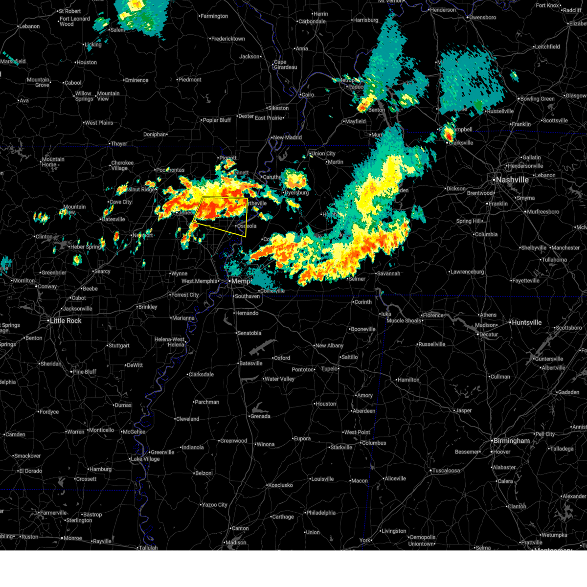
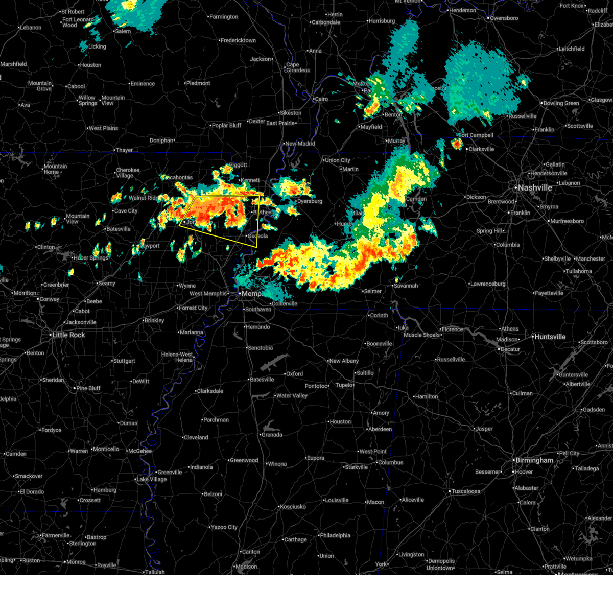
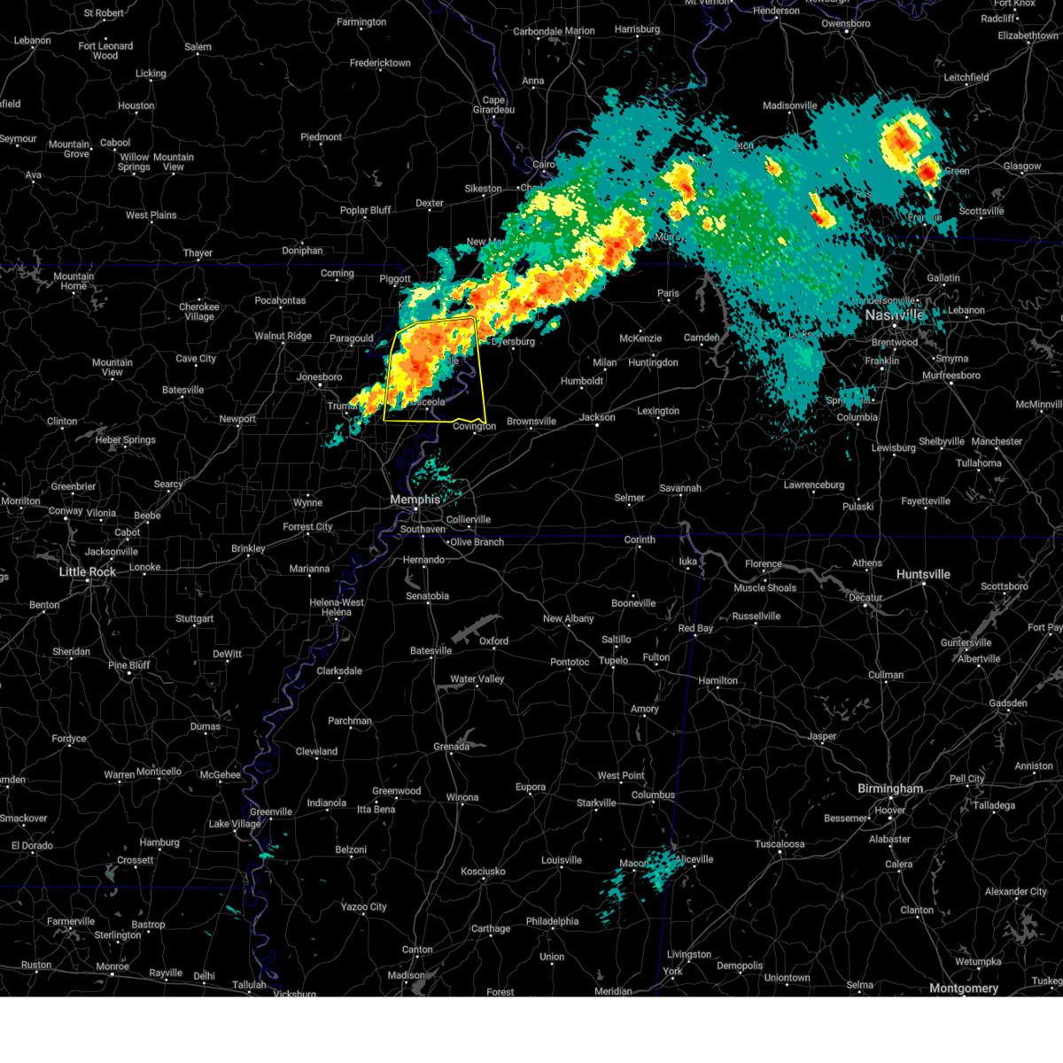
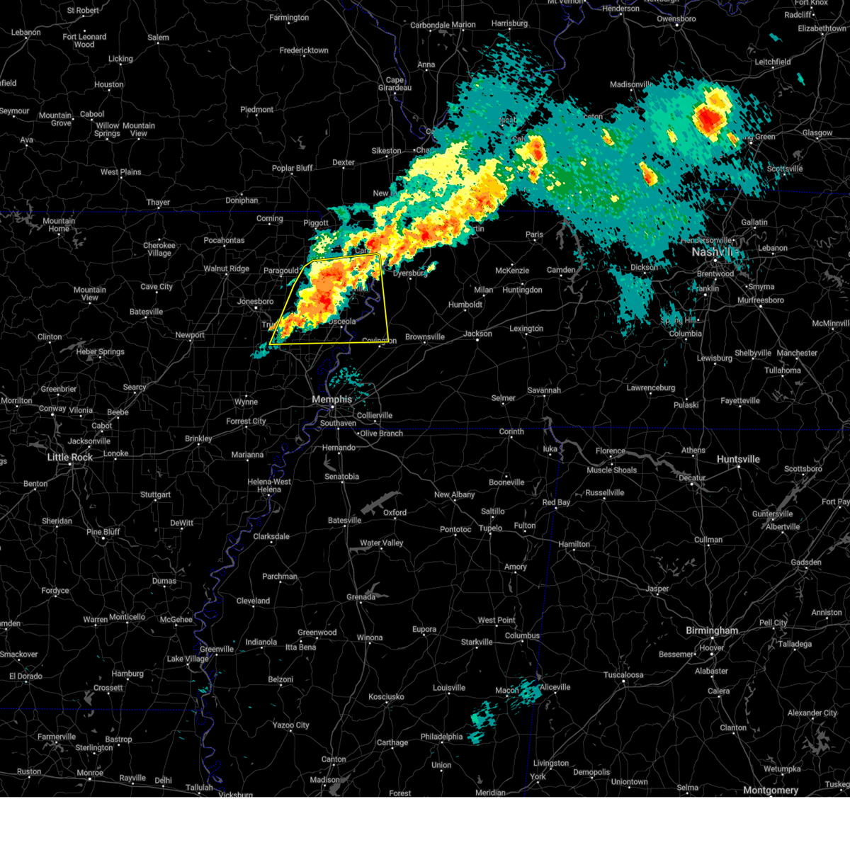
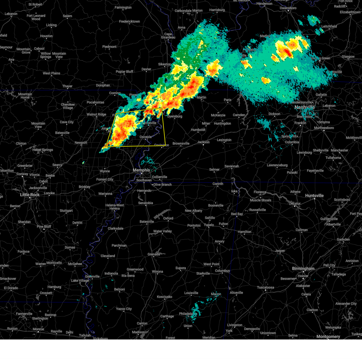
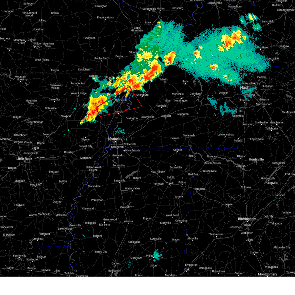
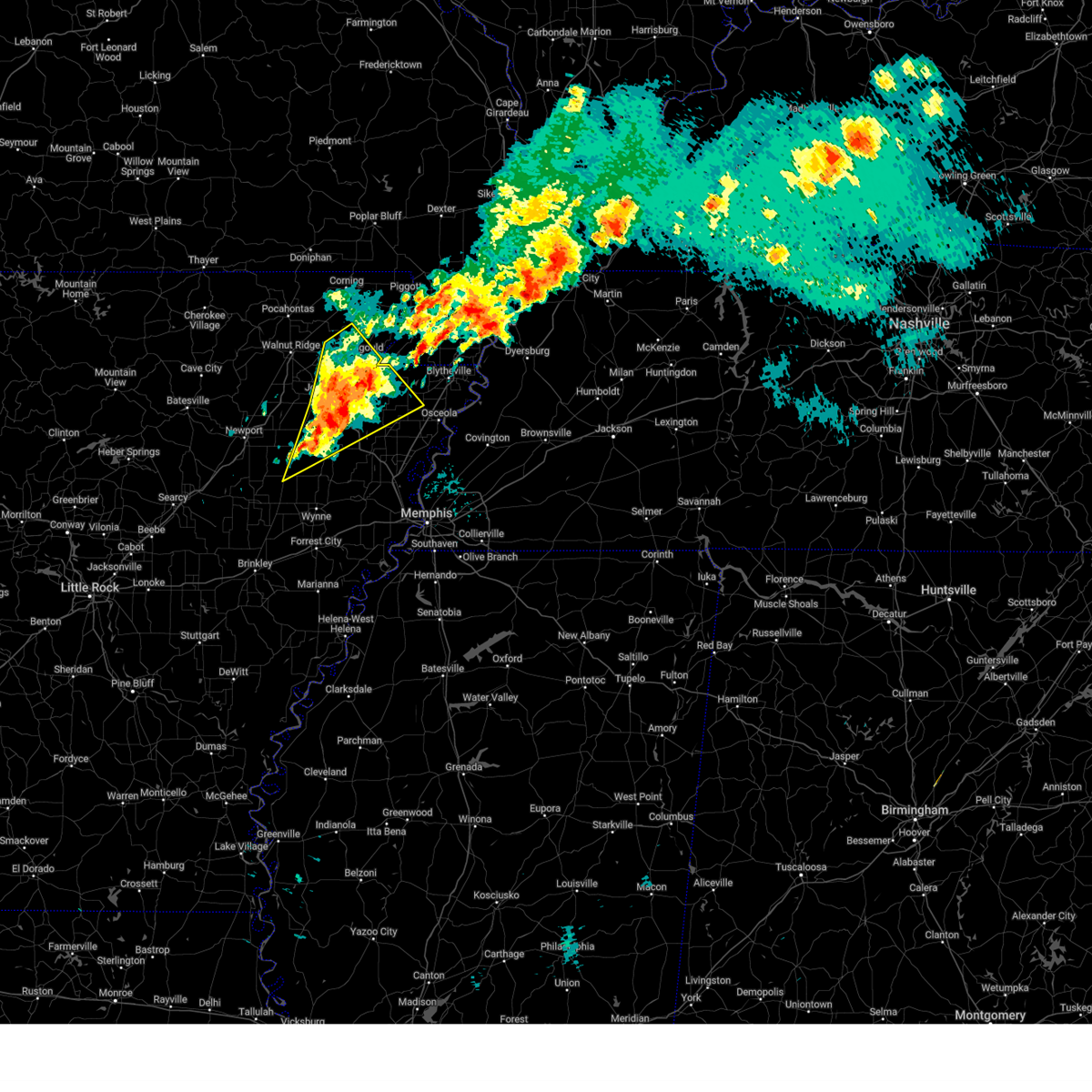
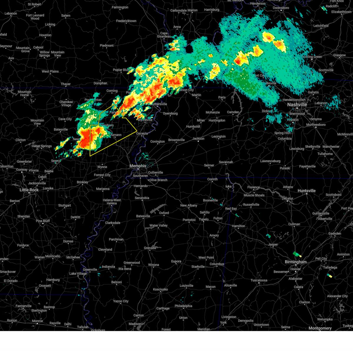
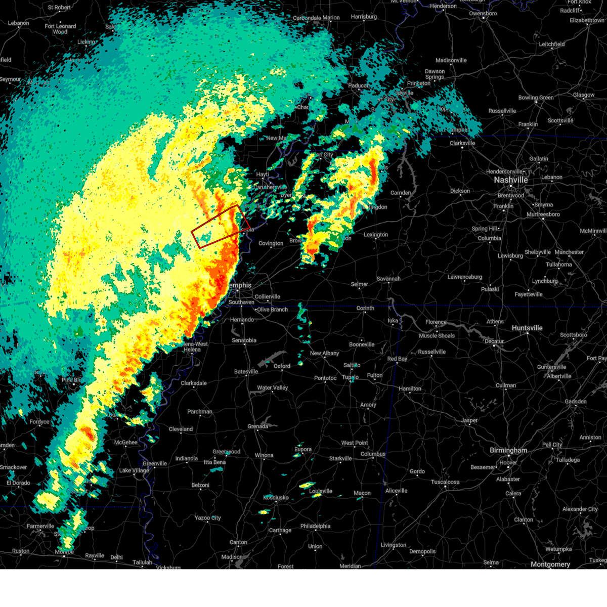
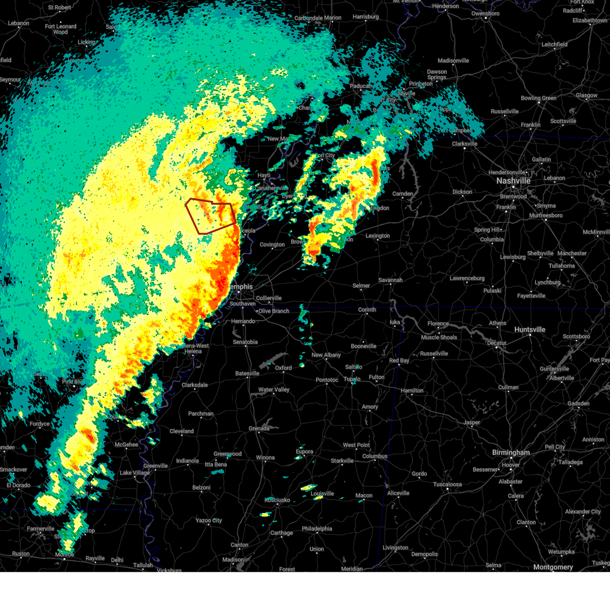
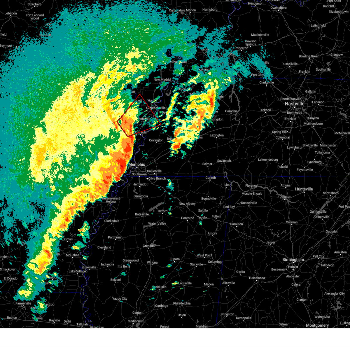
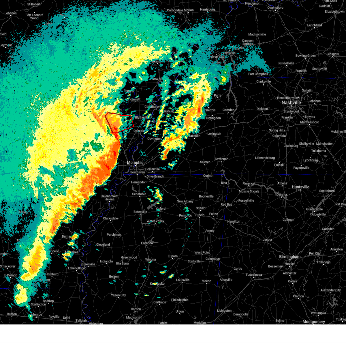
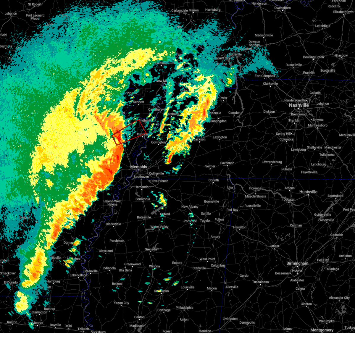
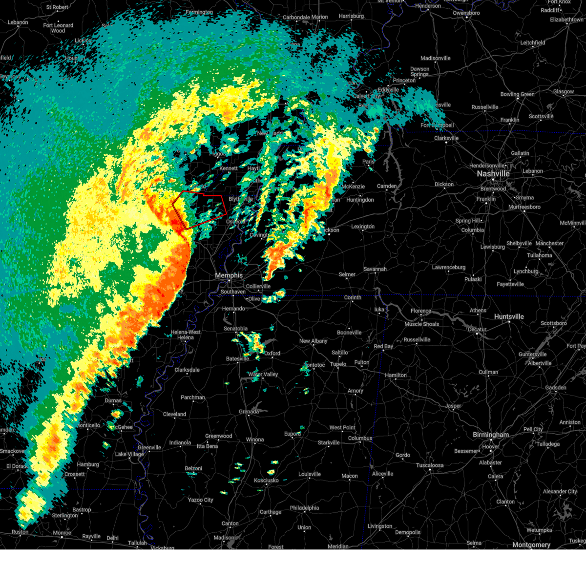
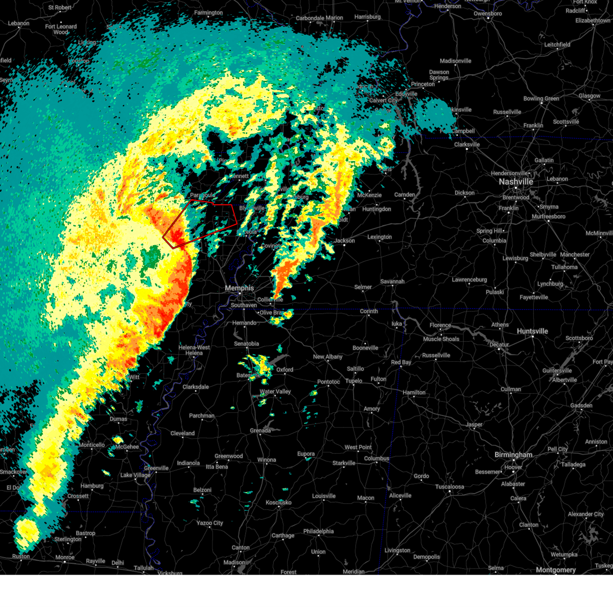
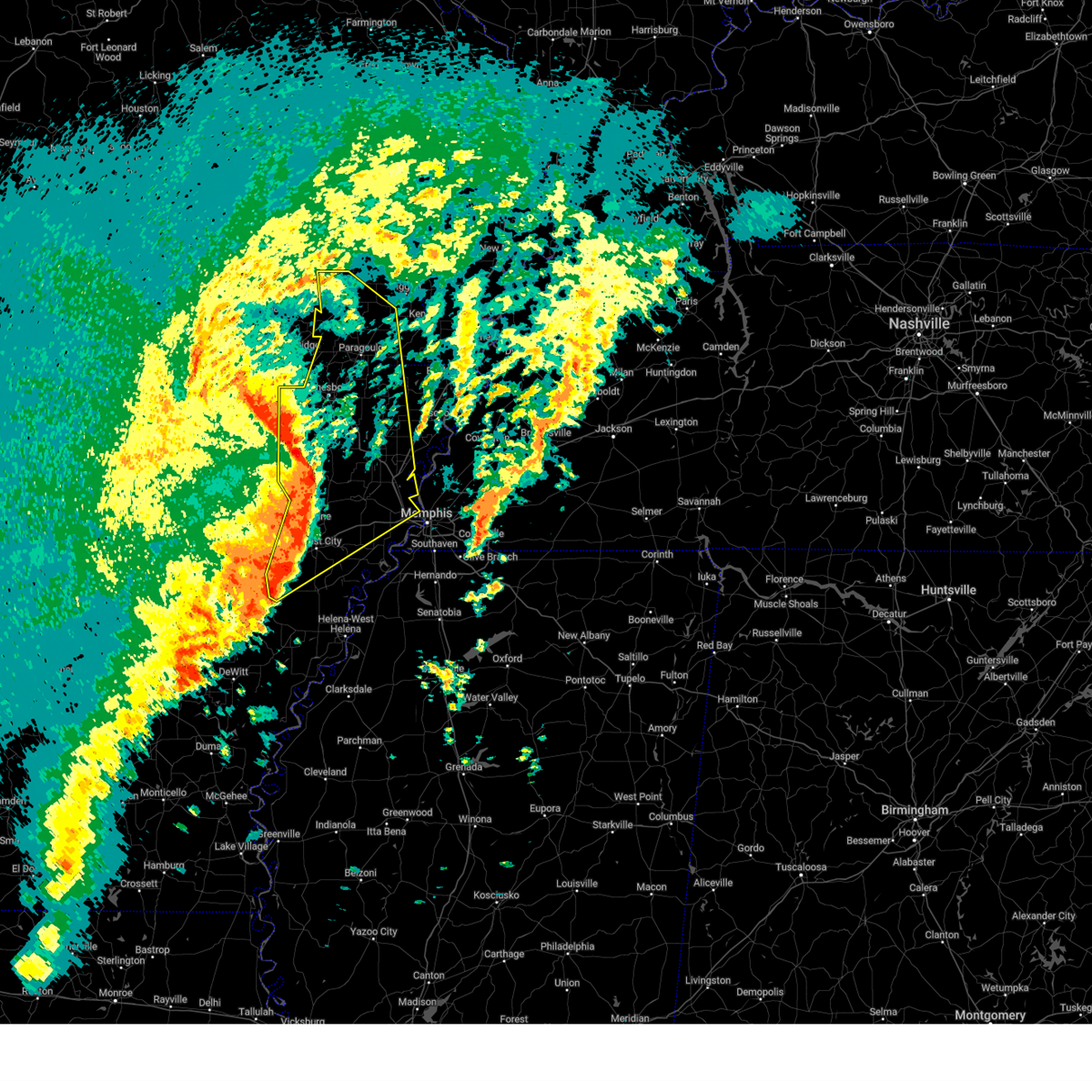
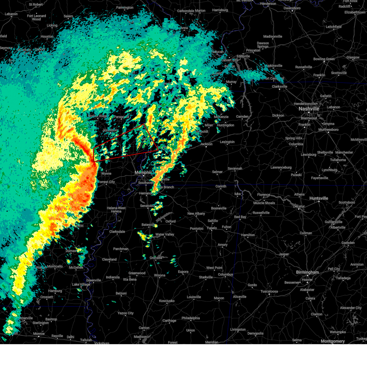
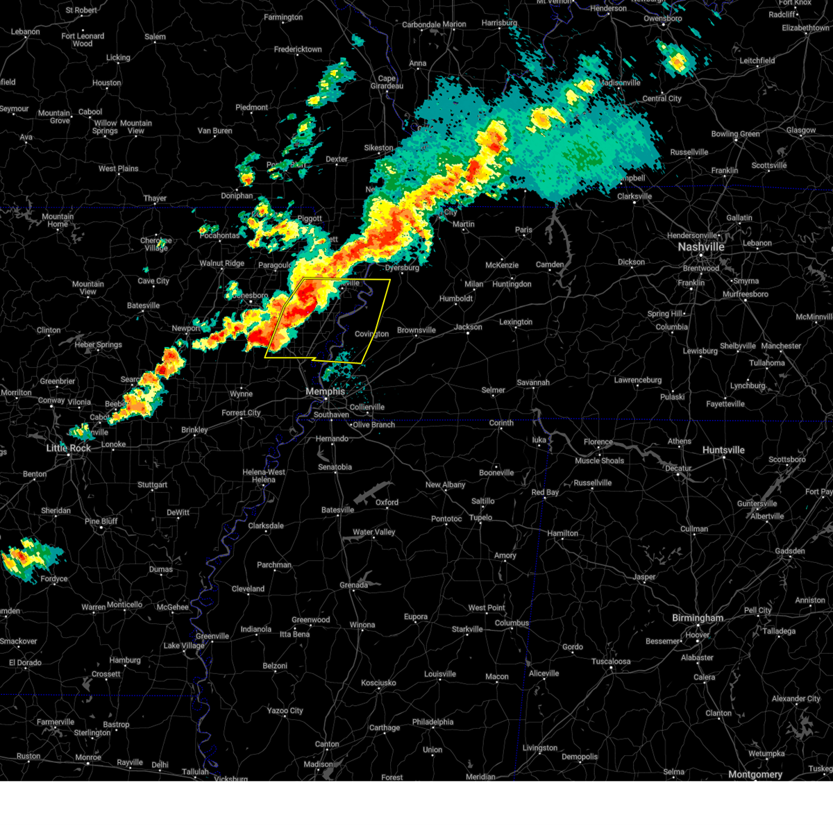
Hail Map for Leachville, AR
The Leachville, AR area has had 3 reports of on-the-ground hail by trained spotters, and has been under severe weather warnings 72 times during the past 12 months. Doppler radar has detected hail at or near Leachville, AR on 64 occasions, including 7 occasions during the past year.
| Name: | Leachville, AR |
| Where Located: | 54.9 miles NNW of Memphis, TN |
| Map: | Google Map for Leachville, AR |
| Population: | 1993 |
| Housing Units: | 876 |
| More Info: | Search Google for Leachville, AR |
4
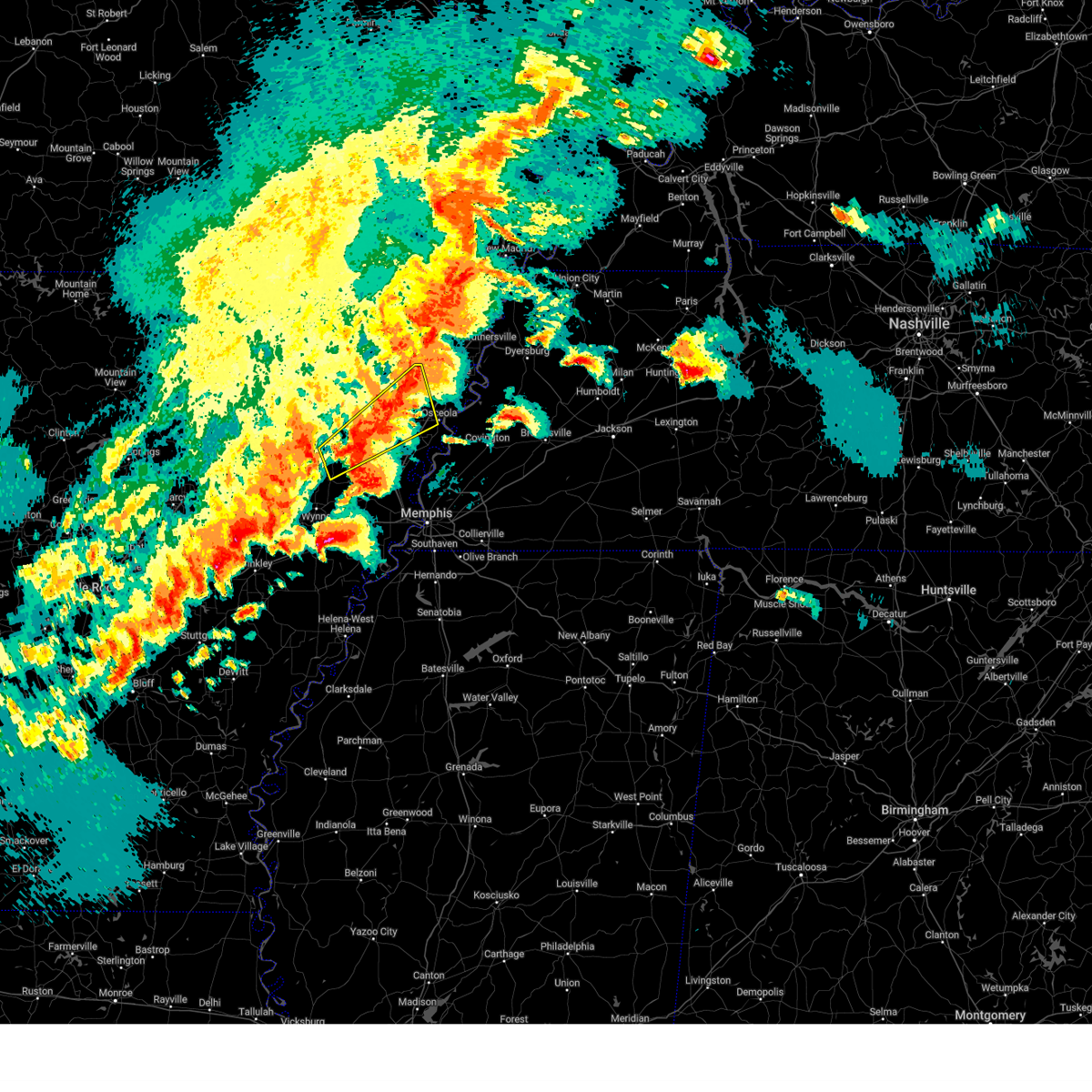
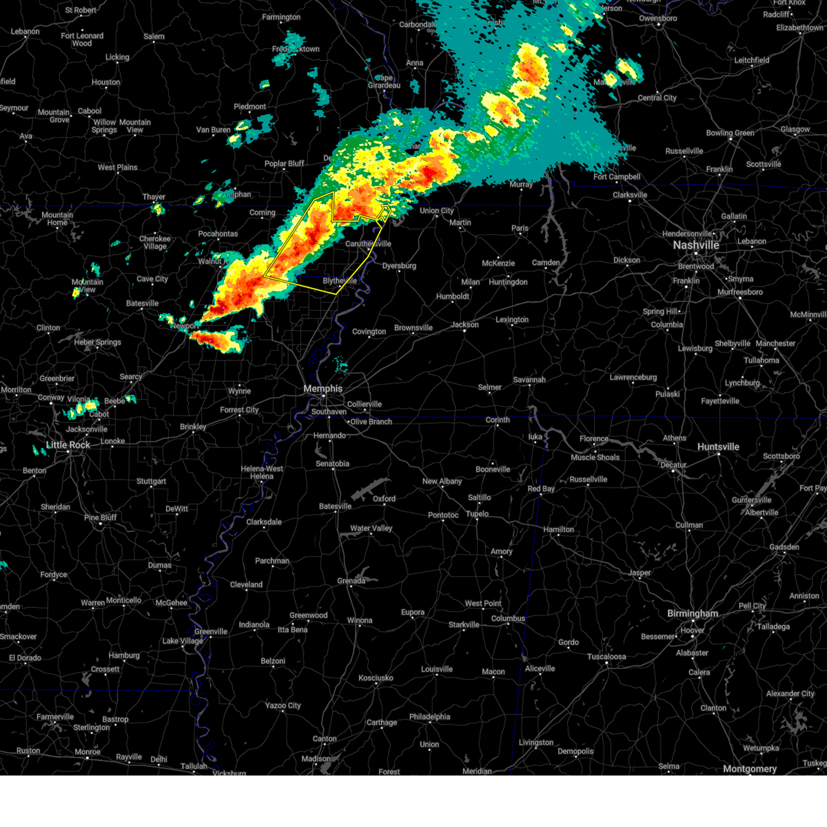
The Top Recent Hail Date for Leachville, AR is Thursday, April 3, 2025 (5th out of 64)

Hail and Wind Damage Spotted near Leachville, AR
| Date / Time | Report Details |
|---|---|
| 6/19/2025 2:23 AM CDT |
 the severe thunderstorm warning has been cancelled and is no longer in effect the severe thunderstorm warning has been cancelled and is no longer in effect
|
| 6/19/2025 2:23 AM CDT |
 At 223 am cdt, a severe thunderstorm was located near leachville, moving east at 35 mph (radar indicated). Hazards include 60 mph wind gusts and quarter size hail. Hail damage to vehicles is expected. expect wind damage to roofs, siding, and trees. Locations impacted include, blytheville, osceola, gosnell, manila, lake city, leachville, monette, caraway, luxora, keiser, fort pillow state park, dell, burdette, fulton, little river, etowah, black oak, victoria, jolliff store, and delfore. At 223 am cdt, a severe thunderstorm was located near leachville, moving east at 35 mph (radar indicated). Hazards include 60 mph wind gusts and quarter size hail. Hail damage to vehicles is expected. expect wind damage to roofs, siding, and trees. Locations impacted include, blytheville, osceola, gosnell, manila, lake city, leachville, monette, caraway, luxora, keiser, fort pillow state park, dell, burdette, fulton, little river, etowah, black oak, victoria, jolliff store, and delfore.
|
| 6/19/2025 2:09 AM CDT |
 Svrmeg the national weather service in memphis has issued a * severe thunderstorm warning for, southeastern greene county in eastern arkansas, eastern craighead county in eastern arkansas, mississippi county in eastern arkansas, southwestern pemiscot county in southeastern missouri, southern dunklin county in southeastern missouri, southwestern lauderdale county in west tennessee, * until 300 am cdt. * at 209 am cdt, a severe thunderstorm was located near lake city, moving east at 45 mph (radar indicated). Hazards include 60 mph wind gusts and quarter size hail. Hail damage to vehicles is expected. Expect wind damage to roofs, siding, and trees. Svrmeg the national weather service in memphis has issued a * severe thunderstorm warning for, southeastern greene county in eastern arkansas, eastern craighead county in eastern arkansas, mississippi county in eastern arkansas, southwestern pemiscot county in southeastern missouri, southern dunklin county in southeastern missouri, southwestern lauderdale county in west tennessee, * until 300 am cdt. * at 209 am cdt, a severe thunderstorm was located near lake city, moving east at 45 mph (radar indicated). Hazards include 60 mph wind gusts and quarter size hail. Hail damage to vehicles is expected. Expect wind damage to roofs, siding, and trees.
|
| 5/16/2025 8:18 AM CDT |
 the severe thunderstorm warning has been cancelled and is no longer in effect the severe thunderstorm warning has been cancelled and is no longer in effect
|
| 5/16/2025 8:18 AM CDT |
 At 818 am cdt, a severe thunderstorm was located over dell, or 7 miles northwest of luxora, moving east at 45 mph (radar indicated). Hazards include 60 mph wind gusts and quarter size hail. Hail damage to vehicles is expected. expect wind damage to roofs, siding, and trees. Locations impacted include, calumet, new survey, etowah, grider, gobler, covington, osceola, shippen, victoria, roseland, steele, stark city, hollywood, blytheville, armorel, whistleville, lightfoot, arp, three way, and west ridge. At 818 am cdt, a severe thunderstorm was located over dell, or 7 miles northwest of luxora, moving east at 45 mph (radar indicated). Hazards include 60 mph wind gusts and quarter size hail. Hail damage to vehicles is expected. expect wind damage to roofs, siding, and trees. Locations impacted include, calumet, new survey, etowah, grider, gobler, covington, osceola, shippen, victoria, roseland, steele, stark city, hollywood, blytheville, armorel, whistleville, lightfoot, arp, three way, and west ridge.
|
| 5/16/2025 8:08 AM CDT |
 At 807 am cdt, a severe thunderstorm was located near manila, moving east at 55 mph (radar indicated). Hazards include 60 mph wind gusts and quarter size hail. Hail damage to vehicles is expected. expect wind damage to roofs, siding, and trees. Locations impacted include, paulding, calumet, new survey, vail, etowah, grider, gobler, covington, whisp, osceola, judd hill, bunney, shippen, milligan ridge, victoria, roseland, buck donic, steele, stark city, and hollywood. At 807 am cdt, a severe thunderstorm was located near manila, moving east at 55 mph (radar indicated). Hazards include 60 mph wind gusts and quarter size hail. Hail damage to vehicles is expected. expect wind damage to roofs, siding, and trees. Locations impacted include, paulding, calumet, new survey, vail, etowah, grider, gobler, covington, whisp, osceola, judd hill, bunney, shippen, milligan ridge, victoria, roseland, buck donic, steele, stark city, and hollywood.
|
| 5/16/2025 8:08 AM CDT |
 the severe thunderstorm warning has been cancelled and is no longer in effect the severe thunderstorm warning has been cancelled and is no longer in effect
|
| 5/16/2025 8:05 AM CDT | the tornado warning has been cancelled and is no longer in effect |
| 5/16/2025 8:05 AM CDT | At 804 am cdt, a severe thunderstorm capable of producing a tornado was located near manila, moving east at 60 mph (radar indicated rotation). Hazards include tornado and quarter size hail. Flying debris will be dangerous to those caught without shelter. mobile homes will be damaged or destroyed. damage to roofs, windows, and vehicles will occur. tree damage is likely. Locations impacted include, calumet, new survey, vail, etowah, covington, whisp, milligan ridge, victoria, roseland, steele, stark city, blytheville, armorel, whistleville, three way, papaw ridge, porter gap, west ridge, barfield, and gilbert. |
| 5/16/2025 7:56 AM CDT |
 Svrmeg the national weather service in memphis has issued a * severe thunderstorm warning for, southeastern greene county in eastern arkansas, eastern craighead county in eastern arkansas, northeastern poinsett county in eastern arkansas, mississippi county in eastern arkansas, southwestern pemiscot county in southeastern missouri, southern dunklin county in southeastern missouri, northeastern tipton county in west tennessee, southwestern dyer county in west tennessee, western lauderdale county in west tennessee, * until 845 am cdt. * at 756 am cdt, a severe thunderstorm was located near caraway, moving east at 45 mph (radar indicated). Hazards include 60 mph wind gusts and quarter size hail. Hail damage to vehicles is expected. Expect wind damage to roofs, siding, and trees. Svrmeg the national weather service in memphis has issued a * severe thunderstorm warning for, southeastern greene county in eastern arkansas, eastern craighead county in eastern arkansas, northeastern poinsett county in eastern arkansas, mississippi county in eastern arkansas, southwestern pemiscot county in southeastern missouri, southern dunklin county in southeastern missouri, northeastern tipton county in west tennessee, southwestern dyer county in west tennessee, western lauderdale county in west tennessee, * until 845 am cdt. * at 756 am cdt, a severe thunderstorm was located near caraway, moving east at 45 mph (radar indicated). Hazards include 60 mph wind gusts and quarter size hail. Hail damage to vehicles is expected. Expect wind damage to roofs, siding, and trees.
|
| 5/16/2025 7:51 AM CDT |
 Tormeg the national weather service in memphis has issued a * tornado warning for, southeastern craighead county in eastern arkansas, northeastern poinsett county in eastern arkansas, mississippi county in eastern arkansas, southern pemiscot county in southeastern missouri, southeastern dunklin county in southeastern missouri, southwestern dyer county in west tennessee, northern lauderdale county in west tennessee, * until 830 am cdt. * at 751 am cdt, a severe thunderstorm capable of producing a tornado was located near lake city, moving northeast at 60 mph (radar indicated rotation). Hazards include tornado. Flying debris will be dangerous to those caught without shelter. mobile homes will be damaged or destroyed. damage to roofs, windows, and vehicles will occur. Tree damage is likely. Tormeg the national weather service in memphis has issued a * tornado warning for, southeastern craighead county in eastern arkansas, northeastern poinsett county in eastern arkansas, mississippi county in eastern arkansas, southern pemiscot county in southeastern missouri, southeastern dunklin county in southeastern missouri, southwestern dyer county in west tennessee, northern lauderdale county in west tennessee, * until 830 am cdt. * at 751 am cdt, a severe thunderstorm capable of producing a tornado was located near lake city, moving northeast at 60 mph (radar indicated rotation). Hazards include tornado. Flying debris will be dangerous to those caught without shelter. mobile homes will be damaged or destroyed. damage to roofs, windows, and vehicles will occur. Tree damage is likely.
|
| 5/16/2025 7:47 AM CDT |
 At 747 am cdt, a severe thunderstorm was located over bay, moving east at 60 mph (radar indicated). Hazards include 70 mph wind gusts and quarter size hail. Hail damage to vehicles is expected. expect considerable tree damage. wind damage is also likely to mobile homes, roofs, and outbuildings. Locations impacted include, jolliff store, apt, delfore, lennie, vail, valley view, etowah, carmi, gum point, whisp, farrville, lester, craighead forest park, promised land, caraway, little river, bethel, finch, judd hill, and lorado. At 747 am cdt, a severe thunderstorm was located over bay, moving east at 60 mph (radar indicated). Hazards include 70 mph wind gusts and quarter size hail. Hail damage to vehicles is expected. expect considerable tree damage. wind damage is also likely to mobile homes, roofs, and outbuildings. Locations impacted include, jolliff store, apt, delfore, lennie, vail, valley view, etowah, carmi, gum point, whisp, farrville, lester, craighead forest park, promised land, caraway, little river, bethel, finch, judd hill, and lorado.
|
| 5/16/2025 7:18 AM CDT |
 Svrmeg the national weather service in memphis has issued a * severe thunderstorm warning for, western greene county in eastern arkansas, craighead county in eastern arkansas, poinsett county in eastern arkansas, west central mississippi county in eastern arkansas, northwestern cross county in eastern arkansas, * until 800 am cdt. * at 718 am cdt, a severe thunderstorm was located over grubbs, or 10 miles east of newport, moving northeast at 55 mph (radar indicated). Hazards include 60 mph wind gusts and quarter size hail. Hail damage to vehicles is expected. Expect wind damage to roofs, siding, and trees. Svrmeg the national weather service in memphis has issued a * severe thunderstorm warning for, western greene county in eastern arkansas, craighead county in eastern arkansas, poinsett county in eastern arkansas, west central mississippi county in eastern arkansas, northwestern cross county in eastern arkansas, * until 800 am cdt. * at 718 am cdt, a severe thunderstorm was located over grubbs, or 10 miles east of newport, moving northeast at 55 mph (radar indicated). Hazards include 60 mph wind gusts and quarter size hail. Hail damage to vehicles is expected. Expect wind damage to roofs, siding, and trees.
|
| 4/5/2025 1:43 PM CDT |
 The storm which prompted the warning has moved out of the area. therefore, the warning will be allowed to expire. a tornado watch remains in effect until 700 pm cdt for eastern arkansas, and west tennessee. remember, a tornado warning still remains in effect for mississippi county through 230 pm cdt. The storm which prompted the warning has moved out of the area. therefore, the warning will be allowed to expire. a tornado watch remains in effect until 700 pm cdt for eastern arkansas, and west tennessee. remember, a tornado warning still remains in effect for mississippi county through 230 pm cdt.
|
| 4/5/2025 1:40 PM CDT |
 the tornado warning has been cancelled and is no longer in effect the tornado warning has been cancelled and is no longer in effect
|
| 4/5/2025 1:38 PM CDT |
 the severe thunderstorm warning has been cancelled and is no longer in effect the severe thunderstorm warning has been cancelled and is no longer in effect
|
| 4/5/2025 1:38 PM CDT |
 At 138 pm cdt, severe thunderstorms were located along a line extending from near hornersville to near wilson to near horseshoe lake, moving east at 50 mph (radar indicated). Hazards include 70 mph wind gusts and quarter size hail. Hail damage to vehicles is expected. expect considerable tree damage. wind damage is also likely to mobile homes, roofs, and outbuildings. Locations impacted include, burlison, calumet, new survey, horn lake, louise, gobler, covington, edmondson, osceola, presidents island, beck, glover, locke, arlington, elmore park, alden, milligan ridge, roseland, julius, and steele. At 138 pm cdt, severe thunderstorms were located along a line extending from near hornersville to near wilson to near horseshoe lake, moving east at 50 mph (radar indicated). Hazards include 70 mph wind gusts and quarter size hail. Hail damage to vehicles is expected. expect considerable tree damage. wind damage is also likely to mobile homes, roofs, and outbuildings. Locations impacted include, burlison, calumet, new survey, horn lake, louise, gobler, covington, edmondson, osceola, presidents island, beck, glover, locke, arlington, elmore park, alden, milligan ridge, roseland, julius, and steele.
|
| 4/5/2025 1:35 PM CDT |
 the tornado warning has been cancelled and is no longer in effect the tornado warning has been cancelled and is no longer in effect
|
| 4/5/2025 1:35 PM CDT |
 At 134 pm cdt, a severe thunderstorm capable of producing a tornado was located near manila, moving northeast at 55 mph. this storm system is moving over areas already impacted earlier in the week (radar indicated rotation). Hazards include tornado and quarter size hail. Flying debris will be dangerous to those caught without shelter. mobile homes will be damaged or destroyed. damage to roofs, windows, and vehicles will occur. tree damage is likely. Locations impacted include, paulding, scobeville, calumet, new survey, vail, etowah, gobler, covington, whisp, noland, milligan ridge, victoria, roseland, buck donic, dillman, steele, stark city, hollywood, blytheville, and armorel. At 134 pm cdt, a severe thunderstorm capable of producing a tornado was located near manila, moving northeast at 55 mph. this storm system is moving over areas already impacted earlier in the week (radar indicated rotation). Hazards include tornado and quarter size hail. Flying debris will be dangerous to those caught without shelter. mobile homes will be damaged or destroyed. damage to roofs, windows, and vehicles will occur. tree damage is likely. Locations impacted include, paulding, scobeville, calumet, new survey, vail, etowah, gobler, covington, whisp, noland, milligan ridge, victoria, roseland, buck donic, dillman, steele, stark city, hollywood, blytheville, and armorel.
|
| 4/5/2025 1:29 PM CDT | At 129 pm cdt, severe thunderstorms were located along a line extending from leachville to marie to near hughes, moving east at 50 mph. these are destructive storms for the memphis metro area (radar indicated). Hazards include 80 mph wind gusts and quarter size hail. Flying debris will be dangerous to those caught without shelter. mobile homes will be heavily damaged. expect considerable damage to roofs, windows, and vehicles. extensive tree damage and power outages are likely. Locations impacted include, cody, burlison, paulding, scobeville, calumet, new survey, horn lake, haleside, louise, gobler, covington, edmondson, osceola, presidents island, beck, glover, locke, ball point, arlington, and tongin. |
| 4/5/2025 1:29 PM CDT | the severe thunderstorm warning has been cancelled and is no longer in effect |
| 4/5/2025 1:21 PM CDT |
 Svrmeg the national weather service in memphis has issued a * severe thunderstorm warning for, eastern craighead county in eastern arkansas, eastern st. francis county in eastern arkansas, mississippi county in eastern arkansas, crittenden county in eastern arkansas, southeastern clay county in eastern arkansas, greene county in eastern arkansas, eastern lee county in eastern arkansas, eastern poinsett county in eastern arkansas, northern phillips county in eastern arkansas, desoto county in northwestern mississippi, northwestern tate county in northwestern mississippi, northern tunica county in northwestern mississippi, dunklin county in southeastern missouri, pemiscot county in southeastern missouri, lauderdale county in west tennessee, southwestern haywood county in west tennessee, shelby county in west tennessee, tipton county in west tennessee, southwestern dyer county in west tennessee, * until 215 pm cdt. * at 120 pm cdt, severe thunderstorms were located along a line extending from evening star to joiner to near hughes to near marvell, moving east at 55 mph. this storm system is moving over areas already impacted earlier in the week. these are destructive storms for shelby, mississippi, and desoto (radar indicated). Hazards include 80 mph wind gusts and quarter size hail. Flying debris will be dangerous to those caught without shelter. mobile homes will be heavily damaged. expect considerable damage to roofs, windows, and vehicles. Extensive tree damage and power outages are likely. Svrmeg the national weather service in memphis has issued a * severe thunderstorm warning for, eastern craighead county in eastern arkansas, eastern st. francis county in eastern arkansas, mississippi county in eastern arkansas, crittenden county in eastern arkansas, southeastern clay county in eastern arkansas, greene county in eastern arkansas, eastern lee county in eastern arkansas, eastern poinsett county in eastern arkansas, northern phillips county in eastern arkansas, desoto county in northwestern mississippi, northwestern tate county in northwestern mississippi, northern tunica county in northwestern mississippi, dunklin county in southeastern missouri, pemiscot county in southeastern missouri, lauderdale county in west tennessee, southwestern haywood county in west tennessee, shelby county in west tennessee, tipton county in west tennessee, southwestern dyer county in west tennessee, * until 215 pm cdt. * at 120 pm cdt, severe thunderstorms were located along a line extending from evening star to joiner to near hughes to near marvell, moving east at 55 mph. this storm system is moving over areas already impacted earlier in the week. these are destructive storms for shelby, mississippi, and desoto (radar indicated). Hazards include 80 mph wind gusts and quarter size hail. Flying debris will be dangerous to those caught without shelter. mobile homes will be heavily damaged. expect considerable damage to roofs, windows, and vehicles. Extensive tree damage and power outages are likely.
|
| 4/5/2025 1:16 PM CDT |
 the tornado warning has been cancelled and is no longer in effect the tornado warning has been cancelled and is no longer in effect
|
| 4/5/2025 1:16 PM CDT |
 At 115 pm cdt, a severe thunderstorm capable of producing a tornado was located near lake city, moving northeast at 70 mph. this storm system is moving over areas already impacted earlier in the week (radar indicated rotation). Hazards include tornado and quarter size hail. Flying debris will be dangerous to those caught without shelter. mobile homes will be damaged or destroyed. damage to roofs, windows, and vehicles will occur. tree damage is likely. Locations impacted include, jolliff store, happy corners, delfore, lake city, vail, macey, schug, big lake, manila, carmi, gum point, whisp, buckeye, lester, arkmo, mandalay, walters, caraway, pawheen, and bethel. At 115 pm cdt, a severe thunderstorm capable of producing a tornado was located near lake city, moving northeast at 70 mph. this storm system is moving over areas already impacted earlier in the week (radar indicated rotation). Hazards include tornado and quarter size hail. Flying debris will be dangerous to those caught without shelter. mobile homes will be damaged or destroyed. damage to roofs, windows, and vehicles will occur. tree damage is likely. Locations impacted include, jolliff store, happy corners, delfore, lake city, vail, macey, schug, big lake, manila, carmi, gum point, whisp, buckeye, lester, arkmo, mandalay, walters, caraway, pawheen, and bethel.
|
| 4/5/2025 1:14 PM CDT |
 the tornado warning has been cancelled and is no longer in effect the tornado warning has been cancelled and is no longer in effect
|
| 4/5/2025 1:14 PM CDT |
 At 112 pm cdt, a severe thunderstorm capable of producing a tornado was located over trumann, moving northeast at 50 mph (radar indicated rotation). Hazards include tornado. Flying debris will be dangerous to those caught without shelter. mobile homes will be damaged or destroyed. damage to roofs, windows, and vehicles will occur. tree damage is likely. this storm system is moving over areas already impacted earlier in the week. Locations impacted include, three way, jolliff store, dell, dearman, west ridge, eastview, lennie, vail, tulot, big lake, etowah, manila, hightower, hatchie coon, whisp, luxora, mandalay, walters, caraway, and little river. At 112 pm cdt, a severe thunderstorm capable of producing a tornado was located over trumann, moving northeast at 50 mph (radar indicated rotation). Hazards include tornado. Flying debris will be dangerous to those caught without shelter. mobile homes will be damaged or destroyed. damage to roofs, windows, and vehicles will occur. tree damage is likely. this storm system is moving over areas already impacted earlier in the week. Locations impacted include, three way, jolliff store, dell, dearman, west ridge, eastview, lennie, vail, tulot, big lake, etowah, manila, hightower, hatchie coon, whisp, luxora, mandalay, walters, caraway, and little river.
|
| 4/5/2025 1:11 PM CDT |
 At 110 pm cdt, a severe thunderstorm capable of producing a tornado was located near lake city, moving north at 70 mph. this storm system is moving over areas already impacted earlier in the week (radar indicated rotation). Hazards include tornado and quarter size hail. Flying debris will be dangerous to those caught without shelter. mobile homes will be damaged or destroyed. damage to roofs, windows, and vehicles will occur. tree damage is likely. Locations impacted include, jolliff store, delfore, vail, carmi, gum point, whisp, farrville, buckeye, lester, arkmo, caraway, bethel, finch, herman davis state park, herndon, needham, milligan ridge, lunsford, davis spur, and roseland. At 110 pm cdt, a severe thunderstorm capable of producing a tornado was located near lake city, moving north at 70 mph. this storm system is moving over areas already impacted earlier in the week (radar indicated rotation). Hazards include tornado and quarter size hail. Flying debris will be dangerous to those caught without shelter. mobile homes will be damaged or destroyed. damage to roofs, windows, and vehicles will occur. tree damage is likely. Locations impacted include, jolliff store, delfore, vail, carmi, gum point, whisp, farrville, buckeye, lester, arkmo, caraway, bethel, finch, herman davis state park, herndon, needham, milligan ridge, lunsford, davis spur, and roseland.
|
| 4/5/2025 1:10 PM CDT |
 Tormeg the national weather service in memphis has issued a * tornado warning for, eastern craighead county in eastern arkansas, northeastern poinsett county in eastern arkansas, mississippi county in eastern arkansas, southwestern pemiscot county in southeastern missouri, southeastern dunklin county in southeastern missouri, southwestern dyer county in west tennessee, north central lauderdale county in west tennessee, * until 200 pm cdt. * at 109 pm cdt, a severe thunderstorm capable of producing a tornado was located over trumann, moving east at 50 mph (radar indicated rotation). Hazards include tornado and quarter size hail. Flying debris will be dangerous to those caught without shelter. mobile homes will be damaged or destroyed. damage to roofs, windows, and vehicles will occur. tree damage is likely. This storm system is moving over areas already impacted earlier in the week. Tormeg the national weather service in memphis has issued a * tornado warning for, eastern craighead county in eastern arkansas, northeastern poinsett county in eastern arkansas, mississippi county in eastern arkansas, southwestern pemiscot county in southeastern missouri, southeastern dunklin county in southeastern missouri, southwestern dyer county in west tennessee, north central lauderdale county in west tennessee, * until 200 pm cdt. * at 109 pm cdt, a severe thunderstorm capable of producing a tornado was located over trumann, moving east at 50 mph (radar indicated rotation). Hazards include tornado and quarter size hail. Flying debris will be dangerous to those caught without shelter. mobile homes will be damaged or destroyed. damage to roofs, windows, and vehicles will occur. tree damage is likely. This storm system is moving over areas already impacted earlier in the week.
|
| 4/5/2025 1:09 PM CDT |
 At 109 pm cdt, severe thunderstorms were located along a line extending from o'kean to near caraway to near new home, moving northeast at 80 mph. these are destructive storms for truman (radar indicated). Hazards include 90 mph wind gusts and half dollar size hail. You are in a life-threatening situation. flying debris may be deadly to those caught without shelter. mobile homes will be heavily damaged or destroyed. homes and businesses will have substantial roof and window damage. expect extensive tree damage and power outages. Locations impacted include, three forks, payneway, paulding, apt, stonewall, new castle, success, mounds, alto, judd hill, beech grove, gill, needham, bunney, lake poinsett state park, hawkins, milligan ridge, buck donic, village creek state park, and julius. At 109 pm cdt, severe thunderstorms were located along a line extending from o'kean to near caraway to near new home, moving northeast at 80 mph. these are destructive storms for truman (radar indicated). Hazards include 90 mph wind gusts and half dollar size hail. You are in a life-threatening situation. flying debris may be deadly to those caught without shelter. mobile homes will be heavily damaged or destroyed. homes and businesses will have substantial roof and window damage. expect extensive tree damage and power outages. Locations impacted include, three forks, payneway, paulding, apt, stonewall, new castle, success, mounds, alto, judd hill, beech grove, gill, needham, bunney, lake poinsett state park, hawkins, milligan ridge, buck donic, village creek state park, and julius.
|
| 4/5/2025 1:04 PM CDT |
 At 104 pm cdt, severe thunderstorms were located along a line extending from near o'kean to near lepanto to near new home, moving northeast at 65 mph. this storm system is moving over areas already impacted earlier in the week (radar indicated). Hazards include 70 mph wind gusts and quarter size hail. Hail damage to vehicles is expected. expect considerable tree damage. wind damage is also likely to mobile homes, roofs, and outbuildings. Locations impacted include, three forks, payneway, paulding, apt, stonewall, new castle, success, mounds, alto, judd hill, beech grove, gill, needham, bunney, lake poinsett state park, hawkins, milligan ridge, buck donic, dryden, and village creek state park. At 104 pm cdt, severe thunderstorms were located along a line extending from near o'kean to near lepanto to near new home, moving northeast at 65 mph. this storm system is moving over areas already impacted earlier in the week (radar indicated). Hazards include 70 mph wind gusts and quarter size hail. Hail damage to vehicles is expected. expect considerable tree damage. wind damage is also likely to mobile homes, roofs, and outbuildings. Locations impacted include, three forks, payneway, paulding, apt, stonewall, new castle, success, mounds, alto, judd hill, beech grove, gill, needham, bunney, lake poinsett state park, hawkins, milligan ridge, buck donic, dryden, and village creek state park.
|
| 4/5/2025 1:02 PM CDT |
 At 101 pm cdt, a severe thunderstorm capable of producing a tornado was located near greenfield, or near jonesboro, moving northeast at 60 mph. this storm system is moving over areas already impacted earlier in the week (radar indicated rotation). Hazards include tornado and quarter size hail. Flying debris will be dangerous to those caught without shelter. mobile homes will be damaged or destroyed. damage to roofs, windows, and vehicles will occur. tree damage is likely. Locations impacted include, jolliff store, apt, delfore, vail, valley view, carmi, gum point, whisp, farrville, buckeye, lester, craighead forest park, arkmo, caraway, bethel, finch, herman davis state park, herndon, needham, and milligan ridge. At 101 pm cdt, a severe thunderstorm capable of producing a tornado was located near greenfield, or near jonesboro, moving northeast at 60 mph. this storm system is moving over areas already impacted earlier in the week (radar indicated rotation). Hazards include tornado and quarter size hail. Flying debris will be dangerous to those caught without shelter. mobile homes will be damaged or destroyed. damage to roofs, windows, and vehicles will occur. tree damage is likely. Locations impacted include, jolliff store, apt, delfore, vail, valley view, carmi, gum point, whisp, farrville, buckeye, lester, craighead forest park, arkmo, caraway, bethel, finch, herman davis state park, herndon, needham, and milligan ridge.
|
| 4/5/2025 12:58 PM CDT |
 Tormeg the national weather service in memphis has issued a * tornado warning for, southeastern craighead county in eastern arkansas, poinsett county in eastern arkansas, mississippi county in eastern arkansas, northwestern cross county in eastern arkansas, northwestern tipton county in west tennessee, southwestern lauderdale county in west tennessee, * until 145 pm cdt. * at 1258 pm cdt, a severe thunderstorm capable of producing a tornado was located near trumann, moving east at 65 mph (radar indicated rotation). Hazards include tornado. Flying debris will be dangerous to those caught without shelter. mobile homes will be damaged or destroyed. damage to roofs, windows, and vehicles will occur. Tree damage is likely. Tormeg the national weather service in memphis has issued a * tornado warning for, southeastern craighead county in eastern arkansas, poinsett county in eastern arkansas, mississippi county in eastern arkansas, northwestern cross county in eastern arkansas, northwestern tipton county in west tennessee, southwestern lauderdale county in west tennessee, * until 145 pm cdt. * at 1258 pm cdt, a severe thunderstorm capable of producing a tornado was located near trumann, moving east at 65 mph (radar indicated rotation). Hazards include tornado. Flying debris will be dangerous to those caught without shelter. mobile homes will be damaged or destroyed. damage to roofs, windows, and vehicles will occur. Tree damage is likely.
|
| 4/5/2025 12:55 PM CDT |
 Tormeg the national weather service in memphis has issued a * tornado warning for, south central greene county in eastern arkansas, craighead county in eastern arkansas, northwestern poinsett county in eastern arkansas, northwestern mississippi county in eastern arkansas, * until 200 pm cdt. * at 1254 pm cdt, a severe thunderstorm capable of producing a tornado was located near weiner, or 9 miles northwest of harrisburg, moving northeast at 65 mph. this storm system is moving over areas already impacted earlier in the week (radar indicated rotation). Hazards include tornado and quarter size hail. Flying debris will be dangerous to those caught without shelter. mobile homes will be damaged or destroyed. damage to roofs, windows, and vehicles will occur. Tree damage is likely. Tormeg the national weather service in memphis has issued a * tornado warning for, south central greene county in eastern arkansas, craighead county in eastern arkansas, northwestern poinsett county in eastern arkansas, northwestern mississippi county in eastern arkansas, * until 200 pm cdt. * at 1254 pm cdt, a severe thunderstorm capable of producing a tornado was located near weiner, or 9 miles northwest of harrisburg, moving northeast at 65 mph. this storm system is moving over areas already impacted earlier in the week (radar indicated rotation). Hazards include tornado and quarter size hail. Flying debris will be dangerous to those caught without shelter. mobile homes will be damaged or destroyed. damage to roofs, windows, and vehicles will occur. Tree damage is likely.
|
| 4/5/2025 12:50 PM CDT |
 At 1250 pm cdt, a severe thunderstorm capable of producing a tornado was located near harrisburg, moving east at 60 mph (radar indicated rotation). Hazards include tornado and quarter size hail. Flying debris will be dangerous to those caught without shelter. mobile homes will be damaged or destroyed. damage to roofs, windows, and vehicles will occur. tree damage is likely. this storm system is moving over areas already impacted earlier in the week. Locations impacted include, payneway, burlison, vail, etowah, weona junction, grider, gum point, hampson archaeological museum state park, whisp, osceola, promised land, alto, judd hill, bunney, lake poinsett state park, shippen, milligan ridge, victoria, delpro, and roseland. At 1250 pm cdt, a severe thunderstorm capable of producing a tornado was located near harrisburg, moving east at 60 mph (radar indicated rotation). Hazards include tornado and quarter size hail. Flying debris will be dangerous to those caught without shelter. mobile homes will be damaged or destroyed. damage to roofs, windows, and vehicles will occur. tree damage is likely. this storm system is moving over areas already impacted earlier in the week. Locations impacted include, payneway, burlison, vail, etowah, weona junction, grider, gum point, hampson archaeological museum state park, whisp, osceola, promised land, alto, judd hill, bunney, lake poinsett state park, shippen, milligan ridge, victoria, delpro, and roseland.
|
| 4/5/2025 12:39 PM CDT |
 At 1239 pm cdt, severe thunderstorms were located along a line extending from near strawberry to near cherry valley to near new salem, moving northeast at 70 mph. this storm system is moving over areas already impacted earlier in the week (radar indicated). Hazards include 70 mph wind gusts and quarter size hail. Hail damage to vehicles is expected. expect considerable tree damage. wind damage is also likely to mobile homes, roofs, and outbuildings. Locations impacted include, three forks, payneway, paulding, apt, stonewall, new castle, success, mounds, alto, judd hill, beech grove, gill, needham, bunney, lake poinsett state park, hawkins, milligan ridge, buck donic, dryden, and village creek state park. At 1239 pm cdt, severe thunderstorms were located along a line extending from near strawberry to near cherry valley to near new salem, moving northeast at 70 mph. this storm system is moving over areas already impacted earlier in the week (radar indicated). Hazards include 70 mph wind gusts and quarter size hail. Hail damage to vehicles is expected. expect considerable tree damage. wind damage is also likely to mobile homes, roofs, and outbuildings. Locations impacted include, three forks, payneway, paulding, apt, stonewall, new castle, success, mounds, alto, judd hill, beech grove, gill, needham, bunney, lake poinsett state park, hawkins, milligan ridge, buck donic, dryden, and village creek state park.
|
| 4/5/2025 12:33 PM CDT |
 Tormeg the national weather service in memphis has issued a * tornado warning for, southeastern craighead county in eastern arkansas, poinsett county in eastern arkansas, mississippi county in eastern arkansas, northwestern cross county in eastern arkansas, northwestern tipton county in west tennessee, southwestern lauderdale county in west tennessee, * until 115 pm cdt. * at 1233 pm cdt, a severe thunderstorm capable of producing a tornado was located near hickory ridge, or 14 miles southwest of harrisburg, moving east at 70 mph (radar indicated rotation). Hazards include tornado and quarter size hail. Flying debris will be dangerous to those caught without shelter. mobile homes will be damaged or destroyed. damage to roofs, windows, and vehicles will occur. Tree damage is likely. Tormeg the national weather service in memphis has issued a * tornado warning for, southeastern craighead county in eastern arkansas, poinsett county in eastern arkansas, mississippi county in eastern arkansas, northwestern cross county in eastern arkansas, northwestern tipton county in west tennessee, southwestern lauderdale county in west tennessee, * until 115 pm cdt. * at 1233 pm cdt, a severe thunderstorm capable of producing a tornado was located near hickory ridge, or 14 miles southwest of harrisburg, moving east at 70 mph (radar indicated rotation). Hazards include tornado and quarter size hail. Flying debris will be dangerous to those caught without shelter. mobile homes will be damaged or destroyed. damage to roofs, windows, and vehicles will occur. Tree damage is likely.
|
| 4/5/2025 12:31 PM CDT |
 Svrmeg the national weather service in memphis has issued a * severe thunderstorm warning for, greene county in eastern arkansas, northwestern lee county in eastern arkansas, craighead county in eastern arkansas, st. francis county in eastern arkansas, poinsett county in eastern arkansas, western mississippi county in eastern arkansas, crittenden county in eastern arkansas, western clay county in eastern arkansas, cross county in eastern arkansas, southwestern dunklin county in southeastern missouri, * until 130 pm cdt. * at 1230 pm cdt, severe thunderstorms were located along a line extending from 7 miles south of strawberry to near hickory ridge to near alfrey, moving northeast at 65 mph. this storm system is moving over areas already impacted earlier in the week (radar indicated). Hazards include 70 mph wind gusts and quarter size hail. Hail damage to vehicles is expected. expect considerable tree damage. Wind damage is also likely to mobile homes, roofs, and outbuildings. Svrmeg the national weather service in memphis has issued a * severe thunderstorm warning for, greene county in eastern arkansas, northwestern lee county in eastern arkansas, craighead county in eastern arkansas, st. francis county in eastern arkansas, poinsett county in eastern arkansas, western mississippi county in eastern arkansas, crittenden county in eastern arkansas, western clay county in eastern arkansas, cross county in eastern arkansas, southwestern dunklin county in southeastern missouri, * until 130 pm cdt. * at 1230 pm cdt, severe thunderstorms were located along a line extending from 7 miles south of strawberry to near hickory ridge to near alfrey, moving northeast at 65 mph. this storm system is moving over areas already impacted earlier in the week (radar indicated). Hazards include 70 mph wind gusts and quarter size hail. Hail damage to vehicles is expected. expect considerable tree damage. Wind damage is also likely to mobile homes, roofs, and outbuildings.
|
| 4/2/2025 7:45 PM CDT | At 745 pm cdt, a severe thunderstorm was located near portageville, moving northeast at 50 mph (radar indicated). Hazards include 60 mph wind gusts and nickel size hail. Expect damage to roofs, siding, and trees. Locations impacted include, west hermondale, tiptonville, calumet, new survey, denton, tyler, gobler, covington, caruthersville, buckeye, deer land, temples corner, pascola, peach orchard, broadmoor, samford, madie, channel, homestown, and gosnell. |
| 4/2/2025 7:40 PM CDT | The storm which prompted the warning has moved out of the area. therefore, the warning will be allowed to expire. a tornado watch remains in effect until midnight cdt for eastern arkansas, and southeastern missouri. |
| 4/2/2025 7:31 PM CDT | the tornado warning has been cancelled and is no longer in effect |
| 4/2/2025 7:26 PM CDT |
 The severe thunderstorm warning will be allowed to expire. a tornado watch remains in effect until midnight cdt for eastern arkansas, and southeastern missouri. remember, a tornado warning still remains in effect. The severe thunderstorm warning will be allowed to expire. a tornado watch remains in effect until midnight cdt for eastern arkansas, and southeastern missouri. remember, a tornado warning still remains in effect.
|
| 4/2/2025 7:23 PM CDT |
 The storm which prompted the warning has moved out of the area. therefore, the warning will be allowed to expire. a tornado watch remains in effect until midnight cdt for eastern arkansas, and southeastern missouri. remember, a tornado warning still remains in effect for mississippi county ar. The storm which prompted the warning has moved out of the area. therefore, the warning will be allowed to expire. a tornado watch remains in effect until midnight cdt for eastern arkansas, and southeastern missouri. remember, a tornado warning still remains in effect for mississippi county ar.
|
| 4/2/2025 7:21 PM CDT |
 At 720 pm cdt, a severe thunderstorm capable of producing a tornado was located near harrisburg, moving northeast at 50 mph (radar indicated rotation). Hazards include tornado. Flying debris will be dangerous to those caught without shelter. mobile homes will be damaged or destroyed. damage to roofs, windows, and vehicles will occur. tree damage is likely. Locations impacted include, jonesboro, jolliff store, apt, delfore, vail, valley view, carmi, gum point, whisp, farrville, lester, craighead forest park, promised land, bethel, finch, lorado, herndon, needham, lunsford, davis spur, and pittinger. At 720 pm cdt, a severe thunderstorm capable of producing a tornado was located near harrisburg, moving northeast at 50 mph (radar indicated rotation). Hazards include tornado. Flying debris will be dangerous to those caught without shelter. mobile homes will be damaged or destroyed. damage to roofs, windows, and vehicles will occur. tree damage is likely. Locations impacted include, jonesboro, jolliff store, apt, delfore, vail, valley view, carmi, gum point, whisp, farrville, lester, craighead forest park, promised land, bethel, finch, lorado, herndon, needham, lunsford, davis spur, and pittinger.
|
| 4/2/2025 7:17 PM CDT |
 At 717 pm cdt, a severe thunderstorm capable of producing a tornado was located over hornersville, or 7 miles southeast of senath, moving northeast at 40 mph (radar indicated rotation). Hazards include tornado and quarter size hail. Flying debris will be dangerous to those caught without shelter. mobile homes will be damaged or destroyed. damage to roofs, windows, and vehicles will occur. tree damage is likely. Locations impacted include, jolliff store, west hermondale, paulding, delfore, calumet, dearman, new survey, vail, denton, gobler, carmi, covington, whisp, buckeye, lester, caruth, deer land, arkmo, temples corner, and caraway. At 717 pm cdt, a severe thunderstorm capable of producing a tornado was located over hornersville, or 7 miles southeast of senath, moving northeast at 40 mph (radar indicated rotation). Hazards include tornado and quarter size hail. Flying debris will be dangerous to those caught without shelter. mobile homes will be damaged or destroyed. damage to roofs, windows, and vehicles will occur. tree damage is likely. Locations impacted include, jolliff store, west hermondale, paulding, delfore, calumet, dearman, new survey, vail, denton, gobler, carmi, covington, whisp, buckeye, lester, caruth, deer land, arkmo, temples corner, and caraway.
|
| 4/2/2025 7:13 PM CDT | Svrmeg the national weather service in memphis has issued a * severe thunderstorm warning for, northeastern greene county in eastern arkansas, northern mississippi county in eastern arkansas, eastern clay county in eastern arkansas, pemiscot county in southeastern missouri, dunklin county in southeastern missouri, western dyer county in west tennessee, lake county in west tennessee, * until 815 pm cdt. * at 713 pm cdt, a severe thunderstorm was located near kennett, moving northeast at 50 mph (radar indicated). Hazards include 60 mph wind gusts and nickel size hail. expect damage to roofs, siding, and trees |
| 4/2/2025 7:10 PM CDT | At 710 pm cdt, a severe thunderstorm capable of producing a tornado was located over caraway, moving northeast at 60 mph (radar indicated rotation). Hazards include tornado and ping pong ball size hail. Flying debris will be dangerous to those caught without shelter. mobile homes will be damaged or destroyed. damage to roofs, windows, and vehicles will occur. tree damage is likely. Locations impacted include, three way, jolliff store, dell, dearman, west ridge, eastview, lennie, vail, big lake, etowah, manila, hightower, whisp, buckeye, mandalay, woodland corner, walters, caraway, little river, and lowden. |
| 4/2/2025 7:02 PM CDT | Tormeg the national weather service in memphis has issued a * tornado warning for, south central greene county in eastern arkansas, craighead county in eastern arkansas, western poinsett county in eastern arkansas, northwestern mississippi county in eastern arkansas, northwestern cross county in eastern arkansas, * until 800 pm cdt. * at 702 pm cdt, a severe thunderstorm capable of producing a tornado was located near mcfadden, or 14 miles southeast of newport, moving northeast at 60 mph (radar indicated rotation). Hazards include tornado. Flying debris will be dangerous to those caught without shelter. mobile homes will be damaged or destroyed. damage to roofs, windows, and vehicles will occur. Tree damage is likely. |
| 4/2/2025 7:00 PM CDT | At 659 pm cdt, a confirmed large and extremely dangerous tornado was located over leachville, moving northeast at 50 mph. this is a particularly dangerous situation. take cover now! (weather spotters confirmed tornado). Hazards include damaging tornado. You are in a life-threatening situation. flying debris may be deadly to those caught without shelter. mobile homes will be destroyed. considerable damage to homes, businesses, and vehicles is likely and complete destruction is possible. Locations impacted include, jolliff store, west hermondale, paulding, delfore, calumet, dearman, new survey, vail, denton, gobler, carmi, covington, whisp, buckeye, lester, caruth, deer land, arkmo, temples corner, and caraway. |
| 4/2/2025 6:58 PM CDT | At 658 pm cdt, a large and extremely dangerous tornado was located near cardwell, or near leachville, moving northeast at 60 mph. this is a particularly dangerous situation. take cover now! (radar indicated rotation). Hazards include damaging tornado. You are in a life-threatening situation. flying debris may be deadly to those caught without shelter. mobile homes will be destroyed. considerable damage to homes, businesses, and vehicles is likely and complete destruction is possible. Locations impacted include, paulding, scobeville, new survey, marmaduke, gobler, covington, farrville, cardwell, lester, mounds, halliday, caruth, deer land, arkmo, west kennett, leonard, white oak, bethel, finch, and bell city. |
| 4/2/2025 6:56 PM CDT | At 656 pm cdt, a severe thunderstorm capable of producing a tornado was located near cardwell, or near leachville, moving northeast at 70 mph (radar indicated rotation). Hazards include tornado. Flying debris will be dangerous to those caught without shelter. mobile homes will be damaged or destroyed. damage to roofs, windows, and vehicles will occur. tree damage is likely. Locations impacted include, paulding, scobeville, new survey, marmaduke, gobler, covington, farrville, cardwell, lester, mounds, halliday, caruth, deer land, arkmo, west kennett, leonard, white oak, bethel, finch, and bell city. |
| 4/2/2025 6:51 PM CDT | At 650 pm cdt, a confirmed large and destructive tornado was located over monette, moving northeast at 40 mph. tornado emergency for monette. this is a particularly dangerous situation. take cover now! (radar and spotter confirmed tornado). Hazards include deadly tornado. You are in a life-threatening situation. flying debris may be deadly to those caught without shelter. mobile homes will be destroyed. considerable damage to homes, businesses, and vehicles is likely and complete destruction is possible. Locations impacted include, jolliff store, west hermondale, paulding, delfore, calumet, dearman, new survey, vail, denton, gobler, carmi, covington, whisp, buckeye, lester, caruth, deer land, arkmo, temples corner, and caraway. |
| 4/2/2025 6:51 PM CDT | the tornado warning has been cancelled and is no longer in effect |
| 4/2/2025 6:50 PM CDT | At 650 pm cdt, a confirmed tornado was located 8 miles east of harrisburg, moving northeast at 55 mph (weather spotters confirmed tornado). Hazards include damaging tornado and ping pong ball size hail. Flying debris will be dangerous to those caught without shelter. mobile homes will be damaged or destroyed. damage to roofs, windows, and vehicles will occur. tree damage is likely. Locations impacted include, jolliff store, payneway, dearman, eastview, lennie, vail, etowah, marked tree, weona junction, carmi, whisp, buckeye, osceola, promised land, chilson, caraway, alto, little river, judd hill, and herman davis state park. |
| 4/2/2025 6:45 PM CDT | At 645 pm cdt, a confirmed large and destructive tornado was located over lake city, moving northeast at 60 mph. tornado emergency for lake city ar. this is a particularly dangerous situation. take cover now! (radar and spotter confirmed tornado). Hazards include deadly tornado. You are in a life-threatening situation. flying debris may be deadly to those caught without shelter. mobile homes will be destroyed. considerable damage to homes, businesses, and vehicles is likely and complete destruction is possible. Locations impacted include, jolliff store, west hermondale, paulding, delfore, calumet, dearman, new survey, vail, denton, gobler, carmi, covington, gum point, whisp, buckeye, lester, deer land, arkmo, temples corner, and caraway. |
| 4/2/2025 6:44 PM CDT | Tormeg the national weather service in memphis has issued a * tornado warning for, southeastern craighead county in eastern arkansas, eastern poinsett county in eastern arkansas, northwestern mississippi county in eastern arkansas, * until 730 pm cdt. * at 644 pm cdt, a severe thunderstorm capable of producing a tornado was located near harrisburg, moving northeast at 60 mph (radar indicated rotation). Hazards include tornado and ping pong ball size hail. Flying debris will be dangerous to those caught without shelter. mobile homes will be damaged or destroyed. damage to roofs, windows, and vehicles will occur. Tree damage is likely. |
| 4/2/2025 6:43 PM CDT | Svrmeg the national weather service in memphis has issued a * severe thunderstorm warning for, southeastern craighead county in eastern arkansas, eastern poinsett county in eastern arkansas, northwestern mississippi county in eastern arkansas, north central cross county in eastern arkansas, * until 730 pm cdt. * at 643 pm cdt, a severe thunderstorm was located near harrisburg, moving northeast at 60 mph (radar indicated). Hazards include ping pong ball size hail and 60 mph wind gusts. People and animals outdoors will be injured. expect hail damage to roofs, siding, windows, and vehicles. Expect wind damage to roofs, siding, and trees. |
| 4/2/2025 6:40 PM CDT |
 At 639 pm cdt, a confirmed large and destructive tornado was located over lake city, moving northeast at 40 mph. tornado emergency for lake city ar. this is a particularly dangerous situation. take cover now! (radar confirmed tornado). Hazards include deadly tornado. You are in a life-threatening situation. flying debris may be deadly to those caught without shelter. mobile homes will be destroyed. considerable damage to homes, businesses, and vehicles is likely and complete destruction is possible. Locations impacted include, jolliff store, west hermondale, paulding, delfore, calumet, dearman, new survey, vail, denton, gobler, carmi, covington, gum point, whisp, buckeye, lester, deer land, arkmo, temples corner, and caraway. At 639 pm cdt, a confirmed large and destructive tornado was located over lake city, moving northeast at 40 mph. tornado emergency for lake city ar. this is a particularly dangerous situation. take cover now! (radar confirmed tornado). Hazards include deadly tornado. You are in a life-threatening situation. flying debris may be deadly to those caught without shelter. mobile homes will be destroyed. considerable damage to homes, businesses, and vehicles is likely and complete destruction is possible. Locations impacted include, jolliff store, west hermondale, paulding, delfore, calumet, dearman, new survey, vail, denton, gobler, carmi, covington, gum point, whisp, buckeye, lester, deer land, arkmo, temples corner, and caraway.
|
| 4/2/2025 6:37 PM CDT |
 Tormeg the national weather service in memphis has issued a * tornado warning for, eastern craighead county in eastern arkansas, north central poinsett county in eastern arkansas, northern mississippi county in eastern arkansas, southwestern pemiscot county in southeastern missouri, southeastern dunklin county in southeastern missouri, * until 745 pm cdt. * at 637 pm cdt, a confirmed large and extremely dangerous tornado was located near bay, moving northeast at 40 mph. this is a particularly dangerous situation. take cover now! (weather spotters confirmed tornado). Hazards include damaging tornado. You are in a life-threatening situation. flying debris may be deadly to those caught without shelter. mobile homes will be destroyed. Considerable damage to homes, businesses, and vehicles is likely and complete destruction is possible. Tormeg the national weather service in memphis has issued a * tornado warning for, eastern craighead county in eastern arkansas, north central poinsett county in eastern arkansas, northern mississippi county in eastern arkansas, southwestern pemiscot county in southeastern missouri, southeastern dunklin county in southeastern missouri, * until 745 pm cdt. * at 637 pm cdt, a confirmed large and extremely dangerous tornado was located near bay, moving northeast at 40 mph. this is a particularly dangerous situation. take cover now! (weather spotters confirmed tornado). Hazards include damaging tornado. You are in a life-threatening situation. flying debris may be deadly to those caught without shelter. mobile homes will be destroyed. Considerable damage to homes, businesses, and vehicles is likely and complete destruction is possible.
|
| 4/2/2025 6:34 PM CDT |
 Tormeg the national weather service in memphis has issued a * tornado warning for, southeastern greene county in eastern arkansas, craighead county in eastern arkansas, northwestern mississippi county in eastern arkansas, southeastern clay county in eastern arkansas, west central pemiscot county in southeastern missouri, dunklin county in southeastern missouri, * until 730 pm cdt. * at 634 pm cdt, a severe thunderstorm capable of producing a tornado was located over cash, or 8 miles southwest of bono, moving northeast at 50 mph (radar indicated rotation). Hazards include tornado. Flying debris will be dangerous to those caught without shelter. mobile homes will be damaged or destroyed. damage to roofs, windows, and vehicles will occur. Tree damage is likely. Tormeg the national weather service in memphis has issued a * tornado warning for, southeastern greene county in eastern arkansas, craighead county in eastern arkansas, northwestern mississippi county in eastern arkansas, southeastern clay county in eastern arkansas, west central pemiscot county in southeastern missouri, dunklin county in southeastern missouri, * until 730 pm cdt. * at 634 pm cdt, a severe thunderstorm capable of producing a tornado was located over cash, or 8 miles southwest of bono, moving northeast at 50 mph (radar indicated rotation). Hazards include tornado. Flying debris will be dangerous to those caught without shelter. mobile homes will be damaged or destroyed. damage to roofs, windows, and vehicles will occur. Tree damage is likely.
|
| 3/30/2025 8:15 PM CDT | The storms which prompted the warning have moved out of the area. therefore, the warning will be allowed to expire. a tornado watch remains in effect until 1100 pm cdt for eastern arkansas, and southeastern missouri. remember, a severe thunderstorm warning still remains in effect for mississippi and poinsett counties until 845 pm cdt. |
| 3/30/2025 7:59 PM CDT |
 Svrmeg the national weather service in memphis has issued a * severe thunderstorm warning for, southeastern craighead county in eastern arkansas, eastern poinsett county in eastern arkansas, mississippi county in eastern arkansas, central tipton county in west tennessee, southwestern dyer county in west tennessee, lauderdale county in west tennessee, * until 845 pm cdt. * at 759 pm cdt, severe thunderstorms were located along a line extending from near hornersville to near keiser to near marked tree, moving east at 45 mph (radar indicated). Hazards include 60 mph wind gusts and quarter size hail. Hail damage to vehicles is expected. Expect wind damage to roofs, siding, and trees. Svrmeg the national weather service in memphis has issued a * severe thunderstorm warning for, southeastern craighead county in eastern arkansas, eastern poinsett county in eastern arkansas, mississippi county in eastern arkansas, central tipton county in west tennessee, southwestern dyer county in west tennessee, lauderdale county in west tennessee, * until 845 pm cdt. * at 759 pm cdt, severe thunderstorms were located along a line extending from near hornersville to near keiser to near marked tree, moving east at 45 mph (radar indicated). Hazards include 60 mph wind gusts and quarter size hail. Hail damage to vehicles is expected. Expect wind damage to roofs, siding, and trees.
|
| 3/30/2025 7:33 PM CDT | the severe thunderstorm warning has been cancelled and is no longer in effect |
| 3/30/2025 7:33 PM CDT | At 732 pm cdt, severe thunderstorms were located along a line extending from wardell to near deering to near cardwell, moving east at 45 mph (radar indicated). Hazards include 60 mph wind gusts and half dollar size hail. Hail damage to vehicles is expected. expect wind damage to roofs, siding, and trees. Locations impacted include, west hermondale, paulding, scobeville, calumet, new survey, denton, gobler, covington, caruthersville, buckeye, cardwell, caruth, deer land, arkmo, temples corner, west kennett, pascola, white oak, peach orchard, and samford. |
| 3/30/2025 7:30 PM CDT | Svrmeg the national weather service in memphis has issued a * severe thunderstorm warning for, south central greene county in eastern arkansas, craighead county in eastern arkansas, northeastern poinsett county in eastern arkansas, northwestern mississippi county in eastern arkansas, * until 815 pm cdt. * at 730 pm cdt, severe thunderstorms were located along a line extending from near paragould to near lake city to near greenfield, moving east at 40 mph (radar indicated). Hazards include 60 mph wind gusts and half dollar size hail. Hail damage to vehicles is expected. Expect wind damage to roofs, siding, and trees. |
| 3/30/2025 7:23 PM CDT |
 At 723 pm cdt, severe thunderstorms were located along a line extending from near holcomb to near kennett to near cardwell, moving east at 45 mph (radar indicated). Hazards include 60 mph wind gusts and half dollar size hail. Hail damage to vehicles is expected. expect wind damage to roofs, siding, and trees. locations impacted include, paulding, scobeville, calumet, new survey, marmaduke, gobler, covington, mounds, leonard, providence, st. Francis, noland, carryville, buck donic, homestown, dillman, piggott, steele, stark city, and hollywood. At 723 pm cdt, severe thunderstorms were located along a line extending from near holcomb to near kennett to near cardwell, moving east at 45 mph (radar indicated). Hazards include 60 mph wind gusts and half dollar size hail. Hail damage to vehicles is expected. expect wind damage to roofs, siding, and trees. locations impacted include, paulding, scobeville, calumet, new survey, marmaduke, gobler, covington, mounds, leonard, providence, st. Francis, noland, carryville, buck donic, homestown, dillman, piggott, steele, stark city, and hollywood.
|
| 3/30/2025 7:07 PM CDT | Svrmeg the national weather service in memphis has issued a * severe thunderstorm warning for, greene county in eastern arkansas, northeastern craighead county in eastern arkansas, northwestern mississippi county in eastern arkansas, eastern clay county in eastern arkansas, pemiscot county in southeastern missouri, dunklin county in southeastern missouri, western lake county in west tennessee, * until 745 pm cdt. * at 707 pm cdt, severe thunderstorms were located along a line extending from st. francis to near rector to near paragould, moving east at 40 mph (radar indicated). Hazards include golf ball size hail and 60 mph wind gusts. People and animals outdoors will be injured. expect hail damage to roofs, siding, windows, and vehicles. Expect wind damage to roofs, siding, and trees. |
| 3/15/2025 1:20 AM CDT | At 120 am cdt, a severe thunderstorm capable of producing a tornado was located over cardwell, or near leachville, moving northeast at 60 mph (radar indicated rotation). Hazards include tornado and ping pong ball size hail. Flying debris will be dangerous to those caught without shelter. mobile homes will be damaged or destroyed. damage to roofs, windows, and vehicles will occur. tree damage is likely. Locations impacted include, hornersville junction, jolliff store, happy corners, paulding, delfore, arbyrd, gilbert, macey, hornersville, schug, fritz, carmi, bard, whisp, buckeye, cardwell, mounds, arkmo, woodland corner, and walters. |
| 3/15/2025 1:18 AM CDT | At 118 am cdt, a large and extremely dangerous tornado was located near cardwell, or near leachville, moving northeast at 60 mph. this is a particularly dangerous situation. take cover now! (radar indicated rotation). Hazards include damaging tornado. You are in a life-threatening situation. flying debris may be deadly to those caught without shelter. mobile homes will be destroyed. considerable damage to homes, businesses, and vehicles is likely and complete destruction is possible. Locations impacted include, hornersville junction, jolliff store, happy corners, paulding, delfore, arbyrd, gilbert, macey, hornersville, schug, fritz, carmi, bard, whisp, buckeye, cardwell, mounds, arkmo, woodland corner, and walters. |
| 3/15/2025 1:16 AM CDT | At 116 am cdt, a severe thunderstorm capable of producing a tornado was located near cardwell, or near leachville, moving northeast at 60 mph (radar indicated rotation). Hazards include tornado and ping pong ball size hail. Flying debris will be dangerous to those caught without shelter. mobile homes will be damaged or destroyed. damage to roofs, windows, and vehicles will occur. tree damage is likely. Locations impacted include, hornersville junction, jolliff store, happy corners, paulding, delfore, arbyrd, gilbert, macey, hornersville, schug, fritz, carmi, bard, whisp, buckeye, cardwell, mounds, arkmo, woodland corner, and walters. |
| 3/15/2025 1:06 AM CDT |
 At 106 am cdt, a severe thunderstorm capable of producing a tornado was located near lake city, moving northeast at 45 mph (radar indicated rotation). Hazards include tornado and ping pong ball size hail. Flying debris will be dangerous to those caught without shelter. mobile homes will be damaged or destroyed. damage to roofs, windows, and vehicles will occur. tree damage is likely. Locations impacted include, jolliff store, paulding, delfore, carmi, whisp, buckeye, cardwell, lester, mounds, arkmo, bethel, needham, bertig, buck donic, monette, hollywood, brookland, black oak, senath, and hornersville junction. At 106 am cdt, a severe thunderstorm capable of producing a tornado was located near lake city, moving northeast at 45 mph (radar indicated rotation). Hazards include tornado and ping pong ball size hail. Flying debris will be dangerous to those caught without shelter. mobile homes will be damaged or destroyed. damage to roofs, windows, and vehicles will occur. tree damage is likely. Locations impacted include, jolliff store, paulding, delfore, carmi, whisp, buckeye, cardwell, lester, mounds, arkmo, bethel, needham, bertig, buck donic, monette, hollywood, brookland, black oak, senath, and hornersville junction.
|
| 3/15/2025 12:54 AM CDT |
 Tormeg the national weather service in memphis has issued a * tornado warning for, southeastern greene county in eastern arkansas, eastern craighead county in eastern arkansas, northwestern mississippi county in eastern arkansas, southern dunklin county in southeastern missouri, * until 145 am cdt. * at 1254 am cdt, a severe thunderstorm capable of producing a tornado was located near jonesboro, moving northeast at 45 mph (radar indicated rotation). Hazards include tornado and ping pong ball size hail. Flying debris will be dangerous to those caught without shelter. mobile homes will be damaged or destroyed. damage to roofs, windows, and vehicles will occur. Tree damage is likely. Tormeg the national weather service in memphis has issued a * tornado warning for, southeastern greene county in eastern arkansas, eastern craighead county in eastern arkansas, northwestern mississippi county in eastern arkansas, southern dunklin county in southeastern missouri, * until 145 am cdt. * at 1254 am cdt, a severe thunderstorm capable of producing a tornado was located near jonesboro, moving northeast at 45 mph (radar indicated rotation). Hazards include tornado and ping pong ball size hail. Flying debris will be dangerous to those caught without shelter. mobile homes will be damaged or destroyed. damage to roofs, windows, and vehicles will occur. Tree damage is likely.
|
| 8/17/2024 2:39 AM CDT |
 Svrmeg the national weather service in memphis has issued a * severe thunderstorm warning for, eastern greene county in eastern arkansas, northern mississippi county in eastern arkansas, southeastern clay county in eastern arkansas, pemiscot county in southeastern missouri, dunklin county in southeastern missouri, dyer county in west tennessee, west central gibson county in west tennessee, lauderdale county in west tennessee, southwestern lake county in west tennessee, * until 330 am cdt. * at 239 am cdt, a severe thunderstorm was located near kennett, moving southeast at 45 mph (radar indicated). Hazards include 60 mph wind gusts and quarter size hail. Hail damage to vehicles is expected. Expect wind damage to roofs, siding, and trees. Svrmeg the national weather service in memphis has issued a * severe thunderstorm warning for, eastern greene county in eastern arkansas, northern mississippi county in eastern arkansas, southeastern clay county in eastern arkansas, pemiscot county in southeastern missouri, dunklin county in southeastern missouri, dyer county in west tennessee, west central gibson county in west tennessee, lauderdale county in west tennessee, southwestern lake county in west tennessee, * until 330 am cdt. * at 239 am cdt, a severe thunderstorm was located near kennett, moving southeast at 45 mph (radar indicated). Hazards include 60 mph wind gusts and quarter size hail. Hail damage to vehicles is expected. Expect wind damage to roofs, siding, and trees.
|
| 6/9/2024 12:38 AM CDT |
 At 1238 am cdt, severe thunderstorms were located along a line extending from reelfoot lake state park to cooter to near dell, moving east at 45 mph (radar indicated). Hazards include ping pong ball size hail and 60 mph wind gusts. People and animals outdoors will be injured. expect hail damage to roofs, siding, windows, and vehicles. expect wind damage to roofs, siding, and trees. Locations impacted include, blytheville, osceola, caruthersville, gosnell, manila, hayti, steele, leachville, monette, luxora, keiser, reelfoot lake state park, tiptonville, ridgely, hornersville, hayti heights, cooter, dell, burdette, and clayton. At 1238 am cdt, severe thunderstorms were located along a line extending from reelfoot lake state park to cooter to near dell, moving east at 45 mph (radar indicated). Hazards include ping pong ball size hail and 60 mph wind gusts. People and animals outdoors will be injured. expect hail damage to roofs, siding, windows, and vehicles. expect wind damage to roofs, siding, and trees. Locations impacted include, blytheville, osceola, caruthersville, gosnell, manila, hayti, steele, leachville, monette, luxora, keiser, reelfoot lake state park, tiptonville, ridgely, hornersville, hayti heights, cooter, dell, burdette, and clayton.
|
| 6/9/2024 12:28 AM CDT | Quarter sized hail reported 0.5 miles E of Leachville, AR |
| 6/9/2024 12:24 AM CDT |
 At 1224 am cdt, severe thunderstorms were located along a line extending from near wardell to near hornersville to near lake city, moving southeast at 40 mph (radar indicated). Hazards include ping pong ball size hail and 60 mph wind gusts. People and animals outdoors will be injured. expect hail damage to roofs, siding, windows, and vehicles. expect wind damage to roofs, siding, and trees. Locations impacted include, jonesboro, paragould, kennett, caruthersville, hayti, steele, bono, lake city, leachville, bay, senath, brookland, monette, crowleys ridge state park, lake frierson state park, oak grove heights, cardwell, hornersville, hayti heights, and arbyrd. At 1224 am cdt, severe thunderstorms were located along a line extending from near wardell to near hornersville to near lake city, moving southeast at 40 mph (radar indicated). Hazards include ping pong ball size hail and 60 mph wind gusts. People and animals outdoors will be injured. expect hail damage to roofs, siding, windows, and vehicles. expect wind damage to roofs, siding, and trees. Locations impacted include, jonesboro, paragould, kennett, caruthersville, hayti, steele, bono, lake city, leachville, bay, senath, brookland, monette, crowleys ridge state park, lake frierson state park, oak grove heights, cardwell, hornersville, hayti heights, and arbyrd.
|
| 6/9/2024 12:24 AM CDT |
 the severe thunderstorm warning has been cancelled and is no longer in effect the severe thunderstorm warning has been cancelled and is no longer in effect
|
| 6/9/2024 12:16 AM CDT |
 Svrmeg the national weather service in memphis has issued a * severe thunderstorm warning for, east central craighead county in eastern arkansas, mississippi county in eastern arkansas, pemiscot county in southeastern missouri, southeastern dunklin county in southeastern missouri, western dyer county in west tennessee, western obion county in west tennessee, northwestern lauderdale county in west tennessee, lake county in west tennessee, * until 100 am cdt. * at 1216 am cdt, severe thunderstorms were located along a line extending from near portageville to near senath to near monette, moving southeast at 40 mph (radar indicated). Hazards include ping pong ball size hail and 60 mph wind gusts. People and animals outdoors will be injured. expect hail damage to roofs, siding, windows, and vehicles. Expect wind damage to roofs, siding, and trees. Svrmeg the national weather service in memphis has issued a * severe thunderstorm warning for, east central craighead county in eastern arkansas, mississippi county in eastern arkansas, pemiscot county in southeastern missouri, southeastern dunklin county in southeastern missouri, western dyer county in west tennessee, western obion county in west tennessee, northwestern lauderdale county in west tennessee, lake county in west tennessee, * until 100 am cdt. * at 1216 am cdt, severe thunderstorms were located along a line extending from near portageville to near senath to near monette, moving southeast at 40 mph (radar indicated). Hazards include ping pong ball size hail and 60 mph wind gusts. People and animals outdoors will be injured. expect hail damage to roofs, siding, windows, and vehicles. Expect wind damage to roofs, siding, and trees.
|
| 6/9/2024 12:09 AM CDT |
 At 1209 am cdt, severe thunderstorms were located along a line extending from near holcomb to arbyrd to brookland, moving southeast at 40 mph (radar indicated). Hazards include ping pong ball size hail and 60 mph wind gusts. People and animals outdoors will be injured. expect hail damage to roofs, siding, windows, and vehicles. expect wind damage to roofs, siding, and trees. Locations impacted include, jonesboro, paragould, kennett, caruthersville, malden, piggott, hayti, steele, bono, lake city, leachville, campbell, rector, bay, senath, brookland, monette, marmaduke, chalk bluff natural area, and crowleys ridge state park. At 1209 am cdt, severe thunderstorms were located along a line extending from near holcomb to arbyrd to brookland, moving southeast at 40 mph (radar indicated). Hazards include ping pong ball size hail and 60 mph wind gusts. People and animals outdoors will be injured. expect hail damage to roofs, siding, windows, and vehicles. expect wind damage to roofs, siding, and trees. Locations impacted include, jonesboro, paragould, kennett, caruthersville, malden, piggott, hayti, steele, bono, lake city, leachville, campbell, rector, bay, senath, brookland, monette, marmaduke, chalk bluff natural area, and crowleys ridge state park.
|
| 6/8/2024 11:54 PM CDT |
 At 1154 pm cdt, a severe thunderstorm was located over marmaduke, moving southeast at 35 mph (radar indicated). Hazards include ping pong ball size hail and 60 mph wind gusts. People and animals outdoors will be injured. expect hail damage to roofs, siding, windows, and vehicles. expect wind damage to roofs, siding, and trees. Locations impacted include, jonesboro, paragould, kennett, caruthersville, malden, piggott, hayti, steele, bono, lake city, leachville, campbell, rector, bay, senath, brookland, monette, marmaduke, chalk bluff natural area, and crowleys ridge state park. At 1154 pm cdt, a severe thunderstorm was located over marmaduke, moving southeast at 35 mph (radar indicated). Hazards include ping pong ball size hail and 60 mph wind gusts. People and animals outdoors will be injured. expect hail damage to roofs, siding, windows, and vehicles. expect wind damage to roofs, siding, and trees. Locations impacted include, jonesboro, paragould, kennett, caruthersville, malden, piggott, hayti, steele, bono, lake city, leachville, campbell, rector, bay, senath, brookland, monette, marmaduke, chalk bluff natural area, and crowleys ridge state park.
|
| 6/8/2024 11:40 PM CDT |
 Svrmeg the national weather service in memphis has issued a * severe thunderstorm warning for, greene county in eastern arkansas, craighead county in eastern arkansas, northwestern mississippi county in eastern arkansas, clay county in eastern arkansas, western pemiscot county in southeastern missouri, dunklin county in southeastern missouri, * until 1230 am cdt. * at 1139 pm cdt, a severe thunderstorm was located 7 miles east of knobel, or 9 miles southeast of corning, moving southeast at 35 mph (radar indicated). Hazards include 60 mph wind gusts and penny size hail. expect damage to roofs, siding, and trees Svrmeg the national weather service in memphis has issued a * severe thunderstorm warning for, greene county in eastern arkansas, craighead county in eastern arkansas, northwestern mississippi county in eastern arkansas, clay county in eastern arkansas, western pemiscot county in southeastern missouri, dunklin county in southeastern missouri, * until 1230 am cdt. * at 1139 pm cdt, a severe thunderstorm was located 7 miles east of knobel, or 9 miles southeast of corning, moving southeast at 35 mph (radar indicated). Hazards include 60 mph wind gusts and penny size hail. expect damage to roofs, siding, and trees
|
| 5/27/2024 12:22 AM CDT |
 the severe thunderstorm warning has been cancelled and is no longer in effect the severe thunderstorm warning has been cancelled and is no longer in effect
|
| 5/27/2024 12:06 AM CDT |
 the severe thunderstorm warning has been cancelled and is no longer in effect the severe thunderstorm warning has been cancelled and is no longer in effect
|
| 5/27/2024 12:06 AM CDT |
 At 1206 am cdt, severe thunderstorms were located along a line extending from near miston to near blytheville to near lake city, moving southeast at 20 mph (radar indicated). Hazards include 60 mph wind gusts and nickel size hail. Expect damage to roofs, siding, and trees. Locations impacted include, dyersburg, blytheville, caruthersville, gosnell, manila, hayti, steele, leachville, caraway, hornersville, hayti heights, cooter, dell, burdette, deering, bradleytown, heloise, unionville, miston, and little river. At 1206 am cdt, severe thunderstorms were located along a line extending from near miston to near blytheville to near lake city, moving southeast at 20 mph (radar indicated). Hazards include 60 mph wind gusts and nickel size hail. Expect damage to roofs, siding, and trees. Locations impacted include, dyersburg, blytheville, caruthersville, gosnell, manila, hayti, steele, leachville, caraway, hornersville, hayti heights, cooter, dell, burdette, deering, bradleytown, heloise, unionville, miston, and little river.
|
| 5/26/2024 11:54 PM CDT |
 Svrmeg the national weather service in memphis has issued a * severe thunderstorm warning for, eastern craighead county in eastern arkansas, northern mississippi county in eastern arkansas, pemiscot county in southeastern missouri, southeastern dunklin county in southeastern missouri, western dyer county in west tennessee, north central lauderdale county in west tennessee, western lake county in west tennessee, * until 1245 am cdt. * at 1153 pm cdt, severe thunderstorms were located along a line extending from near miston to near gosnell to near lake city, moving southeast at 20 mph (radar indicated). Hazards include 60 mph wind gusts and quarter size hail. Hail damage to vehicles is expected. Expect wind damage to roofs, siding, and trees. Svrmeg the national weather service in memphis has issued a * severe thunderstorm warning for, eastern craighead county in eastern arkansas, northern mississippi county in eastern arkansas, pemiscot county in southeastern missouri, southeastern dunklin county in southeastern missouri, western dyer county in west tennessee, north central lauderdale county in west tennessee, western lake county in west tennessee, * until 1245 am cdt. * at 1153 pm cdt, severe thunderstorms were located along a line extending from near miston to near gosnell to near lake city, moving southeast at 20 mph (radar indicated). Hazards include 60 mph wind gusts and quarter size hail. Hail damage to vehicles is expected. Expect wind damage to roofs, siding, and trees.
|
| 5/26/2024 11:54 PM CDT |
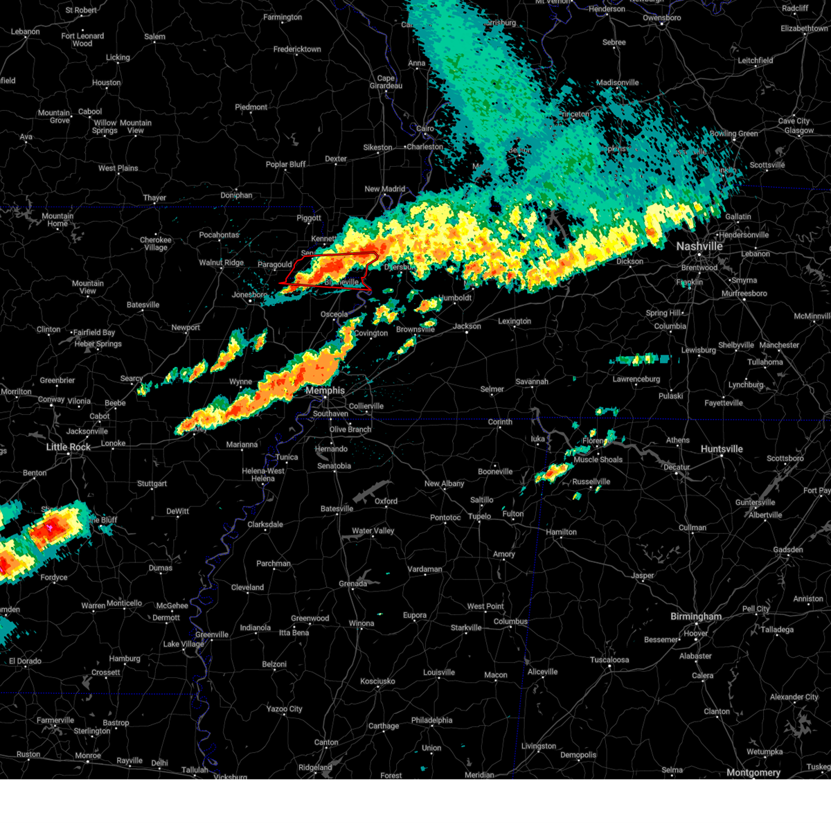 The tornado threat has diminished and the tornado warning has been cancelled. however, large hail and damaging winds remain likely and a severe thunderstorm warning remains in effect for the area. a tornado watch remains in effect until 400 am cdt for eastern arkansas, southeastern missouri, and west tennessee. The tornado threat has diminished and the tornado warning has been cancelled. however, large hail and damaging winds remain likely and a severe thunderstorm warning remains in effect for the area. a tornado watch remains in effect until 400 am cdt for eastern arkansas, southeastern missouri, and west tennessee.
|
| 5/26/2024 11:47 PM CDT |
 the tornado warning has been cancelled and is no longer in effect the tornado warning has been cancelled and is no longer in effect
|
| 5/26/2024 11:47 PM CDT |
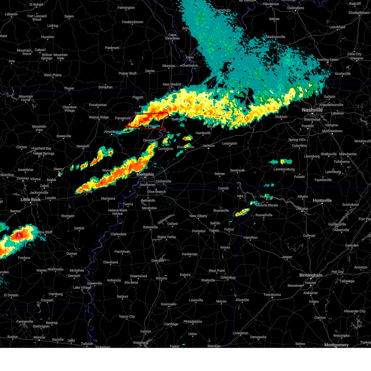 At 1147 pm cdt, a severe thunderstorm capable of producing a tornado was located over steele, moving east at 50 mph (radar indicated rotation). Hazards include tornado and quarter size hail. Flying debris will be dangerous to those caught without shelter. mobile homes will be damaged or destroyed. damage to roofs, windows, and vehicles will occur. tree damage is likely. Locations impacted include, blytheville, caruthersville, gosnell, steele, leachville, senath, cardwell, hornersville, arbyrd, cooter, holland, calumet, buckeye, arkmo, stark city, armorel, huffman, happy corners, woodland corner, and pawheen. At 1147 pm cdt, a severe thunderstorm capable of producing a tornado was located over steele, moving east at 50 mph (radar indicated rotation). Hazards include tornado and quarter size hail. Flying debris will be dangerous to those caught without shelter. mobile homes will be damaged or destroyed. damage to roofs, windows, and vehicles will occur. tree damage is likely. Locations impacted include, blytheville, caruthersville, gosnell, steele, leachville, senath, cardwell, hornersville, arbyrd, cooter, holland, calumet, buckeye, arkmo, stark city, armorel, huffman, happy corners, woodland corner, and pawheen.
|
| 5/26/2024 11:36 PM CDT |
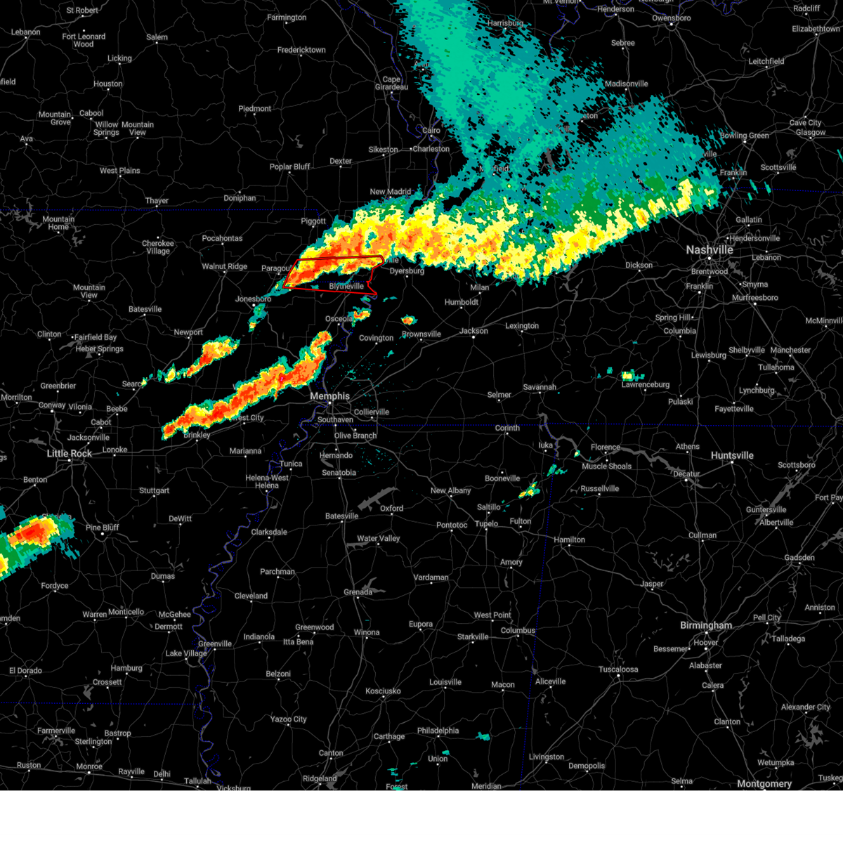 At 1136 pm cdt, a severe thunderstorm capable of producing a tornado was located near hornersville, or 7 miles southeast of senath, moving east at 50 mph (radar indicated rotation). Hazards include tornado and quarter size hail. Flying debris will be dangerous to those caught without shelter. mobile homes will be damaged or destroyed. damage to roofs, windows, and vehicles will occur. tree damage is likely. Locations impacted include, blytheville, caruthersville, gosnell, steele, leachville, senath, cardwell, hornersville, arbyrd, cooter, holland, calumet, buckeye, arkmo, bertig, stark city, armorel, huffman, happy corners, and schug. At 1136 pm cdt, a severe thunderstorm capable of producing a tornado was located near hornersville, or 7 miles southeast of senath, moving east at 50 mph (radar indicated rotation). Hazards include tornado and quarter size hail. Flying debris will be dangerous to those caught without shelter. mobile homes will be damaged or destroyed. damage to roofs, windows, and vehicles will occur. tree damage is likely. Locations impacted include, blytheville, caruthersville, gosnell, steele, leachville, senath, cardwell, hornersville, arbyrd, cooter, holland, calumet, buckeye, arkmo, bertig, stark city, armorel, huffman, happy corners, and schug.
|
| 5/26/2024 11:27 PM CDT |
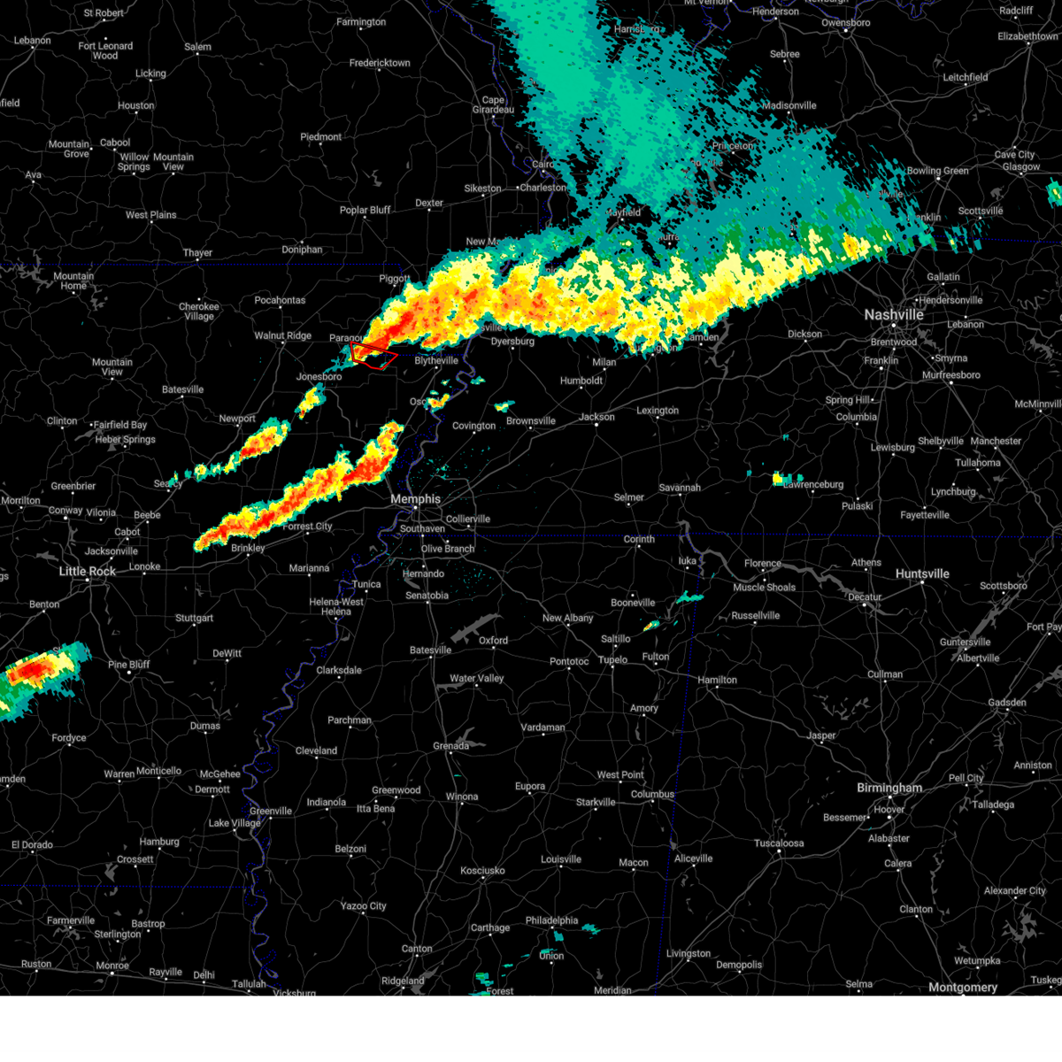 At 1126 pm cdt, a severe thunderstorm capable of producing a tornado was located 7 miles southeast of paragould, moving southeast at 20 mph (radar indicated rotation). Hazards include tornado and quarter size hail. Flying debris will be dangerous to those caught without shelter. mobile homes will be damaged or destroyed. damage to roofs, windows, and vehicles will occur. tree damage is likely. Locations impacted include, paragould, leachville, happy corners, boynton, arkmo, pawheen, schug, garson, and paulding. At 1126 pm cdt, a severe thunderstorm capable of producing a tornado was located 7 miles southeast of paragould, moving southeast at 20 mph (radar indicated rotation). Hazards include tornado and quarter size hail. Flying debris will be dangerous to those caught without shelter. mobile homes will be damaged or destroyed. damage to roofs, windows, and vehicles will occur. tree damage is likely. Locations impacted include, paragould, leachville, happy corners, boynton, arkmo, pawheen, schug, garson, and paulding.
|
| 5/26/2024 11:17 PM CDT |
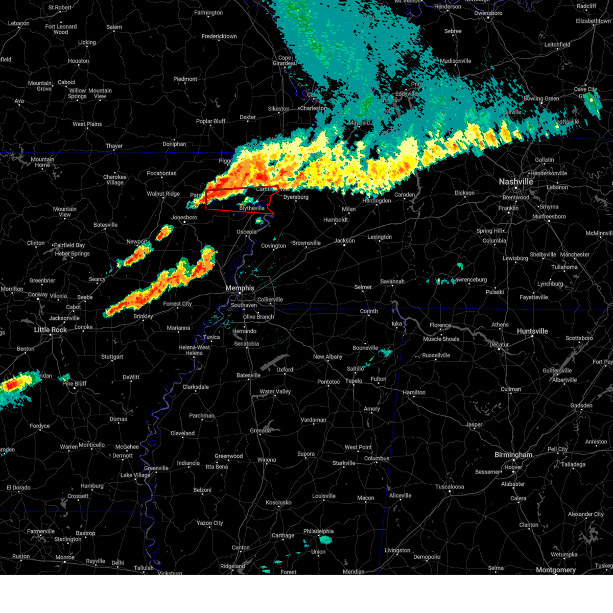 Tormeg the national weather service in memphis has issued a * tornado warning for, southeastern greene county in eastern arkansas, northeastern craighead county in eastern arkansas, northern mississippi county in eastern arkansas, southern pemiscot county in southeastern missouri, southern dunklin county in southeastern missouri, * until midnight cdt. * at 1116 pm cdt, a severe thunderstorm capable of producing a tornado was located near cardwell, or 9 miles east of paragould, moving east at 50 mph (radar indicated rotation). Hazards include tornado and quarter size hail. Flying debris will be dangerous to those caught without shelter. mobile homes will be damaged or destroyed. damage to roofs, windows, and vehicles will occur. Tree damage is likely. Tormeg the national weather service in memphis has issued a * tornado warning for, southeastern greene county in eastern arkansas, northeastern craighead county in eastern arkansas, northern mississippi county in eastern arkansas, southern pemiscot county in southeastern missouri, southern dunklin county in southeastern missouri, * until midnight cdt. * at 1116 pm cdt, a severe thunderstorm capable of producing a tornado was located near cardwell, or 9 miles east of paragould, moving east at 50 mph (radar indicated rotation). Hazards include tornado and quarter size hail. Flying debris will be dangerous to those caught without shelter. mobile homes will be damaged or destroyed. damage to roofs, windows, and vehicles will occur. Tree damage is likely.
|
| 5/26/2024 11:15 PM CDT |
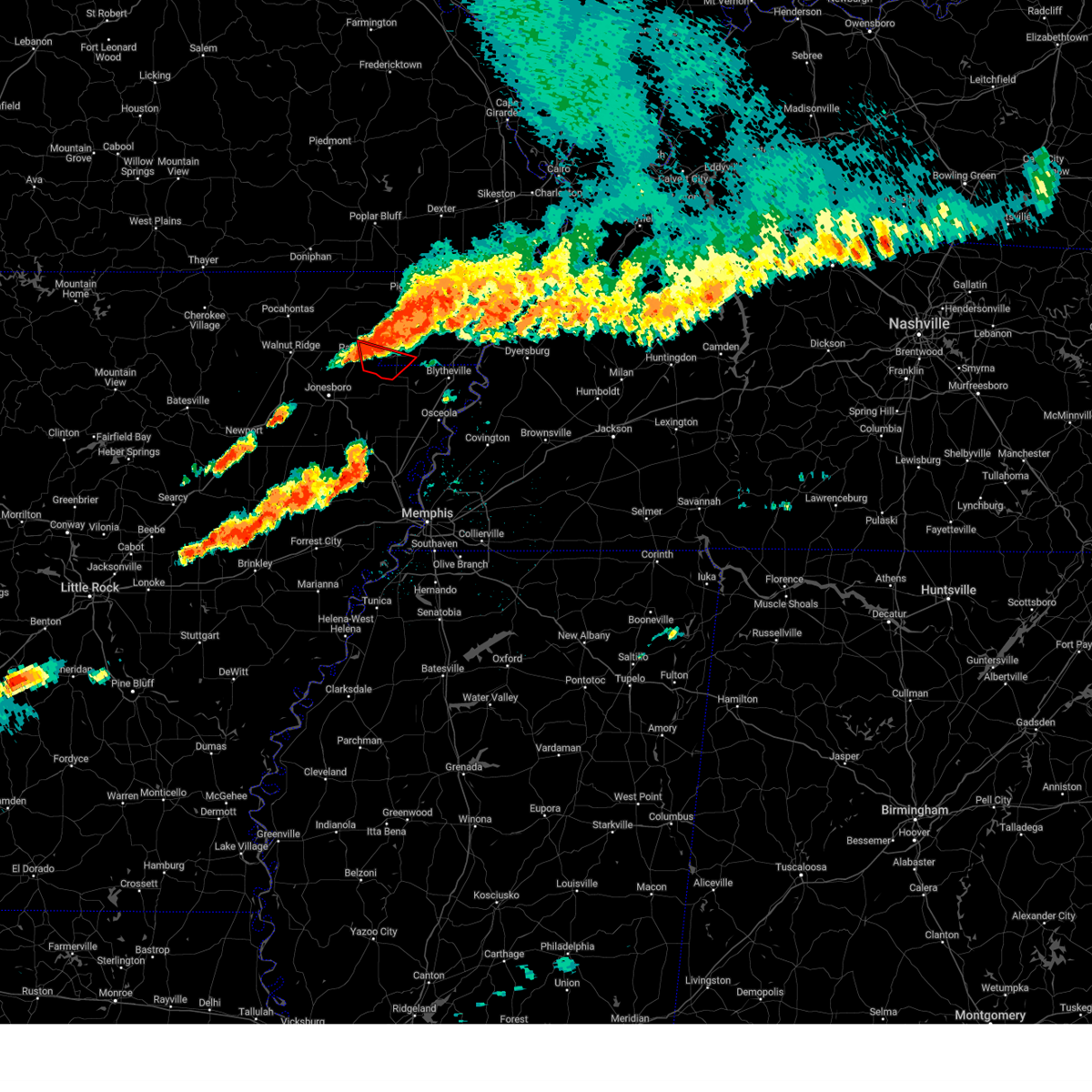 At 1114 pm cdt, a severe thunderstorm capable of producing a tornado was located near cardwell, or 7 miles east of paragould, moving east at 50 mph (radar indicated rotation). Hazards include tornado and golf ball size hail. Flying debris will be dangerous to those caught without shelter. mobile homes will be damaged or destroyed. damage to roofs, windows, and vehicles will occur. tree damage is likely. Locations impacted include, paragould, leachville, oak grove heights, cardwell, hornersville, arbyrd, happy corners, brighton, bertig, cotton belt, schug, garson, bard, boynton, arkmo, pawheen, noxburn, paulding, buck donic, and hollywood. At 1114 pm cdt, a severe thunderstorm capable of producing a tornado was located near cardwell, or 7 miles east of paragould, moving east at 50 mph (radar indicated rotation). Hazards include tornado and golf ball size hail. Flying debris will be dangerous to those caught without shelter. mobile homes will be damaged or destroyed. damage to roofs, windows, and vehicles will occur. tree damage is likely. Locations impacted include, paragould, leachville, oak grove heights, cardwell, hornersville, arbyrd, happy corners, brighton, bertig, cotton belt, schug, garson, bard, boynton, arkmo, pawheen, noxburn, paulding, buck donic, and hollywood.
|
| 5/26/2024 11:06 PM CDT |
 Tormeg the national weather service in memphis has issued a * tornado warning for, southeastern greene county in eastern arkansas, northeastern craighead county in eastern arkansas, northwestern mississippi county in eastern arkansas, southwestern dunklin county in southeastern missouri, * until 1145 pm cdt. * at 1106 pm cdt, a severe thunderstorm capable of producing a tornado was located over paragould, moving southeast at 20 mph (radar indicated rotation). Hazards include tornado and golf ball size hail. Flying debris will be dangerous to those caught without shelter. mobile homes will be damaged or destroyed. damage to roofs, windows, and vehicles will occur. Tree damage is likely. Tormeg the national weather service in memphis has issued a * tornado warning for, southeastern greene county in eastern arkansas, northeastern craighead county in eastern arkansas, northwestern mississippi county in eastern arkansas, southwestern dunklin county in southeastern missouri, * until 1145 pm cdt. * at 1106 pm cdt, a severe thunderstorm capable of producing a tornado was located over paragould, moving southeast at 20 mph (radar indicated rotation). Hazards include tornado and golf ball size hail. Flying debris will be dangerous to those caught without shelter. mobile homes will be damaged or destroyed. damage to roofs, windows, and vehicles will occur. Tree damage is likely.
|
| 5/25/2024 1:55 AM CDT |
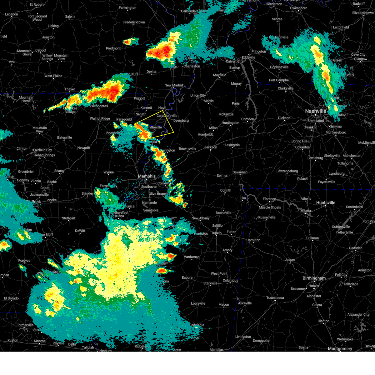 Svrmeg the national weather service in memphis has issued a * severe thunderstorm warning for, northern mississippi county in eastern arkansas, southwestern pemiscot county in southeastern missouri, southeastern dunklin county in southeastern missouri, southwestern dyer county in west tennessee, north central lauderdale county in west tennessee, * until 245 am cdt. * at 155 am cdt, a severe thunderstorm was located over dell, or near manila, moving east at 40 mph (radar indicated). Hazards include quarter size hail. damage to vehicles is expected Svrmeg the national weather service in memphis has issued a * severe thunderstorm warning for, northern mississippi county in eastern arkansas, southwestern pemiscot county in southeastern missouri, southeastern dunklin county in southeastern missouri, southwestern dyer county in west tennessee, north central lauderdale county in west tennessee, * until 245 am cdt. * at 155 am cdt, a severe thunderstorm was located over dell, or near manila, moving east at 40 mph (radar indicated). Hazards include quarter size hail. damage to vehicles is expected
|
| 5/22/2024 1:19 PM CDT |
 At 118 pm cdt, a severe thunderstorm was located near lake city, moving east at 35 mph (radar indicated). Hazards include golf ball size hail and 60 mph wind gusts. People and animals outdoors will be injured. expect hail damage to roofs, siding, windows, and vehicles. expect wind damage to roofs, siding, and trees. Locations impacted include, jonesboro, paragould, manila, lake city, leachville, bay, brookland, monette, cardwell, arbyrd, black oak, jolliff store, delfore, vail, carmi, gum point, whisp, farrville, buckeye, and lester. At 118 pm cdt, a severe thunderstorm was located near lake city, moving east at 35 mph (radar indicated). Hazards include golf ball size hail and 60 mph wind gusts. People and animals outdoors will be injured. expect hail damage to roofs, siding, windows, and vehicles. expect wind damage to roofs, siding, and trees. Locations impacted include, jonesboro, paragould, manila, lake city, leachville, bay, brookland, monette, cardwell, arbyrd, black oak, jolliff store, delfore, vail, carmi, gum point, whisp, farrville, buckeye, and lester.
|
| 5/22/2024 1:01 PM CDT |
 At 100 pm cdt, a severe thunderstorm was located near jonesboro, moving east at 35 mph (broadcast media. at 1257 pm cdt, golf ball sized hail was reported in jonesboro). Hazards include golf ball size hail and 60 mph wind gusts. People and animals outdoors will be injured. expect hail damage to roofs, siding, windows, and vehicles. expect wind damage to roofs, siding, and trees. Locations impacted include, jonesboro, paragould, manila, bono, lake city, leachville, brookland, monette, lake frierson state park, cardwell, arbyrd, black oak, jolliff store, apt, delfore, vail, valley view, carmi, gum point, and whisp. At 100 pm cdt, a severe thunderstorm was located near jonesboro, moving east at 35 mph (broadcast media. at 1257 pm cdt, golf ball sized hail was reported in jonesboro). Hazards include golf ball size hail and 60 mph wind gusts. People and animals outdoors will be injured. expect hail damage to roofs, siding, windows, and vehicles. expect wind damage to roofs, siding, and trees. Locations impacted include, jonesboro, paragould, manila, bono, lake city, leachville, brookland, monette, lake frierson state park, cardwell, arbyrd, black oak, jolliff store, apt, delfore, vail, valley view, carmi, gum point, and whisp.
|
| 5/22/2024 12:49 PM CDT |
 Svrmeg the national weather service in memphis has issued a * severe thunderstorm warning for, southeastern greene county in eastern arkansas, craighead county in eastern arkansas, northwestern mississippi county in eastern arkansas, southwestern dunklin county in southeastern missouri, * until 130 pm cdt. * at 1249 pm cdt, a severe thunderstorm was located near jonesboro, moving east at 40 mph (radar indicated). Hazards include 60 mph wind gusts and quarter size hail. Hail damage to vehicles is expected. Expect wind damage to roofs, siding, and trees. Svrmeg the national weather service in memphis has issued a * severe thunderstorm warning for, southeastern greene county in eastern arkansas, craighead county in eastern arkansas, northwestern mississippi county in eastern arkansas, southwestern dunklin county in southeastern missouri, * until 130 pm cdt. * at 1249 pm cdt, a severe thunderstorm was located near jonesboro, moving east at 40 mph (radar indicated). Hazards include 60 mph wind gusts and quarter size hail. Hail damage to vehicles is expected. Expect wind damage to roofs, siding, and trees.
|
| 5/9/2024 12:51 AM CDT |
 The storm which prompted the warning has weakened below severe limits, and no longer poses an immediate threat to life or property. therefore, the warning will be allowed to expire. however, gusty winds are still possible with this thunderstorm. a tornado watch remains in effect until 300 am cdt for eastern arkansas, and southeastern missouri. to report severe weather, contact your nearest law enforcement agency. they will relay your report to the national weather service memphis. The storm which prompted the warning has weakened below severe limits, and no longer poses an immediate threat to life or property. therefore, the warning will be allowed to expire. however, gusty winds are still possible with this thunderstorm. a tornado watch remains in effect until 300 am cdt for eastern arkansas, and southeastern missouri. to report severe weather, contact your nearest law enforcement agency. they will relay your report to the national weather service memphis.
|
| 5/9/2024 12:46 AM CDT |
 At 1245 am cdt, a severe thunderstorm was located near monette, moving east at 55 mph (radar indicated). Hazards include 60 mph wind gusts and quarter size hail. Hail damage to vehicles is expected. expect wind damage to roofs, siding, and trees. Locations impacted include, jonesboro, osceola, trumann, manila, lake city, leachville, bay, monette, caraway, little river, etowah, black oak, victoria, jolliff store, delfore, eastview, lennie, vail, carmi, and gum point. At 1245 am cdt, a severe thunderstorm was located near monette, moving east at 55 mph (radar indicated). Hazards include 60 mph wind gusts and quarter size hail. Hail damage to vehicles is expected. expect wind damage to roofs, siding, and trees. Locations impacted include, jonesboro, osceola, trumann, manila, lake city, leachville, bay, monette, caraway, little river, etowah, black oak, victoria, jolliff store, delfore, eastview, lennie, vail, carmi, and gum point.
|
| 5/9/2024 12:32 AM CDT |
 At 1231 am cdt, a severe thunderstorm was located near bay, moving east at 55 mph (radar indicated). Hazards include 60 mph wind gusts and quarter size hail. Hail damage to vehicles is expected. expect wind damage to roofs, siding, and trees. Locations impacted include, jonesboro, osceola, trumann, manila, lake city, leachville, bay, brookland, monette, caraway, greenfield, little river, etowah, black oak, victoria, jolliff store, apt, delfore, eastview, and lennie. At 1231 am cdt, a severe thunderstorm was located near bay, moving east at 55 mph (radar indicated). Hazards include 60 mph wind gusts and quarter size hail. Hail damage to vehicles is expected. expect wind damage to roofs, siding, and trees. Locations impacted include, jonesboro, osceola, trumann, manila, lake city, leachville, bay, brookland, monette, caraway, greenfield, little river, etowah, black oak, victoria, jolliff store, apt, delfore, eastview, and lennie.
|
| 5/9/2024 12:19 AM CDT |
 Svrmeg the national weather service in memphis has issued a * severe thunderstorm warning for, craighead county in eastern arkansas, northern poinsett county in eastern arkansas, northwestern mississippi county in eastern arkansas, * until 100 am cdt. * at 1218 am cdt, a severe thunderstorm was located near greenfield, or 9 miles southwest of jonesboro, moving east at 55 mph (radar indicated). Hazards include 60 mph wind gusts and quarter size hail. Hail damage to vehicles is expected. Expect wind damage to roofs, siding, and trees. Svrmeg the national weather service in memphis has issued a * severe thunderstorm warning for, craighead county in eastern arkansas, northern poinsett county in eastern arkansas, northwestern mississippi county in eastern arkansas, * until 100 am cdt. * at 1218 am cdt, a severe thunderstorm was located near greenfield, or 9 miles southwest of jonesboro, moving east at 55 mph (radar indicated). Hazards include 60 mph wind gusts and quarter size hail. Hail damage to vehicles is expected. Expect wind damage to roofs, siding, and trees.
|
| 3/14/2024 8:50 PM CDT |
 The storm which prompted the warning has weakened below severe limits, and has exited the warned area. therefore, the warning will be allowed to expire. however, gusty winds are still possible with this thunderstorm. a tornado watch remains in effect until midnight cdt for eastern arkansas, and southeastern missouri. The storm which prompted the warning has weakened below severe limits, and has exited the warned area. therefore, the warning will be allowed to expire. however, gusty winds are still possible with this thunderstorm. a tornado watch remains in effect until midnight cdt for eastern arkansas, and southeastern missouri.
|
| 3/14/2024 8:49 PM CDT |
 At 849 pm cdt, a severe thunderstorm was located near arbyrd, or near leachville, moving northeast at 30 mph (radar indicated). Hazards include 60 mph wind gusts and penny size hail. Expect damage to roofs, siding, and trees. Locations impacted include, jonesboro, manila, lake city, leachville, monette, black oak, jolliff store, poplar ridge, needham, delfore, macey, carmi, whisp, southland, lester, walters, east black oak, and lache lake. At 849 pm cdt, a severe thunderstorm was located near arbyrd, or near leachville, moving northeast at 30 mph (radar indicated). Hazards include 60 mph wind gusts and penny size hail. Expect damage to roofs, siding, and trees. Locations impacted include, jonesboro, manila, lake city, leachville, monette, black oak, jolliff store, poplar ridge, needham, delfore, macey, carmi, whisp, southland, lester, walters, east black oak, and lache lake.
|
| 3/14/2024 8:49 PM CDT |
 the severe thunderstorm warning has been cancelled and is no longer in effect the severe thunderstorm warning has been cancelled and is no longer in effect
|
| 3/14/2024 8:38 PM CDT |
 At 838 pm cdt, a severe thunderstorm was located near leachville, moving east at 45 mph (radar indicated). Hazards include 60 mph wind gusts and quarter size hail. Hail damage to vehicles is expected. expect wind damage to roofs, siding, and trees. Locations impacted include, jonesboro, manila, lake city, leachville, brookland, monette, cardwell, black oak, jolliff store, happy corners, delfore, macey, schug, carmi, whisp, farrville, lester, walters, lache lake, and poplar ridge. At 838 pm cdt, a severe thunderstorm was located near leachville, moving east at 45 mph (radar indicated). Hazards include 60 mph wind gusts and quarter size hail. Hail damage to vehicles is expected. expect wind damage to roofs, siding, and trees. Locations impacted include, jonesboro, manila, lake city, leachville, brookland, monette, cardwell, black oak, jolliff store, happy corners, delfore, macey, schug, carmi, whisp, farrville, lester, walters, lache lake, and poplar ridge.
|
| 3/14/2024 8:19 PM CDT |
 Svrmeg the national weather service in memphis has issued a * severe thunderstorm warning for, southeastern greene county in eastern arkansas, northeastern craighead county in eastern arkansas, northwestern mississippi county in eastern arkansas, southwestern dunklin county in southeastern missouri, * until 900 pm cdt. * at 818 pm cdt, a severe thunderstorm was located over brookland, moving northeast at 30 mph (radar indicated). Hazards include 60 mph wind gusts and quarter size hail. Hail damage to vehicles is expected. Expect wind damage to roofs, siding, and trees. Svrmeg the national weather service in memphis has issued a * severe thunderstorm warning for, southeastern greene county in eastern arkansas, northeastern craighead county in eastern arkansas, northwestern mississippi county in eastern arkansas, southwestern dunklin county in southeastern missouri, * until 900 pm cdt. * at 818 pm cdt, a severe thunderstorm was located over brookland, moving northeast at 30 mph (radar indicated). Hazards include 60 mph wind gusts and quarter size hail. Hail damage to vehicles is expected. Expect wind damage to roofs, siding, and trees.
|
| 1/12/2024 1:18 AM CST |
 At 118 am cst, a severe thunderstorm was located near caraway, moving east at 60 mph (radar indicated). Hazards include 60 mph wind gusts and quarter size hail. Hail damage to vehicles is expected. expect wind damage to roofs, siding, and trees. locations impacted include, jonesboro, blytheville, osceola, trumann, gosnell, manila, harrisburg, lake city, leachville, lepanto, bay, monette, caraway, luxora, keiser, dell, burdette, greenfield, little river, and etowah. hail threat, radar indicated max hail size, 1. 00 in wind threat, radar indicated max wind gust, 60 mph. At 118 am cst, a severe thunderstorm was located near caraway, moving east at 60 mph (radar indicated). Hazards include 60 mph wind gusts and quarter size hail. Hail damage to vehicles is expected. expect wind damage to roofs, siding, and trees. locations impacted include, jonesboro, blytheville, osceola, trumann, gosnell, manila, harrisburg, lake city, leachville, lepanto, bay, monette, caraway, luxora, keiser, dell, burdette, greenfield, little river, and etowah. hail threat, radar indicated max hail size, 1. 00 in wind threat, radar indicated max wind gust, 60 mph.
|
| 1/12/2024 12:54 AM CST |
 At 1254 am cst, a severe thunderstorm was located over greenfield, or 7 miles southwest of bay, moving east at 55 mph (radar indicated). Hazards include 60 mph wind gusts and half dollar size hail. Hail damage to vehicles is expected. Expect wind damage to roofs, siding, and trees. At 1254 am cst, a severe thunderstorm was located over greenfield, or 7 miles southwest of bay, moving east at 55 mph (radar indicated). Hazards include 60 mph wind gusts and half dollar size hail. Hail damage to vehicles is expected. Expect wind damage to roofs, siding, and trees.
|
| 8/9/2023 10:28 PM CDT |
 At 1028 pm cdt, severe thunderstorms were located along a line extending from near hornersville to near caraway to 6 miles northwest of marked tree, moving east at 55 mph (radar indicated). Hazards include 60 mph wind gusts. Expect damage to roofs, siding, and trees. locations impacted include, blytheville, osceola, trumann, gosnell, manila, marked tree, harrisburg, lake city, leachville, lepanto, bay, monette, caraway, luxora, wilson, tyronza, keiser, fort pillow state park, cardwell and hornersville. hail threat, radar indicated max hail size, <. 75 in wind threat, radar indicated max wind gust, 60 mph. At 1028 pm cdt, severe thunderstorms were located along a line extending from near hornersville to near caraway to 6 miles northwest of marked tree, moving east at 55 mph (radar indicated). Hazards include 60 mph wind gusts. Expect damage to roofs, siding, and trees. locations impacted include, blytheville, osceola, trumann, gosnell, manila, marked tree, harrisburg, lake city, leachville, lepanto, bay, monette, caraway, luxora, wilson, tyronza, keiser, fort pillow state park, cardwell and hornersville. hail threat, radar indicated max hail size, <. 75 in wind threat, radar indicated max wind gust, 60 mph.
|
| 8/9/2023 10:15 PM CDT |
 At 1015 pm cdt, a severe thunderstorm was located over lake city, moving southeast at 60 mph (radar indicated). Hazards include 60 mph wind gusts and quarter size hail. Hail damage to vehicles is expected. Expect wind damage to roofs, siding, and trees. At 1015 pm cdt, a severe thunderstorm was located over lake city, moving southeast at 60 mph (radar indicated). Hazards include 60 mph wind gusts and quarter size hail. Hail damage to vehicles is expected. Expect wind damage to roofs, siding, and trees.
|
| 7/21/2023 12:42 PM CDT |
 At 1241 pm cdt, severe thunderstorms were located along a line extending from egypt to near cherry valley to near haynes, moving east at 50 mph (radar indicated). Hazards include 60 mph wind gusts and penny size hail. expect damage to roofs, siding, and trees At 1241 pm cdt, severe thunderstorms were located along a line extending from egypt to near cherry valley to near haynes, moving east at 50 mph (radar indicated). Hazards include 60 mph wind gusts and penny size hail. expect damage to roofs, siding, and trees
|
| 7/18/2023 4:35 PM CDT |
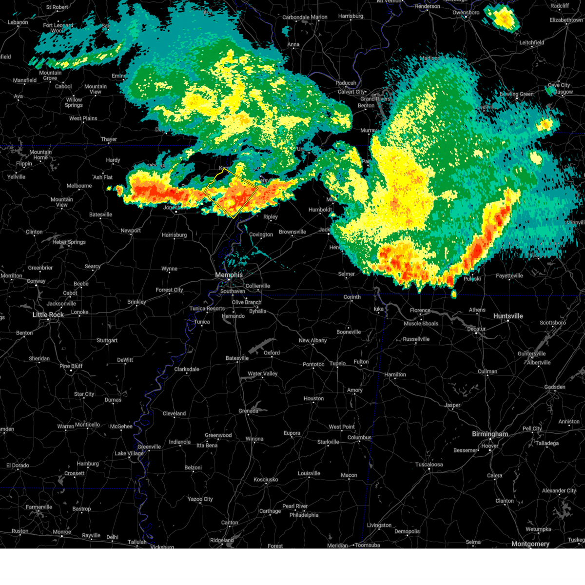 The severe thunderstorm warning for northwestern mississippi, southwestern pemiscot and southern dunklin counties will expire at 445 pm cdt, the storm which prompted the warning has moved out of the area. therefore, the warning will be allowed to expire. a severe thunderstorm watch remains in effect until 500 pm cdt for eastern arkansas, and southeastern missouri. The severe thunderstorm warning for northwestern mississippi, southwestern pemiscot and southern dunklin counties will expire at 445 pm cdt, the storm which prompted the warning has moved out of the area. therefore, the warning will be allowed to expire. a severe thunderstorm watch remains in effect until 500 pm cdt for eastern arkansas, and southeastern missouri.
|
| 7/18/2023 4:35 PM CDT |
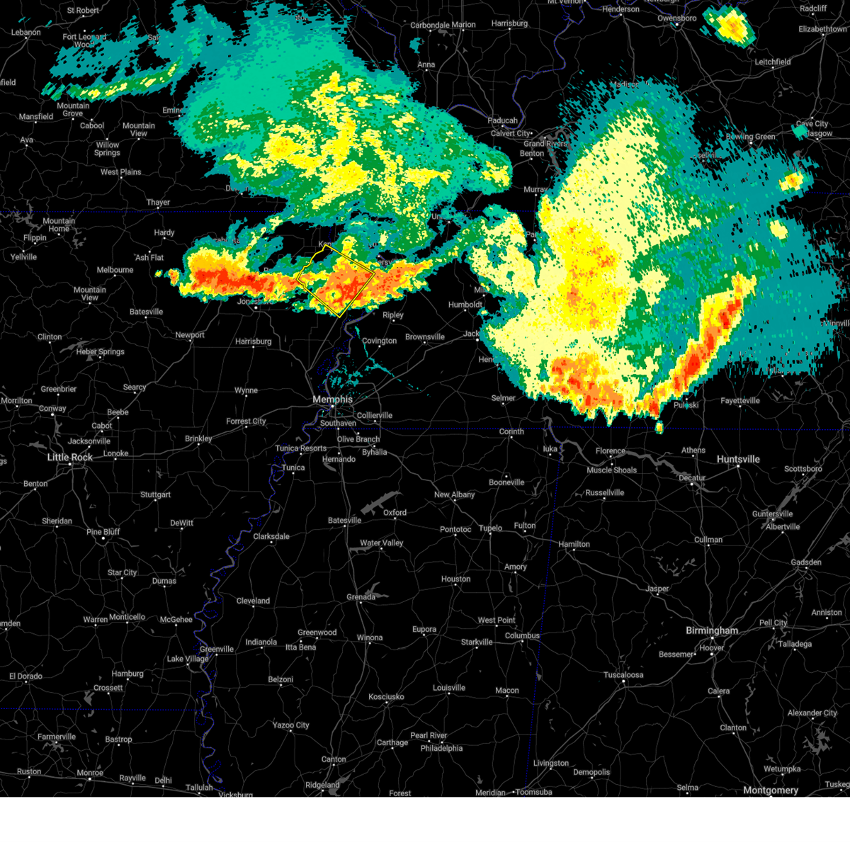 The severe thunderstorm warning for northwestern mississippi, southwestern pemiscot and southern dunklin counties will expire at 445 pm cdt, the storm which prompted the warning has moved out of the area. therefore, the warning will be allowed to expire. a severe thunderstorm watch remains in effect until 500 pm cdt for eastern arkansas, and southeastern missouri. The severe thunderstorm warning for northwestern mississippi, southwestern pemiscot and southern dunklin counties will expire at 445 pm cdt, the storm which prompted the warning has moved out of the area. therefore, the warning will be allowed to expire. a severe thunderstorm watch remains in effect until 500 pm cdt for eastern arkansas, and southeastern missouri.
|
| 7/18/2023 4:20 PM CDT |
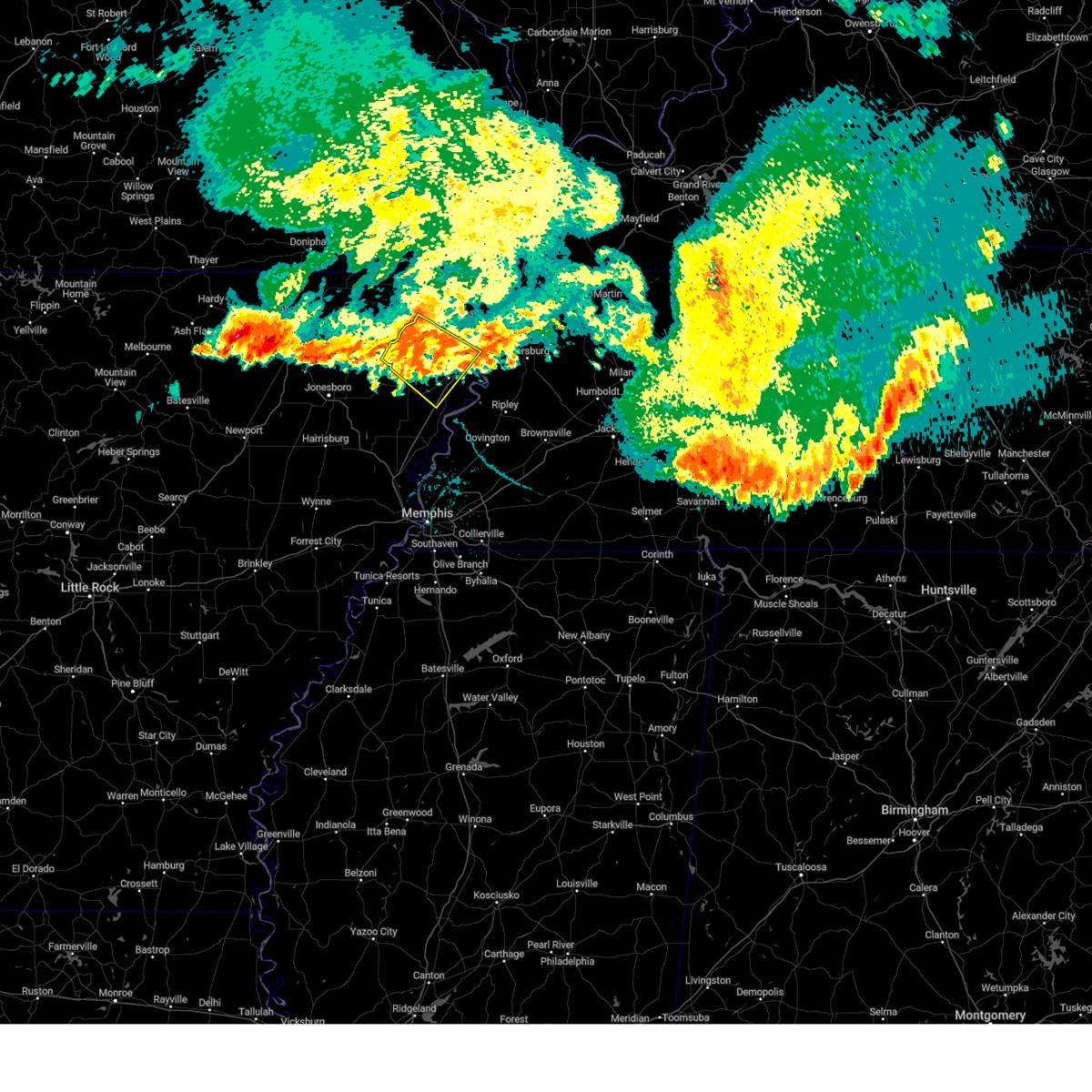 At 420 pm cdt, a severe thunderstorm was located over hornersville, or near senath, moving southeast at 40 mph (radar indicated). Hazards include 60 mph wind gusts. Expect damage to roofs, siding, and trees. locations impacted include, blytheville, kennett, gosnell, manila, steele, senath, cardwell, hornersville, arbyrd, cooter, dell, burdette, holland, calumet, dearman, buckeye, arkmo, noland, lens ford and stark city. hail threat, radar indicated max hail size, <. 75 in wind threat, radar indicated max wind gust, 60 mph. At 420 pm cdt, a severe thunderstorm was located over hornersville, or near senath, moving southeast at 40 mph (radar indicated). Hazards include 60 mph wind gusts. Expect damage to roofs, siding, and trees. locations impacted include, blytheville, kennett, gosnell, manila, steele, senath, cardwell, hornersville, arbyrd, cooter, dell, burdette, holland, calumet, dearman, buckeye, arkmo, noland, lens ford and stark city. hail threat, radar indicated max hail size, <. 75 in wind threat, radar indicated max wind gust, 60 mph.
|
| 7/18/2023 4:03 PM CDT |
 At 402 pm cdt, a severe thunderstorm was located near senath, moving southeast at 40 mph (radar indicated). Hazards include 60 mph wind gusts and penny size hail. expect damage to roofs, siding, and trees At 402 pm cdt, a severe thunderstorm was located near senath, moving southeast at 40 mph (radar indicated). Hazards include 60 mph wind gusts and penny size hail. expect damage to roofs, siding, and trees
|
| 7/18/2023 4:03 PM CDT |
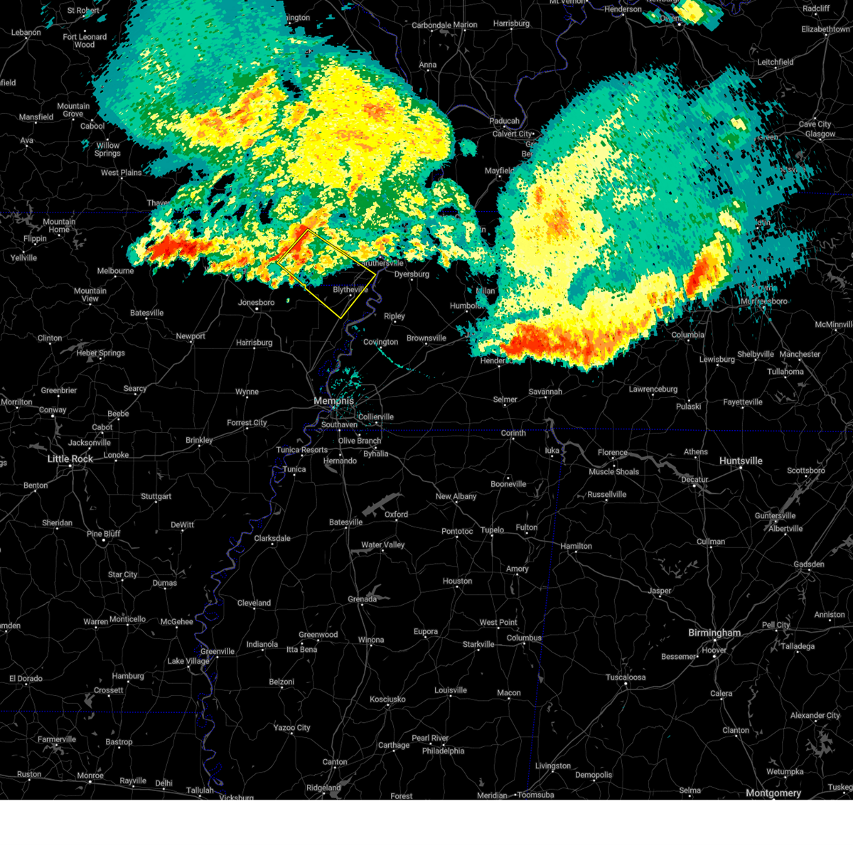 At 402 pm cdt, a severe thunderstorm was located near senath, moving southeast at 40 mph (radar indicated). Hazards include 60 mph wind gusts and penny size hail. expect damage to roofs, siding, and trees At 402 pm cdt, a severe thunderstorm was located near senath, moving southeast at 40 mph (radar indicated). Hazards include 60 mph wind gusts and penny size hail. expect damage to roofs, siding, and trees
|
| 6/14/2023 9:52 PM CDT |
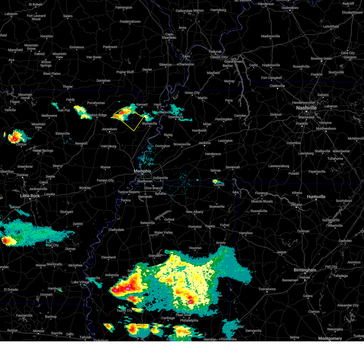 At 952 pm cdt, a severe thunderstorm was located near oak grove heights, or near marmaduke, moving southeast at 25 mph (radar indicated). Hazards include 60 mph wind gusts and quarter size hail. Hail damage to vehicles is expected. expect wind damage to roofs, siding, and trees. locations impacted include, paragould, leachville, senath, marmaduke, oak grove heights, cardwell, hornersville, arbyrd, jolliff store, happy corners, delfore, carmi, bard, buckeye, mounds, halliday, arkmo, pawheen, noxburn and brighton. hail threat, radar indicated max hail size, 1. 00 in wind threat, radar indicated max wind gust, 60 mph. At 952 pm cdt, a severe thunderstorm was located near oak grove heights, or near marmaduke, moving southeast at 25 mph (radar indicated). Hazards include 60 mph wind gusts and quarter size hail. Hail damage to vehicles is expected. expect wind damage to roofs, siding, and trees. locations impacted include, paragould, leachville, senath, marmaduke, oak grove heights, cardwell, hornersville, arbyrd, jolliff store, happy corners, delfore, carmi, bard, buckeye, mounds, halliday, arkmo, pawheen, noxburn and brighton. hail threat, radar indicated max hail size, 1. 00 in wind threat, radar indicated max wind gust, 60 mph.
|
| 6/14/2023 9:39 PM CDT |
 At 938 pm cdt, a severe thunderstorm was located over lafe, or 7 miles west of marmaduke, moving southeast at 25 mph (radar indicated). Hazards include 60 mph wind gusts and quarter size hail. Hail damage to vehicles is expected. Expect wind damage to roofs, siding, and trees. At 938 pm cdt, a severe thunderstorm was located over lafe, or 7 miles west of marmaduke, moving southeast at 25 mph (radar indicated). Hazards include 60 mph wind gusts and quarter size hail. Hail damage to vehicles is expected. Expect wind damage to roofs, siding, and trees.
|
| 6/14/2023 9:39 PM CDT |
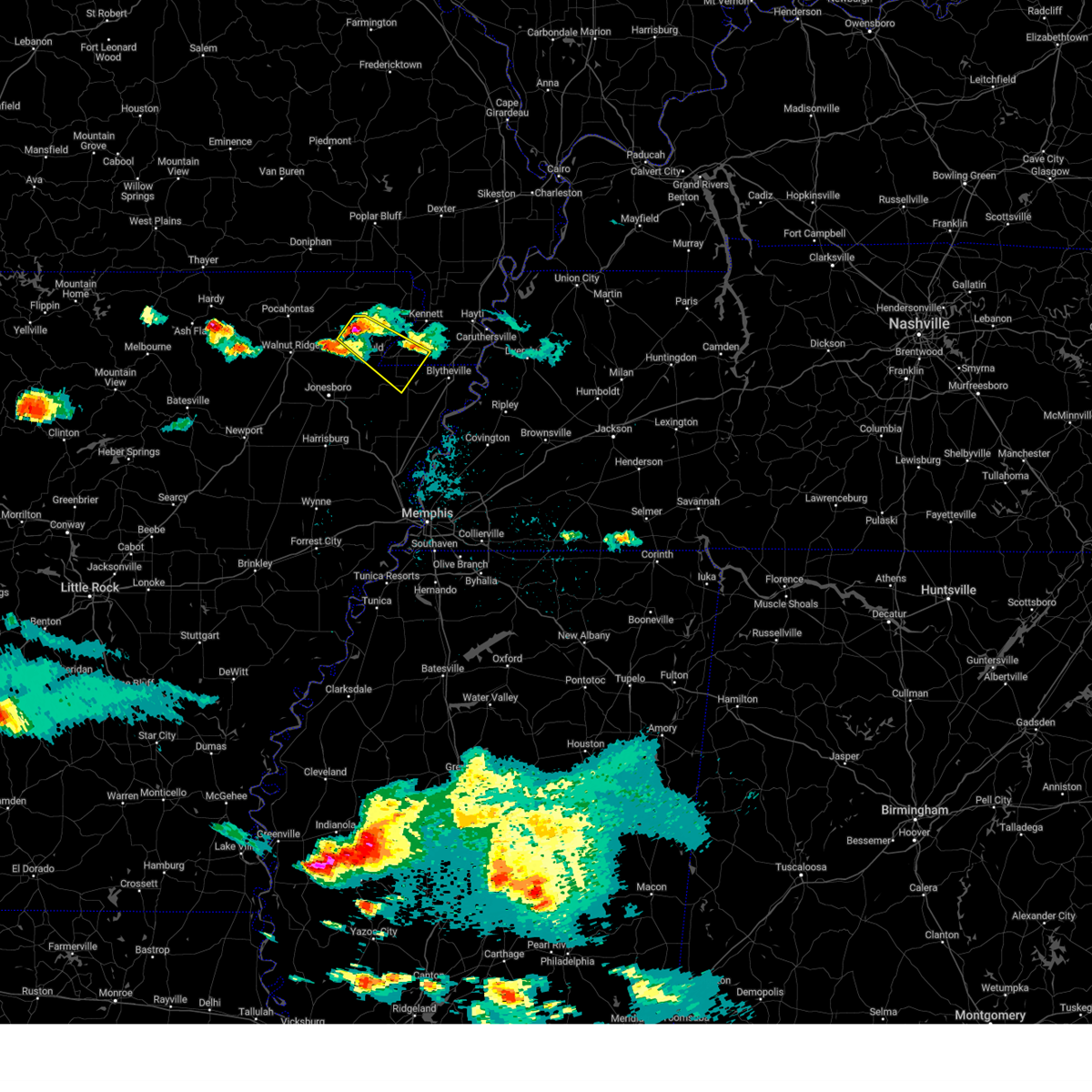 At 938 pm cdt, a severe thunderstorm was located over lafe, or 7 miles west of marmaduke, moving southeast at 25 mph (radar indicated). Hazards include 60 mph wind gusts and quarter size hail. Hail damage to vehicles is expected. Expect wind damage to roofs, siding, and trees. At 938 pm cdt, a severe thunderstorm was located over lafe, or 7 miles west of marmaduke, moving southeast at 25 mph (radar indicated). Hazards include 60 mph wind gusts and quarter size hail. Hail damage to vehicles is expected. Expect wind damage to roofs, siding, and trees.
|
| 6/14/2023 9:33 PM CDT |
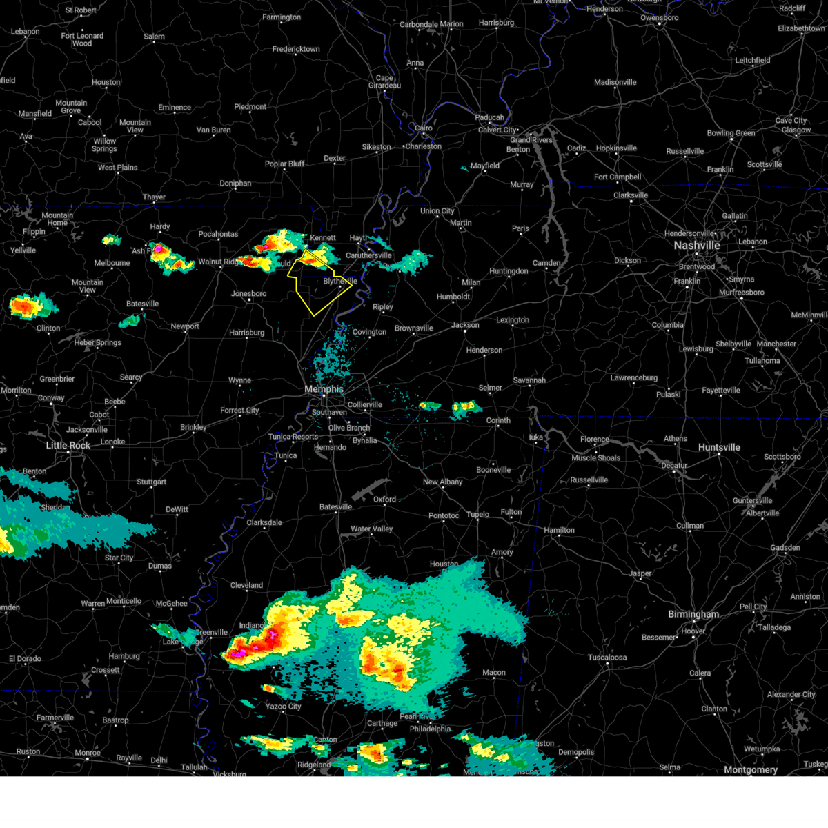 At 933 pm cdt, a severe thunderstorm was located near senath, moving southeast at 25 mph (radar indicated). Hazards include 60 mph wind gusts and quarter size hail. Hail damage to vehicles is expected. expect wind damage to roofs, siding, and trees. locations impacted include, blytheville, gosnell, manila, leachville, senath, cardwell, hornersville, arbyrd, dell, little river, jolliff store, happy corners, calumet, dearman, lennie, big lake, hightower, carmi, buckeye and burton. hail threat, radar indicated max hail size, 1. 00 in wind threat, radar indicated max wind gust, 60 mph. At 933 pm cdt, a severe thunderstorm was located near senath, moving southeast at 25 mph (radar indicated). Hazards include 60 mph wind gusts and quarter size hail. Hail damage to vehicles is expected. expect wind damage to roofs, siding, and trees. locations impacted include, blytheville, gosnell, manila, leachville, senath, cardwell, hornersville, arbyrd, dell, little river, jolliff store, happy corners, calumet, dearman, lennie, big lake, hightower, carmi, buckeye and burton. hail threat, radar indicated max hail size, 1. 00 in wind threat, radar indicated max wind gust, 60 mph.
|
| 6/14/2023 9:33 PM CDT |
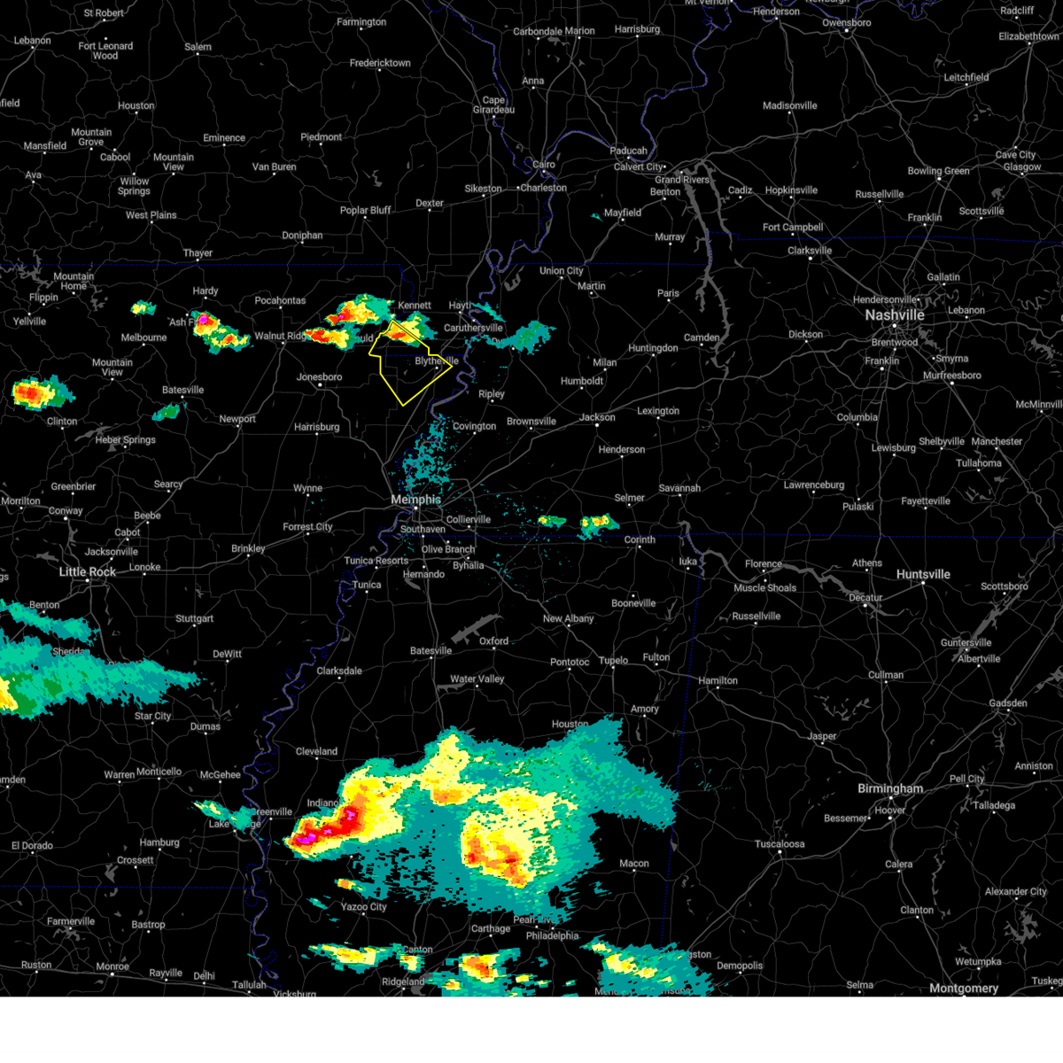 At 933 pm cdt, a severe thunderstorm was located near senath, moving southeast at 25 mph (radar indicated). Hazards include 60 mph wind gusts and quarter size hail. Hail damage to vehicles is expected. expect wind damage to roofs, siding, and trees. locations impacted include, blytheville, gosnell, manila, leachville, senath, cardwell, hornersville, arbyrd, dell, little river, jolliff store, happy corners, calumet, dearman, lennie, big lake, hightower, carmi, buckeye and burton. hail threat, radar indicated max hail size, 1. 00 in wind threat, radar indicated max wind gust, 60 mph. At 933 pm cdt, a severe thunderstorm was located near senath, moving southeast at 25 mph (radar indicated). Hazards include 60 mph wind gusts and quarter size hail. Hail damage to vehicles is expected. expect wind damage to roofs, siding, and trees. locations impacted include, blytheville, gosnell, manila, leachville, senath, cardwell, hornersville, arbyrd, dell, little river, jolliff store, happy corners, calumet, dearman, lennie, big lake, hightower, carmi, buckeye and burton. hail threat, radar indicated max hail size, 1. 00 in wind threat, radar indicated max wind gust, 60 mph.
|
| 6/14/2023 9:23 PM CDT |
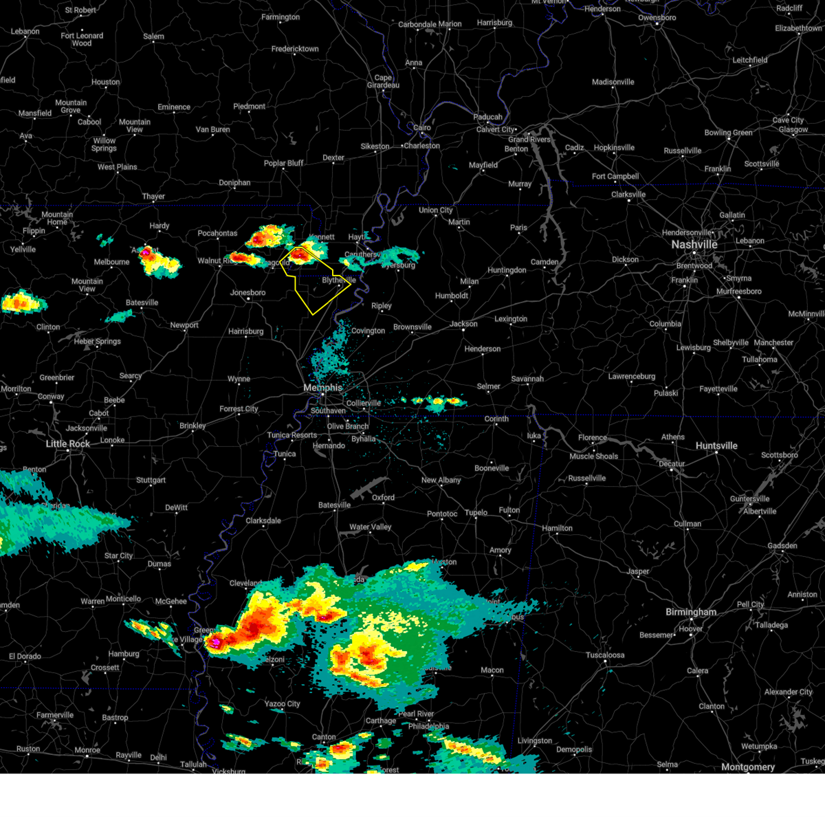 At 922 pm cdt, a severe thunderstorm was located near senath, moving southeast at 30 mph (radar indicated). Hazards include 60 mph wind gusts and quarter size hail. Hail damage to vehicles is expected. expect wind damage to roofs, siding, and trees. locations impacted include, blytheville, gosnell, manila, leachville, senath, cardwell, hornersville, arbyrd, dell, little river, jolliff store, calumet, dearman, lennie, carmi, buckeye, mounds, arkmo, bertig and roseland. hail threat, radar indicated max hail size, 1. 00 in wind threat, radar indicated max wind gust, 60 mph. At 922 pm cdt, a severe thunderstorm was located near senath, moving southeast at 30 mph (radar indicated). Hazards include 60 mph wind gusts and quarter size hail. Hail damage to vehicles is expected. expect wind damage to roofs, siding, and trees. locations impacted include, blytheville, gosnell, manila, leachville, senath, cardwell, hornersville, arbyrd, dell, little river, jolliff store, calumet, dearman, lennie, carmi, buckeye, mounds, arkmo, bertig and roseland. hail threat, radar indicated max hail size, 1. 00 in wind threat, radar indicated max wind gust, 60 mph.
|
| 6/14/2023 9:08 PM CDT |
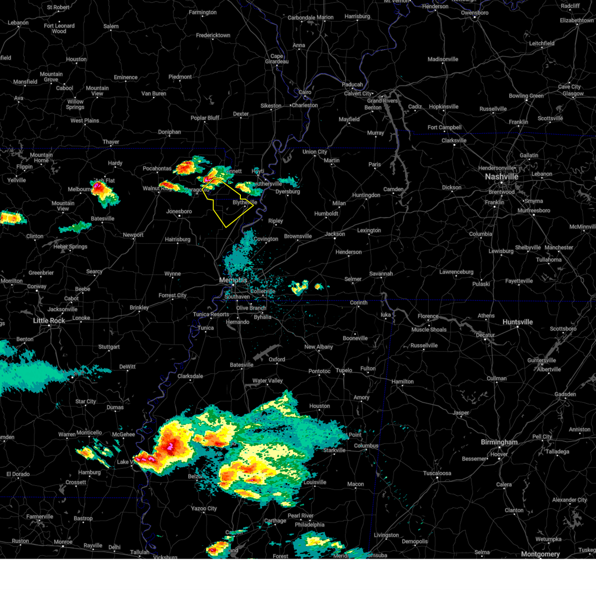 At 908 pm cdt, a severe thunderstorm was located near marmaduke, moving southeast at 30 mph (radar indicated). Hazards include ping pong ball size hail and 60 mph wind gusts. People and animals outdoors will be injured. expect hail damage to roofs, siding, windows, and vehicles. Expect wind damage to roofs, siding, and trees. At 908 pm cdt, a severe thunderstorm was located near marmaduke, moving southeast at 30 mph (radar indicated). Hazards include ping pong ball size hail and 60 mph wind gusts. People and animals outdoors will be injured. expect hail damage to roofs, siding, windows, and vehicles. Expect wind damage to roofs, siding, and trees.
|
| 5/9/2023 12:51 AM CDT |
 The severe thunderstorm warning for craighead, northeastern poinsett and northwestern mississippi counties will expire at 100 am cdt, the storm which prompted the warning has weakened below severe limits, and no longer poses an immediate threat to life or property. therefore, the warning will be allowed to expire. however small hail is still possible with this thunderstorm. The severe thunderstorm warning for craighead, northeastern poinsett and northwestern mississippi counties will expire at 100 am cdt, the storm which prompted the warning has weakened below severe limits, and no longer poses an immediate threat to life or property. therefore, the warning will be allowed to expire. however small hail is still possible with this thunderstorm.
|
| 5/9/2023 12:32 AM CDT |
 At 1231 am cdt, a severe thunderstorm was located over jonesboro, moving east at 25 mph (radar indicated). Hazards include 60 mph wind gusts and quarter size hail. Hail damage to vehicles is expected. Expect wind damage to roofs, siding, and trees. At 1231 am cdt, a severe thunderstorm was located over jonesboro, moving east at 25 mph (radar indicated). Hazards include 60 mph wind gusts and quarter size hail. Hail damage to vehicles is expected. Expect wind damage to roofs, siding, and trees.
|
| 4/15/2023 8:20 PM CDT |
 At 820 pm cdt, severe thunderstorms were located along a line extending from chalk bluff natural area to near gosnell to dyess, moving east at 60 mph (radar indicated). Hazards include 60 mph wind gusts. expect damage to roofs, siding, and trees At 820 pm cdt, severe thunderstorms were located along a line extending from chalk bluff natural area to near gosnell to dyess, moving east at 60 mph (radar indicated). Hazards include 60 mph wind gusts. expect damage to roofs, siding, and trees
|
| 4/5/2023 12:54 PM CDT |
 The severe thunderstorm warning for eastern craighead, eastern poinsett, mississippi, southwestern pemiscot and southern dunklin counties will expire at 100 pm cdt, the storms which prompted the warning have moved out of the area. therefore, the warning will be allowed to expire. a tornado watch remains in effect until 400 pm cdt for eastern arkansas, and southeastern missouri. remember, a severe thunderstorm warning still remains in effect for eastern craighead and mississippi county arkansas until 100 pm cdt. The severe thunderstorm warning for eastern craighead, eastern poinsett, mississippi, southwestern pemiscot and southern dunklin counties will expire at 100 pm cdt, the storms which prompted the warning have moved out of the area. therefore, the warning will be allowed to expire. a tornado watch remains in effect until 400 pm cdt for eastern arkansas, and southeastern missouri. remember, a severe thunderstorm warning still remains in effect for eastern craighead and mississippi county arkansas until 100 pm cdt.
|
| 4/5/2023 12:35 PM CDT |
 At 1235 pm cdt, severe thunderstorms were located along a line extending from near steele to near dell to near lepanto, moving east at 55 mph (radar indicated). Hazards include 60 mph wind gusts and quarter size hail. Hail damage to vehicles is expected. expect wind damage to roofs, siding, and trees. locations impacted include, blytheville, osceola, trumann, gosnell, manila, marked tree, harrisburg, steele, lake city, leachville, lepanto, bay, monette, caraway, keiser, cardwell, hornersville, arbyrd, dyess and dell. hail threat, radar indicated max hail size, 1. 00 in wind threat, radar indicated max wind gust, 60 mph. At 1235 pm cdt, severe thunderstorms were located along a line extending from near steele to near dell to near lepanto, moving east at 55 mph (radar indicated). Hazards include 60 mph wind gusts and quarter size hail. Hail damage to vehicles is expected. expect wind damage to roofs, siding, and trees. locations impacted include, blytheville, osceola, trumann, gosnell, manila, marked tree, harrisburg, steele, lake city, leachville, lepanto, bay, monette, caraway, keiser, cardwell, hornersville, arbyrd, dyess and dell. hail threat, radar indicated max hail size, 1. 00 in wind threat, radar indicated max wind gust, 60 mph.
|
| 4/5/2023 12:12 PM CDT |
 The severe thunderstorm warning for southwestern greene, craighead, poinsett, northwestern mississippi and southwestern dunklin counties will expire at 1215 pm cdt, the storms which prompted the warning have moved out of the area. therefore, the warning will be allowed to expire. a tornado watch remains in effect until 400 pm cdt for eastern arkansas, and southeastern missouri. remember, a severe thunderstorm warning still remains in effect for west craighead and poinsett county ar til 1215 pm. The severe thunderstorm warning for southwestern greene, craighead, poinsett, northwestern mississippi and southwestern dunklin counties will expire at 1215 pm cdt, the storms which prompted the warning have moved out of the area. therefore, the warning will be allowed to expire. a tornado watch remains in effect until 400 pm cdt for eastern arkansas, and southeastern missouri. remember, a severe thunderstorm warning still remains in effect for west craighead and poinsett county ar til 1215 pm.
|
| 4/5/2023 12:10 PM CDT |
 At 1210 pm cdt, severe thunderstorms were located along a line extending from near leachville to near trumann to near harrisburg, moving east at 55 mph (radar indicated). Hazards include 60 mph wind gusts. expect damage to roofs, siding, and trees At 1210 pm cdt, severe thunderstorms were located along a line extending from near leachville to near trumann to near harrisburg, moving east at 55 mph (radar indicated). Hazards include 60 mph wind gusts. expect damage to roofs, siding, and trees
|
| 4/5/2023 11:52 AM CDT |
 At 1151 am cdt, severe thunderstorms were located along a line extending from near paragould to near brookland to near greenfield to near harrisburg, moving east at 45 mph (radar indicated). Hazards include 60 mph wind gusts. Expect damage to roofs, siding, and trees. locations impacted include, jonesboro, paragould, trumann, manila, harrisburg, bono, lake city, leachville, bay, brookland, monette, caraway, lake frierson state park, weiner, cash, waldenburg, greenfield, etowah, black oak and fisher. hail threat, radar indicated max hail size, <. 75 in wind threat, radar indicated max wind gust, 60 mph. At 1151 am cdt, severe thunderstorms were located along a line extending from near paragould to near brookland to near greenfield to near harrisburg, moving east at 45 mph (radar indicated). Hazards include 60 mph wind gusts. Expect damage to roofs, siding, and trees. locations impacted include, jonesboro, paragould, trumann, manila, harrisburg, bono, lake city, leachville, bay, brookland, monette, caraway, lake frierson state park, weiner, cash, waldenburg, greenfield, etowah, black oak and fisher. hail threat, radar indicated max hail size, <. 75 in wind threat, radar indicated max wind gust, 60 mph.
|
| 4/5/2023 11:33 AM CDT |
 At 1133 am cdt, severe thunderstorms were located along a line extending from near lake frierson state park to near bono to near weiner to near waldenburg, moving east at 45 mph (radar indicated). Hazards include 60 mph wind gusts. expect damage to roofs, siding, and trees At 1133 am cdt, severe thunderstorms were located along a line extending from near lake frierson state park to near bono to near weiner to near waldenburg, moving east at 45 mph (radar indicated). Hazards include 60 mph wind gusts. expect damage to roofs, siding, and trees
|
| 9/24/2022 8:45 PM CDT |
 At 845 pm cdt, a severe thunderstorm was located over hornersville, or 7 miles northwest of gosnell, moving east at 45 mph (radar indicated). Hazards include 60 mph wind gusts. Expect damage to roofs, siding, and trees. locations impacted include, blytheville, osceola, gosnell, manila, leachville, senath, luxora, keiser, cardwell, hornersville, arbyrd, dell, burdette, marie, little river, etowah, victoria, jolliff store, calumet and dearman. hail threat, radar indicated max hail size, <. 75 in wind threat, radar indicated max wind gust, 60 mph. At 845 pm cdt, a severe thunderstorm was located over hornersville, or 7 miles northwest of gosnell, moving east at 45 mph (radar indicated). Hazards include 60 mph wind gusts. Expect damage to roofs, siding, and trees. locations impacted include, blytheville, osceola, gosnell, manila, leachville, senath, luxora, keiser, cardwell, hornersville, arbyrd, dell, burdette, marie, little river, etowah, victoria, jolliff store, calumet and dearman. hail threat, radar indicated max hail size, <. 75 in wind threat, radar indicated max wind gust, 60 mph.
|
| 9/24/2022 8:26 PM CDT |
 At 826 pm cdt, a severe thunderstorm was located near cardwell, or 7 miles south of marmaduke, moving southeast at 45 mph (radar indicated). Hazards include 60 mph wind gusts and quarter size hail. Hail damage to vehicles is expected. Expect wind damage to roofs, siding, and trees. At 826 pm cdt, a severe thunderstorm was located near cardwell, or 7 miles south of marmaduke, moving southeast at 45 mph (radar indicated). Hazards include 60 mph wind gusts and quarter size hail. Hail damage to vehicles is expected. Expect wind damage to roofs, siding, and trees.
|
| 9/24/2022 8:06 PM CDT |
 At 806 pm cdt, a severe thunderstorm producing a tornado was located over oak grove heights, or near paragould, moving southeast at 35 mph (radar indicated rotation). Hazards include tornado and half dollar size hail. Flying debris will be dangerous to those caught without shelter. mobile homes will be damaged or destroyed. damage to roofs, windows, and vehicles will occur. Tree damage is likely. At 806 pm cdt, a severe thunderstorm producing a tornado was located over oak grove heights, or near paragould, moving southeast at 35 mph (radar indicated rotation). Hazards include tornado and half dollar size hail. Flying debris will be dangerous to those caught without shelter. mobile homes will be damaged or destroyed. damage to roofs, windows, and vehicles will occur. Tree damage is likely.
|
| 5/21/2022 7:20 PM CDT |
 At 719 pm cdt, severe thunderstorms were located along a line extending from campbell to near steele to caraway, moving east at 50 mph (radar indicated). Hazards include 60 mph wind gusts and quarter size hail. Hail damage to vehicles is expected. expect wind damage to roofs, siding, and trees. locations impacted include, blytheville, kennett, caruthersville, malden, piggott, gosnell, manila, portageville, hayti, steele, leachville, campbell, caraway, luxora, reelfoot lake state park, chalk bluff natural area, tiptonville, ridgely, hornersville and holcomb. hail threat, radar indicated max hail size, 1. 00 in wind threat, radar indicated max wind gust, 60 mph. At 719 pm cdt, severe thunderstorms were located along a line extending from campbell to near steele to caraway, moving east at 50 mph (radar indicated). Hazards include 60 mph wind gusts and quarter size hail. Hail damage to vehicles is expected. expect wind damage to roofs, siding, and trees. locations impacted include, blytheville, kennett, caruthersville, malden, piggott, gosnell, manila, portageville, hayti, steele, leachville, campbell, caraway, luxora, reelfoot lake state park, chalk bluff natural area, tiptonville, ridgely, hornersville and holcomb. hail threat, radar indicated max hail size, 1. 00 in wind threat, radar indicated max wind gust, 60 mph.
|
| 5/21/2022 7:20 PM CDT |
 The severe thunderstorm warning for eastern greene. eastern craighead. northwestern mississippi. eastern clay and southwestern dunklin counties will expire at 730 pm cdt. the storms which prompted the warning have moved out of the area. therefore, the warning will be allowed to expire. A severe thunderstorm watch remains in effect until 1000 pm cdt for. The severe thunderstorm warning for eastern greene. eastern craighead. northwestern mississippi. eastern clay and southwestern dunklin counties will expire at 730 pm cdt. the storms which prompted the warning have moved out of the area. therefore, the warning will be allowed to expire. A severe thunderstorm watch remains in effect until 1000 pm cdt for.
|
| 5/21/2022 7:20 PM CDT |
 At 719 pm cdt, severe thunderstorms were located along a line extending from campbell to near steele to caraway, moving east at 50 mph (radar indicated). Hazards include 60 mph wind gusts and quarter size hail. Hail damage to vehicles is expected. expect wind damage to roofs, siding, and trees. locations impacted include, blytheville, kennett, caruthersville, malden, piggott, gosnell, manila, portageville, hayti, steele, leachville, campbell, caraway, luxora, reelfoot lake state park, chalk bluff natural area, tiptonville, ridgely, hornersville and holcomb. hail threat, radar indicated max hail size, 1. 00 in wind threat, radar indicated max wind gust, 60 mph. At 719 pm cdt, severe thunderstorms were located along a line extending from campbell to near steele to caraway, moving east at 50 mph (radar indicated). Hazards include 60 mph wind gusts and quarter size hail. Hail damage to vehicles is expected. expect wind damage to roofs, siding, and trees. locations impacted include, blytheville, kennett, caruthersville, malden, piggott, gosnell, manila, portageville, hayti, steele, leachville, campbell, caraway, luxora, reelfoot lake state park, chalk bluff natural area, tiptonville, ridgely, hornersville and holcomb. hail threat, radar indicated max hail size, 1. 00 in wind threat, radar indicated max wind gust, 60 mph.
|
| 5/21/2022 7:20 PM CDT |
 The severe thunderstorm warning for eastern greene, eastern craighead, northwestern mississippi, eastern clay and southwestern dunklin counties will expire at 730 pm cdt, the storms which prompted the warning have moved out of the area. therefore, the warning will be allowed to expire. a severe thunderstorm watch remains in effect until 1000 pm cdt for eastern arkansas, and southeastern missouri. The severe thunderstorm warning for eastern greene, eastern craighead, northwestern mississippi, eastern clay and southwestern dunklin counties will expire at 730 pm cdt, the storms which prompted the warning have moved out of the area. therefore, the warning will be allowed to expire. a severe thunderstorm watch remains in effect until 1000 pm cdt for eastern arkansas, and southeastern missouri.
|
| 5/21/2022 7:03 PM CDT |
 At 703 pm cdt, severe thunderstorms were located along a line extending from near corning to cardwell to near jonesboro, moving east at 35 mph (radar indicated). Hazards include 60 mph wind gusts and half dollar size hail. Hail damage to vehicles is expected. expect wind damage to roofs, siding, and trees. locations impacted include, jonesboro, kennett, piggott, manila, lake city, leachville, rector, bay, senath, brookland, monette, caraway, chalk bluff natural area, cardwell, hornersville, arbyrd, pollard, greenway, mcdougal and crockett. hail threat, radar indicated max hail size, 1. 25 in wind threat, radar indicated max wind gust, 60 mph. At 703 pm cdt, severe thunderstorms were located along a line extending from near corning to cardwell to near jonesboro, moving east at 35 mph (radar indicated). Hazards include 60 mph wind gusts and half dollar size hail. Hail damage to vehicles is expected. expect wind damage to roofs, siding, and trees. locations impacted include, jonesboro, kennett, piggott, manila, lake city, leachville, rector, bay, senath, brookland, monette, caraway, chalk bluff natural area, cardwell, hornersville, arbyrd, pollard, greenway, mcdougal and crockett. hail threat, radar indicated max hail size, 1. 25 in wind threat, radar indicated max wind gust, 60 mph.
|
| 5/21/2022 7:01 PM CDT |
 At 701 pm cdt, severe thunderstorms were located along a line extending from near mcdougal to near arbyrd to near bay, moving east at 50 mph (radar indicated). Hazards include 60 mph wind gusts and quarter size hail. Hail damage to vehicles is expected. Expect wind damage to roofs, siding, and trees. At 701 pm cdt, severe thunderstorms were located along a line extending from near mcdougal to near arbyrd to near bay, moving east at 50 mph (radar indicated). Hazards include 60 mph wind gusts and quarter size hail. Hail damage to vehicles is expected. Expect wind damage to roofs, siding, and trees.
|
| 5/21/2022 6:35 PM CDT |
 At 634 pm cdt, severe thunderstorms were located along a line extending from near maynard to near crowleys ridge state park to near cash, moving east at 35 mph (radar indicated). Hazards include 60 mph wind gusts and half dollar size hail. Hail damage to vehicles is expected. Expect wind damage to roofs, siding, and trees. At 634 pm cdt, severe thunderstorms were located along a line extending from near maynard to near crowleys ridge state park to near cash, moving east at 35 mph (radar indicated). Hazards include 60 mph wind gusts and half dollar size hail. Hail damage to vehicles is expected. Expect wind damage to roofs, siding, and trees.
|
| 5/13/2022 12:59 PM CDT |
 At 1259 pm cdt, a severe thunderstorm was located over manila, and is nearly stationary (radar indicated). Hazards include 60 mph wind gusts and quarter size hail. Hail damage to vehicles is expected. Expect wind damage to roofs, siding, and trees. At 1259 pm cdt, a severe thunderstorm was located over manila, and is nearly stationary (radar indicated). Hazards include 60 mph wind gusts and quarter size hail. Hail damage to vehicles is expected. Expect wind damage to roofs, siding, and trees.
|
| 5/13/2022 12:59 PM CDT |
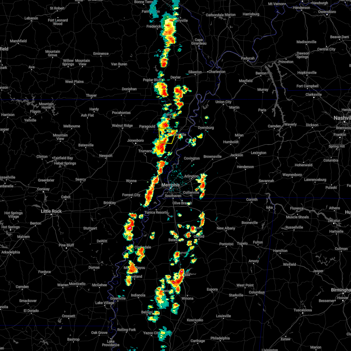 At 1259 pm cdt, a severe thunderstorm was located over manila, and is nearly stationary (radar indicated). Hazards include 60 mph wind gusts and quarter size hail. Hail damage to vehicles is expected. Expect wind damage to roofs, siding, and trees. At 1259 pm cdt, a severe thunderstorm was located over manila, and is nearly stationary (radar indicated). Hazards include 60 mph wind gusts and quarter size hail. Hail damage to vehicles is expected. Expect wind damage to roofs, siding, and trees.
|
| 5/13/2022 12:25 PM CDT |
 At 1225 pm cdt, a severe thunderstorm was located near caraway, and is nearly stationary (radar indicated). Hazards include 60 mph wind gusts and quarter size hail. Hail damage to vehicles is expected. Expect wind damage to roofs, siding, and trees. At 1225 pm cdt, a severe thunderstorm was located near caraway, and is nearly stationary (radar indicated). Hazards include 60 mph wind gusts and quarter size hail. Hail damage to vehicles is expected. Expect wind damage to roofs, siding, and trees.
|
| 4/15/2022 9:22 PM CDT |
 At 922 pm cdt, a severe thunderstorm was located near keiser, moving southeast at 30 mph (radar indicated). Hazards include golf ball size hail. People and animals outdoors will be injured. expect damage to roofs, siding, windows, and vehicles. locations impacted include, osceola, manila, caraway, keiser, dell, little river, etowah, victoria, three way, jolliff store, dearman, west ridge, eastview, lennie, vail, big lake, hightower, carmi, carson lake and whisp. thunderstorm damage threat, considerable hail threat, radar indicated max hail size, 1. 75 in wind threat, radar indicated max wind gust, <50 mph. At 922 pm cdt, a severe thunderstorm was located near keiser, moving southeast at 30 mph (radar indicated). Hazards include golf ball size hail. People and animals outdoors will be injured. expect damage to roofs, siding, windows, and vehicles. locations impacted include, osceola, manila, caraway, keiser, dell, little river, etowah, victoria, three way, jolliff store, dearman, west ridge, eastview, lennie, vail, big lake, hightower, carmi, carson lake and whisp. thunderstorm damage threat, considerable hail threat, radar indicated max hail size, 1. 75 in wind threat, radar indicated max wind gust, <50 mph.
|
| 4/15/2022 8:54 PM CDT |
 At 854 pm cdt, a severe thunderstorm was located near cardwell, or near monette, moving east at 45 mph (radar indicated). Hazards include golf ball size hail. People and animals outdoors will be injured. Expect damage to roofs, siding, windows, and vehicles. At 854 pm cdt, a severe thunderstorm was located near cardwell, or near monette, moving east at 45 mph (radar indicated). Hazards include golf ball size hail. People and animals outdoors will be injured. Expect damage to roofs, siding, windows, and vehicles.
|
| 4/13/2022 2:54 PM CDT |
 At 254 pm cdt, severe thunderstorms were located along a line extending from near rector to near caraway to 6 miles southwest of tyronza, moving northeast at 70 mph (radar indicated). Hazards include 70 mph wind gusts and quarter size hail. Hail damage to vehicles is expected. expect considerable tree damage. wind damage is also likely to mobile homes, roofs, and outbuildings. locations impacted include, kennett, osceola, trumann, gosnell, manila, marked tree, earle, lake city, leachville, lepanto, senath, monette, caraway, parkin, tyronza, keiser, cardwell, hornersville, joiner and arbyrd. thunderstorm damage threat, considerable hail threat, radar indicated max hail size, 1. 00 in wind threat, radar indicated max wind gust, 70 mph. At 254 pm cdt, severe thunderstorms were located along a line extending from near rector to near caraway to 6 miles southwest of tyronza, moving northeast at 70 mph (radar indicated). Hazards include 70 mph wind gusts and quarter size hail. Hail damage to vehicles is expected. expect considerable tree damage. wind damage is also likely to mobile homes, roofs, and outbuildings. locations impacted include, kennett, osceola, trumann, gosnell, manila, marked tree, earle, lake city, leachville, lepanto, senath, monette, caraway, parkin, tyronza, keiser, cardwell, hornersville, joiner and arbyrd. thunderstorm damage threat, considerable hail threat, radar indicated max hail size, 1. 00 in wind threat, radar indicated max wind gust, 70 mph.
|
| 4/13/2022 2:53 PM CDT |
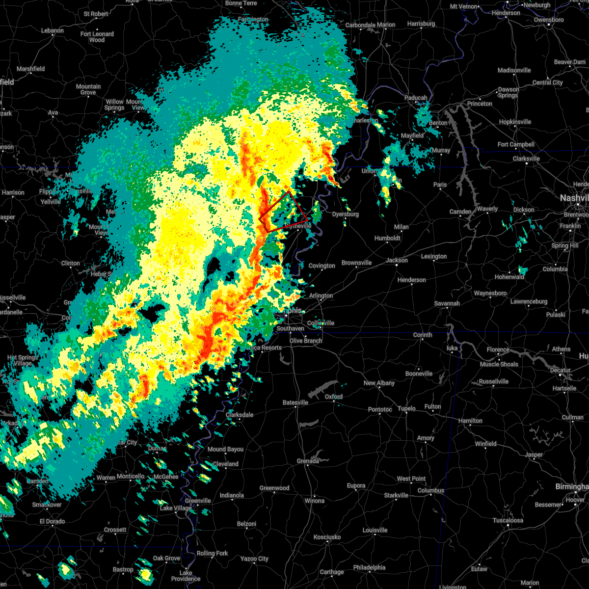 At 252 pm cdt, a severe thunderstorm producing a tornado was located over arbyrd, or near leachville, moving northeast at 65 mph (radar indicated rotation). Hazards include tornado. Flying debris will be dangerous to those caught without shelter. mobile homes will be damaged or destroyed. damage to roofs, windows, and vehicles will occur. tree damage is likely. Locations impacted include, kennett, gosnell, steele, leachville, senath, cardwell, hornersville, arbyrd, holland, happy corners, calumet, buckeye, arkmo, west kennett, woodland corner, pawheen, noland, poplar corner, garson and boynton. At 252 pm cdt, a severe thunderstorm producing a tornado was located over arbyrd, or near leachville, moving northeast at 65 mph (radar indicated rotation). Hazards include tornado. Flying debris will be dangerous to those caught without shelter. mobile homes will be damaged or destroyed. damage to roofs, windows, and vehicles will occur. tree damage is likely. Locations impacted include, kennett, gosnell, steele, leachville, senath, cardwell, hornersville, arbyrd, holland, happy corners, calumet, buckeye, arkmo, west kennett, woodland corner, pawheen, noland, poplar corner, garson and boynton.
|
| 4/13/2022 2:48 PM CDT |
 At 248 pm cdt, a severe thunderstorm producing a tornado was located near cardwell, or near leachville, moving northeast at 65 mph (radar indicated rotation). Hazards include tornado. Flying debris will be dangerous to those caught without shelter. mobile homes will be damaged or destroyed. damage to roofs, windows, and vehicles will occur. tree damage is likely. Locations impacted include, kennett, gosnell, steele, leachville, senath, monette, cardwell, hornersville, arbyrd, holland, delfore, calumet, buckeye, arkmo, west kennett, noland, happy corners, woodland corner, pawheen and poplar corner. At 248 pm cdt, a severe thunderstorm producing a tornado was located near cardwell, or near leachville, moving northeast at 65 mph (radar indicated rotation). Hazards include tornado. Flying debris will be dangerous to those caught without shelter. mobile homes will be damaged or destroyed. damage to roofs, windows, and vehicles will occur. tree damage is likely. Locations impacted include, kennett, gosnell, steele, leachville, senath, monette, cardwell, hornersville, arbyrd, holland, delfore, calumet, buckeye, arkmo, west kennett, noland, happy corners, woodland corner, pawheen and poplar corner.
|
| 4/13/2022 2:42 PM CDT |
 At 242 pm cdt, a severe thunderstorm producing a tornado was located near monette, moving northeast at 65 mph (radar indicated rotation). Hazards include tornado. Flying debris will be dangerous to those caught without shelter. mobile homes will be damaged or destroyed. damage to roofs, windows, and vehicles will occur. Tree damage is likely. At 242 pm cdt, a severe thunderstorm producing a tornado was located near monette, moving northeast at 65 mph (radar indicated rotation). Hazards include tornado. Flying debris will be dangerous to those caught without shelter. mobile homes will be damaged or destroyed. damage to roofs, windows, and vehicles will occur. Tree damage is likely.
|
| 4/13/2022 2:39 PM CDT |
 At 239 pm cdt, severe thunderstorms were located along a line extending from oak grove heights to near trumann to near vanndale, moving northeast at 70 mph (radar indicated). Hazards include 70 mph wind gusts and quarter size hail. Hail damage to vehicles is expected. expect considerable tree damage. Wind damage is also likely to mobile homes, roofs, and outbuildings. At 239 pm cdt, severe thunderstorms were located along a line extending from oak grove heights to near trumann to near vanndale, moving northeast at 70 mph (radar indicated). Hazards include 70 mph wind gusts and quarter size hail. Hail damage to vehicles is expected. expect considerable tree damage. Wind damage is also likely to mobile homes, roofs, and outbuildings.
|
| 4/6/2022 4:48 AM CDT |
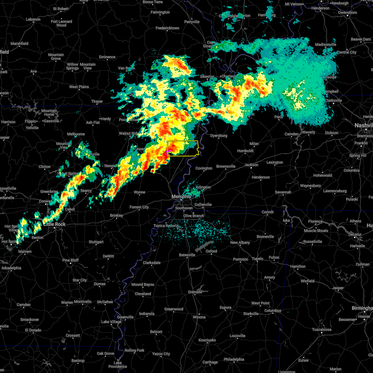 At 447 am cdt, a severe thunderstorm was located over manila, moving east at 40 mph (public). Hazards include 60 mph wind gusts and quarter size hail. Hail damage to vehicles is expected. expect wind damage to roofs, siding, and trees. locations impacted include, blytheville, gosnell, manila, leachville, dell, burdette, little river, jolliff store, happy corners, calumet, dearman, barfield, vail, big lake, o`donnell bend, tomato, hightower, carmi, tuckertown and whisp. hail threat, observed max hail size, 1. 00 in wind threat, radar indicated max wind gust, 60 mph. At 447 am cdt, a severe thunderstorm was located over manila, moving east at 40 mph (public). Hazards include 60 mph wind gusts and quarter size hail. Hail damage to vehicles is expected. expect wind damage to roofs, siding, and trees. locations impacted include, blytheville, gosnell, manila, leachville, dell, burdette, little river, jolliff store, happy corners, calumet, dearman, barfield, vail, big lake, o`donnell bend, tomato, hightower, carmi, tuckertown and whisp. hail threat, observed max hail size, 1. 00 in wind threat, radar indicated max wind gust, 60 mph.
|
| 4/6/2022 4:27 AM CDT |
 At 426 am cdt, a severe thunderstorm was located near monette, moving east at 50 mph (radar indicated). Hazards include 60 mph wind gusts and quarter size hail. Hail damage to vehicles is expected. Expect wind damage to roofs, siding, and trees. At 426 am cdt, a severe thunderstorm was located near monette, moving east at 50 mph (radar indicated). Hazards include 60 mph wind gusts and quarter size hail. Hail damage to vehicles is expected. Expect wind damage to roofs, siding, and trees.
|
| 3/30/2022 3:16 PM CDT |
 At 316 pm cdt, severe thunderstorms were located along a line extending from 6 miles north of gosnell to near wilson, moving east at 35 mph (radar indicated). Hazards include 60 mph wind gusts. expect damage to roofs, siding, and trees At 316 pm cdt, severe thunderstorms were located along a line extending from 6 miles north of gosnell to near wilson, moving east at 35 mph (radar indicated). Hazards include 60 mph wind gusts. expect damage to roofs, siding, and trees
|
| 3/7/2022 1:39 AM CST |
 At 139 am cst, a severe thunderstorm was located over paragould, moving east at 35 mph (radar indicated). Hazards include 60 mph wind gusts. Expect damage to roofs, siding, and trees. locations impacted include, jonesboro, paragould, manila, lake city, leachville, senath, brookland, monette, marmaduke, crowleys ridge state park, oak grove heights, cardwell, arbyrd, black oak, jolliff store, delfore, carmi, whisp, farrville and lester. hail threat, radar indicated max hail size, <. 75 in wind threat, radar indicated max wind gust, 60 mph. At 139 am cst, a severe thunderstorm was located over paragould, moving east at 35 mph (radar indicated). Hazards include 60 mph wind gusts. Expect damage to roofs, siding, and trees. locations impacted include, jonesboro, paragould, manila, lake city, leachville, senath, brookland, monette, marmaduke, crowleys ridge state park, oak grove heights, cardwell, arbyrd, black oak, jolliff store, delfore, carmi, whisp, farrville and lester. hail threat, radar indicated max hail size, <. 75 in wind threat, radar indicated max wind gust, 60 mph.
|
| 3/7/2022 1:28 AM CST |
 At 128 am cst, a severe thunderstorm was located over paragould, moving east at 50 mph (radar indicated). Hazards include 60 mph wind gusts. expect damage to roofs, siding, and trees At 128 am cst, a severe thunderstorm was located over paragould, moving east at 50 mph (radar indicated). Hazards include 60 mph wind gusts. expect damage to roofs, siding, and trees
|
| 2/22/2022 5:52 AM CST |
 At 551 am cst, a severe thunderstorm was located over caraway, moving east at 55 mph (radar indicated). Hazards include 60 mph wind gusts and quarter size hail. Hail damage to vehicles is expected. Expect wind damage to roofs, siding, and trees. At 551 am cst, a severe thunderstorm was located over caraway, moving east at 55 mph (radar indicated). Hazards include 60 mph wind gusts and quarter size hail. Hail damage to vehicles is expected. Expect wind damage to roofs, siding, and trees.
|
| 2/22/2022 5:27 AM CST |
 At 526 am cst, severe thunderstorms were located along a line extending from near glennonville to near senath to near lake city, moving east at 60 mph (radar indicated). Hazards include 60 mph wind gusts and penny size hail. expect damage to roofs, siding, and trees At 526 am cst, severe thunderstorms were located along a line extending from near glennonville to near senath to near lake city, moving east at 60 mph (radar indicated). Hazards include 60 mph wind gusts and penny size hail. expect damage to roofs, siding, and trees
|
| 12/10/2021 9:18 PM CST |
 At 917 pm cst, a severe thunderstorm producing a tornado was located near trumann, moving northeast at 55 mph (radar indicated rotation). Hazards include tornado and quarter size hail. Flying debris will be dangerous to those caught without shelter. mobile homes will be damaged or destroyed. damage to roofs, windows, and vehicles will occur. tree damage is likely. this dangerous storm will be near, caraway around 925 pm cst. leachville around 935 pm cst. manila around 940 pm cst. dell around 945 pm cst. gosnell around 950 pm cst. blytheville around 955 pm cst. Other locations impacted by this tornadic thunderstorm include jolliff store, delfore, calumet, dearman, lennie, vail, etowah, carmi, whisp and buckeye. At 917 pm cst, a severe thunderstorm producing a tornado was located near trumann, moving northeast at 55 mph (radar indicated rotation). Hazards include tornado and quarter size hail. Flying debris will be dangerous to those caught without shelter. mobile homes will be damaged or destroyed. damage to roofs, windows, and vehicles will occur. tree damage is likely. this dangerous storm will be near, caraway around 925 pm cst. leachville around 935 pm cst. manila around 940 pm cst. dell around 945 pm cst. gosnell around 950 pm cst. blytheville around 955 pm cst. Other locations impacted by this tornadic thunderstorm include jolliff store, delfore, calumet, dearman, lennie, vail, etowah, carmi, whisp and buckeye.
|
| 12/10/2021 7:25 PM CST |
 At 724 pm cst, a confirmed large and extremely dangerous tornado was located over monette, moving northeast at 45 mph. this is a particularly dangerous situation. take cover now! (weather spotters confirmed tornado). Hazards include damaging tornado. You are in a life-threatening situation. flying debris may be deadly to those caught without shelter. mobile homes will be destroyed. considerable damage to homes, businesses, and vehicles is likely and complete destruction is possible. the tornado will be near, leachville around 730 pm cst. manila, cardwell and arbyrd around 735 pm cst. hornersville around 745 pm cst. gosnell around 750 pm cst. Other locations impacted by this tornadic thunderstorm include jolliff store, delfore, dearman, lennie, vail, carmi, whisp, buckeye, lester and arkmo. At 724 pm cst, a confirmed large and extremely dangerous tornado was located over monette, moving northeast at 45 mph. this is a particularly dangerous situation. take cover now! (weather spotters confirmed tornado). Hazards include damaging tornado. You are in a life-threatening situation. flying debris may be deadly to those caught without shelter. mobile homes will be destroyed. considerable damage to homes, businesses, and vehicles is likely and complete destruction is possible. the tornado will be near, leachville around 730 pm cst. manila, cardwell and arbyrd around 735 pm cst. hornersville around 745 pm cst. gosnell around 750 pm cst. Other locations impacted by this tornadic thunderstorm include jolliff store, delfore, dearman, lennie, vail, carmi, whisp, buckeye, lester and arkmo.
|
| 7/10/2021 11:55 PM CDT |
 At 1155 pm cdt, severe thunderstorms were located along a line extending from near gosnell to near keiser to lepanto, moving east at 40 mph (radar indicated). Hazards include 60 mph wind gusts. expect damage to roofs, siding, and trees At 1155 pm cdt, severe thunderstorms were located along a line extending from near gosnell to near keiser to lepanto, moving east at 40 mph (radar indicated). Hazards include 60 mph wind gusts. expect damage to roofs, siding, and trees
|
| 6/12/2021 6:49 PM CDT |
 At 649 pm cdt, a severe thunderstorm was located near manila, moving southwest at 5 mph (radar indicated). Hazards include 60 mph wind gusts and quarter size hail. Hail damage to vehicles is expected. expect wind damage to roofs, siding, and trees. Locations impacted include, blytheville, gosnell, manila, leachville, monette, hornersville, dell, burdette, little river, etowah, victoria, jolliff store, delfore, calumet, dearman, eastview, lennie, vail, big lake and hightower. At 649 pm cdt, a severe thunderstorm was located near manila, moving southwest at 5 mph (radar indicated). Hazards include 60 mph wind gusts and quarter size hail. Hail damage to vehicles is expected. expect wind damage to roofs, siding, and trees. Locations impacted include, blytheville, gosnell, manila, leachville, monette, hornersville, dell, burdette, little river, etowah, victoria, jolliff store, delfore, calumet, dearman, eastview, lennie, vail, big lake and hightower.
|
| 6/12/2021 6:28 PM CDT |
 At 628 pm cdt, a severe thunderstorm was located near dell, or near manila, moving southwest at 5 mph (radar indicated). Hazards include 60 mph wind gusts and quarter size hail. Hail damage to vehicles is expected. Expect wind damage to roofs, siding, and trees. At 628 pm cdt, a severe thunderstorm was located near dell, or near manila, moving southwest at 5 mph (radar indicated). Hazards include 60 mph wind gusts and quarter size hail. Hail damage to vehicles is expected. Expect wind damage to roofs, siding, and trees.
|
| 5/6/2021 2:35 PM CDT |
 At 235 pm cdt, severe thunderstorms were located along a line extending from gosnell to near greenfield, moving southeast at 50 mph (radar indicated). Hazards include 60 mph wind gusts and penny size hail. Expect damage to roofs, siding, and trees. Locations impacted include, jonesboro, blytheville, osceola, trumann, gosnell, manila, marked tree, lake city, leachville, lepanto, bay, brookland, monette, caraway, luxora, keiser, hornersville, arbyrd, dyess and dell. At 235 pm cdt, severe thunderstorms were located along a line extending from gosnell to near greenfield, moving southeast at 50 mph (radar indicated). Hazards include 60 mph wind gusts and penny size hail. Expect damage to roofs, siding, and trees. Locations impacted include, jonesboro, blytheville, osceola, trumann, gosnell, manila, marked tree, lake city, leachville, lepanto, bay, brookland, monette, caraway, luxora, keiser, hornersville, arbyrd, dyess and dell.
|
| 5/6/2021 2:17 PM CDT |
 At 217 pm cdt, severe thunderstorms were located along a line extending from near cardwell to 6 miles west of jonesboro, moving southeast at 45 mph (radar indicated). Hazards include 60 mph wind gusts. expect damage to roofs, siding, and trees At 217 pm cdt, severe thunderstorms were located along a line extending from near cardwell to 6 miles west of jonesboro, moving southeast at 45 mph (radar indicated). Hazards include 60 mph wind gusts. expect damage to roofs, siding, and trees
|
| 5/4/2021 2:40 AM CDT |
 At 240 am cdt, severe thunderstorms were located along a line extending from near gideon to near hornersville, moving east at 45 mph (radar indicated). Hazards include 60 mph wind gusts and quarter size hail. Hail damage to vehicles is expected. expect wind damage to roofs, siding, and trees. Locations impacted include, blytheville, kennett, osceola, caruthersville, malden, piggott, gosnell, manila, portageville, hayti, steele, leachville, campbell, senath, caraway, luxora, cardwell, hornersville, holcomb and hayti heights. At 240 am cdt, severe thunderstorms were located along a line extending from near gideon to near hornersville, moving east at 45 mph (radar indicated). Hazards include 60 mph wind gusts and quarter size hail. Hail damage to vehicles is expected. expect wind damage to roofs, siding, and trees. Locations impacted include, blytheville, kennett, osceola, caruthersville, malden, piggott, gosnell, manila, portageville, hayti, steele, leachville, campbell, senath, caraway, luxora, cardwell, hornersville, holcomb and hayti heights.
|
| 5/4/2021 2:25 AM CDT |
 At 224 am cdt, severe thunderstorms were located along a line extending from near holcomb to near cardwell, moving east at 45 mph (radar indicated). Hazards include 60 mph wind gusts and quarter size hail. Hail damage to vehicles is expected. Expect wind damage to roofs, siding, and trees. At 224 am cdt, severe thunderstorms were located along a line extending from near holcomb to near cardwell, moving east at 45 mph (radar indicated). Hazards include 60 mph wind gusts and quarter size hail. Hail damage to vehicles is expected. Expect wind damage to roofs, siding, and trees.
|
| 4/9/2021 4:03 PM CDT |
 At 403 pm cdt, a severe thunderstorm was located over brookland, moving northeast at 30 mph (radar indicated). Hazards include 60 mph wind gusts and quarter size hail. Hail damage to vehicles is expected. expect wind damage to roofs, siding, and trees. Locations impacted include, jonesboro, paragould, trumann, manila, lake city, leachville, bay, brookland, monette, caraway, cardwell, arbyrd, black oak, jolliff store, delfore, vail, carmi, gum point, whisp and farrville. At 403 pm cdt, a severe thunderstorm was located over brookland, moving northeast at 30 mph (radar indicated). Hazards include 60 mph wind gusts and quarter size hail. Hail damage to vehicles is expected. expect wind damage to roofs, siding, and trees. Locations impacted include, jonesboro, paragould, trumann, manila, lake city, leachville, bay, brookland, monette, caraway, cardwell, arbyrd, black oak, jolliff store, delfore, vail, carmi, gum point, whisp and farrville.
|
| 4/9/2021 3:57 PM CDT |
 At 356 pm cdt, a severe thunderstorm was located over bay, moving northeast at 25 mph (radar indicated). Hazards include 60 mph wind gusts and quarter size hail. Hail damage to vehicles is expected. Expect wind damage to roofs, siding, and trees. At 356 pm cdt, a severe thunderstorm was located over bay, moving northeast at 25 mph (radar indicated). Hazards include 60 mph wind gusts and quarter size hail. Hail damage to vehicles is expected. Expect wind damage to roofs, siding, and trees.
|
| 8/27/2020 9:04 PM CDT |
 At 904 pm cdt, doppler radar indicated a severe thunderstorm producing a tornado was located near caraway, moving north at 40 mph (radar indicated rotation). Hazards include tornado. Flying debris will be dangerous to those caught without shelter. mobile homes will be damaged or destroyed. damage to roofs, windows, and vehicles will occur. tree damage is likely. Locations impacted include, manila, lake city, leachville, monette, caraway, etowah, black oak, three way, jolliff store, lennie, vail, macey, big lake, carmi, whisp, lester, mandalay, walters, lache lake and poplar ridge. At 904 pm cdt, doppler radar indicated a severe thunderstorm producing a tornado was located near caraway, moving north at 40 mph (radar indicated rotation). Hazards include tornado. Flying debris will be dangerous to those caught without shelter. mobile homes will be damaged or destroyed. damage to roofs, windows, and vehicles will occur. tree damage is likely. Locations impacted include, manila, lake city, leachville, monette, caraway, etowah, black oak, three way, jolliff store, lennie, vail, macey, big lake, carmi, whisp, lester, mandalay, walters, lache lake and poplar ridge.
|
| 8/27/2020 8:59 PM CDT |
 At 847 pm cdt, doppler radar indicated a severe thunderstorm producing a tornado was located near tyronza, moving north at 40 mph (radar indicated rotation). Hazards include tornado. Flying debris will be dangerous to those caught without shelter. mobile homes will be damaged or destroyed. damage to roofs, windows, and vehicles will occur. Tree damage is likely. At 847 pm cdt, doppler radar indicated a severe thunderstorm producing a tornado was located near tyronza, moving north at 40 mph (radar indicated rotation). Hazards include tornado. Flying debris will be dangerous to those caught without shelter. mobile homes will be damaged or destroyed. damage to roofs, windows, and vehicles will occur. Tree damage is likely.
|
| 8/27/2020 8:47 PM CDT |
 At 847 pm cdt, doppler radar indicated a severe thunderstorm producing a tornado was located near tyronza, moving north at 40 mph (radar indicated rotation). Hazards include tornado. Flying debris will be dangerous to those caught without shelter. mobile homes will be damaged or destroyed. damage to roofs, windows, and vehicles will occur. Tree damage is likely. At 847 pm cdt, doppler radar indicated a severe thunderstorm producing a tornado was located near tyronza, moving north at 40 mph (radar indicated rotation). Hazards include tornado. Flying debris will be dangerous to those caught without shelter. mobile homes will be damaged or destroyed. damage to roofs, windows, and vehicles will occur. Tree damage is likely.
|
| 6/5/2020 11:07 AM CDT |
 At 1107 am cdt, severe thunderstorms were located along a line extending from near parma to near greenway to near marmaduke to near crowleys ridge state park, moving southeast at 35 mph (radar indicated). Hazards include 60 mph wind gusts. expect damage to roofs, siding, and trees At 1107 am cdt, severe thunderstorms were located along a line extending from near parma to near greenway to near marmaduke to near crowleys ridge state park, moving southeast at 35 mph (radar indicated). Hazards include 60 mph wind gusts. expect damage to roofs, siding, and trees
|
| 5/3/2020 1:56 PM CDT |
 At 155 pm cdt, severe thunderstorms were located along a line extending from 7 miles northwest of monette to 6 miles east of cash, moving east at 45 mph (radar indicated). Hazards include 70 mph wind gusts and quarter size hail. Hail damage to vehicles is expected. expect considerable tree damage. wind damage is also likely to mobile homes, roofs, and outbuildings. Locations impacted include, jonesboro, paragould, blytheville, trumann, gosnell, manila, bono, lake city, leachville, lepanto, bay, brookland, monette, caraway, keiser, crowleys ridge state park, lake frierson state park, dyess, cash and dell. At 155 pm cdt, severe thunderstorms were located along a line extending from 7 miles northwest of monette to 6 miles east of cash, moving east at 45 mph (radar indicated). Hazards include 70 mph wind gusts and quarter size hail. Hail damage to vehicles is expected. expect considerable tree damage. wind damage is also likely to mobile homes, roofs, and outbuildings. Locations impacted include, jonesboro, paragould, blytheville, trumann, gosnell, manila, bono, lake city, leachville, lepanto, bay, brookland, monette, caraway, keiser, crowleys ridge state park, lake frierson state park, dyess, cash and dell.
|
| 5/3/2020 1:43 PM CDT |
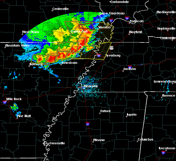 At 143 pm cdt, a severe thunderstorm was located over fontaine, or near bono, moving east at 55 mph (radar indicated). Hazards include 70 mph wind gusts and quarter size hail. Hail damage to vehicles is expected. expect considerable tree damage. Wind damage is also likely to mobile homes, roofs, and outbuildings. At 143 pm cdt, a severe thunderstorm was located over fontaine, or near bono, moving east at 55 mph (radar indicated). Hazards include 70 mph wind gusts and quarter size hail. Hail damage to vehicles is expected. expect considerable tree damage. Wind damage is also likely to mobile homes, roofs, and outbuildings.
|
| 4/29/2020 12:25 AM CDT |
 The severe thunderstorm warning for southeastern craighead, mississippi, southeastern clay, pemiscot, dunklin, western dyer, central lauderdale and central lake counties will expire at 1230 am cdt, the storm which prompted the warning has weakened below severe limits, and has exited the warned area. therefore, the warning will be allowed to expire. a severe thunderstorm watch remains in effect until 300 am cdt for eastern arkansas, southeastern missouri, and western tennessee. The severe thunderstorm warning for southeastern craighead, mississippi, southeastern clay, pemiscot, dunklin, western dyer, central lauderdale and central lake counties will expire at 1230 am cdt, the storm which prompted the warning has weakened below severe limits, and has exited the warned area. therefore, the warning will be allowed to expire. a severe thunderstorm watch remains in effect until 300 am cdt for eastern arkansas, southeastern missouri, and western tennessee.
|
| 4/28/2020 11:53 PM CDT |
 The severe thunderstorm warning for eastern greene, craighead, northwestern mississippi, eastern clay, western pemiscot and dunklin counties will expire at midnight cdt, the severe thunderstorm which prompted the warning is now approaching the mississippi river. therefore, the warning will be allowed to expire. however gusty winds are still possible with this thunderstorm. a severe thunderstorm watch remains in effect until 300 am cdt for eastern arkansas, and southeastern missouri. The severe thunderstorm warning for eastern greene, craighead, northwestern mississippi, eastern clay, western pemiscot and dunklin counties will expire at midnight cdt, the severe thunderstorm which prompted the warning is now approaching the mississippi river. therefore, the warning will be allowed to expire. however gusty winds are still possible with this thunderstorm. a severe thunderstorm watch remains in effect until 300 am cdt for eastern arkansas, and southeastern missouri.
|
| 4/28/2020 11:43 PM CDT |
 At 1139 pm cdt, a severe thunderstorm was located near steele, moving east at 65 mph (radar indicated). Hazards include 70 mph wind gusts. Expect considerable tree damage. Damage is likely to mobile homes, roofs, and outbuildings. At 1139 pm cdt, a severe thunderstorm was located near steele, moving east at 65 mph (radar indicated). Hazards include 70 mph wind gusts. Expect considerable tree damage. Damage is likely to mobile homes, roofs, and outbuildings.
|
| 4/28/2020 11:43 PM CDT |
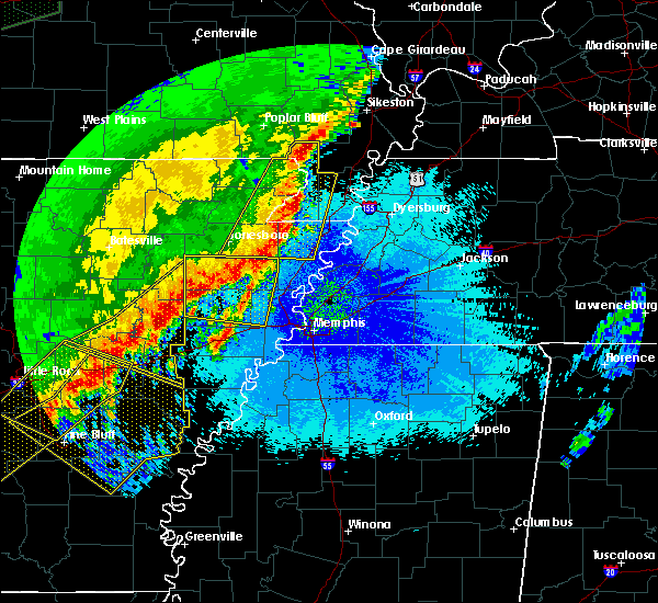 At 1139 pm cdt, a severe thunderstorm was located near steele, moving east at 65 mph (radar indicated). Hazards include 70 mph wind gusts. Expect considerable tree damage. Damage is likely to mobile homes, roofs, and outbuildings. At 1139 pm cdt, a severe thunderstorm was located near steele, moving east at 65 mph (radar indicated). Hazards include 70 mph wind gusts. Expect considerable tree damage. Damage is likely to mobile homes, roofs, and outbuildings.
|
| 4/28/2020 11:34 PM CDT |
 At 1131 pm cdt, a severe thunderstorm was located near kennett, moving east at 30 mph (radar indicated). Hazards include 70 mph wind gusts. Expect considerable tree damage. damage is likely to mobile homes, roofs, and outbuildings. Locations impacted include, jonesboro, paragould, blytheville, kennett, osceola, piggott, gosnell, manila, lake city, leachville, campbell, rector, bay, senath, brookland, monette, caraway, marmaduke, chalk bluff natural area and malden. At 1131 pm cdt, a severe thunderstorm was located near kennett, moving east at 30 mph (radar indicated). Hazards include 70 mph wind gusts. Expect considerable tree damage. damage is likely to mobile homes, roofs, and outbuildings. Locations impacted include, jonesboro, paragould, blytheville, kennett, osceola, piggott, gosnell, manila, lake city, leachville, campbell, rector, bay, senath, brookland, monette, caraway, marmaduke, chalk bluff natural area and malden.
|
| 4/28/2020 11:09 PM CDT |
 At 1109 pm cdt, a severe thunderstorm was located near marmaduke, moving east at 35 mph (radar indicated). Hazards include 70 mph wind gusts. Expect considerable tree damage. Damage is likely to mobile homes, roofs, and outbuildings. At 1109 pm cdt, a severe thunderstorm was located near marmaduke, moving east at 35 mph (radar indicated). Hazards include 70 mph wind gusts. Expect considerable tree damage. Damage is likely to mobile homes, roofs, and outbuildings.
|
| 4/28/2020 10:53 PM CDT |
 At 1052 pm cdt, severe thunderstorms were located along a line extending from near mcdougal to paragould to 6 miles southwest of jonesboro, moving east at 35 mph (law enforcement. at 1049 pm, 60 mph winds were reported in bono). Hazards include 60 mph wind gusts. Expect damage to roofs, siding, and trees. Locations impacted include, jonesboro, paragould, kennett, piggott, corning, bono, lake city, leachville, campbell, rector, bay, senath, brookland, monette, caraway, marmaduke, chalk bluff natural area, crowleys ridge state park, lake frierson state park and malden. At 1052 pm cdt, severe thunderstorms were located along a line extending from near mcdougal to paragould to 6 miles southwest of jonesboro, moving east at 35 mph (law enforcement. at 1049 pm, 60 mph winds were reported in bono). Hazards include 60 mph wind gusts. Expect damage to roofs, siding, and trees. Locations impacted include, jonesboro, paragould, kennett, piggott, corning, bono, lake city, leachville, campbell, rector, bay, senath, brookland, monette, caraway, marmaduke, chalk bluff natural area, crowleys ridge state park, lake frierson state park and malden.
|
| 4/28/2020 10:35 PM CDT |
 At 1035 pm cdt, a severe thunderstorm was located near evening star, or 7 miles north of crowleys ridge state park, moving east at 45 mph (radar indicated). Hazards include 60 mph wind gusts. expect damage to roofs, siding, and trees At 1035 pm cdt, a severe thunderstorm was located near evening star, or 7 miles north of crowleys ridge state park, moving east at 45 mph (radar indicated). Hazards include 60 mph wind gusts. expect damage to roofs, siding, and trees
|
| 4/8/2020 10:59 PM CDT |
 At 1059 pm cdt, a severe thunderstorm was located over manila, moving southeast at 45 mph (trained weather spotters. at 10:57 pm cdt, amateur radio operators reported golfball size hail just southwest of manilla). Hazards include golf ball size hail and 60 mph wind gusts. People and animals outdoors will be injured. expect hail damage to roofs, siding, windows, and vehicles. expect wind damage to roofs, siding, and trees. Locations impacted include, osceola, manila, leachville, monette, luxora, fort pillow state park, dell, burdette, fulton, ft pillow, little river, victoria, jolliff store, happy corners, delfore, eastview, lennie, vail, big lake and grider. At 1059 pm cdt, a severe thunderstorm was located over manila, moving southeast at 45 mph (trained weather spotters. at 10:57 pm cdt, amateur radio operators reported golfball size hail just southwest of manilla). Hazards include golf ball size hail and 60 mph wind gusts. People and animals outdoors will be injured. expect hail damage to roofs, siding, windows, and vehicles. expect wind damage to roofs, siding, and trees. Locations impacted include, osceola, manila, leachville, monette, luxora, fort pillow state park, dell, burdette, fulton, ft pillow, little river, victoria, jolliff store, happy corners, delfore, eastview, lennie, vail, big lake and grider.
|
| 4/8/2020 10:55 PM CDT | Golf Ball sized hail reported 4.1 miles W of Leachville, AR |
| 4/8/2020 10:54 PM CDT |
 At 1054 pm cdt, a severe thunderstorm was located over manila, moving southeast at 45 mph (radar indicated). Hazards include 60 mph wind gusts and quarter size hail. Hail damage to vehicles is expected. Expect wind damage to roofs, siding, and trees. At 1054 pm cdt, a severe thunderstorm was located over manila, moving southeast at 45 mph (radar indicated). Hazards include 60 mph wind gusts and quarter size hail. Hail damage to vehicles is expected. Expect wind damage to roofs, siding, and trees.
|
| 3/28/2020 6:13 PM CDT |
 At 613 pm cdt, a severe thunderstorm was located near manila, moving northeast at 40 mph (radar indicated). Hazards include 60 mph wind gusts and quarter size hail. Hail damage to vehicles is expected. Expect wind damage to roofs, siding, and trees. At 613 pm cdt, a severe thunderstorm was located near manila, moving northeast at 40 mph (radar indicated). Hazards include 60 mph wind gusts and quarter size hail. Hail damage to vehicles is expected. Expect wind damage to roofs, siding, and trees.
|
| 3/28/2020 6:13 PM CDT |
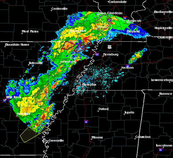 At 613 pm cdt, a severe thunderstorm was located near manila, moving northeast at 40 mph (radar indicated). Hazards include 60 mph wind gusts and quarter size hail. Hail damage to vehicles is expected. Expect wind damage to roofs, siding, and trees. At 613 pm cdt, a severe thunderstorm was located near manila, moving northeast at 40 mph (radar indicated). Hazards include 60 mph wind gusts and quarter size hail. Hail damage to vehicles is expected. Expect wind damage to roofs, siding, and trees.
|
| 3/1/2020 7:04 PM CST |
 At 704 pm cst, a severe thunderstorm was located near leachville, moving northeast at 35 mph (radar indicated). Hazards include quarter size hail. Damage to vehicles is expected. Locations impacted include, blytheville, gosnell, manila, leachville, hornersville, jolliff store, calumet, buckeye, burton, woodland corner, pawheen, poplar corner, garson, stark city, yarbro, rives, hornersville junction, west hermondale, new survey and gilbert. At 704 pm cst, a severe thunderstorm was located near leachville, moving northeast at 35 mph (radar indicated). Hazards include quarter size hail. Damage to vehicles is expected. Locations impacted include, blytheville, gosnell, manila, leachville, hornersville, jolliff store, calumet, buckeye, burton, woodland corner, pawheen, poplar corner, garson, stark city, yarbro, rives, hornersville junction, west hermondale, new survey and gilbert.
|
| 3/1/2020 6:58 PM CST | Quarter sized hail reported 0.8 miles NE of Leachville, AR, quarter sized and smaller hail covered ground in leachville. |
| 3/1/2020 6:55 PM CST |
 At 654 pm cst, a severe thunderstorm was located over monette, moving northeast at 35 mph (radar indicated). Hazards include quarter size hail. damage to vehicles is expected At 654 pm cst, a severe thunderstorm was located over monette, moving northeast at 35 mph (radar indicated). Hazards include quarter size hail. damage to vehicles is expected
|
| 1/11/2020 2:47 AM CST |
 At 247 am cst, severe thunderstorms were located along a line extending from near portageville to near osceola, moving east at 40 mph (radar indicated). Hazards include 60 mph wind gusts. Expect damage to roofs, siding, and trees. Locations impacted include, dyersburg, blytheville, kennett, osceola, caruthersville, gosnell, manila, portageville, hayti, steele, caraway, luxora, keiser, reelfoot lake state park, tiptonville, ridgely, hornersville, hayti heights, cooter and wardell. At 247 am cst, severe thunderstorms were located along a line extending from near portageville to near osceola, moving east at 40 mph (radar indicated). Hazards include 60 mph wind gusts. Expect damage to roofs, siding, and trees. Locations impacted include, dyersburg, blytheville, kennett, osceola, caruthersville, gosnell, manila, portageville, hayti, steele, caraway, luxora, keiser, reelfoot lake state park, tiptonville, ridgely, hornersville, hayti heights, cooter and wardell.
|
| 1/11/2020 2:26 AM CST |
 At 225 am cst, severe thunderstorms were located along a line extending from near gideon to near caraway, moving northeast at 40 mph (radar indicated). Hazards include 60 mph wind gusts. expect damage to roofs, siding, and trees At 225 am cst, severe thunderstorms were located along a line extending from near gideon to near caraway, moving northeast at 40 mph (radar indicated). Hazards include 60 mph wind gusts. expect damage to roofs, siding, and trees
|
| 1/11/2020 1:52 AM CST |
 At 152 am cst, severe thunderstorms were located along a line extending from near clarkton to trumann, moving northeast at 45 mph (radar indicated). Hazards include 70 mph wind gusts. Expect considerable tree damage. Damage is likely to mobile homes, roofs, and outbuildings. At 152 am cst, severe thunderstorms were located along a line extending from near clarkton to trumann, moving northeast at 45 mph (radar indicated). Hazards include 70 mph wind gusts. Expect considerable tree damage. Damage is likely to mobile homes, roofs, and outbuildings.
|
| 1/11/2020 1:15 AM CST |
 At 115 am cst, severe thunderstorms were located along a line extending from near puxico to near beech grove, moving northeast at 55 mph (radar indicated). Hazards include 60 mph wind gusts. Expect damage to roofs, siding, and trees. locations impacted include, paragould, kennett, piggott, manila, lake city, leachville, campbell, rector, senath, brookland, monette, marmaduke, chalk bluff natural area, oak grove heights, cardwell, hornersville, holcomb, arbyrd, st. Francis and dell. At 115 am cst, severe thunderstorms were located along a line extending from near puxico to near beech grove, moving northeast at 55 mph (radar indicated). Hazards include 60 mph wind gusts. Expect damage to roofs, siding, and trees. locations impacted include, paragould, kennett, piggott, manila, lake city, leachville, campbell, rector, senath, brookland, monette, marmaduke, chalk bluff natural area, oak grove heights, cardwell, hornersville, holcomb, arbyrd, st. Francis and dell.
|
| 1/11/2020 12:47 AM CST |
 At 1247 am cst, severe thunderstorms were located along a line extending from near harviell to bono, moving northeast at 55 mph (radar indicated). Hazards include 60 mph wind gusts. expect damage to roofs, siding, and trees At 1247 am cst, severe thunderstorms were located along a line extending from near harviell to bono, moving northeast at 55 mph (radar indicated). Hazards include 60 mph wind gusts. expect damage to roofs, siding, and trees
|
| 10/21/2019 4:51 AM CDT |
 At 450 am cdt, severe thunderstorms were located along a line extending from near senath to near osceola to near gilmore, moving northeast at 60 mph (radar indicated). Hazards include 60 mph wind gusts. Expect damage to roofs, siding, and trees. Locations impacted include, blytheville, osceola, gosnell, manila, luxora, wilson, keiser, fort pillow state park, dyess, dell, burdette, marie, fulton, little river, etowah, victoria, calumet, dearman, eastview and lennie. At 450 am cdt, severe thunderstorms were located along a line extending from near senath to near osceola to near gilmore, moving northeast at 60 mph (radar indicated). Hazards include 60 mph wind gusts. Expect damage to roofs, siding, and trees. Locations impacted include, blytheville, osceola, gosnell, manila, luxora, wilson, keiser, fort pillow state park, dyess, dell, burdette, marie, fulton, little river, etowah, victoria, calumet, dearman, eastview and lennie.
|
| 10/21/2019 4:26 AM CDT |
 At 425 am cdt, severe thunderstorms were located along a line extending from 6 miles south of paragould to near marked tree to parkin, moving northeast at 60 mph (radar indicated). Hazards include 60 mph wind gusts. expect damage to roofs, siding, and trees At 425 am cdt, severe thunderstorms were located along a line extending from 6 miles south of paragould to near marked tree to parkin, moving northeast at 60 mph (radar indicated). Hazards include 60 mph wind gusts. expect damage to roofs, siding, and trees
|
| 8/6/2019 8:15 PM CDT |
 At 815 pm cdt, a severe thunderstorm was located over marmaduke, moving southeast at 45 mph (radar indicated). Hazards include 60 mph wind gusts and quarter size hail. Hail damage to vehicles is expected. Expect wind damage to roofs, siding, and trees. At 815 pm cdt, a severe thunderstorm was located over marmaduke, moving southeast at 45 mph (radar indicated). Hazards include 60 mph wind gusts and quarter size hail. Hail damage to vehicles is expected. Expect wind damage to roofs, siding, and trees.
|
| 6/23/2019 3:17 PM CDT |
 At 316 pm cdt, a severe thunderstorm was located near leachville, moving east at 50 mph (public. numerous trees were damaged across the jonesboro). Hazards include 60 mph wind gusts. Expect damage to roofs, siding, and trees. Locations impacted include, jonesboro, blytheville, osceola, trumann, gosnell, manila, lake city, leachville, bay, brookland, monette, caraway, keiser, dell, burdette, greenfield, little river, etowah, black oak and victoria. At 316 pm cdt, a severe thunderstorm was located near leachville, moving east at 50 mph (public. numerous trees were damaged across the jonesboro). Hazards include 60 mph wind gusts. Expect damage to roofs, siding, and trees. Locations impacted include, jonesboro, blytheville, osceola, trumann, gosnell, manila, lake city, leachville, bay, brookland, monette, caraway, keiser, dell, burdette, greenfield, little river, etowah, black oak and victoria.
|
| 6/23/2019 2:50 PM CDT |
 At 249 pm cdt, a severe thunderstorm was located near brookland, moving east at 50 mph (radar indicated). Hazards include 60 mph wind gusts. expect damage to roofs, siding, and trees At 249 pm cdt, a severe thunderstorm was located near brookland, moving east at 50 mph (radar indicated). Hazards include 60 mph wind gusts. expect damage to roofs, siding, and trees
|
| 6/21/2019 6:58 PM CDT |
 At 657 pm cdt, severe thunderstorms were located along a line extending from nutbush to near harrisburg, moving southeast at 70 mph (radar indicated). Hazards include 60 mph wind gusts. Expect damage to roofs, siding, and trees. Locations impacted include, jonesboro, blytheville, covington, ripley, osceola, trumann, gosnell, manila, marked tree, harrisburg, lake city, leachville, lepanto, bay, monette, caraway, luxora, wilson, tyronza and keiser. At 657 pm cdt, severe thunderstorms were located along a line extending from nutbush to near harrisburg, moving southeast at 70 mph (radar indicated). Hazards include 60 mph wind gusts. Expect damage to roofs, siding, and trees. Locations impacted include, jonesboro, blytheville, covington, ripley, osceola, trumann, gosnell, manila, marked tree, harrisburg, lake city, leachville, lepanto, bay, monette, caraway, luxora, wilson, tyronza and keiser.
|
| 6/21/2019 6:42 PM CDT |
 The severe thunderstorm warning for greene, central craighead, northwestern mississippi, southeastern clay, pemiscot, southern dunklin, northwestern dyer and southwestern lake counties will expire at 645 pm cdt, the storms which prompted the warning have moved out of the area. therefore, the warning will be allowed to expire. however wind gusts to 50 mph are still possible with the remaining thunderstorms. a severe thunderstorm watch remains in effect until 100 am cdt for eastern arkansas, southeastern missouri, and western tennessee. The severe thunderstorm warning for greene, central craighead, northwestern mississippi, southeastern clay, pemiscot, southern dunklin, northwestern dyer and southwestern lake counties will expire at 645 pm cdt, the storms which prompted the warning have moved out of the area. therefore, the warning will be allowed to expire. however wind gusts to 50 mph are still possible with the remaining thunderstorms. a severe thunderstorm watch remains in effect until 100 am cdt for eastern arkansas, southeastern missouri, and western tennessee.
|
| 6/21/2019 6:24 PM CDT |
 At 624 pm cdt, severe thunderstorms were located along a line extending from near cloverdale to near brookland, moving southeast at 25 mph (radar indicated). Hazards include 60 mph wind gusts. Expect damage to roofs, siding, and trees. Locations impacted include, jonesboro, paragould, blytheville, kennett, caruthersville, gosnell, hayti, steele, bono, leachville, senath, brookland, monette, marmaduke, crowleys ridge state park, lake frierson state park, oak grove heights, cardwell, hornersville and hayti heights. At 624 pm cdt, severe thunderstorms were located along a line extending from near cloverdale to near brookland, moving southeast at 25 mph (radar indicated). Hazards include 60 mph wind gusts. Expect damage to roofs, siding, and trees. Locations impacted include, jonesboro, paragould, blytheville, kennett, caruthersville, gosnell, hayti, steele, bono, leachville, senath, brookland, monette, marmaduke, crowleys ridge state park, lake frierson state park, oak grove heights, cardwell, hornersville and hayti heights.
|
| 6/21/2019 6:18 PM CDT |
 At 617 pm cdt, severe thunderstorms were located along a line extending from near miston to near bono, moving southeast at 60 mph (radar indicated). Hazards include 60 mph wind gusts. expect damage to roofs, siding, and trees At 617 pm cdt, severe thunderstorms were located along a line extending from near miston to near bono, moving southeast at 60 mph (radar indicated). Hazards include 60 mph wind gusts. expect damage to roofs, siding, and trees
|
| 6/21/2019 5:46 PM CDT |
 At 544 pm cdt, severe thunderstorms were located along a line extending from near tiptonville to near o`kean, moving southeast at 25 mph (radar indicated, measured at kennett missouri airport). Hazards include 60 mph wind gusts. expect damage to roofs, siding, and trees At 544 pm cdt, severe thunderstorms were located along a line extending from near tiptonville to near o`kean, moving southeast at 25 mph (radar indicated, measured at kennett missouri airport). Hazards include 60 mph wind gusts. expect damage to roofs, siding, and trees
|
| 6/21/2019 5:46 PM CDT |
 The national weather service in memphis has issued a * severe thunderstorm warning for. greene county in eastern arkansas. central craighead county in eastern arkansas. northwestern mississippi county in eastern arkansas. Clay county in eastern arkansas. The national weather service in memphis has issued a * severe thunderstorm warning for. greene county in eastern arkansas. central craighead county in eastern arkansas. northwestern mississippi county in eastern arkansas. Clay county in eastern arkansas.
|
| 3/14/2019 6:45 AM CDT |
 At 645 am cdt, a severe thunderstorm was located near lake city, moving northeast at 45 mph (radar indicated). Hazards include 60 mph wind gusts. expect damage to roofs, siding, and trees At 645 am cdt, a severe thunderstorm was located near lake city, moving northeast at 45 mph (radar indicated). Hazards include 60 mph wind gusts. expect damage to roofs, siding, and trees
|
| 11/1/2018 12:51 AM CDT |
 The tornado warning for northwestern mississippi county will expire at 100 am cdt, the storm which prompted the warning has weakened below severe limits, and no longer appears capable of producing a tornado. therefore, the warning will be allowed to expire. The tornado warning for northwestern mississippi county will expire at 100 am cdt, the storm which prompted the warning has weakened below severe limits, and no longer appears capable of producing a tornado. therefore, the warning will be allowed to expire.
|
| 11/1/2018 12:48 AM CDT |
 At 1248 am cdt, doppler radar indicated a severe thunderstorm producing a tornado was located over manila, moving northeast at 55 mph (radar indicated rotation). Hazards include tornado. Flying debris will be dangerous to those caught without shelter. mobile homes will be damaged or destroyed. damage to roofs, windows, and vehicles will occur. tree damage is likely. Locations impacted include, manila, leachville, caraway, jolliff store, milligan ridge, lennie, vail, big lake, poplar corner, carmi, whisp, mandalay, walters and herman davis state park. At 1248 am cdt, doppler radar indicated a severe thunderstorm producing a tornado was located over manila, moving northeast at 55 mph (radar indicated rotation). Hazards include tornado. Flying debris will be dangerous to those caught without shelter. mobile homes will be damaged or destroyed. damage to roofs, windows, and vehicles will occur. tree damage is likely. Locations impacted include, manila, leachville, caraway, jolliff store, milligan ridge, lennie, vail, big lake, poplar corner, carmi, whisp, mandalay, walters and herman davis state park.
|
| 11/1/2018 12:34 AM CDT |
 At 1234 am cdt, doppler radar indicated a severe thunderstorm producing a tornado was located near caraway, moving northeast at 55 mph (radar indicated rotation). Hazards include tornado. Flying debris will be dangerous to those caught without shelter. mobile homes will be damaged or destroyed. damage to roofs, windows, and vehicles will occur. Tree damage is likely. At 1234 am cdt, doppler radar indicated a severe thunderstorm producing a tornado was located near caraway, moving northeast at 55 mph (radar indicated rotation). Hazards include tornado. Flying debris will be dangerous to those caught without shelter. mobile homes will be damaged or destroyed. damage to roofs, windows, and vehicles will occur. Tree damage is likely.
|
| 8/16/2018 11:51 PM CDT |
 At 1151 pm cdt, a severe thunderstorm was located over burdette, or near luxora, moving southeast at 20 mph (radar indicated). Hazards include 70 mph wind gusts. Expect considerable tree damage. damage is likely to mobile homes, roofs, and outbuildings. Locations impacted include, blytheville, osceola, gosnell, manila, leachville, luxora, dell, burdette, ashport, little river, victoria, calumet, dearman, o`donnell bend, hightower, tuckertown, rosa, buckeye, burton and woodland corner. At 1151 pm cdt, a severe thunderstorm was located over burdette, or near luxora, moving southeast at 20 mph (radar indicated). Hazards include 70 mph wind gusts. Expect considerable tree damage. damage is likely to mobile homes, roofs, and outbuildings. Locations impacted include, blytheville, osceola, gosnell, manila, leachville, luxora, dell, burdette, ashport, little river, victoria, calumet, dearman, o`donnell bend, hightower, tuckertown, rosa, buckeye, burton and woodland corner.
|
| 8/16/2018 11:51 PM CDT |
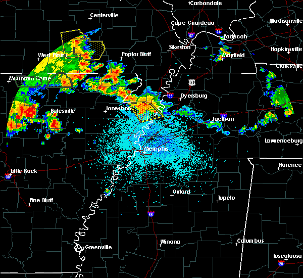 At 1151 pm cdt, a severe thunderstorm was located over burdette, or near luxora, moving southeast at 20 mph (radar indicated). Hazards include 70 mph wind gusts. Expect considerable tree damage. damage is likely to mobile homes, roofs, and outbuildings. Locations impacted include, blytheville, osceola, gosnell, manila, leachville, luxora, dell, burdette, ashport, little river, victoria, calumet, dearman, o`donnell bend, hightower, tuckertown, rosa, buckeye, burton and woodland corner. At 1151 pm cdt, a severe thunderstorm was located over burdette, or near luxora, moving southeast at 20 mph (radar indicated). Hazards include 70 mph wind gusts. Expect considerable tree damage. damage is likely to mobile homes, roofs, and outbuildings. Locations impacted include, blytheville, osceola, gosnell, manila, leachville, luxora, dell, burdette, ashport, little river, victoria, calumet, dearman, o`donnell bend, hightower, tuckertown, rosa, buckeye, burton and woodland corner.
|
| 8/16/2018 11:43 PM CDT |
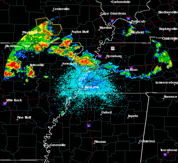 At 1143 pm cdt, a severe thunderstorm was located near burdette, or near blytheville, moving southeast at 20 mph (radar indicated). Hazards include 60 mph wind gusts. expect damage to roofs, siding, and trees At 1143 pm cdt, a severe thunderstorm was located near burdette, or near blytheville, moving southeast at 20 mph (radar indicated). Hazards include 60 mph wind gusts. expect damage to roofs, siding, and trees
|
| 6/28/2018 10:37 PM CDT |
 At 1037 pm cdt, a severe thunderstorm was located near heloise, or 9 miles southeast of steele, moving southwest at 35 mph (radar indicated). Hazards include 60 mph wind gusts and quarter size hail. Hail damage to vehicles is expected. expect wind damage to roofs, siding, and trees. Locations impacted include, dyersburg, blytheville, caruthersville, gosnell, manila, hayti, steele, newbern, halls, hornersville, hayti heights, cooter, dell, burdette, chestnut bluff, deering, bradleytown, heloise, unionville and bolton. At 1037 pm cdt, a severe thunderstorm was located near heloise, or 9 miles southeast of steele, moving southwest at 35 mph (radar indicated). Hazards include 60 mph wind gusts and quarter size hail. Hail damage to vehicles is expected. expect wind damage to roofs, siding, and trees. Locations impacted include, dyersburg, blytheville, caruthersville, gosnell, manila, hayti, steele, newbern, halls, hornersville, hayti heights, cooter, dell, burdette, chestnut bluff, deering, bradleytown, heloise, unionville and bolton.
|
| 6/28/2018 10:13 PM CDT |
 At 1012 pm cdt, a severe thunderstorm was located 10 miles south of heloise, or 12 miles northwest of ripley, moving southwest at 45 mph (radar indicated). Hazards include 60 mph wind gusts and quarter size hail. Hail damage to vehicles is expected. Expect wind damage to roofs, siding, and trees. At 1012 pm cdt, a severe thunderstorm was located 10 miles south of heloise, or 12 miles northwest of ripley, moving southwest at 45 mph (radar indicated). Hazards include 60 mph wind gusts and quarter size hail. Hail damage to vehicles is expected. Expect wind damage to roofs, siding, and trees.
|
| 6/28/2018 10:01 PM CDT |
 At 1000 pm cdt, a severe thunderstorm was located near miston, or 10 miles south of reelfoot lake state park, moving southwest at 35 mph (radar indicated). Hazards include 60 mph wind gusts and quarter size hail. Hail damage to vehicles is expected. Expect wind damage to roofs, siding, and trees. At 1000 pm cdt, a severe thunderstorm was located near miston, or 10 miles south of reelfoot lake state park, moving southwest at 35 mph (radar indicated). Hazards include 60 mph wind gusts and quarter size hail. Hail damage to vehicles is expected. Expect wind damage to roofs, siding, and trees.
|
| 6/1/2018 1:19 AM CDT |
 At 119 am cdt, severe thunderstorms were located along a line extending from near heloise to near weiner, moving southeast at 35 mph (radar indicated). Hazards include 70 mph wind gusts. Expect considerable tree damage. damage is likely to mobile homes, roofs, and outbuildings. Locations impacted include, jonesboro, blytheville, ripley, osceola, trumann, caruthersville, gosnell, manila, marked tree, harrisburg, steele, lake city, leachville, lepanto, bay, monette, caraway, luxora, wilson and tyronza. At 119 am cdt, severe thunderstorms were located along a line extending from near heloise to near weiner, moving southeast at 35 mph (radar indicated). Hazards include 70 mph wind gusts. Expect considerable tree damage. damage is likely to mobile homes, roofs, and outbuildings. Locations impacted include, jonesboro, blytheville, ripley, osceola, trumann, caruthersville, gosnell, manila, marked tree, harrisburg, steele, lake city, leachville, lepanto, bay, monette, caraway, luxora, wilson and tyronza.
|
| 6/1/2018 12:58 AM CDT |
 At 1258 am cdt, severe thunderstorms were located along a line extending from near cooter to 6 miles northeast of grubbs, moving southeast at 35 mph (radar indicated). Hazards include 70 mph wind gusts. Expect considerable tree damage. Damage is likely to mobile homes, roofs, and outbuildings. At 1258 am cdt, severe thunderstorms were located along a line extending from near cooter to 6 miles northeast of grubbs, moving southeast at 35 mph (radar indicated). Hazards include 70 mph wind gusts. Expect considerable tree damage. Damage is likely to mobile homes, roofs, and outbuildings.
|
| 6/1/2018 12:50 AM CDT |
 At 1250 am cdt, severe thunderstorms were located along a line extending from near hornersville to near lake city to near cash, moving southeast at 45 mph (radar indicated). Hazards include 70 mph wind gusts. Expect considerable tree damage. damage is likely to mobile homes, roofs, and outbuildings. Locations impacted include, jonesboro, paragould, trumann, manila, bono, lake city, leachville, bay, brookland, monette, caraway, marmaduke, crowleys ridge state park, lake frierson state park, oak grove heights, weiner, cardwell, arbyrd, lafe and cash. At 1250 am cdt, severe thunderstorms were located along a line extending from near hornersville to near lake city to near cash, moving southeast at 45 mph (radar indicated). Hazards include 70 mph wind gusts. Expect considerable tree damage. damage is likely to mobile homes, roofs, and outbuildings. Locations impacted include, jonesboro, paragould, trumann, manila, bono, lake city, leachville, bay, brookland, monette, caraway, marmaduke, crowleys ridge state park, lake frierson state park, oak grove heights, weiner, cardwell, arbyrd, lafe and cash.
|
| 6/1/2018 12:42 AM CDT |
 At 1241 am cdt, severe thunderstorms were located along a line extending from near arbyrd to near lake city to near cash, moving southeast at 45 mph (radar indicated). Hazards include 60 mph wind gusts. Expect damage to roofs, siding, and trees. Locations impacted include, jonesboro, paragould, trumann, manila, bono, lake city, leachville, bay, brookland, monette, caraway, marmaduke, crowleys ridge state park, lake frierson state park, oak grove heights, weiner, cardwell, arbyrd, lafe and cash. At 1241 am cdt, severe thunderstorms were located along a line extending from near arbyrd to near lake city to near cash, moving southeast at 45 mph (radar indicated). Hazards include 60 mph wind gusts. Expect damage to roofs, siding, and trees. Locations impacted include, jonesboro, paragould, trumann, manila, bono, lake city, leachville, bay, brookland, monette, caraway, marmaduke, crowleys ridge state park, lake frierson state park, oak grove heights, weiner, cardwell, arbyrd, lafe and cash.
|
| 6/1/2018 12:13 AM CDT |
 At 1213 am cdt, severe thunderstorms were located along a line extending from near oak grove heights to near fontaine to near strawberry, moving southeast at 45 mph (radar indicated). Hazards include 60 mph wind gusts. expect damage to roofs, siding, and trees At 1213 am cdt, severe thunderstorms were located along a line extending from near oak grove heights to near fontaine to near strawberry, moving southeast at 45 mph (radar indicated). Hazards include 60 mph wind gusts. expect damage to roofs, siding, and trees
|
| 5/20/2018 3:47 PM CDT |
 At 347 pm cdt, a severe thunderstorm was located over arbyrd, or 8 miles southwest of senath, moving northeast at 20 mph (radar indicated). Hazards include 60 mph wind gusts and quarter size hail. Hail damage to vehicles is expected. Expect wind damage to roofs, siding, and trees. At 347 pm cdt, a severe thunderstorm was located over arbyrd, or 8 miles southwest of senath, moving northeast at 20 mph (radar indicated). Hazards include 60 mph wind gusts and quarter size hail. Hail damage to vehicles is expected. Expect wind damage to roofs, siding, and trees.
|
| 5/20/2018 2:32 PM CDT |
 At 232 pm cdt, a severe thunderstorm was located near hornersville, or near gosnell, moving northeast at 20 mph (radar indicated). Hazards include two inch hail and 60 mph wind gusts. People and animals outdoors will be injured. expect hail damage to roofs, siding, windows, and vehicles. expect wind damage to roofs, siding, and trees. Locations impacted include, blytheville, osceola, gosnell, manila, leachville, luxora, keiser, dyess, dell, burdette, marie, little river, etowah, victoria, jolliff store, calumet, dearman, eastview, lennie and vail. At 232 pm cdt, a severe thunderstorm was located near hornersville, or near gosnell, moving northeast at 20 mph (radar indicated). Hazards include two inch hail and 60 mph wind gusts. People and animals outdoors will be injured. expect hail damage to roofs, siding, windows, and vehicles. expect wind damage to roofs, siding, and trees. Locations impacted include, blytheville, osceola, gosnell, manila, leachville, luxora, keiser, dyess, dell, burdette, marie, little river, etowah, victoria, jolliff store, calumet, dearman, eastview, lennie and vail.
|
| 5/20/2018 2:12 PM CDT |
 At 212 pm cdt, a severe thunderstorm was located over keiser, moving east at 15 mph (radar indicated). Hazards include 60 mph wind gusts and quarter size hail. Hail damage to vehicles is expected. Expect wind damage to roofs, siding, and trees. At 212 pm cdt, a severe thunderstorm was located over keiser, moving east at 15 mph (radar indicated). Hazards include 60 mph wind gusts and quarter size hail. Hail damage to vehicles is expected. Expect wind damage to roofs, siding, and trees.
|
| 4/14/2018 12:27 AM CDT |
 The severe thunderstorm warning for eastern greene, eastern craighead, eastern poinsett, mississippi, southeastern clay, pemiscot and southern dunklin counties will expire at 1230 am cdt, the storms which prompted the warning have moved out of the area. therefore the warning will be allowed to expire. a tornado watch remains in effect until 600 am cdt for eastern arkansas, southeastern missouri, and southwestern and northwestern tennessee. The severe thunderstorm warning for eastern greene, eastern craighead, eastern poinsett, mississippi, southeastern clay, pemiscot and southern dunklin counties will expire at 1230 am cdt, the storms which prompted the warning have moved out of the area. therefore the warning will be allowed to expire. a tornado watch remains in effect until 600 am cdt for eastern arkansas, southeastern missouri, and southwestern and northwestern tennessee.
|
| 4/13/2018 11:42 PM CDT |
 At 1142 pm cdt, severe thunderstorms were located along a line extending from near marmaduke to near harrisburg, moving east at 45 mph (radar indicated). Hazards include 60 mph wind gusts. expect damage to roofs, siding, and trees At 1142 pm cdt, severe thunderstorms were located along a line extending from near marmaduke to near harrisburg, moving east at 45 mph (radar indicated). Hazards include 60 mph wind gusts. expect damage to roofs, siding, and trees
|
| 4/3/2018 6:49 PM CDT |
 At 649 pm cdt, a severe thunderstorm was located over keiser, moving east at 45 mph (law enforcement). Hazards include golf ball size hail and 60 mph wind gusts. People and animals outdoors will be injured. expect hail damage to roofs, siding, windows, and vehicles. expect wind damage to roofs, siding, and trees. locations impacted include, blytheville, osceola, manila, leachville, luxora, wilson, keiser, dyess, dell, burdette, marie, little river, etowah, victoria, jolliff store, dearman, eastview, lennie, vail and grider. A tornado watch remains in effect until 800 pm cdt for eastern arkansas, and southwestern tennessee. At 649 pm cdt, a severe thunderstorm was located over keiser, moving east at 45 mph (law enforcement). Hazards include golf ball size hail and 60 mph wind gusts. People and animals outdoors will be injured. expect hail damage to roofs, siding, windows, and vehicles. expect wind damage to roofs, siding, and trees. locations impacted include, blytheville, osceola, manila, leachville, luxora, wilson, keiser, dyess, dell, burdette, marie, little river, etowah, victoria, jolliff store, dearman, eastview, lennie, vail and grider. A tornado watch remains in effect until 800 pm cdt for eastern arkansas, and southwestern tennessee.
|
| 4/3/2018 6:35 PM CDT |
 At 635 pm cdt, a severe thunderstorm was located near caraway, moving east at 45 mph (law enforcement). Hazards include golf ball size hail and 60 mph wind gusts. People and animals outdoors will be injured. expect hail damage to roofs, siding, windows, and vehicles. expect wind damage to roofs, siding, and trees. locations impacted include, blytheville, osceola, manila, leachville, lepanto, caraway, luxora, wilson, keiser, dyess, dell, burdette, marie, little river, etowah, black oak, victoria, jolliff store, dearman and eastview. A tornado watch remains in effect until 800 pm cdt for eastern arkansas, and southwestern tennessee. At 635 pm cdt, a severe thunderstorm was located near caraway, moving east at 45 mph (law enforcement). Hazards include golf ball size hail and 60 mph wind gusts. People and animals outdoors will be injured. expect hail damage to roofs, siding, windows, and vehicles. expect wind damage to roofs, siding, and trees. locations impacted include, blytheville, osceola, manila, leachville, lepanto, caraway, luxora, wilson, keiser, dyess, dell, burdette, marie, little river, etowah, black oak, victoria, jolliff store, dearman and eastview. A tornado watch remains in effect until 800 pm cdt for eastern arkansas, and southwestern tennessee.
|
| 4/3/2018 6:17 PM CDT |
 At 617 pm cdt, a severe thunderstorm was located over trumann, moving east at 45 mph (law enforcement). Hazards include golf ball size hail and 60 mph wind gusts. People and animals outdoors will be injured. expect hail damage to roofs, siding, windows, and vehicles. expect wind damage to roofs, siding, and trees. locations impacted include, jonesboro, blytheville, osceola, trumann, manila, harrisburg, lake city, leachville, lepanto, bay, monette, caraway, luxora, wilson, keiser, dyess, dell, burdette, marie and little river. A tornado watch remains in effect until 800 pm cdt for eastern arkansas, and southwestern tennessee. At 617 pm cdt, a severe thunderstorm was located over trumann, moving east at 45 mph (law enforcement). Hazards include golf ball size hail and 60 mph wind gusts. People and animals outdoors will be injured. expect hail damage to roofs, siding, windows, and vehicles. expect wind damage to roofs, siding, and trees. locations impacted include, jonesboro, blytheville, osceola, trumann, manila, harrisburg, lake city, leachville, lepanto, bay, monette, caraway, luxora, wilson, keiser, dyess, dell, burdette, marie and little river. A tornado watch remains in effect until 800 pm cdt for eastern arkansas, and southwestern tennessee.
|
| 4/3/2018 6:13 PM CDT |
 At 613 pm cdt, a severe thunderstorm producing a tornado was located over hornersville, or 8 miles south of senath, moving east at 45 mph (weather spotters reported a funnel cloud). Hazards include tornado and quarter size hail. Flying debris will be dangerous to those caught without shelter. mobile homes will be damaged or destroyed. damage to roofs, windows, and vehicles will occur. tree damage is likely. Locations impacted include, blytheville, caruthersville, gosnell, manila, hayti, steele, leachville, senath, cardwell, hornersville, hayti heights, arbyrd, cooter, deering, holland, calumet, buckeye, arkmo, stark city and huffman. At 613 pm cdt, a severe thunderstorm producing a tornado was located over hornersville, or 8 miles south of senath, moving east at 45 mph (weather spotters reported a funnel cloud). Hazards include tornado and quarter size hail. Flying debris will be dangerous to those caught without shelter. mobile homes will be damaged or destroyed. damage to roofs, windows, and vehicles will occur. tree damage is likely. Locations impacted include, blytheville, caruthersville, gosnell, manila, hayti, steele, leachville, senath, cardwell, hornersville, hayti heights, arbyrd, cooter, deering, holland, calumet, buckeye, arkmo, stark city and huffman.
|
| 4/3/2018 6:13 PM CDT |
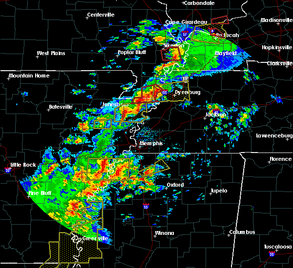 At 613 pm cdt, a severe thunderstorm producing a tornado was located over hornersville, or 8 miles south of senath, moving east at 45 mph (weather spotters reported a funnel cloud). Hazards include tornado and quarter size hail. Flying debris will be dangerous to those caught without shelter. mobile homes will be damaged or destroyed. damage to roofs, windows, and vehicles will occur. tree damage is likely. Locations impacted include, blytheville, caruthersville, gosnell, manila, hayti, steele, leachville, senath, cardwell, hornersville, hayti heights, arbyrd, cooter, deering, holland, calumet, buckeye, arkmo, stark city and huffman. At 613 pm cdt, a severe thunderstorm producing a tornado was located over hornersville, or 8 miles south of senath, moving east at 45 mph (weather spotters reported a funnel cloud). Hazards include tornado and quarter size hail. Flying debris will be dangerous to those caught without shelter. mobile homes will be damaged or destroyed. damage to roofs, windows, and vehicles will occur. tree damage is likely. Locations impacted include, blytheville, caruthersville, gosnell, manila, hayti, steele, leachville, senath, cardwell, hornersville, hayti heights, arbyrd, cooter, deering, holland, calumet, buckeye, arkmo, stark city and huffman.
|
| 4/3/2018 6:11 PM CDT |
 At 610 pm cdt, a severe thunderstorm was located near trumann, moving east at 45 mph (radar indicated). Hazards include 60 mph wind gusts and quarter size hail. Hail damage to vehicles is expected. Expect wind damage to roofs, siding, and trees. At 610 pm cdt, a severe thunderstorm was located near trumann, moving east at 45 mph (radar indicated). Hazards include 60 mph wind gusts and quarter size hail. Hail damage to vehicles is expected. Expect wind damage to roofs, siding, and trees.
|
| 4/3/2018 6:08 PM CDT |
 At 607 pm cdt, a severe thunderstorm producing a tornado was located near arbyrd, or near leachville, moving east at 50 mph (weather spotters reported funnel cloud). Hazards include tornado and quarter size hail. Flying debris will be dangerous to those caught without shelter. mobile homes will be damaged or destroyed. damage to roofs, windows, and vehicles will occur. Tree damage is likely. At 607 pm cdt, a severe thunderstorm producing a tornado was located near arbyrd, or near leachville, moving east at 50 mph (weather spotters reported funnel cloud). Hazards include tornado and quarter size hail. Flying debris will be dangerous to those caught without shelter. mobile homes will be damaged or destroyed. damage to roofs, windows, and vehicles will occur. Tree damage is likely.
|
| 4/3/2018 6:05 PM CDT |
 At 605 pm cdt, a severe thunderstorm producing a tornado was located over cardwell, or near leachville, moving east at 35 mph (radar indicated rotation). Hazards include tornado and quarter size hail. Flying debris will be dangerous to those caught without shelter. mobile homes will be damaged or destroyed. damage to roofs, windows, and vehicles will occur. tree damage is likely. Locations impacted include, leachville, senath, cardwell, hornersville, arbyrd, happy corners, delfore, macey, schug, buckeye, arkmo, woodland corner, pawheen, poplar corner, garson, stark city, boynton, hornersville junction, paulding and vincit. At 605 pm cdt, a severe thunderstorm producing a tornado was located over cardwell, or near leachville, moving east at 35 mph (radar indicated rotation). Hazards include tornado and quarter size hail. Flying debris will be dangerous to those caught without shelter. mobile homes will be damaged or destroyed. damage to roofs, windows, and vehicles will occur. tree damage is likely. Locations impacted include, leachville, senath, cardwell, hornersville, arbyrd, happy corners, delfore, macey, schug, buckeye, arkmo, woodland corner, pawheen, poplar corner, garson, stark city, boynton, hornersville junction, paulding and vincit.
|
| 4/3/2018 5:38 PM CDT |
 At 538 pm cdt, a severe thunderstorm producing a tornado was located near paragould, moving east at 45 mph (radar indicated rotation). Hazards include tornado and quarter size hail. Flying debris will be dangerous to those caught without shelter. mobile homes will be damaged or destroyed. damage to roofs, windows, and vehicles will occur. Tree damage is likely. At 538 pm cdt, a severe thunderstorm producing a tornado was located near paragould, moving east at 45 mph (radar indicated rotation). Hazards include tornado and quarter size hail. Flying debris will be dangerous to those caught without shelter. mobile homes will be damaged or destroyed. damage to roofs, windows, and vehicles will occur. Tree damage is likely.
|
| 2/24/2018 6:04 PM CST |
 At 603 pm cst, severe thunderstorms were located along a line extending from kennett to bassett, moving northeast at 60 mph (radar indicated). Hazards include 60 mph wind gusts. Expect damage to roofs, siding, and trees. locations impacted include, blytheville, kennett, osceola, gosnell, manila, portageville, hayti, marked tree, steele, leachville, lepanto, senath, caraway, luxora, wilson, tyronza, keiser, fort pillow state park, hornersville and hayti heights. A tornado watch remains in effect until 900 pm cst for eastern arkansas, southeastern missouri, and southwestern and northwestern tennessee. At 603 pm cst, severe thunderstorms were located along a line extending from kennett to bassett, moving northeast at 60 mph (radar indicated). Hazards include 60 mph wind gusts. Expect damage to roofs, siding, and trees. locations impacted include, blytheville, kennett, osceola, gosnell, manila, portageville, hayti, marked tree, steele, leachville, lepanto, senath, caraway, luxora, wilson, tyronza, keiser, fort pillow state park, hornersville and hayti heights. A tornado watch remains in effect until 900 pm cst for eastern arkansas, southeastern missouri, and southwestern and northwestern tennessee.
|
| 2/24/2018 5:42 PM CST |
 At 542 pm cst, severe thunderstorms were located along a line extending from near cardwell to near tyronza, moving northeast at 55 mph (radar indicated). Hazards include 60 mph wind gusts. expect damage to roofs, siding, and trees At 542 pm cst, severe thunderstorms were located along a line extending from near cardwell to near tyronza, moving northeast at 55 mph (radar indicated). Hazards include 60 mph wind gusts. expect damage to roofs, siding, and trees
|
| 2/24/2018 5:29 PM CST |
 At 529 pm cst, a severe thunderstorm producing a tornado was located over harrisburg, moving northeast at 55 mph (radar indicated rotation). Hazards include tornado. Flying debris will be dangerous to those caught without shelter. mobile homes will be damaged or destroyed. damage to roofs, windows, and vehicles will occur. Tree damage is likely. At 529 pm cst, a severe thunderstorm producing a tornado was located over harrisburg, moving northeast at 55 mph (radar indicated rotation). Hazards include tornado. Flying debris will be dangerous to those caught without shelter. mobile homes will be damaged or destroyed. damage to roofs, windows, and vehicles will occur. Tree damage is likely.
|
| 2/20/2018 11:41 PM CST |
 The severe thunderstorm warning for northwestern mississippi and southwestern dunklin counties will expire at 1145 pm cst, the storm which prompted the warning has weakened below severe limits, and no longer pose an immediate threat to life or property. therefore, the warning will be allowed to expire. however gusty winds are still possible with this thunderstorm. The severe thunderstorm warning for northwestern mississippi and southwestern dunklin counties will expire at 1145 pm cst, the storm which prompted the warning has weakened below severe limits, and no longer pose an immediate threat to life or property. therefore, the warning will be allowed to expire. however gusty winds are still possible with this thunderstorm.
|
| 2/20/2018 11:36 PM CST |
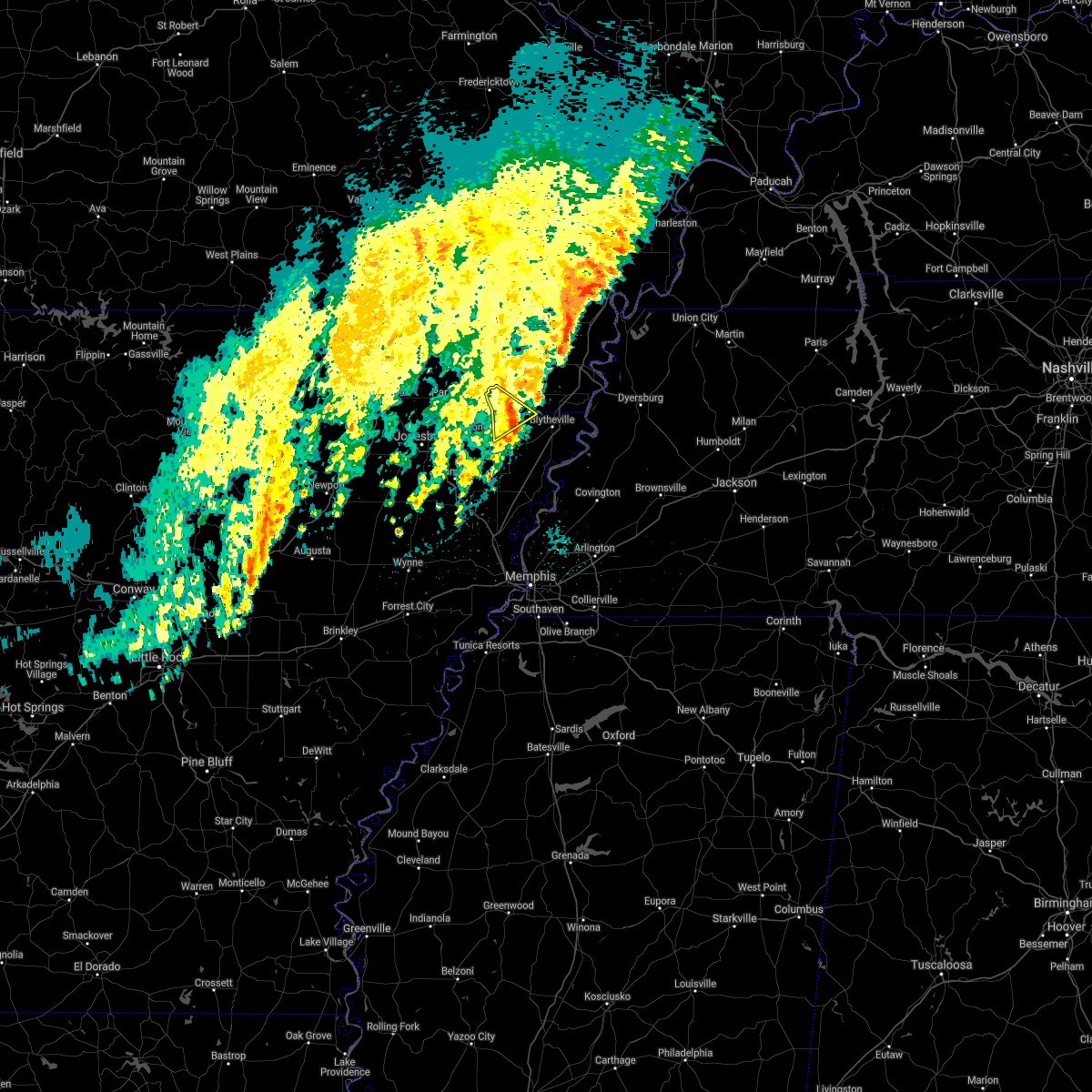 At 1135 pm cst, a severe thunderstorm was located near hornersville, or near leachville, moving northeast at 65 mph (radar indicated). Hazards include 50 to 60 mph wind gusts. Storm is weakening. some damage to tree limbs still possible. Locations impacted include, leachville, cardwell, hornersville, arbyrd, jolliff store, poplar corner, garson, buckeye, boynton, arkmo, pawheen, hornersville junction, cotton plant, bucoda, paulding, hollywood and europa. At 1135 pm cst, a severe thunderstorm was located near hornersville, or near leachville, moving northeast at 65 mph (radar indicated). Hazards include 50 to 60 mph wind gusts. Storm is weakening. some damage to tree limbs still possible. Locations impacted include, leachville, cardwell, hornersville, arbyrd, jolliff store, poplar corner, garson, buckeye, boynton, arkmo, pawheen, hornersville junction, cotton plant, bucoda, paulding, hollywood and europa.
|
| 2/20/2018 11:19 PM CST |
 At 1118 pm cst, a severe thunderstorm was located near monette, moving northeast at 65 mph (radar indicated). Hazards include 60 mph wind gusts. Expect damage to roofs, siding, and trees. Locations impacted include, paragould, lake city, leachville, monette, cardwell, hornersville, arbyrd, black oak, jolliff store, happy corners, delfore, macey, schug, carmi, bard, whisp, buckeye, lester, mounds and arkmo. At 1118 pm cst, a severe thunderstorm was located near monette, moving northeast at 65 mph (radar indicated). Hazards include 60 mph wind gusts. Expect damage to roofs, siding, and trees. Locations impacted include, paragould, lake city, leachville, monette, cardwell, hornersville, arbyrd, black oak, jolliff store, happy corners, delfore, macey, schug, carmi, bard, whisp, buckeye, lester, mounds and arkmo.
|
| 2/20/2018 11:05 PM CST |
 At 1104 pm cst, a severe thunderstorm was located over bay, moving northeast at 55 mph (radar indicated). Hazards include 60 mph wind gusts. expect damage to roofs, siding, and trees At 1104 pm cst, a severe thunderstorm was located over bay, moving northeast at 55 mph (radar indicated). Hazards include 60 mph wind gusts. expect damage to roofs, siding, and trees
|
| 6/23/2017 5:03 PM CDT |
 At 503 pm cdt, severe thunderstorms were located along a line extending from near lake city to near trumann to near cherry valley, moving southeast at 45 mph (radar indicated). Hazards include 60 mph wind gusts. Expect damage to roofs, siding, and trees. Locations impacted include, trumann, manila, marked tree, earle, harrisburg, lake city, leachville, lepanto, bay, monette, caraway, parkin, tyronza, cherry valley, dyess, gilmore, turrell, etowah, black oak and birdsong. At 503 pm cdt, severe thunderstorms were located along a line extending from near lake city to near trumann to near cherry valley, moving southeast at 45 mph (radar indicated). Hazards include 60 mph wind gusts. Expect damage to roofs, siding, and trees. Locations impacted include, trumann, manila, marked tree, earle, harrisburg, lake city, leachville, lepanto, bay, monette, caraway, parkin, tyronza, cherry valley, dyess, gilmore, turrell, etowah, black oak and birdsong.
|
| 6/23/2017 4:51 PM CDT |
 At 451 pm cdt, severe thunderstorms were located along a line extending from near brookland to near greenfield to 6 miles east of hickory ridge, moving southeast at 35 mph (radar indicated). Hazards include 60 mph wind gusts. expect damage to roofs, siding, and trees At 451 pm cdt, severe thunderstorms were located along a line extending from near brookland to near greenfield to 6 miles east of hickory ridge, moving southeast at 35 mph (radar indicated). Hazards include 60 mph wind gusts. expect damage to roofs, siding, and trees
|
| 5/27/2017 10:18 PM CDT |
 At 1018 pm cdt, a severe thunderstorm was located near keiser, moving southeast at 70 mph (radar indicated). Hazards include 70 mph wind gusts and quarter size hail. Hail damage to vehicles is expected. expect considerable tree damage. wind damage is also likely to mobile homes, roofs, and outbuildings. locations impacted include, jonesboro, ripley, osceola, trumann, manila, marked tree, harrisburg, lake city, leachville, lepanto, bay, monette, caraway, luxora, wilson, tyronza, keiser, fort pillow state park, weiner and cherry valley. a tornado watch remains in effect until 200 am cdt for eastern arkansas, and southeastern missouri. A tornado watch also remains in effect until 500 am cdt for eastern arkansas, and western tennessee. At 1018 pm cdt, a severe thunderstorm was located near keiser, moving southeast at 70 mph (radar indicated). Hazards include 70 mph wind gusts and quarter size hail. Hail damage to vehicles is expected. expect considerable tree damage. wind damage is also likely to mobile homes, roofs, and outbuildings. locations impacted include, jonesboro, ripley, osceola, trumann, manila, marked tree, harrisburg, lake city, leachville, lepanto, bay, monette, caraway, luxora, wilson, tyronza, keiser, fort pillow state park, weiner and cherry valley. a tornado watch remains in effect until 200 am cdt for eastern arkansas, and southeastern missouri. A tornado watch also remains in effect until 500 am cdt for eastern arkansas, and western tennessee.
|
| 5/27/2017 9:58 PM CDT |
 At 958 pm cdt, a severe thunderstorm was located near lake city, moving southeast at 70 mph (radar indicated). Hazards include 70 mph wind gusts and quarter size hail. Hail damage to vehicles is expected. expect considerable tree damage. Wind damage is also likely to mobile homes, roofs, and outbuildings. At 958 pm cdt, a severe thunderstorm was located near lake city, moving southeast at 70 mph (radar indicated). Hazards include 70 mph wind gusts and quarter size hail. Hail damage to vehicles is expected. expect considerable tree damage. Wind damage is also likely to mobile homes, roofs, and outbuildings.
|
| 5/27/2017 9:25 PM CDT |
 At 925 pm cdt, severe thunderstorms were located along a line extending from mcdougal to near walcott to near strawberry, moving east at 60 mph (radar indicated). Hazards include 70 mph wind gusts. Expect considerable tree damage. damage is likely to mobile homes, roofs, and outbuildings. locations impacted include, jonesboro, paragould, kennett, pocahontas, walnut ridge, piggott, corning, hoxie, bono, lake city, leachville, campbell, rector, senath, brookland, monette, marmaduke, black rock, lake charles state park and chalk bluff natural area. A tornado watch remains in effect until 200 am cdt for eastern arkansas, and southeastern missouri. At 925 pm cdt, severe thunderstorms were located along a line extending from mcdougal to near walcott to near strawberry, moving east at 60 mph (radar indicated). Hazards include 70 mph wind gusts. Expect considerable tree damage. damage is likely to mobile homes, roofs, and outbuildings. locations impacted include, jonesboro, paragould, kennett, pocahontas, walnut ridge, piggott, corning, hoxie, bono, lake city, leachville, campbell, rector, senath, brookland, monette, marmaduke, black rock, lake charles state park and chalk bluff natural area. A tornado watch remains in effect until 200 am cdt for eastern arkansas, and southeastern missouri.
|
| 5/27/2017 9:06 PM CDT |
 At 906 pm cdt, severe thunderstorms were located along a line extending from near doniphan to near pocahontas to near sidney, moving southeast at 60 mph (radar indicated). Hazards include 70 mph wind gusts. Expect considerable tree damage. Damage is likely to mobile homes, roofs, and outbuildings. At 906 pm cdt, severe thunderstorms were located along a line extending from near doniphan to near pocahontas to near sidney, moving southeast at 60 mph (radar indicated). Hazards include 70 mph wind gusts. Expect considerable tree damage. Damage is likely to mobile homes, roofs, and outbuildings.
|
| 5/27/2017 6:45 AM CDT |
 At 645 am cdt, severe thunderstorms were located along a line extending from near arbyrd to near leachville to near caraway, moving east at 45 mph (radar indicated). Hazards include 60 mph wind gusts and quarter size hail. Hail damage to vehicles is expected. Expect wind damage to roofs, siding, and trees. At 645 am cdt, severe thunderstorms were located along a line extending from near arbyrd to near leachville to near caraway, moving east at 45 mph (radar indicated). Hazards include 60 mph wind gusts and quarter size hail. Hail damage to vehicles is expected. Expect wind damage to roofs, siding, and trees.
|
| 5/27/2017 6:26 AM CDT |
 At 626 am cdt, severe thunderstorms were located along a line extending from near paragould to near monette to near bay, moving east at 50 mph (radar indicated). Hazards include 60 mph wind gusts and quarter size hail. Hail damage to vehicles is expected. expect wind damage to roofs, siding, and trees. Locations impacted include, jonesboro, paragould, manila, lake city, leachville, senath, brookland, monette, caraway, oak grove heights, cardwell, hornersville, arbyrd, black oak, jolliff store, delfore, lennie, vail, carmi and whisp. At 626 am cdt, severe thunderstorms were located along a line extending from near paragould to near monette to near bay, moving east at 50 mph (radar indicated). Hazards include 60 mph wind gusts and quarter size hail. Hail damage to vehicles is expected. expect wind damage to roofs, siding, and trees. Locations impacted include, jonesboro, paragould, manila, lake city, leachville, senath, brookland, monette, caraway, oak grove heights, cardwell, hornersville, arbyrd, black oak, jolliff store, delfore, lennie, vail, carmi and whisp.
|
| 5/27/2017 6:10 AM CDT |
 At 610 am cdt, severe thunderstorms were located along a line extending from near walcott to near brookland to near jonesboro, moving east at 45 mph (radar indicated). Hazards include 60 mph wind gusts and quarter size hail. Hail damage to vehicles is expected. Expect wind damage to roofs, siding, and trees. At 610 am cdt, severe thunderstorms were located along a line extending from near walcott to near brookland to near jonesboro, moving east at 45 mph (radar indicated). Hazards include 60 mph wind gusts and quarter size hail. Hail damage to vehicles is expected. Expect wind damage to roofs, siding, and trees.
|
| 5/27/2017 6:10 AM CDT |
 The national weather service in memphis has issued a * severe thunderstorm warning for. greene county in eastern arkansas. craighead county in eastern arkansas. northwestern mississippi county in eastern arkansas. Southern dunklin county in southeastern missouri. The national weather service in memphis has issued a * severe thunderstorm warning for. greene county in eastern arkansas. craighead county in eastern arkansas. northwestern mississippi county in eastern arkansas. Southern dunklin county in southeastern missouri.
|
| 5/11/2017 7:23 PM CDT |
 At 722 pm cdt, a severe thunderstorm was located near caraway, moving northeast at 20 mph (radar indicated). Hazards include 60 mph wind gusts and quarter size hail. Hail damage to vehicles is expected. expect wind damage to roofs, siding, and trees. Locations impacted include, manila, lake city, leachville, bay, monette, caraway, little river, etowah, black oak, jolliff store, happy corners, delfore, lennie, vail, macey, big lake, carmi, gum point, whisp and mandalay. At 722 pm cdt, a severe thunderstorm was located near caraway, moving northeast at 20 mph (radar indicated). Hazards include 60 mph wind gusts and quarter size hail. Hail damage to vehicles is expected. expect wind damage to roofs, siding, and trees. Locations impacted include, manila, lake city, leachville, bay, monette, caraway, little river, etowah, black oak, jolliff store, happy corners, delfore, lennie, vail, macey, big lake, carmi, gum point, whisp and mandalay.
|
| 5/11/2017 7:07 PM CDT |
 At 707 pm cdt, a severe thunderstorm was located over trumann, moving northeast at 20 mph (radar indicated). Hazards include 60 mph wind gusts and quarter size hail. Hail damage to vehicles is expected. Expect wind damage to roofs, siding, and trees. At 707 pm cdt, a severe thunderstorm was located over trumann, moving northeast at 20 mph (radar indicated). Hazards include 60 mph wind gusts and quarter size hail. Hail damage to vehicles is expected. Expect wind damage to roofs, siding, and trees.
|
| 4/30/2017 2:00 AM CDT |
 At 200 am cdt, a severe thunderstorm producing a tornado was located near arbyrd, or near leachville, moving east at 60 mph (radar indicated rotation). Hazards include tornado. Flying debris will be dangerous to those caught without shelter. mobile homes will be damaged or destroyed. damage to roofs, windows, and vehicles will occur. tree damage is likely. this dangerous storm will be near, hornersville around 210 am cdt. blytheville and gosnell around 215 am cdt. steele and cooter around 225 am cdt. hayti and hayti heights around 230 am cdt. caruthersville around 235 am cdt. Other locations impacted by this tornadic thunderstorm include jolliff store, west hermondale, paulding, delfore, calumet, dearman, new survey, vail, denton and tomato. At 200 am cdt, a severe thunderstorm producing a tornado was located near arbyrd, or near leachville, moving east at 60 mph (radar indicated rotation). Hazards include tornado. Flying debris will be dangerous to those caught without shelter. mobile homes will be damaged or destroyed. damage to roofs, windows, and vehicles will occur. tree damage is likely. this dangerous storm will be near, hornersville around 210 am cdt. blytheville and gosnell around 215 am cdt. steele and cooter around 225 am cdt. hayti and hayti heights around 230 am cdt. caruthersville around 235 am cdt. Other locations impacted by this tornadic thunderstorm include jolliff store, west hermondale, paulding, delfore, calumet, dearman, new survey, vail, denton and tomato.
|
| 4/30/2017 1:36 AM CDT |
 At 136 am cdt, a severe thunderstorm was located over jonesboro, moving east at 50 mph (radar indicated). Hazards include 60 mph wind gusts. expect damage to roofs, siding, and trees At 136 am cdt, a severe thunderstorm was located over jonesboro, moving east at 50 mph (radar indicated). Hazards include 60 mph wind gusts. expect damage to roofs, siding, and trees
|
| 4/29/2017 9:06 PM CDT |
 The severe thunderstorm warning for mississippi, eastern clay, southwestern pemiscot, southern dunklin and northwestern lauderdale counties will expire at 915 pm cdt, the storms which prompted the warning have weakened below severe limits, and have exited the warned area. therefore, the warning will be allowed to expire. however heavy rain is still possible with these thunderstorms. The severe thunderstorm warning for mississippi, eastern clay, southwestern pemiscot, southern dunklin and northwestern lauderdale counties will expire at 915 pm cdt, the storms which prompted the warning have weakened below severe limits, and have exited the warned area. therefore, the warning will be allowed to expire. however heavy rain is still possible with these thunderstorms.
|
| 4/29/2017 8:49 PM CDT |
 At 849 pm cdt, severe thunderstorms were located along a line extending from near senath to 6 miles north of ashport, moving northeast at 50 mph (radar indicated). Hazards include 60 mph wind gusts. Expect damage to roofs, siding, and trees. Locations impacted include, blytheville, kennett, osceola, piggott, gosnell, manila, steele, leachville, rector, senath, caraway, luxora, keiser, cardwell, hornersville, arbyrd, cooter, dell, pollard and greenway. At 849 pm cdt, severe thunderstorms were located along a line extending from near senath to 6 miles north of ashport, moving northeast at 50 mph (radar indicated). Hazards include 60 mph wind gusts. Expect damage to roofs, siding, and trees. Locations impacted include, blytheville, kennett, osceola, piggott, gosnell, manila, steele, leachville, rector, senath, caraway, luxora, keiser, cardwell, hornersville, arbyrd, cooter, dell, pollard and greenway.
|
| 4/29/2017 8:18 PM CDT |
 At 817 pm cdt, a severe thunderstorm was located over caraway, moving northeast at 40 mph (radar indicated). Hazards include 60 mph wind gusts. expect damage to roofs, siding, and trees At 817 pm cdt, a severe thunderstorm was located over caraway, moving northeast at 40 mph (radar indicated). Hazards include 60 mph wind gusts. expect damage to roofs, siding, and trees
|
| 4/26/2017 5:59 PM CDT |
 At 559 pm cdt, severe thunderstorms were located along a line extending from near leachville to near earle, moving northeast at 75 mph (radar indicated). Hazards include 60 mph wind gusts and quarter size hail. Hail damage to vehicles is expected. expect wind damage to roofs, siding, and trees. Locations impacted include, marked tree, lake city, leachville, lepanto, monette, caraway, tyronza, black oak, happy corners, delfore, vail, deckerville, macey, carmi, whisp, dub, lester, arkmo, walters and alto. At 559 pm cdt, severe thunderstorms were located along a line extending from near leachville to near earle, moving northeast at 75 mph (radar indicated). Hazards include 60 mph wind gusts and quarter size hail. Hail damage to vehicles is expected. expect wind damage to roofs, siding, and trees. Locations impacted include, marked tree, lake city, leachville, lepanto, monette, caraway, tyronza, black oak, happy corners, delfore, vail, deckerville, macey, carmi, whisp, dub, lester, arkmo, walters and alto.
|
| 4/26/2017 5:53 PM CDT |
 At 553 pm cdt, severe thunderstorms were located along a line extending from leachville to near earle, moving northeast at 75 mph (radar indicated). Hazards include 60 mph wind gusts and quarter size hail. Hail damage to vehicles is expected. expect wind damage to roofs, siding, and trees. Locations impacted include, jonesboro, trumann, marked tree, earle, lake city, leachville, lepanto, bay, monette, caraway, tyronza, black oak, three forks, payneway, delfore, vail, deckerville, carmi, gum point and whisp. At 553 pm cdt, severe thunderstorms were located along a line extending from leachville to near earle, moving northeast at 75 mph (radar indicated). Hazards include 60 mph wind gusts and quarter size hail. Hail damage to vehicles is expected. expect wind damage to roofs, siding, and trees. Locations impacted include, jonesboro, trumann, marked tree, earle, lake city, leachville, lepanto, bay, monette, caraway, tyronza, black oak, three forks, payneway, delfore, vail, deckerville, carmi, gum point and whisp.
|
| 4/26/2017 5:46 PM CDT |
 At 546 pm cdt, severe thunderstorms were located along a line extending from lake city to near parkin, moving northeast at 55 mph (radar indicated). Hazards include 70 mph wind gusts and ping pong ball size hail. People and animals outdoors will be injured. expect hail damage to roofs, siding, windows, and vehicles. expect considerable tree damage. wind damage is also likely to mobile homes, roofs, and outbuildings. Locations impacted include, jonesboro, trumann, marked tree, earle, lake city, leachville, lepanto, bay, monette, caraway, parkin, tyronza, black oak, three forks, payneway, delfore, vail, deckerville, mc donald and weona junction. At 546 pm cdt, severe thunderstorms were located along a line extending from lake city to near parkin, moving northeast at 55 mph (radar indicated). Hazards include 70 mph wind gusts and ping pong ball size hail. People and animals outdoors will be injured. expect hail damage to roofs, siding, windows, and vehicles. expect considerable tree damage. wind damage is also likely to mobile homes, roofs, and outbuildings. Locations impacted include, jonesboro, trumann, marked tree, earle, lake city, leachville, lepanto, bay, monette, caraway, parkin, tyronza, black oak, three forks, payneway, delfore, vail, deckerville, mc donald and weona junction.
|
| 4/26/2017 5:43 PM CDT |
 At 543 pm cdt, severe thunderstorms were located along a line extending from near cardwell to near lepanto to near crawfordsville, moving east at 65 mph (radar indicated). Hazards include ping pong ball size hail and 60 mph wind gusts. People and animals outdoors will be injured. expect hail damage to roofs, siding, windows, and vehicles. Expect wind damage to roofs, siding, and trees. At 543 pm cdt, severe thunderstorms were located along a line extending from near cardwell to near lepanto to near crawfordsville, moving east at 65 mph (radar indicated). Hazards include ping pong ball size hail and 60 mph wind gusts. People and animals outdoors will be injured. expect hail damage to roofs, siding, windows, and vehicles. Expect wind damage to roofs, siding, and trees.
|
| 4/26/2017 5:23 PM CDT |
 At 523 pm cdt, severe thunderstorms were located along a line extending from greenfield to near caldwell, moving northeast at 55 mph (radar indicated). Hazards include 70 mph wind gusts and quarter size hail. Hail damage to vehicles is expected. expect considerable tree damage. Wind damage is also likely to mobile homes, roofs, and outbuildings. At 523 pm cdt, severe thunderstorms were located along a line extending from greenfield to near caldwell, moving northeast at 55 mph (radar indicated). Hazards include 70 mph wind gusts and quarter size hail. Hail damage to vehicles is expected. expect considerable tree damage. Wind damage is also likely to mobile homes, roofs, and outbuildings.
|
| 3/27/2017 3:02 PM CDT |
 At 301 pm cdt, a severe thunderstorm was located near manila, moving east at 45 mph (radar indicated). Hazards include 60 mph wind gusts and quarter size hail. Hail damage to vehicles is expected. expect wind damage to roofs, siding, and trees. Locations impacted include, gosnell, manila, leachville, caraway, dell, burdette, little river, etowah, victoria, jolliff store, calumet, dearman, lennie, vail, big lake, hightower, carmi, whisp, buckeye and mandalay. At 301 pm cdt, a severe thunderstorm was located near manila, moving east at 45 mph (radar indicated). Hazards include 60 mph wind gusts and quarter size hail. Hail damage to vehicles is expected. expect wind damage to roofs, siding, and trees. Locations impacted include, gosnell, manila, leachville, caraway, dell, burdette, little river, etowah, victoria, jolliff store, calumet, dearman, lennie, vail, big lake, hightower, carmi, whisp, buckeye and mandalay.
|
| 3/27/2017 2:31 PM CDT |
 At 231 pm cdt, a severe thunderstorm was located over lake city, moving east at 45 mph (radar indicated). Hazards include 60 mph wind gusts and quarter size hail. Hail damage to vehicles is expected. Expect wind damage to roofs, siding, and trees. At 231 pm cdt, a severe thunderstorm was located over lake city, moving east at 45 mph (radar indicated). Hazards include 60 mph wind gusts and quarter size hail. Hail damage to vehicles is expected. Expect wind damage to roofs, siding, and trees.
|
| 3/25/2017 1:48 AM CDT |
 At 148 am cdt, a severe thunderstorm was located near greenway, or near piggott, moving northeast at 60 mph (radar indicated). Hazards include 60 mph wind gusts. Expect damage to roofs, siding, and trees. Locations impacted include, blytheville, kennett, trumann, piggott, gosnell, manila, lake city, leachville, rector, lepanto, senath, monette, caraway, marmaduke, cardwell, hornersville, arbyrd, dell, pollard and greenway. At 148 am cdt, a severe thunderstorm was located near greenway, or near piggott, moving northeast at 60 mph (radar indicated). Hazards include 60 mph wind gusts. Expect damage to roofs, siding, and trees. Locations impacted include, blytheville, kennett, trumann, piggott, gosnell, manila, lake city, leachville, rector, lepanto, senath, monette, caraway, marmaduke, cardwell, hornersville, arbyrd, dell, pollard and greenway.
|
| 3/25/2017 1:36 AM CDT |
 At 135 am cdt, a severe thunderstorm was located over marmaduke, moving northeast at 60 mph (radar indicated). Hazards include 60 mph wind gusts. Expect damage to roofs, siding, and trees. Locations impacted include, jonesboro, paragould, blytheville, kennett, trumann, piggott, gosnell, manila, harrisburg, lake city, leachville, rector, lepanto, bay, senath, brookland, monette, caraway, marmaduke and oak grove heights. At 135 am cdt, a severe thunderstorm was located over marmaduke, moving northeast at 60 mph (radar indicated). Hazards include 60 mph wind gusts. Expect damage to roofs, siding, and trees. Locations impacted include, jonesboro, paragould, blytheville, kennett, trumann, piggott, gosnell, manila, harrisburg, lake city, leachville, rector, lepanto, bay, senath, brookland, monette, caraway, marmaduke and oak grove heights.
|
| 3/25/2017 1:23 AM CDT |
 At 123 am cdt, a severe thunderstorm was located over paragould, moving northeast at 60 mph (radar indicated). Hazards include 60 mph wind gusts. Expect damage to roofs, siding, and trees. Locations impacted include, jonesboro, paragould, blytheville, kennett, trumann, piggott, gosnell, manila, harrisburg, lake city, leachville, rector, lepanto, bay, senath, brookland, monette, caraway, marmaduke and crowleys ridge state park. At 123 am cdt, a severe thunderstorm was located over paragould, moving northeast at 60 mph (radar indicated). Hazards include 60 mph wind gusts. Expect damage to roofs, siding, and trees. Locations impacted include, jonesboro, paragould, blytheville, kennett, trumann, piggott, gosnell, manila, harrisburg, lake city, leachville, rector, lepanto, bay, senath, brookland, monette, caraway, marmaduke and crowleys ridge state park.
|
| 3/25/2017 1:08 AM CDT |
 At 107 am cdt, a severe thunderstorm was located over bono, moving northeast at 60 mph (radar indicated). Hazards include 60 mph wind gusts. expect damage to roofs, siding, and trees At 107 am cdt, a severe thunderstorm was located over bono, moving northeast at 60 mph (radar indicated). Hazards include 60 mph wind gusts. expect damage to roofs, siding, and trees
|
| 3/9/2017 10:57 PM CST |
 The severe thunderstorm warning for south central greene, craighead, poinsett, mississippi, south central lawrence, northwestern cross, southwestern pemiscot, southern dunklin, northwestern tipton and western lauderdale counties will expire at 1100 pm cst, the storms which prompted the warning have weakened below severe limits, and no longer pose an immediate threat to life or property. therefore, the warning will be allowed to expire. a severe thunderstorm watch remains in effect until midnight cst for eastern arkansas, southeastern missouri, and western tennessee. The severe thunderstorm warning for south central greene, craighead, poinsett, mississippi, south central lawrence, northwestern cross, southwestern pemiscot, southern dunklin, northwestern tipton and western lauderdale counties will expire at 1100 pm cst, the storms which prompted the warning have weakened below severe limits, and no longer pose an immediate threat to life or property. therefore, the warning will be allowed to expire. a severe thunderstorm watch remains in effect until midnight cst for eastern arkansas, southeastern missouri, and western tennessee.
|
| 3/9/2017 10:16 PM CST |
 At 1015 pm cst, severe thunderstorms were located along a line extending from blytheville to near jacksonport, moving southeast at 55 mph (radar indicated). Hazards include 60 mph wind gusts. expect damage to roofs, siding, and trees At 1015 pm cst, severe thunderstorms were located along a line extending from blytheville to near jacksonport, moving southeast at 55 mph (radar indicated). Hazards include 60 mph wind gusts. expect damage to roofs, siding, and trees
|
| 3/1/2017 3:57 AM CST |
 At 354 am cst, severe thunderstorms were located along a line extending from near harviell to near oak grove heights to 6 miles northeast of cherry valley, moving east at 75 mph (radar indicated). Hazards include 75 mph wind gusts. Expect considerable tree damage. damage is likely to mobile homes, roofs, and outbuildings. this line of storms produced a 76 mph gust at walnut ridge at 335 am cst. A 68 mph gust was reported at the jonesboro airport at 350 am cst. At 354 am cst, severe thunderstorms were located along a line extending from near harviell to near oak grove heights to 6 miles northeast of cherry valley, moving east at 75 mph (radar indicated). Hazards include 75 mph wind gusts. Expect considerable tree damage. damage is likely to mobile homes, roofs, and outbuildings. this line of storms produced a 76 mph gust at walnut ridge at 335 am cst. A 68 mph gust was reported at the jonesboro airport at 350 am cst.
|
| 12/17/2016 5:27 PM CST |
 At 527 pm cst, a severe thunderstorm was located near trumann, moving east at 95 mph (radar indicated). Hazards include 60 mph wind gusts. expect damage to roofs, siding, and trees At 527 pm cst, a severe thunderstorm was located near trumann, moving east at 95 mph (radar indicated). Hazards include 60 mph wind gusts. expect damage to roofs, siding, and trees
|
| 12/17/2016 5:06 PM CST |
 At 506 pm cst, a severe thunderstorm was located near bay, moving northeast at 60 mph (radar indicated). Hazards include 60 mph wind gusts and quarter size hail. Hail damage to vehicles is expected. Expect wind damage to roofs, siding, and trees. At 506 pm cst, a severe thunderstorm was located near bay, moving northeast at 60 mph (radar indicated). Hazards include 60 mph wind gusts and quarter size hail. Hail damage to vehicles is expected. Expect wind damage to roofs, siding, and trees.
|
| 7/15/2016 4:36 PM CDT |
 At 436 pm cdt, a severe thunderstorm was located over arbyrd, or 7 miles north of leachville, and is nearly stationary (radar indicated). Hazards include 60 mph wind gusts. Expect damage to roofs. siding. And trees. At 436 pm cdt, a severe thunderstorm was located over arbyrd, or 7 miles north of leachville, and is nearly stationary (radar indicated). Hazards include 60 mph wind gusts. Expect damage to roofs. siding. And trees.
|
| 3/31/2016 11:32 AM CDT |
 At 1132 am cdt, a severe thunderstorm was located near keiser, moving east at 45 mph (radar indicated). Hazards include two inch hail and 60 mph wind gusts. People and animals outdoors will be injured. expect hail damage to roofs, siding, windows, and vehicles. expect wind damage to roofs, siding, and trees. Locations impacted include, blytheville, osceola, gosnell, manila, leachville, lepanto, caraway, luxora, keiser, dell, burdette, little river, etowah, victoria, rivervale, mandalay, chilson, mangrum, bunney and rosa. At 1132 am cdt, a severe thunderstorm was located near keiser, moving east at 45 mph (radar indicated). Hazards include two inch hail and 60 mph wind gusts. People and animals outdoors will be injured. expect hail damage to roofs, siding, windows, and vehicles. expect wind damage to roofs, siding, and trees. Locations impacted include, blytheville, osceola, gosnell, manila, leachville, lepanto, caraway, luxora, keiser, dell, burdette, little river, etowah, victoria, rivervale, mandalay, chilson, mangrum, bunney and rosa.
|
| 3/31/2016 11:18 AM CDT |
 At 1117 am cdt, a severe thunderstorm was located near caraway, moving northeast at 40 mph (radar indicated). Hazards include two inch hail and 60 mph wind gusts. People and animals outdoors will be injured. expect hail damage to roofs, siding, windows, and vehicles. Expect wind damage to roofs, siding, and trees. At 1117 am cdt, a severe thunderstorm was located near caraway, moving northeast at 40 mph (radar indicated). Hazards include two inch hail and 60 mph wind gusts. People and animals outdoors will be injured. expect hail damage to roofs, siding, windows, and vehicles. Expect wind damage to roofs, siding, and trees.
|
| 3/30/2016 8:15 PM CDT |
 At 815 pm cdt, a severe thunderstorm was located near caraway, moving northeast at 55 mph (radar indicated). Hazards include 60 mph wind gusts and penny size hail. Expect damage to roofs. siding. and trees. locations impacted include, blytheville, osceola, gosnell, manila, marked tree, leachville, lepanto, caraway, luxora, keiser, dyess, dell, burdette, marie, little river, etowah, victoria, rivervale, mandalay and alto. A tornado watch remains in effect until 300 am cdt for eastern arkansas and western tennessee. At 815 pm cdt, a severe thunderstorm was located near caraway, moving northeast at 55 mph (radar indicated). Hazards include 60 mph wind gusts and penny size hail. Expect damage to roofs. siding. and trees. locations impacted include, blytheville, osceola, gosnell, manila, marked tree, leachville, lepanto, caraway, luxora, keiser, dyess, dell, burdette, marie, little river, etowah, victoria, rivervale, mandalay and alto. A tornado watch remains in effect until 300 am cdt for eastern arkansas and western tennessee.
|
| 3/30/2016 7:56 PM CDT |
 At 756 pm cdt, a severe thunderstorm was located over trumann, moving northeast at 55 mph (radar indicated). Hazards include 60 mph wind gusts. Expect damage to roofs. siding. And trees. At 756 pm cdt, a severe thunderstorm was located over trumann, moving northeast at 55 mph (radar indicated). Hazards include 60 mph wind gusts. Expect damage to roofs. siding. And trees.
|
| 12/28/2015 7:23 AM CST |
 The severe thunderstorm warning for mississippi, southeastern craighead, northeastern crittenden, desoto, tate, northwestern panola, western lauderdale, central tipton and shelby counties will expire at 730 am cst, the storms which prompted the warning have weakened below severe limits, and no longer pose an immediate threat to life or property. therefore the warning will be allowed to expire. however gusty winds and heavy rain are still possible with these thunderstorms. The severe thunderstorm warning for mississippi, southeastern craighead, northeastern crittenden, desoto, tate, northwestern panola, western lauderdale, central tipton and shelby counties will expire at 730 am cst, the storms which prompted the warning have weakened below severe limits, and no longer pose an immediate threat to life or property. therefore the warning will be allowed to expire. however gusty winds and heavy rain are still possible with these thunderstorms.
|
| 12/28/2015 7:10 AM CST |
 At 709 am cst, severe thunderstorms were located along a line extending from 7 miles southeast of wilson to near olive branch, moving northeast at 55 mph (radar indicated). Hazards include 60 mph wind gusts and penny size hail. Expect damage to roofs. siding and trees. locations impacted include, bartlett, southaven, germantown, olive branch, west memphis, horn lake, blytheville, hernando, marion, millington, senatobia, osceola, gosnell, manila, leachville, monette, caraway, luxora, wilson and keiser. A tornado watch remains in effect until 800 am cst for northwestern mississippi. At 709 am cst, severe thunderstorms were located along a line extending from 7 miles southeast of wilson to near olive branch, moving northeast at 55 mph (radar indicated). Hazards include 60 mph wind gusts and penny size hail. Expect damage to roofs. siding and trees. locations impacted include, bartlett, southaven, germantown, olive branch, west memphis, horn lake, blytheville, hernando, marion, millington, senatobia, osceola, gosnell, manila, leachville, monette, caraway, luxora, wilson and keiser. A tornado watch remains in effect until 800 am cst for northwestern mississippi.
|
| 12/28/2015 6:23 AM CST |
 At 623 am cst, severe thunderstorms were located along a line extending from near horseshoe lake to sledge, moving northeast at 55 mph (radar indicated). Hazards include 60 mph wind gusts and penny size hail. Expect damage to roofs. Siding and trees. At 623 am cst, severe thunderstorms were located along a line extending from near horseshoe lake to sledge, moving northeast at 55 mph (radar indicated). Hazards include 60 mph wind gusts and penny size hail. Expect damage to roofs. Siding and trees.
|
| 12/23/2015 2:28 PM CST | At 228 pm cst, a severe thunderstorm was located near lepanto, moving northeast at 60 mph (radar indicated). Hazards include 60 mph wind gusts and quarter size hail. Hail damage to vehicles is expected. expect wind damage to roofs, siding and trees. this severe thunderstorm will be near, manila and dell around 250 pm cst. other locations impacted by this severe thunderstorm include rivervale, milligan ridge, mandalay, west ridge, big lake, mangrum, buckeye, bunney, pettyville and wilson junction. A tornado watch remains in effect until 500 pm cst for eastern arkansas and southeastern missouri. |
| 12/23/2015 1:36 PM CST | At 136 pm cst, a severe thunderstorm was located near monette, moving northeast at 60 mph (public). Hazards include golf ball size hail and 70 mph wind gusts. People and animals outdoors will be injured. expect hail damage to roofs, siding, windows and vehicles. expect considerable tree damage. wind damage is also likely to mobile homes, roofs and outbuildings. this severe storm will be near, cardwell and arbyrd around 145 pm cst. other locations impacted by this severe thunderstorm include garson, arkmo, carmi, walters, poplar corner, happy corners, boynton, paulding, hollywood and buck donic. A tornado watch remains in effect until 500 pm cst for eastern arkansas and southeastern missouri. |
| 12/23/2015 1:36 PM CST | At 136 pm cst, a severe thunderstorm was located near monette, moving northeast at 60 mph (public). Hazards include golf ball size hail and 70 mph wind gusts. People and animals outdoors will be injured. expect hail damage to roofs, siding, windows and vehicles. expect considerable tree damage. wind damage is also likely to mobile homes, roofs and outbuildings. this severe storm will be near, cardwell and arbyrd around 145 pm cst. other locations impacted by this severe thunderstorm include garson, arkmo, carmi, walters, poplar corner, happy corners, boynton, paulding, hollywood and buck donic. A tornado watch remains in effect until 500 pm cst for eastern arkansas and southeastern missouri. |
| 12/23/2015 1:28 PM CST | At 127 pm cst, a severe thunderstorm was located over lake city, moving northeast at 60 mph (public. power poles were reported down south of jonesboronear the poinsett and craighead county line, with tennis ball size hail reported in bay arkansas). Hazards include golf ball size hail and 70 mph wind gusts. People and animals outdoors will be injured. expect hail damage to roofs, siding, windows and vehicles. expect considerable tree damage. wind damage is also likely to mobile homes, roofs and outbuildings. this severe storm will be near, monette around 135 pm cst. manila and leachville around 140 pm cst. cardwell and arbyrd around 145 pm cst. other locations impacted by this severe thunderstorm include garson, arkmo, carmi, walters, poplar corner, happy corners, boynton, poplar ridge, paulding and hollywood. A tornado watch remains in effect until 500 pm cst for eastern arkansas and southeastern missouri. |
| 12/23/2015 1:28 PM CST | At 127 pm cst, a severe thunderstorm was located over lake city, moving northeast at 60 mph (public. power poles were reported down south of jonesboronear the poinsett and craighead county line, with tennis ball size hail reported in bay arkansas). Hazards include golf ball size hail and 70 mph wind gusts. People and animals outdoors will be injured. expect hail damage to roofs, siding, windows and vehicles. expect considerable tree damage. wind damage is also likely to mobile homes, roofs and outbuildings. this severe storm will be near, monette around 135 pm cst. manila and leachville around 140 pm cst. cardwell and arbyrd around 145 pm cst. other locations impacted by this severe thunderstorm include garson, arkmo, carmi, walters, poplar corner, happy corners, boynton, poplar ridge, paulding and hollywood. A tornado watch remains in effect until 500 pm cst for eastern arkansas and southeastern missouri. |
| 12/23/2015 1:17 PM CST | At 116 pm cst, a severe thunderstorm was located over bay, moving northeast at 60 mph (radar indicated). Hazards include tennis ball size hail was reported southeast of jonesboro near bay. 60 mph wind gusts are also expected. People and animals outdoors will be injured. expect hail damage to roofs, siding, windows and vehicles. expect wind damage to roofs, siding and trees. this severe storm will be near, lake city around 125 pm cst. monette around 135 pm cst. leachville around 140 pm cst. manila, cardwell and arbyrd around 145 pm cst. other locations impacted by this severe thunderstorm include garson, sandy, arkmo, boynton, poplar ridge, paulding, lester, big lake, buck donic and mangrum. A tornado watch remains in effect until 500 pm cst for eastern arkansas and southeastern missouri. |
| 12/23/2015 1:17 PM CST | At 116 pm cst, a severe thunderstorm was located over bay, moving northeast at 60 mph (radar indicated). Hazards include tennis ball size hail was reported southeast of jonesboro near bay. 60 mph wind gusts are also expected. People and animals outdoors will be injured. expect hail damage to roofs, siding, windows and vehicles. expect wind damage to roofs, siding and trees. this severe storm will be near, lake city around 125 pm cst. monette around 135 pm cst. leachville around 140 pm cst. manila, cardwell and arbyrd around 145 pm cst. other locations impacted by this severe thunderstorm include garson, sandy, arkmo, boynton, poplar ridge, paulding, lester, big lake, buck donic and mangrum. A tornado watch remains in effect until 500 pm cst for eastern arkansas and southeastern missouri. |
| 12/23/2015 1:07 PM CST | At 107 pm cst, a severe thunderstorm was located over greenfield, or 7 miles north of harrisburg, moving northeast at 60 mph (radar indicated). Hazards include 60 mph wind gusts and half dollar size hail. Hail damage to vehicles is expected. expect wind damage to roofs, siding and trees. this severe thunderstorm will be near, bay around 115 pm cst. trumann around 120 pm cst. lake city and brookland around 125 pm cst. caraway around 130 pm cst. monette around 135 pm cst. leachville around 140 pm cst. manila, cardwell and arbyrd around 145 pm cst. other locations impacted by this severe thunderstorm include garson, bertig, sandy, arkmo, boynton, poplar ridge, paulding, lester, cary and big lake. A tornado watch remains in effect until 500 pm cst for eastern arkansas and southeastern missouri. |
| 12/23/2015 1:07 PM CST | At 107 pm cst, a severe thunderstorm was located over greenfield, or 7 miles north of harrisburg, moving northeast at 60 mph (radar indicated). Hazards include 60 mph wind gusts and half dollar size hail. Hail damage to vehicles is expected. expect wind damage to roofs, siding and trees. this severe thunderstorm will be near, bay around 115 pm cst. trumann around 120 pm cst. lake city and brookland around 125 pm cst. caraway around 130 pm cst. monette around 135 pm cst. leachville around 140 pm cst. manila, cardwell and arbyrd around 145 pm cst. other locations impacted by this severe thunderstorm include garson, bertig, sandy, arkmo, boynton, poplar ridge, paulding, lester, cary and big lake. A tornado watch remains in effect until 500 pm cst for eastern arkansas and southeastern missouri. |
| 12/23/2015 11:02 AM CST | At 1102 am cst, a severe thunderstorm was located near brookland, moving northeast at 50 mph (radar indicated). Hazards include 60 mph wind gusts. Expect damage to roofs. siding and trees. this severe thunderstorm will be near, paragould around 1120 am cst. cardwell around 1130 am cst. other locations impacted by this severe thunderstorm include herndon, garson, bertig, stanford, gainesville, goobertown, brighton, bethel, lester and buck donic. A tornado watch remains in effect until 500 pm cst for eastern arkansas and southeastern missouri. |
| 12/23/2015 11:02 AM CST | At 1102 am cst, a severe thunderstorm was located near brookland, moving northeast at 50 mph (radar indicated). Hazards include 60 mph wind gusts. Expect damage to roofs. siding and trees. this severe thunderstorm will be near, paragould around 1120 am cst. cardwell around 1130 am cst. other locations impacted by this severe thunderstorm include herndon, garson, bertig, stanford, gainesville, goobertown, brighton, bethel, lester and buck donic. A tornado watch remains in effect until 500 pm cst for eastern arkansas and southeastern missouri. |
| 7/14/2015 3:37 PM CDT |
 At 335 pm cdt, a severe thunderstorm was located near joiner, or 8 miles north of meeman shelby forest state park, moving southeast at 60 mph (radar indicated). Hazards include 70 mph wind gusts. Expect considerable tree damage. damage is likely to mobile homes, roofs and outbuildings. Locations impacted include, jonesboro, bartlett, west memphis, blytheville, marion, millington, covington, ripley, osceola, trumann, gosnell, manila, marked tree, lake city, leachville, lepanto, bay, senath, monette and caraway. At 335 pm cdt, a severe thunderstorm was located near joiner, or 8 miles north of meeman shelby forest state park, moving southeast at 60 mph (radar indicated). Hazards include 70 mph wind gusts. Expect considerable tree damage. damage is likely to mobile homes, roofs and outbuildings. Locations impacted include, jonesboro, bartlett, west memphis, blytheville, marion, millington, covington, ripley, osceola, trumann, gosnell, manila, marked tree, lake city, leachville, lepanto, bay, senath, monette and caraway.
|
| 7/14/2015 3:21 PM CDT |
 At 320 pm cdt, a severe thunderstorm was located over lepanto, moving southeast at 60 mph. this is a very dangerous storm (radar indicated). Hazards include 80 mph wind gusts. Flying debris will be dangerous to those caught without shelter. mobile homes will be heavily damaged. expect considerable damage to roofs, windows and vehicles. Extensive tree damage and power outages are likely. At 320 pm cdt, a severe thunderstorm was located over lepanto, moving southeast at 60 mph. this is a very dangerous storm (radar indicated). Hazards include 80 mph wind gusts. Flying debris will be dangerous to those caught without shelter. mobile homes will be heavily damaged. expect considerable damage to roofs, windows and vehicles. Extensive tree damage and power outages are likely.
|
| 7/14/2015 3:04 PM CDT |
 At 302 pm cdt, a severe thunderstorm was located near trumann, moving southeast at 65 mph. this is a very dangerous storm (trained weather spotters. report from amateur radio operator of 80 miles a hour). Hazards include 80 mph wind gusts. Flying debris will be dangerous to those caught without shelter. mobile homes will be heavily damaged. expect considerable damage to roofs, windows and vehicles. extensive tree damage and power outages are likely. Locations impacted include, jonesboro, paragould, wynne, osceola, trumann, manila, marked tree, earle, harrisburg, bono, lake city, leachville, lepanto, bay, brookland, monette, caraway, parkin, wilson and tyronza. At 302 pm cdt, a severe thunderstorm was located near trumann, moving southeast at 65 mph. this is a very dangerous storm (trained weather spotters. report from amateur radio operator of 80 miles a hour). Hazards include 80 mph wind gusts. Flying debris will be dangerous to those caught without shelter. mobile homes will be heavily damaged. expect considerable damage to roofs, windows and vehicles. extensive tree damage and power outages are likely. Locations impacted include, jonesboro, paragould, wynne, osceola, trumann, manila, marked tree, earle, harrisburg, bono, lake city, leachville, lepanto, bay, brookland, monette, caraway, parkin, wilson and tyronza.
|
| 7/14/2015 3:00 PM CDT | Roof blown off local grocery stor in mississippi county AR, 0.8 miles NE of Leachville, AR |
| 7/14/2015 2:45 PM CDT |
 At 243 pm cdt, a severe thunderstorm was located near lake frierson state park, moving southeast at 65 mph (trained weather spotters. winds measured near 70 mph). Hazards include 70 mph wind gusts. Expect considerable tree damage. Damage is likely to mobile homes, roofs and outbuildings. At 243 pm cdt, a severe thunderstorm was located near lake frierson state park, moving southeast at 65 mph (trained weather spotters. winds measured near 70 mph). Hazards include 70 mph wind gusts. Expect considerable tree damage. Damage is likely to mobile homes, roofs and outbuildings.
|
| 6/26/2015 4:26 PM CDT | At 426 pm cdt, a severe thunderstorm was located over ashport, or 8 miles east of luxora, moving east at 25 mph (radar indicated). Hazards include 60 mph wind gusts and quarter size hail. Hail damage to vehicles is expected. expect wind damage to roofs, siding and trees. Locations impacted include, blytheville, osceola, gosnell, manila, leachville, caraway, luxora, keiser, fort pillow state park, dyess, dell, burdette, marie, ft pillow, ashport, little river, etowah, victoria, mandalay and luckett. |
| 6/26/2015 4:26 PM CDT | At 426 pm cdt, a severe thunderstorm was located over ashport, or 8 miles east of luxora, moving east at 25 mph (radar indicated). Hazards include 60 mph wind gusts and quarter size hail. Hail damage to vehicles is expected. expect wind damage to roofs, siding and trees. Locations impacted include, blytheville, osceola, gosnell, manila, leachville, caraway, luxora, keiser, fort pillow state park, dyess, dell, burdette, marie, ft pillow, ashport, little river, etowah, victoria, mandalay and luckett. |
| 6/26/2015 3:55 PM CDT | At 354 pm cdt, a severe thunderstorm was located near osceola, moving east at 25 mph (radar indicated). Hazards include 60 mph wind gusts and quarter size hail. Hail damage to vehicles is expected. Expect wind damage to roofs, siding and trees. |
| 6/26/2015 3:55 PM CDT | At 354 pm cdt, a severe thunderstorm was located near osceola, moving east at 25 mph (radar indicated). Hazards include 60 mph wind gusts and quarter size hail. Hail damage to vehicles is expected. Expect wind damage to roofs, siding and trees. |
| 3/31/2015 9:24 PM CDT | A severe thunderstorm warning remains in effect until 945 pm cdt for northwestern mississippi and southern dunklin counties. at 924 pm cdt. doppler radar indicated a severe thunderstorm producing quarter size hail and damaging winds in excess of 60 mph. this storm was located near arbyrd. or near senath. Moving southeast at 35 mph. |
| 3/31/2015 9:24 PM CDT | A severe thunderstorm warning remains in effect until 945 pm cdt for northwestern mississippi and southern dunklin counties. at 924 pm cdt. doppler radar indicated a severe thunderstorm producing quarter size hail and damaging winds in excess of 60 mph. this storm was located near arbyrd. or near senath. Moving southeast at 35 mph. |
| 3/31/2015 9:07 PM CDT | The national weather service in memphis has issued a * severe thunderstorm warning for. northwestern mississippi county in eastern arkansas. eastern greene county in eastern arkansas. southeastern clay county in eastern arkansas. Southern dunklin county in southeastern missouri. |
| 3/31/2015 9:07 PM CDT | The national weather service in memphis has issued a * severe thunderstorm warning for. northwestern mississippi county in eastern arkansas. eastern greene county in eastern arkansas. southeastern clay county in eastern arkansas. Southern dunklin county in southeastern missouri. |
Hail Maps for Leachville, AR


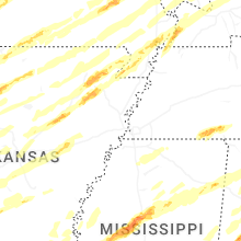


Connect with Interactive Hail Maps