

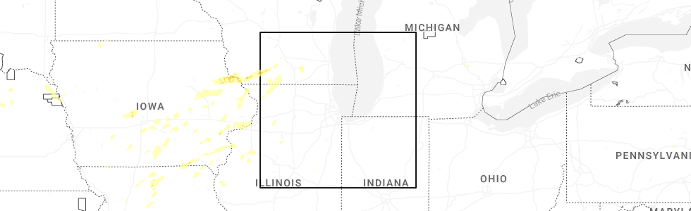
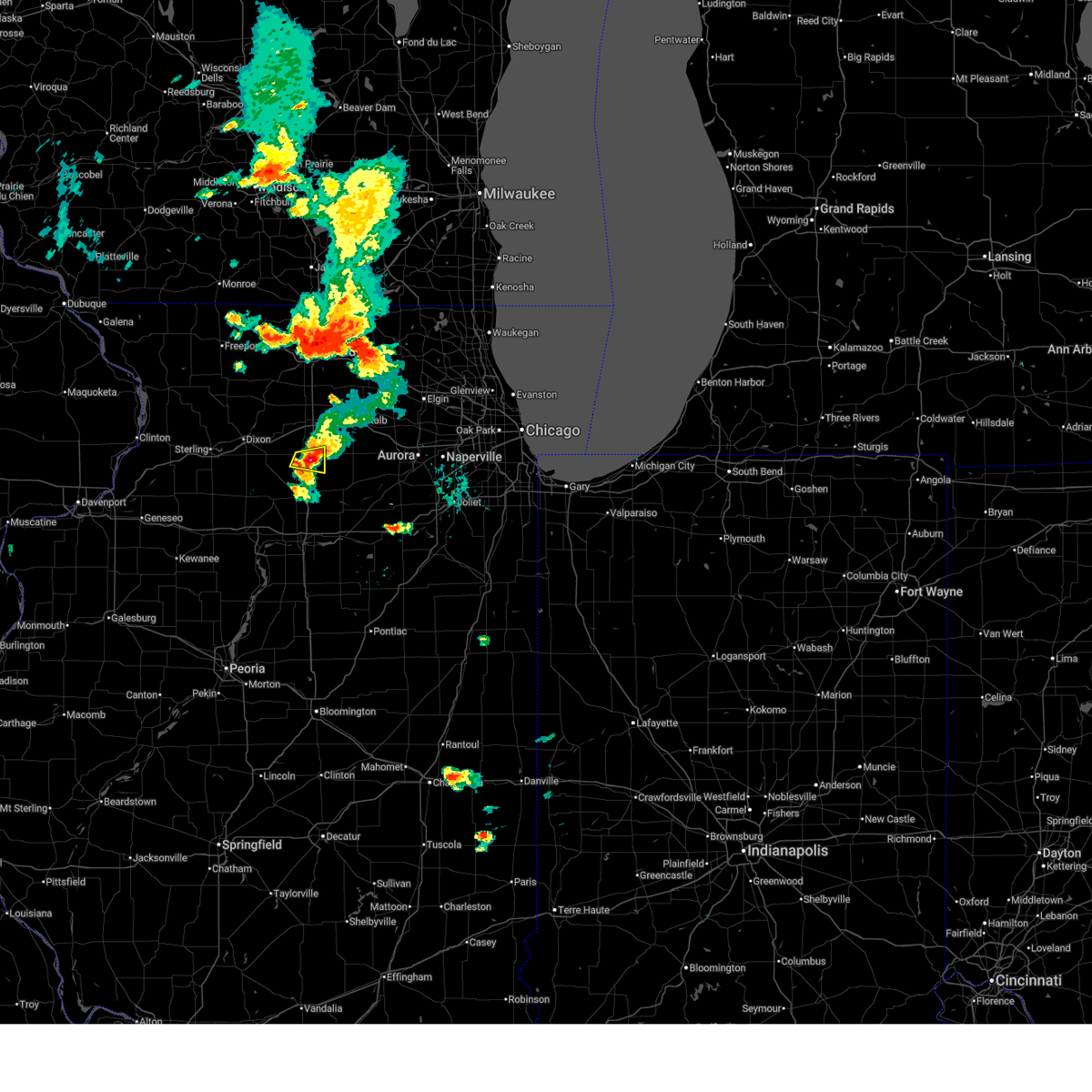
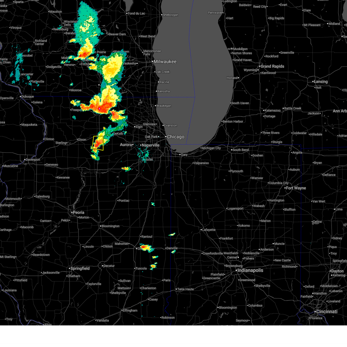
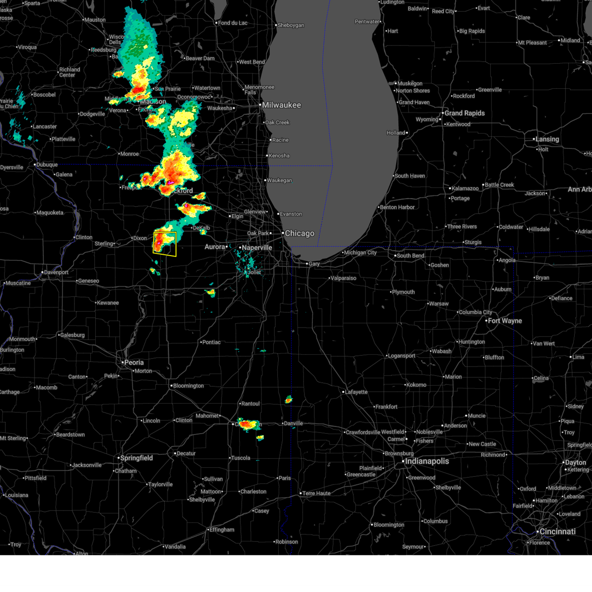
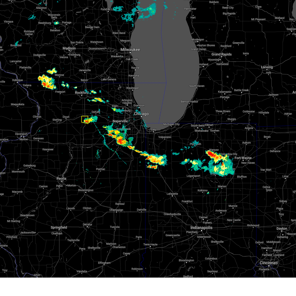
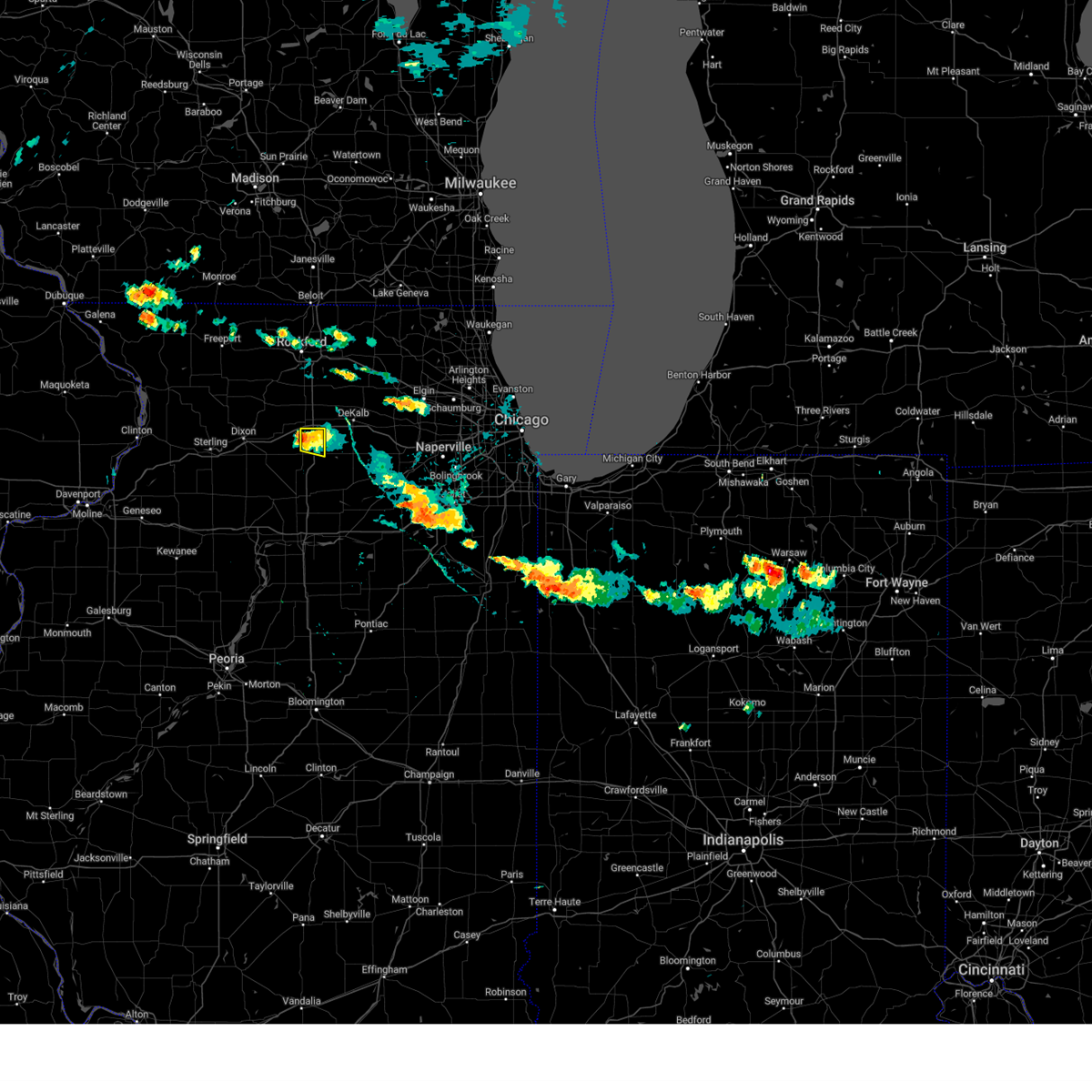
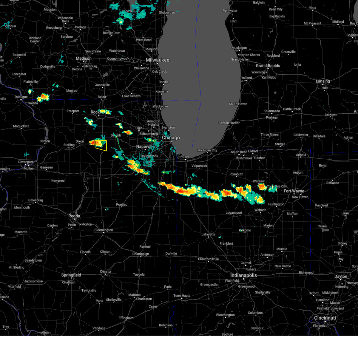
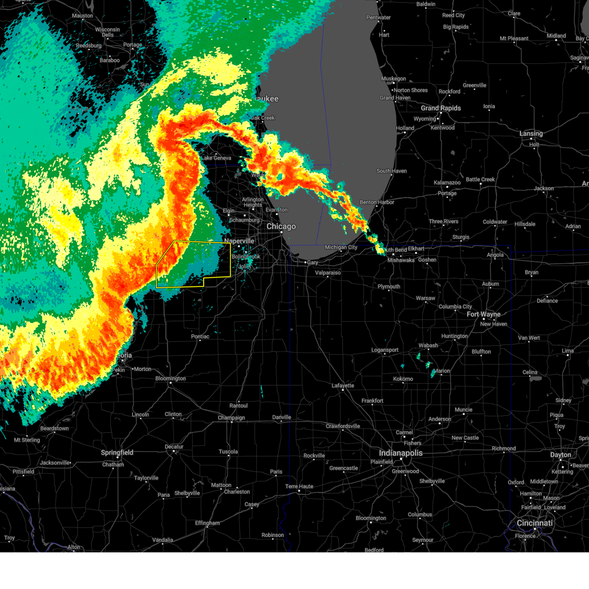
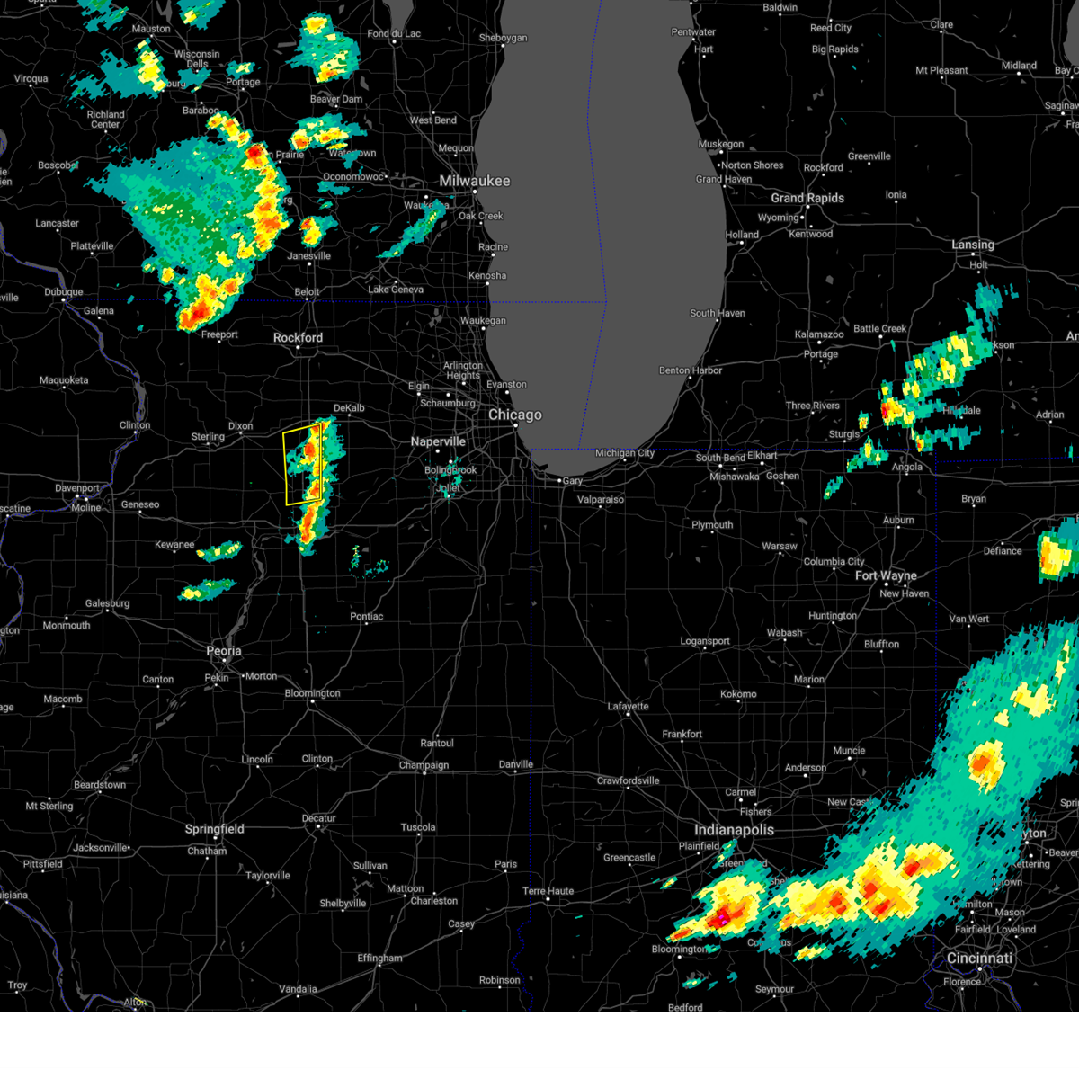
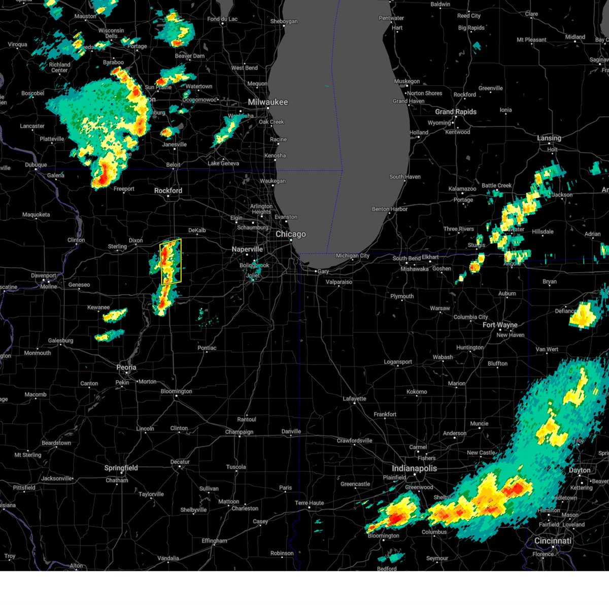
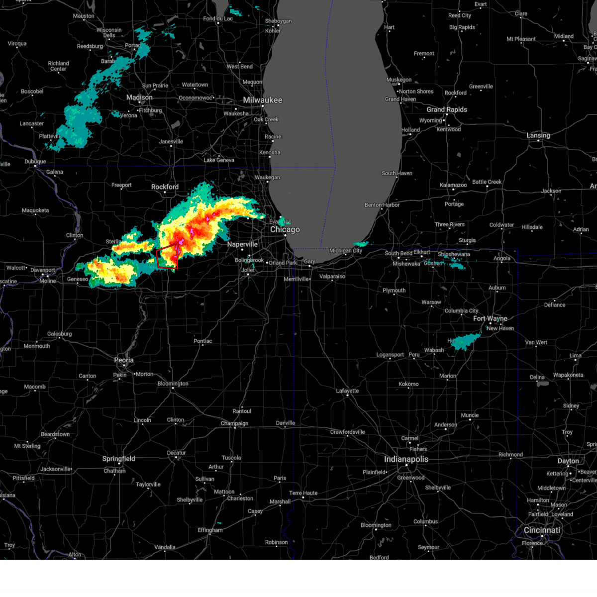
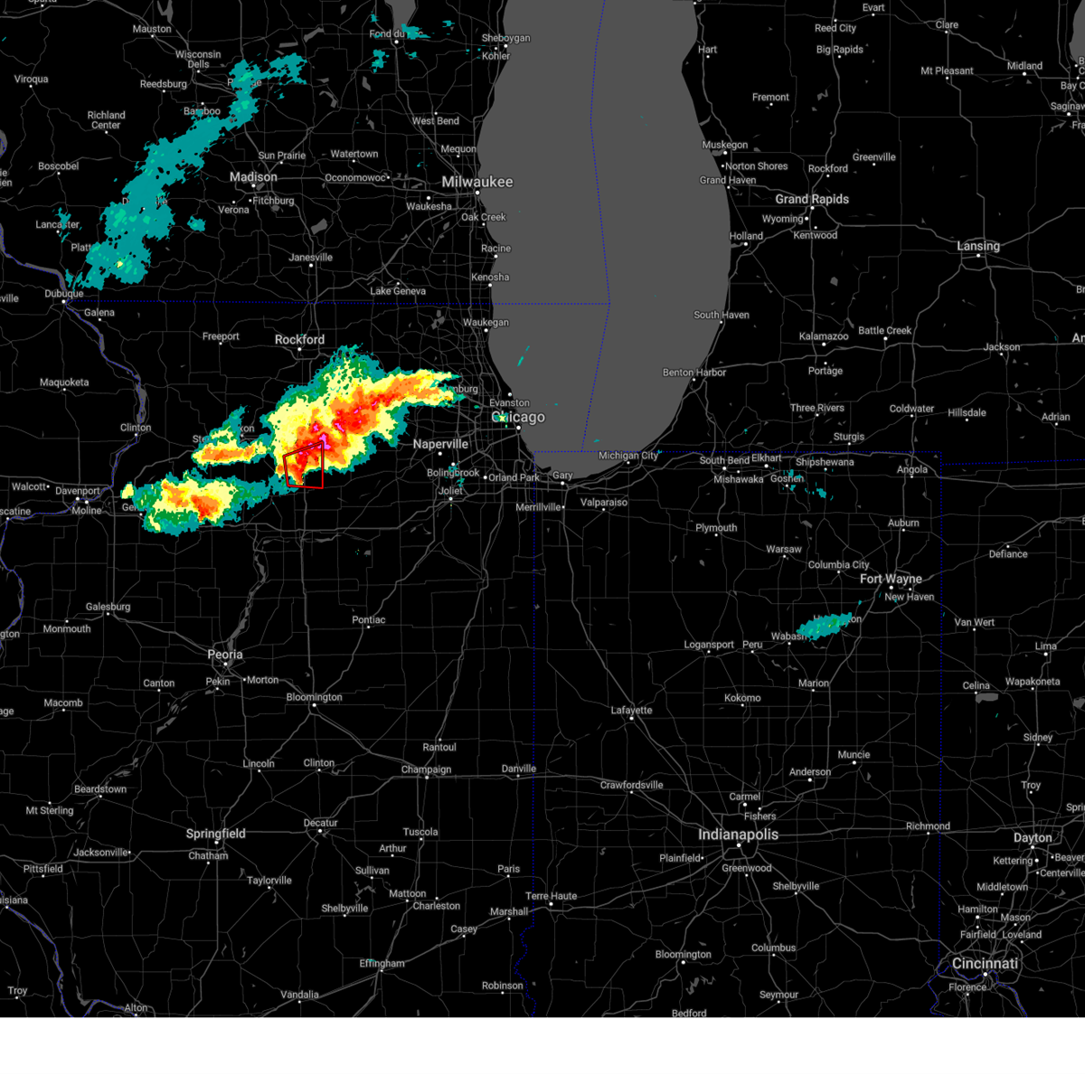
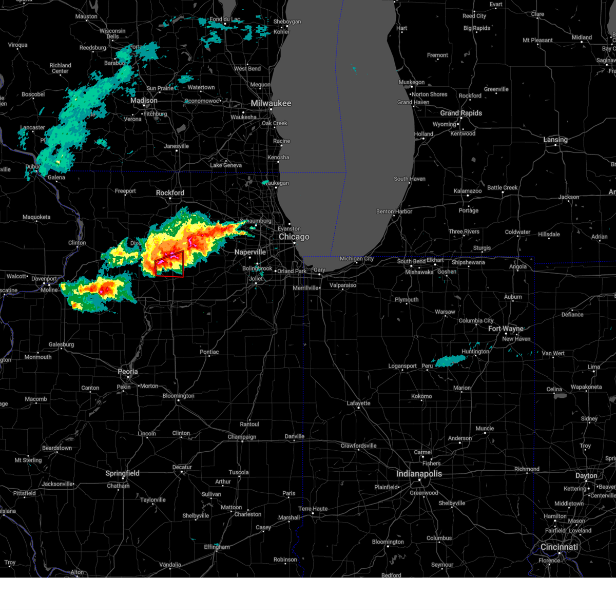
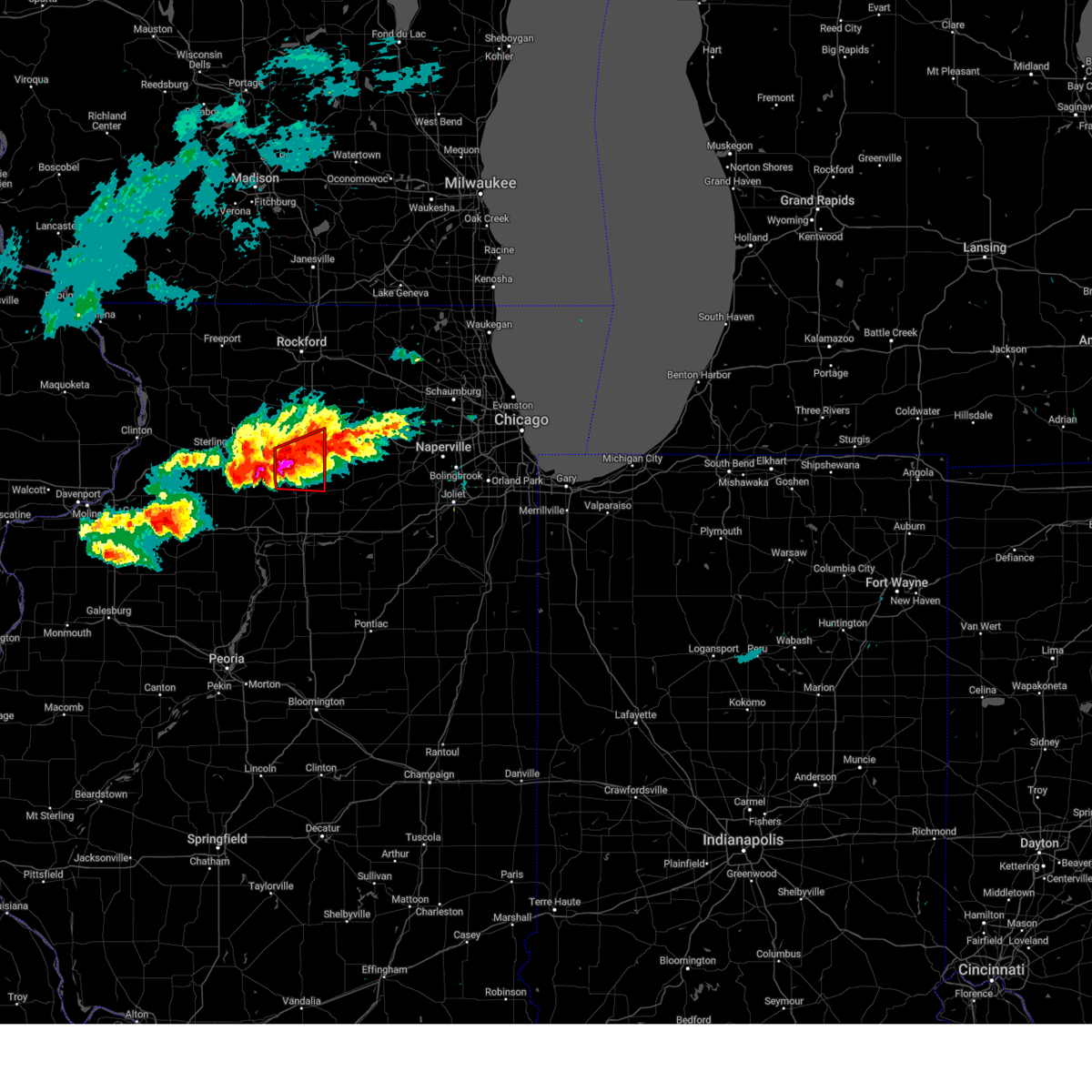
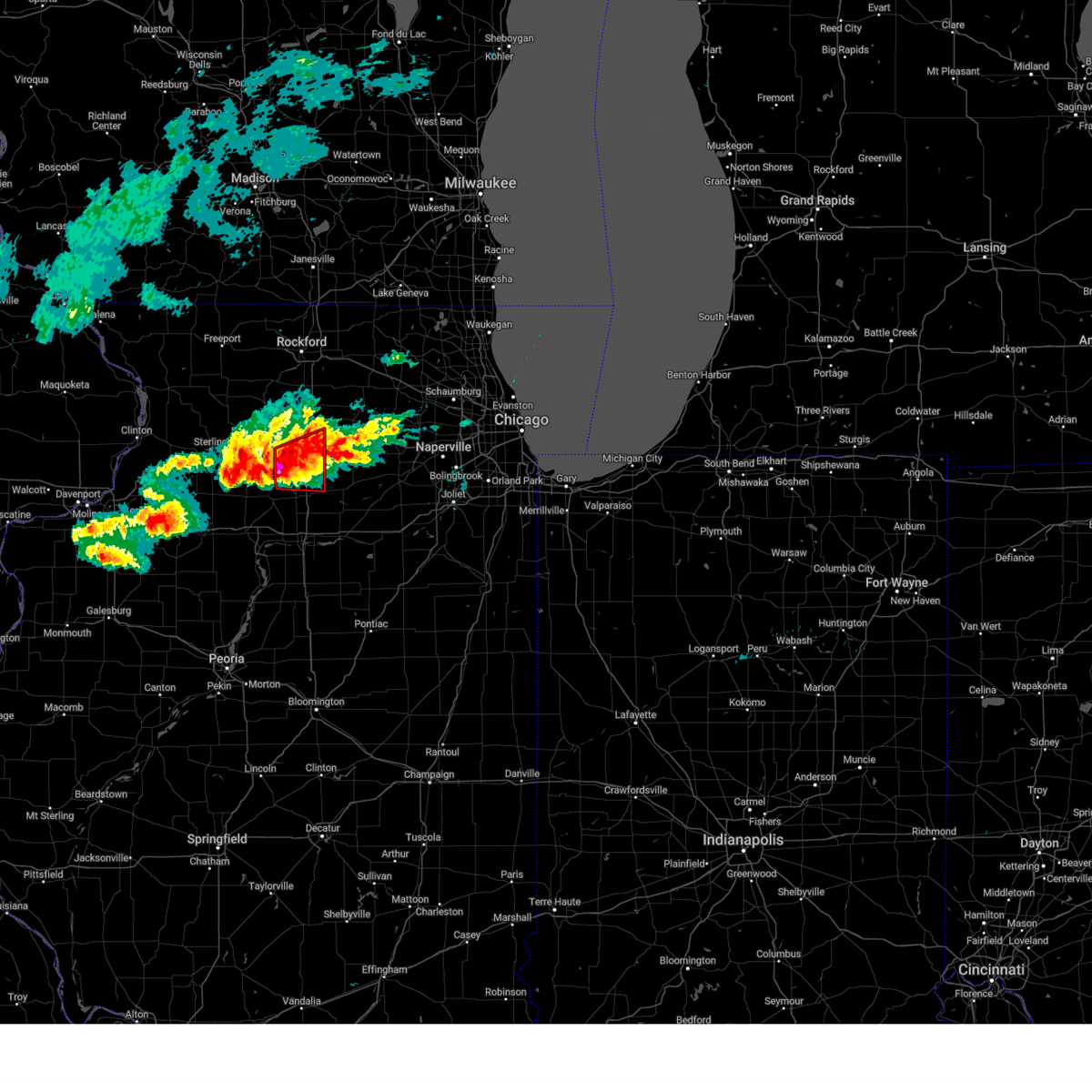
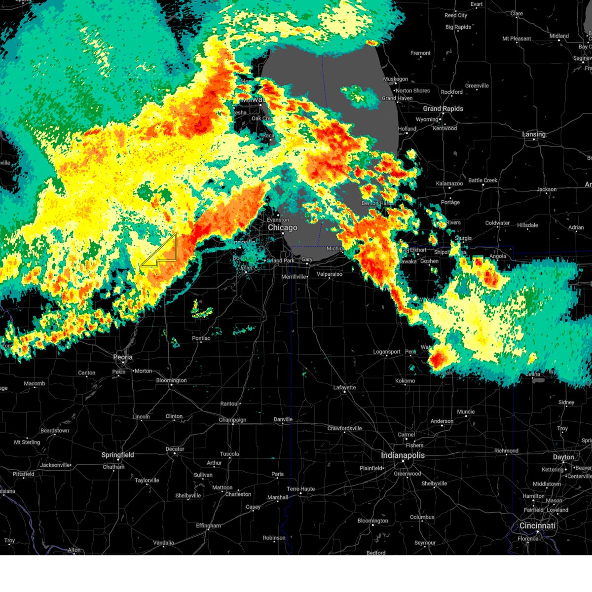
Hail Map for Lee, IL
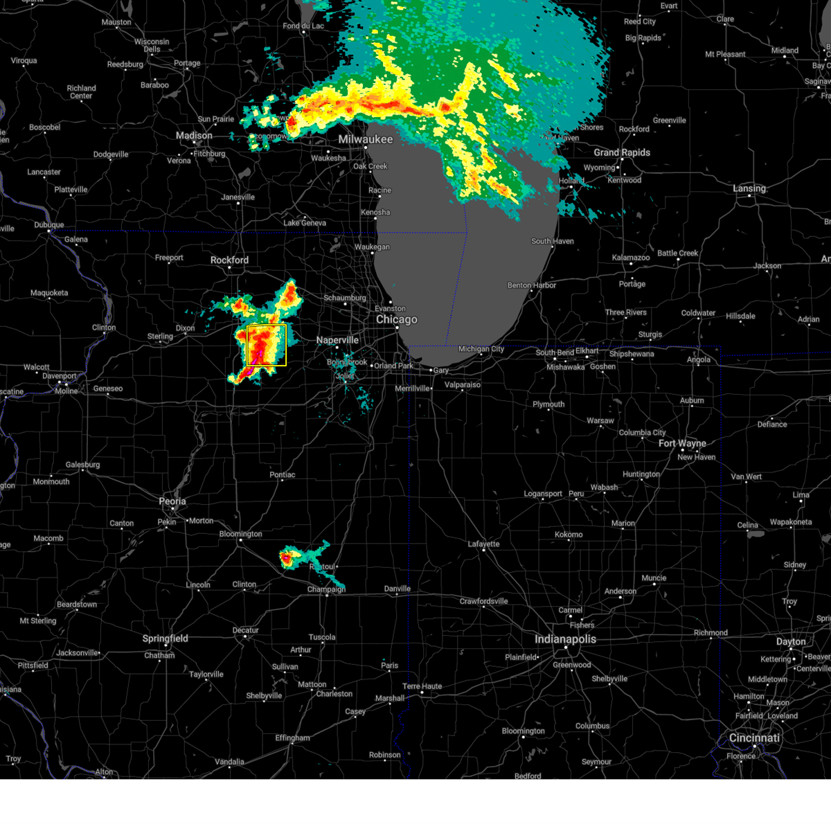
The Lee, IL area has had 1 report of on-the-ground hail by trained spotters, and has been under severe weather warnings 23 times during the past 12 months. Doppler radar has detected hail at or near Lee, IL on 45 occasions, including 3 occasions during the past year.
| Name: | Lee, IL |
| Where Located: | 67.8 miles W of Chicago, IL |
| Map: | Google Map for Lee, IL |
| Population: | 337 |
| Housing Units: | 139 |
| More Info: | Search Google for Lee, IL |
0
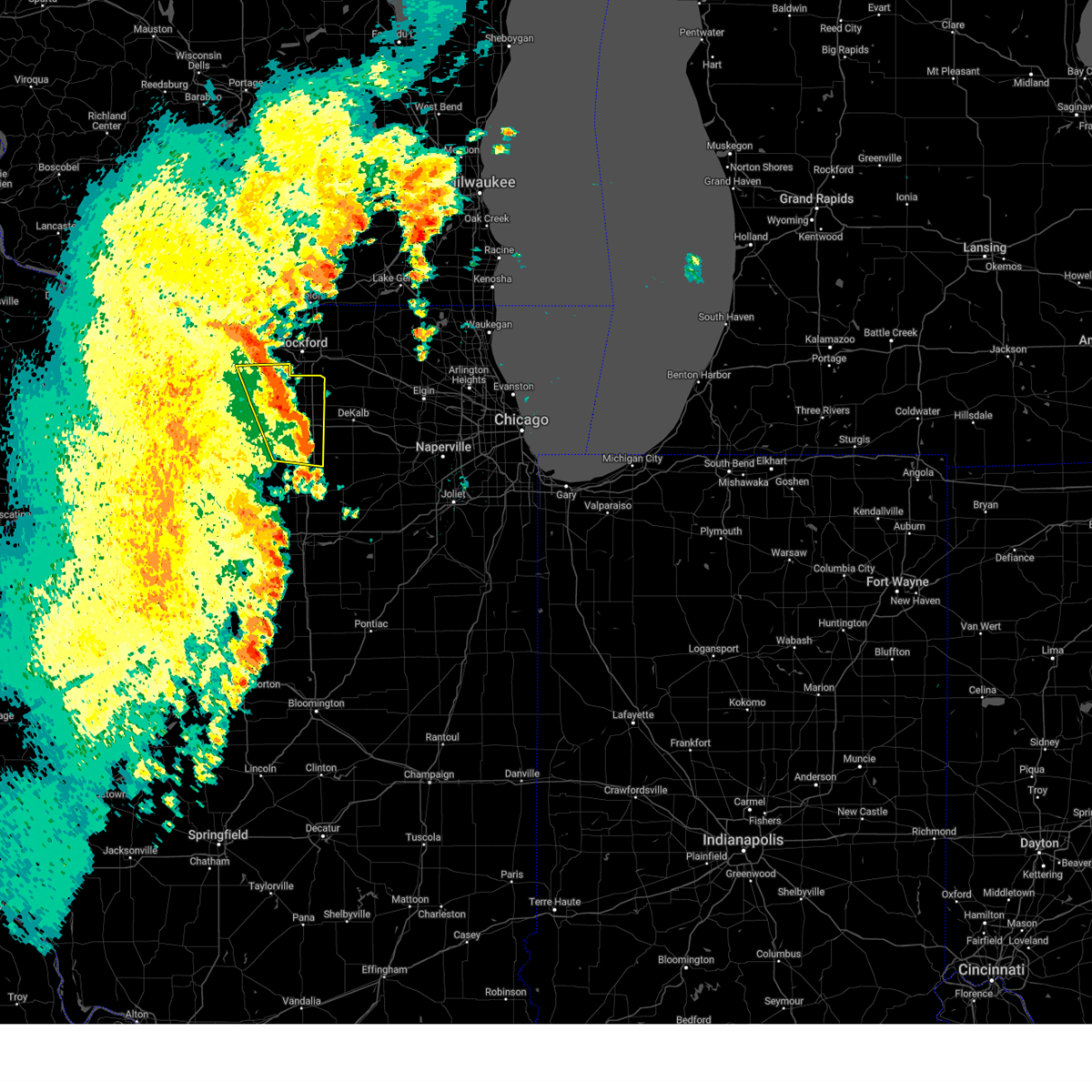
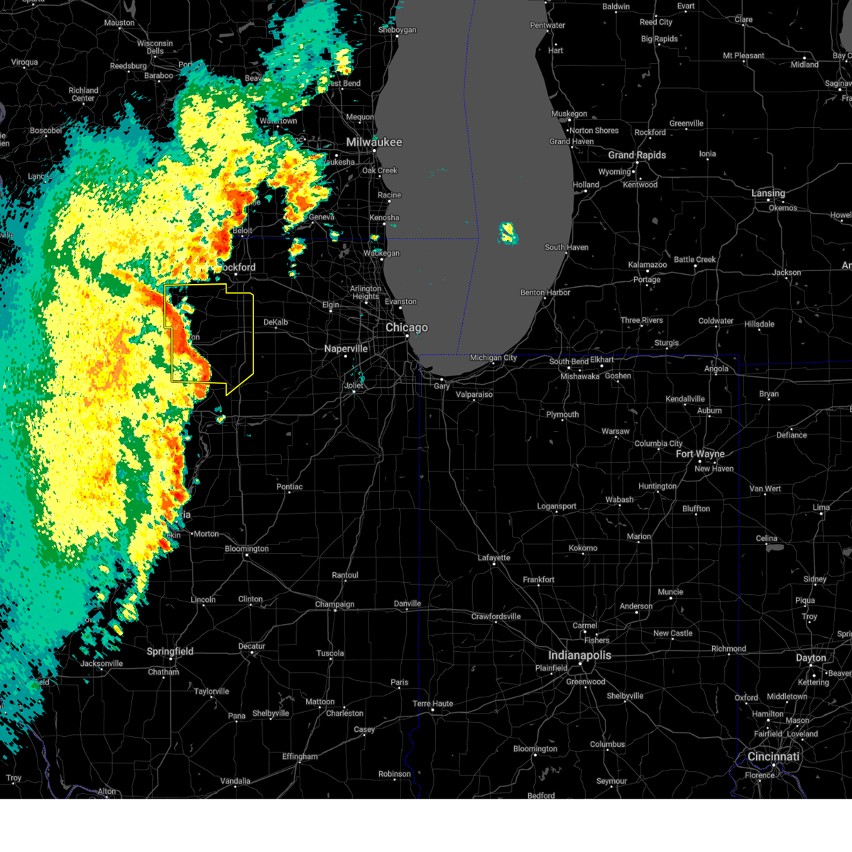
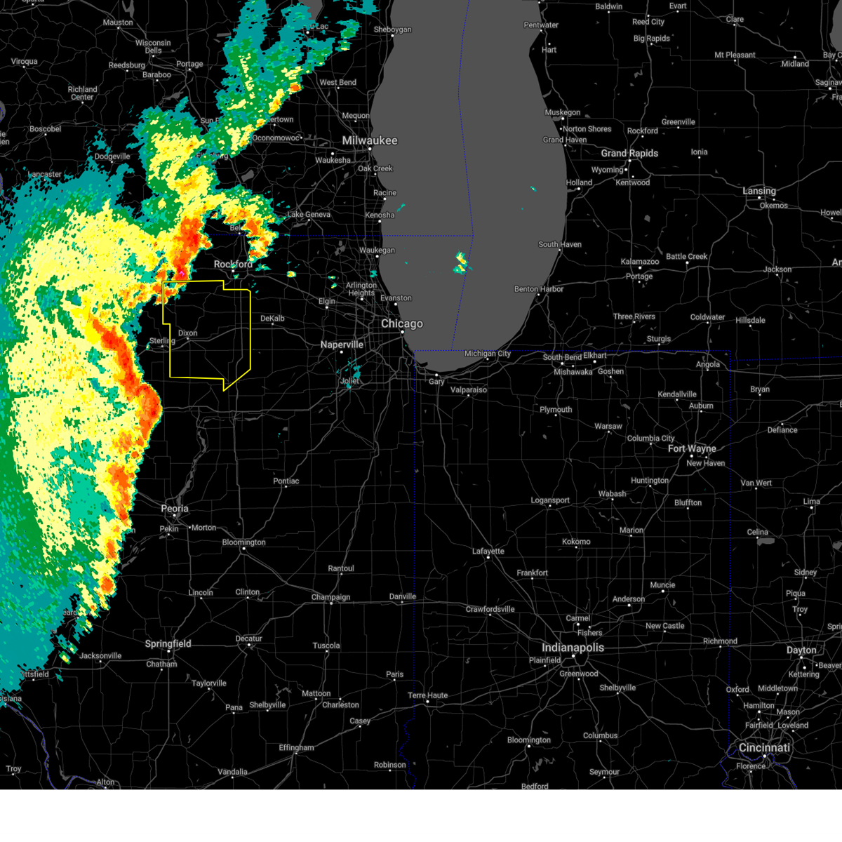
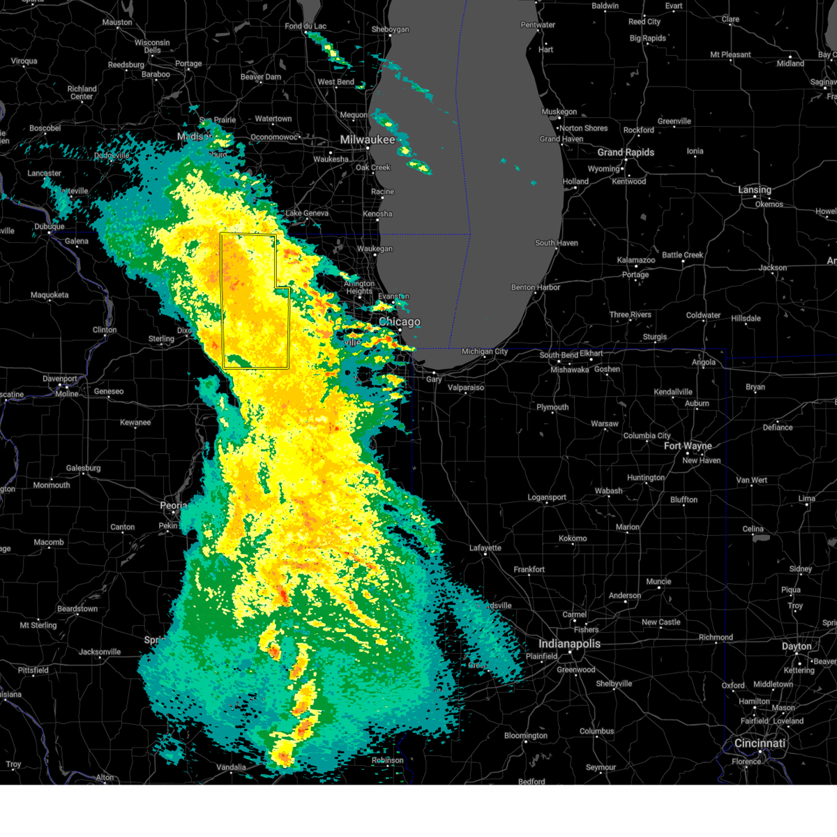
The Top Recent Hail Date for Lee, IL is Friday, July 11, 2025 (30th out of 45)
Hail and Wind Damage Spotted near Lee, IL
| Date / Time | Report Details |
|---|---|
| 7/10/2025 5:16 PM CDT |
 At 516 pm cdt, a severe thunderstorm was located near paw paw, or near shabbona, moving east at 20 mph (trained weather spotters). Hazards include 60 mph wind gusts and quarter size hail. Hail damage to vehicles is expected. expect wind damage to roofs, siding, and trees. Locations impacted include, compton, paw paw, and lee. At 516 pm cdt, a severe thunderstorm was located near paw paw, or near shabbona, moving east at 20 mph (trained weather spotters). Hazards include 60 mph wind gusts and quarter size hail. Hail damage to vehicles is expected. expect wind damage to roofs, siding, and trees. Locations impacted include, compton, paw paw, and lee.
|
| 7/10/2025 5:05 PM CDT |
 At 505 pm cdt, a severe thunderstorm was located near paw paw, or 9 miles west of shabbona, moving east at 20 mph. strong winds resulted in flattened corn north of compton west of i-39 with this storm, which also has a history of producing large hail (trained weather spotters). Hazards include ping pong ball size hail and 60 mph wind gusts. People and animals outdoors will be injured. expect hail damage to roofs, siding, windows, and vehicles. expect wind damage to roofs, siding, and trees. Locations impacted include, paw paw, compton, lee, and steward. At 505 pm cdt, a severe thunderstorm was located near paw paw, or 9 miles west of shabbona, moving east at 20 mph. strong winds resulted in flattened corn north of compton west of i-39 with this storm, which also has a history of producing large hail (trained weather spotters). Hazards include ping pong ball size hail and 60 mph wind gusts. People and animals outdoors will be injured. expect hail damage to roofs, siding, windows, and vehicles. expect wind damage to roofs, siding, and trees. Locations impacted include, paw paw, compton, lee, and steward.
|
| 7/10/2025 4:52 PM CDT |
 Svrlot the national weather service in chicago has issued a * severe thunderstorm warning for, northeastern lee county in north central illinois, * until 545 pm cdt. * at 451 pm cdt, a severe thunderstorm was located 7 miles southeast of ashton, or 10 miles south of rochelle, moving east at 20 mph (trained weather spotters). Hazards include golf ball size hail and 60 mph wind gusts. People and animals outdoors will be injured. expect hail damage to roofs, siding, windows, and vehicles. Expect wind damage to roofs, siding, and trees. Svrlot the national weather service in chicago has issued a * severe thunderstorm warning for, northeastern lee county in north central illinois, * until 545 pm cdt. * at 451 pm cdt, a severe thunderstorm was located 7 miles southeast of ashton, or 10 miles south of rochelle, moving east at 20 mph (trained weather spotters). Hazards include golf ball size hail and 60 mph wind gusts. People and animals outdoors will be injured. expect hail damage to roofs, siding, windows, and vehicles. Expect wind damage to roofs, siding, and trees.
|
| 6/3/2025 9:02 PM CDT | the severe thunderstorm warning has been cancelled and is no longer in effect |
| 6/3/2025 8:49 PM CDT |
 At 848 pm cdt, severe thunderstorms were located along a line extending from near dakota to near stillman valley to 6 miles south of rochelle, moving east at 55 mph (radar indicated). Hazards include 60 mph wind gusts. Expect damage to roofs, siding, and trees. Locations impacted include, oregon, byron, leaf river, mount morris, lindenwood, davis junction, lee center, adeline, ashton, kings, rochelle, chana, lost nation, monroe center, franklin grove, hillcrest, creston, steward, and stillman valley. At 848 pm cdt, severe thunderstorms were located along a line extending from near dakota to near stillman valley to 6 miles south of rochelle, moving east at 55 mph (radar indicated). Hazards include 60 mph wind gusts. Expect damage to roofs, siding, and trees. Locations impacted include, oregon, byron, leaf river, mount morris, lindenwood, davis junction, lee center, adeline, ashton, kings, rochelle, chana, lost nation, monroe center, franklin grove, hillcrest, creston, steward, and stillman valley.
|
| 6/3/2025 8:39 PM CDT | At 838 pm cdt, severe thunderstorms were located along a line extending from freeport to near oregon to 7 miles northeast of sublette, moving northeast at 60 mph (radar indicated). Hazards include 60 mph wind gusts. Expect damage to roofs, siding, and trees. Locations impacted include, oregon, polo, baileyville, amboy, lindenwood, grand detour, west brooklyn, ashton, kings, chana, franklin grove, hillcrest, nachusa, steward, stillman valley, byron, leaf river, eldena, compton, mount morris, woosung, davis junction, lee center, adeline, and rochelle. |
| 6/3/2025 8:39 PM CDT | the severe thunderstorm warning has been cancelled and is no longer in effect |
| 6/3/2025 8:26 PM CDT |
 At 825 pm cdt, severe thunderstorms were located along a line extending from near shannon to near dixon to near woodhaven lakes, moving northeast at 50 mph (radar indicated). Hazards include 60 mph wind gusts. Expect damage to roofs, siding, and trees. Locations impacted include, oregon, polo, baileyville, amboy, lindenwood, grand detour, west brooklyn, ashton, kings, chana, franklin grove, hillcrest, harmon, nachusa, woodland shores, steward, stillman valley, byron, leaf river, nelson, eldena, compton, mount morris, woosung, and davis junction. At 825 pm cdt, severe thunderstorms were located along a line extending from near shannon to near dixon to near woodhaven lakes, moving northeast at 50 mph (radar indicated). Hazards include 60 mph wind gusts. Expect damage to roofs, siding, and trees. Locations impacted include, oregon, polo, baileyville, amboy, lindenwood, grand detour, west brooklyn, ashton, kings, chana, franklin grove, hillcrest, harmon, nachusa, woodland shores, steward, stillman valley, byron, leaf river, nelson, eldena, compton, mount morris, woosung, and davis junction.
|
| 6/3/2025 8:12 PM CDT | At 812 pm cdt, severe thunderstorms were located along a line extending from near mount carroll to near rock falls to 6 miles southeast of walnut, moving northeast at 50 mph (radar indicated). Hazards include 60 mph wind gusts. Expect damage to roofs, siding, and trees. Locations impacted include, oregon, polo, baileyville, amboy, lindenwood, grand detour, west brooklyn, ashton, kings, chana, franklin grove, hillcrest, harmon, nachusa, woodland shores, steward, stillman valley, byron, leaf river, nelson, eldena, compton, mount morris, woosung, and davis junction. |
| 6/3/2025 7:58 PM CDT |
 Svrlot the national weather service in chicago has issued a * severe thunderstorm warning for, northwestern la salle county in north central illinois, lee county in north central illinois, ogle county in north central illinois, * until 915 pm cdt. * at 756 pm cdt, severe thunderstorms were located along a line extending from fulton to near tampico to buda, moving northeast at 55 mph (radar indicated). Hazards include 60 mph wind gusts. expect damage to roofs, siding, and trees Svrlot the national weather service in chicago has issued a * severe thunderstorm warning for, northwestern la salle county in north central illinois, lee county in north central illinois, ogle county in north central illinois, * until 915 pm cdt. * at 756 pm cdt, severe thunderstorms were located along a line extending from fulton to near tampico to buda, moving northeast at 55 mph (radar indicated). Hazards include 60 mph wind gusts. expect damage to roofs, siding, and trees
|
| 3/15/2025 12:10 AM CDT |
 The storms which prompted the warning have weakened below severe limits, and have exited the warned area. therefore, the warning will be allowed to expire. a severe thunderstorm watch remains in effect until 200 am cdt for north central and northeastern illinois. The storms which prompted the warning have weakened below severe limits, and have exited the warned area. therefore, the warning will be allowed to expire. a severe thunderstorm watch remains in effect until 200 am cdt for north central and northeastern illinois.
|
| 3/14/2025 11:43 PM CDT | At 1143 pm cdt, severe thunderstorms were located along a line extending from near footville to plano, moving northeast at 50 mph (radar indicated). Hazards include 70 mph wind gusts. Expect considerable tree damage. damage is likely to mobile homes, roofs, and outbuildings. Locations impacted include, somonauk, rockford airport, candlewick lake, lindenwood, kingston, fairdale, west brooklyn, kings, malta, loves park, cherry valley, cortland, hillcrest, genoa, south beloit, garden prairie, steward, new milford, rockton, poplar grove, compton, kirkland, machesney park, davis junction, and lee. |
| 3/14/2025 11:20 PM CDT | Svrlot the national weather service in chicago has issued a * severe thunderstorm warning for, northeastern la salle county in north central illinois, northeastern lee county in north central illinois, kane county in northeastern illinois, mchenry county in northeastern illinois, * until 1215 am cdt. * at 1119 pm cdt, severe thunderstorms were located along a line extending from near brodhead to near malta to near sheridan, moving northeast at 50 mph. numerous reports of 60 mph gusts have been reported with this line of storms (radar indicated). Hazards include 60 mph wind gusts. expect damage to roofs, siding, and trees |
| 3/14/2025 11:18 PM CDT | At 1118 pm cdt, severe thunderstorms were located along a line extending from 6 miles southwest of brodhead to near earlville, moving east at 40 mph (radar indicated). Hazards include 70 mph wind gusts. Expect considerable tree damage. damage is likely to mobile homes, roofs, and outbuildings. Locations impacted include, somonauk, candlewick lake, lindenwood, seward, lake summerset, fairdale, loves park, cherry valley, genoa, garden prairie, poplar grove, compton, winnebago, kirkland, rochelle, dekalb, harrison, shabbona, rockford, creston, roscoe, belvidere, capron, pecatonica, and rockford airport. |
| 3/14/2025 10:59 PM CDT | Svrlot the national weather service in chicago has issued a * severe thunderstorm warning for, eastern lee county in north central illinois, eastern ogle county in north central illinois, de kalb county in north central illinois, winnebago county in north central illinois, boone county in north central illinois, * until 1215 am cdt. * at 1058 pm cdt, severe thunderstorms were located along a line extending from near winslow to mendota, moving east at 40 mph (radar indicated). Hazards include 70 mph wind gusts. Expect considerable tree damage. Damage is likely to mobile homes, roofs, and outbuildings. |
| 8/16/2024 7:09 PM CDT |
 The storms which prompted the warning have moved out of the area. therefore, the warning will be allowed to expire. however, gusty winds are still possible with these thunderstorms. remember, a severe thunderstorm warning still remains in effect for la salle and de kalb counties. The storms which prompted the warning have moved out of the area. therefore, the warning will be allowed to expire. however, gusty winds are still possible with these thunderstorms. remember, a severe thunderstorm warning still remains in effect for la salle and de kalb counties.
|
| 8/16/2024 6:55 PM CDT |
 At 655 pm cdt, severe thunderstorms were located along a line extending from near shabbona to near paw paw to near mendota, moving southeast at 45 mph (radar indicated). Hazards include 60 mph wind gusts. Expect damage to roofs, siding, and trees. Locations impacted include, dekalb, sandwich, mendota, shabbona, lake holiday, hinckley, somonauk, earlville, waterman, maple park, leland, paw paw, sublette, woodhaven lakes, creston, lee, compton, steward, west brooklyn, and triumph. At 655 pm cdt, severe thunderstorms were located along a line extending from near shabbona to near paw paw to near mendota, moving southeast at 45 mph (radar indicated). Hazards include 60 mph wind gusts. Expect damage to roofs, siding, and trees. Locations impacted include, dekalb, sandwich, mendota, shabbona, lake holiday, hinckley, somonauk, earlville, waterman, maple park, leland, paw paw, sublette, woodhaven lakes, creston, lee, compton, steward, west brooklyn, and triumph.
|
| 8/16/2024 6:40 PM CDT |
 Svrlot the national weather service in chicago has issued a * severe thunderstorm warning for, northwestern la salle county in north central illinois, southeastern ogle county in north central illinois, eastern lee county in north central illinois, southern de kalb county in north central illinois, * until 715 pm cdt. * at 639 pm cdt, severe thunderstorms were located along a line extending from near rochelle to 6 miles northeast of sublette to near woodhaven lakes, moving southeast at 50 mph (radar indicated). Hazards include 60 mph wind gusts. expect damage to roofs, siding, and trees Svrlot the national weather service in chicago has issued a * severe thunderstorm warning for, northwestern la salle county in north central illinois, southeastern ogle county in north central illinois, eastern lee county in north central illinois, southern de kalb county in north central illinois, * until 715 pm cdt. * at 639 pm cdt, severe thunderstorms were located along a line extending from near rochelle to 6 miles northeast of sublette to near woodhaven lakes, moving southeast at 50 mph (radar indicated). Hazards include 60 mph wind gusts. expect damage to roofs, siding, and trees
|
| 8/5/2024 7:06 PM CDT |
 The storm which prompted the warning has weakened below severe limits, and has exited the warned area. therefore, the warning will be allowed to expire. a severe thunderstorm watch remains in effect until midnight cdt for north central illinois. The storm which prompted the warning has weakened below severe limits, and has exited the warned area. therefore, the warning will be allowed to expire. a severe thunderstorm watch remains in effect until midnight cdt for north central illinois.
|
| 8/5/2024 6:50 PM CDT |
 At 649 pm cdt, a severe thunderstorm was located near steward, moving east at 25 mph (radar indicated). Hazards include 60 mph wind gusts and quarter size hail. Hail damage to vehicles is expected. expect wind damage to roofs, siding, and trees. Locations impacted include, lee and steward. At 649 pm cdt, a severe thunderstorm was located near steward, moving east at 25 mph (radar indicated). Hazards include 60 mph wind gusts and quarter size hail. Hail damage to vehicles is expected. expect wind damage to roofs, siding, and trees. Locations impacted include, lee and steward.
|
| 8/5/2024 6:34 PM CDT |
 Svrlot the national weather service in chicago has issued a * severe thunderstorm warning for, northeastern lee county in north central illinois, * until 715 pm cdt. * at 634 pm cdt, a severe thunderstorm was located over ashton, or 7 miles southwest of rochelle, moving east at 25 mph (radar indicated). Hazards include 60 mph wind gusts and quarter size hail. Hail damage to vehicles is expected. Expect wind damage to roofs, siding, and trees. Svrlot the national weather service in chicago has issued a * severe thunderstorm warning for, northeastern lee county in north central illinois, * until 715 pm cdt. * at 634 pm cdt, a severe thunderstorm was located over ashton, or 7 miles southwest of rochelle, moving east at 25 mph (radar indicated). Hazards include 60 mph wind gusts and quarter size hail. Hail damage to vehicles is expected. Expect wind damage to roofs, siding, and trees.
|
| 7/15/2024 8:31 PM CDT |
 At 831 pm cdt, severe thunderstorms were located along a line extending from waterman to near earlville to near la moille, moving east at 40 mph (radar indicated). Hazards include 70 mph wind gusts. Expect considerable tree damage. damage is likely to mobile homes, roofs, and outbuildings. Locations impacted include, aurora, joliet, plainfield, oswego, ottawa, yorkville, minooka, plano, la salle, sandwich, mendota, sheridan, shabbona, montgomery, sugar grove, boulder hill, lake holiday, hinckley, somonauk, earlville, waterman, serena, newark, leland, and paw paw. At 831 pm cdt, severe thunderstorms were located along a line extending from waterman to near earlville to near la moille, moving east at 40 mph (radar indicated). Hazards include 70 mph wind gusts. Expect considerable tree damage. damage is likely to mobile homes, roofs, and outbuildings. Locations impacted include, aurora, joliet, plainfield, oswego, ottawa, yorkville, minooka, plano, la salle, sandwich, mendota, sheridan, shabbona, montgomery, sugar grove, boulder hill, lake holiday, hinckley, somonauk, earlville, waterman, serena, newark, leland, and paw paw.
|
| 7/15/2024 8:21 PM CDT | Svrlot the national weather service in chicago has issued a * severe thunderstorm warning for, kendall county in northeastern illinois, northern la salle county in north central illinois, southeastern lee county in north central illinois, southern de kalb county in north central illinois, southern kane county in northeastern illinois, * until 915 pm cdt. * at 821 pm cdt, severe thunderstorms were located along a line extending from near shabbona to near mendota to 6 miles southwest of la moille, moving southeast at 40 mph (radar indicated). Hazards include 70 mph wind gusts. Expect considerable tree damage. Damage is likely to mobile homes, roofs, and outbuildings. |
| 7/15/2024 8:20 PM CDT | Public report of large branch broken near lee. time estimated by radar. relayed via mpin in lee county IL, 0.6 miles SE of Lee, IL |
| 6/25/2024 8:04 AM CDT |
 Svrlot the national weather service in chicago has issued a * severe thunderstorm warning for, northern kendall county in northeastern illinois, northeastern lee county in north central illinois, southern de kalb county in north central illinois, southern kane county in northeastern illinois, * until 845 am cdt. * at 803 am cdt, a severe thunderstorm was located over waterman, or near shabbona, moving east at 60 mph. a personal weather station gusted to 56 mph with these storms (radar indicated). Hazards include 60 mph wind gusts and nickel size hail. expect damage to roofs, siding, and trees Svrlot the national weather service in chicago has issued a * severe thunderstorm warning for, northern kendall county in northeastern illinois, northeastern lee county in north central illinois, southern de kalb county in north central illinois, southern kane county in northeastern illinois, * until 845 am cdt. * at 803 am cdt, a severe thunderstorm was located over waterman, or near shabbona, moving east at 60 mph. a personal weather station gusted to 56 mph with these storms (radar indicated). Hazards include 60 mph wind gusts and nickel size hail. expect damage to roofs, siding, and trees
|
| 6/25/2024 7:18 AM CDT |
 The storms which prompted the warning have weakened below severe limits, and no longer pose an immediate threat to life or property. therefore, the warning has been allowed to expire. however, additional strong to severe storms will be possible this morning. a severe thunderstorm watch remains in effect until 1100 am cdt for north central and northeastern illinois. The storms which prompted the warning have weakened below severe limits, and no longer pose an immediate threat to life or property. therefore, the warning has been allowed to expire. however, additional strong to severe storms will be possible this morning. a severe thunderstorm watch remains in effect until 1100 am cdt for north central and northeastern illinois.
|
| 6/25/2024 6:51 AM CDT |
 At 651 am cdt, severe thunderstorms were located along a line extending from near elburn to waterman to 7 miles east of walnut, moving east at 60 mph (radar indicated). Hazards include 60 mph wind gusts and quarter size hail. Hail damage to vehicles is expected. expect wind damage to roofs, siding, and trees. Locations impacted include, dekalb, sandwich, amboy, shabbona, cortland, hinckley, somonauk, waterman, maple park, malta, paw paw, sublette, woodhaven lakes, lee, compton, steward, west brooklyn, harmon, eldena, and lee center. At 651 am cdt, severe thunderstorms were located along a line extending from near elburn to waterman to 7 miles east of walnut, moving east at 60 mph (radar indicated). Hazards include 60 mph wind gusts and quarter size hail. Hail damage to vehicles is expected. expect wind damage to roofs, siding, and trees. Locations impacted include, dekalb, sandwich, amboy, shabbona, cortland, hinckley, somonauk, waterman, maple park, malta, paw paw, sublette, woodhaven lakes, lee, compton, steward, west brooklyn, harmon, eldena, and lee center.
|
| 6/25/2024 6:51 AM CDT |
 the severe thunderstorm warning has been cancelled and is no longer in effect the severe thunderstorm warning has been cancelled and is no longer in effect
|
| 6/25/2024 6:39 AM CDT |
 At 639 am cdt, severe thunderstorms were located along a line extending from maple park to near shabbona to walnut, moving east at 45 mph (radar indicated). Hazards include 60 mph wind gusts and quarter size hail. Hail damage to vehicles is expected. expect wind damage to roofs, siding, and trees. Locations impacted include, dekalb, sycamore, dixon, rochelle, sandwich, genoa, oregon, amboy, shabbona, cortland, hinckley, somonauk, kirkland, waterman, hillcrest, maple park, malta, franklin grove, ashton, paw paw, lost nation, sublette, woodhaven lakes, creston, and lindenwood. At 639 am cdt, severe thunderstorms were located along a line extending from maple park to near shabbona to walnut, moving east at 45 mph (radar indicated). Hazards include 60 mph wind gusts and quarter size hail. Hail damage to vehicles is expected. expect wind damage to roofs, siding, and trees. Locations impacted include, dekalb, sycamore, dixon, rochelle, sandwich, genoa, oregon, amboy, shabbona, cortland, hinckley, somonauk, kirkland, waterman, hillcrest, maple park, malta, franklin grove, ashton, paw paw, lost nation, sublette, woodhaven lakes, creston, and lindenwood.
|
| 6/25/2024 6:24 AM CDT |
 At 624 am cdt, severe thunderstorms were located along a line extending from near sycamore to near rochelle to near amboy, moving east at 55 mph (radar indicated). Hazards include 60 mph wind gusts and quarter size hail. Hail damage to vehicles is expected. expect wind damage to roofs, siding, and trees. Locations impacted include, dekalb, sycamore, dixon, rochelle, sandwich, genoa, oregon, amboy, shabbona, cortland, hinckley, somonauk, kirkland, waterman, hillcrest, maple park, malta, franklin grove, ashton, paw paw, lost nation, sublette, woodhaven lakes, creston, and lindenwood. At 624 am cdt, severe thunderstorms were located along a line extending from near sycamore to near rochelle to near amboy, moving east at 55 mph (radar indicated). Hazards include 60 mph wind gusts and quarter size hail. Hail damage to vehicles is expected. expect wind damage to roofs, siding, and trees. Locations impacted include, dekalb, sycamore, dixon, rochelle, sandwich, genoa, oregon, amboy, shabbona, cortland, hinckley, somonauk, kirkland, waterman, hillcrest, maple park, malta, franklin grove, ashton, paw paw, lost nation, sublette, woodhaven lakes, creston, and lindenwood.
|
| 5/21/2024 11:22 PM CDT |
 At 1122 pm cdt, a severe thunderstorm was located 7 miles southeast of ashton, or 9 miles east of amboy, moving northeast at 45 mph (radar indicated). Hazards include 60 mph wind gusts and nickel size hail. Expect damage to roofs, siding, and trees. Locations impacted include, amboy, franklin grove, ashton, sublette, woodhaven lakes, lee, compton, steward, west brooklyn, eldena, and lee center. At 1122 pm cdt, a severe thunderstorm was located 7 miles southeast of ashton, or 9 miles east of amboy, moving northeast at 45 mph (radar indicated). Hazards include 60 mph wind gusts and nickel size hail. Expect damage to roofs, siding, and trees. Locations impacted include, amboy, franklin grove, ashton, sublette, woodhaven lakes, lee, compton, steward, west brooklyn, eldena, and lee center.
|
| 5/21/2024 11:08 PM CDT |
 At 1108 pm cdt, a severe thunderstorm was located over amboy, moving northeast at 45 mph (radar indicated). Hazards include 60 mph wind gusts and nickel size hail. Expect damage to roofs, siding, and trees. Locations impacted include, amboy, franklin grove, ashton, sublette, woodhaven lakes, lee, compton, steward, west brooklyn, eldena, and lee center. At 1108 pm cdt, a severe thunderstorm was located over amboy, moving northeast at 45 mph (radar indicated). Hazards include 60 mph wind gusts and nickel size hail. Expect damage to roofs, siding, and trees. Locations impacted include, amboy, franklin grove, ashton, sublette, woodhaven lakes, lee, compton, steward, west brooklyn, eldena, and lee center.
|
| 5/21/2024 10:53 PM CDT |
 Svrlot the national weather service in chicago has issued a * severe thunderstorm warning for, lee county in north central illinois, * until midnight cdt. * at 1053 pm cdt, a severe thunderstorm was located near walnut, or 13 miles southwest of amboy, moving northeast at 45 mph (radar indicated). Hazards include 60 mph wind gusts and nickel size hail. expect damage to roofs, siding, and trees Svrlot the national weather service in chicago has issued a * severe thunderstorm warning for, lee county in north central illinois, * until midnight cdt. * at 1053 pm cdt, a severe thunderstorm was located near walnut, or 13 miles southwest of amboy, moving northeast at 45 mph (radar indicated). Hazards include 60 mph wind gusts and nickel size hail. expect damage to roofs, siding, and trees
|
| 5/7/2024 7:40 PM CDT |
 The storms which prompted the warning have weakened below severe limits, and have exited the warned area. therefore, the warning will be allowed to expire. The storms which prompted the warning have weakened below severe limits, and have exited the warned area. therefore, the warning will be allowed to expire.
|
| 5/7/2024 7:29 PM CDT |
 At 729 pm cdt, severe thunderstorms were located along a line extending from 6 miles southeast of ashton to near paw paw to near mendota, moving east at 50 mph (radar indicated). Hazards include 60 mph wind gusts and penny size hail. Expect damage to roofs, siding, and trees. Locations impacted include, mendota, paw paw, lee, compton, steward, west brooklyn, and triumph. At 729 pm cdt, severe thunderstorms were located along a line extending from 6 miles southeast of ashton to near paw paw to near mendota, moving east at 50 mph (radar indicated). Hazards include 60 mph wind gusts and penny size hail. Expect damage to roofs, siding, and trees. Locations impacted include, mendota, paw paw, lee, compton, steward, west brooklyn, and triumph.
|
| 5/7/2024 7:19 PM CDT |
 At 718 pm cdt, severe thunderstorms were located along a line extending from near franklin grove to near woodhaven lakes to near sublette, moving east at 40 mph (radar indicated). Hazards include 60 mph wind gusts and penny size hail. Expect damage to roofs, siding, and trees. Locations impacted include, mendota, amboy, franklin grove, ashton, paw paw, sublette, woodhaven lakes, lee, compton, steward, west brooklyn, triumph, lee center, and nachusa. At 718 pm cdt, severe thunderstorms were located along a line extending from near franklin grove to near woodhaven lakes to near sublette, moving east at 40 mph (radar indicated). Hazards include 60 mph wind gusts and penny size hail. Expect damage to roofs, siding, and trees. Locations impacted include, mendota, amboy, franklin grove, ashton, paw paw, sublette, woodhaven lakes, lee, compton, steward, west brooklyn, triumph, lee center, and nachusa.
|
| 5/7/2024 7:19 PM CDT |
 the severe thunderstorm warning has been cancelled and is no longer in effect the severe thunderstorm warning has been cancelled and is no longer in effect
|
| 5/7/2024 7:07 PM CDT |
 At 707 pm cdt, severe thunderstorms were located along a line extending from near amboy to near woodhaven lakes to near la moille, moving east at 45 mph (radar indicated). Hazards include 60 mph wind gusts. Expect damage to roofs, siding, and trees. Locations impacted include, dixon, rochelle, mendota, amboy, franklin grove, ashton, paw paw, sublette, woodhaven lakes, creston, lee, compton, steward, west brooklyn, eldena, triumph, lee center, and nachusa. At 707 pm cdt, severe thunderstorms were located along a line extending from near amboy to near woodhaven lakes to near la moille, moving east at 45 mph (radar indicated). Hazards include 60 mph wind gusts. Expect damage to roofs, siding, and trees. Locations impacted include, dixon, rochelle, mendota, amboy, franklin grove, ashton, paw paw, sublette, woodhaven lakes, creston, lee, compton, steward, west brooklyn, eldena, triumph, lee center, and nachusa.
|
| 5/7/2024 6:51 PM CDT |
 Svrlot the national weather service in chicago has issued a * severe thunderstorm warning for, northwestern la salle county in north central illinois, southeastern ogle county in north central illinois, lee county in north central illinois, * until 745 pm cdt. * at 651 pm cdt, severe thunderstorms were located along a line extending from 6 miles southeast of rock falls to near walnut to 8 miles southeast of deer grove, moving east at 40 mph (radar indicated). Hazards include 60 mph wind gusts. expect damage to roofs, siding, and trees Svrlot the national weather service in chicago has issued a * severe thunderstorm warning for, northwestern la salle county in north central illinois, southeastern ogle county in north central illinois, lee county in north central illinois, * until 745 pm cdt. * at 651 pm cdt, severe thunderstorms were located along a line extending from 6 miles southeast of rock falls to near walnut to 8 miles southeast of deer grove, moving east at 40 mph (radar indicated). Hazards include 60 mph wind gusts. expect damage to roofs, siding, and trees
|
| 2/27/2024 6:39 PM CST |
 The storm which prompted the warning has moved out of the area. therefore, the warning will be allowed to expire. a tornado watch remains in effect until 1000 pm cst for north central illinois. The storm which prompted the warning has moved out of the area. therefore, the warning will be allowed to expire. a tornado watch remains in effect until 1000 pm cst for north central illinois.
|
| 2/27/2024 6:37 PM CST |
 At 637 pm cst, multiple severe thunderstorms were located along a line extending from shabbona to near cortland, moving east northeast at 25 mph (public). Hazards include ping pong ball size hail and 60 mph wind gusts. People and animals outdoors will be injured. expect hail damage to roofs, siding, windows, and vehicles. expect wind damage to roofs, siding, and trees. locations impacted include, aurora, elgin, dekalb, bartlett, carpentersville, st. Charles, algonquin, west chicago, batavia, huntley, geneva, sycamore, campton hills, sandwich, genoa, shabbona, south elgin, montgomery, north aurora, sugar grove, pingree grove, gilberts, west dundee, hampshire, and elburn. At 637 pm cst, multiple severe thunderstorms were located along a line extending from shabbona to near cortland, moving east northeast at 25 mph (public). Hazards include ping pong ball size hail and 60 mph wind gusts. People and animals outdoors will be injured. expect hail damage to roofs, siding, windows, and vehicles. expect wind damage to roofs, siding, and trees. locations impacted include, aurora, elgin, dekalb, bartlett, carpentersville, st. Charles, algonquin, west chicago, batavia, huntley, geneva, sycamore, campton hills, sandwich, genoa, shabbona, south elgin, montgomery, north aurora, sugar grove, pingree grove, gilberts, west dundee, hampshire, and elburn.
|
| 2/27/2024 6:30 PM CST |
 At 629 pm cst, a severe thunderstorm capable of producing a tornado was located near paw paw, or near shabbona, moving east at 25 mph (radar indicated rotation). Hazards include tornado and two inch hail. Flying debris will be dangerous to those caught without shelter. mobile homes will be damaged or destroyed. damage to roofs, windows, and vehicles will occur. tree damage is likely. Locations impacted include, paw paw, lee, compton, and west brooklyn. At 629 pm cst, a severe thunderstorm capable of producing a tornado was located near paw paw, or near shabbona, moving east at 25 mph (radar indicated rotation). Hazards include tornado and two inch hail. Flying debris will be dangerous to those caught without shelter. mobile homes will be damaged or destroyed. damage to roofs, windows, and vehicles will occur. tree damage is likely. Locations impacted include, paw paw, lee, compton, and west brooklyn.
|
| 2/27/2024 6:27 PM CST |
 Torlot the national weather service in chicago has issued a * tornado warning for, southern de kalb county in north central illinois, * until 715 pm cst. * at 627 pm cst, a severe thunderstorm capable of producing a tornado was located near paw paw, or near shabbona, moving east at 25 mph (radar indicated rotation). Hazards include tornado. Flying debris will be dangerous to those caught without shelter. mobile homes will be damaged or destroyed. damage to roofs, windows, and vehicles will occur. tree damage is likely. this dangerous storm will be near, shabbona around 630 pm cst. waterman around 640 pm cst. Other locations in the path of this tornadic thunderstorm include hinckley. Torlot the national weather service in chicago has issued a * tornado warning for, southern de kalb county in north central illinois, * until 715 pm cst. * at 627 pm cst, a severe thunderstorm capable of producing a tornado was located near paw paw, or near shabbona, moving east at 25 mph (radar indicated rotation). Hazards include tornado. Flying debris will be dangerous to those caught without shelter. mobile homes will be damaged or destroyed. damage to roofs, windows, and vehicles will occur. tree damage is likely. this dangerous storm will be near, shabbona around 630 pm cst. waterman around 640 pm cst. Other locations in the path of this tornadic thunderstorm include hinckley.
|
| 2/27/2024 6:16 PM CST |
 At 616 pm cst, several severe thunderstorms capable of producing a tornado were located from sublette to compton, moving east at 25 mph (radar indicated rotation). Hazards include tornado and two inch hail. Flying debris will be dangerous to those caught without shelter. mobile homes will be damaged or destroyed. damage to roofs, windows, and vehicles will occur. tree damage is likely. Locations impacted include, paw paw, sublette, lee, compton, and west brooklyn. At 616 pm cst, several severe thunderstorms capable of producing a tornado were located from sublette to compton, moving east at 25 mph (radar indicated rotation). Hazards include tornado and two inch hail. Flying debris will be dangerous to those caught without shelter. mobile homes will be damaged or destroyed. damage to roofs, windows, and vehicles will occur. tree damage is likely. Locations impacted include, paw paw, sublette, lee, compton, and west brooklyn.
|
| 2/27/2024 6:16 PM CST |
 At 615 pm cst, severe thunderstorms were located along a line extending from woodhaven lakes to near sublette to 6 miles northwest of paw paw, moving east northeast at 30 mph (public). Hazards include golf ball size hail and 60 mph wind gusts. People and animals outdoors will be injured. expect hail damage to roofs, siding, windows, and vehicles. expect wind damage to roofs, siding, and trees. Locations impacted include, dixon, rochelle, amboy, hillcrest, franklin grove, ashton, paw paw, lost nation, sublette, woodhaven lakes, creston, lindenwood, grand detour, lee, compton, steward, nelson, west brooklyn, harmon, woodland shores, kings, chana, nachusa, eldena, and woosung. At 615 pm cst, severe thunderstorms were located along a line extending from woodhaven lakes to near sublette to 6 miles northwest of paw paw, moving east northeast at 30 mph (public). Hazards include golf ball size hail and 60 mph wind gusts. People and animals outdoors will be injured. expect hail damage to roofs, siding, windows, and vehicles. expect wind damage to roofs, siding, and trees. Locations impacted include, dixon, rochelle, amboy, hillcrest, franklin grove, ashton, paw paw, lost nation, sublette, woodhaven lakes, creston, lindenwood, grand detour, lee, compton, steward, nelson, west brooklyn, harmon, woodland shores, kings, chana, nachusa, eldena, and woosung.
|
| 2/27/2024 6:10 PM CST |
 At 610 pm cst, multiple severe thunderstorms were located along a line extending from 7 miles northwest of paw paw to near shabbona to near maple park, moving northeast at 25 mph (radar indicated). Hazards include golf ball size hail and 60 mph wind gusts. People and animals outdoors will be injured. expect hail damage to roofs, siding, windows, and vehicles. expect wind damage to roofs, siding, and trees. locations impacted include, aurora, elgin, dekalb, bartlett, carpentersville, st. Charles, algonquin, west chicago, batavia, huntley, geneva, sycamore, campton hills, sandwich, genoa, shabbona, south elgin, montgomery, north aurora, sugar grove, pingree grove, gilberts, west dundee, hampshire, and elburn. At 610 pm cst, multiple severe thunderstorms were located along a line extending from 7 miles northwest of paw paw to near shabbona to near maple park, moving northeast at 25 mph (radar indicated). Hazards include golf ball size hail and 60 mph wind gusts. People and animals outdoors will be injured. expect hail damage to roofs, siding, windows, and vehicles. expect wind damage to roofs, siding, and trees. locations impacted include, aurora, elgin, dekalb, bartlett, carpentersville, st. Charles, algonquin, west chicago, batavia, huntley, geneva, sycamore, campton hills, sandwich, genoa, shabbona, south elgin, montgomery, north aurora, sugar grove, pingree grove, gilberts, west dundee, hampshire, and elburn.
|
| 2/27/2024 6:05 PM CST |
 At 603 pm cst, multiple severe thunderstorms capable of producing a tornado were located from sublette to steward, all moving northeast at 20 mph (radar indicated rotation. rotating wall clouds and at least one funnel cloud have been reported with these storms). Hazards include tornado and two inch hail. Flying debris will be dangerous to those caught without shelter. mobile homes will be damaged or destroyed. damage to roofs, windows, and vehicles will occur. tree damage is likely. Locations impacted include, paw paw, sublette, lee, compton, steward, and west brooklyn. At 603 pm cst, multiple severe thunderstorms capable of producing a tornado were located from sublette to steward, all moving northeast at 20 mph (radar indicated rotation. rotating wall clouds and at least one funnel cloud have been reported with these storms). Hazards include tornado and two inch hail. Flying debris will be dangerous to those caught without shelter. mobile homes will be damaged or destroyed. damage to roofs, windows, and vehicles will occur. tree damage is likely. Locations impacted include, paw paw, sublette, lee, compton, steward, and west brooklyn.
|
| 2/27/2024 6:02 PM CST |
 At 602 pm cst, multiple severe thunderstorms were located along a line extending from 7 miles northeast of sublette to shabbona to near maple park, moving northeast at 25 mph (radar indicated). Hazards include ping pong ball size hail and 60 mph wind gusts. People and animals outdoors will be injured. expect hail damage to roofs, siding, windows, and vehicles. expect wind damage to roofs, siding, and trees. locations impacted include, aurora, elgin, dekalb, bartlett, carpentersville, st. Charles, algonquin, west chicago, batavia, huntley, geneva, sycamore, campton hills, sandwich, genoa, shabbona, south elgin, montgomery, north aurora, sugar grove, pingree grove, gilberts, west dundee, hampshire, and elburn. At 602 pm cst, multiple severe thunderstorms were located along a line extending from 7 miles northeast of sublette to shabbona to near maple park, moving northeast at 25 mph (radar indicated). Hazards include ping pong ball size hail and 60 mph wind gusts. People and animals outdoors will be injured. expect hail damage to roofs, siding, windows, and vehicles. expect wind damage to roofs, siding, and trees. locations impacted include, aurora, elgin, dekalb, bartlett, carpentersville, st. Charles, algonquin, west chicago, batavia, huntley, geneva, sycamore, campton hills, sandwich, genoa, shabbona, south elgin, montgomery, north aurora, sugar grove, pingree grove, gilberts, west dundee, hampshire, and elburn.
|
| 2/27/2024 5:59 PM CST |
 At 558 pm cst, multiple severe thunderstorms were located along a line extending from 7 miles northeast of walnut to near amboy to near sublette, moving east northeast at 25 mph (public). Hazards include golf ball size hail and 60 mph wind gusts. People and animals outdoors will be injured. expect hail damage to roofs, siding, windows, and vehicles. expect wind damage to roofs, siding, and trees. Locations impacted include, dixon, rochelle, oregon, amboy, davis junction, hillcrest, stillman valley, franklin grove, ashton, paw paw, lost nation, sublette, woodhaven lakes, creston, lindenwood, monroe center, grand detour, lee, compton, steward, nelson, west brooklyn, harmon, woodland shores, and kings. At 558 pm cst, multiple severe thunderstorms were located along a line extending from 7 miles northeast of walnut to near amboy to near sublette, moving east northeast at 25 mph (public). Hazards include golf ball size hail and 60 mph wind gusts. People and animals outdoors will be injured. expect hail damage to roofs, siding, windows, and vehicles. expect wind damage to roofs, siding, and trees. Locations impacted include, dixon, rochelle, oregon, amboy, davis junction, hillcrest, stillman valley, franklin grove, ashton, paw paw, lost nation, sublette, woodhaven lakes, creston, lindenwood, monroe center, grand detour, lee, compton, steward, nelson, west brooklyn, harmon, woodland shores, and kings.
|
| 2/27/2024 5:54 PM CST |
 Torlot the national weather service in chicago has issued a * tornado warning for, northwestern la salle county in north central illinois, eastern lee county in north central illinois, * until 645 pm cst. * at 553 pm cst, a severe thunderstorm capable of producing a tornado was located over sublette, or 7 miles northwest of mendota, moving east at 15 mph (radar indicated rotation). Hazards include tornado and hail up to two inches in diameter. Flying debris will be dangerous to those caught without shelter. mobile homes will be damaged or destroyed. damage to roofs, windows, and vehicles will occur. Tree damage is likely. Torlot the national weather service in chicago has issued a * tornado warning for, northwestern la salle county in north central illinois, eastern lee county in north central illinois, * until 645 pm cst. * at 553 pm cst, a severe thunderstorm capable of producing a tornado was located over sublette, or 7 miles northwest of mendota, moving east at 15 mph (radar indicated rotation). Hazards include tornado and hail up to two inches in diameter. Flying debris will be dangerous to those caught without shelter. mobile homes will be damaged or destroyed. damage to roofs, windows, and vehicles will occur. Tree damage is likely.
|
| 2/27/2024 5:44 PM CST |
 Svrlot the national weather service in chicago has issued a * severe thunderstorm warning for, de kalb county in north central illinois, kane county in northeastern illinois, * until 715 pm cst. * at 544 pm cst, severe thunderstorms were located along a line extending from near sublette to near leland, moving northeast at 30 mph (radar indicated). Hazards include ping pong ball size hail and 60 mph wind gusts. People and animals outdoors will be injured. expect hail damage to roofs, siding, windows, and vehicles. Expect wind damage to roofs, siding, and trees. Svrlot the national weather service in chicago has issued a * severe thunderstorm warning for, de kalb county in north central illinois, kane county in northeastern illinois, * until 715 pm cst. * at 544 pm cst, severe thunderstorms were located along a line extending from near sublette to near leland, moving northeast at 30 mph (radar indicated). Hazards include ping pong ball size hail and 60 mph wind gusts. People and animals outdoors will be injured. expect hail damage to roofs, siding, windows, and vehicles. Expect wind damage to roofs, siding, and trees.
|
| 2/27/2024 5:39 PM CST |
 At 538 pm cst, multiple severe thunderstorms were located in a cluster along a line extending from 7 miles southeast of rock falls to near woodhaven lakes to near sublette, moving northeast at 25 mph (public). Hazards include ping pong ball size hail and 60 mph wind gusts. People and animals outdoors will be injured. expect hail damage to roofs, siding, windows, and vehicles. expect wind damage to roofs, siding, and trees. Locations impacted include, dixon, rochelle, byron, oregon, mount morris, amboy, polo, davis junction, hillcrest, stillman valley, franklin grove, ashton, paw paw, lost nation, sublette, woodhaven lakes, creston, lindenwood, monroe center, leaf river, grand detour, lee, compton, steward, and nelson. At 538 pm cst, multiple severe thunderstorms were located in a cluster along a line extending from 7 miles southeast of rock falls to near woodhaven lakes to near sublette, moving northeast at 25 mph (public). Hazards include ping pong ball size hail and 60 mph wind gusts. People and animals outdoors will be injured. expect hail damage to roofs, siding, windows, and vehicles. expect wind damage to roofs, siding, and trees. Locations impacted include, dixon, rochelle, byron, oregon, mount morris, amboy, polo, davis junction, hillcrest, stillman valley, franklin grove, ashton, paw paw, lost nation, sublette, woodhaven lakes, creston, lindenwood, monroe center, leaf river, grand detour, lee, compton, steward, and nelson.
|
| 2/27/2024 5:24 PM CST |
 At 523 pm cst, multiple severe thunderstorms were located in clusters from near rock falls to woodhaven lakes to near franklin grove, moving northeast at 20 mph (radar indicated). Hazards include ping pong ball size hail and 60 mph wind gusts. People and animals outdoors will be injured. expect hail damage to roofs, siding, windows, and vehicles. expect wind damage to roofs, siding, and trees. Locations impacted include, dixon, rochelle, byron, oregon, mount morris, amboy, polo, davis junction, hillcrest, stillman valley, franklin grove, ashton, paw paw, lost nation, sublette, woodhaven lakes, creston, lindenwood, monroe center, leaf river, grand detour, lee, compton, steward, and nelson. At 523 pm cst, multiple severe thunderstorms were located in clusters from near rock falls to woodhaven lakes to near franklin grove, moving northeast at 20 mph (radar indicated). Hazards include ping pong ball size hail and 60 mph wind gusts. People and animals outdoors will be injured. expect hail damage to roofs, siding, windows, and vehicles. expect wind damage to roofs, siding, and trees. Locations impacted include, dixon, rochelle, byron, oregon, mount morris, amboy, polo, davis junction, hillcrest, stillman valley, franklin grove, ashton, paw paw, lost nation, sublette, woodhaven lakes, creston, lindenwood, monroe center, leaf river, grand detour, lee, compton, steward, and nelson.
|
| 2/27/2024 5:12 PM CST |
 Svrlot the national weather service in chicago has issued a * severe thunderstorm warning for, ogle county in north central illinois, lee county in north central illinois, * until 645 pm cst. * at 511 pm cst, multiple severe thunderstorms were located along a line extending from near lyndon to near rock falls to near amboy, moving northeast at 25 mph (radar indicated). Hazards include ping pong ball size hail and 60 mph wind gusts. People and animals outdoors will be injured. expect hail damage to roofs, siding, windows, and vehicles. Expect wind damage to roofs, siding, and trees. Svrlot the national weather service in chicago has issued a * severe thunderstorm warning for, ogle county in north central illinois, lee county in north central illinois, * until 645 pm cst. * at 511 pm cst, multiple severe thunderstorms were located along a line extending from near lyndon to near rock falls to near amboy, moving northeast at 25 mph (radar indicated). Hazards include ping pong ball size hail and 60 mph wind gusts. People and animals outdoors will be injured. expect hail damage to roofs, siding, windows, and vehicles. Expect wind damage to roofs, siding, and trees.
|
| 7/28/2023 10:31 PM CDT |
 At 1031 pm cdt, severe thunderstorms were located along a line extending from maple park to near paw paw to near la moille, moving east at 40 mph (radar indicated). Hazards include 60 mph wind gusts. Expect damage to roofs, siding, and trees. locations impacted include, paw paw, sublette, woodhaven lakes, lee, compton and west brooklyn. including the following interstate, i-39 between mile markers 78 and 92. hail threat, radar indicated max hail size, <. 75 in wind threat, radar indicated max wind gust, 60 mph. At 1031 pm cdt, severe thunderstorms were located along a line extending from maple park to near paw paw to near la moille, moving east at 40 mph (radar indicated). Hazards include 60 mph wind gusts. Expect damage to roofs, siding, and trees. locations impacted include, paw paw, sublette, woodhaven lakes, lee, compton and west brooklyn. including the following interstate, i-39 between mile markers 78 and 92. hail threat, radar indicated max hail size, <. 75 in wind threat, radar indicated max wind gust, 60 mph.
|
| 7/28/2023 10:25 PM CDT |
 At 1024 pm cdt, severe thunderstorms were located along a line extending from wayne to near maple park to shabbona, moving southeast at 30 mph (radar indicated). Hazards include 60 mph wind gusts. Expect damage to roofs, siding, and trees. locations impacted include, elgin, dekalb, bartlett, carpentersville, st. charles, algonquin, huntley, geneva, sycamore, campton hills, shabbona, south elgin, sugar grove, pingree grove, gilberts, west dundee, hampshire, elburn, cortland and barrington hills. hail threat, radar indicated max hail size, <. 75 in wind threat, radar indicated max wind gust, 60 mph. At 1024 pm cdt, severe thunderstorms were located along a line extending from wayne to near maple park to shabbona, moving southeast at 30 mph (radar indicated). Hazards include 60 mph wind gusts. Expect damage to roofs, siding, and trees. locations impacted include, elgin, dekalb, bartlett, carpentersville, st. charles, algonquin, huntley, geneva, sycamore, campton hills, shabbona, south elgin, sugar grove, pingree grove, gilberts, west dundee, hampshire, elburn, cortland and barrington hills. hail threat, radar indicated max hail size, <. 75 in wind threat, radar indicated max wind gust, 60 mph.
|
| 7/28/2023 10:18 PM CDT |
 At 1017 pm cdt, severe thunderstorms were located along a line extending from dekalb to paw paw to near woodhaven lakes, moving southeast at 60 mph (radar indicated). Hazards include 70 mph wind gusts. Expect considerable tree damage. damage is likely to mobile homes, roofs, and outbuildings. locations impacted include, dixon, rochelle, amboy, hillcrest, franklin grove, ashton, paw paw, lost nation, sublette, woodhaven lakes, creston, lindenwood, grand detour, lee, compton, steward, nelson, west brooklyn, harmon and woodland shores. this includes, lee county fairgrounds and sauk valley college. including the following interstates, i-39 between mile markers 78 and 108. i-88 between mile markers 45 and 82. thunderstorm damage threat, considerable hail threat, radar indicated max hail size, <. 75 in wind threat, radar indicated max wind gust, 70 mph. At 1017 pm cdt, severe thunderstorms were located along a line extending from dekalb to paw paw to near woodhaven lakes, moving southeast at 60 mph (radar indicated). Hazards include 70 mph wind gusts. Expect considerable tree damage. damage is likely to mobile homes, roofs, and outbuildings. locations impacted include, dixon, rochelle, amboy, hillcrest, franklin grove, ashton, paw paw, lost nation, sublette, woodhaven lakes, creston, lindenwood, grand detour, lee, compton, steward, nelson, west brooklyn, harmon and woodland shores. this includes, lee county fairgrounds and sauk valley college. including the following interstates, i-39 between mile markers 78 and 108. i-88 between mile markers 45 and 82. thunderstorm damage threat, considerable hail threat, radar indicated max hail size, <. 75 in wind threat, radar indicated max wind gust, 70 mph.
|
| 7/28/2023 9:57 PM CDT |
 At 957 pm cdt, severe thunderstorms were located along a line extending from near byron to near franklin grove to deer grove, moving east at 40 mph (radar indicated). Hazards include 70 mph wind gusts. Expect considerable tree damage. damage is likely to mobile homes, roofs, and outbuildings. locations impacted include, dixon, rochelle, byron, oregon, mount morris, amboy, polo, davis junction, forreston, hillcrest, stillman valley, franklin grove, ashton, paw paw, lost nation, sublette, woodhaven lakes, creston, lindenwood and monroe center. this includes, castle rock state park, lee county fairgrounds, lowden state park, ogle county fairgrounds, sauk valley college, and white pines state park. including the following interstates, i-39 between mile markers 78 and 114. i-88 between mile markers 45 and 82. thunderstorm damage threat, considerable hail threat, radar indicated max hail size, <. 75 in wind threat, radar indicated max wind gust, 70 mph. At 957 pm cdt, severe thunderstorms were located along a line extending from near byron to near franklin grove to deer grove, moving east at 40 mph (radar indicated). Hazards include 70 mph wind gusts. Expect considerable tree damage. damage is likely to mobile homes, roofs, and outbuildings. locations impacted include, dixon, rochelle, byron, oregon, mount morris, amboy, polo, davis junction, forreston, hillcrest, stillman valley, franklin grove, ashton, paw paw, lost nation, sublette, woodhaven lakes, creston, lindenwood and monroe center. this includes, castle rock state park, lee county fairgrounds, lowden state park, ogle county fairgrounds, sauk valley college, and white pines state park. including the following interstates, i-39 between mile markers 78 and 114. i-88 between mile markers 45 and 82. thunderstorm damage threat, considerable hail threat, radar indicated max hail size, <. 75 in wind threat, radar indicated max wind gust, 70 mph.
|
| 7/28/2023 9:55 PM CDT |
 At 954 pm cdt, severe thunderstorms were located along a line extending from lakewood to near genoa to near kirkland, moving southeast at 35 mph (radar indicated). Hazards include 60 mph wind gusts. expect damage to roofs, siding, and trees At 954 pm cdt, severe thunderstorms were located along a line extending from lakewood to near genoa to near kirkland, moving southeast at 35 mph (radar indicated). Hazards include 60 mph wind gusts. expect damage to roofs, siding, and trees
|
| 7/28/2023 9:41 PM CDT |
 At 941 pm cdt, severe thunderstorms were located along a line extending from german valley to near dixon to near prophetstown, moving east at 40 mph (radar indicated). Hazards include 60 mph wind gusts. expect damage to roofs, siding, and trees At 941 pm cdt, severe thunderstorms were located along a line extending from german valley to near dixon to near prophetstown, moving east at 40 mph (radar indicated). Hazards include 60 mph wind gusts. expect damage to roofs, siding, and trees
|
| 7/28/2023 3:03 AM CDT |
 At 302 am cdt, a severe thunderstorm was located over waterman, or near shabbona, moving east at 40 mph (radar indicated). Hazards include 60 mph wind gusts. Expect damage to roofs, siding, and trees. locations impacted include, dekalb, sycamore, sandwich, sheridan, shabbona, lake holiday, cortland, hinckley, somonauk, earlville, waterman, maple park, malta, serena, leland, millington, lee, triumph, harding and norway. this includes, northern illinois university and sandwich fairgrounds. including the following interstate, i-88 between mile markers 83 and 101. hail threat, radar indicated max hail size, <. 75 in wind threat, radar indicated max wind gust, 60 mph. At 302 am cdt, a severe thunderstorm was located over waterman, or near shabbona, moving east at 40 mph (radar indicated). Hazards include 60 mph wind gusts. Expect damage to roofs, siding, and trees. locations impacted include, dekalb, sycamore, sandwich, sheridan, shabbona, lake holiday, cortland, hinckley, somonauk, earlville, waterman, maple park, malta, serena, leland, millington, lee, triumph, harding and norway. this includes, northern illinois university and sandwich fairgrounds. including the following interstate, i-88 between mile markers 83 and 101. hail threat, radar indicated max hail size, <. 75 in wind threat, radar indicated max wind gust, 60 mph.
|
| 7/28/2023 2:48 AM CDT |
 At 248 am cdt, a line of severe thunderstorms was located from chana to mendota, moving east at 40 mph (radar indicated). Hazards include 60 mph wind gusts. Expect damage to roofs, siding, and trees. locations impacted include, dekalb, sycamore, rochelle, sandwich, mendota, sheridan, shabbona, lake holiday, cortland, hinckley, somonauk, earlville, waterman, hillcrest, maple park, malta, serena, leland, paw paw and millington. this includes, northern illinois university, sandwich fairgrounds, and tri-county fairgrounds. including the following interstates, i-39 between mile markers 68 and 105. i-88 between mile markers 70 and 101. hail threat, radar indicated max hail size, <. 75 in wind threat, radar indicated max wind gust, 60 mph. At 248 am cdt, a line of severe thunderstorms was located from chana to mendota, moving east at 40 mph (radar indicated). Hazards include 60 mph wind gusts. Expect damage to roofs, siding, and trees. locations impacted include, dekalb, sycamore, rochelle, sandwich, mendota, sheridan, shabbona, lake holiday, cortland, hinckley, somonauk, earlville, waterman, hillcrest, maple park, malta, serena, leland, paw paw and millington. this includes, northern illinois university, sandwich fairgrounds, and tri-county fairgrounds. including the following interstates, i-39 between mile markers 68 and 105. i-88 between mile markers 70 and 101. hail threat, radar indicated max hail size, <. 75 in wind threat, radar indicated max wind gust, 60 mph.
|
| 7/28/2023 2:28 AM CDT |
 At 227 am cdt, a linen of severe thunderstorms was located from dixon to la moille, moving east at 40 mph (radar indicated). Hazards include 60 mph wind gusts. the strongest winds are moving through lee county. expect damage to roofs, siding, and trees At 227 am cdt, a linen of severe thunderstorms was located from dixon to la moille, moving east at 40 mph (radar indicated). Hazards include 60 mph wind gusts. the strongest winds are moving through lee county. expect damage to roofs, siding, and trees
|
| 7/14/2023 8:19 PM CDT |
 At 818 pm cdt, a severe thunderstorm was located over sheridan, moving east at 45 mph (radar indicated). Hazards include 70 mph wind gusts. the strongest winds are moving toward somonauk, sandwich, and hinkley. Expect considerable tree damage. damage is likely to mobile homes, roofs, and outbuildings. locations impacted include, sandwich, sheridan, shabbona, lake holiday, hinckley, somonauk, earlville, waterman, serena, leland, paw paw, millington, lee, harding, prairie center and norway. This includes, sandwich fairgrounds. At 818 pm cdt, a severe thunderstorm was located over sheridan, moving east at 45 mph (radar indicated). Hazards include 70 mph wind gusts. the strongest winds are moving toward somonauk, sandwich, and hinkley. Expect considerable tree damage. damage is likely to mobile homes, roofs, and outbuildings. locations impacted include, sandwich, sheridan, shabbona, lake holiday, hinckley, somonauk, earlville, waterman, serena, leland, paw paw, millington, lee, harding, prairie center and norway. This includes, sandwich fairgrounds.
|
| 7/14/2023 8:18 PM CDT |
 At 817 pm cdt, a severe thunderstorm was located near somonauk, or near sandwich, moving east at 45 mph (radar indicated). Hazards include 70 mph wind gusts. the strongest winds are moving toward hinkley, kaneville, and sugar grove. Expect considerable tree damage. Damage is likely to mobile homes, roofs, and outbuildings. At 817 pm cdt, a severe thunderstorm was located near somonauk, or near sandwich, moving east at 45 mph (radar indicated). Hazards include 70 mph wind gusts. the strongest winds are moving toward hinkley, kaneville, and sugar grove. Expect considerable tree damage. Damage is likely to mobile homes, roofs, and outbuildings.
|
| 7/14/2023 8:04 PM CDT |
 At 804 pm cdt, a severe thunderstorm was located near earlville, or 10 miles west of sheridan, moving east at 45 mph (radar indicated). Hazards include 70 mph wind gusts. Expect considerable tree damage. damage is likely to mobile homes, roofs, and outbuildings. locations impacted include, sandwich, mendota, sheridan, shabbona, lake holiday, hinckley, somonauk, earlville, waterman, serena, leland, paw paw, millington, lee, compton, troy grove, west brooklyn, triumph, harding and prairie center. this includes, sandwich fairgrounds and tri-county fairgrounds. Including the following interstate, i-39 between mile markers 65 and 89. At 804 pm cdt, a severe thunderstorm was located near earlville, or 10 miles west of sheridan, moving east at 45 mph (radar indicated). Hazards include 70 mph wind gusts. Expect considerable tree damage. damage is likely to mobile homes, roofs, and outbuildings. locations impacted include, sandwich, mendota, sheridan, shabbona, lake holiday, hinckley, somonauk, earlville, waterman, serena, leland, paw paw, millington, lee, compton, troy grove, west brooklyn, triumph, harding and prairie center. this includes, sandwich fairgrounds and tri-county fairgrounds. Including the following interstate, i-39 between mile markers 65 and 89.
|
| 7/14/2023 7:54 PM CDT |
 At 754 pm cdt, a severe thunderstorm was located near mendota, moving east at 45 mph (radar indicated). Hazards include 70 mph wind gusts. Expect considerable tree damage. damage is likely to mobile homes, roofs, and outbuildings. locations impacted include, sandwich, mendota, sheridan, shabbona, lake holiday, hinckley, somonauk, earlville, waterman, serena, leland, paw paw, millington, lee, compton, troy grove, west brooklyn, triumph, harding and prairie center. this includes, sandwich fairgrounds and tri-county fairgrounds. including the following interstate, i-39 between mile markers 65 and 89. thunderstorm damage threat, considerable hail threat, radar indicated max hail size, <. 75 in wind threat, radar indicated max wind gust, 70 mph. At 754 pm cdt, a severe thunderstorm was located near mendota, moving east at 45 mph (radar indicated). Hazards include 70 mph wind gusts. Expect considerable tree damage. damage is likely to mobile homes, roofs, and outbuildings. locations impacted include, sandwich, mendota, sheridan, shabbona, lake holiday, hinckley, somonauk, earlville, waterman, serena, leland, paw paw, millington, lee, compton, troy grove, west brooklyn, triumph, harding and prairie center. this includes, sandwich fairgrounds and tri-county fairgrounds. including the following interstate, i-39 between mile markers 65 and 89. thunderstorm damage threat, considerable hail threat, radar indicated max hail size, <. 75 in wind threat, radar indicated max wind gust, 70 mph.
|
| 7/14/2023 7:40 PM CDT |
 At 740 pm cdt, a severe thunderstorm was located near sublette, or near mendota, moving east at 45 mph (trained weather spotters. at 730 pm cdt, trained weather spotters reported tree damage in southwestern lee county with this storm!). Hazards include 70 mph wind gusts. Expect considerable tree damage. Damage is likely to mobile homes, roofs, and outbuildings. At 740 pm cdt, a severe thunderstorm was located near sublette, or near mendota, moving east at 45 mph (trained weather spotters. at 730 pm cdt, trained weather spotters reported tree damage in southwestern lee county with this storm!). Hazards include 70 mph wind gusts. Expect considerable tree damage. Damage is likely to mobile homes, roofs, and outbuildings.
|
| 7/5/2023 4:38 PM CDT |
 At 437 pm cdt, a severe thunderstorm was located 1 mile north of paw paw, or near shabbona, moving east at 15 mph (radar indicated). Hazards include 60 mph wind gusts and quarter size hail. Hail damage to vehicles is expected. Expect wind damage to roofs, siding, and trees. At 437 pm cdt, a severe thunderstorm was located 1 mile north of paw paw, or near shabbona, moving east at 15 mph (radar indicated). Hazards include 60 mph wind gusts and quarter size hail. Hail damage to vehicles is expected. Expect wind damage to roofs, siding, and trees.
|
| 6/25/2023 12:00 AM CDT |
 At 1200 am cdt, severe thunderstorms were located along a line extending from near dixon to 8 miles west of amboy to tampico, moving northeast at 50 mph (radar indicated). Hazards include 60 mph wind gusts. Expect damage to roofs, siding, and trees. locations impacted include, dixon, amboy, franklin grove, ashton, paw paw, sublette, woodhaven lakes, lee, compton, steward, nelson, west brooklyn, harmon, woodland shores, eldena, lee center and nachusa. this includes, lee county fairgrounds and sauk valley college. including the following interstates, i-39 between mile markers 78 and 96. i-88 between mile markers 45 and 74. hail threat, radar indicated max hail size, <. 75 in wind threat, radar indicated max wind gust, 60 mph. At 1200 am cdt, severe thunderstorms were located along a line extending from near dixon to 8 miles west of amboy to tampico, moving northeast at 50 mph (radar indicated). Hazards include 60 mph wind gusts. Expect damage to roofs, siding, and trees. locations impacted include, dixon, amboy, franklin grove, ashton, paw paw, sublette, woodhaven lakes, lee, compton, steward, nelson, west brooklyn, harmon, woodland shores, eldena, lee center and nachusa. this includes, lee county fairgrounds and sauk valley college. including the following interstates, i-39 between mile markers 78 and 96. i-88 between mile markers 45 and 74. hail threat, radar indicated max hail size, <. 75 in wind threat, radar indicated max wind gust, 60 mph.
|
| 6/24/2023 11:41 PM CDT |
 At 1141 pm cdt, a severe thunderstorm was located near rock falls, moving east at 55 mph (radar indicated). Hazards include 60 mph wind gusts. expect damage to roofs, siding, and trees At 1141 pm cdt, a severe thunderstorm was located near rock falls, moving east at 55 mph (radar indicated). Hazards include 60 mph wind gusts. expect damage to roofs, siding, and trees
|
| 4/20/2023 5:24 PM CDT |
 At 523 pm cdt, a severe thunderstorm was located over earlville, or 10 miles east of mendota, moving northeast at 50 mph (radar indicated). Hazards include 60 mph wind gusts and quarter size hail. Hail damage to vehicles is expected. expect wind damage to roofs, siding, and trees. locations impacted include, sandwich, shabbona, lake holiday, hinckley, somonauk, earlville, waterman, leland and lee. this includes, sandwich fairgrounds. including the following interstate, i-39 between mile markers 73 and 77. hail threat, radar indicated max hail size, 1. 00 in wind threat, radar indicated max wind gust, 60 mph. At 523 pm cdt, a severe thunderstorm was located over earlville, or 10 miles east of mendota, moving northeast at 50 mph (radar indicated). Hazards include 60 mph wind gusts and quarter size hail. Hail damage to vehicles is expected. expect wind damage to roofs, siding, and trees. locations impacted include, sandwich, shabbona, lake holiday, hinckley, somonauk, earlville, waterman, leland and lee. this includes, sandwich fairgrounds. including the following interstate, i-39 between mile markers 73 and 77. hail threat, radar indicated max hail size, 1. 00 in wind threat, radar indicated max wind gust, 60 mph.
|
| 4/20/2023 4:55 PM CDT |
 At 454 pm cdt, a severe thunderstorm was located near la moille, or 10 miles southwest of mendota, moving northeast at 50 mph. another severe thunderstorm was located near earlville and also tracking northeast (radar indicated). Hazards include 60 mph wind gusts and half dollar size hail. Hail damage to vehicles is expected. Expect wind damage to roofs, siding, and trees. At 454 pm cdt, a severe thunderstorm was located near la moille, or 10 miles southwest of mendota, moving northeast at 50 mph. another severe thunderstorm was located near earlville and also tracking northeast (radar indicated). Hazards include 60 mph wind gusts and half dollar size hail. Hail damage to vehicles is expected. Expect wind damage to roofs, siding, and trees.
|
| 4/20/2023 4:48 PM CDT |
 At 448 pm cdt, severe thunderstorms were located along a line extending from near woodhaven lakes to near amboy to near byron, moving east northeast at 40 mph. the strongest storm was located near amboy as of 448 pm (radar indicated). Hazards include 70 mph wind gusts and half dollar size hail. Hail damage to vehicles is expected. expect considerable tree damage. wind damage is also likely to mobile homes, roofs, and outbuildings. locations impacted include, dixon, rochelle, byron, oregon, mount morris, amboy, davis junction, hillcrest, stillman valley, franklin grove, ashton, paw paw, lost nation, sublette, woodhaven lakes, creston, lindenwood, monroe center, leaf river and grand detour. this includes, castle rock state park, lee county fairgrounds, lowden state park, and ogle county fairgrounds. including the following interstates, i-39 between mile markers 78 and 114. i-88 between mile markers 50 and 82. thunderstorm damage threat, considerable hail threat, radar indicated max hail size, 1. 25 in wind threat, radar indicated max wind gust, 70 mph. At 448 pm cdt, severe thunderstorms were located along a line extending from near woodhaven lakes to near amboy to near byron, moving east northeast at 40 mph. the strongest storm was located near amboy as of 448 pm (radar indicated). Hazards include 70 mph wind gusts and half dollar size hail. Hail damage to vehicles is expected. expect considerable tree damage. wind damage is also likely to mobile homes, roofs, and outbuildings. locations impacted include, dixon, rochelle, byron, oregon, mount morris, amboy, davis junction, hillcrest, stillman valley, franklin grove, ashton, paw paw, lost nation, sublette, woodhaven lakes, creston, lindenwood, monroe center, leaf river and grand detour. this includes, castle rock state park, lee county fairgrounds, lowden state park, and ogle county fairgrounds. including the following interstates, i-39 between mile markers 78 and 114. i-88 between mile markers 50 and 82. thunderstorm damage threat, considerable hail threat, radar indicated max hail size, 1. 25 in wind threat, radar indicated max wind gust, 70 mph.
|
| 4/20/2023 4:33 PM CDT |
 At 432 pm cdt, severe thunderstorms were located along a line extending from near walnut to near mount morris to 6 miles east of german valley, moving east northeast at 45 mph (radar indicated). Hazards include 60 mph wind gusts and quarter size hail. Hail damage to vehicles is expected. expect wind damage to roofs, siding, and trees. locations impacted include, dixon, rochelle, byron, oregon, mount morris, amboy, polo, davis junction, forreston, hillcrest, stillman valley, franklin grove, ashton, paw paw, lost nation, sublette, woodhaven lakes, creston, lindenwood and monroe center. this includes, castle rock state park, lee county fairgrounds, lowden state park, ogle county fairgrounds, sauk valley college, and white pines state park. including the following interstates, i-39 between mile markers 78 and 114. i-88 between mile markers 46 and 82. hail threat, radar indicated max hail size, 1. 00 in wind threat, radar indicated max wind gust, 60 mph. At 432 pm cdt, severe thunderstorms were located along a line extending from near walnut to near mount morris to 6 miles east of german valley, moving east northeast at 45 mph (radar indicated). Hazards include 60 mph wind gusts and quarter size hail. Hail damage to vehicles is expected. expect wind damage to roofs, siding, and trees. locations impacted include, dixon, rochelle, byron, oregon, mount morris, amboy, polo, davis junction, forreston, hillcrest, stillman valley, franklin grove, ashton, paw paw, lost nation, sublette, woodhaven lakes, creston, lindenwood and monroe center. this includes, castle rock state park, lee county fairgrounds, lowden state park, ogle county fairgrounds, sauk valley college, and white pines state park. including the following interstates, i-39 between mile markers 78 and 114. i-88 between mile markers 46 and 82. hail threat, radar indicated max hail size, 1. 00 in wind threat, radar indicated max wind gust, 60 mph.
|
| 4/20/2023 4:15 PM CDT |
 At 415 pm cdt, severe thunderstorms were located along a line extending from tampico to near coleta to near forreston, moving northeast at 45 mph (radar indicated). Hazards include 60 mph wind gusts and quarter size hail. Hail damage to vehicles is expected. expect wind damage to roofs, siding, and trees. locations impacted include, dixon, rochelle, byron, oregon, mount morris, amboy, polo, davis junction, forreston, hillcrest, stillman valley, franklin grove, ashton, paw paw, lost nation, sublette, woodhaven lakes, creston, lindenwood and monroe center. this includes, castle rock state park, lee county fairgrounds, lowden state park, ogle county fairgrounds, sauk valley college, and white pines state park. including the following interstates, i-39 between mile markers 78 and 114. i-88 between mile markers 45 and 82. hail threat, radar indicated max hail size, 1. 00 in wind threat, radar indicated max wind gust, 60 mph. At 415 pm cdt, severe thunderstorms were located along a line extending from tampico to near coleta to near forreston, moving northeast at 45 mph (radar indicated). Hazards include 60 mph wind gusts and quarter size hail. Hail damage to vehicles is expected. expect wind damage to roofs, siding, and trees. locations impacted include, dixon, rochelle, byron, oregon, mount morris, amboy, polo, davis junction, forreston, hillcrest, stillman valley, franklin grove, ashton, paw paw, lost nation, sublette, woodhaven lakes, creston, lindenwood and monroe center. this includes, castle rock state park, lee county fairgrounds, lowden state park, ogle county fairgrounds, sauk valley college, and white pines state park. including the following interstates, i-39 between mile markers 78 and 114. i-88 between mile markers 45 and 82. hail threat, radar indicated max hail size, 1. 00 in wind threat, radar indicated max wind gust, 60 mph.
|
| 4/20/2023 4:00 PM CDT |
 At 359 pm cdt, severe thunderstorms were located along a line extending from near emerson to milledgeville to near shannon, moving east northeast at 35 mph (radar indicated). Hazards include 60 mph wind gusts and quarter size hail. Hail damage to vehicles is expected. Expect wind damage to roofs, siding, and trees. At 359 pm cdt, severe thunderstorms were located along a line extending from near emerson to milledgeville to near shannon, moving east northeast at 35 mph (radar indicated). Hazards include 60 mph wind gusts and quarter size hail. Hail damage to vehicles is expected. Expect wind damage to roofs, siding, and trees.
|
| 4/19/2023 4:39 PM CDT |
 At 438 pm cdt, a severe thunderstorm was located near leland, or 7 miles west of sandwich, moving east at 35 mph (radar indicated). Hazards include two inch hail. the biggest hail is moving along the dekalb and la salle county lines. People and animals outdoors will be injured. expect damage to roofs, siding, windows, and vehicles. locations impacted include, dekalb, sandwich, shabbona, hinckley, somonauk, waterman, maple park and lee. this includes, sandwich fairgrounds. including the following interstate, i-88 near mile marker 94, and between mile markers 98 and 101. thunderstorm damage threat, considerable hail threat, radar indicated max hail size, 2. 00 in wind threat, radar indicated max wind gust, <50 mph. At 438 pm cdt, a severe thunderstorm was located near leland, or 7 miles west of sandwich, moving east at 35 mph (radar indicated). Hazards include two inch hail. the biggest hail is moving along the dekalb and la salle county lines. People and animals outdoors will be injured. expect damage to roofs, siding, windows, and vehicles. locations impacted include, dekalb, sandwich, shabbona, hinckley, somonauk, waterman, maple park and lee. this includes, sandwich fairgrounds. including the following interstate, i-88 near mile marker 94, and between mile markers 98 and 101. thunderstorm damage threat, considerable hail threat, radar indicated max hail size, 2. 00 in wind threat, radar indicated max wind gust, <50 mph.
|
| 4/19/2023 4:25 PM CDT |
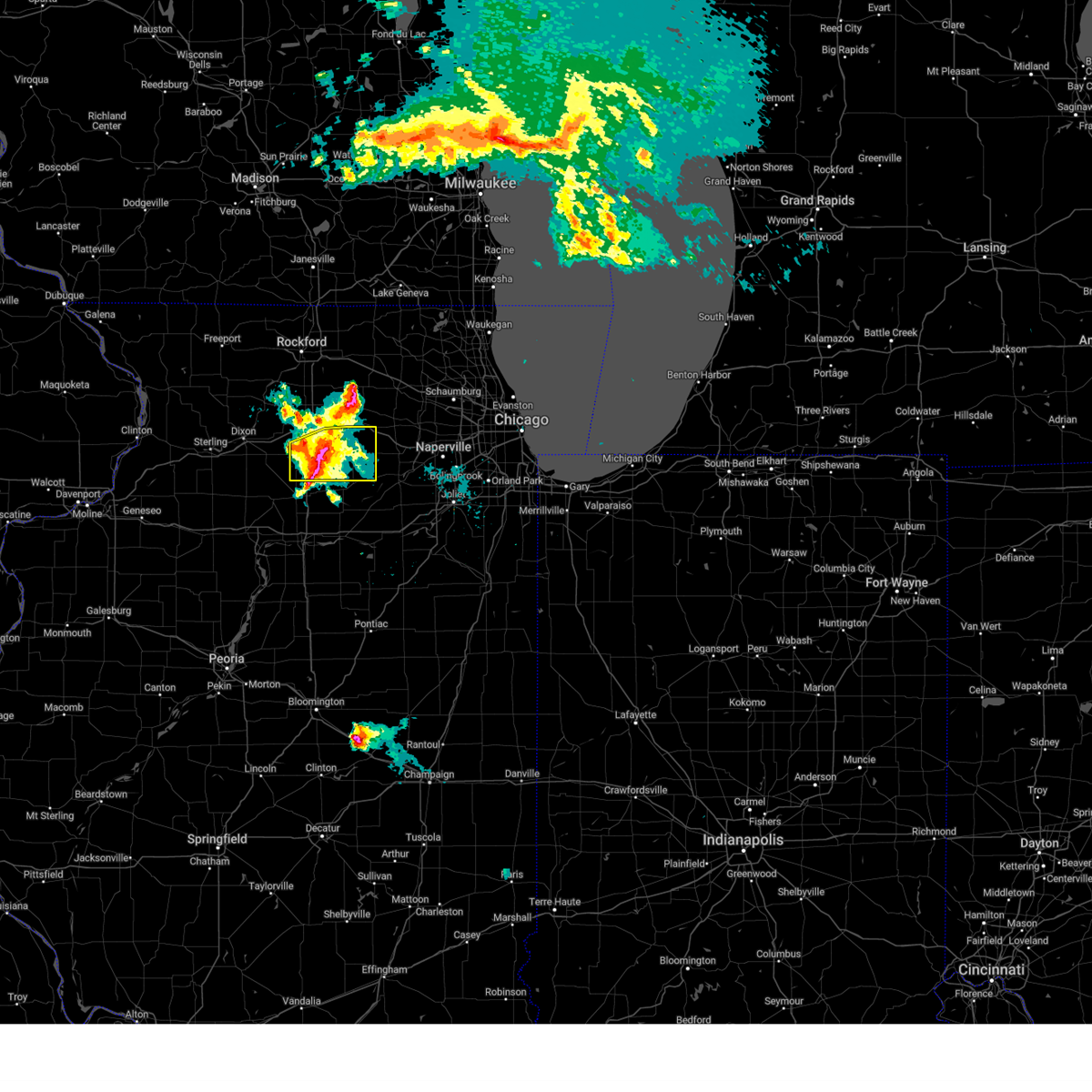 At 425 pm cdt, a severe thunderstorm was located near paw paw, or near shabbona, moving east at 30 mph (trained weather spotters). Hazards include two inch hail. People and animals outdoors will be injured. expect damage to roofs, siding, windows, and vehicles. locations impacted include, dekalb, sandwich, shabbona, hinckley, somonauk, waterman, maple park, paw paw, lee, compton, steward and west brooklyn. this includes, sandwich fairgrounds. including the following interstates, i-39 between mile markers 78 and 94. i-88 near mile marker 94, and between mile markers 98 and 101. thunderstorm damage threat, considerable hail threat, radar indicated max hail size, 2. 00 in wind threat, radar indicated max wind gust, <50 mph. At 425 pm cdt, a severe thunderstorm was located near paw paw, or near shabbona, moving east at 30 mph (trained weather spotters). Hazards include two inch hail. People and animals outdoors will be injured. expect damage to roofs, siding, windows, and vehicles. locations impacted include, dekalb, sandwich, shabbona, hinckley, somonauk, waterman, maple park, paw paw, lee, compton, steward and west brooklyn. this includes, sandwich fairgrounds. including the following interstates, i-39 between mile markers 78 and 94. i-88 near mile marker 94, and between mile markers 98 and 101. thunderstorm damage threat, considerable hail threat, radar indicated max hail size, 2. 00 in wind threat, radar indicated max wind gust, <50 mph.
|
| 4/19/2023 4:06 PM CDT |
 At 406 pm cdt, severe thunderstorms were located from kings to compton, all moving east at 40 mph (trained weather spotters). Hazards include quarter to golf ball size hail. People and animals outdoors will be injured. expect damage to roofs, siding, windows, and vehicles. locations impacted include, dekalb, sycamore, rochelle, sandwich, shabbona, cortland, hinckley, somonauk, waterman, hillcrest, maple park, malta, paw paw, creston, lee, compton, steward and west brooklyn. this includes, northern illinois university and sandwich fairgrounds. including the following interstates, i-39 between mile markers 78 and 106. i-88 between mile markers 71 and 101. thunderstorm damage threat, considerable hail threat, observed max hail size, 1. 75 in wind threat, radar indicated max wind gust, <50 mph. At 406 pm cdt, severe thunderstorms were located from kings to compton, all moving east at 40 mph (trained weather spotters). Hazards include quarter to golf ball size hail. People and animals outdoors will be injured. expect damage to roofs, siding, windows, and vehicles. locations impacted include, dekalb, sycamore, rochelle, sandwich, shabbona, cortland, hinckley, somonauk, waterman, hillcrest, maple park, malta, paw paw, creston, lee, compton, steward and west brooklyn. this includes, northern illinois university and sandwich fairgrounds. including the following interstates, i-39 between mile markers 78 and 106. i-88 between mile markers 71 and 101. thunderstorm damage threat, considerable hail threat, observed max hail size, 1. 75 in wind threat, radar indicated max wind gust, <50 mph.
|
| 4/19/2023 3:54 PM CDT |
 At 354 pm cdt, severe thunderstorms were located from rochelle to west brooklyn, and near paw paw, all moving east northeast at 40 mph (trained weather spotters). Hazards include quarter size hail. Damage to vehicles is expected. locations impacted include, dekalb, sycamore, rochelle, sandwich, shabbona, lake holiday, cortland, hinckley, somonauk, earlville, waterman, hillcrest, maple park, malta, leland, paw paw, creston, lee, compton and steward. this includes, northern illinois university and sandwich fairgrounds. including the following interstates, i-39 between mile markers 78 and 105. i-88 between mile markers 71 and 101. hail threat, observed max hail size, 1. 00 in wind threat, radar indicated max wind gust, <50 mph. At 354 pm cdt, severe thunderstorms were located from rochelle to west brooklyn, and near paw paw, all moving east northeast at 40 mph (trained weather spotters). Hazards include quarter size hail. Damage to vehicles is expected. locations impacted include, dekalb, sycamore, rochelle, sandwich, shabbona, lake holiday, cortland, hinckley, somonauk, earlville, waterman, hillcrest, maple park, malta, leland, paw paw, creston, lee, compton and steward. this includes, northern illinois university and sandwich fairgrounds. including the following interstates, i-39 between mile markers 78 and 105. i-88 between mile markers 71 and 101. hail threat, observed max hail size, 1. 00 in wind threat, radar indicated max wind gust, <50 mph.
|
| 4/19/2023 3:41 PM CDT |
 At 340 pm cdt, severe thunderstorms extended from dixon to amboy to mendota, all moving northeast at 35 mph (trained weather spotters. at 340 pm, quarter size hail was reported in mendota with these storms). Hazards include quarter size hail. damage to vehicles is expected At 340 pm cdt, severe thunderstorms extended from dixon to amboy to mendota, all moving northeast at 35 mph (trained weather spotters. at 340 pm, quarter size hail was reported in mendota with these storms). Hazards include quarter size hail. damage to vehicles is expected
|
| 4/5/2023 6:21 AM CDT |
 At 620 am cdt, severe thunderstorms were located along a line extending from near malta to near shabbona to near earlville, moving northeast at 60 mph (radar indicated). Hazards include 60 mph wind gusts. Expect damage to roofs, siding, and trees. locations impacted include, dekalb, ottawa, sycamore, peru, la salle, sandwich, sheridan, shabbona, lake holiday, cortland, hinckley, somonauk, earlville, waterman, north utica, maple park, malta, serena, leland and paw paw. this includes, northern illinois university and sandwich fairgrounds. including the following interstates, i-39 between mile markers 57 and 71. i-80 between mile markers 75 and 103. I-88 between mile markers 80 and 101. At 620 am cdt, severe thunderstorms were located along a line extending from near malta to near shabbona to near earlville, moving northeast at 60 mph (radar indicated). Hazards include 60 mph wind gusts. Expect damage to roofs, siding, and trees. locations impacted include, dekalb, ottawa, sycamore, peru, la salle, sandwich, sheridan, shabbona, lake holiday, cortland, hinckley, somonauk, earlville, waterman, north utica, maple park, malta, serena, leland and paw paw. this includes, northern illinois university and sandwich fairgrounds. including the following interstates, i-39 between mile markers 57 and 71. i-80 between mile markers 75 and 103. I-88 between mile markers 80 and 101.
|
| 4/5/2023 6:11 AM CDT |
 At 611 am cdt, a severe thunderstorm capable of producing a tornado was located near paw paw, or near shabbona, moving northeast at 60 mph (radar indicated rotation). Hazards include tornado. Flying debris will be dangerous to those caught without shelter. mobile homes will be damaged or destroyed. damage to roofs, windows, and vehicles will occur. tree damage is likely. this dangerous storm will be near, shabbona and waterman around 620 am cdt. malta around 625 am cdt. dekalb and cortland around 630 am cdt. other locations in the path of this tornadic thunderstorm include sycamore and maple park. this includes, northern illinois university. including the following interstates, i-39 between mile markers 80 and 93. I-88 between mile markers 83 and 101. At 611 am cdt, a severe thunderstorm capable of producing a tornado was located near paw paw, or near shabbona, moving northeast at 60 mph (radar indicated rotation). Hazards include tornado. Flying debris will be dangerous to those caught without shelter. mobile homes will be damaged or destroyed. damage to roofs, windows, and vehicles will occur. tree damage is likely. this dangerous storm will be near, shabbona and waterman around 620 am cdt. malta around 625 am cdt. dekalb and cortland around 630 am cdt. other locations in the path of this tornadic thunderstorm include sycamore and maple park. this includes, northern illinois university. including the following interstates, i-39 between mile markers 80 and 93. I-88 between mile markers 83 and 101.
|
| 4/5/2023 6:08 AM CDT |
 At 607 am cdt, severe thunderstorms were located along a line extending from 8 miles southeast of ashton to near mendota to 6 miles northeast of dalzell, moving northeast at 65 mph (radar indicated). Hazards include 60 mph wind gusts. Expect damage to roofs, siding, and trees. locations impacted include, dekalb, ottawa, sycamore, peru, la salle, rochelle, sandwich, mendota, sheridan, shabbona, lake holiday, cortland, hinckley, somonauk, earlville, waterman, north utica, hillcrest, maple park and malta. this includes, northern illinois university, sandwich fairgrounds, and tri-county fairgrounds. including the following interstates, i-39 between mile markers 57 and 102. i-80 between mile markers 74 and 103. I-88 between mile markers 71 and 101. At 607 am cdt, severe thunderstorms were located along a line extending from 8 miles southeast of ashton to near mendota to 6 miles northeast of dalzell, moving northeast at 65 mph (radar indicated). Hazards include 60 mph wind gusts. Expect damage to roofs, siding, and trees. locations impacted include, dekalb, ottawa, sycamore, peru, la salle, rochelle, sandwich, mendota, sheridan, shabbona, lake holiday, cortland, hinckley, somonauk, earlville, waterman, north utica, hillcrest, maple park and malta. this includes, northern illinois university, sandwich fairgrounds, and tri-county fairgrounds. including the following interstates, i-39 between mile markers 57 and 102. i-80 between mile markers 74 and 103. I-88 between mile markers 71 and 101.
|
| 4/5/2023 5:56 AM CDT |
 At 556 am cdt, a severe squall line capable of producing both tornadoes and extensive straight line wind damage was located near sublette, or near amboy, moving northeast at 65 mph (radar indicated rotation). Hazards include tornado. Flying debris will be dangerous to those caught without shelter. mobile homes will be damaged or destroyed. damage to roofs, windows, and vehicles will occur. tree damage is likely. this tornadic thunderstorm will remain over mainly rural areas of eastern lee county, including the following locations, west brooklyn, lee center and steward. this includes, lee county fairgrounds. including the following interstates, i-39 between mile markers 88 and 96. I-88 between mile markers 66 and 74. At 556 am cdt, a severe squall line capable of producing both tornadoes and extensive straight line wind damage was located near sublette, or near amboy, moving northeast at 65 mph (radar indicated rotation). Hazards include tornado. Flying debris will be dangerous to those caught without shelter. mobile homes will be damaged or destroyed. damage to roofs, windows, and vehicles will occur. tree damage is likely. this tornadic thunderstorm will remain over mainly rural areas of eastern lee county, including the following locations, west brooklyn, lee center and steward. this includes, lee county fairgrounds. including the following interstates, i-39 between mile markers 88 and 96. I-88 between mile markers 66 and 74.
|
| 4/5/2023 5:55 AM CDT |
 At 555 am cdt, severe thunderstorms were located along a line extending from amboy to la moille to near depue, moving northeast at 65 mph (radar indicated). Hazards include 60 mph wind gusts. expect damage to roofs, siding, and trees At 555 am cdt, severe thunderstorms were located along a line extending from amboy to la moille to near depue, moving northeast at 65 mph (radar indicated). Hazards include 60 mph wind gusts. expect damage to roofs, siding, and trees
|
| 4/5/2023 5:48 AM CDT |
 At 547 am cdt, a severe squall line capable of producing both tornadoes and extensive straight line wind damage was located near woodhaven lakes, or near amboy, moving northeast at 60 mph (radar indicated rotation). Hazards include tornado. Flying debris will be dangerous to those caught without shelter. mobile homes will be damaged or destroyed. damage to roofs, windows, and vehicles will occur. tree damage is likely. these dangerous storms will be near, sublette around 555 am cdt. other locations in the path of this tornadic thunderstorm include ashton. this includes, lee county fairgrounds. including the following interstates, i-39 between mile markers 88 and 96. I-88 between mile markers 60 and 74. At 547 am cdt, a severe squall line capable of producing both tornadoes and extensive straight line wind damage was located near woodhaven lakes, or near amboy, moving northeast at 60 mph (radar indicated rotation). Hazards include tornado. Flying debris will be dangerous to those caught without shelter. mobile homes will be damaged or destroyed. damage to roofs, windows, and vehicles will occur. tree damage is likely. these dangerous storms will be near, sublette around 555 am cdt. other locations in the path of this tornadic thunderstorm include ashton. this includes, lee county fairgrounds. including the following interstates, i-39 between mile markers 88 and 96. I-88 between mile markers 60 and 74.
|
| 4/5/2023 5:45 AM CDT |
 At 545 am cdt, severe thunderstorms were located along a line extending from near byron to near lost nation to 8 miles southwest of woodhaven lakes, moving east at 35 mph (radar indicated). Hazards include 60 mph wind gusts. Expect damage to roofs, siding, and trees. locations impacted include, dixon, rochelle, byron, oregon, mount morris, amboy, davis junction, hillcrest, stillman valley, franklin grove, ashton, paw paw, lost nation, sublette, woodhaven lakes, creston, lindenwood, monroe center, leaf river and grand detour. this includes, castle rock state park, lee county fairgrounds, lowden state park, ogle county fairgrounds, and white pines state park. including the following interstates, i-39 between mile markers 78 and 114. I-88 between mile markers 47 and 82. At 545 am cdt, severe thunderstorms were located along a line extending from near byron to near lost nation to 8 miles southwest of woodhaven lakes, moving east at 35 mph (radar indicated). Hazards include 60 mph wind gusts. Expect damage to roofs, siding, and trees. locations impacted include, dixon, rochelle, byron, oregon, mount morris, amboy, davis junction, hillcrest, stillman valley, franklin grove, ashton, paw paw, lost nation, sublette, woodhaven lakes, creston, lindenwood, monroe center, leaf river and grand detour. this includes, castle rock state park, lee county fairgrounds, lowden state park, ogle county fairgrounds, and white pines state park. including the following interstates, i-39 between mile markers 78 and 114. I-88 between mile markers 47 and 82.
|
| 4/5/2023 5:39 AM CDT |
 At 539 am cdt, severe thunderstorms capable of producing both tornadoes and extensive straight line wind damage were located near walnut, or 12 miles southwest of amboy, moving northeast at 55 mph (radar indicated rotation). Hazards include tornado. Flying debris will be dangerous to those caught without shelter. mobile homes will be damaged or destroyed. damage to roofs, windows, and vehicles will occur. tree damage is likely. these dangerous storms will be near, amboy and woodhaven lakes around 550 am cdt. franklin grove around 555 am cdt. other locations in the path of this tornadic thunderstorm include ashton. this includes, lee county fairgrounds. including the following interstates, i-39 between mile markers 88 and 96. I-88 between mile markers 60 and 74. At 539 am cdt, severe thunderstorms capable of producing both tornadoes and extensive straight line wind damage were located near walnut, or 12 miles southwest of amboy, moving northeast at 55 mph (radar indicated rotation). Hazards include tornado. Flying debris will be dangerous to those caught without shelter. mobile homes will be damaged or destroyed. damage to roofs, windows, and vehicles will occur. tree damage is likely. these dangerous storms will be near, amboy and woodhaven lakes around 550 am cdt. franklin grove around 555 am cdt. other locations in the path of this tornadic thunderstorm include ashton. this includes, lee county fairgrounds. including the following interstates, i-39 between mile markers 88 and 96. I-88 between mile markers 60 and 74.
|
| 4/5/2023 5:32 AM CDT |
 At 532 am cdt, severe thunderstorms were located along a line extending from near polo to near dixon to near rock falls, moving northeast at 50 mph (radar indicated). Hazards include 60 mph wind gusts and quarter size hail. Hail damage to vehicles is expected. expect wind damage to roofs, siding, and trees. locations impacted include, dixon, rochelle, byron, oregon, mount morris, amboy, polo, davis junction, forreston, hillcrest, stillman valley, franklin grove, ashton, paw paw, lost nation, sublette, woodhaven lakes, creston, lindenwood and monroe center. this includes, castle rock state park, lee county fairgrounds, lowden state park, ogle county fairgrounds, sauk valley college, and white pines state park. including the following interstates, i-39 between mile markers 78 and 114. I-88 between mile markers 45 and 82. At 532 am cdt, severe thunderstorms were located along a line extending from near polo to near dixon to near rock falls, moving northeast at 50 mph (radar indicated). Hazards include 60 mph wind gusts and quarter size hail. Hail damage to vehicles is expected. expect wind damage to roofs, siding, and trees. locations impacted include, dixon, rochelle, byron, oregon, mount morris, amboy, polo, davis junction, forreston, hillcrest, stillman valley, franklin grove, ashton, paw paw, lost nation, sublette, woodhaven lakes, creston, lindenwood and monroe center. this includes, castle rock state park, lee county fairgrounds, lowden state park, ogle county fairgrounds, sauk valley college, and white pines state park. including the following interstates, i-39 between mile markers 78 and 114. I-88 between mile markers 45 and 82.
|
| 4/5/2023 5:18 AM CDT |
 At 517 am cdt, line of severe thunderstorms were located extending from near sharon to tampico, moving northeast at 50 mph (radar indicated). Hazards include 60 mph wind gusts and nickel size hail. the strongest winds will move into northwestern lee and southern ogle counties. expect damage to roofs, siding, and trees At 517 am cdt, line of severe thunderstorms were located extending from near sharon to tampico, moving northeast at 50 mph (radar indicated). Hazards include 60 mph wind gusts and nickel size hail. the strongest winds will move into northwestern lee and southern ogle counties. expect damage to roofs, siding, and trees
|
| 4/4/2023 12:34 PM CDT |
 At 1234 pm cdt, severe thunderstorms were located along a line extending from near davis junction to near hillcrest to near rochelle, moving east at 45 mph (radar indicated). Hazards include 70 mph wind gusts and ping pong ball size hail. People and animals outdoors will be injured. expect hail damage to roofs, siding, windows, and vehicles. expect considerable tree damage. wind damage is also likely to mobile homes, roofs, and outbuildings. locations impacted include, rochelle, byron, davis junction, hillcrest, stillman valley, ashton, creston, lindenwood, monroe center, leaf river, lee, steward, kings and chana. including the following interstates, i-39 between mile markers 89 and 114. i-88 between mile markers 66 and 82. thunderstorm damage threat, considerable hail threat, radar indicated max hail size, 1. 50 in wind threat, radar indicated max wind gust, 70 mph. At 1234 pm cdt, severe thunderstorms were located along a line extending from near davis junction to near hillcrest to near rochelle, moving east at 45 mph (radar indicated). Hazards include 70 mph wind gusts and ping pong ball size hail. People and animals outdoors will be injured. expect hail damage to roofs, siding, windows, and vehicles. expect considerable tree damage. wind damage is also likely to mobile homes, roofs, and outbuildings. locations impacted include, rochelle, byron, davis junction, hillcrest, stillman valley, ashton, creston, lindenwood, monroe center, leaf river, lee, steward, kings and chana. including the following interstates, i-39 between mile markers 89 and 114. i-88 between mile markers 66 and 82. thunderstorm damage threat, considerable hail threat, radar indicated max hail size, 1. 50 in wind threat, radar indicated max wind gust, 70 mph.
|
| 4/4/2023 12:18 PM CDT |
 At 1217 pm cdt, severe thunderstorms were located along a line extending from stillman valley to near ashton, moving east at 55 mph. these are destructive storms for ogle and northern lee counties (radar indicated). Hazards include 80 mph wind gusts and baseball size hail. Flying debris will be dangerous to those caught without shelter. mobile homes will be heavily damaged. expect considerable damage to roofs, windows, and vehicles. extensive tree damage and power outages are likely. locations impacted include, dixon, rochelle, byron, oregon, mount morris, davis junction, hillcrest, stillman valley, franklin grove, ashton, lost nation, creston, lindenwood, monroe center, leaf river, grand detour, lee, steward, eldena and kings. this includes, castle rock state park, lowden state park, and ogle county fairgrounds. including the following interstates, i-39 between mile markers 89 and 114. i-88 between mile markers 55 and 82. thunderstorm damage threat, destructive hail threat, radar indicated max hail size, 2. 75 in wind threat, radar indicated max wind gust, 80 mph. At 1217 pm cdt, severe thunderstorms were located along a line extending from stillman valley to near ashton, moving east at 55 mph. these are destructive storms for ogle and northern lee counties (radar indicated). Hazards include 80 mph wind gusts and baseball size hail. Flying debris will be dangerous to those caught without shelter. mobile homes will be heavily damaged. expect considerable damage to roofs, windows, and vehicles. extensive tree damage and power outages are likely. locations impacted include, dixon, rochelle, byron, oregon, mount morris, davis junction, hillcrest, stillman valley, franklin grove, ashton, lost nation, creston, lindenwood, monroe center, leaf river, grand detour, lee, steward, eldena and kings. this includes, castle rock state park, lowden state park, and ogle county fairgrounds. including the following interstates, i-39 between mile markers 89 and 114. i-88 between mile markers 55 and 82. thunderstorm damage threat, destructive hail threat, radar indicated max hail size, 2. 75 in wind threat, radar indicated max wind gust, 80 mph.
|
| 4/4/2023 11:58 AM CDT |
 At 1158 am cdt, severe thunderstorms were located along a line extending from near polo to near rock falls, moving east at 25 mph (radar indicated). Hazards include ping pong ball size hail and 60 mph wind gusts. People and animals outdoors will be injured. expect hail damage to roofs, siding, windows, and vehicles. Expect wind damage to roofs, siding, and trees. At 1158 am cdt, severe thunderstorms were located along a line extending from near polo to near rock falls, moving east at 25 mph (radar indicated). Hazards include ping pong ball size hail and 60 mph wind gusts. People and animals outdoors will be injured. expect hail damage to roofs, siding, windows, and vehicles. Expect wind damage to roofs, siding, and trees.
|
| 4/4/2023 11:37 AM CDT |
 At 1137 am cdt, severe thunderstorms were located along a line extending from 7 miles east of amboy to near sublette to mendota to near ladd, moving east at 45 mph (radar indicated). Hazards include 60 mph wind gusts and quarter size hail. Hail damage to vehicles is expected. expect wind damage to roofs, siding, and trees. locations impacted include, dixon, rochelle, oregon, amboy, davis junction, hillcrest, franklin grove, ashton, paw paw, lost nation, sublette, woodhaven lakes, creston, lindenwood, monroe center, grand detour, compton, steward, nelson and west brooklyn. this includes, castle rock state park, lee county fairgrounds, and sauk valley college. including the following interstates, i-39 between mile markers 75 and 113. i-88 between mile markers 47 and 82. hail threat, observed max hail size, 1. 00 in wind threat, radar indicated max wind gust, 60 mph. At 1137 am cdt, severe thunderstorms were located along a line extending from 7 miles east of amboy to near sublette to mendota to near ladd, moving east at 45 mph (radar indicated). Hazards include 60 mph wind gusts and quarter size hail. Hail damage to vehicles is expected. expect wind damage to roofs, siding, and trees. locations impacted include, dixon, rochelle, oregon, amboy, davis junction, hillcrest, franklin grove, ashton, paw paw, lost nation, sublette, woodhaven lakes, creston, lindenwood, monroe center, grand detour, compton, steward, nelson and west brooklyn. this includes, castle rock state park, lee county fairgrounds, and sauk valley college. including the following interstates, i-39 between mile markers 75 and 113. i-88 between mile markers 47 and 82. hail threat, observed max hail size, 1. 00 in wind threat, radar indicated max wind gust, 60 mph.
|
| 4/4/2023 11:19 AM CDT |
 At 1119 am cdt, severe thunderstorms were located along a line extending from near amboy to near woodhaven lakes to near la moille to near princeton, moving east at 45 mph (radar indicated). Hazards include golf ball size hail and 70 mph wind gusts. People and animals outdoors will be injured. expect hail damage to roofs, siding, windows, and vehicles. expect considerable tree damage. wind damage is also likely to mobile homes, roofs, and outbuildings. locations impacted include, dixon, peru, la salle, rochelle, mendota, oregon, amboy, oglesby, davis junction, north utica, hillcrest, franklin grove, ashton, paw paw, tonica, lost nation, sublette, woodhaven lakes, creston and lindenwood. this includes, castle rock state park, illinois valley community college, lee county fairgrounds, matthiessen state park, sauk valley college, starved rock state park, and tri-county fairgrounds. including the following interstates, i-39 between mile markers 49 and 113. i-80 between mile markers 74 and 84. i-88 between mile markers 45 and 82. thunderstorm damage threat, considerable hail threat, observed max hail size, 1. 75 in wind threat, radar indicated max wind gust, 70 mph. At 1119 am cdt, severe thunderstorms were located along a line extending from near amboy to near woodhaven lakes to near la moille to near princeton, moving east at 45 mph (radar indicated). Hazards include golf ball size hail and 70 mph wind gusts. People and animals outdoors will be injured. expect hail damage to roofs, siding, windows, and vehicles. expect considerable tree damage. wind damage is also likely to mobile homes, roofs, and outbuildings. locations impacted include, dixon, peru, la salle, rochelle, mendota, oregon, amboy, oglesby, davis junction, north utica, hillcrest, franklin grove, ashton, paw paw, tonica, lost nation, sublette, woodhaven lakes, creston and lindenwood. this includes, castle rock state park, illinois valley community college, lee county fairgrounds, matthiessen state park, sauk valley college, starved rock state park, and tri-county fairgrounds. including the following interstates, i-39 between mile markers 49 and 113. i-80 between mile markers 74 and 84. i-88 between mile markers 45 and 82. thunderstorm damage threat, considerable hail threat, observed max hail size, 1. 75 in wind threat, radar indicated max wind gust, 70 mph.
|
| 4/4/2023 11:03 AM CDT |
 At 1102 am cdt, severe thunderstorms were located along a line extending from near deer grove to walnut to near wyanet to near buda, moving east at 35 mph (radar indicated). Hazards include golf ball size hail and 70 mph wind gusts. People and animals outdoors will be injured. expect hail damage to roofs, siding, windows, and vehicles. expect considerable tree damage. wind damage is also likely to mobile homes, roofs, and outbuildings. locations impacted include, dixon, peru, la salle, rochelle, mendota, oregon, amboy, oglesby, davis junction, north utica, hillcrest, franklin grove, ashton, paw paw, tonica, lost nation, sublette, woodhaven lakes, creston and lindenwood. this includes, castle rock state park, illinois valley community college, lee county fairgrounds, matthiessen state park, sauk valley college, starved rock state park, and tri-county fairgrounds. including the following interstates, i-39 between mile markers 49 and 113. i-80 between mile markers 74 and 84. i-88 between mile markers 45 and 82. thunderstorm damage threat, considerable hail threat, observed max hail size, 1. 75 in wind threat, radar indicated max wind gust, 70 mph. At 1102 am cdt, severe thunderstorms were located along a line extending from near deer grove to walnut to near wyanet to near buda, moving east at 35 mph (radar indicated). Hazards include golf ball size hail and 70 mph wind gusts. People and animals outdoors will be injured. expect hail damage to roofs, siding, windows, and vehicles. expect considerable tree damage. wind damage is also likely to mobile homes, roofs, and outbuildings. locations impacted include, dixon, peru, la salle, rochelle, mendota, oregon, amboy, oglesby, davis junction, north utica, hillcrest, franklin grove, ashton, paw paw, tonica, lost nation, sublette, woodhaven lakes, creston and lindenwood. this includes, castle rock state park, illinois valley community college, lee county fairgrounds, matthiessen state park, sauk valley college, starved rock state park, and tri-county fairgrounds. including the following interstates, i-39 between mile markers 49 and 113. i-80 between mile markers 74 and 84. i-88 between mile markers 45 and 82. thunderstorm damage threat, considerable hail threat, observed max hail size, 1. 75 in wind threat, radar indicated max wind gust, 70 mph.
|
| 4/4/2023 10:47 AM CDT |
 At 1046 am cdt, severe thunderstorms were located along a line extending from emerson to near rock falls to deer grove to near sheffield, moving east at 45 mph (radar indicated). Hazards include 70 mph wind gusts and quarter size hail. Hail damage to vehicles is expected. expect considerable tree damage. wind damage is also likely to mobile homes, roofs, and outbuildings. locations impacted include, dixon, peru, la salle, rochelle, mendota, oregon, amboy, oglesby, davis junction, north utica, hillcrest, franklin grove, ashton, paw paw, tonica, lost nation, sublette, woodhaven lakes, creston and lindenwood. this includes, castle rock state park, illinois valley community college, lee county fairgrounds, matthiessen state park, sauk valley college, starved rock state park, and tri-county fairgrounds. including the following interstates, i-39 between mile markers 49 and 113. i-80 between mile markers 74 and 84. i-88 between mile markers 45 and 82. thunderstorm damage threat, considerable hail threat, observed max hail size, 1. 00 in wind threat, radar indicated max wind gust, 70 mph. At 1046 am cdt, severe thunderstorms were located along a line extending from emerson to near rock falls to deer grove to near sheffield, moving east at 45 mph (radar indicated). Hazards include 70 mph wind gusts and quarter size hail. Hail damage to vehicles is expected. expect considerable tree damage. wind damage is also likely to mobile homes, roofs, and outbuildings. locations impacted include, dixon, peru, la salle, rochelle, mendota, oregon, amboy, oglesby, davis junction, north utica, hillcrest, franklin grove, ashton, paw paw, tonica, lost nation, sublette, woodhaven lakes, creston and lindenwood. this includes, castle rock state park, illinois valley community college, lee county fairgrounds, matthiessen state park, sauk valley college, starved rock state park, and tri-county fairgrounds. including the following interstates, i-39 between mile markers 49 and 113. i-80 between mile markers 74 and 84. i-88 between mile markers 45 and 82. thunderstorm damage threat, considerable hail threat, observed max hail size, 1. 00 in wind threat, radar indicated max wind gust, 70 mph.
|
| 4/4/2023 10:33 AM CDT |
 At 1033 am cdt, severe thunderstorms were located along a line extending from near lyndon to near prophetstown to near hooppole to annawan, moving east at 45 mph (radar indicated). Hazards include 70 mph wind gusts and quarter size hail. Hail damage to vehicles is expected. expect considerable tree damage. Wind damage is also likely to mobile homes, roofs, and outbuildings. At 1033 am cdt, severe thunderstorms were located along a line extending from near lyndon to near prophetstown to near hooppole to annawan, moving east at 45 mph (radar indicated). Hazards include 70 mph wind gusts and quarter size hail. Hail damage to vehicles is expected. expect considerable tree damage. Wind damage is also likely to mobile homes, roofs, and outbuildings.
|
| 11/5/2022 10:24 AM CDT |
 At 1023 am cdt, severe squalls with little to no lightning were located along a line extending from ridott to near stillman valley to 6 miles west of paw paw to near grand ridge, moving northeast at 40 mph (radar indicated). Hazards include 60 mph wind gusts. Expect damage to roofs, siding, and trees. locations impacted include, la salle, rochelle, mendota, byron, oregon, oglesby, davis junction, earlville, north utica, hillcrest, stillman valley, ashton, paw paw, naplate, creston, lindenwood, monroe center, lee, compton and steward. this includes, buffalo rock state park, lowden state park, matthiessen state park, starved rock state park, and tri-county fairgrounds. including the following interstates, i-39 between mile markers 57 and 114. i-80 between mile markers 78 and 87. I-88 between mile markers 66 and 82. At 1023 am cdt, severe squalls with little to no lightning were located along a line extending from ridott to near stillman valley to 6 miles west of paw paw to near grand ridge, moving northeast at 40 mph (radar indicated). Hazards include 60 mph wind gusts. Expect damage to roofs, siding, and trees. locations impacted include, la salle, rochelle, mendota, byron, oregon, oglesby, davis junction, earlville, north utica, hillcrest, stillman valley, ashton, paw paw, naplate, creston, lindenwood, monroe center, lee, compton and steward. this includes, buffalo rock state park, lowden state park, matthiessen state park, starved rock state park, and tri-county fairgrounds. including the following interstates, i-39 between mile markers 57 and 114. i-80 between mile markers 78 and 87. I-88 between mile markers 66 and 82.
|
| 11/5/2022 10:07 AM CDT |
 At 1006 am cdt, severe squalls producing little to no lightning were located along a line extending from near lena to near lost nation to woodhaven lakes to near mcnabb, moving northeast at 50 mph. tree damage and downed powerlines have been reported across whiteside county and relayed via nws quad cities (radar indicated). Hazards include 60 mph wind gusts. Expect damage to roofs, siding, and trees. locations impacted include, dixon, peru, la salle, rochelle, mendota, byron, oregon, mount morris, amboy, polo, oglesby, davis junction, earlville, forreston, north utica, hillcrest, stillman valley, franklin grove, ashton and paw paw. this includes, buffalo rock state park, castle rock state park, illinois valley community college, lee county fairgrounds, lowden state park, matthiessen state park, ogle county fairgrounds, starved rock state park, tri-county fairgrounds, and white pines state park. including the following interstates, i-39 between mile markers 42 and 114. i-80 between mile markers 73 and 87. I-88 between mile markers 55 and 82. At 1006 am cdt, severe squalls producing little to no lightning were located along a line extending from near lena to near lost nation to woodhaven lakes to near mcnabb, moving northeast at 50 mph. tree damage and downed powerlines have been reported across whiteside county and relayed via nws quad cities (radar indicated). Hazards include 60 mph wind gusts. Expect damage to roofs, siding, and trees. locations impacted include, dixon, peru, la salle, rochelle, mendota, byron, oregon, mount morris, amboy, polo, oglesby, davis junction, earlville, forreston, north utica, hillcrest, stillman valley, franklin grove, ashton and paw paw. this includes, buffalo rock state park, castle rock state park, illinois valley community college, lee county fairgrounds, lowden state park, matthiessen state park, ogle county fairgrounds, starved rock state park, tri-county fairgrounds, and white pines state park. including the following interstates, i-39 between mile markers 42 and 114. i-80 between mile markers 73 and 87. I-88 between mile markers 55 and 82.
|
| 11/5/2022 9:28 AM CDT |
 At 925 am cdt, severe squalls producing little to no lightning were located along a line extending from near andover to prophetstown to 8 miles southwest of walnut to near buda, moving northeast at 45 mph (radar indicated). Hazards include 70 mph wind gusts. Expect considerable tree damage. Damage is likely to mobile homes, roofs, and outbuildings. At 925 am cdt, severe squalls producing little to no lightning were located along a line extending from near andover to prophetstown to 8 miles southwest of walnut to near buda, moving northeast at 45 mph (radar indicated). Hazards include 70 mph wind gusts. Expect considerable tree damage. Damage is likely to mobile homes, roofs, and outbuildings.
|
| 8/28/2022 4:02 PM CDT | At 401 pm cdt, severe thunderstorms were located along a line extending from near kingston to near serena, moving northeast at 40 mph (radar indicated). Hazards include 60 mph wind gusts and quarter size hail. Hail damage to vehicles is expected. expect wind damage to roofs, siding, and trees. locations impacted include, dekalb, sycamore, la salle, sandwich, mendota, shabbona, lake holiday, cortland, hinckley, somonauk, earlville, waterman, maple park, malta, leland, paw paw, lee, compton, steward and troy grove. this includes, northern illinois university, sandwich fairgrounds, and tri-county fairgrounds. including the following interstates, i-39 between mile markers 56 and 93. i-80 between mile markers 77 and 81. I-88 between mile markers 83 and 101. |
| 8/28/2022 3:38 PM CDT | At 337 pm cdt, severe thunderstorms were located along a line extending from near malta to north utica, moving northeast at 50 mph (radar indicated). Hazards include 60 mph wind gusts and penny size hail. Expect damage to roofs, siding, and trees. locations impacted include, dekalb, sycamore, peru, la salle, sandwich, mendota, shabbona, lake holiday, cortland, oglesby, hinckley, somonauk, earlville, waterman, north utica, maple park, malta, leland, paw paw and lee. this includes, northern illinois university, sandwich fairgrounds, illinois valley community college, and tri-county fairgrounds. including the following interstates, i-39 between mile markers 53 and 94. i-80 between mile markers 74 and 83. I-88 between mile markers 83 and 101. |
| 8/28/2022 3:17 PM CDT | At 317 pm cdt, severe thunderstorms were located along a line extending from 7 miles southeast of ashton to near granville, moving northeast at 40 mph (radar indicated). Hazards include 60 mph wind gusts and penny size hail. expect damage to roofs, siding, and trees |
| 7/23/2022 5:55 AM CDT |
 The severe thunderstorm warning for eastern ogle, eastern lee and de kalb counties will expire at 600 am cdt, the storm which prompted the warning has weakened below severe limits, and has exited the warned area. therefore, the warning will be allowed to expire. a severe thunderstorm watch remains in effect until 1000 am cdt for north central and northeastern illinois. The severe thunderstorm warning for eastern ogle, eastern lee and de kalb counties will expire at 600 am cdt, the storm which prompted the warning has weakened below severe limits, and has exited the warned area. therefore, the warning will be allowed to expire. a severe thunderstorm watch remains in effect until 1000 am cdt for north central and northeastern illinois.
|
| 7/23/2022 5:35 AM CDT |
 At 533 am cdt, an area of rain behind earlier thunderstorms was producing severe wind gusts. rochelle recently gusted to 58 mph in these showers with occasional lightning (surface observations). Hazards include 60 mph wind gusts. Expect damage to roofs, siding, and trees. locations impacted include, dekalb, sycamore, rochelle, sandwich, genoa, shabbona, cortland, davis junction, hinckley, somonauk, kirkland, waterman, hillcrest, maple park, kingston, malta, paw paw, creston, lindenwood and monroe center. this includes, northern illinois university and sandwich fairgrounds. including the following interstates, i-39 between mile markers 78 and 114. i-88 between mile markers 69 and 101. hail threat, radar indicated max hail size, <. 75 in wind threat, observed max wind gust, 60 mph. At 533 am cdt, an area of rain behind earlier thunderstorms was producing severe wind gusts. rochelle recently gusted to 58 mph in these showers with occasional lightning (surface observations). Hazards include 60 mph wind gusts. Expect damage to roofs, siding, and trees. locations impacted include, dekalb, sycamore, rochelle, sandwich, genoa, shabbona, cortland, davis junction, hinckley, somonauk, kirkland, waterman, hillcrest, maple park, kingston, malta, paw paw, creston, lindenwood and monroe center. this includes, northern illinois university and sandwich fairgrounds. including the following interstates, i-39 between mile markers 78 and 114. i-88 between mile markers 69 and 101. hail threat, radar indicated max hail size, <. 75 in wind threat, observed max wind gust, 60 mph.
|
| 7/23/2022 5:09 AM CDT |
 At 509 am cdt, severe thunderstorms were located along a line extending from near genoa to waterman to near leland, moving east at 50 mph (radar indicated). Hazards include 60 mph wind gusts. Expect damage to roofs, siding, and trees. locations impacted include, dekalb, sycamore, rochelle, sandwich, genoa, shabbona, cortland, davis junction, hinckley, somonauk, kirkland, waterman, hillcrest, maple park, kingston, malta, paw paw, creston, lindenwood and monroe center. this includes, northern illinois university and sandwich fairgrounds. including the following interstates, i-39 between mile markers 78 and 114. i-88 between mile markers 69 and 101. hail threat, radar indicated max hail size, <. 75 in wind threat, radar indicated max wind gust, 60 mph. At 509 am cdt, severe thunderstorms were located along a line extending from near genoa to waterman to near leland, moving east at 50 mph (radar indicated). Hazards include 60 mph wind gusts. Expect damage to roofs, siding, and trees. locations impacted include, dekalb, sycamore, rochelle, sandwich, genoa, shabbona, cortland, davis junction, hinckley, somonauk, kirkland, waterman, hillcrest, maple park, kingston, malta, paw paw, creston, lindenwood and monroe center. this includes, northern illinois university and sandwich fairgrounds. including the following interstates, i-39 between mile markers 78 and 114. i-88 between mile markers 69 and 101. hail threat, radar indicated max hail size, <. 75 in wind threat, radar indicated max wind gust, 60 mph.
|
| 7/23/2022 4:49 AM CDT |
 At 448 am cdt, a severe thunderstorm was located near ashton, or 8 miles west of rochelle, moving east at 35 mph (radar indicated). Hazards include 60 mph wind gusts and quarter size hail. Hail damage to vehicles is expected. Expect wind damage to roofs, siding, and trees. At 448 am cdt, a severe thunderstorm was located near ashton, or 8 miles west of rochelle, moving east at 35 mph (radar indicated). Hazards include 60 mph wind gusts and quarter size hail. Hail damage to vehicles is expected. Expect wind damage to roofs, siding, and trees.
|
| 3/5/2022 10:25 PM CST |
 The severe thunderstorm warning for eastern lee, eastern ogle and eastern winnebago counties will expire at 1030 pm cst, the storms which prompted the warning have moved out of the area. therefore, the warning will be allowed to expire. The severe thunderstorm warning for eastern lee, eastern ogle and eastern winnebago counties will expire at 1030 pm cst, the storms which prompted the warning have moved out of the area. therefore, the warning will be allowed to expire.
|
| 3/5/2022 10:16 PM CST |
 At 1016 pm cst, severe thunderstorms were located along a line extending from south beloit to near kirkland to near paw paw, moving northeast at 65 mph (radar indicated). Hazards include 70 mph wind gusts. Expect considerable tree damage. damage is likely to mobile homes, roofs, and outbuildings. these severe storms will be near, beloit, roscoe and south beloit around 1020 pm cst. other locations impacted by these severe thunderstorms include new milford, harrison, monroe center, compton, shirland, lindenwood, creston, west brooklyn, steward and kings. this includes, rock cut state park, rock valley college, rockford rivets baseball, and rockford speedway. including the following interstates, i-39 between mile markers 78 and 123. i-88 between mile markers 73 and 82. i-90 between mile markers 0 and 18. thunderstorm damage threat, considerable hail threat, radar indicated max hail size, <. 75 in wind threat, radar indicated max wind gust, 70 mph. At 1016 pm cst, severe thunderstorms were located along a line extending from south beloit to near kirkland to near paw paw, moving northeast at 65 mph (radar indicated). Hazards include 70 mph wind gusts. Expect considerable tree damage. damage is likely to mobile homes, roofs, and outbuildings. these severe storms will be near, beloit, roscoe and south beloit around 1020 pm cst. other locations impacted by these severe thunderstorms include new milford, harrison, monroe center, compton, shirland, lindenwood, creston, west brooklyn, steward and kings. this includes, rock cut state park, rock valley college, rockford rivets baseball, and rockford speedway. including the following interstates, i-39 between mile markers 78 and 123. i-88 between mile markers 73 and 82. i-90 between mile markers 0 and 18. thunderstorm damage threat, considerable hail threat, radar indicated max hail size, <. 75 in wind threat, radar indicated max wind gust, 70 mph.
|
| 3/5/2022 10:11 PM CST |
 At 1010 pm cst, severe thunderstorms were located along a line extending from 6 miles west of rockton to cherry valley to 6 miles southwest of kirkland to 6 miles west of paw paw, moving northeast at 65 mph (radar indicated). Hazards include 70 mph wind gusts. Expect considerable tree damage. damage is likely to mobile homes, roofs, and outbuildings. severe thunderstorms will be near, belvidere, loves park, cherry valley and kirkland around 1015 pm cst. poplar grove, candlewick lake, kingston and timberlane around 1020 pm cst. genoa, shabbona, waterman and capron around 1025 pm cst. malta around 1030 pm cst. dekalb, harvard, marengo and cortland around 1035 pm cst. crystal lake, sycamore, lakewood, maple park and hebron around 1040 pm cst. woodstock, campton hills, wonder lake, bull valley and lily lake around 1045 pm cst. mchenry, huntley, pingree grove, hampshire, spring grove and mccullom lake around 1050 pm cst. including the following interstates, i-88 between mile markers 83 and 110. i-90 between mile markers 19 and 56. thunderstorm damage threat, considerable hail threat, radar indicated max hail size, <. 75 in wind threat, radar indicated max wind gust, 70 mph. At 1010 pm cst, severe thunderstorms were located along a line extending from 6 miles west of rockton to cherry valley to 6 miles southwest of kirkland to 6 miles west of paw paw, moving northeast at 65 mph (radar indicated). Hazards include 70 mph wind gusts. Expect considerable tree damage. damage is likely to mobile homes, roofs, and outbuildings. severe thunderstorms will be near, belvidere, loves park, cherry valley and kirkland around 1015 pm cst. poplar grove, candlewick lake, kingston and timberlane around 1020 pm cst. genoa, shabbona, waterman and capron around 1025 pm cst. malta around 1030 pm cst. dekalb, harvard, marengo and cortland around 1035 pm cst. crystal lake, sycamore, lakewood, maple park and hebron around 1040 pm cst. woodstock, campton hills, wonder lake, bull valley and lily lake around 1045 pm cst. mchenry, huntley, pingree grove, hampshire, spring grove and mccullom lake around 1050 pm cst. including the following interstates, i-88 between mile markers 83 and 110. i-90 between mile markers 19 and 56. thunderstorm damage threat, considerable hail threat, radar indicated max hail size, <. 75 in wind threat, radar indicated max wind gust, 70 mph.
|
| 3/5/2022 9:57 PM CST |
 At 956 pm cst, severe thunderstorms were located along a line extending from near davis to near ashton to near la moille, moving northeast at 65 mph (radar indicated). Hazards include 70 mph wind gusts. Expect considerable tree damage. damage is likely to mobile homes, roofs, and outbuildings. these severe storms will be near, pecatonica and lake summerset around 1000 pm cst. rochelle, durand and hillcrest around 1005 pm cst. beloit, roscoe, south beloit, rockton and paw paw around 1015 pm cst. including the following interstates, i-39 between mile markers 78 and 123. i-88 between mile markers 52 and 82. i-90 between mile markers 0 and 18. thunderstorm damage threat, considerable hail threat, radar indicated max hail size, <. 75 in wind threat, radar indicated max wind gust, 70 mph. At 956 pm cst, severe thunderstorms were located along a line extending from near davis to near ashton to near la moille, moving northeast at 65 mph (radar indicated). Hazards include 70 mph wind gusts. Expect considerable tree damage. damage is likely to mobile homes, roofs, and outbuildings. these severe storms will be near, pecatonica and lake summerset around 1000 pm cst. rochelle, durand and hillcrest around 1005 pm cst. beloit, roscoe, south beloit, rockton and paw paw around 1015 pm cst. including the following interstates, i-39 between mile markers 78 and 123. i-88 between mile markers 52 and 82. i-90 between mile markers 0 and 18. thunderstorm damage threat, considerable hail threat, radar indicated max hail size, <. 75 in wind threat, radar indicated max wind gust, 70 mph.
|
| 3/5/2022 9:38 PM CST |
 At 938 pm cst, severe thunderstorms were located along a line extending from near pearl city to 6 miles west of dixon to near walnut, moving northeast at 65 mph (radar indicated). Hazards include 70 mph wind gusts. Expect considerable tree damage. damage is likely to mobile homes, roofs, and outbuildings. these severe storms will be near, franklin grove and lost nation around 950 pm cst. oregon, pecatonica and woodhaven lakes around 955 pm cst. amboy, lake summerset, durand and sublette around 1000 pm cst. rochelle, hillcrest and stillman valley around 1005 pm cst. davis junction and paw paw around 1010 pm cst. beloit, machesney park, roscoe, south beloit and rockton around 1015 pm cst. including the following interstates, i-39 between mile markers 78 and 123. i-88 between mile markers 45 and 82. i-90 between mile markers 0 and 18. thunderstorm damage threat, considerable hail threat, radar indicated max hail size, <. 75 in wind threat, radar indicated max wind gust, 70 mph. At 938 pm cst, severe thunderstorms were located along a line extending from near pearl city to 6 miles west of dixon to near walnut, moving northeast at 65 mph (radar indicated). Hazards include 70 mph wind gusts. Expect considerable tree damage. damage is likely to mobile homes, roofs, and outbuildings. these severe storms will be near, franklin grove and lost nation around 950 pm cst. oregon, pecatonica and woodhaven lakes around 955 pm cst. amboy, lake summerset, durand and sublette around 1000 pm cst. rochelle, hillcrest and stillman valley around 1005 pm cst. davis junction and paw paw around 1010 pm cst. beloit, machesney park, roscoe, south beloit and rockton around 1015 pm cst. including the following interstates, i-39 between mile markers 78 and 123. i-88 between mile markers 45 and 82. i-90 between mile markers 0 and 18. thunderstorm damage threat, considerable hail threat, radar indicated max hail size, <. 75 in wind threat, radar indicated max wind gust, 70 mph.
|
| 3/5/2022 9:24 PM CST |
 At 923 pm cst, severe thunderstorms were located along a line extending from near mount carroll to near emerson to near hooppole, moving northeast at 65 mph (radar indicated). Hazards include 60 mph wind gusts. Expect damage to roofs, siding, and trees. severe thunderstorms will be near, polo around 940 pm cst. dixon around 945 pm cst. franklin grove and lost nation around 950 pm cst. oregon, amboy, pecatonica, ashton and woodhaven lakes around 955 pm cst. winnebago, lake summerset, durand, stillman valley and sublette around 1000 pm cst. rochelle and hillcrest around 1005 pm cst. paw paw around 1010 pm cst. beloit, loves park, machesney park, roscoe, south beloit and rockton around 1015 pm cst. including the following interstates, i-39 between mile markers 78 and 123. i-88 between mile markers 45 and 82. i-90 between mile markers 0 and 18. hail threat, radar indicated max hail size, <. 75 in wind threat, radar indicated max wind gust, 60 mph. At 923 pm cst, severe thunderstorms were located along a line extending from near mount carroll to near emerson to near hooppole, moving northeast at 65 mph (radar indicated). Hazards include 60 mph wind gusts. Expect damage to roofs, siding, and trees. severe thunderstorms will be near, polo around 940 pm cst. dixon around 945 pm cst. franklin grove and lost nation around 950 pm cst. oregon, amboy, pecatonica, ashton and woodhaven lakes around 955 pm cst. winnebago, lake summerset, durand, stillman valley and sublette around 1000 pm cst. rochelle and hillcrest around 1005 pm cst. paw paw around 1010 pm cst. beloit, loves park, machesney park, roscoe, south beloit and rockton around 1015 pm cst. including the following interstates, i-39 between mile markers 78 and 123. i-88 between mile markers 45 and 82. i-90 between mile markers 0 and 18. hail threat, radar indicated max hail size, <. 75 in wind threat, radar indicated max wind gust, 60 mph.
|
| 10/11/2021 7:30 PM CDT |
 At 730 pm cdt, severe thunderstorms were located along a line extending from near lost nation to near shabbona to sheridan, moving north at 25 mph (radar indicated). Hazards include 60 mph wind gusts. Expect damage to roofs, siding, and trees. these severe storms will be near, shabbona and ashton around 735 pm cdt. waterman around 740 pm cdt. oregon around 745 pm cdt. malta around 805 pm cdt. this includes, sandwich fairgrounds. including the following interstates, i-39 between mile markers 85 and 104. I-88 between mile markers 64 and 91. At 730 pm cdt, severe thunderstorms were located along a line extending from near lost nation to near shabbona to sheridan, moving north at 25 mph (radar indicated). Hazards include 60 mph wind gusts. Expect damage to roofs, siding, and trees. these severe storms will be near, shabbona and ashton around 735 pm cdt. waterman around 740 pm cdt. oregon around 745 pm cdt. malta around 805 pm cdt. this includes, sandwich fairgrounds. including the following interstates, i-39 between mile markers 85 and 104. I-88 between mile markers 64 and 91.
|
| 10/11/2021 7:16 PM CDT |
 At 715 pm cdt, severe thunderstorms were located along a line extending from near lost nation to near earlville to near serena, moving north at 25 mph (radar indicated). Hazards include 60 mph wind gusts. Expect damage to roofs, siding, and trees. these severe storms will be near, franklin grove and ashton around 720 pm cdt. oregon and shabbona around 735 pm cdt. waterman around 740 pm cdt. lake holiday around 745 pm cdt. sandwich, somonauk and stillman valley around 750 pm cdt. byron around 755 pm cdt. davis junction around 800 pm cdt. malta around 805 pm cdt. including the following interstates, i-39 between mile markers 78 and 111. i-80 between mile markers 93 and 94. I-88 between mile markers 61 and 95. At 715 pm cdt, severe thunderstorms were located along a line extending from near lost nation to near earlville to near serena, moving north at 25 mph (radar indicated). Hazards include 60 mph wind gusts. Expect damage to roofs, siding, and trees. these severe storms will be near, franklin grove and ashton around 720 pm cdt. oregon and shabbona around 735 pm cdt. waterman around 740 pm cdt. lake holiday around 745 pm cdt. sandwich, somonauk and stillman valley around 750 pm cdt. byron around 755 pm cdt. davis junction around 800 pm cdt. malta around 805 pm cdt. including the following interstates, i-39 between mile markers 78 and 111. i-80 between mile markers 93 and 94. I-88 between mile markers 61 and 95.
|
| 10/11/2021 7:00 PM CDT |
 At 700 pm cdt, severe thunderstorms were located along a line extending from franklin grove to near earlville to near ottawa, moving northeast at 30 mph (radar indicated). Hazards include 60 mph wind gusts. Expect damage to roofs, siding, and trees. these severe storms will be near, franklin grove around 705 pm cdt. ashton around 710 pm cdt. leland and paw paw around 715 pm cdt. sheridan around 725 pm cdt. rochelle, shabbona and hillcrest around 730 pm cdt. lake holiday around 735 pm cdt. somonauk and waterman around 740 pm cdt. sandwich and stillman valley around 745 pm cdt. including the following interstates, i-39 between mile markers 68 and 111. i-80 between mile markers 85 and 94. I-88 between mile markers 61 and 95. At 700 pm cdt, severe thunderstorms were located along a line extending from franklin grove to near earlville to near ottawa, moving northeast at 30 mph (radar indicated). Hazards include 60 mph wind gusts. Expect damage to roofs, siding, and trees. these severe storms will be near, franklin grove around 705 pm cdt. ashton around 710 pm cdt. leland and paw paw around 715 pm cdt. sheridan around 725 pm cdt. rochelle, shabbona and hillcrest around 730 pm cdt. lake holiday around 735 pm cdt. somonauk and waterman around 740 pm cdt. sandwich and stillman valley around 745 pm cdt. including the following interstates, i-39 between mile markers 68 and 111. i-80 between mile markers 85 and 94. I-88 between mile markers 61 and 95.
|
| 10/11/2021 6:44 PM CDT |
 At 643 pm cdt, severe thunderstorms were located along a line extending from near sublette to near mendota to near ottawa, moving north at 35 mph (radar indicated). Hazards include 60 mph wind gusts. expect damage to roofs, siding, and trees At 643 pm cdt, severe thunderstorms were located along a line extending from near sublette to near mendota to near ottawa, moving north at 35 mph (radar indicated). Hazards include 60 mph wind gusts. expect damage to roofs, siding, and trees
|
| 9/7/2021 2:08 PM CDT |
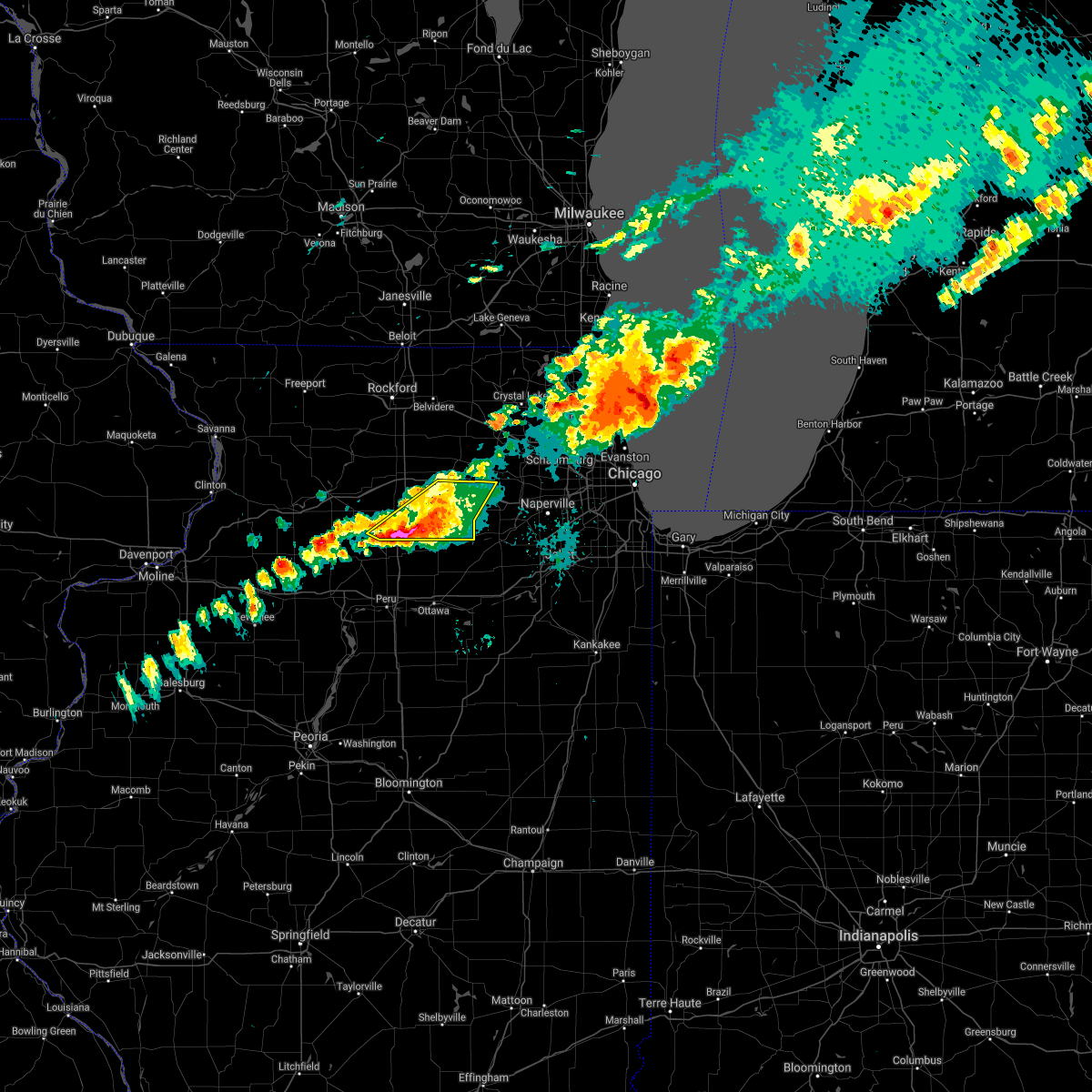 At 207 pm cdt, severe thunderstorms were located along a line extending from waterman to paw paw, moving east at 45 mph (public reported golf ball sized hail near compton). Hazards include golf ball size hail and 60 mph wind gusts. People and animals outdoors will be injured. expect hail damage to roofs, siding, windows, and vehicles. expect wind damage to roofs, siding, and trees. locations impacted include, dekalb, sandwich, shabbona, elburn, hinckley, somonauk, waterman, paw paw, kaneville, lee, compton and west brooklyn. thunderstorm damage threat, considerable hail threat, observed max hail size, 1. 75 in wind threat, radar indicated max wind gust, 60 mph. At 207 pm cdt, severe thunderstorms were located along a line extending from waterman to paw paw, moving east at 45 mph (public reported golf ball sized hail near compton). Hazards include golf ball size hail and 60 mph wind gusts. People and animals outdoors will be injured. expect hail damage to roofs, siding, windows, and vehicles. expect wind damage to roofs, siding, and trees. locations impacted include, dekalb, sandwich, shabbona, elburn, hinckley, somonauk, waterman, paw paw, kaneville, lee, compton and west brooklyn. thunderstorm damage threat, considerable hail threat, observed max hail size, 1. 75 in wind threat, radar indicated max wind gust, 60 mph.
|
| 9/7/2021 1:48 PM CDT |
 At 147 pm cdt, severe thunderstorms were located along a line extending from 6 miles south of rochelle to near amboy, moving east at 40 mph (radar indicated). Hazards include golf ball size hail and 60 mph wind gusts. People and animals outdoors will be injured. expect hail damage to roofs, siding, windows, and vehicles. expect wind damage to roofs, siding, and trees. locations impacted include, dekalb, campton hills, rochelle, sandwich, amboy, shabbona, elburn, cortland, hinckley, somonauk, waterman, hillcrest, maple park, malta, franklin grove, lily lake, ashton, paw paw, creston and kaneville. thunderstorm damage threat, considerable hail threat, radar indicated max hail size, 1. 75 in wind threat, radar indicated max wind gust, 60 mph. At 147 pm cdt, severe thunderstorms were located along a line extending from 6 miles south of rochelle to near amboy, moving east at 40 mph (radar indicated). Hazards include golf ball size hail and 60 mph wind gusts. People and animals outdoors will be injured. expect hail damage to roofs, siding, windows, and vehicles. expect wind damage to roofs, siding, and trees. locations impacted include, dekalb, campton hills, rochelle, sandwich, amboy, shabbona, elburn, cortland, hinckley, somonauk, waterman, hillcrest, maple park, malta, franklin grove, lily lake, ashton, paw paw, creston and kaneville. thunderstorm damage threat, considerable hail threat, radar indicated max hail size, 1. 75 in wind threat, radar indicated max wind gust, 60 mph.
|
| 9/7/2021 1:32 PM CDT |
 At 131 pm cdt, severe thunderstorms were located along a line extending from near rochelle to near amboy, moving east at 50 mph (public). Hazards include two inch hail and 60 mph wind gusts. People and animals outdoors will be injured. expect hail damage to roofs, siding, windows, and vehicles. expect wind damage to roofs, siding, and trees. locations impacted include, dekalb, sycamore, campton hills, rochelle, sandwich, amboy, shabbona, elburn, cortland, hinckley, somonauk, waterman, hillcrest, maple park, malta, franklin grove, lily lake, ashton, paw paw and creston. thunderstorm damage threat, considerable hail threat, radar indicated max hail size, 2. 00 in wind threat, radar indicated max wind gust, 60 mph. At 131 pm cdt, severe thunderstorms were located along a line extending from near rochelle to near amboy, moving east at 50 mph (public). Hazards include two inch hail and 60 mph wind gusts. People and animals outdoors will be injured. expect hail damage to roofs, siding, windows, and vehicles. expect wind damage to roofs, siding, and trees. locations impacted include, dekalb, sycamore, campton hills, rochelle, sandwich, amboy, shabbona, elburn, cortland, hinckley, somonauk, waterman, hillcrest, maple park, malta, franklin grove, lily lake, ashton, paw paw and creston. thunderstorm damage threat, considerable hail threat, radar indicated max hail size, 2. 00 in wind threat, radar indicated max wind gust, 60 mph.
|
| 9/7/2021 1:23 PM CDT |
 At 122 pm cdt, severe thunderstorms were located along a line extending from near ashton to near dixon, moving east at 45 mph (radar indicated). Hazards include 60 mph wind gusts and half dollar size hail. Hail damage to vehicles is expected. Expect wind damage to roofs, siding, and trees. At 122 pm cdt, severe thunderstorms were located along a line extending from near ashton to near dixon, moving east at 45 mph (radar indicated). Hazards include 60 mph wind gusts and half dollar size hail. Hail damage to vehicles is expected. Expect wind damage to roofs, siding, and trees.
|
| 8/24/2021 6:33 PM CDT |
 At 632 pm cdt, severe thunderstorms were located along a line extending from near sharon to near kingston to near waterman to near paw paw, moving east at 50 mph. this line of storms has a history of producing winds in excess of 60 mph (radar indicated). Hazards include 60 mph wind gusts. Expect damage to roofs, siding, and trees. locations impacted include, elgin, dekalb, crystal lake, carpentersville, st. charles, algonquin, lake in the hills, mchenry, belvidere, woodstock, huntley, geneva, sycamore, campton hills, fox lake, rochelle, harvard, island lake, marengo and sandwich. hail threat, radar indicated max hail size, <. 75 in wind threat, observed max wind gust, 60 mph. At 632 pm cdt, severe thunderstorms were located along a line extending from near sharon to near kingston to near waterman to near paw paw, moving east at 50 mph. this line of storms has a history of producing winds in excess of 60 mph (radar indicated). Hazards include 60 mph wind gusts. Expect damage to roofs, siding, and trees. locations impacted include, elgin, dekalb, crystal lake, carpentersville, st. charles, algonquin, lake in the hills, mchenry, belvidere, woodstock, huntley, geneva, sycamore, campton hills, fox lake, rochelle, harvard, island lake, marengo and sandwich. hail threat, radar indicated max hail size, <. 75 in wind threat, observed max wind gust, 60 mph.
|
| 8/24/2021 6:09 PM CDT |
 At 608 pm cdt, severe thunderstorms were located along a line extending from rockton to near davis junction to 8 miles northeast of walnut, moving east at 55 mph (radar indicated). Hazards include 60 mph wind gusts. expect damage to roofs, siding, and trees At 608 pm cdt, severe thunderstorms were located along a line extending from rockton to near davis junction to 8 miles northeast of walnut, moving east at 55 mph (radar indicated). Hazards include 60 mph wind gusts. expect damage to roofs, siding, and trees
|
| 8/11/2021 9:09 AM CDT |
 At 909 am cdt, a severe thunderstorm was located over leland, or 7 miles northwest of sheridan, moving east at 65 mph (radar indicated). Hazards include 70 mph wind gusts. Expect considerable tree damage. damage is likely to mobile homes, roofs, and outbuildings. locations impacted include, ottawa, peru, la salle, sandwich, mendota, marseilles, sheridan, shabbona, lake holiday, oglesby, seneca, hinckley, somonauk, earlville, waterman, north utica, serena, leland, paw paw and naplate. thunderstorm damage threat, considerable hail threat, radar indicated max hail size, <. 75 in wind threat, radar indicated max wind gust, 70 mph. At 909 am cdt, a severe thunderstorm was located over leland, or 7 miles northwest of sheridan, moving east at 65 mph (radar indicated). Hazards include 70 mph wind gusts. Expect considerable tree damage. damage is likely to mobile homes, roofs, and outbuildings. locations impacted include, ottawa, peru, la salle, sandwich, mendota, marseilles, sheridan, shabbona, lake holiday, oglesby, seneca, hinckley, somonauk, earlville, waterman, north utica, serena, leland, paw paw and naplate. thunderstorm damage threat, considerable hail threat, radar indicated max hail size, <. 75 in wind threat, radar indicated max wind gust, 70 mph.
|
| 8/11/2021 8:52 AM CDT |
 At 852 am cdt, a severe thunderstorm was located over mendota, moving east at 65 mph (radar indicated). Hazards include 70 mph wind gusts and quarter size hail. the strongest winds are moving into mendota, troy grove, meriden, and triumph!. Hail damage to vehicles is expected. expect considerable tree damage. wind damage is also likely to mobile homes, roofs, and outbuildings. locations impacted include, ottawa, peru, la salle, sandwich, mendota, marseilles, sheridan, shabbona, lake holiday, oglesby, seneca, hinckley, somonauk, earlville, waterman, north utica, serena, leland, paw paw and naplate. thunderstorm damage threat, considerable hail threat, radar indicated max hail size, 1. 00 in wind threat, radar indicated max wind gust, 70 mph. At 852 am cdt, a severe thunderstorm was located over mendota, moving east at 65 mph (radar indicated). Hazards include 70 mph wind gusts and quarter size hail. the strongest winds are moving into mendota, troy grove, meriden, and triumph!. Hail damage to vehicles is expected. expect considerable tree damage. wind damage is also likely to mobile homes, roofs, and outbuildings. locations impacted include, ottawa, peru, la salle, sandwich, mendota, marseilles, sheridan, shabbona, lake holiday, oglesby, seneca, hinckley, somonauk, earlville, waterman, north utica, serena, leland, paw paw and naplate. thunderstorm damage threat, considerable hail threat, radar indicated max hail size, 1. 00 in wind threat, radar indicated max wind gust, 70 mph.
|
| 8/11/2021 8:41 AM CDT |
 At 841 am cdt, a severe thunderstorm was located near la moille, or 10 miles northeast of princeton, moving east at 65 mph (radar indicated). Hazards include 70 mph wind gusts and quarter size hail. Hail damage to vehicles is expected. expect considerable tree damage. Wind damage is also likely to mobile homes, roofs, and outbuildings. At 841 am cdt, a severe thunderstorm was located near la moille, or 10 miles northeast of princeton, moving east at 65 mph (radar indicated). Hazards include 70 mph wind gusts and quarter size hail. Hail damage to vehicles is expected. expect considerable tree damage. Wind damage is also likely to mobile homes, roofs, and outbuildings.
|
| 8/10/2021 7:13 PM CDT |
 At 713 pm cdt, severe thunderstorms were located along a line extending from near cortland to near mendota, moving east at 45 mph (radar indicated). Hazards include 60 mph wind gusts and quarter size hail. Hail damage to vehicles is expected. Expect wind damage to roofs, siding, and trees. At 713 pm cdt, severe thunderstorms were located along a line extending from near cortland to near mendota, moving east at 45 mph (radar indicated). Hazards include 60 mph wind gusts and quarter size hail. Hail damage to vehicles is expected. Expect wind damage to roofs, siding, and trees.
|
| 8/10/2021 6:47 PM CDT |
 At 646 pm cdt, severe thunderstorms were located along a line extending from sandwich to near seneca, moving east at 55 mph. additional scattered thunderstorms were behind this main line (radar indicated). Hazards include 60 mph wind gusts and quarter size hail. Hail damage to vehicles is expected. expect wind damage to roofs, siding, and trees. locations impacted include, ottawa, peru, la salle, sandwich, mendota, sheridan, shabbona, lake holiday, hinckley, somonauk, earlville, waterman, north utica, serena, leland, paw paw, sublette, millington, dayton and lee. hail threat, radar indicated max hail size, 1. 00 in wind threat, radar indicated max wind gust, 60 mph. At 646 pm cdt, severe thunderstorms were located along a line extending from sandwich to near seneca, moving east at 55 mph. additional scattered thunderstorms were behind this main line (radar indicated). Hazards include 60 mph wind gusts and quarter size hail. Hail damage to vehicles is expected. expect wind damage to roofs, siding, and trees. locations impacted include, ottawa, peru, la salle, sandwich, mendota, sheridan, shabbona, lake holiday, hinckley, somonauk, earlville, waterman, north utica, serena, leland, paw paw, sublette, millington, dayton and lee. hail threat, radar indicated max hail size, 1. 00 in wind threat, radar indicated max wind gust, 60 mph.
|
| 8/10/2021 6:28 PM CDT |
 At 627 pm cdt, severe thunderstorms were located along a line extending from earlville to near naplate, moving east at 30 mph. peru airport gusted to 50 mph with these storms. additional thunderstorms were developing in eastern bureau county (radar indicated). Hazards include 60 mph wind gusts and quarter size hail. Hail damage to vehicles is expected. expect wind damage to roofs, siding, and trees. locations impacted include, ottawa, peru, la salle, sandwich, mendota, marseilles, sheridan, shabbona, lake holiday, oglesby, seneca, hinckley, somonauk, earlville, waterman, north utica, serena, leland, paw paw and naplate. hail threat, radar indicated max hail size, 1. 00 in wind threat, radar indicated max wind gust, 60 mph. At 627 pm cdt, severe thunderstorms were located along a line extending from earlville to near naplate, moving east at 30 mph. peru airport gusted to 50 mph with these storms. additional thunderstorms were developing in eastern bureau county (radar indicated). Hazards include 60 mph wind gusts and quarter size hail. Hail damage to vehicles is expected. expect wind damage to roofs, siding, and trees. locations impacted include, ottawa, peru, la salle, sandwich, mendota, marseilles, sheridan, shabbona, lake holiday, oglesby, seneca, hinckley, somonauk, earlville, waterman, north utica, serena, leland, paw paw and naplate. hail threat, radar indicated max hail size, 1. 00 in wind threat, radar indicated max wind gust, 60 mph.
|
| 8/10/2021 6:10 PM CDT |
 At 610 pm cdt, severe thunderstorms were located along a line extending from near mendota to near tonica, moving east at 55 mph (radar indicated). Hazards include 60 mph wind gusts and quarter size hail. Hail damage to vehicles is expected. Expect wind damage to roofs, siding, and trees. At 610 pm cdt, severe thunderstorms were located along a line extending from near mendota to near tonica, moving east at 55 mph (radar indicated). Hazards include 60 mph wind gusts and quarter size hail. Hail damage to vehicles is expected. Expect wind damage to roofs, siding, and trees.
|
| 6/20/2021 10:22 PM CDT |
 At 1022 pm cdt, a severe thunderstorm was located near malta, or near dekalb, moving east at 50 mph. a second severe storm was located near cortland, moving east at 40 mph (radar indicated). Hazards include ping pong ball size hail and 60 mph wind gusts. People and animals outdoors will be injured. expect hail damage to roofs, siding, windows, and vehicles. expect wind damage to roofs, siding, and trees. Locations impacted include, dekalb, sycamore, sandwich, genoa, shabbona, cortland, hinckley, somonauk, kirkland, waterman, maple park, kingston, malta, lee and fairdale. At 1022 pm cdt, a severe thunderstorm was located near malta, or near dekalb, moving east at 50 mph. a second severe storm was located near cortland, moving east at 40 mph (radar indicated). Hazards include ping pong ball size hail and 60 mph wind gusts. People and animals outdoors will be injured. expect hail damage to roofs, siding, windows, and vehicles. expect wind damage to roofs, siding, and trees. Locations impacted include, dekalb, sycamore, sandwich, genoa, shabbona, cortland, hinckley, somonauk, kirkland, waterman, maple park, kingston, malta, lee and fairdale.
|
| 6/20/2021 10:12 PM CDT |
 At 1012 pm cdt, a severe thunderstorm was located near rochelle, moving east at 50 mph. a second severe thunderstorm was located near waterman, and was moving northeast at 45 mph (radar indicated). Hazards include 60 mph wind gusts. expect damage to roofs, siding, and trees At 1012 pm cdt, a severe thunderstorm was located near rochelle, moving east at 50 mph. a second severe thunderstorm was located near waterman, and was moving northeast at 45 mph (radar indicated). Hazards include 60 mph wind gusts. expect damage to roofs, siding, and trees
|
| 6/11/2021 4:24 PM CDT |
 The severe thunderstorm warning for northeastern lee and northern de kalb counties will expire at 430 pm cdt, the storm which prompted the warning has weakened below severe limits, and no longer poses an immediate threat to life or property. therefore, the warning will be allowed to expire. however gusty winds to 50 mph are still possible with this thunderstorm. The severe thunderstorm warning for northeastern lee and northern de kalb counties will expire at 430 pm cdt, the storm which prompted the warning has weakened below severe limits, and no longer poses an immediate threat to life or property. therefore, the warning will be allowed to expire. however gusty winds to 50 mph are still possible with this thunderstorm.
|
| 6/11/2021 3:59 PM CDT |
 At 358 pm cdt, a severe thunderstorm was located near malta, or 7 miles northwest of dekalb, moving southeast at 15 mph (radar indicated). Hazards include 60 mph wind gusts and quarter size hail. Hail damage to vehicles is expected. expect wind damage to roofs, siding, and trees. Locations impacted include, dekalb, sycamore, shabbona, cortland, kirkland, malta and lee. At 358 pm cdt, a severe thunderstorm was located near malta, or 7 miles northwest of dekalb, moving southeast at 15 mph (radar indicated). Hazards include 60 mph wind gusts and quarter size hail. Hail damage to vehicles is expected. expect wind damage to roofs, siding, and trees. Locations impacted include, dekalb, sycamore, shabbona, cortland, kirkland, malta and lee.
|
| 6/11/2021 3:36 PM CDT |
 At 335 pm cdt, a severe thunderstorm was located near esmond, or 10 miles northeast of rochelle, moving southeast at 25 mph (radar indicated). Hazards include 60 mph wind gusts and quarter size hail. Hail damage to vehicles is expected. Expect wind damage to roofs, siding, and trees. At 335 pm cdt, a severe thunderstorm was located near esmond, or 10 miles northeast of rochelle, moving southeast at 25 mph (radar indicated). Hazards include 60 mph wind gusts and quarter size hail. Hail damage to vehicles is expected. Expect wind damage to roofs, siding, and trees.
|
| 11/10/2020 4:19 PM CST |
 At 419 pm cst, severe thunderstorms were located along a line extending from near marengo to near kirkland to near leland, moving northeast at 60 mph (trained weather spotters). Hazards include 70 mph wind gusts and penny size hail. Expect considerable tree damage. damage is likely to mobile homes, roofs, and outbuildings. Locations impacted include, dekalb, sycamore, genoa, shabbona, cortland, kirkland, waterman, maple park, kingston, malta, garden prairie and lee. At 419 pm cst, severe thunderstorms were located along a line extending from near marengo to near kirkland to near leland, moving northeast at 60 mph (trained weather spotters). Hazards include 70 mph wind gusts and penny size hail. Expect considerable tree damage. damage is likely to mobile homes, roofs, and outbuildings. Locations impacted include, dekalb, sycamore, genoa, shabbona, cortland, kirkland, waterman, maple park, kingston, malta, garden prairie and lee.
|
| 11/10/2020 4:13 PM CST |
 At 413 pm cst, severe thunderstorms were located along a line extending from near paw paw to near earlville to tonica, moving northeast at 65 mph (trained weather spotters. several reports of 60 to 70 mph winds and tree damage with this line of storms). Hazards include 70 mph wind gusts and penny size hail. Expect considerable tree damage. damage is likely to mobile homes, roofs, and outbuildings. locations impacted include, aurora, joliet, elgin, dekalb, bartlett, plainfield, carpentersville, st. Charles, oswego, algonquin, west chicago, batavia, huntley, geneva, sycamore, yorkville, campton hills, minooka, plano and sandwich. At 413 pm cst, severe thunderstorms were located along a line extending from near paw paw to near earlville to tonica, moving northeast at 65 mph (trained weather spotters. several reports of 60 to 70 mph winds and tree damage with this line of storms). Hazards include 70 mph wind gusts and penny size hail. Expect considerable tree damage. damage is likely to mobile homes, roofs, and outbuildings. locations impacted include, aurora, joliet, elgin, dekalb, bartlett, plainfield, carpentersville, st. Charles, oswego, algonquin, west chicago, batavia, huntley, geneva, sycamore, yorkville, campton hills, minooka, plano and sandwich.
|
| 11/10/2020 4:10 PM CST |
 At 410 pm cst, severe thunderstorms were located along a line extending from near paw paw to 6 miles south of earlville to tonica, moving northeast at 65 mph (radar indicated). Hazards include 70 mph wind gusts and penny size hail. Expect considerable tree damage. Damage is likely to mobile homes, roofs, and outbuildings. At 410 pm cst, severe thunderstorms were located along a line extending from near paw paw to 6 miles south of earlville to tonica, moving northeast at 65 mph (radar indicated). Hazards include 70 mph wind gusts and penny size hail. Expect considerable tree damage. Damage is likely to mobile homes, roofs, and outbuildings.
|
| 11/10/2020 4:04 PM CST |
 At 403 pm cst, severe thunderstorms were located along a line extending from near harvard to near paw paw, moving northeast at 65 mph (trained weather spotters. several reports of 60 to 70 mph winds and tree damage with this line of storms). Hazards include 70 mph wind gusts and penny size hail. Expect considerable tree damage. damage is likely to mobile homes, roofs, and outbuildings. Locations impacted include, dekalb, belvidere, sycamore, rochelle, poplar grove, genoa, shabbona, candlewick lake, cortland, kirkland, waterman, capron, hillcrest, maple park, kingston, malta, timberlane, paw paw, creston and monroe center. At 403 pm cst, severe thunderstorms were located along a line extending from near harvard to near paw paw, moving northeast at 65 mph (trained weather spotters. several reports of 60 to 70 mph winds and tree damage with this line of storms). Hazards include 70 mph wind gusts and penny size hail. Expect considerable tree damage. damage is likely to mobile homes, roofs, and outbuildings. Locations impacted include, dekalb, belvidere, sycamore, rochelle, poplar grove, genoa, shabbona, candlewick lake, cortland, kirkland, waterman, capron, hillcrest, maple park, kingston, malta, timberlane, paw paw, creston and monroe center.
|
| 11/10/2020 3:41 PM CST |
 At 340 pm cst, severe thunderstorms were located along a line extending from near durand to rockford to amboy, moving northeast at 65 mph (trained weather spotters. 73 mph gust observed in winnebago at 332 pm cst). Hazards include 70 mph wind gusts and penny size hail. Expect considerable tree damage. damage is likely to mobile homes, roofs, and outbuildings. Locations impacted include, rockford, dekalb, belvidere, loves park, machesney park, sycamore, roscoe, rochelle, south beloit, rockton, poplar grove, genoa, shabbona, rockford airport, candlewick lake, cortland, cherry valley, winnebago, davis junction and pecatonica. At 340 pm cst, severe thunderstorms were located along a line extending from near durand to rockford to amboy, moving northeast at 65 mph (trained weather spotters. 73 mph gust observed in winnebago at 332 pm cst). Hazards include 70 mph wind gusts and penny size hail. Expect considerable tree damage. damage is likely to mobile homes, roofs, and outbuildings. Locations impacted include, rockford, dekalb, belvidere, loves park, machesney park, sycamore, roscoe, rochelle, south beloit, rockton, poplar grove, genoa, shabbona, rockford airport, candlewick lake, cortland, cherry valley, winnebago, davis junction and pecatonica.
|
| 11/10/2020 3:20 PM CST |
 At 319 pm cst, severe thunderstorms were located along a line extending from near german valley to near mount morris to near walnut, moving northeast at 65 mph (radar indicated). Hazards include 70 mph wind gusts. Expect considerable tree damage. Damage is likely to mobile homes, roofs, and outbuildings. At 319 pm cst, severe thunderstorms were located along a line extending from near german valley to near mount morris to near walnut, moving northeast at 65 mph (radar indicated). Hazards include 70 mph wind gusts. Expect considerable tree damage. Damage is likely to mobile homes, roofs, and outbuildings.
|
| 8/10/2020 3:02 PM CDT |
 At 301 pm cdt, damaging winds were located along a line extending from near footville to near capron to near waterman to tonica, moving east at 70 mph (radar indicated). Hazards include 60 mph wind gusts. Expect damage to roofs, siding, and trees. Locations impacted include, rockford, beloit, loves park, machesney park, dixon, roscoe, rochelle, south beloit, rockton, byron, oregon, mount morris, amboy, polo, rockford airport, cherry valley, winnebago, davis junction, pecatonica and forreston. At 301 pm cdt, damaging winds were located along a line extending from near footville to near capron to near waterman to tonica, moving east at 70 mph (radar indicated). Hazards include 60 mph wind gusts. Expect damage to roofs, siding, and trees. Locations impacted include, rockford, beloit, loves park, machesney park, dixon, roscoe, rochelle, south beloit, rockton, byron, oregon, mount morris, amboy, polo, rockford airport, cherry valley, winnebago, davis junction, pecatonica and forreston.
|
| 8/10/2020 2:53 PM CDT | Estimated 70 to 80 mph winds and dime size hai in de kalb county IL, 0.3 miles NNW of Lee, IL |
| 8/10/2020 2:43 PM CDT |
 At 242 pm cdt, severe thunderstorms were located along a line extending from near durand to near davis junction to near north utica to rome, moving east at 70 mph. these are very dangerous storms! (emergency management. this storm has a history of producing high-end wind damage across ogle county. the winds may last longer than 30 minutes!). Hazards include 80 mph wind gusts and quarter size hail. Flying debris will be dangerous to those caught without shelter. mobile homes will be heavily damaged. expect considerable damage to roofs, windows, and vehicles. extensive tree damage and power outages are likely. Locations impacted include, dekalb, belvidere, loves park, ottawa, sycamore, streator, peru, la salle, sandwich, mendota, poplar grove, genoa, marseilles, sheridan, shabbona, candlewick lake, lake holiday, cortland, oglesby and cherry valley. At 242 pm cdt, severe thunderstorms were located along a line extending from near durand to near davis junction to near north utica to rome, moving east at 70 mph. these are very dangerous storms! (emergency management. this storm has a history of producing high-end wind damage across ogle county. the winds may last longer than 30 minutes!). Hazards include 80 mph wind gusts and quarter size hail. Flying debris will be dangerous to those caught without shelter. mobile homes will be heavily damaged. expect considerable damage to roofs, windows, and vehicles. extensive tree damage and power outages are likely. Locations impacted include, dekalb, belvidere, loves park, ottawa, sycamore, streator, peru, la salle, sandwich, mendota, poplar grove, genoa, marseilles, sheridan, shabbona, candlewick lake, lake holiday, cortland, oglesby and cherry valley.
|
| 8/10/2020 2:41 PM CDT |
 At 241 pm cdt, severe thunderstorms were located along a line extending from near monroe to near rockford to 6 miles southeast of ashton to 7 miles east of bradford, moving east at 70 mph. these are very dangerous storms (trained weather spotters). Hazards include 80 mph wind gusts and quarter size hail. the winds will last for more than 30 minutes!. Flying debris will be dangerous to those caught without shelter. mobile homes will be heavily damaged. expect considerable damage to roofs, windows, and vehicles. extensive tree damage and power outages are likely. Locations impacted include, rockford, beloit, loves park, machesney park, dixon, roscoe, rochelle, south beloit, rockton, byron, oregon, mount morris, amboy, polo, rockford airport, cherry valley, winnebago, davis junction, pecatonica and forreston. At 241 pm cdt, severe thunderstorms were located along a line extending from near monroe to near rockford to 6 miles southeast of ashton to 7 miles east of bradford, moving east at 70 mph. these are very dangerous storms (trained weather spotters). Hazards include 80 mph wind gusts and quarter size hail. the winds will last for more than 30 minutes!. Flying debris will be dangerous to those caught without shelter. mobile homes will be heavily damaged. expect considerable damage to roofs, windows, and vehicles. extensive tree damage and power outages are likely. Locations impacted include, rockford, beloit, loves park, machesney park, dixon, roscoe, rochelle, south beloit, rockton, byron, oregon, mount morris, amboy, polo, rockford airport, cherry valley, winnebago, davis junction, pecatonica and forreston.
|
| 8/10/2020 2:22 PM CDT |
 At 222 pm cdt, severe thunderstorms were located along a line extending from near warren to near polo to princeton to near laura, moving east at 70 mph. these are very dangerous storms (automated wind measurements. multiple wind gusts in excess of 80 mph have been measured with this storm! the winds may last longer than 30 minutes!). Hazards include 80 mph wind gusts and quarter size hail. Flying debris will be dangerous to those caught without shelter. mobile homes will be heavily damaged. expect considerable damage to roofs, windows, and vehicles. extensive tree damage and power outages are likely. Locations impacted include, dekalb, belvidere, loves park, ottawa, sycamore, streator, peru, la salle, sandwich, mendota, poplar grove, genoa, marseilles, sheridan, shabbona, candlewick lake, lake holiday, cortland, oglesby and cherry valley. At 222 pm cdt, severe thunderstorms were located along a line extending from near warren to near polo to princeton to near laura, moving east at 70 mph. these are very dangerous storms (automated wind measurements. multiple wind gusts in excess of 80 mph have been measured with this storm! the winds may last longer than 30 minutes!). Hazards include 80 mph wind gusts and quarter size hail. Flying debris will be dangerous to those caught without shelter. mobile homes will be heavily damaged. expect considerable damage to roofs, windows, and vehicles. extensive tree damage and power outages are likely. Locations impacted include, dekalb, belvidere, loves park, ottawa, sycamore, streator, peru, la salle, sandwich, mendota, poplar grove, genoa, marseilles, sheridan, shabbona, candlewick lake, lake holiday, cortland, oglesby and cherry valley.
|
| 8/10/2020 2:15 PM CDT |
 At 214 pm cdt, severe thunderstorms were located along a line extending from near shullsburg to near pearl city to near rock falls to near altona, moving east at 70 mph. these are very dangerous storms! (trained weather spotters). Hazards include 80 mph wind gusts and golf ball size hail. the largest hail will fall across winnebago county, and the strongest winds are moving into lee and ogle counties now. the winds will last longer than 30 minutes!. Flying debris will be dangerous to those caught without shelter. mobile homes will be heavily damaged. expect considerable damage to roofs, windows, and vehicles. extensive tree damage and power outages are likely. Locations impacted include, rockford, beloit, loves park, machesney park, dixon, roscoe, rochelle, south beloit, rockton, byron, oregon, mount morris, amboy, polo, rockford airport, cherry valley, winnebago, davis junction, pecatonica and forreston. At 214 pm cdt, severe thunderstorms were located along a line extending from near shullsburg to near pearl city to near rock falls to near altona, moving east at 70 mph. these are very dangerous storms! (trained weather spotters). Hazards include 80 mph wind gusts and golf ball size hail. the largest hail will fall across winnebago county, and the strongest winds are moving into lee and ogle counties now. the winds will last longer than 30 minutes!. Flying debris will be dangerous to those caught without shelter. mobile homes will be heavily damaged. expect considerable damage to roofs, windows, and vehicles. extensive tree damage and power outages are likely. Locations impacted include, rockford, beloit, loves park, machesney park, dixon, roscoe, rochelle, south beloit, rockton, byron, oregon, mount morris, amboy, polo, rockford airport, cherry valley, winnebago, davis junction, pecatonica and forreston.
|
| 8/10/2020 2:03 PM CDT |
 At 202 pm cdt, severe thunderstorms were located along a line extending from near council hill to near mount carroll to near annawan to near galesburg, moving east at 70 mph. these are very dangerous storms (automated wind measurements. there have been multiple measured wind gusts of 80 mph across the quad cities with this line of storms!). Hazards include 80 mph wind gusts and quarter size hail. the strong winds may last for more than 30 minutes!. Flying debris will be dangerous to those caught without shelter. mobile homes will be heavily damaged. expect considerable damage to roofs, windows, and vehicles. Extensive tree damage and power outages are likely. At 202 pm cdt, severe thunderstorms were located along a line extending from near council hill to near mount carroll to near annawan to near galesburg, moving east at 70 mph. these are very dangerous storms (automated wind measurements. there have been multiple measured wind gusts of 80 mph across the quad cities with this line of storms!). Hazards include 80 mph wind gusts and quarter size hail. the strong winds may last for more than 30 minutes!. Flying debris will be dangerous to those caught without shelter. mobile homes will be heavily damaged. expect considerable damage to roofs, windows, and vehicles. Extensive tree damage and power outages are likely.
|
| 8/10/2020 1:55 PM CDT |
 At 154 pm cdt, severe thunderstorms were located along a line extending from near menominee to near massbach to near erie to near north henderson, moving east at 70 mph. these are very dangerous storms! (automated wind measurement. a wind gust of 86 mph was measured in davenport with this storms. additionally, 2 inch hail was reported in freeport). Hazards include 80 mph wind gusts and quarter size hail. a second severe storm was located near dakota, moving northeast at 35 mph. Flying debris will be dangerous to those caught without shelter. mobile homes will be heavily damaged. expect considerable damage to roofs, windows, and vehicles. extensive tree damage and power outages are likely. Locations impacted include, rockford, beloit, loves park, machesney park, dixon, roscoe, rochelle, south beloit, rockton, byron, oregon, mount morris, amboy, polo, rockford airport, cherry valley, winnebago, davis junction, pecatonica and forreston. At 154 pm cdt, severe thunderstorms were located along a line extending from near menominee to near massbach to near erie to near north henderson, moving east at 70 mph. these are very dangerous storms! (automated wind measurement. a wind gust of 86 mph was measured in davenport with this storms. additionally, 2 inch hail was reported in freeport). Hazards include 80 mph wind gusts and quarter size hail. a second severe storm was located near dakota, moving northeast at 35 mph. Flying debris will be dangerous to those caught without shelter. mobile homes will be heavily damaged. expect considerable damage to roofs, windows, and vehicles. extensive tree damage and power outages are likely. Locations impacted include, rockford, beloit, loves park, machesney park, dixon, roscoe, rochelle, south beloit, rockton, byron, oregon, mount morris, amboy, polo, rockford airport, cherry valley, winnebago, davis junction, pecatonica and forreston.
|
| 8/10/2020 1:41 PM CDT |
 At 141 pm cdt, severe thunderstorms were located along a line extending from centralia to near springbrook to near princeton to near little york, moving east at 70 mph. these storms are producing widespread wind damage! (radar indicated). Hazards include 70 mph wind gusts and quarter size hail. Hail damage to vehicles is expected. expect considerable tree damage. Wind damage is also likely to mobile homes, roofs, and outbuildings. At 141 pm cdt, severe thunderstorms were located along a line extending from centralia to near springbrook to near princeton to near little york, moving east at 70 mph. these storms are producing widespread wind damage! (radar indicated). Hazards include 70 mph wind gusts and quarter size hail. Hail damage to vehicles is expected. expect considerable tree damage. Wind damage is also likely to mobile homes, roofs, and outbuildings.
|
| 7/11/2020 9:39 PM CDT |
 At 928 pm cdt, severe thunderstorms were located along a line extending from near shabbona to sheridan to near seneca to 8 miles southeast of marseilles, moving east at 45 mph (radar indicated). Hazards include 60 mph wind gusts. Expect damage to roofs, siding, and trees. Locations impacted include, ottawa, streator, pontiac, sandwich, marseilles, sheridan, shabbona, lake holiday, seneca, hinckley, somonauk, earlville, waterman, serena, flanagan, south streator, leland, paw paw, grand ridge and naplate. At 928 pm cdt, severe thunderstorms were located along a line extending from near shabbona to sheridan to near seneca to 8 miles southeast of marseilles, moving east at 45 mph (radar indicated). Hazards include 60 mph wind gusts. Expect damage to roofs, siding, and trees. Locations impacted include, ottawa, streator, pontiac, sandwich, marseilles, sheridan, shabbona, lake holiday, seneca, hinckley, somonauk, earlville, waterman, serena, flanagan, south streator, leland, paw paw, grand ridge and naplate.
|
| 7/11/2020 9:28 PM CDT |
 At 928 pm cdt, severe thunderstorms were located along a line extending from near shabbona to sheridan to near seneca to 8 miles southeast of marseilles, moving east at 45 mph (radar indicated). Hazards include 60 mph wind gusts. Expect damage to roofs, siding, and trees. Locations impacted include, ottawa, streator, pontiac, sandwich, marseilles, sheridan, shabbona, lake holiday, seneca, hinckley, somonauk, earlville, waterman, serena, flanagan, south streator, leland, paw paw, grand ridge and naplate. At 928 pm cdt, severe thunderstorms were located along a line extending from near shabbona to sheridan to near seneca to 8 miles southeast of marseilles, moving east at 45 mph (radar indicated). Hazards include 60 mph wind gusts. Expect damage to roofs, siding, and trees. Locations impacted include, ottawa, streator, pontiac, sandwich, marseilles, sheridan, shabbona, lake holiday, seneca, hinckley, somonauk, earlville, waterman, serena, flanagan, south streator, leland, paw paw, grand ridge and naplate.
|
| 7/11/2020 9:09 PM CDT |
 At 909 pm cdt, severe thunderstorms were located along a line extending from 8 miles south of ashton to near earlville to near marseilles to near grand ridge to near minonk, moving east at 50 mph (radar and spotter indicated). Hazards include 60 mph wind gusts. Expect damage to roofs, siding, and trees. Locations impacted include, ottawa, streator, pontiac, peru, la salle, sandwich, mendota, marseilles, sheridan, shabbona, lake holiday, oglesby, seneca, hinckley, somonauk, earlville, waterman, north utica, serena and flanagan. At 909 pm cdt, severe thunderstorms were located along a line extending from 8 miles south of ashton to near earlville to near marseilles to near grand ridge to near minonk, moving east at 50 mph (radar and spotter indicated). Hazards include 60 mph wind gusts. Expect damage to roofs, siding, and trees. Locations impacted include, ottawa, streator, pontiac, peru, la salle, sandwich, mendota, marseilles, sheridan, shabbona, lake holiday, oglesby, seneca, hinckley, somonauk, earlville, waterman, north utica, serena and flanagan.
|
| 7/11/2020 8:43 PM CDT |
 At 841 pm cdt, severe thunderstorms were located along a line extending from near oregon to near mendota to near mcnabb to near rome, moving east at 50 mph. winds in mendota have been estimated at 60 to 70 mph with this line of storms (spotter reported and radar indicated). Hazards include 70 mph wind gusts and quarter size hail. Expect considerable tree damage. wind damage is also likely to mobile homes, roofs, and outbuildings. Locations impacted include, ottawa, streator, pontiac, peru, la salle, sandwich, mendota, marseilles, sheridan, shabbona, lake holiday, oglesby, seneca, hinckley, somonauk, earlville, waterman, north utica, serena and flanagan. At 841 pm cdt, severe thunderstorms were located along a line extending from near oregon to near mendota to near mcnabb to near rome, moving east at 50 mph. winds in mendota have been estimated at 60 to 70 mph with this line of storms (spotter reported and radar indicated). Hazards include 70 mph wind gusts and quarter size hail. Expect considerable tree damage. wind damage is also likely to mobile homes, roofs, and outbuildings. Locations impacted include, ottawa, streator, pontiac, peru, la salle, sandwich, mendota, marseilles, sheridan, shabbona, lake holiday, oglesby, seneca, hinckley, somonauk, earlville, waterman, north utica, serena and flanagan.
|
| 7/11/2020 8:25 PM CDT |
 At 824 pm cdt, severe thunderstorms were located along a line extending from near polo to la moille to near henry to near dunlap, moving east at 50 mph (radar indicated). Hazards include 70 mph wind gusts and quarter size hail. Hail damage to vehicles is expected. expect considerable tree damage. Wind damage is also likely to mobile homes, roofs, and outbuildings. At 824 pm cdt, severe thunderstorms were located along a line extending from near polo to la moille to near henry to near dunlap, moving east at 50 mph (radar indicated). Hazards include 70 mph wind gusts and quarter size hail. Hail damage to vehicles is expected. expect considerable tree damage. Wind damage is also likely to mobile homes, roofs, and outbuildings.
|
| 6/26/2020 6:38 PM CDT |
 At 638 pm cdt, a severe thunderstorm was located 7 miles northwest of paw paw, or 9 miles west of shabbona, moving east at 40 mph (radar indicated). Hazards include 70 mph wind gusts and half dollar size hail. Hail damage to vehicles is expected. expect considerable tree damage. wind damage is also likely to mobile homes, roofs, and outbuildings. this severe storm will be near, paw paw around 645 pm cdt. Other locations impacted by this severe thunderstorm include west brooklyn, compton, lee and steward. At 638 pm cdt, a severe thunderstorm was located 7 miles northwest of paw paw, or 9 miles west of shabbona, moving east at 40 mph (radar indicated). Hazards include 70 mph wind gusts and half dollar size hail. Hail damage to vehicles is expected. expect considerable tree damage. wind damage is also likely to mobile homes, roofs, and outbuildings. this severe storm will be near, paw paw around 645 pm cdt. Other locations impacted by this severe thunderstorm include west brooklyn, compton, lee and steward.
|
| 6/26/2020 6:12 PM CDT |
 At 612 pm cdt, a severe thunderstorm was located near franklin grove, or near dixon, moving east at 45 mph (radar indicated). Hazards include golf ball size hail and 70 mph wind gusts. People and animals outdoors will be injured. expect hail damage to roofs, siding, windows, and vehicles. expect considerable tree damage. wind damage is also likely to mobile homes, roofs, and outbuildings. this severe storm will be near, amboy around 615 pm cdt. franklin grove around 620 pm cdt. ashton around 625 pm cdt. paw paw around 640 pm cdt. Other locations impacted by this severe thunderstorm include nelson, harmon, west brooklyn, compton, lee and steward. At 612 pm cdt, a severe thunderstorm was located near franklin grove, or near dixon, moving east at 45 mph (radar indicated). Hazards include golf ball size hail and 70 mph wind gusts. People and animals outdoors will be injured. expect hail damage to roofs, siding, windows, and vehicles. expect considerable tree damage. wind damage is also likely to mobile homes, roofs, and outbuildings. this severe storm will be near, amboy around 615 pm cdt. franklin grove around 620 pm cdt. ashton around 625 pm cdt. paw paw around 640 pm cdt. Other locations impacted by this severe thunderstorm include nelson, harmon, west brooklyn, compton, lee and steward.
|
| 6/26/2020 6:05 PM CDT |
 At 605 pm cdt, a severe thunderstorm was located near dixon, moving east at 45 mph (radar indicated). Hazards include 70 mph wind gusts and ping pong ball size hail. People and animals outdoors will be injured. expect hail damage to roofs, siding, windows, and vehicles. expect considerable tree damage. wind damage is also likely to mobile homes, roofs, and outbuildings. this severe storm will be near, amboy around 610 pm cdt. franklin grove around 615 pm cdt. ashton around 620 pm cdt. paw paw around 635 pm cdt. Other locations impacted by this severe thunderstorm include nelson, harmon, west brooklyn, compton, lee and steward. At 605 pm cdt, a severe thunderstorm was located near dixon, moving east at 45 mph (radar indicated). Hazards include 70 mph wind gusts and ping pong ball size hail. People and animals outdoors will be injured. expect hail damage to roofs, siding, windows, and vehicles. expect considerable tree damage. wind damage is also likely to mobile homes, roofs, and outbuildings. this severe storm will be near, amboy around 610 pm cdt. franklin grove around 615 pm cdt. ashton around 620 pm cdt. paw paw around 635 pm cdt. Other locations impacted by this severe thunderstorm include nelson, harmon, west brooklyn, compton, lee and steward.
|
| 6/26/2020 5:50 PM CDT |
 At 550 pm cdt, a severe thunderstorm was located near sterling, moving east at 45 mph (radar indicated). Hazards include 70 mph wind gusts and ping pong ball size hail. People and animals outdoors will be injured. expect hail damage to roofs, siding, windows, and vehicles. expect considerable tree damage. wind damage is also likely to mobile homes, roofs, and outbuildings. this severe thunderstorm will be near, dixon and walton around 605 pm cdt. amboy and franklin grove around 615 pm cdt. ashton around 620 pm cdt. paw paw around 635 pm cdt. including the following interstates, i-39 between mile markers 79 and 96. I-88 between mile markers 45 and 74. At 550 pm cdt, a severe thunderstorm was located near sterling, moving east at 45 mph (radar indicated). Hazards include 70 mph wind gusts and ping pong ball size hail. People and animals outdoors will be injured. expect hail damage to roofs, siding, windows, and vehicles. expect considerable tree damage. wind damage is also likely to mobile homes, roofs, and outbuildings. this severe thunderstorm will be near, dixon and walton around 605 pm cdt. amboy and franklin grove around 615 pm cdt. ashton around 620 pm cdt. paw paw around 635 pm cdt. including the following interstates, i-39 between mile markers 79 and 96. I-88 between mile markers 45 and 74.
|
| 5/14/2020 11:40 PM CDT |
 At 1139 pm cdt, severe thunderstorms were located along a line extending from shabbona to near leland to near earlville, moving east at 45 mph (radar indicated). Hazards include 70 mph wind gusts. Expect considerable tree damage. Damage is likely to mobile homes, roofs, and outbuildings. At 1139 pm cdt, severe thunderstorms were located along a line extending from shabbona to near leland to near earlville, moving east at 45 mph (radar indicated). Hazards include 70 mph wind gusts. Expect considerable tree damage. Damage is likely to mobile homes, roofs, and outbuildings.
|
| 5/14/2020 11:35 PM CDT |
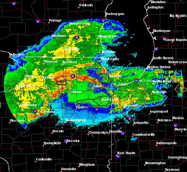 At 1135 pm cdt, a severe thunderstorm capable of producing a tornado was located near paw paw, or 8 miles west of shabbona, moving east at 45 mph (radar indicated rotation). Hazards include tornado. Flying debris will be dangerous to those caught without shelter. mobile homes will be damaged or destroyed. damage to roofs, windows, and vehicles will occur. tree damage is likely. This tornadic thunderstorm will remain over mainly rural areas of east central lee county, including the following locations, paw paw, compton and lee. At 1135 pm cdt, a severe thunderstorm capable of producing a tornado was located near paw paw, or 8 miles west of shabbona, moving east at 45 mph (radar indicated rotation). Hazards include tornado. Flying debris will be dangerous to those caught without shelter. mobile homes will be damaged or destroyed. damage to roofs, windows, and vehicles will occur. tree damage is likely. This tornadic thunderstorm will remain over mainly rural areas of east central lee county, including the following locations, paw paw, compton and lee.
|
| 5/14/2020 11:26 PM CDT |
 At 1125 pm cdt, a severe thunderstorm capable of producing a tornado was located 8 miles east of amboy, or 11 miles north of mendota, moving east at 50 mph (radar indicated rotation). Hazards include tornado. Flying debris will be dangerous to those caught without shelter. mobile homes will be damaged or destroyed. damage to roofs, windows, and vehicles will occur. tree damage is likely. this dangerous storm will be near, paw paw around 1135 pm cdt. other locations impacted by this tornadic thunderstorm include west brooklyn, compton and lee. Including the following interstate, i-39 between mile markers 80 and 89. At 1125 pm cdt, a severe thunderstorm capable of producing a tornado was located 8 miles east of amboy, or 11 miles north of mendota, moving east at 50 mph (radar indicated rotation). Hazards include tornado. Flying debris will be dangerous to those caught without shelter. mobile homes will be damaged or destroyed. damage to roofs, windows, and vehicles will occur. tree damage is likely. this dangerous storm will be near, paw paw around 1135 pm cdt. other locations impacted by this tornadic thunderstorm include west brooklyn, compton and lee. Including the following interstate, i-39 between mile markers 80 and 89.
|
| 9/13/2019 12:21 AM CDT |
 At 1220 am cdt, severe thunderstorms were located along a line extending from near marengo to near malta to near paw paw, moving east at 45 mph (radar indicated). Hazards include 60 mph wind gusts. Expect damage to roofs, siding, and trees. Locations impacted include, sycamore, genoa, shabbona, dekalb, cortland, kirkland, waterman, maple park, kingston, malta, lee and steward. At 1220 am cdt, severe thunderstorms were located along a line extending from near marengo to near malta to near paw paw, moving east at 45 mph (radar indicated). Hazards include 60 mph wind gusts. Expect damage to roofs, siding, and trees. Locations impacted include, sycamore, genoa, shabbona, dekalb, cortland, kirkland, waterman, maple park, kingston, malta, lee and steward.
|
| 9/12/2019 11:58 PM CDT |
 At 1157 pm cdt, severe thunderstorms were located along a line extending from near kirkland to near ashton to near amboy, moving east at 45 mph (radar indicated). Hazards include 60 mph wind gusts. expect damage to roofs, siding, and trees At 1157 pm cdt, severe thunderstorms were located along a line extending from near kirkland to near ashton to near amboy, moving east at 45 mph (radar indicated). Hazards include 60 mph wind gusts. expect damage to roofs, siding, and trees
|
| 9/12/2019 3:25 PM CDT |
 At 324 pm cdt, a severe thunderstorm was located near waterman, or 7 miles northeast of shabbona, moving northeast at 20 mph (radar indicated). Hazards include 60 mph wind gusts and quarter size hail. Hail damage to vehicles is expected. expect wind damage to roofs, siding, and trees. Locations impacted include, sycamore, genoa, shabbona, dekalb, cortland, maple park, malta and lee. At 324 pm cdt, a severe thunderstorm was located near waterman, or 7 miles northeast of shabbona, moving northeast at 20 mph (radar indicated). Hazards include 60 mph wind gusts and quarter size hail. Hail damage to vehicles is expected. expect wind damage to roofs, siding, and trees. Locations impacted include, sycamore, genoa, shabbona, dekalb, cortland, maple park, malta and lee.
|
| 9/12/2019 3:06 PM CDT |
 At 305 pm cdt, a severe thunderstorm was located near shabbona, moving northeast at 20 mph (radar indicated). Hazards include 60 mph wind gusts and quarter size hail. Hail damage to vehicles is expected. Expect wind damage to roofs, siding, and trees. At 305 pm cdt, a severe thunderstorm was located near shabbona, moving northeast at 20 mph (radar indicated). Hazards include 60 mph wind gusts and quarter size hail. Hail damage to vehicles is expected. Expect wind damage to roofs, siding, and trees.
|
| 9/3/2019 8:04 AM CDT |
 At 803 am cdt, a severe thunderstorm was located 3 miles northwest of shabbona, moving southeast at 30 mph. this storm has shown a gradual weakening trend in the past 10 minutes, but still capable of wind and hail (radar indicated). Hazards include 60 mph wind gusts and quarter size hail. Hail damage to vehicles is expected. expect wind damage to roofs, siding, and trees. Locations impacted include, rochelle, shabbona, dekalb, waterman, malta, ashton, paw paw, creston, lee and steward. At 803 am cdt, a severe thunderstorm was located 3 miles northwest of shabbona, moving southeast at 30 mph. this storm has shown a gradual weakening trend in the past 10 minutes, but still capable of wind and hail (radar indicated). Hazards include 60 mph wind gusts and quarter size hail. Hail damage to vehicles is expected. expect wind damage to roofs, siding, and trees. Locations impacted include, rochelle, shabbona, dekalb, waterman, malta, ashton, paw paw, creston, lee and steward.
|
| 9/3/2019 7:50 AM CDT |
 At 749 am cdt, a severe thunderstorm cluster was centered just southeast of rochelle, moving southeast at 30 mph (radar indicated). Hazards include 60 mph wind gusts and half dollar size hail. Hail damage to vehicles is expected. expect wind damage to roofs, siding, and trees. Locations impacted include, rochelle, shabbona, dekalb, cortland, waterman, hillcrest, malta, ashton, paw paw, creston, lee and steward. At 749 am cdt, a severe thunderstorm cluster was centered just southeast of rochelle, moving southeast at 30 mph (radar indicated). Hazards include 60 mph wind gusts and half dollar size hail. Hail damage to vehicles is expected. expect wind damage to roofs, siding, and trees. Locations impacted include, rochelle, shabbona, dekalb, cortland, waterman, hillcrest, malta, ashton, paw paw, creston, lee and steward.
|
| 9/3/2019 7:38 AM CDT |
 At 737 am cdt, a severe thunderstorm cluster was centered near rochelle, moving southeast at 30 mph (radar indicated). Hazards include 60 mph wind gusts and half dollar size hail. Hail damage to vehicles is expected. expect wind damage to roofs, siding, and trees. Locations impacted include, sycamore, rochelle, shabbona, dekalb, cortland, waterman, hillcrest, malta, ashton, paw paw, creston, lee and steward. At 737 am cdt, a severe thunderstorm cluster was centered near rochelle, moving southeast at 30 mph (radar indicated). Hazards include 60 mph wind gusts and half dollar size hail. Hail damage to vehicles is expected. expect wind damage to roofs, siding, and trees. Locations impacted include, sycamore, rochelle, shabbona, dekalb, cortland, waterman, hillcrest, malta, ashton, paw paw, creston, lee and steward.
|
| 9/3/2019 7:24 AM CDT |
 At 724 am cdt, a severe thunderstorm was located near hillcrest, or 7 miles east of oregon, moving southeast at 30 mph (radar indicated). Hazards include 60 mph wind gusts and half dollar size hail. Hail damage to vehicles is expected. Expect wind damage to roofs, siding, and trees. At 724 am cdt, a severe thunderstorm was located near hillcrest, or 7 miles east of oregon, moving southeast at 30 mph (radar indicated). Hazards include 60 mph wind gusts and half dollar size hail. Hail damage to vehicles is expected. Expect wind damage to roofs, siding, and trees.
|
| 6/30/2019 2:02 PM CDT |
 At 201 pm cdt, severe thunderstorms were located along a line extending from near plainfield to 7 miles northeast of walnut, moving southeast at 25 mph (radar indicated). Hazards include 60 mph wind gusts. expect damage to roofs, siding, and trees At 201 pm cdt, severe thunderstorms were located along a line extending from near plainfield to 7 miles northeast of walnut, moving southeast at 25 mph (radar indicated). Hazards include 60 mph wind gusts. expect damage to roofs, siding, and trees
|
| 6/30/2019 1:39 PM CDT |
 At 138 pm cdt, severe thunderstorms were located along a line extending from near lily lake to near polo, moving south at 15 to 20 mph (trained weather spotters). Hazards include 60 mph wind gusts. Expect damage to roofs, siding, and trees. locations impacted include, aurora, st. Charles, oswego, batavia, belvidere, sycamore, yorkville, dixon, little rock, rochelle, genoa, oregon, mount morris, shabbona, dekalb, montgomery, north aurora, sugar grove, elburn and hampshire. At 138 pm cdt, severe thunderstorms were located along a line extending from near lily lake to near polo, moving south at 15 to 20 mph (trained weather spotters). Hazards include 60 mph wind gusts. Expect damage to roofs, siding, and trees. locations impacted include, aurora, st. Charles, oswego, batavia, belvidere, sycamore, yorkville, dixon, little rock, rochelle, genoa, oregon, mount morris, shabbona, dekalb, montgomery, north aurora, sugar grove, elburn and hampshire.
|
| 6/30/2019 1:13 PM CDT |
 At 112 pm cdt, severe thunderstorms were located along a line extending from near hampshire to near byron, moving south at 45 mph. a gust front out ahead of the line of storms may produce damagaing wind gusts ahead of the complex of storms (radar indicated). Hazards include 60 mph wind gusts. expect damage to roofs, siding, and trees At 112 pm cdt, severe thunderstorms were located along a line extending from near hampshire to near byron, moving south at 45 mph. a gust front out ahead of the line of storms may produce damagaing wind gusts ahead of the complex of storms (radar indicated). Hazards include 60 mph wind gusts. expect damage to roofs, siding, and trees
|
| 5/16/2019 11:39 PM CDT |
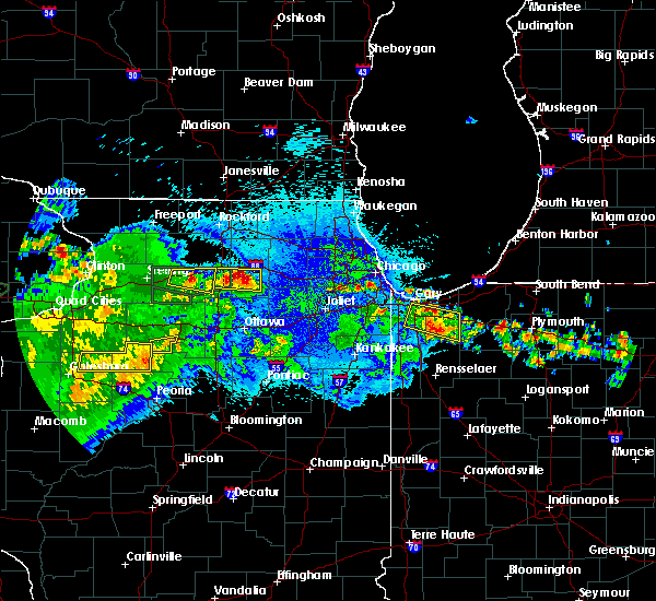 A severe thunderstorm warning remains in effect until midnight cdt for northeastern lee and southwestern de kalb counties. at 1139 pm cdt, a severe thunderstorm was located near waterman, or near shabbona, moving east at 40 mph. hazard. two inch hail and 60 mph wind gusts. source. Radar indicated. A severe thunderstorm warning remains in effect until midnight cdt for northeastern lee and southwestern de kalb counties. at 1139 pm cdt, a severe thunderstorm was located near waterman, or near shabbona, moving east at 40 mph. hazard. two inch hail and 60 mph wind gusts. source. Radar indicated.
|
| 5/16/2019 11:17 PM CDT |
 At 1117 pm cdt, a severe thunderstorm was located 7 miles southeast of ashton, or 7 miles south of rochelle, moving east at 40 mph (radar indicated). Hazards include two inch hail and 60 mph wind gusts. People and animals outdoors will be injured. expect hail damage to roofs, siding, windows, and vehicles. expect wind damage to roofs, siding, and trees. this severe thunderstorm will be near, shabbona around 1135 pm cdt. waterman around 1145 pm cdt. other locations impacted by this severe thunderstorm include lee and steward. Including the following interstate, i-39 between mile markers 84 and 96. At 1117 pm cdt, a severe thunderstorm was located 7 miles southeast of ashton, or 7 miles south of rochelle, moving east at 40 mph (radar indicated). Hazards include two inch hail and 60 mph wind gusts. People and animals outdoors will be injured. expect hail damage to roofs, siding, windows, and vehicles. expect wind damage to roofs, siding, and trees. this severe thunderstorm will be near, shabbona around 1135 pm cdt. waterman around 1145 pm cdt. other locations impacted by this severe thunderstorm include lee and steward. Including the following interstate, i-39 between mile markers 84 and 96.
|
| 5/16/2019 9:49 PM CDT |
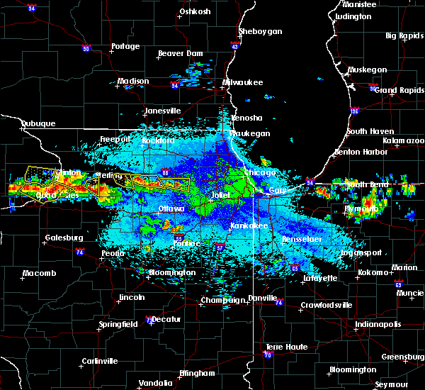 At 948 pm cdt, a severe thunderstorm was located 7 miles south of rochelle, moving east at 30 mph (radar and spotter indicated). Hazards include ping pong ball size hail. People and animals outdoors will be injured. expect damage to roofs, siding, windows, and vehicles. this severe storm will be near, shabbona around 1010 pm cdt. waterman around 1015 pm cdt. other locations impacted by this severe thunderstorm include lee and steward. A trained spotter just reported quarter size hail covering the ground near steward. At 948 pm cdt, a severe thunderstorm was located 7 miles south of rochelle, moving east at 30 mph (radar and spotter indicated). Hazards include ping pong ball size hail. People and animals outdoors will be injured. expect damage to roofs, siding, windows, and vehicles. this severe storm will be near, shabbona around 1010 pm cdt. waterman around 1015 pm cdt. other locations impacted by this severe thunderstorm include lee and steward. A trained spotter just reported quarter size hail covering the ground near steward.
|
| 5/16/2019 9:35 PM CDT |
 At 935 pm cdt, severe thunderstorms were located along a line extending from ashton to 7 miles northwest of paw paw, moving east at 30 mph (radar indicated). Hazards include ping pong ball size hail. People and animals outdoors will be injured. expect damage to roofs, siding, windows, and vehicles. severe thunderstorms will be near, shabbona around 955 pm cdt. waterman around 1005 pm cdt. other locations impacted by these severe thunderstorms include lee and steward. including the following interstates, i-39 between mile markers 85 and 95. I-88 between mile markers 66 and 71. At 935 pm cdt, severe thunderstorms were located along a line extending from ashton to 7 miles northwest of paw paw, moving east at 30 mph (radar indicated). Hazards include ping pong ball size hail. People and animals outdoors will be injured. expect damage to roofs, siding, windows, and vehicles. severe thunderstorms will be near, shabbona around 955 pm cdt. waterman around 1005 pm cdt. other locations impacted by these severe thunderstorms include lee and steward. including the following interstates, i-39 between mile markers 85 and 95. I-88 between mile markers 66 and 71.
|
| 9/25/2018 4:39 PM CDT |
 At 438 pm cdt, severe thunderstorms were located along a line extending from near huntley to near earlville, moving east at 60 mph (radar indicated). Hazards include 70 mph wind gusts. Expect considerable tree damage. damage is likely to mobile homes, roofs, and outbuildings. locations impacted include, aurora, elgin, carpentersville, st. Charles, oswego, algonquin, west chicago, mchenry, batavia, woodstock, geneva, sycamore, yorkville, little rock, plano, island lake, marengo, sandwich, mendota and genoa. At 438 pm cdt, severe thunderstorms were located along a line extending from near huntley to near earlville, moving east at 60 mph (radar indicated). Hazards include 70 mph wind gusts. Expect considerable tree damage. damage is likely to mobile homes, roofs, and outbuildings. locations impacted include, aurora, elgin, carpentersville, st. Charles, oswego, algonquin, west chicago, mchenry, batavia, woodstock, geneva, sycamore, yorkville, little rock, plano, island lake, marengo, sandwich, mendota and genoa.
|
| 9/25/2018 4:22 PM CDT |
 At 421 pm cdt, severe thunderstorms were located along a line extending from near kingston to near la moille, moving east at 60 mph. these are very dangerous storms (radar indicated). Hazards include 80 mph wind gusts. Flying debris will be dangerous to those caught without shelter. mobile homes will be heavily damaged. expect considerable damage to roofs, windows, and vehicles. extensive tree damage and power outages are likely. locations impacted include, aurora, elgin, carpentersville, st. Charles, oswego, algonquin, west chicago, mchenry, batavia, woodstock, geneva, sycamore, yorkville, little rock, plano, rochelle, island lake, marengo, sandwich and mendota. At 421 pm cdt, severe thunderstorms were located along a line extending from near kingston to near la moille, moving east at 60 mph. these are very dangerous storms (radar indicated). Hazards include 80 mph wind gusts. Flying debris will be dangerous to those caught without shelter. mobile homes will be heavily damaged. expect considerable damage to roofs, windows, and vehicles. extensive tree damage and power outages are likely. locations impacted include, aurora, elgin, carpentersville, st. Charles, oswego, algonquin, west chicago, mchenry, batavia, woodstock, geneva, sycamore, yorkville, little rock, plano, rochelle, island lake, marengo, sandwich and mendota.
|
| 9/25/2018 4:01 PM CDT |
 At 400 pm cdt, severe thunderstorms were located along a line extending from near stillman valley to near wyanet, moving east at 55 mph. these are very dangerous storms (radar indicated). Hazards include 80 mph wind gusts. Flying debris will be dangerous to those caught without shelter. mobile homes will be heavily damaged. expect considerable damage to roofs, windows, and vehicles. Extensive tree damage and power outages are likely. At 400 pm cdt, severe thunderstorms were located along a line extending from near stillman valley to near wyanet, moving east at 55 mph. these are very dangerous storms (radar indicated). Hazards include 80 mph wind gusts. Flying debris will be dangerous to those caught without shelter. mobile homes will be heavily damaged. expect considerable damage to roofs, windows, and vehicles. Extensive tree damage and power outages are likely.
|
| 5/14/2018 8:54 PM CDT |
 At 854 pm cdt, a severe thunderstorm was located near malta, or near shabbona, moving east at 40 mph (radar indicated). Hazards include 60 mph wind gusts and quarter size hail. Hail damage to vehicles is expected. Expect wind damage to roofs, siding, and trees. At 854 pm cdt, a severe thunderstorm was located near malta, or near shabbona, moving east at 40 mph (radar indicated). Hazards include 60 mph wind gusts and quarter size hail. Hail damage to vehicles is expected. Expect wind damage to roofs, siding, and trees.
|
| 5/2/2018 6:42 PM CDT |
 The severe thunderstorm warning for west central de kalb county will expire at 645 pm cdt, the storm which prompted the warning has moved out of the area. therefore the warning will be allowed to expire. a severe thunderstorm watch remains in effect until 1100 pm cdt for north central illinois. The severe thunderstorm warning for west central de kalb county will expire at 645 pm cdt, the storm which prompted the warning has moved out of the area. therefore the warning will be allowed to expire. a severe thunderstorm watch remains in effect until 1100 pm cdt for north central illinois.
|
| 5/2/2018 6:32 PM CDT |
 At 632 pm cdt, a severe thunderstorm was located near waterman, or 7 miles northeast of shabbona, moving east at 35 mph (radar indicated). Hazards include golf ball size hail and 60 mph wind gusts. People and animals outdoors will be injured. expect hail damage to roofs, siding, windows, and vehicles. expect wind damage to roofs, siding, and trees. Locations impacted include, malta and lee. At 632 pm cdt, a severe thunderstorm was located near waterman, or 7 miles northeast of shabbona, moving east at 35 mph (radar indicated). Hazards include golf ball size hail and 60 mph wind gusts. People and animals outdoors will be injured. expect hail damage to roofs, siding, windows, and vehicles. expect wind damage to roofs, siding, and trees. Locations impacted include, malta and lee.
|
| 5/2/2018 6:16 PM CDT | Golf Ball sized hail reported 0.3 miles NNW of Lee, IL, social media report |
| 5/2/2018 6:16 PM CDT |
 At 616 pm cdt, a severe thunderstorm was located near shabbona, moving northeast at 40 mph (radar indicated). Hazards include golf ball size hail and 60 mph wind gusts. People and animals outdoors will be injured. expect hail damage to roofs, siding, windows, and vehicles. expect wind damage to roofs, siding, and trees. Locations impacted include, shabbona, waterman, malta and lee. At 616 pm cdt, a severe thunderstorm was located near shabbona, moving northeast at 40 mph (radar indicated). Hazards include golf ball size hail and 60 mph wind gusts. People and animals outdoors will be injured. expect hail damage to roofs, siding, windows, and vehicles. expect wind damage to roofs, siding, and trees. Locations impacted include, shabbona, waterman, malta and lee.
|
| 5/2/2018 6:11 PM CDT |
 At 610 pm cdt, a severe thunderstorm was located over paw paw, or near shabbona, moving east at 35 mph (radar indicated). Hazards include 60 mph wind gusts and quarter size hail. Hail damage to vehicles is expected. expect wind damage to roofs, siding, and trees. Locations impacted include, shabbona, waterman, malta, paw paw and lee. At 610 pm cdt, a severe thunderstorm was located over paw paw, or near shabbona, moving east at 35 mph (radar indicated). Hazards include 60 mph wind gusts and quarter size hail. Hail damage to vehicles is expected. expect wind damage to roofs, siding, and trees. Locations impacted include, shabbona, waterman, malta, paw paw and lee.
|
| 5/2/2018 5:57 PM CDT |
 At 556 pm cdt, a severe thunderstorm was located 8 miles east of amboy, or 9 miles north of mendota, moving east at 35 mph (radar indicated). Hazards include 60 mph wind gusts and quarter size hail. Hail damage to vehicles is expected. Expect wind damage to roofs, siding, and trees. At 556 pm cdt, a severe thunderstorm was located 8 miles east of amboy, or 9 miles north of mendota, moving east at 35 mph (radar indicated). Hazards include 60 mph wind gusts and quarter size hail. Hail damage to vehicles is expected. Expect wind damage to roofs, siding, and trees.
|
| 7/21/2017 8:48 PM CDT |
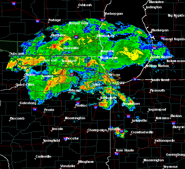 At 848 pm cdt, severe thunderstorms were located along a line extending from near malta to shabbona to near paw paw, moving east at 50 mph (radar indicated). Hazards include 60 mph wind gusts. Expect damage to roofs, siding, and trees. these severe storms will be near, waterman around 855 pm cdt. dekalb around 900 pm cdt. Other locations impacted by these severe thunderstorms include lee. At 848 pm cdt, severe thunderstorms were located along a line extending from near malta to shabbona to near paw paw, moving east at 50 mph (radar indicated). Hazards include 60 mph wind gusts. Expect damage to roofs, siding, and trees. these severe storms will be near, waterman around 855 pm cdt. dekalb around 900 pm cdt. Other locations impacted by these severe thunderstorms include lee.
|
| 7/21/2017 8:33 PM CDT |
 At 833 pm cdt, severe thunderstorms were located along a line extending from near rochelle to 8 miles southeast of ashton to 6 miles southeast of amboy, moving east at 50 mph (radar indicated). Hazards include 60 mph wind gusts. Expect damage to roofs, siding, and trees. severe thunderstorms will be near, shabbona and paw paw around 850 pm cdt. dekalb and waterman around 855 pm cdt. including the following interstates, i-39 between mile markers 80 and 96. I-88 between mile markers 73 and 74, and between mile markers 83 and 94. At 833 pm cdt, severe thunderstorms were located along a line extending from near rochelle to 8 miles southeast of ashton to 6 miles southeast of amboy, moving east at 50 mph (radar indicated). Hazards include 60 mph wind gusts. Expect damage to roofs, siding, and trees. severe thunderstorms will be near, shabbona and paw paw around 850 pm cdt. dekalb and waterman around 855 pm cdt. including the following interstates, i-39 between mile markers 80 and 96. I-88 between mile markers 73 and 74, and between mile markers 83 and 94.
|
| 7/19/2017 8:54 PM CDT |
 At 853 pm cdt, severe thunderstorms were located along a line extending from near woodstock to maple park to earlville, moving southeast at 50 mph (radar indicated). Hazards include 60 mph wind gusts. Expect damage to roofs, siding, and trees. locations impacted include, aurora, naperville, elgin, schaumburg, hoffman estates, carol stream, carpentersville, st. Charles, oswego, algonquin, west chicago, mchenry, batavia, woodstock, geneva, grayslake, lake zurich, round lake, sycamore and yorkville. At 853 pm cdt, severe thunderstorms were located along a line extending from near woodstock to maple park to earlville, moving southeast at 50 mph (radar indicated). Hazards include 60 mph wind gusts. Expect damage to roofs, siding, and trees. locations impacted include, aurora, naperville, elgin, schaumburg, hoffman estates, carol stream, carpentersville, st. Charles, oswego, algonquin, west chicago, mchenry, batavia, woodstock, geneva, grayslake, lake zurich, round lake, sycamore and yorkville.
|
| 7/19/2017 8:34 PM CDT |
 At 834 pm cdt, severe thunderstorms were located along a line extending from near capron to near kirkland to 8 miles east of amboy, moving southeast at 50 mph (radar indicated). Hazards include 70 mph wind gusts. Expect considerable tree damage. Damage is likely to mobile homes, roofs, and outbuildings. At 834 pm cdt, severe thunderstorms were located along a line extending from near capron to near kirkland to 8 miles east of amboy, moving southeast at 50 mph (radar indicated). Hazards include 70 mph wind gusts. Expect considerable tree damage. Damage is likely to mobile homes, roofs, and outbuildings.
|
| 7/19/2017 8:26 PM CDT |
 At 826 pm cdt, severe thunderstorms were located along a line extending from poplar grove to near kirkland to near ashton, moving east at 60 mph (radar indicated). Hazards include 70 mph wind gusts. Expect considerable tree damage. damage is likely to mobile homes, roofs, and outbuildings. Locations impacted include, rockford, beloit, belvidere, loves park, machesney park, sycamore, dixon, rochelle, harvard, south beloit, rockton, marengo, genoa, oregon, mount morris, shabbona, rockford airport, dekalb, roscoe and poplar grove. At 826 pm cdt, severe thunderstorms were located along a line extending from poplar grove to near kirkland to near ashton, moving east at 60 mph (radar indicated). Hazards include 70 mph wind gusts. Expect considerable tree damage. damage is likely to mobile homes, roofs, and outbuildings. Locations impacted include, rockford, beloit, belvidere, loves park, machesney park, sycamore, dixon, rochelle, harvard, south beloit, rockton, marengo, genoa, oregon, mount morris, shabbona, rockford airport, dekalb, roscoe and poplar grove.
|
| 7/19/2017 8:10 PM CDT |
 At 809 pm cdt, severe thunderstorms were located along a line extending from near rockton to near byron to near mount morris, moving east at 60 mph (radar indicated). Hazards include 70 mph wind gusts. Expect considerable tree damage. damage is likely to mobile homes, roofs, and outbuildings. Locations impacted include, rockford, beloit, belvidere, loves park, machesney park, sycamore, dixon, rochelle, harvard, south beloit, rockton, marengo, genoa, oregon, mount morris, shabbona, rockford airport, dekalb, roscoe and poplar grove. At 809 pm cdt, severe thunderstorms were located along a line extending from near rockton to near byron to near mount morris, moving east at 60 mph (radar indicated). Hazards include 70 mph wind gusts. Expect considerable tree damage. damage is likely to mobile homes, roofs, and outbuildings. Locations impacted include, rockford, beloit, belvidere, loves park, machesney park, sycamore, dixon, rochelle, harvard, south beloit, rockton, marengo, genoa, oregon, mount morris, shabbona, rockford airport, dekalb, roscoe and poplar grove.
|
| 7/19/2017 7:54 PM CDT |
 At 754 pm cdt, severe thunderstorms were located along a line extending from near brodhead to near ridott to near shannon, moving southeast at 60 mph (radar indicated). Hazards include 70 mph wind gusts. Expect considerable tree damage. Damage is likely to mobile homes, roofs, and outbuildings. At 754 pm cdt, severe thunderstorms were located along a line extending from near brodhead to near ridott to near shannon, moving southeast at 60 mph (radar indicated). Hazards include 70 mph wind gusts. Expect considerable tree damage. Damage is likely to mobile homes, roofs, and outbuildings.
|
| 5/17/2017 10:46 PM CDT |
 A severe thunderstorm warning remains in effect until 1100 pm cdt for northwestern la salle. southeastern lee. de kalb. western mchenry and boone counties. At 1046 pm cdt, severe thunderstorms were located along a line extending from near malta to near waterman to leland, moving northeast at 65 mph. A severe thunderstorm warning remains in effect until 1100 pm cdt for northwestern la salle. southeastern lee. de kalb. western mchenry and boone counties. At 1046 pm cdt, severe thunderstorms were located along a line extending from near malta to near waterman to leland, moving northeast at 65 mph.
|
| 5/17/2017 10:29 PM CDT |
 At 1029 pm cdt, severe thunderstorms were located along a line extending from sharon to 7 miles northwest of paw paw to near mendota, moving northeast at 60 mph (radar indicated). Hazards include 70 mph wind gusts and quarter size hail. Hail damage to vehicles is expected. expect considerable tree damage. wind damage is also likely to mobile homes, roofs, and outbuildings. locations impacted include, rockford, belvidere, loves park, machesney park, sycamore, rochelle, south beloit, rockton, mendota, genoa, shabbona, rockford airport, dekalb, roscoe, poplar grove, cortland, cherry valley, amboy, kirkland and earlville. A tornado watch remains in effect until 1100 pm cdt for north central illinois, and until 100 am cdt for north central and northeastern illinois. At 1029 pm cdt, severe thunderstorms were located along a line extending from sharon to 7 miles northwest of paw paw to near mendota, moving northeast at 60 mph (radar indicated). Hazards include 70 mph wind gusts and quarter size hail. Hail damage to vehicles is expected. expect considerable tree damage. wind damage is also likely to mobile homes, roofs, and outbuildings. locations impacted include, rockford, belvidere, loves park, machesney park, sycamore, rochelle, south beloit, rockton, mendota, genoa, shabbona, rockford airport, dekalb, roscoe, poplar grove, cortland, cherry valley, amboy, kirkland and earlville. A tornado watch remains in effect until 1100 pm cdt for north central illinois, and until 100 am cdt for north central and northeastern illinois.
|
| 5/17/2017 10:13 PM CDT |
 At 1013 pm cdt, severe thunderstorms were located along a line extending from loves park to near stillman valley to near la moille, moving northeast at 50 mph (radar indicated). Hazards include 70 mph wind gusts and quarter size hail. Hail damage to vehicles is expected. expect considerable tree damage. wind damage is also likely to mobile homes, roofs, and outbuildings. locations impacted include, rockford, belvidere, loves park, machesney park, sycamore, dixon, rochelle, south beloit, rockton, mendota, genoa, oregon, mount morris, shabbona, walton, rockford airport, dekalb, roscoe, poplar grove and cortland. A tornado watch remains in effect until 1100 pm cdt for north central illinois. At 1013 pm cdt, severe thunderstorms were located along a line extending from loves park to near stillman valley to near la moille, moving northeast at 50 mph (radar indicated). Hazards include 70 mph wind gusts and quarter size hail. Hail damage to vehicles is expected. expect considerable tree damage. wind damage is also likely to mobile homes, roofs, and outbuildings. locations impacted include, rockford, belvidere, loves park, machesney park, sycamore, dixon, rochelle, south beloit, rockton, mendota, genoa, oregon, mount morris, shabbona, walton, rockford airport, dekalb, roscoe, poplar grove and cortland. A tornado watch remains in effect until 1100 pm cdt for north central illinois.
|
| 5/17/2017 9:59 PM CDT |
 At 958 pm cdt, severe thunderstorms were located along a line extending from near durand to near oregon to near princeton, moving northeast at 65 mph (radar indicated). Hazards include 60 mph wind gusts and nickel size hail. expect damage to roofs, siding, and trees At 958 pm cdt, severe thunderstorms were located along a line extending from near durand to near oregon to near princeton, moving northeast at 65 mph (radar indicated). Hazards include 60 mph wind gusts and nickel size hail. expect damage to roofs, siding, and trees
|
| 3/7/2017 12:42 AM CST |
 At 1237 am cst, severe thunderstorms were located along a line extending from near cortland to near serena to near el paso, moving northeast at 70 mph (radar indicated). Hazards include 70 mph wind gusts. Expect considerable tree damage. damage is likely to mobile homes, roofs, and outbuildings. these severe storms will be near, marseilles, serena and hinckley around 1240 am cst. Sheridan and flanagan around 1245 am cst. At 1237 am cst, severe thunderstorms were located along a line extending from near cortland to near serena to near el paso, moving northeast at 70 mph (radar indicated). Hazards include 70 mph wind gusts. Expect considerable tree damage. damage is likely to mobile homes, roofs, and outbuildings. these severe storms will be near, marseilles, serena and hinckley around 1240 am cst. Sheridan and flanagan around 1245 am cst.
|
| 3/7/2017 12:22 AM CST |
 At 1221 am cst, severe thunderstorms were located along a line extending from near paw paw to oglesby to goodfield, moving northeast at 70 mph (radar indicated). Hazards include 70 mph wind gusts. Expect considerable tree damage. damage is likely to mobile homes, roofs, and outbuildings. these severe storms will be near, oglesby, shabbona, la salle, utica, north utica and paw paw around 1225 am cst. waterman and naplate around 1230 am cst. ottawa, marseilles and hinckley around 1235 am cst. serena and gridley around 1240 am cst. Sheridan and flanagan around 1245 am cst. At 1221 am cst, severe thunderstorms were located along a line extending from near paw paw to oglesby to goodfield, moving northeast at 70 mph (radar indicated). Hazards include 70 mph wind gusts. Expect considerable tree damage. damage is likely to mobile homes, roofs, and outbuildings. these severe storms will be near, oglesby, shabbona, la salle, utica, north utica and paw paw around 1225 am cst. waterman and naplate around 1230 am cst. ottawa, marseilles and hinckley around 1235 am cst. serena and gridley around 1240 am cst. Sheridan and flanagan around 1245 am cst.
|
| 3/7/2017 12:06 AM CST |
 At 1206 am cst, severe thunderstorms were located along a line extending from near amboy to near hennepin to near tremont, moving northeast at 70 mph (radar indicated). Hazards include 70 mph wind gusts. Expect considerable tree damage. damage is likely to mobile homes, roofs, and outbuildings. severe thunderstorms will be near, peru, oglesby, la salle, paw paw and tonica around 1220 am cst. shabbona, utica and north utica around 1225 am cst. waterman and naplate around 1230 am cst. ottawa, marseilles and hinckley around 1235 am cst. serena and gridley around 1240 am cst. sheridan and flanagan around 1245 am cst. including the following interstates, i-39 between mile markers 41 and 89. i-80 between mile markers 73 and 102. I-88 between mile markers 99 and 100. At 1206 am cst, severe thunderstorms were located along a line extending from near amboy to near hennepin to near tremont, moving northeast at 70 mph (radar indicated). Hazards include 70 mph wind gusts. Expect considerable tree damage. damage is likely to mobile homes, roofs, and outbuildings. severe thunderstorms will be near, peru, oglesby, la salle, paw paw and tonica around 1220 am cst. shabbona, utica and north utica around 1225 am cst. waterman and naplate around 1230 am cst. ottawa, marseilles and hinckley around 1235 am cst. serena and gridley around 1240 am cst. sheridan and flanagan around 1245 am cst. including the following interstates, i-39 between mile markers 41 and 89. i-80 between mile markers 73 and 102. I-88 between mile markers 99 and 100.
|
| 2/28/2017 5:57 PM CST |
 The severe thunderstorm warning for southeastern ogle. northeastern lee and central de kalb counties will expire at 600 pm cst. the storm which prompted the warning has moved out of the area. therefore the warning will be allowed to expire. A tornado watch remains in effect until 1000 pm cst for north central. The severe thunderstorm warning for southeastern ogle. northeastern lee and central de kalb counties will expire at 600 pm cst. the storm which prompted the warning has moved out of the area. therefore the warning will be allowed to expire. A tornado watch remains in effect until 1000 pm cst for north central.
|
| 2/28/2017 5:40 PM CST |
 At 539 pm cst, a severe thunderstorm was located over malta, or 8 miles east of rochelle, moving east at 60 mph (radar indicated). Hazards include 60 mph wind gusts and quarter size hail. Hail damage to vehicles is expected. expect wind damage to roofs, siding, and trees. locations impacted include, sycamore, rochelle, dekalb, cortland, hillcrest, maple park, malta, creston, lee and steward. A tornado watch remains in effect until 1000 pm cst for north central and northeastern illinois. At 539 pm cst, a severe thunderstorm was located over malta, or 8 miles east of rochelle, moving east at 60 mph (radar indicated). Hazards include 60 mph wind gusts and quarter size hail. Hail damage to vehicles is expected. expect wind damage to roofs, siding, and trees. locations impacted include, sycamore, rochelle, dekalb, cortland, hillcrest, maple park, malta, creston, lee and steward. A tornado watch remains in effect until 1000 pm cst for north central and northeastern illinois.
|
| 2/28/2017 5:26 PM CST |
 At 526 pm cst, a severe thunderstorm was located near ashton, or near rochelle, moving east at 70 mph (radar indicated). Hazards include 60 mph wind gusts and quarter size hail. Hail damage to vehicles is expected. expect wind damage to roofs, siding, and trees. locations impacted include, sycamore, dixon, rochelle, oregon, shabbona, dekalb, cortland, amboy, hinckley, waterman, hillcrest, maple park, malta, franklin grove, ashton, creston, lee and steward. A tornado watch remains in effect until 1000 pm cst for north central and northeastern illinois. At 526 pm cst, a severe thunderstorm was located near ashton, or near rochelle, moving east at 70 mph (radar indicated). Hazards include 60 mph wind gusts and quarter size hail. Hail damage to vehicles is expected. expect wind damage to roofs, siding, and trees. locations impacted include, sycamore, dixon, rochelle, oregon, shabbona, dekalb, cortland, amboy, hinckley, waterman, hillcrest, maple park, malta, franklin grove, ashton, creston, lee and steward. A tornado watch remains in effect until 1000 pm cst for north central and northeastern illinois.
|
| 2/28/2017 5:15 PM CST |
 At 515 pm cst, a severe thunderstorm was located near franklin grove, or near dixon, moving east at 60 mph (radar indicated). Hazards include 60 mph wind gusts and quarter size hail. Hail damage to vehicles is expected. Expect wind damage to roofs, siding, and trees. At 515 pm cst, a severe thunderstorm was located near franklin grove, or near dixon, moving east at 60 mph (radar indicated). Hazards include 60 mph wind gusts and quarter size hail. Hail damage to vehicles is expected. Expect wind damage to roofs, siding, and trees.
|
| 7/23/2016 9:09 PM CDT |
 At 908 pm cdt, severe thunderstorms were located along a line extending from genoa to near paw paw, moving east at 35 mph (radar indicated). Hazards include 60 mph wind gusts. Expect damage to roofs. siding. and trees. locations impacted include, sycamore, genoa, shabbona, de kalb, dekalb, cortland, waterman, maple park, malta, kingston, paw paw, lee, compton and steward. this includes, northern illinois university. including the following interstates, i-39 between mile markers 78 and 94. I-88 between mile markers 84 and 100. At 908 pm cdt, severe thunderstorms were located along a line extending from genoa to near paw paw, moving east at 35 mph (radar indicated). Hazards include 60 mph wind gusts. Expect damage to roofs. siding. and trees. locations impacted include, sycamore, genoa, shabbona, de kalb, dekalb, cortland, waterman, maple park, malta, kingston, paw paw, lee, compton and steward. this includes, northern illinois university. including the following interstates, i-39 between mile markers 78 and 94. I-88 between mile markers 84 and 100.
|
| 7/23/2016 8:44 PM CDT |
 At 844 pm cdt, severe thunderstorms were located along a line extending from near kirkland to 5 miles west of west brooklyn, moving east at 35 mph (radar indicated). Hazards include 60 mph wind gusts and nickel size hail. Expect damage to roofs. siding. And trees. At 844 pm cdt, severe thunderstorms were located along a line extending from near kirkland to 5 miles west of west brooklyn, moving east at 35 mph (radar indicated). Hazards include 60 mph wind gusts and nickel size hail. Expect damage to roofs. siding. And trees.
|
| 7/23/2016 8:37 PM CDT |
 At 836 pm cdt, severe thunderstorms were located along a line extending from 5 miles east of stillman valley to near ashton to 5 miles east of amboy, moving east at 35 mph. law enforcement reported multiple power lines downed in dixon with these storms (law enforcement). Hazards include 60 mph wind gusts and quarter size hail. Expect wind damage to roofs. siding. and trees. locations impacted include, rochelle, oregon, byron, amboy, hillcrest, stillman valley, franklin grove, ashton, paw paw, davis junction, creston, lee, compton, steward and west brooklyn. this includes, lee county fairgrounds, lowden state park, and ogle county fairgrounds. including the following interstates, i-39 between mile markers 80 and 114. I-88 between mile markers 57 and 82. At 836 pm cdt, severe thunderstorms were located along a line extending from 5 miles east of stillman valley to near ashton to 5 miles east of amboy, moving east at 35 mph. law enforcement reported multiple power lines downed in dixon with these storms (law enforcement). Hazards include 60 mph wind gusts and quarter size hail. Expect wind damage to roofs. siding. and trees. locations impacted include, rochelle, oregon, byron, amboy, hillcrest, stillman valley, franklin grove, ashton, paw paw, davis junction, creston, lee, compton, steward and west brooklyn. this includes, lee county fairgrounds, lowden state park, and ogle county fairgrounds. including the following interstates, i-39 between mile markers 80 and 114. I-88 between mile markers 57 and 82.
|
| 7/23/2016 8:21 PM CDT |
 At 820 pm cdt, severe thunderstorms were located along a line extending from 5 miles south of byron to 5 miles northwest of amboy, moving east at 30 mph (radar indicated). Hazards include 60 mph wind gusts and nickel size hail. Expect damage to roofs. siding. and trees. locations impacted include, dixon, rochelle, oregon, mount morris, byron, amboy, hillcrest, stillman valley, franklin grove, ashton, paw paw, davis junction, creston, leaf river, lee, compton, steward, west brooklyn and adeline. this includes, castle rock state park, lee county fairgrounds, lowden state park, ogle county fairgrounds, and white pines state park. including the following interstates, i-39 between mile markers 80 and 114. I-88 between mile markers 51 and 82. At 820 pm cdt, severe thunderstorms were located along a line extending from 5 miles south of byron to 5 miles northwest of amboy, moving east at 30 mph (radar indicated). Hazards include 60 mph wind gusts and nickel size hail. Expect damage to roofs. siding. and trees. locations impacted include, dixon, rochelle, oregon, mount morris, byron, amboy, hillcrest, stillman valley, franklin grove, ashton, paw paw, davis junction, creston, leaf river, lee, compton, steward, west brooklyn and adeline. this includes, castle rock state park, lee county fairgrounds, lowden state park, ogle county fairgrounds, and white pines state park. including the following interstates, i-39 between mile markers 80 and 114. I-88 between mile markers 51 and 82.
|
| 7/23/2016 8:07 PM CDT |
 At 805 pm cdt, severe thunderstorms were located along a line extending from near mount morris to 7 miles south of dixon, moving east at 35 mph (radar indicated). Hazards include 60 mph wind gusts and quarter size hail. Hail damage to vehicles is expected. Expect wind damage to roofs, siding, and trees. At 805 pm cdt, severe thunderstorms were located along a line extending from near mount morris to 7 miles south of dixon, moving east at 35 mph (radar indicated). Hazards include 60 mph wind gusts and quarter size hail. Hail damage to vehicles is expected. Expect wind damage to roofs, siding, and trees.
|
| 6/22/2016 6:58 PM CDT |
 At 658 pm cdt, a severe thunderstorm was located near amboy, or near walton, moving east at 35 mph (radar indicated). Hazards include 70 mph wind gusts. Expect considerable tree damage. damage is likely to mobile homes, roofs, and outbuildings. this severe thunderstorm will be near, paw paw around 735 pm cdt. other locations impacted by this severe thunderstorm include compton, west brooklyn, sublette and lee. including the following interstates, i-39 between mile markers 78 and 90. i-88 between mile markers 61 and 66. this includes, lee county fairgrounds. A tornado watch remains in effect until 100 am cdt for north central illinois. At 658 pm cdt, a severe thunderstorm was located near amboy, or near walton, moving east at 35 mph (radar indicated). Hazards include 70 mph wind gusts. Expect considerable tree damage. damage is likely to mobile homes, roofs, and outbuildings. this severe thunderstorm will be near, paw paw around 735 pm cdt. other locations impacted by this severe thunderstorm include compton, west brooklyn, sublette and lee. including the following interstates, i-39 between mile markers 78 and 90. i-88 between mile markers 61 and 66. this includes, lee county fairgrounds. A tornado watch remains in effect until 100 am cdt for north central illinois.
|
| 6/15/2016 12:56 AM CDT |
 The severe thunderstorm warning for de kalb, lee, boone and southwestern mchenry counties will expire at 100 am cdt, the storms which prompted the warning have weakened below severe limits, and no longer poses an immediate threat to life or property. therefore the warning will be allowed to expire. however gusty winds and torrential rain are still likely with these thunderstorms. The severe thunderstorm warning for de kalb, lee, boone and southwestern mchenry counties will expire at 100 am cdt, the storms which prompted the warning have weakened below severe limits, and no longer poses an immediate threat to life or property. therefore the warning will be allowed to expire. however gusty winds and torrential rain are still likely with these thunderstorms.
|
| 6/15/2016 12:40 AM CDT |
 At 1240 am cdt, severe thunderstorms were located along a line extending from 6 miles southeast of capron to near sycamore to near shabbona, moving east at 40 mph (radar indicated). Hazards include 60 mph wind gusts. Expect damage to roofs. siding. and trees. these severe storms will be near, marengo and maple park around 1250 am cdt. other locations impacted by these severe thunderstorms include lee and steward. this includes, northern illinois university. including the following interstates, i-39 between mile markers 90 and 94. i-88 between mile markers 84 and 101. I-90 between mile markers 41 and 54. At 1240 am cdt, severe thunderstorms were located along a line extending from 6 miles southeast of capron to near sycamore to near shabbona, moving east at 40 mph (radar indicated). Hazards include 60 mph wind gusts. Expect damage to roofs. siding. and trees. these severe storms will be near, marengo and maple park around 1250 am cdt. other locations impacted by these severe thunderstorms include lee and steward. this includes, northern illinois university. including the following interstates, i-39 between mile markers 90 and 94. i-88 between mile markers 84 and 101. I-90 between mile markers 41 and 54.
|
| 6/15/2016 12:27 AM CDT |
 At 1227 am cdt, severe thunderstorms were located along a line extending from timberlane to near kirkland to 7 miles northwest of shabbona, moving east at 40 mph (radar indicated). Hazards include 60 mph wind gusts. Expect damage to roofs. siding. and trees. these severe storms will be near, de kalb and kingston around 1235 am cdt. sycamore, genoa, dekalb and cortland around 1240 am cdt. marengo and maple park around 1250 am cdt. other locations impacted by these severe thunderstorms include steward, creston and lee. including the following interstates, i-39 between mile markers 90 and 101. i-88 between mile markers 72 and 101. I-90 between mile markers 41 and 60. At 1227 am cdt, severe thunderstorms were located along a line extending from timberlane to near kirkland to 7 miles northwest of shabbona, moving east at 40 mph (radar indicated). Hazards include 60 mph wind gusts. Expect damage to roofs. siding. and trees. these severe storms will be near, de kalb and kingston around 1235 am cdt. sycamore, genoa, dekalb and cortland around 1240 am cdt. marengo and maple park around 1250 am cdt. other locations impacted by these severe thunderstorms include steward, creston and lee. including the following interstates, i-39 between mile markers 90 and 101. i-88 between mile markers 72 and 101. I-90 between mile markers 41 and 60.
|
| 6/15/2016 12:12 AM CDT |
 At 1212 am cdt, severe thunderstorms were located along a line extending from loves park to 6 miles northeast of hillcrest to near ashton, moving east at 40 mph (radar indicated). Hazards include 60 mph wind gusts. Expect damage to roofs. siding. and trees. severe thunderstorms will be near, belvidere, kirkland, malta, timberlane and caledonia around 1225 am cdt. poplar grove and kingston around 1230 am cdt. de kalb around 1235 am cdt. sycamore, genoa, dekalb and cortland around 1240 am cdt. marengo and maple park around 1250 am cdt. other locations impacted by these severe thunderstorms include steward, creston and lee. including the following interstates, i-39 between mile markers 90 and 101. i-88 between mile markers 72 and 101. i-90 between mile markers 41 and 60. This includes, northern illinois university and boone county fairgrounds. At 1212 am cdt, severe thunderstorms were located along a line extending from loves park to 6 miles northeast of hillcrest to near ashton, moving east at 40 mph (radar indicated). Hazards include 60 mph wind gusts. Expect damage to roofs. siding. and trees. severe thunderstorms will be near, belvidere, kirkland, malta, timberlane and caledonia around 1225 am cdt. poplar grove and kingston around 1230 am cdt. de kalb around 1235 am cdt. sycamore, genoa, dekalb and cortland around 1240 am cdt. marengo and maple park around 1250 am cdt. other locations impacted by these severe thunderstorms include steward, creston and lee. including the following interstates, i-39 between mile markers 90 and 101. i-88 between mile markers 72 and 101. i-90 between mile markers 41 and 60. This includes, northern illinois university and boone county fairgrounds.
|
| 5/28/2016 8:15 PM CDT |
 At 815 pm cdt, a severe thunderstorm was located over paw paw, or 8 miles southwest of shabbona, moving northeast at 35 mph (radar indicated). Hazards include 60 mph wind gusts. Expect damage to roofs. siding. and trees. locations impacted include, shabbona, paw paw, lee, compton and steward. Including the following interstate, i-39 between mile markers 73 and 93. At 815 pm cdt, a severe thunderstorm was located over paw paw, or 8 miles southwest of shabbona, moving northeast at 35 mph (radar indicated). Hazards include 60 mph wind gusts. Expect damage to roofs. siding. and trees. locations impacted include, shabbona, paw paw, lee, compton and steward. Including the following interstate, i-39 between mile markers 73 and 93.
|
| 5/28/2016 7:59 PM CDT |
 At 759 pm cdt, a severe thunderstorm was located near paw paw, or 8 miles west of shabbona, moving northeast at 40 mph (radar indicated). Hazards include 60 mph wind gusts. Expect damage to roofs. siding. and trees. locations impacted include, mendota, shabbona, paw paw, lee, compton, steward and west brooklyn. this includes, tri-county fairgrounds. including the following interstates, i-39 between mile markers 73 and 93. I-88 between mile markers 73 and 74. At 759 pm cdt, a severe thunderstorm was located near paw paw, or 8 miles west of shabbona, moving northeast at 40 mph (radar indicated). Hazards include 60 mph wind gusts. Expect damage to roofs. siding. and trees. locations impacted include, mendota, shabbona, paw paw, lee, compton, steward and west brooklyn. this includes, tri-county fairgrounds. including the following interstates, i-39 between mile markers 73 and 93. I-88 between mile markers 73 and 74.
|
| 5/28/2016 7:42 PM CDT |
 At 742 pm cdt, a severe thunderstorm was located near mendota, moving northeast at 40 mph (radar indicated). Hazards include 60 mph wind gusts. Expect damage to roofs. siding. And trees. At 742 pm cdt, a severe thunderstorm was located near mendota, moving northeast at 40 mph (radar indicated). Hazards include 60 mph wind gusts. Expect damage to roofs. siding. And trees.
|
| 11/11/2015 8:06 PM CST |
 At 805 pm cst, severe thunderstorms were located along a line extending from near kirkland to near earlville to near tonica, moving east at 65 mph (radar indicated). Hazards include 60 mph wind gusts. Expect damage to roofs. siding and trees. Locations impacted include, ottawa, streator, peru, rochelle, mendota, marseilles, oglesby, serena, shabbona, de kalb, la salle, dekalb, utica, kirkland, earlville, waterman, north utica, hillcrest, malta and kingston. At 805 pm cst, severe thunderstorms were located along a line extending from near kirkland to near earlville to near tonica, moving east at 65 mph (radar indicated). Hazards include 60 mph wind gusts. Expect damage to roofs. siding and trees. Locations impacted include, ottawa, streator, peru, rochelle, mendota, marseilles, oglesby, serena, shabbona, de kalb, la salle, dekalb, utica, kirkland, earlville, waterman, north utica, hillcrest, malta and kingston.
|
| 11/11/2015 7:44 PM CST |
 At 742 pm cst, severe thunderstorms were located along a line extending from near oregon to near henry, moving east at 45 mph. the storms produced a 48 mph gust in dixon. the two areas of particular higher winds look to be centered near the interstates 88 and 80 corridors (radar indicated). Hazards include 60 mph wind gusts. Expect damage to roofs. siding and trees. Locations impacted include, ottawa, streator, peru, rochelle, mendota, marseilles, oglesby, serena, shabbona, de kalb, la salle, dekalb, utica, kirkland, earlville, waterman, north utica, hillcrest, malta, kingston, and much of the interstate 39 corridor south of rockford. At 742 pm cst, severe thunderstorms were located along a line extending from near oregon to near henry, moving east at 45 mph. the storms produced a 48 mph gust in dixon. the two areas of particular higher winds look to be centered near the interstates 88 and 80 corridors (radar indicated). Hazards include 60 mph wind gusts. Expect damage to roofs. siding and trees. Locations impacted include, ottawa, streator, peru, rochelle, mendota, marseilles, oglesby, serena, shabbona, de kalb, la salle, dekalb, utica, kirkland, earlville, waterman, north utica, hillcrest, malta, kingston, and much of the interstate 39 corridor south of rockford.
|
| 11/11/2015 7:31 PM CST |
 At 729 pm cst, severe thunderstorms were located along a line extending from near oregon to near sparland, moving east at 45 mph. these storms have a history of producing sporadic gusts in excess of 60 mph and wind damage in northwest illinois (radar indicated). Hazards include 60 mph wind gusts. Expect damage to roofs. Siding and trees. At 729 pm cst, severe thunderstorms were located along a line extending from near oregon to near sparland, moving east at 45 mph. these storms have a history of producing sporadic gusts in excess of 60 mph and wind damage in northwest illinois (radar indicated). Hazards include 60 mph wind gusts. Expect damage to roofs. Siding and trees.
|
| 7/13/2015 6:33 AM CDT |
 At 632 am cdt, severe thunderstorms were located along a line extending from near skokie to shabbona, moving south at 40 mph (trained weather spotters). Hazards include 60 mph wind gusts. Expect damage to roofs. siding and trees. locations impacted include, chicago, aurora, naperville, cicero, bolingbrook, oak lawn, berwyn, wheaton, oak park, downers grove, elmhurst, lombard, carol stream, romeoville, plainfield, park ridge, addison, st. charles, oswego and glen ellyn. including the following interstates, i-55 between mile markers 262 and 294. i-57 between mile markers 356 and 358. i-88 between mile markers 98 and 140. i-94 between mile markers 41 and 65. i-290 between mile markers 7 and 29. i-294 between mile markers 41 and 65. I-355 between mile markers 8 and 30. At 632 am cdt, severe thunderstorms were located along a line extending from near skokie to shabbona, moving south at 40 mph (trained weather spotters). Hazards include 60 mph wind gusts. Expect damage to roofs. siding and trees. locations impacted include, chicago, aurora, naperville, cicero, bolingbrook, oak lawn, berwyn, wheaton, oak park, downers grove, elmhurst, lombard, carol stream, romeoville, plainfield, park ridge, addison, st. charles, oswego and glen ellyn. including the following interstates, i-55 between mile markers 262 and 294. i-57 between mile markers 356 and 358. i-88 between mile markers 98 and 140. i-94 between mile markers 41 and 65. i-290 between mile markers 7 and 29. i-294 between mile markers 41 and 65. I-355 between mile markers 8 and 30.
|
| 7/13/2015 6:22 AM CDT |
 At 621 am cdt, severe thunderstorms were located along a line extending from arlington heights to near malta, moving south at 40 mph (radar indicated). Hazards include 60 mph wind gusts. Expect damage to roofs. Siding and trees. At 621 am cdt, severe thunderstorms were located along a line extending from arlington heights to near malta, moving south at 40 mph (radar indicated). Hazards include 60 mph wind gusts. Expect damage to roofs. Siding and trees.
|
| 6/22/2015 11:32 AM CDT |
 At 1132 am cdt, severe thunderstorms were located along a line extending from 6 miles southeast of rochelle to near la moille, moving east at 40 mph (radar indicated). Hazards include 60 mph wind gusts and quarter size hail. Hail damage to vehicles is expected. expect wind damage to roofs, siding and trees. these severe storms will be near, shabbona around 1145 am cdt. mendota around 1150 am cdt. other locations impacted by these severe thunderstorms include steward, lee, compton, west brooklyn and sublette. this includes, lee county fairgrounds and tri-county fairgrounds. including the following interstates, i-39 between mile markers 71 and 95. I-88 between mile markers 64 and 71. At 1132 am cdt, severe thunderstorms were located along a line extending from 6 miles southeast of rochelle to near la moille, moving east at 40 mph (radar indicated). Hazards include 60 mph wind gusts and quarter size hail. Hail damage to vehicles is expected. expect wind damage to roofs, siding and trees. these severe storms will be near, shabbona around 1145 am cdt. mendota around 1150 am cdt. other locations impacted by these severe thunderstorms include steward, lee, compton, west brooklyn and sublette. this includes, lee county fairgrounds and tri-county fairgrounds. including the following interstates, i-39 between mile markers 71 and 95. I-88 between mile markers 64 and 71.
|
| 6/22/2015 11:23 AM CDT |
 At 1123 am cdt, severe thunderstorms were located along a line extending from near rochelle to 6 miles east of walnut, moving east at 45 mph (radar indicated). Hazards include 60 mph wind gusts and quarter size hail. Hail damage to vehicles is expected. expect wind damage to roofs, siding and trees. these severe storms will be near, shabbona around 1140 am cdt. mendota around 1150 am cdt. other locations impacted by these severe thunderstorms include steward, lee, compton, west brooklyn and sublette. this includes, lee county fairgrounds and tri-county fairgrounds. including the following interstates, i-39 between mile markers 71 and 94. I-88 between mile markers 58 and 71. At 1123 am cdt, severe thunderstorms were located along a line extending from near rochelle to 6 miles east of walnut, moving east at 45 mph (radar indicated). Hazards include 60 mph wind gusts and quarter size hail. Hail damage to vehicles is expected. expect wind damage to roofs, siding and trees. these severe storms will be near, shabbona around 1140 am cdt. mendota around 1150 am cdt. other locations impacted by these severe thunderstorms include steward, lee, compton, west brooklyn and sublette. this includes, lee county fairgrounds and tri-county fairgrounds. including the following interstates, i-39 between mile markers 71 and 94. I-88 between mile markers 58 and 71.
|
| 6/22/2015 11:14 AM CDT |
 At 1114 am cdt, severe thunderstorms were located along a line extending from ashton to walnut, moving east at 40 mph (radar indicated). Hazards include 60 mph wind gusts and nickel size hail. Expect damage to roofs. siding and trees. severe thunderstorms will be near, ashton around 1120 am cdt. paw paw around 1140 am cdt. shabbona around 1145 am cdt. mendota around 1150 am cdt. other locations impacted by these severe thunderstorms include steward, lee, compton, west brooklyn and sublette. including the following interstates, i-39 between mile markers 71 and 94. i-88 between mile markers 58 and 71. This includes, lee county fairgrounds and tri-county fairgrounds. At 1114 am cdt, severe thunderstorms were located along a line extending from ashton to walnut, moving east at 40 mph (radar indicated). Hazards include 60 mph wind gusts and nickel size hail. Expect damage to roofs. siding and trees. severe thunderstorms will be near, ashton around 1120 am cdt. paw paw around 1140 am cdt. shabbona around 1145 am cdt. mendota around 1150 am cdt. other locations impacted by these severe thunderstorms include steward, lee, compton, west brooklyn and sublette. including the following interstates, i-39 between mile markers 71 and 94. i-88 between mile markers 58 and 71. This includes, lee county fairgrounds and tri-county fairgrounds.
|
| 6/20/2015 6:55 PM CDT |
 At 655 pm cdt, a severe thunderstorm was located near shabbona, moving southeast at 40 mph (radar indicated). Hazards include 60 mph wind gusts and quarter size hail. Hail damage to vehicles is expected. Expect wind damage to roofs, siding and trees. At 655 pm cdt, a severe thunderstorm was located near shabbona, moving southeast at 40 mph (radar indicated). Hazards include 60 mph wind gusts and quarter size hail. Hail damage to vehicles is expected. Expect wind damage to roofs, siding and trees.
|
| 6/15/2015 11:02 AM CDT |
 At 1101 am cdt, severe thunderstorms were located along a line extending from shabbona to near paw paw, moving east at 40 mph (radar indicated). Hazards include 60 mph wind gusts. Expect damage to roofs. siding and trees. these severe storms will be near, waterman around 1110 am cdt. hinckley around 1120 am cdt. sandwich around 1125 am cdt. Other locations impacted by these severe thunderstorms include lee. At 1101 am cdt, severe thunderstorms were located along a line extending from shabbona to near paw paw, moving east at 40 mph (radar indicated). Hazards include 60 mph wind gusts. Expect damage to roofs. siding and trees. these severe storms will be near, waterman around 1110 am cdt. hinckley around 1120 am cdt. sandwich around 1125 am cdt. Other locations impacted by these severe thunderstorms include lee.
|
| 6/15/2015 10:47 AM CDT |
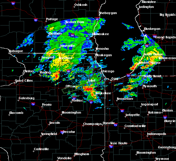 At 1047 am cdt, severe thunderstorms were located along a line extending from 8 miles southeast of ashton to 6 miles west of paw paw, moving east at 45 mph (radar indicated). Hazards include 60 mph wind gusts. Expect damage to roofs. siding and trees. severe thunderstorms will be near, paw paw around 1055 am cdt. shabbona around 1105 am cdt. waterman around 1110 am cdt. sandwich and hinckley around 1120 am cdt. other locations impacted by these severe thunderstorms include compton, lee and west brooklyn. Including the following interstate, i-39 between mile markers 81 and 91. At 1047 am cdt, severe thunderstorms were located along a line extending from 8 miles southeast of ashton to 6 miles west of paw paw, moving east at 45 mph (radar indicated). Hazards include 60 mph wind gusts. Expect damage to roofs. siding and trees. severe thunderstorms will be near, paw paw around 1055 am cdt. shabbona around 1105 am cdt. waterman around 1110 am cdt. sandwich and hinckley around 1120 am cdt. other locations impacted by these severe thunderstorms include compton, lee and west brooklyn. Including the following interstate, i-39 between mile markers 81 and 91.
|
| 6/8/2015 3:44 PM CDT | At 343 pm cdt, severe thunderstorms were located along a line extending from wayne to near shabbona, moving southeast at 30 mph (radar indicated). Hazards include 60 mph wind gusts and quarter size hail. Hail damage to vehicles is expected. expect wind damage to roofs, siding and trees. locations impacted include, aurora, elgin, st. charles, oswego, west chicago, batavia, geneva, sycamore, yorkville, little rock, plano, sandwich, shabbona, de kalb, bartlett, montgomery, north aurora, sugar grove and elburn. this includes, northern illinois university, sandwich fairgrounds, aurora university, elgin community college, fermilab, il math and science academy, kane county cougars ballpark, and waubonsee community college. including the following interstates, i-39 between mile markers 83 and 94. I-88 between mile markers 84 and 120. |
| 6/8/2015 3:27 PM CDT |
 At 327 pm cdt, severe thunderstorms were located along a line extending from near elgin to near shabbona, moving southeast at 30 mph (radar indicated). Hazards include 60 mph wind gusts and quarter size hail. Hail damage to vehicles is expected. Expect wind damage to roofs, siding and trees. At 327 pm cdt, severe thunderstorms were located along a line extending from near elgin to near shabbona, moving southeast at 30 mph (radar indicated). Hazards include 60 mph wind gusts and quarter size hail. Hail damage to vehicles is expected. Expect wind damage to roofs, siding and trees.
|
| 4/8/2015 11:13 PM CDT | The national weather service in chicago has issued a * severe thunderstorm warning for. central de kalb county in north central illinois. until midnight cdt * at 1113 pm cdt. a severe thunderstorm was located near shabbona. Moving northeast at 20 mph. |
Hail Maps for Lee, IL
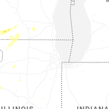
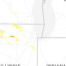


Connect with Interactive Hail Maps