

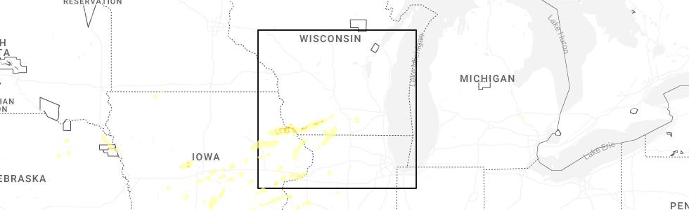
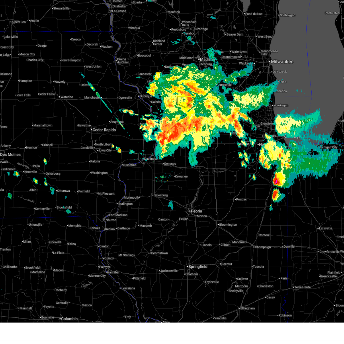
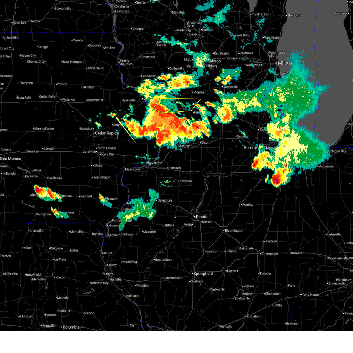
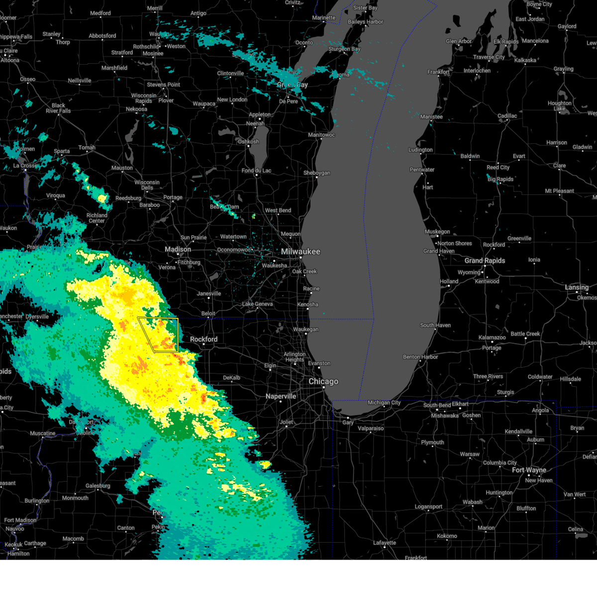
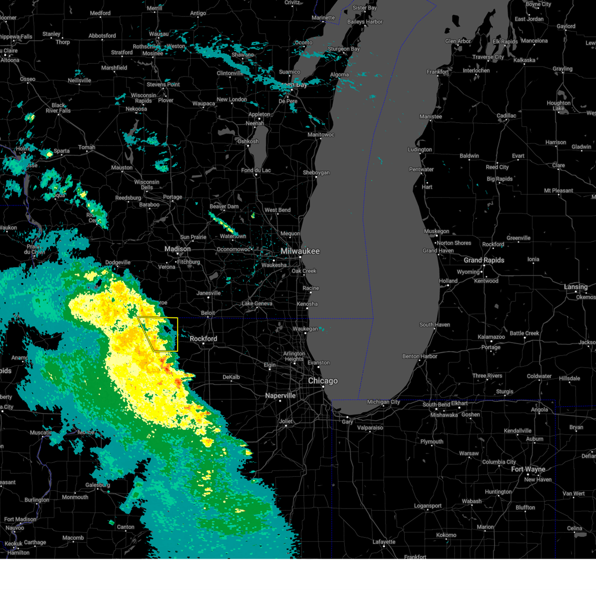
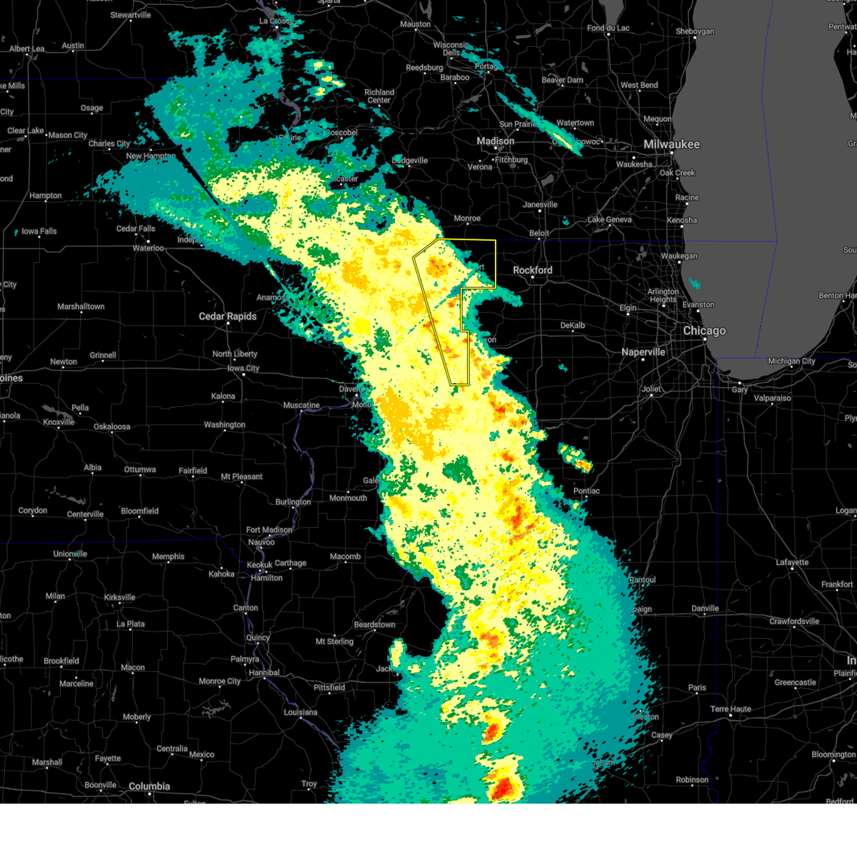
Hail Map for Lena, IL
The Lena, IL area has had 1 report of on-the-ground hail by trained spotters, and has been under severe weather warnings 38 times during the past 12 months. Doppler radar has detected hail at or near Lena, IL on 52 occasions, including 1 occasion during the past year.
| Name: | Lena, IL |
| Where Located: | 52.7 miles SSW of Madison, WI |
| Map: | Google Map for Lena, IL |
| Population: | 2912 |
| Housing Units: | 1283 |
| More Info: | Search Google for Lena, IL |
1
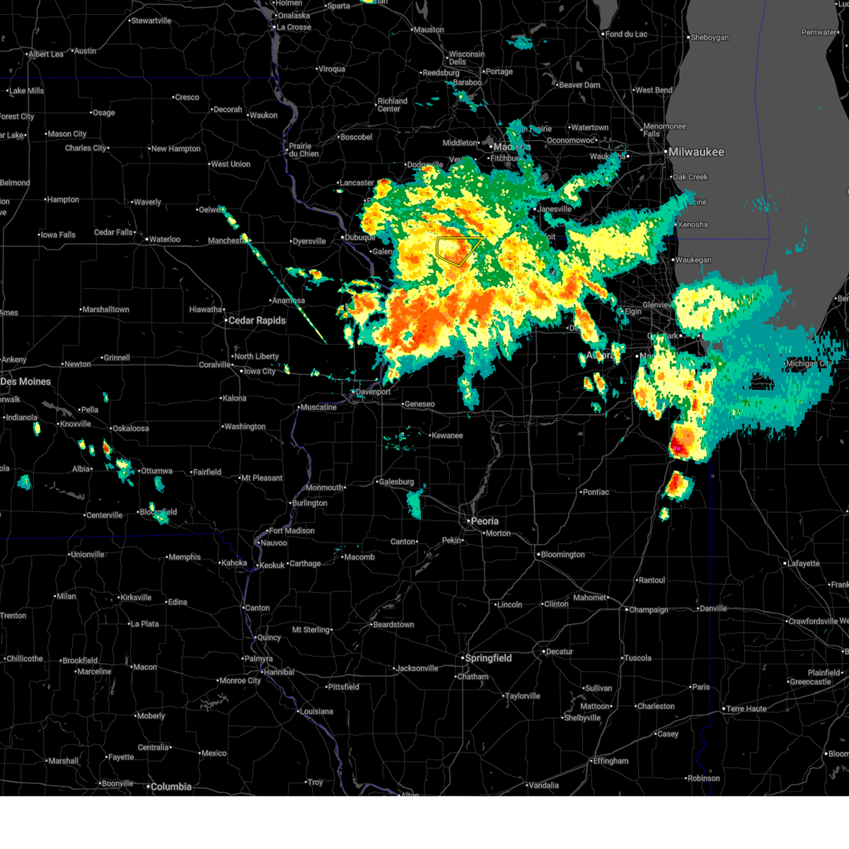
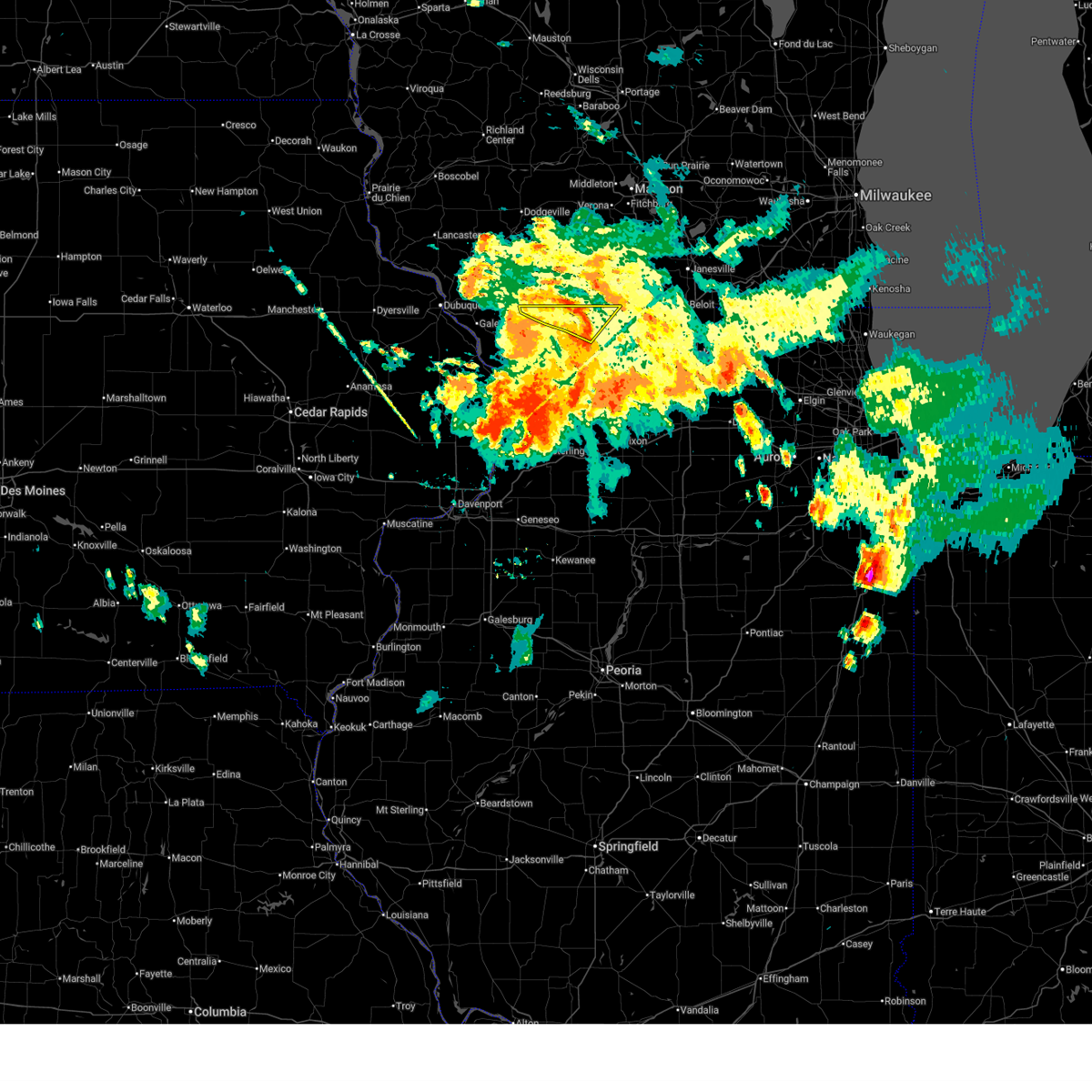
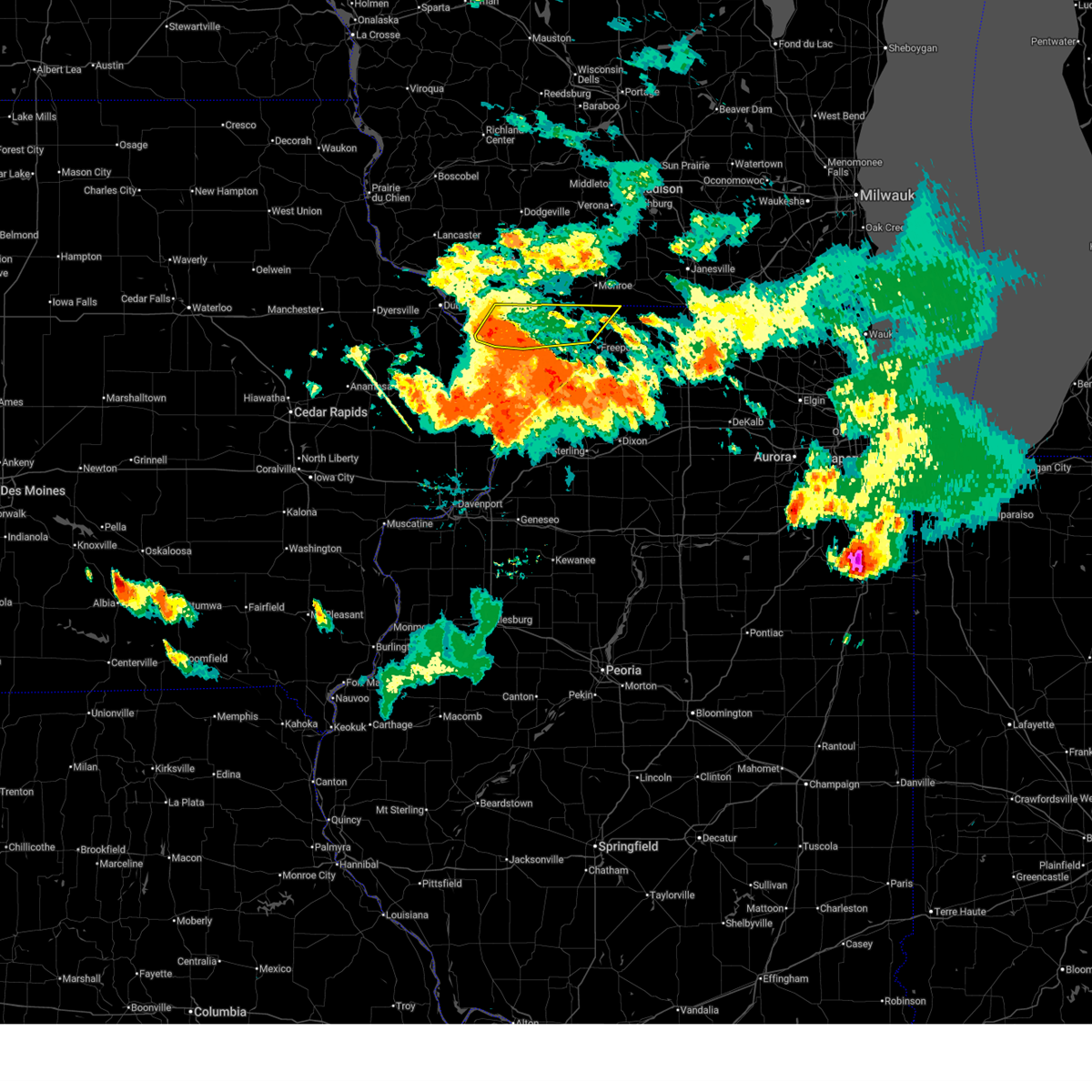
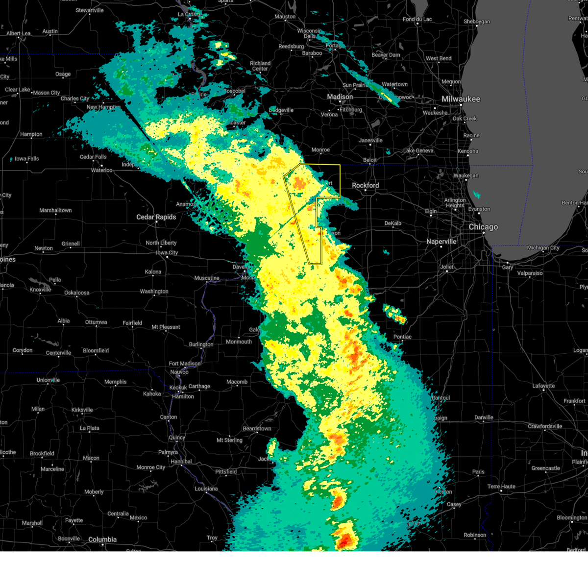
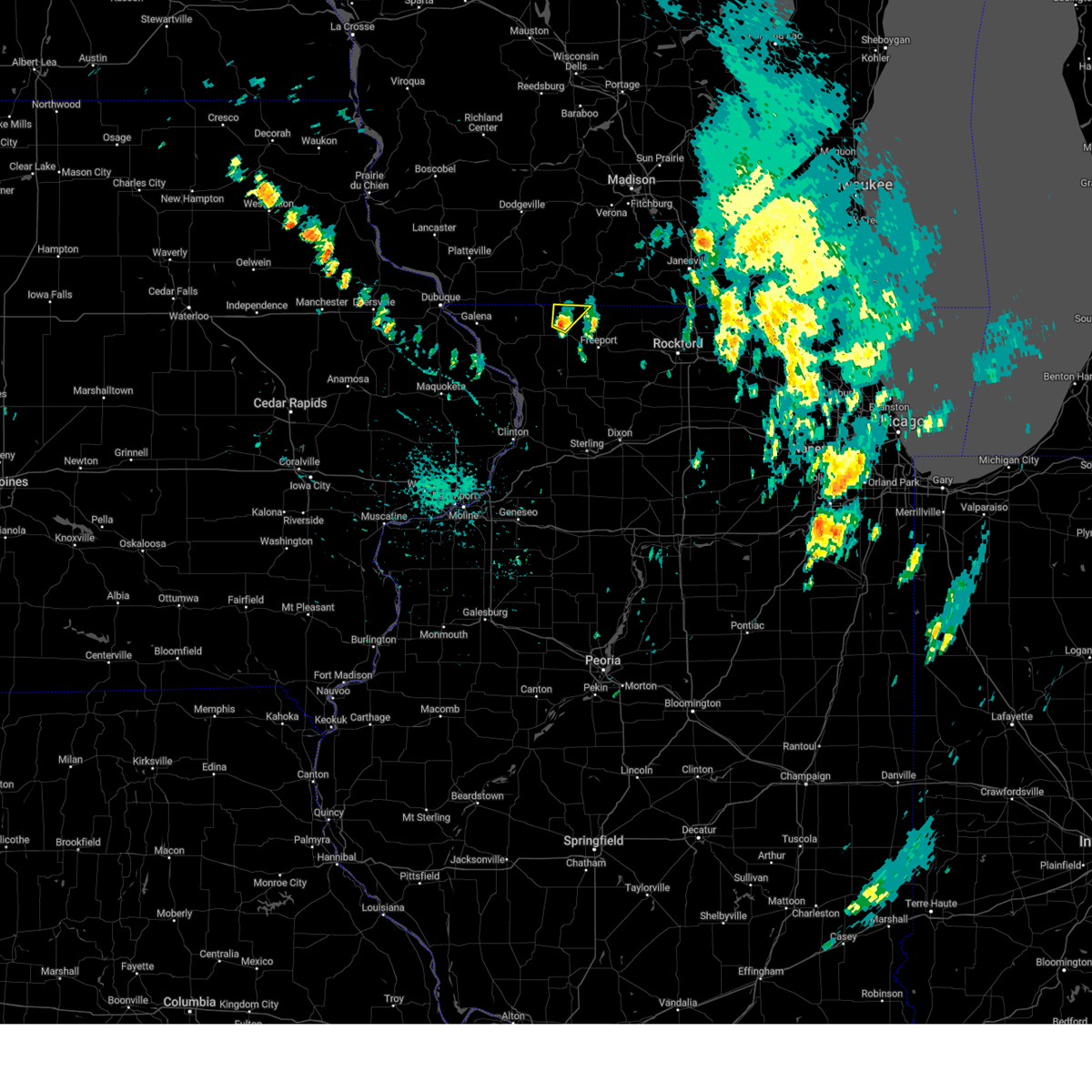
The Top Recent Hail Date for Lena, IL is Friday, July 11, 2025 (15th out of 52)
Hail and Wind Damage Spotted near Lena, IL
| Date / Time | Report Details |
|---|---|
| 7/11/2025 6:13 PM CDT |
 The storms which prompted the warning have weakened below severe limits, and have exited the warned area. therefore, the warning will be allowed to expire. however, heavy rain is still possible with these thunderstorms. a tornado watch remains in effect until 800 pm cdt for northwestern illinois. The storms which prompted the warning have weakened below severe limits, and have exited the warned area. therefore, the warning will be allowed to expire. however, heavy rain is still possible with these thunderstorms. a tornado watch remains in effect until 800 pm cdt for northwestern illinois.
|
| 7/11/2025 5:53 PM CDT |
 At 552 pm cdt, severe thunderstorms were located along a line extending from near oneco to near baileyville, moving east at 50 mph (radar indicated). Hazards include 60 mph wind gusts. Expect damage to roofs, siding, and trees. Locations impacted include, freeport, lena, pearl city, cedarville, davis, dakota, german valley, winslow, rock city, ridott, buena vista, rock grove, oneco, orangeville, kent, eleroy, damascus, lake le-aqua- na state park, mc connell, and scioto mills. At 552 pm cdt, severe thunderstorms were located along a line extending from near oneco to near baileyville, moving east at 50 mph (radar indicated). Hazards include 60 mph wind gusts. Expect damage to roofs, siding, and trees. Locations impacted include, freeport, lena, pearl city, cedarville, davis, dakota, german valley, winslow, rock city, ridott, buena vista, rock grove, oneco, orangeville, kent, eleroy, damascus, lake le-aqua- na state park, mc connell, and scioto mills.
|
| 7/11/2025 5:53 PM CDT |
 the severe thunderstorm warning has been cancelled and is no longer in effect the severe thunderstorm warning has been cancelled and is no longer in effect
|
| 7/11/2025 5:22 PM CDT |
 Svrdvn the national weather service in the quad cities has issued a * severe thunderstorm warning for, eastern jo daviess county in northwestern illinois, stephenson county in northwestern illinois, * until 615 pm cdt. * at 522 pm cdt, severe thunderstorms were located along a line extending from apple river to near massbach, moving east at 50 mph (radar indicated). Hazards include 60 mph wind gusts. expect damage to roofs, siding, and trees Svrdvn the national weather service in the quad cities has issued a * severe thunderstorm warning for, eastern jo daviess county in northwestern illinois, stephenson county in northwestern illinois, * until 615 pm cdt. * at 522 pm cdt, severe thunderstorms were located along a line extending from apple river to near massbach, moving east at 50 mph (radar indicated). Hazards include 60 mph wind gusts. expect damage to roofs, siding, and trees
|
| 7/10/2025 8:23 PM CDT |
 The storms which prompted the warning have weakened below severe limits, and no longer pose an immediate threat to life or property. therefore, the warning will be allowed to expire. however, gusty winds are still possible with these thunderstorms. The storms which prompted the warning have weakened below severe limits, and no longer pose an immediate threat to life or property. therefore, the warning will be allowed to expire. however, gusty winds are still possible with these thunderstorms.
|
| 7/10/2025 8:20 PM CDT |
 the severe thunderstorm warning has been cancelled and is no longer in effect the severe thunderstorm warning has been cancelled and is no longer in effect
|
| 7/10/2025 8:20 PM CDT |
 At 820 pm cdt, severe thunderstorms were located along a line extending from woodford to rock grove, moving northeast at 35 mph (radar indicated). Hazards include 60 mph wind gusts and penny size hail. Expect damage to roofs, siding, and trees. Locations impacted include, lena, cedarville, winslow, buena vista, rock grove, oneco, orangeville, red oak, damascus, lake le-aqua- na state park, afolkey, mc connell, and scioto mills. At 820 pm cdt, severe thunderstorms were located along a line extending from woodford to rock grove, moving northeast at 35 mph (radar indicated). Hazards include 60 mph wind gusts and penny size hail. Expect damage to roofs, siding, and trees. Locations impacted include, lena, cedarville, winslow, buena vista, rock grove, oneco, orangeville, red oak, damascus, lake le-aqua- na state park, afolkey, mc connell, and scioto mills.
|
| 7/10/2025 8:07 PM CDT |
 At 806 pm cdt, severe thunderstorms were located along a line extending from near gratiot to cedarville, moving east at 45 mph (radar indicated). Hazards include 60 mph wind gusts and penny size hail. Expect damage to roofs, siding, and trees. Locations impacted include, lena, warren, cedarville, apple river, winslow, nora, buena vista, rock grove, oneco, orangeville, waddams grove, red oak, damascus, lake le-aqua- na state park, afolkey, mc connell, scioto mills, apple river canyon state park, and jo daviess county fairgrounds. At 806 pm cdt, severe thunderstorms were located along a line extending from near gratiot to cedarville, moving east at 45 mph (radar indicated). Hazards include 60 mph wind gusts and penny size hail. Expect damage to roofs, siding, and trees. Locations impacted include, lena, warren, cedarville, apple river, winslow, nora, buena vista, rock grove, oneco, orangeville, waddams grove, red oak, damascus, lake le-aqua- na state park, afolkey, mc connell, scioto mills, apple river canyon state park, and jo daviess county fairgrounds.
|
| 7/10/2025 7:50 PM CDT | At 750 pm cdt, severe thunderstorms were located along a line extending from near shullsburg to near kent, moving northeast at 40 mph (radar indicated). Hazards include 60 mph wind gusts and penny size hail. Expect damage to roofs, siding, and trees. Locations impacted include, lena, stockton, warren, elizabeth, cedarville, woodbine, scales mound, apple river, winslow, nora, schapville, buena vista, rock grove, oneco, guilford, orangeville, kent, rice, eleroy, and north hanover. |
| 7/10/2025 7:46 PM CDT |
 At 746 pm cdt, severe thunderstorms were located along a line extending from scales mound to stockton airport, moving northeast at 40 mph (radar indicated). Hazards include 60 mph wind gusts and penny size hail. Expect damage to roofs, siding, and trees. Locations impacted include, lena, stockton, warren, elizabeth, cedarville, woodbine, scales mound, apple river, winslow, nora, schapville, buena vista, rock grove, oneco, guilford, orangeville, kent, rice, eleroy, and north hanover. At 746 pm cdt, severe thunderstorms were located along a line extending from scales mound to stockton airport, moving northeast at 40 mph (radar indicated). Hazards include 60 mph wind gusts and penny size hail. Expect damage to roofs, siding, and trees. Locations impacted include, lena, stockton, warren, elizabeth, cedarville, woodbine, scales mound, apple river, winslow, nora, schapville, buena vista, rock grove, oneco, guilford, orangeville, kent, rice, eleroy, and north hanover.
|
| 7/10/2025 7:36 PM CDT |
 Svrdvn the national weather service in the quad cities has issued a * severe thunderstorm warning for, northeastern jo daviess county in northwestern illinois, northwestern stephenson county in northwestern illinois, * until 830 pm cdt. * at 736 pm cdt, severe thunderstorms were located along a line extending from near galena territory to elmoville, moving northeast at 35 mph (radar indicated). Hazards include 60 mph wind gusts. expect damage to roofs, siding, and trees Svrdvn the national weather service in the quad cities has issued a * severe thunderstorm warning for, northeastern jo daviess county in northwestern illinois, northwestern stephenson county in northwestern illinois, * until 830 pm cdt. * at 736 pm cdt, severe thunderstorms were located along a line extending from near galena territory to elmoville, moving northeast at 35 mph (radar indicated). Hazards include 60 mph wind gusts. expect damage to roofs, siding, and trees
|
| 6/25/2025 6:13 PM CDT | At 613 pm cdt, severe thunderstorms were located along a line extending from pearl city to near forreston, moving northeast at 30 mph (radar indicated). Hazards include 60 mph wind gusts. Expect damage to roofs, siding, and trees. Locations impacted include, freeport, lena, pearl city, cedarville, davis, dakota, german valley, rock city, ridott, buena vista, rock grove, oneco, orangeville, eleroy, damascus, mc connell, scioto mills, winneshiek, stephenson county fairgrounds, and red oak. |
| 6/25/2025 6:13 PM CDT | the severe thunderstorm warning has been cancelled and is no longer in effect |
| 6/25/2025 5:52 PM CDT | Svrdvn the national weather service in the quad cities has issued a * severe thunderstorm warning for, southeastern jo daviess county in northwestern illinois, northeastern carroll county in northwestern illinois, stephenson county in northwestern illinois, * until 700 pm cdt. * at 552 pm cdt, severe thunderstorms were located along a line extending from near loran to near hitt, moving northeast at 30 mph (radar indicated). Hazards include 60 mph wind gusts. expect damage to roofs, siding, and trees |
| 3/14/2025 11:07 PM CDT |
 The storms which prompted the warning have weakened below severe limits, and have exited the warned area. therefore, the warning will be allowed to expire. however, gusty winds are still possible with these thunderstorms. a severe thunderstorm watch remains in effect until 200 am cdt for northwestern illinois. The storms which prompted the warning have weakened below severe limits, and have exited the warned area. therefore, the warning will be allowed to expire. however, gusty winds are still possible with these thunderstorms. a severe thunderstorm watch remains in effect until 200 am cdt for northwestern illinois.
|
| 3/14/2025 11:00 PM CDT |
 At 1100 pm cdt, severe thunderstorms were located along a line extending from near blanchardville to near stephenson county fairgrounds, moving northeast at 50 mph (radar indicated). Hazards include 70 mph wind gusts. Expect considerable tree damage. damage is likely to mobile homes, roofs, and outbuildings. Locations impacted include, eleroy, rock grove, red oak, ridott, orangeville, damascus, mc connell, afolkey, davis, scioto mills, winslow, winneshiek, german valley, dakota dornink airport, rock city, freeport, albertus airport, dakota, cedarville, and oneco. At 1100 pm cdt, severe thunderstorms were located along a line extending from near blanchardville to near stephenson county fairgrounds, moving northeast at 50 mph (radar indicated). Hazards include 70 mph wind gusts. Expect considerable tree damage. damage is likely to mobile homes, roofs, and outbuildings. Locations impacted include, eleroy, rock grove, red oak, ridott, orangeville, damascus, mc connell, afolkey, davis, scioto mills, winslow, winneshiek, german valley, dakota dornink airport, rock city, freeport, albertus airport, dakota, cedarville, and oneco.
|
| 3/14/2025 11:00 PM CDT |
 the severe thunderstorm warning has been cancelled and is no longer in effect the severe thunderstorm warning has been cancelled and is no longer in effect
|
| 3/14/2025 10:47 PM CDT |
 the severe thunderstorm warning has been cancelled and is no longer in effect the severe thunderstorm warning has been cancelled and is no longer in effect
|
| 3/14/2025 10:47 PM CDT |
 At 1046 pm cdt, severe thunderstorms were located along a line extending from yellowstone lake st park to near bolton, moving northeast at 60 mph (radar indicated). Hazards include 70 mph wind gusts. Expect considerable tree damage. damage is likely to mobile homes, roofs, and outbuildings. locations impacted include, carroll county fairgrounds, lake le-aqua- na state park, shannon, como, davis, coleta, winslow, chadwick, douglas park, buena vista, yeoward addition, whiteside county airport, rock grove, red oak, galt, milledgeville, lena, emerson, dakota dornink airport, and willow. This includes interstate 88 between mile markers 33 and 44. At 1046 pm cdt, severe thunderstorms were located along a line extending from yellowstone lake st park to near bolton, moving northeast at 60 mph (radar indicated). Hazards include 70 mph wind gusts. Expect considerable tree damage. damage is likely to mobile homes, roofs, and outbuildings. locations impacted include, carroll county fairgrounds, lake le-aqua- na state park, shannon, como, davis, coleta, winslow, chadwick, douglas park, buena vista, yeoward addition, whiteside county airport, rock grove, red oak, galt, milledgeville, lena, emerson, dakota dornink airport, and willow. This includes interstate 88 between mile markers 33 and 44.
|
| 3/14/2025 10:34 PM CDT | the severe thunderstorm warning has been cancelled and is no longer in effect |
| 3/14/2025 10:34 PM CDT | At 1033 pm cdt, severe thunderstorms were located along a line extending from gratiot to near lanark, moving northeast at 60 mph (radar indicated). Hazards include 70 mph wind gusts. Expect considerable tree damage. damage is likely to mobile homes, roofs, and outbuildings. locations impacted include, portland corners, wacker, morrison, ideal, carroll county fairgrounds, round grove, lake le-aqua- na state park, shannon, malvern, como, davis, coleta, winslow, denrock, chadwick, union grove, thomson causeway, douglas park, buena vista, and yeoward addition. This includes interstate 88 between mile markers 21 and 44. |
| 3/14/2025 10:17 PM CDT | At 1017 pm cdt, severe thunderstorms were located along a line extending from near schapville to union grove, moving east at 65 mph (radar indicated). Hazards include 70 mph wind gusts. Expect considerable tree damage. damage is likely to mobile homes, roofs, and outbuildings. locations impacted include, wacker, ideal, carroll county fairgrounds, lake le-aqua- na state park, como, reeceville, winslow, east clinton, denrock, union grove, thomson causeway, douglas park, buena vista, albany, bryant, yeoward addition, rock grove, red oak, galt, and bulgers hollow. This includes interstate 88 between mile markers 8 and 44. |
| 3/14/2025 10:01 PM CDT | Svrdvn the national weather service in the quad cities has issued a * severe thunderstorm warning for, northeastern rock island county in northwestern illinois, whiteside county in northwestern illinois, southeastern jo daviess county in northwestern illinois, carroll county in northwestern illinois, stephenson county in northwestern illinois, southeastern jackson county in east central iowa, eastern clinton county in east central iowa, * until 1115 pm cdt. * at 1000 pm cdt, severe thunderstorms were located along a line extending from near galena territory to fulton, moving north at 65 mph (trained weather spotters). Hazards include 70 mph wind gusts. Expect considerable tree damage. Damage is likely to mobile homes, roofs, and outbuildings. |
| 3/14/2025 9:53 PM CDT | Svrdvn the national weather service in the quad cities has issued a * severe thunderstorm warning for, northeastern rock island county in northwestern illinois, whiteside county in northwestern illinois, southeastern jo daviess county in northwestern illinois, carroll county in northwestern illinois, stephenson county in northwestern illinois, southeastern jackson county in east central iowa, eastern clinton county in east central iowa, * until 1115 pm cdt. * at 953 pm cdt, severe thunderstorms were located along a line extending from near green island to near hillsdale, moving north at 180 mph (trained weather spotters reported 75 mph winds at the clinton iowa riverfront). Hazards include 70 mph wind gusts. Expect considerable tree damage. Damage is likely to mobile homes, roofs, and outbuildings. |
| 7/15/2024 7:34 PM CDT |
 At 733 pm cdt, a severe thunderstorm was located over seward, or 8 miles northwest of byron, moving east at 50 mph. this is a destructive storm for freeport (radar indicated). Hazards include 90 mph wind gusts. You are in a life-threatening situation. flying debris may be deadly to those caught without shelter. mobile homes will be heavily damaged or destroyed. homes and businesses will have substantial roof and window damage. expect extensive tree damage and power outages. Locations impacted include, freeport, mount carroll, lena, stockton, lanark, pearl city, shannon, cedarville, davis, dakota, german valley, winslow, rock city, ridott, massbach, buena vista, loran, rock grove, oneco, and orangeville. At 733 pm cdt, a severe thunderstorm was located over seward, or 8 miles northwest of byron, moving east at 50 mph. this is a destructive storm for freeport (radar indicated). Hazards include 90 mph wind gusts. You are in a life-threatening situation. flying debris may be deadly to those caught without shelter. mobile homes will be heavily damaged or destroyed. homes and businesses will have substantial roof and window damage. expect extensive tree damage and power outages. Locations impacted include, freeport, mount carroll, lena, stockton, lanark, pearl city, shannon, cedarville, davis, dakota, german valley, winslow, rock city, ridott, massbach, buena vista, loran, rock grove, oneco, and orangeville.
|
| 7/15/2024 7:34 PM CDT |
 the severe thunderstorm warning has been cancelled and is no longer in effect the severe thunderstorm warning has been cancelled and is no longer in effect
|
| 7/15/2024 7:25 PM CDT | Storm damage reported in stephenson county IL, 0.1 miles WNW of Lena, IL |
| 7/15/2024 7:24 PM CDT |
 At 723 pm cdt, a severe thunderstorm was located over albertus airport, or near freeport, moving east at 50 mph (radar indicated). Hazards include 90 mph wind gusts. You are in a life-threatening situation. flying debris may be deadly to those caught without shelter. mobile homes will be heavily damaged or destroyed. homes and businesses will have substantial roof and window damage. expect extensive tree damage and power outages. Locations impacted include, freeport, mount carroll, lena, stockton, lanark, warren, hanover, pearl city, elizabeth, shannon, cedarville, davis, woodbine, dakota, german valley, scales mound, apple river, winslow, rock city, and ridott. At 723 pm cdt, a severe thunderstorm was located over albertus airport, or near freeport, moving east at 50 mph (radar indicated). Hazards include 90 mph wind gusts. You are in a life-threatening situation. flying debris may be deadly to those caught without shelter. mobile homes will be heavily damaged or destroyed. homes and businesses will have substantial roof and window damage. expect extensive tree damage and power outages. Locations impacted include, freeport, mount carroll, lena, stockton, lanark, warren, hanover, pearl city, elizabeth, shannon, cedarville, davis, woodbine, dakota, german valley, scales mound, apple river, winslow, rock city, and ridott.
|
| 7/15/2024 7:14 PM CDT | the tornado warning has been cancelled and is no longer in effect |
| 7/15/2024 7:14 PM CDT | At 714 pm cdt, a severe squall line capable of producing both tornadoes and extensive straight line wind damage was located along a line extending from winslow to near shannon, moving east at 45 mph (radar indicated rotation). Hazards include tornado. Flying debris will be dangerous to those caught without shelter. mobile homes will be damaged or destroyed. damage to roofs, windows, and vehicles will occur. tree damage is likely. Locations impacted include, freeport, lena, pearl city, shannon, winslow, buena vista, loran, oneco, orangeville, kent, waddams grove, eleroy, red oak, damascus, lake le-aqua-na state park, mc connell, scioto mills, and bolton. |
| 7/15/2024 7:07 PM CDT |
 the severe thunderstorm warning has been cancelled and is no longer in effect the severe thunderstorm warning has been cancelled and is no longer in effect
|
| 7/15/2024 7:07 PM CDT |
 At 705 pm cdt, a severe thunderstorm was located over pearl city, or 10 miles west of freeport, moving east at 50 mph. this is a destructive storm for lena, bellevue, davis, winslow (radar indicated). Hazards include 90 mph wind gusts. You are in a life-threatening situation. flying debris may be deadly to those caught without shelter. mobile homes will be heavily damaged or destroyed. homes and businesses will have substantial roof and window damage. expect extensive tree damage and power outages. Locations impacted include, freeport, galena, mount carroll, lena, bellevue, stockton, lanark, warren, hanover, pearl city, elizabeth, shannon, cedarville, davis, woodbine, dakota, german valley, scales mound, apple river, and winslow. At 705 pm cdt, a severe thunderstorm was located over pearl city, or 10 miles west of freeport, moving east at 50 mph. this is a destructive storm for lena, bellevue, davis, winslow (radar indicated). Hazards include 90 mph wind gusts. You are in a life-threatening situation. flying debris may be deadly to those caught without shelter. mobile homes will be heavily damaged or destroyed. homes and businesses will have substantial roof and window damage. expect extensive tree damage and power outages. Locations impacted include, freeport, galena, mount carroll, lena, bellevue, stockton, lanark, warren, hanover, pearl city, elizabeth, shannon, cedarville, davis, woodbine, dakota, german valley, scales mound, apple river, and winslow.
|
| 7/15/2024 7:00 PM CDT |
 At 700 pm cdt, a severe squall line capable of producing both tornadoes and extensive straight line wind damage was located along a line extending from jo daviess county fairgrounds to near loran, moving east at 45 mph (radar indicated rotation). Hazards include tornado. Flying debris will be dangerous to those caught without shelter. mobile homes will be damaged or destroyed. damage to roofs, windows, and vehicles will occur. tree damage is likely. Locations impacted include, lena, pearl city, winslow, loran, kent, eleroy, lake le-aqua-na state park, waddams grove, shannon, buena vista, mc connell, damascus, bolton, freeport, oneco, orangeville, red oak and scioto mills. At 700 pm cdt, a severe squall line capable of producing both tornadoes and extensive straight line wind damage was located along a line extending from jo daviess county fairgrounds to near loran, moving east at 45 mph (radar indicated rotation). Hazards include tornado. Flying debris will be dangerous to those caught without shelter. mobile homes will be damaged or destroyed. damage to roofs, windows, and vehicles will occur. tree damage is likely. Locations impacted include, lena, pearl city, winslow, loran, kent, eleroy, lake le-aqua-na state park, waddams grove, shannon, buena vista, mc connell, damascus, bolton, freeport, oneco, orangeville, red oak and scioto mills.
|
| 7/15/2024 6:55 PM CDT |
 At 654 pm cdt, a severe thunderstorm was located over stockton airport, or 15 miles north of mount carroll, moving east at 50 mph. this is a destructive storm for mount carroll and freeport (radar indicated). Hazards include 90 mph wind gusts. You are in a life-threatening situation. flying debris may be deadly to those caught without shelter. mobile homes will be heavily damaged or destroyed. homes and businesses will have substantial roof and window damage. expect extensive tree damage and power outages. Locations impacted include, freeport, galena, mount carroll, lena, bellevue, stockton, lanark, warren, hanover, pearl city, elizabeth, shannon, cedarville, davis, woodbine, dakota, german valley, scales mound, apple river, and winslow. At 654 pm cdt, a severe thunderstorm was located over stockton airport, or 15 miles north of mount carroll, moving east at 50 mph. this is a destructive storm for mount carroll and freeport (radar indicated). Hazards include 90 mph wind gusts. You are in a life-threatening situation. flying debris may be deadly to those caught without shelter. mobile homes will be heavily damaged or destroyed. homes and businesses will have substantial roof and window damage. expect extensive tree damage and power outages. Locations impacted include, freeport, galena, mount carroll, lena, bellevue, stockton, lanark, warren, hanover, pearl city, elizabeth, shannon, cedarville, davis, woodbine, dakota, german valley, scales mound, apple river, and winslow.
|
| 7/15/2024 6:38 PM CDT | Tordvn the national weather service in the quad cities has issued a * tornado warning for, jo daviess county in northwestern illinois, northern carroll county in northwestern illinois, western stephenson county in northwestern illinois, * until 730 pm cdt. * at 638 pm cdt, severe thunderstorms capable of producing both tornadoes and extensive straight line wind damage were located along a line extending from near scales mound to whitton, moving east at 40 mph (radar indicated rotation). Hazards include tornado. Flying debris will be dangerous to those caught without shelter. mobile homes will be damaged or destroyed. damage to roofs, windows, and vehicles will occur. tree damage is likely. these dangerous storms will be near, hanover, elizabeth, woodbine, apple river, massbach, schapville, apple river canyon state park, canyon camp, camp far horizons, and elizabeth fairgrounds around 645 pm cdt. stockton, warren, elmoville, and jo daviess county fairgrounds around 650 pm cdt. nora, willow, and stockton airport around 655 pm cdt. Other locations in the path of these tornadic storms include loran, kent, waddams grove, lena, pearl city, winslow, lake le-aqua- na state park, eleroy, mc connell, freeport, shannon, buena vista, oneco, orangeville, red oak, scioto mills, damascus and bolton. |
| 7/15/2024 6:28 PM CDT | Svrdvn the national weather service in the quad cities has issued a * severe thunderstorm warning for, jo daviess county in northwestern illinois, northern carroll county in northwestern illinois, stephenson county in northwestern illinois, northern jackson county in east central iowa, southeastern dubuque county in northeastern iowa, * until 745 pm cdt. * at 627 pm cdt, a severe thunderstorm was located over aiken, or over galena, moving east at 50 mph. this is a destructive storm for galena, mount carroll and freeport (radar indicated). Hazards include 90 mph wind gusts. You are in a life-threatening situation. flying debris may be deadly to those caught without shelter. mobile homes will be heavily damaged or destroyed. homes and businesses will have substantial roof and window damage. Expect extensive tree damage and power outages. |
| 7/14/2024 8:16 PM CDT |
 At 816 pm cdt, a severe thunderstorm was located over rock city, or 10 miles northeast of freeport, moving east at 30 mph (radar indicated). Hazards include 60 mph wind gusts. Expect damage to roofs, siding, and trees. Locations impacted include, davis, rock city and lake summerset. At 816 pm cdt, a severe thunderstorm was located over rock city, or 10 miles northeast of freeport, moving east at 30 mph (radar indicated). Hazards include 60 mph wind gusts. Expect damage to roofs, siding, and trees. Locations impacted include, davis, rock city and lake summerset.
|
| 7/14/2024 7:47 PM CDT |
 Svrdvn the national weather service in the quad cities has issued a * severe thunderstorm warning for, northeastern jo daviess county in northwestern illinois, stephenson county in northwestern illinois, * until 845 pm cdt. * at 747 pm cdt, a severe thunderstorm was located near gratiot, or 11 miles southeast of darlington, moving east at 30 mph (radar indicated). Hazards include 60 mph wind gusts and penny size hail. Expect damage to roofs, siding, and trees. this severe thunderstorm will be near, warren, winslow, nora, and jo daviess county fairgrounds around 750 pm cdt. waddams grove around 755 pm cdt. mc connell and lake le-aqua-na state park around 800 pm cdt. buena vista, oneco, and orangeville around 805 pm cdt. Other locations in the path of this severe thunderstorm include red oak, afolkey, rock grove, dakota, rock city, dakota dornink airport, davis and lake summerset. Svrdvn the national weather service in the quad cities has issued a * severe thunderstorm warning for, northeastern jo daviess county in northwestern illinois, stephenson county in northwestern illinois, * until 845 pm cdt. * at 747 pm cdt, a severe thunderstorm was located near gratiot, or 11 miles southeast of darlington, moving east at 30 mph (radar indicated). Hazards include 60 mph wind gusts and penny size hail. Expect damage to roofs, siding, and trees. this severe thunderstorm will be near, warren, winslow, nora, and jo daviess county fairgrounds around 750 pm cdt. waddams grove around 755 pm cdt. mc connell and lake le-aqua-na state park around 800 pm cdt. buena vista, oneco, and orangeville around 805 pm cdt. Other locations in the path of this severe thunderstorm include red oak, afolkey, rock grove, dakota, rock city, dakota dornink airport, davis and lake summerset.
|
| 7/13/2024 11:44 PM CDT |
 Svrdvn the national weather service in the quad cities has issued a * severe thunderstorm warning for, northeastern carroll county in northwestern illinois, stephenson county in northwestern illinois, * until 1230 am cdt. * at 1143 pm cdt, a severe thunderstorm was located over scioto mills, or near freeport, moving southeast at 40 mph (radar indicated). Hazards include 60 mph wind gusts. expect damage to roofs, siding, and trees Svrdvn the national weather service in the quad cities has issued a * severe thunderstorm warning for, northeastern carroll county in northwestern illinois, stephenson county in northwestern illinois, * until 1230 am cdt. * at 1143 pm cdt, a severe thunderstorm was located over scioto mills, or near freeport, moving southeast at 40 mph (radar indicated). Hazards include 60 mph wind gusts. expect damage to roofs, siding, and trees
|
| 6/22/2024 8:49 PM CDT |
 At 849 pm cdt, severe thunderstorms were located along a line extending from near gratiot to near apple river canyon state park to near woodbine, moving east at 55 mph (radar indicated). Hazards include 60 mph wind gusts. Expect damage to roofs, siding, and trees. Locations impacted include, freeport, lena, stockton, warren, pearl city, cedarville, davis, woodbine, dakota, german valley, scales mound, apple river, winslow, rock city, ridott, nora, schapville, buena vista, rock grove, and oneco. At 849 pm cdt, severe thunderstorms were located along a line extending from near gratiot to near apple river canyon state park to near woodbine, moving east at 55 mph (radar indicated). Hazards include 60 mph wind gusts. Expect damage to roofs, siding, and trees. Locations impacted include, freeport, lena, stockton, warren, pearl city, cedarville, davis, woodbine, dakota, german valley, scales mound, apple river, winslow, rock city, ridott, nora, schapville, buena vista, rock grove, and oneco.
|
| 6/22/2024 8:37 PM CDT |
 Svrdvn the national weather service in the quad cities has issued a * severe thunderstorm warning for, eastern jo daviess county in northwestern illinois, stephenson county in northwestern illinois, * until 930 pm cdt. * at 836 pm cdt, severe thunderstorms were located along a line extending from shullsburg to near schapville to rodden, moving east at 55 mph (radar indicated). Hazards include 60 mph wind gusts. expect damage to roofs, siding, and trees Svrdvn the national weather service in the quad cities has issued a * severe thunderstorm warning for, eastern jo daviess county in northwestern illinois, stephenson county in northwestern illinois, * until 930 pm cdt. * at 836 pm cdt, severe thunderstorms were located along a line extending from shullsburg to near schapville to rodden, moving east at 55 mph (radar indicated). Hazards include 60 mph wind gusts. expect damage to roofs, siding, and trees
|
| 5/24/2024 9:36 AM CDT |
 At 936 am cdt, severe thunderstorms were located along a line extending from near albany to adeline, moving east at 45 mph (radar indicated). Hazards include 60 mph wind gusts. Expect damage to roofs, siding, and trees. Locations impacted include, freeport, lena, pearl city, cedarville, davis, dakota, german valley, winslow, rock city, ridott, buena vista, rock grove, oneco, orangeville, eleroy, damascus, mc connell, scioto mills, winneshiek, and stephenson county fairgrounds. At 936 am cdt, severe thunderstorms were located along a line extending from near albany to adeline, moving east at 45 mph (radar indicated). Hazards include 60 mph wind gusts. Expect damage to roofs, siding, and trees. Locations impacted include, freeport, lena, pearl city, cedarville, davis, dakota, german valley, winslow, rock city, ridott, buena vista, rock grove, oneco, orangeville, eleroy, damascus, mc connell, scioto mills, winneshiek, and stephenson county fairgrounds.
|
| 5/24/2024 9:26 AM CDT |
 Svrdvn the national weather service in the quad cities has issued a * severe thunderstorm warning for, stephenson county in northwestern illinois, * until 1000 am cdt. * at 926 am cdt, severe thunderstorms were located along a line extending from near monticello to near forreston, moving east at 45 mph (radar indicated). Hazards include 60 mph wind gusts. expect damage to roofs, siding, and trees Svrdvn the national weather service in the quad cities has issued a * severe thunderstorm warning for, stephenson county in northwestern illinois, * until 1000 am cdt. * at 926 am cdt, severe thunderstorms were located along a line extending from near monticello to near forreston, moving east at 45 mph (radar indicated). Hazards include 60 mph wind gusts. expect damage to roofs, siding, and trees
|
| 5/24/2024 9:15 AM CDT |
 At 915 am cdt, severe thunderstorms were located along a line extending from near monroe to freeport to near penrose, moving east at 55 mph (radar indicated). Hazards include 60 mph wind gusts and penny size hail. Expect damage to roofs, siding, and trees. Locations impacted include, freeport, mount carroll, lena, stockton, lanark, warren, milledgeville, fairhaven, pearl city, shannon, cedarville, davis, chadwick, dakota, german valley, winslow, rock city, coleta, ridott, and nora. At 915 am cdt, severe thunderstorms were located along a line extending from near monroe to freeport to near penrose, moving east at 55 mph (radar indicated). Hazards include 60 mph wind gusts and penny size hail. Expect damage to roofs, siding, and trees. Locations impacted include, freeport, mount carroll, lena, stockton, lanark, warren, milledgeville, fairhaven, pearl city, shannon, cedarville, davis, chadwick, dakota, german valley, winslow, rock city, coleta, ridott, and nora.
|
| 5/24/2024 9:15 AM CDT |
 the severe thunderstorm warning has been cancelled and is no longer in effect the severe thunderstorm warning has been cancelled and is no longer in effect
|
| 5/24/2024 9:11 AM CDT |
 At 911 am cdt, a severe thunderstorm capable of producing a tornado was located over mc connell, or 10 miles northwest of freeport, moving east at 50 mph (radar indicated rotation). Hazards include tornado. Flying debris will be dangerous to those caught without shelter. mobile homes will be damaged or destroyed. damage to roofs, windows, and vehicles will occur. tree damage is likely. this dangerous storm will be near, cedarville, buena vista, oneco, orangeville, mc connell, red oak, damascus, and afolkey around 915 am cdt. Other locations in the path of this tornadic thunderstorm include rock city, rock grove, davis and lake summerset. At 911 am cdt, a severe thunderstorm capable of producing a tornado was located over mc connell, or 10 miles northwest of freeport, moving east at 50 mph (radar indicated rotation). Hazards include tornado. Flying debris will be dangerous to those caught without shelter. mobile homes will be damaged or destroyed. damage to roofs, windows, and vehicles will occur. tree damage is likely. this dangerous storm will be near, cedarville, buena vista, oneco, orangeville, mc connell, red oak, damascus, and afolkey around 915 am cdt. Other locations in the path of this tornadic thunderstorm include rock city, rock grove, davis and lake summerset.
|
| 5/24/2024 9:04 AM CDT |
 At 904 am cdt, severe thunderstorms were located along a line extending from south wayne to near kent to malvern, moving east at 55 mph (radar indicated). Hazards include 60 mph wind gusts and penny size hail. Expect damage to roofs, siding, and trees. Locations impacted include, freeport, mount carroll, savanna, lena, stockton, lanark, warren, milledgeville, fairhaven, pearl city, elizabeth, shannon, cedarville, davis, woodbine, sabula, chadwick, dakota, german valley, and scales mound. At 904 am cdt, severe thunderstorms were located along a line extending from south wayne to near kent to malvern, moving east at 55 mph (radar indicated). Hazards include 60 mph wind gusts and penny size hail. Expect damage to roofs, siding, and trees. Locations impacted include, freeport, mount carroll, savanna, lena, stockton, lanark, warren, milledgeville, fairhaven, pearl city, elizabeth, shannon, cedarville, davis, woodbine, sabula, chadwick, dakota, german valley, and scales mound.
|
| 5/24/2024 8:56 AM CDT |
 Tordvn the national weather service in the quad cities has issued a * tornado warning for, northern stephenson county in northwestern illinois, * until 945 am cdt. * at 856 am cdt, a severe thunderstorm capable of producing a tornado was located over stockton, or 19 miles west of freeport, moving east at 55 mph (radar indicated rotation). Hazards include tornado. Flying debris will be dangerous to those caught without shelter. mobile homes will be damaged or destroyed. damage to roofs, windows, and vehicles will occur. tree damage is likely. this dangerous storm will be near, lena, winslow, kent, lake le-aqua-na state park, and waddams grove around 900 am cdt. buena vista, oneco, mc connell, and damascus around 905 am cdt. cedarville, orangeville, and red oak around 910 am cdt. rock grove and afolkey around 915 am cdt. Other locations in the path of this tornadic thunderstorm include davis, rock city and lake summerset. Tordvn the national weather service in the quad cities has issued a * tornado warning for, northern stephenson county in northwestern illinois, * until 945 am cdt. * at 856 am cdt, a severe thunderstorm capable of producing a tornado was located over stockton, or 19 miles west of freeport, moving east at 55 mph (radar indicated rotation). Hazards include tornado. Flying debris will be dangerous to those caught without shelter. mobile homes will be damaged or destroyed. damage to roofs, windows, and vehicles will occur. tree damage is likely. this dangerous storm will be near, lena, winslow, kent, lake le-aqua-na state park, and waddams grove around 900 am cdt. buena vista, oneco, mc connell, and damascus around 905 am cdt. cedarville, orangeville, and red oak around 910 am cdt. rock grove and afolkey around 915 am cdt. Other locations in the path of this tornadic thunderstorm include davis, rock city and lake summerset.
|
| 5/24/2024 8:43 AM CDT |
 Svrdvn the national weather service in the quad cities has issued a * severe thunderstorm warning for, northern whiteside county in northwestern illinois, jo daviess county in northwestern illinois, carroll county in northwestern illinois, stephenson county in northwestern illinois, southeastern jackson county in east central iowa, northeastern clinton county in east central iowa, * until 930 am cdt. * at 843 am cdt, severe thunderstorms were located along a line extending from shullsburg to elizabeth to clinton, moving east at 55 mph (radar indicated). Hazards include 60 mph wind gusts and penny size hail. expect damage to roofs, siding, and trees Svrdvn the national weather service in the quad cities has issued a * severe thunderstorm warning for, northern whiteside county in northwestern illinois, jo daviess county in northwestern illinois, carroll county in northwestern illinois, stephenson county in northwestern illinois, southeastern jackson county in east central iowa, northeastern clinton county in east central iowa, * until 930 am cdt. * at 843 am cdt, severe thunderstorms were located along a line extending from shullsburg to elizabeth to clinton, moving east at 55 mph (radar indicated). Hazards include 60 mph wind gusts and penny size hail. expect damage to roofs, siding, and trees
|
| 5/21/2024 10:10 PM CDT |
 At 1010 pm cdt, a severe thunderstorm was located over orangeville, or 10 miles south of monroe, moving northeast at 50 mph (radar indicated). Hazards include 60 mph wind gusts and penny size hail. Expect damage to roofs, siding, and trees. Locations impacted include, freeport, lena, pearl city, cedarville, davis, dakota, winslow, rock city, buena vista, rock grove, oneco, orangeville, eleroy, red oak, damascus, mc connell, afolkey, scioto mills, winneshiek, and dakota dornink airport. At 1010 pm cdt, a severe thunderstorm was located over orangeville, or 10 miles south of monroe, moving northeast at 50 mph (radar indicated). Hazards include 60 mph wind gusts and penny size hail. Expect damage to roofs, siding, and trees. Locations impacted include, freeport, lena, pearl city, cedarville, davis, dakota, winslow, rock city, buena vista, rock grove, oneco, orangeville, eleroy, red oak, damascus, mc connell, afolkey, scioto mills, winneshiek, and dakota dornink airport.
|
| 5/21/2024 9:58 PM CDT |
 Svrdvn the national weather service in the quad cities has issued a * severe thunderstorm warning for, stephenson county in northwestern illinois, * until 1045 pm cdt. * at 958 pm cdt, a severe thunderstorm was located over eleroy, or 8 miles northwest of freeport, moving northeast at 50 mph (radar indicated). Hazards include 60 mph wind gusts and quarter size hail. Hail damage to vehicles is expected. Expect wind damage to roofs, siding, and trees. Svrdvn the national weather service in the quad cities has issued a * severe thunderstorm warning for, stephenson county in northwestern illinois, * until 1045 pm cdt. * at 958 pm cdt, a severe thunderstorm was located over eleroy, or 8 miles northwest of freeport, moving northeast at 50 mph (radar indicated). Hazards include 60 mph wind gusts and quarter size hail. Hail damage to vehicles is expected. Expect wind damage to roofs, siding, and trees.
|
| 5/21/2024 9:56 PM CDT | Quarter sized hail reported 1.5 miles NNW of Lena, IL |
| 5/21/2024 8:48 PM CDT |
 the severe thunderstorm warning has been cancelled and is no longer in effect the severe thunderstorm warning has been cancelled and is no longer in effect
|
| 5/21/2024 8:33 PM CDT |
 At 832 pm cdt, a severe thunderstorm was located over mc connell, or 11 miles southwest of monroe, moving northeast at 60 mph (radar indicated). Hazards include 60 mph wind gusts and nickel size hail. Expect damage to roofs, siding, and trees. Locations impacted include, lena, winslow, buena vista, oneco, orangeville, kent, waddams grove, eleroy, red oak, damascus, lake le-aqua- na state park, and mc connell. At 832 pm cdt, a severe thunderstorm was located over mc connell, or 11 miles southwest of monroe, moving northeast at 60 mph (radar indicated). Hazards include 60 mph wind gusts and nickel size hail. Expect damage to roofs, siding, and trees. Locations impacted include, lena, winslow, buena vista, oneco, orangeville, kent, waddams grove, eleroy, red oak, damascus, lake le-aqua- na state park, and mc connell.
|
| 5/21/2024 8:14 PM CDT |
 Svrdvn the national weather service in the quad cities has issued a * severe thunderstorm warning for, stephenson county in northwestern illinois, * until 900 pm cdt. * at 813 pm cdt, a severe thunderstorm was located over mc connell, or 11 miles northwest of freeport, moving northeast at 65 mph (radar indicated). Hazards include 60 mph wind gusts and nickel size hail. expect damage to roofs, siding, and trees Svrdvn the national weather service in the quad cities has issued a * severe thunderstorm warning for, stephenson county in northwestern illinois, * until 900 pm cdt. * at 813 pm cdt, a severe thunderstorm was located over mc connell, or 11 miles northwest of freeport, moving northeast at 65 mph (radar indicated). Hazards include 60 mph wind gusts and nickel size hail. expect damage to roofs, siding, and trees
|
| 5/21/2024 8:05 PM CDT |
 At 805 pm cdt, severe thunderstorms were located along a line extending from near scales mound to near bolton, moving northeast at 100 mph (emergency management). Hazards include 70 mph wind gusts and quarter size hail. Hail damage to vehicles is expected. expect considerable tree damage. wind damage is also likely to mobile homes, roofs, and outbuildings. Locations impacted include, freeport, lena, stockton, lanark, warren, pearl city, elizabeth, shannon, cedarville, davis, woodbine, dakota, german valley, scales mound, apple river, winslow, rock city, ridott, council hill, and nora. At 805 pm cdt, severe thunderstorms were located along a line extending from near scales mound to near bolton, moving northeast at 100 mph (emergency management). Hazards include 70 mph wind gusts and quarter size hail. Hail damage to vehicles is expected. expect considerable tree damage. wind damage is also likely to mobile homes, roofs, and outbuildings. Locations impacted include, freeport, lena, stockton, lanark, warren, pearl city, elizabeth, shannon, cedarville, davis, woodbine, dakota, german valley, scales mound, apple river, winslow, rock city, ridott, council hill, and nora.
|
| 5/21/2024 8:05 PM CDT |
 the severe thunderstorm warning has been cancelled and is no longer in effect the severe thunderstorm warning has been cancelled and is no longer in effect
|
| 5/21/2024 7:56 PM CDT |
 At 755 pm cdt, severe thunderstorms were located along a line extending from smiths to lanark, moving northeast at 90 mph. these are destructive storms for northern carroll, jo daviess, and stephenson county (emergency management). Hazards include 80 mph wind gusts and quarter size hail. Flying debris will be dangerous to those caught without shelter. mobile homes will be heavily damaged. expect considerable damage to roofs, windows, and vehicles. extensive tree damage and power outages are likely. Locations impacted include, freeport, galena, mount carroll, savanna, lena, bellevue, stockton, east dubuque, lanark, warren, hanover, pearl city, elizabeth, shannon, cedarville, davis, woodbine, sabula, chadwick, and dakota. At 755 pm cdt, severe thunderstorms were located along a line extending from smiths to lanark, moving northeast at 90 mph. these are destructive storms for northern carroll, jo daviess, and stephenson county (emergency management). Hazards include 80 mph wind gusts and quarter size hail. Flying debris will be dangerous to those caught without shelter. mobile homes will be heavily damaged. expect considerable damage to roofs, windows, and vehicles. extensive tree damage and power outages are likely. Locations impacted include, freeport, galena, mount carroll, savanna, lena, bellevue, stockton, east dubuque, lanark, warren, hanover, pearl city, elizabeth, shannon, cedarville, davis, woodbine, sabula, chadwick, and dakota.
|
| 5/21/2024 7:56 PM CDT |
 the severe thunderstorm warning has been cancelled and is no longer in effect the severe thunderstorm warning has been cancelled and is no longer in effect
|
| 5/21/2024 7:49 PM CDT |
 At 748 pm cdt, severe thunderstorms were located along a line extending from near cottonville to near chadwick, moving northeast at 80 mph. these are destructive storms for eastern jackson, jo daviess, and western carroll counties (emergency management). Hazards include 80 mph wind gusts and quarter size hail. Flying debris will be dangerous to those caught without shelter. mobile homes will be heavily damaged. expect considerable damage to roofs, windows, and vehicles. extensive tree damage and power outages are likely. Locations impacted include, clinton, freeport, maquoketa, galena, mount carroll, savanna, lena, bellevue, stockton, east dubuque, lanark, warren, preston, hanover, pearl city, elizabeth, shannon, cedarville, davis, and woodbine. At 748 pm cdt, severe thunderstorms were located along a line extending from near cottonville to near chadwick, moving northeast at 80 mph. these are destructive storms for eastern jackson, jo daviess, and western carroll counties (emergency management). Hazards include 80 mph wind gusts and quarter size hail. Flying debris will be dangerous to those caught without shelter. mobile homes will be heavily damaged. expect considerable damage to roofs, windows, and vehicles. extensive tree damage and power outages are likely. Locations impacted include, clinton, freeport, maquoketa, galena, mount carroll, savanna, lena, bellevue, stockton, east dubuque, lanark, warren, preston, hanover, pearl city, elizabeth, shannon, cedarville, davis, and woodbine.
|
| 5/21/2024 7:27 PM CDT |
 Svrdvn the national weather service in the quad cities has issued a * severe thunderstorm warning for, northwestern whiteside county in northwestern illinois, jo daviess county in northwestern illinois, carroll county in northwestern illinois, stephenson county in northwestern illinois, jackson county in east central iowa, southeastern dubuque county in northeastern iowa, northeastern clinton county in east central iowa, * until 815 pm cdt. * at 726 pm cdt, severe thunderstorms were located along a line extending from near fulton to thomson, moving northeast at 90 mph. these are destructive storms for northern clinton, jackson, and dubuque county (emergency management). Hazards include 90 mph wind gusts. You are in a life-threatening situation. flying debris may be deadly to those caught without shelter. mobile homes will be heavily damaged or destroyed. homes and businesses will have substantial roof and window damage. Expect extensive tree damage and power outages. Svrdvn the national weather service in the quad cities has issued a * severe thunderstorm warning for, northwestern whiteside county in northwestern illinois, jo daviess county in northwestern illinois, carroll county in northwestern illinois, stephenson county in northwestern illinois, jackson county in east central iowa, southeastern dubuque county in northeastern iowa, northeastern clinton county in east central iowa, * until 815 pm cdt. * at 726 pm cdt, severe thunderstorms were located along a line extending from near fulton to thomson, moving northeast at 90 mph. these are destructive storms for northern clinton, jackson, and dubuque county (emergency management). Hazards include 90 mph wind gusts. You are in a life-threatening situation. flying debris may be deadly to those caught without shelter. mobile homes will be heavily damaged or destroyed. homes and businesses will have substantial roof and window damage. Expect extensive tree damage and power outages.
|
| 5/7/2024 7:55 PM CDT |
 The storm which prompted the warning has weakened below severe limits, and no longer poses an immediate threat to life or property. therefore, the warning will be allowed to expire. The storm which prompted the warning has weakened below severe limits, and no longer poses an immediate threat to life or property. therefore, the warning will be allowed to expire.
|
| 5/7/2024 7:32 PM CDT |
 At 731 pm cdt, a severe thunderstorm was located over mc connell, or 11 miles northwest of freeport, moving east at 40 mph (radar indicated). Hazards include 60 mph wind gusts and quarter size hail. Hail damage to vehicles is expected. expect wind damage to roofs, siding, and trees. Locations impacted include, lena, cedarville, davis, dakota, winslow, rock city, buena vista, rock grove, oneco, orangeville, waddams grove, red oak, damascus, lake le-aqua- na state park, mc connell, afolkey, scioto mills, winneshiek, dakota dornink airport, and lake summerset. At 731 pm cdt, a severe thunderstorm was located over mc connell, or 11 miles northwest of freeport, moving east at 40 mph (radar indicated). Hazards include 60 mph wind gusts and quarter size hail. Hail damage to vehicles is expected. expect wind damage to roofs, siding, and trees. Locations impacted include, lena, cedarville, davis, dakota, winslow, rock city, buena vista, rock grove, oneco, orangeville, waddams grove, red oak, damascus, lake le-aqua- na state park, mc connell, afolkey, scioto mills, winneshiek, dakota dornink airport, and lake summerset.
|
| 5/7/2024 7:32 PM CDT |
 the severe thunderstorm warning has been cancelled and is no longer in effect the severe thunderstorm warning has been cancelled and is no longer in effect
|
| 5/7/2024 7:17 PM CDT |
 Svrdvn the national weather service in the quad cities has issued a * severe thunderstorm warning for, northeastern jo daviess county in northwestern illinois, northern stephenson county in northwestern illinois, * until 800 pm cdt. * at 716 pm cdt, a severe thunderstorm was located over waddams grove, or 17 miles northwest of freeport, moving east at 40 mph (radar indicated). Hazards include 60 mph wind gusts and quarter size hail. Hail damage to vehicles is expected. Expect wind damage to roofs, siding, and trees. Svrdvn the national weather service in the quad cities has issued a * severe thunderstorm warning for, northeastern jo daviess county in northwestern illinois, northern stephenson county in northwestern illinois, * until 800 pm cdt. * at 716 pm cdt, a severe thunderstorm was located over waddams grove, or 17 miles northwest of freeport, moving east at 40 mph (radar indicated). Hazards include 60 mph wind gusts and quarter size hail. Hail damage to vehicles is expected. Expect wind damage to roofs, siding, and trees.
|
| 4/16/2024 8:37 PM CDT |
 At 837 pm cdt, severe thunderstorms were located along a line extending from winslow to albertus airport, moving northeast at 50 mph (radar indicated). Hazards include 60 mph wind gusts. Expect damage to roofs, siding, and trees. Locations impacted include, freeport, lena, pearl city, cedarville, davis, dakota, german valley, winslow, rock city, ridott, nora, buena vista, rock grove, oneco, orangeville, kent, eleroy, damascus, lake le-aqua- na state park, and mc connell. At 837 pm cdt, severe thunderstorms were located along a line extending from winslow to albertus airport, moving northeast at 50 mph (radar indicated). Hazards include 60 mph wind gusts. Expect damage to roofs, siding, and trees. Locations impacted include, freeport, lena, pearl city, cedarville, davis, dakota, german valley, winslow, rock city, ridott, nora, buena vista, rock grove, oneco, orangeville, kent, eleroy, damascus, lake le-aqua- na state park, and mc connell.
|
| 4/16/2024 8:28 PM CDT |
 Svrdvn the national weather service in the quad cities has issued a * severe thunderstorm warning for, northeastern jo daviess county in northwestern illinois, stephenson county in northwestern illinois, * until 915 pm cdt. * at 827 pm cdt, severe thunderstorms were located along a line extending from waddams grove to near bolton, moving northeast at 50 mph (radar indicated). Hazards include 60 mph wind gusts. expect damage to roofs, siding, and trees Svrdvn the national weather service in the quad cities has issued a * severe thunderstorm warning for, northeastern jo daviess county in northwestern illinois, stephenson county in northwestern illinois, * until 915 pm cdt. * at 827 pm cdt, severe thunderstorms were located along a line extending from waddams grove to near bolton, moving northeast at 50 mph (radar indicated). Hazards include 60 mph wind gusts. expect damage to roofs, siding, and trees
|
| 4/16/2024 8:10 PM CDT |
 The storm which prompted the warning has weakened below severe limits, and no longer poses an immediate threat to life or property. therefore, the warning will be allowed to expire. however, gusty winds and heavy rain are still possible with this thunderstorm. a tornado watch remains in effect until 900 pm cdt for northwestern illinois. The storm which prompted the warning has weakened below severe limits, and no longer poses an immediate threat to life or property. therefore, the warning will be allowed to expire. however, gusty winds and heavy rain are still possible with this thunderstorm. a tornado watch remains in effect until 900 pm cdt for northwestern illinois.
|
| 4/16/2024 7:57 PM CDT |
 the severe thunderstorm warning has been cancelled and is no longer in effect the severe thunderstorm warning has been cancelled and is no longer in effect
|
| 4/16/2024 7:57 PM CDT |
 At 756 pm cdt, a severe thunderstorm was located over damascus, or near freeport, moving northeast at 40 mph (radar indicated). Hazards include 60 mph wind gusts. Expect damage to roofs, siding, and trees. Locations impacted include, freeport, lena, pearl city, cedarville, dakota, winslow, buena vista, rock grove, oneco, orangeville, eleroy, red oak, damascus, mc connell, afolkey, scioto mills, dakota dornink airport, bolton, and stephenson county fairgrounds. At 756 pm cdt, a severe thunderstorm was located over damascus, or near freeport, moving northeast at 40 mph (radar indicated). Hazards include 60 mph wind gusts. Expect damage to roofs, siding, and trees. Locations impacted include, freeport, lena, pearl city, cedarville, dakota, winslow, buena vista, rock grove, oneco, orangeville, eleroy, red oak, damascus, mc connell, afolkey, scioto mills, dakota dornink airport, bolton, and stephenson county fairgrounds.
|
| 4/16/2024 7:47 PM CDT |
 the severe thunderstorm warning has been cancelled and is no longer in effect the severe thunderstorm warning has been cancelled and is no longer in effect
|
| 4/16/2024 7:47 PM CDT |
 At 747 pm cdt, a severe thunderstorm was located over pearl city, or 7 miles west of freeport, moving northeast at 40 mph (radar indicated). Hazards include 60 mph wind gusts and quarter size hail. Hail damage to vehicles is expected. expect wind damage to roofs, siding, and trees. Locations impacted include, freeport, lena, pearl city, shannon, cedarville, davis, dakota, winslow, rock city, buena vista, loran, rock grove, oneco, orangeville, eleroy, damascus, lake le-aqua- na state park, mc connell, scioto mills, and winneshiek. At 747 pm cdt, a severe thunderstorm was located over pearl city, or 7 miles west of freeport, moving northeast at 40 mph (radar indicated). Hazards include 60 mph wind gusts and quarter size hail. Hail damage to vehicles is expected. expect wind damage to roofs, siding, and trees. Locations impacted include, freeport, lena, pearl city, shannon, cedarville, davis, dakota, winslow, rock city, buena vista, loran, rock grove, oneco, orangeville, eleroy, damascus, lake le-aqua- na state park, mc connell, scioto mills, and winneshiek.
|
| 4/16/2024 7:25 PM CDT |
 At 725 pm cdt, a severe thunderstorm was located over mount carroll, moving northeast at 40 mph (radar indicated). Hazards include 60 mph wind gusts and quarter size hail. Hail damage to vehicles is expected. expect wind damage to roofs, siding, and trees. Locations impacted include, freeport, mount carroll, lena, stockton, lanark, pearl city, shannon, cedarville, davis, dakota, winslow, rock city, nora, buena vista, loran, rock grove, oneco, orangeville, kent, and eleroy. At 725 pm cdt, a severe thunderstorm was located over mount carroll, moving northeast at 40 mph (radar indicated). Hazards include 60 mph wind gusts and quarter size hail. Hail damage to vehicles is expected. expect wind damage to roofs, siding, and trees. Locations impacted include, freeport, mount carroll, lena, stockton, lanark, pearl city, shannon, cedarville, davis, dakota, winslow, rock city, nora, buena vista, loran, rock grove, oneco, orangeville, kent, and eleroy.
|
| 4/16/2024 7:18 PM CDT |
 Svrdvn the national weather service in the quad cities has issued a * severe thunderstorm warning for, southeastern jo daviess county in northwestern illinois, eastern carroll county in northwestern illinois, stephenson county in northwestern illinois, * until 815 pm cdt. * at 718 pm cdt, a severe thunderstorm was located over center hill, or near mount carroll, moving northeast at 40 mph (radar indicated). Hazards include 60 mph wind gusts. expect damage to roofs, siding, and trees Svrdvn the national weather service in the quad cities has issued a * severe thunderstorm warning for, southeastern jo daviess county in northwestern illinois, eastern carroll county in northwestern illinois, stephenson county in northwestern illinois, * until 815 pm cdt. * at 718 pm cdt, a severe thunderstorm was located over center hill, or near mount carroll, moving northeast at 40 mph (radar indicated). Hazards include 60 mph wind gusts. expect damage to roofs, siding, and trees
|
| 3/4/2024 9:48 PM CST |
 At 948 pm cst, a severe thunderstorm was located over eleroy, or near freeport, moving northeast at 35 mph (radar indicated). Hazards include quarter size hail. Damage to vehicles is expected. Locations impacted include, freeport, cedarville, davis, dakota, rock city, buena vista, rock grove, orangeville, eleroy, red oak, damascus, afolkey, scioto mills, winneshiek, dakota dornink airport, and lake summerset. At 948 pm cst, a severe thunderstorm was located over eleroy, or near freeport, moving northeast at 35 mph (radar indicated). Hazards include quarter size hail. Damage to vehicles is expected. Locations impacted include, freeport, cedarville, davis, dakota, rock city, buena vista, rock grove, orangeville, eleroy, red oak, damascus, afolkey, scioto mills, winneshiek, dakota dornink airport, and lake summerset.
|
| 3/4/2024 9:41 PM CST |
 Svrdvn the national weather service in the quad cities has issued a * severe thunderstorm warning for, central stephenson county in northwestern illinois, * until 1030 pm cst. * at 941 pm cst, a severe thunderstorm was located over pearl city, or 8 miles west of freeport, moving northeast at 35 mph (radar indicated). Hazards include quarter size hail. damage to vehicles is expected Svrdvn the national weather service in the quad cities has issued a * severe thunderstorm warning for, central stephenson county in northwestern illinois, * until 1030 pm cst. * at 941 pm cst, a severe thunderstorm was located over pearl city, or 8 miles west of freeport, moving northeast at 35 mph (radar indicated). Hazards include quarter size hail. damage to vehicles is expected
|
| 3/4/2024 2:28 PM CST |
 The storm which prompted the warning has weakened below severe limits, and no longer poses an immediate threat to life or property. therefore, the warning will be allowed to expire. The storm which prompted the warning has weakened below severe limits, and no longer poses an immediate threat to life or property. therefore, the warning will be allowed to expire.
|
| 3/4/2024 2:13 PM CST |
 At 213 pm cst, a severe thunderstorm was located over afolkey, or 10 miles north of freeport, moving northeast at 40 mph (radar indicated). Hazards include 60 mph wind gusts and quarter size hail. Hail damage to vehicles is expected. expect wind damage to roofs, siding, and trees. Locations impacted include, freeport, lena, cedarville, davis, dakota, rock city, buena vista, rock grove, oneco, orangeville, eleroy, red oak, damascus, mc connell, afolkey, scioto mills, winneshiek, dakota dornink airport, bolton, and lake summerset. At 213 pm cst, a severe thunderstorm was located over afolkey, or 10 miles north of freeport, moving northeast at 40 mph (radar indicated). Hazards include 60 mph wind gusts and quarter size hail. Hail damage to vehicles is expected. expect wind damage to roofs, siding, and trees. Locations impacted include, freeport, lena, cedarville, davis, dakota, rock city, buena vista, rock grove, oneco, orangeville, eleroy, red oak, damascus, mc connell, afolkey, scioto mills, winneshiek, dakota dornink airport, bolton, and lake summerset.
|
| 3/4/2024 2:03 PM CST |
 At 202 pm cst, a severe thunderstorm was located over damascus, or 7 miles northwest of freeport, moving northeast at 40 mph (radar indicated). Hazards include 60 mph wind gusts and quarter size hail. Hail damage to vehicles is expected. expect wind damage to roofs, siding, and trees. Locations impacted include, freeport, lena, pearl city, cedarville, davis, dakota, winslow, rock city, ridott, buena vista, rock grove, oneco, orangeville, kent, eleroy, damascus, lake le-aqua- na state park, mc connell, scioto mills, and winneshiek. At 202 pm cst, a severe thunderstorm was located over damascus, or 7 miles northwest of freeport, moving northeast at 40 mph (radar indicated). Hazards include 60 mph wind gusts and quarter size hail. Hail damage to vehicles is expected. expect wind damage to roofs, siding, and trees. Locations impacted include, freeport, lena, pearl city, cedarville, davis, dakota, winslow, rock city, ridott, buena vista, rock grove, oneco, orangeville, kent, eleroy, damascus, lake le-aqua- na state park, mc connell, scioto mills, and winneshiek.
|
| 3/4/2024 1:57 PM CST |
 At 156 pm cst, a severe thunderstorm was located over eleroy, or 8 miles west of freeport, moving northeast at 40 mph (radar indicated). Hazards include 60 mph wind gusts and quarter size hail. Hail damage to vehicles is expected. expect wind damage to roofs, siding, and trees. Locations impacted include, freeport, lena, pearl city, cedarville, davis, dakota, winslow, rock city, ridott, buena vista, loran, rock grove, oneco, orangeville, kent, eleroy, damascus, lake le-aqua- na state park, mc connell, and scioto mills. At 156 pm cst, a severe thunderstorm was located over eleroy, or 8 miles west of freeport, moving northeast at 40 mph (radar indicated). Hazards include 60 mph wind gusts and quarter size hail. Hail damage to vehicles is expected. expect wind damage to roofs, siding, and trees. Locations impacted include, freeport, lena, pearl city, cedarville, davis, dakota, winslow, rock city, ridott, buena vista, loran, rock grove, oneco, orangeville, kent, eleroy, damascus, lake le-aqua- na state park, mc connell, and scioto mills.
|
| 3/4/2024 1:45 PM CST |
 Svrdvn the national weather service in the quad cities has issued a * severe thunderstorm warning for, southeastern jo daviess county in northwestern illinois, north central carroll county in northwestern illinois, stephenson county in northwestern illinois, * until 230 pm cst. * at 145 pm cst, a severe thunderstorm was located over willow, or 12 miles north of mount carroll, moving northeast at 40 mph (radar indicated). Hazards include 60 mph wind gusts and quarter size hail. Hail damage to vehicles is expected. Expect wind damage to roofs, siding, and trees. Svrdvn the national weather service in the quad cities has issued a * severe thunderstorm warning for, southeastern jo daviess county in northwestern illinois, north central carroll county in northwestern illinois, stephenson county in northwestern illinois, * until 230 pm cst. * at 145 pm cst, a severe thunderstorm was located over willow, or 12 miles north of mount carroll, moving northeast at 40 mph (radar indicated). Hazards include 60 mph wind gusts and quarter size hail. Hail damage to vehicles is expected. Expect wind damage to roofs, siding, and trees.
|
| 2/8/2024 4:47 PM CST |
 At 446 pm cst, a severe thunderstorm was located near mc connell, or 12 miles southwest of monroe, moving northeast at 55 mph (radar indicated). Hazards include 60 mph wind gusts and quarter size hail. Hail damage to vehicles is expected. Expect wind damage to roofs, siding, and trees. At 446 pm cst, a severe thunderstorm was located near mc connell, or 12 miles southwest of monroe, moving northeast at 55 mph (radar indicated). Hazards include 60 mph wind gusts and quarter size hail. Hail damage to vehicles is expected. Expect wind damage to roofs, siding, and trees.
|
| 8/14/2023 1:47 PM CDT |
 At 146 pm cdt, a severe thunderstorm was located over waddams grove, or 15 miles northwest of freeport, moving northeast at 10 mph (radar indicated). Hazards include 60 mph wind gusts and quarter size hail. Hail damage to vehicles is expected. Expect wind damage to roofs, siding, and trees. At 146 pm cdt, a severe thunderstorm was located over waddams grove, or 15 miles northwest of freeport, moving northeast at 10 mph (radar indicated). Hazards include 60 mph wind gusts and quarter size hail. Hail damage to vehicles is expected. Expect wind damage to roofs, siding, and trees.
|
| 7/28/2023 9:14 PM CDT | Report from mping: 1-inch tree limbs broken; shingles blown of in stephenson county IL, 0.8 miles NNE of Lena, IL |
| 7/28/2023 8:57 PM CDT |
 At 857 pm cdt, severe thunderstorms were located along a line extending from near ridott to st. donatus, moving east at 30 mph (radar indicated). Hazards include 60 mph wind gusts and quarter size hail. Hail damage to vehicles is expected. Expect wind damage to roofs, siding, and trees. At 857 pm cdt, severe thunderstorms were located along a line extending from near ridott to st. donatus, moving east at 30 mph (radar indicated). Hazards include 60 mph wind gusts and quarter size hail. Hail damage to vehicles is expected. Expect wind damage to roofs, siding, and trees.
|
| 7/28/2023 8:38 PM CDT | Large tree branch blown down on a boa in stephenson county IL, 4.4 miles WSW of Lena, IL |
| 7/28/2023 8:32 PM CDT |
 At 831 pm cdt, severe thunderstorms were located along a line extending from scioto mills to bellevue state park, moving southeast at 30 mph. these are destructive storms! (radar indicated). Hazards include 80 mph wind gusts and quarter size hail. Flying debris will be dangerous to those caught without shelter. mobile homes will be heavily damaged. expect considerable damage to roofs, windows, and vehicles. Extensive tree damage and power outages are likely. At 831 pm cdt, severe thunderstorms were located along a line extending from scioto mills to bellevue state park, moving southeast at 30 mph. these are destructive storms! (radar indicated). Hazards include 80 mph wind gusts and quarter size hail. Flying debris will be dangerous to those caught without shelter. mobile homes will be heavily damaged. expect considerable damage to roofs, windows, and vehicles. Extensive tree damage and power outages are likely.
|
| 7/28/2023 8:28 PM CDT | Storm damage reported in stephenson county IL, 4.4 miles WSW of Lena, IL |
| 7/28/2023 8:09 PM CDT |
 At 808 pm cdt, severe thunderstorms were located along a line extending from near nora to scales mound, moving southeast at 30 mph (radar indicated). Hazards include 60 mph wind gusts and quarter size hail. Hail damage to vehicles is expected. Expect wind damage to roofs, siding, and trees. At 808 pm cdt, severe thunderstorms were located along a line extending from near nora to scales mound, moving southeast at 30 mph (radar indicated). Hazards include 60 mph wind gusts and quarter size hail. Hail damage to vehicles is expected. Expect wind damage to roofs, siding, and trees.
|
| 7/28/2023 7:56 PM CDT |
 At 756 pm cdt, a severe thunderstorm was located over gratiot, or 11 miles southeast of darlington, moving east at 30 mph (radar indicated). Hazards include 60 mph wind gusts and quarter size hail. Hail damage to vehicles is expected. expect wind damage to roofs, siding, and trees. Locations impacted include, lena, warren, apple river, winslow, nora, buena vista, oneco, waddams grove, apple river canyon state park, lake le-aqua- na state park, jo daviess county fairgrounds and mc connell. At 756 pm cdt, a severe thunderstorm was located over gratiot, or 11 miles southeast of darlington, moving east at 30 mph (radar indicated). Hazards include 60 mph wind gusts and quarter size hail. Hail damage to vehicles is expected. expect wind damage to roofs, siding, and trees. Locations impacted include, lena, warren, apple river, winslow, nora, buena vista, oneco, waddams grove, apple river canyon state park, lake le-aqua- na state park, jo daviess county fairgrounds and mc connell.
|
| 7/28/2023 7:41 PM CDT |
 At 741 pm cdt, a severe thunderstorm was located near shullsburg, or near darlington, moving southeast at 30 mph (radar indicated). Hazards include 60 mph wind gusts and quarter size hail. Hail damage to vehicles is expected. Expect wind damage to roofs, siding, and trees. At 741 pm cdt, a severe thunderstorm was located near shullsburg, or near darlington, moving southeast at 30 mph (radar indicated). Hazards include 60 mph wind gusts and quarter size hail. Hail damage to vehicles is expected. Expect wind damage to roofs, siding, and trees.
|
| 7/26/2023 7:36 AM CDT |
 At 736 am cdt, severe thunderstorms were located along a line extending from near browntown to mc connell to near loran, moving east at 45 mph (radar indicated). Hazards include 70 mph wind gusts and penny size hail. Expect considerable tree damage. damage is likely to mobile homes, roofs, and outbuildings. these severe storms will be near, cedarville, buena vista, oneco, orangeville, red oak, damascus and scioto mills around 740 am cdt. afolkey and dakota dornink airport around 745 am cdt. other locations in the path of these severe thunderstorms include dakota, rock grove, winneshiek, freeport, davis, rock city, albertus airport, stephenson county fairgrounds, lake summerset, german valley and ridott. thunderstorm damage threat, considerable hail threat, radar indicated max hail size, 0. 75 in wind threat, radar indicated max wind gust, 70 mph. At 736 am cdt, severe thunderstorms were located along a line extending from near browntown to mc connell to near loran, moving east at 45 mph (radar indicated). Hazards include 70 mph wind gusts and penny size hail. Expect considerable tree damage. damage is likely to mobile homes, roofs, and outbuildings. these severe storms will be near, cedarville, buena vista, oneco, orangeville, red oak, damascus and scioto mills around 740 am cdt. afolkey and dakota dornink airport around 745 am cdt. other locations in the path of these severe thunderstorms include dakota, rock grove, winneshiek, freeport, davis, rock city, albertus airport, stephenson county fairgrounds, lake summerset, german valley and ridott. thunderstorm damage threat, considerable hail threat, radar indicated max hail size, 0. 75 in wind threat, radar indicated max wind gust, 70 mph.
|
| 7/26/2023 7:28 AM CDT |
 At 726 am cdt, severe thunderstorms were located along a line extending from near south wayne to lake le-aqua-na state park to near loran, moving east at 45 mph (radar indicated). Hazards include 60 mph wind gusts. Expect damage to roofs, siding, and trees. severe thunderstorms will be near, winslow and eleroy around 730 am cdt. buena vista, oneco, red oak, mc connell, damascus and scioto mills around 735 am cdt. cedarville and orangeville around 740 am cdt. shannon, dakota, rock grove, afolkey, bolton, dakota dornink airport and winneshiek around 745 am cdt. other locations in the path of these severe thunderstorms include freeport, rock city, stephenson county fairgrounds, davis, albertus airport, lake summerset, german valley and ridott. hail threat, radar indicated max hail size, <. 75 in wind threat, radar indicated max wind gust, 60 mph. At 726 am cdt, severe thunderstorms were located along a line extending from near south wayne to lake le-aqua-na state park to near loran, moving east at 45 mph (radar indicated). Hazards include 60 mph wind gusts. Expect damage to roofs, siding, and trees. severe thunderstorms will be near, winslow and eleroy around 730 am cdt. buena vista, oneco, red oak, mc connell, damascus and scioto mills around 735 am cdt. cedarville and orangeville around 740 am cdt. shannon, dakota, rock grove, afolkey, bolton, dakota dornink airport and winneshiek around 745 am cdt. other locations in the path of these severe thunderstorms include freeport, rock city, stephenson county fairgrounds, davis, albertus airport, lake summerset, german valley and ridott. hail threat, radar indicated max hail size, <. 75 in wind threat, radar indicated max wind gust, 60 mph.
|
| 7/5/2023 1:39 PM CDT |
 The severe thunderstorm warning for east central jo daviess and northwestern stephenson counties will expire at 145 pm cdt, the storm which prompted the warning has weakened below severe limits, and no longer poses an immediate threat to life or property. therefore, the warning will be allowed to expire. however gusty winds are still possible with this thunderstorm. The severe thunderstorm warning for east central jo daviess and northwestern stephenson counties will expire at 145 pm cdt, the storm which prompted the warning has weakened below severe limits, and no longer poses an immediate threat to life or property. therefore, the warning will be allowed to expire. however gusty winds are still possible with this thunderstorm.
|
| 7/5/2023 1:31 PM CDT |
 At 131 pm cdt, a severe thunderstorm was located over waddams grove, or 13 miles northwest of freeport, moving north at 15 mph (radar indicated). Hazards include 60 mph wind gusts and nickel size hail. Expect damage to roofs, siding, and trees. locations impacted include, lena, winslow, nora, buena vista, oneco, orangeville, kent, waddams grove, lake le-aqua-na state park and mc connell. hail threat, radar indicated max hail size, 0. 88 in wind threat, radar indicated max wind gust, 60 mph. At 131 pm cdt, a severe thunderstorm was located over waddams grove, or 13 miles northwest of freeport, moving north at 15 mph (radar indicated). Hazards include 60 mph wind gusts and nickel size hail. Expect damage to roofs, siding, and trees. locations impacted include, lena, winslow, nora, buena vista, oneco, orangeville, kent, waddams grove, lake le-aqua-na state park and mc connell. hail threat, radar indicated max hail size, 0. 88 in wind threat, radar indicated max wind gust, 60 mph.
|
| 7/5/2023 1:20 PM CDT |
 At 120 pm cdt, a severe thunderstorm was located over lake le-aqua- na state park, or 13 miles southwest of monroe, moving northeast at 15 mph (radar indicated). Hazards include 60 mph wind gusts and penny size hail. Expect damage to roofs, siding, and trees. locations impacted include, lena, warren, winslow, nora, buena vista, oneco, orangeville, kent, waddams grove, lake le-aqua- na state park, mc connell, apple river canyon state park and jo daviess county fairgrounds. hail threat, radar indicated max hail size, 0. 75 in wind threat, radar indicated max wind gust, 60 mph. At 120 pm cdt, a severe thunderstorm was located over lake le-aqua- na state park, or 13 miles southwest of monroe, moving northeast at 15 mph (radar indicated). Hazards include 60 mph wind gusts and penny size hail. Expect damage to roofs, siding, and trees. locations impacted include, lena, warren, winslow, nora, buena vista, oneco, orangeville, kent, waddams grove, lake le-aqua- na state park, mc connell, apple river canyon state park and jo daviess county fairgrounds. hail threat, radar indicated max hail size, 0. 75 in wind threat, radar indicated max wind gust, 60 mph.
|
| 7/5/2023 1:05 PM CDT |
 At 105 pm cdt, a severe thunderstorm was located near lake le-aqua- na state park, or 14 miles southwest of monroe, moving northeast at 20 mph (radar indicated). Hazards include 60 mph wind gusts and nickel size hail. Expect damage to roofs, siding, and trees. locations impacted include, lena, warren, winslow, nora, buena vista, oneco, orangeville, kent, waddams grove, lake le-aqua- na state park, mc connell, apple river canyon state park and jo daviess county fairgrounds. hail threat, radar indicated max hail size, 0. 88 in wind threat, radar indicated max wind gust, 60 mph. At 105 pm cdt, a severe thunderstorm was located near lake le-aqua- na state park, or 14 miles southwest of monroe, moving northeast at 20 mph (radar indicated). Hazards include 60 mph wind gusts and nickel size hail. Expect damage to roofs, siding, and trees. locations impacted include, lena, warren, winslow, nora, buena vista, oneco, orangeville, kent, waddams grove, lake le-aqua- na state park, mc connell, apple river canyon state park and jo daviess county fairgrounds. hail threat, radar indicated max hail size, 0. 88 in wind threat, radar indicated max wind gust, 60 mph.
|
| 7/5/2023 12:59 PM CDT |
 At 1259 pm cdt, a severe thunderstorm was located over waddams grove, or 16 miles southwest of monroe, moving northeast at 20 mph (radar indicated). Hazards include 60 mph wind gusts and quarter size hail. Hail damage to vehicles is expected. Expect wind damage to roofs, siding, and trees. At 1259 pm cdt, a severe thunderstorm was located over waddams grove, or 16 miles southwest of monroe, moving northeast at 20 mph (radar indicated). Hazards include 60 mph wind gusts and quarter size hail. Hail damage to vehicles is expected. Expect wind damage to roofs, siding, and trees.
|
| 6/24/2023 10:15 PM CDT |
 At 1015 pm cdt, severe thunderstorms were located along a line extending from red oak to lanark to ideal to near fulton, moving east at 40 mph (radar indicated). Hazards include 60 mph wind gusts. Expect damage to roofs, siding, and trees. Locations impacted include, clinton, freeport, sterling, rock falls, morrison, mount carroll, fulton, savanna, lena, lanark, garden plain, milledgeville, fairhaven, pearl city, shannon, cedarville, davis, chadwick, dakota and german valley. At 1015 pm cdt, severe thunderstorms were located along a line extending from red oak to lanark to ideal to near fulton, moving east at 40 mph (radar indicated). Hazards include 60 mph wind gusts. Expect damage to roofs, siding, and trees. Locations impacted include, clinton, freeport, sterling, rock falls, morrison, mount carroll, fulton, savanna, lena, lanark, garden plain, milledgeville, fairhaven, pearl city, shannon, cedarville, davis, chadwick, dakota and german valley.
|
| 6/24/2023 9:55 PM CDT |
 At 954 pm cdt, severe thunderstorms were located along a line extending from nora to near center hill to camp miss-elk-ton to near goose lake, moving east at 40 mph (radar indicated). Hazards include 60 mph wind gusts. expect damage to roofs, siding, and trees At 954 pm cdt, severe thunderstorms were located along a line extending from nora to near center hill to camp miss-elk-ton to near goose lake, moving east at 40 mph (radar indicated). Hazards include 60 mph wind gusts. expect damage to roofs, siding, and trees
|
| 4/5/2023 5:10 AM CDT |
 At 510 am cdt, a severe thunderstorm was located over lake le-aqua- na state park, or 15 miles southwest of monroe, moving east at 55 mph (radar indicated). Hazards include quarter size hail. Damage to vehicles is expected. this severe storm will be near, mc connell and damascus around 515 am cdt. buena vista, oneco, orangeville and red oak around 520 am cdt. other locations in the path of this severe thunderstorm include afolkey, rock grove and lake summerset. hail threat, radar indicated max hail size, 1. 00 in wind threat, radar indicated max wind gust, <50 mph. At 510 am cdt, a severe thunderstorm was located over lake le-aqua- na state park, or 15 miles southwest of monroe, moving east at 55 mph (radar indicated). Hazards include quarter size hail. Damage to vehicles is expected. this severe storm will be near, mc connell and damascus around 515 am cdt. buena vista, oneco, orangeville and red oak around 520 am cdt. other locations in the path of this severe thunderstorm include afolkey, rock grove and lake summerset. hail threat, radar indicated max hail size, 1. 00 in wind threat, radar indicated max wind gust, <50 mph.
|
| 4/5/2023 5:01 AM CDT |
 At 501 am cdt, a severe thunderstorm was located near stockton, or 19 miles south of darlington, moving east at 55 mph (radar indicated). Hazards include quarter size hail. Damage to vehicles is expected. this severe thunderstorm will be near, nora and kent around 505 am cdt. lena, lake le-aqua-na state park and waddams grove around 510 am cdt. winslow, mc connell and damascus around 515 am cdt. buena vista, oneco, orangeville and red oak around 520 am cdt. other locations in the path of this severe thunderstorm include afolkey, rock grove and lake summerset. hail threat, radar indicated max hail size, 1. 00 in wind threat, radar indicated max wind gust, <50 mph. At 501 am cdt, a severe thunderstorm was located near stockton, or 19 miles south of darlington, moving east at 55 mph (radar indicated). Hazards include quarter size hail. Damage to vehicles is expected. this severe thunderstorm will be near, nora and kent around 505 am cdt. lena, lake le-aqua-na state park and waddams grove around 510 am cdt. winslow, mc connell and damascus around 515 am cdt. buena vista, oneco, orangeville and red oak around 520 am cdt. other locations in the path of this severe thunderstorm include afolkey, rock grove and lake summerset. hail threat, radar indicated max hail size, 1. 00 in wind threat, radar indicated max wind gust, <50 mph.
|
| 4/4/2023 9:39 PM CDT |
 At 938 pm cdt, a severe thunderstorm was located over mc connell, or 10 miles northwest of freeport, moving northeast at 55 mph (radar indicated). Hazards include half dollar size hail. Damage to vehicles is expected. this severe storm will be near, afolkey around 945 pm cdt. rock grove around 950 pm cdt. hail threat, observed max hail size, 1. 25 in wind threat, radar indicated max wind gust, <50 mph. At 938 pm cdt, a severe thunderstorm was located over mc connell, or 10 miles northwest of freeport, moving northeast at 55 mph (radar indicated). Hazards include half dollar size hail. Damage to vehicles is expected. this severe storm will be near, afolkey around 945 pm cdt. rock grove around 950 pm cdt. hail threat, observed max hail size, 1. 25 in wind threat, radar indicated max wind gust, <50 mph.
|
| 4/4/2023 9:33 PM CDT |
 At 933 pm cdt, a severe thunderstorm was located over lena, or 9 miles northwest of freeport, moving northeast at 50 mph (radar indicated). Hazards include half dollar size hail. Damage to vehicles is expected. this severe thunderstorm will be near, cedarville, buena vista and red oak around 940 pm cdt. oneco, orangeville and afolkey around 945 pm cdt. rock grove around 950 pm cdt. hail threat, observed max hail size, 1. 25 in wind threat, radar indicated max wind gust, <50 mph. At 933 pm cdt, a severe thunderstorm was located over lena, or 9 miles northwest of freeport, moving northeast at 50 mph (radar indicated). Hazards include half dollar size hail. Damage to vehicles is expected. this severe thunderstorm will be near, cedarville, buena vista and red oak around 940 pm cdt. oneco, orangeville and afolkey around 945 pm cdt. rock grove around 950 pm cdt. hail threat, observed max hail size, 1. 25 in wind threat, radar indicated max wind gust, <50 mph.
|
| 4/4/2023 9:24 PM CDT |
 At 924 pm cdt, a severe thunderstorm was located over stockton airport, or 16 miles north of mount carroll, moving northeast at 55 mph (radar indicated). Hazards include quarter size hail. Damage to vehicles is expected. this severe storm will be near, nora and waddams grove around 930 pm cdt. lena and lake le-aqua-na state park around 935 pm cdt. other locations in the path of this severe thunderstorm include winslow. hail threat, radar indicated max hail size, 1. 00 in wind threat, radar indicated max wind gust, <50 mph. At 924 pm cdt, a severe thunderstorm was located over stockton airport, or 16 miles north of mount carroll, moving northeast at 55 mph (radar indicated). Hazards include quarter size hail. Damage to vehicles is expected. this severe storm will be near, nora and waddams grove around 930 pm cdt. lena and lake le-aqua-na state park around 935 pm cdt. other locations in the path of this severe thunderstorm include winslow. hail threat, radar indicated max hail size, 1. 00 in wind threat, radar indicated max wind gust, <50 mph.
|
| 4/4/2023 9:18 PM CDT |
 At 918 pm cdt, a severe thunderstorm was located over stockton airport, or 13 miles north of mount carroll, moving northeast at 50 mph (radar indicated). Hazards include quarter size hail. Damage to vehicles is expected. this severe storm will be near, nora and waddams grove around 930 pm cdt. other locations in the path of this severe thunderstorm include lena, lake le-aqua-na state park and winslow. hail threat, radar indicated max hail size, 1. 00 in wind threat, radar indicated max wind gust, <50 mph. At 918 pm cdt, a severe thunderstorm was located over stockton airport, or 13 miles north of mount carroll, moving northeast at 50 mph (radar indicated). Hazards include quarter size hail. Damage to vehicles is expected. this severe storm will be near, nora and waddams grove around 930 pm cdt. other locations in the path of this severe thunderstorm include lena, lake le-aqua-na state park and winslow. hail threat, radar indicated max hail size, 1. 00 in wind threat, radar indicated max wind gust, <50 mph.
|
| 4/4/2023 9:14 PM CDT |
 At 913 pm cdt, a severe thunderstorm was located over massbach, or 10 miles northwest of mount carroll, moving northeast at 55 mph (radar indicated). Hazards include half dollar size hail. Damage to vehicles is expected. this severe storm will be near, stockton airport and willow around 920 pm cdt. stockton around 925 pm cdt. other locations in the path of this severe thunderstorm include nora, waddams grove, lena, lake le-aqua-na state park and winslow. hail threat, observed max hail size, 1. 25 in wind threat, radar indicated max wind gust, <50 mph. At 913 pm cdt, a severe thunderstorm was located over massbach, or 10 miles northwest of mount carroll, moving northeast at 55 mph (radar indicated). Hazards include half dollar size hail. Damage to vehicles is expected. this severe storm will be near, stockton airport and willow around 920 pm cdt. stockton around 925 pm cdt. other locations in the path of this severe thunderstorm include nora, waddams grove, lena, lake le-aqua-na state park and winslow. hail threat, observed max hail size, 1. 25 in wind threat, radar indicated max wind gust, <50 mph.
|
| 4/4/2023 9:09 PM CDT |
 At 909 pm cdt, a severe thunderstorm was located near massbach, or 11 miles northwest of mount carroll, moving northeast at 60 mph (law enforcement). Hazards include ping pong ball size hail. People and animals outdoors will be injured. expect damage to roofs, siding, windows, and vehicles. this severe thunderstorm will be near, elmoville around 915 pm cdt. stockton airport and willow around 920 pm cdt. stockton around 925 pm cdt. other locations in the path of this severe thunderstorm include lena, warren, nora, waddams grove, lake le-aqua- na state park, jo daviess county fairgrounds and winslow. hail threat, observed max hail size, 1. 50 in wind threat, radar indicated max wind gust, <50 mph. At 909 pm cdt, a severe thunderstorm was located near massbach, or 11 miles northwest of mount carroll, moving northeast at 60 mph (law enforcement). Hazards include ping pong ball size hail. People and animals outdoors will be injured. expect damage to roofs, siding, windows, and vehicles. this severe thunderstorm will be near, elmoville around 915 pm cdt. stockton airport and willow around 920 pm cdt. stockton around 925 pm cdt. other locations in the path of this severe thunderstorm include lena, warren, nora, waddams grove, lake le-aqua- na state park, jo daviess county fairgrounds and winslow. hail threat, observed max hail size, 1. 50 in wind threat, radar indicated max wind gust, <50 mph.
|
| 11/5/2022 10:06 AM CDT |
 At 1006 am cdt, severe thunderstorms were located along a line extending from near south wayne to near forreston, moving northeast at 45 mph (trained weather spotters). Hazards include 70 mph wind gusts. Expect considerable tree damage. damage is likely to mobile homes, roofs, and outbuildings. Locations impacted include, freeport, lena, cedarville, davis, dakota, german valley, winslow, rock city, ridott, buena vista, rock grove, oneco, orangeville, eleroy, damascus, mc connell, scioto mills, winneshiek, stephenson county fairgrounds and red oak. At 1006 am cdt, severe thunderstorms were located along a line extending from near south wayne to near forreston, moving northeast at 45 mph (trained weather spotters). Hazards include 70 mph wind gusts. Expect considerable tree damage. damage is likely to mobile homes, roofs, and outbuildings. Locations impacted include, freeport, lena, cedarville, davis, dakota, german valley, winslow, rock city, ridott, buena vista, rock grove, oneco, orangeville, eleroy, damascus, mc connell, scioto mills, winneshiek, stephenson county fairgrounds and red oak.
|
| 11/5/2022 10:01 AM CDT |
 At 1001 am cdt, severe thunderstorms were located along a line extending from near lamont to lena to near polo, moving northeast at 50 mph (radar indicated). Hazards include 60 mph wind gusts. Expect damage to roofs, siding, and trees. These severe storms will be near, lake le-aqua-na state park around 1005 am cdt. At 1001 am cdt, severe thunderstorms were located along a line extending from near lamont to lena to near polo, moving northeast at 50 mph (radar indicated). Hazards include 60 mph wind gusts. Expect damage to roofs, siding, and trees. These severe storms will be near, lake le-aqua-na state park around 1005 am cdt.
|
| 11/5/2022 9:53 AM CDT |
 At 953 am cdt, severe thunderstorms were located along a line extending from near apple river to near hitt, moving northeast at 45 mph (radar indicated). Hazards include 60 mph wind gusts. expect damage to roofs, siding, and trees At 953 am cdt, severe thunderstorms were located along a line extending from near apple river to near hitt, moving northeast at 45 mph (radar indicated). Hazards include 60 mph wind gusts. expect damage to roofs, siding, and trees
|
| 11/5/2022 9:48 AM CDT |
 At 947 am cdt, severe thunderstorms were located along a line extending from near apple river to loran to near penrose, moving northeast at 45 mph (radar indicated). Hazards include 60 mph wind gusts. Expect damage to roofs, siding, and trees. these severe storms will be near, warren, pearl city and jo daviess county fairgrounds around 955 am cdt. Other locations in the path of these severe thunderstorms include waddams grove, bolton, lena and lake le-aqua-na state park. At 947 am cdt, severe thunderstorms were located along a line extending from near apple river to loran to near penrose, moving northeast at 45 mph (radar indicated). Hazards include 60 mph wind gusts. Expect damage to roofs, siding, and trees. these severe storms will be near, warren, pearl city and jo daviess county fairgrounds around 955 am cdt. Other locations in the path of these severe thunderstorms include waddams grove, bolton, lena and lake le-aqua-na state park.
|
| 11/5/2022 9:38 AM CDT |
 At 938 am cdt, severe thunderstorms were located along a line extending from near scales mound to near massbach to malvern, moving east at 50 mph (radar indicated). Hazards include 60 mph wind gusts. Expect damage to roofs, siding, and trees. these severe storms will be near, coleta, round grove, malvern, agnew, white pigeon, willow and franklin corners around 945 am cdt. Other locations in the path of these severe thunderstorms include rock falls, emerson, loran, kent, douglas park, grimes addition, galt, como, sterling, lanark, pearl city, nora, penrose, yeoward addition, whiteside county airport, shannon, bolton, waddams grove, lena and lake le-aqua-na state park. At 938 am cdt, severe thunderstorms were located along a line extending from near scales mound to near massbach to malvern, moving east at 50 mph (radar indicated). Hazards include 60 mph wind gusts. Expect damage to roofs, siding, and trees. these severe storms will be near, coleta, round grove, malvern, agnew, white pigeon, willow and franklin corners around 945 am cdt. Other locations in the path of these severe thunderstorms include rock falls, emerson, loran, kent, douglas park, grimes addition, galt, como, sterling, lanark, pearl city, nora, penrose, yeoward addition, whiteside county airport, shannon, bolton, waddams grove, lena and lake le-aqua-na state park.
|
| 11/5/2022 9:27 AM CDT |
 At 927 am cdt, severe thunderstorms were located along a line extending from guilford to near mississippi palisades state park to near fenton, moving northeast at 50 mph (radar indicated). Hazards include 60 mph wind gusts. Expect damage to roofs, siding, and trees. severe thunderstorms will be near, schapville, guilford, mississippi palisades state park, galena territory and rodden around 930 am cdt. scales mound, apple canyon lake, camp far horizons and agnew around 935 am cdt. elizabeth, apple river, massbach, white pigeon, franklin corners and elizabeth fairgrounds around 940 am cdt. fairhaven, woodbine, coleta, elmoville, willow and ideal around 945 am cdt. Other locations in the path of these severe thunderstorms include stockton, milledgeville, chadwick, kent, stockton airport, carroll county fairgrounds, canyon camp, hitt, apple river canyon state park, lanark, warren, nora, jo daviess county fairgrounds, waddams grove, lake le-aqua-na state park and shannon. At 927 am cdt, severe thunderstorms were located along a line extending from guilford to near mississippi palisades state park to near fenton, moving northeast at 50 mph (radar indicated). Hazards include 60 mph wind gusts. Expect damage to roofs, siding, and trees. severe thunderstorms will be near, schapville, guilford, mississippi palisades state park, galena territory and rodden around 930 am cdt. scales mound, apple canyon lake, camp far horizons and agnew around 935 am cdt. elizabeth, apple river, massbach, white pigeon, franklin corners and elizabeth fairgrounds around 940 am cdt. fairhaven, woodbine, coleta, elmoville, willow and ideal around 945 am cdt. Other locations in the path of these severe thunderstorms include stockton, milledgeville, chadwick, kent, stockton airport, carroll county fairgrounds, canyon camp, hitt, apple river canyon state park, lanark, warren, nora, jo daviess county fairgrounds, waddams grove, lake le-aqua-na state park and shannon.
|
| 11/4/2022 1:45 PM CDT |
 At 145 pm cdt, a severe thunderstorm was located over apple river, or 13 miles south of darlington, moving east at 55 mph (radar indicated). Hazards include 60 mph wind gusts and quarter size hail. Hail damage to vehicles is expected. expect wind damage to roofs, siding, and trees. this severe thunderstorm will be near, warren, nora and jo daviess county fairgrounds around 155 pm cdt. waddams grove and lake le-aqua-na state park around 200 pm cdt. winslow and mc connell around 205 pm cdt. other locations in the path of this severe thunderstorm include buena vista, oneco and orangeville. hail threat, radar indicated max hail size, 1. 00 in wind threat, radar indicated max wind gust, 60 mph. At 145 pm cdt, a severe thunderstorm was located over apple river, or 13 miles south of darlington, moving east at 55 mph (radar indicated). Hazards include 60 mph wind gusts and quarter size hail. Hail damage to vehicles is expected. expect wind damage to roofs, siding, and trees. this severe thunderstorm will be near, warren, nora and jo daviess county fairgrounds around 155 pm cdt. waddams grove and lake le-aqua-na state park around 200 pm cdt. winslow and mc connell around 205 pm cdt. other locations in the path of this severe thunderstorm include buena vista, oneco and orangeville. hail threat, radar indicated max hail size, 1. 00 in wind threat, radar indicated max wind gust, 60 mph.
|
| 8/28/2022 2:24 PM CDT | At 224 pm cdt, a severe thunderstorm was located over mc connell, or 11 miles northwest of freeport, moving northeast at 30 mph (radar indicated). Hazards include 60 mph wind gusts and nickel size hail. Expect damage to roofs, siding, and trees. locations impacted include, freeport, lena, pearl city, cedarville, waddams grove, eleroy, scioto mills, red oak, damascus and lake le-aqua-na state park. hail threat, radar indicated max hail size, 0. 88 in wind threat, radar indicated max wind gust, 60 mph. |
| 8/28/2022 2:15 PM CDT | At 214 pm cdt, severe thunderstorms were located along a line extending from near gratiot to near mc connell to scioto mills, moving east at 30 mph (radar indicated). Hazards include 60 mph wind gusts and penny size hail. Expect damage to roofs, siding, and trees. severe thunderstorms will be near, freeport, cedarville, buena vista, scioto mills, mc connell, damascus, stephenson county fairgrounds and red oak around 220 pm cdt. oneco and orangeville around 225 pm cdt. dakota, winneshiek, dakota dornink airport and afolkey around 230 pm cdt. Other locations in the path of these severe thunderstorms include ridott, rock grove, rock city, davis and lake summerset. |
| 8/28/2022 2:10 PM CDT | At 209 pm cdt, a severe thunderstorm was located over eleroy, or 10 miles west of freeport, moving northeast at 30 mph (radar indicated). Hazards include 60 mph wind gusts and nickel size hail. Expect damage to roofs, siding, and trees. locations impacted include, freeport, lena, pearl city, cedarville, kent, waddams grove, eleroy, scioto mills, red oak, willow, damascus and lake le-aqua- na state park. hail threat, radar indicated max hail size, 0. 88 in wind threat, radar indicated max wind gust, 60 mph. |
| 8/28/2022 1:57 PM CDT | At 157 pm cdt, a severe thunderstorm was located over loran, or 12 miles northeast of mount carroll, moving northeast at 30 mph (radar indicated). Hazards include 60 mph wind gusts and nickel size hail. Expect damage to roofs, siding, and trees. locations impacted include, bolton, eleroy, lena, lake le-aqua-na state park, damascus, waddams grove, scioto mills, cedarville and red oak. hail threat, radar indicated max hail size, 0. 88 in wind threat, radar indicated max wind gust, 60 mph. |
| 8/28/2022 1:44 PM CDT | At 144 pm cdt, a severe thunderstorm was located near loran, or near mount carroll, moving northeast at 30 mph (radar indicated). Hazards include 60 mph wind gusts and nickel size hail. Expect damage to roofs, siding, and trees. this severe thunderstorm will be near, loran around 155 pm cdt. willow around 200 pm cdt. other locations in the path of this severe thunderstorm include pearl city, kent, bolton, eleroy, lena, lake le-aqua- na state park, damascus, waddams grove, scioto mills, cedarville and red oak. hail threat, radar indicated max hail size, 0. 88 in wind threat, radar indicated max wind gust, 60 mph. |
| 8/3/2022 7:55 AM CDT | Delayed report... numerous 8-10 branches down... some trampolines also turned over. time estimated from rada in stephenson county IL, 4.4 miles NW of Lena, IL |
| 7/24/2022 1:52 AM CDT |
 At 151 am cdt, a severe thunderstorm was located over damascus, or near freeport, moving east at 50 mph (radar indicated). Hazards include 60 mph wind gusts. Expect damage to roofs, siding, and trees. locations impacted include, freeport, lena, pearl city, shannon, cedarville, davis, dakota, german valley, rock city, ridott, buena vista, loran, rock grove, oneco, orangeville, eleroy, damascus, mc connell, scioto mills and winneshiek. hail threat, radar indicated max hail size, <. 75 in wind threat, radar indicated max wind gust, 60 mph. At 151 am cdt, a severe thunderstorm was located over damascus, or near freeport, moving east at 50 mph (radar indicated). Hazards include 60 mph wind gusts. Expect damage to roofs, siding, and trees. locations impacted include, freeport, lena, pearl city, shannon, cedarville, davis, dakota, german valley, rock city, ridott, buena vista, loran, rock grove, oneco, orangeville, eleroy, damascus, mc connell, scioto mills and winneshiek. hail threat, radar indicated max hail size, <. 75 in wind threat, radar indicated max wind gust, 60 mph.
|
| 7/24/2022 1:38 AM CDT |
 At 138 am cdt, a severe thunderstorm was located over kent, or 15 miles west of freeport, moving east at 50 mph (radar indicated). Hazards include 60 mph wind gusts. expect damage to roofs, siding, and trees At 138 am cdt, a severe thunderstorm was located over kent, or 15 miles west of freeport, moving east at 50 mph (radar indicated). Hazards include 60 mph wind gusts. expect damage to roofs, siding, and trees
|
| 7/24/2022 1:32 AM CDT |
 At 132 am cdt, a severe thunderstorm was located over stockton, or 16 miles north of mount carroll, moving east at 45 mph (radar indicated). Hazards include 60 mph wind gusts. Expect damage to roofs, siding, and trees. locations impacted include, lena, stockton, warren, pearl city, shannon, woodbine, apple river, winslow, nora, massbach, loran, kent, mississippi palisades state park, waddams grove, eleroy, canyon camp, lake le-aqua- na state park, mc connell, willow and apple river canyon state park. hail threat, radar indicated max hail size, <. 75 in wind threat, radar indicated max wind gust, 60 mph. At 132 am cdt, a severe thunderstorm was located over stockton, or 16 miles north of mount carroll, moving east at 45 mph (radar indicated). Hazards include 60 mph wind gusts. Expect damage to roofs, siding, and trees. locations impacted include, lena, stockton, warren, pearl city, shannon, woodbine, apple river, winslow, nora, massbach, loran, kent, mississippi palisades state park, waddams grove, eleroy, canyon camp, lake le-aqua- na state park, mc connell, willow and apple river canyon state park. hail threat, radar indicated max hail size, <. 75 in wind threat, radar indicated max wind gust, 60 mph.
|
| 7/24/2022 1:16 AM CDT |
 At 116 am cdt, a severe thunderstorm was located over north hanover, or 9 miles southeast of galena, moving east at 50 mph (radar indicated). Hazards include 60 mph wind gusts. expect damage to roofs, siding, and trees At 116 am cdt, a severe thunderstorm was located over north hanover, or 9 miles southeast of galena, moving east at 50 mph (radar indicated). Hazards include 60 mph wind gusts. expect damage to roofs, siding, and trees
|
| 7/23/2022 4:09 AM CDT |
 At 409 am cdt, severe thunderstorms were located along a line extending from oneco to near hitt, moving east at 50 mph (radar indicated). Hazards include 60 mph wind gusts and quarter size hail. Hail damage to vehicles is expected. expect wind damage to roofs, siding, and trees. locations impacted include, freeport, lena, lanark, milledgeville, pearl city, shannon, cedarville, davis, chadwick, dakota, german valley, winslow, rock city, ridott, buena vista, rock grove, oneco, orangeville, eleroy and hitt. hail threat, radar indicated max hail size, 1. 00 in wind threat, radar indicated max wind gust, 60 mph. At 409 am cdt, severe thunderstorms were located along a line extending from oneco to near hitt, moving east at 50 mph (radar indicated). Hazards include 60 mph wind gusts and quarter size hail. Hail damage to vehicles is expected. expect wind damage to roofs, siding, and trees. locations impacted include, freeport, lena, lanark, milledgeville, pearl city, shannon, cedarville, davis, chadwick, dakota, german valley, winslow, rock city, ridott, buena vista, rock grove, oneco, orangeville, eleroy and hitt. hail threat, radar indicated max hail size, 1. 00 in wind threat, radar indicated max wind gust, 60 mph.
|
| 7/23/2022 3:41 AM CDT |
 At 340 am cdt, severe thunderstorms were located along a line extending from near apple canyon lake to near south sabula lake park, moving east at 50 mph (radar indicated). Hazards include 60 mph wind gusts and quarter size hail. Hail damage to vehicles is expected. Expect wind damage to roofs, siding, and trees. At 340 am cdt, severe thunderstorms were located along a line extending from near apple canyon lake to near south sabula lake park, moving east at 50 mph (radar indicated). Hazards include 60 mph wind gusts and quarter size hail. Hail damage to vehicles is expected. Expect wind damage to roofs, siding, and trees.
|
| 7/5/2022 10:51 PM CDT |
 At 1051 pm cdt, severe thunderstorms were located along a line extending from near winslow to near loran to teeds grove, moving east at 45 mph (radar indicated). Hazards include 60 mph wind gusts. expect damage to roofs, siding, and trees At 1051 pm cdt, severe thunderstorms were located along a line extending from near winslow to near loran to teeds grove, moving east at 45 mph (radar indicated). Hazards include 60 mph wind gusts. expect damage to roofs, siding, and trees
|
| 7/5/2022 9:11 PM CDT |
 At 911 pm cdt, a severe thunderstorm was located near stockton, or 18 miles north of mount carroll, moving southeast at 25 mph (radar indicated). Hazards include 60 mph wind gusts. Expect damage to roofs, siding, and trees. locations impacted include, lena, stockton, warren, pearl city, woodbine, winslow, nora, schapville, loran, kent, waddams grove, canyon camp, lake le-aqua- na state park, willow, apple river canyon state park, stockton airport and apple canyon lake. hail threat, radar indicated max hail size, <. 75 in wind threat, radar indicated max wind gust, 60 mph. At 911 pm cdt, a severe thunderstorm was located near stockton, or 18 miles north of mount carroll, moving southeast at 25 mph (radar indicated). Hazards include 60 mph wind gusts. Expect damage to roofs, siding, and trees. locations impacted include, lena, stockton, warren, pearl city, woodbine, winslow, nora, schapville, loran, kent, waddams grove, canyon camp, lake le-aqua- na state park, willow, apple river canyon state park, stockton airport and apple canyon lake. hail threat, radar indicated max hail size, <. 75 in wind threat, radar indicated max wind gust, 60 mph.
|
| 7/5/2022 9:06 PM CDT |
 At 906 pm cdt, a severe thunderstorm was located over canyon camp, or 16 miles east of galena, moving southeast at 25 mph (radar indicated). Hazards include 60 mph wind gusts. Expect damage to roofs, siding, and trees. locations impacted include, lena, stockton, warren, pearl city, woodbine, scales mound, apple river, winslow, nora, schapville, loran, guilford, kent, waddams grove, canyon camp, lake le-aqua- na state park, willow, apple river canyon state park, stockton airport and apple canyon lake. hail threat, radar indicated max hail size, <. 75 in wind threat, radar indicated max wind gust, 60 mph. At 906 pm cdt, a severe thunderstorm was located over canyon camp, or 16 miles east of galena, moving southeast at 25 mph (radar indicated). Hazards include 60 mph wind gusts. Expect damage to roofs, siding, and trees. locations impacted include, lena, stockton, warren, pearl city, woodbine, scales mound, apple river, winslow, nora, schapville, loran, guilford, kent, waddams grove, canyon camp, lake le-aqua- na state park, willow, apple river canyon state park, stockton airport and apple canyon lake. hail threat, radar indicated max hail size, <. 75 in wind threat, radar indicated max wind gust, 60 mph.
|
| 7/5/2022 8:55 PM CDT |
 At 855 pm cdt, a severe thunderstorm was located over schapville, or 12 miles east of galena, moving southeast at 25 mph (radar indicated). Hazards include 60 mph wind gusts. Expect damage to roofs, siding, and trees. locations impacted include, lena, stockton, warren, pearl city, woodbine, scales mound, apple river, winslow, nora, schapville, loran, guilford, kent, waddams grove, canyon camp, lake le-aqua- na state park, willow, apple river canyon state park, stockton airport and apple canyon lake. hail threat, radar indicated max hail size, <. 75 in wind threat, radar indicated max wind gust, 60 mph. At 855 pm cdt, a severe thunderstorm was located over schapville, or 12 miles east of galena, moving southeast at 25 mph (radar indicated). Hazards include 60 mph wind gusts. Expect damage to roofs, siding, and trees. locations impacted include, lena, stockton, warren, pearl city, woodbine, scales mound, apple river, winslow, nora, schapville, loran, guilford, kent, waddams grove, canyon camp, lake le-aqua- na state park, willow, apple river canyon state park, stockton airport and apple canyon lake. hail threat, radar indicated max hail size, <. 75 in wind threat, radar indicated max wind gust, 60 mph.
|
| 7/5/2022 8:49 PM CDT |
 At 849 pm cdt, a severe thunderstorm was located over schapville, or 10 miles east of galena, moving southeast at 25 mph (radar indicated). Hazards include 60 mph wind gusts. Expect damage to roofs, siding, and trees. locations impacted include, lena, stockton, warren, pearl city, woodbine, scales mound, apple river, winslow, council hill, nora, schapville, loran, guilford, kent, waddams grove, canyon camp, lake le-aqua- na state park, willow, apple river canyon state park and stockton airport. hail threat, radar indicated max hail size, <. 75 in wind threat, radar indicated max wind gust, 60 mph. At 849 pm cdt, a severe thunderstorm was located over schapville, or 10 miles east of galena, moving southeast at 25 mph (radar indicated). Hazards include 60 mph wind gusts. Expect damage to roofs, siding, and trees. locations impacted include, lena, stockton, warren, pearl city, woodbine, scales mound, apple river, winslow, council hill, nora, schapville, loran, guilford, kent, waddams grove, canyon camp, lake le-aqua- na state park, willow, apple river canyon state park and stockton airport. hail threat, radar indicated max hail size, <. 75 in wind threat, radar indicated max wind gust, 60 mph.
|
| 7/5/2022 8:44 PM CDT |
 At 844 pm cdt, a severe thunderstorm was located over guilford, or 8 miles east of galena, moving southeast at 25 mph (radar indicated). Hazards include 60 mph wind gusts. Expect damage to roofs, siding, and trees. locations impacted include, lena, stockton, warren, pearl city, woodbine, scales mound, apple river, winslow, council hill, nora, schapville, loran, guilford, kent, waddams grove, canyon camp, lake le-aqua- na state park, willow, apple river canyon state park and stockton airport. hail threat, radar indicated max hail size, <. 75 in wind threat, radar indicated max wind gust, 60 mph. At 844 pm cdt, a severe thunderstorm was located over guilford, or 8 miles east of galena, moving southeast at 25 mph (radar indicated). Hazards include 60 mph wind gusts. Expect damage to roofs, siding, and trees. locations impacted include, lena, stockton, warren, pearl city, woodbine, scales mound, apple river, winslow, council hill, nora, schapville, loran, guilford, kent, waddams grove, canyon camp, lake le-aqua- na state park, willow, apple river canyon state park and stockton airport. hail threat, radar indicated max hail size, <. 75 in wind threat, radar indicated max wind gust, 60 mph.
|
| 7/5/2022 8:40 PM CDT |
 At 839 pm cdt, a severe thunderstorm was located over guilford, or near galena, moving southeast at 25 mph (radar indicated). Hazards include 60 mph wind gusts. expect damage to roofs, siding, and trees At 839 pm cdt, a severe thunderstorm was located over guilford, or near galena, moving southeast at 25 mph (radar indicated). Hazards include 60 mph wind gusts. expect damage to roofs, siding, and trees
|
| 7/4/2022 3:06 PM CDT |
 At 306 pm cdt, a severe thunderstorm was located over dakota, or 9 miles northeast of freeport, moving east at 50 mph (radar indicated). Hazards include 60 mph wind gusts. Expect damage to roofs, siding, and trees. locations impacted include, freeport, lena, cedarville, davis, dakota, german valley, winslow, rock city, ridott, buena vista, rock grove, oneco, orangeville, eleroy, damascus, lake le-aqua- na state park, mc connell, scioto mills, winneshiek and stephenson county fairgrounds. hail threat, radar indicated max hail size, <. 75 in wind threat, radar indicated max wind gust, 60 mph. At 306 pm cdt, a severe thunderstorm was located over dakota, or 9 miles northeast of freeport, moving east at 50 mph (radar indicated). Hazards include 60 mph wind gusts. Expect damage to roofs, siding, and trees. locations impacted include, freeport, lena, cedarville, davis, dakota, german valley, winslow, rock city, ridott, buena vista, rock grove, oneco, orangeville, eleroy, damascus, lake le-aqua- na state park, mc connell, scioto mills, winneshiek and stephenson county fairgrounds. hail threat, radar indicated max hail size, <. 75 in wind threat, radar indicated max wind gust, 60 mph.
|
| 7/4/2022 3:01 PM CDT |
 At 301 pm cdt, a severe thunderstorm was located over dakota dornink airport, or 8 miles northeast of freeport, moving east at 50 mph (radar indicated). Hazards include 60 mph wind gusts. Expect damage to roofs, siding, and trees. locations impacted include, freeport, lena, cedarville, davis, dakota, german valley, winslow, rock city, ridott, buena vista, rock grove, oneco, orangeville, eleroy, damascus, lake le-aqua- na state park, mc connell, scioto mills, winneshiek and stephenson county fairgrounds. hail threat, radar indicated max hail size, <. 75 in wind threat, radar indicated max wind gust, 60 mph. At 301 pm cdt, a severe thunderstorm was located over dakota dornink airport, or 8 miles northeast of freeport, moving east at 50 mph (radar indicated). Hazards include 60 mph wind gusts. Expect damage to roofs, siding, and trees. locations impacted include, freeport, lena, cedarville, davis, dakota, german valley, winslow, rock city, ridott, buena vista, rock grove, oneco, orangeville, eleroy, damascus, lake le-aqua- na state park, mc connell, scioto mills, winneshiek and stephenson county fairgrounds. hail threat, radar indicated max hail size, <. 75 in wind threat, radar indicated max wind gust, 60 mph.
|
| 7/4/2022 2:47 PM CDT |
 At 247 pm cdt, a severe thunderstorm was located over winslow, or 12 miles southwest of monroe, moving east at 45 mph (radar indicated). Hazards include 60 mph wind gusts. Expect damage to roofs, siding, and trees. locations impacted include, freeport, lena, cedarville, davis, dakota, german valley, winslow, rock city, ridott, buena vista, rock grove, oneco, orangeville, eleroy, damascus, lake le-aqua- na state park, mc connell, scioto mills, winneshiek and stephenson county fairgrounds. hail threat, radar indicated max hail size, <. 75 in wind threat, radar indicated max wind gust, 60 mph. At 247 pm cdt, a severe thunderstorm was located over winslow, or 12 miles southwest of monroe, moving east at 45 mph (radar indicated). Hazards include 60 mph wind gusts. Expect damage to roofs, siding, and trees. locations impacted include, freeport, lena, cedarville, davis, dakota, german valley, winslow, rock city, ridott, buena vista, rock grove, oneco, orangeville, eleroy, damascus, lake le-aqua- na state park, mc connell, scioto mills, winneshiek and stephenson county fairgrounds. hail threat, radar indicated max hail size, <. 75 in wind threat, radar indicated max wind gust, 60 mph.
|
| 7/4/2022 2:40 PM CDT |
 At 240 pm cdt, a severe thunderstorm was located over winslow, or 9 miles southwest of monroe, moving east at 45 mph (radar indicated). Hazards include 60 mph wind gusts. Expect damage to roofs, siding, and trees. locations impacted include, freeport, lena, cedarville, davis, dakota, german valley, winslow, rock city, ridott, buena vista, rock grove, oneco, orangeville, eleroy, damascus, lake le-aqua- na state park, mc connell, scioto mills, winneshiek and stephenson county fairgrounds. hail threat, radar indicated max hail size, <. 75 in wind threat, radar indicated max wind gust, 60 mph. At 240 pm cdt, a severe thunderstorm was located over winslow, or 9 miles southwest of monroe, moving east at 45 mph (radar indicated). Hazards include 60 mph wind gusts. Expect damage to roofs, siding, and trees. locations impacted include, freeport, lena, cedarville, davis, dakota, german valley, winslow, rock city, ridott, buena vista, rock grove, oneco, orangeville, eleroy, damascus, lake le-aqua- na state park, mc connell, scioto mills, winneshiek and stephenson county fairgrounds. hail threat, radar indicated max hail size, <. 75 in wind threat, radar indicated max wind gust, 60 mph.
|
| 7/4/2022 2:30 PM CDT |
 At 230 pm cdt, a severe thunderstorm was located over south wayne, or 13 miles southeast of darlington, moving east southeast at 50 mph (trained weather spotters). Hazards include 60 mph wind gusts. expect damage to roofs, siding, and trees At 230 pm cdt, a severe thunderstorm was located over south wayne, or 13 miles southeast of darlington, moving east southeast at 50 mph (trained weather spotters). Hazards include 60 mph wind gusts. expect damage to roofs, siding, and trees
|
| 3/5/2022 9:56 PM CST |
 The severe thunderstorm warning for eastern whiteside, southeastern jo daviess, carroll and stephenson counties will expire at 1000 pm cst, the storms which prompted the warning have weakened below severe limits, and no longer pose an immediate threat to life or property. therefore, the warning will be allowed to expire. however, gusty winds are still possible with these thunderstorms. a severe thunderstorm watch remains in effect until 200 am cst for northwestern illinois. The severe thunderstorm warning for eastern whiteside, southeastern jo daviess, carroll and stephenson counties will expire at 1000 pm cst, the storms which prompted the warning have weakened below severe limits, and no longer pose an immediate threat to life or property. therefore, the warning will be allowed to expire. however, gusty winds are still possible with these thunderstorms. a severe thunderstorm watch remains in effect until 200 am cst for northwestern illinois.
|
| 3/5/2022 9:41 PM CST |
 At 941 pm cst, severe thunderstorms were located along a line extending from near cedarville to 7 miles west of walton, moving northeast at 60 mph (trained weather spotters). Hazards include 70 mph wind gusts. Expect considerable tree damage. damage is likely to mobile homes, roofs, and outbuildings. these severe storms will be near, freeport and cedarville around 945 pm cst. Other locations in the path of these severe thunderstorms include dakota, rock city and davis. At 941 pm cst, severe thunderstorms were located along a line extending from near cedarville to 7 miles west of walton, moving northeast at 60 mph (trained weather spotters). Hazards include 70 mph wind gusts. Expect considerable tree damage. damage is likely to mobile homes, roofs, and outbuildings. these severe storms will be near, freeport and cedarville around 945 pm cst. Other locations in the path of these severe thunderstorms include dakota, rock city and davis.
|
| 3/5/2022 9:27 PM CST |
 At 926 pm cst, severe thunderstorms were located along a line extending from pearl city to near deer grove, moving northeast at 65 mph (radar indicated). Hazards include 70 mph wind gusts. Expect considerable tree damage. damage is likely to mobile homes, roofs, and outbuildings. severe thunderstorms will be near, pearl city around 930 pm cst. sterling and lena around 935 pm cst. freeport and cedarville around 940 pm cst. dakota, rock city and ridott around 945 pm cst. Other locations in the path of these severe thunderstorms include davis. At 926 pm cst, severe thunderstorms were located along a line extending from pearl city to near deer grove, moving northeast at 65 mph (radar indicated). Hazards include 70 mph wind gusts. Expect considerable tree damage. damage is likely to mobile homes, roofs, and outbuildings. severe thunderstorms will be near, pearl city around 930 pm cst. sterling and lena around 935 pm cst. freeport and cedarville around 940 pm cst. dakota, rock city and ridott around 945 pm cst. Other locations in the path of these severe thunderstorms include davis.
|
| 12/15/2021 10:37 PM CST |
 At 1036 pm cst, severe thunderstorms were located along a line extending from cedarville to near elmira, moving east at 45 mph (radar indicated). Hazards include 60 mph wind gusts. Expect damage to roofs, siding, and trees. locations impacted include, freeport, sterling, kewanee, rock falls, lena, lanark, milledgeville, sheffield, annawan, pearl city, tampico, shannon, buda, winslow, coleta, deer grove, emerson, buena vista, oneco and orangeville. hail threat, radar indicated max hail size, <. 75 in wind threat, radar indicated max wind gust, 60 mph. At 1036 pm cst, severe thunderstorms were located along a line extending from cedarville to near elmira, moving east at 45 mph (radar indicated). Hazards include 60 mph wind gusts. Expect damage to roofs, siding, and trees. locations impacted include, freeport, sterling, kewanee, rock falls, lena, lanark, milledgeville, sheffield, annawan, pearl city, tampico, shannon, buda, winslow, coleta, deer grove, emerson, buena vista, oneco and orangeville. hail threat, radar indicated max hail size, <. 75 in wind threat, radar indicated max wind gust, 60 mph.
|
| 12/15/2021 10:21 PM CST |
 At 1021 pm cst, severe thunderstorms were located along a line extending from 6 miles west of monroe to 7 miles northwest of kewanee, moving northeast at 55 mph (radar indicated). Hazards include 60 mph wind gusts. Expect damage to roofs, siding, and trees. locations impacted include, freeport, sterling, kewanee, rock falls, morrison, mount carroll, geneseo, lena, galva, prophetstown, stockton, erie, lanark, warren, milledgeville, atkinson, sheffield, fairhaven, annawan and pearl city. hail threat, radar indicated max hail size, <. 75 in wind threat, radar indicated max wind gust, 60 mph. At 1021 pm cst, severe thunderstorms were located along a line extending from 6 miles west of monroe to 7 miles northwest of kewanee, moving northeast at 55 mph (radar indicated). Hazards include 60 mph wind gusts. Expect damage to roofs, siding, and trees. locations impacted include, freeport, sterling, kewanee, rock falls, morrison, mount carroll, geneseo, lena, galva, prophetstown, stockton, erie, lanark, warren, milledgeville, atkinson, sheffield, fairhaven, annawan and pearl city. hail threat, radar indicated max hail size, <. 75 in wind threat, radar indicated max wind gust, 60 mph.
|
| 8/24/2021 5:38 PM CDT |
 At 538 pm cdt, severe thunderstorms were located along a line extending from lake summerset to near chadwick, moving east at 45 mph (trained weather spotters). Hazards include 60 mph wind gusts and quarter size hail. Hail damage to vehicles is expected. expect wind damage to roofs, siding, and trees. these severe storms will be near, davis around 545 pm cdt. hail threat, radar indicated max hail size, 1. 00 in wind threat, radar indicated max wind gust, 60 mph. At 538 pm cdt, severe thunderstorms were located along a line extending from lake summerset to near chadwick, moving east at 45 mph (trained weather spotters). Hazards include 60 mph wind gusts and quarter size hail. Hail damage to vehicles is expected. expect wind damage to roofs, siding, and trees. these severe storms will be near, davis around 545 pm cdt. hail threat, radar indicated max hail size, 1. 00 in wind threat, radar indicated max wind gust, 60 mph.
|
| 8/24/2021 5:30 PM CDT |
 At 529 pm cdt, severe thunderstorms were located along a line extending from rock city to near chadwick, moving east at 55 mph (trained weather spotters). Hazards include 60 mph wind gusts and quarter size hail. Hail damage to vehicles is expected. expect wind damage to roofs, siding, and trees. these severe storms will be near, davis, dakota and rock city around 535 pm cdt. hail threat, radar indicated max hail size, 1. 00 in wind threat, radar indicated max wind gust, 60 mph. At 529 pm cdt, severe thunderstorms were located along a line extending from rock city to near chadwick, moving east at 55 mph (trained weather spotters). Hazards include 60 mph wind gusts and quarter size hail. Hail damage to vehicles is expected. expect wind damage to roofs, siding, and trees. these severe storms will be near, davis, dakota and rock city around 535 pm cdt. hail threat, radar indicated max hail size, 1. 00 in wind threat, radar indicated max wind gust, 60 mph.
|
| 8/24/2021 5:15 PM CDT |
 At 515 pm cdt, severe thunderstorms were located along a line extending from near nora to near savanna, moving east at 55 mph (radar indicated). Hazards include 60 mph wind gusts and quarter size hail. Hail damage to vehicles is expected. expect wind damage to roofs, siding, and trees. these severe storms will be near, lena and winslow around 520 pm cdt. other locations in the path of these severe thunderstorms include chadwick, lanark, cedarville, dakota, davis and rock city. hail threat, radar indicated max hail size, 1. 00 in wind threat, radar indicated max wind gust, 60 mph. At 515 pm cdt, severe thunderstorms were located along a line extending from near nora to near savanna, moving east at 55 mph (radar indicated). Hazards include 60 mph wind gusts and quarter size hail. Hail damage to vehicles is expected. expect wind damage to roofs, siding, and trees. these severe storms will be near, lena and winslow around 520 pm cdt. other locations in the path of these severe thunderstorms include chadwick, lanark, cedarville, dakota, davis and rock city. hail threat, radar indicated max hail size, 1. 00 in wind threat, radar indicated max wind gust, 60 mph.
|
| 8/24/2021 5:09 PM CDT |
 The severe thunderstorm warning for jo daviess, western stephenson, north central jackson and east central dubuque counties will expire at 515 pm cdt, the storms which prompted the warning have moved out of the area. therefore, the warning will be allowed to expire. however gusty winds and heavy rain are still possible with these thunderstorms. a severe thunderstorm watch remains in effect until 700 pm cdt for northwestern illinois, and northeastern and east central iowa. remember, a severe thunderstorm warning still remains in effect for eastern jo daviess, southeast jackson, and all of stephenson county until 6 pm. The severe thunderstorm warning for jo daviess, western stephenson, north central jackson and east central dubuque counties will expire at 515 pm cdt, the storms which prompted the warning have moved out of the area. therefore, the warning will be allowed to expire. however gusty winds and heavy rain are still possible with these thunderstorms. a severe thunderstorm watch remains in effect until 700 pm cdt for northwestern illinois, and northeastern and east central iowa. remember, a severe thunderstorm warning still remains in effect for eastern jo daviess, southeast jackson, and all of stephenson county until 6 pm.
|
| 8/24/2021 5:01 PM CDT |
 At 501 pm cdt, severe thunderstorms were located along a line extending from near scales mound to miles, moving east at 50 mph (trained weather spotters). Hazards include 60 mph wind gusts and quarter size hail. Hail damage to vehicles is expected. expect wind damage to roofs, siding, and trees. severe thunderstorms will be near, apple river around 505 pm cdt. savanna and sabula around 510 pm cdt. stockton and warren around 515 pm cdt. mount carroll and nora around 520 pm cdt. other locations in the path of these severe thunderstorms include lena, winslow, chadwick, freeport, cedarville, dakota and rock city. hail threat, radar indicated max hail size, 1. 00 in wind threat, radar indicated max wind gust, 60 mph. At 501 pm cdt, severe thunderstorms were located along a line extending from near scales mound to miles, moving east at 50 mph (trained weather spotters). Hazards include 60 mph wind gusts and quarter size hail. Hail damage to vehicles is expected. expect wind damage to roofs, siding, and trees. severe thunderstorms will be near, apple river around 505 pm cdt. savanna and sabula around 510 pm cdt. stockton and warren around 515 pm cdt. mount carroll and nora around 520 pm cdt. other locations in the path of these severe thunderstorms include lena, winslow, chadwick, freeport, cedarville, dakota and rock city. hail threat, radar indicated max hail size, 1. 00 in wind threat, radar indicated max wind gust, 60 mph.
|
| 8/24/2021 4:54 PM CDT |
 At 453 pm cdt, severe thunderstorms were located along a line extending from council hill to near hanover, moving east at 45 mph (trained weather spotters). Hazards include 60 mph wind gusts and quarter size hail. Hail damage to vehicles is expected. expect wind damage to roofs, siding, and trees. locations impacted include, dubuque, galena, lena, bellevue, stockton, east dubuque, warren, hanover, pearl city, elizabeth, woodbine, scales mound, apple river, winslow, menominee, council hill, st. donatus, nora, schapville and massbach. hail threat, radar indicated max hail size, 1. 00 in wind threat, radar indicated max wind gust, 60 mph. At 453 pm cdt, severe thunderstorms were located along a line extending from council hill to near hanover, moving east at 45 mph (trained weather spotters). Hazards include 60 mph wind gusts and quarter size hail. Hail damage to vehicles is expected. expect wind damage to roofs, siding, and trees. locations impacted include, dubuque, galena, lena, bellevue, stockton, east dubuque, warren, hanover, pearl city, elizabeth, woodbine, scales mound, apple river, winslow, menominee, council hill, st. donatus, nora, schapville and massbach. hail threat, radar indicated max hail size, 1. 00 in wind threat, radar indicated max wind gust, 60 mph.
|
| 8/24/2021 4:43 PM CDT |
 At 443 pm cdt, severe thunderstorms were located along a line extending from near menominee to near bellevue, moving east at 50 mph (radar indicated). Hazards include 60 mph wind gusts and quarter size hail. Hail damage to vehicles is expected. expect wind damage to roofs, siding, and trees. locations impacted include, hanover, scales mound, schapville, woodbine, apple river, massbach, warren, stockton, nora, pearl city, lena and winslow. hail threat, radar indicated max hail size, 1. 00 in wind threat, radar indicated max wind gust, 60 mph. At 443 pm cdt, severe thunderstorms were located along a line extending from near menominee to near bellevue, moving east at 50 mph (radar indicated). Hazards include 60 mph wind gusts and quarter size hail. Hail damage to vehicles is expected. expect wind damage to roofs, siding, and trees. locations impacted include, hanover, scales mound, schapville, woodbine, apple river, massbach, warren, stockton, nora, pearl city, lena and winslow. hail threat, radar indicated max hail size, 1. 00 in wind threat, radar indicated max wind gust, 60 mph.
|
| 8/24/2021 4:17 PM CDT |
 At 417 pm cdt, severe thunderstorms were located along a line extending from near sherrill to near bernard, moving east at 40 mph (radar indicated). Hazards include 70 mph wind gusts and quarter size hail. Hail damage to vehicles is expected. expect considerable tree damage. wind damage is also likely to mobile homes, roofs, and outbuildings. severe thunderstorms will be near, sageville around 420 pm cdt. zwingle around 425 pm cdt. la motte around 430 pm cdt. st. donatus around 435 pm cdt. other locations in the path of these severe thunderstorms include bellevue, hanover, elizabeth, woodbine and massbach. thunderstorm damage threat, considerable hail threat, radar indicated max hail size, 1. 00 in wind threat, radar indicated max wind gust, 70 mph. At 417 pm cdt, severe thunderstorms were located along a line extending from near sherrill to near bernard, moving east at 40 mph (radar indicated). Hazards include 70 mph wind gusts and quarter size hail. Hail damage to vehicles is expected. expect considerable tree damage. wind damage is also likely to mobile homes, roofs, and outbuildings. severe thunderstorms will be near, sageville around 420 pm cdt. zwingle around 425 pm cdt. la motte around 430 pm cdt. st. donatus around 435 pm cdt. other locations in the path of these severe thunderstorms include bellevue, hanover, elizabeth, woodbine and massbach. thunderstorm damage threat, considerable hail threat, radar indicated max hail size, 1. 00 in wind threat, radar indicated max wind gust, 70 mph.
|
| 8/10/2021 6:02 PM CDT |
 At 602 pm cdt, severe thunderstorms were located along a line extending from 7 miles southwest of argyle to near freeport to near franklin grove, moving northeast at 40 mph (radar indicated). Hazards include 60 mph wind gusts and nickel size hail. Expect damage to roofs, siding, and trees. locations impacted include, german valley. hail threat, radar indicated max hail size, 0. 88 in wind threat, radar indicated max wind gust, 60 mph. At 602 pm cdt, severe thunderstorms were located along a line extending from 7 miles southwest of argyle to near freeport to near franklin grove, moving northeast at 40 mph (radar indicated). Hazards include 60 mph wind gusts and nickel size hail. Expect damage to roofs, siding, and trees. locations impacted include, german valley. hail threat, radar indicated max hail size, 0. 88 in wind threat, radar indicated max wind gust, 60 mph.
|
| 8/10/2021 5:49 PM CDT |
 At 549 pm cdt, a severe thunderstorm was located near pearl city, or near freeport, moving east at 35 mph (radar indicated). Hazards include 60 mph wind gusts and nickel size hail. Expect damage to roofs, siding, and trees. this severe thunderstorm will be near, freeport and cedarville around 600 pm cdt. other locations in the path of this severe thunderstorm include dakota, german valley, rock city and ridott. hail threat, radar indicated max hail size, 0. 88 in wind threat, radar indicated max wind gust, 60 mph. At 549 pm cdt, a severe thunderstorm was located near pearl city, or near freeport, moving east at 35 mph (radar indicated). Hazards include 60 mph wind gusts and nickel size hail. Expect damage to roofs, siding, and trees. this severe thunderstorm will be near, freeport and cedarville around 600 pm cdt. other locations in the path of this severe thunderstorm include dakota, german valley, rock city and ridott. hail threat, radar indicated max hail size, 0. 88 in wind threat, radar indicated max wind gust, 60 mph.
|
| 8/10/2021 5:24 PM CDT |
 At 524 pm cdt, severe thunderstorms were located along a line extending from near council hill to mount carroll to near tampico, moving northeast at 40 mph (radar indicated). Hazards include 60 mph wind gusts and nickel size hail. Expect damage to roofs, siding, and trees. severe thunderstorms will be near, rock falls, chadwick and deer grove around 530 pm cdt. lanark around 540 pm cdt. other locations in the path of these severe thunderstorms include pearl city, shannon, apple river, warren, freeport and german valley. hail threat, radar indicated max hail size, 0. 88 in wind threat, radar indicated max wind gust, 60 mph. At 524 pm cdt, severe thunderstorms were located along a line extending from near council hill to mount carroll to near tampico, moving northeast at 40 mph (radar indicated). Hazards include 60 mph wind gusts and nickel size hail. Expect damage to roofs, siding, and trees. severe thunderstorms will be near, rock falls, chadwick and deer grove around 530 pm cdt. lanark around 540 pm cdt. other locations in the path of these severe thunderstorms include pearl city, shannon, apple river, warren, freeport and german valley. hail threat, radar indicated max hail size, 0. 88 in wind threat, radar indicated max wind gust, 60 mph.
|
| 7/29/2021 2:19 AM CDT |
 At 219 am cdt, severe thunderstorms were located along a line extending from near pecatonica to near bellevue, moving south at 35 mph (radar indicated). Hazards include 60 mph wind gusts. Expect damage to roofs, siding, and trees. Locations impacted include, freeport, galena, lena, stockton, hanover, pearl city, elizabeth, cedarville, woodbine, dakota, german valley, ridott, schapville, massbach, loran, kent, rice, eleroy, whitton and north hanover. At 219 am cdt, severe thunderstorms were located along a line extending from near pecatonica to near bellevue, moving south at 35 mph (radar indicated). Hazards include 60 mph wind gusts. Expect damage to roofs, siding, and trees. Locations impacted include, freeport, galena, lena, stockton, hanover, pearl city, elizabeth, cedarville, woodbine, dakota, german valley, ridott, schapville, massbach, loran, kent, rice, eleroy, whitton and north hanover.
|
| 7/29/2021 2:03 AM CDT |
 At 202 am cdt, severe thunderstorms were located along a line extending from davis to near galena, moving south at 40 mph (radar indicated). Hazards include 70 mph wind gusts. Expect considerable tree damage. damage is likely to mobile homes, roofs, and outbuildings. these severe storms will be near, davis and rock city around 210 am cdt. ridott around 215 am cdt. german valley around 220 am cdt. hanover around 225 am cdt. Other locations impacted by these severe thunderstorms include eleroy, whitton, north hanover, elizabeth fairgrounds, damascus, aiken, lake le-aqua- na state park, mc connell, scioto mills and winneshiek. At 202 am cdt, severe thunderstorms were located along a line extending from davis to near galena, moving south at 40 mph (radar indicated). Hazards include 70 mph wind gusts. Expect considerable tree damage. damage is likely to mobile homes, roofs, and outbuildings. these severe storms will be near, davis and rock city around 210 am cdt. ridott around 215 am cdt. german valley around 220 am cdt. hanover around 225 am cdt. Other locations impacted by these severe thunderstorms include eleroy, whitton, north hanover, elizabeth fairgrounds, damascus, aiken, lake le-aqua- na state park, mc connell, scioto mills and winneshiek.
|
| 7/29/2021 1:30 AM CDT |
 At 129 am cdt, severe thunderstorms were located along a line extending from near albany to platteville, moving southeast at 35 mph (radar indicated). Hazards include 70 mph wind gusts. Expect considerable tree damage. damage is likely to mobile homes, roofs, and outbuildings. severe thunderstorms will be near, scales mound and council hill around 200 am cdt. apple river around 205 am cdt. schapville around 210 am cdt. elizabeth and woodbine around 220 am cdt. stockton around 225 am cdt. massbach around 230 am cdt. Other locations impacted by these severe thunderstorms include eleroy, whitton, north hanover, elizabeth fairgrounds, damascus, aiken, mc connell, scioto mills and winneshiek. At 129 am cdt, severe thunderstorms were located along a line extending from near albany to platteville, moving southeast at 35 mph (radar indicated). Hazards include 70 mph wind gusts. Expect considerable tree damage. damage is likely to mobile homes, roofs, and outbuildings. severe thunderstorms will be near, scales mound and council hill around 200 am cdt. apple river around 205 am cdt. schapville around 210 am cdt. elizabeth and woodbine around 220 am cdt. stockton around 225 am cdt. massbach around 230 am cdt. Other locations impacted by these severe thunderstorms include eleroy, whitton, north hanover, elizabeth fairgrounds, damascus, aiken, mc connell, scioto mills and winneshiek.
|
| 7/15/2021 12:05 AM CDT |
 At 1205 am cdt, a severe thunderstorm was located over freeport, moving east at 50 mph (radar indicated). Hazards include 60 mph wind gusts. Expect damage to roofs, siding, and trees. this severe thunderstorm will be near, dakota and german valley around 1215 am cdt. rock city and ridott around 1220 am cdt. Davis around 1225 am cdt. At 1205 am cdt, a severe thunderstorm was located over freeport, moving east at 50 mph (radar indicated). Hazards include 60 mph wind gusts. Expect damage to roofs, siding, and trees. this severe thunderstorm will be near, dakota and german valley around 1215 am cdt. rock city and ridott around 1220 am cdt. Davis around 1225 am cdt.
|
| 6/20/2021 8:53 PM CDT |
 At 853 pm cdt, severe thunderstorms were located along a line extending from near elizabeth to preston, moving east at 30 mph (radar indicated). Hazards include 60 mph wind gusts. Expect damage to roofs, siding, and trees. severe thunderstorms will be near, woodbine around 900 pm cdt. andover and massbach around 905 pm cdt. savanna and sabula around 910 pm cdt. Other locations in the path of these severe thunderstorms include pearl city, argo fay, lanark, fairhaven, chadwick, shannon and milledgeville. At 853 pm cdt, severe thunderstorms were located along a line extending from near elizabeth to preston, moving east at 30 mph (radar indicated). Hazards include 60 mph wind gusts. Expect damage to roofs, siding, and trees. severe thunderstorms will be near, woodbine around 900 pm cdt. andover and massbach around 905 pm cdt. savanna and sabula around 910 pm cdt. Other locations in the path of these severe thunderstorms include pearl city, argo fay, lanark, fairhaven, chadwick, shannon and milledgeville.
|
| 8/10/2020 2:26 PM CDT |
 The severe thunderstorm warning for southeastern jo daviess and stephenson counties will expire at 230 pm cdt, the storms which prompted the warning have moved out of the area. therefore, the warning will be allowed to expire. a severe thunderstorm watch remains in effect until 700 pm cdt for northwestern illinois. The severe thunderstorm warning for southeastern jo daviess and stephenson counties will expire at 230 pm cdt, the storms which prompted the warning have moved out of the area. therefore, the warning will be allowed to expire. a severe thunderstorm watch remains in effect until 700 pm cdt for northwestern illinois.
|
| 8/10/2020 2:12 PM CDT |
 The severe thunderstorm warning for jo daviess, stephenson, northwestern jackson, southern dubuque and northeastern jones counties will expire at 215 pm cdt, the storm which prompted the warning has moved out of the area. therefore, the warning will be allowed to expire. a severe thunderstorm watch remains in effect until 700 pm cdt for northwestern illinois, and northeastern and east central iowa. The severe thunderstorm warning for jo daviess, stephenson, northwestern jackson, southern dubuque and northeastern jones counties will expire at 215 pm cdt, the storm which prompted the warning has moved out of the area. therefore, the warning will be allowed to expire. a severe thunderstorm watch remains in effect until 700 pm cdt for northwestern illinois, and northeastern and east central iowa.
|
| 8/10/2020 2:04 PM CDT |
 At 203 pm cdt, severe thunderstorms were located along a line extending from massbach to 6 miles southwest of pearl city to near lanark, moving northeast at 60 mph. these are very dangerous storms! (radar indicated). Hazards include 80 mph wind gusts and nickel size hail. Flying debris will be dangerous to those caught without shelter. mobile homes will be heavily damaged. expect considerable damage to roofs, windows, and vehicles. Extensive tree damage and power outages are likely. At 203 pm cdt, severe thunderstorms were located along a line extending from massbach to 6 miles southwest of pearl city to near lanark, moving northeast at 60 mph. these are very dangerous storms! (radar indicated). Hazards include 80 mph wind gusts and nickel size hail. Flying debris will be dangerous to those caught without shelter. mobile homes will be heavily damaged. expect considerable damage to roofs, windows, and vehicles. Extensive tree damage and power outages are likely.
|
| 8/10/2020 1:57 PM CDT |
 At 119 pm cdt, a severe thunderstorm was located over bernard, or 13 miles southwest of dubuque, moving east at 50 mph. additional thunderstorms were located along the highway 20 corridor near galena and freeport, moving east (radar indicated). Hazards include 60 mph wind gusts and quarter size hail. Hail damage to vehicles is expected. Expect wind damage to roofs, siding, and trees. At 119 pm cdt, a severe thunderstorm was located over bernard, or 13 miles southwest of dubuque, moving east at 50 mph. additional thunderstorms were located along the highway 20 corridor near galena and freeport, moving east (radar indicated). Hazards include 60 mph wind gusts and quarter size hail. Hail damage to vehicles is expected. Expect wind damage to roofs, siding, and trees.
|
| 8/10/2020 1:20 PM CDT |
 At 119 pm cdt, a severe thunderstorm was located over bernard, or 13 miles southwest of dubuque, moving east at 50 mph. additional thunderstorms were located along the highway 20 corridor near galena and freeport, moving east (radar indicated). Hazards include 60 mph wind gusts and quarter size hail. Hail damage to vehicles is expected. Expect wind damage to roofs, siding, and trees. At 119 pm cdt, a severe thunderstorm was located over bernard, or 13 miles southwest of dubuque, moving east at 50 mph. additional thunderstorms were located along the highway 20 corridor near galena and freeport, moving east (radar indicated). Hazards include 60 mph wind gusts and quarter size hail. Hail damage to vehicles is expected. Expect wind damage to roofs, siding, and trees.
|
| 7/18/2020 11:30 AM CDT |
 At 1129 am cdt, a severe thunderstorm was located near cedarville, or near freeport, moving southeast at 35 mph (radar indicated). Hazards include 60 mph wind gusts. Expect damage to roofs, siding, and trees. Locations impacted include, freeport, lena, pearl city, cedarville, davis, dakota, german valley, rock city, ridott, buena vista, rock grove, oneco, orangeville, kent, eleroy, damascus, mc connell, scioto mills, winneshiek and stephenson county fairgrounds. At 1129 am cdt, a severe thunderstorm was located near cedarville, or near freeport, moving southeast at 35 mph (radar indicated). Hazards include 60 mph wind gusts. Expect damage to roofs, siding, and trees. Locations impacted include, freeport, lena, pearl city, cedarville, davis, dakota, german valley, rock city, ridott, buena vista, rock grove, oneco, orangeville, kent, eleroy, damascus, mc connell, scioto mills, winneshiek and stephenson county fairgrounds.
|
| 7/18/2020 11:20 AM CDT |
 At 1120 am cdt, a severe thunderstorm was located over cedarville, or near freeport, moving southeast at 35 mph (radar indicated). Hazards include 60 mph wind gusts. Expect damage to roofs, siding, and trees. Locations impacted include, freeport, lena, stockton, warren, pearl city, cedarville, davis, dakota, german valley, winslow, rock city, ridott, nora, buena vista, rock grove, oneco, orangeville, kent, eleroy and damascus. At 1120 am cdt, a severe thunderstorm was located over cedarville, or near freeport, moving southeast at 35 mph (radar indicated). Hazards include 60 mph wind gusts. Expect damage to roofs, siding, and trees. Locations impacted include, freeport, lena, stockton, warren, pearl city, cedarville, davis, dakota, german valley, winslow, rock city, ridott, nora, buena vista, rock grove, oneco, orangeville, kent, eleroy and damascus.
|
| 7/18/2020 11:03 AM CDT |
 At 1103 am cdt, a severe thunderstorm was located near nora, or 15 miles northwest of freeport, moving southeast at 35 mph (radar indicated). Hazards include 60 mph wind gusts and quarter size hail. Hail damage to vehicles is expected. Expect wind damage to roofs, siding, and trees. At 1103 am cdt, a severe thunderstorm was located near nora, or 15 miles northwest of freeport, moving southeast at 35 mph (radar indicated). Hazards include 60 mph wind gusts and quarter size hail. Hail damage to vehicles is expected. Expect wind damage to roofs, siding, and trees.
|
| 6/26/2020 6:04 PM CDT |
 At 604 pm cdt, a severe thunderstorm was located over cedarville, or near freeport, moving east at 40 mph (radar indicated). Hazards include 60 mph wind gusts and nickel size hail. Expect damage to roofs, siding, and trees. Locations impacted include, freeport, lena, cedarville, davis, dakota, winslow, rock city, ridott, buena vista, rock grove, oneco, orangeville, waddams grove, eleroy, red oak, damascus, lake le-aqua- na state park, mc connell, afolkey and scioto mills. At 604 pm cdt, a severe thunderstorm was located over cedarville, or near freeport, moving east at 40 mph (radar indicated). Hazards include 60 mph wind gusts and nickel size hail. Expect damage to roofs, siding, and trees. Locations impacted include, freeport, lena, cedarville, davis, dakota, winslow, rock city, ridott, buena vista, rock grove, oneco, orangeville, waddams grove, eleroy, red oak, damascus, lake le-aqua- na state park, mc connell, afolkey and scioto mills.
|
| 6/26/2020 5:42 PM CDT |
 At 542 pm cdt, a severe thunderstorm was located over nora, or 17 miles southwest of monroe, moving east at 40 mph (radar indicated). Hazards include 60 mph wind gusts and nickel size hail. expect damage to roofs, siding, and trees At 542 pm cdt, a severe thunderstorm was located over nora, or 17 miles southwest of monroe, moving east at 40 mph (radar indicated). Hazards include 60 mph wind gusts and nickel size hail. expect damage to roofs, siding, and trees
|
| 6/26/2020 5:30 PM CDT |
 At 530 pm cdt, a severe thunderstorm was located over warren, or 15 miles southeast of darlington, moving east at 45 mph (radar indicated). Hazards include 60 mph wind gusts and nickel size hail. Expect damage to roofs, siding, and trees. Locations impacted include, lena, warren, scales mound, apple river, winslow, nora, waddams grove, canyon camp, lake le-aqua- na state park, apple river canyon state park, apple canyon lake, jo daviess county fairgrounds and mc connell. At 530 pm cdt, a severe thunderstorm was located over warren, or 15 miles southeast of darlington, moving east at 45 mph (radar indicated). Hazards include 60 mph wind gusts and nickel size hail. Expect damage to roofs, siding, and trees. Locations impacted include, lena, warren, scales mound, apple river, winslow, nora, waddams grove, canyon camp, lake le-aqua- na state park, apple river canyon state park, apple canyon lake, jo daviess county fairgrounds and mc connell.
|
| 6/26/2020 5:16 PM CDT |
 At 516 pm cdt, a severe thunderstorm was located near shullsburg, or 11 miles south of darlington, moving east at 40 mph (radar indicated). Hazards include 60 mph wind gusts and nickel size hail. expect damage to roofs, siding, and trees At 516 pm cdt, a severe thunderstorm was located near shullsburg, or 11 miles south of darlington, moving east at 40 mph (radar indicated). Hazards include 60 mph wind gusts and nickel size hail. expect damage to roofs, siding, and trees
|
| 5/26/2020 6:50 PM CDT |
 At 650 pm cdt, severe thunderstorms were located along a line extending from near rock city to near cedarville to lena, moving north at 35 mph (radar indicated). Hazards include 60 mph wind gusts. Expect damage to roofs, siding, and trees. Locations impacted include, lena, cedarville, davis, dakota, rock city, buena vista, orangeville, red oak, damascus, lake le-aqua- na state park, mc connell, afolkey, scioto mills, winneshiek and dakota dornink airport. At 650 pm cdt, severe thunderstorms were located along a line extending from near rock city to near cedarville to lena, moving north at 35 mph (radar indicated). Hazards include 60 mph wind gusts. Expect damage to roofs, siding, and trees. Locations impacted include, lena, cedarville, davis, dakota, rock city, buena vista, orangeville, red oak, damascus, lake le-aqua- na state park, mc connell, afolkey, scioto mills, winneshiek and dakota dornink airport.
|
| 5/26/2020 6:49 PM CDT |
 At 649 pm cdt, severe thunderstorms were located along a line extending from near dakota to near lena to near stockton, moving north at 35 mph (radar indicated). Hazards include 60 mph wind gusts. Expect damage to roofs, siding, and trees. Locations impacted include, lena, cedarville, davis, dakota, rock city, buena vista, orangeville, red oak, damascus, lake le-aqua- na state park, mc connell, afolkey, scioto mills, winneshiek and dakota dornink airport. At 649 pm cdt, severe thunderstorms were located along a line extending from near dakota to near lena to near stockton, moving north at 35 mph (radar indicated). Hazards include 60 mph wind gusts. Expect damage to roofs, siding, and trees. Locations impacted include, lena, cedarville, davis, dakota, rock city, buena vista, orangeville, red oak, damascus, lake le-aqua- na state park, mc connell, afolkey, scioto mills, winneshiek and dakota dornink airport.
|
| 5/26/2020 6:44 PM CDT |
 At 644 pm cdt, severe thunderstorms were located along a line extending from ridott to near freeport to pearl city, moving north at 35 mph (radar indicated). Hazards include 60 mph wind gusts. Expect damage to roofs, siding, and trees. Locations impacted include, freeport, lena, pearl city, cedarville, davis, dakota, rock city, ridott, buena vista, orangeville, waddams grove, eleroy, red oak, damascus, lake le-aqua- na state park, mc connell, afolkey, scioto mills, winneshiek and dakota dornink airport. At 644 pm cdt, severe thunderstorms were located along a line extending from ridott to near freeport to pearl city, moving north at 35 mph (radar indicated). Hazards include 60 mph wind gusts. Expect damage to roofs, siding, and trees. Locations impacted include, freeport, lena, pearl city, cedarville, davis, dakota, rock city, ridott, buena vista, orangeville, waddams grove, eleroy, red oak, damascus, lake le-aqua- na state park, mc connell, afolkey, scioto mills, winneshiek and dakota dornink airport.
|
| 5/26/2020 6:42 PM CDT |
 At 642 pm cdt, severe thunderstorms were located along a line extending from near ridott to near cedarville to near pearl city, moving north at 35 mph (radar indicated). Hazards include 60 mph wind gusts. expect damage to roofs, siding, and trees At 642 pm cdt, severe thunderstorms were located along a line extending from near ridott to near cedarville to near pearl city, moving north at 35 mph (radar indicated). Hazards include 60 mph wind gusts. expect damage to roofs, siding, and trees
|
| 5/26/2020 6:41 PM CDT |
 At 641 pm cdt, a severe thunderstorm was located near cedarville, or 8 miles north of freeport, moving north at 40 mph (radar indicated). Hazards include 60 mph wind gusts. expect damage to roofs, siding, and trees At 641 pm cdt, a severe thunderstorm was located near cedarville, or 8 miles north of freeport, moving north at 40 mph (radar indicated). Hazards include 60 mph wind gusts. expect damage to roofs, siding, and trees
|
| 5/26/2020 6:27 PM CDT |
 At 627 pm cdt, severe thunderstorms were located along a line extending from near german valley to near forreston to near shannon, moving north at 35 mph (trained weather spotters). Hazards include 60 mph wind gusts. expect damage to roofs, siding, and trees At 627 pm cdt, severe thunderstorms were located along a line extending from near german valley to near forreston to near shannon, moving north at 35 mph (trained weather spotters). Hazards include 60 mph wind gusts. expect damage to roofs, siding, and trees
|
| 5/26/2020 6:19 PM CDT |
 At 619 pm cdt, a severe thunderstorm was located near massbach, or 11 miles north of mount carroll, moving north at 50 mph (radar indicated). Hazards include 60 mph wind gusts. Expect damage to roofs, siding, and trees. Locations impacted include, lena, stockton, hanover, pearl city, elizabeth, woodbine, massbach, loran, kent, mississippi palisades state park, eleroy, north hanover, elizabeth fairgrounds, damascus, lake le-aqua- na state park, willow, stockton airport, bolton, elmoville and rodden. At 619 pm cdt, a severe thunderstorm was located near massbach, or 11 miles north of mount carroll, moving north at 50 mph (radar indicated). Hazards include 60 mph wind gusts. Expect damage to roofs, siding, and trees. Locations impacted include, lena, stockton, hanover, pearl city, elizabeth, woodbine, massbach, loran, kent, mississippi palisades state park, eleroy, north hanover, elizabeth fairgrounds, damascus, lake le-aqua- na state park, willow, stockton airport, bolton, elmoville and rodden.
|
| 5/26/2020 6:12 PM CDT |
 At 612 pm cdt, a severe thunderstorm was located near mount carroll, moving north at 50 mph (radar indicated). Hazards include 60 mph wind gusts. Expect damage to roofs, siding, and trees. Locations impacted include, mount carroll, savanna, lena, stockton, lanark, hanover, pearl city, elizabeth, shannon, woodbine, sabula, massbach, loran, kent, eleroy, north hanover, wacker, elizabeth fairgrounds, damascus and lake le- aqua-na state park. At 612 pm cdt, a severe thunderstorm was located near mount carroll, moving north at 50 mph (radar indicated). Hazards include 60 mph wind gusts. Expect damage to roofs, siding, and trees. Locations impacted include, mount carroll, savanna, lena, stockton, lanark, hanover, pearl city, elizabeth, shannon, woodbine, sabula, massbach, loran, kent, eleroy, north hanover, wacker, elizabeth fairgrounds, damascus and lake le- aqua-na state park.
|
| 5/26/2020 6:03 PM CDT |
 At 603 pm cdt, a severe thunderstorm was located over mount carroll, moving north at 50 mph (radar indicated). Hazards include 60 mph wind gusts. expect damage to roofs, siding, and trees At 603 pm cdt, a severe thunderstorm was located over mount carroll, moving north at 50 mph (radar indicated). Hazards include 60 mph wind gusts. expect damage to roofs, siding, and trees
|
| 5/23/2020 4:29 PM CDT |
 At 429 pm cdt, a severe thunderstorm was located over cedarville, or near freeport, moving east at 25 mph (radar indicated). Hazards include 60 mph wind gusts and quarter size hail. Hail damage to vehicles is expected. expect wind damage to roofs, siding, and trees. Locations impacted include, freeport, lena, pearl city, cedarville, davis, dakota, german valley, winslow, rock city, ridott, buena vista, rock grove, oneco, orangeville, eleroy, damascus, lake le-aqua- na state park, mc connell, scioto mills and winneshiek. At 429 pm cdt, a severe thunderstorm was located over cedarville, or near freeport, moving east at 25 mph (radar indicated). Hazards include 60 mph wind gusts and quarter size hail. Hail damage to vehicles is expected. expect wind damage to roofs, siding, and trees. Locations impacted include, freeport, lena, pearl city, cedarville, davis, dakota, german valley, winslow, rock city, ridott, buena vista, rock grove, oneco, orangeville, eleroy, damascus, lake le-aqua- na state park, mc connell, scioto mills and winneshiek.
|
| 5/23/2020 4:12 PM CDT |
 At 412 pm cdt, a severe thunderstorm was located near lena, or 8 miles northwest of freeport, moving east at 35 mph (radar indicated). Hazards include 60 mph wind gusts and quarter size hail. Hail damage to vehicles is expected. expect wind damage to roofs, siding, and trees. Locations impacted include, freeport, lena, warren, pearl city, cedarville, davis, dakota, german valley, winslow, rock city, ridott, nora, buena vista, rock grove, oneco, orangeville, kent, eleroy, damascus and lake le-aqua- na state park. At 412 pm cdt, a severe thunderstorm was located near lena, or 8 miles northwest of freeport, moving east at 35 mph (radar indicated). Hazards include 60 mph wind gusts and quarter size hail. Hail damage to vehicles is expected. expect wind damage to roofs, siding, and trees. Locations impacted include, freeport, lena, warren, pearl city, cedarville, davis, dakota, german valley, winslow, rock city, ridott, nora, buena vista, rock grove, oneco, orangeville, kent, eleroy, damascus and lake le-aqua- na state park.
|
| 5/23/2020 4:02 PM CDT |
 At 402 pm cdt, a severe thunderstorm was located near lena, or 13 miles west of freeport, moving northeast at 40 mph (radar indicated). Hazards include 60 mph wind gusts and quarter size hail. Hail damage to vehicles is expected. Expect wind damage to roofs, siding, and trees. At 402 pm cdt, a severe thunderstorm was located near lena, or 13 miles west of freeport, moving northeast at 40 mph (radar indicated). Hazards include 60 mph wind gusts and quarter size hail. Hail damage to vehicles is expected. Expect wind damage to roofs, siding, and trees.
|
| 4/7/2020 6:29 PM CDT |
 At 629 pm cdt, a severe thunderstorm was located over lake summerset, or 10 miles south of brodhead, moving east at 65 mph (radar indicated). Hazards include tennis ball size hail and 60 mph wind gusts. People and animals outdoors will be injured. expect hail damage to roofs, siding, windows, and vehicles. expect wind damage to roofs, siding, and trees. Locations impacted include, lena, cedarville, davis, dakota, winslow, rock city, buena vista, rock grove, oneco, orangeville, waddams grove, red oak, damascus, lake le-aqua- na state park, mc connell, afolkey, scioto mills, winneshiek, dakota dornink airport and lake summerset. At 629 pm cdt, a severe thunderstorm was located over lake summerset, or 10 miles south of brodhead, moving east at 65 mph (radar indicated). Hazards include tennis ball size hail and 60 mph wind gusts. People and animals outdoors will be injured. expect hail damage to roofs, siding, windows, and vehicles. expect wind damage to roofs, siding, and trees. Locations impacted include, lena, cedarville, davis, dakota, winslow, rock city, buena vista, rock grove, oneco, orangeville, waddams grove, red oak, damascus, lake le-aqua- na state park, mc connell, afolkey, scioto mills, winneshiek, dakota dornink airport and lake summerset.
|
| 4/7/2020 6:23 PM CDT |
 At 623 pm cdt, a severe thunderstorm was located near rock city, or 9 miles southeast of monroe, moving east at 45 mph (radar indicated. spotters indicated golf ball size hail near orangeville 620 pm). Hazards include tennis ball size hail and 60 mph wind gusts. People and animals outdoors will be injured. expect hail damage to roofs, siding, windows, and vehicles. expect wind damage to roofs, siding, and trees. Locations impacted include, freeport, lena, stockton, warren, cedarville, davis, woodbine, dakota, apple river, winslow, rock city, ridott, nora, schapville, buena vista, rock grove, oneco, orangeville, kent and eleroy. At 623 pm cdt, a severe thunderstorm was located near rock city, or 9 miles southeast of monroe, moving east at 45 mph (radar indicated. spotters indicated golf ball size hail near orangeville 620 pm). Hazards include tennis ball size hail and 60 mph wind gusts. People and animals outdoors will be injured. expect hail damage to roofs, siding, windows, and vehicles. expect wind damage to roofs, siding, and trees. Locations impacted include, freeport, lena, stockton, warren, cedarville, davis, woodbine, dakota, apple river, winslow, rock city, ridott, nora, schapville, buena vista, rock grove, oneco, orangeville, kent and eleroy.
|
| 4/7/2020 6:19 PM CDT |
 At 618 pm cdt, severe thunderstorms were located along a line extending from 7 miles northwest of rock city to near lena, moving east at 60 mph (radar indicated). Hazards include golf ball size hail and 60 mph wind gusts. People and animals outdoors will be injured. expect hail damage to roofs, siding, windows, and vehicles. expect wind damage to roofs, siding, and trees. Locations impacted include, freeport, lena, stockton, warren, cedarville, davis, woodbine, dakota, apple river, winslow, rock city, ridott, nora, schapville, buena vista, rock grove, oneco, orangeville, kent and eleroy. At 618 pm cdt, severe thunderstorms were located along a line extending from 7 miles northwest of rock city to near lena, moving east at 60 mph (radar indicated). Hazards include golf ball size hail and 60 mph wind gusts. People and animals outdoors will be injured. expect hail damage to roofs, siding, windows, and vehicles. expect wind damage to roofs, siding, and trees. Locations impacted include, freeport, lena, stockton, warren, cedarville, davis, woodbine, dakota, apple river, winslow, rock city, ridott, nora, schapville, buena vista, rock grove, oneco, orangeville, kent and eleroy.
|
| 4/7/2020 6:11 PM CDT |
 At 611 pm cdt, severe thunderstorms were located along a line extending from near monroe to near stockton, moving east at 50 mph (radar indicated). Hazards include ping pong ball size hail and 60 mph wind gusts. People and animals outdoors will be injured. expect hail damage to roofs, siding, windows, and vehicles. expect wind damage to roofs, siding, and trees. Locations impacted include, freeport, lena, stockton, warren, cedarville, davis, woodbine, dakota, apple river, winslow, rock city, ridott, nora, schapville, buena vista, rock grove, oneco, orangeville, kent and eleroy. At 611 pm cdt, severe thunderstorms were located along a line extending from near monroe to near stockton, moving east at 50 mph (radar indicated). Hazards include ping pong ball size hail and 60 mph wind gusts. People and animals outdoors will be injured. expect hail damage to roofs, siding, windows, and vehicles. expect wind damage to roofs, siding, and trees. Locations impacted include, freeport, lena, stockton, warren, cedarville, davis, woodbine, dakota, apple river, winslow, rock city, ridott, nora, schapville, buena vista, rock grove, oneco, orangeville, kent and eleroy.
|
| 4/7/2020 6:07 PM CDT |
 At 606 pm cdt, severe thunderstorms were located along a line extending from near monroe to near stockton, moving east at 60 mph (radar indicated). Hazards include ping pong ball size hail and 60 mph wind gusts. People and animals outdoors will be injured. expect hail damage to roofs, siding, windows, and vehicles. expect wind damage to roofs, siding, and trees. Locations impacted include, freeport, lena, stockton, warren, cedarville, davis, woodbine, dakota, scales mound, apple river, winslow, rock city, ridott, nora, schapville, buena vista, rock grove, oneco, orangeville and kent. At 606 pm cdt, severe thunderstorms were located along a line extending from near monroe to near stockton, moving east at 60 mph (radar indicated). Hazards include ping pong ball size hail and 60 mph wind gusts. People and animals outdoors will be injured. expect hail damage to roofs, siding, windows, and vehicles. expect wind damage to roofs, siding, and trees. Locations impacted include, freeport, lena, stockton, warren, cedarville, davis, woodbine, dakota, scales mound, apple river, winslow, rock city, ridott, nora, schapville, buena vista, rock grove, oneco, orangeville and kent.
|
| 4/7/2020 6:03 PM CDT |
 At 603 pm cdt, a severe thunderstorm was located near apple river, or 16 miles south of darlington, moving east at 55 mph (radar indicated). Hazards include 60 mph wind gusts and half dollar size hail. Hail damage to vehicles is expected. expect wind damage to roofs, siding, and trees. Locations impacted include, freeport, lena, stockton, warren, cedarville, davis, woodbine, dakota, scales mound, apple river, winslow, rock city, ridott, nora, schapville, buena vista, rock grove, oneco, guilford and orangeville. At 603 pm cdt, a severe thunderstorm was located near apple river, or 16 miles south of darlington, moving east at 55 mph (radar indicated). Hazards include 60 mph wind gusts and half dollar size hail. Hail damage to vehicles is expected. expect wind damage to roofs, siding, and trees. Locations impacted include, freeport, lena, stockton, warren, cedarville, davis, woodbine, dakota, scales mound, apple river, winslow, rock city, ridott, nora, schapville, buena vista, rock grove, oneco, guilford and orangeville.
|
| 4/7/2020 5:55 PM CDT |
 At 555 pm cdt, a severe thunderstorm was located near apple river, or 15 miles east of galena, moving east at 60 mph (radar indicated). Hazards include 60 mph wind gusts and quarter size hail. Hail damage to vehicles is expected. Expect wind damage to roofs, siding, and trees. At 555 pm cdt, a severe thunderstorm was located near apple river, or 15 miles east of galena, moving east at 60 mph (radar indicated). Hazards include 60 mph wind gusts and quarter size hail. Hail damage to vehicles is expected. Expect wind damage to roofs, siding, and trees.
|
| 9/10/2019 1:59 AM CDT |
 At 158 am cdt, severe thunderstorms were located along a line extending from near monroe to near stockton, moving northeast at 55 mph (radar indicated). Hazards include 60 mph wind gusts. Expect damage to roofs, siding, and trees. Locations impacted include, freeport, lena, stockton, pearl city, cedarville, davis, dakota, winslow, rock city, ridott, buena vista, rock grove, oneco, orangeville, kent, eleroy, damascus, lake le-aqua- na state park, mc connell and scioto mills. At 158 am cdt, severe thunderstorms were located along a line extending from near monroe to near stockton, moving northeast at 55 mph (radar indicated). Hazards include 60 mph wind gusts. Expect damage to roofs, siding, and trees. Locations impacted include, freeport, lena, stockton, pearl city, cedarville, davis, dakota, winslow, rock city, ridott, buena vista, rock grove, oneco, orangeville, kent, eleroy, damascus, lake le-aqua- na state park, mc connell and scioto mills.
|
| 9/10/2019 1:46 AM CDT |
 At 146 am cdt, severe thunderstorms were located along a line extending from near winslow to massbach, moving east at 50 mph (radar indicated). Hazards include 60 mph wind gusts. expect damage to roofs, siding, and trees At 146 am cdt, severe thunderstorms were located along a line extending from near winslow to massbach, moving east at 50 mph (radar indicated). Hazards include 60 mph wind gusts. expect damage to roofs, siding, and trees
|
| 9/3/2019 6:13 AM CDT |
 The severe thunderstorm warning for northeastern jo daviess and northern stephenson counties will expire at 615 am cdt, the severe thunderstorm which prompted the warning has weakened. therefore, the warning will be allowed to expire. The severe thunderstorm warning for northeastern jo daviess and northern stephenson counties will expire at 615 am cdt, the severe thunderstorm which prompted the warning has weakened. therefore, the warning will be allowed to expire.
|
| 9/3/2019 6:03 AM CDT |
 At 540 am cdt, a severe thunderstorm was located near apple river, or 14 miles south of darlington, moving east at 55 mph (radar indicated). Hazards include 60 mph wind gusts and quarter size hail. Hail damage to vehicles is expected. Expect wind damage to roofs, siding, and trees. At 540 am cdt, a severe thunderstorm was located near apple river, or 14 miles south of darlington, moving east at 55 mph (radar indicated). Hazards include 60 mph wind gusts and quarter size hail. Hail damage to vehicles is expected. Expect wind damage to roofs, siding, and trees.
|
| 9/3/2019 5:41 AM CDT |
 At 540 am cdt, a severe thunderstorm was located near apple river, or 14 miles south of darlington, moving east at 55 mph (radar indicated). Hazards include 60 mph wind gusts and quarter size hail. Hail damage to vehicles is expected. Expect wind damage to roofs, siding, and trees. At 540 am cdt, a severe thunderstorm was located near apple river, or 14 miles south of darlington, moving east at 55 mph (radar indicated). Hazards include 60 mph wind gusts and quarter size hail. Hail damage to vehicles is expected. Expect wind damage to roofs, siding, and trees.
|
| 7/20/2019 3:26 PM CDT |
 The severe thunderstorm warning for eastern jo daviess, northwestern carroll, western stephenson and southeastern jackson counties will expire at 330 pm cdt, the storms which prompted the warning have weakened below severe limits, and have exited the warned area. therefore, the warning will be allowed to expire. however gusty winds are still possible with these thunderstorms. a severe thunderstorm watch remains in effect until 900 pm cdt for northwestern illinois. to report severe weather, contact your nearest law enforcement agency. they will relay your report to the national weather service the quad cities. The severe thunderstorm warning for eastern jo daviess, northwestern carroll, western stephenson and southeastern jackson counties will expire at 330 pm cdt, the storms which prompted the warning have weakened below severe limits, and have exited the warned area. therefore, the warning will be allowed to expire. however gusty winds are still possible with these thunderstorms. a severe thunderstorm watch remains in effect until 900 pm cdt for northwestern illinois. to report severe weather, contact your nearest law enforcement agency. they will relay your report to the national weather service the quad cities.
|
| 7/20/2019 3:17 PM CDT |
 At 316 pm cdt, severe thunderstorms were located along a line extending from 7 miles south of monroe to near miles, moving east at 35 mph (radar indicated). Hazards include 60 mph wind gusts. Expect damage to roofs, siding, and trees. Locations impacted include, mount carroll, savanna, lena, stockton, preston, pearl city, cedarville, sabula, miles, winslow, nora, massbach, van buren, buena vista, loran, rock grove, oneco, orangeville, kent and eleroy. At 316 pm cdt, severe thunderstorms were located along a line extending from 7 miles south of monroe to near miles, moving east at 35 mph (radar indicated). Hazards include 60 mph wind gusts. Expect damage to roofs, siding, and trees. Locations impacted include, mount carroll, savanna, lena, stockton, preston, pearl city, cedarville, sabula, miles, winslow, nora, massbach, van buren, buena vista, loran, rock grove, oneco, orangeville, kent and eleroy.
|
| 7/20/2019 3:00 PM CDT |
 At 300 pm cdt, severe thunderstorms were located along a line extending from winslow to near andrew, moving east at 35 mph (radar indicated). Hazards include 60 mph wind gusts. Expect damage to roofs, siding, and trees. Locations impacted include, maquoketa, mount carroll, savanna, lena, bellevue, stockton, warren, preston, hanover, pearl city, elizabeth, cedarville, woodbine, sabula, miles, apple river, winslow, springbrook, nora and spragueville. At 300 pm cdt, severe thunderstorms were located along a line extending from winslow to near andrew, moving east at 35 mph (radar indicated). Hazards include 60 mph wind gusts. Expect damage to roofs, siding, and trees. Locations impacted include, maquoketa, mount carroll, savanna, lena, bellevue, stockton, warren, preston, hanover, pearl city, elizabeth, cedarville, woodbine, sabula, miles, apple river, winslow, springbrook, nora and spragueville.
|
| 7/20/2019 2:44 PM CDT |
 At 243 pm cdt, severe thunderstorms were located along a line extending from near scales mound to near nashville, moving east at 30 mph (radar indicated). Hazards include 60 mph wind gusts. expect damage to roofs, siding, and trees At 243 pm cdt, severe thunderstorms were located along a line extending from near scales mound to near nashville, moving east at 30 mph (radar indicated). Hazards include 60 mph wind gusts. expect damage to roofs, siding, and trees
|
| 6/30/2019 6:29 PM CDT |
 At 610 pm cdt, severe thunderstorms were located along a line extending from near monroe to near apple river to near green island, moving southeast at 45 mph (trained weather spotters. at 605 pm a trained spotter estimated winds of 70 to 75 mph near bellevue. these storms have a history of producing significant tree damage). Hazards include 70 mph wind gusts. Expect considerable tree damage. damage is likely to mobile homes, roofs, and outbuildings. Locations impacted include, freeport, galena, lena, stockton, warren, hanover, pearl city, elizabeth, shannon, cedarville, davis, woodbine, dakota, german valley, scales mound, apple river, winslow, rock city, ridott and council hill. At 610 pm cdt, severe thunderstorms were located along a line extending from near monroe to near apple river to near green island, moving southeast at 45 mph (trained weather spotters. at 605 pm a trained spotter estimated winds of 70 to 75 mph near bellevue. these storms have a history of producing significant tree damage). Hazards include 70 mph wind gusts. Expect considerable tree damage. damage is likely to mobile homes, roofs, and outbuildings. Locations impacted include, freeport, galena, lena, stockton, warren, hanover, pearl city, elizabeth, shannon, cedarville, davis, woodbine, dakota, german valley, scales mound, apple river, winslow, rock city, ridott and council hill.
|
| 6/30/2019 6:12 PM CDT |
 At 610 pm cdt, severe thunderstorms were located along a line extending from near monroe to near apple river to near green island, moving southeast at 45 mph (trained weather spotters. at 605 pm a trained spotter estimated winds of 70 to 75 mph near bellevue. these storms have a history of producing significant tree damage). Hazards include 70 mph wind gusts. Expect considerable tree damage. damage is likely to mobile homes, roofs, and outbuildings. Locations impacted include, freeport, galena, lena, stockton, warren, hanover, pearl city, elizabeth, shannon, cedarville, davis, woodbine, dakota, german valley, scales mound, apple river, winslow, rock city, ridott and council hill. At 610 pm cdt, severe thunderstorms were located along a line extending from near monroe to near apple river to near green island, moving southeast at 45 mph (trained weather spotters. at 605 pm a trained spotter estimated winds of 70 to 75 mph near bellevue. these storms have a history of producing significant tree damage). Hazards include 70 mph wind gusts. Expect considerable tree damage. damage is likely to mobile homes, roofs, and outbuildings. Locations impacted include, freeport, galena, lena, stockton, warren, hanover, pearl city, elizabeth, shannon, cedarville, davis, woodbine, dakota, german valley, scales mound, apple river, winslow, rock city, ridott and council hill.
|
| 6/30/2019 5:54 PM CDT |
 At 553 pm cdt, severe thunderstorms were located along a line extending from near argyle to st. donatus, moving southeast at 45 mph (trained spotters). Hazards include 70 mph wind gusts. Expect considerable tree damage. Damage is likely to mobile homes, roofs, and outbuildings. At 553 pm cdt, severe thunderstorms were located along a line extending from near argyle to st. donatus, moving southeast at 45 mph (trained spotters). Hazards include 70 mph wind gusts. Expect considerable tree damage. Damage is likely to mobile homes, roofs, and outbuildings.
|
| 8/16/2018 8:36 PM CDT |
 The tornado warning for central stephenson county will expire at 845 pm cdt, the storm which prompted the warning has weakened below severe limits, and no longer appears capable of producing a tornado. therefore, the warning will be allowed to expire. however heavy rain is still possible with this thunderstorm. The tornado warning for central stephenson county will expire at 845 pm cdt, the storm which prompted the warning has weakened below severe limits, and no longer appears capable of producing a tornado. therefore, the warning will be allowed to expire. however heavy rain is still possible with this thunderstorm.
|
| 8/16/2018 8:27 PM CDT |
 At 826 pm cdt, a confirmed tornado was located near lena, or near freeport, moving northeast at 15 mph (law enforcement confirmed tornado). Hazards include damaging tornado. Flying debris will be dangerous to those caught without shelter. mobile homes will be damaged or destroyed. damage to roofs, windows, and vehicles will occur. tree damage is likely. the tornado will be near, freeport around 835 pm cdt. cedarville around 845 pm cdt. Other locations impacted by this tornadic thunderstorm include eleroy, scioto mills, red oak, dakota dornink airport, damascus, buena vista, mc connell and bolton. At 826 pm cdt, a confirmed tornado was located near lena, or near freeport, moving northeast at 15 mph (law enforcement confirmed tornado). Hazards include damaging tornado. Flying debris will be dangerous to those caught without shelter. mobile homes will be damaged or destroyed. damage to roofs, windows, and vehicles will occur. tree damage is likely. the tornado will be near, freeport around 835 pm cdt. cedarville around 845 pm cdt. Other locations impacted by this tornadic thunderstorm include eleroy, scioto mills, red oak, dakota dornink airport, damascus, buena vista, mc connell and bolton.
|
| 8/5/2018 7:05 PM CDT |
 At 704 pm cdt, severe thunderstorms were located along a line extending from warren to near massbach to near spragueville, moving east at 45 mph (radar indicated). Hazards include 60 mph wind gusts. Expect damage to roofs, siding, and trees. Locations impacted include, freeport, mount carroll, savanna, lena, bellevue, stockton, lanark, warren, preston, hanover, pearl city, elizabeth, cedarville, woodbine, sabula, chadwick, miles, andrew, scales mound and apple river. At 704 pm cdt, severe thunderstorms were located along a line extending from warren to near massbach to near spragueville, moving east at 45 mph (radar indicated). Hazards include 60 mph wind gusts. Expect damage to roofs, siding, and trees. Locations impacted include, freeport, mount carroll, savanna, lena, bellevue, stockton, lanark, warren, preston, hanover, pearl city, elizabeth, cedarville, woodbine, sabula, chadwick, miles, andrew, scales mound and apple river.
|
| 8/5/2018 6:45 PM CDT |
 At 644 pm cdt, severe thunderstorms were located along a line extending from apple river to andrew, moving east at 45 mph (radar indicated). Hazards include 60 mph wind gusts and penny size hail. expect damage to roofs, siding, and trees At 644 pm cdt, severe thunderstorms were located along a line extending from apple river to andrew, moving east at 45 mph (radar indicated). Hazards include 60 mph wind gusts and penny size hail. expect damage to roofs, siding, and trees
|
| 7/13/2018 7:21 PM CDT |
 At 720 pm cdt, severe thunderstorms were located along a line extending from 7 miles south of monroe to near dakota to near german valley, moving northeast at 45 mph (trained weather spotters). Hazards include 70 mph wind gusts. Expect considerable tree damage. damage is likely to mobile homes, roofs, and outbuildings. Locations impacted include, freeport, lena, pearl city, shannon, cedarville, davis, dakota, german valley, winslow, rock city, ridott, buena vista, rock grove, oneco, orangeville, eleroy, hitt, damascus, lake le-aqua- na state park and mc connell. At 720 pm cdt, severe thunderstorms were located along a line extending from 7 miles south of monroe to near dakota to near german valley, moving northeast at 45 mph (trained weather spotters). Hazards include 70 mph wind gusts. Expect considerable tree damage. damage is likely to mobile homes, roofs, and outbuildings. Locations impacted include, freeport, lena, pearl city, shannon, cedarville, davis, dakota, german valley, winslow, rock city, ridott, buena vista, rock grove, oneco, orangeville, eleroy, hitt, damascus, lake le-aqua- na state park and mc connell.
|
| 7/13/2018 7:02 PM CDT |
 At 701 pm cdt, severe thunderstorms were located along a line extending from near warren to shannon to near milledgeville, moving east at 50 mph (trained weather spotters have reported widespread damage to trees and homes across jo daviess county). Hazards include 70 mph wind gusts. Expect considerable tree damage. damage is likely to mobile homes, roofs, and outbuildings. Locations impacted include, freeport, galena, mount carroll, lena, stockton, lanark, warren, milledgeville, fairhaven, pearl city, elizabeth, shannon, woodbine, chadwick, scales mound, apple river, council hill, nora, schapville and massbach. At 701 pm cdt, severe thunderstorms were located along a line extending from near warren to shannon to near milledgeville, moving east at 50 mph (trained weather spotters have reported widespread damage to trees and homes across jo daviess county). Hazards include 70 mph wind gusts. Expect considerable tree damage. damage is likely to mobile homes, roofs, and outbuildings. Locations impacted include, freeport, galena, mount carroll, lena, stockton, lanark, warren, milledgeville, fairhaven, pearl city, elizabeth, shannon, woodbine, chadwick, scales mound, apple river, council hill, nora, schapville and massbach.
|
| 7/13/2018 6:55 PM CDT |
 At 654 pm cdt, severe thunderstorms were located along a line extending from near warren to pearl city to near milledgeville, moving northeast at 55 mph (radar indicated). Hazards include 70 mph wind gusts. Expect considerable tree damage. Damage is likely to mobile homes, roofs, and outbuildings. At 654 pm cdt, severe thunderstorms were located along a line extending from near warren to pearl city to near milledgeville, moving northeast at 55 mph (radar indicated). Hazards include 70 mph wind gusts. Expect considerable tree damage. Damage is likely to mobile homes, roofs, and outbuildings.
|
| 7/13/2018 6:48 PM CDT |
 At 646 pm cdt, severe thunderstorms were located along a line extending from hazel green to near mount carroll to chadwick, moving northeast at 35 mph (trained weather spotters reported trees down in elizabeth in jo daviess county around 635 pm). Hazards include 70 mph wind gusts. Expect considerable tree damage. damage is likely to mobile homes, roofs, and outbuildings. Locations impacted include, dubuque, freeport, galena, mount carroll, savanna, lena, bellevue, stockton, east dubuque, lanark, warren, milledgeville, fairhaven, hanover, pearl city, elizabeth, shannon, woodbine, sabula and chadwick. At 646 pm cdt, severe thunderstorms were located along a line extending from hazel green to near mount carroll to chadwick, moving northeast at 35 mph (trained weather spotters reported trees down in elizabeth in jo daviess county around 635 pm). Hazards include 70 mph wind gusts. Expect considerable tree damage. damage is likely to mobile homes, roofs, and outbuildings. Locations impacted include, dubuque, freeport, galena, mount carroll, savanna, lena, bellevue, stockton, east dubuque, lanark, warren, milledgeville, fairhaven, hanover, pearl city, elizabeth, shannon, woodbine, sabula and chadwick.
|
| 7/13/2018 6:38 PM CDT |
 At 637 pm cdt, severe thunderstorms were located along a line extending from menominee to near mount carroll to near fairhaven, moving northeast at 35 mph (trained spotters have reported tree damage in dubuque). Hazards include 60 mph wind gusts. Expect damage to roofs, siding, and trees. Locations impacted include, dubuque, freeport, galena, mount carroll, asbury, savanna, lena, bellevue, stockton, east dubuque, lanark, warren, milledgeville, fairhaven, hanover, pearl city, elizabeth, shannon, woodbine and sabula. At 637 pm cdt, severe thunderstorms were located along a line extending from menominee to near mount carroll to near fairhaven, moving northeast at 35 mph (trained spotters have reported tree damage in dubuque). Hazards include 60 mph wind gusts. Expect damage to roofs, siding, and trees. Locations impacted include, dubuque, freeport, galena, mount carroll, asbury, savanna, lena, bellevue, stockton, east dubuque, lanark, warren, milledgeville, fairhaven, hanover, pearl city, elizabeth, shannon, woodbine and sabula.
|
| 7/13/2018 6:15 PM CDT |
 At 615 pm cdt, severe thunderstorms were located along a line extending from la motte to near miles to near fulton, moving northeast at 35 mph (radar indicated). Hazards include 60 mph wind gusts. expect damage to roofs, siding, and trees At 615 pm cdt, severe thunderstorms were located along a line extending from la motte to near miles to near fulton, moving northeast at 35 mph (radar indicated). Hazards include 60 mph wind gusts. expect damage to roofs, siding, and trees
|
| 7/21/2017 6:24 PM CDT |
 At 624 pm cdt, severe thunderstorms were located along a line extending from cedarville to near pearl city, moving southeast at 35 mph (radar indicated). Hazards include quarter size hail. Damage to vehicles is expected. Locations impacted include, freeport, lena, pearl city, cedarville, dakota, german valley, rock city, ridott, buena vista, orangeville, eleroy, red oak, damascus, mc connell, afolkey, scioto mills, winneshiek, dakota dornink airport, albertus airport and bolton. At 624 pm cdt, severe thunderstorms were located along a line extending from cedarville to near pearl city, moving southeast at 35 mph (radar indicated). Hazards include quarter size hail. Damage to vehicles is expected. Locations impacted include, freeport, lena, pearl city, cedarville, dakota, german valley, rock city, ridott, buena vista, orangeville, eleroy, red oak, damascus, mc connell, afolkey, scioto mills, winneshiek, dakota dornink airport, albertus airport and bolton.
|
| 7/21/2017 6:15 PM CDT |
 At 615 pm cdt, severe thunderstorms were located along a line extending from near winslow to pearl city, moving east at 30 mph (radar indicated). Hazards include quarter size hail. damage to vehicles is expected At 615 pm cdt, severe thunderstorms were located along a line extending from near winslow to pearl city, moving east at 30 mph (radar indicated). Hazards include quarter size hail. damage to vehicles is expected
|
| 7/19/2017 7:46 PM CDT |
 At 745 pm cdt, severe thunderstorms were located along a line extending from brodhead to near ridott to near mount carroll, moving east at 65 mph (trained weather spotters near orangeville and freeport). Hazards include 70 mph wind gusts. Expect considerable tree damage. damage is likely to mobile homes, roofs, and outbuildings. Locations impacted include, freeport, mount carroll, savanna, lena, lanark, milledgeville, pearl city, shannon, cedarville, davis, sabula, chadwick, dakota, german valley, rock city, ridott, argo fay, buena vista, loran and rock grove. At 745 pm cdt, severe thunderstorms were located along a line extending from brodhead to near ridott to near mount carroll, moving east at 65 mph (trained weather spotters near orangeville and freeport). Hazards include 70 mph wind gusts. Expect considerable tree damage. damage is likely to mobile homes, roofs, and outbuildings. Locations impacted include, freeport, mount carroll, savanna, lena, lanark, milledgeville, pearl city, shannon, cedarville, davis, sabula, chadwick, dakota, german valley, rock city, ridott, argo fay, buena vista, loran and rock grove.
|
| 7/19/2017 7:38 PM CDT |
 At 738 pm cdt, severe thunderstorms were located along a line extending from near albany to near pearl city to savanna, moving southeast at 65 mph (radar indicated). Hazards include 70 mph wind gusts. Expect considerable tree damage. damage is likely to mobile homes, roofs, and outbuildings. Locations impacted include, freeport, mount carroll, savanna, lena, bellevue, stockton, lanark, warren, milledgeville, hanover, pearl city, elizabeth, shannon, cedarville, davis, woodbine, sabula, chadwick, dakota and german valley. At 738 pm cdt, severe thunderstorms were located along a line extending from near albany to near pearl city to savanna, moving southeast at 65 mph (radar indicated). Hazards include 70 mph wind gusts. Expect considerable tree damage. damage is likely to mobile homes, roofs, and outbuildings. Locations impacted include, freeport, mount carroll, savanna, lena, bellevue, stockton, lanark, warren, milledgeville, hanover, pearl city, elizabeth, shannon, cedarville, davis, woodbine, sabula, chadwick, dakota and german valley.
|
| 7/19/2017 7:28 PM CDT |
 At 728 pm cdt, severe thunderstorms were located along a line extending from near monticello to near pearl city to near springbrook, moving southeast at 65 mph (radar indicated). Hazards include 70 mph wind gusts. Expect considerable tree damage. damage is likely to mobile homes, roofs, and outbuildings. Locations impacted include, freeport, galena, mount carroll, savanna, lena, bellevue, stockton, lanark, warren, milledgeville, hanover, pearl city, elizabeth, shannon, cedarville, davis, woodbine, sabula, chadwick and dakota. At 728 pm cdt, severe thunderstorms were located along a line extending from near monticello to near pearl city to near springbrook, moving southeast at 65 mph (radar indicated). Hazards include 70 mph wind gusts. Expect considerable tree damage. damage is likely to mobile homes, roofs, and outbuildings. Locations impacted include, freeport, galena, mount carroll, savanna, lena, bellevue, stockton, lanark, warren, milledgeville, hanover, pearl city, elizabeth, shannon, cedarville, davis, woodbine, sabula, chadwick and dakota.
|
| 7/19/2017 7:22 PM CDT |
 At 721 pm cdt, severe thunderstorms were located along a line extending from near blanchardville to near nora to near bellevue, moving southeast at 65 mph (radar indicated). Hazards include 70 mph wind gusts. Expect considerable tree damage. damage is likely to mobile homes, roofs, and outbuildings. Locations impacted include, freeport, galena, mount carroll, savanna, lena, bellevue, stockton, lanark, warren, milledgeville, hanover, pearl city, elizabeth, shannon, cedarville, davis, woodbine, sabula, chadwick and dakota. At 721 pm cdt, severe thunderstorms were located along a line extending from near blanchardville to near nora to near bellevue, moving southeast at 65 mph (radar indicated). Hazards include 70 mph wind gusts. Expect considerable tree damage. damage is likely to mobile homes, roofs, and outbuildings. Locations impacted include, freeport, galena, mount carroll, savanna, lena, bellevue, stockton, lanark, warren, milledgeville, hanover, pearl city, elizabeth, shannon, cedarville, davis, woodbine, sabula, chadwick and dakota.
|
| 7/19/2017 7:17 PM CDT |
 At 717 pm cdt, severe thunderstorms were located along a line extending from 6 miles west of blanchardville to near apple river to near bellevue, moving east at 65 mph (radar indicated). Hazards include 70 mph wind gusts. Expect considerable tree damage. damage is likely to mobile homes, roofs, and outbuildings. Locations impacted include, dubuque, freeport, galena, mount carroll, savanna, lena, bellevue, stockton, east dubuque, lanark, warren, milledgeville, hanover, pearl city, elizabeth, shannon, cedarville, davis, woodbine and sabula. At 717 pm cdt, severe thunderstorms were located along a line extending from 6 miles west of blanchardville to near apple river to near bellevue, moving east at 65 mph (radar indicated). Hazards include 70 mph wind gusts. Expect considerable tree damage. damage is likely to mobile homes, roofs, and outbuildings. Locations impacted include, dubuque, freeport, galena, mount carroll, savanna, lena, bellevue, stockton, east dubuque, lanark, warren, milledgeville, hanover, pearl city, elizabeth, shannon, cedarville, davis, woodbine and sabula.
|
| 7/19/2017 7:11 PM CDT |
 At 710 pm cdt, severe thunderstorms were located along a line extending from near mineral point to near schapville to near st. donatus, moving southeast at 70 mph (radar indicated). Hazards include 70 mph wind gusts. Expect considerable tree damage. damage is likely to mobile homes, roofs, and outbuildings. Locations impacted include, dubuque, freeport, galena, mount carroll, savanna, lena, bellevue, stockton, east dubuque, lanark, warren, milledgeville, hanover, pearl city, elizabeth, shannon, cedarville, davis, woodbine and sabula. At 710 pm cdt, severe thunderstorms were located along a line extending from near mineral point to near schapville to near st. donatus, moving southeast at 70 mph (radar indicated). Hazards include 70 mph wind gusts. Expect considerable tree damage. damage is likely to mobile homes, roofs, and outbuildings. Locations impacted include, dubuque, freeport, galena, mount carroll, savanna, lena, bellevue, stockton, east dubuque, lanark, warren, milledgeville, hanover, pearl city, elizabeth, shannon, cedarville, davis, woodbine and sabula.
|
| 7/19/2017 7:06 PM CDT |
 At 705 pm cdt, severe thunderstorms were located along a line extending from near mineral point to galena to near zwingle, moving east at 55 mph (radar indicated). Hazards include 70 mph wind gusts. Expect considerable tree damage. damage is likely to mobile homes, roofs, and outbuildings. Locations impacted include, dubuque, freeport, galena, mount carroll, savanna, lena, bellevue, stockton, east dubuque, lanark, warren, milledgeville, hanover, pearl city, elizabeth, shannon, cedarville, davis, woodbine and sabula. At 705 pm cdt, severe thunderstorms were located along a line extending from near mineral point to galena to near zwingle, moving east at 55 mph (radar indicated). Hazards include 70 mph wind gusts. Expect considerable tree damage. damage is likely to mobile homes, roofs, and outbuildings. Locations impacted include, dubuque, freeport, galena, mount carroll, savanna, lena, bellevue, stockton, east dubuque, lanark, warren, milledgeville, hanover, pearl city, elizabeth, shannon, cedarville, davis, woodbine and sabula.
|
| 7/19/2017 6:55 PM CDT |
 At 654 pm cdt, severe thunderstorms were located along a line extending from 9 miles north of belmont to near menominee to near bernard, moving southeast at 60 mph (radar indicated). Hazards include 70 mph wind gusts. Expect considerable tree damage. damage is likely to mobile homes, roofs, and outbuildings. Locations impacted include, dubuque, freeport, galena, mount carroll, savanna, lena, bellevue, stockton, east dubuque, lanark, warren, milledgeville, hanover, pearl city, elizabeth, shannon, cedarville, davis, woodbine and sabula. At 654 pm cdt, severe thunderstorms were located along a line extending from 9 miles north of belmont to near menominee to near bernard, moving southeast at 60 mph (radar indicated). Hazards include 70 mph wind gusts. Expect considerable tree damage. damage is likely to mobile homes, roofs, and outbuildings. Locations impacted include, dubuque, freeport, galena, mount carroll, savanna, lena, bellevue, stockton, east dubuque, lanark, warren, milledgeville, hanover, pearl city, elizabeth, shannon, cedarville, davis, woodbine and sabula.
|
| 7/19/2017 6:42 PM CDT |
 At 641 pm cdt, severe thunderstorms were located along a line extending from near fennimore to durango to near manchester, moving southeast at 60 mph (radar indicated). Hazards include 70 mph wind gusts. Expect considerable tree damage. Damage is likely to mobile homes, roofs, and outbuildings. At 641 pm cdt, severe thunderstorms were located along a line extending from near fennimore to durango to near manchester, moving southeast at 60 mph (radar indicated). Hazards include 70 mph wind gusts. Expect considerable tree damage. Damage is likely to mobile homes, roofs, and outbuildings.
|
| 7/12/2017 1:53 AM CDT |
 The severe thunderstorm warning for jo daviess, north central carroll and western stephenson counties will expire at 200 am cdt, the severe thunderstorm which prompted the warning has weakened. therefore, the warning will be allowed to expire. however heavy rain is still possible with this thunderstorm. The severe thunderstorm warning for jo daviess, north central carroll and western stephenson counties will expire at 200 am cdt, the severe thunderstorm which prompted the warning has weakened. therefore, the warning will be allowed to expire. however heavy rain is still possible with this thunderstorm.
|
| 7/12/2017 1:37 AM CDT |
 At 137 am cdt, a severe thunderstorm was located over elizabeth, or 12 miles southeast of galena, moving east at 20 mph (radar indicated). Hazards include 60 mph wind gusts. Expect damage to roofs, siding, and trees. Locations impacted include, lena, stockton, warren, hanover, elizabeth, woodbine, scales mound, apple river, nora, schapville, massbach, loran, guilford, kent, north hanover, elizabeth fairgrounds, lake le-aqua- na state park, apple river canyon state park, stockton airport and elmoville. At 137 am cdt, a severe thunderstorm was located over elizabeth, or 12 miles southeast of galena, moving east at 20 mph (radar indicated). Hazards include 60 mph wind gusts. Expect damage to roofs, siding, and trees. Locations impacted include, lena, stockton, warren, hanover, elizabeth, woodbine, scales mound, apple river, nora, schapville, massbach, loran, guilford, kent, north hanover, elizabeth fairgrounds, lake le-aqua- na state park, apple river canyon state park, stockton airport and elmoville.
|
| 7/12/2017 1:31 AM CDT |
 At 130 am cdt, a severe thunderstorm was located over schapville, or 9 miles east of galena, moving east at 20 mph (radar indicated). Hazards include 60 mph wind gusts. Expect damage to roofs, siding, and trees. Locations impacted include, galena, lena, stockton, warren, hanover, elizabeth, woodbine, scales mound, apple river, council hill, nora, schapville, massbach, loran, guilford, kent, rice, whitton, north hanover and elizabeth fairgrounds. At 130 am cdt, a severe thunderstorm was located over schapville, or 9 miles east of galena, moving east at 20 mph (radar indicated). Hazards include 60 mph wind gusts. Expect damage to roofs, siding, and trees. Locations impacted include, galena, lena, stockton, warren, hanover, elizabeth, woodbine, scales mound, apple river, council hill, nora, schapville, massbach, loran, guilford, kent, rice, whitton, north hanover and elizabeth fairgrounds.
|
| 7/12/2017 1:24 AM CDT |
 At 124 am cdt, a severe thunderstorm was located near schapville, or 7 miles east of galena, moving east at 20 mph (law enforcement). Hazards include 70 mph wind gusts and quarter size hail. Hail damage to vehicles is expected. expect considerable tree damage. wind damage is also likely to mobile homes, roofs, and outbuildings. Locations impacted include, galena, lena, bellevue, stockton, warren, hanover, elizabeth, woodbine, scales mound, apple river, council hill, nora, schapville, massbach, loran, guilford, kent, rice, whitton and north hanover. At 124 am cdt, a severe thunderstorm was located near schapville, or 7 miles east of galena, moving east at 20 mph (law enforcement). Hazards include 70 mph wind gusts and quarter size hail. Hail damage to vehicles is expected. expect considerable tree damage. wind damage is also likely to mobile homes, roofs, and outbuildings. Locations impacted include, galena, lena, bellevue, stockton, warren, hanover, elizabeth, woodbine, scales mound, apple river, council hill, nora, schapville, massbach, loran, guilford, kent, rice, whitton and north hanover.
|
| 7/12/2017 1:14 AM CDT |
 At 113 am cdt, a severe thunderstorm was located near galena, moving east at 30 mph (law enforcement). Hazards include 70 mph wind gusts and quarter size hail. Hail damage to vehicles is expected. expect considerable tree damage. wind damage is also likely to mobile homes, roofs, and outbuildings. locations impacted include, galena, lena, bellevue, stockton, warren, hanover, elizabeth, woodbine, scales mound, apple river, menominee, council hill, st. Donatus, nora, schapville, massbach, loran, guilford, kent and rice. At 113 am cdt, a severe thunderstorm was located near galena, moving east at 30 mph (law enforcement). Hazards include 70 mph wind gusts and quarter size hail. Hail damage to vehicles is expected. expect considerable tree damage. wind damage is also likely to mobile homes, roofs, and outbuildings. locations impacted include, galena, lena, bellevue, stockton, warren, hanover, elizabeth, woodbine, scales mound, apple river, menominee, council hill, st. Donatus, nora, schapville, massbach, loran, guilford, kent and rice.
|
| 7/12/2017 1:03 AM CDT |
 At 103 am cdt, a severe thunderstorm was located over galena, moving east at 20 mph (law enforcement and spotters). Hazards include 70 mph wind gusts and quarter size hail. Hail damage to vehicles is expected. expect considerable tree damage. wind damage is also likely to mobile homes, roofs, and outbuildings. locations impacted include, galena, lena, bellevue, stockton, warren, hanover, elizabeth, woodbine, scales mound, apple river, menominee, council hill, st. Donatus, nora, schapville, massbach, loran, guilford, kent and rice. At 103 am cdt, a severe thunderstorm was located over galena, moving east at 20 mph (law enforcement and spotters). Hazards include 70 mph wind gusts and quarter size hail. Hail damage to vehicles is expected. expect considerable tree damage. wind damage is also likely to mobile homes, roofs, and outbuildings. locations impacted include, galena, lena, bellevue, stockton, warren, hanover, elizabeth, woodbine, scales mound, apple river, menominee, council hill, st. Donatus, nora, schapville, massbach, loran, guilford, kent and rice.
|
| 7/12/2017 12:57 AM CDT |
 At 1256 am cdt, a severe thunderstorm was located near galena, moving east at 20 mph (law enforcement, and the dubuque regional airport). Hazards include 70 mph wind gusts and quarter size hail. Hail damage to vehicles is expected. expect considerable tree damage. Wind damage is also likely to mobile homes, roofs, and outbuildings. At 1256 am cdt, a severe thunderstorm was located near galena, moving east at 20 mph (law enforcement, and the dubuque regional airport). Hazards include 70 mph wind gusts and quarter size hail. Hail damage to vehicles is expected. expect considerable tree damage. Wind damage is also likely to mobile homes, roofs, and outbuildings.
|
| 6/28/2017 3:13 PM CDT |
 At 812 pm cdt, a severe thunderstorm was located over pecatonica, or 12 miles east of freeport, moving east at 45 mph (radar indicated). Hazards include 60 mph wind gusts. Expect damage to roofs, siding, and trees. locations impacted include, freeport, lena, stockton, warren, pearl city, elizabeth, cedarville, davis, woodbine, dakota, german valley, scales mound, winslow, rock city, ridott, nora, schapville, buena vista, rock grove and oneco. A tornado watch remains in effect until 1000 pm cdt for northwestern illinois. At 812 pm cdt, a severe thunderstorm was located over pecatonica, or 12 miles east of freeport, moving east at 45 mph (radar indicated). Hazards include 60 mph wind gusts. Expect damage to roofs, siding, and trees. locations impacted include, freeport, lena, stockton, warren, pearl city, elizabeth, cedarville, davis, woodbine, dakota, german valley, scales mound, winslow, rock city, ridott, nora, schapville, buena vista, rock grove and oneco. A tornado watch remains in effect until 1000 pm cdt for northwestern illinois.
|
| 6/28/2017 3:03 PM CDT |
 At 803 pm cdt, a severe thunderstorm was located over ridott, or 9 miles east of freeport, moving east at 55 mph (radar indicated). Hazards include 60 mph wind gusts and quarter size hail. Hail damage to vehicles is expected. expect wind damage to roofs, siding, and trees. locations impacted include, freeport, lena, stockton, warren, pearl city, elizabeth, cedarville, davis, woodbine, dakota, german valley, scales mound, apple river, winslow, rock city, ridott, nora, schapville, buena vista and rock grove. A tornado watch remains in effect until 1000 pm cdt for northwestern illinois. At 803 pm cdt, a severe thunderstorm was located over ridott, or 9 miles east of freeport, moving east at 55 mph (radar indicated). Hazards include 60 mph wind gusts and quarter size hail. Hail damage to vehicles is expected. expect wind damage to roofs, siding, and trees. locations impacted include, freeport, lena, stockton, warren, pearl city, elizabeth, cedarville, davis, woodbine, dakota, german valley, scales mound, apple river, winslow, rock city, ridott, nora, schapville, buena vista and rock grove. A tornado watch remains in effect until 1000 pm cdt for northwestern illinois.
|
| 6/28/2017 2:54 PM CDT |
 At 754 pm cdt, a severe thunderstorm was located near lena, or 8 miles northwest of freeport, moving east at 55 mph (radar indicated). Hazards include 60 mph wind gusts and quarter size hail. Hail damage to vehicles is expected. expect wind damage to roofs, siding, and trees. locations impacted include, freeport, lena, stockton, warren, pearl city, elizabeth, cedarville, davis, woodbine, dakota, german valley, scales mound, apple river, winslow, rock city, ridott, nora, schapville, buena vista and rock grove. A tornado watch remains in effect until 1000 pm cdt for northwestern illinois. At 754 pm cdt, a severe thunderstorm was located near lena, or 8 miles northwest of freeport, moving east at 55 mph (radar indicated). Hazards include 60 mph wind gusts and quarter size hail. Hail damage to vehicles is expected. expect wind damage to roofs, siding, and trees. locations impacted include, freeport, lena, stockton, warren, pearl city, elizabeth, cedarville, davis, woodbine, dakota, german valley, scales mound, apple river, winslow, rock city, ridott, nora, schapville, buena vista and rock grove. A tornado watch remains in effect until 1000 pm cdt for northwestern illinois.
|
| 6/28/2017 2:48 PM CDT |
 At 748 pm cdt, a severe thunderstorm was located near lena, or 8 miles northwest of freeport, moving east at 55 mph (radar indicated). Hazards include 60 mph wind gusts and quarter size hail. Hail damage to vehicles is expected. expect wind damage to roofs, siding, and trees. locations impacted include, freeport, lena, stockton, warren, pearl city, elizabeth, cedarville, davis, woodbine, dakota, german valley, scales mound, apple river, winslow, rock city, ridott, nora, schapville, buena vista and rock grove. A tornado watch remains in effect until 1000 pm cdt for northwestern illinois. At 748 pm cdt, a severe thunderstorm was located near lena, or 8 miles northwest of freeport, moving east at 55 mph (radar indicated). Hazards include 60 mph wind gusts and quarter size hail. Hail damage to vehicles is expected. expect wind damage to roofs, siding, and trees. locations impacted include, freeport, lena, stockton, warren, pearl city, elizabeth, cedarville, davis, woodbine, dakota, german valley, scales mound, apple river, winslow, rock city, ridott, nora, schapville, buena vista and rock grove. A tornado watch remains in effect until 1000 pm cdt for northwestern illinois.
|
| 6/28/2017 2:36 PM CDT |
 At 736 pm cdt, a severe thunderstorm was located near nora, or 18 miles northwest of freeport, moving east at 55 mph (radar indicated). Hazards include 60 mph wind gusts and quarter size hail. Hail damage to vehicles is expected. Expect wind damage to roofs, siding, and trees. At 736 pm cdt, a severe thunderstorm was located near nora, or 18 miles northwest of freeport, moving east at 55 mph (radar indicated). Hazards include 60 mph wind gusts and quarter size hail. Hail damage to vehicles is expected. Expect wind damage to roofs, siding, and trees.
|
| 6/28/2017 2:04 PM CDT |
 At 704 pm cdt, a severe thunderstorm was located near cedarville, or near freeport, moving northeast at 50 mph (radar indicated). Hazards include 60 mph wind gusts and quarter size hail. Hail damage to vehicles is expected. expect wind damage to roofs, siding, and trees. locations impacted include, freeport, galena, lena, east dubuque, warren, pearl city, cedarville, davis, dakota, german valley, scales mound, apple river, winslow, rock city, menominee, ridott, council hill, nora, buena vista and loran. A tornado watch remains in effect until 1000 pm cdt for northwestern illinois, and northeastern iowa. At 704 pm cdt, a severe thunderstorm was located near cedarville, or near freeport, moving northeast at 50 mph (radar indicated). Hazards include 60 mph wind gusts and quarter size hail. Hail damage to vehicles is expected. expect wind damage to roofs, siding, and trees. locations impacted include, freeport, galena, lena, east dubuque, warren, pearl city, cedarville, davis, dakota, german valley, scales mound, apple river, winslow, rock city, menominee, ridott, council hill, nora, buena vista and loran. A tornado watch remains in effect until 1000 pm cdt for northwestern illinois, and northeastern iowa.
|
| 6/28/2017 1:49 PM CDT |
 At 649 pm cdt, a severe thunderstorm was located near lena, or 12 miles west of freeport, moving northeast at 50 mph (radar indicated). Hazards include 60 mph wind gusts and quarter size hail. Hail damage to vehicles is expected. expect wind damage to roofs, siding, and trees. locations impacted include, freeport, galena, lena, stockton, east dubuque, warren, pearl city, elizabeth, cedarville, davis, woodbine, dakota, german valley, scales mound, apple river, winslow, rock city, menominee, ridott and council hill. A tornado watch remains in effect until 1000 pm cdt for northwestern illinois, and northeastern iowa. At 649 pm cdt, a severe thunderstorm was located near lena, or 12 miles west of freeport, moving northeast at 50 mph (radar indicated). Hazards include 60 mph wind gusts and quarter size hail. Hail damage to vehicles is expected. expect wind damage to roofs, siding, and trees. locations impacted include, freeport, galena, lena, stockton, east dubuque, warren, pearl city, elizabeth, cedarville, davis, woodbine, dakota, german valley, scales mound, apple river, winslow, rock city, menominee, ridott and council hill. A tornado watch remains in effect until 1000 pm cdt for northwestern illinois, and northeastern iowa.
|
| 6/28/2017 1:38 PM CDT |
 At 637 pm cdt, a severe thunderstorm was located near massbach, or 13 miles north of mount carroll, moving northeast at 50 mph. another severe thunderstorm is over southern grant and iowa county wisconsin, moving southeast into the warned area. take shelter now (radar indicated). Hazards include 60 mph wind gusts and quarter size hail. Hail damage to vehicles is expected. expect wind damage to roofs, siding, and trees. locations impacted include, freeport, galena, lena, bellevue, stockton, east dubuque, warren, hanover, pearl city, elizabeth, cedarville, davis, woodbine, dakota, german valley, scales mound, apple river, winslow, rock city and menominee. A tornado watch remains in effect until 1000 pm cdt for northwestern illinois, and northeastern and east central iowa. At 637 pm cdt, a severe thunderstorm was located near massbach, or 13 miles north of mount carroll, moving northeast at 50 mph. another severe thunderstorm is over southern grant and iowa county wisconsin, moving southeast into the warned area. take shelter now (radar indicated). Hazards include 60 mph wind gusts and quarter size hail. Hail damage to vehicles is expected. expect wind damage to roofs, siding, and trees. locations impacted include, freeport, galena, lena, bellevue, stockton, east dubuque, warren, hanover, pearl city, elizabeth, cedarville, davis, woodbine, dakota, german valley, scales mound, apple river, winslow, rock city and menominee. A tornado watch remains in effect until 1000 pm cdt for northwestern illinois, and northeastern and east central iowa.
|
| 6/28/2017 1:32 PM CDT |
 At 631 pm cdt, a severe thunderstorm was located over massbach, or 13 miles northwest of mount carroll, moving northeast at 45 mph (radar indicated). Hazards include 60 mph wind gusts and quarter size hail. Hail damage to vehicles is expected. expect wind damage to roofs, siding, and trees. locations impacted include, freeport, galena, lena, bellevue, stockton, east dubuque, warren, hanover, pearl city, elizabeth, cedarville, davis, woodbine, dakota, german valley, scales mound, apple river, winslow, rock city and menominee. A tornado watch remains in effect until 1000 pm cdt for northwestern illinois, and northeastern and east central iowa. At 631 pm cdt, a severe thunderstorm was located over massbach, or 13 miles northwest of mount carroll, moving northeast at 45 mph (radar indicated). Hazards include 60 mph wind gusts and quarter size hail. Hail damage to vehicles is expected. expect wind damage to roofs, siding, and trees. locations impacted include, freeport, galena, lena, bellevue, stockton, east dubuque, warren, hanover, pearl city, elizabeth, cedarville, davis, woodbine, dakota, german valley, scales mound, apple river, winslow, rock city and menominee. A tornado watch remains in effect until 1000 pm cdt for northwestern illinois, and northeastern and east central iowa.
|
| 6/28/2017 1:20 PM CDT |
 At 620 pm cdt, a severe thunderstorm was located near hanover, or 15 miles northwest of mount carroll, moving northeast at 55 mph (radar indicated). Hazards include 60 mph wind gusts and quarter size hail. Hail damage to vehicles is expected. Expect wind damage to roofs, siding, and trees. At 620 pm cdt, a severe thunderstorm was located near hanover, or 15 miles northwest of mount carroll, moving northeast at 55 mph (radar indicated). Hazards include 60 mph wind gusts and quarter size hail. Hail damage to vehicles is expected. Expect wind damage to roofs, siding, and trees.
|
| 5/17/2017 9:32 PM CDT |
 At 931 pm cdt, severe thunderstorms were located along a line extending from near brodhead to dakota to near shannon to tampico, moving northeast at 40 mph (trained weather spotters). Hazards include golf ball size hail and 70 mph wind gusts. People and animals outdoors will be injured. expect hail damage to roofs, siding, windows, and vehicles. expect considerable tree damage. wind damage is also likely to mobile homes, roofs, and outbuildings. locations impacted include, freeport, sterling, rock falls, morrison, mount carroll, lena, prophetstown, erie, lanark, milledgeville, fairhaven, pearl city, tampico, shannon, cedarville, davis, lyndon, chadwick, dakota and german valley. this includes interstate 88 between mile markers 20 and 44. A tornado watch remains in effect until 1100 pm cdt for northwestern illinois. At 931 pm cdt, severe thunderstorms were located along a line extending from near brodhead to dakota to near shannon to tampico, moving northeast at 40 mph (trained weather spotters). Hazards include golf ball size hail and 70 mph wind gusts. People and animals outdoors will be injured. expect hail damage to roofs, siding, windows, and vehicles. expect considerable tree damage. wind damage is also likely to mobile homes, roofs, and outbuildings. locations impacted include, freeport, sterling, rock falls, morrison, mount carroll, lena, prophetstown, erie, lanark, milledgeville, fairhaven, pearl city, tampico, shannon, cedarville, davis, lyndon, chadwick, dakota and german valley. this includes interstate 88 between mile markers 20 and 44. A tornado watch remains in effect until 1100 pm cdt for northwestern illinois.
|
| 5/17/2017 9:29 PM CDT |
 At 931 pm cdt, severe thunderstorms were located along a line extending from near brodhead to dakota to near shannon to tampico, moving northeast at 40 mph (trained weather spotters). Hazards include golf ball size hail and 70 mph wind gusts. People and animals outdoors will be injured. expect hail damage to roofs, siding, windows, and vehicles. expect considerable tree damage. wind damage is also likely to mobile homes, roofs, and outbuildings. locations impacted include, freeport, sterling, rock falls, morrison, mount carroll, lena, prophetstown, erie, lanark, milledgeville, fairhaven, pearl city, tampico, shannon, cedarville, davis, lyndon, chadwick, dakota and german valley. this includes interstate 88 between mile markers 20 and 44. A tornado watch remains in effect until 1100 pm cdt for northwestern illinois. At 931 pm cdt, severe thunderstorms were located along a line extending from near brodhead to dakota to near shannon to tampico, moving northeast at 40 mph (trained weather spotters). Hazards include golf ball size hail and 70 mph wind gusts. People and animals outdoors will be injured. expect hail damage to roofs, siding, windows, and vehicles. expect considerable tree damage. wind damage is also likely to mobile homes, roofs, and outbuildings. locations impacted include, freeport, sterling, rock falls, morrison, mount carroll, lena, prophetstown, erie, lanark, milledgeville, fairhaven, pearl city, tampico, shannon, cedarville, davis, lyndon, chadwick, dakota and german valley. this includes interstate 88 between mile markers 20 and 44. A tornado watch remains in effect until 1100 pm cdt for northwestern illinois.
|
| 5/17/2017 9:19 PM CDT |
 At 918 pm cdt, severe thunderstorms were located along a line extending from near monroe to cedarville to near lanark to near prophetstown, moving northeast at 40 mph (trained weather spotters). Hazards include 60 mph wind gusts and quarter size hail. Hail damage to vehicles is expected. expect wind damage to roofs, siding, and trees. locations impacted include, freeport, sterling, rock falls, morrison, mount carroll, fulton, lena, prophetstown, erie, lanark, garden plain, milledgeville, fairhaven, pearl city, tampico, shannon, cedarville, davis, lyndon and chadwick. this includes interstate 88 between mile markers 14 and 44. A tornado watch remains in effect until 1100 pm cdt for northwestern illinois, and east central iowa. At 918 pm cdt, severe thunderstorms were located along a line extending from near monroe to cedarville to near lanark to near prophetstown, moving northeast at 40 mph (trained weather spotters). Hazards include 60 mph wind gusts and quarter size hail. Hail damage to vehicles is expected. expect wind damage to roofs, siding, and trees. locations impacted include, freeport, sterling, rock falls, morrison, mount carroll, fulton, lena, prophetstown, erie, lanark, garden plain, milledgeville, fairhaven, pearl city, tampico, shannon, cedarville, davis, lyndon and chadwick. this includes interstate 88 between mile markers 14 and 44. A tornado watch remains in effect until 1100 pm cdt for northwestern illinois, and east central iowa.
|
| 5/17/2017 9:10 PM CDT |
 At 910 pm cdt, severe thunderstorms were located along a line extending from 6 miles northwest of rock city to near pearl city to near chadwick to near erie, moving east at 30 mph (trained weather spotters). Hazards include 60 mph wind gusts and quarter size hail. Hail damage to vehicles is expected. expect wind damage to roofs, siding, and trees. locations impacted include, freeport, sterling, rock falls, morrison, mount carroll, fulton, lena, prophetstown, stockton, port byron, erie, lanark, warren, garden plain, milledgeville, fairhaven, albany, pearl city, tampico and shannon. this includes interstate 88 between mile markers 10 and 44. A tornado watch remains in effect until 1100 pm cdt for northwestern illinois, and east central iowa. At 910 pm cdt, severe thunderstorms were located along a line extending from 6 miles northwest of rock city to near pearl city to near chadwick to near erie, moving east at 30 mph (trained weather spotters). Hazards include 60 mph wind gusts and quarter size hail. Hail damage to vehicles is expected. expect wind damage to roofs, siding, and trees. locations impacted include, freeport, sterling, rock falls, morrison, mount carroll, fulton, lena, prophetstown, stockton, port byron, erie, lanark, warren, garden plain, milledgeville, fairhaven, albany, pearl city, tampico and shannon. this includes interstate 88 between mile markers 10 and 44. A tornado watch remains in effect until 1100 pm cdt for northwestern illinois, and east central iowa.
|
| 5/17/2017 9:00 PM CDT |
 At 900 pm cdt, severe thunderstorms were located along a line extending from 7 miles northwest of dakota to near cedarville to near lanark to near garden plain, moving northeast at 40 mph (trained weather spotters). Hazards include 60 mph wind gusts and quarter size hail. Hail damage to vehicles is expected. Expect wind damage to roofs, siding, and trees. At 900 pm cdt, severe thunderstorms were located along a line extending from 7 miles northwest of dakota to near cedarville to near lanark to near garden plain, moving northeast at 40 mph (trained weather spotters). Hazards include 60 mph wind gusts and quarter size hail. Hail damage to vehicles is expected. Expect wind damage to roofs, siding, and trees.
|
| 5/17/2017 8:53 PM CDT |
 At 852 pm cdt, severe thunderstorms were located along a line extending from near winslow to near lena to near mount carroll to fulton, moving northeast at 65 mph (radar indicated). Hazards include 60 mph wind gusts and quarter size hail. Hail damage to vehicles is expected. expect wind damage to roofs, siding, and trees. locations impacted include, clinton, freeport, sterling, rock falls, morrison, mount carroll, camanche, fulton, savanna, lena, stockton, lanark, garden plain, milledgeville, fairhaven, albany, pearl city, shannon, cedarville and davis. A tornado watch remains in effect until 1100 pm cdt for northwestern illinois, and east central iowa. At 852 pm cdt, severe thunderstorms were located along a line extending from near winslow to near lena to near mount carroll to fulton, moving northeast at 65 mph (radar indicated). Hazards include 60 mph wind gusts and quarter size hail. Hail damage to vehicles is expected. expect wind damage to roofs, siding, and trees. locations impacted include, clinton, freeport, sterling, rock falls, morrison, mount carroll, camanche, fulton, savanna, lena, stockton, lanark, garden plain, milledgeville, fairhaven, albany, pearl city, shannon, cedarville and davis. A tornado watch remains in effect until 1100 pm cdt for northwestern illinois, and east central iowa.
|
| 5/17/2017 8:42 PM CDT |
 At 842 pm cdt, severe thunderstorms were located along a line extending from 7 miles west of monroe to winslow to near mount carroll to east clinton, moving northeast at 70 mph (radar indicated). Hazards include 60 mph wind gusts and quarter size hail. Hail damage to vehicles is expected. expect wind damage to roofs, siding, and trees. locations impacted include, clinton, freeport, sterling, rock falls, morrison, mount carroll, camanche, fulton, savanna, lena, stockton, lanark, warren, garden plain, milledgeville, fairhaven, albany, hanover, pearl city and elizabeth. A tornado watch remains in effect until 1100 pm cdt for northwestern illinois, and east central iowa. At 842 pm cdt, severe thunderstorms were located along a line extending from 7 miles west of monroe to winslow to near mount carroll to east clinton, moving northeast at 70 mph (radar indicated). Hazards include 60 mph wind gusts and quarter size hail. Hail damage to vehicles is expected. expect wind damage to roofs, siding, and trees. locations impacted include, clinton, freeport, sterling, rock falls, morrison, mount carroll, camanche, fulton, savanna, lena, stockton, lanark, warren, garden plain, milledgeville, fairhaven, albany, hanover, pearl city and elizabeth. A tornado watch remains in effect until 1100 pm cdt for northwestern illinois, and east central iowa.
|
| 5/17/2017 8:31 PM CDT |
 At 831 pm cdt, severe thunderstorms were located along a line extending from near blanchardville to near argyle to near mount carroll to clinton, moving northeast at 75 mph (radar indicated). Hazards include 60 mph wind gusts and quarter size hail. Hail damage to vehicles is expected. expect wind damage to roofs, siding, and trees. locations impacted include, clinton, freeport, sterling, rock falls, morrison, mount carroll, camanche, fulton, savanna, lena, stockton, lanark, warren, garden plain, milledgeville, fairhaven, albany, hanover, pearl city and elizabeth. A tornado watch remains in effect until 1100 pm cdt for northwestern illinois, and east central iowa. At 831 pm cdt, severe thunderstorms were located along a line extending from near blanchardville to near argyle to near mount carroll to clinton, moving northeast at 75 mph (radar indicated). Hazards include 60 mph wind gusts and quarter size hail. Hail damage to vehicles is expected. expect wind damage to roofs, siding, and trees. locations impacted include, clinton, freeport, sterling, rock falls, morrison, mount carroll, camanche, fulton, savanna, lena, stockton, lanark, warren, garden plain, milledgeville, fairhaven, albany, hanover, pearl city and elizabeth. A tornado watch remains in effect until 1100 pm cdt for northwestern illinois, and east central iowa.
|
| 5/17/2017 8:20 PM CDT |
 At 820 pm cdt, severe thunderstorms were located along a line extending from near darlington to warren to near massbach to near low moor, moving northeast at 75 mph (trained weather spotters). Hazards include 70 mph wind gusts. Expect considerable tree damage. damage is likely to mobile homes, roofs, and outbuildings. locations impacted include, clinton, freeport, sterling, rock falls, morrison, mount carroll, dewitt, camanche, fulton, savanna, lena, bellevue, stockton, lanark, warren, garden plain, milledgeville, preston, fairhaven and albany. A tornado watch remains in effect until 1100 pm cdt for northwestern illinois, and east central iowa. At 820 pm cdt, severe thunderstorms were located along a line extending from near darlington to warren to near massbach to near low moor, moving northeast at 75 mph (trained weather spotters). Hazards include 70 mph wind gusts. Expect considerable tree damage. damage is likely to mobile homes, roofs, and outbuildings. locations impacted include, clinton, freeport, sterling, rock falls, morrison, mount carroll, dewitt, camanche, fulton, savanna, lena, bellevue, stockton, lanark, warren, garden plain, milledgeville, preston, fairhaven and albany. A tornado watch remains in effect until 1100 pm cdt for northwestern illinois, and east central iowa.
|
| 5/17/2017 8:16 PM CDT |
 At 815 pm cdt, severe thunderstorms were located along a line extending from near belmont to near schapville to near massbach to near low moor, moving northeast at 80 mph (trained weather spotters). Hazards include 70 mph wind gusts. Expect considerable tree damage. damage is likely to mobile homes, roofs, and outbuildings. locations impacted include, clinton, freeport, sterling, rock falls, morrison, galena, mount carroll, dewitt, camanche, fulton, savanna, lena, bellevue, stockton, lanark, warren, garden plain, milledgeville, preston and fairhaven. A tornado watch remains in effect until 1100 pm cdt for northwestern illinois, and east central iowa. At 815 pm cdt, severe thunderstorms were located along a line extending from near belmont to near schapville to near massbach to near low moor, moving northeast at 80 mph (trained weather spotters). Hazards include 70 mph wind gusts. Expect considerable tree damage. damage is likely to mobile homes, roofs, and outbuildings. locations impacted include, clinton, freeport, sterling, rock falls, morrison, galena, mount carroll, dewitt, camanche, fulton, savanna, lena, bellevue, stockton, lanark, warren, garden plain, milledgeville, preston and fairhaven. A tornado watch remains in effect until 1100 pm cdt for northwestern illinois, and east central iowa.
|
| 5/17/2017 8:05 PM CDT |
 At 804 pm cdt, severe thunderstorms were located along a line extending from cuba city to hanover to green island to near mccausland, moving northeast at 65 mph (trained weather spotters). Hazards include 70 mph wind gusts. Expect considerable tree damage. Damage is likely to mobile homes, roofs, and outbuildings. At 804 pm cdt, severe thunderstorms were located along a line extending from cuba city to hanover to green island to near mccausland, moving northeast at 65 mph (trained weather spotters). Hazards include 70 mph wind gusts. Expect considerable tree damage. Damage is likely to mobile homes, roofs, and outbuildings.
|
| 5/15/2017 9:26 PM CDT |
 At 925 pm cdt, severe thunderstorms were located along a line extending from near rock city to near freeport to near shannon, moving east at 45 mph (radar indicated). Hazards include 60 mph wind gusts. Expect damage to roofs, siding, and trees. Locations impacted include, freeport, lena, pearl city, cedarville, davis, dakota, german valley, winslow, rock city, ridott, buena vista, rock grove, oneco, orangeville, eleroy, damascus, lake le-aqua- na state park, mc connell, scioto mills and winneshiek. At 925 pm cdt, severe thunderstorms were located along a line extending from near rock city to near freeport to near shannon, moving east at 45 mph (radar indicated). Hazards include 60 mph wind gusts. Expect damage to roofs, siding, and trees. Locations impacted include, freeport, lena, pearl city, cedarville, davis, dakota, german valley, winslow, rock city, ridott, buena vista, rock grove, oneco, orangeville, eleroy, damascus, lake le-aqua- na state park, mc connell, scioto mills and winneshiek.
|
| 5/15/2017 9:20 PM CDT |
 At 920 pm cdt, severe thunderstorms were located along a line extending from near cedarville to 6 miles west of freeport to near pearl city, moving southeast at 40 mph (radar indicated). Hazards include 60 mph wind gusts. Expect damage to roofs, siding, and trees. Locations impacted include, freeport, lena, stockton, warren, pearl city, shannon, cedarville, davis, dakota, german valley, winslow, rock city, ridott, nora, buena vista, loran, rock grove, oneco, orangeville and kent. At 920 pm cdt, severe thunderstorms were located along a line extending from near cedarville to 6 miles west of freeport to near pearl city, moving southeast at 40 mph (radar indicated). Hazards include 60 mph wind gusts. Expect damage to roofs, siding, and trees. Locations impacted include, freeport, lena, stockton, warren, pearl city, shannon, cedarville, davis, dakota, german valley, winslow, rock city, ridott, nora, buena vista, loran, rock grove, oneco, orangeville and kent.
|
| 5/15/2017 9:02 PM CDT |
 At 901 pm cdt, severe thunderstorms were located along a line extending from near winslow to stockton to near massbach, moving southeast at 55 mph (radar indicated). Hazards include 60 mph wind gusts. Expect damage to roofs, siding, and trees. Locations impacted include, freeport, lena, stockton, warren, hanover, pearl city, elizabeth, shannon, cedarville, davis, woodbine, dakota, german valley, apple river, winslow, rock city, ridott, nora, schapville and massbach. At 901 pm cdt, severe thunderstorms were located along a line extending from near winslow to stockton to near massbach, moving southeast at 55 mph (radar indicated). Hazards include 60 mph wind gusts. Expect damage to roofs, siding, and trees. Locations impacted include, freeport, lena, stockton, warren, hanover, pearl city, elizabeth, shannon, cedarville, davis, woodbine, dakota, german valley, apple river, winslow, rock city, ridott, nora, schapville and massbach.
|
| 5/15/2017 8:57 PM CDT |
 At 857 pm cdt, severe thunderstorms were located along a line extending from apple river to near elizabeth to near hanover, moving southeast at 35 mph (radar indicated). Hazards include 60 mph wind gusts. Expect damage to roofs, siding, and trees. Locations impacted include, freeport, galena, lena, stockton, warren, hanover, pearl city, elizabeth, shannon, cedarville, davis, woodbine, dakota, german valley, scales mound, apple river, winslow, rock city, ridott and council hill. At 857 pm cdt, severe thunderstorms were located along a line extending from apple river to near elizabeth to near hanover, moving southeast at 35 mph (radar indicated). Hazards include 60 mph wind gusts. Expect damage to roofs, siding, and trees. Locations impacted include, freeport, galena, lena, stockton, warren, hanover, pearl city, elizabeth, shannon, cedarville, davis, woodbine, dakota, german valley, scales mound, apple river, winslow, rock city, ridott and council hill.
|
| 5/15/2017 8:42 PM CDT |
 At 842 pm cdt, severe thunderstorms were located along a line extending from near apple river to near elizabeth to near bellevue, moving southeast at 50 mph (radar indicated). Hazards include 60 mph wind gusts and quarter size hail. Hail damage to vehicles is expected. expect wind damage to roofs, siding, and trees. Locations impacted include, freeport, galena, lena, stockton, warren, hanover, pearl city, elizabeth, shannon, cedarville, davis, woodbine, dakota, german valley, scales mound, apple river, winslow, rock city, ridott and council hill. At 842 pm cdt, severe thunderstorms were located along a line extending from near apple river to near elizabeth to near bellevue, moving southeast at 50 mph (radar indicated). Hazards include 60 mph wind gusts and quarter size hail. Hail damage to vehicles is expected. expect wind damage to roofs, siding, and trees. Locations impacted include, freeport, galena, lena, stockton, warren, hanover, pearl city, elizabeth, shannon, cedarville, davis, woodbine, dakota, german valley, scales mound, apple river, winslow, rock city, ridott and council hill.
|
| 5/15/2017 8:29 PM CDT |
 At 828 pm cdt, severe thunderstorms were located along a line extending from near belmont to menominee to near st. donatus, moving southeast at 40 mph. this storm produced a 60 mph wind gust at the dubuque regional airport at 820 pm cdt (radar indicated). Hazards include 60 mph wind gusts. expect damage to roofs, siding, and trees At 828 pm cdt, severe thunderstorms were located along a line extending from near belmont to menominee to near st. donatus, moving southeast at 40 mph. this storm produced a 60 mph wind gust at the dubuque regional airport at 820 pm cdt (radar indicated). Hazards include 60 mph wind gusts. expect damage to roofs, siding, and trees
|
| 3/6/2017 11:19 PM CST |
 At 1119 pm cst, severe thunderstorms were located along a line extending from 6 miles east of winslow to near freeport to 6 miles southwest of forreston to near sterling, moving east at 65 mph (trained weather spotters). Hazards include 70 mph wind gusts. Expect considerable tree damage. damage is likely to mobile homes, roofs, and outbuildings. locations impacted include, freeport, mount carroll, lena, lanark, milledgeville, fairhaven, pearl city, shannon, cedarville, davis, chadwick, dakota, german valley, winslow, rock city, ridott, coleta, buena vista, loran and rock grove. A tornado watch remains in effect until 400 am cst for northwestern illinois. At 1119 pm cst, severe thunderstorms were located along a line extending from 6 miles east of winslow to near freeport to 6 miles southwest of forreston to near sterling, moving east at 65 mph (trained weather spotters). Hazards include 70 mph wind gusts. Expect considerable tree damage. damage is likely to mobile homes, roofs, and outbuildings. locations impacted include, freeport, mount carroll, lena, lanark, milledgeville, fairhaven, pearl city, shannon, cedarville, davis, chadwick, dakota, german valley, winslow, rock city, ridott, coleta, buena vista, loran and rock grove. A tornado watch remains in effect until 400 am cst for northwestern illinois.
|
| 3/6/2017 10:39 PM CST |
 At 1038 pm cst, severe thunderstorms were located along a line extending from hanover to near charlotte to near cordova, moving east at 60 mph (trained weather spotters. this line of storms has a history of producing damaging winds and isolated tornadoes). Hazards include 70 mph wind gusts. Expect considerable tree damage. Damage is likely to mobile homes, roofs, and outbuildings. At 1038 pm cst, severe thunderstorms were located along a line extending from hanover to near charlotte to near cordova, moving east at 60 mph (trained weather spotters. this line of storms has a history of producing damaging winds and isolated tornadoes). Hazards include 70 mph wind gusts. Expect considerable tree damage. Damage is likely to mobile homes, roofs, and outbuildings.
|
| 8/18/2016 7:51 PM CDT |
 The severe thunderstorm warning for eastern jo daviess and western stephenson counties will expire at 800 pm cdt, the storm which prompted the warning has weakened below severe limits. therefore the warning will be allowed to expire. however gusty winds and heavy rain are still possible with this thunderstorm. The severe thunderstorm warning for eastern jo daviess and western stephenson counties will expire at 800 pm cdt, the storm which prompted the warning has weakened below severe limits. therefore the warning will be allowed to expire. however gusty winds and heavy rain are still possible with this thunderstorm.
|
| 8/18/2016 7:47 PM CDT |
 At 747 pm cdt, a severe thunderstorm was located over woodbine, or 17 miles north of mount carroll, moving east at 15 mph (radar indicated). Hazards include 60 mph wind gusts. Expect damage to roofs. siding. and trees. Locations impacted include, lena, stockton, pearl city, elizabeth, woodbine, nora, schapville, massbach, loran, kent, apple river canyon state park, willow, elmoville, stockton airport, apple canyon lake, lake le-aqua-na state park, waddams grove, elizabeth fairgrounds and canyon camp. At 747 pm cdt, a severe thunderstorm was located over woodbine, or 17 miles north of mount carroll, moving east at 15 mph (radar indicated). Hazards include 60 mph wind gusts. Expect damage to roofs. siding. and trees. Locations impacted include, lena, stockton, pearl city, elizabeth, woodbine, nora, schapville, massbach, loran, kent, apple river canyon state park, willow, elmoville, stockton airport, apple canyon lake, lake le-aqua-na state park, waddams grove, elizabeth fairgrounds and canyon camp.
|
| 8/18/2016 7:41 PM CDT |
 At 740 pm cdt, a severe thunderstorm was located over woodbine, or 16 miles east of galena, moving east at 15 mph (radar indicated). Hazards include 60 mph wind gusts and quarter size hail. Hail damage to vehicles is expected. expect wind damage to roofs, siding, and trees. Locations impacted include, lena, stockton, pearl city, elizabeth, woodbine, nora, schapville, massbach, loran, kent, apple river canyon state park, willow, elmoville, stockton airport, apple canyon lake, lake le-aqua-na state park, waddams grove, elizabeth fairgrounds and canyon camp. At 740 pm cdt, a severe thunderstorm was located over woodbine, or 16 miles east of galena, moving east at 15 mph (radar indicated). Hazards include 60 mph wind gusts and quarter size hail. Hail damage to vehicles is expected. expect wind damage to roofs, siding, and trees. Locations impacted include, lena, stockton, pearl city, elizabeth, woodbine, nora, schapville, massbach, loran, kent, apple river canyon state park, willow, elmoville, stockton airport, apple canyon lake, lake le-aqua-na state park, waddams grove, elizabeth fairgrounds and canyon camp.
|
| 8/18/2016 7:37 PM CDT |
 At 737 pm cdt, a severe thunderstorm was located over woodbine, or 15 miles east of galena, moving east at 15 mph (radar indicated). Hazards include 60 mph wind gusts and quarter size hail. Hail damage to vehicles is expected. expect wind damage to roofs, siding, and trees. Locations impacted include, lena, stockton, lanark, hanover, pearl city, elizabeth, woodbine, nora, schapville, massbach, loran, kent, apple river canyon state park, willow, elmoville, stockton airport, apple canyon lake, camp far horizons, lake le-aqua-na state park and waddams grove. At 737 pm cdt, a severe thunderstorm was located over woodbine, or 15 miles east of galena, moving east at 15 mph (radar indicated). Hazards include 60 mph wind gusts and quarter size hail. Hail damage to vehicles is expected. expect wind damage to roofs, siding, and trees. Locations impacted include, lena, stockton, lanark, hanover, pearl city, elizabeth, woodbine, nora, schapville, massbach, loran, kent, apple river canyon state park, willow, elmoville, stockton airport, apple canyon lake, camp far horizons, lake le-aqua-na state park and waddams grove.
|
| 8/18/2016 7:31 PM CDT |
 At 731 pm cdt, a severe thunderstorm was located over woodbine, or 17 miles east of galena, moving east at 10 mph (trained weather spotters). Hazards include 60 mph wind gusts and quarter size hail. Hail damage to vehicles is expected. expect wind damage to roofs, siding, and trees. Locations impacted include, lena, stockton, lanark, hanover, pearl city, elizabeth, woodbine, nora, schapville, massbach, loran, kent, apple river canyon state park, willow, elmoville, stockton airport, apple canyon lake, camp far horizons, lake le-aqua-na state park and waddams grove. At 731 pm cdt, a severe thunderstorm was located over woodbine, or 17 miles east of galena, moving east at 10 mph (trained weather spotters). Hazards include 60 mph wind gusts and quarter size hail. Hail damage to vehicles is expected. expect wind damage to roofs, siding, and trees. Locations impacted include, lena, stockton, lanark, hanover, pearl city, elizabeth, woodbine, nora, schapville, massbach, loran, kent, apple river canyon state park, willow, elmoville, stockton airport, apple canyon lake, camp far horizons, lake le-aqua-na state park and waddams grove.
|
| 8/18/2016 7:29 PM CDT |
 At 728 pm cdt, a severe thunderstorm was located over woodbine, or 17 miles east of galena, moving east at 15 mph (radar indicated). Hazards include 60 mph wind gusts. Expect damage to roofs. siding. and trees. Locations impacted include, lena, stockton, lanark, hanover, pearl city, elizabeth, woodbine, nora, schapville, massbach, loran, kent, apple river canyon state park, willow, elmoville, stockton airport, apple canyon lake, camp far horizons, lake le-aqua-na state park and waddams grove. At 728 pm cdt, a severe thunderstorm was located over woodbine, or 17 miles east of galena, moving east at 15 mph (radar indicated). Hazards include 60 mph wind gusts. Expect damage to roofs. siding. and trees. Locations impacted include, lena, stockton, lanark, hanover, pearl city, elizabeth, woodbine, nora, schapville, massbach, loran, kent, apple river canyon state park, willow, elmoville, stockton airport, apple canyon lake, camp far horizons, lake le-aqua-na state park and waddams grove.
|
| 8/18/2016 7:21 PM CDT |
 At 721 pm cdt, a severe thunderstorm was located over woodbine, or 15 miles east of galena, moving east at 15 mph (radar indicated). Hazards include 60 mph wind gusts and quarter size hail. Hail damage to vehicles is expected. expect wind damage to roofs, siding, and trees. Locations impacted include, lena, stockton, lanark, hanover, pearl city, elizabeth, woodbine, nora, schapville, massbach, loran, kent, apple river canyon state park, willow, elmoville, stockton airport, apple canyon lake, camp far horizons, lake le-aqua-na state park and waddams grove. At 721 pm cdt, a severe thunderstorm was located over woodbine, or 15 miles east of galena, moving east at 15 mph (radar indicated). Hazards include 60 mph wind gusts and quarter size hail. Hail damage to vehicles is expected. expect wind damage to roofs, siding, and trees. Locations impacted include, lena, stockton, lanark, hanover, pearl city, elizabeth, woodbine, nora, schapville, massbach, loran, kent, apple river canyon state park, willow, elmoville, stockton airport, apple canyon lake, camp far horizons, lake le-aqua-na state park and waddams grove.
|
| 8/18/2016 7:11 PM CDT |
 At 710 pm cdt, a severe thunderstorm was located over woodbine, or 13 miles east of galena, moving east at 15 mph (radar indicated). Hazards include 60 mph wind gusts and quarter size hail. Hail damage to vehicles is expected. Expect wind damage to roofs, siding, and trees. At 710 pm cdt, a severe thunderstorm was located over woodbine, or 13 miles east of galena, moving east at 15 mph (radar indicated). Hazards include 60 mph wind gusts and quarter size hail. Hail damage to vehicles is expected. Expect wind damage to roofs, siding, and trees.
|
| 8/4/2016 8:59 PM CDT |
 At 859 pm cdt, severe thunderstorms were located along a line extending from 6 miles southwest of brodhead to near forreston, moving east at 45 mph (radar indicated). Hazards include 60 mph wind gusts. Expect damage to roofs. siding. and trees. Locations impacted include, freeport, lena, pearl city, cedarville, davis, dakota, german valley, winslow, rock city, ridott, buena vista, rock grove, oneco, orangeville, kent, red oak, scioto mills, stephenson county fairgrounds, albertus airport and eleroy. At 859 pm cdt, severe thunderstorms were located along a line extending from 6 miles southwest of brodhead to near forreston, moving east at 45 mph (radar indicated). Hazards include 60 mph wind gusts. Expect damage to roofs. siding. and trees. Locations impacted include, freeport, lena, pearl city, cedarville, davis, dakota, german valley, winslow, rock city, ridott, buena vista, rock grove, oneco, orangeville, kent, red oak, scioto mills, stephenson county fairgrounds, albertus airport and eleroy.
|
| 8/4/2016 8:36 PM CDT |
 At 836 pm cdt, severe thunderstorms were located along a line extending from 7 miles southeast of argyle to 7 miles north of mount carroll, moving southeast at 45 mph (radar indicated). Hazards include 60 mph wind gusts. Expect damage to roofs. siding. And trees. At 836 pm cdt, severe thunderstorms were located along a line extending from 7 miles southeast of argyle to 7 miles north of mount carroll, moving southeast at 45 mph (radar indicated). Hazards include 60 mph wind gusts. Expect damage to roofs. siding. And trees.
|
| 7/28/2016 3:27 PM CDT | The tornado warning for northwestern stephenson county will expire at 330 pm cdt. the storm which prompted the warning has weakened below severe limits. and no longer appears capable of producing a tornado. therefore the warning will be allowed to expire. however small hail and gusty winds are still possible with this thunderstorm. Brief. |
| 7/28/2016 3:19 PM CDT |
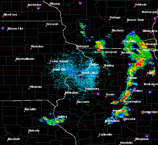 At 319 pm cdt, a severe thunderstorm capable of producing a tornado was located over lena, or 14 miles northwest of freeport, moving southeast at 20 mph (radar indicated rotation). Hazards include tornado. Expect damage to mobile homes. roofs. and vehicles. this dangerous storm will be near, lena around 325 pm cdt. Other locations impacted by this tornadic thunderstorm include waddams grove and lake le-aqua-na state park. At 319 pm cdt, a severe thunderstorm capable of producing a tornado was located over lena, or 14 miles northwest of freeport, moving southeast at 20 mph (radar indicated rotation). Hazards include tornado. Expect damage to mobile homes. roofs. and vehicles. this dangerous storm will be near, lena around 325 pm cdt. Other locations impacted by this tornadic thunderstorm include waddams grove and lake le-aqua-na state park.
|
| 7/28/2016 3:12 PM CDT |
 At 311 pm cdt, a severe thunderstorm capable of producing a tornado was located near nora, or 16 miles northwest of freeport, moving southeast at 20 mph (radar indicated rotation). Hazards include tornado. Expect damage to mobile homes. roofs. and vehicles. this dangerous storm will be near, lena around 325 pm cdt. Other locations impacted by this tornadic thunderstorm include waddams grove, lake le-aqua-na state park and jo daviess county fairgrounds. At 311 pm cdt, a severe thunderstorm capable of producing a tornado was located near nora, or 16 miles northwest of freeport, moving southeast at 20 mph (radar indicated rotation). Hazards include tornado. Expect damage to mobile homes. roofs. and vehicles. this dangerous storm will be near, lena around 325 pm cdt. Other locations impacted by this tornadic thunderstorm include waddams grove, lake le-aqua-na state park and jo daviess county fairgrounds.
|
| 7/28/2016 2:58 PM CDT |
 At 257 pm cdt, a severe thunderstorm capable of producing a tornado was located over nora, or 15 miles southwest of monroe, moving southeast at 15 mph (radar indicated rotation). Hazards include tornado. Expect damage to mobile homes. roofs. and vehicles. this dangerous storm will be near, winslow around 315 pm cdt. lena around 320 pm cdt. Other locations impacted by this tornadic thunderstorm include waddams grove, lake le-aqua- na state park and jo daviess county fairgrounds. At 257 pm cdt, a severe thunderstorm capable of producing a tornado was located over nora, or 15 miles southwest of monroe, moving southeast at 15 mph (radar indicated rotation). Hazards include tornado. Expect damage to mobile homes. roofs. and vehicles. this dangerous storm will be near, winslow around 315 pm cdt. lena around 320 pm cdt. Other locations impacted by this tornadic thunderstorm include waddams grove, lake le-aqua- na state park and jo daviess county fairgrounds.
|
| 7/23/2016 6:40 PM CDT |
 At 640 pm cdt, severe thunderstorms were located along a line extending from 6 miles west of brodhead to 7 miles north of rock city to near cedarville, moving east at 40 mph (radar indicated). Hazards include 60 mph wind gusts. Expect damage to roofs. siding. and trees. Locations impacted include, lena, cedarville, davis, dakota, rock city, buena vista, rock grove, oneco, orangeville, kent, red oak, eleroy, damascus, winneshiek, scioto mills, mc connell, dakota dornink airport, afolkey and lake summerset. At 640 pm cdt, severe thunderstorms were located along a line extending from 6 miles west of brodhead to 7 miles north of rock city to near cedarville, moving east at 40 mph (radar indicated). Hazards include 60 mph wind gusts. Expect damage to roofs. siding. and trees. Locations impacted include, lena, cedarville, davis, dakota, rock city, buena vista, rock grove, oneco, orangeville, kent, red oak, eleroy, damascus, winneshiek, scioto mills, mc connell, dakota dornink airport, afolkey and lake summerset.
|
| 7/23/2016 6:31 PM CDT |
 At 630 pm cdt, severe thunderstorms were located along a line extending from monroe to 8 miles east of winslow to near lena, moving east at 40 mph (radar indicated). Hazards include 60 mph wind gusts. Expect damage to roofs. siding. and trees. Locations impacted include, lena, cedarville, davis, dakota, winslow, rock city, buena vista, rock grove, oneco, orangeville, kent, red oak, eleroy, damascus, winneshiek, scioto mills, mc connell, dakota dornink airport, lake le-aqua-na state park and waddams grove. At 630 pm cdt, severe thunderstorms were located along a line extending from monroe to 8 miles east of winslow to near lena, moving east at 40 mph (radar indicated). Hazards include 60 mph wind gusts. Expect damage to roofs. siding. and trees. Locations impacted include, lena, cedarville, davis, dakota, winslow, rock city, buena vista, rock grove, oneco, orangeville, kent, red oak, eleroy, damascus, winneshiek, scioto mills, mc connell, dakota dornink airport, lake le-aqua-na state park and waddams grove.
|
| 7/23/2016 6:23 PM CDT |
 At 622 pm cdt, severe thunderstorms were located along a line extending from near monroe to winslow to near lena, moving east at 40 mph (radar indicated). Hazards include 60 mph wind gusts. Expect damage to roofs. siding. and trees. Locations impacted include, freeport, lena, stockton, cedarville, davis, dakota, winslow, rock city, nora, buena vista, rock grove, oneco, orangeville, kent, red oak, scioto mills, stockton airport, eleroy, damascus and winneshiek. At 622 pm cdt, severe thunderstorms were located along a line extending from near monroe to winslow to near lena, moving east at 40 mph (radar indicated). Hazards include 60 mph wind gusts. Expect damage to roofs. siding. and trees. Locations impacted include, freeport, lena, stockton, cedarville, davis, dakota, winslow, rock city, nora, buena vista, rock grove, oneco, orangeville, kent, red oak, scioto mills, stockton airport, eleroy, damascus and winneshiek.
|
| 7/23/2016 5:55 PM CDT |
 At 555 pm cdt, severe thunderstorms were located along a line extending from near warren to near apple river to woodbine, moving east at 35 mph (radar indicated). Hazards include 60 mph wind gusts. Expect damage to roofs. siding. And trees. At 555 pm cdt, severe thunderstorms were located along a line extending from near warren to near apple river to woodbine, moving east at 35 mph (radar indicated). Hazards include 60 mph wind gusts. Expect damage to roofs. siding. And trees.
|
| 7/21/2016 9:06 PM CDT |
 At 904 pm cdt, a severe thunderstorm was located near milledgeville, or 13 miles west of mount morris, moving south at 45 mph (public has reported winds of 60 mph or greater). Hazards include 60 mph wind gusts. Expect damage to roofs. siding. and trees. Locations impacted include, freeport, mount carroll, lena, stockton, lanark, warren, milledgeville, fairhaven, pearl city, shannon, cedarville, davis, chadwick, dakota, german valley, apple river, winslow, rock city, ridott and nora. At 904 pm cdt, a severe thunderstorm was located near milledgeville, or 13 miles west of mount morris, moving south at 45 mph (public has reported winds of 60 mph or greater). Hazards include 60 mph wind gusts. Expect damage to roofs. siding. and trees. Locations impacted include, freeport, mount carroll, lena, stockton, lanark, warren, milledgeville, fairhaven, pearl city, shannon, cedarville, davis, chadwick, dakota, german valley, apple river, winslow, rock city, ridott and nora.
|
| 7/21/2016 8:36 PM CDT |
 At 835 pm cdt, a severe thunderstorm was located over lena, or 11 miles northwest of freeport, moving south at 45 mph (spotters report 60 mph winds and power outages with this storm). Hazards include 60 mph wind gusts. Expect damage to roofs. siding. and trees. Locations impacted include, freeport, mount carroll, lena, stockton, lanark, warren, milledgeville, fairhaven, pearl city, shannon, cedarville, davis, chadwick, dakota, german valley, apple river, winslow, rock city, ridott and nora. At 835 pm cdt, a severe thunderstorm was located over lena, or 11 miles northwest of freeport, moving south at 45 mph (spotters report 60 mph winds and power outages with this storm). Hazards include 60 mph wind gusts. Expect damage to roofs. siding. and trees. Locations impacted include, freeport, mount carroll, lena, stockton, lanark, warren, milledgeville, fairhaven, pearl city, shannon, cedarville, davis, chadwick, dakota, german valley, apple river, winslow, rock city, ridott and nora.
|
| 7/21/2016 8:20 PM CDT | Trees down in the area. time estimate in stephenson county IL, 0.4 miles E of Lena, IL |
| 7/21/2016 8:09 PM CDT |
 At 808 pm cdt, a severe thunderstorm was located near argyle, or 7 miles east of darlington, moving south at 45 mph (radar indicated). Hazards include 60 mph wind gusts. Expect damage to roofs. siding. And trees. At 808 pm cdt, a severe thunderstorm was located near argyle, or 7 miles east of darlington, moving south at 45 mph (radar indicated). Hazards include 60 mph wind gusts. Expect damage to roofs. siding. And trees.
|
| 7/17/2016 6:52 AM CDT |
 At 652 am cdt, severe thunderstorms were located along a line extending from winslow to near shannon to near milledgeville, moving east at 60 mph (radar indicated). Hazards include 60 mph wind gusts. Expect damage to roofs. siding. and trees. Locations impacted include, freeport, mount carroll, lena, lanark, milledgeville, fairhaven, pearl city, shannon, cedarville, davis, chadwick, dakota, german valley, winslow, rock city, ridott, argo fay, buena vista, loran and rock grove. At 652 am cdt, severe thunderstorms were located along a line extending from winslow to near shannon to near milledgeville, moving east at 60 mph (radar indicated). Hazards include 60 mph wind gusts. Expect damage to roofs. siding. and trees. Locations impacted include, freeport, mount carroll, lena, lanark, milledgeville, fairhaven, pearl city, shannon, cedarville, davis, chadwick, dakota, german valley, winslow, rock city, ridott, argo fay, buena vista, loran and rock grove.
|
| 7/17/2016 6:24 AM CDT |
 At 624 am cdt, severe thunderstorms were located along a line extending from scales mound to near massbach to near andover, moving east at 60 mph (law enforcement). Hazards include 60 mph wind gusts. Expect damage to roofs. siding. And trees. At 624 am cdt, severe thunderstorms were located along a line extending from scales mound to near massbach to near andover, moving east at 60 mph (law enforcement). Hazards include 60 mph wind gusts. Expect damage to roofs. siding. And trees.
|
| 7/6/2016 3:39 AM CDT |
 At 338 am cdt, a severe thunderstorm was located over mccausland, or 10 miles north of bettendorf, moving east at 50 mph (radar indicated). Hazards include 60 mph wind gusts. Expect damage to roofs. siding. and trees. locations impacted include, davenport, bettendorf, clinton, freeport, sterling, rock falls, maquoketa, morrison, galena, mount carroll, eldridge, dewitt, camanche, le claire, savanna, lena, bellevue, prophetstown, stockton and port byron. this includes the following highways, interstate 80 in iowa between mile markers 282 and 295, and between mile markers 301 and 304. Interstate 88 between mile markers 10 and 44. At 338 am cdt, a severe thunderstorm was located over mccausland, or 10 miles north of bettendorf, moving east at 50 mph (radar indicated). Hazards include 60 mph wind gusts. Expect damage to roofs. siding. and trees. locations impacted include, davenport, bettendorf, clinton, freeport, sterling, rock falls, maquoketa, morrison, galena, mount carroll, eldridge, dewitt, camanche, le claire, savanna, lena, bellevue, prophetstown, stockton and port byron. this includes the following highways, interstate 80 in iowa between mile markers 282 and 295, and between mile markers 301 and 304. Interstate 88 between mile markers 10 and 44.
|
| 7/6/2016 3:19 AM CDT |
 At 318 am cdt, severe thunderstorms were located along a line extending from near bernard to calamus, moving east at 50 mph (radar indicated). Hazards include 70 mph wind gusts. Expect considerable tree damage. damage is likely to mobile homes, roofs, and outbuildings. locations impacted include, davenport, bettendorf, clinton, freeport, sterling, rock falls, maquoketa, morrison, galena, mount carroll, eldridge, dewitt, camanche, le claire, savanna, lena, bellevue, prophetstown, stockton and port byron. this includes the following highways, interstate 80 in iowa between mile markers 282 and 295, and between mile markers 301 and 304. Interstate 88 between mile markers 10 and 44. At 318 am cdt, severe thunderstorms were located along a line extending from near bernard to calamus, moving east at 50 mph (radar indicated). Hazards include 70 mph wind gusts. Expect considerable tree damage. damage is likely to mobile homes, roofs, and outbuildings. locations impacted include, davenport, bettendorf, clinton, freeport, sterling, rock falls, maquoketa, morrison, galena, mount carroll, eldridge, dewitt, camanche, le claire, savanna, lena, bellevue, prophetstown, stockton and port byron. this includes the following highways, interstate 80 in iowa between mile markers 282 and 295, and between mile markers 301 and 304. Interstate 88 between mile markers 10 and 44.
|
| 7/6/2016 3:06 AM CDT |
 At 306 am cdt, severe thunderstorms were located along a line extending from near cascade to near lowden, moving east at 75 mph (radar indicated). Hazards include 70 mph wind gusts. Expect considerable tree damage. Damage is likely to mobile homes, roofs, and outbuildings. At 306 am cdt, severe thunderstorms were located along a line extending from near cascade to near lowden, moving east at 75 mph (radar indicated). Hazards include 70 mph wind gusts. Expect considerable tree damage. Damage is likely to mobile homes, roofs, and outbuildings.
|
| 7/6/2016 1:14 AM CDT |
 At 114 am cdt, severe thunderstorms were located along a line extending from near cedarville to near pearl city to spragueville, moving southeast at 50 mph (radar indicated). Hazards include 60 mph wind gusts. Expect damage to roofs. siding. and trees. Locations impacted include, freeport, mount carroll, savanna, lena, stockton, lanark, milledgeville, fairhaven, hanover, pearl city, shannon, cedarville, davis, sabula, chadwick, dakota, german valley, miles, rock city and ridott. At 114 am cdt, severe thunderstorms were located along a line extending from near cedarville to near pearl city to spragueville, moving southeast at 50 mph (radar indicated). Hazards include 60 mph wind gusts. Expect damage to roofs. siding. and trees. Locations impacted include, freeport, mount carroll, savanna, lena, stockton, lanark, milledgeville, fairhaven, hanover, pearl city, shannon, cedarville, davis, sabula, chadwick, dakota, german valley, miles, rock city and ridott.
|
| 7/6/2016 1:04 AM CDT |
 At 104 am cdt, severe thunderstorms were located along a line extending from near dakota to near lanark to preston, moving southeast at 45 mph (radar indicated). Hazards include 60 mph wind gusts. Expect damage to roofs. siding. and trees. Locations impacted include, freeport, mount carroll, savanna, lena, bellevue, stockton, lanark, milledgeville, preston, fairhaven, hanover, pearl city, elizabeth, shannon, cedarville, davis, woodbine, sabula, chadwick and dakota. At 104 am cdt, severe thunderstorms were located along a line extending from near dakota to near lanark to preston, moving southeast at 45 mph (radar indicated). Hazards include 60 mph wind gusts. Expect damage to roofs. siding. and trees. Locations impacted include, freeport, mount carroll, savanna, lena, bellevue, stockton, lanark, milledgeville, preston, fairhaven, hanover, pearl city, elizabeth, shannon, cedarville, davis, woodbine, sabula, chadwick and dakota.
|
| 7/6/2016 12:50 AM CDT |
 At 1250 am cdt, severe thunderstorms were located along a line extending from near winslow to near pearl city to near springbrook, moving southeast at 45 mph (radar indicated). Hazards include 60 mph wind gusts. Expect damage to roofs. siding. And trees. At 1250 am cdt, severe thunderstorms were located along a line extending from near winslow to near pearl city to near springbrook, moving southeast at 45 mph (radar indicated). Hazards include 60 mph wind gusts. Expect damage to roofs. siding. And trees.
|
| 11/11/2015 7:16 PM CST |
 At 715 pm cst, severe thunderstorms were located along a line extending from 6 miles northeast of warren to near cedarville to near coleta, moving east at 55 mph (radar indicated). Hazards include 60 mph wind gusts. Expect damage to roofs. siding and trees. locations impacted include, freeport, lena, lanark, milledgeville, fairhaven, pearl city, shannon, cedarville, davis, chadwick, dakota, german valley, winslow, rock city, ridott, coleta, buena vista, loran, rock grove and oneco. A tornado watch remains in effect until 900 pm cst for northwestern illinois. At 715 pm cst, severe thunderstorms were located along a line extending from 6 miles northeast of warren to near cedarville to near coleta, moving east at 55 mph (radar indicated). Hazards include 60 mph wind gusts. Expect damage to roofs. siding and trees. locations impacted include, freeport, lena, lanark, milledgeville, fairhaven, pearl city, shannon, cedarville, davis, chadwick, dakota, german valley, winslow, rock city, ridott, coleta, buena vista, loran, rock grove and oneco. A tornado watch remains in effect until 900 pm cst for northwestern illinois.
|
| 11/11/2015 6:58 PM CST |
 At 658 pm cst, severe thunderstorms were located along a line extending from near scales mound to near stockton to near garden plain, moving east at 55 mph (radar indicated). Hazards include 60 mph wind gusts. Expect damage to roofs. Siding and trees. At 658 pm cst, severe thunderstorms were located along a line extending from near scales mound to near stockton to near garden plain, moving east at 55 mph (radar indicated). Hazards include 60 mph wind gusts. Expect damage to roofs. Siding and trees.
|
| 9/17/2015 4:58 PM CDT |
 At 458 pm cdt, a severe thunderstorm was located over pearl city, or 12 miles west of freeport, moving east at 35 mph (radar indicated). Hazards include quarter size hail. Damage to vehicles is expected. Locations impacted include, freeport, lena, pearl city, cedarville, davis, dakota, german valley, rock city, ridott, loran, kent, stephenson county fairgrounds, albertus airport, red oak, eleroy, damascus, winneshiek, willow, scioto mills and bolton. At 458 pm cdt, a severe thunderstorm was located over pearl city, or 12 miles west of freeport, moving east at 35 mph (radar indicated). Hazards include quarter size hail. Damage to vehicles is expected. Locations impacted include, freeport, lena, pearl city, cedarville, davis, dakota, german valley, rock city, ridott, loran, kent, stephenson county fairgrounds, albertus airport, red oak, eleroy, damascus, winneshiek, willow, scioto mills and bolton.
|
| 9/17/2015 4:48 PM CDT |
 At 448 pm cdt, a severe thunderstorm was located near massbach, or 12 miles north of mount carroll, moving east at 30 mph (radar indicated). Hazards include ping pong ball size hail. People and animals outdoors will be injured. Expect damage to roofs, siding, windows and vehicles. At 448 pm cdt, a severe thunderstorm was located near massbach, or 12 miles north of mount carroll, moving east at 30 mph (radar indicated). Hazards include ping pong ball size hail. People and animals outdoors will be injured. Expect damage to roofs, siding, windows and vehicles.
|
| 6/22/2015 10:05 AM CDT |
 At 1004 am cdt, severe thunderstorms were located along a line extending from 6 miles north of cedarville to near mount carroll to near charlotte, moving east at 55 mph (radar indicated). Hazards include 60 mph wind gusts. Expect damage to roofs. siding and trees. Locations impacted include, freeport, lena, lanark, milledgeville, fairhaven, pearl city, shannon, cedarville, davis, chadwick, dakota, german valley, winslow, rock city, ridott, buena vista, rock grove, oneco, orangeville and kent. At 1004 am cdt, severe thunderstorms were located along a line extending from 6 miles north of cedarville to near mount carroll to near charlotte, moving east at 55 mph (radar indicated). Hazards include 60 mph wind gusts. Expect damage to roofs. siding and trees. Locations impacted include, freeport, lena, lanark, milledgeville, fairhaven, pearl city, shannon, cedarville, davis, chadwick, dakota, german valley, winslow, rock city, ridott, buena vista, rock grove, oneco, orangeville and kent.
|
| 6/22/2015 9:41 AM CDT |
 At 940 am cdt, severe thunderstorms were located along a line extending from warren to near green island to near oxford junction, moving east at 70 mph. these are very dangerous storms (trained weather spotters). Hazards include 80 mph wind gusts...especially north of highway 20. Flying debris will be dangerous to those caught without shelter. mobile homes will be heavily damaged. expect considerable damage to roofs, windows and vehicles. extensive tree damage and power outages are likely. Locations impacted include, freeport, lena, lanark, milledgeville, fairhaven, pearl city, shannon, cedarville, davis, chadwick, dakota, german valley, winslow, rock city, ridott, buena vista, rock grove, oneco, orangeville and kent. At 940 am cdt, severe thunderstorms were located along a line extending from warren to near green island to near oxford junction, moving east at 70 mph. these are very dangerous storms (trained weather spotters). Hazards include 80 mph wind gusts...especially north of highway 20. Flying debris will be dangerous to those caught without shelter. mobile homes will be heavily damaged. expect considerable damage to roofs, windows and vehicles. extensive tree damage and power outages are likely. Locations impacted include, freeport, lena, lanark, milledgeville, fairhaven, pearl city, shannon, cedarville, davis, chadwick, dakota, german valley, winslow, rock city, ridott, buena vista, rock grove, oneco, orangeville and kent.
|
| 6/22/2015 9:26 AM CDT |
 At 925 am cdt, severe thunderstorms were located along a line extending from near cuba city to near zwingle to near morley, moving east at 60 mph. these are very dangerous storms (trained weather spotters). Hazards include 80 mph wind gusts. Flying debris will be dangerous to those caught without shelter. mobile homes will be heavily damaged. expect considerable damage to roofs, windows and vehicles. Extensive tree damage and power outages are likely. At 925 am cdt, severe thunderstorms were located along a line extending from near cuba city to near zwingle to near morley, moving east at 60 mph. these are very dangerous storms (trained weather spotters). Hazards include 80 mph wind gusts. Flying debris will be dangerous to those caught without shelter. mobile homes will be heavily damaged. expect considerable damage to roofs, windows and vehicles. Extensive tree damage and power outages are likely.
|
| 6/8/2015 3:08 PM CDT |
 At 308 pm cdt, a severe thunderstorm was located over pearl city, or 10 miles west of freeport, moving southeast at 30 mph (radar indicated). Hazards include quarter size hail. damage to vehicles is expected At 308 pm cdt, a severe thunderstorm was located over pearl city, or 10 miles west of freeport, moving southeast at 30 mph (radar indicated). Hazards include quarter size hail. damage to vehicles is expected
|
| 6/17/2014 4:36 AM CDT | Powerlines down in len in stephenson county IL, 0.4 miles E of Lena, IL |
| 8/4/2012 2:25 PM CDT | Storm damage reported in stephenson county IL, 2.8 miles N of Lena, IL |
| 1/1/0001 12:00 AM | Storm damage reported in stephenson county IL, 0.4 miles E of Lena, IL |
| 1/1/0001 12:00 AM | Lots of small tree branches and some larger branches down around town...time estimated from rada in stephenson county IL, 0.4 miles E of Lena, IL |
Hail Maps for Lena, IL


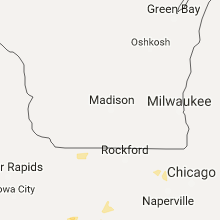


Connect with Interactive Hail Maps