

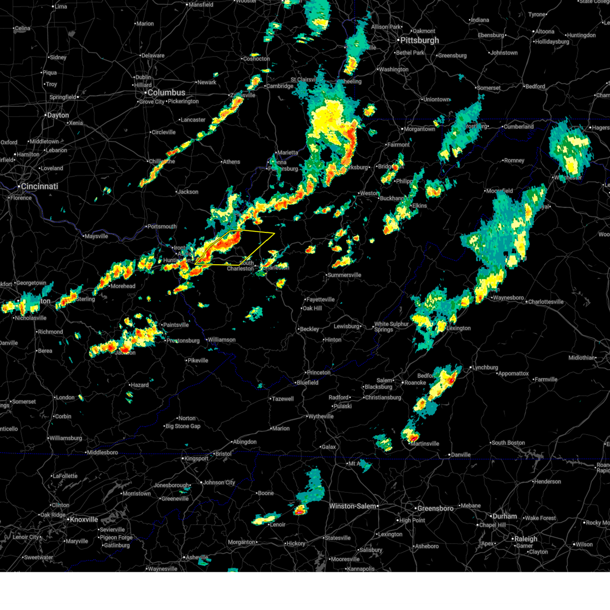
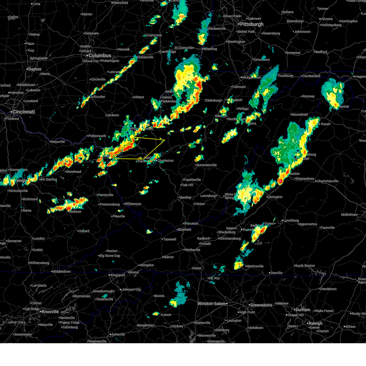
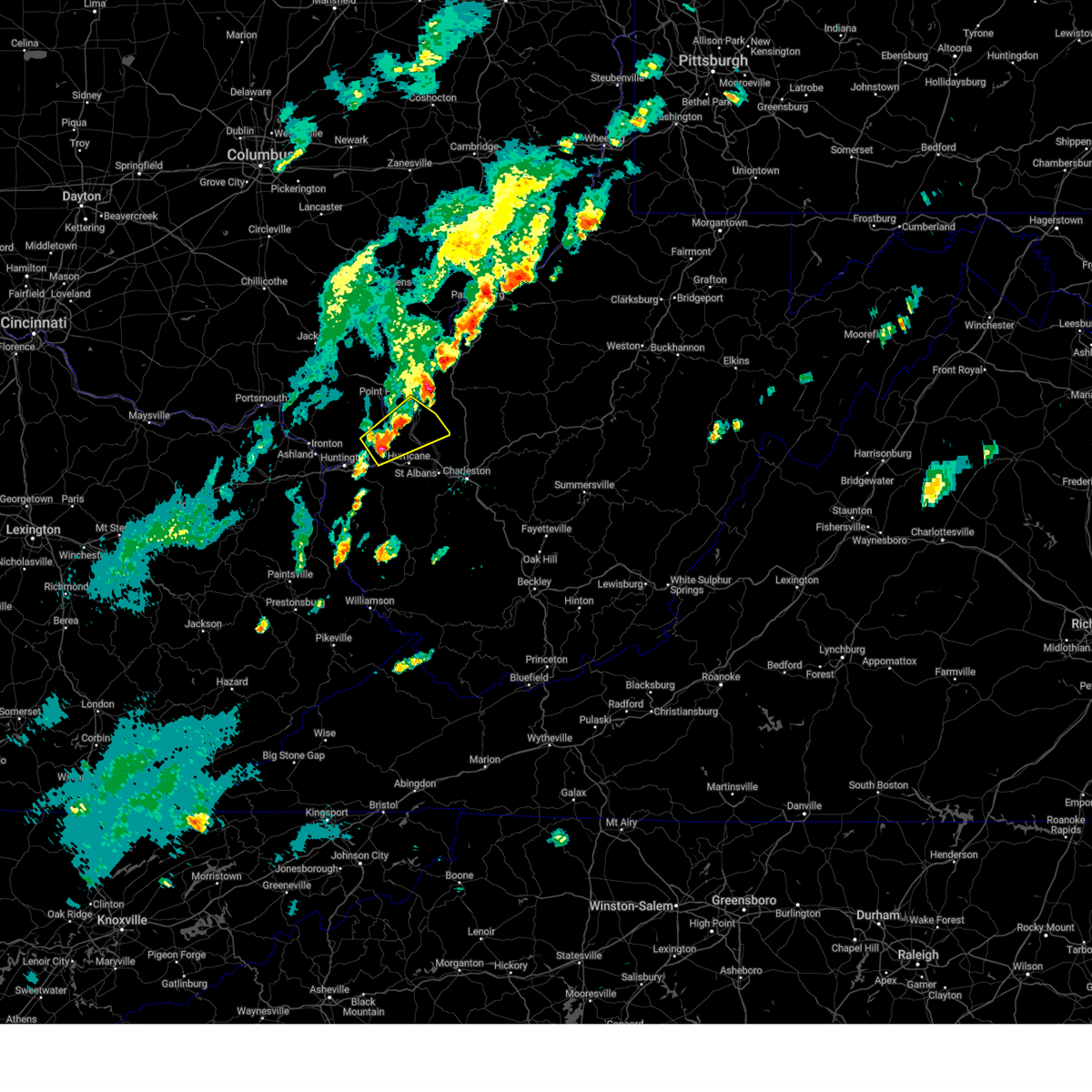
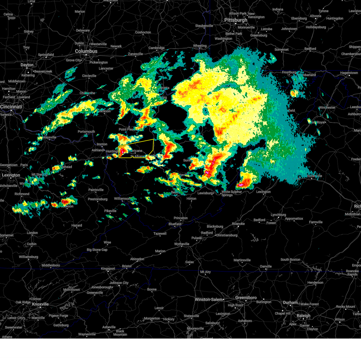
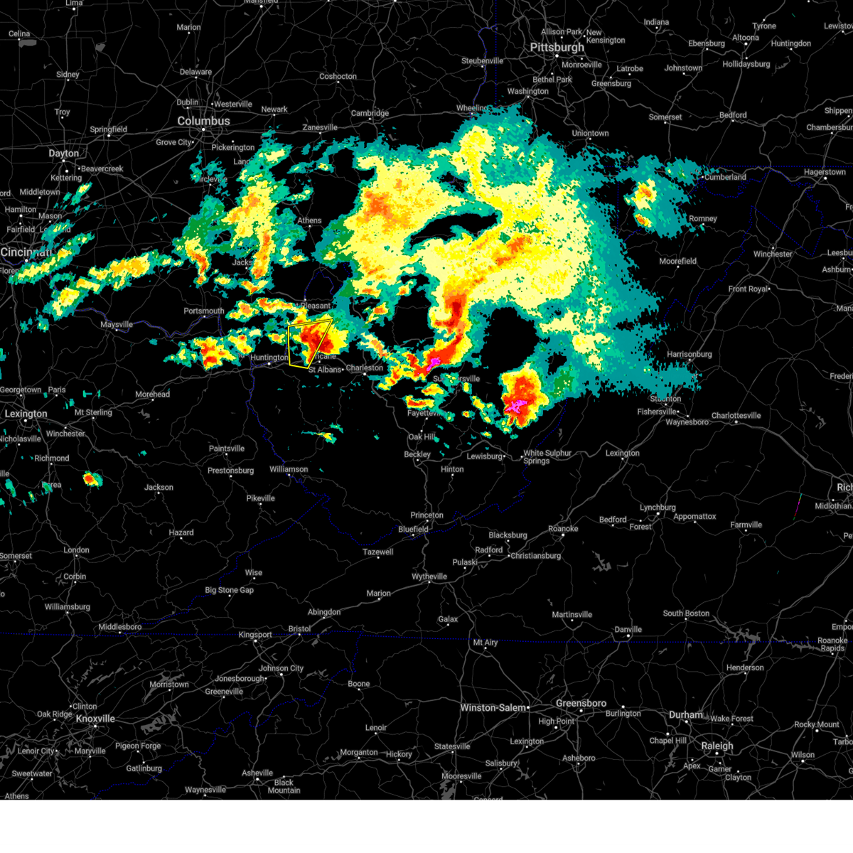
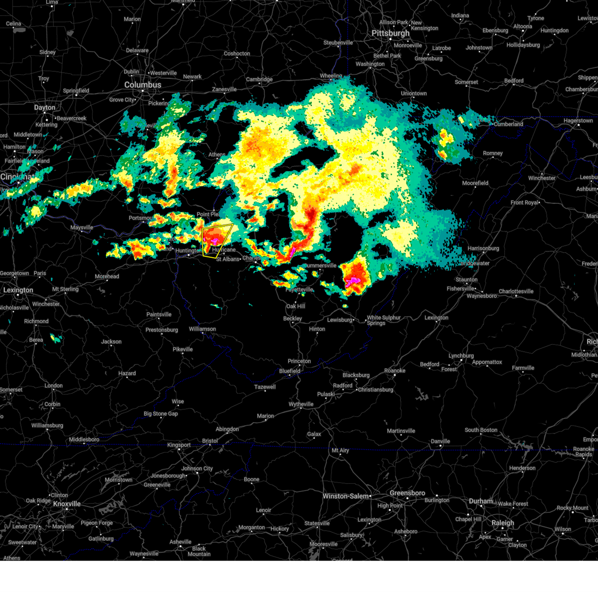
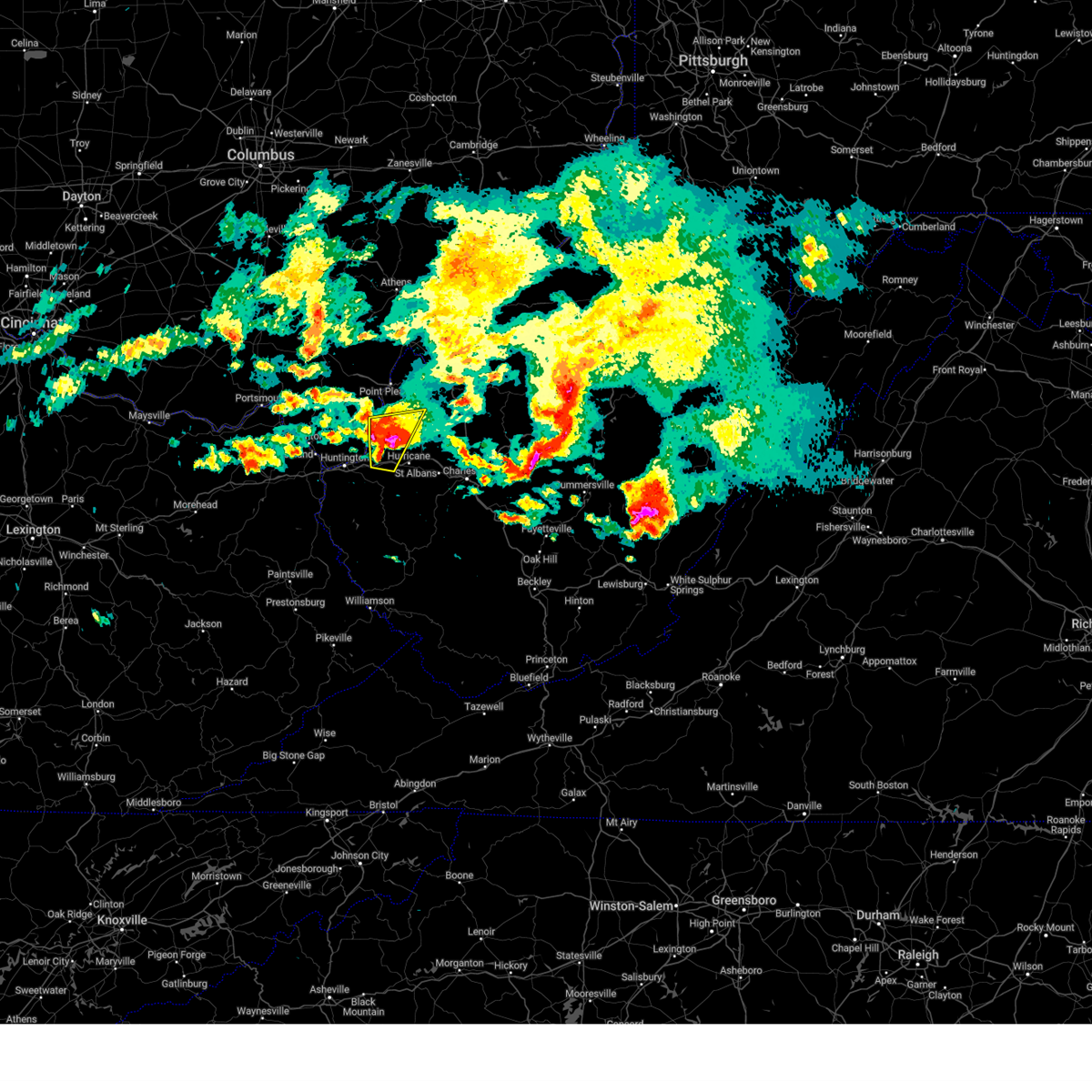
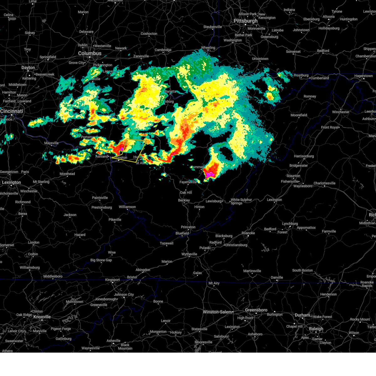
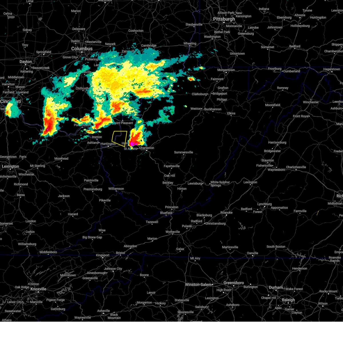
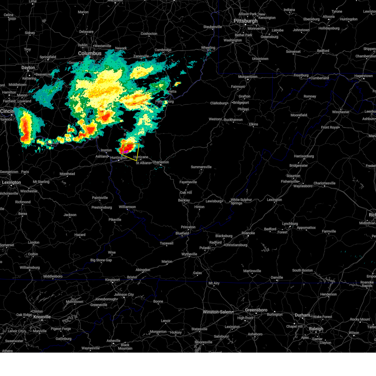
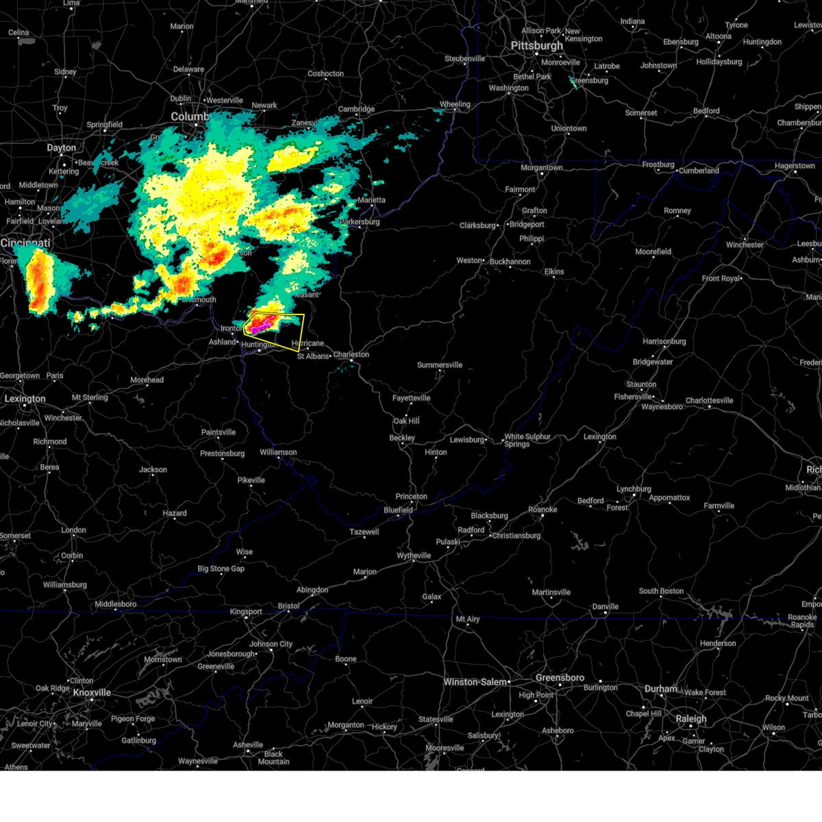
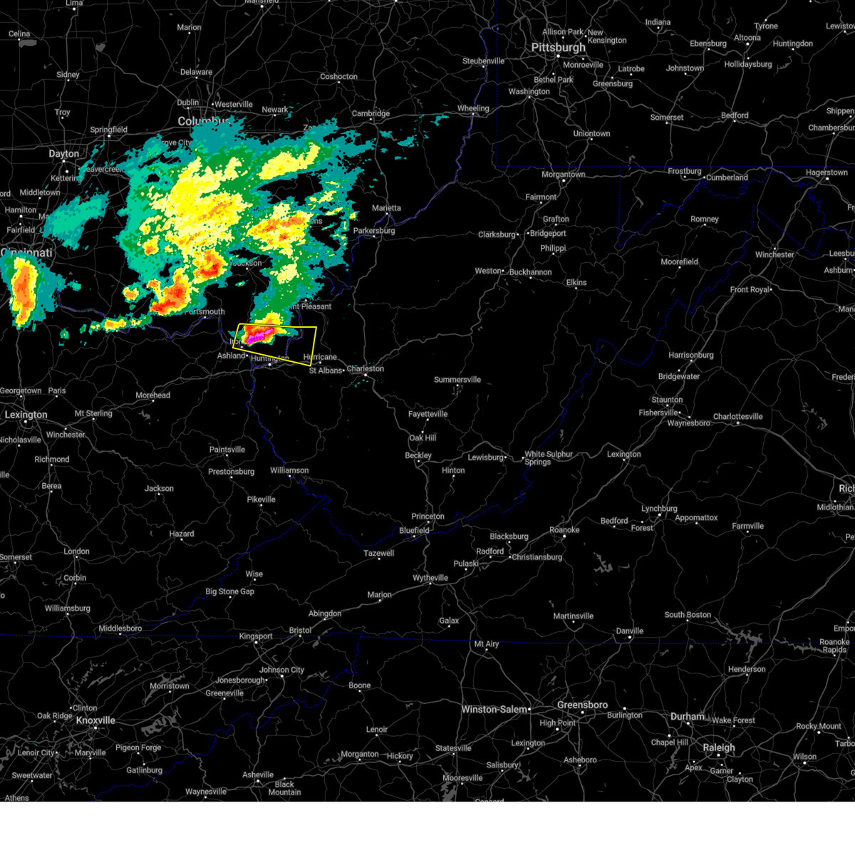
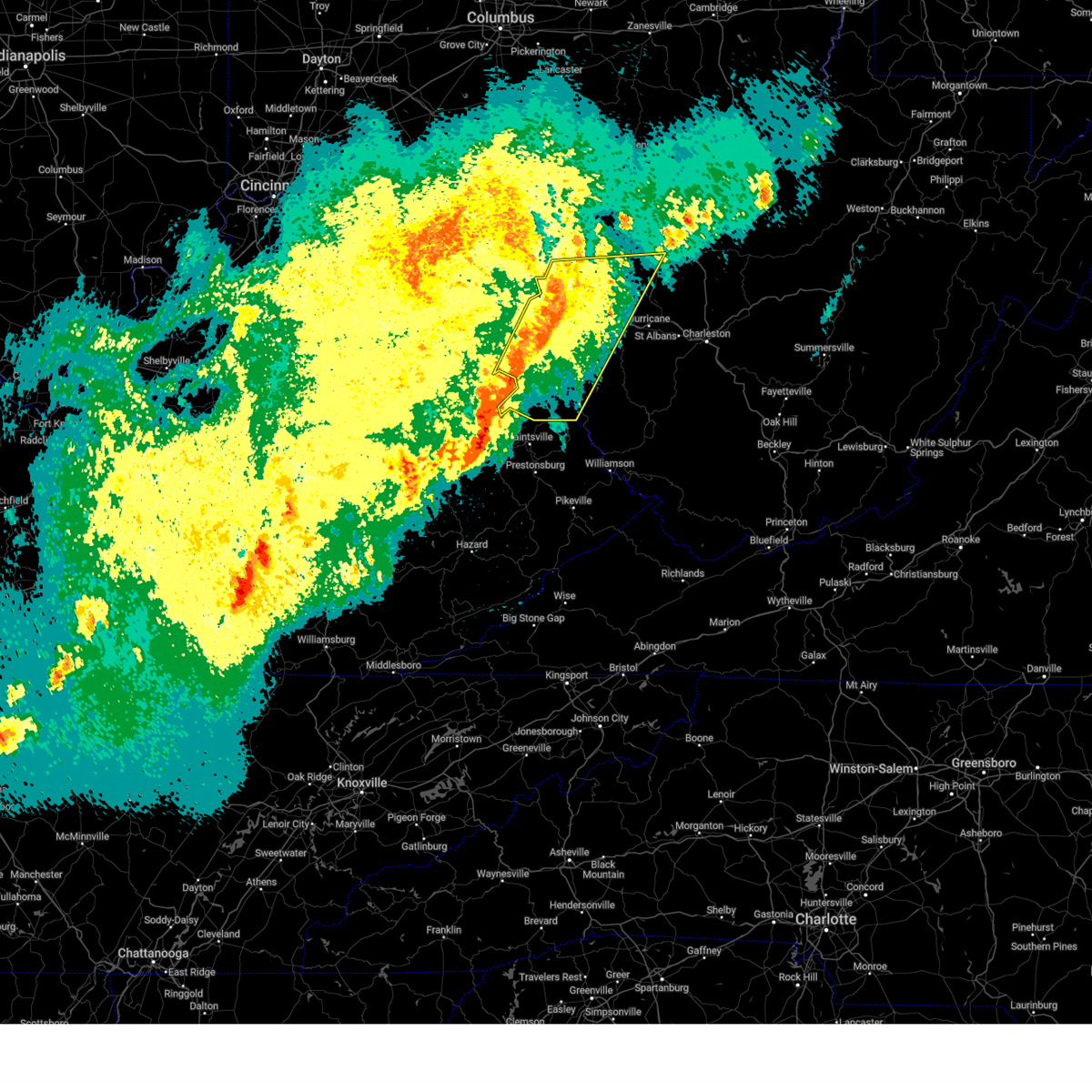
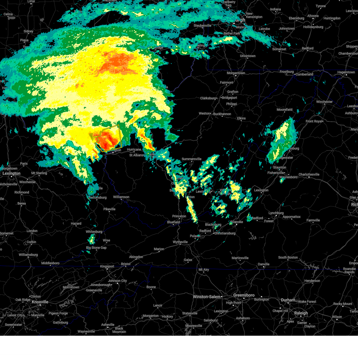
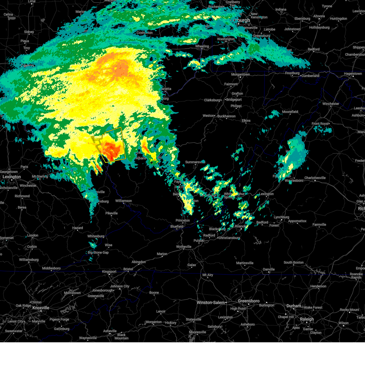
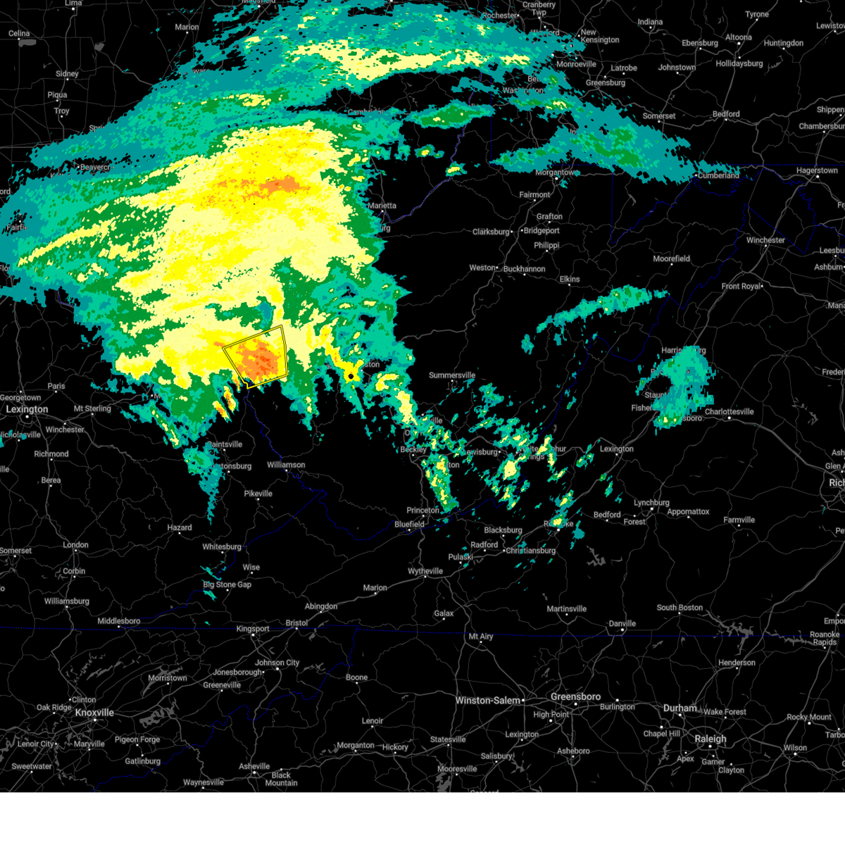
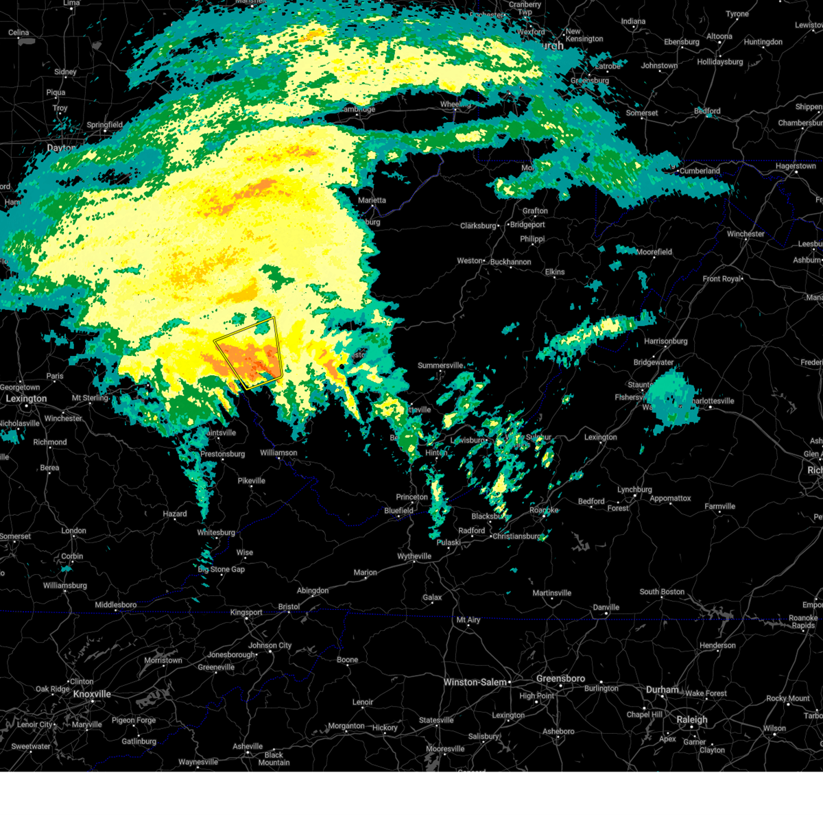
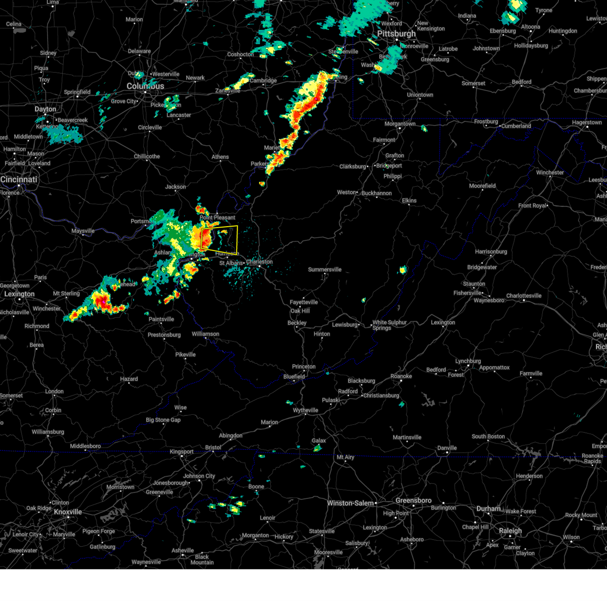
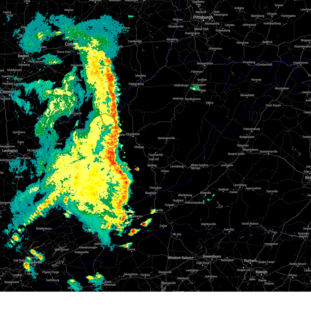
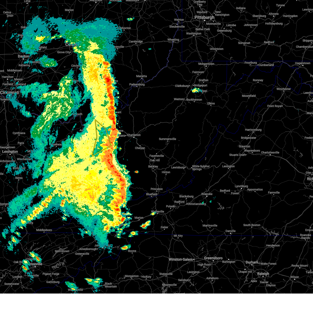
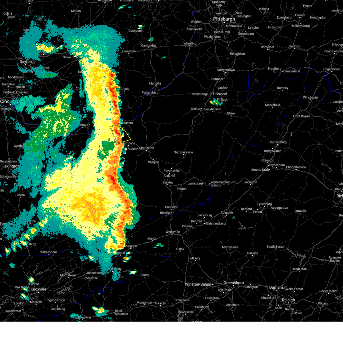
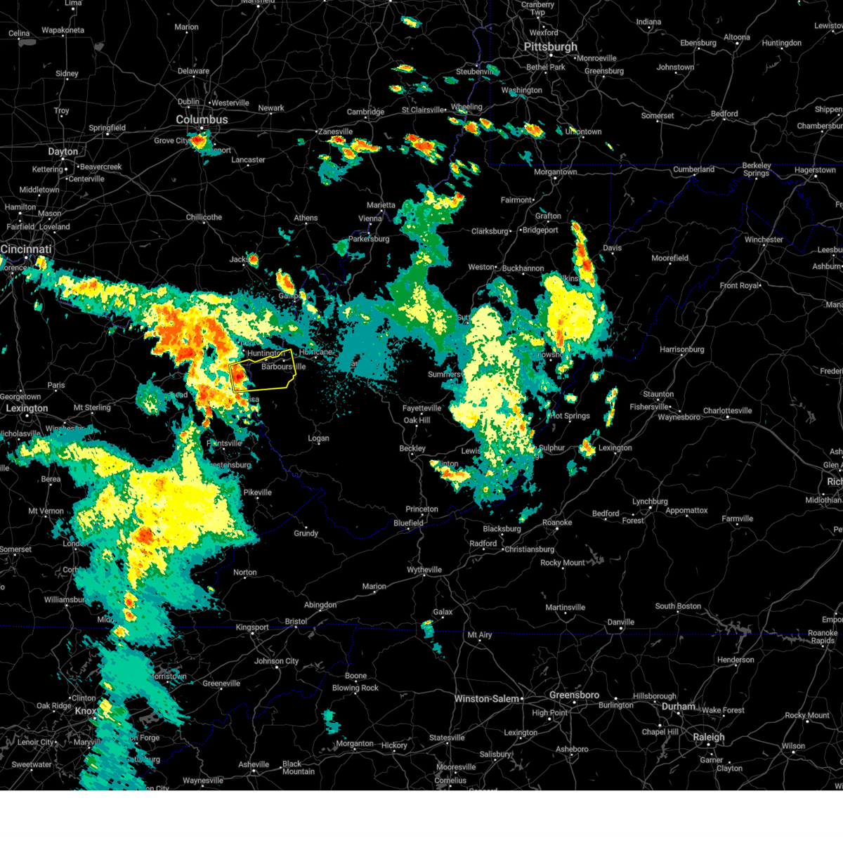
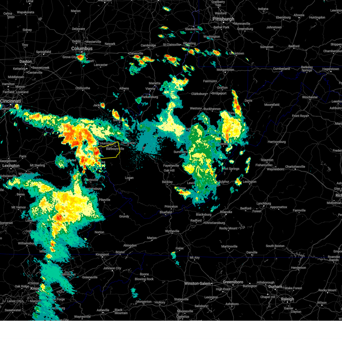
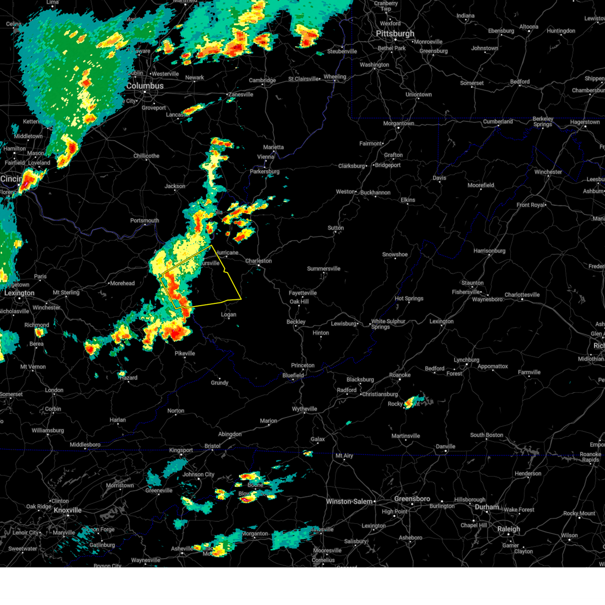
Hail Map for Lesage, WV
The Lesage, WV area has had 5 reports of on-the-ground hail by trained spotters, and has been under severe weather warnings 39 times during the past 12 months. Doppler radar has detected hail at or near Lesage, WV on 48 occasions, including 2 occasions during the past year.
| Name: | Lesage, WV |
| Where Located: | 36.4 miles WNW of Charleston, WV |
| Map: | Google Map for Lesage, WV |
| Population: | 1358 |
| Housing Units: | 645 |
| More Info: | Search Google for Lesage, WV |
3
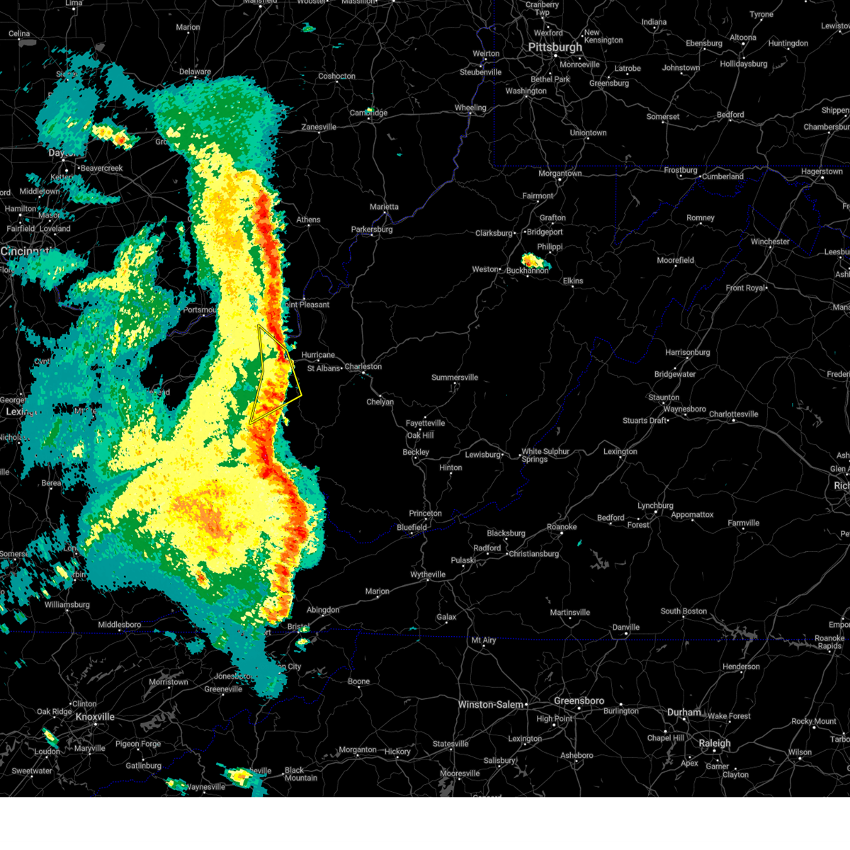
The Top Recent Hail Date for Lesage, WV is Monday, April 14, 2025 (3rd out of 48)

Hail and Wind Damage Spotted near Lesage, WV
| Date / Time | Report Details |
|---|---|
| 6/19/2025 2:40 PM EDT |
 the severe thunderstorm warning has been cancelled and is no longer in effect the severe thunderstorm warning has been cancelled and is no longer in effect
|
| 6/19/2025 2:40 PM EDT |
 At 239 pm edt, severe thunderstorms were located along a line extending from near buffalo to ona, moving east at 45 mph (radar indicated). Hazards include 60 mph wind gusts. Expect damage to roofs, siding, and trees. Locations impacted include, huntington, nitro, winfield, hurricane, barboursville, milton, eleanor, buffalo, poca, ona, culloden, kenna, teays valley, cross lanes, bancroft, liberty, kentuck, grimms landing, pea ridge, and fraziers bottom. At 239 pm edt, severe thunderstorms were located along a line extending from near buffalo to ona, moving east at 45 mph (radar indicated). Hazards include 60 mph wind gusts. Expect damage to roofs, siding, and trees. Locations impacted include, huntington, nitro, winfield, hurricane, barboursville, milton, eleanor, buffalo, poca, ona, culloden, kenna, teays valley, cross lanes, bancroft, liberty, kentuck, grimms landing, pea ridge, and fraziers bottom.
|
| 6/19/2025 2:26 PM EDT |
 Svrrlx the national weather service in charleston west virginia has issued a * severe thunderstorm warning for, southeastern lawrence county in southeastern ohio, southern mason county in western west virginia, cabell county in central west virginia, putnam county in western west virginia, northwestern kanawha county in central west virginia, southwestern roane county in central west virginia, southeastern jackson county in northwestern west virginia, * until 300 pm edt. * at 226 pm edt, severe thunderstorms were located along a line extending from 6 miles northwest of buffalo to huntington, moving east at 45 mph (radar indicated). Hazards include 60 mph wind gusts. expect damage to roofs, siding, and trees Svrrlx the national weather service in charleston west virginia has issued a * severe thunderstorm warning for, southeastern lawrence county in southeastern ohio, southern mason county in western west virginia, cabell county in central west virginia, putnam county in western west virginia, northwestern kanawha county in central west virginia, southwestern roane county in central west virginia, southeastern jackson county in northwestern west virginia, * until 300 pm edt. * at 226 pm edt, severe thunderstorms were located along a line extending from 6 miles northwest of buffalo to huntington, moving east at 45 mph (radar indicated). Hazards include 60 mph wind gusts. expect damage to roofs, siding, and trees
|
| 6/9/2025 5:26 PM EDT |
 Svrrlx the national weather service in charleston west virginia has issued a * severe thunderstorm warning for, south central gallia county in southeastern ohio, east central lawrence county in southeastern ohio, southern mason county in western west virginia, northeastern cabell county in central west virginia, northern putnam county in western west virginia, * until 615 pm edt. * at 525 pm edt, a severe thunderstorm was located 7 miles northwest of milton, or 11 miles northeast of proctorville, moving northeast at 30 mph (radar indicated). Hazards include 60 mph wind gusts and half dollar size hail. Hail damage to vehicles is expected. Expect wind damage to roofs, siding, and trees. Svrrlx the national weather service in charleston west virginia has issued a * severe thunderstorm warning for, south central gallia county in southeastern ohio, east central lawrence county in southeastern ohio, southern mason county in western west virginia, northeastern cabell county in central west virginia, northern putnam county in western west virginia, * until 615 pm edt. * at 525 pm edt, a severe thunderstorm was located 7 miles northwest of milton, or 11 miles northeast of proctorville, moving northeast at 30 mph (radar indicated). Hazards include 60 mph wind gusts and half dollar size hail. Hail damage to vehicles is expected. Expect wind damage to roofs, siding, and trees.
|
| 4/29/2025 9:18 PM EDT | Svrrlx the national weather service in charleston west virginia has issued a * severe thunderstorm warning for, southern mason county in western west virginia, cabell county in central west virginia, putnam county in western west virginia, central kanawha county in central west virginia, lincoln county in central west virginia, northeastern wayne county in western west virginia, south central jackson county in northwestern west virginia, northwestern boone county in central west virginia, * until 1000 pm edt. * at 917 pm edt, a severe thunderstorm was located near hamlin, moving east at 50 mph (radar indicated). Hazards include 60 mph wind gusts and penny size hail. expect damage to roofs, siding, and trees |
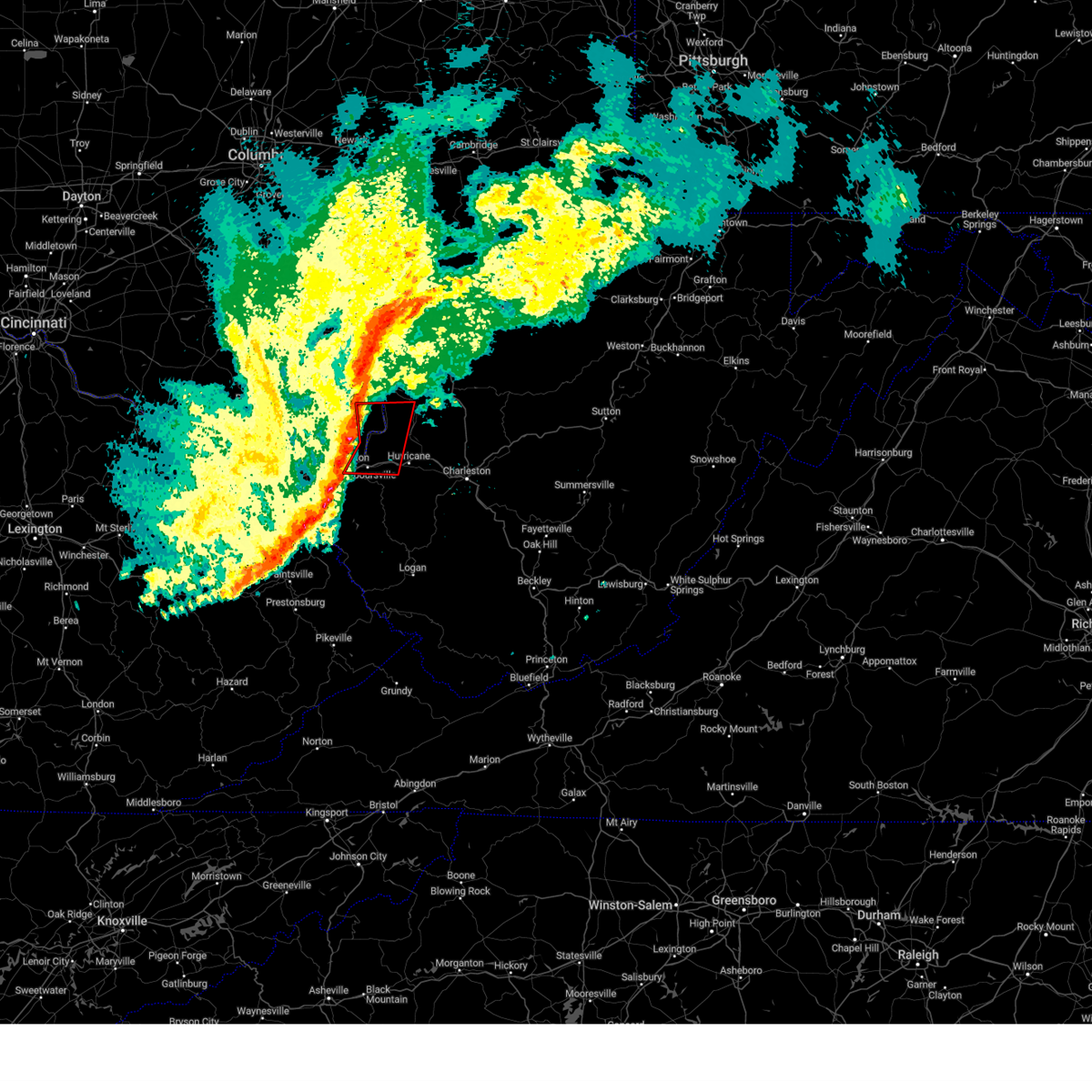
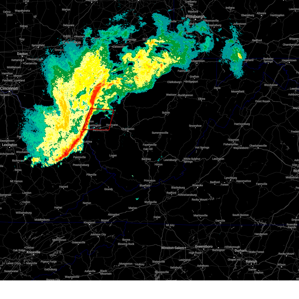
| 4/14/2025 7:31 PM EDT |
 Svrrlx the national weather service in charleston west virginia has issued a * severe thunderstorm warning for, southeastern lawrence county in southeastern ohio, southern mason county in western west virginia, cabell county in central west virginia, putnam county in western west virginia, northwestern kanawha county in central west virginia, southern jackson county in northwestern west virginia, * until 800 pm edt. * at 731 pm edt, a severe thunderstorm was located over ona, or 7 miles east of proctorville, moving east at 60 mph (radar indicated). Hazards include 60 mph wind gusts and quarter size hail. Hail damage to vehicles is expected. Expect wind damage to roofs, siding, and trees. Svrrlx the national weather service in charleston west virginia has issued a * severe thunderstorm warning for, southeastern lawrence county in southeastern ohio, southern mason county in western west virginia, cabell county in central west virginia, putnam county in western west virginia, northwestern kanawha county in central west virginia, southern jackson county in northwestern west virginia, * until 800 pm edt. * at 731 pm edt, a severe thunderstorm was located over ona, or 7 miles east of proctorville, moving east at 60 mph (radar indicated). Hazards include 60 mph wind gusts and quarter size hail. Hail damage to vehicles is expected. Expect wind damage to roofs, siding, and trees.
|
| 4/14/2025 7:06 PM EDT |
 The storm which prompted the warning has moved out of the area. therefore, the warning will be allowed to expire. a severe thunderstorm watch remains in effect until 1100 pm edt for southeastern ohio, and central and western west virginia. The storm which prompted the warning has moved out of the area. therefore, the warning will be allowed to expire. a severe thunderstorm watch remains in effect until 1100 pm edt for southeastern ohio, and central and western west virginia.
|
| 4/14/2025 6:53 PM EDT |
 At 653 pm edt, a severe thunderstorm was located near milton, or 13 miles west of winfield, moving east at 60 mph (radar indicated). Hazards include 60 mph wind gusts and half dollar size hail. Hail damage to vehicles is expected. expect wind damage to roofs, siding, and trees. Locations impacted include, grimms landing, ona, milton, ashton, buffalo, crown city, barboursville, and culloden. At 653 pm edt, a severe thunderstorm was located near milton, or 13 miles west of winfield, moving east at 60 mph (radar indicated). Hazards include 60 mph wind gusts and half dollar size hail. Hail damage to vehicles is expected. expect wind damage to roofs, siding, and trees. Locations impacted include, grimms landing, ona, milton, ashton, buffalo, crown city, barboursville, and culloden.
|
| 4/14/2025 6:53 PM EDT |
 the severe thunderstorm warning has been cancelled and is no longer in effect the severe thunderstorm warning has been cancelled and is no longer in effect
|
| 4/14/2025 6:40 PM EDT |
 Svrrlx the national weather service in charleston west virginia has issued a * severe thunderstorm warning for, southeastern gallia county in southeastern ohio, southeastern lawrence county in southeastern ohio, southwestern mason county in western west virginia, northern cabell county in central west virginia, northwestern putnam county in western west virginia, * until 715 pm edt. * at 640 pm edt, a severe thunderstorm was located near proctorville, moving east at 55 mph (radar indicated). Hazards include ping pong ball size hail and 60 mph wind gusts. People and animals outdoors will be injured. expect hail damage to roofs, siding, windows, and vehicles. Expect wind damage to roofs, siding, and trees. Svrrlx the national weather service in charleston west virginia has issued a * severe thunderstorm warning for, southeastern gallia county in southeastern ohio, southeastern lawrence county in southeastern ohio, southwestern mason county in western west virginia, northern cabell county in central west virginia, northwestern putnam county in western west virginia, * until 715 pm edt. * at 640 pm edt, a severe thunderstorm was located near proctorville, moving east at 55 mph (radar indicated). Hazards include ping pong ball size hail and 60 mph wind gusts. People and animals outdoors will be injured. expect hail damage to roofs, siding, windows, and vehicles. Expect wind damage to roofs, siding, and trees.
|
| 4/14/2025 5:23 PM EDT |
 The storm which prompted the warning has moved out of the area. therefore, the warning will be allowed to expire. a severe thunderstorm watch remains in effect until 1100 pm edt for southeastern ohio, and central and western west virginia. The storm which prompted the warning has moved out of the area. therefore, the warning will be allowed to expire. a severe thunderstorm watch remains in effect until 1100 pm edt for southeastern ohio, and central and western west virginia.
|
| 4/14/2025 5:05 PM EDT | Half Dollar sized hail reported 1 miles SE of Lesage, WV, report from mping: half dollar (1.25 in.). |
| 4/14/2025 5:05 PM EDT |
 At 505 pm edt, a severe thunderstorm was located 9 miles north of ona, or 11 miles northeast of proctorville, moving east at 50 mph (radar indicated). Hazards include 60 mph wind gusts and quarter size hail. Hail damage to vehicles is expected. expect wind damage to roofs, siding, and trees. Locations impacted include, green bottom, milton, ashton, athalia, crown city, and culloden. At 505 pm edt, a severe thunderstorm was located 9 miles north of ona, or 11 miles northeast of proctorville, moving east at 50 mph (radar indicated). Hazards include 60 mph wind gusts and quarter size hail. Hail damage to vehicles is expected. expect wind damage to roofs, siding, and trees. Locations impacted include, green bottom, milton, ashton, athalia, crown city, and culloden.
|
| 4/14/2025 5:04 PM EDT | Hen Egg sized hail reported 4.1 miles S of Lesage, WV |
| 4/14/2025 5:04 PM EDT | Hen Egg sized hail reported 1.6 miles SSE of Lesage, WV, report from mping: hen egg (2.00 in.). |
| 4/14/2025 5:03 PM EDT | Half Dollar sized hail reported 5.5 miles S of Lesage, WV, report from mping: half dollar (1.25 in.). |
| 4/14/2025 4:57 PM EDT |
 the severe thunderstorm warning has been cancelled and is no longer in effect the severe thunderstorm warning has been cancelled and is no longer in effect
|
| 4/14/2025 4:57 PM EDT |
 At 456 pm edt, a severe thunderstorm was located 9 miles north of proctorville, moving east at 50 mph (radar indicated). Hazards include 60 mph wind gusts and quarter size hail. Hail damage to vehicles is expected. expect wind damage to roofs, siding, and trees. Locations impacted include, athalia, crown city, green bottom, scottown, milton, aid, ashton, and culloden. At 456 pm edt, a severe thunderstorm was located 9 miles north of proctorville, moving east at 50 mph (radar indicated). Hazards include 60 mph wind gusts and quarter size hail. Hail damage to vehicles is expected. expect wind damage to roofs, siding, and trees. Locations impacted include, athalia, crown city, green bottom, scottown, milton, aid, ashton, and culloden.
|
| 4/14/2025 4:44 PM EDT |
 Svrrlx the national weather service in charleston west virginia has issued a * severe thunderstorm warning for, eastern greenup county in northeastern kentucky, south central gallia county in southeastern ohio, lawrence county in southeastern ohio, southwestern mason county in western west virginia, northeastern cabell county in central west virginia, * until 530 pm edt. * at 443 pm edt, a severe thunderstorm was located over lake vesuvius, moving east at 50 mph (radar indicated). Hazards include 60 mph wind gusts and quarter size hail. Hail damage to vehicles is expected. Expect wind damage to roofs, siding, and trees. Svrrlx the national weather service in charleston west virginia has issued a * severe thunderstorm warning for, eastern greenup county in northeastern kentucky, south central gallia county in southeastern ohio, lawrence county in southeastern ohio, southwestern mason county in western west virginia, northeastern cabell county in central west virginia, * until 530 pm edt. * at 443 pm edt, a severe thunderstorm was located over lake vesuvius, moving east at 50 mph (radar indicated). Hazards include 60 mph wind gusts and quarter size hail. Hail damage to vehicles is expected. Expect wind damage to roofs, siding, and trees.
|
| 4/3/2025 5:02 AM EDT | At 502 am edt, severe thunderstorms were located along a line extending from milton to milo, moving east at 45 mph (radar indicated). Hazards include 60 mph wind gusts. Expect damage to roofs, siding, and trees. Locations impacted include, ranger, louisa, barboursville, nitro, salt rock, palermo, pea ridge, genoa, alkol, poca, harts, mud, cross lanes, gill, gallup, sweetland, lavalette, west hamlin, clifford, and ulysses. |
| 4/3/2025 5:02 AM EDT | the severe thunderstorm warning has been cancelled and is no longer in effect |
| 4/3/2025 4:45 AM EDT | Svrrlx the national weather service in charleston west virginia has issued a * severe thunderstorm warning for, southeastern boyd county in northeastern kentucky, lawrence county in northeastern kentucky, southeastern lawrence county in southeastern ohio, cabell county in central west virginia, northwestern mingo county in southern west virginia, southern putnam county in western west virginia, west central kanawha county in central west virginia, lincoln county in central west virginia, northwestern logan county in southern west virginia, wayne county in western west virginia, * until 530 am edt. * at 445 am edt, severe thunderstorms were located along a line extending from near proctorville to near chandlerville, moving east at 45 mph (radar indicated). Hazards include 60 mph wind gusts. expect damage to roofs, siding, and trees |
| 4/3/2025 4:33 AM EDT |
 At 433 am edt, severe thunderstorms were located along a line extending from 8 miles northeast of lake vesuvius to keaton, moving east at 60 mph (radar indicated). Hazards include 60 mph wind gusts. Expect damage to roofs, siding, and trees. Locations impacted include, louisa, crown city, barboursville, coalton, denton, summit, waterloo, hitchins, burnaugh, pea ridge, ironton, kenova, worthington, ceredo, genoa, leon, aid, martha, gallup, and lavalette. At 433 am edt, severe thunderstorms were located along a line extending from 8 miles northeast of lake vesuvius to keaton, moving east at 60 mph (radar indicated). Hazards include 60 mph wind gusts. Expect damage to roofs, siding, and trees. Locations impacted include, louisa, crown city, barboursville, coalton, denton, summit, waterloo, hitchins, burnaugh, pea ridge, ironton, kenova, worthington, ceredo, genoa, leon, aid, martha, gallup, and lavalette.
|
| 4/3/2025 4:13 AM EDT | Svrrlx the national weather service in charleston west virginia has issued a * severe thunderstorm warning for, boyd county in northeastern kentucky, greenup county in northeastern kentucky, lawrence county in northeastern kentucky, carter county in northeastern kentucky, southern gallia county in southeastern ohio, lawrence county in southeastern ohio, southwestern mason county in western west virginia, cabell county in central west virginia, wayne county in western west virginia, * until 445 am edt. * at 412 am edt, severe thunderstorms were located along a line extending from near wheelersburg to wrigley, moving east at 60 mph (radar indicated). Hazards include 60 mph wind gusts. expect damage to roofs, siding, and trees |
| 3/31/2025 1:44 AM EDT | The storms which prompted the warning have weakened below severe limits, and no longer pose an immediate threat to life or property. therefore, the warning will be allowed to expire. however, gusty winds and heavy rain are still possible with these thunderstorms. a severe thunderstorm watch remains in effect until 600 am edt for northeastern kentucky, southeastern ohio, and central, western and northwestern west virginia. to report severe weather, contact your nearest law enforcement agency. they will relay your report to the national weather service charleston west virginia. remember, a severe thunderstorm warning still remains in effect for portions of mason and jackson counties in west virginia. |
| 3/31/2025 1:37 AM EDT | At 136 am edt, severe thunderstorms were located along a line extending from 9 miles southeast of point pleasant to near fort gay, moving east at 40 mph (radar indicated). Hazards include 60 mph wind gusts and penny size hail. Expect damage to roofs, siding, and trees. Locations impacted include, lockwood, ona, beech fork state park, louisa, crown city, culloden, barboursville, huntington, ashton, burnaugh, salt rock, pea ridge, burlington, eleanor, east lynn, genoa, fraziers bottom, hurricane, leon, and buffalo. |
| 3/31/2025 1:37 AM EDT | the severe thunderstorm warning has been cancelled and is no longer in effect |
| 3/31/2025 1:36 AM EDT | At 135 am edt, severe thunderstorms were located along a line extending from 9 miles southeast of point pleasant to near fort gay, moving east at 40 mph (radar indicated). Hazards include 60 mph wind gusts and penny size hail. Expect damage to roofs, siding, and trees. Locations impacted include, louisa, crown city, barboursville, burnaugh, salt rock, pea ridge, kenova, ceredo, genoa, fraziers bottom, leon, aid, buffalo, lavalette, west hamlin, durbin, east lynn lake, branchland, buchanan, and centerville. |
| 3/31/2025 1:13 AM EDT | Svrrlx the national weather service in charleston west virginia has issued a * severe thunderstorm warning for, boyd county in northeastern kentucky, northern lawrence county in northeastern kentucky, southeastern carter county in northeastern kentucky, southern gallia county in southeastern ohio, southeastern lawrence county in southeastern ohio, mason county in western west virginia, cabell county in central west virginia, northwestern putnam county in western west virginia, northwestern lincoln county in central west virginia, wayne county in western west virginia, west central jackson county in northwestern west virginia, * until 145 am edt. * at 112 am edt, severe thunderstorms were located along a line extending from 6 miles southwest of gallipolis to near webbville, moving east at 40 mph (radar indicated). Hazards include 60 mph wind gusts and penny size hail. expect damage to roofs, siding, and trees |
| 3/31/2025 1:03 AM EDT |
 At 102 am edt, severe thunderstorms were located along a line extending from 9 miles south of rio grande to 6 miles south of rush, moving east at 50 mph (radar indicated). Hazards include 60 mph wind gusts and penny size hail. Expect damage to roofs, siding, and trees. Locations impacted include, lockwood, webbville, princess, beech fork state park, crown city, catlettsburg, barboursville, coalton, huntington, denton, summit, waterloo, ashton, westwood, burnaugh, pea ridge, gallopolis ferry, ironton, burlington, and kenova. At 102 am edt, severe thunderstorms were located along a line extending from 9 miles south of rio grande to 6 miles south of rush, moving east at 50 mph (radar indicated). Hazards include 60 mph wind gusts and penny size hail. Expect damage to roofs, siding, and trees. Locations impacted include, lockwood, webbville, princess, beech fork state park, crown city, catlettsburg, barboursville, coalton, huntington, denton, summit, waterloo, ashton, westwood, burnaugh, pea ridge, gallopolis ferry, ironton, burlington, and kenova.
|
| 3/31/2025 1:03 AM EDT |
 the severe thunderstorm warning has been cancelled and is no longer in effect the severe thunderstorm warning has been cancelled and is no longer in effect
|
| 3/31/2025 12:45 AM EDT |
 Svrrlx the national weather service in charleston west virginia has issued a * severe thunderstorm warning for, boyd county in northeastern kentucky, southeastern greenup county in northeastern kentucky, northwestern lawrence county in northeastern kentucky, southeastern carter county in northeastern kentucky, southern gallia county in southeastern ohio, lawrence county in southeastern ohio, west central mason county in western west virginia, central cabell county in central west virginia, northwestern wayne county in western west virginia, * until 115 am edt. * at 1245 am edt, severe thunderstorms were located along a line extending from 8 miles east of south webster to near denton, moving east at 50 mph (radar indicated). Hazards include 60 mph wind gusts and penny size hail. expect damage to roofs, siding, and trees Svrrlx the national weather service in charleston west virginia has issued a * severe thunderstorm warning for, boyd county in northeastern kentucky, southeastern greenup county in northeastern kentucky, northwestern lawrence county in northeastern kentucky, southeastern carter county in northeastern kentucky, southern gallia county in southeastern ohio, lawrence county in southeastern ohio, west central mason county in western west virginia, central cabell county in central west virginia, northwestern wayne county in western west virginia, * until 115 am edt. * at 1245 am edt, severe thunderstorms were located along a line extending from 8 miles east of south webster to near denton, moving east at 50 mph (radar indicated). Hazards include 60 mph wind gusts and penny size hail. expect damage to roofs, siding, and trees
|
| 12/31/2024 12:53 PM EST |
 Svrrlx the national weather service in charleston west virginia has issued a * severe thunderstorm warning for, southeastern lawrence county in southeastern ohio, southern mason county in western west virginia, cabell county in central west virginia, western putnam county in western west virginia, western kanawha county in central west virginia, lincoln county in central west virginia, northeastern wayne county in western west virginia, northwestern boone county in central west virginia, * until 145 pm est. * at 1253 pm est, severe thunderstorms were located along a line extending from near proctorville to 6 miles east of beech fork state park to near kiahsville, moving east at 30 mph (radar indicated). Hazards include 60 mph wind gusts. expect damage to roofs, siding, and trees Svrrlx the national weather service in charleston west virginia has issued a * severe thunderstorm warning for, southeastern lawrence county in southeastern ohio, southern mason county in western west virginia, cabell county in central west virginia, western putnam county in western west virginia, western kanawha county in central west virginia, lincoln county in central west virginia, northeastern wayne county in western west virginia, northwestern boone county in central west virginia, * until 145 pm est. * at 1253 pm est, severe thunderstorms were located along a line extending from near proctorville to 6 miles east of beech fork state park to near kiahsville, moving east at 30 mph (radar indicated). Hazards include 60 mph wind gusts. expect damage to roofs, siding, and trees
|
| 9/27/2024 2:47 PM EDT |
 the severe thunderstorm warning has been cancelled and is no longer in effect the severe thunderstorm warning has been cancelled and is no longer in effect
|
| 9/27/2024 2:47 PM EDT |
 At 246 pm edt, a severe thunderstorm was located over ironton, moving northwest at 25 mph (radar indicated). Hazards include 70 mph wind gusts. Expect considerable tree damage. damage is likely to mobile homes, roofs, and outbuildings. Locations impacted include, ashland, ironton, coal grove, lake vesuvius, catlettsburg, flatwoods, russell, vernon, waterloo, raceland, worthington, wurtland, bellefonte, aid, westwood, crown city, athalia, hanging rock, scottown, and gage. At 246 pm edt, a severe thunderstorm was located over ironton, moving northwest at 25 mph (radar indicated). Hazards include 70 mph wind gusts. Expect considerable tree damage. damage is likely to mobile homes, roofs, and outbuildings. Locations impacted include, ashland, ironton, coal grove, lake vesuvius, catlettsburg, flatwoods, russell, vernon, waterloo, raceland, worthington, wurtland, bellefonte, aid, westwood, crown city, athalia, hanging rock, scottown, and gage.
|
| 9/27/2024 2:24 PM EDT |
 Svrrlx the national weather service in charleston west virginia has issued a * severe thunderstorm warning for, northeastern boyd county in northeastern kentucky, northeastern greenup county in northeastern kentucky, southwestern gallia county in southeastern ohio, lawrence county in southeastern ohio, northwestern cabell county in central west virginia, northwestern wayne county in western west virginia, * until 330 pm edt. * at 223 pm edt, a severe thunderstorm was located over catlettsburg, or near ashland, moving northwest at 25 mph (radar indicated). Hazards include 70 mph wind gusts. Expect considerable tree damage. Damage is likely to mobile homes, roofs, and outbuildings. Svrrlx the national weather service in charleston west virginia has issued a * severe thunderstorm warning for, northeastern boyd county in northeastern kentucky, northeastern greenup county in northeastern kentucky, southwestern gallia county in southeastern ohio, lawrence county in southeastern ohio, northwestern cabell county in central west virginia, northwestern wayne county in western west virginia, * until 330 pm edt. * at 223 pm edt, a severe thunderstorm was located over catlettsburg, or near ashland, moving northwest at 25 mph (radar indicated). Hazards include 70 mph wind gusts. Expect considerable tree damage. Damage is likely to mobile homes, roofs, and outbuildings.
|
| 9/27/2024 2:10 PM EDT |
 At 209 pm edt, a severe thunderstorm was located near ceredo, or 7 miles southwest of huntington, moving northwest at 35 mph (radar indicated). Hazards include 60 mph wind gusts. Expect damage to roofs, siding, and trees. Locations impacted include, huntington, ashland, ironton, coal grove, chesapeake, proctorville, beech fork state park, cannonsburg, barboursville, kenova, catlettsburg, ceredo, burnaugh, durbin, centerville, flatwoods, south point, russell, raceland, and burlington. At 209 pm edt, a severe thunderstorm was located near ceredo, or 7 miles southwest of huntington, moving northwest at 35 mph (radar indicated). Hazards include 60 mph wind gusts. Expect damage to roofs, siding, and trees. Locations impacted include, huntington, ashland, ironton, coal grove, chesapeake, proctorville, beech fork state park, cannonsburg, barboursville, kenova, catlettsburg, ceredo, burnaugh, durbin, centerville, flatwoods, south point, russell, raceland, and burlington.
|
| 9/27/2024 2:10 PM EDT |
 the severe thunderstorm warning has been cancelled and is no longer in effect the severe thunderstorm warning has been cancelled and is no longer in effect
|
| 9/27/2024 2:00 PM EDT |
 Svrrlx the national weather service in charleston west virginia has issued a * severe thunderstorm warning for, boyd county in northeastern kentucky, southeastern greenup county in northeastern kentucky, northeastern lawrence county in northeastern kentucky, south central gallia county in southeastern ohio, southeastern lawrence county in southeastern ohio, western cabell county in central west virginia, northern wayne county in western west virginia, * until 230 pm edt. * at 159 pm edt, a severe thunderstorm was located over centerville, or near wayne, moving northwest at 35 mph (radar indicated). Hazards include 60 mph wind gusts. expect damage to roofs, siding, and trees Svrrlx the national weather service in charleston west virginia has issued a * severe thunderstorm warning for, boyd county in northeastern kentucky, southeastern greenup county in northeastern kentucky, northeastern lawrence county in northeastern kentucky, south central gallia county in southeastern ohio, southeastern lawrence county in southeastern ohio, western cabell county in central west virginia, northern wayne county in western west virginia, * until 230 pm edt. * at 159 pm edt, a severe thunderstorm was located over centerville, or near wayne, moving northwest at 35 mph (radar indicated). Hazards include 60 mph wind gusts. expect damage to roofs, siding, and trees
|
| 8/31/2024 12:37 PM EDT |
 Svrrlx the national weather service in charleston west virginia has issued a * severe thunderstorm warning for, southeastern gallia county in southeastern ohio, east central lawrence county in southeastern ohio, southwestern mason county in western west virginia, northeastern cabell county in central west virginia, northwestern putnam county in western west virginia, * until 100 pm edt. * at 1237 pm edt, a severe thunderstorm was located 12 miles north of ona, or 14 miles northeast of proctorville, moving east at 20 mph (radar indicated). Hazards include 60 mph wind gusts and quarter size hail. Hail damage to vehicles is expected. Expect wind damage to roofs, siding, and trees. Svrrlx the national weather service in charleston west virginia has issued a * severe thunderstorm warning for, southeastern gallia county in southeastern ohio, east central lawrence county in southeastern ohio, southwestern mason county in western west virginia, northeastern cabell county in central west virginia, northwestern putnam county in western west virginia, * until 100 pm edt. * at 1237 pm edt, a severe thunderstorm was located 12 miles north of ona, or 14 miles northeast of proctorville, moving east at 20 mph (radar indicated). Hazards include 60 mph wind gusts and quarter size hail. Hail damage to vehicles is expected. Expect wind damage to roofs, siding, and trees.
|
| 7/14/2024 6:07 PM EDT |
 Svrrlx the national weather service in charleston west virginia has issued a * severe thunderstorm warning for, central calhoun county in north central west virginia, southern mason county in western west virginia, cabell county in central west virginia, putnam county in western west virginia, kanawha county in central west virginia, northern lincoln county in central west virginia, roane county in central west virginia, jackson county in northwestern west virginia, northeastern wayne county in western west virginia, northern boone county in central west virginia, * until 715 pm edt. * at 607 pm edt, severe thunderstorms were located along a line extending from 6 miles southwest of racine to 8 miles west of buffalo to proctorville, moving southeast at 45 mph (radar indicated). Hazards include 60 mph wind gusts. expect damage to roofs, siding, and trees Svrrlx the national weather service in charleston west virginia has issued a * severe thunderstorm warning for, central calhoun county in north central west virginia, southern mason county in western west virginia, cabell county in central west virginia, putnam county in western west virginia, kanawha county in central west virginia, northern lincoln county in central west virginia, roane county in central west virginia, jackson county in northwestern west virginia, northeastern wayne county in western west virginia, northern boone county in central west virginia, * until 715 pm edt. * at 607 pm edt, severe thunderstorms were located along a line extending from 6 miles southwest of racine to 8 miles west of buffalo to proctorville, moving southeast at 45 mph (radar indicated). Hazards include 60 mph wind gusts. expect damage to roofs, siding, and trees
|
| 7/14/2024 6:03 PM EDT |
 At 602 pm edt, severe thunderstorms were located along a line extending from near new haven to 9 miles south of gallipolis to near chesapeake, moving southeast at 45 mph (radar indicated). Hazards include 60 mph wind gusts. Expect damage to roofs, siding, and trees. Locations impacted include, huntington, ashland, ironton, point pleasant, gallipolis, coal grove, pomeroy, rio grande, chesapeake, racine, proctorville, rutland, beech fork state park, lake vesuvius, barboursville, ravenswood, kenova, catlettsburg, new haven, and ceredo. At 602 pm edt, severe thunderstorms were located along a line extending from near new haven to 9 miles south of gallipolis to near chesapeake, moving southeast at 45 mph (radar indicated). Hazards include 60 mph wind gusts. Expect damage to roofs, siding, and trees. Locations impacted include, huntington, ashland, ironton, point pleasant, gallipolis, coal grove, pomeroy, rio grande, chesapeake, racine, proctorville, rutland, beech fork state park, lake vesuvius, barboursville, ravenswood, kenova, catlettsburg, new haven, and ceredo.
|
| 7/14/2024 5:35 PM EDT |
 Svrrlx the national weather service in charleston west virginia has issued a * severe thunderstorm warning for, northeastern boyd county in northeastern kentucky, central greenup county in northeastern kentucky, meigs county in southeastern ohio, gallia county in southeastern ohio, lawrence county in southeastern ohio, mason county in western west virginia, cabell county in central west virginia, northwestern putnam county in western west virginia, northwestern jackson county in northwestern west virginia, north central wayne county in western west virginia, * until 615 pm edt. * at 534 pm edt, severe thunderstorms were located along a line extending from 10 miles southwest of albany to near rio grande to 6 miles northwest of lake vesuvius, moving southeast at 45 mph (radar indicated). Hazards include 60 mph wind gusts. expect damage to roofs, siding, and trees Svrrlx the national weather service in charleston west virginia has issued a * severe thunderstorm warning for, northeastern boyd county in northeastern kentucky, central greenup county in northeastern kentucky, meigs county in southeastern ohio, gallia county in southeastern ohio, lawrence county in southeastern ohio, mason county in western west virginia, cabell county in central west virginia, northwestern putnam county in western west virginia, northwestern jackson county in northwestern west virginia, north central wayne county in western west virginia, * until 615 pm edt. * at 534 pm edt, severe thunderstorms were located along a line extending from 10 miles southwest of albany to near rio grande to 6 miles northwest of lake vesuvius, moving southeast at 45 mph (radar indicated). Hazards include 60 mph wind gusts. expect damage to roofs, siding, and trees
|
| 6/29/2024 10:27 PM EDT |
 The storms which prompted the warning have weakened below severe limits, and have exited the warned area. therefore, the warning will be allowed to expire. however, small hail, gusty winds and heavy rain are still possible with these thunderstorms. The storms which prompted the warning have weakened below severe limits, and have exited the warned area. therefore, the warning will be allowed to expire. however, small hail, gusty winds and heavy rain are still possible with these thunderstorms.
|
| 6/29/2024 10:11 PM EDT |
 the severe thunderstorm warning has been cancelled and is no longer in effect the severe thunderstorm warning has been cancelled and is no longer in effect
|
| 6/29/2024 10:11 PM EDT |
 At 1010 pm edt, severe thunderstorms were located along a line extending from 11 miles northwest of milton to ona to near beech fork state park, moving east at 40 mph (radar indicated). Hazards include 60 mph wind gusts and penny size hail. Expect damage to roofs, siding, and trees. Locations impacted include, huntington, hamlin, proctorville, beech fork state park, hurricane, barboursville, milton, eleanor, ona, culloden, teays valley, west hamlin, crown city, athalia, lavalette, scottown, salt rock, pea ridge, green bottom, and fraziers bottom. At 1010 pm edt, severe thunderstorms were located along a line extending from 11 miles northwest of milton to ona to near beech fork state park, moving east at 40 mph (radar indicated). Hazards include 60 mph wind gusts and penny size hail. Expect damage to roofs, siding, and trees. Locations impacted include, huntington, hamlin, proctorville, beech fork state park, hurricane, barboursville, milton, eleanor, ona, culloden, teays valley, west hamlin, crown city, athalia, lavalette, scottown, salt rock, pea ridge, green bottom, and fraziers bottom.
|
| 6/29/2024 9:54 PM EDT |
 Svrrlx the national weather service in charleston west virginia has issued a * severe thunderstorm warning for, east central boyd county in northeastern kentucky, south central gallia county in southeastern ohio, southeastern lawrence county in southeastern ohio, southwestern mason county in western west virginia, cabell county in central west virginia, southwestern putnam county in western west virginia, northwestern lincoln county in central west virginia, northern wayne county in western west virginia, * until 1030 pm edt. * at 953 pm edt, severe thunderstorms were located along a line extending from 12 miles east of lake vesuvius to near proctorville to near ceredo, moving east at 40 mph (radar indicated). Hazards include 60 mph wind gusts and penny size hail. expect damage to roofs, siding, and trees Svrrlx the national weather service in charleston west virginia has issued a * severe thunderstorm warning for, east central boyd county in northeastern kentucky, south central gallia county in southeastern ohio, southeastern lawrence county in southeastern ohio, southwestern mason county in western west virginia, cabell county in central west virginia, southwestern putnam county in western west virginia, northwestern lincoln county in central west virginia, northern wayne county in western west virginia, * until 1030 pm edt. * at 953 pm edt, severe thunderstorms were located along a line extending from 12 miles east of lake vesuvius to near proctorville to near ceredo, moving east at 40 mph (radar indicated). Hazards include 60 mph wind gusts and penny size hail. expect damage to roofs, siding, and trees
|
| 6/29/2024 9:43 PM EDT |
 At 942 pm edt, severe thunderstorms were located along a line extending from 8 miles east of lake vesuvius to 7 miles north of chesapeake to catlettsburg, moving east at 35 mph (radar indicated). Hazards include 60 mph wind gusts and penny size hail. Expect damage to roofs, siding, and trees. Locations impacted include, huntington, ashland, ironton, coal grove, chesapeake, proctorville, lake vesuvius, kenova, catlettsburg, ceredo, naples, flatwoods, south point, russell, vernon, waterloo, raceland, worthington, burlington, and bellefonte. At 942 pm edt, severe thunderstorms were located along a line extending from 8 miles east of lake vesuvius to 7 miles north of chesapeake to catlettsburg, moving east at 35 mph (radar indicated). Hazards include 60 mph wind gusts and penny size hail. Expect damage to roofs, siding, and trees. Locations impacted include, huntington, ashland, ironton, coal grove, chesapeake, proctorville, lake vesuvius, kenova, catlettsburg, ceredo, naples, flatwoods, south point, russell, vernon, waterloo, raceland, worthington, burlington, and bellefonte.
|
| 6/29/2024 9:28 PM EDT |
 Svrrlx the national weather service in charleston west virginia has issued a * severe thunderstorm warning for, northern boyd county in northeastern kentucky, southeastern greenup county in northeastern kentucky, southern gallia county in southeastern ohio, lawrence county in southeastern ohio, northwestern cabell county in central west virginia, * until 1000 pm edt. * at 928 pm edt, severe thunderstorms were located along a line extending from near lake vesuvius to near ironton to near naples, moving east at 25 mph (radar indicated). Hazards include 60 mph wind gusts. expect damage to roofs, siding, and trees Svrrlx the national weather service in charleston west virginia has issued a * severe thunderstorm warning for, northern boyd county in northeastern kentucky, southeastern greenup county in northeastern kentucky, southern gallia county in southeastern ohio, lawrence county in southeastern ohio, northwestern cabell county in central west virginia, * until 1000 pm edt. * at 928 pm edt, severe thunderstorms were located along a line extending from near lake vesuvius to near ironton to near naples, moving east at 25 mph (radar indicated). Hazards include 60 mph wind gusts. expect damage to roofs, siding, and trees
|
| 5/26/2024 4:26 PM EDT |
 The storms which prompted the warning have moved out of the area. therefore, the warning will be allowed to expire. a severe thunderstorm watch remains in effect until 800 pm edt for southeastern ohio, and central and western west virginia. The storms which prompted the warning have moved out of the area. therefore, the warning will be allowed to expire. a severe thunderstorm watch remains in effect until 800 pm edt for southeastern ohio, and central and western west virginia.
|
| 5/26/2024 4:21 PM EDT |
 The storms which prompted the warning have moved out of the area. therefore, the warning will be allowed to expire. however, gusty winds are still possible with these thunderstorms. a severe thunderstorm watch remains in effect until 800 pm edt for northeastern kentucky, southeastern ohio, and central and western west virginia. The storms which prompted the warning have moved out of the area. therefore, the warning will be allowed to expire. however, gusty winds are still possible with these thunderstorms. a severe thunderstorm watch remains in effect until 800 pm edt for northeastern kentucky, southeastern ohio, and central and western west virginia.
|
| 5/26/2024 4:09 PM EDT |
 the severe thunderstorm warning has been cancelled and is no longer in effect the severe thunderstorm warning has been cancelled and is no longer in effect
|
| 5/26/2024 4:09 PM EDT |
 At 409 pm edt, severe thunderstorms were located along a line extending from 7 miles west of gallipolis to 12 miles northwest of milton to near ona, moving northeast at 40 mph (radar indicated). Hazards include 60 mph wind gusts and quarter size hail. Hail damage to vehicles is expected. expect wind damage to roofs, siding, and trees. Locations impacted include, crown city, athalia, green bottom, and ashton. At 409 pm edt, severe thunderstorms were located along a line extending from 7 miles west of gallipolis to 12 miles northwest of milton to near ona, moving northeast at 40 mph (radar indicated). Hazards include 60 mph wind gusts and quarter size hail. Hail damage to vehicles is expected. expect wind damage to roofs, siding, and trees. Locations impacted include, crown city, athalia, green bottom, and ashton.
|
| 5/26/2024 4:01 PM EDT |
 the severe thunderstorm warning has been cancelled and is no longer in effect the severe thunderstorm warning has been cancelled and is no longer in effect
|
| 5/26/2024 4:01 PM EDT |
 At 400 pm edt, severe thunderstorms were located along a line extending from 10 miles southwest of gallipolis to near barboursville to near dunlow, moving east at 40 mph (radar indicated). Hazards include 60 mph wind gusts and quarter size hail. Hail damage to vehicles is expected. expect wind damage to roofs, siding, and trees. Locations impacted include, huntington, wayne, chesapeake, proctorville, beech fork state park, barboursville, east lynn lake, aid, west hamlin, athalia, lavalette, scottown, branchland, salt rock, pea ridge, east lynn, and genoa. At 400 pm edt, severe thunderstorms were located along a line extending from 10 miles southwest of gallipolis to near barboursville to near dunlow, moving east at 40 mph (radar indicated). Hazards include 60 mph wind gusts and quarter size hail. Hail damage to vehicles is expected. expect wind damage to roofs, siding, and trees. Locations impacted include, huntington, wayne, chesapeake, proctorville, beech fork state park, barboursville, east lynn lake, aid, west hamlin, athalia, lavalette, scottown, branchland, salt rock, pea ridge, east lynn, and genoa.
|
| 5/26/2024 4:00 PM EDT |
 Torrlx the national weather service in charleston west virginia has issued a * tornado warning for, southeastern lawrence county in southeastern ohio, southern mason county in western west virginia, northeastern cabell county in central west virginia, northwestern putnam county in western west virginia, * until 430 pm edt. * at 400 pm edt, a severe thunderstorm capable of producing a tornado was located near ona, or 8 miles east of proctorville, moving east at 40 mph (radar indicated rotation). Hazards include tornado. Flying debris will be dangerous to those caught without shelter. mobile homes will be damaged or destroyed. damage to roofs, windows, and vehicles will occur. tree damage is likely. this dangerous storm will be near, hurricane, milton, and culloden around 405 pm edt. eleanor, buffalo, and teays valley around 410 pm edt. winfield around 415 pm edt. Other locations impacted by this tornadic thunderstorm include bancroft, pea ridge, fraziers bottom, and athalia. Torrlx the national weather service in charleston west virginia has issued a * tornado warning for, southeastern lawrence county in southeastern ohio, southern mason county in western west virginia, northeastern cabell county in central west virginia, northwestern putnam county in western west virginia, * until 430 pm edt. * at 400 pm edt, a severe thunderstorm capable of producing a tornado was located near ona, or 8 miles east of proctorville, moving east at 40 mph (radar indicated rotation). Hazards include tornado. Flying debris will be dangerous to those caught without shelter. mobile homes will be damaged or destroyed. damage to roofs, windows, and vehicles will occur. tree damage is likely. this dangerous storm will be near, hurricane, milton, and culloden around 405 pm edt. eleanor, buffalo, and teays valley around 410 pm edt. winfield around 415 pm edt. Other locations impacted by this tornadic thunderstorm include bancroft, pea ridge, fraziers bottom, and athalia.
|
| 5/26/2024 3:45 PM EDT |
 Svrrlx the national weather service in charleston west virginia has issued a * severe thunderstorm warning for, southeastern cabell county in central west virginia, southwestern putnam county in western west virginia, northern lincoln county in central west virginia, * until 430 pm edt. * at 345 pm edt, a severe thunderstorm was located near beech fork state park, moving east at 45 mph (radar indicated). Hazards include 60 mph wind gusts and quarter size hail. Hail damage to vehicles is expected. Expect wind damage to roofs, siding, and trees. Svrrlx the national weather service in charleston west virginia has issued a * severe thunderstorm warning for, southeastern cabell county in central west virginia, southwestern putnam county in western west virginia, northern lincoln county in central west virginia, * until 430 pm edt. * at 345 pm edt, a severe thunderstorm was located near beech fork state park, moving east at 45 mph (radar indicated). Hazards include 60 mph wind gusts and quarter size hail. Hail damage to vehicles is expected. Expect wind damage to roofs, siding, and trees.
|
| 5/26/2024 3:34 PM EDT |
 Svrrlx the national weather service in charleston west virginia has issued a * severe thunderstorm warning for, southern gallia county in southeastern ohio, east central lawrence county in southeastern ohio, southwestern mason county in western west virginia, northeastern cabell county in central west virginia, west central putnam county in western west virginia, * until 430 pm edt. * at 333 pm edt, a severe thunderstorm was located near lake vesuvius, moving northeast at 45 mph (radar indicated). Hazards include 60 mph wind gusts and quarter size hail. Hail damage to vehicles is expected. Expect wind damage to roofs, siding, and trees. Svrrlx the national weather service in charleston west virginia has issued a * severe thunderstorm warning for, southern gallia county in southeastern ohio, east central lawrence county in southeastern ohio, southwestern mason county in western west virginia, northeastern cabell county in central west virginia, west central putnam county in western west virginia, * until 430 pm edt. * at 333 pm edt, a severe thunderstorm was located near lake vesuvius, moving northeast at 45 mph (radar indicated). Hazards include 60 mph wind gusts and quarter size hail. Hail damage to vehicles is expected. Expect wind damage to roofs, siding, and trees.
|
| 5/26/2024 3:13 PM EDT |
 Svrrlx the national weather service in charleston west virginia has issued a * severe thunderstorm warning for, boyd county in northeastern kentucky, central greenup county in northeastern kentucky, lawrence county in northeastern kentucky, southeastern carter county in northeastern kentucky, southern lawrence county in southeastern ohio, southwestern cabell county in central west virginia, northwestern lincoln county in central west virginia, wayne county in western west virginia, * until 430 pm edt. * at 313 pm edt, a severe thunderstorm was located over rush, or near cannonsburg, moving east at 45 mph (radar indicated). Hazards include 60 mph wind gusts and quarter size hail. Hail damage to vehicles is expected. Expect wind damage to roofs, siding, and trees. Svrrlx the national weather service in charleston west virginia has issued a * severe thunderstorm warning for, boyd county in northeastern kentucky, central greenup county in northeastern kentucky, lawrence county in northeastern kentucky, southeastern carter county in northeastern kentucky, southern lawrence county in southeastern ohio, southwestern cabell county in central west virginia, northwestern lincoln county in central west virginia, wayne county in western west virginia, * until 430 pm edt. * at 313 pm edt, a severe thunderstorm was located over rush, or near cannonsburg, moving east at 45 mph (radar indicated). Hazards include 60 mph wind gusts and quarter size hail. Hail damage to vehicles is expected. Expect wind damage to roofs, siding, and trees.
|
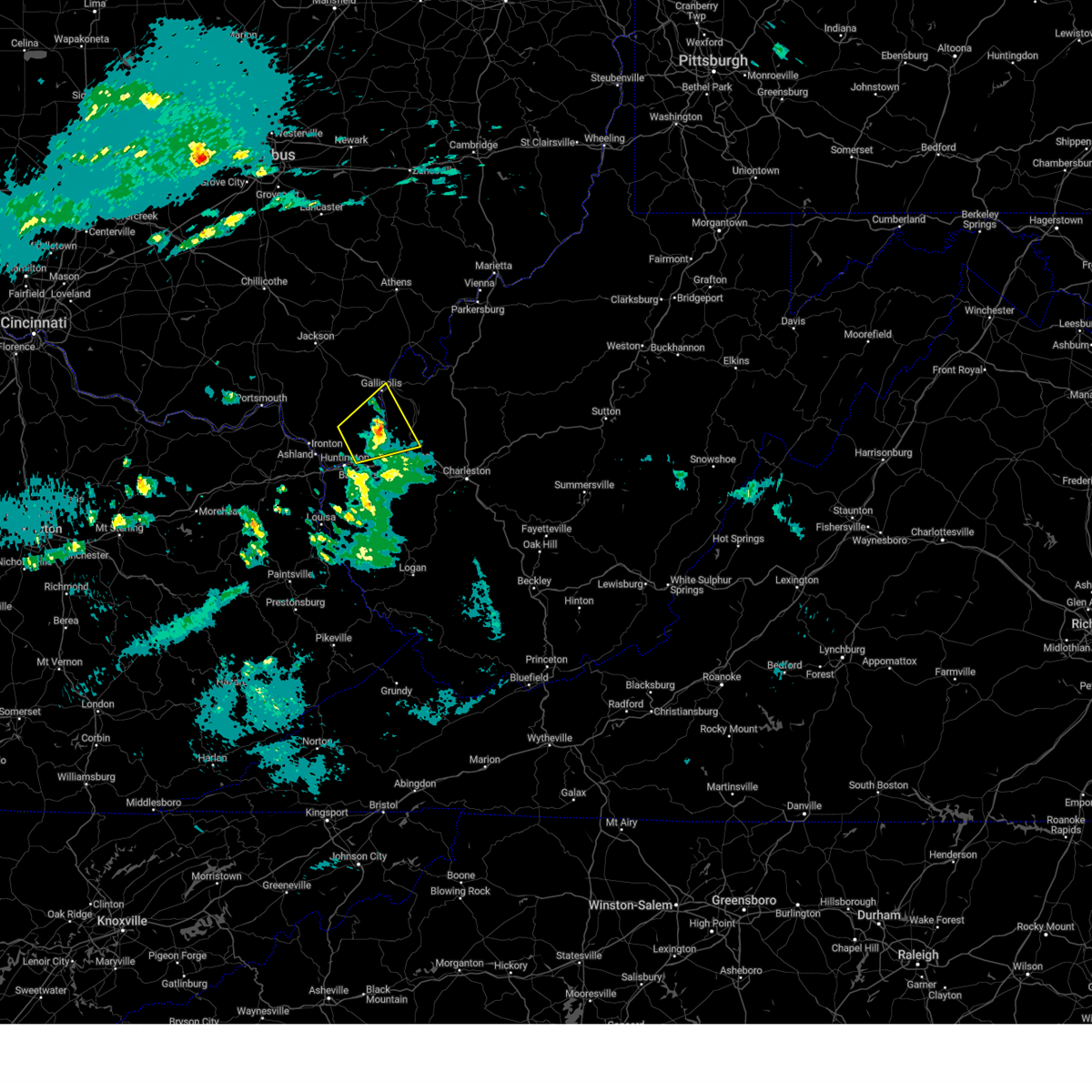
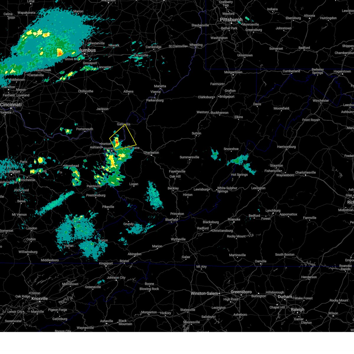
| 5/22/2024 2:32 PM EDT | Numerous trees down throughout lesage including at the riveria golf course and in the grand meadows subdivision. there were roofs blown off of two houses. photos showin in cabell county WV, 1.6 miles SSE of Lesage, WV |
| 5/22/2024 2:32 PM EDT | Quarter sized hail reported 1.6 miles SSE of Lesage, WV, hail damage to cars. photos showing hail on ground provided. |
| 5/22/2024 2:31 PM EDT |
 At 231 pm edt, a severe thunderstorm was located near ona, or 10 miles northeast of proctorville, moving east at 35 mph (radar indicated). Hazards include 60 mph wind gusts and half dollar size hail. Hail damage to vehicles is expected. expect wind damage to roofs, siding, and trees. Locations impacted include, huntington, proctorville, hurricane, barboursville, milton, buffalo, ona, culloden, teays valley, crown city, athalia, pea ridge, green bottom, and fraziers bottom. At 231 pm edt, a severe thunderstorm was located near ona, or 10 miles northeast of proctorville, moving east at 35 mph (radar indicated). Hazards include 60 mph wind gusts and half dollar size hail. Hail damage to vehicles is expected. expect wind damage to roofs, siding, and trees. Locations impacted include, huntington, proctorville, hurricane, barboursville, milton, buffalo, ona, culloden, teays valley, crown city, athalia, pea ridge, green bottom, and fraziers bottom.
|
| 5/22/2024 2:25 PM EDT | Multiple trees down... along with power line in cabell county WV, 1.6 miles NNE of Lesage, WV |
| 5/22/2024 2:12 PM EDT |
 Svrrlx the national weather service in charleston west virginia has issued a * severe thunderstorm warning for, south central gallia county in southeastern ohio, southeastern lawrence county in southeastern ohio, southwestern mason county in western west virginia, cabell county in central west virginia, northwestern putnam county in western west virginia, * until 245 pm edt. * at 211 pm edt, a severe thunderstorm was located near proctorville, moving east at 35 mph (radar indicated). Hazards include 60 mph wind gusts and half dollar size hail. Hail damage to vehicles is expected. Expect wind damage to roofs, siding, and trees. Svrrlx the national weather service in charleston west virginia has issued a * severe thunderstorm warning for, south central gallia county in southeastern ohio, southeastern lawrence county in southeastern ohio, southwestern mason county in western west virginia, cabell county in central west virginia, northwestern putnam county in western west virginia, * until 245 pm edt. * at 211 pm edt, a severe thunderstorm was located near proctorville, moving east at 35 mph (radar indicated). Hazards include 60 mph wind gusts and half dollar size hail. Hail damage to vehicles is expected. Expect wind damage to roofs, siding, and trees.
|
| 5/22/2024 2:02 PM EDT |
 At 201 pm edt, a severe thunderstorm was located 8 miles southeast of lake vesuvius, moving east at 35 mph (radar indicated). Hazards include 60 mph wind gusts and quarter size hail. Hail damage to vehicles is expected. expect wind damage to roofs, siding, and trees. Locations impacted include, ona, aid, crown city, athalia, green bottom, and scottown. At 201 pm edt, a severe thunderstorm was located 8 miles southeast of lake vesuvius, moving east at 35 mph (radar indicated). Hazards include 60 mph wind gusts and quarter size hail. Hail damage to vehicles is expected. expect wind damage to roofs, siding, and trees. Locations impacted include, ona, aid, crown city, athalia, green bottom, and scottown.
|
| 5/22/2024 2:02 PM EDT |
 the severe thunderstorm warning has been cancelled and is no longer in effect the severe thunderstorm warning has been cancelled and is no longer in effect
|
| 5/22/2024 1:45 PM EDT |
 Svrrlx the national weather service in charleston west virginia has issued a * severe thunderstorm warning for, northeastern boyd county in northeastern kentucky, east central greenup county in northeastern kentucky, southeastern gallia county in southeastern ohio, lawrence county in southeastern ohio, north central cabell county in central west virginia, * until 215 pm edt. * at 144 pm edt, a severe thunderstorm was located over ironton, moving east at 35 mph (radar indicated). Hazards include 60 mph wind gusts and quarter size hail. Hail damage to vehicles is expected. Expect wind damage to roofs, siding, and trees. Svrrlx the national weather service in charleston west virginia has issued a * severe thunderstorm warning for, northeastern boyd county in northeastern kentucky, east central greenup county in northeastern kentucky, southeastern gallia county in southeastern ohio, lawrence county in southeastern ohio, north central cabell county in central west virginia, * until 215 pm edt. * at 144 pm edt, a severe thunderstorm was located over ironton, moving east at 35 mph (radar indicated). Hazards include 60 mph wind gusts and quarter size hail. Hail damage to vehicles is expected. Expect wind damage to roofs, siding, and trees.
|
| 4/2/2024 10:53 AM EDT |
 the severe thunderstorm warning has been cancelled and is no longer in effect the severe thunderstorm warning has been cancelled and is no longer in effect
|
| 4/2/2024 10:53 AM EDT |
 At 1050 am edt, severe thunderstorms were located along a line extending from 10 miles north of ona to river, moving east at 60 mph (radar indicated). Hazards include 80 mph wind gusts and penny size hail. Flying debris will be dangerous to those caught without shelter. mobile homes will be heavily damaged. expect considerable damage to roofs, windows, and vehicles. extensive tree damage and power outages are likely. Locations impacted include, huntington, nitro, louisa, winfield, wayne, hamlin, proctorville, beech fork state park, hurricane, barboursville, milton, eleanor, buffalo, poca, fort gay, ranger, ona, culloden, harts, and gill. At 1050 am edt, severe thunderstorms were located along a line extending from 10 miles north of ona to river, moving east at 60 mph (radar indicated). Hazards include 80 mph wind gusts and penny size hail. Flying debris will be dangerous to those caught without shelter. mobile homes will be heavily damaged. expect considerable damage to roofs, windows, and vehicles. extensive tree damage and power outages are likely. Locations impacted include, huntington, nitro, louisa, winfield, wayne, hamlin, proctorville, beech fork state park, hurricane, barboursville, milton, eleanor, buffalo, poca, fort gay, ranger, ona, culloden, harts, and gill.
|
| 4/2/2024 10:45 AM EDT |
 the tornado warning has been cancelled and is no longer in effect the tornado warning has been cancelled and is no longer in effect
|
| 4/2/2024 10:45 AM EDT |
 At 1045 am edt, a severe squall line capable of producing both tornadoes and extensive straight line wind damage was located along a line extending from 8 miles south of gallipolis to 7 miles north of milton to near barboursville, moving east at 70 mph (radar indicated rotation). Hazards include tornado. Flying debris will be dangerous to those caught without shelter. mobile homes will be damaged or destroyed. damage to roofs, windows, and vehicles will occur. tree damage is likely. these dangerous storms will be near, milton and culloden around 1050 am edt. Other locations impacted by these tornadic storms include ashton and pea ridge. At 1045 am edt, a severe squall line capable of producing both tornadoes and extensive straight line wind damage was located along a line extending from 8 miles south of gallipolis to 7 miles north of milton to near barboursville, moving east at 70 mph (radar indicated rotation). Hazards include tornado. Flying debris will be dangerous to those caught without shelter. mobile homes will be damaged or destroyed. damage to roofs, windows, and vehicles will occur. tree damage is likely. these dangerous storms will be near, milton and culloden around 1050 am edt. Other locations impacted by these tornadic storms include ashton and pea ridge.
|
| 4/2/2024 10:38 AM EDT |
 At 1038 am edt, a severe squall line capable of producing both tornadoes and extensive straight line wind damage was located along a line extending from 9 miles southwest of gallipolis to near huntington, moving east at 70 mph (radar indicated rotation). Hazards include tornado. Flying debris will be dangerous to those caught without shelter. mobile homes will be damaged or destroyed. damage to roofs, windows, and vehicles will occur. tree damage is likely. these dangerous storms will be near, barboursville, milton, culloden, and ona around 1045 am edt. Other locations impacted by these tornadic storms include green bottom, pea ridge, ashton, athalia, and crown city. At 1038 am edt, a severe squall line capable of producing both tornadoes and extensive straight line wind damage was located along a line extending from 9 miles southwest of gallipolis to near huntington, moving east at 70 mph (radar indicated rotation). Hazards include tornado. Flying debris will be dangerous to those caught without shelter. mobile homes will be damaged or destroyed. damage to roofs, windows, and vehicles will occur. tree damage is likely. these dangerous storms will be near, barboursville, milton, culloden, and ona around 1045 am edt. Other locations impacted by these tornadic storms include green bottom, pea ridge, ashton, athalia, and crown city.
|
| 4/2/2024 10:38 AM EDT |
 the tornado warning has been cancelled and is no longer in effect the tornado warning has been cancelled and is no longer in effect
|
| 4/2/2024 10:36 AM EDT |
 the severe thunderstorm warning has been cancelled and is no longer in effect the severe thunderstorm warning has been cancelled and is no longer in effect
|
| 4/2/2024 10:36 AM EDT |
 At 1034 am edt, severe thunderstorms were located along a line extending from 9 miles north of proctorville to near barnetts creek, moving east at 70 mph. these are destructive storms for barboursville, louisa, winfield, milton, hurricane, chesapeake, and hamlin (radar indicated). Hazards include 80 mph wind gusts. Flying debris will be dangerous to those caught without shelter. mobile homes will be heavily damaged. expect considerable damage to roofs, windows, and vehicles. extensive tree damage and power outages are likely. Locations impacted include, huntington, nitro, louisa, winfield, wayne, hamlin, chesapeake, proctorville, blaine, beech fork state park, yatesville lake state park, hurricane, barboursville, kenova, milton, catlettsburg, eleanor, ceredo, buffalo, and poca. At 1034 am edt, severe thunderstorms were located along a line extending from 9 miles north of proctorville to near barnetts creek, moving east at 70 mph. these are destructive storms for barboursville, louisa, winfield, milton, hurricane, chesapeake, and hamlin (radar indicated). Hazards include 80 mph wind gusts. Flying debris will be dangerous to those caught without shelter. mobile homes will be heavily damaged. expect considerable damage to roofs, windows, and vehicles. extensive tree damage and power outages are likely. Locations impacted include, huntington, nitro, louisa, winfield, wayne, hamlin, chesapeake, proctorville, blaine, beech fork state park, yatesville lake state park, hurricane, barboursville, kenova, milton, catlettsburg, eleanor, ceredo, buffalo, and poca.
|
| 4/2/2024 10:27 AM EDT |
 Torrlx the national weather service in charleston west virginia has issued a * tornado warning for, northeastern boyd county in northeastern kentucky, southern gallia county in southeastern ohio, lawrence county in southeastern ohio, southwestern mason county in western west virginia, cabell county in central west virginia, west central putnam county in western west virginia, north central wayne county in western west virginia, * until 1100 am edt. * at 1026 am edt, severe thunderstorms capable of producing both tornadoes and extensive straight line wind damage were located along a line extending from 9 miles northeast of lake vesuvius to near ashland, moving east at 55 mph (radar indicated rotation). Hazards include tornado. Flying debris will be dangerous to those caught without shelter. mobile homes will be damaged or destroyed. damage to roofs, windows, and vehicles will occur. tree damage is likely. these dangerous storms will be near, huntington, ashland, chesapeake, kenova, catlettsburg, and ceredo around 1030 am edt. proctorville around 1035 am edt. barboursville around 1040 am edt. ona around 1045 am edt. milton and culloden around 1050 am edt. Other locations impacted by these tornadic storms include pea ridge, burlington, athalia, crown city, south point, green bottom, scottown, waterloo, ashton, and aid. Torrlx the national weather service in charleston west virginia has issued a * tornado warning for, northeastern boyd county in northeastern kentucky, southern gallia county in southeastern ohio, lawrence county in southeastern ohio, southwestern mason county in western west virginia, cabell county in central west virginia, west central putnam county in western west virginia, north central wayne county in western west virginia, * until 1100 am edt. * at 1026 am edt, severe thunderstorms capable of producing both tornadoes and extensive straight line wind damage were located along a line extending from 9 miles northeast of lake vesuvius to near ashland, moving east at 55 mph (radar indicated rotation). Hazards include tornado. Flying debris will be dangerous to those caught without shelter. mobile homes will be damaged or destroyed. damage to roofs, windows, and vehicles will occur. tree damage is likely. these dangerous storms will be near, huntington, ashland, chesapeake, kenova, catlettsburg, and ceredo around 1030 am edt. proctorville around 1035 am edt. barboursville around 1040 am edt. ona around 1045 am edt. milton and culloden around 1050 am edt. Other locations impacted by these tornadic storms include pea ridge, burlington, athalia, crown city, south point, green bottom, scottown, waterloo, ashton, and aid.
|
| 4/2/2024 10:22 AM EDT |
 Svrrlx the national weather service in charleston west virginia has issued a * severe thunderstorm warning for, boyd county in northeastern kentucky, lawrence county in northeastern kentucky, southeastern carter county in northeastern kentucky, south central gallia county in southeastern ohio, southeastern lawrence county in southeastern ohio, southwestern mason county in western west virginia, cabell county in central west virginia, northwestern mingo county in southern west virginia, putnam county in western west virginia, western lincoln county in central west virginia, wayne county in western west virginia, * until 1100 am edt. * at 1021 am edt, severe thunderstorms were located along a line extending from near lake vesuvius to logville, moving east at 65 mph (radar indicated). Hazards include 60 mph wind gusts. expect damage to roofs, siding, and trees Svrrlx the national weather service in charleston west virginia has issued a * severe thunderstorm warning for, boyd county in northeastern kentucky, lawrence county in northeastern kentucky, southeastern carter county in northeastern kentucky, south central gallia county in southeastern ohio, southeastern lawrence county in southeastern ohio, southwestern mason county in western west virginia, cabell county in central west virginia, northwestern mingo county in southern west virginia, putnam county in western west virginia, western lincoln county in central west virginia, wayne county in western west virginia, * until 1100 am edt. * at 1021 am edt, severe thunderstorms were located along a line extending from near lake vesuvius to logville, moving east at 65 mph (radar indicated). Hazards include 60 mph wind gusts. expect damage to roofs, siding, and trees
|
| 2/28/2024 7:54 AM EST |
 The storm which prompted the warning has moved out of the area. therefore, the warning will be allowed to expire. however, gusty winds are still possible with this thunderstorm. a tornado watch remains in effect until 1000 am est for southeastern ohio, and central and western west virginia. The storm which prompted the warning has moved out of the area. therefore, the warning will be allowed to expire. however, gusty winds are still possible with this thunderstorm. a tornado watch remains in effect until 1000 am est for southeastern ohio, and central and western west virginia.
|
| 2/28/2024 7:38 AM EST |
 At 737 am est, a severe thunderstorm was located 7 miles north of milton, or 12 miles northeast of proctorville, moving east at 60 mph (radar indicated). Hazards include 60 mph wind gusts and penny size hail. Expect damage to roofs, siding, and trees. Locations impacted include, huntington, proctorville, hurricane, barboursville, milton, buffalo, ona, culloden, teays valley, crown city, athalia, pea ridge, green bottom, and fraziers bottom. At 737 am est, a severe thunderstorm was located 7 miles north of milton, or 12 miles northeast of proctorville, moving east at 60 mph (radar indicated). Hazards include 60 mph wind gusts and penny size hail. Expect damage to roofs, siding, and trees. Locations impacted include, huntington, proctorville, hurricane, barboursville, milton, buffalo, ona, culloden, teays valley, crown city, athalia, pea ridge, green bottom, and fraziers bottom.
|
| 2/28/2024 7:24 AM EST |
 Svrrlx the national weather service in charleston west virginia has issued a * severe thunderstorm warning for, northeastern boyd county in northeastern kentucky, southeastern lawrence county in southeastern ohio, southwestern mason county in western west virginia, northern cabell county in central west virginia, northwestern putnam county in western west virginia, * until 800 am est. * at 724 am est, a severe thunderstorm was located near proctorville, moving east at 60 mph (radar indicated). Hazards include 60 mph wind gusts and penny size hail. expect damage to roofs, siding, and trees Svrrlx the national weather service in charleston west virginia has issued a * severe thunderstorm warning for, northeastern boyd county in northeastern kentucky, southeastern lawrence county in southeastern ohio, southwestern mason county in western west virginia, northern cabell county in central west virginia, northwestern putnam county in western west virginia, * until 800 am est. * at 724 am est, a severe thunderstorm was located near proctorville, moving east at 60 mph (radar indicated). Hazards include 60 mph wind gusts and penny size hail. expect damage to roofs, siding, and trees
|
| 2/28/2024 4:13 AM EST |
 The storm which prompted the warning has weakened below severe limits, and has exited the warned area. therefore, the warning will be allowed to expire. The storm which prompted the warning has weakened below severe limits, and has exited the warned area. therefore, the warning will be allowed to expire.
|
| 2/28/2024 4:07 AM EST |
 At 406 am est, a severe thunderstorm was located 11 miles north of proctorville, moving northeast at 70 mph (radar indicated). Hazards include 60 mph wind gusts. Expect damage to roofs, siding, and trees. Locations impacted include, gallipolis, proctorville, buffalo, crown city, athalia, gallopolis ferry, green bottom, scottown, fraziers bottom, and ashton. At 406 am est, a severe thunderstorm was located 11 miles north of proctorville, moving northeast at 70 mph (radar indicated). Hazards include 60 mph wind gusts. Expect damage to roofs, siding, and trees. Locations impacted include, gallipolis, proctorville, buffalo, crown city, athalia, gallopolis ferry, green bottom, scottown, fraziers bottom, and ashton.
|
| 2/28/2024 3:50 AM EST |
 Svrrlx the national weather service in charleston west virginia has issued a * severe thunderstorm warning for, northeastern boyd county in northeastern kentucky, southeastern greenup county in northeastern kentucky, southern gallia county in southeastern ohio, lawrence county in southeastern ohio, southwestern mason county in western west virginia, northern cabell county in central west virginia, west central putnam county in western west virginia, northern wayne county in western west virginia, * until 415 am est. * at 349 am est, a severe thunderstorm was located over ashland, moving northeast at 70 mph (radar indicated). Hazards include 60 mph wind gusts. expect damage to roofs, siding, and trees Svrrlx the national weather service in charleston west virginia has issued a * severe thunderstorm warning for, northeastern boyd county in northeastern kentucky, southeastern greenup county in northeastern kentucky, southern gallia county in southeastern ohio, lawrence county in southeastern ohio, southwestern mason county in western west virginia, northern cabell county in central west virginia, west central putnam county in western west virginia, northern wayne county in western west virginia, * until 415 am est. * at 349 am est, a severe thunderstorm was located over ashland, moving northeast at 70 mph (radar indicated). Hazards include 60 mph wind gusts. expect damage to roofs, siding, and trees
|
| 8/7/2023 2:05 PM EDT |
 At 205 pm edt, a severe thunderstorm was located over ona, or 8 miles east of proctorville, moving east at 30 mph (radar indicated). Hazards include ping pong ball size hail and 60 mph wind gusts. People and animals outdoors will be injured. expect hail damage to roofs, siding, windows, and vehicles. Expect wind damage to roofs, siding, and trees. At 205 pm edt, a severe thunderstorm was located over ona, or 8 miles east of proctorville, moving east at 30 mph (radar indicated). Hazards include ping pong ball size hail and 60 mph wind gusts. People and animals outdoors will be injured. expect hail damage to roofs, siding, windows, and vehicles. Expect wind damage to roofs, siding, and trees.
|
| 7/28/2023 2:43 PM EDT |
 At 243 pm edt, a severe thunderstorm was located near hamlin, moving east at 40 mph (radar indicated). Hazards include 60 mph wind gusts. expect damage to roofs, siding, and trees At 243 pm edt, a severe thunderstorm was located near hamlin, moving east at 40 mph (radar indicated). Hazards include 60 mph wind gusts. expect damage to roofs, siding, and trees
|
| 7/18/2023 9:41 PM EDT |
 At 941 pm edt, a severe thunderstorm was located over durbin, or near cannonsburg, moving east at 35 mph (radar indicated). Hazards include 60 mph wind gusts and quarter size hail. Hail damage to vehicles is expected. Expect wind damage to roofs, siding, and trees. At 941 pm edt, a severe thunderstorm was located over durbin, or near cannonsburg, moving east at 35 mph (radar indicated). Hazards include 60 mph wind gusts and quarter size hail. Hail damage to vehicles is expected. Expect wind damage to roofs, siding, and trees.
|
| 7/2/2023 7:06 PM EDT |
 At 705 pm edt, a severe thunderstorm was located over yatesville lake state park, moving northeast at 45 mph (radar indicated). Hazards include 60 mph wind gusts and nickel size hail. expect damage to roofs, siding, and trees At 705 pm edt, a severe thunderstorm was located over yatesville lake state park, moving northeast at 45 mph (radar indicated). Hazards include 60 mph wind gusts and nickel size hail. expect damage to roofs, siding, and trees
|
| 7/8/2022 3:31 PM EDT |
 At 331 pm edt, a severe thunderstorm was located over milton, or 10 miles north of hamlin, moving east at 30 mph (radar indicated). Hazards include 60 mph wind gusts and penny size hail. Expect damage to roofs, siding, and trees. Locations impacted include, huntington, nitro, winfield, proctorville, hurricane, barboursville, milton, eleanor, buffalo, poca, ona, culloden, teays valley, bancroft, crown city, athalia, ashton, pea ridge, green bottom and fraziers bottom. At 331 pm edt, a severe thunderstorm was located over milton, or 10 miles north of hamlin, moving east at 30 mph (radar indicated). Hazards include 60 mph wind gusts and penny size hail. Expect damage to roofs, siding, and trees. Locations impacted include, huntington, nitro, winfield, proctorville, hurricane, barboursville, milton, eleanor, buffalo, poca, ona, culloden, teays valley, bancroft, crown city, athalia, ashton, pea ridge, green bottom and fraziers bottom.
|
| 7/8/2022 3:05 PM EDT |
 At 305 pm edt, a severe thunderstorm was located over proctorville, moving east at 30 mph (radar indicated). Hazards include 60 mph wind gusts and penny size hail. expect damage to roofs, siding, and trees At 305 pm edt, a severe thunderstorm was located over proctorville, moving east at 30 mph (radar indicated). Hazards include 60 mph wind gusts and penny size hail. expect damage to roofs, siding, and trees
|
| 7/6/2022 5:45 PM EDT |
 At 545 pm edt, severe thunderstorms were located along a line extending from near hurricane to 6 miles southeast of barboursville, moving southeast at 55 mph (radar indicated). Hazards include 60 mph wind gusts. expect damage to roofs, siding, and trees At 545 pm edt, severe thunderstorms were located along a line extending from near hurricane to 6 miles southeast of barboursville, moving southeast at 55 mph (radar indicated). Hazards include 60 mph wind gusts. expect damage to roofs, siding, and trees
|
| 7/6/2022 5:15 PM EDT |
 At 514 pm edt, severe thunderstorms were located along a line extending from 6 miles northeast of oak hill to near lake vesuvius to naples, moving east at 50 mph (radar indicated). Hazards include 60 mph wind gusts. expect damage to roofs, siding, and trees At 514 pm edt, severe thunderstorms were located along a line extending from 6 miles northeast of oak hill to near lake vesuvius to naples, moving east at 50 mph (radar indicated). Hazards include 60 mph wind gusts. expect damage to roofs, siding, and trees
|
| 6/22/2022 7:45 PM EDT |
 At 745 pm edt, a severe thunderstorm was located 11 miles north of ona, or 11 miles northeast of proctorville, moving east at 30 mph (radar indicated). Hazards include 60 mph wind gusts and quarter size hail. Hail damage to vehicles is expected. Expect wind damage to roofs, siding, and trees. At 745 pm edt, a severe thunderstorm was located 11 miles north of ona, or 11 miles northeast of proctorville, moving east at 30 mph (radar indicated). Hazards include 60 mph wind gusts and quarter size hail. Hail damage to vehicles is expected. Expect wind damage to roofs, siding, and trees.
|
| 6/17/2022 3:24 PM EDT |
 The severe thunderstorm warning for southern mason, northeastern cabell, nicholas, kanawha, southern putnam, southwestern braxton, northeastern lincoln, southeastern roane, southwestern webster, clay, north central fayette and north central boone counties will expire at 330 pm edt, the storms which prompted the warning have moved out of the area. therefore, the warning will be allowed to expire. a severe thunderstorm watch remains in effect until 500 pm edt for southeastern ohio, and central, western, southeastern, north central and northeastern west virginia. The severe thunderstorm warning for southern mason, northeastern cabell, nicholas, kanawha, southern putnam, southwestern braxton, northeastern lincoln, southeastern roane, southwestern webster, clay, north central fayette and north central boone counties will expire at 330 pm edt, the storms which prompted the warning have moved out of the area. therefore, the warning will be allowed to expire. a severe thunderstorm watch remains in effect until 500 pm edt for southeastern ohio, and central, western, southeastern, north central and northeastern west virginia.
|
| 6/17/2022 2:33 PM EDT |
 At 233 pm edt, severe thunderstorms were located along a line extending from 6 miles southeast of big otter to near milton, moving southeast at 30 mph (radar indicated). Hazards include 60 mph wind gusts. expect damage to roofs, siding, and trees At 233 pm edt, severe thunderstorms were located along a line extending from 6 miles southeast of big otter to near milton, moving southeast at 30 mph (radar indicated). Hazards include 60 mph wind gusts. expect damage to roofs, siding, and trees
|
| 6/17/2022 2:11 PM EDT |
 At 210 pm edt, severe thunderstorms were located along a line extending from big otter to 10 miles north of proctorville, moving east at 75 mph (radar indicated). Hazards include 60 mph wind gusts. expect damage to roofs, siding, and trees At 210 pm edt, severe thunderstorms were located along a line extending from big otter to 10 miles north of proctorville, moving east at 75 mph (radar indicated). Hazards include 60 mph wind gusts. expect damage to roofs, siding, and trees
|
| 6/13/2022 8:51 PM EDT |
 At 850 pm edt, severe thunderstorms were located along a line extending from 8 miles northeast of rutland to near proctorville to near oldtown, moving east at 40 mph (radar indicated). Hazards include 70 mph wind gusts and quarter size hail. Hail damage to vehicles is expected. expect considerable tree damage. wind damage is also likely to mobile homes, roofs, and outbuildings. locations impacted include, huntington, ashland, ironton, point pleasant, gallipolis, ripley, winfield, coal grove, pomeroy, wayne, hamlin, chesapeake, racine, coolville, beech fork state park, cannonsburg, forked run state park, hurricane, barboursville and ravenswood. thunderstorm damage threat, considerable hail threat, radar indicated max hail size, 1. 00 in wind threat, radar indicated max wind gust, 70 mph. At 850 pm edt, severe thunderstorms were located along a line extending from 8 miles northeast of rutland to near proctorville to near oldtown, moving east at 40 mph (radar indicated). Hazards include 70 mph wind gusts and quarter size hail. Hail damage to vehicles is expected. expect considerable tree damage. wind damage is also likely to mobile homes, roofs, and outbuildings. locations impacted include, huntington, ashland, ironton, point pleasant, gallipolis, ripley, winfield, coal grove, pomeroy, wayne, hamlin, chesapeake, racine, coolville, beech fork state park, cannonsburg, forked run state park, hurricane, barboursville and ravenswood. thunderstorm damage threat, considerable hail threat, radar indicated max hail size, 1. 00 in wind threat, radar indicated max wind gust, 70 mph.
|
| 6/13/2022 8:37 PM EDT |
 The national weather service in charleston west virginia has issued a * severe thunderstorm warning for. southern gallia county in southeastern ohio. mason county in western west virginia. cabell county in central west virginia. Kanawha county in central west virginia. The national weather service in charleston west virginia has issued a * severe thunderstorm warning for. southern gallia county in southeastern ohio. mason county in western west virginia. cabell county in central west virginia. Kanawha county in central west virginia.
|
| 6/13/2022 6:49 PM EDT |
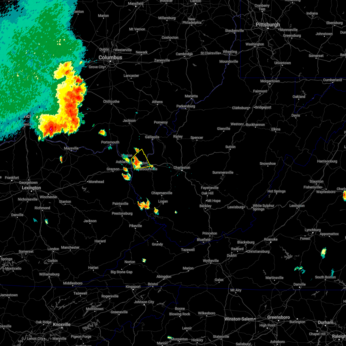 At 649 pm edt, a severe thunderstorm was located near chesapeake, moving northeast at 15 mph (radar indicated). Hazards include 60 mph wind gusts and quarter size hail. Hail damage to vehicles is expected. expect wind damage to roofs, siding, and trees. locations impacted include, huntington, chesapeake, proctorville, barboursville, ceredo, south point, burlington, aid, athalia, pea ridge and scottown. hail threat, radar indicated max hail size, 1. 00 in wind threat, radar indicated max wind gust, 60 mph. At 649 pm edt, a severe thunderstorm was located near chesapeake, moving northeast at 15 mph (radar indicated). Hazards include 60 mph wind gusts and quarter size hail. Hail damage to vehicles is expected. expect wind damage to roofs, siding, and trees. locations impacted include, huntington, chesapeake, proctorville, barboursville, ceredo, south point, burlington, aid, athalia, pea ridge and scottown. hail threat, radar indicated max hail size, 1. 00 in wind threat, radar indicated max wind gust, 60 mph.
|
| 6/13/2022 6:36 PM EDT |
 At 636 pm edt, a severe thunderstorm was located near coal grove, moving northeast at 20 mph (radar indicated). Hazards include 60 mph wind gusts and quarter size hail. Hail damage to vehicles is expected. Expect wind damage to roofs, siding, and trees. At 636 pm edt, a severe thunderstorm was located near coal grove, moving northeast at 20 mph (radar indicated). Hazards include 60 mph wind gusts and quarter size hail. Hail damage to vehicles is expected. Expect wind damage to roofs, siding, and trees.
|
| 6/13/2022 6:36 PM EDT |
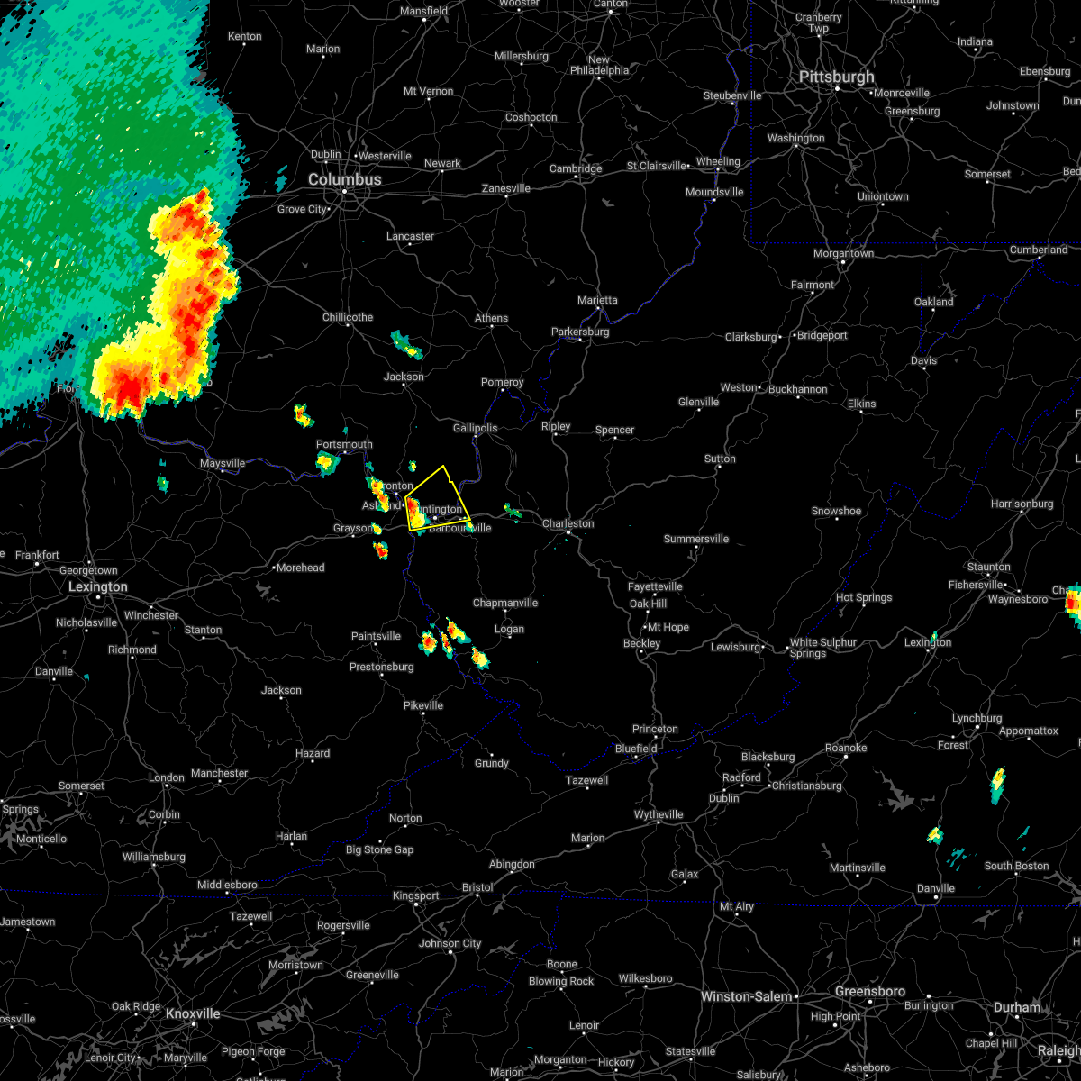 At 636 pm edt, a severe thunderstorm was located near coal grove, moving northeast at 20 mph (radar indicated). Hazards include 60 mph wind gusts and quarter size hail. Hail damage to vehicles is expected. Expect wind damage to roofs, siding, and trees. At 636 pm edt, a severe thunderstorm was located near coal grove, moving northeast at 20 mph (radar indicated). Hazards include 60 mph wind gusts and quarter size hail. Hail damage to vehicles is expected. Expect wind damage to roofs, siding, and trees.
|
| 10/21/2021 3:50 PM EDT |
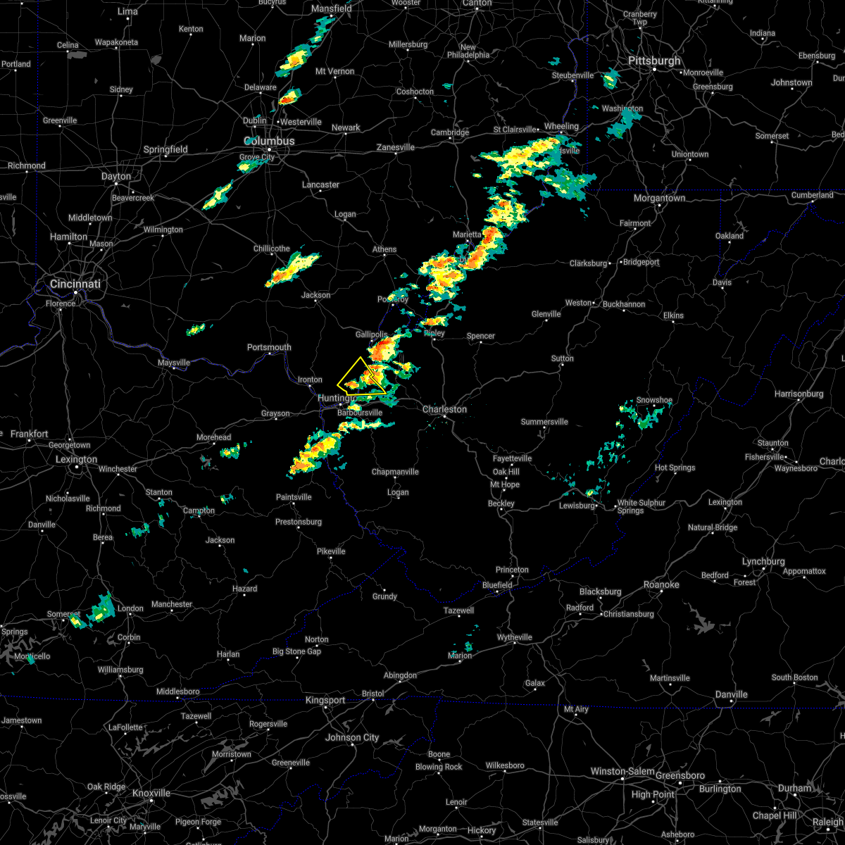 The severe thunderstorm warning for south central gallia, southeastern lawrence and northeastern cabell counties will expire at 400 pm edt, the storm which prompted the warning has weakened below severe limits, and has exited the warned area. therefore, the warning will be allowed to expire. however gusty winds are still possible with this thunderstorm. The severe thunderstorm warning for south central gallia, southeastern lawrence and northeastern cabell counties will expire at 400 pm edt, the storm which prompted the warning has weakened below severe limits, and has exited the warned area. therefore, the warning will be allowed to expire. however gusty winds are still possible with this thunderstorm.
|
| 10/21/2021 3:50 PM EDT |
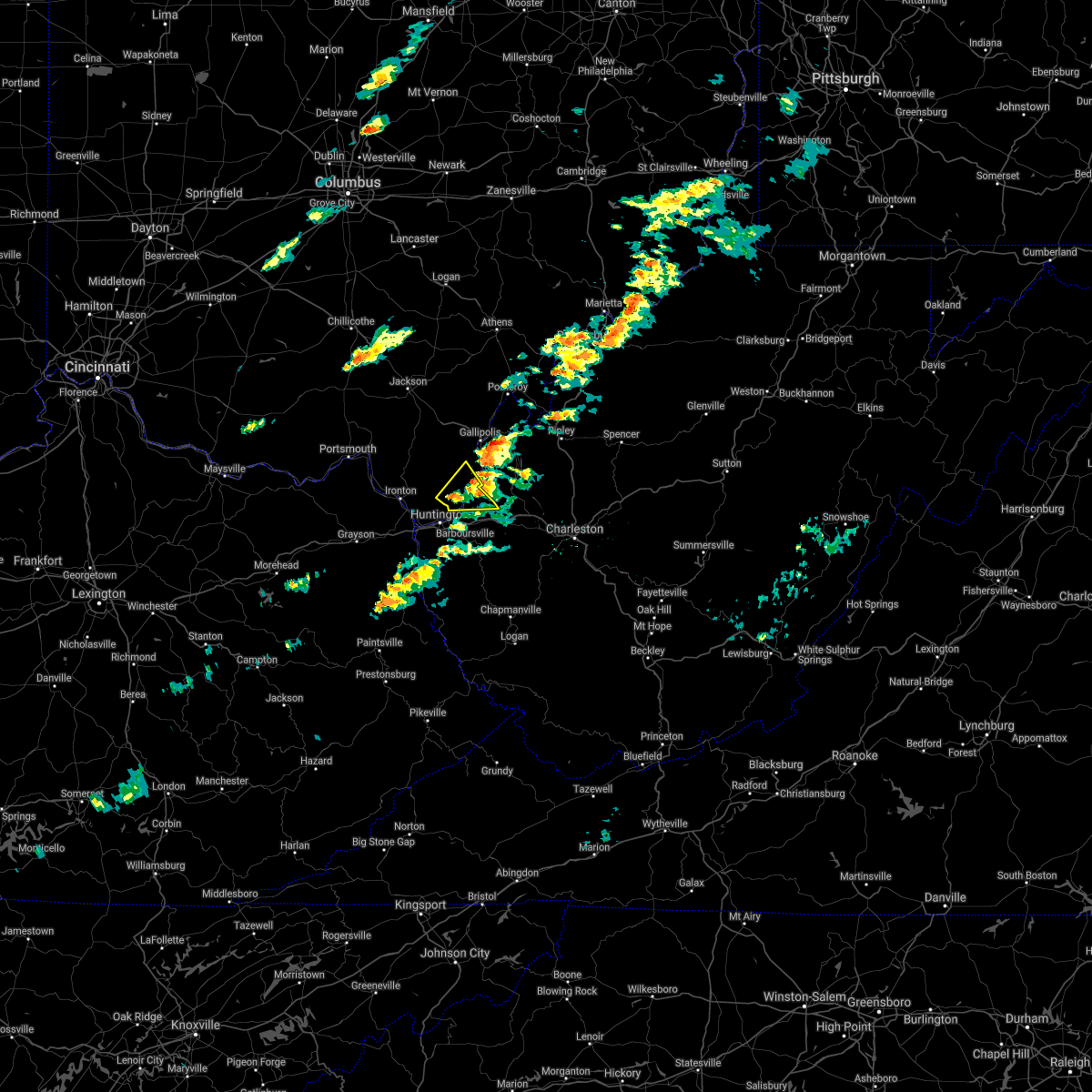 The severe thunderstorm warning for south central gallia, southeastern lawrence and northeastern cabell counties will expire at 400 pm edt, the storm which prompted the warning has weakened below severe limits, and has exited the warned area. therefore, the warning will be allowed to expire. however gusty winds are still possible with this thunderstorm. The severe thunderstorm warning for south central gallia, southeastern lawrence and northeastern cabell counties will expire at 400 pm edt, the storm which prompted the warning has weakened below severe limits, and has exited the warned area. therefore, the warning will be allowed to expire. however gusty winds are still possible with this thunderstorm.
|
| 10/21/2021 3:39 PM EDT |
 At 338 pm edt, a severe thunderstorm was located 9 miles northeast of proctorville, moving northeast at 45 mph (radar indicated). Hazards include 60 mph wind gusts. Expect damage to roofs, siding, and trees. locations impacted include, crown city, athalia, green bottom and scottown. hail threat, radar indicated max hail size, <. 75 in wind threat, radar indicated max wind gust, 60 mph. At 338 pm edt, a severe thunderstorm was located 9 miles northeast of proctorville, moving northeast at 45 mph (radar indicated). Hazards include 60 mph wind gusts. Expect damage to roofs, siding, and trees. locations impacted include, crown city, athalia, green bottom and scottown. hail threat, radar indicated max hail size, <. 75 in wind threat, radar indicated max wind gust, 60 mph.
|
| 10/21/2021 3:39 PM EDT |
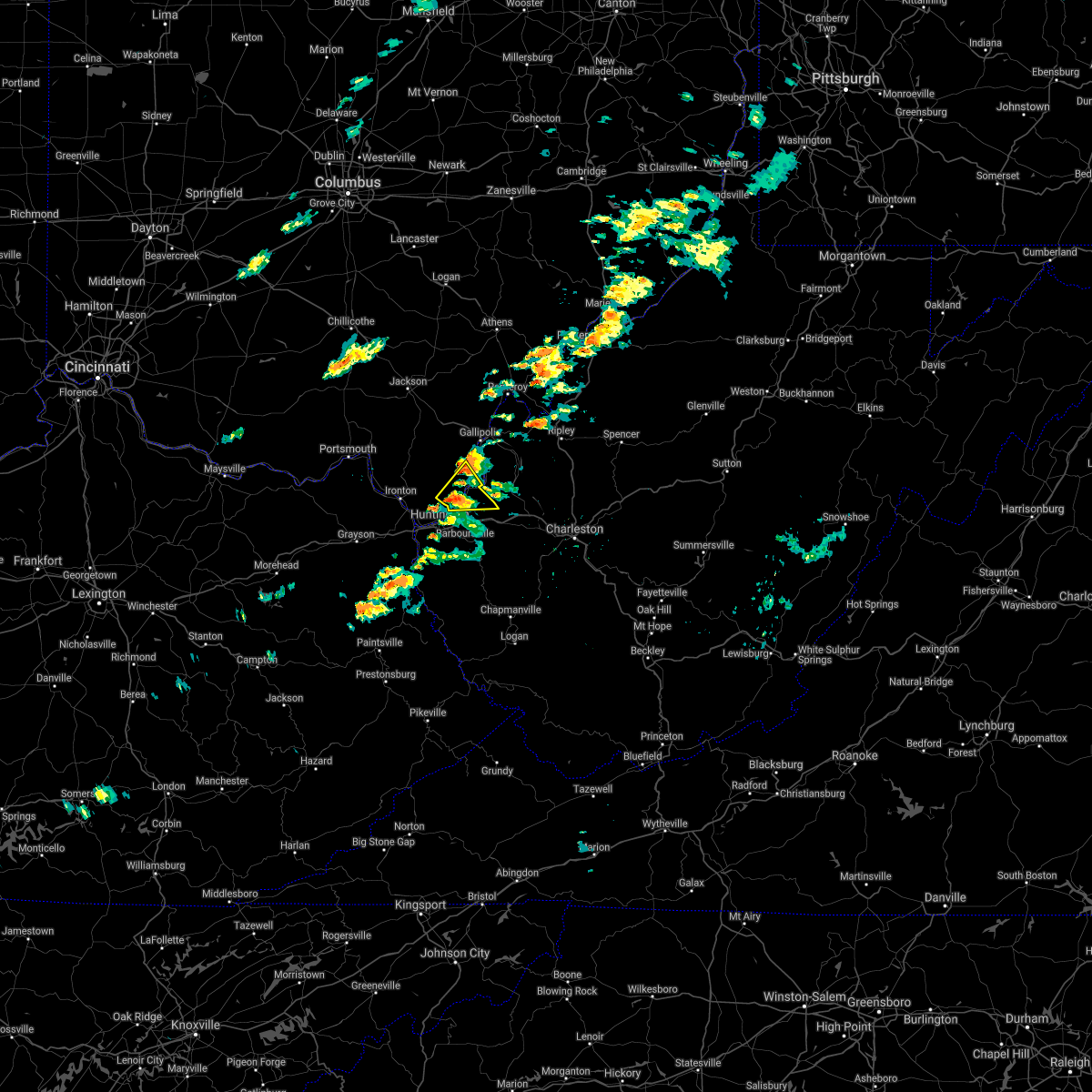 At 338 pm edt, a severe thunderstorm was located 9 miles northeast of proctorville, moving northeast at 45 mph (radar indicated). Hazards include 60 mph wind gusts. Expect damage to roofs, siding, and trees. locations impacted include, crown city, athalia, green bottom and scottown. hail threat, radar indicated max hail size, <. 75 in wind threat, radar indicated max wind gust, 60 mph. At 338 pm edt, a severe thunderstorm was located 9 miles northeast of proctorville, moving northeast at 45 mph (radar indicated). Hazards include 60 mph wind gusts. Expect damage to roofs, siding, and trees. locations impacted include, crown city, athalia, green bottom and scottown. hail threat, radar indicated max hail size, <. 75 in wind threat, radar indicated max wind gust, 60 mph.
|
| 10/21/2021 3:23 PM EDT |
 At 323 pm edt, a severe thunderstorm was located near chesapeake, moving northeast at 45 mph (radar indicated). Hazards include 60 mph wind gusts. expect damage to roofs, siding, and trees At 323 pm edt, a severe thunderstorm was located near chesapeake, moving northeast at 45 mph (radar indicated). Hazards include 60 mph wind gusts. expect damage to roofs, siding, and trees
|
| 10/21/2021 3:23 PM EDT |
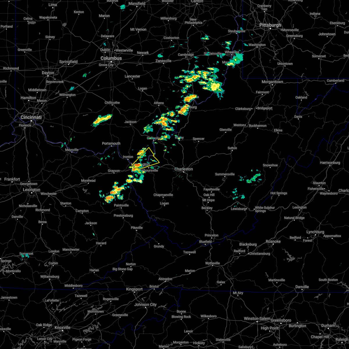 At 323 pm edt, a severe thunderstorm was located near chesapeake, moving northeast at 45 mph (radar indicated). Hazards include 60 mph wind gusts. expect damage to roofs, siding, and trees At 323 pm edt, a severe thunderstorm was located near chesapeake, moving northeast at 45 mph (radar indicated). Hazards include 60 mph wind gusts. expect damage to roofs, siding, and trees
|
| 8/13/2021 2:43 PM EDT |
 At 243 pm edt, a severe thunderstorm was located over chesapeake, moving east at 25 mph (radar indicated). Hazards include 60 mph wind gusts. expect damage to roofs, siding, and trees At 243 pm edt, a severe thunderstorm was located over chesapeake, moving east at 25 mph (radar indicated). Hazards include 60 mph wind gusts. expect damage to roofs, siding, and trees
|
| 8/13/2021 2:43 PM EDT |
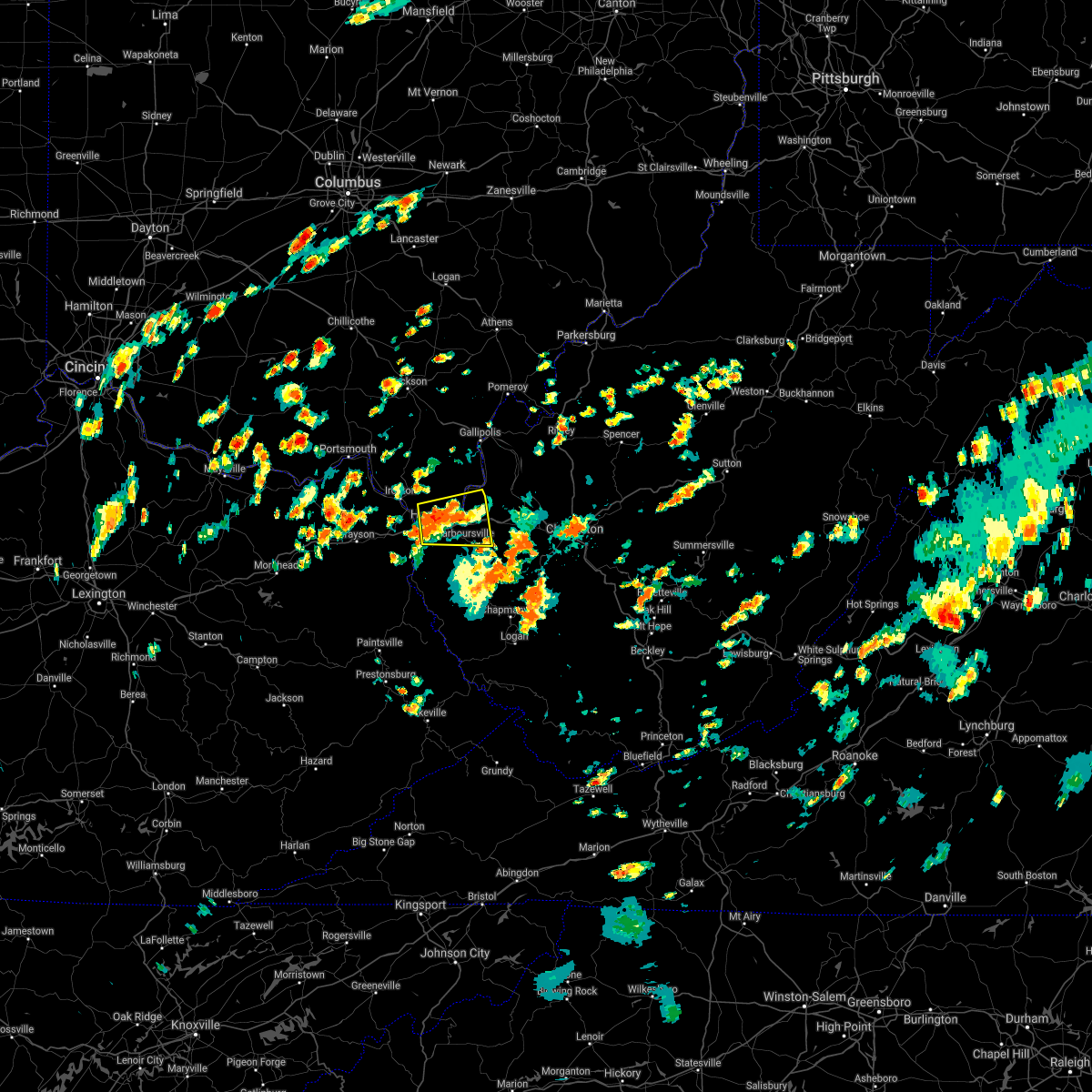 At 243 pm edt, a severe thunderstorm was located over chesapeake, moving east at 25 mph (radar indicated). Hazards include 60 mph wind gusts. expect damage to roofs, siding, and trees At 243 pm edt, a severe thunderstorm was located over chesapeake, moving east at 25 mph (radar indicated). Hazards include 60 mph wind gusts. expect damage to roofs, siding, and trees
|
| 8/10/2021 4:26 PM EDT |
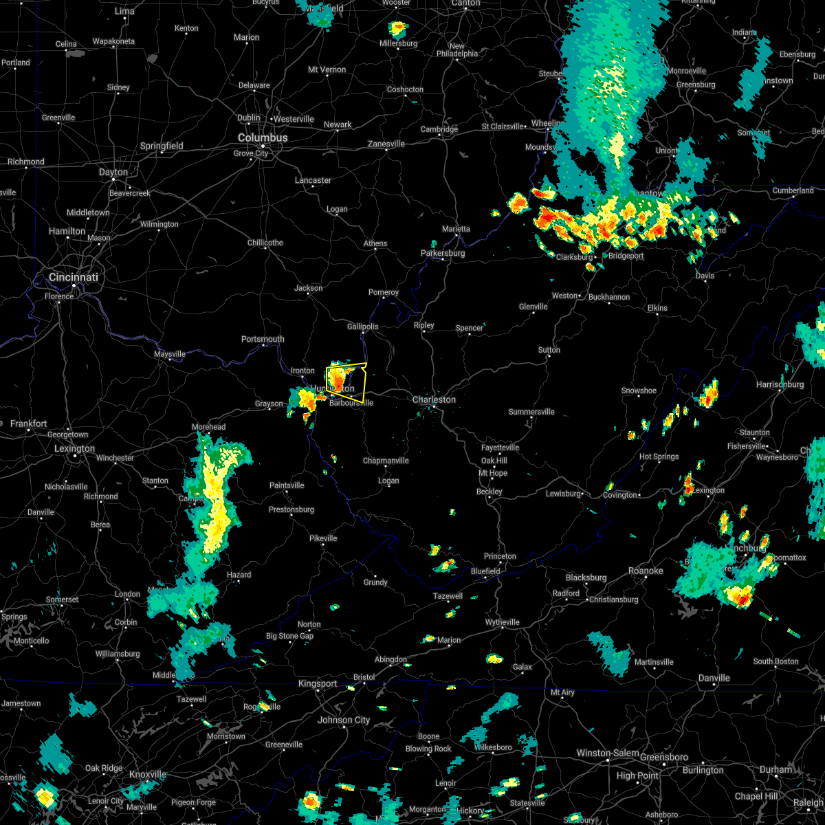 At 424 pm edt, a severe thunderstorm was located near proctorville, moving east at 25 mph (radar indicated). Hazards include 60 mph wind gusts and half inch size hail. Expect damage to roofs, siding, and trees. locations impacted include, huntington, chesapeake, proctorville, barboursville, ona, crown city, athalia, pea ridge, green bottom and scottown. hail threat, radar indicated max hail size, 0. 75 in wind threat, radar indicated max wind gust, 60 mph. At 424 pm edt, a severe thunderstorm was located near proctorville, moving east at 25 mph (radar indicated). Hazards include 60 mph wind gusts and half inch size hail. Expect damage to roofs, siding, and trees. locations impacted include, huntington, chesapeake, proctorville, barboursville, ona, crown city, athalia, pea ridge, green bottom and scottown. hail threat, radar indicated max hail size, 0. 75 in wind threat, radar indicated max wind gust, 60 mph.
|
| 8/10/2021 4:07 PM EDT |
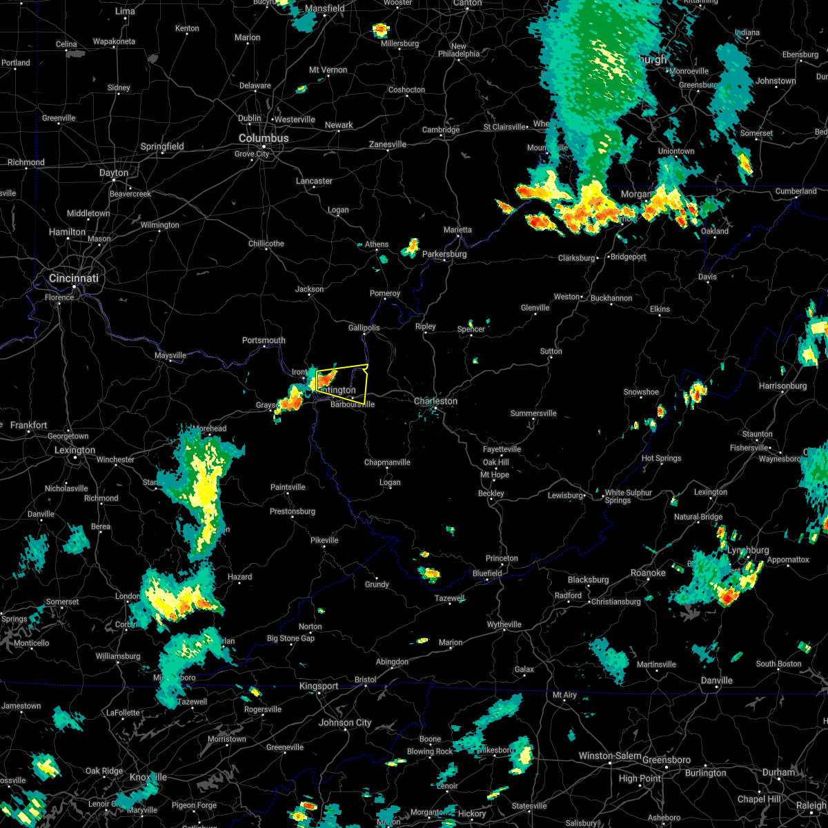 At 406 pm edt, a severe thunderstorm was located near chesapeake, moving east at 25 mph (radar indicated). Hazards include 60 mph wind gusts and half inch size hail. expect damage to roofs, siding, and trees At 406 pm edt, a severe thunderstorm was located near chesapeake, moving east at 25 mph (radar indicated). Hazards include 60 mph wind gusts and half inch size hail. expect damage to roofs, siding, and trees
|
| 8/10/2021 4:07 PM EDT |
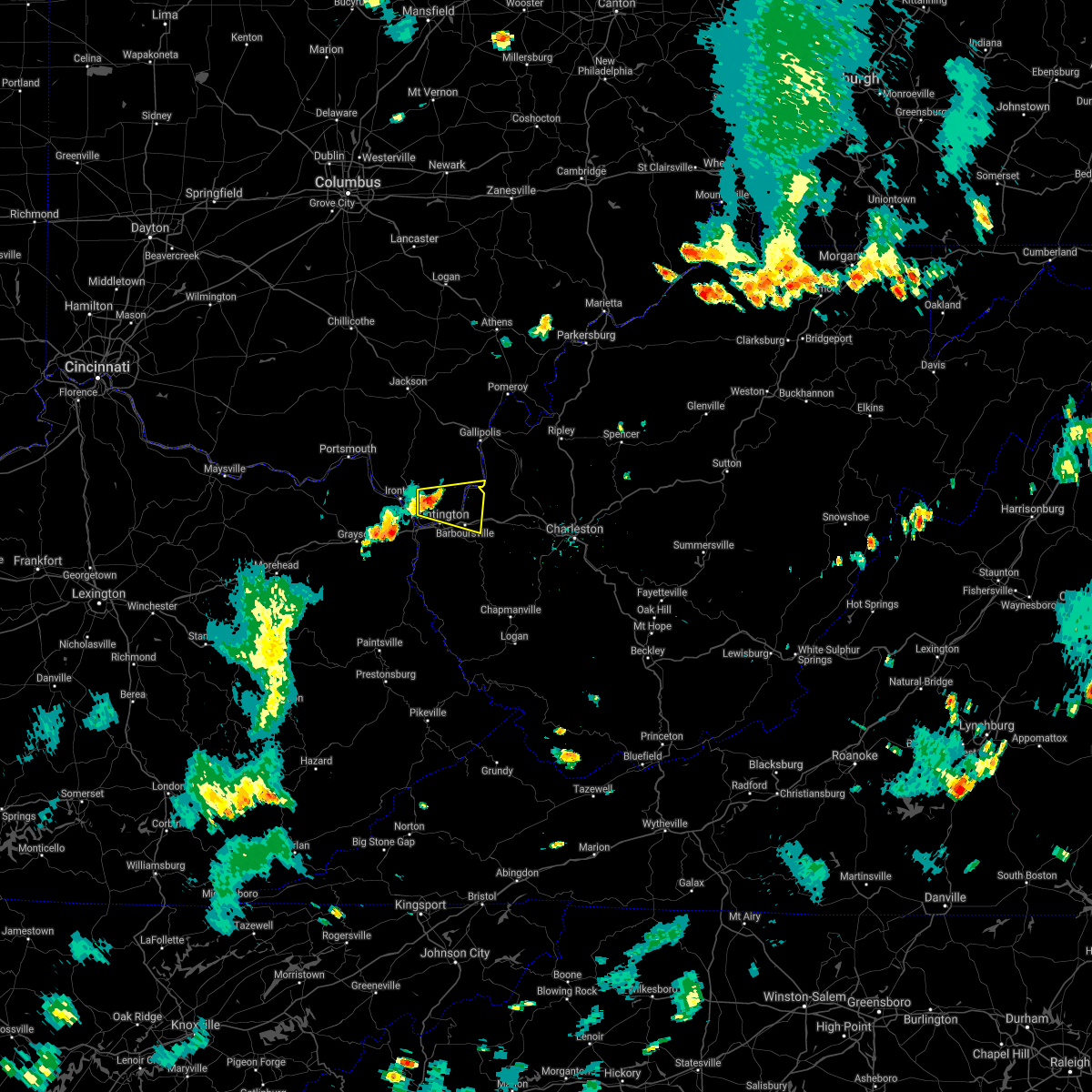 At 406 pm edt, a severe thunderstorm was located near chesapeake, moving east at 25 mph (radar indicated). Hazards include 60 mph wind gusts and half inch size hail. expect damage to roofs, siding, and trees At 406 pm edt, a severe thunderstorm was located near chesapeake, moving east at 25 mph (radar indicated). Hazards include 60 mph wind gusts and half inch size hail. expect damage to roofs, siding, and trees
|
| 3/25/2021 11:13 PM EDT |
 At 1112 pm edt, a severe thunderstorm was located near milton, or 13 miles west of winfield, moving northeast at 75 mph (radar indicated). Hazards include 60 mph wind gusts. expect damage to roofs, siding, and trees At 1112 pm edt, a severe thunderstorm was located near milton, or 13 miles west of winfield, moving northeast at 75 mph (radar indicated). Hazards include 60 mph wind gusts. expect damage to roofs, siding, and trees
|
| 3/18/2021 6:09 PM EDT |
 At 609 pm edt, a severe thunderstorm was located over barboursville, or 7 miles southeast of proctorville, moving east at 30 mph (radar indicated). Hazards include 60 mph wind gusts and quarter size hail. Hail damage to vehicles is expected. Expect wind damage to roofs, siding, and trees. At 609 pm edt, a severe thunderstorm was located over barboursville, or 7 miles southeast of proctorville, moving east at 30 mph (radar indicated). Hazards include 60 mph wind gusts and quarter size hail. Hail damage to vehicles is expected. Expect wind damage to roofs, siding, and trees.
|
| 7/22/2020 5:36 PM EDT |
 The severe thunderstorm warning for southeastern lawrence, cabell, northwestern lincoln and northeastern wayne counties will expire at 545 pm edt, the storm which prompted the warning has moved out of the area. therefore, the warning will be allowed to expire. The severe thunderstorm warning for southeastern lawrence, cabell, northwestern lincoln and northeastern wayne counties will expire at 545 pm edt, the storm which prompted the warning has moved out of the area. therefore, the warning will be allowed to expire.
|
| 7/22/2020 5:36 PM EDT |
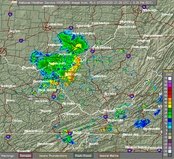 The severe thunderstorm warning for southeastern lawrence, cabell, northwestern lincoln and northeastern wayne counties will expire at 545 pm edt, the storm which prompted the warning has moved out of the area. therefore, the warning will be allowed to expire. The severe thunderstorm warning for southeastern lawrence, cabell, northwestern lincoln and northeastern wayne counties will expire at 545 pm edt, the storm which prompted the warning has moved out of the area. therefore, the warning will be allowed to expire.
|
| 7/22/2020 5:22 PM EDT |
 At 522 pm edt, a severe thunderstorm was located over ona, or 8 miles east of proctorville, moving east at 40 mph (radar indicated). Hazards include 60 mph wind gusts. Expect damage to roofs, siding, and trees. Locations impacted include, huntington, chesapeake, proctorville, beech fork state park, barboursville, ona, athalia, salt rock, pea ridge, lavalette, green bottom and scottown. At 522 pm edt, a severe thunderstorm was located over ona, or 8 miles east of proctorville, moving east at 40 mph (radar indicated). Hazards include 60 mph wind gusts. Expect damage to roofs, siding, and trees. Locations impacted include, huntington, chesapeake, proctorville, beech fork state park, barboursville, ona, athalia, salt rock, pea ridge, lavalette, green bottom and scottown.
|
| 7/22/2020 5:22 PM EDT |
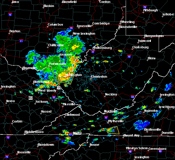 At 522 pm edt, a severe thunderstorm was located over ona, or 8 miles east of proctorville, moving east at 40 mph (radar indicated). Hazards include 60 mph wind gusts. Expect damage to roofs, siding, and trees. Locations impacted include, huntington, chesapeake, proctorville, beech fork state park, barboursville, ona, athalia, salt rock, pea ridge, lavalette, green bottom and scottown. At 522 pm edt, a severe thunderstorm was located over ona, or 8 miles east of proctorville, moving east at 40 mph (radar indicated). Hazards include 60 mph wind gusts. Expect damage to roofs, siding, and trees. Locations impacted include, huntington, chesapeake, proctorville, beech fork state park, barboursville, ona, athalia, salt rock, pea ridge, lavalette, green bottom and scottown.
|
| 7/22/2020 4:58 PM EDT |
 At 458 pm edt, a severe thunderstorm was located over ceredo, or near chesapeake, moving east at 30 mph (radar indicated). Hazards include 60 mph wind gusts. expect damage to roofs, siding, and trees At 458 pm edt, a severe thunderstorm was located over ceredo, or near chesapeake, moving east at 30 mph (radar indicated). Hazards include 60 mph wind gusts. expect damage to roofs, siding, and trees
|
| 7/22/2020 4:58 PM EDT |
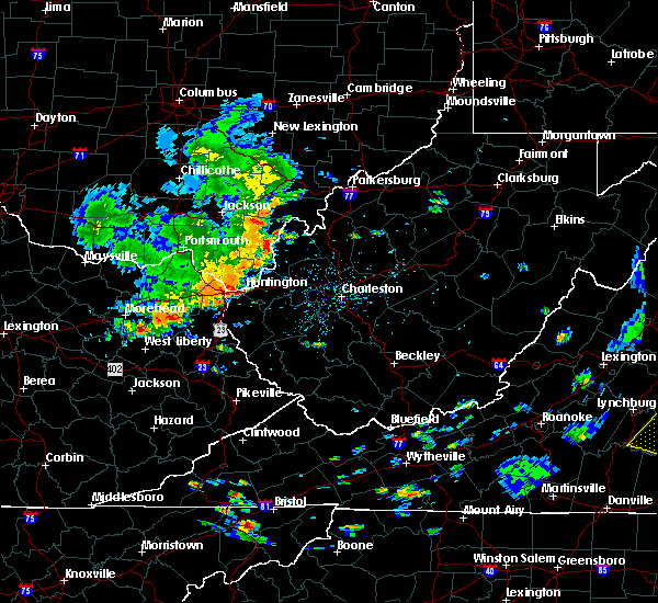 At 458 pm edt, a severe thunderstorm was located over ceredo, or near chesapeake, moving east at 30 mph (radar indicated). Hazards include 60 mph wind gusts. expect damage to roofs, siding, and trees At 458 pm edt, a severe thunderstorm was located over ceredo, or near chesapeake, moving east at 30 mph (radar indicated). Hazards include 60 mph wind gusts. expect damage to roofs, siding, and trees
|
| 4/9/2020 12:53 AM EDT |
 At 1253 am edt, a severe thunderstorm was located near beech fork state park, moving east at 65 mph (radar indicated). Hazards include 70 mph wind gusts and quarter size hail. Hail damage to vehicles is expected. expect considerable tree damage. wind damage is also likely to mobile homes, roofs, and outbuildings. Locations impacted include, huntington, wayne, chesapeake, proctorville, beech fork state park, barboursville, east lynn lake, centerville, kiahsville, burlington, athalia, lavalette, buchanan, pea ridge, fallsburg, east lynn and genoa. At 1253 am edt, a severe thunderstorm was located near beech fork state park, moving east at 65 mph (radar indicated). Hazards include 70 mph wind gusts and quarter size hail. Hail damage to vehicles is expected. expect considerable tree damage. wind damage is also likely to mobile homes, roofs, and outbuildings. Locations impacted include, huntington, wayne, chesapeake, proctorville, beech fork state park, barboursville, east lynn lake, centerville, kiahsville, burlington, athalia, lavalette, buchanan, pea ridge, fallsburg, east lynn and genoa.
|
| 4/9/2020 12:53 AM EDT |
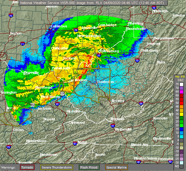 At 1253 am edt, a severe thunderstorm was located near beech fork state park, moving east at 65 mph (radar indicated). Hazards include 70 mph wind gusts and quarter size hail. Hail damage to vehicles is expected. expect considerable tree damage. wind damage is also likely to mobile homes, roofs, and outbuildings. Locations impacted include, huntington, wayne, chesapeake, proctorville, beech fork state park, barboursville, east lynn lake, centerville, kiahsville, burlington, athalia, lavalette, buchanan, pea ridge, fallsburg, east lynn and genoa. At 1253 am edt, a severe thunderstorm was located near beech fork state park, moving east at 65 mph (radar indicated). Hazards include 70 mph wind gusts and quarter size hail. Hail damage to vehicles is expected. expect considerable tree damage. wind damage is also likely to mobile homes, roofs, and outbuildings. Locations impacted include, huntington, wayne, chesapeake, proctorville, beech fork state park, barboursville, east lynn lake, centerville, kiahsville, burlington, athalia, lavalette, buchanan, pea ridge, fallsburg, east lynn and genoa.
|
| 4/9/2020 12:41 AM EDT |
 At 1241 am edt, severe thunderstorms were located along a line extending from near point pleasant to near durbin, moving southeast at 55 mph (radar indicated). Hazards include 70 mph wind gusts and quarter size hail. Hail damage to vehicles is expected. expect considerable tree damage. Wind damage is also likely to mobile homes, roofs, and outbuildings. At 1241 am edt, severe thunderstorms were located along a line extending from near point pleasant to near durbin, moving southeast at 55 mph (radar indicated). Hazards include 70 mph wind gusts and quarter size hail. Hail damage to vehicles is expected. expect considerable tree damage. Wind damage is also likely to mobile homes, roofs, and outbuildings.
|
| 4/9/2020 12:39 AM EDT |
 At 1239 am edt, severe thunderstorms were located along a line extending from 10 miles east of lake vesuvius to barnrock, moving southeast at 65 mph (radar indicated). Hazards include 70 mph wind gusts and penny size hail. Expect considerable tree damage. damage is likely to mobile homes, roofs, and outbuildings. Locations impacted include, ashland, ironton, gallipolis, coal grove, cannonsburg, kenova, catlettsburg, princess, rush, south point, waterloo, aid, westwood, crown city, athalia, scottown, summit, gallopolis ferry and mavity. At 1239 am edt, severe thunderstorms were located along a line extending from 10 miles east of lake vesuvius to barnrock, moving southeast at 65 mph (radar indicated). Hazards include 70 mph wind gusts and penny size hail. Expect considerable tree damage. damage is likely to mobile homes, roofs, and outbuildings. Locations impacted include, ashland, ironton, gallipolis, coal grove, cannonsburg, kenova, catlettsburg, princess, rush, south point, waterloo, aid, westwood, crown city, athalia, scottown, summit, gallopolis ferry and mavity.
|
| 4/9/2020 12:34 AM EDT |
 At 1233 am edt, a severe thunderstorm was located near durbin, or 8 miles south of cannonsburg, moving east at 20 mph (radar indicated). Hazards include 70 mph wind gusts and quarter size hail. Hail damage to vehicles is expected. expect considerable tree damage. Wind damage is also likely to mobile homes, roofs, and outbuildings. At 1233 am edt, a severe thunderstorm was located near durbin, or 8 miles south of cannonsburg, moving east at 20 mph (radar indicated). Hazards include 70 mph wind gusts and quarter size hail. Hail damage to vehicles is expected. expect considerable tree damage. Wind damage is also likely to mobile homes, roofs, and outbuildings.
|
| 4/9/2020 12:29 AM EDT |
 At 1228 am edt, severe thunderstorms were located along a line extending from 8 miles south of oak hill to culver, moving southeast at 65 mph (radar indicated). Hazards include 70 mph wind gusts and penny size hail. Expect considerable tree damage. damage is likely to mobile homes, roofs, and outbuildings. Locations impacted include, ashland, ironton, grayson, gallipolis, coal grove, cannonsburg, lake vesuvius, kenova, catlettsburg, greenup, princess, coalton, denton, oldtown, naples, rush, flatwoods, south point, russell and vernon. At 1228 am edt, severe thunderstorms were located along a line extending from 8 miles south of oak hill to culver, moving southeast at 65 mph (radar indicated). Hazards include 70 mph wind gusts and penny size hail. Expect considerable tree damage. damage is likely to mobile homes, roofs, and outbuildings. Locations impacted include, ashland, ironton, grayson, gallipolis, coal grove, cannonsburg, lake vesuvius, kenova, catlettsburg, greenup, princess, coalton, denton, oldtown, naples, rush, flatwoods, south point, russell and vernon.
|
| 4/9/2020 12:12 AM EDT |
 At 1212 am edt, severe thunderstorms were located along a line extending from near jackson to near olive hill, moving east at 60 mph (radar indicated). Hazards include 70 mph wind gusts and penny size hail. Expect considerable tree damage. damage is likely to mobile homes, roofs, and outbuildings. Locations impacted include, ashland, ironton, jackson, wellston, grayson, gallipolis, coal grove, olive hill, cannonsburg, lake vesuvius, carter caves state park, kenova, catlettsburg, greenup, coalton, denton, gesling, greenbo lake, oldtown and load. At 1212 am edt, severe thunderstorms were located along a line extending from near jackson to near olive hill, moving east at 60 mph (radar indicated). Hazards include 70 mph wind gusts and penny size hail. Expect considerable tree damage. damage is likely to mobile homes, roofs, and outbuildings. Locations impacted include, ashland, ironton, jackson, wellston, grayson, gallipolis, coal grove, olive hill, cannonsburg, lake vesuvius, carter caves state park, kenova, catlettsburg, greenup, coalton, denton, gesling, greenbo lake, oldtown and load.
|
| 4/8/2020 11:52 PM EDT |
 At 1151 pm edt, severe thunderstorms were located along a line extending from 10 miles west of lucasville to 8 miles southwest of vanceburg to ewington, moving southeast at 65 mph (radar indicated). Hazards include 70 mph wind gusts and penny size hail. Expect considerable tree damage. Damage is likely to mobile homes, roofs, and outbuildings. At 1151 pm edt, severe thunderstorms were located along a line extending from 10 miles west of lucasville to 8 miles southwest of vanceburg to ewington, moving southeast at 65 mph (radar indicated). Hazards include 70 mph wind gusts and penny size hail. Expect considerable tree damage. Damage is likely to mobile homes, roofs, and outbuildings.
|
| 4/8/2020 2:22 PM EDT |
 At 222 pm edt, severe thunderstorms were located along a line extending from catlettsburg to milton, moving southeast at 50 mph (radar indicated). Hazards include 60 mph wind gusts and quarter size hail. Hail damage to vehicles is expected. expect wind damage to roofs, siding, and trees. Locations impacted include, huntington, chesapeake, beech fork state park, barboursville, kenova, milton, catlettsburg, ceredo, ona, culloden, lavalette, salt rock, pea ridge and green bottom. At 222 pm edt, severe thunderstorms were located along a line extending from catlettsburg to milton, moving southeast at 50 mph (radar indicated). Hazards include 60 mph wind gusts and quarter size hail. Hail damage to vehicles is expected. expect wind damage to roofs, siding, and trees. Locations impacted include, huntington, chesapeake, beech fork state park, barboursville, kenova, milton, catlettsburg, ceredo, ona, culloden, lavalette, salt rock, pea ridge and green bottom.
|
| 4/8/2020 2:01 PM EDT |
 At 159 pm edt, severe thunderstorms were located along a line extending from near greenup to 9 miles north of proctorville, moving southeast at 30 mph (radar indicated). Hazards include 60 mph wind gusts and quarter size hail. Hail damage to vehicles is expected. Expect wind damage to roofs, siding, and trees. At 159 pm edt, severe thunderstorms were located along a line extending from near greenup to 9 miles north of proctorville, moving southeast at 30 mph (radar indicated). Hazards include 60 mph wind gusts and quarter size hail. Hail damage to vehicles is expected. Expect wind damage to roofs, siding, and trees.
|
| 1/11/2020 3:29 PM EST |
 At 328 pm est, a severe thunderstorm was located near huntington, moving east at 60 mph (radar indicated. huntington airport recently reported a gust of 57 mph). Hazards include 60 mph wind gusts. expect damage to roofs, siding, and trees At 328 pm est, a severe thunderstorm was located near huntington, moving east at 60 mph (radar indicated. huntington airport recently reported a gust of 57 mph). Hazards include 60 mph wind gusts. expect damage to roofs, siding, and trees
|
| 7/2/2019 3:41 PM EDT |
 At 315 pm edt, a severe thunderstorm was located over chesapeake, moving east at 20 mph with the entire segment gradually drifting south (radar indicated). Hazards include 60 mph wind gusts and nickel size hail. expect damage to roofs, siding, and trees At 315 pm edt, a severe thunderstorm was located over chesapeake, moving east at 20 mph with the entire segment gradually drifting south (radar indicated). Hazards include 60 mph wind gusts and nickel size hail. expect damage to roofs, siding, and trees
|
| 7/2/2019 3:41 PM EDT |
 The severe thunderstorm warning for southeastern lawrence, west central cabell and north central wayne counties will expire at 345 pm edt, the storm which prompted the warning has weakened below severe limits, and no longer poses an immediate threat to life or property. therefore, the warning will be allowed to expire. however gusty winds and heavy rain are still possible with this thunderstorm. The severe thunderstorm warning for southeastern lawrence, west central cabell and north central wayne counties will expire at 345 pm edt, the storm which prompted the warning has weakened below severe limits, and no longer poses an immediate threat to life or property. therefore, the warning will be allowed to expire. however gusty winds and heavy rain are still possible with this thunderstorm.
|
| 7/2/2019 3:16 PM EDT |
 At 315 pm edt, a severe thunderstorm was located over chesapeake, moving east at 20 mph with the entire segment gradually drifting south (radar indicated). Hazards include 60 mph wind gusts and nickel size hail. expect damage to roofs, siding, and trees At 315 pm edt, a severe thunderstorm was located over chesapeake, moving east at 20 mph with the entire segment gradually drifting south (radar indicated). Hazards include 60 mph wind gusts and nickel size hail. expect damage to roofs, siding, and trees
|
| 7/2/2019 3:16 PM EDT |
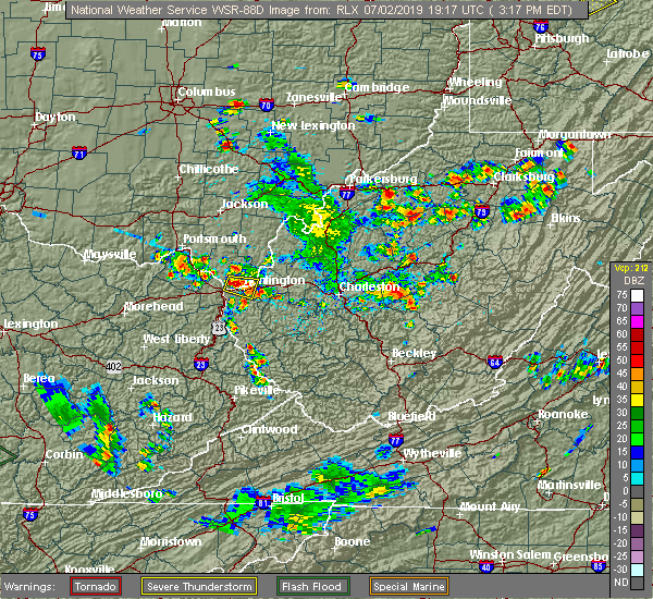 At 315 pm edt, a severe thunderstorm was located over chesapeake, moving east at 20 mph with the entire segment gradually drifting south (radar indicated). Hazards include 60 mph wind gusts and nickel size hail. expect damage to roofs, siding, and trees At 315 pm edt, a severe thunderstorm was located over chesapeake, moving east at 20 mph with the entire segment gradually drifting south (radar indicated). Hazards include 60 mph wind gusts and nickel size hail. expect damage to roofs, siding, and trees
|
| 6/24/2019 6:29 PM EDT |
 At 629 pm edt, severe thunderstorms were located along a line extending from 12 miles south of gallipolis to milton to near ranger, moving northeast at 35 mph (radar indicated). Hazards include 60 mph wind gusts. Expect damage to roofs, siding, and trees. Locations impacted include, winfield, hamlin, hurricane, barboursville, milton, eleanor, buffalo, ranger, ona, culloden, east lynn lake, kiahsville, teays valley, alum creek, west hamlin, athalia, ashton, salt rock, palermo and pea ridge. At 629 pm edt, severe thunderstorms were located along a line extending from 12 miles south of gallipolis to milton to near ranger, moving northeast at 35 mph (radar indicated). Hazards include 60 mph wind gusts. Expect damage to roofs, siding, and trees. Locations impacted include, winfield, hamlin, hurricane, barboursville, milton, eleanor, buffalo, ranger, ona, culloden, east lynn lake, kiahsville, teays valley, alum creek, west hamlin, athalia, ashton, salt rock, palermo and pea ridge.
|
| 6/24/2019 6:13 PM EDT |
 At 613 pm edt, severe thunderstorms were located along a line extending from 13 miles southwest of gallipolis to ona to near ranger, moving northeast at 40 mph (radar indicated). Hazards include 60 mph wind gusts. expect damage to roofs, siding, and trees At 613 pm edt, severe thunderstorms were located along a line extending from 13 miles southwest of gallipolis to ona to near ranger, moving northeast at 40 mph (radar indicated). Hazards include 60 mph wind gusts. expect damage to roofs, siding, and trees
|
| 6/16/2019 9:06 PM EDT |
 At 905 pm edt, severe thunderstorms were located along a line extending from 7 miles south of gallipolis to near milton to near kiahsville to near charley, moving east at 40 mph (radar indicated). Hazards include 60 mph wind gusts and nickel size hail. Expect damage to roofs, siding, and trees. Locations impacted include, huntington, nitro, louisa, winfield, wayne, hamlin, proctorville, blaine, beech fork state park, yatesville lake state park, hurricane, barboursville, milton, eleanor, buffalo, poca, fort gay, ranger, harts and martha. At 905 pm edt, severe thunderstorms were located along a line extending from 7 miles south of gallipolis to near milton to near kiahsville to near charley, moving east at 40 mph (radar indicated). Hazards include 60 mph wind gusts and nickel size hail. Expect damage to roofs, siding, and trees. Locations impacted include, huntington, nitro, louisa, winfield, wayne, hamlin, proctorville, blaine, beech fork state park, yatesville lake state park, hurricane, barboursville, milton, eleanor, buffalo, poca, fort gay, ranger, harts and martha.
|
| 6/16/2019 8:42 PM EDT |
 At 840 pm edt, severe thunderstorms were located along a line extending from 11 miles northeast of lake vesuvius to near huntington to near fort gay to martha, moving east at 40 mph. this line of storms recently produced damage in ashland (radar indicated). Hazards include 60 mph wind gusts and quarter size hail. Hail damage to vehicles is expected. Expect wind damage to roofs, siding, and trees. At 840 pm edt, severe thunderstorms were located along a line extending from 11 miles northeast of lake vesuvius to near huntington to near fort gay to martha, moving east at 40 mph. this line of storms recently produced damage in ashland (radar indicated). Hazards include 60 mph wind gusts and quarter size hail. Hail damage to vehicles is expected. Expect wind damage to roofs, siding, and trees.
|
| 6/16/2019 8:22 PM EDT |
 At 822 pm edt, severe thunderstorms were located along a line extending from near franklin furnace to near cannonsburg to near martha, moving east at 30 mph (radar indicated). Hazards include 60 mph wind gusts and quarter size hail. Hail damage to vehicles is expected. expect wind damage to roofs, siding, and trees. Locations impacted include, huntington, ashland, ironton, grayson, louisa, coal grove, wayne, chesapeake, proctorville, blaine, beech fork state park, cannonsburg, lake vesuvius, yatesville lake state park, barboursville, kenova, catlettsburg, ceredo, fort gay and coalton. At 822 pm edt, severe thunderstorms were located along a line extending from near franklin furnace to near cannonsburg to near martha, moving east at 30 mph (radar indicated). Hazards include 60 mph wind gusts and quarter size hail. Hail damage to vehicles is expected. expect wind damage to roofs, siding, and trees. Locations impacted include, huntington, ashland, ironton, grayson, louisa, coal grove, wayne, chesapeake, proctorville, blaine, beech fork state park, cannonsburg, lake vesuvius, yatesville lake state park, barboursville, kenova, catlettsburg, ceredo, fort gay and coalton.
|
| 6/16/2019 7:59 PM EDT |
 At 759 pm edt, severe thunderstorms were located along a line extending from near letitia to near grayson to near little sandy, moving east at 30 mph (radar indicated). Hazards include 60 mph wind gusts and quarter size hail. Hail damage to vehicles is expected. Expect wind damage to roofs, siding, and trees. At 759 pm edt, severe thunderstorms were located along a line extending from near letitia to near grayson to near little sandy, moving east at 30 mph (radar indicated). Hazards include 60 mph wind gusts and quarter size hail. Hail damage to vehicles is expected. Expect wind damage to roofs, siding, and trees.
|
| 6/16/2019 1:40 PM EDT |
 A severe thunderstorm warning remains in effect until 200 pm edt for northeastern boyd. southeastern lawrence. western cabell and northern wayne counties. at 140 pm edt, a severe thunderstorm was located near ashland, moving east at 40 mph. hazard. 60 mph wind gusts and penny size hail. A severe thunderstorm warning remains in effect until 200 pm edt for northeastern boyd. southeastern lawrence. western cabell and northern wayne counties. at 140 pm edt, a severe thunderstorm was located near ashland, moving east at 40 mph. hazard. 60 mph wind gusts and penny size hail.
|
| 6/16/2019 1:40 PM EDT |
 At 140 pm edt, a severe thunderstorm was located near ashland, moving east at 40 mph (radar indicated). Hazards include 60 mph wind gusts and penny size hail. Expect damage to roofs, siding, and trees. Locations impacted include, huntington, ashland, coal grove, chesapeake, proctorville, beech fork state park, cannonsburg, barboursville, kenova, catlettsburg, ceredo, south point, burlington, athalia, lavalette, scottown, pea ridge, green bottom and mavity. At 140 pm edt, a severe thunderstorm was located near ashland, moving east at 40 mph (radar indicated). Hazards include 60 mph wind gusts and penny size hail. Expect damage to roofs, siding, and trees. Locations impacted include, huntington, ashland, coal grove, chesapeake, proctorville, beech fork state park, cannonsburg, barboursville, kenova, catlettsburg, ceredo, south point, burlington, athalia, lavalette, scottown, pea ridge, green bottom and mavity.
|
| 6/16/2019 1:40 PM EDT |
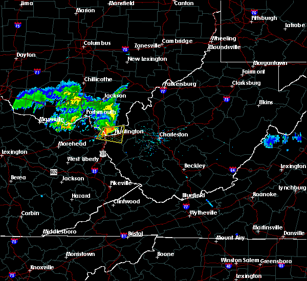 At 126 pm edt, a severe thunderstorm was located over naples, or near ironton, moving east at 40 mph (radar indicated). Hazards include 60 mph wind gusts and nickel size hail. expect damage to roofs, siding, and trees At 126 pm edt, a severe thunderstorm was located over naples, or near ironton, moving east at 40 mph (radar indicated). Hazards include 60 mph wind gusts and nickel size hail. expect damage to roofs, siding, and trees
|
| 6/16/2019 1:27 PM EDT |
 At 126 pm edt, a severe thunderstorm was located over naples, or near ironton, moving east at 40 mph (radar indicated). Hazards include 60 mph wind gusts and nickel size hail. expect damage to roofs, siding, and trees At 126 pm edt, a severe thunderstorm was located over naples, or near ironton, moving east at 40 mph (radar indicated). Hazards include 60 mph wind gusts and nickel size hail. expect damage to roofs, siding, and trees
|
| 6/2/2019 2:51 PM EDT |
 The severe thunderstorm warning for southeastern lawrence, cabell and northeastern wayne counties will expire at 300 pm edt, therefore, the warning will be allowed to expire as storm which prompted the warning continues to moved out of the warned areas. a severe thunderstorm watch remains in effect until 800 pm edt for southeastern ohio, and central and western west virginia. The severe thunderstorm warning for southeastern lawrence, cabell and northeastern wayne counties will expire at 300 pm edt, therefore, the warning will be allowed to expire as storm which prompted the warning continues to moved out of the warned areas. a severe thunderstorm watch remains in effect until 800 pm edt for southeastern ohio, and central and western west virginia.
|
| 6/2/2019 2:51 PM EDT |
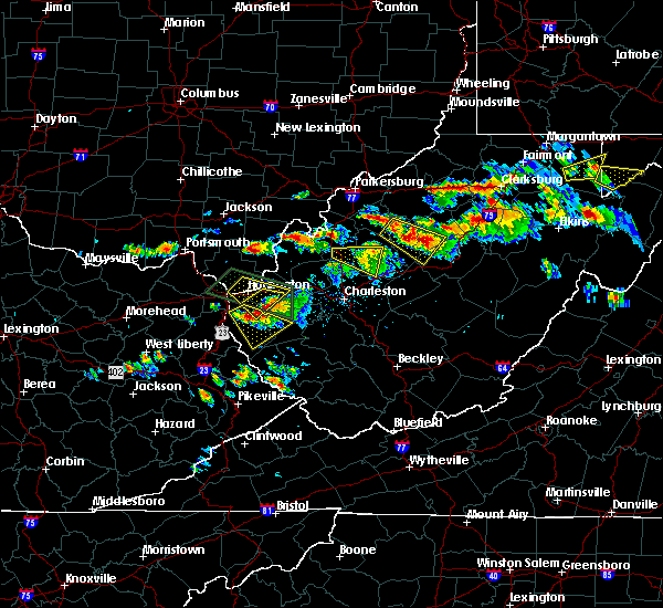 The severe thunderstorm warning for southeastern lawrence, cabell and northeastern wayne counties will expire at 300 pm edt, therefore, the warning will be allowed to expire as storm which prompted the warning continues to moved out of the warned areas. a severe thunderstorm watch remains in effect until 800 pm edt for southeastern ohio, and central and western west virginia. The severe thunderstorm warning for southeastern lawrence, cabell and northeastern wayne counties will expire at 300 pm edt, therefore, the warning will be allowed to expire as storm which prompted the warning continues to moved out of the warned areas. a severe thunderstorm watch remains in effect until 800 pm edt for southeastern ohio, and central and western west virginia.
|
| 6/2/2019 2:11 PM EDT |
 The national weather service in charleston west virginia has issued a * severe thunderstorm warning for. southeastern lawrence county in southeastern ohio. cabell county in central west virginia. northeastern wayne county in western west virginia. Until 300 pm edt. The national weather service in charleston west virginia has issued a * severe thunderstorm warning for. southeastern lawrence county in southeastern ohio. cabell county in central west virginia. northeastern wayne county in western west virginia. Until 300 pm edt.
|
| 6/2/2019 2:11 PM EDT |
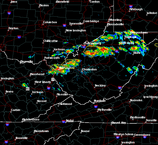 At 210 pm edt, a severe thunderstorm was located over chesapeake, moving southeast at 20 mph (radar indicated). Hazards include ping pong ball size hail and 60 mph wind gusts. this storm is also exhibiting rotation. People and animals outdoors will be injured. expect hail damage to roofs, siding, windows, and vehicles. Expect wind damage to roofs, siding, and trees. At 210 pm edt, a severe thunderstorm was located over chesapeake, moving southeast at 20 mph (radar indicated). Hazards include ping pong ball size hail and 60 mph wind gusts. this storm is also exhibiting rotation. People and animals outdoors will be injured. expect hail damage to roofs, siding, windows, and vehicles. Expect wind damage to roofs, siding, and trees.
|
| 6/2/2019 1:43 PM EDT |
 At 143 pm edt, a severe thunderstorm was located near coal grove, moving southeast at 25 mph (radar indicated). Hazards include ping pong ball size hail and 60 mph wind gusts. People and animals outdoors will be injured. expect hail damage to roofs, siding, windows, and vehicles. expect wind damage to roofs, siding, and trees. Locations impacted include, huntington, ashland, ironton, coal grove, chesapeake, proctorville, barboursville, kenova, catlettsburg, ceredo, flatwoods, south point, russell, burlington, bellefonte, westwood, athalia, lavalette, scottown and pea ridge. At 143 pm edt, a severe thunderstorm was located near coal grove, moving southeast at 25 mph (radar indicated). Hazards include ping pong ball size hail and 60 mph wind gusts. People and animals outdoors will be injured. expect hail damage to roofs, siding, windows, and vehicles. expect wind damage to roofs, siding, and trees. Locations impacted include, huntington, ashland, ironton, coal grove, chesapeake, proctorville, barboursville, kenova, catlettsburg, ceredo, flatwoods, south point, russell, burlington, bellefonte, westwood, athalia, lavalette, scottown and pea ridge.
|
| 6/2/2019 1:43 PM EDT |
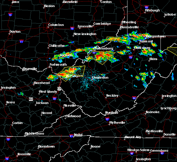 At 143 pm edt, a severe thunderstorm was located near coal grove, moving southeast at 25 mph (radar indicated). Hazards include ping pong ball size hail and 60 mph wind gusts. People and animals outdoors will be injured. expect hail damage to roofs, siding, windows, and vehicles. expect wind damage to roofs, siding, and trees. Locations impacted include, huntington, ashland, ironton, coal grove, chesapeake, proctorville, barboursville, kenova, catlettsburg, ceredo, flatwoods, south point, russell, burlington, bellefonte, westwood, athalia, lavalette, scottown and pea ridge. At 143 pm edt, a severe thunderstorm was located near coal grove, moving southeast at 25 mph (radar indicated). Hazards include ping pong ball size hail and 60 mph wind gusts. People and animals outdoors will be injured. expect hail damage to roofs, siding, windows, and vehicles. expect wind damage to roofs, siding, and trees. Locations impacted include, huntington, ashland, ironton, coal grove, chesapeake, proctorville, barboursville, kenova, catlettsburg, ceredo, flatwoods, south point, russell, burlington, bellefonte, westwood, athalia, lavalette, scottown and pea ridge.
|
| 6/2/2019 1:43 PM EDT |
 At 126 pm edt, a severe thunderstorm was located over ironton, moving southeast at 25 mph (radar indicated). Hazards include 65 mph wind gusts and half dollar size hail. Hail damage to vehicles is expected. Expect wind damage to roofs, siding, and trees. At 126 pm edt, a severe thunderstorm was located over ironton, moving southeast at 25 mph (radar indicated). Hazards include 65 mph wind gusts and half dollar size hail. Hail damage to vehicles is expected. Expect wind damage to roofs, siding, and trees.
|
| 6/2/2019 1:26 PM EDT |
 At 126 pm edt, a severe thunderstorm was located over ironton, moving southeast at 25 mph (radar indicated). Hazards include 65 mph wind gusts and half dollar size hail. Hail damage to vehicles is expected. Expect wind damage to roofs, siding, and trees. At 126 pm edt, a severe thunderstorm was located over ironton, moving southeast at 25 mph (radar indicated). Hazards include 65 mph wind gusts and half dollar size hail. Hail damage to vehicles is expected. Expect wind damage to roofs, siding, and trees.
|
| 5/29/2019 11:36 AM EDT |
 At 1136 am edt, a severe thunderstorm was located near south shore, or near portsmouth, moving east at 40 mph (radar indicated). Hazards include 60 mph wind gusts and quarter size hail. Hail damage to vehicles is expected. Expect wind damage to roofs, siding, and trees. At 1136 am edt, a severe thunderstorm was located near south shore, or near portsmouth, moving east at 40 mph (radar indicated). Hazards include 60 mph wind gusts and quarter size hail. Hail damage to vehicles is expected. Expect wind damage to roofs, siding, and trees.
|
| 5/17/2019 7:13 PM EDT |
 At 713 pm edt, a severe thunderstorm was located over naples, or near cannonsburg, moving east at 45 mph (radar indicated). Hazards include 60 mph wind gusts and penny size hail. expect damage to roofs, siding, and trees At 713 pm edt, a severe thunderstorm was located over naples, or near cannonsburg, moving east at 45 mph (radar indicated). Hazards include 60 mph wind gusts and penny size hail. expect damage to roofs, siding, and trees
|
| 5/17/2019 7:13 PM EDT |
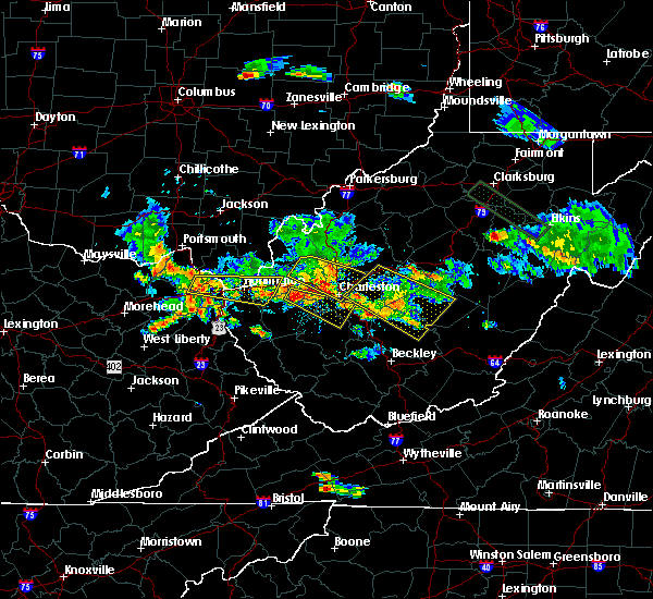 At 713 pm edt, a severe thunderstorm was located over naples, or near cannonsburg, moving east at 45 mph (radar indicated). Hazards include 60 mph wind gusts and penny size hail. expect damage to roofs, siding, and trees At 713 pm edt, a severe thunderstorm was located over naples, or near cannonsburg, moving east at 45 mph (radar indicated). Hazards include 60 mph wind gusts and penny size hail. expect damage to roofs, siding, and trees
|
| 5/3/2019 1:23 PM EDT |
 At 123 pm edt, a severe thunderstorm was located over barboursville, or near proctorville, moving northeast at 30 mph (radar indicated). Hazards include 60 mph wind gusts and quarter size hail. Hail damage to vehicles is expected. expect wind damage to roofs, siding, and trees. Locations impacted include, barboursville, milton, culloden, ona and pea ridge. At 123 pm edt, a severe thunderstorm was located over barboursville, or near proctorville, moving northeast at 30 mph (radar indicated). Hazards include 60 mph wind gusts and quarter size hail. Hail damage to vehicles is expected. expect wind damage to roofs, siding, and trees. Locations impacted include, barboursville, milton, culloden, ona and pea ridge.
|
| 5/3/2019 1:06 PM EDT |
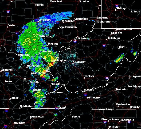 At 106 pm edt, a severe thunderstorm was located over beech fork state park, moving northeast at 25 mph (radar indicated). Hazards include 60 mph wind gusts and quarter size hail. Hail damage to vehicles is expected. Expect wind damage to roofs, siding, and trees. At 106 pm edt, a severe thunderstorm was located over beech fork state park, moving northeast at 25 mph (radar indicated). Hazards include 60 mph wind gusts and quarter size hail. Hail damage to vehicles is expected. Expect wind damage to roofs, siding, and trees.
|
| 4/14/2019 6:07 PM EDT |
 The severe thunderstorm warning for southeastern gallia and northeastern cabell counties will expire at 615 pm edt, the storm which prompted the warning has weakened below severe limits, and no longer poses an immediate threat to life or property. therefore, the warning will be allowed to expire. however gusty winds are still possible with this thunderstorm. a tornado watch remains in effect until 900 pm edt for southeastern ohio, and central and western west virginia. The severe thunderstorm warning for southeastern gallia and northeastern cabell counties will expire at 615 pm edt, the storm which prompted the warning has weakened below severe limits, and no longer poses an immediate threat to life or property. therefore, the warning will be allowed to expire. however gusty winds are still possible with this thunderstorm. a tornado watch remains in effect until 900 pm edt for southeastern ohio, and central and western west virginia.
|
| 4/14/2019 6:07 PM EDT |
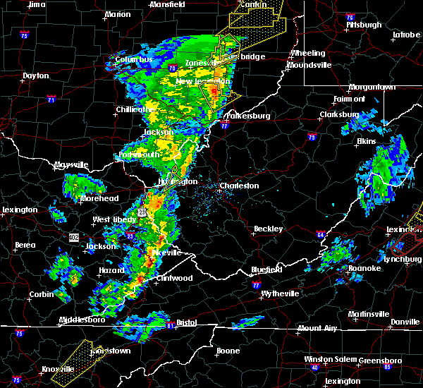 The severe thunderstorm warning for southeastern gallia and northeastern cabell counties will expire at 615 pm edt, the storm which prompted the warning has weakened below severe limits, and no longer poses an immediate threat to life or property. therefore, the warning will be allowed to expire. however gusty winds are still possible with this thunderstorm. a tornado watch remains in effect until 900 pm edt for southeastern ohio, and central and western west virginia. The severe thunderstorm warning for southeastern gallia and northeastern cabell counties will expire at 615 pm edt, the storm which prompted the warning has weakened below severe limits, and no longer poses an immediate threat to life or property. therefore, the warning will be allowed to expire. however gusty winds are still possible with this thunderstorm. a tornado watch remains in effect until 900 pm edt for southeastern ohio, and central and western west virginia.
|
| 4/14/2019 6:05 PM EDT |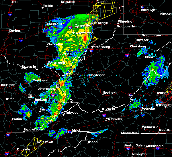
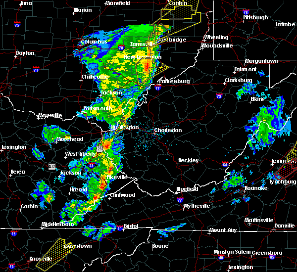 The severe thunderstorm warning for southeastern gallia and northeastern cabell counties will expire at 615 pm edt, the storm which prompted the warning has weakened below severe limits, and no longer poses an immediate threat to life or property. therefore, the warning will be allowed to expire. however gusty winds are still possible with this thunderstorm. a tornado watch remains in effect until 900 pm edt for southeastern ohio, and central and western west virginia. The severe thunderstorm warning for southeastern gallia and northeastern cabell counties will expire at 615 pm edt, the storm which prompted the warning has weakened below severe limits, and no longer poses an immediate threat to life or property. therefore, the warning will be allowed to expire. however gusty winds are still possible with this thunderstorm. a tornado watch remains in effect until 900 pm edt for southeastern ohio, and central and western west virginia.
|
| 4/14/2019 5:58 PM EDT |
 At 557 pm edt, a severe thunderstorm was located 7 miles north of ona, or 9 miles northeast of proctorville, moving northeast at 60 mph (radar indicated). Hazards include 60 mph wind gusts. Expect damage to roofs, siding, and trees. Locations impacted include, huntington, proctorville, barboursville, ona, crown city, athalia, pea ridge, green bottom and scottown. At 557 pm edt, a severe thunderstorm was located 7 miles north of ona, or 9 miles northeast of proctorville, moving northeast at 60 mph (radar indicated). Hazards include 60 mph wind gusts. Expect damage to roofs, siding, and trees. Locations impacted include, huntington, proctorville, barboursville, ona, crown city, athalia, pea ridge, green bottom and scottown.
|
| 4/14/2019 5:47 PM EDT |
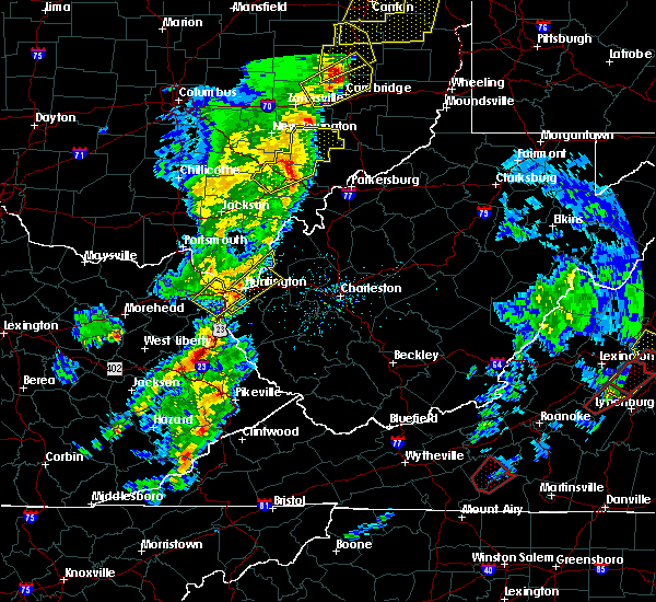 At 546 pm edt, a severe thunderstorm was located over huntington, moving northeast at 70 mph (radar indicated). Hazards include 60 mph wind gusts. expect damage to roofs, siding, and trees At 546 pm edt, a severe thunderstorm was located over huntington, moving northeast at 70 mph (radar indicated). Hazards include 60 mph wind gusts. expect damage to roofs, siding, and trees
|
| 9/2/2018 5:33 PM EDT |
 At 533 pm edt, a severe thunderstorm was located over proctorville, and is nearly stationary (radar indicated). Hazards include 60 mph wind gusts and quarter size hail. Minor hail damage to vehicles is possible. expect wind damage to trees and power lines, resulting in some power outages. Locations impacted include, huntington, chesapeake, proctorville, athalia, green bottom and scottown. At 533 pm edt, a severe thunderstorm was located over proctorville, and is nearly stationary (radar indicated). Hazards include 60 mph wind gusts and quarter size hail. Minor hail damage to vehicles is possible. expect wind damage to trees and power lines, resulting in some power outages. Locations impacted include, huntington, chesapeake, proctorville, athalia, green bottom and scottown.
|
| 9/2/2018 5:33 PM EDT |
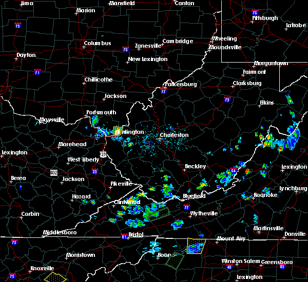 At 533 pm edt, a severe thunderstorm was located over proctorville, and is nearly stationary (radar indicated). Hazards include 60 mph wind gusts and quarter size hail. Minor hail damage to vehicles is possible. expect wind damage to trees and power lines, resulting in some power outages. Locations impacted include, huntington, chesapeake, proctorville, athalia, green bottom and scottown. At 533 pm edt, a severe thunderstorm was located over proctorville, and is nearly stationary (radar indicated). Hazards include 60 mph wind gusts and quarter size hail. Minor hail damage to vehicles is possible. expect wind damage to trees and power lines, resulting in some power outages. Locations impacted include, huntington, chesapeake, proctorville, athalia, green bottom and scottown.
|
| 9/2/2018 5:25 PM EDT |
 At 524 pm edt, a severe thunderstorm was located over proctorville, and is nearly stationary (radar indicated). Hazards include golf ball size hail and 60 mph wind gusts. People and animals outdoors will be injured. expect hail damage to roofs, siding, windows, and vehicles. expect wind damage to trees and power lines, resulting in some power outages. Locations impacted include, huntington, chesapeake, proctorville, barboursville, athalia, pea ridge, green bottom and scottown. At 524 pm edt, a severe thunderstorm was located over proctorville, and is nearly stationary (radar indicated). Hazards include golf ball size hail and 60 mph wind gusts. People and animals outdoors will be injured. expect hail damage to roofs, siding, windows, and vehicles. expect wind damage to trees and power lines, resulting in some power outages. Locations impacted include, huntington, chesapeake, proctorville, barboursville, athalia, pea ridge, green bottom and scottown.
|
| 9/2/2018 5:25 PM EDT |
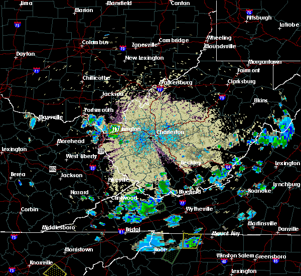 At 524 pm edt, a severe thunderstorm was located over proctorville, and is nearly stationary (radar indicated). Hazards include golf ball size hail and 60 mph wind gusts. People and animals outdoors will be injured. expect hail damage to roofs, siding, windows, and vehicles. expect wind damage to trees and power lines, resulting in some power outages. Locations impacted include, huntington, chesapeake, proctorville, barboursville, athalia, pea ridge, green bottom and scottown. At 524 pm edt, a severe thunderstorm was located over proctorville, and is nearly stationary (radar indicated). Hazards include golf ball size hail and 60 mph wind gusts. People and animals outdoors will be injured. expect hail damage to roofs, siding, windows, and vehicles. expect wind damage to trees and power lines, resulting in some power outages. Locations impacted include, huntington, chesapeake, proctorville, barboursville, athalia, pea ridge, green bottom and scottown.
|
| 9/2/2018 5:18 PM EDT |
 At 517 pm edt, a severe thunderstorm was located over proctorville, and is nearly stationary (radar indicated). Hazards include 60 mph wind gusts and half dollar size hail. Minor hail damage to vehicles is possible. expect wind damage to trees and power lines, resulting in some power outages. Locations impacted include, huntington, chesapeake, proctorville, barboursville, athalia, pea ridge, green bottom and scottown. At 517 pm edt, a severe thunderstorm was located over proctorville, and is nearly stationary (radar indicated). Hazards include 60 mph wind gusts and half dollar size hail. Minor hail damage to vehicles is possible. expect wind damage to trees and power lines, resulting in some power outages. Locations impacted include, huntington, chesapeake, proctorville, barboursville, athalia, pea ridge, green bottom and scottown.
|
| 9/2/2018 5:08 PM EDT |
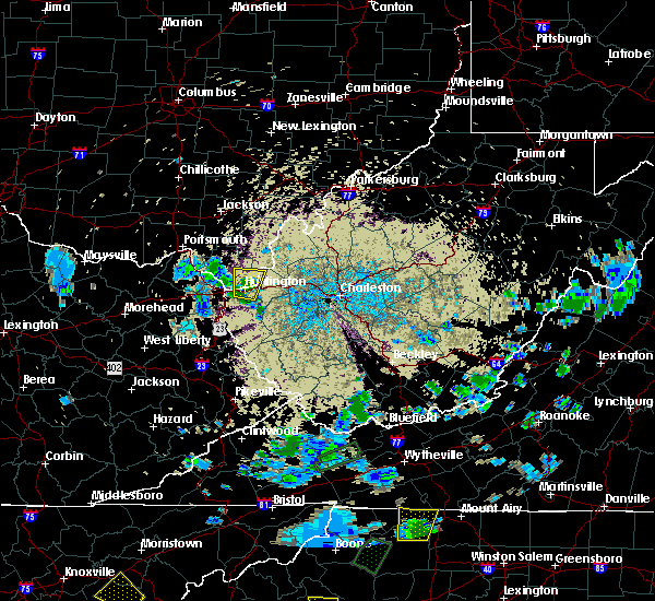 The national weather service in charleston west virginia has issued a * severe thunderstorm warning for. southeastern lawrence county in southeastern ohio. northwestern cabell county in central west virginia. north central wayne county in western west virginia. Until 600 pm edt. The national weather service in charleston west virginia has issued a * severe thunderstorm warning for. southeastern lawrence county in southeastern ohio. northwestern cabell county in central west virginia. north central wayne county in western west virginia. Until 600 pm edt.
|
| 9/2/2018 5:08 PM EDT |
 At 508 pm edt, a severe thunderstorm was located over proctorville, and is nearly stationary (radar indicated). Hazards include 60 mph wind gusts and quarter size hail. Minor hail damage to vehicles is possible. Expect wind damage to trees and power lines, resulting in some power outages. At 508 pm edt, a severe thunderstorm was located over proctorville, and is nearly stationary (radar indicated). Hazards include 60 mph wind gusts and quarter size hail. Minor hail damage to vehicles is possible. Expect wind damage to trees and power lines, resulting in some power outages.
|
| 7/31/2018 2:02 PM EDT |
 At 202 pm edt, a severe thunderstorm was located over ona, or 9 miles east of proctorville, moving northeast at 30 mph (radar indicated). Hazards include 60 mph wind gusts and quarter size hail. Hail damage to vehicles is expected. expect wind damage to roofs, siding, and trees. Locations impacted include, barboursville, milton, culloden, ona, salt rock and pea ridge. At 202 pm edt, a severe thunderstorm was located over ona, or 9 miles east of proctorville, moving northeast at 30 mph (radar indicated). Hazards include 60 mph wind gusts and quarter size hail. Hail damage to vehicles is expected. expect wind damage to roofs, siding, and trees. Locations impacted include, barboursville, milton, culloden, ona, salt rock and pea ridge.
|
| 7/31/2018 1:57 PM EDT |
 At 157 pm edt, a severe thunderstorm was located over ona, or 8 miles east of proctorville, moving northeast at 30 mph (radar indicated). Hazards include 60 mph wind gusts and quarter size hail. Hail damage to vehicles is expected. expect wind damage to roofs, siding, and trees. Locations impacted include, huntington, chesapeake, proctorville, barboursville, milton, ona, culloden, athalia, salt rock and pea ridge. At 157 pm edt, a severe thunderstorm was located over ona, or 8 miles east of proctorville, moving northeast at 30 mph (radar indicated). Hazards include 60 mph wind gusts and quarter size hail. Hail damage to vehicles is expected. expect wind damage to roofs, siding, and trees. Locations impacted include, huntington, chesapeake, proctorville, barboursville, milton, ona, culloden, athalia, salt rock and pea ridge.
|
| 7/31/2018 1:37 PM EDT |
 At 137 pm edt, a severe thunderstorm was located near beech fork state park, moving northeast at 25 mph (radar indicated). Hazards include 60 mph wind gusts and quarter size hail. Hail damage to vehicles is expected. Expect wind damage to roofs, siding, and trees. At 137 pm edt, a severe thunderstorm was located near beech fork state park, moving northeast at 25 mph (radar indicated). Hazards include 60 mph wind gusts and quarter size hail. Hail damage to vehicles is expected. Expect wind damage to roofs, siding, and trees.
|
| 7/1/2018 6:22 PM EDT |
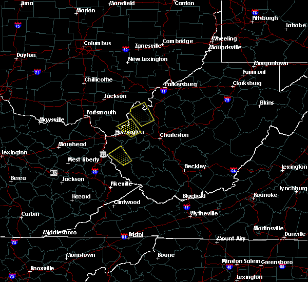 The severe thunderstorm warning for southeastern gallia, east central lawrence, southwestern mason, northeastern cabell and west central putnam counties will expire at 630 pm edt, the storm which prompted the warning has weakened below severe limits, and no longer poses an immediate threat to life or property. therefore, the warning will be allowed to expire. however gusty winds and heavy rain are still possible with this thunderstorm. The severe thunderstorm warning for southeastern gallia, east central lawrence, southwestern mason, northeastern cabell and west central putnam counties will expire at 630 pm edt, the storm which prompted the warning has weakened below severe limits, and no longer poses an immediate threat to life or property. therefore, the warning will be allowed to expire. however gusty winds and heavy rain are still possible with this thunderstorm.
|
| 7/1/2018 6:06 PM EDT |
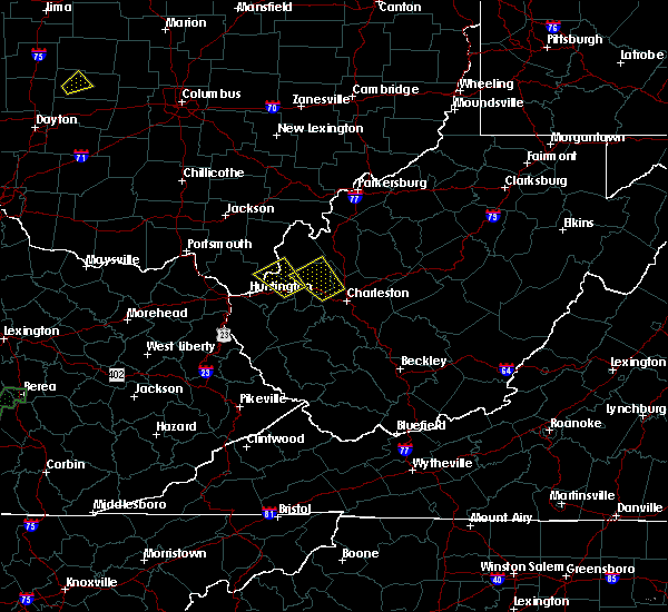 At 605 pm edt, a severe thunderstorm was located near milton, or 12 miles west of winfield, moving northwest at 10 mph (radar indicated). Hazards include 60 mph wind gusts and quarter size hail. Hail damage to vehicles is expected. Expect wind damage to roofs, siding, and trees. At 605 pm edt, a severe thunderstorm was located near milton, or 12 miles west of winfield, moving northwest at 10 mph (radar indicated). Hazards include 60 mph wind gusts and quarter size hail. Hail damage to vehicles is expected. Expect wind damage to roofs, siding, and trees.
|
| 7/7/2017 9:18 PM EDT |
 At 918 pm edt, severe thunderstorms were located along a line extending from near ripley to 6 miles southeast of barboursville to near webbville, moving southeast at 35 mph (radar indicated). Hazards include 60 mph wind gusts and nickel size hail. Expect damage to roofs, siding, and trees. locations impacted include, huntington, winfield, wayne, beech fork state park, hurricane, barboursville, milton, eleanor, buffalo, ona, culloden, centerville, teays valley, lavalette, given, salt rock, grimms landing, pea ridge, fraziers bottom and fairplain. this includes the following highways, interstate 77 in west virginia between mile markers 131 and 136. Interstate 64 in west virginia between mile markers 9 and 39. At 918 pm edt, severe thunderstorms were located along a line extending from near ripley to 6 miles southeast of barboursville to near webbville, moving southeast at 35 mph (radar indicated). Hazards include 60 mph wind gusts and nickel size hail. Expect damage to roofs, siding, and trees. locations impacted include, huntington, winfield, wayne, beech fork state park, hurricane, barboursville, milton, eleanor, buffalo, ona, culloden, centerville, teays valley, lavalette, given, salt rock, grimms landing, pea ridge, fraziers bottom and fairplain. this includes the following highways, interstate 77 in west virginia between mile markers 131 and 136. Interstate 64 in west virginia between mile markers 9 and 39.
|
| 7/7/2017 9:02 PM EDT |
 At 902 pm edt, severe thunderstorms were located along a line extending from 6 miles west of ripley to near barboursville to webbville, moving southeast at 45 mph (radar indicated). Hazards include 60 mph wind gusts and nickel size hail. Expect damage to roofs, siding, and trees. locations impacted include, huntington, louisa, winfield, wayne, blaine, beech fork state park, grayson lake state park, yatesville lake state park, hurricane, barboursville, milton, eleanor, ceredo, buffalo, fort gay, webbville, ona, culloden, denton and burnaugh. this includes the following highways, interstate 77 in west virginia between mile markers 131 and 136. Interstate 64 in west virginia between mile markers 3 and 39. At 902 pm edt, severe thunderstorms were located along a line extending from 6 miles west of ripley to near barboursville to webbville, moving southeast at 45 mph (radar indicated). Hazards include 60 mph wind gusts and nickel size hail. Expect damage to roofs, siding, and trees. locations impacted include, huntington, louisa, winfield, wayne, blaine, beech fork state park, grayson lake state park, yatesville lake state park, hurricane, barboursville, milton, eleanor, ceredo, buffalo, fort gay, webbville, ona, culloden, denton and burnaugh. this includes the following highways, interstate 77 in west virginia between mile markers 131 and 136. Interstate 64 in west virginia between mile markers 3 and 39.
|
| 7/7/2017 8:46 PM EDT |
 At 846 pm edt, severe thunderstorms were located along a line extending from near racine to near rush, moving southeast at 35 mph (radar indicated). Hazards include 60 mph wind gusts and nickel size hail. expect damage to roofs, siding, and trees At 846 pm edt, severe thunderstorms were located along a line extending from near racine to near rush, moving southeast at 35 mph (radar indicated). Hazards include 60 mph wind gusts and nickel size hail. expect damage to roofs, siding, and trees
|
| 7/7/2017 8:32 PM EDT |
 At 832 pm edt, severe thunderstorms were located along a line extending from new haven to near oldtown, moving southeast at 25 mph (radar indicated). Hazards include 60 mph wind gusts and nickel size hail. Expect damage to roofs, siding, and trees. locations impacted include, ashland, ironton, point pleasant, grayson, gallipolis, coal grove, pomeroy, olive hill, rio grande, chesapeake, racine, rutland, cannonsburg, lake vesuvius, carter caves state park, kenova, catlettsburg, new haven, ceredo and greenup. This includes interstate 64 in kentucky between mile markers 151 and 190. At 832 pm edt, severe thunderstorms were located along a line extending from new haven to near oldtown, moving southeast at 25 mph (radar indicated). Hazards include 60 mph wind gusts and nickel size hail. Expect damage to roofs, siding, and trees. locations impacted include, ashland, ironton, point pleasant, grayson, gallipolis, coal grove, pomeroy, olive hill, rio grande, chesapeake, racine, rutland, cannonsburg, lake vesuvius, carter caves state park, kenova, catlettsburg, new haven, ceredo and greenup. This includes interstate 64 in kentucky between mile markers 151 and 190.
|
| 7/7/2017 8:16 PM EDT |
 At 816 pm edt, severe thunderstorms were located along a line extending from near pomeroy to near load, moving southeast at 30 mph (radar indicated). Hazards include 60 mph wind gusts and nickel size hail. Expect damage to roofs, siding, and trees. locations impacted include, ashland, portsmouth, ironton, jackson, wellston, point pleasant, grayson, gallipolis, coal grove, pomeroy, olive hill, oak hill, rio grande, chesapeake, racine, rutland, cannonsburg, lake vesuvius, carter caves state park and kenova. This includes interstate 64 in kentucky between mile markers 151 and 190. At 816 pm edt, severe thunderstorms were located along a line extending from near pomeroy to near load, moving southeast at 30 mph (radar indicated). Hazards include 60 mph wind gusts and nickel size hail. Expect damage to roofs, siding, and trees. locations impacted include, ashland, portsmouth, ironton, jackson, wellston, point pleasant, grayson, gallipolis, coal grove, pomeroy, olive hill, oak hill, rio grande, chesapeake, racine, rutland, cannonsburg, lake vesuvius, carter caves state park and kenova. This includes interstate 64 in kentucky between mile markers 151 and 190.
|
| 7/7/2017 7:47 PM EDT |
 At 747 pm edt, severe thunderstorms were located along a line extending from 8 miles south of chesterhill to near vanceburg, moving southeast at 30 mph (radar indicated). Hazards include 60 mph wind gusts and nickel size hail. expect damage to roofs, siding, and trees At 747 pm edt, severe thunderstorms were located along a line extending from 8 miles south of chesterhill to near vanceburg, moving southeast at 30 mph (radar indicated). Hazards include 60 mph wind gusts and nickel size hail. expect damage to roofs, siding, and trees
|
| 4/11/2017 7:13 PM EDT |
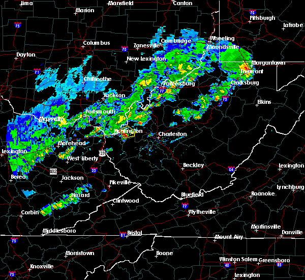 At 712 pm edt, a severe thunderstorm was located over barboursville, or near proctorville, moving east at 30 mph (radar indicated). Hazards include 60 mph wind gusts and quarter size hail. Hail damage to vehicles is expected. expect wind damage to roofs, siding, and trees. locations impacted include, barboursville, milton, culloden, ona and athalia. This includes interstate 64 in west virginia between mile markers 19 and 32. At 712 pm edt, a severe thunderstorm was located over barboursville, or near proctorville, moving east at 30 mph (radar indicated). Hazards include 60 mph wind gusts and quarter size hail. Hail damage to vehicles is expected. expect wind damage to roofs, siding, and trees. locations impacted include, barboursville, milton, culloden, ona and athalia. This includes interstate 64 in west virginia between mile markers 19 and 32.
|
| 4/11/2017 7:04 PM EDT |
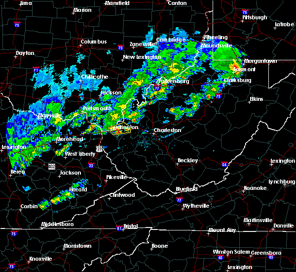 At 703 pm edt, a severe thunderstorm was located over barboursville, or near proctorville, moving east at 30 mph (radar indicated and nickel sized hail was reported in huntington). Hazards include 60 mph wind gusts and quarter size hail. Hail damage to vehicles is expected. expect wind damage to roofs, siding, and trees. locations impacted include, huntington, chesapeake, proctorville, barboursville, milton, ona, culloden, athalia and pea ridge. This includes interstate 64 in west virginia between mile markers 11 and 32. At 703 pm edt, a severe thunderstorm was located over barboursville, or near proctorville, moving east at 30 mph (radar indicated and nickel sized hail was reported in huntington). Hazards include 60 mph wind gusts and quarter size hail. Hail damage to vehicles is expected. expect wind damage to roofs, siding, and trees. locations impacted include, huntington, chesapeake, proctorville, barboursville, milton, ona, culloden, athalia and pea ridge. This includes interstate 64 in west virginia between mile markers 11 and 32.
|
| 4/11/2017 6:52 PM EDT |
 At 652 pm edt, a severe thunderstorm was located near huntington, moving east at 30 mph (radar indicated). Hazards include 60 mph wind gusts and quarter size hail. Hail damage to vehicles is expected. Expect wind damage to roofs, siding, and trees. At 652 pm edt, a severe thunderstorm was located near huntington, moving east at 30 mph (radar indicated). Hazards include 60 mph wind gusts and quarter size hail. Hail damage to vehicles is expected. Expect wind damage to roofs, siding, and trees.
|
| 4/11/2017 6:52 PM EDT |
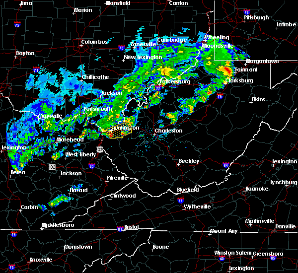 At 652 pm edt, a severe thunderstorm was located near huntington, moving east at 30 mph (radar indicated). Hazards include 60 mph wind gusts and quarter size hail. Hail damage to vehicles is expected. Expect wind damage to roofs, siding, and trees. At 652 pm edt, a severe thunderstorm was located near huntington, moving east at 30 mph (radar indicated). Hazards include 60 mph wind gusts and quarter size hail. Hail damage to vehicles is expected. Expect wind damage to roofs, siding, and trees.
|
| 3/1/2017 9:39 AM EST |
 At 938 am est, severe thunderstorms were located along a line extending from near huntington to 6 miles west of dunlow, moving east at 55 mph (radar indicated). Hazards include 70 mph wind gusts and half dollar size hail. Hail damage to vehicles is expected. expect considerable tree damage. wind damage is also likely to mobile homes, roofs, and outbuildings. locations impacted include, huntington, louisa, wayne, chesapeake, proctorville, beech fork state park, barboursville, kenova, ceredo, fort gay, east lynn lake, centerville, dunlow, kiahsville, burlington, lavalette, glenhayes, pea ridge, east lynn and genoa. This includes interstate 64 in west virginia between mile markers 1 and 21. At 938 am est, severe thunderstorms were located along a line extending from near huntington to 6 miles west of dunlow, moving east at 55 mph (radar indicated). Hazards include 70 mph wind gusts and half dollar size hail. Hail damage to vehicles is expected. expect considerable tree damage. wind damage is also likely to mobile homes, roofs, and outbuildings. locations impacted include, huntington, louisa, wayne, chesapeake, proctorville, beech fork state park, barboursville, kenova, ceredo, fort gay, east lynn lake, centerville, dunlow, kiahsville, burlington, lavalette, glenhayes, pea ridge, east lynn and genoa. This includes interstate 64 in west virginia between mile markers 1 and 21.
|
| 3/1/2017 9:34 AM EST |
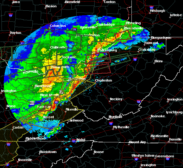 At 934 am est, severe thunderstorms were located along a line extending from near ceredo to near louisa, moving east at 55 mph (radar indicated). Hazards include 70 mph wind gusts and half dollar size hail. Hail damage to vehicles is expected. expect considerable tree damage. wind damage is also likely to mobile homes, roofs, and outbuildings. locations impacted include, huntington, ashland, louisa, coal grove, wayne, chesapeake, proctorville, beech fork state park, barboursville, kenova, ceredo, fort gay, east lynn lake, centerville, dunlow, kiahsville, south point, burlington, lavalette and glenhayes. This includes interstate 64 in west virginia between mile markers 1 and 21. At 934 am est, severe thunderstorms were located along a line extending from near ceredo to near louisa, moving east at 55 mph (radar indicated). Hazards include 70 mph wind gusts and half dollar size hail. Hail damage to vehicles is expected. expect considerable tree damage. wind damage is also likely to mobile homes, roofs, and outbuildings. locations impacted include, huntington, ashland, louisa, coal grove, wayne, chesapeake, proctorville, beech fork state park, barboursville, kenova, ceredo, fort gay, east lynn lake, centerville, dunlow, kiahsville, south point, burlington, lavalette and glenhayes. This includes interstate 64 in west virginia between mile markers 1 and 21.
|
| 3/1/2017 9:30 AM EST |
 At 929 am est, a severe thunderstorm was located near buffalo, or 7 miles north of winfield, moving east at 55 mph (radar indicated). Hazards include 70 mph wind gusts and ping pong ball size hail. People and animals outdoors will be injured. expect hail damage to roofs, siding, windows, and vehicles. expect considerable tree damage. wind damage is also likely to mobile homes, roofs, and outbuildings. locations impacted include, nitro, point pleasant, gallipolis, ripley, winfield, hurricane, ravenswood, milton, eleanor, buffalo, poca, sandyville, culloden, teays valley, bancroft, athalia, henderson, leon, given and liberty. this includes the following highways, interstate 77 in west virginia between mile markers 131 and 147. Interstate 64 in west virginia between mile markers 24 and 45. At 929 am est, a severe thunderstorm was located near buffalo, or 7 miles north of winfield, moving east at 55 mph (radar indicated). Hazards include 70 mph wind gusts and ping pong ball size hail. People and animals outdoors will be injured. expect hail damage to roofs, siding, windows, and vehicles. expect considerable tree damage. wind damage is also likely to mobile homes, roofs, and outbuildings. locations impacted include, nitro, point pleasant, gallipolis, ripley, winfield, hurricane, ravenswood, milton, eleanor, buffalo, poca, sandyville, culloden, teays valley, bancroft, athalia, henderson, leon, given and liberty. this includes the following highways, interstate 77 in west virginia between mile markers 131 and 147. Interstate 64 in west virginia between mile markers 24 and 45.
|
| 3/1/2017 9:28 AM EST |
 At 927 am est, severe thunderstorms were located along a line extending from kenova to near charley, moving east at 55 mph (radar indicated). Hazards include 70 mph wind gusts and half dollar size hail. Hail damage to vehicles is expected. expect considerable tree damage. wind damage is also likely to mobile homes, roofs, and outbuildings. locations impacted include, huntington, ashland, louisa, coal grove, wayne, chesapeake, proctorville, blaine, beech fork state park, cannonsburg, yatesville lake state park, barboursville, kenova, catlettsburg, ceredo, fort gay, webbville, princess, coalton and burnaugh. this includes the following highways, interstate 64 in kentucky between mile markers 181 and 191. Interstate 64 in west virginia between mile markers 1 and 21. At 927 am est, severe thunderstorms were located along a line extending from kenova to near charley, moving east at 55 mph (radar indicated). Hazards include 70 mph wind gusts and half dollar size hail. Hail damage to vehicles is expected. expect considerable tree damage. wind damage is also likely to mobile homes, roofs, and outbuildings. locations impacted include, huntington, ashland, louisa, coal grove, wayne, chesapeake, proctorville, blaine, beech fork state park, cannonsburg, yatesville lake state park, barboursville, kenova, catlettsburg, ceredo, fort gay, webbville, princess, coalton and burnaugh. this includes the following highways, interstate 64 in kentucky between mile markers 181 and 191. Interstate 64 in west virginia between mile markers 1 and 21.
|
| 3/1/2017 9:16 AM EST |
 At 916 am est, a severe thunderstorm was located near buffalo, or 12 miles southeast of gallipolis, moving east at 55 mph (radar indicated). Hazards include 70 mph wind gusts and ping pong ball size hail. People and animals outdoors will be injured. expect hail damage to roofs, siding, windows, and vehicles. expect considerable tree damage. Wind damage is also likely to mobile homes, roofs, and outbuildings. At 916 am est, a severe thunderstorm was located near buffalo, or 12 miles southeast of gallipolis, moving east at 55 mph (radar indicated). Hazards include 70 mph wind gusts and ping pong ball size hail. People and animals outdoors will be injured. expect hail damage to roofs, siding, windows, and vehicles. expect considerable tree damage. Wind damage is also likely to mobile homes, roofs, and outbuildings.
|
| 3/1/2017 9:12 AM EST | Tree down near ohio river rd in cabell county WV, 0.8 miles E of Lesage, WV |
| 3/1/2017 9:05 AM EST |
 At 905 am est, severe thunderstorms were located along a line extending from near lake hope state park to near coal grove, moving east at 55 mph (radar indicated). Hazards include 70 mph wind gusts and half dollar size hail. Hail damage to vehicles is expected. expect considerable tree damage. wind damage is also likely to mobile homes, roofs, and outbuildings. locations impacted include, athens, ashland, ironton, jackson, wellston, point pleasant, gallipolis, coal grove, pomeroy, mcarthur, oak hill, rio grande, albany, rutland, lake vesuvius, mason, gallia, vernon, waterloo and middleport. This includes interstate 64 in west virginia near mile marker 23. At 905 am est, severe thunderstorms were located along a line extending from near lake hope state park to near coal grove, moving east at 55 mph (radar indicated). Hazards include 70 mph wind gusts and half dollar size hail. Hail damage to vehicles is expected. expect considerable tree damage. wind damage is also likely to mobile homes, roofs, and outbuildings. locations impacted include, athens, ashland, ironton, jackson, wellston, point pleasant, gallipolis, coal grove, pomeroy, mcarthur, oak hill, rio grande, albany, rutland, lake vesuvius, mason, gallia, vernon, waterloo and middleport. This includes interstate 64 in west virginia near mile marker 23.
|
| 3/1/2017 9:01 AM EST |
 At 900 am est, severe thunderstorms were located along a line extending from near gesling to sandy hook, moving east at 55 mph (radar indicated). Hazards include 70 mph wind gusts and half dollar size hail. Hail damage to vehicles is expected. expect considerable tree damage. Wind damage is also likely to mobile homes, roofs, and outbuildings. At 900 am est, severe thunderstorms were located along a line extending from near gesling to sandy hook, moving east at 55 mph (radar indicated). Hazards include 70 mph wind gusts and half dollar size hail. Hail damage to vehicles is expected. expect considerable tree damage. Wind damage is also likely to mobile homes, roofs, and outbuildings.
|
| 3/1/2017 9:01 AM EST |
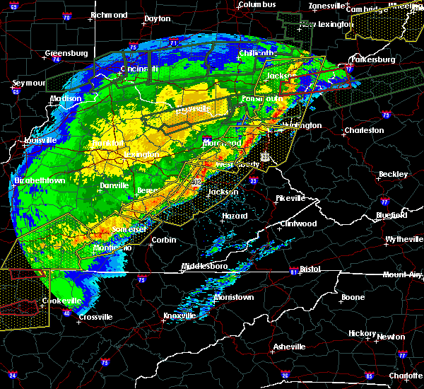 At 900 am est, severe thunderstorms were located along a line extending from near gesling to sandy hook, moving east at 55 mph (radar indicated). Hazards include 70 mph wind gusts and half dollar size hail. Hail damage to vehicles is expected. expect considerable tree damage. Wind damage is also likely to mobile homes, roofs, and outbuildings. At 900 am est, severe thunderstorms were located along a line extending from near gesling to sandy hook, moving east at 55 mph (radar indicated). Hazards include 70 mph wind gusts and half dollar size hail. Hail damage to vehicles is expected. expect considerable tree damage. Wind damage is also likely to mobile homes, roofs, and outbuildings.
|
| 3/1/2017 8:47 AM EST |
 At 846 am est, severe thunderstorms were located along a line extending from near mcarthur to near greenbo lake, moving east at 55 mph (radar indicated). Hazards include 70 mph wind gusts and half dollar size hail. Hail damage to vehicles is expected. expect considerable tree damage. Wind damage is also likely to mobile homes, roofs, and outbuildings. At 846 am est, severe thunderstorms were located along a line extending from near mcarthur to near greenbo lake, moving east at 55 mph (radar indicated). Hazards include 70 mph wind gusts and half dollar size hail. Hail damage to vehicles is expected. expect considerable tree damage. Wind damage is also likely to mobile homes, roofs, and outbuildings.
|
| 2/25/2017 1:04 AM EST |
 At 104 am est, severe thunderstorms were located along a line extending from near ironton to ashland to near durbin, moving northeast at 65 mph (radar indicated). Hazards include 60 mph wind gusts and penny size hail. expect damage to roofs, siding, and trees At 104 am est, severe thunderstorms were located along a line extending from near ironton to ashland to near durbin, moving northeast at 65 mph (radar indicated). Hazards include 60 mph wind gusts and penny size hail. expect damage to roofs, siding, and trees
|
| 8/17/2016 12:55 PM EDT |
 At 1254 pm edt, a severe thunderstorm was located over ona, or 9 miles east of proctorville, moving east at 20 mph (radar indicated). Hazards include 60 mph wind gusts and nickel size hail. Expect damage to roofs. siding. And trees. At 1254 pm edt, a severe thunderstorm was located over ona, or 9 miles east of proctorville, moving east at 20 mph (radar indicated). Hazards include 60 mph wind gusts and nickel size hail. Expect damage to roofs. siding. And trees.
|
| 7/14/2016 4:51 PM EDT |
 The severe thunderstorm warning for greenup, northeastern carter, northern boyd, lawrence, south central gallia and central cabell counties will expire at 500 pm edt, the storm which prompted the warning has moved out of the area. therefore, the warning will be allowed to expire. however gusty winds are still possible with this thunderstorm. The severe thunderstorm warning for greenup, northeastern carter, northern boyd, lawrence, south central gallia and central cabell counties will expire at 500 pm edt, the storm which prompted the warning has moved out of the area. therefore, the warning will be allowed to expire. however gusty winds are still possible with this thunderstorm.
|
| 7/14/2016 4:03 PM EDT |
 At 402 pm edt, a line of severe thunderstorms were located over greenbo lake, or 10 miles north of grayson, moving east at 40 mph (radar indicated). Hazards include 60 mph wind gusts. Expect damage to roofs. siding. And trees. At 402 pm edt, a line of severe thunderstorms were located over greenbo lake, or 10 miles north of grayson, moving east at 40 mph (radar indicated). Hazards include 60 mph wind gusts. Expect damage to roofs. siding. And trees.
|
| 7/8/2016 2:43 PM EDT |
 At 241 pm edt, a severe thunderstorm was located over culloden, or 9 miles north of hamlin, moving east at 45 mph (radar indicated). Hazards include 60 mph wind gusts. Expect damage to roofs. siding. and trees. Locations impacted include, huntington, hamlin, hurricane, barboursville, milton, culloden, spurlockville, ona, teays valley, west hamlin, athalia, palermo, green bottom, griffithsville, branchland, pea ridge, salt rock, myra, yawkey and sweetland. At 241 pm edt, a severe thunderstorm was located over culloden, or 9 miles north of hamlin, moving east at 45 mph (radar indicated). Hazards include 60 mph wind gusts. Expect damage to roofs. siding. and trees. Locations impacted include, huntington, hamlin, hurricane, barboursville, milton, culloden, spurlockville, ona, teays valley, west hamlin, athalia, palermo, green bottom, griffithsville, branchland, pea ridge, salt rock, myra, yawkey and sweetland.
|
| 7/8/2016 2:16 PM EDT |
 At 215 pm edt, a severe thunderstorm was located near chesapeake, moving east at 45 mph (radar indicated). Hazards include 60 mph wind gusts. Expect damage to roofs. siding. And trees. At 215 pm edt, a severe thunderstorm was located near chesapeake, moving east at 45 mph (radar indicated). Hazards include 60 mph wind gusts. Expect damage to roofs. siding. And trees.
|
| 6/23/2016 4:24 PM EDT |
 The severe thunderstorm warning for southeastern lawrence and central cabell counties will expire at 430 pm edt, the storm which prompted the warning has weakened below severe limits, and no longer pose an immediate threat to life or property. therefore, the warning will be allowed to expire. a tornado watch remains in effect until 1000 pm edt for southeastern ohio, and central west virginia. The severe thunderstorm warning for southeastern lawrence and central cabell counties will expire at 430 pm edt, the storm which prompted the warning has weakened below severe limits, and no longer pose an immediate threat to life or property. therefore, the warning will be allowed to expire. a tornado watch remains in effect until 1000 pm edt for southeastern ohio, and central west virginia.
|
| 6/23/2016 4:12 PM EDT |
 At 411 pm edt, a severe thunderstorm was located near proctorville, moving southeast at 45 mph (radar indicated). Hazards include 60 mph wind gusts. Expect damage to roofs. siding. and trees. locations impacted include, huntington, proctorville, barboursville, milton, ona, athalia, salt rock and pea ridge. A tornado watch remains in effect until 1000 pm edt for southeastern ohio, and central west virginia. At 411 pm edt, a severe thunderstorm was located near proctorville, moving southeast at 45 mph (radar indicated). Hazards include 60 mph wind gusts. Expect damage to roofs. siding. and trees. locations impacted include, huntington, proctorville, barboursville, milton, ona, athalia, salt rock and pea ridge. A tornado watch remains in effect until 1000 pm edt for southeastern ohio, and central west virginia.
|
| 6/23/2016 3:55 PM EDT |
 At 354 pm edt, a severe thunderstorm was located near coal grove, moving southeast at 45 mph (radar indicated). Hazards include 60 mph wind gusts and quarter size hail. Hail damage to vehicles is expected. Expect wind damage to roofs, siding, and trees. At 354 pm edt, a severe thunderstorm was located near coal grove, moving southeast at 45 mph (radar indicated). Hazards include 60 mph wind gusts and quarter size hail. Hail damage to vehicles is expected. Expect wind damage to roofs, siding, and trees.
|
| 6/23/2016 6:58 AM EDT |
 At 658 am edt, severe thunderstorms were located along a line extending from 14 miles east of lake vesuvius to near farley, moving southeast at 45 mph (radar indicated). Hazards include 60 mph wind gusts. Expect damage to roofs. siding. And trees. At 658 am edt, severe thunderstorms were located along a line extending from 14 miles east of lake vesuvius to near farley, moving southeast at 45 mph (radar indicated). Hazards include 60 mph wind gusts. Expect damage to roofs. siding. And trees.
|
| 6/23/2016 6:17 AM EDT |
 At 616 am edt, severe thunderstorms were located along a line extending from near jackson to 9 miles west of lucasville to near tollesboro, moving southeast at 50 mph (radar indicated). Hazards include 60 mph wind gusts. Expect damage to roofs. siding. And trees. At 616 am edt, severe thunderstorms were located along a line extending from near jackson to 9 miles west of lucasville to near tollesboro, moving southeast at 50 mph (radar indicated). Hazards include 60 mph wind gusts. Expect damage to roofs. siding. And trees.
|
| 6/23/2016 6:09 AM EDT |
 The severe thunderstorm warning for southeastern lawrence, southwestern putnam, southwestern nicholas, southwestern clay, northwestern fayette, northern boone, lincoln, cabell and kanawha counties will expire at 615 am edt, the storms which prompted the warning have weakened. therefore, the warning will be allowed to expire. a severe thunderstorm watch remains in effect until 800 am edt for southeastern ohio, and western, north central, southern, southeastern and central west virginia. The severe thunderstorm warning for southeastern lawrence, southwestern putnam, southwestern nicholas, southwestern clay, northwestern fayette, northern boone, lincoln, cabell and kanawha counties will expire at 615 am edt, the storms which prompted the warning have weakened. therefore, the warning will be allowed to expire. a severe thunderstorm watch remains in effect until 800 am edt for southeastern ohio, and western, north central, southern, southeastern and central west virginia.
|
| 6/23/2016 5:46 AM EDT |
 At 546 am edt, severe thunderstorms were located along a line extending from near hamlin to near glen, moving southeast at 40 mph (radar indicated). Hazards include 60 mph wind gusts. Expect damage to roofs. siding. and trees. locations impacted include, charleston, huntington, nitro, summersville, madison, hamlin, proctorville, clay, jefferson, south charleston, st. Albans, dunbar, hurricane, barboursville, milton, montgomery, chesapeake, marmet, ansted and belle. At 546 am edt, severe thunderstorms were located along a line extending from near hamlin to near glen, moving southeast at 40 mph (radar indicated). Hazards include 60 mph wind gusts. Expect damage to roofs. siding. and trees. locations impacted include, charleston, huntington, nitro, summersville, madison, hamlin, proctorville, clay, jefferson, south charleston, st. Albans, dunbar, hurricane, barboursville, milton, montgomery, chesapeake, marmet, ansted and belle.
|
| 6/23/2016 5:11 AM EDT |
 At 511 am edt, severe thunderstorms were located along a line extending from near chesapeake to 9 miles east of kenna, moving southeast at 40 mph (radar indicated). Hazards include 60 mph wind gusts. Expect damage to roofs. siding. And trees. At 511 am edt, severe thunderstorms were located along a line extending from near chesapeake to 9 miles east of kenna, moving southeast at 40 mph (radar indicated). Hazards include 60 mph wind gusts. Expect damage to roofs. siding. And trees.
|
| 6/23/2016 4:55 AM EDT | The severe thunderstorm warning for central lawrence, gallia, southern jackson, northwestern putnam, mason, west central jackson and northeastern cabell counties will expire at 500 am edt, the storm which prompted the warning has weakened below severe limits, and no longer pose an immediate threat to life or property. therefore, the warning will be allowed to expire. a severe thunderstorm watch remains in effect until 800 am edt for southeastern ohio, and western, northwestern and central west virginia. |
| 6/23/2016 4:55 AM EDT | The severe thunderstorm warning for central lawrence, gallia, southern jackson, northwestern putnam, mason, west central jackson and northeastern cabell counties will expire at 500 am edt, the storm which prompted the warning has weakened below severe limits, and no longer pose an immediate threat to life or property. therefore, the warning will be allowed to expire. a severe thunderstorm watch remains in effect until 800 am edt for southeastern ohio, and western, northwestern and central west virginia. |
| 6/23/2016 4:47 AM EDT |
 At 446 am edt, a severe thunderstorm was located 8 miles northwest of buffalo, or 9 miles southeast of gallipolis, moving southeast at 70 mph (radar indicated). Hazards include 60 mph wind gusts. Expect damage to roofs. siding. and trees. Locations impacted include, point pleasant, gallipolis, winfield, oak hill, rio grande, milton, eleanor, buffalo, ona, gallia, waterloo, crown city, athalia, henderson, vinton, leon, cheshire, adamsville, green bottom and gallopolis ferry. At 446 am edt, a severe thunderstorm was located 8 miles northwest of buffalo, or 9 miles southeast of gallipolis, moving southeast at 70 mph (radar indicated). Hazards include 60 mph wind gusts. Expect damage to roofs. siding. and trees. Locations impacted include, point pleasant, gallipolis, winfield, oak hill, rio grande, milton, eleanor, buffalo, ona, gallia, waterloo, crown city, athalia, henderson, vinton, leon, cheshire, adamsville, green bottom and gallopolis ferry.
|
| 6/23/2016 4:10 AM EDT |
 At 409 am edt, a severe thunderstorm was located 7 miles northwest of jackson, moving southeast at 70 mph (radar indicated). Hazards include 60 mph wind gusts. Expect damage to roofs. siding. And trees. At 409 am edt, a severe thunderstorm was located 7 miles northwest of jackson, moving southeast at 70 mph (radar indicated). Hazards include 60 mph wind gusts. Expect damage to roofs. siding. And trees.
|
| 6/21/2016 1:49 PM EDT |
 At 149 pm edt, a severe thunderstorm capable of producing a tornado was located near milton, or 13 miles west of winfield, moving southeast at 30 mph (radar indicated rotation). Hazards include tornado and tennis ball size hail. Flying debris will be dangerous to those caught without shelter. mobile homes will be damaged or destroyed. damage to roofs, windows, and vehicles will occur. tree damage is likely. this dangerous storm will be near, milton around 200 pm edt. hurricane and culloden around 205 pm edt. winfield, eleanor and teays valley around 210 pm edt. nitro and tornado around 215 pm edt. Other locations impacted by this tornadic thunderstorm include fraziers bottom, sod, bancroft and ashton. At 149 pm edt, a severe thunderstorm capable of producing a tornado was located near milton, or 13 miles west of winfield, moving southeast at 30 mph (radar indicated rotation). Hazards include tornado and tennis ball size hail. Flying debris will be dangerous to those caught without shelter. mobile homes will be damaged or destroyed. damage to roofs, windows, and vehicles will occur. tree damage is likely. this dangerous storm will be near, milton around 200 pm edt. hurricane and culloden around 205 pm edt. winfield, eleanor and teays valley around 210 pm edt. nitro and tornado around 215 pm edt. Other locations impacted by this tornadic thunderstorm include fraziers bottom, sod, bancroft and ashton.
|
| 7/14/2015 5:52 PM EDT |
 At 549 pm edt, doppler radar indicated a line of severe thunderstorms capable of producing damaging winds in excess of 60 mph. these storms were located along a line extending from culloden to princess to near olive hill, moving south at 35 mph. locations impacted include, huntington, ashland, grayson, louisa, coal grove, olive hill, wayne, hamlin, chesapeake, proctorville, beech fork state park, cannonsburg, carter caves state park, grayson lake state park, yatesville lake state park, barboursville, kenova, milton, catlettsburg and ceredo. At 549 pm edt, doppler radar indicated a line of severe thunderstorms capable of producing damaging winds in excess of 60 mph. these storms were located along a line extending from culloden to princess to near olive hill, moving south at 35 mph. locations impacted include, huntington, ashland, grayson, louisa, coal grove, olive hill, wayne, hamlin, chesapeake, proctorville, beech fork state park, cannonsburg, carter caves state park, grayson lake state park, yatesville lake state park, barboursville, kenova, milton, catlettsburg and ceredo.
|
| 7/14/2015 5:11 PM EDT |
 At 509 pm edt, doppler radar indicated a line of severe thunderstorms capable of producing damaging winds in excess of 60 mph. these storms were located along a line extending from south shore to near vanceburg to near manchester, and moving southeast at 55 mph. At 509 pm edt, doppler radar indicated a line of severe thunderstorms capable of producing damaging winds in excess of 60 mph. these storms were located along a line extending from south shore to near vanceburg to near manchester, and moving southeast at 55 mph.
|
| 7/14/2015 5:05 PM EDT |
 At 504 pm edt, doppler radar indicated a line of severe thunderstorms capable of producing damaging winds in excess of 60 mph. these storms were located along a line extending from 9 miles northeast of lake vesuvius to near letitia, moving southeast at 45 mph. locations impacted include, portsmouth, ironton, coal grove, lake vesuvius, greenup, load, greenbo lake, letitia, franklin furnace, flatwoods, russell, vernon, waterloo, raceland, worthington, south shore, wurtland, bellefonte, aid and crown city. At 504 pm edt, doppler radar indicated a line of severe thunderstorms capable of producing damaging winds in excess of 60 mph. these storms were located along a line extending from 9 miles northeast of lake vesuvius to near letitia, moving southeast at 45 mph. locations impacted include, portsmouth, ironton, coal grove, lake vesuvius, greenup, load, greenbo lake, letitia, franklin furnace, flatwoods, russell, vernon, waterloo, raceland, worthington, south shore, wurtland, bellefonte, aid and crown city.
|
| 7/14/2015 4:27 PM EDT |
 At 427 pm edt, doppler radar indicated a line of severe thunderstorms capable of producing damaging winds in excess of 60 mph. these storms were located along a line extending from 10 miles northeast of lucasville to near peebles, and moving southeast at 45 mph. At 427 pm edt, doppler radar indicated a line of severe thunderstorms capable of producing damaging winds in excess of 60 mph. these storms were located along a line extending from 10 miles northeast of lucasville to near peebles, and moving southeast at 45 mph.
|
| 7/13/2015 4:10 PM EDT |
 At 409 pm edt, doppler radar indicated a severe thunderstorm capable of producing damaging winds in excess of 60 mph. this storm was located over milton, or 12 miles north of hamlin, moving southeast at 30 mph. locations impacted include, hurricane, milton, ona, culloden and teays valley. At 409 pm edt, doppler radar indicated a severe thunderstorm capable of producing damaging winds in excess of 60 mph. this storm was located over milton, or 12 miles north of hamlin, moving southeast at 30 mph. locations impacted include, hurricane, milton, ona, culloden and teays valley.
|
| 7/13/2015 3:49 PM EDT |
 At 348 pm edt, doppler radar indicated a severe thunderstorm capable of producing damaging winds in excess of 60 mph. this storm was located 8 miles north of ona, or 9 miles northeast of proctorville, and moving southeast at 45 mph. At 348 pm edt, doppler radar indicated a severe thunderstorm capable of producing damaging winds in excess of 60 mph. this storm was located 8 miles north of ona, or 9 miles northeast of proctorville, and moving southeast at 45 mph.
|
| 7/13/2015 2:46 PM EDT |
 At 245 pm edt, doppler radar indicated a severe thunderstorm capable of producing damaging winds in excess of 60 mph. this storm was located near south webster, or 10 miles west of oak hill, and moving southeast at 45 mph. * this severe thunderstorm will be near, oak hill around 255 pm edt. other locations impacted by this severe thunderstorm include gallia, vernon, crown city, scottown, mabee, aid, gage, waterloo and athalia. At 245 pm edt, doppler radar indicated a severe thunderstorm capable of producing damaging winds in excess of 60 mph. this storm was located near south webster, or 10 miles west of oak hill, and moving southeast at 45 mph. * this severe thunderstorm will be near, oak hill around 255 pm edt. other locations impacted by this severe thunderstorm include gallia, vernon, crown city, scottown, mabee, aid, gage, waterloo and athalia.
|
| 7/7/2015 5:41 PM EDT |
 The severe thunderstorm warning for southeastern gallia, northwestern putnam, southern mason and central cabell counties will expire at 545 pm edt, the storms which prompted the warning have weakened below severe limits, and no longer poses an immediate threat to life or property. therefore the warning will be allowed to expire. The severe thunderstorm warning for southeastern gallia, northwestern putnam, southern mason and central cabell counties will expire at 545 pm edt, the storms which prompted the warning have weakened below severe limits, and no longer poses an immediate threat to life or property. therefore the warning will be allowed to expire.
|
| 7/7/2015 5:22 PM EDT |
 At 522 pm edt, doppler radar indicated a line of severe thunderstorms capable of producing damaging winds in excess of 60 mph. these storms were located along a line extending from 6 miles southeast of point pleasant to near buffalo to near milton, moving east at 40 mph. locations impacted include, huntington, winfield, hurricane, barboursville, milton, eleanor, buffalo, culloden, ona, teays valley, bancroft, leon, green bottom, gallopolis ferry, pea ridge, southside, fraziers bottom, ashton and grimms landing. At 522 pm edt, doppler radar indicated a line of severe thunderstorms capable of producing damaging winds in excess of 60 mph. these storms were located along a line extending from 6 miles southeast of point pleasant to near buffalo to near milton, moving east at 40 mph. locations impacted include, huntington, winfield, hurricane, barboursville, milton, eleanor, buffalo, culloden, ona, teays valley, bancroft, leon, green bottom, gallopolis ferry, pea ridge, southside, fraziers bottom, ashton and grimms landing.
|
| 7/7/2015 4:59 PM EDT |
 At 459 pm edt, doppler radar indicated a line of severe thunderstorms capable of producing damaging winds in excess of 60 mph. these storms were located along a line extending from 7 miles southwest of gallipolis to 8 miles northeast of proctorville to huntington, and moving east at 35 mph. At 459 pm edt, doppler radar indicated a line of severe thunderstorms capable of producing damaging winds in excess of 60 mph. these storms were located along a line extending from 7 miles southwest of gallipolis to 8 miles northeast of proctorville to huntington, and moving east at 35 mph.
|
| 6/29/2015 6:54 PM EDT |
 The severe thunderstorm warning for south central gallia, southeastern lawrence and southwestern mason counties will expire at 700 pm edt, the storm which prompted the warning has moved out of the area. therefore the warning will be allowed to expire. however heavy rain is still possible with this thunderstorm and the ones to follow. a flash flood warning is still in effect for many counties in the vicinity. The severe thunderstorm warning for south central gallia, southeastern lawrence and southwestern mason counties will expire at 700 pm edt, the storm which prompted the warning has moved out of the area. therefore the warning will be allowed to expire. however heavy rain is still possible with this thunderstorm and the ones to follow. a flash flood warning is still in effect for many counties in the vicinity.
|
| 6/29/2015 6:51 PM EDT |
 The tornado warning for south central gallia, southeastern lawrence and north central cabell counties will expire at 700 pm edt, the tornado threat has diminished, therefore the tornado warning has been cancelled. however, large hail and damaging winds remain likely and a severe thunderstorm warning remains in effect for the area. remember, a severe thunderstorm warning still remains in effect for lawrence and gallia counties. The tornado warning for south central gallia, southeastern lawrence and north central cabell counties will expire at 700 pm edt, the tornado threat has diminished, therefore the tornado warning has been cancelled. however, large hail and damaging winds remain likely and a severe thunderstorm warning remains in effect for the area. remember, a severe thunderstorm warning still remains in effect for lawrence and gallia counties.
|
| 6/29/2015 6:51 PM EDT |
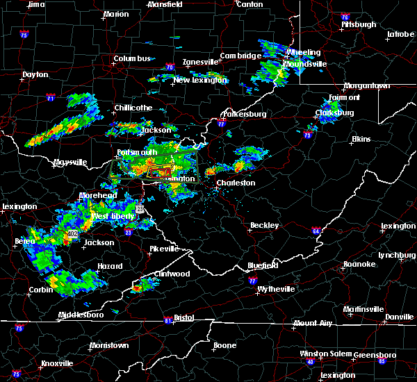 The tornado warning for south central gallia, southeastern lawrence and north central cabell counties will expire at 700 pm edt, the tornado threat has diminished, therefore the tornado warning has been cancelled. however, large hail and damaging winds remain likely and a severe thunderstorm warning remains in effect for the area. remember, a severe thunderstorm warning still remains in effect for lawrence and gallia counties. The tornado warning for south central gallia, southeastern lawrence and north central cabell counties will expire at 700 pm edt, the tornado threat has diminished, therefore the tornado warning has been cancelled. however, large hail and damaging winds remain likely and a severe thunderstorm warning remains in effect for the area. remember, a severe thunderstorm warning still remains in effect for lawrence and gallia counties.
|
| 6/29/2015 6:31 PM EDT |
 At 630 pm edt, doppler radar indicated a severe thunderstorm capable of producing quarter size hail and damaging winds in excess of 60 mph. this storm was located 11 miles north of proctorville, moving east at 40 mph. locations impacted include, aid, crown city, athalia and scottown. a tornado watch remains in effect until 900 pm edt for southeastern ohio and central west virginia. At 630 pm edt, doppler radar indicated a severe thunderstorm capable of producing quarter size hail and damaging winds in excess of 60 mph. this storm was located 11 miles north of proctorville, moving east at 40 mph. locations impacted include, aid, crown city, athalia and scottown. a tornado watch remains in effect until 900 pm edt for southeastern ohio and central west virginia.
|
| 6/29/2015 6:29 PM EDT |
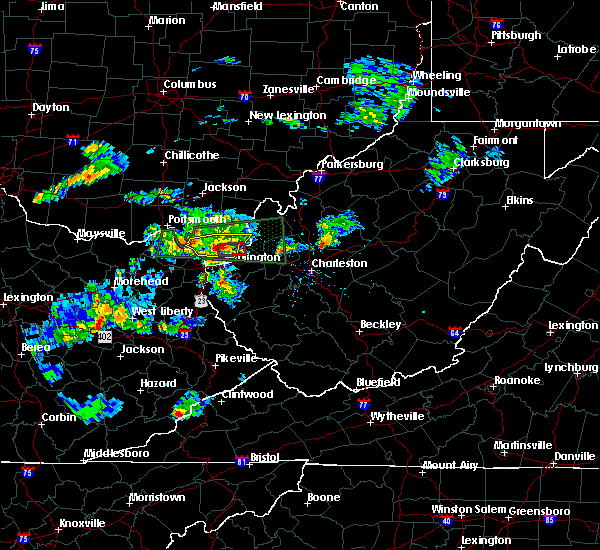 At 629 pm edt, doppler radar indicated a severe thunderstorm capable of producing a tornado. this dangerous storm was located 7 miles north of proctorville, moving east at 40 mph. locations impacted include, crown city, athalia, scottown and green bottom. At 629 pm edt, doppler radar indicated a severe thunderstorm capable of producing a tornado. this dangerous storm was located 7 miles north of proctorville, moving east at 40 mph. locations impacted include, crown city, athalia, scottown and green bottom.
|
| 6/29/2015 6:11 PM EDT |
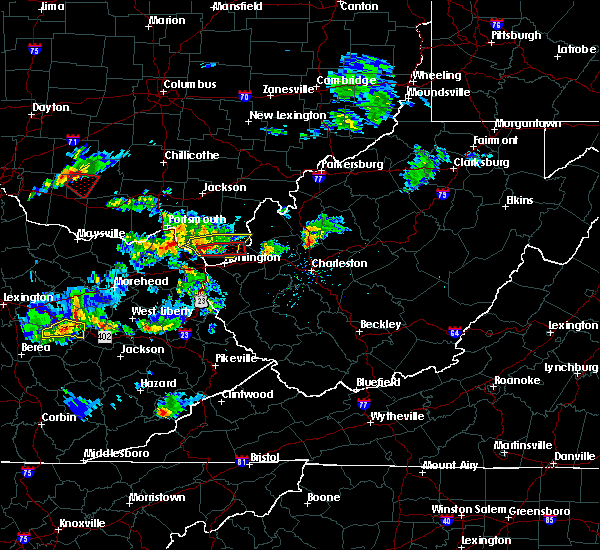 At 610 pm edt, doppler radar indicated a severe thunderstorm capable of producing a tornado. this dangerous storm was located near coal grove, and moving east through lawrence county ohio at 40 mph. At 610 pm edt, doppler radar indicated a severe thunderstorm capable of producing a tornado. this dangerous storm was located near coal grove, and moving east through lawrence county ohio at 40 mph.
|
| 6/29/2015 6:06 PM EDT |
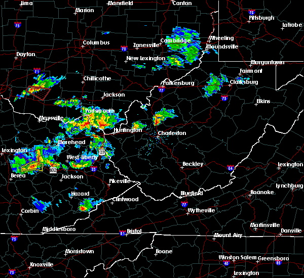 At 604 pm edt, doppler radar indicated a severe thunderstorm capable of producing quarter size hail and destructive winds in excess of 70 mph. this storm was located near lake vesuvius, and moving east at 40 mph. At 604 pm edt, doppler radar indicated a severe thunderstorm capable of producing quarter size hail and destructive winds in excess of 70 mph. this storm was located near lake vesuvius, and moving east at 40 mph.
|
| 6/26/2015 9:08 PM EDT | The severe thunderstorm warning for south central gallia, southeastern lawrence and northern cabell counties will expire at 915 pm edt, the storm which prompted the warning has moved out of the area. therefore the warning will be allowed to expire. |
| 6/26/2015 9:08 PM EDT | The severe thunderstorm warning for south central gallia, southeastern lawrence and northern cabell counties will expire at 915 pm edt, the storm which prompted the warning has moved out of the area. therefore the warning will be allowed to expire. |
| 6/26/2015 8:56 PM EDT | At 855 pm edt, trained weather spotters reported a severe thunderstorm producing estimated 60 mph winds and tree limbs down in huntington. this storm is also capable of producing quarter size hail. this storm was located near proctorville, moving east at 30 mph. locations impacted include, huntington, hamlin, chesapeake, proctorville, barboursville, milton, ona, west hamlin, salt rock, myra and pea ridge. |
| 6/26/2015 8:56 PM EDT | At 855 pm edt, trained weather spotters reported a severe thunderstorm producing estimated 60 mph winds and tree limbs down in huntington. this storm is also capable of producing quarter size hail. this storm was located near proctorville, moving east at 30 mph. locations impacted include, huntington, hamlin, chesapeake, proctorville, barboursville, milton, ona, west hamlin, salt rock, myra and pea ridge. |
| 6/26/2015 8:45 PM EDT | At 844 pm edt, trained weather spotters reported a severe thunderstorm that produced quarter sized hail near ashland ky. this storm is also capable of damaging winds in excess of 60 mph. this storm was located near proctorville, moving east at 30 mph. locations impacted include, huntington, chesapeake, proctorville, crown city, athalia, green bottom and scottown. |
| 6/26/2015 8:45 PM EDT | At 844 pm edt, trained weather spotters reported a severe thunderstorm that produced quarter sized hail near ashland ky. this storm is also capable of damaging winds in excess of 60 mph. this storm was located near proctorville, moving east at 30 mph. locations impacted include, huntington, chesapeake, proctorville, crown city, athalia, green bottom and scottown. |
| 6/26/2015 8:39 PM EDT | At 838 pm edt, doppler radar indicated a severe thunderstorm capable of producing half dollar size hail and damaging winds in excess of 60 mph. this storm was located over chesapeake, and moving east at 30 mph. |
| 6/26/2015 8:39 PM EDT | At 838 pm edt, doppler radar indicated a severe thunderstorm capable of producing half dollar size hail and damaging winds in excess of 60 mph. this storm was located over chesapeake, and moving east at 30 mph. |
| 6/26/2015 8:39 PM EDT | At 838 pm edt, doppler radar indicated a severe thunderstorm capable of producing half dollar size hail and damaging winds in excess of 60 mph. this storm was located over chesapeake, and moving east at 30 mph. |
| 6/26/2015 8:19 PM EDT | At 818 pm edt, doppler radar indicated a severe thunderstorm capable of producing half dollar size hail and damaging winds in excess of 60 mph. this storm was located over coal grove, and moving east at 25 mph. |
| 6/26/2015 8:19 PM EDT | At 818 pm edt, doppler radar indicated a severe thunderstorm capable of producing half dollar size hail and damaging winds in excess of 60 mph. this storm was located over coal grove, and moving east at 25 mph. |
| 6/26/2015 8:19 PM EDT | At 818 pm edt, doppler radar indicated a severe thunderstorm capable of producing half dollar size hail and damaging winds in excess of 60 mph. this storm was located over coal grove, and moving east at 25 mph. |
| 4/9/2015 7:31 PM EDT | The national weather service in charleston has issued a * severe thunderstorm warning for. north central cabell county in west virginia. mason county in west virginia. this includes the city of point pleasant. Northwestern putnam county in west virginia. |
| 4/9/2015 7:31 PM EDT | The national weather service in charleston has issued a * severe thunderstorm warning for. north central cabell county in west virginia. mason county in west virginia. this includes the city of point pleasant. Northwestern putnam county in west virginia. |
| 4/9/2015 2:00 PM EDT | Barn completely destroyed. relayed by jackson county emergency manage in lawrence county OH, 3.5 miles SSE of Lesage, WV |
| 4/8/2015 1:35 PM EDT | A severe thunderstorm warning remains in effect until 200 pm edt for southern greenup. carter and boyd counties in kentucky. and eastern meigs. lawrence. southern gallia and extreme southeastern athens counties in southeast ohio. and northern wayne. cabell. northern jackson and mason counties in west virginia. at 122 pm edt. National weather service doppler radar continued to. |
| 4/8/2015 1:35 PM EDT | A severe thunderstorm warning remains in effect until 200 pm edt for southern greenup. carter and boyd counties in kentucky. and eastern meigs. lawrence. southern gallia and extreme southeastern athens counties in southeast ohio. and northern wayne. cabell. northern jackson and mason counties in west virginia. at 122 pm edt. National weather service doppler radar continued to. |
| 4/8/2015 1:35 PM EDT | A severe thunderstorm warning remains in effect until 200 pm edt for southern greenup. carter and boyd counties in kentucky. and eastern meigs. lawrence. southern gallia and extreme southeastern athens counties in southeast ohio. and northern wayne. cabell. northern jackson and mason counties in west virginia. at 122 pm edt. National weather service doppler radar continued to. |
| 4/8/2015 12:56 PM EDT | The national weather service in charleston has issued a * severe thunderstorm warning for. boyd county in kentucky. this includes the cities of. cannonsburg. ashland. carter county in kentucky. this includes the cities of. olive hill. Grayson lake state. |
| 4/8/2015 12:56 PM EDT | The national weather service in charleston has issued a * severe thunderstorm warning for. boyd county in kentucky. this includes the cities of. cannonsburg. ashland. carter county in kentucky. this includes the cities of. olive hill. Grayson lake state. |
| 4/8/2015 12:56 PM EDT | The national weather service in charleston has issued a * severe thunderstorm warning for. boyd county in kentucky. this includes the cities of. cannonsburg. ashland. carter county in kentucky. this includes the cities of. olive hill. Grayson lake state. |
| 11/17/2013 9:35 PM EST | 10 x 15 foot light weight metal outbuilding flattened by strong winds in lesage...time estimated from radar in cabell county WV, 0.2 miles E of Lesage, WV |
Hail Maps for Lesage, WV
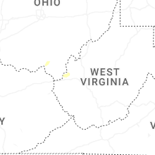


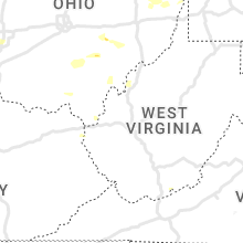


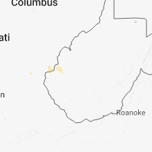


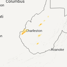

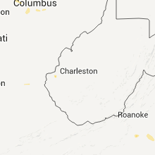


Connect with Interactive Hail Maps