

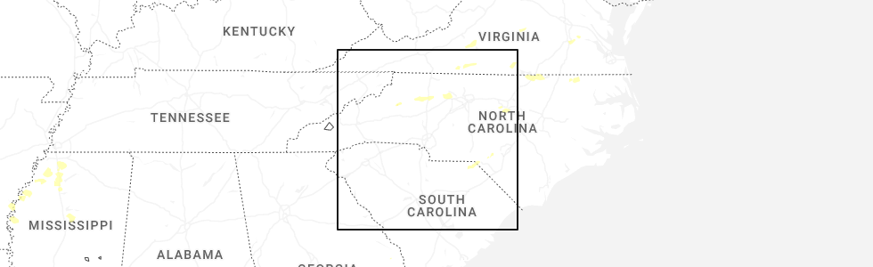
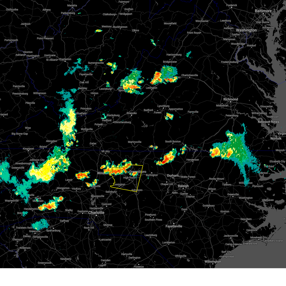
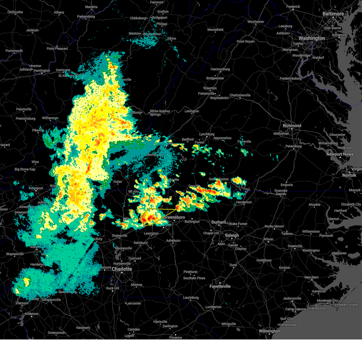
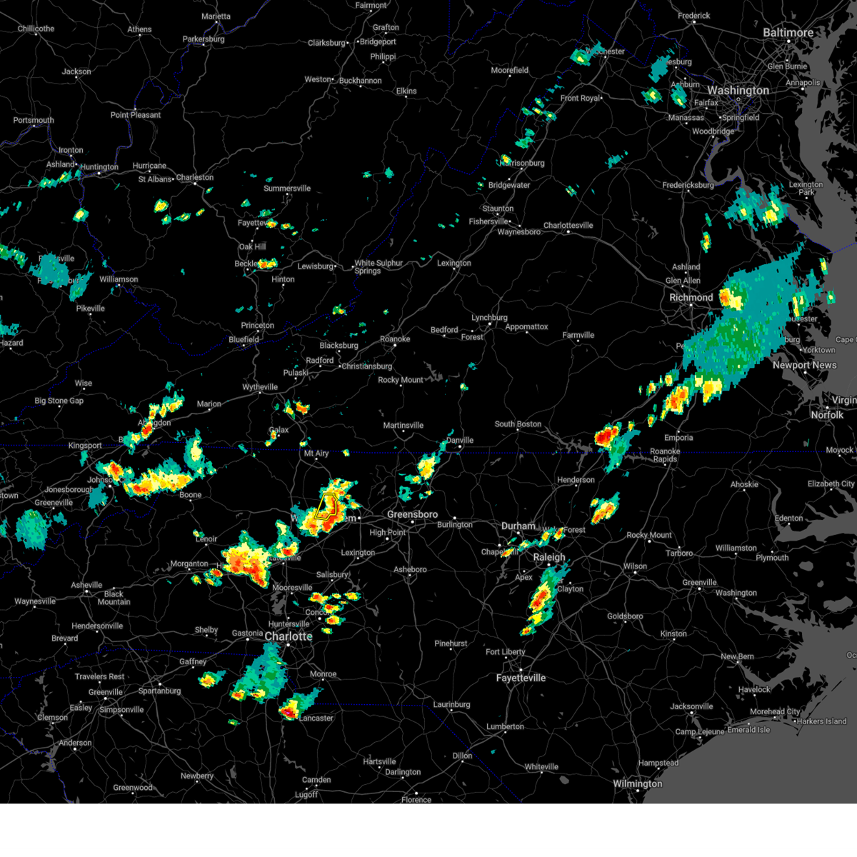
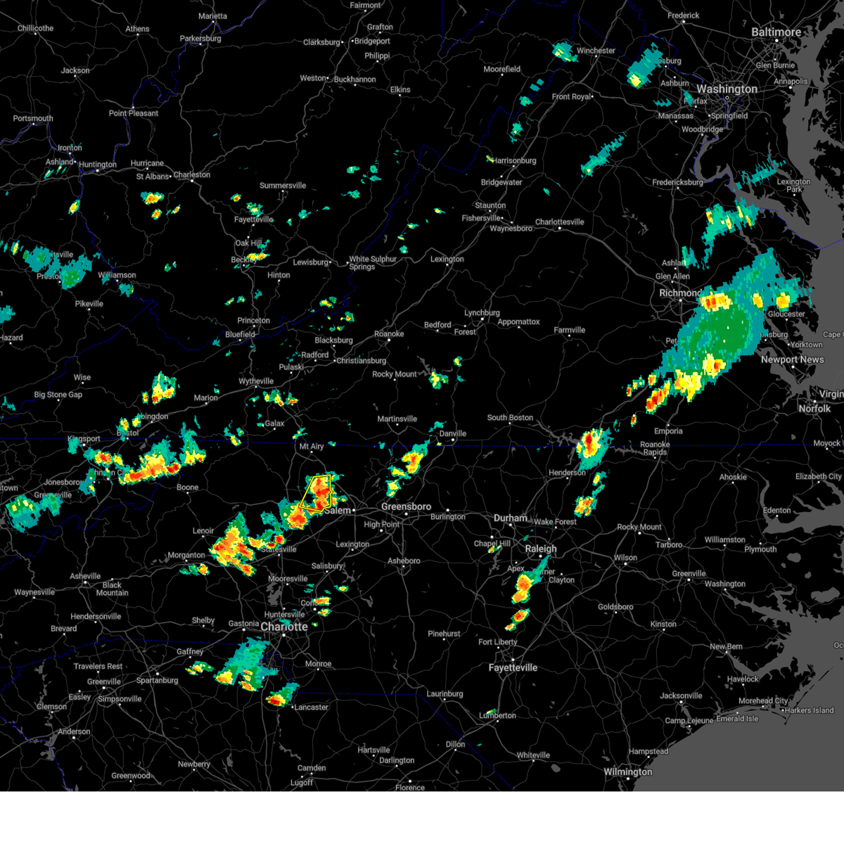
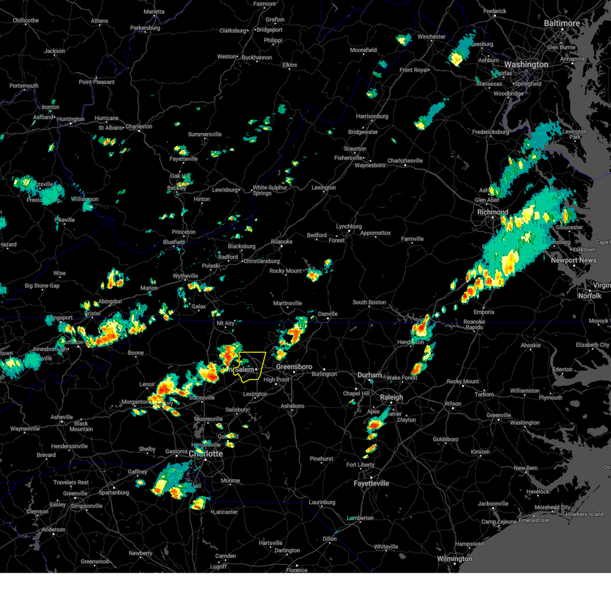
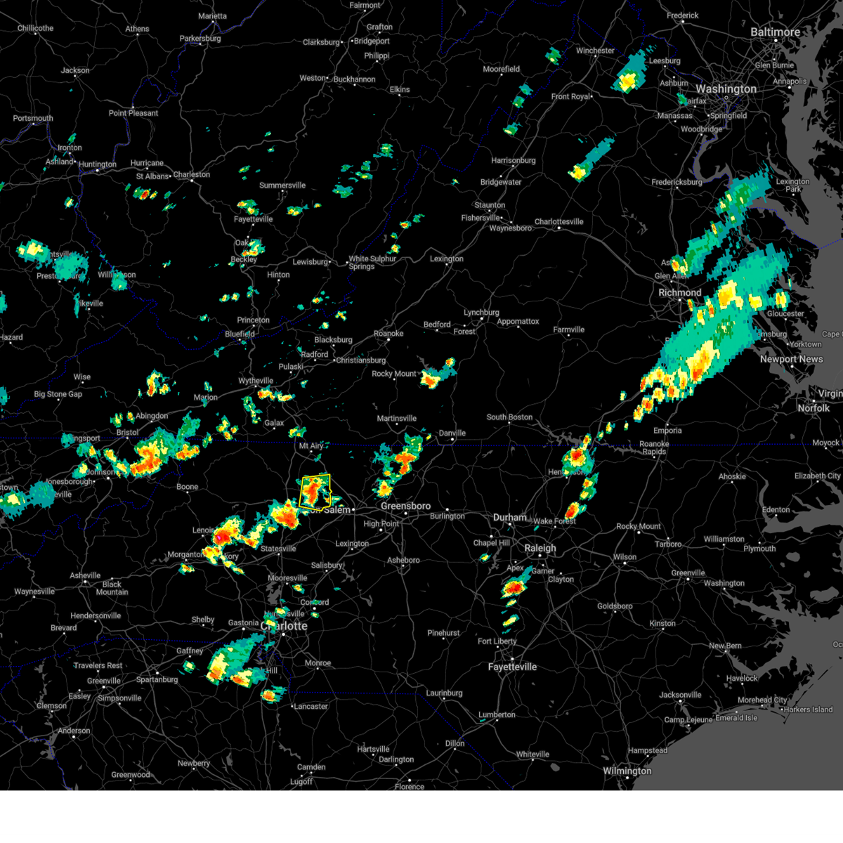
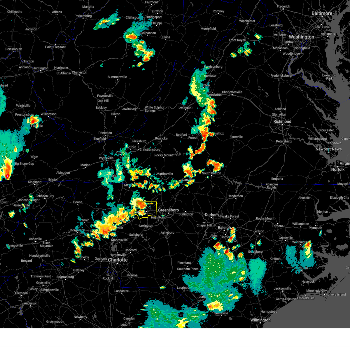
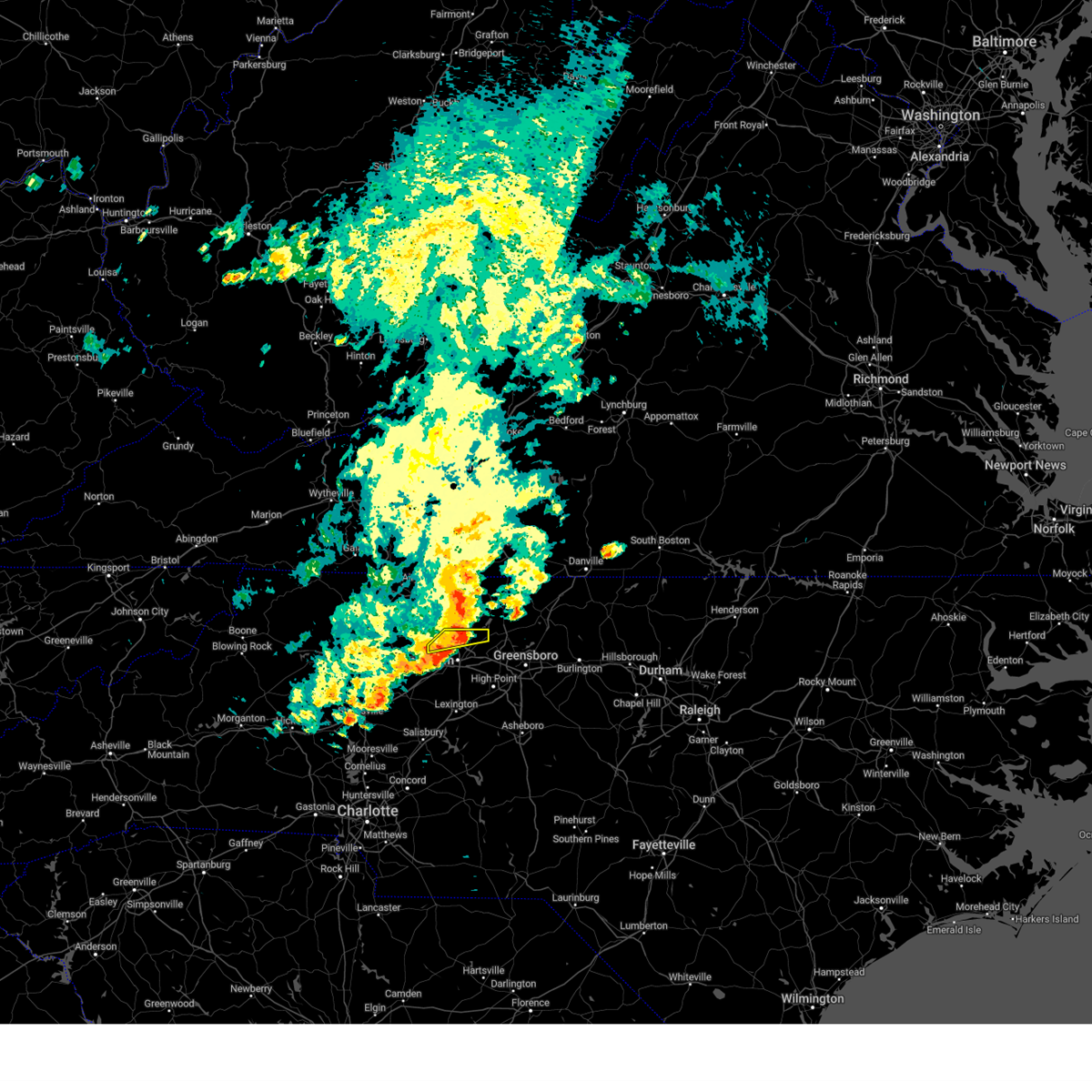
Hail Map for Lewisville, NC
The Lewisville, NC area has had 3 reports of on-the-ground hail by trained spotters, and has been under severe weather warnings 24 times during the past 12 months. Doppler radar has detected hail at or near Lewisville, NC on 47 occasions, including 2 occasions during the past year.
| Name: | Lewisville, NC |
| Where Located: | 65.7 miles NNE of Charlotte, NC |
| Map: | Google Map for Lewisville, NC |
| Population: | 12639 |
| Housing Units: | 5264 |
| More Info: | Search Google for Lewisville, NC |
2
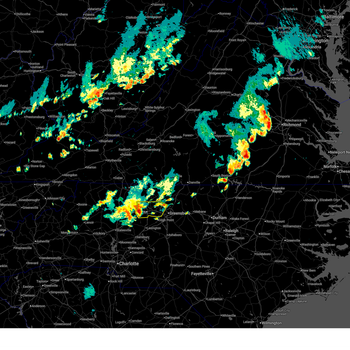
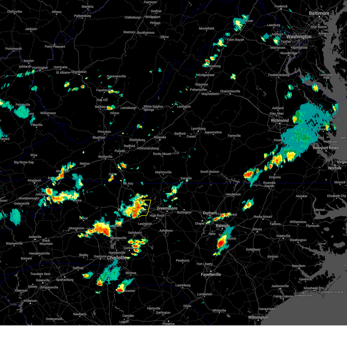
The Top Recent Hail Date for Lewisville, NC is Thursday, June 19, 2025 (4th out of 47)
Hail and Wind Damage Spotted near Lewisville, NC
| Date / Time | Report Details |
|---|---|
| 6/19/2025 5:08 PM EDT | At 508 pm edt, a severe thunderstorm was located near winston-salem, moving east at 35 mph (radar indicated). Hazards include 60 mph wind gusts. Expect damage to roofs, siding, and trees. Locations impacted include, greensboro, winston-salem, high point, kernersville, clemmons, bermuda run, lewisville, summerfield, stokesdale and walkertown. |
| 6/19/2025 4:52 PM EDT | A tree was blown down along jeannine d in forsyth county NC, 2.8 miles NW of Lewisville, NC |
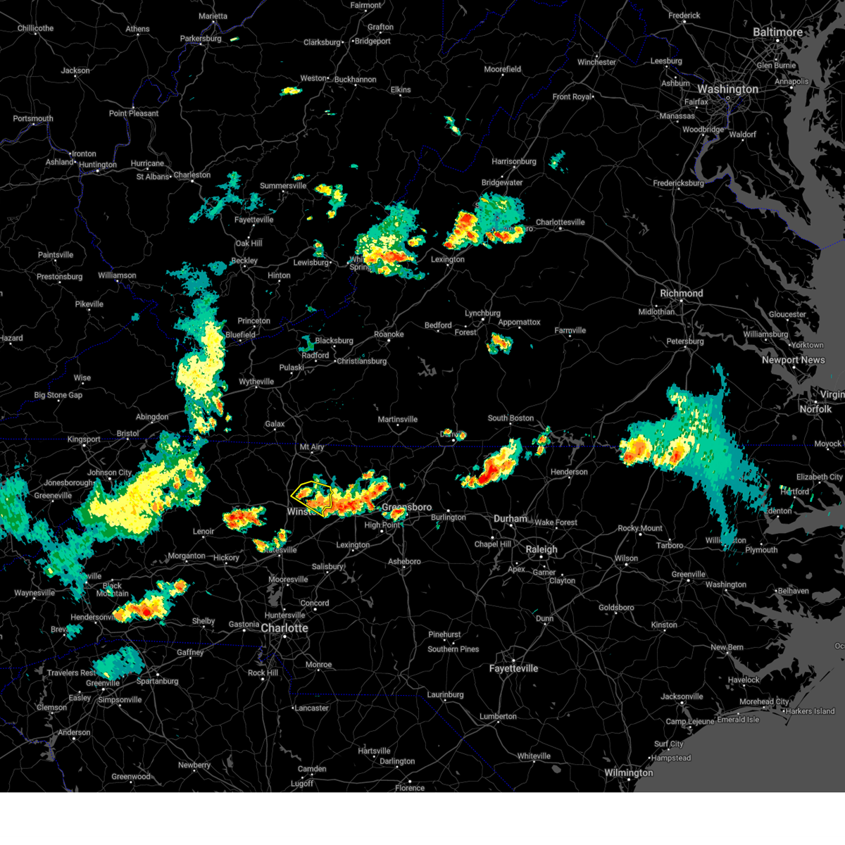
| 6/19/2025 4:50 PM EDT |
 Svrrah the national weather service in raleigh has issued a * severe thunderstorm warning for, forsyth county in central north carolina, northwestern guilford county in central north carolina, * until 530 pm edt. * at 450 pm edt, a severe thunderstorm was located near enon, or 8 miles west of winston-salem, moving east at 30 mph (radar indicated). Hazards include 60 mph wind gusts. expect damage to roofs, siding, and trees Svrrah the national weather service in raleigh has issued a * severe thunderstorm warning for, forsyth county in central north carolina, northwestern guilford county in central north carolina, * until 530 pm edt. * at 450 pm edt, a severe thunderstorm was located near enon, or 8 miles west of winston-salem, moving east at 30 mph (radar indicated). Hazards include 60 mph wind gusts. expect damage to roofs, siding, and trees
|
| 6/6/2025 8:40 PM EDT |
 At 839 pm edt, a severe thunderstorm was located near kernersville, or 10 miles north of high point, moving east at 30 mph. winston- salem reported winds to 45 mph earlier (radar indicated). Hazards include 60 mph wind gusts. Expect damage to roofs, siding, and trees. Locations impacted include, greensboro, winston-salem, high point, lexington, randleman, thomasville, kernersville, clemmons, bermuda run, and huntsville. At 839 pm edt, a severe thunderstorm was located near kernersville, or 10 miles north of high point, moving east at 30 mph. winston- salem reported winds to 45 mph earlier (radar indicated). Hazards include 60 mph wind gusts. Expect damage to roofs, siding, and trees. Locations impacted include, greensboro, winston-salem, high point, lexington, randleman, thomasville, kernersville, clemmons, bermuda run, and huntsville.
|
| 6/6/2025 8:38 PM EDT |
 The storm which prompted the warning has moved out of the area. therefore, the warning will be allowed to expire. however, heavy rain is still possible with this thunderstorm. The storm which prompted the warning has moved out of the area. therefore, the warning will be allowed to expire. however, heavy rain is still possible with this thunderstorm.
|
| 6/6/2025 8:20 PM EDT | Tree down on a house near green tree drive and franklin roa in forsyth county NC, 0.7 miles WNW of Lewisville, NC |
| 6/6/2025 8:15 PM EDT |
 Svrrah the national weather service in raleigh has issued a * severe thunderstorm warning for, forsyth county in central north carolina, northern davidson county in central north carolina, northwestern randolph county in central north carolina, guilford county in central north carolina, * until 930 pm edt. * at 814 pm edt, a severe thunderstorm was located over winston-salem, moving east at 50 mph (radar indicated). Hazards include 60 mph wind gusts and penny size hail. expect damage to roofs, siding, and trees Svrrah the national weather service in raleigh has issued a * severe thunderstorm warning for, forsyth county in central north carolina, northern davidson county in central north carolina, northwestern randolph county in central north carolina, guilford county in central north carolina, * until 930 pm edt. * at 814 pm edt, a severe thunderstorm was located over winston-salem, moving east at 50 mph (radar indicated). Hazards include 60 mph wind gusts and penny size hail. expect damage to roofs, siding, and trees
|
| 6/6/2025 8:14 PM EDT |
 At 814 pm edt, a severe thunderstorm was located over winston-salem, moving southeast at 25 mph (radar indicated). Hazards include 60 mph wind gusts and quarter size hail. Hail damage to vehicles is expected. expect wind damage to roofs, siding, and trees. Locations impacted include, yadkinville, boonville, east bend, nebo, shacktown, rockford, and enon. At 814 pm edt, a severe thunderstorm was located over winston-salem, moving southeast at 25 mph (radar indicated). Hazards include 60 mph wind gusts and quarter size hail. Hail damage to vehicles is expected. expect wind damage to roofs, siding, and trees. Locations impacted include, yadkinville, boonville, east bend, nebo, shacktown, rockford, and enon.
|
| 6/6/2025 7:45 PM EDT | Svrrnk the national weather service in blacksburg has issued a * severe thunderstorm warning for, southeastern surry county in northwestern north carolina, central yadkin county in northwestern north carolina, * until 845 pm edt. * at 744 pm edt, a severe thunderstorm was located over enon, or near east bend, moving southeast at 25 mph (radar indicated). Hazards include 60 mph wind gusts and quarter size hail. Hail damage to vehicles is expected. Expect wind damage to roofs, siding, and trees. |
| 5/29/2025 5:50 PM EDT |
 The storm which prompted the warning has weakened below severe limits, and no longer poses an immediate threat to life or property. therefore, the warning will be allowed to expire. however, gusty winds are still possible with this thunderstorm. The storm which prompted the warning has weakened below severe limits, and no longer poses an immediate threat to life or property. therefore, the warning will be allowed to expire. however, gusty winds are still possible with this thunderstorm.
|
| 5/29/2025 5:36 PM EDT |
 At 536 pm edt, a severe thunderstorm was located near germanton, or near walnut cove, moving east at 30 mph (radar indicated). Hazards include 60 mph wind gusts. Expect damage to roofs, siding, and trees. Locations impacted include, greensboro, winston-salem, kernersville, summerfield, stokesdale, walkertown, rural hall, pfafftown, belews creek, and stanleyville. At 536 pm edt, a severe thunderstorm was located near germanton, or near walnut cove, moving east at 30 mph (radar indicated). Hazards include 60 mph wind gusts. Expect damage to roofs, siding, and trees. Locations impacted include, greensboro, winston-salem, kernersville, summerfield, stokesdale, walkertown, rural hall, pfafftown, belews creek, and stanleyville.
|
| 5/29/2025 5:16 PM EDT |
 Svrrah the national weather service in raleigh has issued a * severe thunderstorm warning for, northern forsyth county in central north carolina, northwestern guilford county in central north carolina, * until 600 pm edt. * at 516 pm edt, a severe thunderstorm was located near king, or 9 miles east of east bend, moving east at 20 mph (radar indicated). Hazards include 60 mph wind gusts. expect damage to roofs, siding, and trees Svrrah the national weather service in raleigh has issued a * severe thunderstorm warning for, northern forsyth county in central north carolina, northwestern guilford county in central north carolina, * until 600 pm edt. * at 516 pm edt, a severe thunderstorm was located near king, or 9 miles east of east bend, moving east at 20 mph (radar indicated). Hazards include 60 mph wind gusts. expect damage to roofs, siding, and trees
|
| 5/21/2025 1:21 AM EDT |
 Svrrah the national weather service in raleigh has issued a * severe thunderstorm warning for, forsyth county in central north carolina, northwestern guilford county in central north carolina, * until 200 am edt. * at 121 am edt, a severe thunderstorm was located over winston-salem, moving northeast at 35 mph (radar indicated). Hazards include 60 mph wind gusts and quarter size hail, heavy rainfall. Hail damage to vehicles is expected. Expect wind damage to roofs, siding, and trees. Svrrah the national weather service in raleigh has issued a * severe thunderstorm warning for, forsyth county in central north carolina, northwestern guilford county in central north carolina, * until 200 am edt. * at 121 am edt, a severe thunderstorm was located over winston-salem, moving northeast at 35 mph (radar indicated). Hazards include 60 mph wind gusts and quarter size hail, heavy rainfall. Hail damage to vehicles is expected. Expect wind damage to roofs, siding, and trees.
|
| 3/5/2025 8:17 AM EST |
 Torrah the national weather service in raleigh has issued a * tornado warning for, forsyth county in central north carolina, * until 845 am est. * at 817 am est, a severe thunderstorm capable of producing a tornado was located over clemmons, or near winston-salem, moving northeast at 35 mph (radar indicated rotation). Hazards include tornado. Flying debris will be dangerous to those caught without shelter. mobile homes will be damaged or destroyed. damage to roofs, windows, and vehicles will occur. tree damage is likely. this dangerous storm will be near, winston-salem around 825 am est. kernersville around 830 am est. Other locations impacted by this tornadic thunderstorm include pfafftown, walkertown, sedge garden, lewisville, and belews creek. Torrah the national weather service in raleigh has issued a * tornado warning for, forsyth county in central north carolina, * until 845 am est. * at 817 am est, a severe thunderstorm capable of producing a tornado was located over clemmons, or near winston-salem, moving northeast at 35 mph (radar indicated rotation). Hazards include tornado. Flying debris will be dangerous to those caught without shelter. mobile homes will be damaged or destroyed. damage to roofs, windows, and vehicles will occur. tree damage is likely. this dangerous storm will be near, winston-salem around 825 am est. kernersville around 830 am est. Other locations impacted by this tornadic thunderstorm include pfafftown, walkertown, sedge garden, lewisville, and belews creek.
|
| 3/5/2025 7:56 AM EST |
 Svrrah the national weather service in raleigh has issued a * severe thunderstorm warning for, forsyth county in central north carolina, davidson county in central north carolina, * until 900 am est. * at 756 am est, severe thunderstorms were located along a line extending from near mocksville to near enochville, moving east at 35 mph (radar indicated). Hazards include 60 mph wind gusts. expect damage to roofs, siding, and trees Svrrah the national weather service in raleigh has issued a * severe thunderstorm warning for, forsyth county in central north carolina, davidson county in central north carolina, * until 900 am est. * at 756 am est, severe thunderstorms were located along a line extending from near mocksville to near enochville, moving east at 35 mph (radar indicated). Hazards include 60 mph wind gusts. expect damage to roofs, siding, and trees
|
| 2/16/2025 7:30 AM EST |
 Svrrah the national weather service in raleigh has issued a * severe thunderstorm warning for, western alamance county in central north carolina, forsyth county in central north carolina, northwestern moore county in central north carolina, davidson county in central north carolina, northwestern montgomery county in central north carolina, randolph county in central north carolina, northern stanly county in central north carolina, guilford county in central north carolina, * until 815 am est. * at 729 am est, severe thunderstorms were located along a line extending from winston-salem to near lexington to near high rock lake, moving northeast at 80 mph (radar indicated). Hazards include 60 mph wind gusts. expect damage to roofs, siding, and trees Svrrah the national weather service in raleigh has issued a * severe thunderstorm warning for, western alamance county in central north carolina, forsyth county in central north carolina, northwestern moore county in central north carolina, davidson county in central north carolina, northwestern montgomery county in central north carolina, randolph county in central north carolina, northern stanly county in central north carolina, guilford county in central north carolina, * until 815 am est. * at 729 am est, severe thunderstorms were located along a line extending from winston-salem to near lexington to near high rock lake, moving northeast at 80 mph (radar indicated). Hazards include 60 mph wind gusts. expect damage to roofs, siding, and trees
|
| 12/29/2024 10:21 AM EST |
 Svrrah the national weather service in raleigh has issued a * severe thunderstorm warning for, forsyth county in central north carolina, western moore county in central north carolina, scotland county in central north carolina, davidson county in central north carolina, eastern anson county in central north carolina, montgomery county in central north carolina, richmond county in central north carolina, randolph county in central north carolina, eastern stanly county in central north carolina, western guilford county in central north carolina, * until 1100 am est. * at 1021 am est, severe thunderstorms were located along a line extending from bermuda run to near high rock lake to 6 miles north of ansonville to 8 miles north of chesterfield, moving northeast at 40 mph (radar indicated). Hazards include 60 mph wind gusts. expect damage to roofs, siding, and trees Svrrah the national weather service in raleigh has issued a * severe thunderstorm warning for, forsyth county in central north carolina, western moore county in central north carolina, scotland county in central north carolina, davidson county in central north carolina, eastern anson county in central north carolina, montgomery county in central north carolina, richmond county in central north carolina, randolph county in central north carolina, eastern stanly county in central north carolina, western guilford county in central north carolina, * until 1100 am est. * at 1021 am est, severe thunderstorms were located along a line extending from bermuda run to near high rock lake to 6 miles north of ansonville to 8 miles north of chesterfield, moving northeast at 40 mph (radar indicated). Hazards include 60 mph wind gusts. expect damage to roofs, siding, and trees
|
| 8/18/2024 6:12 PM EDT |
 The storm which prompted the warning has weakened below severe limits, and no longer poses an immediate threat to life or property. therefore, the warning will be allowed to expire. a severe thunderstorm watch remains in effect until 1000 pm edt for central north carolina. The storm which prompted the warning has weakened below severe limits, and no longer poses an immediate threat to life or property. therefore, the warning will be allowed to expire. a severe thunderstorm watch remains in effect until 1000 pm edt for central north carolina.
|
| 8/18/2024 6:01 PM EDT |
 The storm which prompted the warning has moved out of the area. therefore, the warning has been allowed to expire. however, heavy rain is still possible with this thunderstorm. a severe thunderstorm watch remains in effect until 1000 pm edt for north central and northwestern north carolina. The storm which prompted the warning has moved out of the area. therefore, the warning has been allowed to expire. however, heavy rain is still possible with this thunderstorm. a severe thunderstorm watch remains in effect until 1000 pm edt for north central and northwestern north carolina.
|
| 8/18/2024 5:54 PM EDT | the severe thunderstorm warning has been cancelled and is no longer in effect |
| 8/18/2024 5:54 PM EDT |
 At 554 pm edt, a severe thunderstorm was located near enon, or 7 miles east of east bend, moving east at 15 mph (radar indicated). Hazards include 60 mph wind gusts and quarter size hail. Hail damage to vehicles is expected. expect wind damage to roofs, siding, and trees. Locations impacted include, east bend, enon, and shacktown. At 554 pm edt, a severe thunderstorm was located near enon, or 7 miles east of east bend, moving east at 15 mph (radar indicated). Hazards include 60 mph wind gusts and quarter size hail. Hail damage to vehicles is expected. expect wind damage to roofs, siding, and trees. Locations impacted include, east bend, enon, and shacktown.
|
| 8/18/2024 5:54 PM EDT |
 At 554 pm edt, a severe thunderstorm was located near enon, or 7 miles southeast of east bend, moving southeast at 15 mph (radar indicated). Hazards include 60 mph wind gusts and quarter size hail. Hail damage to vehicles is expected. expect wind damage to roofs, siding, and trees. Locations impacted include, winston-salem, clemmons, bermuda run, huntsville, lewisville, walkertown, rural hall, stanleyville, pfafftown, and donnaha. At 554 pm edt, a severe thunderstorm was located near enon, or 7 miles southeast of east bend, moving southeast at 15 mph (radar indicated). Hazards include 60 mph wind gusts and quarter size hail. Hail damage to vehicles is expected. expect wind damage to roofs, siding, and trees. Locations impacted include, winston-salem, clemmons, bermuda run, huntsville, lewisville, walkertown, rural hall, stanleyville, pfafftown, and donnaha.
|
| 8/18/2024 5:35 PM EDT |
 At 535 pm edt, a severe thunderstorm was located over enon, or over east bend, moving east at 25 mph (radar indicated). Hazards include 60 mph wind gusts and quarter size hail. Hail damage to vehicles is expected. expect wind damage to roofs, siding, and trees. Locations impacted include, yadkinville, east bend, nebo, shacktown, siloam, enon, and pilot mountain state park. At 535 pm edt, a severe thunderstorm was located over enon, or over east bend, moving east at 25 mph (radar indicated). Hazards include 60 mph wind gusts and quarter size hail. Hail damage to vehicles is expected. expect wind damage to roofs, siding, and trees. Locations impacted include, yadkinville, east bend, nebo, shacktown, siloam, enon, and pilot mountain state park.
|
| 8/18/2024 5:30 PM EDT |
 Svrrah the national weather service in raleigh has issued a * severe thunderstorm warning for, forsyth county in central north carolina, * until 615 pm edt. * at 529 pm edt, a severe thunderstorm was located over east bend, moving east at 20 mph (radar indicated). Hazards include 60 mph wind gusts and quarter size hail. Hail damage to vehicles is expected. Expect wind damage to roofs, siding, and trees. Svrrah the national weather service in raleigh has issued a * severe thunderstorm warning for, forsyth county in central north carolina, * until 615 pm edt. * at 529 pm edt, a severe thunderstorm was located over east bend, moving east at 20 mph (radar indicated). Hazards include 60 mph wind gusts and quarter size hail. Hail damage to vehicles is expected. Expect wind damage to roofs, siding, and trees.
|
| 8/18/2024 5:20 PM EDT |
 Svrrnk the national weather service in blacksburg has issued a * severe thunderstorm warning for, southeastern surry county in northwestern north carolina, eastern yadkin county in northwestern north carolina, * until 600 pm edt. * at 520 pm edt, a severe thunderstorm was located near nebo, or near east bend, moving east at 15 mph (radar indicated). Hazards include 60 mph wind gusts. expect damage to roofs, siding, and trees Svrrnk the national weather service in blacksburg has issued a * severe thunderstorm warning for, southeastern surry county in northwestern north carolina, eastern yadkin county in northwestern north carolina, * until 600 pm edt. * at 520 pm edt, a severe thunderstorm was located near nebo, or near east bend, moving east at 15 mph (radar indicated). Hazards include 60 mph wind gusts. expect damage to roofs, siding, and trees
|
| 8/2/2024 4:13 PM EDT |
 Svrrah the national weather service in raleigh has issued a * severe thunderstorm warning for, forsyth county in central north carolina, * until 500 pm edt. * at 411 pm edt, a severe thunderstorm was located 6 miles northwest of winston-salem, moving east at 40 mph (radar indicated). Hazards include 60 mph wind gusts. expect damage to roofs, siding, and trees Svrrah the national weather service in raleigh has issued a * severe thunderstorm warning for, forsyth county in central north carolina, * until 500 pm edt. * at 411 pm edt, a severe thunderstorm was located 6 miles northwest of winston-salem, moving east at 40 mph (radar indicated). Hazards include 60 mph wind gusts. expect damage to roofs, siding, and trees
|
| 5/7/2024 6:56 PM EDT |
 The storm which prompted the warning has weakened below severe limits, and has exited the warned area. therefore, the warning will be allowed to expire. however, small hail, gusty winds and heavy rain are still possible with this thunderstorm. The storm which prompted the warning has weakened below severe limits, and has exited the warned area. therefore, the warning will be allowed to expire. however, small hail, gusty winds and heavy rain are still possible with this thunderstorm.
|
| 5/7/2024 6:49 PM EDT |
 At 649 pm edt, a severe thunderstorm was located near pilot mountain state park, or near east bend, moving east at 35 mph (radar indicated). Hazards include 60 mph wind gusts and quarter size hail. Hail damage to vehicles is expected. expect wind damage to roofs, siding, and trees. Locations impacted include, east bend, nebo, siloam, enon, and pilot mountain state park. At 649 pm edt, a severe thunderstorm was located near pilot mountain state park, or near east bend, moving east at 35 mph (radar indicated). Hazards include 60 mph wind gusts and quarter size hail. Hail damage to vehicles is expected. expect wind damage to roofs, siding, and trees. Locations impacted include, east bend, nebo, siloam, enon, and pilot mountain state park.
|
| 5/7/2024 6:39 PM EDT |
 At 639 pm edt, a severe thunderstorm was located over siloam, or near fairview, moving east at 30 mph (radar indicated). Hazards include 60 mph wind gusts and half dollar size hail. Hail damage to vehicles is expected. expect wind damage to roofs, siding, and trees. Locations impacted include, fairview, boonville, east bend, nebo, pilot mountain state park, level cross, and rockford. At 639 pm edt, a severe thunderstorm was located over siloam, or near fairview, moving east at 30 mph (radar indicated). Hazards include 60 mph wind gusts and half dollar size hail. Hail damage to vehicles is expected. expect wind damage to roofs, siding, and trees. Locations impacted include, fairview, boonville, east bend, nebo, pilot mountain state park, level cross, and rockford.
|
| 5/7/2024 6:23 PM EDT |
 Svrrnk the national weather service in blacksburg has issued a * severe thunderstorm warning for, southern surry county in northwestern north carolina, yadkin county in northwestern north carolina, * until 700 pm edt. * at 622 pm edt, a severe thunderstorm was located over burch, or near boonville, moving east at 25 mph (radar indicated). Hazards include 60 mph wind gusts and quarter size hail. Hail damage to vehicles is expected. Expect wind damage to roofs, siding, and trees. Svrrnk the national weather service in blacksburg has issued a * severe thunderstorm warning for, southern surry county in northwestern north carolina, yadkin county in northwestern north carolina, * until 700 pm edt. * at 622 pm edt, a severe thunderstorm was located over burch, or near boonville, moving east at 25 mph (radar indicated). Hazards include 60 mph wind gusts and quarter size hail. Hail damage to vehicles is expected. Expect wind damage to roofs, siding, and trees.
|
| 4/11/2024 8:35 PM EDT |
 At 835 pm edt, severe thunderstorms were located along a line extending from near winston-salem to 9 miles southeast of clemmons to near lexington, moving northeast at 40 mph (radar indicated). Hazards include 60 mph wind gusts. Expect damage to roofs, siding, and trees. Locations impacted include, winston-salem, high point, lexington, thomasville, kernersville, clemmons, lewisville, stokesdale, walkertown, and rural hall. At 835 pm edt, severe thunderstorms were located along a line extending from near winston-salem to 9 miles southeast of clemmons to near lexington, moving northeast at 40 mph (radar indicated). Hazards include 60 mph wind gusts. Expect damage to roofs, siding, and trees. Locations impacted include, winston-salem, high point, lexington, thomasville, kernersville, clemmons, lewisville, stokesdale, walkertown, and rural hall.
|
| 4/11/2024 8:28 PM EDT | Trees reported down in lewisville... n in forsyth county NC, 0.9 miles N of Lewisville, NC |
| 4/11/2024 8:26 PM EDT |
 The storms which prompted the warning have moved out of the area. therefore, the warning will be allowed to expire. a tornado watch remains in effect until 1100 pm edt for north central and northwestern north carolina, and south central, southwestern and west central virginia. The storms which prompted the warning have moved out of the area. therefore, the warning will be allowed to expire. a tornado watch remains in effect until 1100 pm edt for north central and northwestern north carolina, and south central, southwestern and west central virginia.
|
| 4/11/2024 8:24 PM EDT |
 At 824 pm edt, severe thunderstorms were located along a line extending from near buffalo ridge to near collinstown to near germanton to near clemmons, moving northeast at 55 mph (radar indicated). Hazards include 60 mph wind gusts. Expect damage to roofs, siding, and trees. Locations impacted include, winston-salem, lexington, clemmons, bermuda run, lewisville, rural hall, arcadia, pfafftown, stanleyville, and donnaha. At 824 pm edt, severe thunderstorms were located along a line extending from near buffalo ridge to near collinstown to near germanton to near clemmons, moving northeast at 55 mph (radar indicated). Hazards include 60 mph wind gusts. Expect damage to roofs, siding, and trees. Locations impacted include, winston-salem, lexington, clemmons, bermuda run, lewisville, rural hall, arcadia, pfafftown, stanleyville, and donnaha.
|
| 4/11/2024 8:18 PM EDT |
 Svrrah the national weather service in raleigh has issued a * severe thunderstorm warning for, forsyth county in central north carolina, northern davidson county in central north carolina, western guilford county in central north carolina, * until 900 pm edt. * at 817 pm edt, severe thunderstorms were located along a line extending from near collinstown to near francisco to king to near winston-salem to near linwood, moving east at 30 mph (radar indicated). Hazards include 60 mph wind gusts. expect damage to roofs, siding, and trees Svrrah the national weather service in raleigh has issued a * severe thunderstorm warning for, forsyth county in central north carolina, northern davidson county in central north carolina, western guilford county in central north carolina, * until 900 pm edt. * at 817 pm edt, severe thunderstorms were located along a line extending from near collinstown to near francisco to king to near winston-salem to near linwood, moving east at 30 mph (radar indicated). Hazards include 60 mph wind gusts. expect damage to roofs, siding, and trees
|
| 4/11/2024 8:08 PM EDT |
 At 807 pm edt, severe thunderstorms were located along a line extending from laurel fork to westfield to near enon, moving northeast at 40 mph (radar indicated). Hazards include 60 mph wind gusts. Expect damage to roofs, siding, and trees. Locations impacted include, mount airy, flat rock, yadkinville, pilot mountain, east bend, francisco, and cana. At 807 pm edt, severe thunderstorms were located along a line extending from laurel fork to westfield to near enon, moving northeast at 40 mph (radar indicated). Hazards include 60 mph wind gusts. Expect damage to roofs, siding, and trees. Locations impacted include, mount airy, flat rock, yadkinville, pilot mountain, east bend, francisco, and cana.
|
| 4/11/2024 8:03 PM EDT |
 At 803 pm edt, severe thunderstorms were located along a line extending from ararat to pilot mountain to near huntsville to near mocksville, moving northeast at 50 mph (radar indicated). Hazards include 60 mph wind gusts. Expect damage to roofs, siding, and trees. Locations impacted include, winston-salem, lexington, clemmons, bermuda run, huntsville, lewisville, rural hall, arcadia, pfafftown, and stanleyville. At 803 pm edt, severe thunderstorms were located along a line extending from ararat to pilot mountain to near huntsville to near mocksville, moving northeast at 50 mph (radar indicated). Hazards include 60 mph wind gusts. Expect damage to roofs, siding, and trees. Locations impacted include, winston-salem, lexington, clemmons, bermuda run, huntsville, lewisville, rural hall, arcadia, pfafftown, and stanleyville.
|
| 4/11/2024 7:52 PM EDT |
 Svrrah the national weather service in raleigh has issued a * severe thunderstorm warning for, western forsyth county in central north carolina, northwestern davidson county in central north carolina, * until 830 pm edt. * at 752 pm edt, severe thunderstorms were located along a line extending from flat rock to near pilot mountain state park to near bermuda run to 7 miles west of mocksville, moving northeast at 55 mph (radar indicated). Hazards include 60 mph wind gusts. expect damage to roofs, siding, and trees Svrrah the national weather service in raleigh has issued a * severe thunderstorm warning for, western forsyth county in central north carolina, northwestern davidson county in central north carolina, * until 830 pm edt. * at 752 pm edt, severe thunderstorms were located along a line extending from flat rock to near pilot mountain state park to near bermuda run to 7 miles west of mocksville, moving northeast at 55 mph (radar indicated). Hazards include 60 mph wind gusts. expect damage to roofs, siding, and trees
|
| 4/11/2024 7:49 PM EDT |
 At 748 pm edt, severe thunderstorms were located along a line extending from near lambsburg to near level cross to near yadkinville, moving northeast at 40 mph (radar indicated). Hazards include 60 mph wind gusts. Expect damage to roofs, siding, and trees. Locations impacted include, mount airy, fairview, flat rock, yadkinville, dobson, pilot mountain, and boonville. At 748 pm edt, severe thunderstorms were located along a line extending from near lambsburg to near level cross to near yadkinville, moving northeast at 40 mph (radar indicated). Hazards include 60 mph wind gusts. Expect damage to roofs, siding, and trees. Locations impacted include, mount airy, fairview, flat rock, yadkinville, dobson, pilot mountain, and boonville.
|
| 4/11/2024 7:49 PM EDT |
 the severe thunderstorm warning has been cancelled and is no longer in effect the severe thunderstorm warning has been cancelled and is no longer in effect
|
| 4/11/2024 7:33 PM EDT |
 Svrrnk the national weather service in blacksburg has issued a * severe thunderstorm warning for, eastern alleghany county in northwestern north carolina, surry county in northwestern north carolina, western stokes county in north central north carolina, northeastern wilkes county in northwestern north carolina, yadkin county in northwestern north carolina, south central carroll county in southwestern virginia, southeastern grayson county in southwestern virginia, southwestern patrick county in southwestern virginia, * until 830 pm edt. * at 733 pm edt, severe thunderstorms were located along a line extending from low gap to near burch to near buck shoals, moving northeast at 40 mph (radar indicated). Hazards include 60 mph wind gusts. expect damage to roofs, siding, and trees Svrrnk the national weather service in blacksburg has issued a * severe thunderstorm warning for, eastern alleghany county in northwestern north carolina, surry county in northwestern north carolina, western stokes county in north central north carolina, northeastern wilkes county in northwestern north carolina, yadkin county in northwestern north carolina, south central carroll county in southwestern virginia, southeastern grayson county in southwestern virginia, southwestern patrick county in southwestern virginia, * until 830 pm edt. * at 733 pm edt, severe thunderstorms were located along a line extending from low gap to near burch to near buck shoals, moving northeast at 40 mph (radar indicated). Hazards include 60 mph wind gusts. expect damage to roofs, siding, and trees
|
| 2/28/2024 4:46 PM EST |
 At 446 pm est, severe thunderstorms were located along a line extending from near winston-salem to 6 miles east of clemmons to near bermuda run, moving east at 45 mph (radar indicated). Hazards include 60 mph wind gusts. Expect damage to roofs, siding, and trees. Locations impacted include, greensboro, winston-salem, high point, lexington, thomasville, kernersville, clemmons, bermuda run, lewisville, and summerfield. At 446 pm est, severe thunderstorms were located along a line extending from near winston-salem to 6 miles east of clemmons to near bermuda run, moving east at 45 mph (radar indicated). Hazards include 60 mph wind gusts. Expect damage to roofs, siding, and trees. Locations impacted include, greensboro, winston-salem, high point, lexington, thomasville, kernersville, clemmons, bermuda run, lewisville, and summerfield.
|
| 2/28/2024 4:38 PM EST |
 Svrrah the national weather service in raleigh has issued a * severe thunderstorm warning for, forsyth county in central north carolina, northern davidson county in central north carolina, western guilford county in central north carolina, * until 530 pm est. * at 438 pm est, severe thunderstorms were located along a line extending from near winston-salem to bermuda run to near mocksville, moving east at 45 mph (radar indicated). Hazards include 60 mph wind gusts. expect damage to roofs, siding, and trees Svrrah the national weather service in raleigh has issued a * severe thunderstorm warning for, forsyth county in central north carolina, northern davidson county in central north carolina, western guilford county in central north carolina, * until 530 pm est. * at 438 pm est, severe thunderstorms were located along a line extending from near winston-salem to bermuda run to near mocksville, moving east at 45 mph (radar indicated). Hazards include 60 mph wind gusts. expect damage to roofs, siding, and trees
|
| 2/28/2024 4:33 PM EST | Several trees down along concord church rd... williams rd... and styers ferry rd. time estimated based on rada in forsyth county NC, 2.8 miles NE of Lewisville, NC |
| 1/9/2024 1:49 PM EST |
 At 149 pm est, severe thunderstorms were located along a line extending from near danbury to near clemmons, moving northeast at 55 mph (radar indicated). Hazards include 60 mph wind gusts and penny size hail. Expect damage to roofs, siding, and trees. Locations impacted include, winston-salem, thomasville, kernersville, clemmons, bermuda run, lewisville, walkertown, rural hall, pfafftown, and belews creek. At 149 pm est, severe thunderstorms were located along a line extending from near danbury to near clemmons, moving northeast at 55 mph (radar indicated). Hazards include 60 mph wind gusts and penny size hail. Expect damage to roofs, siding, and trees. Locations impacted include, winston-salem, thomasville, kernersville, clemmons, bermuda run, lewisville, walkertown, rural hall, pfafftown, and belews creek.
|
| 1/9/2024 1:28 PM EST |
 At 128 pm est, severe thunderstorms were located along a line extending from near westfield to near king to near bermuda run, moving northeast at 55 mph (radar indicated). Hazards include 60 mph wind gusts and penny size hail. Expect damage to roofs, siding, and trees. Locations impacted include, winston-salem, thomasville, kernersville, clemmons, bermuda run, huntsville, lewisville, walkertown, rural hall, and pfafftown. At 128 pm est, severe thunderstorms were located along a line extending from near westfield to near king to near bermuda run, moving northeast at 55 mph (radar indicated). Hazards include 60 mph wind gusts and penny size hail. Expect damage to roofs, siding, and trees. Locations impacted include, winston-salem, thomasville, kernersville, clemmons, bermuda run, huntsville, lewisville, walkertown, rural hall, and pfafftown.
|
| 1/9/2024 1:22 PM EST |
 At 121 pm est, severe thunderstorms were located along a line extending from ararat to near enon to near mocksville, moving northeast at 50 mph (radar indicated). Hazards include 60 mph wind gusts and penny size hail. expect damage to roofs, siding, and trees At 121 pm est, severe thunderstorms were located along a line extending from ararat to near enon to near mocksville, moving northeast at 50 mph (radar indicated). Hazards include 60 mph wind gusts and penny size hail. expect damage to roofs, siding, and trees
|
| 9/9/2023 11:50 AM EDT |
 At 1149 am edt, a severe thunderstorm was located near walnut cove, moving northwest at 30 mph (radar indicated). Hazards include 60 mph wind gusts and quarter size hail. Hail damage to vehicles is expected. expect wind damage to roofs, siding, and trees. locations impacted include, winston-salem, lewisville, stokesdale, walkertown, rural hall, stanleyville, pfafftown, donnaha, belews creek and belews lake. hail threat, radar indicated max hail size, 1. 00 in wind threat, radar indicated max wind gust, 60 mph. At 1149 am edt, a severe thunderstorm was located near walnut cove, moving northwest at 30 mph (radar indicated). Hazards include 60 mph wind gusts and quarter size hail. Hail damage to vehicles is expected. expect wind damage to roofs, siding, and trees. locations impacted include, winston-salem, lewisville, stokesdale, walkertown, rural hall, stanleyville, pfafftown, donnaha, belews creek and belews lake. hail threat, radar indicated max hail size, 1. 00 in wind threat, radar indicated max wind gust, 60 mph.
|
| 9/9/2023 11:28 AM EDT |
 At 1127 am edt, a severe thunderstorm was located near kernersville, or 10 miles southeast of walnut cove, moving north at 25 mph (radar indicated). Hazards include 60 mph wind gusts and quarter size hail. Hail damage to vehicles is expected. Expect wind damage to roofs, siding, and trees. At 1127 am edt, a severe thunderstorm was located near kernersville, or 10 miles southeast of walnut cove, moving north at 25 mph (radar indicated). Hazards include 60 mph wind gusts and quarter size hail. Hail damage to vehicles is expected. Expect wind damage to roofs, siding, and trees.
|
| 8/26/2023 8:39 PM EDT |
 At 839 pm edt, a severe thunderstorm was located near bermuda run, or near mocksville, moving southeast at 25 mph (radar indicated). Hazards include 60 mph wind gusts. expect damage to roofs, siding, and trees At 839 pm edt, a severe thunderstorm was located near bermuda run, or near mocksville, moving southeast at 25 mph (radar indicated). Hazards include 60 mph wind gusts. expect damage to roofs, siding, and trees
|
| 8/24/2023 6:35 PM EDT |
 At 634 pm edt, severe thunderstorms were located along a line extending from near winston-salem to clemmons to near mocksville, moving southeast at 15 mph (radar indicated). Hazards include 60 mph wind gusts and penny size hail. expect damage to roofs, siding, and trees At 634 pm edt, severe thunderstorms were located along a line extending from near winston-salem to clemmons to near mocksville, moving southeast at 15 mph (radar indicated). Hazards include 60 mph wind gusts and penny size hail. expect damage to roofs, siding, and trees
|
| 8/24/2023 6:28 PM EDT | Tree down at lakeway dr near sonata d in forsyth county NC, 0.2 miles NNW of Lewisville, NC |
| 8/15/2023 2:43 PM EDT |
 At 242 pm edt, a severe thunderstorm was located 7 miles southeast of clemmons, or 10 miles north of lexington, moving east at 35 mph (radar indicated). Hazards include 60 mph wind gusts and half dollar size hail. Hail damage to vehicles is expected. expect wind damage to roofs, siding, and trees. locations impacted include, winston-salem, lexington, thomasville, kernersville, clemmons, bermuda run, lewisville, walkertown, pfafftown and belews creek. hail threat, radar indicated max hail size, 1. 25 in wind threat, radar indicated max wind gust, 60 mph. At 242 pm edt, a severe thunderstorm was located 7 miles southeast of clemmons, or 10 miles north of lexington, moving east at 35 mph (radar indicated). Hazards include 60 mph wind gusts and half dollar size hail. Hail damage to vehicles is expected. expect wind damage to roofs, siding, and trees. locations impacted include, winston-salem, lexington, thomasville, kernersville, clemmons, bermuda run, lewisville, walkertown, pfafftown and belews creek. hail threat, radar indicated max hail size, 1. 25 in wind threat, radar indicated max wind gust, 60 mph.
|
| 8/15/2023 2:39 PM EDT |
 At 236 pm edt, a severe thunderstorm was located over bermuda run, or 10 miles northeast of mocksville, moving northeast at 40 mph (radar indicated). Hazards include 60 mph wind gusts and half dollar size hail. Hail damage to vehicles is expected. expect wind damage to roofs, siding, and trees. locations impacted include, winston-salem, lexington, thomasville, kernersville, clemmons, bermuda run, lewisville, walkertown, rural hall and pfafftown. hail threat, radar indicated max hail size, 1. 25 in wind threat, radar indicated max wind gust, 60 mph. At 236 pm edt, a severe thunderstorm was located over bermuda run, or 10 miles northeast of mocksville, moving northeast at 40 mph (radar indicated). Hazards include 60 mph wind gusts and half dollar size hail. Hail damage to vehicles is expected. expect wind damage to roofs, siding, and trees. locations impacted include, winston-salem, lexington, thomasville, kernersville, clemmons, bermuda run, lewisville, walkertown, rural hall and pfafftown. hail threat, radar indicated max hail size, 1. 25 in wind threat, radar indicated max wind gust, 60 mph.
|
| 8/15/2023 2:30 PM EDT |
 At 229 pm edt, a severe thunderstorm was located near mocksville, moving east at 40 mph (radar indicated). Hazards include 60 mph wind gusts and nickel size hail. expect damage to roofs, siding, and trees At 229 pm edt, a severe thunderstorm was located near mocksville, moving east at 40 mph (radar indicated). Hazards include 60 mph wind gusts and nickel size hail. expect damage to roofs, siding, and trees
|
| 8/7/2023 5:27 PM EDT |
 At 526 pm edt, severe thunderstorms were located along a line extending from germanton to near downtown concord, moving east at 50 mph (radar indicated). Hazards include 60 mph wind gusts. expect damage to roofs, siding, and trees At 526 pm edt, severe thunderstorms were located along a line extending from germanton to near downtown concord, moving east at 50 mph (radar indicated). Hazards include 60 mph wind gusts. expect damage to roofs, siding, and trees
|
| 8/6/2023 4:19 PM EDT |
 At 418 pm edt, severe thunderstorms were located along a line extending from near clemmons to near midland, moving southeast at 30 mph (radar indicated). Hazards include 60 mph wind gusts. expect damage to roofs, siding, and trees At 418 pm edt, severe thunderstorms were located along a line extending from near clemmons to near midland, moving southeast at 30 mph (radar indicated). Hazards include 60 mph wind gusts. expect damage to roofs, siding, and trees
|
| 7/29/2023 7:52 PM EDT |
 The severe thunderstorm warning for southern forsyth and northern davidson counties will expire at 800 pm edt, the storms which prompted the warning have weakened below severe limits, and no longer pose an immediate threat to life or property. therefore, the warning will be allowed to expire. however gusty winds and heavy rain are still possible with these thunderstorms. The severe thunderstorm warning for southern forsyth and northern davidson counties will expire at 800 pm edt, the storms which prompted the warning have weakened below severe limits, and no longer pose an immediate threat to life or property. therefore, the warning will be allowed to expire. however gusty winds and heavy rain are still possible with these thunderstorms.
|
| 7/29/2023 7:47 PM EDT |
 At 747 pm edt, severe thunderstorms were located along a line extending from 6 miles southeast of clemmons to near cooleemee, moving south at 35 mph (radar indicated). Hazards include 60 mph wind gusts and quarter size hail. Hail damage to vehicles is expected. expect wind damage to roofs, siding, and trees. locations impacted include, winston-salem, clemmons, bermuda run, welcome and arcadia. hail threat, radar indicated max hail size, 1. 00 in wind threat, radar indicated max wind gust, 60 mph. At 747 pm edt, severe thunderstorms were located along a line extending from 6 miles southeast of clemmons to near cooleemee, moving south at 35 mph (radar indicated). Hazards include 60 mph wind gusts and quarter size hail. Hail damage to vehicles is expected. expect wind damage to roofs, siding, and trees. locations impacted include, winston-salem, clemmons, bermuda run, welcome and arcadia. hail threat, radar indicated max hail size, 1. 00 in wind threat, radar indicated max wind gust, 60 mph.
|
| 7/29/2023 7:36 PM EDT |
 The severe thunderstorm warning for southern surry, east central wilkes and yadkin counties will expire at 745 pm edt, the storms which prompted the warning have moved out of the area. therefore, the warning will be allowed to expire. a severe thunderstorm watch remains in effect until 1000 pm edt for north central and northwestern north carolina, and southwestern virginia. The severe thunderstorm warning for southern surry, east central wilkes and yadkin counties will expire at 745 pm edt, the storms which prompted the warning have moved out of the area. therefore, the warning will be allowed to expire. a severe thunderstorm watch remains in effect until 1000 pm edt for north central and northwestern north carolina, and southwestern virginia.
|
| 7/29/2023 7:27 PM EDT |
 At 727 pm edt, severe thunderstorms were located along a line extending from winston-salem to near huntsville, moving southeast at 25 mph (radar indicated). Hazards include 60 mph wind gusts and quarter size hail. Hail damage to vehicles is expected. expect wind damage to roofs, siding, and trees. locations impacted include, winston-salem, kernersville, clemmons, bermuda run, huntsville, lewisville, arcadia, welcome and sedge garden. hail threat, radar indicated max hail size, 1. 00 in wind threat, radar indicated max wind gust, 60 mph. At 727 pm edt, severe thunderstorms were located along a line extending from winston-salem to near huntsville, moving southeast at 25 mph (radar indicated). Hazards include 60 mph wind gusts and quarter size hail. Hail damage to vehicles is expected. expect wind damage to roofs, siding, and trees. locations impacted include, winston-salem, kernersville, clemmons, bermuda run, huntsville, lewisville, arcadia, welcome and sedge garden. hail threat, radar indicated max hail size, 1. 00 in wind threat, radar indicated max wind gust, 60 mph.
|
| 7/29/2023 7:18 PM EDT | Tree down on yadkinville roa in forsyth county NC, 2.2 miles SSW of Lewisville, NC |
| 7/29/2023 7:17 PM EDT |
 At 717 pm edt, severe thunderstorms were located along a line extending from near east bend to buck shoals, moving southeast at 30 mph (radar indicated). Hazards include 60 mph wind gusts. Expect damage to roofs, siding, and trees. locations impacted include, elkin, yadkinville, jonesville, boonville, east bend, ronda, and nebo. hail threat, radar indicated max hail size, <. 75 in wind threat, radar indicated max wind gust, 60 mph. At 717 pm edt, severe thunderstorms were located along a line extending from near east bend to buck shoals, moving southeast at 30 mph (radar indicated). Hazards include 60 mph wind gusts. Expect damage to roofs, siding, and trees. locations impacted include, elkin, yadkinville, jonesville, boonville, east bend, ronda, and nebo. hail threat, radar indicated max hail size, <. 75 in wind threat, radar indicated max wind gust, 60 mph.
|
| 7/29/2023 7:12 PM EDT |
 At 712 pm edt, severe thunderstorms were located along a line extending from 6 miles south of germanton to near enon, moving southeast at 25 mph (radar indicated). Hazards include 60 mph wind gusts and quarter size hail. Hail damage to vehicles is expected. Expect wind damage to roofs, siding, and trees. At 712 pm edt, severe thunderstorms were located along a line extending from 6 miles south of germanton to near enon, moving southeast at 25 mph (radar indicated). Hazards include 60 mph wind gusts and quarter size hail. Hail damage to vehicles is expected. Expect wind damage to roofs, siding, and trees.
|
| 7/29/2023 7:00 PM EDT | Tree reported down on grindstone driv in forsyth county NC, 1.9 miles NNE of Lewisville, NC |
| 7/29/2023 7:00 PM EDT |
 At 659 pm edt, severe thunderstorms were located along a line extending from king to near east bend, moving southeast at 25 mph (radar indicated). Hazards include 60 mph wind gusts and quarter size hail. Hail damage to vehicles is expected. expect wind damage to roofs, siding, and trees. locations impacted include, winston-salem, kernersville, huntsville, lewisville, stokesdale, walkertown, rural hall, stanleyville, pfafftown and donnaha. hail threat, radar indicated max hail size, 1. 00 in wind threat, radar indicated max wind gust, 60 mph. At 659 pm edt, severe thunderstorms were located along a line extending from king to near east bend, moving southeast at 25 mph (radar indicated). Hazards include 60 mph wind gusts and quarter size hail. Hail damage to vehicles is expected. expect wind damage to roofs, siding, and trees. locations impacted include, winston-salem, kernersville, huntsville, lewisville, stokesdale, walkertown, rural hall, stanleyville, pfafftown and donnaha. hail threat, radar indicated max hail size, 1. 00 in wind threat, radar indicated max wind gust, 60 mph.
|
| 7/29/2023 6:49 PM EDT |
 At 649 pm edt, severe thunderstorms were located along a line extending from near king to near nebo, moving southeast at 15 mph (radar indicated). Hazards include 60 mph wind gusts and quarter size hail. Hail damage to vehicles is expected. expect wind damage to roofs, siding, and trees. locations impacted include, winston-salem, kernersville, huntsville, lewisville, stokesdale, walkertown, rural hall, stanleyville, pfafftown and donnaha. hail threat, radar indicated max hail size, 1. 00 in wind threat, radar indicated max wind gust, 60 mph. At 649 pm edt, severe thunderstorms were located along a line extending from near king to near nebo, moving southeast at 15 mph (radar indicated). Hazards include 60 mph wind gusts and quarter size hail. Hail damage to vehicles is expected. expect wind damage to roofs, siding, and trees. locations impacted include, winston-salem, kernersville, huntsville, lewisville, stokesdale, walkertown, rural hall, stanleyville, pfafftown and donnaha. hail threat, radar indicated max hail size, 1. 00 in wind threat, radar indicated max wind gust, 60 mph.
|
| 7/29/2023 6:39 PM EDT |
 At 639 pm edt, severe thunderstorms were located along a line extending from near king to burch, moving southeast at 15 mph (radar indicated). Hazards include 60 mph wind gusts and quarter size hail. Hail damage to vehicles is expected. expect wind damage to roofs, siding, and trees. locations impacted include, winston-salem, kernersville, huntsville, lewisville, stokesdale, walkertown, rural hall, stanleyville, pfafftown and donnaha. hail threat, radar indicated max hail size, 1. 00 in wind threat, radar indicated max wind gust, 60 mph. At 639 pm edt, severe thunderstorms were located along a line extending from near king to burch, moving southeast at 15 mph (radar indicated). Hazards include 60 mph wind gusts and quarter size hail. Hail damage to vehicles is expected. expect wind damage to roofs, siding, and trees. locations impacted include, winston-salem, kernersville, huntsville, lewisville, stokesdale, walkertown, rural hall, stanleyville, pfafftown and donnaha. hail threat, radar indicated max hail size, 1. 00 in wind threat, radar indicated max wind gust, 60 mph.
|
| 7/29/2023 6:37 PM EDT |
 At 637 pm edt, severe thunderstorms were located along a line extending from fairview to mulberry, moving southeast at 30 mph (radar indicated). Hazards include 60 mph wind gusts. expect damage to roofs, siding, and trees At 637 pm edt, severe thunderstorms were located along a line extending from fairview to mulberry, moving southeast at 30 mph (radar indicated). Hazards include 60 mph wind gusts. expect damage to roofs, siding, and trees
|
| 7/29/2023 6:30 PM EDT |
 At 630 pm edt, severe thunderstorms were located along a line extending from capella to burch, moving southeast at 15 mph (radar indicated). Hazards include 60 mph wind gusts and quarter size hail. Hail damage to vehicles is expected. Expect wind damage to roofs, siding, and trees. At 630 pm edt, severe thunderstorms were located along a line extending from capella to burch, moving southeast at 15 mph (radar indicated). Hazards include 60 mph wind gusts and quarter size hail. Hail damage to vehicles is expected. Expect wind damage to roofs, siding, and trees.
|
| 7/9/2023 10:46 AM EDT |
 At 1045 am edt, a severe thunderstorm was located near walnut cove, moving east at 30 mph (radar indicated). Hazards include 60 mph wind gusts and quarter size hail and heavy rainfall. Hail damage to vehicles is expected. expect wind damage to roofs, siding, and trees. locations impacted include, winston-salem, walkertown, rural hall, stanleyville, belews creek and belews lake. hail threat, radar indicated max hail size, 1. 00 in wind threat, radar indicated max wind gust, 60 mph. At 1045 am edt, a severe thunderstorm was located near walnut cove, moving east at 30 mph (radar indicated). Hazards include 60 mph wind gusts and quarter size hail and heavy rainfall. Hail damage to vehicles is expected. expect wind damage to roofs, siding, and trees. locations impacted include, winston-salem, walkertown, rural hall, stanleyville, belews creek and belews lake. hail threat, radar indicated max hail size, 1. 00 in wind threat, radar indicated max wind gust, 60 mph.
|
| 7/9/2023 10:11 AM EDT |
 At 1011 am edt, a severe thunderstorm was located over east bend, moving east at 40 mph (radar indicated). Hazards include 60 mph wind gusts and quarter size hail. Hail damage to vehicles is expected. Expect wind damage to roofs, siding, and trees. At 1011 am edt, a severe thunderstorm was located over east bend, moving east at 40 mph (radar indicated). Hazards include 60 mph wind gusts and quarter size hail. Hail damage to vehicles is expected. Expect wind damage to roofs, siding, and trees.
|
| 6/26/2023 7:56 PM EDT |
 At 755 pm edt, a severe thunderstorm was located over clemmons, or 9 miles southwest of winston-salem, moving east at 25 mph (radar indicated). Hazards include ping pong ball size hail and 60 mph wind gusts. People and animals outdoors will be injured. expect hail damage to roofs, siding, windows, and vehicles. expect wind damage to roofs, siding, and trees. locations impacted include, winston-salem, clemmons, bermuda run, huntsville, lewisville, arcadia, welcome and sedge garden. hail threat, observed max hail size, 1. 50 in wind threat, radar indicated max wind gust, 60 mph. At 755 pm edt, a severe thunderstorm was located over clemmons, or 9 miles southwest of winston-salem, moving east at 25 mph (radar indicated). Hazards include ping pong ball size hail and 60 mph wind gusts. People and animals outdoors will be injured. expect hail damage to roofs, siding, windows, and vehicles. expect wind damage to roofs, siding, and trees. locations impacted include, winston-salem, clemmons, bermuda run, huntsville, lewisville, arcadia, welcome and sedge garden. hail threat, observed max hail size, 1. 50 in wind threat, radar indicated max wind gust, 60 mph.
|
| 6/26/2023 7:52 PM EDT |
 At 752 pm edt, a severe thunderstorm was located over yadkinville, moving east at 20 mph (radar indicated). Hazards include 60 mph wind gusts and quarter size hail. Hail damage to vehicles is expected. expect wind damage to roofs, siding, and trees. locations impacted include, yadkinville, east bend, courtney, huntsville, brooks crossroads, shacktown, and enon. hail threat, radar indicated max hail size, 1. 00 in wind threat, radar indicated max wind gust, 60 mph. At 752 pm edt, a severe thunderstorm was located over yadkinville, moving east at 20 mph (radar indicated). Hazards include 60 mph wind gusts and quarter size hail. Hail damage to vehicles is expected. expect wind damage to roofs, siding, and trees. locations impacted include, yadkinville, east bend, courtney, huntsville, brooks crossroads, shacktown, and enon. hail threat, radar indicated max hail size, 1. 00 in wind threat, radar indicated max wind gust, 60 mph.
|
| 6/26/2023 7:42 PM EDT |
 At 741 pm edt, a severe thunderstorm was located near huntsville, or 9 miles north of mocksville, moving southeast at 25 mph (radar indicated). Hazards include ping pong ball size hail and 60 mph wind gusts. People and animals outdoors will be injured. expect hail damage to roofs, siding, windows, and vehicles. expect wind damage to roofs, siding, and trees. locations impacted include, winston-salem, clemmons, bermuda run, huntsville, lewisville, arcadia, welcome and sedge garden. hail threat, observed max hail size, 1. 50 in wind threat, radar indicated max wind gust, 60 mph. At 741 pm edt, a severe thunderstorm was located near huntsville, or 9 miles north of mocksville, moving southeast at 25 mph (radar indicated). Hazards include ping pong ball size hail and 60 mph wind gusts. People and animals outdoors will be injured. expect hail damage to roofs, siding, windows, and vehicles. expect wind damage to roofs, siding, and trees. locations impacted include, winston-salem, clemmons, bermuda run, huntsville, lewisville, arcadia, welcome and sedge garden. hail threat, observed max hail size, 1. 50 in wind threat, radar indicated max wind gust, 60 mph.
|
| 6/26/2023 7:27 PM EDT |
 At 727 pm edt, a severe thunderstorm was located over shacktown, or over yadkinville, moving east at 20 mph (radar indicated). Hazards include 60 mph wind gusts and half dollar size hail. Hail damage to vehicles is expected. Expect wind damage to roofs, siding, and trees. At 727 pm edt, a severe thunderstorm was located over shacktown, or over yadkinville, moving east at 20 mph (radar indicated). Hazards include 60 mph wind gusts and half dollar size hail. Hail damage to vehicles is expected. Expect wind damage to roofs, siding, and trees.
|
| 6/26/2023 7:20 PM EDT |
 At 719 pm edt, a severe thunderstorm was located over yadkinville, moving east at 30 mph (radar indicated). Hazards include ping pong ball size hail and 60 mph wind gusts. People and animals outdoors will be injured. expect hail damage to roofs, siding, windows, and vehicles. Expect wind damage to roofs, siding, and trees. At 719 pm edt, a severe thunderstorm was located over yadkinville, moving east at 30 mph (radar indicated). Hazards include ping pong ball size hail and 60 mph wind gusts. People and animals outdoors will be injured. expect hail damage to roofs, siding, windows, and vehicles. Expect wind damage to roofs, siding, and trees.
|
| 6/26/2023 7:13 PM EDT |
 At 713 pm edt, a severe thunderstorm was located near yadkinville, moving east at 25 mph (radar indicated). Hazards include ping pong ball size hail and 60 mph wind gusts. People and animals outdoors will be injured. expect hail damage to roofs, siding, windows, and vehicles. expect wind damage to roofs, siding, and trees. locations impacted include, yadkinville, jonesville, boonville, east bend, nebo, buck shoals, and huntsville. hail threat, radar indicated max hail size, 1. 50 in wind threat, radar indicated max wind gust, 60 mph. At 713 pm edt, a severe thunderstorm was located near yadkinville, moving east at 25 mph (radar indicated). Hazards include ping pong ball size hail and 60 mph wind gusts. People and animals outdoors will be injured. expect hail damage to roofs, siding, windows, and vehicles. expect wind damage to roofs, siding, and trees. locations impacted include, yadkinville, jonesville, boonville, east bend, nebo, buck shoals, and huntsville. hail threat, radar indicated max hail size, 1. 50 in wind threat, radar indicated max wind gust, 60 mph.
|
| 6/26/2023 6:58 PM EDT |
 At 658 pm edt, a severe thunderstorm was located over buck shoals, or near jonesville, moving east at 20 mph (radar indicated). Hazards include 60 mph wind gusts and quarter size hail. Hail damage to vehicles is expected. expect wind damage to roofs, siding, and trees. locations impacted include, yadkinville, jonesville, boonville, east bend, ronda, windy gap, and nebo. hail threat, radar indicated max hail size, 1. 00 in wind threat, radar indicated max wind gust, 60 mph. At 658 pm edt, a severe thunderstorm was located over buck shoals, or near jonesville, moving east at 20 mph (radar indicated). Hazards include 60 mph wind gusts and quarter size hail. Hail damage to vehicles is expected. expect wind damage to roofs, siding, and trees. locations impacted include, yadkinville, jonesville, boonville, east bend, ronda, windy gap, and nebo. hail threat, radar indicated max hail size, 1. 00 in wind threat, radar indicated max wind gust, 60 mph.
|
| 6/26/2023 6:33 PM EDT |
 At 633 pm edt, a severe thunderstorm was located over windy gap, or near ronda, moving east at 35 mph (radar indicated). Hazards include 60 mph wind gusts and quarter size hail. Hail damage to vehicles is expected. Expect wind damage to roofs, siding, and trees. At 633 pm edt, a severe thunderstorm was located over windy gap, or near ronda, moving east at 35 mph (radar indicated). Hazards include 60 mph wind gusts and quarter size hail. Hail damage to vehicles is expected. Expect wind damage to roofs, siding, and trees.
|
| 5/16/2023 8:58 PM EDT |
 The severe thunderstorm warning for forsyth and northeastern davidson counties will expire at 900 pm edt, the storm which prompted the warning has moved out of the area. therefore, the warning will be allowed to expire. a severe thunderstorm watch remains in effect until 1000 pm edt for central north carolina. The severe thunderstorm warning for forsyth and northeastern davidson counties will expire at 900 pm edt, the storm which prompted the warning has moved out of the area. therefore, the warning will be allowed to expire. a severe thunderstorm watch remains in effect until 1000 pm edt for central north carolina.
|
| 5/16/2023 8:46 PM EDT |
 At 846 pm edt, a severe thunderstorm was located near kernersville, or 7 miles east of winston-salem, moving east at 45 mph (radar indicated). Hazards include 60 mph wind gusts. Expect damage to roofs, siding, and trees. locations impacted include, winston-salem, thomasville, kernersville, clemmons, bermuda run, huntsville, lewisville, walkertown, rural hall and pfafftown. hail threat, radar indicated max hail size, <. 75 in wind threat, radar indicated max wind gust, 60 mph. At 846 pm edt, a severe thunderstorm was located near kernersville, or 7 miles east of winston-salem, moving east at 45 mph (radar indicated). Hazards include 60 mph wind gusts. Expect damage to roofs, siding, and trees. locations impacted include, winston-salem, thomasville, kernersville, clemmons, bermuda run, huntsville, lewisville, walkertown, rural hall and pfafftown. hail threat, radar indicated max hail size, <. 75 in wind threat, radar indicated max wind gust, 60 mph.
|
| 5/16/2023 8:38 PM EDT |
 At 837 pm edt, a severe thunderstorm was located over winston-salem, moving east at 50 mph (radar indicated). Hazards include 70 mph wind gusts. Expect considerable tree damage. damage is likely to mobile homes, roofs, and outbuildings. locations impacted include, winston-salem, thomasville, kernersville, clemmons, bermuda run, huntsville, lewisville, walkertown, rural hall and pfafftown. thunderstorm damage threat, considerable hail threat, radar indicated max hail size, <. 75 in wind threat, radar indicated max wind gust, 70 mph. At 837 pm edt, a severe thunderstorm was located over winston-salem, moving east at 50 mph (radar indicated). Hazards include 70 mph wind gusts. Expect considerable tree damage. damage is likely to mobile homes, roofs, and outbuildings. locations impacted include, winston-salem, thomasville, kernersville, clemmons, bermuda run, huntsville, lewisville, walkertown, rural hall and pfafftown. thunderstorm damage threat, considerable hail threat, radar indicated max hail size, <. 75 in wind threat, radar indicated max wind gust, 70 mph.
|
| 5/16/2023 8:23 PM EDT |
 At 822 pm edt, a severe thunderstorm was located over enon, or near east bend, moving east at 50 mph (radar indicated). Hazards include 60 mph wind gusts. expect damage to roofs, siding, and trees At 822 pm edt, a severe thunderstorm was located over enon, or near east bend, moving east at 50 mph (radar indicated). Hazards include 60 mph wind gusts. expect damage to roofs, siding, and trees
|
| 4/28/2023 5:58 PM EDT |
 At 557 pm edt, a severe thunderstorm was located near winston-salem, moving southeast at 40 mph (radar indicated). Hazards include 60 mph wind gusts and half dollar size hail. Hail damage to vehicles is expected. expect wind damage to roofs, siding, and trees. locations impacted include, winston-salem, kernersville, clemmons, bermuda run, huntsville, lewisville, walkertown, rural hall, pfafftown and belews creek. hail threat, observed max hail size, 1. 25 in wind threat, observed max wind gust, 60 mph. At 557 pm edt, a severe thunderstorm was located near winston-salem, moving southeast at 40 mph (radar indicated). Hazards include 60 mph wind gusts and half dollar size hail. Hail damage to vehicles is expected. expect wind damage to roofs, siding, and trees. locations impacted include, winston-salem, kernersville, clemmons, bermuda run, huntsville, lewisville, walkertown, rural hall, pfafftown and belews creek. hail threat, observed max hail size, 1. 25 in wind threat, observed max wind gust, 60 mph.
|
| 4/28/2023 5:36 PM EDT |
 At 536 pm edt, a severe thunderstorm was located near enon, or near east bend, moving southeast at 40 mph (radar indicated). Hazards include 60 mph wind gusts and half dollar size hail. Hail damage to vehicles is expected. expect wind damage to roofs, siding, and trees. locations impacted include, winston-salem, kernersville, clemmons, bermuda run, huntsville, lewisville, walkertown, rural hall, pfafftown and belews creek. hail threat, observed max hail size, 1. 25 in wind threat, observed max wind gust, 60 mph. At 536 pm edt, a severe thunderstorm was located near enon, or near east bend, moving southeast at 40 mph (radar indicated). Hazards include 60 mph wind gusts and half dollar size hail. Hail damage to vehicles is expected. expect wind damage to roofs, siding, and trees. locations impacted include, winston-salem, kernersville, clemmons, bermuda run, huntsville, lewisville, walkertown, rural hall, pfafftown and belews creek. hail threat, observed max hail size, 1. 25 in wind threat, observed max wind gust, 60 mph.
|
| 4/28/2023 5:21 PM EDT |
 At 519 pm edt, a severe thunderstorm was located over east bend, moving east at 30 mph (the public reported multiple trees down and quarter size hail in elkin, north carolina). Hazards include 60 mph wind gusts and half dollar size hail. Hail damage to vehicles is expected. expect wind damage to roofs, siding, and trees. locations impacted include, walnut cove, east bend, king, huntsville, pine hall, enon, and pinnacle. hail threat, observed max hail size, 1. 25 in wind threat, observed max wind gust, 60 mph. At 519 pm edt, a severe thunderstorm was located over east bend, moving east at 30 mph (the public reported multiple trees down and quarter size hail in elkin, north carolina). Hazards include 60 mph wind gusts and half dollar size hail. Hail damage to vehicles is expected. expect wind damage to roofs, siding, and trees. locations impacted include, walnut cove, east bend, king, huntsville, pine hall, enon, and pinnacle. hail threat, observed max hail size, 1. 25 in wind threat, observed max wind gust, 60 mph.
|
| 4/28/2023 5:11 PM EDT |
 At 511 pm edt, a severe thunderstorm was located over siloam, or near east bend, moving east at 45 mph (radar indicated). Hazards include 60 mph wind gusts and half dollar size hail. Hail damage to vehicles is expected. Expect wind damage to roofs, siding, and trees. At 511 pm edt, a severe thunderstorm was located over siloam, or near east bend, moving east at 45 mph (radar indicated). Hazards include 60 mph wind gusts and half dollar size hail. Hail damage to vehicles is expected. Expect wind damage to roofs, siding, and trees.
|
| 4/28/2023 5:09 PM EDT |
 At 508 pm edt, a severe thunderstorm was located over nebo, or near boonville, moving east at 35 mph (radar indicated). Hazards include 60 mph wind gusts and half dollar size hail. Hail damage to vehicles is expected. Expect wind damage to roofs, siding, and trees. At 508 pm edt, a severe thunderstorm was located over nebo, or near boonville, moving east at 35 mph (radar indicated). Hazards include 60 mph wind gusts and half dollar size hail. Hail damage to vehicles is expected. Expect wind damage to roofs, siding, and trees.
|
| 3/3/2023 8:10 PM EST |
 At 809 pm est, a severe thunderstorm was located near winston-salem, moving northeast at 65 mph (radar indicated). Hazards include 60 mph wind gusts and nickel size hail. Expect damage to roofs, siding, and trees. locations impacted include, greensboro, winston-salem, kernersville, clemmons, lewisville, summerfield, stokesdale, walkertown, rural hall and haw river state park. hail threat, radar indicated max hail size, 0. 88 in wind threat, radar indicated max wind gust, 60 mph. At 809 pm est, a severe thunderstorm was located near winston-salem, moving northeast at 65 mph (radar indicated). Hazards include 60 mph wind gusts and nickel size hail. Expect damage to roofs, siding, and trees. locations impacted include, greensboro, winston-salem, kernersville, clemmons, lewisville, summerfield, stokesdale, walkertown, rural hall and haw river state park. hail threat, radar indicated max hail size, 0. 88 in wind threat, radar indicated max wind gust, 60 mph.
|
| 3/3/2023 7:54 PM EST |
 At 753 pm est, a severe thunderstorm was located near bermuda run, or 11 miles northeast of mocksville, moving east at 70 mph (radar indicated). Hazards include 60 mph wind gusts and nickel size hail. expect damage to roofs, siding, and trees At 753 pm est, a severe thunderstorm was located near bermuda run, or 11 miles northeast of mocksville, moving east at 70 mph (radar indicated). Hazards include 60 mph wind gusts and nickel size hail. expect damage to roofs, siding, and trees
|
| 1/12/2023 6:49 PM EST |
 At 648 pm est, severe thunderstorms were located along a line extending from enon to 8 miles east of mocksville to china grove, moving northeast at 70 mph (radar indicated). Hazards include 60 mph wind gusts. expect damage to roofs, siding, and trees At 648 pm est, severe thunderstorms were located along a line extending from enon to 8 miles east of mocksville to china grove, moving northeast at 70 mph (radar indicated). Hazards include 60 mph wind gusts. expect damage to roofs, siding, and trees
|
| 7/6/2022 6:04 PM EDT |
 At 604 pm edt, severe thunderstorms were located along a line extending from mountain park to near roaring river to near buck, moving southeast at 30 mph (radar indicated). Hazards include 60 mph wind gusts. Expect damage to roofs, siding, and trees. locations impacted include, north wilkesboro, elkin, wilkesboro, fairview, yadkinville, jonesville, and boonville. hail threat, radar indicated max hail size, <. 75 in wind threat, radar indicated max wind gust, 60 mph. At 604 pm edt, severe thunderstorms were located along a line extending from mountain park to near roaring river to near buck, moving southeast at 30 mph (radar indicated). Hazards include 60 mph wind gusts. Expect damage to roofs, siding, and trees. locations impacted include, north wilkesboro, elkin, wilkesboro, fairview, yadkinville, jonesville, and boonville. hail threat, radar indicated max hail size, <. 75 in wind threat, radar indicated max wind gust, 60 mph.
|
| 7/6/2022 5:46 PM EDT |
 At 545 pm edt, severe thunderstorms were located along a line extending from near roaring gap to hays to near millers creek, moving southeast at 40 mph (radar indicated). Hazards include 60 mph wind gusts. expect damage to roofs, siding, and trees At 545 pm edt, severe thunderstorms were located along a line extending from near roaring gap to hays to near millers creek, moving southeast at 40 mph (radar indicated). Hazards include 60 mph wind gusts. expect damage to roofs, siding, and trees
|
| 7/5/2022 6:22 PM EDT |
 At 621 pm edt, severe thunderstorms were located along a line extending from near walnut cove to kernersville and sedge garden to near bermuda run, moving southeast at 35 mph (radar indicated). Hazards include 60 mph wind gusts. Expect damage to roofs, siding, and trees. locations impacted include, greensboro, winston-salem, high point, lexington, thomasville, kernersville, clemmons, bermuda run, lewisville and summerfield. hail threat, radar indicated max hail size, <. 75 in wind threat, radar indicated max wind gust, 60 mph. At 621 pm edt, severe thunderstorms were located along a line extending from near walnut cove to kernersville and sedge garden to near bermuda run, moving southeast at 35 mph (radar indicated). Hazards include 60 mph wind gusts. Expect damage to roofs, siding, and trees. locations impacted include, greensboro, winston-salem, high point, lexington, thomasville, kernersville, clemmons, bermuda run, lewisville and summerfield. hail threat, radar indicated max hail size, <. 75 in wind threat, radar indicated max wind gust, 60 mph.
|
| 7/5/2022 6:04 PM EDT |
 At 603 pm edt, severe thunderstorms were located along a line extending from near rural hall to near winston-salem to yadkinville, moving southeast at 20 mph (radar indicated). Hazards include 60 mph wind gusts. Expect damage to roofs, siding, and trees. locations impacted include, greensboro, winston-salem, high point, lexington, thomasville, kernersville, clemmons, bermuda run, lewisville and summerfield. hail threat, radar indicated max hail size, <. 75 in wind threat, radar indicated max wind gust, 60 mph. At 603 pm edt, severe thunderstorms were located along a line extending from near rural hall to near winston-salem to yadkinville, moving southeast at 20 mph (radar indicated). Hazards include 60 mph wind gusts. Expect damage to roofs, siding, and trees. locations impacted include, greensboro, winston-salem, high point, lexington, thomasville, kernersville, clemmons, bermuda run, lewisville and summerfield. hail threat, radar indicated max hail size, <. 75 in wind threat, radar indicated max wind gust, 60 mph.
|
| 7/5/2022 5:45 PM EDT |
 At 545 pm edt, severe thunderstorms were located along a line extending from near pinnacle to near east bend to yadkinville, moving southeast at 35 mph (radar indicated). Hazards include 60 mph wind gusts. expect damage to roofs, siding, and trees At 545 pm edt, severe thunderstorms were located along a line extending from near pinnacle to near east bend to yadkinville, moving southeast at 35 mph (radar indicated). Hazards include 60 mph wind gusts. expect damage to roofs, siding, and trees
|
| 7/2/2022 9:06 PM EDT |
 At 906 pm edt, a severe thunderstorm was located over the southwest side of winston-salem, moving southeast at 5 mph (radar indicated). Hazards include 60 mph wind gusts. Expect damage to roofs, siding, and trees. locations impacted include, winston-salem, kernersville, lewisville, walkertown, rural hall, pfafftown, stanleyville and sedge garden. hail threat, radar indicated max hail size, <. 75 in wind threat, radar indicated max wind gust, 60 mph. At 906 pm edt, a severe thunderstorm was located over the southwest side of winston-salem, moving southeast at 5 mph (radar indicated). Hazards include 60 mph wind gusts. Expect damage to roofs, siding, and trees. locations impacted include, winston-salem, kernersville, lewisville, walkertown, rural hall, pfafftown, stanleyville and sedge garden. hail threat, radar indicated max hail size, <. 75 in wind threat, radar indicated max wind gust, 60 mph.
|
| 7/2/2022 8:44 PM EDT |
 At 842 pm edt, a severe thunderstorm was located over winston-salem, drifting southeast at 10 mph (radar indicated). Hazards include 60 mph wind gusts. Expect damage to roofs, siding, and trees. locations impacted include, winston-salem, kernersville, lewisville, walkertown, rural hall, pfafftown, stanleyville and sedge garden. hail threat, radar indicated max hail size, <. 75 in wind threat, radar indicated max wind gust, 60 mph. At 842 pm edt, a severe thunderstorm was located over winston-salem, drifting southeast at 10 mph (radar indicated). Hazards include 60 mph wind gusts. Expect damage to roofs, siding, and trees. locations impacted include, winston-salem, kernersville, lewisville, walkertown, rural hall, pfafftown, stanleyville and sedge garden. hail threat, radar indicated max hail size, <. 75 in wind threat, radar indicated max wind gust, 60 mph.
|
| 7/2/2022 8:20 PM EDT |
 At 819 pm edt, a severe thunderstorm was located over winston-salem, drifting southeast at 10 mph (radar indicated). Hazards include 60 mph wind gusts. expect damage to roofs, siding, and trees At 819 pm edt, a severe thunderstorm was located over winston-salem, drifting southeast at 10 mph (radar indicated). Hazards include 60 mph wind gusts. expect damage to roofs, siding, and trees
|
| 6/17/2022 5:01 PM EDT |
 At 501 pm edt, severe thunderstorms were located along a line extending from near reidsville to near kernersville to 7 miles southeast of clemmons, moving southeast at 25 mph (radar indicated). Hazards include 60 mph wind gusts and quarter size hail. Hail damage to vehicles is expected. expect wind damage to roofs, siding, and trees. locations impacted include, greensboro, winston-salem, high point, kernersville, clemmons, bermuda run, lewisville, summerfield, stokesdale and walkertown. hail threat, radar indicated max hail size, 1. 00 in wind threat, radar indicated max wind gust, 60 mph. At 501 pm edt, severe thunderstorms were located along a line extending from near reidsville to near kernersville to 7 miles southeast of clemmons, moving southeast at 25 mph (radar indicated). Hazards include 60 mph wind gusts and quarter size hail. Hail damage to vehicles is expected. expect wind damage to roofs, siding, and trees. locations impacted include, greensboro, winston-salem, high point, kernersville, clemmons, bermuda run, lewisville, summerfield, stokesdale and walkertown. hail threat, radar indicated max hail size, 1. 00 in wind threat, radar indicated max wind gust, 60 mph.
|
| 6/17/2022 4:43 PM EDT |
 At 443 pm edt, severe thunderstorms were located along a line extending from wentworth to kernersville to bermuda run, moving southeast at 15 mph (radar indicated). Hazards include 60 mph wind gusts and quarter size hail. Hail damage to vehicles is expected. expect wind damage to roofs, siding, and trees. locations impacted include, greensboro, winston-salem, high point, kernersville, clemmons, bermuda run, lewisville, summerfield, stokesdale and walkertown. hail threat, radar indicated max hail size, 1. 00 in wind threat, radar indicated max wind gust, 60 mph. At 443 pm edt, severe thunderstorms were located along a line extending from wentworth to kernersville to bermuda run, moving southeast at 15 mph (radar indicated). Hazards include 60 mph wind gusts and quarter size hail. Hail damage to vehicles is expected. expect wind damage to roofs, siding, and trees. locations impacted include, greensboro, winston-salem, high point, kernersville, clemmons, bermuda run, lewisville, summerfield, stokesdale and walkertown. hail threat, radar indicated max hail size, 1. 00 in wind threat, radar indicated max wind gust, 60 mph.
|
| 6/17/2022 4:35 PM EDT |
 At 434 pm edt, severe thunderstorms were located along a line extending from wentworth to near kernersville to bermuda run, moving southeast at 30 mph (radar indicated). Hazards include 60 mph wind gusts and quarter size hail. Hail damage to vehicles is expected. expect wind damage to roofs, siding, and trees. locations impacted include, greensboro, winston-salem, high point, kernersville, clemmons, bermuda run, lewisville, summerfield, stokesdale and walkertown. hail threat, radar indicated max hail size, 1. 00 in wind threat, radar indicated max wind gust, 60 mph. At 434 pm edt, severe thunderstorms were located along a line extending from wentworth to near kernersville to bermuda run, moving southeast at 30 mph (radar indicated). Hazards include 60 mph wind gusts and quarter size hail. Hail damage to vehicles is expected. expect wind damage to roofs, siding, and trees. locations impacted include, greensboro, winston-salem, high point, kernersville, clemmons, bermuda run, lewisville, summerfield, stokesdale and walkertown. hail threat, radar indicated max hail size, 1. 00 in wind threat, radar indicated max wind gust, 60 mph.
|
| 6/17/2022 4:25 PM EDT |
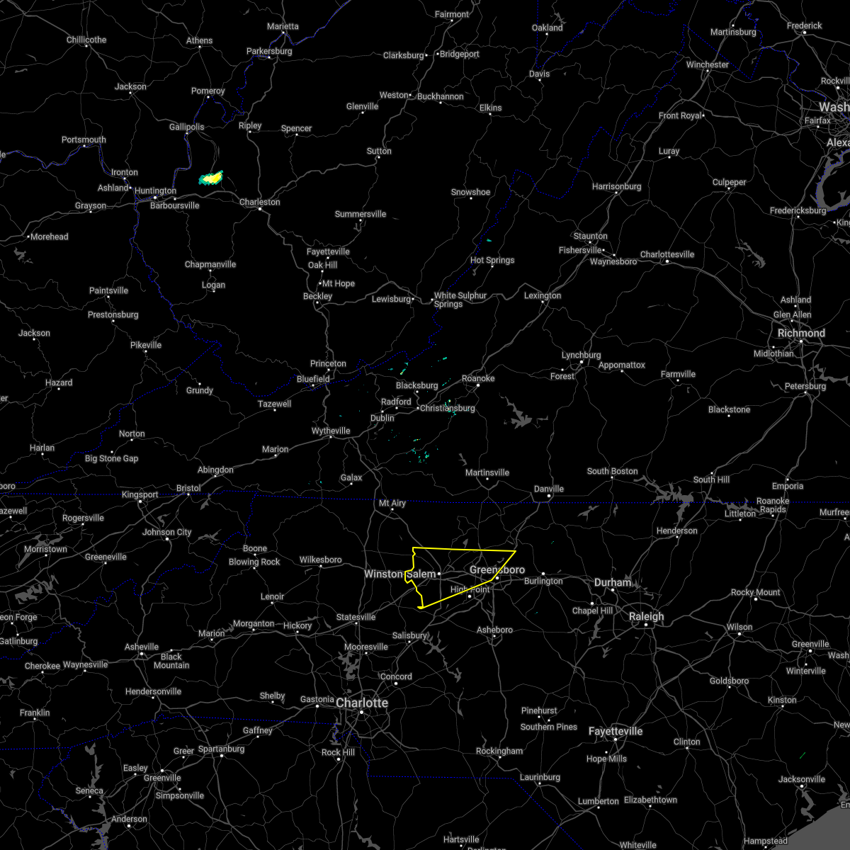 At 425 pm edt, severe thunderstorms were located along a line extending from stoneville to near germanton to near courtney, moving southeast at 25 mph (radar indicated). Hazards include 60 mph wind gusts and quarter size hail. Hail damage to vehicles is expected. Expect wind damage to roofs, siding, and trees. At 425 pm edt, severe thunderstorms were located along a line extending from stoneville to near germanton to near courtney, moving southeast at 25 mph (radar indicated). Hazards include 60 mph wind gusts and quarter size hail. Hail damage to vehicles is expected. Expect wind damage to roofs, siding, and trees.
|
| 6/16/2022 4:15 PM EDT |
 At 414 pm edt, a severe thunderstorm was located over boonville, moving south at 15 mph (radar indicated). Hazards include 60 mph wind gusts and quarter size hail. Hail damage to vehicles is expected. expect wind damage to roofs, siding, and trees. locations impacted include, elkin, fairview, jonesville, boonville, east bend, nebo, and enon. hail threat, radar indicated max hail size, 1. 00 in wind threat, radar indicated max wind gust, 60 mph. At 414 pm edt, a severe thunderstorm was located over boonville, moving south at 15 mph (radar indicated). Hazards include 60 mph wind gusts and quarter size hail. Hail damage to vehicles is expected. expect wind damage to roofs, siding, and trees. locations impacted include, elkin, fairview, jonesville, boonville, east bend, nebo, and enon. hail threat, radar indicated max hail size, 1. 00 in wind threat, radar indicated max wind gust, 60 mph.
|
| 6/16/2022 3:34 PM EDT |
 At 334 pm edt, a severe thunderstorm was located over crutchfield, or over fairview, moving east at 20 mph (radar indicated). Hazards include 60 mph wind gusts and quarter size hail. Hail damage to vehicles is expected. Expect wind damage to roofs, siding, and trees. At 334 pm edt, a severe thunderstorm was located over crutchfield, or over fairview, moving east at 20 mph (radar indicated). Hazards include 60 mph wind gusts and quarter size hail. Hail damage to vehicles is expected. Expect wind damage to roofs, siding, and trees.
|
| 6/16/2022 2:37 PM EDT |
 At 237 pm edt, a severe thunderstorm was located over pinnacle, or near pilot mountain, moving southeast at 25 mph (radar indicated). Hazards include 60 mph wind gusts and quarter size hail. Hail damage to vehicles is expected. expect wind damage to roofs, siding, and trees. locations impacted include, mount airy, fairview, flat rock, yadkinville, dobson, pilot mountain, and walnut cove. hail threat, radar indicated max hail size, 1. 00 in wind threat, radar indicated max wind gust, 60 mph. At 237 pm edt, a severe thunderstorm was located over pinnacle, or near pilot mountain, moving southeast at 25 mph (radar indicated). Hazards include 60 mph wind gusts and quarter size hail. Hail damage to vehicles is expected. expect wind damage to roofs, siding, and trees. locations impacted include, mount airy, fairview, flat rock, yadkinville, dobson, pilot mountain, and walnut cove. hail threat, radar indicated max hail size, 1. 00 in wind threat, radar indicated max wind gust, 60 mph.
|
| 6/16/2022 2:16 PM EDT |
 At 215 pm edt, a severe thunderstorm was located over westfield, or near pilot mountain, moving southeast at 25 mph (radar indicated). Hazards include 60 mph wind gusts and quarter size hail. Hail damage to vehicles is expected. Expect wind damage to roofs, siding, and trees. At 215 pm edt, a severe thunderstorm was located over westfield, or near pilot mountain, moving southeast at 25 mph (radar indicated). Hazards include 60 mph wind gusts and quarter size hail. Hail damage to vehicles is expected. Expect wind damage to roofs, siding, and trees.
|
| 6/14/2022 2:33 AM EDT |
 At 233 am edt, severe thunderstorms were located along a line extending from 7 miles northeast of kernersville to near clemmons, moving southeast at 25 mph (radar indicated). Hazards include 60 mph wind gusts. Expect damage to roofs, siding, and trees. locations impacted include, greensboro, winston-salem, high point, lexington, thomasville, kernersville, clemmons, bermuda run, mcleansville and lewisville. hail threat, radar indicated max hail size, <. 75 in wind threat, radar indicated max wind gust, 60 mph. At 233 am edt, severe thunderstorms were located along a line extending from 7 miles northeast of kernersville to near clemmons, moving southeast at 25 mph (radar indicated). Hazards include 60 mph wind gusts. Expect damage to roofs, siding, and trees. locations impacted include, greensboro, winston-salem, high point, lexington, thomasville, kernersville, clemmons, bermuda run, mcleansville and lewisville. hail threat, radar indicated max hail size, <. 75 in wind threat, radar indicated max wind gust, 60 mph.
|
| 6/14/2022 2:05 AM EDT |
 At 204 am edt, severe thunderstorms were located along a line extending from walnut cove to near enon, moving southeast at 25 mph (radar indicated). Hazards include 60 mph wind gusts. expect damage to roofs, siding, and trees At 204 am edt, severe thunderstorms were located along a line extending from walnut cove to near enon, moving southeast at 25 mph (radar indicated). Hazards include 60 mph wind gusts. expect damage to roofs, siding, and trees
|
| 5/27/2022 3:37 AM EDT |
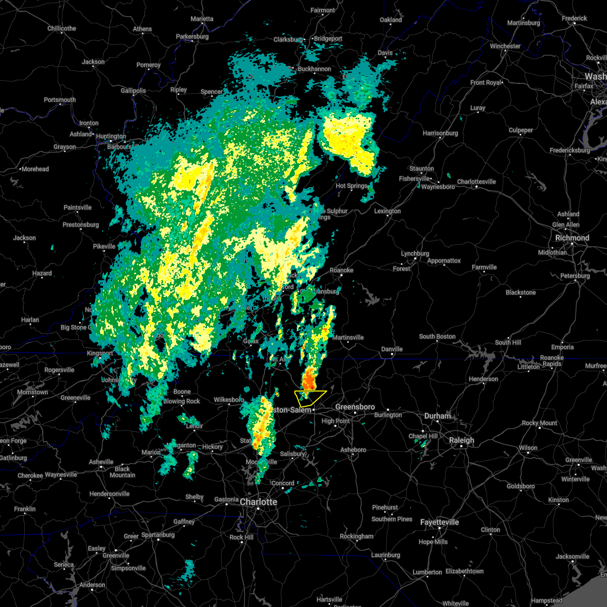 The severe thunderstorm warning for northwestern forsyth county will expire at 345 am edt, the storm which prompted the warning has moved out of the area. therefore, the warning will be allowed to expire. to report severe weather, contact your nearest law enforcement agency. they will relay your report to the national weather service raleigh. The severe thunderstorm warning for northwestern forsyth county will expire at 345 am edt, the storm which prompted the warning has moved out of the area. therefore, the warning will be allowed to expire. to report severe weather, contact your nearest law enforcement agency. they will relay your report to the national weather service raleigh.
|
| 5/27/2022 3:27 AM EDT |
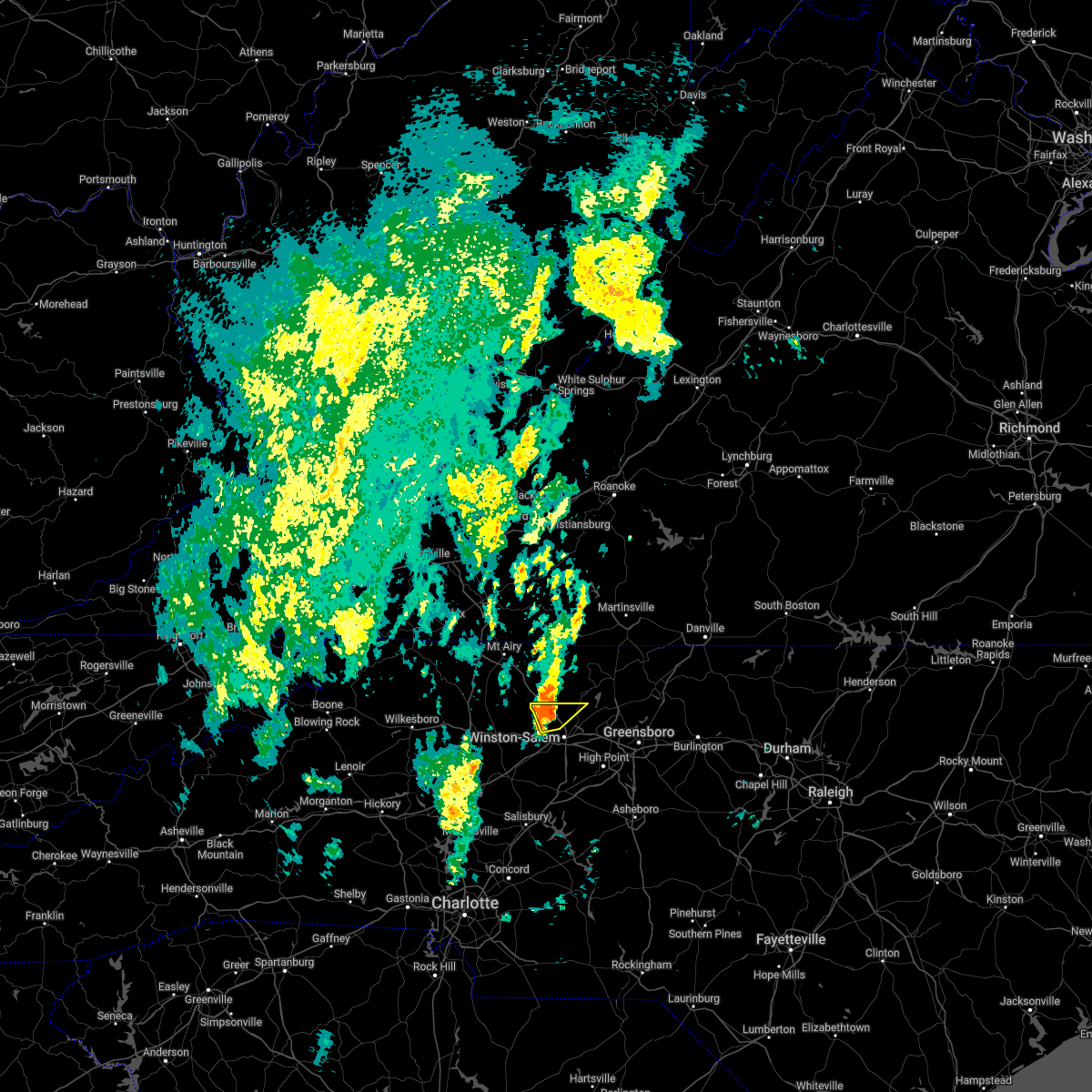 At 327 am edt, a severe thunderstorm was located near king, or 9 miles west of walnut cove, moving northeast at 45 mph (radar indicated). Hazards include 60 mph wind gusts. Expect damage to roofs, siding, and trees. Locations impacted include, winston-salem, rural hall, donnaha, pfafftown and stanleyville. At 327 am edt, a severe thunderstorm was located near king, or 9 miles west of walnut cove, moving northeast at 45 mph (radar indicated). Hazards include 60 mph wind gusts. Expect damage to roofs, siding, and trees. Locations impacted include, winston-salem, rural hall, donnaha, pfafftown and stanleyville.
|
| 5/27/2022 3:17 AM EDT |
 At 317 am edt, a severe thunderstorm was located near enon, or near 3 miles west of pfafftown, moving northeast at 35 mph (radar indicated). Hazards include 60 mph wind gusts. Expect damage to roofs, siding, and trees. Locations impacted include, winston-salem, lewisville, rural hall, donnaha, pfafftown and stanleyville. At 317 am edt, a severe thunderstorm was located near enon, or near 3 miles west of pfafftown, moving northeast at 35 mph (radar indicated). Hazards include 60 mph wind gusts. Expect damage to roofs, siding, and trees. Locations impacted include, winston-salem, lewisville, rural hall, donnaha, pfafftown and stanleyville.
|
| 5/27/2022 3:09 AM EDT |
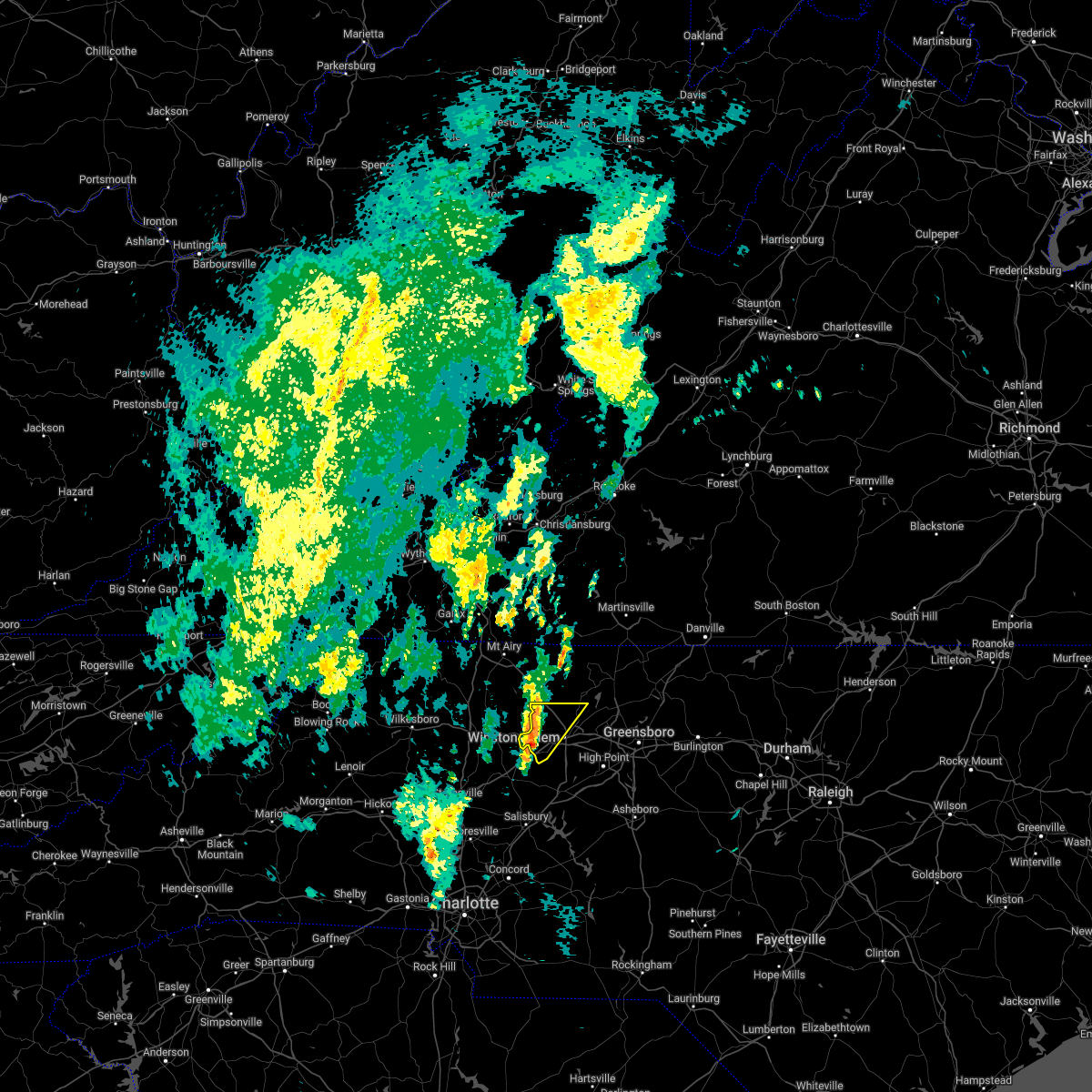 At 308 am edt, a severe thunderstorm was located near clemmons, or 8 miles west of winston-salem, moving northeast at 35 mph (radar indicated). Hazards include 60 mph wind gusts. expect damage to roofs, siding, and trees At 308 am edt, a severe thunderstorm was located near clemmons, or 8 miles west of winston-salem, moving northeast at 35 mph (radar indicated). Hazards include 60 mph wind gusts. expect damage to roofs, siding, and trees
|
| 5/6/2022 6:37 PM EDT |
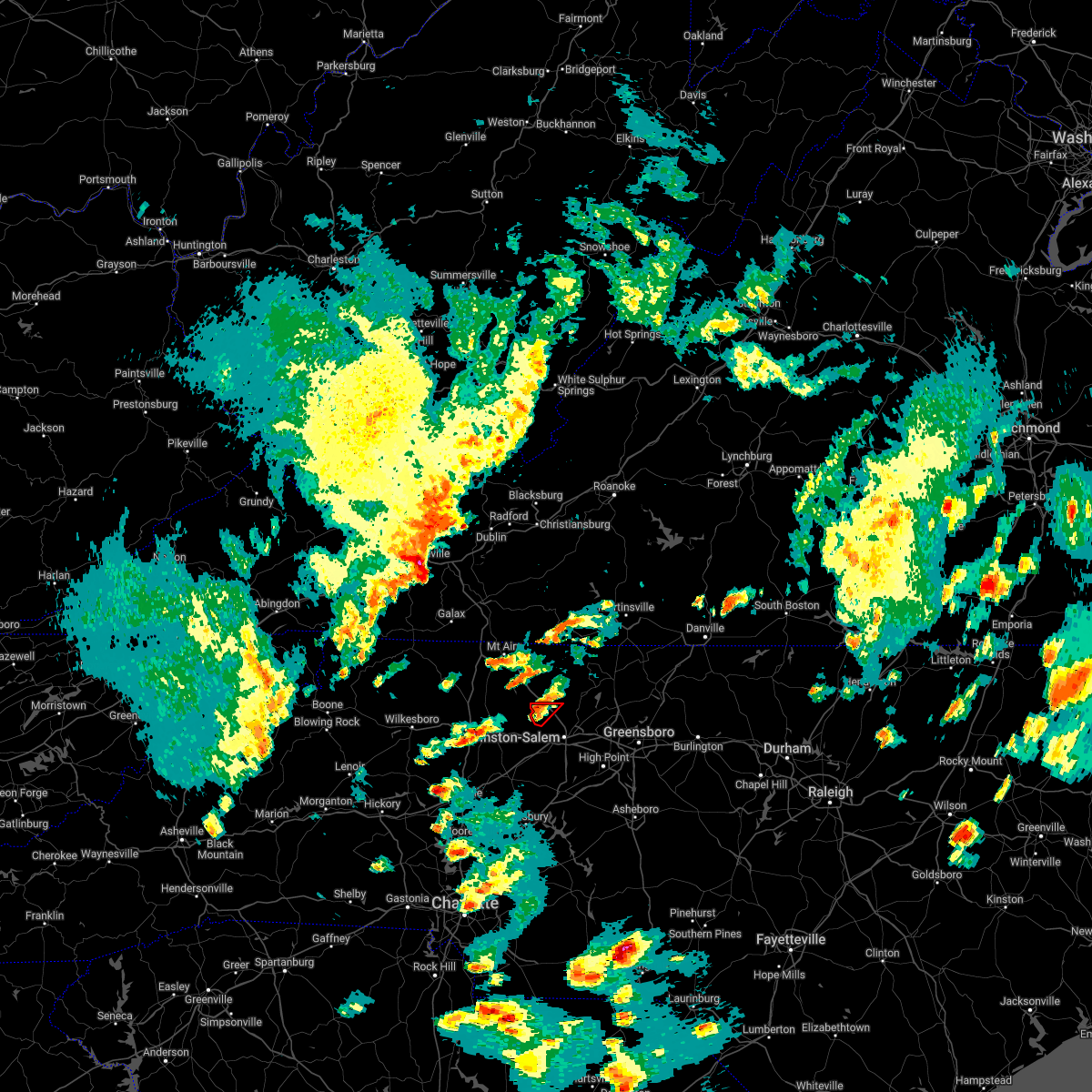 At 637 pm edt, a severe thunderstorm capable of producing a tornado was located near king, or 7 miles east of east bend, moving northeast at 30 mph (radar indicated rotation). Hazards include tornado and quarter size hail. Flying debris will be dangerous to those caught without shelter. mobile homes will be damaged or destroyed. damage to roofs, windows, and vehicles will occur. tree damage is likely. Locations impacted include, rural hall and donnaha. At 637 pm edt, a severe thunderstorm capable of producing a tornado was located near king, or 7 miles east of east bend, moving northeast at 30 mph (radar indicated rotation). Hazards include tornado and quarter size hail. Flying debris will be dangerous to those caught without shelter. mobile homes will be damaged or destroyed. damage to roofs, windows, and vehicles will occur. tree damage is likely. Locations impacted include, rural hall and donnaha.
|
| 5/6/2022 6:27 PM EDT |
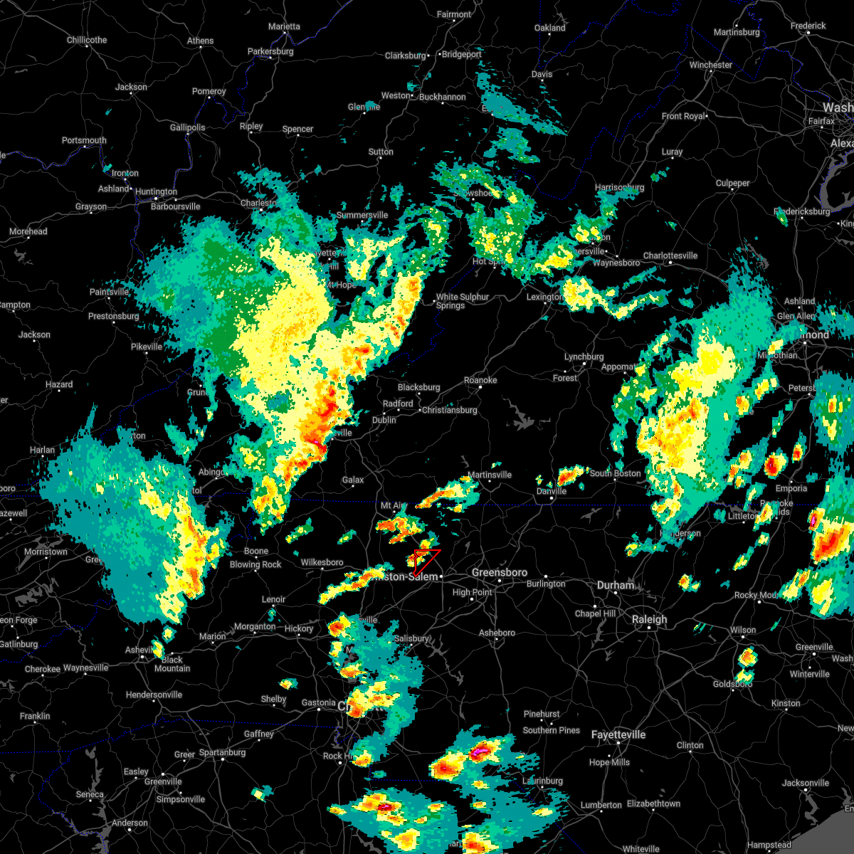 At 627 pm edt, a severe thunderstorm capable of producing a tornado was located over enon, or near east bend, moving northeast at 20 mph (radar indicated rotation). Hazards include tornado and quarter size hail. Flying debris will be dangerous to those caught without shelter. mobile homes will be damaged or destroyed. damage to roofs, windows, and vehicles will occur. tree damage is likely. This tornadic thunderstorm will remain over mainly rural areas of northwestern forsyth county, including the following locations, rural hall and donnaha. At 627 pm edt, a severe thunderstorm capable of producing a tornado was located over enon, or near east bend, moving northeast at 20 mph (radar indicated rotation). Hazards include tornado and quarter size hail. Flying debris will be dangerous to those caught without shelter. mobile homes will be damaged or destroyed. damage to roofs, windows, and vehicles will occur. tree damage is likely. This tornadic thunderstorm will remain over mainly rural areas of northwestern forsyth county, including the following locations, rural hall and donnaha.
|
| 5/6/2022 3:37 PM EDT |
 At 337 pm edt, a severe thunderstorm capable of producing a tornado was located near winston-salem, moving northeast at 50 mph (radar indicated rotation). Hazards include tornado and quarter size hail. Flying debris will be dangerous to those caught without shelter. mobile homes will be damaged or destroyed. damage to roofs, windows, and vehicles will occur. tree damage is likely. Locations impacted include, winston-salem, lewisville, rural hall, donnaha, pfafftown and stanleyville. At 337 pm edt, a severe thunderstorm capable of producing a tornado was located near winston-salem, moving northeast at 50 mph (radar indicated rotation). Hazards include tornado and quarter size hail. Flying debris will be dangerous to those caught without shelter. mobile homes will be damaged or destroyed. damage to roofs, windows, and vehicles will occur. tree damage is likely. Locations impacted include, winston-salem, lewisville, rural hall, donnaha, pfafftown and stanleyville.
|
| 5/6/2022 3:34 PM EDT |
 At 333 pm edt, a severe thunderstorm capable of producing a tornado was located near king, or 8 miles northwest of winston-salem, moving northeast at 50 mph (radar indicated rotation). Hazards include tornado. Flying debris will be dangerous to those caught without shelter. mobile homes will be damaged or destroyed. damage to roofs, windows, and vehicles will occur. tree damage is likely. This tornadic thunderstorm will remain over mainly rural areas of western forsyth county, including the following locations, rural hall, donnaha, pfafftown, stanleyville and lewisville. At 333 pm edt, a severe thunderstorm capable of producing a tornado was located near king, or 8 miles northwest of winston-salem, moving northeast at 50 mph (radar indicated rotation). Hazards include tornado. Flying debris will be dangerous to those caught without shelter. mobile homes will be damaged or destroyed. damage to roofs, windows, and vehicles will occur. tree damage is likely. This tornadic thunderstorm will remain over mainly rural areas of western forsyth county, including the following locations, rural hall, donnaha, pfafftown, stanleyville and lewisville.
|
| 5/6/2022 3:21 PM EDT |
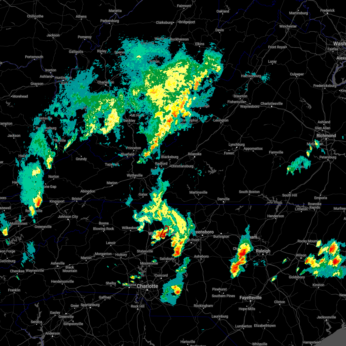 At 321 pm edt, a severe thunderstorm capable of producing a tornado was located over huntsville, or 8 miles south of east bend, moving northeast at 45 mph (radar indicated rotation). Hazards include tornado. Flying debris will be dangerous to those caught without shelter. mobile homes will be damaged or destroyed. damage to roofs, windows, and vehicles will occur. tree damage is likely. Locations impacted include, enon, and huntsville. At 321 pm edt, a severe thunderstorm capable of producing a tornado was located over huntsville, or 8 miles south of east bend, moving northeast at 45 mph (radar indicated rotation). Hazards include tornado. Flying debris will be dangerous to those caught without shelter. mobile homes will be damaged or destroyed. damage to roofs, windows, and vehicles will occur. tree damage is likely. Locations impacted include, enon, and huntsville.
|
| 5/6/2022 3:19 PM EDT |
 At 319 pm edt, a severe thunderstorm capable of producing a tornado was located over huntsville, or 8 miles southeast of yadkinville, moving northeast at 50 mph (radar indicated rotation). Hazards include tornado. Flying debris will be dangerous to those caught without shelter. mobile homes will be damaged or destroyed. damage to roofs, windows, and vehicles will occur. tree damage is likely. this dangerous storm will be near, winston-salem around 340 pm edt. Other locations impacted by this tornadic thunderstorm include rural hall, donnaha, pfafftown, stanleyville and lewisville. At 319 pm edt, a severe thunderstorm capable of producing a tornado was located over huntsville, or 8 miles southeast of yadkinville, moving northeast at 50 mph (radar indicated rotation). Hazards include tornado. Flying debris will be dangerous to those caught without shelter. mobile homes will be damaged or destroyed. damage to roofs, windows, and vehicles will occur. tree damage is likely. this dangerous storm will be near, winston-salem around 340 pm edt. Other locations impacted by this tornadic thunderstorm include rural hall, donnaha, pfafftown, stanleyville and lewisville.
|
| 5/6/2022 3:16 PM EDT |
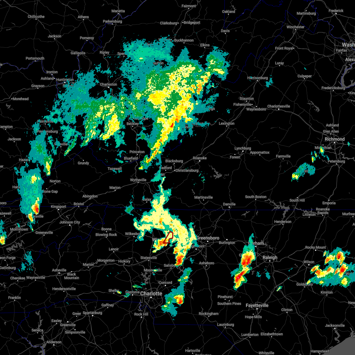 At 315 pm edt, a severe thunderstorm capable of producing a tornado was located near courtney, or 8 miles southeast of yadkinville, moving northeast at 25 mph (radar indicated rotation). Hazards include tornado. Flying debris will be dangerous to those caught without shelter. mobile homes will be damaged or destroyed. damage to roofs, windows, and vehicles will occur. Tree damage is likely. At 315 pm edt, a severe thunderstorm capable of producing a tornado was located near courtney, or 8 miles southeast of yadkinville, moving northeast at 25 mph (radar indicated rotation). Hazards include tornado. Flying debris will be dangerous to those caught without shelter. mobile homes will be damaged or destroyed. damage to roofs, windows, and vehicles will occur. Tree damage is likely.
|
| 12/11/2021 5:29 PM EST | Several trees down in lewisville... tobaccoville... and walkertown between 529 pm and 545 p in forsyth county NC, 0.9 miles N of Lewisville, NC |
| 8/14/2021 5:26 PM EDT |
 The severe thunderstorm warning for central forsyth county will expire at 530 pm edt, the storm which prompted the warning has weakened below severe limits, and no longer poses an immediate threat to life or property. therefore, the warning will be allowed to expire. however heavy rain is still possible with this thunderstorm. The severe thunderstorm warning for central forsyth county will expire at 530 pm edt, the storm which prompted the warning has weakened below severe limits, and no longer poses an immediate threat to life or property. therefore, the warning will be allowed to expire. however heavy rain is still possible with this thunderstorm.
|
| 8/14/2021 5:16 PM EDT |
 At 516 pm edt, a severe thunderstorm was located over winston-salem, moving south at 5 mph (radar indicated). Hazards include 60 mph wind gusts and quarter size hail. Hail damage to vehicles is expected. expect wind damage to roofs, siding, and trees. locations impacted include, winston-salem, kernersville, clemmons, lewisville, walkertown, pfafftown, stanleyville and sedge garden. hail threat, radar indicated max hail size, 1. 00 in wind threat, radar indicated max wind gust, 60 mph. At 516 pm edt, a severe thunderstorm was located over winston-salem, moving south at 5 mph (radar indicated). Hazards include 60 mph wind gusts and quarter size hail. Hail damage to vehicles is expected. expect wind damage to roofs, siding, and trees. locations impacted include, winston-salem, kernersville, clemmons, lewisville, walkertown, pfafftown, stanleyville and sedge garden. hail threat, radar indicated max hail size, 1. 00 in wind threat, radar indicated max wind gust, 60 mph.
|
| 8/14/2021 5:03 PM EDT |
 At 503 pm edt, a severe thunderstorm was located near winston-salem, and is nearly stationary (radar indicated). Hazards include 60 mph wind gusts and quarter size hail. Hail damage to vehicles is expected. expect wind damage to roofs, siding, and trees. locations impacted include, winston-salem, kernersville, clemmons, lewisville, walkertown, rural hall, pfafftown, stanleyville, sedge garden and belews creek. hail threat, radar indicated max hail size, 1. 00 in wind threat, radar indicated max wind gust, 60 mph. At 503 pm edt, a severe thunderstorm was located near winston-salem, and is nearly stationary (radar indicated). Hazards include 60 mph wind gusts and quarter size hail. Hail damage to vehicles is expected. expect wind damage to roofs, siding, and trees. locations impacted include, winston-salem, kernersville, clemmons, lewisville, walkertown, rural hall, pfafftown, stanleyville, sedge garden and belews creek. hail threat, radar indicated max hail size, 1. 00 in wind threat, radar indicated max wind gust, 60 mph.
|
| 8/14/2021 4:50 PM EDT |
 At 450 pm edt, a severe thunderstorm was located near winston-salem, and is nearly stationary (radar indicated). Hazards include 60 mph wind gusts and quarter size hail. Hail damage to vehicles is expected. Expect wind damage to roofs, siding, and trees. At 450 pm edt, a severe thunderstorm was located near winston-salem, and is nearly stationary (radar indicated). Hazards include 60 mph wind gusts and quarter size hail. Hail damage to vehicles is expected. Expect wind damage to roofs, siding, and trees.
|
| 8/12/2021 5:42 PM EDT |
 At 540 pm edt, a severe thunderstorm was located over winston-salem, moving northeast at 10 mph. this storm is producing heavy rainfall (radar indicated). Hazards include 60 mph wind gusts and nickel size hail. Expect damage to roofs, siding, and trees. locations impacted include, winston-salem, kernersville, clemmons, bermuda run, lewisville, walkertown, rural hall, pfafftown, belews creek and arcadia. hail threat, radar indicated max hail size, 0. 88 in wind threat, radar indicated max wind gust, 60 mph. At 540 pm edt, a severe thunderstorm was located over winston-salem, moving northeast at 10 mph. this storm is producing heavy rainfall (radar indicated). Hazards include 60 mph wind gusts and nickel size hail. Expect damage to roofs, siding, and trees. locations impacted include, winston-salem, kernersville, clemmons, bermuda run, lewisville, walkertown, rural hall, pfafftown, belews creek and arcadia. hail threat, radar indicated max hail size, 0. 88 in wind threat, radar indicated max wind gust, 60 mph.
|
| 8/12/2021 5:21 PM EDT |
 At 520 pm edt, a severe thunderstorm was located near winston-salem, moving northeast at 15 mph (radar indicated). Hazards include 60 mph wind gusts and nickel size hail. expect damage to roofs, siding, and trees At 520 pm edt, a severe thunderstorm was located near winston-salem, moving northeast at 15 mph (radar indicated). Hazards include 60 mph wind gusts and nickel size hail. expect damage to roofs, siding, and trees
|
| 8/12/2021 4:39 PM EDT |
 At 439 pm edt, a severe thunderstorm was located over huntsville, or near yadkinville, and is nearly stationary (radar indicated). Hazards include 60 mph wind gusts and quarter size hail. Hail damage to vehicles is expected. expect wind damage to roofs, siding, and trees. locations impacted include, enon, courtney, huntsville, and shacktown. hail threat, radar indicated max hail size, 1. 00 in wind threat, radar indicated max wind gust, 60 mph. At 439 pm edt, a severe thunderstorm was located over huntsville, or near yadkinville, and is nearly stationary (radar indicated). Hazards include 60 mph wind gusts and quarter size hail. Hail damage to vehicles is expected. expect wind damage to roofs, siding, and trees. locations impacted include, enon, courtney, huntsville, and shacktown. hail threat, radar indicated max hail size, 1. 00 in wind threat, radar indicated max wind gust, 60 mph.
|
| 8/12/2021 4:27 PM EDT |
 At 427 pm edt, a severe thunderstorm was located over shacktown, or near yadkinville, and is nearly stationary (radar indicated). Hazards include 60 mph wind gusts and half dollar size hail. Hail damage to vehicles is expected. Expect wind damage to roofs, siding, and trees. At 427 pm edt, a severe thunderstorm was located over shacktown, or near yadkinville, and is nearly stationary (radar indicated). Hazards include 60 mph wind gusts and half dollar size hail. Hail damage to vehicles is expected. Expect wind damage to roofs, siding, and trees.
|
| 7/17/2021 8:43 PM EDT |
 At 843 pm edt, a severe thunderstorm was located near kernersville, or 8 miles south of walnut cove, moving east at 35 mph (radar indicated. at 841 pm, law enforcement reported a tree down on olivette church rd). Hazards include 60 mph wind gusts and quarter size hail. Hail damage to vehicles is expected. expect wind damage to roofs, siding, and trees. Locations impacted include, winston-salem, kernersville, clemmons, lewisville, walkertown, rural hall, pfafftown, stanleyville, sedge garden and belews creek. At 843 pm edt, a severe thunderstorm was located near kernersville, or 8 miles south of walnut cove, moving east at 35 mph (radar indicated. at 841 pm, law enforcement reported a tree down on olivette church rd). Hazards include 60 mph wind gusts and quarter size hail. Hail damage to vehicles is expected. expect wind damage to roofs, siding, and trees. Locations impacted include, winston-salem, kernersville, clemmons, lewisville, walkertown, rural hall, pfafftown, stanleyville, sedge garden and belews creek.
|
| 7/17/2021 8:28 PM EDT |
 At 828 pm edt, a severe thunderstorm was located near winston-salem, moving east at 25 mph (radar indicated). Hazards include 60 mph wind gusts and quarter size hail. Hail damage to vehicles is expected. expect wind damage to roofs, siding, and trees. Locations impacted include, winston-salem, thomasville, kernersville, clemmons, bermuda run, lewisville, walkertown, rural hall, pfafftown and belews creek. At 828 pm edt, a severe thunderstorm was located near winston-salem, moving east at 25 mph (radar indicated). Hazards include 60 mph wind gusts and quarter size hail. Hail damage to vehicles is expected. expect wind damage to roofs, siding, and trees. Locations impacted include, winston-salem, thomasville, kernersville, clemmons, bermuda run, lewisville, walkertown, rural hall, pfafftown and belews creek.
|
| 7/17/2021 8:10 PM EDT |
 At 809 pm edt, a severe thunderstorm was located near enon, or 7 miles west of winston-salem, moving east at 25 mph (radar indicated). Hazards include 60 mph wind gusts and nickel size hail. expect damage to roofs, siding, and trees At 809 pm edt, a severe thunderstorm was located near enon, or 7 miles west of winston-salem, moving east at 25 mph (radar indicated). Hazards include 60 mph wind gusts and nickel size hail. expect damage to roofs, siding, and trees
|
| 6/11/2021 1:49 PM EDT |
 At 149 pm edt, a severe thunderstorm was located near king, or near east bend, moving northeast at 15 mph (radar indicated). Hazards include 60 mph wind gusts. Expect damage to roofs, siding, and trees. Locations impacted include, walnut cove, east bend, danbury, king, nebo, enon, and pinnacle. At 149 pm edt, a severe thunderstorm was located near king, or near east bend, moving northeast at 15 mph (radar indicated). Hazards include 60 mph wind gusts. Expect damage to roofs, siding, and trees. Locations impacted include, walnut cove, east bend, danbury, king, nebo, enon, and pinnacle.
|
| 6/11/2021 1:35 PM EDT |
 At 135 pm edt, a severe thunderstorm was located over east bend, moving northeast at 15 mph (radar indicated). Hazards include 60 mph wind gusts. expect damage to roofs, siding, and trees At 135 pm edt, a severe thunderstorm was located over east bend, moving northeast at 15 mph (radar indicated). Hazards include 60 mph wind gusts. expect damage to roofs, siding, and trees
|
| 3/27/2021 1:58 PM EDT |
 At 157 pm edt, a severe thunderstorm was located near mocksville, moving northeast at 55 mph (radar indicated). Hazards include 60 mph wind gusts and quarter size hail. Hail damage to vehicles is expected. Expect wind damage to roofs, siding, and trees. At 157 pm edt, a severe thunderstorm was located near mocksville, moving northeast at 55 mph (radar indicated). Hazards include 60 mph wind gusts and quarter size hail. Hail damage to vehicles is expected. Expect wind damage to roofs, siding, and trees.
|
| 8/6/2020 6:52 PM EDT |
 At 651 pm edt, slow moving severe thunderstorms were located along a line extending from near monroeton to near huntsville, moving north at 10 mph (radar indicated). Hazards include 60 mph wind gusts. Expect damage to roofs, siding, and trees. Locations impacted include, greensboro, winston-salem, kernersville, clemmons, bermuda run, lewisville, summerfield, stokesdale, walkertown and rural hall. At 651 pm edt, slow moving severe thunderstorms were located along a line extending from near monroeton to near huntsville, moving north at 10 mph (radar indicated). Hazards include 60 mph wind gusts. Expect damage to roofs, siding, and trees. Locations impacted include, greensboro, winston-salem, kernersville, clemmons, bermuda run, lewisville, summerfield, stokesdale, walkertown and rural hall.
|
| 8/6/2020 6:39 PM EDT |
 The severe thunderstorm warning for southern surry, east central wilkes, southwestern stokes and yadkin counties will expire at 645 pm edt, the storm which prompted the warning has weakened below severe limits, and no longer poses an immediate threat to life or property. therefore, the warning will be allowed to expire. however heavy rain is still possible with this thunderstorm. when it is safe to do so, please send your reports of hail of any size, as well as reports of any wind damage, including downed trees or large limbs, to the national weather service by calling toll free at 1, 8 6 6, 2 1 5, 4 3 2 4. reports and pictures can also be shared on the national weather service blacksburg facebook page and on twitter. The severe thunderstorm warning for southern surry, east central wilkes, southwestern stokes and yadkin counties will expire at 645 pm edt, the storm which prompted the warning has weakened below severe limits, and no longer poses an immediate threat to life or property. therefore, the warning will be allowed to expire. however heavy rain is still possible with this thunderstorm. when it is safe to do so, please send your reports of hail of any size, as well as reports of any wind damage, including downed trees or large limbs, to the national weather service by calling toll free at 1, 8 6 6, 2 1 5, 4 3 2 4. reports and pictures can also be shared on the national weather service blacksburg facebook page and on twitter.
|
| 8/6/2020 6:33 PM EDT |
 At 633 pm edt, a severe thunderstorm was located near siloam, or near east bend, moving east at 25 mph (radar indicated). Hazards include 60 mph wind gusts. Expect damage to roofs, siding, and trees. Locations impacted include, elkin, fairview, yadkinville, jonesville, dobson, pilot mountain, and boonville. At 633 pm edt, a severe thunderstorm was located near siloam, or near east bend, moving east at 25 mph (radar indicated). Hazards include 60 mph wind gusts. Expect damage to roofs, siding, and trees. Locations impacted include, elkin, fairview, yadkinville, jonesville, dobson, pilot mountain, and boonville.
|
| 8/6/2020 6:32 PM EDT |
 At 632 pm edt, severe thunderstorms were located along a line extending from near monroeton to near huntsville, moving northeast at 15 mph (radar indicated). Hazards include 60 mph wind gusts. expect damage to roofs, siding, and trees At 632 pm edt, severe thunderstorms were located along a line extending from near monroeton to near huntsville, moving northeast at 15 mph (radar indicated). Hazards include 60 mph wind gusts. expect damage to roofs, siding, and trees
|
| 8/6/2020 6:15 PM EDT |
 At 614 pm edt, a severe thunderstorm was located over rockford, or near fairview, moving east at 25 mph (radar indicated). Hazards include 60 mph wind gusts and quarter size hail. Hail damage to vehicles is expected. expect wind damage to roofs, siding, and trees. Locations impacted include, elkin, fairview, yadkinville, jonesville, dobson, pilot mountain, and boonville. At 614 pm edt, a severe thunderstorm was located over rockford, or near fairview, moving east at 25 mph (radar indicated). Hazards include 60 mph wind gusts and quarter size hail. Hail damage to vehicles is expected. expect wind damage to roofs, siding, and trees. Locations impacted include, elkin, fairview, yadkinville, jonesville, dobson, pilot mountain, and boonville.
|
| 8/6/2020 5:53 PM EDT |
 At 553 pm edt, a severe thunderstorm was located over burch, or near fairview, moving east at 25 mph (radar indicated). Hazards include 60 mph wind gusts. expect damage to roofs, siding, and trees At 553 pm edt, a severe thunderstorm was located over burch, or near fairview, moving east at 25 mph (radar indicated). Hazards include 60 mph wind gusts. expect damage to roofs, siding, and trees
|
| 7/10/2020 8:00 PM EDT |
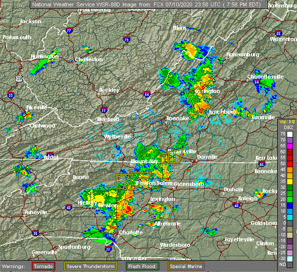 At 759 pm edt, severe thunderstorms were located along a line extending from capella to huntsville, moving east at 30 mph (radar indicated). Hazards include 60 mph wind gusts. Expect damage to roofs, siding, and trees. Locations impacted include, east bend, king, and enon. At 759 pm edt, severe thunderstorms were located along a line extending from capella to huntsville, moving east at 30 mph (radar indicated). Hazards include 60 mph wind gusts. Expect damage to roofs, siding, and trees. Locations impacted include, east bend, king, and enon.
|
| 7/10/2020 7:31 PM EDT |
 At 731 pm edt, severe thunderstorms were located along a line extending from near siloam to lone hickory, moving east at 30 mph (radar indicated). Hazards include 60 mph wind gusts and quarter size hail. Hail damage to vehicles is expected. Expect wind damage to roofs, siding, and trees. At 731 pm edt, severe thunderstorms were located along a line extending from near siloam to lone hickory, moving east at 30 mph (radar indicated). Hazards include 60 mph wind gusts and quarter size hail. Hail damage to vehicles is expected. Expect wind damage to roofs, siding, and trees.
|
| 7/10/2020 6:24 PM EDT |
 At 624 pm edt, a severe thunderstorm was located over shacktown, or near yadkinville, moving east at 15 mph (radar indicated). Hazards include 60 mph wind gusts. Expect damage to roofs, siding, and trees. Locations impacted include, yadkinville, east bend, enon, shacktown, nebo, and courtney. At 624 pm edt, a severe thunderstorm was located over shacktown, or near yadkinville, moving east at 15 mph (radar indicated). Hazards include 60 mph wind gusts. Expect damage to roofs, siding, and trees. Locations impacted include, yadkinville, east bend, enon, shacktown, nebo, and courtney.
|
| 7/10/2020 6:11 PM EDT |
 At 611 pm edt, a severe thunderstorm was located over yadkinville, moving east at 10 mph (radar indicated). Hazards include 60 mph wind gusts and quarter size hail. Hail damage to vehicles is expected. Expect wind damage to roofs, siding, and trees. At 611 pm edt, a severe thunderstorm was located over yadkinville, moving east at 10 mph (radar indicated). Hazards include 60 mph wind gusts and quarter size hail. Hail damage to vehicles is expected. Expect wind damage to roofs, siding, and trees.
|
| 4/13/2020 4:50 AM EDT | Thunderstorm downed a tree near vienna dozier road and pine acres lan in forsyth county NC, 4 miles S of Lewisville, NC |
| 4/13/2020 4:45 AM EDT | Thunderstorm downed a tree near conrad drive and twin oaks lake driv in forsyth county NC, 1.5 miles SE of Lewisville, NC |
| 4/13/2020 4:40 AM EDT |
 At 439 am edt, severe thunderstorms were located along a line extending from near germanton to near mooresville, moving northeast at 60 mph (radar indicated). Hazards include 60 mph wind gusts. expect damage to roofs, siding, and trees At 439 am edt, severe thunderstorms were located along a line extending from near germanton to near mooresville, moving northeast at 60 mph (radar indicated). Hazards include 60 mph wind gusts. expect damage to roofs, siding, and trees
|
| 2/6/2020 11:12 AM EST |
 At 1112 am est, a severe thunderstorm capable of producing a tornado was located 8 miles southeast of clemmons, or 9 miles north of lexington, moving east at 55 mph (radar indicated rotation). Hazards include tornado. Flying debris will be dangerous to those caught without shelter. mobile homes will be damaged or destroyed. damage to roofs, windows, and vehicles will occur. tree damage is likely. This tornadic thunderstorm will remain over mainly rural areas of forsyth and northern davidson counties, including the following locations, rural hall, arcadia, pfafftown, stanleyville and belews lake. At 1112 am est, a severe thunderstorm capable of producing a tornado was located 8 miles southeast of clemmons, or 9 miles north of lexington, moving east at 55 mph (radar indicated rotation). Hazards include tornado. Flying debris will be dangerous to those caught without shelter. mobile homes will be damaged or destroyed. damage to roofs, windows, and vehicles will occur. tree damage is likely. This tornadic thunderstorm will remain over mainly rural areas of forsyth and northern davidson counties, including the following locations, rural hall, arcadia, pfafftown, stanleyville and belews lake.
|
| 2/6/2020 10:57 AM EST |
 At 1056 am est, a severe thunderstorm was located over cooleemee, or 7 miles south of mocksville, moving east at 65 mph (radar indicated). Hazards include 60 mph wind gusts. expect damage to roofs, siding, and trees At 1056 am est, a severe thunderstorm was located over cooleemee, or 7 miles south of mocksville, moving east at 65 mph (radar indicated). Hazards include 60 mph wind gusts. expect damage to roofs, siding, and trees
|
| 1/11/2020 10:45 PM EST | Thunderstorm winds downed a tree near the intersection of glad acres road and robinhood road. time of occurrence estimated via rada in forsyth county NC, 1.8 miles WSW of Lewisville, NC |
| 1/11/2020 10:41 PM EST |
 At 1041 pm est, severe thunderstorms were located along a line extending from eden to monroeton to near rockwell, moving northeast at 60 mph (radar indicated). Hazards include 60 mph wind gusts. expect damage to roofs, siding, and trees At 1041 pm est, severe thunderstorms were located along a line extending from eden to monroeton to near rockwell, moving northeast at 60 mph (radar indicated). Hazards include 60 mph wind gusts. expect damage to roofs, siding, and trees
|
| 1/11/2020 10:37 PM EST |
 At 1037 pm est, severe thunderstorms were located along a line extending from near stoneville to near mt pleasant, moving east at 45 mph (radar indicated). Hazards include 60 mph wind gusts. Expect damage to roofs, siding, and trees. Locations impacted include, greensboro, winston-salem, high point, asheboro, lexington, albemarle, randleman, badin lake, thomasville and kernersville. At 1037 pm est, severe thunderstorms were located along a line extending from near stoneville to near mt pleasant, moving east at 45 mph (radar indicated). Hazards include 60 mph wind gusts. Expect damage to roofs, siding, and trees. Locations impacted include, greensboro, winston-salem, high point, asheboro, lexington, albemarle, randleman, badin lake, thomasville and kernersville.
|
| 1/11/2020 10:00 PM EST |
 At 959 pm est, severe thunderstorms were located along a line extending from king to near charlotte, moving northeast at 45 mph (radar indicated). Hazards include 60 mph wind gusts. expect fallen trees and damage to roofs and siding At 959 pm est, severe thunderstorms were located along a line extending from king to near charlotte, moving northeast at 45 mph (radar indicated). Hazards include 60 mph wind gusts. expect fallen trees and damage to roofs and siding
|
| 10/31/2019 6:02 PM EDT |
 At 601 pm edt, a severe thunderstorm was located near winston-salem, moving northeast at 55 mph (radar indicated). Hazards include 60 mph wind gusts. Expect damage to roofs, siding, and trees. locations impacted include, greensboro, winston-salem, high point, lexington, thomasville, kernersville, clemmons, bermuda run, linwood and lewisville. A tornado watch remains in effect until 1100 pm edt for central north carolina. At 601 pm edt, a severe thunderstorm was located near winston-salem, moving northeast at 55 mph (radar indicated). Hazards include 60 mph wind gusts. Expect damage to roofs, siding, and trees. locations impacted include, greensboro, winston-salem, high point, lexington, thomasville, kernersville, clemmons, bermuda run, linwood and lewisville. A tornado watch remains in effect until 1100 pm edt for central north carolina.
|
| 10/31/2019 5:46 PM EDT | Trees down on larkwood dr and yadkinville r in forsyth county NC, 2.6 miles SW of Lewisville, NC |
| 10/31/2019 5:33 PM EDT |
 At 532 pm edt, a severe thunderstorm was located near cooleemee, or 9 miles south of mocksville, moving northeast at 55 mph (radar indicated). Hazards include 60 mph wind gusts. expect damage to roofs, siding, and trees At 532 pm edt, a severe thunderstorm was located near cooleemee, or 9 miles south of mocksville, moving northeast at 55 mph (radar indicated). Hazards include 60 mph wind gusts. expect damage to roofs, siding, and trees
|
| 8/23/2019 5:21 PM EDT |
 At 521 pm edt, a severe thunderstorm was located near enon, or 7 miles west of winston-salem, moving southeast at 10 mph (radar indicated). Hazards include 60 mph wind gusts and quarter size hail. Hail damage to vehicles is expected. Expect wind damage to roofs, siding, and trees. At 521 pm edt, a severe thunderstorm was located near enon, or 7 miles west of winston-salem, moving southeast at 10 mph (radar indicated). Hazards include 60 mph wind gusts and quarter size hail. Hail damage to vehicles is expected. Expect wind damage to roofs, siding, and trees.
|
| 8/22/2019 3:52 PM EDT |
 At 351 pm edt, severe thunderstorms were located along a line extending from near winston-salem to 6 miles southeast of bermuda run, moving east at 30 mph. damaging wind gusts are imminent in winston-salem. seek shelter now (radar indicated). Hazards include 60 mph wind gusts. Expect damage to roofs, siding, and trees. Locations impacted include, winston-salem, lexington, thomasville, kernersville, clemmons, bermuda run, linwood, lewisville, walkertown and rural hall. At 351 pm edt, severe thunderstorms were located along a line extending from near winston-salem to 6 miles southeast of bermuda run, moving east at 30 mph. damaging wind gusts are imminent in winston-salem. seek shelter now (radar indicated). Hazards include 60 mph wind gusts. Expect damage to roofs, siding, and trees. Locations impacted include, winston-salem, lexington, thomasville, kernersville, clemmons, bermuda run, linwood, lewisville, walkertown and rural hall.
|
| 8/22/2019 3:31 PM EDT |
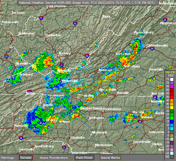 The national weather service in raleigh has issued a * severe thunderstorm warning for. forsyth county in central north carolina. northern davidson county in central north carolina. Until 430 pm edt * at 331 pm edt, severe thunderstorms were located along a line. The national weather service in raleigh has issued a * severe thunderstorm warning for. forsyth county in central north carolina. northern davidson county in central north carolina. Until 430 pm edt * at 331 pm edt, severe thunderstorms were located along a line.
|
| 8/21/2019 5:27 PM EDT |
 At 526 pm edt, severe thunderstorms were located along a line extending from germanton to near clemmons to near bermuda run, moving east at 20 mph (radar indicated). Hazards include 60 mph wind gusts. Expect damage to roofs, siding, and trees. Locations impacted include, winston-salem, lexington, thomasville, kernersville, clemmons, bermuda run, lewisville, walkertown, rural hall and pfafftown. At 526 pm edt, severe thunderstorms were located along a line extending from germanton to near clemmons to near bermuda run, moving east at 20 mph (radar indicated). Hazards include 60 mph wind gusts. Expect damage to roofs, siding, and trees. Locations impacted include, winston-salem, lexington, thomasville, kernersville, clemmons, bermuda run, lewisville, walkertown, rural hall and pfafftown.
|
| 8/21/2019 5:05 PM EDT |
 At 455 pm edt, severe thunderstorms were located along a line extending from near pilot mountain state park to east bend to shacktown, moving east at 25 mph (radar indicated). Hazards include 60 mph wind gusts and penny size hail. expect damage to roofs, siding, and trees At 455 pm edt, severe thunderstorms were located along a line extending from near pilot mountain state park to east bend to shacktown, moving east at 25 mph (radar indicated). Hazards include 60 mph wind gusts and penny size hail. expect damage to roofs, siding, and trees
|
| 8/21/2019 4:55 PM EDT |
 The national weather service in raleigh has issued a * severe thunderstorm warning for. forsyth county in central north carolina. northern davidson county in central north carolina. Until 615 pm edt * at 455 pm edt, severe thunderstorms were located along a line. The national weather service in raleigh has issued a * severe thunderstorm warning for. forsyth county in central north carolina. northern davidson county in central north carolina. Until 615 pm edt * at 455 pm edt, severe thunderstorms were located along a line.
|
| 8/19/2019 6:33 PM EDT |
 At 633 pm edt, severe thunderstorms were located along a line extending from near thomasville to near winston-salem, and are nearly stationary (radar indicated). Hazards include 60 mph wind gusts. Expect damage to roofs, siding, and trees. Locations impacted include, winston-salem, lexington, thomasville, kernersville, clemmons, bermuda run, huntsville, lewisville, walkertown and rural hall. At 633 pm edt, severe thunderstorms were located along a line extending from near thomasville to near winston-salem, and are nearly stationary (radar indicated). Hazards include 60 mph wind gusts. Expect damage to roofs, siding, and trees. Locations impacted include, winston-salem, lexington, thomasville, kernersville, clemmons, bermuda run, huntsville, lewisville, walkertown and rural hall.
|
| 8/19/2019 6:04 PM EDT |
 At 604 pm edt, severe thunderstorms were located along a line extending from near clemmons to near cooleemee, and are nearly stationary (radar indicated). Hazards include 60 mph wind gusts and penny size hail. Expect damage to roofs, siding, and trees. Locations impacted include, winston-salem, lexington, thomasville, kernersville, clemmons, bermuda run, huntsville, linwood, lewisville and walkertown. At 604 pm edt, severe thunderstorms were located along a line extending from near clemmons to near cooleemee, and are nearly stationary (radar indicated). Hazards include 60 mph wind gusts and penny size hail. Expect damage to roofs, siding, and trees. Locations impacted include, winston-salem, lexington, thomasville, kernersville, clemmons, bermuda run, huntsville, linwood, lewisville and walkertown.
|
| 8/19/2019 5:55 PM EDT | A dozen trees reported down in lewisvill in forsyth county NC, 0.9 miles N of Lewisville, NC |
| 8/19/2019 5:42 PM EDT |
 At 542 pm edt, severe thunderstorms were located along a line extending from near kernersville to 6 miles east of cooleemee, and are nearly stationary (radar indicated). Hazards include 60 mph wind gusts and quarter size hail. Hail damage to vehicles is expected. Expect wind damage to roofs, siding, and trees. At 542 pm edt, severe thunderstorms were located along a line extending from near kernersville to 6 miles east of cooleemee, and are nearly stationary (radar indicated). Hazards include 60 mph wind gusts and quarter size hail. Hail damage to vehicles is expected. Expect wind damage to roofs, siding, and trees.
|
| 8/17/2019 4:24 PM EDT |
 The severe thunderstorm warning for forsyth and north central davidson counties will expire at 430 pm edt, the storms which prompted the warning have weakened below severe limits, and no longer pose an immediate threat to life or property. therefore the warning will be allowed to expire. however gusty winds and heavy rain are still possible with these thunderstorms. remember, a severe thunderstorm warning still remains in effect for northern portions of forsyth county until 4:45 pm edt. The severe thunderstorm warning for forsyth and north central davidson counties will expire at 430 pm edt, the storms which prompted the warning have weakened below severe limits, and no longer pose an immediate threat to life or property. therefore the warning will be allowed to expire. however gusty winds and heavy rain are still possible with these thunderstorms. remember, a severe thunderstorm warning still remains in effect for northern portions of forsyth county until 4:45 pm edt.
|
| 8/17/2019 4:14 PM EDT |
 At 414 pm edt, severe thunderstorms were located along a line extending from 6 miles south of king to 7 miles southeast of clemmons, moving east at 15 mph (radar indicated). Hazards include 60 mph wind gusts. Expect damage to roofs, siding, and trees. Locations impacted include, winston-salem, kernersville, clemmons, bermuda run, lewisville, walkertown, arcadia, pfafftown, stanleyville and sedge garden. At 414 pm edt, severe thunderstorms were located along a line extending from 6 miles south of king to 7 miles southeast of clemmons, moving east at 15 mph (radar indicated). Hazards include 60 mph wind gusts. Expect damage to roofs, siding, and trees. Locations impacted include, winston-salem, kernersville, clemmons, bermuda run, lewisville, walkertown, arcadia, pfafftown, stanleyville and sedge garden.
|
| 8/17/2019 4:00 PM EDT | Two trees down at the 1000 block of williams rd in lewisvill in forsyth county NC, 1.9 miles NNE of Lewisville, NC |
| 8/17/2019 3:41 PM EDT | Power lines down in lewisville at the 5900 block of robin hood rd and at the 400 block of sunset ridge d in forsyth county NC, 1.8 miles WSW of Lewisville, NC |
| 8/17/2019 3:35 PM EDT |
 At 335 pm edt, a severe thunderstorm was located near enon, or near winston-salem, moving east at 10 mph (radar indicated). Hazards include 60 mph wind gusts. expect damage to roofs, siding, and trees At 335 pm edt, a severe thunderstorm was located near enon, or near winston-salem, moving east at 10 mph (radar indicated). Hazards include 60 mph wind gusts. expect damage to roofs, siding, and trees
|
| 8/13/2019 4:11 PM EDT | Tree blown down across roa in forsyth county NC, 2.6 miles WSW of Lewisville, NC |
| 8/13/2019 4:11 PM EDT |
 At 410 pm edt, a severe thunderstorm was located over winston-salem, moving southeast at 20 mph. powerlines were reported down north of clemmons (law enforcement). Hazards include 60 mph wind gusts and penny size hail. Expect damage to roofs, siding, and trees. Locations impacted include, greensboro, winston-salem, high point, thomasville, kernersville, clemmons, bermuda run, lewisville, summerfield and stokesdale. At 410 pm edt, a severe thunderstorm was located over winston-salem, moving southeast at 20 mph. powerlines were reported down north of clemmons (law enforcement). Hazards include 60 mph wind gusts and penny size hail. Expect damage to roofs, siding, and trees. Locations impacted include, greensboro, winston-salem, high point, thomasville, kernersville, clemmons, bermuda run, lewisville, summerfield and stokesdale.
|
| 8/13/2019 4:01 PM EDT | Power lines dow in forsyth county NC, 2.9 miles NW of Lewisville, NC |
| 8/13/2019 3:49 PM EDT |
 At 347 pm edt, a severe thunderstorm was located near germanton, or 8 miles north of winston-salem, moving southeast at 20 mph. oher potentially severe thundertsorms will affect western forsyth county as they moive east out of yadkin county (radar indicated). Hazards include 60 mph wind gusts and penny size hail. expect damage to roofs, siding, and trees At 347 pm edt, a severe thunderstorm was located near germanton, or 8 miles north of winston-salem, moving southeast at 20 mph. oher potentially severe thundertsorms will affect western forsyth county as they moive east out of yadkin county (radar indicated). Hazards include 60 mph wind gusts and penny size hail. expect damage to roofs, siding, and trees
|
| 8/10/2019 6:34 PM EDT |
 At 633 pm edt, a severe thunderstorm was located near buck shoals, moving southeast at 20 mph (radar indicated). Hazards include 60 mph wind gusts and quarter size hail. Hail damage to vehicles is expected. expect wind damage to roofs, siding, and trees. Locations impacted include, elkin, yadkinville, jonesville, boonville, and ronda. At 633 pm edt, a severe thunderstorm was located near buck shoals, moving southeast at 20 mph (radar indicated). Hazards include 60 mph wind gusts and quarter size hail. Hail damage to vehicles is expected. expect wind damage to roofs, siding, and trees. Locations impacted include, elkin, yadkinville, jonesville, boonville, and ronda.
|
| 8/10/2019 6:07 PM EDT |
 At 607 pm edt, a severe thunderstorm was located over buck shoals, moving southeast at 20 mph (radar indicated). Hazards include 60 mph wind gusts and quarter size hail. Hail damage to vehicles is expected. Expect wind damage to roofs, siding, and trees. At 607 pm edt, a severe thunderstorm was located over buck shoals, moving southeast at 20 mph (radar indicated). Hazards include 60 mph wind gusts and quarter size hail. Hail damage to vehicles is expected. Expect wind damage to roofs, siding, and trees.
|
| 7/22/2019 7:01 PM EDT |
 At 659 pm edt, a severe thunderstorm was located near lewisville to 5 miles west of welcome, moving east at 35 mph (radar indicated). Hazards include 60 mph wind gusts. Expect damage to trees. Locations impacted include, winston-salem, lexington, thomasville, kernersville, clemmons, bermuda run, huntsville, lewisville, walkertown and rural hall. At 659 pm edt, a severe thunderstorm was located near lewisville to 5 miles west of welcome, moving east at 35 mph (radar indicated). Hazards include 60 mph wind gusts. Expect damage to trees. Locations impacted include, winston-salem, lexington, thomasville, kernersville, clemmons, bermuda run, huntsville, lewisville, walkertown and rural hall.
|
| 7/22/2019 6:45 PM EDT |
 At 643 pm edt, a severe thunderstorm was located 10 miles west and southwest of clemmons, moving northeast at 35 mph (radar indicated). Hazards include 60 mph wind gusts. expect damage to trees At 643 pm edt, a severe thunderstorm was located 10 miles west and southwest of clemmons, moving northeast at 35 mph (radar indicated). Hazards include 60 mph wind gusts. expect damage to trees
|
| 7/6/2019 1:43 PM EDT |
 At 142 pm edt, severe thunderstorms were located along a line extending from near bottom to brooks crossroads, moving east at 20 mph (radar indicated). Hazards include 60 mph wind gusts and quarter size hail. Hail damage to vehicles is expected. expect wind damage to roofs, siding, and trees. Locations impacted include, mount airy, elkin, fairview, flat rock, and yadkinville. At 142 pm edt, severe thunderstorms were located along a line extending from near bottom to brooks crossroads, moving east at 20 mph (radar indicated). Hazards include 60 mph wind gusts and quarter size hail. Hail damage to vehicles is expected. expect wind damage to roofs, siding, and trees. Locations impacted include, mount airy, elkin, fairview, flat rock, and yadkinville.
|
| 7/6/2019 1:17 PM EDT |
 At 117 pm edt, severe thunderstorms were located along a line extending from near barrett to near windy gap, moving east at 25 mph (radar indicated). Hazards include 60 mph wind gusts and quarter size hail. Hail damage to vehicles is expected. Expect wind damage to roofs, siding, and trees. At 117 pm edt, severe thunderstorms were located along a line extending from near barrett to near windy gap, moving east at 25 mph (radar indicated). Hazards include 60 mph wind gusts and quarter size hail. Hail damage to vehicles is expected. Expect wind damage to roofs, siding, and trees.
|
| 6/30/2019 6:32 PM EDT |
 At 632 pm edt, severe thunderstorms were located along a line extending from near clemmons to 7 miles east of mocksville, moving southeast at 25 mph (radar indicated). Hazards include 60 mph wind gusts. Expect damage to roofs, siding, and trees. Locations impacted include, winston-salem, lexington, thomasville, clemmons, bermuda run, huntsville, lewisville, arcadia, welcome and sedge garden. At 632 pm edt, severe thunderstorms were located along a line extending from near clemmons to 7 miles east of mocksville, moving southeast at 25 mph (radar indicated). Hazards include 60 mph wind gusts. Expect damage to roofs, siding, and trees. Locations impacted include, winston-salem, lexington, thomasville, clemmons, bermuda run, huntsville, lewisville, arcadia, welcome and sedge garden.
|
| 6/30/2019 6:08 PM EDT |
 At 608 pm edt, a severe thunderstorm was located over enon, or near east bend, moving southeast at 20 mph (radar indicated). Hazards include 60 mph wind gusts. expect damage to roofs, siding, and trees At 608 pm edt, a severe thunderstorm was located over enon, or near east bend, moving southeast at 20 mph (radar indicated). Hazards include 60 mph wind gusts. expect damage to roofs, siding, and trees
|
| 6/20/2019 1:43 PM EDT |
 At 142 pm edt, a severe thunderstorm was located near king, or 7 miles northwest of winston-salem, moving east at 50 mph (radar indicated). Hazards include 60 mph wind gusts and quarter size hail. Hail damage to vehicles is expected. Expect wind damage to roofs, siding, and trees. At 142 pm edt, a severe thunderstorm was located near king, or 7 miles northwest of winston-salem, moving east at 50 mph (radar indicated). Hazards include 60 mph wind gusts and quarter size hail. Hail damage to vehicles is expected. Expect wind damage to roofs, siding, and trees.
|
| 6/1/2019 9:54 PM EDT |
 At 954 pm edt, a severe thunderstorm was located near ararat, moving southeast at 15 mph (radar indicated). Hazards include 60 mph wind gusts and quarter size hail. Hail damage to vehicles is expected. Expect wind damage to roofs, siding, and trees. At 954 pm edt, a severe thunderstorm was located near ararat, moving southeast at 15 mph (radar indicated). Hazards include 60 mph wind gusts and quarter size hail. Hail damage to vehicles is expected. Expect wind damage to roofs, siding, and trees.
|
| 4/19/2019 2:36 PM EDT |
 At 236 pm edt, severe thunderstorms were located along a line extending from near king to near high rock lake, moving north at 60 mph (radar indicated). Hazards include 60 mph wind gusts and penny size hail. Expect damage to roofs, siding, and trees. locations impacted include, greensboro, winston-salem, high point, lexington, thomasville, kernersville, clemmons, bermuda run, linwood and huntsville. A tornado watch remains in effect until 500 pm edt for central north carolina. At 236 pm edt, severe thunderstorms were located along a line extending from near king to near high rock lake, moving north at 60 mph (radar indicated). Hazards include 60 mph wind gusts and penny size hail. Expect damage to roofs, siding, and trees. locations impacted include, greensboro, winston-salem, high point, lexington, thomasville, kernersville, clemmons, bermuda run, linwood and huntsville. A tornado watch remains in effect until 500 pm edt for central north carolina.
|
| 4/19/2019 2:26 PM EDT |
 At 225 pm edt, severe thunderstorms were located along a line extending from near enon to 8 miles east of rockwell, moving north at 60 mph (radar indicated). Hazards include 60 mph wind gusts and penny size hail. expect damage to roofs, siding, and trees At 225 pm edt, severe thunderstorms were located along a line extending from near enon to 8 miles east of rockwell, moving north at 60 mph (radar indicated). Hazards include 60 mph wind gusts and penny size hail. expect damage to roofs, siding, and trees
|
| 8/8/2018 6:39 PM EDT |
 At 639 pm edt, severe thunderstorms were located along a line extending from clemmons to salisbury to near midland, moving east at 30 mph (radar indicated). Hazards include 60 mph wind gusts. expect damage to roofs, siding, and trees At 639 pm edt, severe thunderstorms were located along a line extending from clemmons to salisbury to near midland, moving east at 30 mph (radar indicated). Hazards include 60 mph wind gusts. expect damage to roofs, siding, and trees
|
| 8/8/2018 6:21 PM EDT |
 The severe thunderstorm warning for forsyth county will expire at 630 pm edt, the storms which prompted the warning have weakened below severe limits, and no longer pose an immediate threat to life or property. therefore the warning will be allowed to expire. The severe thunderstorm warning for forsyth county will expire at 630 pm edt, the storms which prompted the warning have weakened below severe limits, and no longer pose an immediate threat to life or property. therefore the warning will be allowed to expire.
|
| 8/8/2018 6:12 PM EDT |
 At 612 pm edt, severe thunderstorms were located along a line extending from near walnut cove to near clemmons, moving southeast at 25 mph (radar indicated). Hazards include 60 mph wind gusts. Expect damage to roofs, siding, and trees. Locations impacted include, winston-salem, kernersville, clemmons, bermuda run, lewisville, walkertown, pfafftown, belews lake, sedge garden and belews creek. At 612 pm edt, severe thunderstorms were located along a line extending from near walnut cove to near clemmons, moving southeast at 25 mph (radar indicated). Hazards include 60 mph wind gusts. Expect damage to roofs, siding, and trees. Locations impacted include, winston-salem, kernersville, clemmons, bermuda run, lewisville, walkertown, pfafftown, belews lake, sedge garden and belews creek.
|
| 8/8/2018 5:35 PM EDT |
 At 535 pm edt, severe thunderstorms were located along a line extending from pilot mountain to near pilot mountain state park to near shacktown, moving southeast at 25 mph (radar indicated). Hazards include 60 mph wind gusts. expect damage to roofs, siding, and trees At 535 pm edt, severe thunderstorms were located along a line extending from pilot mountain to near pilot mountain state park to near shacktown, moving southeast at 25 mph (radar indicated). Hazards include 60 mph wind gusts. expect damage to roofs, siding, and trees
|
| 8/7/2018 9:26 PM EDT |
 At 925 pm edt, a severe thunderstorm was located near germanton and rural hall, or 8 miles southwest of walnut cove, moving east at 40 mph (radar indicated). Hazards include 60 mph wind gusts. expect damage to trees At 925 pm edt, a severe thunderstorm was located near germanton and rural hall, or 8 miles southwest of walnut cove, moving east at 40 mph (radar indicated). Hazards include 60 mph wind gusts. expect damage to trees
|
| 8/2/2018 6:38 PM EDT |
 At 634 pm edt, a severe thunderstorm extended from near lewisville to near walkertown, moving north at 15 mph. trees have been downed by the combination of gusty thunderstorm winds over saturated ground (radar indicated). Hazards include 60 mph wind gusts. Expect damage to trees. Locations impacted include, kernersville, clemmons, bermuda run, huntsville, lewisville, summerfield, stokesdale, walkertown and rural hall. At 634 pm edt, a severe thunderstorm extended from near lewisville to near walkertown, moving north at 15 mph. trees have been downed by the combination of gusty thunderstorm winds over saturated ground (radar indicated). Hazards include 60 mph wind gusts. Expect damage to trees. Locations impacted include, kernersville, clemmons, bermuda run, huntsville, lewisville, summerfield, stokesdale, walkertown and rural hall.
|
| 8/2/2018 6:14 PM EDT |
 At 611 pm edt, a line of severe thunderstorms were located from arcadia to near pti airport, moving north at 20 mph. these storms will move across the winston-salem area again. saturated ground will contribute to the wind gusts in downing trees (radar indicated). Hazards include 60 mph wind gusts. expect damage to trees At 611 pm edt, a line of severe thunderstorms were located from arcadia to near pti airport, moving north at 20 mph. these storms will move across the winston-salem area again. saturated ground will contribute to the wind gusts in downing trees (radar indicated). Hazards include 60 mph wind gusts. expect damage to trees
|
| 8/2/2018 4:10 PM EDT | Numerous trees and power lines down throughout the lewisville are in forsyth county NC, 1.1 miles NW of Lewisville, NC |
| 8/2/2018 4:00 PM EDT | Corrects previous tstm wnd dmg report from lewisville. several trees down in the are in forsyth county NC, 1.5 miles NW of Lewisville, NC |
| 8/2/2018 3:56 PM EDT |
 At 354 pm edt, a severe thunderstorm was located near enon, or 7 miles west of winston-salem, moving east at 50 mph (radar indicated). Hazards include 60 mph wind gusts. Expect damage to trees. Wet soils and strong winds may down numerous trees. At 354 pm edt, a severe thunderstorm was located near enon, or 7 miles west of winston-salem, moving east at 50 mph (radar indicated). Hazards include 60 mph wind gusts. Expect damage to trees. Wet soils and strong winds may down numerous trees.
|
| 8/2/2018 3:55 PM EDT | Several trees down in the are in forsyth county NC, 1.5 miles NW of Lewisville, NC |
| 7/22/2018 4:37 PM EDT |
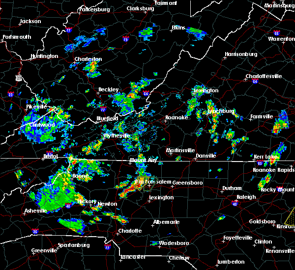 At 437 pm edt, a severe thunderstorm was located near enon, or 8 miles south of east bend, moving north at 5 mph (radar indicated). Hazards include 60 mph wind gusts and quarter size hail. Hail damage to vehicles is expected. expect wind damage to roofs, siding, and trees. Locations impacted include, winston-salem, clemmons, bermuda run, huntsville, lewisville, rural hall, pfafftown, donnaha and stanleyville. At 437 pm edt, a severe thunderstorm was located near enon, or 8 miles south of east bend, moving north at 5 mph (radar indicated). Hazards include 60 mph wind gusts and quarter size hail. Hail damage to vehicles is expected. expect wind damage to roofs, siding, and trees. Locations impacted include, winston-salem, clemmons, bermuda run, huntsville, lewisville, rural hall, pfafftown, donnaha and stanleyville.
|
| 7/22/2018 4:12 PM EDT | Tree down on concord church road at williams roa in forsyth county NC, 3.1 miles NNE of Lewisville, NC |
| 7/22/2018 4:11 PM EDT |
 The national weather service in raleigh has issued a * severe thunderstorm warning for. western forsyth county in central north carolina. Until 500 pm edt * at 408 pm edt, a severe thunderstorm was located near huntsville, or 10 miles south of east bend, moving north at 10 mph. The national weather service in raleigh has issued a * severe thunderstorm warning for. western forsyth county in central north carolina. Until 500 pm edt * at 408 pm edt, a severe thunderstorm was located near huntsville, or 10 miles south of east bend, moving north at 10 mph.
|
| 7/22/2018 3:01 PM EDT |
 At 300 pm edt, a severe thunderstorm was located near winston-salem, moving northeast at 20 mph (radar indicated). Hazards include 60 mph wind gusts, heavy rain, and penny size hail. expect damage to roofs, siding, and trees At 300 pm edt, a severe thunderstorm was located near winston-salem, moving northeast at 20 mph (radar indicated). Hazards include 60 mph wind gusts, heavy rain, and penny size hail. expect damage to roofs, siding, and trees
|
| 7/6/2018 2:33 PM EDT |
 At 232 pm edt, severe thunderstorms were located along a line extending from near harrisons crossroads to 6 miles north of kernersville to near huntsville, moving south at 5 mph (radar indicated). Hazards include 60 mph wind gusts and quarter size hail. Hail damage to vehicles is expected. expect wind damage to roofs, siding, and trees. Locations impacted include, greensboro, winston-salem, high point, kernersville, clemmons, bermuda run, mcleansville, lewisville, summerfield and stokesdale. At 232 pm edt, severe thunderstorms were located along a line extending from near harrisons crossroads to 6 miles north of kernersville to near huntsville, moving south at 5 mph (radar indicated). Hazards include 60 mph wind gusts and quarter size hail. Hail damage to vehicles is expected. expect wind damage to roofs, siding, and trees. Locations impacted include, greensboro, winston-salem, high point, kernersville, clemmons, bermuda run, mcleansville, lewisville, summerfield and stokesdale.
|
| 7/6/2018 2:08 PM EDT |
 At 207 pm edt, a severe thunderstorm was located near germanton, or near walnut cove, moving southwest at 15 mph (radar indicated). Hazards include 60 mph wind gusts. expect damage to roofs, siding, and trees At 207 pm edt, a severe thunderstorm was located near germanton, or near walnut cove, moving southwest at 15 mph (radar indicated). Hazards include 60 mph wind gusts. expect damage to roofs, siding, and trees
|
| 6/25/2018 7:22 PM EDT |
 At 720 pm edt, a line of severe thunderstorms extended from high rock lake to lexington to 10 miles southeast of winston-salem, moving southeast at 40 mph (radar indicated). Hazards include 60 mph wind gusts. Expect damage to trees and crops. Locations impacted include, lexington, thomasville, kernersville, linwood, denton, gordontown and newsom. At 720 pm edt, a line of severe thunderstorms extended from high rock lake to lexington to 10 miles southeast of winston-salem, moving southeast at 40 mph (radar indicated). Hazards include 60 mph wind gusts. Expect damage to trees and crops. Locations impacted include, lexington, thomasville, kernersville, linwood, denton, gordontown and newsom.
|
| 6/25/2018 6:58 PM EDT |
 At 655 pm edt, a line of severe thunderstorms were located along the yadkin river, moving southeast 40 mph (radar indicated). Hazards include 60 mph wind gusts. Expect damage to crops and trees. Locations impacted include, winston-salem, lexington, thomasville, kernersville, clemmons, bermuda run, huntsville, linwood, lewisville and walkertown. At 655 pm edt, a line of severe thunderstorms were located along the yadkin river, moving southeast 40 mph (radar indicated). Hazards include 60 mph wind gusts. Expect damage to crops and trees. Locations impacted include, winston-salem, lexington, thomasville, kernersville, clemmons, bermuda run, huntsville, linwood, lewisville and walkertown.
|
| 6/25/2018 6:55 PM EDT | One tree was reported down on conrad road near shallowford roa in forsyth county NC, 1.1 miles ESE of Lewisville, NC |
| 6/25/2018 6:27 PM EDT |
 At 623 pm edt, a line of severe thunderstorms was approaching the triad from the west. the line will be moving into forsyth and davidson counties between 630 and 645 pm (radar indicated). Hazards include 60 mph wind gusts and half dollar size hail. expect wind damage to crops and trees At 623 pm edt, a line of severe thunderstorms was approaching the triad from the west. the line will be moving into forsyth and davidson counties between 630 and 645 pm (radar indicated). Hazards include 60 mph wind gusts and half dollar size hail. expect wind damage to crops and trees
|
| 6/11/2018 5:37 PM EDT |
 At 536 pm edt, a severe thunderstorm was located over huntsville, or 10 miles southeast of yadkinville, moving south at 20 mph (radar indicated). Hazards include 60 mph wind gusts and quarter size hail. Hail damage to vehicles is expected. expect some wind damage to roofs, siding, and trees. Locations impacted include, winston-salem, clemmons, bermuda run, huntsville and lewisville. At 536 pm edt, a severe thunderstorm was located over huntsville, or 10 miles southeast of yadkinville, moving south at 20 mph (radar indicated). Hazards include 60 mph wind gusts and quarter size hail. Hail damage to vehicles is expected. expect some wind damage to roofs, siding, and trees. Locations impacted include, winston-salem, clemmons, bermuda run, huntsville and lewisville.
|
| 6/11/2018 5:32 PM EDT | Tree down on a power line... shallowfrod road at williams s in forsyth county NC, 4.7 miles ENE of Lewisville, NC |
| 6/11/2018 5:27 PM EDT | Thunderstorm winds downed several trees along route 421 just east of the yadkin county borde in forsyth county NC, 4.5 miles ENE of Lewisville, NC |
| 6/11/2018 5:22 PM EDT |
 At 521 pm edt, a severe thunderstorm was located over enon, or near east bend, moving south at 15 mph (radar indicated). Hazards include 60 mph wind gusts and quarter size hail. Hail damage to vehicles is expected. Expect minor wind damage to roofs, siding, and trees. At 521 pm edt, a severe thunderstorm was located over enon, or near east bend, moving south at 15 mph (radar indicated). Hazards include 60 mph wind gusts and quarter size hail. Hail damage to vehicles is expected. Expect minor wind damage to roofs, siding, and trees.
|
| 6/1/2018 6:06 PM EDT |
 At 606 pm edt, severe thunderstorms were located along a line extending from near winston-salem to 6 miles northwest of linwood, moving east at 20 mph (radar indicated). Hazards include 60 mph wind gusts and penny size hail. Expect damage to roofs, siding, and trees. Locations impacted include, winston-salem, lexington, kernersville, clemmons, bermuda run, linwood, lewisville, walkertown, rural hall and pfafftown. At 606 pm edt, severe thunderstorms were located along a line extending from near winston-salem to 6 miles northwest of linwood, moving east at 20 mph (radar indicated). Hazards include 60 mph wind gusts and penny size hail. Expect damage to roofs, siding, and trees. Locations impacted include, winston-salem, lexington, kernersville, clemmons, bermuda run, linwood, lewisville, walkertown, rural hall and pfafftown.
|
| 6/1/2018 6:00 PM EDT | Tree down at ridge gate dr and arbor run dr in lewisvill in forsyth county NC, 2 miles NW of Lewisville, NC |
| 6/1/2018 5:52 PM EDT | Tree down at mile marker 247 on us-42 in forsyth county NC, 3.4 miles ENE of Lewisville, NC |
| 6/1/2018 5:36 PM EDT |
 At 534 pm edt, severe thunderstorms were located along a line extending from near courtney to 6 miles east of statesville, moving east at 20 mph (radar indicated). Hazards include 60 mph wind gusts and penny size hail. expect damage to roofs, siding, and trees At 534 pm edt, severe thunderstorms were located along a line extending from near courtney to 6 miles east of statesville, moving east at 20 mph (radar indicated). Hazards include 60 mph wind gusts and penny size hail. expect damage to roofs, siding, and trees
|
| 5/21/2018 3:02 PM EDT |
 At 301 pm edt, a severe thunderstorm was located near clemmons, or 10 miles southwest of winston-salem, moving northwest at 10 mph (radar indicated). Hazards include 60 mph wind gusts and penny size hail. expect damage to roofs, siding, and trees At 301 pm edt, a severe thunderstorm was located near clemmons, or 10 miles southwest of winston-salem, moving northwest at 10 mph (radar indicated). Hazards include 60 mph wind gusts and penny size hail. expect damage to roofs, siding, and trees
|
| 4/15/2018 4:57 PM EDT |
 The severe thunderstorm warning for forsyth county will expire at 500 pm edt, the storm which prompted the warning has moved out of the area. therefore, the warning will be allowed to expire. however, strong gusty winds will continue for several more hours across the area. and another severe thunderstorm warning is in effect just east of this area. a tornado watch remains in effect until 1100 pm edt for central north carolina. The severe thunderstorm warning for forsyth county will expire at 500 pm edt, the storm which prompted the warning has moved out of the area. therefore, the warning will be allowed to expire. however, strong gusty winds will continue for several more hours across the area. and another severe thunderstorm warning is in effect just east of this area. a tornado watch remains in effect until 1100 pm edt for central north carolina.
|
| 4/15/2018 4:30 PM EDT |
 At 429 pm edt, a severe thunderstorm was located near king, or 7 miles east of east bend, moving north at 55 mph (radar indicated). Hazards include 70 mph wind gusts and quarter size hail. Hail damage to vehicles is expected. expect considerable tree damage. wind damage is also likely to mobile homes, roofs, and outbuildings. locations impacted include, winston-salem, kernersville, clemmons, bermuda run, lewisville, walkertown, rural hall, pfafftown, belews creek and stanleyville. A tornado watch remains in effect until 1100 pm edt for central north carolina. At 429 pm edt, a severe thunderstorm was located near king, or 7 miles east of east bend, moving north at 55 mph (radar indicated). Hazards include 70 mph wind gusts and quarter size hail. Hail damage to vehicles is expected. expect considerable tree damage. wind damage is also likely to mobile homes, roofs, and outbuildings. locations impacted include, winston-salem, kernersville, clemmons, bermuda run, lewisville, walkertown, rural hall, pfafftown, belews creek and stanleyville. A tornado watch remains in effect until 1100 pm edt for central north carolina.
|
| 4/15/2018 4:23 PM EDT | Half Dollar sized hail reported 1.7 miles NNW of Lewisville, NC, half dollar hail reported off of lewisville-clemmons rd. |
| 4/15/2018 4:17 PM EDT | One tree was reported down at 1691 houser road... lewisville... n in forsyth county NC, 0.9 miles N of Lewisville, NC |
| 4/15/2018 4:17 PM EDT | One tree was reported down at 7600 shallowford road... lewisville... n in forsyth county NC, 1.8 miles ENE of Lewisville, NC |
| 4/15/2018 4:17 PM EDT |
 At 417 pm edt, a severe thunderstorm was located near clemmons, or 9 miles west of winston-salem, moving north at 80 mph (radar indicated). Hazards include 70 mph wind gusts and quarter size hail. Hail damage to vehicles is expected. expect considerable tree damage. Wind damage is also likely to mobile homes, roofs, and outbuildings. At 417 pm edt, a severe thunderstorm was located near clemmons, or 9 miles west of winston-salem, moving north at 80 mph (radar indicated). Hazards include 70 mph wind gusts and quarter size hail. Hail damage to vehicles is expected. expect considerable tree damage. Wind damage is also likely to mobile homes, roofs, and outbuildings.
|
| 10/23/2017 6:04 PM EDT |
 At 604 pm edt, a severe thunderstorm was located near winston-salem, moving northeast at 40 mph (radar indicated). Hazards include 60 mph wind gusts. Expect minor damage to roofs, siding, and trees. locations impacted include, winston-salem, lexington, thomasville, kernersville, clemmons, bermuda run, huntsville, linwood, lewisville and walkertown. A tornado watch remains in effect until 900 pm edt for central north carolina. At 604 pm edt, a severe thunderstorm was located near winston-salem, moving northeast at 40 mph (radar indicated). Hazards include 60 mph wind gusts. Expect minor damage to roofs, siding, and trees. locations impacted include, winston-salem, lexington, thomasville, kernersville, clemmons, bermuda run, huntsville, linwood, lewisville and walkertown. A tornado watch remains in effect until 900 pm edt for central north carolina.
|
| 10/23/2017 5:47 PM EDT |
 At 546 pm edt, a severe thunderstorm was located over bermuda run, or 10 miles northeast of mocksville, moving northeast at 50 mph (radar indicated). Hazards include 60 mph wind gusts. Expect damage to roofs, siding, and trees. locations impacted include, winston-salem, lexington, thomasville, kernersville, clemmons, bermuda run, huntsville, linwood, lewisville and walkertown. A tornado watch remains in effect until 900 pm edt for central north carolina. At 546 pm edt, a severe thunderstorm was located over bermuda run, or 10 miles northeast of mocksville, moving northeast at 50 mph (radar indicated). Hazards include 60 mph wind gusts. Expect damage to roofs, siding, and trees. locations impacted include, winston-salem, lexington, thomasville, kernersville, clemmons, bermuda run, huntsville, linwood, lewisville and walkertown. A tornado watch remains in effect until 900 pm edt for central north carolina.
|
| 10/23/2017 5:35 PM EDT |
 At 534 pm edt, a severe thunderstorm was located over mocksville, moving northeast at 55 mph (radar indicated). Hazards include 60 mph wind gusts. expect damage to roofs, siding, and trees At 534 pm edt, a severe thunderstorm was located over mocksville, moving northeast at 55 mph (radar indicated). Hazards include 60 mph wind gusts. expect damage to roofs, siding, and trees
|
| 7/23/2017 4:53 PM EDT |
 At 452 pm edt, a severe thunderstorm was located near winston-salem, moving southeast at 15 mph (radar indicated). Hazards include 60 mph wind gusts. Expect damage to roofs, siding, and trees. Locations impacted include, greensboro, winston-salem, high point, kernersville, lewisville, summerfield, stokesdale, walkertown, rural hall and haw river state park. At 452 pm edt, a severe thunderstorm was located near winston-salem, moving southeast at 15 mph (radar indicated). Hazards include 60 mph wind gusts. Expect damage to roofs, siding, and trees. Locations impacted include, greensboro, winston-salem, high point, kernersville, lewisville, summerfield, stokesdale, walkertown, rural hall and haw river state park.
|
| 7/23/2017 4:38 PM EDT |
 At 436 pm edt, a severe thunderstorm was located 7 miles northwest of winston-salem, moving southeast at 15 mph (radar indicated). Hazards include 60 mph wind gusts. expect damage to trees At 436 pm edt, a severe thunderstorm was located 7 miles northwest of winston-salem, moving southeast at 15 mph (radar indicated). Hazards include 60 mph wind gusts. expect damage to trees
|
| 7/22/2017 6:36 PM EDT |
 The severe thunderstorm warning for southern forsyth and northern davidson counties will expire at 645 pm edt, the storms which prompted the warning have weakened below severe limits, and no longer pose an immediate threat to life or property. therefore the warning will be allowed to expire. however gusty winds are still possible with these thunderstorms. to report severe weather, contact your nearest law enforcement agency. they will relay your report to the national weather service raleigh. The severe thunderstorm warning for southern forsyth and northern davidson counties will expire at 645 pm edt, the storms which prompted the warning have weakened below severe limits, and no longer pose an immediate threat to life or property. therefore the warning will be allowed to expire. however gusty winds are still possible with these thunderstorms. to report severe weather, contact your nearest law enforcement agency. they will relay your report to the national weather service raleigh.
|
| 7/22/2017 6:19 PM EDT |
 At 619 pm edt, severe thunderstorms were located along a line extending from 8 miles south of winston-salem to bermuda run, moving southeast at 15 mph (radar indicated). Hazards include 60 mph wind gusts. Expect damage to roofs, siding, and trees. Locations impacted include, winston-salem, high point, lexington, thomasville, clemmons, bermuda run, arcadia, gordontown and welcome. At 619 pm edt, severe thunderstorms were located along a line extending from 8 miles south of winston-salem to bermuda run, moving southeast at 15 mph (radar indicated). Hazards include 60 mph wind gusts. Expect damage to roofs, siding, and trees. Locations impacted include, winston-salem, high point, lexington, thomasville, clemmons, bermuda run, arcadia, gordontown and welcome.
|
| 7/22/2017 5:57 PM EDT |
 At 556 pm edt, a severe thunderstorm was located near clemmons, or 9 miles west of winston-salem, moving southeast at 15 mph (radar indicated). Hazards include 60 mph wind gusts. expect damage to roofs, siding, and trees At 556 pm edt, a severe thunderstorm was located near clemmons, or 9 miles west of winston-salem, moving southeast at 15 mph (radar indicated). Hazards include 60 mph wind gusts. expect damage to roofs, siding, and trees
|
| 7/22/2017 5:40 PM EDT |
 The severe thunderstorm warning for forsyth and western guilford counties will expire at 545 pm edt, the storms which prompted the warning have weakened below severe limits, and no longer pose an immediate threat to life or property. therefore the warning will be allowed to expire. however gusty winds and heavy rain are still possible with these thunderstorms. to report severe weather, contact your nearest law enforcement agency. they will relay your report to the national weather service raleigh. The severe thunderstorm warning for forsyth and western guilford counties will expire at 545 pm edt, the storms which prompted the warning have weakened below severe limits, and no longer pose an immediate threat to life or property. therefore the warning will be allowed to expire. however gusty winds and heavy rain are still possible with these thunderstorms. to report severe weather, contact your nearest law enforcement agency. they will relay your report to the national weather service raleigh.
|
| 7/22/2017 5:38 PM EDT | Forsyth county 911 received report of a tree down across road at grape wine rd and sonata rd in lewisvill in forsyth county NC, 0.2 miles NNW of Lewisville, NC |
| 7/22/2017 5:27 PM EDT |
 At 526 pm edt, severe thunderstorms were located along a line extending from near germanton to near kernersville to near clemmons, moving southeast at 20 mph (radar indicated). Hazards include 60 mph wind gusts. Expect damage to roofs, siding, and trees. Locations impacted include, greensboro, winston-salem, high point, kernersville, lewisville, summerfield, stokesdale, walkertown, pleasant garden and jamestown. At 526 pm edt, severe thunderstorms were located along a line extending from near germanton to near kernersville to near clemmons, moving southeast at 20 mph (radar indicated). Hazards include 60 mph wind gusts. Expect damage to roofs, siding, and trees. Locations impacted include, greensboro, winston-salem, high point, kernersville, lewisville, summerfield, stokesdale, walkertown, pleasant garden and jamestown.
|
| 7/22/2017 5:16 PM EDT |
 At 515 pm edt, severe thunderstorms were located along a line extending from near germanton to near kernersville to near enon, moving southeast at 20 mph (radar indicated). Hazards include 60 mph wind gusts and penny size hail. Expect damage to roofs, siding, and trees. Locations impacted include, greensboro, winston-salem, high point, kernersville, lewisville, summerfield, stokesdale, walkertown, pleasant garden and jamestown. At 515 pm edt, severe thunderstorms were located along a line extending from near germanton to near kernersville to near enon, moving southeast at 20 mph (radar indicated). Hazards include 60 mph wind gusts and penny size hail. Expect damage to roofs, siding, and trees. Locations impacted include, greensboro, winston-salem, high point, kernersville, lewisville, summerfield, stokesdale, walkertown, pleasant garden and jamestown.
|
| 7/22/2017 5:07 PM EDT |
 At 506 pm edt, severe thunderstorms were located along a line extending from germanton to near king, moving southeast at 20 mph (radar indicated). Hazards include 60 mph wind gusts and penny size hail. Expect damage to roofs, siding, and trees. Locations impacted include, greensboro, winston-salem, high point, kernersville, mcleansville, lewisville, summerfield, stokesdale, walkertown and pleasant garden. At 506 pm edt, severe thunderstorms were located along a line extending from germanton to near king, moving southeast at 20 mph (radar indicated). Hazards include 60 mph wind gusts and penny size hail. Expect damage to roofs, siding, and trees. Locations impacted include, greensboro, winston-salem, high point, kernersville, mcleansville, lewisville, summerfield, stokesdale, walkertown and pleasant garden.
|
| 7/22/2017 4:33 PM EDT |
 At 432 pm edt, severe thunderstorms were located along a line extending from near hanging rock state park to near east bend, moving southeast at 20 mph (radar indicated). Hazards include 60 mph wind gusts. expect damage to roofs, siding, and trees At 432 pm edt, severe thunderstorms were located along a line extending from near hanging rock state park to near east bend, moving southeast at 20 mph (radar indicated). Hazards include 60 mph wind gusts. expect damage to roofs, siding, and trees
|
| 7/18/2017 5:10 PM EDT |
 At 509 pm edt, a severe thunderstorm was located over clemmons, or 8 miles southwest of winston-salem, moving south at 20 mph. some trees were blown down on south main street in se winston-salem earlier, and there were reports of hail to the size of quarters (radar indicated). Hazards include 60 mph wind gusts and penny size hail. Expect damage to trees. Locations impacted include, winston-salem, clemmons and lewisville. At 509 pm edt, a severe thunderstorm was located over clemmons, or 8 miles southwest of winston-salem, moving south at 20 mph. some trees were blown down on south main street in se winston-salem earlier, and there were reports of hail to the size of quarters (radar indicated). Hazards include 60 mph wind gusts and penny size hail. Expect damage to trees. Locations impacted include, winston-salem, clemmons and lewisville.
|
| 7/18/2017 4:56 PM EDT |
 At 455 pm edt, a severe thunderstorm was located just southwest of winston-salem, moving southwest at 20 mph (radar indicated). Hazards include 60 mph wind gusts and quarter size hail. Hail damage to vehicles is expected. expect wind damage to roofs, siding, and trees. Locations impacted include, winston-salem, clemmons and lewisville. At 455 pm edt, a severe thunderstorm was located just southwest of winston-salem, moving southwest at 20 mph (radar indicated). Hazards include 60 mph wind gusts and quarter size hail. Hail damage to vehicles is expected. expect wind damage to roofs, siding, and trees. Locations impacted include, winston-salem, clemmons and lewisville.
|
| 7/18/2017 4:32 PM EDT |
 At 431 pm edt, a severe thunderstorm was located over winston-salem, moving southwest at 10 mph (radar indicated). Hazards include 60 mph wind gusts and quarter size hail. Expect wind damage to trees. Locations impacted include, winston-salem, clemmons, lewisville, sedge garden and pfafftown. At 431 pm edt, a severe thunderstorm was located over winston-salem, moving southwest at 10 mph (radar indicated). Hazards include 60 mph wind gusts and quarter size hail. Expect wind damage to trees. Locations impacted include, winston-salem, clemmons, lewisville, sedge garden and pfafftown.
|
| 7/18/2017 4:26 PM EDT |
 At 424 pm edt, a severe thunderstorm was located over winston-salem, with little movement (radar indicated). Hazards include damaging wind to 60 mph expected. damage to trees can be expected At 424 pm edt, a severe thunderstorm was located over winston-salem, with little movement (radar indicated). Hazards include damaging wind to 60 mph expected. damage to trees can be expected
|
| 7/1/2017 3:02 PM EDT |
 At 301 pm edt, severe thunderstorms were located along a line extending from near germanton to near bermuda run to near mocksville, moving east at 25 mph (radar indicated). Hazards include 60 mph wind gusts and quarter size hail. Hail damage to vehicles and crops is possible. wind damage to roofs, siding, and trees is possible. Locations impacted include, winston-salem, lexington, thomasville, kernersville, clemmons, bermuda run, lewisville, walkertown, rural hall and pfafftown. At 301 pm edt, severe thunderstorms were located along a line extending from near germanton to near bermuda run to near mocksville, moving east at 25 mph (radar indicated). Hazards include 60 mph wind gusts and quarter size hail. Hail damage to vehicles and crops is possible. wind damage to roofs, siding, and trees is possible. Locations impacted include, winston-salem, lexington, thomasville, kernersville, clemmons, bermuda run, lewisville, walkertown, rural hall and pfafftown.
|
| 7/1/2017 2:44 PM EDT |
 At 241 pm edt, severe thunderstorms were located along a line extending from near king to bermuda run to near mocksville, moving east at 25 mph (radar indicated). Hazards include 60 mph wind gusts and quarter size hail. Hail damage to vehicles and crops is expected. Wind damage to roofs, siding, and trees is possible. At 241 pm edt, severe thunderstorms were located along a line extending from near king to bermuda run to near mocksville, moving east at 25 mph (radar indicated). Hazards include 60 mph wind gusts and quarter size hail. Hail damage to vehicles and crops is expected. Wind damage to roofs, siding, and trees is possible.
|
| 6/13/2017 4:12 PM EDT |
 At 412 pm edt, severe thunderstorms were located along a line extending from huntsville to near buck shoals, moving west at 20 mph (radar indicated). Hazards include 60 mph wind gusts and quarter size hail. Hail damage to vehicles is expected. expect wind damage to roofs, siding, and trees. Locations impacted include, courtney, buck shoals, enon, huntsville, and lone hickory. At 412 pm edt, severe thunderstorms were located along a line extending from huntsville to near buck shoals, moving west at 20 mph (radar indicated). Hazards include 60 mph wind gusts and quarter size hail. Hail damage to vehicles is expected. expect wind damage to roofs, siding, and trees. Locations impacted include, courtney, buck shoals, enon, huntsville, and lone hickory.
|
| 6/13/2017 4:12 PM EDT |
 At 411 pm edt, severe thunderstorms were located along a line extending from 6 miles north of kernersville to near winston-salem to bermuda run, moving south at 30 mph (radar indicated). Hazards include 60 mph wind gusts and quarter size hail. Hail damage to vehicles is expected. expect wind damage to roofs, siding, and trees. Locations impacted include, greensboro, winston-salem, kernersville, clemmons, bermuda run, lewisville, summerfield, stokesdale, walkertown and pfafftown. At 411 pm edt, severe thunderstorms were located along a line extending from 6 miles north of kernersville to near winston-salem to bermuda run, moving south at 30 mph (radar indicated). Hazards include 60 mph wind gusts and quarter size hail. Hail damage to vehicles is expected. expect wind damage to roofs, siding, and trees. Locations impacted include, greensboro, winston-salem, kernersville, clemmons, bermuda run, lewisville, summerfield, stokesdale, walkertown and pfafftown.
|
| 6/13/2017 3:49 PM EDT |
 At 346 pm edt, severe thunderstorms were located near rural hall and 5 miles south of king, moving south at 5 mph (radar indicated). Hazards include 60 mph wind gusts and quarter size hail. Expect wind damage to trees and crops. Locations impacted include, rural hall, winston-salem, stanleyville, lewisville. At 346 pm edt, severe thunderstorms were located near rural hall and 5 miles south of king, moving south at 5 mph (radar indicated). Hazards include 60 mph wind gusts and quarter size hail. Expect wind damage to trees and crops. Locations impacted include, rural hall, winston-salem, stanleyville, lewisville.
|
| 6/13/2017 3:48 PM EDT |
 At 348 pm edt, severe thunderstorms were located along a line extending from meadows to near shacktown to near buck shoals, moving southeast at 5 mph (radar indicated). Hazards include 60 mph wind gusts and quarter size hail. Hail damage to vehicles is expected. expect wind damage to roofs, siding, and trees. Locations impacted include, yadkinville, walnut cove, east bend, king, and buck shoals. At 348 pm edt, severe thunderstorms were located along a line extending from meadows to near shacktown to near buck shoals, moving southeast at 5 mph (radar indicated). Hazards include 60 mph wind gusts and quarter size hail. Hail damage to vehicles is expected. expect wind damage to roofs, siding, and trees. Locations impacted include, yadkinville, walnut cove, east bend, king, and buck shoals.
|
| 6/13/2017 3:28 PM EDT |
 At 327 pm edt, severe thunderstorms were located along a line extending from meadows to near germanton to huntsville, moving southeast at 15 mph (radar indicated). Hazards include 60 mph wind gusts. expect damage to roofs, siding, and trees At 327 pm edt, severe thunderstorms were located along a line extending from meadows to near germanton to huntsville, moving southeast at 15 mph (radar indicated). Hazards include 60 mph wind gusts. expect damage to roofs, siding, and trees
|
| 6/13/2017 3:24 PM EDT |
 At 323 pm edt, severe thunderstorms were located along a line extending from danbury to shacktown to near swancreek, moving southeast at 5 mph (radar indicated). Hazards include 60 mph wind gusts and quarter size hail. Hail damage to vehicles is expected. Expect wind damage to roofs, siding, and trees. At 323 pm edt, severe thunderstorms were located along a line extending from danbury to shacktown to near swancreek, moving southeast at 5 mph (radar indicated). Hazards include 60 mph wind gusts and quarter size hail. Hail damage to vehicles is expected. Expect wind damage to roofs, siding, and trees.
|
| 6/5/2017 6:04 PM EDT |
 At 604 pm edt, a severe thunderstorm was located near clemmons, or 7 miles south of winston-salem, moving east at 25 mph (radar indicated). Hazards include 60 mph wind gusts. expect damage to roofs, siding, and trees At 604 pm edt, a severe thunderstorm was located near clemmons, or 7 miles south of winston-salem, moving east at 25 mph (radar indicated). Hazards include 60 mph wind gusts. expect damage to roofs, siding, and trees
|
| 5/24/2017 4:36 PM EDT |
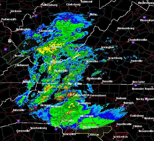 At 435 pm edt, a confirmed tornado was located near east bend, moving northeast at 30 mph (public confirmed tornado). Hazards include damaging tornado. Flying debris will be dangerous to those caught without shelter. mobile homes will be damaged or destroyed. damage to roofs, windows, and vehicles will occur. tree damage is likely. Locations impacted include, donnaha. At 435 pm edt, a confirmed tornado was located near east bend, moving northeast at 30 mph (public confirmed tornado). Hazards include damaging tornado. Flying debris will be dangerous to those caught without shelter. mobile homes will be damaged or destroyed. damage to roofs, windows, and vehicles will occur. tree damage is likely. Locations impacted include, donnaha.
|
| 5/24/2017 4:20 PM EDT |
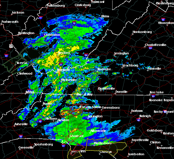 At 418 pm edt, a severe thunderstorm capable of producing a tornado was located over courtney, or near yadkinville, moving northeast at 30 mph (public has reported a funnel cloud with this storm). Hazards include tornado. Flying debris will be dangerous to those caught without shelter. mobile homes will be damaged or destroyed. damage to roofs, windows, and vehicles will occur. tree damage is likely. Locations impacted include, huntsville, lewisville, rural hall, donnaha and stanleyville. At 418 pm edt, a severe thunderstorm capable of producing a tornado was located over courtney, or near yadkinville, moving northeast at 30 mph (public has reported a funnel cloud with this storm). Hazards include tornado. Flying debris will be dangerous to those caught without shelter. mobile homes will be damaged or destroyed. damage to roofs, windows, and vehicles will occur. tree damage is likely. Locations impacted include, huntsville, lewisville, rural hall, donnaha and stanleyville.
|
| 5/24/2017 4:08 PM EDT |
 At 407 pm edt, a severe thunderstorm capable of producing a tornado was located near harmony, or 8 miles northwest of mocksville, moving northeast at 30 mph. a funnel cloud with this storm has been reported in iredell (radar indicated rotation). Hazards include tornado. Flying debris will be dangerous to those caught without shelter. mobile homes will be damaged or destroyed. damage to roofs, windows, and vehicles will occur. Tree damage is likely. At 407 pm edt, a severe thunderstorm capable of producing a tornado was located near harmony, or 8 miles northwest of mocksville, moving northeast at 30 mph. a funnel cloud with this storm has been reported in iredell (radar indicated rotation). Hazards include tornado. Flying debris will be dangerous to those caught without shelter. mobile homes will be damaged or destroyed. damage to roofs, windows, and vehicles will occur. Tree damage is likely.
|
| 5/19/2017 4:27 PM EDT |
 The severe thunderstorm warning for western and northern forsyth county will expire at 430 pm edt, the storm which prompted the warning has moved into eastern forsyth and guilford counties. therefore the warning will be allowed to expire northwest of winston-salem. The severe thunderstorm warning for western and northern forsyth county will expire at 430 pm edt, the storm which prompted the warning has moved into eastern forsyth and guilford counties. therefore the warning will be allowed to expire northwest of winston-salem.
|
| 5/19/2017 4:11 PM EDT |
 At 410 pm edt, a severe thunderstorm was located near winston-salem, moving east at 35 mph (public reported dime size hail with this storm in winston-salem). Hazards include 60 mph wind gusts and quarter size hail. Hail damage may occur. expect wind damage to siding and trees. Locations impacted include, winston-salem, clemmons, bermuda run, lewisville, walkertown, rural hall, stanleyville, pfafftown, belews lake and belews creek. At 410 pm edt, a severe thunderstorm was located near winston-salem, moving east at 35 mph (public reported dime size hail with this storm in winston-salem). Hazards include 60 mph wind gusts and quarter size hail. Hail damage may occur. expect wind damage to siding and trees. Locations impacted include, winston-salem, clemmons, bermuda run, lewisville, walkertown, rural hall, stanleyville, pfafftown, belews lake and belews creek.
|
| 5/19/2017 3:44 PM EDT |
 At 341 pm edt, a severe thunderstorm located along the yadkin river extending to rural hall, moving east-southeast at 40 mph (radar indicated). Hazards include 60 mph wind gusts and quarter size hail. expect wind damage to siding and trees At 341 pm edt, a severe thunderstorm located along the yadkin river extending to rural hall, moving east-southeast at 40 mph (radar indicated). Hazards include 60 mph wind gusts and quarter size hail. expect wind damage to siding and trees
|
| 11/30/2016 7:22 PM EST |
 At 722 pm est, severe thunderstorms were located along a line extending from monroeton to near greensboro to 6 miles east of high rock lake, moving northeast at 40 mph (radar indicated). Hazards include 60 mph wind gusts. Expect damage to roofs. siding. and trees. Locations impacted include, greensboro, winston-salem, high point, asheboro, lexington, randleman, north carolina zoo, thomasville, kernersville and clemmons. At 722 pm est, severe thunderstorms were located along a line extending from monroeton to near greensboro to 6 miles east of high rock lake, moving northeast at 40 mph (radar indicated). Hazards include 60 mph wind gusts. Expect damage to roofs. siding. and trees. Locations impacted include, greensboro, winston-salem, high point, asheboro, lexington, randleman, north carolina zoo, thomasville, kernersville and clemmons.
|
| 11/30/2016 6:57 PM EST |
 At 656 pm est, severe thunderstorms were located along a line extending from near walnut cove to 8 miles northwest of thomasville to enochville, moving northeast at 35 mph (radar indicated). Hazards include 60 mph wind gusts. Expect damage to roofs. siding. And trees. At 656 pm est, severe thunderstorms were located along a line extending from near walnut cove to 8 miles northwest of thomasville to enochville, moving northeast at 35 mph (radar indicated). Hazards include 60 mph wind gusts. Expect damage to roofs. siding. And trees.
|
| 8/27/2016 5:46 PM EDT |
 At 544 pm edt, a severe thunderstorm was located near sedge garden , or 5 miles southeast of downtown winston-salem, moving southwest at 30 mph (radar indicated). Hazards include 60 mph wind gusts. Expect damage to trees. Locations impacted include, kernersville and sedge garden. At 544 pm edt, a severe thunderstorm was located near sedge garden , or 5 miles southeast of downtown winston-salem, moving southwest at 30 mph (radar indicated). Hazards include 60 mph wind gusts. Expect damage to trees. Locations impacted include, kernersville and sedge garden.
|
| 8/27/2016 5:33 PM EDT |
 At 532 pm edt, a severe thunderstorm was located over kernersville, or 9 miles northwest of high point, moving southwest at 10 mph (radar indicated). Hazards include 60 mph wind gusts. Expect damage to trees. Locations impacted include, winston-salem, kernersville, clemmons, walkertown, rural hall, sedge garden. At 532 pm edt, a severe thunderstorm was located over kernersville, or 9 miles northwest of high point, moving southwest at 10 mph (radar indicated). Hazards include 60 mph wind gusts. Expect damage to trees. Locations impacted include, winston-salem, kernersville, clemmons, walkertown, rural hall, sedge garden.
|
| 8/27/2016 5:16 PM EDT |
 At 514 pm edt, a severe thunderstorm was located near germanton, or 7 miles south of walnut cove, moving west at 25 mph (radar indicated). Hazards include 60 mph wind gusts. expect damage to trees At 514 pm edt, a severe thunderstorm was located near germanton, or 7 miles south of walnut cove, moving west at 25 mph (radar indicated). Hazards include 60 mph wind gusts. expect damage to trees
|
| 7/27/2016 8:28 PM EDT |
 The severe thunderstorm warning for northern randolph, northern davidson, guilford and forsyth counties will expire at 830 pm edt, the storm which prompted the warning has weakened. while the warning will allowed to expire, small hail, gusty winds and heavy rain are still possible with the thunderstorm currently located across northwest davidson county. The severe thunderstorm warning for northern randolph, northern davidson, guilford and forsyth counties will expire at 830 pm edt, the storm which prompted the warning has weakened. while the warning will allowed to expire, small hail, gusty winds and heavy rain are still possible with the thunderstorm currently located across northwest davidson county.
|
| 7/27/2016 8:10 PM EDT |
 At 809 pm edt, a severe thunderstorm was located near enon, or 7 miles west of winston-salem, moving east at 40 mph (radar indicated). Hazards include 60 mph wind gusts and quarter size hail. Hail damage to vehicles is expected. expect wind damage to roofs, siding, and trees. Locations impacted include, greensboro, winston-salem, high point, thomasville, kernersville, clemmons, bermuda run, mcleansville, lewisville and archdale. At 809 pm edt, a severe thunderstorm was located near enon, or 7 miles west of winston-salem, moving east at 40 mph (radar indicated). Hazards include 60 mph wind gusts and quarter size hail. Hail damage to vehicles is expected. expect wind damage to roofs, siding, and trees. Locations impacted include, greensboro, winston-salem, high point, thomasville, kernersville, clemmons, bermuda run, mcleansville, lewisville and archdale.
|
| 7/27/2016 7:32 PM EDT |
 At 731 pm edt, severe thunderstorms were located along a line extending from near winston-salem to elon college, moving east at 35 mph (radar indicated). Hazards include 60 mph wind gusts and nickel size hail. Expect damage to roofs. siding. And trees. At 731 pm edt, severe thunderstorms were located along a line extending from near winston-salem to elon college, moving east at 35 mph (radar indicated). Hazards include 60 mph wind gusts and nickel size hail. Expect damage to roofs. siding. And trees.
|
| 7/19/2016 8:52 PM EDT |
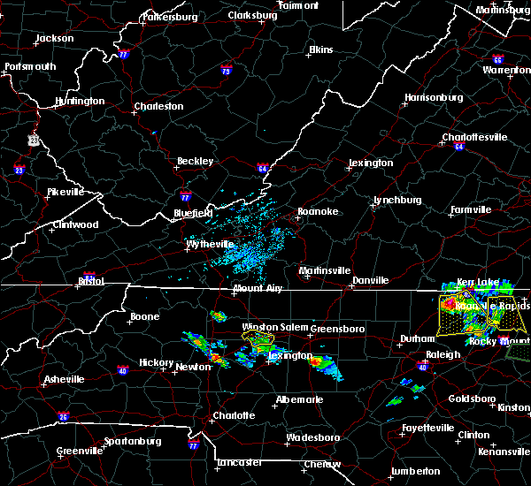 The severe thunderstorm warning for southwestern forsyth county will expire at 900 pm edt, the storm which prompted the warning has weakened below severe limits, and no longer poses an immediate threat to life or property. therefore the warning will be allowed to expire. The severe thunderstorm warning for southwestern forsyth county will expire at 900 pm edt, the storm which prompted the warning has weakened below severe limits, and no longer poses an immediate threat to life or property. therefore the warning will be allowed to expire.
|
| 7/19/2016 8:27 PM EDT |
 At 826 pm edt, a severe thunderstorm was located near lewisville, or 10 miles west of winston-salem, moving southeast at 40 mph (radar indicated). Hazards include 60 mph wind gusts. Expect damage to roofs. siding. and trees. Locations impacted include, clemmons, bermuda run, huntsville and lewisville. At 826 pm edt, a severe thunderstorm was located near lewisville, or 10 miles west of winston-salem, moving southeast at 40 mph (radar indicated). Hazards include 60 mph wind gusts. Expect damage to roofs. siding. and trees. Locations impacted include, clemmons, bermuda run, huntsville and lewisville.
|
| 7/19/2016 8:11 PM EDT |
 At 810 pm edt, a severe thunderstorm was located 8 miles northwest of clemmons, moving southeast at 30 mph (radar indicated). Hazards include 60 mph wind gusts. Expect damage to roofs. siding. And trees. At 810 pm edt, a severe thunderstorm was located 8 miles northwest of clemmons, moving southeast at 30 mph (radar indicated). Hazards include 60 mph wind gusts. Expect damage to roofs. siding. And trees.
|
| 7/19/2016 6:43 PM EDT |
 At 641 pm edt, a severe thunderstorm was located over walnut cove, moving south at 25 mph (radar indicated). Hazards include 60 mph wind gusts and quarter size hail. Hail damage to vehicles is expected. Expect wind damage to roofs, siding, and trees. At 641 pm edt, a severe thunderstorm was located over walnut cove, moving south at 25 mph (radar indicated). Hazards include 60 mph wind gusts and quarter size hail. Hail damage to vehicles is expected. Expect wind damage to roofs, siding, and trees.
|
| 7/8/2016 8:08 PM EDT |
 At 807 pm edt, a severe thunderstorm was located over winston-salem, moving east at 55 mph (law enforcement). Hazards include 60 mph wind gusts and quarter size hail. Hail damage to vehicles is expected. Expect wind damage to roofs, siding, and trees. At 807 pm edt, a severe thunderstorm was located over winston-salem, moving east at 55 mph (law enforcement). Hazards include 60 mph wind gusts and quarter size hail. Hail damage to vehicles is expected. Expect wind damage to roofs, siding, and trees.
|
| 7/8/2016 7:53 PM EDT |
 At 753 pm edt, a severe thunderstorm was located over kernersville, or 8 miles east of winston-salem, moving east at 20 mph (law enforcement). Hazards include 60 mph wind gusts and quarter size hail. Hail damage to vehicles is expected. expect wind damage to roofs, siding, and trees. locations impacted include, winston-salem, kernersville, clemmons, bermuda run, huntsville, lewisville, walkertown, rural hall, belews creek and donnaha. A severe thunderstorm watch remains in effect until midnight edt for central north carolina. At 753 pm edt, a severe thunderstorm was located over kernersville, or 8 miles east of winston-salem, moving east at 20 mph (law enforcement). Hazards include 60 mph wind gusts and quarter size hail. Hail damage to vehicles is expected. expect wind damage to roofs, siding, and trees. locations impacted include, winston-salem, kernersville, clemmons, bermuda run, huntsville, lewisville, walkertown, rural hall, belews creek and donnaha. A severe thunderstorm watch remains in effect until midnight edt for central north carolina.
|
| 7/8/2016 7:16 PM EDT |
 At 715 pm edt, a severe thunderstorm was located near kernersville, or 7 miles northeast of winston-salem, moving southeast at 25 mph (radar indicated). Hazards include 60 mph wind gusts and quarter size hail. Hail damage to vehicles is expected. Expect wind damage to roofs, siding, and trees. At 715 pm edt, a severe thunderstorm was located near kernersville, or 7 miles northeast of winston-salem, moving southeast at 25 mph (radar indicated). Hazards include 60 mph wind gusts and quarter size hail. Hail damage to vehicles is expected. Expect wind damage to roofs, siding, and trees.
|
| 7/5/2016 4:41 PM EDT |
 At 440 pm edt, severe thunderstorms were located along a line extending from clemmons to near high rock lake to near mt pleasant, moving east at 45 mph (radar indicated). Hazards include 60 mph wind gusts. Expect damage to roofs. siding. and trees. Locations impacted include, winston-salem, lexington, albemarle, badin lake, thomasville, kernersville, clemmons, bermuda run, linwood and plyler. At 440 pm edt, severe thunderstorms were located along a line extending from clemmons to near high rock lake to near mt pleasant, moving east at 45 mph (radar indicated). Hazards include 60 mph wind gusts. Expect damage to roofs. siding. and trees. Locations impacted include, winston-salem, lexington, albemarle, badin lake, thomasville, kernersville, clemmons, bermuda run, linwood and plyler.
|
| 7/5/2016 4:25 PM EDT |
 At 425 pm edt, severe thunderstorms were located along a line extending from near huntsville to salisbury to near downtown concord, moving east at 40 mph (radar indicated). Hazards include 60 mph wind gusts. Expect damage to roofs. siding. And trees. At 425 pm edt, severe thunderstorms were located along a line extending from near huntsville to salisbury to near downtown concord, moving east at 40 mph (radar indicated). Hazards include 60 mph wind gusts. Expect damage to roofs. siding. And trees.
|
| 5/12/2016 5:58 PM EDT |
 At 556 pm edt, doppler radar indicared a severe thunderstorm developing just south of interstate 40 near winston-salem, moving north at 10 mph (radar indicated). Hazards include 60 mph wind gusts and quarter size hail. Hail damage to vehicles is expected. Expect wind damage to roofs, siding, and trees. At 556 pm edt, doppler radar indicared a severe thunderstorm developing just south of interstate 40 near winston-salem, moving north at 10 mph (radar indicated). Hazards include 60 mph wind gusts and quarter size hail. Hail damage to vehicles is expected. Expect wind damage to roofs, siding, and trees.
|
| 5/2/2016 4:52 PM EDT |
 At 451 pm edt, severe thunderstorms were located along a line extending from winston-salem to 12 miles southwest of graham, moving northeast at 30 mph (radar indicated). Hazards include 60 mph wind gusts and quarter size hail. Hail damage to vehicles is expected. expect wind damage to roofs, siding, and trees. Locations impacted include, greensboro, winston-salem, high point, burlington, graham, kernersville, mcleansville, elon college, gibsonville and walkertown. At 451 pm edt, severe thunderstorms were located along a line extending from winston-salem to 12 miles southwest of graham, moving northeast at 30 mph (radar indicated). Hazards include 60 mph wind gusts and quarter size hail. Hail damage to vehicles is expected. expect wind damage to roofs, siding, and trees. Locations impacted include, greensboro, winston-salem, high point, burlington, graham, kernersville, mcleansville, elon college, gibsonville and walkertown.
|
| 5/2/2016 4:38 PM EDT |
 At 437 pm edt, severe thunderstorms were located along a line extending from clemmons to 9 miles northwest of siler city, moving northeast at 35 mph (radar indicated). Hazards include 60 mph wind gusts and quarter size hail. Hail damage to vehicles is expected. expect wind damage to roofs, siding, and trees. Locations impacted include, greensboro, winston-salem, high point, burlington, graham, randleman, thomasville, kernersville, clemmons and bermuda run. At 437 pm edt, severe thunderstorms were located along a line extending from clemmons to 9 miles northwest of siler city, moving northeast at 35 mph (radar indicated). Hazards include 60 mph wind gusts and quarter size hail. Hail damage to vehicles is expected. expect wind damage to roofs, siding, and trees. Locations impacted include, greensboro, winston-salem, high point, burlington, graham, randleman, thomasville, kernersville, clemmons and bermuda run.
|
| 5/2/2016 4:28 PM EDT |
 At 428 pm edt, severe thunderstorms were located along a line extending from near bermuda run to randleman, moving northeast at 45 mph (radar indicated). Hazards include 60 mph wind gusts and quarter size hail. Hail damage to vehicles is expected. Expect wind damage to roofs, siding, and trees. At 428 pm edt, severe thunderstorms were located along a line extending from near bermuda run to randleman, moving northeast at 45 mph (radar indicated). Hazards include 60 mph wind gusts and quarter size hail. Hail damage to vehicles is expected. Expect wind damage to roofs, siding, and trees.
|
| 2/24/2016 1:29 PM EST |
 At 128 pm est, doppler radar continued to indicate a line of severe thunderstorms capable of producing damaging winds in excess of 58 mph. these storms were located along a line extending from near pine hall to near rockwell, moving east at 40 mph. locations impacted include, greensboro, winston-salem, high point, asheboro, lexington, randleman, north carolina zoo, thomasville, kernersville and clemmons. a tornado watch remains in effect until 700 pm est for central north carolina. At 128 pm est, doppler radar continued to indicate a line of severe thunderstorms capable of producing damaging winds in excess of 58 mph. these storms were located along a line extending from near pine hall to near rockwell, moving east at 40 mph. locations impacted include, greensboro, winston-salem, high point, asheboro, lexington, randleman, north carolina zoo, thomasville, kernersville and clemmons. a tornado watch remains in effect until 700 pm est for central north carolina.
|
| 2/24/2016 1:04 PM EST |
 At 103 pm est, doppler radar indicated a line of severe thunderstorms capable of producing damaging winds in excess of 58 mph. these storms were located along a line extending from near king to near kannapolis, and moving east at 50 mph. At 103 pm est, doppler radar indicated a line of severe thunderstorms capable of producing damaging winds in excess of 58 mph. these storms were located along a line extending from near king to near kannapolis, and moving east at 50 mph.
|
| 7/13/2015 8:46 PM EDT |
 At 843 pm edt, doppler radar indicated a line of severe thunderstorm capable of producing damaging winds to near 65 mph. this line extended from belews lake to clemmons to 10 miles west of high rock, moving east at 35 mph. At 843 pm edt, doppler radar indicated a line of severe thunderstorm capable of producing damaging winds to near 65 mph. this line extended from belews lake to clemmons to 10 miles west of high rock, moving east at 35 mph.
|
| 7/13/2015 8:18 PM EDT |
 At 817 pm edt, doppler radar continued to indicate a severe thunderstorm capable of producing quarter size hail and damaging winds in excess of 58 mph. this storm was located near germanton , moving east at 30 mph. locations impacted include, kernersville, bermuda run, lewisville, walkertown, rural hall, belews creek and donnaha. At 817 pm edt, doppler radar continued to indicate a severe thunderstorm capable of producing quarter size hail and damaging winds in excess of 58 mph. this storm was located near germanton , moving east at 30 mph. locations impacted include, kernersville, bermuda run, lewisville, walkertown, rural hall, belews creek and donnaha.
|
| 7/13/2015 7:46 PM EDT |
 At 746 pm edt, doppler radar indicated a severe thunderstorm capable of producing quarter size hail and damaging winds in excess of 58 mph. this storm was located near winston-salem, and moving east at 35 mph. At 746 pm edt, doppler radar indicated a severe thunderstorm capable of producing quarter size hail and damaging winds in excess of 58 mph. this storm was located near winston-salem, and moving east at 35 mph.
|
| 6/19/2015 5:31 PM EDT |
 At 531 pm edt, doppler radar continued to indicate a line of severe thunderstorms capable of producing quarter size hail and damaging winds in excess of 58 mph. these storms were located along a line extending from clemmons to 6 miles northwest of badin lake, moving northeast at 20 mph. locations impacted include, winston-salem, lexington, thomasville, kernersville, clemmons, linwood, lewisville, midway, walkertown and denton. At 531 pm edt, doppler radar continued to indicate a line of severe thunderstorms capable of producing quarter size hail and damaging winds in excess of 58 mph. these storms were located along a line extending from clemmons to 6 miles northwest of badin lake, moving northeast at 20 mph. locations impacted include, winston-salem, lexington, thomasville, kernersville, clemmons, linwood, lewisville, midway, walkertown and denton.
|
| 6/19/2015 5:16 PM EDT |
 At 516 pm edt, doppler radar indicated a line of severe thunderstorms capable of producing damaging winds in excess of 58 mph. these storms were located along a line extending from near bermuda run to 7 miles southeast of rockwell, and moving northeast at 20 mph. At 516 pm edt, doppler radar indicated a line of severe thunderstorms capable of producing damaging winds in excess of 58 mph. these storms were located along a line extending from near bermuda run to 7 miles southeast of rockwell, and moving northeast at 20 mph.
|
| 6/2/2015 8:21 PM EDT | At 820 pm edt, trained weather spotters reported a severe thunderstorm producing damaging winds in excess of 58 mph. this storm was located near winston-salem, moving northeast at 25 mph. locations impacted include, winston-salem, high point, kernersville, lewisville, midway, walkertown, sedge garden, pfafftown, stanleyville and welcome. |
| 6/2/2015 8:03 PM EDT | At 800 pm edt, a trained weather spotter reported a severe thunderstorm producing damaging winds in excess of 58 mph. this storm was located near clemmons, or 10 miles southwest of winston- salem, moving east northeast at 20 mph. locations impacted include, arcadia, midway, clemmons, walburg, lewisville, and winston- salem. |
| 6/2/2015 7:42 PM EDT | At 740 pm edt, doppler radar continued to indicate a severe thunderstorm capable of producing damaging winds in excess of 58 mph. this storm was located near bermuda run, or near mocksville, moving east northeast at 20 mph. locations impacted include, arcadia, midway, clemmons, bermuda run, lewisville, and winston-salem. |
| 6/2/2015 7:24 PM EDT | At 724 pm edt, doppler radar indicated a severe thunderstorm capable of producing quarter size hail and damaging winds in excess of 58 mph. this storm was located near mocksville, and moving northeast at 30 mph. |
| 5/11/2015 8:08 PM EDT | Tree down at conrad and grapevine...time estimated by radar in forsyth county NC, 0.5 miles ENE of Lewisville, NC |
| 4/20/2015 2:51 PM EDT | At 250 pm edt, doppler radar indicated a severe thunderstorm capable of producing quarter size hail and damaging winds in excess of 58 mph. this storm was located over winston-salem, moving northeast at 30 mph. locations impacted include, greensboro, winston-salem, high point, lexington, kernersville, clemmons, bermuda run, huntsville, linwood and lewisville. |
| 4/20/2015 2:35 PM EDT | At 232 pm edt, doppler radar indicated a severe thunderstorm capable of producing quarter size hail and damaging winds in excess of 58 mph. this storm was located over clemmons, or 9 miles southwest of winston-salem, and moving northeast at 35 mph. |
| 4/9/2015 7:08 PM EDT | Quarter sized hail reported 0.5 miles ENE of Lewisville, NC |
| 4/9/2015 6:47 PM EDT | The national weather service in raleigh has issued a * severe thunderstorm warning for. forsyth county in central north carolina. until 745 pm edt * at 646 pm edt. Doppler radar indicated a severe thunderstorm capable of producing quarter size hail and damaging winds in excess. |
| 6/19/2014 3:25 PM EDT | Quarter sized hail reported 0.9 miles N of Lewisville, NC, quarter size hail near rt 421 |
| 6/19/2014 3:25 PM EDT | Trees and powerlines reported down in lewisville in forsyth county NC, 2 miles NW of Lewisville, NC |
| 3/12/2014 4:55 PM EDT | Trees down near williams road and shallowford road. time estimate in forsyth county NC, 1.7 miles NNE of Lewisville, NC |
| 6/13/2013 4:00 PM EDT | Damage to a shed... hurricane straps were snapped. time estimated by rada in forsyth county NC, 2 miles NW of Lewisville, NC |
| 7/5/2012 1:55 PM EDT | Two trees down in the lewisville area in forsyth county NC, 2.8 miles ENE of Lewisville, NC |
| 6/22/2012 2:30 PM EDT | Trees and powerlines down on westeba road in lewisville. time estimated by rada in forsyth county NC, 1.7 miles NNE of Lewisville, NC |
| 5/14/2012 8:10 PM EDT | Tree down on lagrande place blocking road in apartment complex. time estimated by rada in forsyth county NC, 1.7 miles NNW of Lewisville, NC |
| 1/1/0001 12:00 AM | Trees down at 6868 styers ferry r in forsyth county NC, 3 miles NNW of Lewisville, NC |
| 1/1/0001 12:00 AM | Trees down at 6868 styers ferry r in forsyth county NC, 3 miles NNW of Lewisville, NC |
| 1/1/0001 12:00 AM | Trees down near vienna in forsyth county NC, 2.2 miles SSW of Lewisville, NC |
Hail Maps for Lewisville, NC
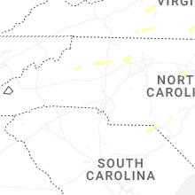


Connect with Interactive Hail Maps