

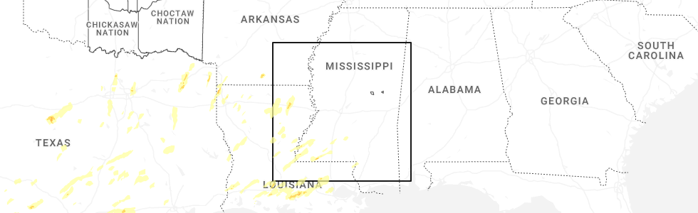
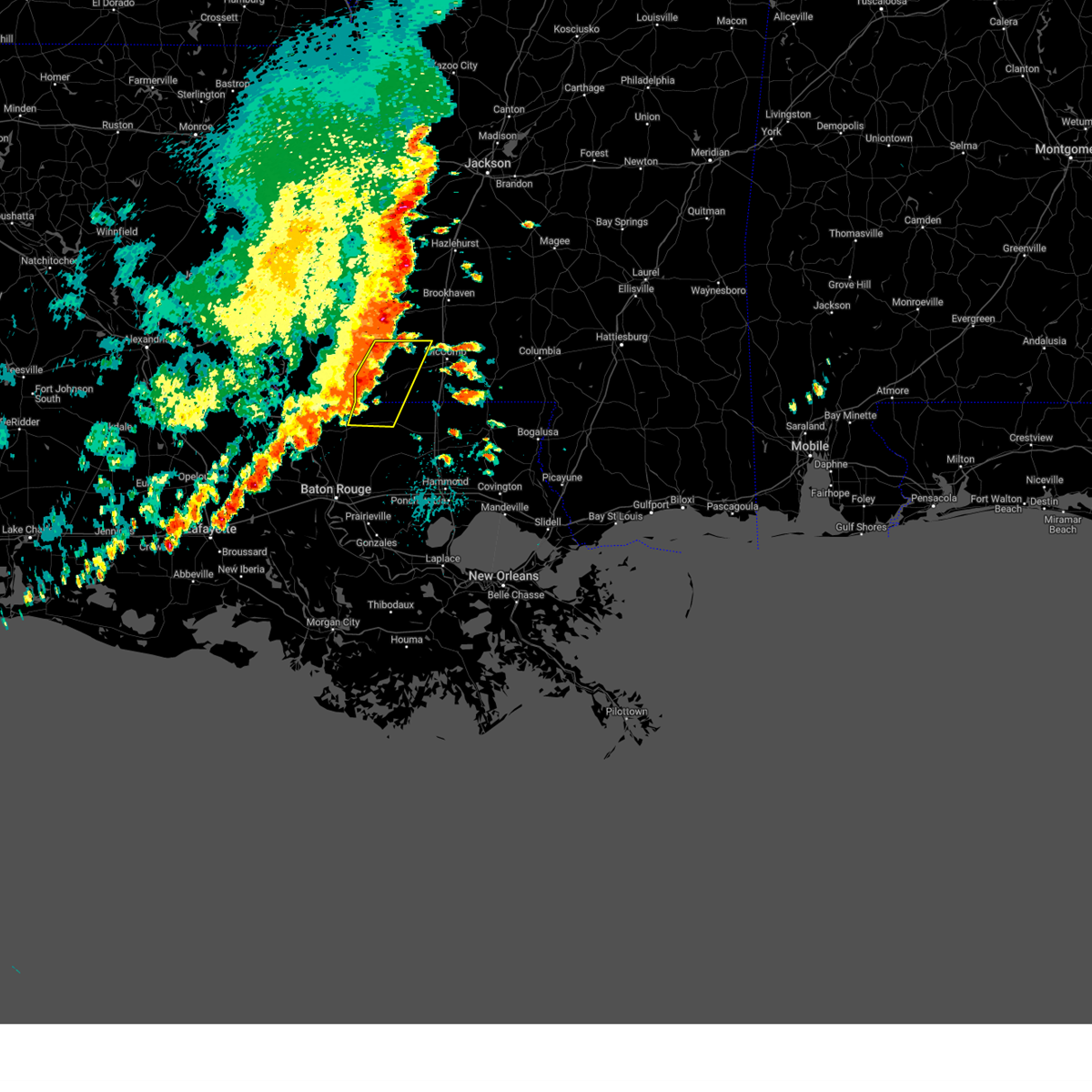
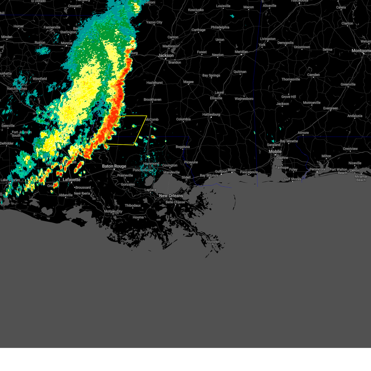
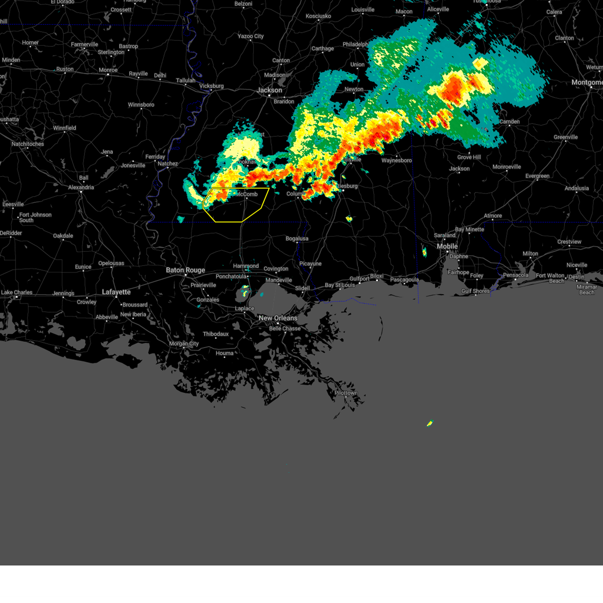
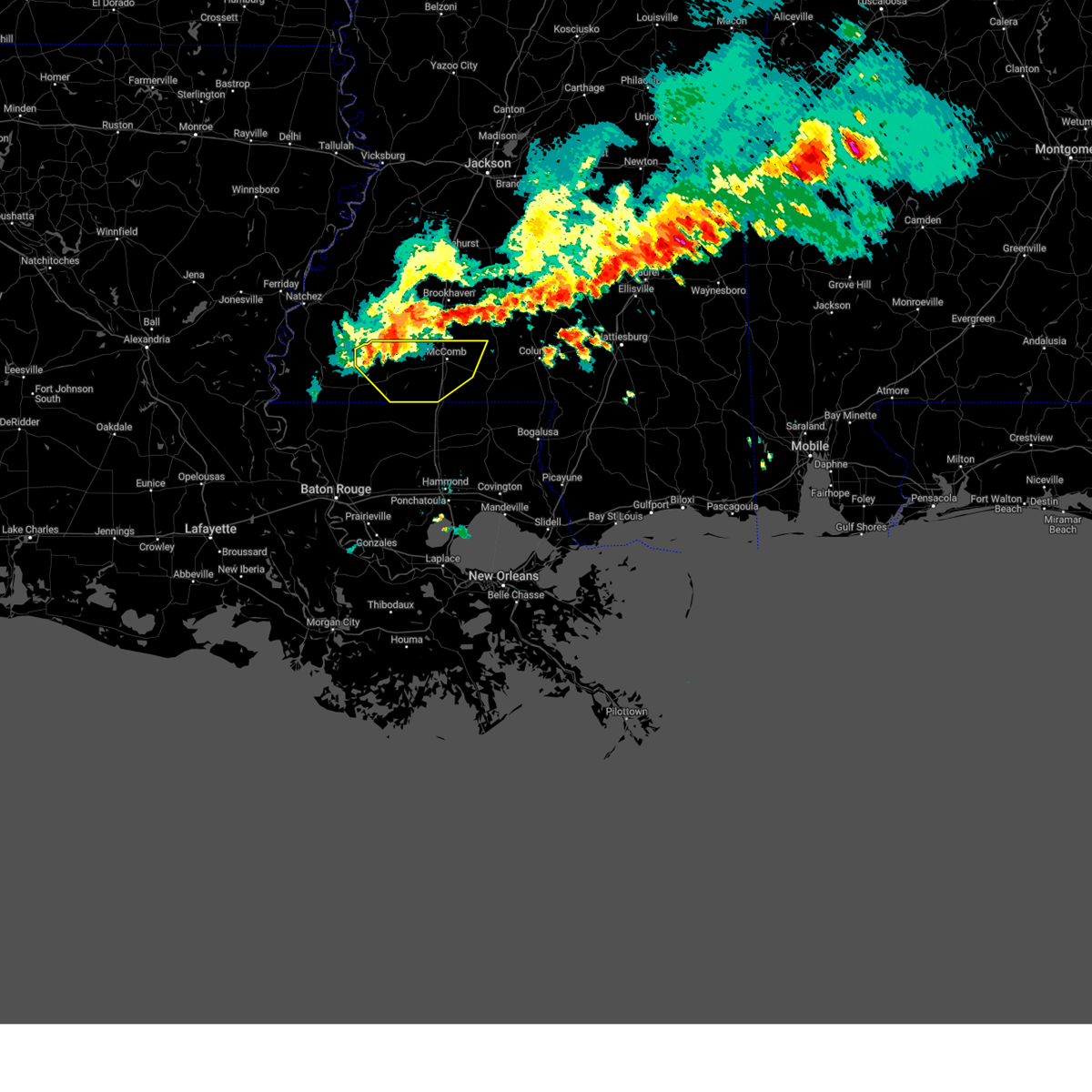
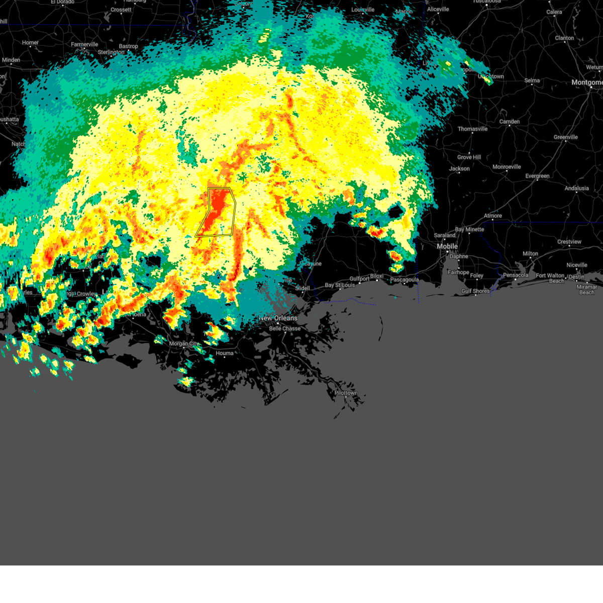
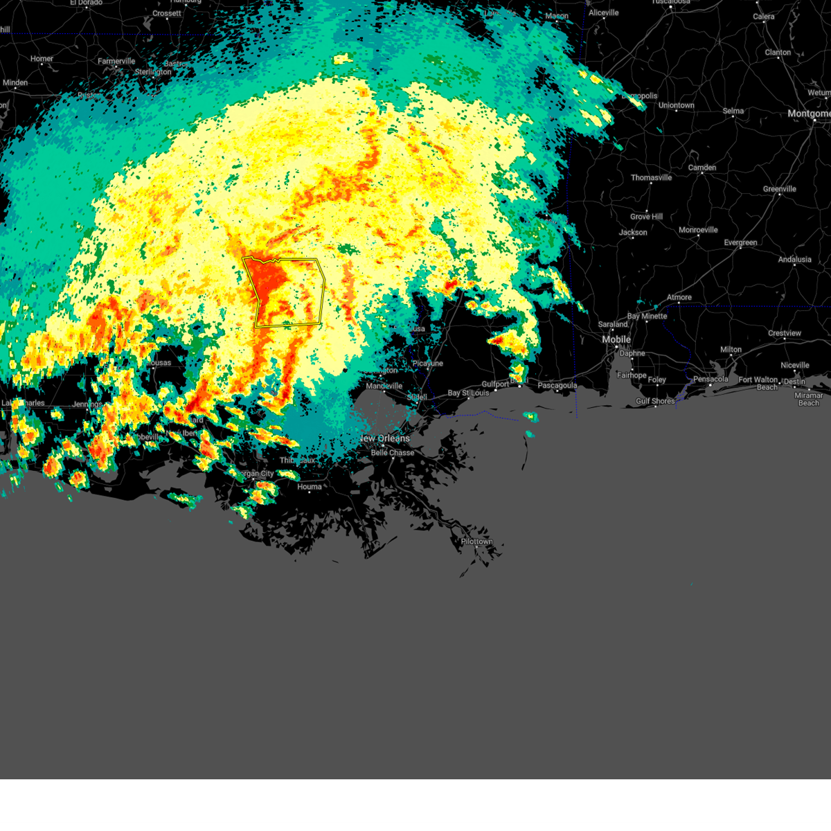
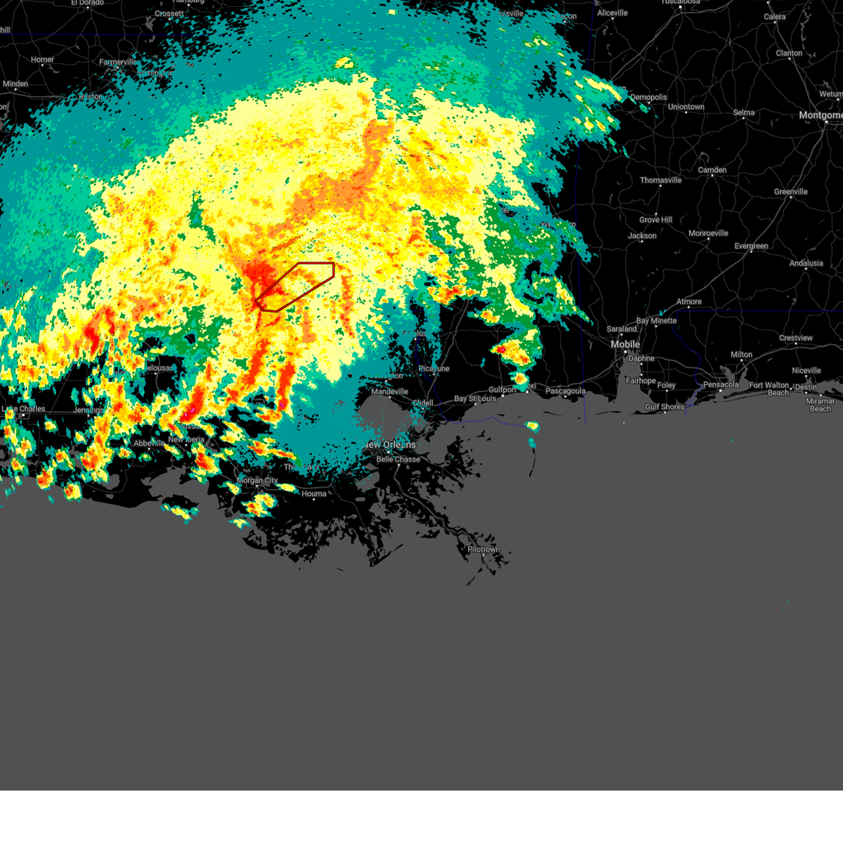
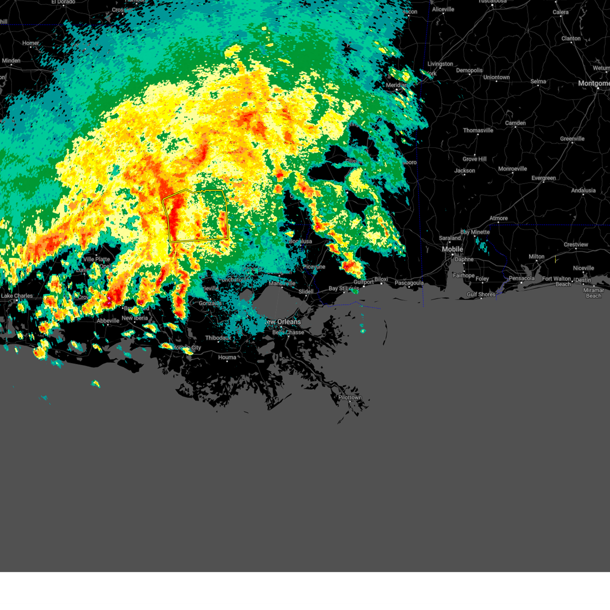
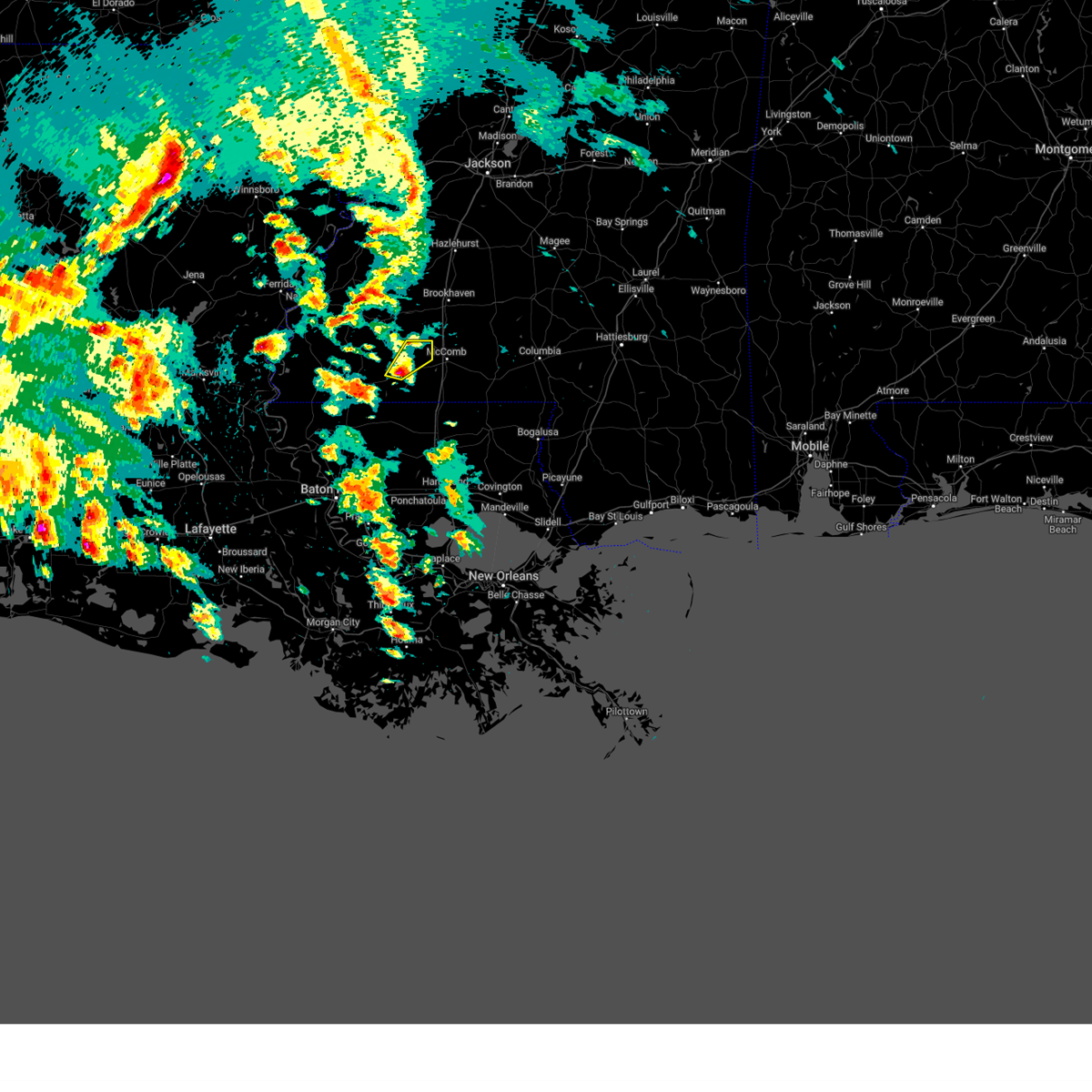
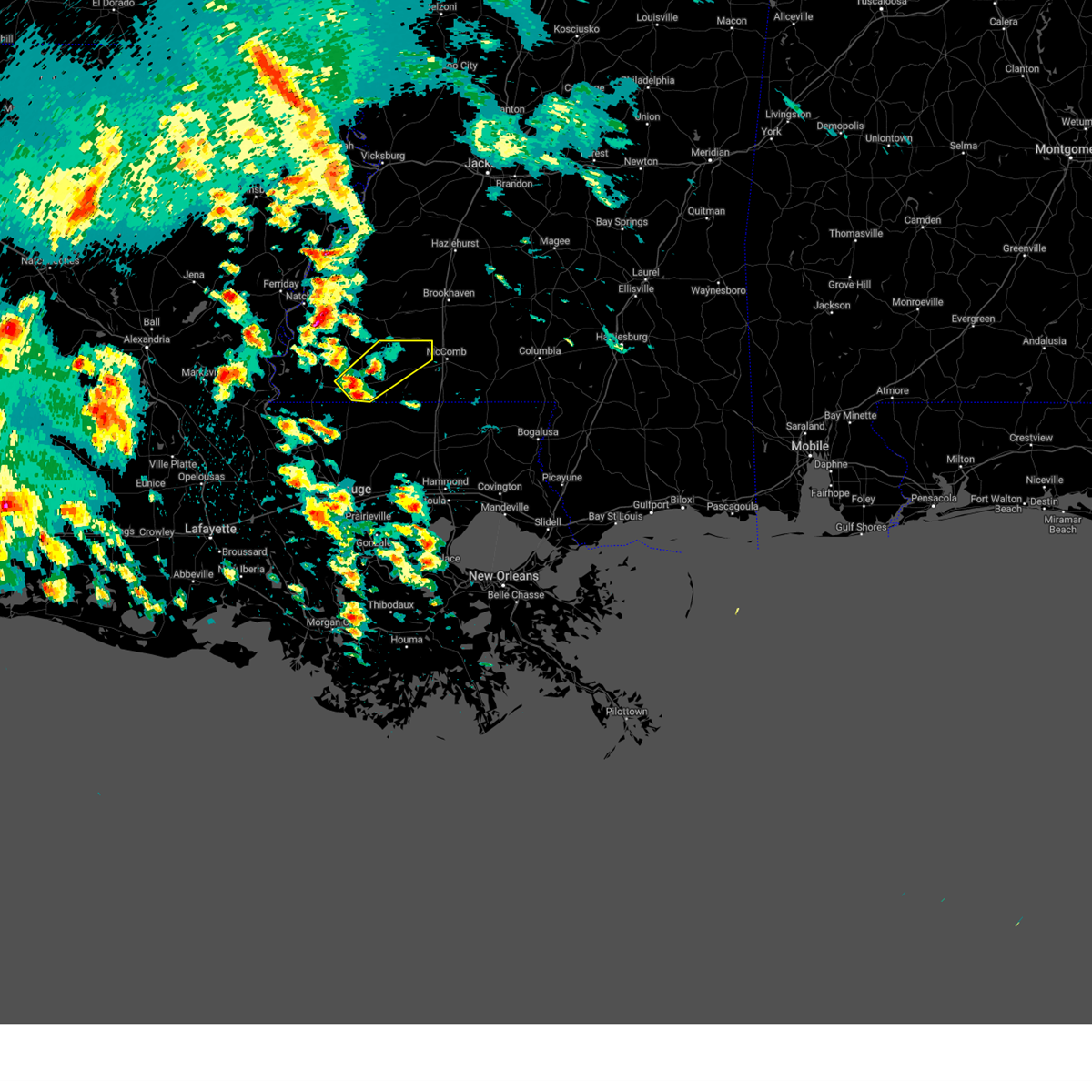
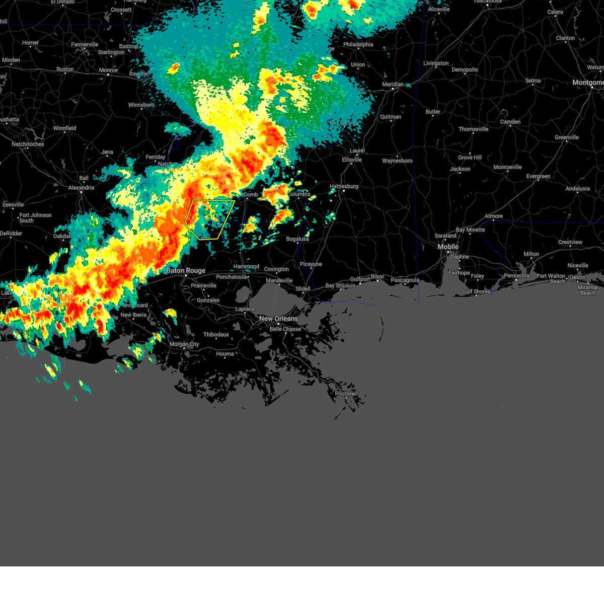
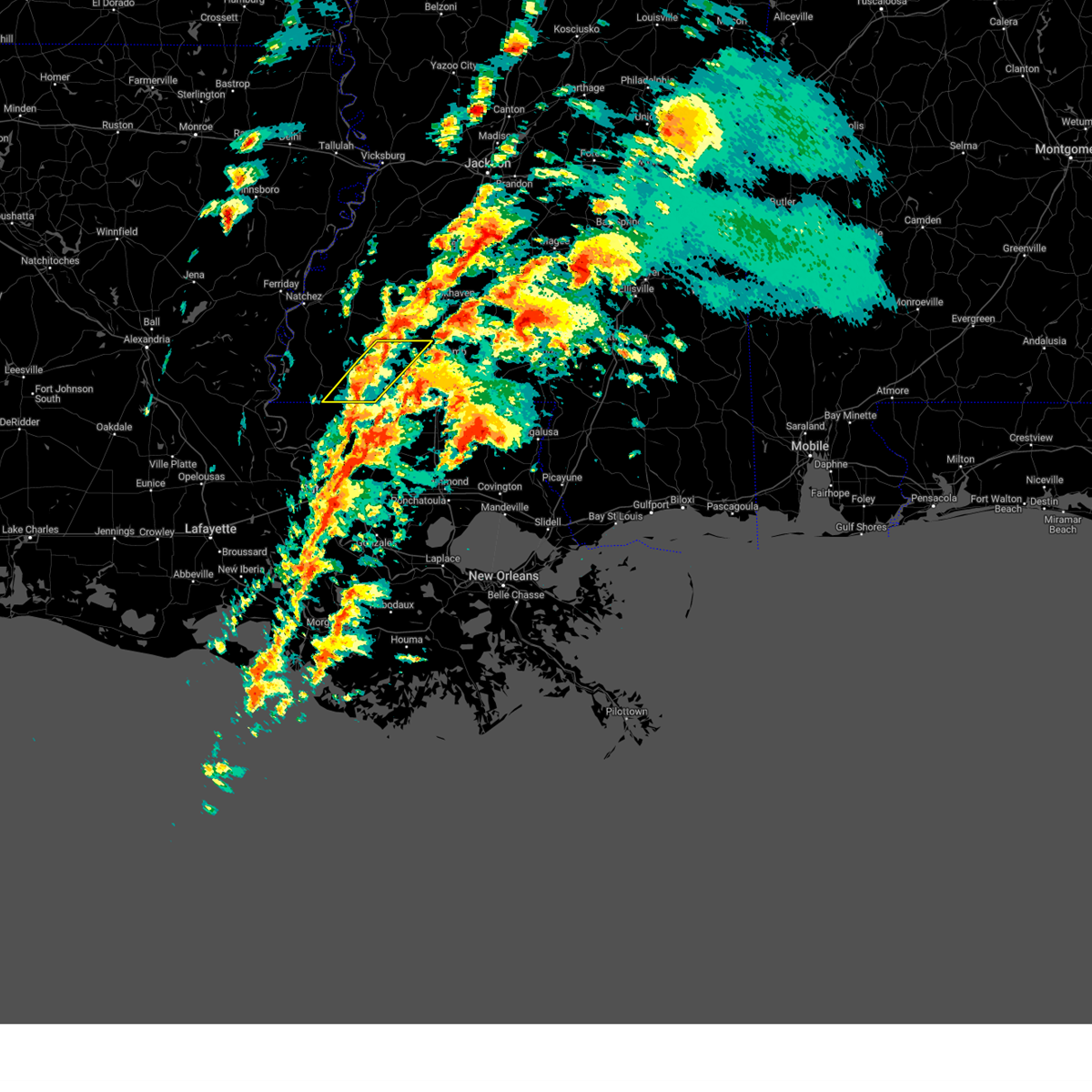
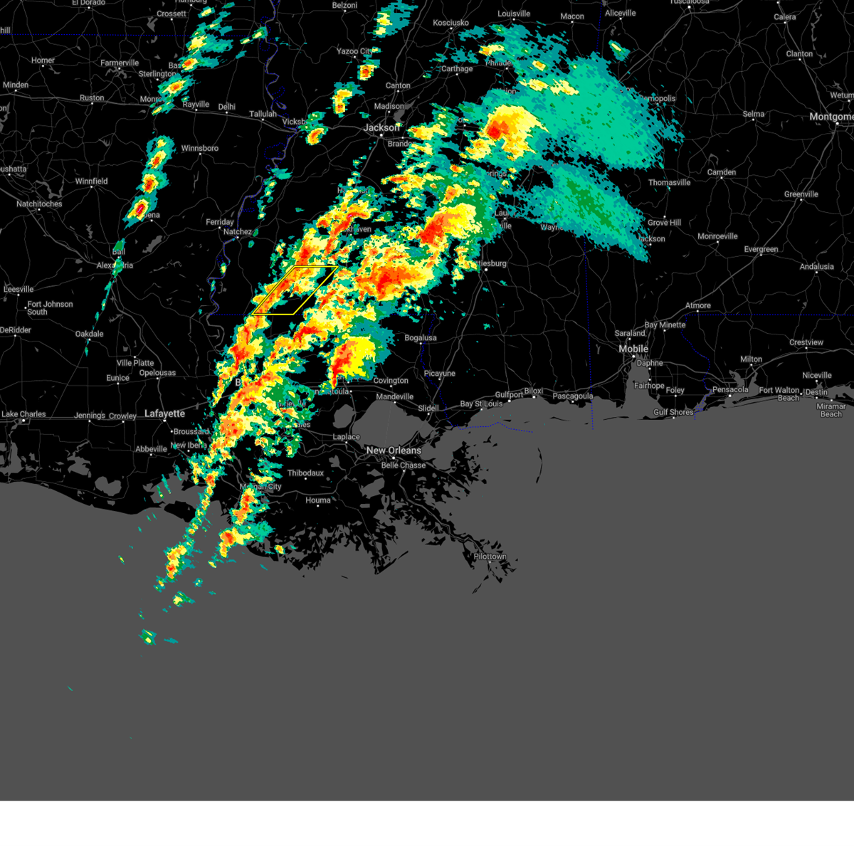
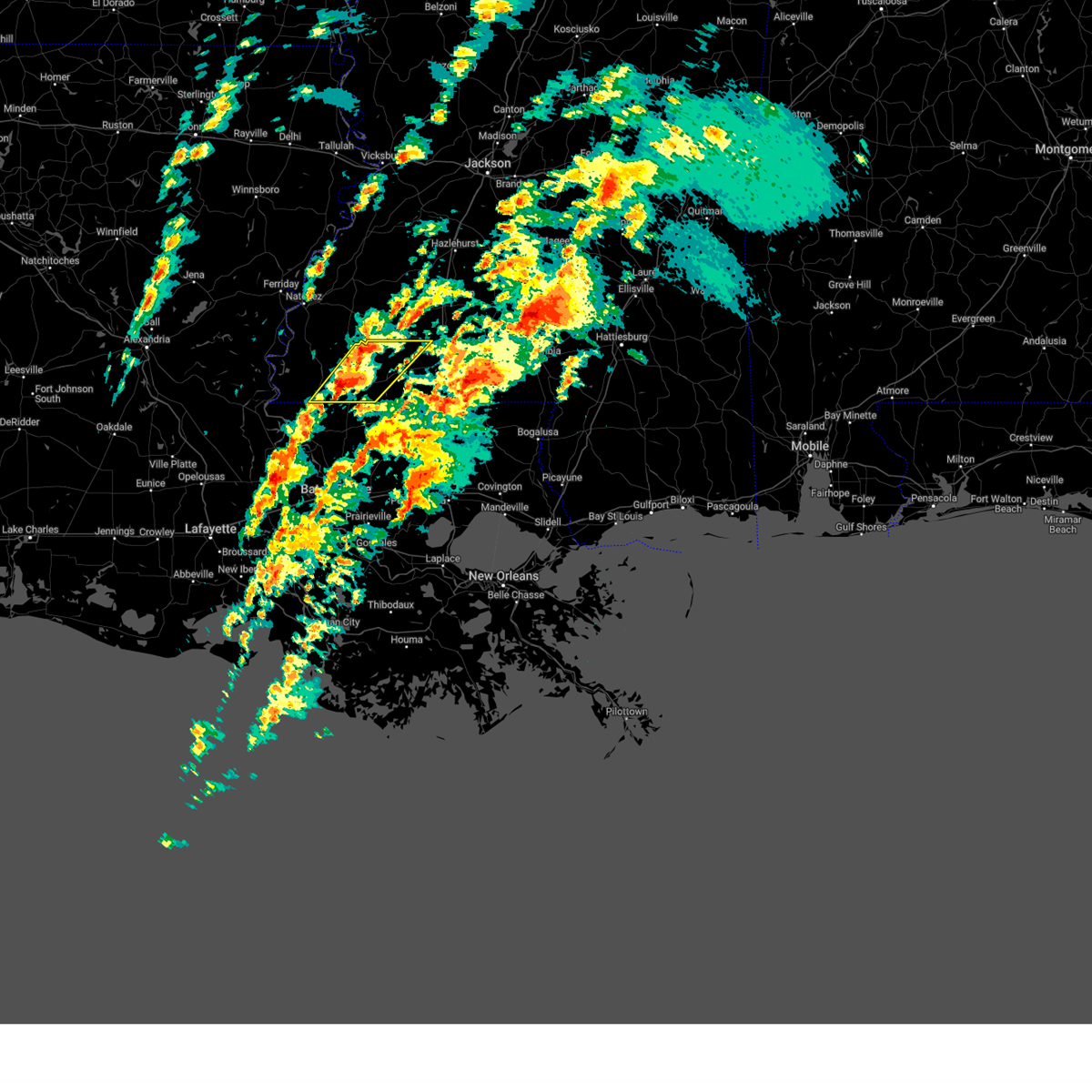
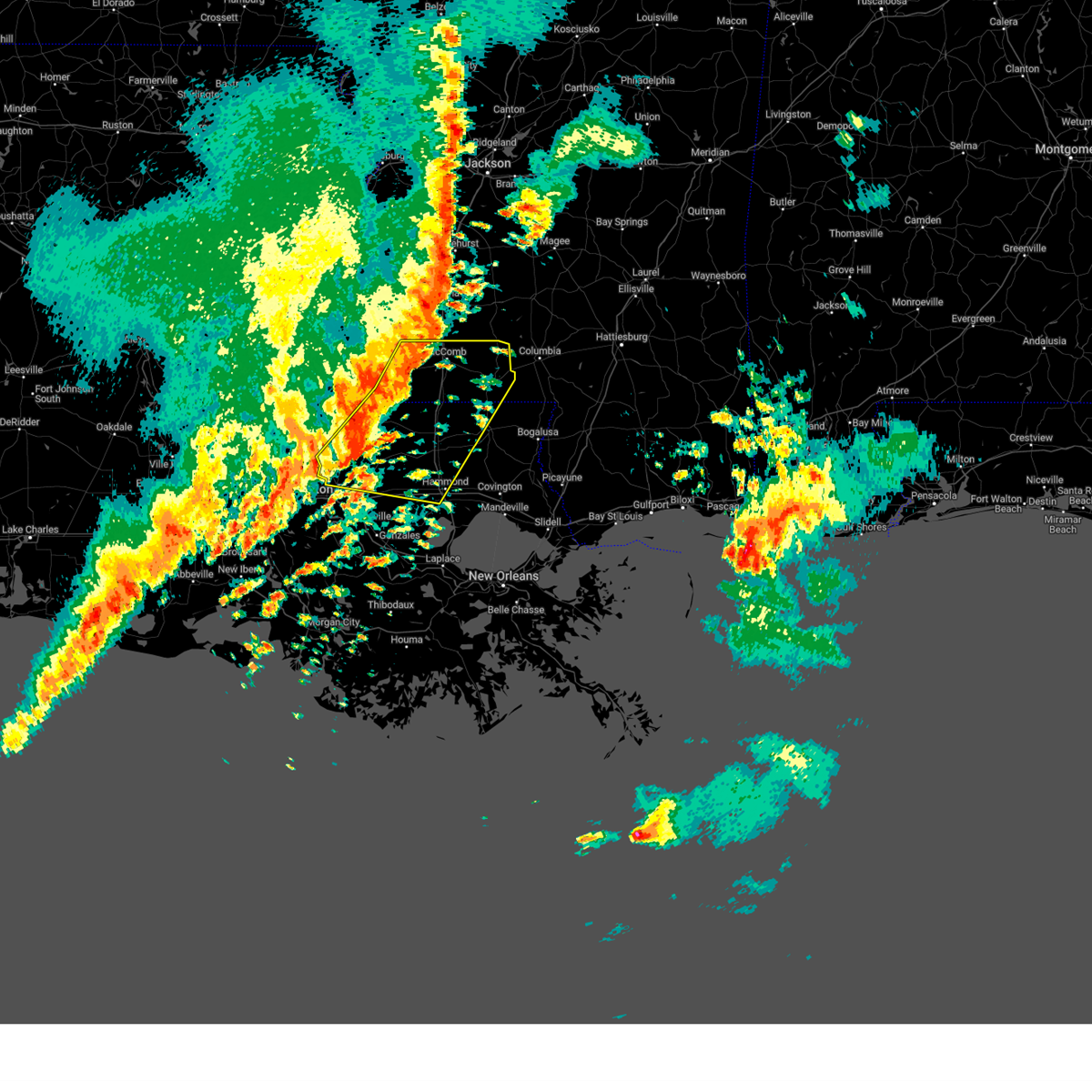
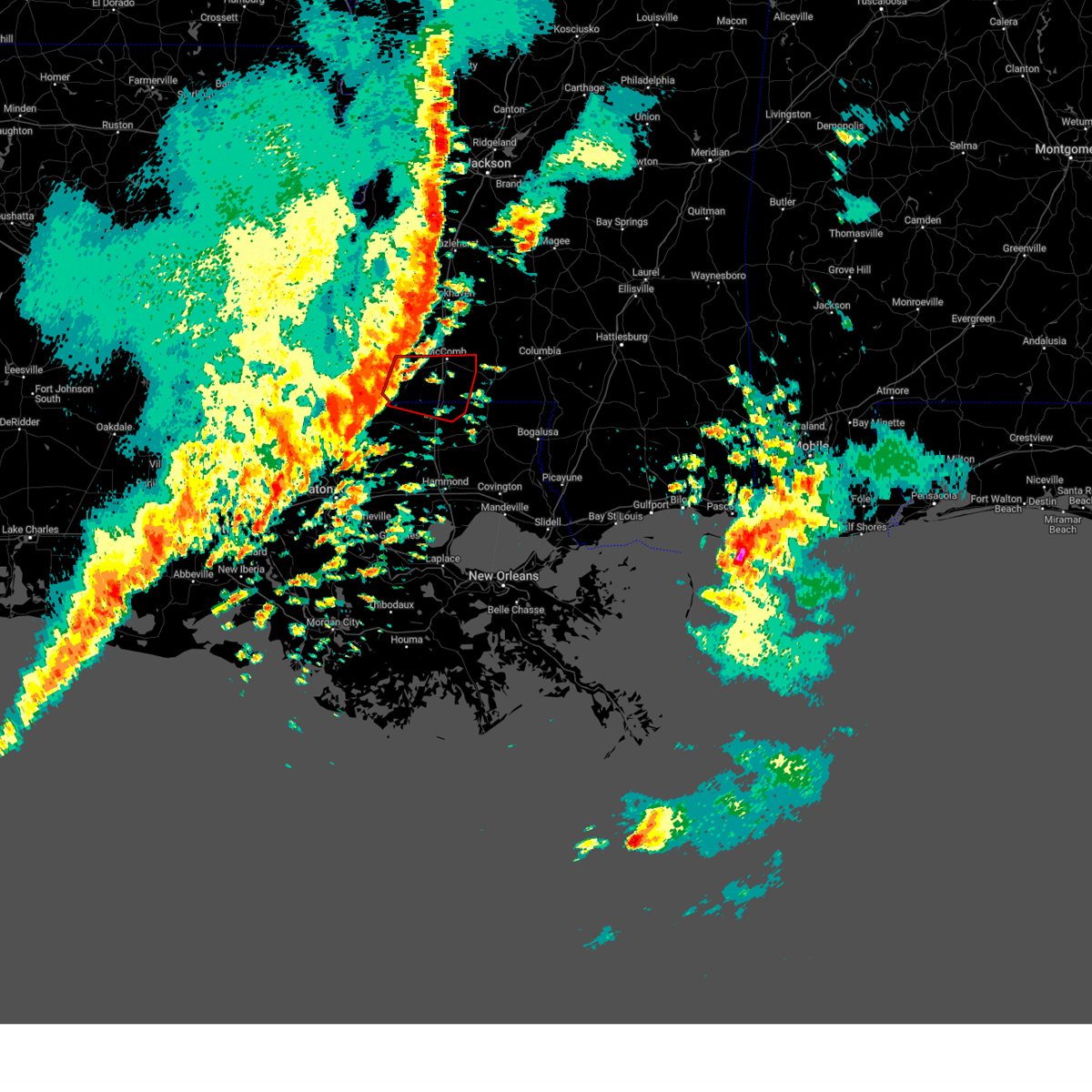
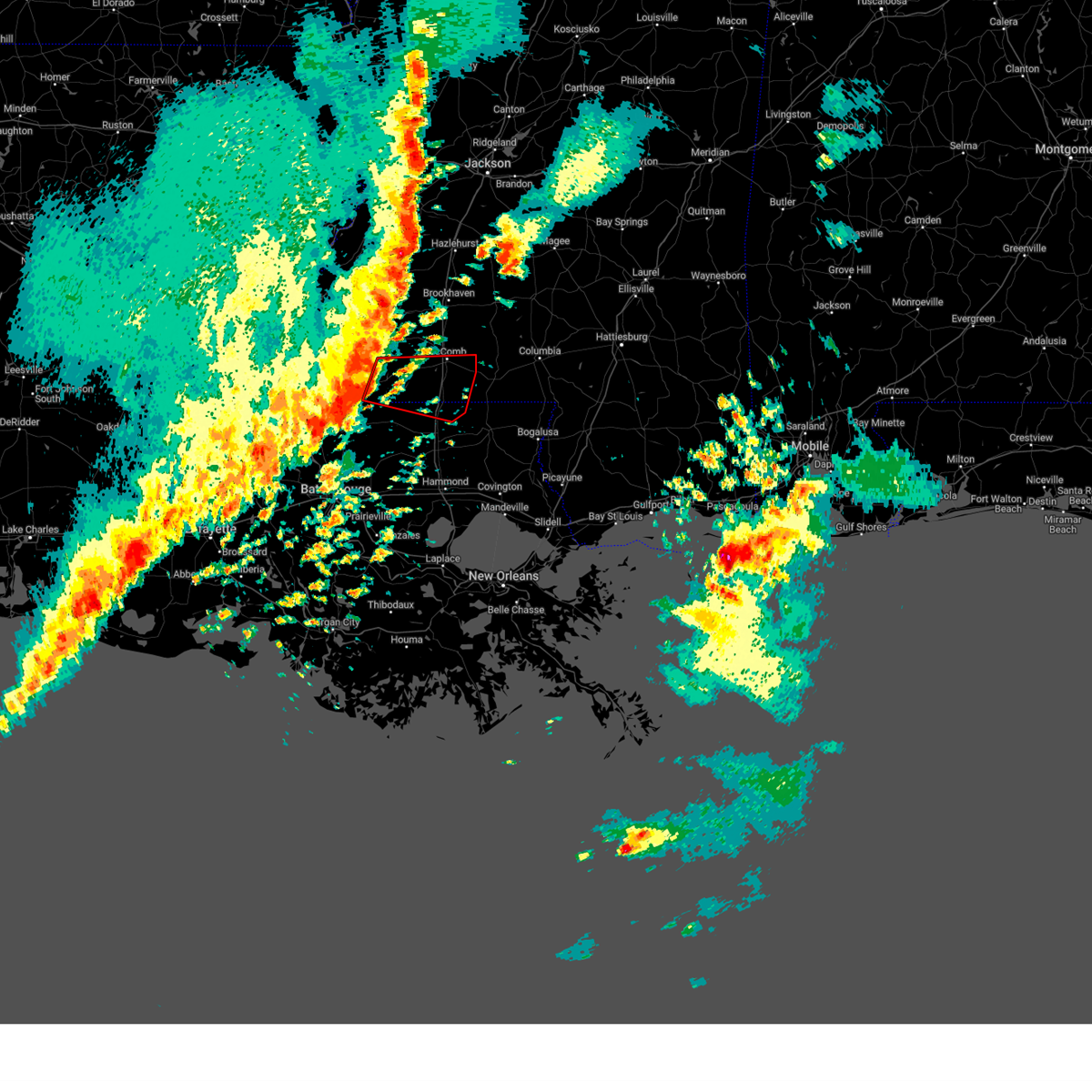
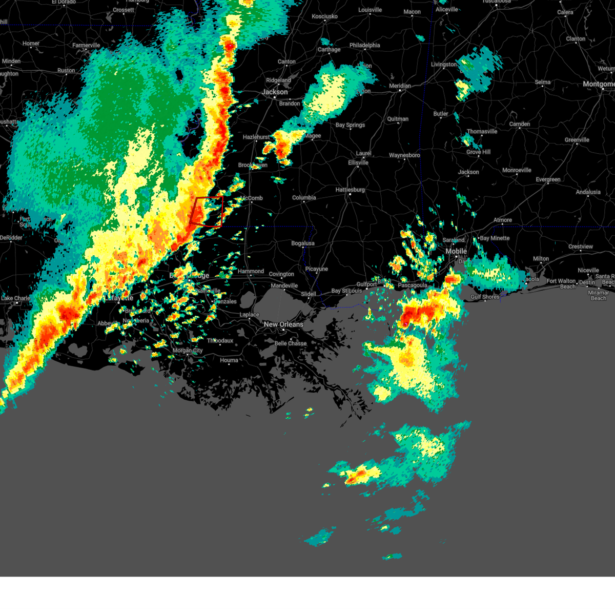
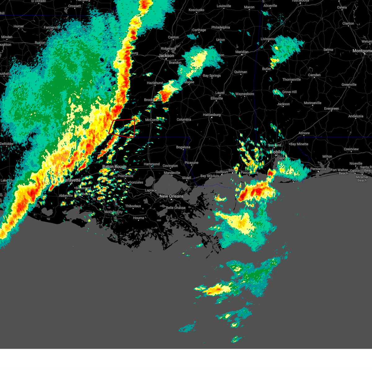
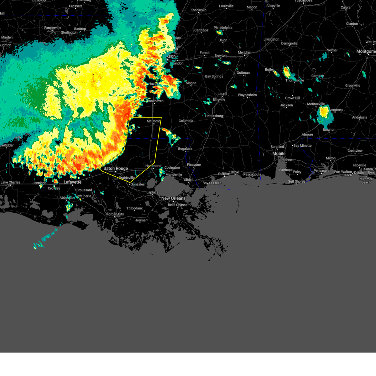
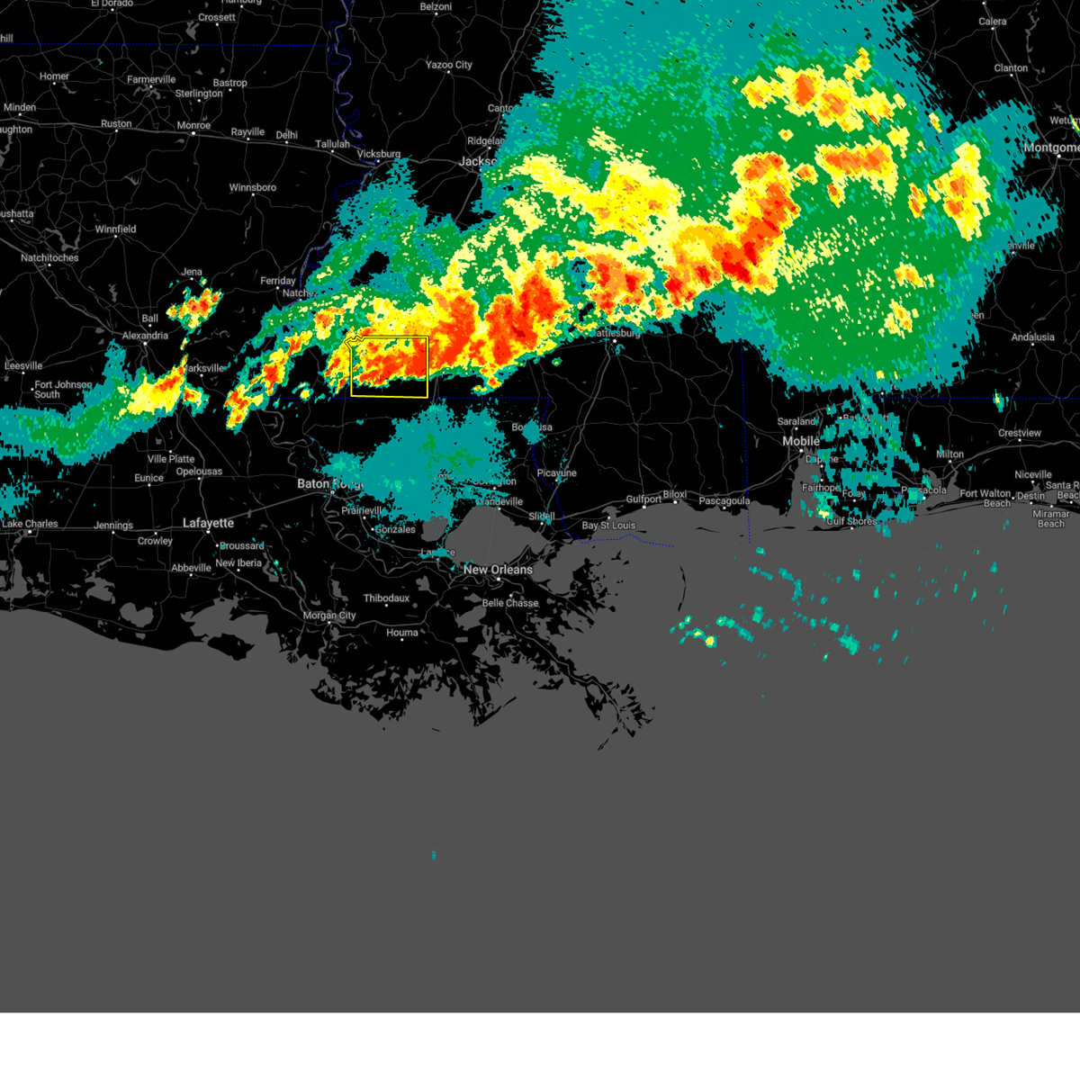
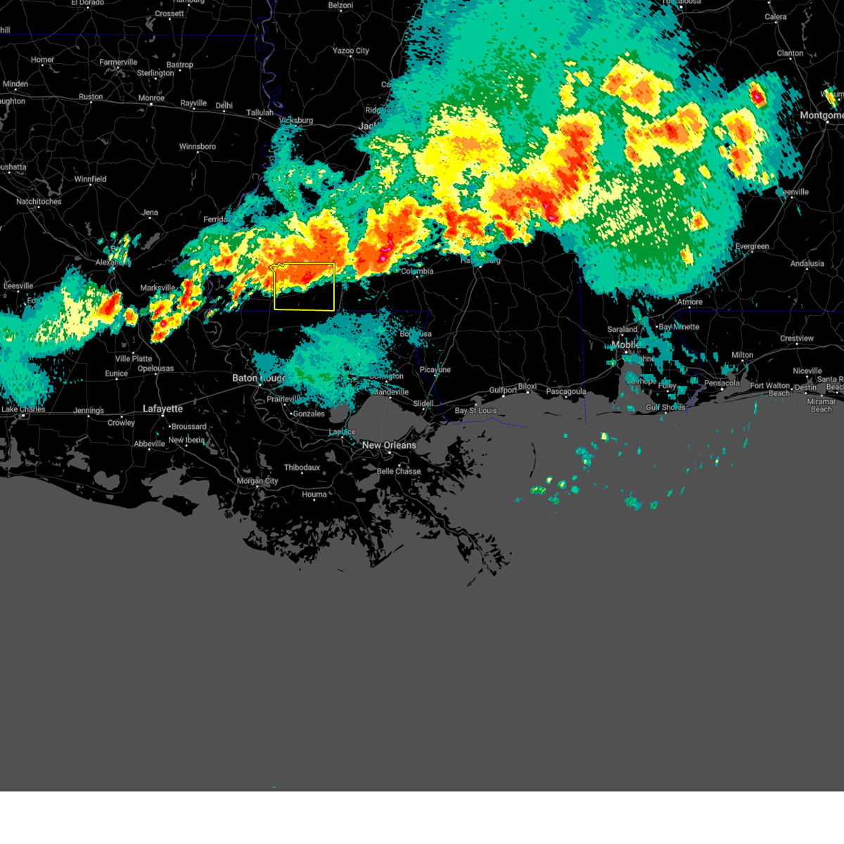
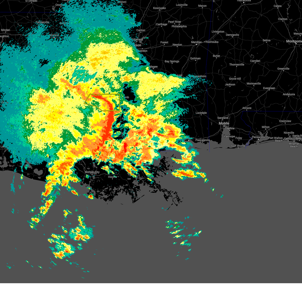
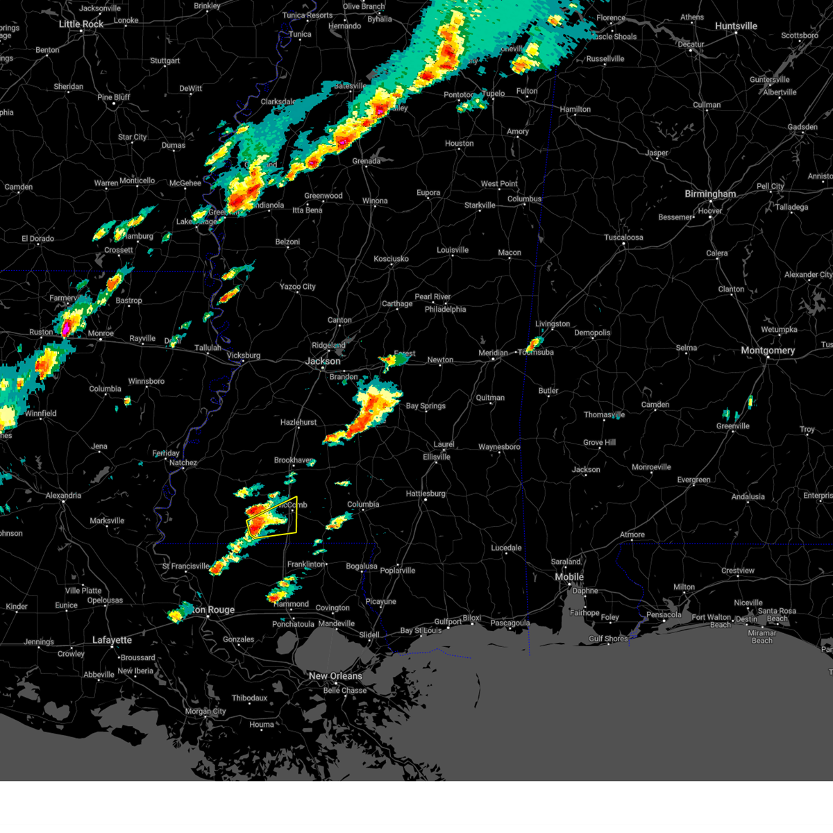
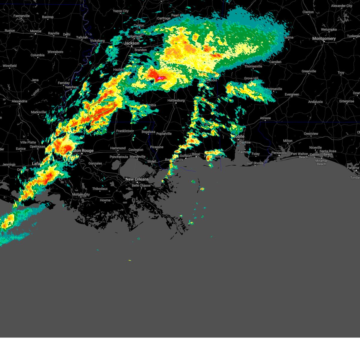
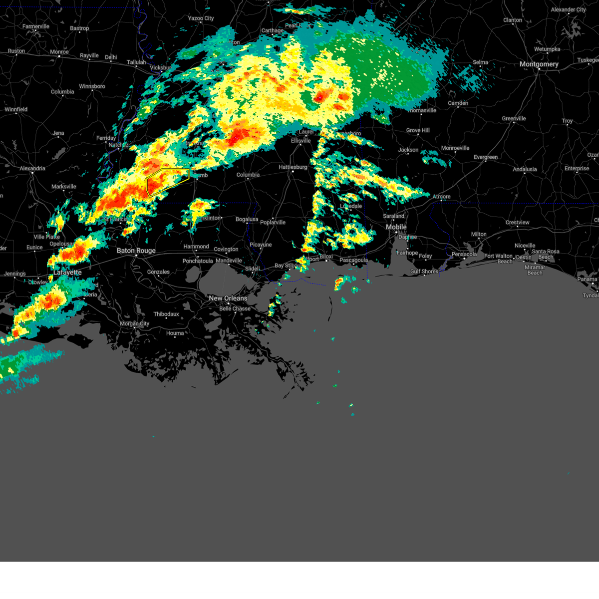
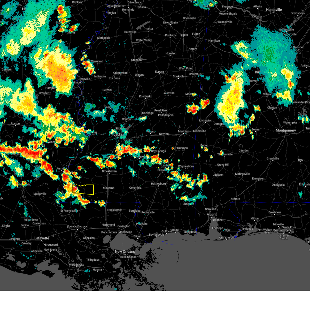
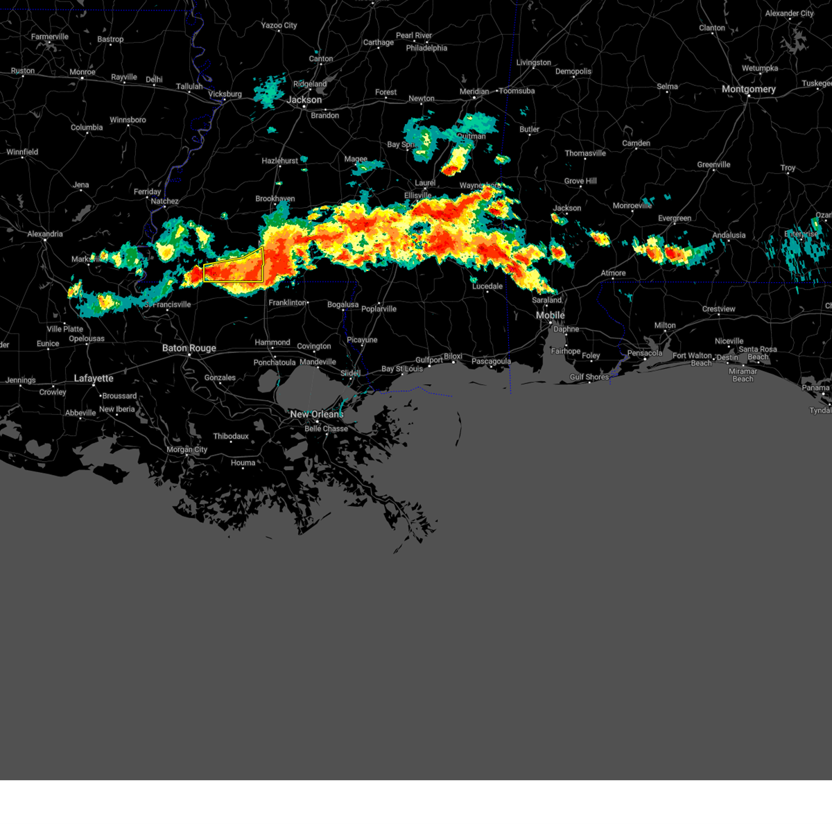
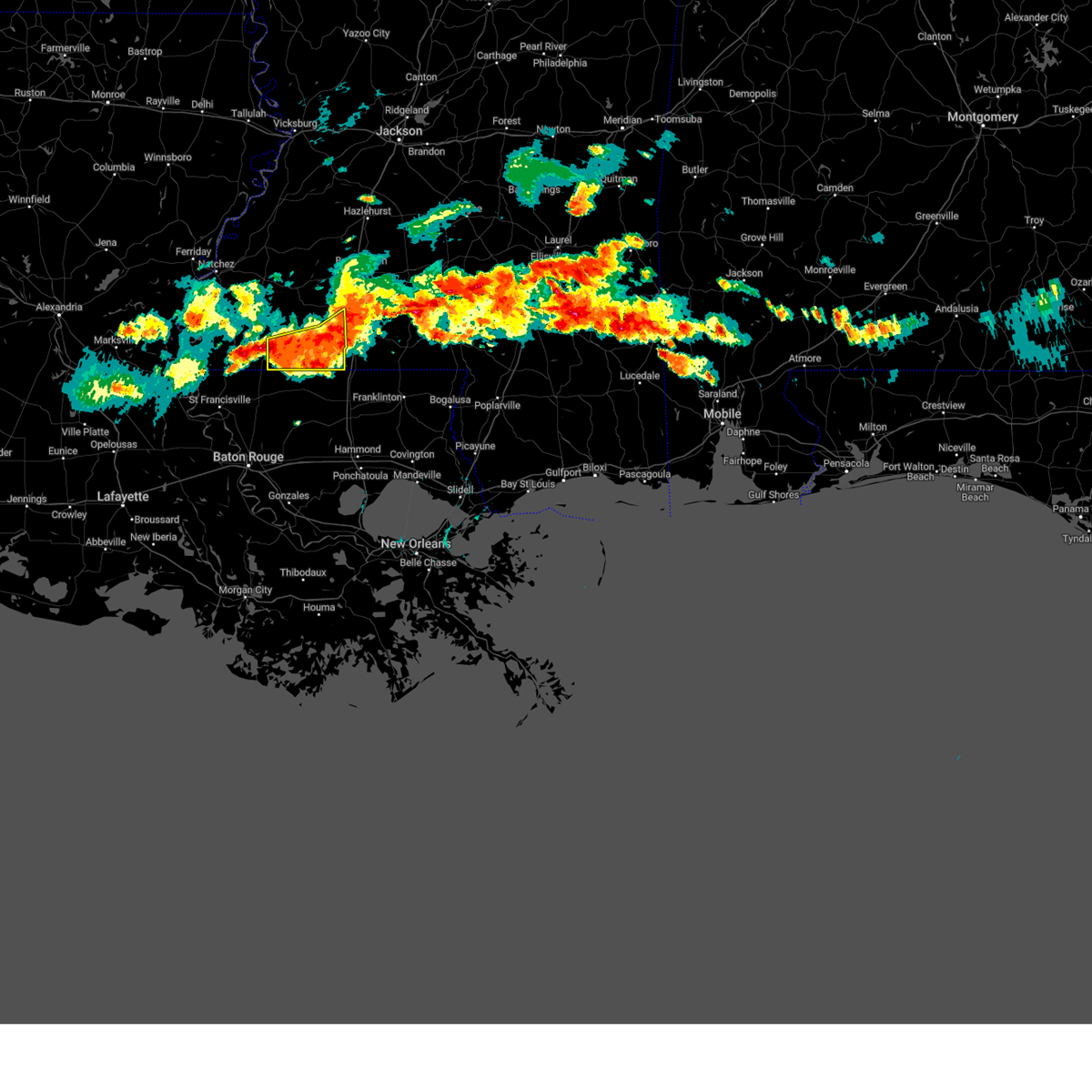
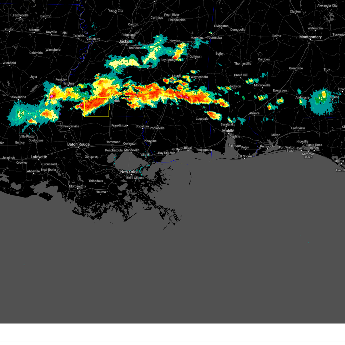
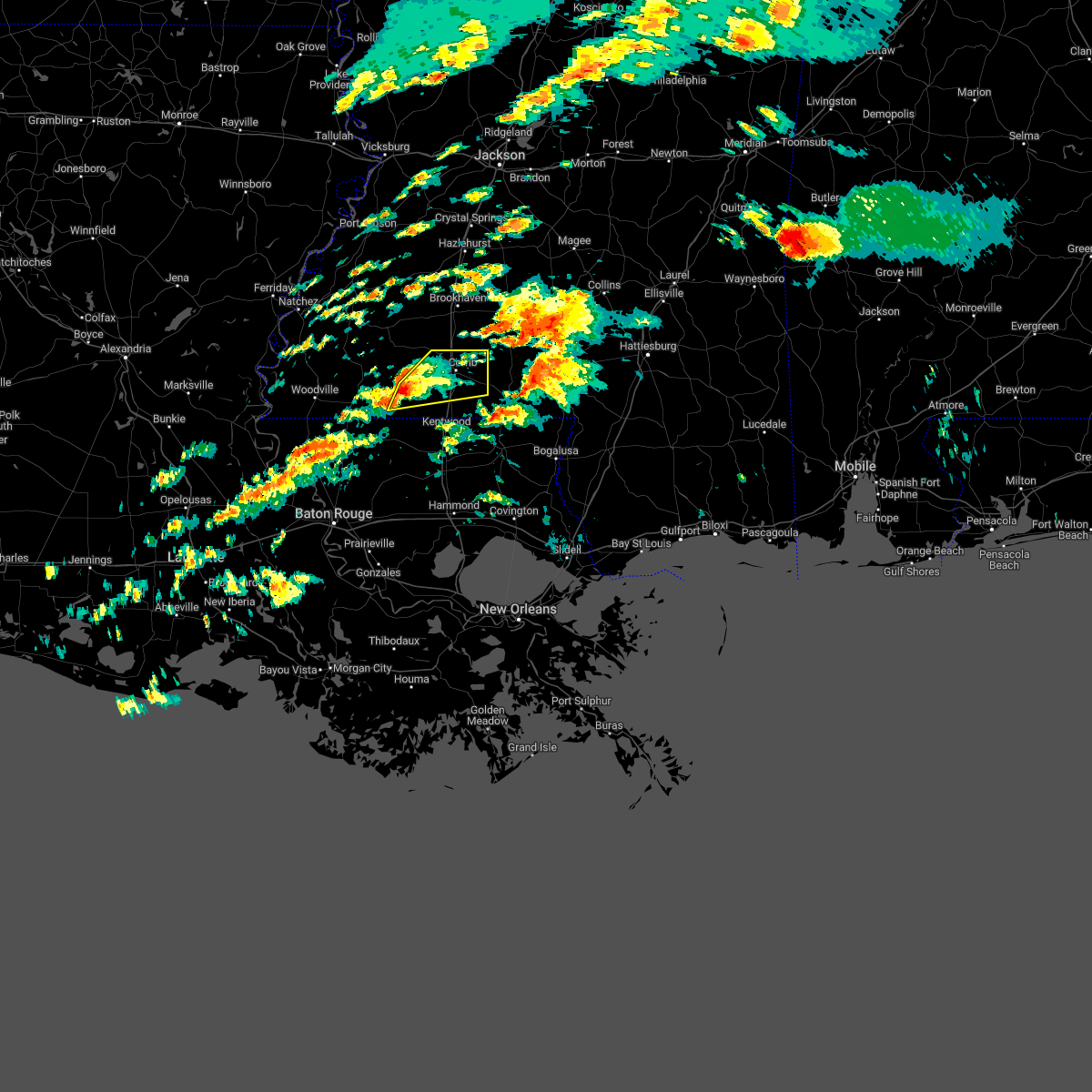
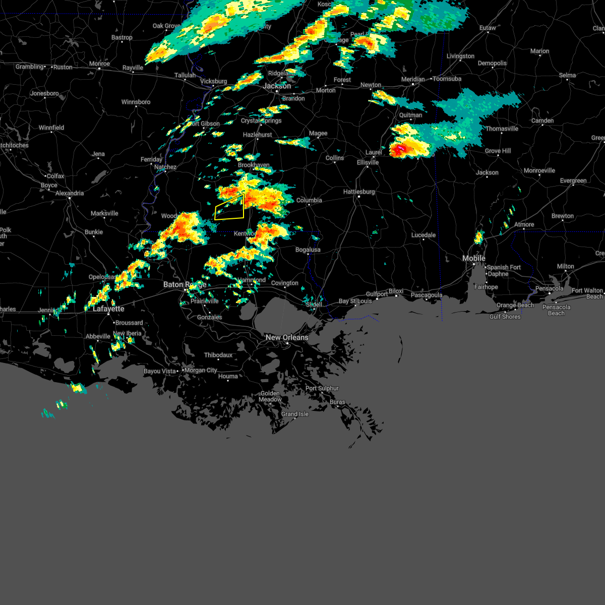
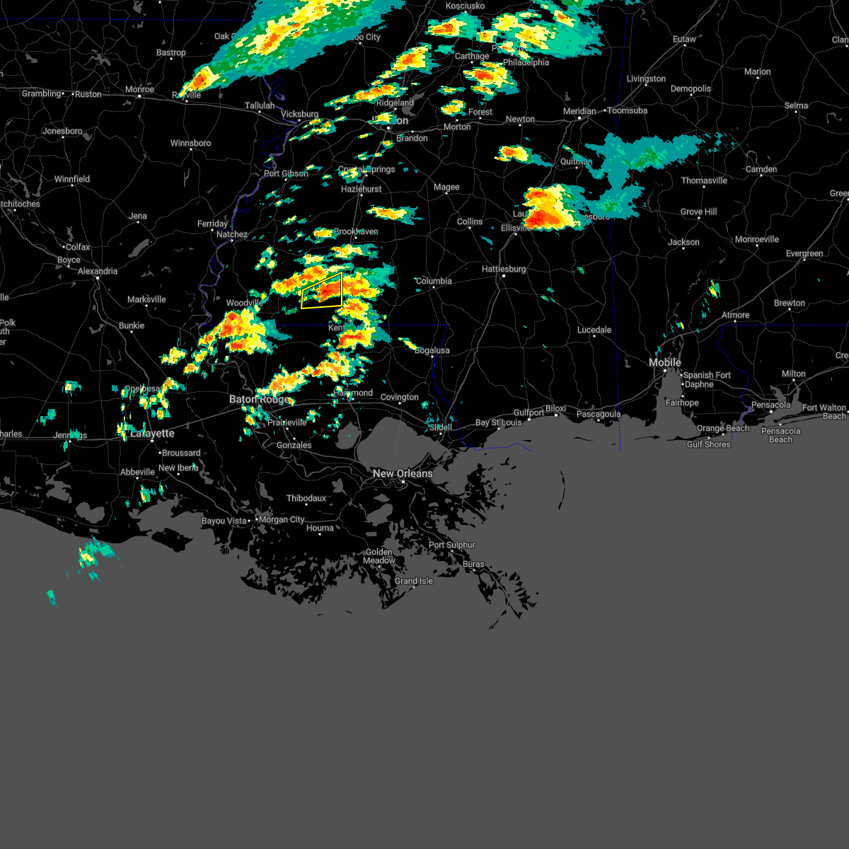
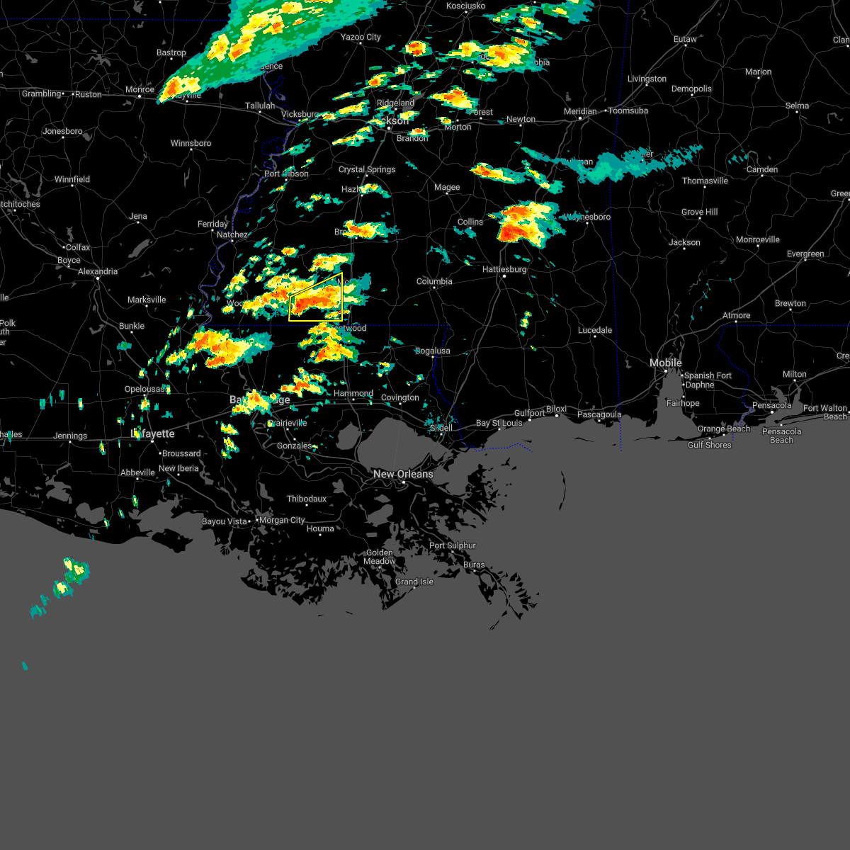
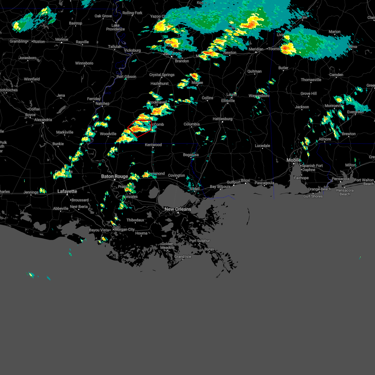
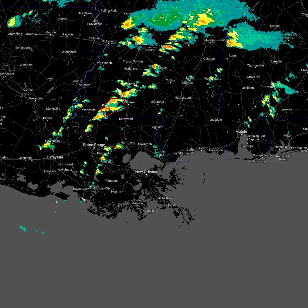
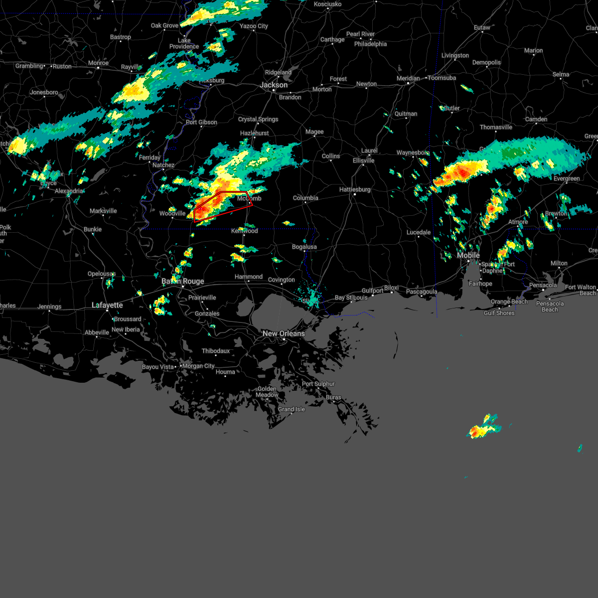
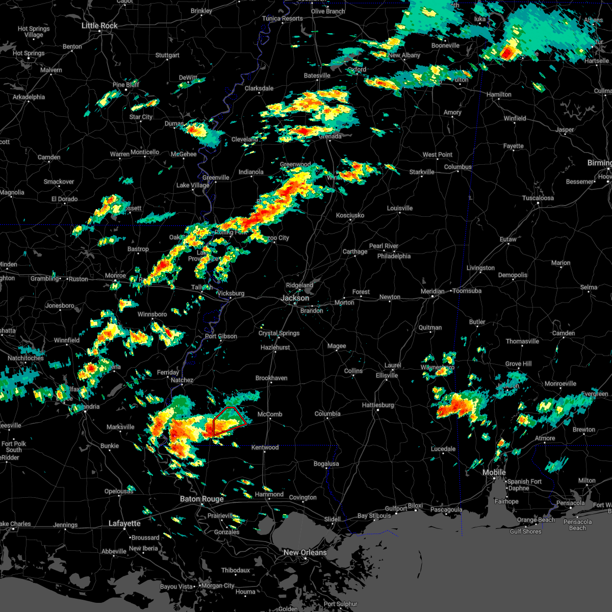
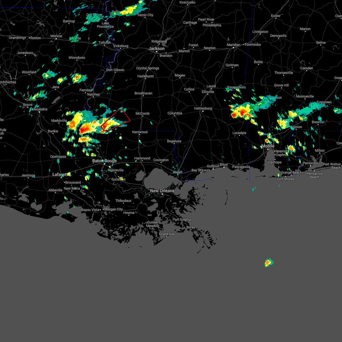
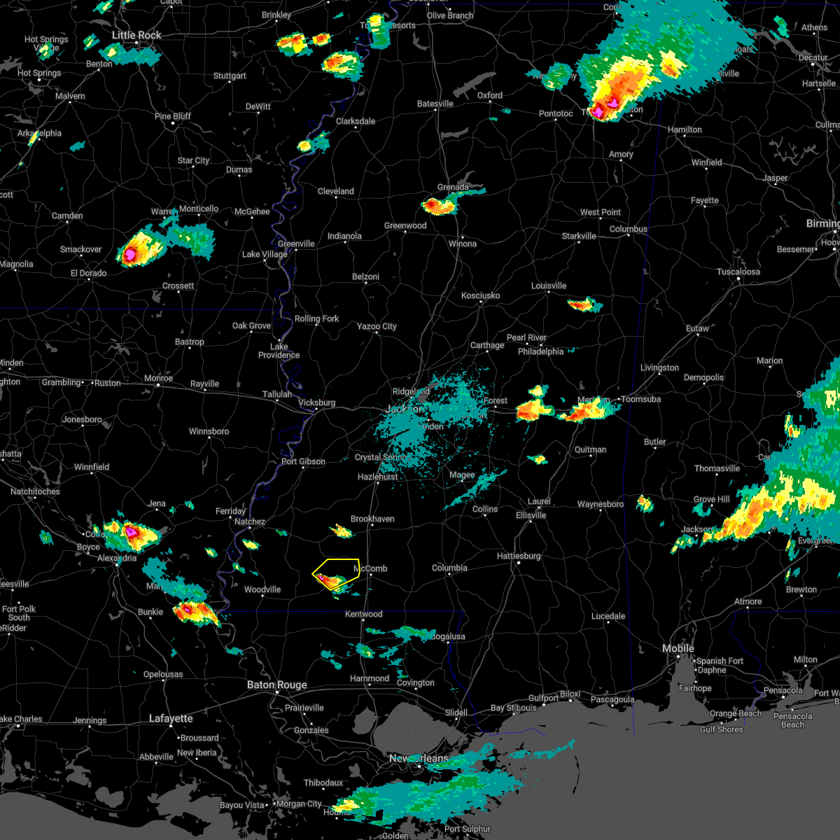
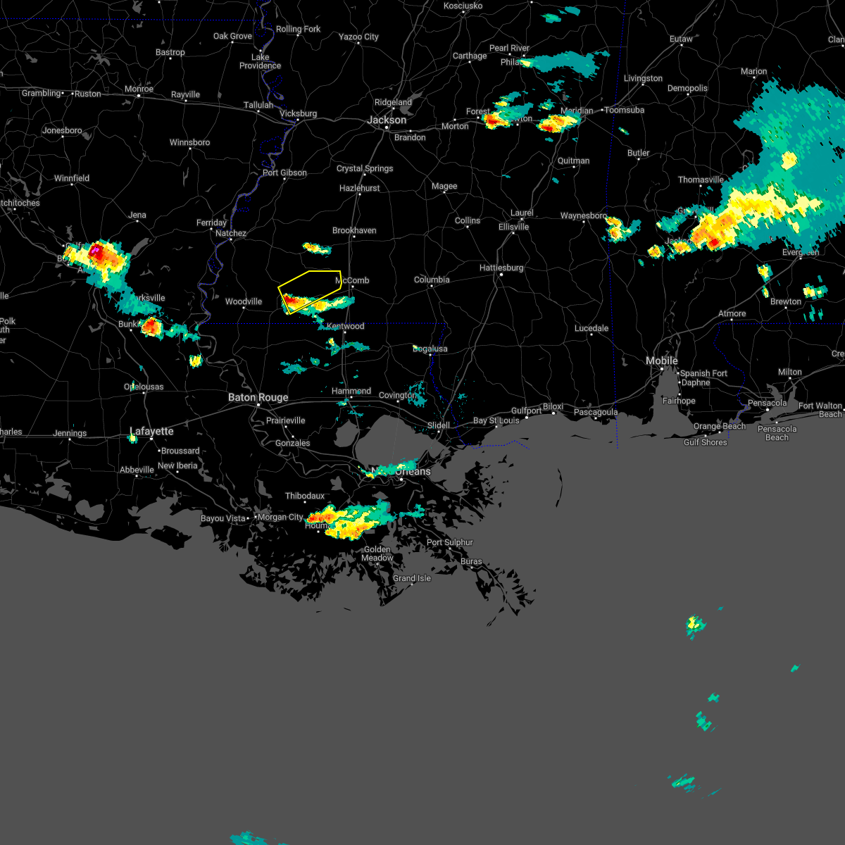
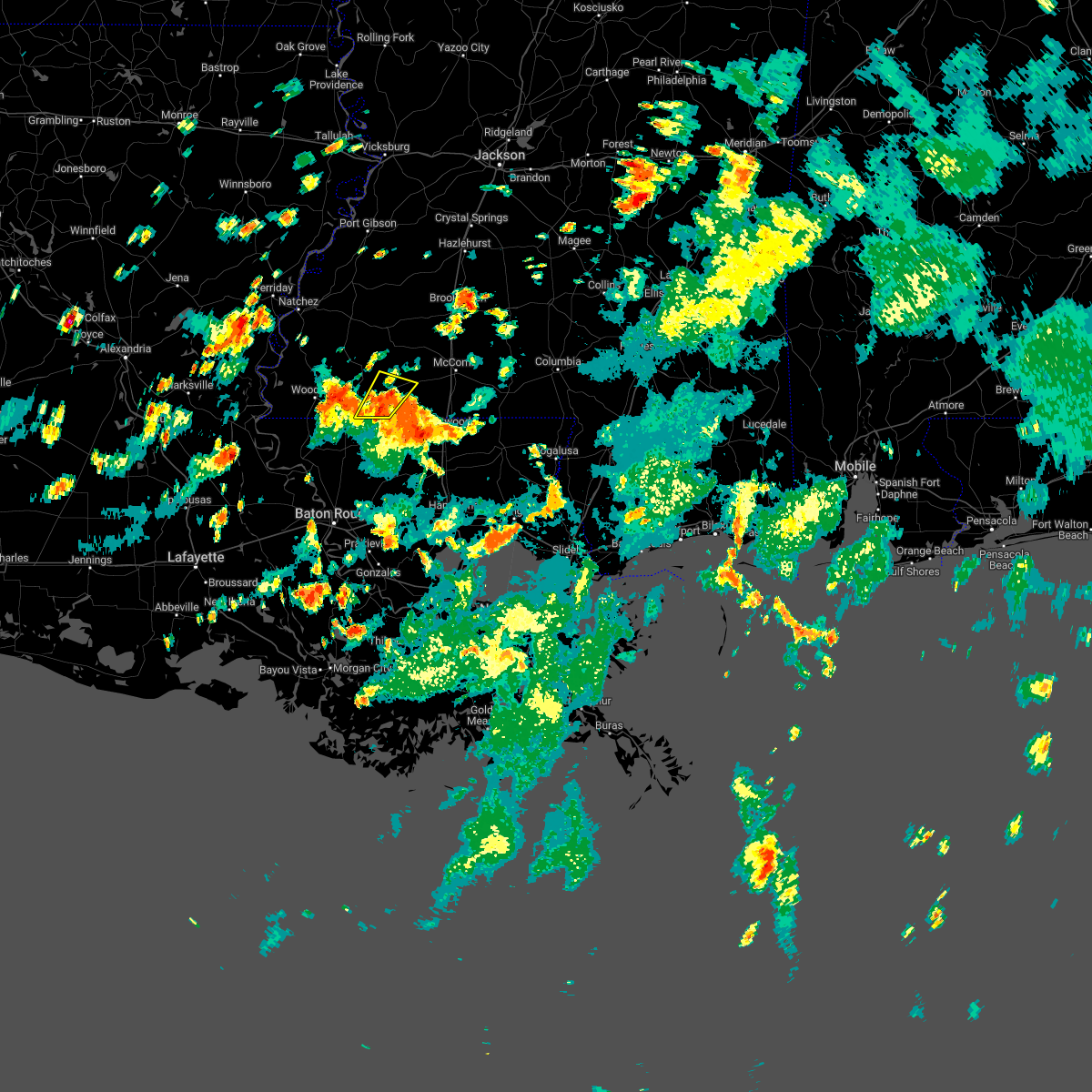
Hail Map for Liberty, MS
The Liberty, MS area has had 3 reports of on-the-ground hail by trained spotters, and has been under severe weather warnings 50 times during the past 12 months. Doppler radar has detected hail at or near Liberty, MS on 50 occasions, including 3 occasions during the past year.
| Name: | Liberty, MS |
| Where Located: | 86.8 miles SSW of Jackson, MS |
| Map: | Google Map for Liberty, MS |
| Population: | 728 |
| Housing Units: | 317 |
| More Info: | Search Google for Liberty, MS |
3
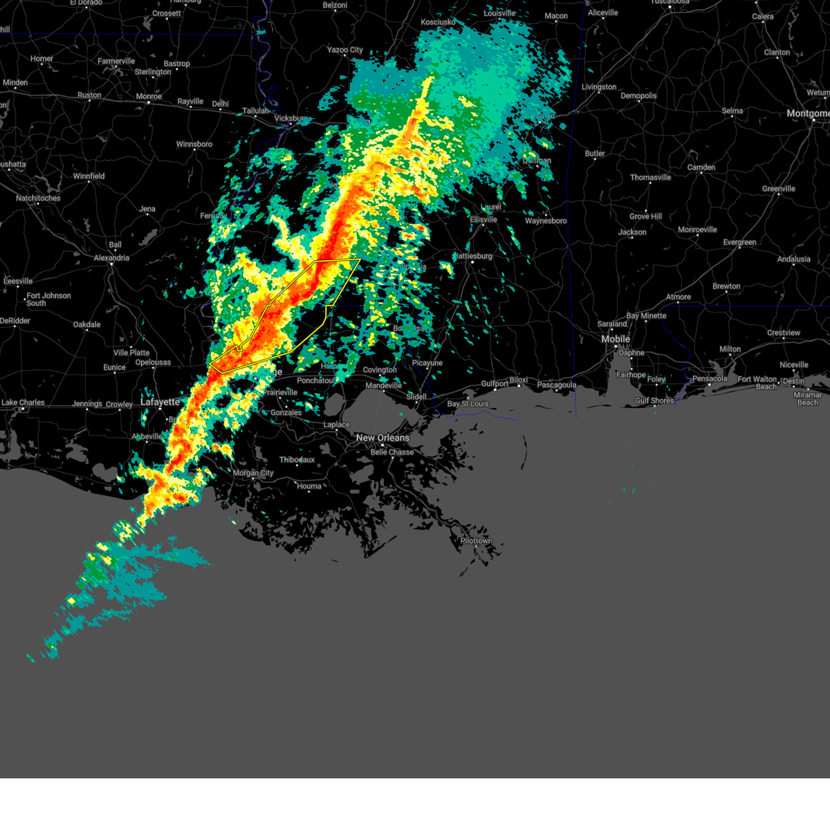
The Top Recent Hail Date for Liberty, MS is Tuesday, May 6, 2025 (2nd out of 50)
Hail and Wind Damage Spotted near Liberty, MS
| Date / Time | Report Details |
|---|---|
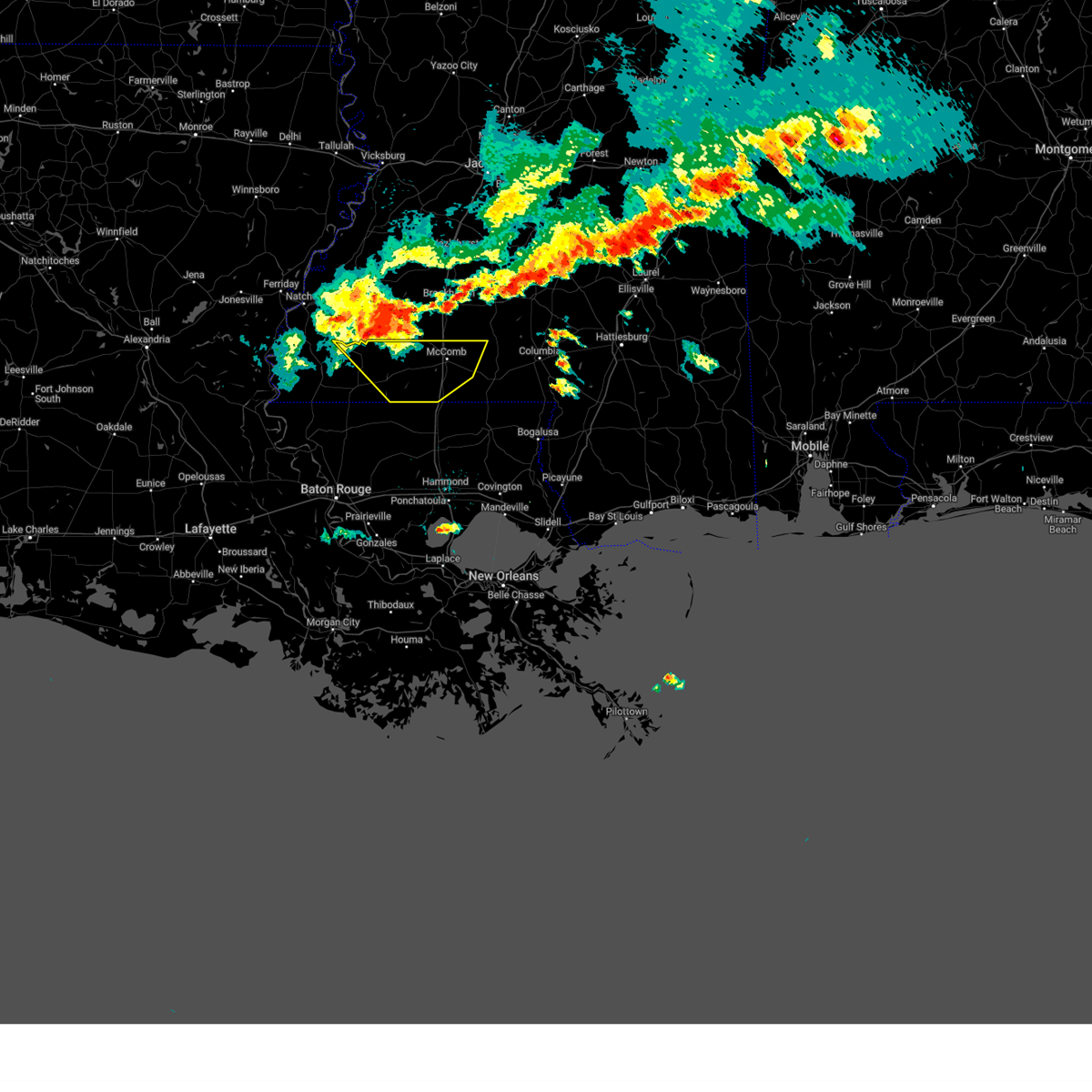
| 6/23/2025 6:18 PM CDT | Svrlix the national weather service in new orleans has issued a * severe thunderstorm warning for, northeastern wilkinson county in southern mississippi, northwestern amite county in southern mississippi, * until 700 pm cdt. * at 618 pm cdt, a severe thunderstorm was located near liberty, moving northwest at 20 mph (radar indicated). Hazards include 60 mph wind gusts and quarter size hail. Hail damage to vehicles is expected. Expect wind damage to roofs, siding, and trees. |
| 6/14/2025 1:26 PM CDT |
 the severe thunderstorm warning has been cancelled and is no longer in effect the severe thunderstorm warning has been cancelled and is no longer in effect
|
| 6/14/2025 1:03 PM CDT |
 Svrlix the national weather service in new orleans has issued a * severe thunderstorm warning for, pike county in southern mississippi, eastern amite county in southern mississippi, * until 145 pm cdt. * at 103 pm cdt, severe thunderstorms were located along a line extending from 7 miles northeast of felps to near gillsburg, moving northeast at 35 mph (radar indicated). Hazards include 60 mph wind gusts and quarter size hail. Hail damage to vehicles is expected. Expect wind damage to roofs, siding, and trees. Svrlix the national weather service in new orleans has issued a * severe thunderstorm warning for, pike county in southern mississippi, eastern amite county in southern mississippi, * until 145 pm cdt. * at 103 pm cdt, severe thunderstorms were located along a line extending from 7 miles northeast of felps to near gillsburg, moving northeast at 35 mph (radar indicated). Hazards include 60 mph wind gusts and quarter size hail. Hail damage to vehicles is expected. Expect wind damage to roofs, siding, and trees.
|
| 5/28/2025 4:55 PM CDT | Svrlix the national weather service in new orleans has issued a * severe thunderstorm warning for, north central tangipahoa parish in southeastern louisiana, northwestern washington parish in southeastern louisiana, walthall county in southern mississippi, pike county in southern mississippi, eastern amite county in southern mississippi, * until 545 pm cdt. * at 455 pm cdt, severe thunderstorms were located along a line extending from near sandy hook to near osyka, moving north at 15 mph (radar indicated). Hazards include golf ball size hail and 60 mph wind gusts. People and animals outdoors will be injured. expect hail damage to roofs, siding, windows, and vehicles. Expect wind damage to roofs, siding, and trees. |
| 5/26/2025 1:57 PM CDT |
 the severe thunderstorm warning has been cancelled and is no longer in effect the severe thunderstorm warning has been cancelled and is no longer in effect
|
| 5/26/2025 1:57 PM CDT |
 At 157 pm cdt, severe thunderstorms were located along a line extending from near little springs to near clinton, moving east at 30 mph (radar indicated). Hazards include ping pong ball size hail and 60 mph wind gusts. People and animals outdoors will be injured. expect hail damage to roofs, siding, windows, and vehicles. expect wind damage to roofs, siding, and trees. Locations impacted include, smithdale and liberty. At 157 pm cdt, severe thunderstorms were located along a line extending from near little springs to near clinton, moving east at 30 mph (radar indicated). Hazards include ping pong ball size hail and 60 mph wind gusts. People and animals outdoors will be injured. expect hail damage to roofs, siding, windows, and vehicles. expect wind damage to roofs, siding, and trees. Locations impacted include, smithdale and liberty.
|
| 5/26/2025 1:48 PM CDT |
 the severe thunderstorm warning has been cancelled and is no longer in effect the severe thunderstorm warning has been cancelled and is no longer in effect
|
| 5/26/2025 1:48 PM CDT |
 At 148 pm cdt, severe thunderstorms were located along a line extending from near little springs to near wilson, moving east at 50 mph (radar indicated). Hazards include ping pong ball size hail and 60 mph wind gusts. People and animals outdoors will be injured. expect hail damage to roofs, siding, windows, and vehicles. expect wind damage to roofs, siding, and trees. Locations impacted include, smithdale, gloster, felps, liberty, centreville, and clinton. At 148 pm cdt, severe thunderstorms were located along a line extending from near little springs to near wilson, moving east at 50 mph (radar indicated). Hazards include ping pong ball size hail and 60 mph wind gusts. People and animals outdoors will be injured. expect hail damage to roofs, siding, windows, and vehicles. expect wind damage to roofs, siding, and trees. Locations impacted include, smithdale, gloster, felps, liberty, centreville, and clinton.
|
| 5/26/2025 1:18 PM CDT |
 Svrlix the national weather service in new orleans has issued a * severe thunderstorm warning for, northwestern st. helena parish in southeastern louisiana, northeastern west feliciana parish in southeastern louisiana, northern east feliciana parish in southeastern louisiana, southeastern wilkinson county in southern mississippi, amite county in southern mississippi, * until 215 pm cdt. * at 118 pm cdt, severe thunderstorms were located along a line extending from garden city to near wakefield, moving east at 30 mph (radar indicated). Hazards include ping pong ball size hail and 60 mph wind gusts. People and animals outdoors will be injured. expect hail damage to roofs, siding, windows, and vehicles. Expect wind damage to roofs, siding, and trees. Svrlix the national weather service in new orleans has issued a * severe thunderstorm warning for, northwestern st. helena parish in southeastern louisiana, northeastern west feliciana parish in southeastern louisiana, northern east feliciana parish in southeastern louisiana, southeastern wilkinson county in southern mississippi, amite county in southern mississippi, * until 215 pm cdt. * at 118 pm cdt, severe thunderstorms were located along a line extending from garden city to near wakefield, moving east at 30 mph (radar indicated). Hazards include ping pong ball size hail and 60 mph wind gusts. People and animals outdoors will be injured. expect hail damage to roofs, siding, windows, and vehicles. Expect wind damage to roofs, siding, and trees.
|
| 5/24/2025 6:50 PM CDT | Tree reported across a road in libert in amite county MS, 0 miles S of Liberty, MS |
| 5/24/2025 6:45 PM CDT |
 At 645 pm cdt, severe thunderstorms were located along a line extending from near center point to 8 miles south of smithdale to near liberty, moving southeast at 45 mph (radar indicated). Hazards include 60 mph wind gusts and quarter size hail. Hail damage to vehicles is expected. expect wind damage to roofs, siding, and trees. locations impacted include, smithdale, mccomb, mccomb airport, summit, magnolia, liberty, and gillsburg. This includes interstate 55 in mississippi between mile markers 1 and 24. At 645 pm cdt, severe thunderstorms were located along a line extending from near center point to 8 miles south of smithdale to near liberty, moving southeast at 45 mph (radar indicated). Hazards include 60 mph wind gusts and quarter size hail. Hail damage to vehicles is expected. expect wind damage to roofs, siding, and trees. locations impacted include, smithdale, mccomb, mccomb airport, summit, magnolia, liberty, and gillsburg. This includes interstate 55 in mississippi between mile markers 1 and 24.
|
| 5/24/2025 6:35 PM CDT |
 the severe thunderstorm warning has been cancelled and is no longer in effect the severe thunderstorm warning has been cancelled and is no longer in effect
|
| 5/24/2025 6:35 PM CDT |
 At 635 pm cdt, severe thunderstorms were located along a line extending from smithdale to 10 miles south of little springs to 6 miles west of liberty, moving southeast at 35 mph (radar indicated). Hazards include 60 mph wind gusts and quarter size hail. Hail damage to vehicles is expected. expect wind damage to roofs, siding, and trees. locations impacted include, smithdale, gloster, mccomb, mccomb airport, summit, magnolia, liberty, gillsburg, and crosby. This includes interstate 55 in mississippi between mile markers 1 and 24. At 635 pm cdt, severe thunderstorms were located along a line extending from smithdale to 10 miles south of little springs to 6 miles west of liberty, moving southeast at 35 mph (radar indicated). Hazards include 60 mph wind gusts and quarter size hail. Hail damage to vehicles is expected. expect wind damage to roofs, siding, and trees. locations impacted include, smithdale, gloster, mccomb, mccomb airport, summit, magnolia, liberty, gillsburg, and crosby. This includes interstate 55 in mississippi between mile markers 1 and 24.
|
| 5/24/2025 6:13 PM CDT |
 Svrlix the national weather service in new orleans has issued a * severe thunderstorm warning for, northwestern walthall county in southern mississippi, pike county in southern mississippi, northeastern wilkinson county in southern mississippi, amite county in southern mississippi, * until 715 pm cdt. * at 613 pm cdt, severe thunderstorms were located along a line extending from near mccall creek to near bude to 6 miles north of gloster, moving southeast at 45 mph (radar indicated). Hazards include 60 mph wind gusts and quarter size hail. Hail damage to vehicles is expected. Expect wind damage to roofs, siding, and trees. Svrlix the national weather service in new orleans has issued a * severe thunderstorm warning for, northwestern walthall county in southern mississippi, pike county in southern mississippi, northeastern wilkinson county in southern mississippi, amite county in southern mississippi, * until 715 pm cdt. * at 613 pm cdt, severe thunderstorms were located along a line extending from near mccall creek to near bude to 6 miles north of gloster, moving southeast at 45 mph (radar indicated). Hazards include 60 mph wind gusts and quarter size hail. Hail damage to vehicles is expected. Expect wind damage to roofs, siding, and trees.
|
| 5/6/2025 9:26 PM CDT |
 The tornado threat has diminished and the tornado warning has been cancelled. however, large hail and damaging winds remain likely and a severe thunderstorm warning remains in effect for the area. a tornado watch remains in effect until 100 am cdt for southern mississippi. to report severe weather, contact your nearest law enforcement agency. they will relay your report to the national weather service new orleans. remember, a severe thunderstorm warning still remains in effect for central and eastern amite county. The tornado threat has diminished and the tornado warning has been cancelled. however, large hail and damaging winds remain likely and a severe thunderstorm warning remains in effect for the area. a tornado watch remains in effect until 100 am cdt for southern mississippi. to report severe weather, contact your nearest law enforcement agency. they will relay your report to the national weather service new orleans. remember, a severe thunderstorm warning still remains in effect for central and eastern amite county.
|
| 5/6/2025 9:24 PM CDT |
 the severe thunderstorm warning has been cancelled and is no longer in effect the severe thunderstorm warning has been cancelled and is no longer in effect
|
| 5/6/2025 9:24 PM CDT |
 At 924 pm cdt, severe thunderstorms were located along a line extending from near smithdale to near liberty to near felps, moving east at 35 mph (radar indicated). Hazards include 60 mph wind gusts and penny size hail. Expect damage to roofs, siding, and trees. Locations impacted include, smithdale, felps, darlington, liberty, gillsburg, clinton, and easleyville. At 924 pm cdt, severe thunderstorms were located along a line extending from near smithdale to near liberty to near felps, moving east at 35 mph (radar indicated). Hazards include 60 mph wind gusts and penny size hail. Expect damage to roofs, siding, and trees. Locations impacted include, smithdale, felps, darlington, liberty, gillsburg, clinton, and easleyville.
|
| 5/6/2025 9:18 PM CDT |
 At 918 pm cdt, severe thunderstorms capable of producing both tornadoes and straight line wind damage were located over liberty, moving east at 35 mph (radar indicated rotation). Hazards include tornado. Flying debris will be dangerous to those caught without shelter. mobile homes will be damaged or destroyed. damage to roofs, windows, and vehicles will occur. tree damage is likely. These dangerous storms will be near, liberty around 925 pm cdt. At 918 pm cdt, severe thunderstorms capable of producing both tornadoes and straight line wind damage were located over liberty, moving east at 35 mph (radar indicated rotation). Hazards include tornado. Flying debris will be dangerous to those caught without shelter. mobile homes will be damaged or destroyed. damage to roofs, windows, and vehicles will occur. tree damage is likely. These dangerous storms will be near, liberty around 925 pm cdt.
|
| 5/6/2025 9:06 PM CDT |
 the tornado warning has been cancelled and is no longer in effect the tornado warning has been cancelled and is no longer in effect
|
| 5/6/2025 9:06 PM CDT |
 At 905 pm cdt, severe thunderstorms capable of producing both tornadoes and straight line wind damage were located near gloster, or 10 miles west of liberty, moving northeast at 40 mph (radar indicated rotation). Hazards include tornado. Flying debris will be dangerous to those caught without shelter. mobile homes will be damaged or destroyed. damage to roofs, windows, and vehicles will occur. tree damage is likely. These dangerous storms will be near, smithdale around 935 pm cdt. At 905 pm cdt, severe thunderstorms capable of producing both tornadoes and straight line wind damage were located near gloster, or 10 miles west of liberty, moving northeast at 40 mph (radar indicated rotation). Hazards include tornado. Flying debris will be dangerous to those caught without shelter. mobile homes will be damaged or destroyed. damage to roofs, windows, and vehicles will occur. tree damage is likely. These dangerous storms will be near, smithdale around 935 pm cdt.
|
| 5/6/2025 8:56 PM CDT |
 Svrlix the national weather service in new orleans has issued a * severe thunderstorm warning for, northern st. helena parish in southeastern louisiana, northeastern east feliciana parish in southeastern louisiana, eastern wilkinson county in southern mississippi, amite county in southern mississippi, * until 945 pm cdt. * at 856 pm cdt, severe thunderstorms were located along a line extending from 6 miles southwest of garden city to near centreville to near wilson, moving east at 30 mph (radar indicated). Hazards include 60 mph wind gusts and penny size hail. expect damage to roofs, siding, and trees Svrlix the national weather service in new orleans has issued a * severe thunderstorm warning for, northern st. helena parish in southeastern louisiana, northeastern east feliciana parish in southeastern louisiana, eastern wilkinson county in southern mississippi, amite county in southern mississippi, * until 945 pm cdt. * at 856 pm cdt, severe thunderstorms were located along a line extending from 6 miles southwest of garden city to near centreville to near wilson, moving east at 30 mph (radar indicated). Hazards include 60 mph wind gusts and penny size hail. expect damage to roofs, siding, and trees
|
| 5/6/2025 8:50 PM CDT |
 Torlix the national weather service in new orleans has issued a * tornado warning for, southeastern wilkinson county in southern mississippi, central amite county in southern mississippi, * until 930 pm cdt. * at 850 pm cdt, severe thunderstorms capable of producing both tornadoes and straight line wind damage were located near centreville, or 15 miles northwest of clinton, moving northeast at 40 mph (radar indicated rotation). Hazards include tornado. Flying debris will be dangerous to those caught without shelter. mobile homes will be damaged or destroyed. damage to roofs, windows, and vehicles will occur. tree damage is likely. this dangerous storm will be near, centreville around 855 pm cdt. Gloster around 900 pm cdt. Torlix the national weather service in new orleans has issued a * tornado warning for, southeastern wilkinson county in southern mississippi, central amite county in southern mississippi, * until 930 pm cdt. * at 850 pm cdt, severe thunderstorms capable of producing both tornadoes and straight line wind damage were located near centreville, or 15 miles northwest of clinton, moving northeast at 40 mph (radar indicated rotation). Hazards include tornado. Flying debris will be dangerous to those caught without shelter. mobile homes will be damaged or destroyed. damage to roofs, windows, and vehicles will occur. tree damage is likely. this dangerous storm will be near, centreville around 855 pm cdt. Gloster around 900 pm cdt.
|
| 5/6/2025 8:22 PM CDT |
 Svrlix the national weather service in new orleans has issued a * severe thunderstorm warning for, northwestern st. helena parish in southeastern louisiana, northeastern west feliciana parish in southeastern louisiana, northern east feliciana parish in southeastern louisiana, wilkinson county in southern mississippi, amite county in southern mississippi, * until 900 pm cdt. * at 821 pm cdt, severe thunderstorms were located along a line extending from 7 miles southwest of dolorosa to near woodville to wakefield, moving east at 40 mph (radar indicated). Hazards include 60 mph wind gusts and penny size hail. expect damage to roofs, siding, and trees Svrlix the national weather service in new orleans has issued a * severe thunderstorm warning for, northwestern st. helena parish in southeastern louisiana, northeastern west feliciana parish in southeastern louisiana, northern east feliciana parish in southeastern louisiana, wilkinson county in southern mississippi, amite county in southern mississippi, * until 900 pm cdt. * at 821 pm cdt, severe thunderstorms were located along a line extending from 7 miles southwest of dolorosa to near woodville to wakefield, moving east at 40 mph (radar indicated). Hazards include 60 mph wind gusts and penny size hail. expect damage to roofs, siding, and trees
|
| 5/6/2025 5:26 PM CDT | The severe thunderstorm warning that was previously in effect has been reissued. please refer to that bulletin for the latest severe weather information. a tornado watch remains in effect until 100 am cdt for southern mississippi. |
| 5/6/2025 5:15 PM CDT | Half Dollar sized hail reported 0.6 miles W of Liberty, MS, social media post showed hail completely covering the ground in liberty. |
| 5/6/2025 5:15 PM CDT |
 At 515 pm cdt, a severe thunderstorm was located near liberty, moving northeast at 40 mph (radar indicated). Hazards include ping pong ball size hail and 60 mph wind gusts. People and animals outdoors will be injured. expect hail damage to roofs, siding, windows, and vehicles. expect wind damage to roofs, siding, and trees. Locations impacted include, smithdale and liberty. At 515 pm cdt, a severe thunderstorm was located near liberty, moving northeast at 40 mph (radar indicated). Hazards include ping pong ball size hail and 60 mph wind gusts. People and animals outdoors will be injured. expect hail damage to roofs, siding, windows, and vehicles. expect wind damage to roofs, siding, and trees. Locations impacted include, smithdale and liberty.
|
| 5/6/2025 4:59 PM CDT | At 459 pm cdt, a severe thunderstorm was located 7 miles west of liberty, moving northeast at 40 mph (radar indicated). Hazards include ping pong ball size hail and 60 mph wind gusts. People and animals outdoors will be injured. expect hail damage to roofs, siding, windows, and vehicles. expect wind damage to roofs, siding, and trees. Locations impacted include, smithdale, liberty, and gloster. |
| 5/6/2025 4:59 PM CDT | the severe thunderstorm warning has been cancelled and is no longer in effect |
| 5/6/2025 4:48 PM CDT |
 Svrlix the national weather service in new orleans has issued a * severe thunderstorm warning for, east central wilkinson county in southern mississippi, amite county in southern mississippi, * until 530 pm cdt. * at 448 pm cdt, a severe thunderstorm was located near centreville, or 13 miles north of clinton, moving northeast at 40 mph (radar indicated). Hazards include 60 mph wind gusts and quarter size hail. Hail damage to vehicles is expected. Expect wind damage to roofs, siding, and trees. Svrlix the national weather service in new orleans has issued a * severe thunderstorm warning for, east central wilkinson county in southern mississippi, amite county in southern mississippi, * until 530 pm cdt. * at 448 pm cdt, a severe thunderstorm was located near centreville, or 13 miles north of clinton, moving northeast at 40 mph (radar indicated). Hazards include 60 mph wind gusts and quarter size hail. Hail damage to vehicles is expected. Expect wind damage to roofs, siding, and trees.
|
| 3/31/2025 6:07 AM CDT | At 607 am cdt, severe thunderstorms were located along a line extending from near liberty to near clinton, moving east at 30 mph (radar indicated). Hazards include 60 mph wind gusts and quarter size hail. Hail damage to vehicles is expected. expect wind damage to roofs, siding, and trees. Locations impacted include, norwood, centreville, wilson, felps, liberty, clinton, and gloster. |
| 3/31/2025 5:46 AM CDT |
 Svrlix the national weather service in new orleans has issued a * severe thunderstorm warning for, northwestern st. helena parish in southeastern louisiana, northeastern east feliciana parish in southeastern louisiana, southeastern wilkinson county in southern mississippi, southern amite county in southern mississippi, * until 615 am cdt. * at 546 am cdt, severe thunderstorms were located along a line extending from near gloster to near norwood, moving east at 30 mph (radar indicated). Hazards include 60 mph wind gusts and quarter size hail. Hail damage to vehicles is expected. Expect wind damage to roofs, siding, and trees. Svrlix the national weather service in new orleans has issued a * severe thunderstorm warning for, northwestern st. helena parish in southeastern louisiana, northeastern east feliciana parish in southeastern louisiana, southeastern wilkinson county in southern mississippi, southern amite county in southern mississippi, * until 615 am cdt. * at 546 am cdt, severe thunderstorms were located along a line extending from near gloster to near norwood, moving east at 30 mph (radar indicated). Hazards include 60 mph wind gusts and quarter size hail. Hail damage to vehicles is expected. Expect wind damage to roofs, siding, and trees.
|
| 3/15/2025 1:54 PM CDT |
 the severe thunderstorm warning has been cancelled and is no longer in effect the severe thunderstorm warning has been cancelled and is no longer in effect
|
| 3/15/2025 1:31 PM CDT |
 At 131 pm cdt, a severe thunderstorm was located over gloster, or 12 miles west of liberty, moving northeast at 50 mph (radar indicated). Hazards include 60 mph wind gusts and quarter size hail. Hail damage to vehicles is expected. expect wind damage to roofs, siding, and trees. Locations impacted include, smithdale, gloster, centreville, and liberty. At 131 pm cdt, a severe thunderstorm was located over gloster, or 12 miles west of liberty, moving northeast at 50 mph (radar indicated). Hazards include 60 mph wind gusts and quarter size hail. Hail damage to vehicles is expected. expect wind damage to roofs, siding, and trees. Locations impacted include, smithdale, gloster, centreville, and liberty.
|
| 3/15/2025 1:14 PM CDT |
 Svrlix the national weather service in new orleans has issued a * severe thunderstorm warning for, southeastern wilkinson county in southern mississippi, amite county in southern mississippi, * until 215 pm cdt. * at 113 pm cdt, a severe thunderstorm was located near woodville, or 15 miles north of jackson, moving northeast at 50 mph (radar indicated). Hazards include 60 mph wind gusts and quarter size hail. Hail damage to vehicles is expected. Expect wind damage to roofs, siding, and trees. Svrlix the national weather service in new orleans has issued a * severe thunderstorm warning for, southeastern wilkinson county in southern mississippi, amite county in southern mississippi, * until 215 pm cdt. * at 113 pm cdt, a severe thunderstorm was located near woodville, or 15 miles north of jackson, moving northeast at 50 mph (radar indicated). Hazards include 60 mph wind gusts and quarter size hail. Hail damage to vehicles is expected. Expect wind damage to roofs, siding, and trees.
|
| 3/4/2025 3:33 PM CST |
 the severe thunderstorm warning has been cancelled and is no longer in effect the severe thunderstorm warning has been cancelled and is no longer in effect
|
| 3/4/2025 3:33 PM CST |
 At 332 pm cst, severe thunderstorms were located along a line extending from near center point to near clinton, moving east at 60 mph (radar indicated). Hazards include 70 mph wind gusts. Expect considerable tree damage. damage is likely to mobile homes, roofs, and outbuildings. locations impacted include, greensburg, zachary, erwinville, wilson, livonia, darlington, summit, magnolia, liberty, clinton, mccomb, pride, mccomb airport, baker, felps, gillsburg, slaughter, easleyville, and norwood. This includes interstate 55 in mississippi between mile markers 1 and 23. At 332 pm cst, severe thunderstorms were located along a line extending from near center point to near clinton, moving east at 60 mph (radar indicated). Hazards include 70 mph wind gusts. Expect considerable tree damage. damage is likely to mobile homes, roofs, and outbuildings. locations impacted include, greensburg, zachary, erwinville, wilson, livonia, darlington, summit, magnolia, liberty, clinton, mccomb, pride, mccomb airport, baker, felps, gillsburg, slaughter, easleyville, and norwood. This includes interstate 55 in mississippi between mile markers 1 and 23.
|
| 3/4/2025 3:19 PM CST | Report from mping: 3-inch tree limbs broke in amite county MS, 11.6 miles WSW of Liberty, MS |
| 3/4/2025 3:17 PM CST |
 At 317 pm cst, severe thunderstorms were located along a line extending from smithdale to near slaughter, moving east at 60 mph (radar indicated). Hazards include 60 mph wind gusts. Expect considerable tree damage. damage is likely to mobile homes, roofs, and outbuildings. locations impacted include, wakefield, spillman, greensburg, erwinville, livonia, darlington, summit, jackson, liberty, fordoche, norwood, pride, baker, new roads, easleyville, gloster, maringouin, centreville, zachary, and wilson. This includes interstate 55 in mississippi between mile markers 1 and 23. At 317 pm cst, severe thunderstorms were located along a line extending from smithdale to near slaughter, moving east at 60 mph (radar indicated). Hazards include 60 mph wind gusts. Expect considerable tree damage. damage is likely to mobile homes, roofs, and outbuildings. locations impacted include, wakefield, spillman, greensburg, erwinville, livonia, darlington, summit, jackson, liberty, fordoche, norwood, pride, baker, new roads, easleyville, gloster, maringouin, centreville, zachary, and wilson. This includes interstate 55 in mississippi between mile markers 1 and 23.
|
| 3/4/2025 3:14 PM CST |
 Torlix the national weather service in new orleans has issued a * tornado warning for, northwestern walthall county in southern mississippi, northern pike county in southern mississippi, eastern amite county in southern mississippi, * until 400 pm cst. * at 314 pm cst, a severe thunderstorm capable of producing a tornado was located over liberty, moving northeast at 60 mph (radar indicated rotation). Hazards include tornado. Flying debris will be dangerous to those caught without shelter. mobile homes will be damaged or destroyed. damage to roofs, windows, and vehicles will occur. tree damage is likely. this dangerous storm will be near, summit and mccomb around 330 pm cst. This includes interstate 55 in mississippi between mile markers 14 and 24. Torlix the national weather service in new orleans has issued a * tornado warning for, northwestern walthall county in southern mississippi, northern pike county in southern mississippi, eastern amite county in southern mississippi, * until 400 pm cst. * at 314 pm cst, a severe thunderstorm capable of producing a tornado was located over liberty, moving northeast at 60 mph (radar indicated rotation). Hazards include tornado. Flying debris will be dangerous to those caught without shelter. mobile homes will be damaged or destroyed. damage to roofs, windows, and vehicles will occur. tree damage is likely. this dangerous storm will be near, summit and mccomb around 330 pm cst. This includes interstate 55 in mississippi between mile markers 14 and 24.
|
| 3/4/2025 2:45 PM CST |
 Svrlix the national weather service in new orleans has issued a * severe thunderstorm warning for, west feliciana parish in southeastern louisiana, northwestern west baton rouge parish in southeastern louisiana, st. helena parish in southeastern louisiana, pointe coupee parish in southeastern louisiana, east feliciana parish in southeastern louisiana, northern east baton rouge parish in southeastern louisiana, northwestern pike county in southern mississippi, southeastern wilkinson county in southern mississippi, amite county in southern mississippi, * until 345 pm cst. * at 244 pm cst, severe thunderstorms were located along a line extending from 8 miles north of gloster to near st. francisville, moving east at 30 mph with individual storms along the line moving upwards of 60 mph (radar indicated). Hazards include 70 mph wind gusts. Expect considerable tree damage. Damage is likely to mobile homes, roofs, and outbuildings. Svrlix the national weather service in new orleans has issued a * severe thunderstorm warning for, west feliciana parish in southeastern louisiana, northwestern west baton rouge parish in southeastern louisiana, st. helena parish in southeastern louisiana, pointe coupee parish in southeastern louisiana, east feliciana parish in southeastern louisiana, northern east baton rouge parish in southeastern louisiana, northwestern pike county in southern mississippi, southeastern wilkinson county in southern mississippi, amite county in southern mississippi, * until 345 pm cst. * at 244 pm cst, severe thunderstorms were located along a line extending from 8 miles north of gloster to near st. francisville, moving east at 30 mph with individual storms along the line moving upwards of 60 mph (radar indicated). Hazards include 70 mph wind gusts. Expect considerable tree damage. Damage is likely to mobile homes, roofs, and outbuildings.
|
| 12/28/2024 6:43 PM CST |
 Svrlix the national weather service in new orleans has issued a * severe thunderstorm warning for, st. helena parish in southeastern louisiana, northern livingston parish in southeastern louisiana, east feliciana parish in southeastern louisiana, tangipahoa parish in southeastern louisiana, east baton rouge parish in southeastern louisiana, northwestern washington parish in southeastern louisiana, walthall county in southern mississippi, pike county in southern mississippi, amite county in southern mississippi, * until 730 pm cst. * at 642 pm cst, severe thunderstorms were located along a line extending from near summit to gillsburg to near pride, moving east at 50 mph (radar indicated). Hazards include 70 mph wind gusts and nickel size hail. Expect considerable tree damage. Damage is likely to mobile homes, roofs, and outbuildings. Svrlix the national weather service in new orleans has issued a * severe thunderstorm warning for, st. helena parish in southeastern louisiana, northern livingston parish in southeastern louisiana, east feliciana parish in southeastern louisiana, tangipahoa parish in southeastern louisiana, east baton rouge parish in southeastern louisiana, northwestern washington parish in southeastern louisiana, walthall county in southern mississippi, pike county in southern mississippi, amite county in southern mississippi, * until 730 pm cst. * at 642 pm cst, severe thunderstorms were located along a line extending from near summit to gillsburg to near pride, moving east at 50 mph (radar indicated). Hazards include 70 mph wind gusts and nickel size hail. Expect considerable tree damage. Damage is likely to mobile homes, roofs, and outbuildings.
|
| 12/28/2024 6:35 PM CST |
 the tornado warning has been cancelled and is no longer in effect the tornado warning has been cancelled and is no longer in effect
|
| 12/28/2024 6:35 PM CST |
 At 635 pm cst, severe thunderstorms capable of producing both tornadoes and straight line wind damage were located near gillsburg, or near liberty, moving east at 45 mph (radar indicated rotation). Hazards include tornado. Flying debris will be dangerous to those caught without shelter. mobile homes will be damaged or destroyed. damage to roofs, windows, and vehicles will occur. tree damage is likely. locations impacted include, mccomb, liberty, magnolia, kentwood, osyka, gillsburg, and mccomb airport. this includes the following interstates, interstate 55 in louisiana between mile markers 60 and 66. Interstate 55 in mississippi between mile markers 1 and 18. At 635 pm cst, severe thunderstorms capable of producing both tornadoes and straight line wind damage were located near gillsburg, or near liberty, moving east at 45 mph (radar indicated rotation). Hazards include tornado. Flying debris will be dangerous to those caught without shelter. mobile homes will be damaged or destroyed. damage to roofs, windows, and vehicles will occur. tree damage is likely. locations impacted include, mccomb, liberty, magnolia, kentwood, osyka, gillsburg, and mccomb airport. this includes the following interstates, interstate 55 in louisiana between mile markers 60 and 66. Interstate 55 in mississippi between mile markers 1 and 18.
|
| 12/28/2024 6:34 PM CST | Multiple trees down on mississippi highway 24 between liberty and mccom in amite county MS, 0.6 miles W of Liberty, MS |
| 12/28/2024 6:24 PM CST |
 Torlix the national weather service in new orleans has issued a * tornado warning for, northeastern st. helena parish in southeastern louisiana, northeastern east feliciana parish in southeastern louisiana, northwestern tangipahoa parish in southeastern louisiana, northwestern washington parish in southeastern louisiana, pike county in southern mississippi, southern amite county in southern mississippi, * until 715 pm cst. * at 623 pm cst, severe thunderstorms capable of producing both tornadoes and straight line wind damage were located near liberty, moving east at 55 mph (radar indicated rotation). Hazards include tornado. Flying debris will be dangerous to those caught without shelter. mobile homes will be damaged or destroyed. damage to roofs, windows, and vehicles will occur. tree damage is likely. this tornadic thunderstorm will remain over mainly rural areas of northeastern st. helena, northeastern east feliciana, northwestern tangipahoa and northwestern washington parishes, pike and southern amite counties, including the following locations, mccomb airport. this includes the following interstates, interstate 55 in louisiana between mile markers 60 and 66. Interstate 55 in mississippi between mile markers 1 and 18. Torlix the national weather service in new orleans has issued a * tornado warning for, northeastern st. helena parish in southeastern louisiana, northeastern east feliciana parish in southeastern louisiana, northwestern tangipahoa parish in southeastern louisiana, northwestern washington parish in southeastern louisiana, pike county in southern mississippi, southern amite county in southern mississippi, * until 715 pm cst. * at 623 pm cst, severe thunderstorms capable of producing both tornadoes and straight line wind damage were located near liberty, moving east at 55 mph (radar indicated rotation). Hazards include tornado. Flying debris will be dangerous to those caught without shelter. mobile homes will be damaged or destroyed. damage to roofs, windows, and vehicles will occur. tree damage is likely. this tornadic thunderstorm will remain over mainly rural areas of northeastern st. helena, northeastern east feliciana, northwestern tangipahoa and northwestern washington parishes, pike and southern amite counties, including the following locations, mccomb airport. this includes the following interstates, interstate 55 in louisiana between mile markers 60 and 66. Interstate 55 in mississippi between mile markers 1 and 18.
|
| 12/28/2024 6:16 PM CST |
 At 616 pm cst, severe thunderstorms capable of producing both tornadoes and straight line wind damage were located near centreville, or 10 miles southwest of liberty, moving east at 50 mph (radar indicated rotation). Hazards include tornado. Flying debris will be dangerous to those caught without shelter. mobile homes will be damaged or destroyed. damage to roofs, windows, and vehicles will occur. tree damage is likely. Locations impacted include, liberty, centreville, gloster, and crosby. At 616 pm cst, severe thunderstorms capable of producing both tornadoes and straight line wind damage were located near centreville, or 10 miles southwest of liberty, moving east at 50 mph (radar indicated rotation). Hazards include tornado. Flying debris will be dangerous to those caught without shelter. mobile homes will be damaged or destroyed. damage to roofs, windows, and vehicles will occur. tree damage is likely. Locations impacted include, liberty, centreville, gloster, and crosby.
|
| 12/28/2024 6:16 PM CST |
 the tornado warning has been cancelled and is no longer in effect the tornado warning has been cancelled and is no longer in effect
|
| 12/28/2024 6:09 PM CST |
 At 609 pm cst, a confirmed tornado was located over centreville, or 15 miles west of liberty, moving east at 50 mph (radar confirmed tornado). Hazards include damaging tornado. Flying debris will be dangerous to those caught without shelter. mobile homes will be damaged or destroyed. damage to roofs, windows, and vehicles will occur. tree damage is likely. This tornadic thunderstorm will remain over mainly rural areas of southeastern wilkinson and western amite counties, including the following locations, crosby. At 609 pm cst, a confirmed tornado was located over centreville, or 15 miles west of liberty, moving east at 50 mph (radar confirmed tornado). Hazards include damaging tornado. Flying debris will be dangerous to those caught without shelter. mobile homes will be damaged or destroyed. damage to roofs, windows, and vehicles will occur. tree damage is likely. This tornadic thunderstorm will remain over mainly rural areas of southeastern wilkinson and western amite counties, including the following locations, crosby.
|
| 12/28/2024 6:07 PM CST |
 Svrlix the national weather service in new orleans has issued a * severe thunderstorm warning for, west feliciana parish in southeastern louisiana, north central west baton rouge parish in southeastern louisiana, st. helena parish in southeastern louisiana, southern pointe coupee parish in southeastern louisiana, northwestern livingston parish in southeastern louisiana, east feliciana parish in southeastern louisiana, northwestern tangipahoa parish in southeastern louisiana, northern east baton rouge parish in southeastern louisiana, pike county in southern mississippi, southeastern wilkinson county in southern mississippi, amite county in southern mississippi, * until 645 pm cst. * at 606 pm cst, severe thunderstorms were located along a line extending from 6 miles east of garden city to 6 miles northwest of norwood to near krotz springs, moving east at 60 mph (radar indicated). Hazards include 70 mph wind gusts and penny size hail. Expect considerable tree damage. Damage is likely to mobile homes, roofs, and outbuildings. Svrlix the national weather service in new orleans has issued a * severe thunderstorm warning for, west feliciana parish in southeastern louisiana, north central west baton rouge parish in southeastern louisiana, st. helena parish in southeastern louisiana, southern pointe coupee parish in southeastern louisiana, northwestern livingston parish in southeastern louisiana, east feliciana parish in southeastern louisiana, northwestern tangipahoa parish in southeastern louisiana, northern east baton rouge parish in southeastern louisiana, pike county in southern mississippi, southeastern wilkinson county in southern mississippi, amite county in southern mississippi, * until 645 pm cst. * at 606 pm cst, severe thunderstorms were located along a line extending from 6 miles east of garden city to 6 miles northwest of norwood to near krotz springs, moving east at 60 mph (radar indicated). Hazards include 70 mph wind gusts and penny size hail. Expect considerable tree damage. Damage is likely to mobile homes, roofs, and outbuildings.
|
| 12/28/2024 6:01 PM CST |
 At 601 pm cst, a confirmed tornado was located near centreville, or 20 miles northwest of clinton, moving east at 50 mph (radar confirmed tornado). Hazards include damaging tornado. Flying debris will be dangerous to those caught without shelter. mobile homes will be damaged or destroyed. damage to roofs, windows, and vehicles will occur. tree damage is likely. this tornado will be near, centreville and gloster around 605 pm cst. liberty around 620 pm cst. Other locations impacted by this tornadic thunderstorm include crosby. At 601 pm cst, a confirmed tornado was located near centreville, or 20 miles northwest of clinton, moving east at 50 mph (radar confirmed tornado). Hazards include damaging tornado. Flying debris will be dangerous to those caught without shelter. mobile homes will be damaged or destroyed. damage to roofs, windows, and vehicles will occur. tree damage is likely. this tornado will be near, centreville and gloster around 605 pm cst. liberty around 620 pm cst. Other locations impacted by this tornadic thunderstorm include crosby.
|
| 12/28/2024 5:56 PM CST |
 At 556 pm cst, a severe thunderstorm capable of producing a tornado was located near woodville, or 21 miles north of jackson, moving east at 50 mph (radar indicated rotation). Hazards include tornado. Flying debris will be dangerous to those caught without shelter. mobile homes will be damaged or destroyed. damage to roofs, windows, and vehicles will occur. tree damage is likely. this tornado will be near, centreville and gloster around 605 pm cst. liberty around 620 pm cst. Other locations impacted by this tornadic thunderstorm include crosby. At 556 pm cst, a severe thunderstorm capable of producing a tornado was located near woodville, or 21 miles north of jackson, moving east at 50 mph (radar indicated rotation). Hazards include tornado. Flying debris will be dangerous to those caught without shelter. mobile homes will be damaged or destroyed. damage to roofs, windows, and vehicles will occur. tree damage is likely. this tornado will be near, centreville and gloster around 605 pm cst. liberty around 620 pm cst. Other locations impacted by this tornadic thunderstorm include crosby.
|
| 12/28/2024 5:46 PM CST |
 Torlix the national weather service in new orleans has issued a * tornado warning for, southeastern wilkinson county in southern mississippi, western amite county in southern mississippi, * until 630 pm cst. * at 546 pm cst, severe thunderstorms capable of producing both tornadoes and straight line wind damage were located near woodville, or 24 miles northwest of jackson, moving east at 50 mph (radar indicated rotation). Hazards include tornado. Flying debris will be dangerous to those caught without shelter. mobile homes will be damaged or destroyed. damage to roofs, windows, and vehicles will occur. tree damage is likely. this dangerous storm will be near, woodville around 550 pm cst. centreville and gloster around 605 pm cst. liberty around 620 pm cst. Other locations impacted by this tornadic thunderstorm include crosby. Torlix the national weather service in new orleans has issued a * tornado warning for, southeastern wilkinson county in southern mississippi, western amite county in southern mississippi, * until 630 pm cst. * at 546 pm cst, severe thunderstorms capable of producing both tornadoes and straight line wind damage were located near woodville, or 24 miles northwest of jackson, moving east at 50 mph (radar indicated rotation). Hazards include tornado. Flying debris will be dangerous to those caught without shelter. mobile homes will be damaged or destroyed. damage to roofs, windows, and vehicles will occur. tree damage is likely. this dangerous storm will be near, woodville around 550 pm cst. centreville and gloster around 605 pm cst. liberty around 620 pm cst. Other locations impacted by this tornadic thunderstorm include crosby.
|
| 8/3/2024 12:32 PM CDT |
 the severe thunderstorm warning has been cancelled and is no longer in effect the severe thunderstorm warning has been cancelled and is no longer in effect
|
| 8/3/2024 12:09 PM CDT |
 Svrlix the national weather service in new orleans has issued a * severe thunderstorm warning for, northwestern amite county in southern mississippi, * until 100 pm cdt. * at 1209 pm cdt, a severe thunderstorm was located near bude, or 7 miles south of meadville, moving south at 15 mph (radar indicated). Hazards include 60 mph wind gusts and nickel size hail. expect damage to roofs, siding, and trees Svrlix the national weather service in new orleans has issued a * severe thunderstorm warning for, northwestern amite county in southern mississippi, * until 100 pm cdt. * at 1209 pm cdt, a severe thunderstorm was located near bude, or 7 miles south of meadville, moving south at 15 mph (radar indicated). Hazards include 60 mph wind gusts and nickel size hail. expect damage to roofs, siding, and trees
|
| 6/4/2024 4:34 PM CDT |
 Svrlix the national weather service in new orleans has issued a * severe thunderstorm warning for, north central ascension parish in southeastern louisiana, west baton rouge parish in southeastern louisiana, st. helena parish in southeastern louisiana, southeastern pointe coupee parish in southeastern louisiana, livingston parish in southeastern louisiana, eastern east feliciana parish in southeastern louisiana, northwestern tangipahoa parish in southeastern louisiana, east baton rouge parish in southeastern louisiana, pike county in southern mississippi, amite county in southern mississippi, * until 515 pm cdt. * at 433 pm cdt, severe thunderstorms were located along a line extending from 6 miles northeast of gloster to near clinton to erwinville, moving east at 45 mph (radar indicated). Hazards include 60 mph wind gusts and penny size hail. expect damage to roofs, siding, and trees Svrlix the national weather service in new orleans has issued a * severe thunderstorm warning for, north central ascension parish in southeastern louisiana, west baton rouge parish in southeastern louisiana, st. helena parish in southeastern louisiana, southeastern pointe coupee parish in southeastern louisiana, livingston parish in southeastern louisiana, eastern east feliciana parish in southeastern louisiana, northwestern tangipahoa parish in southeastern louisiana, east baton rouge parish in southeastern louisiana, pike county in southern mississippi, amite county in southern mississippi, * until 515 pm cdt. * at 433 pm cdt, severe thunderstorms were located along a line extending from 6 miles northeast of gloster to near clinton to erwinville, moving east at 45 mph (radar indicated). Hazards include 60 mph wind gusts and penny size hail. expect damage to roofs, siding, and trees
|
| 5/10/2024 12:58 AM CDT |
 The storm which prompted the warning has weakened below severe limits, and no longer poses an immediate threat to life or property. therefore, the warning will be allowed to expire. however, small hail and gusty winds are still possible with this thunderstorm. a severe thunderstorm watch remains in effect until 500 am cdt for southern mississippi. The storm which prompted the warning has weakened below severe limits, and no longer poses an immediate threat to life or property. therefore, the warning will be allowed to expire. however, small hail and gusty winds are still possible with this thunderstorm. a severe thunderstorm watch remains in effect until 500 am cdt for southern mississippi.
|
| 5/10/2024 12:43 AM CDT |
 At 1243 am cdt, a severe thunderstorm was located near smithdale, or 10 miles west of mccomb, moving southeast at 60 mph (radar indicated). Hazards include 60 mph wind gusts and quarter size hail. Hail damage to vehicles is expected. expect wind damage to roofs, siding, and trees. Locations impacted include, liberty, centreville, gloster, smithdale, gillsburg, and crosby. At 1243 am cdt, a severe thunderstorm was located near smithdale, or 10 miles west of mccomb, moving southeast at 60 mph (radar indicated). Hazards include 60 mph wind gusts and quarter size hail. Hail damage to vehicles is expected. expect wind damage to roofs, siding, and trees. Locations impacted include, liberty, centreville, gloster, smithdale, gillsburg, and crosby.
|
| 5/10/2024 12:43 AM CDT |
 the severe thunderstorm warning has been cancelled and is no longer in effect the severe thunderstorm warning has been cancelled and is no longer in effect
|
| 5/10/2024 12:03 AM CDT |
 Svrlix the national weather service in new orleans has issued a * severe thunderstorm warning for, wilkinson county in southern mississippi, amite county in southern mississippi, * until 100 am cdt. * at 1202 am cdt, a severe thunderstorm was located 7 miles west of dolorosa, or 19 miles south of natchez, moving east at 45 mph (radar indicated). Hazards include 60 mph wind gusts and quarter size hail. Hail damage to vehicles is expected. Expect wind damage to roofs, siding, and trees. Svrlix the national weather service in new orleans has issued a * severe thunderstorm warning for, wilkinson county in southern mississippi, amite county in southern mississippi, * until 100 am cdt. * at 1202 am cdt, a severe thunderstorm was located 7 miles west of dolorosa, or 19 miles south of natchez, moving east at 45 mph (radar indicated). Hazards include 60 mph wind gusts and quarter size hail. Hail damage to vehicles is expected. Expect wind damage to roofs, siding, and trees.
|
| 4/10/2024 8:53 AM CDT |
 At 853 am cdt, severe thunderstorms were located along a line extending from near garden city to 8 miles north of gloster to near liberty to near gillsburg, moving northeast at 65 mph (radar indicated). Hazards include 70 mph wind gusts and quarter size hail. Hail damage to vehicles is expected. expect considerable tree damage. wind damage is also likely to mobile homes, roofs, and outbuildings. Locations impacted include, liberty, centreville, gloster, smithdale, gillsburg, and crosby. At 853 am cdt, severe thunderstorms were located along a line extending from near garden city to 8 miles north of gloster to near liberty to near gillsburg, moving northeast at 65 mph (radar indicated). Hazards include 70 mph wind gusts and quarter size hail. Hail damage to vehicles is expected. expect considerable tree damage. wind damage is also likely to mobile homes, roofs, and outbuildings. Locations impacted include, liberty, centreville, gloster, smithdale, gillsburg, and crosby.
|
| 4/10/2024 8:30 AM CDT |
 Svrlix the national weather service in new orleans has issued a * severe thunderstorm warning for, wilkinson county in southern mississippi, amite county in southern mississippi, * until 915 am cdt. * at 829 am cdt, severe thunderstorms were located along a line extending from 9 miles northwest of spillman to near woodville to near norwood to wilson to near clinton, moving northeast at 65 mph (radar indicated). Hazards include 70 mph wind gusts and quarter size hail. Hail damage to vehicles is expected. expect considerable tree damage. Wind damage is also likely to mobile homes, roofs, and outbuildings. Svrlix the national weather service in new orleans has issued a * severe thunderstorm warning for, wilkinson county in southern mississippi, amite county in southern mississippi, * until 915 am cdt. * at 829 am cdt, severe thunderstorms were located along a line extending from 9 miles northwest of spillman to near woodville to near norwood to wilson to near clinton, moving northeast at 65 mph (radar indicated). Hazards include 70 mph wind gusts and quarter size hail. Hail damage to vehicles is expected. expect considerable tree damage. Wind damage is also likely to mobile homes, roofs, and outbuildings.
|
| 12/9/2023 10:13 PM CST |
 At 1013 pm cst, severe thunderstorms were located along a line extending from near gloster to near zachary, moving east at 50 mph (radar indicated). Hazards include 60 mph wind gusts and penny size hail. Expect damage to roofs, siding, and trees. locations impacted include, zachary, new roads, jackson, st. Francisville, clinton, liberty, slaughter, gloster, wilson, norwood, darlington, pride, felps, gillsburg, and easleyville. At 1013 pm cst, severe thunderstorms were located along a line extending from near gloster to near zachary, moving east at 50 mph (radar indicated). Hazards include 60 mph wind gusts and penny size hail. Expect damage to roofs, siding, and trees. locations impacted include, zachary, new roads, jackson, st. Francisville, clinton, liberty, slaughter, gloster, wilson, norwood, darlington, pride, felps, gillsburg, and easleyville.
|
| 12/9/2023 9:58 PM CST |
 At 958 pm cst, severe thunderstorms were located along a line extending from 6 miles northwest of centreville to new roads, moving east at 50 mph (radar indicated). Hazards include 60 mph wind gusts and penny size hail. expect damage to roofs, siding, and trees At 958 pm cst, severe thunderstorms were located along a line extending from 6 miles northwest of centreville to new roads, moving east at 50 mph (radar indicated). Hazards include 60 mph wind gusts and penny size hail. expect damage to roofs, siding, and trees
|
| 12/9/2023 4:42 PM CST |
 At 441 pm cst, a severe thunderstorm was located near liberty, moving east at 30 mph (radar indicated). Hazards include 60 mph wind gusts and quarter size hail. Hail damage to vehicles is expected. Expect wind damage to roofs, siding, and trees. At 441 pm cst, a severe thunderstorm was located near liberty, moving east at 30 mph (radar indicated). Hazards include 60 mph wind gusts and quarter size hail. Hail damage to vehicles is expected. Expect wind damage to roofs, siding, and trees.
|
| 11/20/2023 9:38 PM CST |
 The severe thunderstorm warning for northern amite county will expire at 945 pm cst, the storm which prompted the warning has weakened below severe limits, and has exited the warned area. therefore, the warning will be allowed to expire. a tornado watch remains in effect until 1100 pm cst for southern mississippi. The severe thunderstorm warning for northern amite county will expire at 945 pm cst, the storm which prompted the warning has weakened below severe limits, and has exited the warned area. therefore, the warning will be allowed to expire. a tornado watch remains in effect until 1100 pm cst for southern mississippi.
|
| 11/20/2023 9:02 PM CST |
 At 901 pm cst, a severe thunderstorm was located over gloster, or 11 miles west of liberty, moving northeast at 40 mph (radar indicated). Hazards include 60 mph wind gusts. expect damage to roofs, siding, and trees At 901 pm cst, a severe thunderstorm was located over gloster, or 11 miles west of liberty, moving northeast at 40 mph (radar indicated). Hazards include 60 mph wind gusts. expect damage to roofs, siding, and trees
|
| 7/6/2023 6:40 PM CDT |
 At 640 pm cdt, a severe thunderstorm was located 7 miles southwest of garden city, or 22 miles southwest of meadville, moving east at 20 mph (radar indicated). Hazards include 60 mph wind gusts and half dollar size hail. Hail damage to vehicles is expected. Expect wind damage to roofs, siding, and trees. At 640 pm cdt, a severe thunderstorm was located 7 miles southwest of garden city, or 22 miles southwest of meadville, moving east at 20 mph (radar indicated). Hazards include 60 mph wind gusts and half dollar size hail. Hail damage to vehicles is expected. Expect wind damage to roofs, siding, and trees.
|
| 6/12/2023 5:10 PM CDT |
 At 509 pm cdt, severe thunderstorms were located along a line extending from magnolia to gillsburg to near norwood, moving southeast at 25 mph (radar indicated). Hazards include 60 mph wind gusts and half dollar size hail. Hail damage to vehicles is expected. expect wind damage to roofs, siding, and trees. locations impacted include, liberty, centreville and gillsburg. hail threat, radar indicated max hail size, 1. 25 in wind threat, radar indicated max wind gust, 60 mph. At 509 pm cdt, severe thunderstorms were located along a line extending from magnolia to gillsburg to near norwood, moving southeast at 25 mph (radar indicated). Hazards include 60 mph wind gusts and half dollar size hail. Hail damage to vehicles is expected. expect wind damage to roofs, siding, and trees. locations impacted include, liberty, centreville and gillsburg. hail threat, radar indicated max hail size, 1. 25 in wind threat, radar indicated max wind gust, 60 mph.
|
| 6/12/2023 4:56 PM CDT |
 At 455 pm cdt, severe thunderstorms were located along a line extending from near mccomb to 6 miles northwest of gillsburg to near centreville, moving southeast at 25 mph (radar indicated). Hazards include 60 mph wind gusts and half dollar size hail. Hail damage to vehicles is expected. expect wind damage to roofs, siding, and trees. locations impacted include, liberty, centreville, gloster and gillsburg. hail threat, radar indicated max hail size, 1. 25 in wind threat, radar indicated max wind gust, 60 mph. At 455 pm cdt, severe thunderstorms were located along a line extending from near mccomb to 6 miles northwest of gillsburg to near centreville, moving southeast at 25 mph (radar indicated). Hazards include 60 mph wind gusts and half dollar size hail. Hail damage to vehicles is expected. expect wind damage to roofs, siding, and trees. locations impacted include, liberty, centreville, gloster and gillsburg. hail threat, radar indicated max hail size, 1. 25 in wind threat, radar indicated max wind gust, 60 mph.
|
| 6/12/2023 4:38 PM CDT |
 At 437 pm cdt, severe thunderstorms were located along a line extending from near center point to liberty to near woodville, moving southeast at 25 mph (radar indicated). Hazards include 60 mph wind gusts and half dollar size hail. Hail damage to vehicles is expected. Expect wind damage to roofs, siding, and trees. At 437 pm cdt, severe thunderstorms were located along a line extending from near center point to liberty to near woodville, moving southeast at 25 mph (radar indicated). Hazards include 60 mph wind gusts and half dollar size hail. Hail damage to vehicles is expected. Expect wind damage to roofs, siding, and trees.
|
| 4/27/2023 5:12 AM CDT |
 At 512 am cdt, a severe thunderstorm was located near felps, or near clinton, moving northeast at 35 mph (radar indicated). Hazards include 60 mph wind gusts and quarter size hail. Hail damage to vehicles is expected. expect wind damage to roofs, siding, and trees. Locations impacted include, liberty, centreville, gloster, norwood, smithdale, felps, darlington, gillsburg and easleyville. At 512 am cdt, a severe thunderstorm was located near felps, or near clinton, moving northeast at 35 mph (radar indicated). Hazards include 60 mph wind gusts and quarter size hail. Hail damage to vehicles is expected. expect wind damage to roofs, siding, and trees. Locations impacted include, liberty, centreville, gloster, norwood, smithdale, felps, darlington, gillsburg and easleyville.
|
| 4/27/2023 4:55 AM CDT |
 At 455 am cdt, a severe thunderstorm was located near wilson, or near jackson, moving northeast at 35 mph (radar indicated). Hazards include 60 mph wind gusts and quarter size hail. Hail damage to vehicles is expected. Expect wind damage to roofs, siding, and trees. At 455 am cdt, a severe thunderstorm was located near wilson, or near jackson, moving northeast at 35 mph (radar indicated). Hazards include 60 mph wind gusts and quarter size hail. Hail damage to vehicles is expected. Expect wind damage to roofs, siding, and trees.
|
| 3/28/2023 6:28 AM CDT |
 At 628 am cdt, a severe thunderstorm was located near felps, or 7 miles north of clinton, moving northeast at 30 mph (radar indicated). Hazards include quarter size hail. damage to vehicles is expected At 628 am cdt, a severe thunderstorm was located near felps, or 7 miles north of clinton, moving northeast at 30 mph (radar indicated). Hazards include quarter size hail. damage to vehicles is expected
|
| 11/30/2022 12:28 AM CST |
 At 1227 am cst, a severe thunderstorm was located over mainly rural areas of amite county, moving east at 45 mph (radar indicated). Hazards include ping pong ball size hail and 60 mph wind gusts. People and animals outdoors will be injured. expect hail damage to roofs, siding, windows, and vehicles. Expect wind damage to roofs, siding, and trees. At 1227 am cst, a severe thunderstorm was located over mainly rural areas of amite county, moving east at 45 mph (radar indicated). Hazards include ping pong ball size hail and 60 mph wind gusts. People and animals outdoors will be injured. expect hail damage to roofs, siding, windows, and vehicles. Expect wind damage to roofs, siding, and trees.
|
| 11/29/2022 11:50 PM CST |
 The severe thunderstorm warning for northeastern amite county will expire at midnight cst, the storm which prompted the warning has moved out of the area. therefore, the warning will be allowed to expire. The severe thunderstorm warning for northeastern amite county will expire at midnight cst, the storm which prompted the warning has moved out of the area. therefore, the warning will be allowed to expire.
|
| 11/29/2022 11:31 PM CST |
 At 1131 pm cst, a severe thunderstorm was located over mainly rural areas of amite county, moving northeast at 45 mph (radar indicated). Hazards include 60 mph wind gusts and nickel size hail. Expect damage to roofs, siding, and trees. Locations impacted include, liberty. At 1131 pm cst, a severe thunderstorm was located over mainly rural areas of amite county, moving northeast at 45 mph (radar indicated). Hazards include 60 mph wind gusts and nickel size hail. Expect damage to roofs, siding, and trees. Locations impacted include, liberty.
|
| 11/29/2022 11:14 PM CST |
 At 1113 pm cst, a severe thunderstorm was located near liberty, moving east at 40 mph (radar indicated). Hazards include 60 mph wind gusts and quarter size hail. Hail damage to vehicles is expected. Expect wind damage to roofs, siding, and trees. At 1113 pm cst, a severe thunderstorm was located near liberty, moving east at 40 mph (radar indicated). Hazards include 60 mph wind gusts and quarter size hail. Hail damage to vehicles is expected. Expect wind damage to roofs, siding, and trees.
|
| 11/29/2022 8:26 PM CST |
 At 825 pm cst, a severe thunderstorm capable of producing a tornado was located near liberty, moving northeast at 35 mph (radar indicated rotation). Hazards include tornado. Flying debris will be dangerous to those caught without shelter. mobile homes will be damaged or destroyed. damage to roofs, windows, and vehicles will occur. tree damage is likely. This dangerous storm will be near, smithdale around 845 pm cst. At 825 pm cst, a severe thunderstorm capable of producing a tornado was located near liberty, moving northeast at 35 mph (radar indicated rotation). Hazards include tornado. Flying debris will be dangerous to those caught without shelter. mobile homes will be damaged or destroyed. damage to roofs, windows, and vehicles will occur. tree damage is likely. This dangerous storm will be near, smithdale around 845 pm cst.
|
| 11/29/2022 8:17 PM CST |
 At 817 pm cst, a severe thunderstorm capable of producing a tornado was located near gloster, or 7 miles west of liberty, moving northeast at 35 mph (radar indicated rotation). Hazards include tornado. Flying debris will be dangerous to those caught without shelter. mobile homes will be damaged or destroyed. damage to roofs, windows, and vehicles will occur. tree damage is likely. this dangerous storm will be near, liberty around 830 pm cst. Smithdale around 850 pm cst. At 817 pm cst, a severe thunderstorm capable of producing a tornado was located near gloster, or 7 miles west of liberty, moving northeast at 35 mph (radar indicated rotation). Hazards include tornado. Flying debris will be dangerous to those caught without shelter. mobile homes will be damaged or destroyed. damage to roofs, windows, and vehicles will occur. tree damage is likely. this dangerous storm will be near, liberty around 830 pm cst. Smithdale around 850 pm cst.
|
| 11/29/2022 3:16 PM CST |
 At 316 pm cst, a severe thunderstorm capable of producing a tornado was located over mainly rural areas of eastern amite county, moving east at 30 mph (radar indicated rotation). Hazards include tornado and ping pong ball size hail. Flying debris will be dangerous to those caught without shelter. mobile homes will be damaged or destroyed. damage to roofs, windows, and vehicles will occur. tree damage is likely. this dangerous storm will be near, mccomb and summit around 345 pm cst. This includes interstate 55 in mississippi between mile markers 15 and 22. At 316 pm cst, a severe thunderstorm capable of producing a tornado was located over mainly rural areas of eastern amite county, moving east at 30 mph (radar indicated rotation). Hazards include tornado and ping pong ball size hail. Flying debris will be dangerous to those caught without shelter. mobile homes will be damaged or destroyed. damage to roofs, windows, and vehicles will occur. tree damage is likely. this dangerous storm will be near, mccomb and summit around 345 pm cst. This includes interstate 55 in mississippi between mile markers 15 and 22.
|
| 11/29/2022 3:04 PM CST |
 At 303 pm cst, a severe thunderstorm capable of producing a tornado was located near liberty, moving northeast at 40 mph (radar indicated rotation). Hazards include tornado and quarter size hail. Flying debris will be dangerous to those caught without shelter. mobile homes will be damaged or destroyed. damage to roofs, windows, and vehicles will occur. tree damage is likely. this dangerous storm will be near, smithdale around 320 pm cst. mccomb and summit around 335 pm cst. This includes interstate 55 in mississippi between mile markers 15 and 22. At 303 pm cst, a severe thunderstorm capable of producing a tornado was located near liberty, moving northeast at 40 mph (radar indicated rotation). Hazards include tornado and quarter size hail. Flying debris will be dangerous to those caught without shelter. mobile homes will be damaged or destroyed. damage to roofs, windows, and vehicles will occur. tree damage is likely. this dangerous storm will be near, smithdale around 320 pm cst. mccomb and summit around 335 pm cst. This includes interstate 55 in mississippi between mile markers 15 and 22.
|
| 11/29/2022 2:47 PM CST |
 At 246 pm cst, a severe thunderstorm capable of producing a tornado was located near gloster, or 9 miles west of liberty, moving northeast at 40 mph (radar indicated rotation). Hazards include tornado and quarter size hail. Flying debris will be dangerous to those caught without shelter. mobile homes will be damaged or destroyed. damage to roofs, windows, and vehicles will occur. tree damage is likely. this dangerous storm will be near, liberty around 300 pm cst. smithdale around 320 pm cst. mccomb and summit around 335 pm cst. This includes interstate 55 in mississippi between mile markers 15 and 22. At 246 pm cst, a severe thunderstorm capable of producing a tornado was located near gloster, or 9 miles west of liberty, moving northeast at 40 mph (radar indicated rotation). Hazards include tornado and quarter size hail. Flying debris will be dangerous to those caught without shelter. mobile homes will be damaged or destroyed. damage to roofs, windows, and vehicles will occur. tree damage is likely. this dangerous storm will be near, liberty around 300 pm cst. smithdale around 320 pm cst. mccomb and summit around 335 pm cst. This includes interstate 55 in mississippi between mile markers 15 and 22.
|
| 11/29/2022 2:40 PM CST |
 At 240 pm cst, a severe thunderstorm capable of producing a tornado was located near centreville, or 13 miles west of liberty, moving northeast at 40 mph (radar indicated rotation). Hazards include tornado. Flying debris will be dangerous to those caught without shelter. mobile homes will be damaged or destroyed. damage to roofs, windows, and vehicles will occur. tree damage is likely. this dangerous storm will be near, liberty around 305 pm cst. smithdale around 320 pm cst. mccomb and summit around 335 pm cst. This includes interstate 55 in mississippi between mile markers 15 and 22. At 240 pm cst, a severe thunderstorm capable of producing a tornado was located near centreville, or 13 miles west of liberty, moving northeast at 40 mph (radar indicated rotation). Hazards include tornado. Flying debris will be dangerous to those caught without shelter. mobile homes will be damaged or destroyed. damage to roofs, windows, and vehicles will occur. tree damage is likely. this dangerous storm will be near, liberty around 305 pm cst. smithdale around 320 pm cst. mccomb and summit around 335 pm cst. This includes interstate 55 in mississippi between mile markers 15 and 22.
|
| 11/29/2022 2:06 PM CST |
 At 205 pm cst, a severe thunderstorm capable of producing a tornado was located over gloster, or 12 miles west of liberty, moving northeast at 30 mph (radar indicated rotation). Hazards include tornado. Flying debris will be dangerous to those caught without shelter. mobile homes will be damaged or destroyed. damage to roofs, windows, and vehicles will occur. tree damage is likely. This tornadic thunderstorm will remain over mainly rural areas of northwestern amite county. At 205 pm cst, a severe thunderstorm capable of producing a tornado was located over gloster, or 12 miles west of liberty, moving northeast at 30 mph (radar indicated rotation). Hazards include tornado. Flying debris will be dangerous to those caught without shelter. mobile homes will be damaged or destroyed. damage to roofs, windows, and vehicles will occur. tree damage is likely. This tornadic thunderstorm will remain over mainly rural areas of northwestern amite county.
|
| 11/29/2022 1:41 PM CST |
 At 141 pm cst, a severe thunderstorm capable of producing a tornado was located near centreville, or 15 miles north of jackson, moving northeast at 30 mph (radar indicated rotation). Hazards include tornado. Flying debris will be dangerous to those caught without shelter. mobile homes will be damaged or destroyed. damage to roofs, windows, and vehicles will occur. tree damage is likely. this dangerous storm will be near, centreville around 155 pm cst. gloster around 210 pm cst. Liberty around 230 pm cst. At 141 pm cst, a severe thunderstorm capable of producing a tornado was located near centreville, or 15 miles north of jackson, moving northeast at 30 mph (radar indicated rotation). Hazards include tornado. Flying debris will be dangerous to those caught without shelter. mobile homes will be damaged or destroyed. damage to roofs, windows, and vehicles will occur. tree damage is likely. this dangerous storm will be near, centreville around 155 pm cst. gloster around 210 pm cst. Liberty around 230 pm cst.
|
| 10/12/2022 5:58 PM CDT |
 At 557 pm cdt, a severe thunderstorm was located near liberty, moving northeast at 25 mph (radar indicated). Hazards include 60 mph wind gusts and quarter size hail. Hail damage to vehicles is expected. expect wind damage to roofs, siding, and trees. locations impacted include, liberty and smithdale. hail threat, radar indicated max hail size, 1. 00 in wind threat, radar indicated max wind gust, 60 mph. At 557 pm cdt, a severe thunderstorm was located near liberty, moving northeast at 25 mph (radar indicated). Hazards include 60 mph wind gusts and quarter size hail. Hail damage to vehicles is expected. expect wind damage to roofs, siding, and trees. locations impacted include, liberty and smithdale. hail threat, radar indicated max hail size, 1. 00 in wind threat, radar indicated max wind gust, 60 mph.
|
| 10/12/2022 5:38 PM CDT |
 At 537 pm cdt, a severe thunderstorm was located near gloster, or 7 miles west of liberty, moving northeast at 35 mph (radar indicated). Hazards include 60 mph wind gusts and quarter size hail. Hail damage to vehicles is expected. Expect wind damage to roofs, siding, and trees. At 537 pm cdt, a severe thunderstorm was located near gloster, or 7 miles west of liberty, moving northeast at 35 mph (radar indicated). Hazards include 60 mph wind gusts and quarter size hail. Hail damage to vehicles is expected. Expect wind damage to roofs, siding, and trees.
|
| 8/1/2022 4:42 PM CDT |
 At 442 pm cdt, a severe thunderstorm was located near felps, or 11 miles southwest of liberty, moving northeast at 5 mph (radar indicated). Hazards include 60 mph wind gusts and half dollar size hail. Hail damage to vehicles is expected. Expect wind damage to roofs, siding, and trees. At 442 pm cdt, a severe thunderstorm was located near felps, or 11 miles southwest of liberty, moving northeast at 5 mph (radar indicated). Hazards include 60 mph wind gusts and half dollar size hail. Hail damage to vehicles is expected. Expect wind damage to roofs, siding, and trees.
|
| 5/16/2022 6:14 PM CDT |
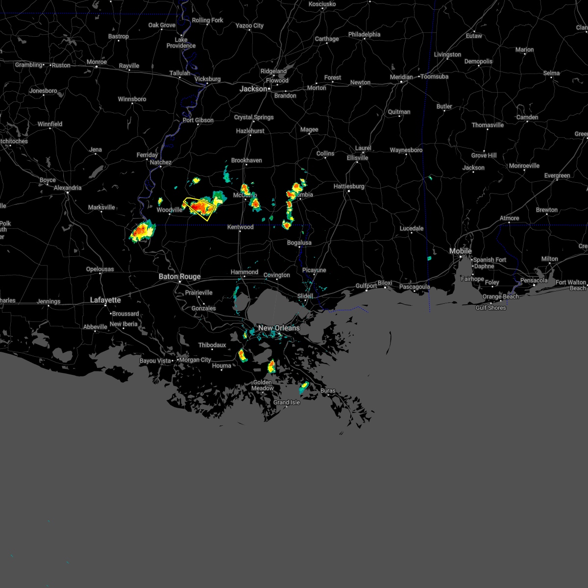 At 614 pm cdt, a severe thunderstorm was located over gloster, or 10 miles west of liberty, moving southeast at 15 mph (radar indicated). Hazards include 60 mph wind gusts and quarter size hail. Hail damage to vehicles is expected. expect wind damage to roofs, siding, and trees. locations impacted include, liberty and gloster. hail threat, radar indicated max hail size, 1. 00 in wind threat, radar indicated max wind gust, 60 mph. At 614 pm cdt, a severe thunderstorm was located over gloster, or 10 miles west of liberty, moving southeast at 15 mph (radar indicated). Hazards include 60 mph wind gusts and quarter size hail. Hail damage to vehicles is expected. expect wind damage to roofs, siding, and trees. locations impacted include, liberty and gloster. hail threat, radar indicated max hail size, 1. 00 in wind threat, radar indicated max wind gust, 60 mph.
|
| 5/16/2022 6:04 PM CDT |
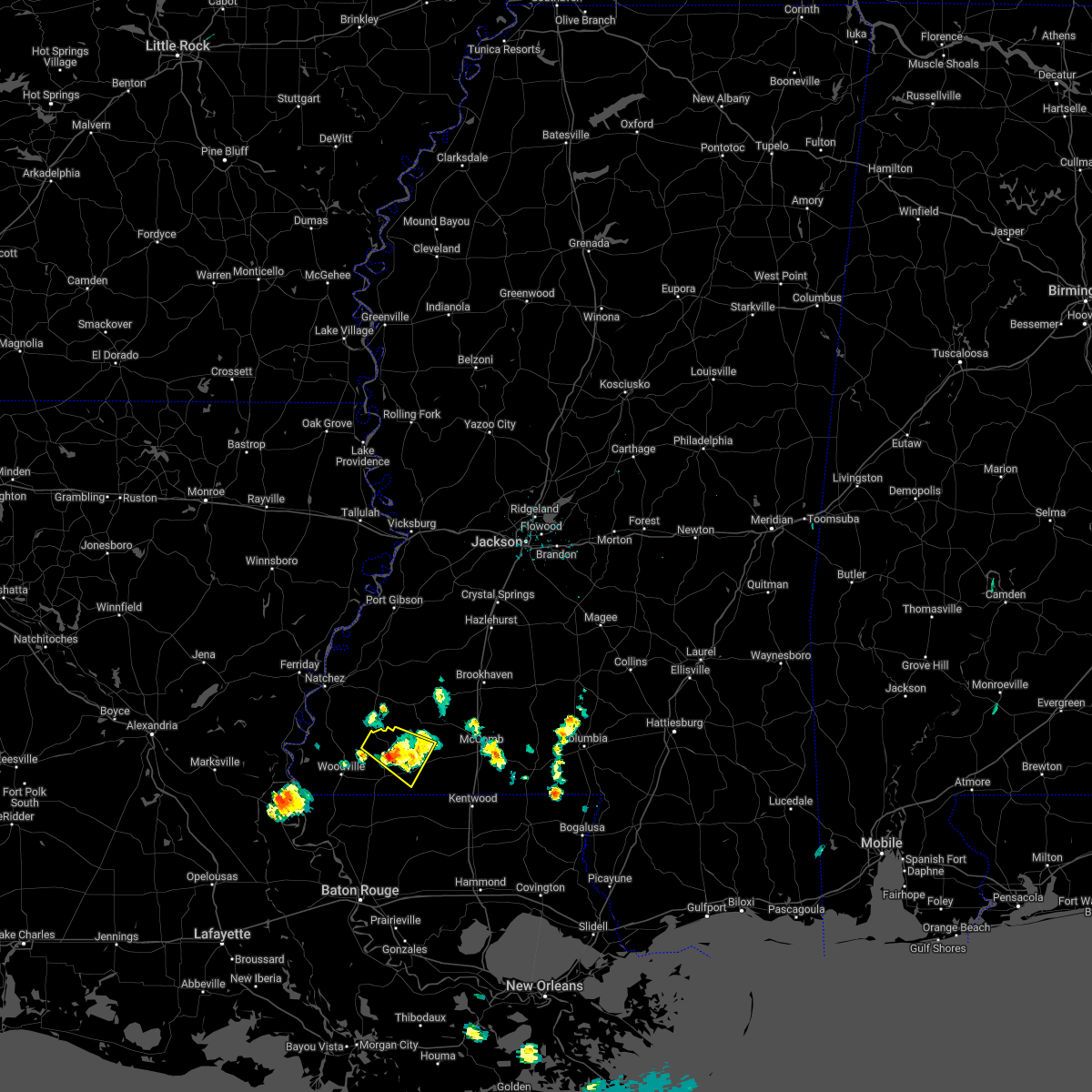 At 604 pm cdt, a severe thunderstorm was located over gloster, or 12 miles west of liberty, moving southeast at 20 mph (radar indicated). Hazards include 60 mph wind gusts and quarter size hail. Hail damage to vehicles is expected. expect wind damage to roofs, siding, and trees. locations impacted include, liberty, gloster and crosby. hail threat, radar indicated max hail size, 1. 00 in wind threat, radar indicated max wind gust, 60 mph. At 604 pm cdt, a severe thunderstorm was located over gloster, or 12 miles west of liberty, moving southeast at 20 mph (radar indicated). Hazards include 60 mph wind gusts and quarter size hail. Hail damage to vehicles is expected. expect wind damage to roofs, siding, and trees. locations impacted include, liberty, gloster and crosby. hail threat, radar indicated max hail size, 1. 00 in wind threat, radar indicated max wind gust, 60 mph.
|
| 5/16/2022 5:41 PM CDT |
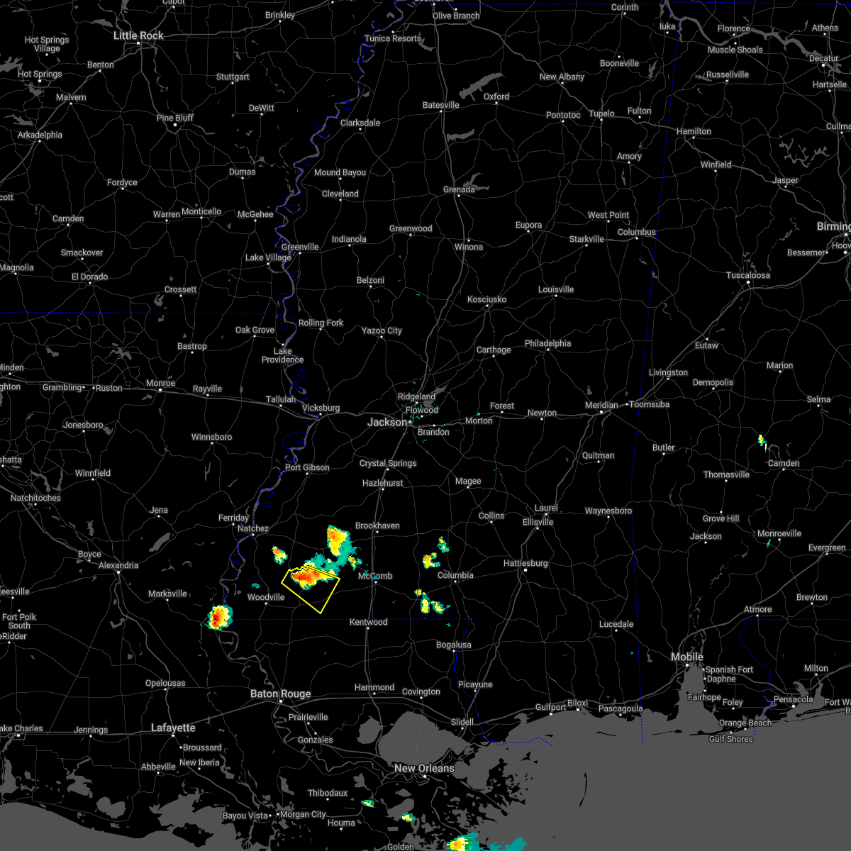 At 541 pm cdt, a severe thunderstorm was located near gloster, or 17 miles northwest of liberty, moving southeast at 15 mph (radar indicated). Hazards include 60 mph wind gusts and half dollar size hail. Hail damage to vehicles is expected. Expect wind damage to roofs, siding, and trees. At 541 pm cdt, a severe thunderstorm was located near gloster, or 17 miles northwest of liberty, moving southeast at 15 mph (radar indicated). Hazards include 60 mph wind gusts and half dollar size hail. Hail damage to vehicles is expected. Expect wind damage to roofs, siding, and trees.
|
| 5/13/2022 2:22 PM CDT |
 At 222 pm cdt, severe thunderstorms were located along a line extending from near gillsburg to pride to near centreville, moving south at 30 mph (radar indicated). Hazards include 60 mph wind gusts. Expect damage to roofs, siding, and trees. locations impacted include, clinton, liberty, greensburg, centreville, gloster, wilson, norwood, felps, darlington, gillsburg, easleyville and crosby. hail threat, radar indicated max hail size, <. 75 in wind threat, radar indicated max wind gust, 60 mph. At 222 pm cdt, severe thunderstorms were located along a line extending from near gillsburg to pride to near centreville, moving south at 30 mph (radar indicated). Hazards include 60 mph wind gusts. Expect damage to roofs, siding, and trees. locations impacted include, clinton, liberty, greensburg, centreville, gloster, wilson, norwood, felps, darlington, gillsburg, easleyville and crosby. hail threat, radar indicated max hail size, <. 75 in wind threat, radar indicated max wind gust, 60 mph.
|
| 5/13/2022 2:06 PM CDT |
 At 205 pm cdt, severe thunderstorms were located along a line extending from near smithdale to 6 miles southwest of darlington to near garden city, moving south at 30 mph (radar indicated). Hazards include 60 mph wind gusts and penny size hail. Expect damage to roofs, siding, and trees. locations impacted include, clinton, liberty, greensburg, centreville, gloster, wilson, norwood, smithdale, darlington, felps, gillsburg, easleyville and crosby. hail threat, radar indicated max hail size, 0. 75 in wind threat, radar indicated max wind gust, 60 mph. At 205 pm cdt, severe thunderstorms were located along a line extending from near smithdale to 6 miles southwest of darlington to near garden city, moving south at 30 mph (radar indicated). Hazards include 60 mph wind gusts and penny size hail. Expect damage to roofs, siding, and trees. locations impacted include, clinton, liberty, greensburg, centreville, gloster, wilson, norwood, smithdale, darlington, felps, gillsburg, easleyville and crosby. hail threat, radar indicated max hail size, 0. 75 in wind threat, radar indicated max wind gust, 60 mph.
|
| 5/13/2022 1:44 PM CDT |
 At 143 pm cdt, severe thunderstorms were located along a line extending from near center point to near felps to near garden city, moving south at 30 mph (radar indicated). Hazards include 60 mph wind gusts and quarter size hail. Hail damage to vehicles is expected. Expect wind damage to roofs, siding, and trees. At 143 pm cdt, severe thunderstorms were located along a line extending from near center point to near felps to near garden city, moving south at 30 mph (radar indicated). Hazards include 60 mph wind gusts and quarter size hail. Hail damage to vehicles is expected. Expect wind damage to roofs, siding, and trees.
|
| 4/17/2022 9:39 PM CDT |
 At 939 pm cdt, a severe thunderstorm was located near liberty, moving east at 45 mph (radar indicated). Hazards include two inch hail and 60 mph wind gusts. People and animals outdoors will be injured. expect hail damage to roofs, siding, windows, and vehicles. expect wind damage to roofs, siding, and trees. locations impacted include, liberty, centreville, gloster and gillsberg. thunderstorm damage threat, considerable hail threat, radar indicated max hail size, 2. 00 in wind threat, radar indicated max wind gust, 60 mph. At 939 pm cdt, a severe thunderstorm was located near liberty, moving east at 45 mph (radar indicated). Hazards include two inch hail and 60 mph wind gusts. People and animals outdoors will be injured. expect hail damage to roofs, siding, windows, and vehicles. expect wind damage to roofs, siding, and trees. locations impacted include, liberty, centreville, gloster and gillsberg. thunderstorm damage threat, considerable hail threat, radar indicated max hail size, 2. 00 in wind threat, radar indicated max wind gust, 60 mph.
|
| 4/17/2022 9:39 PM CDT |
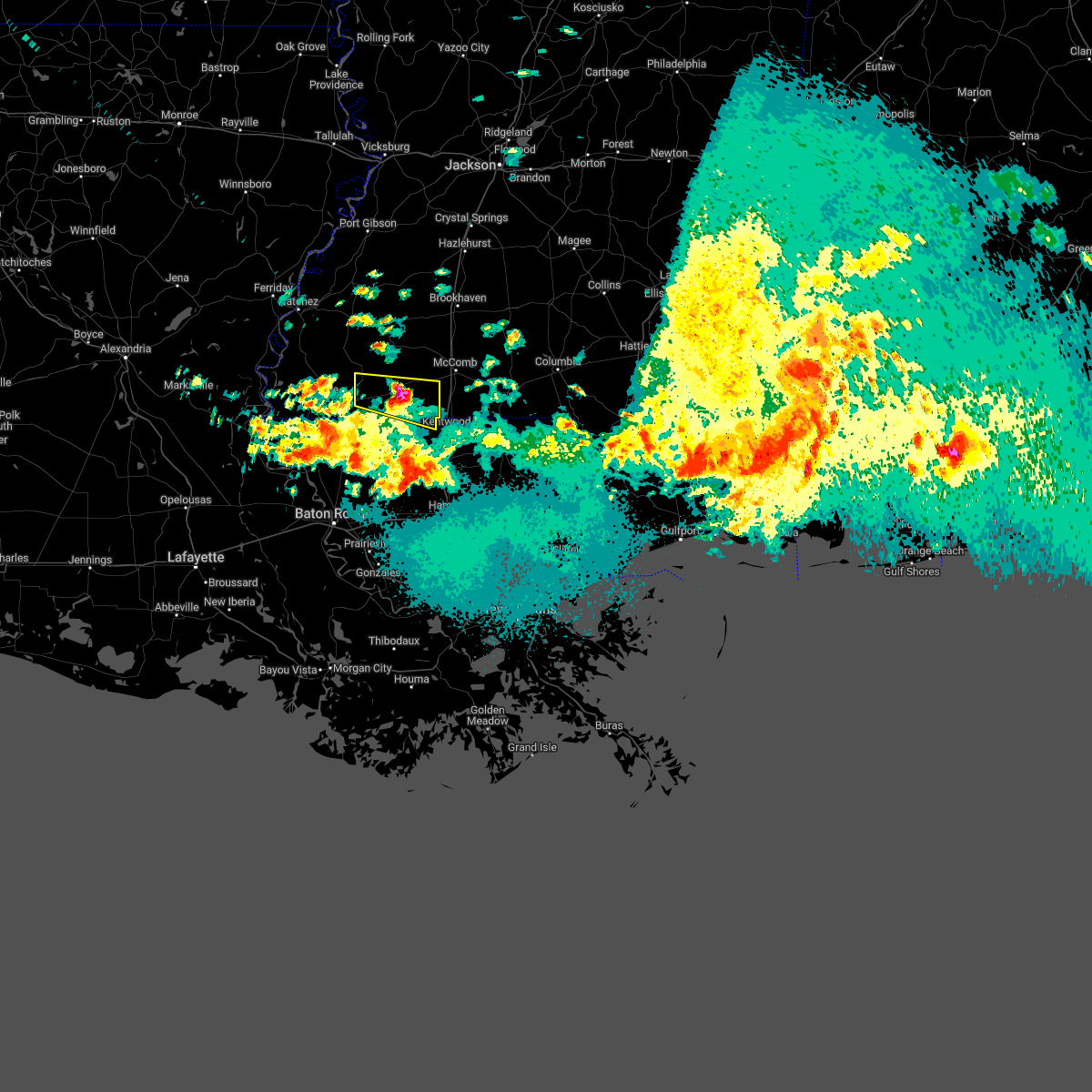 At 939 pm cdt, a severe thunderstorm was located near liberty, moving east at 45 mph (radar indicated). Hazards include two inch hail and 60 mph wind gusts. People and animals outdoors will be injured. expect hail damage to roofs, siding, windows, and vehicles. expect wind damage to roofs, siding, and trees. locations impacted include, liberty, centreville, gloster and gillsberg. thunderstorm damage threat, considerable hail threat, radar indicated max hail size, 2. 00 in wind threat, radar indicated max wind gust, 60 mph. At 939 pm cdt, a severe thunderstorm was located near liberty, moving east at 45 mph (radar indicated). Hazards include two inch hail and 60 mph wind gusts. People and animals outdoors will be injured. expect hail damage to roofs, siding, windows, and vehicles. expect wind damage to roofs, siding, and trees. locations impacted include, liberty, centreville, gloster and gillsberg. thunderstorm damage threat, considerable hail threat, radar indicated max hail size, 2. 00 in wind threat, radar indicated max wind gust, 60 mph.
|
| 4/17/2022 9:35 PM CDT | Quarter sized hail reported 0.6 miles W of Liberty, MS, time estimated by radar. |
| 4/17/2022 9:22 PM CDT |
 At 921 pm cdt, a severe thunderstorm was located near centreville, or 12 miles west of liberty, moving east at 30 mph (radar indicated). Hazards include ping pong ball size hail and 60 mph wind gusts. People and animals outdoors will be injured. expect hail damage to roofs, siding, windows, and vehicles. Expect wind damage to roofs, siding, and trees. At 921 pm cdt, a severe thunderstorm was located near centreville, or 12 miles west of liberty, moving east at 30 mph (radar indicated). Hazards include ping pong ball size hail and 60 mph wind gusts. People and animals outdoors will be injured. expect hail damage to roofs, siding, windows, and vehicles. Expect wind damage to roofs, siding, and trees.
|
| 4/17/2022 9:22 PM CDT |
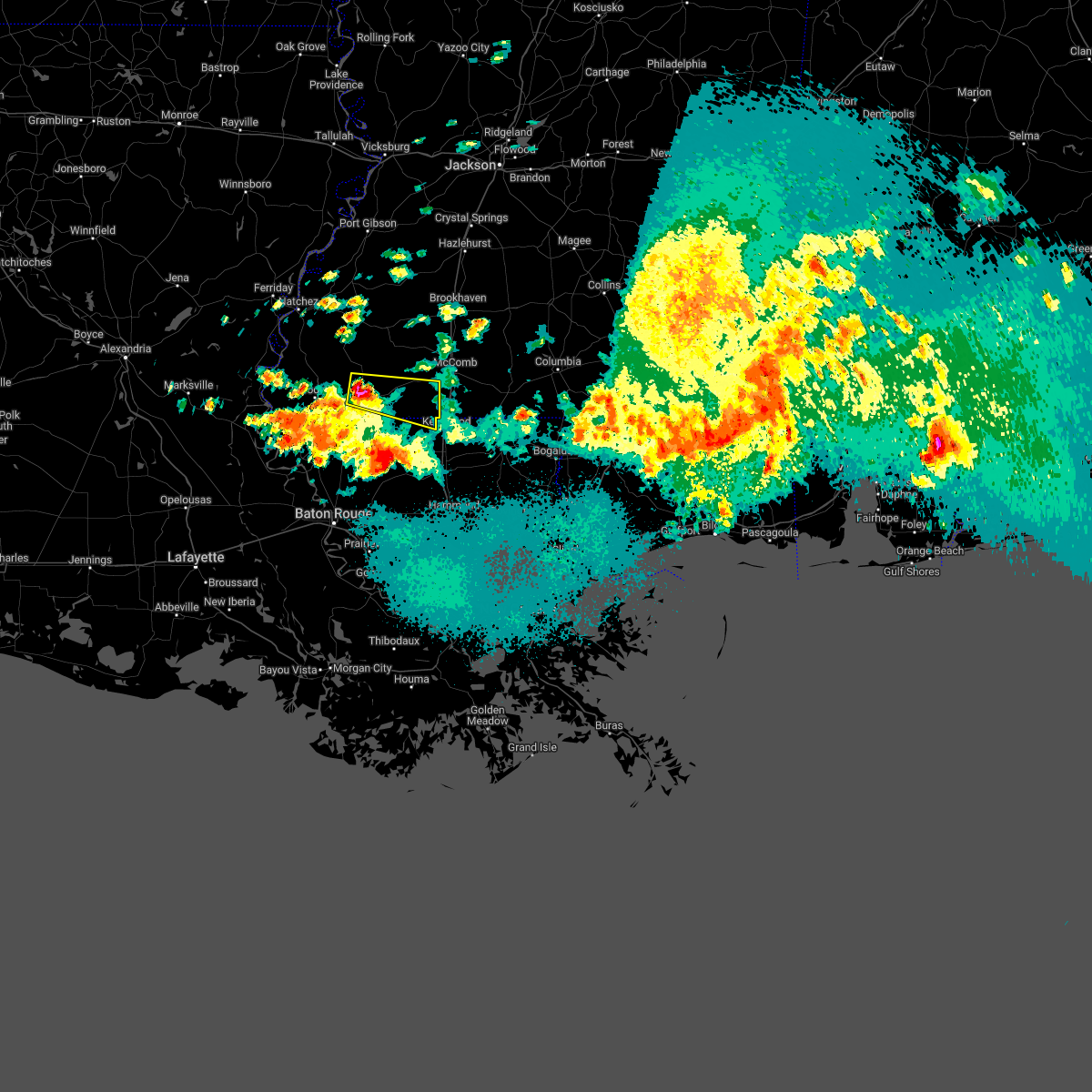 At 921 pm cdt, a severe thunderstorm was located near centreville, or 12 miles west of liberty, moving east at 30 mph (radar indicated). Hazards include ping pong ball size hail and 60 mph wind gusts. People and animals outdoors will be injured. expect hail damage to roofs, siding, windows, and vehicles. Expect wind damage to roofs, siding, and trees. At 921 pm cdt, a severe thunderstorm was located near centreville, or 12 miles west of liberty, moving east at 30 mph (radar indicated). Hazards include ping pong ball size hail and 60 mph wind gusts. People and animals outdoors will be injured. expect hail damage to roofs, siding, windows, and vehicles. Expect wind damage to roofs, siding, and trees.
|
| 4/17/2022 7:55 PM CDT |
 At 755 pm cdt, a severe thunderstorm was located near woodville, or 23 miles northwest of jackson, moving east at 35 mph (radar indicated). Hazards include 60 mph wind gusts and half dollar size hail. Hail damage to vehicles is expected. Expect wind damage to roofs, siding, and trees. At 755 pm cdt, a severe thunderstorm was located near woodville, or 23 miles northwest of jackson, moving east at 35 mph (radar indicated). Hazards include 60 mph wind gusts and half dollar size hail. Hail damage to vehicles is expected. Expect wind damage to roofs, siding, and trees.
|
| 3/30/2022 5:22 PM CDT |
 At 522 pm cdt, a severe thunderstorm was located near liberty, moving northeast at 55 mph (radar indicated). Hazards include 60 mph wind gusts. Expect damage to roofs, siding, and trees. Locations impacted include, clinton, liberty, centreville, gloster, wilson, smithdale, felps and gillsberg. At 522 pm cdt, a severe thunderstorm was located near liberty, moving northeast at 55 mph (radar indicated). Hazards include 60 mph wind gusts. Expect damage to roofs, siding, and trees. Locations impacted include, clinton, liberty, centreville, gloster, wilson, smithdale, felps and gillsberg.
|
| 3/30/2022 5:22 PM CDT |
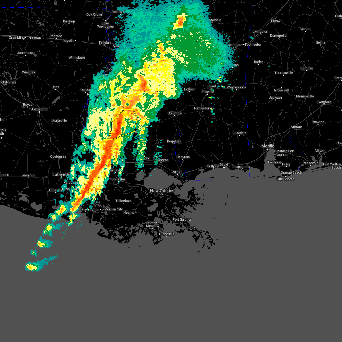 At 522 pm cdt, a severe thunderstorm was located near liberty, moving northeast at 55 mph (radar indicated). Hazards include 60 mph wind gusts. Expect damage to roofs, siding, and trees. Locations impacted include, clinton, liberty, centreville, gloster, wilson, smithdale, felps and gillsberg. At 522 pm cdt, a severe thunderstorm was located near liberty, moving northeast at 55 mph (radar indicated). Hazards include 60 mph wind gusts. Expect damage to roofs, siding, and trees. Locations impacted include, clinton, liberty, centreville, gloster, wilson, smithdale, felps and gillsberg.
|
| 3/30/2022 5:12 PM CDT |
 At 511 pm cdt, a severe thunderstorm was located near centreville, or 13 miles southwest of liberty, moving northeast at 55 mph (radar indicated). Hazards include 60 mph wind gusts. expect damage to roofs, siding, and trees At 511 pm cdt, a severe thunderstorm was located near centreville, or 13 miles southwest of liberty, moving northeast at 55 mph (radar indicated). Hazards include 60 mph wind gusts. expect damage to roofs, siding, and trees
|
| 10/27/2021 4:23 PM CDT |
 At 422 pm cdt, severe thunderstorms were located along a line extending from little springs to near smithdale to near darlington to near watson, moving east at 40 mph (radar indicated). Hazards include 60 mph wind gusts. Expect damage to roofs, siding, and trees. locations impacted include, baton rouge, mccomb, denham springs, port allen, liberty, greensburg, oak hills place, addis, brusly, summit, smithdale, westminster, merrydale, inniswold, watson, darlington, gillsberg, pride, gardere and brownfields. this includes the following interstates, interstate 10 in louisiana between mile markers 153 and 163. interstate 12 between mile markers 1 and 7. interstate 55 in mississippi between mile markers 14 and 24. interstate 110 in louisiana between mile markers 1 and 6. hail threat, radar indicated max hail size, <. 75 in wind threat, radar indicated max wind gust, 60 mph. At 422 pm cdt, severe thunderstorms were located along a line extending from little springs to near smithdale to near darlington to near watson, moving east at 40 mph (radar indicated). Hazards include 60 mph wind gusts. Expect damage to roofs, siding, and trees. locations impacted include, baton rouge, mccomb, denham springs, port allen, liberty, greensburg, oak hills place, addis, brusly, summit, smithdale, westminster, merrydale, inniswold, watson, darlington, gillsberg, pride, gardere and brownfields. this includes the following interstates, interstate 10 in louisiana between mile markers 153 and 163. interstate 12 between mile markers 1 and 7. interstate 55 in mississippi between mile markers 14 and 24. interstate 110 in louisiana between mile markers 1 and 6. hail threat, radar indicated max hail size, <. 75 in wind threat, radar indicated max wind gust, 60 mph.
|
| 10/27/2021 3:56 PM CDT |
 At 355 pm cdt, severe thunderstorms were located along a line extending from 7 miles southeast of garden city to near gloster to near jackson to near port allen, moving northeast at 40 mph (radar indicated). Hazards include 60 mph wind gusts. expect damage to roofs, siding, and trees At 355 pm cdt, severe thunderstorms were located along a line extending from 7 miles southeast of garden city to near gloster to near jackson to near port allen, moving northeast at 40 mph (radar indicated). Hazards include 60 mph wind gusts. expect damage to roofs, siding, and trees
|
| 6/21/2021 9:01 PM CDT |
 At 901 pm cdt, severe thunderstorms were located along a line extending from near kirby to 7 miles east of woodville to near fort adams, moving southeast at 35 mph (radar indicated). Hazards include 60 mph wind gusts. expect damage to roofs, siding, and trees At 901 pm cdt, severe thunderstorms were located along a line extending from near kirby to 7 miles east of woodville to near fort adams, moving southeast at 35 mph (radar indicated). Hazards include 60 mph wind gusts. expect damage to roofs, siding, and trees
|
| 5/4/2021 3:33 PM CDT |
 At 333 pm cdt, severe thunderstorms were located along a line extending from near bogue chitto to near zachary, moving east at 50 mph (radar indicated). Hazards include 60 mph wind gusts and quarter size hail. Hail damage to vehicles is expected. Expect wind damage to roofs, siding, and trees. At 333 pm cdt, severe thunderstorms were located along a line extending from near bogue chitto to near zachary, moving east at 50 mph (radar indicated). Hazards include 60 mph wind gusts and quarter size hail. Hail damage to vehicles is expected. Expect wind damage to roofs, siding, and trees.
|
| 5/4/2021 2:58 PM CDT |
 At 257 pm cdt, severe thunderstorms were located along a line extending from near garden city to near st. francisville, moving east at 45 mph (radar indicated). Hazards include 60 mph wind gusts and quarter size hail. Hail damage to vehicles is expected. Expect wind damage to roofs, siding, and trees. At 257 pm cdt, severe thunderstorms were located along a line extending from near garden city to near st. francisville, moving east at 45 mph (radar indicated). Hazards include 60 mph wind gusts and quarter size hail. Hail damage to vehicles is expected. Expect wind damage to roofs, siding, and trees.
|
| 4/24/2021 1:47 AM CDT |
 At 146 am cdt, severe thunderstorms were located along a line extending from near center point to near smithdale to 6 miles northeast of liberty, moving east at 75 mph (radar indicated). Hazards include 60 mph wind gusts and penny size hail. Expect damage to roofs, siding, and trees. locations impacted include, mccomb, liberty, summit and smithdale. This includes interstate 55 in mississippi between mile markers 14 and 24. At 146 am cdt, severe thunderstorms were located along a line extending from near center point to near smithdale to 6 miles northeast of liberty, moving east at 75 mph (radar indicated). Hazards include 60 mph wind gusts and penny size hail. Expect damage to roofs, siding, and trees. locations impacted include, mccomb, liberty, summit and smithdale. This includes interstate 55 in mississippi between mile markers 14 and 24.
|
| 4/24/2021 1:26 AM CDT |
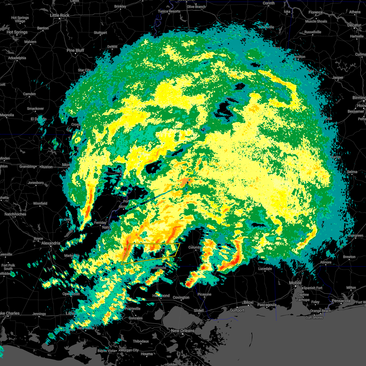 At 125 am cdt, severe thunderstorms were located along a line extending from 7 miles south of kirby to near gloster to near centreville, moving east at 65 mph (radar indicated). Hazards include 60 mph wind gusts and penny size hail. expect damage to roofs, siding, and trees At 125 am cdt, severe thunderstorms were located along a line extending from 7 miles south of kirby to near gloster to near centreville, moving east at 65 mph (radar indicated). Hazards include 60 mph wind gusts and penny size hail. expect damage to roofs, siding, and trees
|
| 4/10/2021 2:58 AM CDT |
 At 258 am cdt, severe thunderstorms were located along a line extending from liberty to 6 miles east of felps, moving east at 35 mph (radar indicated). Hazards include 60 mph wind gusts and quarter size hail. Hail damage to vehicles is expected. Expect wind damage to roofs, siding, and trees. At 258 am cdt, severe thunderstorms were located along a line extending from liberty to 6 miles east of felps, moving east at 35 mph (radar indicated). Hazards include 60 mph wind gusts and quarter size hail. Hail damage to vehicles is expected. Expect wind damage to roofs, siding, and trees.
|
| 4/10/2021 2:58 AM CDT |
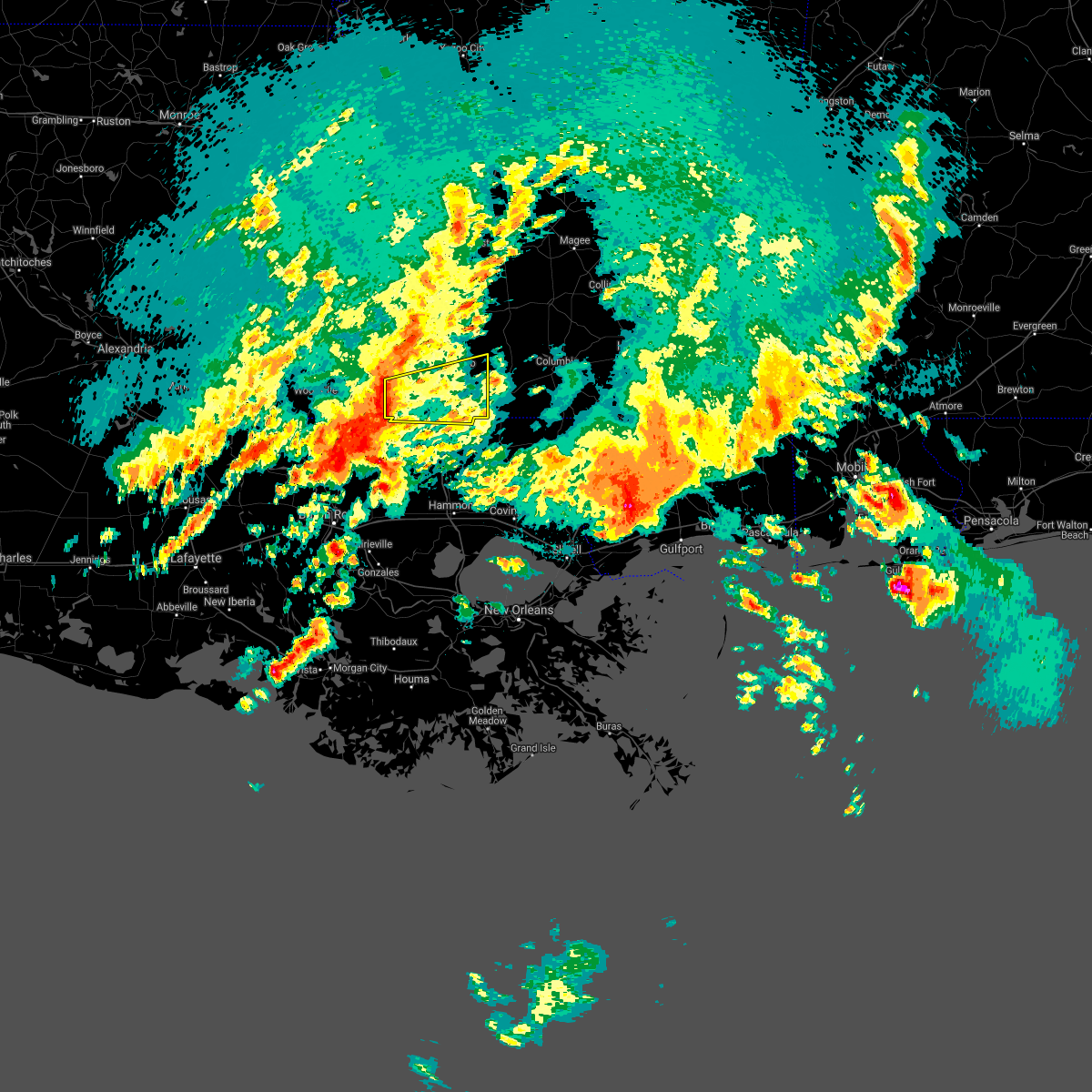 At 258 am cdt, severe thunderstorms were located along a line extending from liberty to 6 miles east of felps, moving east at 35 mph (radar indicated). Hazards include 60 mph wind gusts and quarter size hail. Hail damage to vehicles is expected. Expect wind damage to roofs, siding, and trees. At 258 am cdt, severe thunderstorms were located along a line extending from liberty to 6 miles east of felps, moving east at 35 mph (radar indicated). Hazards include 60 mph wind gusts and quarter size hail. Hail damage to vehicles is expected. Expect wind damage to roofs, siding, and trees.
|
| 4/10/2021 12:46 AM CDT |
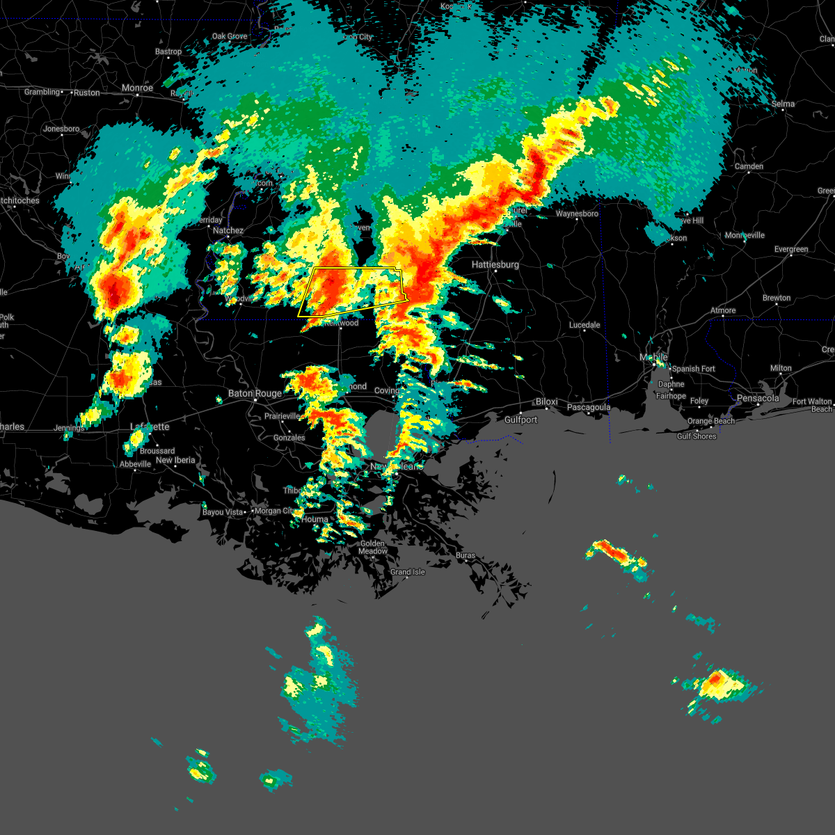 At 1246 am cdt, severe thunderstorms were located along a line extending from near smithdale to near gillsberg, moving east at 35 mph (radar indicated). Hazards include 60 mph wind gusts and quarter size hail. Hail damage to vehicles is expected. Expect wind damage to roofs, siding, and trees. At 1246 am cdt, severe thunderstorms were located along a line extending from near smithdale to near gillsberg, moving east at 35 mph (radar indicated). Hazards include 60 mph wind gusts and quarter size hail. Hail damage to vehicles is expected. Expect wind damage to roofs, siding, and trees.
|
| 4/9/2021 11:57 PM CDT |
 At 1157 pm cdt, a severe thunderstorm was located near smithdale, or 10 miles northwest of mccomb, moving northeast at 40 mph (radar indicated). Hazards include 60 mph wind gusts and quarter size hail. Hail damage to vehicles is expected. Expect wind damage to roofs, siding, and trees. At 1157 pm cdt, a severe thunderstorm was located near smithdale, or 10 miles northwest of mccomb, moving northeast at 40 mph (radar indicated). Hazards include 60 mph wind gusts and quarter size hail. Hail damage to vehicles is expected. Expect wind damage to roofs, siding, and trees.
|
| 3/24/2021 9:38 PM CDT |
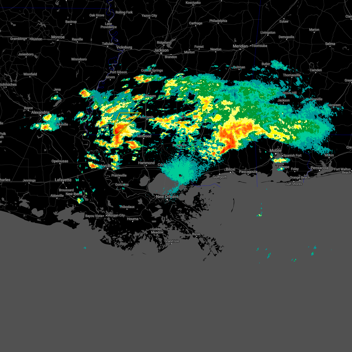 At 937 pm cdt, a severe thunderstorm was located over centreville, or 13 miles southwest of liberty, moving northeast at 35 mph (radar indicated). Hazards include quarter size hail. Damage to vehicles is expected. Locations impacted include, liberty, centreville, gloster and smithdale. At 937 pm cdt, a severe thunderstorm was located over centreville, or 13 miles southwest of liberty, moving northeast at 35 mph (radar indicated). Hazards include quarter size hail. Damage to vehicles is expected. Locations impacted include, liberty, centreville, gloster and smithdale.
|
| 3/24/2021 9:29 PM CDT |
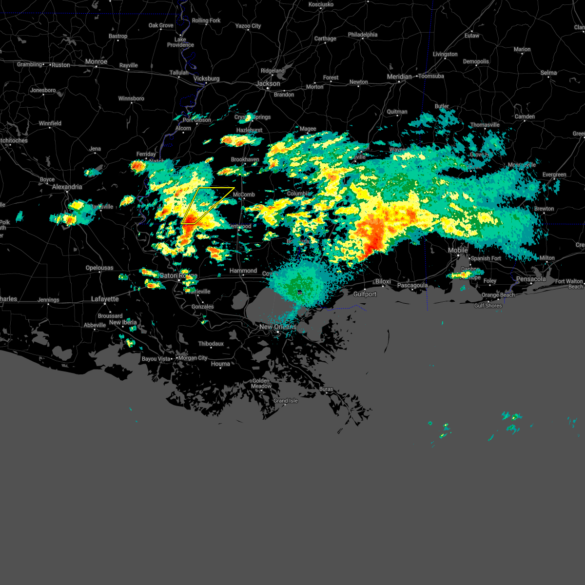 At 928 pm cdt, a severe thunderstorm was located near norwood, or 10 miles north of clinton, moving northeast at 35 mph (radar indicated). Hazards include quarter size hail. damage to vehicles is expected At 928 pm cdt, a severe thunderstorm was located near norwood, or 10 miles north of clinton, moving northeast at 35 mph (radar indicated). Hazards include quarter size hail. damage to vehicles is expected
|
| 3/23/2021 8:06 AM CDT |
 At 805 am cdt, a severe thunderstorm was located over centreville, or 13 miles west of liberty, moving northeast at 40 mph (radar indicated). Hazards include 60 mph wind gusts and quarter size hail. Hail damage to vehicles is expected. expect wind damage to roofs, siding, and trees. Locations impacted include, liberty, centreville, gloster and norwood. At 805 am cdt, a severe thunderstorm was located over centreville, or 13 miles west of liberty, moving northeast at 40 mph (radar indicated). Hazards include 60 mph wind gusts and quarter size hail. Hail damage to vehicles is expected. expect wind damage to roofs, siding, and trees. Locations impacted include, liberty, centreville, gloster and norwood.
|
| 3/23/2021 7:47 AM CDT |
 At 746 am cdt, a severe thunderstorm was located near norwood, or 10 miles north of jackson, moving northeast at 40 mph (radar indicated). Hazards include 60 mph wind gusts and quarter size hail. Hail damage to vehicles is expected. Expect wind damage to roofs, siding, and trees. At 746 am cdt, a severe thunderstorm was located near norwood, or 10 miles north of jackson, moving northeast at 40 mph (radar indicated). Hazards include 60 mph wind gusts and quarter size hail. Hail damage to vehicles is expected. Expect wind damage to roofs, siding, and trees.
|
| 8/27/2020 7:15 AM CDT |
 At 714 am cdt, a severe thunderstorm was located along a line near spillman, or 12 miles north of jackson, moving north at 55 mph (radar indicated). Hazards include 60 mph wind gusts. Expect damage to roofs, siding, and trees. locations impacted include, jackson, st. Francisville, clinton, liberty, centreville, woodville, slaughter, gloster, wilson, norwood, wakefield, spillman, fort adams, dolorosa, felps and crosby. At 714 am cdt, a severe thunderstorm was located along a line near spillman, or 12 miles north of jackson, moving north at 55 mph (radar indicated). Hazards include 60 mph wind gusts. Expect damage to roofs, siding, and trees. locations impacted include, jackson, st. Francisville, clinton, liberty, centreville, woodville, slaughter, gloster, wilson, norwood, wakefield, spillman, fort adams, dolorosa, felps and crosby.
|
| 8/27/2020 7:01 AM CDT |
 At 700 am cdt, a severe thunderstorm was located along a line near jackson, moving north at 55 mph (radar indicated). Hazards include 60 mph wind gusts. expect damage to roofs, siding, and trees At 700 am cdt, a severe thunderstorm was located along a line near jackson, moving north at 55 mph (radar indicated). Hazards include 60 mph wind gusts. expect damage to roofs, siding, and trees
|
| 6/25/2020 3:50 PM CDT |
 At 350 pm cdt, severe thunderstorms were located along a line extending from near kirby to near wilmer, moving northeast at 50 mph (radar indicated). Hazards include 60 mph wind gusts. Expect damage to roofs, siding, and trees. Locations impacted include, mccomb, liberty, greensburg, amite, amite city, magnolia, kentwood, summit, roseland, osyka, montpelier, smithdale, gillsberg, wilmer, easleyville, tangipahoa and mccomb airport. At 350 pm cdt, severe thunderstorms were located along a line extending from near kirby to near wilmer, moving northeast at 50 mph (radar indicated). Hazards include 60 mph wind gusts. Expect damage to roofs, siding, and trees. Locations impacted include, mccomb, liberty, greensburg, amite, amite city, magnolia, kentwood, summit, roseland, osyka, montpelier, smithdale, gillsberg, wilmer, easleyville, tangipahoa and mccomb airport.
|
| 6/25/2020 3:50 PM CDT |
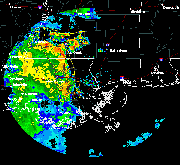 At 350 pm cdt, severe thunderstorms were located along a line extending from near kirby to near wilmer, moving northeast at 50 mph (radar indicated). Hazards include 60 mph wind gusts. Expect damage to roofs, siding, and trees. Locations impacted include, mccomb, liberty, greensburg, amite, amite city, magnolia, kentwood, summit, roseland, osyka, montpelier, smithdale, gillsberg, wilmer, easleyville, tangipahoa and mccomb airport. At 350 pm cdt, severe thunderstorms were located along a line extending from near kirby to near wilmer, moving northeast at 50 mph (radar indicated). Hazards include 60 mph wind gusts. Expect damage to roofs, siding, and trees. Locations impacted include, mccomb, liberty, greensburg, amite, amite city, magnolia, kentwood, summit, roseland, osyka, montpelier, smithdale, gillsberg, wilmer, easleyville, tangipahoa and mccomb airport.
|
| 6/25/2020 3:39 PM CDT |
 At 339 pm cdt, severe thunderstorms were located along a line extending from near kirby to near roseland, moving northeast at 50 mph (radar indicated). Hazards include 60 mph wind gusts. Expect damage to roofs, siding, and trees. Locations impacted include, mccomb, liberty, greensburg, amite, amite city, magnolia, kentwood, summit, roseland, gloster, osyka, montpelier, smithdale, darlington, gillsberg, wilmer, felps, easleyville, tangipahoa and crosby. At 339 pm cdt, severe thunderstorms were located along a line extending from near kirby to near roseland, moving northeast at 50 mph (radar indicated). Hazards include 60 mph wind gusts. Expect damage to roofs, siding, and trees. Locations impacted include, mccomb, liberty, greensburg, amite, amite city, magnolia, kentwood, summit, roseland, gloster, osyka, montpelier, smithdale, darlington, gillsberg, wilmer, felps, easleyville, tangipahoa and crosby.
|
| 6/25/2020 3:39 PM CDT |
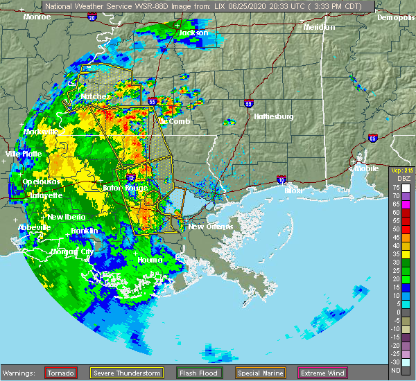 At 339 pm cdt, severe thunderstorms were located along a line extending from near kirby to near roseland, moving northeast at 50 mph (radar indicated). Hazards include 60 mph wind gusts. Expect damage to roofs, siding, and trees. Locations impacted include, mccomb, liberty, greensburg, amite, amite city, magnolia, kentwood, summit, roseland, gloster, osyka, montpelier, smithdale, darlington, gillsberg, wilmer, felps, easleyville, tangipahoa and crosby. At 339 pm cdt, severe thunderstorms were located along a line extending from near kirby to near roseland, moving northeast at 50 mph (radar indicated). Hazards include 60 mph wind gusts. Expect damage to roofs, siding, and trees. Locations impacted include, mccomb, liberty, greensburg, amite, amite city, magnolia, kentwood, summit, roseland, gloster, osyka, montpelier, smithdale, darlington, gillsberg, wilmer, felps, easleyville, tangipahoa and crosby.
|
| 6/25/2020 3:25 PM CDT |
 At 325 pm cdt, severe thunderstorms were located along a line extending from near garden city to montpelier, moving northeast at 50 mph (radar indicated). Hazards include 60 mph wind gusts. expect damage to roofs, siding, and trees At 325 pm cdt, severe thunderstorms were located along a line extending from near garden city to montpelier, moving northeast at 50 mph (radar indicated). Hazards include 60 mph wind gusts. expect damage to roofs, siding, and trees
|
| 6/25/2020 3:25 PM CDT |
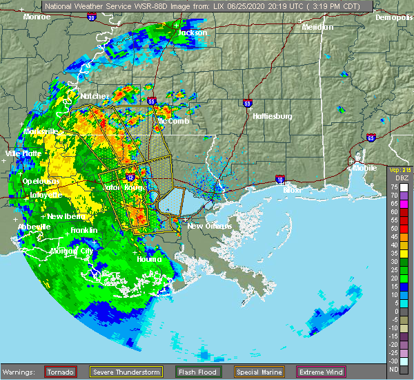 At 325 pm cdt, severe thunderstorms were located along a line extending from near garden city to montpelier, moving northeast at 50 mph (radar indicated). Hazards include 60 mph wind gusts. expect damage to roofs, siding, and trees At 325 pm cdt, severe thunderstorms were located along a line extending from near garden city to montpelier, moving northeast at 50 mph (radar indicated). Hazards include 60 mph wind gusts. expect damage to roofs, siding, and trees
|
| 5/8/2020 9:38 AM CDT |
 At 937 am cdt, severe thunderstorms were located along a line extending from wesson to center point to near fort adams, moving east at 50 mph (radar indicated). Hazards include 60 mph wind gusts. Expect damage to roofs, siding, and trees. Locations impacted include, mccomb, liberty, summit, centreville, woodville, gloster, norwood, smithdale, fort adams, dolorosa and crosby. At 937 am cdt, severe thunderstorms were located along a line extending from wesson to center point to near fort adams, moving east at 50 mph (radar indicated). Hazards include 60 mph wind gusts. Expect damage to roofs, siding, and trees. Locations impacted include, mccomb, liberty, summit, centreville, woodville, gloster, norwood, smithdale, fort adams, dolorosa and crosby.
|
| 5/8/2020 9:08 AM CDT |
 At 908 am cdt, severe thunderstorms were located along a line extending from near peyton to near kirby to acme, moving southeast at 40 mph (radar indicated). Hazards include 60 mph wind gusts. expect damage to roofs, siding, and trees At 908 am cdt, severe thunderstorms were located along a line extending from near peyton to near kirby to acme, moving southeast at 40 mph (radar indicated). Hazards include 60 mph wind gusts. expect damage to roofs, siding, and trees
|
| 4/28/2020 4:20 PM CDT | Trees reported blocking the roadway on highway 569 about 4 miles north of libert in amite county MS, 4.2 miles S of Liberty, MS |
| 4/28/2020 4:10 PM CDT | Mhp brookhaven reported a tree was blown down and was blocking both lanes on highway 24 west of liberty. time estimate in amite county MS, 2.4 miles E of Liberty, MS |
| 4/28/2020 4:10 PM CDT |
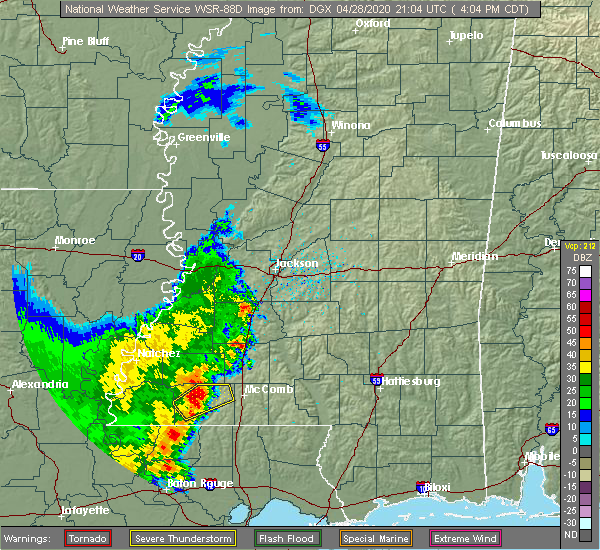 At 409 pm cdt, a severe thunderstorm was located near liberty, moving northeast at 20 mph (radar indicated). Hazards include 60 mph wind gusts. expect damage to roofs, siding, and trees At 409 pm cdt, a severe thunderstorm was located near liberty, moving northeast at 20 mph (radar indicated). Hazards include 60 mph wind gusts. expect damage to roofs, siding, and trees
|
| 4/28/2020 3:47 PM CDT |
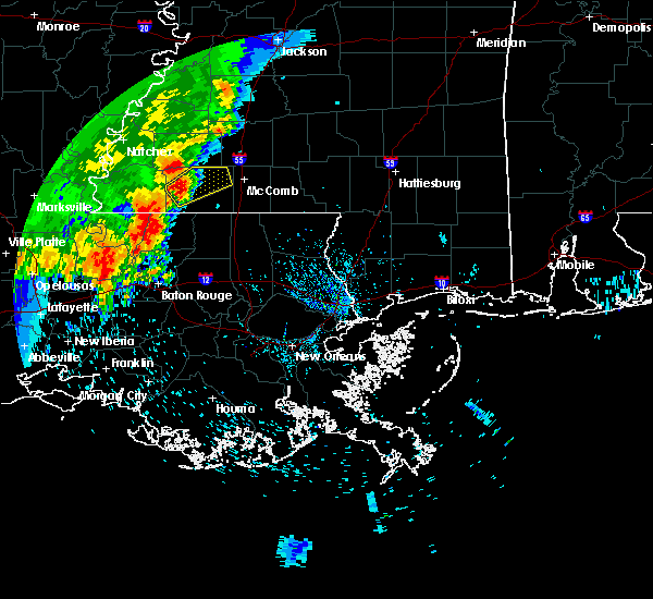 At 347 pm cdt, a severe thunderstorm was located near gloster, or 8 miles west of liberty, moving northeast at 20 mph (radar indicated). Hazards include 60 mph wind gusts. expect damage to roofs, siding, and trees At 347 pm cdt, a severe thunderstorm was located near gloster, or 8 miles west of liberty, moving northeast at 20 mph (radar indicated). Hazards include 60 mph wind gusts. expect damage to roofs, siding, and trees
|
| 4/23/2020 3:36 AM CDT |
 The severe thunderstorm warning for northern pike and amite counties will expire at 345 am cdt, the storm which prompted the warning has moved out of the area. therefore, the warning will be allowed to expire. however gusty winds and heavy rain are still possible with this thunderstorm. a tornado watch remains in effect until 700 am cdt for southern mississippi. remember, a tornado warning still remains in effect for pike county until 415 am cdt. The severe thunderstorm warning for northern pike and amite counties will expire at 345 am cdt, the storm which prompted the warning has moved out of the area. therefore, the warning will be allowed to expire. however gusty winds and heavy rain are still possible with this thunderstorm. a tornado watch remains in effect until 700 am cdt for southern mississippi. remember, a tornado warning still remains in effect for pike county until 415 am cdt.
|
| 4/23/2020 3:04 AM CDT |
 At 304 am cdt, a severe thunderstorm capable of producing a tornado was located near liberty, moving northeast at 40 mph (radar indicated rotation). Hazards include tornado and ping pong ball size hail. Flying debris will be dangerous to those caught without shelter. mobile homes will be damaged or destroyed. damage to roofs, windows, and vehicles will occur. tree damage is likely. this dangerous storm will be near, smithdale around 315 am cdt. Mccomb around 330 am cdt. At 304 am cdt, a severe thunderstorm capable of producing a tornado was located near liberty, moving northeast at 40 mph (radar indicated rotation). Hazards include tornado and ping pong ball size hail. Flying debris will be dangerous to those caught without shelter. mobile homes will be damaged or destroyed. damage to roofs, windows, and vehicles will occur. tree damage is likely. this dangerous storm will be near, smithdale around 315 am cdt. Mccomb around 330 am cdt.
|
| 4/23/2020 2:44 AM CDT |
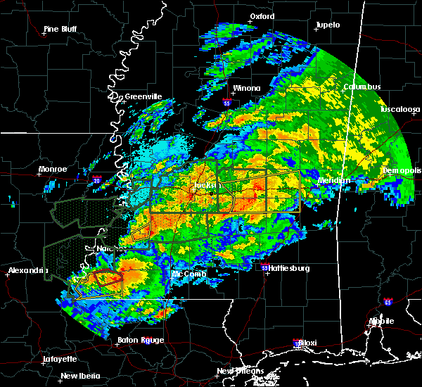 At 243 am cdt, a severe thunderstorm was located over gloster, or 12 miles west of liberty, moving east at 35 mph (radar indicated). Hazards include 60 mph wind gusts and quarter size hail. Hail damage to vehicles is expected. Expect wind damage to roofs, siding, and trees. At 243 am cdt, a severe thunderstorm was located over gloster, or 12 miles west of liberty, moving east at 35 mph (radar indicated). Hazards include 60 mph wind gusts and quarter size hail. Hail damage to vehicles is expected. Expect wind damage to roofs, siding, and trees.
|
| 4/19/2020 6:35 PM CDT |
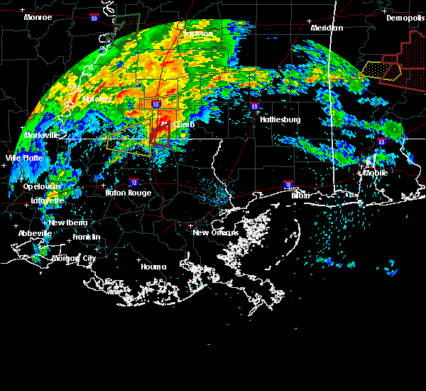 The severe thunderstorm warning for northern st. helena, northeastern east feliciana parishes in southeastern louisiana and southern amite counties will expire at 645 pm cdt, the storm which prompted the warning has moved out of the area. therefore, the warning will be allowed to expire. a tornado watch remains in effect until 1000 pm cdt for southeastern louisiana, and southern mississippi. The severe thunderstorm warning for northern st. helena, northeastern east feliciana parishes in southeastern louisiana and southern amite counties will expire at 645 pm cdt, the storm which prompted the warning has moved out of the area. therefore, the warning will be allowed to expire. a tornado watch remains in effect until 1000 pm cdt for southeastern louisiana, and southern mississippi.
|
| 4/19/2020 5:57 PM CDT |
 At 556 pm cdt, a severe thunderstorm was located over felps, or 8 miles northeast of clinton, moving northeast at 45 mph (radar indicated). Hazards include two inch hail and 60 mph wind gusts. People and animals outdoors will be injured. expect hail damage to roofs, siding, windows, and vehicles. expect wind damage to roofs, siding, and trees. Locations impacted include, liberty, greensburg, felps, darlington, gillsberg and easleyville. At 556 pm cdt, a severe thunderstorm was located over felps, or 8 miles northeast of clinton, moving northeast at 45 mph (radar indicated). Hazards include two inch hail and 60 mph wind gusts. People and animals outdoors will be injured. expect hail damage to roofs, siding, windows, and vehicles. expect wind damage to roofs, siding, and trees. Locations impacted include, liberty, greensburg, felps, darlington, gillsberg and easleyville.
|
| 4/19/2020 5:57 PM CDT |
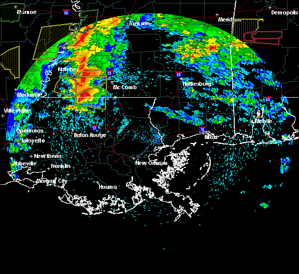 At 556 pm cdt, a severe thunderstorm was located over felps, or 8 miles northeast of clinton, moving northeast at 45 mph (radar indicated). Hazards include two inch hail and 60 mph wind gusts. People and animals outdoors will be injured. expect hail damage to roofs, siding, windows, and vehicles. expect wind damage to roofs, siding, and trees. Locations impacted include, liberty, greensburg, felps, darlington, gillsberg and easleyville. At 556 pm cdt, a severe thunderstorm was located over felps, or 8 miles northeast of clinton, moving northeast at 45 mph (radar indicated). Hazards include two inch hail and 60 mph wind gusts. People and animals outdoors will be injured. expect hail damage to roofs, siding, windows, and vehicles. expect wind damage to roofs, siding, and trees. Locations impacted include, liberty, greensburg, felps, darlington, gillsberg and easleyville.
|
| 4/19/2020 5:53 PM CDT |
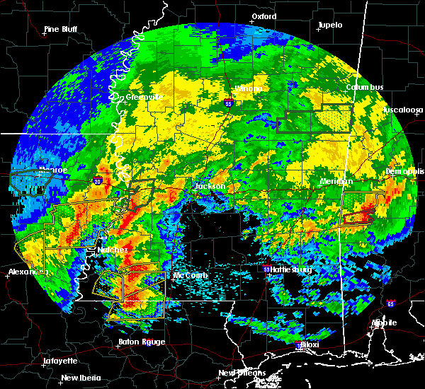 At 553 pm cdt, a severe thunderstorm was located 8 miles northeast of gloster, or 14 miles northwest of liberty, moving east at 50 mph (radar indicated). Hazards include golf ball size hail and 60 mph wind gusts. People and animals outdoors will be injured. expect hail damage to roofs, siding, windows, and vehicles. expect wind damage to roofs, siding, and trees. Locations impacted include, liberty, centreville, gloster, smithdale and crosby. At 553 pm cdt, a severe thunderstorm was located 8 miles northeast of gloster, or 14 miles northwest of liberty, moving east at 50 mph (radar indicated). Hazards include golf ball size hail and 60 mph wind gusts. People and animals outdoors will be injured. expect hail damage to roofs, siding, windows, and vehicles. expect wind damage to roofs, siding, and trees. Locations impacted include, liberty, centreville, gloster, smithdale and crosby.
|
| 4/19/2020 5:51 PM CDT |
 At 551 pm cdt, a severe thunderstorm was located near felps, or near clinton, moving east at 45 mph (radar indicated). Hazards include golf ball size hail and 60 mph wind gusts. People and animals outdoors will be injured. expect hail damage to roofs, siding, windows, and vehicles. expect wind damage to roofs, siding, and trees. Locations impacted include, clinton, liberty, greensburg, wilson, norwood, felps, darlington, gillsberg and easleyville. At 551 pm cdt, a severe thunderstorm was located near felps, or near clinton, moving east at 45 mph (radar indicated). Hazards include golf ball size hail and 60 mph wind gusts. People and animals outdoors will be injured. expect hail damage to roofs, siding, windows, and vehicles. expect wind damage to roofs, siding, and trees. Locations impacted include, clinton, liberty, greensburg, wilson, norwood, felps, darlington, gillsberg and easleyville.
|
| 4/19/2020 5:41 PM CDT |
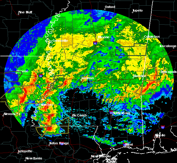 At 541 pm cdt, a severe thunderstorm was located 7 miles northwest of gloster, or 19 miles west of liberty, moving northeast at 50 mph (radar indicated). Hazards include ping pong ball size hail and 60 mph wind gusts. People and animals outdoors will be injured. expect hail damage to roofs, siding, windows, and vehicles. Expect wind damage to roofs, siding, and trees. At 541 pm cdt, a severe thunderstorm was located 7 miles northwest of gloster, or 19 miles west of liberty, moving northeast at 50 mph (radar indicated). Hazards include ping pong ball size hail and 60 mph wind gusts. People and animals outdoors will be injured. expect hail damage to roofs, siding, windows, and vehicles. Expect wind damage to roofs, siding, and trees.
|
| 4/19/2020 5:35 PM CDT |
 At 534 pm cdt, a severe thunderstorm was located near jackson, moving northeast at 50 mph (radar indicated). Hazards include ping pong ball size hail and 60 mph wind gusts. People and animals outdoors will be injured. expect hail damage to roofs, siding, windows, and vehicles. Expect wind damage to roofs, siding, and trees. At 534 pm cdt, a severe thunderstorm was located near jackson, moving northeast at 50 mph (radar indicated). Hazards include ping pong ball size hail and 60 mph wind gusts. People and animals outdoors will be injured. expect hail damage to roofs, siding, windows, and vehicles. Expect wind damage to roofs, siding, and trees.
|
| 12/16/2019 4:47 PM CST |
 At 447 pm cst, a severe thunderstorm capable of producing a tornado was located over liberty, moving northeast at 45 mph (radar indicated rotation). Hazards include tornado. Flying debris will be dangerous to those caught without shelter. mobile homes will be damaged or destroyed. damage to roofs, windows, and vehicles will occur. tree damage is likely. This dangerous storm will be near, smithdale around 505 pm cst. At 447 pm cst, a severe thunderstorm capable of producing a tornado was located over liberty, moving northeast at 45 mph (radar indicated rotation). Hazards include tornado. Flying debris will be dangerous to those caught without shelter. mobile homes will be damaged or destroyed. damage to roofs, windows, and vehicles will occur. tree damage is likely. This dangerous storm will be near, smithdale around 505 pm cst.
|
| 12/16/2019 4:40 PM CST |
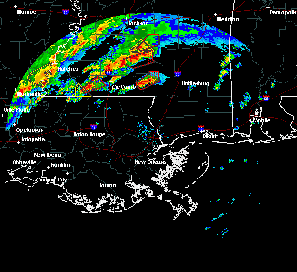 At 440 pm cst, a severe thunderstorm capable of producing a tornado was located near liberty, moving northeast at 40 mph (radar indicated rotation). Hazards include tornado. Flying debris will be dangerous to those caught without shelter. mobile homes will be damaged or destroyed. damage to roofs, windows, and vehicles will occur. tree damage is likely. this dangerous storm will be near, liberty around 455 pm cst. Smithdale around 510 pm cst. At 440 pm cst, a severe thunderstorm capable of producing a tornado was located near liberty, moving northeast at 40 mph (radar indicated rotation). Hazards include tornado. Flying debris will be dangerous to those caught without shelter. mobile homes will be damaged or destroyed. damage to roofs, windows, and vehicles will occur. tree damage is likely. this dangerous storm will be near, liberty around 455 pm cst. Smithdale around 510 pm cst.
|
| 12/16/2019 2:45 PM CST | Reports of injuries... houses damaged... and people trapped in power lines north of liberty... ms in amite county. possible tornad in amite county MS, 9.7 miles S of Liberty, MS |
| 12/16/2019 2:45 PM CST | Emergency manager reported downed trees and powerlines north of liberty... ms in amite count in amite county MS, 9.7 miles S of Liberty, MS |
| 7/14/2019 11:35 AM CDT |
 At 1135 am cdt, a severe thunderstorm was located near felps, or 11 miles northeast of clinton, moving north at 40 mph (radar indicated). Hazards include 70 mph wind gusts. Expect considerable tree damage. Damage is likely to mobile homes, roofs, and outbuildings. At 1135 am cdt, a severe thunderstorm was located near felps, or 11 miles northeast of clinton, moving north at 40 mph (radar indicated). Hazards include 70 mph wind gusts. Expect considerable tree damage. Damage is likely to mobile homes, roofs, and outbuildings.
|
| 7/14/2019 11:35 AM CDT |
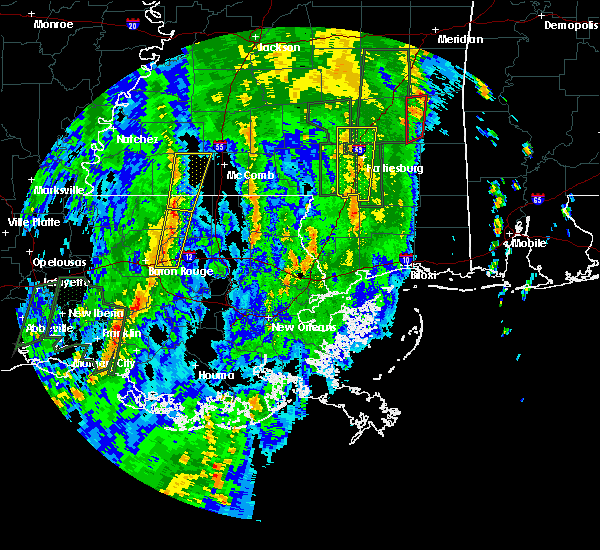 At 1135 am cdt, a severe thunderstorm was located near felps, or 11 miles northeast of clinton, moving north at 40 mph (radar indicated). Hazards include 70 mph wind gusts. Expect considerable tree damage. Damage is likely to mobile homes, roofs, and outbuildings. At 1135 am cdt, a severe thunderstorm was located near felps, or 11 miles northeast of clinton, moving north at 40 mph (radar indicated). Hazards include 70 mph wind gusts. Expect considerable tree damage. Damage is likely to mobile homes, roofs, and outbuildings.
|
| 6/28/2019 3:23 PM CDT |
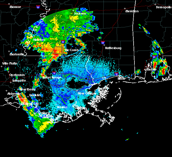 At 323 pm cdt, a severe thunderstorm was located near gillsberg, or 7 miles southeast of liberty, moving southwest at 25 mph (radar indicated). Hazards include 60 mph wind gusts and quarter size hail. Hail damage to vehicles is expected. Expect wind damage to roofs, siding, and trees. At 323 pm cdt, a severe thunderstorm was located near gillsberg, or 7 miles southeast of liberty, moving southwest at 25 mph (radar indicated). Hazards include 60 mph wind gusts and quarter size hail. Hail damage to vehicles is expected. Expect wind damage to roofs, siding, and trees.
|
| 6/28/2019 3:16 PM CDT |
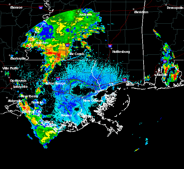 At 315 pm cdt, a severe thunderstorm was located near liberty, moving southwest at 15 mph (radar indicated). Hazards include 60 mph wind gusts and quarter size hail. Hail damage to vehicles is expected. expect wind damage to roofs, siding, and trees. Locations impacted include, liberty. At 315 pm cdt, a severe thunderstorm was located near liberty, moving southwest at 15 mph (radar indicated). Hazards include 60 mph wind gusts and quarter size hail. Hail damage to vehicles is expected. expect wind damage to roofs, siding, and trees. Locations impacted include, liberty.
|
| 6/28/2019 2:55 PM CDT |
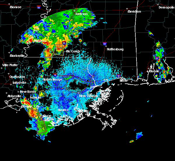 At 254 pm cdt, a severe thunderstorm was located 9 miles south of smithdale, or 9 miles east of liberty, and is nearly stationary (radar indicated). Hazards include 60 mph wind gusts and quarter size hail. Hail damage to vehicles is expected. Expect wind damage to roofs, siding, and trees. At 254 pm cdt, a severe thunderstorm was located 9 miles south of smithdale, or 9 miles east of liberty, and is nearly stationary (radar indicated). Hazards include 60 mph wind gusts and quarter size hail. Hail damage to vehicles is expected. Expect wind damage to roofs, siding, and trees.
|
| 6/28/2019 2:47 PM CDT |
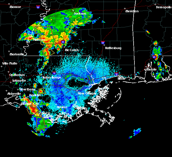 At 246 pm cdt, a severe thunderstorm was located near gloster, or 10 miles west of liberty, moving southeast at 10 mph (radar indicated). Hazards include 60 mph wind gusts and quarter size hail. Hail damage to vehicles is expected. Expect wind damage to roofs, siding, and trees. At 246 pm cdt, a severe thunderstorm was located near gloster, or 10 miles west of liberty, moving southeast at 10 mph (radar indicated). Hazards include 60 mph wind gusts and quarter size hail. Hail damage to vehicles is expected. Expect wind damage to roofs, siding, and trees.
|
| 6/24/2019 4:02 AM CDT |
 At 401 am cdt, severe thunderstorms were located along a line extending from 6 miles northwest of gloster to 7 miles southeast of fort adams, moving southeast at 25 mph (radar indicated). Hazards include 60 mph wind gusts. Expect damage to roofs, siding, and trees. locations impacted include, jackson, st. Francisville, liberty, centreville, woodville, gloster, wilson, norwood, wakefield, spillman, fort adams, dolorosa and crosby. At 401 am cdt, severe thunderstorms were located along a line extending from 6 miles northwest of gloster to 7 miles southeast of fort adams, moving southeast at 25 mph (radar indicated). Hazards include 60 mph wind gusts. Expect damage to roofs, siding, and trees. locations impacted include, jackson, st. Francisville, liberty, centreville, woodville, gloster, wilson, norwood, wakefield, spillman, fort adams, dolorosa and crosby.
|
| 6/24/2019 3:44 AM CDT |
 At 343 am cdt, severe thunderstorms were located along a line extending from near garden city to fort adams, moving southeast at 25 mph (radar indicated). Hazards include 60 mph wind gusts. expect damage to roofs, siding, and trees At 343 am cdt, severe thunderstorms were located along a line extending from near garden city to fort adams, moving southeast at 25 mph (radar indicated). Hazards include 60 mph wind gusts. expect damage to roofs, siding, and trees
|
| 6/24/2019 3:44 AM CDT |
 The national weather service in new orleans has issued a * severe thunderstorm warning for. northeastern west feliciana parish in southeastern louisiana. northwestern east feliciana parish in southeastern louisiana. wilkinson county in southern mississippi. Western amite county in southern mississippi. The national weather service in new orleans has issued a * severe thunderstorm warning for. northeastern west feliciana parish in southeastern louisiana. northwestern east feliciana parish in southeastern louisiana. wilkinson county in southern mississippi. Western amite county in southern mississippi.
|
| 5/9/2019 10:52 AM CDT | Wfo jan relayed ham radio report of trees down in liberty. also... one tree down along hwy 24 about 1 mile west of liberty. time estimated from rada in amite county MS, 0.6 miles W of Liberty, MS |
| 5/9/2019 10:42 AM CDT |
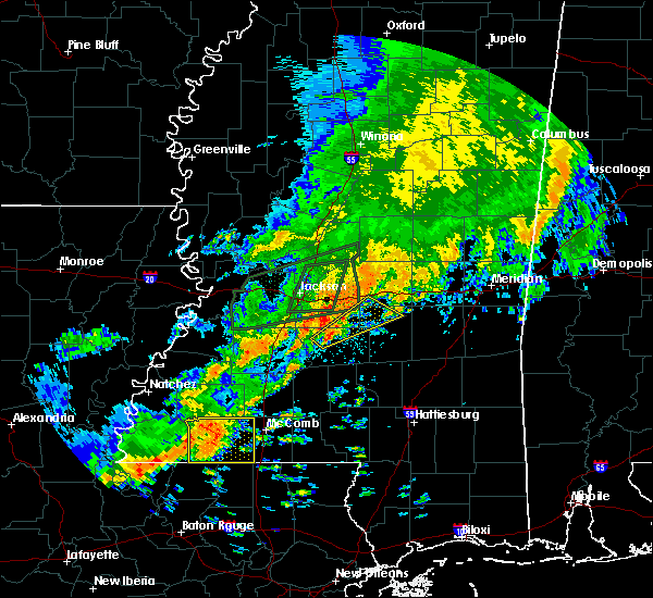 At 1042 am cdt, a severe thunderstorm was located 7 miles east of gloster, or 7 miles northwest of liberty, moving east at 35 mph (radar indicated). Hazards include 60 mph wind gusts and nickel size hail. Expect damage to roofs, siding, and trees. Locations impacted include, liberty, centreville, gloster, smithdale, gillsberg and crosby. At 1042 am cdt, a severe thunderstorm was located 7 miles east of gloster, or 7 miles northwest of liberty, moving east at 35 mph (radar indicated). Hazards include 60 mph wind gusts and nickel size hail. Expect damage to roofs, siding, and trees. Locations impacted include, liberty, centreville, gloster, smithdale, gillsberg and crosby.
|
| 5/9/2019 10:28 AM CDT |
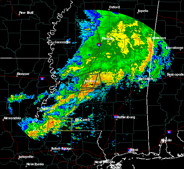 At 1027 am cdt, a severe thunderstorm was located over gloster, or 12 miles west of liberty, moving east at 35 mph (radar indicated). Hazards include 60 mph wind gusts and nickel size hail. expect damage to roofs, siding, and trees At 1027 am cdt, a severe thunderstorm was located over gloster, or 12 miles west of liberty, moving east at 35 mph (radar indicated). Hazards include 60 mph wind gusts and nickel size hail. expect damage to roofs, siding, and trees
|
| 4/18/2019 2:04 PM CDT |
 At 202 pm cdt, severe thunderstorms were located along a line extending from near bude to near liberty to near clinton, moving east at 35 mph (radar indicated). Hazards include 60 mph wind gusts and penny size hail. Expect damage to roofs, siding, and trees. Locations impacted include, zachary, jackson, clinton, liberty, centreville, slaughter, gloster, wilson, norwood, smithdale, darlington, gillsberg, felps, easleyville and crosby. At 202 pm cdt, severe thunderstorms were located along a line extending from near bude to near liberty to near clinton, moving east at 35 mph (radar indicated). Hazards include 60 mph wind gusts and penny size hail. Expect damage to roofs, siding, and trees. Locations impacted include, zachary, jackson, clinton, liberty, centreville, slaughter, gloster, wilson, norwood, smithdale, darlington, gillsberg, felps, easleyville and crosby.
|
| 4/18/2019 1:48 PM CDT |
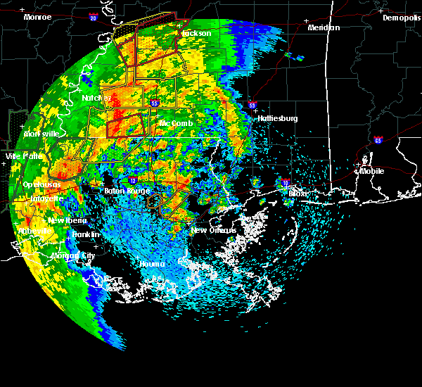 At 147 pm cdt, a severe thunderstorm capable of producing a tornado was located just east of centreville, or 12 miles west of liberty, moving east at 35 mph (radar indicated rotation). Hazards include tornado. Flying debris will be dangerous to those caught without shelter. mobile homes will be damaged or destroyed. damage to roofs, windows, and vehicles will occur. tree damage is likely. This dangerous storm will be near, liberty around 210 pm cdt. At 147 pm cdt, a severe thunderstorm capable of producing a tornado was located just east of centreville, or 12 miles west of liberty, moving east at 35 mph (radar indicated rotation). Hazards include tornado. Flying debris will be dangerous to those caught without shelter. mobile homes will be damaged or destroyed. damage to roofs, windows, and vehicles will occur. tree damage is likely. This dangerous storm will be near, liberty around 210 pm cdt.
|
| 4/18/2019 1:41 PM CDT |
 At 141 pm cdt, a severe thunderstorm capable of producing a tornado was located over centreville, or 16 miles north of clinton, moving east at 35 mph (radar indicated rotation). Hazards include tornado. Flying debris will be dangerous to those caught without shelter. mobile homes will be damaged or destroyed. damage to roofs, windows, and vehicles will occur. tree damage is likely. this dangerous storm will be near, gloster around 150 pm cdt. Liberty around 210 pm cdt. At 141 pm cdt, a severe thunderstorm capable of producing a tornado was located over centreville, or 16 miles north of clinton, moving east at 35 mph (radar indicated rotation). Hazards include tornado. Flying debris will be dangerous to those caught without shelter. mobile homes will be damaged or destroyed. damage to roofs, windows, and vehicles will occur. tree damage is likely. this dangerous storm will be near, gloster around 150 pm cdt. Liberty around 210 pm cdt.
|
| 4/18/2019 1:22 PM CDT |
 At 122 pm cdt, severe thunderstorms were located along a line extending from near garden city to 6 miles northeast of spillman to st. francisville, moving east at 35 mph (radar indicated). Hazards include 60 mph wind gusts and penny size hail. expect damage to roofs, siding, and trees At 122 pm cdt, severe thunderstorms were located along a line extending from near garden city to 6 miles northeast of spillman to st. francisville, moving east at 35 mph (radar indicated). Hazards include 60 mph wind gusts and penny size hail. expect damage to roofs, siding, and trees
|
| 4/7/2019 7:49 PM CDT |
 At 749 pm cdt, severe thunderstorms were located along a line extending from near darlington to near montpelier to near french settlement, moving northeast at 25 mph (radar indicated). Hazards include 70 mph wind gusts. Expect considerable tree damage. Damage is likely to mobile homes, roofs, and outbuildings. At 749 pm cdt, severe thunderstorms were located along a line extending from near darlington to near montpelier to near french settlement, moving northeast at 25 mph (radar indicated). Hazards include 70 mph wind gusts. Expect considerable tree damage. Damage is likely to mobile homes, roofs, and outbuildings.
|
| 2/22/2019 3:24 PM CST |
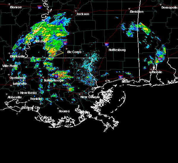 At 324 pm cst, a severe thunderstorm was located near liberty, moving northeast at 25 mph (radar indicated). Hazards include 60 mph wind gusts. expect damage to roofs, siding, and trees At 324 pm cst, a severe thunderstorm was located near liberty, moving northeast at 25 mph (radar indicated). Hazards include 60 mph wind gusts. expect damage to roofs, siding, and trees
|
| 4/14/2018 7:59 AM CDT |
 At 759 am cdt, severe thunderstorms were located along a line extending from near smithdale to 7 miles west of gillsberg, moving east at 35 mph (radar indicated). Hazards include 60 mph wind gusts. expect damage to roofs, siding, and trees At 759 am cdt, severe thunderstorms were located along a line extending from near smithdale to 7 miles west of gillsberg, moving east at 35 mph (radar indicated). Hazards include 60 mph wind gusts. expect damage to roofs, siding, and trees
|
| 4/14/2018 7:46 AM CDT |
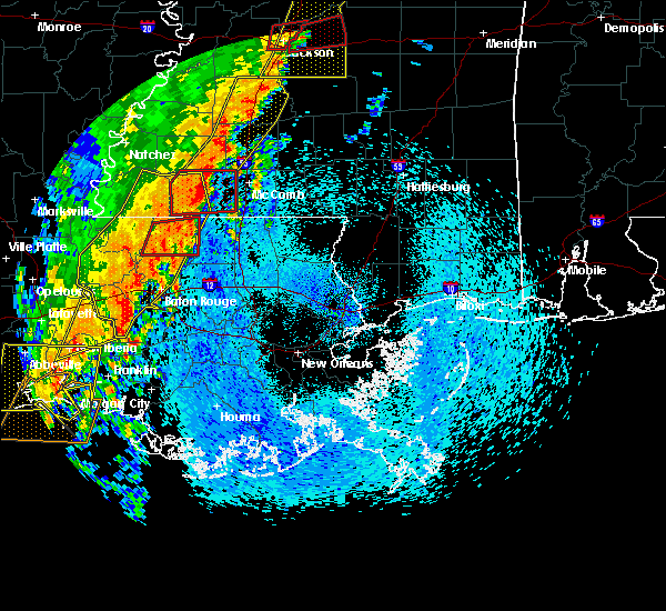 At 746 am cdt, a severe thunderstorm capable of producing a tornado was located near liberty, moving east at 45 mph (radar indicated rotation). Hazards include tornado. Flying debris will be dangerous to those caught without shelter. mobile homes will be damaged or destroyed. damage to roofs, windows, and vehicles will occur. tree damage is likely. This dangerous storm will be near, smithdale around 800 am cdt. At 746 am cdt, a severe thunderstorm capable of producing a tornado was located near liberty, moving east at 45 mph (radar indicated rotation). Hazards include tornado. Flying debris will be dangerous to those caught without shelter. mobile homes will be damaged or destroyed. damage to roofs, windows, and vehicles will occur. tree damage is likely. This dangerous storm will be near, smithdale around 800 am cdt.
|
| 4/14/2018 7:37 AM CDT |
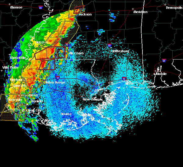 At 737 am cdt, a severe thunderstorm capable of producing a tornado was located near liberty, moving northeast at 60 mph (radar indicated rotation). Hazards include tornado. Flying debris will be dangerous to those caught without shelter. mobile homes will be damaged or destroyed. damage to roofs, windows, and vehicles will occur. tree damage is likely. this dangerous storm will be near, liberty around 740 am cdt. smithdale around 750 am cdt. Other locations impacted by this tornadic thunderstorm include crosby. At 737 am cdt, a severe thunderstorm capable of producing a tornado was located near liberty, moving northeast at 60 mph (radar indicated rotation). Hazards include tornado. Flying debris will be dangerous to those caught without shelter. mobile homes will be damaged or destroyed. damage to roofs, windows, and vehicles will occur. tree damage is likely. this dangerous storm will be near, liberty around 740 am cdt. smithdale around 750 am cdt. Other locations impacted by this tornadic thunderstorm include crosby.
|
| 4/14/2018 7:18 AM CDT |
 At 718 am cdt, severe thunderstorms were located along a line extending from 6 miles north of gloster to near jackson to near livonia to catahoula, moving east at 30 mph (radar indicated). Hazards include 60 mph wind gusts. Expect damage to roofs, siding, and trees. locations impacted include, baton rouge, zachary, baker, port allen, new roads, jackson, st. francisville, clinton, liberty, addis, brusly, centreville, livonia, maringouin, woodville, slaughter, gloster, fordoche, rosedale and grosse tete. A tornado watch remains in effect until 200 pm cdt for southeastern louisiana, and southern mississippi. At 718 am cdt, severe thunderstorms were located along a line extending from 6 miles north of gloster to near jackson to near livonia to catahoula, moving east at 30 mph (radar indicated). Hazards include 60 mph wind gusts. Expect damage to roofs, siding, and trees. locations impacted include, baton rouge, zachary, baker, port allen, new roads, jackson, st. francisville, clinton, liberty, addis, brusly, centreville, livonia, maringouin, woodville, slaughter, gloster, fordoche, rosedale and grosse tete. A tornado watch remains in effect until 200 pm cdt for southeastern louisiana, and southern mississippi.
|
| 4/14/2018 7:13 AM CDT |
 At 712 am cdt, a severe thunderstorm capable of producing a tornado was located near woodville, or 16 miles north of jackson, moving northeast at 55 mph (radar indicated rotation). Hazards include tornado. Flying debris will be dangerous to those caught without shelter. mobile homes will be damaged or destroyed. damage to roofs, windows, and vehicles will occur. tree damage is likely. this dangerous storm will be near, centreville around 725 am cdt. gloster around 735 am cdt. liberty around 745 am cdt. smithdale around 755 am cdt. Other locations impacted by this tornadic thunderstorm include crosby. At 712 am cdt, a severe thunderstorm capable of producing a tornado was located near woodville, or 16 miles north of jackson, moving northeast at 55 mph (radar indicated rotation). Hazards include tornado. Flying debris will be dangerous to those caught without shelter. mobile homes will be damaged or destroyed. damage to roofs, windows, and vehicles will occur. tree damage is likely. this dangerous storm will be near, centreville around 725 am cdt. gloster around 735 am cdt. liberty around 745 am cdt. smithdale around 755 am cdt. Other locations impacted by this tornadic thunderstorm include crosby.
|
| 4/7/2018 12:36 AM CDT |
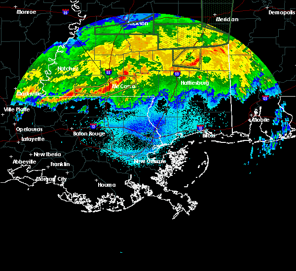 At 1234 am cdt, severe thunderstorms were located along a line extending from near jayess to near magnolia to gillsberg to just east of centreville, moving east at 45 mph (radar indicated). Hazards include 60 mph wind gusts. Expect damage to roofs, siding, and trees. Locations impacted include, mccomb, liberty, magnolia, centreville, salem, gillsberg and mccomb airport. At 1234 am cdt, severe thunderstorms were located along a line extending from near jayess to near magnolia to gillsberg to just east of centreville, moving east at 45 mph (radar indicated). Hazards include 60 mph wind gusts. Expect damage to roofs, siding, and trees. Locations impacted include, mccomb, liberty, magnolia, centreville, salem, gillsberg and mccomb airport.
|
| 4/7/2018 12:14 AM CDT |
 At 1213 am cdt, severe thunderstorms were located along a line extending from near summit to liberty to near woodville, moving east at 35 mph (radar indicated). Hazards include 60 mph wind gusts. Expect damage to roofs, siding, and trees. Locations impacted include, mccomb, liberty, magnolia, summit, centreville, woodville, gloster, osyka, smithdale, salem, gillsberg and mccomb airport. At 1213 am cdt, severe thunderstorms were located along a line extending from near summit to liberty to near woodville, moving east at 35 mph (radar indicated). Hazards include 60 mph wind gusts. Expect damage to roofs, siding, and trees. Locations impacted include, mccomb, liberty, magnolia, summit, centreville, woodville, gloster, osyka, smithdale, salem, gillsberg and mccomb airport.
|
| 4/6/2018 11:44 PM CDT |
 At 1143 pm cdt, severe thunderstorms were located along a line extending from center point to near woodville, moving east at 45 mph (radar indicated). Hazards include 60 mph wind gusts. Expect damage to roofs, siding, and trees. severe thunderstorms will be near, summit around 1155 pm cdt. gloster around 1205 am cdt. liberty around 1220 am cdt. gillsberg around 1235 am cdt. magnolia and osyka around 1245 am cdt. Other locations impacted by these severe thunderstorms include mccomb airport. At 1143 pm cdt, severe thunderstorms were located along a line extending from center point to near woodville, moving east at 45 mph (radar indicated). Hazards include 60 mph wind gusts. Expect damage to roofs, siding, and trees. severe thunderstorms will be near, summit around 1155 pm cdt. gloster around 1205 am cdt. liberty around 1220 am cdt. gillsberg around 1235 am cdt. magnolia and osyka around 1245 am cdt. Other locations impacted by these severe thunderstorms include mccomb airport.
|
| 4/4/2018 12:34 AM CDT |
 At 1233 am cdt, severe thunderstorms were located along a line extending from near centreville to wilson to near baker, moving east at 40 mph (radar indicated). Hazards include 60 mph wind gusts and quarter size hail. Hail damage to vehicles is expected. expect wind damage to roofs, siding, and trees. Locations impacted include, baton rouge, zachary, baker, denham springs, jackson, clinton, liberty, centreville, slaughter, gloster, wilson, norwood, merrydale, pride, felps, brownfields, greenwell spring, shenandoah and baton rouge airport. At 1233 am cdt, severe thunderstorms were located along a line extending from near centreville to wilson to near baker, moving east at 40 mph (radar indicated). Hazards include 60 mph wind gusts and quarter size hail. Hail damage to vehicles is expected. expect wind damage to roofs, siding, and trees. Locations impacted include, baton rouge, zachary, baker, denham springs, jackson, clinton, liberty, centreville, slaughter, gloster, wilson, norwood, merrydale, pride, felps, brownfields, greenwell spring, shenandoah and baton rouge airport.
|
| 4/4/2018 12:16 AM CDT |
 At 1215 am cdt, severe thunderstorms were located along a line extending from near woodville to spillman to near erwinville, moving east at 40 mph (radar indicated). Hazards include 60 mph wind gusts and quarter size hail. Hail damage to vehicles is expected. Expect wind damage to roofs, siding, and trees. At 1215 am cdt, severe thunderstorms were located along a line extending from near woodville to spillman to near erwinville, moving east at 40 mph (radar indicated). Hazards include 60 mph wind gusts and quarter size hail. Hail damage to vehicles is expected. Expect wind damage to roofs, siding, and trees.
|
| 10/22/2017 2:33 AM CDT |
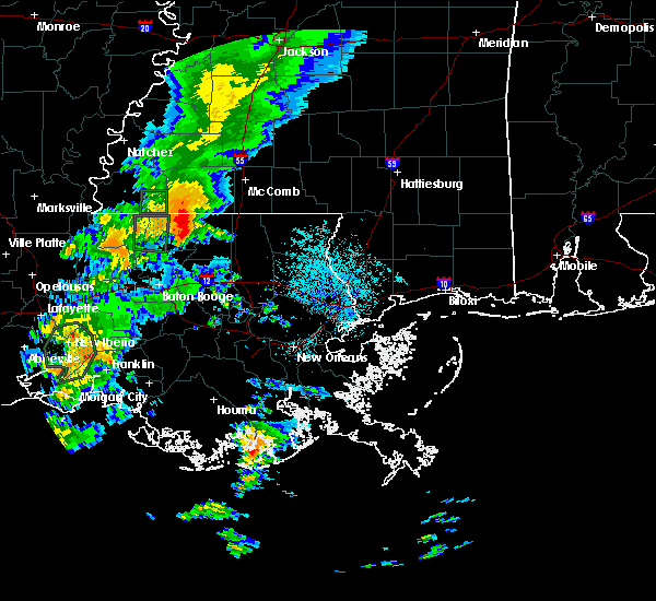 At 232 am cdt, a severe thunderstorm was located over felps, or 8 miles northeast of clinton, moving north at 25 mph (radar indicated). Hazards include 60 mph wind gusts. expect damage to roofs, siding, and trees At 232 am cdt, a severe thunderstorm was located over felps, or 8 miles northeast of clinton, moving north at 25 mph (radar indicated). Hazards include 60 mph wind gusts. expect damage to roofs, siding, and trees
|
| 7/21/2017 6:46 PM CDT |
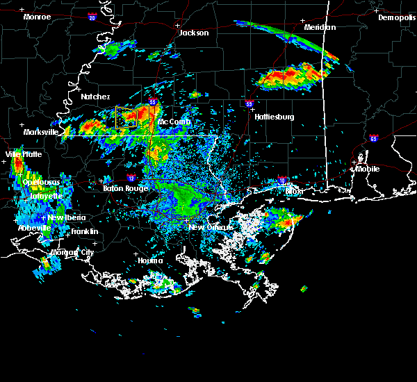 At 645 pm cdt, a severe thunderstorm was located near liberty, moving west at 5 mph (radar indicated). Hazards include quarter size hail. damage to vehicles is expected At 645 pm cdt, a severe thunderstorm was located near liberty, moving west at 5 mph (radar indicated). Hazards include quarter size hail. damage to vehicles is expected
|
| 5/21/2017 3:34 PM CDT | Quarter sized hail reported 9.8 miles WNW of Liberty, MS |
| 4/30/2017 8:40 AM CDT |
 At 839 am cdt, a severe squall line capable of producing both tornadoes and extensive straight line wind damage was located along a line extending from near liberty to 7 miles west of montpelier to near white castle, moving east at 30 mph (radar indicated rotation). Hazards include tornado and quarter size hail. Flying debris will be dangerous to those caught without shelter. mobile homes will be damaged or destroyed. damage to roofs, windows, and vehicles will occur. tree damage is likely. these dangerous storms will be near, liberty around 845 am cdt. montpelier around 855 am cdt. gonzales, greensburg, magnolia and prairieville around 900 am cdt. Other locations impacted by these tornadic storms include tangipahoa and mccomb airport. At 839 am cdt, a severe squall line capable of producing both tornadoes and extensive straight line wind damage was located along a line extending from near liberty to 7 miles west of montpelier to near white castle, moving east at 30 mph (radar indicated rotation). Hazards include tornado and quarter size hail. Flying debris will be dangerous to those caught without shelter. mobile homes will be damaged or destroyed. damage to roofs, windows, and vehicles will occur. tree damage is likely. these dangerous storms will be near, liberty around 845 am cdt. montpelier around 855 am cdt. gonzales, greensburg, magnolia and prairieville around 900 am cdt. Other locations impacted by these tornadic storms include tangipahoa and mccomb airport.
|
| 4/30/2017 8:26 AM CDT |
 At 825 am cdt, severe thunderstorms capable of producing both tornadoes and extensive straight line wind damage were located along a line extending from liberty to near pride to near plaquemine, moving east at 25 mph (radar indicated rotation). Hazards include tornado and quarter size hail. Flying debris will be dangerous to those caught without shelter. mobile homes will be damaged or destroyed. damage to roofs, windows, and vehicles will occur. tree damage is likely. these dangerous storms will be near, liberty and watson around 830 am cdt. gillsberg around 855 am cdt. gonzales, donaldsonville, montpelier, geismer and prairieville around 900 am cdt. Other locations impacted by these tornadic storms include mccomb airport and tangipahoa. At 825 am cdt, severe thunderstorms capable of producing both tornadoes and extensive straight line wind damage were located along a line extending from liberty to near pride to near plaquemine, moving east at 25 mph (radar indicated rotation). Hazards include tornado and quarter size hail. Flying debris will be dangerous to those caught without shelter. mobile homes will be damaged or destroyed. damage to roofs, windows, and vehicles will occur. tree damage is likely. these dangerous storms will be near, liberty and watson around 830 am cdt. gillsberg around 855 am cdt. gonzales, donaldsonville, montpelier, geismer and prairieville around 900 am cdt. Other locations impacted by these tornadic storms include mccomb airport and tangipahoa.
|
| 4/30/2017 8:26 AM CDT |
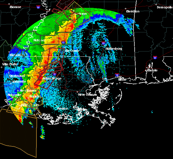 At 825 am cdt, severe thunderstorms capable of producing both tornadoes and extensive straight line wind damage were located along a line extending from liberty to near pride to near plaquemine, moving east at 25 mph (radar indicated rotation). Hazards include tornado and quarter size hail. Flying debris will be dangerous to those caught without shelter. mobile homes will be damaged or destroyed. damage to roofs, windows, and vehicles will occur. tree damage is likely. these dangerous storms will be near, liberty and watson around 830 am cdt. gillsberg around 855 am cdt. gonzales, donaldsonville, montpelier, geismer and prairieville around 900 am cdt. Other locations impacted by these tornadic storms include mccomb airport and tangipahoa. At 825 am cdt, severe thunderstorms capable of producing both tornadoes and extensive straight line wind damage were located along a line extending from liberty to near pride to near plaquemine, moving east at 25 mph (radar indicated rotation). Hazards include tornado and quarter size hail. Flying debris will be dangerous to those caught without shelter. mobile homes will be damaged or destroyed. damage to roofs, windows, and vehicles will occur. tree damage is likely. these dangerous storms will be near, liberty and watson around 830 am cdt. gillsberg around 855 am cdt. gonzales, donaldsonville, montpelier, geismer and prairieville around 900 am cdt. Other locations impacted by these tornadic storms include mccomb airport and tangipahoa.
|
| 4/30/2017 7:56 AM CDT |
 At 756 am cdt, severe thunderstorms were located along a line extending from centreville to near jackson, moving east at 40 mph (radar indicated). Hazards include 60 mph wind gusts. expect damage to roofs, siding, and trees At 756 am cdt, severe thunderstorms were located along a line extending from centreville to near jackson, moving east at 40 mph (radar indicated). Hazards include 60 mph wind gusts. expect damage to roofs, siding, and trees
|
| 4/2/2017 5:28 PM CDT |
 At 527 pm cdt, a severe thunderstorm capable of producing a tornado was located near norwood, or near clinton, moving northeast at 55 mph (radar indicated rotation). Hazards include tornado and half dollar size hail. Flying debris will be dangerous to those caught without shelter. mobile homes will be damaged or destroyed. damage to roofs, windows, and vehicles will occur. tree damage is likely. this dangerous storm will be near, felps around 535 pm cdt. Liberty around 550 pm cdt. At 527 pm cdt, a severe thunderstorm capable of producing a tornado was located near norwood, or near clinton, moving northeast at 55 mph (radar indicated rotation). Hazards include tornado and half dollar size hail. Flying debris will be dangerous to those caught without shelter. mobile homes will be damaged or destroyed. damage to roofs, windows, and vehicles will occur. tree damage is likely. this dangerous storm will be near, felps around 535 pm cdt. Liberty around 550 pm cdt.
|
| 3/7/2017 3:07 PM CST |
 At 307 pm cst, severe thunderstorms were located along a line extending from near liberty to near felps to near st. francisville, moving east at 35 mph (radar indicated). Hazards include 60 mph wind gusts. Expect damage to roofs, siding, and trees. locations impacted include, zachary, jackson, st. Francisville, clinton, liberty, slaughter, wilson, norwood and felps. At 307 pm cst, severe thunderstorms were located along a line extending from near liberty to near felps to near st. francisville, moving east at 35 mph (radar indicated). Hazards include 60 mph wind gusts. Expect damage to roofs, siding, and trees. locations impacted include, zachary, jackson, st. Francisville, clinton, liberty, slaughter, wilson, norwood and felps.
|
| 3/7/2017 2:53 PM CST |
 At 252 pm cst, severe thunderstorms were located along a line extending from near gloster to near centreville to near st. francisville, moving east at 35 mph (radar indicated). Hazards include 60 mph wind gusts. expect damage to roofs, siding, and trees At 252 pm cst, severe thunderstorms were located along a line extending from near gloster to near centreville to near st. francisville, moving east at 35 mph (radar indicated). Hazards include 60 mph wind gusts. expect damage to roofs, siding, and trees
|
| 3/1/2017 3:23 PM CST |
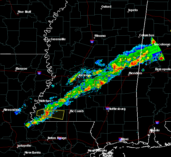 At 322 pm cst, a severe thunderstorm was located near gloster, or 18 miles west of liberty, moving east at 40 mph (radar indicated). Hazards include 60 mph wind gusts and quarter size hail. Hail damage to vehicles is expected. Expect wind damage to roofs, siding, and trees. At 322 pm cst, a severe thunderstorm was located near gloster, or 18 miles west of liberty, moving east at 40 mph (radar indicated). Hazards include 60 mph wind gusts and quarter size hail. Hail damage to vehicles is expected. Expect wind damage to roofs, siding, and trees.
|
| 1/21/2017 2:36 AM CST |
 At 236 am cst, severe thunderstorms were located along a line extending from near gloster to near felps to near slaughter, moving northeast at 55 mph (radar indicated). Hazards include 60 mph wind gusts and quarter size hail. Hail damage to vehicles is expected. expect wind damage to roofs, siding, and trees. locations impacted include, clinton, liberty, greensburg, gloster, gillsberg, easleyville, felps and darlington. A tornado watch remains in effect until 700 am cst for southeastern louisiana, and southern mississippi. At 236 am cst, severe thunderstorms were located along a line extending from near gloster to near felps to near slaughter, moving northeast at 55 mph (radar indicated). Hazards include 60 mph wind gusts and quarter size hail. Hail damage to vehicles is expected. expect wind damage to roofs, siding, and trees. locations impacted include, clinton, liberty, greensburg, gloster, gillsberg, easleyville, felps and darlington. A tornado watch remains in effect until 700 am cst for southeastern louisiana, and southern mississippi.
|
| 1/21/2017 2:36 AM CST |
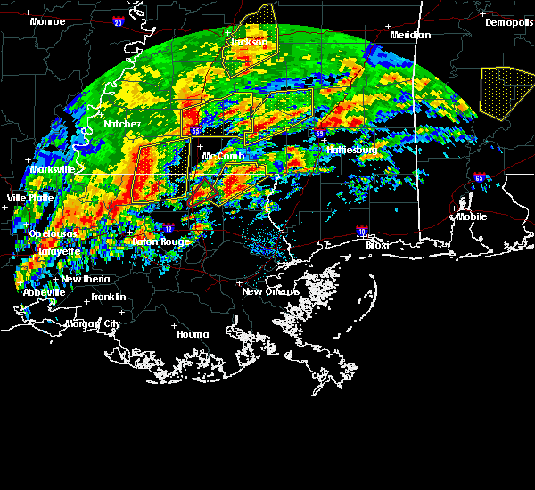 At 236 am cst, severe thunderstorms were located along a line extending from near gloster to near felps to near slaughter, moving northeast at 55 mph (radar indicated). Hazards include 60 mph wind gusts and quarter size hail. Hail damage to vehicles is expected. expect wind damage to roofs, siding, and trees. locations impacted include, clinton, liberty, greensburg, gloster, gillsberg, easleyville, felps and darlington. A tornado watch remains in effect until 700 am cst for southeastern louisiana, and southern mississippi. At 236 am cst, severe thunderstorms were located along a line extending from near gloster to near felps to near slaughter, moving northeast at 55 mph (radar indicated). Hazards include 60 mph wind gusts and quarter size hail. Hail damage to vehicles is expected. expect wind damage to roofs, siding, and trees. locations impacted include, clinton, liberty, greensburg, gloster, gillsberg, easleyville, felps and darlington. A tornado watch remains in effect until 700 am cst for southeastern louisiana, and southern mississippi.
|
| 1/21/2017 2:25 AM CST |
 At 224 am cst, severe thunderstorms were located along a line extending from near woodville to near wilson to near slaughter, moving northeast at 55 mph (radar indicated). Hazards include 60 mph wind gusts and quarter size hail. Hail damage to vehicles is expected. expect wind damage to roofs, siding, and trees. locations impacted include, jackson, clinton, liberty, greensburg, centreville, slaughter, gloster, wilson, norwood, easleyville, darlington, gillsberg and felps. A tornado watch remains in effect until 700 am cst for southeastern louisiana, and southern mississippi. At 224 am cst, severe thunderstorms were located along a line extending from near woodville to near wilson to near slaughter, moving northeast at 55 mph (radar indicated). Hazards include 60 mph wind gusts and quarter size hail. Hail damage to vehicles is expected. expect wind damage to roofs, siding, and trees. locations impacted include, jackson, clinton, liberty, greensburg, centreville, slaughter, gloster, wilson, norwood, easleyville, darlington, gillsberg and felps. A tornado watch remains in effect until 700 am cst for southeastern louisiana, and southern mississippi.
|
| 1/21/2017 2:14 AM CST |
 At 213 am cst, severe thunderstorms were located along a line extending from 7 miles southwest of woodville to near jackson to 6 miles southeast of new roads, moving northeast at 55 mph (radar indicated). Hazards include 60 mph wind gusts and quarter size hail. Hail damage to vehicles is expected. Expect wind damage to roofs, siding, and trees. At 213 am cst, severe thunderstorms were located along a line extending from 7 miles southwest of woodville to near jackson to 6 miles southeast of new roads, moving northeast at 55 mph (radar indicated). Hazards include 60 mph wind gusts and quarter size hail. Hail damage to vehicles is expected. Expect wind damage to roofs, siding, and trees.
|
| 1/2/2017 1:29 PM CST | Several homes damaged in thompson community. possible tornado touch down reported by emergency managemen in amite county MS, 8.2 miles WSW of Liberty, MS |
| 1/2/2017 12:58 PM CST |
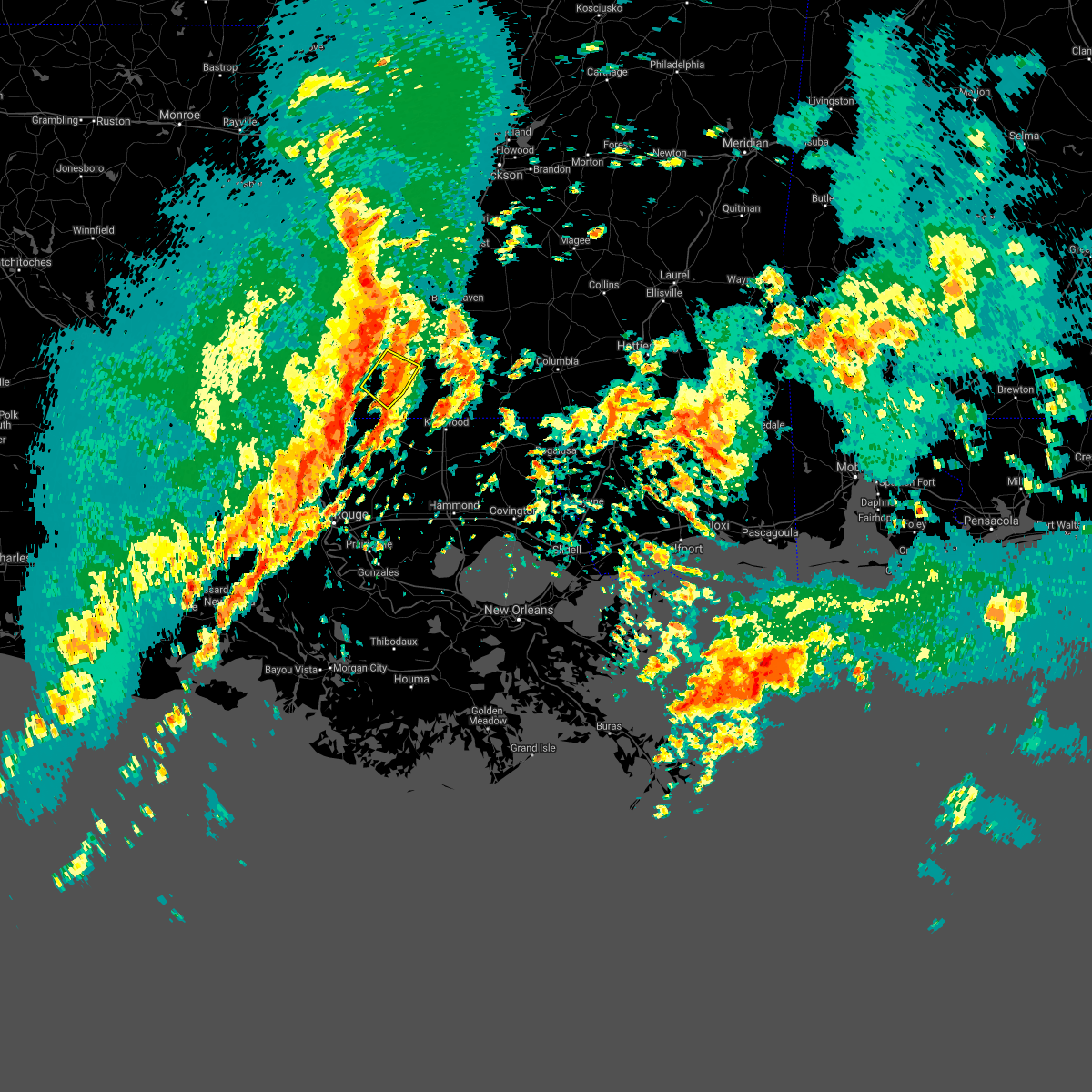 The severe thunderstorm warning for central amite county will expire at 100 pm cst, the storm which prompted the warning has weakened below severe limits, and has exited the warned area. therefore, the warning will be allowed to expire. a tornado watch remains in effect until 800 pm cst for southern mississippi. a squall line of strong thunderstorms with strong wind gusts will be moving through amite county through 2 pm cst. The severe thunderstorm warning for central amite county will expire at 100 pm cst, the storm which prompted the warning has weakened below severe limits, and has exited the warned area. therefore, the warning will be allowed to expire. a tornado watch remains in effect until 800 pm cst for southern mississippi. a squall line of strong thunderstorms with strong wind gusts will be moving through amite county through 2 pm cst.
|
| 1/2/2017 12:35 PM CST |
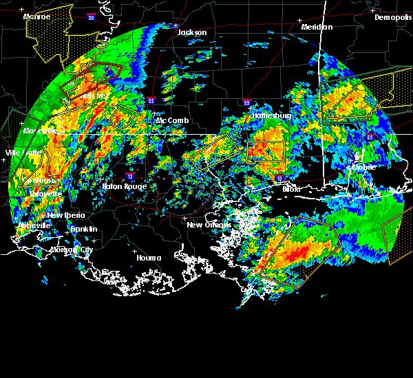 At 1234 pm cst, a severe thunderstorm was located near liberty, moving northeast at 55 mph (radar indicated). Hazards include 60 mph wind gusts. Expect damage to roofs, siding, and trees. locations impacted include, liberty. A tornado watch remains in effect until 800 pm cst for southern mississippi. At 1234 pm cst, a severe thunderstorm was located near liberty, moving northeast at 55 mph (radar indicated). Hazards include 60 mph wind gusts. Expect damage to roofs, siding, and trees. locations impacted include, liberty. A tornado watch remains in effect until 800 pm cst for southern mississippi.
|
| 1/2/2017 12:15 PM CST |
 At 1215 pm cst, a severe thunderstorm was located over wilson, or near clinton, moving northeast at 35 mph (radar indicated). Hazards include 60 mph wind gusts. expect damage to roofs, siding, and trees At 1215 pm cst, a severe thunderstorm was located over wilson, or near clinton, moving northeast at 35 mph (radar indicated). Hazards include 60 mph wind gusts. expect damage to roofs, siding, and trees
|
| 4/30/2016 2:00 PM CDT |
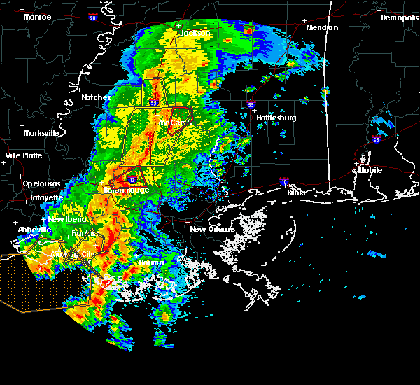 At 159 pm cdt, severe thunderstorms were located along a line extending from near summit to near magnolia to near montpelier, moving east at 30 mph (radar indicated). Hazards include 60 mph wind gusts. Expect damage to roofs. siding. and trees. Locations impacted include, mccomb, liberty, greensburg, amite, amite city, magnolia, kentwood, summit, tylertown, roseland, osyka, montpelier, easleyville, salem, darlington, gillsberg, wilmer, mount herman, smithdale and tangipahoa. At 159 pm cdt, severe thunderstorms were located along a line extending from near summit to near magnolia to near montpelier, moving east at 30 mph (radar indicated). Hazards include 60 mph wind gusts. Expect damage to roofs. siding. and trees. Locations impacted include, mccomb, liberty, greensburg, amite, amite city, magnolia, kentwood, summit, tylertown, roseland, osyka, montpelier, easleyville, salem, darlington, gillsberg, wilmer, mount herman, smithdale and tangipahoa.
|
| 4/30/2016 1:42 PM CDT |
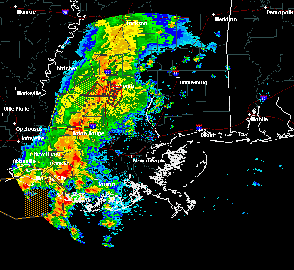 At 141 pm cdt, severe thunderstorms were located along a line extending from near center point to near magnolia to 6 miles northwest of montpelier, moving east at 40 mph (radar indicated). Hazards include 60 mph wind gusts. Expect damage to roofs. siding. And trees. At 141 pm cdt, severe thunderstorms were located along a line extending from near center point to near magnolia to 6 miles northwest of montpelier, moving east at 40 mph (radar indicated). Hazards include 60 mph wind gusts. Expect damage to roofs. siding. And trees.
|
| 4/30/2016 1:13 PM CDT |
 At 113 pm cdt, severe thunderstorms were located along a line extending from centreville to near felps to near darlington, moving northeast at 45 mph (radar indicated). Hazards include 60 mph wind gusts. Expect damage to roofs. siding. And trees. At 113 pm cdt, severe thunderstorms were located along a line extending from centreville to near felps to near darlington, moving northeast at 45 mph (radar indicated). Hazards include 60 mph wind gusts. Expect damage to roofs. siding. And trees.
|
| 4/30/2016 1:13 PM CDT |
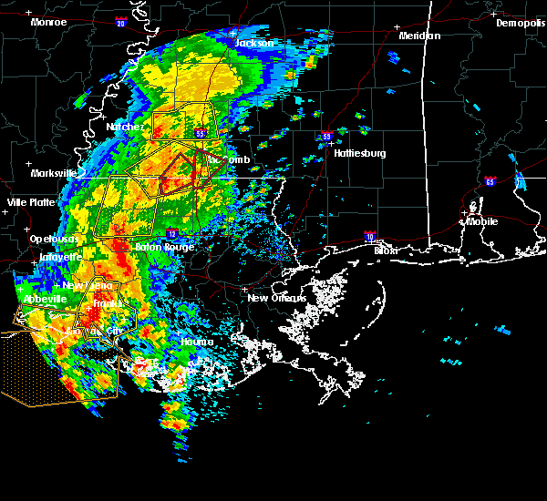 At 113 pm cdt, severe thunderstorms were located along a line extending from centreville to near felps to near darlington, moving northeast at 45 mph (radar indicated). Hazards include 60 mph wind gusts. Expect damage to roofs. siding. And trees. At 113 pm cdt, severe thunderstorms were located along a line extending from centreville to near felps to near darlington, moving northeast at 45 mph (radar indicated). Hazards include 60 mph wind gusts. Expect damage to roofs. siding. And trees.
|
| 3/17/2016 5:28 PM CDT |
 At 528 pm cdt, a severe thunderstorm was located near norwood, or 11 miles north of clinton, moving east at 50 mph (radar indicated). Hazards include 60 mph wind gusts and half dollar size hail. Hail damage to vehicles is expected. Expect wind damage to roofs, siding and trees. At 528 pm cdt, a severe thunderstorm was located near norwood, or 11 miles north of clinton, moving east at 50 mph (radar indicated). Hazards include 60 mph wind gusts and half dollar size hail. Hail damage to vehicles is expected. Expect wind damage to roofs, siding and trees.
|
| 2/15/2016 1:35 PM CST | Roof damage and damage to shed near intersection of fenn rd and miller rd. time estimated by rada in amite county MS, 12.5 miles SSW of Liberty, MS |
| 2/15/2016 12:29 PM CST |
 At 1228 pm cst, a severe thunderstorm capable of producing a tornado was located near gillsberg, or 11 miles north of greensburg, moving east at 40 mph (radar indicated rotation). Hazards include tornado and ping pong ball size hail. Flying debris will be dangerous to those caught without shelter. mobile homes will be damaged or destroyed. damage to roofs, windows and vehicles will occur. tree damage is likely. this dangerous storm will be near, kentwood around 1245 pm cst. Other locations impacted by this tornadic thunderstorm include tangipahoa. At 1228 pm cst, a severe thunderstorm capable of producing a tornado was located near gillsberg, or 11 miles north of greensburg, moving east at 40 mph (radar indicated rotation). Hazards include tornado and ping pong ball size hail. Flying debris will be dangerous to those caught without shelter. mobile homes will be damaged or destroyed. damage to roofs, windows and vehicles will occur. tree damage is likely. this dangerous storm will be near, kentwood around 1245 pm cst. Other locations impacted by this tornadic thunderstorm include tangipahoa.
|
| 2/15/2016 12:29 PM CST |
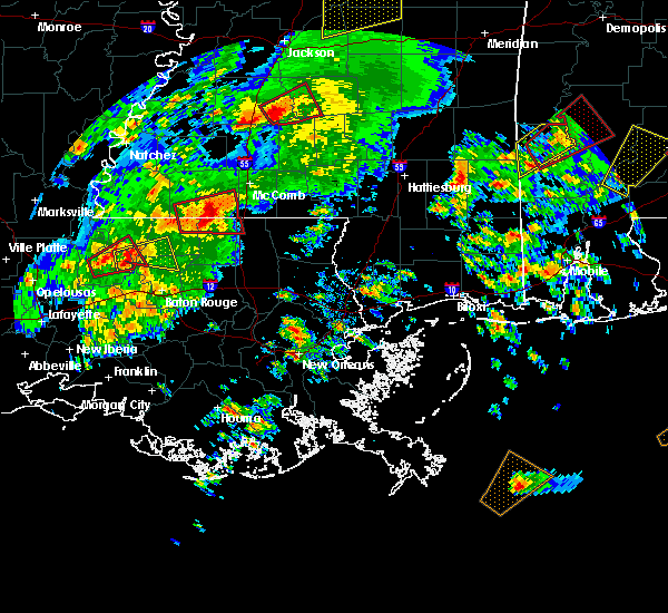 At 1228 pm cst, a severe thunderstorm capable of producing a tornado was located near gillsberg, or 11 miles north of greensburg, moving east at 40 mph (radar indicated rotation). Hazards include tornado and ping pong ball size hail. Flying debris will be dangerous to those caught without shelter. mobile homes will be damaged or destroyed. damage to roofs, windows and vehicles will occur. tree damage is likely. this dangerous storm will be near, kentwood around 1245 pm cst. Other locations impacted by this tornadic thunderstorm include tangipahoa. At 1228 pm cst, a severe thunderstorm capable of producing a tornado was located near gillsberg, or 11 miles north of greensburg, moving east at 40 mph (radar indicated rotation). Hazards include tornado and ping pong ball size hail. Flying debris will be dangerous to those caught without shelter. mobile homes will be damaged or destroyed. damage to roofs, windows and vehicles will occur. tree damage is likely. this dangerous storm will be near, kentwood around 1245 pm cst. Other locations impacted by this tornadic thunderstorm include tangipahoa.
|
| 2/15/2016 12:13 PM CST |
 At 1212 pm cst, a severe thunderstorm capable of producing a tornado was located near felps, or 10 miles southwest of liberty, moving east at 35 mph (radar indicated rotation). Hazards include tornado and ping pong ball size hail. Flying debris will be dangerous to those caught without shelter. mobile homes will be damaged or destroyed. damage to roofs, windows and vehicles will occur. tree damage is likely. this dangerous storm will be near, gillsberg around 1235 pm cst. Other locations impacted by this tornadic thunderstorm include tangipahoa. At 1212 pm cst, a severe thunderstorm capable of producing a tornado was located near felps, or 10 miles southwest of liberty, moving east at 35 mph (radar indicated rotation). Hazards include tornado and ping pong ball size hail. Flying debris will be dangerous to those caught without shelter. mobile homes will be damaged or destroyed. damage to roofs, windows and vehicles will occur. tree damage is likely. this dangerous storm will be near, gillsberg around 1235 pm cst. Other locations impacted by this tornadic thunderstorm include tangipahoa.
|
| 2/15/2016 12:13 PM CST |
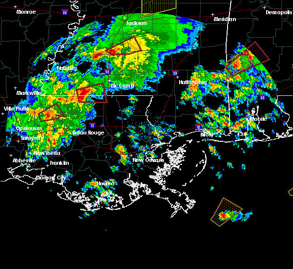 At 1212 pm cst, a severe thunderstorm capable of producing a tornado was located near felps, or 10 miles southwest of liberty, moving east at 35 mph (radar indicated rotation). Hazards include tornado and ping pong ball size hail. Flying debris will be dangerous to those caught without shelter. mobile homes will be damaged or destroyed. damage to roofs, windows and vehicles will occur. tree damage is likely. this dangerous storm will be near, gillsberg around 1235 pm cst. Other locations impacted by this tornadic thunderstorm include tangipahoa. At 1212 pm cst, a severe thunderstorm capable of producing a tornado was located near felps, or 10 miles southwest of liberty, moving east at 35 mph (radar indicated rotation). Hazards include tornado and ping pong ball size hail. Flying debris will be dangerous to those caught without shelter. mobile homes will be damaged or destroyed. damage to roofs, windows and vehicles will occur. tree damage is likely. this dangerous storm will be near, gillsberg around 1235 pm cst. Other locations impacted by this tornadic thunderstorm include tangipahoa.
|
| 12/28/2015 2:56 AM CST |
 At 256 am cst, a severe thunderstorm capable of producing a tornado was located near gillsberg, or 7 miles southeast of liberty, moving north at 25 mph (radar indicated rotation). Hazards include tornado. Flying debris will be dangerous to those caught without shelter. mobile homes will be damaged or destroyed. damage to roofs, windows and vehicles will occur. tree damage is likely. This dangerous storm will be near, liberty around 310 am cst. At 256 am cst, a severe thunderstorm capable of producing a tornado was located near gillsberg, or 7 miles southeast of liberty, moving north at 25 mph (radar indicated rotation). Hazards include tornado. Flying debris will be dangerous to those caught without shelter. mobile homes will be damaged or destroyed. damage to roofs, windows and vehicles will occur. tree damage is likely. This dangerous storm will be near, liberty around 310 am cst.
|
| 12/28/2015 2:38 AM CST |
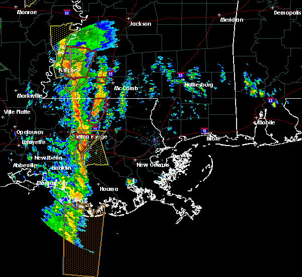 At 237 am cst, a severe thunderstorm capable of producing a tornado was located over gillsberg, or 11 miles southeast of liberty, moving north at 45 mph (radar indicated rotation). Hazards include tornado. Flying debris will be dangerous to those caught without shelter. mobile homes will be damaged or destroyed. damage to roofs, windows and vehicles will occur. tree damage is likely. this dangerous storm will be near, liberty around 250 am cst. Smithdale around 305 am cst. At 237 am cst, a severe thunderstorm capable of producing a tornado was located over gillsberg, or 11 miles southeast of liberty, moving north at 45 mph (radar indicated rotation). Hazards include tornado. Flying debris will be dangerous to those caught without shelter. mobile homes will be damaged or destroyed. damage to roofs, windows and vehicles will occur. tree damage is likely. this dangerous storm will be near, liberty around 250 am cst. Smithdale around 305 am cst.
|
| 8/10/2015 5:52 PM CDT |
 The severe thunderstorm warning for eastern amite county will expire at 600 pm cdt, the storm which prompted the warning has weakened below severe limits, and no longer poses an immediate threat to life or property. therefore the warning will be allowed to expire. The severe thunderstorm warning for eastern amite county will expire at 600 pm cdt, the storm which prompted the warning has weakened below severe limits, and no longer poses an immediate threat to life or property. therefore the warning will be allowed to expire.
|
| 8/10/2015 5:14 PM CDT |
 At 513 pm cdt, doppler radar indicated a severe thunderstorm capable of producing damaging winds in excess of 60 mph. this storm was located near smithdale, or 9 miles northeast of liberty, and moving south at 10 mph. At 513 pm cdt, doppler radar indicated a severe thunderstorm capable of producing damaging winds in excess of 60 mph. this storm was located near smithdale, or 9 miles northeast of liberty, and moving south at 10 mph.
|
| 7/25/2015 6:12 PM CDT | Em reports numerous trees and powerlines down throughout the county. lightning ignited a fire at a tank farm. time estimated from radar. em to provide more details at a in amite county MS, 0.6 miles W of Liberty, MS |
| 7/7/2015 3:35 PM CDT | Small pine tree snapped/split...shed destroyed...and shingles off roof of residence on ms highway 569 sout in amite county MS, 5.4 miles NE of Liberty, MS |
| 5/26/2015 1:59 AM CDT | At 158 am cdt, doppler radar indicated a line of severe thunderstorms capable of producing damaging winds in excess of 60 mph. these storms were located along a line extending from near smithdale to merrydale, and moving east at 35 mph. |
| 5/26/2015 1:59 AM CDT | At 158 am cdt, doppler radar indicated a line of severe thunderstorms capable of producing damaging winds in excess of 60 mph. these storms were located along a line extending from near smithdale to merrydale, and moving east at 35 mph. |
| 5/26/2015 1:08 AM CDT | At 107 am cdt, doppler radar indicated a line of severe thunderstorms capable of producing damaging winds in excess of 60 mph. these storms were located along a line extending from near garden city to near wakefield, and moving east at 30 mph. penny size hail may also accompany the damaging winds. |
| 5/26/2015 1:08 AM CDT | At 107 am cdt, doppler radar indicated a line of severe thunderstorms capable of producing damaging winds in excess of 60 mph. these storms were located along a line extending from near garden city to near wakefield, and moving east at 30 mph. penny size hail may also accompany the damaging winds. |
| 5/11/2015 1:05 PM CDT | At 104 pm cdt, doppler radar indicated a severe thunderstorm capable of producing damaging winds in excess of 60 mph. this storm was located 8 miles east of centreville, or 8 miles southwest of liberty, and moving east at 25 mph. |
| 6/10/2014 8:25 AM CDT | Numerous trees reported dow in amite county MS, 0.6 miles W of Liberty, MS |
| 4/2/2012 3:00 PM CDT | Three trees reported blown down between liberty and gloste in amite county MS, 5.3 miles E of Liberty, MS |
| 1/1/0001 12:00 AM | Possible tornado downed 8 trees in thompson community in amite county MS, 8.1 miles SW of Liberty, MS |
| 1/1/0001 12:00 AM | Tree blown down on hiway 567. reported by sheriffs offic in amite county MS, 4.9 miles S of Liberty, MS |
Hail Maps for Liberty, MS


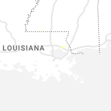


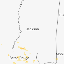


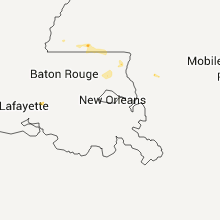


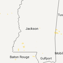

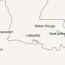


Connect with Interactive Hail Maps