

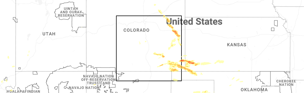
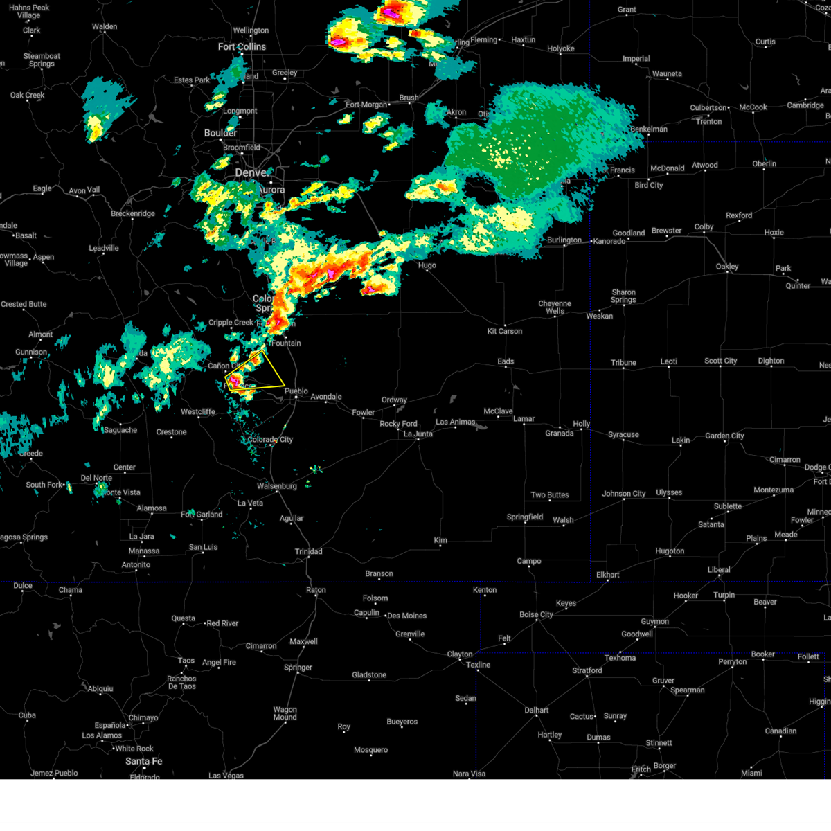
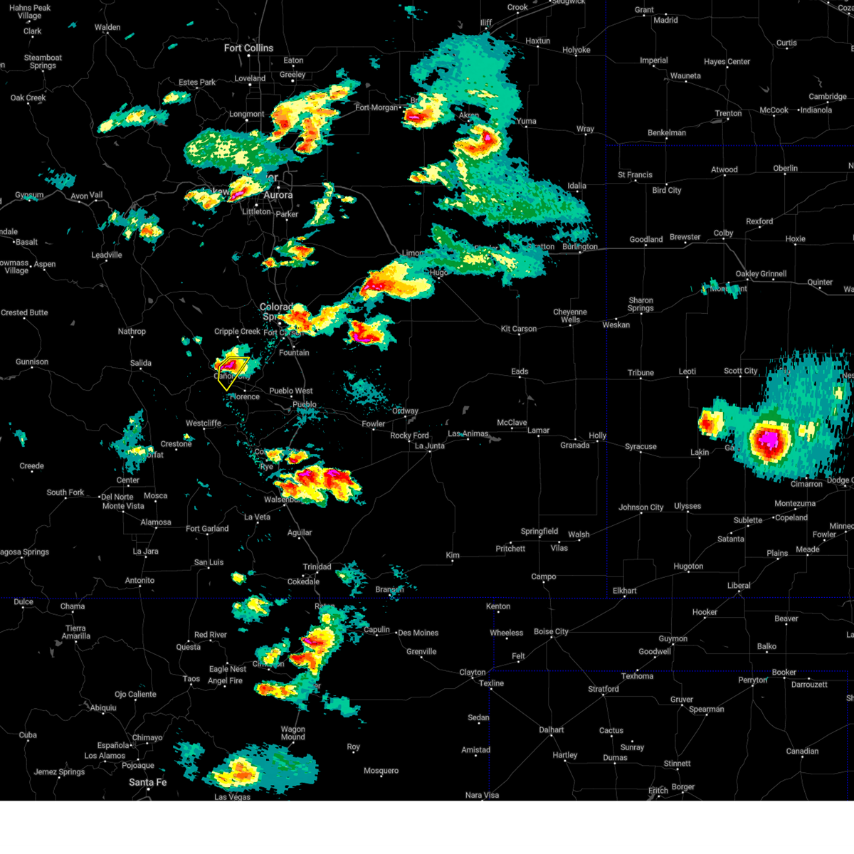
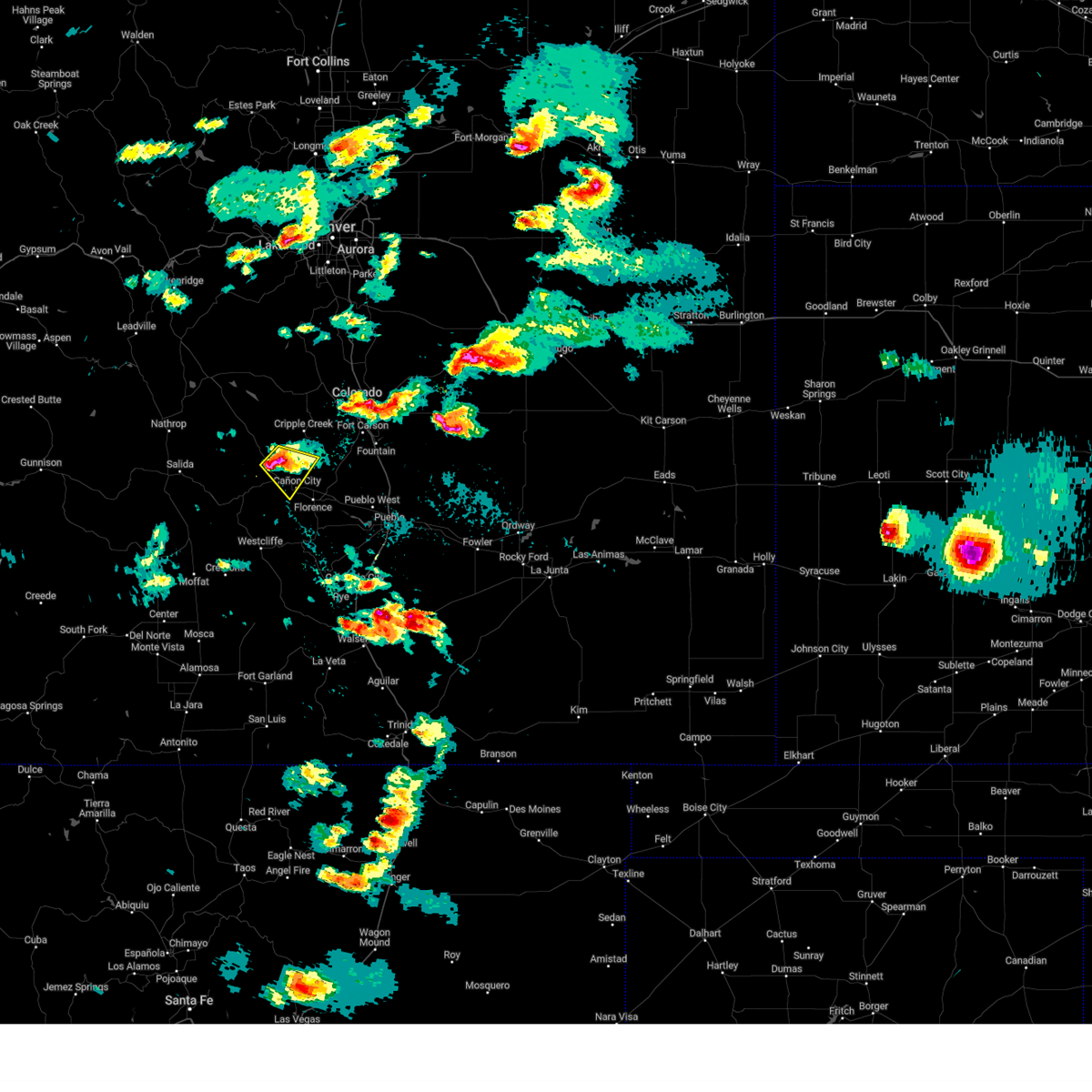
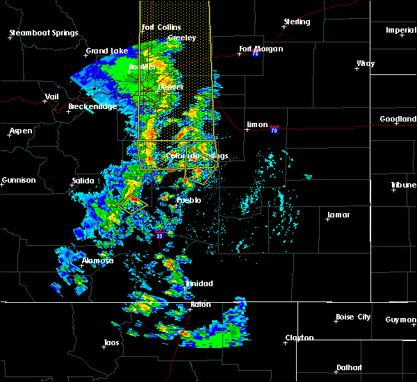
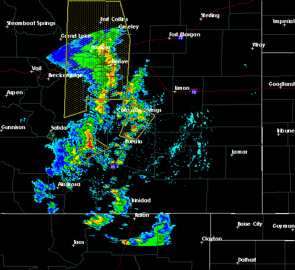
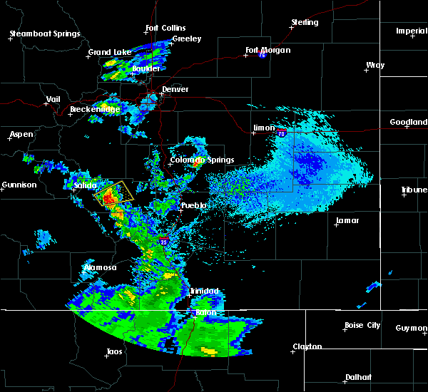
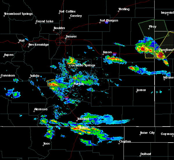
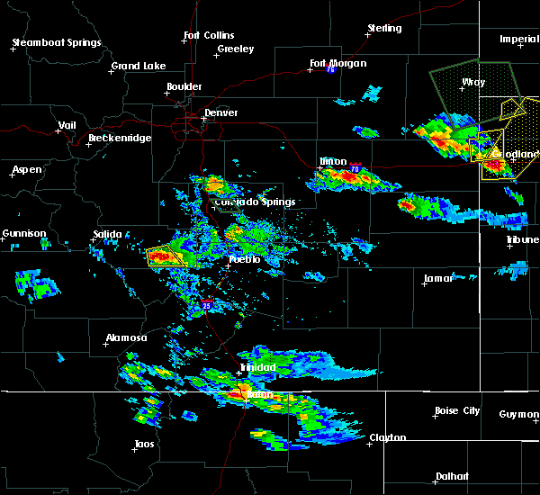
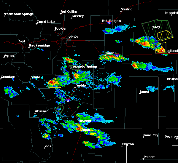
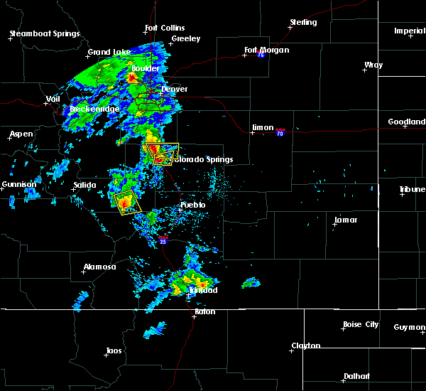
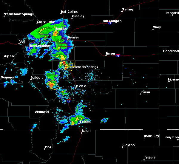
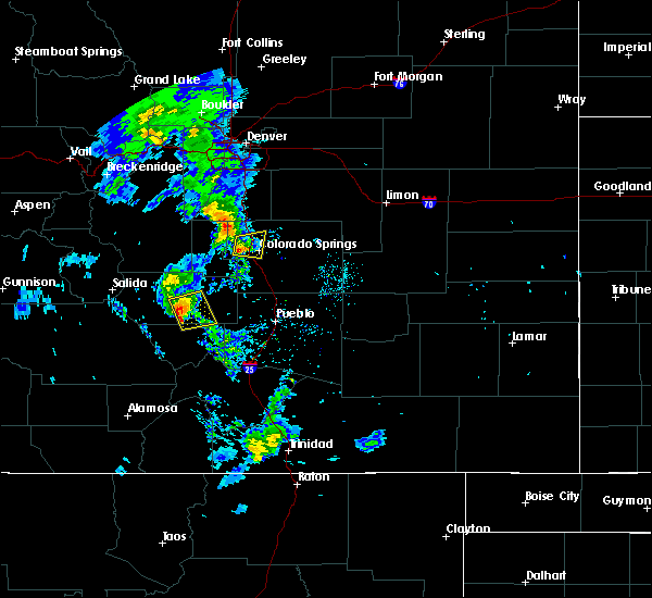
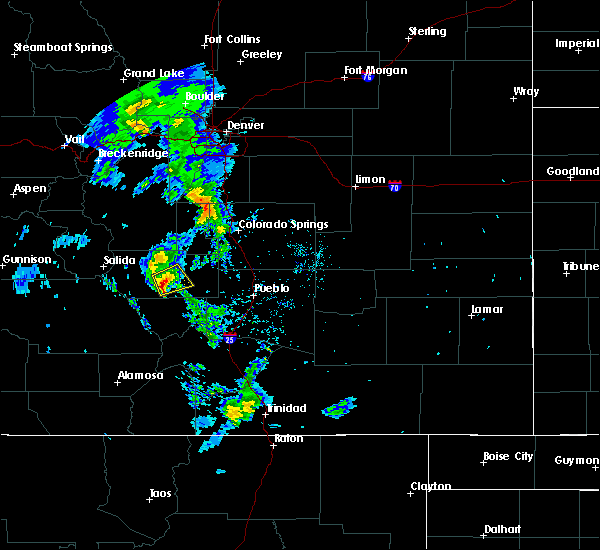
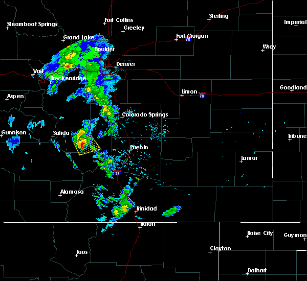
Hail Map for Lincoln Park, CO
The Lincoln Park, CO area has had 0 reports of on-the-ground hail by trained spotters, and has been under severe weather warnings 1 time during the past 12 months. Doppler radar has detected hail at or near Lincoln Park, CO on 33 occasions, including 2 occasions during the past year.
| Name: | Lincoln Park, CO |
| Where Located: | 34.7 miles WNW of Pueblo, CO |
| Map: | Google Map for Lincoln Park, CO |
| Population: | 3546 |
| Housing Units: | 1730 |
| More Info: | Search Google for Lincoln Park, CO |
0
The Top Recent Hail Date for Lincoln Park, CO is Thursday, June 5, 2025 (16th out of 33)
Hail and Wind Damage Spotted near Lincoln Park, CO
| Date / Time | Report Details |
|---|---|
| 8/19/2024 4:46 PM MDT |
 Svrpub the national weather service in pueblo has issued a * severe thunderstorm warning for, southeastern fremont county in central colorado, southwestern el paso county in east central colorado, northwestern pueblo county in southeastern colorado, * until 530 pm mdt. * at 446 pm mdt, a severe thunderstorm was located over florence, or 28 miles west of pueblo, moving east at 30 mph (radar indicated). Hazards include 60 mph wind gusts and quarter size hail. Hail damage to vehicles is expected. Expect wind damage to roofs, siding, and trees. Svrpub the national weather service in pueblo has issued a * severe thunderstorm warning for, southeastern fremont county in central colorado, southwestern el paso county in east central colorado, northwestern pueblo county in southeastern colorado, * until 530 pm mdt. * at 446 pm mdt, a severe thunderstorm was located over florence, or 28 miles west of pueblo, moving east at 30 mph (radar indicated). Hazards include 60 mph wind gusts and quarter size hail. Hail damage to vehicles is expected. Expect wind damage to roofs, siding, and trees.
|
| 6/10/2024 5:50 PM MDT |
 The storm which prompted the warning has weakened below severe limits, and no longer poses an immediate threat to life or property. therefore, the warning will be allowed to expire. however, small hail and heavy rain are still possible with this thunderstorm. The storm which prompted the warning has weakened below severe limits, and no longer poses an immediate threat to life or property. therefore, the warning will be allowed to expire. however, small hail and heavy rain are still possible with this thunderstorm.
|
| 6/10/2024 5:28 PM MDT |
 Svrpub the national weather service in pueblo has issued a * severe thunderstorm warning for, southeastern fremont county in central colorado, north central custer county in southeastern colorado, * until 600 pm mdt. * at 527 pm mdt, a severe thunderstorm was located over canon city, or 34 miles west of pueblo, moving southwest at 10 mph (radar indicated). Hazards include quarter size hail. damage to vehicles is expected Svrpub the national weather service in pueblo has issued a * severe thunderstorm warning for, southeastern fremont county in central colorado, north central custer county in southeastern colorado, * until 600 pm mdt. * at 527 pm mdt, a severe thunderstorm was located over canon city, or 34 miles west of pueblo, moving southwest at 10 mph (radar indicated). Hazards include quarter size hail. damage to vehicles is expected
|
| 6/10/2024 4:56 PM MDT |
 Svrpub the national weather service in pueblo has issued a * severe thunderstorm warning for, east central fremont county in central colorado, * until 530 pm mdt. * at 456 pm mdt, severe thunderstorms were located along a line extending from 7 miles northwest of penrose to near canon city, moving southwest at 15 mph (radar indicated). Hazards include 60 mph wind gusts and quarter size hail. Hail damage to vehicles is expected. Expect wind damage to roofs, siding, and trees. Svrpub the national weather service in pueblo has issued a * severe thunderstorm warning for, east central fremont county in central colorado, * until 530 pm mdt. * at 456 pm mdt, severe thunderstorms were located along a line extending from 7 miles northwest of penrose to near canon city, moving southwest at 15 mph (radar indicated). Hazards include 60 mph wind gusts and quarter size hail. Hail damage to vehicles is expected. Expect wind damage to roofs, siding, and trees.
|
| 7/20/2023 4:17 PM MDT |
 At 416 pm mdt, a severe thunderstorm was located near penrose, moving southeast at 25 mph (radar indicated). Hazards include torrential rainfall, 60 mph wind gusts, and half dollar size hail. Hail damage to vehicles is expected. expect wind damage to roofs, siding, and trees. locations impacted include, florence, canon city and penrose. hail threat, radar indicated max hail size, 1. 25 in wind threat, radar indicated max wind gust, 60 mph. At 416 pm mdt, a severe thunderstorm was located near penrose, moving southeast at 25 mph (radar indicated). Hazards include torrential rainfall, 60 mph wind gusts, and half dollar size hail. Hail damage to vehicles is expected. expect wind damage to roofs, siding, and trees. locations impacted include, florence, canon city and penrose. hail threat, radar indicated max hail size, 1. 25 in wind threat, radar indicated max wind gust, 60 mph.
|
| 7/20/2023 4:04 PM MDT |
 At 404 pm mdt, a severe thunderstorm was located near canon city, moving southeast at 30 mph (radar indicated). Hazards include torrential rainfall, 60 mph wind gusts, and half dollar size hail. Hail damage to vehicles is expected. Expect wind damage to roofs, siding, and trees. At 404 pm mdt, a severe thunderstorm was located near canon city, moving southeast at 30 mph (radar indicated). Hazards include torrential rainfall, 60 mph wind gusts, and half dollar size hail. Hail damage to vehicles is expected. Expect wind damage to roofs, siding, and trees.
|
| 7/20/2023 3:58 PM MDT |
 At 357 pm mdt, a severe thunderstorm was located near canon city, moving southeast at 25 mph (radar indicated). Hazards include 60 mph wind gusts, torrential rainfall, and half dollar size hail. Hail damage to vehicles is expected. expect wind damage to roofs, siding, and trees. locations impacted include, royal gorge and canon city. hail threat, radar indicated max hail size, 1. 25 in wind threat, radar indicated max wind gust, 60 mph. At 357 pm mdt, a severe thunderstorm was located near canon city, moving southeast at 25 mph (radar indicated). Hazards include 60 mph wind gusts, torrential rainfall, and half dollar size hail. Hail damage to vehicles is expected. expect wind damage to roofs, siding, and trees. locations impacted include, royal gorge and canon city. hail threat, radar indicated max hail size, 1. 25 in wind threat, radar indicated max wind gust, 60 mph.
|
| 7/20/2023 3:43 PM MDT |
 At 342 pm mdt, a severe thunderstorm was located 8 miles north of royal gorge, or 29 miles northeast of hayden pass burn scar, moving southeast at 20 mph (radar indicated). Hazards include torrential rainfall, 60 mph wind gusts, and half dollar size hail. Hail damage to vehicles is expected. Expect wind damage to roofs, siding, and trees. At 342 pm mdt, a severe thunderstorm was located 8 miles north of royal gorge, or 29 miles northeast of hayden pass burn scar, moving southeast at 20 mph (radar indicated). Hazards include torrential rainfall, 60 mph wind gusts, and half dollar size hail. Hail damage to vehicles is expected. Expect wind damage to roofs, siding, and trees.
|
| 6/12/2023 12:58 PM MDT |
 At 1257 pm mdt, a severe thunderstorm was located near florence, or 20 miles north of junkins burn scar, moving east at 25 mph (radar indicated). Hazards include 60 mph wind gusts and quarter size hail. Hail damage to vehicles is expected. expect wind damage to roofs, siding, and trees. This storm has a history of producing 1 inch hail as it moved over canon city. At 1257 pm mdt, a severe thunderstorm was located near florence, or 20 miles north of junkins burn scar, moving east at 25 mph (radar indicated). Hazards include 60 mph wind gusts and quarter size hail. Hail damage to vehicles is expected. expect wind damage to roofs, siding, and trees. This storm has a history of producing 1 inch hail as it moved over canon city.
|
| 6/12/2023 12:49 PM MDT |
 At 1248 pm mdt, a severe thunderstorm was located near canon city, or 21 miles north of junkins burn scar, moving east at 15 mph (law enforcement). Hazards include quarter size hail. Hail damage to vehicles is expected. expect wind damage to roofs, siding, and trees. locations impacted include, florence, royal gorge, canon city and penrose. this storm has the potential to produce hail up to 2 inches in diameter. hail threat, radar indicated max hail size, 1. 00 in wind threat, radar indicated max wind gust, 60 mph. At 1248 pm mdt, a severe thunderstorm was located near canon city, or 21 miles north of junkins burn scar, moving east at 15 mph (law enforcement). Hazards include quarter size hail. Hail damage to vehicles is expected. expect wind damage to roofs, siding, and trees. locations impacted include, florence, royal gorge, canon city and penrose. this storm has the potential to produce hail up to 2 inches in diameter. hail threat, radar indicated max hail size, 1. 00 in wind threat, radar indicated max wind gust, 60 mph.
|
| 6/12/2023 12:37 PM MDT |
 At 1237 pm mdt, a severe thunderstorm was located over canon city, or 21 miles north of junkins burn scar, moving east at 15 mph (radar indicated). Hazards include two inch hail and 60 mph wind gusts. People and animals outdoors will be injured. expect hail damage to roofs, siding, windows, and vehicles. Expect wind damage to roofs, siding, and trees. At 1237 pm mdt, a severe thunderstorm was located over canon city, or 21 miles north of junkins burn scar, moving east at 15 mph (radar indicated). Hazards include two inch hail and 60 mph wind gusts. People and animals outdoors will be injured. expect hail damage to roofs, siding, windows, and vehicles. Expect wind damage to roofs, siding, and trees.
|
| 6/12/2023 12:32 PM MDT |
 At 1231 pm mdt, a severe thunderstorm was located near royal gorge, or 21 miles northwest of junkins burn scar, moving east at 30 mph (radar indicated). Hazards include 60 mph wind gusts and half dollar size hail. Hail damage to vehicles is expected. expect wind damage to roofs, siding, and trees. locations impacted include, florence, royal gorge and canon city. hail threat, radar indicated max hail size, 1. 25 in wind threat, radar indicated max wind gust, 60 mph. At 1231 pm mdt, a severe thunderstorm was located near royal gorge, or 21 miles northwest of junkins burn scar, moving east at 30 mph (radar indicated). Hazards include 60 mph wind gusts and half dollar size hail. Hail damage to vehicles is expected. expect wind damage to roofs, siding, and trees. locations impacted include, florence, royal gorge and canon city. hail threat, radar indicated max hail size, 1. 25 in wind threat, radar indicated max wind gust, 60 mph.
|
| 6/12/2023 12:19 PM MDT |
 At 1219 pm mdt, a severe thunderstorm was located 7 miles southwest of royal gorge, or 20 miles east of hayden pass burn scar, moving east at 20 mph (radar indicated). Hazards include 60 mph wind gusts and half dollar size hail. Hail damage to vehicles is expected. expect wind damage to roofs, siding, and trees. locations impacted include, florence, royal gorge and canon city. hail threat, radar indicated max hail size, 1. 25 in wind threat, radar indicated max wind gust, 60 mph. At 1219 pm mdt, a severe thunderstorm was located 7 miles southwest of royal gorge, or 20 miles east of hayden pass burn scar, moving east at 20 mph (radar indicated). Hazards include 60 mph wind gusts and half dollar size hail. Hail damage to vehicles is expected. expect wind damage to roofs, siding, and trees. locations impacted include, florence, royal gorge and canon city. hail threat, radar indicated max hail size, 1. 25 in wind threat, radar indicated max wind gust, 60 mph.
|
| 6/12/2023 12:10 PM MDT |
 At 1210 pm mdt, a severe thunderstorm was located near texas creek, or 15 miles northeast of hayden pass burn scar, moving east at 25 mph (radar indicated). Hazards include 60 mph wind gusts and quarter size hail. Hail damage to vehicles is expected. Expect wind damage to roofs, siding, and trees. At 1210 pm mdt, a severe thunderstorm was located near texas creek, or 15 miles northeast of hayden pass burn scar, moving east at 25 mph (radar indicated). Hazards include 60 mph wind gusts and quarter size hail. Hail damage to vehicles is expected. Expect wind damage to roofs, siding, and trees.
|
| 5/26/2023 2:56 PM MDT |
 At 255 pm mdt, a severe thunderstorm was located 7 miles south of florence, or 9 miles north of junkins burn scar, moving east at 10 mph (radar indicated). Hazards include 60 mph wind gusts and quarter size hail. Hail damage to vehicles is expected. expect wind damage to roofs, siding, and trees. locations impacted include, florence, penrose, canon city and wetmore. hail threat, radar indicated max hail size, 1. 00 in wind threat, radar indicated max wind gust, 60 mph. At 255 pm mdt, a severe thunderstorm was located 7 miles south of florence, or 9 miles north of junkins burn scar, moving east at 10 mph (radar indicated). Hazards include 60 mph wind gusts and quarter size hail. Hail damage to vehicles is expected. expect wind damage to roofs, siding, and trees. locations impacted include, florence, penrose, canon city and wetmore. hail threat, radar indicated max hail size, 1. 00 in wind threat, radar indicated max wind gust, 60 mph.
|
| 5/26/2023 2:46 PM MDT |
 At 245 pm mdt, a severe thunderstorm was located 7 miles south of florence, or 10 miles north of junkins burn scar, moving east at 10 mph (radar indicated). Hazards include 60 mph wind gusts and quarter size hail. Hail damage to vehicles is expected. expect wind damage to roofs, siding, and trees. this severe thunderstorm will remain over mainly rural areas of southeastern fremont, northeastern custer and west central pueblo counties, including the following locations, wetmore. hail threat, radar indicated max hail size, 1. 00 in wind threat, radar indicated max wind gust, 60 mph. At 245 pm mdt, a severe thunderstorm was located 7 miles south of florence, or 10 miles north of junkins burn scar, moving east at 10 mph (radar indicated). Hazards include 60 mph wind gusts and quarter size hail. Hail damage to vehicles is expected. expect wind damage to roofs, siding, and trees. this severe thunderstorm will remain over mainly rural areas of southeastern fremont, northeastern custer and west central pueblo counties, including the following locations, wetmore. hail threat, radar indicated max hail size, 1. 00 in wind threat, radar indicated max wind gust, 60 mph.
|
| 7/8/2022 6:13 PM MDT |
 At 612 pm mdt, a severe thunderstorm was located near penrose, or 22 miles north of junkins burn scar, moving southwest at 15 mph (radar indicated). Hazards include 60 mph wind gusts and quarter size hail. Hail damage to vehicles is expected. expect wind damage to roofs, siding, and trees. locations impacted include, florence, penrose and canon city. hail threat, radar indicated max hail size, 1. 00 in wind threat, radar indicated max wind gust, 60 mph. At 612 pm mdt, a severe thunderstorm was located near penrose, or 22 miles north of junkins burn scar, moving southwest at 15 mph (radar indicated). Hazards include 60 mph wind gusts and quarter size hail. Hail damage to vehicles is expected. expect wind damage to roofs, siding, and trees. locations impacted include, florence, penrose and canon city. hail threat, radar indicated max hail size, 1. 00 in wind threat, radar indicated max wind gust, 60 mph.
|
| 7/8/2022 5:41 PM MDT |
 At 540 pm mdt, a severe thunderstorm was located 10 miles southeast of victor, or 19 miles southwest of colorado springs, moving southwest at 15 mph (radar indicated). Hazards include 60 mph wind gusts and half dollar size hail. Hail damage to vehicles is expected. expect wind damage to roofs, siding, and trees. this severe thunderstorm will be near, penrose around 610 pm mdt. florence and canon city around 630 pm mdt. hail threat, radar indicated max hail size, 1. 25 in wind threat, radar indicated max wind gust, 60 mph. At 540 pm mdt, a severe thunderstorm was located 10 miles southeast of victor, or 19 miles southwest of colorado springs, moving southwest at 15 mph (radar indicated). Hazards include 60 mph wind gusts and half dollar size hail. Hail damage to vehicles is expected. expect wind damage to roofs, siding, and trees. this severe thunderstorm will be near, penrose around 610 pm mdt. florence and canon city around 630 pm mdt. hail threat, radar indicated max hail size, 1. 25 in wind threat, radar indicated max wind gust, 60 mph.
|
| 7/3/2021 4:09 PM MDT |
 The severe thunderstorm warning for southeastern fremont county will expire at 415 pm mdt, the storm which prompted the warning has weakened below severe limits, and no longer poses an immediate threat to life or property. therefore, the warning will be allowed to expire. however small hail, gusty winds and heavy rain are still possible with this thunderstorm. to report severe weather, contact your nearest law enforcement agency. they will relay your report to the national weather service pueblo. The severe thunderstorm warning for southeastern fremont county will expire at 415 pm mdt, the storm which prompted the warning has weakened below severe limits, and no longer poses an immediate threat to life or property. therefore, the warning will be allowed to expire. however small hail, gusty winds and heavy rain are still possible with this thunderstorm. to report severe weather, contact your nearest law enforcement agency. they will relay your report to the national weather service pueblo.
|
| 7/3/2021 4:00 PM MDT |
 At 400 pm mdt, a severe thunderstorm was located over florence, or 16 miles north of junkins burn scar, moving southeast at 15 mph (radar indicated). Hazards include 60 mph wind gusts and quarter size hail. Hail damage to vehicles is expected. expect wind damage to roofs, siding, and trees. Locations impacted include, florence, canon city and penrose. At 400 pm mdt, a severe thunderstorm was located over florence, or 16 miles north of junkins burn scar, moving southeast at 15 mph (radar indicated). Hazards include 60 mph wind gusts and quarter size hail. Hail damage to vehicles is expected. expect wind damage to roofs, siding, and trees. Locations impacted include, florence, canon city and penrose.
|
| 7/3/2021 3:51 PM MDT |
 At 350 pm mdt, a severe thunderstorm was located near florence, or 18 miles north of junkins burn scar, moving south at 15 mph (radar indicated). Hazards include 60 mph wind gusts and quarter size hail. Hail damage to vehicles is expected. expect wind damage to roofs, siding, and trees. Locations impacted include, florence, canon city and penrose. At 350 pm mdt, a severe thunderstorm was located near florence, or 18 miles north of junkins burn scar, moving south at 15 mph (radar indicated). Hazards include 60 mph wind gusts and quarter size hail. Hail damage to vehicles is expected. expect wind damage to roofs, siding, and trees. Locations impacted include, florence, canon city and penrose.
|
| 7/3/2021 3:36 PM MDT |
 At 335 pm mdt, a severe thunderstorm was located over canon city, or 22 miles north of junkins burn scar, moving south at 15 mph (radar indicated). Hazards include 60 mph wind gusts and quarter size hail. Hail damage to vehicles is expected. expect wind damage to roofs, siding, and trees. Locations impacted include, florence, canon city and penrose. At 335 pm mdt, a severe thunderstorm was located over canon city, or 22 miles north of junkins burn scar, moving south at 15 mph (radar indicated). Hazards include 60 mph wind gusts and quarter size hail. Hail damage to vehicles is expected. expect wind damage to roofs, siding, and trees. Locations impacted include, florence, canon city and penrose.
|
| 7/3/2021 3:25 PM MDT |
 At 325 pm mdt, a severe thunderstorm was located near canon city, or 25 miles north of junkins burn scar, moving southeast at 15 mph (radar indicated). Hazards include 60 mph wind gusts and quarter size hail. Hail damage to vehicles is expected. Expect wind damage to roofs, siding, and trees. At 325 pm mdt, a severe thunderstorm was located near canon city, or 25 miles north of junkins burn scar, moving southeast at 15 mph (radar indicated). Hazards include 60 mph wind gusts and quarter size hail. Hail damage to vehicles is expected. Expect wind damage to roofs, siding, and trees.
|
| 7/30/2020 8:17 PM MDT |
 At 817 pm mdt, a severe thunderstorm was located 11 miles north of walsenburg, or 24 miles northeast of spring burn scar north of highway 160, moving southeast at 65 mph (radar indicated). Hazards include 60 mph wind gusts and quarter size hail. Expect damage to roofs, siding, and trees. Hail damage to vehicles is expected. At 817 pm mdt, a severe thunderstorm was located 11 miles north of walsenburg, or 24 miles northeast of spring burn scar north of highway 160, moving southeast at 65 mph (radar indicated). Hazards include 60 mph wind gusts and quarter size hail. Expect damage to roofs, siding, and trees. Hail damage to vehicles is expected.
|
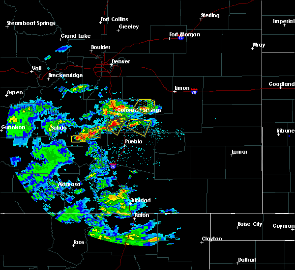
| 7/15/2020 3:23 PM MDT |
 At 323 pm mdt, a severe thunderstorm was located near florence, or 15 miles northwest of junkins burn scar, moving southeast at 10 mph (radar indicated). Hazards include 60 mph wind gusts and half dollar size hail. Hail damage to vehicles is expected. Expect wind damage to roofs, siding, and trees. At 323 pm mdt, a severe thunderstorm was located near florence, or 15 miles northwest of junkins burn scar, moving southeast at 10 mph (radar indicated). Hazards include 60 mph wind gusts and half dollar size hail. Hail damage to vehicles is expected. Expect wind damage to roofs, siding, and trees.
|
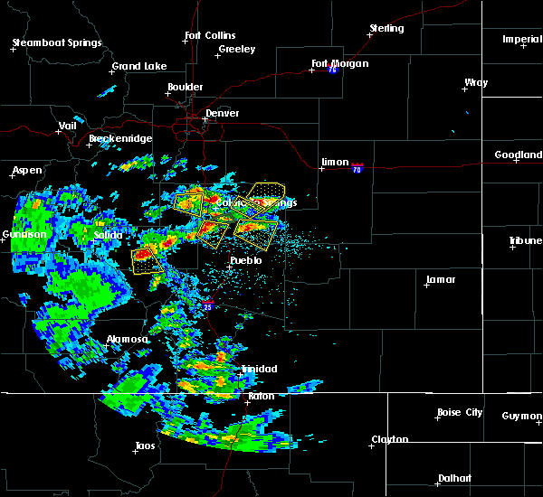
| 7/15/2020 3:01 PM MDT |
 At 301 pm mdt, a severe thunderstorm was located near canon city, or 25 miles north of junkins burn scar, moving east at 10 mph (radar indicated). Hazards include ping pong ball size hail and 60 mph wind gusts. People and animals outdoors will be injured. expect hail damage to roofs, siding, windows, and vehicles. expect wind damage to roofs, siding, and trees. Locations impacted include, canon city. At 301 pm mdt, a severe thunderstorm was located near canon city, or 25 miles north of junkins burn scar, moving east at 10 mph (radar indicated). Hazards include ping pong ball size hail and 60 mph wind gusts. People and animals outdoors will be injured. expect hail damage to roofs, siding, windows, and vehicles. expect wind damage to roofs, siding, and trees. Locations impacted include, canon city.
|
| 7/15/2020 2:55 PM MDT |
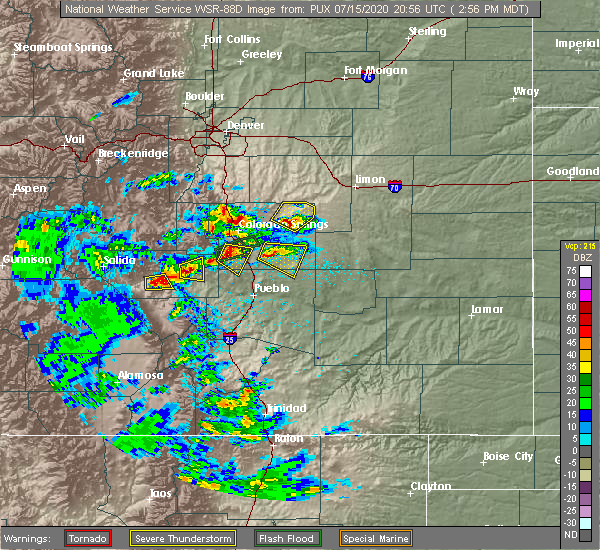 At 255 pm mdt, a severe thunderstorm was located near canon city, or 25 miles north of junkins burn scar, moving east at 10 mph (radar indicated). Hazards include ping pong ball size hail and 60 mph wind gusts. People and animals outdoors will be injured. expect hail damage to roofs, siding, windows, and vehicles. expect wind damage to roofs, siding, and trees. Locations impacted include, canon city. At 255 pm mdt, a severe thunderstorm was located near canon city, or 25 miles north of junkins burn scar, moving east at 10 mph (radar indicated). Hazards include ping pong ball size hail and 60 mph wind gusts. People and animals outdoors will be injured. expect hail damage to roofs, siding, windows, and vehicles. expect wind damage to roofs, siding, and trees. Locations impacted include, canon city.
|
| 7/15/2020 2:43 PM MDT |
 At 243 pm mdt, a severe thunderstorm was located near canon city, or 26 miles north of junkins burn scar, moving east at 10 mph (radar indicated). Hazards include 60 mph wind gusts and quarter size hail. Hail damage to vehicles is expected. Expect wind damage to roofs, siding, and trees. At 243 pm mdt, a severe thunderstorm was located near canon city, or 26 miles north of junkins burn scar, moving east at 10 mph (radar indicated). Hazards include 60 mph wind gusts and quarter size hail. Hail damage to vehicles is expected. Expect wind damage to roofs, siding, and trees.
|
| 7/12/2020 4:57 PM MDT |
 The severe thunderstorm warning for east central fremont and northwestern pueblo counties will expire at 500 pm mdt, the storm which prompted the warning has weakened below severe limits, and no longer poses an immediate threat to life or property. therefore, the warning will be allowed to expire. a severe thunderstorm over west central pueblo county remains in effect until 5:30 pm. a severe thunderstorm watch remains in effect until 900 pm mdt for southeastern colorado. The severe thunderstorm warning for east central fremont and northwestern pueblo counties will expire at 500 pm mdt, the storm which prompted the warning has weakened below severe limits, and no longer poses an immediate threat to life or property. therefore, the warning will be allowed to expire. a severe thunderstorm over west central pueblo county remains in effect until 5:30 pm. a severe thunderstorm watch remains in effect until 900 pm mdt for southeastern colorado.
|
| 7/12/2020 4:47 PM MDT |
 At 446 pm mdt, a severe thunderstorm was located over penrose, or 20 miles north of junkins burn scar, moving east at 20 mph (radar indicated). Hazards include 60 mph wind gusts and quarter size hail. Hail damage to vehicles is expected. expect wind damage to roofs, siding, and trees. Locations impacted include, florence, canon city, penrose and pueblo west. At 446 pm mdt, a severe thunderstorm was located over penrose, or 20 miles north of junkins burn scar, moving east at 20 mph (radar indicated). Hazards include 60 mph wind gusts and quarter size hail. Hail damage to vehicles is expected. expect wind damage to roofs, siding, and trees. Locations impacted include, florence, canon city, penrose and pueblo west.
|
| 7/12/2020 4:32 PM MDT |
 At 431 pm mdt, a severe thunderstorm was located near canon city, or 21 miles north of junkins burn scar, moving east at 30 mph (radar indicated. this storm produced quarter size hail in canon city at 4:13 pm). Hazards include 60 mph wind gusts and quarter size hail. Hail damage to vehicles is expected. expect wind damage to roofs, siding, and trees. Locations impacted include, florence, canon city, penrose and pueblo west. At 431 pm mdt, a severe thunderstorm was located near canon city, or 21 miles north of junkins burn scar, moving east at 30 mph (radar indicated. this storm produced quarter size hail in canon city at 4:13 pm). Hazards include 60 mph wind gusts and quarter size hail. Hail damage to vehicles is expected. expect wind damage to roofs, siding, and trees. Locations impacted include, florence, canon city, penrose and pueblo west.
|
| 7/12/2020 4:17 PM MDT |
 At 416 pm mdt, a severe thunderstorm was located near penrose, or 24 miles south of colorado springs, moving east at 20 mph (the public reported hail up to the size of quarters in northwest canon city at 4:13 pm). Hazards include 60 mph wind gusts and quarter size hail. Hail damage to vehicles is expected. Expect wind damage to roofs, siding, and trees. At 416 pm mdt, a severe thunderstorm was located near penrose, or 24 miles south of colorado springs, moving east at 20 mph (the public reported hail up to the size of quarters in northwest canon city at 4:13 pm). Hazards include 60 mph wind gusts and quarter size hail. Hail damage to vehicles is expected. Expect wind damage to roofs, siding, and trees.
|
| 6/6/2020 4:10 PM MDT |
 The severe thunderstorm warning for southeastern fremont county will expire at 415 pm mdt, the storm which prompted the warning has weakened below severe limits, and has exited the warned area. therefore, the warning will be allowed to expire. however gusty winds are still possible with this thunderstorm. a severe thunderstorm watch remains in effect until 800 pm mdt for central colorado. The severe thunderstorm warning for southeastern fremont county will expire at 415 pm mdt, the storm which prompted the warning has weakened below severe limits, and has exited the warned area. therefore, the warning will be allowed to expire. however gusty winds are still possible with this thunderstorm. a severe thunderstorm watch remains in effect until 800 pm mdt for central colorado.
|
| 6/6/2020 4:06 PM MDT |
 At 406 pm mdt, a severe thunderstorm was located over florence, or 16 miles north of junkins burn scar, moving northeast at 50 mph (radar indicated). Hazards include 60 mph wind gusts and quarter size hail. Hail damage to vehicles is expected. expect wind damage to roofs, siding, and trees. This severe thunderstorm will remain over mainly rural areas of southeastern fremont county. At 406 pm mdt, a severe thunderstorm was located over florence, or 16 miles north of junkins burn scar, moving northeast at 50 mph (radar indicated). Hazards include 60 mph wind gusts and quarter size hail. Hail damage to vehicles is expected. expect wind damage to roofs, siding, and trees. This severe thunderstorm will remain over mainly rural areas of southeastern fremont county.
|
| 6/6/2020 3:56 PM MDT |
 At 356 pm mdt, a severe thunderstorm was located 9 miles northwest of junkins burn scar, moving northeast at 50 mph (radar indicated). Hazards include 60 mph wind gusts and quarter size hail. Hail damage to vehicles is expected. expect wind damage to roofs, siding, and trees. Locations impacted include, wetmore. At 356 pm mdt, a severe thunderstorm was located 9 miles northwest of junkins burn scar, moving northeast at 50 mph (radar indicated). Hazards include 60 mph wind gusts and quarter size hail. Hail damage to vehicles is expected. expect wind damage to roofs, siding, and trees. Locations impacted include, wetmore.
|
| 6/6/2020 3:50 PM MDT |
 At 350 pm mdt, a severe thunderstorm was located 10 miles west of junkins burn scar, moving northeast at 50 mph (radar indicated). Hazards include 60 mph wind gusts and quarter size hail. Hail damage to vehicles is expected. expect wind damage to roofs, siding, and trees. Locations impacted include, junkins burn scar, silver cliff, wetmore and rosita. At 350 pm mdt, a severe thunderstorm was located 10 miles west of junkins burn scar, moving northeast at 50 mph (radar indicated). Hazards include 60 mph wind gusts and quarter size hail. Hail damage to vehicles is expected. expect wind damage to roofs, siding, and trees. Locations impacted include, junkins burn scar, silver cliff, wetmore and rosita.
|
| 6/6/2020 3:43 PM MDT |
 At 343 pm mdt, a severe thunderstorm was located 14 miles west of junkins burn scar, moving northeast at 50 mph (radar indicated). Hazards include 60 mph wind gusts and quarter size hail. Hail damage to vehicles is expected. Expect wind damage to roofs, siding, and trees. At 343 pm mdt, a severe thunderstorm was located 14 miles west of junkins burn scar, moving northeast at 50 mph (radar indicated). Hazards include 60 mph wind gusts and quarter size hail. Hail damage to vehicles is expected. Expect wind damage to roofs, siding, and trees.
|
| 5/24/2020 6:26 PM MDT |
 At 626 pm mdt, a severe thunderstorm was located over penrose, or 22 miles north of junkins burn scar, moving northeast at 30 mph (radar indicated). Hazards include 60 mph wind gusts and quarter size hail. Hail damage to vehicles is expected. expect wind damage to roofs, siding, and trees. Locations impacted include, florence, penrose and canon city. At 626 pm mdt, a severe thunderstorm was located over penrose, or 22 miles north of junkins burn scar, moving northeast at 30 mph (radar indicated). Hazards include 60 mph wind gusts and quarter size hail. Hail damage to vehicles is expected. expect wind damage to roofs, siding, and trees. Locations impacted include, florence, penrose and canon city.
|
| 5/24/2020 6:13 PM MDT |
 At 613 pm mdt, a severe thunderstorm was located over florence, or 19 miles north of junkins burn scar, moving northeast at 25 mph (radar indicated). Hazards include 60 mph wind gusts and quarter size hail. Hail damage to vehicles is expected. Expect wind damage to roofs, siding, and trees. At 613 pm mdt, a severe thunderstorm was located over florence, or 19 miles north of junkins burn scar, moving northeast at 25 mph (radar indicated). Hazards include 60 mph wind gusts and quarter size hail. Hail damage to vehicles is expected. Expect wind damage to roofs, siding, and trees.
|
| 5/24/2020 6:05 PM MDT |
 At 605 pm mdt, a severe thunderstorm was located over florence, or 20 miles north of junkins burn scar, moving northeast at 25 mph (radar indicated). Hazards include 60 mph wind gusts and quarter size hail. Hail damage to vehicles is expected. expect wind damage to roofs, siding, and trees. Locations impacted include, florence, canon city and penrose. At 605 pm mdt, a severe thunderstorm was located over florence, or 20 miles north of junkins burn scar, moving northeast at 25 mph (radar indicated). Hazards include 60 mph wind gusts and quarter size hail. Hail damage to vehicles is expected. expect wind damage to roofs, siding, and trees. Locations impacted include, florence, canon city and penrose.
|
| 5/24/2020 5:51 PM MDT |
 At 551 pm mdt, a severe thunderstorm was located near florence, or 17 miles north of junkins burn scar, moving northeast at 25 mph (radar indicated). Hazards include 60 mph wind gusts and quarter size hail. Hail damage to vehicles is expected. Expect wind damage to roofs, siding, and trees. At 551 pm mdt, a severe thunderstorm was located near florence, or 17 miles north of junkins burn scar, moving northeast at 25 mph (radar indicated). Hazards include 60 mph wind gusts and quarter size hail. Hail damage to vehicles is expected. Expect wind damage to roofs, siding, and trees.
|
| 8/21/2019 4:09 PM MDT |
 At 408 pm mdt, a severe thunderstorm was located over texas creek, or 12 miles northeast of hayden pass burn scar, moving northeast at 15 mph (radar indicated). Hazards include 60 mph wind gusts and quarter size hail. Hail damage to vehicles is expected. Expect wind damage to roofs, siding, and trees. At 408 pm mdt, a severe thunderstorm was located over texas creek, or 12 miles northeast of hayden pass burn scar, moving northeast at 15 mph (radar indicated). Hazards include 60 mph wind gusts and quarter size hail. Hail damage to vehicles is expected. Expect wind damage to roofs, siding, and trees.
|
| 7/27/2019 5:01 PM MDT |
 At 501 pm mdt, a severe thunderstorm capable of producing a tornado was located over canon city, or 25 miles north of junkins burn scar, moving east at 20 mph (radar indicated rotation). Hazards include tornado. Flying debris will be dangerous to those caught without shelter. mobile homes will be damaged or destroyed. damage to roofs, windows, and vehicles will occur. tree damage is likely. This dangerous storm will be near, penrose around 515 pm mdt. At 501 pm mdt, a severe thunderstorm capable of producing a tornado was located over canon city, or 25 miles north of junkins burn scar, moving east at 20 mph (radar indicated rotation). Hazards include tornado. Flying debris will be dangerous to those caught without shelter. mobile homes will be damaged or destroyed. damage to roofs, windows, and vehicles will occur. tree damage is likely. This dangerous storm will be near, penrose around 515 pm mdt.
|
| 7/27/2019 4:52 PM MDT |
 At 452 pm mdt, a severe thunderstorm capable of producing a tornado was located over royal gorge, or 25 miles northwest of junkins burn scar, moving east at 20 mph (radar indicated rotation). Hazards include tornado. Flying debris will be dangerous to those caught without shelter. mobile homes will be damaged or destroyed. damage to roofs, windows, and vehicles will occur. tree damage is likely. this dangerous storm will be near, canon city around 500 pm mdt. Penrose around 515 pm mdt. At 452 pm mdt, a severe thunderstorm capable of producing a tornado was located over royal gorge, or 25 miles northwest of junkins burn scar, moving east at 20 mph (radar indicated rotation). Hazards include tornado. Flying debris will be dangerous to those caught without shelter. mobile homes will be damaged or destroyed. damage to roofs, windows, and vehicles will occur. tree damage is likely. this dangerous storm will be near, canon city around 500 pm mdt. Penrose around 515 pm mdt.
|
| 7/21/2019 9:52 PM MDT |
 The severe thunderstorm warning for northeastern fremont county will expire at 1000 pm mdt, the storm which prompted the warning has weakened below severe limits, and no longer poses an immediate threat to life or property. therefore, the warning will be allowed to expire. The severe thunderstorm warning for northeastern fremont county will expire at 1000 pm mdt, the storm which prompted the warning has weakened below severe limits, and no longer poses an immediate threat to life or property. therefore, the warning will be allowed to expire.
|
| 7/21/2019 9:08 PM MDT |
 At 907 pm mdt, a severe thunderstorm was located 8 miles northeast of canon city, or 25 miles southwest of colorado springs, moving west at 30 mph (radar indicated). Hazards include 60 mph wind gusts and quarter size hail. Hail damage to vehicles is expected. Expect wind damage to roofs, siding, and trees. At 907 pm mdt, a severe thunderstorm was located 8 miles northeast of canon city, or 25 miles southwest of colorado springs, moving west at 30 mph (radar indicated). Hazards include 60 mph wind gusts and quarter size hail. Hail damage to vehicles is expected. Expect wind damage to roofs, siding, and trees.
|
| 7/27/2018 2:47 PM MDT |
 At 246 pm mdt, a severe thunderstorm was located 8 miles southwest of florence, or 34 miles west of pueblo, moving southeast at 25 mph. there was a trained spotter report of 1 inch hail just southwest of canon city (trained weather spotters). Hazards include 60 mph wind gusts and quarter size hail. Hail damage to vehicles is expected. expect wind damage to roofs, siding, and trees. Locations impacted include, florence and canon city. At 246 pm mdt, a severe thunderstorm was located 8 miles southwest of florence, or 34 miles west of pueblo, moving southeast at 25 mph. there was a trained spotter report of 1 inch hail just southwest of canon city (trained weather spotters). Hazards include 60 mph wind gusts and quarter size hail. Hail damage to vehicles is expected. expect wind damage to roofs, siding, and trees. Locations impacted include, florence and canon city.
|
| 7/27/2018 2:40 PM MDT |
 At 239 pm mdt, a severe thunderstorm was located near royal gorge, or 37 miles west of pueblo, moving southeast at 20 mph (radar indicated). Hazards include 60 mph wind gusts and quarter size hail. Hail damage to vehicles is expected. Expect wind damage to roofs, siding, and trees. At 239 pm mdt, a severe thunderstorm was located near royal gorge, or 37 miles west of pueblo, moving southeast at 20 mph (radar indicated). Hazards include 60 mph wind gusts and quarter size hail. Hail damage to vehicles is expected. Expect wind damage to roofs, siding, and trees.
|
| 7/26/2018 5:52 PM MDT |
 The severe thunderstorm warning for southeastern fremont county will expire at 600 pm mdt, the storm which prompted the warning has weakened below severe limits, and no longer poses an immediate threat to life or property. therefore, the warning will be allowed to expire. however heavy rain is still possible with this thunderstorm, along with small hail. The severe thunderstorm warning for southeastern fremont county will expire at 600 pm mdt, the storm which prompted the warning has weakened below severe limits, and no longer poses an immediate threat to life or property. therefore, the warning will be allowed to expire. however heavy rain is still possible with this thunderstorm, along with small hail.
|
| 7/26/2018 5:39 PM MDT |
 At 538 pm mdt, a severe thunderstorm was located near royal gorge, or 38 miles west of pueblo, moving south at 25 mph (radar indicated). Hazards include quarter size hail. Damage to vehicles is expected. Locations impacted include, areas south of royal gorge. At 538 pm mdt, a severe thunderstorm was located near royal gorge, or 38 miles west of pueblo, moving south at 25 mph (radar indicated). Hazards include quarter size hail. Damage to vehicles is expected. Locations impacted include, areas south of royal gorge.
|
| 7/26/2018 5:29 PM MDT |
 At 529 pm mdt, a severe thunderstorm was located over royal gorge, or 39 miles southwest of colorado springs, moving south at 25 mph (radar indicated). Hazards include quarter size hail. damage to vehicles is expected At 529 pm mdt, a severe thunderstorm was located over royal gorge, or 39 miles southwest of colorado springs, moving south at 25 mph (radar indicated). Hazards include quarter size hail. damage to vehicles is expected
|
| 7/26/2018 5:21 PM MDT |
 At 520 pm mdt, a severe thunderstorm was located over royal gorge, or 36 miles southwest of colorado springs, moving southeast at 20 mph (radar indicated). Hazards include golf ball size hail. People and animals outdoors will be injured. expect damage to roofs, siding, windows, and vehicles. Locations impacted include, florence, royal gorge and canon city. At 520 pm mdt, a severe thunderstorm was located over royal gorge, or 36 miles southwest of colorado springs, moving southeast at 20 mph (radar indicated). Hazards include golf ball size hail. People and animals outdoors will be injured. expect damage to roofs, siding, windows, and vehicles. Locations impacted include, florence, royal gorge and canon city.
|
| 7/26/2018 5:16 PM MDT |
 At 515 pm mdt, a severe thunderstorm was located near royal gorge, or 35 miles southwest of colorado springs, moving southeast at 20 mph (radar indicated). Hazards include quarter size hail. Damage to vehicles is expected. Locations impacted include, florence, royal gorge and canon city. At 515 pm mdt, a severe thunderstorm was located near royal gorge, or 35 miles southwest of colorado springs, moving southeast at 20 mph (radar indicated). Hazards include quarter size hail. Damage to vehicles is expected. Locations impacted include, florence, royal gorge and canon city.
|
| 7/26/2018 5:07 PM MDT |
 At 507 pm mdt, a severe thunderstorm was located 7 miles northwest of royal gorge, or 35 miles southwest of colorado springs, moving southeast at 20 mph (radar indicated). Hazards include quarter size hail. damage to vehicles is expected At 507 pm mdt, a severe thunderstorm was located 7 miles northwest of royal gorge, or 35 miles southwest of colorado springs, moving southeast at 20 mph (radar indicated). Hazards include quarter size hail. damage to vehicles is expected
|
| 7/23/2018 6:30 PM MDT |
 At 630 pm mdt, a severe thunderstorm was located near florence, or 31 miles west of pueblo, moving southeast at 25 mph (radar indicated). Hazards include golf ball size hail and 70 mph wind gusts. People and animals outdoors will be injured. expect hail damage to roofs, siding, windows, and vehicles. expect considerable tree damage. Wind damage is also likely to mobile homes, roofs, and outbuildings. At 630 pm mdt, a severe thunderstorm was located near florence, or 31 miles west of pueblo, moving southeast at 25 mph (radar indicated). Hazards include golf ball size hail and 70 mph wind gusts. People and animals outdoors will be injured. expect hail damage to roofs, siding, windows, and vehicles. expect considerable tree damage. Wind damage is also likely to mobile homes, roofs, and outbuildings.
|
| 7/23/2018 6:22 PM MDT |
 At 622 pm mdt, a severe thunderstorm was located near florence, or 32 miles west of pueblo, moving southeast at 25 mph (radar indicated). Hazards include golf ball size hail and 70 mph wind gusts. People and animals outdoors will be injured. expect hail damage to roofs, siding, windows, and vehicles. expect considerable tree damage. wind damage is also likely to mobile homes, roofs, and outbuildings. Locations impacted include, florence, canon city and penrose. At 622 pm mdt, a severe thunderstorm was located near florence, or 32 miles west of pueblo, moving southeast at 25 mph (radar indicated). Hazards include golf ball size hail and 70 mph wind gusts. People and animals outdoors will be injured. expect hail damage to roofs, siding, windows, and vehicles. expect considerable tree damage. wind damage is also likely to mobile homes, roofs, and outbuildings. Locations impacted include, florence, canon city and penrose.
|
| 7/23/2018 5:59 PM MDT |
 At 558 pm mdt, a severe thunderstorm was located over royal gorge, or 35 miles southwest of colorado springs, moving southeast at 25 mph (radar indicated). Hazards include ping pong ball size hail and 60 mph wind gusts. People and animals outdoors will be injured. expect hail damage to roofs, siding, windows, and vehicles. expect wind damage to roofs, siding, and trees. Locations impacted include, florence, royal gorge, canon city and penrose. At 558 pm mdt, a severe thunderstorm was located over royal gorge, or 35 miles southwest of colorado springs, moving southeast at 25 mph (radar indicated). Hazards include ping pong ball size hail and 60 mph wind gusts. People and animals outdoors will be injured. expect hail damage to roofs, siding, windows, and vehicles. expect wind damage to roofs, siding, and trees. Locations impacted include, florence, royal gorge, canon city and penrose.
|
| 7/23/2018 5:46 PM MDT |
 At 546 pm mdt, a severe thunderstorm was located near royal gorge, or 36 miles southwest of colorado springs, moving southeast at 25 mph (radar indicated). Hazards include ping pong ball size hail and 60 mph wind gusts. People and animals outdoors will be injured. expect hail damage to roofs, siding, windows, and vehicles. expect wind damage to roofs, siding, and trees. Locations impacted include, florence, royal gorge, canon city and penrose. At 546 pm mdt, a severe thunderstorm was located near royal gorge, or 36 miles southwest of colorado springs, moving southeast at 25 mph (radar indicated). Hazards include ping pong ball size hail and 60 mph wind gusts. People and animals outdoors will be injured. expect hail damage to roofs, siding, windows, and vehicles. expect wind damage to roofs, siding, and trees. Locations impacted include, florence, royal gorge, canon city and penrose.
|
| 7/23/2018 5:39 PM MDT |
 At 539 pm mdt, a severe thunderstorm was located 10 miles north of royal gorge, or 33 miles southwest of colorado springs, moving southeast at 25 mph (radar indicated). Hazards include ping pong ball size hail and 60 mph wind gusts. People and animals outdoors will be injured. expect hail damage to roofs, siding, windows, and vehicles. expect wind damage to roofs, siding, and trees. Locations impacted include, florence, royal gorge, canon city and penrose. At 539 pm mdt, a severe thunderstorm was located 10 miles north of royal gorge, or 33 miles southwest of colorado springs, moving southeast at 25 mph (radar indicated). Hazards include ping pong ball size hail and 60 mph wind gusts. People and animals outdoors will be injured. expect hail damage to roofs, siding, windows, and vehicles. expect wind damage to roofs, siding, and trees. Locations impacted include, florence, royal gorge, canon city and penrose.
|
| 7/23/2018 5:26 PM MDT |
 At 526 pm mdt, a severe thunderstorm was located 8 miles southeast of guffey, or 35 miles west of colorado springs, moving southeast at 25 mph (radar indicated). Hazards include ping pong ball size hail and 60 mph wind gusts. People and animals outdoors will be injured. expect hail damage to roofs, siding, windows, and vehicles. Expect wind damage to roofs, siding, and trees. At 526 pm mdt, a severe thunderstorm was located 8 miles southeast of guffey, or 35 miles west of colorado springs, moving southeast at 25 mph (radar indicated). Hazards include ping pong ball size hail and 60 mph wind gusts. People and animals outdoors will be injured. expect hail damage to roofs, siding, windows, and vehicles. Expect wind damage to roofs, siding, and trees.
|
| 5/18/2018 4:21 PM MDT |
 At 421 pm mdt, a severe thunderstorm was located near florence, or 30 miles west of pueblo, moving northeast at 15 mph (radar indicated). Hazards include 60 mph wind gusts and quarter size hail. Hail damage to vehicles is expected. expect wind damage to roofs, siding, and trees. Locations impacted include, florence, royal gorge, canon city and penrose. At 421 pm mdt, a severe thunderstorm was located near florence, or 30 miles west of pueblo, moving northeast at 15 mph (radar indicated). Hazards include 60 mph wind gusts and quarter size hail. Hail damage to vehicles is expected. expect wind damage to roofs, siding, and trees. Locations impacted include, florence, royal gorge, canon city and penrose.
|
| 5/18/2018 4:08 PM MDT |
 At 407 pm mdt, a severe thunderstorm was located near canon city, or 34 miles west of pueblo, moving northeast at 10 mph (radar indicated). Hazards include 60 mph wind gusts and quarter size hail. Hail damage to vehicles is expected. expect wind damage to roofs, siding, and trees. Locations impacted include, florence, royal gorge, canon city and penrose. At 407 pm mdt, a severe thunderstorm was located near canon city, or 34 miles west of pueblo, moving northeast at 10 mph (radar indicated). Hazards include 60 mph wind gusts and quarter size hail. Hail damage to vehicles is expected. expect wind damage to roofs, siding, and trees. Locations impacted include, florence, royal gorge, canon city and penrose.
|
| 5/18/2018 3:55 PM MDT |
 At 355 pm mdt, a severe thunderstorm was located near canon city, or 34 miles west of pueblo, moving northeast at 10 mph (radar indicated). Hazards include 60 mph wind gusts and quarter size hail. Hail damage to vehicles is expected. Expect wind damage to roofs, siding, and trees. At 355 pm mdt, a severe thunderstorm was located near canon city, or 34 miles west of pueblo, moving northeast at 10 mph (radar indicated). Hazards include 60 mph wind gusts and quarter size hail. Hail damage to vehicles is expected. Expect wind damage to roofs, siding, and trees.
|
| 5/18/2018 3:09 PM MDT |
 At 308 pm mdt, a severe thunderstorm was located 9 miles south of royal gorge, or 37 miles west of pueblo, moving east at 10 mph. the hail risk is ceased, continuing for severe thunderstorm warning for severe criteria wind (radar indicated). Hazards include 60 mph wind gusts. Expect damage to roofs, siding, and trees. Locations impacted include, royal gorge and canon city. At 308 pm mdt, a severe thunderstorm was located 9 miles south of royal gorge, or 37 miles west of pueblo, moving east at 10 mph. the hail risk is ceased, continuing for severe thunderstorm warning for severe criteria wind (radar indicated). Hazards include 60 mph wind gusts. Expect damage to roofs, siding, and trees. Locations impacted include, royal gorge and canon city.
|
| 5/18/2018 3:01 PM MDT |
 At 259 pm mdt, a severe thunderstorm was located 7 miles south of royal gorge, or 39 miles west of pueblo, moving east at 10 mph. the severe criteria hail threat has ceased, but severe criteria wind is still possible (radar indicated). Hazards include 60 mph wind gusts. Expect damage to roofs, siding, and trees. Locations impacted include, royal gorge and canon city. At 259 pm mdt, a severe thunderstorm was located 7 miles south of royal gorge, or 39 miles west of pueblo, moving east at 10 mph. the severe criteria hail threat has ceased, but severe criteria wind is still possible (radar indicated). Hazards include 60 mph wind gusts. Expect damage to roofs, siding, and trees. Locations impacted include, royal gorge and canon city.
|
| 5/18/2018 2:54 PM MDT |
 At 254 pm mdt, a severe thunderstorm was located 7 miles south of royal gorge, or 40 miles west of pueblo, moving east at 20 mph (radar indicated). Hazards include 60 mph wind gusts and quarter size hail. Hail damage to vehicles is expected. expect wind damage to roofs, siding, and trees. Locations impacted include, royal gorge and canon city. At 254 pm mdt, a severe thunderstorm was located 7 miles south of royal gorge, or 40 miles west of pueblo, moving east at 20 mph (radar indicated). Hazards include 60 mph wind gusts and quarter size hail. Hail damage to vehicles is expected. expect wind damage to roofs, siding, and trees. Locations impacted include, royal gorge and canon city.
|
| 5/18/2018 2:44 PM MDT |
 At 243 pm mdt, a severe thunderstorm was located 8 miles southwest of royal gorge, or 43 miles west of pueblo, moving east at 10 mph (radar indicated). Hazards include 60 mph wind gusts and quarter size hail. Hail damage to vehicles is expected. Expect wind damage to roofs, siding, and trees. At 243 pm mdt, a severe thunderstorm was located 8 miles southwest of royal gorge, or 43 miles west of pueblo, moving east at 10 mph (radar indicated). Hazards include 60 mph wind gusts and quarter size hail. Hail damage to vehicles is expected. Expect wind damage to roofs, siding, and trees.
|
| 5/18/2018 2:35 PM MDT |
 At 234 pm mdt, a severe thunderstorm was located 8 miles east of texas creek, or 45 miles west of pueblo, moving northeast at 15 mph (radar indicated). Hazards include 60 mph wind gusts and quarter size hail. Hail damage to vehicles is expected. expect wind damage to roofs, siding, and trees. Locations impacted include, royal gorge and canon city. At 234 pm mdt, a severe thunderstorm was located 8 miles east of texas creek, or 45 miles west of pueblo, moving northeast at 15 mph (radar indicated). Hazards include 60 mph wind gusts and quarter size hail. Hail damage to vehicles is expected. expect wind damage to roofs, siding, and trees. Locations impacted include, royal gorge and canon city.
|
| 5/18/2018 2:26 PM MDT |
 At 226 pm mdt, a severe thunderstorm was located 8 miles southeast of texas creek, or 45 miles west of pueblo, moving east at 20 mph (radar indicated). Hazards include 60 mph wind gusts and quarter size hail. Hail damage to vehicles is expected. expect wind damage to roofs, siding, and trees. Locations impacted include, texas creek, royal gorge and canon city. At 226 pm mdt, a severe thunderstorm was located 8 miles southeast of texas creek, or 45 miles west of pueblo, moving east at 20 mph (radar indicated). Hazards include 60 mph wind gusts and quarter size hail. Hail damage to vehicles is expected. expect wind damage to roofs, siding, and trees. Locations impacted include, texas creek, royal gorge and canon city.
|
| 8/8/2017 2:33 PM MDT |
 At 232 pm mdt, a severe thunderstorm was located over florence, or 28 miles west of pueblo, moving southeast at 25 mph (radar indicated). Hazards include 60 mph wind gusts and quarter size hail. Hail damage to vehicles is expected. Expect wind damage to roofs, siding, and trees. At 232 pm mdt, a severe thunderstorm was located over florence, or 28 miles west of pueblo, moving southeast at 25 mph (radar indicated). Hazards include 60 mph wind gusts and quarter size hail. Hail damage to vehicles is expected. Expect wind damage to roofs, siding, and trees.
|
| 6/26/2017 5:36 PM MDT |
 At 535 pm mdt, a severe thunderstorm was located near canon city, or 36 miles west of pueblo, moving southeast at 10 mph (radar indicated). Hazards include 60 mph wind gusts and quarter size hail. Hail damage to vehicles is expected. expect wind damage to roofs, siding, and trees. Locations impacted include, florence and canon city. At 535 pm mdt, a severe thunderstorm was located near canon city, or 36 miles west of pueblo, moving southeast at 10 mph (radar indicated). Hazards include 60 mph wind gusts and quarter size hail. Hail damage to vehicles is expected. expect wind damage to roofs, siding, and trees. Locations impacted include, florence and canon city.
|
| 6/26/2017 5:24 PM MDT |
 At 524 pm mdt, a severe thunderstorm was located near royal gorge, or 37 miles west of pueblo, moving southeast at 10 mph (radar indicated). Hazards include 60 mph wind gusts and quarter size hail. Hail damage to vehicles is expected. expect wind damage to roofs, siding, and trees. Locations impacted include, florence and canon city. At 524 pm mdt, a severe thunderstorm was located near royal gorge, or 37 miles west of pueblo, moving southeast at 10 mph (radar indicated). Hazards include 60 mph wind gusts and quarter size hail. Hail damage to vehicles is expected. expect wind damage to roofs, siding, and trees. Locations impacted include, florence and canon city.
|
| 6/26/2017 5:14 PM MDT |
 At 514 pm mdt, a severe thunderstorm was located near royal gorge, or 38 miles west of pueblo, moving southeast at 10 mph (radar indicated). Hazards include 60 mph wind gusts and quarter size hail. Hail damage to vehicles is expected. Expect wind damage to roofs, siding, and trees. At 514 pm mdt, a severe thunderstorm was located near royal gorge, or 38 miles west of pueblo, moving southeast at 10 mph (radar indicated). Hazards include 60 mph wind gusts and quarter size hail. Hail damage to vehicles is expected. Expect wind damage to roofs, siding, and trees.
|
| 9/29/2015 5:13 PM MDT |
 At 512 pm mdt, a severe thunderstorm was located over florence, or 29 miles west of pueblo, moving southeast at 20 mph (radar indicated). Hazards include 60 mph wind gusts and quarter size hail. Hail damage to vehicles is expected. expect wind damage to roofs, siding and trees. Locations impacted include, florence, penrose, and wetmore. At 512 pm mdt, a severe thunderstorm was located over florence, or 29 miles west of pueblo, moving southeast at 20 mph (radar indicated). Hazards include 60 mph wind gusts and quarter size hail. Hail damage to vehicles is expected. expect wind damage to roofs, siding and trees. Locations impacted include, florence, penrose, and wetmore.
|
| 9/29/2015 5:04 PM MDT |
 At 503 pm mdt, a severe thunderstorm was located near canon city, or 31 miles southwest of colorado springs, moving southeast at 20 mph (radar indicated). Hazards include 60 mph wind gusts and quarter size hail. Hail damage to vehicles is expected. expect wind damage to roofs, siding and trees. Locations impacted include, florence, eastern portions of canon city, penrose. At 503 pm mdt, a severe thunderstorm was located near canon city, or 31 miles southwest of colorado springs, moving southeast at 20 mph (radar indicated). Hazards include 60 mph wind gusts and quarter size hail. Hail damage to vehicles is expected. expect wind damage to roofs, siding and trees. Locations impacted include, florence, eastern portions of canon city, penrose.
|
| 9/29/2015 4:53 PM MDT |
 At 452 pm mdt, a severe thunderstorm was located near canon city, or 30 miles southwest of colorado springs, moving southeast at 20 mph (radar indicated). Hazards include 60 mph wind gusts and quarter size hail. Hail damage to vehicles is expected. Expect wind damage to roofs, siding and trees. At 452 pm mdt, a severe thunderstorm was located near canon city, or 30 miles southwest of colorado springs, moving southeast at 20 mph (radar indicated). Hazards include 60 mph wind gusts and quarter size hail. Hail damage to vehicles is expected. Expect wind damage to roofs, siding and trees.
|
| 9/29/2015 4:49 PM MDT |
 At 449 pm mdt, a severe thunderstorm was located near canon city, or 30 miles southwest of colorado springs, moving southeast at 20 mph (radar indicated). Hazards include 60 mph wind gusts and quarter size hail. Hail damage to vehicles is expected. expect wind damage to roofs, siding and trees. Locations impacted include, florence, canon city and penrose. At 449 pm mdt, a severe thunderstorm was located near canon city, or 30 miles southwest of colorado springs, moving southeast at 20 mph (radar indicated). Hazards include 60 mph wind gusts and quarter size hail. Hail damage to vehicles is expected. expect wind damage to roofs, siding and trees. Locations impacted include, florence, canon city and penrose.
|
| 9/29/2015 4:37 PM MDT |
 At 436 pm mdt, a severe thunderstorm was located near royal gorge, or 31 miles southwest of colorado springs, moving southeast at 20 mph (radar indicated). Hazards include 60 mph wind gusts and quarter size hail. Hail damage to vehicles is expected. Expect wind damage to roofs, siding and trees. At 436 pm mdt, a severe thunderstorm was located near royal gorge, or 31 miles southwest of colorado springs, moving southeast at 20 mph (radar indicated). Hazards include 60 mph wind gusts and quarter size hail. Hail damage to vehicles is expected. Expect wind damage to roofs, siding and trees.
|
| 6/18/2015 6:20 PM MDT | At 619 pm mdt, a severe thunderstorm was located 9 miles northwest of royal gorge, or 39 miles southwest of colorado springs, moving south at 15 mph (radar indicated). Hazards include 60 mph wind gusts and quarter size hail. Hail damage to vehicles is expected. expect wind damage to roofs, siding and trees. Locations impacted include, royal gorge and open country of central fremont county. |
| 6/18/2015 6:08 PM MDT | At 607 pm mdt, a severe thunderstorm was located 11 miles northwest of royal gorge, or 39 miles southwest of colorado springs, moving south at 15 mph (radar indicated). Hazards include 60 mph wind gusts and quarter size hail. Hail damage to vehicles is expected. Expect wind damage to roofs, siding and trees. |
| 6/18/2015 5:47 PM MDT | At 547 pm mdt, a severe thunderstorm was located near florence, or 31 miles west of pueblo, moving northeast at 15 mph (radar indicated). Hazards include 60 mph wind gusts and quarter size hail. Hail damage to vehicles is expected. expect wind damage to roofs, siding and trees. Locations impacted include, florence, royal gorge, canon city, penrose, wetmore and beulah. |
| 6/18/2015 5:35 PM MDT | At 534 pm mdt, a severe thunderstorm was located near florence, or 33 miles west of pueblo, moving northeast at 15 mph. another severe storm was noted near beulah, and it was moving northeast at 15 mph (radar indicated). Hazards include 60 mph wind gusts and quarter size hail. Hail damage to vehicles is expected. expect wind damage to roofs, siding and trees. Locations impacted include, florence, royal gorge, canon city, penrose, wetmore and beulah. |
| 6/18/2015 5:24 PM MDT | At 524 pm mdt, a severe thunderstorm was located 8 miles southwest of florence, or 34 miles west of pueblo, moving northeast at 15 mph (radar indicated). Hazards include 60 mph wind gusts and quarter size hail. Hail damage to vehicles is expected. Expect wind damage to roofs, siding and trees. |
| 6/11/2015 4:59 PM MDT |
 At 459 pm mdt, a severe thunderstorm was located over florence, or 28 miles west of pueblo, moving northeast at 15 mph (radar indicated). Hazards include 60 mph wind gusts and quarter size hail. Hail damage to vehicles is expected. Expect wind damage to roofs, siding and trees. At 459 pm mdt, a severe thunderstorm was located over florence, or 28 miles west of pueblo, moving northeast at 15 mph (radar indicated). Hazards include 60 mph wind gusts and quarter size hail. Hail damage to vehicles is expected. Expect wind damage to roofs, siding and trees.
|
| 6/11/2015 4:33 PM MDT |
 At 433 pm mdt, a severe thunderstorm was located over florence, or 28 miles west of pueblo, moving northeast at 15 mph (radar indicated). Hazards include 60 mph wind gusts and quarter size hail. Hail damage to vehicles is expected. expect wind damage to roofs, siding and trees. Locations impacted include, florence and penrose. At 433 pm mdt, a severe thunderstorm was located over florence, or 28 miles west of pueblo, moving northeast at 15 mph (radar indicated). Hazards include 60 mph wind gusts and quarter size hail. Hail damage to vehicles is expected. expect wind damage to roofs, siding and trees. Locations impacted include, florence and penrose.
|
| 6/11/2015 4:10 PM MDT |
 At 410 pm mdt, a severe thunderstorm was located near florence, or 31 miles west of pueblo, and is nearly stationary (radar indicated). Hazards include 60 mph wind gusts and quarter size hail. Hail damage to vehicles is expected. Expect wind damage to roofs, siding and trees. At 410 pm mdt, a severe thunderstorm was located near florence, or 31 miles west of pueblo, and is nearly stationary (radar indicated). Hazards include 60 mph wind gusts and quarter size hail. Hail damage to vehicles is expected. Expect wind damage to roofs, siding and trees.
|
Hail Maps for Lincoln Park, CO


Connect with Interactive Hail Maps