

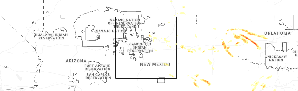
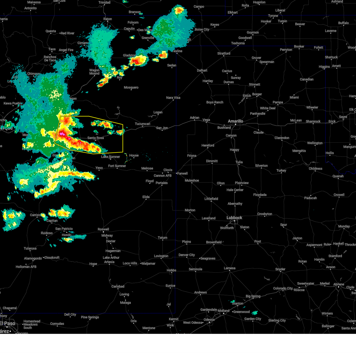
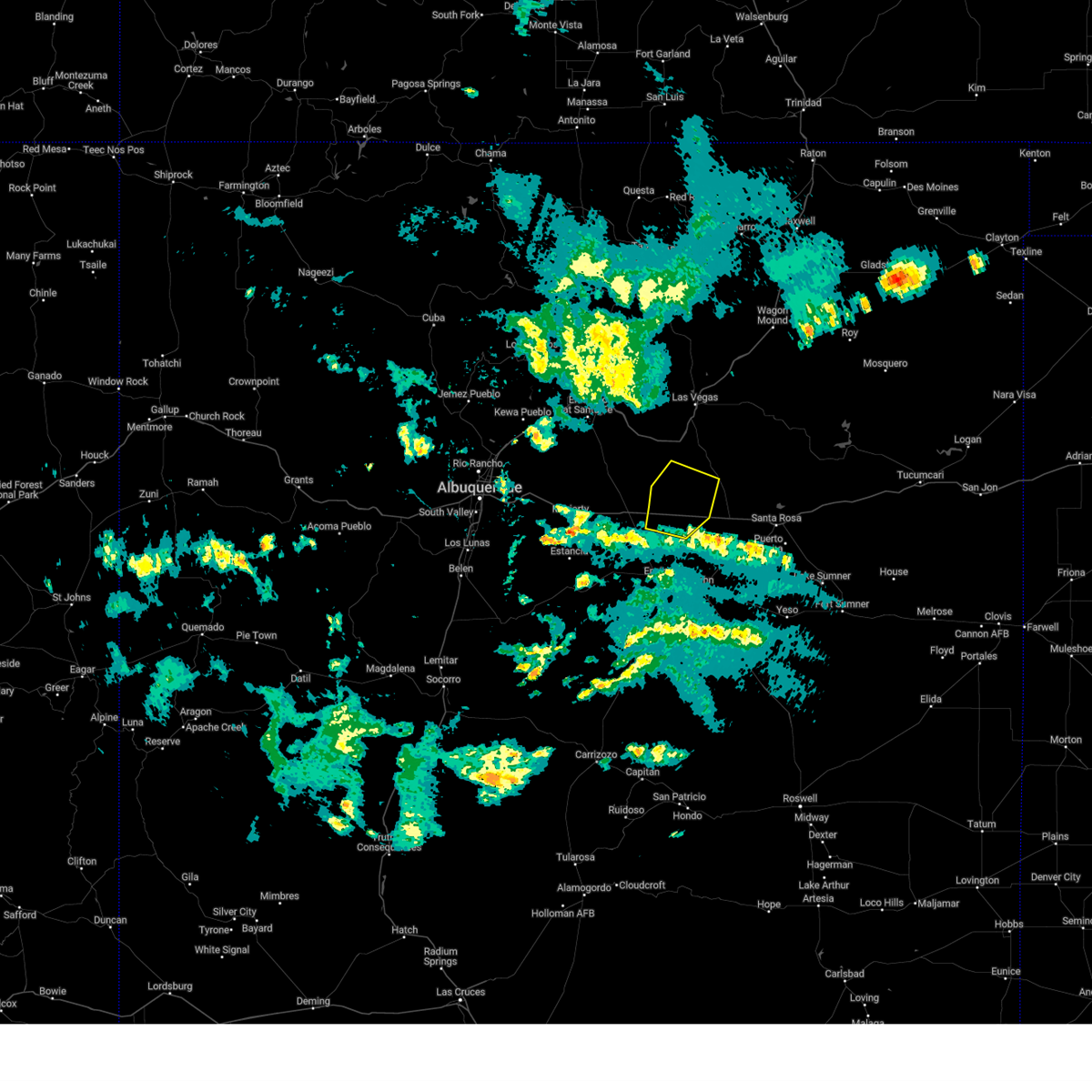
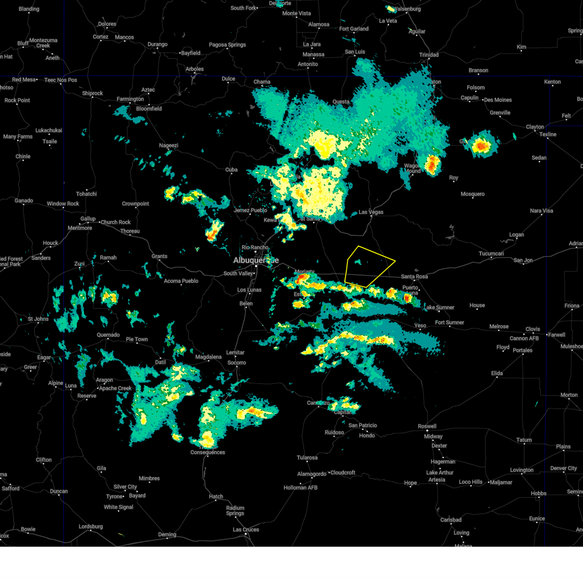
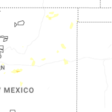
Hail Map for Llano del Medio, NM
The Llano del Medio, NM area has had 2 reports of on-the-ground hail by trained spotters, and has been under severe weather warnings 11 times during the past 12 months. Doppler radar has detected hail at or near Llano del Medio, NM on 50 occasions, including 5 occasions during the past year.
| Name: | Llano del Medio, NM |
| Where Located: | 78.9 miles W of Tucumcari, NM |
| Map: | Google Map for Llano del Medio, NM |
| Population: | 118 |
| Housing Units: | 74 |
| More Info: | Search Google for Llano del Medio, NM |
2
The Top Recent Hail Date for Llano del Medio, NM is Monday, May 26, 2025 (12th out of 50)
Hail and Wind Damage Spotted near Llano del Medio, NM
| Date / Time | Report Details |
|---|---|
| 6/9/2025 5:50 PM MDT | the severe thunderstorm warning has been cancelled and is no longer in effect |
| 6/9/2025 5:50 PM MDT | At 550 pm mdt, severe thunderstorms were located along a line from 7 miles south of cuervo to 6 miles south of anton chico, moving northeast at 30 mph (radar indicated). Hazards include 60 mph wind gusts and quarter size hail. Hail damage to vehicles is expected. expect wind damage to roofs, siding, and trees. locations impacted include, santa rosa, santa rosa lake state park, puerto de luna, colonias, cuervo, pastura, dilia, newkirk, anton chico and pintada. This includes interstate 40 between mile markers 240 and 307. |
| 6/9/2025 5:28 PM MDT |
 Svrabq the national weather service in albuquerque has issued a * severe thunderstorm warning for, northeastern torrance county in central new mexico, north central de baca county in east central new mexico, guadalupe county in east central new mexico, southwestern san miguel county in northeastern new mexico, * until 615 pm mdt. * at 528 pm mdt, severe thunderstorms were located along a line from over puerto de luna to 15 miles south of villanueva state park, moving northeast at 15 mph (radar indicated). Hazards include 60 mph wind gusts and quarter size hail. Hail damage to vehicles is expected. Expect wind damage to roofs, siding, and trees. Svrabq the national weather service in albuquerque has issued a * severe thunderstorm warning for, northeastern torrance county in central new mexico, north central de baca county in east central new mexico, guadalupe county in east central new mexico, southwestern san miguel county in northeastern new mexico, * until 615 pm mdt. * at 528 pm mdt, severe thunderstorms were located along a line from over puerto de luna to 15 miles south of villanueva state park, moving northeast at 15 mph (radar indicated). Hazards include 60 mph wind gusts and quarter size hail. Hail damage to vehicles is expected. Expect wind damage to roofs, siding, and trees.
|
| 6/9/2025 5:18 PM MDT |
 At 518 pm mdt, a severe thunderstorm was located 15 miles east of clines corners, or 29 miles northwest of vaughn, moving south at 15 mph (radar indicated). Hazards include 60 mph wind gusts and half dollar size hail. Hail damage to vehicles is expected. expect wind damage to roofs, siding, and trees. locations impacted include, villanueva state park, villanueva, anton chico and milagro. This includes interstate 40 between mile markers 226 and 248. At 518 pm mdt, a severe thunderstorm was located 15 miles east of clines corners, or 29 miles northwest of vaughn, moving south at 15 mph (radar indicated). Hazards include 60 mph wind gusts and half dollar size hail. Hail damage to vehicles is expected. expect wind damage to roofs, siding, and trees. locations impacted include, villanueva state park, villanueva, anton chico and milagro. This includes interstate 40 between mile markers 226 and 248.
|
| 6/9/2025 5:11 PM MDT | At 511 pm mdt, a severe thunderstorm was located 12 miles south of villanueva state park, or 34 miles north of vaughn, moving south at 10 mph (radar indicated). Hazards include 60 mph wind gusts and quarter size hail. Hail damage to vehicles is expected. expect wind damage to roofs, siding, and trees. locations impacted include, villanueva state park, anton chico, villanueva and milagro. This includes interstate 40 between mile markers 226 and 248. |
| 6/9/2025 4:59 PM MDT |
 Svrabq the national weather service in albuquerque has issued a * severe thunderstorm warning for, northeastern torrance county in central new mexico, northwestern guadalupe county in east central new mexico, southwestern san miguel county in northeastern new mexico, * until 530 pm mdt. * at 459 pm mdt, a severe thunderstorm was located 10 miles south of villanueva state park, or 35 miles south of las vegas, moving south at 10 mph (radar indicated). Hazards include 60 mph wind gusts and half dollar size hail. Hail damage to vehicles is expected. Expect wind damage to roofs, siding, and trees. Svrabq the national weather service in albuquerque has issued a * severe thunderstorm warning for, northeastern torrance county in central new mexico, northwestern guadalupe county in east central new mexico, southwestern san miguel county in northeastern new mexico, * until 530 pm mdt. * at 459 pm mdt, a severe thunderstorm was located 10 miles south of villanueva state park, or 35 miles south of las vegas, moving south at 10 mph (radar indicated). Hazards include 60 mph wind gusts and half dollar size hail. Hail damage to vehicles is expected. Expect wind damage to roofs, siding, and trees.
|
| 6/9/2025 4:37 PM MDT |
 Svrabq the national weather service in albuquerque has issued a * severe thunderstorm warning for, northwestern guadalupe county in east central new mexico, southwestern san miguel county in northeastern new mexico, * until 500 pm mdt. * at 437 pm mdt, a severe thunderstorm was located 6 miles south of villanueva state park, or 31 miles south of las vegas, moving east at 5 mph (radar indicated). Hazards include 60 mph wind gusts and quarter size hail. Hail damage to vehicles is expected. Expect wind damage to roofs, siding, and trees. Svrabq the national weather service in albuquerque has issued a * severe thunderstorm warning for, northwestern guadalupe county in east central new mexico, southwestern san miguel county in northeastern new mexico, * until 500 pm mdt. * at 437 pm mdt, a severe thunderstorm was located 6 miles south of villanueva state park, or 31 miles south of las vegas, moving east at 5 mph (radar indicated). Hazards include 60 mph wind gusts and quarter size hail. Hail damage to vehicles is expected. Expect wind damage to roofs, siding, and trees.
|
| 4/26/2025 2:34 PM MDT |
 Svrabq the national weather service in albuquerque has issued a * severe thunderstorm warning for, north central guadalupe county in east central new mexico, south central san miguel county in northeastern new mexico, * until 315 pm mdt. * at 234 pm mdt, a severe thunderstorm was located near dilia, or 27 miles northwest of santa rosa, moving east at 10 mph (radar indicated). Hazards include ping pong ball size hail and 60 mph wind gusts. People and animals outdoors will be injured. expect hail damage to roofs, siding, windows, and vehicles. Expect wind damage to roofs, siding, and trees. Svrabq the national weather service in albuquerque has issued a * severe thunderstorm warning for, north central guadalupe county in east central new mexico, south central san miguel county in northeastern new mexico, * until 315 pm mdt. * at 234 pm mdt, a severe thunderstorm was located near dilia, or 27 miles northwest of santa rosa, moving east at 10 mph (radar indicated). Hazards include ping pong ball size hail and 60 mph wind gusts. People and animals outdoors will be injured. expect hail damage to roofs, siding, windows, and vehicles. Expect wind damage to roofs, siding, and trees.
|
| 7/27/2024 7:09 PM MDT |
 The storm which prompted the warning has weakened below severe limits, and no longer poses an immediate threat to life or property. therefore, the warning will be allowed to expire. however, gusty winds and heavy rain are still possible with this thunderstorm. The storm which prompted the warning has weakened below severe limits, and no longer poses an immediate threat to life or property. therefore, the warning will be allowed to expire. however, gusty winds and heavy rain are still possible with this thunderstorm.
|
| 7/27/2024 6:43 PM MDT |
 At 643 pm mdt, a severe thunderstorm was located near dilia, or 27 miles northwest of santa rosa, moving southeast at 15 mph (radar indicated). Hazards include 60 mph wind gusts and quarter size hail. Hail damage to vehicles is expected. expect wind damage to roofs, siding, and trees. Locations impacted include, dilia, anton chico, and colonias. At 643 pm mdt, a severe thunderstorm was located near dilia, or 27 miles northwest of santa rosa, moving southeast at 15 mph (radar indicated). Hazards include 60 mph wind gusts and quarter size hail. Hail damage to vehicles is expected. expect wind damage to roofs, siding, and trees. Locations impacted include, dilia, anton chico, and colonias.
|
| 7/27/2024 6:25 PM MDT |
 Svrabq the national weather service in albuquerque has issued a * severe thunderstorm warning for, south central san miguel county in northeastern new mexico, northwestern guadalupe county in east central new mexico, * until 715 pm mdt. * at 625 pm mdt, a severe thunderstorm was located 7 miles north of dilia, or 23 miles southeast of las vegas, moving south at 20 mph (radar indicated). Hazards include 60 mph wind gusts and quarter size hail. Hail damage to vehicles is expected. Expect wind damage to roofs, siding, and trees. Svrabq the national weather service in albuquerque has issued a * severe thunderstorm warning for, south central san miguel county in northeastern new mexico, northwestern guadalupe county in east central new mexico, * until 715 pm mdt. * at 625 pm mdt, a severe thunderstorm was located 7 miles north of dilia, or 23 miles southeast of las vegas, moving south at 20 mph (radar indicated). Hazards include 60 mph wind gusts and quarter size hail. Hail damage to vehicles is expected. Expect wind damage to roofs, siding, and trees.
|
| 7/5/2024 5:31 PM MDT |
 At 531 pm mdt, a severe thunderstorm was located 8 miles southwest of colonias, or 16 miles west of santa rosa, moving south at 15 mph (trained weather spotters). Hazards include quarter size hail. Damage to vehicles is expected. Locations impacted include, dilia, anton chico, colonias, and tecolotito. At 531 pm mdt, a severe thunderstorm was located 8 miles southwest of colonias, or 16 miles west of santa rosa, moving south at 15 mph (trained weather spotters). Hazards include quarter size hail. Damage to vehicles is expected. Locations impacted include, dilia, anton chico, colonias, and tecolotito.
|
| 7/5/2024 5:27 PM MDT |
 At 526 pm mdt, a severe thunderstorm was located 9 miles southwest of colonias, or 16 miles west of santa rosa, moving south at 15 mph (radar indicated). Hazards include 60 mph wind gusts and quarter size hail. Hail damage to vehicles is expected. expect wind damage to roofs, siding, and trees. Locations impacted include, dilia, anton chico, colonias, and tecolotito. At 526 pm mdt, a severe thunderstorm was located 9 miles southwest of colonias, or 16 miles west of santa rosa, moving south at 15 mph (radar indicated). Hazards include 60 mph wind gusts and quarter size hail. Hail damage to vehicles is expected. expect wind damage to roofs, siding, and trees. Locations impacted include, dilia, anton chico, colonias, and tecolotito.
|
| 7/5/2024 5:15 PM MDT | Quarter sized hail reported 3.3 miles W of Llano del Medio, NM |
| 7/5/2024 5:10 PM MDT |
 At 509 pm mdt, a severe thunderstorm was located 8 miles south of dilia, or 21 miles northwest of santa rosa, moving south at 15 mph (radar indicated). Hazards include golf ball size hail and 60 mph wind gusts. People and animals outdoors will be injured. expect hail damage to roofs, siding, windows, and vehicles. expect wind damage to roofs, siding, and trees. Locations impacted include, dilia, anton chico, colonias, and tecolotito. At 509 pm mdt, a severe thunderstorm was located 8 miles south of dilia, or 21 miles northwest of santa rosa, moving south at 15 mph (radar indicated). Hazards include golf ball size hail and 60 mph wind gusts. People and animals outdoors will be injured. expect hail damage to roofs, siding, windows, and vehicles. expect wind damage to roofs, siding, and trees. Locations impacted include, dilia, anton chico, colonias, and tecolotito.
|
| 7/5/2024 5:00 PM MDT |
 Svrabq the national weather service in albuquerque has issued a * severe thunderstorm warning for, south central san miguel county in northeastern new mexico, northwestern guadalupe county in east central new mexico, * until 600 pm mdt. * at 459 pm mdt, a severe thunderstorm was located near dilia, or 23 miles northwest of santa rosa, moving south at 15 mph (radar indicated). Hazards include 60 mph wind gusts and quarter size hail. Hail damage to vehicles is expected. Expect wind damage to roofs, siding, and trees. Svrabq the national weather service in albuquerque has issued a * severe thunderstorm warning for, south central san miguel county in northeastern new mexico, northwestern guadalupe county in east central new mexico, * until 600 pm mdt. * at 459 pm mdt, a severe thunderstorm was located near dilia, or 23 miles northwest of santa rosa, moving south at 15 mph (radar indicated). Hazards include 60 mph wind gusts and quarter size hail. Hail damage to vehicles is expected. Expect wind damage to roofs, siding, and trees.
|
| 5/11/2024 5:19 PM MDT |
 At 519 pm mdt, severe thunderstorms were located along a line extending from near anton chico to 16 miles southwest of dilia to 9 miles north of encino, moving east at 35 mph (radar indicated). Hazards include 60 mph wind gusts and half dollar size hail. Hail damage to vehicles is expected. expect wind damage to roofs, siding, and trees. Locations impacted include, dilia, anton chico, pintada, tecolotito, and milagro. At 519 pm mdt, severe thunderstorms were located along a line extending from near anton chico to 16 miles southwest of dilia to 9 miles north of encino, moving east at 35 mph (radar indicated). Hazards include 60 mph wind gusts and half dollar size hail. Hail damage to vehicles is expected. expect wind damage to roofs, siding, and trees. Locations impacted include, dilia, anton chico, pintada, tecolotito, and milagro.
|
| 5/11/2024 4:53 PM MDT |
 Svrabq the national weather service in albuquerque has issued a * severe thunderstorm warning for, southwestern san miguel county in northeastern new mexico, northwestern guadalupe county in east central new mexico, northeastern torrance county in central new mexico, * until 600 pm mdt. * at 453 pm mdt, severe thunderstorms were located along a line extending from villanueva to near clines corners to 16 miles northwest of encino, moving east at 20 mph (radar indicated). Hazards include 60 mph wind gusts and quarter size hail. Hail damage to vehicles is expected. Expect wind damage to roofs, siding, and trees. Svrabq the national weather service in albuquerque has issued a * severe thunderstorm warning for, southwestern san miguel county in northeastern new mexico, northwestern guadalupe county in east central new mexico, northeastern torrance county in central new mexico, * until 600 pm mdt. * at 453 pm mdt, severe thunderstorms were located along a line extending from villanueva to near clines corners to 16 miles northwest of encino, moving east at 20 mph (radar indicated). Hazards include 60 mph wind gusts and quarter size hail. Hail damage to vehicles is expected. Expect wind damage to roofs, siding, and trees.
|
| 5/31/2023 6:54 PM MDT |
 At 653 pm mdt, a severe thunderstorm was located 12 miles north of clines corners, or 25 miles northeast of moriarty, moving northeast at 25 mph (radar indicated). Hazards include 60 mph wind gusts and quarter size hail. Hail damage to vehicles is expected. Expect wind damage to roofs, siding, and trees. At 653 pm mdt, a severe thunderstorm was located 12 miles north of clines corners, or 25 miles northeast of moriarty, moving northeast at 25 mph (radar indicated). Hazards include 60 mph wind gusts and quarter size hail. Hail damage to vehicles is expected. Expect wind damage to roofs, siding, and trees.
|
| 7/6/2021 4:14 PM MDT |
 At 414 pm mdt, a severe thunderstorm was located near anton chico, or 31 miles south of las vegas, moving south at 20 mph (radar indicated). Hazards include ping pong ball size hail and 60 mph wind gusts. People and animals outdoors will be injured. expect hail damage to roofs, siding, windows, and vehicles. Expect wind damage to roofs, siding, and trees. At 414 pm mdt, a severe thunderstorm was located near anton chico, or 31 miles south of las vegas, moving south at 20 mph (radar indicated). Hazards include ping pong ball size hail and 60 mph wind gusts. People and animals outdoors will be injured. expect hail damage to roofs, siding, windows, and vehicles. Expect wind damage to roofs, siding, and trees.
|
| 7/6/2021 3:55 PM MDT |
 At 355 pm mdt, a severe thunderstorm was located near dilia, or 25 miles south of las vegas, moving south at 15 mph (radar indicated). Hazards include 60 mph wind gusts and quarter size hail. Hail damage to vehicles is expected. expect wind damage to roofs, siding, and trees. Locations impacted include, dilia, anton chico, colonias and tecolotito. At 355 pm mdt, a severe thunderstorm was located near dilia, or 25 miles south of las vegas, moving south at 15 mph (radar indicated). Hazards include 60 mph wind gusts and quarter size hail. Hail damage to vehicles is expected. expect wind damage to roofs, siding, and trees. Locations impacted include, dilia, anton chico, colonias and tecolotito.
|
| 7/6/2021 3:46 PM MDT |
 At 346 pm mdt, a severe thunderstorm was located 8 miles northeast of dilia, or 24 miles southeast of las vegas, moving south at 15 mph (radar indicated). Hazards include 60 mph wind gusts and quarter size hail. Hail damage to vehicles is expected. expect wind damage to roofs, siding, and trees. Locations impacted include, dilia, anton chico, colonias and tecolotito. At 346 pm mdt, a severe thunderstorm was located 8 miles northeast of dilia, or 24 miles southeast of las vegas, moving south at 15 mph (radar indicated). Hazards include 60 mph wind gusts and quarter size hail. Hail damage to vehicles is expected. expect wind damage to roofs, siding, and trees. Locations impacted include, dilia, anton chico, colonias and tecolotito.
|
| 7/6/2021 3:25 PM MDT |
 At 324 pm mdt, a severe thunderstorm was located 12 miles north of dilia, or 21 miles southeast of las vegas, moving south at 15 mph (radar indicated). Hazards include 60 mph wind gusts and half dollar size hail. Hail damage to vehicles is expected. Expect wind damage to roofs, siding, and trees. At 324 pm mdt, a severe thunderstorm was located 12 miles north of dilia, or 21 miles southeast of las vegas, moving south at 15 mph (radar indicated). Hazards include 60 mph wind gusts and half dollar size hail. Hail damage to vehicles is expected. Expect wind damage to roofs, siding, and trees.
|
| 6/24/2021 4:37 PM MDT |
 The severe thunderstorm warning for southwestern san miguel, northwestern guadalupe and northeastern torrance counties will expire at 445 pm mdt, the storm which prompted the warning has weakened below severe limits, and no longer poses an immediate threat to life or property. therefore, the warning will be allowed to expire. however gusty winds and blowing dust are still possible with this thunderstorm. The severe thunderstorm warning for southwestern san miguel, northwestern guadalupe and northeastern torrance counties will expire at 445 pm mdt, the storm which prompted the warning has weakened below severe limits, and no longer poses an immediate threat to life or property. therefore, the warning will be allowed to expire. however gusty winds and blowing dust are still possible with this thunderstorm.
|
| 6/24/2021 4:14 PM MDT |
 At 413 pm mdt, a severe thunderstorm was located 10 miles southwest of villanueva state park, or 33 miles east of moriarty, moving northeast at 35 mph (radar indicated). Hazards include 60 mph wind gusts. Expect damage to roofs, siding, and trees. locations impacted include, villanueva, villanueva state park, anton chico, ribera, chapelle, sena and tecolotito. this includes the following highways, interstate 40 between mile markers 219 and 231. interstate 25 between mile markers 322 and 332. Highway 285 between mile markers 250 and 256. At 413 pm mdt, a severe thunderstorm was located 10 miles southwest of villanueva state park, or 33 miles east of moriarty, moving northeast at 35 mph (radar indicated). Hazards include 60 mph wind gusts. Expect damage to roofs, siding, and trees. locations impacted include, villanueva, villanueva state park, anton chico, ribera, chapelle, sena and tecolotito. this includes the following highways, interstate 40 between mile markers 219 and 231. interstate 25 between mile markers 322 and 332. Highway 285 between mile markers 250 and 256.
|
| 6/24/2021 3:59 PM MDT |
 At 359 pm mdt, a severe thunderstorm was located near clines corners, or 25 miles east of moriarty, moving northeast at 30 mph (radar indicated). Hazards include 60 mph wind gusts. expect damage to roofs, siding, and trees At 359 pm mdt, a severe thunderstorm was located near clines corners, or 25 miles east of moriarty, moving northeast at 30 mph (radar indicated). Hazards include 60 mph wind gusts. expect damage to roofs, siding, and trees
|
| 6/12/2021 6:48 PM MDT |
 At 647 pm mdt, severe thunderstorms were located along a line extending from 11 miles south of villanueva state park to colonias, moving southeast at 10 mph (radar indicated). Hazards include 60 mph wind gusts and quarter size hail. Hail damage to vehicles is expected. expect wind damage to roofs, siding, and trees. locations impacted include, dilia, anton chico and colonias. This includes interstate 40 between mile markers 226 and 269. At 647 pm mdt, severe thunderstorms were located along a line extending from 11 miles south of villanueva state park to colonias, moving southeast at 10 mph (radar indicated). Hazards include 60 mph wind gusts and quarter size hail. Hail damage to vehicles is expected. expect wind damage to roofs, siding, and trees. locations impacted include, dilia, anton chico and colonias. This includes interstate 40 between mile markers 226 and 269.
|
| 6/12/2021 6:14 PM MDT |
 At 614 pm mdt, severe thunderstorms were located along a line extending from 9 miles south of villanueva state park to 7 miles southwest of colonias, moving west at 15 mph (radar indicated). Hazards include 60 mph wind gusts and half dollar size hail. Hail damage to vehicles is expected. Expect wind damage to roofs, siding, and trees. At 614 pm mdt, severe thunderstorms were located along a line extending from 9 miles south of villanueva state park to 7 miles southwest of colonias, moving west at 15 mph (radar indicated). Hazards include 60 mph wind gusts and half dollar size hail. Hail damage to vehicles is expected. Expect wind damage to roofs, siding, and trees.
|
| 6/12/2021 5:44 PM MDT |
 At 544 pm mdt, severe thunderstorms were located along a line extending from 11 miles south of villanueva state park to 10 miles south of dilia, moving east at 10 mph (radar indicated). Hazards include tennis ball size hail and 60 mph wind gusts. People and animals outdoors will be injured. expect hail damage to roofs, siding, windows, and vehicles. expect wind damage to roofs, siding, and trees. locations impacted include, dilia, anton chico and colonias. This includes interstate 40 between mile markers 237 and 271. At 544 pm mdt, severe thunderstorms were located along a line extending from 11 miles south of villanueva state park to 10 miles south of dilia, moving east at 10 mph (radar indicated). Hazards include tennis ball size hail and 60 mph wind gusts. People and animals outdoors will be injured. expect hail damage to roofs, siding, windows, and vehicles. expect wind damage to roofs, siding, and trees. locations impacted include, dilia, anton chico and colonias. This includes interstate 40 between mile markers 237 and 271.
|
| 6/12/2021 5:35 PM MDT |
 At 535 pm mdt, severe thunderstorms were located along a line extending from 10 miles south of villanueva state park to 9 miles south of dilia, moving east at 10 mph (radar indicated). Hazards include 60 mph wind gusts and half dollar size hail. Hail damage to vehicles is expected. Expect wind damage to roofs, siding, and trees. At 535 pm mdt, severe thunderstorms were located along a line extending from 10 miles south of villanueva state park to 9 miles south of dilia, moving east at 10 mph (radar indicated). Hazards include 60 mph wind gusts and half dollar size hail. Hail damage to vehicles is expected. Expect wind damage to roofs, siding, and trees.
|
| 6/1/2021 9:14 PM MDT |
 At 913 pm mdt, a severe thunderstorm was located near dilia, or 26 miles northwest of santa rosa, moving south at 20 mph (radar indicated). Hazards include ping pong ball size hail and 60 mph wind gusts. People and animals outdoors will be injured. expect hail damage to roofs, siding, windows, and vehicles. Expect wind damage to roofs, siding, and trees. At 913 pm mdt, a severe thunderstorm was located near dilia, or 26 miles northwest of santa rosa, moving south at 20 mph (radar indicated). Hazards include ping pong ball size hail and 60 mph wind gusts. People and animals outdoors will be injured. expect hail damage to roofs, siding, windows, and vehicles. Expect wind damage to roofs, siding, and trees.
|
| 6/1/2021 9:05 PM MDT |
 At 905 pm mdt, a severe thunderstorm was located over dilia, or 27 miles northwest of santa rosa, moving south at 20 mph (radar indicated). Hazards include ping pong ball size hail and 60 mph wind gusts. People and animals outdoors will be injured. expect hail damage to roofs, siding, windows, and vehicles. expect wind damage to roofs, siding, and trees. Locations impacted include, dilia, anton chico and tecolotito. At 905 pm mdt, a severe thunderstorm was located over dilia, or 27 miles northwest of santa rosa, moving south at 20 mph (radar indicated). Hazards include ping pong ball size hail and 60 mph wind gusts. People and animals outdoors will be injured. expect hail damage to roofs, siding, windows, and vehicles. expect wind damage to roofs, siding, and trees. Locations impacted include, dilia, anton chico and tecolotito.
|
| 6/1/2021 8:51 PM MDT |
 At 851 pm mdt, a severe thunderstorm was located near dilia, or 26 miles south of las vegas, moving south at 20 mph (radar indicated). Hazards include quarter size hail. damage to vehicles is expected At 851 pm mdt, a severe thunderstorm was located near dilia, or 26 miles south of las vegas, moving south at 20 mph (radar indicated). Hazards include quarter size hail. damage to vehicles is expected
|
| 8/3/2020 6:06 PM MDT |
 At 606 pm mdt, a severe thunderstorm was located near ribera, or 17 miles southwest of las vegas, moving southeast at 20 mph (radar indicated). Hazards include 60 mph wind gusts and quarter size hail. Hail damage to vehicles is expected. Expect wind damage to roofs, siding, and trees. At 606 pm mdt, a severe thunderstorm was located near ribera, or 17 miles southwest of las vegas, moving southeast at 20 mph (radar indicated). Hazards include 60 mph wind gusts and quarter size hail. Hail damage to vehicles is expected. Expect wind damage to roofs, siding, and trees.
|
| 7/19/2020 3:24 PM MDT |
 The severe thunderstorm warning for south central san miguel and northwestern guadalupe counties will expire at 330 pm mdt, the storm which prompted the warning has weakened below severe limits, and no longer poses an immediate threat to life or property. therefore the warning will be allowed to expire. The severe thunderstorm warning for south central san miguel and northwestern guadalupe counties will expire at 330 pm mdt, the storm which prompted the warning has weakened below severe limits, and no longer poses an immediate threat to life or property. therefore the warning will be allowed to expire.
|
| 7/19/2020 3:09 PM MDT |
 At 308 pm mdt, a severe thunderstorm was located 8 miles north of anton chico, or 20 miles south of las vegas, moving southeast at 15 mph (radar indicated). Hazards include 60 mph wind gusts and quarter size hail. Hail damage to vehicles is expected. expect wind damage to roofs, siding, and trees. Locations impacted include, dilia. At 308 pm mdt, a severe thunderstorm was located 8 miles north of anton chico, or 20 miles south of las vegas, moving southeast at 15 mph (radar indicated). Hazards include 60 mph wind gusts and quarter size hail. Hail damage to vehicles is expected. expect wind damage to roofs, siding, and trees. Locations impacted include, dilia.
|
| 7/19/2020 2:51 PM MDT |
 At 251 pm mdt, a severe thunderstorm was located 10 miles southeast of tecolote, or 16 miles south of las vegas, moving southeast at 15 mph (radar indicated). Hazards include 60 mph wind gusts and quarter size hail. Hail damage to vehicles is expected. Expect wind damage to roofs, siding, and trees. At 251 pm mdt, a severe thunderstorm was located 10 miles southeast of tecolote, or 16 miles south of las vegas, moving southeast at 15 mph (radar indicated). Hazards include 60 mph wind gusts and quarter size hail. Hail damage to vehicles is expected. Expect wind damage to roofs, siding, and trees.
|
| 6/24/2020 5:07 PM MDT |
 At 507 pm mdt, severe thunderstorms were located along a line extending from near anton chico to 15 miles north of colonias, moving east at 20 mph (radar indicated). Hazards include 60 mph wind gusts and half dollar size hail. Hail damage to vehicles is expected. Expect wind damage to roofs, siding, and trees. At 507 pm mdt, severe thunderstorms were located along a line extending from near anton chico to 15 miles north of colonias, moving east at 20 mph (radar indicated). Hazards include 60 mph wind gusts and half dollar size hail. Hail damage to vehicles is expected. Expect wind damage to roofs, siding, and trees.
|
| 6/24/2020 5:01 PM MDT |
 A severe thunderstorm warning remains in effect until 515 pm mdt for southwestern san miguel and northwestern guadalupe counties. at 500 pm mdt, a severe thunderstorm was located over anton chico, or 27 miles south of las vegas, moving east at 30 mph. hazard. 60 mph wind gusts and quarter size hail. source. Radar indicated. A severe thunderstorm warning remains in effect until 515 pm mdt for southwestern san miguel and northwestern guadalupe counties. at 500 pm mdt, a severe thunderstorm was located over anton chico, or 27 miles south of las vegas, moving east at 30 mph. hazard. 60 mph wind gusts and quarter size hail. source. Radar indicated.
|
| 6/24/2020 4:33 PM MDT |
 At 432 pm mdt, severe thunderstorms were located along a line extending from near anton chico to 21 miles north of vaughn to 6 miles north of encino, moving south at 15 mph (radar indicated). Hazards include 60 mph wind gusts and quarter size hail. Hail damage to vehicles is expected. Expect wind damage to roofs, siding, and trees. At 432 pm mdt, severe thunderstorms were located along a line extending from near anton chico to 21 miles north of vaughn to 6 miles north of encino, moving south at 15 mph (radar indicated). Hazards include 60 mph wind gusts and quarter size hail. Hail damage to vehicles is expected. Expect wind damage to roofs, siding, and trees.
|
| 6/23/2020 3:40 PM MDT |
 At 337 pm mdt, severe thunderstorms were reported along a line extending from 7 miles south of anton chico to 14 miles east of clines corners, moving southeast at 30 mph (trained weather spotters). Hazards include golf ball size hail and 60 mph wind gusts. People and animals outdoors will be injured. expect hail damage to roofs, siding, windows, and vehicles. expect wind damage to roofs, siding, and trees. locations impacted include, anton chico, tecolotito and milagro. This includes interstate 40 between mile markers 224 and 250. At 337 pm mdt, severe thunderstorms were reported along a line extending from 7 miles south of anton chico to 14 miles east of clines corners, moving southeast at 30 mph (trained weather spotters). Hazards include golf ball size hail and 60 mph wind gusts. People and animals outdoors will be injured. expect hail damage to roofs, siding, windows, and vehicles. expect wind damage to roofs, siding, and trees. locations impacted include, anton chico, tecolotito and milagro. This includes interstate 40 between mile markers 224 and 250.
|
| 6/23/2020 3:13 PM MDT |
 At 312 pm mdt, severe thunderstorms were located along a line extending from near villanueva state park to 11 miles northeast of clines corners, moving south at 20 mph (radar indicated). Hazards include 60 mph wind gusts and quarter size hail. Hail damage to vehicles is expected. Expect wind damage to roofs, siding, and trees. At 312 pm mdt, severe thunderstorms were located along a line extending from near villanueva state park to 11 miles northeast of clines corners, moving south at 20 mph (radar indicated). Hazards include 60 mph wind gusts and quarter size hail. Hail damage to vehicles is expected. Expect wind damage to roofs, siding, and trees.
|
| 6/3/2019 3:17 PM MDT |
 At 317 pm mdt, a severe thunderstorm was located near dilia, or 27 miles northwest of santa rosa, moving northeast at 25 mph (radar indicated). Hazards include 60 mph wind gusts and quarter size hail. Hail damage to vehicles is expected. expect wind damage to roofs, siding, and trees. Locations impacted include, dilia, anton chico, tecolotito and colonias. At 317 pm mdt, a severe thunderstorm was located near dilia, or 27 miles northwest of santa rosa, moving northeast at 25 mph (radar indicated). Hazards include 60 mph wind gusts and quarter size hail. Hail damage to vehicles is expected. expect wind damage to roofs, siding, and trees. Locations impacted include, dilia, anton chico, tecolotito and colonias.
|
| 6/3/2019 2:57 PM MDT |
 At 256 pm mdt, a severe thunderstorm was located near anton chico, or 31 miles west of santa rosa, moving northeast at 20 mph (radar indicated). Hazards include ping pong ball size hail and 60 mph wind gusts. People and animals outdoors will be injured. expect hail damage to roofs, siding, windows, and vehicles. Expect wind damage to roofs, siding, and trees. At 256 pm mdt, a severe thunderstorm was located near anton chico, or 31 miles west of santa rosa, moving northeast at 20 mph (radar indicated). Hazards include ping pong ball size hail and 60 mph wind gusts. People and animals outdoors will be injured. expect hail damage to roofs, siding, windows, and vehicles. Expect wind damage to roofs, siding, and trees.
|
| 6/3/2019 2:50 PM MDT |
 At 249 pm mdt, a severe thunderstorm was located 14 miles south of anton chico, or 27 miles north of vaughn, moving north at 35 mph (radar indicated). Hazards include 60 mph wind gusts and quarter size hail. Hail damage to vehicles is expected. expect wind damage to roofs, siding, and trees. locations impacted include, pintada and milagro. This includes interstate 40 between mile markers 237 and 258. At 249 pm mdt, a severe thunderstorm was located 14 miles south of anton chico, or 27 miles north of vaughn, moving north at 35 mph (radar indicated). Hazards include 60 mph wind gusts and quarter size hail. Hail damage to vehicles is expected. expect wind damage to roofs, siding, and trees. locations impacted include, pintada and milagro. This includes interstate 40 between mile markers 237 and 258.
|
| 6/3/2019 2:18 PM MDT |
 At 217 pm mdt, a severe thunderstorm was located 10 miles northwest of vaughn, moving north at 35 mph (radar indicated). Hazards include 60 mph wind gusts and quarter size hail. Hail damage to vehicles is expected. Expect wind damage to roofs, siding, and trees. At 217 pm mdt, a severe thunderstorm was located 10 miles northwest of vaughn, moving north at 35 mph (radar indicated). Hazards include 60 mph wind gusts and quarter size hail. Hail damage to vehicles is expected. Expect wind damage to roofs, siding, and trees.
|
| 8/8/2018 7:44 PM MDT |
 At 744 pm mdt, a severe thunderstorm was located over anton chico, or 30 miles south of las vegas, moving south at 25 mph (radar indicated). Hazards include 60 mph wind gusts and quarter size hail. Hail damage to vehicles is expected. Expect wind damage to roofs, siding, and trees. At 744 pm mdt, a severe thunderstorm was located over anton chico, or 30 miles south of las vegas, moving south at 25 mph (radar indicated). Hazards include 60 mph wind gusts and quarter size hail. Hail damage to vehicles is expected. Expect wind damage to roofs, siding, and trees.
|
| 8/8/2018 6:59 PM MDT |
 The national weather service in albuquerque has issued a * severe thunderstorm warning for. southwestern san miguel county in northeastern new mexico. northwestern guadalupe county in east central new mexico. until 745 pm mdt. At 658 pm mdt, a severe thunderstorm was located 9 miles southeast. The national weather service in albuquerque has issued a * severe thunderstorm warning for. southwestern san miguel county in northeastern new mexico. northwestern guadalupe county in east central new mexico. until 745 pm mdt. At 658 pm mdt, a severe thunderstorm was located 9 miles southeast.
|
| 7/24/2018 6:13 PM MDT |
 At 612 pm mdt, a severe thunderstorm was located over dilia, or 26 miles northwest of santa rosa, and is nearly stationary (radar indicated). Hazards include 60 mph wind gusts and half dollar size hail. Hail damage to vehicles is expected. expect wind damage to roofs, siding, and trees. locations impacted include, dilia and portions of u. s. Highway 84. At 612 pm mdt, a severe thunderstorm was located over dilia, or 26 miles northwest of santa rosa, and is nearly stationary (radar indicated). Hazards include 60 mph wind gusts and half dollar size hail. Hail damage to vehicles is expected. expect wind damage to roofs, siding, and trees. locations impacted include, dilia and portions of u. s. Highway 84.
|
| 7/24/2018 5:41 PM MDT |
 At 541 pm mdt, a severe thunderstorm was located over dilia, or 26 miles northwest of santa rosa, and is nearly stationary (radar indicated). Hazards include 60 mph wind gusts and half dollar size hail. Hail damage to vehicles is expected. Expect wind damage to roofs, siding, and trees. At 541 pm mdt, a severe thunderstorm was located over dilia, or 26 miles northwest of santa rosa, and is nearly stationary (radar indicated). Hazards include 60 mph wind gusts and half dollar size hail. Hail damage to vehicles is expected. Expect wind damage to roofs, siding, and trees.
|
| 5/23/2018 5:08 PM MDT |
 At 508 pm mdt, a severe thunderstorm was located near anton chico, or 23 miles south of las vegas, moving east at 15 mph (radar indicated). Hazards include 70 mph wind gusts and ping pong ball size hail. People and animals outdoors will be injured. expect hail damage to roofs, siding, windows, and vehicles. expect considerable tree damage. wind damage is also likely to mobile homes, roofs, and outbuildings. Locations impacted include, dilia, villanueva state park, anton chico, villanueva, los montoyas and tecolotito. At 508 pm mdt, a severe thunderstorm was located near anton chico, or 23 miles south of las vegas, moving east at 15 mph (radar indicated). Hazards include 70 mph wind gusts and ping pong ball size hail. People and animals outdoors will be injured. expect hail damage to roofs, siding, windows, and vehicles. expect considerable tree damage. wind damage is also likely to mobile homes, roofs, and outbuildings. Locations impacted include, dilia, villanueva state park, anton chico, villanueva, los montoyas and tecolotito.
|
| 5/23/2018 5:00 PM MDT |
 The national weather service in albuquerque has issued a * severe thunderstorm warning for. southwestern san miguel county in northeastern new mexico. northwestern guadalupe county in east central new mexico. until 600 pm mdt. At 500 pm mdt, severe thunderstorms were located along a line. The national weather service in albuquerque has issued a * severe thunderstorm warning for. southwestern san miguel county in northeastern new mexico. northwestern guadalupe county in east central new mexico. until 600 pm mdt. At 500 pm mdt, severe thunderstorms were located along a line.
|
| 5/23/2018 4:31 PM MDT |
 At 431 pm mdt, severe thunderstorms were located along a line extending from 15 miles southwest of trujillo to 6 miles east of villanueva state park, moving northeast at 35 mph (radar indicated). Hazards include 60 mph wind gusts and quarter size hail. Hail damage to vehicles is expected. expect wind damage to roofs, siding, and trees. Locations impacted include, dilia, villanueva, villanueva state park, anton chico, trujillo, chapelle, los montoyas and tecolotito. At 431 pm mdt, severe thunderstorms were located along a line extending from 15 miles southwest of trujillo to 6 miles east of villanueva state park, moving northeast at 35 mph (radar indicated). Hazards include 60 mph wind gusts and quarter size hail. Hail damage to vehicles is expected. expect wind damage to roofs, siding, and trees. Locations impacted include, dilia, villanueva, villanueva state park, anton chico, trujillo, chapelle, los montoyas and tecolotito.
|
| 5/23/2018 3:59 PM MDT |
 At 358 pm mdt, severe thunderstorms were located along a line extending from 10 miles north of dilia to near anton chico, moving northeast at 10 mph (radar indicated). Hazards include ping pong ball size hail and 60 mph wind gusts. People and animals outdoors will be injured. expect hail damage to roofs, siding, windows, and vehicles. Expect wind damage to roofs, siding, and trees. At 358 pm mdt, severe thunderstorms were located along a line extending from 10 miles north of dilia to near anton chico, moving northeast at 10 mph (radar indicated). Hazards include ping pong ball size hail and 60 mph wind gusts. People and animals outdoors will be injured. expect hail damage to roofs, siding, windows, and vehicles. Expect wind damage to roofs, siding, and trees.
|
| 5/23/2018 3:30 PM MDT |
 At 330 pm mdt, severe thunderstorms were located along a line extending from near anton chico to near dilia, moving east at 15 mph (radar indicated). Hazards include 70 mph wind gusts and ping pong ball size hail. People and animals outdoors will be injured. expect hail damage to roofs, siding, windows, and vehicles. expect considerable tree damage. wind damage is also likely to mobile homes, roofs, and outbuildings. Locations impacted include, dilia, anton chico, los montoyas and tecolotito. At 330 pm mdt, severe thunderstorms were located along a line extending from near anton chico to near dilia, moving east at 15 mph (radar indicated). Hazards include 70 mph wind gusts and ping pong ball size hail. People and animals outdoors will be injured. expect hail damage to roofs, siding, windows, and vehicles. expect considerable tree damage. wind damage is also likely to mobile homes, roofs, and outbuildings. Locations impacted include, dilia, anton chico, los montoyas and tecolotito.
|
| 5/23/2018 3:08 PM MDT |
 At 308 pm mdt, a severe thunderstorm was located near anton chico, or 26 miles south of las vegas, moving east at 15 mph (radar indicated). Hazards include tennis ball size hail and 70 mph wind gusts. People and animals outdoors will be injured. expect hail damage to roofs, siding, windows, and vehicles. expect considerable tree damage. wind damage is also likely to mobile homes, roofs, and outbuildings. Locations impacted include, dilia, villanueva state park, anton chico, villanueva, los montoyas and tecolotito. At 308 pm mdt, a severe thunderstorm was located near anton chico, or 26 miles south of las vegas, moving east at 15 mph (radar indicated). Hazards include tennis ball size hail and 70 mph wind gusts. People and animals outdoors will be injured. expect hail damage to roofs, siding, windows, and vehicles. expect considerable tree damage. wind damage is also likely to mobile homes, roofs, and outbuildings. Locations impacted include, dilia, villanueva state park, anton chico, villanueva, los montoyas and tecolotito.
|
| 5/23/2018 2:57 PM MDT |
 At 257 pm mdt, a severe thunderstorm was located near villanueva state park, or 27 miles south of las vegas, moving east at 15 mph (radar indicated). Hazards include 60 mph wind gusts and half dollar size hail. Hail damage to vehicles is expected. Expect wind damage to roofs, siding, and trees. At 257 pm mdt, a severe thunderstorm was located near villanueva state park, or 27 miles south of las vegas, moving east at 15 mph (radar indicated). Hazards include 60 mph wind gusts and half dollar size hail. Hail damage to vehicles is expected. Expect wind damage to roofs, siding, and trees.
|
| 8/12/2017 8:00 PM MDT |
 At 759 pm mdt, a severe thunderstorm was located 12 miles north of dilia, or 19 miles southeast of las vegas, moving southeast at 20 mph (radar indicated). Hazards include ping pong ball size hail and 60 mph wind gusts. People and animals outdoors will be injured. expect hail damage to roofs, siding, windows, and vehicles. Expect wind damage to roofs, siding, and trees. At 759 pm mdt, a severe thunderstorm was located 12 miles north of dilia, or 19 miles southeast of las vegas, moving southeast at 20 mph (radar indicated). Hazards include ping pong ball size hail and 60 mph wind gusts. People and animals outdoors will be injured. expect hail damage to roofs, siding, windows, and vehicles. Expect wind damage to roofs, siding, and trees.
|
| 8/9/2017 4:34 PM MDT |
 At 434 pm mdt, a severe thunderstorm was located 7 miles northwest of anton chico, or 20 miles south of las vegas, moving south at 25 mph (radar indicated). Hazards include golf ball size hail and 60 mph wind gusts. People and animals outdoors will be injured. expect hail damage to roofs, siding, windows, and vehicles. expect wind damage to roofs, siding, and trees. locations impacted include, dilia, anton chico, romeroville, los montoyas, san agustin and tecolotito. This includes interstate 25 between mile markers 339 and 342. At 434 pm mdt, a severe thunderstorm was located 7 miles northwest of anton chico, or 20 miles south of las vegas, moving south at 25 mph (radar indicated). Hazards include golf ball size hail and 60 mph wind gusts. People and animals outdoors will be injured. expect hail damage to roofs, siding, windows, and vehicles. expect wind damage to roofs, siding, and trees. locations impacted include, dilia, anton chico, romeroville, los montoyas, san agustin and tecolotito. This includes interstate 25 between mile markers 339 and 342.
|
| 8/9/2017 4:00 PM MDT |
 At 400 pm mdt, a severe thunderstorm was located over romeroville, or near las vegas, moving south at 25 mph (radar indicated. at 350 pm golf ball sized hail was reported las vegas). Hazards include golf ball size hail and 60 mph wind gusts. People and animals outdoors will be injured. expect hail damage to roofs, siding, windows, and vehicles. Expect wind damage to roofs, siding, and trees. At 400 pm mdt, a severe thunderstorm was located over romeroville, or near las vegas, moving south at 25 mph (radar indicated. at 350 pm golf ball sized hail was reported las vegas). Hazards include golf ball size hail and 60 mph wind gusts. People and animals outdoors will be injured. expect hail damage to roofs, siding, windows, and vehicles. Expect wind damage to roofs, siding, and trees.
|
| 8/7/2017 2:34 PM MDT |
 At 234 pm mdt, a severe thunderstorm was located 9 miles south of anton chico, or 26 miles west of santa rosa, moving southeast at 25 mph (radar indicated). Hazards include 60 mph wind gusts and half dollar size hail. Hail damage to vehicles is expected. expect wind damage to roofs, siding, and trees. locations impacted include, pintada and milagro. This includes interstate 40 between mile markers 240 and 263. At 234 pm mdt, a severe thunderstorm was located 9 miles south of anton chico, or 26 miles west of santa rosa, moving southeast at 25 mph (radar indicated). Hazards include 60 mph wind gusts and half dollar size hail. Hail damage to vehicles is expected. expect wind damage to roofs, siding, and trees. locations impacted include, pintada and milagro. This includes interstate 40 between mile markers 240 and 263.
|
| 8/7/2017 2:10 PM MDT |
 At 209 pm mdt, a severe thunderstorm was located near anton chico, or 29 miles south of las vegas, moving southeast at 25 mph (radar indicated). Hazards include 60 mph wind gusts and quarter size hail. Hail damage to vehicles is expected. Expect wind damage to roofs, siding, and trees. At 209 pm mdt, a severe thunderstorm was located near anton chico, or 29 miles south of las vegas, moving southeast at 25 mph (radar indicated). Hazards include 60 mph wind gusts and quarter size hail. Hail damage to vehicles is expected. Expect wind damage to roofs, siding, and trees.
|
| 8/7/2017 1:58 PM MDT |
 At 157 pm mdt, a severe thunderstorm was located over anton chico, or 27 miles south of las vegas, moving southeast at 25 mph (radar indicated). Hazards include 60 mph wind gusts and quarter size hail. Hail damage to vehicles is expected. expect wind damage to roofs, siding, and trees. locations impacted include, dilia, colonias, villanueva, villanueva state park, anton chico, sena and tecolotito. This includes interstate 40 between mile markers 254 and 262. At 157 pm mdt, a severe thunderstorm was located over anton chico, or 27 miles south of las vegas, moving southeast at 25 mph (radar indicated). Hazards include 60 mph wind gusts and quarter size hail. Hail damage to vehicles is expected. expect wind damage to roofs, siding, and trees. locations impacted include, dilia, colonias, villanueva, villanueva state park, anton chico, sena and tecolotito. This includes interstate 40 between mile markers 254 and 262.
|
| 8/7/2017 1:29 PM MDT |
 At 128 pm mdt, a severe thunderstorm was located 8 miles northwest of anton chico, or 19 miles south of las vegas, moving southeast at 25 mph (radar indicated). Hazards include 60 mph wind gusts and quarter size hail. Hail damage to vehicles is expected. Expect wind damage to roofs, siding, and trees. At 128 pm mdt, a severe thunderstorm was located 8 miles northwest of anton chico, or 19 miles south of las vegas, moving southeast at 25 mph (radar indicated). Hazards include 60 mph wind gusts and quarter size hail. Hail damage to vehicles is expected. Expect wind damage to roofs, siding, and trees.
|
| 6/25/2017 6:08 PM MDT |
 At 608 pm mdt, a severe thunderstorm was located near anton chico, or 27 miles south of las vegas, moving southeast at 15 mph (radar indicated). Hazards include ping pong ball size hail and 60 mph wind gusts. People and animals outdoors will be injured. expect hail damage to roofs, siding, windows, and vehicles. Expect wind damage to roofs, siding, and trees. At 608 pm mdt, a severe thunderstorm was located near anton chico, or 27 miles south of las vegas, moving southeast at 15 mph (radar indicated). Hazards include ping pong ball size hail and 60 mph wind gusts. People and animals outdoors will be injured. expect hail damage to roofs, siding, windows, and vehicles. Expect wind damage to roofs, siding, and trees.
|
| 6/7/2017 4:15 PM MDT |
 At 412 pm mdt, a severe thunderstorm was located 7 miles southwest of anton chico, or 31 miles west of santa rosa, moving southeast at 20 mph (nmdot reported several inches of accumulation of quarter sized hail). Hazards include ping pong ball size hail and 60 mph wind gusts. People and animals outdoors will be injured. expect hail damage to roofs, siding, windows, and vehicles. Expect wind damage to roofs, siding, and trees. At 412 pm mdt, a severe thunderstorm was located 7 miles southwest of anton chico, or 31 miles west of santa rosa, moving southeast at 20 mph (nmdot reported several inches of accumulation of quarter sized hail). Hazards include ping pong ball size hail and 60 mph wind gusts. People and animals outdoors will be injured. expect hail damage to roofs, siding, windows, and vehicles. Expect wind damage to roofs, siding, and trees.
|
| 6/7/2017 3:58 PM MDT |
 At 357 pm mdt, a severe thunderstorm was located near villanueva state park, or 28 miles south of las vegas, moving south at 15 mph (trained spotters reported accumulations of quarter sized hail). Hazards include ping pong ball size hail and 60 mph wind gusts. People and animals outdoors will be injured. expect hail damage to roofs, siding, windows, and vehicles. expect wind damage to roofs, siding, and trees. Locations impacted include, anton chico and tecolotito. At 357 pm mdt, a severe thunderstorm was located near villanueva state park, or 28 miles south of las vegas, moving south at 15 mph (trained spotters reported accumulations of quarter sized hail). Hazards include ping pong ball size hail and 60 mph wind gusts. People and animals outdoors will be injured. expect hail damage to roofs, siding, windows, and vehicles. expect wind damage to roofs, siding, and trees. Locations impacted include, anton chico and tecolotito.
|
| 6/7/2017 3:29 PM MDT |
 At 328 pm mdt, a severe thunderstorm was located near villanueva state park, or 23 miles south of las vegas, moving south at 45 mph (radar indicated). Hazards include ping pong ball size hail and 60 mph wind gusts. People and animals outdoors will be injured. expect hail damage to roofs, siding, windows, and vehicles. Expect wind damage to roofs, siding, and trees. At 328 pm mdt, a severe thunderstorm was located near villanueva state park, or 23 miles south of las vegas, moving south at 45 mph (radar indicated). Hazards include ping pong ball size hail and 60 mph wind gusts. People and animals outdoors will be injured. expect hail damage to roofs, siding, windows, and vehicles. Expect wind damage to roofs, siding, and trees.
|
| 5/9/2017 1:57 PM MDT |
 At 156 pm mdt, a severe thunderstorm was located near anton chico, or 28 miles south of las vegas, moving north at 35 mph (radar indicated). Hazards include 60 mph wind gusts and quarter size hail. Hail damage to vehicles is expected. Expect wind damage to roofs, siding, and trees. At 156 pm mdt, a severe thunderstorm was located near anton chico, or 28 miles south of las vegas, moving north at 35 mph (radar indicated). Hazards include 60 mph wind gusts and quarter size hail. Hail damage to vehicles is expected. Expect wind damage to roofs, siding, and trees.
|
| 7/8/2016 2:34 PM MDT |
 At 233 pm mdt, a line of severe thunderstorms was located from tecolote to just south of san augustin, or 12 miles south of las vegas, moving southeast at 15 mph (radar indicated). Hazards include quarter size hail and 60 mph wind gusts. Hail damage to vehicles is expected. Expect wind damage to roofs, siding, and trees. At 233 pm mdt, a line of severe thunderstorms was located from tecolote to just south of san augustin, or 12 miles south of las vegas, moving southeast at 15 mph (radar indicated). Hazards include quarter size hail and 60 mph wind gusts. Hail damage to vehicles is expected. Expect wind damage to roofs, siding, and trees.
|
| 10/20/2015 2:33 PM MDT |
 At 233 pm mdt, a severe thunderstorm was located over anton chico, or 29 miles south of las vegas, moving north at 35 mph (radar indicated). Hazards include half dollar size hail and 60 mph wind gusts. Hail damage to vehicles is expected. Expect wind damage to roofs, siding and trees. At 233 pm mdt, a severe thunderstorm was located over anton chico, or 29 miles south of las vegas, moving north at 35 mph (radar indicated). Hazards include half dollar size hail and 60 mph wind gusts. Hail damage to vehicles is expected. Expect wind damage to roofs, siding and trees.
|
| 8/17/2015 4:16 PM MDT |
 At 416 pm mdt, a severe thunderstorm was located 7 miles south of dilia, or 26 miles northwest of santa rosa, moving southeast at 25 mph (radar indicated). Hazards include 60 mph wind gusts and quarter size hail. Hail damage to vehicles is expected. expect wind damage to roofs, siding and trees. locations impacted include, anton chico and pintada. This includes interstate 40 between mile markers 243 and 261. At 416 pm mdt, a severe thunderstorm was located 7 miles south of dilia, or 26 miles northwest of santa rosa, moving southeast at 25 mph (radar indicated). Hazards include 60 mph wind gusts and quarter size hail. Hail damage to vehicles is expected. expect wind damage to roofs, siding and trees. locations impacted include, anton chico and pintada. This includes interstate 40 between mile markers 243 and 261.
|
| 8/17/2015 4:02 PM MDT |
 At 402 pm mdt, a severe thunderstorm was located near anton chico, or 31 miles south of las vegas, moving southeast at 25 mph (radar indicated). Hazards include half dollar size hail and 60 mph wind gusts. Hail damage to vehicles is expected. Expect wind damage to roofs, siding and trees. At 402 pm mdt, a severe thunderstorm was located near anton chico, or 31 miles south of las vegas, moving southeast at 25 mph (radar indicated). Hazards include half dollar size hail and 60 mph wind gusts. Hail damage to vehicles is expected. Expect wind damage to roofs, siding and trees.
|
| 6/7/2015 12:50 PM MDT | At 1249 pm mdt, a severe thunderstorm was located over dilia, or 26 miles northwest of santa rosa, moving east at 20 mph (radar indicated). Hazards include quarter size hail and 60 mph wind gusts. Hail damage to vehicles is expected. Expect wind damage to roofs, siding and trees. |
| 6/6/2015 2:47 PM MDT | At 246 pm mdt, a severe thunderstorm was located near dilia, or 25 miles southeast of las vegas, moving northeast at 25 mph (radar indicated). Hazards include 60 mph wind gusts and quarter size hail. Hail damage to vehicles is expected. expect wind damage to roofs, siding and trees. Locations impacted include, anton chico, dilia and tecolotito. |
| 6/6/2015 2:25 PM MDT | At 225 pm mdt, a severe thunderstorm was located near anton chico, or 27 miles south of las vegas, moving northeast at 30 mph (radar indicated). Hazards include quarter size hail and 60 mph wind gusts. Hail damage to vehicles is expected. Expect wind damage to roofs, siding and trees. |
| 5/19/2015 2:46 AM MDT | At 245 am mdt, severe thunderstorms were located along a line extending from near dilia to 6 miles west of pastura, moving northeast at 60 mph (radar indicated). Hazards include quarter size hail. damage to vehicles is expected |
| 7/19/2014 2:30 PM MDT | Quarter sized hail reported 3.3 miles W of Llano del Medio, NM |
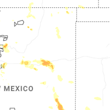
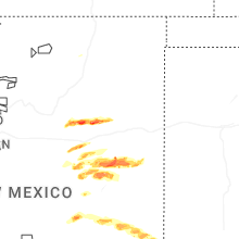
Hail Maps for Llano del Medio, NM


Connect with Interactive Hail Maps