

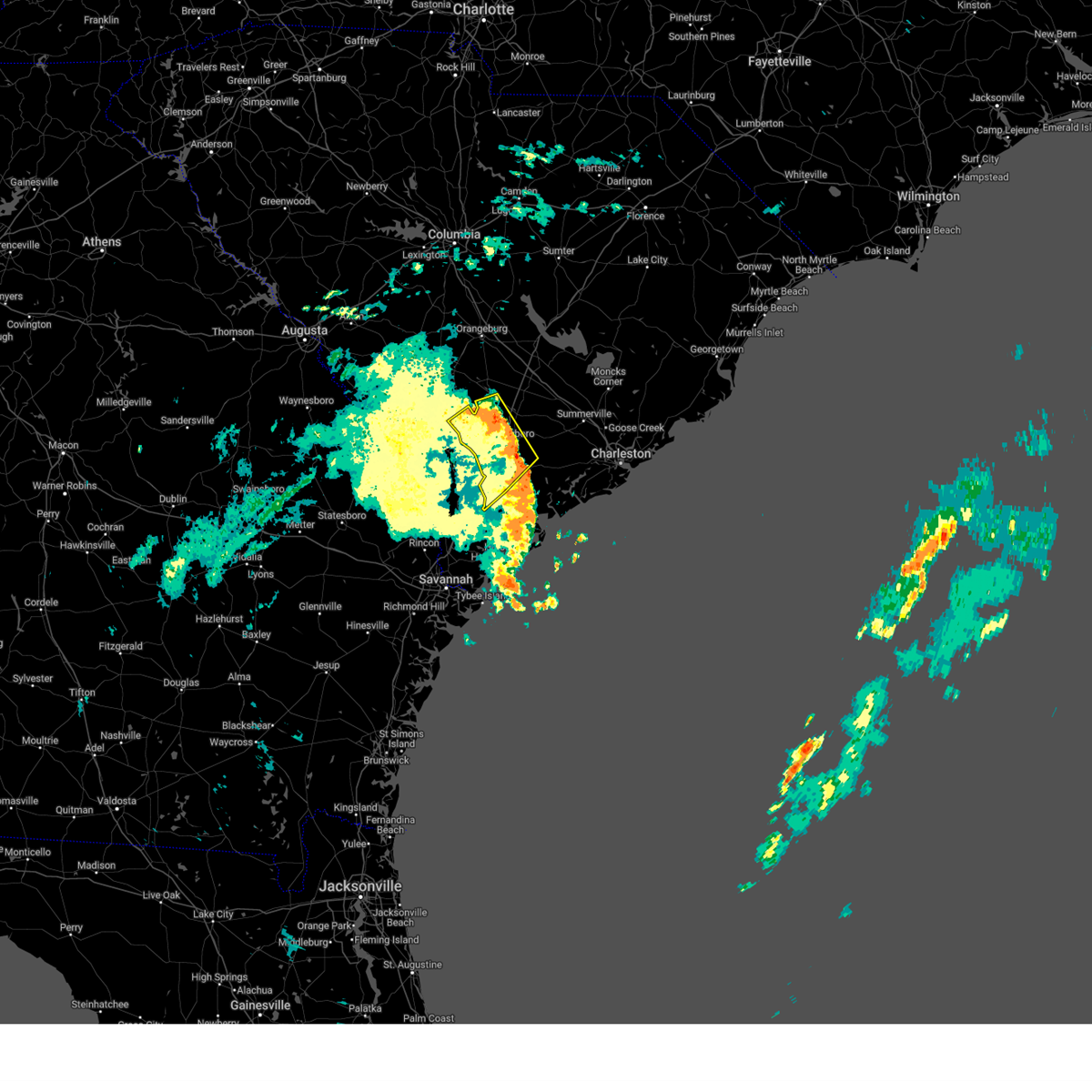
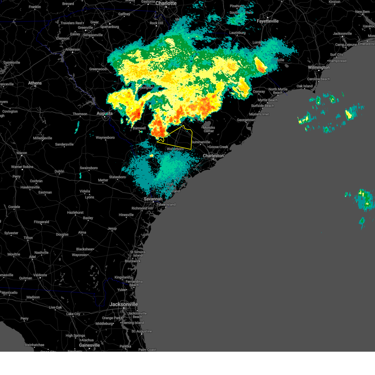
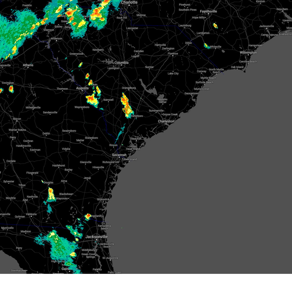
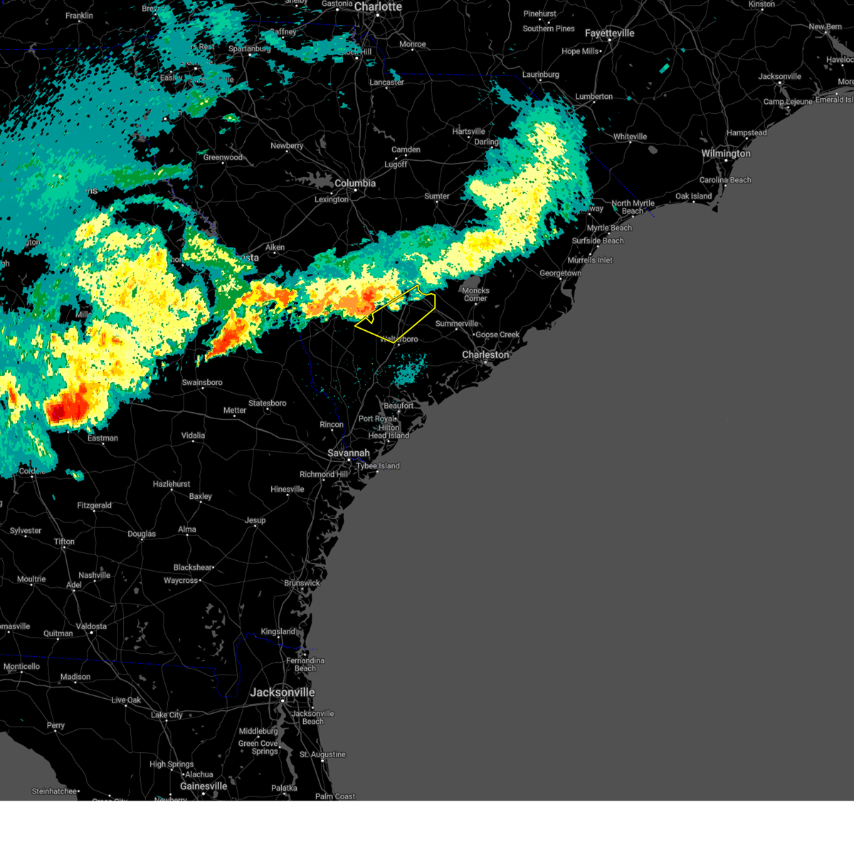
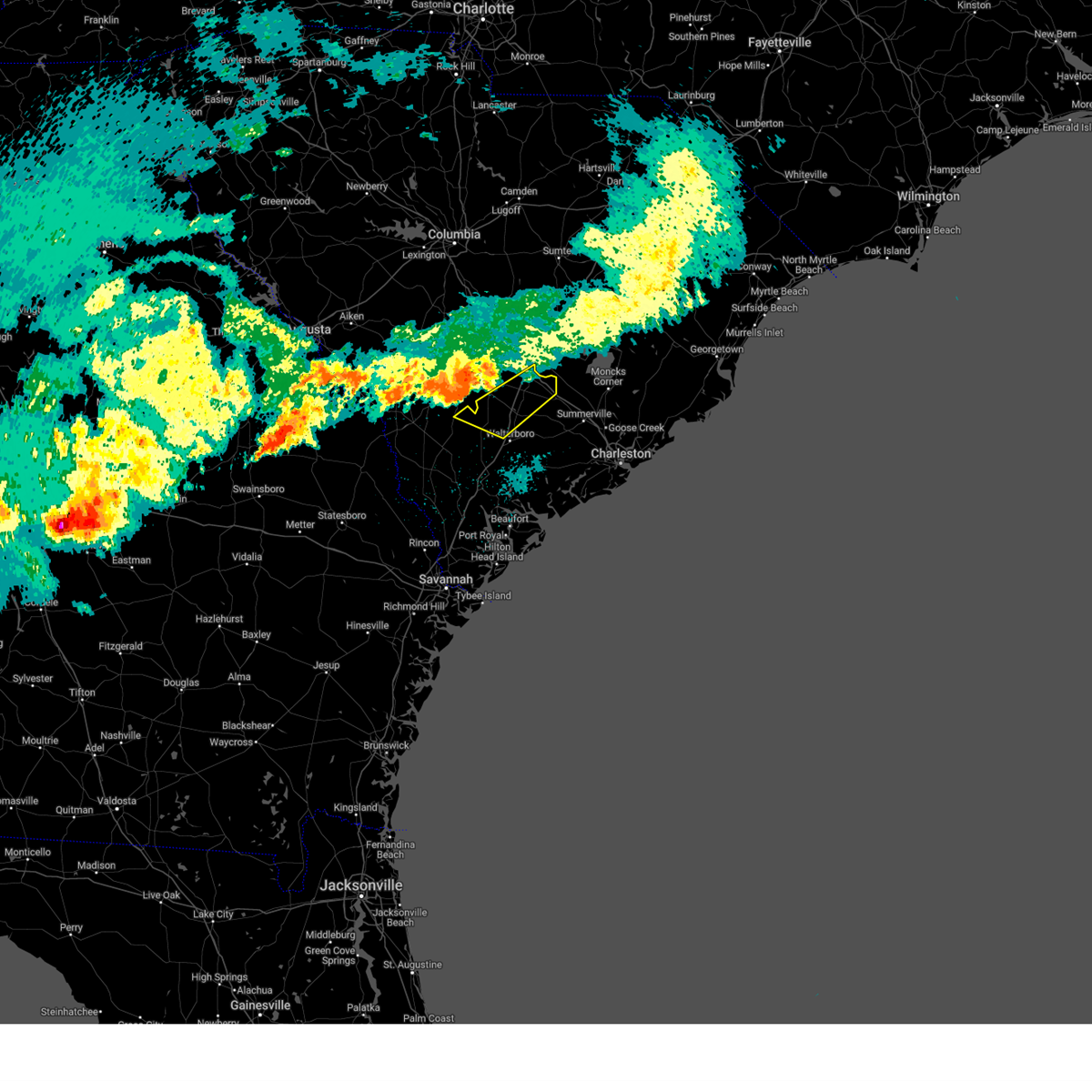
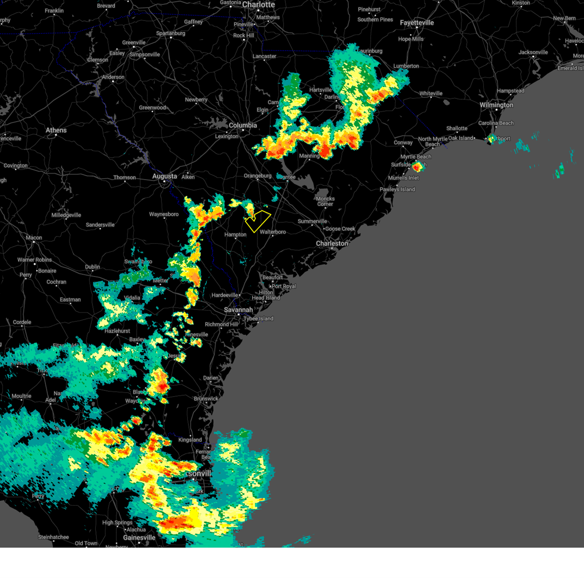
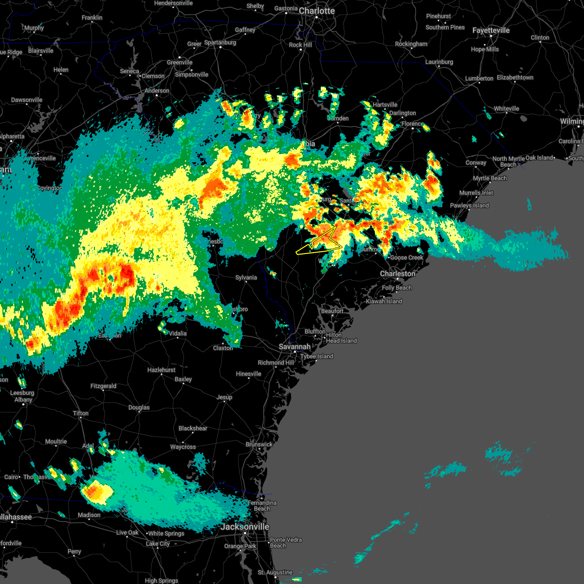
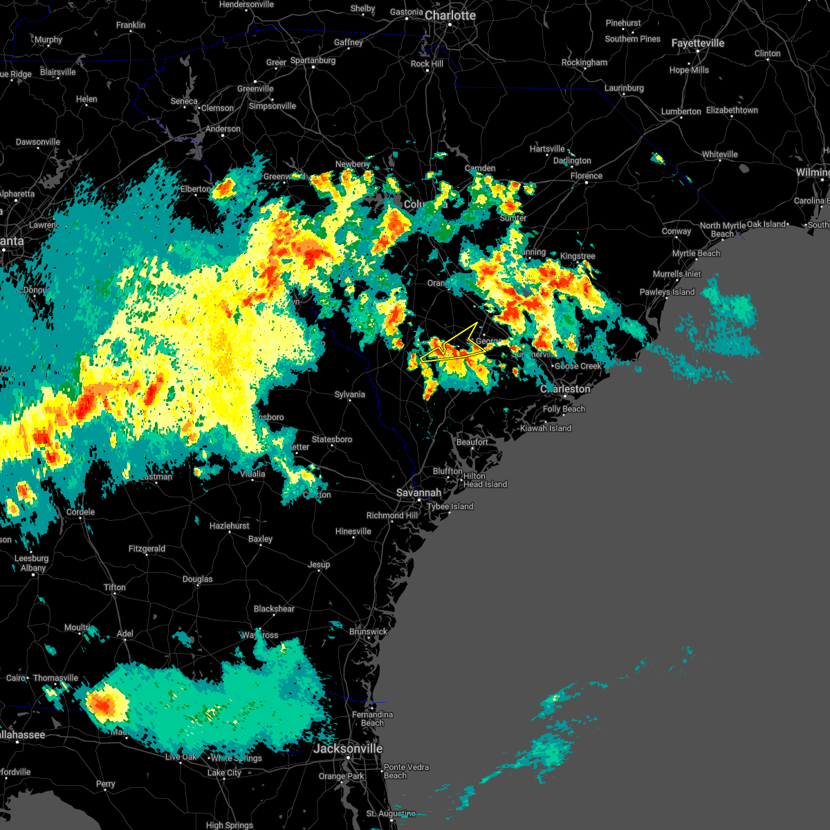
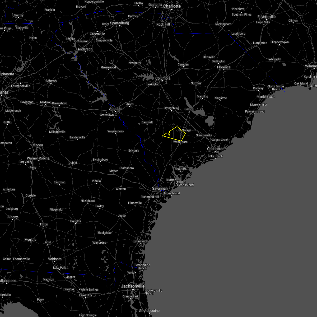
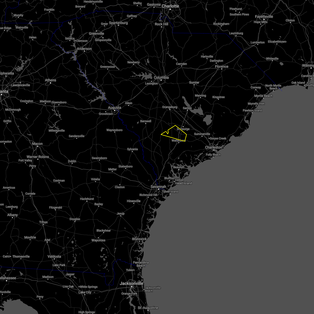
Hail Map for Lodge, SC
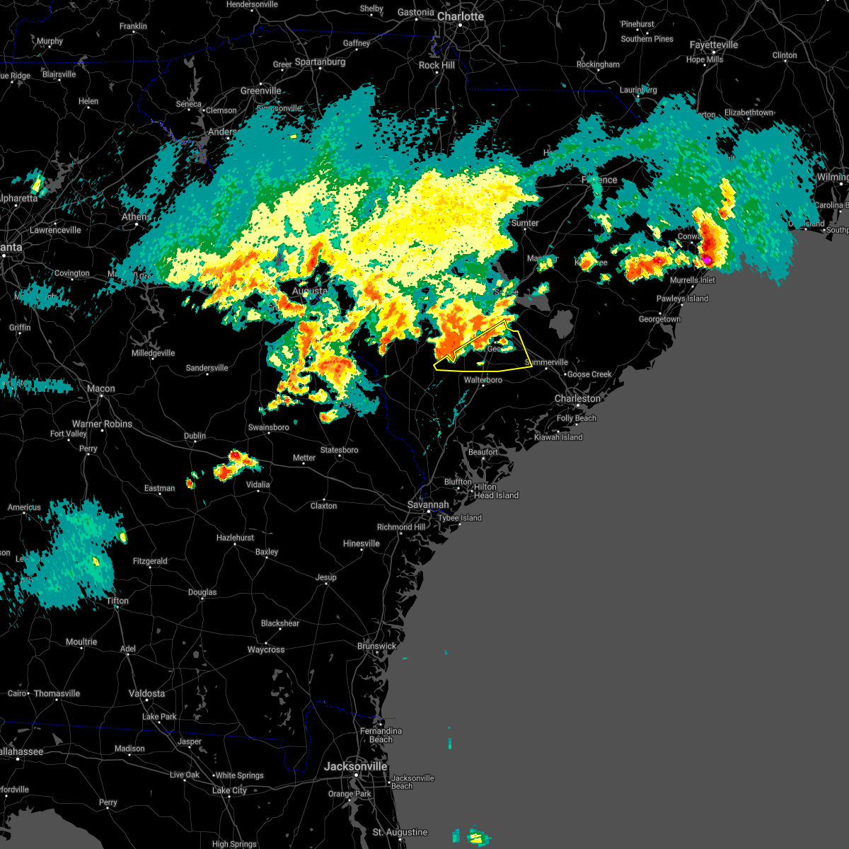
The Lodge, SC area has had 0 reports of on-the-ground hail by trained spotters, and has been under severe weather warnings 19 times during the past 12 months. Doppler radar has detected hail at or near Lodge, SC on 39 occasions, including 1 occasion during the past year.
| Name: | Lodge, SC |
| Where Located: | 55.4 miles W of Charleston, SC |
| Map: | Google Map for Lodge, SC |
| Population: | 120 |
| Housing Units: | 75 |
| More Info: | Search Google for Lodge, SC |
2
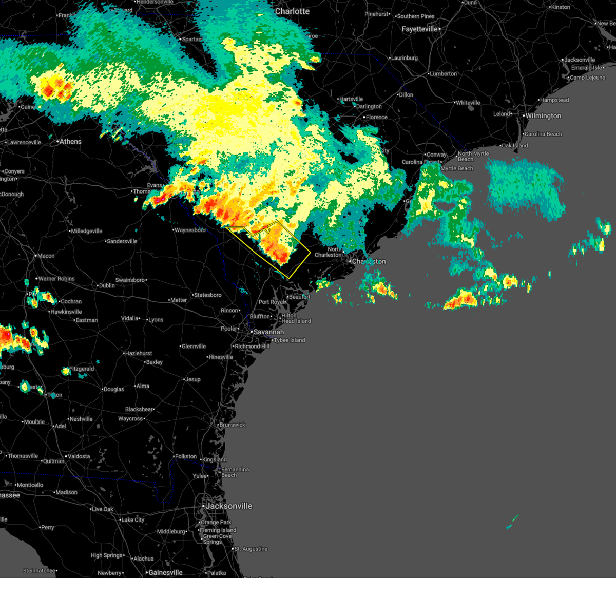
The Top Recent Hail Date for Lodge, SC is Tuesday, July 30, 2024 (8th out of 39)

Hail and Wind Damage Spotted near Lodge, SC
| Date / Time | Report Details |
|---|---|
| 6/25/2025 10:15 PM EDT |
 At 1015 pm edt, severe thunderstorms were located along a line from over white hall to over lodge, moving southwest at 25 mph (radar indicated). Hazards include 70 mph wind gusts and ping pong ball size hail. People and animals outdoors will be injured. expect hail damage to roofs, siding, windows, and vehicles. expect considerable tree damage. wind damage is also likely to mobile homes, roofs, and outbuildings. locations impacted include, cottageville, walterboro, smoaks, williams, ruffin, colleton, lodge, islandton, sycamore and ulmer. This includes i-95 in south carolina between mile markers 42 and 68. At 1015 pm edt, severe thunderstorms were located along a line from over white hall to over lodge, moving southwest at 25 mph (radar indicated). Hazards include 70 mph wind gusts and ping pong ball size hail. People and animals outdoors will be injured. expect hail damage to roofs, siding, windows, and vehicles. expect considerable tree damage. wind damage is also likely to mobile homes, roofs, and outbuildings. locations impacted include, cottageville, walterboro, smoaks, williams, ruffin, colleton, lodge, islandton, sycamore and ulmer. This includes i-95 in south carolina between mile markers 42 and 68.
|
| 6/25/2025 10:06 PM EDT |
 At 1006 pm edt, severe thunderstorms were located along a line from over ritter to over lodge, moving southwest at 25 mph (radar indicated). Hazards include 70 mph wind gusts and quarter size hail. Hail damage to vehicles is expected. expect considerable tree damage. wind damage is also likely to mobile homes, roofs, and outbuildings. locations impacted include, cottageville, walterboro, smoaks, williams, ruffin, colleton, lodge, islandton, sycamore and ulmer. This includes i-95 in south carolina between mile markers 42 and 68. At 1006 pm edt, severe thunderstorms were located along a line from over ritter to over lodge, moving southwest at 25 mph (radar indicated). Hazards include 70 mph wind gusts and quarter size hail. Hail damage to vehicles is expected. expect considerable tree damage. wind damage is also likely to mobile homes, roofs, and outbuildings. locations impacted include, cottageville, walterboro, smoaks, williams, ruffin, colleton, lodge, islandton, sycamore and ulmer. This includes i-95 in south carolina between mile markers 42 and 68.
|
| 6/25/2025 10:01 PM EDT |
 At 1001 pm edt, severe thunderstorms were located along a line from over ritter to near padgetts, moving southwest at 25 mph (radar indicated). Hazards include 60 mph wind gusts and small hail. Expect damage to roofs, siding, and trees. locations impacted include, walterboro, colleton, cottageville, sycamore, smoaks, lodge, williams, ulmer, ruffin and islandton. This includes i-95 in south carolina between mile markers 42 and 68. At 1001 pm edt, severe thunderstorms were located along a line from over ritter to near padgetts, moving southwest at 25 mph (radar indicated). Hazards include 60 mph wind gusts and small hail. Expect damage to roofs, siding, and trees. locations impacted include, walterboro, colleton, cottageville, sycamore, smoaks, lodge, williams, ulmer, ruffin and islandton. This includes i-95 in south carolina between mile markers 42 and 68.
|
| 6/25/2025 10:01 PM EDT |
 the severe thunderstorm warning has been cancelled and is no longer in effect the severe thunderstorm warning has been cancelled and is no longer in effect
|
| 6/25/2025 9:33 PM EDT |
 Svrchs the national weather service in charleston has issued a * severe thunderstorm warning for portions of, allendale county in southeastern south carolina, beaufort county in southeastern south carolina, colleton county in southeastern south carolina, dorchester county in southeastern south carolina, hampton county in southeastern south carolina, * until 1030 pm edt. * at 933 pm edt, severe thunderstorms were located along a line from over cottageville to 12 miles north of lodge, moving southwest at 25 mph (radar indicated). Hazards include 60 mph wind gusts. expect damage to roofs, siding, and trees Svrchs the national weather service in charleston has issued a * severe thunderstorm warning for portions of, allendale county in southeastern south carolina, beaufort county in southeastern south carolina, colleton county in southeastern south carolina, dorchester county in southeastern south carolina, hampton county in southeastern south carolina, * until 1030 pm edt. * at 933 pm edt, severe thunderstorms were located along a line from over cottageville to 12 miles north of lodge, moving southwest at 25 mph (radar indicated). Hazards include 60 mph wind gusts. expect damage to roofs, siding, and trees
|
| 6/10/2025 10:06 AM EDT |
 The severe thunderstorm warning that was previously in effect has been reissued for colleton county and is in effect until 1045 am edt. please refer to that bulletin for the latest severe weather information. The severe thunderstorm warning that was previously in effect has been reissued for colleton county and is in effect until 1045 am edt. please refer to that bulletin for the latest severe weather information.
|
| 6/10/2025 9:47 AM EDT |
 At 947 am edt, severe thunderstorms were located along a line from near ashton to 6 miles east of dale, moving northeast at 50 mph (radar indicated). Hazards include 60 mph wind gusts. Expect damage to roofs, siding, and trees. locations impacted include, walterboro, yemassee, colleton, smoaks, lodge, williams, hendersonville, ruffin, ritter and islandton. This includes i-95 in south carolina between mile markers 42 and 67. At 947 am edt, severe thunderstorms were located along a line from near ashton to 6 miles east of dale, moving northeast at 50 mph (radar indicated). Hazards include 60 mph wind gusts. Expect damage to roofs, siding, and trees. locations impacted include, walterboro, yemassee, colleton, smoaks, lodge, williams, hendersonville, ruffin, ritter and islandton. This includes i-95 in south carolina between mile markers 42 and 67.
|
| 6/10/2025 9:47 AM EDT |
 the severe thunderstorm warning has been cancelled and is no longer in effect the severe thunderstorm warning has been cancelled and is no longer in effect
|
| 6/10/2025 9:26 AM EDT |
 Svrchs the national weather service in charleston has issued a * severe thunderstorm warning for portions of, beaufort county in southeastern south carolina, colleton county in southeastern south carolina, hampton county in southeastern south carolina, jasper county in southeastern south carolina, * until 1015 am edt. * at 926 am edt, severe thunderstorms were located along a line from over lake warren state park to over old house, moving northeast at 40 mph (radar indicated). Hazards include 60 mph wind gusts. expect damage to roofs, siding, and trees Svrchs the national weather service in charleston has issued a * severe thunderstorm warning for portions of, beaufort county in southeastern south carolina, colleton county in southeastern south carolina, hampton county in southeastern south carolina, jasper county in southeastern south carolina, * until 1015 am edt. * at 926 am edt, severe thunderstorms were located along a line from over lake warren state park to over old house, moving northeast at 40 mph (radar indicated). Hazards include 60 mph wind gusts. expect damage to roofs, siding, and trees
|
| 6/8/2025 12:10 PM EDT |
 Svrchs the national weather service in charleston has issued a * severe thunderstorm warning for portions of, allendale county in southeastern south carolina, berkeley county in southeastern south carolina, colleton county in southeastern south carolina, dorchester county in southeastern south carolina, * until 115 pm edt. * at 1210 pm edt, severe thunderstorms were located along a line from 14 miles north of harleyville to over colleton, moving east at 40 mph (radar indicated). Hazards include 60 mph wind gusts and small hail. expect damage to roofs, siding, and trees Svrchs the national weather service in charleston has issued a * severe thunderstorm warning for portions of, allendale county in southeastern south carolina, berkeley county in southeastern south carolina, colleton county in southeastern south carolina, dorchester county in southeastern south carolina, * until 115 pm edt. * at 1210 pm edt, severe thunderstorms were located along a line from 14 miles north of harleyville to over colleton, moving east at 40 mph (radar indicated). Hazards include 60 mph wind gusts and small hail. expect damage to roofs, siding, and trees
|
| 5/9/2025 5:08 AM EDT |
 Svrchs the national weather service in charleston has issued a * severe thunderstorm warning for portions of, colleton county in southeastern south carolina, dorchester county in southeastern south carolina, * until 615 am edt. * at 508 am edt, a severe thunderstorm was located near smoaks, moving east at 25 mph (radar indicated). Hazards include 60 mph wind gusts and quarter size hail. Hail damage to vehicles is expected. Expect wind damage to roofs, siding, and trees. Svrchs the national weather service in charleston has issued a * severe thunderstorm warning for portions of, colleton county in southeastern south carolina, dorchester county in southeastern south carolina, * until 615 am edt. * at 508 am edt, a severe thunderstorm was located near smoaks, moving east at 25 mph (radar indicated). Hazards include 60 mph wind gusts and quarter size hail. Hail damage to vehicles is expected. Expect wind damage to roofs, siding, and trees.
|
| 9/26/2024 1:10 PM EDT |
 The storm which prompted the warning has moved out of the area. therefore, the warning will be allowed to expire. a tornado watch remains in effect until 900 pm edt thursday for a portion of southeast south carolina. The storm which prompted the warning has moved out of the area. therefore, the warning will be allowed to expire. a tornado watch remains in effect until 900 pm edt thursday for a portion of southeast south carolina.
|
| 9/26/2024 12:57 PM EDT |
 Torchs the national weather service in charleston has issued a * tornado warning for portions of, colleton county in southeastern south carolina, * until 115 pm edt. * at 1257 pm edt, a severe thunderstorm capable of producing a tornado was located over lodge, moving north at 30 mph (radar indicated rotation). Hazards include tornado. Flying debris will be dangerous to those caught without shelter. mobile homes will be damaged or destroyed. damage to roofs, windows and vehicles will occur. Tree damage is likely. Torchs the national weather service in charleston has issued a * tornado warning for portions of, colleton county in southeastern south carolina, * until 115 pm edt. * at 1257 pm edt, a severe thunderstorm capable of producing a tornado was located over lodge, moving north at 30 mph (radar indicated rotation). Hazards include tornado. Flying debris will be dangerous to those caught without shelter. mobile homes will be damaged or destroyed. damage to roofs, windows and vehicles will occur. Tree damage is likely.
|
| 8/2/2024 4:22 PM EDT | Tree down on road and on building/residence... blocking one lane near the cayce road/mount nebo road intersectio in colleton county SC, 5.8 miles NNE of Lodge, SC |
| 8/2/2024 3:41 PM EDT | Tree down and blocking one lane near the gabriel dr/confederate highway intersectio in colleton county SC, 2.7 miles N of Lodge, SC |
| 8/2/2024 3:31 PM EDT | Tree down blocking one lane near the bells highway/dry branch rd intersectio in colleton county SC, 3.7 miles NNW of Lodge, SC |
| 7/30/2024 8:29 PM EDT |
 Svrchs the national weather service in charleston has issued a * severe thunderstorm warning for portions of, colleton county in southeastern south carolina, * until 930 pm edt. * at 829 pm edt, severe thunderstorms were located along a line extending from near smoaks to colleton, and are nearly stationary (radar indicated). Hazards include 60 mph wind gusts and penny size hail. Expect damage to trees and powerlines. Locations impacted include: colleton, smoaks, lodge, williams, padgetts, and ruffin. Svrchs the national weather service in charleston has issued a * severe thunderstorm warning for portions of, colleton county in southeastern south carolina, * until 930 pm edt. * at 829 pm edt, severe thunderstorms were located along a line extending from near smoaks to colleton, and are nearly stationary (radar indicated). Hazards include 60 mph wind gusts and penny size hail. Expect damage to trees and powerlines. Locations impacted include: colleton, smoaks, lodge, williams, padgetts, and ruffin.
|
| 7/30/2024 8:07 PM EDT |
 At 807 pm edt, severe thunderstorms were located along a line extending from lodge to near colleton, and are nearly stationary (radar indicated). Hazards include 60 mph wind gusts and penny size hail. Expect damage to trees and powerlines. Locations impacted include: colleton, smoaks, lodge, williams, and padgetts. At 807 pm edt, severe thunderstorms were located along a line extending from lodge to near colleton, and are nearly stationary (radar indicated). Hazards include 60 mph wind gusts and penny size hail. Expect damage to trees and powerlines. Locations impacted include: colleton, smoaks, lodge, williams, and padgetts.
|
| 7/30/2024 7:45 PM EDT | Svrchs the national weather service in charleston has issued a * severe thunderstorm warning for portions of, colleton county in southeastern south carolina, * until 830 pm edt. * at 744 pm edt, a severe thunderstorm was located over colleton, moving east at 10 mph (radar indicated). Hazards include 60 mph wind gusts. Expect damage to trees and powerlines. Locations impacted include: colleton, smoaks, lodge, williams, and padgetts. |
| 7/30/2024 7:22 PM EDT |
 At 722 pm edt, severe thunderstorms were located along a line extending from near padgetts to colleton, moving north at 5 mph (radar indicated). Hazards include 60 mph wind gusts. Expect damage to trees and powerlines. Locations impacted include: colleton, smoaks, lodge, williams, padgetts, and ruffin. At 722 pm edt, severe thunderstorms were located along a line extending from near padgetts to colleton, moving north at 5 mph (radar indicated). Hazards include 60 mph wind gusts. Expect damage to trees and powerlines. Locations impacted include: colleton, smoaks, lodge, williams, padgetts, and ruffin.
|
| 7/30/2024 7:02 PM EDT |
 At 702 pm edt, severe thunderstorms were located along a line extending from lodge to near colleton, moving southeast at 5 mph (radar indicated). Hazards include 60 mph wind gusts and penny size hail. Expect damage to trees and powerlines. Locations impacted include: colleton, smoaks, lodge, williams, ruffin, padgetts, and ashton. At 702 pm edt, severe thunderstorms were located along a line extending from lodge to near colleton, moving southeast at 5 mph (radar indicated). Hazards include 60 mph wind gusts and penny size hail. Expect damage to trees and powerlines. Locations impacted include: colleton, smoaks, lodge, williams, ruffin, padgetts, and ashton.
|
| 7/30/2024 6:46 PM EDT |
 Svrchs the national weather service in charleston has issued a * severe thunderstorm warning for portions of, colleton county in southeastern south carolina, * until 745 pm edt. * at 646 pm edt, severe thunderstorms were located along a line extending from lodge to near smoaks, moving north at 5 mph (radar indicated). Hazards include 60 mph wind gusts and penny size hail. Expect damage to trees and powerlines. Locations impacted include: colleton, smoaks, lodge, williams, ruffin, padgetts, and ashton. Svrchs the national weather service in charleston has issued a * severe thunderstorm warning for portions of, colleton county in southeastern south carolina, * until 745 pm edt. * at 646 pm edt, severe thunderstorms were located along a line extending from lodge to near smoaks, moving north at 5 mph (radar indicated). Hazards include 60 mph wind gusts and penny size hail. Expect damage to trees and powerlines. Locations impacted include: colleton, smoaks, lodge, williams, ruffin, padgetts, and ashton.
|
| 5/9/2024 12:35 PM EDT |
 At 1235 pm edt, severe thunderstorms were located along a line extending from branchville to near smoaks to lodge, moving east at 40 mph (radar indicated). Hazards include 70 mph wind gusts and penny size hail. Expect considerable tree damage. damage is likely to mobile homes, roofs, and outbuildings. locations impacted include: saint george, colleton, harleyville, reevesville, smoaks, lodge, williams, ruffin, padgetts, ashton, and canadys. this warning includes the following interstates: i-26 between mile markers 171 and 184. I-95 in south carolina between mile markers 59 and 85. At 1235 pm edt, severe thunderstorms were located along a line extending from branchville to near smoaks to lodge, moving east at 40 mph (radar indicated). Hazards include 70 mph wind gusts and penny size hail. Expect considerable tree damage. damage is likely to mobile homes, roofs, and outbuildings. locations impacted include: saint george, colleton, harleyville, reevesville, smoaks, lodge, williams, ruffin, padgetts, ashton, and canadys. this warning includes the following interstates: i-26 between mile markers 171 and 184. I-95 in south carolina between mile markers 59 and 85.
|
| 5/9/2024 12:25 PM EDT |
 Svrchs the national weather service in charleston has issued a * severe thunderstorm warning for portions of, colleton county in southeastern south carolina, dorchester county in southeastern south carolina, * until 130 pm edt. * at 1225 pm edt, severe thunderstorms were located along a line extending from 6 miles west of branchville to 8 miles north of lodge to 6 miles north of rivers bridge state park, moving east at 40 mph (radar indicated). Hazards include 60 mph wind gusts and penny size hail. Expect damage to trees and powerlines. locations impacted include: saint george, colleton, harleyville, reevesville, smoaks, lodge, williams, ruffin, padgetts, ashton, and canadys. this warning includes the following interstates: i-26 between mile markers 171 and 184. I-95 in south carolina between mile markers 59 and 85. Svrchs the national weather service in charleston has issued a * severe thunderstorm warning for portions of, colleton county in southeastern south carolina, dorchester county in southeastern south carolina, * until 130 pm edt. * at 1225 pm edt, severe thunderstorms were located along a line extending from 6 miles west of branchville to 8 miles north of lodge to 6 miles north of rivers bridge state park, moving east at 40 mph (radar indicated). Hazards include 60 mph wind gusts and penny size hail. Expect damage to trees and powerlines. locations impacted include: saint george, colleton, harleyville, reevesville, smoaks, lodge, williams, ruffin, padgetts, ashton, and canadys. this warning includes the following interstates: i-26 between mile markers 171 and 184. I-95 in south carolina between mile markers 59 and 85.
|
| 1/9/2024 2:47 PM EST |
 At 247 pm est, severe thunderstorms were located along a line extending from near luray to near shawnee, moving northeast at 45 mph (radar indicated). Hazards include 60 mph wind gusts and quarter size hail. Minor hail damage to vehicles is possible. expect wind damage to trees and powerlines. locations impacted include: ridgeland, hampton, yemassee, lake warren state park, colleton, varnville, estill, fairfax, brunson, gifford, furman, scotia, luray, smoaks, and lodge. this warning includes i-95 in south carolina between mile markers 23 and 43. hail threat, radar indicated max hail size, 1. 00 in wind threat, radar indicated max wind gust, 60 mph. At 247 pm est, severe thunderstorms were located along a line extending from near luray to near shawnee, moving northeast at 45 mph (radar indicated). Hazards include 60 mph wind gusts and quarter size hail. Minor hail damage to vehicles is possible. expect wind damage to trees and powerlines. locations impacted include: ridgeland, hampton, yemassee, lake warren state park, colleton, varnville, estill, fairfax, brunson, gifford, furman, scotia, luray, smoaks, and lodge. this warning includes i-95 in south carolina between mile markers 23 and 43. hail threat, radar indicated max hail size, 1. 00 in wind threat, radar indicated max wind gust, 60 mph.
|
| 8/7/2023 8:04 PM EDT | Tree down blocking one lane of bells hw in colleton county SC, 7 miles NW of Lodge, SC |
| 8/7/2023 7:46 PM EDT | Tree down on bells hwy blocking both lane in colleton county SC, 4.5 miles NNW of Lodge, SC |
| 7/31/2023 10:15 PM EDT |
 At 1015 pm edt, severe thunderstorms were located along a line extending from ruffin to near canadys to near harleyville, moving southeast at 25 mph (law enforcement. at 1012 pm, the dorchester county 911 center reported trees down in the northern part of the county). Hazards include 60 mph wind gusts. Expect damage to trees and powerlines. locations impacted include: walterboro, saint george, givhans ferry state park, dorchester, colleton, ridgeville, cottageville, harleyville, reevesville, smoaks, lodge, williams, ruffin, canadys, and hendersonville. this warning includes the following interstates: i-26 between mile markers 171 and 192. i-95 in south carolina between mile markers 42 and 85. hail threat, radar indicated max hail size, <. 75 in wind threat, observed max wind gust, 60 mph. At 1015 pm edt, severe thunderstorms were located along a line extending from ruffin to near canadys to near harleyville, moving southeast at 25 mph (law enforcement. at 1012 pm, the dorchester county 911 center reported trees down in the northern part of the county). Hazards include 60 mph wind gusts. Expect damage to trees and powerlines. locations impacted include: walterboro, saint george, givhans ferry state park, dorchester, colleton, ridgeville, cottageville, harleyville, reevesville, smoaks, lodge, williams, ruffin, canadys, and hendersonville. this warning includes the following interstates: i-26 between mile markers 171 and 192. i-95 in south carolina between mile markers 42 and 85. hail threat, radar indicated max hail size, <. 75 in wind threat, observed max wind gust, 60 mph.
|
| 7/31/2023 10:06 PM EDT |
 At 1005 pm edt, severe thunderstorms were located along a line extending from williams to near canadys to near harleyville, moving southeast at 30 mph (radar indicated). Hazards include 60 mph wind gusts. Expect damage to trees and powerlines. locations impacted include: walterboro, saint george, givhans ferry state park, dorchester, colleton, ridgeville, cottageville, harleyville, reevesville, smoaks, lodge, williams, ruffin, canadys, and hendersonville. this warning includes the following interstates: i-26 between mile markers 171 and 192. i-95 in south carolina between mile markers 42 and 85. hail threat, radar indicated max hail size, <. 75 in wind threat, radar indicated max wind gust, 60 mph. At 1005 pm edt, severe thunderstorms were located along a line extending from williams to near canadys to near harleyville, moving southeast at 30 mph (radar indicated). Hazards include 60 mph wind gusts. Expect damage to trees and powerlines. locations impacted include: walterboro, saint george, givhans ferry state park, dorchester, colleton, ridgeville, cottageville, harleyville, reevesville, smoaks, lodge, williams, ruffin, canadys, and hendersonville. this warning includes the following interstates: i-26 between mile markers 171 and 192. i-95 in south carolina between mile markers 42 and 85. hail threat, radar indicated max hail size, <. 75 in wind threat, radar indicated max wind gust, 60 mph.
|
| 7/31/2023 9:44 PM EDT |
 At 944 pm edt, severe thunderstorms were located along a line extending from near padgetts to reevesville to 7 miles west of holly hill, moving southeast at 15 mph (radar indicated). Hazards include 60 mph wind gusts and penny size hail. Expect damage to trees and powerlines. locations impacted include: walterboro, saint george, givhans ferry state park, dorchester, colleton, ridgeville, cottageville, harleyville, reevesville, smoaks, lodge, williams, ruffin, canadys, and hendersonville. this warning includes the following interstates: i-26 between mile markers 171 and 192. i-95 in south carolina between mile markers 42 and 85. hail threat, radar indicated max hail size, 0. 75 in wind threat, radar indicated max wind gust, 60 mph. At 944 pm edt, severe thunderstorms were located along a line extending from near padgetts to reevesville to 7 miles west of holly hill, moving southeast at 15 mph (radar indicated). Hazards include 60 mph wind gusts and penny size hail. Expect damage to trees and powerlines. locations impacted include: walterboro, saint george, givhans ferry state park, dorchester, colleton, ridgeville, cottageville, harleyville, reevesville, smoaks, lodge, williams, ruffin, canadys, and hendersonville. this warning includes the following interstates: i-26 between mile markers 171 and 192. i-95 in south carolina between mile markers 42 and 85. hail threat, radar indicated max hail size, 0. 75 in wind threat, radar indicated max wind gust, 60 mph.
|
| 7/30/2023 7:50 PM EDT |
 At 749 pm edt, a severe thunderstorm was located over padgetts, moving southeast at 20 mph (radar indicated). Hazards include 60 mph wind gusts. Expect damage to trees and powerlines. locations impacted include: colleton, smoaks, lodge, williams, padgetts, and ashton. hail threat, radar indicated max hail size, <. 75 in wind threat, radar indicated max wind gust, 60 mph. At 749 pm edt, a severe thunderstorm was located over padgetts, moving southeast at 20 mph (radar indicated). Hazards include 60 mph wind gusts. Expect damage to trees and powerlines. locations impacted include: colleton, smoaks, lodge, williams, padgetts, and ashton. hail threat, radar indicated max hail size, <. 75 in wind threat, radar indicated max wind gust, 60 mph.
|
| 7/20/2023 10:24 PM EDT |
 The severe thunderstorm warning for portions of screven, bulloch, candler, tattnall, hampton, colleton and allendale counties will expire at 1030 pm edt, the storms which prompted the warning have moved out of the area. therefore, the warning will be allowed to expire. however, gusty winds are still possible with these thunderstorms. a severe thunderstorm watch remains in effect until 100 am edt for southeastern georgia, and southeastern south carolina. to report severe weather, contact your nearest law enforcement agency. they will relay your report to the national weather service charleston. The severe thunderstorm warning for portions of screven, bulloch, candler, tattnall, hampton, colleton and allendale counties will expire at 1030 pm edt, the storms which prompted the warning have moved out of the area. therefore, the warning will be allowed to expire. however, gusty winds are still possible with these thunderstorms. a severe thunderstorm watch remains in effect until 100 am edt for southeastern georgia, and southeastern south carolina. to report severe weather, contact your nearest law enforcement agency. they will relay your report to the national weather service charleston.
|
| 7/20/2023 10:02 PM EDT | Tree reported down along bells highway at confederate highway. time estimated from rada in colleton county SC, 2.8 miles NNW of Lodge, SC |
| 7/20/2023 9:54 PM EDT |
 At 954 pm edt, severe thunderstorms were located along a line extending from 8 miles north of lodge to 6 miles west of estill to near metter, moving southeast at 35 mph (radar indicated). Hazards include 60 mph wind gusts. Expect damage to trees and powerlines. these severe thunderstorms will remain over mainly rural areas of screven, bulloch, candler, tattnall, hampton, colleton and allendale counties, including the following locations, westchester, collins lake, middleground, milbury, cooperville, hunters pointe, farmdale, huntington, nixville, and cameron. this warning includes i-16 between mile markers 96 and 108. hail threat, radar indicated max hail size, <. 75 in wind threat, radar indicated max wind gust, 60 mph. At 954 pm edt, severe thunderstorms were located along a line extending from 8 miles north of lodge to 6 miles west of estill to near metter, moving southeast at 35 mph (radar indicated). Hazards include 60 mph wind gusts. Expect damage to trees and powerlines. these severe thunderstorms will remain over mainly rural areas of screven, bulloch, candler, tattnall, hampton, colleton and allendale counties, including the following locations, westchester, collins lake, middleground, milbury, cooperville, hunters pointe, farmdale, huntington, nixville, and cameron. this warning includes i-16 between mile markers 96 and 108. hail threat, radar indicated max hail size, <. 75 in wind threat, radar indicated max wind gust, 60 mph.
|
| 7/20/2023 9:22 PM EDT |
 At 922 pm edt, severe thunderstorms were located along a line extending from blackville to near hilltonia to near twin city, moving east at 60 mph (radar indicated). Hazards include 60 mph wind gusts. Expect damage to trees and powerlines. locations impacted include: statesboro, metter, allendale, millen, sylvania, hampton, lake warren state park, colleton, butts, varnville, estill, fairfax, portal, brunson, and hiltonia. this warning includes i-16 between mile markers 96 and 108. hail threat, radar indicated max hail size, <. 75 in wind threat, radar indicated max wind gust, 60 mph. At 922 pm edt, severe thunderstorms were located along a line extending from blackville to near hilltonia to near twin city, moving east at 60 mph (radar indicated). Hazards include 60 mph wind gusts. Expect damage to trees and powerlines. locations impacted include: statesboro, metter, allendale, millen, sylvania, hampton, lake warren state park, colleton, butts, varnville, estill, fairfax, portal, brunson, and hiltonia. this warning includes i-16 between mile markers 96 and 108. hail threat, radar indicated max hail size, <. 75 in wind threat, radar indicated max wind gust, 60 mph.
|
| 6/19/2023 10:44 AM EDT |
 At 1043 am edt, severe thunderstorms were located along a line extending from 7 miles north of lodge to near sheldon, moving northeast at 25 mph (radar indicated). Hazards include 60 mph wind gusts. Expect damage to trees and powerlines. locations impacted include: walterboro, saint george, yemassee, colleton, reevesville, smoaks, lodge, williams, ruffin, gardens corner, ashton, hendersonville, round o, green pond, and padgetts. this warning includes i-95 in south carolina between mile markers 32 and 79. hail threat, radar indicated max hail size, <. 75 in wind threat, radar indicated max wind gust, 60 mph. At 1043 am edt, severe thunderstorms were located along a line extending from 7 miles north of lodge to near sheldon, moving northeast at 25 mph (radar indicated). Hazards include 60 mph wind gusts. Expect damage to trees and powerlines. locations impacted include: walterboro, saint george, yemassee, colleton, reevesville, smoaks, lodge, williams, ruffin, gardens corner, ashton, hendersonville, round o, green pond, and padgetts. this warning includes i-95 in south carolina between mile markers 32 and 79. hail threat, radar indicated max hail size, <. 75 in wind threat, radar indicated max wind gust, 60 mph.
|
| 6/11/2023 4:50 PM EDT |
 At 450 pm edt, severe thunderstorms were located along a line extending from near smoaks to near pineland, moving east at 30 mph (radar indicated). Hazards include 60 mph wind gusts and penny size hail. Expect damage to trees and powerlines. locations impacted include: walterboro, hampton, saint george, yemassee, colleton, varnville, furman, reevesville, smoaks, lodge, williams, coosawhatchie, ruffin, gardens corner, and miley. this warning includes i-95 in south carolina between mile markers 28 and 85. hail threat, radar indicated max hail size, 0. 75 in wind threat, radar indicated max wind gust, 60 mph. At 450 pm edt, severe thunderstorms were located along a line extending from near smoaks to near pineland, moving east at 30 mph (radar indicated). Hazards include 60 mph wind gusts and penny size hail. Expect damage to trees and powerlines. locations impacted include: walterboro, hampton, saint george, yemassee, colleton, varnville, furman, reevesville, smoaks, lodge, williams, coosawhatchie, ruffin, gardens corner, and miley. this warning includes i-95 in south carolina between mile markers 28 and 85. hail threat, radar indicated max hail size, 0. 75 in wind threat, radar indicated max wind gust, 60 mph.
|
| 6/11/2023 4:30 PM EDT |
 At 430 pm edt, severe thunderstorms were located along a line extending from near lodge to robertville, moving northeast at 35 mph (radar indicated). Hazards include 60 mph wind gusts and penny size hail. Expect damage to trees and powerlines. locations impacted include: walterboro, hampton, saint george, yemassee, lake warren state park, colleton, varnville, estill, brunson, furman, scotia, reevesville, luray, smoaks, and lodge. this warning includes i-95 in south carolina between mile markers 28 and 85. hail threat, radar indicated max hail size, 0. 75 in wind threat, radar indicated max wind gust, 60 mph. At 430 pm edt, severe thunderstorms were located along a line extending from near lodge to robertville, moving northeast at 35 mph (radar indicated). Hazards include 60 mph wind gusts and penny size hail. Expect damage to trees and powerlines. locations impacted include: walterboro, hampton, saint george, yemassee, lake warren state park, colleton, varnville, estill, brunson, furman, scotia, reevesville, luray, smoaks, and lodge. this warning includes i-95 in south carolina between mile markers 28 and 85. hail threat, radar indicated max hail size, 0. 75 in wind threat, radar indicated max wind gust, 60 mph.
|
| 1/4/2023 11:34 AM EST |
 At 1133 am est, a severe thunderstorm was located over reevesville, moving east at 40 mph (radar indicated). Hazards include 60 mph wind gusts. Expect damage to trees and powerlines. locations impacted include: saint george, dorchester, colleton, harleyville, reevesville, smoaks, lodge, williams, ruffin, ashton, canadys, islandton and padgetts. this warning includes the following interstates: i-26 between mile markers 171 and 188. i-95 in south carolina between mile markers 60 and 85. hail threat, radar indicated max hail size, <. 75 in wind threat, radar indicated max wind gust, 60 mph. At 1133 am est, a severe thunderstorm was located over reevesville, moving east at 40 mph (radar indicated). Hazards include 60 mph wind gusts. Expect damage to trees and powerlines. locations impacted include: saint george, dorchester, colleton, harleyville, reevesville, smoaks, lodge, williams, ruffin, ashton, canadys, islandton and padgetts. this warning includes the following interstates: i-26 between mile markers 171 and 188. i-95 in south carolina between mile markers 60 and 85. hail threat, radar indicated max hail size, <. 75 in wind threat, radar indicated max wind gust, 60 mph.
|
| 6/17/2022 8:54 PM EDT |
 At 853 pm edt, a severe thunderstorm was located near ritter, moving southeast at 35 mph (radar indicated). Hazards include 60 mph wind gusts and penny size hail. Expect damage to trees and powerlines. locations impacted include: north charleston, summerville, walterboro, saint george, givhans ferry state park, ladson, dorchester, colleton, ridgeville, cottageville, harleyville, reevesville, smoaks, lodge and williams. this warning includes the following interstates: i-26 between mile markers 171 and 189. i-95 in south carolina between mile markers 43 and 85. hail threat, radar indicated max hail size, 0. 75 in wind threat, radar indicated max wind gust, 60 mph. At 853 pm edt, a severe thunderstorm was located near ritter, moving southeast at 35 mph (radar indicated). Hazards include 60 mph wind gusts and penny size hail. Expect damage to trees and powerlines. locations impacted include: north charleston, summerville, walterboro, saint george, givhans ferry state park, ladson, dorchester, colleton, ridgeville, cottageville, harleyville, reevesville, smoaks, lodge and williams. this warning includes the following interstates: i-26 between mile markers 171 and 189. i-95 in south carolina between mile markers 43 and 85. hail threat, radar indicated max hail size, 0. 75 in wind threat, radar indicated max wind gust, 60 mph.
|
| 6/17/2022 8:15 PM EDT |
 At 815 pm edt, severe thunderstorms were located along a line extending from near bowman to near lodge, moving southeast at 20 mph (radar indicated). Hazards include 60 mph wind gusts and nickel size hail. Expect damage to trees and powerlines. locations impacted include: north charleston, summerville, walterboro, saint george, givhans ferry state park, ladson, dorchester, colleton, ridgeville, cottageville, harleyville, reevesville, smoaks, lodge and williams. this warning includes the following interstates: i-26 between mile markers 171 and 189. i-95 in south carolina between mile markers 43 and 85. hail threat, radar indicated max hail size, 0. 88 in wind threat, radar indicated max wind gust, 60 mph. At 815 pm edt, severe thunderstorms were located along a line extending from near bowman to near lodge, moving southeast at 20 mph (radar indicated). Hazards include 60 mph wind gusts and nickel size hail. Expect damage to trees and powerlines. locations impacted include: north charleston, summerville, walterboro, saint george, givhans ferry state park, ladson, dorchester, colleton, ridgeville, cottageville, harleyville, reevesville, smoaks, lodge and williams. this warning includes the following interstates: i-26 between mile markers 171 and 189. i-95 in south carolina between mile markers 43 and 85. hail threat, radar indicated max hail size, 0. 88 in wind threat, radar indicated max wind gust, 60 mph.
|
| 6/14/2022 11:59 AM EDT |
 At 1158 am edt, severe thunderstorms were located along a line extending from near bamberg to near barnwell to near millett, moving southeast at 25 mph (radar indicated). Hazards include 60 mph wind gusts and penny size hail. Expect damage to trees and powerlines. locations impacted include: allendale, hampton, lake warren state park, colleton, varnville, fairfax, brunson, gifford, sycamore, luray, smoaks, lodge, williams, ulmer and miley. hail threat, radar indicated max hail size, 0. 75 in wind threat, radar indicated max wind gust, 60 mph. At 1158 am edt, severe thunderstorms were located along a line extending from near bamberg to near barnwell to near millett, moving southeast at 25 mph (radar indicated). Hazards include 60 mph wind gusts and penny size hail. Expect damage to trees and powerlines. locations impacted include: allendale, hampton, lake warren state park, colleton, varnville, fairfax, brunson, gifford, sycamore, luray, smoaks, lodge, williams, ulmer and miley. hail threat, radar indicated max hail size, 0. 75 in wind threat, radar indicated max wind gust, 60 mph.
|
| 5/23/2022 6:26 PM EDT |
 At 626 pm edt, severe thunderstorms were located along a line extending from lodge to gillisonville, moving northeast at 40 mph (radar indicated). Hazards include 60 mph wind gusts. Expect damage to trees and powerlines. locations impacted include: walterboro, saint george, yemassee, colleton, varnville, cottageville, reevesville, smoaks, lodge, williams, ruffin, miley, grays, ashton and hendersonville. this warning includes i-95 in south carolina between mile markers 35 and 82. hail threat, radar indicated max hail size, <. 75 in wind threat, radar indicated max wind gust, 60 mph. At 626 pm edt, severe thunderstorms were located along a line extending from lodge to gillisonville, moving northeast at 40 mph (radar indicated). Hazards include 60 mph wind gusts. Expect damage to trees and powerlines. locations impacted include: walterboro, saint george, yemassee, colleton, varnville, cottageville, reevesville, smoaks, lodge, williams, ruffin, miley, grays, ashton and hendersonville. this warning includes i-95 in south carolina between mile markers 35 and 82. hail threat, radar indicated max hail size, <. 75 in wind threat, radar indicated max wind gust, 60 mph.
|
| 5/6/2022 5:54 PM EDT |
 At 554 pm edt, severe thunderstorms were located along a line extending from near bamberg to lodge to near early branch, moving northeast at 70 mph (radar indicated). Hazards include 60 mph wind gusts. Expect damage to trees and powerlines. locations impacted include: walterboro, colleton, smoaks, lodge, williams, islandton, ruffin, padgetts, ashton and canadys. this warning includes i-95 in south carolina between mile markers 56 and 69. hail threat, radar indicated max hail size, <. 75 in wind threat, radar indicated max wind gust, 60 mph. At 554 pm edt, severe thunderstorms were located along a line extending from near bamberg to lodge to near early branch, moving northeast at 70 mph (radar indicated). Hazards include 60 mph wind gusts. Expect damage to trees and powerlines. locations impacted include: walterboro, colleton, smoaks, lodge, williams, islandton, ruffin, padgetts, ashton and canadys. this warning includes i-95 in south carolina between mile markers 56 and 69. hail threat, radar indicated max hail size, <. 75 in wind threat, radar indicated max wind gust, 60 mph.
|
| 5/6/2022 5:41 PM EDT |
 At 541 pm edt, severe thunderstorms were located along a line extending from near ulmer to near crocketville to near grays, moving northeast at 65 mph (radar indicated). Hazards include 60 mph wind gusts. Expect damage to trees and powerlines. locations impacted include: walterboro, allendale, hampton, lake warren state park, colleton, varnville, estill, fairfax, cottageville, brunson, gifford, furman, sycamore, luray and smoaks. this warning includes i-95 in south carolina between mile markers 49 and 69. hail threat, radar indicated max hail size, <. 75 in wind threat, radar indicated max wind gust, 60 mph. At 541 pm edt, severe thunderstorms were located along a line extending from near ulmer to near crocketville to near grays, moving northeast at 65 mph (radar indicated). Hazards include 60 mph wind gusts. Expect damage to trees and powerlines. locations impacted include: walterboro, allendale, hampton, lake warren state park, colleton, varnville, estill, fairfax, cottageville, brunson, gifford, furman, sycamore, luray and smoaks. this warning includes i-95 in south carolina between mile markers 49 and 69. hail threat, radar indicated max hail size, <. 75 in wind threat, radar indicated max wind gust, 60 mph.
|
| 4/6/2022 10:53 PM EDT |
 At 1053 pm edt, severe thunderstorms were located along a line extending from smoaks to near bennetts point, moving east at 50 mph (radar indicated). Hazards include 60 mph wind gusts and penny size hail. Expect damage to trees and powerlines. locations impacted include: north charleston, mount pleasant, summerville, goose creek, hanahan, moncks corner, walterboro, saint george, edisto beach, fort sumter, downtown charleston, west ashley, daniel island, givhans ferry state park and naval weapons station charleston. this warning includes the following interstates: i-26 between mile markers 171 and 221. i-526 between mile markers 11 and 31. i-95 in south carolina between mile markers 48 and 85. hail threat, radar indicated max hail size, 0. 75 in wind threat, radar indicated max wind gust, 60 mph. At 1053 pm edt, severe thunderstorms were located along a line extending from smoaks to near bennetts point, moving east at 50 mph (radar indicated). Hazards include 60 mph wind gusts and penny size hail. Expect damage to trees and powerlines. locations impacted include: north charleston, mount pleasant, summerville, goose creek, hanahan, moncks corner, walterboro, saint george, edisto beach, fort sumter, downtown charleston, west ashley, daniel island, givhans ferry state park and naval weapons station charleston. this warning includes the following interstates: i-26 between mile markers 171 and 221. i-526 between mile markers 11 and 31. i-95 in south carolina between mile markers 48 and 85. hail threat, radar indicated max hail size, 0. 75 in wind threat, radar indicated max wind gust, 60 mph.
|
| 4/6/2022 7:26 PM EDT |
 The severe thunderstorm warning for portions of colleton and dorchester counties will expire at 730 pm edt, the storm which prompted the warning has weakened below severe limits, and has exited the warned area. therefore, the warning will be allowed to expire. The severe thunderstorm warning for portions of colleton and dorchester counties will expire at 730 pm edt, the storm which prompted the warning has weakened below severe limits, and has exited the warned area. therefore, the warning will be allowed to expire.
|
| 4/6/2022 7:08 PM EDT |
 At 708 pm edt, a severe thunderstorm was located near smoaks, moving northeast at 30 mph (radar indicated). Hazards include 60 mph wind gusts and nickel size hail. Expect damage to trees and powerlines. locations impacted include: colleton, smoaks, lodge, williams and padgetts. this warning includes i-95 in south carolina between mile markers 68 and 72. hail threat, radar indicated max hail size, 0. 88 in wind threat, radar indicated max wind gust, 60 mph. At 708 pm edt, a severe thunderstorm was located near smoaks, moving northeast at 30 mph (radar indicated). Hazards include 60 mph wind gusts and nickel size hail. Expect damage to trees and powerlines. locations impacted include: colleton, smoaks, lodge, williams and padgetts. this warning includes i-95 in south carolina between mile markers 68 and 72. hail threat, radar indicated max hail size, 0. 88 in wind threat, radar indicated max wind gust, 60 mph.
|
| 4/6/2022 6:35 PM EDT |
 At 635 pm edt, a severe thunderstorm was located over miley, moving northeast at 30 mph (radar indicated). Hazards include 60 mph wind gusts and quarter size hail. Minor hail damage to vehicles is possible. expect wind damage to trees and powerlines. locations impacted include: colleton, smoaks, lodge, williams, ruffin, padgetts, ashton and canadys. this warning includes i-95 in south carolina between mile markers 62 and 72. hail threat, radar indicated max hail size, 1. 00 in wind threat, radar indicated max wind gust, 60 mph. At 635 pm edt, a severe thunderstorm was located over miley, moving northeast at 30 mph (radar indicated). Hazards include 60 mph wind gusts and quarter size hail. Minor hail damage to vehicles is possible. expect wind damage to trees and powerlines. locations impacted include: colleton, smoaks, lodge, williams, ruffin, padgetts, ashton and canadys. this warning includes i-95 in south carolina between mile markers 62 and 72. hail threat, radar indicated max hail size, 1. 00 in wind threat, radar indicated max wind gust, 60 mph.
|
| 4/6/2022 5:29 PM EDT |
 At 529 pm edt, a severe thunderstorm was located near islandton, moving northeast at 30 mph (radar indicated). Hazards include 60 mph wind gusts and penny size hail. Expect damage to trees and powerlines. locations impacted include: colleton, smoaks, lodge, williams, islandton, ruffin, padgetts, canadys and almeda intersection. this warning includes i-95 in south carolina between mile markers 56 and 69. hail threat, radar indicated max hail size, 0. 75 in wind threat, radar indicated max wind gust, 60 mph. At 529 pm edt, a severe thunderstorm was located near islandton, moving northeast at 30 mph (radar indicated). Hazards include 60 mph wind gusts and penny size hail. Expect damage to trees and powerlines. locations impacted include: colleton, smoaks, lodge, williams, islandton, ruffin, padgetts, canadys and almeda intersection. this warning includes i-95 in south carolina between mile markers 56 and 69. hail threat, radar indicated max hail size, 0. 75 in wind threat, radar indicated max wind gust, 60 mph.
|
| 4/5/2022 6:32 PM EDT |
 At 632 pm edt, a severe thunderstorm capable of producing a tornado was located near islandton, moving northeast at 45 mph (radar indicated rotation). Hazards include tornado. Flying debris will be dangerous to those caught without shelter. mobile homes will be damaged or destroyed. damage to roofs, windows, and vehicles will occur. tree damage is likely. locations impacted include: saint george, colleton, harleyville, reevesville, smoaks, lodge, williams, islandton, ruffin, padgetts, ashton and canadys. this warning includes the following interstates: i-26 between mile markers 172 and 174. I-95 in south carolina between mile markers 60 and 82. At 632 pm edt, a severe thunderstorm capable of producing a tornado was located near islandton, moving northeast at 45 mph (radar indicated rotation). Hazards include tornado. Flying debris will be dangerous to those caught without shelter. mobile homes will be damaged or destroyed. damage to roofs, windows, and vehicles will occur. tree damage is likely. locations impacted include: saint george, colleton, harleyville, reevesville, smoaks, lodge, williams, islandton, ruffin, padgetts, ashton and canadys. this warning includes the following interstates: i-26 between mile markers 172 and 174. I-95 in south carolina between mile markers 60 and 82.
|
| 4/5/2022 6:27 PM EDT |
 At 627 pm edt, a tornado producing storm was located over miley, moving northeast at 45 mph (radar confirmed tornado). Hazards include damaging tornado. Flying debris will be dangerous to those caught without shelter. mobile homes will be damaged or destroyed. damage to roofs, windows, and vehicles will occur. tree damage is likely. locations impacted include: saint george, colleton, harleyville, reevesville, smoaks, lodge, williams, crocketville, ruffin, miley, ashton, canadys, islandton, padgetts and almeda intersection. this warning includes the following interstates: i-26 between mile markers 172 and 174. I-95 in south carolina between mile markers 60 and 82. At 627 pm edt, a tornado producing storm was located over miley, moving northeast at 45 mph (radar confirmed tornado). Hazards include damaging tornado. Flying debris will be dangerous to those caught without shelter. mobile homes will be damaged or destroyed. damage to roofs, windows, and vehicles will occur. tree damage is likely. locations impacted include: saint george, colleton, harleyville, reevesville, smoaks, lodge, williams, crocketville, ruffin, miley, ashton, canadys, islandton, padgetts and almeda intersection. this warning includes the following interstates: i-26 between mile markers 172 and 174. I-95 in south carolina between mile markers 60 and 82.
|
| 4/5/2022 5:17 PM EDT |
 At 516 pm edt, a severe thunderstorm capable of producing a tornado was located over lodge, moving northeast at 35 mph (radar indicated rotation). Hazards include tornado. Flying debris will be dangerous to those caught without shelter. mobile homes will be damaged or destroyed. damage to roofs, windows, and vehicles will occur. tree damage is likely. locations impacted include: saint george, reevesville, smoaks, lodge, padgetts and ashton. this warning includes the following interstates: i-26 between mile markers 171 and 177. I-95 in south carolina between mile markers 76 and 85. At 516 pm edt, a severe thunderstorm capable of producing a tornado was located over lodge, moving northeast at 35 mph (radar indicated rotation). Hazards include tornado. Flying debris will be dangerous to those caught without shelter. mobile homes will be damaged or destroyed. damage to roofs, windows, and vehicles will occur. tree damage is likely. locations impacted include: saint george, reevesville, smoaks, lodge, padgetts and ashton. this warning includes the following interstates: i-26 between mile markers 171 and 177. I-95 in south carolina between mile markers 76 and 85.
|
| 4/5/2022 5:08 PM EDT |
 At 508 pm edt, a severe thunderstorm was located near rivers bridge state park, moving northeast at 35 mph (radar indicated). Hazards include 60 mph wind gusts and penny size hail. Expect damage to trees and powerlines. Locations impacted include: colleton, lodge, padgetts and ashton. At 508 pm edt, a severe thunderstorm was located near rivers bridge state park, moving northeast at 35 mph (radar indicated). Hazards include 60 mph wind gusts and penny size hail. Expect damage to trees and powerlines. Locations impacted include: colleton, lodge, padgetts and ashton.
|
| 4/5/2022 5:07 PM EDT |
 At 506 pm edt, a severe thunderstorm capable of producing a tornado was located over rivers bridge state park, moving northeast at 35 mph (radar indicated rotation). Hazards include tornado. Flying debris will be dangerous to those caught without shelter. mobile homes will be damaged or destroyed. damage to roofs, windows, and vehicles will occur. tree damage is likely. Locations impacted include: lodge. At 506 pm edt, a severe thunderstorm capable of producing a tornado was located over rivers bridge state park, moving northeast at 35 mph (radar indicated rotation). Hazards include tornado. Flying debris will be dangerous to those caught without shelter. mobile homes will be damaged or destroyed. damage to roofs, windows, and vehicles will occur. tree damage is likely. Locations impacted include: lodge.
|
| 4/5/2022 4:59 PM EDT |
 At 459 pm edt, a severe thunderstorm capable of producing a tornado was located over rivers bridge state park, moving northeast at 35 mph (radar indicated rotation). Hazards include tornado. Flying debris will be dangerous to those caught without shelter. mobile homes will be damaged or destroyed. damage to roofs, windows, and vehicles will occur. tree damage is likely. Locations impacted include: lodge and ashton. At 459 pm edt, a severe thunderstorm capable of producing a tornado was located over rivers bridge state park, moving northeast at 35 mph (radar indicated rotation). Hazards include tornado. Flying debris will be dangerous to those caught without shelter. mobile homes will be damaged or destroyed. damage to roofs, windows, and vehicles will occur. tree damage is likely. Locations impacted include: lodge and ashton.
|
| 4/5/2022 4:52 PM EDT |
 At 452 pm edt, a severe thunderstorm capable of producing a tornado was located over sycamore, moving northeast at 35 mph (radar indicated rotation). Hazards include tornado. Flying debris will be dangerous to those caught without shelter. mobile homes will be damaged or destroyed. damage to roofs, windows, and vehicles will occur. tree damage is likely. Locations impacted include: fairfax, sycamore, lodge, ulmer and ashton. At 452 pm edt, a severe thunderstorm capable of producing a tornado was located over sycamore, moving northeast at 35 mph (radar indicated rotation). Hazards include tornado. Flying debris will be dangerous to those caught without shelter. mobile homes will be damaged or destroyed. damage to roofs, windows, and vehicles will occur. tree damage is likely. Locations impacted include: fairfax, sycamore, lodge, ulmer and ashton.
|
| 4/5/2022 4:50 PM EDT |
 At 450 pm edt, a severe thunderstorm was located over sycamore, moving northeast at 35 mph (radar indicated). Hazards include 60 mph wind gusts and penny size hail. Expect damage to trees and powerlines. Locations impacted include: colleton, fairfax, sycamore, lodge, ulmer, padgetts and ashton. At 450 pm edt, a severe thunderstorm was located over sycamore, moving northeast at 35 mph (radar indicated). Hazards include 60 mph wind gusts and penny size hail. Expect damage to trees and powerlines. Locations impacted include: colleton, fairfax, sycamore, lodge, ulmer, padgetts and ashton.
|
| 4/5/2022 4:31 PM EDT |
 At 430 pm edt, a severe thunderstorm was located near barton, moving northeast at 35 mph (radar indicated). Hazards include 60 mph wind gusts and penny size hail. Expect damage to trees and powerlines. Locations impacted include: allendale, colleton, fairfax, brunson, sycamore, lodge, ulmer, seigling, padgetts, barton, ashton and appleton. At 430 pm edt, a severe thunderstorm was located near barton, moving northeast at 35 mph (radar indicated). Hazards include 60 mph wind gusts and penny size hail. Expect damage to trees and powerlines. Locations impacted include: allendale, colleton, fairfax, brunson, sycamore, lodge, ulmer, seigling, padgetts, barton, ashton and appleton.
|
| 12/30/2021 4:11 PM EST |
 At 410 pm est, a severe thunderstorm was located over ashton, moving east at 20 mph (radar indicated). Hazards include 60 mph wind gusts and quarter size hail. Minor hail damage to vehicles is possible. expect wind damage to trees and powerlines. locations impacted include: walterboro, colleton, smoaks, lodge, williams, islandton, ruffin, padgetts, ashton and canadys. this warning includes i-95 in south carolina between mile markers 55 and 69. hail threat, radar indicated max hail size, 1. 00 in wind threat, radar indicated max wind gust, 60 mph. At 410 pm est, a severe thunderstorm was located over ashton, moving east at 20 mph (radar indicated). Hazards include 60 mph wind gusts and quarter size hail. Minor hail damage to vehicles is possible. expect wind damage to trees and powerlines. locations impacted include: walterboro, colleton, smoaks, lodge, williams, islandton, ruffin, padgetts, ashton and canadys. this warning includes i-95 in south carolina between mile markers 55 and 69. hail threat, radar indicated max hail size, 1. 00 in wind threat, radar indicated max wind gust, 60 mph.
|
| 8/24/2021 4:02 PM EDT | South carolina highway patrol reported a tree down on hw-641 near the intersection with hw-6 in colleton county SC, 2.8 miles NNW of Lodge, SC |
| 8/2/2021 9:22 PM EDT |
 The severe thunderstorm warning for portions of colleton and dorchester counties will expire at 930 pm edt, the storm which prompted the warning has weakened below severe limits, and no longer pose an immediate threat to life or property. therefore the warning will be allowed to expire. however gusty winds are still possible with this thunderstorm. The severe thunderstorm warning for portions of colleton and dorchester counties will expire at 930 pm edt, the storm which prompted the warning has weakened below severe limits, and no longer pose an immediate threat to life or property. therefore the warning will be allowed to expire. however gusty winds are still possible with this thunderstorm.
|
| 8/2/2021 9:10 PM EDT |
 At 910 pm edt, a severe thunderstorm was located over canadys, moving northwest at 5 mph (radar indicated). Hazards include 60 mph wind gusts. Expect damage to trees and powerlines. locations impacted include, colleton, smoaks, lodge, williams, ruffin, padgetts and canadys. This warning includes i-95 in south carolina between mile markers 61 and 73. At 910 pm edt, a severe thunderstorm was located over canadys, moving northwest at 5 mph (radar indicated). Hazards include 60 mph wind gusts. Expect damage to trees and powerlines. locations impacted include, colleton, smoaks, lodge, williams, ruffin, padgetts and canadys. This warning includes i-95 in south carolina between mile markers 61 and 73.
|
| 8/2/2021 8:47 PM EDT |
 At 847 pm edt, a severe thunderstorm was located over canadys, moving northwest at 5 mph (radar indicated). Hazards include 60 mph wind gusts. Expect damage to trees and powerlines. locations impacted include, colleton, smoaks, lodge, williams, round o, ruffin, padgetts and canadys. This warning includes i-95 in south carolina between mile markers 61 and 73. At 847 pm edt, a severe thunderstorm was located over canadys, moving northwest at 5 mph (radar indicated). Hazards include 60 mph wind gusts. Expect damage to trees and powerlines. locations impacted include, colleton, smoaks, lodge, williams, round o, ruffin, padgetts and canadys. This warning includes i-95 in south carolina between mile markers 61 and 73.
|
| 8/2/2021 8:25 PM EDT |
 At 825 pm edt, a severe thunderstorm was located near canadys, moving northwest at 5 mph (radar indicated). Hazards include 60 mph wind gusts and quarter size hail. Minor hail damage to vehicles is possible. Expect wind damage to trees and powerlines. At 825 pm edt, a severe thunderstorm was located near canadys, moving northwest at 5 mph (radar indicated). Hazards include 60 mph wind gusts and quarter size hail. Minor hail damage to vehicles is possible. Expect wind damage to trees and powerlines.
|
| 5/4/2021 7:06 PM EDT |
 At 705 pm edt, severe thunderstorms were located along a line extending from near padgetts to near ruffin to near cottageville, moving northeast at 25 mph (radar indicated). Hazards include 60 mph wind gusts and half dollar size hail. Minor hail damage to vehicles is possible. expect wind damage to trees and powerlines. locations impacted include, walterboro, saint george, givhans ferry state park, dorchester, colleton, ridgeville, cottageville, harleyville, reevesville, smoaks, lodge, williams, givhans, ruffin and jedburg. this warning includes, i-26 between mile markers 171 and 189. I-95 in south carolina between mile markers 53 and 85. At 705 pm edt, severe thunderstorms were located along a line extending from near padgetts to near ruffin to near cottageville, moving northeast at 25 mph (radar indicated). Hazards include 60 mph wind gusts and half dollar size hail. Minor hail damage to vehicles is possible. expect wind damage to trees and powerlines. locations impacted include, walterboro, saint george, givhans ferry state park, dorchester, colleton, ridgeville, cottageville, harleyville, reevesville, smoaks, lodge, williams, givhans, ruffin and jedburg. this warning includes, i-26 between mile markers 171 and 189. I-95 in south carolina between mile markers 53 and 85.
|
| 5/4/2021 6:59 PM EDT |
 At 659 pm edt, severe thunderstorms were located along a line extending from near lodge to near walterboro, moving northeast at 35 mph (radar indicated). Hazards include 60 mph wind gusts and quarter size hail. Minor hail damage to vehicles is possible. Expect wind damage to trees and powerlines. At 659 pm edt, severe thunderstorms were located along a line extending from near lodge to near walterboro, moving northeast at 35 mph (radar indicated). Hazards include 60 mph wind gusts and quarter size hail. Minor hail damage to vehicles is possible. Expect wind damage to trees and powerlines.
|
| 5/3/2021 7:37 PM EDT |
 The severe thunderstorm warning for colleton and dorchester counties will expire at 745 pm edt, strong thunderstorms will remain possible for the next 1 to 2 hours. The severe thunderstorm warning for colleton and dorchester counties will expire at 745 pm edt, strong thunderstorms will remain possible for the next 1 to 2 hours.
|
| 5/3/2021 7:13 PM EDT |
 At 713 pm edt, a severe thunderstorm was located near canadys, moving east at 40 mph (radar indicated). Hazards include 60 mph wind gusts and nickel size hail. Expect damage to trees and powerlines. locations impacted include, saint george, givhans ferry state park, dorchester, colleton, ridgeville, harleyville, reevesville, smoaks, lodge, williams, ruffin, ashton, canadys and padgetts. this warning includes, i-26 between mile markers 171 and 185. I-95 in south carolina between mile markers 64 and 85. At 713 pm edt, a severe thunderstorm was located near canadys, moving east at 40 mph (radar indicated). Hazards include 60 mph wind gusts and nickel size hail. Expect damage to trees and powerlines. locations impacted include, saint george, givhans ferry state park, dorchester, colleton, ridgeville, harleyville, reevesville, smoaks, lodge, williams, ruffin, ashton, canadys and padgetts. this warning includes, i-26 between mile markers 171 and 185. I-95 in south carolina between mile markers 64 and 85.
|
| 5/3/2021 6:59 PM EDT |
 At 658 pm edt, a severe thunderstorm was located near smoaks, moving east at 40 mph (radar indicated). Hazards include 60 mph wind gusts and nickel size hail. Expect damage to trees and powerlines. locations impacted include, saint george, givhans ferry state park, dorchester, colleton, ridgeville, harleyville, reevesville, smoaks, lodge, williams, ruffin, ashton, canadys and padgetts. this warning includes, i-26 between mile markers 171 and 185. I-95 in south carolina between mile markers 64 and 85. At 658 pm edt, a severe thunderstorm was located near smoaks, moving east at 40 mph (radar indicated). Hazards include 60 mph wind gusts and nickel size hail. Expect damage to trees and powerlines. locations impacted include, saint george, givhans ferry state park, dorchester, colleton, ridgeville, harleyville, reevesville, smoaks, lodge, williams, ruffin, ashton, canadys and padgetts. this warning includes, i-26 between mile markers 171 and 185. I-95 in south carolina between mile markers 64 and 85.
|
| 5/3/2021 6:43 PM EDT |
 At 643 pm edt, a severe thunderstorm was located over lodge, moving east at 40 mph (radar indicated). Hazards include 60 mph wind gusts and quarter size hail. Minor hail damage to vehicles is possible. Expect wind damage to trees and powerlines. At 643 pm edt, a severe thunderstorm was located over lodge, moving east at 40 mph (radar indicated). Hazards include 60 mph wind gusts and quarter size hail. Minor hail damage to vehicles is possible. Expect wind damage to trees and powerlines.
|
| 6/27/2020 8:50 PM EDT |
 At 850 pm edt, severe thunderstorms were located along a line extending from near bowman to near colleton to 7 miles southeast of burtons ferry landing, moving east at 50 mph (radar indicated). Hazards include 60 mph wind gusts. Expect damage to trees and powerlines. locations impacted include, allendale, hampton, lake warren state park, colleton, varnville, fairfax, brunson, gifford, sycamore, luray, smoaks, lodge, williams, ulmer and crocketville. This warning includes i-95 in south carolina between mile markers 66 and 69. At 850 pm edt, severe thunderstorms were located along a line extending from near bowman to near colleton to 7 miles southeast of burtons ferry landing, moving east at 50 mph (radar indicated). Hazards include 60 mph wind gusts. Expect damage to trees and powerlines. locations impacted include, allendale, hampton, lake warren state park, colleton, varnville, fairfax, brunson, gifford, sycamore, luray, smoaks, lodge, williams, ulmer and crocketville. This warning includes i-95 in south carolina between mile markers 66 and 69.
|
| 6/27/2020 8:19 PM EDT |
 The national weather service in charleston has issued a * severe thunderstorm warning for portions of. hampton county in southeastern south carolina. colleton county in southeastern south carolina. allendale county in southeastern south carolina. Until 900 pm edt. The national weather service in charleston has issued a * severe thunderstorm warning for portions of. hampton county in southeastern south carolina. colleton county in southeastern south carolina. allendale county in southeastern south carolina. Until 900 pm edt.
|
| 5/22/2020 7:26 PM EDT |
 At 724 pm edt, severe thunderstorms were located along a line extending from near ashton to near brunson, moving south at 15 mph. golf ball sized hail was reported in fairfax from these storms (radar indicated). Hazards include 60 mph wind gusts and quarter size hail. Minor hail damage to vehicles is possible. expect wind damage to trees and powerlines. Locations impacted include, allendale, hampton, varnville, fairfax, brunson, gifford, sycamore, lodge, ulmer, crocketville, seigling, miley, barton, ashton and appleton. At 724 pm edt, severe thunderstorms were located along a line extending from near ashton to near brunson, moving south at 15 mph. golf ball sized hail was reported in fairfax from these storms (radar indicated). Hazards include 60 mph wind gusts and quarter size hail. Minor hail damage to vehicles is possible. expect wind damage to trees and powerlines. Locations impacted include, allendale, hampton, varnville, fairfax, brunson, gifford, sycamore, lodge, ulmer, crocketville, seigling, miley, barton, ashton and appleton.
|
| 5/22/2020 6:44 PM EDT |
 At 643 pm edt, severe thunderstorms were located along a line extending from seigling to 7 miles southeast of burtons ferry landing, moving east at 25 mph (radar indicated). Hazards include 60 mph wind gusts and quarter size hail. Minor hail damage to vehicles is possible. Expect wind damage to trees and powerlines. At 643 pm edt, severe thunderstorms were located along a line extending from seigling to 7 miles southeast of burtons ferry landing, moving east at 25 mph (radar indicated). Hazards include 60 mph wind gusts and quarter size hail. Minor hail damage to vehicles is possible. Expect wind damage to trees and powerlines.
|
| 4/13/2020 6:22 AM EDT |
 At 622 am edt, severe thunderstorms were located along a line extending from near lodge to egypt, moving east at 30 mph (radar indicated). Hazards include 60 mph wind gusts and penny size hail. expect damage to trees and powerlines At 622 am edt, severe thunderstorms were located along a line extending from near lodge to egypt, moving east at 30 mph (radar indicated). Hazards include 60 mph wind gusts and penny size hail. expect damage to trees and powerlines
|
| 3/31/2020 4:17 PM EDT |
 At 417 pm edt, a severe thunderstorm was located over lodge, moving east at 45 mph (radar indicated). Hazards include 60 mph wind gusts and penny size hail. expect damage to trees and powerlines At 417 pm edt, a severe thunderstorm was located over lodge, moving east at 45 mph (radar indicated). Hazards include 60 mph wind gusts and penny size hail. expect damage to trees and powerlines
|
| 9/9/2019 3:30 PM EDT |
 At 329 pm edt, a severe thunderstorm was located near lake warren state park, moving southeast at 25 mph (radar indicated). Hazards include 60 mph wind gusts and quarter size hail. Minor hail damage to vehicles is possible. expect wind damage to trees and powerlines. Locations impacted include, hampton, lake warren state park, fairfax, brunson, gifford, luray, lodge and crocketville. At 329 pm edt, a severe thunderstorm was located near lake warren state park, moving southeast at 25 mph (radar indicated). Hazards include 60 mph wind gusts and quarter size hail. Minor hail damage to vehicles is possible. expect wind damage to trees and powerlines. Locations impacted include, hampton, lake warren state park, fairfax, brunson, gifford, luray, lodge and crocketville.
|
| 9/9/2019 3:00 PM EDT |
 At 300 pm edt, a severe thunderstorm was located near allendale, moving southeast at 5 mph (radar indicated). Hazards include 60 mph wind gusts and quarter size hail. Minor hail damage to vehicles is possible. expect wind damage to trees and powerlines. Locations impacted include, allendale, hampton, lake warren state park, fairfax, brunson, gifford, sycamore and luray. At 300 pm edt, a severe thunderstorm was located near allendale, moving southeast at 5 mph (radar indicated). Hazards include 60 mph wind gusts and quarter size hail. Minor hail damage to vehicles is possible. expect wind damage to trees and powerlines. Locations impacted include, allendale, hampton, lake warren state park, fairfax, brunson, gifford, sycamore and luray.
|
| 9/9/2019 2:45 PM EDT |
 At 245 pm edt, a severe thunderstorm was located near allendale, moving southeast at 5 mph (radar indicated). Hazards include 60 mph wind gusts and quarter size hail. Minor hail damage to vehicles is possible. Expect wind damage to trees and powerlines. At 245 pm edt, a severe thunderstorm was located near allendale, moving southeast at 5 mph (radar indicated). Hazards include 60 mph wind gusts and quarter size hail. Minor hail damage to vehicles is possible. Expect wind damage to trees and powerlines.
|
| 7/15/2019 5:37 PM EDT |
 The national weather service in charleston has issued a * severe thunderstorm warning for portions of. hampton county in southeastern south carolina. colleton county in southeastern south carolina. allendale county in southeastern south carolina. Until 630 pm edt. The national weather service in charleston has issued a * severe thunderstorm warning for portions of. hampton county in southeastern south carolina. colleton county in southeastern south carolina. allendale county in southeastern south carolina. Until 630 pm edt.
|
| 6/22/2019 5:21 AM EDT |
 At 520 am edt, severe thunderstorms were located along a line extending from 12 miles southeast of bamberg to 6 miles northwest of allendale, moving east at 35 mph (radar indicated). Hazards include 60 mph wind gusts and quarter size hail. Minor hail damage to vehicles is possible. expect wind damage to trees and powerlines. locations impacted include, walterboro, allendale, hampton, lake warren state park, indian field, saint george, givhans ferry state park and dorchester. this warning includes, i-26 between mile markers 171 and 189. I-95 in south carolina between mile markers 51 and 85. At 520 am edt, severe thunderstorms were located along a line extending from 12 miles southeast of bamberg to 6 miles northwest of allendale, moving east at 35 mph (radar indicated). Hazards include 60 mph wind gusts and quarter size hail. Minor hail damage to vehicles is possible. expect wind damage to trees and powerlines. locations impacted include, walterboro, allendale, hampton, lake warren state park, indian field, saint george, givhans ferry state park and dorchester. this warning includes, i-26 between mile markers 171 and 189. I-95 in south carolina between mile markers 51 and 85.
|
| 6/22/2019 4:51 AM EDT |
 At 450 am edt, severe thunderstorms were located along a line extending from 6 miles south of denmark to near plant vogtle, moving east at 35 mph (radar indicated). Hazards include 60 mph wind gusts and quarter size hail. Minor hail damage to vehicles is possible. Expect wind damage to trees and powerlines. At 450 am edt, severe thunderstorms were located along a line extending from 6 miles south of denmark to near plant vogtle, moving east at 35 mph (radar indicated). Hazards include 60 mph wind gusts and quarter size hail. Minor hail damage to vehicles is possible. Expect wind damage to trees and powerlines.
|
| 6/20/2019 6:35 PM EDT |
 At 634 pm edt, severe thunderstorms were located along a line extending from 10 miles northeast of indian field to 13 miles south of bamberg, moving southeast at 45 mph (radar indicated). Hazards include 60 mph wind gusts. expect damage to trees and powerlines At 634 pm edt, severe thunderstorms were located along a line extending from 10 miles northeast of indian field to 13 miles south of bamberg, moving southeast at 45 mph (radar indicated). Hazards include 60 mph wind gusts. expect damage to trees and powerlines
|
| 6/5/2019 3:13 PM EDT |
 At 312 pm edt, a severe thunderstorm was located 14 miles northeast of hampton, moving southeast at 5 mph (radar indicated). Hazards include 60 mph wind gusts and quarter size hail. Minor hail damage to vehicles is possible. Expect wind damage to trees and powerlines. At 312 pm edt, a severe thunderstorm was located 14 miles northeast of hampton, moving southeast at 5 mph (radar indicated). Hazards include 60 mph wind gusts and quarter size hail. Minor hail damage to vehicles is possible. Expect wind damage to trees and powerlines.
|
| 4/19/2019 1:30 PM EDT | 3 reports of trees and power lines down on bells hw in colleton county SC, 7.3 miles NW of Lodge, SC |
| 4/19/2019 1:26 PM EDT |
 At 123 pm edt, severe thunderstorms were located along a line extending from 7 miles northeast of allendale to 8 miles northwest of beaufort, moving northeast at 55 mph (radar indicated). Hazards include 70 mph wind gusts. Expect considerable tree damage. damage is likely to mobile homes, roofs, and outbuildings. locations impacted include, hilton head island, bluffton, beaufort, port royal, walterboro, ridgeland, allendale and hampton. those attending the rbc heritage golf tournament at harbour town are in the path of this storm and should prepare for imminent, dangerous weather conditions. Seek shelter now! this warning includes i-95 in south carolina between mile markers 15 and 66. At 123 pm edt, severe thunderstorms were located along a line extending from 7 miles northeast of allendale to 8 miles northwest of beaufort, moving northeast at 55 mph (radar indicated). Hazards include 70 mph wind gusts. Expect considerable tree damage. damage is likely to mobile homes, roofs, and outbuildings. locations impacted include, hilton head island, bluffton, beaufort, port royal, walterboro, ridgeland, allendale and hampton. those attending the rbc heritage golf tournament at harbour town are in the path of this storm and should prepare for imminent, dangerous weather conditions. Seek shelter now! this warning includes i-95 in south carolina between mile markers 15 and 66.
|
| 4/19/2019 1:07 PM EDT |
 At 104 pm edt, severe thunderstorms were located along a line extending from 8 miles southwest of allendale to 7 miles northwest of bluffton, moving northeast at 55 mph (radar indicated. these thunderstorms have been producing wind damage). Hazards include 70 mph wind gusts. Expect considerable tree damage. damage is likely to mobile homes, roofs, and outbuildings. locations impacted include, hilton head island, bluffton, beaufort, port royal, walterboro, ridgeland, allendale and hampton. those attending the rbc heritage golf tournament at harbour town are in the path of this storm and should prepare for imminent, dangerous weather conditions. Seek shelter now! this warning includes i-95 in south carolina between mile markers 2 and 66. At 104 pm edt, severe thunderstorms were located along a line extending from 8 miles southwest of allendale to 7 miles northwest of bluffton, moving northeast at 55 mph (radar indicated. these thunderstorms have been producing wind damage). Hazards include 70 mph wind gusts. Expect considerable tree damage. damage is likely to mobile homes, roofs, and outbuildings. locations impacted include, hilton head island, bluffton, beaufort, port royal, walterboro, ridgeland, allendale and hampton. those attending the rbc heritage golf tournament at harbour town are in the path of this storm and should prepare for imminent, dangerous weather conditions. Seek shelter now! this warning includes i-95 in south carolina between mile markers 2 and 66.
|
| 4/19/2019 12:49 PM EDT |
 At 1247 pm edt, severe thunderstorms were located along a line extending from 6 miles east of sylvania to 6 miles north of savannah, moving northeast at 55 mph (radar indicated. at 1246 pm edt a wind gust to 66 mph was reported at the savannah airport). Hazards include 70 mph wind gusts. Expect considerable tree damage. Damage is likely to mobile homes, roofs, and outbuildings. At 1247 pm edt, severe thunderstorms were located along a line extending from 6 miles east of sylvania to 6 miles north of savannah, moving northeast at 55 mph (radar indicated. at 1246 pm edt a wind gust to 66 mph was reported at the savannah airport). Hazards include 70 mph wind gusts. Expect considerable tree damage. Damage is likely to mobile homes, roofs, and outbuildings.
|
| 4/14/2019 6:29 PM EDT |
 At 629 pm edt, severe thunderstorms were located along a line extending from 6 miles northwest of indian field to 6 miles south of saint george to 9 miles northwest of yemassee, moving northeast at 60 mph (radar indicated). Hazards include 60 mph wind gusts and penny size hail. Expect damage to trees and powerlines. locations impacted include, summerville, walterboro, hampton, yemassee, slands bridge, givhans ferry state park, indian field and saint george. This warning includes i-95 in south carolina between mile markers 39 and 85. At 629 pm edt, severe thunderstorms were located along a line extending from 6 miles northwest of indian field to 6 miles south of saint george to 9 miles northwest of yemassee, moving northeast at 60 mph (radar indicated). Hazards include 60 mph wind gusts and penny size hail. Expect damage to trees and powerlines. locations impacted include, summerville, walterboro, hampton, yemassee, slands bridge, givhans ferry state park, indian field and saint george. This warning includes i-95 in south carolina between mile markers 39 and 85.
|
| 4/14/2019 6:11 PM EDT |
 At 611 pm edt, severe thunderstorms were located along a line extending from 15 miles southeast of bamberg to 9 miles northwest of walterboro to 11 miles south of lake warren state park, moving northeast at 50 mph (radar indicated). Hazards include 60 mph wind gusts and penny size hail. Expect damage to trees and powerlines. locations impacted include, summerville, walterboro, hampton, yemassee, lake warren state park, indian field, saint george and slands bridge. This warning includes i-95 in south carolina between mile markers 28 and 85. At 611 pm edt, severe thunderstorms were located along a line extending from 15 miles southeast of bamberg to 9 miles northwest of walterboro to 11 miles south of lake warren state park, moving northeast at 50 mph (radar indicated). Hazards include 60 mph wind gusts and penny size hail. Expect damage to trees and powerlines. locations impacted include, summerville, walterboro, hampton, yemassee, lake warren state park, indian field, saint george and slands bridge. This warning includes i-95 in south carolina between mile markers 28 and 85.
|
| 4/14/2019 5:48 PM EDT |
 At 548 pm edt, severe thunderstorms were located along a line extending from near hampton to 9 miles southeast of lake warren state park, moving northeast at 70 mph (radar indicated). Hazards include 60 mph wind gusts and penny size hail. expect damage to trees and powerlines At 548 pm edt, severe thunderstorms were located along a line extending from near hampton to 9 miles southeast of lake warren state park, moving northeast at 70 mph (radar indicated). Hazards include 60 mph wind gusts and penny size hail. expect damage to trees and powerlines
|
| 8/9/2018 7:16 PM EDT |
 At 715 pm edt, a severe thunderstorm was located 12 miles east of hampton, moving east at 10 mph (radar indicated). Hazards include 60 mph wind gusts. Expect damage to trees and powerlines. locations impacted include, hampton, colleton, varnville, smoaks, lodge, williams, crocketville and ruffin. This warning includes i-95 in south carolina between mile markers 42 and 51. At 715 pm edt, a severe thunderstorm was located 12 miles east of hampton, moving east at 10 mph (radar indicated). Hazards include 60 mph wind gusts. Expect damage to trees and powerlines. locations impacted include, hampton, colleton, varnville, smoaks, lodge, williams, crocketville and ruffin. This warning includes i-95 in south carolina between mile markers 42 and 51.
|
| 8/9/2018 6:42 PM EDT |
 At 642 pm edt, a severe thunderstorm was located 7 miles northeast of hampton, moving east at 10 mph (radar indicated). Hazards include 60 mph wind gusts and penny size hail. expect damage to trees and powerlines At 642 pm edt, a severe thunderstorm was located 7 miles northeast of hampton, moving east at 10 mph (radar indicated). Hazards include 60 mph wind gusts and penny size hail. expect damage to trees and powerlines
|
| 6/25/2018 9:40 PM EDT |
 The severe thunderstorm warning for screven, evans, bulloch, jenkins, candler, effingham, tattnall, hampton, colleton and allendale counties will expire at 945 pm edt, the storms which prompted the warning will have weakened below severe limits by 945 pm and will no longer pose an immediate threat to life or property. therefore the warning will be allowed to expire. however gusty winds and heavy rain are still possible with these thunderstorms. to report severe weather, contact your nearest law enforcement agency. they will relay your report to the national weather service charleston. The severe thunderstorm warning for screven, evans, bulloch, jenkins, candler, effingham, tattnall, hampton, colleton and allendale counties will expire at 945 pm edt, the storms which prompted the warning will have weakened below severe limits by 945 pm and will no longer pose an immediate threat to life or property. therefore the warning will be allowed to expire. however gusty winds and heavy rain are still possible with these thunderstorms. to report severe weather, contact your nearest law enforcement agency. they will relay your report to the national weather service charleston.
|
| 6/25/2018 9:18 PM EDT |
 At 917 pm edt, severe thunderstorms were located along a line extending from near denmark to 7 miles south of lyons, moving east at 30 mph (radar indicated). Hazards include 60 mph wind gusts. Expect damage to trees and powerlines. locations impacted include, statesboro, reidsville, metter, allendale, millen, sylvania, hampton and claxton. this warning includes, i-16 between mile markers 96 and 130. I-95 in south carolina near mile marker 68. At 917 pm edt, severe thunderstorms were located along a line extending from near denmark to 7 miles south of lyons, moving east at 30 mph (radar indicated). Hazards include 60 mph wind gusts. Expect damage to trees and powerlines. locations impacted include, statesboro, reidsville, metter, allendale, millen, sylvania, hampton and claxton. this warning includes, i-16 between mile markers 96 and 130. I-95 in south carolina near mile marker 68.
|
| 6/25/2018 8:52 PM EDT |
 At 851 pm edt, severe thunderstorms were located along a line extending from 12 miles northwest of barnwell to near mount vernon, moving east at 45 mph (law enforcement reports. multiple reports of trees blown down). Hazards include 60 mph wind gusts and penny size hail. expect damage to trees and powerlines At 851 pm edt, severe thunderstorms were located along a line extending from 12 miles northwest of barnwell to near mount vernon, moving east at 45 mph (law enforcement reports. multiple reports of trees blown down). Hazards include 60 mph wind gusts and penny size hail. expect damage to trees and powerlines
|
| 6/24/2018 11:58 PM EDT |
 At 1158 pm edt, severe thunderstorms were located along a line extending from near walterboro to 16 miles south of lake warren state park to middleground, moving southeast at 35 mph (radar indicated). Hazards include 60 mph wind gusts. expect damage to trees and powerlines At 1158 pm edt, severe thunderstorms were located along a line extending from near walterboro to 16 miles south of lake warren state park to middleground, moving southeast at 35 mph (radar indicated). Hazards include 60 mph wind gusts. expect damage to trees and powerlines
|
| 6/24/2018 11:41 PM EDT |
 At 1141 pm edt, severe thunderstorms were located along a line extending from near givhans ferry state park to 9 miles southeast of sylvania, moving south at 35 mph (radar indicated). Hazards include 60 mph wind gusts. Expect damage to trees and powerlines. locations impacted include, walterboro, hampton, yemassee, lake warren state park, indian field, saint george, colleton and varnville. this warning includes, i-26 between mile markers 171 and 175. I-95 in south carolina between mile markers 38 and 85. At 1141 pm edt, severe thunderstorms were located along a line extending from near givhans ferry state park to 9 miles southeast of sylvania, moving south at 35 mph (radar indicated). Hazards include 60 mph wind gusts. Expect damage to trees and powerlines. locations impacted include, walterboro, hampton, yemassee, lake warren state park, indian field, saint george, colleton and varnville. this warning includes, i-26 between mile markers 171 and 175. I-95 in south carolina between mile markers 38 and 85.
|
| 6/24/2018 11:41 PM EDT |
 At 1107 pm edt, severe thunderstorms were located along a line extending from near indian field to near allendale, moving southeast at 35 mph (radar indicated). Hazards include 60 mph wind gusts. expect damage to trees and powerlines At 1107 pm edt, severe thunderstorms were located along a line extending from near indian field to near allendale, moving southeast at 35 mph (radar indicated). Hazards include 60 mph wind gusts. expect damage to trees and powerlines
|
| 6/24/2018 11:08 PM EDT |
 At 1107 pm edt, severe thunderstorms were located along a line extending from near indian field to near allendale, moving southeast at 35 mph (radar indicated). Hazards include 60 mph wind gusts. expect damage to trees and powerlines At 1107 pm edt, severe thunderstorms were located along a line extending from near indian field to near allendale, moving southeast at 35 mph (radar indicated). Hazards include 60 mph wind gusts. expect damage to trees and powerlines
|
| 3/20/2018 4:17 AM EDT |
 At 417 am edt, severe thunderstorms were located along a line extending from 10 miles northwest of walterboro to 10 miles southeast of hampton, moving east at 55 mph (radar indicated). Hazards include 60 mph wind gusts and penny size hail. Expect damage to trees and powerlines. locations impacted include, colleton, lodge and williams. This warning includes i-95 in south carolina near mile marker 45. At 417 am edt, severe thunderstorms were located along a line extending from 10 miles northwest of walterboro to 10 miles southeast of hampton, moving east at 55 mph (radar indicated). Hazards include 60 mph wind gusts and penny size hail. Expect damage to trees and powerlines. locations impacted include, colleton, lodge and williams. This warning includes i-95 in south carolina near mile marker 45.
|
| 3/20/2018 4:04 AM EDT |
 At 404 am edt, severe thunderstorms were located along a line extending from 9 miles northeast of hampton to near lake warren state park, moving east at 55 mph (radar indicated). Hazards include 60 mph wind gusts and penny size hail. Expect damage to trees and powerlines. locations impacted include, hampton, lake warren state park, colleton, varnville, gifford, sycamore, lodge and williams. This warning includes i-95 in south carolina near mile marker 45. At 404 am edt, severe thunderstorms were located along a line extending from 9 miles northeast of hampton to near lake warren state park, moving east at 55 mph (radar indicated). Hazards include 60 mph wind gusts and penny size hail. Expect damage to trees and powerlines. locations impacted include, hampton, lake warren state park, colleton, varnville, gifford, sycamore, lodge and williams. This warning includes i-95 in south carolina near mile marker 45.
|
| 3/20/2018 3:42 AM EDT |
 At 342 am edt, a severe thunderstorm was located near allendale, moving east at 55 mph (radar indicated). Hazards include 60 mph wind gusts and penny size hail. expect damage to trees and powerlines At 342 am edt, a severe thunderstorm was located near allendale, moving east at 55 mph (radar indicated). Hazards include 60 mph wind gusts and penny size hail. expect damage to trees and powerlines
|
| 5/1/2017 7:38 PM EDT |
 At 738 pm edt, severe thunderstorms were located along a line extending from 10 miles southeast of bamberg to 8 miles east of hampton to 11 miles west of ridgeland, moving east at 30 mph (radar indicated). Hazards include 60 mph wind gusts and penny size hail. Expect damage to trees and powerlines. locations impacted include, ridgeland, hampton, yemassee, lake warren state park, colleton, varnville, estill and furman. This warning includes i-95 in south carolina between mile markers 19 and 20, between mile markers 22 and 30, and between mile markers 36 and 41. At 738 pm edt, severe thunderstorms were located along a line extending from 10 miles southeast of bamberg to 8 miles east of hampton to 11 miles west of ridgeland, moving east at 30 mph (radar indicated). Hazards include 60 mph wind gusts and penny size hail. Expect damage to trees and powerlines. locations impacted include, ridgeland, hampton, yemassee, lake warren state park, colleton, varnville, estill and furman. This warning includes i-95 in south carolina between mile markers 19 and 20, between mile markers 22 and 30, and between mile markers 36 and 41.
|
| 5/1/2017 7:22 PM EDT |
 At 721 pm edt, severe thunderstorms were located along a line extending from 11 miles south of bamberg to hampton to 7 miles north of springfield, moving east at 40 mph (radar indicated). Hazards include 60 mph wind gusts and penny size hail. Expect damage to trees and powerlines. locations impacted include, ridgeland, hampton, yemassee, lake warren state park, colleton, varnville, estill and fairfax. This warning includes i-95 in south carolina between mile markers 19 and 20, between mile markers 22 and 30, and between mile markers 36 and 41. At 721 pm edt, severe thunderstorms were located along a line extending from 11 miles south of bamberg to hampton to 7 miles north of springfield, moving east at 40 mph (radar indicated). Hazards include 60 mph wind gusts and penny size hail. Expect damage to trees and powerlines. locations impacted include, ridgeland, hampton, yemassee, lake warren state park, colleton, varnville, estill and fairfax. This warning includes i-95 in south carolina between mile markers 19 and 20, between mile markers 22 and 30, and between mile markers 36 and 41.
|
| 5/1/2017 7:06 PM EDT |
 At 706 pm edt, severe thunderstorms were located along a line extending from 9 miles northeast of allendale to near lake warren state park to 9 miles northwest of springfield, moving east at 30 mph (radar indicated). Hazards include 60 mph wind gusts and penny size hail. expect damage to trees and powerlines At 706 pm edt, severe thunderstorms were located along a line extending from 9 miles northeast of allendale to near lake warren state park to 9 miles northwest of springfield, moving east at 30 mph (radar indicated). Hazards include 60 mph wind gusts and penny size hail. expect damage to trees and powerlines
|
| 4/5/2017 2:57 PM EDT |
 At 257 pm edt, a severe thunderstorm was located 15 miles south of bamberg, moving northeast at 40 mph (radar indicated). Hazards include 60 mph wind gusts and quarter size hail. Hail damage to vehicles is expected. expect wind damage to roofs, siding, and trees. locations impacted include, indian field, saint george, colleton, st. george, reevesville, smoaks, lodge and williams. A tornado watch remains in effect until 800 pm edt for southeastern south carolina. At 257 pm edt, a severe thunderstorm was located 15 miles south of bamberg, moving northeast at 40 mph (radar indicated). Hazards include 60 mph wind gusts and quarter size hail. Hail damage to vehicles is expected. expect wind damage to roofs, siding, and trees. locations impacted include, indian field, saint george, colleton, st. george, reevesville, smoaks, lodge and williams. A tornado watch remains in effect until 800 pm edt for southeastern south carolina.
|
| 4/5/2017 2:46 PM EDT |
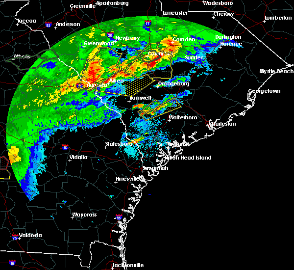 At 246 pm edt, a severe thunderstorm was located 10 miles north of hampton, moving northeast at 40 mph (radar indicated). Hazards include 60 mph wind gusts and quarter size hail. Hail damage to vehicles is expected. Expect wind damage to roofs, siding, and trees. At 246 pm edt, a severe thunderstorm was located 10 miles north of hampton, moving northeast at 40 mph (radar indicated). Hazards include 60 mph wind gusts and quarter size hail. Hail damage to vehicles is expected. Expect wind damage to roofs, siding, and trees.
|
| 4/3/2017 4:59 PM EDT |
 At 459 pm edt, a severe thunderstorm was located 9 miles east of hampton, moving northeast at 35 mph (radar indicated). Hazards include 60 mph wind gusts and quarter size hail. Hail damage to vehicles is expected. Expect wind damage to roofs, siding, and trees. At 459 pm edt, a severe thunderstorm was located 9 miles east of hampton, moving northeast at 35 mph (radar indicated). Hazards include 60 mph wind gusts and quarter size hail. Hail damage to vehicles is expected. Expect wind damage to roofs, siding, and trees.
|
| 3/22/2017 12:23 AM EDT |
 At 1223 am edt, severe thunderstorms were located along a line extending from 13 miles northeast of hampton to 11 miles northwest of ridgeland, moving east at 40 mph (radar indicated). Hazards include 60 mph wind gusts. Expect damage to roofs, siding, and trees. Locations impacted include, hampton, lake warren state park, colleton, varnville, estill, furman, scotia and smoaks. At 1223 am edt, severe thunderstorms were located along a line extending from 13 miles northeast of hampton to 11 miles northwest of ridgeland, moving east at 40 mph (radar indicated). Hazards include 60 mph wind gusts. Expect damage to roofs, siding, and trees. Locations impacted include, hampton, lake warren state park, colleton, varnville, estill, furman, scotia and smoaks.
|
| 3/22/2017 12:15 AM EDT |
 At 1215 am edt, severe thunderstorms were located along a line extending from 14 miles northeast of hampton to 12 miles northwest of ridgeland, moving east at 60 mph (radar indicated). Hazards include 60 mph wind gusts. Expect damage to roofs, siding, and trees. Locations impacted include, hampton, lake warren state park, colleton, varnville, estill, brunson, furman and scotia. At 1215 am edt, severe thunderstorms were located along a line extending from 14 miles northeast of hampton to 12 miles northwest of ridgeland, moving east at 60 mph (radar indicated). Hazards include 60 mph wind gusts. Expect damage to roofs, siding, and trees. Locations impacted include, hampton, lake warren state park, colleton, varnville, estill, brunson, furman and scotia.
|
| 3/21/2017 11:57 PM EDT |
 At 1157 pm edt, severe thunderstorms were located along a line extending from 6 miles east of allendale to 15 miles southeast of sylvania, moving east at 60 mph (radar indicated). Hazards include 60 mph wind gusts and penny size hail. expect damage to roofs, siding, and trees At 1157 pm edt, severe thunderstorms were located along a line extending from 6 miles east of allendale to 15 miles southeast of sylvania, moving east at 60 mph (radar indicated). Hazards include 60 mph wind gusts and penny size hail. expect damage to roofs, siding, and trees
|
| 2/15/2017 11:45 AM EST |
 At 1144 am est, severe thunderstorms were located along a line extending from 18 miles north of saint george to 6 miles northwest of indian field to 12 miles southeast of bamberg, moving east at 105 mph (radar indicated). Hazards include 60 mph wind gusts and quarter size hail. Hail damage to vehicles is expected. Expect wind damage to roofs, siding, and trees. At 1144 am est, severe thunderstorms were located along a line extending from 18 miles north of saint george to 6 miles northwest of indian field to 12 miles southeast of bamberg, moving east at 105 mph (radar indicated). Hazards include 60 mph wind gusts and quarter size hail. Hail damage to vehicles is expected. Expect wind damage to roofs, siding, and trees.
|
| 1/21/2017 3:56 PM EST |
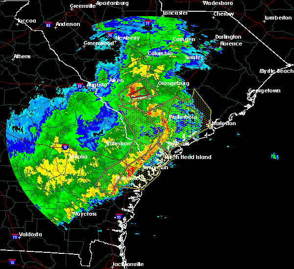 At 356 pm est, severe thunderstorms were located along a line extending from 16 miles southeast of bamberg to 10 miles south of walterboro to near port royal, moving east at 65 mph (radar indicated). Hazards include 60 mph wind gusts. expect damage to roofs, siding, and trees At 356 pm est, severe thunderstorms were located along a line extending from 16 miles southeast of bamberg to 10 miles south of walterboro to near port royal, moving east at 65 mph (radar indicated). Hazards include 60 mph wind gusts. expect damage to roofs, siding, and trees
|
| 1/21/2017 3:31 PM EST |
 At 330 pm est, severe thunderstorms were located along a line extending from 14 miles northeast of hampton to near ridgeland to 7 miles east of hinesville, moving east at 65 mph (radar indicated). Hazards include 60 mph wind gusts and penny size hail. Expect damage to roofs, siding, and trees. locations impacted include, hinesville, ridgeland, allendale, springfield, hampton, pembroke, ludowici and yemassee. A tornado watch remains in effect until 700 pm est for southeastern georgia, and southeastern south carolina. At 330 pm est, severe thunderstorms were located along a line extending from 14 miles northeast of hampton to near ridgeland to 7 miles east of hinesville, moving east at 65 mph (radar indicated). Hazards include 60 mph wind gusts and penny size hail. Expect damage to roofs, siding, and trees. locations impacted include, hinesville, ridgeland, allendale, springfield, hampton, pembroke, ludowici and yemassee. A tornado watch remains in effect until 700 pm est for southeastern georgia, and southeastern south carolina.
|
| 1/21/2017 3:06 PM EST |
 At 304 pm est, severe thunderstorms were located along a line extending from 9 miles west of allendale to 12 miles northwest of springfield to 14 miles northwest of ludowici, moving east at 65 mph (radar indicated). Hazards include 60 mph wind gusts and penny size hail. expect damage to roofs, siding, and trees At 304 pm est, severe thunderstorms were located along a line extending from 9 miles west of allendale to 12 miles northwest of springfield to 14 miles northwest of ludowici, moving east at 65 mph (radar indicated). Hazards include 60 mph wind gusts and penny size hail. expect damage to roofs, siding, and trees
|
| 8/18/2016 5:33 PM EDT |
 At 532 pm edt, a severe thunderstorm was located 16 miles northwest of walterboro, moving east at 10 mph (radar indicated). Hazards include 60 mph wind gusts and quarter size hail. Hail damage to vehicles is expected. Expect wind damage to roofs, siding, and trees. At 532 pm edt, a severe thunderstorm was located 16 miles northwest of walterboro, moving east at 10 mph (radar indicated). Hazards include 60 mph wind gusts and quarter size hail. Hail damage to vehicles is expected. Expect wind damage to roofs, siding, and trees.
|
| 7/20/2016 4:44 PM EDT |
 At 443 pm edt, severe thunderstorms were located along a line extending from 8 miles southeast of hampton to yemassee, moving south at 20 mph (radar indicated). Hazards include 60 mph wind gusts and quarter size hail. Hail damage to vehicles is expected. expect wind damage to roofs, siding, and trees. Locations impacted include, colleton, lodge, williams, miley, islandton, crocketville, ruffin and ashton. At 443 pm edt, severe thunderstorms were located along a line extending from 8 miles southeast of hampton to yemassee, moving south at 20 mph (radar indicated). Hazards include 60 mph wind gusts and quarter size hail. Hail damage to vehicles is expected. expect wind damage to roofs, siding, and trees. Locations impacted include, colleton, lodge, williams, miley, islandton, crocketville, ruffin and ashton.
|
| 7/20/2016 4:09 PM EDT | Trained spotter reported trees down at a business along confederate highway. time was estimated from radar dat in colleton county SC, 3 miles NNE of Lodge, SC |
| 7/20/2016 4:06 PM EDT |
 At 406 pm edt, severe thunderstorms were located along a line extending from 12 miles northeast of hampton to 11 miles west of walterboro, moving south at 20 mph (radar indicated). Hazards include 60 mph wind gusts and quarter size hail. Hail damage to vehicles is expected. Expect wind damage to roofs, siding, and trees. At 406 pm edt, severe thunderstorms were located along a line extending from 12 miles northeast of hampton to 11 miles west of walterboro, moving south at 20 mph (radar indicated). Hazards include 60 mph wind gusts and quarter size hail. Hail damage to vehicles is expected. Expect wind damage to roofs, siding, and trees.
|
| 7/9/2016 1:22 AM EDT |
 At 120 am edt, severe thunderstorms were located along a line extending from 6 miles east of indian field to near allendale, moving southeast at 40 mph (radar indicated). Hazards include 60 mph wind gusts and nickel size hail. Expect damage to roofs. siding. and trees. Locations impacted include, walterboro, allendale, hampton, saint george, indian field, lake warren state park, williams. At 120 am edt, severe thunderstorms were located along a line extending from 6 miles east of indian field to near allendale, moving southeast at 40 mph (radar indicated). Hazards include 60 mph wind gusts and nickel size hail. Expect damage to roofs. siding. and trees. Locations impacted include, walterboro, allendale, hampton, saint george, indian field, lake warren state park, williams.
|
| 7/9/2016 12:53 AM EDT |
 At 1252 am edt, a severe thunderstorm was located 11 miles south of savannah river site, moving southeast at 45 mph (radar indicated). Hazards include 60 mph wind gusts and nickel size hail. Expect damage to roofs. siding. And trees. At 1252 am edt, a severe thunderstorm was located 11 miles south of savannah river site, moving southeast at 45 mph (radar indicated). Hazards include 60 mph wind gusts and nickel size hail. Expect damage to roofs. siding. And trees.
|
| 6/17/2016 4:08 PM EDT |
 At 407 pm edt, severe thunderstorms were located along a line extending from near lake warren state park to 7 miles northeast of walterboro, moving southeast at 20 mph (radar indicated). Hazards include 60 mph wind gusts and quarter size hail. Hail damage to vehicles is expected. Expect wind damage to roofs, siding, and trees. At 407 pm edt, severe thunderstorms were located along a line extending from near lake warren state park to 7 miles northeast of walterboro, moving southeast at 20 mph (radar indicated). Hazards include 60 mph wind gusts and quarter size hail. Hail damage to vehicles is expected. Expect wind damage to roofs, siding, and trees.
|
| 6/17/2016 3:58 PM EDT |
 At 357 pm edt, severe thunderstorms were located along a line extending from 8 miles east of allendale to 13 miles north of sylvania, moving east at 40 mph (radar indicated). Hazards include 70 mph wind gusts and quarter size hail. Hail damage to vehicles is expected. expect considerable tree damage. wind damage is also likely to mobile homes, roofs, and outbuildings. Locations impacted include, allendale, hampton, lake warren state park, colleton, varnville, estill, fairfax, barton, rouse, dukes and brunson. At 357 pm edt, severe thunderstorms were located along a line extending from 8 miles east of allendale to 13 miles north of sylvania, moving east at 40 mph (radar indicated). Hazards include 70 mph wind gusts and quarter size hail. Hail damage to vehicles is expected. expect considerable tree damage. wind damage is also likely to mobile homes, roofs, and outbuildings. Locations impacted include, allendale, hampton, lake warren state park, colleton, varnville, estill, fairfax, barton, rouse, dukes and brunson.
|
| 6/17/2016 3:40 PM EDT |
 At 339 pm edt, a severe thunderstorm was located near allendale, moving southeast at 25 mph (radar indicated). Hazards include 60 mph wind gusts and quarter size hail. Hail damage to vehicles is expected. expect wind damage to roofs, siding, and trees. Locations impacted include, allendale, hampton, lake warren state park, colleton, varnville, estill, fairfax and brunson. At 339 pm edt, a severe thunderstorm was located near allendale, moving southeast at 25 mph (radar indicated). Hazards include 60 mph wind gusts and quarter size hail. Hail damage to vehicles is expected. expect wind damage to roofs, siding, and trees. Locations impacted include, allendale, hampton, lake warren state park, colleton, varnville, estill, fairfax and brunson.
|
| 6/17/2016 3:23 PM EDT |
 At 322 pm edt, a severe thunderstorm was located 12 miles northwest of allendale, moving southeast at 25 mph (radar indicated). Hazards include 60 mph wind gusts and quarter size hail. Hail damage to vehicles is expected. Expect wind damage to roofs, siding, and trees. At 322 pm edt, a severe thunderstorm was located 12 miles northwest of allendale, moving southeast at 25 mph (radar indicated). Hazards include 60 mph wind gusts and quarter size hail. Hail damage to vehicles is expected. Expect wind damage to roofs, siding, and trees.
|
| 6/5/2016 7:09 PM EDT |
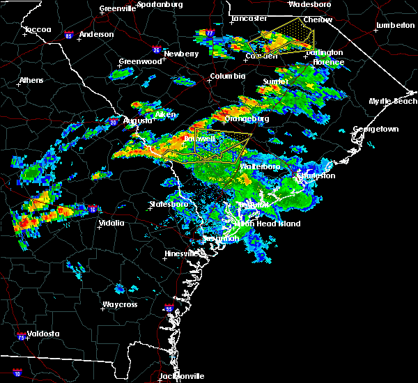 The severe thunderstorm warning for dorchester, allendale and colleton counties will expire at 715 pm edt, the storm which prompted the warning has moved out of the area. therefore the warning will be allowed to expire. to report severe weather, contact your nearest law enforcement agency. they will relay your report to the national weather service charleston. The severe thunderstorm warning for dorchester, allendale and colleton counties will expire at 715 pm edt, the storm which prompted the warning has moved out of the area. therefore the warning will be allowed to expire. to report severe weather, contact your nearest law enforcement agency. they will relay your report to the national weather service charleston.
|
| 6/5/2016 6:52 PM EDT |
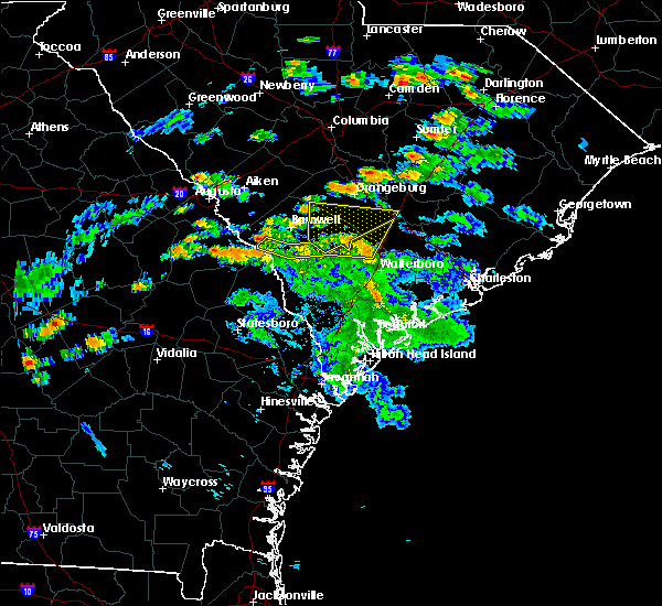 At 651 pm edt, a severe thunderstorm was located 11 miles west of saint george, moving northeast at 40 mph (radar indicated. also, these thunderstorms have a history of wind damage including downed trees). Hazards include 60 mph wind gusts and penny size hail. Expect damage to roofs. siding. and trees. Locations impacted include, allendale, colleton, reevesville, sycamore, smoaks, lodge, williams and ulmer. At 651 pm edt, a severe thunderstorm was located 11 miles west of saint george, moving northeast at 40 mph (radar indicated. also, these thunderstorms have a history of wind damage including downed trees). Hazards include 60 mph wind gusts and penny size hail. Expect damage to roofs. siding. and trees. Locations impacted include, allendale, colleton, reevesville, sycamore, smoaks, lodge, williams and ulmer.
|
| 6/5/2016 6:37 PM EDT |
 At 637 pm edt, a severe thunderstorm was located 14 miles northwest of walterboro, moving northeast at 40 mph (radar indicated). Hazards include 60 mph wind gusts and penny size hail. Expect damage to roofs. siding. and trees. Locations impacted include, allendale, colleton, fairfax, brunson, reevesville, sycamore, smoaks and lodge. At 637 pm edt, a severe thunderstorm was located 14 miles northwest of walterboro, moving northeast at 40 mph (radar indicated). Hazards include 60 mph wind gusts and penny size hail. Expect damage to roofs. siding. and trees. Locations impacted include, allendale, colleton, fairfax, brunson, reevesville, sycamore, smoaks and lodge.
|
| 6/5/2016 6:19 PM EDT |
 At 619 pm edt, severe thunderstorms were located along a line extending from near allendale to 12 miles east of hampton, moving north at 45 mph (radar indicated). Hazards include 70 mph wind gusts and quarter size hail. Hail damage to vehicles is expected. expect considerable tree damage. wind damage is also likely to mobile homes, roofs, and outbuildings. Locations impacted include, allendale, hampton, lake warren state park, colleton, varnville, fairfax, brunson and gifford. At 619 pm edt, severe thunderstorms were located along a line extending from near allendale to 12 miles east of hampton, moving north at 45 mph (radar indicated). Hazards include 70 mph wind gusts and quarter size hail. Hail damage to vehicles is expected. expect considerable tree damage. wind damage is also likely to mobile homes, roofs, and outbuildings. Locations impacted include, allendale, hampton, lake warren state park, colleton, varnville, fairfax, brunson and gifford.
|
| 6/5/2016 6:11 PM EDT |
 At 611 pm edt, severe thunderstorms were located along a line extending from near allendale to 10 miles east of hampton, moving north at 45 mph (radar indicated). Hazards include 60 mph wind gusts and penny size hail. Expect damage to roofs. siding. And trees. At 611 pm edt, severe thunderstorms were located along a line extending from near allendale to 10 miles east of hampton, moving north at 45 mph (radar indicated). Hazards include 60 mph wind gusts and penny size hail. Expect damage to roofs. siding. And trees.
|
| 5/12/2016 10:20 PM EDT |
 The severe thunderstorm warning for hampton, allendale and colleton counties will expire at 1030 pm edt, the storm which prompted the warning has weakened below severe limits, and no longer pose an immediate threat to life or property. therefore the warning will be allowed to expire. however gusty winds are still possible with this thunderstorm. to report severe weather, contact your nearest law enforcement agency. they will relay your report to the national weather service charleston. The severe thunderstorm warning for hampton, allendale and colleton counties will expire at 1030 pm edt, the storm which prompted the warning has weakened below severe limits, and no longer pose an immediate threat to life or property. therefore the warning will be allowed to expire. however gusty winds are still possible with this thunderstorm. to report severe weather, contact your nearest law enforcement agency. they will relay your report to the national weather service charleston.
|
| 5/12/2016 10:07 PM EDT |
 At 1006 pm edt, a severe thunderstorm was located over lake warren state park, moving east at 35 mph (radar indicated). Hazards include 60 mph wind gusts. Expect damage to roofs. siding. and trees. Locations impacted include, allendale, hampton, lake warren state park, colleton, varnville, estill, fairfax and brunson. At 1006 pm edt, a severe thunderstorm was located over lake warren state park, moving east at 35 mph (radar indicated). Hazards include 60 mph wind gusts. Expect damage to roofs. siding. and trees. Locations impacted include, allendale, hampton, lake warren state park, colleton, varnville, estill, fairfax and brunson.
|
| 5/12/2016 9:51 PM EDT |
 At 951 pm edt, a severe thunderstorm was located 9 miles west of lake warren state park, moving east at 40 mph (radar indicated). Hazards include 60 mph wind gusts. Expect damage to roofs. siding. And trees. At 951 pm edt, a severe thunderstorm was located 9 miles west of lake warren state park, moving east at 40 mph (radar indicated). Hazards include 60 mph wind gusts. Expect damage to roofs. siding. And trees.
|
| 5/3/2016 4:05 PM EDT |
 At 405 pm edt, a severe thunderstorm was located 11 miles south of savannah river site, moving east at 45 mph (radar indicated). Hazards include ping pong ball size hail and 60 mph wind gusts. People and animals outdoors will be injured. expect hail damage to roofs, siding, windows, and vehicles. Expect wind damage to roofs, siding, and trees. At 405 pm edt, a severe thunderstorm was located 11 miles south of savannah river site, moving east at 45 mph (radar indicated). Hazards include ping pong ball size hail and 60 mph wind gusts. People and animals outdoors will be injured. expect hail damage to roofs, siding, windows, and vehicles. Expect wind damage to roofs, siding, and trees.
|
| 8/22/2015 4:41 PM EDT |
 The severe thunderstorm warning for hampton and colleton counties will expire at 445 pm edt, the storms which prompted the warning have weakened below severe limits, and no longer pose an immediate threat to life or property. therefore the warning will be allowed to expire. however heavy rain is still possible with these thunderstorms. to report severe weather, contact your nearest law enforcement agency. they will relay your report to the national weather service charleston. The severe thunderstorm warning for hampton and colleton counties will expire at 445 pm edt, the storms which prompted the warning have weakened below severe limits, and no longer pose an immediate threat to life or property. therefore the warning will be allowed to expire. however heavy rain is still possible with these thunderstorms. to report severe weather, contact your nearest law enforcement agency. they will relay your report to the national weather service charleston.
|
| 8/22/2015 4:22 PM EDT |
 At 422 pm edt, severe thunderstorms were located along a line extending from 8 miles north of hampton to near lake warren state park, and are nearly stationary (radar indicated). Hazards include 60 mph wind gusts. Expect damage to roofs. siding and trees. Locations impacted include, hampton, lake warren state park, colleton, varnville, fairfax, brunson, gifford and luray. At 422 pm edt, severe thunderstorms were located along a line extending from 8 miles north of hampton to near lake warren state park, and are nearly stationary (radar indicated). Hazards include 60 mph wind gusts. Expect damage to roofs. siding and trees. Locations impacted include, hampton, lake warren state park, colleton, varnville, fairfax, brunson, gifford and luray.
|
| 8/22/2015 4:16 PM EDT |
 At 416 pm edt, severe thunderstorms were located along a line extending from 8 miles north of hampton to near lake warren state park, moving southeast at 25 mph (radar indicated). Hazards include 60 mph wind gusts. Expect damage to roofs. siding and trees. Locations impacted include, allendale, hampton, lake warren state park, colleton, varnville, fairfax, brunson and gifford. At 416 pm edt, severe thunderstorms were located along a line extending from 8 miles north of hampton to near lake warren state park, moving southeast at 25 mph (radar indicated). Hazards include 60 mph wind gusts. Expect damage to roofs. siding and trees. Locations impacted include, allendale, hampton, lake warren state park, colleton, varnville, fairfax, brunson and gifford.
|
| 8/22/2015 3:49 PM EDT |
 At 349 pm edt, severe thunderstorms were located along a line extending from 7 miles northeast of allendale to 15 miles northwest of lake warren state park, moving southeast at 25 mph (radar indicated). Hazards include 60 mph wind gusts. Expect damage to roofs. Siding and trees. At 349 pm edt, severe thunderstorms were located along a line extending from 7 miles northeast of allendale to 15 miles northwest of lake warren state park, moving southeast at 25 mph (radar indicated). Hazards include 60 mph wind gusts. Expect damage to roofs. Siding and trees.
|
| 7/18/2015 9:27 PM EDT |
 At 926 pm edt, severe thunderstorms were located along a line extending from 9 miles west of saint george to near allendale, moving southeast at 15 mph (radar indicated). Hazards include 60 mph wind gusts. Expect damage to roofs. siding and trees. Locations impacted include, walterboro, hampton, lake warren state park, colleton, varnville, estill, fairfax and brunson. At 926 pm edt, severe thunderstorms were located along a line extending from 9 miles west of saint george to near allendale, moving southeast at 15 mph (radar indicated). Hazards include 60 mph wind gusts. Expect damage to roofs. siding and trees. Locations impacted include, walterboro, hampton, lake warren state park, colleton, varnville, estill, fairfax and brunson.
|
| 7/18/2015 8:51 PM EDT |
 At 850 pm edt, a severe thunderstorm was located 7 miles northeast of allendale, moving southeast at 25 mph (radar indicated). Hazards include 60 mph wind gusts and nickel size hail. Expect damage to roofs. Siding and trees. At 850 pm edt, a severe thunderstorm was located 7 miles northeast of allendale, moving southeast at 25 mph (radar indicated). Hazards include 60 mph wind gusts and nickel size hail. Expect damage to roofs. Siding and trees.
|
| 7/3/2015 1:47 PM EDT |
 At 146 pm edt, severe thunderstorms were located along a line extending from near ashton to 6 miles southwest of cross, moving east at 40 mph (radar indicated). Hazards include 60 mph wind gusts. Expect damage to roofs. siding and trees. Locations impacted include, harleyville, smoaks, canadys, cat hole, , williams, ruffin, islandton, summerville, moncks corner, walterboro, saint george, givhans ferry state park and indian field. At 146 pm edt, severe thunderstorms were located along a line extending from near ashton to 6 miles southwest of cross, moving east at 40 mph (radar indicated). Hazards include 60 mph wind gusts. Expect damage to roofs. siding and trees. Locations impacted include, harleyville, smoaks, canadys, cat hole, , williams, ruffin, islandton, summerville, moncks corner, walterboro, saint george, givhans ferry state park and indian field.
|
| 7/3/2015 1:30 PM EDT |
 At 130 pm edt, severe thunderstorms were located along a line extending from 6 miles northwest of lodge to near holly hill, moving east at 35 mph (radar indicated). Hazards include 60 mph wind gusts. Expect damage to roofs. siding and trees. Locations impacted include, harleyville, smoaks, canadys, summerville, moncks corner, walterboro, saint george, givhans ferry state park and indian field. At 130 pm edt, severe thunderstorms were located along a line extending from 6 miles northwest of lodge to near holly hill, moving east at 35 mph (radar indicated). Hazards include 60 mph wind gusts. Expect damage to roofs. siding and trees. Locations impacted include, harleyville, smoaks, canadys, summerville, moncks corner, walterboro, saint george, givhans ferry state park and indian field.
|
| 7/3/2015 1:17 PM EDT |
 At 116 pm edt, severe thunderstorms were located along a line extending from near ulmer to 6 miles north of indian field, moving east at 35 mph (radar indicated). Hazards include 60 mph wind gusts. Expect damage to roofs. Siding and trees. At 116 pm edt, severe thunderstorms were located along a line extending from near ulmer to 6 miles north of indian field, moving east at 35 mph (radar indicated). Hazards include 60 mph wind gusts. Expect damage to roofs. Siding and trees.
|
| 7/2/2015 6:44 PM EDT |
 At 642 pm edt, severe thunderstorms were located along a line extending from ashton to scotia to near stilson, moving east at 30 mph (radar indicated). Hazards include 60 mph wind gusts. Expect damage to roofs. siding and trees. Locations impacted include, walterboro, ridgeland, springfield, hampton, yemassee, islandton, varnville, lake warren state park, ashton, kildare, oaky, shawnee and pineland. At 642 pm edt, severe thunderstorms were located along a line extending from ashton to scotia to near stilson, moving east at 30 mph (radar indicated). Hazards include 60 mph wind gusts. Expect damage to roofs. siding and trees. Locations impacted include, walterboro, ridgeland, springfield, hampton, yemassee, islandton, varnville, lake warren state park, ashton, kildare, oaky, shawnee and pineland.
|
| 7/2/2015 6:21 PM EDT |
 At 620 pm edt, severe thunderstorms were located along a line extending from near sycamore to near shirley to near denmark, moving east at 40 mph (radar indicated). Hazards include 60 mph wind gusts and penny size hail. Expect damage to roofs. Siding and trees. At 620 pm edt, severe thunderstorms were located along a line extending from near sycamore to near shirley to near denmark, moving east at 40 mph (radar indicated). Hazards include 60 mph wind gusts and penny size hail. Expect damage to roofs. Siding and trees.
|
| 6/30/2015 5:49 PM EDT |
 At 548 pm edt, severe thunderstorms were scattered along a line extending from near reevesville to near white hall, moving east at 30 mph (radar indicated). Hazards include 60 mph wind gusts and penny size hail. Expect damage to roofs. siding and trees. Locations impacted include, walterboro, yemassee, saint george and indian field. At 548 pm edt, severe thunderstorms were scattered along a line extending from near reevesville to near white hall, moving east at 30 mph (radar indicated). Hazards include 60 mph wind gusts and penny size hail. Expect damage to roofs. siding and trees. Locations impacted include, walterboro, yemassee, saint george and indian field.
|
| 6/30/2015 5:26 PM EDT |
 At 526 pm edt, severe thunderstorms were located along a line extending from near branchville to almeda intersection, moving east at 25 mph (radar indicated). Hazards include 60 mph wind gusts. Expect damage to roofs. Siding and trees. At 526 pm edt, severe thunderstorms were located along a line extending from near branchville to almeda intersection, moving east at 25 mph (radar indicated). Hazards include 60 mph wind gusts. Expect damage to roofs. Siding and trees.
|
| 6/24/2015 11:09 PM EDT |
 The severe thunderstorm warning for colleton and hampton counties will expire at 1115 pm edt, the storm which prompted the warning has moved out of the area. therefore the warning will be allowed to expire. The severe thunderstorm warning for colleton and hampton counties will expire at 1115 pm edt, the storm which prompted the warning has moved out of the area. therefore the warning will be allowed to expire.
|
| 6/24/2015 10:47 PM EDT |
 At 1046 pm edt, a severe thunderstorm was located near ashton, or 11 miles northeast of hampton, moving west at 10 mph (radar indicated). Hazards include 60 mph wind gusts and penny size hail. Expect damage to roofs. siding and trees. Locations impacted include, hampton. At 1046 pm edt, a severe thunderstorm was located near ashton, or 11 miles northeast of hampton, moving west at 10 mph (radar indicated). Hazards include 60 mph wind gusts and penny size hail. Expect damage to roofs. siding and trees. Locations impacted include, hampton.
|
| 6/24/2015 10:25 PM EDT |
 At 1024 pm edt, a severe thunderstorm was located over ashton, or 13 miles northeast of hampton, moving northeast at 20 mph (radar indicated). Hazards include 60 mph wind gusts and quarter size hail. Hail damage to vehicles is expected. Expect wind damage to roofs, siding and trees. At 1024 pm edt, a severe thunderstorm was located over ashton, or 13 miles northeast of hampton, moving northeast at 20 mph (radar indicated). Hazards include 60 mph wind gusts and quarter size hail. Hail damage to vehicles is expected. Expect wind damage to roofs, siding and trees.
|
| 4/19/2015 5:24 PM EDT | The severe thunderstorm warning for colleton and hampton counties will expire at 530 pm edt, the line of storms which prompted the warning have moved out of the area. therefore the warning will be allowed to expire. however gusty winds are still possible with these thunderstorms. another severe thunderstorm warning remains in effect for colleton county until 615 pm. a tornado watch remains in effect until 800 pm edt for southeastern south carolina. |
| 4/19/2015 5:02 PM EDT | At 501 pm edt, severe thunderstorms were located along a line extending from near padgetts to near mcphersonville, moving northeast at 45 mph (radar indicated). Hazards include 60 mph wind gusts. Expect damage to roofs. siding and trees. locations impacted include, walterboro. a tornado watch remains in effect until 800 pm edt for southeastern south carolina. 75in. |
| 4/19/2015 4:36 PM EDT | At 435 pm edt, severe thunderstorms were located along a line extending from near ulmer to near robertville, moving east at 60 mph (radar indicated. at 430 pm edt...law enforcement reported trees blow down near allendale). Hazards include 60 mph wind gusts. Expect damage to roofs. Siding and trees. |
| 9/3/2013 5:45 PM EDT | Highway patrol reported tree down at 4500 block of willow swamp roa in colleton county SC, 3.5 miles NNW of Lodge, SC |
| 6/19/2013 4:17 PM EDT | Tree down reported at the intersection of cayce road and willow swamp roa in colleton county SC, 5.6 miles NNW of Lodge, SC |
| 4/19/2013 6:05 PM EDT | Trees down near the intersection of cayce road and moselle roa in colleton county SC, 6.6 miles NE of Lodge, SC |
| 1/1/0001 12:00 AM | Tree down at bells and confederate highwa in colleton county SC, 0.3 miles WSW of Lodge, SC |
Hail Maps for Lodge, SC


Connect with Interactive Hail Maps