

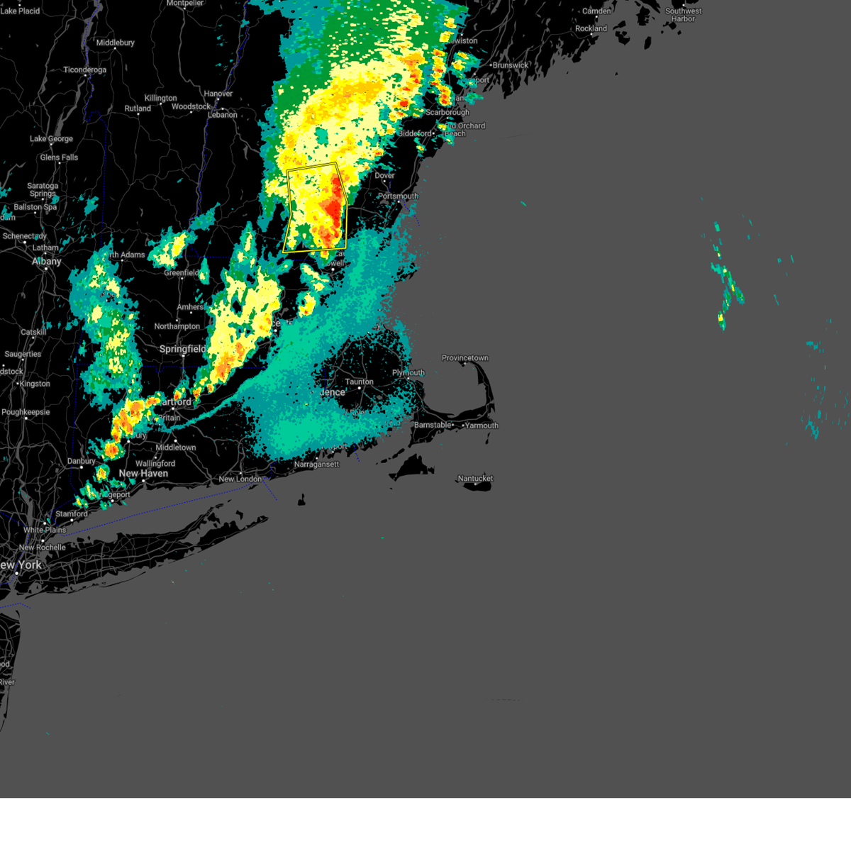
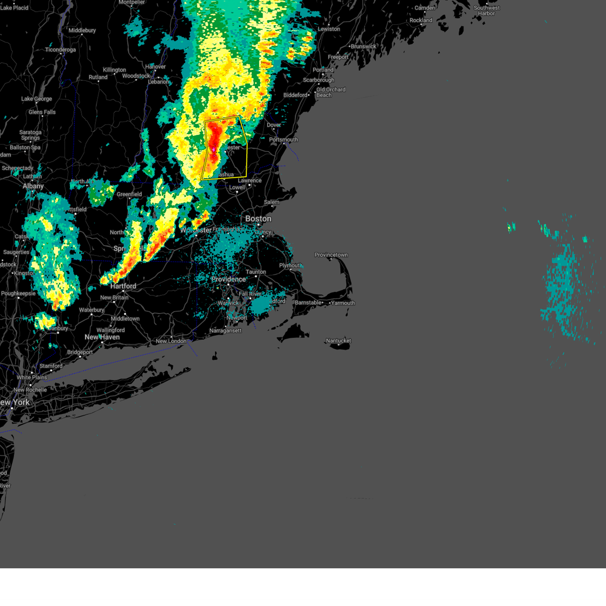
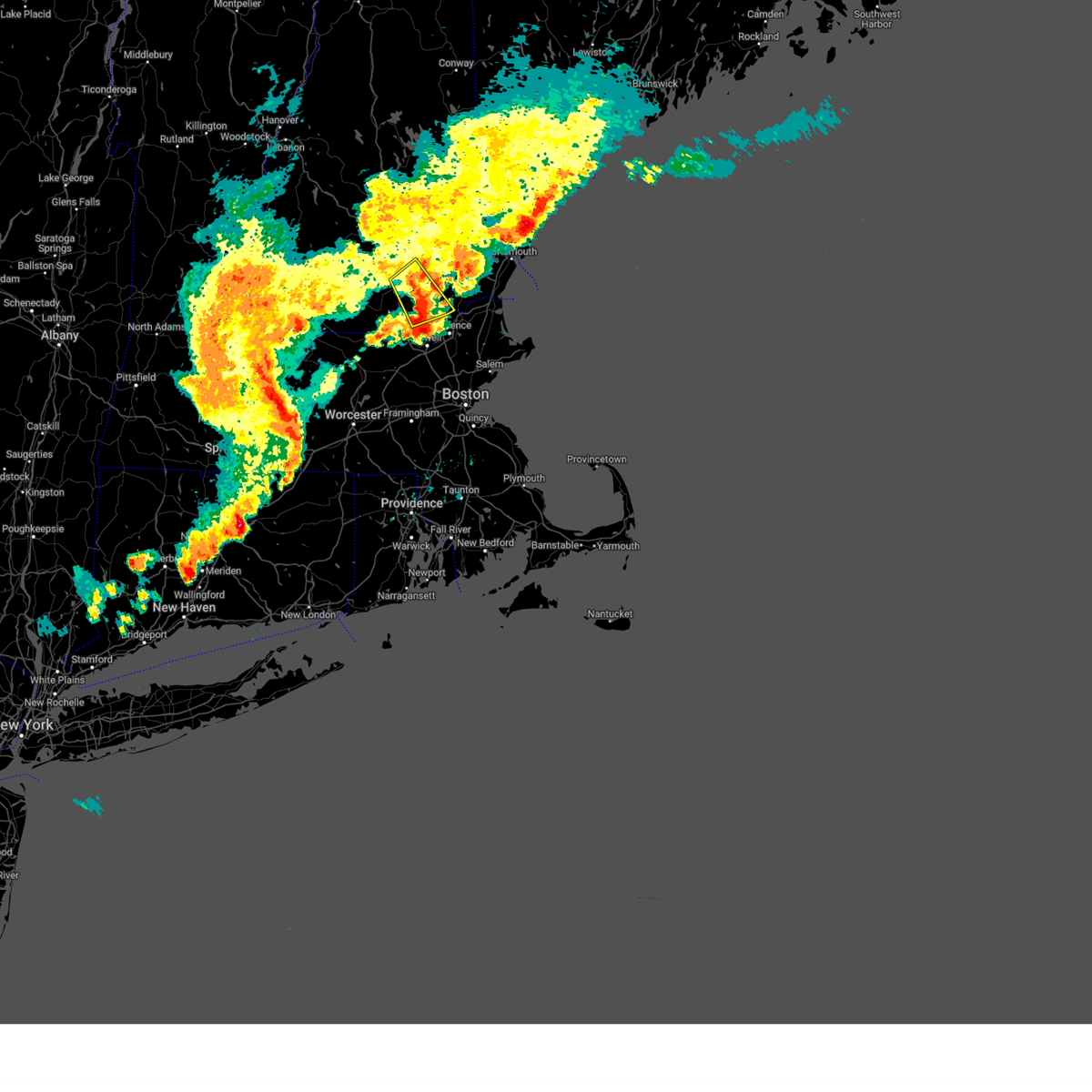
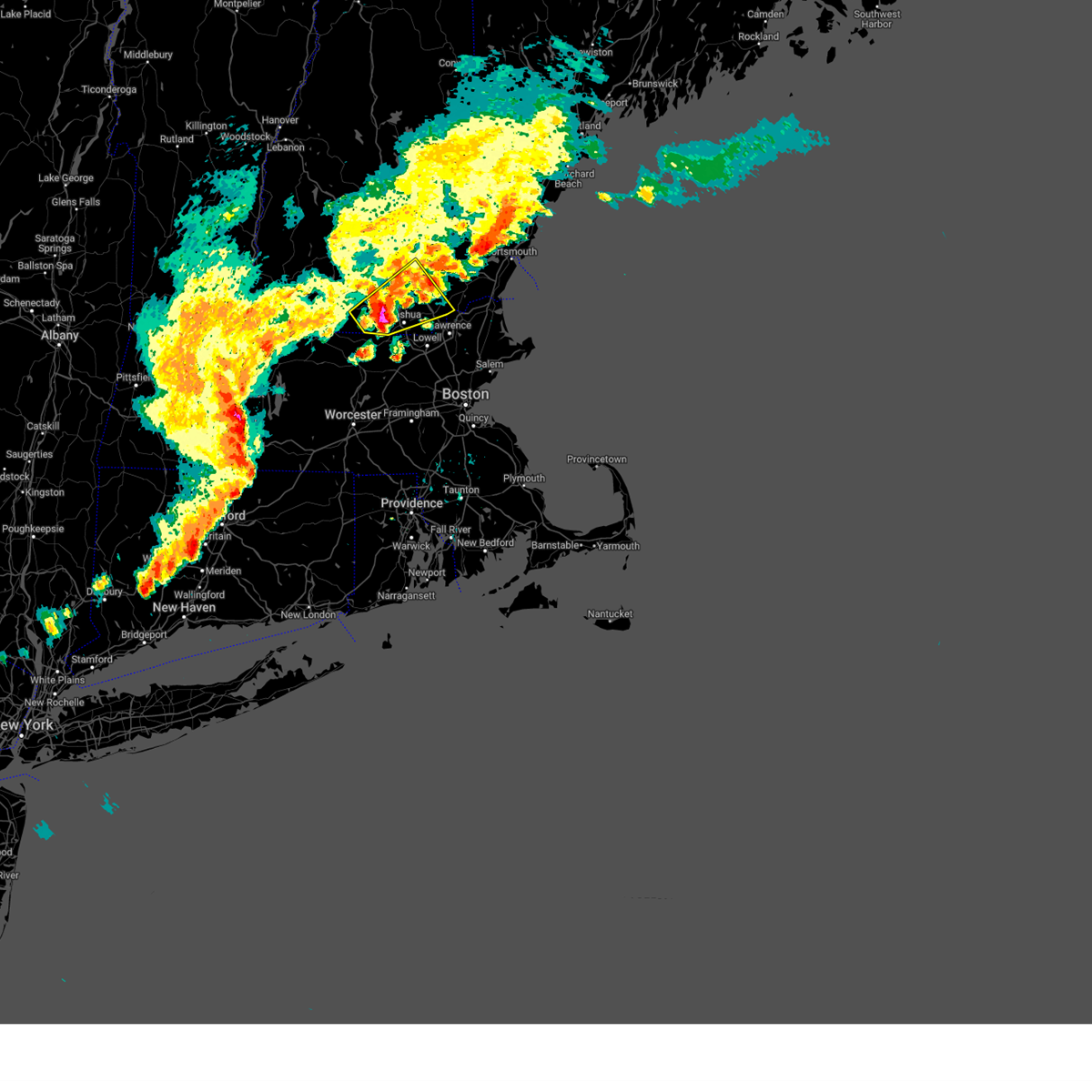
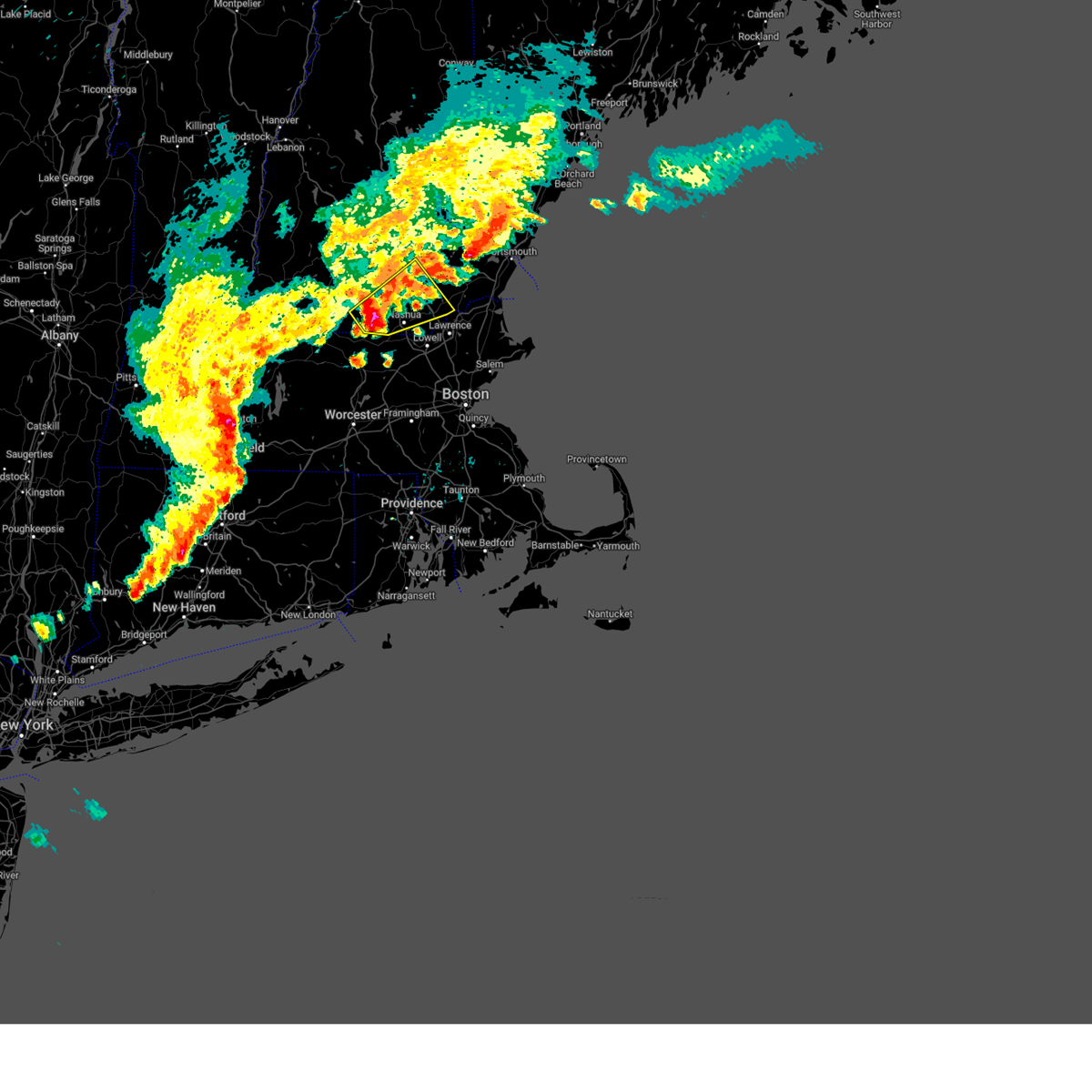
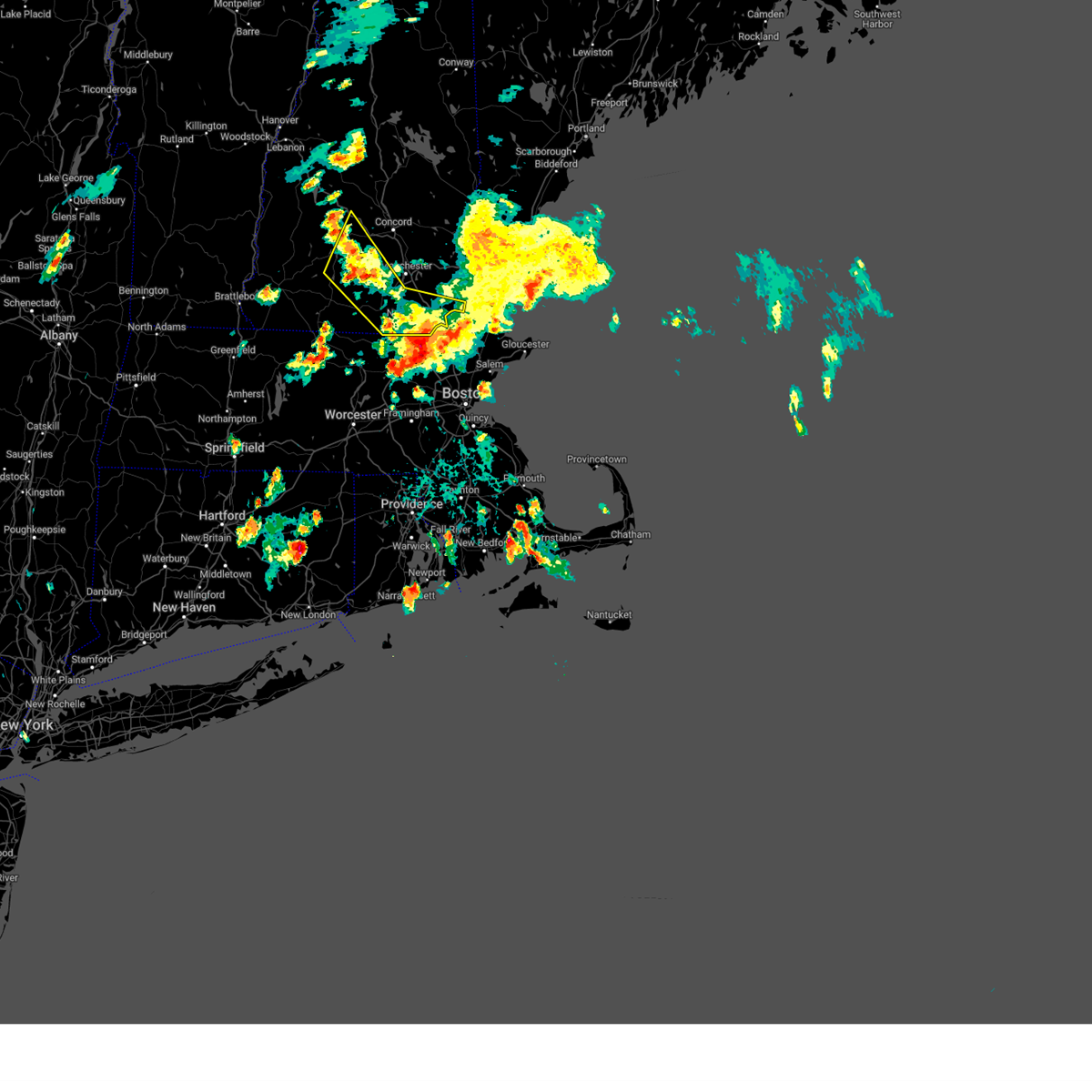
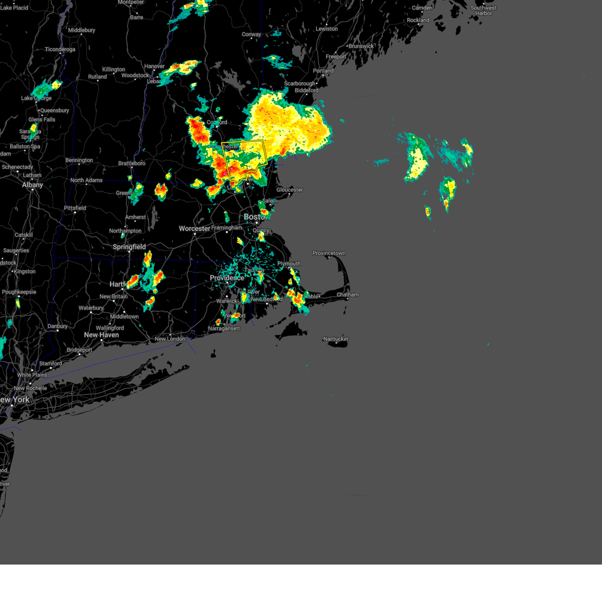
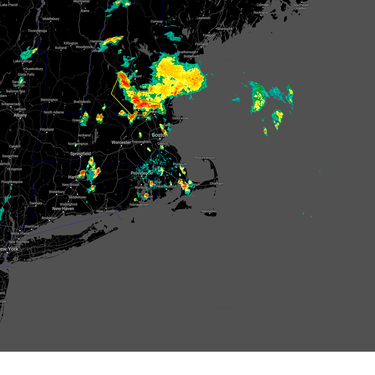
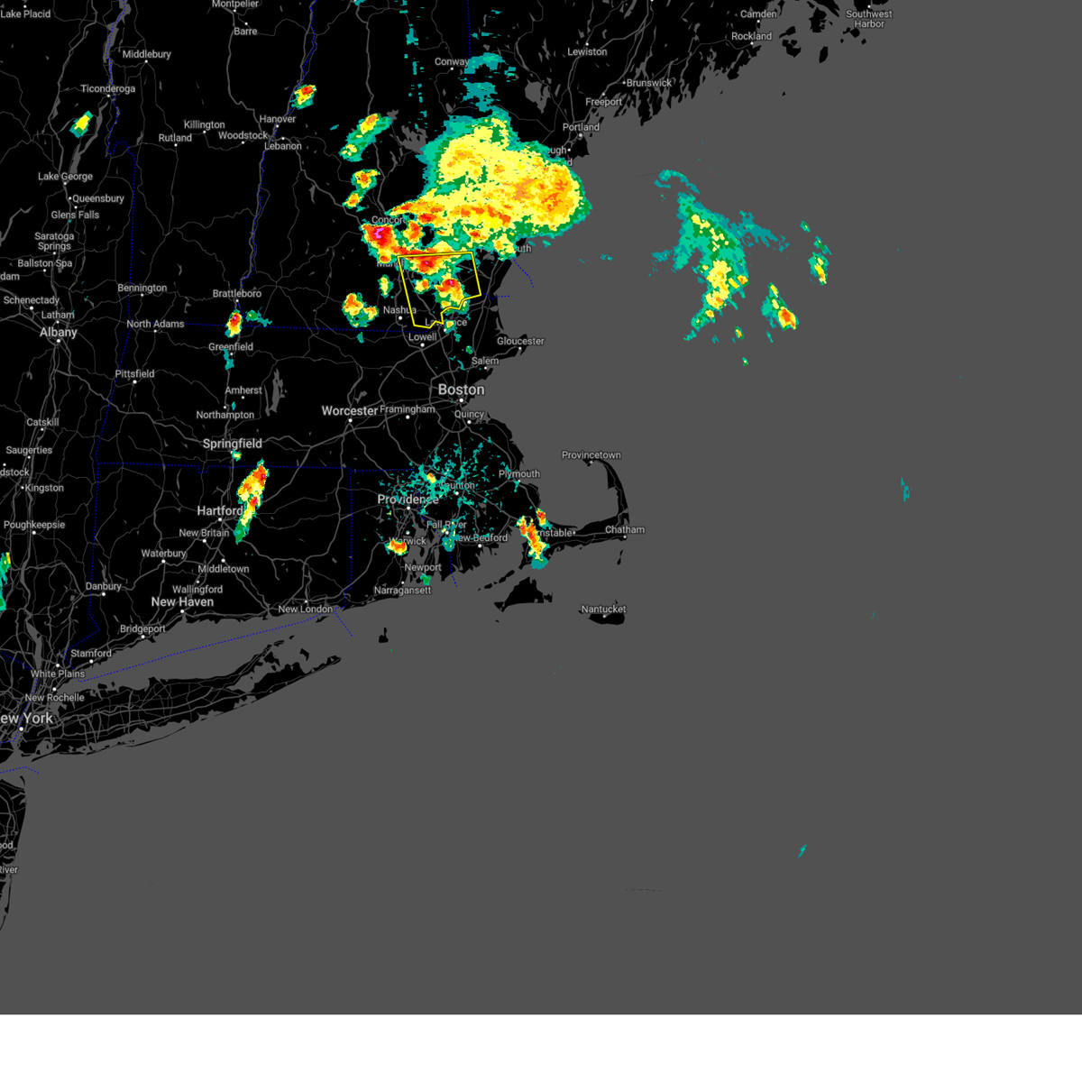
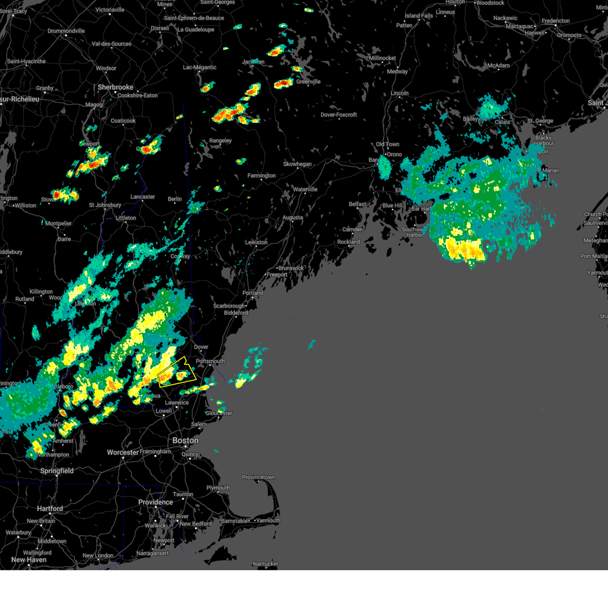
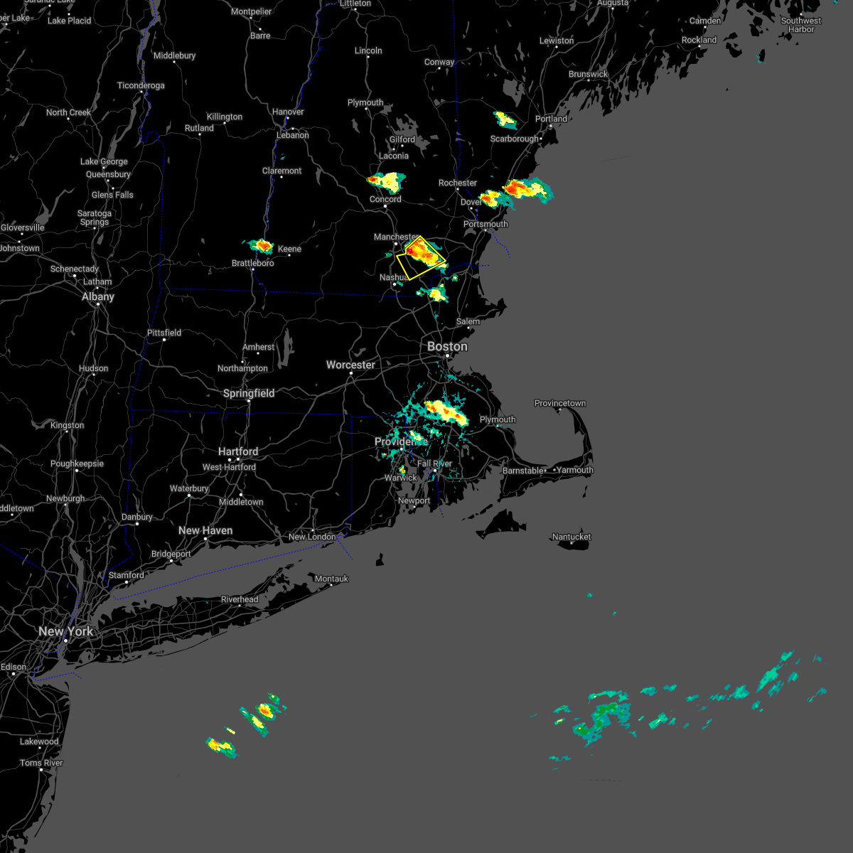
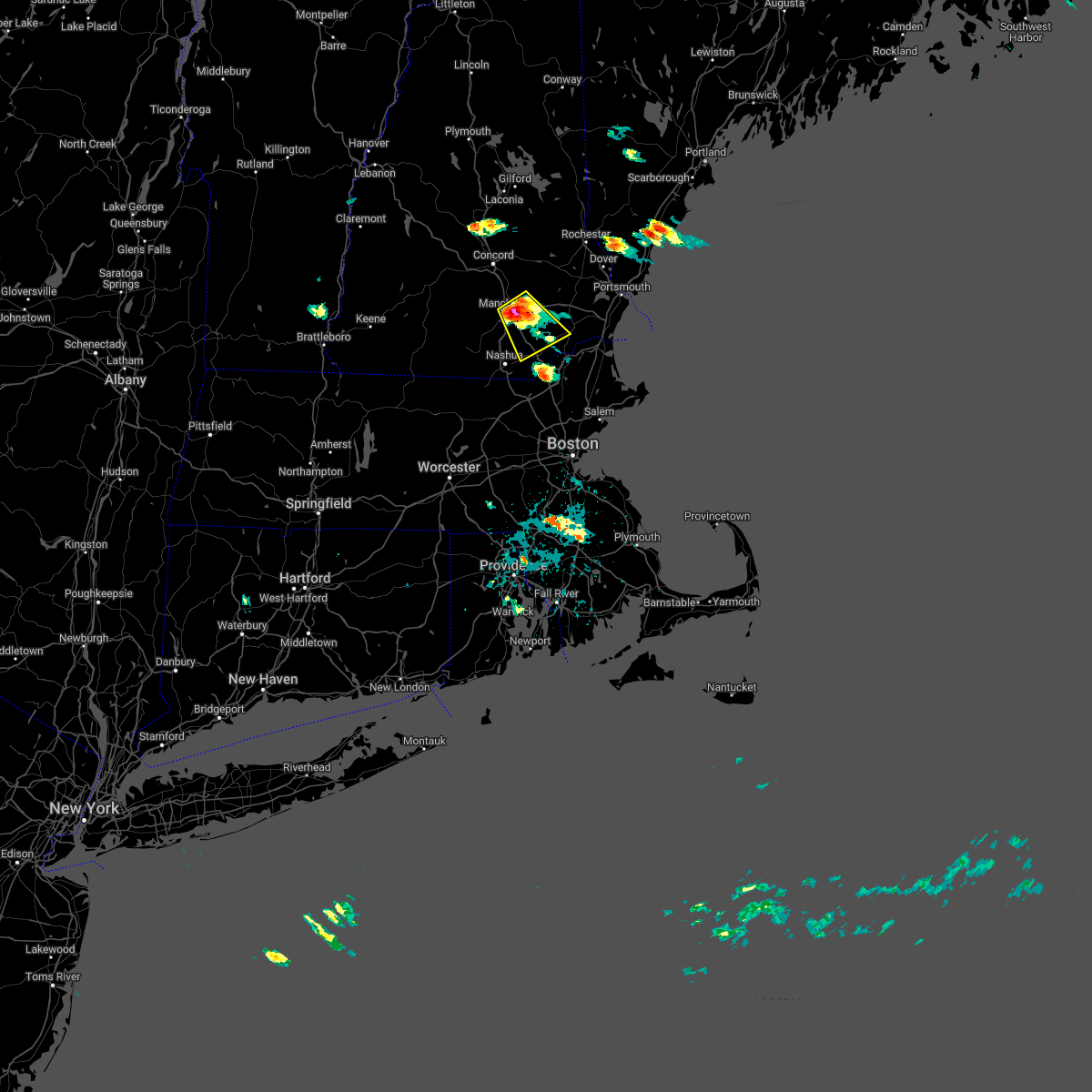
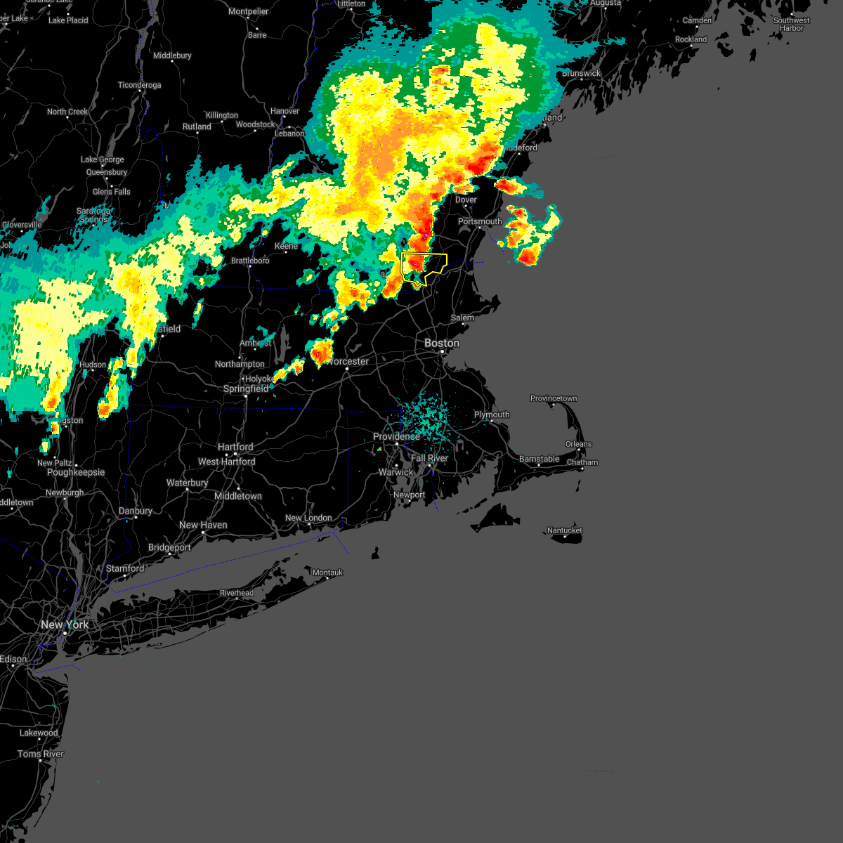
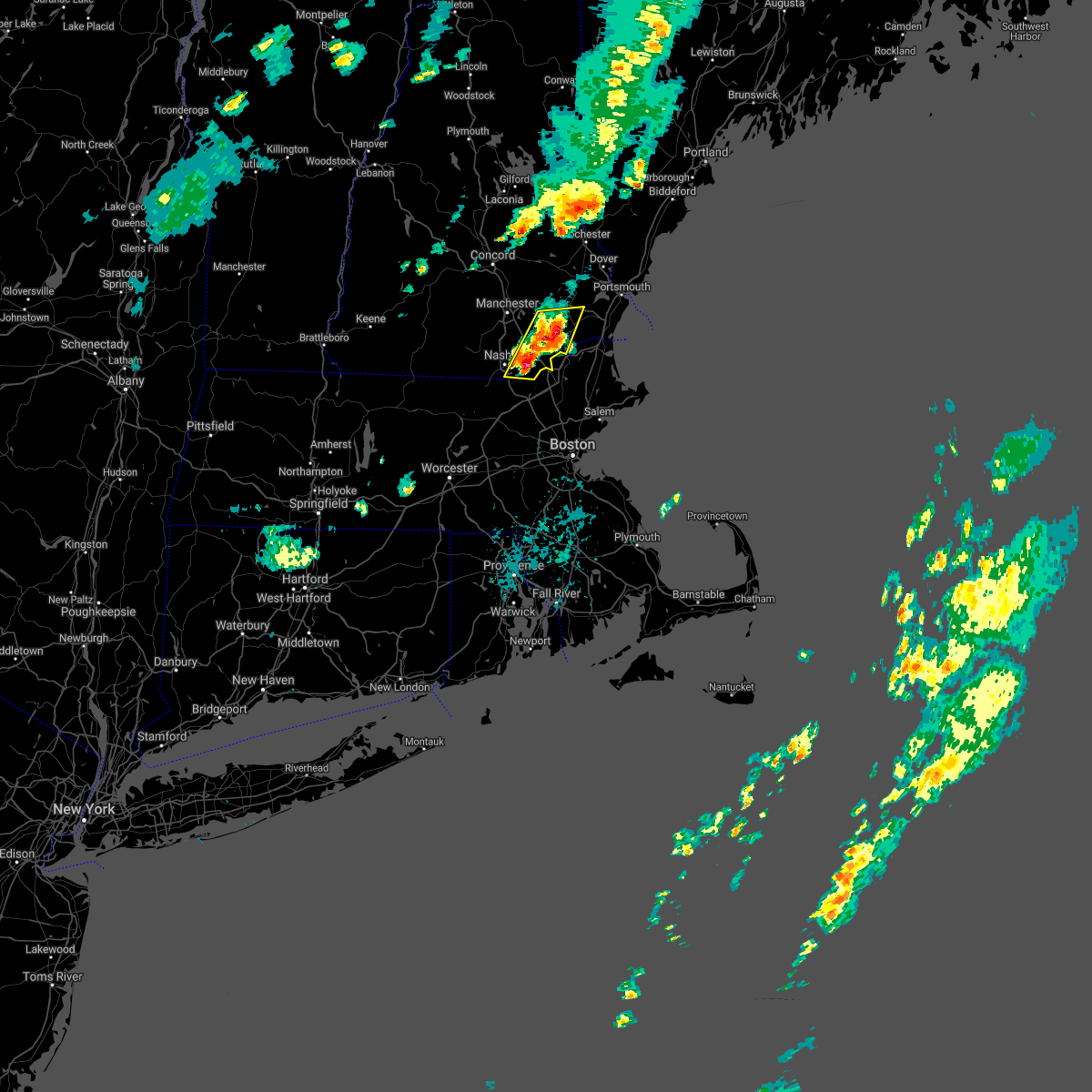
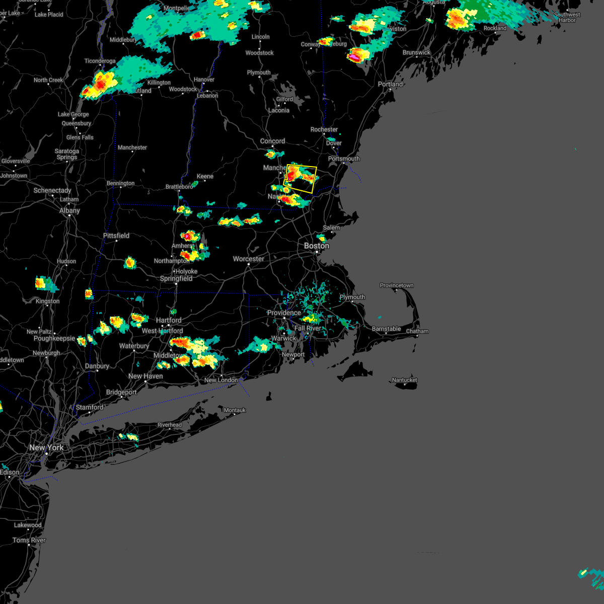
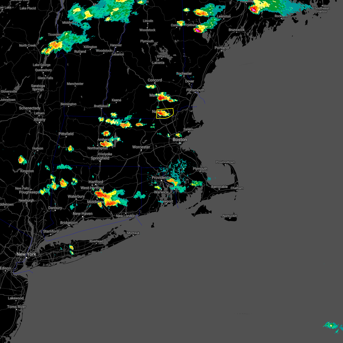
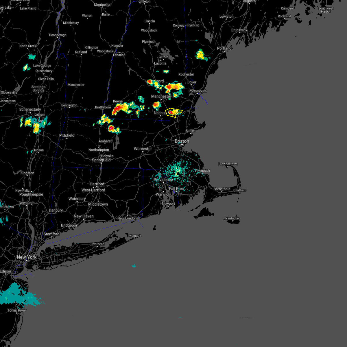
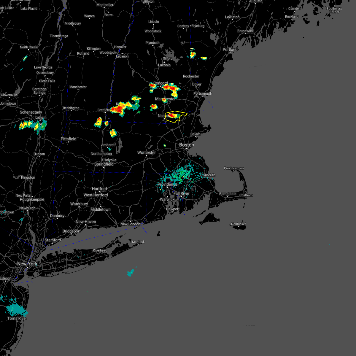
Hail Map for Londonderry, NH
The Londonderry, NH area has had 5 reports of on-the-ground hail by trained spotters, and has been under severe weather warnings 17 times during the past 12 months. Doppler radar has detected hail at or near Londonderry, NH on 19 occasions, including 1 occasion during the past year.
| Name: | Londonderry, NH |
| Where Located: | 70.9 miles N of Providence, RI |
| Map: | Google Map for Londonderry, NH |
| Population: | 11037 |
| Housing Units: | 4105 |
| More Info: | Search Google for Londonderry, NH |
3
The Top Recent Hail Date for Londonderry, NH is Thursday, August 15, 2024 (3rd out of 19)

Hail and Wind Damage Spotted near Londonderry, NH
| Date / Time | Report Details |
|---|---|
| 5/17/2025 9:15 PM EDT |
 The storms which prompted the warning have weakened. therefore, the warning will be allowed to expire. The storms which prompted the warning have weakened. therefore, the warning will be allowed to expire.
|
| 5/17/2025 8:46 PM EDT |
 Svrgyx the national weather service in gray maine has issued a * severe thunderstorm warning for, western rockingham county in southern new hampshire, central hillsborough county in southern new hampshire, southeastern merrimack county in central new hampshire, * until 915 pm edt. * at 845 pm edt, severe thunderstorms were located along a line extending from near concord to goffstown to mason, moving east at 40 mph (radar indicated). Hazards include 60 mph wind gusts and nickel size hail. expect damage to roofs, siding, and trees Svrgyx the national weather service in gray maine has issued a * severe thunderstorm warning for, western rockingham county in southern new hampshire, central hillsborough county in southern new hampshire, southeastern merrimack county in central new hampshire, * until 915 pm edt. * at 845 pm edt, severe thunderstorms were located along a line extending from near concord to goffstown to mason, moving east at 40 mph (radar indicated). Hazards include 60 mph wind gusts and nickel size hail. expect damage to roofs, siding, and trees
|
| 5/3/2025 4:52 PM EDT | The storm which prompted the warning has weakened below severe limits, and has exited the warned area. therefore, the warning has been allowed to expire. a severe thunderstorm watch remains in effect until 800 pm edt for southern and central new hampshire. |
| 5/3/2025 4:33 PM EDT |
 At 433 pm edt, a severe thunderstorm was located near derry, moving east at 40 mph (radar indicated). Hazards include 60 mph wind gusts and nickel size hail. Expect damage to roofs, siding, and trees. Locations impacted include, windham, atkinson, hudson, litchfield, auburn, londonderry, derry, manchester, bedford, salem, hampstead, chester, hooksett, merrimack, pelham, candia, and goffstown. At 433 pm edt, a severe thunderstorm was located near derry, moving east at 40 mph (radar indicated). Hazards include 60 mph wind gusts and nickel size hail. Expect damage to roofs, siding, and trees. Locations impacted include, windham, atkinson, hudson, litchfield, auburn, londonderry, derry, manchester, bedford, salem, hampstead, chester, hooksett, merrimack, pelham, candia, and goffstown.
|
| 5/3/2025 4:13 PM EDT |
 At 412 pm edt, a severe thunderstorm was located near milford, or near merrimack, moving northeast at 45 mph (radar indicated). Hazards include 60 mph wind gusts and quarter size hail. Hail damage to vehicles is expected. expect wind damage to roofs, siding, and trees. Locations impacted include, windham, atkinson, nashua, derry, merrimack, salem, milford, hudson, litchfield, auburn, wilton, brookline, londonderry, mason, amherst, manchester, bedford, hollis, mont vernon, and mount vernon. At 412 pm edt, a severe thunderstorm was located near milford, or near merrimack, moving northeast at 45 mph (radar indicated). Hazards include 60 mph wind gusts and quarter size hail. Hail damage to vehicles is expected. expect wind damage to roofs, siding, and trees. Locations impacted include, windham, atkinson, nashua, derry, merrimack, salem, milford, hudson, litchfield, auburn, wilton, brookline, londonderry, mason, amherst, manchester, bedford, hollis, mont vernon, and mount vernon.
|
| 5/3/2025 4:08 PM EDT |
 Svrgyx the national weather service in gray maine has issued a * severe thunderstorm warning for, southwestern rockingham county in southern new hampshire, southeastern hillsborough county in southern new hampshire, southern merrimack county in central new hampshire, * until 445 pm edt. * at 408 pm edt, a severe thunderstorm was located over milford, or 7 miles southwest of merrimack, moving northeast at 45 mph (radar indicated). Hazards include 60 mph wind gusts and quarter size hail. Hail damage to vehicles is expected. Expect wind damage to roofs, siding, and trees. Svrgyx the national weather service in gray maine has issued a * severe thunderstorm warning for, southwestern rockingham county in southern new hampshire, southeastern hillsborough county in southern new hampshire, southern merrimack county in central new hampshire, * until 445 pm edt. * at 408 pm edt, a severe thunderstorm was located over milford, or 7 miles southwest of merrimack, moving northeast at 45 mph (radar indicated). Hazards include 60 mph wind gusts and quarter size hail. Hail damage to vehicles is expected. Expect wind damage to roofs, siding, and trees.
|
| 8/15/2024 3:39 PM EDT |
 The storms which prompted the warning have weakened below severe limits, and no longer pose an immediate threat to life or property. therefore, the warning will be allowed to expire. however, gusty winds and heavy rain are still possible with these thunderstorms. The storms which prompted the warning have weakened below severe limits, and no longer pose an immediate threat to life or property. therefore, the warning will be allowed to expire. however, gusty winds and heavy rain are still possible with these thunderstorms.
|
| 8/15/2024 3:14 PM EDT |
 The storms which prompted the warning have moved out of the area. therefore, the warning will be allowed to expire. remember, a severe thunderstorm warning still remains in effect for portions of hillsborough and rockingam counties. The storms which prompted the warning have moved out of the area. therefore, the warning will be allowed to expire. remember, a severe thunderstorm warning still remains in effect for portions of hillsborough and rockingam counties.
|
| 8/15/2024 3:06 PM EDT |
 Svrgyx the national weather service in gray maine has issued a * severe thunderstorm warning for, southwestern rockingham county in southern new hampshire, hillsborough county in southern new hampshire, south central merrimack county in central new hampshire, * until 345 pm edt. * at 306 pm edt, severe thunderstorms were located along a line extending from near henniker to litchfield to near salem, moving south at 25 mph (radar indicated). Hazards include 60 mph wind gusts and quarter size hail. Hail damage to vehicles is expected. Expect wind damage to roofs, siding, and trees. Svrgyx the national weather service in gray maine has issued a * severe thunderstorm warning for, southwestern rockingham county in southern new hampshire, hillsborough county in southern new hampshire, south central merrimack county in central new hampshire, * until 345 pm edt. * at 306 pm edt, severe thunderstorms were located along a line extending from near henniker to litchfield to near salem, moving south at 25 mph (radar indicated). Hazards include 60 mph wind gusts and quarter size hail. Hail damage to vehicles is expected. Expect wind damage to roofs, siding, and trees.
|
| 8/15/2024 2:49 PM EDT | 1 tree down and blew traffic lights around the wire and the tops off. estimated 60 mph gus in rockingham county NH, 1.5 miles ESE of Londonderry, NH |
| 8/15/2024 2:32 PM EDT |
 Svrgyx the national weather service in gray maine has issued a * severe thunderstorm warning for, southwestern rockingham county in southern new hampshire, south central strafford county in central new hampshire, southeastern hillsborough county in southern new hampshire, southern merrimack county in central new hampshire, * until 315 pm edt. * at 231 pm edt, severe thunderstorms were located along a line extending from near manchester to near raymond, moving south at 20 mph (radar indicated). Hazards include 60 mph wind gusts and quarter size hail. Hail damage to vehicles is expected. Expect wind damage to roofs, siding, and trees. Svrgyx the national weather service in gray maine has issued a * severe thunderstorm warning for, southwestern rockingham county in southern new hampshire, south central strafford county in central new hampshire, southeastern hillsborough county in southern new hampshire, southern merrimack county in central new hampshire, * until 315 pm edt. * at 231 pm edt, severe thunderstorms were located along a line extending from near manchester to near raymond, moving south at 20 mph (radar indicated). Hazards include 60 mph wind gusts and quarter size hail. Hail damage to vehicles is expected. Expect wind damage to roofs, siding, and trees.
|
| 8/4/2024 2:07 PM EDT |
 The storm which prompted the warning has weakened below severe limits, and no longer poses an immediate threat to life or property. therefore, the warning will be allowed to expire. however, heavy rain is still possible with this thunderstorm. The storm which prompted the warning has weakened below severe limits, and no longer poses an immediate threat to life or property. therefore, the warning will be allowed to expire. however, heavy rain is still possible with this thunderstorm.
|
| 8/4/2024 1:33 PM EDT |
 Svrgyx the national weather service in gray maine has issued a * severe thunderstorm warning for, southwestern rockingham county in southern new hampshire, southeastern hillsborough county in southern new hampshire, * until 215 pm edt. * at 133 pm edt, a severe thunderstorm was located over hollis, or near nashua, moving east at 15 mph (radar indicated). Hazards include 60 mph wind gusts and penny size hail. expect damage to roofs, siding, and trees Svrgyx the national weather service in gray maine has issued a * severe thunderstorm warning for, southwestern rockingham county in southern new hampshire, southeastern hillsborough county in southern new hampshire, * until 215 pm edt. * at 133 pm edt, a severe thunderstorm was located over hollis, or near nashua, moving east at 15 mph (radar indicated). Hazards include 60 mph wind gusts and penny size hail. expect damage to roofs, siding, and trees
|
| 8/4/2024 1:04 PM EDT |
 the severe thunderstorm warning has been cancelled and is no longer in effect the severe thunderstorm warning has been cancelled and is no longer in effect
|
| 8/4/2024 12:44 PM EDT |
 Svrgyx the national weather service in gray maine has issued a * severe thunderstorm warning for, west central rockingham county in southern new hampshire, eastern hillsborough county in southern new hampshire, * until 130 pm edt. * at 1244 pm edt, a severe thunderstorm was located near derry, moving east at 20 mph (radar indicated). Hazards include 60 mph wind gusts and quarter size hail. Hail damage to vehicles is expected. Expect wind damage to roofs, siding, and trees. Svrgyx the national weather service in gray maine has issued a * severe thunderstorm warning for, west central rockingham county in southern new hampshire, eastern hillsborough county in southern new hampshire, * until 130 pm edt. * at 1244 pm edt, a severe thunderstorm was located near derry, moving east at 20 mph (radar indicated). Hazards include 60 mph wind gusts and quarter size hail. Hail damage to vehicles is expected. Expect wind damage to roofs, siding, and trees.
|
| 7/17/2024 7:42 PM EDT |
 Svrgyx the national weather service in gray maine has issued a * severe thunderstorm warning for, southern rockingham county in southern new hampshire, * until 830 pm edt. * at 742 pm edt, severe thunderstorms were located along a line extending from litchfield to near pelham, moving northeast at 40 mph (radar indicated). Hazards include 60 mph wind gusts. expect damage to roofs, siding, and trees Svrgyx the national weather service in gray maine has issued a * severe thunderstorm warning for, southern rockingham county in southern new hampshire, * until 830 pm edt. * at 742 pm edt, severe thunderstorms were located along a line extending from litchfield to near pelham, moving northeast at 40 mph (radar indicated). Hazards include 60 mph wind gusts. expect damage to roofs, siding, and trees
|
| 7/16/2024 8:25 PM EDT |
 Svrgyx the national weather service in gray maine has issued a * severe thunderstorm warning for, southern york county in southwestern maine, rockingham county in southern new hampshire, southern strafford county in central new hampshire, southeastern hillsborough county in southern new hampshire, southeastern merrimack county in central new hampshire, * until 915 pm edt. * at 824 pm edt, severe thunderstorms were located along a line extending from epsom to near derry to near salem to 6 miles southeast of pelham, moving east at 55 mph (radar indicated). Hazards include 55 to 65 mph wind gusts. expect damage to roofs, siding, and trees Svrgyx the national weather service in gray maine has issued a * severe thunderstorm warning for, southern york county in southwestern maine, rockingham county in southern new hampshire, southern strafford county in central new hampshire, southeastern hillsborough county in southern new hampshire, southeastern merrimack county in central new hampshire, * until 915 pm edt. * at 824 pm edt, severe thunderstorms were located along a line extending from epsom to near derry to near salem to 6 miles southeast of pelham, moving east at 55 mph (radar indicated). Hazards include 55 to 65 mph wind gusts. expect damage to roofs, siding, and trees
|
| 7/16/2024 8:12 PM EDT | Tree dow in rockingham county NH, 3.1 miles SE of Londonderry, NH |
| 7/16/2024 7:42 PM EDT |
 Svrgyx the national weather service in gray maine has issued a * severe thunderstorm warning for, rockingham county in southern new hampshire, southwestern strafford county in central new hampshire, southeastern cheshire county in southern new hampshire, hillsborough county in southern new hampshire, southeastern merrimack county in central new hampshire, * until 830 pm edt. * at 741 pm edt, severe thunderstorms were located along a line extending from near deering to near new ipswich, moving east at 60 mph (radar indicated). Hazards include 60 mph wind gusts. expect damage to roofs, siding, and trees Svrgyx the national weather service in gray maine has issued a * severe thunderstorm warning for, rockingham county in southern new hampshire, southwestern strafford county in central new hampshire, southeastern cheshire county in southern new hampshire, hillsborough county in southern new hampshire, southeastern merrimack county in central new hampshire, * until 830 pm edt. * at 741 pm edt, severe thunderstorms were located along a line extending from near deering to near new ipswich, moving east at 60 mph (radar indicated). Hazards include 60 mph wind gusts. expect damage to roofs, siding, and trees
|
| 6/20/2024 7:43 PM EDT |
 the severe thunderstorm warning has been cancelled and is no longer in effect the severe thunderstorm warning has been cancelled and is no longer in effect
|
| 6/20/2024 7:31 PM EDT |
 At 731 pm edt, a severe thunderstorm was located over amherst, or near merrimack, moving east at 30 mph (radar indicated). Hazards include 60 mph wind gusts. Expect damage to roofs, siding, and trees. locations impacted include, manchester, nashua, derry, merrimack, salem, bedford, milford, amherst, litchfield, hollis, new boston, mont vernon, lyndeborough, francestown, mount vernon, hudson, wilton, pelham, goffstown, and raymond. this includes the following highways, interstate 293 between mile markers 1 and 8. Interstate 93 between mile markers 4 and 23. At 731 pm edt, a severe thunderstorm was located over amherst, or near merrimack, moving east at 30 mph (radar indicated). Hazards include 60 mph wind gusts. Expect damage to roofs, siding, and trees. locations impacted include, manchester, nashua, derry, merrimack, salem, bedford, milford, amherst, litchfield, hollis, new boston, mont vernon, lyndeborough, francestown, mount vernon, hudson, wilton, pelham, goffstown, and raymond. this includes the following highways, interstate 293 between mile markers 1 and 8. Interstate 93 between mile markers 4 and 23.
|
| 6/20/2024 7:07 PM EDT |
 Svrgyx the national weather service in gray maine has issued a * severe thunderstorm warning for, southwestern rockingham county in southern new hampshire, southern hillsborough county in southern new hampshire, * until 800 pm edt. * at 707 pm edt, a severe thunderstorm was located over lyndeborough, or 13 miles east of jaffrey, moving east at 30 mph (radar indicated). Hazards include 60 mph wind gusts and quarter size hail. Hail damage to vehicles is expected. Expect wind damage to roofs, siding, and trees. Svrgyx the national weather service in gray maine has issued a * severe thunderstorm warning for, southwestern rockingham county in southern new hampshire, southern hillsborough county in southern new hampshire, * until 800 pm edt. * at 707 pm edt, a severe thunderstorm was located over lyndeborough, or 13 miles east of jaffrey, moving east at 30 mph (radar indicated). Hazards include 60 mph wind gusts and quarter size hail. Hail damage to vehicles is expected. Expect wind damage to roofs, siding, and trees.
|
| 5/21/2024 7:05 PM EDT |
 the severe thunderstorm warning has been cancelled and is no longer in effect the severe thunderstorm warning has been cancelled and is no longer in effect
|
| 5/21/2024 6:54 PM EDT |
 At 654 pm edt, a severe thunderstorm was located over manchester, moving east at 25 mph (radar indicated). Hazards include 60 mph wind gusts and quarter size hail. Hail damage to vehicles is expected. expect wind damage to roofs, siding, and trees. locations impacted include, manchester, derry, merrimack, bedford, hooksett, amherst, litchfield, raymond, goffstown, londonderry, bow, auburn, chester, allenstown, deerfield, candia, dunbarton, sandown, nottingham, and pembroke. this includes the following highways, interstate 293 between mile markers 1 and 11. Interstate 93 between mile markers 12 and 32. At 654 pm edt, a severe thunderstorm was located over manchester, moving east at 25 mph (radar indicated). Hazards include 60 mph wind gusts and quarter size hail. Hail damage to vehicles is expected. expect wind damage to roofs, siding, and trees. locations impacted include, manchester, derry, merrimack, bedford, hooksett, amherst, litchfield, raymond, goffstown, londonderry, bow, auburn, chester, allenstown, deerfield, candia, dunbarton, sandown, nottingham, and pembroke. this includes the following highways, interstate 293 between mile markers 1 and 11. Interstate 93 between mile markers 12 and 32.
|
| 5/21/2024 6:42 PM EDT |
 Svrgyx the national weather service in gray maine has issued a * severe thunderstorm warning for, southwestern rockingham county in southern new hampshire, central hillsborough county in southern new hampshire, southeastern merrimack county in central new hampshire, * until 730 pm edt. * at 642 pm edt, a severe thunderstorm was located over goffstown, or near manchester, moving east at 25 mph (radar indicated). Hazards include 60 mph wind gusts and quarter size hail. Hail damage to vehicles is expected. Expect wind damage to roofs, siding, and trees. Svrgyx the national weather service in gray maine has issued a * severe thunderstorm warning for, southwestern rockingham county in southern new hampshire, central hillsborough county in southern new hampshire, southeastern merrimack county in central new hampshire, * until 730 pm edt. * at 642 pm edt, a severe thunderstorm was located over goffstown, or near manchester, moving east at 25 mph (radar indicated). Hazards include 60 mph wind gusts and quarter size hail. Hail damage to vehicles is expected. Expect wind damage to roofs, siding, and trees.
|
| 9/8/2023 3:38 PM EDT |
 At 337 pm edt, severe thunderstorms were located along a line extending from near manchester to raymond to brentwood, moving northeast at 30 mph (radar indicated). Hazards include 60 mph wind gusts and quarter size hail. Hail damage to vehicles is expected. expect wind damage to roofs, siding, and trees. locations impacted include, manchester, derry, merrimack, bedford, hooksett, litchfield, epping, raymond, londonderry, hampstead, auburn, chester, danville, fremont, deerfield, candia, sandown, and nottingham. this includes the following highways, interstate 293 between mile markers 1 and 8. interstate 93 between mile markers 14 and 26. hail threat, radar indicated max hail size, 1. 00 in wind threat, radar indicated max wind gust, 60 mph. At 337 pm edt, severe thunderstorms were located along a line extending from near manchester to raymond to brentwood, moving northeast at 30 mph (radar indicated). Hazards include 60 mph wind gusts and quarter size hail. Hail damage to vehicles is expected. expect wind damage to roofs, siding, and trees. locations impacted include, manchester, derry, merrimack, bedford, hooksett, litchfield, epping, raymond, londonderry, hampstead, auburn, chester, danville, fremont, deerfield, candia, sandown, and nottingham. this includes the following highways, interstate 293 between mile markers 1 and 8. interstate 93 between mile markers 14 and 26. hail threat, radar indicated max hail size, 1. 00 in wind threat, radar indicated max wind gust, 60 mph.
|
| 9/8/2023 3:19 PM EDT |
 At 319 pm edt, severe thunderstorms were located along a line extending from amherst to near litchfield to near salem, moving northeast at 20 mph (radar indicated). Hazards include 60 mph wind gusts and quarter size hail. Hail damage to vehicles is expected. Expect wind damage to roofs, siding, and trees. At 319 pm edt, severe thunderstorms were located along a line extending from amherst to near litchfield to near salem, moving northeast at 20 mph (radar indicated). Hazards include 60 mph wind gusts and quarter size hail. Hail damage to vehicles is expected. Expect wind damage to roofs, siding, and trees.
|
| 9/8/2023 3:11 PM EDT |
 At 310 pm edt, a severe thunderstorm was located near salem, moving north at 35 mph (radar indicated). Hazards include 60 mph wind gusts and quarter size hail. Hail damage to vehicles is expected. expect wind damage to roofs, siding, and trees. locations impacted include, nashua, derry, salem, merrimack, litchfield, hollis, hudson, pelham, londonderry, hampstead, atkinson, chester, windham, plaistow, and sandown. this includes interstate 93 between mile markers 1 and 15. hail threat, radar indicated max hail size, 1. 00 in wind threat, radar indicated max wind gust, 60 mph. At 310 pm edt, a severe thunderstorm was located near salem, moving north at 35 mph (radar indicated). Hazards include 60 mph wind gusts and quarter size hail. Hail damage to vehicles is expected. expect wind damage to roofs, siding, and trees. locations impacted include, nashua, derry, salem, merrimack, litchfield, hollis, hudson, pelham, londonderry, hampstead, atkinson, chester, windham, plaistow, and sandown. this includes interstate 93 between mile markers 1 and 15. hail threat, radar indicated max hail size, 1. 00 in wind threat, radar indicated max wind gust, 60 mph.
|
| 9/8/2023 2:28 PM EDT |
 At 228 pm edt, a severe thunderstorm was located 15 miles south of nashua, moving northeast at 20 mph (radar indicated). Hazards include 60 mph wind gusts and quarter size hail. Hail damage to vehicles is expected. Expect wind damage to roofs, siding, and trees. At 228 pm edt, a severe thunderstorm was located 15 miles south of nashua, moving northeast at 20 mph (radar indicated). Hazards include 60 mph wind gusts and quarter size hail. Hail damage to vehicles is expected. Expect wind damage to roofs, siding, and trees.
|
| 7/27/2023 4:21 PM EDT |
 The severe thunderstorm warning for west central rockingham and east central hillsborough counties will expire at 430 pm edt, the storm which prompted the warning has weakened below severe limits, and no longer poses an immediate threat to life or property. therefore, the warning will be allowed to expire. however heavy rain is still possible with this thunderstorm. a severe thunderstorm watch remains in effect until 800 pm edt for southern and central new hampshire. The severe thunderstorm warning for west central rockingham and east central hillsborough counties will expire at 430 pm edt, the storm which prompted the warning has weakened below severe limits, and no longer poses an immediate threat to life or property. therefore, the warning will be allowed to expire. however heavy rain is still possible with this thunderstorm. a severe thunderstorm watch remains in effect until 800 pm edt for southern and central new hampshire.
|
| 7/27/2023 4:02 PM EDT |
 At 402 pm edt, a severe thunderstorm was located near manchester, moving east at 35 mph (radar indicated). Hazards include 60 mph wind gusts. expect damage to roofs, siding, and trees At 402 pm edt, a severe thunderstorm was located near manchester, moving east at 35 mph (radar indicated). Hazards include 60 mph wind gusts. expect damage to roofs, siding, and trees
|
| 7/21/2023 5:11 PM EDT |
 The severe thunderstorm warning for southeastern hillsborough county will expire at 515 pm edt, the storm which prompted the warning has weakened and is moving out of the area. however, gusty winds, small hail and heavy rainfall with flooding reamin likely. a severe thunderstorm watch remains in effect until 800 pm edt for southern new hampshire. The severe thunderstorm warning for southeastern hillsborough county will expire at 515 pm edt, the storm which prompted the warning has weakened and is moving out of the area. however, gusty winds, small hail and heavy rainfall with flooding reamin likely. a severe thunderstorm watch remains in effect until 800 pm edt for southern new hampshire.
|
| 7/21/2023 4:50 PM EDT |
 At 449 pm edt, a severe thunderstorm was located over nashua, moving east at 20 mph (radar indicated). Hazards include 60 mph wind gusts and quarter size hail. Hail damage to vehicles is expected. expect wind damage to roofs, siding, and trees. locations impacted include, nashua, merrimack, milford, amherst, litchfield, hollis, hudson, pelham and windham. hail threat, radar indicated max hail size, 1. 00 in wind threat, radar indicated max wind gust, 60 mph. At 449 pm edt, a severe thunderstorm was located over nashua, moving east at 20 mph (radar indicated). Hazards include 60 mph wind gusts and quarter size hail. Hail damage to vehicles is expected. expect wind damage to roofs, siding, and trees. locations impacted include, nashua, merrimack, milford, amherst, litchfield, hollis, hudson, pelham and windham. hail threat, radar indicated max hail size, 1. 00 in wind threat, radar indicated max wind gust, 60 mph.
|
| 7/21/2023 4:33 PM EDT |
 At 433 pm edt, a severe thunderstorm was located over hollis, or near nashua, moving east at 20 mph (radar indicated). Hazards include 60 mph wind gusts and quarter size hail. Hail damage to vehicles is expected. expect wind damage to roofs, siding, and trees. locations impacted include, manchester, nashua, merrimack, bedford, milford, amherst, litchfield, hollis, hudson, brookline, mason, pelham, greenville, wilton and windham. hail threat, radar indicated max hail size, 1. 00 in wind threat, radar indicated max wind gust, 60 mph. At 433 pm edt, a severe thunderstorm was located over hollis, or near nashua, moving east at 20 mph (radar indicated). Hazards include 60 mph wind gusts and quarter size hail. Hail damage to vehicles is expected. expect wind damage to roofs, siding, and trees. locations impacted include, manchester, nashua, merrimack, bedford, milford, amherst, litchfield, hollis, hudson, brookline, mason, pelham, greenville, wilton and windham. hail threat, radar indicated max hail size, 1. 00 in wind threat, radar indicated max wind gust, 60 mph.
|
| 7/21/2023 4:16 PM EDT |
 At 416 pm edt, a severe thunderstorm was located near mason, or 12 miles west of nashua, moving east at 20 mph (radar indicated). Hazards include 60 mph wind gusts and penny size hail. expect damage to roofs, siding, and trees At 416 pm edt, a severe thunderstorm was located near mason, or 12 miles west of nashua, moving east at 20 mph (radar indicated). Hazards include 60 mph wind gusts and penny size hail. expect damage to roofs, siding, and trees
|
| 7/18/2023 4:45 PM EDT | Tree and wires down on elwood r in rockingham county NH, 2 miles ENE of Londonderry, NH |
| 7/18/2023 4:33 PM EDT |
 At 433 pm edt, a severe thunderstorm was located over litchfield, or near merrimack, moving northeast at 20 mph (radar indicated). Hazards include 60 mph wind gusts and quarter size hail. Hail damage to vehicles is expected. Expect wind damage to roofs, siding, and trees. At 433 pm edt, a severe thunderstorm was located over litchfield, or near merrimack, moving northeast at 20 mph (radar indicated). Hazards include 60 mph wind gusts and quarter size hail. Hail damage to vehicles is expected. Expect wind damage to roofs, siding, and trees.
|
| 7/16/2023 9:01 AM EDT |
 At 900 am edt, a severe thunderstorm capable of producing a tornado was located near pelham, or 8 miles southeast of nashua, moving north at 20 mph (radar indicated rotation). Hazards include tornado. Flying debris will be dangerous to those caught without shelter. mobile homes will be damaged or destroyed. damage to roofs, windows, and vehicles will occur. tree damage is likely. this dangerous storm will be near, pelham and hudson around 920 am edt. salem around 930 am edt. other locations impacted by this tornadic thunderstorm include windham and londonderry. This includes interstate 93 between mile markers 1 and 8. At 900 am edt, a severe thunderstorm capable of producing a tornado was located near pelham, or 8 miles southeast of nashua, moving north at 20 mph (radar indicated rotation). Hazards include tornado. Flying debris will be dangerous to those caught without shelter. mobile homes will be damaged or destroyed. damage to roofs, windows, and vehicles will occur. tree damage is likely. this dangerous storm will be near, pelham and hudson around 920 am edt. salem around 930 am edt. other locations impacted by this tornadic thunderstorm include windham and londonderry. This includes interstate 93 between mile markers 1 and 8.
|
| 12/23/2022 5:18 PM EST |
 At 518 pm est, severe thunderstorms were located along a line extending from 11 miles west of piermont to near canterbury to 7 miles southwest of seabrook, moving northeast at 45 mph (radar indicated). Hazards include 70 mph wind gusts. Expect considerable tree damage. Damage is likely to mobile homes, roofs, and outbuildings. At 518 pm est, severe thunderstorms were located along a line extending from 11 miles west of piermont to near canterbury to 7 miles southwest of seabrook, moving northeast at 45 mph (radar indicated). Hazards include 70 mph wind gusts. Expect considerable tree damage. Damage is likely to mobile homes, roofs, and outbuildings.
|
| 11/30/2022 6:50 PM EST |
 At 649 pm est, a severe thunderstorm was located over bedford, or near manchester, moving northeast at 40 mph (radar indicated). Hazards include 60 mph wind gusts and penny size hail. Expect damage to roofs, siding, and trees. locations impacted include, manchester, nashua, derry, merrimack, bedford, milford, hooksett, amherst, litchfield, hollis, new boston, mont vernon, raymond, goffstown, mount vernon, londonderry, hampstead, chester, candia and dunbarton. this includes the following highways, interstate 293 between mile markers 1 and 11. Interstate 93 between mile markers 11 and 28. At 649 pm est, a severe thunderstorm was located over bedford, or near manchester, moving northeast at 40 mph (radar indicated). Hazards include 60 mph wind gusts and penny size hail. Expect damage to roofs, siding, and trees. locations impacted include, manchester, nashua, derry, merrimack, bedford, milford, hooksett, amherst, litchfield, hollis, new boston, mont vernon, raymond, goffstown, mount vernon, londonderry, hampstead, chester, candia and dunbarton. this includes the following highways, interstate 293 between mile markers 1 and 11. Interstate 93 between mile markers 11 and 28.
|
| 11/30/2022 6:20 PM EST |
 At 619 pm est, a severe thunderstorm was located over new ipswich, or 10 miles east of jaffrey, moving northeast at 40 mph (radar indicated). Hazards include 60 mph wind gusts and penny size hail. expect damage to roofs, siding, and trees At 619 pm est, a severe thunderstorm was located over new ipswich, or 10 miles east of jaffrey, moving northeast at 40 mph (radar indicated). Hazards include 60 mph wind gusts and penny size hail. expect damage to roofs, siding, and trees
|
| 9/13/2022 9:08 PM EDT |
 At 908 pm edt, a severe thunderstorm was located near manchester, moving northeast at 25 mph (radar indicated). Hazards include 60 mph wind gusts and penny size hail. Expect damage to roofs, siding, and trees. locations impacted include, manchester, derry, merrimack, bedford, hooksett, litchfield, epsom, goffstown, londonderry, bow, chester, allenstown, deerfield, candia, dunbarton and pembroke. this includes the following highways, interstate 293 between mile markers 1 and 11. Interstate 93 between mile markers 13 and 34. At 908 pm edt, a severe thunderstorm was located near manchester, moving northeast at 25 mph (radar indicated). Hazards include 60 mph wind gusts and penny size hail. Expect damage to roofs, siding, and trees. locations impacted include, manchester, derry, merrimack, bedford, hooksett, litchfield, epsom, goffstown, londonderry, bow, chester, allenstown, deerfield, candia, dunbarton and pembroke. this includes the following highways, interstate 293 between mile markers 1 and 11. Interstate 93 between mile markers 13 and 34.
|
| 9/13/2022 8:56 PM EDT |
 At 856 pm edt, a severe thunderstorm was located over bedford, or near manchester, moving east at 25 mph (radar indicated). Hazards include 60 mph wind gusts and penny size hail. Expect damage to roofs, siding, and trees. locations impacted include, manchester, nashua, derry, merrimack, bedford, milford, hooksett, amherst, litchfield, hollis, new boston, epsom, mont vernon, goffstown, hudson, pelham, weare, mount vernon, londonderry and bow. this includes the following highways, interstate 293 between mile markers 1 and 11. Interstate 93 between mile markers 9 and 34. At 856 pm edt, a severe thunderstorm was located over bedford, or near manchester, moving east at 25 mph (radar indicated). Hazards include 60 mph wind gusts and penny size hail. Expect damage to roofs, siding, and trees. locations impacted include, manchester, nashua, derry, merrimack, bedford, milford, hooksett, amherst, litchfield, hollis, new boston, epsom, mont vernon, goffstown, hudson, pelham, weare, mount vernon, londonderry and bow. this includes the following highways, interstate 293 between mile markers 1 and 11. Interstate 93 between mile markers 9 and 34.
|
| 9/13/2022 8:43 PM EDT |
 At 843 pm edt, a severe thunderstorm was located over new boston, or 11 miles northwest of merrimack, moving east at 15 mph (radar indicated). Hazards include 60 mph wind gusts and penny size hail. expect damage to roofs, siding, and trees At 843 pm edt, a severe thunderstorm was located over new boston, or 11 miles northwest of merrimack, moving east at 15 mph (radar indicated). Hazards include 60 mph wind gusts and penny size hail. expect damage to roofs, siding, and trees
|
| 8/7/2022 3:34 PM EDT |
 At 334 pm edt, severe thunderstorms were located along a line extending from near hooksett to derry, moving east at 25 mph (radar indicated). Hazards include 60 mph wind gusts and penny size hail. Expect damage to roofs, siding, and trees. locations impacted include, manchester, concord, derry, northwood, merrimack, bedford, hooksett, litchfield, epping, hopkinton, epsom, brentwood, raymond, goffstown, londonderry, hampstead, bow, atkinson, kingston and chester. this includes the following highways, interstate 293 between mile markers 1 and 11. interstate 89 between mile markers 0 and 5. interstate 93 between mile markers 10 and 40. hail threat, radar indicated max hail size, 0. 75 in wind threat, radar indicated max wind gust, 60 mph. At 334 pm edt, severe thunderstorms were located along a line extending from near hooksett to derry, moving east at 25 mph (radar indicated). Hazards include 60 mph wind gusts and penny size hail. Expect damage to roofs, siding, and trees. locations impacted include, manchester, concord, derry, northwood, merrimack, bedford, hooksett, litchfield, epping, hopkinton, epsom, brentwood, raymond, goffstown, londonderry, hampstead, bow, atkinson, kingston and chester. this includes the following highways, interstate 293 between mile markers 1 and 11. interstate 89 between mile markers 0 and 5. interstate 93 between mile markers 10 and 40. hail threat, radar indicated max hail size, 0. 75 in wind threat, radar indicated max wind gust, 60 mph.
|
| 8/7/2022 3:22 PM EDT |
 At 321 pm edt, a severe thunderstorm was located over new boston, or 11 miles west of manchester, moving east at 35 mph (radar indicated). Hazards include 60 mph wind gusts and quarter size hail. Hail damage to vehicles is expected. Expect wind damage to roofs, siding, and trees. At 321 pm edt, a severe thunderstorm was located over new boston, or 11 miles west of manchester, moving east at 35 mph (radar indicated). Hazards include 60 mph wind gusts and quarter size hail. Hail damage to vehicles is expected. Expect wind damage to roofs, siding, and trees.
|
| 7/25/2022 11:25 AM EDT |
 At 1124 am edt, a severe thunderstorm was located near mount vernon, or 9 miles west of merrimack, moving northeast at 55 mph (radar indicated). Hazards include 60 mph wind gusts and quarter size hail. Hail damage to vehicles is expected. expect wind damage to roofs, siding, and trees. locations impacted include, manchester, nashua, derry, merrimack, salem, bedford, milford, hooksett, amherst, litchfield, hollis, peterborough, new boston, mont vernon, greenfield, lyndeborough, new ipswich, sharon, goffstown and mount vernon. this includes the following highways, interstate 293 between mile markers 1 and 11. Interstate 93 between mile markers 7 and 29. At 1124 am edt, a severe thunderstorm was located near mount vernon, or 9 miles west of merrimack, moving northeast at 55 mph (radar indicated). Hazards include 60 mph wind gusts and quarter size hail. Hail damage to vehicles is expected. expect wind damage to roofs, siding, and trees. locations impacted include, manchester, nashua, derry, merrimack, salem, bedford, milford, hooksett, amherst, litchfield, hollis, peterborough, new boston, mont vernon, greenfield, lyndeborough, new ipswich, sharon, goffstown and mount vernon. this includes the following highways, interstate 293 between mile markers 1 and 11. Interstate 93 between mile markers 7 and 29.
|
| 7/25/2022 11:06 AM EDT |
 At 1105 am edt, a severe thunderstorm was located over rindge, or 8 miles south of jaffrey, moving northeast at 55 mph (radar indicated). Hazards include 60 mph wind gusts and quarter size hail. Hail damage to vehicles is expected. Expect wind damage to roofs, siding, and trees. At 1105 am edt, a severe thunderstorm was located over rindge, or 8 miles south of jaffrey, moving northeast at 55 mph (radar indicated). Hazards include 60 mph wind gusts and quarter size hail. Hail damage to vehicles is expected. Expect wind damage to roofs, siding, and trees.
|
| 7/21/2022 6:09 PM EDT |
 The severe thunderstorm warning for southern hillsborough county will expire at 615 pm edt, the storm which prompted the warning has weakened below severe limits, and no longer poses an immediate threat to life or property. therefore, the warning will be allowed to expire. however gusty winds and heavy rain are still possible with this thunderstorm. a severe thunderstorm watch remains in effect until 800 pm edt for southern new hampshire. The severe thunderstorm warning for southern hillsborough county will expire at 615 pm edt, the storm which prompted the warning has weakened below severe limits, and no longer poses an immediate threat to life or property. therefore, the warning will be allowed to expire. however gusty winds and heavy rain are still possible with this thunderstorm. a severe thunderstorm watch remains in effect until 800 pm edt for southern new hampshire.
|
| 7/21/2022 6:01 PM EDT |
 At 601 pm edt, a severe thunderstorm was located over jaffrey, moving east at 45 mph (radar indicated). Hazards include 60 mph wind gusts and quarter size hail. Hail damage to vehicles is expected. expect wind damage to roofs, siding, and trees. locations impacted include, manchester, nashua, jaffrey, merrimack, bedford, milford, amherst, litchfield, hollis, peterborough, mont vernon, greenfield, lyndeborough, greenville, hudson, wilton, new ipswich, sharon, brookline and mason. hail threat, radar indicated max hail size, 1. 00 in wind threat, radar indicated max wind gust, 60 mph. At 601 pm edt, a severe thunderstorm was located over jaffrey, moving east at 45 mph (radar indicated). Hazards include 60 mph wind gusts and quarter size hail. Hail damage to vehicles is expected. expect wind damage to roofs, siding, and trees. locations impacted include, manchester, nashua, jaffrey, merrimack, bedford, milford, amherst, litchfield, hollis, peterborough, mont vernon, greenfield, lyndeborough, greenville, hudson, wilton, new ipswich, sharon, brookline and mason. hail threat, radar indicated max hail size, 1. 00 in wind threat, radar indicated max wind gust, 60 mph.
|
| 7/21/2022 5:42 PM EDT |
 At 542 pm edt, severe thunderstorms were located along a line extending from hillsborough to bennington to near richmond, moving east at 30 mph (radar indicated). Hazards include 60 mph wind gusts and quarter size hail. Hail damage to vehicles is expected. expect wind damage to roofs, siding, and trees. locations impacted include, manchester, nashua, merrimack, bedford, milford, amherst, litchfield, hollis, peterborough, new boston, mont vernon, greenfield, lyndeborough, francestown, harrisville, hancock, new ipswich, sharon, mount vernon and greenville. this includes the following highways, interstate 293 between mile markers 1 and 6. interstate 93 between mile markers 18 and 20. hail threat, radar indicated max hail size, 1. 00 in wind threat, radar indicated max wind gust, 60 mph. At 542 pm edt, severe thunderstorms were located along a line extending from hillsborough to bennington to near richmond, moving east at 30 mph (radar indicated). Hazards include 60 mph wind gusts and quarter size hail. Hail damage to vehicles is expected. expect wind damage to roofs, siding, and trees. locations impacted include, manchester, nashua, merrimack, bedford, milford, amherst, litchfield, hollis, peterborough, new boston, mont vernon, greenfield, lyndeborough, francestown, harrisville, hancock, new ipswich, sharon, mount vernon and greenville. this includes the following highways, interstate 293 between mile markers 1 and 6. interstate 93 between mile markers 18 and 20. hail threat, radar indicated max hail size, 1. 00 in wind threat, radar indicated max wind gust, 60 mph.
|
| 7/21/2022 5:21 PM EDT |
 The severe thunderstorm warning for southern rockingham county will expire at 530 pm edt, the storm which prompted the warning has weakened below severe limits, and has exited the warned area. therefore, the warning will be allowed to expire. however heavy rain is still possible with this thunderstorm. also, additional thunderstorms are moving east across southwestern nh and may impact the area later this evening. a severe thunderstorm watch remains in effect until 800 pm edt for southern new hampshire. The severe thunderstorm warning for southern rockingham county will expire at 530 pm edt, the storm which prompted the warning has weakened below severe limits, and has exited the warned area. therefore, the warning will be allowed to expire. however heavy rain is still possible with this thunderstorm. also, additional thunderstorms are moving east across southwestern nh and may impact the area later this evening. a severe thunderstorm watch remains in effect until 800 pm edt for southern new hampshire.
|
| 7/21/2022 5:19 PM EDT |
 At 519 pm edt, severe thunderstorms were located along a line extending from marlow to nelson to near hinsdale, moving east at 30 mph (radar indicated). Hazards include 60 mph wind gusts. expect damage to roofs, siding, and trees At 519 pm edt, severe thunderstorms were located along a line extending from marlow to nelson to near hinsdale, moving east at 30 mph (radar indicated). Hazards include 60 mph wind gusts. expect damage to roofs, siding, and trees
|
| 7/21/2022 5:01 PM EDT |
 At 501 pm edt, a severe thunderstorm was located near derry, moving northeast at 40 mph (radar indicated). Hazards include 60 mph wind gusts and quarter size hail. Hail damage to vehicles is expected. expect wind damage to roofs, siding, and trees. locations impacted include, derry, hampton, exeter, salem, epping, brentwood, seabrook, stratham, pelham, raymond, newmarket, londonderry, hampstead, atkinson, kingston, chester, danville, fremont, east kingston and hampton falls. this includes the following highways, interstate 93 between mile markers 0 and 12. interstate 95 in new hampshire between mile markers 0 and 6. hail threat, radar indicated max hail size, 1. 00 in wind threat, radar indicated max wind gust, 60 mph. At 501 pm edt, a severe thunderstorm was located near derry, moving northeast at 40 mph (radar indicated). Hazards include 60 mph wind gusts and quarter size hail. Hail damage to vehicles is expected. expect wind damage to roofs, siding, and trees. locations impacted include, derry, hampton, exeter, salem, epping, brentwood, seabrook, stratham, pelham, raymond, newmarket, londonderry, hampstead, atkinson, kingston, chester, danville, fremont, east kingston and hampton falls. this includes the following highways, interstate 93 between mile markers 0 and 12. interstate 95 in new hampshire between mile markers 0 and 6. hail threat, radar indicated max hail size, 1. 00 in wind threat, radar indicated max wind gust, 60 mph.
|
| 7/21/2022 4:24 PM EDT |
 At 424 pm edt, a severe thunderstorm was located over brookline, or 8 miles west of nashua, moving northeast at 40 mph (radar indicated). Hazards include 60 mph wind gusts and quarter size hail. Hail damage to vehicles is expected. Expect wind damage to roofs, siding, and trees. At 424 pm edt, a severe thunderstorm was located over brookline, or 8 miles west of nashua, moving northeast at 40 mph (radar indicated). Hazards include 60 mph wind gusts and quarter size hail. Hail damage to vehicles is expected. Expect wind damage to roofs, siding, and trees.
|
| 7/21/2022 4:17 PM EDT |
 At 416 pm edt, a severe thunderstorm was located near nashua, moving northeast at 40 mph (radar indicated). Hazards include ping pong ball size hail and 60 mph wind gusts. People and animals outdoors will be injured. expect hail damage to roofs, siding, windows, and vehicles. expect wind damage to roofs, siding, and trees. locations impacted include, manchester, nashua, merrimack, bedford, milford, amherst, litchfield, hollis, mont vernon, hudson, brookline, mason, pelham, greenville, mount vernon, wilton and new ipswich. this includes the following highways, interstate 293 between mile markers 1 and 4. Interstate 93 between mile markers 18 and 20. At 416 pm edt, a severe thunderstorm was located near nashua, moving northeast at 40 mph (radar indicated). Hazards include ping pong ball size hail and 60 mph wind gusts. People and animals outdoors will be injured. expect hail damage to roofs, siding, windows, and vehicles. expect wind damage to roofs, siding, and trees. locations impacted include, manchester, nashua, merrimack, bedford, milford, amherst, litchfield, hollis, mont vernon, hudson, brookline, mason, pelham, greenville, mount vernon, wilton and new ipswich. this includes the following highways, interstate 293 between mile markers 1 and 4. Interstate 93 between mile markers 18 and 20.
|
| 7/21/2022 3:56 PM EDT |
 At 356 pm edt, a severe thunderstorm was located over mason, or 13 miles west of nashua, moving east at 35 mph (radar indicated). Hazards include ping pong ball size hail and 60 mph wind gusts. People and animals outdoors will be injured. expect hail damage to roofs, siding, windows, and vehicles. expect wind damage to roofs, siding, and trees. locations impacted include, manchester, nashua, merrimack, bedford, milford, amherst, litchfield, hollis, peterborough, new boston, mont vernon, greenfield, lyndeborough, rindge, new ipswich, sharon, mount vernon, greenville, hudson and wilton. this includes the following highways, interstate 293 between mile markers 1 and 8. Interstate 93 between mile markers 18 and 23. At 356 pm edt, a severe thunderstorm was located over mason, or 13 miles west of nashua, moving east at 35 mph (radar indicated). Hazards include ping pong ball size hail and 60 mph wind gusts. People and animals outdoors will be injured. expect hail damage to roofs, siding, windows, and vehicles. expect wind damage to roofs, siding, and trees. locations impacted include, manchester, nashua, merrimack, bedford, milford, amherst, litchfield, hollis, peterborough, new boston, mont vernon, greenfield, lyndeborough, rindge, new ipswich, sharon, mount vernon, greenville, hudson and wilton. this includes the following highways, interstate 293 between mile markers 1 and 8. Interstate 93 between mile markers 18 and 23.
|
| 7/21/2022 3:28 PM EDT |
 At 327 pm edt, a severe thunderstorm was located near fitzwilliam, or 11 miles south of jaffrey, moving northeast at 40 mph (radar indicated). Hazards include ping pong ball size hail and 60 mph wind gusts. People and animals outdoors will be injured. expect hail damage to roofs, siding, windows, and vehicles. Expect wind damage to roofs, siding, and trees. At 327 pm edt, a severe thunderstorm was located near fitzwilliam, or 11 miles south of jaffrey, moving northeast at 40 mph (radar indicated). Hazards include ping pong ball size hail and 60 mph wind gusts. People and animals outdoors will be injured. expect hail damage to roofs, siding, windows, and vehicles. Expect wind damage to roofs, siding, and trees.
|
| 7/17/2022 2:28 PM EDT |
 At 228 pm edt, a severe thunderstorm was located near derry, moving southeast at 15 mph (radar indicated). Hazards include 60 mph wind gusts and quarter size hail. Hail damage to vehicles is expected. expect wind damage to roofs, siding, and trees. locations impacted include, derry, salem, raymond, londonderry, hampstead, atkinson, kingston, chester, danville, fremont, candia, sandown and windham. this includes interstate 93 between mile markers 7 and 17. hail threat, radar indicated max hail size, 1. 00 in wind threat, radar indicated max wind gust, 60 mph. At 228 pm edt, a severe thunderstorm was located near derry, moving southeast at 15 mph (radar indicated). Hazards include 60 mph wind gusts and quarter size hail. Hail damage to vehicles is expected. expect wind damage to roofs, siding, and trees. locations impacted include, derry, salem, raymond, londonderry, hampstead, atkinson, kingston, chester, danville, fremont, candia, sandown and windham. this includes interstate 93 between mile markers 7 and 17. hail threat, radar indicated max hail size, 1. 00 in wind threat, radar indicated max wind gust, 60 mph.
|
| 7/17/2022 2:09 PM EDT |
 At 209 pm edt, a severe thunderstorm was located over auburn, moving southeast at 15 mph (radar indicated). Hazards include 60 mph wind gusts and quarter size hail. Hail damage to vehicles is expected. Expect wind damage to roofs, siding, and trees. At 209 pm edt, a severe thunderstorm was located over auburn, moving southeast at 15 mph (radar indicated). Hazards include 60 mph wind gusts and quarter size hail. Hail damage to vehicles is expected. Expect wind damage to roofs, siding, and trees.
|
| 7/12/2022 7:08 PM EDT |
 The severe thunderstorm warning for rockingham county will expire at 715 pm edt, the storm which prompted the warning is moving out of the area. therefore, the warning will be allowed to expire. however gusty winds and heavy rain are still possible with this thunderstorm. a severe thunderstorm watch remains in effect until 900 pm edt for southern and central new hampshire. The severe thunderstorm warning for rockingham county will expire at 715 pm edt, the storm which prompted the warning is moving out of the area. therefore, the warning will be allowed to expire. however gusty winds and heavy rain are still possible with this thunderstorm. a severe thunderstorm watch remains in effect until 900 pm edt for southern and central new hampshire.
|
| 7/12/2022 6:36 PM EDT |
 At 636 pm edt, a severe thunderstorm was located near derry, moving east at 40 mph (radar indicated). Hazards include 60 mph wind gusts and penny size hail. expect damage to roofs, siding, and trees At 636 pm edt, a severe thunderstorm was located near derry, moving east at 40 mph (radar indicated). Hazards include 60 mph wind gusts and penny size hail. expect damage to roofs, siding, and trees
|
| 7/12/2022 5:40 PM EDT |
 At 540 pm edt, severe thunderstorms were located along a line extending from near northwood to near new boston, moving east at 25 mph (radar indicated). Hazards include 60 mph wind gusts and quarter size hail. Hail damage to vehicles is expected. Expect wind damage to roofs, siding, and trees. At 540 pm edt, severe thunderstorms were located along a line extending from near northwood to near new boston, moving east at 25 mph (radar indicated). Hazards include 60 mph wind gusts and quarter size hail. Hail damage to vehicles is expected. Expect wind damage to roofs, siding, and trees.
|
| 3/7/2022 9:57 PM EST |
 At 957 pm est, severe thunderstorms were located along a line extending from near goffstown to amherst to near greenville, moving east at 60 mph (radar indicated). Hazards include 60 mph wind gusts. expect damage to roofs, siding, and trees At 957 pm est, severe thunderstorms were located along a line extending from near goffstown to amherst to near greenville, moving east at 60 mph (radar indicated). Hazards include 60 mph wind gusts. expect damage to roofs, siding, and trees
|
| 7/20/2021 11:55 PM EDT |
 At 1155 pm edt, a severe thunderstorm was located over derry, moving east at 25 mph (radar indicated). Hazards include 60 mph wind gusts and half dollar size hail. Hail damage to vehicles is expected. Expect wind damage to roofs, siding, and trees. At 1155 pm edt, a severe thunderstorm was located over derry, moving east at 25 mph (radar indicated). Hazards include 60 mph wind gusts and half dollar size hail. Hail damage to vehicles is expected. Expect wind damage to roofs, siding, and trees.
|
| 6/30/2021 5:12 PM EDT |
 At 512 pm edt, a severe thunderstorm was located over nashua, moving east at 30 mph (radar indicated). Hazards include 60 mph wind gusts and half dollar size hail. Hail damage to vehicles is expected. Expect wind damage to roofs, siding, and trees. At 512 pm edt, a severe thunderstorm was located over nashua, moving east at 30 mph (radar indicated). Hazards include 60 mph wind gusts and half dollar size hail. Hail damage to vehicles is expected. Expect wind damage to roofs, siding, and trees.
|
| 6/15/2021 5:09 PM EDT |
 At 508 pm edt, severe thunderstorms were located along a line extending from near raymond to near pelham, moving east at 15 mph (radar indicated). Hazards include 60 mph wind gusts and nickel size hail. Expect damage to roofs, siding, and trees. locations impacted include, nashua, derry, exeter, salem, brentwood, hudson, pelham, raymond, londonderry, hampstead, atkinson, kingston, chester, danville, fremont, windham, sandown, plaistow and newton. This includes interstate 93 between mile markers 1 and 12. At 508 pm edt, severe thunderstorms were located along a line extending from near raymond to near pelham, moving east at 15 mph (radar indicated). Hazards include 60 mph wind gusts and nickel size hail. Expect damage to roofs, siding, and trees. locations impacted include, nashua, derry, exeter, salem, brentwood, hudson, pelham, raymond, londonderry, hampstead, atkinson, kingston, chester, danville, fremont, windham, sandown, plaistow and newton. This includes interstate 93 between mile markers 1 and 12.
|
| 6/15/2021 4:36 PM EDT |
 At 435 pm edt, severe thunderstorms were located along a line extending from near auburn to near hollis, moving east at 15 mph (radar indicated). Hazards include 60 mph wind gusts and nickel size hail. expect damage to roofs, siding, and trees At 435 pm edt, severe thunderstorms were located along a line extending from near auburn to near hollis, moving east at 15 mph (radar indicated). Hazards include 60 mph wind gusts and nickel size hail. expect damage to roofs, siding, and trees
|
| 5/26/2021 6:59 PM EDT |
 The national weather service in gray maine has issued a * severe thunderstorm warning for. york county in southwestern maine. rockingham county in southern new hampshire. strafford county in central new hampshire. Southeastern hillsborough county in southern new hampshire. The national weather service in gray maine has issued a * severe thunderstorm warning for. york county in southwestern maine. rockingham county in southern new hampshire. strafford county in central new hampshire. Southeastern hillsborough county in southern new hampshire.
|
| 5/26/2021 6:59 PM EDT |
 At 658 pm edt, severe thunderstorms were located along a line extending from 8 miles northeast of farmington to 6 miles northwest of raymond to near nashua, moving east at 45 mph. this storm has a history of producing wind damage (radar indicated). Hazards include 60 mph wind gusts. expect damage to roofs, siding, and trees At 658 pm edt, severe thunderstorms were located along a line extending from 8 miles northeast of farmington to 6 miles northwest of raymond to near nashua, moving east at 45 mph. this storm has a history of producing wind damage (radar indicated). Hazards include 60 mph wind gusts. expect damage to roofs, siding, and trees
|
| 5/26/2021 6:48 PM EDT |
 At 646 pm edt, severe thunderstorms were located along a line extending from near loudon to near hooksett to near brookline, moving east at 40 mph. these storms have a history of producing wind damage (radar indicated). Hazards include 60 mph wind gusts. Expect damage to roofs, siding, and trees. locations impacted include, manchester, nashua, concord, derry, rochester, merrimack, northwood, bedford, milford, hooksett, amherst, barrington, litchfield, hollis, farmington, epping, lebanon, hopkinton, new boston and loudon. this includes the following highways, interstate 293 between mile markers 1 and 11. interstate 89 between mile markers 0 and 4. Interstate 93 between mile markers 8 and 41. At 646 pm edt, severe thunderstorms were located along a line extending from near loudon to near hooksett to near brookline, moving east at 40 mph. these storms have a history of producing wind damage (radar indicated). Hazards include 60 mph wind gusts. Expect damage to roofs, siding, and trees. locations impacted include, manchester, nashua, concord, derry, rochester, merrimack, northwood, bedford, milford, hooksett, amherst, barrington, litchfield, hollis, farmington, epping, lebanon, hopkinton, new boston and loudon. this includes the following highways, interstate 293 between mile markers 1 and 11. interstate 89 between mile markers 0 and 4. Interstate 93 between mile markers 8 and 41.
|
| 5/26/2021 6:30 PM EDT |
 At 629 pm edt, severe thunderstorms were located along a line extending from near canterbury to near hopkinton to near new ipswich, moving east at 40 mph (radar indicated). Hazards include 60 mph wind gusts. Expect damage to roofs, siding, and trees. locations impacted include, manchester, nashua, concord, derry, rochester, franklin, jaffrey, henniker, merrimack, northwood, bedford, milford, hooksett, amherst, barrington, litchfield, hollis, farmington, epping and peterborough. this also includes, north pack monadnock. this includes the following highways, interstate 293 between mile markers 1 and 11. interstate 89 between mile markers 0 and 17. Interstate 93 between mile markers 8 and 54. At 629 pm edt, severe thunderstorms were located along a line extending from near canterbury to near hopkinton to near new ipswich, moving east at 40 mph (radar indicated). Hazards include 60 mph wind gusts. Expect damage to roofs, siding, and trees. locations impacted include, manchester, nashua, concord, derry, rochester, franklin, jaffrey, henniker, merrimack, northwood, bedford, milford, hooksett, amherst, barrington, litchfield, hollis, farmington, epping and peterborough. this also includes, north pack monadnock. this includes the following highways, interstate 293 between mile markers 1 and 11. interstate 89 between mile markers 0 and 17. Interstate 93 between mile markers 8 and 54.
|
| 5/26/2021 5:58 PM EDT |
 At 557 pm edt, severe thunderstorms were located along a line extending from near bradford to near windsor to near richmond, moving east at 40 mph. these storms have a history of producing wind damage (radar indicated). Hazards include 60 mph wind gusts. expect damage to roofs, siding, and trees At 557 pm edt, severe thunderstorms were located along a line extending from near bradford to near windsor to near richmond, moving east at 40 mph. these storms have a history of producing wind damage (radar indicated). Hazards include 60 mph wind gusts. expect damage to roofs, siding, and trees
|
| 10/7/2020 5:30 PM EDT |
 At 529 pm edt, severe thunderstorms were located along a line extending from near hooksett to brookline, moving east at 65 mph (radar indicated). Hazards include 60 mph wind gusts. expect damage to roofs, siding, and trees At 529 pm edt, severe thunderstorms were located along a line extending from near hooksett to brookline, moving east at 65 mph (radar indicated). Hazards include 60 mph wind gusts. expect damage to roofs, siding, and trees
|
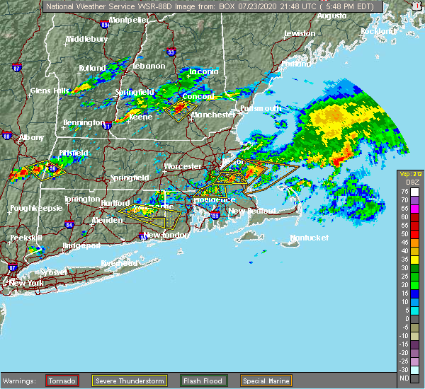
| 8/24/2020 5:06 PM EDT |
 The severe thunderstorm warning for southwestern rockingham and southeastern hillsborough counties will expire at 515 pm edt, the storm which prompted the warning has weakened below severe limits, and no longer poses an immediate threat to life or property. therefore, the warning will be allowed to expire. however heavy rain is still possible with this thunderstorm. The severe thunderstorm warning for southwestern rockingham and southeastern hillsborough counties will expire at 515 pm edt, the storm which prompted the warning has weakened below severe limits, and no longer poses an immediate threat to life or property. therefore, the warning will be allowed to expire. however heavy rain is still possible with this thunderstorm.
|
| 8/24/2020 4:18 PM EDT |
 At 418 pm edt, a severe thunderstorm was located over derry, moving east at 15 mph (radar indicated). Hazards include 60 mph wind gusts and quarter size hail. Hail damage to vehicles is expected. Expect wind damage to roofs, siding, and trees. At 418 pm edt, a severe thunderstorm was located over derry, moving east at 15 mph (radar indicated). Hazards include 60 mph wind gusts and quarter size hail. Hail damage to vehicles is expected. Expect wind damage to roofs, siding, and trees.
|
| 8/24/2020 4:07 PM EDT |
 At 407 pm edt, a severe thunderstorm was located over auburn, moving east at 15 mph (radar indicated). Hazards include 60 mph wind gusts and quarter size hail. Hail damage to vehicles is expected. expect wind damage to roofs, siding, and trees. locations impacted include, manchester, derry, epping, brentwood, raymond, londonderry, hampstead, atkinson, kingston, chester, danville, fremont, candia, sandown and plaistow. This includes interstate 93 between mile markers 12 and 17. At 407 pm edt, a severe thunderstorm was located over auburn, moving east at 15 mph (radar indicated). Hazards include 60 mph wind gusts and quarter size hail. Hail damage to vehicles is expected. expect wind damage to roofs, siding, and trees. locations impacted include, manchester, derry, epping, brentwood, raymond, londonderry, hampstead, atkinson, kingston, chester, danville, fremont, candia, sandown and plaistow. This includes interstate 93 between mile markers 12 and 17.
|
| 8/24/2020 3:54 PM EDT |
 At 354 pm edt, a severe thunderstorm was located over hudson, or near nashua, moving east at 10 mph (radar indicated). Hazards include 60 mph wind gusts and quarter size hail. Hail damage to vehicles is expected. Expect wind damage to roofs, siding, and trees. At 354 pm edt, a severe thunderstorm was located over hudson, or near nashua, moving east at 10 mph (radar indicated). Hazards include 60 mph wind gusts and quarter size hail. Hail damage to vehicles is expected. Expect wind damage to roofs, siding, and trees.
|
| 8/24/2020 3:38 PM EDT |
 At 337 pm edt, a severe thunderstorm was located near goffstown, or near manchester, moving east at 25 mph (radar indicated). Hazards include 60 mph wind gusts and quarter size hail. Hail damage to vehicles is expected. Expect wind damage to roofs, siding, and trees. At 337 pm edt, a severe thunderstorm was located near goffstown, or near manchester, moving east at 25 mph (radar indicated). Hazards include 60 mph wind gusts and quarter size hail. Hail damage to vehicles is expected. Expect wind damage to roofs, siding, and trees.
|
| 8/23/2020 2:23 PM EDT |
 At 223 pm edt, a severe thunderstorm was located over salem, moving east at 15 mph (radar indicated). Hazards include 60 mph wind gusts and quarter size hail. Hail damage to vehicles is expected. expect wind damage to roofs, siding, and trees. locations impacted include, derry, salem, londonderry, atkinson, windham, plaistow and newton. This includes interstate 93 between mile markers 1 and 10. At 223 pm edt, a severe thunderstorm was located over salem, moving east at 15 mph (radar indicated). Hazards include 60 mph wind gusts and quarter size hail. Hail damage to vehicles is expected. expect wind damage to roofs, siding, and trees. locations impacted include, derry, salem, londonderry, atkinson, windham, plaistow and newton. This includes interstate 93 between mile markers 1 and 10.
|
| 8/23/2020 2:15 PM EDT | Quarter sized hail reported 4.8 miles NW of Londonderry, NH |
| 8/23/2020 2:03 PM EDT |
 At 201 pm edt, a severe thunderstorm was located near pelham, or near salem, moving east at 15 mph (radar indicated). Hazards include 60 mph wind gusts and quarter size hail. Hail damage to vehicles is expected. expect wind damage to roofs, siding, and trees. locations impacted include, derry, salem, litchfield, hudson, pelham, londonderry, atkinson, windham, plaistow and newton. This includes interstate 93 between mile markers 1 and 10. At 201 pm edt, a severe thunderstorm was located near pelham, or near salem, moving east at 15 mph (radar indicated). Hazards include 60 mph wind gusts and quarter size hail. Hail damage to vehicles is expected. expect wind damage to roofs, siding, and trees. locations impacted include, derry, salem, litchfield, hudson, pelham, londonderry, atkinson, windham, plaistow and newton. This includes interstate 93 between mile markers 1 and 10.
|
| 8/23/2020 1:42 PM EDT |
 At 142 pm edt, a severe thunderstorm was located over hudson, or near nashua, moving east at 15 mph (radar indicated). Hazards include 60 mph wind gusts and penny size hail. expect damage to roofs, siding, and trees At 142 pm edt, a severe thunderstorm was located over hudson, or near nashua, moving east at 15 mph (radar indicated). Hazards include 60 mph wind gusts and penny size hail. expect damage to roofs, siding, and trees
|
| 7/23/2020 6:26 PM EDT |
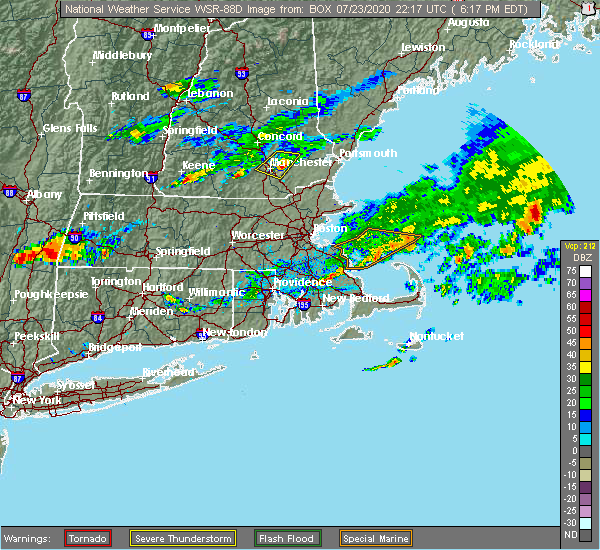 The severe thunderstorm warning for west central rockingham, east central hillsborough and southeastern merrimack counties will expire at 630 pm edt, the storm which prompted the warning has weakened below severe limits, and has exited the warned area. therefore, the warning will be allowed to expire. however small hail and gusty winds are still possible with this thunderstorm. a severe thunderstorm watch remains in effect until 800 pm edt for southern and central new hampshire. The severe thunderstorm warning for west central rockingham, east central hillsborough and southeastern merrimack counties will expire at 630 pm edt, the storm which prompted the warning has weakened below severe limits, and has exited the warned area. therefore, the warning will be allowed to expire. however small hail and gusty winds are still possible with this thunderstorm. a severe thunderstorm watch remains in effect until 800 pm edt for southern and central new hampshire.
|
| 7/23/2020 6:08 PM EDT |
 At 607 pm edt, a severe thunderstorm was located over auburn, moving east at 30 mph (radar indicated). Hazards include 60 mph wind gusts and half dollar size hail. Hail damage to vehicles is expected. expect wind damage to roofs, siding, and trees. locations impacted include, manchester, derry, bedford, hooksett, raymond, goffstown, londonderry, chester, allenstown, deerfield, candia and nottingham. this includes the following highways, interstate 293 between mile markers 1 and 11. Interstate 93 between mile markers 15 and 27. At 607 pm edt, a severe thunderstorm was located over auburn, moving east at 30 mph (radar indicated). Hazards include 60 mph wind gusts and half dollar size hail. Hail damage to vehicles is expected. expect wind damage to roofs, siding, and trees. locations impacted include, manchester, derry, bedford, hooksett, raymond, goffstown, londonderry, chester, allenstown, deerfield, candia and nottingham. this includes the following highways, interstate 293 between mile markers 1 and 11. Interstate 93 between mile markers 15 and 27.
|
| 7/23/2020 5:47 PM EDT |
 At 547 pm edt, a severe thunderstorm was located near hooksett, or near concord, moving east at 25 mph (radar indicated). Hazards include 60 mph wind gusts and half dollar size hail. Hail damage to vehicles is expected. Expect wind damage to roofs, siding, and trees. At 547 pm edt, a severe thunderstorm was located near hooksett, or near concord, moving east at 25 mph (radar indicated). Hazards include 60 mph wind gusts and half dollar size hail. Hail damage to vehicles is expected. Expect wind damage to roofs, siding, and trees.
|
| 7/14/2020 3:37 PM EDT |
 The severe thunderstorm warning for southwestern rockingham and southeastern hillsborough counties will expire at 345 pm edt, the storm which prompted the warning has weakened below severe limits, and no longer poses an immediate threat to life or property. therefore, the warning will be allowed to expire. however gusty winds and heavy rain are still possible with this thunderstorm. The severe thunderstorm warning for southwestern rockingham and southeastern hillsborough counties will expire at 345 pm edt, the storm which prompted the warning has weakened below severe limits, and no longer poses an immediate threat to life or property. therefore, the warning will be allowed to expire. however gusty winds and heavy rain are still possible with this thunderstorm.
|
| 7/14/2020 3:20 PM EDT | Quarter sized hail reported 4 miles ENE of Londonderry, NH, time estimated from radar. |
| 7/14/2020 3:06 PM EDT |
 At 306 pm edt, a severe thunderstorm was located near merrimack, moving southeast at 15 mph (radar indicated). Hazards include 60 mph wind gusts and quarter size hail. Hail damage to vehicles is expected. Expect wind damage to roofs, siding, and trees. At 306 pm edt, a severe thunderstorm was located near merrimack, moving southeast at 15 mph (radar indicated). Hazards include 60 mph wind gusts and quarter size hail. Hail damage to vehicles is expected. Expect wind damage to roofs, siding, and trees.
|
| 5/15/2020 8:53 PM EDT |
 The severe thunderstorm warning for rockingham, southern strafford, southeastern hillsborough, southern belknap and southeastern merrimack counties will expire at 900 pm edt, the storms which prompted the warning have weakened below severe limits, and have exited the warned area. therefore, the warning will be allowed to expire. however gusty winds are still possible with these thunderstorms. a tornado watch remains in effect until 1000 pm edt for central and southern new hampshire. The severe thunderstorm warning for rockingham, southern strafford, southeastern hillsborough, southern belknap and southeastern merrimack counties will expire at 900 pm edt, the storms which prompted the warning have weakened below severe limits, and have exited the warned area. therefore, the warning will be allowed to expire. however gusty winds are still possible with these thunderstorms. a tornado watch remains in effect until 1000 pm edt for central and southern new hampshire.
|
| 5/15/2020 8:40 PM EDT |
 At 839 pm edt, severe thunderstorms were located along a line extending from near barnstead to raymond to near salem, moving east at 50 mph (radar indicated). Hazards include 60 mph wind gusts and penny size hail. Expect damage to roofs, siding, and trees. locations impacted include, derry, rochester, hampton, durham, exeter, salem, northwood, dover, hooksett, barrington, epping, loudon, barnstead, epsom, brentwood, greenland, raymond, pelham, stratham and newmarket. this includes the following highways, interstate 93 between mile markers 0 and 15. Interstate 95 in new hampshire between mile markers 6 and 11. At 839 pm edt, severe thunderstorms were located along a line extending from near barnstead to raymond to near salem, moving east at 50 mph (radar indicated). Hazards include 60 mph wind gusts and penny size hail. Expect damage to roofs, siding, and trees. locations impacted include, derry, rochester, hampton, durham, exeter, salem, northwood, dover, hooksett, barrington, epping, loudon, barnstead, epsom, brentwood, greenland, raymond, pelham, stratham and newmarket. this includes the following highways, interstate 93 between mile markers 0 and 15. Interstate 95 in new hampshire between mile markers 6 and 11.
|
| 5/15/2020 8:16 PM EDT |
 At 815 pm edt, severe thunderstorms were located along a line extending from near canterbury to near goffstown to hollis, moving east at 50 mph (radar indicated). Hazards include 60 mph wind gusts and penny size hail. expect damage to roofs, siding, and trees At 815 pm edt, severe thunderstorms were located along a line extending from near canterbury to near goffstown to hollis, moving east at 50 mph (radar indicated). Hazards include 60 mph wind gusts and penny size hail. expect damage to roofs, siding, and trees
|
| 8/21/2019 1:52 PM EDT |
 At 151 pm edt, a severe thunderstorm was located near nashua, moving northeast at 20 mph (radar indicated). Hazards include 60 mph wind gusts and quarter size hail. Hail damage to vehicles is expected. Expect wind damage to roofs, siding, and trees. At 151 pm edt, a severe thunderstorm was located near nashua, moving northeast at 20 mph (radar indicated). Hazards include 60 mph wind gusts and quarter size hail. Hail damage to vehicles is expected. Expect wind damage to roofs, siding, and trees.
|
| 6/29/2019 11:25 PM EDT |
 At 1125 pm edt, a severe thunderstorm was located near brentwood, or 9 miles east of derry, moving east at 30 mph (radar indicated). Hazards include 60 mph wind gusts and penny size hail. expect damage to roofs, siding, and trees At 1125 pm edt, a severe thunderstorm was located near brentwood, or 9 miles east of derry, moving east at 30 mph (radar indicated). Hazards include 60 mph wind gusts and penny size hail. expect damage to roofs, siding, and trees
|
| 6/2/2019 5:18 PM EDT |
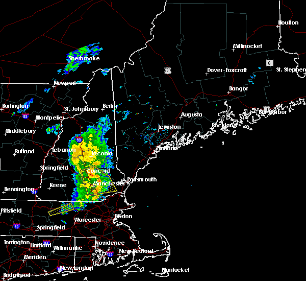 At 518 pm edt, severe thunderstorms were located along a line extending from epsom to near raymond, moving east at 35 mph (radar indicated). Hazards include 60 mph wind gusts. Expect damage to roofs, siding, and trees. locations impacted include, manchester, concord, derry, exeter, northwood, hooksett, epping, loudon, barnstead, epsom, brentwood, gilmanton, canterbury, raymond, londonderry, hampstead, bow, kingston, chester and danville. This includes interstate 93 between mile markers 10 and 23. At 518 pm edt, severe thunderstorms were located along a line extending from epsom to near raymond, moving east at 35 mph (radar indicated). Hazards include 60 mph wind gusts. Expect damage to roofs, siding, and trees. locations impacted include, manchester, concord, derry, exeter, northwood, hooksett, epping, loudon, barnstead, epsom, brentwood, gilmanton, canterbury, raymond, londonderry, hampstead, bow, kingston, chester and danville. This includes interstate 93 between mile markers 10 and 23.
|
| 6/2/2019 5:06 PM EDT |
 At 505 pm edt, severe thunderstorms were located along a line extending from concord to manchester, moving northeast at 35 mph (radar indicated). Hazards include 60 mph wind gusts and penny size hail. Expect damage to roofs, siding, and trees. locations impacted include, manchester, concord, derry, exeter, merrimack, northwood, bedford, hooksett, litchfield, epping, hopkinton, loudon, barnstead, epsom, brentwood, gilmanton, canterbury, raymond, goffstown and londonderry. this includes the following highways, interstate 293 between mile markers 1 and 11. interstate 89 between mile markers 0 and 5. Interstate 93 between mile markers 10 and 47. At 505 pm edt, severe thunderstorms were located along a line extending from concord to manchester, moving northeast at 35 mph (radar indicated). Hazards include 60 mph wind gusts and penny size hail. Expect damage to roofs, siding, and trees. locations impacted include, manchester, concord, derry, exeter, merrimack, northwood, bedford, hooksett, litchfield, epping, hopkinton, loudon, barnstead, epsom, brentwood, gilmanton, canterbury, raymond, goffstown and londonderry. this includes the following highways, interstate 293 between mile markers 1 and 11. interstate 89 between mile markers 0 and 5. Interstate 93 between mile markers 10 and 47.
|
| 6/2/2019 4:52 PM EDT |
 The national weather service in gray maine has issued a * severe thunderstorm warning for. northwestern rockingham county in southern new hampshire. central hillsborough county in southern new hampshire. southeastern merrimack county in central new hampshire. Until 530 pm edt. The national weather service in gray maine has issued a * severe thunderstorm warning for. northwestern rockingham county in southern new hampshire. central hillsborough county in southern new hampshire. southeastern merrimack county in central new hampshire. Until 530 pm edt.
|
| 8/3/2018 5:12 PM EDT |
 At 512 pm edt, severe thunderstorms were located along a line extending from manchester to new ipswich, moving northeast at 20 mph (radar indicated). Hazards include 60 mph wind gusts and quarter size hail. Hail damage to vehicles is expected. Expect wind damage to roofs, siding, and trees. At 512 pm edt, severe thunderstorms were located along a line extending from manchester to new ipswich, moving northeast at 20 mph (radar indicated). Hazards include 60 mph wind gusts and quarter size hail. Hail damage to vehicles is expected. Expect wind damage to roofs, siding, and trees.
|
| 7/17/2018 1:23 PM EDT |
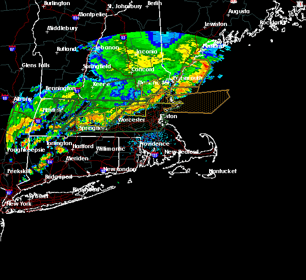 The severe thunderstorm warning for southwestern rockingham and southeastern hillsborough counties will expire at 130 pm edt, the storm which prompted the warning has moved out of the area. therefore, the warning will be allowed to expire. however heavy rain is still possible with this thunderstorm. a severe thunderstorm watch remains in effect until 700 pm edt for southern and central new hampshire. The severe thunderstorm warning for southwestern rockingham and southeastern hillsborough counties will expire at 130 pm edt, the storm which prompted the warning has moved out of the area. therefore, the warning will be allowed to expire. however heavy rain is still possible with this thunderstorm. a severe thunderstorm watch remains in effect until 700 pm edt for southern and central new hampshire.
|
| 7/17/2018 1:06 PM EDT |
 At 1253 pm edt, a severe thunderstorm was located near raymond, or 7 miles northeast of derry, moving east at 40 mph (radar indicated). Hazards include 60 mph wind gusts. Expect damage to roofs, siding, and trees. locations impacted include, manchester, nashua, derry, exeter, merrimack, salem, bedford, litchfield, epping, brentwood, raymond, hudson, pelham, londonderry, hampstead, atkinson, kingston, chester, danville and fremont. this includes the following highways, interstate 293 between mile markers 1 and 5. Interstate 93 between mile markers 3 and 21. At 1253 pm edt, a severe thunderstorm was located near raymond, or 7 miles northeast of derry, moving east at 40 mph (radar indicated). Hazards include 60 mph wind gusts. Expect damage to roofs, siding, and trees. locations impacted include, manchester, nashua, derry, exeter, merrimack, salem, bedford, litchfield, epping, brentwood, raymond, hudson, pelham, londonderry, hampstead, atkinson, kingston, chester, danville and fremont. this includes the following highways, interstate 293 between mile markers 1 and 5. Interstate 93 between mile markers 3 and 21.
|
| 7/17/2018 12:54 PM EDT |
 At 1229 pm edt, a severe thunderstorm was located over merrimack, moving east at 40 mph (radar indicated). Hazards include 60 mph wind gusts and penny size hail. expect damage to roofs, siding, and trees At 1229 pm edt, a severe thunderstorm was located over merrimack, moving east at 40 mph (radar indicated). Hazards include 60 mph wind gusts and penny size hail. expect damage to roofs, siding, and trees
|
| 7/17/2018 12:29 PM EDT |
 At 1229 pm edt, a severe thunderstorm was located over merrimack, moving east at 40 mph (radar indicated). Hazards include 60 mph wind gusts and penny size hail. expect damage to roofs, siding, and trees At 1229 pm edt, a severe thunderstorm was located over merrimack, moving east at 40 mph (radar indicated). Hazards include 60 mph wind gusts and penny size hail. expect damage to roofs, siding, and trees
|
| 7/17/2018 12:20 PM EDT |
 The severe thunderstorm warning for northwestern rockingham and east central hillsborough counties will expire at 1230 pm edt, the storm which prompted the warning has weakened below severe limits, and no longer poses an immediate threat to life or property. therefore, the warning will be allowed to expire. however gusty winds are still possible with this thunderstorm. a severe thunderstorm watch remains in effect until 700 pm edt for southern and central new hampshire. The severe thunderstorm warning for northwestern rockingham and east central hillsborough counties will expire at 1230 pm edt, the storm which prompted the warning has weakened below severe limits, and no longer poses an immediate threat to life or property. therefore, the warning will be allowed to expire. however gusty winds are still possible with this thunderstorm. a severe thunderstorm watch remains in effect until 700 pm edt for southern and central new hampshire.
|
| 7/17/2018 12:07 PM EDT |
 At 1207 pm edt, a severe thunderstorm was located over raymond, or 8 miles east of auburn, moving east at 20 mph (radar indicated). Hazards include 60 mph wind gusts. Expect damage to roofs, siding, and trees. locations impacted include, manchester, derry, merrimack, bedford, litchfield, epping, raymond, londonderry, hampstead, chester, danville, lee, fremont, deerfield, candia, nottingham and sandown. this includes the following highways, interstate 293 near mile marker 1. Interstate 93 between mile markers 13 and 20. At 1207 pm edt, a severe thunderstorm was located over raymond, or 8 miles east of auburn, moving east at 20 mph (radar indicated). Hazards include 60 mph wind gusts. Expect damage to roofs, siding, and trees. locations impacted include, manchester, derry, merrimack, bedford, litchfield, epping, raymond, londonderry, hampstead, chester, danville, lee, fremont, deerfield, candia, nottingham and sandown. this includes the following highways, interstate 293 near mile marker 1. Interstate 93 between mile markers 13 and 20.
|
| 7/17/2018 11:34 AM EDT |
 At 1134 am edt, a severe thunderstorm was located over manchester, moving east at 20 mph (radar indicated). Hazards include 60 mph wind gusts and penny size hail. expect damage to roofs, siding, and trees At 1134 am edt, a severe thunderstorm was located over manchester, moving east at 20 mph (radar indicated). Hazards include 60 mph wind gusts and penny size hail. expect damage to roofs, siding, and trees
|
| 7/15/2018 5:23 PM EDT |
 The severe thunderstorm warning for southwestern rockingham, southeastern hillsborough and southeastern merrimack counties will expire at 530 pm edt, the storm which prompted the warning has weakened below severe limits, and no longer poses an immediate threat to life or property. therefore, the warning will be allowed to expire. The severe thunderstorm warning for southwestern rockingham, southeastern hillsborough and southeastern merrimack counties will expire at 530 pm edt, the storm which prompted the warning has weakened below severe limits, and no longer poses an immediate threat to life or property. therefore, the warning will be allowed to expire.
|
| 7/15/2018 4:42 PM EDT |
 At 441 pm edt, a severe thunderstorm was located over bedford, or near manchester, moving south at 15 mph (radar indicated). Hazards include 60 mph wind gusts and penny size hail. expect damage to roofs, siding, and trees At 441 pm edt, a severe thunderstorm was located over bedford, or near manchester, moving south at 15 mph (radar indicated). Hazards include 60 mph wind gusts and penny size hail. expect damage to roofs, siding, and trees
|
| 6/18/2018 5:51 PM EDT |
 At 550 pm edt, severe thunderstorms were located along a line extending from near warner to near weare to milford to near new ipswich, moving east at 45 mph. these storms are producing widespread wind damage (radar indicated). Hazards include 70 mph wind gusts. Expect considerable tree damage. Damage is likely to mobile homes, roofs, and outbuildings. At 550 pm edt, severe thunderstorms were located along a line extending from near warner to near weare to milford to near new ipswich, moving east at 45 mph. these storms are producing widespread wind damage (radar indicated). Hazards include 70 mph wind gusts. Expect considerable tree damage. Damage is likely to mobile homes, roofs, and outbuildings.
|
| 7/8/2017 2:04 PM EDT |
 At 203 pm edt, severe thunderstorms were located along a line extending from 6 miles south of raymond to near hudson, moving east at 35 mph (radar indicated). Hazards include 60 mph wind gusts and penny size hail. Expect damage to trees, and power lines. locations impacted include, manchester, nashua, portland, derry, rochester, south portland, biddeford, portsmouth, brunswick, westbrook, hampton, durham, exeter, kittery, alfred, sanford, salem, northwood, topsham and merrimack. this also includes, hampton beach, york beach, ogunquit beach, wells beach, and fortunes rock beach. peaks island, long island, cushing island, cousins island, and great diamond island. this includes the following highways, interstate 295 between mile markers 1 and 30. interstate 93 between mile markers 0 and 17. interstate 95 between mile markers 1 and 63. Interstate 95 in new hampshire between mile markers 1 and 16. At 203 pm edt, severe thunderstorms were located along a line extending from 6 miles south of raymond to near hudson, moving east at 35 mph (radar indicated). Hazards include 60 mph wind gusts and penny size hail. Expect damage to trees, and power lines. locations impacted include, manchester, nashua, portland, derry, rochester, south portland, biddeford, portsmouth, brunswick, westbrook, hampton, durham, exeter, kittery, alfred, sanford, salem, northwood, topsham and merrimack. this also includes, hampton beach, york beach, ogunquit beach, wells beach, and fortunes rock beach. peaks island, long island, cushing island, cousins island, and great diamond island. this includes the following highways, interstate 295 between mile markers 1 and 30. interstate 93 between mile markers 0 and 17. interstate 95 between mile markers 1 and 63. Interstate 95 in new hampshire between mile markers 1 and 16.
|
| 7/8/2017 1:42 PM EDT |
 At 141 pm edt, severe thunderstorms were located along a line extending from near cornish to near brookline, moving east at 35 mph (radar indicated). Hazards include 60 mph wind gusts and penny size hail. expect damage to trees, and power lines At 141 pm edt, severe thunderstorms were located along a line extending from near cornish to near brookline, moving east at 35 mph (radar indicated). Hazards include 60 mph wind gusts and penny size hail. expect damage to trees, and power lines
|
| 7/8/2017 1:26 PM EDT |
 At 125 pm edt, severe thunderstorms were located along a line extending from standish to 6 miles southwest of new ipswich, moving east at 35 mph (public). Hazards include 60 mph wind gusts and penny size hail. Expect damage to trees, and power lines. locations impacted include, manchester, nashua, concord, derry, rochester, biddeford, durham, jaffrey, alfred, sanford, merrimack, northwood, ossipee, dover, bedford, saco, milford, hooksett, somersworth and amherst. this also includes, north pack monadnock. this includes the following highways, interstate 293 between mile markers 1 and 11. interstate 89 between mile markers 0 and 5. Interstate 93 between mile markers 10 and 40. At 125 pm edt, severe thunderstorms were located along a line extending from standish to 6 miles southwest of new ipswich, moving east at 35 mph (public). Hazards include 60 mph wind gusts and penny size hail. Expect damage to trees, and power lines. locations impacted include, manchester, nashua, concord, derry, rochester, biddeford, durham, jaffrey, alfred, sanford, merrimack, northwood, ossipee, dover, bedford, saco, milford, hooksett, somersworth and amherst. this also includes, north pack monadnock. this includes the following highways, interstate 293 between mile markers 1 and 11. interstate 89 between mile markers 0 and 5. Interstate 93 between mile markers 10 and 40.
|
| 7/8/2017 12:58 PM EDT |
 The national weather service in gray maine has issued a * severe thunderstorm warning for. york county in southwestern maine. northwestern rockingham county in southern new hampshire. strafford county in central new hampshire. Southeastern cheshire county in southern new hampshire. The national weather service in gray maine has issued a * severe thunderstorm warning for. york county in southwestern maine. northwestern rockingham county in southern new hampshire. strafford county in central new hampshire. Southeastern cheshire county in southern new hampshire.
|
| 7/8/2017 12:58 PM EDT |
 At 1257 pm edt, severe thunderstorms were located along a line extending from near effingham to 9 miles south of richmond, moving east at 35 mph (public). Hazards include 60 mph wind gusts and penny size hail. expect damage to trees, and power lines At 1257 pm edt, severe thunderstorms were located along a line extending from near effingham to 9 miles south of richmond, moving east at 35 mph (public). Hazards include 60 mph wind gusts and penny size hail. expect damage to trees, and power lines
|
| 5/31/2017 8:13 PM EDT |
 At 813 pm edt, severe thunderstorms were located along a line extending from manchester to hudson to 11 miles south of nashua, moving east at 25 mph (radar indicated). Hazards include 60 mph wind gusts and penny size hail. expect damage to trees, and power lines At 813 pm edt, severe thunderstorms were located along a line extending from manchester to hudson to 11 miles south of nashua, moving east at 25 mph (radar indicated). Hazards include 60 mph wind gusts and penny size hail. expect damage to trees, and power lines
|
| 5/18/2017 10:38 PM EDT |
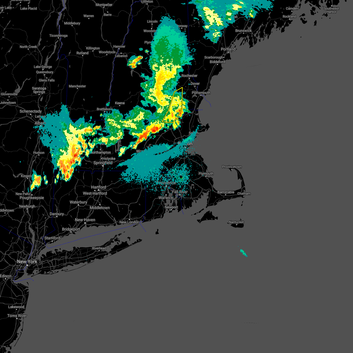 At 1038 pm edt, severe thunderstorms were located along a line extending from near durham to 10 miles east of salem to 20 miles south of pelham, moving east at 45 mph (radar indicated). Hazards include 60 mph wind gusts. Expect damage to trees, and power lines. locations impacted include, nashua, derry, salem, epping, raymond, hudson, pelham, londonderry, hampstead, atkinson, chester, danville, fremont, deerfield, candia, windham, sandown and nottingham. This includes interstate 93 between mile markers 1 and 13. At 1038 pm edt, severe thunderstorms were located along a line extending from near durham to 10 miles east of salem to 20 miles south of pelham, moving east at 45 mph (radar indicated). Hazards include 60 mph wind gusts. Expect damage to trees, and power lines. locations impacted include, nashua, derry, salem, epping, raymond, hudson, pelham, londonderry, hampstead, atkinson, chester, danville, fremont, deerfield, candia, windham, sandown and nottingham. This includes interstate 93 between mile markers 1 and 13.
|
| 5/18/2017 10:02 PM EDT |
 At 1001 pm edt, severe thunderstorms were located along a line extending from concord to near merrimack to 15 miles south of mason, moving east at 45 mph (radar indicated). Hazards include 60 mph wind gusts. Expect damage to trees, and power lines. locations impacted include, manchester, nashua, derry, merrimack, salem, northwood, bedford, milford, hooksett, amherst, litchfield, hollis, epping, new boston, mont vernon, lyndeborough, raymond, new ipswich, goffstown and mount vernon. this includes the following highways, interstate 293 between mile markers 1 and 11. Interstate 93 between mile markers 1 and 31. At 1001 pm edt, severe thunderstorms were located along a line extending from concord to near merrimack to 15 miles south of mason, moving east at 45 mph (radar indicated). Hazards include 60 mph wind gusts. Expect damage to trees, and power lines. locations impacted include, manchester, nashua, derry, merrimack, salem, northwood, bedford, milford, hooksett, amherst, litchfield, hollis, epping, new boston, mont vernon, lyndeborough, raymond, new ipswich, goffstown and mount vernon. this includes the following highways, interstate 293 between mile markers 1 and 11. Interstate 93 between mile markers 1 and 31.
|
| 5/18/2017 9:37 PM EDT |
 At 937 pm edt, severe thunderstorms were located along a line extending from near bradford to peterborough to 13 miles south of fitzwilliam, moving east at 45 mph (radar indicated). Hazards include 60 mph wind gusts. expect damage to trees, and power lines At 937 pm edt, severe thunderstorms were located along a line extending from near bradford to peterborough to 13 miles south of fitzwilliam, moving east at 45 mph (radar indicated). Hazards include 60 mph wind gusts. expect damage to trees, and power lines
|
| 9/11/2016 10:00 AM EDT | Trees and power lines down in rockingham county NH, 4.8 miles NW of Londonderry, NH |
| 7/23/2016 6:42 PM EDT |
 At 641 pm edt, severe thunderstorms were located along a line extending from portsmouth to near manchester to keene, moving southeast at 25 mph (radar indicated). Hazards include 60 mph wind gusts and nickel size hail. Expect damage to roofs. siding. and trees. Locations impacted include, manchester, nashua, derry, merrimack, keene, portsmouth, hampton, durham, exeter, kittery, jaffrey, salem, dover, bedford, milford, amherst, litchfield, hollis, swanzey and epping. At 641 pm edt, severe thunderstorms were located along a line extending from portsmouth to near manchester to keene, moving southeast at 25 mph (radar indicated). Hazards include 60 mph wind gusts and nickel size hail. Expect damage to roofs. siding. and trees. Locations impacted include, manchester, nashua, derry, merrimack, keene, portsmouth, hampton, durham, exeter, kittery, jaffrey, salem, dover, bedford, milford, amherst, litchfield, hollis, swanzey and epping.
|
| 7/23/2016 6:41 PM EDT |
 At 641 pm edt, severe thunderstorms were located along a line extending from near brentwood to brookline to fitzwilliam, moving southeast at 50 mph (radar indicated). Hazards include 60 mph wind gusts. Expect damage to roofs. siding. And trees. At 641 pm edt, severe thunderstorms were located along a line extending from near brentwood to brookline to fitzwilliam, moving southeast at 50 mph (radar indicated). Hazards include 60 mph wind gusts. Expect damage to roofs. siding. And trees.
|
| 7/23/2016 6:30 PM EDT |
 At 630 pm edt, severe thunderstorms were located along a line extending from newington to manchester to swanzey, moving southeast at 25 mph (radar indicated). Hazards include 60 mph wind gusts and nickel size hail. Expect damage to roofs. siding. and trees. Locations impacted include, manchester, nashua, derry, merrimack, keene, portsmouth, hampton, durham, exeter, jaffrey, salem, northwood, dover, bedford, milford, hooksett, somersworth, amherst, barrington and litchfield. At 630 pm edt, severe thunderstorms were located along a line extending from newington to manchester to swanzey, moving southeast at 25 mph (radar indicated). Hazards include 60 mph wind gusts and nickel size hail. Expect damage to roofs. siding. and trees. Locations impacted include, manchester, nashua, derry, merrimack, keene, portsmouth, hampton, durham, exeter, jaffrey, salem, northwood, dover, bedford, milford, hooksett, somersworth, amherst, barrington and litchfield.
|
| 7/23/2016 6:08 PM EDT |
 At 608 pm edt, severe thunderstorms were located along a line extending from near dover to goffstown to walpole, moving southeast at 25 mph (radar indicated). Hazards include 60 mph wind gusts and nickel size hail. Expect damage to roofs. siding. And trees. At 608 pm edt, severe thunderstorms were located along a line extending from near dover to goffstown to walpole, moving southeast at 25 mph (radar indicated). Hazards include 60 mph wind gusts and nickel size hail. Expect damage to roofs. siding. And trees.
|
| 7/18/2016 3:41 PM EDT |
 At 340 pm edt, severe thunderstorms were located along a line extending from raymond to salem to near dracut, moving northeast at 45 mph (radar indicated). Hazards include 60 mph wind gusts. Expect damage to roofs. siding. And trees. At 340 pm edt, severe thunderstorms were located along a line extending from raymond to salem to near dracut, moving northeast at 45 mph (radar indicated). Hazards include 60 mph wind gusts. Expect damage to roofs. siding. And trees.
|
| 7/18/2016 3:30 PM EDT | Trees and wires down at on-ramp of exit 5... i-93 in rockingham county NH, 1.4 miles SSE of Londonderry, NH |
| 7/18/2016 3:15 PM EDT |
 At 315 pm edt, severe thunderstorms were located along a line extending from lyndeborough to hollis to fitchburg, moving east at 50 mph (radar indicated). Hazards include 60 mph wind gusts and penny size hail. Expect damage to roofs. siding. and trees. Locations impacted include, manchester, nashua, merrimack, salem, bedford, milford, hooksett, amherst, litchfield, hollis, new boston, mont vernon, greenfield, lyndeborough, francestown, mason, mount vernon, wilton, goffstown and greenville. At 315 pm edt, severe thunderstorms were located along a line extending from lyndeborough to hollis to fitchburg, moving east at 50 mph (radar indicated). Hazards include 60 mph wind gusts and penny size hail. Expect damage to roofs. siding. and trees. Locations impacted include, manchester, nashua, merrimack, salem, bedford, milford, hooksett, amherst, litchfield, hollis, new boston, mont vernon, greenfield, lyndeborough, francestown, mason, mount vernon, wilton, goffstown and greenville.
|
| 7/18/2016 3:05 PM EDT |
 At 305 pm edt, severe thunderstorms were located along a line extending from near peterborough to mason to near gardner, moving east at 60 mph (radar indicated). Hazards include 60 mph wind gusts and penny size hail. Expect damage to roofs. siding. and trees. Locations impacted include, manchester, nashua, merrimack, salem, bedford, milford, hooksett, amherst, litchfield, hollis, peterborough, new boston, ashby, mont vernon, greenfield, lyndeborough, francestown, mason, new ipswich and mount vernon. At 305 pm edt, severe thunderstorms were located along a line extending from near peterborough to mason to near gardner, moving east at 60 mph (radar indicated). Hazards include 60 mph wind gusts and penny size hail. Expect damage to roofs. siding. and trees. Locations impacted include, manchester, nashua, merrimack, salem, bedford, milford, hooksett, amherst, litchfield, hollis, peterborough, new boston, ashby, mont vernon, greenfield, lyndeborough, francestown, mason, new ipswich and mount vernon.
|
| 7/18/2016 2:56 PM EDT |
 At 256 pm edt, severe thunderstorms were located along a line extending from jaffrey to near new ipswich to templeton, moving east at 50 mph (radar indicated). Hazards include 60 mph wind gusts. Expect damage to roofs. siding. and trees. Locations impacted include, manchester, nashua, merrimack, salem, bedford, milford, hooksett, amherst, litchfield, hollis, peterborough, new boston, ashby, mont vernon, greenfield, lyndeborough, francestown, mason, harrisville and new ipswich. At 256 pm edt, severe thunderstorms were located along a line extending from jaffrey to near new ipswich to templeton, moving east at 50 mph (radar indicated). Hazards include 60 mph wind gusts. Expect damage to roofs. siding. and trees. Locations impacted include, manchester, nashua, merrimack, salem, bedford, milford, hooksett, amherst, litchfield, hollis, peterborough, new boston, ashby, mont vernon, greenfield, lyndeborough, francestown, mason, harrisville and new ipswich.
|
| 7/18/2016 2:48 PM EDT |
 At 248 pm edt, severe thunderstorms were located along a line extending from near jaffrey to near rindge to phillipston, moving east at 50 mph (radar indicated). Hazards include 60 mph wind gusts. Expect damage to roofs. siding. And trees. At 248 pm edt, severe thunderstorms were located along a line extending from near jaffrey to near rindge to phillipston, moving east at 50 mph (radar indicated). Hazards include 60 mph wind gusts. Expect damage to roofs. siding. And trees.
|
| 6/21/2016 3:25 AM EDT |
 At 324 am edt, severe thunderstorms were located along a line extending from wilton to ashby to near hubbardston, moving southeast at 45 mph (radar indicated). Hazards include 60 mph wind gusts. Expect damage to roofs. siding. and trees. Locations impacted include, nashua, derry, dracut, merrimack, salem, milford, amherst, litchfield, hollis, peterborough, ashby, mont vernon, greenfield, lyndeborough, mason, new ipswich, mount vernon, wilton, greenville and hudson. At 324 am edt, severe thunderstorms were located along a line extending from wilton to ashby to near hubbardston, moving southeast at 45 mph (radar indicated). Hazards include 60 mph wind gusts. Expect damage to roofs. siding. and trees. Locations impacted include, nashua, derry, dracut, merrimack, salem, milford, amherst, litchfield, hollis, peterborough, ashby, mont vernon, greenfield, lyndeborough, mason, new ipswich, mount vernon, wilton, greenville and hudson.
|
| 6/21/2016 3:03 AM EDT |
 At 303 am edt, severe thunderstorms were located along a line extending from near harrisville to near fitzwilliam to near athol, moving southeast at 45 mph (radar indicated). Hazards include 60 mph wind gusts. Expect damage to roofs. siding. And trees. At 303 am edt, severe thunderstorms were located along a line extending from near harrisville to near fitzwilliam to near athol, moving southeast at 45 mph (radar indicated). Hazards include 60 mph wind gusts. Expect damage to roofs. siding. And trees.
|
| 7/1/2015 7:07 PM EDT |
 At 706 pm edt, doppler radar indicated a line of severe thunderstorms capable of producing damaging winds in excess of 60 mph. these storms were located along a line extending from near pawtuckaway state park to hollis, moving east at 30 mph. locations impacted include, nashua, derry, dracut, merrimack, western exeter, salem, hooksett, litchfield, hollis, epping, brentwood, raymond, newmarket, londonderry, hampstead, atkinson, kingston, chester, danville and fremont. At 706 pm edt, doppler radar indicated a line of severe thunderstorms capable of producing damaging winds in excess of 60 mph. these storms were located along a line extending from near pawtuckaway state park to hollis, moving east at 30 mph. locations impacted include, nashua, derry, dracut, merrimack, western exeter, salem, hooksett, litchfield, hollis, epping, brentwood, raymond, newmarket, londonderry, hampstead, atkinson, kingston, chester, danville and fremont.
|
| 7/1/2015 6:58 PM EDT |
 At 657 pm edt, doppler radar indicated a line of severe thunderstorms capable of producing damaging winds in excess of 60 mph. these storms were located along a line extending from near pawtuckaway state park to hollis, moving east at 30 mph. locations impacted include, nashua, derry, dracut, merrimack, western exeter, salem, bedford, hooksett, amherst, litchfield, hollis, epping, brentwood, raymond, newmarket, londonderry, hampstead, atkinson, kingston and chester. At 657 pm edt, doppler radar indicated a line of severe thunderstorms capable of producing damaging winds in excess of 60 mph. these storms were located along a line extending from near pawtuckaway state park to hollis, moving east at 30 mph. locations impacted include, nashua, derry, dracut, merrimack, western exeter, salem, bedford, hooksett, amherst, litchfield, hollis, epping, brentwood, raymond, newmarket, londonderry, hampstead, atkinson, kingston and chester.
|
| 7/1/2015 6:28 PM EDT |
 At 627 pm edt, doppler radar indicated a line of severe thunderstorms capable of producing damaging winds in excess of 60 mph. these storms were located along a line extending from near hooksett to near new ipswich, and moving east at 35 mph. At 627 pm edt, doppler radar indicated a line of severe thunderstorms capable of producing damaging winds in excess of 60 mph. these storms were located along a line extending from near hooksett to near new ipswich, and moving east at 35 mph.
|
| 5/28/2015 4:41 PM EDT | At 441 pm edt, doppler radar indicated a severe thunderstorm capable of producing quarter size hail and damaging winds in excess of 60 mph. this storm was located near dracut, and moving east at 25 mph. |
| 7/15/2014 4:20 PM EDT | Multiple trees uprooted. delayed repor in rockingham county NH, 4.7 miles NNW of Londonderry, NH |
| 7/15/2014 4:20 PM EDT | Trees down on wires on lancaster roa in rockingham county NH, 4.4 miles NNW of Londonderry, NH |
| 7/29/2013 4:50 PM EDT | Ping Pong Ball sized hail reported 4.8 miles NW of Londonderry, NH, tine estimated from radar |
| 1/1/0001 12:00 AM | Quarter sized hail reported 4.8 miles NW of Londonderry, NH |
| 1/1/0001 12:00 AM | Quarter sized hail reported 1 miles NW of Londonderry, NH |
Hail Maps for Londonderry, NH


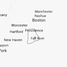


Connect with Interactive Hail Maps