

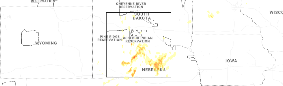
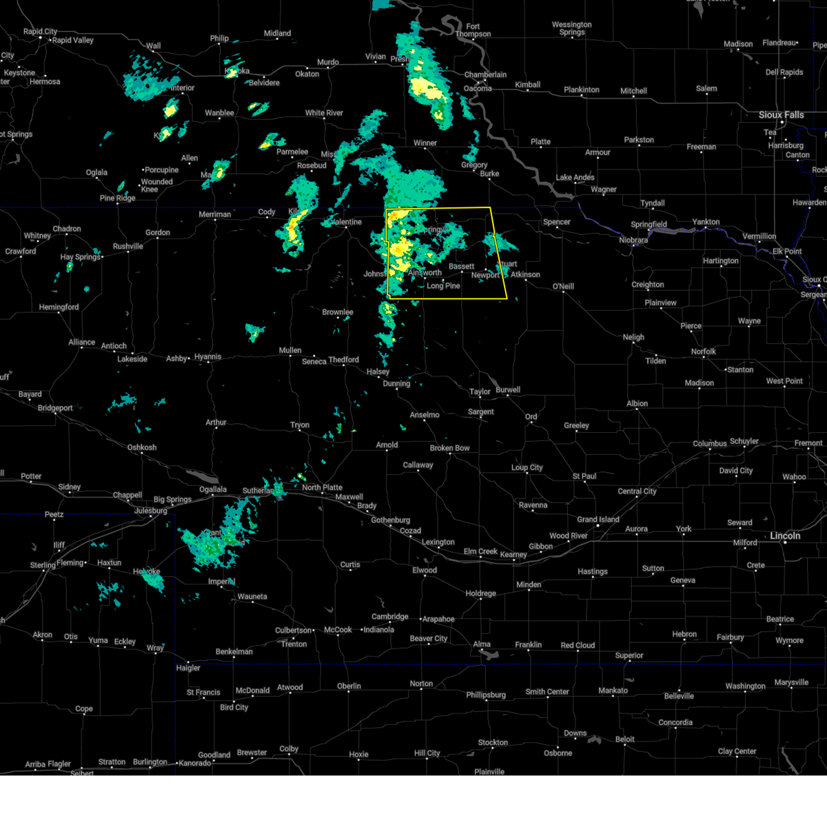
Hail Map for Long Pine, NE
The Long Pine, NE area has had 13 reports of on-the-ground hail by trained spotters, and has been under severe weather warnings 12 times during the past 12 months. Doppler radar has detected hail at or near Long Pine, NE on 85 occasions, including 6 occasions during the past year.
| Name: | Long Pine, NE |
| Where Located: | 49.2 miles ESE of Valentine, NE |
| Map: | Google Map for Long Pine, NE |
| Population: | 305 |
| Housing Units: | 202 |
| More Info: | Search Google for Long Pine, NE |
1
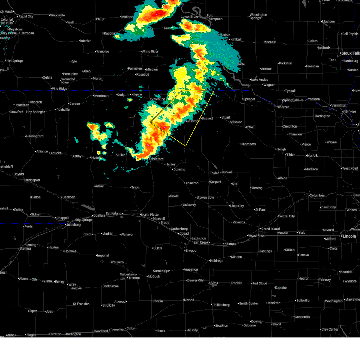
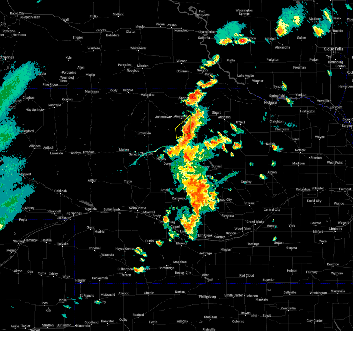
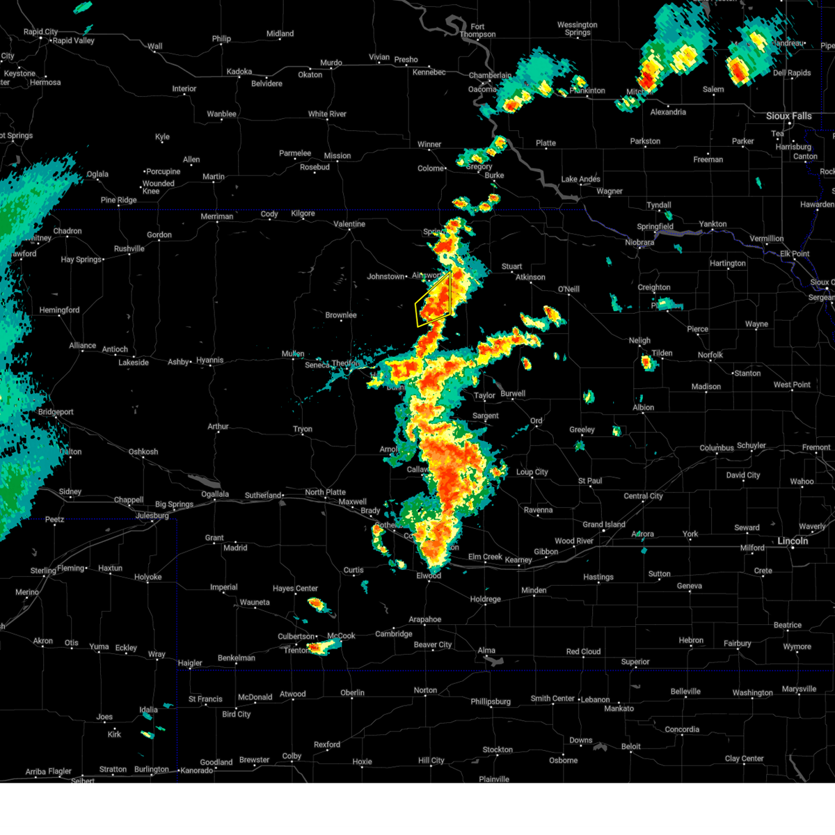
The Top Recent Hail Date for Long Pine, NE is Wednesday, May 14, 2025 (8th out of 85)
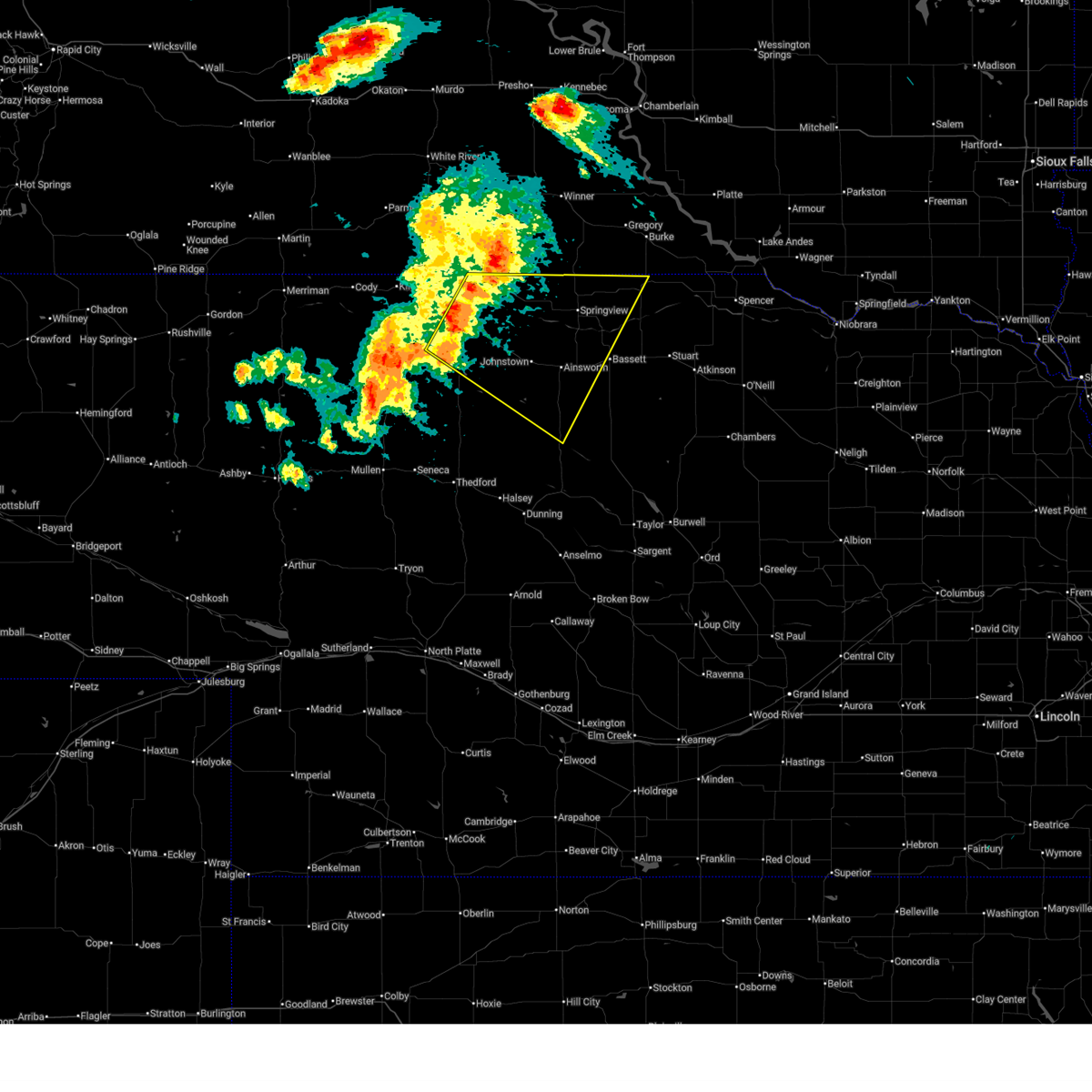
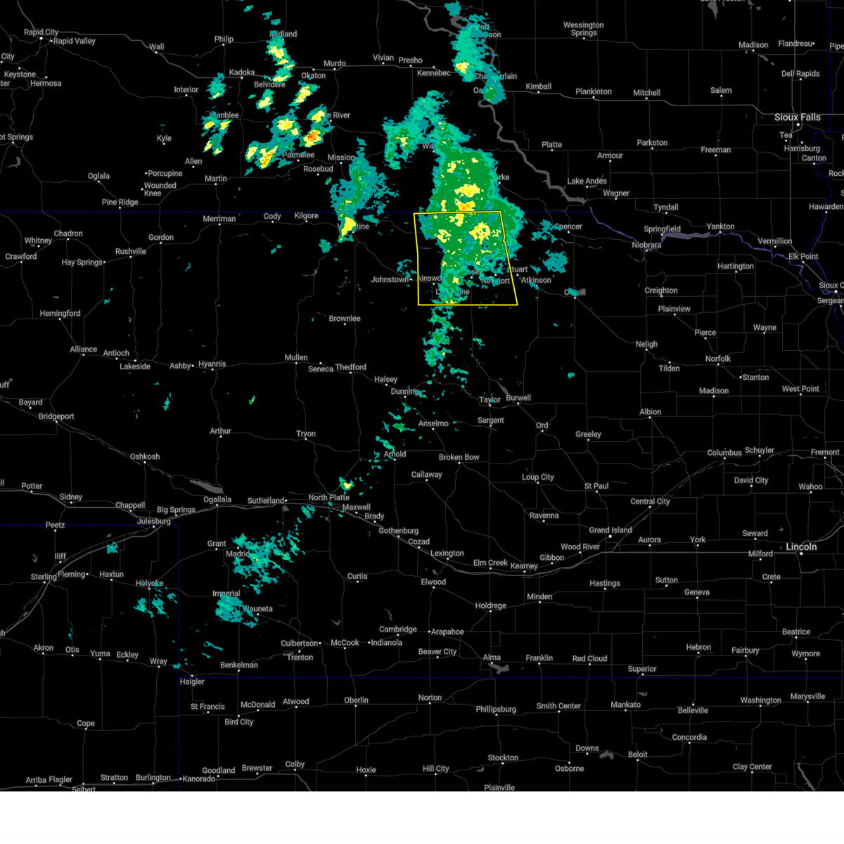
Hail and Wind Damage Spotted near Long Pine, NE
| Date / Time | Report Details |
|---|---|
| 7/9/2025 8:32 PM CDT |
 At 832 pm cdt, severe thunderstorms were located along a line extending from 16 miles west of naper to 14 miles north of elsmere, moving southeast at 65 mph (radar indicated). Hazards include 60 mph wind gusts. Expect damage to roofs, siding, and trees. locations impacted include, ainsworth, springview, long pine, johnstown, norden, wood lake, burton, hofeld lake, nets peak, raven, bobcat state wildlife management area, moon lake, meadville, north river trail, keller park state recreation area, thomas creek state wildlife management area, pine glen state wildlife refuge, antelope peak, jones lake, and mills. this includes the following highways, highway 183 between mile markers 194 and 225. highway 20 between mile markers 215 and 257. highway 83 between mile markers 187 and 188. Highway 12 between mile markers 29 and 84. At 832 pm cdt, severe thunderstorms were located along a line extending from 16 miles west of naper to 14 miles north of elsmere, moving southeast at 65 mph (radar indicated). Hazards include 60 mph wind gusts. Expect damage to roofs, siding, and trees. locations impacted include, ainsworth, springview, long pine, johnstown, norden, wood lake, burton, hofeld lake, nets peak, raven, bobcat state wildlife management area, moon lake, meadville, north river trail, keller park state recreation area, thomas creek state wildlife management area, pine glen state wildlife refuge, antelope peak, jones lake, and mills. this includes the following highways, highway 183 between mile markers 194 and 225. highway 20 between mile markers 215 and 257. highway 83 between mile markers 187 and 188. Highway 12 between mile markers 29 and 84.
|
| 7/9/2025 8:13 PM CDT | At 813 pm cdt, severe thunderstorms were located along a line extending from 6 miles south of wewela to 13 miles southwest of johnstown, moving southeast at 50 mph (radar indicated). Hazards include 60 mph wind gusts. Expect damage to roofs, siding, and trees. locations impacted include, ainsworth, springview, long pine, johnstown, norden, wood lake, burton, hofeld lake, nets peak, raven, bobcat state wildlife management area, moon lake, meadville, north river trail, sparks, keller park state recreation area, thomas creek state wildlife management area, smith falls state park, pine glen state wildlife refuge, and antelope peak. this includes the following highways, highway 183 between mile markers 194 and 225. highway 20 between mile markers 202 and 257. highway 83 between mile markers 187 and 207. Highway 12 between mile markers 13 and 84. |
| 7/9/2025 7:45 PM CDT |
 Svrlbf the national weather service in north platte has issued a * severe thunderstorm warning for, northeastern cherry county in north central nebraska, northwestern rock county in north central nebraska, brown county in north central nebraska, keya paha county in north central nebraska, * until 845 pm cdt. * at 744 pm cdt, severe thunderstorms were located along a line extending from 8 miles northwest of norden to 7 miles northeast of valentine national wildlife refuge, moving southeast at 50 mph (radar indicated). Hazards include 60 mph wind gusts. expect damage to roofs, siding, and trees Svrlbf the national weather service in north platte has issued a * severe thunderstorm warning for, northeastern cherry county in north central nebraska, northwestern rock county in north central nebraska, brown county in north central nebraska, keya paha county in north central nebraska, * until 845 pm cdt. * at 744 pm cdt, severe thunderstorms were located along a line extending from 8 miles northwest of norden to 7 miles northeast of valentine national wildlife refuge, moving southeast at 50 mph (radar indicated). Hazards include 60 mph wind gusts. expect damage to roofs, siding, and trees
|
| 4/21/2025 4:38 PM CDT |
 At 438 pm cdt, a severe thunderstorm was located 11 miles east of springview, moving east at 45 mph (radar indicated). Hazards include 60 mph wind gusts. Expect damage to roofs, siding, and trees. locations impacted include, ainsworth, bassett, springview, long pine, newport, burton, nets peak, bobcat state wildlife management area, meadville, keller park state recreation area, thomas creek state wildlife management area, mariaville, pine glen state wildlife refuge, antelope peak, mills, and brocksburg. this includes the following highways, highway 183 between mile markers 171 and 225. highway 20 between mile markers 236 and 277. Highway 12 between mile markers 33 and 85. At 438 pm cdt, a severe thunderstorm was located 11 miles east of springview, moving east at 45 mph (radar indicated). Hazards include 60 mph wind gusts. Expect damage to roofs, siding, and trees. locations impacted include, ainsworth, bassett, springview, long pine, newport, burton, nets peak, bobcat state wildlife management area, meadville, keller park state recreation area, thomas creek state wildlife management area, mariaville, pine glen state wildlife refuge, antelope peak, mills, and brocksburg. this includes the following highways, highway 183 between mile markers 171 and 225. highway 20 between mile markers 236 and 277. Highway 12 between mile markers 33 and 85.
|
| 4/21/2025 4:16 PM CDT |
 Svrlbf the national weather service in north platte has issued a * severe thunderstorm warning for, northern rock county in north central nebraska, northern brown county in north central nebraska, west central holt county in north central nebraska, keya paha county in north central nebraska, * until 515 pm cdt. * at 415 pm cdt, a severe thunderstorm was located near norden, or 12 miles west of springview, moving east at 45 mph (radar indicated). Hazards include 60 mph wind gusts. expect damage to roofs, siding, and trees Svrlbf the national weather service in north platte has issued a * severe thunderstorm warning for, northern rock county in north central nebraska, northern brown county in north central nebraska, west central holt county in north central nebraska, keya paha county in north central nebraska, * until 515 pm cdt. * at 415 pm cdt, a severe thunderstorm was located near norden, or 12 miles west of springview, moving east at 45 mph (radar indicated). Hazards include 60 mph wind gusts. expect damage to roofs, siding, and trees
|
| 8/26/2024 4:22 PM CDT |
 The storm which prompted the warning has weakened below severe limits, and has exited the warned area. therefore, the warning will be allowed to expire. a severe thunderstorm watch remains in effect until 1100 pm cdt for north central nebraska. to report severe weather, contact your nearest law enforcement agency. they will relay your report to the national weather service north platte. The storm which prompted the warning has weakened below severe limits, and has exited the warned area. therefore, the warning will be allowed to expire. a severe thunderstorm watch remains in effect until 1100 pm cdt for north central nebraska. to report severe weather, contact your nearest law enforcement agency. they will relay your report to the national weather service north platte.
|
| 8/26/2024 4:01 PM CDT |
 At 400 pm cdt, a severe thunderstorm was located 11 miles southeast of long pine, or 14 miles south of bassett, moving east-northeast at 20 mph (radar indicated). Hazards include ping pong ball size hail and 60 mph wind gusts. People and animals outdoors will be injured. expect hail damage to roofs, siding, windows, and vehicles. expect wind damage to roofs, siding, and trees. locations impacted include, bassett, long pine, newport, raven, jones lake, and johnsons corner. this includes the following highways, highway 183 between mile markers 163 and 182. Highway 20 between mile markers 249 and 272. At 400 pm cdt, a severe thunderstorm was located 11 miles southeast of long pine, or 14 miles south of bassett, moving east-northeast at 20 mph (radar indicated). Hazards include ping pong ball size hail and 60 mph wind gusts. People and animals outdoors will be injured. expect hail damage to roofs, siding, windows, and vehicles. expect wind damage to roofs, siding, and trees. locations impacted include, bassett, long pine, newport, raven, jones lake, and johnsons corner. this includes the following highways, highway 183 between mile markers 163 and 182. Highway 20 between mile markers 249 and 272.
|
| 8/26/2024 3:41 PM CDT |
 Svrlbf the national weather service in north platte has issued a * severe thunderstorm warning for, northern rock county in north central nebraska, southeastern brown county in north central nebraska, * until 430 pm cdt. * at 340 pm cdt, a severe thunderstorm was located 11 miles south of long pine, or 15 miles southeast of ainsworth, moving northeast at 20 mph (radar indicated). Hazards include ping pong ball size hail and 60 mph wind gusts. People and animals outdoors will be injured. expect hail damage to roofs, siding, windows, and vehicles. Expect wind damage to roofs, siding, and trees. Svrlbf the national weather service in north platte has issued a * severe thunderstorm warning for, northern rock county in north central nebraska, southeastern brown county in north central nebraska, * until 430 pm cdt. * at 340 pm cdt, a severe thunderstorm was located 11 miles south of long pine, or 15 miles southeast of ainsworth, moving northeast at 20 mph (radar indicated). Hazards include ping pong ball size hail and 60 mph wind gusts. People and animals outdoors will be injured. expect hail damage to roofs, siding, windows, and vehicles. Expect wind damage to roofs, siding, and trees.
|
| 7/16/2024 4:08 PM CDT |
 At 408 pm cdt, a severe thunderstorm was located near johnstown, or 10 miles northwest of ainsworth, moving southeast at 20 mph (radar indicated). Hazards include 60 mph wind gusts and quarter size hail. Hail damage to vehicles is expected. expect wind damage to roofs, siding, and trees. locations impacted include, ainsworth, long pine, johnstown, and antelope peak. this includes the following highways, highway 183 between mile markers 194 and 198. Highway 20 between mile markers 229 and 252. At 408 pm cdt, a severe thunderstorm was located near johnstown, or 10 miles northwest of ainsworth, moving southeast at 20 mph (radar indicated). Hazards include 60 mph wind gusts and quarter size hail. Hail damage to vehicles is expected. expect wind damage to roofs, siding, and trees. locations impacted include, ainsworth, long pine, johnstown, and antelope peak. this includes the following highways, highway 183 between mile markers 194 and 198. Highway 20 between mile markers 229 and 252.
|
| 7/16/2024 3:48 PM CDT |
 Svrlbf the national weather service in north platte has issued a * severe thunderstorm warning for, northern brown county in north central nebraska, * until 430 pm cdt. * at 348 pm cdt, a severe thunderstorm was located 9 miles north of johnstown, or 15 miles northwest of ainsworth, moving southeast at 20 mph (radar indicated). Hazards include 60 mph wind gusts and half dollar size hail. Hail damage to vehicles is expected. Expect wind damage to roofs, siding, and trees. Svrlbf the national weather service in north platte has issued a * severe thunderstorm warning for, northern brown county in north central nebraska, * until 430 pm cdt. * at 348 pm cdt, a severe thunderstorm was located 9 miles north of johnstown, or 15 miles northwest of ainsworth, moving southeast at 20 mph (radar indicated). Hazards include 60 mph wind gusts and half dollar size hail. Hail damage to vehicles is expected. Expect wind damage to roofs, siding, and trees.
|
| 7/14/2024 3:18 AM CDT |
 At 316 am cdt, severe thunderstorms were located along a line extending from near gross to near stuart to 9 miles southeast of long pine, moving southeast at 70 mph. thunderstorms behind the line were entering western boyd and northwestern holt counties and these storms may contain hail up to penny size along with the potential for wind gusts to 60 mph (radar indicated). Hazards include 60 mph wind gusts and penny size hail. Expect damage to roofs, siding, and trees. locations impacted include, o'neill, ainsworth, bassett, spencer, atkinson, stuart, butte, long pine, chambers, lynch, page, newport, naper, gross, amelia, inman, bristow, emmet, dustin, and anoka. this includes the following highways, highway 183 between mile markers 160 and 204. highway 20 between mile markers 242 and 328. highway 281 between mile markers 164 and 223. Highway 12 between mile markers 69 and 144. At 316 am cdt, severe thunderstorms were located along a line extending from near gross to near stuart to 9 miles southeast of long pine, moving southeast at 70 mph. thunderstorms behind the line were entering western boyd and northwestern holt counties and these storms may contain hail up to penny size along with the potential for wind gusts to 60 mph (radar indicated). Hazards include 60 mph wind gusts and penny size hail. Expect damage to roofs, siding, and trees. locations impacted include, o'neill, ainsworth, bassett, spencer, atkinson, stuart, butte, long pine, chambers, lynch, page, newport, naper, gross, amelia, inman, bristow, emmet, dustin, and anoka. this includes the following highways, highway 183 between mile markers 160 and 204. highway 20 between mile markers 242 and 328. highway 281 between mile markers 164 and 223. Highway 12 between mile markers 69 and 144.
|
| 7/14/2024 2:59 AM CDT |
 Svrlbf the national weather service in north platte has issued a * severe thunderstorm warning for, rock county in north central nebraska, northern brown county in north central nebraska, holt county in north central nebraska, eastern keya paha county in north central nebraska, boyd county in north central nebraska, * until 345 am cdt. * at 258 am cdt, severe thunderstorms were located along a line extending from near bonesteel to 11 miles northwest of newport to near johnstown, moving southeast at 60 mph (radar indicated). Hazards include 60 mph wind gusts. expect damage to roofs, siding, and trees Svrlbf the national weather service in north platte has issued a * severe thunderstorm warning for, rock county in north central nebraska, northern brown county in north central nebraska, holt county in north central nebraska, eastern keya paha county in north central nebraska, boyd county in north central nebraska, * until 345 am cdt. * at 258 am cdt, severe thunderstorms were located along a line extending from near bonesteel to 11 miles northwest of newport to near johnstown, moving southeast at 60 mph (radar indicated). Hazards include 60 mph wind gusts. expect damage to roofs, siding, and trees
|
| 6/21/2024 5:56 PM CDT |
 The storm which prompted the warning has weakened below severe limits, and no longer poses an immediate threat to life or property. therefore, the warning will be allowed to expire. however, gusty winds and heavy rain are still possible with this thunderstorm. a severe thunderstorm watch remains in effect until 1100 pm cdt for north central nebraska. to report severe weather, contact your nearest law enforcement agency. they will relay your report to the national weather service north platte. The storm which prompted the warning has weakened below severe limits, and no longer poses an immediate threat to life or property. therefore, the warning will be allowed to expire. however, gusty winds and heavy rain are still possible with this thunderstorm. a severe thunderstorm watch remains in effect until 1100 pm cdt for north central nebraska. to report severe weather, contact your nearest law enforcement agency. they will relay your report to the national weather service north platte.
|
| 6/21/2024 5:45 PM CDT |
 At 544 pm cdt, a severe thunderstorm was located 7 miles south of long pine, or 10 miles southeast of ainsworth, moving northeast at 20 mph (radar indicated). Hazards include 60 mph wind gusts and quarter size hail. Hail damage to vehicles is expected. expect wind damage to roofs, siding, and trees. locations impacted include, long pine, hofeld lake, and jones lake. this includes the following highways, highway 183 near mile marker 194. Highway 20 between mile markers 248 and 251. At 544 pm cdt, a severe thunderstorm was located 7 miles south of long pine, or 10 miles southeast of ainsworth, moving northeast at 20 mph (radar indicated). Hazards include 60 mph wind gusts and quarter size hail. Hail damage to vehicles is expected. expect wind damage to roofs, siding, and trees. locations impacted include, long pine, hofeld lake, and jones lake. this includes the following highways, highway 183 near mile marker 194. Highway 20 between mile markers 248 and 251.
|
| 6/21/2024 5:13 PM CDT |
 Svrlbf the national weather service in north platte has issued a * severe thunderstorm warning for, southern brown county in north central nebraska, * until 600 pm cdt. * at 512 pm cdt, a severe thunderstorm was located 14 miles southwest of ainsworth, moving northeast at 30 mph (radar indicated). Hazards include ping pong ball size hail and 60 mph wind gusts. People and animals outdoors will be injured. expect hail damage to roofs, siding, windows, and vehicles. Expect wind damage to roofs, siding, and trees. Svrlbf the national weather service in north platte has issued a * severe thunderstorm warning for, southern brown county in north central nebraska, * until 600 pm cdt. * at 512 pm cdt, a severe thunderstorm was located 14 miles southwest of ainsworth, moving northeast at 30 mph (radar indicated). Hazards include ping pong ball size hail and 60 mph wind gusts. People and animals outdoors will be injured. expect hail damage to roofs, siding, windows, and vehicles. Expect wind damage to roofs, siding, and trees.
|
| 6/20/2024 5:54 PM CDT |
 At 553 pm cdt, a confirmed tornado was located 8 miles south of long pine, or 12 miles southeast of ainsworth, moving east at 10 mph (weather spotters confirmed tornado). Hazards include damaging tornado and quarter size hail. Flying debris will be dangerous to those caught without shelter. mobile homes will be damaged or destroyed. damage to roofs, windows, and vehicles will occur. tree damage is likely. locations impacted include, bassett and long pine. this includes the following highways, highway 183 between mile markers 169 and 181. Highway 20 near mile marker 259. At 553 pm cdt, a confirmed tornado was located 8 miles south of long pine, or 12 miles southeast of ainsworth, moving east at 10 mph (weather spotters confirmed tornado). Hazards include damaging tornado and quarter size hail. Flying debris will be dangerous to those caught without shelter. mobile homes will be damaged or destroyed. damage to roofs, windows, and vehicles will occur. tree damage is likely. locations impacted include, bassett and long pine. this includes the following highways, highway 183 between mile markers 169 and 181. Highway 20 near mile marker 259.
|
| 6/20/2024 5:46 PM CDT |
 At 546 pm cdt, a severe thunderstorm capable of producing a tornado was located 8 miles southwest of long pine, or 9 miles southeast of ainsworth, and is nearly stationary (radar indicated rotation). Hazards include tornado and quarter size hail. Flying debris will be dangerous to those caught without shelter. mobile homes will be damaged or destroyed. damage to roofs, windows, and vehicles will occur. tree damage is likely. locations impacted include, bassett and long pine. this includes the following highways, highway 183 between mile markers 169 and 181. Highway 20 near mile marker 259. At 546 pm cdt, a severe thunderstorm capable of producing a tornado was located 8 miles southwest of long pine, or 9 miles southeast of ainsworth, and is nearly stationary (radar indicated rotation). Hazards include tornado and quarter size hail. Flying debris will be dangerous to those caught without shelter. mobile homes will be damaged or destroyed. damage to roofs, windows, and vehicles will occur. tree damage is likely. locations impacted include, bassett and long pine. this includes the following highways, highway 183 between mile markers 169 and 181. Highway 20 near mile marker 259.
|
| 6/20/2024 5:29 PM CDT |
 Torlbf the national weather service in north platte has issued a * tornado warning for, west central rock county in north central nebraska, east central brown county in north central nebraska, * until 615 pm cdt. * at 529 pm cdt, a severe thunderstorm capable of producing a tornado was located 8 miles south of long pine, or 10 miles southeast of ainsworth, moving east at 20 mph (radar indicated rotation). Hazards include tornado and hail up to two inches in diameter. Flying debris will be dangerous to those caught without shelter. mobile homes will be damaged or destroyed. damage to roofs, windows, and vehicles will occur. tree damage is likely. this tornadic thunderstorm will remain over mainly rural areas of west central rock and east central brown counties. this includes the following highways, highway 183 between mile markers 169 and 181. Highway 20 near mile marker 259. Torlbf the national weather service in north platte has issued a * tornado warning for, west central rock county in north central nebraska, east central brown county in north central nebraska, * until 615 pm cdt. * at 529 pm cdt, a severe thunderstorm capable of producing a tornado was located 8 miles south of long pine, or 10 miles southeast of ainsworth, moving east at 20 mph (radar indicated rotation). Hazards include tornado and hail up to two inches in diameter. Flying debris will be dangerous to those caught without shelter. mobile homes will be damaged or destroyed. damage to roofs, windows, and vehicles will occur. tree damage is likely. this tornadic thunderstorm will remain over mainly rural areas of west central rock and east central brown counties. this includes the following highways, highway 183 between mile markers 169 and 181. Highway 20 near mile marker 259.
|
| 6/20/2024 5:27 PM CDT |
 Svrlbf the national weather service in north platte has issued a * severe thunderstorm warning for, northwestern rock county in north central nebraska, east central brown county in north central nebraska, * until 615 pm cdt. * at 527 pm cdt, a severe thunderstorm was located near ainsworth, moving east at 20 mph (radar indicated). Hazards include two inch hail and 60 mph wind gusts. People and animals outdoors will be injured. expect hail damage to roofs, siding, windows, and vehicles. Expect wind damage to roofs, siding, and trees. Svrlbf the national weather service in north platte has issued a * severe thunderstorm warning for, northwestern rock county in north central nebraska, east central brown county in north central nebraska, * until 615 pm cdt. * at 527 pm cdt, a severe thunderstorm was located near ainsworth, moving east at 20 mph (radar indicated). Hazards include two inch hail and 60 mph wind gusts. People and animals outdoors will be injured. expect hail damage to roofs, siding, windows, and vehicles. Expect wind damage to roofs, siding, and trees.
|
| 6/20/2024 5:12 PM CDT |
 At 511 pm cdt, a severe thunderstorm was located near ainsworth, moving east at 15 mph (radar indicated). Hazards include golf ball size hail and 60 mph wind gusts. People and animals outdoors will be injured. expect hail damage to roofs, siding, windows, and vehicles. expect wind damage to roofs, siding, and trees. locations impacted include, ainsworth, long pine, and pine glen state wildlife refuge. this includes the following highways, highway 183 between mile markers 194 and 201. Highway 20 between mile markers 234 and 251. At 511 pm cdt, a severe thunderstorm was located near ainsworth, moving east at 15 mph (radar indicated). Hazards include golf ball size hail and 60 mph wind gusts. People and animals outdoors will be injured. expect hail damage to roofs, siding, windows, and vehicles. expect wind damage to roofs, siding, and trees. locations impacted include, ainsworth, long pine, and pine glen state wildlife refuge. this includes the following highways, highway 183 between mile markers 194 and 201. Highway 20 between mile markers 234 and 251.
|
| 6/20/2024 4:38 PM CDT |
 Svrlbf the national weather service in north platte has issued a * severe thunderstorm warning for, central brown county in north central nebraska, * until 530 pm cdt. * at 438 pm cdt, a severe thunderstorm was located near johnstown, or 8 miles southwest of ainsworth, moving east at 20 mph (radar indicated). Hazards include two inch hail and 60 mph wind gusts. People and animals outdoors will be injured. expect hail damage to roofs, siding, windows, and vehicles. Expect wind damage to roofs, siding, and trees. Svrlbf the national weather service in north platte has issued a * severe thunderstorm warning for, central brown county in north central nebraska, * until 530 pm cdt. * at 438 pm cdt, a severe thunderstorm was located near johnstown, or 8 miles southwest of ainsworth, moving east at 20 mph (radar indicated). Hazards include two inch hail and 60 mph wind gusts. People and animals outdoors will be injured. expect hail damage to roofs, siding, windows, and vehicles. Expect wind damage to roofs, siding, and trees.
|
| 8/13/2023 12:22 AM CDT |
 The severe thunderstorm warning for northwestern rock, northern brown and southeastern keya paha counties will expire at 1230 am cdt, the storm which prompted the warning has weakened below severe limits, and no longer poses an immediate threat to life or property. therefore, the warning will be allowed to expire. however gusty winds are still possible with this thunderstorm. to report severe weather, contact your nearest law enforcement agency. they will relay your report to the national weather service north platte. The severe thunderstorm warning for northwestern rock, northern brown and southeastern keya paha counties will expire at 1230 am cdt, the storm which prompted the warning has weakened below severe limits, and no longer poses an immediate threat to life or property. therefore, the warning will be allowed to expire. however gusty winds are still possible with this thunderstorm. to report severe weather, contact your nearest law enforcement agency. they will relay your report to the national weather service north platte.
|
| 8/12/2023 11:55 PM CDT |
 At 1154 pm cdt, a severe thunderstorm was located 11 miles southwest of springview, moving east-southeast at 30 mph (radar indicated). Hazards include 60 mph wind gusts and quarter size hail. Hail damage to vehicles is expected. expect wind damage to roofs, siding, and trees. locations impacted include, bassett, long pine, keller park state recreation area, thomas creek state wildlife management area, bobcat state wildlife management area, pine glen state wildlife refuge, antelope peak and meadville. this includes the following highways, highway 183 between mile markers 194 and 212. highway 20 between mile markers 245 and 259. hail threat, radar indicated max hail size, 1. 00 in wind threat, radar indicated max wind gust, 60 mph. At 1154 pm cdt, a severe thunderstorm was located 11 miles southwest of springview, moving east-southeast at 30 mph (radar indicated). Hazards include 60 mph wind gusts and quarter size hail. Hail damage to vehicles is expected. expect wind damage to roofs, siding, and trees. locations impacted include, bassett, long pine, keller park state recreation area, thomas creek state wildlife management area, bobcat state wildlife management area, pine glen state wildlife refuge, antelope peak and meadville. this includes the following highways, highway 183 between mile markers 194 and 212. highway 20 between mile markers 245 and 259. hail threat, radar indicated max hail size, 1. 00 in wind threat, radar indicated max wind gust, 60 mph.
|
| 8/12/2023 11:34 PM CDT |
 At 1133 pm cdt, a severe thunderstorm was located 8 miles south of norden, or 19 miles northwest of ainsworth, moving east-southeast at 30 mph (radar indicated). Hazards include 60 mph wind gusts and half dollar size hail. Hail damage to vehicles is expected. Expect wind damage to roofs, siding, and trees. At 1133 pm cdt, a severe thunderstorm was located 8 miles south of norden, or 19 miles northwest of ainsworth, moving east-southeast at 30 mph (radar indicated). Hazards include 60 mph wind gusts and half dollar size hail. Hail damage to vehicles is expected. Expect wind damage to roofs, siding, and trees.
|
| 8/4/2023 9:54 PM CDT |
 At 954 pm cdt, severe thunderstorms were located along a line extending from near long pine to 10 miles southeast of ainsworth to 14 miles northwest of rose, moving northeast at 30 mph (radar indicated). Hazards include 60 mph wind gusts. Expect damage to roofs, siding, and trees. locations impacted include, bassett and long pine. this includes the following highways, highway 183 between mile markers 168 and 200. highway 20 between mile markers 244 and 267. hail threat, radar indicated max hail size, <. 75 in wind threat, radar indicated max wind gust, 60 mph. At 954 pm cdt, severe thunderstorms were located along a line extending from near long pine to 10 miles southeast of ainsworth to 14 miles northwest of rose, moving northeast at 30 mph (radar indicated). Hazards include 60 mph wind gusts. Expect damage to roofs, siding, and trees. locations impacted include, bassett and long pine. this includes the following highways, highway 183 between mile markers 168 and 200. highway 20 between mile markers 244 and 267. hail threat, radar indicated max hail size, <. 75 in wind threat, radar indicated max wind gust, 60 mph.
|
| 8/4/2023 9:39 PM CDT |
 At 939 pm cdt, a severe thunderstorm was located 8 miles south of ainsworth, moving northeast at 25 mph (radar indicated). Hazards include 60 mph wind gusts. expect damage to roofs, siding, and trees At 939 pm cdt, a severe thunderstorm was located 8 miles south of ainsworth, moving northeast at 25 mph (radar indicated). Hazards include 60 mph wind gusts. expect damage to roofs, siding, and trees
|
| 8/4/2023 7:10 PM CDT | Quarter sized hail reported 5.6 miles NW of Long Pine, NE, public reports quarter sized hail via social media. |
| 8/4/2023 7:01 PM CDT |
 At 700 pm cdt, a severe thunderstorm was located 7 miles southeast of long pine, or 10 miles southwest of bassett, moving southeast at 15 mph (radar indicated). Hazards include golf ball size hail. People and animals outdoors will be injured. expect damage to roofs, siding, windows, and vehicles. locations impacted include, bassett, long pine and twin lakes state wildlife management area. this includes the following highways, highway 183 between mile markers 164 and 196. highway 20 between mile markers 248 and 264. thunderstorm damage threat, considerable hail threat, radar indicated max hail size, 1. 75 in wind threat, radar indicated max wind gust, <50 mph. At 700 pm cdt, a severe thunderstorm was located 7 miles southeast of long pine, or 10 miles southwest of bassett, moving southeast at 15 mph (radar indicated). Hazards include golf ball size hail. People and animals outdoors will be injured. expect damage to roofs, siding, windows, and vehicles. locations impacted include, bassett, long pine and twin lakes state wildlife management area. this includes the following highways, highway 183 between mile markers 164 and 196. highway 20 between mile markers 248 and 264. thunderstorm damage threat, considerable hail threat, radar indicated max hail size, 1. 75 in wind threat, radar indicated max wind gust, <50 mph.
|
| 8/4/2023 6:44 PM CDT |
 At 644 pm cdt, a severe thunderstorm was located near long pine, or 9 miles southeast of ainsworth, moving east at 20 mph (radar indicated). Hazards include golf ball size hail. People and animals outdoors will be injured. expect damage to roofs, siding, windows, and vehicles. locations impacted include, ainsworth, bassett, long pine, hofeld lake and twin lakes state wildlife management area. this includes the following highways, highway 183 between mile markers 164 and 196. highway 20 between mile markers 242 and 264. thunderstorm damage threat, considerable hail threat, radar indicated max hail size, 1. 75 in wind threat, radar indicated max wind gust, <50 mph. At 644 pm cdt, a severe thunderstorm was located near long pine, or 9 miles southeast of ainsworth, moving east at 20 mph (radar indicated). Hazards include golf ball size hail. People and animals outdoors will be injured. expect damage to roofs, siding, windows, and vehicles. locations impacted include, ainsworth, bassett, long pine, hofeld lake and twin lakes state wildlife management area. this includes the following highways, highway 183 between mile markers 164 and 196. highway 20 between mile markers 242 and 264. thunderstorm damage threat, considerable hail threat, radar indicated max hail size, 1. 75 in wind threat, radar indicated max wind gust, <50 mph.
|
| 8/4/2023 6:28 PM CDT |
 At 628 pm cdt, a severe thunderstorm was located near long pine, or 7 miles southeast of ainsworth, moving east at 30 mph (radar indicated). Hazards include golf ball size hail. People and animals outdoors will be injured. Expect damage to roofs, siding, windows, and vehicles. At 628 pm cdt, a severe thunderstorm was located near long pine, or 7 miles southeast of ainsworth, moving east at 30 mph (radar indicated). Hazards include golf ball size hail. People and animals outdoors will be injured. Expect damage to roofs, siding, windows, and vehicles.
|
| 7/29/2023 5:13 AM CDT |
 The severe thunderstorm warning for southeastern cherry, northern rock, brown, northwestern blaine, northeastern thomas and southwestern keya paha counties will expire at 515 am cdt, the storms which prompted the warning have weakened below severe limits, and have exited the warned area. therefore, the warning will be allowed to expire. however gusty winds are still possible with these thunderstorms. a severe thunderstorm watch remains in effect until 1100 am cdt for north central nebraska. The severe thunderstorm warning for southeastern cherry, northern rock, brown, northwestern blaine, northeastern thomas and southwestern keya paha counties will expire at 515 am cdt, the storms which prompted the warning have weakened below severe limits, and have exited the warned area. therefore, the warning will be allowed to expire. however gusty winds are still possible with these thunderstorms. a severe thunderstorm watch remains in effect until 1100 am cdt for north central nebraska.
|
| 7/29/2023 4:47 AM CDT |
 At 447 am cdt, severe thunderstorms were located along a line extending from near ainsworth to 9 miles east of brownlee, moving southeast at 45 mph (radar indicated). Hazards include 70 mph wind gusts and quarter size hail. Hail damage to vehicles is expected. expect considerable tree damage. wind damage is also likely to mobile homes, roofs, and outbuildings. locations impacted include, ainsworth, bassett, long pine, newport, johnstown, purdum, norden, valentine national wildlife refuge, elsmere, wood lake, hofeld lake, raven, bobcat state wildlife management area, willow lake state wildlife management area, smith falls state park, pine glen state wildlife refuge, antelope peak and meadville. this includes the following highways, highway 183 between mile markers 169 and 210. highway 20 between mile markers 200 and 272. highway 97 between mile markers 119 and 124. highway 83 between mile markers 161 and 207. highway 12 between mile markers 19 and 35, between mile markers 38 and 39, and between mile markers 41 and 46. thunderstorm damage threat, considerable hail threat, radar indicated max hail size, 1. 00 in wind threat, observed max wind gust, 70 mph. At 447 am cdt, severe thunderstorms were located along a line extending from near ainsworth to 9 miles east of brownlee, moving southeast at 45 mph (radar indicated). Hazards include 70 mph wind gusts and quarter size hail. Hail damage to vehicles is expected. expect considerable tree damage. wind damage is also likely to mobile homes, roofs, and outbuildings. locations impacted include, ainsworth, bassett, long pine, newport, johnstown, purdum, norden, valentine national wildlife refuge, elsmere, wood lake, hofeld lake, raven, bobcat state wildlife management area, willow lake state wildlife management area, smith falls state park, pine glen state wildlife refuge, antelope peak and meadville. this includes the following highways, highway 183 between mile markers 169 and 210. highway 20 between mile markers 200 and 272. highway 97 between mile markers 119 and 124. highway 83 between mile markers 161 and 207. highway 12 between mile markers 19 and 35, between mile markers 38 and 39, and between mile markers 41 and 46. thunderstorm damage threat, considerable hail threat, radar indicated max hail size, 1. 00 in wind threat, observed max wind gust, 70 mph.
|
| 7/29/2023 4:27 AM CDT |
 At 427 am cdt, severe thunderstorms were located along a line extending from johnstown to 7 miles south of valentine national wildlife refuge, moving southeast at 45 mph (radar indicated). Hazards include 70 mph wind gusts and quarter size hail. Hail damage to vehicles is expected. expect considerable tree damage. Wind damage is also likely to mobile homes, roofs, and outbuildings. At 427 am cdt, severe thunderstorms were located along a line extending from johnstown to 7 miles south of valentine national wildlife refuge, moving southeast at 45 mph (radar indicated). Hazards include 70 mph wind gusts and quarter size hail. Hail damage to vehicles is expected. expect considerable tree damage. Wind damage is also likely to mobile homes, roofs, and outbuildings.
|
| 7/12/2023 3:10 AM CDT |
 At 308 am cdt, severe thunderstorms were located along a line extending from 12 miles west of naper to 6 miles southeast of ainsworth, moving east at 60 mph (radar indicated). Hazards include 70 mph wind gusts. Expect considerable tree damage. damage is likely to mobile homes, roofs, and outbuildings. locations impacted include, ainsworth, bassett, springview, long pine, newport, naper, johnstown, dustin, burton, mariaville, pine glen state wildlife refuge, antelope peak, mills and brocksburg. this includes the following highways, highway 183 between mile markers 170 and 225. highway 20 between mile markers 230 and 270. highway 12 between mile markers 36 and 108. thunderstorm damage threat, considerable hail threat, radar indicated max hail size, <. 75 in wind threat, radar indicated max wind gust, 70 mph. At 308 am cdt, severe thunderstorms were located along a line extending from 12 miles west of naper to 6 miles southeast of ainsworth, moving east at 60 mph (radar indicated). Hazards include 70 mph wind gusts. Expect considerable tree damage. damage is likely to mobile homes, roofs, and outbuildings. locations impacted include, ainsworth, bassett, springview, long pine, newport, naper, johnstown, dustin, burton, mariaville, pine glen state wildlife refuge, antelope peak, mills and brocksburg. this includes the following highways, highway 183 between mile markers 170 and 225. highway 20 between mile markers 230 and 270. highway 12 between mile markers 36 and 108. thunderstorm damage threat, considerable hail threat, radar indicated max hail size, <. 75 in wind threat, radar indicated max wind gust, 70 mph.
|
| 7/12/2023 2:46 AM CDT |
 At 245 am cdt, severe thunderstorms were located along a line extending from near wewela to 9 miles southwest of johnstown, moving east at 60 mph (radar indicated). Hazards include 70 mph wind gusts. Expect considerable tree damage. Damage is likely to mobile homes, roofs, and outbuildings. At 245 am cdt, severe thunderstorms were located along a line extending from near wewela to 9 miles southwest of johnstown, moving east at 60 mph (radar indicated). Hazards include 70 mph wind gusts. Expect considerable tree damage. Damage is likely to mobile homes, roofs, and outbuildings.
|
| 6/29/2023 11:27 PM CDT |
 The severe thunderstorm warning for east central cherry, rock, northern loup, brown and northeastern blaine counties will expire at 1130 pm cdt, the storms which prompted the warning remain severe so a new warning has been issued. a severe thunderstorm watch remains in effect until 200 am cdt for north central nebraska. The severe thunderstorm warning for east central cherry, rock, northern loup, brown and northeastern blaine counties will expire at 1130 pm cdt, the storms which prompted the warning remain severe so a new warning has been issued. a severe thunderstorm watch remains in effect until 200 am cdt for north central nebraska.
|
| 6/29/2023 11:26 PM CDT |
 At 1124 pm cdt, severe thunderstorms were located along a line extending from near ainsworth to 8 miles east of brewster, moving east at 30 mph (radar indicated). Hazards include 60 mph wind gusts and quarter size hail. Hail damage to vehicles is expected. Expect wind damage to roofs, siding, and trees. At 1124 pm cdt, severe thunderstorms were located along a line extending from near ainsworth to 8 miles east of brewster, moving east at 30 mph (radar indicated). Hazards include 60 mph wind gusts and quarter size hail. Hail damage to vehicles is expected. Expect wind damage to roofs, siding, and trees.
|
| 6/29/2023 11:19 PM CDT |
 At 1118 pm cdt, severe thunderstorms were located along a line extending from 14 miles south of long pine to 20 miles northeast of brewster to 8 miles west of rose, moving east at 40 mph (radar indicated). Hazards include 60 mph wind gusts and half dollar size hail. Hail damage to vehicles is expected. expect wind damage to roofs, siding, and trees. locations impacted include, ainsworth, bassett, long pine, newport, rose, hofeld lake, fox bayou, raven, sybrant, moon lake, twin lakes state wildlife management area, willow lake state wildlife management area, long lake state wildlife management area, duff, pony lake, koshopah, jones lake, johnsons corner and horseshoe bend lake. this includes the following highways, highway 183 between mile markers 136 and 199. Highway 20 between mile markers 236 and 273. At 1118 pm cdt, severe thunderstorms were located along a line extending from 14 miles south of long pine to 20 miles northeast of brewster to 8 miles west of rose, moving east at 40 mph (radar indicated). Hazards include 60 mph wind gusts and half dollar size hail. Hail damage to vehicles is expected. expect wind damage to roofs, siding, and trees. locations impacted include, ainsworth, bassett, long pine, newport, rose, hofeld lake, fox bayou, raven, sybrant, moon lake, twin lakes state wildlife management area, willow lake state wildlife management area, long lake state wildlife management area, duff, pony lake, koshopah, jones lake, johnsons corner and horseshoe bend lake. this includes the following highways, highway 183 between mile markers 136 and 199. Highway 20 between mile markers 236 and 273.
|
| 6/29/2023 11:06 PM CDT |
 At 1105 pm cdt, severe thunderstorms were located along a line extending from 15 miles south of ainsworth to 16 miles east of elsmere to 14 miles north of brewster, moving east at 40 mph. Hazards include 70 mph wind gusts and ping pong ball size hail. state wildlife management area source, radar indicated. People and animals outdoors will be injured. expect hail damage to roofs, siding, windows, and vehicles. expect considerable tree damage. wind damage is also likely to mobile homes, roofs, and outbuildings. locations impacted include, ainsworth, bassett, long pine, newport, johnstown, purdum, rose, elsmere, hofeld lake, fox bayou, raven, twin lakes, willow lake, duff, koshopah, pine glen, antelope peak, sybrant, moon lake and long lake. this includes the following highways, highway 183 between mile markers 136 and 203. Highway 20 between mile markers 224 and 273. At 1105 pm cdt, severe thunderstorms were located along a line extending from 15 miles south of ainsworth to 16 miles east of elsmere to 14 miles north of brewster, moving east at 40 mph. Hazards include 70 mph wind gusts and ping pong ball size hail. state wildlife management area source, radar indicated. People and animals outdoors will be injured. expect hail damage to roofs, siding, windows, and vehicles. expect considerable tree damage. wind damage is also likely to mobile homes, roofs, and outbuildings. locations impacted include, ainsworth, bassett, long pine, newport, johnstown, purdum, rose, elsmere, hofeld lake, fox bayou, raven, twin lakes, willow lake, duff, koshopah, pine glen, antelope peak, sybrant, moon lake and long lake. this includes the following highways, highway 183 between mile markers 136 and 203. Highway 20 between mile markers 224 and 273.
|
| 6/29/2023 10:56 PM CDT |
 At 1055 pm cdt, severe thunderstorms were located along a line extending from near johnstown to 11 miles east of elsmere to 9 miles north of brewster, moving east at 40 mph (radar indicated). Hazards include 60 mph wind gusts and quarter size hail. Hail damage to vehicles is expected. expect wind damage to roofs, siding, and trees. locations impacted include, ainsworth, bassett, long pine, newport, johnstown, purdum, rose, elsmere, hofeld lake, fox bayou, raven, twin lakes, willow lake, duff, koshopah, pine glen, antelope peak, sybrant, moon lake and long lake. this includes the following highways, highway 183 between mile markers 136 and 203. highway 20 between mile markers 224 and 273. Highway 83 between mile markers 179 and 190. At 1055 pm cdt, severe thunderstorms were located along a line extending from near johnstown to 11 miles east of elsmere to 9 miles north of brewster, moving east at 40 mph (radar indicated). Hazards include 60 mph wind gusts and quarter size hail. Hail damage to vehicles is expected. expect wind damage to roofs, siding, and trees. locations impacted include, ainsworth, bassett, long pine, newport, johnstown, purdum, rose, elsmere, hofeld lake, fox bayou, raven, twin lakes, willow lake, duff, koshopah, pine glen, antelope peak, sybrant, moon lake and long lake. this includes the following highways, highway 183 between mile markers 136 and 203. highway 20 between mile markers 224 and 273. Highway 83 between mile markers 179 and 190.
|
| 6/29/2023 10:24 PM CDT |
 At 1023 pm cdt, severe thunderstorms were located along a line extending from near valentine national wildlife refuge to 10 miles northwest of elsmere to near purdum, moving east at 40 mph (radar indicated). Hazards include 70 mph wind gusts and quarter size hail. Hail damage to vehicles is expected. expect considerable tree damage. Wind damage is also likely to mobile homes, roofs, and outbuildings. At 1023 pm cdt, severe thunderstorms were located along a line extending from near valentine national wildlife refuge to 10 miles northwest of elsmere to near purdum, moving east at 40 mph (radar indicated). Hazards include 70 mph wind gusts and quarter size hail. Hail damage to vehicles is expected. expect considerable tree damage. Wind damage is also likely to mobile homes, roofs, and outbuildings.
|
| 6/24/2023 1:58 AM CDT |
 The severe thunderstorm warning for northern rock, northeastern brown, northwestern holt, eastern keya paha and western boyd counties will expire at 200 am cdt, the storms which prompted the warning have weakened below severe limits, and no longer pose an immediate threat to life or property. therefore, the warning will be allowed to expire. however gusty winds are still possible with these thunderstorms. a severe thunderstorm watch remains in effect until 600 am cdt for north central nebraska. to report severe weather, contact your nearest law enforcement agency. they will relay your report to the national weather service north platte. The severe thunderstorm warning for northern rock, northeastern brown, northwestern holt, eastern keya paha and western boyd counties will expire at 200 am cdt, the storms which prompted the warning have weakened below severe limits, and no longer pose an immediate threat to life or property. therefore, the warning will be allowed to expire. however gusty winds are still possible with these thunderstorms. a severe thunderstorm watch remains in effect until 600 am cdt for north central nebraska. to report severe weather, contact your nearest law enforcement agency. they will relay your report to the national weather service north platte.
|
| 6/24/2023 1:43 AM CDT |
 At 143 am cdt, severe thunderstorms were located along a line extending from 14 miles southwest of herrick to 6 miles southeast of long pine, moving east at 50 mph (radar indicated). Hazards include 60 mph wind gusts and nickel size hail. Expect damage to roofs, siding, and trees. locations impacted include, ainsworth, bassett, springview, atkinson, stuart, butte, long pine, newport, naper, dustin, burton, anoka, nets peak, hull lake state wildlife management area, keller park state recreation area, thomas creek state wildlife management area, mariaville, pine glen state wildlife refuge, mills and brocksburg. this includes the following highways, highway 183 between mile markers 173 and 127. highway 20 between mile markers 237 and 293. highway 281 near mile marker 223. highway 12 between mile markers 51 and 120. hail threat, radar indicated max hail size, 0. 88 in wind threat, radar indicated max wind gust, 60 mph. At 143 am cdt, severe thunderstorms were located along a line extending from 14 miles southwest of herrick to 6 miles southeast of long pine, moving east at 50 mph (radar indicated). Hazards include 60 mph wind gusts and nickel size hail. Expect damage to roofs, siding, and trees. locations impacted include, ainsworth, bassett, springview, atkinson, stuart, butte, long pine, newport, naper, dustin, burton, anoka, nets peak, hull lake state wildlife management area, keller park state recreation area, thomas creek state wildlife management area, mariaville, pine glen state wildlife refuge, mills and brocksburg. this includes the following highways, highway 183 between mile markers 173 and 127. highway 20 between mile markers 237 and 293. highway 281 near mile marker 223. highway 12 between mile markers 51 and 120. hail threat, radar indicated max hail size, 0. 88 in wind threat, radar indicated max wind gust, 60 mph.
|
| 6/24/2023 1:12 AM CDT |
 At 111 am cdt, severe thunderstorms were located along a line extending from 11 miles east of wewela to near long pine, moving east at 45 mph (radar indicated). Hazards include 60 mph wind gusts and quarter size hail. Hail damage to vehicles is expected. Expect wind damage to roofs, siding, and trees. At 111 am cdt, severe thunderstorms were located along a line extending from 11 miles east of wewela to near long pine, moving east at 45 mph (radar indicated). Hazards include 60 mph wind gusts and quarter size hail. Hail damage to vehicles is expected. Expect wind damage to roofs, siding, and trees.
|
| 6/24/2023 12:46 AM CDT |
 At 1245 am cdt, severe thunderstorms were located along a line extending from 7 miles northeast of norden to 6 miles southwest of johnstown to 10 miles northwest of purdum, moving east at 40 mph (radar indicated). Hazards include 60 mph wind gusts and penny size hail. Expect damage to roofs, siding, and trees. locations impacted include, ainsworth, springview, long pine, johnstown, purdum, norden, elsmere, wood lake, burton, hofeld lake, raven, smith falls state park, koshopah, antelope peak, nets peak and moon lake. this includes the following highways, highway 183 between mile markers 194 and 225. highway 20 between mile markers 208 and 252. highway 83 between mile markers 155 and 181. highway 12 between mile markers 10 and 69. hail threat, radar indicated max hail size, 0. 75 in wind threat, radar indicated max wind gust, 60 mph. At 1245 am cdt, severe thunderstorms were located along a line extending from 7 miles northeast of norden to 6 miles southwest of johnstown to 10 miles northwest of purdum, moving east at 40 mph (radar indicated). Hazards include 60 mph wind gusts and penny size hail. Expect damage to roofs, siding, and trees. locations impacted include, ainsworth, springview, long pine, johnstown, purdum, norden, elsmere, wood lake, burton, hofeld lake, raven, smith falls state park, koshopah, antelope peak, nets peak and moon lake. this includes the following highways, highway 183 between mile markers 194 and 225. highway 20 between mile markers 208 and 252. highway 83 between mile markers 155 and 181. highway 12 between mile markers 10 and 69. hail threat, radar indicated max hail size, 0. 75 in wind threat, radar indicated max wind gust, 60 mph.
|
| 6/24/2023 12:21 AM CDT |
 At 1220 am cdt, severe thunderstorms were located along a line extending from 10 miles southeast of littleburg to 6 miles east of valentine national wildlife refuge to 7 miles north of seneca, moving east at 40 mph (radar indicated). Hazards include 70 mph wind gusts and quarter size hail. Hail damage to vehicles is expected. expect considerable tree damage. Wind damage is also likely to mobile homes, roofs, and outbuildings. At 1220 am cdt, severe thunderstorms were located along a line extending from 10 miles southeast of littleburg to 6 miles east of valentine national wildlife refuge to 7 miles north of seneca, moving east at 40 mph (radar indicated). Hazards include 70 mph wind gusts and quarter size hail. Hail damage to vehicles is expected. expect considerable tree damage. Wind damage is also likely to mobile homes, roofs, and outbuildings.
|
| 5/6/2023 7:37 PM CDT |
 At 737 pm cdt, severe thunderstorms were located along a line extending from 10 miles south of johnstown to 17 miles southwest of ainsworth to 13 miles north of elsmere, moving northeast at 35 mph (radar indicated). Hazards include 60 mph wind gusts and quarter size hail. Hail damage to vehicles is expected. Expect wind damage to roofs, siding, and trees. At 737 pm cdt, severe thunderstorms were located along a line extending from 10 miles south of johnstown to 17 miles southwest of ainsworth to 13 miles north of elsmere, moving northeast at 35 mph (radar indicated). Hazards include 60 mph wind gusts and quarter size hail. Hail damage to vehicles is expected. Expect wind damage to roofs, siding, and trees.
|
| 5/6/2023 5:49 PM CDT |
 At 549 pm cdt, severe thunderstorms were located along a line extending from 8 miles south of springview to near long pine, moving east at 30 mph (radar indicated). Hazards include ping pong ball size hail and 60 mph wind gusts. People and animals outdoors will be injured. expect hail damage to roofs, siding, windows, and vehicles. expect wind damage to roofs, siding, and trees. locations impacted include, ainsworth, bassett, long pine, newport, keller park state recreation area, thomas creek state wildlife management area, mariaville, bobcat state wildlife management area, pine glen state wildlife refuge and meadville. this includes the following highways, highway 183 between mile markers 172 and 210. Highway 20 between mile markers 242 and 279. At 549 pm cdt, severe thunderstorms were located along a line extending from 8 miles south of springview to near long pine, moving east at 30 mph (radar indicated). Hazards include ping pong ball size hail and 60 mph wind gusts. People and animals outdoors will be injured. expect hail damage to roofs, siding, windows, and vehicles. expect wind damage to roofs, siding, and trees. locations impacted include, ainsworth, bassett, long pine, newport, keller park state recreation area, thomas creek state wildlife management area, mariaville, bobcat state wildlife management area, pine glen state wildlife refuge and meadville. this includes the following highways, highway 183 between mile markers 172 and 210. Highway 20 between mile markers 242 and 279.
|
| 5/6/2023 5:45 PM CDT |
 At 544 pm cdt, a severe thunderstorm was extended from 9 miles south of springview to near ainsworth, moving east at 30 mph (radar indicated). Hazards include 60 mph wind gusts and quarter size hail. Hail damage to vehicles is expected. Expect wind damage to roofs, siding, and trees. At 544 pm cdt, a severe thunderstorm was extended from 9 miles south of springview to near ainsworth, moving east at 30 mph (radar indicated). Hazards include 60 mph wind gusts and quarter size hail. Hail damage to vehicles is expected. Expect wind damage to roofs, siding, and trees.
|
| 4/13/2023 7:35 PM CDT |
 At 734 pm cdt, a severe thunderstorm was located 9 miles east of springview, moving northeast at 30 mph (radar indicated). Hazards include 60 mph wind gusts. Expect damage to roofs, siding, and trees. locations impacted include, ainsworth, bassett, springview, long pine, johnstown, norden, burton, nets peak, bobcat state wildlife management area, meadville, north river trail, keller park state recreation area, thomas creek state wildlife management area, pine glen state wildlife refuge, antelope peak, mills and brocksburg. this includes the following highways, highway 183 between mile markers 178 and 225. highway 20 between mile markers 230 and 261. highway 12 between mile markers 29 and 86. hail threat, radar indicated max hail size, <. 75 in wind threat, radar indicated max wind gust, 60 mph. At 734 pm cdt, a severe thunderstorm was located 9 miles east of springview, moving northeast at 30 mph (radar indicated). Hazards include 60 mph wind gusts. Expect damage to roofs, siding, and trees. locations impacted include, ainsworth, bassett, springview, long pine, johnstown, norden, burton, nets peak, bobcat state wildlife management area, meadville, north river trail, keller park state recreation area, thomas creek state wildlife management area, pine glen state wildlife refuge, antelope peak, mills and brocksburg. this includes the following highways, highway 183 between mile markers 178 and 225. highway 20 between mile markers 230 and 261. highway 12 between mile markers 29 and 86. hail threat, radar indicated max hail size, <. 75 in wind threat, radar indicated max wind gust, 60 mph.
|
| 4/13/2023 7:05 PM CDT |
 At 705 pm cdt, a severe thunderstorm was located 10 miles southwest of springview, moving northeast at 35 mph (radar indicated). Hazards include 60 mph wind gusts. expect damage to roofs, siding, and trees At 705 pm cdt, a severe thunderstorm was located 10 miles southwest of springview, moving northeast at 35 mph (radar indicated). Hazards include 60 mph wind gusts. expect damage to roofs, siding, and trees
|
| 9/16/2022 8:20 PM CDT |
 The severe thunderstorm warning for northwestern rock, northern brown and southwestern keya paha counties will expire at 830 pm cdt, the storms which prompted the warning have weakened below severe limits, and no longer pose an immediate threat to life or property. therefore, the warning will be allowed to expire. however gusty winds are still possible with these thunderstorms. a severe thunderstorm watch remains in effect until 100 am cdt for north central nebraska. The severe thunderstorm warning for northwestern rock, northern brown and southwestern keya paha counties will expire at 830 pm cdt, the storms which prompted the warning have weakened below severe limits, and no longer pose an immediate threat to life or property. therefore, the warning will be allowed to expire. however gusty winds are still possible with these thunderstorms. a severe thunderstorm watch remains in effect until 100 am cdt for north central nebraska.
|
| 9/16/2022 8:01 PM CDT |
 At 801 pm cdt, severe thunderstorms were located along a line extending from 6 miles west of springview to 10 miles northwest of long pine to 6 miles southwest of ainsworth, moving east at 35 mph (radar indicated). Hazards include 60 mph wind gusts and penny size hail. Expect damage to roofs, siding, and trees. locations impacted include, ainsworth, springview, long pine, johnstown, keller park state recreation area, thomas creek state wildlife management area, bobcat state wildlife management area, pine glen state wildlife refuge, antelope peak, meadville and north river trail. this includes the following highways, highway 183 between mile markers 194 and 214. highway 20 between mile markers 225 and 255. highway 12 between mile markers 40 and 51. hail threat, radar indicated max hail size, 0. 75 in wind threat, radar indicated max wind gust, 60 mph. At 801 pm cdt, severe thunderstorms were located along a line extending from 6 miles west of springview to 10 miles northwest of long pine to 6 miles southwest of ainsworth, moving east at 35 mph (radar indicated). Hazards include 60 mph wind gusts and penny size hail. Expect damage to roofs, siding, and trees. locations impacted include, ainsworth, springview, long pine, johnstown, keller park state recreation area, thomas creek state wildlife management area, bobcat state wildlife management area, pine glen state wildlife refuge, antelope peak, meadville and north river trail. this includes the following highways, highway 183 between mile markers 194 and 214. highway 20 between mile markers 225 and 255. highway 12 between mile markers 40 and 51. hail threat, radar indicated max hail size, 0. 75 in wind threat, radar indicated max wind gust, 60 mph.
|
| 9/16/2022 7:38 PM CDT |
 At 738 pm cdt, severe thunderstorms were located along a line extending from 7 miles southwest of norden to near johnstown to 19 miles west of ainsworth, moving east at 30 mph (radar indicated). Hazards include 60 mph wind gusts and penny size hail. expect damage to roofs, siding, and trees At 738 pm cdt, severe thunderstorms were located along a line extending from 7 miles southwest of norden to near johnstown to 19 miles west of ainsworth, moving east at 30 mph (radar indicated). Hazards include 60 mph wind gusts and penny size hail. expect damage to roofs, siding, and trees
|
| 7/5/2022 2:32 PM CDT |
 At 230 pm cdt/130 pm mdt/, severe winds were located along a line extending from 6 miles southwest of long pine to 6 miles north of brownlee to 18 miles south of medicine lake, moving southeast at 35 mph (radar indicated). Hazards include 60 mph wind gusts. Expect damage to roofs, siding, and trees. locations impacted include, ainsworth, bassett, long pine, johnstown, brownlee, rose, valentine national wildlife refuge, elsmere, wood lake, hofeld lake, raven, twin lakes state wildlife management area, willow lake state wildlife management area, duff, marsh flat, pine glen state wildlife refuge, antelope peak, indian hill, sevenmile hill and highway 97 crossing the north loup river. this includes the following highways, highway 183 between mile markers 153 and 204. highway 20 between mile markers 221 and 263. highway 97 between mile markers 74 and 114. highway 83 between mile markers 159 and 193. hail threat, radar indicated max hail size, <. 75 in wind threat, radar indicated max wind gust, 60 mph. At 230 pm cdt/130 pm mdt/, severe winds were located along a line extending from 6 miles southwest of long pine to 6 miles north of brownlee to 18 miles south of medicine lake, moving southeast at 35 mph (radar indicated). Hazards include 60 mph wind gusts. Expect damage to roofs, siding, and trees. locations impacted include, ainsworth, bassett, long pine, johnstown, brownlee, rose, valentine national wildlife refuge, elsmere, wood lake, hofeld lake, raven, twin lakes state wildlife management area, willow lake state wildlife management area, duff, marsh flat, pine glen state wildlife refuge, antelope peak, indian hill, sevenmile hill and highway 97 crossing the north loup river. this includes the following highways, highway 183 between mile markers 153 and 204. highway 20 between mile markers 221 and 263. highway 97 between mile markers 74 and 114. highway 83 between mile markers 159 and 193. hail threat, radar indicated max hail size, <. 75 in wind threat, radar indicated max wind gust, 60 mph.
|
| 7/5/2022 2:15 PM CDT |
 At 215 pm cdt/115 pm mdt/, severe thunderstorms were located along a line extending from near ainsworth to near valentine national wildlife refuge to 9 miles south of medicine lake, moving southeast at 40 mph (trained weather spotters). Hazards include 60 mph wind gusts. expect damage to roofs, siding, and trees At 215 pm cdt/115 pm mdt/, severe thunderstorms were located along a line extending from near ainsworth to near valentine national wildlife refuge to 9 miles south of medicine lake, moving southeast at 40 mph (trained weather spotters). Hazards include 60 mph wind gusts. expect damage to roofs, siding, and trees
|
| 7/5/2022 2:00 PM CDT |
 At 159 pm cdt, severe thunderstorms were located along a line extending from 8 miles west of naper to 6 miles southeast of springview to 9 miles northwest of johnstown, moving southeast at 45 mph (radar indicated). Hazards include 60 mph wind gusts. Expect damage to roofs, siding, and trees. locations impacted include, ainsworth, bassett, springview, long pine, newport, johnstown, norden, wood lake, burton, nets peak, bobcat state wildlife management area, meadville, north river trail, sparks, keller park state recreation area, thomas creek state wildlife management area, mariaville, pine glen state wildlife refuge, antelope peak and mills. this includes the following highways, highway 183 between mile markers 172 and 225. highway 20 between mile markers 222 and 273. highway 12 between mile markers 17 and 86. hail threat, radar indicated max hail size, <. 75 in wind threat, radar indicated max wind gust, 60 mph. At 159 pm cdt, severe thunderstorms were located along a line extending from 8 miles west of naper to 6 miles southeast of springview to 9 miles northwest of johnstown, moving southeast at 45 mph (radar indicated). Hazards include 60 mph wind gusts. Expect damage to roofs, siding, and trees. locations impacted include, ainsworth, bassett, springview, long pine, newport, johnstown, norden, wood lake, burton, nets peak, bobcat state wildlife management area, meadville, north river trail, sparks, keller park state recreation area, thomas creek state wildlife management area, mariaville, pine glen state wildlife refuge, antelope peak and mills. this includes the following highways, highway 183 between mile markers 172 and 225. highway 20 between mile markers 222 and 273. highway 12 between mile markers 17 and 86. hail threat, radar indicated max hail size, <. 75 in wind threat, radar indicated max wind gust, 60 mph.
|
| 7/5/2022 1:30 PM CDT |
 At 130 pm cdt, severe thunderstorms were located along a line extending from 8 miles northwest of dallas to millboro to 9 miles southeast of littleburg, moving southeast at 50 mph (radar indicated). Hazards include 60 mph wind gusts. expect damage to roofs, siding, and trees At 130 pm cdt, severe thunderstorms were located along a line extending from 8 miles northwest of dallas to millboro to 9 miles southeast of littleburg, moving southeast at 50 mph (radar indicated). Hazards include 60 mph wind gusts. expect damage to roofs, siding, and trees
|
| 6/29/2022 7:26 PM CDT |
 At 726 pm cdt, severe thunderstorms were located along a line extending from near wewela to near long pine to 12 miles south of ainsworth, moving east at 40 mph (radar indicated). Hazards include 60 mph wind gusts. Expect damage to roofs, siding, and trees. locations impacted include, bassett, springview, long pine, newport, burton, hofeld lake, nets peak, raven, sybrant, mariaville, pony lake, pine glen state wildlife refuge, jones lake, mills, brocksburg and johnsons corner. this includes the following highways, highway 183 between mile markers 159 and 225. highway 20 between mile markers 244 and 273. highway 12 between mile markers 49 and 85. hail threat, radar indicated max hail size, <. 75 in wind threat, radar indicated max wind gust, 60 mph. At 726 pm cdt, severe thunderstorms were located along a line extending from near wewela to near long pine to 12 miles south of ainsworth, moving east at 40 mph (radar indicated). Hazards include 60 mph wind gusts. Expect damage to roofs, siding, and trees. locations impacted include, bassett, springview, long pine, newport, burton, hofeld lake, nets peak, raven, sybrant, mariaville, pony lake, pine glen state wildlife refuge, jones lake, mills, brocksburg and johnsons corner. this includes the following highways, highway 183 between mile markers 159 and 225. highway 20 between mile markers 244 and 273. highway 12 between mile markers 49 and 85. hail threat, radar indicated max hail size, <. 75 in wind threat, radar indicated max wind gust, 60 mph.
|
| 6/29/2022 7:08 PM CDT |
 At 707 pm cdt, severe thunderstorms were located along a line extending from near millboro to near ainsworth to 8 miles northeast of elsmere, moving east at 40 mph (radar indicated). Hazards include 70 mph wind gusts. Expect considerable tree damage. Damage is likely to mobile homes, roofs, and outbuildings. At 707 pm cdt, severe thunderstorms were located along a line extending from near millboro to near ainsworth to 8 miles northeast of elsmere, moving east at 40 mph (radar indicated). Hazards include 70 mph wind gusts. Expect considerable tree damage. Damage is likely to mobile homes, roofs, and outbuildings.
|
| 6/20/2022 8:39 PM CDT |
 At 837 pm cdt, a severe thunderstorm was located near ainsworth, moving northeast at 45 mph (at 836 pm cdt, a 76 mile per hour wind gust was reported at ainsworth regional airport). Hazards include 70 mph wind gusts and quarter size hail. Hail damage to vehicles is expected. expect considerable tree damage. wind damage is also likely to mobile homes, roofs, and outbuildings. locations impacted include, ainsworth, springview, long pine, johnstown, keller park state recreation area, thomas creek state wildlife management area, bobcat state wildlife management area, pine glen state wildlife refuge, antelope peak and meadville. this includes the following highways, highway 183 between mile markers 194 and 214. highway 20 between mile markers 231 and 258. highway 12 near mile marker 51. thunderstorm damage threat, considerable hail threat, radar indicated max hail size, 1. 00 in wind threat, observed max wind gust, 70 mph. At 837 pm cdt, a severe thunderstorm was located near ainsworth, moving northeast at 45 mph (at 836 pm cdt, a 76 mile per hour wind gust was reported at ainsworth regional airport). Hazards include 70 mph wind gusts and quarter size hail. Hail damage to vehicles is expected. expect considerable tree damage. wind damage is also likely to mobile homes, roofs, and outbuildings. locations impacted include, ainsworth, springview, long pine, johnstown, keller park state recreation area, thomas creek state wildlife management area, bobcat state wildlife management area, pine glen state wildlife refuge, antelope peak and meadville. this includes the following highways, highway 183 between mile markers 194 and 214. highway 20 between mile markers 231 and 258. highway 12 near mile marker 51. thunderstorm damage threat, considerable hail threat, radar indicated max hail size, 1. 00 in wind threat, observed max wind gust, 70 mph.
|
| 6/20/2022 8:27 PM CDT |
 At 827 pm cdt, a severe thunderstorm was located over johnstown, or 10 miles west of ainsworth, moving northeast at 45 mph (radar indicated). Hazards include 60 mph wind gusts and quarter size hail. Hail damage to vehicles is expected. expect wind damage to roofs, siding, and trees. locations impacted include, ainsworth, springview, long pine, johnstown, keller park state recreation area, thomas creek state wildlife management area, bobcat state wildlife management area, pine glen state wildlife refuge, antelope peak and meadville. this includes the following highways, highway 183 between mile markers 194 and 214. highway 20 between mile markers 225 and 258. highway 12 near mile marker 51. hail threat, radar indicated max hail size, 1. 00 in wind threat, radar indicated max wind gust, 60 mph. At 827 pm cdt, a severe thunderstorm was located over johnstown, or 10 miles west of ainsworth, moving northeast at 45 mph (radar indicated). Hazards include 60 mph wind gusts and quarter size hail. Hail damage to vehicles is expected. expect wind damage to roofs, siding, and trees. locations impacted include, ainsworth, springview, long pine, johnstown, keller park state recreation area, thomas creek state wildlife management area, bobcat state wildlife management area, pine glen state wildlife refuge, antelope peak and meadville. this includes the following highways, highway 183 between mile markers 194 and 214. highway 20 between mile markers 225 and 258. highway 12 near mile marker 51. hail threat, radar indicated max hail size, 1. 00 in wind threat, radar indicated max wind gust, 60 mph.
|
| 6/20/2022 8:10 PM CDT |
 At 810 pm cdt, a severe thunderstorm was located 12 miles southwest of johnstown, or 21 miles west of ainsworth, moving northeast at 45 mph (radar indicated). Hazards include ping pong ball size hail and 60 mph wind gusts. People and animals outdoors will be injured. expect hail damage to roofs, siding, windows, and vehicles. Expect wind damage to roofs, siding, and trees. At 810 pm cdt, a severe thunderstorm was located 12 miles southwest of johnstown, or 21 miles west of ainsworth, moving northeast at 45 mph (radar indicated). Hazards include ping pong ball size hail and 60 mph wind gusts. People and animals outdoors will be injured. expect hail damage to roofs, siding, windows, and vehicles. Expect wind damage to roofs, siding, and trees.
|
| 5/30/2022 9:31 AM CDT |
 At 931 am cdt, a severe thunderstorm was located over rose, or 24 miles northeast of brewster, moving northeast at 45 mph (radar indicated). Hazards include 60 mph wind gusts and quarter size hail. Hail damage to vehicles is expected. Expect wind damage to roofs, siding, and trees. At 931 am cdt, a severe thunderstorm was located over rose, or 24 miles northeast of brewster, moving northeast at 45 mph (radar indicated). Hazards include 60 mph wind gusts and quarter size hail. Hail damage to vehicles is expected. Expect wind damage to roofs, siding, and trees.
|
| 5/29/2022 11:21 PM CDT |
 The severe thunderstorm warning for northern rock, northeastern brown and keya paha counties will expire at 1130 pm cdt, the storms which prompted the warning remain severe and have moved out of the area. therefore, this warning will be allowed to expire and a new warning has been issued. a tornado watch remains in effect until 200 am cdt for north central nebraska. The severe thunderstorm warning for northern rock, northeastern brown and keya paha counties will expire at 1130 pm cdt, the storms which prompted the warning remain severe and have moved out of the area. therefore, this warning will be allowed to expire and a new warning has been issued. a tornado watch remains in effect until 200 am cdt for north central nebraska.
|
| 5/29/2022 11:15 PM CDT |
 At 1115 pm cdt, severe thunderstorms were located along a line extending from near millboro to near wewela to 8 miles northeast of springview to near bassett, moving northeast at 35 mph (radar indicated). Hazards include 70 mph wind gusts and quarter size hail. Hail damage to vehicles is expected. expect considerable tree damage. wind damage is also likely to mobile homes, roofs, and outbuildings. locations impacted include, bassett, springview, long pine, norden, burton, nets peak, meadville, keller park state recreation area, thomas creek state wildlife management area, mariaville, pine glen state wildlife refuge, mills and brocksburg. this includes the following highways, highway 183 between mile markers 180 and 225. highway 20 between mile markers 247 and 262. highway 12 between mile markers 23 and 82. thunderstorm damage threat, considerable hail threat, radar indicated max hail size, 1. 00 in wind threat, radar indicated max wind gust, 70 mph. At 1115 pm cdt, severe thunderstorms were located along a line extending from near millboro to near wewela to 8 miles northeast of springview to near bassett, moving northeast at 35 mph (radar indicated). Hazards include 70 mph wind gusts and quarter size hail. Hail damage to vehicles is expected. expect considerable tree damage. wind damage is also likely to mobile homes, roofs, and outbuildings. locations impacted include, bassett, springview, long pine, norden, burton, nets peak, meadville, keller park state recreation area, thomas creek state wildlife management area, mariaville, pine glen state wildlife refuge, mills and brocksburg. this includes the following highways, highway 183 between mile markers 180 and 225. highway 20 between mile markers 247 and 262. highway 12 between mile markers 23 and 82. thunderstorm damage threat, considerable hail threat, radar indicated max hail size, 1. 00 in wind threat, radar indicated max wind gust, 70 mph.
|
| 5/29/2022 10:54 PM CDT |
 The severe thunderstorm warning for eastern cherry, rock, brown and southwestern keya paha counties will expire at 1100 pm cdt, the storms which prompted the warning remain severe and have moved out of the area. therefore, this warning will be allowed to expire and a new warning has been issued. a tornado watch remains in effect until 200 am cdt for north central nebraska. The severe thunderstorm warning for eastern cherry, rock, brown and southwestern keya paha counties will expire at 1100 pm cdt, the storms which prompted the warning remain severe and have moved out of the area. therefore, this warning will be allowed to expire and a new warning has been issued. a tornado watch remains in effect until 200 am cdt for north central nebraska.
|
| 5/29/2022 10:50 PM CDT |
 At 1050 pm cdt, severe thunderstorms were located along a line extending from 16 miles east of valentine to near norden to 6 miles southwest of springview to 6 miles south of long pine, moving northeast at 35 mph (radar indicated). Hazards include 70 mph wind gusts and quarter size hail. Hail damage to vehicles is expected. expect considerable tree damage. Wind damage is also likely to mobile homes, roofs, and outbuildings. At 1050 pm cdt, severe thunderstorms were located along a line extending from 16 miles east of valentine to near norden to 6 miles southwest of springview to 6 miles south of long pine, moving northeast at 35 mph (radar indicated). Hazards include 70 mph wind gusts and quarter size hail. Hail damage to vehicles is expected. expect considerable tree damage. Wind damage is also likely to mobile homes, roofs, and outbuildings.
|
| 5/29/2022 10:33 PM CDT |
 At 1033 pm cdt, severe thunderstorms were located along a line extending from 7 miles north of johnstown to 9 miles southwest of long pine to 9 miles west of rose, moving east at 50 mph (radar indicated). Hazards include 60 mph wind gusts and quarter size hail. Hail damage to vehicles is expected. expect wind damage to roofs, siding, and trees. locations impacted include, ainsworth, bassett, springview, long pine, johnstown, rose, wood lake, hofeld lake, raven, bobcat state wildlife management area, twin lakes state wildlife management area, willow lake state wildlife management area, thomas creek state wildlife management area, duff, pine glen state wildlife refuge, antelope peak, sybrant, moon lake, meadville and north river trail. this includes the following highways, highway 183 between mile markers 149 and 126. highway 20 between mile markers 212 and 266. highway 12 between mile markers 40 and 51. hail threat, radar indicated max hail size, 1. 00 in wind threat, radar indicated max wind gust, 60 mph. At 1033 pm cdt, severe thunderstorms were located along a line extending from 7 miles north of johnstown to 9 miles southwest of long pine to 9 miles west of rose, moving east at 50 mph (radar indicated). Hazards include 60 mph wind gusts and quarter size hail. Hail damage to vehicles is expected. expect wind damage to roofs, siding, and trees. locations impacted include, ainsworth, bassett, springview, long pine, johnstown, rose, wood lake, hofeld lake, raven, bobcat state wildlife management area, twin lakes state wildlife management area, willow lake state wildlife management area, thomas creek state wildlife management area, duff, pine glen state wildlife refuge, antelope peak, sybrant, moon lake, meadville and north river trail. this includes the following highways, highway 183 between mile markers 149 and 126. highway 20 between mile markers 212 and 266. highway 12 between mile markers 40 and 51. hail threat, radar indicated max hail size, 1. 00 in wind threat, radar indicated max wind gust, 60 mph.
|
| 5/29/2022 10:10 PM CDT |
 At 1009 pm cdt, severe thunderstorms were located along a line extending from 11 miles northeast of valentine national wildlife refuge to 12 miles south of johnstown to 6 miles southeast of elsmere, moving east at 50 mph (radar indicated). Hazards include 60 mph wind gusts and quarter size hail. Hail damage to vehicles is expected. Expect wind damage to roofs, siding, and trees. At 1009 pm cdt, severe thunderstorms were located along a line extending from 11 miles northeast of valentine national wildlife refuge to 12 miles south of johnstown to 6 miles southeast of elsmere, moving east at 50 mph (radar indicated). Hazards include 60 mph wind gusts and quarter size hail. Hail damage to vehicles is expected. Expect wind damage to roofs, siding, and trees.
|
| 5/9/2022 3:25 AM CDT |
 At 325 am cdt, a severe thunderstorm was located 11 miles east of springview, moving northeast at 50 mph (radar indicated). Hazards include 70 mph wind gusts and quarter size hail. Hail damage to vehicles is expected. expect considerable tree damage. Wind damage is also likely to mobile homes, roofs, and outbuildings. At 325 am cdt, a severe thunderstorm was located 11 miles east of springview, moving northeast at 50 mph (radar indicated). Hazards include 70 mph wind gusts and quarter size hail. Hail damage to vehicles is expected. expect considerable tree damage. Wind damage is also likely to mobile homes, roofs, and outbuildings.
|
| 5/9/2022 3:07 AM CDT |
 At 306 am cdt, a severe thunderstorm was located 7 miles east of norden, or 9 miles west of springview, moving northeast at 55 mph (trained weather spotter). Hazards include 70 mph wind gusts and ping pong ball size hail. People and animals outdoors will be injured. expect hail damage to roofs, siding, windows, and vehicles. expect considerable tree damage. wind damage is also likely to mobile homes, roofs, and outbuildings. locations impacted include, ainsworth, bassett, springview, long pine, johnstown, norden, burton, nets peak, bobcat state wildlife management area, meadville, north river trail, keller park state recreation area, thomas creek state wildlife management area, pine glen state wildlife refuge and antelope peak. this includes the following highways, highway 183 between mile markers 179 and 225. highway 20 between mile markers 224 and 265. highway 12 between mile markers 23 and 71. thunderstorm damage threat, considerable hail threat, observed max hail size, 1. 50 in wind threat, observed max wind gust, 70 mph. At 306 am cdt, a severe thunderstorm was located 7 miles east of norden, or 9 miles west of springview, moving northeast at 55 mph (trained weather spotter). Hazards include 70 mph wind gusts and ping pong ball size hail. People and animals outdoors will be injured. expect hail damage to roofs, siding, windows, and vehicles. expect considerable tree damage. wind damage is also likely to mobile homes, roofs, and outbuildings. locations impacted include, ainsworth, bassett, springview, long pine, johnstown, norden, burton, nets peak, bobcat state wildlife management area, meadville, north river trail, keller park state recreation area, thomas creek state wildlife management area, pine glen state wildlife refuge and antelope peak. this includes the following highways, highway 183 between mile markers 179 and 225. highway 20 between mile markers 224 and 265. highway 12 between mile markers 23 and 71. thunderstorm damage threat, considerable hail threat, observed max hail size, 1. 50 in wind threat, observed max wind gust, 70 mph.
|
| 5/9/2022 2:48 AM CDT |
 At 248 am cdt, a severe thunderstorm was located 10 miles southwest of norden, or 20 miles southeast of valentine, moving northeast at 55 mph (radar indicated). Hazards include 70 mph wind gusts and ping pong ball size hail. People and animals outdoors will be injured. expect hail damage to roofs, siding, windows, and vehicles. expect considerable tree damage. Wind damage is also likely to mobile homes, roofs, and outbuildings. At 248 am cdt, a severe thunderstorm was located 10 miles southwest of norden, or 20 miles southeast of valentine, moving northeast at 55 mph (radar indicated). Hazards include 70 mph wind gusts and ping pong ball size hail. People and animals outdoors will be injured. expect hail damage to roofs, siding, windows, and vehicles. expect considerable tree damage. Wind damage is also likely to mobile homes, roofs, and outbuildings.
|
| 5/7/2022 8:00 PM CDT |
 At 800 pm cdt, a severe thunderstorm was located near bassett, moving east at 45 mph (radar indicated). Hazards include ping pong ball size hail and 60 mph wind gusts. People and animals outdoors will be injured. expect hail damage to roofs, siding, windows, and vehicles. expect wind damage to roofs, siding, and trees. locations impacted include, bassett, long pine and newport. this includes the following highways, highway 183 between mile markers 172 and 182, and between mile markers 195 and 200. highway 20 between mile markers 248 and 273. hail threat, radar indicated max hail size, 1. 50 in wind threat, radar indicated max wind gust, 60 mph. At 800 pm cdt, a severe thunderstorm was located near bassett, moving east at 45 mph (radar indicated). Hazards include ping pong ball size hail and 60 mph wind gusts. People and animals outdoors will be injured. expect hail damage to roofs, siding, windows, and vehicles. expect wind damage to roofs, siding, and trees. locations impacted include, bassett, long pine and newport. this includes the following highways, highway 183 between mile markers 172 and 182, and between mile markers 195 and 200. highway 20 between mile markers 248 and 273. hail threat, radar indicated max hail size, 1. 50 in wind threat, radar indicated max wind gust, 60 mph.
|
| 5/7/2022 7:25 PM CDT |
 At 725 pm cdt, a severe thunderstorm was located near ainsworth, moving east at 30 mph (radar indicated). Hazards include ping pong ball size hail and 60 mph wind gusts. People and animals outdoors will be injured. expect hail damage to roofs, siding, windows, and vehicles. Expect wind damage to roofs, siding, and trees. At 725 pm cdt, a severe thunderstorm was located near ainsworth, moving east at 30 mph (radar indicated). Hazards include ping pong ball size hail and 60 mph wind gusts. People and animals outdoors will be injured. expect hail damage to roofs, siding, windows, and vehicles. Expect wind damage to roofs, siding, and trees.
|
| 5/7/2022 6:56 PM CDT |
 At 656 pm cdt, a severe thunderstorm was located 8 miles west of johnstown, or 18 miles west of ainsworth, moving east at 30 mph (radar indicated). Hazards include golf ball size hail and 60 mph wind gusts. People and animals outdoors will be injured. expect hail damage to roofs, siding, windows, and vehicles. expect wind damage to roofs, siding, and trees. locations impacted include, ainsworth, long pine, johnstown, antelope peak, keller park state recreation area and pine glen state wildlife refuge. this includes the following highways, highway 183 between mile markers 194 and 205. highway 20 between mile markers 225 and 250. thunderstorm damage threat, considerable hail threat, radar indicated max hail size, 1. 75 in wind threat, radar indicated max wind gust, 60 mph. At 656 pm cdt, a severe thunderstorm was located 8 miles west of johnstown, or 18 miles west of ainsworth, moving east at 30 mph (radar indicated). Hazards include golf ball size hail and 60 mph wind gusts. People and animals outdoors will be injured. expect hail damage to roofs, siding, windows, and vehicles. expect wind damage to roofs, siding, and trees. locations impacted include, ainsworth, long pine, johnstown, antelope peak, keller park state recreation area and pine glen state wildlife refuge. this includes the following highways, highway 183 between mile markers 194 and 205. highway 20 between mile markers 225 and 250. thunderstorm damage threat, considerable hail threat, radar indicated max hail size, 1. 75 in wind threat, radar indicated max wind gust, 60 mph.
|
| 5/7/2022 6:38 PM CDT |
 At 638 pm cdt, a severe thunderstorm was located 11 miles northeast of valentine national wildlife refuge, or 17 miles south of valentine, moving east at 45 mph (radar indicated). Hazards include 60 mph wind gusts and half dollar size hail. Hail damage to vehicles is expected. Expect wind damage to roofs, siding, and trees. At 638 pm cdt, a severe thunderstorm was located 11 miles northeast of valentine national wildlife refuge, or 17 miles south of valentine, moving east at 45 mph (radar indicated). Hazards include 60 mph wind gusts and half dollar size hail. Hail damage to vehicles is expected. Expect wind damage to roofs, siding, and trees.
|
| 8/5/2021 5:27 PM CDT |
 At 523 pm cdt, severe thunderstorms were located along a line extending from 10 miles east of springview to near johnstown, moving southeast at 25 mph. these are destructive storms for locations mainly between newport and the niobrara river (radar indicated). Hazards include three inch hail and 70 mph wind gusts. People and animals outdoors will be severely injured. expect shattered windows, extensive damage to roofs, siding, and vehicles. locations impacted include, ainsworth, bassett, long pine, newport, johnstown, hofeld lake, keller park state recreation area, pine glen state wildlife refuge, antelope peak and jones lake. this includes the following highways, highway 183 between mile markers 171 and 207. highway 20 between mile markers 225 and 274. thunderstorm damage threat, destructive hail threat, ${observedhail} max hail size, 3. 00 in wind threat, ${observedwind} max wind gust, 70 mph. At 523 pm cdt, severe thunderstorms were located along a line extending from 10 miles east of springview to near johnstown, moving southeast at 25 mph. these are destructive storms for locations mainly between newport and the niobrara river (radar indicated). Hazards include three inch hail and 70 mph wind gusts. People and animals outdoors will be severely injured. expect shattered windows, extensive damage to roofs, siding, and vehicles. locations impacted include, ainsworth, bassett, long pine, newport, johnstown, hofeld lake, keller park state recreation area, pine glen state wildlife refuge, antelope peak and jones lake. this includes the following highways, highway 183 between mile markers 171 and 207. highway 20 between mile markers 225 and 274. thunderstorm damage threat, destructive hail threat, ${observedhail} max hail size, 3. 00 in wind threat, ${observedwind} max wind gust, 70 mph.
|
| 8/5/2021 5:13 PM CDT |
 At 513 pm cdt, severe thunderstorms were located along a line extending from 7 miles east of springview to 7 miles west of johnstown, moving southeast at 25 mph (radar indicated). Hazards include ping pong ball size hail and 60 mph wind gusts. People and animals outdoors will be injured. expect hail damage to roofs, siding, windows, and vehicles. Expect wind damage to roofs, siding, and trees. At 513 pm cdt, severe thunderstorms were located along a line extending from 7 miles east of springview to 7 miles west of johnstown, moving southeast at 25 mph (radar indicated). Hazards include ping pong ball size hail and 60 mph wind gusts. People and animals outdoors will be injured. expect hail damage to roofs, siding, windows, and vehicles. Expect wind damage to roofs, siding, and trees.
|
| 6/23/2021 11:24 PM CDT | Via personal weather station in rock county NE, 4.5 miles WSW of Long Pine, NE |
| 6/23/2021 11:13 PM CDT |
 At 1113 pm cdt, a severe thunderstorm was located over long pine, or near ainsworth, moving east at 45 mph (radar indicated). Hazards include 60 mph wind gusts and quarter size hail. Hail damage to vehicles is expected. expect wind damage to roofs, siding, and trees. locations impacted include, ainsworth, bassett, long pine, newport, johnstown, rose, wood lake, hofeld lake, fox bayou, raven, bobcat state wildlife management area, twin lakes state wildlife management area, willow lake state wildlife management area, thomas creek state wildlife management area, duff, mariaville, pine glen state wildlife refuge, antelope peak, sybrant and moon lake. this includes the following highways, highway 183 between mile markers 145 and 208. Highway 20 between mile markers 222 and 272. At 1113 pm cdt, a severe thunderstorm was located over long pine, or near ainsworth, moving east at 45 mph (radar indicated). Hazards include 60 mph wind gusts and quarter size hail. Hail damage to vehicles is expected. expect wind damage to roofs, siding, and trees. locations impacted include, ainsworth, bassett, long pine, newport, johnstown, rose, wood lake, hofeld lake, fox bayou, raven, bobcat state wildlife management area, twin lakes state wildlife management area, willow lake state wildlife management area, thomas creek state wildlife management area, duff, mariaville, pine glen state wildlife refuge, antelope peak, sybrant and moon lake. this includes the following highways, highway 183 between mile markers 145 and 208. Highway 20 between mile markers 222 and 272.
|
| 6/23/2021 10:57 PM CDT |
 At 1056 pm cdt, a severe thunderstorm was located near johnstown, or 9 miles west of ainsworth, moving east at 45 mph (radar indicated). Hazards include 60 mph wind gusts and quarter size hail. Hail damage to vehicles is expected. Expect wind damage to roofs, siding, and trees. At 1056 pm cdt, a severe thunderstorm was located near johnstown, or 9 miles west of ainsworth, moving east at 45 mph (radar indicated). Hazards include 60 mph wind gusts and quarter size hail. Hail damage to vehicles is expected. Expect wind damage to roofs, siding, and trees.
|
| 6/23/2021 10:47 PM CDT |
 At 1046 pm cdt, a severe thunderstorm was located 7 miles south of bassett, moving southeast at 40 mph (radar indicated). Hazards include 60 mph wind gusts and half dollar size hail. Hail damage to vehicles is expected. expect wind damage to roofs, siding, and trees. locations impacted include, ainsworth, bassett, long pine, newport, johnstown, wood lake, hofeld lake, raven, bobcat state wildlife management area, meadville, north river trail, keller park state recreation area, pine glen state wildlife refuge, antelope peak, jones lake and johnsons corner. this includes the following highways, highway 183 between mile markers 169 and 207. Highway 20 between mile markers 219 and 271. At 1046 pm cdt, a severe thunderstorm was located 7 miles south of bassett, moving southeast at 40 mph (radar indicated). Hazards include 60 mph wind gusts and half dollar size hail. Hail damage to vehicles is expected. expect wind damage to roofs, siding, and trees. locations impacted include, ainsworth, bassett, long pine, newport, johnstown, wood lake, hofeld lake, raven, bobcat state wildlife management area, meadville, north river trail, keller park state recreation area, pine glen state wildlife refuge, antelope peak, jones lake and johnsons corner. this includes the following highways, highway 183 between mile markers 169 and 207. Highway 20 between mile markers 219 and 271.
|
| 6/23/2021 10:25 PM CDT |
 At 1025 pm cdt, a severe thunderstorm was located over ainsworth, moving southeast at 40 mph (radar indicated). Hazards include 60 mph wind gusts and half dollar size hail. Hail damage to vehicles is expected. Expect wind damage to roofs, siding, and trees. At 1025 pm cdt, a severe thunderstorm was located over ainsworth, moving southeast at 40 mph (radar indicated). Hazards include 60 mph wind gusts and half dollar size hail. Hail damage to vehicles is expected. Expect wind damage to roofs, siding, and trees.
|
| 6/23/2021 6:45 PM CDT |
 At 644 pm cdt, a severe thunderstorm was located near johnstown, moving southeast at 35 mph (radar indicated). Hazards include ping pong ball size hail and 60 mph wind gusts. People and animals outdoors will be injured. expect hail damage to roofs, siding, windows, and vehicles. Expect wind damage to roofs, siding, and trees. At 644 pm cdt, a severe thunderstorm was located near johnstown, moving southeast at 35 mph (radar indicated). Hazards include ping pong ball size hail and 60 mph wind gusts. People and animals outdoors will be injured. expect hail damage to roofs, siding, windows, and vehicles. Expect wind damage to roofs, siding, and trees.
|
| 6/23/2021 6:21 PM CDT |
 At 621 pm cdt, a severe thunderstorm was located 7 miles south of springview, moving east at 10 mph (radar indicated). Hazards include 60 mph wind gusts and quarter size hail. Hail damage to vehicles is expected. expect wind damage to roofs, siding, and trees. locations impacted include, bassett, long pine, keller park state recreation area, thomas creek state wildlife management area and pine glen state wildlife refuge. this includes the following highways, highway 183 between mile markers 173 and 182, and between mile markers 196 and 212. Highway 20 between mile markers 250 and 264. At 621 pm cdt, a severe thunderstorm was located 7 miles south of springview, moving east at 10 mph (radar indicated). Hazards include 60 mph wind gusts and quarter size hail. Hail damage to vehicles is expected. expect wind damage to roofs, siding, and trees. locations impacted include, bassett, long pine, keller park state recreation area, thomas creek state wildlife management area and pine glen state wildlife refuge. this includes the following highways, highway 183 between mile markers 173 and 182, and between mile markers 196 and 212. Highway 20 between mile markers 250 and 264.
|
| 6/23/2021 5:58 PM CDT |
 At 557 pm cdt, a severe thunderstorm was located 8 miles south of springview, moving southeast at 15 mph (radar indicated). Hazards include ping pong ball size hail and 60 mph wind gusts. People and animals outdoors will be injured. expect hail damage to roofs, siding, windows, and vehicles. Expect wind damage to roofs, siding, and trees. At 557 pm cdt, a severe thunderstorm was located 8 miles south of springview, moving southeast at 15 mph (radar indicated). Hazards include ping pong ball size hail and 60 mph wind gusts. People and animals outdoors will be injured. expect hail damage to roofs, siding, windows, and vehicles. Expect wind damage to roofs, siding, and trees.
|
| 8/30/2020 7:20 PM CDT | Half Dollar sized hail reported 22.4 miles N of Long Pine, NE |
| 8/30/2020 6:53 PM CDT |
 The tornado warning for west central rock and northeastern brown counties will expire at 700 pm cdt, the storm which prompted the warning has weakened below severe limits, and has exited the warned area. therefore, the warning will be allowed to expire. a severe thunderstorm watch remains in effect until midnight cdt for north central nebraska. The tornado warning for west central rock and northeastern brown counties will expire at 700 pm cdt, the storm which prompted the warning has weakened below severe limits, and has exited the warned area. therefore, the warning will be allowed to expire. a severe thunderstorm watch remains in effect until midnight cdt for north central nebraska.
|
| 8/30/2020 6:21 PM CDT |
 At 621 pm cdt, a severe thunderstorm capable of producing a tornado was located over long pine, or near ainsworth, moving southeast at 15 mph (weather spotters reported funnel cloud). Hazards include tornado and quarter size hail. Flying debris will be dangerous to those caught without shelter. mobile homes will be damaged or destroyed. damage to roofs, windows, and vehicles will occur. tree damage is likely. this dangerous storm will be near, long pine around 630 pm cdt. bassett around 650 pm cdt. this includes the following highways, highway 183 between mile markers 175 and 195. Highway 20 between mile markers 248 and 262. At 621 pm cdt, a severe thunderstorm capable of producing a tornado was located over long pine, or near ainsworth, moving southeast at 15 mph (weather spotters reported funnel cloud). Hazards include tornado and quarter size hail. Flying debris will be dangerous to those caught without shelter. mobile homes will be damaged or destroyed. damage to roofs, windows, and vehicles will occur. tree damage is likely. this dangerous storm will be near, long pine around 630 pm cdt. bassett around 650 pm cdt. this includes the following highways, highway 183 between mile markers 175 and 195. Highway 20 between mile markers 248 and 262.
|
| 8/8/2020 11:00 PM CDT | Thunderstorm wind gust of 58mph in brown county NE, 0.4 miles N of Long Pine, NE |
| 8/8/2020 11:00 PM CDT | Thunderstorm wind gust of 58mph in brown county NE, 19.7 miles N of Long Pine, NE |
| 8/4/2020 9:14 PM CDT |
 The severe thunderstorm warning for northwestern rock and northeastern brown counties will expire at 915 pm cdt, the severe thunderstorm which prompted the warning has weakened. therefore, the warning will be allowed to expire. however heavy rain is still possible with this thunderstorm. to report severe weather, contact your nearest law enforcement agency. they will relay your report to the national weather service north platte. The severe thunderstorm warning for northwestern rock and northeastern brown counties will expire at 915 pm cdt, the severe thunderstorm which prompted the warning has weakened. therefore, the warning will be allowed to expire. however heavy rain is still possible with this thunderstorm. to report severe weather, contact your nearest law enforcement agency. they will relay your report to the national weather service north platte.
|
| 8/4/2020 9:00 PM CDT |
 At 859 pm cdt, a severe thunderstorm was located near long pine, or 9 miles northeast of ainsworth, moving south at 35 mph (radar indicated). Hazards include 60 mph wind gusts and half dollar size hail. Hail damage to vehicles is expected. expect wind damage to roofs, siding, and trees. locations impacted include, ainsworth, bassett, long pine, keller park state recreation area, bobcat state wildlife management area, pine glen state wildlife refuge and antelope peak. this includes the following highways, highway 183 between mile markers 179 and 206. Highway 20 between mile markers 241 and 263. At 859 pm cdt, a severe thunderstorm was located near long pine, or 9 miles northeast of ainsworth, moving south at 35 mph (radar indicated). Hazards include 60 mph wind gusts and half dollar size hail. Hail damage to vehicles is expected. expect wind damage to roofs, siding, and trees. locations impacted include, ainsworth, bassett, long pine, keller park state recreation area, bobcat state wildlife management area, pine glen state wildlife refuge and antelope peak. this includes the following highways, highway 183 between mile markers 179 and 206. Highway 20 between mile markers 241 and 263.
|
| 8/4/2020 8:25 PM CDT |
 At 825 pm cdt, a severe thunderstorm was located near springview, moving south at 35 mph (radar indicated). Hazards include 60 mph wind gusts and half dollar size hail. Hail damage to vehicles is expected. Expect wind damage to roofs, siding, and trees. At 825 pm cdt, a severe thunderstorm was located near springview, moving south at 35 mph (radar indicated). Hazards include 60 mph wind gusts and half dollar size hail. Hail damage to vehicles is expected. Expect wind damage to roofs, siding, and trees.
|
| 7/10/2020 9:50 PM CDT |
 At 949 pm cdt, severe thunderstorms were located along a line extending from 6 miles northeast of newport to 7 miles northeast of valentine national wildlife refuge, moving south at 40 mph (radar indicated). Hazards include 70 mph wind gusts and quarter size hail. Hail damage to vehicles is expected. expect considerable tree damage. wind damage is also likely to mobile homes, roofs, and outbuildings. locations impacted include, ainsworth, bassett, springview, long pine, newport, johnstown, norden, wood lake, burton, meadville, north river trail, keller park, mariaville, antelope peak, mills and brocksburg. this includes the following highways, highway 183 between mile markers 176 and 222. highway 20 between mile markers 198 and 273. highway 97 between mile markers 137 and 140. highway 83 between mile markers 195 and 207. Highway 12 between mile markers 24 and 85. At 949 pm cdt, severe thunderstorms were located along a line extending from 6 miles northeast of newport to 7 miles northeast of valentine national wildlife refuge, moving south at 40 mph (radar indicated). Hazards include 70 mph wind gusts and quarter size hail. Hail damage to vehicles is expected. expect considerable tree damage. wind damage is also likely to mobile homes, roofs, and outbuildings. locations impacted include, ainsworth, bassett, springview, long pine, newport, johnstown, norden, wood lake, burton, meadville, north river trail, keller park, mariaville, antelope peak, mills and brocksburg. this includes the following highways, highway 183 between mile markers 176 and 222. highway 20 between mile markers 198 and 273. highway 97 between mile markers 137 and 140. highway 83 between mile markers 195 and 207. Highway 12 between mile markers 24 and 85.
|
| 7/10/2020 9:34 PM CDT |
 At 933 pm cdt, severe thunderstorms were located along a line extending from 10 miles west of naper to valentine, moving south at 25 mph (radar indicated). Hazards include 70 mph wind gusts and quarter size hail. Hail damage to vehicles is expected. expect considerable tree damage. wind damage is also likely to mobile homes, roofs, and outbuildings. locations impacted include, valentine, ainsworth, bassett, springview, long pine, newport, johnstown, norden, wood lake, burton, nets peak, meadville, north river trail, sparks, keller park, thomas creek, mariaville and smith falls. this includes the following highways, highway 183 between mile markers 176 and 225. highway 20 between mile markers 192 and 273. highway 97 between mile markers 137 and 141. highway 83 between mile markers 195 and 222. Highway 12 between mile markers 1 and 85. At 933 pm cdt, severe thunderstorms were located along a line extending from 10 miles west of naper to valentine, moving south at 25 mph (radar indicated). Hazards include 70 mph wind gusts and quarter size hail. Hail damage to vehicles is expected. expect considerable tree damage. wind damage is also likely to mobile homes, roofs, and outbuildings. locations impacted include, valentine, ainsworth, bassett, springview, long pine, newport, johnstown, norden, wood lake, burton, nets peak, meadville, north river trail, sparks, keller park, thomas creek, mariaville and smith falls. this includes the following highways, highway 183 between mile markers 176 and 225. highway 20 between mile markers 192 and 273. highway 97 between mile markers 137 and 141. highway 83 between mile markers 195 and 222. Highway 12 between mile markers 1 and 85.
|
| 7/10/2020 9:14 PM CDT |
 At 913 pm cdt, severe thunderstorms were located along a line extending from near herrick to 8 miles northwest of valentine, moving south at 25 mph (radar indicated). Hazards include 70 mph wind gusts and half dollar size hail. Hail damage to vehicles is expected. expect considerable tree damage. Wind damage is also likely to mobile homes, roofs, and outbuildings. At 913 pm cdt, severe thunderstorms were located along a line extending from near herrick to 8 miles northwest of valentine, moving south at 25 mph (radar indicated). Hazards include 70 mph wind gusts and half dollar size hail. Hail damage to vehicles is expected. expect considerable tree damage. Wind damage is also likely to mobile homes, roofs, and outbuildings.
|
| 7/10/2020 12:48 PM CDT |
 At 1248 pm cdt, severe thunderstorms were located along a line extending from 6 miles north of bassett to near long pine to near ainsworth, moving southeast at 50 mph (radar indicated). Hazards include 60 mph wind gusts and quarter size hail. Hail damage to vehicles is expected. expect wind damage to roofs, siding, and trees. locations impacted include, ainsworth, bassett, long pine, hofeld lake, keller park state recreation area, thomas creek state wildlife management area, bobcat state wildlife management area, pine glen state wildlife refuge, antelope peak, meadville and north river trail. this includes the following highways, highway 183 between mile markers 174 and 212. highway 20 between mile markers 233 and 261. Highway 12 between mile markers 36 and 50. At 1248 pm cdt, severe thunderstorms were located along a line extending from 6 miles north of bassett to near long pine to near ainsworth, moving southeast at 50 mph (radar indicated). Hazards include 60 mph wind gusts and quarter size hail. Hail damage to vehicles is expected. expect wind damage to roofs, siding, and trees. locations impacted include, ainsworth, bassett, long pine, hofeld lake, keller park state recreation area, thomas creek state wildlife management area, bobcat state wildlife management area, pine glen state wildlife refuge, antelope peak, meadville and north river trail. this includes the following highways, highway 183 between mile markers 174 and 212. highway 20 between mile markers 233 and 261. Highway 12 between mile markers 36 and 50.
|
| 7/10/2020 12:22 PM CDT |
 At 1221 pm cdt, severe thunderstorms were located along a line extending from 8 miles east of norden to 8 miles north of johnstown to 16 miles southeast of valentine, moving southeast at 45 mph (radar indicated). Hazards include 60 mph wind gusts and quarter size hail. Hail damage to vehicles is expected. Expect wind damage to roofs, siding, and trees. At 1221 pm cdt, severe thunderstorms were located along a line extending from 8 miles east of norden to 8 miles north of johnstown to 16 miles southeast of valentine, moving southeast at 45 mph (radar indicated). Hazards include 60 mph wind gusts and quarter size hail. Hail damage to vehicles is expected. Expect wind damage to roofs, siding, and trees.
|
| 7/8/2020 8:25 PM CDT | Unl mesonet in brown county NE, 19.7 miles N of Long Pine, NE |
| 6/8/2020 8:33 PM CDT |
 At 833 pm cdt, a severe thunderstorm was located 9 miles west of rose, or 17 miles northeast of brewster, moving northeast at 40 mph (radar indicated). Hazards include ping pong ball size hail and 60 mph wind gusts. People and animals outdoors will be injured. expect hail damage to roofs, siding, windows, and vehicles. Expect wind damage to roofs, siding, and trees. At 833 pm cdt, a severe thunderstorm was located 9 miles west of rose, or 17 miles northeast of brewster, moving northeast at 40 mph (radar indicated). Hazards include ping pong ball size hail and 60 mph wind gusts. People and animals outdoors will be injured. expect hail damage to roofs, siding, windows, and vehicles. Expect wind damage to roofs, siding, and trees.
|
| 6/8/2020 7:50 PM CDT |
 The severe thunderstorm warning for central brown county will expire at 800 pm cdt, the storm which prompted the warning has weakened below severe limits, and no longer poses an immediate threat to life or property. therefore, the warning will be allowed to expire. however gusty winds are still possible with this thunderstorm. a severe thunderstorm watch remains in effect until 200 am cdt for north central nebraska. The severe thunderstorm warning for central brown county will expire at 800 pm cdt, the storm which prompted the warning has weakened below severe limits, and no longer poses an immediate threat to life or property. therefore, the warning will be allowed to expire. however gusty winds are still possible with this thunderstorm. a severe thunderstorm watch remains in effect until 200 am cdt for north central nebraska.
|
| 6/8/2020 7:28 PM CDT |
 At 728 pm cdt, a severe thunderstorm was located 15 miles northeast of elsmere, or 16 miles south of ainsworth, moving northeast at 25 mph (radar indicated). Hazards include ping pong ball size hail and 60 mph wind gusts. People and animals outdoors will be injured. expect hail damage to roofs, siding, windows, and vehicles. expect wind damage to roofs, siding, and trees. Locations impacted include, ainsworth, long pine, hofeld lake and willow lake state wildlife management area. At 728 pm cdt, a severe thunderstorm was located 15 miles northeast of elsmere, or 16 miles south of ainsworth, moving northeast at 25 mph (radar indicated). Hazards include ping pong ball size hail and 60 mph wind gusts. People and animals outdoors will be injured. expect hail damage to roofs, siding, windows, and vehicles. expect wind damage to roofs, siding, and trees. Locations impacted include, ainsworth, long pine, hofeld lake and willow lake state wildlife management area.
|
| 6/8/2020 7:20 PM CDT |
 At 720 pm cdt, a severe thunderstorm was located 7 miles northwest of rose, or 22 miles south of bassett, moving northeast at 30 mph (radar indicated). Hazards include golf ball size hail and 60 mph wind gusts. People and animals outdoors will be injured. expect hail damage to roofs, siding, windows, and vehicles. expect wind damage to roofs, siding, and trees. locations impacted include, long pine, jones lake, duff, twin lakes state wildlife management area and johnsons corner. this includes the following highways, highway 183 between mile markers 158 and 181. Highway 20 between mile markers 251 and 256. At 720 pm cdt, a severe thunderstorm was located 7 miles northwest of rose, or 22 miles south of bassett, moving northeast at 30 mph (radar indicated). Hazards include golf ball size hail and 60 mph wind gusts. People and animals outdoors will be injured. expect hail damage to roofs, siding, windows, and vehicles. expect wind damage to roofs, siding, and trees. locations impacted include, long pine, jones lake, duff, twin lakes state wildlife management area and johnsons corner. this includes the following highways, highway 183 between mile markers 158 and 181. Highway 20 between mile markers 251 and 256.
|
| 6/8/2020 7:08 PM CDT |
 At 707 pm cdt, a severe thunderstorm was located 10 miles northeast of elsmere, or 21 miles southwest of ainsworth, moving northeast at 35 mph (radar indicated). Hazards include golf ball size hail and 60 mph wind gusts. People and animals outdoors will be injured. expect hail damage to roofs, siding, windows, and vehicles. Expect wind damage to roofs, siding, and trees. At 707 pm cdt, a severe thunderstorm was located 10 miles northeast of elsmere, or 21 miles southwest of ainsworth, moving northeast at 35 mph (radar indicated). Hazards include golf ball size hail and 60 mph wind gusts. People and animals outdoors will be injured. expect hail damage to roofs, siding, windows, and vehicles. Expect wind damage to roofs, siding, and trees.
|
| 6/8/2020 6:58 PM CDT |
 The national weather service in north platte has issued a * severe thunderstorm warning for. southern rock county in north central nebraska. southeastern brown county in north central nebraska. until 745 pm cdt. At 658 pm cdt, a severe thunderstorm was located 9 miles west of. The national weather service in north platte has issued a * severe thunderstorm warning for. southern rock county in north central nebraska. southeastern brown county in north central nebraska. until 745 pm cdt. At 658 pm cdt, a severe thunderstorm was located 9 miles west of.
|
| 5/24/2020 12:23 AM CDT |
 At 1222 am cdt, severe thunderstorms were located along a line extending from 7 miles south of springview to 8 miles northwest of rose to 10 miles north of anselmo, moving east at 35 mph (radar indicated). Hazards include 60 mph wind gusts and half dollar size hail. Hail damage to vehicles is expected. Expect wind damage to roofs, siding, and trees. At 1222 am cdt, severe thunderstorms were located along a line extending from 7 miles south of springview to 8 miles northwest of rose to 10 miles north of anselmo, moving east at 35 mph (radar indicated). Hazards include 60 mph wind gusts and half dollar size hail. Hail damage to vehicles is expected. Expect wind damage to roofs, siding, and trees.
|
| 9/10/2019 7:43 PM CDT |
 At 743 pm cdt, severe thunderstorms were located along a line extending from 6 miles southeast of wewela to near springview to ainsworth, moving east at 30 mph (radar indicated). Hazards include 60 mph wind gusts and quarter size hail. Hail damage to vehicles is expected. expect wind damage to roofs, siding, and trees. locations impacted include, ainsworth, bassett, springview, long pine, johnstown, burton, nets peak, bobcat state wildlife management area, meadville, north river trail, keller park state recreation area, thomas creek state wildlife management area, pine glen state wildlife refuge, antelope peak, mills and brocksburg. this includes the following highways, highway 183 between mile markers 174 and 225. highway 20 between mile markers 227 and 264. highway 12 between mile markers 31 and 78. A tornado watch remains in effect until 1000 pm cdt for north central nebraska. At 743 pm cdt, severe thunderstorms were located along a line extending from 6 miles southeast of wewela to near springview to ainsworth, moving east at 30 mph (radar indicated). Hazards include 60 mph wind gusts and quarter size hail. Hail damage to vehicles is expected. expect wind damage to roofs, siding, and trees. locations impacted include, ainsworth, bassett, springview, long pine, johnstown, burton, nets peak, bobcat state wildlife management area, meadville, north river trail, keller park state recreation area, thomas creek state wildlife management area, pine glen state wildlife refuge, antelope peak, mills and brocksburg. this includes the following highways, highway 183 between mile markers 174 and 225. highway 20 between mile markers 227 and 264. highway 12 between mile markers 31 and 78. A tornado watch remains in effect until 1000 pm cdt for north central nebraska.
|
| 9/10/2019 7:22 PM CDT |
 At 721 pm cdt, severe thunderstorms were located along a line extending from near wewela to near springview to near johnstown, moving east at 30 mph (radar indicated). Hazards include 60 mph wind gusts and quarter size hail. Hail damage to vehicles is expected. expect wind damage to roofs, siding, and trees. locations impacted include, ainsworth, bassett, springview, long pine, johnstown, norden, wood lake, burton, nets peak, bobcat state wildlife management area, meadville, north river trail, keller park state recreation area, thomas creek state wildlife management area, pine glen state wildlife refuge, antelope peak, mills and brocksburg. this includes the following highways, highway 183 between mile markers 174 and 225. highway 20 between mile markers 215 and 264. highway 12 between mile markers 19 and 78. A tornado watch remains in effect until 1000 pm cdt for north central nebraska. At 721 pm cdt, severe thunderstorms were located along a line extending from near wewela to near springview to near johnstown, moving east at 30 mph (radar indicated). Hazards include 60 mph wind gusts and quarter size hail. Hail damage to vehicles is expected. expect wind damage to roofs, siding, and trees. locations impacted include, ainsworth, bassett, springview, long pine, johnstown, norden, wood lake, burton, nets peak, bobcat state wildlife management area, meadville, north river trail, keller park state recreation area, thomas creek state wildlife management area, pine glen state wildlife refuge, antelope peak, mills and brocksburg. this includes the following highways, highway 183 between mile markers 174 and 225. highway 20 between mile markers 215 and 264. highway 12 between mile markers 19 and 78. A tornado watch remains in effect until 1000 pm cdt for north central nebraska.
|
| 9/10/2019 6:56 PM CDT |
 At 656 pm cdt, severe thunderstorms were located along a line extending from 8 miles southwest of millboro to near norden to 10 miles west of johnstown, moving east at 40 mph (radar indicated). Hazards include 70 mph wind gusts and half dollar size hail. Hail damage to vehicles is expected. expect considerable tree damage. Wind damage is also likely to mobile homes, roofs, and outbuildings. At 656 pm cdt, severe thunderstorms were located along a line extending from 8 miles southwest of millboro to near norden to 10 miles west of johnstown, moving east at 40 mph (radar indicated). Hazards include 70 mph wind gusts and half dollar size hail. Hail damage to vehicles is expected. expect considerable tree damage. Wind damage is also likely to mobile homes, roofs, and outbuildings.
|
| 7/13/2019 1:07 AM CDT |
 At 1220 am cdt, severe thunderstorms were located along a line extending from 12 miles south of johnstown to 8 miles south of rose to near taylor, moving northeast at 50 mph (radar indicated). Hazards include 70 mph wind gusts and penny size hail. Expect considerable tree damage. Damage is likely to mobile homes, roofs, and outbuildings. At 1220 am cdt, severe thunderstorms were located along a line extending from 12 miles south of johnstown to 8 miles south of rose to near taylor, moving northeast at 50 mph (radar indicated). Hazards include 70 mph wind gusts and penny size hail. Expect considerable tree damage. Damage is likely to mobile homes, roofs, and outbuildings.
|
| 7/13/2019 12:20 AM CDT |
 The national weather service in north platte has issued a * severe thunderstorm warning for. rock county in north central nebraska. loup county in north central nebraska. brown county in north central nebraska. Northwestern garfield county in north central nebraska. The national weather service in north platte has issued a * severe thunderstorm warning for. rock county in north central nebraska. loup county in north central nebraska. brown county in north central nebraska. Northwestern garfield county in north central nebraska.
|
| 7/5/2019 4:25 AM CDT |
 The severe thunderstorm warning for southeastern cherry, rock, brown, eastern garfield, holt, central keya paha, southern boyd and wheeler counties will expire at 430 am cdt/330 am mdt/, the storms which prompted the warning have weakened below severe limits, and no longer pose an immediate threat to life or property. therefore, the warning will be allowed to expire. however gusty winds and heavy rain are still possible with these thunderstorms. a severe thunderstorm watch remains in effect until 700 am cdt/600 am mdt/ for north central nebraska. The severe thunderstorm warning for southeastern cherry, rock, brown, eastern garfield, holt, central keya paha, southern boyd and wheeler counties will expire at 430 am cdt/330 am mdt/, the storms which prompted the warning have weakened below severe limits, and no longer pose an immediate threat to life or property. therefore, the warning will be allowed to expire. however gusty winds and heavy rain are still possible with these thunderstorms. a severe thunderstorm watch remains in effect until 700 am cdt/600 am mdt/ for north central nebraska.
|
| 7/5/2019 3:56 AM CDT |
 At 356 am cdt/256 am mdt/, severe thunderstorms were located along a line extending from 8 miles northwest of brownlee to springview to near bartlett, moving northeast at 35 mph (radar indicated). Hazards include 60 mph wind gusts and quarter size hail. Hail damage to vehicles is expected. expect wind damage to roofs, siding, and trees. locations impacted include, ainsworth, bassett, spencer, springview, o`neill, atkinson, stuart, long pine, chambers, lynch, page, bartlett, newport, ericson, johnstown, brownlee, amelia and inman. this includes the following highways, highway 183 between mile markers 156 and 128. highway 20 between mile markers 212 and 324. highway 281 between mile markers 133 and 214. highway 83 between mile markers 169 and 198. Highway 12 between mile markers 38 and 51, between mile markers 53 and 72, and between mile markers 118 and 128. At 356 am cdt/256 am mdt/, severe thunderstorms were located along a line extending from 8 miles northwest of brownlee to springview to near bartlett, moving northeast at 35 mph (radar indicated). Hazards include 60 mph wind gusts and quarter size hail. Hail damage to vehicles is expected. expect wind damage to roofs, siding, and trees. locations impacted include, ainsworth, bassett, spencer, springview, o`neill, atkinson, stuart, long pine, chambers, lynch, page, bartlett, newport, ericson, johnstown, brownlee, amelia and inman. this includes the following highways, highway 183 between mile markers 156 and 128. highway 20 between mile markers 212 and 324. highway 281 between mile markers 133 and 214. highway 83 between mile markers 169 and 198. Highway 12 between mile markers 38 and 51, between mile markers 53 and 72, and between mile markers 118 and 128.
|
| 7/5/2019 3:36 AM CDT |
 At 335 am cdt/235 am mdt/, severe thunderstorms were located along a line extending from 16 miles north of mullen to 7 miles north of long pine to burwell, moving east at 45 mph (radar indicated). Hazards include 60 mph wind gusts and quarter size hail. Hail damage to vehicles is expected. Expect wind damage to roofs, siding, and trees. At 335 am cdt/235 am mdt/, severe thunderstorms were located along a line extending from 16 miles north of mullen to 7 miles north of long pine to burwell, moving east at 45 mph (radar indicated). Hazards include 60 mph wind gusts and quarter size hail. Hail damage to vehicles is expected. Expect wind damage to roofs, siding, and trees.
|
| 7/5/2019 3:17 AM CDT |
 At 237 am cdt/137 am mdt/, severe thunderstorms were located along a line extending from 15 miles south of medicine lake to near purdum to victoria springs state recreation area, moving northeast at 50 mph (radar indicated). Hazards include 60 mph wind gusts and quarter size hail. Hail damage to vehicles is expected. Expect wind damage to roofs, siding, and trees. At 237 am cdt/137 am mdt/, severe thunderstorms were located along a line extending from 15 miles south of medicine lake to near purdum to victoria springs state recreation area, moving northeast at 50 mph (radar indicated). Hazards include 60 mph wind gusts and quarter size hail. Hail damage to vehicles is expected. Expect wind damage to roofs, siding, and trees.
|
| 7/5/2019 2:39 AM CDT |
 The national weather service in north platte has issued a * severe thunderstorm warning for. eastern cherry county in north central nebraska. rock county in north central nebraska. loup county in north central nebraska. Brown county in north central nebraska. The national weather service in north platte has issued a * severe thunderstorm warning for. eastern cherry county in north central nebraska. rock county in north central nebraska. loup county in north central nebraska. Brown county in north central nebraska.
|
| 5/31/2019 8:55 PM CDT | Half Dollar sized hail reported 21.8 miles N of Long Pine, NE |
| 5/17/2019 6:21 PM CDT |
 At 621 pm cdt, a severe thunderstorm was located near long pine, or near bassett, moving north at 40 mph (radar indicated). Hazards include ping pong ball size hail and 60 mph wind gusts. People and animals outdoors will be injured. expect hail damage to roofs, siding, windows, and vehicles. Expect wind damage to roofs, siding, and trees. At 621 pm cdt, a severe thunderstorm was located near long pine, or near bassett, moving north at 40 mph (radar indicated). Hazards include ping pong ball size hail and 60 mph wind gusts. People and animals outdoors will be injured. expect hail damage to roofs, siding, windows, and vehicles. Expect wind damage to roofs, siding, and trees.
|
| 8/3/2018 7:27 PM CDT |
 At 726 pm cdt, a severe thunderstorm was located near long pine, or near ainsworth, moving east at 35 mph (radar indicated). Hazards include 60 mph wind gusts and penny size hail. Expect damage to roofs, siding, and trees. locations impacted include, ainsworth, bassett, long pine and hofeld lake. this includes the following highways, highway 183 between mile markers 169 and 196. Highway 20 between mile markers 241 and 261. At 726 pm cdt, a severe thunderstorm was located near long pine, or near ainsworth, moving east at 35 mph (radar indicated). Hazards include 60 mph wind gusts and penny size hail. Expect damage to roofs, siding, and trees. locations impacted include, ainsworth, bassett, long pine and hofeld lake. this includes the following highways, highway 183 between mile markers 169 and 196. Highway 20 between mile markers 241 and 261.
|
| 8/3/2018 7:06 PM CDT |
 The national weather service in north platte has issued a * severe thunderstorm warning for. west central rock county in north central nebraska. central brown county in north central nebraska. until 745 pm cdt. At 706 pm cdt, a severe thunderstorm was located 8 miles south of. The national weather service in north platte has issued a * severe thunderstorm warning for. west central rock county in north central nebraska. central brown county in north central nebraska. until 745 pm cdt. At 706 pm cdt, a severe thunderstorm was located 8 miles south of.
|
| 7/18/2018 6:56 PM CDT | Golf Ball sized hail reported 1 miles S of Long Pine, NE |
| 7/18/2018 6:48 PM CDT |
 At 648 pm cdt, a severe thunderstorm was located over long pine, or 7 miles west of bassett, moving southeast at 40 mph (radar indicated). Hazards include 60 mph wind gusts and half dollar size hail. Hail damage to vehicles is expected. Expect wind damage to roofs, siding, and trees. At 648 pm cdt, a severe thunderstorm was located over long pine, or 7 miles west of bassett, moving southeast at 40 mph (radar indicated). Hazards include 60 mph wind gusts and half dollar size hail. Hail damage to vehicles is expected. Expect wind damage to roofs, siding, and trees.
|
| 7/18/2018 6:41 PM CDT |
 At 641 pm cdt, a severe thunderstorm was located near long pine, or 8 miles northeast of ainsworth, moving southeast at 30 mph (radar indicated). Hazards include golf ball size hail and 60 mph wind gusts. People and animals outdoors will be injured. expect hail damage to roofs, siding, windows, and vehicles. expect wind damage to roofs, siding, and trees. locations impacted include, ainsworth, long pine, antelope peak, keller park state recreation area and pine glen state wildlife refuge. this includes the following highways, highway 183 between mile markers 194 and 207. highway 20 between mile markers 242 and 254. A tornado watch remains in effect until 1100 pm cdt for north central nebraska. At 641 pm cdt, a severe thunderstorm was located near long pine, or 8 miles northeast of ainsworth, moving southeast at 30 mph (radar indicated). Hazards include golf ball size hail and 60 mph wind gusts. People and animals outdoors will be injured. expect hail damage to roofs, siding, windows, and vehicles. expect wind damage to roofs, siding, and trees. locations impacted include, ainsworth, long pine, antelope peak, keller park state recreation area and pine glen state wildlife refuge. this includes the following highways, highway 183 between mile markers 194 and 207. highway 20 between mile markers 242 and 254. A tornado watch remains in effect until 1100 pm cdt for north central nebraska.
|
| 7/18/2018 6:30 PM CDT |
 At 629 pm cdt, a severe thunderstorm was located 9 miles north of ainsworth, moving southeast at 30 mph (radar indicated). Hazards include 60 mph wind gusts and quarter size hail. Hail damage to vehicles is expected. expect wind damage to roofs, siding, and trees. locations impacted include, ainsworth, long pine, keller park state recreation area, bobcat state wildlife management area, pine glen state wildlife refuge, antelope peak and meadville. this includes the following highways, highway 183 between mile markers 194 and 209. highway 20 between mile markers 242 and 254. highway 12 between mile markers 38 and 39, and between mile markers 41 and 44. A tornado watch remains in effect until 1100 pm cdt for north central nebraska. At 629 pm cdt, a severe thunderstorm was located 9 miles north of ainsworth, moving southeast at 30 mph (radar indicated). Hazards include 60 mph wind gusts and quarter size hail. Hail damage to vehicles is expected. expect wind damage to roofs, siding, and trees. locations impacted include, ainsworth, long pine, keller park state recreation area, bobcat state wildlife management area, pine glen state wildlife refuge, antelope peak and meadville. this includes the following highways, highway 183 between mile markers 194 and 209. highway 20 between mile markers 242 and 254. highway 12 between mile markers 38 and 39, and between mile markers 41 and 44. A tornado watch remains in effect until 1100 pm cdt for north central nebraska.
|
| 7/18/2018 6:15 PM CDT |
 At 615 pm cdt, a severe thunderstorm was located 10 miles southwest of springview, moving southeast at 25 mph (radar indicated). Hazards include 60 mph wind gusts and quarter size hail. Hail damage to vehicles is expected. Expect wind damage to roofs, siding, and trees. At 615 pm cdt, a severe thunderstorm was located 10 miles southwest of springview, moving southeast at 25 mph (radar indicated). Hazards include 60 mph wind gusts and quarter size hail. Hail damage to vehicles is expected. Expect wind damage to roofs, siding, and trees.
|
| 6/1/2018 7:07 PM CDT |
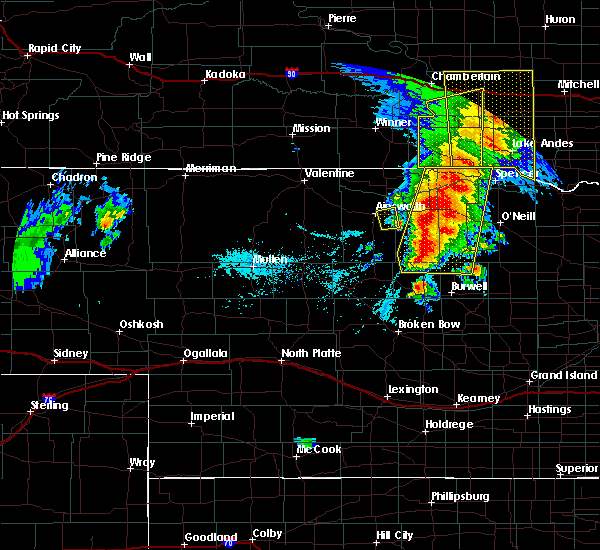 At 707 pm cdt, a severe thunderstorm was located about 5 miles south of long pine, or 11 miles southeast of ainsworth, moving northeast at 45 mph (radar indicated). Hazards include 60 mph wind gusts and quarter size hail. Hail damage to vehicles is expected. expect wind damage to roofs, siding, and trees. locations impacted include, long pine. this includes the following highways, highway 183 between mile markers 194 and 197. highway 20 between mile markers 244 and 253. A tornado watch remains in effect until 1100 pm cdt for north central nebraska. At 707 pm cdt, a severe thunderstorm was located about 5 miles south of long pine, or 11 miles southeast of ainsworth, moving northeast at 45 mph (radar indicated). Hazards include 60 mph wind gusts and quarter size hail. Hail damage to vehicles is expected. expect wind damage to roofs, siding, and trees. locations impacted include, long pine. this includes the following highways, highway 183 between mile markers 194 and 197. highway 20 between mile markers 244 and 253. A tornado watch remains in effect until 1100 pm cdt for north central nebraska.
|
| 6/1/2018 6:47 PM CDT |
 At 647 pm cdt, severe thunderstorms were located along a line extending from 6 miles west of naper to near stuart to near rose, moving northeast at 30 mph (public). Hazards include ping pong ball size hail and 60 mph wind gusts. People and animals outdoors will be injured. expect hail damage to roofs, siding, windows, and vehicles. expect wind damage to roofs, siding, and trees. locations impacted include, bassett, atkinson, stuart, butte, long pine, newport, naper, dustin, burton, anoka, nets peak, sybrant, duff, mariaville, pony lake, mills and brocksburg. this includes the following highways, highway 183 between mile markers 155 and 182. highway 20 between mile markers 250 and 295. highway 12 between mile markers 55 and 110. A tornado watch remains in effect until 1100 pm cdt for north central nebraska. At 647 pm cdt, severe thunderstorms were located along a line extending from 6 miles west of naper to near stuart to near rose, moving northeast at 30 mph (public). Hazards include ping pong ball size hail and 60 mph wind gusts. People and animals outdoors will be injured. expect hail damage to roofs, siding, windows, and vehicles. expect wind damage to roofs, siding, and trees. locations impacted include, bassett, atkinson, stuart, butte, long pine, newport, naper, dustin, burton, anoka, nets peak, sybrant, duff, mariaville, pony lake, mills and brocksburg. this includes the following highways, highway 183 between mile markers 155 and 182. highway 20 between mile markers 250 and 295. highway 12 between mile markers 55 and 110. A tornado watch remains in effect until 1100 pm cdt for north central nebraska.
|
| 6/1/2018 6:39 PM CDT |
 At 638 pm cdt, a severe thunderstorm was located 9 miles southwest of ainsworth, moving east at 35 mph (radar indicated). Hazards include 60 mph wind gusts and half dollar size hail. Hail damage to vehicles is expected. Expect wind damage to roofs, siding, and trees. At 638 pm cdt, a severe thunderstorm was located 9 miles southwest of ainsworth, moving east at 35 mph (radar indicated). Hazards include 60 mph wind gusts and half dollar size hail. Hail damage to vehicles is expected. Expect wind damage to roofs, siding, and trees.
|
| 6/1/2018 6:25 PM CDT |
 At 624 pm cdt, severe thunderstorms were located along a line extending from 14 miles southwest of herrick to near newport to 8 miles west of rose, moving northeast at 35 mph (radar indicated). Hazards include 60 mph wind gusts and half dollar size hail. Hail damage to vehicles is expected. expect wind damage to roofs, siding, and trees. locations impacted include, bassett, atkinson, stuart, butte, long pine, newport, naper, dustin, burton, anoka, nets peak, sybrant, duff, mariaville, pony lake, mills and brocksburg. this includes the following highways, highway 183 between mile markers 155 and 182. highway 20 between mile markers 250 and 295. highway 12 between mile markers 55 and 110. A tornado watch remains in effect until 1100 pm cdt for north central nebraska. At 624 pm cdt, severe thunderstorms were located along a line extending from 14 miles southwest of herrick to near newport to 8 miles west of rose, moving northeast at 35 mph (radar indicated). Hazards include 60 mph wind gusts and half dollar size hail. Hail damage to vehicles is expected. expect wind damage to roofs, siding, and trees. locations impacted include, bassett, atkinson, stuart, butte, long pine, newport, naper, dustin, burton, anoka, nets peak, sybrant, duff, mariaville, pony lake, mills and brocksburg. this includes the following highways, highway 183 between mile markers 155 and 182. highway 20 between mile markers 250 and 295. highway 12 between mile markers 55 and 110. A tornado watch remains in effect until 1100 pm cdt for north central nebraska.
|
| 6/1/2018 6:15 PM CDT | Quarter sized hail reported 0.4 miles N of Long Pine, NE |
| 6/1/2018 6:07 PM CDT |
 At 606 pm cdt, severe thunderstorms were located along a line extending from 6 miles east of wewela to 10 miles west of rose, moving northeast at 50 mph (radar indicated). Hazards include tennis ball size hail and 60 mph wind gusts. People and animals outdoors will be injured. expect hail damage to roofs, siding, windows, and vehicles. Expect wind damage to roofs, siding, and trees. At 606 pm cdt, severe thunderstorms were located along a line extending from 6 miles east of wewela to 10 miles west of rose, moving northeast at 50 mph (radar indicated). Hazards include tennis ball size hail and 60 mph wind gusts. People and animals outdoors will be injured. expect hail damage to roofs, siding, windows, and vehicles. Expect wind damage to roofs, siding, and trees.
|
| 6/1/2018 5:56 PM CDT |
 At 555 pm cdt, severe thunderstorms were located along a line extending from near springview to near long pine, moving northeast at 20 mph (public). Hazards include tennis ball size hail and 60 mph wind gusts. a windshield was broken in ainsworth. People and animals outdoors will be injured. expect hail damage to roofs, siding, windows, and vehicles. expect wind damage to roofs, siding, and trees. locations impacted include, ainsworth, springview, long pine, keller park state recreation area, thomas creek state wildlife management area, bobcat state wildlife management area, pine glen state wildlife refuge, antelope peak and meadville. this includes the following highways, highway 183 between mile markers 194 and 225. highway 20 between mile markers 237 and 256. highway 12 between mile markers 35 and 58. A tornado watch remains in effect until 1100 pm cdt for north central nebraska. At 555 pm cdt, severe thunderstorms were located along a line extending from near springview to near long pine, moving northeast at 20 mph (public). Hazards include tennis ball size hail and 60 mph wind gusts. a windshield was broken in ainsworth. People and animals outdoors will be injured. expect hail damage to roofs, siding, windows, and vehicles. expect wind damage to roofs, siding, and trees. locations impacted include, ainsworth, springview, long pine, keller park state recreation area, thomas creek state wildlife management area, bobcat state wildlife management area, pine glen state wildlife refuge, antelope peak and meadville. this includes the following highways, highway 183 between mile markers 194 and 225. highway 20 between mile markers 237 and 256. highway 12 between mile markers 35 and 58. A tornado watch remains in effect until 1100 pm cdt for north central nebraska.
|
| 6/1/2018 5:48 PM CDT |
 At 548 pm cdt, severe thunderstorms were located along a line extending from 6 miles southwest of wewela to ainsworth, moving northeast at 25 mph (public). Hazards include 60 mph wind gusts and half dollar size hail. Hail damage to vehicles is expected. expect wind damage to roofs, siding, and trees. locations impacted include, ainsworth, springview, long pine, keller park state recreation area, thomas creek state wildlife management area, bobcat state wildlife management area, pine glen state wildlife refuge, antelope peak and meadville. this includes the following highways, highway 183 between mile markers 194 and 225. highway 20 between mile markers 237 and 256. highway 12 between mile markers 35 and 58. A tornado watch remains in effect until 1100 pm cdt for north central nebraska. At 548 pm cdt, severe thunderstorms were located along a line extending from 6 miles southwest of wewela to ainsworth, moving northeast at 25 mph (public). Hazards include 60 mph wind gusts and half dollar size hail. Hail damage to vehicles is expected. expect wind damage to roofs, siding, and trees. locations impacted include, ainsworth, springview, long pine, keller park state recreation area, thomas creek state wildlife management area, bobcat state wildlife management area, pine glen state wildlife refuge, antelope peak and meadville. this includes the following highways, highway 183 between mile markers 194 and 225. highway 20 between mile markers 237 and 256. highway 12 between mile markers 35 and 58. A tornado watch remains in effect until 1100 pm cdt for north central nebraska.
|
| 6/1/2018 5:35 PM CDT |
 At 534 pm cdt, severe thunderstorms were located along a line extending from 7 miles east of norden to near ainsworth, moving northeast at 25 mph (radar indicated). Hazards include 60 mph wind gusts and quarter size hail. Hail damage to vehicles is expected. Expect wind damage to roofs, siding, and trees. At 534 pm cdt, severe thunderstorms were located along a line extending from 7 miles east of norden to near ainsworth, moving northeast at 25 mph (radar indicated). Hazards include 60 mph wind gusts and quarter size hail. Hail damage to vehicles is expected. Expect wind damage to roofs, siding, and trees.
|
| 7/25/2017 9:23 PM CDT |
 The severe thunderstorm warning for northwestern rock and east central brown counties will expire at 930 pm cdt, the storm which prompted the warning has weakened below severe limits, and no longer poses an immediate threat to life or property. therefore the warning will be allowed to expire. however gusty winds are still possible with this thunderstorm. a severe thunderstorm watch remains in effect until 1100 pm cdt for north central nebraska. The severe thunderstorm warning for northwestern rock and east central brown counties will expire at 930 pm cdt, the storm which prompted the warning has weakened below severe limits, and no longer poses an immediate threat to life or property. therefore the warning will be allowed to expire. however gusty winds are still possible with this thunderstorm. a severe thunderstorm watch remains in effect until 1100 pm cdt for north central nebraska.
|
| 7/25/2017 9:02 PM CDT |
 At 901 pm cdt, a severe thunderstorm was located near long pine, or near ainsworth, moving east at 25 mph (radar indicated). Hazards include 60 mph wind gusts and penny size hail. Expect damage to roofs, siding, and trees. locations impacted include, bassett, long pine, hofeld lake and jones lake. this includes the following highways, highway 183 between mile markers 161 and 197. Highway 20 between mile markers 243 and 262. At 901 pm cdt, a severe thunderstorm was located near long pine, or near ainsworth, moving east at 25 mph (radar indicated). Hazards include 60 mph wind gusts and penny size hail. Expect damage to roofs, siding, and trees. locations impacted include, bassett, long pine, hofeld lake and jones lake. this includes the following highways, highway 183 between mile markers 161 and 197. Highway 20 between mile markers 243 and 262.
|
| 7/25/2017 8:47 PM CDT |
 At 847 pm cdt, a severe thunderstorm was located near ainsworth, moving east at 25 mph (radar indicated). Hazards include 60 mph wind gusts and quarter size hail. Hail damage to vehicles is expected. Expect wind damage to roofs, siding, and trees. At 847 pm cdt, a severe thunderstorm was located near ainsworth, moving east at 25 mph (radar indicated). Hazards include 60 mph wind gusts and quarter size hail. Hail damage to vehicles is expected. Expect wind damage to roofs, siding, and trees.
|
| 6/13/2017 4:35 PM CDT | Golf Ball sized hail reported 7.3 miles N of Long Pine, NE, hail fell for 20 minutes |
| 7/27/2016 5:04 PM CDT | Storm damage reported in brown county NE, 0.4 miles N of Long Pine, NE |
| 7/27/2016 4:54 PM CDT |
 At 454 pm cdt, a severe thunderstorm was located over long pine, or 7 miles east of ainsworth, moving southeast at 40 mph (radar indicated). Hazards include 60 mph wind gusts and penny size hail. Expect damage to roofs. siding. And trees. At 454 pm cdt, a severe thunderstorm was located over long pine, or 7 miles east of ainsworth, moving southeast at 40 mph (radar indicated). Hazards include 60 mph wind gusts and penny size hail. Expect damage to roofs. siding. And trees.
|
| 7/6/2016 7:36 PM CDT |
 At 734 pm cdt, severe thunderstorms were located along a line extending from near wewela to 7 miles southeast of springview to near ainsworth to 9 miles south of johnstown, moving east at 45 mph (radar indicated). Hazards include 70 mph wind gusts and quarter size hail. Hail damage to vehicles is expected. expect considerable tree damage. wind damage is also likely to mobile homes, roofs, and outbuildings. locations impacted include, ainsworth, bassett, springview, long pine, newport, johnstown, norden, burton, hofeld lake, bobcat state wildlife management area, moon lake, north river trail, meadville, antelope peak, pine glen state wildlife refuge, thomas creek state wildlife management area, brocksburg, mariaville, mills and jones lake. this includes the following highways, highway 183 between mile markers 167 and 225. highway 20 between mile markers 226 and 274. A tornado watch remains in effect until 1000 pm cdt for north central nebraska. At 734 pm cdt, severe thunderstorms were located along a line extending from near wewela to 7 miles southeast of springview to near ainsworth to 9 miles south of johnstown, moving east at 45 mph (radar indicated). Hazards include 70 mph wind gusts and quarter size hail. Hail damage to vehicles is expected. expect considerable tree damage. wind damage is also likely to mobile homes, roofs, and outbuildings. locations impacted include, ainsworth, bassett, springview, long pine, newport, johnstown, norden, burton, hofeld lake, bobcat state wildlife management area, moon lake, north river trail, meadville, antelope peak, pine glen state wildlife refuge, thomas creek state wildlife management area, brocksburg, mariaville, mills and jones lake. this includes the following highways, highway 183 between mile markers 167 and 225. highway 20 between mile markers 226 and 274. A tornado watch remains in effect until 1000 pm cdt for north central nebraska.
|
| 7/6/2016 7:13 PM CDT |
 At 712 pm cdt, severe thunderstorms were located along a line extending from 8 miles south of keyapaha to 9 miles southeast of norden to near johnstown to 12 miles northeast of brownlee, moving east at 45 mph (radar indicated). Hazards include 70 mph wind gusts and quarter size hail. Hail damage to vehicles is expected. expect considerable tree damage. Wind damage is also likely to mobile homes, roofs, and outbuildings. At 712 pm cdt, severe thunderstorms were located along a line extending from 8 miles south of keyapaha to 9 miles southeast of norden to near johnstown to 12 miles northeast of brownlee, moving east at 45 mph (radar indicated). Hazards include 70 mph wind gusts and quarter size hail. Hail damage to vehicles is expected. expect considerable tree damage. Wind damage is also likely to mobile homes, roofs, and outbuildings.
|
| 6/29/2016 10:40 PM CDT | The severe thunderstorm warning for eastern blaine, garfield, eastern keya paha, western holt, loup, brown, western boyd and rock counties will expire at 1045 pm cdt, the storms which prompted the warning have moved out of the area. therefore the warning will be allowed to expire. a severe thunderstorm watch remains in effect until 300 am cdt for north central nebraska. |
| 6/29/2016 10:21 PM CDT |
 At 1020 pm cdt, severe thunderstorms were located along a line extending from 7 miles southwest of naper to rose to 7 miles northwest of brewster, moving southeast at 35 mph (radar indicated). Hazards include 60 mph wind gusts. Expect damage to roofs. siding. and trees. locations impacted include, ainsworth, burwell, bassett, spencer, taylor, brewster, atkinson, stuart, butte, long pine, newport, naper, amelia, calamus reservoir state recreation area, rose, emmet, dustin, anoka, kent diversion dam state wildlife management area and anncar. this includes the following highways, highway 183 between mile markers 124 and 204. highway 20 between mile markers 238 and 301. Highway 281 between mile markers 214 and 223. At 1020 pm cdt, severe thunderstorms were located along a line extending from 7 miles southwest of naper to rose to 7 miles northwest of brewster, moving southeast at 35 mph (radar indicated). Hazards include 60 mph wind gusts. Expect damage to roofs. siding. and trees. locations impacted include, ainsworth, burwell, bassett, spencer, taylor, brewster, atkinson, stuart, butte, long pine, newport, naper, amelia, calamus reservoir state recreation area, rose, emmet, dustin, anoka, kent diversion dam state wildlife management area and anncar. this includes the following highways, highway 183 between mile markers 124 and 204. highway 20 between mile markers 238 and 301. Highway 281 between mile markers 214 and 223.
|
| 6/29/2016 10:05 PM CDT |
 At 1004 pm cdt, severe thunderstorms were located along a line extending from 10 miles west of naper to 7 miles northwest of rose to 8 miles southeast of elsmere, moving southeast at 45 mph (radar indicated). Hazards include 60 mph wind gusts. Expect damage to roofs. siding. And trees. At 1004 pm cdt, severe thunderstorms were located along a line extending from 10 miles west of naper to 7 miles northwest of rose to 8 miles southeast of elsmere, moving southeast at 45 mph (radar indicated). Hazards include 60 mph wind gusts. Expect damage to roofs. siding. And trees.
|
| 6/29/2016 9:58 PM CDT |
 At 958 pm cdt/858 pm mdt/, severe thunderstorms were located along a line extending from 10 miles west of naper to 8 miles east of elsmere to near seneca, moving southeast at 50 mph (radar indicated). Hazards include 70 mph wind gusts. Expect considerable tree damage. damage is likely to mobile homes, roofs, and outbuildings. locations impacted include, ainsworth, bassett, mullen, springview, thedford, long pine, newport, johnstown, seneca, purdum, valentine national wildlife refuge, elsmere, norden, brownlee, wood lake, burton, bobcat state wildlife management area, north river trail, giant hill and marsh flat. this includes the following highways, highway 183 between mile markers 158 and 225. highway 20 between mile markers 212 and 273. highway 2 between mile markers 172 and 217. highway 97 between mile markers 52 and 94, near mile marker 98, and between mile markers 102 and 104. Highway 83 between mile markers 145 and 196. At 958 pm cdt/858 pm mdt/, severe thunderstorms were located along a line extending from 10 miles west of naper to 8 miles east of elsmere to near seneca, moving southeast at 50 mph (radar indicated). Hazards include 70 mph wind gusts. Expect considerable tree damage. damage is likely to mobile homes, roofs, and outbuildings. locations impacted include, ainsworth, bassett, mullen, springview, thedford, long pine, newport, johnstown, seneca, purdum, valentine national wildlife refuge, elsmere, norden, brownlee, wood lake, burton, bobcat state wildlife management area, north river trail, giant hill and marsh flat. this includes the following highways, highway 183 between mile markers 158 and 225. highway 20 between mile markers 212 and 273. highway 2 between mile markers 172 and 217. highway 97 between mile markers 52 and 94, near mile marker 98, and between mile markers 102 and 104. Highway 83 between mile markers 145 and 196.
|
| 6/29/2016 9:41 PM CDT |
 At 939 pm cdt/839 pm mdt/, severe thunderstorms were located along a line extending from 8 miles east of springview to 8 miles south of johnstown to 14 miles north of mullen, moving southeast at 55 mph (radar indicated. at 835 pm...a 62 mph wind gust was reported at ainsworth airport). Hazards include 70 mph wind gusts. Expect considerable tree damage. damage is likely to mobile homes, roofs, and outbuildings. locations impacted include, ainsworth, bassett, mullen, springview, thedford, long pine, newport, johnstown, seneca, purdum, valentine national wildlife refuge, elsmere, merritt reservoir, norden, brownlee, wood lake, burton, bobcat state wildlife management area, north river trail and giant hill. this includes the following highways, highway 183 between mile markers 158 and 225. highway 20 between mile markers 203 and 273. highway 2 between mile markers 171 and 217. highway 97 between mile markers 52 and 123. Highway 83 between mile markers 145 and 206. At 939 pm cdt/839 pm mdt/, severe thunderstorms were located along a line extending from 8 miles east of springview to 8 miles south of johnstown to 14 miles north of mullen, moving southeast at 55 mph (radar indicated. at 835 pm...a 62 mph wind gust was reported at ainsworth airport). Hazards include 70 mph wind gusts. Expect considerable tree damage. damage is likely to mobile homes, roofs, and outbuildings. locations impacted include, ainsworth, bassett, mullen, springview, thedford, long pine, newport, johnstown, seneca, purdum, valentine national wildlife refuge, elsmere, merritt reservoir, norden, brownlee, wood lake, burton, bobcat state wildlife management area, north river trail and giant hill. this includes the following highways, highway 183 between mile markers 158 and 225. highway 20 between mile markers 203 and 273. highway 2 between mile markers 171 and 217. highway 97 between mile markers 52 and 123. Highway 83 between mile markers 145 and 206.
|
| 6/29/2016 9:30 PM CDT |
 At 928 pm cdt/828 pm mdt/, severe thunderstorms were located along a line extending from 6 miles north of springview to 6 miles southwest of johnstown to 21 miles north of mullen, moving southeast at 55 mph (radar indicated. at 856 pm...64 mph winds were reported at miller field in valentine for 20 minutes). Hazards include 70 mph wind gusts. Expect considerable tree damage. Damage is likely to mobile homes, roofs, and outbuildings. At 928 pm cdt/828 pm mdt/, severe thunderstorms were located along a line extending from 6 miles north of springview to 6 miles southwest of johnstown to 21 miles north of mullen, moving southeast at 55 mph (radar indicated. at 856 pm...64 mph winds were reported at miller field in valentine for 20 minutes). Hazards include 70 mph wind gusts. Expect considerable tree damage. Damage is likely to mobile homes, roofs, and outbuildings.
|
| 6/29/2016 9:18 PM CDT |
 At 916 pm cdt/816 pm mdt/, severe thunderstorms were located along a line extending from 6 miles northeast of norden to 15 miles northeast of valentine national wildlife refuge to 10 miles southeast of medicine lake, moving southeast at 50 mph (radar indicated. at 856 pm...a 64 mph wind gust was reported at miller field in valentine. these winds have lasted 20 minutes or longer). Hazards include 70 mph wind gusts. Expect considerable tree damage. damage is likely to mobile homes, roofs, and outbuildings. locations impacted include, valentine, ainsworth, bassett, springview, long pine, cody, merriman, newport, kilgore, johnstown, nenzel, valentine national wildlife refuge, merritt reservoir, medicine lake, norden, brownlee, crookston, wood lake, burton and bobcat state wildlife management area. this includes the following highways, highway 183 between mile markers 178 and 225. highway 20 between mile markers 123 and 271. highway 61 between mile markers 180 and 231. highway 97 between mile markers 82 and 141. Highway 83 between mile markers 165 and 222. At 916 pm cdt/816 pm mdt/, severe thunderstorms were located along a line extending from 6 miles northeast of norden to 15 miles northeast of valentine national wildlife refuge to 10 miles southeast of medicine lake, moving southeast at 50 mph (radar indicated. at 856 pm...a 64 mph wind gust was reported at miller field in valentine. these winds have lasted 20 minutes or longer). Hazards include 70 mph wind gusts. Expect considerable tree damage. damage is likely to mobile homes, roofs, and outbuildings. locations impacted include, valentine, ainsworth, bassett, springview, long pine, cody, merriman, newport, kilgore, johnstown, nenzel, valentine national wildlife refuge, merritt reservoir, medicine lake, norden, brownlee, crookston, wood lake, burton and bobcat state wildlife management area. this includes the following highways, highway 183 between mile markers 178 and 225. highway 20 between mile markers 123 and 271. highway 61 between mile markers 180 and 231. highway 97 between mile markers 82 and 141. Highway 83 between mile markers 165 and 222.
|
| 6/29/2016 9:02 PM CDT |
 At 859 pm cdt/759 pm mdt/, severe thunderstorms were located along a line extending from 8 miles northeast of millboro to 6 miles north of merritt reservoir to 7 miles south of merriman, moving south at 45 mph (radar indicated. at 856 pm...a 64 mph wind gust was reported at miller field in valentine. these winds have lasted 5 minutes or longer). Hazards include 70 mph wind gusts. Expect considerable tree damage. damage is likely to mobile homes, roofs, and outbuildings. locations impacted include, valentine, ainsworth, bassett, springview, long pine, cody, merriman, newport, kilgore, johnstown, nenzel, valentine national wildlife refuge, merritt reservoir, medicine lake, norden, brownlee, crookston, wood lake, burton and bobcat state wildlife management area. this includes the following highways, highway 183 between mile markers 178 and 225. highway 20 between mile markers 123 and 271. highway 61 between mile markers 180 and 231. highway 97 between mile markers 82 and 141. Highway 83 between mile markers 165 and 222. At 859 pm cdt/759 pm mdt/, severe thunderstorms were located along a line extending from 8 miles northeast of millboro to 6 miles north of merritt reservoir to 7 miles south of merriman, moving south at 45 mph (radar indicated. at 856 pm...a 64 mph wind gust was reported at miller field in valentine. these winds have lasted 5 minutes or longer). Hazards include 70 mph wind gusts. Expect considerable tree damage. damage is likely to mobile homes, roofs, and outbuildings. locations impacted include, valentine, ainsworth, bassett, springview, long pine, cody, merriman, newport, kilgore, johnstown, nenzel, valentine national wildlife refuge, merritt reservoir, medicine lake, norden, brownlee, crookston, wood lake, burton and bobcat state wildlife management area. this includes the following highways, highway 183 between mile markers 178 and 225. highway 20 between mile markers 123 and 271. highway 61 between mile markers 180 and 231. highway 97 between mile markers 82 and 141. Highway 83 between mile markers 165 and 222.
|
| 6/29/2016 8:44 PM CDT |
 At 844 pm cdt/744 pm mdt/, severe thunderstorms were located along a line extending from near winner to near kilgore to near merriman, moving south at 40 mph (radar indicated). Hazards include 70 mph wind gusts. Expect considerable tree damage. Damage is likely to mobile homes, roofs, and outbuildings. At 844 pm cdt/744 pm mdt/, severe thunderstorms were located along a line extending from near winner to near kilgore to near merriman, moving south at 40 mph (radar indicated). Hazards include 70 mph wind gusts. Expect considerable tree damage. Damage is likely to mobile homes, roofs, and outbuildings.
|
| 6/28/2016 10:08 PM CDT |
 At 1007 pm cdt, severe thunderstorms were located along a line extending from near long pine to 8 miles southeast of dunning, moving southeast at 35 mph (radar indicated). Hazards include 60 mph wind gusts. Expect damage to roofs. siding. and trees. locations impacted include, ainsworth, bassett, taylor, brewster, sargent, long pine, anselmo, dunning, comstock, victoria springs state recreation area, calamus reservoir state recreation area, rose, lillian, milburn, nunda shoal campground, linscott, kent diversion dam state wildlife management area, almeria meadow state wildlife management area, brown lake and hannamon bayou campground. this includes the following highways, highway 183 between mile markers 109 and 201. highway 20 between mile markers 241 and 266. Highway 2 between mile markers 232 and 261. At 1007 pm cdt, severe thunderstorms were located along a line extending from near long pine to 8 miles southeast of dunning, moving southeast at 35 mph (radar indicated). Hazards include 60 mph wind gusts. Expect damage to roofs. siding. and trees. locations impacted include, ainsworth, bassett, taylor, brewster, sargent, long pine, anselmo, dunning, comstock, victoria springs state recreation area, calamus reservoir state recreation area, rose, lillian, milburn, nunda shoal campground, linscott, kent diversion dam state wildlife management area, almeria meadow state wildlife management area, brown lake and hannamon bayou campground. this includes the following highways, highway 183 between mile markers 109 and 201. highway 20 between mile markers 241 and 266. Highway 2 between mile markers 232 and 261.
|
| 6/28/2016 9:43 PM CDT |
 At 942 pm cdt, severe thunderstorms were located along a line extending from 8 miles north of long pine to near halsey, moving southeast at 50 mph (radar indicated). Hazards include 60 mph wind gusts. Expect damage to roofs. siding. And trees. At 942 pm cdt, severe thunderstorms were located along a line extending from 8 miles north of long pine to near halsey, moving southeast at 50 mph (radar indicated). Hazards include 60 mph wind gusts. Expect damage to roofs. siding. And trees.
|
| 5/30/2016 7:45 PM CDT |
 At 744 pm cdt, severe thunderstorms were located along a line extending from near johnstown to 6 miles west of purdum, moving southeast at 30 mph (radar indicated). Hazards include 60 mph wind gusts and quarter size hail. Hail damage to vehicles is expected. Expect wind damage to roofs, siding, and trees. At 744 pm cdt, severe thunderstorms were located along a line extending from near johnstown to 6 miles west of purdum, moving southeast at 30 mph (radar indicated). Hazards include 60 mph wind gusts and quarter size hail. Hail damage to vehicles is expected. Expect wind damage to roofs, siding, and trees.
|
| 7/26/2015 9:12 PM CDT | The severe thunderstorm warning for west central rock and east central brown counties will expire at 915 pm cdt, the storm which prompted the warning has weakened below severe limits, and no longer pose an immediate threat to life or property. therefore the warning will be allowed to expire. however heavy rain is still possible with this thunderstorm. to report severe weather, contact your nearest law enforcement agency. they will relay your report to the national weather service north platte. |
| 7/26/2015 8:57 PM CDT |
 At 857 pm cdt, a severe thunderstorm was located near long pine, or 7 miles southeast of ainsworth, moving northeast at 15 mph (radar indicated). Hazards include 60 mph wind gusts and quarter size hail. Hail damage to vehicles is expected. expect wind damage to roofs, siding and trees. this severe storm will be near, long pine around 915 pm cdt. Other locations impacted by this severe thunderstorm include hofeld lake, raven and jones lake. At 857 pm cdt, a severe thunderstorm was located near long pine, or 7 miles southeast of ainsworth, moving northeast at 15 mph (radar indicated). Hazards include 60 mph wind gusts and quarter size hail. Hail damage to vehicles is expected. expect wind damage to roofs, siding and trees. this severe storm will be near, long pine around 915 pm cdt. Other locations impacted by this severe thunderstorm include hofeld lake, raven and jones lake.
|
| 7/26/2015 8:55 PM CDT | Half Dollar sized hail reported 4.4 miles ENE of Long Pine, NE |
| 7/26/2015 8:55 PM CDT | Storm damage reported in brown county NE, 4.4 miles ENE of Long Pine, NE |
| 7/26/2015 8:32 PM CDT |
 At 832 pm cdt, a severe thunderstorm was located 10 miles south of ainsworth, moving northeast at 15 mph. a second severe storm is located near long pine (radar indicated). Hazards include 60 mph wind gusts and half dollar size hail. Hail damage to vehicles is expected. expect wind damage to roofs, siding and trees. this severe thunderstorm will be near, long pine around 915 pm cdt. Other locations impacted by this severe thunderstorm include hofeld lake, raven and jones lake. At 832 pm cdt, a severe thunderstorm was located 10 miles south of ainsworth, moving northeast at 15 mph. a second severe storm is located near long pine (radar indicated). Hazards include 60 mph wind gusts and half dollar size hail. Hail damage to vehicles is expected. expect wind damage to roofs, siding and trees. this severe thunderstorm will be near, long pine around 915 pm cdt. Other locations impacted by this severe thunderstorm include hofeld lake, raven and jones lake.
|
| 7/26/2015 8:29 PM CDT | Golf Ball sized hail reported 2.4 miles NW of Long Pine, NE |
| 7/26/2015 8:17 PM CDT |
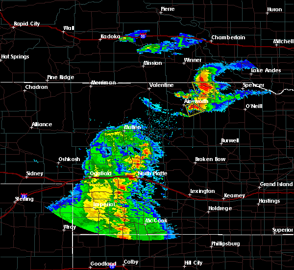 At 817 pm cdt, a severe thunderstorm was located near long pine, or 8 miles southeast of ainsworth, moving southeast at 10 mph (radar indicated). Hazards include 60 mph wind gusts and quarter size hail. Hail damage to vehicles is expected. expect wind damage to roofs, siding and trees. this includes the following highways, highway 183 between mile markers 170 and 177, and near mile marker 194. highway 20 between mile markers 246 and 254. Locations impacted include, long pine. At 817 pm cdt, a severe thunderstorm was located near long pine, or 8 miles southeast of ainsworth, moving southeast at 10 mph (radar indicated). Hazards include 60 mph wind gusts and quarter size hail. Hail damage to vehicles is expected. expect wind damage to roofs, siding and trees. this includes the following highways, highway 183 between mile markers 170 and 177, and near mile marker 194. highway 20 between mile markers 246 and 254. Locations impacted include, long pine.
|
| 7/26/2015 7:49 PM CDT |
 At 749 pm cdt, a severe thunderstorm capable of producing a tornado was located near ainsworth, moving southeast at 25 mph (radar indicated rotation). Hazards include tornado and ping pong ball size hail. Flying debris will be dangerous to those caught without shelter. mobile homes will be damaged or destroyed. damage to roofs, windows and vehicles will occur. tree damage is likely. this tornadic thunderstorm will remain over mainly rural areas of west central rock and east central brown counties, including the following locations, johnsons corner and jones lake. this includes the following highways, highway 183 between mile markers 168 and 172, and between mile markers 194 and 195. Highway 20 between mile markers 242 and 249. At 749 pm cdt, a severe thunderstorm capable of producing a tornado was located near ainsworth, moving southeast at 25 mph (radar indicated rotation). Hazards include tornado and ping pong ball size hail. Flying debris will be dangerous to those caught without shelter. mobile homes will be damaged or destroyed. damage to roofs, windows and vehicles will occur. tree damage is likely. this tornadic thunderstorm will remain over mainly rural areas of west central rock and east central brown counties, including the following locations, johnsons corner and jones lake. this includes the following highways, highway 183 between mile markers 168 and 172, and between mile markers 194 and 195. Highway 20 between mile markers 242 and 249.
|
| 7/26/2015 7:41 PM CDT |
 At 741 pm cdt, a severe thunderstorm was located near long pine, or near ainsworth, moving southeast at 30 mph (radar indicated). Hazards include ping pong ball size hail and 60 mph wind gusts. People and animals outdoors will be injured. expect hail damage to roofs, siding, windows and vehicles. expect wind damage to roofs, siding and trees. this includes the following highways, highway 183 between mile markers 167 and 202. highway 20 between mile markers 240 and 260. Locations impacted include, keller park state recreation area, ainsworth, bassett and long pine. At 741 pm cdt, a severe thunderstorm was located near long pine, or near ainsworth, moving southeast at 30 mph (radar indicated). Hazards include ping pong ball size hail and 60 mph wind gusts. People and animals outdoors will be injured. expect hail damage to roofs, siding, windows and vehicles. expect wind damage to roofs, siding and trees. this includes the following highways, highway 183 between mile markers 167 and 202. highway 20 between mile markers 240 and 260. Locations impacted include, keller park state recreation area, ainsworth, bassett and long pine.
|
| 7/26/2015 7:32 PM CDT |
 At 732 pm cdt, a severe thunderstorm was located near ainsworth, moving southeast at 25 mph (radar indicated). Hazards include 60 mph wind gusts and quarter size hail. Hail damage to vehicles is expected. expect wind damage to roofs, siding and trees. this includes the following highways, highway 183 between mile markers 167 and 202. highway 20 between mile markers 240 and 260. Locations impacted include, keller park state recreation area, ainsworth, bassett and long pine. At 732 pm cdt, a severe thunderstorm was located near ainsworth, moving southeast at 25 mph (radar indicated). Hazards include 60 mph wind gusts and quarter size hail. Hail damage to vehicles is expected. expect wind damage to roofs, siding and trees. this includes the following highways, highway 183 between mile markers 167 and 202. highway 20 between mile markers 240 and 260. Locations impacted include, keller park state recreation area, ainsworth, bassett and long pine.
|
| 7/17/2015 8:32 PM CDT | Storm damage reported in brown county NE, 12.9 miles N of Long Pine, NE |
| 7/5/2015 11:21 PM CDT |
 At 1119 pm cdt, severe thunderstorms were located along a line extending from ainsworth to 14 miles north of brewster, and moving northeast at 35 mph (radar indicated). Hazards include 60 mph wind gusts. Expect damage to roofs. siding and trees. locations impacted include, ainsworth, long pine, hofeld lake, johnsons corner, antelope peak, jones lake, keller park state recreation area and pine glen state wildlife refuge. this includes highway 20 between mile markers 234 and 251. This includes highway 183 between mile markers 194 and 206. At 1119 pm cdt, severe thunderstorms were located along a line extending from ainsworth to 14 miles north of brewster, and moving northeast at 35 mph (radar indicated). Hazards include 60 mph wind gusts. Expect damage to roofs. siding and trees. locations impacted include, ainsworth, long pine, hofeld lake, johnsons corner, antelope peak, jones lake, keller park state recreation area and pine glen state wildlife refuge. this includes highway 20 between mile markers 234 and 251. This includes highway 183 between mile markers 194 and 206.
|
| 7/5/2015 11:03 PM CDT |
 At 1101 pm cdt, severe thunderstorms were located along a line extending from 13 miles southwest of ainsworth to 8 miles northwest of brewster, and moving northeast at 35 mph (radar indicated). Hazards include 60 mph wind gusts. Expect damage to roofs. Siding and trees. At 1101 pm cdt, severe thunderstorms were located along a line extending from 13 miles southwest of ainsworth to 8 miles northwest of brewster, and moving northeast at 35 mph (radar indicated). Hazards include 60 mph wind gusts. Expect damage to roofs. Siding and trees.
|
| 7/5/2015 10:54 PM CDT |
 The severe thunderstorm warning for west central rock and east central brown counties will expire at 1100 pm cdt, the storm which prompted the warning has weakened and moved out of the warned area. however, heavy rain is still possible with this thunderstorm. in addition, severe thunderstorms may redevelop, and a severe thunderstorm watch remains in effect until midnight. The severe thunderstorm warning for west central rock and east central brown counties will expire at 1100 pm cdt, the storm which prompted the warning has weakened and moved out of the warned area. however, heavy rain is still possible with this thunderstorm. in addition, severe thunderstorms may redevelop, and a severe thunderstorm watch remains in effect until midnight.
|
| 7/5/2015 10:32 PM CDT |
 At 1028 pm cdt, a severe thunderstorm was located near long pine, and moving east at 30 mph (radar indicated). Hazards include 70 mph wind gusts and penny size hail. Expect considerable tree damage. damage is likely to mobile homes, roofs and outbuildings. locations impacted include, bassett. this includes highway 20 between mile markers 243 and 263. This includes highway 183 between mile markers 173 and 199. At 1028 pm cdt, a severe thunderstorm was located near long pine, and moving east at 30 mph (radar indicated). Hazards include 70 mph wind gusts and penny size hail. Expect considerable tree damage. damage is likely to mobile homes, roofs and outbuildings. locations impacted include, bassett. this includes highway 20 between mile markers 243 and 263. This includes highway 183 between mile markers 173 and 199.
|
| 7/5/2015 10:08 PM CDT |
 At 1007 pm cdt, a severe thunderstorm was located 5 miles west of ainsworth, and moving southeast at 25 mph (radar indicated). Hazards include 70 mph wind gusts and quarter size hail. Hail damage to vehicles is expected. expect considerable tree damage. Wind damage is also likely to mobile homes, roofs and outbuildings. At 1007 pm cdt, a severe thunderstorm was located 5 miles west of ainsworth, and moving southeast at 25 mph (radar indicated). Hazards include 70 mph wind gusts and quarter size hail. Hail damage to vehicles is expected. expect considerable tree damage. Wind damage is also likely to mobile homes, roofs and outbuildings.
|
| 6/20/2015 3:09 AM CDT |
 The severe thunderstorm warning for northern rock, keya paha, northern holt, northeastern brown and boyd counties will expire at 215 am mdt, the storms which prompted the warning have weakened below severe limits, and no longer pose an immediate threat to life or property. however, gusty winds are still possible with these thunderstorms. The severe thunderstorm warning for northern rock, keya paha, northern holt, northeastern brown and boyd counties will expire at 215 am mdt, the storms which prompted the warning have weakened below severe limits, and no longer pose an immediate threat to life or property. however, gusty winds are still possible with these thunderstorms.
|
| 6/20/2015 2:53 AM CDT |
 At 251 am cdt, a severe thunderstorm was located 9 miles southeast of mills, and moving east at 45 mph (radar indicated). Hazards include 60 mph wind gusts. Expect damage to roofs. siding and trees. locations impacted include, spencer, oneill, stuart, naper, atkinson, butte, anoka, bristow, gross, lynch, emmet, monowi, dustin, hull lake state wildlife management area, parshall bridge state wildlife management area, anncar, spencer dam, midway, scottville and redbird state wildlife management area. this includes highway 20 between mile markers 237 and 309. This includes highway 183 between mile markers 175 and 225. At 251 am cdt, a severe thunderstorm was located 9 miles southeast of mills, and moving east at 45 mph (radar indicated). Hazards include 60 mph wind gusts. Expect damage to roofs. siding and trees. locations impacted include, spencer, oneill, stuart, naper, atkinson, butte, anoka, bristow, gross, lynch, emmet, monowi, dustin, hull lake state wildlife management area, parshall bridge state wildlife management area, anncar, spencer dam, midway, scottville and redbird state wildlife management area. this includes highway 20 between mile markers 237 and 309. This includes highway 183 between mile markers 175 and 225.
|
| 6/20/2015 2:40 AM CDT |
 At 239 am cdt, a severe thunderstorm was located 7 miles southwest of mills, and moving east at 45 mph (radar indicated). Hazards include 60 mph wind gusts. Expect damage to roofs. siding and trees. locations impacted include, spencer, oneill, mills, newport, stuart, naper, atkinson, butte, anoka, bristow, gross, lynch, emmet, monowi, brocksburg, mariaville, dustin, hull lake state wildlife management area, parshall bridge state wildlife management area and anncar. this includes highway 20 between mile markers 237 and 309. This includes highway 183 between mile markers 175 and 225. At 239 am cdt, a severe thunderstorm was located 7 miles southwest of mills, and moving east at 45 mph (radar indicated). Hazards include 60 mph wind gusts. Expect damage to roofs. siding and trees. locations impacted include, spencer, oneill, mills, newport, stuart, naper, atkinson, butte, anoka, bristow, gross, lynch, emmet, monowi, brocksburg, mariaville, dustin, hull lake state wildlife management area, parshall bridge state wildlife management area and anncar. this includes highway 20 between mile markers 237 and 309. This includes highway 183 between mile markers 175 and 225.
|
| 6/20/2015 2:10 AM CDT |
 At 209 am cdt, a severe thunderstorm was located 8 miles west of springview, and moving east at 45 mph (radar indicated). Hazards include 60 mph wind gusts. Expect damage to roofs. Siding and trees. At 209 am cdt, a severe thunderstorm was located 8 miles west of springview, and moving east at 45 mph (radar indicated). Hazards include 60 mph wind gusts. Expect damage to roofs. Siding and trees.
|
| 6/6/2015 8:23 PM CDT | The severe thunderstorm warning for central brown county will expire at 830 pm cdt, the storm which prompted the warning has moved out of the warned area. however, gusty winds are still possible with this thunderstorm. |
| 6/6/2015 8:06 PM CDT | At 805 pm cdt, a severe thunderstorm was located 5 miles south of ainsworth, and moving east at 35 mph (radar indicated). Hazards include 60 mph wind gusts and quarter size hail. Hail damage to vehicles is expected. expect wind damage to roofs, siding and trees. locations impacted include, long pine, hofeld lake, keller park state recreation area, jones lake and pine glen state wildlife refuge. this includes highway 20 between mile markers 225 and 251. This includes highway 183 between mile markers 194 and 203. |
| 6/6/2015 7:40 PM CDT | At 739 pm cdt, a severe thunderstorm was located 7 miles southwest of johnstown, and moving east at 30 mph (radar indicated). Hazards include 60 mph wind gusts and quarter size hail. Hail damage to vehicles is expected. Expect wind damage to roofs, siding and trees. |
| 7/9/2014 4:20 PM CDT | Ping Pong Ball sized hail reported 6.2 miles SE of Long Pine, NE |
| 8/3/2012 7:40 PM CDT | Golf Ball sized hail reported 0.4 miles N of Long Pine, NE, some windows cracked from the hail. |
| 5/5/2012 10:15 PM CDT | Quarter sized hail reported 4.1 miles NNW of Long Pine, NE, delayed report. |
| 5/5/2012 9:45 PM CDT | Quarter sized hail reported 4.1 miles NNW of Long Pine, NE, delayed report from public. event time was estimated as the hail came in several rounds. |
| 1/1/0001 12:00 AM | Quarter sized hail reported 14.7 miles ESE of Long Pine, NE |
Hail Maps for Long Pine, NE
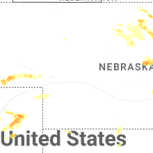
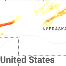


Connect with Interactive Hail Maps