

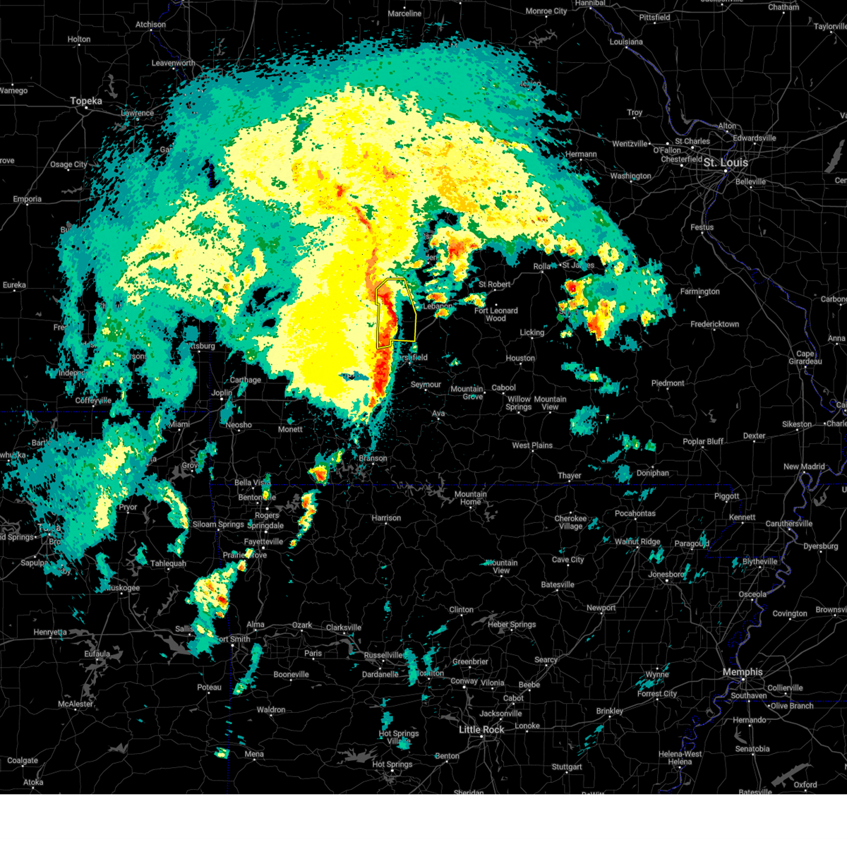
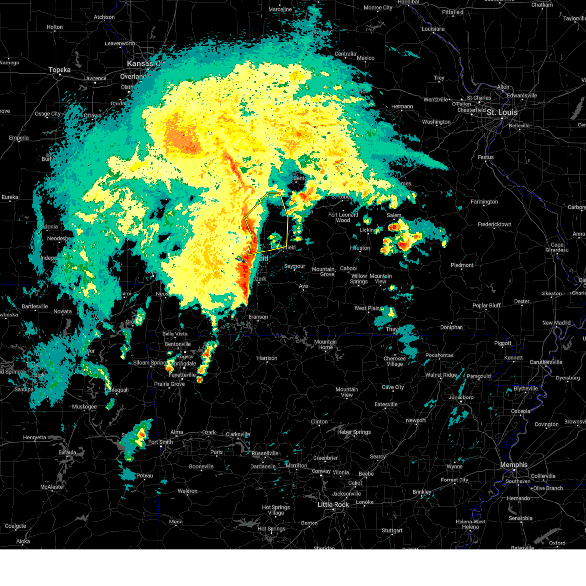
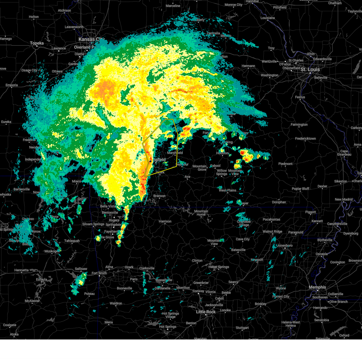
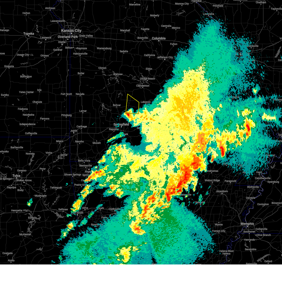
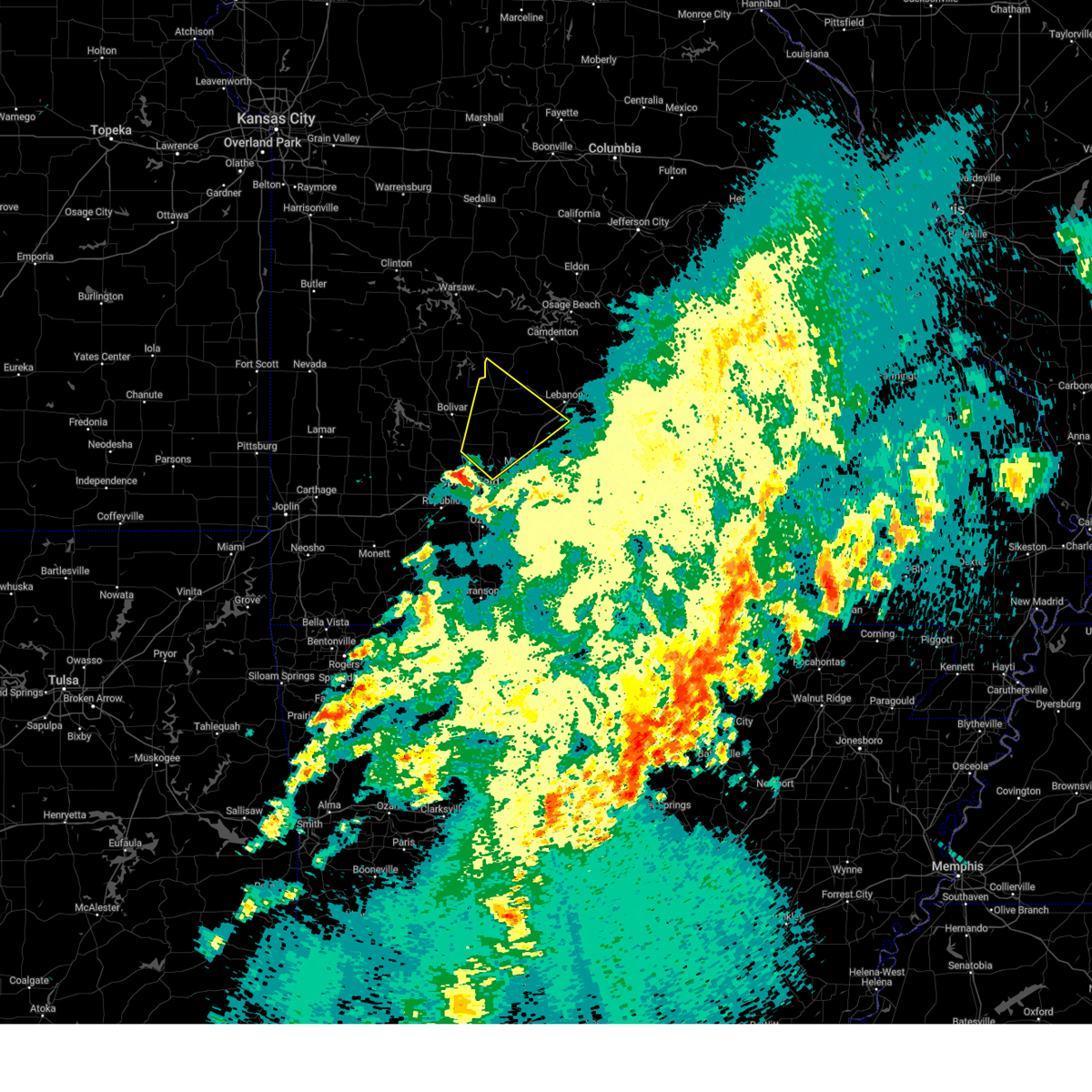
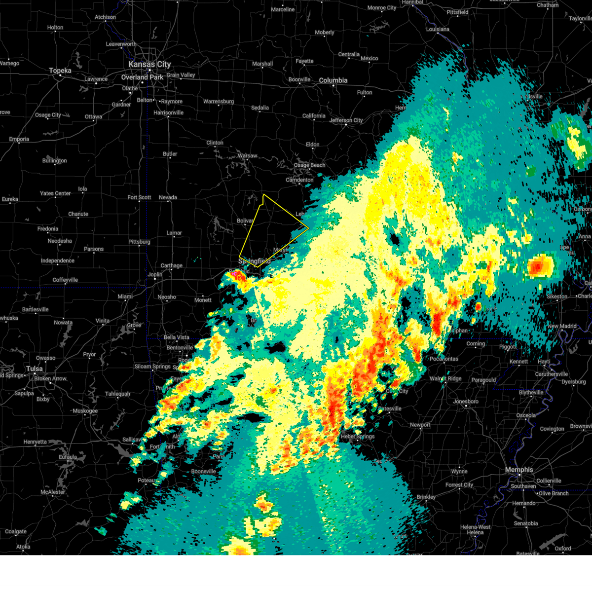
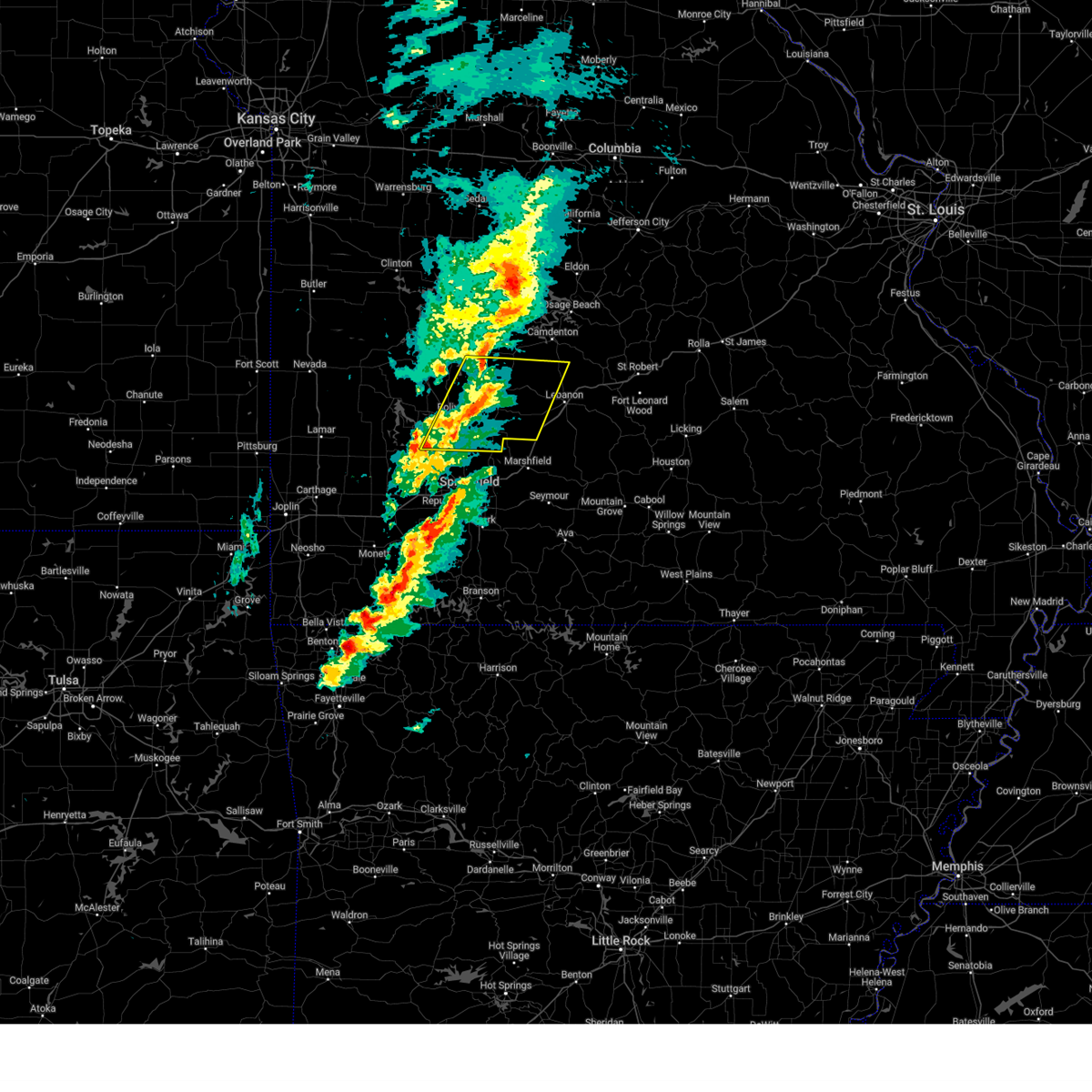
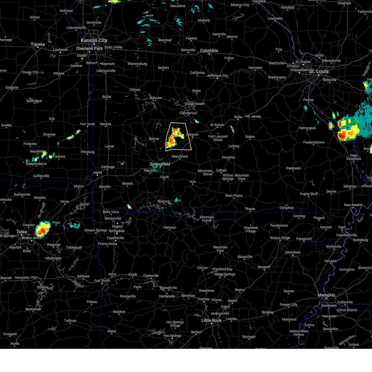
Hail Map for Louisburg, MO
The Louisburg, MO area has had 5 reports of on-the-ground hail by trained spotters, and has been under severe weather warnings 31 times during the past 12 months. Doppler radar has detected hail at or near Louisburg, MO on 66 occasions, including 2 occasions during the past year.
| Name: | Louisburg, MO |
| Where Located: | 38.7 miles NNE of Springfield, MO |
| Map: | Google Map for Louisburg, MO |
| Population: | 122 |
| Housing Units: | 79 |
| More Info: | Search Google for Louisburg, MO |
2
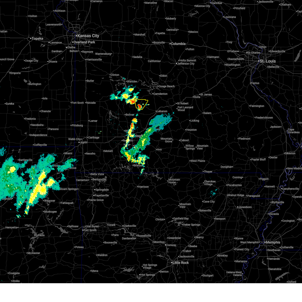
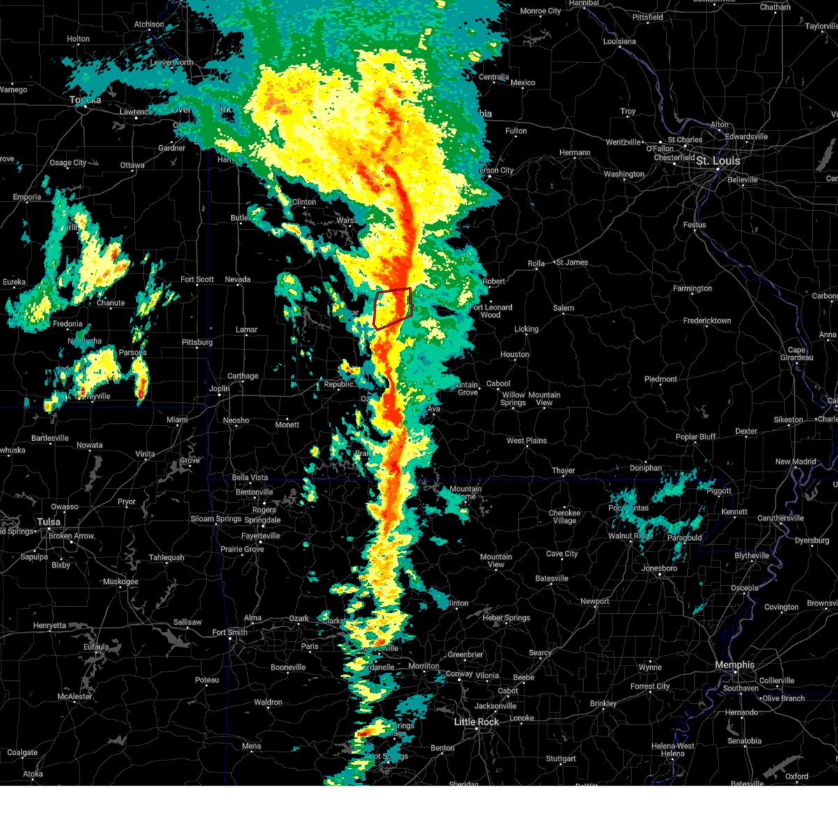
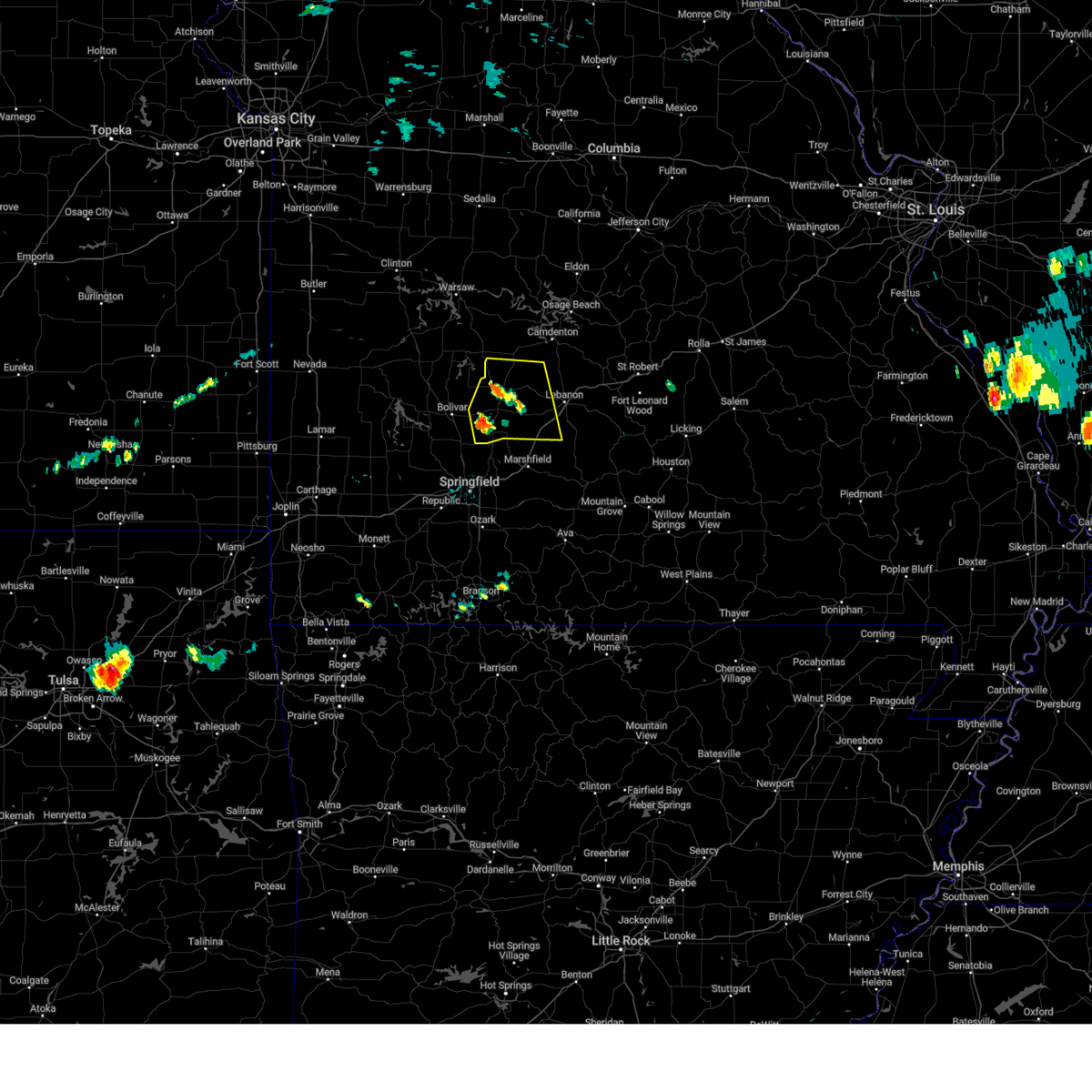
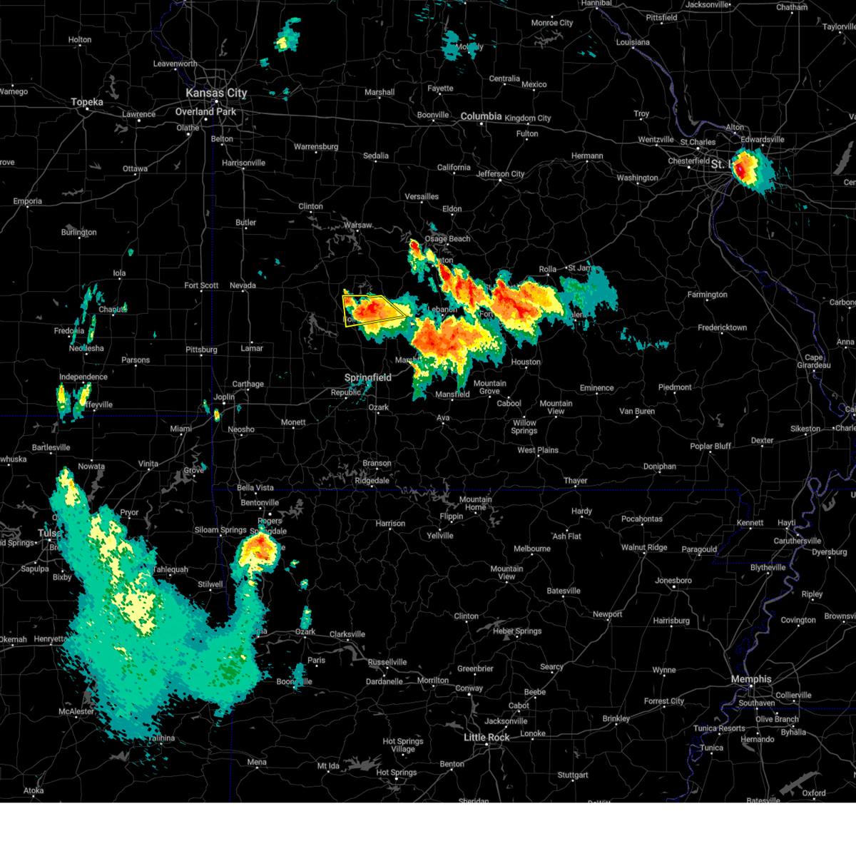
The Top Recent Hail Date for Louisburg, MO is Tuesday, April 29, 2025 (16th out of 66)

Hail and Wind Damage Spotted near Louisburg, MO
| Date / Time | Report Details |
|---|---|
| 6/30/2025 3:30 AM CDT |
 Svrsgf the national weather service in springfield has issued a * severe thunderstorm warning for, northern dallas county in southwestern missouri, * until 400 am cdt. * at 329 am cdt, a severe thunderstorm was located 7 miles southeast of urbana, or 9 miles north of buffalo, moving north at 10 mph (radar indicated). Hazards include 60 mph wind gusts and quarter size hail. Hail damage to vehicles is expected. Expect wind damage to roofs, siding, and trees. Svrsgf the national weather service in springfield has issued a * severe thunderstorm warning for, northern dallas county in southwestern missouri, * until 400 am cdt. * at 329 am cdt, a severe thunderstorm was located 7 miles southeast of urbana, or 9 miles north of buffalo, moving north at 10 mph (radar indicated). Hazards include 60 mph wind gusts and quarter size hail. Hail damage to vehicles is expected. Expect wind damage to roofs, siding, and trees.
|
| 6/3/2025 5:10 PM CDT | The storm which prompted the warning has weakened below severe limits, and no longer poses an immediate threat to life or property. therefore, the warning will be allowed to expire. to report severe weather, contact your nearest law enforcement agency. they will relay your report to the national weather service springfield. |
| 6/3/2025 5:02 PM CDT |
 At 502 pm cdt, a severe thunderstorm was located near buffalo, moving north at 35 mph (radar indicated). Hazards include 60 mph wind gusts and quarter size hail. Hail damage to vehicles is expected. expect wind damage to roofs, siding, and trees. Locations impacted include, buffalo, louisburg, and pumpkin center. At 502 pm cdt, a severe thunderstorm was located near buffalo, moving north at 35 mph (radar indicated). Hazards include 60 mph wind gusts and quarter size hail. Hail damage to vehicles is expected. expect wind damage to roofs, siding, and trees. Locations impacted include, buffalo, louisburg, and pumpkin center.
|
| 6/3/2025 5:02 PM CDT |
 the severe thunderstorm warning has been cancelled and is no longer in effect the severe thunderstorm warning has been cancelled and is no longer in effect
|
| 6/3/2025 4:55 PM CDT |
 At 455 pm cdt, a severe thunderstorm was located near buffalo, moving northeast at 30 mph (radar indicated). Hazards include 60 mph wind gusts and quarter size hail. Hail damage to vehicles is expected. expect wind damage to roofs, siding, and trees. Locations impacted include, buffalo, halfway, louisburg, and pumpkin center. At 455 pm cdt, a severe thunderstorm was located near buffalo, moving northeast at 30 mph (radar indicated). Hazards include 60 mph wind gusts and quarter size hail. Hail damage to vehicles is expected. expect wind damage to roofs, siding, and trees. Locations impacted include, buffalo, halfway, louisburg, and pumpkin center.
|
| 6/3/2025 4:40 PM CDT |
 At 439 pm cdt, a severe thunderstorm was located 7 miles west of buffalo, moving north at 35 mph (radar indicated). Hazards include 60 mph wind gusts and quarter size hail. Hail damage to vehicles is expected. expect wind damage to roofs, siding, and trees. Locations impacted include, buffalo, halfway, louisburg, goodson, and pumpkin center. At 439 pm cdt, a severe thunderstorm was located 7 miles west of buffalo, moving north at 35 mph (radar indicated). Hazards include 60 mph wind gusts and quarter size hail. Hail damage to vehicles is expected. expect wind damage to roofs, siding, and trees. Locations impacted include, buffalo, halfway, louisburg, goodson, and pumpkin center.
|
| 6/3/2025 4:26 PM CDT | Svrsgf the national weather service in springfield has issued a * severe thunderstorm warning for, northwestern dallas county in southwestern missouri, eastern polk county in southwestern missouri, * until 515 pm cdt. * at 425 pm cdt, a severe thunderstorm was located near pleasant hope, or 10 miles southeast of bolivar, moving north at 35 mph (radar indicated). Hazards include 60 mph wind gusts and quarter size hail. Hail damage to vehicles is expected. Expect wind damage to roofs, siding, and trees. |
| 5/19/2025 7:35 PM CDT | Svrsgf the national weather service in springfield has issued a * severe thunderstorm warning for, dallas county in southwestern missouri, western laclede county in southwestern missouri, camden county in central missouri, * until 815 pm cdt. * at 735 pm cdt, severe thunderstorms were located along a line extending from near urbana to 7 miles northeast of fair grove, moving northeast at 50 mph (radar indicated). Hazards include 60 mph wind gusts. expect damage to roofs, siding, and trees |
| 4/29/2025 10:16 AM CDT |
 Svrsgf the national weather service in springfield has issued a * severe thunderstorm warning for, northern dallas county in southwestern missouri, northeastern wright county in southwestern missouri, southwestern dent county in south central missouri, laclede county in southwestern missouri, pulaski county in central missouri, texas county in south central missouri, southwestern phelps county in east central missouri, southern camden county in central missouri, * until 1115 am cdt. * at 1015 am cdt, severe thunderstorms were located along a line extending from 9 miles south of macks creek to 6 miles east of conway to near hartville to near mansfield to 7 miles south of ava, moving east at 55 mph (emergency management). Hazards include 70 mph wind gusts and quarter size hail. Hail damage to vehicles is expected. expect considerable tree damage. Wind damage is also likely to mobile homes, roofs, and outbuildings. Svrsgf the national weather service in springfield has issued a * severe thunderstorm warning for, northern dallas county in southwestern missouri, northeastern wright county in southwestern missouri, southwestern dent county in south central missouri, laclede county in southwestern missouri, pulaski county in central missouri, texas county in south central missouri, southwestern phelps county in east central missouri, southern camden county in central missouri, * until 1115 am cdt. * at 1015 am cdt, severe thunderstorms were located along a line extending from 9 miles south of macks creek to 6 miles east of conway to near hartville to near mansfield to 7 miles south of ava, moving east at 55 mph (emergency management). Hazards include 70 mph wind gusts and quarter size hail. Hail damage to vehicles is expected. expect considerable tree damage. Wind damage is also likely to mobile homes, roofs, and outbuildings.
|
| 4/20/2025 4:28 PM CDT |
 the tornado warning has been cancelled and is no longer in effect the tornado warning has been cancelled and is no longer in effect
|
| 4/20/2025 4:13 PM CDT | the tornado warning has been cancelled and is no longer in effect |
| 4/20/2025 4:13 PM CDT | At 412 pm cdt, a severe thunderstorm capable of producing a tornado was located over buffalo, moving northeast at 60 mph (radar indicated rotation). Hazards include tornado. Flying debris will be dangerous to those caught without shelter. mobile homes will be damaged or destroyed. damage to roofs, windows, and vehicles will occur. tree damage is likely. Locations impacted include, windyville, foose, louisburg, plad, long lane, pumpkin center, buffalo, and bennett spring state park. |
| 4/20/2025 4:08 PM CDT |
 Torsgf the national weather service in springfield has issued a * tornado warning for, dallas county in southwestern missouri, southeastern polk county in southwestern missouri, * until 445 pm cdt. * at 407 pm cdt, a severe thunderstorm capable of producing a tornado was located near buffalo, moving northeast at 60 mph (radar indicated rotation). Hazards include tornado. Flying debris will be dangerous to those caught without shelter. mobile homes will be damaged or destroyed. damage to roofs, windows, and vehicles will occur. Tree damage is likely. Torsgf the national weather service in springfield has issued a * tornado warning for, dallas county in southwestern missouri, southeastern polk county in southwestern missouri, * until 445 pm cdt. * at 407 pm cdt, a severe thunderstorm capable of producing a tornado was located near buffalo, moving northeast at 60 mph (radar indicated rotation). Hazards include tornado. Flying debris will be dangerous to those caught without shelter. mobile homes will be damaged or destroyed. damage to roofs, windows, and vehicles will occur. Tree damage is likely.
|
| 4/20/2025 3:58 PM CDT |
 Svrsgf the national weather service in springfield has issued a * severe thunderstorm warning for, eastern hickory county in central missouri, dallas county in southwestern missouri, benton county in central missouri, miller county in central missouri, eastern polk county in southwestern missouri, laclede county in southwestern missouri, camden county in central missouri, morgan county in central missouri, * until 500 pm cdt. * at 354 pm cdt, severe thunderstorms were located along a line extending from near lincoln to 10 miles northwest of buffalo to 6 miles northwest of roberson hollow, moving northeast at 55 mph (radar indicated). Hazards include 70 mph wind gusts and quarter size hail. Hail damage to vehicles is expected. expect considerable tree damage. Wind damage is also likely to mobile homes, roofs, and outbuildings. Svrsgf the national weather service in springfield has issued a * severe thunderstorm warning for, eastern hickory county in central missouri, dallas county in southwestern missouri, benton county in central missouri, miller county in central missouri, eastern polk county in southwestern missouri, laclede county in southwestern missouri, camden county in central missouri, morgan county in central missouri, * until 500 pm cdt. * at 354 pm cdt, severe thunderstorms were located along a line extending from near lincoln to 10 miles northwest of buffalo to 6 miles northwest of roberson hollow, moving northeast at 55 mph (radar indicated). Hazards include 70 mph wind gusts and quarter size hail. Hail damage to vehicles is expected. expect considerable tree damage. Wind damage is also likely to mobile homes, roofs, and outbuildings.
|
| 4/20/2025 5:28 AM CDT |
 The storms which prompted the warning have moved out of the area. therefore, the warning will be allowed to expire. however, gusty winds and heavy rain are still possible with these thunderstorms. a severe thunderstorm watch remains in effect until 800 am cdt for southwestern missouri. The storms which prompted the warning have moved out of the area. therefore, the warning will be allowed to expire. however, gusty winds and heavy rain are still possible with these thunderstorms. a severe thunderstorm watch remains in effect until 800 am cdt for southwestern missouri.
|
| 4/20/2025 5:16 AM CDT |
 the severe thunderstorm warning has been cancelled and is no longer in effect the severe thunderstorm warning has been cancelled and is no longer in effect
|
| 4/20/2025 5:16 AM CDT |
 At 516 am cdt, severe thunderstorms were located along a line extending from 7 miles southeast of urbana to near buffalo to near fair grove, moving northeast at 40 mph (radar indicated). Hazards include 60 mph wind gusts. Expect damage to roofs, siding, and trees. Locations impacted include, windyville, leadmine, march, tunas, pumpkin center, urbana, olive, foose, louisburg, plad, long lane, charity, and buffalo. At 516 am cdt, severe thunderstorms were located along a line extending from 7 miles southeast of urbana to near buffalo to near fair grove, moving northeast at 40 mph (radar indicated). Hazards include 60 mph wind gusts. Expect damage to roofs, siding, and trees. Locations impacted include, windyville, leadmine, march, tunas, pumpkin center, urbana, olive, foose, louisburg, plad, long lane, charity, and buffalo.
|
| 4/20/2025 5:03 AM CDT |
 At 503 am cdt, severe thunderstorms were located along a line extending from 11 miles south of urbana to near buffalo to near strafford, moving northeast at 50 mph (radar indicated). Hazards include 60 mph wind gusts. Expect damage to roofs, siding, and trees. locations impacted include, windyville, elkland, glidewell, ebenezer, bassville, leadmine, march, tunas, fair grove, pumpkin center, urbana, olive, halfway, foose, pleasant hope, polk, louisburg, goodson, plad, and long lane. This includes interstate 44 between mile markers 102 and 107. At 503 am cdt, severe thunderstorms were located along a line extending from 11 miles south of urbana to near buffalo to near strafford, moving northeast at 50 mph (radar indicated). Hazards include 60 mph wind gusts. Expect damage to roofs, siding, and trees. locations impacted include, windyville, elkland, glidewell, ebenezer, bassville, leadmine, march, tunas, fair grove, pumpkin center, urbana, olive, halfway, foose, pleasant hope, polk, louisburg, goodson, plad, and long lane. This includes interstate 44 between mile markers 102 and 107.
|
| 4/20/2025 5:03 AM CDT |
 the severe thunderstorm warning has been cancelled and is no longer in effect the severe thunderstorm warning has been cancelled and is no longer in effect
|
| 4/20/2025 4:32 AM CDT |
 Svrsgf the national weather service in springfield has issued a * severe thunderstorm warning for, western webster county in southwestern missouri, dallas county in southwestern missouri, northwestern christian county in southwestern missouri, southeastern polk county in southwestern missouri, greene county in southwestern missouri, * until 530 am cdt. * at 432 am cdt, severe thunderstorms were located along a line extending from near morrisville to near willard to near crane, moving northeast at 40 mph (radar indicated). Hazards include 60 mph wind gusts. expect damage to roofs, siding, and trees Svrsgf the national weather service in springfield has issued a * severe thunderstorm warning for, western webster county in southwestern missouri, dallas county in southwestern missouri, northwestern christian county in southwestern missouri, southeastern polk county in southwestern missouri, greene county in southwestern missouri, * until 530 am cdt. * at 432 am cdt, severe thunderstorms were located along a line extending from near morrisville to near willard to near crane, moving northeast at 40 mph (radar indicated). Hazards include 60 mph wind gusts. expect damage to roofs, siding, and trees
|
| 4/4/2025 8:01 PM CDT |
 At 800 pm cdt, a severe thunderstorm was located 7 miles south of buffalo, moving northeast at 60 mph (radar indicated). Hazards include 60 mph wind gusts and quarter size hail. Hail damage to vehicles is expected. expect wind damage to roofs, siding, and trees. locations impacted include, windyville, bennett spring state park, foose, louisburg, march, plad, long lane, pumpkin center, charity, buffalo, and conway. This includes interstate 44 between mile markers 110 and 111. At 800 pm cdt, a severe thunderstorm was located 7 miles south of buffalo, moving northeast at 60 mph (radar indicated). Hazards include 60 mph wind gusts and quarter size hail. Hail damage to vehicles is expected. expect wind damage to roofs, siding, and trees. locations impacted include, windyville, bennett spring state park, foose, louisburg, march, plad, long lane, pumpkin center, charity, buffalo, and conway. This includes interstate 44 between mile markers 110 and 111.
|
| 4/4/2025 8:01 PM CDT |
 the severe thunderstorm warning has been cancelled and is no longer in effect the severe thunderstorm warning has been cancelled and is no longer in effect
|
| 4/4/2025 7:52 PM CDT |
 At 752 pm cdt, a severe thunderstorm was located near fair grove, or 12 miles south of buffalo, moving northeast at 70 mph (radar indicated). Hazards include ping pong ball size hail and 60 mph wind gusts. People and animals outdoors will be injured. expect hail damage to roofs, siding, windows, and vehicles. expect wind damage to roofs, siding, and trees. this severe thunderstorm will remain over mainly rural areas of northwestern webster, dallas, eastern polk, southwestern laclede and northeastern greene counties, including the following locations, windyville, elkland, bassville, march, pumpkin center, olive, bennett spring state park, halfway, foose, and louisburg. This includes interstate 44 between mile markers 106 and 121. At 752 pm cdt, a severe thunderstorm was located near fair grove, or 12 miles south of buffalo, moving northeast at 70 mph (radar indicated). Hazards include ping pong ball size hail and 60 mph wind gusts. People and animals outdoors will be injured. expect hail damage to roofs, siding, windows, and vehicles. expect wind damage to roofs, siding, and trees. this severe thunderstorm will remain over mainly rural areas of northwestern webster, dallas, eastern polk, southwestern laclede and northeastern greene counties, including the following locations, windyville, elkland, bassville, march, pumpkin center, olive, bennett spring state park, halfway, foose, and louisburg. This includes interstate 44 between mile markers 106 and 121.
|
| 4/4/2025 7:42 PM CDT |
 At 740 pm cdt, a severe thunderstorm was located near willard, or 8 miles north of springfield, moving northeast at 70 mph (trained weather spotters. at 724 pm, fire department reported ping pong ball sized hail west of republic). Hazards include ping pong ball size hail and 60 mph wind gusts. People and animals outdoors will be injured. expect hail damage to roofs, siding, windows, and vehicles. expect wind damage to roofs, siding, and trees. locations impacted include, windyville, elkland, glidewell, march, fair grove, pumpkin center, halfway, goodson, plad, long lane, buffalo, sacville, ebenezer, bassville, brighton, conway, willard, urbana, olive, and bennett spring state park. This includes interstate 44 between mile markers 74 and 84, and between mile markers 106 and 121. At 740 pm cdt, a severe thunderstorm was located near willard, or 8 miles north of springfield, moving northeast at 70 mph (trained weather spotters. at 724 pm, fire department reported ping pong ball sized hail west of republic). Hazards include ping pong ball size hail and 60 mph wind gusts. People and animals outdoors will be injured. expect hail damage to roofs, siding, windows, and vehicles. expect wind damage to roofs, siding, and trees. locations impacted include, windyville, elkland, glidewell, march, fair grove, pumpkin center, halfway, goodson, plad, long lane, buffalo, sacville, ebenezer, bassville, brighton, conway, willard, urbana, olive, and bennett spring state park. This includes interstate 44 between mile markers 74 and 84, and between mile markers 106 and 121.
|
| 4/4/2025 7:38 PM CDT | Svrsgf the national weather service in springfield has issued a * severe thunderstorm warning for, northwestern webster county in southwestern missouri, dallas county in southwestern missouri, eastern polk county in southwestern missouri, southwestern laclede county in southwestern missouri, greene county in southwestern missouri, * until 830 pm cdt. * at 737 pm cdt, a severe thunderstorm was located near willard, or near springfield, moving northeast at 70 mph (trained spotter. at 735 pm, nws employees measured quarter sized hail northwest of springfield). Hazards include 60 mph wind gusts and half dollar size hail. Hail damage to vehicles is expected. Expect wind damage to roofs, siding, and trees. |
| 4/2/2025 10:00 AM CDT | At 959 am cdt, severe thunderstorms were located along a line extending from near stover to 6 miles west of laurie to near macks creek, moving northeast at 70 mph (radar indicated). Hazards include 60 mph wind gusts and quarter size hail. Hail damage to vehicles is expected. expect wind damage to roofs, siding, and trees. Locations impacted include, gravois mills, preston, leadmine, pittsburg, tunas, stover, macks creek, zora, urbana, laurie, knobby, hurricane deck, climax springs, barnumton, branch, versailles, louisburg, purvis, pomme de terre lake, and nemo. |
| 4/2/2025 9:27 AM CDT | Svrsgf the national weather service in springfield has issued a * severe thunderstorm warning for, hickory county in central missouri, northern dallas county in southwestern missouri, eastern benton county in central missouri, northern polk county in southwestern missouri, western camden county in central missouri, southern morgan county in central missouri, * until 1015 am cdt. * at 927 am cdt, severe thunderstorms were located along a line extending from 7 miles north of hermitage to 6 miles south of wheatland to near fair play, moving northeast at 70 mph (radar indicated). Hazards include 60 mph wind gusts and quarter size hail. Hail damage to vehicles is expected. Expect wind damage to roofs, siding, and trees. |
| 3/14/2025 5:41 PM CDT |
 Svrsgf the national weather service in springfield has issued a * severe thunderstorm warning for, southeastern hickory county in central missouri, dallas county in southwestern missouri, polk county in southwestern missouri, northwestern laclede county in southwestern missouri, * until 645 pm cdt. * at 540 pm cdt, a severe thunderstorm was located 7 miles northwest of buffalo, moving northeast at 75 mph (radar indicated). Hazards include 70 mph wind gusts and quarter size hail. Hail damage to vehicles is expected. expect considerable tree damage. Wind damage is also likely to mobile homes, roofs, and outbuildings. Svrsgf the national weather service in springfield has issued a * severe thunderstorm warning for, southeastern hickory county in central missouri, dallas county in southwestern missouri, polk county in southwestern missouri, northwestern laclede county in southwestern missouri, * until 645 pm cdt. * at 540 pm cdt, a severe thunderstorm was located 7 miles northwest of buffalo, moving northeast at 75 mph (radar indicated). Hazards include 70 mph wind gusts and quarter size hail. Hail damage to vehicles is expected. expect considerable tree damage. Wind damage is also likely to mobile homes, roofs, and outbuildings.
|
| 8/15/2024 6:31 PM CDT |
 the severe thunderstorm warning has been cancelled and is no longer in effect the severe thunderstorm warning has been cancelled and is no longer in effect
|
| 8/15/2024 6:31 PM CDT |
 At 631 pm cdt, a severe thunderstorm was located over buffalo, moving northeast at 30 mph (radar indicated). Hazards include 60 mph wind gusts and quarter size hail. Hail damage to vehicles is expected. expect wind damage to roofs, siding, and trees. locations impacted include, bennett spring state park, buffalo, conway, phillipsburg, bennett springs, louisburg, windyville, leadmine, march, tunas, pumpkin center, foose, plad, long lane, and charity. This includes interstate 44 between mile markers 110 and 120. At 631 pm cdt, a severe thunderstorm was located over buffalo, moving northeast at 30 mph (radar indicated). Hazards include 60 mph wind gusts and quarter size hail. Hail damage to vehicles is expected. expect wind damage to roofs, siding, and trees. locations impacted include, bennett spring state park, buffalo, conway, phillipsburg, bennett springs, louisburg, windyville, leadmine, march, tunas, pumpkin center, foose, plad, long lane, and charity. This includes interstate 44 between mile markers 110 and 120.
|
| 8/15/2024 6:17 PM CDT |
 Svrsgf the national weather service in springfield has issued a * severe thunderstorm warning for, dallas county in southwestern missouri, eastern polk county in southwestern missouri, western laclede county in southwestern missouri, * until 700 pm cdt. * at 616 pm cdt, a severe thunderstorm was located near buffalo, moving east at 25 mph (radar indicated). Hazards include 60 mph wind gusts and quarter size hail. Hail damage to vehicles is expected. Expect wind damage to roofs, siding, and trees. Svrsgf the national weather service in springfield has issued a * severe thunderstorm warning for, dallas county in southwestern missouri, eastern polk county in southwestern missouri, western laclede county in southwestern missouri, * until 700 pm cdt. * at 616 pm cdt, a severe thunderstorm was located near buffalo, moving east at 25 mph (radar indicated). Hazards include 60 mph wind gusts and quarter size hail. Hail damage to vehicles is expected. Expect wind damage to roofs, siding, and trees.
|
| 5/26/2024 5:23 PM CDT |
 Svrsgf the national weather service in springfield has issued a * severe thunderstorm warning for, southeastern hickory county in central missouri, dallas county in southwestern missouri, northeastern polk county in southwestern missouri, laclede county in southwestern missouri, west central pulaski county in central missouri, southwestern camden county in central missouri, * until 615 pm cdt. * at 523 pm cdt, severe thunderstorms were located along a line extending from near richland to 6 miles west of lebanon to near buffalo, moving east at 40 mph (radar indicated). Hazards include ping pong ball size hail and 60 mph wind gusts. People and animals outdoors will be injured. expect hail damage to roofs, siding, windows, and vehicles. Expect wind damage to roofs, siding, and trees. Svrsgf the national weather service in springfield has issued a * severe thunderstorm warning for, southeastern hickory county in central missouri, dallas county in southwestern missouri, northeastern polk county in southwestern missouri, laclede county in southwestern missouri, west central pulaski county in central missouri, southwestern camden county in central missouri, * until 615 pm cdt. * at 523 pm cdt, severe thunderstorms were located along a line extending from near richland to 6 miles west of lebanon to near buffalo, moving east at 40 mph (radar indicated). Hazards include ping pong ball size hail and 60 mph wind gusts. People and animals outdoors will be injured. expect hail damage to roofs, siding, windows, and vehicles. Expect wind damage to roofs, siding, and trees.
|
| 5/26/2024 5:01 PM CDT |
 At 459 pm cdt, a severe thunderstorm was located near bolivar, moving east at 35 mph (radar indicated). Hazards include golf ball size hail and 60 mph wind gusts. People and animals outdoors will be injured. expect hail damage to roofs, siding, windows, and vehicles. expect wind damage to roofs, siding, and trees. Locations impacted include, bolivar, pomme de terre lake, buffalo, pittsburg, polk, urbana, halfway, louisburg, goodson, and pumpkin center. At 459 pm cdt, a severe thunderstorm was located near bolivar, moving east at 35 mph (radar indicated). Hazards include golf ball size hail and 60 mph wind gusts. People and animals outdoors will be injured. expect hail damage to roofs, siding, windows, and vehicles. expect wind damage to roofs, siding, and trees. Locations impacted include, bolivar, pomme de terre lake, buffalo, pittsburg, polk, urbana, halfway, louisburg, goodson, and pumpkin center.
|
| 5/26/2024 5:01 PM CDT |
 the severe thunderstorm warning has been cancelled and is no longer in effect the severe thunderstorm warning has been cancelled and is no longer in effect
|
| 5/26/2024 4:49 PM CDT | Quarter sized hail reported 7.2 miles E of Louisburg, MO |
| 5/26/2024 4:41 PM CDT |
 Svrsgf the national weather service in springfield has issued a * severe thunderstorm warning for, south central hickory county in central missouri, northwestern dallas county in southwestern missouri, southeastern cedar county in southwestern missouri, northern polk county in southwestern missouri, * until 545 pm cdt. * at 441 pm cdt, a severe thunderstorm was located over fair play, or 10 miles east of stockton, moving east at 35 mph (radar indicated). Hazards include golf ball size hail and 60 mph wind gusts. People and animals outdoors will be injured. expect hail damage to roofs, siding, windows, and vehicles. Expect wind damage to roofs, siding, and trees. Svrsgf the national weather service in springfield has issued a * severe thunderstorm warning for, south central hickory county in central missouri, northwestern dallas county in southwestern missouri, southeastern cedar county in southwestern missouri, northern polk county in southwestern missouri, * until 545 pm cdt. * at 441 pm cdt, a severe thunderstorm was located over fair play, or 10 miles east of stockton, moving east at 35 mph (radar indicated). Hazards include golf ball size hail and 60 mph wind gusts. People and animals outdoors will be injured. expect hail damage to roofs, siding, windows, and vehicles. Expect wind damage to roofs, siding, and trees.
|
| 5/26/2024 4:38 AM CDT |
 The storms which prompted the warning have weakened below severe limits, and no longer pose an immediate threat to life or property. therefore, the warning will be allowed to expire. however, small hail and gusty winds are still possible with these thunderstorms. a tornado watch remains in effect until 1000 am cdt for central and southwestern missouri. The storms which prompted the warning have weakened below severe limits, and no longer pose an immediate threat to life or property. therefore, the warning will be allowed to expire. however, small hail and gusty winds are still possible with these thunderstorms. a tornado watch remains in effect until 1000 am cdt for central and southwestern missouri.
|
| 5/26/2024 4:28 AM CDT |
 At 428 am cdt, severe thunderstorms were located along a line extending from 11 miles southeast of macks creek to near buffalo to near ash grove, moving east at 50 mph (radar indicated). Hazards include 60 mph wind gusts and quarter size hail. Hail damage to vehicles is expected. expect wind damage to roofs, siding, and trees. locations impacted include, lebanon, bolivar, bennett spring state park, marshfield, willard, buffalo, morgan, fair grove, conway, polk, pleasant hope, urbana, niangua, morrisville, phillipsburg, stoutland, halfway, bennett springs, louisburg, and twin bridges. This includes interstate 44 between mile markers 97 and 144. At 428 am cdt, severe thunderstorms were located along a line extending from 11 miles southeast of macks creek to near buffalo to near ash grove, moving east at 50 mph (radar indicated). Hazards include 60 mph wind gusts and quarter size hail. Hail damage to vehicles is expected. expect wind damage to roofs, siding, and trees. locations impacted include, lebanon, bolivar, bennett spring state park, marshfield, willard, buffalo, morgan, fair grove, conway, polk, pleasant hope, urbana, niangua, morrisville, phillipsburg, stoutland, halfway, bennett springs, louisburg, and twin bridges. This includes interstate 44 between mile markers 97 and 144.
|
| 5/26/2024 4:28 AM CDT |
 the severe thunderstorm warning has been cancelled and is no longer in effect the severe thunderstorm warning has been cancelled and is no longer in effect
|
| 5/26/2024 4:04 AM CDT |
 Svrsgf the national weather service in springfield has issued a * severe thunderstorm warning for, southeastern hickory county in central missouri, northern webster county in southwestern missouri, dallas county in southwestern missouri, southeastern cedar county in southwestern missouri, polk county in southwestern missouri, laclede county in southwestern missouri, northern greene county in southwestern missouri, eastern dade county in southwestern missouri, * until 445 am cdt. * at 403 am cdt, severe thunderstorms were located along a line extending from 6 miles southeast of urbana to near pleasant hope to near everton, moving east at 50 mph (radar indicated). Hazards include 60 mph wind gusts and quarter size hail. Hail damage to vehicles is expected. Expect wind damage to roofs, siding, and trees. Svrsgf the national weather service in springfield has issued a * severe thunderstorm warning for, southeastern hickory county in central missouri, northern webster county in southwestern missouri, dallas county in southwestern missouri, southeastern cedar county in southwestern missouri, polk county in southwestern missouri, laclede county in southwestern missouri, northern greene county in southwestern missouri, eastern dade county in southwestern missouri, * until 445 am cdt. * at 403 am cdt, severe thunderstorms were located along a line extending from 6 miles southeast of urbana to near pleasant hope to near everton, moving east at 50 mph (radar indicated). Hazards include 60 mph wind gusts and quarter size hail. Hail damage to vehicles is expected. Expect wind damage to roofs, siding, and trees.
|
| 5/26/2024 1:10 AM CDT |
 the tornado warning has been cancelled and is no longer in effect the tornado warning has been cancelled and is no longer in effect
|
| 5/26/2024 12:54 AM CDT |
 Torsgf the national weather service in springfield has issued a * tornado warning for, west central dallas county in southwestern missouri, east central polk county in southwestern missouri, * until 145 am cdt. * at 1253 am cdt, a severe thunderstorm capable of producing a tornado was located 7 miles northeast of bolivar, moving east at 20 mph (radar indicated rotation). Hazards include tornado and golf ball size hail. Flying debris will be dangerous to those caught without shelter. mobile homes will be damaged or destroyed. damage to roofs, windows, and vehicles will occur. Tree damage is likely. Torsgf the national weather service in springfield has issued a * tornado warning for, west central dallas county in southwestern missouri, east central polk county in southwestern missouri, * until 145 am cdt. * at 1253 am cdt, a severe thunderstorm capable of producing a tornado was located 7 miles northeast of bolivar, moving east at 20 mph (radar indicated rotation). Hazards include tornado and golf ball size hail. Flying debris will be dangerous to those caught without shelter. mobile homes will be damaged or destroyed. damage to roofs, windows, and vehicles will occur. Tree damage is likely.
|
| 5/24/2024 6:43 PM CDT |
 the severe thunderstorm warning has been cancelled and is no longer in effect the severe thunderstorm warning has been cancelled and is no longer in effect
|
| 5/24/2024 6:28 PM CDT |
 Svrsgf the national weather service in springfield has issued a * severe thunderstorm warning for, southern hickory county in central missouri, dallas county in southwestern missouri, northeastern polk county in southwestern missouri, * until 715 pm cdt. * at 627 pm cdt, a severe thunderstorm was located 7 miles northeast of bolivar, moving east at 20 mph (radar indicated). Hazards include 60 mph wind gusts and quarter size hail. Hail damage to vehicles is expected. Expect wind damage to roofs, siding, and trees. Svrsgf the national weather service in springfield has issued a * severe thunderstorm warning for, southern hickory county in central missouri, dallas county in southwestern missouri, northeastern polk county in southwestern missouri, * until 715 pm cdt. * at 627 pm cdt, a severe thunderstorm was located 7 miles northeast of bolivar, moving east at 20 mph (radar indicated). Hazards include 60 mph wind gusts and quarter size hail. Hail damage to vehicles is expected. Expect wind damage to roofs, siding, and trees.
|
| 5/24/2024 6:20 PM CDT |
 At 620 pm cdt, a severe thunderstorm was located near urbana, or 11 miles north of buffalo, moving east at 40 mph (radar indicated). Hazards include 60 mph wind gusts and half dollar size hail. Hail damage to vehicles is expected. expect wind damage to roofs, siding, and trees. Locations impacted include, bolivar, pomme de terre lake, buffalo, pittsburg, humansville, polk, fair play, urbana, halfway, flemington, louisburg, tunas, pumpkin center, goodson, plad, and dunnegan. At 620 pm cdt, a severe thunderstorm was located near urbana, or 11 miles north of buffalo, moving east at 40 mph (radar indicated). Hazards include 60 mph wind gusts and half dollar size hail. Hail damage to vehicles is expected. expect wind damage to roofs, siding, and trees. Locations impacted include, bolivar, pomme de terre lake, buffalo, pittsburg, humansville, polk, fair play, urbana, halfway, flemington, louisburg, tunas, pumpkin center, goodson, plad, and dunnegan.
|
| 5/24/2024 6:20 PM CDT |
 the severe thunderstorm warning has been cancelled and is no longer in effect the severe thunderstorm warning has been cancelled and is no longer in effect
|
| 5/24/2024 5:45 PM CDT |
 Svrsgf the national weather service in springfield has issued a * severe thunderstorm warning for, southern hickory county in central missouri, northwestern dallas county in southwestern missouri, southeastern cedar county in southwestern missouri, northern polk county in southwestern missouri, * until 630 pm cdt. * at 544 pm cdt, a severe thunderstorm was located near humansville, or 11 miles northwest of bolivar, moving east at 40 mph (radar indicated). Hazards include 60 mph wind gusts and half dollar size hail. Hail damage to vehicles is expected. Expect wind damage to roofs, siding, and trees. Svrsgf the national weather service in springfield has issued a * severe thunderstorm warning for, southern hickory county in central missouri, northwestern dallas county in southwestern missouri, southeastern cedar county in southwestern missouri, northern polk county in southwestern missouri, * until 630 pm cdt. * at 544 pm cdt, a severe thunderstorm was located near humansville, or 11 miles northwest of bolivar, moving east at 40 mph (radar indicated). Hazards include 60 mph wind gusts and half dollar size hail. Hail damage to vehicles is expected. Expect wind damage to roofs, siding, and trees.
|
| 5/21/2024 7:34 PM CDT |
 At 734 pm cdt, a severe thunderstorm was located over urbana, or 12 miles southeast of hermitage, moving east at 40 mph (radar indicated). Hazards include golf ball size hail and 60 mph wind gusts. People and animals outdoors will be injured. expect hail damage to roofs, siding, windows, and vehicles. expect wind damage to roofs, siding, and trees. Locations impacted include, pomme de terre lake, bennett spring state park, polk, urbana, macks creek, preston, louisburg, leadmine, tunas, pumpkin center, branch, plad, and nemo. At 734 pm cdt, a severe thunderstorm was located over urbana, or 12 miles southeast of hermitage, moving east at 40 mph (radar indicated). Hazards include golf ball size hail and 60 mph wind gusts. People and animals outdoors will be injured. expect hail damage to roofs, siding, windows, and vehicles. expect wind damage to roofs, siding, and trees. Locations impacted include, pomme de terre lake, bennett spring state park, polk, urbana, macks creek, preston, louisburg, leadmine, tunas, pumpkin center, branch, plad, and nemo.
|
| 5/21/2024 7:21 PM CDT |
 At 720 pm cdt, a severe thunderstorm was located near urbana, or 8 miles southeast of hermitage, moving east at 40 mph (law enforcement). Hazards include 60 mph wind gusts and half dollar size hail. Hail damage to vehicles is expected. expect wind damage to roofs, siding, and trees. Locations impacted include, pomme de terre lake, pomme de terre state park, bennett spring state park, pittsburg, polk, hermitage, urbana, macks creek, preston, louisburg, leadmine, tunas, pumpkin center, branch, plad, and nemo. At 720 pm cdt, a severe thunderstorm was located near urbana, or 8 miles southeast of hermitage, moving east at 40 mph (law enforcement). Hazards include 60 mph wind gusts and half dollar size hail. Hail damage to vehicles is expected. expect wind damage to roofs, siding, and trees. Locations impacted include, pomme de terre lake, pomme de terre state park, bennett spring state park, pittsburg, polk, hermitage, urbana, macks creek, preston, louisburg, leadmine, tunas, pumpkin center, branch, plad, and nemo.
|
| 5/21/2024 7:01 PM CDT |
 Svrsgf the national weather service in springfield has issued a * severe thunderstorm warning for, southern hickory county in central missouri, northern dallas county in southwestern missouri, northern polk county in southwestern missouri, southwestern camden county in central missouri, * until 800 pm cdt. * at 701 pm cdt, a severe thunderstorm was located near humansville, or 13 miles north of bolivar, moving east at 45 mph (radar indicated). Hazards include 60 mph wind gusts and quarter size hail. Hail damage to vehicles is expected. Expect wind damage to roofs, siding, and trees. Svrsgf the national weather service in springfield has issued a * severe thunderstorm warning for, southern hickory county in central missouri, northern dallas county in southwestern missouri, northern polk county in southwestern missouri, southwestern camden county in central missouri, * until 800 pm cdt. * at 701 pm cdt, a severe thunderstorm was located near humansville, or 13 miles north of bolivar, moving east at 45 mph (radar indicated). Hazards include 60 mph wind gusts and quarter size hail. Hail damage to vehicles is expected. Expect wind damage to roofs, siding, and trees.
|
| 5/8/2024 4:31 PM CDT |
 the severe thunderstorm warning has been cancelled and is no longer in effect the severe thunderstorm warning has been cancelled and is no longer in effect
|
| 5/8/2024 4:21 PM CDT |
 Svrsgf the national weather service in springfield has issued a * severe thunderstorm warning for, central dallas county in southwestern missouri, northeastern polk county in southwestern missouri, northwestern laclede county in southwestern missouri, * until 500 pm cdt. * at 421 pm cdt, a severe thunderstorm was located 8 miles west of buffalo, moving east at 40 mph (radar indicated). Hazards include golf ball size hail and 60 mph wind gusts. People and animals outdoors will be injured. expect hail damage to roofs, siding, windows, and vehicles. Expect wind damage to roofs, siding, and trees. Svrsgf the national weather service in springfield has issued a * severe thunderstorm warning for, central dallas county in southwestern missouri, northeastern polk county in southwestern missouri, northwestern laclede county in southwestern missouri, * until 500 pm cdt. * at 421 pm cdt, a severe thunderstorm was located 8 miles west of buffalo, moving east at 40 mph (radar indicated). Hazards include golf ball size hail and 60 mph wind gusts. People and animals outdoors will be injured. expect hail damage to roofs, siding, windows, and vehicles. Expect wind damage to roofs, siding, and trees.
|
| 5/7/2024 1:15 AM CDT |
 the tornado warning has been cancelled and is no longer in effect the tornado warning has been cancelled and is no longer in effect
|
| 5/7/2024 12:58 AM CDT |
 At 1257 am cdt, a severe thunderstorm capable of producing a tornado was located 8 miles north of fair grove, or 10 miles south of buffalo, moving northeast at 55 mph (radar indicated rotation). Hazards include tornado. Flying debris will be dangerous to those caught without shelter. mobile homes will be damaged or destroyed. damage to roofs, windows, and vehicles will occur. tree damage is likely. locations impacted include, buffalo, conway, louisburg, olive, elkland, foose, march, long lane, pumpkin center, and charity. This includes interstate 44 between mile markers 109 and 111. At 1257 am cdt, a severe thunderstorm capable of producing a tornado was located 8 miles north of fair grove, or 10 miles south of buffalo, moving northeast at 55 mph (radar indicated rotation). Hazards include tornado. Flying debris will be dangerous to those caught without shelter. mobile homes will be damaged or destroyed. damage to roofs, windows, and vehicles will occur. tree damage is likely. locations impacted include, buffalo, conway, louisburg, olive, elkland, foose, march, long lane, pumpkin center, and charity. This includes interstate 44 between mile markers 109 and 111.
|
| 5/7/2024 12:58 AM CDT |
 the tornado warning has been cancelled and is no longer in effect the tornado warning has been cancelled and is no longer in effect
|
| 5/7/2024 12:44 AM CDT |
 Torsgf the national weather service in springfield has issued a * tornado warning for, northwestern webster county in southwestern missouri, dallas county in southwestern missouri, southeastern polk county in southwestern missouri, * until 130 am cdt. * at 1244 am cdt, a tornado producing storm was located near pleasant hope, or 13 miles northwest of strafford, moving northeast at 55 mph (radar confirmed tornado). Hazards include damaging tornado. Flying debris will be dangerous to those caught without shelter. mobile homes will be damaged or destroyed. damage to roofs, windows, and vehicles will occur. Tree damage is likely. Torsgf the national weather service in springfield has issued a * tornado warning for, northwestern webster county in southwestern missouri, dallas county in southwestern missouri, southeastern polk county in southwestern missouri, * until 130 am cdt. * at 1244 am cdt, a tornado producing storm was located near pleasant hope, or 13 miles northwest of strafford, moving northeast at 55 mph (radar confirmed tornado). Hazards include damaging tornado. Flying debris will be dangerous to those caught without shelter. mobile homes will be damaged or destroyed. damage to roofs, windows, and vehicles will occur. Tree damage is likely.
|
| 5/7/2024 12:40 AM CDT |
 Svrsgf the national weather service in springfield has issued a * severe thunderstorm warning for, hickory county in central missouri, webster county in southwestern missouri, dallas county in southwestern missouri, wright county in southwestern missouri, benton county in central missouri, western miller county in central missouri, laclede county in southwestern missouri, northwestern pulaski county in central missouri, camden county in central missouri, morgan county in central missouri, * until 130 am cdt. * at 1240 am cdt, severe thunderstorms were located along a line extending from 8 miles northwest of warsaw to near bolivar to 8 miles southwest of crane, moving northeast at 60 mph (radar indicated). Hazards include 60 mph wind gusts. expect damage to roofs, siding, and trees Svrsgf the national weather service in springfield has issued a * severe thunderstorm warning for, hickory county in central missouri, webster county in southwestern missouri, dallas county in southwestern missouri, wright county in southwestern missouri, benton county in central missouri, western miller county in central missouri, laclede county in southwestern missouri, northwestern pulaski county in central missouri, camden county in central missouri, morgan county in central missouri, * until 130 am cdt. * at 1240 am cdt, severe thunderstorms were located along a line extending from 8 miles northwest of warsaw to near bolivar to 8 miles southwest of crane, moving northeast at 60 mph (radar indicated). Hazards include 60 mph wind gusts. expect damage to roofs, siding, and trees
|
| 4/1/2024 7:40 PM CDT | Golf Ball sized hail reported 2.8 miles E of Louisburg, MO |
| 4/1/2024 7:35 PM CDT |
 Svrsgf the national weather service in springfield has issued a * severe thunderstorm warning for, dallas county in southwestern missouri, northeastern polk county in southwestern missouri, laclede county in southwestern missouri, * until 830 pm cdt. * at 733 pm cdt, a severe thunderstorm was located 9 miles northeast of bolivar, moving east at 60 mph. this is a destructive storm for half way buffalo and lebenon missouri areas (emergency management. large hail and damaging winds have been reported with this storm). Hazards include baseball size hail and 70 mph wind gusts. People and animals outdoors will be severely injured. Expect shattered windows, extensive damage to roofs, siding, and vehicles. Svrsgf the national weather service in springfield has issued a * severe thunderstorm warning for, dallas county in southwestern missouri, northeastern polk county in southwestern missouri, laclede county in southwestern missouri, * until 830 pm cdt. * at 733 pm cdt, a severe thunderstorm was located 9 miles northeast of bolivar, moving east at 60 mph. this is a destructive storm for half way buffalo and lebenon missouri areas (emergency management. large hail and damaging winds have been reported with this storm). Hazards include baseball size hail and 70 mph wind gusts. People and animals outdoors will be severely injured. Expect shattered windows, extensive damage to roofs, siding, and vehicles.
|
| 4/1/2024 7:24 PM CDT |
 Svrsgf the national weather service in springfield has issued a * severe thunderstorm warning for, dallas county in southwestern missouri, northwestern laclede county in southwestern missouri, camden county in central missouri, morgan county in central missouri, * until 830 pm cdt. * at 723 pm cdt, severe thunderstorms were located along a line extending from 6 miles southwest of warsaw to 10 miles southwest of urbana to near bolivar, moving east at 60 mph (emergency management). Hazards include golf ball size hail and 70 mph wind gusts. People and animals outdoors will be injured. expect hail damage to roofs, siding, windows, and vehicles. expect considerable tree damage. Wind damage is also likely to mobile homes, roofs, and outbuildings. Svrsgf the national weather service in springfield has issued a * severe thunderstorm warning for, dallas county in southwestern missouri, northwestern laclede county in southwestern missouri, camden county in central missouri, morgan county in central missouri, * until 830 pm cdt. * at 723 pm cdt, severe thunderstorms were located along a line extending from 6 miles southwest of warsaw to 10 miles southwest of urbana to near bolivar, moving east at 60 mph (emergency management). Hazards include golf ball size hail and 70 mph wind gusts. People and animals outdoors will be injured. expect hail damage to roofs, siding, windows, and vehicles. expect considerable tree damage. Wind damage is also likely to mobile homes, roofs, and outbuildings.
|
| 3/14/2024 4:36 PM CDT |
 The storm which prompted the warning has weakened below severe limits, and no longer poses an immediate threat to life or property. therefore, the warning will be allowed to expire. a tornado watch remains in effect until 900 pm cdt for central and southwestern missouri. The storm which prompted the warning has weakened below severe limits, and no longer poses an immediate threat to life or property. therefore, the warning will be allowed to expire. a tornado watch remains in effect until 900 pm cdt for central and southwestern missouri.
|
| 3/14/2024 4:18 PM CDT |
 Svrsgf the national weather service in springfield has issued a * severe thunderstorm warning for, northern dallas county in southwestern missouri, central camden county in central missouri, * until 445 pm cdt. * at 418 pm cdt, a severe thunderstorm was located near urbana, or 10 miles north of buffalo, moving northeast at 40 mph (radar indicated). Hazards include 60 mph wind gusts and quarter size hail. Hail damage to vehicles is expected. Expect wind damage to roofs, siding, and trees. Svrsgf the national weather service in springfield has issued a * severe thunderstorm warning for, northern dallas county in southwestern missouri, central camden county in central missouri, * until 445 pm cdt. * at 418 pm cdt, a severe thunderstorm was located near urbana, or 10 miles north of buffalo, moving northeast at 40 mph (radar indicated). Hazards include 60 mph wind gusts and quarter size hail. Hail damage to vehicles is expected. Expect wind damage to roofs, siding, and trees.
|
| 9/23/2023 8:38 PM CDT |
 At 837 pm cdt, severe thunderstorms were located along a line extending from 8 miles east of urbana to near pleasant hope to near ash grove, moving southeast at 30 mph (emergency management. 60 mph winds reported in walnut grove). Hazards include 70 mph wind gusts and quarter size hail. Hail damage to vehicles is expected. expect considerable tree damage. wind damage is also likely to mobile homes, roofs, and outbuildings. locations impacted include, springfield, republic, bennett spring state park, marshfield, battlefield, willard, buffalo, rogersville, strafford, ash grove, fair grove, conway, walnut grove, urbana, brookline, bennett springs, louisburg, windyville, elkland and glidewell. this includes interstate 44 between mile markers 59 and 111. thunderstorm damage threat, considerable hail threat, radar indicated max hail size, 1. 00 in wind threat, radar indicated max wind gust, 70 mph. At 837 pm cdt, severe thunderstorms were located along a line extending from 8 miles east of urbana to near pleasant hope to near ash grove, moving southeast at 30 mph (emergency management. 60 mph winds reported in walnut grove). Hazards include 70 mph wind gusts and quarter size hail. Hail damage to vehicles is expected. expect considerable tree damage. wind damage is also likely to mobile homes, roofs, and outbuildings. locations impacted include, springfield, republic, bennett spring state park, marshfield, battlefield, willard, buffalo, rogersville, strafford, ash grove, fair grove, conway, walnut grove, urbana, brookline, bennett springs, louisburg, windyville, elkland and glidewell. this includes interstate 44 between mile markers 59 and 111. thunderstorm damage threat, considerable hail threat, radar indicated max hail size, 1. 00 in wind threat, radar indicated max wind gust, 70 mph.
|
| 9/23/2023 8:31 PM CDT |
 At 831 pm cdt, severe thunderstorms were located along a line extending from 6 miles east of urbana to near morrisville to near ash grove, moving southeast at 30 mph (radar indicated). Hazards include 70 mph wind gusts and quarter size hail. Hail damage to vehicles is expected. expect considerable tree damage. wind damage is also likely to mobile homes, roofs, and outbuildings. locations impacted include, springfield, republic, bennett spring state park, marshfield, battlefield, willard, buffalo, rogersville, strafford, ash grove, fair grove, conway, walnut grove, urbana, brookline, bennett springs, louisburg, windyville, elkland and glidewell. this includes interstate 44 between mile markers 59 and 111. thunderstorm damage threat, considerable hail threat, radar indicated max hail size, 1. 00 in wind threat, radar indicated max wind gust, 70 mph. At 831 pm cdt, severe thunderstorms were located along a line extending from 6 miles east of urbana to near morrisville to near ash grove, moving southeast at 30 mph (radar indicated). Hazards include 70 mph wind gusts and quarter size hail. Hail damage to vehicles is expected. expect considerable tree damage. wind damage is also likely to mobile homes, roofs, and outbuildings. locations impacted include, springfield, republic, bennett spring state park, marshfield, battlefield, willard, buffalo, rogersville, strafford, ash grove, fair grove, conway, walnut grove, urbana, brookline, bennett springs, louisburg, windyville, elkland and glidewell. this includes interstate 44 between mile markers 59 and 111. thunderstorm damage threat, considerable hail threat, radar indicated max hail size, 1. 00 in wind threat, radar indicated max wind gust, 70 mph.
|
| 9/23/2023 8:17 PM CDT |
 At 816 pm cdt, severe thunderstorms were located along a line extending from near urbana to near morrisville to near everton, moving southeast at 25 mph (emergency management). Hazards include 60 mph wind gusts and quarter size hail. Hail damage to vehicles is expected. Expect wind damage to roofs, siding, and trees. At 816 pm cdt, severe thunderstorms were located along a line extending from near urbana to near morrisville to near everton, moving southeast at 25 mph (emergency management). Hazards include 60 mph wind gusts and quarter size hail. Hail damage to vehicles is expected. Expect wind damage to roofs, siding, and trees.
|
| 8/13/2023 11:35 PM CDT |
 At 1134 pm cdt, severe thunderstorms were located along a line extending from near osage beach to 8 miles south of camdenton to 10 miles northeast of buffalo, moving east at 35 mph (radar indicated). Hazards include 60 mph wind gusts. Expect damage to roofs, siding, and trees. locations impacted include, lake of the ozarks, lake of the ozarks state park, ha ha tonka state park, bennett spring state park, osage beach, camdenton, richland, sunrise beach, macks creek, linn creek, stoutland, bennett springs, louisburg, brumley, windyville, tunas, pumpkin center, sleeper, freedom and kaiser. This includes interstate 44 near mile marker 137. At 1134 pm cdt, severe thunderstorms were located along a line extending from near osage beach to 8 miles south of camdenton to 10 miles northeast of buffalo, moving east at 35 mph (radar indicated). Hazards include 60 mph wind gusts. Expect damage to roofs, siding, and trees. locations impacted include, lake of the ozarks, lake of the ozarks state park, ha ha tonka state park, bennett spring state park, osage beach, camdenton, richland, sunrise beach, macks creek, linn creek, stoutland, bennett springs, louisburg, brumley, windyville, tunas, pumpkin center, sleeper, freedom and kaiser. This includes interstate 44 near mile marker 137.
|
| 8/13/2023 11:07 PM CDT |
 At 1106 pm cdt, severe thunderstorms were located along a line extending from near laurie to 6 miles southwest of macks creek to 7 miles southwest of urbana, moving east at 35 mph (radar indicated). Hazards include 60 mph wind gusts. expect damage to roofs, siding, and trees At 1106 pm cdt, severe thunderstorms were located along a line extending from near laurie to 6 miles southwest of macks creek to 7 miles southwest of urbana, moving east at 35 mph (radar indicated). Hazards include 60 mph wind gusts. expect damage to roofs, siding, and trees
|
| 7/30/2023 11:00 PM CDT | Trees dow in dallas county MO, 0.2 miles SSE of Louisburg, MO |
| 7/30/2023 10:36 PM CDT |
 At 1034 pm cdt, severe thunderstorms were located along a line extending from near urbana to near bolivar to 8 miles southwest of fair play, moving southeast at 45 mph (law enforcement). Hazards include 70 mph wind gusts. Expect considerable tree damage. damage is likely to mobile homes, roofs, and outbuildings. severe thunderstorms will be near, buffalo, pleasant hope and morrisville around 1050 pm cdt. willard and fair grove around 1100 pm cdt. springfield and conway around 1110 pm cdt. marshfield around 1115 pm cdt. strafford and niangua around 1120 pm cdt. rogersville, seymour, fordland and diggins around 1130 pm cdt. other locations impacted by these severe thunderstorms include stockton lake, polk, brookline, dadeville, halfway, louisburg, aldrich, windyville, elkland and glidewell. this includes interstate 44 between mile markers 59 and 111. thunderstorm damage threat, considerable hail threat, radar indicated max hail size, <. 75 in wind threat, observed max wind gust, 70 mph. At 1034 pm cdt, severe thunderstorms were located along a line extending from near urbana to near bolivar to 8 miles southwest of fair play, moving southeast at 45 mph (law enforcement). Hazards include 70 mph wind gusts. Expect considerable tree damage. damage is likely to mobile homes, roofs, and outbuildings. severe thunderstorms will be near, buffalo, pleasant hope and morrisville around 1050 pm cdt. willard and fair grove around 1100 pm cdt. springfield and conway around 1110 pm cdt. marshfield around 1115 pm cdt. strafford and niangua around 1120 pm cdt. rogersville, seymour, fordland and diggins around 1130 pm cdt. other locations impacted by these severe thunderstorms include stockton lake, polk, brookline, dadeville, halfway, louisburg, aldrich, windyville, elkland and glidewell. this includes interstate 44 between mile markers 59 and 111. thunderstorm damage threat, considerable hail threat, radar indicated max hail size, <. 75 in wind threat, observed max wind gust, 70 mph.
|
| 7/30/2023 10:15 PM CDT |
 At 1015 pm cdt, a severe thunderstorm was located near macks creek, or 15 miles west of camdenton, moving southeast at 50 mph (public). Hazards include 60 mph wind gusts. Expect damage to roofs, siding, and trees. locations impacted include, bolivar, pomme de terre lake, stockton lake, pomme de terre state park, bennett spring state park, buffalo, pittsburg, humansville, conway, polk, pleasant hope, fair play, hermitage, weaubleau, urbana, morrisville, wheatland, preston, cross timbers and halfway. hail threat, radar indicated max hail size, <. 75 in wind threat, observed max wind gust, 60 mph. At 1015 pm cdt, a severe thunderstorm was located near macks creek, or 15 miles west of camdenton, moving southeast at 50 mph (public). Hazards include 60 mph wind gusts. Expect damage to roofs, siding, and trees. locations impacted include, bolivar, pomme de terre lake, stockton lake, pomme de terre state park, bennett spring state park, buffalo, pittsburg, humansville, conway, polk, pleasant hope, fair play, hermitage, weaubleau, urbana, morrisville, wheatland, preston, cross timbers and halfway. hail threat, radar indicated max hail size, <. 75 in wind threat, observed max wind gust, 60 mph.
|
| 7/30/2023 9:39 PM CDT |
 At 939 pm cdt, a severe thunderstorm was located 8 miles west of warsaw, moving southeast at 50 mph (public). Hazards include 60 mph wind gusts. expect damage to roofs, siding, and trees At 939 pm cdt, a severe thunderstorm was located 8 miles west of warsaw, moving southeast at 50 mph (public). Hazards include 60 mph wind gusts. expect damage to roofs, siding, and trees
|
| 7/17/2023 8:19 PM CDT |
 At 818 pm cdt, a severe thunderstorm was located near urbana, or 10 miles southeast of hermitage, moving southeast at 35 mph (radar indicated). Hazards include 60 mph wind gusts and quarter size hail. Hail damage to vehicles is expected. expect wind damage to roofs, siding, and trees. locations impacted include, urbana, louisburg and pumpkin center. hail threat, radar indicated max hail size, 1. 00 in wind threat, radar indicated max wind gust, 60 mph. At 818 pm cdt, a severe thunderstorm was located near urbana, or 10 miles southeast of hermitage, moving southeast at 35 mph (radar indicated). Hazards include 60 mph wind gusts and quarter size hail. Hail damage to vehicles is expected. expect wind damage to roofs, siding, and trees. locations impacted include, urbana, louisburg and pumpkin center. hail threat, radar indicated max hail size, 1. 00 in wind threat, radar indicated max wind gust, 60 mph.
|
| 7/17/2023 8:11 PM CDT |
 At 811 pm cdt, a severe thunderstorm was located near urbana, or 7 miles east of hermitage, moving southeast at 30 mph (radar indicated). Hazards include golf ball size hail and 60 mph wind gusts. People and animals outdoors will be injured. expect hail damage to roofs, siding, windows, and vehicles. expect wind damage to roofs, siding, and trees. locations impacted include, pomme de terre lake, pomme de terre state park, urbana, preston, louisburg, pumpkin center and nemo. thunderstorm damage threat, considerable hail threat, radar indicated max hail size, 1. 75 in wind threat, radar indicated max wind gust, 60 mph. At 811 pm cdt, a severe thunderstorm was located near urbana, or 7 miles east of hermitage, moving southeast at 30 mph (radar indicated). Hazards include golf ball size hail and 60 mph wind gusts. People and animals outdoors will be injured. expect hail damage to roofs, siding, windows, and vehicles. expect wind damage to roofs, siding, and trees. locations impacted include, pomme de terre lake, pomme de terre state park, urbana, preston, louisburg, pumpkin center and nemo. thunderstorm damage threat, considerable hail threat, radar indicated max hail size, 1. 75 in wind threat, radar indicated max wind gust, 60 mph.
|
| 7/17/2023 7:51 PM CDT |
 At 750 pm cdt, a severe thunderstorm was located near hermitage, moving south at 30 mph (radar indicated). Hazards include two inch hail and 60 mph wind gusts. People and animals outdoors will be injured. expect hail damage to roofs, siding, windows, and vehicles. Expect wind damage to roofs, siding, and trees. At 750 pm cdt, a severe thunderstorm was located near hermitage, moving south at 30 mph (radar indicated). Hazards include two inch hail and 60 mph wind gusts. People and animals outdoors will be injured. expect hail damage to roofs, siding, windows, and vehicles. Expect wind damage to roofs, siding, and trees.
|
| 7/17/2023 3:26 PM CDT |
 At 326 pm cdt, a severe thunderstorm was located near bolivar, moving southeast at 25 mph (radar indicated). Hazards include tennis ball size hail and 70 mph wind gusts. People and animals outdoors will be injured. expect hail damage to roofs, siding, windows, and vehicles. expect considerable tree damage. wind damage is also likely to mobile homes, roofs, and outbuildings. locations impacted include, bolivar, buffalo, polk, louisburg and goodson. thunderstorm damage threat, considerable hail threat, radar indicated max hail size, 2. 50 in wind threat, radar indicated max wind gust, 70 mph. At 326 pm cdt, a severe thunderstorm was located near bolivar, moving southeast at 25 mph (radar indicated). Hazards include tennis ball size hail and 70 mph wind gusts. People and animals outdoors will be injured. expect hail damage to roofs, siding, windows, and vehicles. expect considerable tree damage. wind damage is also likely to mobile homes, roofs, and outbuildings. locations impacted include, bolivar, buffalo, polk, louisburg and goodson. thunderstorm damage threat, considerable hail threat, radar indicated max hail size, 2. 50 in wind threat, radar indicated max wind gust, 70 mph.
|
| 7/17/2023 3:19 PM CDT |
 At 319 pm cdt, a severe thunderstorm was located near bolivar, moving south at 30 mph (radar indicated). Hazards include golf ball size hail and 70 mph wind gusts. People and animals outdoors will be injured. expect hail damage to roofs, siding, windows, and vehicles. expect considerable tree damage. wind damage is also likely to mobile homes, roofs, and outbuildings. locations impacted include, bolivar, pomme de terre lake, buffalo, polk, flemington, louisburg and goodson. thunderstorm damage threat, considerable hail threat, radar indicated max hail size, 1. 75 in wind threat, radar indicated max wind gust, 70 mph. At 319 pm cdt, a severe thunderstorm was located near bolivar, moving south at 30 mph (radar indicated). Hazards include golf ball size hail and 70 mph wind gusts. People and animals outdoors will be injured. expect hail damage to roofs, siding, windows, and vehicles. expect considerable tree damage. wind damage is also likely to mobile homes, roofs, and outbuildings. locations impacted include, bolivar, pomme de terre lake, buffalo, polk, flemington, louisburg and goodson. thunderstorm damage threat, considerable hail threat, radar indicated max hail size, 1. 75 in wind threat, radar indicated max wind gust, 70 mph.
|
| 7/17/2023 3:03 PM CDT |
 At 303 pm cdt, a severe thunderstorm was located 8 miles south of hermitage, moving southeast at 25 mph (radar indicated). Hazards include golf ball size hail and 60 mph wind gusts. People and animals outdoors will be injured. expect hail damage to roofs, siding, windows, and vehicles. Expect wind damage to roofs, siding, and trees. At 303 pm cdt, a severe thunderstorm was located 8 miles south of hermitage, moving southeast at 25 mph (radar indicated). Hazards include golf ball size hail and 60 mph wind gusts. People and animals outdoors will be injured. expect hail damage to roofs, siding, windows, and vehicles. Expect wind damage to roofs, siding, and trees.
|
| 7/17/2023 2:23 PM CDT |
 At 223 pm cdt, severe thunderstorms were located along a line extending from 7 miles northwest of lebanon to 7 miles west of macks creek to near osceola, moving southeast at 15 mph (radar indicated). Hazards include ping pong ball size hail and 60 mph wind gusts. People and animals outdoors will be injured. expect hail damage to roofs, siding, windows, and vehicles. Expect wind damage to roofs, siding, and trees. At 223 pm cdt, severe thunderstorms were located along a line extending from 7 miles northwest of lebanon to 7 miles west of macks creek to near osceola, moving southeast at 15 mph (radar indicated). Hazards include ping pong ball size hail and 60 mph wind gusts. People and animals outdoors will be injured. expect hail damage to roofs, siding, windows, and vehicles. Expect wind damage to roofs, siding, and trees.
|
| 7/13/2023 12:18 AM CDT |
 At 1218 am cdt, severe thunderstorms were located along a line extending from 6 miles southeast of urbana to 7 miles east of bolivar to near fair play, moving southeast at 40 mph (radar indicated). Hazards include 60 mph wind gusts and penny size hail. expect damage to roofs, siding, and trees At 1218 am cdt, severe thunderstorms were located along a line extending from 6 miles southeast of urbana to 7 miles east of bolivar to near fair play, moving southeast at 40 mph (radar indicated). Hazards include 60 mph wind gusts and penny size hail. expect damage to roofs, siding, and trees
|
| 6/18/2023 4:25 AM CDT |
 The severe thunderstorm warning for dallas, cedar, polk and eastern greene counties will expire at 430 am cdt, the storms which prompted the warning have weakened below severe limits, and no longer pose an immediate threat to life or property. therefore, the warning will be allowed to expire. however gusty winds are still possible with these thunderstorms. a severe thunderstorm watch remains in effect until 600 am cdt for southwestern missouri. to report severe weather, contact your nearest law enforcement agency. they will relay your report to the national weather service springfield. The severe thunderstorm warning for dallas, cedar, polk and eastern greene counties will expire at 430 am cdt, the storms which prompted the warning have weakened below severe limits, and no longer pose an immediate threat to life or property. therefore, the warning will be allowed to expire. however gusty winds are still possible with these thunderstorms. a severe thunderstorm watch remains in effect until 600 am cdt for southwestern missouri. to report severe weather, contact your nearest law enforcement agency. they will relay your report to the national weather service springfield.
|
| 6/18/2023 4:07 AM CDT |
 At 402 am cdt, severe thunderstorms were located along a line extending from near el dorado springs to near bolivar to near fair grove, moving northeast at 45 mph (radar indicated). Hazards include 60 mph wind gusts. Expect damage to roofs, siding, and trees. these severe storms will be near, strafford around 405 am cdt. bolivar and fair grove around 410 am cdt. conway around 435 am cdt. other locations impacted by these severe thunderstorms include stockton lake, pomme de terre lake, stockton state park, bennett spring state park, polk, halfway, flemington, louisburg, aldrich and umber view heights. this includes interstate 44 between mile markers 75 and 90. hail threat, radar indicated max hail size, <. 75 in wind threat, radar indicated max wind gust, 60 mph. At 402 am cdt, severe thunderstorms were located along a line extending from near el dorado springs to near bolivar to near fair grove, moving northeast at 45 mph (radar indicated). Hazards include 60 mph wind gusts. Expect damage to roofs, siding, and trees. these severe storms will be near, strafford around 405 am cdt. bolivar and fair grove around 410 am cdt. conway around 435 am cdt. other locations impacted by these severe thunderstorms include stockton lake, pomme de terre lake, stockton state park, bennett spring state park, polk, halfway, flemington, louisburg, aldrich and umber view heights. this includes interstate 44 between mile markers 75 and 90. hail threat, radar indicated max hail size, <. 75 in wind threat, radar indicated max wind gust, 60 mph.
|
| 6/18/2023 3:41 AM CDT |
 At 340 am cdt, severe thunderstorms were located along a line extending from 9 miles east of sheldon to near walnut grove to near battlefield, moving northeast at 45 mph (radar indicated). Hazards include 60 mph wind gusts. Expect damage to roofs, siding, and trees. severe thunderstorms will be near, walnut grove around 345 am cdt. springfield and morrisville around 355 am cdt. el dorado springs and fair play around 400 am cdt. bolivar and strafford around 405 am cdt. fair grove around 410 am cdt. conway around 430 am cdt. other locations impacted by these severe thunderstorms include stockton lake, pomme de terre lake, stockton state park, bennett spring state park, polk, brookline, dadeville, jerico springs, halfway and flemington. this includes interstate 44 between mile markers 63 and 90. hail threat, radar indicated max hail size, <. 75 in wind threat, radar indicated max wind gust, 60 mph. At 340 am cdt, severe thunderstorms were located along a line extending from 9 miles east of sheldon to near walnut grove to near battlefield, moving northeast at 45 mph (radar indicated). Hazards include 60 mph wind gusts. Expect damage to roofs, siding, and trees. severe thunderstorms will be near, walnut grove around 345 am cdt. springfield and morrisville around 355 am cdt. el dorado springs and fair play around 400 am cdt. bolivar and strafford around 405 am cdt. fair grove around 410 am cdt. conway around 430 am cdt. other locations impacted by these severe thunderstorms include stockton lake, pomme de terre lake, stockton state park, bennett spring state park, polk, brookline, dadeville, jerico springs, halfway and flemington. this includes interstate 44 between mile markers 63 and 90. hail threat, radar indicated max hail size, <. 75 in wind threat, radar indicated max wind gust, 60 mph.
|
| 5/9/2023 8:06 PM CDT |
 At 806 pm cdt, severe thunderstorms were located along a line extending from 8 miles north of bolivar to 7 miles south of ash grove to near monett, moving southeast at 35 mph (radar indicated). Hazards include 60 mph wind gusts and quarter size hail. Hail damage to vehicles is expected. Expect wind damage to roofs, siding, and trees. At 806 pm cdt, severe thunderstorms were located along a line extending from 8 miles north of bolivar to 7 miles south of ash grove to near monett, moving southeast at 35 mph (radar indicated). Hazards include 60 mph wind gusts and quarter size hail. Hail damage to vehicles is expected. Expect wind damage to roofs, siding, and trees.
|
| 5/9/2023 4:13 PM CDT | Hen Egg sized hail reported 5.5 miles E of Louisburg, MO, pictures of two inch hail near highway hh and highway 64 south of rimby. time estimated from radar. |
| 5/9/2023 4:11 PM CDT |
 At 410 pm cdt, a severe thunderstorm was located 9 miles southwest of urbana, or 10 miles northwest of buffalo, moving northeast at 25 mph (radar indicated). Hazards include golf ball size hail and 60 mph wind gusts. People and animals outdoors will be injured. expect hail damage to roofs, siding, windows, and vehicles. expect wind damage to roofs, siding, and trees. locations impacted include, pomme de terre lake, pomme de terre state park, pittsburg, polk, urbana, goodson and nemo. thunderstorm damage threat, considerable hail threat, radar indicated max hail size, 1. 75 in wind threat, radar indicated max wind gust, 60 mph. At 410 pm cdt, a severe thunderstorm was located 9 miles southwest of urbana, or 10 miles northwest of buffalo, moving northeast at 25 mph (radar indicated). Hazards include golf ball size hail and 60 mph wind gusts. People and animals outdoors will be injured. expect hail damage to roofs, siding, windows, and vehicles. expect wind damage to roofs, siding, and trees. locations impacted include, pomme de terre lake, pomme de terre state park, pittsburg, polk, urbana, goodson and nemo. thunderstorm damage threat, considerable hail threat, radar indicated max hail size, 1. 75 in wind threat, radar indicated max wind gust, 60 mph.
|
| 5/9/2023 3:58 PM CDT |
 At 357 pm cdt, a severe thunderstorm was located near bolivar, moving northeast at 25 mph (radar indicated). Hazards include ping pong ball size hail and 60 mph wind gusts. People and animals outdoors will be injured. expect hail damage to roofs, siding, windows, and vehicles. Expect wind damage to roofs, siding, and trees. At 357 pm cdt, a severe thunderstorm was located near bolivar, moving northeast at 25 mph (radar indicated). Hazards include ping pong ball size hail and 60 mph wind gusts. People and animals outdoors will be injured. expect hail damage to roofs, siding, windows, and vehicles. Expect wind damage to roofs, siding, and trees.
|
| 4/15/2023 3:13 PM CDT |
 At 312 pm cdt, severe thunderstorms were located along a line extending from 6 miles north of camdenton to near macks creek to 7 miles west of buffalo, moving east at 30 mph (radar indicated). Hazards include golf ball size hail and 60 mph wind gusts. People and animals outdoors will be injured. expect hail damage to roofs, siding, windows, and vehicles. Expect wind damage to roofs, siding, and trees. At 312 pm cdt, severe thunderstorms were located along a line extending from 6 miles north of camdenton to near macks creek to 7 miles west of buffalo, moving east at 30 mph (radar indicated). Hazards include golf ball size hail and 60 mph wind gusts. People and animals outdoors will be injured. expect hail damage to roofs, siding, windows, and vehicles. Expect wind damage to roofs, siding, and trees.
|
| 4/15/2023 3:02 PM CDT |
 At 302 pm cdt, a severe thunderstorm was located near macks creek, or 8 miles west of camdenton, moving northeast at 40 mph (radar indicated). Hazards include tennis ball size hail and 60 mph wind gusts. People and animals outdoors will be injured. expect hail damage to roofs, siding, windows, and vehicles. expect wind damage to roofs, siding, and trees. locations impacted include, lake of the ozarks, pomme de terre lake, ha ha tonka state park, lake of the ozarks state park, osage beach, camdenton, village of four seasons, pittsburg, polk, sunrise beach, urbana, macks creek, linn creek, louisburg, tunas, hurricane deck, old linn creek, branch, barnumton and decaturville. thunderstorm damage threat, considerable hail threat, radar indicated max hail size, 2. 50 in wind threat, radar indicated max wind gust, 60 mph. At 302 pm cdt, a severe thunderstorm was located near macks creek, or 8 miles west of camdenton, moving northeast at 40 mph (radar indicated). Hazards include tennis ball size hail and 60 mph wind gusts. People and animals outdoors will be injured. expect hail damage to roofs, siding, windows, and vehicles. expect wind damage to roofs, siding, and trees. locations impacted include, lake of the ozarks, pomme de terre lake, ha ha tonka state park, lake of the ozarks state park, osage beach, camdenton, village of four seasons, pittsburg, polk, sunrise beach, urbana, macks creek, linn creek, louisburg, tunas, hurricane deck, old linn creek, branch, barnumton and decaturville. thunderstorm damage threat, considerable hail threat, radar indicated max hail size, 2. 50 in wind threat, radar indicated max wind gust, 60 mph.
|
| 4/15/2023 2:55 PM CDT |
 At 254 pm cdt, a severe thunderstorm was located 10 miles northwest of buffalo, moving northeast at 40 mph (public. this storm has a history of producing very large hail of tennis ball to three inches in size). Hazards include tennis ball size hail and 60 mph wind gusts. People and animals outdoors will be injured. expect hail damage to roofs, siding, windows, and vehicles. expect wind damage to roofs, siding, and trees. locations impacted include, bolivar, stockton lake, buffalo, polk, fair play, halfway, louisburg, aldrich, bearcreek, masters, march, foose and goodson. thunderstorm damage threat, considerable hail threat, radar indicated max hail size, 2. 50 in wind threat, radar indicated max wind gust, 60 mph. At 254 pm cdt, a severe thunderstorm was located 10 miles northwest of buffalo, moving northeast at 40 mph (public. this storm has a history of producing very large hail of tennis ball to three inches in size). Hazards include tennis ball size hail and 60 mph wind gusts. People and animals outdoors will be injured. expect hail damage to roofs, siding, windows, and vehicles. expect wind damage to roofs, siding, and trees. locations impacted include, bolivar, stockton lake, buffalo, polk, fair play, halfway, louisburg, aldrich, bearcreek, masters, march, foose and goodson. thunderstorm damage threat, considerable hail threat, radar indicated max hail size, 2. 50 in wind threat, radar indicated max wind gust, 60 mph.
|
| 4/15/2023 2:29 PM CDT |
 At 228 pm cdt, a severe thunderstorm was located near urbana, or 7 miles south of hermitage, moving northeast at 40 mph (radar indicated). Hazards include tennis ball size hail and 60 mph wind gusts. People and animals outdoors will be injured. expect hail damage to roofs, siding, windows, and vehicles. expect wind damage to roofs, siding, and trees. locations impacted include, lake of the ozarks, pomme de terre lake, ha ha tonka state park, pomme de terre state park, lake of the ozarks state park, osage beach, camdenton, village of four seasons, pittsburg, polk, hermitage, sunrise beach, urbana, wheatland, macks creek, linn creek, preston, cross timbers, climax springs and louisburg. thunderstorm damage threat, considerable hail threat, radar indicated max hail size, 2. 50 in wind threat, radar indicated max wind gust, 60 mph. At 228 pm cdt, a severe thunderstorm was located near urbana, or 7 miles south of hermitage, moving northeast at 40 mph (radar indicated). Hazards include tennis ball size hail and 60 mph wind gusts. People and animals outdoors will be injured. expect hail damage to roofs, siding, windows, and vehicles. expect wind damage to roofs, siding, and trees. locations impacted include, lake of the ozarks, pomme de terre lake, ha ha tonka state park, pomme de terre state park, lake of the ozarks state park, osage beach, camdenton, village of four seasons, pittsburg, polk, hermitage, sunrise beach, urbana, wheatland, macks creek, linn creek, preston, cross timbers, climax springs and louisburg. thunderstorm damage threat, considerable hail threat, radar indicated max hail size, 2. 50 in wind threat, radar indicated max wind gust, 60 mph.
|
| 4/15/2023 2:23 PM CDT |
 At 223 pm cdt, a severe thunderstorm was located 9 miles south of hermitage, moving northeast at 40 mph (radar indicated). Hazards include golf ball size hail and 60 mph wind gusts. People and animals outdoors will be injured. expect hail damage to roofs, siding, windows, and vehicles. Expect wind damage to roofs, siding, and trees. At 223 pm cdt, a severe thunderstorm was located 9 miles south of hermitage, moving northeast at 40 mph (radar indicated). Hazards include golf ball size hail and 60 mph wind gusts. People and animals outdoors will be injured. expect hail damage to roofs, siding, windows, and vehicles. Expect wind damage to roofs, siding, and trees.
|
| 4/15/2023 2:17 PM CDT |
 At 215 pm cdt, a severe thunderstorm was located 8 miles south of stockton, moving east at 45 mph. this is a destructive storm for cane hill, fair play, and bolivar missouri (public. several reports of tennis ball to three inch size hail has occurred with this storm). Hazards include baseball size hail and 60 mph wind gusts. People and animals outdoors will be severely injured. Expect shattered windows, extensive damage to roofs, siding, and vehicles. At 215 pm cdt, a severe thunderstorm was located 8 miles south of stockton, moving east at 45 mph. this is a destructive storm for cane hill, fair play, and bolivar missouri (public. several reports of tennis ball to three inch size hail has occurred with this storm). Hazards include baseball size hail and 60 mph wind gusts. People and animals outdoors will be severely injured. Expect shattered windows, extensive damage to roofs, siding, and vehicles.
|
| 4/5/2023 5:17 AM CDT |
 At 516 am cdt, a severe thunderstorm was located 8 miles north of pleasant hope, or 9 miles east of bolivar, moving east at 65 mph (public. half dollar size hail was reported with this storm). Hazards include 60 mph wind gusts and half dollar size hail. Hail damage to vehicles is expected. Expect wind damage to roofs, siding, and trees. At 516 am cdt, a severe thunderstorm was located 8 miles north of pleasant hope, or 9 miles east of bolivar, moving east at 65 mph (public. half dollar size hail was reported with this storm). Hazards include 60 mph wind gusts and half dollar size hail. Hail damage to vehicles is expected. Expect wind damage to roofs, siding, and trees.
|
| 2/27/2023 2:21 AM CST |
 At 221 am cst, severe thunderstorms were located along a line extending from near hermitage to near urbana to near pleasant hope, moving northeast at 65 mph (radar indicated). Hazards include 60 mph wind gusts. expect damage to roofs, siding, and trees At 221 am cst, severe thunderstorms were located along a line extending from near hermitage to near urbana to near pleasant hope, moving northeast at 65 mph (radar indicated). Hazards include 60 mph wind gusts. expect damage to roofs, siding, and trees
|
| 5/15/2022 10:50 AM CDT |
 At 1050 am cdt, severe thunderstorms were located along a line extending from 11 miles south of stover to near macks creek to 7 miles west of buffalo, moving southeast at 25 mph (radar indicated). Hazards include 60 mph wind gusts and penny size hail. Expect damage to roofs, siding, and trees. locations impacted include, lebanon, lake of the ozarks, pomme de terre lake, pomme de terre state park, ha ha tonka state park, bennett spring state park, lake of the ozarks state park, osage beach, camdenton, buffalo, village of four seasons, lake ozark, pittsburg, laurie, conway, polk, hermitage, sunrise beach, urbana, macks creek, this includes interstate 44 between mile markers 111 and 117. hail threat, radar indicated max hail size, 0. 75 in wind threat, radar indicated max wind gust, 60 mph. At 1050 am cdt, severe thunderstorms were located along a line extending from 11 miles south of stover to near macks creek to 7 miles west of buffalo, moving southeast at 25 mph (radar indicated). Hazards include 60 mph wind gusts and penny size hail. Expect damage to roofs, siding, and trees. locations impacted include, lebanon, lake of the ozarks, pomme de terre lake, pomme de terre state park, ha ha tonka state park, bennett spring state park, lake of the ozarks state park, osage beach, camdenton, buffalo, village of four seasons, lake ozark, pittsburg, laurie, conway, polk, hermitage, sunrise beach, urbana, macks creek, this includes interstate 44 between mile markers 111 and 117. hail threat, radar indicated max hail size, 0. 75 in wind threat, radar indicated max wind gust, 60 mph.
|
| 5/15/2022 10:26 AM CDT |
 At 1025 am cdt, severe thunderstorms were located along a line extending from near cole camp to 8 miles east of hermitage to fair play, moving east at 50 mph (radar indicated). Hazards include 60 mph wind gusts and quarter size hail. Hail damage to vehicles is expected. expect wind damage to roofs, siding, and trees. locations impacted include, lebanon, lake of the ozarks, pomme de terre lake, truman lake, pomme de terre state park, ha ha tonka state park, bennett spring state park, lake of the ozarks state park, osage beach, camdenton, buffalo, village of four seasons, warsaw, lake ozark, pittsburg, laurie, conway, polk, hermitage, sunrise beach, this includes interstate 44 between mile markers 111 and 117. hail threat, radar indicated max hail size, 1. 00 in wind threat, radar indicated max wind gust, 60 mph. At 1025 am cdt, severe thunderstorms were located along a line extending from near cole camp to 8 miles east of hermitage to fair play, moving east at 50 mph (radar indicated). Hazards include 60 mph wind gusts and quarter size hail. Hail damage to vehicles is expected. expect wind damage to roofs, siding, and trees. locations impacted include, lebanon, lake of the ozarks, pomme de terre lake, truman lake, pomme de terre state park, ha ha tonka state park, bennett spring state park, lake of the ozarks state park, osage beach, camdenton, buffalo, village of four seasons, warsaw, lake ozark, pittsburg, laurie, conway, polk, hermitage, sunrise beach, this includes interstate 44 between mile markers 111 and 117. hail threat, radar indicated max hail size, 1. 00 in wind threat, radar indicated max wind gust, 60 mph.
|
| 5/15/2022 10:12 AM CDT |
 At 1012 am cdt, severe thunderstorms were located along a line extending from 6 miles northwest of lincoln to near hermitage to stockton, moving southeast at 50 mph (radar indicated). Hazards include 60 mph wind gusts and quarter size hail. Hail damage to vehicles is expected. Expect wind damage to roofs, siding, and trees. At 1012 am cdt, severe thunderstorms were located along a line extending from 6 miles northwest of lincoln to near hermitage to stockton, moving southeast at 50 mph (radar indicated). Hazards include 60 mph wind gusts and quarter size hail. Hail damage to vehicles is expected. Expect wind damage to roofs, siding, and trees.
|
| 4/21/2022 4:30 PM CDT |
 At 429 pm cdt, a severe thunderstorm was located near fair play, or near bolivar, moving east at 25 mph (radar indicated). Hazards include 60 mph wind gusts and half dollar size hail. Hail damage to vehicles is expected. expect wind damage to roofs, siding, and trees. locations impacted include, bolivar, pomme de terre lake, stockton lake, buffalo, humansville, polk, pleasant hope, fair play, morrisville, halfway, flemington, louisburg, aldrich, brighton, pumpkin center, eudora, foose, goodson, dunnegan, hail threat, radar indicated max hail size, 1. 25 in wind threat, radar indicated max wind gust, 60 mph. At 429 pm cdt, a severe thunderstorm was located near fair play, or near bolivar, moving east at 25 mph (radar indicated). Hazards include 60 mph wind gusts and half dollar size hail. Hail damage to vehicles is expected. expect wind damage to roofs, siding, and trees. locations impacted include, bolivar, pomme de terre lake, stockton lake, buffalo, humansville, polk, pleasant hope, fair play, morrisville, halfway, flemington, louisburg, aldrich, brighton, pumpkin center, eudora, foose, goodson, dunnegan, hail threat, radar indicated max hail size, 1. 25 in wind threat, radar indicated max wind gust, 60 mph.
|
| 4/21/2022 4:21 PM CDT |
 At 420 pm cdt, a severe thunderstorm was located over fair play, or 9 miles west of bolivar, moving east at 25 mph (radar indicated). Hazards include ping pong ball size hail and 60 mph wind gusts. People and animals outdoors will be injured. expect hail damage to roofs, siding, windows, and vehicles. Expect wind damage to roofs, siding, and trees. At 420 pm cdt, a severe thunderstorm was located over fair play, or 9 miles west of bolivar, moving east at 25 mph (radar indicated). Hazards include ping pong ball size hail and 60 mph wind gusts. People and animals outdoors will be injured. expect hail damage to roofs, siding, windows, and vehicles. Expect wind damage to roofs, siding, and trees.
|
| 4/13/2022 7:36 AM CDT |
 The severe thunderstorm warning for southeastern hickory, northern dallas and southwestern camden counties will expire at 745 am cdt, the storm which prompted the warning has weakened below severe limits, and no longer poses an immediate threat to life or property. therefore, the warning will be allowed to expire. The severe thunderstorm warning for southeastern hickory, northern dallas and southwestern camden counties will expire at 745 am cdt, the storm which prompted the warning has weakened below severe limits, and no longer poses an immediate threat to life or property. therefore, the warning will be allowed to expire.
|
| 4/13/2022 7:17 AM CDT |
 At 716 am cdt, a severe thunderstorm was located near urbana, or 10 miles north of buffalo, moving northeast at 20 mph (radar indicated). Hazards include 60 mph wind gusts and quarter size hail. Hail damage to vehicles is expected. expect wind damage to roofs, siding, and trees. locations impacted include, ha ha tonka state park, urbana, macks creek, louisburg, branch, leadmine, decaturville, tunas, hail threat, radar indicated max hail size, 1. 00 in wind threat, radar indicated max wind gust, 60 mph. At 716 am cdt, a severe thunderstorm was located near urbana, or 10 miles north of buffalo, moving northeast at 20 mph (radar indicated). Hazards include 60 mph wind gusts and quarter size hail. Hail damage to vehicles is expected. expect wind damage to roofs, siding, and trees. locations impacted include, ha ha tonka state park, urbana, macks creek, louisburg, branch, leadmine, decaturville, tunas, hail threat, radar indicated max hail size, 1. 00 in wind threat, radar indicated max wind gust, 60 mph.
|
| 4/13/2022 6:54 AM CDT |
 At 654 am cdt, a severe thunderstorm was located near urbana, or 11 miles northwest of buffalo, moving northeast at 35 mph (radar indicated). Hazards include 60 mph wind gusts and quarter size hail. Hail damage to vehicles is expected. Expect wind damage to roofs, siding, and trees. At 654 am cdt, a severe thunderstorm was located near urbana, or 11 miles northwest of buffalo, moving northeast at 35 mph (radar indicated). Hazards include 60 mph wind gusts and quarter size hail. Hail damage to vehicles is expected. Expect wind damage to roofs, siding, and trees.
|
| 4/11/2022 12:48 AM CDT |
 At 1248 am cdt, a severe thunderstorm was located over urbana, or 12 miles north of buffalo, moving east at 35 mph (radar indicated). Hazards include 60 mph wind gusts and quarter size hail. Hail damage to vehicles is expected. Expect wind damage to roofs, siding, and trees. At 1248 am cdt, a severe thunderstorm was located over urbana, or 12 miles north of buffalo, moving east at 35 mph (radar indicated). Hazards include 60 mph wind gusts and quarter size hail. Hail damage to vehicles is expected. Expect wind damage to roofs, siding, and trees.
|
| 6/11/2021 6:55 PM CDT |
 At 654 pm cdt, severe thunderstorms were located along a line extending from near osage beach to 6 miles southeast of macks creek to near buffalo, moving southeast at 25 mph (radar indicated). Hazards include 60 mph wind gusts and half dollar size hail. Hail damage to vehicles is expected. Expect wind damage to roofs, siding, and trees. At 654 pm cdt, severe thunderstorms were located along a line extending from near osage beach to 6 miles southeast of macks creek to near buffalo, moving southeast at 25 mph (radar indicated). Hazards include 60 mph wind gusts and half dollar size hail. Hail damage to vehicles is expected. Expect wind damage to roofs, siding, and trees.
|
| 6/11/2021 6:45 PM CDT | Six large trees downe in dallas county MO, 0.6 miles ESE of Louisburg, MO |
| 5/27/2021 12:42 PM CDT |
 The severe thunderstorm warning for dallas and southern polk counties will expire at 1245 pm cdt, the storms which prompted the warning have moved out of the area. therefore, the warning will be allowed to expire. however heavy rain is still possible with these thunderstorms. a severe thunderstorm watch remains in effect until 700 pm cdt for southwestern missouri. to report severe weather, contact your nearest law enforcement agency. they will relay your report to the national weather service springfield. The severe thunderstorm warning for dallas and southern polk counties will expire at 1245 pm cdt, the storms which prompted the warning have moved out of the area. therefore, the warning will be allowed to expire. however heavy rain is still possible with these thunderstorms. a severe thunderstorm watch remains in effect until 700 pm cdt for southwestern missouri. to report severe weather, contact your nearest law enforcement agency. they will relay your report to the national weather service springfield.
|
| 5/27/2021 12:14 PM CDT |
 At 1210 pm cdt, severe thunderstorms were located along a line extending from 8 miles northeast of buffalo to 8 miles east of bolivar to morrisville, moving southeast at 50 mph (radar indicated). Hazards include 70 mph wind gusts and quarter size hail. Hail damage to vehicles is expected. expect considerable tree damage. wind damage is also likely to mobile homes, roofs, and outbuildings. Locations impacted include, bolivar, stockton lake, bennett spring state park, buffalo, conway, pleasant hope, morrisville, halfway, louisburg, aldrich, windyville, brighton, march, pumpkin center, olive, eudora, foose, plad, long lane, charity, this includes interstate 44 between mile markers 110 and 111. At 1210 pm cdt, severe thunderstorms were located along a line extending from 8 miles northeast of buffalo to 8 miles east of bolivar to morrisville, moving southeast at 50 mph (radar indicated). Hazards include 70 mph wind gusts and quarter size hail. Hail damage to vehicles is expected. expect considerable tree damage. wind damage is also likely to mobile homes, roofs, and outbuildings. Locations impacted include, bolivar, stockton lake, bennett spring state park, buffalo, conway, pleasant hope, morrisville, halfway, louisburg, aldrich, windyville, brighton, march, pumpkin center, olive, eudora, foose, plad, long lane, charity, this includes interstate 44 between mile markers 110 and 111.
|
| 5/27/2021 11:58 AM CDT |
 At 1158 am cdt, severe thunderstorms were located along a line extending from near urbana to near bolivar to 7 miles southwest of fair play, moving east at 40 mph. these are very dangerous storms (radar indicated). Hazards include 80 mph wind gusts and quarter size hail. Flying debris will be dangerous to those caught without shelter. mobile homes will be heavily damaged. expect considerable damage to roofs, windows, and vehicles. extensive tree damage and power outages are likely. Locations impacted include, bolivar, stockton lake, bennett spring state park, buffalo, conway, polk, pleasant hope, urbana, morrisville, dadeville, halfway, louisburg, aldrich, windyville, march, tunas, pumpkin center, eudora, goodson, plad, this includes interstate 44 between mile markers 110 and 111. At 1158 am cdt, severe thunderstorms were located along a line extending from near urbana to near bolivar to 7 miles southwest of fair play, moving east at 40 mph. these are very dangerous storms (radar indicated). Hazards include 80 mph wind gusts and quarter size hail. Flying debris will be dangerous to those caught without shelter. mobile homes will be heavily damaged. expect considerable damage to roofs, windows, and vehicles. extensive tree damage and power outages are likely. Locations impacted include, bolivar, stockton lake, bennett spring state park, buffalo, conway, polk, pleasant hope, urbana, morrisville, dadeville, halfway, louisburg, aldrich, windyville, march, tunas, pumpkin center, eudora, goodson, plad, this includes interstate 44 between mile markers 110 and 111.
|
| 5/27/2021 11:45 AM CDT |
 At 1145 am cdt, severe thunderstorms were located along a line extending from 7 miles south of hermitage to near fair play to 8 miles south of stockton, moving east at 40 mph (radar indicated). Hazards include 70 mph wind gusts and quarter size hail. Hail damage to vehicles is expected. expect considerable tree damage. Wind damage is also likely to mobile homes, roofs, and outbuildings. At 1145 am cdt, severe thunderstorms were located along a line extending from 7 miles south of hermitage to near fair play to 8 miles south of stockton, moving east at 40 mph (radar indicated). Hazards include 70 mph wind gusts and quarter size hail. Hail damage to vehicles is expected. expect considerable tree damage. Wind damage is also likely to mobile homes, roofs, and outbuildings.
|
| 11/14/2020 6:52 PM CST |
 At 652 pm cst, severe thunderstorms were located along a line extending from near camdenton to near pleasant hope, moving east at 40 mph (radar indicated). Hazards include golf ball size hail and 60 mph wind gusts. People and animals outdoors will be injured. expect hail damage to roofs, siding, windows, and vehicles. expect wind damage to roofs, siding, and trees. Locations impacted include, lebanon, lake of the ozarks, lake of the ozarks state park, ha ha tonka state park, bennett spring state park, osage beach, camdenton, buffalo, village of four seasons, richland, lake ozark, conway, iberia, pleasant hope, sunrise beach, morrisville, macks creek, linn creek, phillipsburg, stoutland, this includes interstate 44 between mile markers 109 and 143. At 652 pm cst, severe thunderstorms were located along a line extending from near camdenton to near pleasant hope, moving east at 40 mph (radar indicated). Hazards include golf ball size hail and 60 mph wind gusts. People and animals outdoors will be injured. expect hail damage to roofs, siding, windows, and vehicles. expect wind damage to roofs, siding, and trees. Locations impacted include, lebanon, lake of the ozarks, lake of the ozarks state park, ha ha tonka state park, bennett spring state park, osage beach, camdenton, buffalo, village of four seasons, richland, lake ozark, conway, iberia, pleasant hope, sunrise beach, morrisville, macks creek, linn creek, phillipsburg, stoutland, this includes interstate 44 between mile markers 109 and 143.
|
| 11/14/2020 6:45 PM CST |
 At 645 pm cst, severe thunderstorms were located along a line extending from near camdenton to near pleasant hope, moving east at 40 mph (radar indicated). Hazards include 60 mph wind gusts and quarter size hail. Hail damage to vehicles is expected. Expect wind damage to roofs, siding, and trees. At 645 pm cst, severe thunderstorms were located along a line extending from near camdenton to near pleasant hope, moving east at 40 mph (radar indicated). Hazards include 60 mph wind gusts and quarter size hail. Hail damage to vehicles is expected. Expect wind damage to roofs, siding, and trees.
|
| 11/14/2020 6:34 PM CST |
 At 634 pm cst, a severe thunderstorm capable of producing a tornado was located over morrisville, or 8 miles south of bolivar, moving northeast at 55 mph (radar indicated rotation). Hazards include tornado. Flying debris will be dangerous to those caught without shelter. mobile homes will be damaged or destroyed. damage to roofs, windows, and vehicles will occur. Tree damage is likely. At 634 pm cst, a severe thunderstorm capable of producing a tornado was located over morrisville, or 8 miles south of bolivar, moving northeast at 55 mph (radar indicated rotation). Hazards include tornado. Flying debris will be dangerous to those caught without shelter. mobile homes will be damaged or destroyed. damage to roofs, windows, and vehicles will occur. Tree damage is likely.
|
| 9/27/2020 4:01 PM CDT |
 At 401 pm cdt, a severe thunderstorm was located near buffalo, moving east at 35 mph (radar indicated). Hazards include 60 mph wind gusts. Expect damage to roofs, siding, and trees. Locations impacted include, bennett spring state park, buffalo, louisburg, windyville, plad, goodson, pumpkin center,. At 401 pm cdt, a severe thunderstorm was located near buffalo, moving east at 35 mph (radar indicated). Hazards include 60 mph wind gusts. Expect damage to roofs, siding, and trees. Locations impacted include, bennett spring state park, buffalo, louisburg, windyville, plad, goodson, pumpkin center,.
|
| 9/27/2020 3:41 PM CDT |
 At 341 pm cdt, a severe thunderstorm was located 8 miles north of bolivar, moving east at 35 mph (radar indicated). Hazards include 60 mph wind gusts and quarter size hail. Hail damage to vehicles is expected. Expect wind damage to roofs, siding, and trees. At 341 pm cdt, a severe thunderstorm was located 8 miles north of bolivar, moving east at 35 mph (radar indicated). Hazards include 60 mph wind gusts and quarter size hail. Hail damage to vehicles is expected. Expect wind damage to roofs, siding, and trees.
|
| 8/10/2020 7:35 PM CDT |
 The severe thunderstorm warning for hickory, dallas, northern polk and southwestern camden counties will expire at 745 pm cdt, the storms which prompted the warning have weakened below severe limits, and no longer pose an immediate threat to life or property. therefore, the warning will be allowed to expire. however gusty winds and heavy rain are still possible with these thunderstorms. The severe thunderstorm warning for hickory, dallas, northern polk and southwestern camden counties will expire at 745 pm cdt, the storms which prompted the warning have weakened below severe limits, and no longer pose an immediate threat to life or property. therefore, the warning will be allowed to expire. however gusty winds and heavy rain are still possible with these thunderstorms.
|
| 8/10/2020 6:54 PM CDT |
 At 654 pm cdt, severe thunderstorms were located along a line extending from near hermitage to near urbana to 10 miles north of bolivar to near humansville, moving east at 35 mph (radar indicated). Hazards include 60 mph wind gusts and nickel size hail. expect damage to roofs, siding, and trees At 654 pm cdt, severe thunderstorms were located along a line extending from near hermitage to near urbana to 10 miles north of bolivar to near humansville, moving east at 35 mph (radar indicated). Hazards include 60 mph wind gusts and nickel size hail. expect damage to roofs, siding, and trees
|
| 5/15/2020 2:20 AM CDT |
 At 219 am cdt, severe thunderstorms were located along a line extending from near urbana to 9 miles northwest of buffalo to near bolivar to 6 miles northwest of morrisville, moving southeast at 45 mph (radar indicated). Hazards include 60 mph wind gusts and nickel size hail. Expect damage to roofs, siding, and trees. Locations impacted include, bolivar, stockton lake, pomme de terre lake, pomme de terre state park, stockton state park, stockton, pittsburg, humansville, polk, fair play, hermitage, urbana, wheatland, jerico springs, preston, cross timbers, halfway, flemington, louisburg, umber view heights,. At 219 am cdt, severe thunderstorms were located along a line extending from near urbana to 9 miles northwest of buffalo to near bolivar to 6 miles northwest of morrisville, moving southeast at 45 mph (radar indicated). Hazards include 60 mph wind gusts and nickel size hail. Expect damage to roofs, siding, and trees. Locations impacted include, bolivar, stockton lake, pomme de terre lake, pomme de terre state park, stockton state park, stockton, pittsburg, humansville, polk, fair play, hermitage, urbana, wheatland, jerico springs, preston, cross timbers, halfway, flemington, louisburg, umber view heights,.
|
| 5/15/2020 1:42 AM CDT |
 At 142 am cdt, severe thunderstorms were located along a line extending from 9 miles east of osceola to near weaubleau to stockton to 13 miles south of el dorado springs, moving southeast at 45 mph (radar indicated). Hazards include 60 mph wind gusts. expect damage to roofs, siding, and trees At 142 am cdt, severe thunderstorms were located along a line extending from 9 miles east of osceola to near weaubleau to stockton to 13 miles south of el dorado springs, moving southeast at 45 mph (radar indicated). Hazards include 60 mph wind gusts. expect damage to roofs, siding, and trees
|
| 5/4/2020 1:22 PM CDT |
 At 121 pm cdt, severe thunderstorms were located along a line extending from near weaubleau to 8 miles south of stockton, moving south at 95 mph (radar indicated). Hazards include 70 mph wind gusts and quarter size hail. Hail damage to vehicles is expected. expect considerable tree damage. Wind damage is also likely to mobile homes, roofs, and outbuildings. At 121 pm cdt, severe thunderstorms were located along a line extending from near weaubleau to 8 miles south of stockton, moving south at 95 mph (radar indicated). Hazards include 70 mph wind gusts and quarter size hail. Hail damage to vehicles is expected. expect considerable tree damage. Wind damage is also likely to mobile homes, roofs, and outbuildings.
|
| 5/4/2020 12:39 PM CDT |
 The severe thunderstorm warning for southern hickory, northwestern dallas and northeastern polk counties will expire at 1245 pm cdt, the storm which prompted the warning has moved out of the area. therefore, the warning will be allowed to expire. a severe thunderstorm watch remains in effect until 300 pm cdt for central, southwestern and west central missouri. The severe thunderstorm warning for southern hickory, northwestern dallas and northeastern polk counties will expire at 1245 pm cdt, the storm which prompted the warning has moved out of the area. therefore, the warning will be allowed to expire. a severe thunderstorm watch remains in effect until 300 pm cdt for central, southwestern and west central missouri.
|
| 5/4/2020 12:14 PM CDT |
 At 1214 pm cdt, a severe thunderstorm was located near urbana, or 7 miles south of hermitage, moving east at 45 mph (trained weather spotters reported powerlines were down in humansville). Hazards include 60 mph wind gusts and half dollar size hail. Hail damage to vehicles is expected. expect wind damage to roofs, siding, and trees. Locations impacted include, pomme de terre lake, pomme de terre state park, pittsburg, polk, hermitage, urbana, preston, louisburg, nemo, elkton,. At 1214 pm cdt, a severe thunderstorm was located near urbana, or 7 miles south of hermitage, moving east at 45 mph (trained weather spotters reported powerlines were down in humansville). Hazards include 60 mph wind gusts and half dollar size hail. Hail damage to vehicles is expected. expect wind damage to roofs, siding, and trees. Locations impacted include, pomme de terre lake, pomme de terre state park, pittsburg, polk, hermitage, urbana, preston, louisburg, nemo, elkton,.
|
| 5/4/2020 12:00 PM CDT |
 At 1200 pm cdt, a severe thunderstorm was located near humansville, or 12 miles southwest of hermitage, moving east at 45 mph (radar indicated). Hazards include 60 mph wind gusts and half dollar size hail. Hail damage to vehicles is expected. Expect wind damage to roofs, siding, and trees. At 1200 pm cdt, a severe thunderstorm was located near humansville, or 12 miles southwest of hermitage, moving east at 45 mph (radar indicated). Hazards include 60 mph wind gusts and half dollar size hail. Hail damage to vehicles is expected. Expect wind damage to roofs, siding, and trees.
|
| 5/3/2020 10:36 AM CDT |
 At 1035 am cdt, severe thunderstorms were located along a line extending from near buffalo to strafford, moving east at 40 mph (radar indicated). Hazards include 60 mph wind gusts and quarter size hail. Hail damage to vehicles is expected. Expect wind damage to roofs, siding, and trees. At 1035 am cdt, severe thunderstorms were located along a line extending from near buffalo to strafford, moving east at 40 mph (radar indicated). Hazards include 60 mph wind gusts and quarter size hail. Hail damage to vehicles is expected. Expect wind damage to roofs, siding, and trees.
|
| 8/16/2019 3:05 AM CDT |
 The severe thunderstorm warning for eastern hickory, dallas, polk and southwestern camden counties will expire at 315 am cdt, the storms which prompted the warning have weakened below severe limits, and no longer pose an immediate threat to life or property. therefore, the warning will be allowed to expire. a severe thunderstorm watch remains in effect until 700 am cdt for central and southwestern missouri. The severe thunderstorm warning for eastern hickory, dallas, polk and southwestern camden counties will expire at 315 am cdt, the storms which prompted the warning have weakened below severe limits, and no longer pose an immediate threat to life or property. therefore, the warning will be allowed to expire. a severe thunderstorm watch remains in effect until 700 am cdt for central and southwestern missouri.
|
| 8/16/2019 2:37 AM CDT |
 At 237 am cdt, severe thunderstorms were located along a line extending from near hermitage to 7 miles south of urbana to 8 miles west of buffalo to near walnut grove, moving east at 45 mph (radar indicated). Hazards include 60 mph wind gusts and penny size hail. Expect damage to roofs, siding, and trees. Locations impacted include, bolivar, pomme de terre lake, stockton lake, pomme de terre state park, bennett spring state park, buffalo, pittsburg, conway, polk, pleasant hope, hermitage, urbana, morrisville, macks creek, preston, cross timbers, halfway, bennett springs, louisburg, aldrich,. At 237 am cdt, severe thunderstorms were located along a line extending from near hermitage to 7 miles south of urbana to 8 miles west of buffalo to near walnut grove, moving east at 45 mph (radar indicated). Hazards include 60 mph wind gusts and penny size hail. Expect damage to roofs, siding, and trees. Locations impacted include, bolivar, pomme de terre lake, stockton lake, pomme de terre state park, bennett spring state park, buffalo, pittsburg, conway, polk, pleasant hope, hermitage, urbana, morrisville, macks creek, preston, cross timbers, halfway, bennett springs, louisburg, aldrich,.
|
| 8/16/2019 2:08 AM CDT |
 At 208 am cdt, severe thunderstorms were located along a line extending from 8 miles northwest of wheatland to near weaubleau to near humansville to 9 miles southwest of stockton, moving east at 50 mph (radar indicated). Hazards include 60 mph wind gusts and quarter size hail. Hail damage to vehicles is expected. Expect wind damage to roofs, siding, and trees. At 208 am cdt, severe thunderstorms were located along a line extending from 8 miles northwest of wheatland to near weaubleau to near humansville to 9 miles southwest of stockton, moving east at 50 mph (radar indicated). Hazards include 60 mph wind gusts and quarter size hail. Hail damage to vehicles is expected. Expect wind damage to roofs, siding, and trees.
|
| 5/23/2019 12:33 AM CDT |
 At 1232 am cdt, a severe thunderstorm was located 9 miles northeast of bolivar, moving east at 40 mph (radar indicated). Hazards include 60 mph wind gusts and half dollar size hail. Hail damage to vehicles is expected. Expect wind damage to roofs, siding, and trees. At 1232 am cdt, a severe thunderstorm was located 9 miles northeast of bolivar, moving east at 40 mph (radar indicated). Hazards include 60 mph wind gusts and half dollar size hail. Hail damage to vehicles is expected. Expect wind damage to roofs, siding, and trees.
|
| 5/22/2019 11:06 PM CDT |
 The tornado warning for south central hickory, northern dallas and northeastern polk counties will expire at 1115 pm cdt, the storm which prompted the warning has weakened below severe limits, and no longer appears capable of producing a tornado. therefore, the warning will be allowed to expire. however gusty winds are still possible with this thunderstorm. a tornado watch remains in effect until 400 am cdt for central and southwestern missouri. to report severe weather, contact your nearest law enforcement agency. they will relay your report to the national weather service springfield. The tornado warning for south central hickory, northern dallas and northeastern polk counties will expire at 1115 pm cdt, the storm which prompted the warning has weakened below severe limits, and no longer appears capable of producing a tornado. therefore, the warning will be allowed to expire. however gusty winds are still possible with this thunderstorm. a tornado watch remains in effect until 400 am cdt for central and southwestern missouri. to report severe weather, contact your nearest law enforcement agency. they will relay your report to the national weather service springfield.
|
| 5/22/2019 10:54 PM CDT |
 At 1052 pm cdt, a severe thunderstorm capable of producing a tornado was located near urbana with a second circulation located 5 miles northeast of bolivar. both cells are moving east at 35 mph (radar indicated rotation). Hazards include tornado and half dollar size hail. Flying debris will be dangerous to those caught without shelter. mobile homes will be damaged or destroyed. damage to roofs, windows, and vehicles will occur. tree damage is likely. Locations impacted include, bolivar, pomme de terre lake, buffalo, pittsburg, polk, urbana, halfway, louisburg, leadmine, tunas, pumpkin center, goodson, plad,. At 1052 pm cdt, a severe thunderstorm capable of producing a tornado was located near urbana with a second circulation located 5 miles northeast of bolivar. both cells are moving east at 35 mph (radar indicated rotation). Hazards include tornado and half dollar size hail. Flying debris will be dangerous to those caught without shelter. mobile homes will be damaged or destroyed. damage to roofs, windows, and vehicles will occur. tree damage is likely. Locations impacted include, bolivar, pomme de terre lake, buffalo, pittsburg, polk, urbana, halfway, louisburg, leadmine, tunas, pumpkin center, goodson, plad,.
|
| 5/22/2019 10:43 PM CDT |
 At 1041 pm cdt, a severe thunderstorm capable of producing a tornado was located 9 miles northeast of bolivar, moving east at 35 mph. circulations continue northeast of polk and north and west of bolivar (radar indicated rotation). Hazards include tornado and half dollar size hail. Flying debris will be dangerous to those caught without shelter. mobile homes will be damaged or destroyed. damage to roofs, windows, and vehicles will occur. tree damage is likely. Locations impacted include, bolivar, pomme de terre lake, buffalo, pittsburg, polk, fair play, urbana, halfway, louisburg, leadmine, tunas, pumpkin center, goodson, plad, dunnegan,. At 1041 pm cdt, a severe thunderstorm capable of producing a tornado was located 9 miles northeast of bolivar, moving east at 35 mph. circulations continue northeast of polk and north and west of bolivar (radar indicated rotation). Hazards include tornado and half dollar size hail. Flying debris will be dangerous to those caught without shelter. mobile homes will be damaged or destroyed. damage to roofs, windows, and vehicles will occur. tree damage is likely. Locations impacted include, bolivar, pomme de terre lake, buffalo, pittsburg, polk, fair play, urbana, halfway, louisburg, leadmine, tunas, pumpkin center, goodson, plad, dunnegan,.
|
| 5/22/2019 10:30 PM CDT |
 At 1026 pm cdt, a severe thunderstorm capable of producing a tornado was located over bolivar, moving east at 35 mph. this warning replaces the previous warning for the same areas (radar indicated rotation. two separate rotations were tracking to the east northeast. one near fair play and a second west of goodson). Hazards include tornado and half dollar size hail. Flying debris will be dangerous to those caught without shelter. mobile homes will be damaged or destroyed. damage to roofs, windows, and vehicles will occur. Tree damage is likely. At 1026 pm cdt, a severe thunderstorm capable of producing a tornado was located over bolivar, moving east at 35 mph. this warning replaces the previous warning for the same areas (radar indicated rotation. two separate rotations were tracking to the east northeast. one near fair play and a second west of goodson). Hazards include tornado and half dollar size hail. Flying debris will be dangerous to those caught without shelter. mobile homes will be damaged or destroyed. damage to roofs, windows, and vehicles will occur. Tree damage is likely.
|
| 5/20/2019 8:16 PM CDT |
 At 816 pm cdt, severe thunderstorms were located along a line extending from near urbana to 7 miles northwest of buffalo to 7 miles north of pleasant hope, moving northeast at 50 mph (radar indicated). Hazards include 60 mph wind gusts. expect damage to roofs, siding, and trees At 816 pm cdt, severe thunderstorms were located along a line extending from near urbana to 7 miles northwest of buffalo to 7 miles north of pleasant hope, moving northeast at 50 mph (radar indicated). Hazards include 60 mph wind gusts. expect damage to roofs, siding, and trees
|
| 5/18/2019 4:26 PM CDT |
 The severe thunderstorm warning for hickory, northern webster, dallas, northwestern wright, southeastern benton, western laclede, eastern polk, eastern greene and southwestern camden counties will expire at 430 pm cdt, the storms which prompted the warning have weakened below severe limits, and no longer pose an immediate threat to life or property. therefore, the warning will be allowed to expire. however gusty winds are still possible with these thunderstorms. a tornado watch remains in effect until 500 pm cdt for central and southwestern missouri. The severe thunderstorm warning for hickory, northern webster, dallas, northwestern wright, southeastern benton, western laclede, eastern polk, eastern greene and southwestern camden counties will expire at 430 pm cdt, the storms which prompted the warning have weakened below severe limits, and no longer pose an immediate threat to life or property. therefore, the warning will be allowed to expire. however gusty winds are still possible with these thunderstorms. a tornado watch remains in effect until 500 pm cdt for central and southwestern missouri.
|
| 5/18/2019 4:03 PM CDT |
 At 403 pm cdt, severe thunderstorms were located along a line extending from near wheatland to near urbana to near buffalo to near strafford, moving northeast at 50 mph (radar indicated). Hazards include 60 mph wind gusts. Expect damage to roofs, siding, and trees. Locations impacted include, northeastern springfield, lebanon, pomme de terre lake, pomme de terre state park, bennett spring state park, marshfield, buffalo, strafford, morgan, fair grove, pittsburg, conway, polk, hermitage, urbana, niangua, wheatland, macks creek, preston, cross timbers, this includes interstate 44 between mile markers 81 and 124. At 403 pm cdt, severe thunderstorms were located along a line extending from near wheatland to near urbana to near buffalo to near strafford, moving northeast at 50 mph (radar indicated). Hazards include 60 mph wind gusts. Expect damage to roofs, siding, and trees. Locations impacted include, northeastern springfield, lebanon, pomme de terre lake, pomme de terre state park, bennett spring state park, marshfield, buffalo, strafford, morgan, fair grove, pittsburg, conway, polk, hermitage, urbana, niangua, wheatland, macks creek, preston, cross timbers, this includes interstate 44 between mile markers 81 and 124.
|
| 5/18/2019 3:51 PM CDT |
 A severe thunderstorm warning remains in effect until 430 pm cdt for hickory. northern webster. dallas. northwestern wright. southeastern benton. western laclede. polk. eastern greene. southeastern st. clair and southwestern camden counties. At 350 pm cdt, severe thunderstorms were located along a line extending from weaubleau to 11 miles east of humansville to 7 miles. A severe thunderstorm warning remains in effect until 430 pm cdt for hickory. northern webster. dallas. northwestern wright. southeastern benton. western laclede. polk. eastern greene. southeastern st. clair and southwestern camden counties. At 350 pm cdt, severe thunderstorms were located along a line extending from weaubleau to 11 miles east of humansville to 7 miles.
|
| 5/18/2019 3:38 PM CDT |
 At 337 pm cdt, severe thunderstorms were located along a line extending from near humansville to near fair play to near morrisville to near pleasant hope to springfield, moving northeast at 50 mph (radar indicated). Hazards include 60 mph wind gusts. expect damage to roofs, siding, and trees At 337 pm cdt, severe thunderstorms were located along a line extending from near humansville to near fair play to near morrisville to near pleasant hope to springfield, moving northeast at 50 mph (radar indicated). Hazards include 60 mph wind gusts. expect damage to roofs, siding, and trees
|
| 4/18/2019 1:45 AM CDT |
 At 144 am cdt, severe thunderstorms were located along a line extending from near hermitage to near buffalo to 7 miles northeast of fair grove, moving east at 55 mph (radar indicated). Hazards include 70 mph wind gusts. Expect considerable tree damage. damage is likely to mobile homes, roofs, and outbuildings. Locations impacted include, pomme de terre lake, pomme de terre state park, bennett spring state park, buffalo, pittsburg, polk, hermitage, urbana, wheatland, preston, cross timbers, halfway, louisburg, windyville, march, tunas, pumpkin center, goodson, plad, long lane,. At 144 am cdt, severe thunderstorms were located along a line extending from near hermitage to near buffalo to 7 miles northeast of fair grove, moving east at 55 mph (radar indicated). Hazards include 70 mph wind gusts. Expect considerable tree damage. damage is likely to mobile homes, roofs, and outbuildings. Locations impacted include, pomme de terre lake, pomme de terre state park, bennett spring state park, buffalo, pittsburg, polk, hermitage, urbana, wheatland, preston, cross timbers, halfway, louisburg, windyville, march, tunas, pumpkin center, goodson, plad, long lane,.
|
| 4/18/2019 1:02 AM CDT |
 At 102 am cdt, severe thunderstorms were located along a line extending from 10 miles south of el dorado springs to 6 miles north of greenfield to near miller, moving east at 65 mph (radar indicated). Hazards include 70 mph wind gusts. Expect considerable tree damage. Damage is likely to mobile homes, roofs, and outbuildings. At 102 am cdt, severe thunderstorms were located along a line extending from 10 miles south of el dorado springs to 6 miles north of greenfield to near miller, moving east at 65 mph (radar indicated). Hazards include 70 mph wind gusts. Expect considerable tree damage. Damage is likely to mobile homes, roofs, and outbuildings.
|
| 2/6/2019 11:28 PM CST |
 The severe thunderstorm warning for northern dallas, northwestern laclede and southwestern camden counties will expire at 1130 pm cst, the storm which prompted the warning has weakened below severe limits, and has exited the warned area. therefore, the warning will be allowed to expire. The severe thunderstorm warning for northern dallas, northwestern laclede and southwestern camden counties will expire at 1130 pm cst, the storm which prompted the warning has weakened below severe limits, and has exited the warned area. therefore, the warning will be allowed to expire.
|
| 2/6/2019 11:13 PM CST |
 At 1112 pm cst, a severe thunderstorm was located 12 miles northwest of lebanon, moving northeast at 65 mph (radar indicated). Hazards include quarter size hail. Damage to vehicles is expected. Locations impacted include, bennett spring state park, ha ha tonka state park, macks creek, bennett springs, louisburg, windyville, eldridge, leadmine, tunas, pumpkin center, branch, decaturville, plad,. At 1112 pm cst, a severe thunderstorm was located 12 miles northwest of lebanon, moving northeast at 65 mph (radar indicated). Hazards include quarter size hail. Damage to vehicles is expected. Locations impacted include, bennett spring state park, ha ha tonka state park, macks creek, bennett springs, louisburg, windyville, eldridge, leadmine, tunas, pumpkin center, branch, decaturville, plad,.
|
| 2/6/2019 10:48 PM CST |
 At 1048 pm cst, a severe thunderstorm was located 8 miles north of fair grove, or 10 miles south of buffalo, moving northeast at 65 mph. quarter size hail has been reported in fair grove (trained weather spotters). Hazards include quarter size hail. damage to vehicles is expected At 1048 pm cst, a severe thunderstorm was located 8 miles north of fair grove, or 10 miles south of buffalo, moving northeast at 65 mph. quarter size hail has been reported in fair grove (trained weather spotters). Hazards include quarter size hail. damage to vehicles is expected
|
| 12/1/2018 1:53 AM CST |
 The severe thunderstorm warning for northern webster and dallas counties will expire at 200 am cst, the storms which prompted the warning have moved out of the area. therefore, the warning will be allowed to expire. however heavy rain is still possible with these thunderstorms. a tornado watch remains in effect until 500 am cst for southwestern missouri. to report severe weather, contact your nearest law enforcement agency. they will relay your report to the national weather service springfield. The severe thunderstorm warning for northern webster and dallas counties will expire at 200 am cst, the storms which prompted the warning have moved out of the area. therefore, the warning will be allowed to expire. however heavy rain is still possible with these thunderstorms. a tornado watch remains in effect until 500 am cst for southwestern missouri. to report severe weather, contact your nearest law enforcement agency. they will relay your report to the national weather service springfield.
|
| 12/1/2018 1:38 AM CST |
 At 137 am cst, severe thunderstorms were located along a line extending from 9 miles northeast of hermitage to 6 miles southwest of lebanon, moving northeast at 75 mph (trained weather spotters. these storms have a long history of producing wind damage across southern missouri). Hazards include 70 mph wind gusts. Expect considerable tree damage. damage is likely to mobile homes, roofs, and outbuildings. locations impacted include, bennett spring state park, marshfield, buffalo, urbana, niangua, duncan, bennett springs, louisburg, windyville, elkland, leadmine, march, tunas, pumpkin center, rader, foose, plad, long lane, charity, this includes interstate 44 between mile markers 100 and 109. A tornado watch remains in effect until 500 am cst for southwestern missouri. At 137 am cst, severe thunderstorms were located along a line extending from 9 miles northeast of hermitage to 6 miles southwest of lebanon, moving northeast at 75 mph (trained weather spotters. these storms have a long history of producing wind damage across southern missouri). Hazards include 70 mph wind gusts. Expect considerable tree damage. damage is likely to mobile homes, roofs, and outbuildings. locations impacted include, bennett spring state park, marshfield, buffalo, urbana, niangua, duncan, bennett springs, louisburg, windyville, elkland, leadmine, march, tunas, pumpkin center, rader, foose, plad, long lane, charity, this includes interstate 44 between mile markers 100 and 109. A tornado watch remains in effect until 500 am cst for southwestern missouri.
|
| 12/1/2018 1:10 AM CST |
 At 109 am cst, severe thunderstorms were located along a line extending from near fair play to near rogersville, moving northeast at 75 mph (trained weather spotters). Hazards include 70 mph wind gusts. these storms have a history of producing wind damage across greene county. Expect considerable tree damage. damage is likely to mobile homes, roofs, and outbuildings. locations impacted include, bennett spring state park, marshfield, buffalo, rogersville, seymour, fordland, urbana, niangua, duncan, diggins, bennett springs, louisburg, windyville, elkland, march, tunas, pumpkin center, rader, plad, long lane, this includes interstate 44 between mile markers 91 and 109. A tornado watch remains in effect until 500 am cst for southwestern missouri. At 109 am cst, severe thunderstorms were located along a line extending from near fair play to near rogersville, moving northeast at 75 mph (trained weather spotters). Hazards include 70 mph wind gusts. these storms have a history of producing wind damage across greene county. Expect considerable tree damage. damage is likely to mobile homes, roofs, and outbuildings. locations impacted include, bennett spring state park, marshfield, buffalo, rogersville, seymour, fordland, urbana, niangua, duncan, diggins, bennett springs, louisburg, windyville, elkland, march, tunas, pumpkin center, rader, plad, long lane, this includes interstate 44 between mile markers 91 and 109. A tornado watch remains in effect until 500 am cst for southwestern missouri.
|
| 12/1/2018 1:02 AM CST |
 At 102 am cst, severe thunderstorms were located along a line extending from near walnut grove to near sparta, moving northeast at 75 mph (radar indicated). Hazards include 60 mph wind gusts. expect damage to roofs, siding, and trees At 102 am cst, severe thunderstorms were located along a line extending from near walnut grove to near sparta, moving northeast at 75 mph (radar indicated). Hazards include 60 mph wind gusts. expect damage to roofs, siding, and trees
|
| 8/19/2018 7:52 PM CDT |
 At 752 pm cdt, severe thunderstorms were located along a line extending from 7 miles south of urbana to 6 miles southeast of fair grove to 6 miles southeast of clever, moving east at 35 mph (trained weather spotters). Hazards include 60 mph wind gusts. Expect damage to roofs, siding, and trees. locations impacted include, springfield, nixa, ozark, republic, marshfield, battlefield, buffalo, rogersville, strafford, clever, sparta, fair grove, highlandville, fremont hills, fordland, niangua, brookline, hurley, louisburg, elkland, this includes interstate 44 near mile marker 69, and between mile markers 71 and 109. A tornado watch remains in effect until 900 pm cdt for southwestern missouri. At 752 pm cdt, severe thunderstorms were located along a line extending from 7 miles south of urbana to 6 miles southeast of fair grove to 6 miles southeast of clever, moving east at 35 mph (trained weather spotters). Hazards include 60 mph wind gusts. Expect damage to roofs, siding, and trees. locations impacted include, springfield, nixa, ozark, republic, marshfield, battlefield, buffalo, rogersville, strafford, clever, sparta, fair grove, highlandville, fremont hills, fordland, niangua, brookline, hurley, louisburg, elkland, this includes interstate 44 near mile marker 69, and between mile markers 71 and 109. A tornado watch remains in effect until 900 pm cdt for southwestern missouri.
|
| 8/19/2018 7:31 PM CDT |
 At 731 pm cdt, severe thunderstorms were located along a line extending from 7 miles north of bolivar to 7 miles southwest of fair grove to near marionville, moving east at 10 mph (radar indicated). Hazards include 60 mph wind gusts. expect damage to roofs, siding, and trees At 731 pm cdt, severe thunderstorms were located along a line extending from 7 miles north of bolivar to 7 miles southwest of fair grove to near marionville, moving east at 10 mph (radar indicated). Hazards include 60 mph wind gusts. expect damage to roofs, siding, and trees
|
| 6/26/2018 4:06 PM CDT |
 At 405 pm cdt, severe thunderstorms were located along a line extending from 8 miles northeast of iberia to 9 miles southeast of camdenton to near hermitage, moving southeast at 30 mph (radar indicated). Hazards include 60 mph wind gusts and quarter size hail. Hail damage to vehicles is expected. Expect wind damage to roofs, siding, and trees. At 405 pm cdt, severe thunderstorms were located along a line extending from 8 miles northeast of iberia to 9 miles southeast of camdenton to near hermitage, moving southeast at 30 mph (radar indicated). Hazards include 60 mph wind gusts and quarter size hail. Hail damage to vehicles is expected. Expect wind damage to roofs, siding, and trees.
|
| 5/19/2018 6:53 PM CDT |
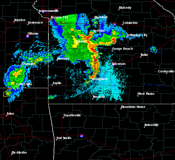 At 653 pm cdt, a severe thunderstorm was located near buffalo, moving east at 30 mph (radar indicated). Hazards include 60 mph wind gusts and quarter size hail. Hail damage to vehicles is expected. expect wind damage to roofs, siding, and trees. Locations impacted include, buffalo, louisburg, march, foose,. At 653 pm cdt, a severe thunderstorm was located near buffalo, moving east at 30 mph (radar indicated). Hazards include 60 mph wind gusts and quarter size hail. Hail damage to vehicles is expected. expect wind damage to roofs, siding, and trees. Locations impacted include, buffalo, louisburg, march, foose,.
|
| 5/19/2018 6:40 PM CDT |
 At 640 pm cdt, a severe thunderstorm was located 8 miles north of pleasant hope, or 8 miles east of bolivar, moving east at 30 mph (radar indicated). Hazards include 60 mph wind gusts and quarter size hail. Hail damage to vehicles is expected. expect wind damage to roofs, siding, and trees. Locations impacted include, buffalo, pleasant hope, halfway, louisburg, foose, march, goodson,. At 640 pm cdt, a severe thunderstorm was located 8 miles north of pleasant hope, or 8 miles east of bolivar, moving east at 30 mph (radar indicated). Hazards include 60 mph wind gusts and quarter size hail. Hail damage to vehicles is expected. expect wind damage to roofs, siding, and trees. Locations impacted include, buffalo, pleasant hope, halfway, louisburg, foose, march, goodson,.
|
| 5/19/2018 6:23 PM CDT |
 At 623 pm cdt, a severe thunderstorm was located near bolivar, moving east at 25 mph (radar indicated). Hazards include 60 mph wind gusts and quarter size hail. Hail damage to vehicles is expected. Expect wind damage to roofs, siding, and trees. At 623 pm cdt, a severe thunderstorm was located near bolivar, moving east at 25 mph (radar indicated). Hazards include 60 mph wind gusts and quarter size hail. Hail damage to vehicles is expected. Expect wind damage to roofs, siding, and trees.
|
| 6/30/2017 12:37 AM CDT |
 At 536 am cdt, severe thunderstorms were located along a line extending from 11 miles east of urbana to 6 miles southeast of buffalo to 6 miles northeast of fair grove to strafford to springfield, moving east at 45 mph (radar indicated). Hazards include 60 mph wind gusts. Expect damage to roofs, siding, and trees. Locations impacted include, springfield, republic, bennett spring state park, marshfield, battlefield, willard, buffalo, rogersville, strafford, fair grove, conway, pleasant hope, brookline, halfway, louisburg, windyville, elkland, glidewell, turners, march, this includes interstate 44 between mile markers 69 and 109. At 536 am cdt, severe thunderstorms were located along a line extending from 11 miles east of urbana to 6 miles southeast of buffalo to 6 miles northeast of fair grove to strafford to springfield, moving east at 45 mph (radar indicated). Hazards include 60 mph wind gusts. Expect damage to roofs, siding, and trees. Locations impacted include, springfield, republic, bennett spring state park, marshfield, battlefield, willard, buffalo, rogersville, strafford, fair grove, conway, pleasant hope, brookline, halfway, louisburg, windyville, elkland, glidewell, turners, march, this includes interstate 44 between mile markers 69 and 109.
|
| 6/30/2017 12:26 AM CDT |
 At 526 am cdt, severe thunderstorms were located along a line extending from 6 miles southeast of urbana to 6 miles south of buffalo to near pleasant hope to springfield to battlefield, moving east at 50 mph (radar indicated). Hazards include 60 mph wind gusts. Expect damage to roofs, siding, and trees. Locations impacted include, springfield, nixa, ozark, republic, bolivar, pomme de terre lake, bennett spring state park, marshfield, battlefield, willard, buffalo, rogersville, strafford, clever, fair grove, billings, fremont hills, conway, polk, pleasant hope, this includes interstate 44 between mile markers 61 and 109. At 526 am cdt, severe thunderstorms were located along a line extending from 6 miles southeast of urbana to 6 miles south of buffalo to near pleasant hope to springfield to battlefield, moving east at 50 mph (radar indicated). Hazards include 60 mph wind gusts. Expect damage to roofs, siding, and trees. Locations impacted include, springfield, nixa, ozark, republic, bolivar, pomme de terre lake, bennett spring state park, marshfield, battlefield, willard, buffalo, rogersville, strafford, clever, fair grove, billings, fremont hills, conway, polk, pleasant hope, this includes interstate 44 between mile markers 61 and 109.
|
| 6/30/2017 12:10 AM CDT |
 At 510 am cdt, severe thunderstorms were located along a line extending from near bolivar to willard to near billings, moving east at 45 mph (radar indicated). Hazards include 60 mph wind gusts. Expect damage to roofs, siding, and trees. Locations impacted include, springfield, nixa, ozark, republic, bolivar, pomme de terre lake, stockton lake, bennett spring state park, aurora, marshfield, battlefield, willard, buffalo, rogersville, strafford, marionville, clever, ash grove, fair grove, humansville, this includes interstate 44 between mile markers 53 and 109. At 510 am cdt, severe thunderstorms were located along a line extending from near bolivar to willard to near billings, moving east at 45 mph (radar indicated). Hazards include 60 mph wind gusts. Expect damage to roofs, siding, and trees. Locations impacted include, springfield, nixa, ozark, republic, bolivar, pomme de terre lake, stockton lake, bennett spring state park, aurora, marshfield, battlefield, willard, buffalo, rogersville, strafford, marionville, clever, ash grove, fair grove, humansville, this includes interstate 44 between mile markers 53 and 109.
|
| 6/30/2017 12:07 AM CDT |
 At 507 am cdt, severe thunderstorms were located along a line extending from near bolivar to near willard to near billings, moving east at 45 mph (radar indicated). Hazards include 60 mph wind gusts. expect damage to roofs, siding, and trees At 507 am cdt, severe thunderstorms were located along a line extending from near bolivar to near willard to near billings, moving east at 45 mph (radar indicated). Hazards include 60 mph wind gusts. expect damage to roofs, siding, and trees
|
| 6/17/2017 3:02 AM CDT |
 At 302 am cdt, severe thunderstorms were located along a line extending from near laurie to near macks creek to near urbana to near fair play to 8 miles west of stockton to walker, moving southeast at 55 mph (radar indicated). Hazards include 60 mph wind gusts. Expect damage to roofs, siding, and trees. Locations impacted include, bolivar, lake of the ozarks, pomme de terre lake, stockton lake, truman lake, pomme de terre state park, stockton state park, ha ha tonka state park, bennett spring state park, osage beach, camdenton, el dorado springs, buffalo, versailles, village of four seasons, stockton, pittsburg, cole camp, stover, humansville,. At 302 am cdt, severe thunderstorms were located along a line extending from near laurie to near macks creek to near urbana to near fair play to 8 miles west of stockton to walker, moving southeast at 55 mph (radar indicated). Hazards include 60 mph wind gusts. Expect damage to roofs, siding, and trees. Locations impacted include, bolivar, lake of the ozarks, pomme de terre lake, stockton lake, truman lake, pomme de terre state park, stockton state park, ha ha tonka state park, bennett spring state park, osage beach, camdenton, el dorado springs, buffalo, versailles, village of four seasons, stockton, pittsburg, cole camp, stover, humansville,.
|
| 6/17/2017 2:35 AM CDT |
 At 235 am cdt, severe thunderstorms were located along a line extending from near cole camp to 11 miles east of warsaw to 6 miles northwest of wheatland to 9 miles east of el dorado springs to 6 miles north of walker to near hume, moving southeast at 55 mph (radar indicated). Hazards include 60 mph wind gusts. expect damage to roofs, siding, and trees At 235 am cdt, severe thunderstorms were located along a line extending from near cole camp to 11 miles east of warsaw to 6 miles northwest of wheatland to 9 miles east of el dorado springs to 6 miles north of walker to near hume, moving southeast at 55 mph (radar indicated). Hazards include 60 mph wind gusts. expect damage to roofs, siding, and trees
|
| 5/27/2017 6:56 PM CDT |
 At 656 pm cdt, a severe thunderstorm was located near buffalo, moving southeast at 30 mph (radar indicated). Hazards include quarter size hail. damage to vehicles is expected At 656 pm cdt, a severe thunderstorm was located near buffalo, moving southeast at 30 mph (radar indicated). Hazards include quarter size hail. damage to vehicles is expected
|
| 5/27/2017 6:26 PM CDT |
 At 625 pm cdt, a severe thunderstorm was located 9 miles east of humansville, or 11 miles southwest of hermitage, moving east at 25 mph (public). Hazards include half dollar size hail. half dollar size hail was reported near flemington. Damage to vehicles is expected. Locations impacted include, pomme de terre lake, pomme de terre state park, pittsburg, polk, weaubleau, urbana, flemington, louisburg, tunas, pumpkin center, elkton, plad, goodson, nemo, a tornado watch remains in effect until 700 pm cdt for central and southwestern missouri. At 625 pm cdt, a severe thunderstorm was located 9 miles east of humansville, or 11 miles southwest of hermitage, moving east at 25 mph (public). Hazards include half dollar size hail. half dollar size hail was reported near flemington. Damage to vehicles is expected. Locations impacted include, pomme de terre lake, pomme de terre state park, pittsburg, polk, weaubleau, urbana, flemington, louisburg, tunas, pumpkin center, elkton, plad, goodson, nemo, a tornado watch remains in effect until 700 pm cdt for central and southwestern missouri.
|
| 5/27/2017 6:17 PM CDT |
 At 617 pm cdt, a severe thunderstorm was located near humansville, or 12 miles southwest of hermitage, moving east at 25 mph (radar indicated). Hazards include quarter size hail. damage to vehicles is expected At 617 pm cdt, a severe thunderstorm was located near humansville, or 12 miles southwest of hermitage, moving east at 25 mph (radar indicated). Hazards include quarter size hail. damage to vehicles is expected
|
| 5/27/2017 2:30 PM CDT |
 At 229 pm cdt, severe thunderstorms were located along a line extending from near morrisville to near buffalo, moving east at 45 mph (law enforcement. this storm has a history of producing large hail in polk county). Hazards include ping pong ball size hail and 60 mph wind gusts. People and animals outdoors will be injured. expect hail damage to roofs, siding, windows, and vehicles. expect wind damage to roofs, siding, and trees. Locations impacted include, bolivar, stockton lake, buffalo, polk, pleasant hope, fair play, morrisville, dadeville, halfway, louisburg, aldrich, windyville, brighton, march, pumpkin center, olive, eudora, foose, plad, goodson, a tornado watch remains in effect until 700 pm cdt for southwestern missouri. At 229 pm cdt, severe thunderstorms were located along a line extending from near morrisville to near buffalo, moving east at 45 mph (law enforcement. this storm has a history of producing large hail in polk county). Hazards include ping pong ball size hail and 60 mph wind gusts. People and animals outdoors will be injured. expect hail damage to roofs, siding, windows, and vehicles. expect wind damage to roofs, siding, and trees. Locations impacted include, bolivar, stockton lake, buffalo, polk, pleasant hope, fair play, morrisville, dadeville, halfway, louisburg, aldrich, windyville, brighton, march, pumpkin center, olive, eudora, foose, plad, goodson, a tornado watch remains in effect until 700 pm cdt for southwestern missouri.
|
| 5/27/2017 2:18 PM CDT |
 At 217 pm cdt, severe thunderstorms were located along a line extending from 9 miles southwest of fair play to 6 miles west of buffalo, moving east at 25 mph (law enforcement. golf ball sized hail was just reported along highway 13 south of bolivar). Hazards include golf ball size hail and 60 mph wind gusts. People and animals outdoors will be injured. expect hail damage to roofs, siding, windows, and vehicles. expect wind damage to roofs, siding, and trees. Locations impacted include, bolivar, stockton lake, pomme de terre lake, stockton state park, buffalo, polk, pleasant hope, fair play, morrisville, dadeville, halfway, flemington, louisburg, aldrich, windyville, bearcreek, march, cane hill, pumpkin center, eudora, a tornado watch remains in effect until 700 pm cdt for southwestern missouri. At 217 pm cdt, severe thunderstorms were located along a line extending from 9 miles southwest of fair play to 6 miles west of buffalo, moving east at 25 mph (law enforcement. golf ball sized hail was just reported along highway 13 south of bolivar). Hazards include golf ball size hail and 60 mph wind gusts. People and animals outdoors will be injured. expect hail damage to roofs, siding, windows, and vehicles. expect wind damage to roofs, siding, and trees. Locations impacted include, bolivar, stockton lake, pomme de terre lake, stockton state park, buffalo, polk, pleasant hope, fair play, morrisville, dadeville, halfway, flemington, louisburg, aldrich, windyville, bearcreek, march, cane hill, pumpkin center, eudora, a tornado watch remains in effect until 700 pm cdt for southwestern missouri.
|
| 5/27/2017 2:06 PM CDT |
 At 205 pm cdt, severe thunderstorms were located along a line extending from 7 miles south of stockton to 6 miles east of bolivar, moving northeast at 30 mph (emergency management. multiple instances of severe hail have been received with this area of thunderstorms). Hazards include ping pong ball size hail and 60 mph wind gusts. People and animals outdoors will be injured. expect hail damage to roofs, siding, windows, and vehicles. Expect wind damage to roofs, siding, and trees. At 205 pm cdt, severe thunderstorms were located along a line extending from 7 miles south of stockton to 6 miles east of bolivar, moving northeast at 30 mph (emergency management. multiple instances of severe hail have been received with this area of thunderstorms). Hazards include ping pong ball size hail and 60 mph wind gusts. People and animals outdoors will be injured. expect hail damage to roofs, siding, windows, and vehicles. Expect wind damage to roofs, siding, and trees.
|
| 5/26/2017 4:46 AM CDT |
 At 445 am cdt, severe thunderstorms were located along a line extending from near hermitage to buffalo, moving east at 55 mph (radar indicated). Hazards include quarter size hail. damage to vehicles is expected At 445 am cdt, severe thunderstorms were located along a line extending from near hermitage to buffalo, moving east at 55 mph (radar indicated). Hazards include quarter size hail. damage to vehicles is expected
|
| 5/19/2017 4:57 PM CDT |
 At 456 pm cdt, a severe squall line capable of producing both tornadoes and extensive straight line wind damage was located along a line extending from 6 miles southeast of weaubleau to 6 miles southwest of urbana to near buffalo to 11 miles northeast of fair grove, moving northeast at 45 mph (radar indicated rotation). Hazards include tornado. Flying debris will be dangerous to those caught without shelter. mobile homes will be damaged or destroyed. damage to roofs, windows, and vehicles will occur. tree damage is likely. Locations impacted include, pomme de terre lake, pomme de terre state park, bennett spring state park, buffalo, pittsburg, polk, hermitage, urbana, preston, cross timbers, flemington, louisburg, windyville, leadmine, march, tunas, pumpkin center, elkton, foose, plad,. At 456 pm cdt, a severe squall line capable of producing both tornadoes and extensive straight line wind damage was located along a line extending from 6 miles southeast of weaubleau to 6 miles southwest of urbana to near buffalo to 11 miles northeast of fair grove, moving northeast at 45 mph (radar indicated rotation). Hazards include tornado. Flying debris will be dangerous to those caught without shelter. mobile homes will be damaged or destroyed. damage to roofs, windows, and vehicles will occur. tree damage is likely. Locations impacted include, pomme de terre lake, pomme de terre state park, bennett spring state park, buffalo, pittsburg, polk, hermitage, urbana, preston, cross timbers, flemington, louisburg, windyville, leadmine, march, tunas, pumpkin center, elkton, foose, plad,.
|
| 5/19/2017 4:36 PM CDT |
 At 435 pm cdt, severe thunderstorms capable of producing both tornadoes and extensive straight line wind damage were located along a line extending from near fair play to near bolivar to pleasant hope to 6 miles west of fair grove, moving northeast at 50 mph (radar indicated rotation). Hazards include tornado. Flying debris will be dangerous to those caught without shelter. mobile homes will be damaged or destroyed. damage to roofs, windows, and vehicles will occur. Tree damage is likely. At 435 pm cdt, severe thunderstorms capable of producing both tornadoes and extensive straight line wind damage were located along a line extending from near fair play to near bolivar to pleasant hope to 6 miles west of fair grove, moving northeast at 50 mph (radar indicated rotation). Hazards include tornado. Flying debris will be dangerous to those caught without shelter. mobile homes will be damaged or destroyed. damage to roofs, windows, and vehicles will occur. Tree damage is likely.
|
| 3/21/2017 11:38 AM CDT |
 At 1138 am cdt, a severe thunderstorm was located 8 miles north of bolivar, moving east at 35 mph (radar indicated). Hazards include quarter size hail. damage to vehicles is expected At 1138 am cdt, a severe thunderstorm was located 8 miles north of bolivar, moving east at 35 mph (radar indicated). Hazards include quarter size hail. damage to vehicles is expected
|
| 3/9/2017 3:00 PM CST |
 At 300 pm cst, a severe thunderstorm was located near buffalo, moving east at 45 mph (radar indicated). Hazards include 60 mph wind gusts and quarter size hail. Hail damage to vehicles is expected. Expect wind damage to roofs, siding, and trees. At 300 pm cst, a severe thunderstorm was located near buffalo, moving east at 45 mph (radar indicated). Hazards include 60 mph wind gusts and quarter size hail. Hail damage to vehicles is expected. Expect wind damage to roofs, siding, and trees.
|
| 3/6/2017 10:46 PM CST |
 At 1045 pm cst, severe thunderstorms were located along a line extending from buffalo to near willard, moving east at 65 mph (law enforcement. the springfield airport just measured a 65 mph wind gusts with these storms. numerous reports of wind damage to structures and trees down with these storms). Hazards include 70 mph wind gusts and quarter size hail. Hail damage to vehicles is expected. expect considerable tree damage. wind damage is also likely to mobile homes, roofs, and outbuildings. locations impacted include, springfield, nixa, ozark, republic, lebanon, bolivar, bennett spring state park, marshfield, battlefield, willard, buffalo, strafford, clever, ash grove, fair grove, billings, fremont hills, conway, polk, pleasant hope, this includes interstate 44 between mile markers 53 and 142. A tornado watch remains in effect until 300 am cst for central and southwestern missouri. At 1045 pm cst, severe thunderstorms were located along a line extending from buffalo to near willard, moving east at 65 mph (law enforcement. the springfield airport just measured a 65 mph wind gusts with these storms. numerous reports of wind damage to structures and trees down with these storms). Hazards include 70 mph wind gusts and quarter size hail. Hail damage to vehicles is expected. expect considerable tree damage. wind damage is also likely to mobile homes, roofs, and outbuildings. locations impacted include, springfield, nixa, ozark, republic, lebanon, bolivar, bennett spring state park, marshfield, battlefield, willard, buffalo, strafford, clever, ash grove, fair grove, billings, fremont hills, conway, polk, pleasant hope, this includes interstate 44 between mile markers 53 and 142. A tornado watch remains in effect until 300 am cst for central and southwestern missouri.
|
| 3/6/2017 10:19 PM CST |
 At 1019 pm cst, severe thunderstorms were located along a line extending from humansville to 6 miles south of greenfield, moving east at 60 mph (radar indicated). Hazards include 70 mph wind gusts and quarter size hail. Hail damage to vehicles is expected. expect considerable tree damage. Wind damage is also likely to mobile homes, roofs, and outbuildings. At 1019 pm cst, severe thunderstorms were located along a line extending from humansville to 6 miles south of greenfield, moving east at 60 mph (radar indicated). Hazards include 70 mph wind gusts and quarter size hail. Hail damage to vehicles is expected. expect considerable tree damage. Wind damage is also likely to mobile homes, roofs, and outbuildings.
|
| 8/25/2016 7:19 PM CDT |
 At 719 pm cdt, severe thunderstorms were located along a line extending from near urbana to 6 miles southwest of buffalo, moving east at 10 mph (radar indicated). Hazards include 60 mph wind gusts and penny size hail. Expect damage to roofs. siding. and trees. Locations impacted include, buffalo, urbana, halfway, louisburg, tunas, pumpkin center, plad, foose,. At 719 pm cdt, severe thunderstorms were located along a line extending from near urbana to 6 miles southwest of buffalo, moving east at 10 mph (radar indicated). Hazards include 60 mph wind gusts and penny size hail. Expect damage to roofs. siding. and trees. Locations impacted include, buffalo, urbana, halfway, louisburg, tunas, pumpkin center, plad, foose,.
|
| 8/25/2016 6:53 PM CDT |
 At 652 pm cdt, severe thunderstorms were located along a line extending from 6 miles south of urbana to 8 miles southwest of buffalo, moving northeast at 15 mph (radar indicated). Hazards include 60 mph wind gusts and quarter size hail. Hail damage to vehicles is expected. Expect wind damage to roofs, siding, and trees. At 652 pm cdt, severe thunderstorms were located along a line extending from 6 miles south of urbana to 8 miles southwest of buffalo, moving northeast at 15 mph (radar indicated). Hazards include 60 mph wind gusts and quarter size hail. Hail damage to vehicles is expected. Expect wind damage to roofs, siding, and trees.
|
| 8/25/2016 6:24 PM CDT |
 At 623 pm cdt, severe thunderstorms were located along a line extending from 3 miles west of morrisville to 8 miles east of bolivar, moving northeast at 20 mph (radar indicated). Hazards include 60 mph wind gusts. Expect damage to roofs. siding. and trees. Locations impacted include, bolivar, stockton lake, buffalo, polk, morrisville, halfway, louisburg, aldrich, eudora, goodson, plad, foose, pumpkin center,. At 623 pm cdt, severe thunderstorms were located along a line extending from 3 miles west of morrisville to 8 miles east of bolivar, moving northeast at 20 mph (radar indicated). Hazards include 60 mph wind gusts. Expect damage to roofs. siding. and trees. Locations impacted include, bolivar, stockton lake, buffalo, polk, morrisville, halfway, louisburg, aldrich, eudora, goodson, plad, foose, pumpkin center,.
|
| 8/25/2016 6:02 PM CDT |
 At 601 pm cdt, a severe thunderstorm was located 2 miles northwest of walnut grove, or 13 miles southwest of bolivar, moving northeast at 30 mph. another severe thunderstorm was located 2 miles southeast of bolivar, and moving northeast at 30 mph (radar indicated). Hazards include 60 mph wind gusts. Expect damage to roofs. siding. And trees. At 601 pm cdt, a severe thunderstorm was located 2 miles northwest of walnut grove, or 13 miles southwest of bolivar, moving northeast at 30 mph. another severe thunderstorm was located 2 miles southeast of bolivar, and moving northeast at 30 mph (radar indicated). Hazards include 60 mph wind gusts. Expect damage to roofs. siding. And trees.
|
| 7/7/2016 7:53 AM CDT |
 At 753 am cdt, severe thunderstorms were located along a line extending from 6 miles southwest of belle to near richland to 8 miles northeast of pleasant hope, moving southeast at 30 mph (radar indicated). Hazards include 60 mph wind gusts. Expect damage to roofs. siding. and trees. locations impacted include, rolla, fort leonard wood, lebanon, bennett spring state park, waynesville, st. robert, st. James, buffalo, richland, dixon, belle, morgan, crocker, conway, doolittle, vienna, newburg, urbana, edgar springs, phillipsburg, this includes interstate 44 between mile markers 110 and 169, and between mile markers 171 and 200. At 753 am cdt, severe thunderstorms were located along a line extending from 6 miles southwest of belle to near richland to 8 miles northeast of pleasant hope, moving southeast at 30 mph (radar indicated). Hazards include 60 mph wind gusts. Expect damage to roofs. siding. and trees. locations impacted include, rolla, fort leonard wood, lebanon, bennett spring state park, waynesville, st. robert, st. James, buffalo, richland, dixon, belle, morgan, crocker, conway, doolittle, vienna, newburg, urbana, edgar springs, phillipsburg, this includes interstate 44 between mile markers 110 and 169, and between mile markers 171 and 200.
|
| 7/7/2016 7:09 AM CDT |
 At 708 am cdt, severe thunderstorms were located along a line extending from near hickory hill to near camdenton to near urbana, moving southeast at 60 mph (law enforcement). Hazards include 60 mph wind gusts. Expect damage to roofs. siding. And trees. At 708 am cdt, severe thunderstorms were located along a line extending from near hickory hill to near camdenton to near urbana, moving southeast at 60 mph (law enforcement). Hazards include 60 mph wind gusts. Expect damage to roofs. siding. And trees.
|
| 6/30/2016 6:37 PM CDT |
 At 637 pm cdt, severe thunderstorms were located along a line extending from near urbana to 7 miles northeast of fair play, moving southeast at 25 mph (radar indicated). Hazards include 60 mph wind gusts. Expect damage to roofs. siding. And trees. At 637 pm cdt, severe thunderstorms were located along a line extending from near urbana to 7 miles northeast of fair play, moving southeast at 25 mph (radar indicated). Hazards include 60 mph wind gusts. Expect damage to roofs. siding. And trees.
|
| 6/23/2016 9:10 PM CDT |
 At 910 pm cdt, a severe thunderstorm was located near urbana, or 12 miles north of buffalo, moving northeast at 20 mph (radar indicated). Hazards include 60 mph wind gusts. Expect damage to roofs. siding. And trees. At 910 pm cdt, a severe thunderstorm was located near urbana, or 12 miles north of buffalo, moving northeast at 20 mph (radar indicated). Hazards include 60 mph wind gusts. Expect damage to roofs. siding. And trees.
|
| 6/16/2016 6:13 PM CDT |
 At 613 pm cdt, a severe thunderstorm was located near urbana, or 11 miles north of buffalo, moving east at 15 mph (radar indicated). Hazards include 60 mph wind gusts and quarter size hail. Hail damage to vehicles is expected. Expect wind damage to roofs, siding, and trees. At 613 pm cdt, a severe thunderstorm was located near urbana, or 11 miles north of buffalo, moving east at 15 mph (radar indicated). Hazards include 60 mph wind gusts and quarter size hail. Hail damage to vehicles is expected. Expect wind damage to roofs, siding, and trees.
|
| 6/15/2016 4:54 AM CDT | The severe thunderstorm warning for central dallas, laclede and southern camden counties will expire at 500 am cdt, the storms which prompted the warning have weakened below severe limits, and no longer pose an immediate threat to life or property. therefore the warning will be allowed to expire. however gusty winds and heavy rain are still possible with these thunderstorms. to report severe weather, contact your nearest law enforcement agency. they will relay your report to the national weather service springfield. |
| 6/15/2016 4:29 AM CDT |
 At 427 am cdt, severe thunderstorms were located along a line extending from near camdenton to 12 miles southeast of macks creek to 7 miles east of buffalo, moving east at 35 mph (radar indicated). Hazards include 60 mph wind gusts and penny size hail. Expect damage to roofs. siding. and trees. Locations impacted include, lebanon, lake of the ozarks, ha ha tonka state park, bennett spring state park, lake of the ozarks state park, camdenton, buffalo, richland, macks creek, linn creek, phillipsburg, stoutland, bennett springs, louisburg, twin bridges, tunas, branch, plad, decaturville, dry knob, this includes interstate 44 between mile markers 115 and 144. At 427 am cdt, severe thunderstorms were located along a line extending from near camdenton to 12 miles southeast of macks creek to 7 miles east of buffalo, moving east at 35 mph (radar indicated). Hazards include 60 mph wind gusts and penny size hail. Expect damage to roofs. siding. and trees. Locations impacted include, lebanon, lake of the ozarks, ha ha tonka state park, bennett spring state park, lake of the ozarks state park, camdenton, buffalo, richland, macks creek, linn creek, phillipsburg, stoutland, bennett springs, louisburg, twin bridges, tunas, branch, plad, decaturville, dry knob, this includes interstate 44 between mile markers 115 and 144.
|
| 6/15/2016 4:06 AM CDT |
 At 405 am cdt, severe thunderstorms were located along a line extending from 15 miles southwest of laurie to near macks creek to near buffalo, moving east at 35 mph (radar indicated). Hazards include 60 mph wind gusts and quarter size hail. Hail damage to vehicles is expected. Expect wind damage to roofs, siding, and trees. At 405 am cdt, severe thunderstorms were located along a line extending from 15 miles southwest of laurie to near macks creek to near buffalo, moving east at 35 mph (radar indicated). Hazards include 60 mph wind gusts and quarter size hail. Hail damage to vehicles is expected. Expect wind damage to roofs, siding, and trees.
|
| 12/26/2015 7:52 AM CST | Quarter sized hail reported 4.8 miles ENE of Louisburg, MO |
| 7/24/2015 8:07 PM CDT |
 At 805 pm cdt, severe thunderstorms were located along a line extending from 8 miles west of buffalo to 10 miles southeast of buffalo to 13 miles southeast of conway, and moving south at 40 mph (emergency management. these storms have downed power lines and trees throughout portions of dallas and laclede counties). Hazards include 70 mph wind gusts and nickel size hail. Expect considerable tree damage. damage is likely to mobile homes, roofs and outbuildings. locations impacted include, buffalo, conway and pleasant hope. this warning also includes bennett spring state park. Interstate 44 between mile markers 102 and 123 will also be impacted by severe thunderstorms. At 805 pm cdt, severe thunderstorms were located along a line extending from 8 miles west of buffalo to 10 miles southeast of buffalo to 13 miles southeast of conway, and moving south at 40 mph (emergency management. these storms have downed power lines and trees throughout portions of dallas and laclede counties). Hazards include 70 mph wind gusts and nickel size hail. Expect considerable tree damage. damage is likely to mobile homes, roofs and outbuildings. locations impacted include, buffalo, conway and pleasant hope. this warning also includes bennett spring state park. Interstate 44 between mile markers 102 and 123 will also be impacted by severe thunderstorms.
|
| 7/24/2015 7:54 PM CDT |
 At 752 pm cdt, severe thunderstorms were located along a line extending from 11 miles northwest of buffalo to buffalo to 10 miles east of conway, and moving south at 45 mph (radar indicated). Hazards include 70 mph wind gusts and nickel size hail. Expect considerable tree damage. damage is likely to mobile homes, roofs and outbuildings. locations impacted include, buffalo, conway and pleasant hope. this warning also includes bennett spring state park. interstate 44 between mile markers 102 and 123 will also be impacted by severe thunderstorms. A severe thunderstorm watch remains in effect until midnight cdt saturday morning for southwest missouri. At 752 pm cdt, severe thunderstorms were located along a line extending from 11 miles northwest of buffalo to buffalo to 10 miles east of conway, and moving south at 45 mph (radar indicated). Hazards include 70 mph wind gusts and nickel size hail. Expect considerable tree damage. damage is likely to mobile homes, roofs and outbuildings. locations impacted include, buffalo, conway and pleasant hope. this warning also includes bennett spring state park. interstate 44 between mile markers 102 and 123 will also be impacted by severe thunderstorms. A severe thunderstorm watch remains in effect until midnight cdt saturday morning for southwest missouri.
|
| 7/24/2015 7:40 PM CDT |
 At 739 pm cdt, severe thunderstorms were located along a line extending from 24 miles northwest of buffalo to 8 miles northeast of buffalo to 15 miles northeast of conway, and moving south at 40 mph (radar indicated). Hazards include 60 mph wind gusts and nickel size hail. Expect damage to roofs. Siding and trees. At 739 pm cdt, severe thunderstorms were located along a line extending from 24 miles northwest of buffalo to 8 miles northeast of buffalo to 15 miles northeast of conway, and moving south at 40 mph (radar indicated). Hazards include 60 mph wind gusts and nickel size hail. Expect damage to roofs. Siding and trees.
|
| 7/2/2015 12:39 AM CDT |
 The severe thunderstorm warning for dallas, extreme northeastern wright, southeastern st. clair, polk, laclede, hickory and eastern cedar counties will expire at 1245 am cdt, the line of storms which prompted the warning has weakened below severe limits, and no longer poses an immediate threat to life or property. however, gusty winds and heavy rain are still possible with these thunderstorms. a severe thunderstorm watch remains in effect until 400 am cdt thursday morning for southeast kansas and southwestern missouri. The severe thunderstorm warning for dallas, extreme northeastern wright, southeastern st. clair, polk, laclede, hickory and eastern cedar counties will expire at 1245 am cdt, the line of storms which prompted the warning has weakened below severe limits, and no longer poses an immediate threat to life or property. however, gusty winds and heavy rain are still possible with these thunderstorms. a severe thunderstorm watch remains in effect until 400 am cdt thursday morning for southeast kansas and southwestern missouri.
|
| 7/2/2015 12:20 AM CDT |
 At 1217 am cdt, severe thunderstorms were located along a line extending from humansville to 18 miles southeast of lebanon, and moving south southeast at 25 mph (radar indicated). Hazards include 60 mph wind gusts and nickel size hail. Expect damage to roofs. siding and trees. locations impacted include, bolivar, buffalo, conway, extreme southwestern fort leonard wood, fair play, hermitage, humansville, lebanon, stockton, urbana, weaubleau and wheatland. this warning also includes bennett spring state park, pomme de terre lake, pomme de terre state park, stockton lake and truman lake. interstate 44 between mile markers 109 and 143 will also be impacted by severe thunderstorms. A severe thunderstorm watch remains in effect until 400 am cdt thursday morning for southeast kansas and southwestern missouri. At 1217 am cdt, severe thunderstorms were located along a line extending from humansville to 18 miles southeast of lebanon, and moving south southeast at 25 mph (radar indicated). Hazards include 60 mph wind gusts and nickel size hail. Expect damage to roofs. siding and trees. locations impacted include, bolivar, buffalo, conway, extreme southwestern fort leonard wood, fair play, hermitage, humansville, lebanon, stockton, urbana, weaubleau and wheatland. this warning also includes bennett spring state park, pomme de terre lake, pomme de terre state park, stockton lake and truman lake. interstate 44 between mile markers 109 and 143 will also be impacted by severe thunderstorms. A severe thunderstorm watch remains in effect until 400 am cdt thursday morning for southeast kansas and southwestern missouri.
|
| 7/1/2015 11:50 PM CDT |
 At 1148 pm cdt, severe thunderstorms were located along a line extending from weaubleau to 19 miles southeast of fort leonard wood, and moving southeast at 25 mph (radar indicated). Hazards include 60 mph wind gusts and quarter size hail. Hail damage to vehicles is expected. Expect wind damage to roofs, siding and trees. At 1148 pm cdt, severe thunderstorms were located along a line extending from weaubleau to 19 miles southeast of fort leonard wood, and moving southeast at 25 mph (radar indicated). Hazards include 60 mph wind gusts and quarter size hail. Hail damage to vehicles is expected. Expect wind damage to roofs, siding and trees.
|
| 7/1/2015 10:48 PM CDT |
 At 1045 pm cdt, severe thunderstorms were located along a line extending from 7 miles northwest of wheatland to 7 miles west of macks creek to 13 miles southeast of camdenton, and moving south at 35 mph (radar indicated). Hazards include 60 mph wind gusts and quarter size hail. Hail damage to vehicles is expected. Expect wind damage to roofs, siding and trees. At 1045 pm cdt, severe thunderstorms were located along a line extending from 7 miles northwest of wheatland to 7 miles west of macks creek to 13 miles southeast of camdenton, and moving south at 35 mph (radar indicated). Hazards include 60 mph wind gusts and quarter size hail. Hail damage to vehicles is expected. Expect wind damage to roofs, siding and trees.
|
| 7/1/2015 3:58 AM CDT |
 At 354 am cdt, severe thunderstorms were located along a line extending from camdenton to 13 miles southeast of urbana to 8 miles south of humansville to stockton, and moving south at 40 mph (radar indicated). Hazards include 60 mph wind gusts. Expect damage to roofs. siding and trees. locations impacted include, camdenton, hermitage, humansville, macks creek, stockton, urbana, weaubleau and wheatland. This warning also includes ha ha tonka state park, lake of the ozarks, pomme de terre lake, pomme de terre state park, stockton lake and truman lake. At 354 am cdt, severe thunderstorms were located along a line extending from camdenton to 13 miles southeast of urbana to 8 miles south of humansville to stockton, and moving south at 40 mph (radar indicated). Hazards include 60 mph wind gusts. Expect damage to roofs. siding and trees. locations impacted include, camdenton, hermitage, humansville, macks creek, stockton, urbana, weaubleau and wheatland. This warning also includes ha ha tonka state park, lake of the ozarks, pomme de terre lake, pomme de terre state park, stockton lake and truman lake.
|
| 7/1/2015 3:47 AM CDT |
 At 346 am cdt, severe thunderstorms were located along a line extending from 8 miles northwest of camdenton to 7 miles south of macks creek to humansville to 12 miles north of stockton, and moving southeast at 30 mph (radar indicated). Hazards include 60 mph wind gusts. Expect damage to roofs. siding and trees. locations impacted include, camdenton, hermitage, humansville, macks creek, osceola, stockton, urbana, weaubleau and wheatland. This warning also includes ha ha tonka state park, lake of the ozarks, pomme de terre lake, pomme de terre state park, stockton lake and truman lake. At 346 am cdt, severe thunderstorms were located along a line extending from 8 miles northwest of camdenton to 7 miles south of macks creek to humansville to 12 miles north of stockton, and moving southeast at 30 mph (radar indicated). Hazards include 60 mph wind gusts. Expect damage to roofs. siding and trees. locations impacted include, camdenton, hermitage, humansville, macks creek, osceola, stockton, urbana, weaubleau and wheatland. This warning also includes ha ha tonka state park, lake of the ozarks, pomme de terre lake, pomme de terre state park, stockton lake and truman lake.
|
| 7/1/2015 3:33 AM CDT |
 At 330 am cdt, severe thunderstorms were located along a line extending from 16 miles northwest of camdenton to macks creek to 9 miles west of weaubleau to 13 miles southwest of osceola, and moving southeast at 30 mph (radar indicated). Hazards include 60 mph wind gusts. Expect damage to roofs. Siding and trees. At 330 am cdt, severe thunderstorms were located along a line extending from 16 miles northwest of camdenton to macks creek to 9 miles west of weaubleau to 13 miles southwest of osceola, and moving southeast at 30 mph (radar indicated). Hazards include 60 mph wind gusts. Expect damage to roofs. Siding and trees.
|
| 6/26/2015 4:03 AM CDT |
 At 400 am cdt, severe thunderstorms were located along a line extending from laurie to 6 miles southwest of macks creek to 8 miles northeast of fair play to 9 miles west of stockton, and moving southeast at 40 mph (radar indicated). Hazards include 60 mph wind gusts and penny size hail. Expect damage to roofs. siding and trees. locations impacted include, el dorado springs, fair play, hermitage, humansville, laurie, macks creek, stockton, stover, urbana, versailles, village of four seasons, weaubleau and wheatland. This warning also includes ha ha tonka state park, lake of the ozarks, pomme de terre lake, pomme de terre state park, stockton lake, stockton state park and truman lake. At 400 am cdt, severe thunderstorms were located along a line extending from laurie to 6 miles southwest of macks creek to 8 miles northeast of fair play to 9 miles west of stockton, and moving southeast at 40 mph (radar indicated). Hazards include 60 mph wind gusts and penny size hail. Expect damage to roofs. siding and trees. locations impacted include, el dorado springs, fair play, hermitage, humansville, laurie, macks creek, stockton, stover, urbana, versailles, village of four seasons, weaubleau and wheatland. This warning also includes ha ha tonka state park, lake of the ozarks, pomme de terre lake, pomme de terre state park, stockton lake, stockton state park and truman lake.
|
| 6/26/2015 3:42 AM CDT |
 At 339 am cdt, severe thunderstorms were located along a line extending from 5 miles southwest of stover to 8 miles northeast of hermitage to 6 miles northwest of humansville to 9 miles southwest of el dorado springs, and moving southeast at 40 mph (trained weather spotters). Hazards include 70 mph wind gusts and penny size hail. these storms have a history of producing wind damage across central missouri. Expect considerable tree damage. damage is likely to mobile homes, roofs and outbuildings. locations impacted include, el dorado springs, fair play, hermitage, humansville, laurie, macks creek, sheldon, stockton, stover, urbana, versailles, village of four seasons, weaubleau and wheatland. This warning also includes ha ha tonka state park, lake of the ozarks, pomme de terre lake, pomme de terre state park, stockton lake, stockton state park and truman lake. At 339 am cdt, severe thunderstorms were located along a line extending from 5 miles southwest of stover to 8 miles northeast of hermitage to 6 miles northwest of humansville to 9 miles southwest of el dorado springs, and moving southeast at 40 mph (trained weather spotters). Hazards include 70 mph wind gusts and penny size hail. these storms have a history of producing wind damage across central missouri. Expect considerable tree damage. damage is likely to mobile homes, roofs and outbuildings. locations impacted include, el dorado springs, fair play, hermitage, humansville, laurie, macks creek, sheldon, stockton, stover, urbana, versailles, village of four seasons, weaubleau and wheatland. This warning also includes ha ha tonka state park, lake of the ozarks, pomme de terre lake, pomme de terre state park, stockton lake, stockton state park and truman lake.
|
| 6/26/2015 3:26 AM CDT |
 At 323 am cdt, severe thunderstorms were located along a line extending from 11 miles west of stover to 13 miles north of wheatland to 13 miles northeast of el dorado springs to 17 miles west of el dorado springs, and moving southeast at 40 mph (law enforcement). Hazards include 70 mph wind gusts and penny size hail. these storms have a history of producing wind damage across central missouri. Expect considerable tree damage. Damage is likely to mobile homes, roofs and outbuildings. At 323 am cdt, severe thunderstorms were located along a line extending from 11 miles west of stover to 13 miles north of wheatland to 13 miles northeast of el dorado springs to 17 miles west of el dorado springs, and moving southeast at 40 mph (law enforcement). Hazards include 70 mph wind gusts and penny size hail. these storms have a history of producing wind damage across central missouri. Expect considerable tree damage. Damage is likely to mobile homes, roofs and outbuildings.
|
| 5/17/2015 2:34 AM CDT | At 231 am cdt, severe thunderstorms capable of producing a tornado were located along a line extending from hermitage to 6 miles south of urbana to 6 miles southwest of buffalo, and moving east at 45 mph (radar indicated rotation). Hazards include tornado. Flying debris will be dangerous to those caught without shelter. mobile homes will be damaged or destroyed. damage to roofs, windows and vehicles will occur. tree damage is likely. locations impacted include, buffalo, cross timbers, foose, goodson, half way, hermitage, louisburg, nemo, pittsburg, polk, preston, pumpkin center and urbana. this warning also includes pomme de terre lake, pomme de terre state park and truman lake. a tornado watch remains in effect until 500 am cdt sunday morning for southwestern missouri. a severe thunderstorm watch also remains in effect until 700 am cdt sunday morning for southern missouri. Radar indicated. |
| 5/17/2015 2:15 AM CDT | At 212 am cdt, severe thunderstorms capable of producing a tornado were located along a line extending from weaubleau to 9 miles north of bolivar to bolivar, and moving east at 45 mph (radar indicated rotation). Hazards include tornado. Flying debris will be dangerous to those caught without shelter. mobile homes will be damaged or destroyed. damage to roofs, windows and vehicles will occur. Tree damage is likely. |
| 3/24/2015 5:50 PM CDT | The national weather service in springfield has issued a * severe thunderstorm warning for. dallas county in southwest missouri. northwestern webster county in southwest missouri. until 615 pm cdt * at 549 pm cdt. Severe thunderstorms were located along a line. |
| 1/1/0001 12:00 AM | Tailer building blown into road near intersection og mo hwys 64 and 65. time estimate in dallas county MO, 0.2 miles SSE of Louisburg, MO |
| 1/1/0001 12:00 AM | Trailer building blown into road near the intersection of mo hwys 64 and 65. roof blown off of a lumberyard and over the highway. several trees uprooted...several mobil in dallas county MO, 0.2 miles SSE of Louisburg, MO |
| 1/1/0001 12:00 AM | Quarter sized hail reported 0.2 miles SSE of Louisburg, MO |
Hail Maps for Louisburg, MO


Connect with Interactive Hail Maps