

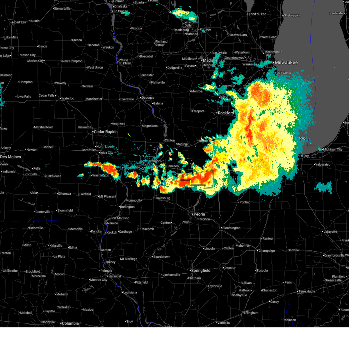
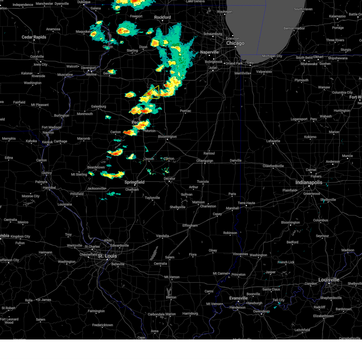
Hail Map for Magnolia, IL
The Magnolia, IL area has had 3 reports of on-the-ground hail by trained spotters, and has been under severe weather warnings 43 times during the past 12 months. Doppler radar has detected hail at or near Magnolia, IL on 36 occasions, including 1 occasion during the past year.
| Name: | Magnolia, IL |
| Where Located: | 35.6 miles NE of Peoria, IL |
| Map: | Google Map for Magnolia, IL |
| Population: | 260 |
| Housing Units: | 110 |
| More Info: | Search Google for Magnolia, IL |
0
The Top Recent Hail Date for Magnolia, IL is Tuesday, August 27, 2024 (22nd out of 36)

Hail and Wind Damage Spotted near Magnolia, IL
| Date / Time | Report Details |
|---|---|
| 7/11/2025 8:20 PM CDT | the severe thunderstorm warning has been cancelled and is no longer in effect |
| 7/11/2025 8:06 PM CDT | At 806 pm cdt, severe thunderstorms were located along a line extending from near la moille to ladd to lake wildwood, moving east at 15 mph (radar indicated). Hazards include 60 mph wind gusts. Expect damage to roofs, siding, and trees. locations impacted include, hennepin, spring valley, depue, granville, ladd, dalzell, mcnabb, mark, cherry, seatonville, magnolia, standard, arlington, hollowayville, ottville, and florid. this includes the following highways, interstate 80 in illinois between mile markers 65 and 72. Interstate 180 near mile marker 1. |
| 7/11/2025 7:57 PM CDT | At 757 pm cdt, severe thunderstorms were located along a line extending from near la moille to near hollowayville to near marshall-putnam county fairgrounds, moving east at 15 mph (radar indicated). Hazards include 60 mph wind gusts. Expect damage to roofs, siding, and trees. locations impacted include, hennepin, spring valley, depue, granville, ladd, la moille, dalzell, bureau junction, mcnabb, putnam, mark, cherry, malden, seatonville, magnolia, standard, arlington, dover, hollowayville, and coal hollow. this includes the following highways, interstate 80 in illinois between mile markers 61 and 72. Interstate 180 between mile markers 1 and 13. |
| 7/11/2025 7:41 PM CDT | Svrdvn the national weather service in the quad cities has issued a * severe thunderstorm warning for, putnam county in north central illinois, eastern bureau county in north central illinois, * until 830 pm cdt. * at 740 pm cdt, severe thunderstorms were located along a line extending from near van orin to malden to near lone tree corners, moving east at 15 mph (radar indicated). Hazards include 60 mph wind gusts and quarter size hail. Hail damage to vehicles is expected. Expect wind damage to roofs, siding, and trees. |
| 7/11/2025 7:24 PM CDT |
 At 724 pm cdt, severe thunderstorms were located along a line extending from near woodhaven lakes to dover to near lone tree corners, moving east at 40 mph (radar indicated). Hazards include 60 mph wind gusts and quarter size hail. Hail damage to vehicles is expected. expect wind damage to roofs, siding, and trees. locations impacted include, princeton, hennepin, spring valley, depue, granville, ladd, wyanet, tiskilwa, la moille, dalzell, bureau junction, mcnabb, putnam, mark, ohio, cherry, malden, seatonville, magnolia, and standard. this includes the following highways, interstate 80 in illinois between mile markers 50 and 72. Interstate 180 between mile markers 1 and 13. At 724 pm cdt, severe thunderstorms were located along a line extending from near woodhaven lakes to dover to near lone tree corners, moving east at 40 mph (radar indicated). Hazards include 60 mph wind gusts and quarter size hail. Hail damage to vehicles is expected. expect wind damage to roofs, siding, and trees. locations impacted include, princeton, hennepin, spring valley, depue, granville, ladd, wyanet, tiskilwa, la moille, dalzell, bureau junction, mcnabb, putnam, mark, ohio, cherry, malden, seatonville, magnolia, and standard. this includes the following highways, interstate 80 in illinois between mile markers 50 and 72. Interstate 180 between mile markers 1 and 13.
|
| 7/11/2025 7:18 PM CDT | At 718 pm cdt, severe thunderstorms were located along a line extending from 6 miles north of ohio to dover to near milo, moving northeast at 45 mph (radar indicated). Hazards include 60 mph wind gusts and quarter size hail. Hail damage to vehicles is expected. expect wind damage to roofs, siding, and trees. locations impacted include, princeton, hennepin, spring valley, depue, granville, walnut, ladd, wyanet, tiskilwa, la moille, dalzell, bureau junction, mcnabb, putnam, mark, ohio, cherry, malden, seatonville, and magnolia. this includes the following highways, interstate 80 in illinois between mile markers 47 and 72. Interstate 180 between mile markers 1 and 13. |
| 7/11/2025 7:05 PM CDT |
 At 705 pm cdt, severe thunderstorms were located along a line extending from near walnut to near bradford, moving east at 40 mph (radar indicated). Hazards include 60 mph wind gusts and quarter size hail. Hail damage to vehicles is expected. expect wind damage to roofs, siding, and trees. locations impacted include, princeton, hennepin, spring valley, depue, granville, walnut, ladd, wyanet, tiskilwa, la moille, dalzell, buda, bureau junction, mcnabb, putnam, mark, ohio, cherry, malden, and manlius. this includes the following highways, interstate 80 in illinois between mile markers 45 and 72. Interstate 180 between mile markers 1 and 13. At 705 pm cdt, severe thunderstorms were located along a line extending from near walnut to near bradford, moving east at 40 mph (radar indicated). Hazards include 60 mph wind gusts and quarter size hail. Hail damage to vehicles is expected. expect wind damage to roofs, siding, and trees. locations impacted include, princeton, hennepin, spring valley, depue, granville, walnut, ladd, wyanet, tiskilwa, la moille, dalzell, buda, bureau junction, mcnabb, putnam, mark, ohio, cherry, malden, and manlius. this includes the following highways, interstate 80 in illinois between mile markers 45 and 72. Interstate 180 between mile markers 1 and 13.
|
| 7/11/2025 6:46 PM CDT | Svrdvn the national weather service in the quad cities has issued a * severe thunderstorm warning for, putnam county in north central illinois, bureau county in north central illinois, * until 745 pm cdt. * at 646 pm cdt, severe thunderstorms were located along a line extending from near yorktown to castleton, moving east at 40 mph (radar indicated). Hazards include 60 mph wind gusts and quarter size hail. Hail damage to vehicles is expected. Expect wind damage to roofs, siding, and trees. |
| 7/10/2025 11:42 PM CDT |
 The storms which prompted the warning have moved out of the area. therefore, the warning will be allowed to expire. however, gusty winds and heavy rain are still possible with these thunderstorms. The storms which prompted the warning have moved out of the area. therefore, the warning will be allowed to expire. however, gusty winds and heavy rain are still possible with these thunderstorms.
|
| 7/10/2025 11:26 PM CDT |
 At 1125 pm cdt, severe thunderstorms were located along a line extending from tonica to castleton, moving southeast at 15 mph (radar indicated). Hazards include 60 mph wind gusts and quarter size hail. Hail damage to vehicles is expected. expect wind damage to roofs, siding, and trees. locations impacted include, hennepin, spring valley, depue, granville, tiskilwa, bureau junction, mcnabb, putnam, mark, magnolia, standard, milo, providence, lake thunderbird, florid, and lone tree corners. This includes interstate 180 between mile markers 1 and 7. At 1125 pm cdt, severe thunderstorms were located along a line extending from tonica to castleton, moving southeast at 15 mph (radar indicated). Hazards include 60 mph wind gusts and quarter size hail. Hail damage to vehicles is expected. expect wind damage to roofs, siding, and trees. locations impacted include, hennepin, spring valley, depue, granville, tiskilwa, bureau junction, mcnabb, putnam, mark, magnolia, standard, milo, providence, lake thunderbird, florid, and lone tree corners. This includes interstate 180 between mile markers 1 and 7.
|
| 7/10/2025 11:10 PM CDT |
 At 1110 pm cdt, severe thunderstorms were located along a line extending from near cedar point to near elmira, moving south at 15 mph (radar indicated). Hazards include 60 mph wind gusts and quarter size hail. Hail damage to vehicles is expected. expect wind damage to roofs, siding, and trees. locations impacted include, hennepin, spring valley, depue, granville, ladd, tiskilwa, dalzell, bureau junction, mcnabb, putnam, mark, neponset, seatonville, magnolia, standard, milo, hollowayville, providence, ottville, and lake thunderbird. this includes the following highways, interstate 80 in illinois between mile markers 69 and 72. Interstate 180 between mile markers 1 and 10. At 1110 pm cdt, severe thunderstorms were located along a line extending from near cedar point to near elmira, moving south at 15 mph (radar indicated). Hazards include 60 mph wind gusts and quarter size hail. Hail damage to vehicles is expected. expect wind damage to roofs, siding, and trees. locations impacted include, hennepin, spring valley, depue, granville, ladd, tiskilwa, dalzell, bureau junction, mcnabb, putnam, mark, neponset, seatonville, magnolia, standard, milo, hollowayville, providence, ottville, and lake thunderbird. this includes the following highways, interstate 80 in illinois between mile markers 69 and 72. Interstate 180 between mile markers 1 and 10.
|
| 7/10/2025 11:10 PM CDT |
 the severe thunderstorm warning has been cancelled and is no longer in effect the severe thunderstorm warning has been cancelled and is no longer in effect
|
| 7/10/2025 10:57 PM CDT |
 At 1057 pm cdt, severe thunderstorms were located along a line extending from ottville to kewanee municipal airport, moving southeast at 25 mph (radar indicated). Hazards include 60 mph wind gusts and quarter size hail. Hail damage to vehicles is expected. expect wind damage to roofs, siding, and trees. locations impacted include, kewanee, princeton, hennepin, spring valley, galva, depue, granville, ladd, wyanet, tiskilwa, dalzell, buda, bureau junction, mcnabb, putnam, mark, cherry, neponset, malden, and seatonville. this includes the following highways, interstate 80 in illinois between mile markers 53 and 73. Interstate 180 between mile markers 1 and 13. At 1057 pm cdt, severe thunderstorms were located along a line extending from ottville to kewanee municipal airport, moving southeast at 25 mph (radar indicated). Hazards include 60 mph wind gusts and quarter size hail. Hail damage to vehicles is expected. expect wind damage to roofs, siding, and trees. locations impacted include, kewanee, princeton, hennepin, spring valley, galva, depue, granville, ladd, wyanet, tiskilwa, dalzell, buda, bureau junction, mcnabb, putnam, mark, cherry, neponset, malden, and seatonville. this includes the following highways, interstate 80 in illinois between mile markers 53 and 73. Interstate 180 between mile markers 1 and 13.
|
| 7/10/2025 10:47 PM CDT |
 Svrdvn the national weather service in the quad cities has issued a * severe thunderstorm warning for, putnam county in north central illinois, southeastern henry county in northwestern illinois, southern bureau county in north central illinois, * until 1145 pm cdt. * at 1047 pm cdt, severe thunderstorms were located along a line extending from hollowayville to kewanee municipal airport, moving southeast at 25 mph (radar indicated). Hazards include 60 mph wind gusts and quarter size hail. Hail damage to vehicles is expected. Expect wind damage to roofs, siding, and trees. Svrdvn the national weather service in the quad cities has issued a * severe thunderstorm warning for, putnam county in north central illinois, southeastern henry county in northwestern illinois, southern bureau county in north central illinois, * until 1145 pm cdt. * at 1047 pm cdt, severe thunderstorms were located along a line extending from hollowayville to kewanee municipal airport, moving southeast at 25 mph (radar indicated). Hazards include 60 mph wind gusts and quarter size hail. Hail damage to vehicles is expected. Expect wind damage to roofs, siding, and trees.
|
| 5/20/2025 3:43 PM CDT | the severe thunderstorm warning has been cancelled and is no longer in effect |
| 5/20/2025 3:35 PM CDT |
 At 335 pm cdt, severe thunderstorms were located along a line extending from near kasbeer to ladd to near magnolia, moving northeast at 30 mph (radar indicated). Hazards include 60 mph wind gusts. Expect damage to roofs, siding, and trees. locations impacted include, princeton, hennepin, spring valley, depue, granville, ladd, dalzell, bureau junction, mcnabb, mark, cherry, malden, seatonville, magnolia, standard, arlington, dover, hollowayville, coal hollow, and zearing. this includes the following highways, interstate 80 in illinois between mile markers 55 and 72. Interstate 180 between mile markers 8 and 13. At 335 pm cdt, severe thunderstorms were located along a line extending from near kasbeer to ladd to near magnolia, moving northeast at 30 mph (radar indicated). Hazards include 60 mph wind gusts. Expect damage to roofs, siding, and trees. locations impacted include, princeton, hennepin, spring valley, depue, granville, ladd, dalzell, bureau junction, mcnabb, mark, cherry, malden, seatonville, magnolia, standard, arlington, dover, hollowayville, coal hollow, and zearing. this includes the following highways, interstate 80 in illinois between mile markers 55 and 72. Interstate 180 between mile markers 8 and 13.
|
| 5/20/2025 3:19 PM CDT | At 319 pm cdt, severe thunderstorms were located along a line extending from near bureau junction to near lostant, moving northeast at 40 mph (radar indicated). Hazards include 60 mph wind gusts. Expect damage to roofs, siding, and trees. locations impacted include, princeton, hennepin, spring valley, depue, granville, ladd, wyanet, tiskilwa, dalzell, bureau junction, mcnabb, putnam, mark, cherry, malden, seatonville, magnolia, standard, arlington, and dover. this includes the following highways, interstate 80 in illinois between mile markers 52 and 72. Interstate 180 between mile markers 1 and 13. |
| 5/20/2025 2:56 PM CDT | Svrdvn the national weather service in the quad cities has issued a * severe thunderstorm warning for, putnam county in north central illinois, central bureau county in north central illinois, * until 400 pm cdt. * at 255 pm cdt, severe thunderstorms were located along a line extending from near bradford to la rose, moving northeast at 40 mph (radar indicated). Hazards include 60 mph wind gusts. expect damage to roofs, siding, and trees |
| 3/14/2025 11:08 PM CDT |
 The storms which prompted the warning have weakened below severe limits, and have exited the warned area. therefore, the warning will be allowed to expire. however, gusty winds are still possible with these thunderstorms. a severe thunderstorm watch remains in effect until 200 am cdt for north central illinois. The storms which prompted the warning have weakened below severe limits, and have exited the warned area. therefore, the warning will be allowed to expire. however, gusty winds are still possible with these thunderstorms. a severe thunderstorm watch remains in effect until 200 am cdt for north central illinois.
|
| 3/14/2025 10:57 PM CDT | At 1057 pm cdt, severe thunderstorms were located along a line extending from rock grove to near sublette, moving northeast at 55 mph (radar indicated). Hazards include 70 mph wind gusts. Expect considerable tree damage. damage is likely to mobile homes, roofs, and outbuildings. locations impacted include, seatonville, dalzell, cherry, mark, standard, magnolia, spring valley, zearing, ottville, ladd, hennepin, depue, mcnabb, la moille, granville, van orin, hollowayville, florid, arlington, and bureau junction. this includes the following highways, interstate 80 in illinois between mile markers 62 and 72. Interstate 180 near mile marker 1. |
| 3/14/2025 10:44 PM CDT |
 At 1043 pm cdt, severe thunderstorms were located along a line extending from near baileyville to depue, moving northeast at 50 mph (radar indicated). Hazards include 70 mph wind gusts. Expect considerable tree damage. damage is likely to mobile homes, roofs, and outbuildings. locations impacted include, seatonville, dalzell, cherry, mark, standard, coal hollow, ottville, kasbeer, wyanet, la moille, van orin, milo, arlington, putnam, providence, princeton, bureau junction, dover, magnolia, and spring valley. this includes the following highways, interstate 80 in illinois between mile markers 48 and 72. Interstate 180 between mile markers 1 and 13. At 1043 pm cdt, severe thunderstorms were located along a line extending from near baileyville to depue, moving northeast at 50 mph (radar indicated). Hazards include 70 mph wind gusts. Expect considerable tree damage. damage is likely to mobile homes, roofs, and outbuildings. locations impacted include, seatonville, dalzell, cherry, mark, standard, coal hollow, ottville, kasbeer, wyanet, la moille, van orin, milo, arlington, putnam, providence, princeton, bureau junction, dover, magnolia, and spring valley. this includes the following highways, interstate 80 in illinois between mile markers 48 and 72. Interstate 180 between mile markers 1 and 13.
|
| 3/14/2025 10:31 PM CDT | the severe thunderstorm warning has been cancelled and is no longer in effect |
| 3/14/2025 10:31 PM CDT | At 1030 pm cdt, severe thunderstorms were located along a line extending from near lanark to lone tree corners, moving northeast at 60 mph (radar indicated). Hazards include 70 mph wind gusts. Expect considerable tree damage. damage is likely to mobile homes, roofs, and outbuildings. locations impacted include, seatonville, dalzell, cherry, mark, standard, coal hollow, ottville, kasbeer, wyanet, manlius, la moille, neponset, van orin, milo, arlington, mineral, thomas, putnam, providence, and princeton. this includes the following highways, interstate 80 in illinois between mile markers 36 and 72. Interstate 180 between mile markers 1 and 13. |
| 3/14/2025 10:15 PM CDT | At 1015 pm cdt, severe thunderstorms were located along a line extending from morrison-rockwood state park to lawn ridge, moving east at 45 mph (radar indicated). Hazards include 70 mph wind gusts. Expect considerable tree damage. damage is likely to mobile homes, roofs, and outbuildings. locations impacted include, dalzell, cherry, coal hollow, kasbeer, manlius, la moille, kewanee municipal airport, neponset, van orin, milo, arlington, providence, princeton, magnolia, buda, hennepin, granville, sheffield, malden, and lake thunderbird. this includes the following highways, interstate 80 in illinois between mile markers 29 and 72. Interstate 180 between mile markers 1 and 13. |
| 3/14/2025 10:15 PM CDT | the severe thunderstorm warning has been cancelled and is no longer in effect |
| 3/14/2025 9:58 PM CDT | Svrdvn the national weather service in the quad cities has issued a * severe thunderstorm warning for, east central rock island county in northwestern illinois, putnam county in north central illinois, henry county in northwestern illinois, bureau county in north central illinois, * until 1115 pm cdt. * at 957 pm cdt, severe thunderstorms were located along a line extending from near hillsdale to near jubilee college state park, moving northeast at 65 mph (radar indicated). Hazards include 70 mph wind gusts. Expect considerable tree damage. Damage is likely to mobile homes, roofs, and outbuildings. |
| 8/27/2024 9:27 PM CDT |
 The storm which prompted the warning has weakened below severe limits, and has exited the warned area. therefore, the warning will be allowed to expire. however, heavy rain is still possible with this thunderstorm. to report severe weather, contact your nearest law enforcement agency. they will relay your report to the national weather service the quad cities. The storm which prompted the warning has weakened below severe limits, and has exited the warned area. therefore, the warning will be allowed to expire. however, heavy rain is still possible with this thunderstorm. to report severe weather, contact your nearest law enforcement agency. they will relay your report to the national weather service the quad cities.
|
| 8/27/2024 9:19 PM CDT |
 At 919 pm cdt, a severe thunderstorm was located near standard, or 8 miles south of peru, moving east at 20 mph (radar indicated). Hazards include 60 mph wind gusts. Expect damage to roofs, siding, and trees. Locations impacted include, granville, mcnabb, mark, magnolia, and standard. At 919 pm cdt, a severe thunderstorm was located near standard, or 8 miles south of peru, moving east at 20 mph (radar indicated). Hazards include 60 mph wind gusts. Expect damage to roofs, siding, and trees. Locations impacted include, granville, mcnabb, mark, magnolia, and standard.
|
| 8/27/2024 9:05 PM CDT |
 Svrdvn the national weather service in the quad cities has issued a * severe thunderstorm warning for, putnam county in north central illinois, * until 930 pm cdt. * at 905 pm cdt, a severe thunderstorm was located over florid, or near hennepin, moving east at 15 mph (radar indicated). Hazards include 60 mph wind gusts. expect damage to roofs, siding, and trees Svrdvn the national weather service in the quad cities has issued a * severe thunderstorm warning for, putnam county in north central illinois, * until 930 pm cdt. * at 905 pm cdt, a severe thunderstorm was located over florid, or near hennepin, moving east at 15 mph (radar indicated). Hazards include 60 mph wind gusts. expect damage to roofs, siding, and trees
|
| 7/15/2024 8:55 PM CDT |
 The storms which prompted the warning have moved out of the area. therefore, the warning will be allowed to expire. however, heavy rain is still possible with these thunderstorms. a tornado watch remains in effect until 100 am cdt for north central illinois. The storms which prompted the warning have moved out of the area. therefore, the warning will be allowed to expire. however, heavy rain is still possible with these thunderstorms. a tornado watch remains in effect until 100 am cdt for north central illinois.
|
| 7/15/2024 8:54 PM CDT |
 The storms which prompted the warning have moved out of the area. therefore, the warning will be allowed to expire. however, heavy rain is still possible with these thunderstorms. a tornado watch remains in effect until 100 am cdt for north central illinois. The storms which prompted the warning have moved out of the area. therefore, the warning will be allowed to expire. however, heavy rain is still possible with these thunderstorms. a tornado watch remains in effect until 100 am cdt for north central illinois.
|
| 7/15/2024 8:49 PM CDT | At 848 pm cdt, a severe squall line capable of producing both tornadoes and extensive straight line wind damage was located along a line extending from dalzell to near lake wildwood, moving east at 50 mph (radar indicated rotation). Hazards include tornado. Flying debris will be dangerous to those caught without shelter. mobile homes will be damaged or destroyed. damage to roofs, windows, and vehicles will occur. tree damage is likely. locations impacted include, hennepin, spring valley, depue, granville, ladd, dalzell, bureau junction, mcnabb, putnam, mark, seatonville, magnolia, standard, hollowayville, coal hollow, ottville, lake thunderbird, and florid. this includes the following highways, interstate 80 in illinois near mile marker 59, and between mile markers 66 and 72. Interstate 180 between mile markers 1 and 13. |
| 7/15/2024 8:35 PM CDT |
 At 835 pm cdt, a severe squall line capable of producing both tornadoes and extensive straight line wind damage was located along a line extending from coal hollow to near lone tree corners, moving east at 50 mph (radar indicated rotation). Hazards include tornado. Flying debris will be dangerous to those caught without shelter. mobile homes will be damaged or destroyed. damage to roofs, windows, and vehicles will occur. tree damage is likely. locations impacted include, hennepin, spring valley, depue, granville, ladd, dalzell, bureau junction, putnam, mark, seatonville, mcnabb, magnolia and standard. this includes the following highways, interstate 80 in illinois between mile markers 42 and 62, and between mile markers 66 and 72. Interstate 180 between mile markers 1 and 13. At 835 pm cdt, a severe squall line capable of producing both tornadoes and extensive straight line wind damage was located along a line extending from coal hollow to near lone tree corners, moving east at 50 mph (radar indicated rotation). Hazards include tornado. Flying debris will be dangerous to those caught without shelter. mobile homes will be damaged or destroyed. damage to roofs, windows, and vehicles will occur. tree damage is likely. locations impacted include, hennepin, spring valley, depue, granville, ladd, dalzell, bureau junction, putnam, mark, seatonville, mcnabb, magnolia and standard. this includes the following highways, interstate 80 in illinois between mile markers 42 and 62, and between mile markers 66 and 72. Interstate 180 between mile markers 1 and 13.
|
| 7/15/2024 8:33 PM CDT |
 At 832 pm cdt, severe thunderstorms were located along a line extending from near van orin to lone tree corners, moving east at 60 mph (radar indicated). Hazards include 80 mph wind gusts. Flying debris will be dangerous to those caught without shelter. mobile homes will be heavily damaged. expect considerable damage to roofs, windows, and vehicles. extensive tree damage and power outages are likely. locations impacted include, princeton, hennepin, spring valley, depue, granville, walnut, ladd, wyanet, sheffield, tiskilwa, la moille, dalzell, buda, bureau junction, mcnabb, putnam, mark, ohio, cherry, and neponset. this includes the following highways, interstate 80 in illinois between mile markers 36 and 72. Interstate 180 between mile markers 1 and 13. At 832 pm cdt, severe thunderstorms were located along a line extending from near van orin to lone tree corners, moving east at 60 mph (radar indicated). Hazards include 80 mph wind gusts. Flying debris will be dangerous to those caught without shelter. mobile homes will be heavily damaged. expect considerable damage to roofs, windows, and vehicles. extensive tree damage and power outages are likely. locations impacted include, princeton, hennepin, spring valley, depue, granville, walnut, ladd, wyanet, sheffield, tiskilwa, la moille, dalzell, buda, bureau junction, mcnabb, putnam, mark, ohio, cherry, and neponset. this includes the following highways, interstate 80 in illinois between mile markers 36 and 72. Interstate 180 between mile markers 1 and 13.
|
| 7/15/2024 8:17 PM CDT |
 Tordvn the national weather service in the quad cities has issued a * tornado warning for, putnam county in north central illinois, southern bureau county in north central illinois, * until 900 pm cdt. * at 816 pm cdt, severe thunderstorms capable of producing both tornadoes and extensive straight line wind damage were located along a line extending from near manlius to near castleton, moving east at 50 mph (radar indicated rotation). Hazards include tornado. Flying debris will be dangerous to those caught without shelter. mobile homes will be damaged or destroyed. damage to roofs, windows, and vehicles will occur. tree damage is likely. these dangerous storms will be near, princeton, wyanet, tiskilwa, milo, providence, and bureau county fairgrounds around 820 pm cdt. lone tree corners and lake thunderbird around 825 pm cdt. hennepin, depue, bureau junction, putnam, hollowayville, and coal hollow around 830 pm cdt. spring valley, granville, ladd, mark, seatonville, ottville, and florid around 835 pm cdt. other locations in the path of these tornadic storms include dalzell, mcnabb, standard and magnolia. this includes the following highways, interstate 80 in illinois between mile markers 42 and 62, and between mile markers 66 and 72. Interstate 180 between mile markers 1 and 13. Tordvn the national weather service in the quad cities has issued a * tornado warning for, putnam county in north central illinois, southern bureau county in north central illinois, * until 900 pm cdt. * at 816 pm cdt, severe thunderstorms capable of producing both tornadoes and extensive straight line wind damage were located along a line extending from near manlius to near castleton, moving east at 50 mph (radar indicated rotation). Hazards include tornado. Flying debris will be dangerous to those caught without shelter. mobile homes will be damaged or destroyed. damage to roofs, windows, and vehicles will occur. tree damage is likely. these dangerous storms will be near, princeton, wyanet, tiskilwa, milo, providence, and bureau county fairgrounds around 820 pm cdt. lone tree corners and lake thunderbird around 825 pm cdt. hennepin, depue, bureau junction, putnam, hollowayville, and coal hollow around 830 pm cdt. spring valley, granville, ladd, mark, seatonville, ottville, and florid around 835 pm cdt. other locations in the path of these tornadic storms include dalzell, mcnabb, standard and magnolia. this includes the following highways, interstate 80 in illinois between mile markers 42 and 62, and between mile markers 66 and 72. Interstate 180 between mile markers 1 and 13.
|
| 7/15/2024 8:07 PM CDT |
 Svrdvn the national weather service in the quad cities has issued a * severe thunderstorm warning for, putnam county in north central illinois, bureau county in north central illinois, * until 900 pm cdt. * at 806 pm cdt, severe thunderstorms were located along a line extending from near yorktown to near kewanee municipal airport, moving east at 55 mph. these are destructive storms for princeton, mcnabb, and hennepin (radar indicated). Hazards include 80 mph wind gusts. Flying debris will be dangerous to those caught without shelter. mobile homes will be heavily damaged. expect considerable damage to roofs, windows, and vehicles. Extensive tree damage and power outages are likely. Svrdvn the national weather service in the quad cities has issued a * severe thunderstorm warning for, putnam county in north central illinois, bureau county in north central illinois, * until 900 pm cdt. * at 806 pm cdt, severe thunderstorms were located along a line extending from near yorktown to near kewanee municipal airport, moving east at 55 mph. these are destructive storms for princeton, mcnabb, and hennepin (radar indicated). Hazards include 80 mph wind gusts. Flying debris will be dangerous to those caught without shelter. mobile homes will be heavily damaged. expect considerable damage to roofs, windows, and vehicles. Extensive tree damage and power outages are likely.
|
| 7/14/2024 11:59 PM CDT |
 The storms which prompted the warning have moved out of the area. therefore, the warning will be allowed to expire. however, heavy rain is still possible with these thunderstorms. a severe thunderstorm watch remains in effect until 100 am cdt for north central illinois. The storms which prompted the warning have moved out of the area. therefore, the warning will be allowed to expire. however, heavy rain is still possible with these thunderstorms. a severe thunderstorm watch remains in effect until 100 am cdt for north central illinois.
|
| 7/14/2024 11:47 PM CDT |
 At 1146 pm cdt, severe thunderstorms were located along a line extending from near mcnabb to near lake wildwood to near hopewell, moving southeast at 55 mph. these storms have a history of producing severe level wind gusts in henry county (public). Hazards include 60 mph wind gusts. Expect damage to roofs, siding, and trees. locations impacted include, hennepin, spring valley, henry, depue, granville, ladd, tiskilwa, dalzell, bureau junction, mcnabb, putnam, mark, seatonville, magnolia, standard, milo, hollowayville, ottville, lake thunderbird, and florid. this includes the following highways, interstate 80 in illinois between mile markers 68 and 72. Interstate 180 between mile markers 1 and 9. At 1146 pm cdt, severe thunderstorms were located along a line extending from near mcnabb to near lake wildwood to near hopewell, moving southeast at 55 mph. these storms have a history of producing severe level wind gusts in henry county (public). Hazards include 60 mph wind gusts. Expect damage to roofs, siding, and trees. locations impacted include, hennepin, spring valley, henry, depue, granville, ladd, tiskilwa, dalzell, bureau junction, mcnabb, putnam, mark, seatonville, magnolia, standard, milo, hollowayville, ottville, lake thunderbird, and florid. this includes the following highways, interstate 80 in illinois between mile markers 68 and 72. Interstate 180 between mile markers 1 and 9.
|
| 7/14/2024 11:47 PM CDT |
 the severe thunderstorm warning has been cancelled and is no longer in effect the severe thunderstorm warning has been cancelled and is no longer in effect
|
| 7/14/2024 11:29 PM CDT | At 1129 pm cdt, severe thunderstorms were located along a line extending from near tiskilwa to near milo to near wyoming, moving southeast at 55 mph. winds gusted to 58 mph with these storms near kewanee (public). Hazards include 60 mph wind gusts. Expect damage to roofs, siding, and trees. locations impacted include, kewanee, princeton, cambridge, hennepin, spring valley, galva, henry, depue, granville, ladd, wyanet, sheffield, tiskilwa, dalzell, buda, bureau junction, mcnabb, putnam, mark, and neponset. this includes the following highways, interstate 80 in illinois between mile markers 37 and 72. Interstate 180 between mile markers 1 and 13. |
| 7/14/2024 11:16 PM CDT |
 the severe thunderstorm warning has been cancelled and is no longer in effect the severe thunderstorm warning has been cancelled and is no longer in effect
|
| 7/14/2024 11:16 PM CDT |
 At 1115 pm cdt, severe thunderstorms were located along a line extending from near manlius to near osceola to kewanee municipal airport, moving southeast at 60 mph (radar indicated). Hazards include 60 mph wind gusts. Expect damage to roofs, siding, and trees. locations impacted include, kewanee, princeton, cambridge, hennepin, geneseo, spring valley, galva, henry, depue, granville, ladd, wyanet, atkinson, sheffield, annawan, tiskilwa, dalzell, buda, bureau junction, and mcnabb. this includes the following highways, interstate 80 in illinois between mile markers 18 and 72. Interstate 180 between mile markers 1 and 13. At 1115 pm cdt, severe thunderstorms were located along a line extending from near manlius to near osceola to kewanee municipal airport, moving southeast at 60 mph (radar indicated). Hazards include 60 mph wind gusts. Expect damage to roofs, siding, and trees. locations impacted include, kewanee, princeton, cambridge, hennepin, geneseo, spring valley, galva, henry, depue, granville, ladd, wyanet, atkinson, sheffield, annawan, tiskilwa, dalzell, buda, bureau junction, and mcnabb. this includes the following highways, interstate 80 in illinois between mile markers 18 and 72. Interstate 180 between mile markers 1 and 13.
|
| 7/14/2024 10:54 PM CDT |
 Svrdvn the national weather service in the quad cities has issued a * severe thunderstorm warning for, putnam county in north central illinois, south central whiteside county in northwestern illinois, henry county in northwestern illinois, bureau county in north central illinois, * until midnight cdt. * at 1054 pm cdt, severe thunderstorms were located along a line extending from near spring hill to near geneseo to near orion, moving southeast at 55 mph (radar indicated). Hazards include 60 mph wind gusts. expect damage to roofs, siding, and trees Svrdvn the national weather service in the quad cities has issued a * severe thunderstorm warning for, putnam county in north central illinois, south central whiteside county in northwestern illinois, henry county in northwestern illinois, bureau county in north central illinois, * until midnight cdt. * at 1054 pm cdt, severe thunderstorms were located along a line extending from near spring hill to near geneseo to near orion, moving southeast at 55 mph (radar indicated). Hazards include 60 mph wind gusts. expect damage to roofs, siding, and trees
|
| 6/25/2024 8:15 AM CDT |
 The storms which prompted the warning have weakened below severe limits, and no longer pose an immediate threat to life or property. therefore, the warning has been allowed to expire. however, small hail and gusty winds are still possible with these thunderstorms. The storms which prompted the warning have weakened below severe limits, and no longer pose an immediate threat to life or property. therefore, the warning has been allowed to expire. however, small hail and gusty winds are still possible with these thunderstorms.
|
| 6/25/2024 8:05 AM CDT |
 At 805 am cdt, severe thunderstorms were located along a line extending from near marseilles to near leonore to near putnam, moving east at 50 mph (radar indicated). Hazards include 60 mph wind gusts and quarter size hail. Hail damage to vehicles is expected. expect wind damage to roofs, siding, and trees. locations impacted include, hennepin, galva, granville, tiskilwa, bureau junction, mcnabb, putnam, mark, magnolia, standard, milo, providence, kewanee municipal airport, lake thunderbird, florid, and lone tree corners. This includes interstate 180 between mile markers 1 and 6. At 805 am cdt, severe thunderstorms were located along a line extending from near marseilles to near leonore to near putnam, moving east at 50 mph (radar indicated). Hazards include 60 mph wind gusts and quarter size hail. Hail damage to vehicles is expected. expect wind damage to roofs, siding, and trees. locations impacted include, hennepin, galva, granville, tiskilwa, bureau junction, mcnabb, putnam, mark, magnolia, standard, milo, providence, kewanee municipal airport, lake thunderbird, florid, and lone tree corners. This includes interstate 180 between mile markers 1 and 6.
|
| 6/25/2024 7:53 AM CDT |
 At 753 am cdt, severe thunderstorms were located along a line extending from dayton to mcnabb to near milo, moving east at 50 mph (radar indicated). Hazards include 60 mph wind gusts and quarter size hail. Hail damage to vehicles is expected. expect wind damage to roofs, siding, and trees. locations impacted include, kewanee, hennepin, spring valley, galva, depue, granville, ladd, tiskilwa, dalzell, bureau junction, mcnabb, putnam, mark, seatonville, magnolia, standard, milo, hollowayville, coal hollow, and ottville. this includes the following highways, interstate 80 in illinois between mile markers 67 and 72. Interstate 180 between mile markers 1 and 11. At 753 am cdt, severe thunderstorms were located along a line extending from dayton to mcnabb to near milo, moving east at 50 mph (radar indicated). Hazards include 60 mph wind gusts and quarter size hail. Hail damage to vehicles is expected. expect wind damage to roofs, siding, and trees. locations impacted include, kewanee, hennepin, spring valley, galva, depue, granville, ladd, tiskilwa, dalzell, bureau junction, mcnabb, putnam, mark, seatonville, magnolia, standard, milo, hollowayville, coal hollow, and ottville. this includes the following highways, interstate 80 in illinois between mile markers 67 and 72. Interstate 180 between mile markers 1 and 11.
|
| 6/25/2024 7:44 AM CDT |
 At 744 am cdt, severe thunderstorms were located along a line extending from near north utica to near florid to near bradford, moving east at 50 mph (radar indicated). Hazards include 60 mph wind gusts and quarter size hail. Hail damage to vehicles is expected. expect wind damage to roofs, siding, and trees. locations impacted include, kewanee, princeton, hennepin, spring valley, galva, depue, granville, ladd, wyanet, tiskilwa, dalzell, buda, bureau junction, mcnabb, putnam, mark, cherry, neponset, malden, and seatonville. this includes the following highways, interstate 80 in illinois between mile markers 53 and 72. Interstate 180 between mile markers 1 and 13. At 744 am cdt, severe thunderstorms were located along a line extending from near north utica to near florid to near bradford, moving east at 50 mph (radar indicated). Hazards include 60 mph wind gusts and quarter size hail. Hail damage to vehicles is expected. expect wind damage to roofs, siding, and trees. locations impacted include, kewanee, princeton, hennepin, spring valley, galva, depue, granville, ladd, wyanet, tiskilwa, dalzell, buda, bureau junction, mcnabb, putnam, mark, cherry, neponset, malden, and seatonville. this includes the following highways, interstate 80 in illinois between mile markers 53 and 72. Interstate 180 between mile markers 1 and 13.
|
| 6/25/2024 7:37 AM CDT |
 At 736 am cdt, severe thunderstorms were located along a line extending from near troy grove to near lake thunderbird to osceola, moving east at 50 mph (radar indicated). Hazards include 60 mph wind gusts and quarter size hail. Hail damage to vehicles is expected. expect wind damage to roofs, siding, and trees. locations impacted include, kewanee, princeton, hennepin, spring valley, galva, depue, granville, ladd, wyanet, sheffield, tiskilwa, dalzell, buda, bureau junction, mcnabb, putnam, mark, cherry, neponset, and malden. this includes the following highways, interstate 80 in illinois between mile markers 39 and 72. Interstate 180 between mile markers 1 and 13. At 736 am cdt, severe thunderstorms were located along a line extending from near troy grove to near lake thunderbird to osceola, moving east at 50 mph (radar indicated). Hazards include 60 mph wind gusts and quarter size hail. Hail damage to vehicles is expected. expect wind damage to roofs, siding, and trees. locations impacted include, kewanee, princeton, hennepin, spring valley, galva, depue, granville, ladd, wyanet, sheffield, tiskilwa, dalzell, buda, bureau junction, mcnabb, putnam, mark, cherry, neponset, and malden. this includes the following highways, interstate 80 in illinois between mile markers 39 and 72. Interstate 180 between mile markers 1 and 13.
|
| 6/25/2024 7:28 AM CDT |
 At 727 am cdt, severe thunderstorms were located along a line extending from near cherry to near tiskilwa to kewanee, moving east at 50 mph (radar indicated). Hazards include 60 mph wind gusts and quarter size hail. Hail damage to vehicles is expected. expect wind damage to roofs, siding, and trees. locations impacted include, kewanee, princeton, hennepin, spring valley, galva, depue, granville, ladd, wyanet, sheffield, tiskilwa, dalzell, buda, bureau junction, mcnabb, putnam, mark, cherry, neponset, and malden. this includes the following highways, interstate 80 in illinois between mile markers 36 and 72. Interstate 180 between mile markers 1 and 13. At 727 am cdt, severe thunderstorms were located along a line extending from near cherry to near tiskilwa to kewanee, moving east at 50 mph (radar indicated). Hazards include 60 mph wind gusts and quarter size hail. Hail damage to vehicles is expected. expect wind damage to roofs, siding, and trees. locations impacted include, kewanee, princeton, hennepin, spring valley, galva, depue, granville, ladd, wyanet, sheffield, tiskilwa, dalzell, buda, bureau junction, mcnabb, putnam, mark, cherry, neponset, and malden. this includes the following highways, interstate 80 in illinois between mile markers 36 and 72. Interstate 180 between mile markers 1 and 13.
|
| 6/25/2024 7:20 AM CDT |
 At 720 am cdt, severe thunderstorms were located along a line extending from arlington to near providence to near german corner, moving east at 50 mph (radar indicated). Hazards include 60 mph wind gusts and quarter size hail. Hail damage to vehicles is expected. expect wind damage to roofs, siding, and trees. locations impacted include, kewanee, princeton, cambridge, hennepin, spring valley, galva, depue, granville, walnut, ladd, wyanet, sheffield, annawan, tiskilwa, la moille, dalzell, buda, bureau junction, mcnabb, and putnam. this includes the following highways, interstate 80 in illinois between mile markers 29 and 72. Interstate 180 between mile markers 1 and 13. At 720 am cdt, severe thunderstorms were located along a line extending from arlington to near providence to near german corner, moving east at 50 mph (radar indicated). Hazards include 60 mph wind gusts and quarter size hail. Hail damage to vehicles is expected. expect wind damage to roofs, siding, and trees. locations impacted include, kewanee, princeton, cambridge, hennepin, spring valley, galva, depue, granville, walnut, ladd, wyanet, sheffield, annawan, tiskilwa, la moille, dalzell, buda, bureau junction, mcnabb, and putnam. this includes the following highways, interstate 80 in illinois between mile markers 29 and 72. Interstate 180 between mile markers 1 and 13.
|
| 6/25/2024 7:11 AM CDT |
 Svrdvn the national weather service in the quad cities has issued a * severe thunderstorm warning for, putnam county in north central illinois, southeastern henry county in northwestern illinois, bureau county in north central illinois, * until 815 am cdt. * at 710 am cdt, severe thunderstorms were located along a line extending from near dover to neponset to ulah, moving east at 50 mph (radar indicated). Hazards include 60 mph wind gusts and quarter size hail. Hail damage to vehicles is expected. Expect wind damage to roofs, siding, and trees. Svrdvn the national weather service in the quad cities has issued a * severe thunderstorm warning for, putnam county in north central illinois, southeastern henry county in northwestern illinois, bureau county in north central illinois, * until 815 am cdt. * at 710 am cdt, severe thunderstorms were located along a line extending from near dover to neponset to ulah, moving east at 50 mph (radar indicated). Hazards include 60 mph wind gusts and quarter size hail. Hail damage to vehicles is expected. Expect wind damage to roofs, siding, and trees.
|
| 6/16/2024 5:01 PM CDT |
 the severe thunderstorm warning has been cancelled and is no longer in effect the severe thunderstorm warning has been cancelled and is no longer in effect
|
| 6/16/2024 4:49 PM CDT |
 At 449 pm cdt, severe thunderstorms were located along a line extending from near prairie center to oglesby to mcnabb, moving east at 25 mph (radar indicated). Hazards include 60 mph wind gusts and quarter size hail. Hail damage to vehicles is expected. expect wind damage to roofs, siding, and trees. locations impacted include, hennepin, spring valley, granville, mcnabb, putnam, mark, magnolia, standard, lake thunderbird, and florid. This includes interstate 180 near mile marker 1. At 449 pm cdt, severe thunderstorms were located along a line extending from near prairie center to oglesby to mcnabb, moving east at 25 mph (radar indicated). Hazards include 60 mph wind gusts and quarter size hail. Hail damage to vehicles is expected. expect wind damage to roofs, siding, and trees. locations impacted include, hennepin, spring valley, granville, mcnabb, putnam, mark, magnolia, standard, lake thunderbird, and florid. This includes interstate 180 near mile marker 1.
|
| 6/16/2024 4:49 PM CDT |
 the severe thunderstorm warning has been cancelled and is no longer in effect the severe thunderstorm warning has been cancelled and is no longer in effect
|
| 6/16/2024 4:32 PM CDT |
 At 432 pm cdt, severe thunderstorms were located along a line extending from near la salle to near standard to near putnam, moving east at 25 mph (radar indicated). Hazards include 60 mph wind gusts and quarter size hail. Hail damage to vehicles is expected. expect wind damage to roofs, siding, and trees. locations impacted include, hennepin, spring valley, depue, granville, ladd, dalzell, bureau junction, mcnabb, putnam, mark, cherry, seatonville, magnolia, standard, hollowayville, ottville, lake thunderbird, florid, and lone tree corners. this includes the following highways, interstate 80 in illinois between mile markers 64 and 72. Interstate 180 between mile markers 1 and 7. At 432 pm cdt, severe thunderstorms were located along a line extending from near la salle to near standard to near putnam, moving east at 25 mph (radar indicated). Hazards include 60 mph wind gusts and quarter size hail. Hail damage to vehicles is expected. expect wind damage to roofs, siding, and trees. locations impacted include, hennepin, spring valley, depue, granville, ladd, dalzell, bureau junction, mcnabb, putnam, mark, cherry, seatonville, magnolia, standard, hollowayville, ottville, lake thunderbird, florid, and lone tree corners. this includes the following highways, interstate 80 in illinois between mile markers 64 and 72. Interstate 180 between mile markers 1 and 7.
|
| 6/16/2024 4:16 PM CDT |
 The storms which prompted the warning have weakened below severe limits, and no longer pose an immediate threat to life or property. therefore, the warning has been allowed to expire. a severe thunderstorm watch remains in effect until 800 pm cdt for north central illinois. remember, a severe thunderstorm warning still remains in effect for southeastern bureau and putnam counties until 515 pm. The storms which prompted the warning have weakened below severe limits, and no longer pose an immediate threat to life or property. therefore, the warning has been allowed to expire. a severe thunderstorm watch remains in effect until 800 pm cdt for north central illinois. remember, a severe thunderstorm warning still remains in effect for southeastern bureau and putnam counties until 515 pm.
|
| 6/16/2024 4:08 PM CDT |
 Svrdvn the national weather service in the quad cities has issued a * severe thunderstorm warning for, putnam county in north central illinois, southeastern bureau county in north central illinois, * until 515 pm cdt. * at 407 pm cdt, severe thunderstorms were located along a line extending from seatonville to bureau junction to near lone tree corners, moving east at 25 mph (radar indicated). Hazards include 60 mph wind gusts and half dollar size hail. Hail damage to vehicles is expected. Expect wind damage to roofs, siding, and trees. Svrdvn the national weather service in the quad cities has issued a * severe thunderstorm warning for, putnam county in north central illinois, southeastern bureau county in north central illinois, * until 515 pm cdt. * at 407 pm cdt, severe thunderstorms were located along a line extending from seatonville to bureau junction to near lone tree corners, moving east at 25 mph (radar indicated). Hazards include 60 mph wind gusts and half dollar size hail. Hail damage to vehicles is expected. Expect wind damage to roofs, siding, and trees.
|
| 6/16/2024 3:55 PM CDT |
 At 354 pm cdt, severe thunderstorms were located along a line extending from coal hollow to near marshall-putnam county fairgrounds, moving east at 25 mph (radar indicated). Hazards include 60 mph wind gusts and quarter size hail. Hail damage to vehicles is expected. expect wind damage to roofs, siding, and trees. locations impacted include, princeton, hennepin, spring valley, depue, granville, ladd, wyanet, tiskilwa, dalzell, bureau junction, mcnabb, putnam, mark, cherry, seatonville, magnolia, standard, milo, hollowayville, and coal hollow. this includes the following highways, interstate 80 in illinois between mile markers 51 and 72. Interstate 180 between mile markers 1 and 13. At 354 pm cdt, severe thunderstorms were located along a line extending from coal hollow to near marshall-putnam county fairgrounds, moving east at 25 mph (radar indicated). Hazards include 60 mph wind gusts and quarter size hail. Hail damage to vehicles is expected. expect wind damage to roofs, siding, and trees. locations impacted include, princeton, hennepin, spring valley, depue, granville, ladd, wyanet, tiskilwa, dalzell, bureau junction, mcnabb, putnam, mark, cherry, seatonville, magnolia, standard, milo, hollowayville, and coal hollow. this includes the following highways, interstate 80 in illinois between mile markers 51 and 72. Interstate 180 between mile markers 1 and 13.
|
| 6/16/2024 3:43 PM CDT |
 At 343 pm cdt, severe thunderstorms were located along a line extending from bureau county fairgrounds to near lone tree corners, moving east at 25 mph (radar indicated). Hazards include golf ball size hail and 60 mph wind gusts. People and animals outdoors will be injured. expect hail damage to roofs, siding, windows, and vehicles. expect wind damage to roofs, siding, and trees. locations impacted include, princeton, hennepin, spring valley, depue, granville, ladd, wyanet, sheffield, tiskilwa, dalzell, buda, bureau junction, mcnabb, putnam, mark, cherry, neponset, seatonville, magnolia, and standard. this includes the following highways, interstate 80 in illinois between mile markers 40 and 72. Interstate 180 between mile markers 1 and 13. At 343 pm cdt, severe thunderstorms were located along a line extending from bureau county fairgrounds to near lone tree corners, moving east at 25 mph (radar indicated). Hazards include golf ball size hail and 60 mph wind gusts. People and animals outdoors will be injured. expect hail damage to roofs, siding, windows, and vehicles. expect wind damage to roofs, siding, and trees. locations impacted include, princeton, hennepin, spring valley, depue, granville, ladd, wyanet, sheffield, tiskilwa, dalzell, buda, bureau junction, mcnabb, putnam, mark, cherry, neponset, seatonville, magnolia, and standard. this includes the following highways, interstate 80 in illinois between mile markers 40 and 72. Interstate 180 between mile markers 1 and 13.
|
| 6/16/2024 3:31 PM CDT |
 At 329 pm cdt, severe thunderstorms were located along a line extending from wyanet to near castleton, moving east at 25 mph. a trained spotter reported golfball sized hail near sheffield at 315 pm (radar indicated). Hazards include golf ball size hail and 60 mph wind gusts. People and animals outdoors will be injured. expect hail damage to roofs, siding, windows, and vehicles. expect wind damage to roofs, siding, and trees. locations impacted include, princeton, hennepin, spring valley, depue, granville, ladd, wyanet, sheffield, tiskilwa, dalzell, buda, bureau junction, mcnabb, putnam, mark, cherry, neponset, seatonville, magnolia, and standard. this includes the following highways, interstate 80 in illinois between mile markers 40 and 72. Interstate 180 between mile markers 1 and 13. At 329 pm cdt, severe thunderstorms were located along a line extending from wyanet to near castleton, moving east at 25 mph. a trained spotter reported golfball sized hail near sheffield at 315 pm (radar indicated). Hazards include golf ball size hail and 60 mph wind gusts. People and animals outdoors will be injured. expect hail damage to roofs, siding, windows, and vehicles. expect wind damage to roofs, siding, and trees. locations impacted include, princeton, hennepin, spring valley, depue, granville, ladd, wyanet, sheffield, tiskilwa, dalzell, buda, bureau junction, mcnabb, putnam, mark, cherry, neponset, seatonville, magnolia, and standard. this includes the following highways, interstate 80 in illinois between mile markers 40 and 72. Interstate 180 between mile markers 1 and 13.
|
| 6/16/2024 3:14 PM CDT |
 Svrdvn the national weather service in the quad cities has issued a * severe thunderstorm warning for, putnam county in north central illinois, southern bureau county in north central illinois, * until 415 pm cdt. * at 314 pm cdt, severe thunderstorms were located along a line extending from sheffield to near castleton, moving east at 25 mph (radar indicated). Hazards include golf ball size hail and 60 mph wind gusts. People and animals outdoors will be injured. expect hail damage to roofs, siding, windows, and vehicles. Expect wind damage to roofs, siding, and trees. Svrdvn the national weather service in the quad cities has issued a * severe thunderstorm warning for, putnam county in north central illinois, southern bureau county in north central illinois, * until 415 pm cdt. * at 314 pm cdt, severe thunderstorms were located along a line extending from sheffield to near castleton, moving east at 25 mph (radar indicated). Hazards include golf ball size hail and 60 mph wind gusts. People and animals outdoors will be injured. expect hail damage to roofs, siding, windows, and vehicles. Expect wind damage to roofs, siding, and trees.
|
| 5/27/2024 7:44 PM CDT |
 the severe thunderstorm warning has been cancelled and is no longer in effect the severe thunderstorm warning has been cancelled and is no longer in effect
|
| 5/27/2024 7:34 PM CDT |
 At 734 pm cdt, a severe thunderstorm was located over mcnabb, or 7 miles southeast of hennepin, moving southeast at 40 mph (radar indicated). Hazards include 60 mph wind gusts and penny size hail. Expect damage to roofs, siding, and trees. Locations impacted include, hennepin, spring valley, depue, granville, mcnabb, mark, magnolia, standard, and florid. At 734 pm cdt, a severe thunderstorm was located over mcnabb, or 7 miles southeast of hennepin, moving southeast at 40 mph (radar indicated). Hazards include 60 mph wind gusts and penny size hail. Expect damage to roofs, siding, and trees. Locations impacted include, hennepin, spring valley, depue, granville, mcnabb, mark, magnolia, standard, and florid.
|
| 5/27/2024 7:26 PM CDT |
 At 726 pm cdt, a severe thunderstorm was located over florid, or near hennepin, moving southeast at 40 mph (radar indicated). Hazards include 60 mph wind gusts and quarter size hail. Hail damage to vehicles is expected. expect wind damage to roofs, siding, and trees. locations impacted include, hennepin, spring valley, depue, granville, bureau junction, mcnabb, putnam, mark, magnolia, standard, lake thunderbird, and florid. This includes interstate 180 between mile markers 1 and 8. At 726 pm cdt, a severe thunderstorm was located over florid, or near hennepin, moving southeast at 40 mph (radar indicated). Hazards include 60 mph wind gusts and quarter size hail. Hail damage to vehicles is expected. expect wind damage to roofs, siding, and trees. locations impacted include, hennepin, spring valley, depue, granville, bureau junction, mcnabb, putnam, mark, magnolia, standard, lake thunderbird, and florid. This includes interstate 180 between mile markers 1 and 8.
|
| 5/27/2024 7:19 PM CDT |
 At 719 pm cdt, a severe thunderstorm was located near lake thunderbird, or near hennepin, moving southeast at 40 mph (radar indicated). Hazards include 60 mph wind gusts and quarter size hail. Hail damage to vehicles is expected. expect wind damage to roofs, siding, and trees. locations impacted include, princeton, hennepin, spring valley, depue, granville, ladd, tiskilwa, dalzell, bureau junction, mcnabb, putnam, mark, seatonville, magnolia, standard, hollowayville, coal hollow, ottville, lake thunderbird, and florid. this includes the following highways, interstate 80 in illinois between mile markers 65 and 72. Interstate 180 between mile markers 1 and 12. At 719 pm cdt, a severe thunderstorm was located near lake thunderbird, or near hennepin, moving southeast at 40 mph (radar indicated). Hazards include 60 mph wind gusts and quarter size hail. Hail damage to vehicles is expected. expect wind damage to roofs, siding, and trees. locations impacted include, princeton, hennepin, spring valley, depue, granville, ladd, tiskilwa, dalzell, bureau junction, mcnabb, putnam, mark, seatonville, magnolia, standard, hollowayville, coal hollow, ottville, lake thunderbird, and florid. this includes the following highways, interstate 80 in illinois between mile markers 65 and 72. Interstate 180 between mile markers 1 and 12.
|
| 5/27/2024 7:09 PM CDT |
 At 709 pm cdt, a severe thunderstorm was located over tiskilwa, or near princeton, moving southeast at 40 mph (radar indicated). Hazards include 60 mph wind gusts and penny size hail. Expect damage to roofs, siding, and trees. locations impacted include, princeton, hennepin, spring valley, depue, granville, ladd, wyanet, tiskilwa, dalzell, bureau junction, mcnabb, putnam, mark, cherry, malden, seatonville, magnolia, standard, milo, and dover. this includes the following highways, interstate 80 in illinois between mile markers 51 and 72. Interstate 180 between mile markers 1 and 13. At 709 pm cdt, a severe thunderstorm was located over tiskilwa, or near princeton, moving southeast at 40 mph (radar indicated). Hazards include 60 mph wind gusts and penny size hail. Expect damage to roofs, siding, and trees. locations impacted include, princeton, hennepin, spring valley, depue, granville, ladd, wyanet, tiskilwa, dalzell, bureau junction, mcnabb, putnam, mark, cherry, malden, seatonville, magnolia, standard, milo, and dover. this includes the following highways, interstate 80 in illinois between mile markers 51 and 72. Interstate 180 between mile markers 1 and 13.
|
| 5/27/2024 6:55 PM CDT |
 Svrdvn the national weather service in the quad cities has issued a * severe thunderstorm warning for, putnam county in north central illinois, central bureau county in north central illinois, * until 800 pm cdt. * at 655 pm cdt, a severe thunderstorm was located near buda, or 9 miles west of princeton, moving southeast at 40 mph (radar indicated). Hazards include 60 mph wind gusts and quarter size hail. Hail damage to vehicles is expected. Expect wind damage to roofs, siding, and trees. Svrdvn the national weather service in the quad cities has issued a * severe thunderstorm warning for, putnam county in north central illinois, central bureau county in north central illinois, * until 800 pm cdt. * at 655 pm cdt, a severe thunderstorm was located near buda, or 9 miles west of princeton, moving southeast at 40 mph (radar indicated). Hazards include 60 mph wind gusts and quarter size hail. Hail damage to vehicles is expected. Expect wind damage to roofs, siding, and trees.
|
| 5/24/2024 9:27 AM CDT |
 The storms which prompted the warning have weakened below severe limits, and have exited the warned area. therefore, the warning will be allowed to expire. however, gusty winds are still possible with these thunderstorms. a severe thunderstorm watch remains in effect until 100 pm cdt for north central and northwestern illinois. The storms which prompted the warning have weakened below severe limits, and have exited the warned area. therefore, the warning will be allowed to expire. however, gusty winds are still possible with these thunderstorms. a severe thunderstorm watch remains in effect until 100 pm cdt for north central and northwestern illinois.
|
| 5/24/2024 9:14 AM CDT |
 At 914 am cdt, severe thunderstorms were located along a line extending from near dixon to van orin to near lone tree corners, moving east at 60 mph (radar indicated). Hazards include 60 mph wind gusts and penny size hail. Expect damage to roofs, siding, and trees. locations impacted include, sterling, kewanee, rock falls, princeton, hennepin, spring valley, galva, henry, prophetstown, depue, granville, walnut, ladd, wyanet, atkinson, sheffield, annawan, tiskilwa, tampico, and la moille. this includes the following highways, interstate 80 in illinois between mile markers 28 and 72. interstate 88 between mile markers 28 and 44. Interstate 180 between mile markers 1 and 13. At 914 am cdt, severe thunderstorms were located along a line extending from near dixon to van orin to near lone tree corners, moving east at 60 mph (radar indicated). Hazards include 60 mph wind gusts and penny size hail. Expect damage to roofs, siding, and trees. locations impacted include, sterling, kewanee, rock falls, princeton, hennepin, spring valley, galva, henry, prophetstown, depue, granville, walnut, ladd, wyanet, atkinson, sheffield, annawan, tiskilwa, tampico, and la moille. this includes the following highways, interstate 80 in illinois between mile markers 28 and 72. interstate 88 between mile markers 28 and 44. Interstate 180 between mile markers 1 and 13.
|
| 5/24/2024 9:06 AM CDT |
 the severe thunderstorm warning has been cancelled and is no longer in effect the severe thunderstorm warning has been cancelled and is no longer in effect
|
| 5/24/2024 9:06 AM CDT |
 At 905 am cdt, severe thunderstorms were located along a line extending from near penrose to ohio to near bradford, moving east at 55 mph (radar indicated). Hazards include 60 mph wind gusts and penny size hail. Expect damage to roofs, siding, and trees. locations impacted include, sterling, kewanee, rock falls, princeton, morrison, hennepin, spring valley, galva, henry, prophetstown, depue, granville, walnut, ladd, wyanet, atkinson, sheffield, annawan, tiskilwa, and tampico. this includes the following highways, interstate 80 in illinois between mile markers 23 and 72. interstate 88 between mile markers 21 and 44. Interstate 180 between mile markers 1 and 13. At 905 am cdt, severe thunderstorms were located along a line extending from near penrose to ohio to near bradford, moving east at 55 mph (radar indicated). Hazards include 60 mph wind gusts and penny size hail. Expect damage to roofs, siding, and trees. locations impacted include, sterling, kewanee, rock falls, princeton, morrison, hennepin, spring valley, galva, henry, prophetstown, depue, granville, walnut, ladd, wyanet, atkinson, sheffield, annawan, tiskilwa, and tampico. this includes the following highways, interstate 80 in illinois between mile markers 23 and 72. interstate 88 between mile markers 21 and 44. Interstate 180 between mile markers 1 and 13.
|
| 5/24/2024 8:54 AM CDT |
 the severe thunderstorm warning has been cancelled and is no longer in effect the severe thunderstorm warning has been cancelled and is no longer in effect
|
| 5/24/2024 8:54 AM CDT |
 At 853 am cdt, severe thunderstorms were located along a line extending from near coleta to near normandy to near elmira, moving east at 60 mph (radar indicated). Hazards include 60 mph wind gusts and penny size hail. Expect damage to roofs, siding, and trees. locations impacted include, clinton, sterling, kewanee, rock falls, princeton, morrison, cambridge, hennepin, geneseo, spring valley, fulton, galva, henry, prophetstown, depue, erie, granville, walnut, ladd, and garden plain. this includes the following highways, interstate 80 in illinois between mile markers 18 and 72. interstate 88 between mile markers 13 and 44. Interstate 180 between mile markers 1 and 13. At 853 am cdt, severe thunderstorms were located along a line extending from near coleta to near normandy to near elmira, moving east at 60 mph (radar indicated). Hazards include 60 mph wind gusts and penny size hail. Expect damage to roofs, siding, and trees. locations impacted include, clinton, sterling, kewanee, rock falls, princeton, morrison, cambridge, hennepin, geneseo, spring valley, fulton, galva, henry, prophetstown, depue, erie, granville, walnut, ladd, and garden plain. this includes the following highways, interstate 80 in illinois between mile markers 18 and 72. interstate 88 between mile markers 13 and 44. Interstate 180 between mile markers 1 and 13.
|
| 5/24/2024 8:40 AM CDT |
 At 840 am cdt, severe thunderstorms were located along a line extending from ustick to near thomas to galva, moving east at 60 mph (radar indicated). Hazards include 60 mph wind gusts and penny size hail. Expect damage to roofs, siding, and trees. locations impacted include, clinton, sterling, kewanee, rock falls, princeton, morrison, cambridge, hennepin, geneseo, spring valley, colona, camanche, fulton, galva, henry, prophetstown, orion, depue, port byron, and erie. this includes the following highways, interstate 80 in illinois between mile markers 2 and 72. interstate 74 in illinois between mile markers 12 and 33. interstate 88 between mile markers 1 and 44. Interstate 180 between mile markers 1 and 13. At 840 am cdt, severe thunderstorms were located along a line extending from ustick to near thomas to galva, moving east at 60 mph (radar indicated). Hazards include 60 mph wind gusts and penny size hail. Expect damage to roofs, siding, and trees. locations impacted include, clinton, sterling, kewanee, rock falls, princeton, morrison, cambridge, hennepin, geneseo, spring valley, colona, camanche, fulton, galva, henry, prophetstown, orion, depue, port byron, and erie. this includes the following highways, interstate 80 in illinois between mile markers 2 and 72. interstate 74 in illinois between mile markers 12 and 33. interstate 88 between mile markers 1 and 44. Interstate 180 between mile markers 1 and 13.
|
| 5/24/2024 8:40 AM CDT |
 the severe thunderstorm warning has been cancelled and is no longer in effect the severe thunderstorm warning has been cancelled and is no longer in effect
|
| 5/24/2024 8:26 AM CDT |
 Svrdvn the national weather service in the quad cities has issued a * severe thunderstorm warning for, northeastern rock island county in northwestern illinois, putnam county in north central illinois, east central mercer county in northwestern illinois, whiteside county in northwestern illinois, henry county in northwestern illinois, bureau county in north central illinois, northeastern scott county in east central iowa, southeastern clinton county in east central iowa, * until 930 am cdt. * at 825 am cdt, severe thunderstorms were located along a line extending from clinton to near shady beach to near woodhull, moving east at 60 mph (radar indicated). Hazards include 60 mph wind gusts and penny size hail. expect damage to roofs, siding, and trees Svrdvn the national weather service in the quad cities has issued a * severe thunderstorm warning for, northeastern rock island county in northwestern illinois, putnam county in north central illinois, east central mercer county in northwestern illinois, whiteside county in northwestern illinois, henry county in northwestern illinois, bureau county in north central illinois, northeastern scott county in east central iowa, southeastern clinton county in east central iowa, * until 930 am cdt. * at 825 am cdt, severe thunderstorms were located along a line extending from clinton to near shady beach to near woodhull, moving east at 60 mph (radar indicated). Hazards include 60 mph wind gusts and penny size hail. expect damage to roofs, siding, and trees
|
| 5/2/2024 6:26 PM CDT |
 Svrdvn the national weather service in the quad cities has issued a * severe thunderstorm warning for, putnam county in north central illinois, * until 700 pm cdt. * at 626 pm cdt, a severe thunderstorm was located over lake wildwood, or near lacon, moving northeast at 30 mph (radar indicated). Hazards include 60 mph wind gusts and quarter size hail. Hail damage to vehicles is expected. expect wind damage to roofs, siding, and trees. this severe thunderstorm will be near, mcnabb and magnolia around 630 pm cdt. hennepin and florid around 635 pm cdt. granville, mark, and standard around 640 pm cdt. Other locations impacted by this severe thunderstorm include mark, standard, magnolia, and florid. Svrdvn the national weather service in the quad cities has issued a * severe thunderstorm warning for, putnam county in north central illinois, * until 700 pm cdt. * at 626 pm cdt, a severe thunderstorm was located over lake wildwood, or near lacon, moving northeast at 30 mph (radar indicated). Hazards include 60 mph wind gusts and quarter size hail. Hail damage to vehicles is expected. expect wind damage to roofs, siding, and trees. this severe thunderstorm will be near, mcnabb and magnolia around 630 pm cdt. hennepin and florid around 635 pm cdt. granville, mark, and standard around 640 pm cdt. Other locations impacted by this severe thunderstorm include mark, standard, magnolia, and florid.
|
| 2/8/2024 5:06 PM CST |
 At 506 pm cst, a severe thunderstorm was located near putnam, or near hennepin, moving east at 50 mph (radar indicated). Hazards include 60 mph wind gusts and quarter size hail. Hail damage to vehicles is expected. expect wind damage to roofs, siding, and trees. locations impacted include, henry, granville, mcnabb, putnam, mark, magnolia, standard, and florid. hail threat, radar indicated max hail size, 1. 00 in wind threat, radar indicated max wind gust, 60 mph. At 506 pm cst, a severe thunderstorm was located near putnam, or near hennepin, moving east at 50 mph (radar indicated). Hazards include 60 mph wind gusts and quarter size hail. Hail damage to vehicles is expected. expect wind damage to roofs, siding, and trees. locations impacted include, henry, granville, mcnabb, putnam, mark, magnolia, standard, and florid. hail threat, radar indicated max hail size, 1. 00 in wind threat, radar indicated max wind gust, 60 mph.
|
| 2/8/2024 4:48 PM CST |
 At 448 pm cst, a severe thunderstorm capable of producing a tornado was located over mcnabb, or 9 miles southeast of hennepin, moving northeast at 45 mph (radar indicated rotation). Hazards include tornado and quarter size hail. Flying debris will be dangerous to those caught without shelter. mobile homes will be damaged or destroyed. damage to roofs, windows, and vehicles will occur. tree damage is likely. This dangerous storm will be near, standard around 455 pm cst. At 448 pm cst, a severe thunderstorm capable of producing a tornado was located over mcnabb, or 9 miles southeast of hennepin, moving northeast at 45 mph (radar indicated rotation). Hazards include tornado and quarter size hail. Flying debris will be dangerous to those caught without shelter. mobile homes will be damaged or destroyed. damage to roofs, windows, and vehicles will occur. tree damage is likely. This dangerous storm will be near, standard around 455 pm cst.
|
| 2/8/2024 4:44 PM CST |
 At 444 pm cst, a confirmed tornado was located near henry, moving northeast at 45 mph (weather spotters confirmed tornado). Hazards include damaging tornado and quarter size hail. Flying debris will be dangerous to those caught without shelter. mobile homes will be damaged or destroyed. damage to roofs, windows, and vehicles will occur. tree damage is likely. This tornado will be near, granville, mcnabb, mark, magnolia, standard, and florid around 450 pm cst. At 444 pm cst, a confirmed tornado was located near henry, moving northeast at 45 mph (weather spotters confirmed tornado). Hazards include damaging tornado and quarter size hail. Flying debris will be dangerous to those caught without shelter. mobile homes will be damaged or destroyed. damage to roofs, windows, and vehicles will occur. tree damage is likely. This tornado will be near, granville, mcnabb, mark, magnolia, standard, and florid around 450 pm cst.
|
| 2/8/2024 4:41 PM CST |
 At 441 pm cst, a severe thunderstorm capable of producing a tornado was located over lake wildwood, or 8 miles northeast of lacon, moving northeast at 45 mph (radar indicated rotation). Hazards include tornado and quarter size hail. Flying debris will be dangerous to those caught without shelter. mobile homes will be damaged or destroyed. damage to roofs, windows, and vehicles will occur. tree damage is likely. This dangerous storm will be near, granville, mcnabb, mark, magnolia, standard, and florid around 445 pm cst. At 441 pm cst, a severe thunderstorm capable of producing a tornado was located over lake wildwood, or 8 miles northeast of lacon, moving northeast at 45 mph (radar indicated rotation). Hazards include tornado and quarter size hail. Flying debris will be dangerous to those caught without shelter. mobile homes will be damaged or destroyed. damage to roofs, windows, and vehicles will occur. tree damage is likely. This dangerous storm will be near, granville, mcnabb, mark, magnolia, standard, and florid around 445 pm cst.
|
| 2/8/2024 4:36 PM CST |
 At 436 pm cst, a severe thunderstorm was located over henry, or 7 miles north of lacon, moving northeast at 50 mph (radar indicated). Hazards include 60 mph wind gusts and quarter size hail. Hail damage to vehicles is expected. expect wind damage to roofs, siding, and trees. locations impacted include, hennepin, spring valley, henry, depue, granville, ladd, dalzell, mcnabb, putnam, mark, magnolia, standard, and florid. this includes the following highways, interstate 80 in illinois between mile markers 70 and 73. interstate 180 near mile marker 1. hail threat, radar indicated max hail size, 1. 00 in wind threat, radar indicated max wind gust, 60 mph. At 436 pm cst, a severe thunderstorm was located over henry, or 7 miles north of lacon, moving northeast at 50 mph (radar indicated). Hazards include 60 mph wind gusts and quarter size hail. Hail damage to vehicles is expected. expect wind damage to roofs, siding, and trees. locations impacted include, hennepin, spring valley, henry, depue, granville, ladd, dalzell, mcnabb, putnam, mark, magnolia, standard, and florid. this includes the following highways, interstate 80 in illinois between mile markers 70 and 73. interstate 180 near mile marker 1. hail threat, radar indicated max hail size, 1. 00 in wind threat, radar indicated max wind gust, 60 mph.
|
| 2/8/2024 4:28 PM CST |
 At 428 pm cst, a severe thunderstorm was located over sparland, or near lacon, moving northeast at 45 mph (radar indicated). Hazards include quarter size hail. damage to vehicles is expected At 428 pm cst, a severe thunderstorm was located over sparland, or near lacon, moving northeast at 45 mph (radar indicated). Hazards include quarter size hail. damage to vehicles is expected
|
| 7/28/2023 10:43 PM CDT |
 The severe thunderstorm warning for putnam and southeastern bureau counties will expire at 1045 pm cdt, the storms which prompted the warning have weakened below severe limits, and have exited the warned area. therefore, the warning will be allowed to expire. however gusty winds are still possible with these thunderstorms. a severe thunderstorm watch remains in effect until 200 am cdt for north central illinois. The severe thunderstorm warning for putnam and southeastern bureau counties will expire at 1045 pm cdt, the storms which prompted the warning have weakened below severe limits, and have exited the warned area. therefore, the warning will be allowed to expire. however gusty winds are still possible with these thunderstorms. a severe thunderstorm watch remains in effect until 200 am cdt for north central illinois.
|
| 7/28/2023 10:34 PM CDT |
 At 1034 pm cdt, severe thunderstorms were located along a line extending from near peru to near sparland, moving east at 55 mph (radar indicated). Hazards include 60 mph wind gusts. Expect damage to roofs, siding, and trees. locations impacted include, princeton, hennepin, spring valley, henry, depue, granville, wyanet, tiskilwa, dalzell, bureau junction, mcnabb, putnam, mark, seatonville, magnolia, standard, milo, hollowayville, coal hollow and ottville. hail threat, radar indicated max hail size, <. 75 in wind threat, observed max wind gust, 60 mph. At 1034 pm cdt, severe thunderstorms were located along a line extending from near peru to near sparland, moving east at 55 mph (radar indicated). Hazards include 60 mph wind gusts. Expect damage to roofs, siding, and trees. locations impacted include, princeton, hennepin, spring valley, henry, depue, granville, wyanet, tiskilwa, dalzell, bureau junction, mcnabb, putnam, mark, seatonville, magnolia, standard, milo, hollowayville, coal hollow and ottville. hail threat, radar indicated max hail size, <. 75 in wind threat, observed max wind gust, 60 mph.
|
| 7/28/2023 10:21 PM CDT |
 At 1020 pm cdt, severe thunderstorms were located along a line extending from coal hollow to wyoming, moving east at 55 mph (radar indicated). Hazards include 60 mph wind gusts. Expect damage to roofs, siding, and trees. locations impacted include, princeton, hennepin, spring valley, henry, depue, granville, wyanet, sheffield, tiskilwa, dalzell, buda, bureau junction, mcnabb, putnam, mark, neponset, seatonville, magnolia, mineral and standard. hail threat, radar indicated max hail size, <. 75 in wind threat, observed max wind gust, 60 mph. At 1020 pm cdt, severe thunderstorms were located along a line extending from coal hollow to wyoming, moving east at 55 mph (radar indicated). Hazards include 60 mph wind gusts. Expect damage to roofs, siding, and trees. locations impacted include, princeton, hennepin, spring valley, henry, depue, granville, wyanet, sheffield, tiskilwa, dalzell, buda, bureau junction, mcnabb, putnam, mark, neponset, seatonville, magnolia, mineral and standard. hail threat, radar indicated max hail size, <. 75 in wind threat, observed max wind gust, 60 mph.
|
| 7/28/2023 10:03 PM CDT |
 At 1003 pm cdt, severe thunderstorms were located along a line extending from near wyanet to near la fayette, moving east at 55 mph (radar indicated). Hazards include 60 mph wind gusts. Expect damage to roofs, siding, and trees. locations impacted include, kewanee, princeton, cambridge, hennepin, geneseo, spring valley, galva, henry, depue, granville, wyanet, atkinson, sheffield, annawan, tiskilwa, woodhull, dalzell, andover, buda and bureau junction. hail threat, radar indicated max hail size, <. 75 in wind threat, observed max wind gust, 60 mph. At 1003 pm cdt, severe thunderstorms were located along a line extending from near wyanet to near la fayette, moving east at 55 mph (radar indicated). Hazards include 60 mph wind gusts. Expect damage to roofs, siding, and trees. locations impacted include, kewanee, princeton, cambridge, hennepin, geneseo, spring valley, galva, henry, depue, granville, wyanet, atkinson, sheffield, annawan, tiskilwa, woodhull, dalzell, andover, buda and bureau junction. hail threat, radar indicated max hail size, <. 75 in wind threat, observed max wind gust, 60 mph.
|
| 7/28/2023 9:28 PM CDT |
 At 928 pm cdt, severe thunderstorms were located along a line extending from near geneseo to viola, moving east at 55 mph (radar indicated). Hazards include 60 mph wind gusts. expect damage to roofs, siding, and trees At 928 pm cdt, severe thunderstorms were located along a line extending from near geneseo to viola, moving east at 55 mph (radar indicated). Hazards include 60 mph wind gusts. expect damage to roofs, siding, and trees
|
| 7/14/2023 8:29 PM CDT |
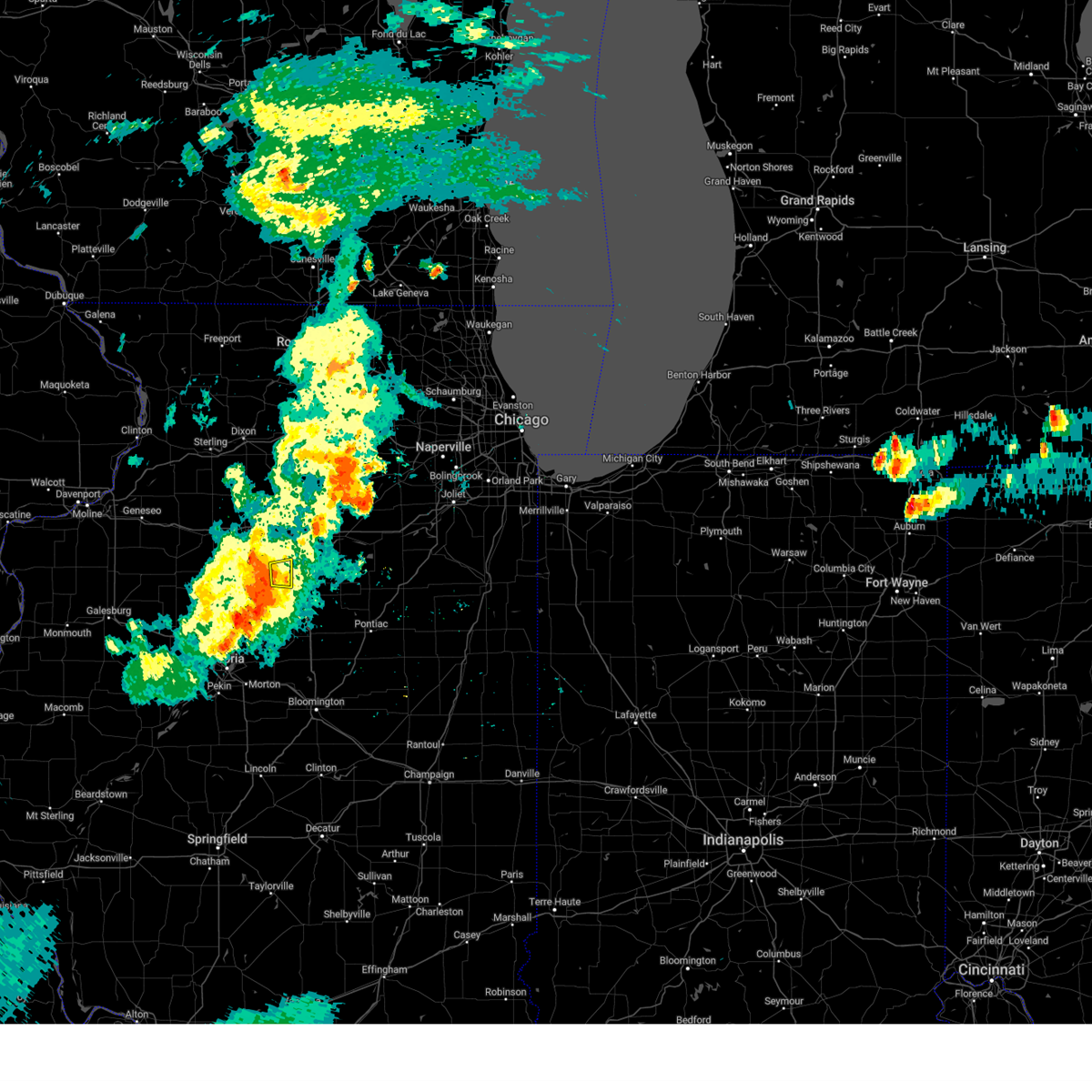 At 829 pm cdt, a severe thunderstorm was located over magnolia, or 9 miles southeast of hennepin, moving east at 40 mph (radar indicated). Hazards include 60 mph wind gusts. expect damage to roofs, siding, and trees At 829 pm cdt, a severe thunderstorm was located over magnolia, or 9 miles southeast of hennepin, moving east at 40 mph (radar indicated). Hazards include 60 mph wind gusts. expect damage to roofs, siding, and trees
|
| 7/14/2023 8:24 PM CDT |
 The severe thunderstorm warning for putnam and southeastern bureau counties will expire at 830 pm cdt, the storms which prompted the warning has weakened. therefore, the warning will be allowed to expire.however gusty winds are still possible with these thunderstorms. a severe thunderstorm watch remains in effect until 1000 pm cdt for north central illinois. The severe thunderstorm warning for putnam and southeastern bureau counties will expire at 830 pm cdt, the storms which prompted the warning has weakened. therefore, the warning will be allowed to expire.however gusty winds are still possible with these thunderstorms. a severe thunderstorm watch remains in effect until 1000 pm cdt for north central illinois.
|
| 7/14/2023 8:06 PM CDT |
 At 806 pm cdt, severe thunderstorms were located along a line extending from near mendota to near tiskilwa, moving east at 40 mph (radar indicated). Hazards include 60 mph wind gusts and quarter size hail. Hail damage to vehicles is expected. expect wind damage to roofs, siding, and trees. locations impacted include, hennepin, spring valley, henry, depue, granville, ladd, tiskilwa, bureau junction, mcnabb, putnam, mark, seatonville, magnolia, standard, milo, hollowayville, ottville, lake thunderbird, florid and lone tree corners. hail threat, radar indicated max hail size, 1. 00 in wind threat, radar indicated max wind gust, 60 mph. At 806 pm cdt, severe thunderstorms were located along a line extending from near mendota to near tiskilwa, moving east at 40 mph (radar indicated). Hazards include 60 mph wind gusts and quarter size hail. Hail damage to vehicles is expected. expect wind damage to roofs, siding, and trees. locations impacted include, hennepin, spring valley, henry, depue, granville, ladd, tiskilwa, bureau junction, mcnabb, putnam, mark, seatonville, magnolia, standard, milo, hollowayville, ottville, lake thunderbird, florid and lone tree corners. hail threat, radar indicated max hail size, 1. 00 in wind threat, radar indicated max wind gust, 60 mph.
|
| 7/14/2023 7:44 PM CDT |
 At 744 pm cdt, severe thunderstorms were located along a line extending from near van orin to near neponset, moving east at 40 mph (radar indicated). Hazards include 60 mph wind gusts. expect damage to roofs, siding, and trees At 744 pm cdt, severe thunderstorms were located along a line extending from near van orin to near neponset, moving east at 40 mph (radar indicated). Hazards include 60 mph wind gusts. expect damage to roofs, siding, and trees
|
| 6/29/2023 2:12 PM CDT |
 At 212 pm cdt, severe thunderstorms were located along a line extending from near van orin to near putnam, moving east at 20 mph (radar indicated). Hazards include 60 mph wind gusts. Expect damage to roofs, siding, and trees. these severe storms will be near, florid around 220 pm cdt. la moille and mark around 225 pm cdt. Other locations in the path of these severe thunderstorms include granville, mcnabb, magnolia and standard. At 212 pm cdt, severe thunderstorms were located along a line extending from near van orin to near putnam, moving east at 20 mph (radar indicated). Hazards include 60 mph wind gusts. Expect damage to roofs, siding, and trees. these severe storms will be near, florid around 220 pm cdt. la moille and mark around 225 pm cdt. Other locations in the path of these severe thunderstorms include granville, mcnabb, magnolia and standard.
|
| 6/29/2023 2:09 PM CDT |
 At 208 pm cdt, severe thunderstorms were located along a line extending from near van orin to putnam, moving east at 20 mph (radar indicated). Hazards include 60 mph wind gusts. Expect damage to roofs, siding, and trees. severe thunderstorms will be near, van orin around 215 pm cdt. florid around 220 pm cdt. la moille around 225 pm cdt. other locations in the path of these severe thunderstorms include granville, mcnabb, mark, magnolia and standard. hail threat, radar indicated max hail size, <. 75 in wind threat, radar indicated max wind gust, 60 mph. At 208 pm cdt, severe thunderstorms were located along a line extending from near van orin to putnam, moving east at 20 mph (radar indicated). Hazards include 60 mph wind gusts. Expect damage to roofs, siding, and trees. severe thunderstorms will be near, van orin around 215 pm cdt. florid around 220 pm cdt. la moille around 225 pm cdt. other locations in the path of these severe thunderstorms include granville, mcnabb, mark, magnolia and standard. hail threat, radar indicated max hail size, <. 75 in wind threat, radar indicated max wind gust, 60 mph.
|
| 5/7/2023 7:46 PM CDT |
 At 746 pm cdt, a severe thunderstorm was located near providence, or 13 miles southwest of princeton, moving southeast at 30 mph (radar indicated). Hazards include 70 mph wind gusts and quarter size hail. Hail damage to vehicles is expected. expect considerable tree damage. wind damage is also likely to mobile homes, roofs, and outbuildings. Locations impacted include, princeton, hennepin, spring valley, henry, depue, granville, wyanet, sheffield, tiskilwa, dalzell, buda, bureau junction, mcnabb, putnam, mark, neponset, seatonville, magnolia, standard and milo. At 746 pm cdt, a severe thunderstorm was located near providence, or 13 miles southwest of princeton, moving southeast at 30 mph (radar indicated). Hazards include 70 mph wind gusts and quarter size hail. Hail damage to vehicles is expected. expect considerable tree damage. wind damage is also likely to mobile homes, roofs, and outbuildings. Locations impacted include, princeton, hennepin, spring valley, henry, depue, granville, wyanet, sheffield, tiskilwa, dalzell, buda, bureau junction, mcnabb, putnam, mark, neponset, seatonville, magnolia, standard and milo.
|
| 5/7/2023 7:28 PM CDT |
 At 728 pm cdt, a severe thunderstorm was located over neponset, or 8 miles northeast of kewanee, moving southeast at 30 mph (radar indicated). Hazards include 60 mph wind gusts and quarter size hail. Hail damage to vehicles is expected. expect wind damage to roofs, siding, and trees. Locations impacted include, buda, wyanet, providence, tiskilwa, milo, lone tree corners, lake thunderbird, putnam, henry, mcnabb and magnolia. At 728 pm cdt, a severe thunderstorm was located over neponset, or 8 miles northeast of kewanee, moving southeast at 30 mph (radar indicated). Hazards include 60 mph wind gusts and quarter size hail. Hail damage to vehicles is expected. expect wind damage to roofs, siding, and trees. Locations impacted include, buda, wyanet, providence, tiskilwa, milo, lone tree corners, lake thunderbird, putnam, henry, mcnabb and magnolia.
|
| 5/7/2023 7:12 PM CDT |
 At 712 pm cdt, a severe thunderstorm was located over annawan, or 8 miles north of kewanee, moving southeast at 30 mph (radar indicated). Hazards include 60 mph wind gusts and half dollar size hail. Hail damage to vehicles is expected. expect wind damage to roofs, siding, and trees. this severe storm will be near, kewanee, mineral and johnson-sauk trail state park around 720 pm cdt. Other locations in the path of this severe thunderstorm include sheffield, neponset, buda, providence, tiskilwa, milo, putnam, lone tree corners and lake thunderbird. At 712 pm cdt, a severe thunderstorm was located over annawan, or 8 miles north of kewanee, moving southeast at 30 mph (radar indicated). Hazards include 60 mph wind gusts and half dollar size hail. Hail damage to vehicles is expected. expect wind damage to roofs, siding, and trees. this severe storm will be near, kewanee, mineral and johnson-sauk trail state park around 720 pm cdt. Other locations in the path of this severe thunderstorm include sheffield, neponset, buda, providence, tiskilwa, milo, putnam, lone tree corners and lake thunderbird.
|
| 5/7/2023 7:06 PM CDT |
 At 705 pm cdt, a severe thunderstorm was located over atkinson, or 11 miles north of kewanee, moving southeast at 30 mph (radar indicated). Hazards include 60 mph wind gusts and half dollar size hail. Hail damage to vehicles is expected. expect wind damage to roofs, siding, and trees. this severe thunderstorm will be near, annawan around 715 pm cdt. kewanee, mineral and johnson-sauk trail state park around 720 pm cdt. other locations in the path of this severe thunderstorm include sheffield, neponset, buda, providence, tiskilwa, milo, putnam, lone tree corners and lake thunderbird. hail threat, radar indicated max hail size, 1. 25 in wind threat, radar indicated max wind gust, 60 mph. At 705 pm cdt, a severe thunderstorm was located over atkinson, or 11 miles north of kewanee, moving southeast at 30 mph (radar indicated). Hazards include 60 mph wind gusts and half dollar size hail. Hail damage to vehicles is expected. expect wind damage to roofs, siding, and trees. this severe thunderstorm will be near, annawan around 715 pm cdt. kewanee, mineral and johnson-sauk trail state park around 720 pm cdt. other locations in the path of this severe thunderstorm include sheffield, neponset, buda, providence, tiskilwa, milo, putnam, lone tree corners and lake thunderbird. hail threat, radar indicated max hail size, 1. 25 in wind threat, radar indicated max wind gust, 60 mph.
|
| 4/5/2023 5:45 AM CDT |
 At 545 am cdt, severe thunderstorms were located along a line extending from near dixon to lawn ridge, moving east at 50 mph (radar indicated). Hazards include 60 mph wind gusts and quarter size hail. Hail damage to vehicles is expected. expect wind damage to roofs, siding, and trees. Locations impacted include, princeton, hennepin, spring valley, henry, depue, granville, walnut, ladd, wyanet, tiskilwa, la moille, dalzell, bureau junction, mcnabb, putnam, mark, ohio, cherry, malden and seatonville. At 545 am cdt, severe thunderstorms were located along a line extending from near dixon to lawn ridge, moving east at 50 mph (radar indicated). Hazards include 60 mph wind gusts and quarter size hail. Hail damage to vehicles is expected. expect wind damage to roofs, siding, and trees. Locations impacted include, princeton, hennepin, spring valley, henry, depue, granville, walnut, ladd, wyanet, tiskilwa, la moille, dalzell, bureau junction, mcnabb, putnam, mark, ohio, cherry, malden and seatonville.
|
| 4/5/2023 5:38 AM CDT |
 At 538 am cdt, severe thunderstorms were located along a line extending from nelson to princeville, moving east at 50 mph (radar indicated). Hazards include 60 mph wind gusts and quarter size hail. Hail damage to vehicles is expected. expect wind damage to roofs, siding, and trees. These severe thunderstorms will remain over mainly rural areas of putnam, eastern whiteside and bureau counties, including the following locations, seatonville, spring valley airport, cherry, penrose, mark, standard, coal hollow, ottville, kasbeer and manlius. At 538 am cdt, severe thunderstorms were located along a line extending from nelson to princeville, moving east at 50 mph (radar indicated). Hazards include 60 mph wind gusts and quarter size hail. Hail damage to vehicles is expected. expect wind damage to roofs, siding, and trees. These severe thunderstorms will remain over mainly rural areas of putnam, eastern whiteside and bureau counties, including the following locations, seatonville, spring valley airport, cherry, penrose, mark, standard, coal hollow, ottville, kasbeer and manlius.
|
| 11/5/2022 10:00 AM CDT |
 At 1000 am cdt, severe thunderstorms were located along a line extending from nachusa to near standard, moving northeast at 50 mph (radar indicated). Hazards include 60 mph wind gusts. Expect damage to roofs, siding, and trees. Locations impacted include, hennepin, spring valley, depue, granville, ladd, la moille, dalzell, mcnabb, mark, cherry, seatonville, magnolia, standard, arlington, hollowayville, spring valley airport, zearing, ottville, van orin and florid. At 1000 am cdt, severe thunderstorms were located along a line extending from nachusa to near standard, moving northeast at 50 mph (radar indicated). Hazards include 60 mph wind gusts. Expect damage to roofs, siding, and trees. Locations impacted include, hennepin, spring valley, depue, granville, ladd, la moille, dalzell, mcnabb, mark, cherry, seatonville, magnolia, standard, arlington, hollowayville, spring valley airport, zearing, ottville, van orin and florid.
|
| 11/5/2022 9:54 AM CDT |
 At 953 am cdt, severe thunderstorms were located along a line extending from eldena to mcnabb, moving northeast at 45 mph (radar indicated). Hazards include 60 mph wind gusts. Expect damage to roofs, siding, and trees. Locations impacted include, spring valley airport and dalzell. At 953 am cdt, severe thunderstorms were located along a line extending from eldena to mcnabb, moving northeast at 45 mph (radar indicated). Hazards include 60 mph wind gusts. Expect damage to roofs, siding, and trees. Locations impacted include, spring valley airport and dalzell.
|
| 11/5/2022 9:31 AM CDT |
 At 931 am cdt, severe thunderstorms were located along a line extending from normandy to near sparland, moving northeast at 50 mph (radar indicated). Hazards include 60 mph wind gusts. Expect damage to roofs, siding, and trees. severe thunderstorms will be near, walnut around 935 am cdt. lake thunderbird around 940 am cdt. mcnabb and magnolia around 945 am cdt. hennepin, granville, bureau junction, mark and florid around 950 am cdt. Other locations in the path of these severe thunderstorms include depue, seatonville, standard, hollowayville, spring valley airport, ottville, spring valley, ladd, dalzell and cherry. At 931 am cdt, severe thunderstorms were located along a line extending from normandy to near sparland, moving northeast at 50 mph (radar indicated). Hazards include 60 mph wind gusts. Expect damage to roofs, siding, and trees. severe thunderstorms will be near, walnut around 935 am cdt. lake thunderbird around 940 am cdt. mcnabb and magnolia around 945 am cdt. hennepin, granville, bureau junction, mark and florid around 950 am cdt. Other locations in the path of these severe thunderstorms include depue, seatonville, standard, hollowayville, spring valley airport, ottville, spring valley, ladd, dalzell and cherry.
|
| 8/29/2022 12:23 PM CDT | The severe thunderstorm warning for putnam county will expire at 1230 pm cdt, the storm which prompted the warning has moved out of the area. therefore, the warning will be allowed to expire. the strongest winds have moved east and south of the warned area. however heavy rain is still possible with this thunderstorm. a severe thunderstorm watch remains in effect until 400 pm cdt for north central illinois. |
| 8/29/2022 12:16 PM CDT | At 1215 pm cdt, a severe thunderstorm was located near lostant, or 11 miles south of la salle, moving east at 50 mph (radar indicated). Hazards include 70 mph wind gusts and penny size hail. Expect considerable tree damage. damage is likely to mobile homes, roofs, and outbuildings. this severe thunderstorm will remain over mainly rural areas of putnam county, including the following locations, mark, standard, magnolia and florid. thunderstorm damage threat, considerable hail threat, radar indicated max hail size, 0. 75 in wind threat, radar indicated max wind gust, 70 mph. |
| 8/29/2022 12:07 PM CDT | At 1207 pm cdt, a severe thunderstorm was located over mcnabb, or 7 miles southeast of hennepin, moving east at 50 mph (radar indicated). Hazards include 70 mph wind gusts and penny size hail. Expect considerable tree damage. damage is likely to mobile homes, roofs, and outbuildings. this severe thunderstorm will remain over mainly rural areas of putnam and southeastern bureau counties, including the following locations, putnam, providence, mark, standard, milo, lake thunderbird, magnolia, florid and lone tree corners. thunderstorm damage threat, considerable hail threat, radar indicated max hail size, 0. 75 in wind threat, radar indicated max wind gust, 70 mph. |
| 8/29/2022 12:03 PM CDT | At 1203 pm cdt, a severe thunderstorm was located over granville, or near hennepin, moving east at 55 mph (radar indicated). Hazards include 60 mph wind gusts and penny size hail. Expect damage to roofs, siding, and trees. this severe thunderstorm will remain over mainly rural areas of putnam and southeastern bureau counties, including the following locations, putnam, providence, mark, standard, milo, lake thunderbird, magnolia, florid and lone tree corners. hail threat, radar indicated max hail size, 0. 75 in wind threat, radar indicated max wind gust, 60 mph. |
| 8/29/2022 12:00 PM CDT | At 1200 pm cdt, a severe thunderstorm was located over granville, or near hennepin, moving east at 60 mph (radar indicated). Hazards include 60 mph wind gusts and penny size hail. Expect damage to roofs, siding, and trees. this severe thunderstorm will remain over mainly rural areas of putnam and southeastern bureau counties, including the following locations, putnam, providence, mark, standard, milo, lake thunderbird, magnolia, florid and lone tree corners. hail threat, radar indicated max hail size, 0. 75 in wind threat, radar indicated max wind gust, 60 mph. |
| 8/29/2022 11:53 AM CDT | At 1153 am cdt, a severe thunderstorm was located near putnam, or near hennepin, moving east at 60 mph (radar indicated). Hazards include 60 mph wind gusts and penny size hail. Expect damage to roofs, siding, and trees. this severe thunderstorm will be near, granville and mcnabb around 1200 pm cdt. magnolia and standard around 1205 pm cdt. hail threat, radar indicated max hail size, 0. 75 in wind threat, radar indicated max wind gust, 60 mph. |
| 8/20/2022 3:09 PM CDT |
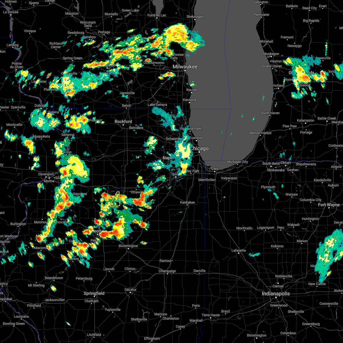 The severe thunderstorm warning for eastern putnam county will expire at 315 pm cdt, the storm which prompted the warning has weakened below severe limits, and no longer poses an immediate threat to life or property. therefore, the warning will be allowed to expire. however heavy rain is still possible with this thunderstorm. to report severe weather, contact your nearest law enforcement agency. they will relay your report to the national weather service the quad cities. The severe thunderstorm warning for eastern putnam county will expire at 315 pm cdt, the storm which prompted the warning has weakened below severe limits, and no longer poses an immediate threat to life or property. therefore, the warning will be allowed to expire. however heavy rain is still possible with this thunderstorm. to report severe weather, contact your nearest law enforcement agency. they will relay your report to the national weather service the quad cities.
|
| 8/20/2022 2:59 PM CDT |
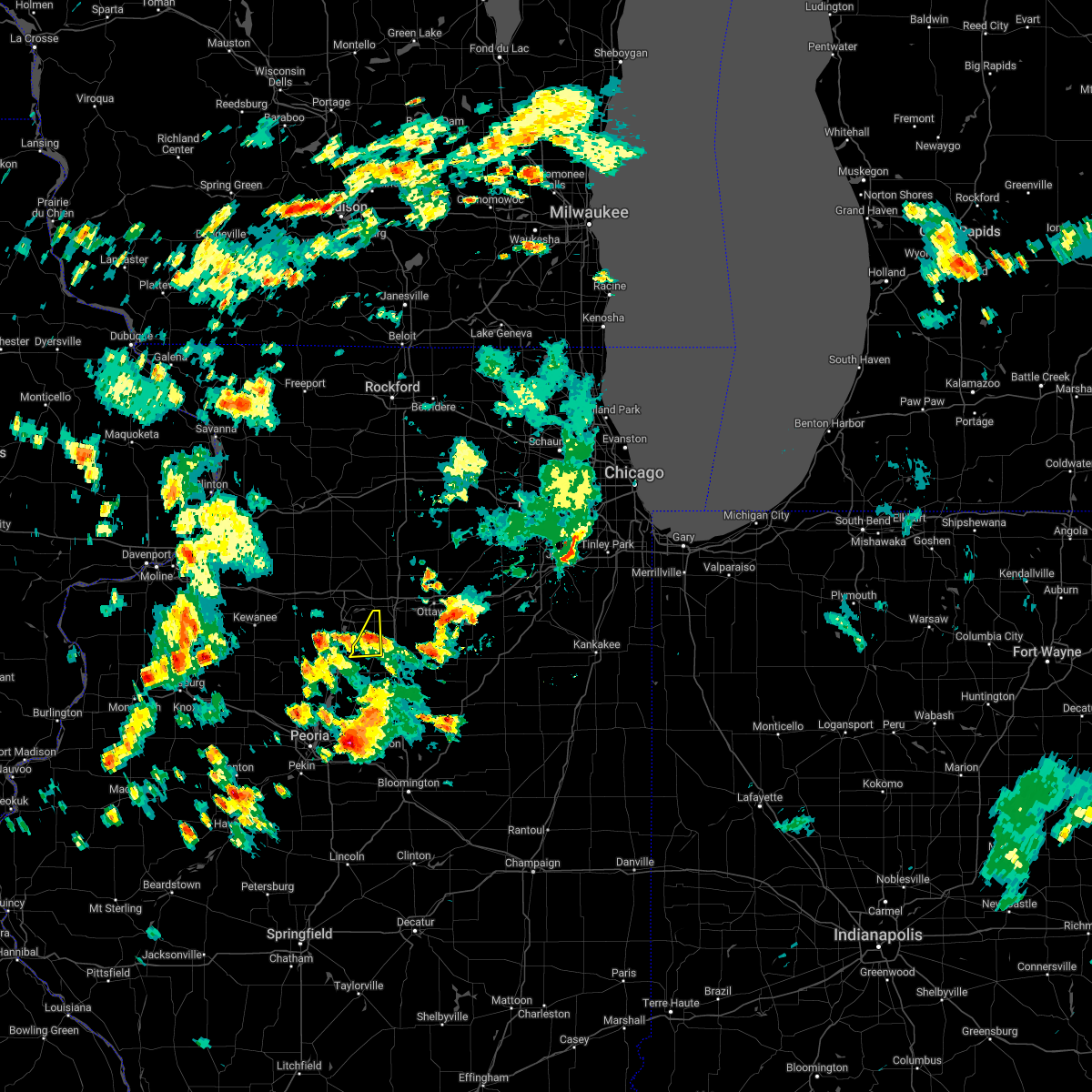 At 259 pm cdt, a severe thunderstorm was located over standard, or near peru, moving northeast at 30 mph (radar indicated). Hazards include 60 mph wind gusts and quarter size hail. Hail damage to vehicles is expected. expect wind damage to roofs, siding, and trees. this severe thunderstorm will remain over mainly rural areas of eastern putnam county, including the following locations, magnolia, standard and mark. hail threat, radar indicated max hail size, 1. 00 in wind threat, radar indicated max wind gust, 60 mph. At 259 pm cdt, a severe thunderstorm was located over standard, or near peru, moving northeast at 30 mph (radar indicated). Hazards include 60 mph wind gusts and quarter size hail. Hail damage to vehicles is expected. expect wind damage to roofs, siding, and trees. this severe thunderstorm will remain over mainly rural areas of eastern putnam county, including the following locations, magnolia, standard and mark. hail threat, radar indicated max hail size, 1. 00 in wind threat, radar indicated max wind gust, 60 mph.
|
| 8/20/2022 2:44 PM CDT |
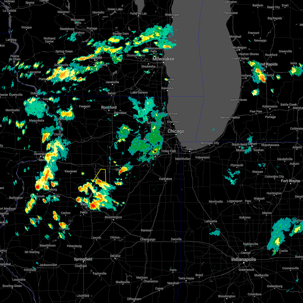 At 243 pm cdt, a severe thunderstorm was located near mcnabb, or 7 miles southeast of hennepin, moving northeast at 30 mph (trained weather spotters). Hazards include 60 mph wind gusts and half dollar size hail. Hail damage to vehicles is expected. expect wind damage to roofs, siding, and trees. this severe storm will be near, mcnabb around 250 pm cdt. other locations in the path of this severe thunderstorm include granville, mark and standard. hail threat, radar indicated max hail size, 1. 25 in wind threat, radar indicated max wind gust, 60 mph. At 243 pm cdt, a severe thunderstorm was located near mcnabb, or 7 miles southeast of hennepin, moving northeast at 30 mph (trained weather spotters). Hazards include 60 mph wind gusts and half dollar size hail. Hail damage to vehicles is expected. expect wind damage to roofs, siding, and trees. this severe storm will be near, mcnabb around 250 pm cdt. other locations in the path of this severe thunderstorm include granville, mark and standard. hail threat, radar indicated max hail size, 1. 25 in wind threat, radar indicated max wind gust, 60 mph.
|
| 8/20/2022 2:32 PM CDT |
 At 232 pm cdt, a severe thunderstorm was located over henry, or near lacon, moving northeast at 30 mph (trained weather spotters). Hazards include ping pong ball size hail and 60 mph wind gusts. People and animals outdoors will be injured. expect hail damage to roofs, siding, windows, and vehicles. expect wind damage to roofs, siding, and trees. this severe storm will be near, magnolia around 240 pm cdt. other locations in the path of this severe thunderstorm include mcnabb, florid, hennepin, granville, mark and standard. hail threat, radar indicated max hail size, 1. 50 in wind threat, radar indicated max wind gust, 60 mph. At 232 pm cdt, a severe thunderstorm was located over henry, or near lacon, moving northeast at 30 mph (trained weather spotters). Hazards include ping pong ball size hail and 60 mph wind gusts. People and animals outdoors will be injured. expect hail damage to roofs, siding, windows, and vehicles. expect wind damage to roofs, siding, and trees. this severe storm will be near, magnolia around 240 pm cdt. other locations in the path of this severe thunderstorm include mcnabb, florid, hennepin, granville, mark and standard. hail threat, radar indicated max hail size, 1. 50 in wind threat, radar indicated max wind gust, 60 mph.
|
| 8/20/2022 2:26 PM CDT |
 At 226 pm cdt, a severe thunderstorm was located over marshall county airport, or near lacon, moving northeast at 35 mph (trained weather spotters). Hazards include 60 mph wind gusts and quarter size hail. Hail damage to vehicles is expected. expect wind damage to roofs, siding, and trees. this severe thunderstorm will be near, magnolia around 240 pm cdt. other locations in the path of this severe thunderstorm include mcnabb, florid, hennepin, granville, mark and standard. hail threat, radar indicated max hail size, 1. 00 in wind threat, radar indicated max wind gust, 60 mph. At 226 pm cdt, a severe thunderstorm was located over marshall county airport, or near lacon, moving northeast at 35 mph (trained weather spotters). Hazards include 60 mph wind gusts and quarter size hail. Hail damage to vehicles is expected. expect wind damage to roofs, siding, and trees. this severe thunderstorm will be near, magnolia around 240 pm cdt. other locations in the path of this severe thunderstorm include mcnabb, florid, hennepin, granville, mark and standard. hail threat, radar indicated max hail size, 1. 00 in wind threat, radar indicated max wind gust, 60 mph.
|
| 7/4/2022 2:52 PM CDT |
 The severe thunderstorm warning for putnam county will expire at 300 pm cdt, the severe thunderstorm which prompted the warning has weakened. therefore, the warning will be allowed to expire. however heavy rain is still expected with this thunderstorm. The severe thunderstorm warning for putnam county will expire at 300 pm cdt, the severe thunderstorm which prompted the warning has weakened. therefore, the warning will be allowed to expire. however heavy rain is still expected with this thunderstorm.
|
| 7/4/2022 2:48 PM CDT |
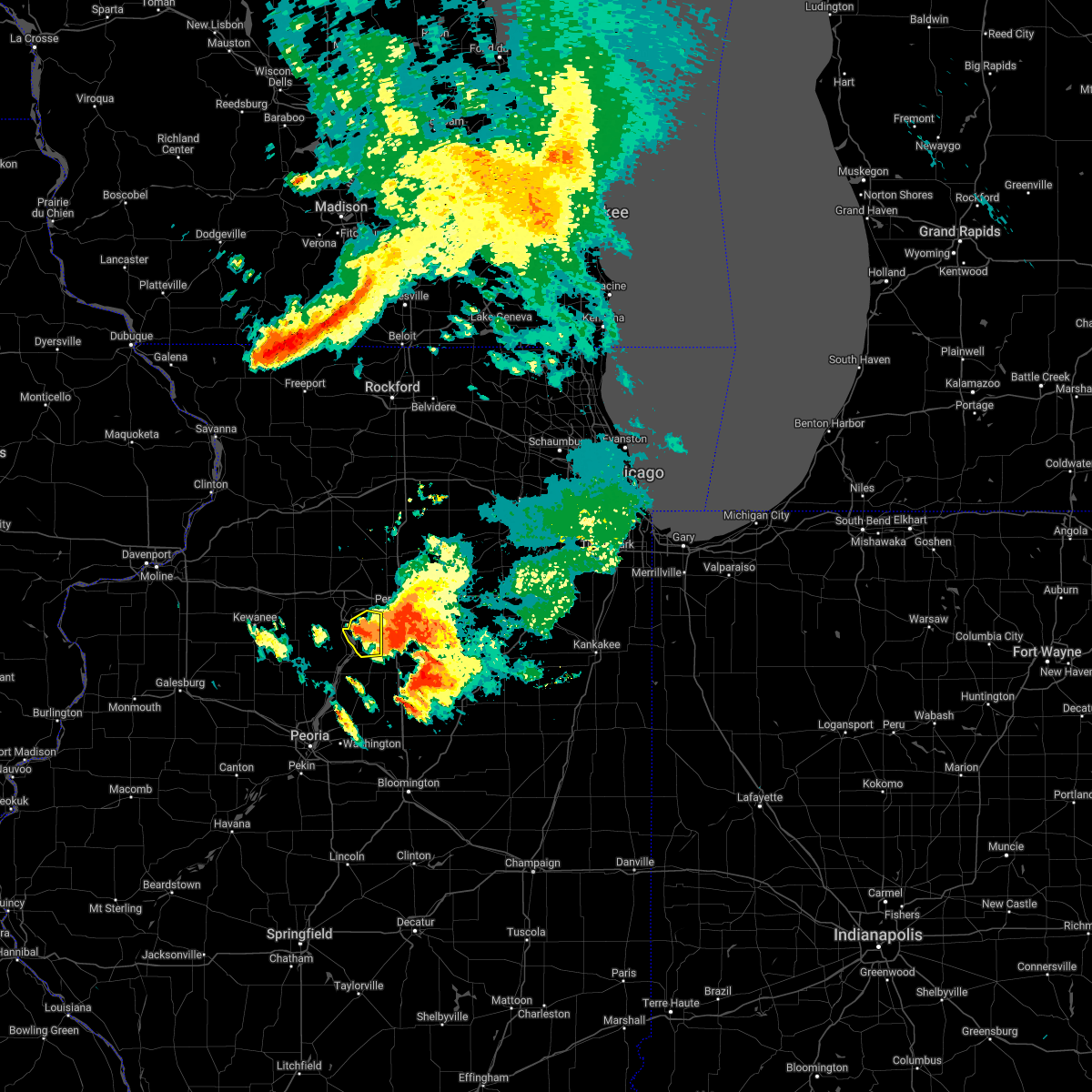 At 248 pm cdt, a severe thunderstorm was located over mcnabb, or 8 miles southeast of hennepin, moving east at 20 mph (radar indicated). Hazards include 60 mph wind gusts. Expect damage to roofs, siding, and trees. locations impacted include, hennepin, granville, mcnabb, mark, magnolia, standard and florid. hail threat, radar indicated max hail size, <. 75 in wind threat, radar indicated max wind gust, 60 mph. At 248 pm cdt, a severe thunderstorm was located over mcnabb, or 8 miles southeast of hennepin, moving east at 20 mph (radar indicated). Hazards include 60 mph wind gusts. Expect damage to roofs, siding, and trees. locations impacted include, hennepin, granville, mcnabb, mark, magnolia, standard and florid. hail threat, radar indicated max hail size, <. 75 in wind threat, radar indicated max wind gust, 60 mph.
|
| 7/4/2022 2:39 PM CDT |
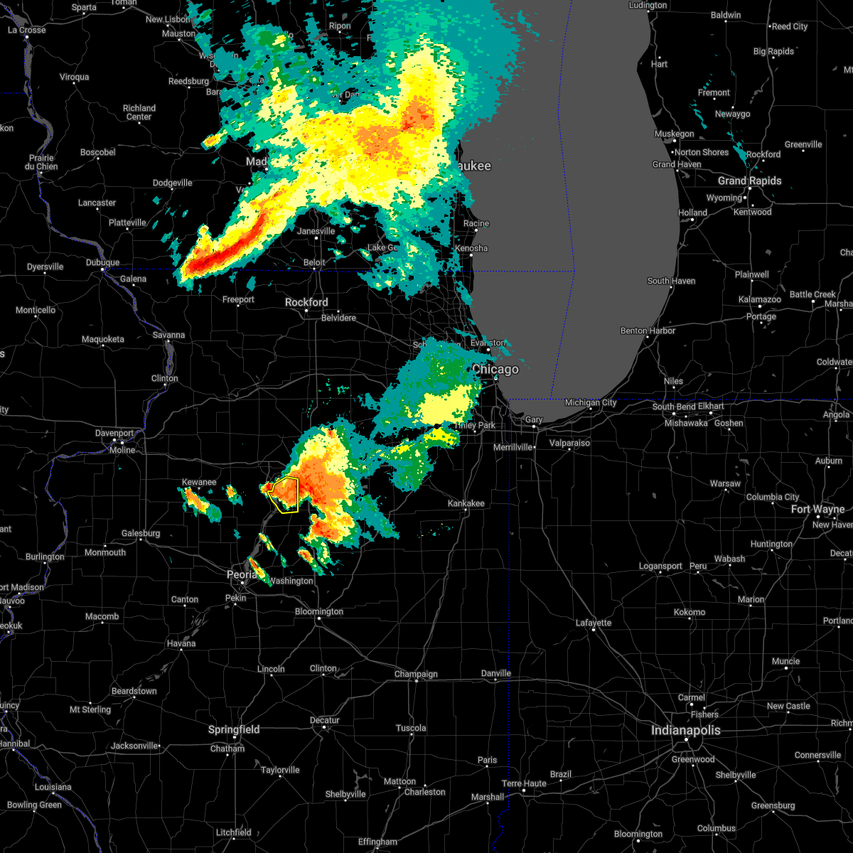 At 239 pm cdt, a severe thunderstorm was located over mcnabb, or near hennepin, moving east at 20 mph (radar indicated). Hazards include 60 mph wind gusts. Expect damage to roofs, siding, and trees. locations impacted include, hennepin, granville, mcnabb, mark, magnolia, standard and florid. hail threat, radar indicated max hail size, <. 75 in wind threat, radar indicated max wind gust, 60 mph. At 239 pm cdt, a severe thunderstorm was located over mcnabb, or near hennepin, moving east at 20 mph (radar indicated). Hazards include 60 mph wind gusts. Expect damage to roofs, siding, and trees. locations impacted include, hennepin, granville, mcnabb, mark, magnolia, standard and florid. hail threat, radar indicated max hail size, <. 75 in wind threat, radar indicated max wind gust, 60 mph.
|
| 7/4/2022 2:28 PM CDT |
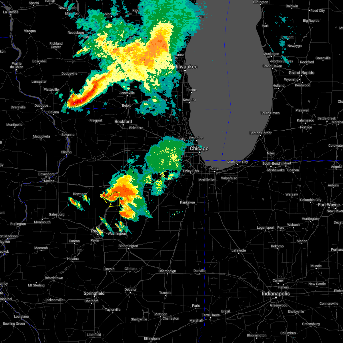 At 228 pm cdt, a severe thunderstorm was located over mcnabb, or 7 miles southeast of hennepin, moving east at 25 mph (radar indicated). Hazards include 60 mph wind gusts. expect damage to roofs, siding, and trees At 228 pm cdt, a severe thunderstorm was located over mcnabb, or 7 miles southeast of hennepin, moving east at 25 mph (radar indicated). Hazards include 60 mph wind gusts. expect damage to roofs, siding, and trees
|
| 7/4/2022 2:20 PM CDT |
 At 220 pm cdt, a severe thunderstorm was located over hennepin, moving east at 20 mph (radar indicated). Hazards include 60 mph wind gusts. Expect damage to roofs, siding, and trees. locations impacted include, princeton, hennepin, spring valley, depue, granville, tiskilwa, dalzell, bureau junction, mcnabb, putnam, mark, seatonville, magnolia, standard, spring valley airport, ottville, lake thunderbird, florid and lone tree corners. hail threat, radar indicated max hail size, <. 75 in wind threat, radar indicated max wind gust, 60 mph. At 220 pm cdt, a severe thunderstorm was located over hennepin, moving east at 20 mph (radar indicated). Hazards include 60 mph wind gusts. Expect damage to roofs, siding, and trees. locations impacted include, princeton, hennepin, spring valley, depue, granville, tiskilwa, dalzell, bureau junction, mcnabb, putnam, mark, seatonville, magnolia, standard, spring valley airport, ottville, lake thunderbird, florid and lone tree corners. hail threat, radar indicated max hail size, <. 75 in wind threat, radar indicated max wind gust, 60 mph.
|
| 7/4/2022 2:12 PM CDT |
 At 212 pm cdt, a severe thunderstorm was located over bureau junction, or over hennepin, moving east at 20 mph (radar indicated). Hazards include 60 mph wind gusts. Expect damage to roofs, siding, and trees. locations impacted include, princeton, hennepin, spring valley, depue, granville, tiskilwa, dalzell, bureau junction, mcnabb, putnam, mark, seatonville, magnolia, standard, spring valley airport, ottville, lake thunderbird, florid and lone tree corners. hail threat, radar indicated max hail size, <. 75 in wind threat, radar indicated max wind gust, 60 mph. At 212 pm cdt, a severe thunderstorm was located over bureau junction, or over hennepin, moving east at 20 mph (radar indicated). Hazards include 60 mph wind gusts. Expect damage to roofs, siding, and trees. locations impacted include, princeton, hennepin, spring valley, depue, granville, tiskilwa, dalzell, bureau junction, mcnabb, putnam, mark, seatonville, magnolia, standard, spring valley airport, ottville, lake thunderbird, florid and lone tree corners. hail threat, radar indicated max hail size, <. 75 in wind threat, radar indicated max wind gust, 60 mph.
|
| 7/4/2022 2:05 PM CDT |
 At 205 pm cdt, a severe thunderstorm was located over bureau junction, or near hennepin, moving east at 20 mph (radar indicated). Hazards include 60 mph wind gusts. Expect damage to roofs, siding, and trees. Locations impacted include, princeton, hennepin, spring valley, depue, granville, tiskilwa, dalzell, bureau junction, mcnabb, putnam, mark, seatonville, magnolia, standard, spring valley airport, ottville, lake thunderbird, florid and lone tree corners. At 205 pm cdt, a severe thunderstorm was located over bureau junction, or near hennepin, moving east at 20 mph (radar indicated). Hazards include 60 mph wind gusts. Expect damage to roofs, siding, and trees. Locations impacted include, princeton, hennepin, spring valley, depue, granville, tiskilwa, dalzell, bureau junction, mcnabb, putnam, mark, seatonville, magnolia, standard, spring valley airport, ottville, lake thunderbird, florid and lone tree corners.
|
| 7/4/2022 1:57 PM CDT |
 At 157 pm cdt, a severe thunderstorm was located over tiskilwa, or 7 miles west of hennepin, moving east at 20 mph (radar indicated). Hazards include 60 mph wind gusts and quarter size hail. Hail damage to vehicles is expected. Expect wind damage to roofs, siding, and trees. At 157 pm cdt, a severe thunderstorm was located over tiskilwa, or 7 miles west of hennepin, moving east at 20 mph (radar indicated). Hazards include 60 mph wind gusts and quarter size hail. Hail damage to vehicles is expected. Expect wind damage to roofs, siding, and trees.
|
| 3/5/2022 10:39 PM CST |
 The severe thunderstorm warning for putnam and bureau counties will expire at 1045 pm cst, the storm which prompted the warning has moved out of the area. therefore, the warning will be allowed to expire. a severe thunderstorm watch remains in effect until 200 am cst for north central illinois. The severe thunderstorm warning for putnam and bureau counties will expire at 1045 pm cst, the storm which prompted the warning has moved out of the area. therefore, the warning will be allowed to expire. a severe thunderstorm watch remains in effect until 200 am cst for north central illinois.
|
| 3/5/2022 10:21 PM CST |
 At 1021 pm cst, a severe thunderstorm was located over ladd, or near peru, moving east at 50 mph (radar indicated). Hazards include 60 mph wind gusts and penny size hail. Expect damage to roofs, siding, and trees. This severe thunderstorm will remain over mainly rural areas of putnam and bureau counties, including the following locations, seatonville, spring valley airport, cherry, mark, standard, coal hollow, ottville, kasbeer, manlius and van orin. At 1021 pm cst, a severe thunderstorm was located over ladd, or near peru, moving east at 50 mph (radar indicated). Hazards include 60 mph wind gusts and penny size hail. Expect damage to roofs, siding, and trees. This severe thunderstorm will remain over mainly rural areas of putnam and bureau counties, including the following locations, seatonville, spring valley airport, cherry, mark, standard, coal hollow, ottville, kasbeer, manlius and van orin.
|
| 3/5/2022 9:56 PM CST |
 At 955 pm cst, a severe thunderstorm was located over wyanet, or 8 miles west of princeton, moving east at 50 mph (radar indicated). Hazards include 60 mph wind gusts. Expect damage to roofs, siding, and trees. this severe thunderstorm will be near, princeton and tiskilwa around 1005 pm cst. hennepin, depue and bureau junction around 1015 pm cst. other locations in the path of this severe thunderstorm include spring valley, granville, ladd and dalzell. hail threat, radar indicated max hail size, <. 75 in wind threat, radar indicated max wind gust, 60 mph. At 955 pm cst, a severe thunderstorm was located over wyanet, or 8 miles west of princeton, moving east at 50 mph (radar indicated). Hazards include 60 mph wind gusts. Expect damage to roofs, siding, and trees. this severe thunderstorm will be near, princeton and tiskilwa around 1005 pm cst. hennepin, depue and bureau junction around 1015 pm cst. other locations in the path of this severe thunderstorm include spring valley, granville, ladd and dalzell. hail threat, radar indicated max hail size, <. 75 in wind threat, radar indicated max wind gust, 60 mph.
|
| 10/11/2021 5:43 PM CDT |
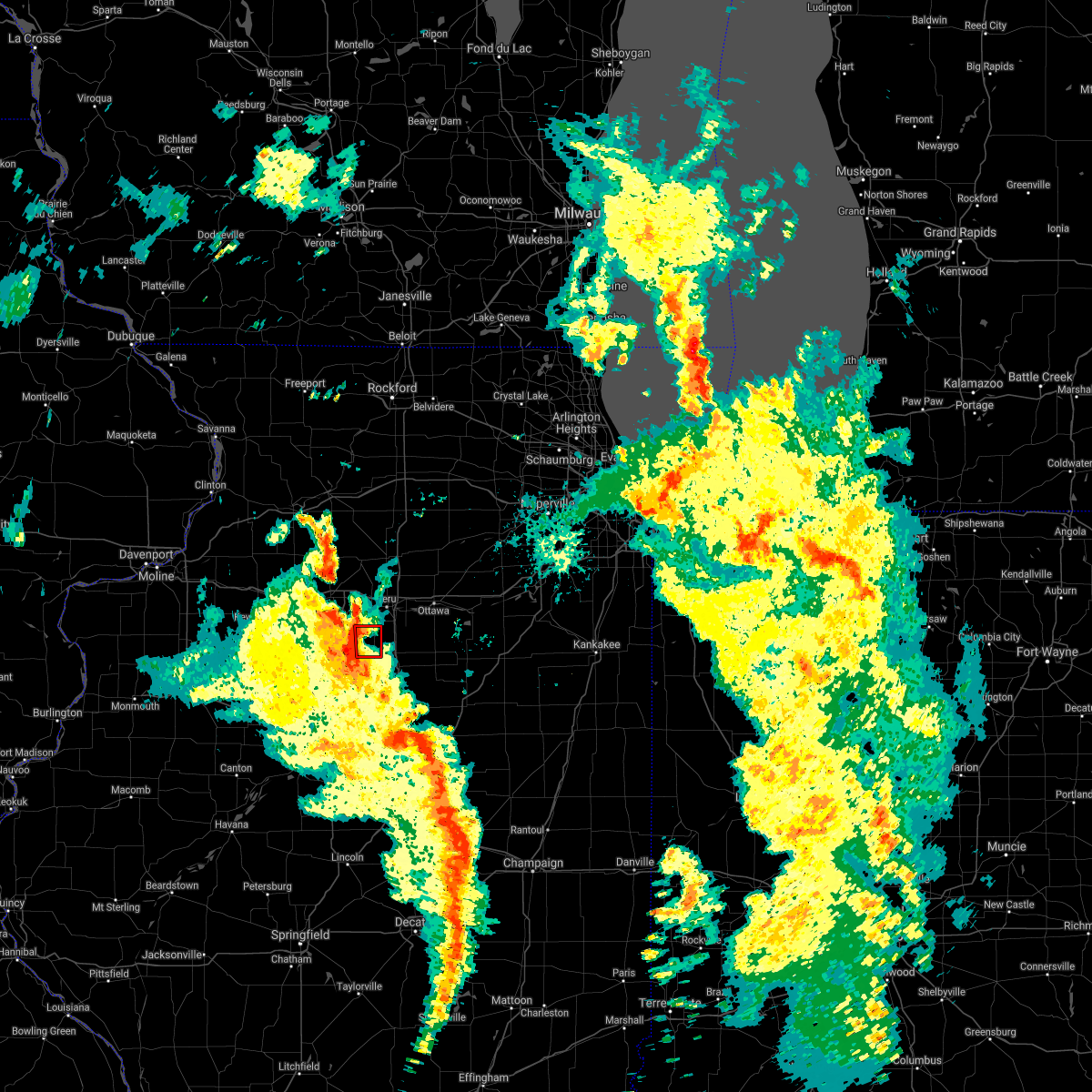 At 543 pm cdt, a severe thunderstorm capable of producing a tornado was located near henry, or 9 miles south of hennepin, moving northeast at 35 mph (radar indicated rotation). Hazards include tornado. Flying debris will be dangerous to those caught without shelter. mobile homes will be damaged or destroyed. damage to roofs, windows, and vehicles will occur. tree damage is likely. Locations impacted include, hennepin, mcnabb, magnolia and florid. At 543 pm cdt, a severe thunderstorm capable of producing a tornado was located near henry, or 9 miles south of hennepin, moving northeast at 35 mph (radar indicated rotation). Hazards include tornado. Flying debris will be dangerous to those caught without shelter. mobile homes will be damaged or destroyed. damage to roofs, windows, and vehicles will occur. tree damage is likely. Locations impacted include, hennepin, mcnabb, magnolia and florid.
|
| 10/11/2021 5:22 PM CDT |
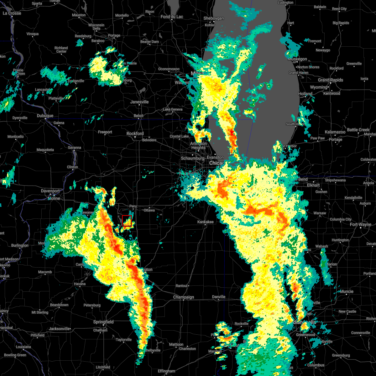 At 522 pm cdt, a severe thunderstorm capable of producing a tornado was located near varna, or 10 miles northeast of lacon, moving north at 20 mph (radar indicated rotation). Hazards include tornado. Flying debris will be dangerous to those caught without shelter. mobile homes will be damaged or destroyed. damage to roofs, windows, and vehicles will occur. tree damage is likely. Locations impacted include, hennepin, mcnabb, magnolia and florid. At 522 pm cdt, a severe thunderstorm capable of producing a tornado was located near varna, or 10 miles northeast of lacon, moving north at 20 mph (radar indicated rotation). Hazards include tornado. Flying debris will be dangerous to those caught without shelter. mobile homes will be damaged or destroyed. damage to roofs, windows, and vehicles will occur. tree damage is likely. Locations impacted include, hennepin, mcnabb, magnolia and florid.
|
| 10/11/2021 5:12 PM CDT |
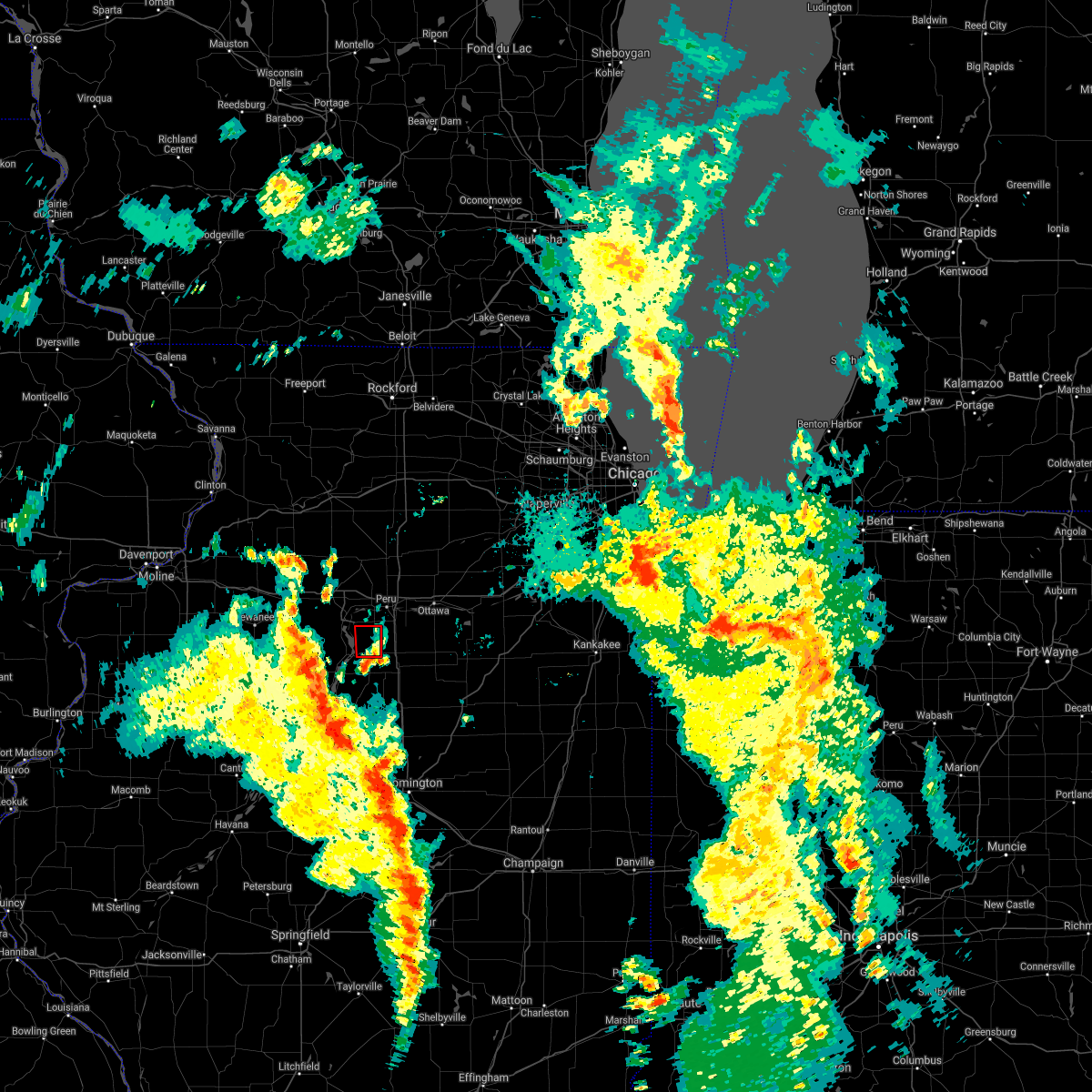 At 512 pm cdt, a severe thunderstorm capable of producing a tornado was located over varna, or 9 miles east of lacon, moving north at 20 mph (weather spotters reported funnel cloud at 504 pm cdt). Hazards include tornado. Flying debris will be dangerous to those caught without shelter. mobile homes will be damaged or destroyed. damage to roofs, windows, and vehicles will occur. Tree damage is likely. At 512 pm cdt, a severe thunderstorm capable of producing a tornado was located over varna, or 9 miles east of lacon, moving north at 20 mph (weather spotters reported funnel cloud at 504 pm cdt). Hazards include tornado. Flying debris will be dangerous to those caught without shelter. mobile homes will be damaged or destroyed. damage to roofs, windows, and vehicles will occur. Tree damage is likely.
|
| 8/11/2021 9:21 AM CDT |
 The severe thunderstorm warning for putnam, eastern whiteside and bureau counties will expire at 930 am cdt, the storms which prompted the warning have moved out of the warned area. therefore, the warning will be allowed to expire. however very gusty winds still expected behind the storms. an area of strong winds will continue behind the storms, with an extended period of near 60 mph winds expected to last up to one hour. a high wind warning continues through 10 am for winds up to 60 mph. The severe thunderstorm warning for putnam, eastern whiteside and bureau counties will expire at 930 am cdt, the storms which prompted the warning have moved out of the warned area. therefore, the warning will be allowed to expire. however very gusty winds still expected behind the storms. an area of strong winds will continue behind the storms, with an extended period of near 60 mph winds expected to last up to one hour. a high wind warning continues through 10 am for winds up to 60 mph.
|
| 8/11/2021 9:11 AM CDT |
 At 910 am cdt, severe thunderstorms were located along a line extending from near paw paw to near wenona, moving east at 50 mph (radar indicated). Hazards include 60 mph wind gusts will continue. an area of strong winds will continue behind the storms, with an extended period of near 60 mph winds expected to last up to one hour. a high wind warning continues through 10 am for winds up to 60 mph. Expect damage to roofs, siding, and trees. locations impacted include, sterling, rock falls, princeton, hennepin, spring valley, depue, granville, walnut, ladd, wyanet, sheffield, tiskilwa, tampico, la moille, dalzell, buda, bureau junction, mcnabb, deer grove and emerson. hail threat, radar indicated max hail size, <. 75 in wind threat, radar indicated max wind gust, 60 mph. At 910 am cdt, severe thunderstorms were located along a line extending from near paw paw to near wenona, moving east at 50 mph (radar indicated). Hazards include 60 mph wind gusts will continue. an area of strong winds will continue behind the storms, with an extended period of near 60 mph winds expected to last up to one hour. a high wind warning continues through 10 am for winds up to 60 mph. Expect damage to roofs, siding, and trees. locations impacted include, sterling, rock falls, princeton, hennepin, spring valley, depue, granville, walnut, ladd, wyanet, sheffield, tiskilwa, tampico, la moille, dalzell, buda, bureau junction, mcnabb, deer grove and emerson. hail threat, radar indicated max hail size, <. 75 in wind threat, radar indicated max wind gust, 60 mph.
|
| 8/11/2021 9:02 AM CDT |
 At 901 am cdt, severe thunderstorms were located along a line extending from 7 miles southeast of amboy to varna, moving east at 50 mph. an area of strong winds will continue behind the storms, with an extended period of near 60 mph winds expected to last up to one hour. a high wind warning continues through 10 am for winds up to 60 mph (radar indicated). Hazards include 70 mph wind gusts and quarter size hail. Hail damage to vehicles is expected. expect considerable tree damage. wind damage is also likely to mobile homes, roofs, and outbuildings. locations impacted include, sterling, rock falls, princeton, hennepin, spring valley, depue, granville, walnut, ladd, wyanet, sheffield, tiskilwa, tampico, la moille, dalzell, buda, bureau junction, mcnabb, deer grove and emerson. thunderstorm damage threat, considerable hail threat, radar indicated max hail size, 1. 00 in wind threat, radar indicated max wind gust, 70 mph. At 901 am cdt, severe thunderstorms were located along a line extending from 7 miles southeast of amboy to varna, moving east at 50 mph. an area of strong winds will continue behind the storms, with an extended period of near 60 mph winds expected to last up to one hour. a high wind warning continues through 10 am for winds up to 60 mph (radar indicated). Hazards include 70 mph wind gusts and quarter size hail. Hail damage to vehicles is expected. expect considerable tree damage. wind damage is also likely to mobile homes, roofs, and outbuildings. locations impacted include, sterling, rock falls, princeton, hennepin, spring valley, depue, granville, walnut, ladd, wyanet, sheffield, tiskilwa, tampico, la moille, dalzell, buda, bureau junction, mcnabb, deer grove and emerson. thunderstorm damage threat, considerable hail threat, radar indicated max hail size, 1. 00 in wind threat, radar indicated max wind gust, 70 mph.
|
| 8/11/2021 8:50 AM CDT |
 At 850 am cdt, severe thunderstorms were located along a line extending from near amboy to near henry, moving east at 60 mph. an area of strong winds will continue behind the storms, with an extended period of near 60 mph winds expected to last up to 2 hours (radar indicated). Hazards include 75 mph wind gusts and quarter size hail. Hail damage to vehicles is expected. expect considerable tree damage. wind damage is also likely to mobile homes, roofs, and outbuildings. locations impacted include, sterling, rock falls, princeton, hennepin, spring valley, depue, granville, walnut, ladd, wyanet, sheffield, tiskilwa, tampico, la moille, dalzell, buda, bureau junction, mcnabb, deer grove and emerson. thunderstorm damage threat, considerable hail threat, radar indicated max hail size, 1. 00 in wind threat, radar indicated max wind gust, 70 mph. At 850 am cdt, severe thunderstorms were located along a line extending from near amboy to near henry, moving east at 60 mph. an area of strong winds will continue behind the storms, with an extended period of near 60 mph winds expected to last up to 2 hours (radar indicated). Hazards include 75 mph wind gusts and quarter size hail. Hail damage to vehicles is expected. expect considerable tree damage. wind damage is also likely to mobile homes, roofs, and outbuildings. locations impacted include, sterling, rock falls, princeton, hennepin, spring valley, depue, granville, walnut, ladd, wyanet, sheffield, tiskilwa, tampico, la moille, dalzell, buda, bureau junction, mcnabb, deer grove and emerson. thunderstorm damage threat, considerable hail threat, radar indicated max hail size, 1. 00 in wind threat, radar indicated max wind gust, 70 mph.
|
| 8/11/2021 8:41 AM CDT |
 At 841 am cdt, severe thunderstorms were located along a line extending from near rock falls to near castleton, moving east at 50 mph. an area of strong winds will continue behind the storms, with an extended period of near 60 mph winds expected to last up to 2 hours (radar indicated). Hazards include 75 mph wind gusts and quarter size hail. Hail damage to vehicles is expected. expect considerable tree damage. wind damage is also likely to mobile homes, roofs, and outbuildings. locations impacted include, sterling, rock falls, princeton, hennepin, spring valley, depue, granville, walnut, ladd, wyanet, sheffield, tiskilwa, tampico, la moille, dalzell, buda, bureau junction, mcnabb, deer grove and emerson. thunderstorm damage threat, considerable hail threat, radar indicated max hail size, 1. 00 in wind threat, radar indicated max wind gust, 70 mph. At 841 am cdt, severe thunderstorms were located along a line extending from near rock falls to near castleton, moving east at 50 mph. an area of strong winds will continue behind the storms, with an extended period of near 60 mph winds expected to last up to 2 hours (radar indicated). Hazards include 75 mph wind gusts and quarter size hail. Hail damage to vehicles is expected. expect considerable tree damage. wind damage is also likely to mobile homes, roofs, and outbuildings. locations impacted include, sterling, rock falls, princeton, hennepin, spring valley, depue, granville, walnut, ladd, wyanet, sheffield, tiskilwa, tampico, la moille, dalzell, buda, bureau junction, mcnabb, deer grove and emerson. thunderstorm damage threat, considerable hail threat, radar indicated max hail size, 1. 00 in wind threat, radar indicated max wind gust, 70 mph.
|
| 8/11/2021 8:33 AM CDT |
 At 832 am cdt, severe thunderstorms were located along a line extending from near rock falls to near castleton, moving east at 50 mph. an area of strong winds will continue behind the storms, with an extended period of near 60 mph winds expected to last up to 2 hours (radar indicated). Hazards include 70 mph wind gusts and quarter size hail. Hail damage to vehicles is expected. expect considerable tree damage. wind damage is also likely to mobile homes, roofs, and outbuildings. these severe thunderstorms will remain over mainly rural areas of putnam, eastern whiteside and bureau counties, including the following locations, seatonville, spring valley airport, cherry, penrose, round grove, mark, standard, coal hollow, como and ottville. thunderstorm damage threat, considerable hail threat, radar indicated max hail size, 1. 00 in wind threat, radar indicated max wind gust, 70 mph. At 832 am cdt, severe thunderstorms were located along a line extending from near rock falls to near castleton, moving east at 50 mph. an area of strong winds will continue behind the storms, with an extended period of near 60 mph winds expected to last up to 2 hours (radar indicated). Hazards include 70 mph wind gusts and quarter size hail. Hail damage to vehicles is expected. expect considerable tree damage. wind damage is also likely to mobile homes, roofs, and outbuildings. these severe thunderstorms will remain over mainly rural areas of putnam, eastern whiteside and bureau counties, including the following locations, seatonville, spring valley airport, cherry, penrose, round grove, mark, standard, coal hollow, como and ottville. thunderstorm damage threat, considerable hail threat, radar indicated max hail size, 1. 00 in wind threat, radar indicated max wind gust, 70 mph.
|
| 11/10/2020 4:07 PM CST |
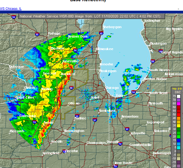 At 406 pm cst, severe thunderstorms were located along a line extending from peru to near mcnabb, moving northeast at 50 mph (radar indicated). Hazards include 60 mph wind gusts. Expect damage to roofs, siding, and trees. Locations impacted include, granville, mcnabb, mark, magnolia, standard and florid. At 406 pm cst, severe thunderstorms were located along a line extending from peru to near mcnabb, moving northeast at 50 mph (radar indicated). Hazards include 60 mph wind gusts. Expect damage to roofs, siding, and trees. Locations impacted include, granville, mcnabb, mark, magnolia, standard and florid.
|
| 11/10/2020 3:57 PM CST |
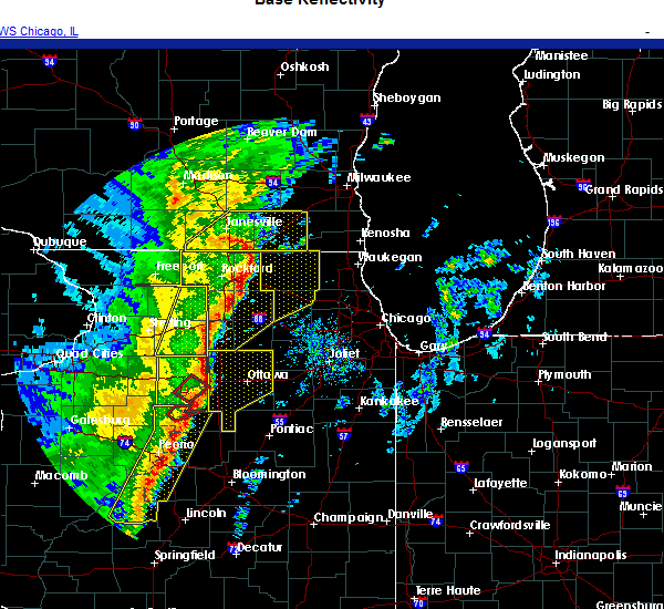 At 357 pm cst, severe thunderstorms were located along a line extending from near la moille to dalzell to near henry, moving east at 55 mph (radar indicated). Hazards include 60 mph wind gusts. expect damage to roofs, siding, and trees At 357 pm cst, severe thunderstorms were located along a line extending from near la moille to dalzell to near henry, moving east at 55 mph (radar indicated). Hazards include 60 mph wind gusts. expect damage to roofs, siding, and trees
|
| 11/10/2020 3:21 PM CST |
 At 321 pm cst, severe thunderstorms were located along a line extending from near walton to near wyanet to camp grove, moving east at 35 mph (radar indicated). Hazards include 60 mph wind gusts and penny size hail. expect damage to roofs, siding, and trees At 321 pm cst, severe thunderstorms were located along a line extending from near walton to near wyanet to camp grove, moving east at 35 mph (radar indicated). Hazards include 60 mph wind gusts and penny size hail. expect damage to roofs, siding, and trees
|
| 8/10/2020 2:00 PM CDT |
 At 159 pm cdt, severe thunderstorms were located along a line extending from near prophetstown to near la fayette, moving east at 70 mph. these are very dangerous storms! (trained weather spotters. this line of storms has a history of producing 70 to 90 mph wind gusts and significant tree damage). Hazards include 80 mph wind gusts. Flying debris will be dangerous to those caught without shelter. mobile homes will be heavily damaged. expect considerable damage to roofs, windows, and vehicles. Extensive tree damage and power outages are likely. At 159 pm cdt, severe thunderstorms were located along a line extending from near prophetstown to near la fayette, moving east at 70 mph. these are very dangerous storms! (trained weather spotters. this line of storms has a history of producing 70 to 90 mph wind gusts and significant tree damage). Hazards include 80 mph wind gusts. Flying debris will be dangerous to those caught without shelter. mobile homes will be heavily damaged. expect considerable damage to roofs, windows, and vehicles. Extensive tree damage and power outages are likely.
|
| 7/19/2020 10:42 AM CDT |
 The severe thunderstorm warning for putnam and eastern bureau counties will expire at 1045 am cdt, the storm which prompted the warning has moved out of the area. therefore, the warning will be allowed to expire. to report severe weather, contact your nearest law enforcement agency. they will relay your report to the national weather service the quad cities. The severe thunderstorm warning for putnam and eastern bureau counties will expire at 1045 am cdt, the storm which prompted the warning has moved out of the area. therefore, the warning will be allowed to expire. to report severe weather, contact your nearest law enforcement agency. they will relay your report to the national weather service the quad cities.
|
| 7/19/2020 10:35 AM CDT |
 At 1035 am cdt, a severe thunderstorm was located over oglesby, moving east at 55 mph (trained weather spotters). Hazards include 70 mph wind gusts. Expect considerable tree damage. damage is likely to mobile homes, roofs, and outbuildings. locations impacted include, hennepin, spring valley, henry, depue, granville, ladd, dalzell, bureau junction, mcnabb, putnam, mark, cherry, seatonville, magnolia, standard, hollowayville, spring valley airport, ottville and florid. this includes the following highways, interstate 80 in illinois between mile markers 66 and 72. Interstate 180 between mile markers 1 and 3. At 1035 am cdt, a severe thunderstorm was located over oglesby, moving east at 55 mph (trained weather spotters). Hazards include 70 mph wind gusts. Expect considerable tree damage. damage is likely to mobile homes, roofs, and outbuildings. locations impacted include, hennepin, spring valley, henry, depue, granville, ladd, dalzell, bureau junction, mcnabb, putnam, mark, cherry, seatonville, magnolia, standard, hollowayville, spring valley airport, ottville and florid. this includes the following highways, interstate 80 in illinois between mile markers 66 and 72. Interstate 180 between mile markers 1 and 3.
|
| 7/19/2020 10:27 AM CDT |
 At 1027 am cdt, a severe thunderstorm was located over granville, or near peru, moving east at 55 mph. this is a very dangerous storm (trained weather spotters). Hazards include 80 mph wind gusts. Flying debris will be dangerous to those caught without shelter. mobile homes will be heavily damaged. expect considerable damage to roofs, windows, and vehicles. extensive tree damage and power outages are likely. locations impacted include, princeton, hennepin, spring valley, henry, depue, granville, ladd, tiskilwa, la moille, dalzell, bureau junction, mcnabb, putnam, mark, cherry, malden, seatonville, magnolia, standard and arlington. this includes the following highways, interstate 80 in illinois between mile markers 56 and 72. Interstate 180 between mile markers 1 and 13. At 1027 am cdt, a severe thunderstorm was located over granville, or near peru, moving east at 55 mph. this is a very dangerous storm (trained weather spotters). Hazards include 80 mph wind gusts. Flying debris will be dangerous to those caught without shelter. mobile homes will be heavily damaged. expect considerable damage to roofs, windows, and vehicles. extensive tree damage and power outages are likely. locations impacted include, princeton, hennepin, spring valley, henry, depue, granville, ladd, tiskilwa, la moille, dalzell, bureau junction, mcnabb, putnam, mark, cherry, malden, seatonville, magnolia, standard and arlington. this includes the following highways, interstate 80 in illinois between mile markers 56 and 72. Interstate 180 between mile markers 1 and 13.
|
| 7/19/2020 10:19 AM CDT |
 At 1018 am cdt, a severe thunderstorm was located over bureau junction, or over hennepin, moving east at 55 mph. this is a very dangerous storm (trained weather spotters). Hazards include 80 mph wind gusts. Flying debris will be dangerous to those caught without shelter. mobile homes will be heavily damaged. expect considerable damage to roofs, windows, and vehicles. extensive tree damage and power outages are likely. locations impacted include, princeton, hennepin, spring valley, henry, depue, granville, ladd, wyanet, tiskilwa, la moille, dalzell, bureau junction, mcnabb, putnam, mark, ohio, cherry, malden, seatonville and magnolia. this includes the following highways, interstate 80 in illinois between mile markers 47 and 72. Interstate 180 between mile markers 1 and 13. At 1018 am cdt, a severe thunderstorm was located over bureau junction, or over hennepin, moving east at 55 mph. this is a very dangerous storm (trained weather spotters). Hazards include 80 mph wind gusts. Flying debris will be dangerous to those caught without shelter. mobile homes will be heavily damaged. expect considerable damage to roofs, windows, and vehicles. extensive tree damage and power outages are likely. locations impacted include, princeton, hennepin, spring valley, henry, depue, granville, ladd, wyanet, tiskilwa, la moille, dalzell, bureau junction, mcnabb, putnam, mark, ohio, cherry, malden, seatonville and magnolia. this includes the following highways, interstate 80 in illinois between mile markers 47 and 72. Interstate 180 between mile markers 1 and 13.
|
| 7/19/2020 10:16 AM CDT | Multiple reports of tree limbs... powerlines... and trees down across the county. tree down near the intersection of highway 26 and highway 1 in putnam county IL, 7 miles E of Magnolia, IL |
| 7/19/2020 10:11 AM CDT |
 At 1011 am cdt, a severe thunderstorm was located over tiskilwa, or 7 miles south of princeton, moving east at 55 mph. this is a very dangerous storm! (trained weather spotters). Hazards include 80 mph wind gusts. Flying debris will be dangerous to those caught without shelter. mobile homes will be heavily damaged. expect considerable damage to roofs, windows, and vehicles. Extensive tree damage and power outages are likely. At 1011 am cdt, a severe thunderstorm was located over tiskilwa, or 7 miles south of princeton, moving east at 55 mph. this is a very dangerous storm! (trained weather spotters). Hazards include 80 mph wind gusts. Flying debris will be dangerous to those caught without shelter. mobile homes will be heavily damaged. expect considerable damage to roofs, windows, and vehicles. Extensive tree damage and power outages are likely.
|
| 7/11/2020 8:56 PM CDT |
 The severe thunderstorm warning for putnam and eastern bureau counties will expire at 900 pm cdt, the storms which prompted the warning have moved out of the area. therefore, the warning will be allowed to expire. however heavy rain is still possible with these thunderstorms. a severe thunderstorm watch remains in effect until midnight cdt for north central illinois. to report severe weather, contact your nearest law enforcement agency. they will relay your report to the national weather service the quad cities. The severe thunderstorm warning for putnam and eastern bureau counties will expire at 900 pm cdt, the storms which prompted the warning have moved out of the area. therefore, the warning will be allowed to expire. however heavy rain is still possible with these thunderstorms. a severe thunderstorm watch remains in effect until midnight cdt for north central illinois. to report severe weather, contact your nearest law enforcement agency. they will relay your report to the national weather service the quad cities.
|
| 7/11/2020 8:41 PM CDT |
 At 841 pm cdt, severe thunderstorms were located along a line extending from near la moille to ladd to near henry, moving east at 45 mph (radar indicated). Hazards include 70 mph wind gusts. Expect considerable tree damage. Damage is likely to mobile homes, roofs, and outbuildings. At 841 pm cdt, severe thunderstorms were located along a line extending from near la moille to ladd to near henry, moving east at 45 mph (radar indicated). Hazards include 70 mph wind gusts. Expect considerable tree damage. Damage is likely to mobile homes, roofs, and outbuildings.
|
| 7/11/2020 8:23 PM CDT |
 At 823 pm cdt, severe thunderstorms were located along a line extending from 6 miles northwest of la moille to near depue to near henry, moving east at 55 mph (radar indicated). Hazards include 70 mph wind gusts. Expect considerable tree damage. damage is likely to mobile homes, roofs, and outbuildings. locations impacted include, princeton, hennepin, spring valley, henry, depue, granville, walnut, ladd, wyanet, tiskilwa, la moille, dalzell, buda, bureau junction, mcnabb, putnam, mark, ohio, cherry and malden. this includes the following highways, interstate 80 in illinois between mile markers 45 and 72. Interstate 180 between mile markers 1 and 13. At 823 pm cdt, severe thunderstorms were located along a line extending from 6 miles northwest of la moille to near depue to near henry, moving east at 55 mph (radar indicated). Hazards include 70 mph wind gusts. Expect considerable tree damage. damage is likely to mobile homes, roofs, and outbuildings. locations impacted include, princeton, hennepin, spring valley, henry, depue, granville, walnut, ladd, wyanet, tiskilwa, la moille, dalzell, buda, bureau junction, mcnabb, putnam, mark, ohio, cherry and malden. this includes the following highways, interstate 80 in illinois between mile markers 45 and 72. Interstate 180 between mile markers 1 and 13.
|
| 7/11/2020 8:02 PM CDT |
 At 801 pm cdt, severe thunderstorms were located along a line extending from near deer grove to near sheffield to elmira, moving east at 50 mph (radar indicated). Hazards include 70 mph wind gusts. Expect considerable tree damage. Damage is likely to mobile homes, roofs, and outbuildings. At 801 pm cdt, severe thunderstorms were located along a line extending from near deer grove to near sheffield to elmira, moving east at 50 mph (radar indicated). Hazards include 70 mph wind gusts. Expect considerable tree damage. Damage is likely to mobile homes, roofs, and outbuildings.
|
| 6/22/2020 4:43 PM CDT |
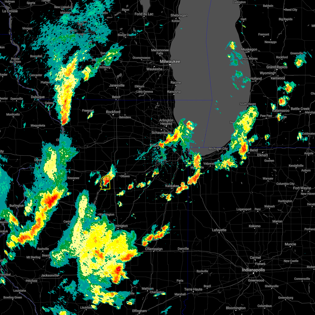 The severe thunderstorm warning for putnam county will expire at 445 pm cdt, the storm which prompted the warning has weakened below severe limits, and no longer poses an immediate threat to life or property. therefore, the warning will be allowed to expire. however nickel size hail, gusty winds to 50 mph, and heavy rain are still possible with this thunderstorm. a severe thunderstorm watch remains in effect until 900 pm cdt for north central illinois. The severe thunderstorm warning for putnam county will expire at 445 pm cdt, the storm which prompted the warning has weakened below severe limits, and no longer poses an immediate threat to life or property. therefore, the warning will be allowed to expire. however nickel size hail, gusty winds to 50 mph, and heavy rain are still possible with this thunderstorm. a severe thunderstorm watch remains in effect until 900 pm cdt for north central illinois.
|
| 6/22/2020 4:30 PM CDT |
 At 430 pm cdt, a severe thunderstorm was located near mcnabb, or near hennepin, moving east at 15 mph (radar indicated). Hazards include ping pong ball size hail and 60 mph wind gusts. People and animals outdoors will be injured. expect hail damage to roofs, siding, windows, and vehicles. expect wind damage to roofs, siding, and trees. Locations impacted include, hennepin, henry, granville, mcnabb, mark, magnolia, standard and florid. At 430 pm cdt, a severe thunderstorm was located near mcnabb, or near hennepin, moving east at 15 mph (radar indicated). Hazards include ping pong ball size hail and 60 mph wind gusts. People and animals outdoors will be injured. expect hail damage to roofs, siding, windows, and vehicles. expect wind damage to roofs, siding, and trees. Locations impacted include, hennepin, henry, granville, mcnabb, mark, magnolia, standard and florid.
|
| 6/22/2020 4:23 PM CDT |
 At 423 pm cdt, a severe thunderstorm was located near hennepin, moving northeast at 15 mph (radar indicated). Hazards include 60 mph wind gusts and half dollar size hail. Hail damage to vehicles is expected. expect wind damage to roofs, siding, and trees. Locations impacted include, hennepin, henry, granville, mcnabb, mark, magnolia, standard and florid. At 423 pm cdt, a severe thunderstorm was located near hennepin, moving northeast at 15 mph (radar indicated). Hazards include 60 mph wind gusts and half dollar size hail. Hail damage to vehicles is expected. expect wind damage to roofs, siding, and trees. Locations impacted include, hennepin, henry, granville, mcnabb, mark, magnolia, standard and florid.
|
| 6/22/2020 4:18 PM CDT |
 At 418 pm cdt, a severe thunderstorm was located near henry, or near hennepin, moving northeast at 10 mph (radar indicated). Hazards include 60 mph wind gusts and half dollar size hail. Hail damage to vehicles is expected. Expect wind damage to roofs, siding, and trees. At 418 pm cdt, a severe thunderstorm was located near henry, or near hennepin, moving northeast at 10 mph (radar indicated). Hazards include 60 mph wind gusts and half dollar size hail. Hail damage to vehicles is expected. Expect wind damage to roofs, siding, and trees.
|
| 6/3/2020 8:25 AM CDT |
 At 825 am cdt, a severe thunderstorm was located over hennepin, moving southeast at 35 mph (trained weather spotters. numerous trees and one inch diameter hail was reported in princeton). Hazards include 60 mph wind gusts and quarter size hail. Hail damage to vehicles is expected. expect wind damage to roofs, siding, and trees. locations impacted include, hennepin, spring valley, depue, granville, ladd, tiskilwa, dalzell, bureau junction, mcnabb, putnam, mark, cherry, malden, seatonville, magnolia, standard, hollowayville, spring valley airport, coal hollow and ottville. this includes the following highways, interstate 80 in illinois between mile markers 60 and 73. Interstate 180 between mile markers 1 and 13. At 825 am cdt, a severe thunderstorm was located over hennepin, moving southeast at 35 mph (trained weather spotters. numerous trees and one inch diameter hail was reported in princeton). Hazards include 60 mph wind gusts and quarter size hail. Hail damage to vehicles is expected. expect wind damage to roofs, siding, and trees. locations impacted include, hennepin, spring valley, depue, granville, ladd, tiskilwa, dalzell, bureau junction, mcnabb, putnam, mark, cherry, malden, seatonville, magnolia, standard, hollowayville, spring valley airport, coal hollow and ottville. this includes the following highways, interstate 80 in illinois between mile markers 60 and 73. Interstate 180 between mile markers 1 and 13.
|
| 6/3/2020 8:12 AM CDT |
 At 812 am cdt, a severe thunderstorm was located near princeton, moving southeast at 40 mph (trained weather spotters). Hazards include 60 mph wind gusts and quarter size hail. Hail damage to vehicles is expected. Expect wind damage to roofs, siding, and trees. At 812 am cdt, a severe thunderstorm was located near princeton, moving southeast at 40 mph (trained weather spotters). Hazards include 60 mph wind gusts and quarter size hail. Hail damage to vehicles is expected. Expect wind damage to roofs, siding, and trees.
|
| 4/8/2020 4:04 PM CDT |
 At 403 pm cdt, a severe thunderstorm was located over granville, or near hennepin, moving east at 45 mph (radar indicated). Hazards include 60 mph wind gusts and quarter size hail. Hail damage to vehicles is expected. expect wind damage to roofs, siding, and trees. locations impacted include, princeton, hennepin, spring valley, depue, granville, ladd, dalzell, bureau junction, mcnabb, putnam, mark, seatonville, magnolia, standard, hollowayville, spring valley airport, coal hollow, ottville, lake thunderbird and florid. this includes the following highways, interstate 80 in illinois between mile markers 63 and 73. Interstate 180 between mile markers 1 and 12. At 403 pm cdt, a severe thunderstorm was located over granville, or near hennepin, moving east at 45 mph (radar indicated). Hazards include 60 mph wind gusts and quarter size hail. Hail damage to vehicles is expected. expect wind damage to roofs, siding, and trees. locations impacted include, princeton, hennepin, spring valley, depue, granville, ladd, dalzell, bureau junction, mcnabb, putnam, mark, seatonville, magnolia, standard, hollowayville, spring valley airport, coal hollow, ottville, lake thunderbird and florid. this includes the following highways, interstate 80 in illinois between mile markers 63 and 73. Interstate 180 between mile markers 1 and 12.
|
| 4/8/2020 3:53 PM CDT |
 At 351 pm cdt, a severe thunderstorm was located near tiskilwa, or near hennepin, moving east at 45 mph (radar indicated). Hazards include 60 mph wind gusts and quarter size hail. Hail damage to vehicles is expected. Expect wind damage to roofs, siding, and trees. At 351 pm cdt, a severe thunderstorm was located near tiskilwa, or near hennepin, moving east at 45 mph (radar indicated). Hazards include 60 mph wind gusts and quarter size hail. Hail damage to vehicles is expected. Expect wind damage to roofs, siding, and trees.
|
| 6/30/2019 8:08 PM CDT |
 At 807 pm cdt, severe thunderstorms were located along a line extending from oglesby to near mcnabb to near varna, moving southeast at 40 mph (radar indicated). Hazards include 60 mph wind gusts. Expect damage to roofs, siding, and trees. Locations impacted include, henry, mcnabb and magnolia. At 807 pm cdt, severe thunderstorms were located along a line extending from oglesby to near mcnabb to near varna, moving southeast at 40 mph (radar indicated). Hazards include 60 mph wind gusts. Expect damage to roofs, siding, and trees. Locations impacted include, henry, mcnabb and magnolia.
|
| 6/30/2019 8:00 PM CDT |
 At 800 pm cdt, severe thunderstorms were located along a line extending from near north utica to near mcnabb to near chillicothe, moving southeast at 45 mph (radar indicated). Hazards include 60 mph wind gusts. Expect damage to roofs, siding, and trees. locations impacted include, hennepin, spring valley, henry, depue, granville, ladd, dalzell, mcnabb, putnam, mark, cherry, magnolia, standard, milo, spring valley airport, ottville, lake thunderbird, florid and lone tree corners. this includes the following highways, interstate 80 in illinois between mile markers 69 and 72. Interstate 180 between mile markers 1 and 2. At 800 pm cdt, severe thunderstorms were located along a line extending from near north utica to near mcnabb to near chillicothe, moving southeast at 45 mph (radar indicated). Hazards include 60 mph wind gusts. Expect damage to roofs, siding, and trees. locations impacted include, hennepin, spring valley, henry, depue, granville, ladd, dalzell, mcnabb, putnam, mark, cherry, magnolia, standard, milo, spring valley airport, ottville, lake thunderbird, florid and lone tree corners. this includes the following highways, interstate 80 in illinois between mile markers 69 and 72. Interstate 180 between mile markers 1 and 2.
|
| 6/30/2019 7:26 PM CDT |
 At 726 pm cdt, severe thunderstorms were located along a line extending from near amboy to near princeton to kewanee, moving southeast at 45 mph (radar indicated). Hazards include 60 mph wind gusts. expect damage to roofs, siding, and trees At 726 pm cdt, severe thunderstorms were located along a line extending from near amboy to near princeton to kewanee, moving southeast at 45 mph (radar indicated). Hazards include 60 mph wind gusts. expect damage to roofs, siding, and trees
|
| 5/8/2019 7:38 PM CDT |
 The severe thunderstorm warning for putnam and east central bureau counties will expire at 745 pm cdt, the storm which prompted the warning has weakened below severe limits, and no longer pose an immediate threat to life or property. therefore the warning will be allowed to expire. The severe thunderstorm warning for putnam and east central bureau counties will expire at 745 pm cdt, the storm which prompted the warning has weakened below severe limits, and no longer pose an immediate threat to life or property. therefore the warning will be allowed to expire.
|
| 5/8/2019 7:35 PM CDT |
 At 735 pm cdt, a severe thunderstorm was located over peru, moving northeast at 55 mph (radar indicated). Hazards include 60 mph wind gusts. expect damage to roofs, siding, and trees At 735 pm cdt, a severe thunderstorm was located over peru, moving northeast at 55 mph (radar indicated). Hazards include 60 mph wind gusts. expect damage to roofs, siding, and trees
|
| 5/8/2019 7:33 PM CDT |
 At 732 pm cdt, a severe thunderstorm was located over spring valley, moving northeast at 55 mph (radar indicated). Hazards include 60 mph wind gusts. expect damage to roofs, siding, and trees At 732 pm cdt, a severe thunderstorm was located over spring valley, moving northeast at 55 mph (radar indicated). Hazards include 60 mph wind gusts. expect damage to roofs, siding, and trees
|
| 5/8/2019 7:28 PM CDT |
 At 726 pm cdt, a severe thunderstorm was located over granville, or near hennepin, moving northeast at 55 mph (radar indicated). Hazards include 60 mph wind gusts. Expect damage to roofs, siding, and trees. this severe storm will be near, spring valley, ladd and dalzell around 735 pm cdt. Other locations impacted by this severe thunderstorm include seatonville, ottville, putnam, spring valley airport, cherry, mark, standard, magnolia and florid. At 726 pm cdt, a severe thunderstorm was located over granville, or near hennepin, moving northeast at 55 mph (radar indicated). Hazards include 60 mph wind gusts. Expect damage to roofs, siding, and trees. this severe storm will be near, spring valley, ladd and dalzell around 735 pm cdt. Other locations impacted by this severe thunderstorm include seatonville, ottville, putnam, spring valley airport, cherry, mark, standard, magnolia and florid.
|
| 5/8/2019 7:24 PM CDT |
 At 724 pm cdt, a severe thunderstorm was located near granville, or near hennepin, moving northeast at 55 mph (radar indicated). Hazards include 60 mph wind gusts. Expect damage to roofs, siding, and trees. this severe storm will be near, spring valley, ladd and dalzell around 735 pm cdt. Other locations impacted by this severe thunderstorm include seatonville, ottville, putnam, spring valley airport, cherry, mark, standard, magnolia and florid. At 724 pm cdt, a severe thunderstorm was located near granville, or near hennepin, moving northeast at 55 mph (radar indicated). Hazards include 60 mph wind gusts. Expect damage to roofs, siding, and trees. this severe storm will be near, spring valley, ladd and dalzell around 735 pm cdt. Other locations impacted by this severe thunderstorm include seatonville, ottville, putnam, spring valley airport, cherry, mark, standard, magnolia and florid.
|
| 5/8/2019 7:19 PM CDT |
 At 719 pm cdt, a severe thunderstorm was located near henry, or near hennepin, moving northeast at 55 mph (radar indicated). Hazards include 60 mph wind gusts. Expect damage to roofs, siding, and trees. this severe thunderstorm will be near, depue and granville around 730 pm cdt. spring valley, ladd and dalzell around 735 pm cdt. Other locations impacted by this severe thunderstorm include seatonville, ottville, putnam, spring valley airport, cherry, mark, standard, magnolia and florid. At 719 pm cdt, a severe thunderstorm was located near henry, or near hennepin, moving northeast at 55 mph (radar indicated). Hazards include 60 mph wind gusts. Expect damage to roofs, siding, and trees. this severe thunderstorm will be near, depue and granville around 730 pm cdt. spring valley, ladd and dalzell around 735 pm cdt. Other locations impacted by this severe thunderstorm include seatonville, ottville, putnam, spring valley airport, cherry, mark, standard, magnolia and florid.
|
| 9/25/2018 4:57 PM CDT |
 The severe thunderstorm warning for putnam county will expire at 500 pm cdt, the storms which prompted the warning have weakened below severe limits, and have exited the warned area. therefore, the warning will be allowed to expire. a severe thunderstorm watch remains in effect until 1000 pm cdt for north central illinois. The severe thunderstorm warning for putnam county will expire at 500 pm cdt, the storms which prompted the warning have weakened below severe limits, and have exited the warned area. therefore, the warning will be allowed to expire. a severe thunderstorm watch remains in effect until 1000 pm cdt for north central illinois.
|
| 9/25/2018 4:39 PM CDT |
 At 439 pm cdt, severe thunderstorms were located along a line extending from peru to near henry, moving east at 60 mph (radar indicated). Hazards include 70 mph wind gusts and half dollar size hail. Hail damage to vehicles is expected. expect considerable tree damage. wind damage is also likely to mobile homes, roofs, and outbuildings. locations impacted include, hennepin, spring valley, henry, depue, granville, tiskilwa, bureau junction, mcnabb, putnam, mark, magnolia, standard, milo, lake thunderbird, florid and lone tree corners. This includes interstate 180 between mile markers 1 and 8. At 439 pm cdt, severe thunderstorms were located along a line extending from peru to near henry, moving east at 60 mph (radar indicated). Hazards include 70 mph wind gusts and half dollar size hail. Hail damage to vehicles is expected. expect considerable tree damage. wind damage is also likely to mobile homes, roofs, and outbuildings. locations impacted include, hennepin, spring valley, henry, depue, granville, tiskilwa, bureau junction, mcnabb, putnam, mark, magnolia, standard, milo, lake thunderbird, florid and lone tree corners. This includes interstate 180 between mile markers 1 and 8.
|
| 9/25/2018 4:35 PM CDT |
 At 435 pm cdt, severe thunderstorms were located along a line extending from near bureau junction to near camp grove, moving east at 50 mph (radar indicated). Hazards include 60 mph wind gusts and penny size hail. Expect damage to roofs, siding, and trees. locations impacted include, hennepin, spring valley, henry, depue, granville, tiskilwa, bureau junction, mcnabb, putnam, mark, magnolia, standard, milo, lake thunderbird, florid and lone tree corners. This includes interstate 180 between mile markers 1 and 8. At 435 pm cdt, severe thunderstorms were located along a line extending from near bureau junction to near camp grove, moving east at 50 mph (radar indicated). Hazards include 60 mph wind gusts and penny size hail. Expect damage to roofs, siding, and trees. locations impacted include, hennepin, spring valley, henry, depue, granville, tiskilwa, bureau junction, mcnabb, putnam, mark, magnolia, standard, milo, lake thunderbird, florid and lone tree corners. This includes interstate 180 between mile markers 1 and 8.
|
| 9/25/2018 4:21 PM CDT |
 At 421 pm cdt, severe thunderstorms were located along a line extending from near tiskilwa to near wyoming, moving east at 50 mph (radar indicated). Hazards include 60 mph wind gusts. Expect damage to roofs, siding, and trees. locations impacted include, hennepin, spring valley, henry, depue, granville, tiskilwa, buda, bureau junction, mcnabb, putnam, mark, magnolia, standard, milo, providence, lake thunderbird, florid and lone tree corners. This includes interstate 180 between mile markers 1 and 8. At 421 pm cdt, severe thunderstorms were located along a line extending from near tiskilwa to near wyoming, moving east at 50 mph (radar indicated). Hazards include 60 mph wind gusts. Expect damage to roofs, siding, and trees. locations impacted include, hennepin, spring valley, henry, depue, granville, tiskilwa, buda, bureau junction, mcnabb, putnam, mark, magnolia, standard, milo, providence, lake thunderbird, florid and lone tree corners. This includes interstate 180 between mile markers 1 and 8.
|
| 9/25/2018 4:13 PM CDT |
 At 413 pm cdt, severe thunderstorms were located along a line extending from near buda to near wyoming, moving east at 50 mph (radar indicated). Hazards include 60 mph wind gusts. expect damage to roofs, siding, and trees At 413 pm cdt, severe thunderstorms were located along a line extending from near buda to near wyoming, moving east at 50 mph (radar indicated). Hazards include 60 mph wind gusts. expect damage to roofs, siding, and trees
|
| 6/15/2018 4:50 AM CDT |
 At 450 am cdt, a severe thunderstorm was located near hennepin, moving southeast at 15 mph (radar indicated). Hazards include quarter size hail. Damage to vehicles is expected. Locations impacted include, hennepin, mcnabb, putnam, magnolia and florid. At 450 am cdt, a severe thunderstorm was located near hennepin, moving southeast at 15 mph (radar indicated). Hazards include quarter size hail. Damage to vehicles is expected. Locations impacted include, hennepin, mcnabb, putnam, magnolia and florid.
|
| 6/15/2018 4:39 AM CDT |
 At 423 am cdt, a severe thunderstorm was located near hennepin, moving southeast at 15 mph (radar indicated). Hazards include half dollar size hail. Damage to vehicles is expected. locations impacted include, hennepin, henry, mcnabb, putnam, magnolia, lake thunderbird, florid and lone tree corners. This includes interstate 180 between mile markers 1 and 4. At 423 am cdt, a severe thunderstorm was located near hennepin, moving southeast at 15 mph (radar indicated). Hazards include half dollar size hail. Damage to vehicles is expected. locations impacted include, hennepin, henry, mcnabb, putnam, magnolia, lake thunderbird, florid and lone tree corners. This includes interstate 180 between mile markers 1 and 4.
|
| 6/15/2018 4:23 AM CDT |
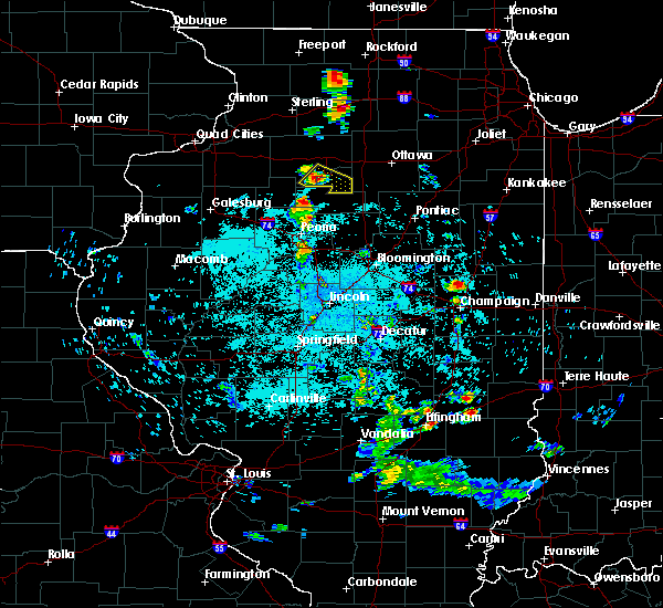 At 416 am cdt, a severe thunderstorm was located near hennepin, moving southeast at 15 mph (radar indicated). Hazards include half dollar size hail. damage to vehicles is expected At 416 am cdt, a severe thunderstorm was located near hennepin, moving southeast at 15 mph (radar indicated). Hazards include half dollar size hail. damage to vehicles is expected
|
| 6/15/2018 4:16 AM CDT |
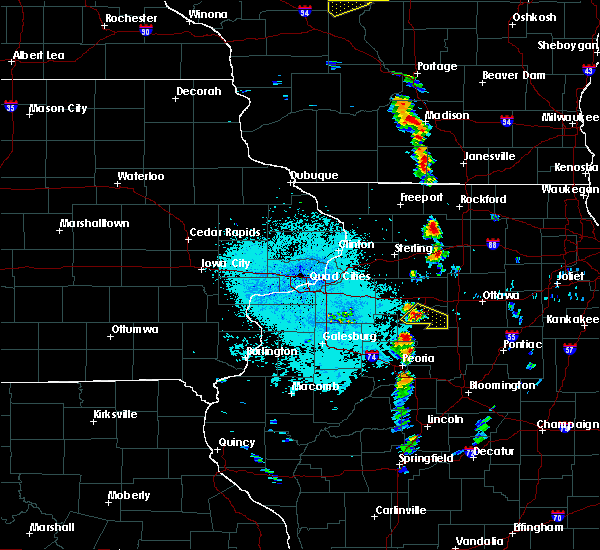 At 416 am cdt, a severe thunderstorm was located near hennepin, moving southeast at 15 mph (radar indicated). Hazards include half dollar size hail. damage to vehicles is expected At 416 am cdt, a severe thunderstorm was located near hennepin, moving southeast at 15 mph (radar indicated). Hazards include half dollar size hail. damage to vehicles is expected
|
| 6/10/2018 3:01 AM CDT |
 At 301 am cdt, severe thunderstorms were located along a line extending from near sparland to near goodfield to near green valley, moving southeast at 50 mph (radar indicated). Hazards include 60 mph wind gusts. Expect damage to roofs, siding, and trees. locations impacted include, bloomington, pekin, eureka, lacon, normal, east peoria, morton, washington, creve coeur, metamora, le roy, germantown hills, heyworth, marquette heights, el paso, henry, tremont, minonk, roanoke and lexington. this includes the following highways, interstate 155 between mile markers 11 and 31. interstate 39 between mile markers 0 and 41. interstate 474 between mile markers 11 and 14. interstate 55 between mile markers 142 and 186. Interstate 74 between mile markers 96 and 155. At 301 am cdt, severe thunderstorms were located along a line extending from near sparland to near goodfield to near green valley, moving southeast at 50 mph (radar indicated). Hazards include 60 mph wind gusts. Expect damage to roofs, siding, and trees. locations impacted include, bloomington, pekin, eureka, lacon, normal, east peoria, morton, washington, creve coeur, metamora, le roy, germantown hills, heyworth, marquette heights, el paso, henry, tremont, minonk, roanoke and lexington. this includes the following highways, interstate 155 between mile markers 11 and 31. interstate 39 between mile markers 0 and 41. interstate 474 between mile markers 11 and 14. interstate 55 between mile markers 142 and 186. Interstate 74 between mile markers 96 and 155.
|
| 6/10/2018 2:43 AM CDT |
 At 243 am cdt, severe thunderstorms were located along a line extending from bradford to metamora to glasford, moving southeast at 60 mph (radar indicated). Hazards include 60 mph wind gusts. expect damage to roofs, siding, and trees At 243 am cdt, severe thunderstorms were located along a line extending from bradford to metamora to glasford, moving southeast at 60 mph (radar indicated). Hazards include 60 mph wind gusts. expect damage to roofs, siding, and trees
|
| 7/11/2017 8:58 AM CDT |
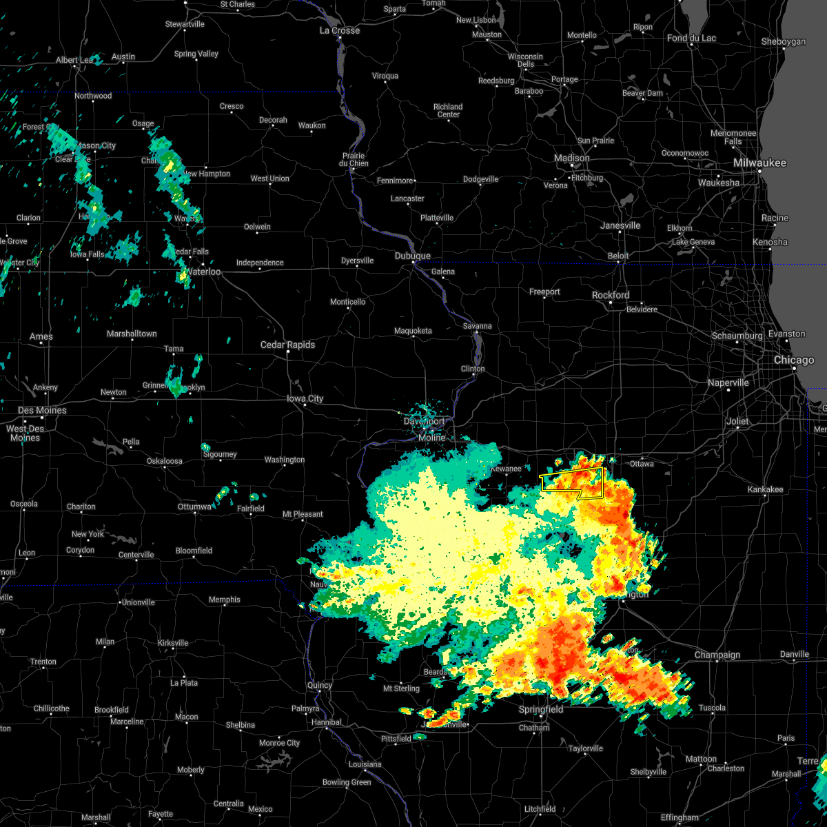 The severe thunderstorm warning for putnam and south central bureau counties will expire at 900 am cdt, the storms which prompted the warning have weakened below severe limits. however gusty winds are still possible with these thunderstorms. The severe thunderstorm warning for putnam and south central bureau counties will expire at 900 am cdt, the storms which prompted the warning have weakened below severe limits. however gusty winds are still possible with these thunderstorms.
|
| 7/11/2017 8:48 AM CDT |
 At 848 am cdt, severe thunderstorms were located along a line extending from granville to near mcnabb to near varna, moving east at 45 mph (radar indicated). Hazards include 60 mph wind gusts. Expect damage to roofs, siding, and trees. locations impacted include, hennepin, henry, granville, mcnabb, putnam, mark, magnolia, standard, milo, lake thunderbird, florid and lone tree corners. This includes interstate 180 between mile markers 1 and 3. At 848 am cdt, severe thunderstorms were located along a line extending from granville to near mcnabb to near varna, moving east at 45 mph (radar indicated). Hazards include 60 mph wind gusts. Expect damage to roofs, siding, and trees. locations impacted include, hennepin, henry, granville, mcnabb, putnam, mark, magnolia, standard, milo, lake thunderbird, florid and lone tree corners. This includes interstate 180 between mile markers 1 and 3.
|
| 7/11/2017 8:45 AM CDT | Several small branches dow in putnam county IL, 0.3 miles NE of Magnolia, IL |
| 7/11/2017 8:38 AM CDT |
 At 838 am cdt, severe thunderstorms were located along a line extending from bureau junction to near mcnabb to near varna, moving east at 45 mph (radar indicated). Hazards include 60 mph wind gusts. Expect damage to roofs, siding, and trees. locations impacted include, hennepin, henry, granville, mcnabb, putnam, mark, magnolia, standard, milo, lake thunderbird, florid and lone tree corners. This includes interstate 180 between mile markers 1 and 3. At 838 am cdt, severe thunderstorms were located along a line extending from bureau junction to near mcnabb to near varna, moving east at 45 mph (radar indicated). Hazards include 60 mph wind gusts. Expect damage to roofs, siding, and trees. locations impacted include, hennepin, henry, granville, mcnabb, putnam, mark, magnolia, standard, milo, lake thunderbird, florid and lone tree corners. This includes interstate 180 between mile markers 1 and 3.
|
| 7/11/2017 8:29 AM CDT |
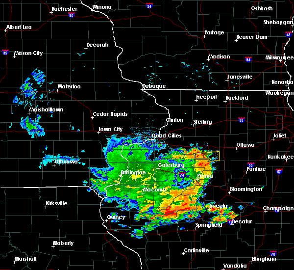 At 829 am cdt, severe thunderstorms were located along a line extending from 7 miles south of tiskilwa to near lacon to germantown hills, moving east at 45 mph (radar indicated). Hazards include 60 mph wind gusts. expect damage to roofs, siding, and trees At 829 am cdt, severe thunderstorms were located along a line extending from 7 miles south of tiskilwa to near lacon to germantown hills, moving east at 45 mph (radar indicated). Hazards include 60 mph wind gusts. expect damage to roofs, siding, and trees
|
| 3/7/2017 12:26 AM CST |
 The severe thunderstorm warning for putnam and eastern bureau counties will expire at 1230 am cst, the storms which prompted the warning have moved out of the area. therefore the warning will be allowed to expire. however gusty winds are still possible with these thunderstorms. a tornado watch remains in effect until 400 am cst for north central illinois. The severe thunderstorm warning for putnam and eastern bureau counties will expire at 1230 am cst, the storms which prompted the warning have moved out of the area. therefore the warning will be allowed to expire. however gusty winds are still possible with these thunderstorms. a tornado watch remains in effect until 400 am cst for north central illinois.
|
| 3/7/2017 12:19 AM CST |
 At 1219 am cst, severe thunderstorms were located along a line extending from 7 miles northeast of la moille to dalzell to near mcnabb, moving east at 55 mph (trained weather spotters). Hazards include 70 mph wind gusts. Expect considerable tree damage. damage is likely to mobile homes, roofs, and outbuildings. locations impacted include, hennepin, spring valley, depue, granville, ladd, la moille, dalzell, mcnabb, mark, cherry, seatonville, magnolia, standard, arlington, hollowayville, spring valley airport, zearing, ottville, van orin and florid. this includes the following highways, interstate 80 in illinois between mile markers 64 and 72. interstate 180 near mile marker 1. A tornado watch remains in effect until 400 am cst for north central illinois. At 1219 am cst, severe thunderstorms were located along a line extending from 7 miles northeast of la moille to dalzell to near mcnabb, moving east at 55 mph (trained weather spotters). Hazards include 70 mph wind gusts. Expect considerable tree damage. damage is likely to mobile homes, roofs, and outbuildings. locations impacted include, hennepin, spring valley, depue, granville, ladd, la moille, dalzell, mcnabb, mark, cherry, seatonville, magnolia, standard, arlington, hollowayville, spring valley airport, zearing, ottville, van orin and florid. this includes the following highways, interstate 80 in illinois between mile markers 64 and 72. interstate 180 near mile marker 1. A tornado watch remains in effect until 400 am cst for north central illinois.
|
| 3/7/2017 12:01 AM CST |
 At 1200 am cst, severe thunderstorms were located along a line extending from 7 miles east of walnut to princeton to 8 miles northwest of henry, moving east at 65 mph (trained weather spotters). Hazards include 70 mph wind gusts. Expect considerable tree damage. damage is likely to mobile homes, roofs, and outbuildings. locations impacted include, princeton, hennepin, spring valley, depue, granville, walnut, ladd, wyanet, tiskilwa, la moille, dalzell, bureau junction, mcnabb, putnam, mark, ohio, cherry, malden, seatonville and magnolia. this includes the following highways, interstate 80 in illinois between mile markers 48 and 72. interstate 180 between mile markers 1 and 13. A tornado watch remains in effect until 400 am cst for north central illinois. At 1200 am cst, severe thunderstorms were located along a line extending from 7 miles east of walnut to princeton to 8 miles northwest of henry, moving east at 65 mph (trained weather spotters). Hazards include 70 mph wind gusts. Expect considerable tree damage. damage is likely to mobile homes, roofs, and outbuildings. locations impacted include, princeton, hennepin, spring valley, depue, granville, walnut, ladd, wyanet, tiskilwa, la moille, dalzell, bureau junction, mcnabb, putnam, mark, ohio, cherry, malden, seatonville and magnolia. this includes the following highways, interstate 80 in illinois between mile markers 48 and 72. interstate 180 between mile markers 1 and 13. A tornado watch remains in effect until 400 am cst for north central illinois.
|
| 3/6/2017 11:53 PM CST |
 At 1153 pm cst, severe thunderstorms were located along a line extending from near rock falls to near wyanet to near bradford, moving east at 45 mph (trained weather spotters). Hazards include 70 mph wind gusts. Expect considerable tree damage. damage is likely to mobile homes, roofs, and outbuildings. locations impacted include, princeton, hennepin, spring valley, depue, granville, walnut, ladd, wyanet, sheffield, tiskilwa, la moille, dalzell, buda, bureau junction, mcnabb, deer grove, putnam, mark, ohio and cherry. this includes the following highways, interstate 80 in illinois between mile markers 40 and 72. interstate 180 between mile markers 1 and 13. A tornado watch remains in effect until 400 am cst for north central and northwestern illinois. At 1153 pm cst, severe thunderstorms were located along a line extending from near rock falls to near wyanet to near bradford, moving east at 45 mph (trained weather spotters). Hazards include 70 mph wind gusts. Expect considerable tree damage. damage is likely to mobile homes, roofs, and outbuildings. locations impacted include, princeton, hennepin, spring valley, depue, granville, walnut, ladd, wyanet, sheffield, tiskilwa, la moille, dalzell, buda, bureau junction, mcnabb, deer grove, putnam, mark, ohio and cherry. this includes the following highways, interstate 80 in illinois between mile markers 40 and 72. interstate 180 between mile markers 1 and 13. A tornado watch remains in effect until 400 am cst for north central and northwestern illinois.
|
| 3/6/2017 11:39 PM CST |
 At 1138 pm cst, severe thunderstorms were located along a line extending from near sterling to near deer grove to near hooppole to near elmira, moving east at 25 mph (trained weather spotters). Hazards include 70 mph wind gusts. Expect considerable tree damage. damage is likely to mobile homes, roofs, and outbuildings. locations impacted include, sterling, kewanee, rock falls, princeton, hennepin, spring valley, galva, depue, granville, walnut, ladd, wyanet, atkinson, sheffield, annawan, tiskilwa, tampico, la moille, dalzell and buda. this includes the following highways, interstate 80 in illinois between mile markers 26 and 72. interstate 88 between mile markers 37 and 44. interstate 180 between mile markers 1 and 13. A tornado watch remains in effect until 400 am cst for north central and northwestern illinois. At 1138 pm cst, severe thunderstorms were located along a line extending from near sterling to near deer grove to near hooppole to near elmira, moving east at 25 mph (trained weather spotters). Hazards include 70 mph wind gusts. Expect considerable tree damage. damage is likely to mobile homes, roofs, and outbuildings. locations impacted include, sterling, kewanee, rock falls, princeton, hennepin, spring valley, galva, depue, granville, walnut, ladd, wyanet, atkinson, sheffield, annawan, tiskilwa, tampico, la moille, dalzell and buda. this includes the following highways, interstate 80 in illinois between mile markers 26 and 72. interstate 88 between mile markers 37 and 44. interstate 180 between mile markers 1 and 13. A tornado watch remains in effect until 400 am cst for north central and northwestern illinois.
|
| 3/6/2017 11:13 PM CST |
 At 1112 pm cst, severe thunderstorms were located along a line extending from coleta to emerson to near hooppole to near woodhull, moving east at 55 mph (trained weather spotters). Hazards include 70 mph wind gusts. Expect considerable tree damage. Damage is likely to mobile homes, roofs, and outbuildings. At 1112 pm cst, severe thunderstorms were located along a line extending from coleta to emerson to near hooppole to near woodhull, moving east at 55 mph (trained weather spotters). Hazards include 70 mph wind gusts. Expect considerable tree damage. Damage is likely to mobile homes, roofs, and outbuildings.
|
| 7/17/2016 8:21 PM CDT |
 At 821 pm cdt, a severe thunderstorm capable of producing a tornado was located near mcnabb, or 8 miles southeast of hennepin, moving east at 45 mph (radar indicated rotation). Hazards include tornado. Flying debris will be dangerous to those caught without shelter. mobile homes will be damaged or destroyed. damage to roofs, windows, and vehicles will occur. tree damage is likely. This tornadic thunderstorm will remain over mainly rural areas of southeastern putnam county, including the following locations: standard and magnolia. At 821 pm cdt, a severe thunderstorm capable of producing a tornado was located near mcnabb, or 8 miles southeast of hennepin, moving east at 45 mph (radar indicated rotation). Hazards include tornado. Flying debris will be dangerous to those caught without shelter. mobile homes will be damaged or destroyed. damage to roofs, windows, and vehicles will occur. tree damage is likely. This tornadic thunderstorm will remain over mainly rural areas of southeastern putnam county, including the following locations: standard and magnolia.
|
| 7/13/2016 4:58 PM CDT | The severe thunderstorm warning for southeastern bureau and putnam counties will expire at 500 pm cdt, the storms which prompted the warning have weakened below severe limits, and no longer pose an immediate threat to life or property. therefore the warning will be allowed to expire. a severe thunderstorm watch remains in effect until 900 pm cdt for north central illinois. |
| 7/13/2016 4:49 PM CDT |
 At 449 pm cdt, severe thunderstorms were located along a line extending from near princeton to bureau junction to near henry, moving east at 45 mph (radar indicated). Hazards include 60 mph wind gusts. Expect damage to roofs. siding. and trees. locations impacted include, princeton, hennepin, spring valley, henry, depue, granville, ladd, wyanet, tiskilwa, dalzell, bureau junction, mcnabb, putnam, mark, cherry, malden, seatonville, magnolia, standard and dover. This includes interstate 80 in illinois between mile markers 50 and 72. At 449 pm cdt, severe thunderstorms were located along a line extending from near princeton to bureau junction to near henry, moving east at 45 mph (radar indicated). Hazards include 60 mph wind gusts. Expect damage to roofs. siding. and trees. locations impacted include, princeton, hennepin, spring valley, henry, depue, granville, ladd, wyanet, tiskilwa, dalzell, bureau junction, mcnabb, putnam, mark, cherry, malden, seatonville, magnolia, standard and dover. This includes interstate 80 in illinois between mile markers 50 and 72.
|
| 7/13/2016 4:42 PM CDT |
 At 442 pm cdt, severe thunderstorms were located along a line extending from near walnut to princeton to 7 miles east of bradford, moving east at 50 mph (radar indicated). Hazards include 60 mph wind gusts. Expect damage to roofs. siding. and trees. locations impacted include, princeton, hennepin, spring valley, henry, depue, granville, walnut, ladd, wyanet, tiskilwa, la moille, dalzell, buda, bureau junction, mcnabb, putnam, mark, ohio, cherry and malden. This includes interstate 80 in illinois between mile markers 46 and 72. At 442 pm cdt, severe thunderstorms were located along a line extending from near walnut to princeton to 7 miles east of bradford, moving east at 50 mph (radar indicated). Hazards include 60 mph wind gusts. Expect damage to roofs. siding. and trees. locations impacted include, princeton, hennepin, spring valley, henry, depue, granville, walnut, ladd, wyanet, tiskilwa, la moille, dalzell, buda, bureau junction, mcnabb, putnam, mark, ohio, cherry and malden. This includes interstate 80 in illinois between mile markers 46 and 72.
|
| 7/13/2016 4:30 PM CDT |
 At 429 pm cdt, severe thunderstorms were located along a line extending from near tampico to near bradford, moving east at 35 mph (radar indicated). Hazards include 60 mph wind gusts. Expect damage to roofs. siding. and trees. locations impacted include, rock falls, princeton, hennepin, spring valley, henry, depue, granville, walnut, ladd, wyanet, sheffield, tiskilwa, tampico, la moille, dalzell, buda, bureau junction, mcnabb, deer grove and putnam. this includes the following highways, interstate 80 in illinois between mile markers 36 and 72. Interstate 88 between mile markers 36 and 44. At 429 pm cdt, severe thunderstorms were located along a line extending from near tampico to near bradford, moving east at 35 mph (radar indicated). Hazards include 60 mph wind gusts. Expect damage to roofs. siding. and trees. locations impacted include, rock falls, princeton, hennepin, spring valley, henry, depue, granville, walnut, ladd, wyanet, sheffield, tiskilwa, tampico, la moille, dalzell, buda, bureau junction, mcnabb, deer grove and putnam. this includes the following highways, interstate 80 in illinois between mile markers 36 and 72. Interstate 88 between mile markers 36 and 44.
|
| 7/13/2016 4:09 PM CDT |
 The national weather service in the quad cities has issued a * severe thunderstorm warning for. bureau county in north central illinois. putnam county in north central illinois. southeastern whiteside county in northwestern illinois. Until 500 pm cdt. The national weather service in the quad cities has issued a * severe thunderstorm warning for. bureau county in north central illinois. putnam county in north central illinois. southeastern whiteside county in northwestern illinois. Until 500 pm cdt.
|
| 7/6/2016 4:35 AM CDT |
 At 434 am cdt, a severe thunderstorm was located over galva, or 9 miles southwest of kewanee, moving east at 40 mph (radar indicated). Hazards include 60 mph wind gusts. Expect damage to roofs. siding. and trees. Locations impacted include, kewanee, cambridge, hennepin, galva, depue, granville, woodhull, new windsor, alpha, andover, mcnabb, lynn center, putnam, mark, magnolia, standard, bishop hill, lake thunderbird, kewanee municipal airport and henry county fairgrounds. At 434 am cdt, a severe thunderstorm was located over galva, or 9 miles southwest of kewanee, moving east at 40 mph (radar indicated). Hazards include 60 mph wind gusts. Expect damage to roofs. siding. and trees. Locations impacted include, kewanee, cambridge, hennepin, galva, depue, granville, woodhull, new windsor, alpha, andover, mcnabb, lynn center, putnam, mark, magnolia, standard, bishop hill, lake thunderbird, kewanee municipal airport and henry county fairgrounds.
|
| 7/6/2016 4:20 AM CDT |
 At 419 am cdt, a severe thunderstorm was located near cambridge, moving southeast at 30 mph (radar indicated). Hazards include 60 mph wind gusts. Expect damage to roofs. siding. and trees. locations impacted include, kewanee, princeton, cambridge, hennepin, geneseo, spring valley, colona, galva, burgess, orion, depue, granville, walnut, ladd, wyanet, atkinson, viola, sheffield, annawan and tiskilwa. This includes interstate 80 in illinois between mile markers 10 and 72. At 419 am cdt, a severe thunderstorm was located near cambridge, moving southeast at 30 mph (radar indicated). Hazards include 60 mph wind gusts. Expect damage to roofs. siding. and trees. locations impacted include, kewanee, princeton, cambridge, hennepin, geneseo, spring valley, colona, galva, burgess, orion, depue, granville, walnut, ladd, wyanet, atkinson, viola, sheffield, annawan and tiskilwa. This includes interstate 80 in illinois between mile markers 10 and 72.
|
| 7/6/2016 3:56 AM CDT |
 At 356 am cdt, severe thunderstorms were located along a line extending from 6 miles north of geneseo to alpha, moving east at 50 mph (radar indicated). Hazards include 70 mph wind gusts. Expect considerable tree damage. damage is likely to mobile homes, roofs, and outbuildings. locations impacted include, moline, rock island, east moline, kewanee, princeton, cambridge, hennepin, silvis, geneseo, spring valley, milan, colona, le claire, coal valley, galva, burgess, hampton, orion, depue and port byron. this includes the following highways, interstate 80 in illinois between mile markers 1 and 72. interstate 74 in illinois between mile markers 2 and 3. interstate 88 between mile markers 1 and 10. Interstate 280 between mile markers 13 and 18. At 356 am cdt, severe thunderstorms were located along a line extending from 6 miles north of geneseo to alpha, moving east at 50 mph (radar indicated). Hazards include 70 mph wind gusts. Expect considerable tree damage. damage is likely to mobile homes, roofs, and outbuildings. locations impacted include, moline, rock island, east moline, kewanee, princeton, cambridge, hennepin, silvis, geneseo, spring valley, milan, colona, le claire, coal valley, galva, burgess, hampton, orion, depue and port byron. this includes the following highways, interstate 80 in illinois between mile markers 1 and 72. interstate 74 in illinois between mile markers 2 and 3. interstate 88 between mile markers 1 and 10. Interstate 280 between mile markers 13 and 18.
|
| 7/6/2016 3:46 AM CDT |
 At 345 am cdt, a severe thunderstorm was located over cleveland, or near east moline, moving east at 55 mph (radar indicated). Hazards include 60 mph wind gusts. Expect damage to roofs. siding. And trees. At 345 am cdt, a severe thunderstorm was located over cleveland, or near east moline, moving east at 55 mph (radar indicated). Hazards include 60 mph wind gusts. Expect damage to roofs. siding. And trees.
|
| 5/31/2016 1:57 PM CDT |
 At 156 pm cdt, a severe thunderstorm was located over mcnabb, or 9 miles southeast of hennepin, moving north at 20 mph (radar indicated). Hazards include 60 mph wind gusts and quarter size hail. Hail damage to vehicles is expected. expect wind damage to roofs, siding, and trees. Locations impacted include, hennepin, granville, mcnabb, mark, magnolia, standard and florid. At 156 pm cdt, a severe thunderstorm was located over mcnabb, or 9 miles southeast of hennepin, moving north at 20 mph (radar indicated). Hazards include 60 mph wind gusts and quarter size hail. Hail damage to vehicles is expected. expect wind damage to roofs, siding, and trees. Locations impacted include, hennepin, granville, mcnabb, mark, magnolia, standard and florid.
|
| 5/31/2016 1:42 PM CDT |
 At 141 pm cdt, a severe thunderstorm was located over varna, or 10 miles east of lacon, moving north at 20 mph (radar indicated). Hazards include 60 mph wind gusts and half dollar size hail. Hail damage to vehicles is expected. Expect wind damage to roofs, siding, and trees. At 141 pm cdt, a severe thunderstorm was located over varna, or 10 miles east of lacon, moving north at 20 mph (radar indicated). Hazards include 60 mph wind gusts and half dollar size hail. Hail damage to vehicles is expected. Expect wind damage to roofs, siding, and trees.
|
| 11/11/2015 7:53 PM CST |
 At 753 pm cst, severe thunderstorms were located along a line extending from 8 miles northwest of paw paw to near mendota to mcnabb, moving northeast at 55 mph (radar indicated). Hazards include 60 mph wind gusts. Expect damage to roofs. siding and trees. locations impacted include, hennepin, granville, mcnabb, putnam, mark, magnolia, standard, lake thunderbird and florid. A tornado watch remains in effect until 900 pm cst for north central illinois. At 753 pm cst, severe thunderstorms were located along a line extending from 8 miles northwest of paw paw to near mendota to mcnabb, moving northeast at 55 mph (radar indicated). Hazards include 60 mph wind gusts. Expect damage to roofs. siding and trees. locations impacted include, hennepin, granville, mcnabb, putnam, mark, magnolia, standard, lake thunderbird and florid. A tornado watch remains in effect until 900 pm cst for north central illinois.
|
| 11/11/2015 7:34 PM CST |
 At 733 pm cst, severe thunderstorms were located along a line extending from near walton to near princeton to near sparland, moving east at 45 mph (radar indicated). Hazards include 60 mph wind gusts. Expect damage to roofs. siding and trees. locations impacted include, princeton, hennepin, spring valley, henry, depue, granville, walnut, ladd, wyanet, tiskilwa, la moille, dalzell, bureau junction, mcnabb, putnam, mark, ohio, cherry, malden and seatonville. this includes interstate 80 in illinois between mile markers 50 and 72. A tornado watch remains in effect until 900 pm cst for north central illinois. At 733 pm cst, severe thunderstorms were located along a line extending from near walton to near princeton to near sparland, moving east at 45 mph (radar indicated). Hazards include 60 mph wind gusts. Expect damage to roofs. siding and trees. locations impacted include, princeton, hennepin, spring valley, henry, depue, granville, walnut, ladd, wyanet, tiskilwa, la moille, dalzell, bureau junction, mcnabb, putnam, mark, ohio, cherry, malden and seatonville. this includes interstate 80 in illinois between mile markers 50 and 72. A tornado watch remains in effect until 900 pm cst for north central illinois.
|
| 11/11/2015 7:17 PM CST |
 At 716 pm cst, severe thunderstorms were located along a line extending from 7 miles south of polo to near walton to near buda, moving northeast at 55 mph (radar indicated). Hazards include 60 mph wind gusts. Expect damage to roofs. siding and trees. locations impacted include, sterling, rock falls, princeton, hennepin, spring valley, henry, depue, granville, walnut, ladd, wyanet, sheffield, tiskilwa, tampico, la moille, dalzell, buda, bureau junction, mcnabb and coleta. this includes the following highways, interstate 80 in illinois between mile markers 36 and 72. interstate 88 between mile markers 33 and 44. A tornado watch remains in effect until 900 pm cst for northwestern illinois. At 716 pm cst, severe thunderstorms were located along a line extending from 7 miles south of polo to near walton to near buda, moving northeast at 55 mph (radar indicated). Hazards include 60 mph wind gusts. Expect damage to roofs. siding and trees. locations impacted include, sterling, rock falls, princeton, hennepin, spring valley, henry, depue, granville, walnut, ladd, wyanet, sheffield, tiskilwa, tampico, la moille, dalzell, buda, bureau junction, mcnabb and coleta. this includes the following highways, interstate 80 in illinois between mile markers 36 and 72. interstate 88 between mile markers 33 and 44. A tornado watch remains in effect until 900 pm cst for northwestern illinois.
|
| 11/11/2015 6:56 PM CST |
 At 655 pm cst, severe thunderstorms were located along a line extending from near lyndon to near tampico to near galva, moving northeast at 55 mph (radar indicated). Hazards include 60 mph wind gusts. Expect damage to roofs. Siding and trees. At 655 pm cst, severe thunderstorms were located along a line extending from near lyndon to near tampico to near galva, moving northeast at 55 mph (radar indicated). Hazards include 60 mph wind gusts. Expect damage to roofs. Siding and trees.
|
| 6/10/2015 6:47 PM CDT |
 At 646 pm cdt, a severe thunderstorm was located over mc nabb, or 9 miles southeast of hennepin, and was nearly stationary (trained spotters). Hazards include 60 mph wind gusts and half dollar size hail. Hail damage to vehicles is expected. expect wind damage to roofs, siding and trees. Locations impacted include, hennepin, mcnabb, mc nabb, magnolia and florid. At 646 pm cdt, a severe thunderstorm was located over mc nabb, or 9 miles southeast of hennepin, and was nearly stationary (trained spotters). Hazards include 60 mph wind gusts and half dollar size hail. Hail damage to vehicles is expected. expect wind damage to roofs, siding and trees. Locations impacted include, hennepin, mcnabb, mc nabb, magnolia and florid.
|
| 6/10/2015 6:24 PM CDT |
 A severe thunderstorm warning remains in effect until 700 pm cdt for southeastern putnam county. at 622 pm cdt. a severe thunderstorm was located over mc nabb. or 8 miles southeast of hennepin. moving east at 10 mph. hazard. golf ball size hail and 60 mph wind gusts. source. At 615 pm a trained weather spotter reported 59 mph winds. A severe thunderstorm warning remains in effect until 700 pm cdt for southeastern putnam county. at 622 pm cdt. a severe thunderstorm was located over mc nabb. or 8 miles southeast of hennepin. moving east at 10 mph. hazard. golf ball size hail and 60 mph wind gusts. source. At 615 pm a trained weather spotter reported 59 mph winds.
|
| 6/10/2015 6:04 PM CDT |
 At 604 pm cdt, a severe thunderstorm was located over mc nabb, or near hennepin, moving east at 10 mph (trained weather spotters). Hazards include 60 mph wind gusts and half dollar size hail. Hail damage to vehicles is expected. expect wind damage to roofs, siding and trees. Locations impacted include, hennepin, mcnabb, mc nabb, magnolia and florid. At 604 pm cdt, a severe thunderstorm was located over mc nabb, or near hennepin, moving east at 10 mph (trained weather spotters). Hazards include 60 mph wind gusts and half dollar size hail. Hail damage to vehicles is expected. expect wind damage to roofs, siding and trees. Locations impacted include, hennepin, mcnabb, mc nabb, magnolia and florid.
|
| 6/10/2015 5:56 PM CDT |
 At 555 pm cdt, a severe thunderstorm was located over mcnabb, or near hennepin, moving east at 10 mph (trained weather spotters). Hazards include 60 mph wind gusts and half dollar size hail. Hail damage to vehicles is expected. Expect wind damage to roofs, siding and trees. At 555 pm cdt, a severe thunderstorm was located over mcnabb, or near hennepin, moving east at 10 mph (trained weather spotters). Hazards include 60 mph wind gusts and half dollar size hail. Hail damage to vehicles is expected. Expect wind damage to roofs, siding and trees.
|
| 4/9/2015 8:12 PM CDT | A severe thunderstorm warning remains in effect for eastern marshall county until 830 pm cdt. at 809 pm cdt. a severe thunderstorm was located near toluca. and moving northeast at 55 mph. spotters reported one inch hail in varna at 759 pm. hazard. Quarter size hail. |
| 4/9/2015 7:57 PM CDT | The national weather service in lincoln has issued a * severe thunderstorm warning for. eastern marshall county in central illinois. north central woodford county in central illinois. until 830 pm cdt * at 755 pm cdt. A severe thunderstorm was located near washburn. |
| 4/9/2015 7:51 PM CDT | Golf Ball sized hail reported 0.3 miles NE of Magnolia, IL, relayed by ilx. |
| 4/9/2015 7:23 PM CDT | The national weather service in the quad cities has issued a * severe thunderstorm warning for. eastern bureau county in north central illinois. putnam county in north central illinois. until 815 pm cdt * at 721 pm cdt. A severe thunderstorm was located 7 miles east of. |
| 4/9/2015 2:12 PM CDT | The tornado warning for marshall county will expire at 215 pm cdt. the storm which prompted the warning has weakened and moved out of the warned area. additional strong thunderstorms are still possible. And a tornado watch remains in effect until 11 pm cdt. |
| 4/9/2015 2:00 PM CDT | A tornado warning remains in effect for marshall county until 215 pm cdt. at 157 pm cdt. a severe thunderstorm capable of producing a tornado was located near lacon. and moving northeast at 30 mph. hazard. tornado and quarter size hail. source. Radar indicated rotation. |
| 4/9/2015 1:37 PM CDT | The national weather service in lincoln has issued a * tornado warning for. marshall county in central illinois. northeastern peoria county in central illinois. northwestern woodford county in central illinois. Until 215 pm cdt. |
| 4/9/2015 1:29 PM CDT | The national weather service in lincoln has issued a * severe thunderstorm warning for. marshall county in central illinois. northeastern peoria county in central illinois. northwestern woodford county in central illinois. Until 215 pm cdt. |
| 4/8/2015 3:18 AM CDT | The national weather service in lincoln has issued a * severe thunderstorm warning for. marshall county in central illinois. until 345 am cdt * at 317 am cdt. a severe thunderstorm was located near lacon. And moving east at 35 mph. |
| 5/6/2012 3:35 PM CDT | Quarter sized hail reported 1.3 miles ESE of Magnolia, IL |
| 5/6/2012 3:35 PM CDT | Storm damage reported in putnam county IL, 1.3 miles ESE of Magnolia, IL |
| 1/1/0001 12:00 AM | Quarter sized hail reported 1.3 miles ESE of Magnolia, IL |
Hail Maps for Magnolia, IL


Connect with Interactive Hail Maps