

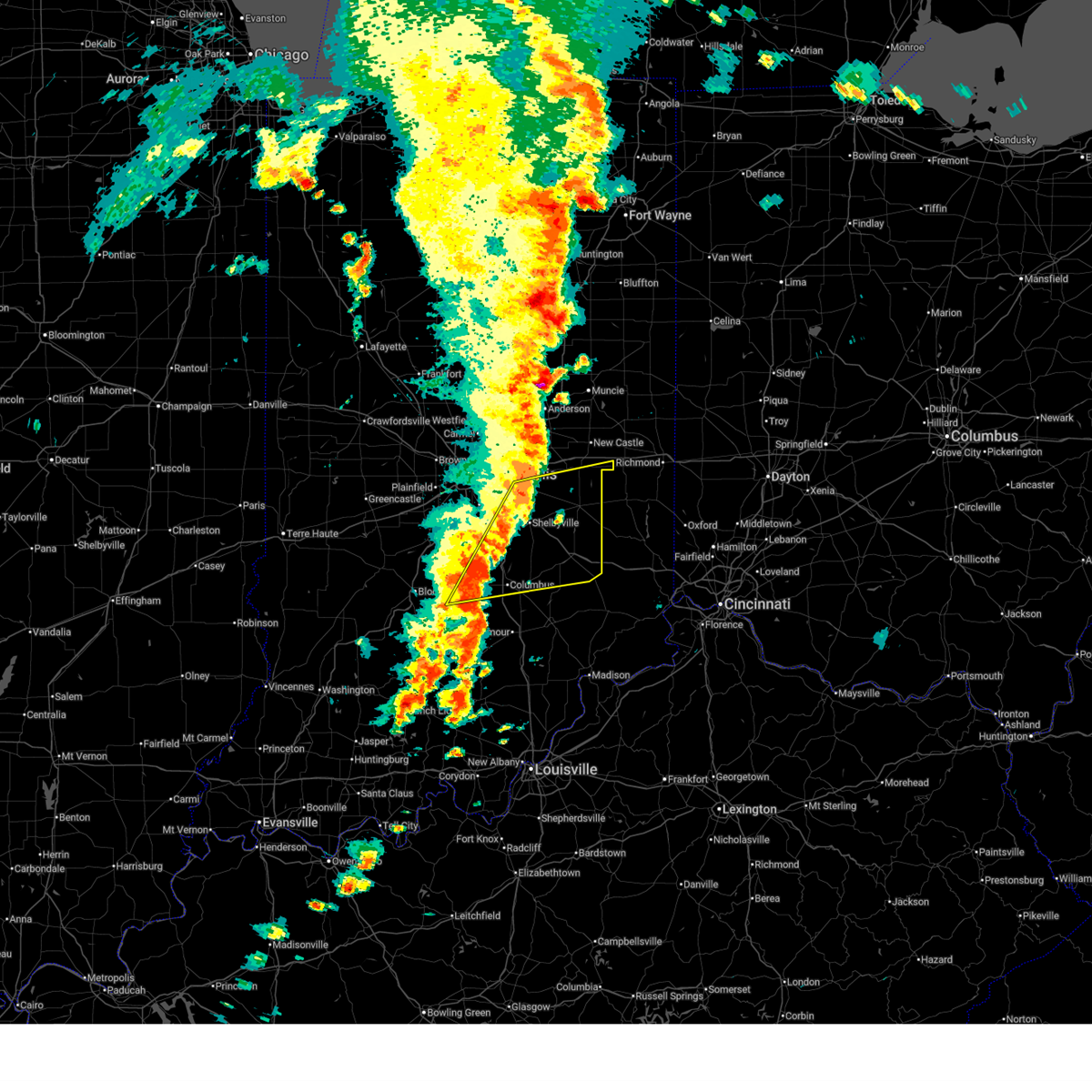
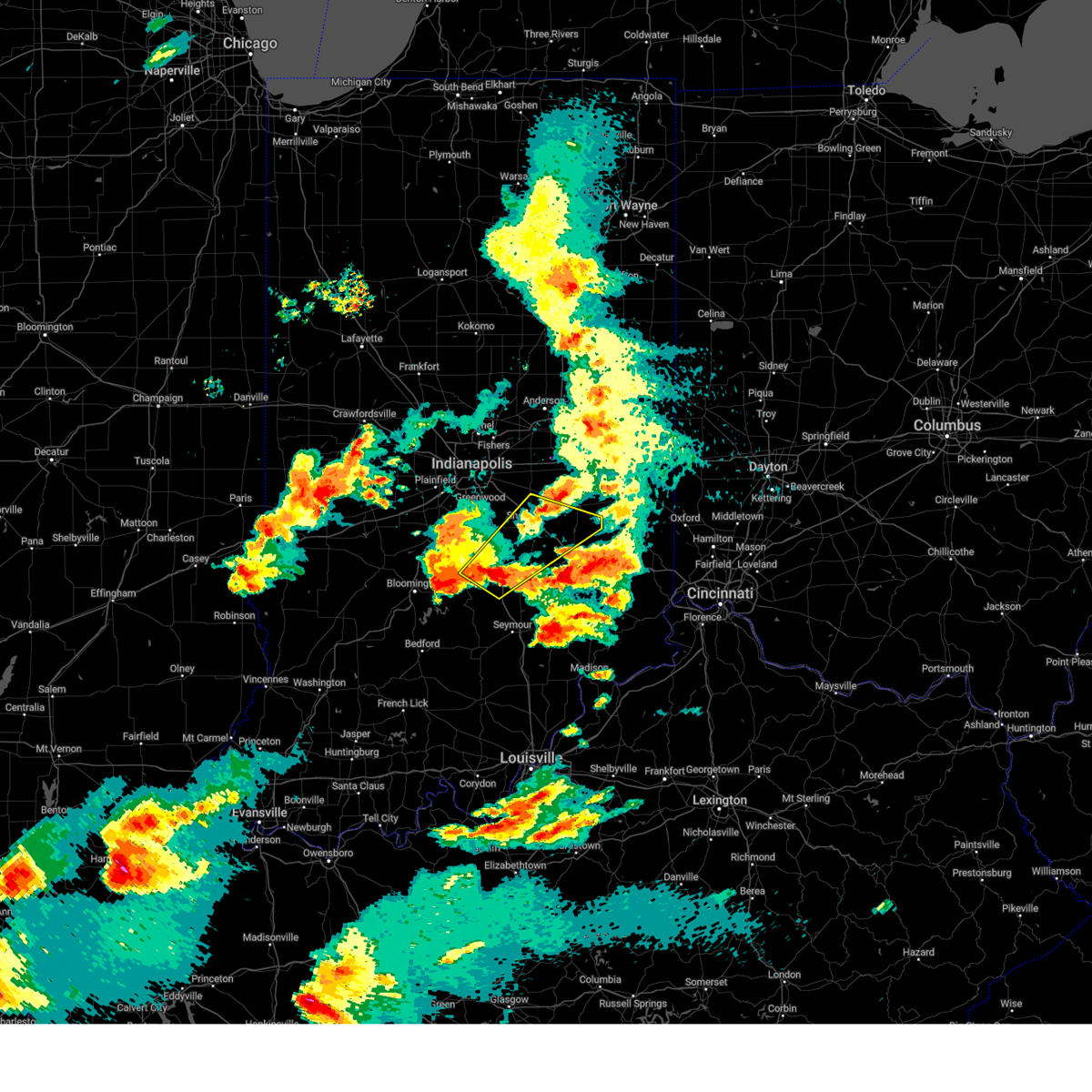
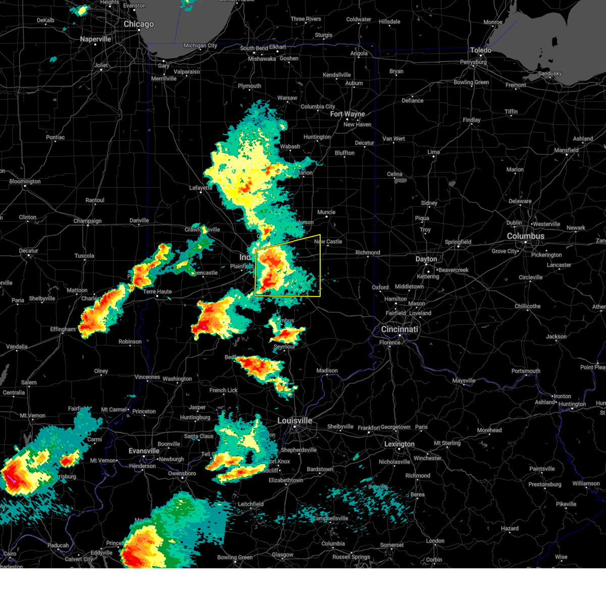
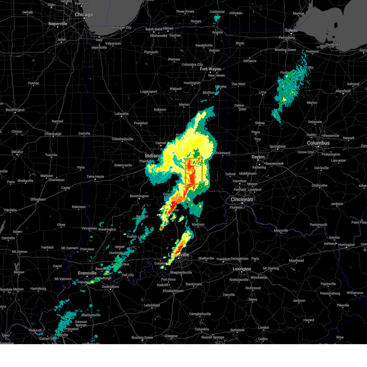
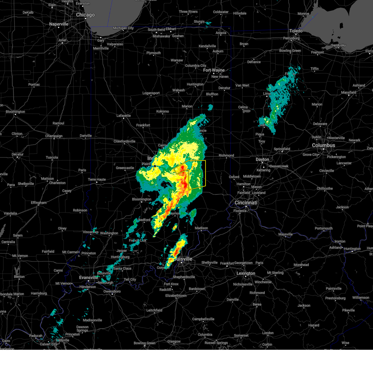
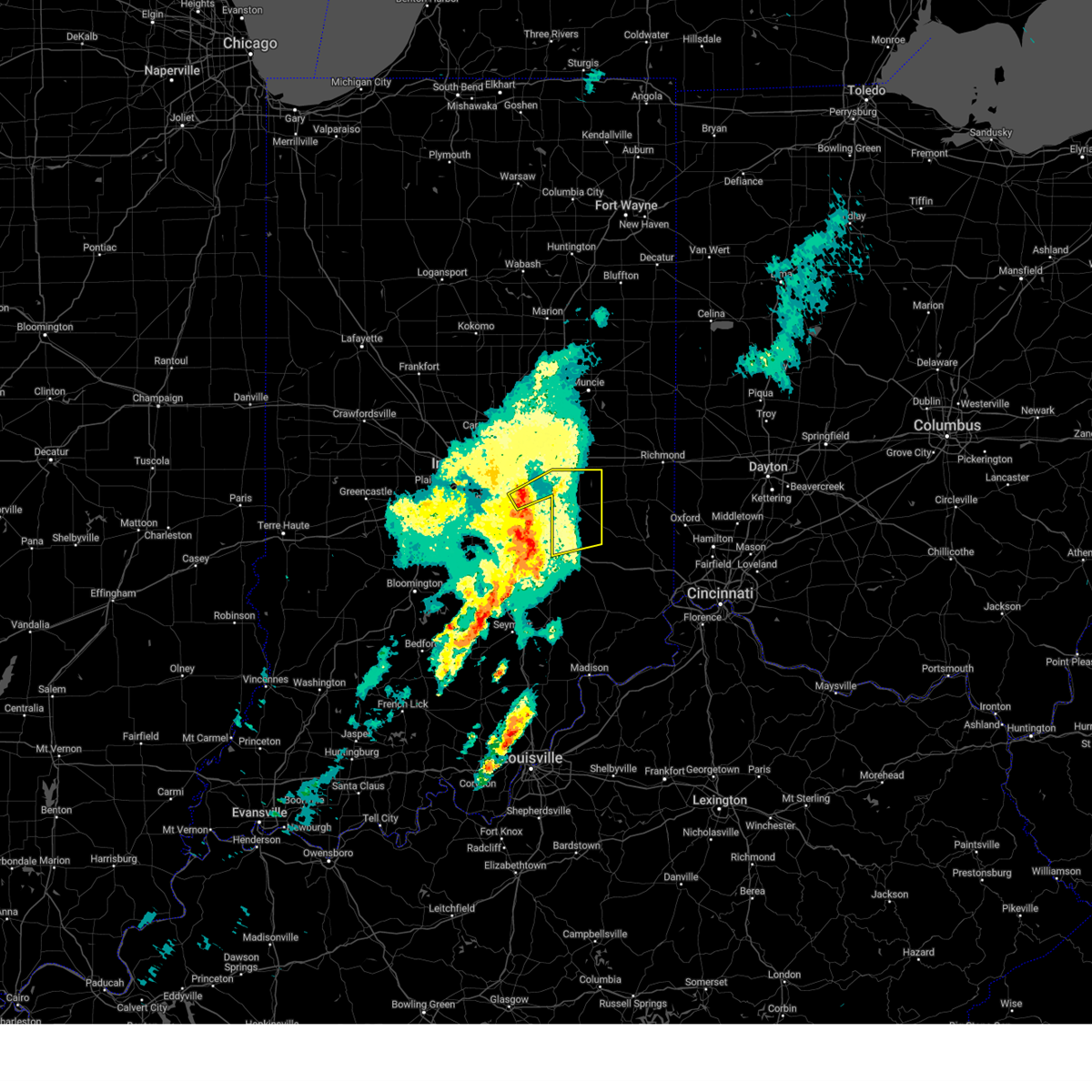
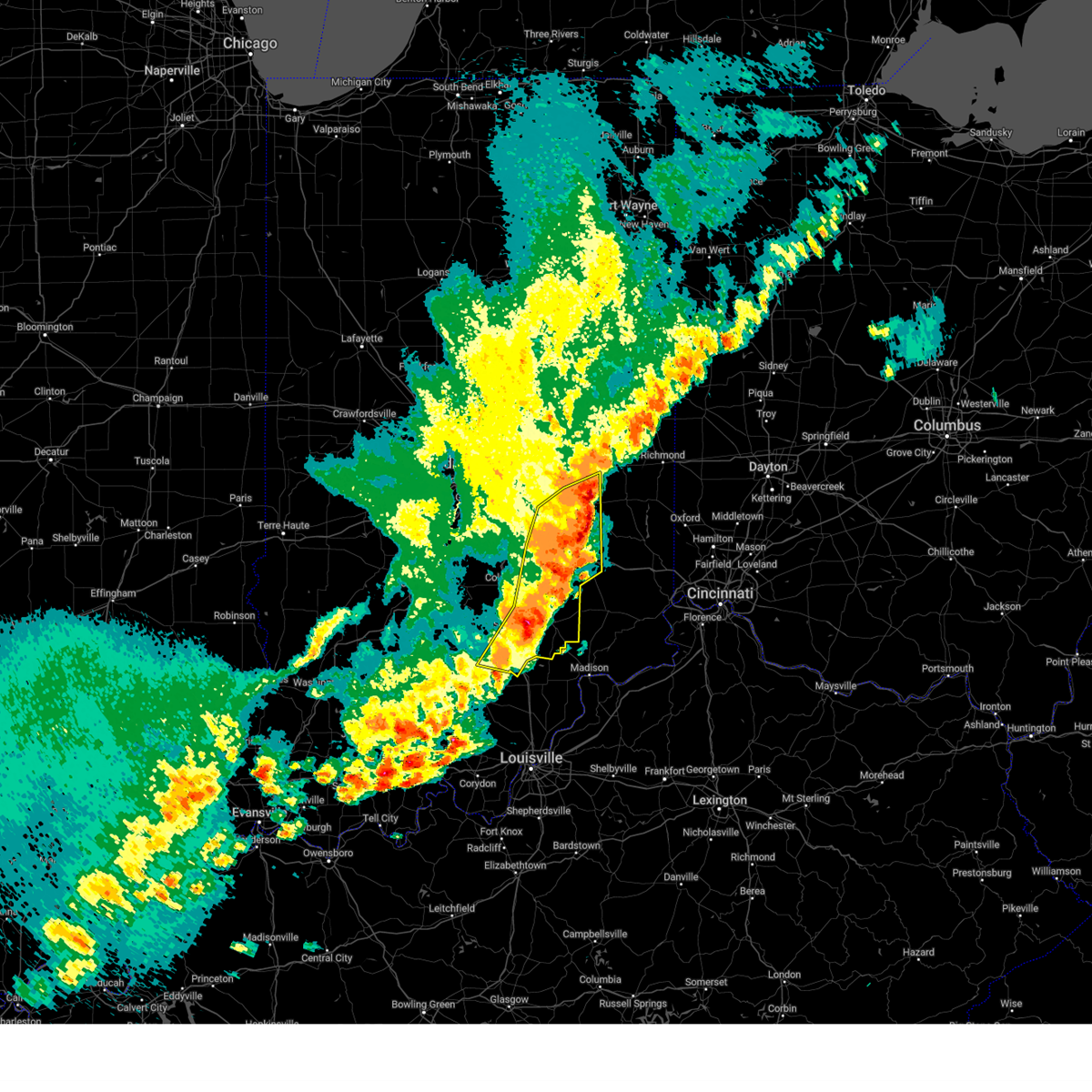
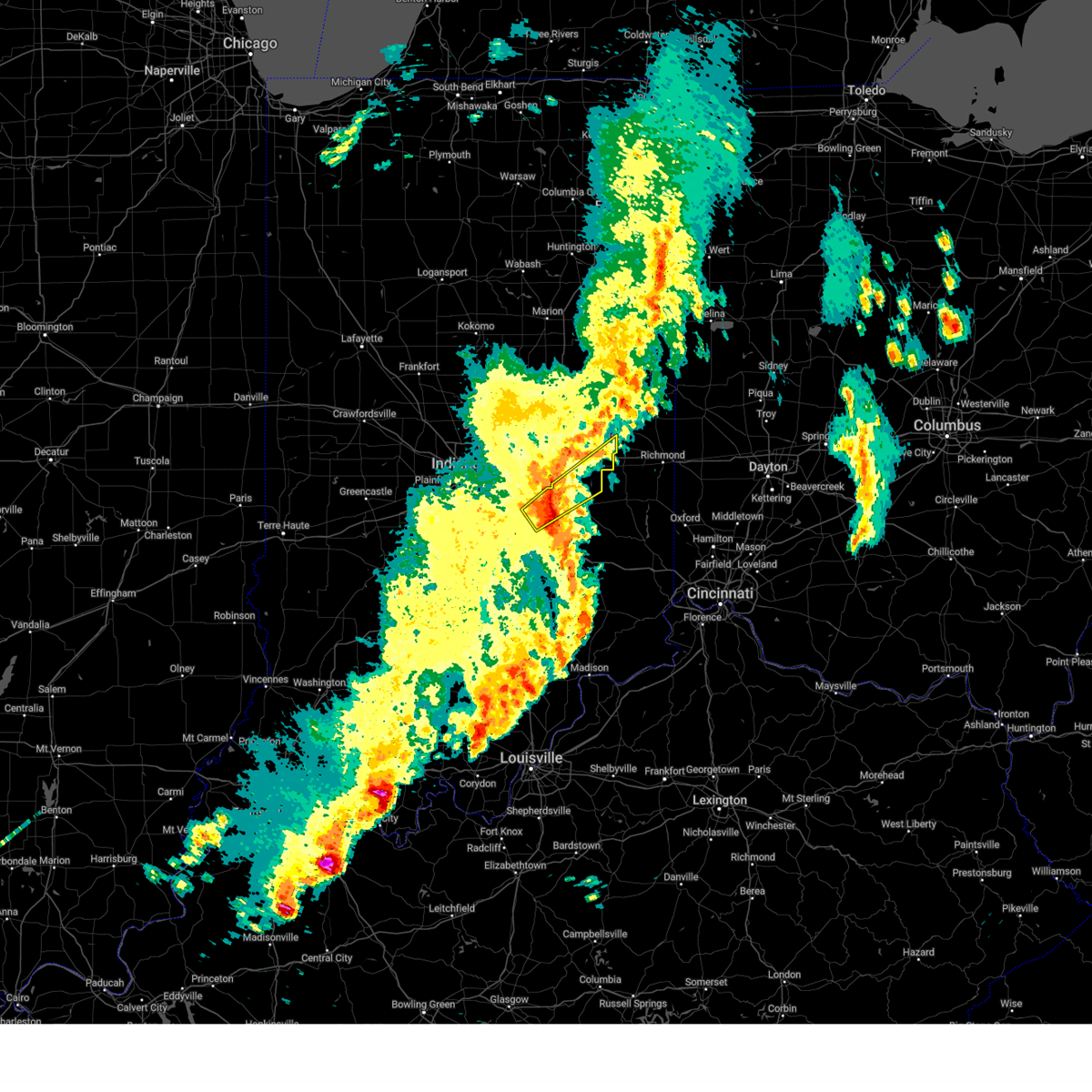
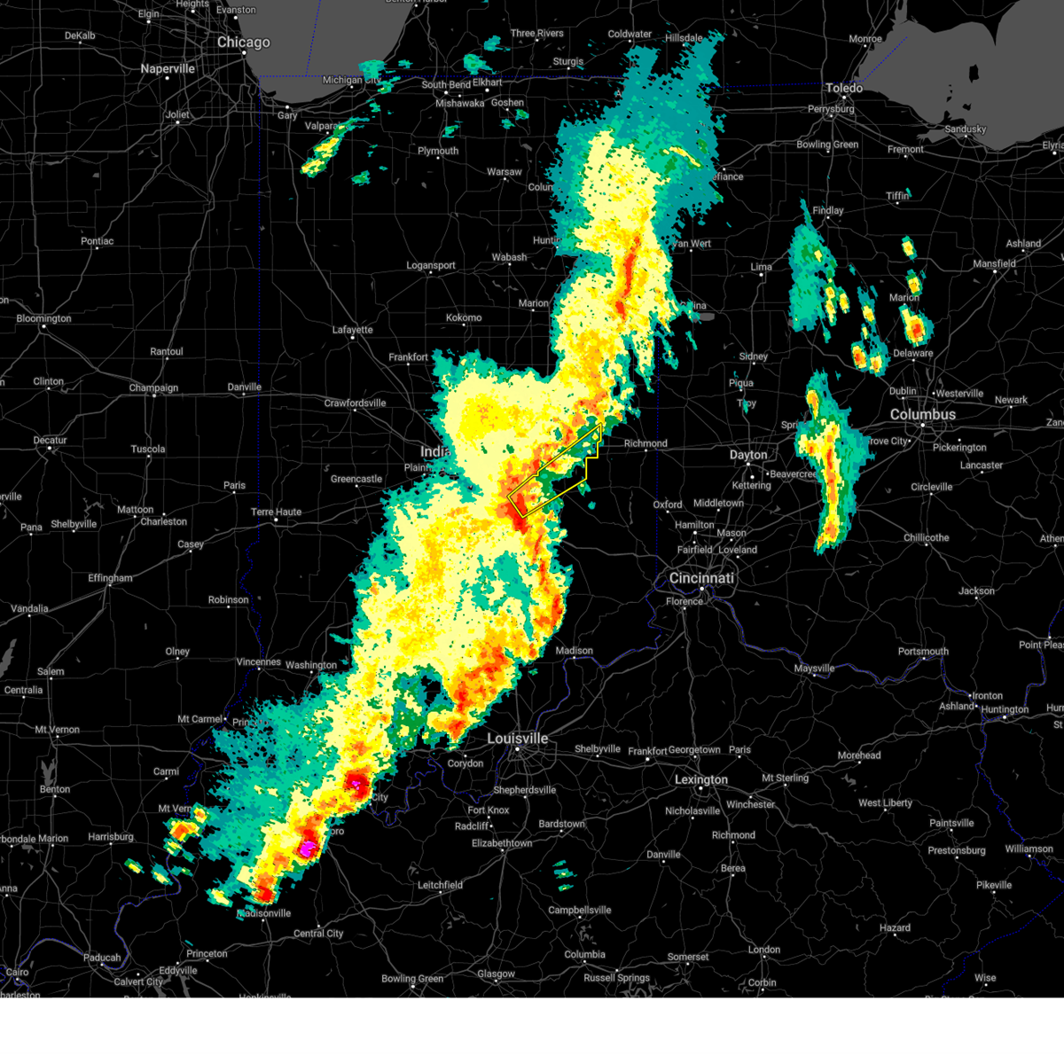
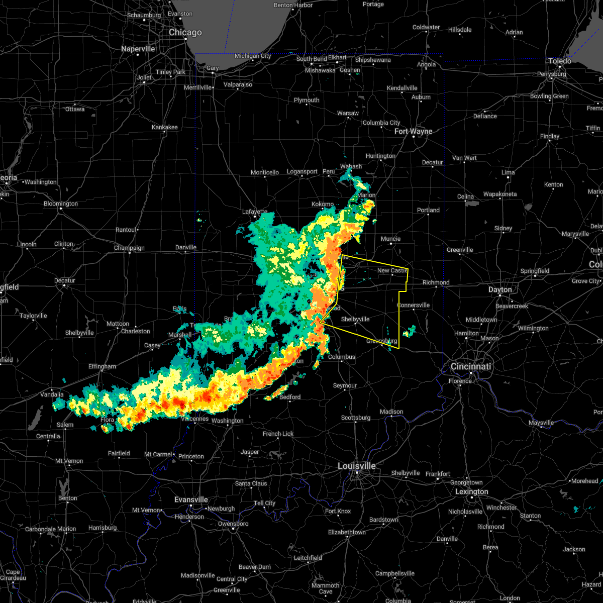
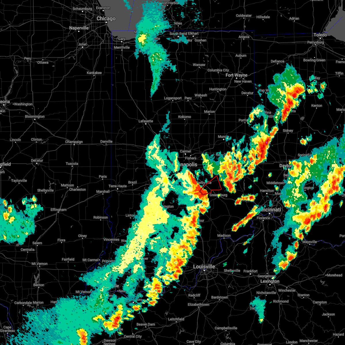
Hail Map for Manilla, IN
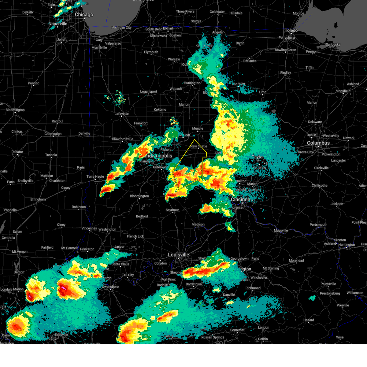
The Manilla, IN area has had 2 reports of on-the-ground hail by trained spotters, and has been under severe weather warnings 25 times during the past 12 months. Doppler radar has detected hail at or near Manilla, IN on 51 occasions, including 2 occasions during the past year.
| Name: | Manilla, IN |
| Where Located: | 31.1 miles ESE of Indianapolis, IN |
| Map: | Google Map for Manilla, IN |
| Population: | 267 |
| Housing Units: | 119 |
| More Info: | Search Google for Manilla, IN |
0
The Top Recent Hail Date for Manilla, IN is Friday, May 16, 2025 (28th out of 51)

Hail and Wind Damage Spotted near Manilla, IN
| Date / Time | Report Details |
|---|---|
| 6/18/2025 5:37 PM EDT | At 537 pm edt, severe thunderstorms were located along a line extending from 6 miles northwest of rushville to 10 miles north of north vernon, moving east at 65 mph (radar indicated). Hazards include 60 mph wind gusts and penny size hail. Expect damage to roofs, siding, and trees. locations impacted include, columbus, shelbyville, greensburg, rushville, adams, hope, flat rock, milford, geneva, morristown, st. paul, carthage, lewisville, hartsville, milroy, glenwood, clifford, straughn, dunreith, and millhousen. this includes the following highways, interstate 65 between mile markers 65 and 74. Interstate 74 between mile markers 112 and 144. |
| 6/18/2025 5:37 PM EDT | the severe thunderstorm warning has been cancelled and is no longer in effect |
| 6/18/2025 5:14 PM EDT |
 Svrind the national weather service in indianapolis has issued a * severe thunderstorm warning for, southeastern hancock county in central indiana, shelby county in central indiana, rush county in central indiana, decatur county in central indiana, southeastern brown county in south central indiana, southeastern johnson county in central indiana, bartholomew county in central indiana, southeastern henry county in east central indiana, * until 600 pm edt. * at 513 pm edt, severe thunderstorms were located along a line extending from 7 miles south of greenfield to 11 miles north of brownstown, moving east at 45 mph (radar indicated). Hazards include 60 mph wind gusts and penny size hail. expect damage to roofs, siding, and trees Svrind the national weather service in indianapolis has issued a * severe thunderstorm warning for, southeastern hancock county in central indiana, shelby county in central indiana, rush county in central indiana, decatur county in central indiana, southeastern brown county in south central indiana, southeastern johnson county in central indiana, bartholomew county in central indiana, southeastern henry county in east central indiana, * until 600 pm edt. * at 513 pm edt, severe thunderstorms were located along a line extending from 7 miles south of greenfield to 11 miles north of brownstown, moving east at 45 mph (radar indicated). Hazards include 60 mph wind gusts and penny size hail. expect damage to roofs, siding, and trees
|
| 5/16/2025 8:16 PM EDT |
 Svrind the national weather service in indianapolis has issued a * severe thunderstorm warning for, southeastern hancock county in central indiana, shelby county in central indiana, rush county in central indiana, northwestern decatur county in central indiana, northeastern bartholomew county in central indiana, henry county in east central indiana, * until 900 pm edt. * at 816 pm edt, a severe thunderstorm was located near shelbyville, moving northeast at 50 mph (radar indicated). Hazards include ping pong ball size hail and 60 mph wind gusts. People and animals outdoors will be injured. expect hail damage to roofs, siding, windows, and vehicles. Expect wind damage to roofs, siding, and trees. Svrind the national weather service in indianapolis has issued a * severe thunderstorm warning for, southeastern hancock county in central indiana, shelby county in central indiana, rush county in central indiana, northwestern decatur county in central indiana, northeastern bartholomew county in central indiana, henry county in east central indiana, * until 900 pm edt. * at 816 pm edt, a severe thunderstorm was located near shelbyville, moving northeast at 50 mph (radar indicated). Hazards include ping pong ball size hail and 60 mph wind gusts. People and animals outdoors will be injured. expect hail damage to roofs, siding, windows, and vehicles. Expect wind damage to roofs, siding, and trees.
|
| 5/16/2025 7:56 PM EDT |
 the severe thunderstorm warning has been cancelled and is no longer in effect the severe thunderstorm warning has been cancelled and is no longer in effect
|
| 5/16/2025 7:56 PM EDT |
 At 755 pm edt, severe thunderstorms were located along a line extending from 6 miles northwest of new castle to 8 miles northeast of shelbyville, moving east at 30 mph (radar indicated). Hazards include 60 mph wind gusts and penny size hail. Expect damage to roofs, siding, and trees. locations impacted include, shelbyville, new castle, rushville, knightstown, carthage, spiceland, kennard, sulphur springs, mooreland, lewisville, mount summit, milroy, glenwood, losantville, straughn, modoc, dunreith, cadiz, springport, and greensboro. this includes the following highways, interstate 70 between mile markers 116 and 133. Interstate 74 between mile markers 115 and 118. At 755 pm edt, severe thunderstorms were located along a line extending from 6 miles northwest of new castle to 8 miles northeast of shelbyville, moving east at 30 mph (radar indicated). Hazards include 60 mph wind gusts and penny size hail. Expect damage to roofs, siding, and trees. locations impacted include, shelbyville, new castle, rushville, knightstown, carthage, spiceland, kennard, sulphur springs, mooreland, lewisville, mount summit, milroy, glenwood, losantville, straughn, modoc, dunreith, cadiz, springport, and greensboro. this includes the following highways, interstate 70 between mile markers 116 and 133. Interstate 74 between mile markers 115 and 118.
|
| 5/16/2025 7:48 PM EDT |
 Svrind the national weather service in indianapolis has issued a * severe thunderstorm warning for, shelby county in central indiana, southern rush county in central indiana, northwestern decatur county in central indiana, northeastern brown county in south central indiana, southeastern johnson county in central indiana, northern bartholomew county in central indiana, * until 830 pm edt. * at 747 pm edt, a severe thunderstorm was located 9 miles northwest of columbus, moving northeast at 60 mph (radar indicated). Hazards include golf ball size hail and 60 mph wind gusts. People and animals outdoors will be injured. expect hail damage to roofs, siding, windows, and vehicles. Expect wind damage to roofs, siding, and trees. Svrind the national weather service in indianapolis has issued a * severe thunderstorm warning for, shelby county in central indiana, southern rush county in central indiana, northwestern decatur county in central indiana, northeastern brown county in south central indiana, southeastern johnson county in central indiana, northern bartholomew county in central indiana, * until 830 pm edt. * at 747 pm edt, a severe thunderstorm was located 9 miles northwest of columbus, moving northeast at 60 mph (radar indicated). Hazards include golf ball size hail and 60 mph wind gusts. People and animals outdoors will be injured. expect hail damage to roofs, siding, windows, and vehicles. Expect wind damage to roofs, siding, and trees.
|
| 5/16/2025 7:42 PM EDT | Svrind the national weather service in indianapolis has issued a * severe thunderstorm warning for, southeastern madison county in central indiana, eastern hancock county in central indiana, central shelby county in central indiana, rush county in central indiana, southwestern randolph county in east central indiana, henry county in east central indiana, * until 830 pm edt. * at 742 pm edt, severe thunderstorms were located along a line extending from 9 miles south of anderson to near shelbyville, moving east at 30 mph (radar indicated). Hazards include 60 mph wind gusts and penny size hail. expect damage to roofs, siding, and trees |
| 5/16/2025 7:26 PM EDT | At 726 pm edt, severe thunderstorms were located along a line extending from 6 miles northwest of greenfield to near shelbyville, moving east at 50 mph (radar indicated). Hazards include 70 mph wind gusts. Expect considerable tree damage. damage is likely to mobile homes, roofs, and outbuildings. locations impacted include, indianapolis, shelbyville, fishers, greenwood, lawrence, franklin, greenfield, rushville, new whiteland, cumberland, mccordsville, whiteland, fortville, ingalls, knightstown, new palestine, morristown, carthage, shirley, and markleville. this includes the following highways, interstate 65 between mile markers 89 and 99. interstate 70 between mile markers 91 and 120. Interstate 74 between mile markers 94 and 121. |
| 5/16/2025 7:07 PM EDT |
 Svrind the national weather service in indianapolis has issued a * severe thunderstorm warning for, southern madison county in central indiana, hancock county in central indiana, shelby county in central indiana, western rush county in central indiana, northern johnson county in central indiana, western henry county in east central indiana, marion county in central indiana, southeastern hamilton county in central indiana, * until 745 pm edt. * at 707 pm edt, severe thunderstorms were located along a line extending from near indianapolis to near franklin, moving east at 50 mph (radar indicated). Hazards include 70 mph wind gusts. Expect considerable tree damage. Damage is likely to mobile homes, roofs, and outbuildings. Svrind the national weather service in indianapolis has issued a * severe thunderstorm warning for, southern madison county in central indiana, hancock county in central indiana, shelby county in central indiana, western rush county in central indiana, northern johnson county in central indiana, western henry county in east central indiana, marion county in central indiana, southeastern hamilton county in central indiana, * until 745 pm edt. * at 707 pm edt, severe thunderstorms were located along a line extending from near indianapolis to near franklin, moving east at 50 mph (radar indicated). Hazards include 70 mph wind gusts. Expect considerable tree damage. Damage is likely to mobile homes, roofs, and outbuildings.
|
| 4/29/2025 12:29 PM EDT |
 At 1228 pm edt, severe thunderstorms were located along a line extending from 12 miles southeast of greenfield to near rushville to 9 miles west of lake santee to near greensburg, moving east at 60 mph (radar indicated). Hazards include 70 mph wind gusts. Expect considerable tree damage. damage is likely to mobile homes, roofs, and outbuildings. locations impacted include, clarksburg, adams, st. Paul, glenwood, mays, moscow, carthage, rushville, milroy, new salem, manilla, falmouth, sandusky, arlington, and lake santee. At 1228 pm edt, severe thunderstorms were located along a line extending from 12 miles southeast of greenfield to near rushville to 9 miles west of lake santee to near greensburg, moving east at 60 mph (radar indicated). Hazards include 70 mph wind gusts. Expect considerable tree damage. damage is likely to mobile homes, roofs, and outbuildings. locations impacted include, clarksburg, adams, st. Paul, glenwood, mays, moscow, carthage, rushville, milroy, new salem, manilla, falmouth, sandusky, arlington, and lake santee.
|
| 4/29/2025 12:29 PM EDT |
 the severe thunderstorm warning has been cancelled and is no longer in effect the severe thunderstorm warning has been cancelled and is no longer in effect
|
| 4/29/2025 12:20 PM EDT |
 At 1220 pm edt, severe thunderstorms were located along a line extending from 6 miles southeast of greenfield to 7 miles northeast of shelbyville to 11 miles northwest of greensburg, moving northeast at 60 mph (weather station report. at 1213 pm edt, a 64 mph wind gust was reported at shelbyville municipal airport). Hazards include 70 mph wind gusts. Expect considerable tree damage. damage is likely to mobile homes, roofs, and outbuildings. locations impacted include, clarksburg, adams, st. Paul, glenwood, mays, moscow, carthage, rushville, milroy, new salem, manilla, falmouth, morristown, fairland, sandusky, arlington, lake santee, and knightstown. At 1220 pm edt, severe thunderstorms were located along a line extending from 6 miles southeast of greenfield to 7 miles northeast of shelbyville to 11 miles northwest of greensburg, moving northeast at 60 mph (weather station report. at 1213 pm edt, a 64 mph wind gust was reported at shelbyville municipal airport). Hazards include 70 mph wind gusts. Expect considerable tree damage. damage is likely to mobile homes, roofs, and outbuildings. locations impacted include, clarksburg, adams, st. Paul, glenwood, mays, moscow, carthage, rushville, milroy, new salem, manilla, falmouth, morristown, fairland, sandusky, arlington, lake santee, and knightstown.
|
| 4/29/2025 12:14 PM EDT |
 Svrind the national weather service in indianapolis has issued a * severe thunderstorm warning for, southeastern hancock county in central indiana, northern shelby county in central indiana, rush county in central indiana, northern decatur county in central indiana, * until 100 pm edt. * at 1214 pm edt, severe thunderstorms were located along a line extending from 7 miles south of greenfield to near shelbyville to 14 miles west of greensburg to 9 miles northeast of columbus, moving northeast at 60 mph (radar indicated). Hazards include 60 mph wind gusts. expect damage to roofs, siding, and trees Svrind the national weather service in indianapolis has issued a * severe thunderstorm warning for, southeastern hancock county in central indiana, northern shelby county in central indiana, rush county in central indiana, northern decatur county in central indiana, * until 100 pm edt. * at 1214 pm edt, severe thunderstorms were located along a line extending from 7 miles south of greenfield to near shelbyville to 14 miles west of greensburg to 9 miles northeast of columbus, moving northeast at 60 mph (radar indicated). Hazards include 60 mph wind gusts. expect damage to roofs, siding, and trees
|
| 4/2/2025 10:50 PM EDT | Svrind the national weather service in indianapolis has issued a * severe thunderstorm warning for, eastern shelby county in central indiana, southeastern hancock county in central indiana, rush county in central indiana, northern decatur county in central indiana, southern henry county in east central indiana, * until 1130 pm edt. * at 1050 pm edt, a severe thunderstorm was located 7 miles southwest of rushville, or 11 miles east of shelbyville, moving east at 50 mph (radar indicated). Hazards include 70 mph wind gusts. Expect considerable tree damage. Damage is likely to mobile homes, roofs, and outbuildings. |
| 4/2/2025 10:37 PM EDT | At 1037 pm edt, a severe thunderstorm was located over shelbyville, moving northeast at 55 mph (radar indicated). Hazards include 70 mph wind gusts. Expect considerable tree damage. damage is likely to mobile homes, roofs, and outbuildings. locations impacted include, shelbyville, flat rock, waldron, geneva, manilla, and st. paul. This includes interstate 74 between mile markers 113 and 123. |
| 4/2/2025 10:37 PM EDT | the severe thunderstorm warning has been cancelled and is no longer in effect |
| 4/2/2025 10:28 PM EDT | Svrind the national weather service in indianapolis has issued a * severe thunderstorm warning for, southern shelby county in central indiana, southwestern rush county in central indiana, southeastern johnson county in central indiana, * until 1100 pm edt. * at 1028 pm edt, a severe thunderstorm was located 7 miles east of franklin, or 7 miles west of shelbyville, moving northeast at 55 mph (radar indicated). Hazards include 70 mph wind gusts. Expect considerable tree damage. Damage is likely to mobile homes, roofs, and outbuildings. |
| 4/2/2025 9:39 PM EDT | At 939 pm edt, a severe thunderstorm was located near greenwood, or 12 miles northwest of shelbyville, moving east at 65 mph (radar indicated). Hazards include 70 mph wind gusts and penny size hail. Expect considerable tree damage. damage is likely to mobile homes, roofs, and outbuildings. locations impacted include, franklin, peoga, morgantown, new whiteland, beanblossom, manilla, martinsville, edinburgh, fairland, arlington, taylorsville, mahalasville, trafalgar, greenwood, paragon, whiteland, boggstown, marietta, waverly, and spearsville. this includes the following highways, interstate 65 between mile markers 75 and 101. Interstate 74 between mile markers 102 and 118. |
| 4/2/2025 9:21 PM EDT | Svrind the national weather service in indianapolis has issued a * severe thunderstorm warning for, shelby county in central indiana, northern monroe county in south central indiana, west central rush county in central indiana, morgan county in central indiana, northern brown county in south central indiana, johnson county in central indiana, northwestern bartholomew county in central indiana, southern marion county in central indiana, * until 1000 pm edt. * at 920 pm edt, severe thunderstorms were located along a line extending from near mooresville to 7 miles southwest of martinsville, moving east at 45 mph (radar indicated). Hazards include 70 mph wind gusts and penny size hail. Expect considerable tree damage. Damage is likely to mobile homes, roofs, and outbuildings. |
| 3/30/2025 7:46 PM EDT |
 Svrind the national weather service in indianapolis has issued a * severe thunderstorm warning for, southeastern shelby county in central indiana, rush county in central indiana, decatur county in central indiana, eastern bartholomew county in central indiana, eastern jackson county in south central indiana, jennings county in southeastern indiana, * until 830 pm edt. * at 746 pm edt, severe thunderstorms were located along a line extending from rushville to near north vernon, moving east at 45 mph (radar indicated). Hazards include 60 mph wind gusts and quarter size hail. Hail damage to vehicles is expected. Expect wind damage to roofs, siding, and trees. Svrind the national weather service in indianapolis has issued a * severe thunderstorm warning for, southeastern shelby county in central indiana, rush county in central indiana, decatur county in central indiana, eastern bartholomew county in central indiana, eastern jackson county in south central indiana, jennings county in southeastern indiana, * until 830 pm edt. * at 746 pm edt, severe thunderstorms were located along a line extending from rushville to near north vernon, moving east at 45 mph (radar indicated). Hazards include 60 mph wind gusts and quarter size hail. Hail damage to vehicles is expected. Expect wind damage to roofs, siding, and trees.
|
| 3/30/2025 7:36 PM EDT | At 736 pm edt, severe thunderstorms were located along a line extending from 7 miles east of shelbyville to near seymour, moving east at 65 mph (radar indicated). Hazards include 60 mph wind gusts and quarter size hail. Hail damage to vehicles is expected. expect wind damage to roofs, siding, and trees. locations impacted include, greensburg, newbern, paris crossing, hartsville, crothersville, vallonia, azalia, manilla, millhousen, sandusky, arlington, clarksburg, burney, waymansville, clifford, butlerville, boggstown, marietta, rushville, and shelbyville. this includes the following highways, interstate 65 between mile markers 37 and 84. Interstate 74 between mile markers 108 and 144. |
| 3/30/2025 7:22 PM EDT | Svrind the national weather service in indianapolis has issued a * severe thunderstorm warning for, shelby county in central indiana, rush county in central indiana, decatur county in central indiana, southeastern johnson county in central indiana, bartholomew county in central indiana, jackson county in south central indiana, jennings county in southeastern indiana, * until 800 pm edt. * at 721 pm edt, severe thunderstorms were located along a line extending from 7 miles east of franklin to near brownstown, moving east at 40 mph (radar indicated). Hazards include 60 mph wind gusts and quarter size hail. Hail damage to vehicles is expected. Expect wind damage to roofs, siding, and trees. |
| 3/15/2025 5:57 AM EDT |
 At 556 am edt, a severe thunderstorm was located near rushville, or 16 miles northeast of shelbyville, moving northeast at 80 mph (radar indicated). Hazards include 70 mph wind gusts. Expect considerable tree damage. damage is likely to mobile homes, roofs, and outbuildings. locations impacted include, carthage, straughn, rus !** weakened. hville, manilla, dunreith, morristown, mays, arlington, lewisville, shelbyville, and spiceland. this includes the following highways, interstate 70 between mile markers 124 and 133. Interstate 74 between mile markers 109 and 118. At 556 am edt, a severe thunderstorm was located near rushville, or 16 miles northeast of shelbyville, moving northeast at 80 mph (radar indicated). Hazards include 70 mph wind gusts. Expect considerable tree damage. damage is likely to mobile homes, roofs, and outbuildings. locations impacted include, carthage, straughn, rus !** weakened. hville, manilla, dunreith, morristown, mays, arlington, lewisville, shelbyville, and spiceland. this includes the following highways, interstate 70 between mile markers 124 and 133. Interstate 74 between mile markers 109 and 118.
|
| 3/15/2025 5:50 AM EDT |
 Svrind the national weather service in indianapolis has issued a * severe thunderstorm warning for, northeastern shelby county in central indiana, northern rush county in central indiana, southeastern henry county in east central indiana, * until 615 am edt. * at 550 am edt, a severe thunderstorm was located 7 miles northeast of shelbyville, moving northeast at 80 mph (radar indicated). Hazards include 60 mph wind gusts. expect damage to roofs, siding, and trees Svrind the national weather service in indianapolis has issued a * severe thunderstorm warning for, northeastern shelby county in central indiana, northern rush county in central indiana, southeastern henry county in east central indiana, * until 615 am edt. * at 550 am edt, a severe thunderstorm was located 7 miles northeast of shelbyville, moving northeast at 80 mph (radar indicated). Hazards include 60 mph wind gusts. expect damage to roofs, siding, and trees
|
| 6/29/2024 5:02 PM EDT |
 At 501 pm edt, severe thunderstorms were located along a line extending from 9 miles east of greenfield to 8 miles southwest of rushville to 9 miles south of shelbyville, moving east at 45 mph (radar indicated). Hazards include 60 mph wind gusts. Expect damage to roofs, siding, and trees. locations impacted include, shelbyville, greensburg, rushville, adams, knightstown, geneva, morristown, st. paul, carthage, lewisville, milroy, glenwood, straughn, dunreith, clarksburg, mays, waldron, moscow, newpoint, and new salem. this includes the following highways, interstate 70 between mile markers 107 and 114. Interstate 74 between mile markers 116 and 144. At 501 pm edt, severe thunderstorms were located along a line extending from 9 miles east of greenfield to 8 miles southwest of rushville to 9 miles south of shelbyville, moving east at 45 mph (radar indicated). Hazards include 60 mph wind gusts. Expect damage to roofs, siding, and trees. locations impacted include, shelbyville, greensburg, rushville, adams, knightstown, geneva, morristown, st. paul, carthage, lewisville, milroy, glenwood, straughn, dunreith, clarksburg, mays, waldron, moscow, newpoint, and new salem. this includes the following highways, interstate 70 between mile markers 107 and 114. Interstate 74 between mile markers 116 and 144.
|
| 6/29/2024 5:02 PM EDT |
 the severe thunderstorm warning has been cancelled and is no longer in effect the severe thunderstorm warning has been cancelled and is no longer in effect
|
| 6/29/2024 4:41 PM EDT |
 Svrind the national weather service in indianapolis has issued a * severe thunderstorm warning for, shelby county in central indiana, southern hancock county in central indiana, rush county in central indiana, decatur county in central indiana, southeastern johnson county in central indiana, northeastern bartholomew county in central indiana, southern henry county in east central indiana, * until 530 pm edt. * at 441 pm edt, severe thunderstorms were located along a line extending from near greenfield to near shelbyville to near franklin, moving east at 45 mph (radar indicated). Hazards include 70 mph wind gusts. Expect considerable tree damage. Damage is likely to mobile homes, roofs, and outbuildings. Svrind the national weather service in indianapolis has issued a * severe thunderstorm warning for, shelby county in central indiana, southern hancock county in central indiana, rush county in central indiana, decatur county in central indiana, southeastern johnson county in central indiana, northeastern bartholomew county in central indiana, southern henry county in east central indiana, * until 530 pm edt. * at 441 pm edt, severe thunderstorms were located along a line extending from near greenfield to near shelbyville to near franklin, moving east at 45 mph (radar indicated). Hazards include 70 mph wind gusts. Expect considerable tree damage. Damage is likely to mobile homes, roofs, and outbuildings.
|
| 5/7/2024 7:58 PM EDT | Quarter sized hail reported 0.3 miles NNW of Manilla, IN |
| 5/7/2024 7:58 PM EDT |
 Svrind the national weather service in indianapolis has issued a * severe thunderstorm warning for, eastern shelby county in central indiana, southern rush county in central indiana, northeastern decatur county in central indiana, * until 845 pm edt. * at 758 pm edt, a severe thunderstorm was located near shelbyville, moving east at 35 mph (radar indicated). Hazards include 60 mph wind gusts and quarter size hail. Hail damage to vehicles is expected. Expect wind damage to roofs, siding, and trees. Svrind the national weather service in indianapolis has issued a * severe thunderstorm warning for, eastern shelby county in central indiana, southern rush county in central indiana, northeastern decatur county in central indiana, * until 845 pm edt. * at 758 pm edt, a severe thunderstorm was located near shelbyville, moving east at 35 mph (radar indicated). Hazards include 60 mph wind gusts and quarter size hail. Hail damage to vehicles is expected. Expect wind damage to roofs, siding, and trees.
|
| 5/7/2024 7:51 PM EDT |
 At 751 pm edt, a severe thunderstorm was located over shelbyville, moving east at 30 mph (radar indicated). Hazards include 60 mph wind gusts and quarter size hail. Hail damage to vehicles is expected. expect wind damage to roofs, siding, and trees. locations impacted include, shelbyville, morristown, fairland, manilla, moscow, arlington, and boggstown. This includes interstate 74 between mile markers 107 and 121. At 751 pm edt, a severe thunderstorm was located over shelbyville, moving east at 30 mph (radar indicated). Hazards include 60 mph wind gusts and quarter size hail. Hail damage to vehicles is expected. expect wind damage to roofs, siding, and trees. locations impacted include, shelbyville, morristown, fairland, manilla, moscow, arlington, and boggstown. This includes interstate 74 between mile markers 107 and 121.
|
| 5/7/2024 7:36 PM EDT |
 Svrind the national weather service in indianapolis has issued a * severe thunderstorm warning for, shelby county in central indiana, southwestern rush county in central indiana, * until 800 pm edt. * at 735 pm edt, a severe thunderstorm was located 7 miles west of shelbyville, moving east at 50 mph (radar indicated). Hazards include 60 mph wind gusts and quarter size hail. Hail damage to vehicles is expected. Expect wind damage to roofs, siding, and trees. Svrind the national weather service in indianapolis has issued a * severe thunderstorm warning for, shelby county in central indiana, southwestern rush county in central indiana, * until 800 pm edt. * at 735 pm edt, a severe thunderstorm was located 7 miles west of shelbyville, moving east at 50 mph (radar indicated). Hazards include 60 mph wind gusts and quarter size hail. Hail damage to vehicles is expected. Expect wind damage to roofs, siding, and trees.
|
| 5/7/2024 7:31 PM EDT |
 Svrind the national weather service in indianapolis has issued a * severe thunderstorm warning for, east central shelby county in central indiana, southern rush county in central indiana, * until 815 pm edt. * at 731 pm edt, a severe thunderstorm was located 7 miles east of shelbyville, moving east at 35 mph (radar indicated). Hazards include 60 mph wind gusts and quarter size hail. Hail damage to vehicles is expected. Expect wind damage to roofs, siding, and trees. Svrind the national weather service in indianapolis has issued a * severe thunderstorm warning for, east central shelby county in central indiana, southern rush county in central indiana, * until 815 pm edt. * at 731 pm edt, a severe thunderstorm was located 7 miles east of shelbyville, moving east at 35 mph (radar indicated). Hazards include 60 mph wind gusts and quarter size hail. Hail damage to vehicles is expected. Expect wind damage to roofs, siding, and trees.
|
| 4/2/2024 4:14 PM EDT |
 At 413 pm edt, a severe thunderstorm was located near franklin, or 14 miles west of shelbyville, moving northeast at 85 mph (radar indicated). Hazards include 60 mph wind gusts and quarter size hail. Hail damage to vehicles is expected. expect wind damage to roofs, siding, and trees. locations impacted include, indianapolis, shelbyville, greenwood, franklin, greenfield, southport, new whiteland, cumberland, whiteland, bargersville, new palestine, morristown, trafalgar, fairland, spring lake, boggstown, manilla, and arlington. this includes the following highways, interstate 65 between mile markers 88 and 103. interstate 70 between mile markers 95 and 107. Interstate 74 between mile markers 95 and 114. At 413 pm edt, a severe thunderstorm was located near franklin, or 14 miles west of shelbyville, moving northeast at 85 mph (radar indicated). Hazards include 60 mph wind gusts and quarter size hail. Hail damage to vehicles is expected. expect wind damage to roofs, siding, and trees. locations impacted include, indianapolis, shelbyville, greenwood, franklin, greenfield, southport, new whiteland, cumberland, whiteland, bargersville, new palestine, morristown, trafalgar, fairland, spring lake, boggstown, manilla, and arlington. this includes the following highways, interstate 65 between mile markers 88 and 103. interstate 70 between mile markers 95 and 107. Interstate 74 between mile markers 95 and 114.
|
| 4/2/2024 4:14 PM EDT |
 the severe thunderstorm warning has been cancelled and is no longer in effect the severe thunderstorm warning has been cancelled and is no longer in effect
|
| 4/2/2024 3:59 PM EDT |
 Svrind the national weather service in indianapolis has issued a * severe thunderstorm warning for, northern shelby county in central indiana, hancock county in central indiana, north central monroe county in south central indiana, west central rush county in central indiana, southeastern morgan county in central indiana, johnson county in central indiana, northwestern brown county in south central indiana, southeastern marion county in central indiana, * until 430 pm edt. * at 359 pm edt, a severe thunderstorm was located near martinsville, or 16 miles northeast of bloomington, moving northeast at 85 mph (radar indicated). Hazards include 60 mph wind gusts and quarter size hail. Hail damage to vehicles is expected. Expect wind damage to roofs, siding, and trees. Svrind the national weather service in indianapolis has issued a * severe thunderstorm warning for, northern shelby county in central indiana, hancock county in central indiana, north central monroe county in south central indiana, west central rush county in central indiana, southeastern morgan county in central indiana, johnson county in central indiana, northwestern brown county in south central indiana, southeastern marion county in central indiana, * until 430 pm edt. * at 359 pm edt, a severe thunderstorm was located near martinsville, or 16 miles northeast of bloomington, moving northeast at 85 mph (radar indicated). Hazards include 60 mph wind gusts and quarter size hail. Hail damage to vehicles is expected. Expect wind damage to roofs, siding, and trees.
|
| 3/14/2024 9:58 PM EDT |
 the severe thunderstorm warning has been cancelled and is no longer in effect the severe thunderstorm warning has been cancelled and is no longer in effect
|
| 3/14/2024 9:46 PM EDT |
 Svrind the national weather service in indianapolis has issued a * severe thunderstorm warning for, eastern shelby county in central indiana, rush county in central indiana, northern decatur county in central indiana, * until 1030 pm edt. * at 945 pm edt, severe thunderstorms were located along a line extending from 8 miles west of rushville to 9 miles southeast of shelbyville, moving east at 70 mph (radar indicated). Hazards include 60 mph wind gusts. expect damage to roofs, siding, and trees Svrind the national weather service in indianapolis has issued a * severe thunderstorm warning for, eastern shelby county in central indiana, rush county in central indiana, northern decatur county in central indiana, * until 1030 pm edt. * at 945 pm edt, severe thunderstorms were located along a line extending from 8 miles west of rushville to 9 miles southeast of shelbyville, moving east at 70 mph (radar indicated). Hazards include 60 mph wind gusts. expect damage to roofs, siding, and trees
|
| 2/28/2024 3:22 AM EST |
 At 322 am est, severe thunderstorms were located along a line extending from 6 miles north of hagerstown to 6 miles northwest of connersville to near shelbyville, moving east at 55 mph (radar indicated). Hazards include 60 mph wind gusts. Expect damage to roofs, siding, and trees. these severe storms will be near, rushville, glenwood, and manilla around 325 am est. This includes interstate 70 between mile markers 132 and 133. At 322 am est, severe thunderstorms were located along a line extending from 6 miles north of hagerstown to 6 miles northwest of connersville to near shelbyville, moving east at 55 mph (radar indicated). Hazards include 60 mph wind gusts. Expect damage to roofs, siding, and trees. these severe storms will be near, rushville, glenwood, and manilla around 325 am est. This includes interstate 70 between mile markers 132 and 133.
|
| 2/28/2024 3:07 AM EST |
 Svrind the national weather service in indianapolis has issued a * severe thunderstorm warning for, east central shelby county in central indiana, central rush county in central indiana, southeastern henry county in east central indiana, * until 345 am est. * at 306 am est, severe thunderstorms were located along a line extending from near new castle to near rushville to near franklin, moving east at 55 mph (radar indicated). Hazards include 60 mph wind gusts. Expect damage to roofs, siding, and trees. severe thunderstorms will be near, new castle, rushville, mooreland, lewisville, straughn, dunreith, mays, manilla, and arlington around 310 am est. glenwood around 320 am est. This includes interstate 70 between mile markers 122 and 133. Svrind the national weather service in indianapolis has issued a * severe thunderstorm warning for, east central shelby county in central indiana, central rush county in central indiana, southeastern henry county in east central indiana, * until 345 am est. * at 306 am est, severe thunderstorms were located along a line extending from near new castle to near rushville to near franklin, moving east at 55 mph (radar indicated). Hazards include 60 mph wind gusts. Expect damage to roofs, siding, and trees. severe thunderstorms will be near, new castle, rushville, mooreland, lewisville, straughn, dunreith, mays, manilla, and arlington around 310 am est. glenwood around 320 am est. This includes interstate 70 between mile markers 122 and 133.
|
| 7/17/2023 7:27 PM EDT |
 At 726 pm edt, a severe thunderstorm was located near rushville, or 12 miles east of shelbyville, moving southeast at 30 mph (radar indicated). Hazards include 60 mph wind gusts and penny size hail. Expect damage to roofs, siding, and trees. locations impacted include, rushville, moscow and milroy. hail threat, radar indicated max hail size, 0. 75 in wind threat, radar indicated max wind gust, 60 mph. At 726 pm edt, a severe thunderstorm was located near rushville, or 12 miles east of shelbyville, moving southeast at 30 mph (radar indicated). Hazards include 60 mph wind gusts and penny size hail. Expect damage to roofs, siding, and trees. locations impacted include, rushville, moscow and milroy. hail threat, radar indicated max hail size, 0. 75 in wind threat, radar indicated max wind gust, 60 mph.
|
| 7/17/2023 7:12 PM EDT |
 At 712 pm edt, a severe thunderstorm was located 9 miles northeast of shelbyville, moving southeast at 30 mph (radar indicated). Hazards include 60 mph wind gusts and nickel size hail. Expect damage to roofs, siding, and trees. this severe thunderstorm will be near, arlington and manilla around 720 pm edt. other locations in the path of this severe thunderstorm include rushville, moscow and milroy. hail threat, radar indicated max hail size, 0. 88 in wind threat, radar indicated max wind gust, 60 mph. At 712 pm edt, a severe thunderstorm was located 9 miles northeast of shelbyville, moving southeast at 30 mph (radar indicated). Hazards include 60 mph wind gusts and nickel size hail. Expect damage to roofs, siding, and trees. this severe thunderstorm will be near, arlington and manilla around 720 pm edt. other locations in the path of this severe thunderstorm include rushville, moscow and milroy. hail threat, radar indicated max hail size, 0. 88 in wind threat, radar indicated max wind gust, 60 mph.
|
| 7/16/2023 7:12 PM EDT |
 At 711 pm edt, a severe thunderstorm was located near greenfield, or 13 miles north of shelbyville, moving southeast at 35 mph (radar indicated). Hazards include 60 mph wind gusts and penny size hail. Expect damage to roofs, siding, and trees. this severe thunderstorm will be near, morristown and carthage around 720 pm edt. arlington and manilla around 730 pm edt. other locations in the path of this severe thunderstorm include rushville. this includes interstate 70 between mile markers 105 and 106. hail threat, radar indicated max hail size, 0. 75 in wind threat, radar indicated max wind gust, 60 mph. At 711 pm edt, a severe thunderstorm was located near greenfield, or 13 miles north of shelbyville, moving southeast at 35 mph (radar indicated). Hazards include 60 mph wind gusts and penny size hail. Expect damage to roofs, siding, and trees. this severe thunderstorm will be near, morristown and carthage around 720 pm edt. arlington and manilla around 730 pm edt. other locations in the path of this severe thunderstorm include rushville. this includes interstate 70 between mile markers 105 and 106. hail threat, radar indicated max hail size, 0. 75 in wind threat, radar indicated max wind gust, 60 mph.
|
| 7/2/2023 5:03 PM EDT |
 At 502 pm edt, severe thunderstorms were located along a line extending from near new castle to near dublin to near glenwood to 8 miles south of rushville, moving east at 45 mph (radar indicated). Hazards include 60 mph wind gusts and quarter size hail. Hail damage to vehicles is expected. expect wind damage to roofs, siding, and trees. these severe thunderstorms will remain over mainly rural areas of southeastern shelby, rush, northeastern decatur and henry counties. hail threat, radar indicated max hail size, 1. 00 in wind threat, radar indicated max wind gust, 60 mph. At 502 pm edt, severe thunderstorms were located along a line extending from near new castle to near dublin to near glenwood to 8 miles south of rushville, moving east at 45 mph (radar indicated). Hazards include 60 mph wind gusts and quarter size hail. Hail damage to vehicles is expected. expect wind damage to roofs, siding, and trees. these severe thunderstorms will remain over mainly rural areas of southeastern shelby, rush, northeastern decatur and henry counties. hail threat, radar indicated max hail size, 1. 00 in wind threat, radar indicated max wind gust, 60 mph.
|
| 7/2/2023 4:39 PM EDT |
 At 438 pm edt, severe thunderstorms were located along a line extending from 10 miles southeast of anderson to 10 miles northwest of rushville to near shelbyville, moving east at 45 mph (radar indicated). Hazards include 60 mph wind gusts and quarter size hail. Hail damage to vehicles is expected. expect wind damage to roofs, siding, and trees. severe thunderstorms will be near, knightstown, kennard and cadiz around 445 pm edt. spiceland, dunreith, greensboro and mays around 450 pm edt. new castle, rushville, lewisville and mount summit around 455 pm edt. other locations in the path of these severe thunderstorms include milroy, straughn, new salem, sandusky, mooreland, glenwood and clarksburg. hail threat, radar indicated max hail size, 1. 00 in wind threat, radar indicated max wind gust, 60 mph. At 438 pm edt, severe thunderstorms were located along a line extending from 10 miles southeast of anderson to 10 miles northwest of rushville to near shelbyville, moving east at 45 mph (radar indicated). Hazards include 60 mph wind gusts and quarter size hail. Hail damage to vehicles is expected. expect wind damage to roofs, siding, and trees. severe thunderstorms will be near, knightstown, kennard and cadiz around 445 pm edt. spiceland, dunreith, greensboro and mays around 450 pm edt. new castle, rushville, lewisville and mount summit around 455 pm edt. other locations in the path of these severe thunderstorms include milroy, straughn, new salem, sandusky, mooreland, glenwood and clarksburg. hail threat, radar indicated max hail size, 1. 00 in wind threat, radar indicated max wind gust, 60 mph.
|
| 6/29/2023 4:12 PM EDT |
 At 412 pm edt, severe thunderstorms were located along a line extending from 6 miles northeast of greenfield to 12 miles south of shelbyville, moving east at 70 mph (radar indicated). Hazards include 70 mph wind gusts. Expect considerable tree damage. damage is likely to mobile homes, roofs, and outbuildings. severe thunderstorms will be near, st. paul around 415 pm edt. adams and carthage around 420 pm edt. sandusky and mays around 425 pm edt. lake santee and clarksburg around 430 pm edt. this includes interstate 74 between mile markers 114 and 131. thunderstorm damage threat, considerable hail threat, radar indicated max hail size, <. 75 in wind threat, radar indicated max wind gust, 70 mph. At 412 pm edt, severe thunderstorms were located along a line extending from 6 miles northeast of greenfield to 12 miles south of shelbyville, moving east at 70 mph (radar indicated). Hazards include 70 mph wind gusts. Expect considerable tree damage. damage is likely to mobile homes, roofs, and outbuildings. severe thunderstorms will be near, st. paul around 415 pm edt. adams and carthage around 420 pm edt. sandusky and mays around 425 pm edt. lake santee and clarksburg around 430 pm edt. this includes interstate 74 between mile markers 114 and 131. thunderstorm damage threat, considerable hail threat, radar indicated max hail size, <. 75 in wind threat, radar indicated max wind gust, 70 mph.
|
| 6/29/2023 4:06 PM EDT |
 At 405 pm edt, severe thunderstorms were located along a line extending from 10 miles southwest of anderson to 6 miles southwest of columbus, moving southeast at 65 mph (radar indicated). Hazards include 60 mph wind gusts. Expect damage to roofs, siding, and trees. severe thunderstorms will be near, shirley, elizabethtown and wilkinson around 415 pm edt. knightstown, kennard, cadiz, greensboro and grammer around 420 pm edt. spiceland, dunreith and mays around 425 pm edt. other locations in the path of these severe thunderstorms include lewisville, straughn and nebraska. this includes the following highways, interstate 70 between mile markers 109 and 133. interstate 74 between mile markers 114 and 144. hail threat, radar indicated max hail size, <. 75 in wind threat, radar indicated max wind gust, 60 mph. At 405 pm edt, severe thunderstorms were located along a line extending from 10 miles southwest of anderson to 6 miles southwest of columbus, moving southeast at 65 mph (radar indicated). Hazards include 60 mph wind gusts. Expect damage to roofs, siding, and trees. severe thunderstorms will be near, shirley, elizabethtown and wilkinson around 415 pm edt. knightstown, kennard, cadiz, greensboro and grammer around 420 pm edt. spiceland, dunreith and mays around 425 pm edt. other locations in the path of these severe thunderstorms include lewisville, straughn and nebraska. this includes the following highways, interstate 70 between mile markers 109 and 133. interstate 74 between mile markers 114 and 144. hail threat, radar indicated max hail size, <. 75 in wind threat, radar indicated max wind gust, 60 mph.
|
| 6/25/2023 5:10 PM EDT |
 At 510 pm edt, a severe thunderstorm was located near rushville, or 16 miles east of shelbyville, moving east at 40 mph (radar indicated). Hazards include two inch hail and 70 mph wind gusts. People and animals outdoors will be injured. expect hail damage to roofs, siding, windows, and vehicles. expect considerable tree damage. wind damage is also likely to mobile homes, roofs, and outbuildings. Locations impacted include, new salem, clarksburg and lake santee. At 510 pm edt, a severe thunderstorm was located near rushville, or 16 miles east of shelbyville, moving east at 40 mph (radar indicated). Hazards include two inch hail and 70 mph wind gusts. People and animals outdoors will be injured. expect hail damage to roofs, siding, windows, and vehicles. expect considerable tree damage. wind damage is also likely to mobile homes, roofs, and outbuildings. Locations impacted include, new salem, clarksburg and lake santee.
|
| 6/25/2023 4:55 PM EDT |
 At 455 pm edt, a severe thunderstorm was located near shelbyville, moving east at 40 mph (radar indicated). Hazards include two inch hail and 70 mph wind gusts. People and animals outdoors will be injured. expect hail damage to roofs, siding, windows, and vehicles. expect considerable tree damage. wind damage is also likely to mobile homes, roofs, and outbuildings. this severe thunderstorm will be near, arlington around 500 pm edt. moscow around 505 pm edt. rushville, milroy and sandusky around 510 pm edt. other locations in the path of this severe thunderstorm include new salem, clarksburg and lake santee. This includes interstate 74 between mile markers 114 and 123. At 455 pm edt, a severe thunderstorm was located near shelbyville, moving east at 40 mph (radar indicated). Hazards include two inch hail and 70 mph wind gusts. People and animals outdoors will be injured. expect hail damage to roofs, siding, windows, and vehicles. expect considerable tree damage. wind damage is also likely to mobile homes, roofs, and outbuildings. this severe thunderstorm will be near, arlington around 500 pm edt. moscow around 505 pm edt. rushville, milroy and sandusky around 510 pm edt. other locations in the path of this severe thunderstorm include new salem, clarksburg and lake santee. This includes interstate 74 between mile markers 114 and 123.
|
| 6/25/2023 4:41 PM EDT |
 At 441 pm edt, a severe thunderstorm capable of producing a tornado was located near shelbyville, moving east at 40 mph (radar indicated rotation. this storm has a history of producing tornadoes). Hazards include tornado and golf ball size hail. Flying debris will be dangerous to those caught without shelter. mobile homes will be damaged or destroyed. damage to roofs, windows, and vehicles will occur. tree damage is likely. this dangerous storm will be near, shelbyville around 445 pm edt. other locations in the path of this tornadic thunderstorm include morristown, arlington and manilla. This includes interstate 74 between mile markers 104 and 122. At 441 pm edt, a severe thunderstorm capable of producing a tornado was located near shelbyville, moving east at 40 mph (radar indicated rotation. this storm has a history of producing tornadoes). Hazards include tornado and golf ball size hail. Flying debris will be dangerous to those caught without shelter. mobile homes will be damaged or destroyed. damage to roofs, windows, and vehicles will occur. tree damage is likely. this dangerous storm will be near, shelbyville around 445 pm edt. other locations in the path of this tornadic thunderstorm include morristown, arlington and manilla. This includes interstate 74 between mile markers 104 and 122.
|
| 6/25/2023 4:32 PM EDT |
 At 432 pm edt, a confirmed tornado was located 8 miles east of greenwood, or 10 miles northwest of shelbyville, moving east at 40 mph (weather spotters confirmed tornado). Hazards include damaging tornado and golf ball size hail. Flying debris will be dangerous to those caught without shelter. mobile homes will be damaged or destroyed. damage to roofs, windows, and vehicles will occur. tree damage is likely. the tornado will be near, fairland around 440 pm edt. shelbyville around 445 pm edt. other locations in the path of this tornadic thunderstorm include morristown, arlington and manilla. this includes the following highways, interstate 65 between mile markers 91 and 95. Interstate 74 between mile markers 99 and 122. At 432 pm edt, a confirmed tornado was located 8 miles east of greenwood, or 10 miles northwest of shelbyville, moving east at 40 mph (weather spotters confirmed tornado). Hazards include damaging tornado and golf ball size hail. Flying debris will be dangerous to those caught without shelter. mobile homes will be damaged or destroyed. damage to roofs, windows, and vehicles will occur. tree damage is likely. the tornado will be near, fairland around 440 pm edt. shelbyville around 445 pm edt. other locations in the path of this tornadic thunderstorm include morristown, arlington and manilla. this includes the following highways, interstate 65 between mile markers 91 and 95. Interstate 74 between mile markers 99 and 122.
|
| 6/13/2023 4:51 PM EDT |
 At 451 pm edt, a severe thunderstorm was located 9 miles east of shelbyville, moving east at 45 mph (radar indicated). Hazards include 60 mph wind gusts. Expect damage to roofs, siding, and trees. this severe thunderstorm will be near, moscow around 455 pm edt. milroy around 500 pm edt. sandusky around 505 pm edt. clarksburg and new salem around 510 pm edt. other locations in the path of this severe thunderstorm include lake santee. this includes interstate 74 between mile markers 118 and 126. hail threat, radar indicated max hail size, <. 75 in wind threat, radar indicated max wind gust, 60 mph. At 451 pm edt, a severe thunderstorm was located 9 miles east of shelbyville, moving east at 45 mph (radar indicated). Hazards include 60 mph wind gusts. Expect damage to roofs, siding, and trees. this severe thunderstorm will be near, moscow around 455 pm edt. milroy around 500 pm edt. sandusky around 505 pm edt. clarksburg and new salem around 510 pm edt. other locations in the path of this severe thunderstorm include lake santee. this includes interstate 74 between mile markers 118 and 126. hail threat, radar indicated max hail size, <. 75 in wind threat, radar indicated max wind gust, 60 mph.
|
| 8/1/2022 9:57 AM EDT |
 The severe thunderstorm warning for southeastern shelby, rush, northern decatur and henry counties will expire at 1000 am edt, the storms which prompted the warning have moved out of the area. therefore, the warning will be allowed to expire. however gusty winds are still possible with these thunderstorms. The severe thunderstorm warning for southeastern shelby, rush, northern decatur and henry counties will expire at 1000 am edt, the storms which prompted the warning have moved out of the area. therefore, the warning will be allowed to expire. however gusty winds are still possible with these thunderstorms.
|
| 8/1/2022 9:43 AM EDT |
 At 943 am edt, severe thunderstorms were located along a line extending from near new castle to 8 miles northwest of lake santee, moving east at 55 mph (radar indicated). Hazards include 60 mph wind gusts. Expect damage to roofs, siding, and trees. locations impacted include, shelbyville, new castle, greensburg, rushville, adams, knightstown, st. paul, carthage, spiceland, kennard, sulphur springs, lewisville, mount summit, milroy, glenwood, straughn, dunreith, cadiz, greensboro and waldron. this includes the following highways, interstate 70 between mile markers 115 and 133. interstate 74 between mile markers 116 and 131, between mile markers 134 and 136, and between mile markers 143 and 144. hail threat, radar indicated max hail size, <. 75 in wind threat, radar indicated max wind gust, 60 mph. At 943 am edt, severe thunderstorms were located along a line extending from near new castle to 8 miles northwest of lake santee, moving east at 55 mph (radar indicated). Hazards include 60 mph wind gusts. Expect damage to roofs, siding, and trees. locations impacted include, shelbyville, new castle, greensburg, rushville, adams, knightstown, st. paul, carthage, spiceland, kennard, sulphur springs, lewisville, mount summit, milroy, glenwood, straughn, dunreith, cadiz, greensboro and waldron. this includes the following highways, interstate 70 between mile markers 115 and 133. interstate 74 between mile markers 116 and 131, between mile markers 134 and 136, and between mile markers 143 and 144. hail threat, radar indicated max hail size, <. 75 in wind threat, radar indicated max wind gust, 60 mph.
|
| 8/1/2022 9:29 AM EDT |
 At 929 am edt, severe thunderstorms were located along a line extending from 9 miles west of new castle to 6 miles east of shelbyville, moving east at 55 mph (radar indicated). Hazards include 60 mph wind gusts. Expect damage to roofs, siding, and trees. locations impacted include, mount summit, moscow, new castle, spiceland, milroy, sandusky, lewisville, straughn, new salem, clarksburg and lake santee. this includes the following highways, interstate 69 between mile markers 221 and 225. interstate 70 between mile markers 107 and 133. interstate 74 between mile markers 105 and 131, between mile markers 133 and 137, and between mile markers 143 and 144. hail threat, radar indicated max hail size, <. 75 in wind threat, radar indicated max wind gust, 60 mph. At 929 am edt, severe thunderstorms were located along a line extending from 9 miles west of new castle to 6 miles east of shelbyville, moving east at 55 mph (radar indicated). Hazards include 60 mph wind gusts. Expect damage to roofs, siding, and trees. locations impacted include, mount summit, moscow, new castle, spiceland, milroy, sandusky, lewisville, straughn, new salem, clarksburg and lake santee. this includes the following highways, interstate 69 between mile markers 221 and 225. interstate 70 between mile markers 107 and 133. interstate 74 between mile markers 105 and 131, between mile markers 133 and 137, and between mile markers 143 and 144. hail threat, radar indicated max hail size, <. 75 in wind threat, radar indicated max wind gust, 60 mph.
|
| 8/1/2022 9:14 AM EDT |
 At 914 am edt, severe thunderstorms were located along a line extending from 7 miles southwest of anderson to 8 miles northwest of shelbyville, moving east at 55 mph (radar indicated). Hazards include 70 mph wind gusts. Expect considerable tree damage. damage is likely to mobile homes, roofs, and outbuildings. severe thunderstorms will be near, shelbyville, markleville and wilkinson around 925 am edt. shirley, kennard, cadiz, manilla and waldron around 930 am edt. other locations in the path of these severe thunderstorms include st. paul, spiceland, sulphur springs, mount summit, greensboro, moscow, new castle, lewisville, milroy, dunreith, sandusky, straughn, new salem, clarksburg and lake santee. this includes the following highways, interstate 65 between mile markers 91 and 98. interstate 69 between mile markers 210 and 226. interstate 70 between mile markers 94 and 133. interstate 74 between mile markers 99 and 131, between mile markers 133 and 138, and between mile markers 143 and 144. thunderstorm damage threat, considerable hail threat, radar indicated max hail size, <. 75 in wind threat, radar indicated max wind gust, 70 mph. At 914 am edt, severe thunderstorms were located along a line extending from 7 miles southwest of anderson to 8 miles northwest of shelbyville, moving east at 55 mph (radar indicated). Hazards include 70 mph wind gusts. Expect considerable tree damage. damage is likely to mobile homes, roofs, and outbuildings. severe thunderstorms will be near, shelbyville, markleville and wilkinson around 925 am edt. shirley, kennard, cadiz, manilla and waldron around 930 am edt. other locations in the path of these severe thunderstorms include st. paul, spiceland, sulphur springs, mount summit, greensboro, moscow, new castle, lewisville, milroy, dunreith, sandusky, straughn, new salem, clarksburg and lake santee. this includes the following highways, interstate 65 between mile markers 91 and 98. interstate 69 between mile markers 210 and 226. interstate 70 between mile markers 94 and 133. interstate 74 between mile markers 99 and 131, between mile markers 133 and 138, and between mile markers 143 and 144. thunderstorm damage threat, considerable hail threat, radar indicated max hail size, <. 75 in wind threat, radar indicated max wind gust, 70 mph.
|
| 5/21/2022 4:15 PM EDT |
 At 414 pm edt, severe thunderstorms were located along a line extending from 10 miles southwest of greenfield to near shelbyville, moving northeast at 45 mph (radar indicated). Hazards include 60 mph wind gusts and quarter size hail. Hail damage to vehicles is expected. expect wind damage to roofs, siding, and trees. locations impacted include, waldron, morristown, manilla, moscow, greenfield, arlington and carthage. this includes the following highways, interstate 65 between mile markers 82 and 83. interstate 74 between mile markers 101 and 122. hail threat, radar indicated max hail size, 1. 00 in wind threat, radar indicated max wind gust, 60 mph. At 414 pm edt, severe thunderstorms were located along a line extending from 10 miles southwest of greenfield to near shelbyville, moving northeast at 45 mph (radar indicated). Hazards include 60 mph wind gusts and quarter size hail. Hail damage to vehicles is expected. expect wind damage to roofs, siding, and trees. locations impacted include, waldron, morristown, manilla, moscow, greenfield, arlington and carthage. this includes the following highways, interstate 65 between mile markers 82 and 83. interstate 74 between mile markers 101 and 122. hail threat, radar indicated max hail size, 1. 00 in wind threat, radar indicated max wind gust, 60 mph.
|
| 5/21/2022 4:13 PM EDT |
 At 412 pm edt, a severe thunderstorm capable of producing a tornado was located near shelbyville, moving northeast at 50 mph (radar indicated rotation). Hazards include tornado. Flying debris will be dangerous to those caught without shelter. mobile homes will be damaged or destroyed. damage to roofs, windows, and vehicles will occur. tree damage is likely. this dangerous storm will be near, moscow around 420 pm edt. other locations in the path of this tornadic thunderstorm include milroy. This includes interstate 74 between mile markers 116 and 123. At 412 pm edt, a severe thunderstorm capable of producing a tornado was located near shelbyville, moving northeast at 50 mph (radar indicated rotation). Hazards include tornado. Flying debris will be dangerous to those caught without shelter. mobile homes will be damaged or destroyed. damage to roofs, windows, and vehicles will occur. tree damage is likely. this dangerous storm will be near, moscow around 420 pm edt. other locations in the path of this tornadic thunderstorm include milroy. This includes interstate 74 between mile markers 116 and 123.
|
| 5/21/2022 4:02 PM EDT |
 At 402 pm edt, a severe thunderstorm capable of producing a tornado was located 8 miles southwest of shelbyville, moving northeast at 50 mph (radar indicated rotation). Hazards include tornado. Flying debris will be dangerous to those caught without shelter. mobile homes will be damaged or destroyed. damage to roofs, windows, and vehicles will occur. tree damage is likely. this dangerous storm will be near, shelbyville and geneva around 410 pm edt. st. paul and waldron around 415 pm edt. moscow and manilla around 420 pm edt. other locations in the path of this tornadic thunderstorm include milroy. this includes the following highways, interstate 65 between mile markers 82 and 83. Interstate 74 between mile markers 113 and 123. At 402 pm edt, a severe thunderstorm capable of producing a tornado was located 8 miles southwest of shelbyville, moving northeast at 50 mph (radar indicated rotation). Hazards include tornado. Flying debris will be dangerous to those caught without shelter. mobile homes will be damaged or destroyed. damage to roofs, windows, and vehicles will occur. tree damage is likely. this dangerous storm will be near, shelbyville and geneva around 410 pm edt. st. paul and waldron around 415 pm edt. moscow and manilla around 420 pm edt. other locations in the path of this tornadic thunderstorm include milroy. this includes the following highways, interstate 65 between mile markers 82 and 83. Interstate 74 between mile markers 113 and 123.
|
| 5/21/2022 3:58 PM EDT |
 At 357 pm edt, severe thunderstorms were located along a line extending from greenwood to 8 miles southeast of franklin, moving northeast at 50 mph (radar indicated). Hazards include 60 mph wind gusts and quarter size hail. Hail damage to vehicles is expected. expect wind damage to roofs, siding, and trees. severe thunderstorms will be near, marietta and boggstown around 405 pm edt. fairland around 410 pm edt. shelbyville and new palestine around 415 pm edt. other locations in the path of these severe thunderstorms include waldron, greenfield, morristown, manilla, moscow, carthage and arlington. this includes the following highways, interstate 65 between mile markers 80 and 102. interstate 74 between mile markers 99 and 122. hail threat, radar indicated max hail size, 1. 00 in wind threat, radar indicated max wind gust, 60 mph. At 357 pm edt, severe thunderstorms were located along a line extending from greenwood to 8 miles southeast of franklin, moving northeast at 50 mph (radar indicated). Hazards include 60 mph wind gusts and quarter size hail. Hail damage to vehicles is expected. expect wind damage to roofs, siding, and trees. severe thunderstorms will be near, marietta and boggstown around 405 pm edt. fairland around 410 pm edt. shelbyville and new palestine around 415 pm edt. other locations in the path of these severe thunderstorms include waldron, greenfield, morristown, manilla, moscow, carthage and arlington. this includes the following highways, interstate 65 between mile markers 80 and 102. interstate 74 between mile markers 99 and 122. hail threat, radar indicated max hail size, 1. 00 in wind threat, radar indicated max wind gust, 60 mph.
|
| 3/25/2022 9:41 PM EDT |
 At 941 pm edt, a severe thunderstorm was located 8 miles northeast of shelbyville, moving east at 40 mph (radar indicated). Hazards include 60 mph wind gusts. Expect damage to roofs, siding, and trees. this severe thunderstorm will be near, arlington around 945 pm edt. rushville and moscow around 955 pm edt. milroy around 1000 pm edt. other locations in the path of this severe thunderstorm include new salem, clarksburg and lake santee. this includes interstate 74 between mile markers 114 and 124. hail threat, radar indicated max hail size, <. 75 in wind threat, radar indicated max wind gust, 60 mph. At 941 pm edt, a severe thunderstorm was located 8 miles northeast of shelbyville, moving east at 40 mph (radar indicated). Hazards include 60 mph wind gusts. Expect damage to roofs, siding, and trees. this severe thunderstorm will be near, arlington around 945 pm edt. rushville and moscow around 955 pm edt. milroy around 1000 pm edt. other locations in the path of this severe thunderstorm include new salem, clarksburg and lake santee. this includes interstate 74 between mile markers 114 and 124. hail threat, radar indicated max hail size, <. 75 in wind threat, radar indicated max wind gust, 60 mph.
|
| 6/27/2021 4:53 PM EDT |
 At 453 pm edt, a severe thunderstorm was located near rushville, or 13 miles east of shelbyville, moving east at 40 mph (radar indicated). Hazards include 60 mph wind gusts. Expect damage to roofs, siding, and trees. this severe thunderstorm will be near, rushville around 500 pm edt. new salem around 505 pm edt. Other locations in the path of this severe thunderstorm include glenwood. At 453 pm edt, a severe thunderstorm was located near rushville, or 13 miles east of shelbyville, moving east at 40 mph (radar indicated). Hazards include 60 mph wind gusts. Expect damage to roofs, siding, and trees. this severe thunderstorm will be near, rushville around 500 pm edt. new salem around 505 pm edt. Other locations in the path of this severe thunderstorm include glenwood.
|
| 6/18/2021 8:48 PM EDT |
 At 848 pm edt, a severe thunderstorm was located near lake santee, or 10 miles northwest of batesville, moving southeast at 15 mph (radar indicated). Hazards include 60 mph wind gusts and quarter size hail. Hail damage to vehicles is expected. expect wind damage to roofs, siding, and trees. locations impacted include, columbus, shelbyville, greensburg, adams, hope, milford, westport, geneva, st. paul, hartsville, milroy, clifford, millhousen, newbern, waldron, moscow, new salem, manilla, sandusky and clarksburg. This includes interstate 74 between mile markers 113 and 144. At 848 pm edt, a severe thunderstorm was located near lake santee, or 10 miles northwest of batesville, moving southeast at 15 mph (radar indicated). Hazards include 60 mph wind gusts and quarter size hail. Hail damage to vehicles is expected. expect wind damage to roofs, siding, and trees. locations impacted include, columbus, shelbyville, greensburg, adams, hope, milford, westport, geneva, st. paul, hartsville, milroy, clifford, millhousen, newbern, waldron, moscow, new salem, manilla, sandusky and clarksburg. This includes interstate 74 between mile markers 113 and 144.
|
| 6/18/2021 8:28 PM EDT |
 At 828 pm edt, a severe thunderstorm was located near lake santee, or 12 miles northwest of batesville, moving southeast at 30 mph (radar indicated). Hazards include 60 mph wind gusts and quarter size hail. Hail damage to vehicles is expected. expect wind damage to roofs, siding, and trees. locations impacted include, lake santee and newpoint. This includes interstate 74 between mile markers 109 and 144. At 828 pm edt, a severe thunderstorm was located near lake santee, or 12 miles northwest of batesville, moving southeast at 30 mph (radar indicated). Hazards include 60 mph wind gusts and quarter size hail. Hail damage to vehicles is expected. expect wind damage to roofs, siding, and trees. locations impacted include, lake santee and newpoint. This includes interstate 74 between mile markers 109 and 144.
|
| 6/18/2021 8:08 PM EDT |
 At 808 pm edt, a severe thunderstorm was located over shelbyville, moving southeast at 30 mph (radar indicated). Hazards include 60 mph wind gusts and quarter size hail. Hail damage to vehicles is expected. expect wind damage to roofs, siding, and trees. this severe thunderstorm will be near, waldron around 820 pm edt. geneva around 825 pm edt. other locations in the path of this severe thunderstorm include st. paul, moscow, milford, burney, adams, greensburg, sandusky, millhousen and newpoint. this includes the following highways, interstate 65 between mile markers 77 and 83. Interstate 74 between mile markers 108 and 144. At 808 pm edt, a severe thunderstorm was located over shelbyville, moving southeast at 30 mph (radar indicated). Hazards include 60 mph wind gusts and quarter size hail. Hail damage to vehicles is expected. expect wind damage to roofs, siding, and trees. this severe thunderstorm will be near, waldron around 820 pm edt. geneva around 825 pm edt. other locations in the path of this severe thunderstorm include st. paul, moscow, milford, burney, adams, greensburg, sandusky, millhousen and newpoint. this includes the following highways, interstate 65 between mile markers 77 and 83. Interstate 74 between mile markers 108 and 144.
|
| 6/18/2021 7:41 PM EDT |
 At 740 pm edt, a severe thunderstorm was located 7 miles east of beech grove, or 12 miles southeast of indianapolis, moving southeast at 20 mph (radar indicated). Hazards include two inch hail and 60 mph wind gusts. People and animals outdoors will be injured. expect hail damage to roofs, siding, windows, and vehicles. expect wind damage to roofs, siding, and trees. this severe storm will be near, new palestine around 745 pm edt. other locations in the path of this severe thunderstorm include fairland, morristown, shelbyville and manilla. This includes interstate 74 between mile markers 96 and 123. At 740 pm edt, a severe thunderstorm was located 7 miles east of beech grove, or 12 miles southeast of indianapolis, moving southeast at 20 mph (radar indicated). Hazards include two inch hail and 60 mph wind gusts. People and animals outdoors will be injured. expect hail damage to roofs, siding, windows, and vehicles. expect wind damage to roofs, siding, and trees. this severe storm will be near, new palestine around 745 pm edt. other locations in the path of this severe thunderstorm include fairland, morristown, shelbyville and manilla. This includes interstate 74 between mile markers 96 and 123.
|
| 6/18/2021 7:31 PM EDT |
 At 731 pm edt, a severe thunderstorm was located near beech grove, or 9 miles southeast of indianapolis, moving southeast at 25 mph (radar indicated). Hazards include two inch hail and 60 mph wind gusts. People and animals outdoors will be injured. expect hail damage to roofs, siding, windows, and vehicles. expect wind damage to roofs, siding, and trees. this severe thunderstorm will be near, new palestine around 740 pm edt. other locations in the path of this severe thunderstorm include fairland, morristown, shelbyville and manilla. this includes the following highways, interstate 70 near mile marker 89. Interstate 74 between mile markers 93 and 123. At 731 pm edt, a severe thunderstorm was located near beech grove, or 9 miles southeast of indianapolis, moving southeast at 25 mph (radar indicated). Hazards include two inch hail and 60 mph wind gusts. People and animals outdoors will be injured. expect hail damage to roofs, siding, windows, and vehicles. expect wind damage to roofs, siding, and trees. this severe thunderstorm will be near, new palestine around 740 pm edt. other locations in the path of this severe thunderstorm include fairland, morristown, shelbyville and manilla. this includes the following highways, interstate 70 near mile marker 89. Interstate 74 between mile markers 93 and 123.
|
| 11/25/2020 6:06 PM EST |
 At 606 pm est, a severe thunderstorm was located 10 miles southeast of shelbyville, moving east at 40 mph (radar indicated). Hazards include 60 mph wind gusts. expect damage to roofs, siding, and trees At 606 pm est, a severe thunderstorm was located 10 miles southeast of shelbyville, moving east at 40 mph (radar indicated). Hazards include 60 mph wind gusts. expect damage to roofs, siding, and trees
|
| 8/10/2020 8:40 PM EDT |
 The severe thunderstorm warning for shelby, southeastern hancock, western rush and southern johnson counties will expire at 845 pm edt, the storm which prompted the warning has weakened below severe limits, and has exited the warned area. therefore, the warning will be allowed to expire. a severe thunderstorm watch remains in effect until midnight edt for central and east central indiana. a severe thunderstorm watch also remains in effect until 100 am edt for central and south central indiana. The severe thunderstorm warning for shelby, southeastern hancock, western rush and southern johnson counties will expire at 845 pm edt, the storm which prompted the warning has weakened below severe limits, and has exited the warned area. therefore, the warning will be allowed to expire. a severe thunderstorm watch remains in effect until midnight edt for central and east central indiana. a severe thunderstorm watch also remains in effect until 100 am edt for central and south central indiana.
|
| 8/10/2020 8:35 PM EDT |
 At 835 pm edt, a severe thunderstorm was located 8 miles east of shelbyville, moving southeast at 25 mph (radar indicated). Hazards include 70 mph wind gusts. Expect considerable tree damage. damage is likely to mobile homes, roofs, and outbuildings. locations impacted include, shelbyville, edinburgh, flat rock, princes lakes, geneva, morristown, trafalgar, st. paul, carthage, fairland, waldron, mays, marietta, manilla and arlington. this includes the following highways, interstate 65 between mile markers 79 and 88. Interstate 74 between mile markers 105 and 123. At 835 pm edt, a severe thunderstorm was located 8 miles east of shelbyville, moving southeast at 25 mph (radar indicated). Hazards include 70 mph wind gusts. Expect considerable tree damage. damage is likely to mobile homes, roofs, and outbuildings. locations impacted include, shelbyville, edinburgh, flat rock, princes lakes, geneva, morristown, trafalgar, st. paul, carthage, fairland, waldron, mays, marietta, manilla and arlington. this includes the following highways, interstate 65 between mile markers 79 and 88. Interstate 74 between mile markers 105 and 123.
|
| 8/10/2020 8:23 PM EDT |
 At 822 pm edt, a severe thunderstorm was located near shelbyville, moving southeast at 55 mph (radar indicated). Hazards include 70 mph wind gusts. Expect considerable tree damage. damage is likely to mobile homes, roofs, and outbuildings. locations impacted include, shelbyville, franklin, edinburgh, new palestine, flat rock, princes lakes, geneva, morristown, trafalgar, st. paul, carthage, fairland, waldron, mays, boggstown, marietta, manilla and arlington. this includes the following highways, interstate 65 between mile markers 79 and 94. Interstate 74 between mile markers 101 and 123. At 822 pm edt, a severe thunderstorm was located near shelbyville, moving southeast at 55 mph (radar indicated). Hazards include 70 mph wind gusts. Expect considerable tree damage. damage is likely to mobile homes, roofs, and outbuildings. locations impacted include, shelbyville, franklin, edinburgh, new palestine, flat rock, princes lakes, geneva, morristown, trafalgar, st. paul, carthage, fairland, waldron, mays, boggstown, marietta, manilla and arlington. this includes the following highways, interstate 65 between mile markers 79 and 94. Interstate 74 between mile markers 101 and 123.
|
| 8/10/2020 8:06 PM EDT |
 At 805 pm edt, a severe thunderstorm was located near shelbyville, moving southeast at 45 mph (radar indicated). Hazards include 70 mph wind gusts. Expect considerable tree damage. damage is likely to mobile homes, roofs, and outbuildings. locations impacted include, indianapolis, shelbyville, greenwood, franklin, new whiteland, edinburgh, whiteland, bargersville, new palestine, flat rock, princes lakes, geneva, morristown, trafalgar, st. paul, morgantown, carthage, fairland, waldron and mays. this includes the following highways, interstate 65 between mile markers 79 and 102. Interstate 74 between mile markers 98 and 123. At 805 pm edt, a severe thunderstorm was located near shelbyville, moving southeast at 45 mph (radar indicated). Hazards include 70 mph wind gusts. Expect considerable tree damage. damage is likely to mobile homes, roofs, and outbuildings. locations impacted include, indianapolis, shelbyville, greenwood, franklin, new whiteland, edinburgh, whiteland, bargersville, new palestine, flat rock, princes lakes, geneva, morristown, trafalgar, st. paul, morgantown, carthage, fairland, waldron and mays. this includes the following highways, interstate 65 between mile markers 79 and 102. Interstate 74 between mile markers 98 and 123.
|
| 8/10/2020 7:55 PM EDT |
 At 754 pm edt, a severe thunderstorm was located 9 miles southwest of greenfield, or 12 miles northwest of shelbyville, moving east at 45 mph (radar indicated). Hazards include 70 mph wind gusts. Expect considerable tree damage. Damage is likely to mobile homes, roofs, and outbuildings. At 754 pm edt, a severe thunderstorm was located 9 miles southwest of greenfield, or 12 miles northwest of shelbyville, moving east at 45 mph (radar indicated). Hazards include 70 mph wind gusts. Expect considerable tree damage. Damage is likely to mobile homes, roofs, and outbuildings.
|
| 7/27/2020 4:48 PM EDT |
 At 448 pm edt, a severe thunderstorm was located near rushville, or 16 miles east of shelbyville, moving east at 40 mph (radar indicated). Hazards include 60 mph wind gusts. expect damage to roofs, siding, and trees At 448 pm edt, a severe thunderstorm was located near rushville, or 16 miles east of shelbyville, moving east at 40 mph (radar indicated). Hazards include 60 mph wind gusts. expect damage to roofs, siding, and trees
|
| 4/8/2020 9:27 PM EDT |
 At 926 pm edt, a severe thunderstorm was located 9 miles west of greensburg, or 11 miles southeast of shelbyville, moving southeast at 55 mph (trained weather spotters). Hazards include 60 mph wind gusts. Expect damage to roofs, siding, and trees. locations impacted include, columbus, shelbyville, franklin, greensburg, adams, edinburgh, hope, flat rock, milford, westport, princes lakes, geneva, morristown, trafalgar, st. paul, hartsville, fairland, milroy, clifford and millhousen. this includes the following highways, interstate 65 between mile markers 68 and 90. Interstate 74 between mile markers 109 and 144. At 926 pm edt, a severe thunderstorm was located 9 miles west of greensburg, or 11 miles southeast of shelbyville, moving southeast at 55 mph (trained weather spotters). Hazards include 60 mph wind gusts. Expect damage to roofs, siding, and trees. locations impacted include, columbus, shelbyville, franklin, greensburg, adams, edinburgh, hope, flat rock, milford, westport, princes lakes, geneva, morristown, trafalgar, st. paul, hartsville, fairland, milroy, clifford and millhousen. this includes the following highways, interstate 65 between mile markers 68 and 90. Interstate 74 between mile markers 109 and 144.
|
| 4/8/2020 9:06 PM EDT |
 At 905 pm edt, a severe thunderstorm was located near franklin, or 11 miles west of shelbyville, moving southeast at 55 mph (radar indicated). Hazards include 70 mph wind gusts. Expect considerable tree damage. Damage is likely to mobile homes, roofs, and outbuildings. At 905 pm edt, a severe thunderstorm was located near franklin, or 11 miles west of shelbyville, moving southeast at 55 mph (radar indicated). Hazards include 70 mph wind gusts. Expect considerable tree damage. Damage is likely to mobile homes, roofs, and outbuildings.
|
| 3/28/2020 12:45 PM EDT | Quarter sized hail reported 0.3 miles NNW of Manilla, IN, relayed via social media. |
| 3/28/2020 12:45 PM EDT |
 At 1244 pm edt, a severe thunderstorm was located 8 miles west of rushville, or 9 miles northeast of shelbyville, moving east at 60 mph (radar indicated). Hazards include quarter size hail. Damage to vehicles is expected. Locations impacted include, rushville, glenwood, arlington, new salem and manilla. At 1244 pm edt, a severe thunderstorm was located 8 miles west of rushville, or 9 miles northeast of shelbyville, moving east at 60 mph (radar indicated). Hazards include quarter size hail. Damage to vehicles is expected. Locations impacted include, rushville, glenwood, arlington, new salem and manilla.
|
| 3/28/2020 12:34 PM EDT |
 At 1234 pm edt, a severe thunderstorm was located over shelbyville, moving east at 60 mph (radar indicated). Hazards include quarter size hail. damage to vehicles is expected At 1234 pm edt, a severe thunderstorm was located over shelbyville, moving east at 60 mph (radar indicated). Hazards include quarter size hail. damage to vehicles is expected
|
| 8/20/2019 3:50 PM EDT |
 A severe thunderstorm warning remains in effect until 415 pm edt for eastern shelby. rush. decatur and northeastern bartholomew counties. At 348 pm edt, severe thunderstorms were located along a line extending from 10 miles northwest of glenwood to rushville to near greensburg to 14 miles north of north vernon, moving east at 40 mph. A severe thunderstorm warning remains in effect until 415 pm edt for eastern shelby. rush. decatur and northeastern bartholomew counties. At 348 pm edt, severe thunderstorms were located along a line extending from 10 miles northwest of glenwood to rushville to near greensburg to 14 miles north of north vernon, moving east at 40 mph.
|
| 8/20/2019 3:26 PM EDT |
 At 326 pm edt, severe thunderstorms were located along a line extending from 9 miles south of greenfield to 7 miles northeast of columbus, moving east at 30 mph (radar indicated). Hazards include 60 mph wind gusts. expect damage to roofs, siding, and trees At 326 pm edt, severe thunderstorms were located along a line extending from 9 miles south of greenfield to 7 miles northeast of columbus, moving east at 30 mph (radar indicated). Hazards include 60 mph wind gusts. expect damage to roofs, siding, and trees
|
| 8/18/2019 8:47 PM EDT |
 At 847 pm edt, severe thunderstorms were located along a line extending from 7 miles north of new castle to 7 miles north of rushville to 7 miles southeast of franklin, moving east at 30 mph (radar indicated). Hazards include 60 mph wind gusts and quarter size hail. Hail damage to vehicles is expected. expect wind damage to roofs, siding, and trees. locations impacted include, shelbyville, franklin, new castle, rushville, whiteland, bargersville, knightstown, morristown, carthage, spiceland, shirley, kennard, wilkinson, sulphur springs, mooreland, lewisville, mount summit, fairland, milroy and glenwood. this includes the following highways, interstate 65 between mile markers 90 and 95. interstate 70 between mile markers 110 and 133. Interstate 74 between mile markers 104 and 121. At 847 pm edt, severe thunderstorms were located along a line extending from 7 miles north of new castle to 7 miles north of rushville to 7 miles southeast of franklin, moving east at 30 mph (radar indicated). Hazards include 60 mph wind gusts and quarter size hail. Hail damage to vehicles is expected. expect wind damage to roofs, siding, and trees. locations impacted include, shelbyville, franklin, new castle, rushville, whiteland, bargersville, knightstown, morristown, carthage, spiceland, shirley, kennard, wilkinson, sulphur springs, mooreland, lewisville, mount summit, fairland, milroy and glenwood. this includes the following highways, interstate 65 between mile markers 90 and 95. interstate 70 between mile markers 110 and 133. Interstate 74 between mile markers 104 and 121.
|
| 8/18/2019 8:30 PM EDT |
 At 829 pm edt, severe thunderstorms were located along a line extending from 10 miles northwest of new castle to 10 miles east of greenfield to near franklin, moving east at 30 mph (radar indicated). Hazards include 60 mph wind gusts and quarter size hail. Hail damage to vehicles is expected. expect wind damage to roofs, siding, and trees. locations impacted include, indianapolis, anderson, shelbyville, greenwood, franklin, greenfield, new castle, rushville, southport, new whiteland, whiteland, bargersville, chesterfield, knightstown, new palestine, morristown, carthage, spiceland, shirley and markleville. this includes the following highways, interstate 65 between mile markers 90 and 103. interstate 69 between mile markers 226 and 231. interstate 70 between mile markers 100 and 133. Interstate 74 between mile markers 96 and 121. At 829 pm edt, severe thunderstorms were located along a line extending from 10 miles northwest of new castle to 10 miles east of greenfield to near franklin, moving east at 30 mph (radar indicated). Hazards include 60 mph wind gusts and quarter size hail. Hail damage to vehicles is expected. expect wind damage to roofs, siding, and trees. locations impacted include, indianapolis, anderson, shelbyville, greenwood, franklin, greenfield, new castle, rushville, southport, new whiteland, whiteland, bargersville, chesterfield, knightstown, new palestine, morristown, carthage, spiceland, shirley and markleville. this includes the following highways, interstate 65 between mile markers 90 and 103. interstate 69 between mile markers 226 and 231. interstate 70 between mile markers 100 and 133. Interstate 74 between mile markers 96 and 121.
|
| 8/18/2019 8:00 PM EDT |
 At 759 pm edt, severe thunderstorms were located along a line extending from near anderson to near greenfield to 6 miles northeast of martinsville, moving east at 30 mph (radar indicated). Hazards include 60 mph wind gusts and quarter size hail. Hail damage to vehicles is expected. Expect wind damage to roofs, siding, and trees. At 759 pm edt, severe thunderstorms were located along a line extending from near anderson to near greenfield to 6 miles northeast of martinsville, moving east at 30 mph (radar indicated). Hazards include 60 mph wind gusts and quarter size hail. Hail damage to vehicles is expected. Expect wind damage to roofs, siding, and trees.
|
| 6/15/2019 8:50 PM EDT |
 At 850 pm edt, a confirmed tornado was located near rushville, or 16 miles east of shelbyville, moving northeast at 30 mph. law enforcement stated a possible tornado near milroy (law enforcement confirmed tornado). Hazards include damaging tornado. Flying debris will be dangerous to those caught without shelter. mobile homes will be damaged or destroyed. damage to roofs, windows, and vehicles will occur. tree damage is likely. this tornado will be near, rushville around 855 pm edt. new salem around 900 pm edt. Glenwood around 910 pm edt. At 850 pm edt, a confirmed tornado was located near rushville, or 16 miles east of shelbyville, moving northeast at 30 mph. law enforcement stated a possible tornado near milroy (law enforcement confirmed tornado). Hazards include damaging tornado. Flying debris will be dangerous to those caught without shelter. mobile homes will be damaged or destroyed. damage to roofs, windows, and vehicles will occur. tree damage is likely. this tornado will be near, rushville around 855 pm edt. new salem around 900 pm edt. Glenwood around 910 pm edt.
|
| 6/15/2019 8:38 PM EDT |
 At 838 pm edt, a severe thunderstorm capable of producing a tornado was located 8 miles southwest of rushville, or 10 miles east of shelbyville, moving northeast at 30 mph (radar indicated rotation). Hazards include tornado. Flying debris will be dangerous to those caught without shelter. mobile homes will be damaged or destroyed. damage to roofs, windows, and vehicles will occur. tree damage is likely. this dangerous storm will be near, milroy around 845 pm edt. rushville around 855 pm edt. new salem around 900 pm edt. Glenwood around 910 pm edt. At 838 pm edt, a severe thunderstorm capable of producing a tornado was located 8 miles southwest of rushville, or 10 miles east of shelbyville, moving northeast at 30 mph (radar indicated rotation). Hazards include tornado. Flying debris will be dangerous to those caught without shelter. mobile homes will be damaged or destroyed. damage to roofs, windows, and vehicles will occur. tree damage is likely. this dangerous storm will be near, milroy around 845 pm edt. rushville around 855 pm edt. new salem around 900 pm edt. Glenwood around 910 pm edt.
|
| 5/19/2019 7:51 PM EDT |
 At 750 pm edt, severe thunderstorms were located along a line extending from near new castle to near rushville, moving east at 45 mph (radar indicated). Hazards include 60 mph wind gusts and penny size hail. Expect damage to roofs, siding, and trees. locations impacted include, new castle, rushville, knightstown, carthage, spiceland, shirley, kennard, lewisville, milroy, glenwood, straughn, dunreith, cadiz, greensboro, waldron, mays, moscow, new salem, manilla and arlington. this includes the following highways, interstate 70 between mile markers 113 and 133. Interstate 74 between mile markers 117 and 123. At 750 pm edt, severe thunderstorms were located along a line extending from near new castle to near rushville, moving east at 45 mph (radar indicated). Hazards include 60 mph wind gusts and penny size hail. Expect damage to roofs, siding, and trees. locations impacted include, new castle, rushville, knightstown, carthage, spiceland, shirley, kennard, lewisville, milroy, glenwood, straughn, dunreith, cadiz, greensboro, waldron, mays, moscow, new salem, manilla and arlington. this includes the following highways, interstate 70 between mile markers 113 and 133. Interstate 74 between mile markers 117 and 123.
|
| 5/19/2019 7:25 PM EDT |
 At 724 pm edt, severe thunderstorms were located along a line extending from 7 miles north of greenfield to near shelbyville, moving east at 40 mph. this storm has shown consistent weak rotation in central shelby county (radar indicated). Hazards include 60 mph wind gusts and penny size hail. expect damage to roofs, siding, and trees At 724 pm edt, severe thunderstorms were located along a line extending from 7 miles north of greenfield to near shelbyville, moving east at 40 mph. this storm has shown consistent weak rotation in central shelby county (radar indicated). Hazards include 60 mph wind gusts and penny size hail. expect damage to roofs, siding, and trees
|
| 5/19/2019 7:17 PM EDT |
 At 716 pm edt, severe thunderstorms were located along a line extending from 8 miles east of beech grove to 8 miles south of franklin, moving east at 45 mph. this storm is showing weak rotation in central shelby county (radar indicated). Hazards include 60 mph wind gusts. Expect damage to roofs, siding, and trees. locations impacted include, indianapolis, shelbyville, franklin, edinburgh, new palestine, flat rock, princes lakes, geneva, morristown, st. paul, carthage, fairland, peoga, waldron, boggstown, marietta, manilla and arlington. this includes the following highways, interstate 65 between mile markers 79 and 95. Interstate 74 between mile markers 98 and 123. At 716 pm edt, severe thunderstorms were located along a line extending from 8 miles east of beech grove to 8 miles south of franklin, moving east at 45 mph. this storm is showing weak rotation in central shelby county (radar indicated). Hazards include 60 mph wind gusts. Expect damage to roofs, siding, and trees. locations impacted include, indianapolis, shelbyville, franklin, edinburgh, new palestine, flat rock, princes lakes, geneva, morristown, st. paul, carthage, fairland, peoga, waldron, boggstown, marietta, manilla and arlington. this includes the following highways, interstate 65 between mile markers 79 and 95. Interstate 74 between mile markers 98 and 123.
|
| 5/19/2019 7:10 PM EDT |
 At 710 pm edt, severe thunderstorms were located along a line extending from near beech grove to 9 miles south of franklin, moving east at 45 mph. this storm has a history of producing winds in excess of 50 mph (radar indicated). Hazards include 60 mph wind gusts. Expect damage to roofs, siding, and trees. locations impacted include, indianapolis, shelbyville, greenwood, franklin, beech grove, new whiteland, edinburgh, whiteland, bargersville, new palestine, flat rock, princes lakes, geneva, morristown, trafalgar, st. paul, carthage, fairland, waldron and boggstown. this includes the following highways, interstate 65 between mile markers 79 and 102. Interstate 74 between mile markers 93 and 123. At 710 pm edt, severe thunderstorms were located along a line extending from near beech grove to 9 miles south of franklin, moving east at 45 mph. this storm has a history of producing winds in excess of 50 mph (radar indicated). Hazards include 60 mph wind gusts. Expect damage to roofs, siding, and trees. locations impacted include, indianapolis, shelbyville, greenwood, franklin, beech grove, new whiteland, edinburgh, whiteland, bargersville, new palestine, flat rock, princes lakes, geneva, morristown, trafalgar, st. paul, carthage, fairland, waldron and boggstown. this includes the following highways, interstate 65 between mile markers 79 and 102. Interstate 74 between mile markers 93 and 123.
|
| 5/19/2019 6:52 PM EDT |
 At 652 pm edt, severe thunderstorms were located along a line extending from 6 miles south of speedway to 7 miles southeast of martinsville, moving east at 45 mph (radar indicated). Hazards include 60 mph wind gusts. expect damage to roofs, siding, and trees At 652 pm edt, severe thunderstorms were located along a line extending from 6 miles south of speedway to 7 miles southeast of martinsville, moving east at 45 mph (radar indicated). Hazards include 60 mph wind gusts. expect damage to roofs, siding, and trees
|
| 5/16/2019 6:08 PM EDT |
 At 608 pm edt, severe thunderstorms were located along a line extending from 8 miles east of shelbyville to near franklin, moving southeast at 35 mph (radar indicated). Hazards include 60 mph wind gusts. expect damage to roofs, siding, and trees At 608 pm edt, severe thunderstorms were located along a line extending from 8 miles east of shelbyville to near franklin, moving southeast at 35 mph (radar indicated). Hazards include 60 mph wind gusts. expect damage to roofs, siding, and trees
|
| 5/16/2019 5:54 PM EDT |
 At 554 pm edt, severe thunderstorms were located along a line extending from 6 miles southeast of greenfield to 6 miles west of shelbyville, moving southeast at 45 mph (trained weather spotters). Hazards include 60 mph wind gusts. Expect damage to roofs, siding, and trees. locations impacted include, indianapolis, shelbyville, greenwood, greenfield, rushville, new palestine, morristown, carthage, fairland, spring lake, waldron, boggstown, manilla and arlington. this includes the following highways, interstate 65 between mile markers 96 and 101. Interstate 74 between mile markers 98 and 122. At 554 pm edt, severe thunderstorms were located along a line extending from 6 miles southeast of greenfield to 6 miles west of shelbyville, moving southeast at 45 mph (trained weather spotters). Hazards include 60 mph wind gusts. Expect damage to roofs, siding, and trees. locations impacted include, indianapolis, shelbyville, greenwood, greenfield, rushville, new palestine, morristown, carthage, fairland, spring lake, waldron, boggstown, manilla and arlington. this includes the following highways, interstate 65 between mile markers 96 and 101. Interstate 74 between mile markers 98 and 122.
|
| 5/16/2019 5:41 PM EDT |
 At 541 pm edt, severe thunderstorms were located along a line extending from near greenfield to near greenwood, moving east at 40 mph (trained weather spotters). Hazards include 60 mph wind gusts. expect damage to roofs, siding, and trees At 541 pm edt, severe thunderstorms were located along a line extending from near greenfield to near greenwood, moving east at 40 mph (trained weather spotters). Hazards include 60 mph wind gusts. expect damage to roofs, siding, and trees
|
| 4/25/2019 9:09 PM EDT |
 At 909 pm edt, severe thunderstorms were located along a line extending from 12 miles east of greenfield to near rushville to 11 miles east of shelbyville, moving east at 40 mph (radar indicated). Hazards include 60 mph wind gusts. Expect damage to roofs, siding, and trees. locations impacted include, new castle, rushville, knightstown, carthage, spiceland, lewisville, milroy, glenwood, straughn, dunreith, greensboro, mays, new salem, manilla and arlington. This includes interstate 70 between mile markers 111 and 133. At 909 pm edt, severe thunderstorms were located along a line extending from 12 miles east of greenfield to near rushville to 11 miles east of shelbyville, moving east at 40 mph (radar indicated). Hazards include 60 mph wind gusts. Expect damage to roofs, siding, and trees. locations impacted include, new castle, rushville, knightstown, carthage, spiceland, lewisville, milroy, glenwood, straughn, dunreith, greensboro, mays, new salem, manilla and arlington. This includes interstate 70 between mile markers 111 and 133.
|
| 4/25/2019 9:01 PM EDT |
 At 900 pm edt, severe thunderstorms were located along a line extending from 7 miles southeast of greenfield to 8 miles west of rushville to 6 miles east of shelbyville, moving east at 40 mph (radar indicated). Hazards include 60 mph wind gusts. expect damage to roofs, siding, and trees At 900 pm edt, severe thunderstorms were located along a line extending from 7 miles southeast of greenfield to 8 miles west of rushville to 6 miles east of shelbyville, moving east at 40 mph (radar indicated). Hazards include 60 mph wind gusts. expect damage to roofs, siding, and trees
|
| 5/21/2018 5:42 PM EDT |
 At 541 pm edt, a severe thunderstorm was located over shelbyville, moving east at 30 mph (radar indicated). Hazards include 60 mph wind gusts and quarter size hail. Hail damage to vehicles is expected. expect wind damage to roofs, siding, and trees. locations impacted include, shelbyville, moscow, manilla and waldron. This includes interstate 74 between mile markers 110 and 123. At 541 pm edt, a severe thunderstorm was located over shelbyville, moving east at 30 mph (radar indicated). Hazards include 60 mph wind gusts and quarter size hail. Hail damage to vehicles is expected. expect wind damage to roofs, siding, and trees. locations impacted include, shelbyville, moscow, manilla and waldron. This includes interstate 74 between mile markers 110 and 123.
|
| 5/21/2018 5:23 PM EDT |
 At 523 pm edt, a severe thunderstorm was located near franklin, or 9 miles west of shelbyville, moving east at 30 mph (radar indicated). Hazards include 60 mph wind gusts and half dollar size hail. Hail damage to vehicles is expected. Expect wind damage to roofs, siding, and trees. At 523 pm edt, a severe thunderstorm was located near franklin, or 9 miles west of shelbyville, moving east at 30 mph (radar indicated). Hazards include 60 mph wind gusts and half dollar size hail. Hail damage to vehicles is expected. Expect wind damage to roofs, siding, and trees.
|
| 5/13/2018 8:49 PM EDT |
 At 849 pm edt, a severe thunderstorm was located 10 miles southeast of greenfield, or 10 miles northeast of shelbyville, moving east at 25 mph (radar indicated). Hazards include quarter size hail. damage to vehicles is expected At 849 pm edt, a severe thunderstorm was located 10 miles southeast of greenfield, or 10 miles northeast of shelbyville, moving east at 25 mph (radar indicated). Hazards include quarter size hail. damage to vehicles is expected
|
| 11/5/2017 7:25 PM EDT |
 At 625 pm est, a severe thunderstorm was located near rushville, or 13 miles northeast of shelbyville, moving east at 35 mph (radar indicated). Hazards include 60 mph wind gusts and quarter size hail. Hail damage to vehicles is expected. Expect wind damage to roofs, siding, and trees. At 625 pm est, a severe thunderstorm was located near rushville, or 13 miles northeast of shelbyville, moving east at 35 mph (radar indicated). Hazards include 60 mph wind gusts and quarter size hail. Hail damage to vehicles is expected. Expect wind damage to roofs, siding, and trees.
|
| 7/11/2017 1:28 PM EDT |
 The severe thunderstorm warning for southern madison, northern shelby, hancock, rush, southeastern marion and southern henry counties will expire at 130 pm edt, the storms which prompted the warning have weakened below severe limits, and no longer pose an immediate threat to life or property. therefore the warning will be allowed to expire. however gusty winds are still possible with these thunderstorms. The severe thunderstorm warning for southern madison, northern shelby, hancock, rush, southeastern marion and southern henry counties will expire at 130 pm edt, the storms which prompted the warning have weakened below severe limits, and no longer pose an immediate threat to life or property. therefore the warning will be allowed to expire. however gusty winds are still possible with these thunderstorms.
|
| 7/11/2017 1:13 PM EDT |
 At 113 pm edt, severe thunderstorms were located along a line extending from 8 miles southwest of new castle to near shelbyville, moving southeast at 60 mph (radar indicated). Hazards include 60 mph wind gusts. Expect damage to roofs, siding, and trees. locations impacted include, indianapolis, shelbyville, greenfield, new castle, rushville, southport, pendleton, ingalls, knightstown, new palestine, morristown, carthage, spiceland, shirley, markleville, kennard, wilkinson, lewisville, fairland and milroy. this includes the following highways, interstate 65 between mile markers 102 and 103. interstate 69 between mile markers 214 and 221. interstate 70 between mile markers 100 and 133. Interstate 74 between mile markers 98 and 112. At 113 pm edt, severe thunderstorms were located along a line extending from 8 miles southwest of new castle to near shelbyville, moving southeast at 60 mph (radar indicated). Hazards include 60 mph wind gusts. Expect damage to roofs, siding, and trees. locations impacted include, indianapolis, shelbyville, greenfield, new castle, rushville, southport, pendleton, ingalls, knightstown, new palestine, morristown, carthage, spiceland, shirley, markleville, kennard, wilkinson, lewisville, fairland and milroy. this includes the following highways, interstate 65 between mile markers 102 and 103. interstate 69 between mile markers 214 and 221. interstate 70 between mile markers 100 and 133. Interstate 74 between mile markers 98 and 112.
|
| 7/11/2017 12:58 PM EDT |
 At 1257 pm edt, severe thunderstorms were located along a line extending from 9 miles north of greenfield to 7 miles east of greenwood, moving southeast at 55 mph (radar indicated). Hazards include 60 mph wind gusts. expect damage to roofs, siding, and trees At 1257 pm edt, severe thunderstorms were located along a line extending from 9 miles north of greenfield to 7 miles east of greenwood, moving southeast at 55 mph (radar indicated). Hazards include 60 mph wind gusts. expect damage to roofs, siding, and trees
|
| 6/13/2017 1:27 PM EDT |
 At 127 pm edt, a severe thunderstorm was located near rushville, or 14 miles east of shelbyville, moving east at 25 mph (radar indicated). Hazards include 60 mph wind gusts and quarter size hail. Hail damage to vehicles is expected. Expect wind damage to roofs, siding, and trees. At 127 pm edt, a severe thunderstorm was located near rushville, or 14 miles east of shelbyville, moving east at 25 mph (radar indicated). Hazards include 60 mph wind gusts and quarter size hail. Hail damage to vehicles is expected. Expect wind damage to roofs, siding, and trees.
|
| 5/28/2017 6:57 PM EDT |
 The severe thunderstorm warning for northern shelby, southern hancock and northwestern rush counties will expire at 700 pm edt, the storm which prompted the warning has weakened below severe limits, and no longer poses an immediate threat to life or property. therefore the warning will be allowed to expire. however gusty winds near 50 mph are still possible with this thunderstorm. The severe thunderstorm warning for northern shelby, southern hancock and northwestern rush counties will expire at 700 pm edt, the storm which prompted the warning has weakened below severe limits, and no longer poses an immediate threat to life or property. therefore the warning will be allowed to expire. however gusty winds near 50 mph are still possible with this thunderstorm.
|
| 5/28/2017 6:50 PM EDT |
 At 650 pm edt, a severe thunderstorm was located 9 miles north of shelbyville, moving east at 35 mph (radar indicated). Hazards include 70 mph wind gusts and penny size hail. Expect considerable tree damage. damage is likely to mobile homes, roofs, and outbuildings. locations impacted include, shelbyville, new palestine, morristown, carthage, fairland, manilla and arlington. This includes interstate 74 between mile markers 104 and 109. At 650 pm edt, a severe thunderstorm was located 9 miles north of shelbyville, moving east at 35 mph (radar indicated). Hazards include 70 mph wind gusts and penny size hail. Expect considerable tree damage. damage is likely to mobile homes, roofs, and outbuildings. locations impacted include, shelbyville, new palestine, morristown, carthage, fairland, manilla and arlington. This includes interstate 74 between mile markers 104 and 109.
|
| 5/28/2017 6:42 PM EDT |
 At 641 pm edt, a severe thunderstorm was located 8 miles south of greenfield, or 10 miles north of shelbyville, moving east at 35 mph (radar indicated). Hazards include 70 mph wind gusts. Expect considerable tree damage. damage is likely to mobile homes, roofs, and outbuildings. locations impacted include, shelbyville, new palestine, morristown, carthage, fairland, manilla and arlington. This includes interstate 74 between mile markers 101 and 109. At 641 pm edt, a severe thunderstorm was located 8 miles south of greenfield, or 10 miles north of shelbyville, moving east at 35 mph (radar indicated). Hazards include 70 mph wind gusts. Expect considerable tree damage. damage is likely to mobile homes, roofs, and outbuildings. locations impacted include, shelbyville, new palestine, morristown, carthage, fairland, manilla and arlington. This includes interstate 74 between mile markers 101 and 109.
|
| 5/28/2017 6:35 PM EDT |
 At 635 pm edt, a severe thunderstorm was located 10 miles southwest of greenfield, or 11 miles northwest of shelbyville, moving east at 35 mph (radar indicated). Hazards include 60 mph wind gusts. expect damage to roofs, siding, and trees At 635 pm edt, a severe thunderstorm was located 10 miles southwest of greenfield, or 11 miles northwest of shelbyville, moving east at 35 mph (radar indicated). Hazards include 60 mph wind gusts. expect damage to roofs, siding, and trees
|
| 5/11/2017 12:03 AM EDT |
 At 1202 am edt, severe thunderstorms were located along a line extending from 6 miles southwest of rushville to 8 miles southwest of greensburg to 6 miles northeast of seymour, moving east at 65 mph (radar indicated). Hazards include 60 mph wind gusts. expect damage to roofs, siding, and trees At 1202 am edt, severe thunderstorms were located along a line extending from 6 miles southwest of rushville to 8 miles southwest of greensburg to 6 miles northeast of seymour, moving east at 65 mph (radar indicated). Hazards include 60 mph wind gusts. expect damage to roofs, siding, and trees
|
| 4/28/2017 8:02 PM EDT |
 At 802 pm edt, a severe thunderstorm was located 9 miles southeast of shelbyville, moving east at 45 mph (radar indicated). Hazards include 60 mph wind gusts. Expect damage to roofs, siding, and trees. locations impacted include, columbus, shelbyville, greensburg, rushville, adams, hope, flat rock, milford, geneva, morristown, st. paul, elizabethtown, hartsville, fairland, milroy, newbern, waldron, moscow, manilla and sandusky. This includes interstate 74 between mile markers 105 and 144. At 802 pm edt, a severe thunderstorm was located 9 miles southeast of shelbyville, moving east at 45 mph (radar indicated). Hazards include 60 mph wind gusts. Expect damage to roofs, siding, and trees. locations impacted include, columbus, shelbyville, greensburg, rushville, adams, hope, flat rock, milford, geneva, morristown, st. paul, elizabethtown, hartsville, fairland, milroy, newbern, waldron, moscow, manilla and sandusky. This includes interstate 74 between mile markers 105 and 144.
|
| 4/28/2017 7:43 PM EDT |
 At 742 pm edt, a severe thunderstorm was located 11 miles southeast of franklin, or 11 miles north of columbus, moving northeast at 55 mph (radar indicated). Hazards include 60 mph wind gusts. expect damage to roofs, siding, and trees At 742 pm edt, a severe thunderstorm was located 11 miles southeast of franklin, or 11 miles north of columbus, moving northeast at 55 mph (radar indicated). Hazards include 60 mph wind gusts. expect damage to roofs, siding, and trees
|
| 3/20/2017 5:09 PM EDT |
 At 507 pm edt, a severe thunderstorm was located over rushville, or 16 miles west of connersville, moving southeast at 40 mph. at 502 pm, law enforcement report golf ball size hail 1 mile west-southwest of arlington (law enforcement). Hazards include golf ball size hail. People and animals outdoors will be injured. expect damage to roofs, siding, windows, and vehicles. Locations impacted include, rushville, moscow and manilla. At 507 pm edt, a severe thunderstorm was located over rushville, or 16 miles west of connersville, moving southeast at 40 mph. at 502 pm, law enforcement report golf ball size hail 1 mile west-southwest of arlington (law enforcement). Hazards include golf ball size hail. People and animals outdoors will be injured. expect damage to roofs, siding, windows, and vehicles. Locations impacted include, rushville, moscow and manilla.
|
| 3/20/2017 4:56 PM EDT |
 At 455 pm edt, a severe thunderstorm was located 8 miles northwest of rushville, or 15 miles northeast of shelbyville, moving southeast at 40 mph (radar indicated). Hazards include half dollar size hail. Damage to vehicles is expected. Locations impacted include, rushville, carthage, moscow, arlington and manilla. At 455 pm edt, a severe thunderstorm was located 8 miles northwest of rushville, or 15 miles northeast of shelbyville, moving southeast at 40 mph (radar indicated). Hazards include half dollar size hail. Damage to vehicles is expected. Locations impacted include, rushville, carthage, moscow, arlington and manilla.
|
| 3/20/2017 4:40 PM EDT |
 At 440 pm edt, a severe thunderstorm was located near greenfield, or 15 miles north of shelbyville, moving southeast at 40 mph (radar indicated). Hazards include half dollar size hail. damage to vehicles is expected At 440 pm edt, a severe thunderstorm was located near greenfield, or 15 miles north of shelbyville, moving southeast at 40 mph (radar indicated). Hazards include half dollar size hail. damage to vehicles is expected
|
| 3/1/2017 6:13 AM EST |
 The severe thunderstorm warning for southern shelby. rush. decatur. eastern bartholomew and northern jennings counties will expire at 615 am est. the storm which prompted the warning has moved out of the area. therefore the warning will be allowed to expire. A tornado watch remains in effect until 900 am est for central,. The severe thunderstorm warning for southern shelby. rush. decatur. eastern bartholomew and northern jennings counties will expire at 615 am est. the storm which prompted the warning has moved out of the area. therefore the warning will be allowed to expire. A tornado watch remains in effect until 900 am est for central,.
|
| 3/1/2017 5:52 AM EST |
 At 551 am est, a severe thunderstorm was located 7 miles south of rushville, or 18 miles southwest of connersville, moving northeast at 65 mph (radar indicated). Hazards include 60 mph wind gusts. Expect damage to roofs, siding, and trees. locations impacted include, columbus, shelbyville, greensburg, rushville, adams, hope, flat rock, milford, westport, geneva, st. paul, elizabethtown, hartsville, milroy, glenwood, clifford, millhousen, newbern, waldron and moscow. this includes interstate 74 between mile markers 113 and 144. A tornado watch remains in effect until 900 am est for central, southeastern and east central indiana. At 551 am est, a severe thunderstorm was located 7 miles south of rushville, or 18 miles southwest of connersville, moving northeast at 65 mph (radar indicated). Hazards include 60 mph wind gusts. Expect damage to roofs, siding, and trees. locations impacted include, columbus, shelbyville, greensburg, rushville, adams, hope, flat rock, milford, westport, geneva, st. paul, elizabethtown, hartsville, milroy, glenwood, clifford, millhousen, newbern, waldron and moscow. this includes interstate 74 between mile markers 113 and 144. A tornado watch remains in effect until 900 am est for central, southeastern and east central indiana.
|
| 3/1/2017 5:36 AM EST |
 At 536 am est, a severe thunderstorm was located 9 miles southeast of shelbyville, moving northeast at 65 mph (radar indicated). Hazards include 60 mph wind gusts. expect damage to roofs, siding, and trees At 536 am est, a severe thunderstorm was located 9 miles southeast of shelbyville, moving northeast at 65 mph (radar indicated). Hazards include 60 mph wind gusts. expect damage to roofs, siding, and trees
|
| 3/1/2017 12:50 AM EST |
 At 1249 am est, a severe thunderstorm was located near rushville, or 14 miles east of shelbyville, moving east at 50 mph (radar indicated). Hazards include 60 mph wind gusts and quarter size hail. Hail damage to vehicles is expected. expect wind damage to roofs, siding, and trees. locations impacted include, rushville, arlington and manilla. this includes interstate 74 between mile markers 117 and 120. A tornado watch remains in effect until 500 am est for central indiana. At 1249 am est, a severe thunderstorm was located near rushville, or 14 miles east of shelbyville, moving east at 50 mph (radar indicated). Hazards include 60 mph wind gusts and quarter size hail. Hail damage to vehicles is expected. expect wind damage to roofs, siding, and trees. locations impacted include, rushville, arlington and manilla. this includes interstate 74 between mile markers 117 and 120. A tornado watch remains in effect until 500 am est for central indiana.
|
| 3/1/2017 12:33 AM EST |
 At 1232 am est, a severe thunderstorm was located near shelbyville, moving northeast at 35 mph (radar indicated). Hazards include 60 mph wind gusts and quarter size hail. Hail damage to vehicles is expected. Expect wind damage to roofs, siding, and trees. At 1232 am est, a severe thunderstorm was located near shelbyville, moving northeast at 35 mph (radar indicated). Hazards include 60 mph wind gusts and quarter size hail. Hail damage to vehicles is expected. Expect wind damage to roofs, siding, and trees.
|
| 1/10/2017 8:14 PM EST |
 At 814 pm est, severe thunderstorms were located along a line extending from 11 miles north of rushville to near nashville, moving southeast at 45 mph (radar indicated). Hazards include 60 mph wind gusts. expect damage to roofs, siding, and trees At 814 pm est, severe thunderstorms were located along a line extending from 11 miles north of rushville to near nashville, moving southeast at 45 mph (radar indicated). Hazards include 60 mph wind gusts. expect damage to roofs, siding, and trees
|
| 1/10/2017 7:56 PM EST |
 At 756 pm est, severe thunderstorms were located along a line extending from greenfield to 9 miles east of martinsville, moving southeast at 50 mph (trained weather spotters). Hazards include 60 mph wind gusts. Expect damage to roofs, siding, and trees. locations impacted include, indianapolis, columbus, shelbyville, greenwood, franklin, greenfield, rushville, new whiteland, edinburgh, whiteland, bargersville, knightstown, new palestine, flat rock, princes lakes, morristown, trafalgar, morgantown, carthage and fairland. this includes the following highways, interstate 65 between mile markers 70 and 101. interstate 70 between mile markers 98 and 111. Interstate 74 between mile markers 97 and 122. At 756 pm est, severe thunderstorms were located along a line extending from greenfield to 9 miles east of martinsville, moving southeast at 50 mph (trained weather spotters). Hazards include 60 mph wind gusts. Expect damage to roofs, siding, and trees. locations impacted include, indianapolis, columbus, shelbyville, greenwood, franklin, greenfield, rushville, new whiteland, edinburgh, whiteland, bargersville, knightstown, new palestine, flat rock, princes lakes, morristown, trafalgar, morgantown, carthage and fairland. this includes the following highways, interstate 65 between mile markers 70 and 101. interstate 70 between mile markers 98 and 111. Interstate 74 between mile markers 97 and 122.
|
| 1/10/2017 7:40 PM EST |
 At 740 pm est, severe thunderstorms were located along a line extending from lawrence to 6 miles north of martinsville, moving southeast at 50 mph (trained weather spotters). Hazards include 60 mph wind gusts. expect damage to roofs, siding, and trees At 740 pm est, severe thunderstorms were located along a line extending from lawrence to 6 miles north of martinsville, moving southeast at 50 mph (trained weather spotters). Hazards include 60 mph wind gusts. expect damage to roofs, siding, and trees
|
| 8/26/2016 9:30 AM EDT |
 At 929 am edt, a severe thunderstorm was located near greenfield, or 15 miles north of shelbyville, moving east at 20 mph (radar indicated). Hazards include 60 mph wind gusts and quarter size hail. Hail damage to vehicles is expected. expect wind damage to roofs, siding, and trees. locations impacted include, greenfield, rushville, knightstown, morristown, carthage, spiceland, lewisville, milroy, straughn, dunreith, mays, falmouth, manilla, arlington and moscow. This includes interstate 70 between mile markers 108 and 119. At 929 am edt, a severe thunderstorm was located near greenfield, or 15 miles north of shelbyville, moving east at 20 mph (radar indicated). Hazards include 60 mph wind gusts and quarter size hail. Hail damage to vehicles is expected. expect wind damage to roofs, siding, and trees. locations impacted include, greenfield, rushville, knightstown, morristown, carthage, spiceland, lewisville, milroy, straughn, dunreith, mays, falmouth, manilla, arlington and moscow. This includes interstate 70 between mile markers 108 and 119.
|
| 8/26/2016 9:26 AM EDT |
 At 926 am edt, severe thunderstorms were located along a line extending from 8 miles east of greenfield to 9 miles west of rushville to near shelbyville, moving southeast at 35 mph (radar indicated). Hazards include 60 mph wind gusts. Expect damage to roofs. siding. and trees. locations impacted include, shelbyville, greenfield, rushville, adams, knightstown, morristown, st. paul, carthage, spiceland, lewisville, milroy, straughn, dunreith, mays, falmouth, moscow, waldron, manilla and arlington. this includes the following highways, interstate 70 between mile markers 108 and 119. Interstate 74 between mile markers 111 and 130. At 926 am edt, severe thunderstorms were located along a line extending from 8 miles east of greenfield to 9 miles west of rushville to near shelbyville, moving southeast at 35 mph (radar indicated). Hazards include 60 mph wind gusts. Expect damage to roofs. siding. and trees. locations impacted include, shelbyville, greenfield, rushville, adams, knightstown, morristown, st. paul, carthage, spiceland, lewisville, milroy, straughn, dunreith, mays, falmouth, moscow, waldron, manilla and arlington. this includes the following highways, interstate 70 between mile markers 108 and 119. Interstate 74 between mile markers 111 and 130.
|
| 8/26/2016 9:20 AM EDT |
 At 920 am edt, severe thunderstorms were located along a line extending from near greenfield to near shelbyville, moving southeast at 40 mph (radar indicated). Hazards include 60 mph wind gusts and penny size hail. Expect damage to roofs. siding. and trees. locations impacted include, shelbyville, greenfield, rushville, adams, knightstown, morristown, st. paul, carthage, spiceland, lewisville, fairland, milroy, straughn, dunreith, mays, falmouth, moscow, waldron, manilla and arlington. this includes the following highways, interstate 70 between mile markers 108 and 119. Interstate 74 between mile markers 102 and 130. At 920 am edt, severe thunderstorms were located along a line extending from near greenfield to near shelbyville, moving southeast at 40 mph (radar indicated). Hazards include 60 mph wind gusts and penny size hail. Expect damage to roofs. siding. and trees. locations impacted include, shelbyville, greenfield, rushville, adams, knightstown, morristown, st. paul, carthage, spiceland, lewisville, fairland, milroy, straughn, dunreith, mays, falmouth, moscow, waldron, manilla and arlington. this includes the following highways, interstate 70 between mile markers 108 and 119. Interstate 74 between mile markers 102 and 130.
|
| 8/26/2016 9:05 AM EDT |
 At 905 am edt, severe thunderstorms were located along a line extending from 6 miles northeast of greenfield to 10 miles northwest of shelbyville, moving southeast at 35 mph (radar indicated). Hazards include 60 mph wind gusts and quarter size hail. Hail damage to vehicles is expected. Expect wind damage to roofs, siding, and trees. At 905 am edt, severe thunderstorms were located along a line extending from 6 miles northeast of greenfield to 10 miles northwest of shelbyville, moving southeast at 35 mph (radar indicated). Hazards include 60 mph wind gusts and quarter size hail. Hail damage to vehicles is expected. Expect wind damage to roofs, siding, and trees.
|
| 8/24/2016 6:15 PM EDT |
 At 614 pm edt, a severe thunderstorm capable of producing a tornado was located 7 miles northeast of shelbyville, moving east at 25 mph (radar indicated rotation). Hazards include tornado. Flying debris will be dangerous to those caught without shelter. mobile homes will be damaged or destroyed. damage to roofs, windows, and vehicles will occur. tree damage is likely. this dangerous storm will be near, arlington around 625 pm edt. rushville and milroy around 640 pm edt. new salem around 650 pm edt. Glenwood and glenwood around 700 pm edt. At 614 pm edt, a severe thunderstorm capable of producing a tornado was located 7 miles northeast of shelbyville, moving east at 25 mph (radar indicated rotation). Hazards include tornado. Flying debris will be dangerous to those caught without shelter. mobile homes will be damaged or destroyed. damage to roofs, windows, and vehicles will occur. tree damage is likely. this dangerous storm will be near, arlington around 625 pm edt. rushville and milroy around 640 pm edt. new salem around 650 pm edt. Glenwood and glenwood around 700 pm edt.
|
| 7/13/2016 7:57 PM EDT |
 The severe thunderstorm warning for southeastern hancock, rush, decatur, southern henry, northeastern bartholomew and shelby counties will expire at 800 pm edt, the storms which prompted the warning have weakened below severe limits, and no longer pose an immediate threat to life or property. therefore, the warning will be allowed to expire. however gusty winds and heavy rain are still possible with these thunderstorms. a severe thunderstorm watch remains in effect until 100 am edt for southeastern, east central and central indiana. The severe thunderstorm warning for southeastern hancock, rush, decatur, southern henry, northeastern bartholomew and shelby counties will expire at 800 pm edt, the storms which prompted the warning have weakened below severe limits, and no longer pose an immediate threat to life or property. therefore, the warning will be allowed to expire. however gusty winds and heavy rain are still possible with these thunderstorms. a severe thunderstorm watch remains in effect until 100 am edt for southeastern, east central and central indiana.
|
| 7/13/2016 7:51 PM EDT |
 At 750 pm edt, severe thunderstorms were located along a line extending from near new castle to 11 miles south of shelbyville, moving east at 60 mph (radar indicated). Hazards include 60 mph wind gusts. Expect damage to roofs. siding. and trees. locations impacted include, shelbyville, greensburg, rushville, glenwood, adams, knightstown, hope, flat rock, milford, geneva, morristown, st. paul, carthage, spiceland, shirley, lewisville, milroy, straughn, dunreith and greensboro. this includes the following highways, interstate 65 near mile marker 83. interstate 70 between mile markers 111 and 133. Interstate 74 between mile markers 110 and 144. At 750 pm edt, severe thunderstorms were located along a line extending from near new castle to 11 miles south of shelbyville, moving east at 60 mph (radar indicated). Hazards include 60 mph wind gusts. Expect damage to roofs. siding. and trees. locations impacted include, shelbyville, greensburg, rushville, glenwood, adams, knightstown, hope, flat rock, milford, geneva, morristown, st. paul, carthage, spiceland, shirley, lewisville, milroy, straughn, dunreith and greensboro. this includes the following highways, interstate 65 near mile marker 83. interstate 70 between mile markers 111 and 133. Interstate 74 between mile markers 110 and 144.
|
| 7/13/2016 7:40 PM EDT |
 At 740 pm edt, severe thunderstorms were located along a line extending from 6 miles west of new castle to 8 miles north of columbus, moving east at 40 mph (radar indicated). Hazards include 60 mph wind gusts. Expect damage to roofs. siding. and trees. locations impacted include, shelbyville, franklin, greenfield, new castle, greensburg, rushville, glenwood, adams, edinburgh, knightstown, hope, flat rock, milford, princes lakes, geneva, morristown, st. paul, carthage, spiceland and shirley. this includes the following highways, interstate 65 between mile markers 77 and 90. interstate 70 between mile markers 104 and 133. Interstate 74 between mile markers 104 and 144. At 740 pm edt, severe thunderstorms were located along a line extending from 6 miles west of new castle to 8 miles north of columbus, moving east at 40 mph (radar indicated). Hazards include 60 mph wind gusts. Expect damage to roofs. siding. and trees. locations impacted include, shelbyville, franklin, greenfield, new castle, greensburg, rushville, glenwood, adams, edinburgh, knightstown, hope, flat rock, milford, princes lakes, geneva, morristown, st. paul, carthage, spiceland and shirley. this includes the following highways, interstate 65 between mile markers 77 and 90. interstate 70 between mile markers 104 and 133. Interstate 74 between mile markers 104 and 144.
|
| 7/13/2016 7:28 PM EDT |
 At 728 pm edt, severe thunderstorms were located along a line extending from 11 miles south of anderson to 10 miles northwest of columbus, moving east at 60 mph (radar indicated). Hazards include 60 mph wind gusts. Expect damage to roofs. siding. And trees. At 728 pm edt, severe thunderstorms were located along a line extending from 11 miles south of anderson to 10 miles northwest of columbus, moving east at 60 mph (radar indicated). Hazards include 60 mph wind gusts. Expect damage to roofs. siding. And trees.
|
| 6/23/2016 3:56 AM EDT |
 The severe thunderstorm warning for rush county will expire at 400 am edt, the storm which prompted the warning has moved out of the area. therefore, the warning will be allowed to expire. however gusty winds and heavy rain are still possible with this thunderstorm. a tornado watch remains in effect until 500 am edt for central indiana. The severe thunderstorm warning for rush county will expire at 400 am edt, the storm which prompted the warning has moved out of the area. therefore, the warning will be allowed to expire. however gusty winds and heavy rain are still possible with this thunderstorm. a tornado watch remains in effect until 500 am edt for central indiana.
|
| 6/23/2016 3:45 AM EDT |
 At 345 am edt, a severe thunderstorm was located near rushville, or 15 miles southwest of connersville, moving southeast at 40 mph (radar indicated). Hazards include 60 mph wind gusts. Expect damage to roofs. siding. and trees. locations impacted include, rushville, glenwood, milroy, falmouth, moscow, manilla and new salem. A tornado watch remains in effect until 500 am edt for central indiana. At 345 am edt, a severe thunderstorm was located near rushville, or 15 miles southwest of connersville, moving southeast at 40 mph (radar indicated). Hazards include 60 mph wind gusts. Expect damage to roofs. siding. and trees. locations impacted include, rushville, glenwood, milroy, falmouth, moscow, manilla and new salem. A tornado watch remains in effect until 500 am edt for central indiana.
|
| 6/23/2016 3:35 AM EDT |
 At 335 am edt, a severe thunderstorm was located over rushville, or 16 miles east of shelbyville, moving southeast at 55 mph (radar indicated). Hazards include 60 mph wind gusts. Expect damage to roofs. siding. And trees. At 335 am edt, a severe thunderstorm was located over rushville, or 16 miles east of shelbyville, moving southeast at 55 mph (radar indicated). Hazards include 60 mph wind gusts. Expect damage to roofs. siding. And trees.
|
| 6/15/2016 6:36 PM EDT |
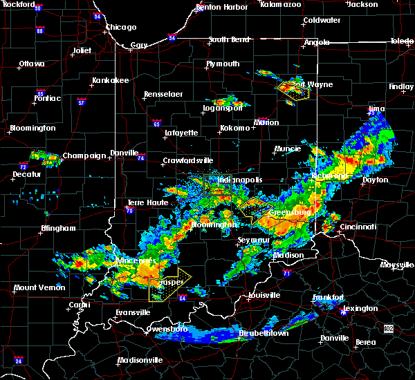 At 636 pm edt, severe thunderstorms were located along a line extending from 9 miles southwest of rushville to near shelbyville, moving east at 40 mph (radar indicated). Hazards include 60 mph wind gusts. Expect damage to roofs. siding. and trees. locations impacted include, shelbyville, adams, milford, geneva, st. paul, milroy, moscow, waldron, manilla, burney and sandusky. This includes interstate 74 between mile markers 114 and 131. At 636 pm edt, severe thunderstorms were located along a line extending from 9 miles southwest of rushville to near shelbyville, moving east at 40 mph (radar indicated). Hazards include 60 mph wind gusts. Expect damage to roofs. siding. and trees. locations impacted include, shelbyville, adams, milford, geneva, st. paul, milroy, moscow, waldron, manilla, burney and sandusky. This includes interstate 74 between mile markers 114 and 131.
|
| 6/15/2016 6:23 PM EDT |
 At 623 pm edt, severe thunderstorms were located along a line extending from 6 miles north of shelbyville to near franklin, moving east at 40 mph (radar indicated). Hazards include 60 mph wind gusts. Expect damage to roofs. siding. And trees. At 623 pm edt, severe thunderstorms were located along a line extending from 6 miles north of shelbyville to near franklin, moving east at 40 mph (radar indicated). Hazards include 60 mph wind gusts. Expect damage to roofs. siding. And trees.
|
| 6/15/2016 5:09 PM EDT |
 At 508 pm edt, severe thunderstorms were located along a line extending from 10 miles northeast of shelbyville to near mooresville, moving southeast at 40 mph (radar indicated). Hazards include 60 mph wind gusts. Expect damage to roofs. siding. and trees. locations impacted include, indianapolis, shelbyville, greenwood, lawrence, franklin, greenfield, beech grove, speedway, southport, new whiteland, cumberland, mccordsville, whiteland, bargersville, new palestine, meridian hills, warren park, clermont, geneva and morristown. this includes the following highways, interstate 65 between mile markers 81 and 126. interstate 69 between mile markers 200 and 202. interstate 70 between mile markers 71 and 102. Interstate 74 between mile markers 71 and 129. At 508 pm edt, severe thunderstorms were located along a line extending from 10 miles northeast of shelbyville to near mooresville, moving southeast at 40 mph (radar indicated). Hazards include 60 mph wind gusts. Expect damage to roofs. siding. and trees. locations impacted include, indianapolis, shelbyville, greenwood, lawrence, franklin, greenfield, beech grove, speedway, southport, new whiteland, cumberland, mccordsville, whiteland, bargersville, new palestine, meridian hills, warren park, clermont, geneva and morristown. this includes the following highways, interstate 65 between mile markers 81 and 126. interstate 69 between mile markers 200 and 202. interstate 70 between mile markers 71 and 102. Interstate 74 between mile markers 71 and 129.
|
| 6/15/2016 5:02 PM EDT |
 At 501 pm edt, severe thunderstorms were located along a line extending from 7 miles southeast of greenfield to near plainfield, moving southeast at 40 mph (radar indicated). Hazards include 70 mph wind gusts. Expect considerable tree damage. damage is likely to mobile homes, roofs, and outbuildings. locations impacted include, indianapolis, shelbyville, greenwood, lawrence, plainfield, franklin, brownsburg, greenfield, beech grove, speedway, mooresville, southport, adams, avon, new whiteland, cumberland, mccordsville, edinburgh, whiteland and bargersville. this includes the following highways, interstate 65 between mile markers 81 and 127. interstate 69 between mile markers 200 and 202. interstate 70 between mile markers 65 and 102. Interstate 74 between mile markers 66 and 129. At 501 pm edt, severe thunderstorms were located along a line extending from 7 miles southeast of greenfield to near plainfield, moving southeast at 40 mph (radar indicated). Hazards include 70 mph wind gusts. Expect considerable tree damage. damage is likely to mobile homes, roofs, and outbuildings. locations impacted include, indianapolis, shelbyville, greenwood, lawrence, plainfield, franklin, brownsburg, greenfield, beech grove, speedway, mooresville, southport, adams, avon, new whiteland, cumberland, mccordsville, edinburgh, whiteland and bargersville. this includes the following highways, interstate 65 between mile markers 81 and 127. interstate 69 between mile markers 200 and 202. interstate 70 between mile markers 65 and 102. Interstate 74 between mile markers 66 and 129.
|
| 6/15/2016 4:45 PM EDT |
 At 445 pm edt, severe thunderstorms were located along a line extending from near lawrence to near brownsburg, moving southeast at 40 mph (radar indicated). Hazards include 70 mph wind gusts. Expect considerable tree damage. Damage is likely to mobile homes, roofs, and outbuildings. At 445 pm edt, severe thunderstorms were located along a line extending from near lawrence to near brownsburg, moving southeast at 40 mph (radar indicated). Hazards include 70 mph wind gusts. Expect considerable tree damage. Damage is likely to mobile homes, roofs, and outbuildings.
|
| 4/26/2016 5:34 PM EDT |
 At 533 pm edt, a severe thunderstorm was located near rushville, or 16 miles northeast of shelbyville, moving east at 25 mph (radar indicated). Hazards include quarter size hail. Damage to vehicles is expected. locations impacted include, rushville, glenwood, morristown, falmouth, new salem and arlington. At 533 pm edt, a severe thunderstorm was located near rushville, or 16 miles northeast of shelbyville, moving east at 25 mph (radar indicated). Hazards include quarter size hail. Damage to vehicles is expected. locations impacted include, rushville, glenwood, morristown, falmouth, new salem and arlington.
|
| 4/26/2016 5:18 PM EDT |
 At 518 pm edt, a severe thunderstorm was located 9 miles west of rushville, or 12 miles northeast of shelbyville, moving east at 25 mph (radar indicated). Hazards include quarter size hail. Damage to vehicles is expected. Locations impacted include, rushville, glenwood, morristown, carthage, falmouth, new salem and arlington. At 518 pm edt, a severe thunderstorm was located 9 miles west of rushville, or 12 miles northeast of shelbyville, moving east at 25 mph (radar indicated). Hazards include quarter size hail. Damage to vehicles is expected. Locations impacted include, rushville, glenwood, morristown, carthage, falmouth, new salem and arlington.
|
| 4/26/2016 4:58 PM EDT |
 At 458 pm edt, a severe thunderstorm was located 8 miles south of greenfield, or 9 miles north of shelbyville, moving east at 25 mph (radar indicated). Hazards include quarter size hail. damage to vehicles is expected At 458 pm edt, a severe thunderstorm was located 8 miles south of greenfield, or 9 miles north of shelbyville, moving east at 25 mph (radar indicated). Hazards include quarter size hail. damage to vehicles is expected
|
| 3/27/2016 9:34 PM EDT |
 At 934 pm edt, severe thunderstorms were located along a line extending from near rushville to 7 miles west of greensburg, moving east at 45 mph (radar indicated). Hazards include 70 mph wind gusts and quarter size hail. Hail damage to vehicles is expected. expect considerable tree damage. wind damage is also likely to mobile homes, roofs, and outbuildings. locations impacted include, greensburg, rushville, glenwood, adams, milford, st. paul, milroy, falmouth, moscow, manilla, burney, sandusky, clarksburg, lake santee, letts, newpoint, arlington and new salem. This includes interstate 74 between mile markers 124 and 144. At 934 pm edt, severe thunderstorms were located along a line extending from near rushville to 7 miles west of greensburg, moving east at 45 mph (radar indicated). Hazards include 70 mph wind gusts and quarter size hail. Hail damage to vehicles is expected. expect considerable tree damage. wind damage is also likely to mobile homes, roofs, and outbuildings. locations impacted include, greensburg, rushville, glenwood, adams, milford, st. paul, milroy, falmouth, moscow, manilla, burney, sandusky, clarksburg, lake santee, letts, newpoint, arlington and new salem. This includes interstate 74 between mile markers 124 and 144.
|
| 3/27/2016 9:22 PM EDT |
 At 922 pm edt, severe thunderstorms were located along a line extending from 7 miles west of rushville to 9 miles northwest of greensburg to 10 miles northeast of columbus, moving east at 45 mph (radar indicated). Hazards include 70 mph wind gusts and quarter size hail. Hail damage to vehicles is expected. expect considerable tree damage. wind damage is also likely to mobile homes, roofs, and outbuildings. locations impacted include, columbus, shelbyville, greensburg, rushville, glenwood, adams, hope, flat rock, milford, geneva, st. paul, hartsville, milroy, clifford, moscow, taylorsville, sandusky, clarksburg, letts and arlington. this includes the following highways, interstate 65 between mile markers 67 and 73. Interstate 74 between mile markers 110 and 144. At 922 pm edt, severe thunderstorms were located along a line extending from 7 miles west of rushville to 9 miles northwest of greensburg to 10 miles northeast of columbus, moving east at 45 mph (radar indicated). Hazards include 70 mph wind gusts and quarter size hail. Hail damage to vehicles is expected. expect considerable tree damage. wind damage is also likely to mobile homes, roofs, and outbuildings. locations impacted include, columbus, shelbyville, greensburg, rushville, glenwood, adams, hope, flat rock, milford, geneva, st. paul, hartsville, milroy, clifford, moscow, taylorsville, sandusky, clarksburg, letts and arlington. this includes the following highways, interstate 65 between mile markers 67 and 73. Interstate 74 between mile markers 110 and 144.
|
| 3/27/2016 9:07 PM EDT |
 At 906 pm edt, severe thunderstorms were located along a line extending from near shelbyville to 15 miles east of franklin to near columbus, moving east at 45 mph (radar indicated). Hazards include 70 mph wind gusts and quarter size hail. Hail damage to vehicles is expected. expect considerable tree damage. wind damage is also likely to mobile homes, roofs, and outbuildings. locations impacted include, columbus, shelbyville, franklin, greensburg, rushville, nashville, glenwood, adams, edinburgh, whiteland, bargersville, hope, flat rock, milford, princes lakes, geneva, trafalgar, st. paul, hartsville and fairland. this includes the following highways, interstate 65 between mile markers 67 and 94. Interstate 74 between mile markers 109 and 144. At 906 pm edt, severe thunderstorms were located along a line extending from near shelbyville to 15 miles east of franklin to near columbus, moving east at 45 mph (radar indicated). Hazards include 70 mph wind gusts and quarter size hail. Hail damage to vehicles is expected. expect considerable tree damage. wind damage is also likely to mobile homes, roofs, and outbuildings. locations impacted include, columbus, shelbyville, franklin, greensburg, rushville, nashville, glenwood, adams, edinburgh, whiteland, bargersville, hope, flat rock, milford, princes lakes, geneva, trafalgar, st. paul, hartsville and fairland. this includes the following highways, interstate 65 between mile markers 67 and 94. Interstate 74 between mile markers 109 and 144.
|
| 3/27/2016 8:47 PM EDT |
 At 847 pm edt, severe thunderstorms were located along a line extending from near greenwood to 8 miles south of franklin to near nashville, moving east at 45 mph (radar indicated). Hazards include 60 mph wind gusts and quarter size hail. Hail damage to vehicles is expected. Expect wind damage to roofs, siding, and trees. At 847 pm edt, severe thunderstorms were located along a line extending from near greenwood to 8 miles south of franklin to near nashville, moving east at 45 mph (radar indicated). Hazards include 60 mph wind gusts and quarter size hail. Hail damage to vehicles is expected. Expect wind damage to roofs, siding, and trees.
|
| 12/23/2015 3:57 PM EST | At 357 pm est, severe thunderstorms were located along a line extending from near noblesville to near shelbyville to near columbus to 7 miles southeast of brownstown, moving east at 65 mph (radar indicated). Hazards include 70 mph wind gusts. Expect considerable tree damage. Damage is likely to mobile homes, roofs and outbuildings. |
| 6/12/2015 6:32 PM EDT |
 At 629 pm edt, severe thunderstorms were located along a line extending from 8 miles north of shelbyville to 6 miles south of shelbyville, and moving east at 30 mph (radar indicated). Hazards include 60 mph wind gusts. Expect damage to roofs. siding and trees. locations impacted include, morristown, waldron, st. paul, manilla, arlington and moscow. This includes interstate 74 between mile markers 102 and 127. At 629 pm edt, severe thunderstorms were located along a line extending from 8 miles north of shelbyville to 6 miles south of shelbyville, and moving east at 30 mph (radar indicated). Hazards include 60 mph wind gusts. Expect damage to roofs. siding and trees. locations impacted include, morristown, waldron, st. paul, manilla, arlington and moscow. This includes interstate 74 between mile markers 102 and 127.
|
| 6/12/2015 6:12 PM EDT |
 At 609 pm edt, severe thunderstorms were located along a line extending from 5 miles east of greenwood to franklin, and moving east at 35 mph (radar indicated). Hazards include 70 mph wind gusts. Expect considerable tree damage. Damage is likely to mobile homes, roofs and outbuildings. At 609 pm edt, severe thunderstorms were located along a line extending from 5 miles east of greenwood to franklin, and moving east at 35 mph (radar indicated). Hazards include 70 mph wind gusts. Expect considerable tree damage. Damage is likely to mobile homes, roofs and outbuildings.
|
| 4/8/2015 9:34 AM EDT | A severe thunderstorm warning remains in effect for decatur. northeastern brown. northern bartholomew. southeastern henry. southern johnson. rush and southern shelby counties until 1000 am edt. at 933 am edt. Severe thunderstorms were located along a line extending from dublin to 8 miles east of rushville to 12 miles west. |
| 4/8/2015 9:14 AM EDT | A severe thunderstorm warning remains in effect for decatur. northeastern brown. northern bartholomew. eastern hancock. southern henry. johnson. southeastern madison. southern morgan. rush and shelby counties until 1000 am edt. at 911 am edt. Severe thunderstorms were located along a line extending from 12 miles south of anderson to 9 miles northeast of. |
| 4/8/2015 9:11 AM EDT | The national weather service in indianapolis has issued a * severe thunderstorm warning for. northern bartholomew county in central indiana. northeastern brown county in south central indiana. decatur county in central indiana. Eastern hancock county in central indiana. |
| 4/8/2015 9:06 AM EDT | A severe thunderstorm warning remains in effect for hancock. southwestern henry. johnson. southern marion. morgan. southeastern putnam. northern rush and shelby counties until 915 am edt. at 903 am edt. Severe thunderstorms were located along a line extending from greenfield to 9 miles southwest of greenfield to. |
| 4/8/2015 8:57 AM EDT | A severe thunderstorm warning remains in effect for southeastern hamilton. hancock. southern hendricks. southwestern henry. johnson. marion. morgan. southeastern putnam. northern rush and shelby counties until 915 am edt. at 855 am edt. Severe thunderstorms were located along a line extending from lawrence to 8 miles east of beech grove to greenwood. |
| 4/8/2015 8:39 AM EDT | The national weather service in indianapolis has issued a * severe thunderstorm warning for. southeastern hamilton county in central indiana. hancock county in central indiana. southern hendricks county in central indiana. Southwestern henry county in east central indiana. |
| 1/1/0001 12:00 AM | Garage blown i in rush county IN, 4.6 miles NW of Manilla, IN |
| 1/1/0001 12:00 AM | Tree down on roa in rush county IN, 4.6 miles NW of Manilla, IN |
Hail Maps for Manilla, IN


Connect with Interactive Hail Maps