

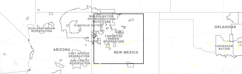
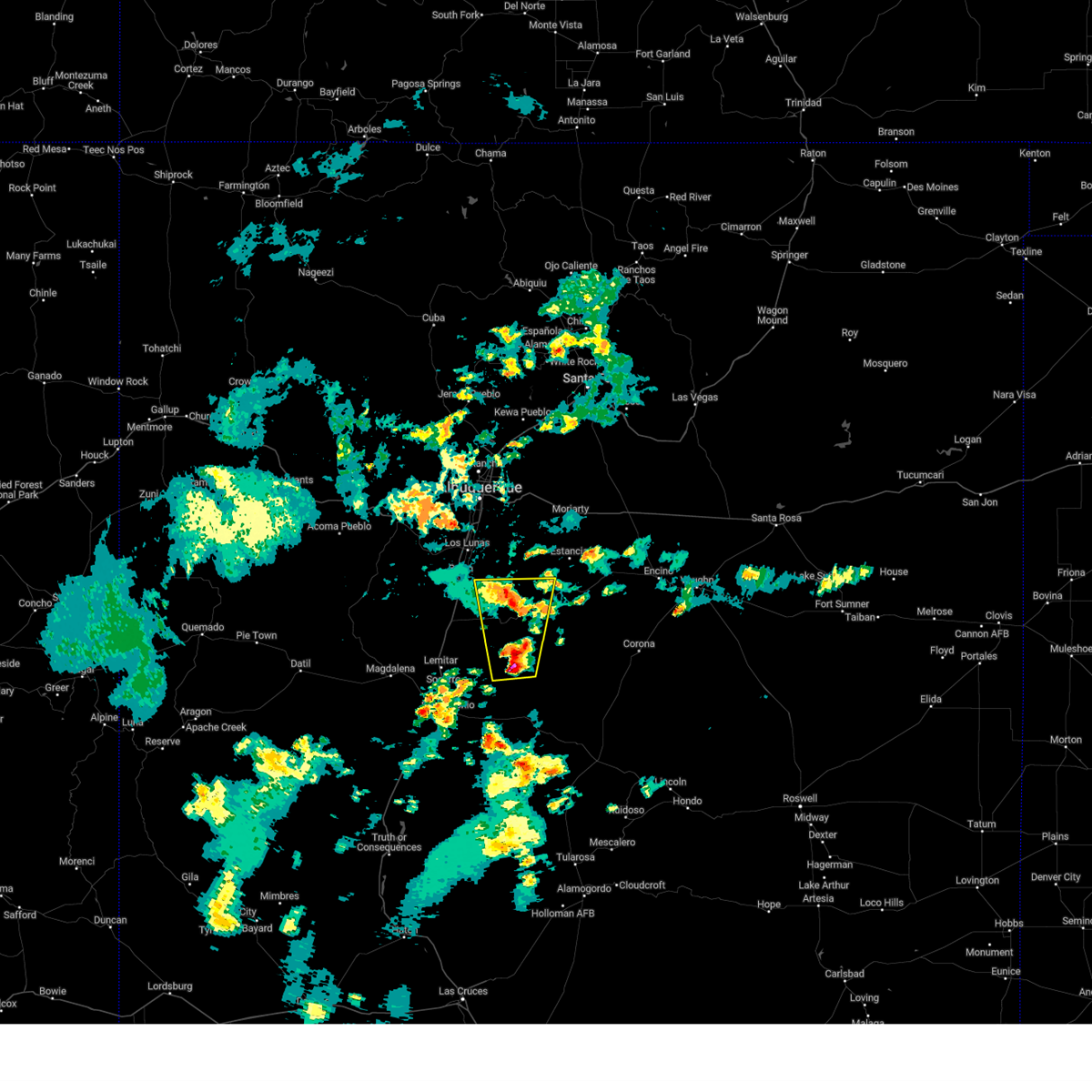
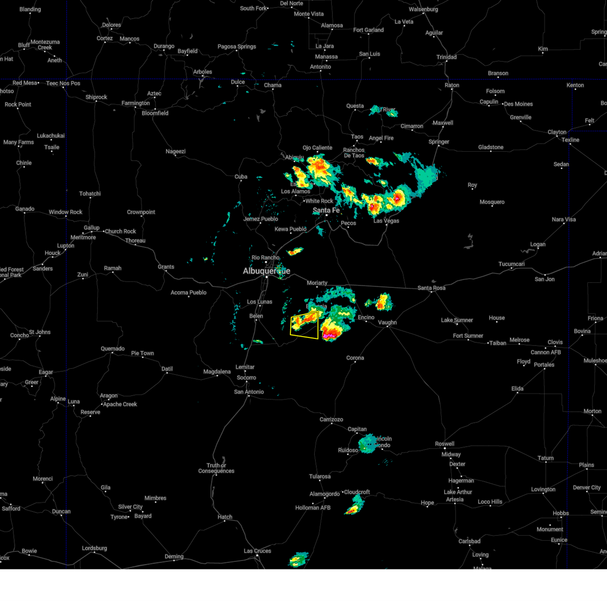
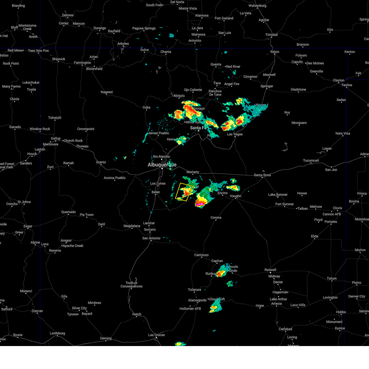
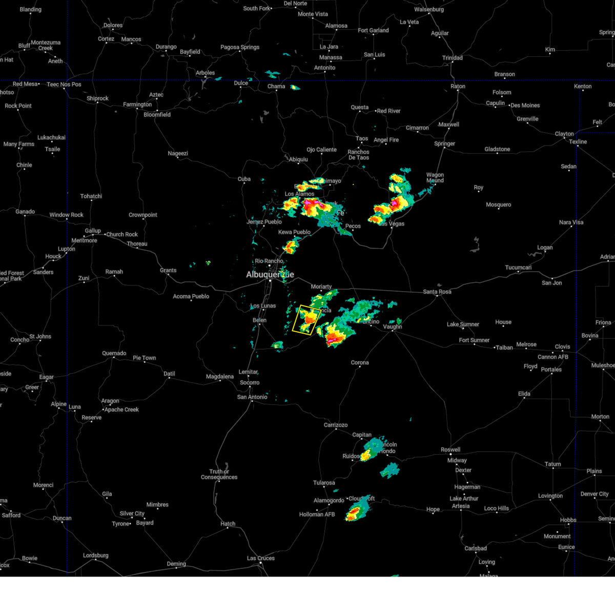
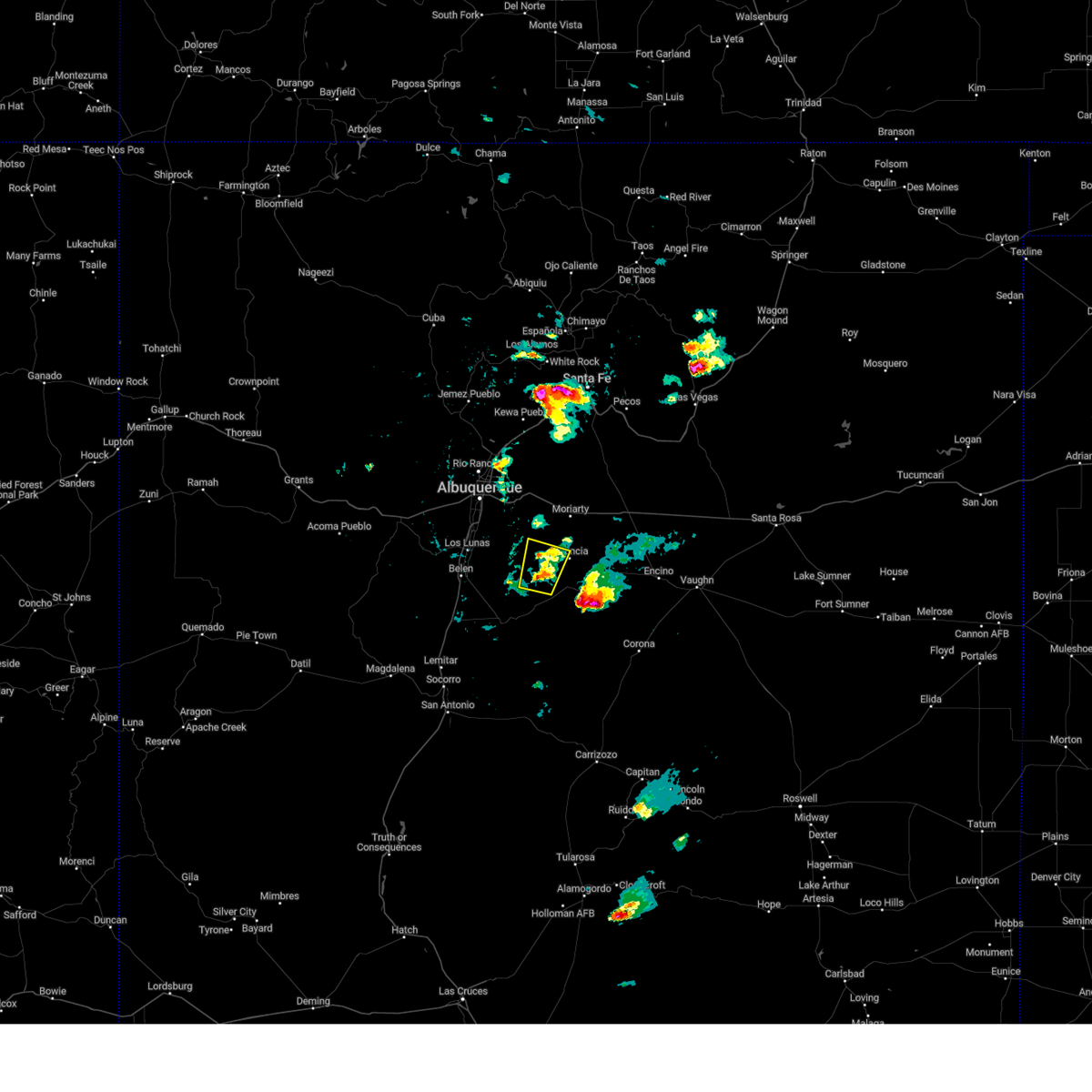
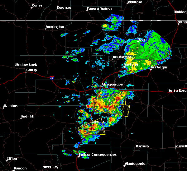
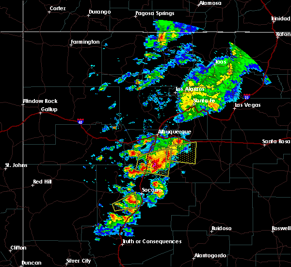
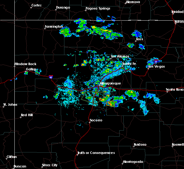
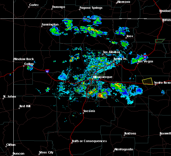
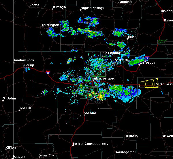
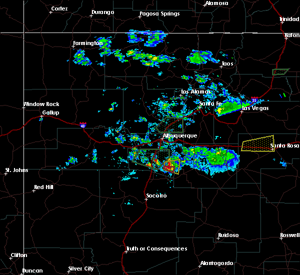
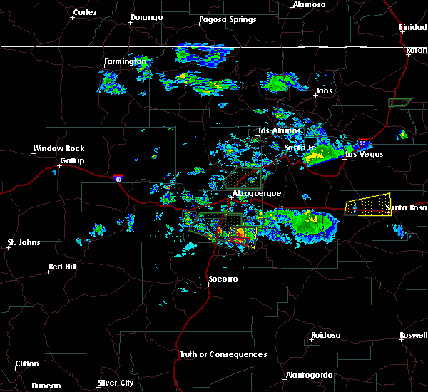
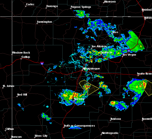
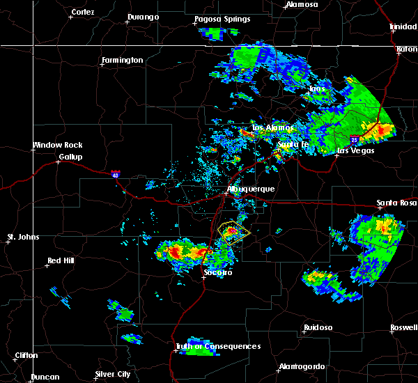
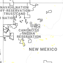
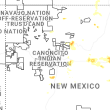
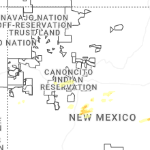
Hail Map for Manzano, NM
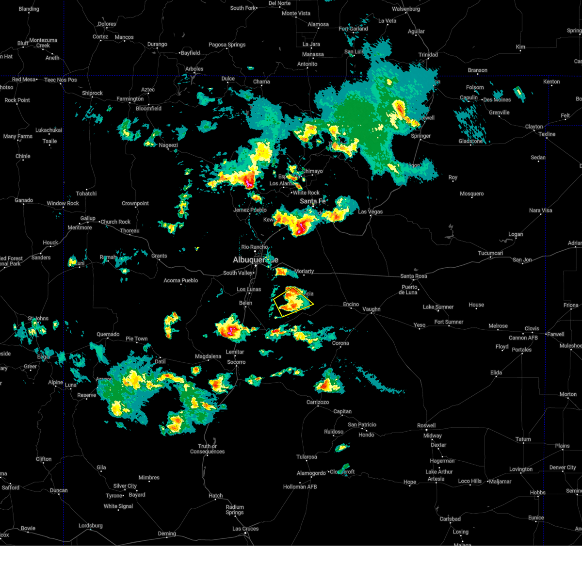
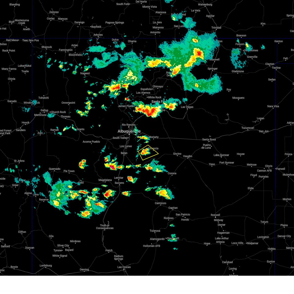
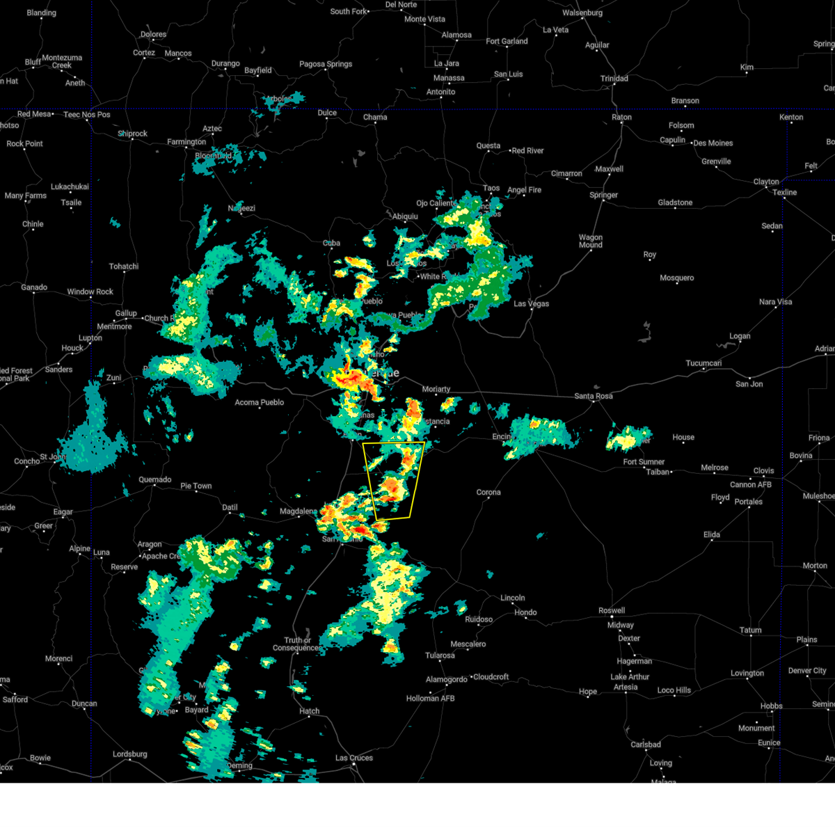
The Manzano, NM area has had 0 reports of on-the-ground hail by trained spotters, and has been under severe weather warnings 3 times during the past 12 months. Doppler radar has detected hail at or near Manzano, NM on 28 occasions, including 4 occasions during the past year.
| Name: | Manzano, NM |
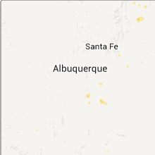
| Where Located: | 34.5 miles SSE of Albuquerque, NM |
| Map: | Google Map for Manzano, NM |
| Population: | 29 |
| Housing Units: | 21 |
| More Info: | Search Google for Manzano, NM |
0
The Top Recent Hail Date for Manzano, NM is Monday, June 30, 2025 (10th out of 28)
Hail and Wind Damage Spotted near Manzano, NM
| Date / Time | Report Details |
|---|---|
| 6/9/2025 3:44 PM MDT | the severe thunderstorm warning has been cancelled and is no longer in effect |
| 6/9/2025 3:39 PM MDT |
 At 339 pm mdt, a severe thunderstorm was located 5 miles east of manzano, or 16 miles southwest of estancia, moving southeast at 15 mph (radar indicated). Hazards include 60 mph wind gusts and quarter size hail. Hail damage to vehicles is expected. expect wind damage to roofs, siding, and trees. Locations impacted include, estancia, tajique, manzano and torreon. At 339 pm mdt, a severe thunderstorm was located 5 miles east of manzano, or 16 miles southwest of estancia, moving southeast at 15 mph (radar indicated). Hazards include 60 mph wind gusts and quarter size hail. Hail damage to vehicles is expected. expect wind damage to roofs, siding, and trees. Locations impacted include, estancia, tajique, manzano and torreon.
|
| 6/9/2025 3:23 PM MDT |
 Svrabq the national weather service in albuquerque has issued a * severe thunderstorm warning for, northwestern torrance county in central new mexico, * until 400 pm mdt. * at 323 pm mdt, a severe thunderstorm was located 6 miles southeast of tajique, or 14 miles southwest of estancia, moving southeast at 15 mph (radar indicated). Hazards include ping pong ball size hail and 60 mph wind gusts. People and animals outdoors will be injured. expect hail damage to roofs, siding, windows, and vehicles. Expect wind damage to roofs, siding, and trees. Svrabq the national weather service in albuquerque has issued a * severe thunderstorm warning for, northwestern torrance county in central new mexico, * until 400 pm mdt. * at 323 pm mdt, a severe thunderstorm was located 6 miles southeast of tajique, or 14 miles southwest of estancia, moving southeast at 15 mph (radar indicated). Hazards include ping pong ball size hail and 60 mph wind gusts. People and animals outdoors will be injured. expect hail damage to roofs, siding, windows, and vehicles. Expect wind damage to roofs, siding, and trees.
|
| 6/29/2024 8:23 PM MDT |
 The storm which prompted the warning has stopped producing large. therefore, the warning will be allowed to expire. however, heavy rain and flash flooding is still possible with this thunderstorm. The storm which prompted the warning has stopped producing large. therefore, the warning will be allowed to expire. however, heavy rain and flash flooding is still possible with this thunderstorm.
|
| 6/29/2024 7:44 PM MDT |
 Svrabq the national weather service in albuquerque has issued a * severe thunderstorm warning for, southeastern valencia county in central new mexico, northeastern socorro county in central new mexico, southwestern torrance county in central new mexico, * until 830 pm mdt. * at 744 pm mdt, a severe thunderstorm was located 15 miles south of abo, or 30 miles northeast of socorro, moving north at 10 mph (radar indicated). Hazards include 60 mph wind gusts and quarter size hail. Hail damage to vehicles is expected. Expect wind damage to roofs, siding, and trees. Svrabq the national weather service in albuquerque has issued a * severe thunderstorm warning for, southeastern valencia county in central new mexico, northeastern socorro county in central new mexico, southwestern torrance county in central new mexico, * until 830 pm mdt. * at 744 pm mdt, a severe thunderstorm was located 15 miles south of abo, or 30 miles northeast of socorro, moving north at 10 mph (radar indicated). Hazards include 60 mph wind gusts and quarter size hail. Hail damage to vehicles is expected. Expect wind damage to roofs, siding, and trees.
|
| 6/19/2024 4:29 PM MDT |
 Svrabq the national weather service in albuquerque has issued a * severe thunderstorm warning for, west central torrance county in central new mexico, * until 515 pm mdt. * at 429 pm mdt, a severe thunderstorm was located near manzano mountain state park, or 16 miles southwest of estancia, moving east at 5 mph (radar indicated). Hazards include 60 mph wind gusts and half dollar size hail. Hail damage to vehicles is expected. Expect wind damage to roofs, siding, and trees. Svrabq the national weather service in albuquerque has issued a * severe thunderstorm warning for, west central torrance county in central new mexico, * until 515 pm mdt. * at 429 pm mdt, a severe thunderstorm was located near manzano mountain state park, or 16 miles southwest of estancia, moving east at 5 mph (radar indicated). Hazards include 60 mph wind gusts and half dollar size hail. Hail damage to vehicles is expected. Expect wind damage to roofs, siding, and trees.
|
| 6/19/2024 4:09 PM MDT |
 The storm which prompted the warning has weakened below severe limits, and no longer poses an immediate threat to life or property. therefore, the warning will be allowed to expire. however, small hail, gusty winds and heavy rain are still possible with this thunderstorm. a severe thunderstorm watch remains in effect until 900 pm mdt for central new mexico. remember, a severe thunderstorm warning remains in effect for south central torrance county until 445 pm mdt. The storm which prompted the warning has weakened below severe limits, and no longer poses an immediate threat to life or property. therefore, the warning will be allowed to expire. however, small hail, gusty winds and heavy rain are still possible with this thunderstorm. a severe thunderstorm watch remains in effect until 900 pm mdt for central new mexico. remember, a severe thunderstorm warning remains in effect for south central torrance county until 445 pm mdt.
|
| 6/19/2024 3:51 PM MDT |
 At 351 pm mdt, a severe thunderstorm was located 7 miles east of manzano, or 14 miles southwest of estancia, moving northeast at 10 mph (radar indicated). Hazards include 60 mph wind gusts and quarter size hail. Hail damage to vehicles is expected. expect wind damage to roofs, siding, and trees. Locations impacted include, tajique, manzano mountain state park, and manzano. At 351 pm mdt, a severe thunderstorm was located 7 miles east of manzano, or 14 miles southwest of estancia, moving northeast at 10 mph (radar indicated). Hazards include 60 mph wind gusts and quarter size hail. Hail damage to vehicles is expected. expect wind damage to roofs, siding, and trees. Locations impacted include, tajique, manzano mountain state park, and manzano.
|
| 6/19/2024 3:31 PM MDT |
 Svrabq the national weather service in albuquerque has issued a * severe thunderstorm warning for, west central torrance county in central new mexico, * until 415 pm mdt. * at 330 pm mdt, a severe thunderstorm was located near manzano, or 15 miles southwest of estancia, moving north at 15 mph (radar indicated). Hazards include 60 mph wind gusts and quarter size hail. Hail damage to vehicles is expected. Expect wind damage to roofs, siding, and trees. Svrabq the national weather service in albuquerque has issued a * severe thunderstorm warning for, west central torrance county in central new mexico, * until 415 pm mdt. * at 330 pm mdt, a severe thunderstorm was located near manzano, or 15 miles southwest of estancia, moving north at 15 mph (radar indicated). Hazards include 60 mph wind gusts and quarter size hail. Hail damage to vehicles is expected. Expect wind damage to roofs, siding, and trees.
|
| 7/23/2021 3:15 PM MDT |
 At 314 pm mdt, a severe thunderstorm was located 7 miles south of willard, or 18 miles south of estancia, moving west at 25 mph (radar indicated). Hazards include 60 mph wind gusts and half dollar size hail. Hail damage to vehicles is expected. Expect wind damage to roofs, siding, and trees. At 314 pm mdt, a severe thunderstorm was located 7 miles south of willard, or 18 miles south of estancia, moving west at 25 mph (radar indicated). Hazards include 60 mph wind gusts and half dollar size hail. Hail damage to vehicles is expected. Expect wind damage to roofs, siding, and trees.
|
| 7/31/2020 7:17 PM MDT |
 At 716 pm mdt, a severe thunderstorm was located over rio communities, or near belen, moving south at 30 mph (radar indicated). Hazards include 60 mph wind gusts. Expect damage to roofs, siding, and trees. locations impacted include, southern albuquerque, valencia, los lunas, belen, bosque farms, peralta, mountainair, rio communities north, abo and jarales. this includes the following highways, interstate 40 between mile markers 122 and 141, and near mile marker 170. interstate 25 between mile markers 164 and 222. Highway 60 between mile markers 166 and 198, and between mile markers 201 and 206. At 716 pm mdt, a severe thunderstorm was located over rio communities, or near belen, moving south at 30 mph (radar indicated). Hazards include 60 mph wind gusts. Expect damage to roofs, siding, and trees. locations impacted include, southern albuquerque, valencia, los lunas, belen, bosque farms, peralta, mountainair, rio communities north, abo and jarales. this includes the following highways, interstate 40 between mile markers 122 and 141, and near mile marker 170. interstate 25 between mile markers 164 and 222. Highway 60 between mile markers 166 and 198, and between mile markers 201 and 206.
|
| 7/31/2020 6:43 PM MDT |
 At 642 pm mdt, a severe thunderstorm was located over bosque farms, or near los lunas, moving south at 45 mph. a 64 mph wind gust has already been reported at the albuquerque sunport (radar indicated). Hazards include 70 mph wind gusts. Expect considerable tree damage. Damage is likely to mobile homes, roofs, and outbuildings. At 642 pm mdt, a severe thunderstorm was located over bosque farms, or near los lunas, moving south at 45 mph. a 64 mph wind gust has already been reported at the albuquerque sunport (radar indicated). Hazards include 70 mph wind gusts. Expect considerable tree damage. Damage is likely to mobile homes, roofs, and outbuildings.
|
| 7/30/2018 8:16 PM MDT |
 At 815 pm mdt, a severe thunderstorm was located near meadow lake, or 14 miles east of los lunas, moving south at 20 mph (radar indicated). Hazards include 60 mph wind gusts and quarter size hail. Hail damage to vehicles is expected. expect wind damage to roofs, siding, and trees. Locations impacted include, manzano mountain state park, meadow lake, manzano, abo, torreon and el cerro mission. At 815 pm mdt, a severe thunderstorm was located near meadow lake, or 14 miles east of los lunas, moving south at 20 mph (radar indicated). Hazards include 60 mph wind gusts and quarter size hail. Hail damage to vehicles is expected. expect wind damage to roofs, siding, and trees. Locations impacted include, manzano mountain state park, meadow lake, manzano, abo, torreon and el cerro mission.
|
| 7/30/2018 7:54 PM MDT |
 At 753 pm mdt, a severe thunderstorm was located near meadow lake, or 13 miles east of los lunas, moving south at 20 mph (radar indicated). Hazards include 60 mph wind gusts and half dollar size hail. Hail damage to vehicles is expected. Expect wind damage to roofs, siding, and trees. At 753 pm mdt, a severe thunderstorm was located near meadow lake, or 13 miles east of los lunas, moving south at 20 mph (radar indicated). Hazards include 60 mph wind gusts and half dollar size hail. Hail damage to vehicles is expected. Expect wind damage to roofs, siding, and trees.
|
| 6/3/2018 4:27 PM MDT |
 At 426 pm mdt, a severe thunderstorm was located near abo, or 23 miles southwest of estancia, moving east at 25 mph (radar indicated). Hazards include ping pong ball size hail and 60 mph wind gusts. People and animals outdoors will be injured. expect hail damage to roofs, siding, windows, and vehicles. Expect wind damage to roofs, siding, and trees. At 426 pm mdt, a severe thunderstorm was located near abo, or 23 miles southwest of estancia, moving east at 25 mph (radar indicated). Hazards include ping pong ball size hail and 60 mph wind gusts. People and animals outdoors will be injured. expect hail damage to roofs, siding, windows, and vehicles. Expect wind damage to roofs, siding, and trees.
|
| 6/3/2018 3:56 PM MDT |
 At 356 pm mdt, a severe thunderstorm was located near rio communities, or 9 miles southeast of belen, moving east at 25 mph (radar indicated). Hazards include ping pong ball size hail and 60 mph wind gusts. People and animals outdoors will be injured. expect hail damage to roofs, siding, windows, and vehicles. expect wind damage to roofs, siding, and trees. locations impacted include, valencia, los lunas, belen, peralta, rio communities north, veguita, el cerro mission, jarales, los trujillos-gabaldon and tome. This includes interstate 25 between mile markers 178 and 201. At 356 pm mdt, a severe thunderstorm was located near rio communities, or 9 miles southeast of belen, moving east at 25 mph (radar indicated). Hazards include ping pong ball size hail and 60 mph wind gusts. People and animals outdoors will be injured. expect hail damage to roofs, siding, windows, and vehicles. expect wind damage to roofs, siding, and trees. locations impacted include, valencia, los lunas, belen, peralta, rio communities north, veguita, el cerro mission, jarales, los trujillos-gabaldon and tome. This includes interstate 25 between mile markers 178 and 201.
|
| 6/3/2018 3:53 PM MDT |
 At 353 pm mdt, a severe thunderstorm was located near tajique, or 18 miles west of estancia, moving east at 30 mph (radar indicated). Hazards include ping pong ball size hail and 60 mph wind gusts. People and animals outdoors will be injured. expect hail damage to roofs, siding, windows, and vehicles. Expect wind damage to roofs, siding, and trees. At 353 pm mdt, a severe thunderstorm was located near tajique, or 18 miles west of estancia, moving east at 30 mph (radar indicated). Hazards include ping pong ball size hail and 60 mph wind gusts. People and animals outdoors will be injured. expect hail damage to roofs, siding, windows, and vehicles. Expect wind damage to roofs, siding, and trees.
|
| 6/3/2018 3:29 PM MDT |
 At 329 pm mdt, a severe thunderstorm was located over jarales, or near belen, moving east at 25 mph (radar indicated). Hazards include ping pong ball size hail and 60 mph wind gusts. People and animals outdoors will be injured. expect hail damage to roofs, siding, windows, and vehicles. Expect wind damage to roofs, siding, and trees. At 329 pm mdt, a severe thunderstorm was located over jarales, or near belen, moving east at 25 mph (radar indicated). Hazards include ping pong ball size hail and 60 mph wind gusts. People and animals outdoors will be injured. expect hail damage to roofs, siding, windows, and vehicles. Expect wind damage to roofs, siding, and trees.
|
| 5/21/2018 7:33 PM MDT |
 At 733 pm mdt, a severe thunderstorm was located over bernardo, or 14 miles south of belen, moving northeast at 25 mph (radar indicated). Hazards include 60 mph wind gusts and quarter size hail. Hail damage to vehicles is expected. Expect wind damage to roofs, siding, and trees. At 733 pm mdt, a severe thunderstorm was located over bernardo, or 14 miles south of belen, moving northeast at 25 mph (radar indicated). Hazards include 60 mph wind gusts and quarter size hail. Hail damage to vehicles is expected. Expect wind damage to roofs, siding, and trees.
|
| 10/5/2017 3:15 PM MDT |
 At 314 pm mdt, a severe thunderstorm was located near belen, moving east at 30 mph (radar indicated). Hazards include 60 mph wind gusts and half dollar size hail. Hail damage to vehicles is expected. Expect wind damage to roofs, siding, and trees. At 314 pm mdt, a severe thunderstorm was located near belen, moving east at 30 mph (radar indicated). Hazards include 60 mph wind gusts and half dollar size hail. Hail damage to vehicles is expected. Expect wind damage to roofs, siding, and trees.
|
| 9/30/2017 7:59 PM MDT |
 At 759 pm mdt, a severe thunderstorm was located over manzano mountain state park, or 18 miles southwest of estancia, moving east at 25 mph (radar indicated). Hazards include 60 mph wind gusts and quarter size hail. Hail damage to vehicles is expected. expect wind damage to roofs, siding, and trees. Locations impacted include, manzano mountain state park and manzano. At 759 pm mdt, a severe thunderstorm was located over manzano mountain state park, or 18 miles southwest of estancia, moving east at 25 mph (radar indicated). Hazards include 60 mph wind gusts and quarter size hail. Hail damage to vehicles is expected. expect wind damage to roofs, siding, and trees. Locations impacted include, manzano mountain state park and manzano.
|
| 9/30/2017 7:44 PM MDT |
 At 743 pm mdt, a severe thunderstorm was located near manzano, or 21 miles west of estancia, moving east at 25 mph (radar indicated). Hazards include 60 mph wind gusts and half dollar size hail. Hail damage to vehicles is expected. Expect wind damage to roofs, siding, and trees. At 743 pm mdt, a severe thunderstorm was located near manzano, or 21 miles west of estancia, moving east at 25 mph (radar indicated). Hazards include 60 mph wind gusts and half dollar size hail. Hail damage to vehicles is expected. Expect wind damage to roofs, siding, and trees.
|
| 9/30/2017 7:37 PM MDT |
 At 736 pm mdt, a severe thunderstorm was located near manzano mountain state park, or 18 miles east of belen, moving east at 25 mph (radar indicated). Hazards include 60 mph wind gusts and half dollar size hail. Hail damage to vehicles is expected. expect wind damage to roofs, siding, and trees. Locations impacted include, manzano mountain state park, manzano and torreon. At 736 pm mdt, a severe thunderstorm was located near manzano mountain state park, or 18 miles east of belen, moving east at 25 mph (radar indicated). Hazards include 60 mph wind gusts and half dollar size hail. Hail damage to vehicles is expected. expect wind damage to roofs, siding, and trees. Locations impacted include, manzano mountain state park, manzano and torreon.
|
| 9/30/2017 7:24 PM MDT |
 At 723 pm mdt, a severe thunderstorm was located 7 miles northwest of manzano mountain state park, or 17 miles east of belen, moving east at 30 mph (radar indicated). Hazards include two inch hail and 70 mph wind gusts. People and animals outdoors will be injured. expect hail damage to roofs, siding, windows, and vehicles. expect considerable tree damage. wind damage is also likely to mobile homes, roofs, and outbuildings. Locations impacted include, manzano mountain state park, manzano, torreon and tajique. At 723 pm mdt, a severe thunderstorm was located 7 miles northwest of manzano mountain state park, or 17 miles east of belen, moving east at 30 mph (radar indicated). Hazards include two inch hail and 70 mph wind gusts. People and animals outdoors will be injured. expect hail damage to roofs, siding, windows, and vehicles. expect considerable tree damage. wind damage is also likely to mobile homes, roofs, and outbuildings. Locations impacted include, manzano mountain state park, manzano, torreon and tajique.
|
| 9/30/2017 7:22 PM MDT |
 At 722 pm mdt, a severe thunderstorm capable of producing a tornado was located 9 miles west of manzano mountain state park, or 14 miles east of belen, moving east at 25 mph (radar indicated rotation). Hazards include tornado and two inch hail. Flying debris will be dangerous to those caught without shelter. mobile homes will be damaged or destroyed. damage to roofs, windows, and vehicles will occur. tree damage is likely. This tornadic thunderstorm will remain over mainly rural areas of east central valencia and western torrance counties. At 722 pm mdt, a severe thunderstorm capable of producing a tornado was located 9 miles west of manzano mountain state park, or 14 miles east of belen, moving east at 25 mph (radar indicated rotation). Hazards include tornado and two inch hail. Flying debris will be dangerous to those caught without shelter. mobile homes will be damaged or destroyed. damage to roofs, windows, and vehicles will occur. tree damage is likely. This tornadic thunderstorm will remain over mainly rural areas of east central valencia and western torrance counties.
|
| 9/30/2017 7:17 PM MDT |
 At 716 pm mdt, a severe thunderstorm capable of producing a tornado was located 8 miles east of rio communities, or 11 miles east of belen, moving east at 25 mph (radar indicated rotation). Hazards include tornado and hail up to two inches in diameter. Flying debris will be dangerous to those caught without shelter. mobile homes will be damaged or destroyed. damage to roofs, windows, and vehicles will occur. tree damage is likely. This tornadic thunderstorm will remain over mainly rural areas of east central valencia and western torrance counties. At 716 pm mdt, a severe thunderstorm capable of producing a tornado was located 8 miles east of rio communities, or 11 miles east of belen, moving east at 25 mph (radar indicated rotation). Hazards include tornado and hail up to two inches in diameter. Flying debris will be dangerous to those caught without shelter. mobile homes will be damaged or destroyed. damage to roofs, windows, and vehicles will occur. tree damage is likely. This tornadic thunderstorm will remain over mainly rural areas of east central valencia and western torrance counties.
|
| 9/30/2017 7:14 PM MDT |
 At 713 pm mdt, a severe thunderstorm was located 8 miles southeast of rio communities north, or 11 miles east of belen, moving east at 25 mph (radar indicated). Hazards include golf ball size hail and 70 mph wind gusts. People and animals outdoors will be injured. expect hail damage to roofs, siding, windows, and vehicles. expect considerable tree damage. wind damage is also likely to mobile homes, roofs, and outbuildings. Locations impacted include, manzano mountain state park, manzano, torreon, tajique and el cerro mission. At 713 pm mdt, a severe thunderstorm was located 8 miles southeast of rio communities north, or 11 miles east of belen, moving east at 25 mph (radar indicated). Hazards include golf ball size hail and 70 mph wind gusts. People and animals outdoors will be injured. expect hail damage to roofs, siding, windows, and vehicles. expect considerable tree damage. wind damage is also likely to mobile homes, roofs, and outbuildings. Locations impacted include, manzano mountain state park, manzano, torreon, tajique and el cerro mission.
|
| 9/30/2017 7:00 PM MDT |
 At 659 pm mdt, a severe thunderstorm was located near rio communities north, or 7 miles east of belen, moving east at 30 mph (radar indicated). Hazards include 60 mph wind gusts and quarter size hail. Hail damage to vehicles is expected. Expect wind damage to roofs, siding, and trees. At 659 pm mdt, a severe thunderstorm was located near rio communities north, or 7 miles east of belen, moving east at 30 mph (radar indicated). Hazards include 60 mph wind gusts and quarter size hail. Hail damage to vehicles is expected. Expect wind damage to roofs, siding, and trees.
|
| 9/29/2017 5:29 PM MDT |
 At 529 pm mdt, severe thunderstorms were located along a line extending from near rio communities to near veguita, moving east at 15 mph (radar indicated). Hazards include 60 mph wind gusts and quarter size hail. Hail damage to vehicles is expected. Expect wind damage to roofs, siding, and trees. At 529 pm mdt, severe thunderstorms were located along a line extending from near rio communities to near veguita, moving east at 15 mph (radar indicated). Hazards include 60 mph wind gusts and quarter size hail. Hail damage to vehicles is expected. Expect wind damage to roofs, siding, and trees.
|
| 6/5/2016 7:37 PM MDT |
 At 737 pm mdt, a severe thunderstorm was located near manzano mountain state park, or 23 miles southwest of estancia, moving southeast at 25 mph (radar indicated). Hazards include quarter size hail and 60 mph wind gusts. Hail damage to vehicles is expected. Expect wind damage to roofs, siding, and trees. At 737 pm mdt, a severe thunderstorm was located near manzano mountain state park, or 23 miles southwest of estancia, moving southeast at 25 mph (radar indicated). Hazards include quarter size hail and 60 mph wind gusts. Hail damage to vehicles is expected. Expect wind damage to roofs, siding, and trees.
|
| 6/5/2016 7:13 PM MDT |
 At 713 pm mdt, a severe thunderstorm was located 8 miles west of manzano mountain state park, or 15 miles east of belen, moving southeast at 10 mph (radar indicated). Hazards include 60 mph wind gusts and half dollar size hail. Significant accumulations of hail. damage to vehicles is expected. expect wind damage to roofs, siding, and trees. locations impacted include, manzano mountain state park, manzano, el cerro mission and rio communities. Other locations affected include the following locations capilla peak campground, new canyon campground, red canyon campground, pine shadows trailhead, and manzano mountain state park. At 713 pm mdt, a severe thunderstorm was located 8 miles west of manzano mountain state park, or 15 miles east of belen, moving southeast at 10 mph (radar indicated). Hazards include 60 mph wind gusts and half dollar size hail. Significant accumulations of hail. damage to vehicles is expected. expect wind damage to roofs, siding, and trees. locations impacted include, manzano mountain state park, manzano, el cerro mission and rio communities. Other locations affected include the following locations capilla peak campground, new canyon campground, red canyon campground, pine shadows trailhead, and manzano mountain state park.
|
| 6/5/2016 6:57 PM MDT |
 At 657 pm mdt, a severe thunderstorm was located 9 miles southeast of el cerro mission, or 13 miles east of belen, moving southeast at 10 mph (radar indicated). Hazards include quarter size hail and 60 mph wind gusts. Hail damage to vehicles is expected. Expect wind damage to roofs, siding, and trees. At 657 pm mdt, a severe thunderstorm was located 9 miles southeast of el cerro mission, or 13 miles east of belen, moving southeast at 10 mph (radar indicated). Hazards include quarter size hail and 60 mph wind gusts. Hail damage to vehicles is expected. Expect wind damage to roofs, siding, and trees.
|
| 10/20/2015 4:38 PM MDT |
 At 437 pm mdt, a severe thunderstorm was located near manzano mountain state park, or 16 miles southwest of estancia, moving northeast at 25 mph (radar indicated). Hazards include 60 mph wind gusts and half dollar size hail. Hail damage to vehicles is expected. expect wind damage to roofs, siding and trees. this severe thunderstorm will remain over mainly rural areas of west central torrance county. Other locations affected include manzano mountain state park. At 437 pm mdt, a severe thunderstorm was located near manzano mountain state park, or 16 miles southwest of estancia, moving northeast at 25 mph (radar indicated). Hazards include 60 mph wind gusts and half dollar size hail. Hail damage to vehicles is expected. expect wind damage to roofs, siding and trees. this severe thunderstorm will remain over mainly rural areas of west central torrance county. Other locations affected include manzano mountain state park.
|
| 10/20/2015 4:22 PM MDT |
 At 421 pm mdt, a severe thunderstorm was located near abo, or 23 miles southwest of estancia, moving northeast at 25 mph (radar indicated). Hazards include half dollar size hail and 60 mph wind gusts. Hail damage to vehicles is expected. expect wind damage to roofs, siding and trees. this severe thunderstorm will be near, mountainair and manzano mountain state park around 430 pm mdt. Manzano around 440 pm mdt. At 421 pm mdt, a severe thunderstorm was located near abo, or 23 miles southwest of estancia, moving northeast at 25 mph (radar indicated). Hazards include half dollar size hail and 60 mph wind gusts. Hail damage to vehicles is expected. expect wind damage to roofs, siding and trees. this severe thunderstorm will be near, mountainair and manzano mountain state park around 430 pm mdt. Manzano around 440 pm mdt.
|
Hail Maps for Manzano, NM


Connect with Interactive Hail Maps