

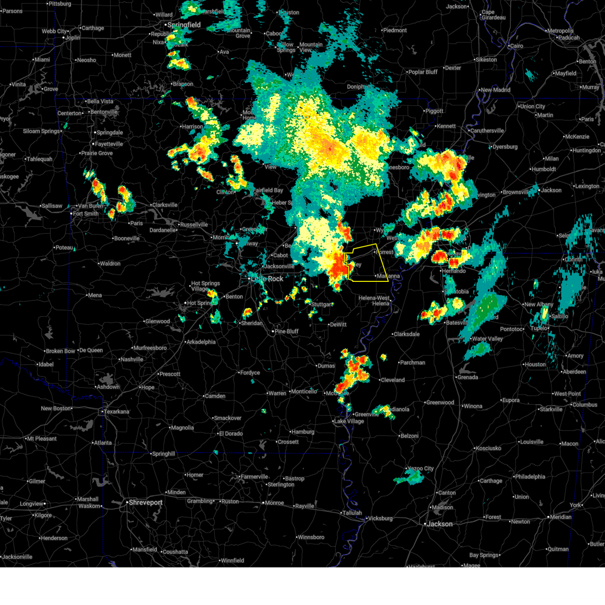
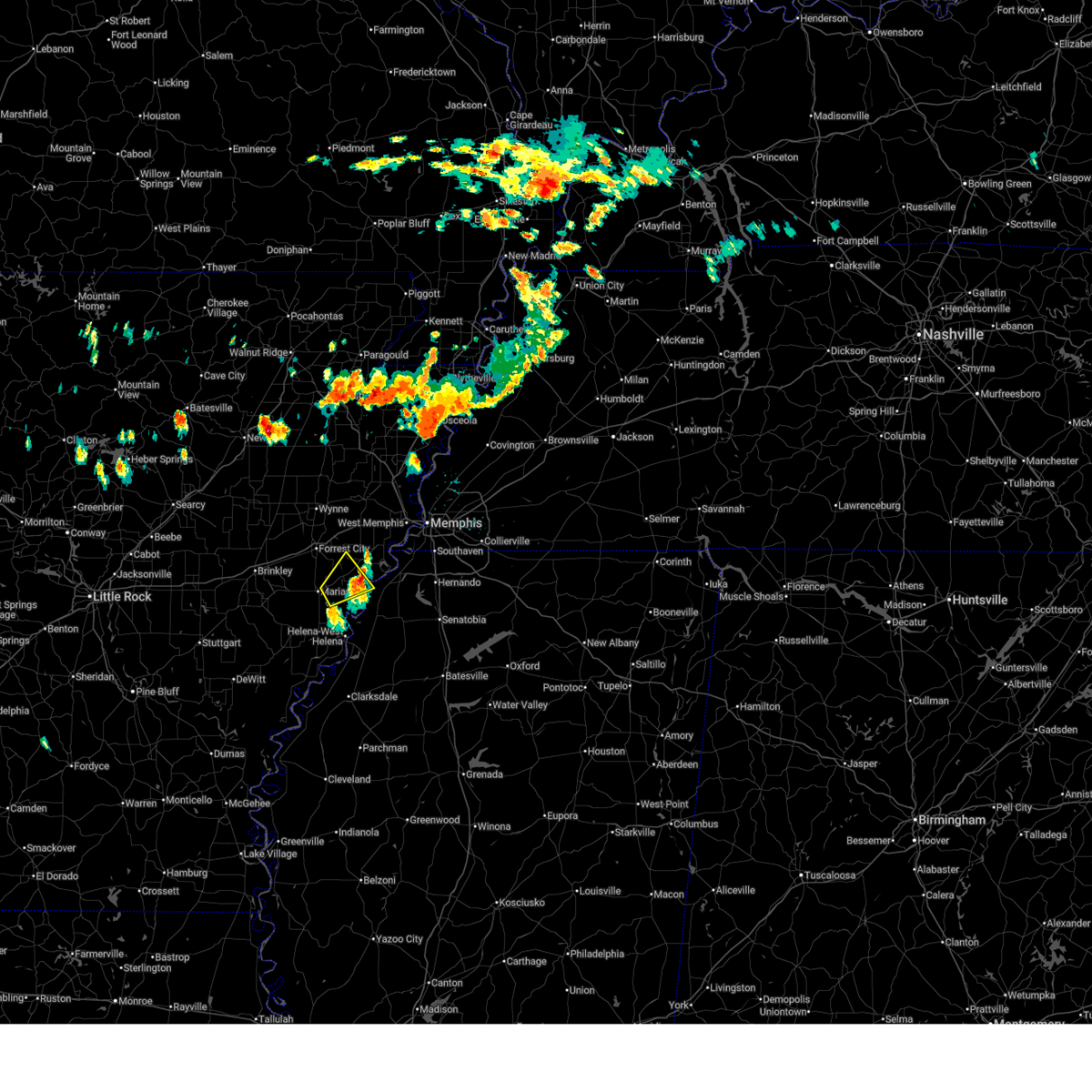
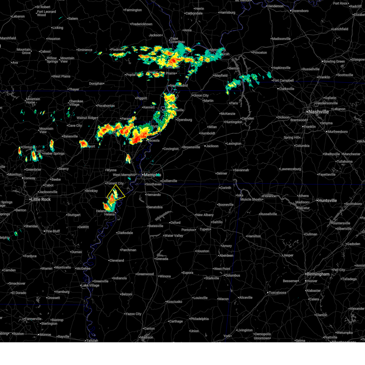
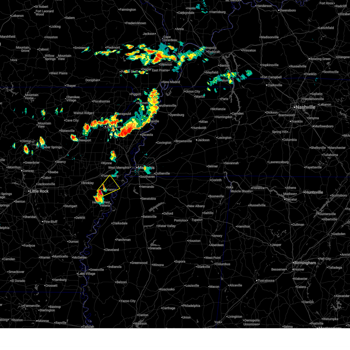
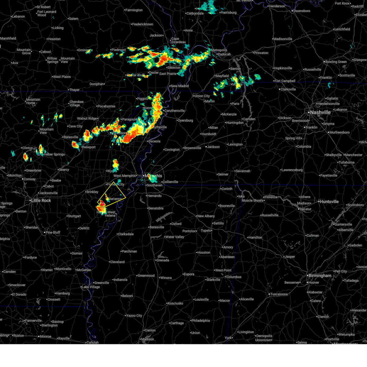
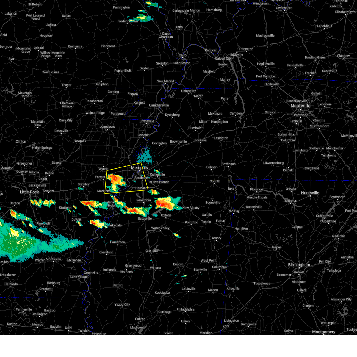
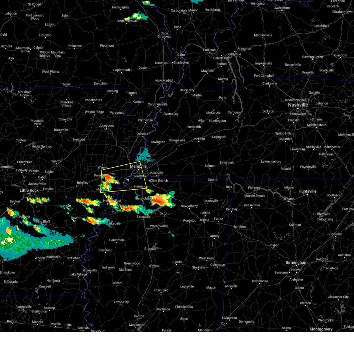
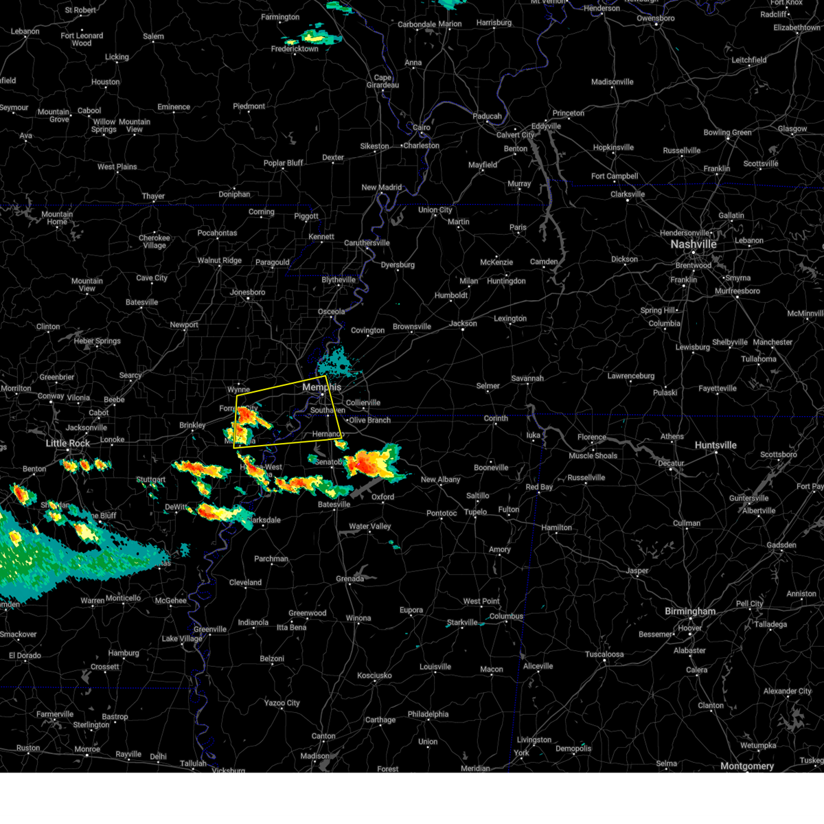
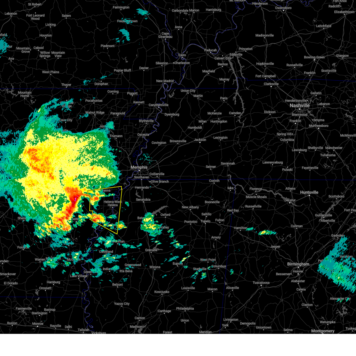
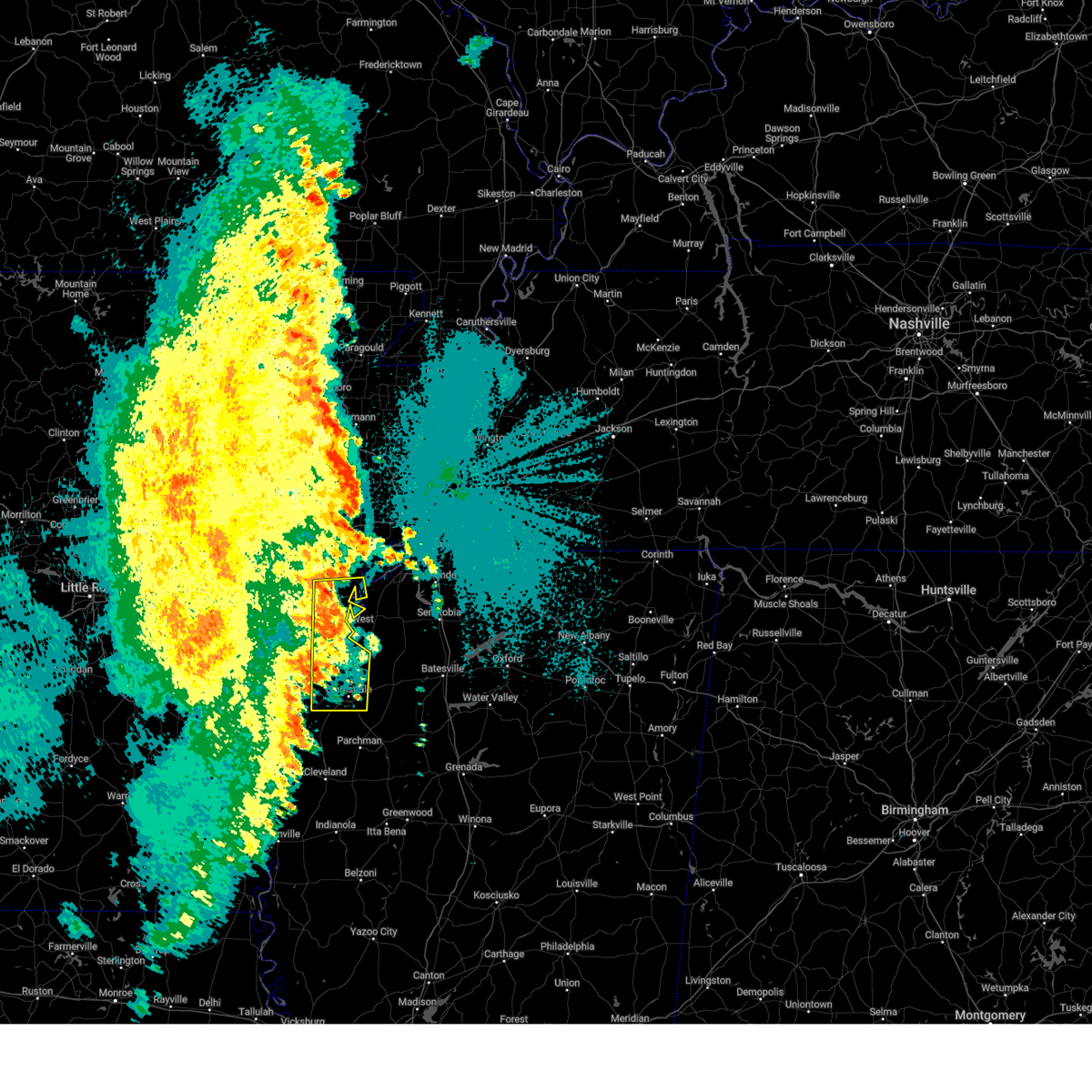
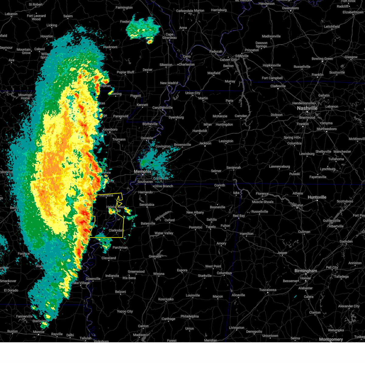
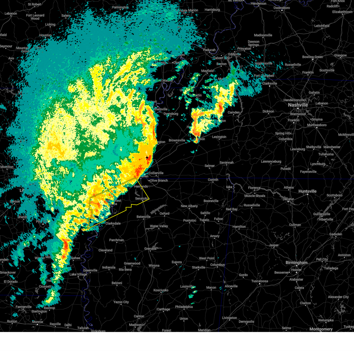
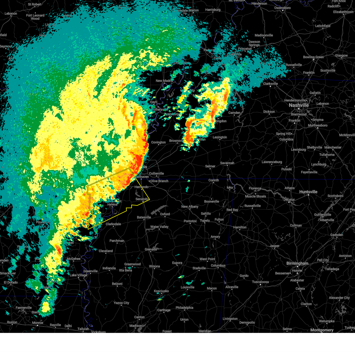
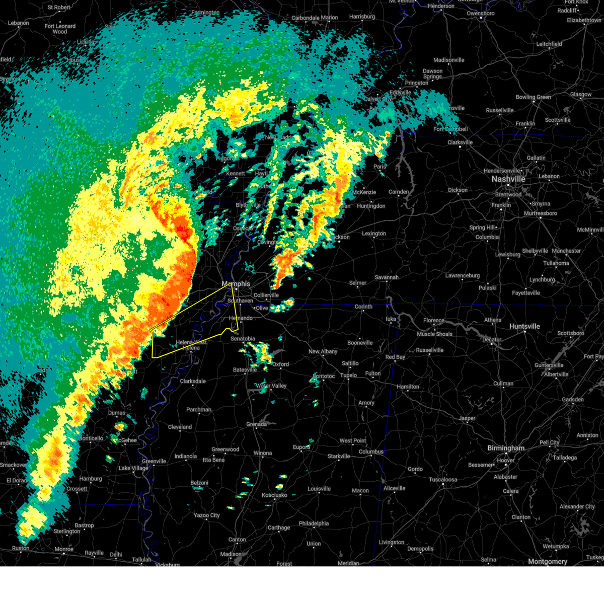
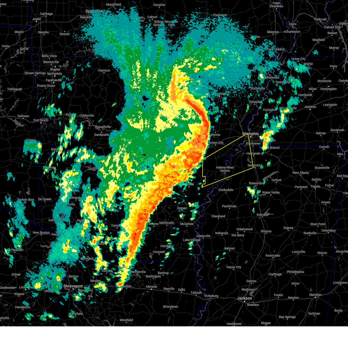
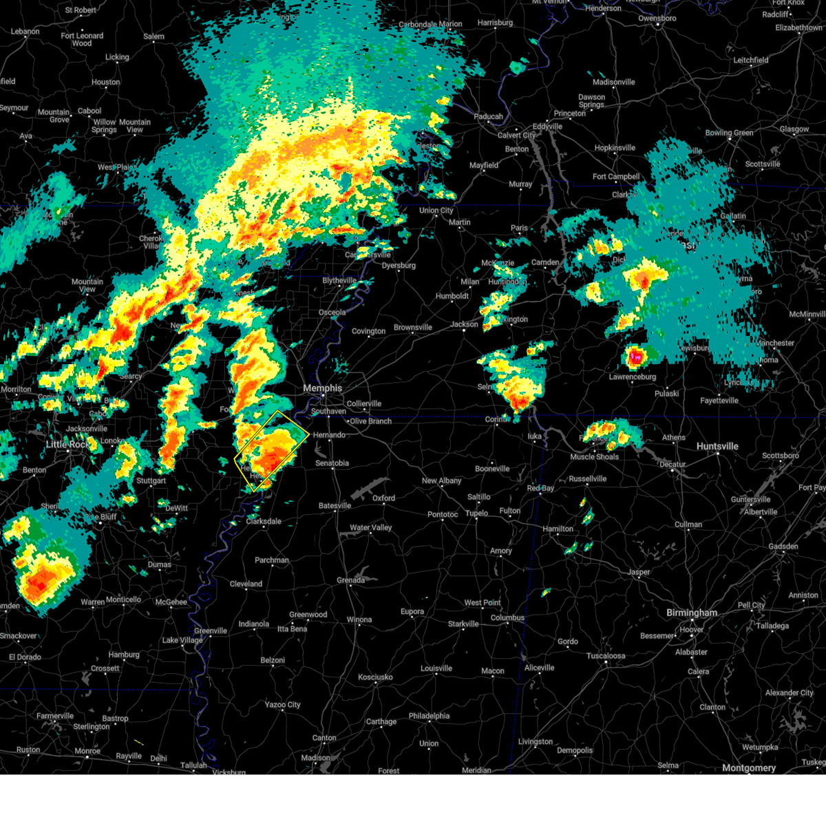
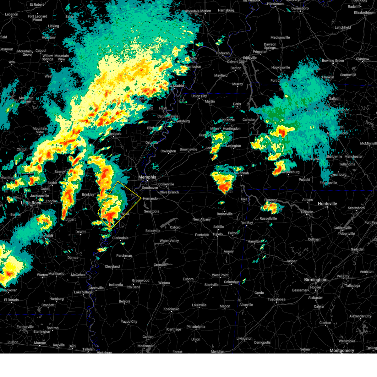
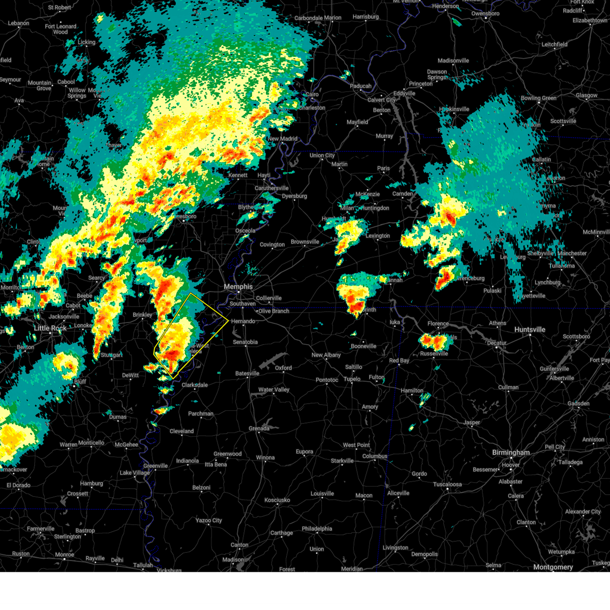
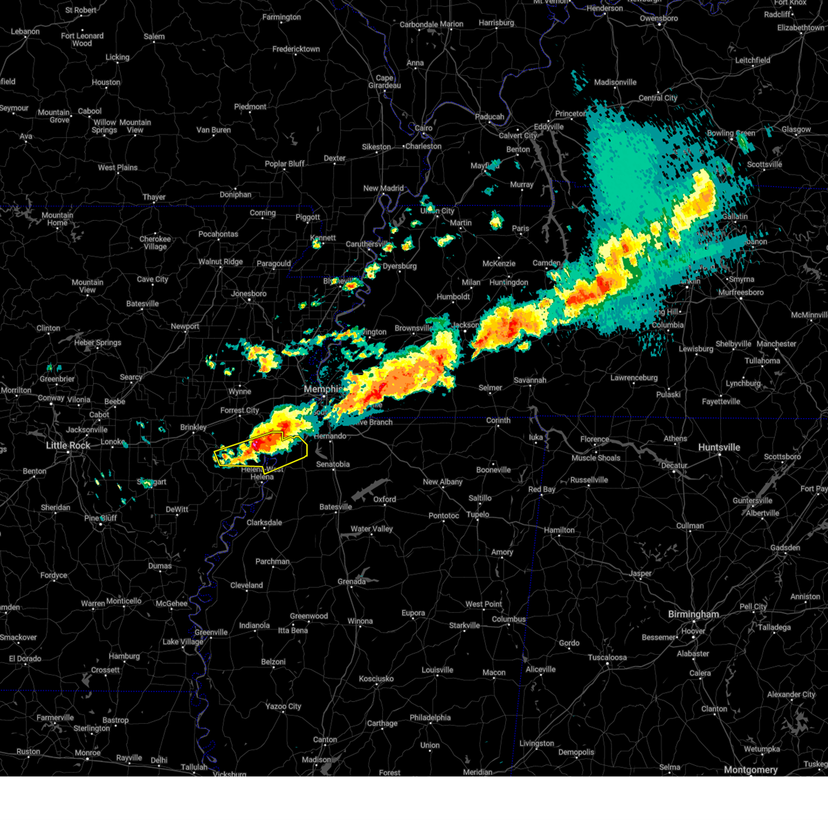
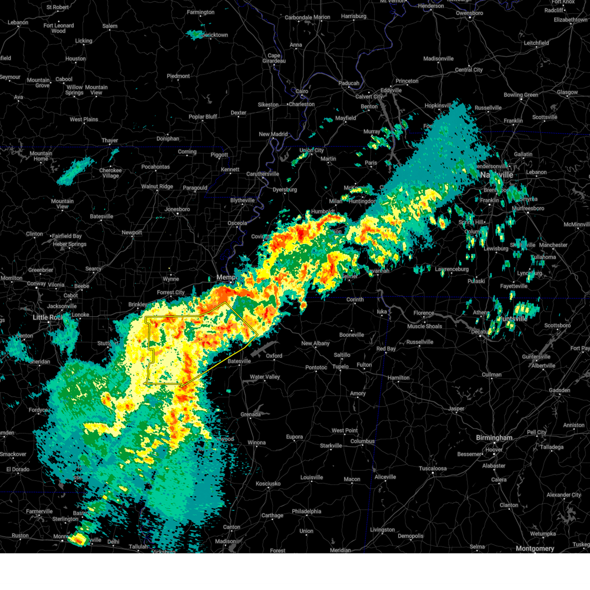
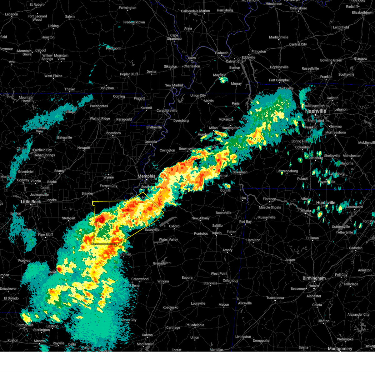
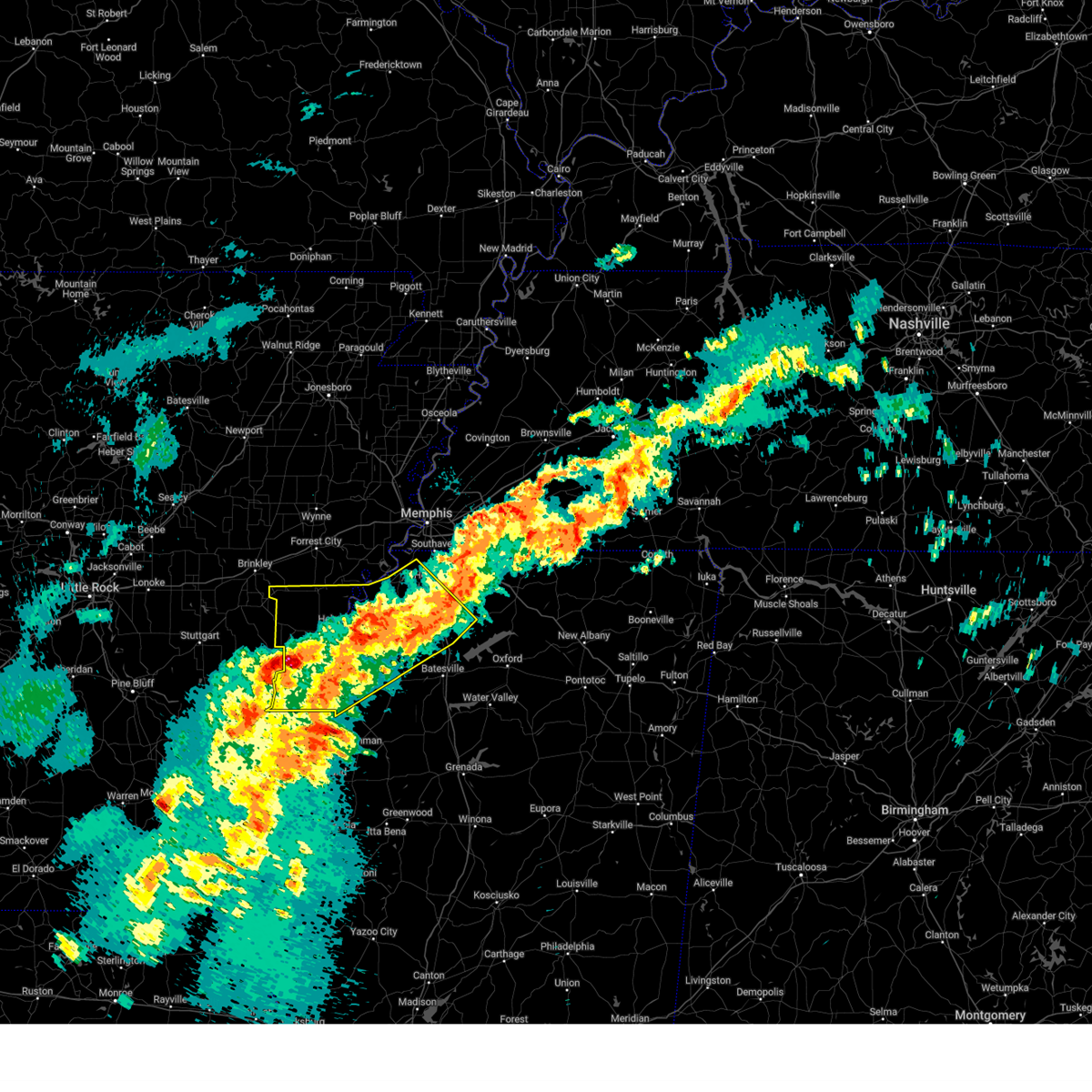
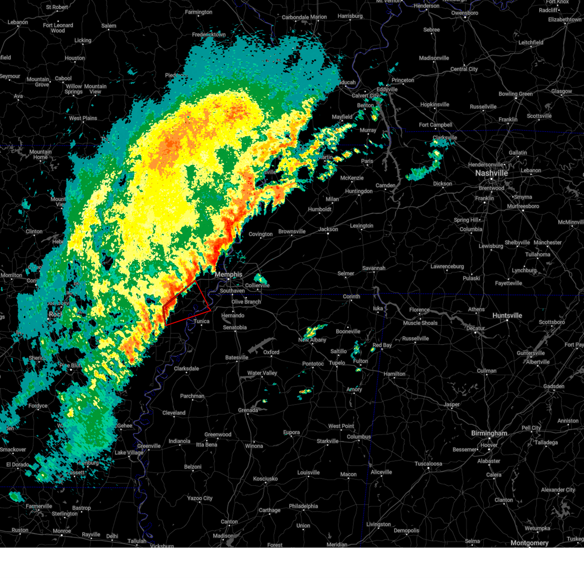
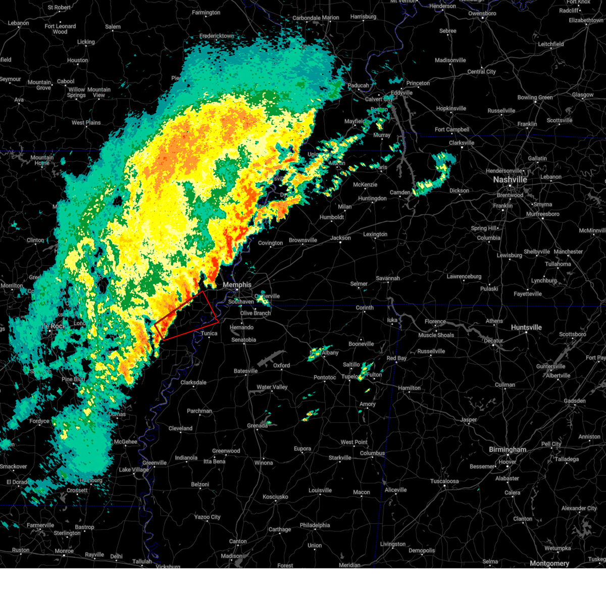
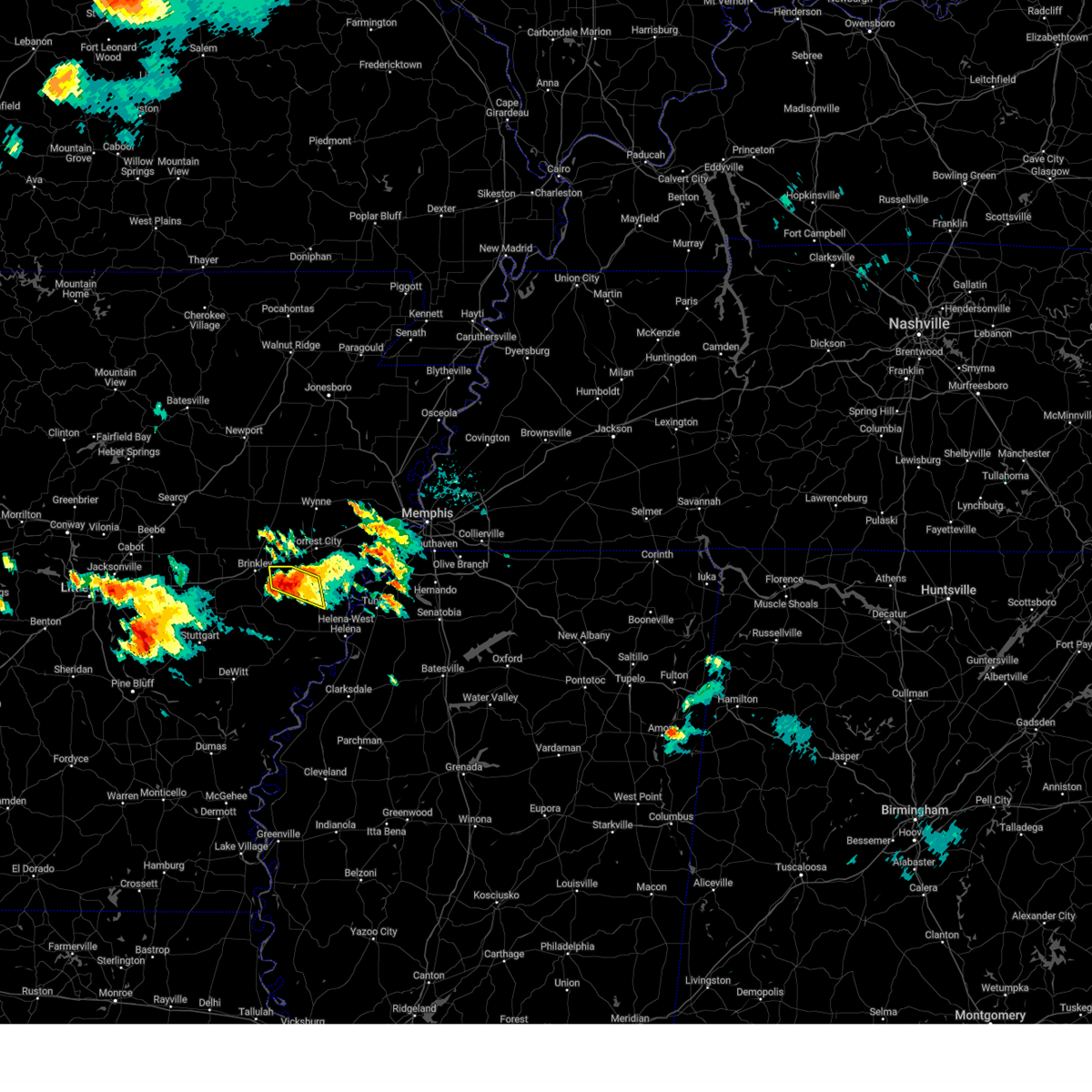
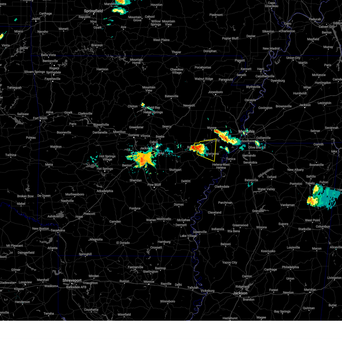
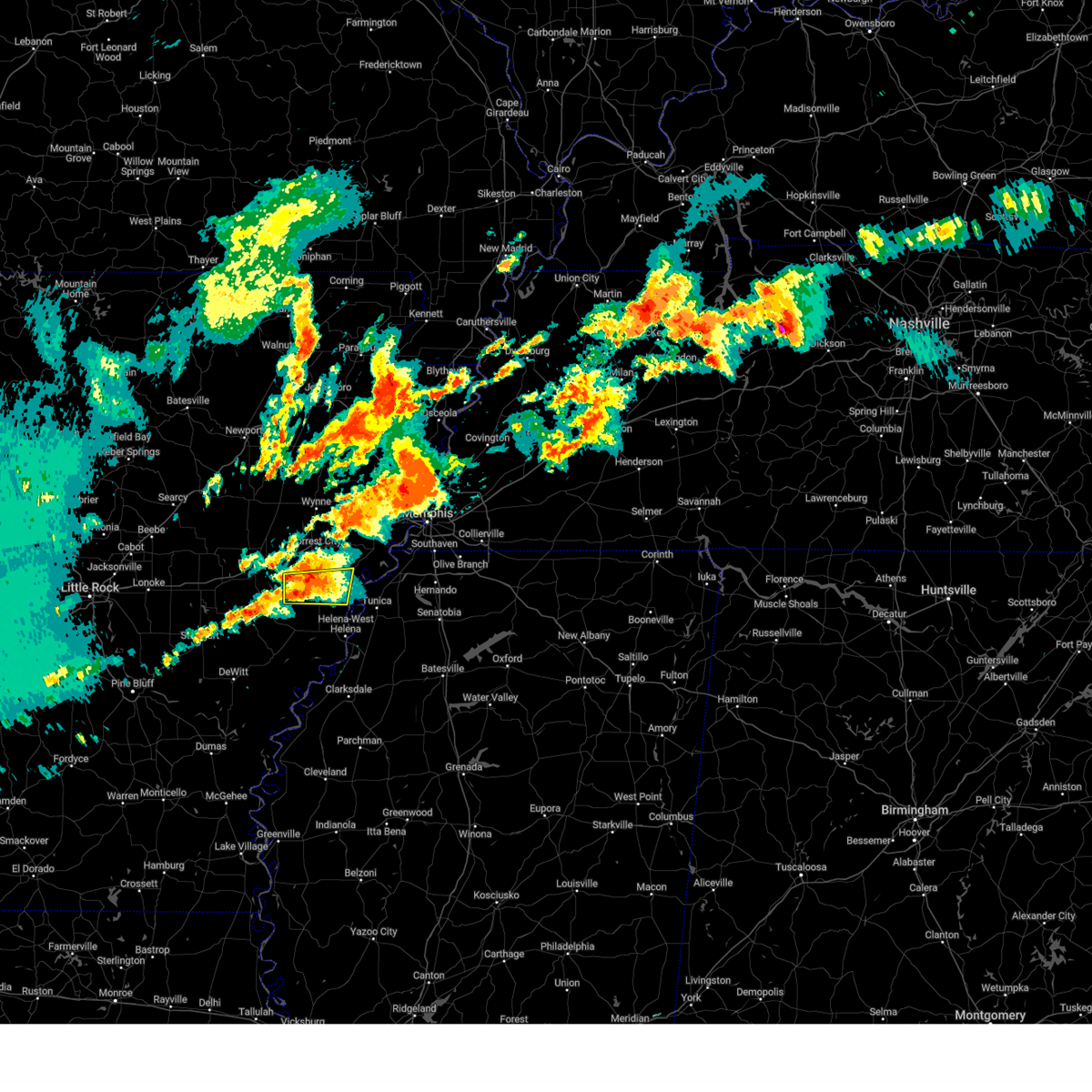
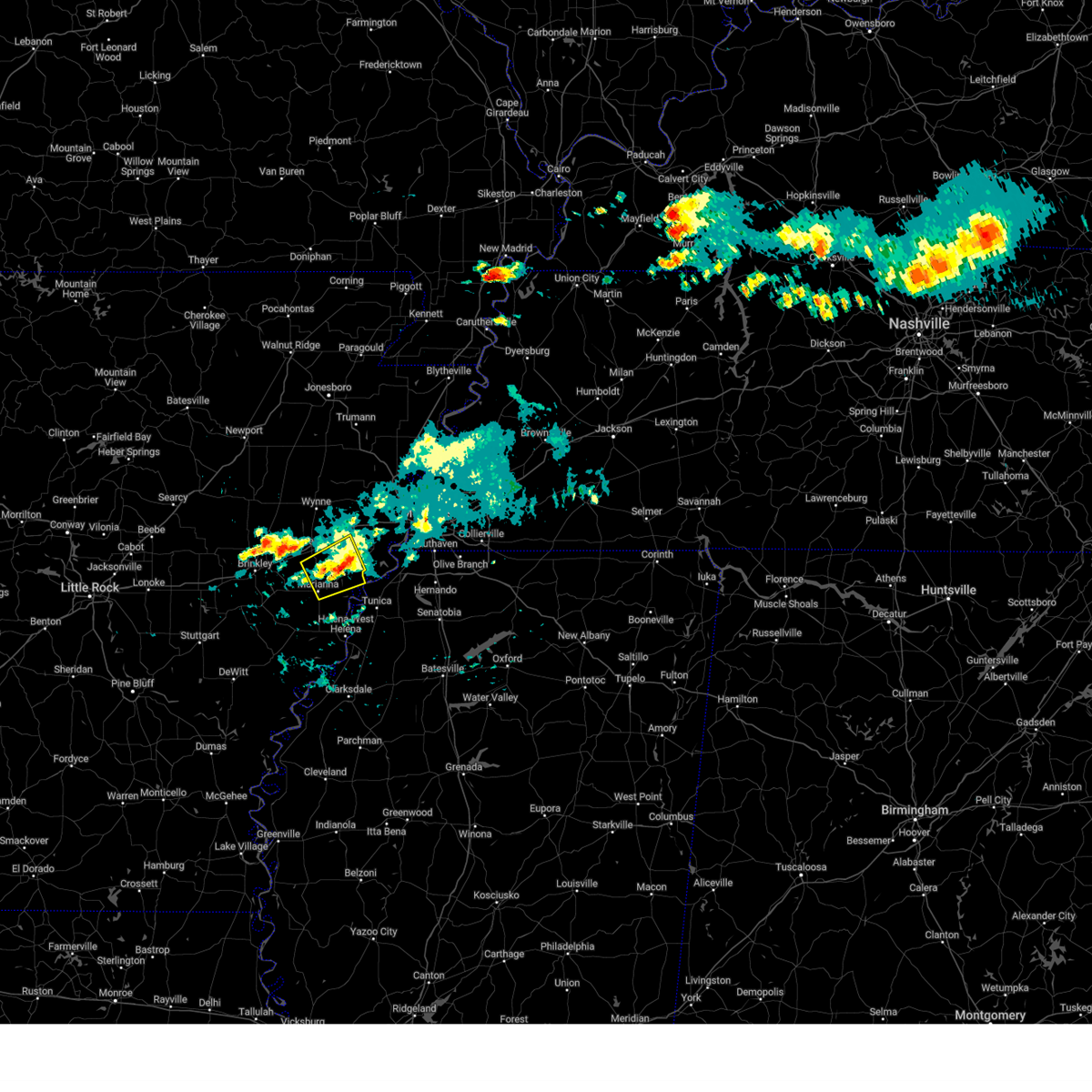
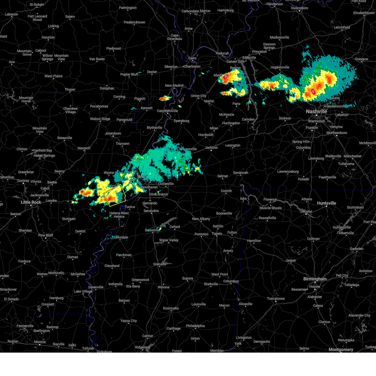
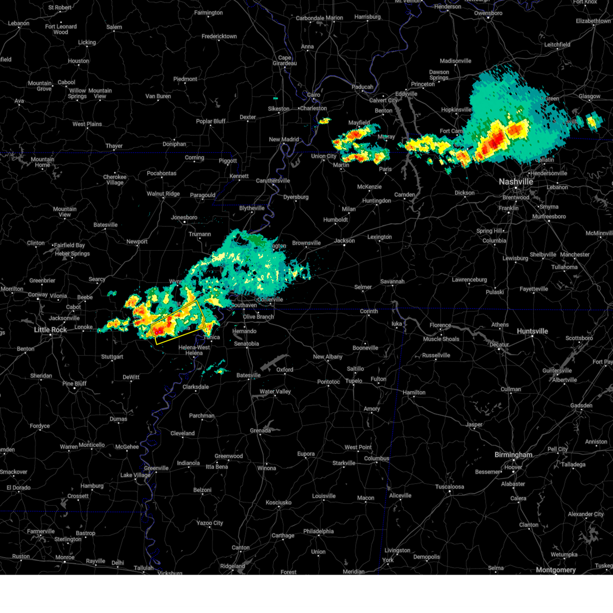
Hail Map for Marianna, AR
The Marianna, AR area has had 7 reports of on-the-ground hail by trained spotters, and has been under severe weather warnings 54 times during the past 12 months. Doppler radar has detected hail at or near Marianna, AR on 52 occasions, including 4 occasions during the past year.
| Name: | Marianna, AR |
| Where Located: | 48.4 miles WSW of Memphis, TN |
| Map: | Google Map for Marianna, AR |
| Population: | 4115 |
| Housing Units: | 2012 |
| More Info: | Search Google for Marianna, AR |
4
The Top Recent Hail Date for Marianna, AR is Sunday, March 30, 2025 (2nd out of 52)

Hail and Wind Damage Spotted near Marianna, AR
| Date / Time | Report Details |
|---|---|
| 6/28/2025 5:36 PM CDT |
 Svrmeg the national weather service in memphis has issued a * severe thunderstorm warning for, northwestern lee county in eastern arkansas, western st. francis county in eastern arkansas, * until 615 pm cdt. * at 536 pm cdt, a severe thunderstorm was located over new salem, or 10 miles southwest of palestine, moving east at 20 mph (radar indicated). Hazards include 60 mph wind gusts. expect damage to roofs, siding, and trees Svrmeg the national weather service in memphis has issued a * severe thunderstorm warning for, northwestern lee county in eastern arkansas, western st. francis county in eastern arkansas, * until 615 pm cdt. * at 536 pm cdt, a severe thunderstorm was located over new salem, or 10 miles southwest of palestine, moving east at 20 mph (radar indicated). Hazards include 60 mph wind gusts. expect damage to roofs, siding, and trees
|
| 6/18/2025 11:30 PM CDT |
 The storm which prompted the warning has weakened below severe limits, and no longer poses an immediate threat to life or property. therefore, the warning will be allowed to expire. The storm which prompted the warning has weakened below severe limits, and no longer poses an immediate threat to life or property. therefore, the warning will be allowed to expire.
|
| 6/18/2025 11:12 PM CDT |
 At 1112 pm cdt, a severe thunderstorm was located near brickeys, or near marianna, moving northeast at 35 mph (radar indicated). Hazards include 60 mph wind gusts and quarter size hail. Hail damage to vehicles is expected. expect wind damage to roofs, siding, and trees. Locations impacted include, brickeys, rawlinson, jeffersonville, raggio, cody, gassett, kokomo, haleside, mud lake, dansby, soudan, peters, council, diamond woods, ball point, whitehall, tongin, and mississippi river state park. At 1112 pm cdt, a severe thunderstorm was located near brickeys, or near marianna, moving northeast at 35 mph (radar indicated). Hazards include 60 mph wind gusts and quarter size hail. Hail damage to vehicles is expected. expect wind damage to roofs, siding, and trees. Locations impacted include, brickeys, rawlinson, jeffersonville, raggio, cody, gassett, kokomo, haleside, mud lake, dansby, soudan, peters, council, diamond woods, ball point, whitehall, tongin, and mississippi river state park.
|
| 6/18/2025 11:01 PM CDT |
 At 1101 pm cdt, a severe thunderstorm was located over marianna, moving east at 35 mph (radar indicated). Hazards include 60 mph wind gusts and quarter size hail. Hail damage to vehicles is expected. expect wind damage to roofs, siding, and trees. Locations impacted include, marianna, brickeys, rawlinson, jeffersonville, raggio, cody, gassett, kokomo, haleside, mud lake, dansby, soudan, peters, burnt cane, council, felton, diamond woods, ball point, whitehall, and scott valley. At 1101 pm cdt, a severe thunderstorm was located over marianna, moving east at 35 mph (radar indicated). Hazards include 60 mph wind gusts and quarter size hail. Hail damage to vehicles is expected. expect wind damage to roofs, siding, and trees. Locations impacted include, marianna, brickeys, rawlinson, jeffersonville, raggio, cody, gassett, kokomo, haleside, mud lake, dansby, soudan, peters, burnt cane, council, felton, diamond woods, ball point, whitehall, and scott valley.
|
| 6/18/2025 10:52 PM CDT |
 Svrmeg the national weather service in memphis has issued a * severe thunderstorm warning for, central lee county in eastern arkansas, southeastern st. francis county in eastern arkansas, northwestern tunica county in northwestern mississippi, * until 1130 pm cdt. * at 1051 pm cdt, a severe thunderstorm was located over aubrey, or 7 miles southwest of marianna, moving northeast at 35 mph (radar indicated). Hazards include 60 mph wind gusts and quarter size hail. Hail damage to vehicles is expected. Expect wind damage to roofs, siding, and trees. Svrmeg the national weather service in memphis has issued a * severe thunderstorm warning for, central lee county in eastern arkansas, southeastern st. francis county in eastern arkansas, northwestern tunica county in northwestern mississippi, * until 1130 pm cdt. * at 1051 pm cdt, a severe thunderstorm was located over aubrey, or 7 miles southwest of marianna, moving northeast at 35 mph (radar indicated). Hazards include 60 mph wind gusts and quarter size hail. Hail damage to vehicles is expected. Expect wind damage to roofs, siding, and trees.
|
| 6/7/2025 9:05 PM CDT |
 At 905 pm cdt, a severe thunderstorm was located over new home, or near hughes, moving east at 35 mph (radar indicated). Hazards include ping pong ball size hail and 60 mph wind gusts. People and animals outdoors will be injured. expect hail damage to roofs, siding, windows, and vehicles. expect wind damage to roofs, siding, and trees. Locations impacted include, southaven, west memphis, horn lake, hernando, marion, marianna, hughes, madison, t o fuller state park, memphis, walls, crawfordsville, edmondson, horseshoe lake, widener, sunset, anthonyville, jennette, lake cormorant, and southwest memphis. At 905 pm cdt, a severe thunderstorm was located over new home, or near hughes, moving east at 35 mph (radar indicated). Hazards include ping pong ball size hail and 60 mph wind gusts. People and animals outdoors will be injured. expect hail damage to roofs, siding, windows, and vehicles. expect wind damage to roofs, siding, and trees. Locations impacted include, southaven, west memphis, horn lake, hernando, marion, marianna, hughes, madison, t o fuller state park, memphis, walls, crawfordsville, edmondson, horseshoe lake, widener, sunset, anthonyville, jennette, lake cormorant, and southwest memphis.
|
| 6/7/2025 9:01 PM CDT |
 At 901 pm cdt, a severe thunderstorm was located near new home, or near madison, moving east at 35 mph (radar indicated). Hazards include 60 mph wind gusts and quarter size hail. Hail damage to vehicles is expected. expect wind damage to roofs, siding, and trees. Locations impacted include, southaven, west memphis, horn lake, forrest city, hernando, marion, marianna, hughes, madison, t o fuller state park, memphis, walls, caldwell, crawfordsville, edmondson, horseshoe lake, widener, sunset, anthonyville, and haynes. At 901 pm cdt, a severe thunderstorm was located near new home, or near madison, moving east at 35 mph (radar indicated). Hazards include 60 mph wind gusts and quarter size hail. Hail damage to vehicles is expected. expect wind damage to roofs, siding, and trees. Locations impacted include, southaven, west memphis, horn lake, forrest city, hernando, marion, marianna, hughes, madison, t o fuller state park, memphis, walls, caldwell, crawfordsville, edmondson, horseshoe lake, widener, sunset, anthonyville, and haynes.
|
| 6/7/2025 8:55 PM CDT |
 Svrmeg the national weather service in memphis has issued a * severe thunderstorm warning for, northeastern lee county in eastern arkansas, eastern st. francis county in eastern arkansas, central crittenden county in eastern arkansas, southeastern cross county in eastern arkansas, northwestern desoto county in northwestern mississippi, northern tunica county in northwestern mississippi, southwestern shelby county in west tennessee, * until 945 pm cdt. * at 855 pm cdt, a severe thunderstorm was located over widener, or near madison, moving east at 35 mph (radar indicated). Hazards include 60 mph wind gusts and quarter size hail. Hail damage to vehicles is expected. Expect wind damage to roofs, siding, and trees. Svrmeg the national weather service in memphis has issued a * severe thunderstorm warning for, northeastern lee county in eastern arkansas, eastern st. francis county in eastern arkansas, central crittenden county in eastern arkansas, southeastern cross county in eastern arkansas, northwestern desoto county in northwestern mississippi, northern tunica county in northwestern mississippi, southwestern shelby county in west tennessee, * until 945 pm cdt. * at 855 pm cdt, a severe thunderstorm was located over widener, or near madison, moving east at 35 mph (radar indicated). Hazards include 60 mph wind gusts and quarter size hail. Hail damage to vehicles is expected. Expect wind damage to roofs, siding, and trees.
|
| 5/18/2025 8:00 AM CDT |
 Svrmeg the national weather service in memphis has issued a * severe thunderstorm warning for, lee county in eastern arkansas, phillips county in eastern arkansas, central coahoma county in northwestern mississippi, western tunica county in northwestern mississippi, * until 900 am cdt. * at 759 am cdt, a severe thunderstorm was located near holly grove, or 8 miles south of clarendon, moving east at 45 mph (radar indicated). Hazards include 60 mph wind gusts and quarter size hail. Hail damage to vehicles is expected. Expect wind damage to roofs, siding, and trees. Svrmeg the national weather service in memphis has issued a * severe thunderstorm warning for, lee county in eastern arkansas, phillips county in eastern arkansas, central coahoma county in northwestern mississippi, western tunica county in northwestern mississippi, * until 900 am cdt. * at 759 am cdt, a severe thunderstorm was located near holly grove, or 8 miles south of clarendon, moving east at 45 mph (radar indicated). Hazards include 60 mph wind gusts and quarter size hail. Hail damage to vehicles is expected. Expect wind damage to roofs, siding, and trees.
|
| 5/16/2025 11:19 PM CDT |
 At 1119 pm cdt, a severe thunderstorm was located near marvell, moving east at 35 mph (radar indicated). Hazards include ping pong ball size hail and 60 mph wind gusts. People and animals outdoors will be injured. expect hail damage to roofs, siding, windows, and vehicles. expect wind damage to roofs, siding, and trees. Locations impacted include, tunica, coahoma, rudyard, moon, helena-west helena, preston place, haleside, quarles, commerce, austin, westover, vineyard, jonestown, dubbs, matagorda, whitehall, poplar grove, huma, mississippi river state park, and north tunica. At 1119 pm cdt, a severe thunderstorm was located near marvell, moving east at 35 mph (radar indicated). Hazards include ping pong ball size hail and 60 mph wind gusts. People and animals outdoors will be injured. expect hail damage to roofs, siding, windows, and vehicles. expect wind damage to roofs, siding, and trees. Locations impacted include, tunica, coahoma, rudyard, moon, helena-west helena, preston place, haleside, quarles, commerce, austin, westover, vineyard, jonestown, dubbs, matagorda, whitehall, poplar grove, huma, mississippi river state park, and north tunica.
|
| 5/16/2025 10:57 PM CDT |
 Svrmeg the national weather service in memphis has issued a * severe thunderstorm warning for, southern lee county in eastern arkansas, phillips county in eastern arkansas, northeastern coahoma county in northwestern mississippi, central tunica county in northwestern mississippi, * until midnight cdt. * at 1057 pm cdt, a severe thunderstorm was located near holly grove, or 10 miles southeast of clarendon, moving east at 50 mph (radar indicated). Hazards include ping pong ball size hail and 60 mph wind gusts. People and animals outdoors will be injured. expect hail damage to roofs, siding, windows, and vehicles. Expect wind damage to roofs, siding, and trees. Svrmeg the national weather service in memphis has issued a * severe thunderstorm warning for, southern lee county in eastern arkansas, phillips county in eastern arkansas, northeastern coahoma county in northwestern mississippi, central tunica county in northwestern mississippi, * until midnight cdt. * at 1057 pm cdt, a severe thunderstorm was located near holly grove, or 10 miles southeast of clarendon, moving east at 50 mph (radar indicated). Hazards include ping pong ball size hail and 60 mph wind gusts. People and animals outdoors will be injured. expect hail damage to roofs, siding, windows, and vehicles. Expect wind damage to roofs, siding, and trees.
|
| 5/2/2025 10:30 AM CDT |
 Svrmeg the national weather service in memphis has issued a * severe thunderstorm warning for, lee county in eastern arkansas, eastern st. francis county in eastern arkansas, phillips county in eastern arkansas, coahoma county in northwestern mississippi, tunica county in northwestern mississippi, quitman county in northwestern mississippi, * until 1130 am cdt. * at 1030 am cdt, severe thunderstorms were located along a line extending from garret grove to near watkins corner to near crumrod, moving northeast at 30 mph (radar indicated). Hazards include 60 mph wind gusts and quarter size hail. Hail damage to vehicles is expected. Expect wind damage to roofs, siding, and trees. Svrmeg the national weather service in memphis has issued a * severe thunderstorm warning for, lee county in eastern arkansas, eastern st. francis county in eastern arkansas, phillips county in eastern arkansas, coahoma county in northwestern mississippi, tunica county in northwestern mississippi, quitman county in northwestern mississippi, * until 1130 am cdt. * at 1030 am cdt, severe thunderstorms were located along a line extending from garret grove to near watkins corner to near crumrod, moving northeast at 30 mph (radar indicated). Hazards include 60 mph wind gusts and quarter size hail. Hail damage to vehicles is expected. Expect wind damage to roofs, siding, and trees.
|
| 4/30/2025 8:54 PM CDT |
 The storms which prompted the warning have weakened below severe limits, and have exited the warned area. therefore, the warning will be allowed to expire. a severe thunderstorm watch remains in effect until 1100 pm cdt for eastern arkansas, and northwestern mississippi. The storms which prompted the warning have weakened below severe limits, and have exited the warned area. therefore, the warning will be allowed to expire. a severe thunderstorm watch remains in effect until 1100 pm cdt for eastern arkansas, and northwestern mississippi.
|
| 4/30/2025 8:43 PM CDT | At 842 pm cdt, severe thunderstorms were located along a line extending from near haynes to near sherard, moving east at 40 mph (radar indicated). Hazards include 60 mph wind gusts and penny size hail. Expect damage to roofs, siding, and trees. Locations impacted include, rena lara, coahoma, rudyard, moon, helena-west helena, preston place, haleside, quarles, westover, soudan, beverly, clarksdale, jonestown, lurand, matagorda, farrell, whitehall, raggio, huma, and mississippi river state park. |
| 4/30/2025 8:12 PM CDT |
 Svrmeg the national weather service in memphis has issued a * severe thunderstorm warning for, lee county in eastern arkansas, phillips county in eastern arkansas, coahoma county in northwestern mississippi, * until 900 pm cdt. * at 812 pm cdt, severe thunderstorms were located along a line extending from near garret grove to near crumrod, moving east at 40 mph (radar indicated). Hazards include 60 mph wind gusts and penny size hail. expect damage to roofs, siding, and trees Svrmeg the national weather service in memphis has issued a * severe thunderstorm warning for, lee county in eastern arkansas, phillips county in eastern arkansas, coahoma county in northwestern mississippi, * until 900 pm cdt. * at 812 pm cdt, severe thunderstorms were located along a line extending from near garret grove to near crumrod, moving east at 40 mph (radar indicated). Hazards include 60 mph wind gusts and penny size hail. expect damage to roofs, siding, and trees
|
| 4/5/2025 2:07 PM CDT |
 the severe thunderstorm warning has been cancelled and is no longer in effect the severe thunderstorm warning has been cancelled and is no longer in effect
|
| 4/5/2025 2:07 PM CDT |
 At 207 pm cdt, a severe thunderstorm was located over rondo, or 8 miles northeast of marvell, moving east at 50 mph (radar indicated). Hazards include 60 mph wind gusts and quarter size hail. Hail damage to vehicles is expected. expect wind damage to roofs, siding, and trees. Locations impacted include, lake cormorant, moon, savage, haleside, commerce, senatobia, austin, hoop spur, westover, strayhorn, prichard, dubbs, glover, whitehall, poplar grove, dooley, north tunica, clayton, hollywood, and lost lake. At 207 pm cdt, a severe thunderstorm was located over rondo, or 8 miles northeast of marvell, moving east at 50 mph (radar indicated). Hazards include 60 mph wind gusts and quarter size hail. Hail damage to vehicles is expected. expect wind damage to roofs, siding, and trees. Locations impacted include, lake cormorant, moon, savage, haleside, commerce, senatobia, austin, hoop spur, westover, strayhorn, prichard, dubbs, glover, whitehall, poplar grove, dooley, north tunica, clayton, hollywood, and lost lake.
|
| 4/5/2025 1:52 PM CDT |
 Svrmeg the national weather service in memphis has issued a * severe thunderstorm warning for, lee county in eastern arkansas, southeastern st. francis county in eastern arkansas, phillips county in eastern arkansas, southwestern crittenden county in eastern arkansas, western desoto county in northwestern mississippi, northern coahoma county in northwestern mississippi, tunica county in northwestern mississippi, western tate county in northwestern mississippi, southwestern shelby county in west tennessee, * until 245 pm cdt. * at 152 pm cdt, a severe thunderstorm was located near palmer, or near marvell, moving northeast at 60 mph (radar indicated). Hazards include 60 mph wind gusts and quarter size hail. Hail damage to vehicles is expected. Expect wind damage to roofs, siding, and trees. Svrmeg the national weather service in memphis has issued a * severe thunderstorm warning for, lee county in eastern arkansas, southeastern st. francis county in eastern arkansas, phillips county in eastern arkansas, southwestern crittenden county in eastern arkansas, western desoto county in northwestern mississippi, northern coahoma county in northwestern mississippi, tunica county in northwestern mississippi, western tate county in northwestern mississippi, southwestern shelby county in west tennessee, * until 245 pm cdt. * at 152 pm cdt, a severe thunderstorm was located near palmer, or near marvell, moving northeast at 60 mph (radar indicated). Hazards include 60 mph wind gusts and quarter size hail. Hail damage to vehicles is expected. Expect wind damage to roofs, siding, and trees.
|
| 4/5/2025 1:29 PM CDT | the severe thunderstorm warning has been cancelled and is no longer in effect |
| 4/5/2025 1:29 PM CDT | At 129 pm cdt, severe thunderstorms were located along a line extending from leachville to marie to near hughes, moving east at 50 mph. these are destructive storms for the memphis metro area (radar indicated). Hazards include 80 mph wind gusts and quarter size hail. Flying debris will be dangerous to those caught without shelter. mobile homes will be heavily damaged. expect considerable damage to roofs, windows, and vehicles. extensive tree damage and power outages are likely. Locations impacted include, cody, burlison, paulding, scobeville, calumet, new survey, horn lake, haleside, louise, gobler, covington, edmondson, osceola, presidents island, beck, glover, locke, ball point, arlington, and tongin. |
| 4/5/2025 1:21 PM CDT |
 Svrmeg the national weather service in memphis has issued a * severe thunderstorm warning for, eastern craighead county in eastern arkansas, eastern st. francis county in eastern arkansas, mississippi county in eastern arkansas, crittenden county in eastern arkansas, southeastern clay county in eastern arkansas, greene county in eastern arkansas, eastern lee county in eastern arkansas, eastern poinsett county in eastern arkansas, northern phillips county in eastern arkansas, desoto county in northwestern mississippi, northwestern tate county in northwestern mississippi, northern tunica county in northwestern mississippi, dunklin county in southeastern missouri, pemiscot county in southeastern missouri, lauderdale county in west tennessee, southwestern haywood county in west tennessee, shelby county in west tennessee, tipton county in west tennessee, southwestern dyer county in west tennessee, * until 215 pm cdt. * at 120 pm cdt, severe thunderstorms were located along a line extending from evening star to joiner to near hughes to near marvell, moving east at 55 mph. this storm system is moving over areas already impacted earlier in the week. these are destructive storms for shelby, mississippi, and desoto (radar indicated). Hazards include 80 mph wind gusts and quarter size hail. Flying debris will be dangerous to those caught without shelter. mobile homes will be heavily damaged. expect considerable damage to roofs, windows, and vehicles. Extensive tree damage and power outages are likely. Svrmeg the national weather service in memphis has issued a * severe thunderstorm warning for, eastern craighead county in eastern arkansas, eastern st. francis county in eastern arkansas, mississippi county in eastern arkansas, crittenden county in eastern arkansas, southeastern clay county in eastern arkansas, greene county in eastern arkansas, eastern lee county in eastern arkansas, eastern poinsett county in eastern arkansas, northern phillips county in eastern arkansas, desoto county in northwestern mississippi, northwestern tate county in northwestern mississippi, northern tunica county in northwestern mississippi, dunklin county in southeastern missouri, pemiscot county in southeastern missouri, lauderdale county in west tennessee, southwestern haywood county in west tennessee, shelby county in west tennessee, tipton county in west tennessee, southwestern dyer county in west tennessee, * until 215 pm cdt. * at 120 pm cdt, severe thunderstorms were located along a line extending from evening star to joiner to near hughes to near marvell, moving east at 55 mph. this storm system is moving over areas already impacted earlier in the week. these are destructive storms for shelby, mississippi, and desoto (radar indicated). Hazards include 80 mph wind gusts and quarter size hail. Flying debris will be dangerous to those caught without shelter. mobile homes will be heavily damaged. expect considerable damage to roofs, windows, and vehicles. Extensive tree damage and power outages are likely.
|
| 4/5/2025 1:12 PM CDT |
 At 112 pm cdt, a severe thunderstorm was located over horseshoe lake, or 10 miles southeast of hughes, moving northeast at 80 mph (radar indicated). Hazards include 60 mph wind gusts and penny size hail. Expect damage to roofs, siding, and trees. Locations impacted include, cody, lake cormorant, haleside, commerce, louise, austin, edmondson, presidents island, beck, simsboro, glover, brickeys, ball point, whitehall, tongin, poplar grove, north tunica, hollywood, lost lake, and thomasville. At 112 pm cdt, a severe thunderstorm was located over horseshoe lake, or 10 miles southeast of hughes, moving northeast at 80 mph (radar indicated). Hazards include 60 mph wind gusts and penny size hail. Expect damage to roofs, siding, and trees. Locations impacted include, cody, lake cormorant, haleside, commerce, louise, austin, edmondson, presidents island, beck, simsboro, glover, brickeys, ball point, whitehall, tongin, poplar grove, north tunica, hollywood, lost lake, and thomasville.
|
| 4/5/2025 1:12 PM CDT |
 the severe thunderstorm warning has been cancelled and is no longer in effect the severe thunderstorm warning has been cancelled and is no longer in effect
|
| 4/5/2025 12:36 PM CDT |
 Svrmeg the national weather service in memphis has issued a * severe thunderstorm warning for, lee county in eastern arkansas, southeastern st. francis county in eastern arkansas, phillips county in eastern arkansas, southern crittenden county in eastern arkansas, western desoto county in northwestern mississippi, northern coahoma county in northwestern mississippi, tunica county in northwestern mississippi, western tate county in northwestern mississippi, southwestern shelby county in west tennessee, * until 130 pm cdt. * at 1236 pm cdt, a severe thunderstorm was located over palmer, or 9 miles northwest of marvell, moving northeast at 80 mph (radar indicated). Hazards include 60 mph wind gusts and quarter size hail. Hail damage to vehicles is expected. Expect wind damage to roofs, siding, and trees. Svrmeg the national weather service in memphis has issued a * severe thunderstorm warning for, lee county in eastern arkansas, southeastern st. francis county in eastern arkansas, phillips county in eastern arkansas, southern crittenden county in eastern arkansas, western desoto county in northwestern mississippi, northern coahoma county in northwestern mississippi, tunica county in northwestern mississippi, western tate county in northwestern mississippi, southwestern shelby county in west tennessee, * until 130 pm cdt. * at 1236 pm cdt, a severe thunderstorm was located over palmer, or 9 miles northwest of marvell, moving northeast at 80 mph (radar indicated). Hazards include 60 mph wind gusts and quarter size hail. Hail damage to vehicles is expected. Expect wind damage to roofs, siding, and trees.
|
| 4/3/2025 6:16 PM CDT |
 At 616 pm cdt, a severe thunderstorm was located near tunica, or 9 miles northeast of st francis national park, moving northeast at 50 mph (radar indicated). Hazards include 60 mph wind gusts and half dollar size hail. Hail damage to vehicles is expected. expect wind damage to roofs, siding, and trees. Locations impacted include, cody, hughes, clack, helena-west helena, preston place, haleside, quarles, commerce, austin, soudan, beck, brickeys, whitehall, tongin, raggio, huma, mississippi river state park, north tunica, penjur, and phillips bayou. At 616 pm cdt, a severe thunderstorm was located near tunica, or 9 miles northeast of st francis national park, moving northeast at 50 mph (radar indicated). Hazards include 60 mph wind gusts and half dollar size hail. Hail damage to vehicles is expected. expect wind damage to roofs, siding, and trees. Locations impacted include, cody, hughes, clack, helena-west helena, preston place, haleside, quarles, commerce, austin, soudan, beck, brickeys, whitehall, tongin, raggio, huma, mississippi river state park, north tunica, penjur, and phillips bayou.
|
| 4/3/2025 6:13 PM CDT |
 At 612 pm cdt, a severe thunderstorm was located near st francis national park, moving northeast at 50 mph (radar indicated). Hazards include 60 mph wind gusts and quarter size hail. Hail damage to vehicles is expected. expect wind damage to roofs, siding, and trees. Locations impacted include, cody, hughes, clack, cottonwood corner, helena-west helena, preston place, haleside, quarles, commerce, austin, soudan, round pond, beck, brickeys, ball point, whitehall, tongin, raggio, huma, and mississippi river state park. At 612 pm cdt, a severe thunderstorm was located near st francis national park, moving northeast at 50 mph (radar indicated). Hazards include 60 mph wind gusts and quarter size hail. Hail damage to vehicles is expected. expect wind damage to roofs, siding, and trees. Locations impacted include, cody, hughes, clack, cottonwood corner, helena-west helena, preston place, haleside, quarles, commerce, austin, soudan, round pond, beck, brickeys, ball point, whitehall, tongin, raggio, huma, and mississippi river state park.
|
| 4/3/2025 6:12 PM CDT |
 At 612 pm cdt, a severe thunderstorm was located near st francis national park, moving northeast at 50 mph (radar indicated). Hazards include golf ball size hail and 60 mph wind gusts. People and animals outdoors will be injured. expect hail damage to roofs, siding, windows, and vehicles. expect wind damage to roofs, siding, and trees. Locations impacted include, cody, hughes, clack, cottonwood corner, helena-west helena, preston place, haleside, quarles, commerce, austin, soudan, round pond, beck, brickeys, ball point, whitehall, tongin, raggio, huma, and mississippi river state park. At 612 pm cdt, a severe thunderstorm was located near st francis national park, moving northeast at 50 mph (radar indicated). Hazards include golf ball size hail and 60 mph wind gusts. People and animals outdoors will be injured. expect hail damage to roofs, siding, windows, and vehicles. expect wind damage to roofs, siding, and trees. Locations impacted include, cody, hughes, clack, cottonwood corner, helena-west helena, preston place, haleside, quarles, commerce, austin, soudan, round pond, beck, brickeys, ball point, whitehall, tongin, raggio, huma, and mississippi river state park.
|
| 4/3/2025 6:02 PM CDT |
 At 602 pm cdt, a severe thunderstorm was located near rondo, or 7 miles south of marianna, moving northeast at 50 mph (radar indicated). Hazards include golf ball size hail and 60 mph wind gusts. People and animals outdoors will be injured. expect hail damage to roofs, siding, windows, and vehicles. expect wind damage to roofs, siding, and trees. Locations impacted include, cody, hughes, clack, cottonwood corner, helena-west helena, preston place, haleside, quarles, commerce, austin, soudan, round pond, vineyard, beck, brickeys, ball point, whitehall, tongin, raggio, and poplar grove. At 602 pm cdt, a severe thunderstorm was located near rondo, or 7 miles south of marianna, moving northeast at 50 mph (radar indicated). Hazards include golf ball size hail and 60 mph wind gusts. People and animals outdoors will be injured. expect hail damage to roofs, siding, windows, and vehicles. expect wind damage to roofs, siding, and trees. Locations impacted include, cody, hughes, clack, cottonwood corner, helena-west helena, preston place, haleside, quarles, commerce, austin, soudan, round pond, vineyard, beck, brickeys, ball point, whitehall, tongin, raggio, and poplar grove.
|
| 4/3/2025 5:52 PM CDT |
 Svrmeg the national weather service in memphis has issued a * severe thunderstorm warning for, lee county in eastern arkansas, eastern st. francis county in eastern arkansas, northern phillips county in eastern arkansas, southwestern crittenden county in eastern arkansas, west central desoto county in northwestern mississippi, northern tunica county in northwestern mississippi, * until 630 pm cdt. * at 552 pm cdt, a severe thunderstorm was located near marvell, moving northeast at 50 mph (radar indicated). Hazards include 60 mph wind gusts and half dollar size hail. Hail damage to vehicles is expected. Expect wind damage to roofs, siding, and trees. Svrmeg the national weather service in memphis has issued a * severe thunderstorm warning for, lee county in eastern arkansas, eastern st. francis county in eastern arkansas, northern phillips county in eastern arkansas, southwestern crittenden county in eastern arkansas, west central desoto county in northwestern mississippi, northern tunica county in northwestern mississippi, * until 630 pm cdt. * at 552 pm cdt, a severe thunderstorm was located near marvell, moving northeast at 50 mph (radar indicated). Hazards include 60 mph wind gusts and half dollar size hail. Hail damage to vehicles is expected. Expect wind damage to roofs, siding, and trees.
|
| 4/2/2025 10:17 PM CDT | At 1017 pm cdt, a severe thunderstorm was located near robinsonville, or 9 miles south of hughes, moving northeast at 65 mph (radar indicated). Hazards include ping pong ball size hail and 60 mph wind gusts. People and animals outdoors will be injured. expect hail damage to roofs, siding, windows, and vehicles. expect wind damage to roofs, siding, and trees. Locations impacted include, cody, lake cormorant, southwest memphis, browns, horn lake, haleside, commerce, louise, austin, edmondson, st clair, presidents island, beck, simsboro, glover, brickeys, ball point, whitehall, tongin, and alden. |
| 4/2/2025 10:09 PM CDT | Svrmeg the national weather service in memphis has issued a * severe thunderstorm warning for, eastern lee county in eastern arkansas, southeastern st. francis county in eastern arkansas, central crittenden county in eastern arkansas, northwestern desoto county in northwestern mississippi, northern tunica county in northwestern mississippi, southwestern shelby county in west tennessee, * until 1100 pm cdt. * at 1009 pm cdt, a severe thunderstorm was located 7 miles south of brickeys, or 12 miles north of st francis national park, moving northeast at 65 mph (radar indicated). Hazards include ping pong ball size hail and 60 mph wind gusts. People and animals outdoors will be injured. expect hail damage to roofs, siding, windows, and vehicles. Expect wind damage to roofs, siding, and trees. |
| 4/2/2025 9:53 PM CDT | The storm which prompted the warning has weakened below severe limits, and no longer poses an immediate threat to life or property. therefore, the warning will be allowed to expire. a tornado watch remains in effect until midnight cdt for eastern arkansas, and northwestern mississippi. |
| 4/2/2025 9:18 PM CDT | the severe thunderstorm warning has been cancelled and is no longer in effect |
| 4/2/2025 9:18 PM CDT | At 918 pm cdt, a severe thunderstorm was located near brickeys, or near hughes, moving east at 45 mph (radar indicated). Hazards include 60 mph wind gusts and quarter size hail. Hail damage to vehicles is expected. expect wind damage to roofs, siding, and trees. Locations impacted include, garret grove, cody, helena-west helena, haleside, quarles, commerce, wheatley, soudan, vineyard, beck, brickeys, ball point, whitehall, tongin, raggio, poplar grove, gill, huma, mississippi river state park, and oneida. |
| 4/2/2025 8:55 PM CDT | the tornado warning has been cancelled and is no longer in effect |
| 4/2/2025 8:54 PM CDT | Svrmeg the national weather service in memphis has issued a * severe thunderstorm warning for, lee county in eastern arkansas, southern st. francis county in eastern arkansas, phillips county in eastern arkansas, south central crittenden county in eastern arkansas, west central desoto county in northwestern mississippi, central tunica county in northwestern mississippi, * until 1000 pm cdt. * at 854 pm cdt, a severe thunderstorms were located near marianna, arkansas moving northeast at 45 mph (radar indicated). Hazards include 60 mph wind gusts and quarter size hail. Hail damage to vehicles is expected. Expect wind damage to roofs, siding, and trees. |
| 4/2/2025 8:37 PM CDT | Tormeg the national weather service in memphis has issued a * tornado warning for, central lee county in eastern arkansas, southeastern st. francis county in eastern arkansas, * until 915 pm cdt. * at 837 pm cdt, a severe thunderstorm capable of producing a tornado was located near moro, or 13 miles west of marianna, moving northeast at 40 mph (radar indicated rotation). Hazards include tornado. Flying debris will be dangerous to those caught without shelter. mobile homes will be damaged or destroyed. damage to roofs, windows, and vehicles will occur. Tree damage is likely. |
| 4/2/2025 7:53 PM CDT | the severe thunderstorm warning has been cancelled and is no longer in effect |
| 4/2/2025 7:53 PM CDT | At 753 pm cdt, severe thunderstorms were located along a line extending from 8 miles northwest of palestine to near marvell, moving east at 50 mph (radar indicated). Hazards include 60 mph wind gusts and quarter size hail. Hail damage to vehicles is expected. expect wind damage to roofs, siding, and trees. Locations impacted include, garret grove, cody, hughes, haleside, commerce, wheatley, new castle, soudan, vineyard, beck, simsboro, democrat, brickeys, ball point, whitehall, tongin, raggio, gill, hawkins, and mississippi river state park. |
| 4/2/2025 7:47 PM CDT | Svrmeg the national weather service in memphis has issued a * severe thunderstorm warning for, lee county in eastern arkansas, st. francis county in eastern arkansas, northeastern phillips county in eastern arkansas, southwestern crittenden county in eastern arkansas, northwestern desoto county in northwestern mississippi, northeastern coahoma county in northwestern mississippi, tunica county in northwestern mississippi, southwestern shelby county in west tennessee, * until 830 pm cdt. * at 746 pm cdt, severe thunderstorms were located along a line extending from near caldwell to near palmer, moving northeast at 50 mph (radar indicated). Hazards include 60 mph wind gusts and quarter size hail. Hail damage to vehicles is expected. Expect wind damage to roofs, siding, and trees. |
| 4/2/2025 6:57 PM CDT | the tornado warning has been cancelled and is no longer in effect |
| 4/2/2025 6:57 PM CDT | At 656 pm cdt, a confirmed tornado was located over moro, or 12 miles west of marianna, moving northeast at 45 mph (radar confirmed tornado). Hazards include damaging tornado and quarter size hail. Flying debris will be dangerous to those caught without shelter. mobile homes will be damaged or destroyed. damage to roofs, windows, and vehicles will occur. tree damage is likely. Locations impacted include, garret grove, cody, hughes, cottonwood corner, new castle, soudan, round pond, beck, brickeys, ball point, tongin, raggio, gill, hawkins, mississippi river state park, penjur, four forks, burnt cane, colt, and dodsons corner. |
| 4/2/2025 6:43 PM CDT | Tormeg the national weather service in memphis has issued a * tornado warning for, lee county in eastern arkansas, st. francis county in eastern arkansas, northwestern phillips county in eastern arkansas, southwestern crittenden county in eastern arkansas, * until 745 pm cdt. * at 643 pm cdt, a severe thunderstorm capable of producing a tornado was located near holly grove, or 10 miles east of clarendon, moving northeast at 45 mph (radar indicated rotation). Hazards include tornado and quarter size hail. Flying debris will be dangerous to those caught without shelter. mobile homes will be damaged or destroyed. damage to roofs, windows, and vehicles will occur. Tree damage is likely. |
| 3/30/2025 10:41 PM CDT |
 the severe thunderstorm warning has been cancelled and is no longer in effect the severe thunderstorm warning has been cancelled and is no longer in effect
|
| 3/30/2025 10:41 PM CDT |
 At 1040 pm cdt, severe thunderstorms were located along a line extending from near hughes to near aubrey, moving southeast at 15 mph (trained weather spotters). Hazards include two inch hail and 60 mph wind gusts. People and animals outdoors will be injured. expect hail damage to roofs, siding, windows, and vehicles. expect wind damage to roofs, siding, and trees. Locations impacted include, jeffersonville, cody, tunica, clack, lagrange, haleside, commerce, austin, rondo, soudan, peters, council, aubrey, vineyard, diamond woods, brickeys, banks, whitehall, cypress corner, and bowdre. At 1040 pm cdt, severe thunderstorms were located along a line extending from near hughes to near aubrey, moving southeast at 15 mph (trained weather spotters). Hazards include two inch hail and 60 mph wind gusts. People and animals outdoors will be injured. expect hail damage to roofs, siding, windows, and vehicles. expect wind damage to roofs, siding, and trees. Locations impacted include, jeffersonville, cody, tunica, clack, lagrange, haleside, commerce, austin, rondo, soudan, peters, council, aubrey, vineyard, diamond woods, brickeys, banks, whitehall, cypress corner, and bowdre.
|
| 3/30/2025 10:30 PM CDT | Ping Pong Ball sized hail reported 0.8 miles SW of Marianna, AR |
| 3/30/2025 10:29 PM CDT | At 1029 pm cdt, severe thunderstorms were located along a line extending from hughes to near aubrey, moving southeast at 15 mph (trained weather spotters). Hazards include ping pong ball size hail and 60 mph wind gusts. People and animals outdoors will be injured. expect hail damage to roofs, siding, windows, and vehicles. expect wind damage to roofs, siding, and trees. Locations impacted include, jeffersonville, cody, tunica, hughes, clack, kokomo, oak forest, lagrange, haleside, commerce, austin, rondo, mud lake, soudan, peters, council, aubrey, bruins, vineyard, and beck. |
| 3/30/2025 10:11 PM CDT | Svrmeg the national weather service in memphis has issued a * severe thunderstorm warning for, lee county in eastern arkansas, southeastern st. francis county in eastern arkansas, southwestern crittenden county in eastern arkansas, northern tunica county in northwestern mississippi, * until 1100 pm cdt. * at 1011 pm cdt, severe thunderstorms were located along a line extending from near hughes to near moro, moving southeast at 20 mph (trained weather spotters). Hazards include ping pong ball size hail and 60 mph wind gusts. People and animals outdoors will be injured. expect hail damage to roofs, siding, windows, and vehicles. Expect wind damage to roofs, siding, and trees. |
| 3/15/2025 8:39 AM CDT |
 The storm which prompted the warning has moved out of the area. therefore, the warning will be allowed to expire. a tornado watch remains in effect until 100 pm cdt for northwestern mississippi. The storm which prompted the warning has moved out of the area. therefore, the warning will be allowed to expire. a tornado watch remains in effect until 100 pm cdt for northwestern mississippi.
|
| 3/15/2025 8:35 AM CDT |
 Svrmeg the national weather service in memphis has issued a * severe thunderstorm warning for, southern lee county in eastern arkansas, phillips county in eastern arkansas, desoto county in northwestern mississippi, coahoma county in northwestern mississippi, west central marshall county in northwestern mississippi, tunica county in northwestern mississippi, tate county in northwestern mississippi, northern quitman county in northwestern mississippi, northwestern panola county in northwestern mississippi, south central shelby county in west tennessee, * until 915 am cdt. * at 835 am cdt, a severe thunderstorm was located over dubbs, or 13 miles east of st francis national park, moving northeast at 40 mph (radar indicated). Hazards include 60 mph wind gusts and quarter size hail. Hail damage to vehicles is expected. Expect wind damage to roofs, siding, and trees. Svrmeg the national weather service in memphis has issued a * severe thunderstorm warning for, southern lee county in eastern arkansas, phillips county in eastern arkansas, desoto county in northwestern mississippi, coahoma county in northwestern mississippi, west central marshall county in northwestern mississippi, tunica county in northwestern mississippi, tate county in northwestern mississippi, northern quitman county in northwestern mississippi, northwestern panola county in northwestern mississippi, south central shelby county in west tennessee, * until 915 am cdt. * at 835 am cdt, a severe thunderstorm was located over dubbs, or 13 miles east of st francis national park, moving northeast at 40 mph (radar indicated). Hazards include 60 mph wind gusts and quarter size hail. Hail damage to vehicles is expected. Expect wind damage to roofs, siding, and trees.
|
| 3/15/2025 8:31 AM CDT |
 Svrmeg the national weather service in memphis has issued a * severe thunderstorm warning for, northern lee county in eastern arkansas, st. francis county in eastern arkansas, crittenden county in eastern arkansas, cross county in eastern arkansas, northwestern desoto county in northwestern mississippi, northern tunica county in northwestern mississippi, western shelby county in west tennessee, * until 915 am cdt. * at 831 am cdt, a severe thunderstorm was located near robinsonville, or 7 miles south of hughes, moving northeast at 45 mph (radar indicated). Hazards include 60 mph wind gusts and quarter size hail. Hail damage to vehicles is expected. Expect wind damage to roofs, siding, and trees. Svrmeg the national weather service in memphis has issued a * severe thunderstorm warning for, northern lee county in eastern arkansas, st. francis county in eastern arkansas, crittenden county in eastern arkansas, cross county in eastern arkansas, northwestern desoto county in northwestern mississippi, northern tunica county in northwestern mississippi, western shelby county in west tennessee, * until 915 am cdt. * at 831 am cdt, a severe thunderstorm was located near robinsonville, or 7 miles south of hughes, moving northeast at 45 mph (radar indicated). Hazards include 60 mph wind gusts and quarter size hail. Hail damage to vehicles is expected. Expect wind damage to roofs, siding, and trees.
|
| 3/15/2025 8:12 AM CDT |
 At 812 am cdt, a cluster of severe thunderstorms was located over marvell, moving north at 45 mph (radar indicated). Hazards include 60 mph wind gusts and half dollar size hail. Hail damage to vehicles is expected. expect wind damage to roofs, siding, and trees. Locations impacted include, rena lara, askew, belen, rudyard, moon, savage, haleside, commerce, senatobia, austin, hoop spur, westover, falcon, como, clarksdale, strayhorn, prichard, jonestown, dubbs, and lundell. At 812 am cdt, a cluster of severe thunderstorms was located over marvell, moving north at 45 mph (radar indicated). Hazards include 60 mph wind gusts and half dollar size hail. Hail damage to vehicles is expected. expect wind damage to roofs, siding, and trees. Locations impacted include, rena lara, askew, belen, rudyard, moon, savage, haleside, commerce, senatobia, austin, hoop spur, westover, falcon, como, clarksdale, strayhorn, prichard, jonestown, dubbs, and lundell.
|
| 3/15/2025 7:51 AM CDT |
 Svrmeg the national weather service in memphis has issued a * severe thunderstorm warning for, southern lee county in eastern arkansas, phillips county in eastern arkansas, central desoto county in northwestern mississippi, coahoma county in northwestern mississippi, tunica county in northwestern mississippi, tate county in northwestern mississippi, northern quitman county in northwestern mississippi, northwestern panola county in northwestern mississippi, * until 845 am cdt. * at 751 am cdt, a severe thunderstorm was located near dubbs, or 18 miles east of st francis national park, moving northeast at 45 mph (radar indicated). Hazards include 60 mph wind gusts and quarter size hail. Hail damage to vehicles is expected. Expect wind damage to roofs, siding, and trees. Svrmeg the national weather service in memphis has issued a * severe thunderstorm warning for, southern lee county in eastern arkansas, phillips county in eastern arkansas, central desoto county in northwestern mississippi, coahoma county in northwestern mississippi, tunica county in northwestern mississippi, tate county in northwestern mississippi, northern quitman county in northwestern mississippi, northwestern panola county in northwestern mississippi, * until 845 am cdt. * at 751 am cdt, a severe thunderstorm was located near dubbs, or 18 miles east of st francis national park, moving northeast at 45 mph (radar indicated). Hazards include 60 mph wind gusts and quarter size hail. Hail damage to vehicles is expected. Expect wind damage to roofs, siding, and trees.
|
| 2/15/2025 6:03 PM CST |
 At 602 pm cst, a severe thunderstorm capable of producing a tornado was located near haynes, or 8 miles northeast of marianna, moving northeast at 55 mph (radar indicated rotation). Hazards include tornado. Flying debris will be dangerous to those caught without shelter. mobile homes will be damaged or destroyed. damage to roofs, windows, and vehicles will occur. tree damage is likely. Locations impacted include, marianna, hughes, haynes, brickeys, new home, simsboro, robinsonville, cody, clack, kokomo, commerce, jonquil, mud lake, soudan, peters, council, bruins, beck, democrat, and north hughes. At 602 pm cst, a severe thunderstorm capable of producing a tornado was located near haynes, or 8 miles northeast of marianna, moving northeast at 55 mph (radar indicated rotation). Hazards include tornado. Flying debris will be dangerous to those caught without shelter. mobile homes will be damaged or destroyed. damage to roofs, windows, and vehicles will occur. tree damage is likely. Locations impacted include, marianna, hughes, haynes, brickeys, new home, simsboro, robinsonville, cody, clack, kokomo, commerce, jonquil, mud lake, soudan, peters, council, bruins, beck, democrat, and north hughes.
|
| 2/15/2025 5:47 PM CST |
 Tormeg the national weather service in memphis has issued a * tornado warning for, lee county in eastern arkansas, eastern st. francis county in eastern arkansas, southwestern crittenden county in eastern arkansas, northwestern tunica county in northwestern mississippi, * until 615 pm cst. * at 547 pm cst, a severe thunderstorm capable of producing a tornado was located near aubrey, or 7 miles west of marianna, moving northeast at 55 mph (radar indicated rotation). Hazards include tornado. Flying debris will be dangerous to those caught without shelter. mobile homes will be damaged or destroyed. damage to roofs, windows, and vehicles will occur. Tree damage is likely. Tormeg the national weather service in memphis has issued a * tornado warning for, lee county in eastern arkansas, eastern st. francis county in eastern arkansas, southwestern crittenden county in eastern arkansas, northwestern tunica county in northwestern mississippi, * until 615 pm cst. * at 547 pm cst, a severe thunderstorm capable of producing a tornado was located near aubrey, or 7 miles west of marianna, moving northeast at 55 mph (radar indicated rotation). Hazards include tornado. Flying debris will be dangerous to those caught without shelter. mobile homes will be damaged or destroyed. damage to roofs, windows, and vehicles will occur. Tree damage is likely.
|
| 5/24/2024 5:27 PM CDT |
 At 527 pm cdt, a severe thunderstorm was located over rondo, or 8 miles south of marianna, moving southeast at 20 mph (radar indicated). Hazards include 60 mph wind gusts and half dollar size hail. Hail damage to vehicles is expected. expect wind damage to roofs, siding, and trees. Locations impacted include, marianna, marvell, helena-west helena, lexa, rondo, aubrey, lagrange, jeffersonville, haleside, quarles, wycamp, latour, turkey scratch, vineyard, cypress corner, poplar grove, big creek corner, oneida, barton, and kindall. At 527 pm cdt, a severe thunderstorm was located over rondo, or 8 miles south of marianna, moving southeast at 20 mph (radar indicated). Hazards include 60 mph wind gusts and half dollar size hail. Hail damage to vehicles is expected. expect wind damage to roofs, siding, and trees. Locations impacted include, marianna, marvell, helena-west helena, lexa, rondo, aubrey, lagrange, jeffersonville, haleside, quarles, wycamp, latour, turkey scratch, vineyard, cypress corner, poplar grove, big creek corner, oneida, barton, and kindall.
|
| 5/24/2024 5:08 PM CDT |
 Svrmeg the national weather service in memphis has issued a * severe thunderstorm warning for, southern lee county in eastern arkansas, northeastern phillips county in eastern arkansas, * until 600 pm cdt. * at 508 pm cdt, a severe thunderstorm was located over aubrey, or 8 miles southwest of marianna, moving southeast at 15 mph (radar indicated). Hazards include 60 mph wind gusts and half dollar size hail. Hail damage to vehicles is expected. Expect wind damage to roofs, siding, and trees. Svrmeg the national weather service in memphis has issued a * severe thunderstorm warning for, southern lee county in eastern arkansas, northeastern phillips county in eastern arkansas, * until 600 pm cdt. * at 508 pm cdt, a severe thunderstorm was located over aubrey, or 8 miles southwest of marianna, moving southeast at 15 mph (radar indicated). Hazards include 60 mph wind gusts and half dollar size hail. Hail damage to vehicles is expected. Expect wind damage to roofs, siding, and trees.
|
| 5/24/2024 4:59 PM CDT |
 At 459 pm cdt, a severe thunderstorm was located over aubrey, or 8 miles west of marianna, moving southeast at 20 mph (radar indicated). Hazards include ping pong ball size hail and 60 mph wind gusts. People and animals outdoors will be injured. expect hail damage to roofs, siding, windows, and vehicles. expect wind damage to roofs, siding, and trees. Locations impacted include, marianna, marvell, lexa, moro, rondo, aubrey, garret grove, new salem, lagrange, jeffersonville, oak forest, westor, haleside, turkey scratch, vineyard, cypress corner, poplar grove, gill, big creek corner, and kindall. At 459 pm cdt, a severe thunderstorm was located over aubrey, or 8 miles west of marianna, moving southeast at 20 mph (radar indicated). Hazards include ping pong ball size hail and 60 mph wind gusts. People and animals outdoors will be injured. expect hail damage to roofs, siding, windows, and vehicles. expect wind damage to roofs, siding, and trees. Locations impacted include, marianna, marvell, lexa, moro, rondo, aubrey, garret grove, new salem, lagrange, jeffersonville, oak forest, westor, haleside, turkey scratch, vineyard, cypress corner, poplar grove, gill, big creek corner, and kindall.
|
| 5/24/2024 4:48 PM CDT |
 At 448 pm cdt, a severe thunderstorm was located near moro, or 9 miles west of marianna, moving southeast at 20 mph (radar indicated). Hazards include 60 mph wind gusts and quarter size hail. Hail damage to vehicles is expected. expect wind damage to roofs, siding, and trees. Locations impacted include, marianna, marvell, lexa, moro, rondo, aubrey, garret grove, new salem, lagrange, jeffersonville, oak forest, westor, haleside, turkey scratch, vineyard, cypress corner, poplar grove, gill, big creek corner, and kindall. At 448 pm cdt, a severe thunderstorm was located near moro, or 9 miles west of marianna, moving southeast at 20 mph (radar indicated). Hazards include 60 mph wind gusts and quarter size hail. Hail damage to vehicles is expected. expect wind damage to roofs, siding, and trees. Locations impacted include, marianna, marvell, lexa, moro, rondo, aubrey, garret grove, new salem, lagrange, jeffersonville, oak forest, westor, haleside, turkey scratch, vineyard, cypress corner, poplar grove, gill, big creek corner, and kindall.
|
| 5/24/2024 4:38 PM CDT |
 the severe thunderstorm warning has been cancelled and is no longer in effect the severe thunderstorm warning has been cancelled and is no longer in effect
|
| 5/24/2024 4:38 PM CDT |
 At 437 pm cdt, a severe thunderstorm was located near moro, or 9 miles west of marianna, moving southeast at 20 mph (radar indicated). Hazards include 60 mph wind gusts and quarter size hail. Hail damage to vehicles is expected. expect wind damage to roofs, siding, and trees. Locations impacted include, marianna, moro, new salem, gill, felton, oak forest, westor, thomasville, four forks, and scott valley. At 437 pm cdt, a severe thunderstorm was located near moro, or 9 miles west of marianna, moving southeast at 20 mph (radar indicated). Hazards include 60 mph wind gusts and quarter size hail. Hail damage to vehicles is expected. expect wind damage to roofs, siding, and trees. Locations impacted include, marianna, moro, new salem, gill, felton, oak forest, westor, thomasville, four forks, and scott valley.
|
| 5/24/2024 4:29 PM CDT |
 Svrmeg the national weather service in memphis has issued a * severe thunderstorm warning for, lee county in eastern arkansas, north central phillips county in eastern arkansas, * until 515 pm cdt. * at 428 pm cdt, a severe thunderstorm was located over moro, or 11 miles southwest of palestine, moving southeast at 25 mph (radar indicated). Hazards include 60 mph wind gusts and quarter size hail. Hail damage to vehicles is expected. Expect wind damage to roofs, siding, and trees. Svrmeg the national weather service in memphis has issued a * severe thunderstorm warning for, lee county in eastern arkansas, north central phillips county in eastern arkansas, * until 515 pm cdt. * at 428 pm cdt, a severe thunderstorm was located over moro, or 11 miles southwest of palestine, moving southeast at 25 mph (radar indicated). Hazards include 60 mph wind gusts and quarter size hail. Hail damage to vehicles is expected. Expect wind damage to roofs, siding, and trees.
|
| 5/24/2024 4:04 PM CDT |
 Svrmeg the national weather service in memphis has issued a * severe thunderstorm warning for, western lee county in eastern arkansas, southwestern st. francis county in eastern arkansas, * until 445 pm cdt. * at 404 pm cdt, a severe thunderstorm was located over wheatley, or near brinkley, moving east at 20 mph (radar indicated). Hazards include 60 mph wind gusts and quarter size hail. Hail damage to vehicles is expected. Expect wind damage to roofs, siding, and trees. Svrmeg the national weather service in memphis has issued a * severe thunderstorm warning for, western lee county in eastern arkansas, southwestern st. francis county in eastern arkansas, * until 445 pm cdt. * at 404 pm cdt, a severe thunderstorm was located over wheatley, or near brinkley, moving east at 20 mph (radar indicated). Hazards include 60 mph wind gusts and quarter size hail. Hail damage to vehicles is expected. Expect wind damage to roofs, siding, and trees.
|
| 5/22/2024 2:37 PM CDT |
 At 237 pm cdt, a severe thunderstorm was located 7 miles north of st francis national park, moving east at 30 mph (radar indicated). Hazards include 60 mph wind gusts and quarter size hail. Hail damage to vehicles is expected. expect wind damage to roofs, siding, and trees. Locations impacted include, marianna, marvell, helena-west helena, st francis national park, tunica, lexa, rondo, dubbs, north tunica, dundee, watkins corner, robinsonville, little texas, lagrange, clack, haleside, quarles, commerce, austin, and vineyard. At 237 pm cdt, a severe thunderstorm was located 7 miles north of st francis national park, moving east at 30 mph (radar indicated). Hazards include 60 mph wind gusts and quarter size hail. Hail damage to vehicles is expected. expect wind damage to roofs, siding, and trees. Locations impacted include, marianna, marvell, helena-west helena, st francis national park, tunica, lexa, rondo, dubbs, north tunica, dundee, watkins corner, robinsonville, little texas, lagrange, clack, haleside, quarles, commerce, austin, and vineyard.
|
| 5/22/2024 2:26 PM CDT |
 Svrmeg the national weather service in memphis has issued a * severe thunderstorm warning for, southern lee county in eastern arkansas, northern phillips county in eastern arkansas, tunica county in northwestern mississippi, * until 315 pm cdt. * at 226 pm cdt, a severe thunderstorm was located near lexa, or 7 miles southeast of marianna, moving east at 30 mph (radar indicated). Hazards include 60 mph wind gusts and quarter size hail. Hail damage to vehicles is expected. Expect wind damage to roofs, siding, and trees. Svrmeg the national weather service in memphis has issued a * severe thunderstorm warning for, southern lee county in eastern arkansas, northern phillips county in eastern arkansas, tunica county in northwestern mississippi, * until 315 pm cdt. * at 226 pm cdt, a severe thunderstorm was located near lexa, or 7 miles southeast of marianna, moving east at 30 mph (radar indicated). Hazards include 60 mph wind gusts and quarter size hail. Hail damage to vehicles is expected. Expect wind damage to roofs, siding, and trees.
|
| 5/22/2024 2:02 PM CDT |
 At 202 pm cdt, a severe thunderstorm was located near brickeys, or 8 miles east of marianna, moving east at 30 mph (radar indicated). Hazards include 60 mph wind gusts and quarter size hail. Hail damage to vehicles is expected. expect wind damage to roofs, siding, and trees. Locations impacted include, marianna, hughes, st francis national park, tunica, lexa, moro, rondo, aubrey, garret grove, brickeys, north tunica, lagrange, cody, haleside, commerce, austin, soudan, vineyard, beck, and ball point. At 202 pm cdt, a severe thunderstorm was located near brickeys, or 8 miles east of marianna, moving east at 30 mph (radar indicated). Hazards include 60 mph wind gusts and quarter size hail. Hail damage to vehicles is expected. expect wind damage to roofs, siding, and trees. Locations impacted include, marianna, hughes, st francis national park, tunica, lexa, moro, rondo, aubrey, garret grove, brickeys, north tunica, lagrange, cody, haleside, commerce, austin, soudan, vineyard, beck, and ball point.
|
| 5/22/2024 1:55 PM CDT | Powerpoles down between brickeys and mariann in lee county AR, 2.9 miles SW of Marianna, AR |
| 5/22/2024 1:44 PM CDT |
 Svrmeg the national weather service in memphis has issued a * severe thunderstorm warning for, lee county in eastern arkansas, southeastern st. francis county in eastern arkansas, northern phillips county in eastern arkansas, southwestern crittenden county in eastern arkansas, central tunica county in northwestern mississippi, * until 230 pm cdt. * at 143 pm cdt, a severe thunderstorm was located over marianna, moving east at 30 mph (radar indicated). Hazards include ping pong ball size hail and 60 mph wind gusts. People and animals outdoors will be injured. expect hail damage to roofs, siding, windows, and vehicles. Expect wind damage to roofs, siding, and trees. Svrmeg the national weather service in memphis has issued a * severe thunderstorm warning for, lee county in eastern arkansas, southeastern st. francis county in eastern arkansas, northern phillips county in eastern arkansas, southwestern crittenden county in eastern arkansas, central tunica county in northwestern mississippi, * until 230 pm cdt. * at 143 pm cdt, a severe thunderstorm was located over marianna, moving east at 30 mph (radar indicated). Hazards include ping pong ball size hail and 60 mph wind gusts. People and animals outdoors will be injured. expect hail damage to roofs, siding, windows, and vehicles. Expect wind damage to roofs, siding, and trees.
|
| 5/22/2024 1:40 PM CDT | Quarter sized hail reported 0.6 miles SSE of Marianna, AR |
| 5/22/2024 1:34 PM CDT |
 At 134 pm cdt, a severe thunderstorm was located near marianna, moving east at 30 mph (radar indicated). Hazards include 60 mph wind gusts and quarter size hail. Hail damage to vehicles is expected. expect wind damage to roofs, siding, and trees. Locations impacted include, marianna, moro, aubrey, brickeys, jeffersonville, raggio, cody, gassett, kokomo, oak forest, westor, haleside, four forks, soudan, felton, thomasville, ball point, scott valley, tongin, and dansby. At 134 pm cdt, a severe thunderstorm was located near marianna, moving east at 30 mph (radar indicated). Hazards include 60 mph wind gusts and quarter size hail. Hail damage to vehicles is expected. expect wind damage to roofs, siding, and trees. Locations impacted include, marianna, moro, aubrey, brickeys, jeffersonville, raggio, cody, gassett, kokomo, oak forest, westor, haleside, four forks, soudan, felton, thomasville, ball point, scott valley, tongin, and dansby.
|
| 5/22/2024 1:17 PM CDT |
 the severe thunderstorm warning has been cancelled and is no longer in effect the severe thunderstorm warning has been cancelled and is no longer in effect
|
| 5/22/2024 1:17 PM CDT |
 At 116 pm cdt, a severe thunderstorm was located over moro, or 10 miles west of marianna, moving east at 30 mph (radar indicated). Hazards include ping pong ball size hail and 60 mph wind gusts. People and animals outdoors will be injured. expect hail damage to roofs, siding, windows, and vehicles. expect wind damage to roofs, siding, and trees. Locations impacted include, marianna, moro, rondo, aubrey, garret grove, brickeys, lagrange, jeffersonville, cody, kokomo, oak forest, westor, haleside, soudan, vineyard, ball point, cypress corner, tongin, raggio, and gassett. At 116 pm cdt, a severe thunderstorm was located over moro, or 10 miles west of marianna, moving east at 30 mph (radar indicated). Hazards include ping pong ball size hail and 60 mph wind gusts. People and animals outdoors will be injured. expect hail damage to roofs, siding, windows, and vehicles. expect wind damage to roofs, siding, and trees. Locations impacted include, marianna, moro, rondo, aubrey, garret grove, brickeys, lagrange, jeffersonville, cody, kokomo, oak forest, westor, haleside, soudan, vineyard, ball point, cypress corner, tongin, raggio, and gassett.
|
| 5/22/2024 1:03 PM CDT |
 Svrmeg the national weather service in memphis has issued a * severe thunderstorm warning for, lee county in eastern arkansas, northeastern phillips county in eastern arkansas, * until 145 pm cdt. * at 103 pm cdt, a severe thunderstorm was located over garret grove, or 10 miles southeast of brinkley, moving east at 30 mph (radar indicated). Hazards include ping pong ball size hail and 60 mph wind gusts. People and animals outdoors will be injured. expect hail damage to roofs, siding, windows, and vehicles. Expect wind damage to roofs, siding, and trees. Svrmeg the national weather service in memphis has issued a * severe thunderstorm warning for, lee county in eastern arkansas, northeastern phillips county in eastern arkansas, * until 145 pm cdt. * at 103 pm cdt, a severe thunderstorm was located over garret grove, or 10 miles southeast of brinkley, moving east at 30 mph (radar indicated). Hazards include ping pong ball size hail and 60 mph wind gusts. People and animals outdoors will be injured. expect hail damage to roofs, siding, windows, and vehicles. Expect wind damage to roofs, siding, and trees.
|
| 5/8/2024 6:20 AM CDT |
 The storm which prompted the warning has weakened below severe limits, and no longer poses an immediate threat to life or property. therefore, the warning will be allowed to expire. The storm which prompted the warning has weakened below severe limits, and no longer poses an immediate threat to life or property. therefore, the warning will be allowed to expire.
|
| 5/8/2024 6:03 AM CDT |
 At 603 am cdt, a severe thunderstorm was located near haynes, or near marianna, moving east at 35 mph (radar indicated). Hazards include 60 mph wind gusts and quarter size hail. Hail damage to vehicles is expected. expect wind damage to roofs, siding, and trees. Locations impacted include, forrest city, marianna, widener, haynes, brickeys, new home, cody, kokomo, mud lake, soudan, peters, council, heustess, ball point, shannondale, tongin, rawlinson, whitmore, raggio, and gassett. At 603 am cdt, a severe thunderstorm was located near haynes, or near marianna, moving east at 35 mph (radar indicated). Hazards include 60 mph wind gusts and quarter size hail. Hail damage to vehicles is expected. expect wind damage to roofs, siding, and trees. Locations impacted include, forrest city, marianna, widener, haynes, brickeys, new home, cody, kokomo, mud lake, soudan, peters, council, heustess, ball point, shannondale, tongin, rawlinson, whitmore, raggio, and gassett.
|
| 5/8/2024 5:43 AM CDT |
 Svrmeg the national weather service in memphis has issued a * severe thunderstorm warning for, lee county in eastern arkansas, southeastern st. francis county in eastern arkansas, * until 630 am cdt. * at 543 am cdt, a severe thunderstorm was located over moro, or 13 miles west of marianna, moving northeast at 30 mph (radar indicated). Hazards include 60 mph wind gusts and quarter size hail. Hail damage to vehicles is expected. Expect wind damage to roofs, siding, and trees. Svrmeg the national weather service in memphis has issued a * severe thunderstorm warning for, lee county in eastern arkansas, southeastern st. francis county in eastern arkansas, * until 630 am cdt. * at 543 am cdt, a severe thunderstorm was located over moro, or 13 miles west of marianna, moving northeast at 30 mph (radar indicated). Hazards include 60 mph wind gusts and quarter size hail. Hail damage to vehicles is expected. Expect wind damage to roofs, siding, and trees.
|
| 5/8/2024 4:54 AM CDT |
 The storm which prompted the warning has weakened below severe limits, and no longer poses an immediate threat to life or property. therefore, the warning will be allowed to expire. however, small hail and gusty winds are still possible with this thunderstorm. a tornado watch remains in effect until 600 am cdt for eastern arkansas. The storm which prompted the warning has weakened below severe limits, and no longer poses an immediate threat to life or property. therefore, the warning will be allowed to expire. however, small hail and gusty winds are still possible with this thunderstorm. a tornado watch remains in effect until 600 am cdt for eastern arkansas.
|
| 5/8/2024 4:34 AM CDT |
 At 434 am cdt, a severe thunderstorm was located over aubrey, or 7 miles southwest of marianna, moving east at 40 mph (radar indicated). Hazards include 60 mph wind gusts and quarter size hail. Hail damage to vehicles is expected. expect wind damage to roofs, siding, and trees. Locations impacted include, forrest city, marianna, marvell, madison, palestine, helena-west helena, caldwell, wheatley, lexa, widener, moro, rondo, aubrey, haynes, garret grove, watkins corner, new salem, lagrange, cody, and cottonwood corner. At 434 am cdt, a severe thunderstorm was located over aubrey, or 7 miles southwest of marianna, moving east at 40 mph (radar indicated). Hazards include 60 mph wind gusts and quarter size hail. Hail damage to vehicles is expected. expect wind damage to roofs, siding, and trees. Locations impacted include, forrest city, marianna, marvell, madison, palestine, helena-west helena, caldwell, wheatley, lexa, widener, moro, rondo, aubrey, haynes, garret grove, watkins corner, new salem, lagrange, cody, and cottonwood corner.
|
| 5/8/2024 4:06 AM CDT |
 Svrmeg the national weather service in memphis has issued a * severe thunderstorm warning for, lee county in eastern arkansas, central st. francis county in eastern arkansas, northern phillips county in eastern arkansas, * until 500 am cdt. * at 406 am cdt, a severe thunderstorm was located near clarendon, moving east at 40 mph (radar indicated). Hazards include 70 mph wind gusts and ping pong ball size hail. People and animals outdoors will be injured. expect hail damage to roofs, siding, windows, and vehicles. expect considerable tree damage. Wind damage is also likely to mobile homes, roofs, and outbuildings. Svrmeg the national weather service in memphis has issued a * severe thunderstorm warning for, lee county in eastern arkansas, central st. francis county in eastern arkansas, northern phillips county in eastern arkansas, * until 500 am cdt. * at 406 am cdt, a severe thunderstorm was located near clarendon, moving east at 40 mph (radar indicated). Hazards include 70 mph wind gusts and ping pong ball size hail. People and animals outdoors will be injured. expect hail damage to roofs, siding, windows, and vehicles. expect considerable tree damage. Wind damage is also likely to mobile homes, roofs, and outbuildings.
|
| 4/8/2024 4:20 PM CDT | Roof removed from a home on hwy in lee county AR, 6.3 miles N of Marianna, AR |
| 1/12/2024 6:37 AM CST |
 At 622 am cst, a severe thunderstorm was located over marvell, moving east at 50 mph (radar indicated). Hazards include 70 mph wind gusts. Expect considerable tree damage. damage is likely to mobile homes, roofs, and outbuildings. Locations impacted include, marianna, hughes, marvell, helena-west helena, st francis national park, tunica, lexa, rondo, aubrey, dubbs, brickeys, north tunica, dundee, watkins corner, little texas, lake view, lagrange, cody, preston place, and haleside. At 622 am cst, a severe thunderstorm was located over marvell, moving east at 50 mph (radar indicated). Hazards include 70 mph wind gusts. Expect considerable tree damage. damage is likely to mobile homes, roofs, and outbuildings. Locations impacted include, marianna, hughes, marvell, helena-west helena, st francis national park, tunica, lexa, rondo, aubrey, dubbs, brickeys, north tunica, dundee, watkins corner, little texas, lake view, lagrange, cody, preston place, and haleside.
|
| 1/12/2024 6:37 AM CST |
 At 636 am cst, severe thunderstorms were located along a line extending from marianna to near watkins corner, moving northeast at 60 mph (radar indicated). Hazards include 70 mph wind gusts. Expect considerable tree damage. damage is likely to mobile homes, roofs, and outbuildings. locations impacted include, marianna, hughes, marvell, helena-west helena, st francis national park, tunica, lexa, rondo, dubbs, brickeys, north tunica, dundee, lake view, lagrange, cody, preston place, haleside, quarles, austin, and soudan. thunderstorm damage threat, considerable hail threat, radar indicated max hail size, <. 75 in wind threat, radar indicated max wind gust, 70 mph. At 636 am cst, severe thunderstorms were located along a line extending from marianna to near watkins corner, moving northeast at 60 mph (radar indicated). Hazards include 70 mph wind gusts. Expect considerable tree damage. damage is likely to mobile homes, roofs, and outbuildings. locations impacted include, marianna, hughes, marvell, helena-west helena, st francis national park, tunica, lexa, rondo, dubbs, brickeys, north tunica, dundee, lake view, lagrange, cody, preston place, haleside, quarles, austin, and soudan. thunderstorm damage threat, considerable hail threat, radar indicated max hail size, <. 75 in wind threat, radar indicated max wind gust, 70 mph.
|
| 1/12/2024 6:35 AM CST | Part of a roof was blown off near the intersection of highway 243 and county road 40 in lee county AR, 1.8 miles SE of Marianna, AR |
| 1/12/2024 6:22 AM CST |
 At 622 am cst, a severe thunderstorm was located over marvell, moving east at 50 mph (radar indicated). Hazards include 70 mph wind gusts. Expect considerable tree damage. damage is likely to mobile homes, roofs, and outbuildings. Locations impacted include, marianna, hughes, marvell, helena-west helena, st francis national park, tunica, lexa, rondo, aubrey, dubbs, brickeys, north tunica, dundee, watkins corner, little texas, lake view, lagrange, cody, preston place, and haleside. At 622 am cst, a severe thunderstorm was located over marvell, moving east at 50 mph (radar indicated). Hazards include 70 mph wind gusts. Expect considerable tree damage. damage is likely to mobile homes, roofs, and outbuildings. Locations impacted include, marianna, hughes, marvell, helena-west helena, st francis national park, tunica, lexa, rondo, aubrey, dubbs, brickeys, north tunica, dundee, watkins corner, little texas, lake view, lagrange, cody, preston place, and haleside.
|
| 1/12/2024 6:11 AM CST |
 At 611 am cst, a severe thunderstorm was located near palmer, or 10 miles west of marvell, moving northeast at 65 mph (radar indicated). Hazards include 60 mph wind gusts and nickel size hail. expect damage to roofs, siding, and trees At 611 am cst, a severe thunderstorm was located near palmer, or 10 miles west of marvell, moving northeast at 65 mph (radar indicated). Hazards include 60 mph wind gusts and nickel size hail. expect damage to roofs, siding, and trees
|
| 6/14/2023 8:14 AM CDT |
 At 814 am cdt, severe thunderstorms were located along a line extending from near moro to near palmer to near holly grove, moving southeast at 65 mph (radar indicated). Hazards include 60 mph wind gusts and quarter size hail. Hail damage to vehicles is expected. Expect wind damage to roofs, siding, and trees. At 814 am cdt, severe thunderstorms were located along a line extending from near moro to near palmer to near holly grove, moving southeast at 65 mph (radar indicated). Hazards include 60 mph wind gusts and quarter size hail. Hail damage to vehicles is expected. Expect wind damage to roofs, siding, and trees.
|
| 6/11/2023 7:21 PM CDT | Quarter sized hail reported 0.6 miles SSE of Marianna, AR |
| 6/11/2023 7:19 PM CDT |
 At 719 pm cdt, a severe thunderstorm was located over marianna, moving east at 30 mph (radar indicated). Hazards include 60 mph wind gusts and quarter size hail. Hail damage to vehicles is expected. Expect wind damage to roofs, siding, and trees. At 719 pm cdt, a severe thunderstorm was located over marianna, moving east at 30 mph (radar indicated). Hazards include 60 mph wind gusts and quarter size hail. Hail damage to vehicles is expected. Expect wind damage to roofs, siding, and trees.
|
| 6/11/2023 5:29 PM CDT |
 At 529 pm cdt, a severe thunderstorm was located near holly grove, or 10 miles east of clarendon, moving east at 50 mph (radar indicated). Hazards include 60 mph wind gusts and quarter size hail. Hail damage to vehicles is expected. Expect wind damage to roofs, siding, and trees. At 529 pm cdt, a severe thunderstorm was located near holly grove, or 10 miles east of clarendon, moving east at 50 mph (radar indicated). Hazards include 60 mph wind gusts and quarter size hail. Hail damage to vehicles is expected. Expect wind damage to roofs, siding, and trees.
|
| 4/15/2023 8:45 PM CDT |
 At 845 pm cdt, severe thunderstorms were located along a line extending from near sunset to near brickeys, moving east at 50 mph. strong outflow winds will precede this line of storms (radar indicated). Hazards include 60 mph wind gusts and quarter size hail. Hail damage to vehicles is expected. expect wind damage to roofs, siding, and trees. locations impacted include, bartlett, southaven, collierville, germantown, olive branch, west memphis, horn lake, forrest city, hernando, marion, marianna, earle, hughes, parkin, madison, t o fuller state park, cordova, memphis, lakeland and arlington. hail threat, radar indicated max hail size, 1. 00 in wind threat, radar indicated max wind gust, 60 mph. At 845 pm cdt, severe thunderstorms were located along a line extending from near sunset to near brickeys, moving east at 50 mph. strong outflow winds will precede this line of storms (radar indicated). Hazards include 60 mph wind gusts and quarter size hail. Hail damage to vehicles is expected. expect wind damage to roofs, siding, and trees. locations impacted include, bartlett, southaven, collierville, germantown, olive branch, west memphis, horn lake, forrest city, hernando, marion, marianna, earle, hughes, parkin, madison, t o fuller state park, cordova, memphis, lakeland and arlington. hail threat, radar indicated max hail size, 1. 00 in wind threat, radar indicated max wind gust, 60 mph.
|
| 4/15/2023 8:29 PM CDT |
 At 828 pm cdt, a line of severe thunderstorm was located near widener, or near village creek state park, moving east at 45 mph (radar indicated). Hazards include 60 mph wind gusts and quarter size hail. Hail damage to vehicles is expected. Expect wind damage to roofs, siding, and trees. At 828 pm cdt, a line of severe thunderstorm was located near widener, or near village creek state park, moving east at 45 mph (radar indicated). Hazards include 60 mph wind gusts and quarter size hail. Hail damage to vehicles is expected. Expect wind damage to roofs, siding, and trees.
|
| 4/15/2023 7:47 PM CDT |
 At 747 pm cdt, severe thunderstorms were located along a line extending from mcfadden to 9 miles northeast of des arc to near stuttgart municipal airport, moving east at 60 mph (radar indicated). Hazards include 60 mph wind gusts and quarter size hail. Hail damage to vehicles is expected. Expect wind damage to roofs, siding, and trees. At 747 pm cdt, severe thunderstorms were located along a line extending from mcfadden to 9 miles northeast of des arc to near stuttgart municipal airport, moving east at 60 mph (radar indicated). Hazards include 60 mph wind gusts and quarter size hail. Hail damage to vehicles is expected. Expect wind damage to roofs, siding, and trees.
|
| 4/15/2023 7:44 PM CDT |
 At 743 pm cdt, severe thunderstorms were located along a line extending from mcfadden to 11 miles northeast of des arc to stuttgart municipal airport, moving east at 75 mph (radar indicated). Hazards include 60 mph wind gusts and quarter size hail. Hail damage to vehicles is expected. Expect wind damage to roofs, siding, and trees. At 743 pm cdt, severe thunderstorms were located along a line extending from mcfadden to 11 miles northeast of des arc to stuttgart municipal airport, moving east at 75 mph (radar indicated). Hazards include 60 mph wind gusts and quarter size hail. Hail damage to vehicles is expected. Expect wind damage to roofs, siding, and trees.
|
| 3/24/2023 7:02 PM CDT |
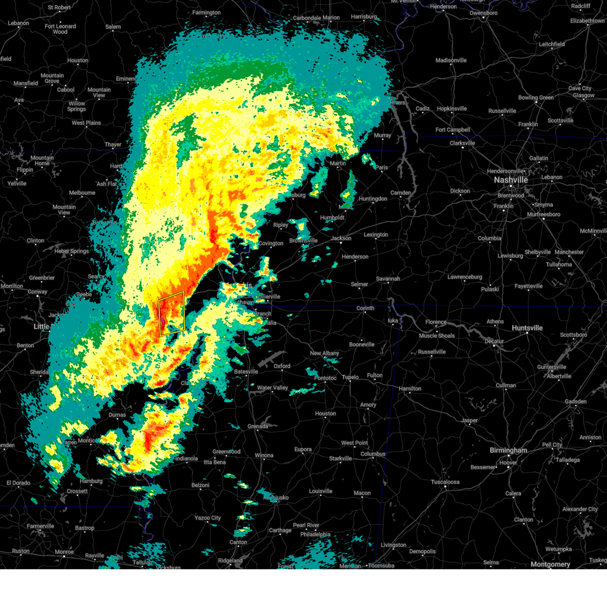 At 701 pm cdt, a severe thunderstorm was located over haynes, or near forrest city, moving northeast at 65 mph (radar indicated). Hazards include 60 mph wind gusts and half dollar size hail. Hail damage to vehicles is expected. expect wind damage to roofs, siding, and trees. locations impacted include, forrest city, marianna, madison, palestine, caldwell, widener, aubrey, haynes, gill, hawkins, oak forest, horton, bonair, slonikers mill, westor, new castle, four forks, felton, dodsons corner and heustess. hail threat, radar indicated max hail size, 1. 25 in wind threat, radar indicated max wind gust, 60 mph. At 701 pm cdt, a severe thunderstorm was located over haynes, or near forrest city, moving northeast at 65 mph (radar indicated). Hazards include 60 mph wind gusts and half dollar size hail. Hail damage to vehicles is expected. expect wind damage to roofs, siding, and trees. locations impacted include, forrest city, marianna, madison, palestine, caldwell, widener, aubrey, haynes, gill, hawkins, oak forest, horton, bonair, slonikers mill, westor, new castle, four forks, felton, dodsons corner and heustess. hail threat, radar indicated max hail size, 1. 25 in wind threat, radar indicated max wind gust, 60 mph.
|
| 3/24/2023 6:49 PM CDT |
 At 649 pm cdt, a severe thunderstorm was located near moro, or 10 miles southeast of brinkley, moving northeast at 65 mph (radar indicated). Hazards include 60 mph wind gusts and quarter size hail. Hail damage to vehicles is expected. expect wind damage to roofs, siding, and trees. locations impacted include, forrest city, marianna, madison, palestine, caldwell, wheatley, widener, moro, rondo, aubrey, haynes, garret grove, new salem, lagrange, oak forest, slonikers mill, westor, new castle, goodwin and turkey scratch. hail threat, radar indicated max hail size, 1. 00 in wind threat, radar indicated max wind gust, 60 mph. At 649 pm cdt, a severe thunderstorm was located near moro, or 10 miles southeast of brinkley, moving northeast at 65 mph (radar indicated). Hazards include 60 mph wind gusts and quarter size hail. Hail damage to vehicles is expected. expect wind damage to roofs, siding, and trees. locations impacted include, forrest city, marianna, madison, palestine, caldwell, wheatley, widener, moro, rondo, aubrey, haynes, garret grove, new salem, lagrange, oak forest, slonikers mill, westor, new castle, goodwin and turkey scratch. hail threat, radar indicated max hail size, 1. 00 in wind threat, radar indicated max wind gust, 60 mph.
|
| 3/24/2023 6:32 PM CDT |
 At 632 pm cdt, a severe thunderstorm was located near clarendon, moving northeast at 55 mph (radar indicated). Hazards include 60 mph wind gusts and half dollar size hail. Hail damage to vehicles is expected. Expect wind damage to roofs, siding, and trees. At 632 pm cdt, a severe thunderstorm was located near clarendon, moving northeast at 55 mph (radar indicated). Hazards include 60 mph wind gusts and half dollar size hail. Hail damage to vehicles is expected. Expect wind damage to roofs, siding, and trees.
|
| 3/1/2023 8:55 PM CST |
 The severe thunderstorm warning for southern lee and northeastern phillips counties will expire at 900 pm cst, the storm which prompted the warning has moved out of the area. therefore, the warning will be allowed to expire. a tornado watch remains in effect until 1000 pm cst for eastern arkansas, and northwestern mississippi. The severe thunderstorm warning for southern lee and northeastern phillips counties will expire at 900 pm cst, the storm which prompted the warning has moved out of the area. therefore, the warning will be allowed to expire. a tornado watch remains in effect until 1000 pm cst for eastern arkansas, and northwestern mississippi.
|
| 3/1/2023 8:37 PM CST |
 At 836 pm cst, a severe thunderstorm was located over lexa, or near st francis national park, moving east at 65 mph (radar indicated). Hazards include 60 mph wind gusts and quarter size hail. Hail damage to vehicles is expected. expect wind damage to roofs, siding, and trees. locations impacted include, marianna, marvell, helena-west helena, st francis national park, lexa, rondo, aubrey, lake view, lagrange, jeffersonville, preston place, haleside, quarles, wycamp, latour, vineyard, helena crossing, whitehall, cypress corner and poplar grove. hail threat, radar indicated max hail size, 1. 00 in wind threat, radar indicated max wind gust, 60 mph. At 836 pm cst, a severe thunderstorm was located over lexa, or near st francis national park, moving east at 65 mph (radar indicated). Hazards include 60 mph wind gusts and quarter size hail. Hail damage to vehicles is expected. expect wind damage to roofs, siding, and trees. locations impacted include, marianna, marvell, helena-west helena, st francis national park, lexa, rondo, aubrey, lake view, lagrange, jeffersonville, preston place, haleside, quarles, wycamp, latour, vineyard, helena crossing, whitehall, cypress corner and poplar grove. hail threat, radar indicated max hail size, 1. 00 in wind threat, radar indicated max wind gust, 60 mph.
|
| 3/1/2023 8:14 PM CST |
 At 813 pm cst, a severe thunderstorm was located over holly grove, or 11 miles southeast of clarendon, moving east at 65 mph (radar indicated). Hazards include 60 mph wind gusts and quarter size hail. Hail damage to vehicles is expected. Expect wind damage to roofs, siding, and trees. At 813 pm cst, a severe thunderstorm was located over holly grove, or 11 miles southeast of clarendon, moving east at 65 mph (radar indicated). Hazards include 60 mph wind gusts and quarter size hail. Hail damage to vehicles is expected. Expect wind damage to roofs, siding, and trees.
|
| 1/3/2023 3:55 AM CST |
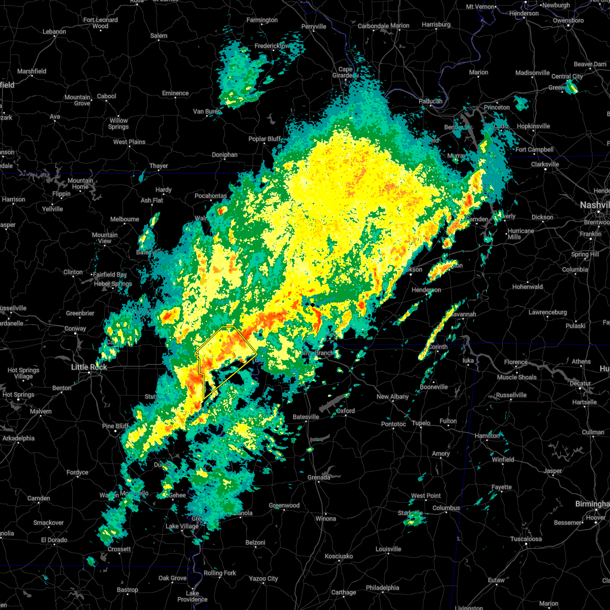 At 355 am cst, a severe thunderstorm was located near holly grove, or 8 miles east of clarendon, moving northeast at 55 mph (radar indicated). Hazards include 60 mph wind gusts and nickel size hail. expect damage to roofs, siding, and trees At 355 am cst, a severe thunderstorm was located near holly grove, or 8 miles east of clarendon, moving northeast at 55 mph (radar indicated). Hazards include 60 mph wind gusts and nickel size hail. expect damage to roofs, siding, and trees
|
| 11/29/2022 7:57 PM CST |
 The severe thunderstorm warning for south central lee and northern phillips counties will expire at 800 pm cst, the storm which prompted the warning has weakened below severe limits, and has exited the warned area. therefore, the warning will be allowed to expire. however small hail and gusty winds are still possible with this thunderstorm. to report severe weather, contact your nearest law enforcement agency. they will relay your report to the national weather service memphis. The severe thunderstorm warning for south central lee and northern phillips counties will expire at 800 pm cst, the storm which prompted the warning has weakened below severe limits, and has exited the warned area. therefore, the warning will be allowed to expire. however small hail and gusty winds are still possible with this thunderstorm. to report severe weather, contact your nearest law enforcement agency. they will relay your report to the national weather service memphis.
|
| 11/29/2022 7:39 PM CST |
 At 739 pm cst, a severe thunderstorm was located near marvell, moving northeast at 50 mph (radar indicated). Hazards include 60 mph wind gusts and quarter size hail. Hail damage to vehicles is expected. expect wind damage to roofs, siding, and trees. locations impacted include, marianna, marvell, helena-west helena, st francis national park, lexa, rondo, watkins corner, lake view, lagrange, quarles, wycamp, latour, turkey scratch, vineyard, cypress corner, poplar grove, huma, big creek corner, oneida and barton. hail threat, radar indicated max hail size, 1. 00 in wind threat, radar indicated max wind gust, 60 mph. At 739 pm cst, a severe thunderstorm was located near marvell, moving northeast at 50 mph (radar indicated). Hazards include 60 mph wind gusts and quarter size hail. Hail damage to vehicles is expected. expect wind damage to roofs, siding, and trees. locations impacted include, marianna, marvell, helena-west helena, st francis national park, lexa, rondo, watkins corner, lake view, lagrange, quarles, wycamp, latour, turkey scratch, vineyard, cypress corner, poplar grove, huma, big creek corner, oneida and barton. hail threat, radar indicated max hail size, 1. 00 in wind threat, radar indicated max wind gust, 60 mph.
|
| 11/29/2022 7:16 PM CST |
 At 715 pm cst, a severe thunderstorm was located over st. charles, or 10 miles north of white river national wildlife refuge, moving northeast at 50 mph (radar indicated). Hazards include 60 mph wind gusts and quarter size hail. Hail damage to vehicles is expected. Expect wind damage to roofs, siding, and trees. At 715 pm cst, a severe thunderstorm was located over st. charles, or 10 miles north of white river national wildlife refuge, moving northeast at 50 mph (radar indicated). Hazards include 60 mph wind gusts and quarter size hail. Hail damage to vehicles is expected. Expect wind damage to roofs, siding, and trees.
|
| 11/5/2022 1:06 AM CDT |
 The severe thunderstorm warning for lee, st. francis, south central poinsett and cross counties will expire at 115 am cdt, the storms which prompted the warning have weakened below severe limits, and no longer pose an immediate threat to life or property. therefore, the warning will be allowed to expire. however gusty winds are still possible with these thunderstorms. a severe thunderstorm watch remains in effect until 400 am cdt for eastern arkansas. The severe thunderstorm warning for lee, st. francis, south central poinsett and cross counties will expire at 115 am cdt, the storms which prompted the warning have weakened below severe limits, and no longer pose an immediate threat to life or property. therefore, the warning will be allowed to expire. however gusty winds are still possible with these thunderstorms. a severe thunderstorm watch remains in effect until 400 am cdt for eastern arkansas.
|
| 11/5/2022 12:29 AM CDT |
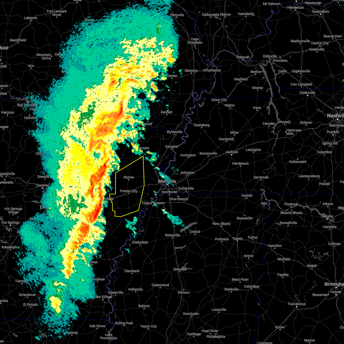 At 1228 am cdt, severe thunderstorms were located along a line extending from 7 miles south of patterson to allendale to near ulm, moving northeast at 50 mph (radar indicated). Hazards include 60 mph wind gusts. expect damage to roofs, siding, and trees At 1228 am cdt, severe thunderstorms were located along a line extending from 7 miles south of patterson to allendale to near ulm, moving northeast at 50 mph (radar indicated). Hazards include 60 mph wind gusts. expect damage to roofs, siding, and trees
|
| 6/8/2022 9:23 AM CDT |
 At 923 am cdt, a severe thunderstorm was located 7 miles northeast of lexa, or 7 miles southeast of marianna, moving southeast at 35 mph (radar indicated). Hazards include 60 mph wind gusts. Expect damage to roofs, siding, and trees. locations impacted include, forrest city, marianna, hughes, helena-west helena, st francis national park, tunica, lexa, rondo, aubrey, haynes, dubbs, brickeys, north tunica, dundee, robinsonville, lagrange, cody, clack, preston place and haleside. hail threat, radar indicated max hail size, <. 75 in wind threat, radar indicated max wind gust, 60 mph. At 923 am cdt, a severe thunderstorm was located 7 miles northeast of lexa, or 7 miles southeast of marianna, moving southeast at 35 mph (radar indicated). Hazards include 60 mph wind gusts. Expect damage to roofs, siding, and trees. locations impacted include, forrest city, marianna, hughes, helena-west helena, st francis national park, tunica, lexa, rondo, aubrey, haynes, dubbs, brickeys, north tunica, dundee, robinsonville, lagrange, cody, clack, preston place and haleside. hail threat, radar indicated max hail size, <. 75 in wind threat, radar indicated max wind gust, 60 mph.
|
| 6/8/2022 9:12 AM CDT |
 At 912 am cdt, a severe thunderstorm was located over marianna, moving southeast at 35 mph (radar indicated). Hazards include 60 mph wind gusts. Expect damage to roofs, siding, and trees. locations impacted include, forrest city, marianna, hughes, madison, palestine, st francis national park, helena-west helena, tunica, caldwell, colt, horseshoe lake, lexa, widener, moro, rondo, aubrey, haynes, dubbs, brickeys and north tunica. hail threat, radar indicated max hail size, <. 75 in wind threat, radar indicated max wind gust, 60 mph. At 912 am cdt, a severe thunderstorm was located over marianna, moving southeast at 35 mph (radar indicated). Hazards include 60 mph wind gusts. Expect damage to roofs, siding, and trees. locations impacted include, forrest city, marianna, hughes, madison, palestine, st francis national park, helena-west helena, tunica, caldwell, colt, horseshoe lake, lexa, widener, moro, rondo, aubrey, haynes, dubbs, brickeys and north tunica. hail threat, radar indicated max hail size, <. 75 in wind threat, radar indicated max wind gust, 60 mph.
|
| 6/8/2022 8:43 AM CDT |
 At 842 am cdt, a severe thunderstorm was located over new salem, or 8 miles east of brinkley, moving southeast at 35 mph (radar indicated). Hazards include 60 mph wind gusts. expect damage to roofs, siding, and trees At 842 am cdt, a severe thunderstorm was located over new salem, or 8 miles east of brinkley, moving southeast at 35 mph (radar indicated). Hazards include 60 mph wind gusts. expect damage to roofs, siding, and trees
|
| 6/7/2022 3:56 PM CDT |
 The severe thunderstorm warning for northwestern lee, st. francis, southwestern poinsett and cross counties will expire at 400 pm cdt, the storms which prompted the warning have moved out of the area. therefore, the warning will be allowed to expire. however gusty winds are still possible with these thunderstorms. The severe thunderstorm warning for northwestern lee, st. francis, southwestern poinsett and cross counties will expire at 400 pm cdt, the storms which prompted the warning have moved out of the area. therefore, the warning will be allowed to expire. however gusty winds are still possible with these thunderstorms.
|
| 6/7/2022 3:16 PM CDT |
 At 316 pm cdt, severe thunderstorms were located along a line extending from near tupelo to fair oaks to near hunter to near wheatley, moving east at 35 mph (radar indicated). Hazards include 60 mph wind gusts. expect damage to roofs, siding, and trees At 316 pm cdt, severe thunderstorms were located along a line extending from near tupelo to fair oaks to near hunter to near wheatley, moving east at 35 mph (radar indicated). Hazards include 60 mph wind gusts. expect damage to roofs, siding, and trees
|
| 5/15/2022 5:44 PM CDT |
 At 544 pm cdt, severe thunderstorms were located along a line extending from near st francis national park to 6 miles southwest of elaine, moving southeast at 45 mph (radar indicated). Hazards include 60 mph wind gusts and quarter size hail. Hail damage to vehicles is expected. Expect wind damage to roofs, siding, and trees. At 544 pm cdt, severe thunderstorms were located along a line extending from near st francis national park to 6 miles southwest of elaine, moving southeast at 45 mph (radar indicated). Hazards include 60 mph wind gusts and quarter size hail. Hail damage to vehicles is expected. Expect wind damage to roofs, siding, and trees.
|
| 5/15/2022 5:05 PM CDT |
 At 504 pm cdt, a severe thunderstorm was located near holly grove, or 8 miles east of clarendon, moving southeast at 30 mph (radar indicated). Hazards include 60 mph wind gusts and penny size hail. expect damage to roofs, siding, and trees At 504 pm cdt, a severe thunderstorm was located near holly grove, or 8 miles east of clarendon, moving southeast at 30 mph (radar indicated). Hazards include 60 mph wind gusts and penny size hail. expect damage to roofs, siding, and trees
|
| 4/30/2022 9:48 PM CDT |
 At 948 pm cdt, a severe thunderstorm was located near marianna, moving east at 25 mph (trained weather spotters). Hazards include golf ball size hail and 60 mph wind gusts. People and animals outdoors will be injured. expect hail damage to roofs, siding, windows, and vehicles. expect wind damage to roofs, siding, and trees. locations impacted include, marianna, lexa, rondo, brickeys, lagrange, jeffersonville, raggio, cody, haleside, dansby, soudan, phillips bayou, felton, ball point, scott valley, cypress corner, tongin and mississippi river state park. thunderstorm damage threat, considerable hail threat, radar indicated max hail size, 1. 75 in wind threat, radar indicated max wind gust, 60 mph. At 948 pm cdt, a severe thunderstorm was located near marianna, moving east at 25 mph (trained weather spotters). Hazards include golf ball size hail and 60 mph wind gusts. People and animals outdoors will be injured. expect hail damage to roofs, siding, windows, and vehicles. expect wind damage to roofs, siding, and trees. locations impacted include, marianna, lexa, rondo, brickeys, lagrange, jeffersonville, raggio, cody, haleside, dansby, soudan, phillips bayou, felton, ball point, scott valley, cypress corner, tongin and mississippi river state park. thunderstorm damage threat, considerable hail threat, radar indicated max hail size, 1. 75 in wind threat, radar indicated max wind gust, 60 mph.
|
| 4/30/2022 9:40 PM CDT |
 At 939 pm cdt, a severe thunderstorm was located near marianna, moving east at 25 mph (trained weather spotters). Hazards include golf ball size hail and 60 mph wind gusts. People and animals outdoors will be injured. expect hail damage to roofs, siding, windows, and vehicles. expect wind damage to roofs, siding, and trees. locations impacted include, marianna, lexa, rondo, aubrey, brickeys, lagrange, jeffersonville, raggio, cody, oak forest, westor, haleside, big creek corner, dansby, soudan, phillips bayou, felton, vineyard, ball point and scott valley. thunderstorm damage threat, considerable hail threat, radar indicated max hail size, 1. 75 in wind threat, radar indicated max wind gust, 60 mph. At 939 pm cdt, a severe thunderstorm was located near marianna, moving east at 25 mph (trained weather spotters). Hazards include golf ball size hail and 60 mph wind gusts. People and animals outdoors will be injured. expect hail damage to roofs, siding, windows, and vehicles. expect wind damage to roofs, siding, and trees. locations impacted include, marianna, lexa, rondo, aubrey, brickeys, lagrange, jeffersonville, raggio, cody, oak forest, westor, haleside, big creek corner, dansby, soudan, phillips bayou, felton, vineyard, ball point and scott valley. thunderstorm damage threat, considerable hail threat, radar indicated max hail size, 1. 75 in wind threat, radar indicated max wind gust, 60 mph.
|
| 4/30/2022 9:38 PM CDT | Golf Ball sized hail reported 4.6 miles NE of Marianna, AR, golf ball sized hail 4 mlies north of rondo. |
| 4/30/2022 9:24 PM CDT |
 At 924 pm cdt, a severe thunderstorm was located near rondo, or near marianna, moving east at 25 mph (radar indicated). Hazards include 60 mph wind gusts and quarter size hail. Hail damage to vehicles is expected. Expect wind damage to roofs, siding, and trees. At 924 pm cdt, a severe thunderstorm was located near rondo, or near marianna, moving east at 25 mph (radar indicated). Hazards include 60 mph wind gusts and quarter size hail. Hail damage to vehicles is expected. Expect wind damage to roofs, siding, and trees.
|
| 4/30/2022 9:14 PM CDT |
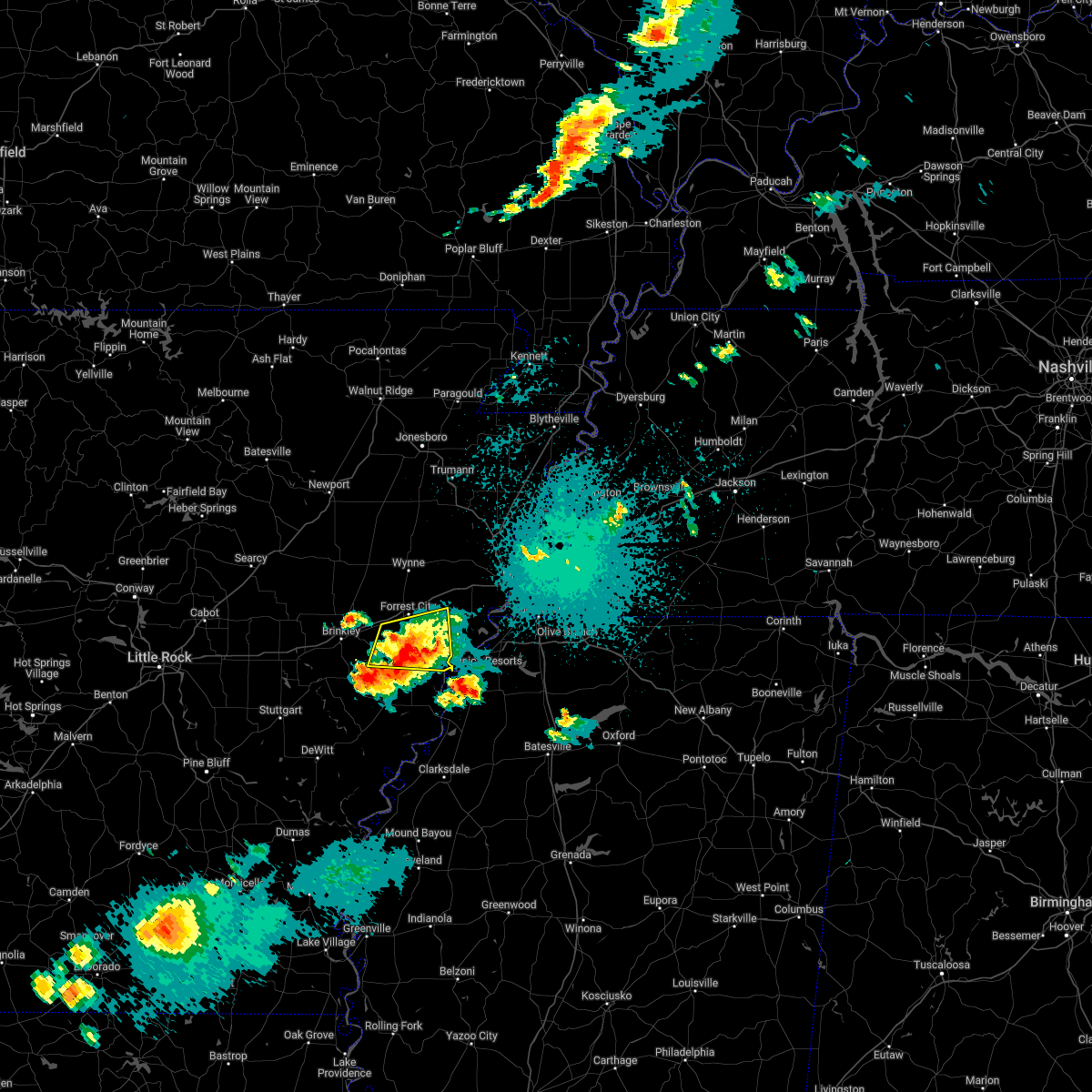 At 914 pm cdt, a severe thunderstorm was located near haynes, or 8 miles south of forrest city, moving east at 30 mph (radar indicated). Hazards include 60 mph wind gusts and quarter size hail. Hail damage to vehicles is expected. expect wind damage to roofs, siding, and trees. locations impacted include, forrest city, marianna, palestine, moro, haynes, brickeys, new home, cody, kokomo, oak forest, westor, soudan, heustess, ball point, whitehall, tongin, rawlinson, raggio, gassett and gill. hail threat, radar indicated max hail size, 1. 00 in wind threat, radar indicated max wind gust, 60 mph. At 914 pm cdt, a severe thunderstorm was located near haynes, or 8 miles south of forrest city, moving east at 30 mph (radar indicated). Hazards include 60 mph wind gusts and quarter size hail. Hail damage to vehicles is expected. expect wind damage to roofs, siding, and trees. locations impacted include, forrest city, marianna, palestine, moro, haynes, brickeys, new home, cody, kokomo, oak forest, westor, soudan, heustess, ball point, whitehall, tongin, rawlinson, raggio, gassett and gill. hail threat, radar indicated max hail size, 1. 00 in wind threat, radar indicated max wind gust, 60 mph.
|
| 4/30/2022 8:41 PM CDT |
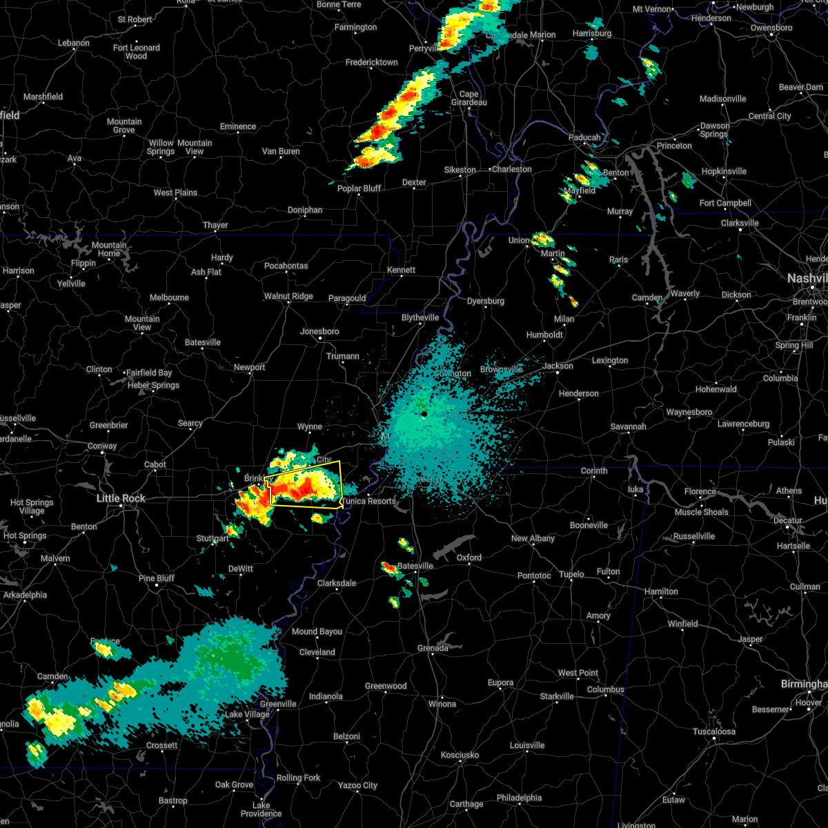 At 840 pm cdt, a severe thunderstorm was located near garret grove, or 7 miles east of brinkley, moving east at 30 mph (radar indicated). Hazards include 60 mph wind gusts and quarter size hail. Hail damage to vehicles is expected. Expect wind damage to roofs, siding, and trees. At 840 pm cdt, a severe thunderstorm was located near garret grove, or 7 miles east of brinkley, moving east at 30 mph (radar indicated). Hazards include 60 mph wind gusts and quarter size hail. Hail damage to vehicles is expected. Expect wind damage to roofs, siding, and trees.
|
| 4/30/2022 8:26 PM CDT |
 At 826 pm cdt, a severe thunderstorm producing a tornado was located near new salem, or 8 miles south of palestine, moving east at 20 mph (radar indicated rotation). Hazards include tornado and quarter size hail. Flying debris will be dangerous to those caught without shelter. mobile homes will be damaged or destroyed. damage to roofs, windows, and vehicles will occur. Tree damage is likely. At 826 pm cdt, a severe thunderstorm producing a tornado was located near new salem, or 8 miles south of palestine, moving east at 20 mph (radar indicated rotation). Hazards include tornado and quarter size hail. Flying debris will be dangerous to those caught without shelter. mobile homes will be damaged or destroyed. damage to roofs, windows, and vehicles will occur. Tree damage is likely.
|
| 4/13/2022 4:54 PM CDT |
 At 454 pm cdt, severe thunderstorms were located along a line extending from near haynes to 6 miles east of watkins corner to crumrod, moving east at 65 mph (radar indicated). Hazards include 70 mph wind gusts. Expect considerable tree damage. damage is likely to mobile homes, roofs, and outbuildings. Locations impacted include, marianna, marvell, elaine, helena-west helena, white river national wildlife refuge, st francis national park, friars point, lexa, rondo, aubrey, haynes, brickeys, sherard, crumrod, lake view, lagrange, cody, rena lara, mosby spur and ferguson. At 454 pm cdt, severe thunderstorms were located along a line extending from near haynes to 6 miles east of watkins corner to crumrod, moving east at 65 mph (radar indicated). Hazards include 70 mph wind gusts. Expect considerable tree damage. damage is likely to mobile homes, roofs, and outbuildings. Locations impacted include, marianna, marvell, elaine, helena-west helena, white river national wildlife refuge, st francis national park, friars point, lexa, rondo, aubrey, haynes, brickeys, sherard, crumrod, lake view, lagrange, cody, rena lara, mosby spur and ferguson.
|
| 4/13/2022 4:34 PM CDT |
 At 433 pm cdt, severe thunderstorms were located along a line extending from allendale to 6 miles northwest of st. charles to near gillett, moving east at 60 mph (radar indicated). Hazards include 70 mph wind gusts. Expect considerable tree damage. Damage is likely to mobile homes, roofs, and outbuildings. At 433 pm cdt, severe thunderstorms were located along a line extending from allendale to 6 miles northwest of st. charles to near gillett, moving east at 60 mph (radar indicated). Hazards include 70 mph wind gusts. Expect considerable tree damage. Damage is likely to mobile homes, roofs, and outbuildings.
|
| 4/13/2022 4:08 PM CDT |
 At 407 pm cdt, severe thunderstorms were located along a line extending from near village creek state park to brickeys to near lexa, moving east at 65 mph (radar indicated). Hazards include 60 mph wind gusts. expect damage to roofs, siding, and trees At 407 pm cdt, severe thunderstorms were located along a line extending from near village creek state park to brickeys to near lexa, moving east at 65 mph (radar indicated). Hazards include 60 mph wind gusts. expect damage to roofs, siding, and trees
|
| 4/13/2022 3:53 PM CDT |
 At 353 pm cdt, severe thunderstorms were located along a line extending from near palestine to near haynes to near marvell, moving northeast at 50 mph (radar indicated). Hazards include 70 mph wind gusts and quarter size hail. Hail damage to vehicles is expected. expect considerable tree damage. wind damage is also likely to mobile homes, roofs, and outbuildings. locations impacted include, forrest city, marianna, marvell, madison, palestine, caldwell, colt, widener, moro, rondo, aubrey, haynes, brickeys, lagrange, cody, cottonwood corner, haleside, new castle, soudan and round pond. thunderstorm damage threat, considerable hail threat, radar indicated max hail size, 1. 00 in wind threat, radar indicated max wind gust, 70 mph. At 353 pm cdt, severe thunderstorms were located along a line extending from near palestine to near haynes to near marvell, moving northeast at 50 mph (radar indicated). Hazards include 70 mph wind gusts and quarter size hail. Hail damage to vehicles is expected. expect considerable tree damage. wind damage is also likely to mobile homes, roofs, and outbuildings. locations impacted include, forrest city, marianna, marvell, madison, palestine, caldwell, colt, widener, moro, rondo, aubrey, haynes, brickeys, lagrange, cody, cottonwood corner, haleside, new castle, soudan and round pond. thunderstorm damage threat, considerable hail threat, radar indicated max hail size, 1. 00 in wind threat, radar indicated max wind gust, 70 mph.
|
| 4/13/2022 3:31 PM CDT |
 At 330 pm cdt, severe thunderstorms were located along a line extending from brinkley to near garret grove to 7 miles southwest of holly grove, moving northeast at 50 mph (radar indicated). Hazards include 70 mph wind gusts and quarter size hail. Hail damage to vehicles is expected. expect considerable tree damage. Wind damage is also likely to mobile homes, roofs, and outbuildings. At 330 pm cdt, severe thunderstorms were located along a line extending from brinkley to near garret grove to 7 miles southwest of holly grove, moving northeast at 50 mph (radar indicated). Hazards include 70 mph wind gusts and quarter size hail. Hail damage to vehicles is expected. expect considerable tree damage. Wind damage is also likely to mobile homes, roofs, and outbuildings.
|
| 4/13/2022 3:15 PM CDT |
 At 314 pm cdt, severe thunderstorms were located along a line extending from gilmore to near hughes, moving northeast at 65 mph (radar indicated). Hazards include 60 mph wind gusts and quarter size hail. Hail damage to vehicles is expected. expect wind damage to roofs, siding, and trees. locations impacted include, west memphis, forrest city, marion, marianna, earle, hughes, parkin, madison, village creek state park, crawfordsville, edmondson, horseshoe lake, widener, sunset, anthonyville, haynes, jericho, jennette, simsboro and brickeys. hail threat, radar indicated max hail size, 1. 00 in wind threat, radar indicated max wind gust, 60 mph. At 314 pm cdt, severe thunderstorms were located along a line extending from gilmore to near hughes, moving northeast at 65 mph (radar indicated). Hazards include 60 mph wind gusts and quarter size hail. Hail damage to vehicles is expected. expect wind damage to roofs, siding, and trees. locations impacted include, west memphis, forrest city, marion, marianna, earle, hughes, parkin, madison, village creek state park, crawfordsville, edmondson, horseshoe lake, widener, sunset, anthonyville, haynes, jericho, jennette, simsboro and brickeys. hail threat, radar indicated max hail size, 1. 00 in wind threat, radar indicated max wind gust, 60 mph.
|
| 4/13/2022 2:46 PM CDT |
 At 246 pm cdt, severe thunderstorms were located along a line extending from wynne to moro, moving northeast at 65 mph (radar indicated). Hazards include 60 mph wind gusts and penny size hail. expect damage to roofs, siding, and trees At 246 pm cdt, severe thunderstorms were located along a line extending from wynne to moro, moving northeast at 65 mph (radar indicated). Hazards include 60 mph wind gusts and penny size hail. expect damage to roofs, siding, and trees
|
| 4/11/2022 11:11 PM CDT |
 At 1111 pm cdt, a severe thunderstorm was located 7 miles south of brickeys, or 12 miles east of marianna, moving east at 35 mph (radar indicated). Hazards include 60 mph wind gusts and quarter size hail. Hail damage to vehicles is expected. expect wind damage to roofs, siding, and trees. locations impacted include, north tunica, raggio, hollywood, diamond woods, commerce, soudan, whitehall, peters and mississippi river state park. hail threat, radar indicated max hail size, 1. 00 in wind threat, radar indicated max wind gust, 60 mph. At 1111 pm cdt, a severe thunderstorm was located 7 miles south of brickeys, or 12 miles east of marianna, moving east at 35 mph (radar indicated). Hazards include 60 mph wind gusts and quarter size hail. Hail damage to vehicles is expected. expect wind damage to roofs, siding, and trees. locations impacted include, north tunica, raggio, hollywood, diamond woods, commerce, soudan, whitehall, peters and mississippi river state park. hail threat, radar indicated max hail size, 1. 00 in wind threat, radar indicated max wind gust, 60 mph.
|
| 4/11/2022 11:01 PM CDT |
 At 1101 pm cdt, a severe thunderstorm was located near marianna, moving east at 35 mph (radar indicated). Hazards include 60 mph wind gusts and quarter size hail. Hail damage to vehicles is expected. expect wind damage to roofs, siding, and trees. locations impacted include, marianna, tunica, rondo, north tunica, lagrange, jeffersonville, raggio, maud, haleside, fox island, commerce, austin, soudan, peters, clayton, phillips bayou, hollywood, felton, diamond woods and scott valley. hail threat, radar indicated max hail size, 1. 00 in wind threat, radar indicated max wind gust, 60 mph. At 1101 pm cdt, a severe thunderstorm was located near marianna, moving east at 35 mph (radar indicated). Hazards include 60 mph wind gusts and quarter size hail. Hail damage to vehicles is expected. expect wind damage to roofs, siding, and trees. locations impacted include, marianna, tunica, rondo, north tunica, lagrange, jeffersonville, raggio, maud, haleside, fox island, commerce, austin, soudan, peters, clayton, phillips bayou, hollywood, felton, diamond woods and scott valley. hail threat, radar indicated max hail size, 1. 00 in wind threat, radar indicated max wind gust, 60 mph.
|
| 4/11/2022 10:40 PM CDT |
 At 1039 pm cdt, a severe thunderstorm was located over aubrey, or 8 miles west of marianna, moving east at 35 mph (radar indicated). Hazards include 60 mph wind gusts and quarter size hail. Hail damage to vehicles is expected. Expect wind damage to roofs, siding, and trees. At 1039 pm cdt, a severe thunderstorm was located over aubrey, or 8 miles west of marianna, moving east at 35 mph (radar indicated). Hazards include 60 mph wind gusts and quarter size hail. Hail damage to vehicles is expected. Expect wind damage to roofs, siding, and trees.
|
| 3/30/2022 3:30 PM CDT | Several broken utility poles on chestnut st in mariann in lee county AR, 0.2 miles NE of Marianna, AR |
| 3/30/2022 3:06 PM CDT |
 At 306 pm cdt, a severe thunderstorm was located over moro, or 10 miles west of marianna, moving northeast at 60 mph (radar indicated). Hazards include 60 mph wind gusts. expect damage to roofs, siding, and trees At 306 pm cdt, a severe thunderstorm was located over moro, or 10 miles west of marianna, moving northeast at 60 mph (radar indicated). Hazards include 60 mph wind gusts. expect damage to roofs, siding, and trees
|
| 12/11/2021 1:22 AM CST |
 The severe thunderstorm warning for lee, south central st. francis, northwestern phillips and west central tunica counties will expire at 130 am cst, the storm which prompted the warning has weakened below severe limits, and no longer poses an immediate threat to life or property. therefore, the warning will be allowed to expire. however small hail, gusty winds and heavy rain are still possible with this thunderstorm. a tornado watch remains in effect until 500 am cst for eastern arkansas, and northwestern mississippi. The severe thunderstorm warning for lee, south central st. francis, northwestern phillips and west central tunica counties will expire at 130 am cst, the storm which prompted the warning has weakened below severe limits, and no longer poses an immediate threat to life or property. therefore, the warning will be allowed to expire. however small hail, gusty winds and heavy rain are still possible with this thunderstorm. a tornado watch remains in effect until 500 am cst for eastern arkansas, and northwestern mississippi.
|
| 12/11/2021 12:46 AM CST |
 At 1245 am cst, a severe thunderstorm was located near rondo, or near marvell, moving northeast at 60 mph (radar indicated). Hazards include 60 mph wind gusts and penny size hail. expect damage to roofs, siding, and trees At 1245 am cst, a severe thunderstorm was located near rondo, or near marvell, moving northeast at 60 mph (radar indicated). Hazards include 60 mph wind gusts and penny size hail. expect damage to roofs, siding, and trees
|
| 12/11/2021 12:35 AM CST |
 At 1235 am cst, a severe thunderstorm was located near walls, or near t o fuller state park, moving northeast at 60 mph (radar indicated). Hazards include 60 mph wind gusts and quarter size hail. Hail damage to vehicles is expected. expect wind damage to roofs, siding, and trees. locations impacted include, west memphis, marion, marianna, hughes, edmondson, horseshoe lake, anthonyville, pinckney, simsboro, brickeys, crittenden, jeffersonville, cody, kokomo, kate, browns, louise, mud lake, brice and soudan. hail threat, radar indicated max hail size, 1. 00 in wind threat, radar indicated max wind gust, 60 mph. At 1235 am cst, a severe thunderstorm was located near walls, or near t o fuller state park, moving northeast at 60 mph (radar indicated). Hazards include 60 mph wind gusts and quarter size hail. Hail damage to vehicles is expected. expect wind damage to roofs, siding, and trees. locations impacted include, west memphis, marion, marianna, hughes, edmondson, horseshoe lake, anthonyville, pinckney, simsboro, brickeys, crittenden, jeffersonville, cody, kokomo, kate, browns, louise, mud lake, brice and soudan. hail threat, radar indicated max hail size, 1. 00 in wind threat, radar indicated max wind gust, 60 mph.
|
| 12/11/2021 12:28 AM CST |
 At 1228 am cst, a severe thunderstorm was located near sunset, or near marion, moving northeast at 85 mph (radar indicated). Hazards include 60 mph wind gusts and quarter size hail. Hail damage to vehicles is expected. expect wind damage to roofs, siding, and trees. locations impacted include, west memphis, marion, marianna, hughes, edmondson, horseshoe lake, anthonyville, pinckney, simsboro, brickeys, crittenden, jeffersonville, cody, kokomo, kate, browns, louise, mud lake, brice and soudan. hail threat, radar indicated max hail size, 1. 00 in wind threat, radar indicated max wind gust, 60 mph. At 1228 am cst, a severe thunderstorm was located near sunset, or near marion, moving northeast at 85 mph (radar indicated). Hazards include 60 mph wind gusts and quarter size hail. Hail damage to vehicles is expected. expect wind damage to roofs, siding, and trees. locations impacted include, west memphis, marion, marianna, hughes, edmondson, horseshoe lake, anthonyville, pinckney, simsboro, brickeys, crittenden, jeffersonville, cody, kokomo, kate, browns, louise, mud lake, brice and soudan. hail threat, radar indicated max hail size, 1. 00 in wind threat, radar indicated max wind gust, 60 mph.
|
| 12/11/2021 12:02 AM CST |
 At 1201 am cst, a severe thunderstorm was located near brickeys, or 8 miles northeast of marianna, moving northeast at 85 mph (radar indicated). Hazards include 60 mph wind gusts and penny size hail. expect damage to roofs, siding, and trees At 1201 am cst, a severe thunderstorm was located near brickeys, or 8 miles northeast of marianna, moving northeast at 85 mph (radar indicated). Hazards include 60 mph wind gusts and penny size hail. expect damage to roofs, siding, and trees
|
| 12/10/2021 11:14 PM CST |
 At 1114 pm cst, a severe thunderstorm was located near marianna, moving east at 60 mph (radar indicated). Hazards include 60 mph wind gusts and quarter size hail. Hail damage to vehicles is expected. expect wind damage to roofs, siding, and trees. locations impacted include, forrest city, marianna, hughes, madison, palestine, widener, aubrey, haynes, brickeys, new home, jeffersonville, cody, kokomo, oak forest, westor, mud lake, soudan, peters, council and round pond. hail threat, radar indicated max hail size, 1. 00 in wind threat, radar indicated max wind gust, 60 mph. At 1114 pm cst, a severe thunderstorm was located near marianna, moving east at 60 mph (radar indicated). Hazards include 60 mph wind gusts and quarter size hail. Hail damage to vehicles is expected. expect wind damage to roofs, siding, and trees. locations impacted include, forrest city, marianna, hughes, madison, palestine, widener, aubrey, haynes, brickeys, new home, jeffersonville, cody, kokomo, oak forest, westor, mud lake, soudan, peters, council and round pond. hail threat, radar indicated max hail size, 1. 00 in wind threat, radar indicated max wind gust, 60 mph.
|
| 10/15/2021 5:46 PM CDT |
 At 545 pm cdt, a severe thunderstorm was located over brickeys, or 7 miles southwest of hughes, moving east at 45 mph (radar indicated). Hazards include 60 mph wind gusts and quarter size hail. Hail damage to vehicles is expected. expect wind damage to roofs, siding, and trees. locations impacted include, horn lake, forrest city, marianna, hughes, madison, walls, horseshoe lake, widener, haynes, lake cormorant, eudora, brickeys, arkabutla, pinckney, lynchburg, phillipp, robinsonville, cody, clack and trinity. hail threat, radar indicated max hail size, 1. 00 in wind threat, radar indicated max wind gust, 60 mph. At 545 pm cdt, a severe thunderstorm was located over brickeys, or 7 miles southwest of hughes, moving east at 45 mph (radar indicated). Hazards include 60 mph wind gusts and quarter size hail. Hail damage to vehicles is expected. expect wind damage to roofs, siding, and trees. locations impacted include, horn lake, forrest city, marianna, hughes, madison, walls, horseshoe lake, widener, haynes, lake cormorant, eudora, brickeys, arkabutla, pinckney, lynchburg, phillipp, robinsonville, cody, clack and trinity. hail threat, radar indicated max hail size, 1. 00 in wind threat, radar indicated max wind gust, 60 mph.
|
| 10/15/2021 5:31 PM CDT |
 At 531 pm cdt, a severe thunderstorm was located over haynes, or near forrest city, moving east at 45 mph (radar indicated). Hazards include 60 mph wind gusts and quarter size hail. Hail damage to vehicles is expected. Expect wind damage to roofs, siding, and trees. At 531 pm cdt, a severe thunderstorm was located over haynes, or near forrest city, moving east at 45 mph (radar indicated). Hazards include 60 mph wind gusts and quarter size hail. Hail damage to vehicles is expected. Expect wind damage to roofs, siding, and trees.
|
| 5/9/2021 5:22 PM CDT |
 The severe thunderstorm warning for lee, st. francis, southwestern crittenden, southeastern cross and northwestern tunica counties will expire at 530 pm cdt, the storm which prompted the warning has weakened below severe limits, and no longer poses an immediate threat to life or property. therefore, the warning will be allowed to expire. a severe thunderstorm watch remains in effect until 900 pm cdt for eastern arkansas, and northwestern mississippi. The severe thunderstorm warning for lee, st. francis, southwestern crittenden, southeastern cross and northwestern tunica counties will expire at 530 pm cdt, the storm which prompted the warning has weakened below severe limits, and no longer poses an immediate threat to life or property. therefore, the warning will be allowed to expire. a severe thunderstorm watch remains in effect until 900 pm cdt for eastern arkansas, and northwestern mississippi.
|
| 5/9/2021 4:55 PM CDT |
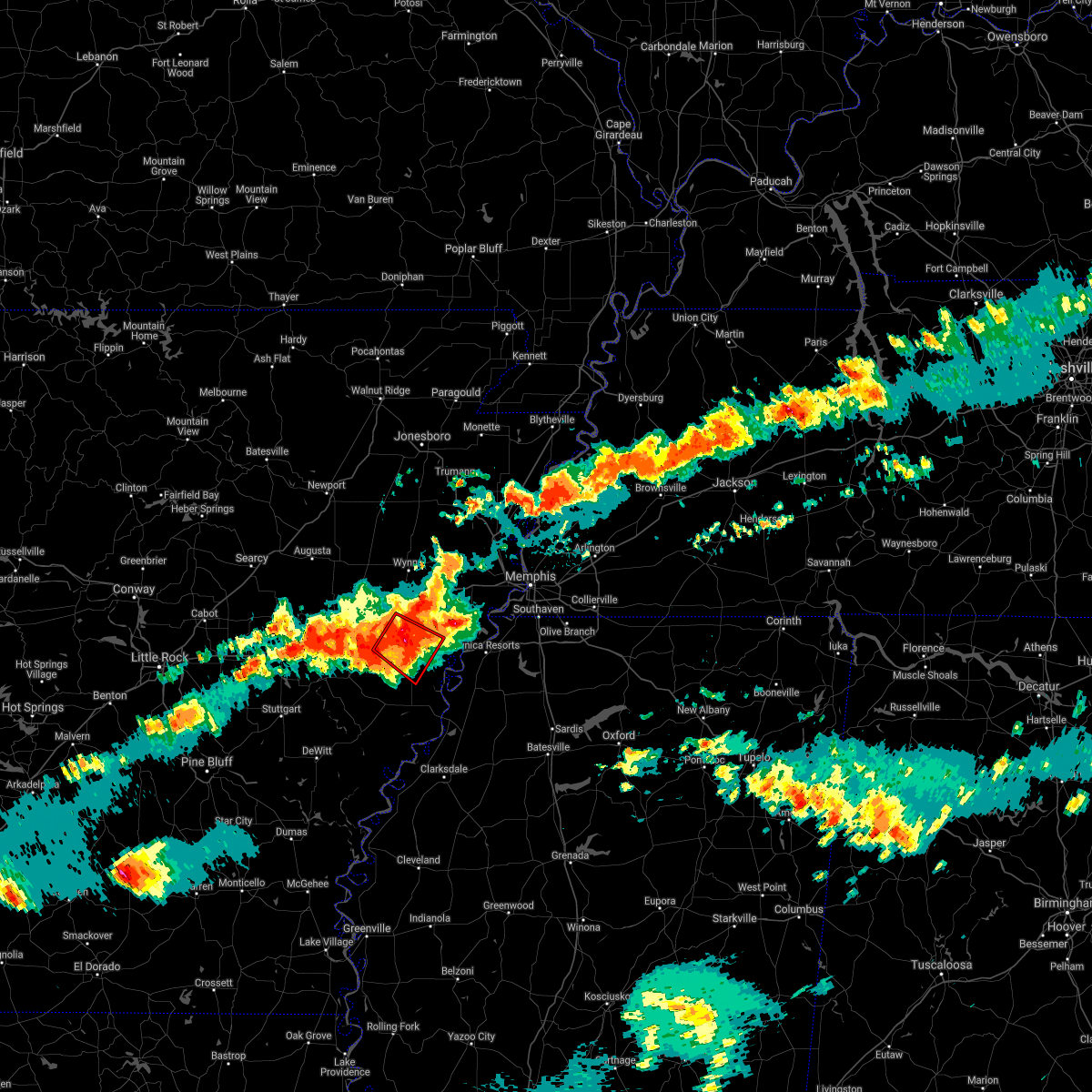 The tornado warning for western lee and south central st. francis counties will expire at 500 pm cdt, the storm which prompted the warning has weakened below severe limits, and no longer appears capable of producing a tornado. therefore, the warning will be allowed to expire. a severe thunderstorm watch remains in effect until 900 pm cdt for eastern arkansas. remember, a severe thunderstorm warning still remains in effect. The tornado warning for western lee and south central st. francis counties will expire at 500 pm cdt, the storm which prompted the warning has weakened below severe limits, and no longer appears capable of producing a tornado. therefore, the warning will be allowed to expire. a severe thunderstorm watch remains in effect until 900 pm cdt for eastern arkansas. remember, a severe thunderstorm warning still remains in effect.
|
| 5/9/2021 4:52 PM CDT |
 The severe thunderstorm warning for lee, st. francis and southern cross counties will expire at 500 pm cdt, the storm which prompted the warning has weakened below severe limits, and no longer poses an immediate threat to life or property. therefore, the warning will be allowed to expire. a severe thunderstorm watch remains in effect until 900 pm cdt for eastern arkansas, and northwestern mississippi. remember, a severe thunderstorm warning still remains in effect. The severe thunderstorm warning for lee, st. francis and southern cross counties will expire at 500 pm cdt, the storm which prompted the warning has weakened below severe limits, and no longer poses an immediate threat to life or property. therefore, the warning will be allowed to expire. a severe thunderstorm watch remains in effect until 900 pm cdt for eastern arkansas, and northwestern mississippi. remember, a severe thunderstorm warning still remains in effect.
|
| 5/9/2021 4:51 PM CDT |
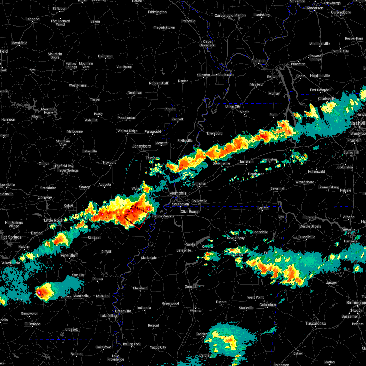 At 428 pm cdt, doppler radar indicated a severe thunderstorm producing a tornado was located near palestine, moving southeast at 25 mph (radar indicated rotation). Hazards include tornado. Flying debris will be dangerous to those caught without shelter. mobile homes will be damaged or destroyed. damage to roofs, windows, and vehicles will occur. Tree damage is likely. At 428 pm cdt, doppler radar indicated a severe thunderstorm producing a tornado was located near palestine, moving southeast at 25 mph (radar indicated rotation). Hazards include tornado. Flying debris will be dangerous to those caught without shelter. mobile homes will be damaged or destroyed. damage to roofs, windows, and vehicles will occur. Tree damage is likely.
|
| 5/9/2021 4:50 PM CDT |
 At 450 pm cdt, a severe thunderstorm was located near haynes, or near palestine, moving southeast at 30 mph (radar indicated). Hazards include 60 mph wind gusts and quarter size hail. Hail damage to vehicles is expected. Expect wind damage to roofs, siding, and trees. At 450 pm cdt, a severe thunderstorm was located near haynes, or near palestine, moving southeast at 30 mph (radar indicated). Hazards include 60 mph wind gusts and quarter size hail. Hail damage to vehicles is expected. Expect wind damage to roofs, siding, and trees.
|
| 5/9/2021 4:28 PM CDT |
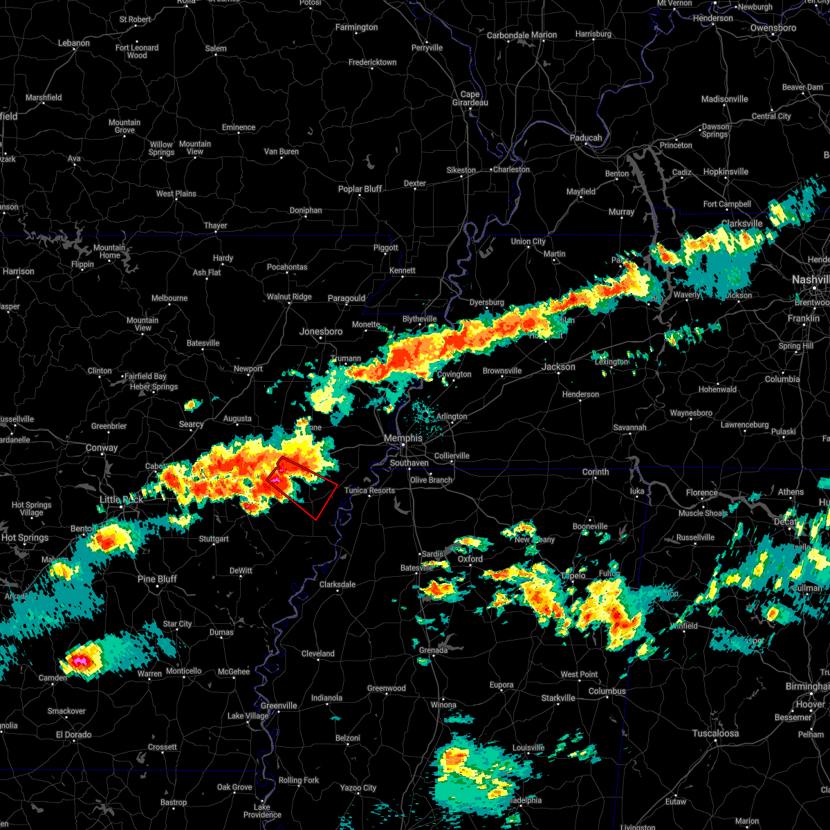 At 428 pm cdt, doppler radar indicated a severe thunderstorm producing a tornado was located near palestine, moving southeast at 25 mph (radar indicated rotation). Hazards include tornado. Flying debris will be dangerous to those caught without shelter. mobile homes will be damaged or destroyed. damage to roofs, windows, and vehicles will occur. Tree damage is likely. At 428 pm cdt, doppler radar indicated a severe thunderstorm producing a tornado was located near palestine, moving southeast at 25 mph (radar indicated rotation). Hazards include tornado. Flying debris will be dangerous to those caught without shelter. mobile homes will be damaged or destroyed. damage to roofs, windows, and vehicles will occur. Tree damage is likely.
|
| 5/9/2021 4:20 PM CDT |
 At 419 pm cdt, a severe thunderstorm was located near hunter, or 12 miles north of brinkley, moving southeast at 25 mph (radar indicated). Hazards include 60 mph wind gusts and quarter size hail. Hail damage to vehicles is expected. Expect wind damage to roofs, siding, and trees. At 419 pm cdt, a severe thunderstorm was located near hunter, or 12 miles north of brinkley, moving southeast at 25 mph (radar indicated). Hazards include 60 mph wind gusts and quarter size hail. Hail damage to vehicles is expected. Expect wind damage to roofs, siding, and trees.
|
| 4/9/2021 5:31 PM CDT |
 At 531 pm cdt, a severe thunderstorm was located over palmer, or 7 miles west of marvell, moving northeast at 40 mph (radar indicated). Hazards include 60 mph wind gusts and quarter size hail. Hail damage to vehicles is expected. Expect wind damage to roofs, siding, and trees. At 531 pm cdt, a severe thunderstorm was located over palmer, or 7 miles west of marvell, moving northeast at 40 mph (radar indicated). Hazards include 60 mph wind gusts and quarter size hail. Hail damage to vehicles is expected. Expect wind damage to roofs, siding, and trees.
|
| 3/27/2021 8:00 PM CDT | Golf Ball sized hail reported 0.2 miles NE of Marianna, AR, golfball sized hail near marianna. |
| 3/27/2021 7:56 PM CDT |
 At 755 pm cdt, doppler radar indicated a severe thunderstorm producing a tornado was located over marianna, moving northeast at 35 mph (radar indicated rotation). Hazards include tornado and baseball size hail. Flying debris will be dangerous to those caught without shelter. mobile homes will be damaged or destroyed. damage to roofs, windows, and vehicles will occur. tree damage is likely. Locations impacted include, marianna, hughes, horseshoe lake, rondo, aubrey, haynes, pinckney, brickeys, robinsonville, lagrange, jeffersonville, cody, clack, kokomo, oak forest, westor, haleside, commerce, mud lake and soudan. At 755 pm cdt, doppler radar indicated a severe thunderstorm producing a tornado was located over marianna, moving northeast at 35 mph (radar indicated rotation). Hazards include tornado and baseball size hail. Flying debris will be dangerous to those caught without shelter. mobile homes will be damaged or destroyed. damage to roofs, windows, and vehicles will occur. tree damage is likely. Locations impacted include, marianna, hughes, horseshoe lake, rondo, aubrey, haynes, pinckney, brickeys, robinsonville, lagrange, jeffersonville, cody, clack, kokomo, oak forest, westor, haleside, commerce, mud lake and soudan.
|
| 3/27/2021 7:50 PM CDT |
 At 749 pm cdt, doppler radar indicated a severe thunderstorm producing a tornado was located near marianna, moving northeast at 35 mph (radar indicated rotation). Hazards include tornado and hail up to two inches in diameter. Flying debris will be dangerous to those caught without shelter. mobile homes will be damaged or destroyed. damage to roofs, windows, and vehicles will occur. Tree damage is likely. At 749 pm cdt, doppler radar indicated a severe thunderstorm producing a tornado was located near marianna, moving northeast at 35 mph (radar indicated rotation). Hazards include tornado and hail up to two inches in diameter. Flying debris will be dangerous to those caught without shelter. mobile homes will be damaged or destroyed. damage to roofs, windows, and vehicles will occur. Tree damage is likely.
|
| 3/27/2021 7:47 PM CDT |
 At 747 pm cdt, doppler radar indicated a severe thunderstorm producing a tornado was located near aubrey, or near marianna, moving northeast at 35 mph (radar indicated rotation). Hazards include tornado and two inch hail. Flying debris will be dangerous to those caught without shelter. mobile homes will be damaged or destroyed. damage to roofs, windows, and vehicles will occur. tree damage is likely. Locations impacted include, marianna, moro, rondo, aubrey, haynes, lagrange, jeffersonville, raggio, cody, oak forest, westor, haleside, big creek corner, soudan, felton, vineyard, thomasville, ball point, scott valley and cypress corner. At 747 pm cdt, doppler radar indicated a severe thunderstorm producing a tornado was located near aubrey, or near marianna, moving northeast at 35 mph (radar indicated rotation). Hazards include tornado and two inch hail. Flying debris will be dangerous to those caught without shelter. mobile homes will be damaged or destroyed. damage to roofs, windows, and vehicles will occur. tree damage is likely. Locations impacted include, marianna, moro, rondo, aubrey, haynes, lagrange, jeffersonville, raggio, cody, oak forest, westor, haleside, big creek corner, soudan, felton, vineyard, thomasville, ball point, scott valley and cypress corner.
|
| 3/27/2021 7:42 PM CDT |
 At 742 pm cdt, doppler radar indicated a severe thunderstorm producing a tornado was located over aubrey, or 9 miles southwest of marianna, moving northeast at 35 mph (radar indicated rotation). Hazards include tornado and golf ball size hail. Flying debris will be dangerous to those caught without shelter. mobile homes will be damaged or destroyed. damage to roofs, windows, and vehicles will occur. tree damage is likely. Locations impacted include, marianna, moro, rondo, aubrey, haynes, lagrange, jeffersonville, raggio, cody, oak forest, westor, haleside, big creek corner, soudan, felton, vineyard, thomasville, ball point, scott valley and cypress corner. At 742 pm cdt, doppler radar indicated a severe thunderstorm producing a tornado was located over aubrey, or 9 miles southwest of marianna, moving northeast at 35 mph (radar indicated rotation). Hazards include tornado and golf ball size hail. Flying debris will be dangerous to those caught without shelter. mobile homes will be damaged or destroyed. damage to roofs, windows, and vehicles will occur. tree damage is likely. Locations impacted include, marianna, moro, rondo, aubrey, haynes, lagrange, jeffersonville, raggio, cody, oak forest, westor, haleside, big creek corner, soudan, felton, vineyard, thomasville, ball point, scott valley and cypress corner.
|
| 3/27/2021 7:30 PM CDT |
 At 729 pm cdt, doppler radar indicated a severe thunderstorm producing a tornado was located near palmer, or 10 miles northwest of marvell, moving northeast at 30 mph (radar indicated rotation). Hazards include tornado and golf ball size hail. Flying debris will be dangerous to those caught without shelter. mobile homes will be damaged or destroyed. damage to roofs, windows, and vehicles will occur. tree damage is likely. Locations impacted include, marianna, moro, rondo, aubrey, haynes, lagrange, jeffersonville, raggio, cody, oak forest, westor, haleside, big creek corner, soudan, phillips bayou, felton, turkey scratch, vineyard, thomasville and ball point. At 729 pm cdt, doppler radar indicated a severe thunderstorm producing a tornado was located near palmer, or 10 miles northwest of marvell, moving northeast at 30 mph (radar indicated rotation). Hazards include tornado and golf ball size hail. Flying debris will be dangerous to those caught without shelter. mobile homes will be damaged or destroyed. damage to roofs, windows, and vehicles will occur. tree damage is likely. Locations impacted include, marianna, moro, rondo, aubrey, haynes, lagrange, jeffersonville, raggio, cody, oak forest, westor, haleside, big creek corner, soudan, phillips bayou, felton, turkey scratch, vineyard, thomasville and ball point.
|
| 3/27/2021 7:17 PM CDT |
 At 717 pm cdt, doppler radar indicated a severe thunderstorm producing a tornado was located over holly grove, or 10 miles southeast of clarendon, moving northeast at 30 mph (radar indicated rotation). Hazards include tornado and golf ball size hail. Flying debris will be dangerous to those caught without shelter. mobile homes will be damaged or destroyed. damage to roofs, windows, and vehicles will occur. Tree damage is likely. At 717 pm cdt, doppler radar indicated a severe thunderstorm producing a tornado was located over holly grove, or 10 miles southeast of clarendon, moving northeast at 30 mph (radar indicated rotation). Hazards include tornado and golf ball size hail. Flying debris will be dangerous to those caught without shelter. mobile homes will be damaged or destroyed. damage to roofs, windows, and vehicles will occur. Tree damage is likely.
|
| 8/29/2020 5:26 PM CDT |
 The severe thunderstorm warning for western lee and southwestern st. francis counties will expire at 530 pm cdt, the storm which prompted the warning has weakened below severe limits, and no longer poses an immediate threat to life or property. therefore, the warning will be allowed to expire. The severe thunderstorm warning for western lee and southwestern st. francis counties will expire at 530 pm cdt, the storm which prompted the warning has weakened below severe limits, and no longer poses an immediate threat to life or property. therefore, the warning will be allowed to expire.
|
| 8/29/2020 5:04 PM CDT |
 At 504 pm cdt, a severe thunderstorm was located over brinkley, moving southeast at 25 mph (radar indicated). Hazards include 60 mph wind gusts and quarter size hail. Hail damage to vehicles is expected. expect wind damage to roofs, siding, and trees. Locations impacted include, marianna, wheatley, moro, aubrey, haynes, garret grove, new salem, gill, oak forest, westor, four forks, goodwin, felton, posey, thomasville and blossom. At 504 pm cdt, a severe thunderstorm was located over brinkley, moving southeast at 25 mph (radar indicated). Hazards include 60 mph wind gusts and quarter size hail. Hail damage to vehicles is expected. expect wind damage to roofs, siding, and trees. Locations impacted include, marianna, wheatley, moro, aubrey, haynes, garret grove, new salem, gill, oak forest, westor, four forks, goodwin, felton, posey, thomasville and blossom.
|
| 8/29/2020 4:48 PM CDT |
 At 448 pm cdt, a severe thunderstorm was located 7 miles northwest of brinkley, moving east at 35 mph (radar indicated). Hazards include 60 mph wind gusts and quarter size hail. Hail damage to vehicles is expected. Expect wind damage to roofs, siding, and trees. At 448 pm cdt, a severe thunderstorm was located 7 miles northwest of brinkley, moving east at 35 mph (radar indicated). Hazards include 60 mph wind gusts and quarter size hail. Hail damage to vehicles is expected. Expect wind damage to roofs, siding, and trees.
|
| 8/27/2020 6:09 PM CDT |
 The tornado warning for western lee, southwestern st. francis and north central phillips counties will expire at 615 pm cdt, the storm which prompted the warning has weakened below severe limits, and no longer appears capable of producing a tornado. therefore, the warning will be allowed to expire. a tornado watch remains in effect until 900 pm cdt for eastern arkansas. The tornado warning for western lee, southwestern st. francis and north central phillips counties will expire at 615 pm cdt, the storm which prompted the warning has weakened below severe limits, and no longer appears capable of producing a tornado. therefore, the warning will be allowed to expire. a tornado watch remains in effect until 900 pm cdt for eastern arkansas.
|
| 8/27/2020 5:46 PM CDT |
 At 546 pm cdt, doppler radar indicated a severe thunderstorm producing a tornado was located near rondo, or near marvell, moving north at 30 mph (radar indicated rotation). Hazards include tornado. Flying debris will be dangerous to those caught without shelter. mobile homes will be damaged or destroyed. damage to roofs, windows, and vehicles will occur. Tree damage is likely. At 546 pm cdt, doppler radar indicated a severe thunderstorm producing a tornado was located near rondo, or near marvell, moving north at 30 mph (radar indicated rotation). Hazards include tornado. Flying debris will be dangerous to those caught without shelter. mobile homes will be damaged or destroyed. damage to roofs, windows, and vehicles will occur. Tree damage is likely.
|
| 6/5/2020 3:24 PM CDT |
 The severe thunderstorm warning for western lee and northeastern phillips counties will expire at 330 pm cdt, the storm which prompted the warning has weakened below severe limits, and no longer poses an immediate threat to life or property. therefore, the warning will be allowed to expire. however hail is still possible with this thunderstorm. a severe thunderstorm watch remains in effect until 600 pm cdt for eastern arkansas, and northwestern mississippi. The severe thunderstorm warning for western lee and northeastern phillips counties will expire at 330 pm cdt, the storm which prompted the warning has weakened below severe limits, and no longer poses an immediate threat to life or property. therefore, the warning will be allowed to expire. however hail is still possible with this thunderstorm. a severe thunderstorm watch remains in effect until 600 pm cdt for eastern arkansas, and northwestern mississippi.
|
| 6/5/2020 2:53 PM CDT |
 At 252 pm cdt, a severe thunderstorm was located near aubrey, or near marianna, moving southeast at 40 mph (radar indicated). Hazards include 60 mph wind gusts and quarter size hail. Hail damage to vehicles is expected. Expect wind damage to roofs, siding, and trees. At 252 pm cdt, a severe thunderstorm was located near aubrey, or near marianna, moving southeast at 40 mph (radar indicated). Hazards include 60 mph wind gusts and quarter size hail. Hail damage to vehicles is expected. Expect wind damage to roofs, siding, and trees.
|
| 4/29/2020 12:23 AM CDT |
 The severe thunderstorm warning for lee, st. francis and southeastern cross counties will expire at 1230 am cdt, the storms which prompted the warning have moved out of the area. therefore, the warning will be allowed to expire. a severe thunderstorm watch remains in effect until 300 am cdt for eastern arkansas, and northwestern mississippi. The severe thunderstorm warning for lee, st. francis and southeastern cross counties will expire at 1230 am cdt, the storms which prompted the warning have moved out of the area. therefore, the warning will be allowed to expire. a severe thunderstorm watch remains in effect until 300 am cdt for eastern arkansas, and northwestern mississippi.
|
| 4/29/2020 12:11 AM CDT |
 At 1210 am cdt, severe thunderstorms were located along a line extending from near edmondson to near marianna, moving east at 55 mph (radar indicated). Hazards include 60 mph wind gusts. expect damage to roofs, siding, and trees At 1210 am cdt, severe thunderstorms were located along a line extending from near edmondson to near marianna, moving east at 55 mph (radar indicated). Hazards include 60 mph wind gusts. expect damage to roofs, siding, and trees
|
| 4/29/2020 12:04 AM CDT |
 At 1203 am cdt, severe thunderstorms were located along a line extending from 6 miles north of new home to near aubrey, moving east at 65 mph (radar indicated). Hazards include 60 mph wind gusts. Expect damage to roofs, siding, and trees. Locations impacted include, forrest city, marianna, hughes, madison, palestine, caldwell, colt, wheatley, widener, moro, rondo, aubrey, haynes, garret grove, brickeys, new salem, new home, lagrange, cody and cottonwood corner. At 1203 am cdt, severe thunderstorms were located along a line extending from 6 miles north of new home to near aubrey, moving east at 65 mph (radar indicated). Hazards include 60 mph wind gusts. Expect damage to roofs, siding, and trees. Locations impacted include, forrest city, marianna, hughes, madison, palestine, caldwell, colt, wheatley, widener, moro, rondo, aubrey, haynes, garret grove, brickeys, new salem, new home, lagrange, cody and cottonwood corner.
|
| 4/28/2020 11:43 PM CDT |
 At 1143 pm cdt, a severe thunderstorm was located near palestine, moving east at 60 mph (radar indicated). Hazards include 60 mph wind gusts. expect damage to roofs, siding, and trees At 1143 pm cdt, a severe thunderstorm was located near palestine, moving east at 60 mph (radar indicated). Hazards include 60 mph wind gusts. expect damage to roofs, siding, and trees
|
| 4/12/2020 9:47 PM CDT |
 At 947 pm cdt, severe thunderstorms were located along a line extending from near madison to near dundee to near dublin, moving northeast at 65 mph (radar indicated). Hazards include 70 mph wind gusts. Expect considerable tree damage. damage is likely to mobile homes, roofs, and outbuildings. Locations impacted include, clarksdale, marianna, elaine, st francis national park, helena-west helena, tutwiler, marks, lambert, jonestown, friars point, tunica, crenshaw, crowder, webb, sledge, sumner, lexa, rondo, haynes and belen. At 947 pm cdt, severe thunderstorms were located along a line extending from near madison to near dundee to near dublin, moving northeast at 65 mph (radar indicated). Hazards include 70 mph wind gusts. Expect considerable tree damage. damage is likely to mobile homes, roofs, and outbuildings. Locations impacted include, clarksdale, marianna, elaine, st francis national park, helena-west helena, tutwiler, marks, lambert, jonestown, friars point, tunica, crenshaw, crowder, webb, sledge, sumner, lexa, rondo, haynes and belen.
|
| 4/12/2020 9:36 PM CDT |
 At 935 pm cdt, severe thunderstorms were located along a line extending from near moro to near friars point to near renova, moving east at 70 mph (radar indicated). Hazards include 70 mph wind gusts. Expect considerable tree damage. damage is likely to mobile homes, roofs, and outbuildings. Locations impacted include, clarksdale, marianna, marvell, elaine, helena-west helena, st francis national park, friars point, lexa, moro, rondo, aubrey, haynes, garret grove, watkins corner, kings, sherard, new salem, lake view, coahoma and lyon. At 935 pm cdt, severe thunderstorms were located along a line extending from near moro to near friars point to near renova, moving east at 70 mph (radar indicated). Hazards include 70 mph wind gusts. Expect considerable tree damage. damage is likely to mobile homes, roofs, and outbuildings. Locations impacted include, clarksdale, marianna, marvell, elaine, helena-west helena, st francis national park, friars point, lexa, moro, rondo, aubrey, haynes, garret grove, watkins corner, kings, sherard, new salem, lake view, coahoma and lyon.
|
| 4/12/2020 9:31 PM CDT |
 At 931 pm cdt, severe thunderstorms were located along a line extending from near wheatley to near marvell to 6 miles south of sherard, moving northeast at 65 mph (radar indicated). Hazards include 70 mph wind gusts. Expect considerable tree damage. Damage is likely to mobile homes, roofs, and outbuildings. At 931 pm cdt, severe thunderstorms were located along a line extending from near wheatley to near marvell to 6 miles south of sherard, moving northeast at 65 mph (radar indicated). Hazards include 70 mph wind gusts. Expect considerable tree damage. Damage is likely to mobile homes, roofs, and outbuildings.
|
| 4/12/2020 9:13 PM CDT |
 At 913 pm cdt, severe thunderstorms were located along a line extending from peppers landing to near white river national wildlife refuge to near jersey point, moving east at 65 mph (radar indicated). Hazards include 70 mph wind gusts. Expect considerable tree damage. damage is likely to mobile homes, roofs, and outbuildings. Locations impacted include, clarksdale, marianna, marvell, elaine, helena-west helena, st francis national park, friars point, lexa, moro, rondo, aubrey, haynes, garret grove, watkins corner, kings, sherard, new salem, crumrod, lake view and coahoma. At 913 pm cdt, severe thunderstorms were located along a line extending from peppers landing to near white river national wildlife refuge to near jersey point, moving east at 65 mph (radar indicated). Hazards include 70 mph wind gusts. Expect considerable tree damage. damage is likely to mobile homes, roofs, and outbuildings. Locations impacted include, clarksdale, marianna, marvell, elaine, helena-west helena, st francis national park, friars point, lexa, moro, rondo, aubrey, haynes, garret grove, watkins corner, kings, sherard, new salem, crumrod, lake view and coahoma.
|
| 4/12/2020 8:58 PM CDT |
 At 858 pm cdt, severe thunderstorms were located along a line extending from near parkers corner to near de witt to near mcgehee, moving east at 50 mph (radar indicated). Hazards include 70 mph wind gusts. Expect considerable tree damage. damage is likely to mobile homes, roofs, and outbuildings. Locations impacted include, clarksdale, marianna, marvell, elaine, helena-west helena, st francis national park, friars point, lexa, moro, rondo, aubrey, haynes, garret grove, watkins corner, kings, sherard, new salem, crumrod, lake view and coahoma. At 858 pm cdt, severe thunderstorms were located along a line extending from near parkers corner to near de witt to near mcgehee, moving east at 50 mph (radar indicated). Hazards include 70 mph wind gusts. Expect considerable tree damage. damage is likely to mobile homes, roofs, and outbuildings. Locations impacted include, clarksdale, marianna, marvell, elaine, helena-west helena, st francis national park, friars point, lexa, moro, rondo, aubrey, haynes, garret grove, watkins corner, kings, sherard, new salem, crumrod, lake view and coahoma.
|
| 4/12/2020 8:51 PM CDT |
 At 851 pm cdt, severe thunderstorms were located along a line extending from near parkers corner to 7 miles northeast of langford to 6 miles southwest of tillar, moving east at 50 mph (radar indicated). Hazards include 70 mph wind gusts. Expect considerable tree damage. Damage is likely to mobile homes, roofs, and outbuildings. At 851 pm cdt, severe thunderstorms were located along a line extending from near parkers corner to 7 miles northeast of langford to 6 miles southwest of tillar, moving east at 50 mph (radar indicated). Hazards include 70 mph wind gusts. Expect considerable tree damage. Damage is likely to mobile homes, roofs, and outbuildings.
|
| 1/11/2020 3:37 AM CST |
 At 337 am cst, a severe thunderstorm was located 8 miles north of st francis national park, moving northeast at 50 mph (radar indicated). Hazards include 60 mph wind gusts. Expect damage to roofs, siding, and trees. Locations impacted include, marianna, hughes, marvell, helena-west helena, st francis national park, tunica, lexa, rondo, brickeys, north tunica, little texas, lake view, lagrange, cody, preston place, haleside, quarles, commerce, austin and soudan. At 337 am cst, a severe thunderstorm was located 8 miles north of st francis national park, moving northeast at 50 mph (radar indicated). Hazards include 60 mph wind gusts. Expect damage to roofs, siding, and trees. Locations impacted include, marianna, hughes, marvell, helena-west helena, st francis national park, tunica, lexa, rondo, brickeys, north tunica, little texas, lake view, lagrange, cody, preston place, haleside, quarles, commerce, austin and soudan.
|
| 1/11/2020 3:16 AM CST |
 At 316 am cst, a severe thunderstorm was located over marvell, moving northeast at 65 mph (radar indicated). Hazards include 60 mph wind gusts. expect damage to roofs, siding, and trees At 316 am cst, a severe thunderstorm was located over marvell, moving northeast at 65 mph (radar indicated). Hazards include 60 mph wind gusts. expect damage to roofs, siding, and trees
|
| 1/11/2020 2:50 AM CST |
 At 249 am cst, severe thunderstorms were located along a line extending from keiser to earle to near aubrey, moving east at 45 mph (radar indicated). Hazards include 70 mph wind gusts. Expect considerable tree damage. damage is likely to mobile homes, roofs, and outbuildings. Locations impacted include, west memphis, forrest city, marion, wynne, marianna, marked tree, earle, lepanto, hughes, parkin, wilson, madison, tyronza, palestine, village creek state park, fort pillow state park, joiner, caldwell, crawfordsville and edmondson. At 249 am cst, severe thunderstorms were located along a line extending from keiser to earle to near aubrey, moving east at 45 mph (radar indicated). Hazards include 70 mph wind gusts. Expect considerable tree damage. damage is likely to mobile homes, roofs, and outbuildings. Locations impacted include, west memphis, forrest city, marion, wynne, marianna, marked tree, earle, lepanto, hughes, parkin, wilson, madison, tyronza, palestine, village creek state park, fort pillow state park, joiner, caldwell, crawfordsville and edmondson.
|
| 1/11/2020 2:23 AM CST |
 At 222 am cst, severe thunderstorms were located along a line extending from lepanto to wynne to garret grove, moving northeast at 45 mph (radar indicated). Hazards include 70 mph wind gusts. Expect considerable tree damage. Damage is likely to mobile homes, roofs, and outbuildings. At 222 am cst, severe thunderstorms were located along a line extending from lepanto to wynne to garret grove, moving northeast at 45 mph (radar indicated). Hazards include 70 mph wind gusts. Expect considerable tree damage. Damage is likely to mobile homes, roofs, and outbuildings.
|
| 1/11/2020 2:08 AM CST |
 At 208 am cst, severe thunderstorms were located along a line extending from near harrisburg to near garret grove, moving northeast at 45 mph (radar indicated). Hazards include 70 mph wind gusts. Expect considerable tree damage. damage is likely to mobile homes, roofs, and outbuildings. Locations impacted include, forrest city, wynne, marianna, marked tree, earle, harrisburg, hughes, parkin, madison, tyronza, palestine, village creek state park, cherry valley, caldwell, crawfordsville, dyess, colt, wheatley, widener and hickory ridge. At 208 am cst, severe thunderstorms were located along a line extending from near harrisburg to near garret grove, moving northeast at 45 mph (radar indicated). Hazards include 70 mph wind gusts. Expect considerable tree damage. damage is likely to mobile homes, roofs, and outbuildings. Locations impacted include, forrest city, wynne, marianna, marked tree, earle, harrisburg, hughes, parkin, madison, tyronza, palestine, village creek state park, cherry valley, caldwell, crawfordsville, dyess, colt, wheatley, widener and hickory ridge.
|
| 1/11/2020 1:47 AM CST |
 At 147 am cst, severe thunderstorms were located along a line extending from near hickory ridge to near dobbs landing, moving east at 45 mph (radar indicated). Hazards include 70 mph wind gusts. Expect considerable tree damage. Damage is likely to mobile homes, roofs, and outbuildings. At 147 am cst, severe thunderstorms were located along a line extending from near hickory ridge to near dobbs landing, moving east at 45 mph (radar indicated). Hazards include 70 mph wind gusts. Expect considerable tree damage. Damage is likely to mobile homes, roofs, and outbuildings.
|
| 10/21/2019 5:25 AM CDT |
 At 525 am cdt, severe thunderstorms were located along a line extending from near cherry valley to near new salem, moving northeast at 80 mph (radar indicated). Hazards include 70 mph wind gusts. Expect considerable tree damage. damage is likely to mobile homes, roofs, and outbuildings. Locations impacted include, forrest city, wynne, marianna, earle, parkin, madison, tyronza, palestine, village creek state park, cherry valley, caldwell, colt, wheatley, widener, hickory ridge, moro, aubrey, haynes, jennette and brickeys. At 525 am cdt, severe thunderstorms were located along a line extending from near cherry valley to near new salem, moving northeast at 80 mph (radar indicated). Hazards include 70 mph wind gusts. Expect considerable tree damage. damage is likely to mobile homes, roofs, and outbuildings. Locations impacted include, forrest city, wynne, marianna, earle, parkin, madison, tyronza, palestine, village creek state park, cherry valley, caldwell, colt, wheatley, widener, hickory ridge, moro, aubrey, haynes, jennette and brickeys.
|
| 10/21/2019 5:05 AM CDT |
 At 505 am cdt, severe thunderstorms were located along a line extending from 6 miles south of mccrory to near clarendon, moving east at 65 mph (radar indicated). Hazards include 60 mph wind gusts. expect damage to roofs, siding, and trees At 505 am cdt, severe thunderstorms were located along a line extending from 6 miles south of mccrory to near clarendon, moving east at 65 mph (radar indicated). Hazards include 60 mph wind gusts. expect damage to roofs, siding, and trees
|
| 6/19/2019 11:02 PM CDT |
 At 1101 pm cdt, severe thunderstorms were located along a line extending from 6 miles south of tyronza to near little texas, moving east at 75 mph (radar indicated). Hazards include 70 mph wind gusts. Expect considerable tree damage. damage is likely to mobile homes, roofs, and outbuildings. Locations impacted include, west memphis, forrest city, marion, wynne, marianna, marked tree, earle, hughes, parkin, madison, tyronza, palestine, village creek state park, tunica, cherry valley, caldwell, crawfordsville, edmondson, colt and horseshoe lake. At 1101 pm cdt, severe thunderstorms were located along a line extending from 6 miles south of tyronza to near little texas, moving east at 75 mph (radar indicated). Hazards include 70 mph wind gusts. Expect considerable tree damage. damage is likely to mobile homes, roofs, and outbuildings. Locations impacted include, west memphis, forrest city, marion, wynne, marianna, marked tree, earle, hughes, parkin, madison, tyronza, palestine, village creek state park, tunica, cherry valley, caldwell, crawfordsville, edmondson, colt and horseshoe lake.
|
| 6/19/2019 10:32 PM CDT |
 At 1031 pm cdt, severe thunderstorms were located along a line extending from near fair oaks to near palmer, moving east at 75 mph (radar indicated). Hazards include 70 mph wind gusts. Expect considerable tree damage. Damage is likely to mobile homes, roofs, and outbuildings. At 1031 pm cdt, severe thunderstorms were located along a line extending from near fair oaks to near palmer, moving east at 75 mph (radar indicated). Hazards include 70 mph wind gusts. Expect considerable tree damage. Damage is likely to mobile homes, roofs, and outbuildings.
|
| 6/19/2019 10:32 PM CDT |
 The national weather service in memphis has issued a * severe thunderstorm warning for. lee county in eastern arkansas. st. francis county in eastern arkansas. southeastern poinsett county in eastern arkansas. Northern phillips county in eastern arkansas. The national weather service in memphis has issued a * severe thunderstorm warning for. lee county in eastern arkansas. st. francis county in eastern arkansas. southeastern poinsett county in eastern arkansas. Northern phillips county in eastern arkansas.
|
| 5/18/2019 7:27 PM CDT |
 At 727 pm cdt, severe thunderstorms were located along a line extending from near haynes to 9 miles southeast of marianna to st francis national park, moving northeast at 40 mph (radar indicated). Hazards include 60 mph wind gusts. expect damage to roofs, siding, and trees At 727 pm cdt, severe thunderstorms were located along a line extending from near haynes to 9 miles southeast of marianna to st francis national park, moving northeast at 40 mph (radar indicated). Hazards include 60 mph wind gusts. expect damage to roofs, siding, and trees
|
| 5/18/2019 7:17 PM CDT |
 At 717 pm cdt, a severe thunderstorm was located near marianna, moving northeast at 60 mph (radar indicated). Hazards include 60 mph wind gusts. Expect damage to roofs, siding, and trees. Locations impacted include, forrest city, marianna, hughes, marvell, madison, palestine, lexa, widener, moro, rondo, aubrey, haynes, brickeys, watkins corner, new salem, new home, lagrange, cody, cottonwood corner and haleside. At 717 pm cdt, a severe thunderstorm was located near marianna, moving northeast at 60 mph (radar indicated). Hazards include 60 mph wind gusts. Expect damage to roofs, siding, and trees. Locations impacted include, forrest city, marianna, hughes, marvell, madison, palestine, lexa, widener, moro, rondo, aubrey, haynes, brickeys, watkins corner, new salem, new home, lagrange, cody, cottonwood corner and haleside.
|
| 5/18/2019 7:06 PM CDT |
 At 706 pm cdt, a severe thunderstorm was located near moro, or 10 miles west of marianna, moving northeast at 45 mph (radar indicated). Hazards include 60 mph wind gusts. Expect damage to roofs, siding, and trees. Locations impacted include, forrest city, marianna, hughes, marvell, madison, palestine, lexa, widener, moro, rondo, aubrey, haynes, garret grove, brickeys, watkins corner, new salem, new home, lagrange, cody and cottonwood corner. At 706 pm cdt, a severe thunderstorm was located near moro, or 10 miles west of marianna, moving northeast at 45 mph (radar indicated). Hazards include 60 mph wind gusts. Expect damage to roofs, siding, and trees. Locations impacted include, forrest city, marianna, hughes, marvell, madison, palestine, lexa, widener, moro, rondo, aubrey, haynes, garret grove, brickeys, watkins corner, new salem, new home, lagrange, cody and cottonwood corner.
|
| 5/18/2019 6:47 PM CDT |
 At 646 pm cdt, a severe thunderstorm was located near palmer, or 12 miles northwest of marvell, moving northeast at 65 mph (radar indicated). Hazards include 60 mph wind gusts. expect damage to roofs, siding, and trees At 646 pm cdt, a severe thunderstorm was located near palmer, or 12 miles northwest of marvell, moving northeast at 65 mph (radar indicated). Hazards include 60 mph wind gusts. expect damage to roofs, siding, and trees
|
| 3/9/2019 12:29 PM CST |
 At 1228 pm cst, severe thunderstorms were located along a line extending from near brickeys to near st francis national park to near elaine, moving east at 45 mph (radar indicated). Hazards include 60 mph wind gusts. expect damage to roofs, siding, and trees At 1228 pm cst, severe thunderstorms were located along a line extending from near brickeys to near st francis national park to near elaine, moving east at 45 mph (radar indicated). Hazards include 60 mph wind gusts. expect damage to roofs, siding, and trees
|
| 3/9/2019 12:15 PM CST |
 At 1214 pm cst, severe thunderstorms were located along a line extending from near marianna to near lexa to 7 miles northwest of elaine, moving east at 45 mph (radar indicated). Hazards include 60 mph wind gusts and quarter size hail. Hail damage to vehicles is expected. expect wind damage to roofs, siding, and trees. locations impacted include, marianna, marvell, elaine, helena-west helena, white river national wildlife refuge, st francis national park, lexa, moro, rondo, aubrey, garret grove, watkins corner, crumrod, lake view, lagrange, mosby spur, ferguson, haleside, quarles and hoop spur. A tornado watch remains in effect until 500 pm cst for eastern arkansas, and northwestern mississippi. At 1214 pm cst, severe thunderstorms were located along a line extending from near marianna to near lexa to 7 miles northwest of elaine, moving east at 45 mph (radar indicated). Hazards include 60 mph wind gusts and quarter size hail. Hail damage to vehicles is expected. expect wind damage to roofs, siding, and trees. locations impacted include, marianna, marvell, elaine, helena-west helena, white river national wildlife refuge, st francis national park, lexa, moro, rondo, aubrey, garret grove, watkins corner, crumrod, lake view, lagrange, mosby spur, ferguson, haleside, quarles and hoop spur. A tornado watch remains in effect until 500 pm cst for eastern arkansas, and northwestern mississippi.
|
| 3/9/2019 11:48 AM CST |
 At 1148 am cst, severe thunderstorms were located along a line extending from near aubrey to near palmer to de witt, moving east at 50 mph (radar indicated). Hazards include 60 mph wind gusts and quarter size hail. Hail damage to vehicles is expected. Expect wind damage to roofs, siding, and trees. At 1148 am cst, severe thunderstorms were located along a line extending from near aubrey to near palmer to de witt, moving east at 50 mph (radar indicated). Hazards include 60 mph wind gusts and quarter size hail. Hail damage to vehicles is expected. Expect wind damage to roofs, siding, and trees.
|
| 2/23/2019 3:36 PM CST |
 The severe thunderstorm warning for northeastern lee and southeastern st. francis counties will expire at 345 pm cst, the storm which prompted the warning has weakened below severe limits, and has exited the warned area. therefore, the warning will be allowed to expire. a tornado watch remains in effect until 800 pm cst for eastern arkansas, and northwestern mississippi. The severe thunderstorm warning for northeastern lee and southeastern st. francis counties will expire at 345 pm cst, the storm which prompted the warning has weakened below severe limits, and has exited the warned area. therefore, the warning will be allowed to expire. a tornado watch remains in effect until 800 pm cst for eastern arkansas, and northwestern mississippi.
|
| 2/23/2019 3:17 PM CST |
 At 317 pm cst, a severe thunderstorm was located over brickeys, or 8 miles southwest of hughes, moving northeast at 55 mph (radar indicated). Hazards include 60 mph wind gusts. Expect damage to roofs, siding, and trees. locations impacted include, marianna, hughes, brickeys, cody, kokomo, mud lake, soudan, peters, council, democrat, north hughes, diamond woods, ball point, whitehall, shannondale, tongin, rawlinson, raggio, gassett and penjur. A tornado watch remains in effect until 800 pm cst for eastern arkansas, and northwestern mississippi. At 317 pm cst, a severe thunderstorm was located over brickeys, or 8 miles southwest of hughes, moving northeast at 55 mph (radar indicated). Hazards include 60 mph wind gusts. Expect damage to roofs, siding, and trees. locations impacted include, marianna, hughes, brickeys, cody, kokomo, mud lake, soudan, peters, council, democrat, north hughes, diamond woods, ball point, whitehall, shannondale, tongin, rawlinson, raggio, gassett and penjur. A tornado watch remains in effect until 800 pm cst for eastern arkansas, and northwestern mississippi.
|
| 2/23/2019 3:07 PM CST |
 At 306 pm cst, a severe thunderstorm was located over marianna, moving northeast at 55 mph (radar indicated). Hazards include 60 mph wind gusts. Expect damage to roofs, siding, and trees. locations impacted include, marianna, hughes, rondo, aubrey, haynes, brickeys, lagrange, jeffersonville, cody, kokomo, haleside, mud lake, soudan, peters, council, vineyard, democrat, heustess, north hughes and diamond woods. A tornado watch remains in effect until 800 pm cst for eastern arkansas, and northwestern mississippi. At 306 pm cst, a severe thunderstorm was located over marianna, moving northeast at 55 mph (radar indicated). Hazards include 60 mph wind gusts. Expect damage to roofs, siding, and trees. locations impacted include, marianna, hughes, rondo, aubrey, haynes, brickeys, lagrange, jeffersonville, cody, kokomo, haleside, mud lake, soudan, peters, council, vineyard, democrat, heustess, north hughes and diamond woods. A tornado watch remains in effect until 800 pm cst for eastern arkansas, and northwestern mississippi.
|
| 2/23/2019 2:54 PM CST |
 At 254 pm cst, a severe thunderstorm was located over aubrey, or 9 miles north of marvell, moving northeast at 55 mph (radar indicated). Hazards include 60 mph wind gusts. expect damage to roofs, siding, and trees At 254 pm cst, a severe thunderstorm was located over aubrey, or 9 miles north of marvell, moving northeast at 55 mph (radar indicated). Hazards include 60 mph wind gusts. expect damage to roofs, siding, and trees
|
| 2/23/2019 2:39 PM CST |
 At 238 pm cst, a severe thunderstorm was located near aubrey, or near marianna, moving northeast at 60 mph (radar indicated). Hazards include 60 mph wind gusts. Expect damage to roofs, siding, and trees. locations impacted include, marianna, marvell, lexa, moro, rondo, aubrey, haynes, garret grove, lagrange, jeffersonville, cody, oak forest, westor, haleside, soudan, turkey scratch, vineyard, ball point, cypress corner and tongin. A tornado watch remains in effect until 800 pm cst for eastern arkansas. At 238 pm cst, a severe thunderstorm was located near aubrey, or near marianna, moving northeast at 60 mph (radar indicated). Hazards include 60 mph wind gusts. Expect damage to roofs, siding, and trees. locations impacted include, marianna, marvell, lexa, moro, rondo, aubrey, haynes, garret grove, lagrange, jeffersonville, cody, oak forest, westor, haleside, soudan, turkey scratch, vineyard, ball point, cypress corner and tongin. A tornado watch remains in effect until 800 pm cst for eastern arkansas.
|
| 2/23/2019 2:16 PM CST |
 The national weather service in memphis has issued a * severe thunderstorm warning for. lee county in eastern arkansas. northwestern phillips county in eastern arkansas. until 300 pm cst. At 216 pm cst, a severe thunderstorm was located over holly grove,. The national weather service in memphis has issued a * severe thunderstorm warning for. lee county in eastern arkansas. northwestern phillips county in eastern arkansas. until 300 pm cst. At 216 pm cst, a severe thunderstorm was located over holly grove,.
|
| 1/19/2019 4:55 AM CST |
 The tornado warning for central lee and south central st. francis counties will expire at 500 am cst, the storm which prompted the warning has weakened below severe limits, and no longer appears capable of producing a tornado. therefore, the warning will be allowed to expire. however gusty winds and heavy rain are still possible with this thunderstorm. remember, a severe thunderstorm warning still remains in effect for lee county until 5:30 am. The tornado warning for central lee and south central st. francis counties will expire at 500 am cst, the storm which prompted the warning has weakened below severe limits, and no longer appears capable of producing a tornado. therefore, the warning will be allowed to expire. however gusty winds and heavy rain are still possible with this thunderstorm. remember, a severe thunderstorm warning still remains in effect for lee county until 5:30 am.
|
| 1/19/2019 4:54 AM CST |
 At 454 am cst, a severe thunderstorm was located over brickeys, or 8 miles northeast of marianna, moving east at 50 mph (radar indicated). Hazards include 60 mph wind gusts. expect damage to roofs, siding, and trees At 454 am cst, a severe thunderstorm was located over brickeys, or 8 miles northeast of marianna, moving east at 50 mph (radar indicated). Hazards include 60 mph wind gusts. expect damage to roofs, siding, and trees
|
| 1/19/2019 4:45 AM CST |
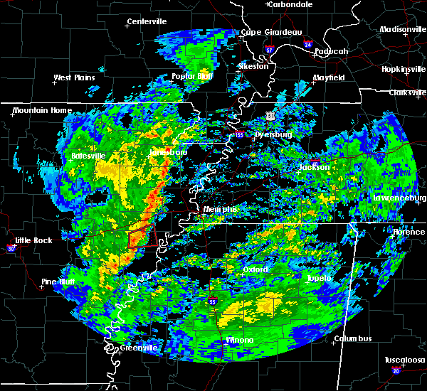 At 444 am cst, doppler radar indicated a severe squall line producing both tornadoes and extensive straight line wind damage was located near haynes, or near marianna, moving northeast at 55 mph (radar indicated rotation). Hazards include tornado. Flying debris will be dangerous to those caught without shelter. mobile homes will be damaged or destroyed. damage to roofs, windows, and vehicles will occur. tree damage is likely. Locations impacted include, marianna, aubrey, haynes, raggio, cody, gill, oak forest, westor, dansby, four forks, soudan, felton, heustess, ball point, scott valley, tongin and mississippi river state park. At 444 am cst, doppler radar indicated a severe squall line producing both tornadoes and extensive straight line wind damage was located near haynes, or near marianna, moving northeast at 55 mph (radar indicated rotation). Hazards include tornado. Flying debris will be dangerous to those caught without shelter. mobile homes will be damaged or destroyed. damage to roofs, windows, and vehicles will occur. tree damage is likely. Locations impacted include, marianna, aubrey, haynes, raggio, cody, gill, oak forest, westor, dansby, four forks, soudan, felton, heustess, ball point, scott valley, tongin and mississippi river state park.
|
| 1/19/2019 4:36 AM CST |
 At 436 am cst, doppler radar indicated severe thunderstorms producing both tornadoes and extensive straight line wind damage were located over moro, or 11 miles west of marianna, moving northeast at 55 mph (radar indicated rotation). Hazards include tornado. Flying debris will be dangerous to those caught without shelter. mobile homes will be damaged or destroyed. damage to roofs, windows, and vehicles will occur. Tree damage is likely. At 436 am cst, doppler radar indicated severe thunderstorms producing both tornadoes and extensive straight line wind damage were located over moro, or 11 miles west of marianna, moving northeast at 55 mph (radar indicated rotation). Hazards include tornado. Flying debris will be dangerous to those caught without shelter. mobile homes will be damaged or destroyed. damage to roofs, windows, and vehicles will occur. Tree damage is likely.
|
| 8/20/2018 6:30 PM CDT |
 At 629 pm cdt, a severe thunderstorm was located over marianna, moving east at 30 mph (radar indicated). Hazards include 60 mph wind gusts. expect damage to roofs, siding, and trees At 629 pm cdt, a severe thunderstorm was located over marianna, moving east at 30 mph (radar indicated). Hazards include 60 mph wind gusts. expect damage to roofs, siding, and trees
|
| 6/23/2018 7:25 AM CDT |
 At 704 am cdt, severe thunderstorms were located along a line extending from near palestine to near rondo to 8 miles east of watkins corner, moving east at 45 mph (radar indicated). Hazards include 60 mph wind gusts. Expect damage to roofs, siding, and trees. Locations impacted include, marianna, marvell, palestine, west helena, helena, wheatley, lexa, moro, rondo, aubrey, haynes, garret grove, watkins corner, new salem, lake view, lagrange, preston place, haleside, quarles and hoop spur. At 704 am cdt, severe thunderstorms were located along a line extending from near palestine to near rondo to 8 miles east of watkins corner, moving east at 45 mph (radar indicated). Hazards include 60 mph wind gusts. Expect damage to roofs, siding, and trees. Locations impacted include, marianna, marvell, palestine, west helena, helena, wheatley, lexa, moro, rondo, aubrey, haynes, garret grove, watkins corner, new salem, lake view, lagrange, preston place, haleside, quarles and hoop spur.
|
| 6/23/2018 7:05 AM CDT |
 At 704 am cdt, severe thunderstorms were located along a line extending from near palestine to near rondo to 8 miles east of watkins corner, moving east at 45 mph (radar indicated). Hazards include 60 mph wind gusts. Expect damage to roofs, siding, and trees. Locations impacted include, marianna, marvell, palestine, west helena, helena, wheatley, lexa, moro, rondo, aubrey, haynes, garret grove, watkins corner, new salem, lake view, lagrange, preston place, haleside, quarles and hoop spur. At 704 am cdt, severe thunderstorms were located along a line extending from near palestine to near rondo to 8 miles east of watkins corner, moving east at 45 mph (radar indicated). Hazards include 60 mph wind gusts. Expect damage to roofs, siding, and trees. Locations impacted include, marianna, marvell, palestine, west helena, helena, wheatley, lexa, moro, rondo, aubrey, haynes, garret grove, watkins corner, new salem, lake view, lagrange, preston place, haleside, quarles and hoop spur.
|
| 6/23/2018 6:38 AM CDT |
 At 638 am cdt, severe thunderstorms were located along a line extending from near brinkley to near st. charles, moving east at 40 mph (radar indicated). Hazards include 60 mph wind gusts. expect damage to roofs, siding, and trees At 638 am cdt, severe thunderstorms were located along a line extending from near brinkley to near st. charles, moving east at 40 mph (radar indicated). Hazards include 60 mph wind gusts. expect damage to roofs, siding, and trees
|
| 6/2/2018 11:58 PM CDT |
 The tornado warning for eastern lee and southeastern st. francis counties will expire at midnight cdt, the tornado threat has diminished and the tornado warning has been cancelled. however, large hail and damaging winds remain likely and a severe thunderstorm warning remains in effect for lee county. a severe thunderstorm watch remains in effect until midnight cdt for eastern arkansas. remember, a severe thunderstorm warning still remains in effect for lee county until 12:30 am. The tornado warning for eastern lee and southeastern st. francis counties will expire at midnight cdt, the tornado threat has diminished and the tornado warning has been cancelled. however, large hail and damaging winds remain likely and a severe thunderstorm warning remains in effect for lee county. a severe thunderstorm watch remains in effect until midnight cdt for eastern arkansas. remember, a severe thunderstorm warning still remains in effect for lee county until 12:30 am.
|
| 6/2/2018 11:57 PM CDT |
 The national weather service in memphis has issued a * severe thunderstorm warning for. central lee county in eastern arkansas. northeastern phillips county in eastern arkansas. northern coahoma county in northwestern mississippi. Southwestern tunica county in northwestern mississippi. The national weather service in memphis has issued a * severe thunderstorm warning for. central lee county in eastern arkansas. northeastern phillips county in eastern arkansas. northern coahoma county in northwestern mississippi. Southwestern tunica county in northwestern mississippi.
|
| 6/2/2018 11:49 PM CDT |
 At 1149 pm cdt, a severe thunderstorm producing a tornado was located near brickeys, or near marianna, moving south at 45 mph (radar indicated rotation). Hazards include tornado and quarter size hail. Flying debris will be dangerous to those caught without shelter. mobile homes will be damaged or destroyed. damage to roofs, windows, and vehicles will occur. tree damage is likely. Locations impacted include, marianna, madison, haynes, brickeys, rawlinson, jeffersonville, raggio, cody, gassett, kokomo, bonair, haleside, dansby, soudan, peters, burnt cane, council, heustess, diamond woods and ball point. At 1149 pm cdt, a severe thunderstorm producing a tornado was located near brickeys, or near marianna, moving south at 45 mph (radar indicated rotation). Hazards include tornado and quarter size hail. Flying debris will be dangerous to those caught without shelter. mobile homes will be damaged or destroyed. damage to roofs, windows, and vehicles will occur. tree damage is likely. Locations impacted include, marianna, madison, haynes, brickeys, rawlinson, jeffersonville, raggio, cody, gassett, kokomo, bonair, haleside, dansby, soudan, peters, burnt cane, council, heustess, diamond woods and ball point.
|
| 6/2/2018 11:37 PM CDT |
 At 1137 pm cdt, a severe thunderstorm producing a tornado was located near widener, or near madison, moving south at 45 mph (radar indicated rotation). Hazards include tornado and quarter size hail. Flying debris will be dangerous to those caught without shelter. mobile homes will be damaged or destroyed. damage to roofs, windows, and vehicles will occur. tree damage is likely. Locations impacted include, forrest city, marianna, madison, widener, haynes, brickeys, jeffersonville, cody, kokomo, haleside, mud lake, new castle, soudan, peters, council, heustess, diamond woods, ball point, whitehall and tongin. At 1137 pm cdt, a severe thunderstorm producing a tornado was located near widener, or near madison, moving south at 45 mph (radar indicated rotation). Hazards include tornado and quarter size hail. Flying debris will be dangerous to those caught without shelter. mobile homes will be damaged or destroyed. damage to roofs, windows, and vehicles will occur. tree damage is likely. Locations impacted include, forrest city, marianna, madison, widener, haynes, brickeys, jeffersonville, cody, kokomo, haleside, mud lake, new castle, soudan, peters, council, heustess, diamond woods, ball point, whitehall and tongin.
|
| 6/2/2018 11:23 PM CDT |
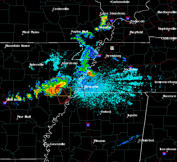 At 1123 pm cdt, a severe thunderstorm producing a tornado was located near caldwell, or near madison, moving south at 45 mph (radar indicated rotation). Hazards include tornado and quarter size hail. Flying debris will be dangerous to those caught without shelter. mobile homes will be damaged or destroyed. damage to roofs, windows, and vehicles will occur. Tree damage is likely. At 1123 pm cdt, a severe thunderstorm producing a tornado was located near caldwell, or near madison, moving south at 45 mph (radar indicated rotation). Hazards include tornado and quarter size hail. Flying debris will be dangerous to those caught without shelter. mobile homes will be damaged or destroyed. damage to roofs, windows, and vehicles will occur. Tree damage is likely.
|
| 5/20/2018 4:18 PM CDT |
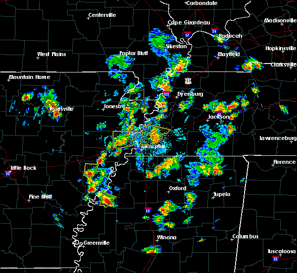 At 418 pm cdt, a severe thunderstorm was located over aubrey, or 9 miles north of marvell, moving north at 5 mph (radar indicated). Hazards include 60 mph wind gusts and quarter size hail. Hail damage to vehicles is expected. Expect wind damage to roofs, siding, and trees. At 418 pm cdt, a severe thunderstorm was located over aubrey, or 9 miles north of marvell, moving north at 5 mph (radar indicated). Hazards include 60 mph wind gusts and quarter size hail. Hail damage to vehicles is expected. Expect wind damage to roofs, siding, and trees.
|
| 4/3/2018 6:33 PM CDT |
 At 633 pm cdt, a severe thunderstorm was located over marianna, moving east at 55 mph (radar indicated). Hazards include 60 mph wind gusts and quarter size hail. Hail damage to vehicles is expected. Expect wind damage to roofs, siding, and trees. At 633 pm cdt, a severe thunderstorm was located over marianna, moving east at 55 mph (radar indicated). Hazards include 60 mph wind gusts and quarter size hail. Hail damage to vehicles is expected. Expect wind damage to roofs, siding, and trees.
|
| 3/19/2018 8:58 AM CDT |
 At 850 am cdt, a severe thunderstorm was located over rondo, or 8 miles south of marianna, moving east at 45 mph (radar indicated). Hazards include 60 mph wind gusts and quarter size hail. Hail damage to vehicles is expected. expect wind damage to roofs, siding, and trees. Locations impacted include, marianna, west helena, st francis national park, helena, lexa, rondo, aubrey, lagrange, jeffersonville, poplar grove, huma, haleside, big creek corner, quarles, barton, wycamp, latour, kindall, phillips bayou and vineyard. At 850 am cdt, a severe thunderstorm was located over rondo, or 8 miles south of marianna, moving east at 45 mph (radar indicated). Hazards include 60 mph wind gusts and quarter size hail. Hail damage to vehicles is expected. expect wind damage to roofs, siding, and trees. Locations impacted include, marianna, west helena, st francis national park, helena, lexa, rondo, aubrey, lagrange, jeffersonville, poplar grove, huma, haleside, big creek corner, quarles, barton, wycamp, latour, kindall, phillips bayou and vineyard.
|
| 3/19/2018 8:57 AM CDT |
 At 856 am cdt, a severe thunderstorm was located near lexa, or 8 miles northwest of st francis national park, moving east at 45 mph (radar indicated). Hazards include 60 mph wind gusts and quarter size hail. Hail damage to vehicles is expected. Expect wind damage to roofs, siding, and trees. At 856 am cdt, a severe thunderstorm was located near lexa, or 8 miles northwest of st francis national park, moving east at 45 mph (radar indicated). Hazards include 60 mph wind gusts and quarter size hail. Hail damage to vehicles is expected. Expect wind damage to roofs, siding, and trees.
|
| 3/19/2018 8:51 AM CDT |
 At 850 am cdt, a severe thunderstorm was located over rondo, or 8 miles south of marianna, moving east at 45 mph (radar indicated). Hazards include 60 mph wind gusts and quarter size hail. Hail damage to vehicles is expected. expect wind damage to roofs, siding, and trees. Locations impacted include, marianna, west helena, st francis national park, helena, lexa, rondo, aubrey, lagrange, jeffersonville, poplar grove, huma, haleside, big creek corner, quarles, barton, wycamp, latour, kindall, phillips bayou and vineyard. At 850 am cdt, a severe thunderstorm was located over rondo, or 8 miles south of marianna, moving east at 45 mph (radar indicated). Hazards include 60 mph wind gusts and quarter size hail. Hail damage to vehicles is expected. expect wind damage to roofs, siding, and trees. Locations impacted include, marianna, west helena, st francis national park, helena, lexa, rondo, aubrey, lagrange, jeffersonville, poplar grove, huma, haleside, big creek corner, quarles, barton, wycamp, latour, kindall, phillips bayou and vineyard.
|
| 3/19/2018 8:34 AM CDT |
 At 833 am cdt, a severe thunderstorm was located near palmer, or 7 miles northwest of marvell, moving east at 40 mph (radar indicated). Hazards include 60 mph wind gusts and quarter size hail. Hail damage to vehicles is expected. Expect wind damage to roofs, siding, and trees. At 833 am cdt, a severe thunderstorm was located near palmer, or 7 miles northwest of marvell, moving east at 40 mph (radar indicated). Hazards include 60 mph wind gusts and quarter size hail. Hail damage to vehicles is expected. Expect wind damage to roofs, siding, and trees.
|
| 2/24/2018 5:34 PM CST |
 At 534 pm cst, severe thunderstorms were located along a line extending from near wynne to near alfrey, moving east at 50 mph (radar indicated). Hazards include 60 mph wind gusts. expect damage to roofs, siding, and trees At 534 pm cst, severe thunderstorms were located along a line extending from near wynne to near alfrey, moving east at 50 mph (radar indicated). Hazards include 60 mph wind gusts. expect damage to roofs, siding, and trees
|
| 8/31/2017 1:05 PM CDT |
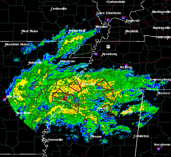 At 105 pm cdt, a severe thunderstorm producing a tornado was located near north tunica, or 13 miles northeast of st francis national park, moving northwest at 15 mph (radar indicated rotation). Hazards include tornado. Flying debris will be dangerous to those caught without shelter. mobile homes will be damaged or destroyed. damage to roofs, windows, and vehicles will occur. tree damage is likely. this dangerous storm will be near, brickeys around 145 pm cdt. Other locations impacted by this tornadic thunderstorm include rawlinson, raggio, cody, gassett, kokomo, westor, dansby, soudan, peters and council. At 105 pm cdt, a severe thunderstorm producing a tornado was located near north tunica, or 13 miles northeast of st francis national park, moving northwest at 15 mph (radar indicated rotation). Hazards include tornado. Flying debris will be dangerous to those caught without shelter. mobile homes will be damaged or destroyed. damage to roofs, windows, and vehicles will occur. tree damage is likely. this dangerous storm will be near, brickeys around 145 pm cdt. Other locations impacted by this tornadic thunderstorm include rawlinson, raggio, cody, gassett, kokomo, westor, dansby, soudan, peters and council.
|
| 7/4/2017 6:26 PM CDT |
 At 626 pm cdt, a severe thunderstorm was located near new salem, or 8 miles south of palestine, moving east at 20 mph (radar indicated). Hazards include 60 mph wind gusts. Expect damage to roofs, siding, and trees. Locations impacted include, forrest city, marianna, hughes, madison, palestine, widener, moro, aubrey, haynes, brickeys, new salem, new home, cody, cottonwood corner, new castle, soudan, round pond, ball point, tongin and raggio. At 626 pm cdt, a severe thunderstorm was located near new salem, or 8 miles south of palestine, moving east at 20 mph (radar indicated). Hazards include 60 mph wind gusts. Expect damage to roofs, siding, and trees. Locations impacted include, forrest city, marianna, hughes, madison, palestine, widener, moro, aubrey, haynes, brickeys, new salem, new home, cody, cottonwood corner, new castle, soudan, round pond, ball point, tongin and raggio.
|
| 7/4/2017 5:57 PM CDT |
 At 557 pm cdt, a severe thunderstorm was located near garret grove, or 8 miles southeast of brinkley, moving northeast at 55 mph (radar indicated). Hazards include 60 mph wind gusts. expect damage to roofs, siding, and trees At 557 pm cdt, a severe thunderstorm was located near garret grove, or 8 miles southeast of brinkley, moving northeast at 55 mph (radar indicated). Hazards include 60 mph wind gusts. expect damage to roofs, siding, and trees
|
| 4/30/2017 3:25 AM CDT |
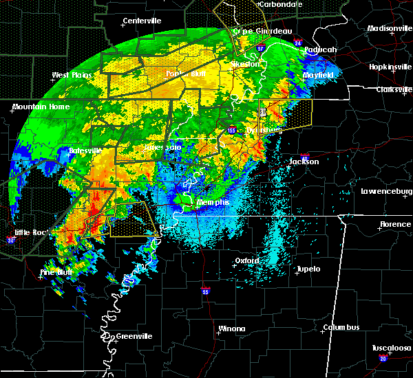 At 324 am cdt, a severe thunderstorm was located over brinkley, moving east at 50 mph (radar indicated). Hazards include 60 mph wind gusts. expect damage to roofs, siding, and trees At 324 am cdt, a severe thunderstorm was located over brinkley, moving east at 50 mph (radar indicated). Hazards include 60 mph wind gusts. expect damage to roofs, siding, and trees
|
| 3/25/2017 1:58 AM CDT |
 The severe thunderstorm warning for lee, southwestern st. francis and northwestern phillips counties will expire at 200 am cdt, the severe thunderstorm which prompted the warning has weakened. moved out of the warned area. therefore, the warning will be allowed to expire. The severe thunderstorm warning for lee, southwestern st. francis and northwestern phillips counties will expire at 200 am cdt, the severe thunderstorm which prompted the warning has weakened. moved out of the warned area. therefore, the warning will be allowed to expire.
|
| 3/25/2017 1:31 AM CDT |
 At 131 am cdt, a severe thunderstorm was located near palmer, or 12 miles west of marvell, moving northeast at 40 mph (radar indicated). Hazards include 60 mph wind gusts and quarter size hail. Hail damage to vehicles is expected. expect wind damage to roofs, siding, and trees. Locations impacted include, marianna, marvell, palestine, lexa, moro, rondo, aubrey, haynes, garret grove, new salem, lagrange, jeffersonville, oak forest, slonikers mill, westor, haleside, turkey scratch, vineyard, cypress corner and poplar grove. At 131 am cdt, a severe thunderstorm was located near palmer, or 12 miles west of marvell, moving northeast at 40 mph (radar indicated). Hazards include 60 mph wind gusts and quarter size hail. Hail damage to vehicles is expected. expect wind damage to roofs, siding, and trees. Locations impacted include, marianna, marvell, palestine, lexa, moro, rondo, aubrey, haynes, garret grove, new salem, lagrange, jeffersonville, oak forest, slonikers mill, westor, haleside, turkey scratch, vineyard, cypress corner and poplar grove.
|
| 3/25/2017 1:15 AM CDT |
 At 114 am cdt, a severe thunderstorm was located 8 miles southwest of holly grove, or 13 miles south of clarendon, moving northeast at 50 mph (radar indicated). Hazards include 60 mph wind gusts and quarter size hail. Hail damage to vehicles is expected. Expect wind damage to roofs, siding, and trees. At 114 am cdt, a severe thunderstorm was located 8 miles southwest of holly grove, or 13 miles south of clarendon, moving northeast at 50 mph (radar indicated). Hazards include 60 mph wind gusts and quarter size hail. Hail damage to vehicles is expected. Expect wind damage to roofs, siding, and trees.
|
| 5/10/2016 12:37 AM CDT |
 At 1237 am cdt, severe thunderstorms were located along a line extending from near mcfadden to near hunter to near allendale, moving east at 35 mph (radar indicated). Hazards include 60 mph wind gusts and quarter size hail. Hail damage to vehicles is expected. Expect wind damage to roofs, siding, and trees. At 1237 am cdt, severe thunderstorms were located along a line extending from near mcfadden to near hunter to near allendale, moving east at 35 mph (radar indicated). Hazards include 60 mph wind gusts and quarter size hail. Hail damage to vehicles is expected. Expect wind damage to roofs, siding, and trees.
|
| 3/31/2016 4:42 PM CDT |
 At 442 pm cdt, a severe thunderstorm was located 7 miles northwest of north tunica, or 12 miles south of hughes, moving northeast at 55 mph (radar indicated). Hazards include 60 mph wind gusts and quarter size hail. Hail damage to vehicles is expected. expect wind damage to roofs, siding, and trees. locations impacted include, southaven, horn lake, hernando, marianna, walls, tunica, horseshoe lake, eudora, lynchburg, north tunica, lake cormorant, robinsonville, brickeys, trinity, newport, alden, lake view, bowdre, diamond woods and commerce. A tornado watch remains in effect until 1000 pm cdt for eastern arkansas and northwestern mississippi. At 442 pm cdt, a severe thunderstorm was located 7 miles northwest of north tunica, or 12 miles south of hughes, moving northeast at 55 mph (radar indicated). Hazards include 60 mph wind gusts and quarter size hail. Hail damage to vehicles is expected. expect wind damage to roofs, siding, and trees. locations impacted include, southaven, horn lake, hernando, marianna, walls, tunica, horseshoe lake, eudora, lynchburg, north tunica, lake cormorant, robinsonville, brickeys, trinity, newport, alden, lake view, bowdre, diamond woods and commerce. A tornado watch remains in effect until 1000 pm cdt for eastern arkansas and northwestern mississippi.
|
| 3/31/2016 4:33 PM CDT |
 At 433 pm cdt, a severe thunderstorm was located 8 miles south of brickeys, or 9 miles east of marianna, moving northeast at 55 mph (radar indicated). Hazards include 60 mph wind gusts and quarter size hail. Hail damage to vehicles is expected. Expect wind damage to roofs, siding, and trees. At 433 pm cdt, a severe thunderstorm was located 8 miles south of brickeys, or 9 miles east of marianna, moving northeast at 55 mph (radar indicated). Hazards include 60 mph wind gusts and quarter size hail. Hail damage to vehicles is expected. Expect wind damage to roofs, siding, and trees.
|
| 3/31/2016 4:01 PM CDT |
 At 401 pm cdt, a severe thunderstorm was located near haynes, or near madison, moving northeast at 45 mph (radar indicated). Hazards include 60 mph wind gusts and quarter size hail. Hail damage to vehicles is expected. expect wind damage to roofs, siding, and trees. locations impacted include, forrest city, marianna, parkin, madison, palestine, village creek state park, caldwell, widener, moro, rondo, aubrey, haynes, new home, brickeys, lagrange, dodsons corner, scott valley, turkey scratch, thomasville and rawlinson. A tornado watch remains in effect until 1000 pm cdt for eastern arkansas and northwestern mississippi. At 401 pm cdt, a severe thunderstorm was located near haynes, or near madison, moving northeast at 45 mph (radar indicated). Hazards include 60 mph wind gusts and quarter size hail. Hail damage to vehicles is expected. expect wind damage to roofs, siding, and trees. locations impacted include, forrest city, marianna, parkin, madison, palestine, village creek state park, caldwell, widener, moro, rondo, aubrey, haynes, new home, brickeys, lagrange, dodsons corner, scott valley, turkey scratch, thomasville and rawlinson. A tornado watch remains in effect until 1000 pm cdt for eastern arkansas and northwestern mississippi.
|
| 3/31/2016 3:39 PM CDT |
 At 339 pm cdt, a severe thunderstorm was located over moro, or 11 miles southeast of brinkley, moving northeast at 45 mph (radar indicated). Hazards include 60 mph wind gusts and quarter size hail. Hail damage to vehicles is expected. Expect wind damage to roofs, siding, and trees. At 339 pm cdt, a severe thunderstorm was located over moro, or 11 miles southeast of brinkley, moving northeast at 45 mph (radar indicated). Hazards include 60 mph wind gusts and quarter size hail. Hail damage to vehicles is expected. Expect wind damage to roofs, siding, and trees.
|
| 3/13/2016 8:38 PM CDT |
 At 838 pm cdt, a confirmed tornado was located near brickeys, or near marianna, moving northeast at 35 mph (weather spotters confirmed tornado). Hazards include damaging tornado and quarter size hail. Flying debris will be dangerous to those caught without shelter. mobile homes will be damaged or destroyed. damage to roofs, windows, and vehicles will occur. tree damage is likely. the tornado will be near, brickeys around 850 pm cdt. hughes around 905 pm cdt. robinsonville around 910 pm cdt. horseshoe lake and simsboro around 915 pm cdt. anthonyville, pinckney and lake cormorant around 920 pm cdt. Other locations impacted by this tornadic thunderstorm include council, raggio, penton, kokomo, greasy corner, north hughes, newport, soudan, penjur and rawlinson. At 838 pm cdt, a confirmed tornado was located near brickeys, or near marianna, moving northeast at 35 mph (weather spotters confirmed tornado). Hazards include damaging tornado and quarter size hail. Flying debris will be dangerous to those caught without shelter. mobile homes will be damaged or destroyed. damage to roofs, windows, and vehicles will occur. tree damage is likely. the tornado will be near, brickeys around 850 pm cdt. hughes around 905 pm cdt. robinsonville around 910 pm cdt. horseshoe lake and simsboro around 915 pm cdt. anthonyville, pinckney and lake cormorant around 920 pm cdt. Other locations impacted by this tornadic thunderstorm include council, raggio, penton, kokomo, greasy corner, north hughes, newport, soudan, penjur and rawlinson.
|
| 3/13/2016 8:15 PM CDT |
 At 815 pm cdt, a confirmed tornado was located over rondo, or 7 miles southwest of marianna, moving northeast at 35 mph (weather spotters confirmed tornado). Hazards include damaging tornado and quarter size hail. Flying debris will be dangerous to those caught without shelter. mobile homes will be damaged or destroyed. damage to roofs, windows, and vehicles will occur. tree damage is likely. this tornado will be near, marianna around 830 pm cdt. brickeys around 845 pm cdt. Other locations impacted by this tornadic thunderstorm include dansby, vineyard, council, cody, raggio, kindall, big creek corner, tongin, lagrange and kokomo. At 815 pm cdt, a confirmed tornado was located over rondo, or 7 miles southwest of marianna, moving northeast at 35 mph (weather spotters confirmed tornado). Hazards include damaging tornado and quarter size hail. Flying debris will be dangerous to those caught without shelter. mobile homes will be damaged or destroyed. damage to roofs, windows, and vehicles will occur. tree damage is likely. this tornado will be near, marianna around 830 pm cdt. brickeys around 845 pm cdt. Other locations impacted by this tornadic thunderstorm include dansby, vineyard, council, cody, raggio, kindall, big creek corner, tongin, lagrange and kokomo.
|
| 3/13/2016 8:05 PM CDT |
 At 804 pm cdt, a confirmed tornado was located near marvell, moving northeast at 35 mph (off duty nws employee confirmed tornado). Hazards include damaging tornado. Flying debris will be dangerous to those caught without shelter. mobile homes will be damaged or destroyed. damage to roofs, windows, and vehicles will occur. tree damage is likely. the tornado will be near, lexa, rondo and aubrey around 815 pm cdt. marianna around 830 pm cdt. brickeys around 845 pm cdt. Other locations impacted by this tornadic thunderstorm include dansby, vineyard, council, cody, raggio, kindall, big creek corner, tongin, phillips bayou and lagrange. At 804 pm cdt, a confirmed tornado was located near marvell, moving northeast at 35 mph (off duty nws employee confirmed tornado). Hazards include damaging tornado. Flying debris will be dangerous to those caught without shelter. mobile homes will be damaged or destroyed. damage to roofs, windows, and vehicles will occur. tree damage is likely. the tornado will be near, lexa, rondo and aubrey around 815 pm cdt. marianna around 830 pm cdt. brickeys around 845 pm cdt. Other locations impacted by this tornadic thunderstorm include dansby, vineyard, council, cody, raggio, kindall, big creek corner, tongin, phillips bayou and lagrange.
|
| 12/28/2015 5:04 AM CST |
 At 503 am cst, a severe thunderstorm producing a tornado was located over haynes, or near forrest city, moving northeast at 55 mph (radar indicated rotation). Hazards include tornado. Flying debris will be dangerous to those caught without shelter. mobile homes will be damaged or destroyed. damage to roofs, windows and vehicles will occur. tree damage is likely. Locations impacted include, marianna, moro, rondo, aubrey, vineyard, westor, gill, thomasville, big creek corner, oak forest, felton and scott valley. At 503 am cst, a severe thunderstorm producing a tornado was located over haynes, or near forrest city, moving northeast at 55 mph (radar indicated rotation). Hazards include tornado. Flying debris will be dangerous to those caught without shelter. mobile homes will be damaged or destroyed. damage to roofs, windows and vehicles will occur. tree damage is likely. Locations impacted include, marianna, moro, rondo, aubrey, vineyard, westor, gill, thomasville, big creek corner, oak forest, felton and scott valley.
|
| 12/28/2015 4:59 AM CST |
 At 459 am cst, severe thunderstorms were located along a line extending from 6 miles northwest of st francis national park to near friars point to 6 miles west of dublin, moving east at 60 mph (radar indicated). Hazards include 60 mph wind gusts and penny size hail. Expect damage to roofs. Siding and trees. At 459 am cst, severe thunderstorms were located along a line extending from 6 miles northwest of st francis national park to near friars point to 6 miles west of dublin, moving east at 60 mph (radar indicated). Hazards include 60 mph wind gusts and penny size hail. Expect damage to roofs. Siding and trees.
|
| 12/28/2015 4:53 AM CST |
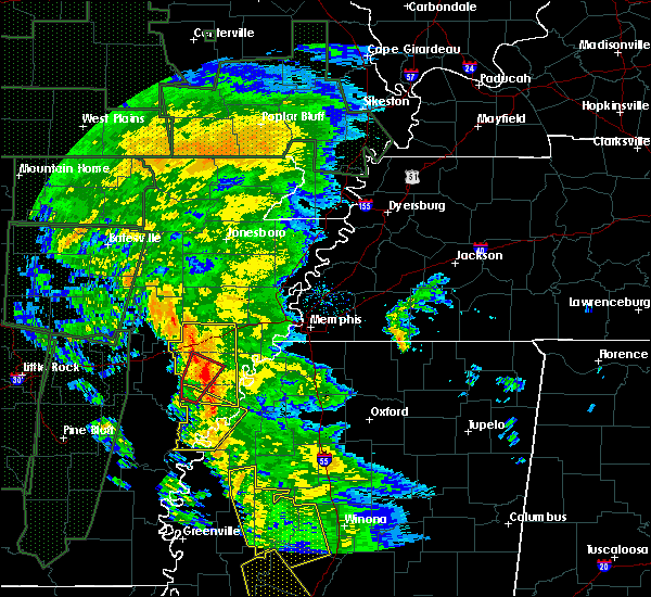 At 453 am cst, a severe thunderstorm producing a tornado was located near haynes, or near marianna, moving northeast at 55 mph (radar indicated rotation). Hazards include tornado. Flying debris will be dangerous to those caught without shelter. mobile homes will be damaged or destroyed. damage to roofs, windows and vehicles will occur. tree damage is likely. Locations impacted include, marianna, marvell, moro, rondo, aubrey, vineyard, westor, gill, big creek corner, oak forest, scott valley, turkey scratch, thomasville and felton. At 453 am cst, a severe thunderstorm producing a tornado was located near haynes, or near marianna, moving northeast at 55 mph (radar indicated rotation). Hazards include tornado. Flying debris will be dangerous to those caught without shelter. mobile homes will be damaged or destroyed. damage to roofs, windows and vehicles will occur. tree damage is likely. Locations impacted include, marianna, marvell, moro, rondo, aubrey, vineyard, westor, gill, big creek corner, oak forest, scott valley, turkey scratch, thomasville and felton.
|
| 12/28/2015 4:39 AM CST |
 At 439 am cst, a severe thunderstorm producing a tornado was located near marvell, moving northeast at 55 mph (radar indicated rotation). Hazards include tornado. Flying debris will be dangerous to those caught without shelter. mobile homes will be damaged or destroyed. damage to roofs, windows and vehicles will occur. Tree damage is likely. At 439 am cst, a severe thunderstorm producing a tornado was located near marvell, moving northeast at 55 mph (radar indicated rotation). Hazards include tornado. Flying debris will be dangerous to those caught without shelter. mobile homes will be damaged or destroyed. damage to roofs, windows and vehicles will occur. Tree damage is likely.
|
| 12/28/2015 4:35 AM CST |
 At 435 am cst, a severe thunderstorm was located near palmer, or 10 miles northwest of marvell, moving north at 40 mph (radar indicated). Hazards include 60 mph wind gusts. Expect damage to roofs. Siding and trees. At 435 am cst, a severe thunderstorm was located near palmer, or 10 miles northwest of marvell, moving north at 40 mph (radar indicated). Hazards include 60 mph wind gusts. Expect damage to roofs. Siding and trees.
|
| 11/17/2015 5:26 PM CST |
 The severe thunderstorm warning for central lee. phillips and west central coahoma counties will expire at 530 pm cst. the storms which prompted the warning have weakened below severe limits. and exited the warned area. therefore the warning will be allowed to expire. A tornado watch remains in effect until 900 pm cst for eastern. The severe thunderstorm warning for central lee. phillips and west central coahoma counties will expire at 530 pm cst. the storms which prompted the warning have weakened below severe limits. and exited the warned area. therefore the warning will be allowed to expire. A tornado watch remains in effect until 900 pm cst for eastern.
|
| 11/17/2015 5:26 PM CST |
 The severe thunderstorm warning for central lee, phillips and west central coahoma counties will expire at 530 pm cst, the storms which prompted the warning have weakened below severe limits, and exited the warned area. therefore the warning will be allowed to expire. a tornado watch remains in effect until 900 pm cst for eastern arkansas and northwestern mississippi. The severe thunderstorm warning for central lee, phillips and west central coahoma counties will expire at 530 pm cst, the storms which prompted the warning have weakened below severe limits, and exited the warned area. therefore the warning will be allowed to expire. a tornado watch remains in effect until 900 pm cst for eastern arkansas and northwestern mississippi.
|
| 11/17/2015 4:53 PM CST |
 At 453 pm cst, severe thunderstorms were located along a line extending from near watkins corner to near crumrod, moving northeast at 45 mph (radar indicated). Hazards include 60 mph wind gusts. Expect damage to roofs. Siding and trees. At 453 pm cst, severe thunderstorms were located along a line extending from near watkins corner to near crumrod, moving northeast at 45 mph (radar indicated). Hazards include 60 mph wind gusts. Expect damage to roofs. Siding and trees.
|
| 8/7/2015 8:34 AM CDT |
 At 833 am cdt, severe thunderstorms were located along a line extending from lake cormorant to near brickeys to near marianna, moving southeast at 65 mph (radar indicated). Hazards include 60 mph wind gusts. Expect damage to roofs. siding and trees. Locations impacted include, forrest city, marianna, hughes, madison, palestine, tunica, caldwell, wheatley, widener, moro, rondo, aubrey, haynes, north tunica, garret grove, new home, brickeys, new salem, lagrange and dodsons corner. At 833 am cdt, severe thunderstorms were located along a line extending from lake cormorant to near brickeys to near marianna, moving southeast at 65 mph (radar indicated). Hazards include 60 mph wind gusts. Expect damage to roofs. siding and trees. Locations impacted include, forrest city, marianna, hughes, madison, palestine, tunica, caldwell, wheatley, widener, moro, rondo, aubrey, haynes, north tunica, garret grove, new home, brickeys, new salem, lagrange and dodsons corner.
|
| 8/7/2015 8:09 AM CDT |
 At 809 am cdt, severe thunderstorms were located along a line extending from near jennette to caldwell to 7 miles east of hunter, moving southeast at 65 mph (radar indicated). Hazards include 60 mph wind gusts. Expect damage to roofs. Siding and trees. At 809 am cdt, severe thunderstorms were located along a line extending from near jennette to caldwell to 7 miles east of hunter, moving southeast at 65 mph (radar indicated). Hazards include 60 mph wind gusts. Expect damage to roofs. Siding and trees.
|
| 6/30/2015 12:29 AM CDT |
 At 1228 am cdt, a severe thunderstorm was located 8 miles northwest of marvell, moving east at 25 mph (radar indicated). Hazards include 60 mph wind gusts and quarter size hail. Hail damage to vehicles is expected. Expect wind damage to roofs, siding and trees. At 1228 am cdt, a severe thunderstorm was located 8 miles northwest of marvell, moving east at 25 mph (radar indicated). Hazards include 60 mph wind gusts and quarter size hail. Hail damage to vehicles is expected. Expect wind damage to roofs, siding and trees.
|
| 4/19/2015 8:59 PM CDT | At 842 pm cdt, a severe thunderstorm was located over aubrey, or 8 miles southwest of marianna, moving northeast at 40 mph (radar indicated). Hazards include 60 mph wind gusts and quarter size hail. Hail damage to vehicles is expected. Expect wind damage to roofs, siding and trees. |
| 4/19/2015 8:42 PM CDT | The national weather service in memphis has issued a * severe thunderstorm warning for. lee county in eastern arkansas. until 930 pm cdt * at 842 pm cdt. a severe thunderstorm was located over aubrey. or 8 miles southwest of marianna. Moving northeast at 40 mph. |
| 12/9/2012 8:52 PM CST | Quarter sized hail reported 4.7 miles E of Marianna, AR, quarter size hail reported on highway 79 5 miles west of marianna. |
| 1/1/0001 12:00 AM | Ping Pong Ball sized hail reported 4.7 miles E of Marianna, AR, quarter to ping pong ball sized hail near highway 79 |
Hail Maps for Marianna, AR
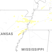


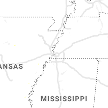


Connect with Interactive Hail Maps