

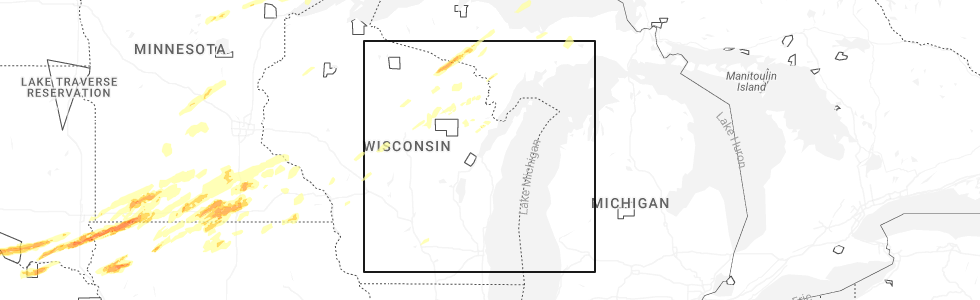
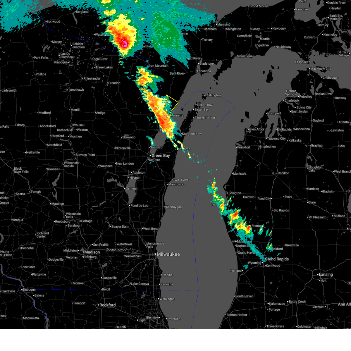
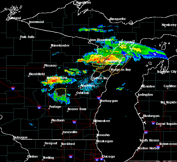
Hail Map for Marinette, WI
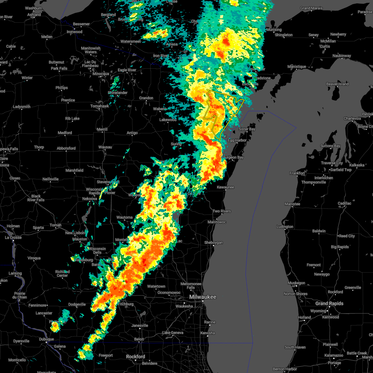
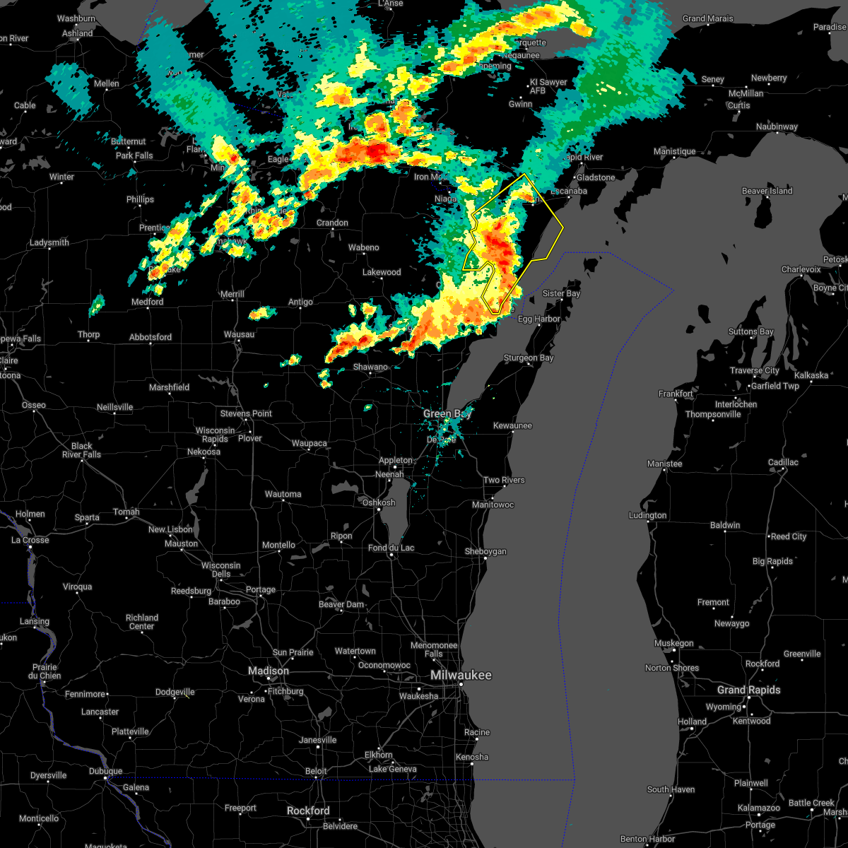
The Marinette, WI area has had 2 reports of on-the-ground hail by trained spotters, and has been under severe weather warnings 13 times during the past 12 months. Doppler radar has detected hail at or near Marinette, WI on 34 occasions, including 1 occasion during the past year.
| Name: | Marinette, WI |
| Where Located: | 43.6 miles NNE of Green Bay, WI |
| Map: | Google Map for Marinette, WI |
| Population: | 10968 |
| Housing Units: | 5464 |
| More Info: | Search Google for Marinette, WI |
0
The Top Recent Hail Date for Marinette, WI is Monday, April 28, 2025 (34th out of 34)
Hail and Wind Damage Spotted near Marinette, WI
| Date / Time | Report Details |
|---|---|
| 6/21/2025 3:27 AM CDT |
 the severe thunderstorm warning has been cancelled and is no longer in effect the severe thunderstorm warning has been cancelled and is no longer in effect
|
| 6/21/2025 3:27 AM CDT |
 The storm which prompted the warning has moved out of the area. therefore, the warning will be allowed to expire. however, gusty winds and heavy rain are still possible with this thunderstorm. The storm which prompted the warning has moved out of the area. therefore, the warning will be allowed to expire. however, gusty winds and heavy rain are still possible with this thunderstorm.
|
| 6/21/2025 3:08 AM CDT |
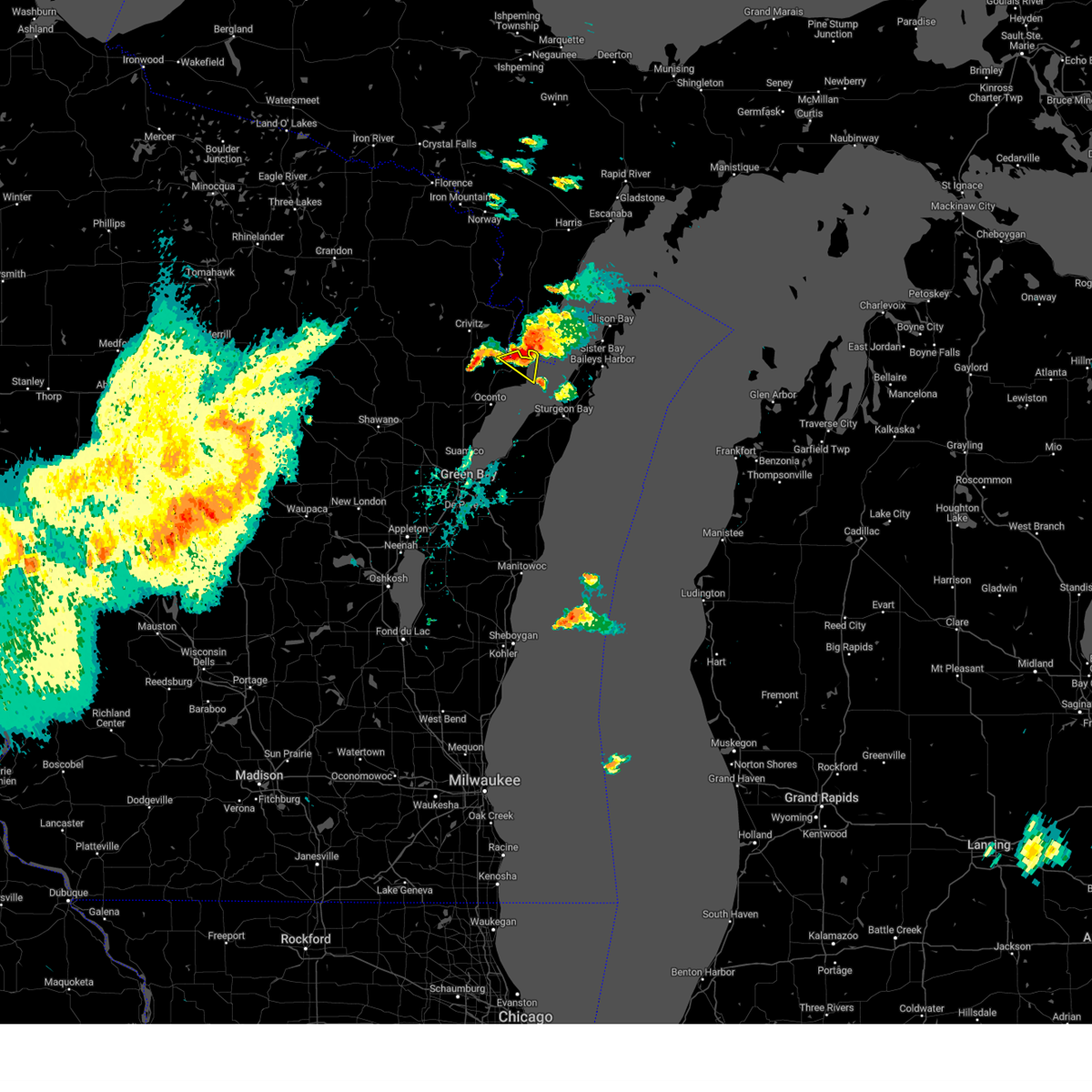
 At 307 am cdt, a severe thunderstorm was located over marinette, moving northeast at 35 mph (radar indicated). Hazards include 60 mph wind gusts and quarter size hail. Hail damage to vehicles is expected. expect wind damage to roofs, siding, and trees. this severe storm will be near, marinette around 310 am cdt. Other locations impacted by this severe thunderstorm include porterfield, mcallister, harmony, and peshtigo. At 307 am cdt, a severe thunderstorm was located over marinette, moving northeast at 35 mph (radar indicated). Hazards include 60 mph wind gusts and quarter size hail. Hail damage to vehicles is expected. expect wind damage to roofs, siding, and trees. this severe storm will be near, marinette around 310 am cdt. Other locations impacted by this severe thunderstorm include porterfield, mcallister, harmony, and peshtigo.
|
| 6/21/2025 2:56 AM CDT |
 Svrmqt the national weather service in marquette has issued a * severe thunderstorm warning for, south central menominee county in south central upper michigan, * until 345 am cdt. * at 256 am cdt, a severe thunderstorm was located 7 miles west of marinette, moving northeast at 35 mph (radar indicated). Hazards include 60 mph wind gusts and quarter size hail. Hail damage to vehicles is expected. Expect wind damage to roofs, siding, and trees. Svrmqt the national weather service in marquette has issued a * severe thunderstorm warning for, south central menominee county in south central upper michigan, * until 345 am cdt. * at 256 am cdt, a severe thunderstorm was located 7 miles west of marinette, moving northeast at 35 mph (radar indicated). Hazards include 60 mph wind gusts and quarter size hail. Hail damage to vehicles is expected. Expect wind damage to roofs, siding, and trees.
|
| 6/21/2025 2:50 AM CDT |
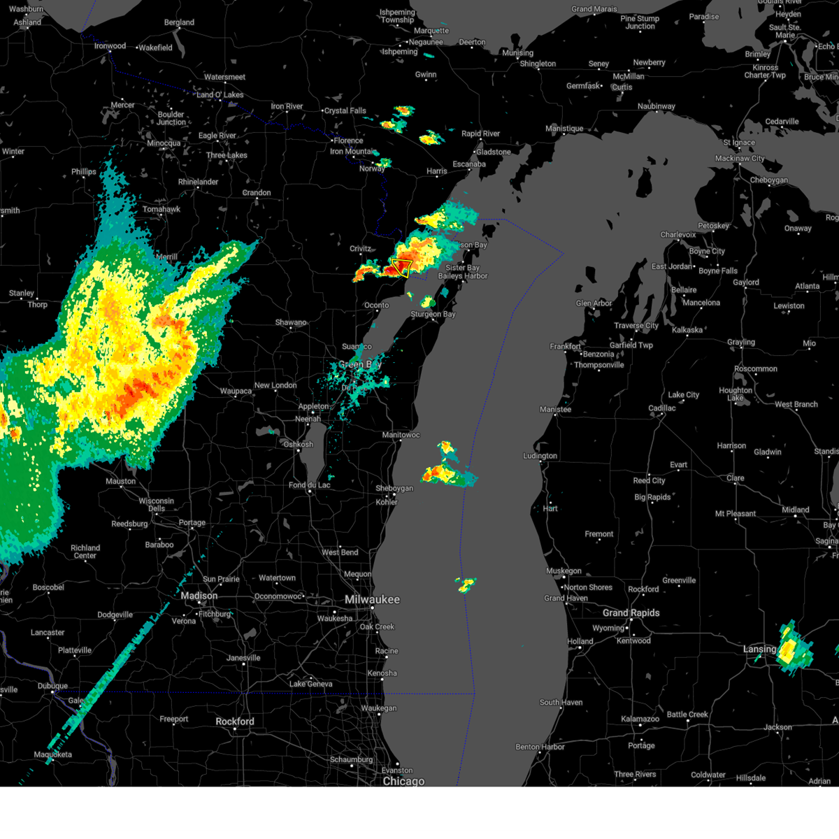
 Svrgrb the national weather service in green bay has issued a * severe thunderstorm warning for, southern marinette county in northeastern wisconsin, * until 330 am cdt. * at 250 am cdt, a severe thunderstorm was located 8 miles west of marinette, moving northeast at 45 mph (radar indicated). Hazards include 60 mph wind gusts and quarter size hail. Hail damage to vehicles is expected. expect wind damage to roofs, siding, and trees. this severe thunderstorm will be near, marinette around 255 am cdt. Other locations impacted by this severe thunderstorm include porterfield, mcallister, harmony, peshtigo, beaver, loomis, and county line. Svrgrb the national weather service in green bay has issued a * severe thunderstorm warning for, southern marinette county in northeastern wisconsin, * until 330 am cdt. * at 250 am cdt, a severe thunderstorm was located 8 miles west of marinette, moving northeast at 45 mph (radar indicated). Hazards include 60 mph wind gusts and quarter size hail. Hail damage to vehicles is expected. expect wind damage to roofs, siding, and trees. this severe thunderstorm will be near, marinette around 255 am cdt. Other locations impacted by this severe thunderstorm include porterfield, mcallister, harmony, peshtigo, beaver, loomis, and county line.
|
| 5/16/2025 6:43 PM CDT | The storms which prompted the warning have weakened below severe limits, and have exited the warned area. therefore, the warning will be allowed to expire. |
| 5/16/2025 6:28 PM CDT | the severe thunderstorm warning has been cancelled and is no longer in effect |
| 5/16/2025 6:28 PM CDT | At 627 pm cdt, severe thunderstorms were located along a line extending from near marinette to 7 miles west of sturgeon bay to near luxemburg, moving northeast at 75 mph (radar indicated). Hazards include 60 mph wind gusts. Expect damage to roofs, siding, and trees. these severe storms will be near, marinette and sturgeon bay around 635 pm cdt. Other locations impacted by these severe thunderstorms include cullen, gregorville, rankin, euren, pensaukee, vignes, maplewood, potawatomi state park, kodan, and thiry daems. |
| 5/16/2025 6:18 PM CDT | At 618 pm cdt, severe thunderstorms were located along a line extending from near oconto to 8 miles east of bay shore park to denmark, moving northeast at 55 mph (radar indicated). Hazards include 60 mph wind gusts. Expect damage to roofs, siding, and trees. these severe storms will be near, kewaunee and algoma around 625 pm cdt. marinette and sturgeon bay around 630 pm cdt. Other locations impacted by these severe thunderstorms include krok, maribel, larrabee, slovan, gregorville, curran, wayside, morrison, rankin, and humboldt. |
| 5/16/2025 6:01 PM CDT | Svrgrb the national weather service in green bay has issued a * severe thunderstorm warning for, eastern brown county in northeastern wisconsin, kewaunee county in northeastern wisconsin, southern marinette county in northeastern wisconsin, southern door county in northeastern wisconsin, southern oconto county in northeastern wisconsin, northern manitowoc county in east central wisconsin, * until 645 pm cdt. * at 601 pm cdt, severe thunderstorms were located along a line extending from near gillett to near green bay to 6 miles northeast of brillion, moving east at 60 mph (radar indicated). Hazards include 60 mph wind gusts. Expect damage to roofs, siding, and trees. severe thunderstorms will be near, green bay, bay shore park, denmark, and bellevue town around 605 pm cdt. oconto and luxemburg around 610 pm cdt. kewaunee, algoma, and two creeks around 620 pm cdt. marinette and sturgeon bay around 630 pm cdt. Other locations impacted by these severe thunderstorms include krok, maribel, larrabee, curran, slovan, wayside, gregorville, morrison, rankin, and humboldt. |
| 8/27/2024 1:23 AM CDT |
 The storms which prompted the warning have weakened below severe limits, and no longer pose an immediate threat to life or property. therefore, the warning will be allowed to expire. however, small hail, gusty winds and heavy rain are still possible with these thunderstorms. a severe thunderstorm watch remains in effect until 400 am cdt for northeastern and east central wisconsin. The storms which prompted the warning have weakened below severe limits, and no longer pose an immediate threat to life or property. therefore, the warning will be allowed to expire. however, small hail, gusty winds and heavy rain are still possible with these thunderstorms. a severe thunderstorm watch remains in effect until 400 am cdt for northeastern and east central wisconsin.
|
| 8/27/2024 1:08 AM CDT |
 At 106 am cdt, severe thunderstorms were located along a line extending from 9 miles east of pound to 9 miles southeast of oconto to near brillion, moving east at 40 mph (radar indicated). Hazards include 60 mph wind gusts. Expect damage to roofs, siding, and trees. Locations impacted include, green bay, appleton, marinette, bay shore park, menasha, kaukauna, little chute, kimberly, oconto, and brillion. At 106 am cdt, severe thunderstorms were located along a line extending from 9 miles east of pound to 9 miles southeast of oconto to near brillion, moving east at 40 mph (radar indicated). Hazards include 60 mph wind gusts. Expect damage to roofs, siding, and trees. Locations impacted include, green bay, appleton, marinette, bay shore park, menasha, kaukauna, little chute, kimberly, oconto, and brillion.
|
| 8/27/2024 12:26 AM CDT |
 Svrgrb the national weather service in green bay has issued a * severe thunderstorm warning for, brown county in northeastern wisconsin, northwestern kewaunee county in northeastern wisconsin, southern marinette county in northeastern wisconsin, southern door county in northeastern wisconsin, northern calumet county in east central wisconsin, northeastern winnebago county in east central wisconsin, southern oconto county in northeastern wisconsin, eastern outagamie county in northeastern wisconsin, northwestern manitowoc county in east central wisconsin, * until 130 am cdt. * at 1225 am cdt, severe thunderstorms were located along a line extending from near bear paw scout camp to 6 miles south of gillett to 7 miles west of menasha, moving east at 40 mph (radar indicated). Hazards include 60 mph wind gusts. expect damage to roofs, siding, and trees Svrgrb the national weather service in green bay has issued a * severe thunderstorm warning for, brown county in northeastern wisconsin, northwestern kewaunee county in northeastern wisconsin, southern marinette county in northeastern wisconsin, southern door county in northeastern wisconsin, northern calumet county in east central wisconsin, northeastern winnebago county in east central wisconsin, southern oconto county in northeastern wisconsin, eastern outagamie county in northeastern wisconsin, northwestern manitowoc county in east central wisconsin, * until 130 am cdt. * at 1225 am cdt, severe thunderstorms were located along a line extending from near bear paw scout camp to 6 miles south of gillett to 7 miles west of menasha, moving east at 40 mph (radar indicated). Hazards include 60 mph wind gusts. expect damage to roofs, siding, and trees
|
| 5/21/2024 10:01 PM CDT |
 The storms which prompted the warning have weakened below severe limits, and have exited the warned area. therefore, the warning has been allowed to expire. however, gusty winds and heavy rain are still possible with these thunderstorms. a tornado watch remains in effect until midnight cdt for northeastern wisconsin. The storms which prompted the warning have weakened below severe limits, and have exited the warned area. therefore, the warning has been allowed to expire. however, gusty winds and heavy rain are still possible with these thunderstorms. a tornado watch remains in effect until midnight cdt for northeastern wisconsin.
|
| 5/21/2024 10:00 PM CDT | Menominee marine observation. mnmm in lmz521 county WI, 2.2 miles W of Marinette, WI |
| 5/21/2024 9:53 PM CDT | Trained spotter reported 70 mph winds as well as downed trees and lose of powe in marinette county WI, 1 miles SSW of Marinette, WI |
| 5/21/2024 9:42 PM CDT |
 At 940 pm cdt, severe thunderstorms were located along a line extending from 9 miles east of mccaslin mountain natural area to 6 miles west of crivitz to near pound to 8 miles southwest of oconto, moving east at 50 mph (trained weather spotters). Hazards include 70 mph wind gusts. Expect considerable tree damage. damage is likely to mobile homes, roofs, and outbuildings. Locations impacted include, marinette, oconto, crivitz, wausaukee, pound, peshtigo, porterfield, abrams, stiles, and pensaukee. At 940 pm cdt, severe thunderstorms were located along a line extending from 9 miles east of mccaslin mountain natural area to 6 miles west of crivitz to near pound to 8 miles southwest of oconto, moving east at 50 mph (trained weather spotters). Hazards include 70 mph wind gusts. Expect considerable tree damage. damage is likely to mobile homes, roofs, and outbuildings. Locations impacted include, marinette, oconto, crivitz, wausaukee, pound, peshtigo, porterfield, abrams, stiles, and pensaukee.
|
| 5/21/2024 9:27 PM CDT |
 At 926 pm cdt, severe thunderstorms were located along a line extending from mccaslin mountain natural area to near bear paw scout camp to 7 miles north of gillett to near pulaski, moving northeast at 55 mph (trained weather spotters). Hazards include 70 mph wind gusts. Expect considerable tree damage. damage is likely to mobile homes, roofs, and outbuildings. Locations impacted include, marinette, oconto, gillett, crivitz, mountain, wausaukee, pound, mccaslin mountain natural area, bear paw scout camp, and little suamico. At 926 pm cdt, severe thunderstorms were located along a line extending from mccaslin mountain natural area to near bear paw scout camp to 7 miles north of gillett to near pulaski, moving northeast at 55 mph (trained weather spotters). Hazards include 70 mph wind gusts. Expect considerable tree damage. damage is likely to mobile homes, roofs, and outbuildings. Locations impacted include, marinette, oconto, gillett, crivitz, mountain, wausaukee, pound, mccaslin mountain natural area, bear paw scout camp, and little suamico.
|
| 5/21/2024 9:27 PM CDT |
 the severe thunderstorm warning has been cancelled and is no longer in effect the severe thunderstorm warning has been cancelled and is no longer in effect
|
| 5/21/2024 9:07 PM CDT |
 Svrgrb the national weather service in green bay has issued a * severe thunderstorm warning for, southern marinette county in northeastern wisconsin, eastern menominee county in northeastern wisconsin, oconto county in northeastern wisconsin, east central langlade county in north central wisconsin, eastern shawano county in northeastern wisconsin, * until 1000 pm cdt. * at 906 pm cdt, severe thunderstorms were located along a line extending from near woodlawn to near gardner dam scout camp to keshena, moving northeast at 55 mph (trained weather spotters). Hazards include 70 mph wind gusts. Expect considerable tree damage. Damage is likely to mobile homes, roofs, and outbuildings. Svrgrb the national weather service in green bay has issued a * severe thunderstorm warning for, southern marinette county in northeastern wisconsin, eastern menominee county in northeastern wisconsin, oconto county in northeastern wisconsin, east central langlade county in north central wisconsin, eastern shawano county in northeastern wisconsin, * until 1000 pm cdt. * at 906 pm cdt, severe thunderstorms were located along a line extending from near woodlawn to near gardner dam scout camp to keshena, moving northeast at 55 mph (trained weather spotters). Hazards include 70 mph wind gusts. Expect considerable tree damage. Damage is likely to mobile homes, roofs, and outbuildings.
|
| 8/11/2023 7:55 PM CDT |
 At 755 pm cdt, a severe thunderstorm was located over marinette, moving southeast at 20 mph (radar indicated). Hazards include 60 mph wind gusts and penny size hail. Expect damage to roofs, siding, and trees. this severe thunderstorm will remain over mainly rural areas of southern marinette county, including the following locations, peshtigo. hail threat, radar indicated max hail size, 0. 75 in wind threat, radar indicated max wind gust, 60 mph. At 755 pm cdt, a severe thunderstorm was located over marinette, moving southeast at 20 mph (radar indicated). Hazards include 60 mph wind gusts and penny size hail. Expect damage to roofs, siding, and trees. this severe thunderstorm will remain over mainly rural areas of southern marinette county, including the following locations, peshtigo. hail threat, radar indicated max hail size, 0. 75 in wind threat, radar indicated max wind gust, 60 mph.
|
| 8/11/2023 7:50 PM CDT |
 At 749 pm cdt, a severe thunderstorm was located over menominee, or near marinette, moving southeast at 25 mph (radar indicated). Hazards include quarter size hail. Damage to vehicles is expected. locations impacted include, marinette and menominee. hail threat, radar indicated max hail size, 1. 00 in wind threat, radar indicated max wind gust, <50 mph. At 749 pm cdt, a severe thunderstorm was located over menominee, or near marinette, moving southeast at 25 mph (radar indicated). Hazards include quarter size hail. Damage to vehicles is expected. locations impacted include, marinette and menominee. hail threat, radar indicated max hail size, 1. 00 in wind threat, radar indicated max wind gust, <50 mph.
|
| 8/11/2023 7:44 PM CDT |
 At 744 pm cdt, a severe thunderstorm was located near menominee, or near marinette, moving southeast at 20 mph (radar indicated). Hazards include 60 mph wind gusts and quarter size hail. Hail damage to vehicles is expected. expect wind damage to roofs, siding, and trees. this severe thunderstorm will be near, marinette around 755 pm cdt. other locations impacted by this severe thunderstorm include porterfield and peshtigo. hail threat, radar indicated max hail size, 1. 00 in wind threat, radar indicated max wind gust, 60 mph. At 744 pm cdt, a severe thunderstorm was located near menominee, or near marinette, moving southeast at 20 mph (radar indicated). Hazards include 60 mph wind gusts and quarter size hail. Hail damage to vehicles is expected. expect wind damage to roofs, siding, and trees. this severe thunderstorm will be near, marinette around 755 pm cdt. other locations impacted by this severe thunderstorm include porterfield and peshtigo. hail threat, radar indicated max hail size, 1. 00 in wind threat, radar indicated max wind gust, 60 mph.
|
| 8/11/2023 7:42 PM CDT |
 At 741 pm cdt, a severe thunderstorm was located near menominee, or near marinette, moving southeast at 20 mph (radar indicated). Hazards include quarter size hail. Damage to vehicles is expected. locations impacted include, marinette, menominee, and birch creek. hail threat, radar indicated max hail size, 1. 00 in wind threat, radar indicated max wind gust, <50 mph. At 741 pm cdt, a severe thunderstorm was located near menominee, or near marinette, moving southeast at 20 mph (radar indicated). Hazards include quarter size hail. Damage to vehicles is expected. locations impacted include, marinette, menominee, and birch creek. hail threat, radar indicated max hail size, 1. 00 in wind threat, radar indicated max wind gust, <50 mph.
|
| 8/11/2023 7:34 PM CDT |
 At 734 pm cdt, a severe thunderstorm was located near menominee, or 8 miles north of marinette, moving southeast at 20 mph (radar indicated). Hazards include quarter size hail. Damage to vehicles is expected. locations impacted include, marinette, menominee, wallace, carbondale, and birch creek. hail threat, radar indicated max hail size, 1. 00 in wind threat, radar indicated max wind gust, <50 mph. At 734 pm cdt, a severe thunderstorm was located near menominee, or 8 miles north of marinette, moving southeast at 20 mph (radar indicated). Hazards include quarter size hail. Damage to vehicles is expected. locations impacted include, marinette, menominee, wallace, carbondale, and birch creek. hail threat, radar indicated max hail size, 1. 00 in wind threat, radar indicated max wind gust, <50 mph.
|
| 8/11/2023 7:18 PM CDT |
 At 718 pm cdt, a severe thunderstorm was located 10 miles southwest of stephenson, or 14 miles north of marinette, moving southeast at 20 mph (radar indicated). Hazards include quarter size hail. Damage to vehicles is expected. locations impacted include, marinette, menominee, wallace, ingalls, carbondale, birch creek, and arthur bay. hail threat, radar indicated max hail size, 1. 00 in wind threat, radar indicated max wind gust, <50 mph. At 718 pm cdt, a severe thunderstorm was located 10 miles southwest of stephenson, or 14 miles north of marinette, moving southeast at 20 mph (radar indicated). Hazards include quarter size hail. Damage to vehicles is expected. locations impacted include, marinette, menominee, wallace, ingalls, carbondale, birch creek, and arthur bay. hail threat, radar indicated max hail size, 1. 00 in wind threat, radar indicated max wind gust, <50 mph.
|
| 8/11/2023 7:10 PM CDT |
 At 710 pm cdt, a severe thunderstorm was located 9 miles southeast of wausaukee, or 16 miles northwest of marinette, moving southeast at 20 mph (radar indicated). Hazards include quarter size hail. Damage to vehicles is expected. locations impacted include, marinette, menominee, wallace, ingalls, carbondale, birch creek, and arthur bay. hail threat, radar indicated max hail size, 1. 00 in wind threat, radar indicated max wind gust, <50 mph. At 710 pm cdt, a severe thunderstorm was located 9 miles southeast of wausaukee, or 16 miles northwest of marinette, moving southeast at 20 mph (radar indicated). Hazards include quarter size hail. Damage to vehicles is expected. locations impacted include, marinette, menominee, wallace, ingalls, carbondale, birch creek, and arthur bay. hail threat, radar indicated max hail size, 1. 00 in wind threat, radar indicated max wind gust, <50 mph.
|
| 8/11/2023 6:56 PM CDT |
 At 656 pm cdt, a severe thunderstorm was located near wausaukee, or 21 miles northwest of marinette, moving southeast at 15 mph (radar indicated). Hazards include quarter size hail. damage to vehicles is expected At 656 pm cdt, a severe thunderstorm was located near wausaukee, or 21 miles northwest of marinette, moving southeast at 15 mph (radar indicated). Hazards include quarter size hail. damage to vehicles is expected
|
| 6/15/2022 7:28 PM CDT |
 The severe thunderstorm warning for menominee county will expire at 730 pm cdt, the storm which prompted the warning has moved out of the area. therefore, the warning will be allowed to expire. a tornado watch remains in effect until midnight cdt for south central upper michigan. The severe thunderstorm warning for menominee county will expire at 730 pm cdt, the storm which prompted the warning has moved out of the area. therefore, the warning will be allowed to expire. a tornado watch remains in effect until midnight cdt for south central upper michigan.
|
| 6/15/2022 7:15 PM CDT |
 At 714 pm cdt, severe thunderstorms were located along a line extending from 9 miles northeast of menominee to 7 miles west of ephraim to jacksonport to 8 miles southeast of sturgeon bay, moving northeast at 70 mph (trained weather spotters). Hazards include 70 mph wind gusts. Expect considerable tree damage. damage is likely to mobile homes, roofs, and outbuildings. these severe storms will be near, ephraim around 720 pm cdt. newport state park around 730 pm cdt. other locations impacted by these severe thunderstorms include peninsula center, fish creek, peninsula state park, valmy, ellison bay, whitefish bay, rock island state park, carlsville, washington island and sister bay. thunderstorm damage threat, considerable hail threat, radar indicated max hail size, <. 75 in wind threat, radar indicated max wind gust, 70 mph. At 714 pm cdt, severe thunderstorms were located along a line extending from 9 miles northeast of menominee to 7 miles west of ephraim to jacksonport to 8 miles southeast of sturgeon bay, moving northeast at 70 mph (trained weather spotters). Hazards include 70 mph wind gusts. Expect considerable tree damage. damage is likely to mobile homes, roofs, and outbuildings. these severe storms will be near, ephraim around 720 pm cdt. newport state park around 730 pm cdt. other locations impacted by these severe thunderstorms include peninsula center, fish creek, peninsula state park, valmy, ellison bay, whitefish bay, rock island state park, carlsville, washington island and sister bay. thunderstorm damage threat, considerable hail threat, radar indicated max hail size, <. 75 in wind threat, radar indicated max wind gust, 70 mph.
|
| 6/15/2022 7:10 PM CDT |
 At 710 pm cdt, a severe thunderstorm was located 7 miles north of menominee, moving northeast at 30 mph (radar indicated). Hazards include 60 mph wind gusts and quarter size hail. Hail damage to vehicles is expected. expect wind damage to roofs, siding, and trees. locations impacted include, marinette, menominee, stephenson, cedar river, bagley, nadeau, gourley, daggett, faithorn, carney, swanson and ingalls. hail threat, radar indicated max hail size, 1. 00 in wind threat, radar indicated max wind gust, 60 mph. At 710 pm cdt, a severe thunderstorm was located 7 miles north of menominee, moving northeast at 30 mph (radar indicated). Hazards include 60 mph wind gusts and quarter size hail. Hail damage to vehicles is expected. expect wind damage to roofs, siding, and trees. locations impacted include, marinette, menominee, stephenson, cedar river, bagley, nadeau, gourley, daggett, faithorn, carney, swanson and ingalls. hail threat, radar indicated max hail size, 1. 00 in wind threat, radar indicated max wind gust, 60 mph.
|
| 6/15/2022 7:06 PM CDT |
 The tornado warning for southern marinette and central oconto counties will expire at 715 pm cdt, the storm which prompted the warning has moved out of the area. therefore, the warning will be allowed to expire. however small hail, gusty winds and heavy rain are still possible with this thunderstorm. a tornado watch remains in effect until 1000 pm cdt for northeastern wisconsin. to report severe weather, contact your nearest law enforcement agency. they will relay your report to the national weather service green bay. The tornado warning for southern marinette and central oconto counties will expire at 715 pm cdt, the storm which prompted the warning has moved out of the area. therefore, the warning will be allowed to expire. however small hail, gusty winds and heavy rain are still possible with this thunderstorm. a tornado watch remains in effect until 1000 pm cdt for northeastern wisconsin. to report severe weather, contact your nearest law enforcement agency. they will relay your report to the national weather service green bay.
|
| 6/15/2022 7:02 PM CDT |
 At 701 pm cdt, severe thunderstorms were located along a line extending from 6 miles west of menominee to near marinette to near sturgeon bay to near algoma to near kewaunee, moving northeast at 70 mph (radar indicated). Hazards include 70 mph wind gusts. Expect considerable tree damage. damage is likely to mobile homes, roofs, and outbuildings. these severe storms will be near, sturgeon bay around 705 pm cdt. menominee and egg harbor around 710 pm cdt. other locations in the path of these severe thunderstorms include jacksonport, ephraim and newport state park. thunderstorm damage threat, considerable hail threat, radar indicated max hail size, <. 75 in wind threat, radar indicated max wind gust, 70 mph. At 701 pm cdt, severe thunderstorms were located along a line extending from 6 miles west of menominee to near marinette to near sturgeon bay to near algoma to near kewaunee, moving northeast at 70 mph (radar indicated). Hazards include 70 mph wind gusts. Expect considerable tree damage. damage is likely to mobile homes, roofs, and outbuildings. these severe storms will be near, sturgeon bay around 705 pm cdt. menominee and egg harbor around 710 pm cdt. other locations in the path of these severe thunderstorms include jacksonport, ephraim and newport state park. thunderstorm damage threat, considerable hail threat, radar indicated max hail size, <. 75 in wind threat, radar indicated max wind gust, 70 mph.
|
| 6/15/2022 6:54 PM CDT |
 At 654 pm cdt, a severe thunderstorm was located 9 miles northwest of stephenson, or 26 miles southeast of iron mountain, moving northeast at 45 mph (radar indicated). Hazards include 60 mph wind gusts and quarter size hail. Hail damage to vehicles is expected. expect wind damage to roofs, siding, and trees. this severe thunderstorm will remain over mainly rural areas of menominee county, including the following locations, daggett, swanson, ingalls, faithorn, birch creek, banat, carney and gourley. hail threat, radar indicated max hail size, 1. 00 in wind threat, radar indicated max wind gust, 60 mph. At 654 pm cdt, a severe thunderstorm was located 9 miles northwest of stephenson, or 26 miles southeast of iron mountain, moving northeast at 45 mph (radar indicated). Hazards include 60 mph wind gusts and quarter size hail. Hail damage to vehicles is expected. expect wind damage to roofs, siding, and trees. this severe thunderstorm will remain over mainly rural areas of menominee county, including the following locations, daggett, swanson, ingalls, faithorn, birch creek, banat, carney and gourley. hail threat, radar indicated max hail size, 1. 00 in wind threat, radar indicated max wind gust, 60 mph.
|
| 6/15/2022 6:51 PM CDT |
 At 651 pm cdt, severe thunderstorms were located along a line extending from 7 miles southeast of pound to 9 miles northeast of oconto to 12 miles west of sturgeon bay to near luxemburg to bellevue town, moving northeast at 70 mph (radar indicated). Hazards include 70 mph wind gusts. Expect considerable tree damage. damage is likely to mobile homes, roofs, and outbuildings. severe thunderstorms will be near, bay shore park, algoma and luxemburg around 700 pm cdt. marinette, sturgeon bay and menominee around 705 pm cdt. egg harbor around 710 pm cdt. other locations in the path of these severe thunderstorms include jacksonport, ephraim and newport state park. thunderstorm damage threat, considerable hail threat, radar indicated max hail size, <. 75 in wind threat, radar indicated max wind gust, 70 mph. At 651 pm cdt, severe thunderstorms were located along a line extending from 7 miles southeast of pound to 9 miles northeast of oconto to 12 miles west of sturgeon bay to near luxemburg to bellevue town, moving northeast at 70 mph (radar indicated). Hazards include 70 mph wind gusts. Expect considerable tree damage. damage is likely to mobile homes, roofs, and outbuildings. severe thunderstorms will be near, bay shore park, algoma and luxemburg around 700 pm cdt. marinette, sturgeon bay and menominee around 705 pm cdt. egg harbor around 710 pm cdt. other locations in the path of these severe thunderstorms include jacksonport, ephraim and newport state park. thunderstorm damage threat, considerable hail threat, radar indicated max hail size, <. 75 in wind threat, radar indicated max wind gust, 70 mph.
|
| 6/15/2022 6:49 PM CDT |
 At 649 pm cdt, severe thunderstorms were located along a line extending from 8 miles south of pound to near oconto to 7 miles northeast of bay shore park to luxemburg, moving northeast at 75 mph (radar indicated). Hazards include 70 mph wind gusts. Expect considerable tree damage. damage is likely to mobile homes, roofs, and outbuildings. locations impacted include, marinette, sturgeon bay, kewaunee, bay shore park, menominee, oconto, algoma, luxemburg, egg harbor and whitefish bay. thunderstorm damage threat, considerable hail threat, radar indicated max hail size, <. 75 in wind threat, radar indicated max wind gust, 70 mph. At 649 pm cdt, severe thunderstorms were located along a line extending from 8 miles south of pound to near oconto to 7 miles northeast of bay shore park to luxemburg, moving northeast at 75 mph (radar indicated). Hazards include 70 mph wind gusts. Expect considerable tree damage. damage is likely to mobile homes, roofs, and outbuildings. locations impacted include, marinette, sturgeon bay, kewaunee, bay shore park, menominee, oconto, algoma, luxemburg, egg harbor and whitefish bay. thunderstorm damage threat, considerable hail threat, radar indicated max hail size, <. 75 in wind threat, radar indicated max wind gust, 70 mph.
|
| 6/15/2022 6:48 PM CDT |
 At 648 pm cdt, a severe thunderstorm capable of producing a tornado was located 7 miles north of oconto, or 13 miles southwest of marinette, moving northeast at 75 mph (radar indicated rotation). Hazards include tornado. Flying debris will be dangerous to those caught without shelter. mobile homes will be damaged or destroyed. damage to roofs, windows, and vehicles will occur. tree damage is likely. Locations impacted include, marinette and menominee. At 648 pm cdt, a severe thunderstorm capable of producing a tornado was located 7 miles north of oconto, or 13 miles southwest of marinette, moving northeast at 75 mph (radar indicated rotation). Hazards include tornado. Flying debris will be dangerous to those caught without shelter. mobile homes will be damaged or destroyed. damage to roofs, windows, and vehicles will occur. tree damage is likely. Locations impacted include, marinette and menominee.
|
| 6/15/2022 6:39 PM CDT |
 At 638 pm cdt, a severe thunderstorm capable of producing a tornado was located 7 miles east of gillett, or 21 miles east of shawano, moving northeast at 65 mph (radar indicated rotation). Hazards include tornado. Flying debris will be dangerous to those caught without shelter. mobile homes will be damaged or destroyed. damage to roofs, windows, and vehicles will occur. tree damage is likely. this dangerous storm will be near, oconto around 650 pm cdt. Other locations in the path of this tornadic thunderstorm include marinette and menominee. At 638 pm cdt, a severe thunderstorm capable of producing a tornado was located 7 miles east of gillett, or 21 miles east of shawano, moving northeast at 65 mph (radar indicated rotation). Hazards include tornado. Flying debris will be dangerous to those caught without shelter. mobile homes will be damaged or destroyed. damage to roofs, windows, and vehicles will occur. tree damage is likely. this dangerous storm will be near, oconto around 650 pm cdt. Other locations in the path of this tornadic thunderstorm include marinette and menominee.
|
| 6/15/2022 6:34 PM CDT |
 At 633 pm cdt, severe thunderstorms were located along a line extending from near gillett to 8 miles northeast of pulaski to near green bay to near bellevue town, moving northeast at 70 mph (radar indicated). Hazards include 70 mph wind gusts. Expect considerable tree damage. damage is likely to mobile homes, roofs, and outbuildings. locations impacted include, bay shore park, oconto, luxemburg, kewaunee, algoma, marinette, sturgeon bay, menominee and egg harbor. thunderstorm damage threat, considerable hail threat, radar indicated max hail size, <. 75 in wind threat, radar indicated max wind gust, 70 mph. At 633 pm cdt, severe thunderstorms were located along a line extending from near gillett to 8 miles northeast of pulaski to near green bay to near bellevue town, moving northeast at 70 mph (radar indicated). Hazards include 70 mph wind gusts. Expect considerable tree damage. damage is likely to mobile homes, roofs, and outbuildings. locations impacted include, bay shore park, oconto, luxemburg, kewaunee, algoma, marinette, sturgeon bay, menominee and egg harbor. thunderstorm damage threat, considerable hail threat, radar indicated max hail size, <. 75 in wind threat, radar indicated max wind gust, 70 mph.
|
| 6/15/2022 6:15 PM CDT |
 At 615 pm cdt, severe thunderstorms were located along a line extending from near navarino wildlife area to 8 miles north of black creek to 9 miles north of little chute to near darboy, moving northeast at 75 mph (radar indicated). Hazards include 70 mph wind gusts. Expect considerable tree damage. damage is likely to mobile homes, roofs, and outbuildings. severe thunderstorms will be near, green bay, pulaski and bellevue town around 625 pm cdt. gillett around 630 pm cdt. bay shore park and denmark around 635 pm cdt. other locations in the path of these severe thunderstorms include oconto, luxemburg, kewaunee, algoma, marinette, sturgeon bay, menominee and egg harbor. thunderstorm damage threat, considerable hail threat, radar indicated max hail size, <. 75 in wind threat, radar indicated max wind gust, 70 mph. At 615 pm cdt, severe thunderstorms were located along a line extending from near navarino wildlife area to 8 miles north of black creek to 9 miles north of little chute to near darboy, moving northeast at 75 mph (radar indicated). Hazards include 70 mph wind gusts. Expect considerable tree damage. damage is likely to mobile homes, roofs, and outbuildings. severe thunderstorms will be near, green bay, pulaski and bellevue town around 625 pm cdt. gillett around 630 pm cdt. bay shore park and denmark around 635 pm cdt. other locations in the path of these severe thunderstorms include oconto, luxemburg, kewaunee, algoma, marinette, sturgeon bay, menominee and egg harbor. thunderstorm damage threat, considerable hail threat, radar indicated max hail size, <. 75 in wind threat, radar indicated max wind gust, 70 mph.
|
| 5/12/2022 8:57 PM CDT |
 The severe thunderstorm warning for southern marinette county will expire at 900 pm cdt, the storms which prompted the warning have weakened below severe limits, and no longer pose an immediate threat to life or property. therefore, the warning will be allowed to expire. however, small hail and gusty winds are still possible with these thunderstorms. The severe thunderstorm warning for southern marinette county will expire at 900 pm cdt, the storms which prompted the warning have weakened below severe limits, and no longer pose an immediate threat to life or property. therefore, the warning will be allowed to expire. however, small hail and gusty winds are still possible with these thunderstorms.
|
| 5/12/2022 8:49 PM CDT |
 At 848 pm cdt, severe thunderstorms were located along a line extending from 8 miles west of menominee to near marinette to 8 miles east of oconto, moving northeast at 30 mph (radar indicated). Hazards include 60 mph wind gusts and quarter size hail. Hail damage to vehicles is expected. expect wind damage to roofs, siding, and trees. these severe storms will be near, marinette around 900 pm cdt. other locations in the path of these severe thunderstorms include menominee. hail threat, radar indicated max hail size, 1. 00 in wind threat, radar indicated max wind gust, 60 mph. At 848 pm cdt, severe thunderstorms were located along a line extending from 8 miles west of menominee to near marinette to 8 miles east of oconto, moving northeast at 30 mph (radar indicated). Hazards include 60 mph wind gusts and quarter size hail. Hail damage to vehicles is expected. expect wind damage to roofs, siding, and trees. these severe storms will be near, marinette around 900 pm cdt. other locations in the path of these severe thunderstorms include menominee. hail threat, radar indicated max hail size, 1. 00 in wind threat, radar indicated max wind gust, 60 mph.
|
| 5/12/2022 8:41 PM CDT |
 At 841 pm cdt, severe thunderstorms were located along a line extending from 8 miles west of marinette to 10 miles southwest of menominee to near oconto, moving northeast at 30 mph (radar indicated). Hazards include 60 mph wind gusts and quarter size hail. Hail damage to vehicles is expected. expect wind damage to roofs, siding, and trees. severe thunderstorms will be near, marinette around 855 pm cdt. menominee around 900 pm cdt. hail threat, radar indicated max hail size, 1. 00 in wind threat, radar indicated max wind gust, 60 mph. At 841 pm cdt, severe thunderstorms were located along a line extending from 8 miles west of marinette to 10 miles southwest of menominee to near oconto, moving northeast at 30 mph (radar indicated). Hazards include 60 mph wind gusts and quarter size hail. Hail damage to vehicles is expected. expect wind damage to roofs, siding, and trees. severe thunderstorms will be near, marinette around 855 pm cdt. menominee around 900 pm cdt. hail threat, radar indicated max hail size, 1. 00 in wind threat, radar indicated max wind gust, 60 mph.
|
| 5/12/2022 4:33 PM CDT |
 At 532 pm edt/432 pm cdt/, a severe thunderstorm was located near stephenson, or 26 miles north of menominee, moving northeast at 15 mph (radar indicated). Hazards include 60 mph wind gusts and quarter size hail. Hail damage to vehicles is expected. expect wind damage to roofs, siding, and trees. locations impacted include, powers. hail threat, radar indicated max hail size, 1. 00 in wind threat, radar indicated max wind gust, 60 mph. At 532 pm edt/432 pm cdt/, a severe thunderstorm was located near stephenson, or 26 miles north of menominee, moving northeast at 15 mph (radar indicated). Hazards include 60 mph wind gusts and quarter size hail. Hail damage to vehicles is expected. expect wind damage to roofs, siding, and trees. locations impacted include, powers. hail threat, radar indicated max hail size, 1. 00 in wind threat, radar indicated max wind gust, 60 mph.
|
| 5/12/2022 4:07 PM CDT |
 At 506 pm edt/406 pm cdt/, a severe thunderstorm was located near stephenson, or 24 miles north of menominee, moving northeast at 20 mph (radar indicated). Hazards include 60 mph wind gusts and quarter size hail. Hail damage to vehicles is expected. expect wind damage to roofs, siding, and trees. this severe thunderstorm will be near, stephenson around 415 pm cdt. other locations in the path of this severe thunderstorm include powers. hail threat, radar indicated max hail size, 1. 00 in wind threat, radar indicated max wind gust, 60 mph. At 506 pm edt/406 pm cdt/, a severe thunderstorm was located near stephenson, or 24 miles north of menominee, moving northeast at 20 mph (radar indicated). Hazards include 60 mph wind gusts and quarter size hail. Hail damage to vehicles is expected. expect wind damage to roofs, siding, and trees. this severe thunderstorm will be near, stephenson around 415 pm cdt. other locations in the path of this severe thunderstorm include powers. hail threat, radar indicated max hail size, 1. 00 in wind threat, radar indicated max wind gust, 60 mph.
|
| 8/10/2021 7:10 PM CDT |
 At 710 pm cdt, a severe thunderstorm was located near oconto, or 11 miles southwest of marinette, moving east at 20 mph (radar indicated). Hazards include 60 mph wind gusts and quarter size hail. Hail damage to vehicles is expected. expect wind damage to roofs, siding, and trees. locations impacted include, marinette, menominee, oconto, peshtigo, harmony, cullen and county line. hail threat, radar indicated max hail size, 1. 00 in wind threat, radar indicated max wind gust, 60 mph. At 710 pm cdt, a severe thunderstorm was located near oconto, or 11 miles southwest of marinette, moving east at 20 mph (radar indicated). Hazards include 60 mph wind gusts and quarter size hail. Hail damage to vehicles is expected. expect wind damage to roofs, siding, and trees. locations impacted include, marinette, menominee, oconto, peshtigo, harmony, cullen and county line. hail threat, radar indicated max hail size, 1. 00 in wind threat, radar indicated max wind gust, 60 mph.
|
| 8/10/2021 6:52 PM CDT |
 At 652 pm cdt, a severe thunderstorm was located 7 miles north of oconto, or 12 miles southwest of marinette, moving east at 20 mph (radar indicated). Hazards include 60 mph wind gusts and quarter size hail. Hail damage to vehicles is expected. expect wind damage to roofs, siding, and trees. locations impacted include, marinette, menominee, oconto, peshtigo, coleman, harmony, cullen and county line. hail threat, radar indicated max hail size, 1. 00 in wind threat, radar indicated max wind gust, 60 mph. At 652 pm cdt, a severe thunderstorm was located 7 miles north of oconto, or 12 miles southwest of marinette, moving east at 20 mph (radar indicated). Hazards include 60 mph wind gusts and quarter size hail. Hail damage to vehicles is expected. expect wind damage to roofs, siding, and trees. locations impacted include, marinette, menominee, oconto, peshtigo, coleman, harmony, cullen and county line. hail threat, radar indicated max hail size, 1. 00 in wind threat, radar indicated max wind gust, 60 mph.
|
| 8/10/2021 6:41 PM CDT |
 At 641 pm cdt, a severe thunderstorm was located 8 miles north of oconto, or 15 miles west of marinette, moving east at 25 mph (radar indicated). Hazards include 60 mph wind gusts and quarter size hail. Hail damage to vehicles is expected. expect wind damage to roofs, siding, and trees. this severe thunderstorm will be near, oconto around 645 pm cdt. other locations in the path of this severe thunderstorm include marinette. hail threat, radar indicated max hail size, 1. 00 in wind threat, radar indicated max wind gust, 60 mph. At 641 pm cdt, a severe thunderstorm was located 8 miles north of oconto, or 15 miles west of marinette, moving east at 25 mph (radar indicated). Hazards include 60 mph wind gusts and quarter size hail. Hail damage to vehicles is expected. expect wind damage to roofs, siding, and trees. this severe thunderstorm will be near, oconto around 645 pm cdt. other locations in the path of this severe thunderstorm include marinette. hail threat, radar indicated max hail size, 1. 00 in wind threat, radar indicated max wind gust, 60 mph.
|
| 7/27/2021 12:59 AM CDT |
 At 1258 am cdt, severe thunderstorms were located along a line extending from 8 miles southwest of egg harbor to near luxemburg to near brillion, moving southeast at 55 mph (trained weather spotters. at 1247 am a wind gust to 61 mph was measured at the green bay airport). Hazards include 60 mph wind gusts. Expect damage to roofs, siding, and trees. Locations impacted include, green bay, marinette, bay shore park, menominee, oconto, denmark, bellevue town, oneida, de pere and howard. At 1258 am cdt, severe thunderstorms were located along a line extending from 8 miles southwest of egg harbor to near luxemburg to near brillion, moving southeast at 55 mph (trained weather spotters. at 1247 am a wind gust to 61 mph was measured at the green bay airport). Hazards include 60 mph wind gusts. Expect damage to roofs, siding, and trees. Locations impacted include, green bay, marinette, bay shore park, menominee, oconto, denmark, bellevue town, oneida, de pere and howard.
|
| 7/27/2021 12:48 AM CDT |
 At 1248 am cdt, severe thunderstorms were located along a line extending from near marinette to 6 miles southwest of bay shore park to little chute, moving southeast at 55 mph (radar indicated). Hazards include 60 mph wind gusts. Expect damage to roofs, siding, and trees. Locations impacted include, green bay, marinette, bay shore park, menominee, oconto, pulaski, denmark, crivitz, pound and bellevue town. At 1248 am cdt, severe thunderstorms were located along a line extending from near marinette to 6 miles southwest of bay shore park to little chute, moving southeast at 55 mph (radar indicated). Hazards include 60 mph wind gusts. Expect damage to roofs, siding, and trees. Locations impacted include, green bay, marinette, bay shore park, menominee, oconto, pulaski, denmark, crivitz, pound and bellevue town.
|
| 7/27/2021 12:24 AM CDT |
 At 1224 am cdt, severe thunderstorms were located along a line extending from near crivitz to near pulaski to near new london, moving southeast at 55 mph (radar indicated). Hazards include 70 mph wind gusts. Expect considerable tree damage. damage is likely to mobile homes, roofs, and outbuildings. severe thunderstorms will be near, pulaski around 1230 am cdt. green bay and marinette around 1240 am cdt. Other locations in the path of these severe thunderstorms include menominee, bellevue town and bay shore park. At 1224 am cdt, severe thunderstorms were located along a line extending from near crivitz to near pulaski to near new london, moving southeast at 55 mph (radar indicated). Hazards include 70 mph wind gusts. Expect considerable tree damage. damage is likely to mobile homes, roofs, and outbuildings. severe thunderstorms will be near, pulaski around 1230 am cdt. green bay and marinette around 1240 am cdt. Other locations in the path of these severe thunderstorms include menominee, bellevue town and bay shore park.
|
| 7/27/2021 12:15 AM CDT |
 At 1214 am cdt, severe thunderstorms were located along a line extending from near crivitz to near navarino wildlife area, moving east at 60 mph (law enforcement). Hazards include 70 mph wind gusts and penny size hail. Expect considerable tree damage. damage is likely to mobile homes, roofs, and outbuildings. these severe storms will be near, crivitz around 1220 am cdt. pulaski around 1230 am cdt. marinette around 1235 am cdt. menominee around 1240 am cdt. Other locations impacted by these severe thunderstorms include college of menominee nation, breed, hayes, tigerton, high falls reservoir, hickory corners, whitcomb, mcclintock county park, caldron falls reservoir and frazer corners. At 1214 am cdt, severe thunderstorms were located along a line extending from near crivitz to near navarino wildlife area, moving east at 60 mph (law enforcement). Hazards include 70 mph wind gusts and penny size hail. Expect considerable tree damage. damage is likely to mobile homes, roofs, and outbuildings. these severe storms will be near, crivitz around 1220 am cdt. pulaski around 1230 am cdt. marinette around 1235 am cdt. menominee around 1240 am cdt. Other locations impacted by these severe thunderstorms include college of menominee nation, breed, hayes, tigerton, high falls reservoir, hickory corners, whitcomb, mcclintock county park, caldron falls reservoir and frazer corners.
|
| 7/26/2021 11:49 PM CDT |
 At 1148 pm cdt, severe thunderstorms were located along a line extending from 7 miles north of mccaslin mountain natural area to near wittenberg to near mosinee, moving southeast at 35 mph (law enforcement. at 1132 pm 58 mph winds were measured at the wausau airport). Hazards include 70 mph wind gusts and penny size hail. Expect considerable tree damage. damage is likely to mobile homes, roofs, and outbuildings. Locations impacted include, wausaukee, crivitz and navarino wildlife area. At 1148 pm cdt, severe thunderstorms were located along a line extending from 7 miles north of mccaslin mountain natural area to near wittenberg to near mosinee, moving southeast at 35 mph (law enforcement. at 1132 pm 58 mph winds were measured at the wausau airport). Hazards include 70 mph wind gusts and penny size hail. Expect considerable tree damage. damage is likely to mobile homes, roofs, and outbuildings. Locations impacted include, wausaukee, crivitz and navarino wildlife area.
|
| 7/26/2021 11:33 PM CDT |
 At 1132 pm cdt, severe thunderstorms were located along a line extending from 9 miles north of carter to 8 miles southwest of antigo to near rib mountain, moving east at 55 mph (law enforcement). Hazards include 60 mph wind gusts and penny size hail. expect damage to roofs, siding, and trees At 1132 pm cdt, severe thunderstorms were located along a line extending from 9 miles north of carter to 8 miles southwest of antigo to near rib mountain, moving east at 55 mph (law enforcement). Hazards include 60 mph wind gusts and penny size hail. expect damage to roofs, siding, and trees
|
| 7/26/2021 4:17 PM CDT |
 At 417 pm cdt, a severe thunderstorm was located 8 miles southwest of marinette, moving southeast at 20 mph (radar indicated). Hazards include two inch hail and 70 mph wind gusts. People and animals outdoors will be injured. expect hail damage to roofs, siding, windows, and vehicles. expect considerable tree damage. wind damage is also likely to mobile homes, roofs, and outbuildings. Locations impacted include, marinette, oconto, peshtigo, harmony, cullen and county line. At 417 pm cdt, a severe thunderstorm was located 8 miles southwest of marinette, moving southeast at 20 mph (radar indicated). Hazards include two inch hail and 70 mph wind gusts. People and animals outdoors will be injured. expect hail damage to roofs, siding, windows, and vehicles. expect considerable tree damage. wind damage is also likely to mobile homes, roofs, and outbuildings. Locations impacted include, marinette, oconto, peshtigo, harmony, cullen and county line.
|
| 7/26/2021 4:08 PM CDT |
 At 407 pm cdt, a severe thunderstorm was located 9 miles southwest of marinette, moving southeast at 20 mph (radar indicated). Hazards include 70 mph wind gusts and quarter size hail. Hail damage to vehicles is expected. expect considerable tree damage. Wind damage is also likely to mobile homes, roofs, and outbuildings. At 407 pm cdt, a severe thunderstorm was located 9 miles southwest of marinette, moving southeast at 20 mph (radar indicated). Hazards include 70 mph wind gusts and quarter size hail. Hail damage to vehicles is expected. expect considerable tree damage. Wind damage is also likely to mobile homes, roofs, and outbuildings.
|
| 7/26/2021 4:01 PM CDT |
 At 401 pm cdt, a severe thunderstorm was located 9 miles west of marinette, moving east at 25 mph (radar indicated). Hazards include 60 mph wind gusts and quarter size hail. Hail damage to vehicles is expected. expect wind damage to roofs, siding, and trees. Locations impacted include, marinette, menominee, peshtigo, porterfield, harmony and county line. At 401 pm cdt, a severe thunderstorm was located 9 miles west of marinette, moving east at 25 mph (radar indicated). Hazards include 60 mph wind gusts and quarter size hail. Hail damage to vehicles is expected. expect wind damage to roofs, siding, and trees. Locations impacted include, marinette, menominee, peshtigo, porterfield, harmony and county line.
|
| 7/26/2021 3:56 PM CDT |
 At 356 pm cdt, a severe thunderstorm was located 7 miles northwest of menominee, moving east at 25 mph (radar indicated). Hazards include quarter size hail. Damage to vehicles is expected. This severe thunderstorm will be near, menominee around 410 pm cdt. At 356 pm cdt, a severe thunderstorm was located 7 miles northwest of menominee, moving east at 25 mph (radar indicated). Hazards include quarter size hail. Damage to vehicles is expected. This severe thunderstorm will be near, menominee around 410 pm cdt.
|
| 7/26/2021 3:52 PM CDT |
 At 351 pm cdt, a severe thunderstorm was located 9 miles northwest of menominee, moving east at 25 mph (radar indicated). Hazards include quarter size hail. Damage to vehicles is expected. This severe thunderstorm will be near, menominee and menominee around 410 pm cdt. At 351 pm cdt, a severe thunderstorm was located 9 miles northwest of menominee, moving east at 25 mph (radar indicated). Hazards include quarter size hail. Damage to vehicles is expected. This severe thunderstorm will be near, menominee and menominee around 410 pm cdt.
|
| 7/26/2021 3:45 PM CDT |
 At 345 pm cdt, a severe thunderstorm was located 9 miles east of crivitz, or 11 miles northwest of menominee, moving east at 25 mph (radar indicated). Hazards include 60 mph wind gusts and quarter size hail. Hail damage to vehicles is expected. Expect wind damage to roofs, siding, and trees. At 345 pm cdt, a severe thunderstorm was located 9 miles east of crivitz, or 11 miles northwest of menominee, moving east at 25 mph (radar indicated). Hazards include 60 mph wind gusts and quarter size hail. Hail damage to vehicles is expected. Expect wind damage to roofs, siding, and trees.
|
| 6/13/2021 7:50 PM CDT | Tree on a wire in marinette county WI, 4.8 miles NE of Marinette, WI |
| 5/25/2021 9:30 PM EDT |
 At 928 pm edt/828 pm cdt/, severe thunderstorms were located along a line extending from rock to 9 miles north of cedar river to 6 miles northwest of menominee, moving east at 40 mph. trained weather spotters reported wind gusts to near 60 mph with this line of storms (trained weather spotters). Hazards include 60 mph wind gusts. Expect damage to roofs, siding, and trees. severe thunderstorms will be near, rock around 935 pm edt. u. s. 41 between trenary and rapid river around 940 pm edt. Other locations in the path of these severe thunderstorms include ford river, escanaba, gladstone, and point detour. At 928 pm edt/828 pm cdt/, severe thunderstorms were located along a line extending from rock to 9 miles north of cedar river to 6 miles northwest of menominee, moving east at 40 mph. trained weather spotters reported wind gusts to near 60 mph with this line of storms (trained weather spotters). Hazards include 60 mph wind gusts. Expect damage to roofs, siding, and trees. severe thunderstorms will be near, rock around 935 pm edt. u. s. 41 between trenary and rapid river around 940 pm edt. Other locations in the path of these severe thunderstorms include ford river, escanaba, gladstone, and point detour.
|
| 9/26/2020 4:28 PM CDT |
 The severe thunderstorm warning for southern marinette county will expire at 430 pm cdt, the storms which prompted the warning have weakened below severe limits, and have exited the warned area. therefore, the warning will be allowed to expire. however small hail is still possible with these thunderstorms. to report severe weather, contact your nearest law enforcement agency. they will relay your report to the national weather service green bay. The severe thunderstorm warning for southern marinette county will expire at 430 pm cdt, the storms which prompted the warning have weakened below severe limits, and have exited the warned area. therefore, the warning will be allowed to expire. however small hail is still possible with these thunderstorms. to report severe weather, contact your nearest law enforcement agency. they will relay your report to the national weather service green bay.
|
| 9/26/2020 4:19 PM CDT |
 At 418 pm cdt, severe thunderstorms were located along a line extending from 6 miles east of crivitz to 8 miles northeast of oconto, moving east at 60 mph (trained weather spotters). Hazards include quarter size hail. Damage to vehicles is expected. Locations impacted include, marinette, menominee, peshtigo, porterfield, harmony and loomis. At 418 pm cdt, severe thunderstorms were located along a line extending from 6 miles east of crivitz to 8 miles northeast of oconto, moving east at 60 mph (trained weather spotters). Hazards include quarter size hail. Damage to vehicles is expected. Locations impacted include, marinette, menominee, peshtigo, porterfield, harmony and loomis.
|
| 9/26/2020 4:09 PM CDT |
 At 409 pm cdt, severe thunderstorms were located along a line extending from near crivitz to oconto, moving east at 65 mph (trained weather spotters). Hazards include quarter size hail. damage to vehicles is expected At 409 pm cdt, severe thunderstorms were located along a line extending from near crivitz to oconto, moving east at 65 mph (trained weather spotters). Hazards include quarter size hail. damage to vehicles is expected
|
| 7/19/2020 3:06 AM CDT |
 At 306 am cdt, a severe thunderstorm was located 7 miles east of wausaukee, or 18 miles northwest of menominee, moving east at 25 mph (radar indicated). Hazards include 60 mph wind gusts and nickel size hail. expect damage to roofs, siding, and trees At 306 am cdt, a severe thunderstorm was located 7 miles east of wausaukee, or 18 miles northwest of menominee, moving east at 25 mph (radar indicated). Hazards include 60 mph wind gusts and nickel size hail. expect damage to roofs, siding, and trees
|
| 7/18/2020 6:56 AM CDT |
 At 655 am cdt, severe thunderstorms were located along a line extending from 6 miles west of stephenson to near marinette to 8 miles south of oconto, moving east at 40 mph (radar indicated). Hazards include 60 mph wind gusts. Expect damage to roofs, siding, and trees. these severe storms will be near, marinette around 700 am cdt. menominee around 705 am cdt. Other locations impacted by these severe thunderstorms include porterfield, cullen, stiles, county line, mcallister, harmony, peshtigo, loomis and pensaukee. At 655 am cdt, severe thunderstorms were located along a line extending from 6 miles west of stephenson to near marinette to 8 miles south of oconto, moving east at 40 mph (radar indicated). Hazards include 60 mph wind gusts. Expect damage to roofs, siding, and trees. these severe storms will be near, marinette around 700 am cdt. menominee around 705 am cdt. Other locations impacted by these severe thunderstorms include porterfield, cullen, stiles, county line, mcallister, harmony, peshtigo, loomis and pensaukee.
|
| 7/18/2020 6:40 AM CDT |
 At 638 am cdt, severe thunderstorms were located along a line extending from near stephenson to near pound to gillett, moving east at 40 mph (radar indicated). Hazards include 60 mph wind gusts. Expect damage to roofs, siding, and trees. these severe storms will be near, oconto around 655 pm cdt marinette around 700 am cdt. menominee around 705 am cdt. Other locations impacted by these severe thunderstorms include cullen, underhill, breed, middle inlet, hayes, silver cliff, pensaukee, high falls reservoir, hickory corners and porterfield. At 638 am cdt, severe thunderstorms were located along a line extending from near stephenson to near pound to gillett, moving east at 40 mph (radar indicated). Hazards include 60 mph wind gusts. Expect damage to roofs, siding, and trees. these severe storms will be near, oconto around 655 pm cdt marinette around 700 am cdt. menominee around 705 am cdt. Other locations impacted by these severe thunderstorms include cullen, underhill, breed, middle inlet, hayes, silver cliff, pensaukee, high falls reservoir, hickory corners and porterfield.
|
| 7/18/2020 6:11 AM CDT |
 At 610 am cdt, severe thunderstorms were located along a line extending from 9 miles southeast of goodman to near bear paw scout camp to 6 miles northwest of keshena, moving east at 40 mph (radar indicated). Hazards include 60 mph wind gusts. Expect damage to roofs, siding, and trees. severe thunderstorms will be near, pound around 635 am cdt. gillett and crivitz around 640 am cdt. marinette and menominee around 705 am cdt. oconto around 710 am cdt. other locations impacted by these severe thunderstorms include cullen, underhill, breed, middle inlet, hayes, silver cliff, pensaukee, high falls reservoir, hickory corners and porterfield. This warning extends the severe thunderstorm warning already in effect for oconto county. At 610 am cdt, severe thunderstorms were located along a line extending from 9 miles southeast of goodman to near bear paw scout camp to 6 miles northwest of keshena, moving east at 40 mph (radar indicated). Hazards include 60 mph wind gusts. Expect damage to roofs, siding, and trees. severe thunderstorms will be near, pound around 635 am cdt. gillett and crivitz around 640 am cdt. marinette and menominee around 705 am cdt. oconto around 710 am cdt. other locations impacted by these severe thunderstorms include cullen, underhill, breed, middle inlet, hayes, silver cliff, pensaukee, high falls reservoir, hickory corners and porterfield. This warning extends the severe thunderstorm warning already in effect for oconto county.
|
| 7/19/2019 10:17 PM CDT |
 At 1016 pm cdt, severe thunderstorms were located along a line extending from near menominee to near ephraim to 15 miles southeast of jacksonport, moving east at 35 mph (radar indicated). Hazards include 60 mph wind gusts. expect damage to roofs, siding, and trees At 1016 pm cdt, severe thunderstorms were located along a line extending from near menominee to near ephraim to 15 miles southeast of jacksonport, moving east at 35 mph (radar indicated). Hazards include 60 mph wind gusts. expect damage to roofs, siding, and trees
|
| 7/19/2019 10:01 PM CDT |
 At 959 pm cdt, severe thunderstorms were located along a line extending from 8 miles south of cedar river to near jacksonport to 11 miles southeast of sturgeon bay to near kewaunee, moving east at 55 mph (radar indicated). Hazards include 70 mph wind gusts. Expect considerable tree damage. damage is likely to mobile homes, roofs, and outbuildings. Locations impacted include, marinette, sturgeon bay, bay shore park, menominee, algoma, luxemburg, jacksonport, ephraim, egg harbor and newport state park. At 959 pm cdt, severe thunderstorms were located along a line extending from 8 miles south of cedar river to near jacksonport to 11 miles southeast of sturgeon bay to near kewaunee, moving east at 55 mph (radar indicated). Hazards include 70 mph wind gusts. Expect considerable tree damage. damage is likely to mobile homes, roofs, and outbuildings. Locations impacted include, marinette, sturgeon bay, bay shore park, menominee, algoma, luxemburg, jacksonport, ephraim, egg harbor and newport state park.
|
| 7/19/2019 9:46 PM CDT |
 At 945 pm cdt, severe thunderstorms were located along a line extending from near stephenson to 7 miles southwest of egg harbor to near sturgeon bay to luxemburg, moving east at 60 mph (radar indicated). Hazards include 70 mph wind gusts. Expect considerable tree damage. damage is likely to mobile homes, roofs, and outbuildings. Locations impacted include, marinette, sturgeon bay, bay shore park, menominee, oconto, algoma, luxemburg, crivitz, jacksonport and pound. At 945 pm cdt, severe thunderstorms were located along a line extending from near stephenson to 7 miles southwest of egg harbor to near sturgeon bay to luxemburg, moving east at 60 mph (radar indicated). Hazards include 70 mph wind gusts. Expect considerable tree damage. damage is likely to mobile homes, roofs, and outbuildings. Locations impacted include, marinette, sturgeon bay, bay shore park, menominee, oconto, algoma, luxemburg, crivitz, jacksonport and pound.
|
| 7/19/2019 9:34 PM CDT |
 At 933 pm cdt, severe thunderstorms were located along a line extending from 7 miles west of stephenson to near marinette to 10 miles northeast of bay shore park to near green bay, moving southeast at 60 mph (radar indicated). Hazards include 70 mph wind gusts. Expect considerable tree damage. damage is likely to mobile homes, roofs, and outbuildings. Locations impacted include, marinette, sturgeon bay, bay shore park, menominee, oconto, algoma, luxemburg, crivitz, jacksonport and wausaukee. At 933 pm cdt, severe thunderstorms were located along a line extending from 7 miles west of stephenson to near marinette to 10 miles northeast of bay shore park to near green bay, moving southeast at 60 mph (radar indicated). Hazards include 70 mph wind gusts. Expect considerable tree damage. damage is likely to mobile homes, roofs, and outbuildings. Locations impacted include, marinette, sturgeon bay, bay shore park, menominee, oconto, algoma, luxemburg, crivitz, jacksonport and wausaukee.
|
| 7/19/2019 9:22 PM CDT |
 At 922 pm cdt, severe thunderstorms were located along a line extending from near wausaukee to 6 miles west of menominee to near oconto to pulaski, moving east at 60 mph (radar indicated). Hazards include 70 mph wind gusts. Expect considerable tree damage. damage is likely to mobile homes, roofs, and outbuildings. locations impacted include, marinette, sturgeon bay, bay shore park, menominee, oconto, pulaski, algoma, luxemburg, crivitz and jacksonport. People at pulaski community park should seek safe shelter immediately!. At 922 pm cdt, severe thunderstorms were located along a line extending from near wausaukee to 6 miles west of menominee to near oconto to pulaski, moving east at 60 mph (radar indicated). Hazards include 70 mph wind gusts. Expect considerable tree damage. damage is likely to mobile homes, roofs, and outbuildings. locations impacted include, marinette, sturgeon bay, bay shore park, menominee, oconto, pulaski, algoma, luxemburg, crivitz and jacksonport. People at pulaski community park should seek safe shelter immediately!.
|
| 7/19/2019 9:08 PM CDT |
 At 907 pm cdt, severe thunderstorms were located along a line extending from 11 miles northwest of wausaukee to near pound to 10 miles east of gillett to near navarino wildlife area, moving east at 60 mph (radar indicated). Hazards include 70 mph wind gusts. Expect considerable tree damage. Damage is likely to mobile homes, roofs, and outbuildings. At 907 pm cdt, severe thunderstorms were located along a line extending from 11 miles northwest of wausaukee to near pound to 10 miles east of gillett to near navarino wildlife area, moving east at 60 mph (radar indicated). Hazards include 70 mph wind gusts. Expect considerable tree damage. Damage is likely to mobile homes, roofs, and outbuildings.
|
| 7/19/2019 8:44 PM CDT |
 At 842 pm cdt, severe thunderstorms were located along a line extending from 11 miles east of north otter creek natural area to mountain to near big smokey falls to 7 miles northeast of wittenberg, moving east at 70 mph. these are very dangerous storms (radar indicated). Hazards include 90 mph wind gusts and quarter size hail. You are in a life-threatening situation. flying debris may be deadly to those caught without shelter. mobile homes will be heavily damaged or destroyed. homes and businesses will have substantial roof and window damage. expect extensive tree damage and power outages. Locations impacted include, marinette, shawano, crandon, menominee, oconto, gillett, crivitz, mountain, wausaukee and pound. At 842 pm cdt, severe thunderstorms were located along a line extending from 11 miles east of north otter creek natural area to mountain to near big smokey falls to 7 miles northeast of wittenberg, moving east at 70 mph. these are very dangerous storms (radar indicated). Hazards include 90 mph wind gusts and quarter size hail. You are in a life-threatening situation. flying debris may be deadly to those caught without shelter. mobile homes will be heavily damaged or destroyed. homes and businesses will have substantial roof and window damage. expect extensive tree damage and power outages. Locations impacted include, marinette, shawano, crandon, menominee, oconto, gillett, crivitz, mountain, wausaukee and pound.
|
| 7/19/2019 8:33 PM CDT |
 At 832 pm cdt, severe thunderstorms were located along a line extending from near north otter creek natural area to near white lake to 8 miles northwest of neopit to 10 miles northwest of wittenberg, moving east at 70 mph. these are very dangerous storms (radar indicated). Hazards include 80 mph wind gusts and quarter size hail. Flying debris will be dangerous to those caught without shelter. mobile homes will be heavily damaged. expect considerable damage to roofs, windows, and vehicles. extensive tree damage and power outages are likely. Locations impacted include, wausau, marinette, shawano, antigo, crandon, weston, menominee, oconto, gillett and crivitz. At 832 pm cdt, severe thunderstorms were located along a line extending from near north otter creek natural area to near white lake to 8 miles northwest of neopit to 10 miles northwest of wittenberg, moving east at 70 mph. these are very dangerous storms (radar indicated). Hazards include 80 mph wind gusts and quarter size hail. Flying debris will be dangerous to those caught without shelter. mobile homes will be heavily damaged. expect considerable damage to roofs, windows, and vehicles. extensive tree damage and power outages are likely. Locations impacted include, wausau, marinette, shawano, antigo, crandon, weston, menominee, oconto, gillett and crivitz.
|
| 7/19/2019 8:19 PM CDT |
 A severe thunderstorm warning remains in effect until 915 pm cdt for southern forest. northeastern marathon. marinette. southeastern oneida. menominee. oconto. langlade and shawano counties. At 818 pm cdt, severe thunderstorms were located along a line extending from 7 miles northwest of crandon to near veterans memorial. A severe thunderstorm warning remains in effect until 915 pm cdt for southern forest. northeastern marathon. marinette. southeastern oneida. menominee. oconto. langlade and shawano counties. At 818 pm cdt, severe thunderstorms were located along a line extending from 7 miles northwest of crandon to near veterans memorial.
|
| 7/19/2019 8:12 PM CDT |
 At 811 pm cdt, severe thunderstorms were located along a line extending from 9 miles northwest of crandon to near veterans memorial county park to 7 miles west of wausau, moving east at 70 mph. these are very dangerous storms (radar indicated). Hazards include 80 mph wind gusts and ping pong ball size hail. Flying debris will be dangerous to those caught without shelter. mobile homes will be heavily damaged. expect considerable damage to roofs, windows, and vehicles. Extensive tree damage and power outages are likely. At 811 pm cdt, severe thunderstorms were located along a line extending from 9 miles northwest of crandon to near veterans memorial county park to 7 miles west of wausau, moving east at 70 mph. these are very dangerous storms (radar indicated). Hazards include 80 mph wind gusts and ping pong ball size hail. Flying debris will be dangerous to those caught without shelter. mobile homes will be heavily damaged. expect considerable damage to roofs, windows, and vehicles. Extensive tree damage and power outages are likely.
|
| 7/1/2018 3:43 PM CDT |
 At 343 pm cdt, a severe thunderstorm was located near marinette, moving northeast at 55 mph (radar indicated). Hazards include 60 mph wind gusts and penny size hail. Expect damage to roofs, siding, and trees. locations impacted include, marinette, menominee, oconto, peshtigo, cullen and county line. A tornado watch remains in effect until 700 pm cdt for northeastern wisconsin. At 343 pm cdt, a severe thunderstorm was located near marinette, moving northeast at 55 mph (radar indicated). Hazards include 60 mph wind gusts and penny size hail. Expect damage to roofs, siding, and trees. locations impacted include, marinette, menominee, oconto, peshtigo, cullen and county line. A tornado watch remains in effect until 700 pm cdt for northeastern wisconsin.
|
| 7/1/2018 3:31 PM CDT |
 At 330 pm cdt, severe thunderstorms were located along a line extending from 6 miles north of oconto to 11 miles northeast of bay shore park, moving northeast at 50 mph (radar indicated). Hazards include 60 mph wind gusts and penny size hail. Expect damage to roofs, siding, and trees. locations impacted include, marinette, menominee, oconto, peshtigo, cullen and county line. A tornado watch remains in effect until 700 pm cdt for northeastern wisconsin. At 330 pm cdt, severe thunderstorms were located along a line extending from 6 miles north of oconto to 11 miles northeast of bay shore park, moving northeast at 50 mph (radar indicated). Hazards include 60 mph wind gusts and penny size hail. Expect damage to roofs, siding, and trees. locations impacted include, marinette, menominee, oconto, peshtigo, cullen and county line. A tornado watch remains in effect until 700 pm cdt for northeastern wisconsin.
|
| 7/1/2018 3:13 PM CDT |
 At 312 pm cdt, severe thunderstorms were located along a line extending from 10 miles southeast of gillett to near bay shore park, moving northeast at 60 mph (radar indicated). Hazards include 60 mph wind gusts and penny size hail. expect damage to roofs, siding, and trees At 312 pm cdt, severe thunderstorms were located along a line extending from 10 miles southeast of gillett to near bay shore park, moving northeast at 60 mph (radar indicated). Hazards include 60 mph wind gusts and penny size hail. expect damage to roofs, siding, and trees
|
| 8/10/2017 4:22 PM CDT |
 The severe thunderstorm warning for southern marinette county will expire at 430 pm cdt, the severe thunderstorm which prompted the warning has weakened. therefore the warning will be allowed to expire. however small hail is still possible with this thunderstorm. The severe thunderstorm warning for southern marinette county will expire at 430 pm cdt, the severe thunderstorm which prompted the warning has weakened. therefore the warning will be allowed to expire. however small hail is still possible with this thunderstorm.
|
| 8/10/2017 4:15 PM CDT |
 At 414 pm cdt, a severe thunderstorm was located 3 miles southeast of crivitz, or 15 miles west of menominee, moving east at 20 mph (radar indicated). Hazards include 60 mph wind gusts and quarter size hail. Hail damage to vehicles is expected. expect wind damage to roofs, siding, and trees. Locations impacted include, marinette, menominee, porterfield and loomis. At 414 pm cdt, a severe thunderstorm was located 3 miles southeast of crivitz, or 15 miles west of menominee, moving east at 20 mph (radar indicated). Hazards include 60 mph wind gusts and quarter size hail. Hail damage to vehicles is expected. expect wind damage to roofs, siding, and trees. Locations impacted include, marinette, menominee, porterfield and loomis.
|
| 8/10/2017 3:55 PM CDT |
 At 355 pm cdt, a severe thunderstorm was located near crivitz, or 15 miles west of menominee, moving east at 20 mph (radar indicated). Hazards include 60 mph wind gusts and quarter size hail. Hail damage to vehicles is expected. expect wind damage to roofs, siding, and trees. Locations impacted include, marinette, menominee, crivitz, porterfield, loomis and lake noquebay. At 355 pm cdt, a severe thunderstorm was located near crivitz, or 15 miles west of menominee, moving east at 20 mph (radar indicated). Hazards include 60 mph wind gusts and quarter size hail. Hail damage to vehicles is expected. expect wind damage to roofs, siding, and trees. Locations impacted include, marinette, menominee, crivitz, porterfield, loomis and lake noquebay.
|
| 8/10/2017 3:46 PM CDT |
 At 345 pm cdt, a severe thunderstorm was located near pound, or 18 miles west of menominee, moving east at 20 mph (radar indicated). Hazards include 60 mph wind gusts and quarter size hail. Hail damage to vehicles is expected. Expect wind damage to roofs, siding, and trees. At 345 pm cdt, a severe thunderstorm was located near pound, or 18 miles west of menominee, moving east at 20 mph (radar indicated). Hazards include 60 mph wind gusts and quarter size hail. Hail damage to vehicles is expected. Expect wind damage to roofs, siding, and trees.
|
| 7/12/2017 8:58 PM CDT |
 At 857 pm cdt, severe thunderstorms were located along a line extending from menominee to near marinette to near pound, moving southeast at 30 mph (radar indicated). Hazards include 60 mph wind gusts and penny size hail. Expect damage to roofs, siding, and trees. Locations impacted include, marinette, menominee, peshtigo and harmony. At 857 pm cdt, severe thunderstorms were located along a line extending from menominee to near marinette to near pound, moving southeast at 30 mph (radar indicated). Hazards include 60 mph wind gusts and penny size hail. Expect damage to roofs, siding, and trees. Locations impacted include, marinette, menominee, peshtigo and harmony.
|
| 7/12/2017 8:57 PM CDT |
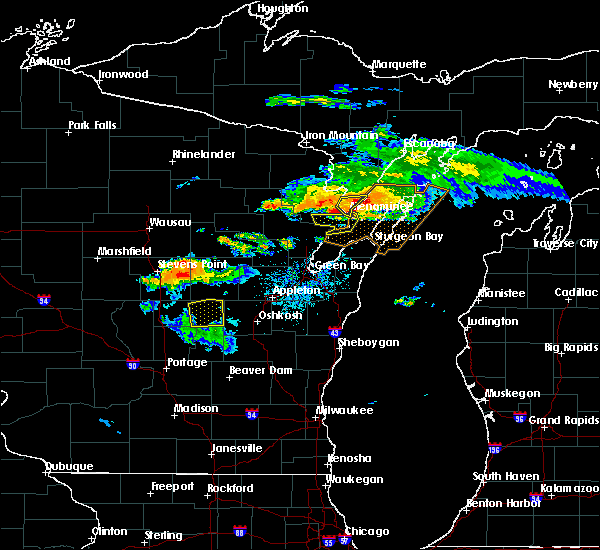 At 856 pm cdt, a severe thunderstorm was located near menominee, moving southeast at 25 mph (radar indicated). Hazards include 60 mph wind gusts and penny size hail. Expect damage to roofs, siding, and trees. Locations impacted include, menominee, carbondale and birch creek. At 856 pm cdt, a severe thunderstorm was located near menominee, moving southeast at 25 mph (radar indicated). Hazards include 60 mph wind gusts and penny size hail. Expect damage to roofs, siding, and trees. Locations impacted include, menominee, carbondale and birch creek.
|
| 7/12/2017 8:43 PM CDT |
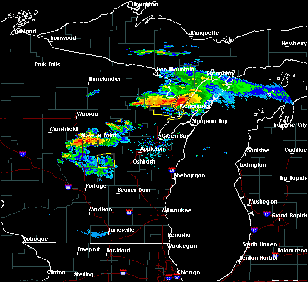 At 842 pm cdt, severe thunderstorms were located along a line extending from 11 miles north of marinette to 8 miles west of menominee to 6 miles northwest of pound, moving southeast at 30 mph (radar indicated). Hazards include 60 mph wind gusts and penny size hail. Expect damage to roofs, siding, and trees. Locations impacted include, marinette, menominee, pound, peshtigo, porterfield, beaver, coleman and harmony. At 842 pm cdt, severe thunderstorms were located along a line extending from 11 miles north of marinette to 8 miles west of menominee to 6 miles northwest of pound, moving southeast at 30 mph (radar indicated). Hazards include 60 mph wind gusts and penny size hail. Expect damage to roofs, siding, and trees. Locations impacted include, marinette, menominee, pound, peshtigo, porterfield, beaver, coleman and harmony.
|
| 7/12/2017 8:39 PM CDT |
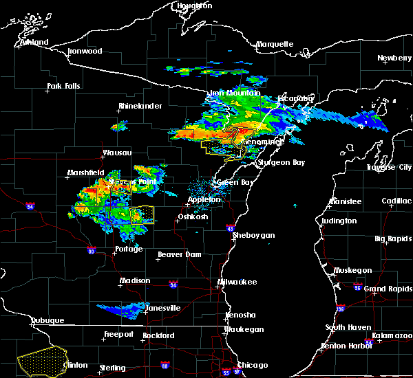 At 838 pm cdt, a severe thunderstorm was located near wallace, or 13 miles north of menominee, moving southeast at 30 mph (radar indicated). Hazards include 60 mph wind gusts and penny size hail. Expect damage to roofs, siding, and trees. Locations impacted include, menominee, arthur bay, wallace, ingalls, carbondale and birch creek. At 838 pm cdt, a severe thunderstorm was located near wallace, or 13 miles north of menominee, moving southeast at 30 mph (radar indicated). Hazards include 60 mph wind gusts and penny size hail. Expect damage to roofs, siding, and trees. Locations impacted include, menominee, arthur bay, wallace, ingalls, carbondale and birch creek.
|
| 7/12/2017 8:31 PM CDT |
 At 830 pm cdt, severe thunderstorms were located along a line extending from 8 miles southwest of stephenson to 9 miles east of crivitz to 11 miles northwest of pound, moving southeast at 30 mph (radar indicated). Hazards include 60 mph wind gusts and quarter size hail. Hail damage to vehicles is expected. Expect wind damage to roofs, siding, and trees. At 830 pm cdt, severe thunderstorms were located along a line extending from 8 miles southwest of stephenson to 9 miles east of crivitz to 11 miles northwest of pound, moving southeast at 30 mph (radar indicated). Hazards include 60 mph wind gusts and quarter size hail. Hail damage to vehicles is expected. Expect wind damage to roofs, siding, and trees.
|
| 7/12/2017 8:28 PM CDT |
 At 827 pm cdt, a severe thunderstorm was located 5 miles west of stephenson, or 17 miles north of menominee, moving southeast at 35 mph (radar indicated). Hazards include 60 mph wind gusts and penny size hail. expect damage to roofs, siding, and trees At 827 pm cdt, a severe thunderstorm was located 5 miles west of stephenson, or 17 miles north of menominee, moving southeast at 35 mph (radar indicated). Hazards include 60 mph wind gusts and penny size hail. expect damage to roofs, siding, and trees
|
| 7/6/2017 9:55 PM CDT |
 The severe thunderstorm warning for central door county will expire at 1000 pm cdt, the storms which prompted the warning have weakened below severe limits, and no longer pose an immediate threat to life or property. therefore the warning will be allowed to expire. however heavy rain is still possible with these thunderstorms. a severe thunderstorm watch remains in effect until midnight cdt for northeastern wisconsin. The severe thunderstorm warning for central door county will expire at 1000 pm cdt, the storms which prompted the warning have weakened below severe limits, and no longer pose an immediate threat to life or property. therefore the warning will be allowed to expire. however heavy rain is still possible with these thunderstorms. a severe thunderstorm watch remains in effect until midnight cdt for northeastern wisconsin.
|
| 7/6/2017 9:40 PM CDT |
 At 940 pm cdt, severe thunderstorms were located along a line extending from near newport state park to 6 miles northeast of jacksonport to 7 miles west of egg harbor, moving southeast at 65 mph (radar indicated). Hazards include 60 mph wind gusts and nickel size hail. Expect damage to roofs, siding, and trees. these severe storms will be near, jacksonport around 950 pm cdt. Other locations impacted by these severe thunderstorms include peninsula center, fish creek, peninsula state park, valmy, ellison bay, whitefish bay, rock island state park, carlsville, washington island and sister bay. At 940 pm cdt, severe thunderstorms were located along a line extending from near newport state park to 6 miles northeast of jacksonport to 7 miles west of egg harbor, moving southeast at 65 mph (radar indicated). Hazards include 60 mph wind gusts and nickel size hail. Expect damage to roofs, siding, and trees. these severe storms will be near, jacksonport around 950 pm cdt. Other locations impacted by these severe thunderstorms include peninsula center, fish creek, peninsula state park, valmy, ellison bay, whitefish bay, rock island state park, carlsville, washington island and sister bay.
|
| 7/6/2017 9:36 PM CDT |
 The severe thunderstorm warning for southern menominee county will expire at 945 pm cdt, the storm which prompted the warning has moved out of the area. therefore the warning will be allowed to expire. however gusty winds are still possible as the thunderstorm continues to leave the area. a severe thunderstorm watch remains in effect until midnight cdt for south central upper michigan. The severe thunderstorm warning for southern menominee county will expire at 945 pm cdt, the storm which prompted the warning has moved out of the area. therefore the warning will be allowed to expire. however gusty winds are still possible as the thunderstorm continues to leave the area. a severe thunderstorm watch remains in effect until midnight cdt for south central upper michigan.
|
| 7/6/2017 9:23 PM CDT |
 At 923 pm cdt, severe thunderstorms were located along a line extending from near menominee, moving southeast at 45 mph (radar indicated). Hazards include 60 mph wind gusts and nickel size hail. Expect damage to roofs, siding, and trees. Locations impacted include, marinette, menominee, crivitz, peshtigo, porterfield, harmony, mcallister, loomis and lake noquebay. At 923 pm cdt, severe thunderstorms were located along a line extending from near menominee, moving southeast at 45 mph (radar indicated). Hazards include 60 mph wind gusts and nickel size hail. Expect damage to roofs, siding, and trees. Locations impacted include, marinette, menominee, crivitz, peshtigo, porterfield, harmony, mcallister, loomis and lake noquebay.
|
| 7/6/2017 9:21 PM CDT |
 At 921 pm cdt, severe thunderstorms were located along a line extending from near cedar river to 12 miles northeast of menominee to 8 miles southeast of wausaukee, moving southeast at 55 mph (radar indicated). Hazards include 70 mph wind gusts and nickel size hail. Expect considerable tree damage. damage is likely to mobile homes, roofs, and outbuildings. these severe storms will be near, ephraim around 935 pm cdt. newport state park around 940 pm cdt. egg harbor around 955 pm cdt. jacksonport around 1000 pm cdt. Other locations impacted by these severe thunderstorms include peninsula center, fish creek, peninsula state park, valmy, ellison bay, whitefish bay, rock island state park, carlsville, washington island and sister bay. At 921 pm cdt, severe thunderstorms were located along a line extending from near cedar river to 12 miles northeast of menominee to 8 miles southeast of wausaukee, moving southeast at 55 mph (radar indicated). Hazards include 70 mph wind gusts and nickel size hail. Expect considerable tree damage. damage is likely to mobile homes, roofs, and outbuildings. these severe storms will be near, ephraim around 935 pm cdt. newport state park around 940 pm cdt. egg harbor around 955 pm cdt. jacksonport around 1000 pm cdt. Other locations impacted by these severe thunderstorms include peninsula center, fish creek, peninsula state park, valmy, ellison bay, whitefish bay, rock island state park, carlsville, washington island and sister bay.
|
| 7/6/2017 9:19 PM CDT |
 At 919 pm cdt, a severe thunderstorm was located 8 miles southeast of stephenson, or 14 miles northeast of menominee, moving southeast at 45 mph (radar indicated). Hazards include 60 mph wind gusts and nickel size hail. Expect damage to roofs, siding, and trees. Locations impacted include, marinette, menominee, stephenson, cedar river, daggett, arthur bay, wallace, ingalls, wells state park, carbondale and birch creek. At 919 pm cdt, a severe thunderstorm was located 8 miles southeast of stephenson, or 14 miles northeast of menominee, moving southeast at 45 mph (radar indicated). Hazards include 60 mph wind gusts and nickel size hail. Expect damage to roofs, siding, and trees. Locations impacted include, marinette, menominee, stephenson, cedar river, daggett, arthur bay, wallace, ingalls, wells state park, carbondale and birch creek.
|
| 7/6/2017 9:07 PM CDT |
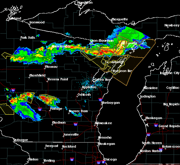 At 906 pm cdt, severe thunderstorms were located along a line extending from 7 miles southwest of stephenson to 10 miles southeast of goodman, moving southeast at 30 mph (radar indicated). Hazards include 70 mph wind gusts and nickel size hail. Expect considerable tree damage. damage is likely to mobile homes, roofs, and outbuildings. severe thunderstorms will be near, menominee, menominee and wausaukee around 940 pm cdt. crivitz around 950 pm cdt. Other locations impacted by these severe thunderstorms include middle inlet, mcallister, harmony, beecher, birch creek, peshtigo, loomis, goodman county park, porterfield and athelstane. At 906 pm cdt, severe thunderstorms were located along a line extending from 7 miles southwest of stephenson to 10 miles southeast of goodman, moving southeast at 30 mph (radar indicated). Hazards include 70 mph wind gusts and nickel size hail. Expect considerable tree damage. damage is likely to mobile homes, roofs, and outbuildings. severe thunderstorms will be near, menominee, menominee and wausaukee around 940 pm cdt. crivitz around 950 pm cdt. Other locations impacted by these severe thunderstorms include middle inlet, mcallister, harmony, beecher, birch creek, peshtigo, loomis, goodman county park, porterfield and athelstane.
|
| 7/6/2017 9:02 PM CDT |
 At 902 pm cdt, severe thunderstorms were located along a line extending from 11 miles southeast of escanaba to 10 miles east of cedar river to 6 miles northeast of stephenson, moving southeast at 45 mph (radar indicated). Hazards include 70 mph wind gusts and nickel size hail. Expect considerable tree damage. damage is likely to mobile homes, roofs, and outbuildings. severe thunderstorms will be near, newport state park around 920 pm cdt. ephraim around 935 pm cdt. Other locations impacted by these severe thunderstorms include peninsula center, fish creek, peninsula state park, valmy, ellison bay, whitefish bay, rock island state park, carlsville, washington island and sister bay. At 902 pm cdt, severe thunderstorms were located along a line extending from 11 miles southeast of escanaba to 10 miles east of cedar river to 6 miles northeast of stephenson, moving southeast at 45 mph (radar indicated). Hazards include 70 mph wind gusts and nickel size hail. Expect considerable tree damage. damage is likely to mobile homes, roofs, and outbuildings. severe thunderstorms will be near, newport state park around 920 pm cdt. ephraim around 935 pm cdt. Other locations impacted by these severe thunderstorms include peninsula center, fish creek, peninsula state park, valmy, ellison bay, whitefish bay, rock island state park, carlsville, washington island and sister bay.
|
| 7/6/2017 9:00 PM CDT |
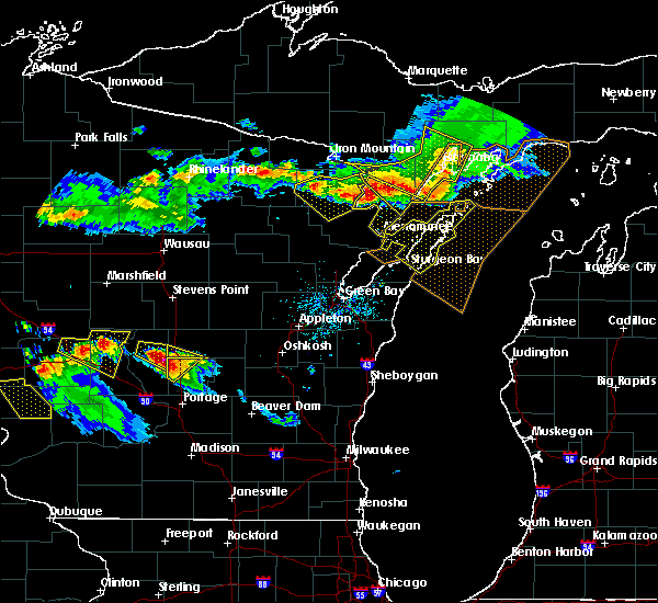 At 900 pm cdt, a severe thunderstorm was located near stephenson, or 21 miles north of menominee, moving southeast at 55 mph (radar indicated). Hazards include 60 mph wind gusts and nickel size hail. expect damage to roofs, siding, and trees At 900 pm cdt, a severe thunderstorm was located near stephenson, or 21 miles north of menominee, moving southeast at 55 mph (radar indicated). Hazards include 60 mph wind gusts and nickel size hail. expect damage to roofs, siding, and trees
|
| 6/14/2017 4:37 PM CDT |
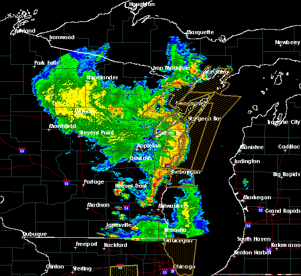 At 437 pm cdt, severe thunderstorms were located along a line extending from near pound to 6 miles northwest of sturgeon bay, moving northeast at 50 mph (radar indicated). Hazards include 60 mph wind gusts. Expect damage to roofs, siding, and trees. Locations impacted include, menominee, stephenson, cedar river, bagley, daggett, carney, swanson, wells state park, birch creek, arthur bay, wallace, and carbondale. At 437 pm cdt, severe thunderstorms were located along a line extending from near pound to 6 miles northwest of sturgeon bay, moving northeast at 50 mph (radar indicated). Hazards include 60 mph wind gusts. Expect damage to roofs, siding, and trees. Locations impacted include, menominee, stephenson, cedar river, bagley, daggett, carney, swanson, wells state park, birch creek, arthur bay, wallace, and carbondale.
|
| 6/14/2017 4:29 PM CDT |
 At 429 pm cdt, severe thunderstorms were located along a line extending from 7 miles southwest of pound to 16 miles south of crivitz to 7 miles east of oconto, moving northeast at 50 mph (radar indicated). Hazards include 70 mph wind gusts and penny size hail. Expect considerable tree damage. damage is likely to mobile homes, roofs, and outbuildings. Locations impacted include, marinette, menominee, oconto, crivitz, pound, peshtigo, porterfield, beaver, spruce and coleman. At 429 pm cdt, severe thunderstorms were located along a line extending from 7 miles southwest of pound to 16 miles south of crivitz to 7 miles east of oconto, moving northeast at 50 mph (radar indicated). Hazards include 70 mph wind gusts and penny size hail. Expect considerable tree damage. damage is likely to mobile homes, roofs, and outbuildings. Locations impacted include, marinette, menominee, oconto, crivitz, pound, peshtigo, porterfield, beaver, spruce and coleman.
|
| 6/14/2017 4:21 PM CDT |
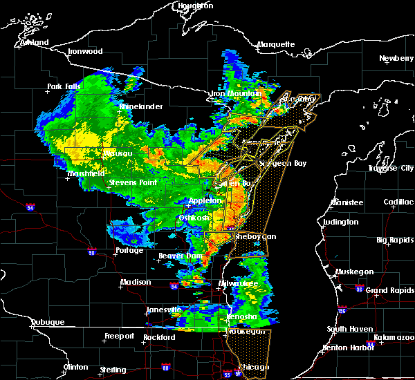 At 420 pm cdt, severe thunderstorms were located along a line extending from 7 miles southwest of pound to 9 miles northeast of green bay, moving northeast at 50 mph (radar indicated). Hazards include 60 mph wind gusts. expect damage to roofs, siding, and trees At 420 pm cdt, severe thunderstorms were located along a line extending from 7 miles southwest of pound to 9 miles northeast of green bay, moving northeast at 50 mph (radar indicated). Hazards include 60 mph wind gusts. expect damage to roofs, siding, and trees
|
| 6/14/2017 4:09 PM CDT |
 At 408 pm cdt, a severe thunderstorm was located 8 miles southeast of gillett, or 18 miles east of shawano, moving northeast at 40 mph (radar indicated). Hazards include 70 mph wind gusts and penny size hail. Expect considerable tree damage. damage is likely to mobile homes, roofs, and outbuildings. this severe thunderstorm will be near, oconto around 435 pm cdt. pound around 440 pm cdt. marinette around 500 pm cdt. menominee around 505 pm cdt. Other locations impacted by this severe thunderstorm include cullen, underhill, sobieski, south chase, pensaukee, morgan, porterfield, abrams, beaver and lake noquebay. At 408 pm cdt, a severe thunderstorm was located 8 miles southeast of gillett, or 18 miles east of shawano, moving northeast at 40 mph (radar indicated). Hazards include 70 mph wind gusts and penny size hail. Expect considerable tree damage. damage is likely to mobile homes, roofs, and outbuildings. this severe thunderstorm will be near, oconto around 435 pm cdt. pound around 440 pm cdt. marinette around 500 pm cdt. menominee around 505 pm cdt. Other locations impacted by this severe thunderstorm include cullen, underhill, sobieski, south chase, pensaukee, morgan, porterfield, abrams, beaver and lake noquebay.
|
| 6/11/2017 1:38 PM CDT |
 At 137 pm cdt, severe thunderstorms were located along a line extending from 7 miles east of wausaukee to 9 miles east of pound to near marinette to 6 miles south of oconto, moving east at 65 mph (radar indicated). Hazards include 60 mph wind gusts and penny size hail. Expect damage to roofs, siding, and trees. these severe storms will be near, marinette and menominee around 145 pm cdt. other locations impacted by these severe thunderstorms include cullen, middle inlet, county line, mcallister, harmony, peshtigo, sobieski, loomis, pensaukee and little suamico. those attending the porterfield country music festival are in the path of these storms and should prepare for imminent dangerous weather conditions. Seek shelter now!. At 137 pm cdt, severe thunderstorms were located along a line extending from 7 miles east of wausaukee to 9 miles east of pound to near marinette to 6 miles south of oconto, moving east at 65 mph (radar indicated). Hazards include 60 mph wind gusts and penny size hail. Expect damage to roofs, siding, and trees. these severe storms will be near, marinette and menominee around 145 pm cdt. other locations impacted by these severe thunderstorms include cullen, middle inlet, county line, mcallister, harmony, peshtigo, sobieski, loomis, pensaukee and little suamico. those attending the porterfield country music festival are in the path of these storms and should prepare for imminent dangerous weather conditions. Seek shelter now!.
|
| 6/11/2017 1:34 PM CDT |
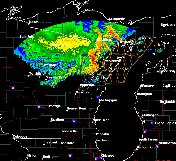 At 134 pm cdt, severe thunderstorms were located along a line extending from 8 miles southeast of pembine to 6 miles northeast of oconto, moving east at 55 mph (law enforcement). Hazards include 60 mph wind gusts and penny size hail. Expect damage to roofs, siding, and trees. Locations impacted include, menominee, stephenson, cedar river, bagley, daggett, ingalls, wells state park, arthur bay, wallace and carbondale. At 134 pm cdt, severe thunderstorms were located along a line extending from 8 miles southeast of pembine to 6 miles northeast of oconto, moving east at 55 mph (law enforcement). Hazards include 60 mph wind gusts and penny size hail. Expect damage to roofs, siding, and trees. Locations impacted include, menominee, stephenson, cedar river, bagley, daggett, ingalls, wells state park, arthur bay, wallace and carbondale.
|
| 6/11/2017 1:28 PM CDT |
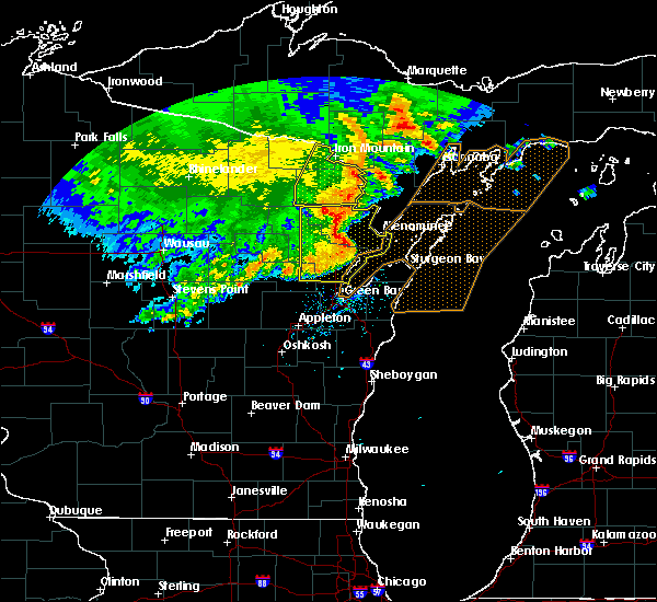 At 128 pm cdt, severe thunderstorms were located along a line extending from 7 miles south of pembine to near oconto, moving east at 55 mph (radar indicated). Hazards include 60 mph wind gusts and penny size hail. expect damage to roofs, siding, and trees At 128 pm cdt, severe thunderstorms were located along a line extending from 7 miles south of pembine to near oconto, moving east at 55 mph (radar indicated). Hazards include 60 mph wind gusts and penny size hail. expect damage to roofs, siding, and trees
|
| 6/11/2017 1:22 PM CDT |
 At 121 pm cdt, severe thunderstorms were located along a line extending from near wausaukee to near pound to 15 miles south of crivitz to 9 miles west of oconto to 7 miles south of gillett, moving east at 65 mph (radar indicated). Hazards include 70 mph wind gusts and penny size hail. Expect considerable tree damage. damage is likely to mobile homes, roofs, and outbuildings. these severe storms will be near, crivitz and wausaukee around 125 pm cdt. oconto around 130 pm cdt. marinette and menominee around 145 pm cdt. other locations impacted by these severe thunderstorms include cullen, middle inlet, sobieski, south chase, pensaukee, zachow, high falls reservoir, hickory corners, morgan and porterfield. those attending the porterfield country music festival and copperfest are in the path of these storms and should prepare for imminent dangerous weather conditions. Seek shelter now!. At 121 pm cdt, severe thunderstorms were located along a line extending from near wausaukee to near pound to 15 miles south of crivitz to 9 miles west of oconto to 7 miles south of gillett, moving east at 65 mph (radar indicated). Hazards include 70 mph wind gusts and penny size hail. Expect considerable tree damage. damage is likely to mobile homes, roofs, and outbuildings. these severe storms will be near, crivitz and wausaukee around 125 pm cdt. oconto around 130 pm cdt. marinette and menominee around 145 pm cdt. other locations impacted by these severe thunderstorms include cullen, middle inlet, sobieski, south chase, pensaukee, zachow, high falls reservoir, hickory corners, morgan and porterfield. those attending the porterfield country music festival and copperfest are in the path of these storms and should prepare for imminent dangerous weather conditions. Seek shelter now!.
|
| 6/11/2017 1:11 PM CDT |
 At 110 pm cdt, severe thunderstorms were located along a line extending from 15 miles west of wausaukee to 7 miles southeast of mountain to 12 miles southwest of pound to gillett to near shawano, moving east at 55 mph. radar indicated rotation in central oconto county (radar indicated). Hazards include 70 mph wind gusts and quarter size hail. Hail damage to vehicles is expected. expect considerable tree damage. wind damage is also likely to mobile homes, roofs, and outbuildings. these severe storms will be near, wausaukee and pound around 125 pm cdt. crivitz around 130 pm cdt. marinette and oconto around 140 pm cdt. menominee around 145 pm cdt. other locations impacted by these severe thunderstorms include college of menominee nation, breed, hayes, high falls reservoir, hickory corners, caldron falls reservoir, belle plaine, bonduel, lake noquebay and intersection of hwy 55 and county m. those attending the porterfield country music festival or copperfest are in the path of these storms and should prepare for dangerous weather conditions. Seek shelter now!. At 110 pm cdt, severe thunderstorms were located along a line extending from 15 miles west of wausaukee to 7 miles southeast of mountain to 12 miles southwest of pound to gillett to near shawano, moving east at 55 mph. radar indicated rotation in central oconto county (radar indicated). Hazards include 70 mph wind gusts and quarter size hail. Hail damage to vehicles is expected. expect considerable tree damage. wind damage is also likely to mobile homes, roofs, and outbuildings. these severe storms will be near, wausaukee and pound around 125 pm cdt. crivitz around 130 pm cdt. marinette and oconto around 140 pm cdt. menominee around 145 pm cdt. other locations impacted by these severe thunderstorms include college of menominee nation, breed, hayes, high falls reservoir, hickory corners, caldron falls reservoir, belle plaine, bonduel, lake noquebay and intersection of hwy 55 and county m. those attending the porterfield country music festival or copperfest are in the path of these storms and should prepare for dangerous weather conditions. Seek shelter now!.
|
| 6/11/2017 12:59 PM CDT |
 At 1257 pm cdt, severe thunderstorms were located along a line extending from 9 miles east of carter to near mountain to 9 miles northeast of keshena to legend lake to 6 miles west of shawano, moving east at 65 mph. radar was indicating some rotation in eastern menominee county and northern oconto county (radar indicated). Hazards include 70 mph wind gusts and quarter size hail. Hail damage to vehicles is expected. expect considerable tree damage. wind damage is also likely to mobile homes, roofs, and outbuildings. locations impacted include, marinette, shawano, menominee, oconto, gillett, crivitz, mountain, wausaukee, pound and white lake. those attending copperfest or the portfield country music festival are in the path of these storms and should prepare for dangerous weather conditions. Seek shelter now!. At 1257 pm cdt, severe thunderstorms were located along a line extending from 9 miles east of carter to near mountain to 9 miles northeast of keshena to legend lake to 6 miles west of shawano, moving east at 65 mph. radar was indicating some rotation in eastern menominee county and northern oconto county (radar indicated). Hazards include 70 mph wind gusts and quarter size hail. Hail damage to vehicles is expected. expect considerable tree damage. wind damage is also likely to mobile homes, roofs, and outbuildings. locations impacted include, marinette, shawano, menominee, oconto, gillett, crivitz, mountain, wausaukee, pound and white lake. those attending copperfest or the portfield country music festival are in the path of these storms and should prepare for dangerous weather conditions. Seek shelter now!.
|
| 6/11/2017 12:48 PM CDT |
 At 1248 pm cdt, severe thunderstorms were located along a line extending from near carter to near neopit to 10 miles southeast of wittenberg, moving east at 55 mph (radar indicated). Hazards include 70 mph wind gusts and quarter size hail. Hail damage to vehicles is expected. expect considerable tree damage. Wind damage is also likely to mobile homes, roofs, and outbuildings. At 1248 pm cdt, severe thunderstorms were located along a line extending from near carter to near neopit to 10 miles southeast of wittenberg, moving east at 55 mph (radar indicated). Hazards include 70 mph wind gusts and quarter size hail. Hail damage to vehicles is expected. expect considerable tree damage. Wind damage is also likely to mobile homes, roofs, and outbuildings.
|
| 6/3/2017 7:58 PM CDT |
 At 757 pm cdt, severe thunderstorms were located along a line extending from near newport state park to jacksonport to 9 miles west of sturgeon bay, moving east at 35 mph (radar indicated). Hazards include 60 mph wind gusts and quarter size hail. Hail damage to vehicles is expected. expect wind damage to roofs, siding, and trees. Locations impacted include, marinette, sturgeon bay, menominee, jacksonport, ephraim, egg harbor, newport state park, whitefish bay, brussels and baileys harbor. At 757 pm cdt, severe thunderstorms were located along a line extending from near newport state park to jacksonport to 9 miles west of sturgeon bay, moving east at 35 mph (radar indicated). Hazards include 60 mph wind gusts and quarter size hail. Hail damage to vehicles is expected. expect wind damage to roofs, siding, and trees. Locations impacted include, marinette, sturgeon bay, menominee, jacksonport, ephraim, egg harbor, newport state park, whitefish bay, brussels and baileys harbor.
|
| 6/3/2017 7:57 PM CDT |
 A severe thunderstorm warning remains in effect until 815 pm cdt for southern marinette. southern oconto and eastern shawano counties. At 755 pm cdt, severe thunderstorms were located along a line extending from 12 miles west of oconto to 6 miles southeast of gillett to 8 miles east of shawano, moving southeast at 30 mph. A severe thunderstorm warning remains in effect until 815 pm cdt for southern marinette. southern oconto and eastern shawano counties. At 755 pm cdt, severe thunderstorms were located along a line extending from 12 miles west of oconto to 6 miles southeast of gillett to 8 miles east of shawano, moving southeast at 30 mph.
|
| 6/3/2017 7:37 PM CDT |
 At 736 pm cdt, severe thunderstorms were located along a line extending from 10 miles southeast of marinette to oconto to near legend lake, moving southeast at 45 mph (radar indicated). Hazards include 60 mph wind gusts and quarter size hail. Hail damage to vehicles is expected. expect wind damage to roofs, siding, and trees. locations impacted include, marinette, shawano, menominee, oconto, pulaski, gillett, navarino wildlife area, legend lake, keshena and little suamico. People at memorial park in shawano should seek safe shelter immediately!. At 736 pm cdt, severe thunderstorms were located along a line extending from 10 miles southeast of marinette to oconto to near legend lake, moving southeast at 45 mph (radar indicated). Hazards include 60 mph wind gusts and quarter size hail. Hail damage to vehicles is expected. expect wind damage to roofs, siding, and trees. locations impacted include, marinette, shawano, menominee, oconto, pulaski, gillett, navarino wildlife area, legend lake, keshena and little suamico. People at memorial park in shawano should seek safe shelter immediately!.
|
| 6/3/2017 7:15 PM CDT |
 At 715 pm cdt, severe thunderstorms were located along a line extending from 7 miles south of cedar river to near marinette to 10 miles southeast of pound, moving east at 45 mph (radar indicated). Hazards include 60 mph wind gusts and quarter size hail. Hail damage to vehicles is expected. expect wind damage to roofs, siding, and trees. severe thunderstorms will be near, ephraim around 730 pm cdt. egg harbor around 735 pm cdt. jacksonport and newport state park around 740 pm cdt. sturgeon bay around 750 pm cdt. Other locations impacted by these severe thunderstorms include peninsula state park, valmy, whitefish bay, rock island state park, carlsville, vignes, maplewood, sister bay, institute and potawatomi state park. At 715 pm cdt, severe thunderstorms were located along a line extending from 7 miles south of cedar river to near marinette to 10 miles southeast of pound, moving east at 45 mph (radar indicated). Hazards include 60 mph wind gusts and quarter size hail. Hail damage to vehicles is expected. expect wind damage to roofs, siding, and trees. severe thunderstorms will be near, ephraim around 730 pm cdt. egg harbor around 735 pm cdt. jacksonport and newport state park around 740 pm cdt. sturgeon bay around 750 pm cdt. Other locations impacted by these severe thunderstorms include peninsula state park, valmy, whitefish bay, rock island state park, carlsville, vignes, maplewood, sister bay, institute and potawatomi state park.
|
| 6/3/2017 7:13 PM CDT |
 At 712 pm cdt, severe thunderstorms were located along a line extending from near marinette to 8 miles southeast of pound to 8 miles south of mountain, moving southeast at 60 mph (radar indicated). Hazards include 60 mph wind gusts and quarter size hail. Hail damage to vehicles is expected. expect wind damage to roofs, siding, and trees. severe thunderstorms will be near, oconto around 720 pm cdt. other locations impacted by these severe thunderstorms include college of menominee nation, cullen, underhill, breed, hofa park, sobieski, hayes, south chase, pensaukee and landstad. People at memorial park in shawano should seek safe shelter immediately!. At 712 pm cdt, severe thunderstorms were located along a line extending from near marinette to 8 miles southeast of pound to 8 miles south of mountain, moving southeast at 60 mph (radar indicated). Hazards include 60 mph wind gusts and quarter size hail. Hail damage to vehicles is expected. expect wind damage to roofs, siding, and trees. severe thunderstorms will be near, oconto around 720 pm cdt. other locations impacted by these severe thunderstorms include college of menominee nation, cullen, underhill, breed, hofa park, sobieski, hayes, south chase, pensaukee and landstad. People at memorial park in shawano should seek safe shelter immediately!.
|
| 6/3/2017 7:09 PM CDT |
 At 708 pm cdt, severe thunderstorms were located along a line extending from near menominee to near pound to near mountain, moving southeast at 55 mph (radar indicated). Hazards include 60 mph wind gusts and quarter size hail. Hail damage to vehicles is expected. expect wind damage to roofs, siding, and trees. Locations impacted include, marinette, menominee, crivitz, mountain, pound, peshtigo, porterfield, beaver, middle inlet and spruce. At 708 pm cdt, severe thunderstorms were located along a line extending from near menominee to near pound to near mountain, moving southeast at 55 mph (radar indicated). Hazards include 60 mph wind gusts and quarter size hail. Hail damage to vehicles is expected. expect wind damage to roofs, siding, and trees. Locations impacted include, marinette, menominee, crivitz, mountain, pound, peshtigo, porterfield, beaver, middle inlet and spruce.
|
| 6/3/2017 6:47 PM CDT |
 At 647 pm cdt, severe thunderstorms were located along a line extending from 12 miles west of wausaukee to near white lake, moving southeast at 50 mph (radar indicated). Hazards include 60 mph wind gusts and quarter size hail. Hail damage to vehicles is expected. Expect wind damage to roofs, siding, and trees. At 647 pm cdt, severe thunderstorms were located along a line extending from 12 miles west of wausaukee to near white lake, moving southeast at 50 mph (radar indicated). Hazards include 60 mph wind gusts and quarter size hail. Hail damage to vehicles is expected. Expect wind damage to roofs, siding, and trees.
|
| 5/17/2017 11:25 PM CDT |
 The severe thunderstorm warning for northeastern kewaunee and door counties will expire at 1130 pm cdt, the storms which prompted the warning have weakened below severe limits, and no longer pose an immediate threat to life or property. therefore the warning will be allowed to expire. however gusty winds are still possible with these thunderstorms. The severe thunderstorm warning for northeastern kewaunee and door counties will expire at 1130 pm cdt, the storms which prompted the warning have weakened below severe limits, and no longer pose an immediate threat to life or property. therefore the warning will be allowed to expire. however gusty winds are still possible with these thunderstorms.
|
| 5/17/2017 11:12 PM CDT |
 At 1112 pm cdt, severe thunderstorms were located along a line extending from 8 miles southeast of marinette to near sturgeon bay to near algoma, moving northeast at 65 mph (radar indicated). Hazards include 60 mph wind gusts. Expect damage to roofs, siding, and trees. these severe storms will be near, jacksonport and egg harbor around 1125 pm cdt. ephraim around 1130 pm cdt. other locations impacted by these severe thunderstorms include peninsula state park, valmy, gregorville, whitefish bay, carlsville, vignes, maplewood, sister bay, institute and potawatomi state park. A tornado watch remains in effect until 100 am cdt for northeastern wisconsin. At 1112 pm cdt, severe thunderstorms were located along a line extending from 8 miles southeast of marinette to near sturgeon bay to near algoma, moving northeast at 65 mph (radar indicated). Hazards include 60 mph wind gusts. Expect damage to roofs, siding, and trees. these severe storms will be near, jacksonport and egg harbor around 1125 pm cdt. ephraim around 1130 pm cdt. other locations impacted by these severe thunderstorms include peninsula state park, valmy, gregorville, whitefish bay, carlsville, vignes, maplewood, sister bay, institute and potawatomi state park. A tornado watch remains in effect until 100 am cdt for northeastern wisconsin.
|
| 5/17/2017 10:48 PM CDT |
 The national weather service in green bay has issued a * severe thunderstorm warning for. northern kewaunee county in northeastern wisconsin. door county in northeastern wisconsin. until 1130 pm cdt. At 1048 pm cdt, severe thunderstorms were located along a line. The national weather service in green bay has issued a * severe thunderstorm warning for. northern kewaunee county in northeastern wisconsin. door county in northeastern wisconsin. until 1130 pm cdt. At 1048 pm cdt, severe thunderstorms were located along a line.
|
| 7/21/2016 8:07 AM CDT | Few trees down in the city of marinett in marinette county WI, 1.3 miles WSW of Marinette, WI |
| 7/21/2016 7:54 AM CDT |
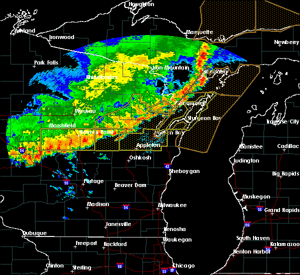 At 753 am cdt, severe thunderstorms were located along a line extending from 8 miles east of powers to near cedar river to 7 miles northwest of pound, moving east at 45 mph (radar indicated). Hazards include 60 mph wind gusts and penny size hail. Expect damage to roofs. siding. and trees. these severe storms will be near, marinette around 815 am cdt. menominee around 815 am cdt. Other locations impacted by these severe thunderstorms include coleman, peshtigo, beaver, loomis, harmony and porterfield. At 753 am cdt, severe thunderstorms were located along a line extending from 8 miles east of powers to near cedar river to 7 miles northwest of pound, moving east at 45 mph (radar indicated). Hazards include 60 mph wind gusts and penny size hail. Expect damage to roofs. siding. and trees. these severe storms will be near, marinette around 815 am cdt. menominee around 815 am cdt. Other locations impacted by these severe thunderstorms include coleman, peshtigo, beaver, loomis, harmony and porterfield.
|
| 7/21/2016 7:34 AM CDT |
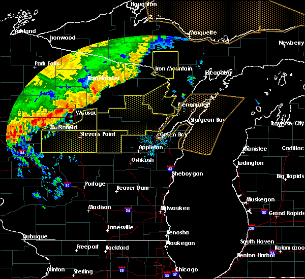 At 734 am cdt, severe thunderstorms were located along a line extending from near hermansville to 9 miles northwest of stephenson to near mountain, moving southeast at 50 mph (radar indicated). Hazards include 70 mph wind gusts and nickel size hail. Expect considerable tree damage. damage is likely to mobile homes, roofs, and outbuildings. these severe storms will be near, pound around 800 am cdt. Other locations impacted by these severe thunderstorms include athelstane, peshtigo, mcallister, caldron falls reservoir, governor thompson state park, harmony, high falls reservoir, coleman, middle inlet and lake noquebay. At 734 am cdt, severe thunderstorms were located along a line extending from near hermansville to 9 miles northwest of stephenson to near mountain, moving southeast at 50 mph (radar indicated). Hazards include 70 mph wind gusts and nickel size hail. Expect considerable tree damage. damage is likely to mobile homes, roofs, and outbuildings. these severe storms will be near, pound around 800 am cdt. Other locations impacted by these severe thunderstorms include athelstane, peshtigo, mcallister, caldron falls reservoir, governor thompson state park, harmony, high falls reservoir, coleman, middle inlet and lake noquebay.
|
| 7/21/2016 7:24 AM CDT |
 At 723 am cdt, severe thunderstorms were located along a line extending from 6 miles east of norway to 7 miles southeast of pembine to 7 miles northwest of mountain, moving southeast at 50 mph (radar indicated). Hazards include 70 mph wind gusts and nickel size hail. Expect considerable tree damage. damage is likely to mobile homes, roofs, and outbuildings. these severe storms will be near, pound around 755 am cdt. Other locations impacted by these severe thunderstorms include athelstane, peshtigo, mcallister, caldron falls reservoir, governor thompson state park, harmony, kremlin, high falls reservoir, silver cliff and coleman. At 723 am cdt, severe thunderstorms were located along a line extending from 6 miles east of norway to 7 miles southeast of pembine to 7 miles northwest of mountain, moving southeast at 50 mph (radar indicated). Hazards include 70 mph wind gusts and nickel size hail. Expect considerable tree damage. damage is likely to mobile homes, roofs, and outbuildings. these severe storms will be near, pound around 755 am cdt. Other locations impacted by these severe thunderstorms include athelstane, peshtigo, mcallister, caldron falls reservoir, governor thompson state park, harmony, kremlin, high falls reservoir, silver cliff and coleman.
|
| 7/21/2016 6:54 AM CDT |
 At 654 am cdt, severe thunderstorms were located along a line extending from near florence to near goodman to 7 miles east of crandon, moving southeast at 50 mph (radar indicated). Hazards include 70 mph wind gusts and nickel size hail. Expect considerable tree damage. damage is likely to mobile homes, roofs, and outbuildings. severe thunderstorms will be near, goodman around 700 am cdt. pembine around 715 am cdt. crivitz around 740 am cdt. marinette and menominee around 805 am cdt. Other locations impacted by these severe thunderstorms include athelstane, peshtigo, mcallister, caldron falls reservoir, governor thompson state park, harmony, kremlin, high falls reservoir, silver cliff and coleman. At 654 am cdt, severe thunderstorms were located along a line extending from near florence to near goodman to 7 miles east of crandon, moving southeast at 50 mph (radar indicated). Hazards include 70 mph wind gusts and nickel size hail. Expect considerable tree damage. damage is likely to mobile homes, roofs, and outbuildings. severe thunderstorms will be near, goodman around 700 am cdt. pembine around 715 am cdt. crivitz around 740 am cdt. marinette and menominee around 805 am cdt. Other locations impacted by these severe thunderstorms include athelstane, peshtigo, mcallister, caldron falls reservoir, governor thompson state park, harmony, kremlin, high falls reservoir, silver cliff and coleman.
|
| 9/2/2015 3:48 PM CDT |
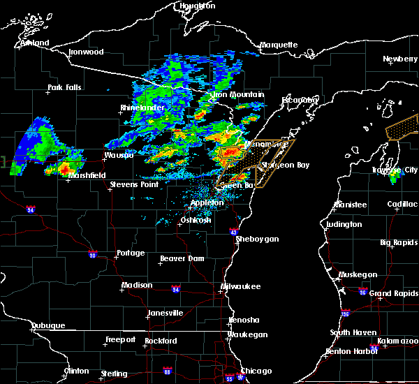 At 347 pm cdt, a severe thunderstorm was located 9 miles southwest of marinette, moving east at 20 mph (radar indicated). Hazards include 60 mph wind gusts and quarter size hail. Hail damage to vehicles is expected. expect wind damage to roofs, siding and trees. Locations impacted include, marinette, menominee, peshtigo, porterfield, harmony and county line. At 347 pm cdt, a severe thunderstorm was located 9 miles southwest of marinette, moving east at 20 mph (radar indicated). Hazards include 60 mph wind gusts and quarter size hail. Hail damage to vehicles is expected. expect wind damage to roofs, siding and trees. Locations impacted include, marinette, menominee, peshtigo, porterfield, harmony and county line.
|
| 9/2/2015 3:31 PM CDT |
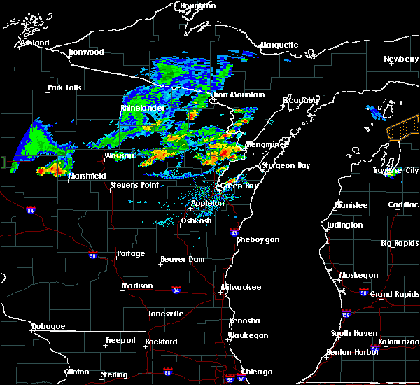 At 331 pm cdt, a severe thunderstorm was located 7 miles southeast of pound, or 13 miles west of marinette, moving east at 20 mph (radar indicated). Hazards include 60 mph wind gusts and quarter size hail. Hail damage to vehicles is expected. Expect wind damage to roofs, siding and trees. At 331 pm cdt, a severe thunderstorm was located 7 miles southeast of pound, or 13 miles west of marinette, moving east at 20 mph (radar indicated). Hazards include 60 mph wind gusts and quarter size hail. Hail damage to vehicles is expected. Expect wind damage to roofs, siding and trees.
|
| 8/14/2015 3:56 PM CDT | The severe thunderstorm warning for southeastern marinette county will expire at 400 pm cdt, the storm which prompted the warning has weakened below severe limits, and no longer pose an immediate threat to life or property. therefore the warning will be allowed to expire. however small. |
| 8/14/2015 3:42 PM CDT |
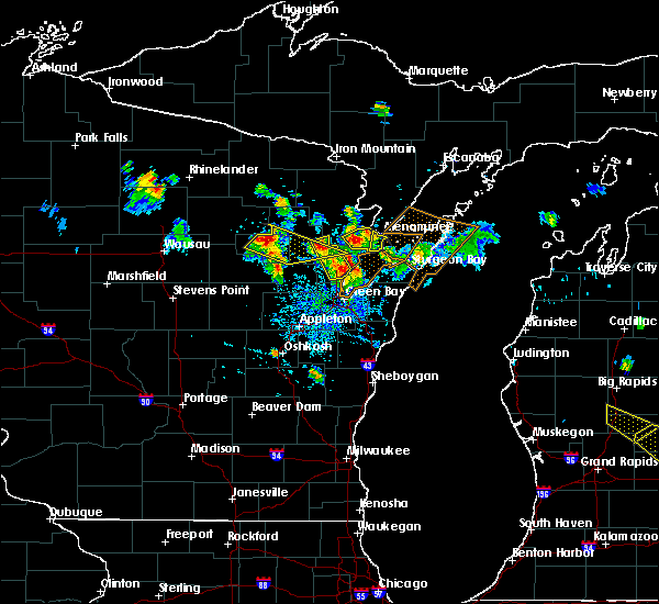 At 341 pm cdt, a severe thunderstorm was located 7 miles east of pound, or 13 miles west of menominee, moving southeast at 25 mph (radar indicated). Hazards include 60 mph wind gusts and quarter size hail. Hail damage to vehicles is expected. expect wind damage to roofs, siding and trees. This severe thunderstorm will remain over mainly rural areas of southeastern marinette county, including the following locations, porterfield, harmony, peshtigo and county line. At 341 pm cdt, a severe thunderstorm was located 7 miles east of pound, or 13 miles west of menominee, moving southeast at 25 mph (radar indicated). Hazards include 60 mph wind gusts and quarter size hail. Hail damage to vehicles is expected. expect wind damage to roofs, siding and trees. This severe thunderstorm will remain over mainly rural areas of southeastern marinette county, including the following locations, porterfield, harmony, peshtigo and county line.
|
| 8/14/2015 3:34 PM CDT |
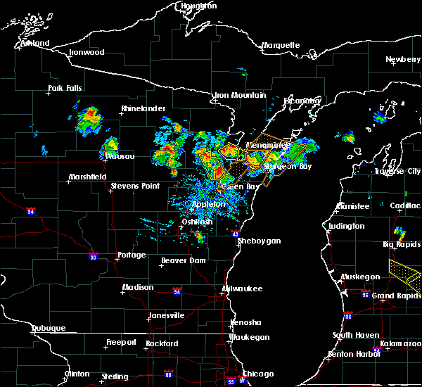 At 334 pm cdt, a severe thunderstorm was located near pound, or 14 miles west of menominee, moving southeast at 25 mph (radar indicated). Hazards include 60 mph wind gusts and quarter size hail. Hail damage to vehicles is expected. expect wind damage to roofs, siding and trees. this severe thunderstorm will remain over mainly rural areas of southeastern marinette county, including the following locations, porterfield, harmony, peshtigo and county line. This warning replaces the warning already in effect for marinette county. At 334 pm cdt, a severe thunderstorm was located near pound, or 14 miles west of menominee, moving southeast at 25 mph (radar indicated). Hazards include 60 mph wind gusts and quarter size hail. Hail damage to vehicles is expected. expect wind damage to roofs, siding and trees. this severe thunderstorm will remain over mainly rural areas of southeastern marinette county, including the following locations, porterfield, harmony, peshtigo and county line. This warning replaces the warning already in effect for marinette county.
|
| 8/14/2015 3:24 PM CDT |
 At 324 pm cdt, a severe thunderstorm was located near marinette, moving south at 25 mph (radar indicated). Hazards include 60 mph wind gusts and quarter size hail. Hail damage to vehicles is expected. expect wind damage to roofs, siding and trees. Locations impacted include, marinette, menominee and peshtigo. At 324 pm cdt, a severe thunderstorm was located near marinette, moving south at 25 mph (radar indicated). Hazards include 60 mph wind gusts and quarter size hail. Hail damage to vehicles is expected. expect wind damage to roofs, siding and trees. Locations impacted include, marinette, menominee and peshtigo.
|
| 8/14/2015 3:20 PM CDT | Quarter sized hail reported 1.3 miles WSW of Marinette, WI, quarter size hail fell in marinette. |
| 8/14/2015 3:13 PM CDT |
 At 313 pm cdt, a severe thunderstorm was located over marinette, moving south at 25 mph (radar indicated). Hazards include 60 mph wind gusts and quarter size hail. Hail damage to vehicles is expected. expect wind damage to roofs, siding and trees. This severe thunderstorm will remain over mainly rural areas of southeastern marinette county, including the following locations, marinette and peshtigo. At 313 pm cdt, a severe thunderstorm was located over marinette, moving south at 25 mph (radar indicated). Hazards include 60 mph wind gusts and quarter size hail. Hail damage to vehicles is expected. expect wind damage to roofs, siding and trees. This severe thunderstorm will remain over mainly rural areas of southeastern marinette county, including the following locations, marinette and peshtigo.
|
| 8/14/2015 2:53 PM CDT |
 At 253 pm cdt, a severe thunderstorm was located near menominee, moving southeast at 35 mph (radar indicated). Hazards include 60 mph wind gusts and quarter size hail. Hail damage to vehicles is expected. expect wind damage to roofs, siding and trees. This severe thunderstorm will remain over mainly rural areas of south central menominee county, including the following locations, birch creek. At 253 pm cdt, a severe thunderstorm was located near menominee, moving southeast at 35 mph (radar indicated). Hazards include 60 mph wind gusts and quarter size hail. Hail damage to vehicles is expected. expect wind damage to roofs, siding and trees. This severe thunderstorm will remain over mainly rural areas of south central menominee county, including the following locations, birch creek.
|
| 8/14/2015 2:47 PM CDT |
 At 247 pm cdt, a severe thunderstorm was located 7 miles north of menominee, moving southeast at 25 mph (radar indicated). Hazards include quarter size hail and 60 mph wind gusts. Hail damage to vehicles is expected. expect wind damage to roofs, siding and trees. this severe thunderstorm will be near, menominee around 300 pm cdt. Other locations impacted by this severe thunderstorm include carbondale and birch creek. At 247 pm cdt, a severe thunderstorm was located 7 miles north of menominee, moving southeast at 25 mph (radar indicated). Hazards include quarter size hail and 60 mph wind gusts. Hail damage to vehicles is expected. expect wind damage to roofs, siding and trees. this severe thunderstorm will be near, menominee around 300 pm cdt. Other locations impacted by this severe thunderstorm include carbondale and birch creek.
|
| 8/2/2015 2:22 PM CDT | Spotter/ham operator relayed reports of several trees down in the county with storms in marinette county WI, 1.3 miles WSW of Marinette, WI |
| 8/2/2015 1:56 PM CDT |
 The severe thunderstorm warning for southeastern marinette and southeastern oconto counties will expire at 200 pm cdt, the storms which prompted the warning have moved out of the area. therefore the warning will be allowed to expire. however gusty winds are still possible with these thunderstorms. The severe thunderstorm warning for southeastern marinette and southeastern oconto counties will expire at 200 pm cdt, the storms which prompted the warning have moved out of the area. therefore the warning will be allowed to expire. however gusty winds are still possible with these thunderstorms.
|
| 8/2/2015 1:53 PM CDT |
 At 152 pm cdt, severe thunderstorms were located along a line extending from menominee to 8 miles southwest of marinette to 7 miles southwest of pound, moving southeast at 50 mph (radar indicated). Hazards include 60 mph wind gusts and quarter size hail. Hail damage to vehicles is expected. expect wind damage to roofs, siding and trees. these severe storms will be near, peshtigo around 200 pm cdt. Other locations impacted by these severe thunderstorms include harmony, hickory corners, stiles, spruce, porterfield, county line, cullen, coleman, peshtigo and lena. At 152 pm cdt, severe thunderstorms were located along a line extending from menominee to 8 miles southwest of marinette to 7 miles southwest of pound, moving southeast at 50 mph (radar indicated). Hazards include 60 mph wind gusts and quarter size hail. Hail damage to vehicles is expected. expect wind damage to roofs, siding and trees. these severe storms will be near, peshtigo around 200 pm cdt. Other locations impacted by these severe thunderstorms include harmony, hickory corners, stiles, spruce, porterfield, county line, cullen, coleman, peshtigo and lena.
|
| 8/2/2015 1:38 PM CDT |
 At 138 pm cdt, severe thunderstorms were located along a line extending from 10 miles northwest of menominee to 7 miles northeast of pound to 10 miles north of gillett, moving southeast at 50 mph (radar indicated). Hazards include 60 mph wind gusts and quarter size hail. Hail damage to vehicles is expected. expect wind damage to roofs, siding and trees. these severe storms will be near, menominee around 145 pm cdt. marinette around 150 pm cdt. oconto around 200 pm cdt. Other locations impacted by these severe thunderstorms include loomis, lake noquebay, hickory corners, spruce, porterfield, cullen, mcallister, peshtigo, lena and klondike. At 138 pm cdt, severe thunderstorms were located along a line extending from 10 miles northwest of menominee to 7 miles northeast of pound to 10 miles north of gillett, moving southeast at 50 mph (radar indicated). Hazards include 60 mph wind gusts and quarter size hail. Hail damage to vehicles is expected. expect wind damage to roofs, siding and trees. these severe storms will be near, menominee around 145 pm cdt. marinette around 150 pm cdt. oconto around 200 pm cdt. Other locations impacted by these severe thunderstorms include loomis, lake noquebay, hickory corners, spruce, porterfield, cullen, mcallister, peshtigo, lena and klondike.
|
| 8/2/2015 1:28 PM CDT |
 At 128 pm cdt, severe thunderstorms were located along a line extending from near wausaukee to near crivitz to 5 miles east of mountain, moving southeast at 40 mph (radar indicated). Hazards include 60 mph wind gusts and quarter size hail. Hail damage to vehicles is expected. expect wind damage to roofs, siding and trees. severe thunderstorms will be near, pound around 140 pm cdt. marinette, menominee and oconto around 200 pm cdt. Other locations impacted by these severe thunderstorms include loomis, lake noquebay, hickory corners, spruce, porterfield, cullen, mcallister, peshtigo, lena and klondike. At 128 pm cdt, severe thunderstorms were located along a line extending from near wausaukee to near crivitz to 5 miles east of mountain, moving southeast at 40 mph (radar indicated). Hazards include 60 mph wind gusts and quarter size hail. Hail damage to vehicles is expected. expect wind damage to roofs, siding and trees. severe thunderstorms will be near, pound around 140 pm cdt. marinette, menominee and oconto around 200 pm cdt. Other locations impacted by these severe thunderstorms include loomis, lake noquebay, hickory corners, spruce, porterfield, cullen, mcallister, peshtigo, lena and klondike.
|
| 8/7/2013 12:28 AM CDT | Trees and powerlines down in cit in marinette county WI, 1.3 miles WSW of Marinette, WI |
| 6/18/2012 4:28 PM CDT | Ping Pong Ball sized hail reported 6.4 miles ENE of Marinette, WI |
Hail Maps for Marinette, WI
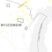


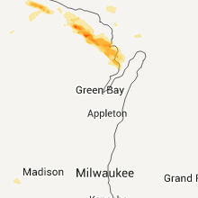
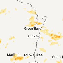
Connect with Interactive Hail Maps