

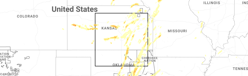
Hail Map for Marquette, KS
The Marquette, KS area has had 12 reports of on-the-ground hail by trained spotters, and has been under severe weather warnings 29 times during the past 12 months. Doppler radar has detected hail at or near Marquette, KS on 92 occasions, including 8 occasions during the past year.
| Name: | Marquette, KS |
| Where Located: | 65.8 miles NNW of Wichita, KS |
| Map: | Google Map for Marquette, KS |
| Population: | 641 |
| Housing Units: | 311 |
| More Info: | Search Google for Marquette, KS |
3
The Top Recent Hail Date for Marquette, KS is Monday, May 19, 2025 (3rd out of 92)
Hail and Wind Damage Spotted near Marquette, KS
| Date / Time | Report Details |
|---|---|
| 6/30/2025 5:47 AM CDT |
 the severe thunderstorm warning has been cancelled and is no longer in effect the severe thunderstorm warning has been cancelled and is no longer in effect
|
| 6/30/2025 5:30 AM CDT |
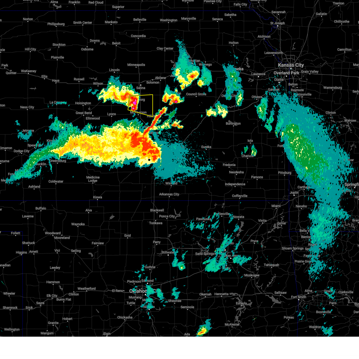
 At 529 am cdt, severe thunderstorms were located along a line extending from 7 miles south of beverly to 5 miles southwest of bushton, moving east at 35 mph (radar indicated). Hazards include 60 mph wind gusts. Expect damage to roofs, siding, and trees. locations impacted include, salina, lyons, lindsborg, ellsworth, sterling, ellinwood, kanopolis, marquette, little river, chase, assaria, bushton, geneseo, brookville, smolan, beverly, alden, lorraine, windom, and new cambria. this includes the following highways, interstate 135 between mile markers 74 and 95. Interstate 70 between mile markers 225 and 266. At 529 am cdt, severe thunderstorms were located along a line extending from 7 miles south of beverly to 5 miles southwest of bushton, moving east at 35 mph (radar indicated). Hazards include 60 mph wind gusts. Expect damage to roofs, siding, and trees. locations impacted include, salina, lyons, lindsborg, ellsworth, sterling, ellinwood, kanopolis, marquette, little river, chase, assaria, bushton, geneseo, brookville, smolan, beverly, alden, lorraine, windom, and new cambria. this includes the following highways, interstate 135 between mile markers 74 and 95. Interstate 70 between mile markers 225 and 266.
|
| 6/30/2025 5:09 AM CDT |
 Svrict the national weather service in wichita has issued a * severe thunderstorm warning for, northwestern mcpherson county in central kansas, southeastern lincoln county in central kansas, rice county in central kansas, ellsworth county in central kansas, southeastern barton county in central kansas, saline county in central kansas, * until 630 am cdt. * at 509 am cdt, severe thunderstorms were located along a line extending from near lincoln to 5 miles west of claflin, moving southeast at 35 mph (radar indicated). Hazards include 60 mph wind gusts. expect damage to roofs, siding, and trees Svrict the national weather service in wichita has issued a * severe thunderstorm warning for, northwestern mcpherson county in central kansas, southeastern lincoln county in central kansas, rice county in central kansas, ellsworth county in central kansas, southeastern barton county in central kansas, saline county in central kansas, * until 630 am cdt. * at 509 am cdt, severe thunderstorms were located along a line extending from near lincoln to 5 miles west of claflin, moving southeast at 35 mph (radar indicated). Hazards include 60 mph wind gusts. expect damage to roofs, siding, and trees
|
| 6/17/2025 3:55 AM CDT |
 Svrict the national weather service in wichita has issued a * severe thunderstorm warning for, western mcpherson county in central kansas, northern reno county in south central kansas, rice county in central kansas, ellsworth county in central kansas, southwestern saline county in central kansas, * until 500 am cdt. * at 354 am cdt, strong winds were continuing behind the line of storms with several reports of 70 mph winds (radar indicated). Hazards include 70 mph wind gusts. Expect considerable tree damage. Damage is likely to mobile homes, roofs, and outbuildings. Svrict the national weather service in wichita has issued a * severe thunderstorm warning for, western mcpherson county in central kansas, northern reno county in south central kansas, rice county in central kansas, ellsworth county in central kansas, southwestern saline county in central kansas, * until 500 am cdt. * at 354 am cdt, strong winds were continuing behind the line of storms with several reports of 70 mph winds (radar indicated). Hazards include 70 mph wind gusts. Expect considerable tree damage. Damage is likely to mobile homes, roofs, and outbuildings.
|
| 6/17/2025 3:10 AM CDT |
 the severe thunderstorm warning has been cancelled and is no longer in effect the severe thunderstorm warning has been cancelled and is no longer in effect
|
| 6/17/2025 3:10 AM CDT |
 At 309 am cdt, severe thunderstorms were located along a line extending from near marquette to near abbyville to near st. john, moving southeast at 60 mph (trained weather spotters). Hazards include 70 mph wind gusts. Expect considerable tree damage. damage is likely to mobile homes, roofs, and outbuildings. locations impacted include, salina, hutchinson, mcpherson, lyons, hesston, lindsborg, hillsboro, south hutchinson, sterling, halstead, moundridge, inman, buhler, haven, nickerson, burrton, galva, canton, pretty prairie, and marquette. This includes interstate 135 between mile markers 37 and 92. At 309 am cdt, severe thunderstorms were located along a line extending from near marquette to near abbyville to near st. john, moving southeast at 60 mph (trained weather spotters). Hazards include 70 mph wind gusts. Expect considerable tree damage. damage is likely to mobile homes, roofs, and outbuildings. locations impacted include, salina, hutchinson, mcpherson, lyons, hesston, lindsborg, hillsboro, south hutchinson, sterling, halstead, moundridge, inman, buhler, haven, nickerson, burrton, galva, canton, pretty prairie, and marquette. This includes interstate 135 between mile markers 37 and 92.
|
| 6/17/2025 2:59 AM CDT |
 At 258 am cdt, severe thunderstorms were located along a line extending from 8 miles southwest of brookville to near sterling to near st. john, moving southeast at 55 mph (asos weather station). Hazards include 70 mph wind gusts. Expect considerable tree damage. damage is likely to mobile homes, roofs, and outbuildings. locations impacted include, salina, hutchinson, mcpherson, lyons, hesston, lindsborg, hillsboro, south hutchinson, sterling, ellinwood, halstead, moundridge, inman, buhler, haven, nickerson, burrton, galva, canton, and pretty prairie. this includes the following highways, interstate 135 between mile markers 37 and 94. Interstate 70 between mile markers 256 and 266. At 258 am cdt, severe thunderstorms were located along a line extending from 8 miles southwest of brookville to near sterling to near st. john, moving southeast at 55 mph (asos weather station). Hazards include 70 mph wind gusts. Expect considerable tree damage. damage is likely to mobile homes, roofs, and outbuildings. locations impacted include, salina, hutchinson, mcpherson, lyons, hesston, lindsborg, hillsboro, south hutchinson, sterling, ellinwood, halstead, moundridge, inman, buhler, haven, nickerson, burrton, galva, canton, and pretty prairie. this includes the following highways, interstate 135 between mile markers 37 and 94. Interstate 70 between mile markers 256 and 266.
|
| 6/17/2025 2:41 AM CDT |
 Svrict the national weather service in wichita has issued a * severe thunderstorm warning for, mcpherson county in central kansas, reno county in south central kansas, western harvey county in south central kansas, rice county in central kansas, ellsworth county in central kansas, northwestern marion county in central kansas, southern barton county in central kansas, saline county in central kansas, * until 345 am cdt. * at 240 am cdt, severe thunderstorms were located along a line extending from 7 miles east of kanopolis to near bushton to near pawnee rock, moving southeast at 45 mph (weather station observed). Hazards include 60 mph wind gusts. expect damage to roofs, siding, and trees Svrict the national weather service in wichita has issued a * severe thunderstorm warning for, mcpherson county in central kansas, reno county in south central kansas, western harvey county in south central kansas, rice county in central kansas, ellsworth county in central kansas, northwestern marion county in central kansas, southern barton county in central kansas, saline county in central kansas, * until 345 am cdt. * at 240 am cdt, severe thunderstorms were located along a line extending from 7 miles east of kanopolis to near bushton to near pawnee rock, moving southeast at 45 mph (weather station observed). Hazards include 60 mph wind gusts. expect damage to roofs, siding, and trees
|
| 5/19/2025 11:32 PM CDT |
 At 1132 pm cdt, a severe thunderstorm was located over lindsborg, moving east at 35 mph (radar indicated). Hazards include golf ball size hail and 60 mph wind gusts. People and animals outdoors will be injured. expect hail damage to roofs, siding, windows, and vehicles. expect wind damage to roofs, siding, and trees. locations impacted include, lindsborg, galva, canton, marquette, assaria, falun, bridgeport, and roxbury. This includes interstate 135 between mile markers 63 and 81. At 1132 pm cdt, a severe thunderstorm was located over lindsborg, moving east at 35 mph (radar indicated). Hazards include golf ball size hail and 60 mph wind gusts. People and animals outdoors will be injured. expect hail damage to roofs, siding, windows, and vehicles. expect wind damage to roofs, siding, and trees. locations impacted include, lindsborg, galva, canton, marquette, assaria, falun, bridgeport, and roxbury. This includes interstate 135 between mile markers 63 and 81.
|
| 5/19/2025 11:22 PM CDT |
 Svrict the national weather service in wichita has issued a * severe thunderstorm warning for, northern mcpherson county in central kansas, southern saline county in central kansas, * until midnight cdt. * at 1121 pm cdt, a severe thunderstorm was located over marquette, or 7 miles west of lindsborg, moving east at 35 mph (radar indicated). Hazards include 60 mph wind gusts and quarter size hail. Hail damage to vehicles is expected. Expect wind damage to roofs, siding, and trees. Svrict the national weather service in wichita has issued a * severe thunderstorm warning for, northern mcpherson county in central kansas, southern saline county in central kansas, * until midnight cdt. * at 1121 pm cdt, a severe thunderstorm was located over marquette, or 7 miles west of lindsborg, moving east at 35 mph (radar indicated). Hazards include 60 mph wind gusts and quarter size hail. Hail damage to vehicles is expected. Expect wind damage to roofs, siding, and trees.
|
| 5/19/2025 11:12 PM CDT |
 At 1110 pm cdt, a severe thunderstorm was located near marquette, or 11 miles west of lindsborg, moving east at 35 mph (radar indicated). Hazards include 60 mph wind gusts and quarter size hail. Hail damage to vehicles is expected. expect wind damage to roofs, siding, and trees. Locations impacted include, lindsborg, marquette, smolan, falun, kanopolis lake, and kanopolis state park. At 1110 pm cdt, a severe thunderstorm was located near marquette, or 11 miles west of lindsborg, moving east at 35 mph (radar indicated). Hazards include 60 mph wind gusts and quarter size hail. Hail damage to vehicles is expected. expect wind damage to roofs, siding, and trees. Locations impacted include, lindsborg, marquette, smolan, falun, kanopolis lake, and kanopolis state park.
|
| 5/19/2025 10:50 PM CDT |
 Svrict the national weather service in wichita has issued a * severe thunderstorm warning for, northwestern mcpherson county in central kansas, southeastern ellsworth county in central kansas, southwestern saline county in central kansas, * until 1130 pm cdt. * at 1049 pm cdt, a severe thunderstorm was located near kanopolis, moving east at 40 mph (radar indicated). Hazards include 60 mph wind gusts and quarter size hail. Hail damage to vehicles is expected. Expect wind damage to roofs, siding, and trees. Svrict the national weather service in wichita has issued a * severe thunderstorm warning for, northwestern mcpherson county in central kansas, southeastern ellsworth county in central kansas, southwestern saline county in central kansas, * until 1130 pm cdt. * at 1049 pm cdt, a severe thunderstorm was located near kanopolis, moving east at 40 mph (radar indicated). Hazards include 60 mph wind gusts and quarter size hail. Hail damage to vehicles is expected. Expect wind damage to roofs, siding, and trees.
|
| 5/18/2025 6:11 PM CDT |
 Svrict the national weather service in wichita has issued a * severe thunderstorm warning for, northwestern mcpherson county in central kansas, central saline county in central kansas, * until 715 pm cdt. * at 611 pm cdt, a severe thunderstorm was located 6 miles southwest of smolan, or 9 miles northwest of lindsborg, moving northeast at 50 mph (radar indicated). Hazards include golf ball size hail. People and animals outdoors will be injured. Expect damage to roofs, siding, windows, and vehicles. Svrict the national weather service in wichita has issued a * severe thunderstorm warning for, northwestern mcpherson county in central kansas, central saline county in central kansas, * until 715 pm cdt. * at 611 pm cdt, a severe thunderstorm was located 6 miles southwest of smolan, or 9 miles northwest of lindsborg, moving northeast at 50 mph (radar indicated). Hazards include golf ball size hail. People and animals outdoors will be injured. Expect damage to roofs, siding, windows, and vehicles.
|
| 5/18/2025 6:02 PM CDT |
 At 602 pm cdt, a severe thunderstorm was located near marquette, or 11 miles west of lindsborg, moving northeast at 50 mph (radar indicated). Hazards include golf ball size hail. People and animals outdoors will be injured. expect damage to roofs, siding, windows, and vehicles. locations impacted include, brookville, glendale, kanopolis lake, and kanopolis state park. this includes the following highways, interstate 135 near mile marker 95. Interstate 70 between mile markers 236 and 251. At 602 pm cdt, a severe thunderstorm was located near marquette, or 11 miles west of lindsborg, moving northeast at 50 mph (radar indicated). Hazards include golf ball size hail. People and animals outdoors will be injured. expect damage to roofs, siding, windows, and vehicles. locations impacted include, brookville, glendale, kanopolis lake, and kanopolis state park. this includes the following highways, interstate 135 near mile marker 95. Interstate 70 between mile markers 236 and 251.
|
| 5/18/2025 6:02 PM CDT |
 the severe thunderstorm warning has been cancelled and is no longer in effect the severe thunderstorm warning has been cancelled and is no longer in effect
|
| 5/18/2025 6:01 PM CDT | Quarter sized hail reported 2.6 miles ESE of Marquette, KS, mping report. |
| 5/18/2025 5:57 PM CDT | Half Dollar sized hail reported 8.4 miles ESE of Marquette, KS |
| 4/2/2025 12:01 AM CDT |
 Torict the national weather service in wichita has issued a * tornado warning for, northwestern mcpherson county in central kansas, southeastern ellsworth county in central kansas, southwestern saline county in central kansas, * until 1230 am cdt. * at 1201 am cdt, a severe thunderstorm capable of producing a tornado was located 9 miles northwest of marquette, or 10 miles southeast of kanopolis, moving northeast at 55 mph (radar indicated rotation). Hazards include tornado and ping pong ball size hail. Flying debris will be dangerous to those caught without shelter. mobile homes will be damaged or destroyed. damage to roofs, windows, and vehicles will occur. tree damage is likely. this tornadic thunderstorm will remain over mainly rural areas of northwestern mcpherson, southeastern ellsworth and southwestern saline counties, including the following locations, kanopolis lake, falun, and kanopolis state park. this includes the following highways, interstate 135 between mile markers 77 and 79. Interstate 70 near mile marker 243. Torict the national weather service in wichita has issued a * tornado warning for, northwestern mcpherson county in central kansas, southeastern ellsworth county in central kansas, southwestern saline county in central kansas, * until 1230 am cdt. * at 1201 am cdt, a severe thunderstorm capable of producing a tornado was located 9 miles northwest of marquette, or 10 miles southeast of kanopolis, moving northeast at 55 mph (radar indicated rotation). Hazards include tornado and ping pong ball size hail. Flying debris will be dangerous to those caught without shelter. mobile homes will be damaged or destroyed. damage to roofs, windows, and vehicles will occur. tree damage is likely. this tornadic thunderstorm will remain over mainly rural areas of northwestern mcpherson, southeastern ellsworth and southwestern saline counties, including the following locations, kanopolis lake, falun, and kanopolis state park. this includes the following highways, interstate 135 between mile markers 77 and 79. Interstate 70 near mile marker 243.
|
| 4/1/2025 11:52 PM CDT |
 Svrict the national weather service in wichita has issued a * severe thunderstorm warning for, northern mcpherson county in central kansas, eastern ellsworth county in central kansas, saline county in central kansas, * until 1245 am cdt. * at 1152 pm cdt, a severe thunderstorm was located near geneseo, or 11 miles south of kanopolis, moving northeast at 65 mph (trained weather spotters). Hazards include ping pong ball size hail and 60 mph wind gusts. People and animals outdoors will be injured. expect hail damage to roofs, siding, windows, and vehicles. Expect wind damage to roofs, siding, and trees. Svrict the national weather service in wichita has issued a * severe thunderstorm warning for, northern mcpherson county in central kansas, eastern ellsworth county in central kansas, saline county in central kansas, * until 1245 am cdt. * at 1152 pm cdt, a severe thunderstorm was located near geneseo, or 11 miles south of kanopolis, moving northeast at 65 mph (trained weather spotters). Hazards include ping pong ball size hail and 60 mph wind gusts. People and animals outdoors will be injured. expect hail damage to roofs, siding, windows, and vehicles. Expect wind damage to roofs, siding, and trees.
|
| 4/1/2025 9:31 PM CDT |
 Torict the national weather service in wichita has issued a * tornado warning for, northwestern mcpherson county in central kansas, northeastern rice county in central kansas, southeastern ellsworth county in central kansas, western saline county in central kansas, * until 1030 pm cdt. * at 931 pm cdt, a severe thunderstorm capable of producing a tornado was located over geneseo, or 11 miles north of lyons, moving northeast at 45 mph (radar indicated rotation). Hazards include tornado and golf ball size hail. Flying debris will be dangerous to those caught without shelter. mobile homes will be damaged or destroyed. damage to roofs, windows, and vehicles will occur. tree damage is likely. this tornadic thunderstorm will remain over mainly rural areas of northwestern mcpherson, northeastern rice, southeastern ellsworth and western saline counties, including the following locations, kanopolis lake, falun, and kanopolis state park. this includes the following highways, interstate 135 near mile marker 79. Interstate 70 near mile marker 242. Torict the national weather service in wichita has issued a * tornado warning for, northwestern mcpherson county in central kansas, northeastern rice county in central kansas, southeastern ellsworth county in central kansas, western saline county in central kansas, * until 1030 pm cdt. * at 931 pm cdt, a severe thunderstorm capable of producing a tornado was located over geneseo, or 11 miles north of lyons, moving northeast at 45 mph (radar indicated rotation). Hazards include tornado and golf ball size hail. Flying debris will be dangerous to those caught without shelter. mobile homes will be damaged or destroyed. damage to roofs, windows, and vehicles will occur. tree damage is likely. this tornadic thunderstorm will remain over mainly rural areas of northwestern mcpherson, northeastern rice, southeastern ellsworth and western saline counties, including the following locations, kanopolis lake, falun, and kanopolis state park. this includes the following highways, interstate 135 near mile marker 79. Interstate 70 near mile marker 242.
|
| 9/20/2024 6:52 PM CDT |
 the severe thunderstorm warning has been cancelled and is no longer in effect the severe thunderstorm warning has been cancelled and is no longer in effect
|
| 9/20/2024 6:52 PM CDT |
 At 651 pm cdt, severe thunderstorms were located along a line extending from 5 miles south of culver to 5 miles northwest of mcpherson to near inman, moving northeast at 35 mph (trained weather spotters reported 70 mph winds 2.5 west of inman at 649 pm). Hazards include 70 mph wind gusts and nickel size hail. Expect considerable tree damage. damage is likely to mobile homes, roofs, and outbuildings. Locations impacted include, salina, mcpherson, lindsborg, moundridge, inman, galva, marquette, assaria, brookville, smolan, windom, falun, glendale, salina airport, mcpherson airport, and bridgeport. At 651 pm cdt, severe thunderstorms were located along a line extending from 5 miles south of culver to 5 miles northwest of mcpherson to near inman, moving northeast at 35 mph (trained weather spotters reported 70 mph winds 2.5 west of inman at 649 pm). Hazards include 70 mph wind gusts and nickel size hail. Expect considerable tree damage. damage is likely to mobile homes, roofs, and outbuildings. Locations impacted include, salina, mcpherson, lindsborg, moundridge, inman, galva, marquette, assaria, brookville, smolan, windom, falun, glendale, salina airport, mcpherson airport, and bridgeport.
|
| 9/20/2024 6:46 PM CDT |
 the severe thunderstorm warning has been cancelled and is no longer in effect the severe thunderstorm warning has been cancelled and is no longer in effect
|
| 9/20/2024 6:46 PM CDT |
 At 646 pm cdt, severe thunderstorms were located along a line extending from 6 miles north of brookville to 6 miles northwest of mcpherson to near inman, moving northeast at 35 mph (trained weather spotters reported 60 mph winds 2.5 miles west of inman). Hazards include 60 mph wind gusts and nickel size hail. Expect damage to roofs, siding, and trees. Locations impacted include, salina, mcpherson, lindsborg, moundridge, inman, galva, marquette, assaria, brookville, smolan, windom, falun, glendale, salina airport, mcpherson airport, and bridgeport. At 646 pm cdt, severe thunderstorms were located along a line extending from 6 miles north of brookville to 6 miles northwest of mcpherson to near inman, moving northeast at 35 mph (trained weather spotters reported 60 mph winds 2.5 miles west of inman). Hazards include 60 mph wind gusts and nickel size hail. Expect damage to roofs, siding, and trees. Locations impacted include, salina, mcpherson, lindsborg, moundridge, inman, galva, marquette, assaria, brookville, smolan, windom, falun, glendale, salina airport, mcpherson airport, and bridgeport.
|
| 9/20/2024 6:40 PM CDT |
 At 639 pm cdt, severe thunderstorms were located along a line extending from near brookville to near windom to 7 miles southwest of inman, moving northeast at 35 mph (trained weather spotters reported 60 mph winds 16 miles northeast of ellsworth at 639 pm). Hazards include 60 mph wind gusts and nickel size hail. Expect damage to roofs, siding, and trees. Locations impacted include, salina, mcpherson, lindsborg, moundridge, inman, galva, marquette, assaria, brookville, smolan, windom, falun, glendale, salina airport, mcpherson airport, bridgeport, kanopolis state park, and kanopolis lake. At 639 pm cdt, severe thunderstorms were located along a line extending from near brookville to near windom to 7 miles southwest of inman, moving northeast at 35 mph (trained weather spotters reported 60 mph winds 16 miles northeast of ellsworth at 639 pm). Hazards include 60 mph wind gusts and nickel size hail. Expect damage to roofs, siding, and trees. Locations impacted include, salina, mcpherson, lindsborg, moundridge, inman, galva, marquette, assaria, brookville, smolan, windom, falun, glendale, salina airport, mcpherson airport, bridgeport, kanopolis state park, and kanopolis lake.
|
| 9/20/2024 6:37 PM CDT |
 At 636 pm cdt, severe thunderstorms were located along a line extending from near brookville to near windom to 7 miles north of hutchinson, moving northeast at 35 mph (radar indicated). Hazards include 60 mph wind gusts and nickel size hail. Expect damage to roofs, siding, and trees. Locations impacted include, salina, mcpherson, lindsborg, moundridge, inman, galva, marquette, assaria, brookville, smolan, windom, falun, glendale, salina airport, mcpherson airport, bridgeport, kanopolis state park, and kanopolis lake. At 636 pm cdt, severe thunderstorms were located along a line extending from near brookville to near windom to 7 miles north of hutchinson, moving northeast at 35 mph (radar indicated). Hazards include 60 mph wind gusts and nickel size hail. Expect damage to roofs, siding, and trees. Locations impacted include, salina, mcpherson, lindsborg, moundridge, inman, galva, marquette, assaria, brookville, smolan, windom, falun, glendale, salina airport, mcpherson airport, bridgeport, kanopolis state park, and kanopolis lake.
|
| 9/20/2024 6:23 PM CDT |
 Svrict the national weather service in wichita has issued a * severe thunderstorm warning for, mcpherson county in central kansas, eastern rice county in central kansas, eastern ellsworth county in central kansas, saline county in central kansas, * until 730 pm cdt. * at 623 pm cdt, severe thunderstorms were located along a line extending from 8 miles west of brookville to 6 miles south of windom, moving northeast at 35 mph (radar indicated). Hazards include 60 mph wind gusts and nickel size hail. expect damage to roofs, siding, and trees Svrict the national weather service in wichita has issued a * severe thunderstorm warning for, mcpherson county in central kansas, eastern rice county in central kansas, eastern ellsworth county in central kansas, saline county in central kansas, * until 730 pm cdt. * at 623 pm cdt, severe thunderstorms were located along a line extending from 8 miles west of brookville to 6 miles south of windom, moving northeast at 35 mph (radar indicated). Hazards include 60 mph wind gusts and nickel size hail. expect damage to roofs, siding, and trees
|
| 8/16/2024 3:49 PM CDT |
 the severe thunderstorm warning has been cancelled and is no longer in effect the severe thunderstorm warning has been cancelled and is no longer in effect
|
| 8/16/2024 3:17 PM CDT |
 the severe thunderstorm warning has been cancelled and is no longer in effect the severe thunderstorm warning has been cancelled and is no longer in effect
|
| 8/16/2024 3:17 PM CDT |
 At 317 pm cdt, a severe thunderstorm was located over marquette, or 6 miles west of lindsborg, moving east at 45 mph (radar indicated). Hazards include 60 mph wind gusts and half dollar size hail. Hail damage to vehicles is expected. expect wind damage to roofs, siding, and trees. Locations impacted include, lindsborg, marquette, assaria, gypsum, falun, bridgeport, and roxbury. At 317 pm cdt, a severe thunderstorm was located over marquette, or 6 miles west of lindsborg, moving east at 45 mph (radar indicated). Hazards include 60 mph wind gusts and half dollar size hail. Hail damage to vehicles is expected. expect wind damage to roofs, siding, and trees. Locations impacted include, lindsborg, marquette, assaria, gypsum, falun, bridgeport, and roxbury.
|
| 8/16/2024 3:05 PM CDT |
 Svrict the national weather service in wichita has issued a * severe thunderstorm warning for, northern mcpherson county in central kansas, southeastern ellsworth county in central kansas, southern saline county in central kansas, * until 400 pm cdt. * at 305 pm cdt, a severe thunderstorm was located 6 miles northwest of marquette, or 13 miles southeast of kanopolis, moving east at 45 mph (radar indicated). Hazards include 60 mph wind gusts and quarter size hail. Hail damage to vehicles is expected. Expect wind damage to roofs, siding, and trees. Svrict the national weather service in wichita has issued a * severe thunderstorm warning for, northern mcpherson county in central kansas, southeastern ellsworth county in central kansas, southern saline county in central kansas, * until 400 pm cdt. * at 305 pm cdt, a severe thunderstorm was located 6 miles northwest of marquette, or 13 miles southeast of kanopolis, moving east at 45 mph (radar indicated). Hazards include 60 mph wind gusts and quarter size hail. Hail damage to vehicles is expected. Expect wind damage to roofs, siding, and trees.
|
| 7/4/2024 1:07 AM CDT |
 The storms which prompted the warning have moved out of the area. therefore, the warning will be allowed to expire. The storms which prompted the warning have moved out of the area. therefore, the warning will be allowed to expire.
|
| 7/4/2024 1:03 AM CDT |
 At 103 am cdt, severe thunderstorms were located along a line extending from 7 miles southeast of solomon to 7 miles southeast of lindsborg to 6 miles north of nickerson, moving east at 60 mph (radar indicated). Hazards include 60 mph wind gusts and penny size hail. Expect damage to roofs, siding, and trees. Locations impacted include, lyons, lindsborg, sterling, marquette, little river, chase, bushton, geneseo, alden, windom, raymond, frederick, and silica. At 103 am cdt, severe thunderstorms were located along a line extending from 7 miles southeast of solomon to 7 miles southeast of lindsborg to 6 miles north of nickerson, moving east at 60 mph (radar indicated). Hazards include 60 mph wind gusts and penny size hail. Expect damage to roofs, siding, and trees. Locations impacted include, lyons, lindsborg, sterling, marquette, little river, chase, bushton, geneseo, alden, windom, raymond, frederick, and silica.
|
| 7/4/2024 1:03 AM CDT |
 the severe thunderstorm warning has been cancelled and is no longer in effect the severe thunderstorm warning has been cancelled and is no longer in effect
|
| 7/4/2024 12:33 AM CDT | Storm damage reported in ellsworth county KS, 8.2 miles ESE of Marquette, KS |
| 7/4/2024 12:18 AM CDT |
 Svrict the national weather service in wichita has issued a * severe thunderstorm warning for, northwestern mcpherson county in central kansas, rice county in central kansas, southern ellsworth county in central kansas, * until 115 am cdt. * at 1217 am cdt, severe thunderstorms were located along a line extending from near kanopolis to near claflin to 7 miles northeast of seward, moving east at 40 mph (radar indicated). Hazards include 60 mph wind gusts and penny size hail. expect damage to roofs, siding, and trees Svrict the national weather service in wichita has issued a * severe thunderstorm warning for, northwestern mcpherson county in central kansas, rice county in central kansas, southern ellsworth county in central kansas, * until 115 am cdt. * at 1217 am cdt, severe thunderstorms were located along a line extending from near kanopolis to near claflin to 7 miles northeast of seward, moving east at 40 mph (radar indicated). Hazards include 60 mph wind gusts and penny size hail. expect damage to roofs, siding, and trees
|
| 6/18/2024 8:58 PM CDT |
 The storms which prompted the warning have moved out of the area. therefore, the warning will be allowed to expire. however, gusty winds are still possible with these thunderstorms. a severe thunderstorm warning remains in effect for eastern saline county and northeast mcpherson county until 930 pm. a severe thunderstorm watch remains in effect until 1000 pm cdt for central kansas. The storms which prompted the warning have moved out of the area. therefore, the warning will be allowed to expire. however, gusty winds are still possible with these thunderstorms. a severe thunderstorm warning remains in effect for eastern saline county and northeast mcpherson county until 930 pm. a severe thunderstorm watch remains in effect until 1000 pm cdt for central kansas.
|
| 6/18/2024 8:39 PM CDT |
 At 838 pm cdt, severe thunderstorms were located along a line extending from 5 miles south of beverly to brookville to 6 miles west of marquette, moving east at 40 mph (radar indicated). Hazards include 60 mph wind gusts and penny size hail. Expect damage to roofs, siding, and trees. Locations impacted include, salina, lindsborg, kanopolis, marquette, assaria, brookville, smolan, falun, glendale, westfall, salina airport, bridgeport, kanopolis lake, and kanopolis state park. At 838 pm cdt, severe thunderstorms were located along a line extending from 5 miles south of beverly to brookville to 6 miles west of marquette, moving east at 40 mph (radar indicated). Hazards include 60 mph wind gusts and penny size hail. Expect damage to roofs, siding, and trees. Locations impacted include, salina, lindsborg, kanopolis, marquette, assaria, brookville, smolan, falun, glendale, westfall, salina airport, bridgeport, kanopolis lake, and kanopolis state park.
|
| 6/18/2024 8:16 PM CDT |
 Svrict the national weather service in wichita has issued a * severe thunderstorm warning for, northwestern mcpherson county in central kansas, southeastern lincoln county in central kansas, eastern ellsworth county in central kansas, saline county in central kansas, * until 900 pm cdt. * at 815 pm cdt, severe thunderstorms were located along a line extending from 9 miles southwest of lincoln to near kanopolis to near lorraine, moving east at 40 mph (radar indicated). Hazards include 60 mph wind gusts and penny size hail. expect damage to roofs, siding, and trees Svrict the national weather service in wichita has issued a * severe thunderstorm warning for, northwestern mcpherson county in central kansas, southeastern lincoln county in central kansas, eastern ellsworth county in central kansas, saline county in central kansas, * until 900 pm cdt. * at 815 pm cdt, severe thunderstorms were located along a line extending from 9 miles southwest of lincoln to near kanopolis to near lorraine, moving east at 40 mph (radar indicated). Hazards include 60 mph wind gusts and penny size hail. expect damage to roofs, siding, and trees
|
| 6/15/2024 3:52 PM CDT |
 Svrict the national weather service in wichita has issued a * severe thunderstorm warning for, mcpherson county in central kansas, * until 445 pm cdt. * at 351 pm cdt, a severe thunderstorm was located near buhler, moving northeast at 30 mph (radar indicated). Hazards include 60 mph wind gusts. Expect damage to roofs, siding, and trees. This new warning replaces the previous thunderstorm warning in effect for western mcpherson county. Svrict the national weather service in wichita has issued a * severe thunderstorm warning for, mcpherson county in central kansas, * until 445 pm cdt. * at 351 pm cdt, a severe thunderstorm was located near buhler, moving northeast at 30 mph (radar indicated). Hazards include 60 mph wind gusts. Expect damage to roofs, siding, and trees. This new warning replaces the previous thunderstorm warning in effect for western mcpherson county.
|
| 6/7/2024 11:00 PM CDT |
 At 1100 pm cdt, a severe thunderstorm was located 7 miles south of gypsum, or 13 miles east of lindsborg, moving east at 50 mph (radar indicated). Hazards include 60 mph wind gusts. Expect damage to roofs, siding, and trees. Locations impacted include, salina, lindsborg, marquette, little river, assaria, gypsum, geneseo, brookville, smolan, windom, new cambria, falun, glendale, frederick, salina airport, roxbury, bridgeport, and kipp. At 1100 pm cdt, a severe thunderstorm was located 7 miles south of gypsum, or 13 miles east of lindsborg, moving east at 50 mph (radar indicated). Hazards include 60 mph wind gusts. Expect damage to roofs, siding, and trees. Locations impacted include, salina, lindsborg, marquette, little river, assaria, gypsum, geneseo, brookville, smolan, windom, new cambria, falun, glendale, frederick, salina airport, roxbury, bridgeport, and kipp.
|
| 6/7/2024 10:35 PM CDT | Powerlines dow in mcpherson county KS, 0.4 miles NW of Marquette, KS |
| 6/7/2024 10:23 PM CDT |
 Svrict the national weather service in wichita has issued a * severe thunderstorm warning for, northern mcpherson county in central kansas, northeastern rice county in central kansas, saline county in central kansas, * until 1130 pm cdt. * at 1022 pm cdt, a severe thunderstorm was located near brookville, or 12 miles northeast of kanopolis, moving east at 50 mph (radar indicated). Hazards include 70 mph wind gusts and penny size hail. Expect considerable tree damage. Damage is likely to mobile homes, roofs, and outbuildings. Svrict the national weather service in wichita has issued a * severe thunderstorm warning for, northern mcpherson county in central kansas, northeastern rice county in central kansas, saline county in central kansas, * until 1130 pm cdt. * at 1022 pm cdt, a severe thunderstorm was located near brookville, or 12 miles northeast of kanopolis, moving east at 50 mph (radar indicated). Hazards include 70 mph wind gusts and penny size hail. Expect considerable tree damage. Damage is likely to mobile homes, roofs, and outbuildings.
|
| 6/4/2024 5:01 PM CDT |
 At 500 pm cdt, a severe thunderstorm was located near mcpherson, moving east at 15 mph (radar indicated). Hazards include golf ball size hail and 70 mph wind gusts. People and animals outdoors will be injured. expect hail damage to roofs, siding, windows, and vehicles. expect considerable tree damage. wind damage is also likely to mobile homes, roofs, and outbuildings. Locations impacted include, mcpherson, lindsborg, marquette, and mcpherson airport. At 500 pm cdt, a severe thunderstorm was located near mcpherson, moving east at 15 mph (radar indicated). Hazards include golf ball size hail and 70 mph wind gusts. People and animals outdoors will be injured. expect hail damage to roofs, siding, windows, and vehicles. expect considerable tree damage. wind damage is also likely to mobile homes, roofs, and outbuildings. Locations impacted include, mcpherson, lindsborg, marquette, and mcpherson airport.
|
| 6/4/2024 4:44 PM CDT |
 At 444 pm cdt, a severe thunderstorm was located 6 miles east of windom, or 6 miles west of mcpherson, moving east at 15 mph (radar indicated). Hazards include ping pong ball size hail and 60 mph wind gusts. People and animals outdoors will be injured. expect hail damage to roofs, siding, windows, and vehicles. expect wind damage to roofs, siding, and trees. Locations impacted include, mcpherson, lindsborg, marquette, windom, and mcpherson airport. At 444 pm cdt, a severe thunderstorm was located 6 miles east of windom, or 6 miles west of mcpherson, moving east at 15 mph (radar indicated). Hazards include ping pong ball size hail and 60 mph wind gusts. People and animals outdoors will be injured. expect hail damage to roofs, siding, windows, and vehicles. expect wind damage to roofs, siding, and trees. Locations impacted include, mcpherson, lindsborg, marquette, windom, and mcpherson airport.
|
| 6/4/2024 4:42 PM CDT |
 the severe thunderstorm warning has been cancelled and is no longer in effect the severe thunderstorm warning has been cancelled and is no longer in effect
|
| 6/4/2024 4:42 PM CDT |
 At 442 pm cdt, a severe thunderstorm was located near windom, or 8 miles west of mcpherson, moving east at 20 mph (radar indicated). Hazards include ping pong ball size hail and 60 mph wind gusts. People and animals outdoors will be injured. expect hail damage to roofs, siding, windows, and vehicles. expect wind damage to roofs, siding, and trees. Locations impacted include, mcpherson, lindsborg, marquette, windom, and mcpherson airport. At 442 pm cdt, a severe thunderstorm was located near windom, or 8 miles west of mcpherson, moving east at 20 mph (radar indicated). Hazards include ping pong ball size hail and 60 mph wind gusts. People and animals outdoors will be injured. expect hail damage to roofs, siding, windows, and vehicles. expect wind damage to roofs, siding, and trees. Locations impacted include, mcpherson, lindsborg, marquette, windom, and mcpherson airport.
|
| 6/4/2024 4:32 PM CDT |
 At 432 pm cdt, a severe thunderstorm was located over windom, or 13 miles northwest of inman, moving east at 15 mph (radar indicated). Hazards include golf ball size hail and 60 mph wind gusts. People and animals outdoors will be injured. expect hail damage to roofs, siding, windows, and vehicles. expect wind damage to roofs, siding, and trees. Locations impacted include, mcpherson, lindsborg, marquette, little river, windom, and mcpherson airport. At 432 pm cdt, a severe thunderstorm was located over windom, or 13 miles northwest of inman, moving east at 15 mph (radar indicated). Hazards include golf ball size hail and 60 mph wind gusts. People and animals outdoors will be injured. expect hail damage to roofs, siding, windows, and vehicles. expect wind damage to roofs, siding, and trees. Locations impacted include, mcpherson, lindsborg, marquette, little river, windom, and mcpherson airport.
|
| 6/4/2024 4:22 PM CDT |
 Svrict the national weather service in wichita has issued a * severe thunderstorm warning for, western mcpherson county in central kansas, northeastern rice county in central kansas, * until 530 pm cdt. * at 421 pm cdt, a severe thunderstorm was located over windom, or 13 miles east of lyons, moving east at 15 mph (radar indicated). Hazards include 60 mph wind gusts and half dollar size hail. Hail damage to vehicles is expected. Expect wind damage to roofs, siding, and trees. Svrict the national weather service in wichita has issued a * severe thunderstorm warning for, western mcpherson county in central kansas, northeastern rice county in central kansas, * until 530 pm cdt. * at 421 pm cdt, a severe thunderstorm was located over windom, or 13 miles east of lyons, moving east at 15 mph (radar indicated). Hazards include 60 mph wind gusts and half dollar size hail. Hail damage to vehicles is expected. Expect wind damage to roofs, siding, and trees.
|
| 5/31/2024 7:45 PM CDT |
 At 745 pm cdt, a severe thunderstorm was located 8 miles north of canton, moving southeast at 30 mph (radar indicated). Hazards include 60 mph wind gusts and quarter size hail. Hail damage to vehicles is expected. expect wind damage to roofs, siding, and trees. Locations impacted include, mcpherson, lindsborg, galva, marquette, tampa, mcpherson airport, and roxbury. At 745 pm cdt, a severe thunderstorm was located 8 miles north of canton, moving southeast at 30 mph (radar indicated). Hazards include 60 mph wind gusts and quarter size hail. Hail damage to vehicles is expected. expect wind damage to roofs, siding, and trees. Locations impacted include, mcpherson, lindsborg, galva, marquette, tampa, mcpherson airport, and roxbury.
|
| 5/31/2024 7:45 PM CDT |
 the severe thunderstorm warning has been cancelled and is no longer in effect the severe thunderstorm warning has been cancelled and is no longer in effect
|
| 5/31/2024 7:35 PM CDT |
 At 735 pm cdt, a severe thunderstorm was located 8 miles east of lindsborg, moving southeast at 30 mph (radar indicated). Hazards include 60 mph wind gusts and half dollar size hail. Hail damage to vehicles is expected. expect wind damage to roofs, siding, and trees. Locations impacted include, mcpherson, lindsborg, galva, marquette, assaria, gypsum, tampa, bridgeport, mcpherson airport, and roxbury. At 735 pm cdt, a severe thunderstorm was located 8 miles east of lindsborg, moving southeast at 30 mph (radar indicated). Hazards include 60 mph wind gusts and half dollar size hail. Hail damage to vehicles is expected. expect wind damage to roofs, siding, and trees. Locations impacted include, mcpherson, lindsborg, galva, marquette, assaria, gypsum, tampa, bridgeport, mcpherson airport, and roxbury.
|
| 5/31/2024 7:26 PM CDT |
 Svrict the national weather service in wichita has issued a * severe thunderstorm warning for, northern mcpherson county in central kansas, northwestern marion county in central kansas, southeastern saline county in central kansas, * until 830 pm cdt. * at 725 pm cdt, a severe thunderstorm was located near assaria, or near lindsborg, moving southeast at 20 mph (radar indicated). Hazards include 60 mph wind gusts. expect damage to roofs, siding, and trees Svrict the national weather service in wichita has issued a * severe thunderstorm warning for, northern mcpherson county in central kansas, northwestern marion county in central kansas, southeastern saline county in central kansas, * until 830 pm cdt. * at 725 pm cdt, a severe thunderstorm was located near assaria, or near lindsborg, moving southeast at 20 mph (radar indicated). Hazards include 60 mph wind gusts. expect damage to roofs, siding, and trees
|
| 5/19/2024 7:03 PM CDT |
 Svrict the national weather service in wichita has issued a * severe thunderstorm warning for, mcpherson county in central kansas, marion county in central kansas, * until 800 pm cdt. * at 703 pm cdt, severe thunderstorms were located along a line extending from 6 miles northeast of little river to near durham, moving east at 30 mph (radar indicated). Hazards include 60 mph wind gusts and quarter size hail. Hail damage to vehicles is expected. Expect wind damage to roofs, siding, and trees. Svrict the national weather service in wichita has issued a * severe thunderstorm warning for, mcpherson county in central kansas, marion county in central kansas, * until 800 pm cdt. * at 703 pm cdt, severe thunderstorms were located along a line extending from 6 miles northeast of little river to near durham, moving east at 30 mph (radar indicated). Hazards include 60 mph wind gusts and quarter size hail. Hail damage to vehicles is expected. Expect wind damage to roofs, siding, and trees.
|
| 5/6/2024 6:26 PM CDT |
 At 626 pm cdt, severe thunderstorms were located along a line extending from assaria to 5 miles east of lindsborg to 5 miles northwest of galva, moving northeast at 50 mph (trained weather spotters reported 57 mph winds on the mcpherson and saline county line at 624 pm). Hazards include 70 mph wind gusts and nickel size hail. Expect considerable tree damage. damage is likely to mobile homes, roofs, and outbuildings. Locations impacted include, mcpherson, lindsborg, galva, canton, marquette, assaria, gypsum, smolan, falun, bridgeport, roxbury, and kipp. At 626 pm cdt, severe thunderstorms were located along a line extending from assaria to 5 miles east of lindsborg to 5 miles northwest of galva, moving northeast at 50 mph (trained weather spotters reported 57 mph winds on the mcpherson and saline county line at 624 pm). Hazards include 70 mph wind gusts and nickel size hail. Expect considerable tree damage. damage is likely to mobile homes, roofs, and outbuildings. Locations impacted include, mcpherson, lindsborg, galva, canton, marquette, assaria, gypsum, smolan, falun, bridgeport, roxbury, and kipp.
|
| 5/6/2024 6:22 PM CDT |
 At 622 pm cdt, severe thunderstorms were located along a line extending from near assaria to near lindsborg to near mcpherson, moving northeast at 50 mph (radar indicated). Hazards include 70 mph wind gusts and nickel size hail. Expect considerable tree damage. damage is likely to mobile homes, roofs, and outbuildings. Locations impacted include, mcpherson, lindsborg, galva, canton, marquette, assaria, gypsum, smolan, falun, bridgeport, roxbury, and kipp. At 622 pm cdt, severe thunderstorms were located along a line extending from near assaria to near lindsborg to near mcpherson, moving northeast at 50 mph (radar indicated). Hazards include 70 mph wind gusts and nickel size hail. Expect considerable tree damage. damage is likely to mobile homes, roofs, and outbuildings. Locations impacted include, mcpherson, lindsborg, galva, canton, marquette, assaria, gypsum, smolan, falun, bridgeport, roxbury, and kipp.
|
| 5/6/2024 6:17 PM CDT |
 At 616 pm cdt, severe thunderstorms were located along a line extending from near lindsborg to mcpherson, moving northeast at 50 mph (radar indicated). Hazards include 70 mph wind gusts and nickel size hail. Expect considerable tree damage. damage is likely to mobile homes, roofs, and outbuildings. Locations impacted include, mcpherson, lindsborg, galva, canton, marquette, assaria, gypsum, smolan, falun, bridgeport, roxbury, and kipp. At 616 pm cdt, severe thunderstorms were located along a line extending from near lindsborg to mcpherson, moving northeast at 50 mph (radar indicated). Hazards include 70 mph wind gusts and nickel size hail. Expect considerable tree damage. damage is likely to mobile homes, roofs, and outbuildings. Locations impacted include, mcpherson, lindsborg, galva, canton, marquette, assaria, gypsum, smolan, falun, bridgeport, roxbury, and kipp.
|
| 5/6/2024 6:02 PM CDT |
 Svrict the national weather service in wichita has issued a * severe thunderstorm warning for, mcpherson county in central kansas, southeastern saline county in central kansas, * until 700 pm cdt. * at 601 pm cdt, severe thunderstorms were located along a line extending from 6 miles northeast of little river to near windom to 6 miles west of inman, moving northeast at 50 mph (radar indicated). Hazards include 70 mph wind gusts and nickel size hail. Expect considerable tree damage. Damage is likely to mobile homes, roofs, and outbuildings. Svrict the national weather service in wichita has issued a * severe thunderstorm warning for, mcpherson county in central kansas, southeastern saline county in central kansas, * until 700 pm cdt. * at 601 pm cdt, severe thunderstorms were located along a line extending from 6 miles northeast of little river to near windom to 6 miles west of inman, moving northeast at 50 mph (radar indicated). Hazards include 70 mph wind gusts and nickel size hail. Expect considerable tree damage. Damage is likely to mobile homes, roofs, and outbuildings.
|
| 8/5/2023 11:13 PM CDT |
 The severe thunderstorm warning for northwestern mcpherson, northwestern reno, southeastern lincoln, rice, ellsworth and western saline counties will expire at 1115 pm cdt, the storms which prompted the warning have moved out of the area. therefore, the warning will be allowed to expire. however gusty winds and heavy rain are still possible with these thunderstorms. a severe thunderstorm warning remains in effect until 1145 pm for southern and eastern reno county as well as central and southern mcpherson counties. a severe thunderstorm watch remains in effect until 300 am cdt for central and south central kansas. The severe thunderstorm warning for northwestern mcpherson, northwestern reno, southeastern lincoln, rice, ellsworth and western saline counties will expire at 1115 pm cdt, the storms which prompted the warning have moved out of the area. therefore, the warning will be allowed to expire. however gusty winds and heavy rain are still possible with these thunderstorms. a severe thunderstorm warning remains in effect until 1145 pm for southern and eastern reno county as well as central and southern mcpherson counties. a severe thunderstorm watch remains in effect until 300 am cdt for central and south central kansas.
|
| 8/5/2023 10:42 PM CDT |
 At 1041 pm cdt, severe thunderstorms were located along a line extending from 8 miles south of lincoln to 5 miles northeast of chase to 6 miles east of hudson, moving east at 50 mph. this storm produced 65 mph wind gust just north of silica in rice county (radar indicated). Hazards include 70 mph wind gusts and quarter size hail. Hail damage to vehicles is expected. expect considerable tree damage. wind damage is also likely to mobile homes, roofs, and outbuildings. locations impacted include, lyons, ellsworth, sterling, nickerson, kanopolis, marquette, little river, chase, holyrood, bushton, geneseo, brookville, partridge, sylvia, alden, lorraine, windom, plevna, abbyville and raymond. thunderstorm damage threat, considerable hail threat, radar indicated max hail size, 1. 00 in wind threat, radar indicated max wind gust, 70 mph. At 1041 pm cdt, severe thunderstorms were located along a line extending from 8 miles south of lincoln to 5 miles northeast of chase to 6 miles east of hudson, moving east at 50 mph. this storm produced 65 mph wind gust just north of silica in rice county (radar indicated). Hazards include 70 mph wind gusts and quarter size hail. Hail damage to vehicles is expected. expect considerable tree damage. wind damage is also likely to mobile homes, roofs, and outbuildings. locations impacted include, lyons, ellsworth, sterling, nickerson, kanopolis, marquette, little river, chase, holyrood, bushton, geneseo, brookville, partridge, sylvia, alden, lorraine, windom, plevna, abbyville and raymond. thunderstorm damage threat, considerable hail threat, radar indicated max hail size, 1. 00 in wind threat, radar indicated max wind gust, 70 mph.
|
| 8/5/2023 10:33 PM CDT |
 At 1032 pm cdt, severe thunderstorms were located along a line extending from 9 miles southwest of lincoln to near bushton to near hudson, moving east at 45 mph (radar indicated). Hazards include 60 mph wind gusts and quarter size hail. Hail damage to vehicles is expected. Expect wind damage to roofs, siding, and trees. At 1032 pm cdt, severe thunderstorms were located along a line extending from 9 miles southwest of lincoln to near bushton to near hudson, moving east at 45 mph (radar indicated). Hazards include 60 mph wind gusts and quarter size hail. Hail damage to vehicles is expected. Expect wind damage to roofs, siding, and trees.
|
| 7/22/2023 7:49 PM CDT |
 At 749 pm cdt, a severe thunderstorm was located 6 miles south of marquette, or 9 miles northwest of mcpherson, moving south at 35 mph (radar indicated). Hazards include 60 mph wind gusts and quarter size hail. Hail damage to vehicles is expected. expect wind damage to roofs, siding, and trees. locations impacted include, mcpherson, marquette, windom and mcpherson airport. hail threat, radar indicated max hail size, 1. 00 in wind threat, radar indicated max wind gust, 60 mph. At 749 pm cdt, a severe thunderstorm was located 6 miles south of marquette, or 9 miles northwest of mcpherson, moving south at 35 mph (radar indicated). Hazards include 60 mph wind gusts and quarter size hail. Hail damage to vehicles is expected. expect wind damage to roofs, siding, and trees. locations impacted include, mcpherson, marquette, windom and mcpherson airport. hail threat, radar indicated max hail size, 1. 00 in wind threat, radar indicated max wind gust, 60 mph.
|
| 7/22/2023 7:38 PM CDT |
 At 737 pm cdt, a severe thunderstorm was located over marquette, or 7 miles west of lindsborg, moving south at 35 mph (radar indicated). Hazards include 60 mph wind gusts and quarter size hail. Hail damage to vehicles is expected. expect wind damage to roofs, siding, and trees. locations impacted include, mcpherson, lindsborg, marquette, windom and mcpherson airport. hail threat, radar indicated max hail size, 1. 00 in wind threat, radar indicated max wind gust, 60 mph. At 737 pm cdt, a severe thunderstorm was located over marquette, or 7 miles west of lindsborg, moving south at 35 mph (radar indicated). Hazards include 60 mph wind gusts and quarter size hail. Hail damage to vehicles is expected. expect wind damage to roofs, siding, and trees. locations impacted include, mcpherson, lindsborg, marquette, windom and mcpherson airport. hail threat, radar indicated max hail size, 1. 00 in wind threat, radar indicated max wind gust, 60 mph.
|
| 7/22/2023 7:26 PM CDT |
 At 726 pm cdt, a severe thunderstorm was located 7 miles south of brookville, or 10 miles northwest of lindsborg, moving south at 35 mph (radar indicated). Hazards include 60 mph wind gusts and quarter size hail. Hail damage to vehicles is expected. Expect wind damage to roofs, siding, and trees. At 726 pm cdt, a severe thunderstorm was located 7 miles south of brookville, or 10 miles northwest of lindsborg, moving south at 35 mph (radar indicated). Hazards include 60 mph wind gusts and quarter size hail. Hail damage to vehicles is expected. Expect wind damage to roofs, siding, and trees.
|
| 7/14/2023 3:10 PM CDT |
 The severe thunderstorm warning for mcpherson, northern reno, rice and southern saline counties will expire at 315 pm cdt, the storms which prompted the warning have weakened below severe limits, and have exited the warned area. therefore, the warning will be allowed to expire. however gusty winds and heavy rain are still possible with these thunderstorms. a severe thunderstorm watch remains in effect until 700 pm cdt for central and south central kansas. The severe thunderstorm warning for mcpherson, northern reno, rice and southern saline counties will expire at 315 pm cdt, the storms which prompted the warning have weakened below severe limits, and have exited the warned area. therefore, the warning will be allowed to expire. however gusty winds and heavy rain are still possible with these thunderstorms. a severe thunderstorm watch remains in effect until 700 pm cdt for central and south central kansas.
|
| 7/14/2023 2:51 PM CDT |
 At 251 pm cdt, severe thunderstorms were located along a line extending from near gypsum to 5 miles south of lindsborg to 8 miles west of inman, moving east at 55 mph (radar indicated). Hazards include 60 mph wind gusts and penny size hail. Expect damage to roofs, siding, and trees. locations impacted include, hutchinson, mcpherson, lyons, lindsborg, sterling, inman, buhler, nickerson, marquette, little river, chase, assaria, alden, windom, raymond, falun, willowbrook, mcpherson airport, hutchinson airport and bridgeport. hail threat, radar indicated max hail size, 0. 75 in wind threat, radar indicated max wind gust, 60 mph. At 251 pm cdt, severe thunderstorms were located along a line extending from near gypsum to 5 miles south of lindsborg to 8 miles west of inman, moving east at 55 mph (radar indicated). Hazards include 60 mph wind gusts and penny size hail. Expect damage to roofs, siding, and trees. locations impacted include, hutchinson, mcpherson, lyons, lindsborg, sterling, inman, buhler, nickerson, marquette, little river, chase, assaria, alden, windom, raymond, falun, willowbrook, mcpherson airport, hutchinson airport and bridgeport. hail threat, radar indicated max hail size, 0. 75 in wind threat, radar indicated max wind gust, 60 mph.
|
| 7/14/2023 2:41 PM CDT |
 At 241 pm cdt, severe thunderstorms were located along a line extending from assaria to 7 miles south of marquette to near nickerson, moving east at 55 mph (radar indicated). Hazards include 60 mph wind gusts and penny size hail. Expect damage to roofs, siding, and trees. locations impacted include, hutchinson, mcpherson, lyons, lindsborg, ellsworth, sterling, inman, buhler, nickerson, kanopolis, marquette, little river, chase, assaria, geneseo, alden, lorraine, windom, raymond and falun. hail threat, radar indicated max hail size, 0. 75 in wind threat, radar indicated max wind gust, 60 mph. At 241 pm cdt, severe thunderstorms were located along a line extending from assaria to 7 miles south of marquette to near nickerson, moving east at 55 mph (radar indicated). Hazards include 60 mph wind gusts and penny size hail. Expect damage to roofs, siding, and trees. locations impacted include, hutchinson, mcpherson, lyons, lindsborg, ellsworth, sterling, inman, buhler, nickerson, kanopolis, marquette, little river, chase, assaria, geneseo, alden, lorraine, windom, raymond and falun. hail threat, radar indicated max hail size, 0. 75 in wind threat, radar indicated max wind gust, 60 mph.
|
| 7/14/2023 2:27 PM CDT |
 At 227 pm cdt, severe thunderstorms were located along a line extending from 5 miles north of marquette to 6 miles north of little river to 5 miles south of alden, moving east at 40 mph (trained weather spotters). Hazards include 70 mph wind gusts and nickel size hail. Expect considerable tree damage. damage is likely to mobile homes, roofs, and outbuildings. locations impacted include, hutchinson, mcpherson, lyons, lindsborg, ellsworth, sterling, inman, buhler, nickerson, kanopolis, marquette, little river, chase, assaria, geneseo, alden, lorraine, windom, raymond and falun. thunderstorm damage threat, considerable hail threat, radar indicated max hail size, 0. 88 in wind threat, radar indicated max wind gust, 70 mph. At 227 pm cdt, severe thunderstorms were located along a line extending from 5 miles north of marquette to 6 miles north of little river to 5 miles south of alden, moving east at 40 mph (trained weather spotters). Hazards include 70 mph wind gusts and nickel size hail. Expect considerable tree damage. damage is likely to mobile homes, roofs, and outbuildings. locations impacted include, hutchinson, mcpherson, lyons, lindsborg, ellsworth, sterling, inman, buhler, nickerson, kanopolis, marquette, little river, chase, assaria, geneseo, alden, lorraine, windom, raymond and falun. thunderstorm damage threat, considerable hail threat, radar indicated max hail size, 0. 88 in wind threat, radar indicated max wind gust, 70 mph.
|
| 7/14/2023 2:17 PM CDT |
 At 217 pm cdt, severe thunderstorms were located along a line extending from 5 miles south of brookville to 5 miles south of raymond, moving east at 55 mph (radar indicated). Hazards include 70 mph wind gusts and nickel size hail. Expect considerable tree damage. damage is likely to mobile homes, roofs, and outbuildings. locations impacted include, hutchinson, mcpherson, lyons, lindsborg, ellsworth, sterling, inman, buhler, nickerson, kanopolis, marquette, little river, chase, assaria, geneseo, alden, lorraine, windom, raymond and falun. thunderstorm damage threat, considerable hail threat, radar indicated max hail size, 0. 88 in wind threat, radar indicated max wind gust, 70 mph. At 217 pm cdt, severe thunderstorms were located along a line extending from 5 miles south of brookville to 5 miles south of raymond, moving east at 55 mph (radar indicated). Hazards include 70 mph wind gusts and nickel size hail. Expect considerable tree damage. damage is likely to mobile homes, roofs, and outbuildings. locations impacted include, hutchinson, mcpherson, lyons, lindsborg, ellsworth, sterling, inman, buhler, nickerson, kanopolis, marquette, little river, chase, assaria, geneseo, alden, lorraine, windom, raymond and falun. thunderstorm damage threat, considerable hail threat, radar indicated max hail size, 0. 88 in wind threat, radar indicated max wind gust, 70 mph.
|
| 7/14/2023 2:06 PM CDT |
 At 205 pm cdt, severe thunderstorms were located along a line extending from ellsworth to 6 miles south of raymond, moving east at 55 mph (radar indicated). Hazards include 70 mph wind gusts and quarter size hail. Hail damage to vehicles is expected. expect considerable tree damage. Wind damage is also likely to mobile homes, roofs, and outbuildings. At 205 pm cdt, severe thunderstorms were located along a line extending from ellsworth to 6 miles south of raymond, moving east at 55 mph (radar indicated). Hazards include 70 mph wind gusts and quarter size hail. Hail damage to vehicles is expected. expect considerable tree damage. Wind damage is also likely to mobile homes, roofs, and outbuildings.
|
| 7/4/2023 11:28 PM CDT |
 At 1128 pm cdt, severe thunderstorms were located along a line extending from near wilsey to near tampa to 7 miles southwest of windom, moving east at 25 mph (radar indicated). Hazards include 50 to 60 mph wind gusts. Expect damage to roofs, siding, and trees. locations impacted include, mcpherson, lindsborg, sterling, galva, canton, little river, ramona, windom, durham, tampa, lost springs, mcpherson airport and roxbury. hail threat, radar indicated max hail size, <. 75 in wind threat, radar indicated max wind gust, 60 mph. At 1128 pm cdt, severe thunderstorms were located along a line extending from near wilsey to near tampa to 7 miles southwest of windom, moving east at 25 mph (radar indicated). Hazards include 50 to 60 mph wind gusts. Expect damage to roofs, siding, and trees. locations impacted include, mcpherson, lindsborg, sterling, galva, canton, little river, ramona, windom, durham, tampa, lost springs, mcpherson airport and roxbury. hail threat, radar indicated max hail size, <. 75 in wind threat, radar indicated max wind gust, 60 mph.
|
| 7/4/2023 10:58 PM CDT |
 At 1057 pm cdt, severe thunderstorms were located along a line extending from herington to 9 miles south of gypsum to lyons, moving east to southeast at 20 mph (radar indicated). Hazards include 60 mph wind gusts and pea to dime size hail. Expect damage to roofs, siding, and trees. locations impacted include, salina, mcpherson, lyons, lindsborg, sterling, galva, canton, marquette, little river, chase, assaria, gypsum, geneseo, smolan, ramona, alden, windom, durham, tampa and raymond. hail threat, radar indicated max hail size, <. 75 in wind threat, radar indicated max wind gust, 60 mph. At 1057 pm cdt, severe thunderstorms were located along a line extending from herington to 9 miles south of gypsum to lyons, moving east to southeast at 20 mph (radar indicated). Hazards include 60 mph wind gusts and pea to dime size hail. Expect damage to roofs, siding, and trees. locations impacted include, salina, mcpherson, lyons, lindsborg, sterling, galva, canton, marquette, little river, chase, assaria, gypsum, geneseo, smolan, ramona, alden, windom, durham, tampa and raymond. hail threat, radar indicated max hail size, <. 75 in wind threat, radar indicated max wind gust, 60 mph.
|
| 7/4/2023 10:43 PM CDT |
 At 1043 pm cdt, severe thunderstorms were located along a line extending from near woodbine to near assaria to near lyons, moving east to southeast at 25 mph (radar indicated). Hazards include 60 mph wind gusts. expect damage to roofs, siding, and trees At 1043 pm cdt, severe thunderstorms were located along a line extending from near woodbine to near assaria to near lyons, moving east to southeast at 25 mph (radar indicated). Hazards include 60 mph wind gusts. expect damage to roofs, siding, and trees
|
| 6/17/2023 11:23 PM CDT |
 At 1123 pm cdt, a severe thunderstorm was located near mcpherson, moving northeast at 25 mph (radar indicated). Hazards include 60 mph wind gusts and penny size hail. Expect damage to roofs, siding, and trees. locations impacted include, mcpherson, lindsborg, hillsboro, moundridge, inman, galva, canton, marquette, goessel, lehigh, windom, mcpherson airport and roxbury. hail threat, radar indicated max hail size, 0. 75 in wind threat, radar indicated max wind gust, 60 mph. At 1123 pm cdt, a severe thunderstorm was located near mcpherson, moving northeast at 25 mph (radar indicated). Hazards include 60 mph wind gusts and penny size hail. Expect damage to roofs, siding, and trees. locations impacted include, mcpherson, lindsborg, hillsboro, moundridge, inman, galva, canton, marquette, goessel, lehigh, windom, mcpherson airport and roxbury. hail threat, radar indicated max hail size, 0. 75 in wind threat, radar indicated max wind gust, 60 mph.
|
| 6/17/2023 11:07 PM CDT |
 At 1106 pm cdt, a severe thunderstorm was located 6 miles east of inman, moving northeast at 40 mph (radar indicated). Hazards include 60 mph wind gusts and nickel size hail. Expect damage to roofs, siding, and trees. locations impacted include, hutchinson, mcpherson, lindsborg, hillsboro, south hutchinson, moundridge, inman, nickerson, galva, canton, marquette, little river, goessel, lehigh, windom, willowbrook, mcpherson airport, roxbury and hutchinson airport. hail threat, radar indicated max hail size, 0. 88 in wind threat, radar indicated max wind gust, 60 mph. At 1106 pm cdt, a severe thunderstorm was located 6 miles east of inman, moving northeast at 40 mph (radar indicated). Hazards include 60 mph wind gusts and nickel size hail. Expect damage to roofs, siding, and trees. locations impacted include, hutchinson, mcpherson, lindsborg, hillsboro, south hutchinson, moundridge, inman, nickerson, galva, canton, marquette, little river, goessel, lehigh, windom, willowbrook, mcpherson airport, roxbury and hutchinson airport. hail threat, radar indicated max hail size, 0. 88 in wind threat, radar indicated max wind gust, 60 mph.
|
| 6/17/2023 10:52 PM CDT |
 At 1052 pm cdt, a severe thunderstorm was located near buhler, moving northeast at 40 mph (radar indicated). Hazards include 60 mph wind gusts and quarter size hail. Hail damage to vehicles is expected. Expect wind damage to roofs, siding, and trees. At 1052 pm cdt, a severe thunderstorm was located near buhler, moving northeast at 40 mph (radar indicated). Hazards include 60 mph wind gusts and quarter size hail. Hail damage to vehicles is expected. Expect wind damage to roofs, siding, and trees.
|
| 6/10/2023 11:53 PM CDT |
 At 1153 pm cdt, severe thunderstorms were located along a line extending from near assaria to 5 miles south of lindsborg to near windom to 5 miles north of little river, moving southeast at 50 mph (radar indicated). Hazards include 60 mph wind gusts and penny size hail. Expect damage to roofs, siding, and trees. locations impacted include, mcpherson, lindsborg, galva, marquette, little river, assaria, windom, bridgeport, mcpherson airport and roxbury. hail threat, radar indicated max hail size, 0. 75 in wind threat, radar indicated max wind gust, 60 mph. At 1153 pm cdt, severe thunderstorms were located along a line extending from near assaria to 5 miles south of lindsborg to near windom to 5 miles north of little river, moving southeast at 50 mph (radar indicated). Hazards include 60 mph wind gusts and penny size hail. Expect damage to roofs, siding, and trees. locations impacted include, mcpherson, lindsborg, galva, marquette, little river, assaria, windom, bridgeport, mcpherson airport and roxbury. hail threat, radar indicated max hail size, 0. 75 in wind threat, radar indicated max wind gust, 60 mph.
|
| 6/10/2023 11:43 PM CDT |
 At 1143 pm cdt, severe thunderstorms were located along a line extending from near assaria to near lindsborg to near marquette to 7 miles north of little river to near geneseo, moving southeast at 50 mph (radar indicated). Hazards include 60 mph wind gusts and penny size hail. Expect damage to roofs, siding, and trees. locations impacted include, mcpherson, lindsborg, galva, marquette, little river, assaria, bushton, geneseo, windom, frederick, mcpherson airport, roxbury and bridgeport. hail threat, radar indicated max hail size, 0. 75 in wind threat, radar indicated max wind gust, 60 mph. At 1143 pm cdt, severe thunderstorms were located along a line extending from near assaria to near lindsborg to near marquette to 7 miles north of little river to near geneseo, moving southeast at 50 mph (radar indicated). Hazards include 60 mph wind gusts and penny size hail. Expect damage to roofs, siding, and trees. locations impacted include, mcpherson, lindsborg, galva, marquette, little river, assaria, bushton, geneseo, windom, frederick, mcpherson airport, roxbury and bridgeport. hail threat, radar indicated max hail size, 0. 75 in wind threat, radar indicated max wind gust, 60 mph.
|
| 6/10/2023 11:35 PM CDT |
 At 1135 pm cdt, severe thunderstorms were located along a line extending from near smolan to 7 miles northwest of lindsborg to near marquette to near geneseo, moving southeast at 50 mph (radar indicated). Hazards include 60 mph wind gusts and penny size hail. Expect damage to roofs, siding, and trees. locations impacted include, mcpherson, lindsborg, galva, marquette, little river, assaria, bushton, geneseo, windom, frederick, mcpherson airport, roxbury and bridgeport. hail threat, radar indicated max hail size, 0. 75 in wind threat, radar indicated max wind gust, 60 mph. At 1135 pm cdt, severe thunderstorms were located along a line extending from near smolan to 7 miles northwest of lindsborg to near marquette to near geneseo, moving southeast at 50 mph (radar indicated). Hazards include 60 mph wind gusts and penny size hail. Expect damage to roofs, siding, and trees. locations impacted include, mcpherson, lindsborg, galva, marquette, little river, assaria, bushton, geneseo, windom, frederick, mcpherson airport, roxbury and bridgeport. hail threat, radar indicated max hail size, 0. 75 in wind threat, radar indicated max wind gust, 60 mph.
|
| 6/10/2023 11:23 PM CDT |
 At 1123 pm cdt, severe thunderstorms were located along a line extending from near brookville to near kanopolis to 5 miles southwest of ellsworth, moving southeast at 45 mph (radar indicated). Hazards include 60 mph wind gusts and penny size hail. expect damage to roofs, siding, and trees At 1123 pm cdt, severe thunderstorms were located along a line extending from near brookville to near kanopolis to 5 miles southwest of ellsworth, moving southeast at 45 mph (radar indicated). Hazards include 60 mph wind gusts and penny size hail. expect damage to roofs, siding, and trees
|
| 6/9/2023 4:21 PM CDT |
 At 421 pm cdt, a severe thunderstorm was located near lindsborg, moving north at 10 mph (radar indicated). Hazards include 60 mph wind gusts and quarter size hail. Hail damage to vehicles is expected. expect wind damage to roofs, siding, and trees. locations impacted include, lindsborg and marquette. hail threat, radar indicated max hail size, 1. 00 in wind threat, radar indicated max wind gust, 60 mph. At 421 pm cdt, a severe thunderstorm was located near lindsborg, moving north at 10 mph (radar indicated). Hazards include 60 mph wind gusts and quarter size hail. Hail damage to vehicles is expected. expect wind damage to roofs, siding, and trees. locations impacted include, lindsborg and marquette. hail threat, radar indicated max hail size, 1. 00 in wind threat, radar indicated max wind gust, 60 mph.
|
| 6/9/2023 3:53 PM CDT |
 At 353 pm cdt, a severe thunderstorm was located 7 miles southeast of marquette, or 7 miles southwest of lindsborg, moving north at 10 mph (radar indicated). Hazards include 60 mph wind gusts and quarter size hail. Hail damage to vehicles is expected. Expect wind damage to roofs, siding, and trees. At 353 pm cdt, a severe thunderstorm was located 7 miles southeast of marquette, or 7 miles southwest of lindsborg, moving north at 10 mph (radar indicated). Hazards include 60 mph wind gusts and quarter size hail. Hail damage to vehicles is expected. Expect wind damage to roofs, siding, and trees.
|
| 5/9/2023 3:06 PM CDT |
 The severe thunderstorm warning for northwestern mcpherson, northeastern rice, southeastern ellsworth and southwestern saline counties will expire at 315 pm cdt, the storm which prompted the warning has weakened below severe limits, and no longer poses an immediate threat to life or property. therefore, the warning will be allowed to expire. however small hail and gusty winds are still possible with this thunderstorm. a severe thunderstorm watch remains in effect until 600 pm cdt for central kansas. The severe thunderstorm warning for northwestern mcpherson, northeastern rice, southeastern ellsworth and southwestern saline counties will expire at 315 pm cdt, the storm which prompted the warning has weakened below severe limits, and no longer poses an immediate threat to life or property. therefore, the warning will be allowed to expire. however small hail and gusty winds are still possible with this thunderstorm. a severe thunderstorm watch remains in effect until 600 pm cdt for central kansas.
|
| 5/9/2023 2:47 PM CDT |
 At 247 pm cdt, a severe thunderstorm was located 6 miles west of marquette, or 14 miles west of lindsborg, moving east at 30 mph (radar indicated). Hazards include 60 mph wind gusts and quarter size hail. Hail damage to vehicles is expected. expect wind damage to roofs, siding, and trees. locations impacted include, marquette, brookville, falun, kanopolis lake and kanopolis state park. hail threat, observed max hail size, 1. 00 in wind threat, radar indicated max wind gust, 60 mph. At 247 pm cdt, a severe thunderstorm was located 6 miles west of marquette, or 14 miles west of lindsborg, moving east at 30 mph (radar indicated). Hazards include 60 mph wind gusts and quarter size hail. Hail damage to vehicles is expected. expect wind damage to roofs, siding, and trees. locations impacted include, marquette, brookville, falun, kanopolis lake and kanopolis state park. hail threat, observed max hail size, 1. 00 in wind threat, radar indicated max wind gust, 60 mph.
|
| 5/9/2023 2:22 PM CDT |
 At 222 pm cdt, a severe thunderstorm was located near kanopolis, moving east at 30 mph (radar indicated). Hazards include 60 mph wind gusts and quarter size hail. Hail damage to vehicles is expected. Expect wind damage to roofs, siding, and trees. At 222 pm cdt, a severe thunderstorm was located near kanopolis, moving east at 30 mph (radar indicated). Hazards include 60 mph wind gusts and quarter size hail. Hail damage to vehicles is expected. Expect wind damage to roofs, siding, and trees.
|
| 4/20/2023 2:28 AM CDT |
 At 228 am cdt, a severe thunderstorm was located just northeast of geneseo, or 11 miles southeast of kanopolis, moving east at 40 mph (radar indicated). Hazards include 70 mph wind gusts and quarter size hail. Hail damage to vehicles is expected. expect considerable tree damage. wind damage is also likely to mobile homes, roofs, and outbuildings. locations impacted include, lyons, lindsborg, marquette, little river, chase, geneseo, lorraine, windom, falun, frederick, kanopolis lake and kanopolis state park. thunderstorm damage threat, considerable hail threat, radar indicated max hail size, 1. 00 in wind threat, radar indicated max wind gust, 70 mph. At 228 am cdt, a severe thunderstorm was located just northeast of geneseo, or 11 miles southeast of kanopolis, moving east at 40 mph (radar indicated). Hazards include 70 mph wind gusts and quarter size hail. Hail damage to vehicles is expected. expect considerable tree damage. wind damage is also likely to mobile homes, roofs, and outbuildings. locations impacted include, lyons, lindsborg, marquette, little river, chase, geneseo, lorraine, windom, falun, frederick, kanopolis lake and kanopolis state park. thunderstorm damage threat, considerable hail threat, radar indicated max hail size, 1. 00 in wind threat, radar indicated max wind gust, 70 mph.
|
| 4/20/2023 2:13 AM CDT |
 At 213 am cdt, a severe thunderstorm was located near lorraine, or 12 miles north of lyons, moving east at 40 mph (radar indicated). Hazards include 70 mph wind gusts and half dollar size hail. Hail damage to vehicles is expected. expect considerable tree damage. Wind damage is also likely to mobile homes, roofs, and outbuildings. At 213 am cdt, a severe thunderstorm was located near lorraine, or 12 miles north of lyons, moving east at 40 mph (radar indicated). Hazards include 70 mph wind gusts and half dollar size hail. Hail damage to vehicles is expected. expect considerable tree damage. Wind damage is also likely to mobile homes, roofs, and outbuildings.
|
| 4/14/2023 8:51 PM CDT |
 At 851 pm cdt, severe thunderstorms were located along a line extending from 7 miles northwest of marquette to near little river to near nickerson, moving east at 15 mph (radar indicated). Hazards include 60 mph wind gusts. Expect damage to roofs, siding, and trees. locations impacted include, lyons, sterling, little river, geneseo, windom, kanopolis lake and kanopolis state park. hail threat, radar indicated max hail size, <. 75 in wind threat, radar indicated max wind gust, 60 mph. At 851 pm cdt, severe thunderstorms were located along a line extending from 7 miles northwest of marquette to near little river to near nickerson, moving east at 15 mph (radar indicated). Hazards include 60 mph wind gusts. Expect damage to roofs, siding, and trees. locations impacted include, lyons, sterling, little river, geneseo, windom, kanopolis lake and kanopolis state park. hail threat, radar indicated max hail size, <. 75 in wind threat, radar indicated max wind gust, 60 mph.
|
| 4/14/2023 8:43 PM CDT |
 At 842 pm cdt, severe thunderstorms were located along a line extending from 9 miles northwest of marquette to little river to near nickerson, moving east at 15 mph (radar indicated). Hazards include 60 mph wind gusts. Expect damage to roofs, siding, and trees. locations impacted include, lyons, sterling, little river, geneseo, windom, kanopolis lake and kanopolis state park. hail threat, radar indicated max hail size, <. 75 in wind threat, radar indicated max wind gust, 60 mph. At 842 pm cdt, severe thunderstorms were located along a line extending from 9 miles northwest of marquette to little river to near nickerson, moving east at 15 mph (radar indicated). Hazards include 60 mph wind gusts. Expect damage to roofs, siding, and trees. locations impacted include, lyons, sterling, little river, geneseo, windom, kanopolis lake and kanopolis state park. hail threat, radar indicated max hail size, <. 75 in wind threat, radar indicated max wind gust, 60 mph.
|
| 4/14/2023 8:33 PM CDT |
 At 833 pm cdt, severe thunderstorms were located along a line extending from 7 miles southeast of kanopolis to near sterling, moving northeast at 15 mph (radar indicated). Hazards include 60 mph wind gusts and penny size hail. expect damage to roofs, siding, and trees At 833 pm cdt, severe thunderstorms were located along a line extending from 7 miles southeast of kanopolis to near sterling, moving northeast at 15 mph (radar indicated). Hazards include 60 mph wind gusts and penny size hail. expect damage to roofs, siding, and trees
|
| 9/17/2022 9:36 PM CDT | Half Dollar sized hail reported 0.4 miles NE of Marquette, KS, received through social media. |
| 9/17/2022 8:36 PM CDT | Half Dollar sized hail reported 0.4 miles NE of Marquette, KS, received through social media. |
| 8/19/2022 5:24 PM CDT |
 The severe thunderstorm warning for northwestern mcpherson and southwestern saline counties will expire at 530 pm cdt, the storm which prompted the warning has moved out of the area. therefore, the warning will be allowed to expire. however gusty winds are still possible with this thunderstorm. a severe thunderstorm warning remains in effect for south central saline county and northeast mcpherson county until 6 pm. The severe thunderstorm warning for northwestern mcpherson and southwestern saline counties will expire at 530 pm cdt, the storm which prompted the warning has moved out of the area. therefore, the warning will be allowed to expire. however gusty winds are still possible with this thunderstorm. a severe thunderstorm warning remains in effect for south central saline county and northeast mcpherson county until 6 pm.
|
| 8/19/2022 5:01 PM CDT |
 At 500 pm cdt, a severe thunderstorm was located 5 miles south of brookville, or 12 miles northwest of lindsborg, moving southeast at 25 mph (radar indicated). Hazards include 60 mph wind gusts and nickel size hail. Expect damage to roofs, siding, and trees. locations impacted include, lindsborg, marquette, brookville, smolan and falun. hail threat, radar indicated max hail size, 0. 88 in wind threat, radar indicated max wind gust, 60 mph. At 500 pm cdt, a severe thunderstorm was located 5 miles south of brookville, or 12 miles northwest of lindsborg, moving southeast at 25 mph (radar indicated). Hazards include 60 mph wind gusts and nickel size hail. Expect damage to roofs, siding, and trees. locations impacted include, lindsborg, marquette, brookville, smolan and falun. hail threat, radar indicated max hail size, 0. 88 in wind threat, radar indicated max wind gust, 60 mph.
|
| 8/19/2022 4:44 PM CDT |
 At 443 pm cdt, a severe thunderstorm was located 5 miles west of brookville, or 12 miles east of kanopolis, moving southeast at 25 mph (radar indicated). Hazards include 60 mph wind gusts and quarter size hail. Hail damage to vehicles is expected. Expect wind damage to roofs, siding, and trees. At 443 pm cdt, a severe thunderstorm was located 5 miles west of brookville, or 12 miles east of kanopolis, moving southeast at 25 mph (radar indicated). Hazards include 60 mph wind gusts and quarter size hail. Hail damage to vehicles is expected. Expect wind damage to roofs, siding, and trees.
|
| 6/10/2022 1:28 AM CDT |
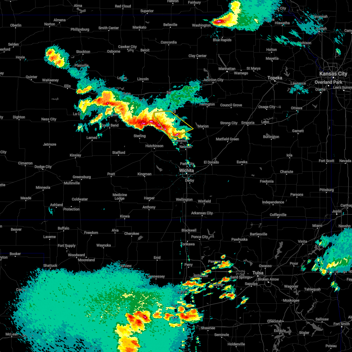 At 128 am cdt, a severe thunderstorm was located near mcpherson, moving southeast at 40 mph (radar indicated). Hazards include 60 mph wind gusts and quarter size hail. Hail damage to vehicles is expected. expect wind damage to roofs, siding, and trees. locations impacted include, mcpherson, lindsborg, hillsboro, galva, canton, marquette, lehigh and mcpherson airport. hail threat, radar indicated max hail size, 1. 00 in wind threat, radar indicated max wind gust, 60 mph. At 128 am cdt, a severe thunderstorm was located near mcpherson, moving southeast at 40 mph (radar indicated). Hazards include 60 mph wind gusts and quarter size hail. Hail damage to vehicles is expected. expect wind damage to roofs, siding, and trees. locations impacted include, mcpherson, lindsborg, hillsboro, galva, canton, marquette, lehigh and mcpherson airport. hail threat, radar indicated max hail size, 1. 00 in wind threat, radar indicated max wind gust, 60 mph.
|
| 6/10/2022 12:52 AM CDT |
 At 1252 am cdt, a severe thunderstorm was located 6 miles south of lindsborg, moving southeast at 35 mph (radar indicated). Hazards include 60 mph wind gusts and quarter size hail. Hail damage to vehicles is expected. Expect wind damage to roofs, siding, and trees. At 1252 am cdt, a severe thunderstorm was located 6 miles south of lindsborg, moving southeast at 35 mph (radar indicated). Hazards include 60 mph wind gusts and quarter size hail. Hail damage to vehicles is expected. Expect wind damage to roofs, siding, and trees.
|
| 6/5/2022 1:25 AM CDT |
 At 124 am cdt, a severe thunderstorm was located near kanopolis, moving east at 30 mph (radar indicated). Hazards include 60 mph wind gusts and quarter size hail. Hail damage to vehicles is expected. Expect wind damage to roofs, siding, and trees. At 124 am cdt, a severe thunderstorm was located near kanopolis, moving east at 30 mph (radar indicated). Hazards include 60 mph wind gusts and quarter size hail. Hail damage to vehicles is expected. Expect wind damage to roofs, siding, and trees.
|
| 5/17/2022 10:48 PM CDT |
 At 1048 pm cdt, severe thunderstorms were located along a line extending from 8 miles south of abilene to 7 miles south of carlton to 7 miles northwest of mcpherson, moving east at 45 mph (trained weather spotters). Hazards include 60 mph wind gusts and nickel size hail. Expect damage to roofs, siding, and trees. locations impacted include, mcpherson, lindsborg, galva, canton, marquette, little river, bushton, geneseo, windom, frederick, roxbury and mcpherson airport. hail threat, radar indicated max hail size, 0. 88 in wind threat, observed max wind gust, 60 mph. At 1048 pm cdt, severe thunderstorms were located along a line extending from 8 miles south of abilene to 7 miles south of carlton to 7 miles northwest of mcpherson, moving east at 45 mph (trained weather spotters). Hazards include 60 mph wind gusts and nickel size hail. Expect damage to roofs, siding, and trees. locations impacted include, mcpherson, lindsborg, galva, canton, marquette, little river, bushton, geneseo, windom, frederick, roxbury and mcpherson airport. hail threat, radar indicated max hail size, 0. 88 in wind threat, observed max wind gust, 60 mph.
|
| 5/17/2022 10:38 PM CDT |
 At 1038 pm cdt, severe thunderstorms were located along a line extending from 6 miles south of solomon to 6 miles south of gypsum to near marquette, moving east at 45 mph (trained weather spotters have reported 60 mph winds in ellsworth). Hazards include 60 mph wind gusts and nickel size hail. Expect damage to roofs, siding, and trees. locations impacted include, mcpherson, lindsborg, galva, canton, marquette, little river, gypsum, bushton, geneseo, windom, frederick, roxbury, bridgeport, kipp and mcpherson airport. hail threat, radar indicated max hail size, 0. 88 in wind threat, observed max wind gust, 60 mph. At 1038 pm cdt, severe thunderstorms were located along a line extending from 6 miles south of solomon to 6 miles south of gypsum to near marquette, moving east at 45 mph (trained weather spotters have reported 60 mph winds in ellsworth). Hazards include 60 mph wind gusts and nickel size hail. Expect damage to roofs, siding, and trees. locations impacted include, mcpherson, lindsborg, galva, canton, marquette, little river, gypsum, bushton, geneseo, windom, frederick, roxbury, bridgeport, kipp and mcpherson airport. hail threat, radar indicated max hail size, 0. 88 in wind threat, observed max wind gust, 60 mph.
|
| 5/17/2022 10:36 PM CDT |
 At 1036 pm cdt, a severe thunderstorm was located near chase, or 10 miles southeast of claflin, moving southeast at 85 mph (radar indicated). Hazards include 60 mph wind gusts and quarter size hail. Hail damage to vehicles is expected. Expect wind damage to roofs, siding, and trees. At 1036 pm cdt, a severe thunderstorm was located near chase, or 10 miles southeast of claflin, moving southeast at 85 mph (radar indicated). Hazards include 60 mph wind gusts and quarter size hail. Hail damage to vehicles is expected. Expect wind damage to roofs, siding, and trees.
|
| 5/17/2022 10:33 PM CDT |
 At 1032 pm cdt, severe thunderstorms were located along a line extending from 6 miles south of solomon to 7 miles southwest of gypsum to near marquette, moving east at 45 mph (trained weather spotters have reported 60 mph in ellsworth). Hazards include 60 mph wind gusts and penny size hail. Expect damage to roofs, siding, and trees. locations impacted include, mcpherson, lindsborg, galva, canton, marquette, little river, holyrood, assaria, gypsum, bushton, geneseo, lorraine, windom, new cambria, falun, frederick, roxbury, bridgeport, kanopolis lake and kipp. hail threat, radar indicated max hail size, 0. 75 in wind threat, observed max wind gust, 60 mph. At 1032 pm cdt, severe thunderstorms were located along a line extending from 6 miles south of solomon to 7 miles southwest of gypsum to near marquette, moving east at 45 mph (trained weather spotters have reported 60 mph in ellsworth). Hazards include 60 mph wind gusts and penny size hail. Expect damage to roofs, siding, and trees. locations impacted include, mcpherson, lindsborg, galva, canton, marquette, little river, holyrood, assaria, gypsum, bushton, geneseo, lorraine, windom, new cambria, falun, frederick, roxbury, bridgeport, kanopolis lake and kipp. hail threat, radar indicated max hail size, 0. 75 in wind threat, observed max wind gust, 60 mph.
|
| 5/17/2022 10:23 PM CDT |
 At 1022 pm cdt, severe thunderstorms were located along a line extending from niles to near smolan to 9 miles northwest of marquette, moving east at 45 mph (61 mph winds have been reported at the ellsworth airport). Hazards include 60 mph wind gusts and penny size hail. Expect damage to roofs, siding, and trees. locations impacted include, salina, mcpherson, lindsborg, galva, canton, marquette, little river, holyrood, assaria, gypsum, bushton, geneseo, smolan, lorraine, windom, new cambria, falun, frederick, bridgeport and kanopolis lake. hail threat, radar indicated max hail size, 0. 75 in wind threat, observed max wind gust, 60 mph. At 1022 pm cdt, severe thunderstorms were located along a line extending from niles to near smolan to 9 miles northwest of marquette, moving east at 45 mph (61 mph winds have been reported at the ellsworth airport). Hazards include 60 mph wind gusts and penny size hail. Expect damage to roofs, siding, and trees. locations impacted include, salina, mcpherson, lindsborg, galva, canton, marquette, little river, holyrood, assaria, gypsum, bushton, geneseo, smolan, lorraine, windom, new cambria, falun, frederick, bridgeport and kanopolis lake. hail threat, radar indicated max hail size, 0. 75 in wind threat, observed max wind gust, 60 mph.
|
| 5/17/2022 10:02 PM CDT |
 At 1001 pm cdt, severe thunderstorms were located along a line extending from near culver to near brookville to 5 miles south of ellsworth, moving east at 45 mph (61 mph winds have been reported at the ellsworth airport). Hazards include 70 mph wind gusts and penny size hail. Expect considerable tree damage. Damage is likely to mobile homes, roofs, and outbuildings. At 1001 pm cdt, severe thunderstorms were located along a line extending from near culver to near brookville to 5 miles south of ellsworth, moving east at 45 mph (61 mph winds have been reported at the ellsworth airport). Hazards include 70 mph wind gusts and penny size hail. Expect considerable tree damage. Damage is likely to mobile homes, roofs, and outbuildings.
|
| 5/15/2022 7:23 AM CDT |
 At 722 am cdt, a severe thunderstorm was located over lehigh, or 6 miles northwest of hillsboro, moving east at 35 mph (radar indicated). Hazards include 60 mph wind gusts and quarter size hail. Hail damage to vehicles is expected. expect wind damage to roofs, siding, and trees. locations impacted include, mcpherson, lindsborg, hillsboro, marion, galva, canton, florence, marquette, goessel, lehigh, windom, durham, mcpherson airport, roxbury, marion lake and pilsen. hail threat, radar indicated max hail size, 1. 00 in wind threat, radar indicated max wind gust, 60 mph. At 722 am cdt, a severe thunderstorm was located over lehigh, or 6 miles northwest of hillsboro, moving east at 35 mph (radar indicated). Hazards include 60 mph wind gusts and quarter size hail. Hail damage to vehicles is expected. expect wind damage to roofs, siding, and trees. locations impacted include, mcpherson, lindsborg, hillsboro, marion, galva, canton, florence, marquette, goessel, lehigh, windom, durham, mcpherson airport, roxbury, marion lake and pilsen. hail threat, radar indicated max hail size, 1. 00 in wind threat, radar indicated max wind gust, 60 mph.
|
| 5/15/2022 7:15 AM CDT | Quarter sized hail reported 0.4 miles NW of Marquette, KS, via social media. pea to quarter size. |
| 5/15/2022 7:02 AM CDT |
 At 702 am cdt, a severe thunderstorm was located over galva, moving east at 35 mph (radar indicated). Hazards include 60 mph wind gusts and quarter size hail. Hail damage to vehicles is expected. Expect wind damage to roofs, siding, and trees. At 702 am cdt, a severe thunderstorm was located over galva, moving east at 35 mph (radar indicated). Hazards include 60 mph wind gusts and quarter size hail. Hail damage to vehicles is expected. Expect wind damage to roofs, siding, and trees.
|
| 4/12/2022 9:30 PM CDT |
 At 929 pm cdt, severe thunderstorms were located along a line extending from near new cambria to 5 miles north of abbyville, moving east at 20 mph. this warning replaces the previous severe thunderstorm warnings that are in effect for the warned areas (radar indicated). Hazards include 60 mph wind gusts and quarter size hail. Hail damage to vehicles is expected. Expect wind damage to roofs, siding, and trees. At 929 pm cdt, severe thunderstorms were located along a line extending from near new cambria to 5 miles north of abbyville, moving east at 20 mph. this warning replaces the previous severe thunderstorm warnings that are in effect for the warned areas (radar indicated). Hazards include 60 mph wind gusts and quarter size hail. Hail damage to vehicles is expected. Expect wind damage to roofs, siding, and trees.
|
| 4/12/2022 9:13 PM CDT |
 At 913 pm cdt, severe thunderstorms were located along a line extending from 6 miles north of marquette to near little river, moving east at 15 mph (radar indicated). Hazards include 60 mph wind gusts and quarter size hail. Hail damage to vehicles is expected. Expect wind damage to roofs, siding, and trees. At 913 pm cdt, severe thunderstorms were located along a line extending from 6 miles north of marquette to near little river, moving east at 15 mph (radar indicated). Hazards include 60 mph wind gusts and quarter size hail. Hail damage to vehicles is expected. Expect wind damage to roofs, siding, and trees.
|
| 4/12/2022 9:00 PM CDT | Golf Ball sized hail reported 8.2 miles ESE of Marquette, KS |
| 12/15/2021 3:21 PM CST |
 The severe thunderstorm warning for mcpherson and saline counties will expire at 330 pm cst, the line of storms which prompted the warning have moved out of the area. therefore, the warning will be allowed to expire. The severe thunderstorm warning for mcpherson and saline counties will expire at 330 pm cst, the line of storms which prompted the warning have moved out of the area. therefore, the warning will be allowed to expire.
|
| 12/15/2021 3:00 PM CST |
 At 300 pm cst, severe thunderstorms were located along a line extending from near idana to 6 miles southeast of lindsborg, moving northeast at 55 mph (radar indicated). Hazards include 70 mph wind gusts. Expect considerable tree damage. damage is likely to mobile homes, roofs, and outbuildings. locations impacted include, salina, mcpherson, lindsborg, galva, canton, marquette, assaria, gypsum, smolan, new cambria, falun, salina airport, mcpherson airport, roxbury, bridgeport and kipp. thunderstorm damage threat, considerable hail threat, radar indicated max hail size, <. 75 in wind threat, radar indicated max wind gust, 70 mph. At 300 pm cst, severe thunderstorms were located along a line extending from near idana to 6 miles southeast of lindsborg, moving northeast at 55 mph (radar indicated). Hazards include 70 mph wind gusts. Expect considerable tree damage. damage is likely to mobile homes, roofs, and outbuildings. locations impacted include, salina, mcpherson, lindsborg, galva, canton, marquette, assaria, gypsum, smolan, new cambria, falun, salina airport, mcpherson airport, roxbury, bridgeport and kipp. thunderstorm damage threat, considerable hail threat, radar indicated max hail size, <. 75 in wind threat, radar indicated max wind gust, 70 mph.
|
| 12/15/2021 2:36 PM CST |
 At 235 pm cst, severe thunderstorms were located along a line extending from near delphos to windom, moving east at 55 mph (radar indicated). Hazards include 70 mph wind gusts. Expect considerable tree damage. damage is likely to mobile homes, roofs, and outbuildings. locations impacted include, salina, mcpherson, lindsborg, galva, canton, marquette, assaria, gypsum, brookville, smolan, windom, new cambria, falun, salina airport, mcpherson airport, roxbury, bridgeport and kipp. thunderstorm damage threat, considerable hail threat, radar indicated max hail size, <. 75 in wind threat, radar indicated max wind gust, 70 mph. At 235 pm cst, severe thunderstorms were located along a line extending from near delphos to windom, moving east at 55 mph (radar indicated). Hazards include 70 mph wind gusts. Expect considerable tree damage. damage is likely to mobile homes, roofs, and outbuildings. locations impacted include, salina, mcpherson, lindsborg, galva, canton, marquette, assaria, gypsum, brookville, smolan, windom, new cambria, falun, salina airport, mcpherson airport, roxbury, bridgeport and kipp. thunderstorm damage threat, considerable hail threat, radar indicated max hail size, <. 75 in wind threat, radar indicated max wind gust, 70 mph.
|
| 12/15/2021 2:12 PM CST |
 At 211 pm cst, severe thunderstorms were located along a line extending from 6 miles south of barnard to near alden, moving northeast at 55 mph (radar indicated). Hazards include 70 mph wind gusts. Expect considerable tree damage. Damage is likely to mobile homes, roofs, and outbuildings. At 211 pm cst, severe thunderstorms were located along a line extending from 6 miles south of barnard to near alden, moving northeast at 55 mph (radar indicated). Hazards include 70 mph wind gusts. Expect considerable tree damage. Damage is likely to mobile homes, roofs, and outbuildings.
|
| 8/20/2021 7:56 PM CDT |
 At 756 pm cdt, a severe thunderstorm was located near inman, moving east to northeast at 25 mph (radar indicated). Hazards include 70 mph wind gusts and ping pong ball size hail. People and animals outdoors will be injured. expect hail damage to roofs, siding, windows, and vehicles. expect considerable tree damage. wind damage is also likely to mobile homes, roofs, and outbuildings. locations impacted include, mcpherson, lindsborg, moundridge, inman, galva, canton, marquette, goessel, ramona, lehigh, windom, durham, tampa, mcpherson airport and roxbury. thunderstorm damage threat, considerable hail threat, radar indicated max hail size, 1. 50 in wind threat, radar indicated max wind gust, 70 mph. At 756 pm cdt, a severe thunderstorm was located near inman, moving east to northeast at 25 mph (radar indicated). Hazards include 70 mph wind gusts and ping pong ball size hail. People and animals outdoors will be injured. expect hail damage to roofs, siding, windows, and vehicles. expect considerable tree damage. wind damage is also likely to mobile homes, roofs, and outbuildings. locations impacted include, mcpherson, lindsborg, moundridge, inman, galva, canton, marquette, goessel, ramona, lehigh, windom, durham, tampa, mcpherson airport and roxbury. thunderstorm damage threat, considerable hail threat, radar indicated max hail size, 1. 50 in wind threat, radar indicated max wind gust, 70 mph.
|
| 8/20/2021 7:49 PM CDT |
 At 748 pm cdt, severe thunderstorms were located along a line extending from 5 miles northwest of galva to inman, moving northeast at 25 mph (radar indicated). Hazards include 70 mph wind gusts and quarter size hail. Hail damage to vehicles is expected. expect considerable tree damage. wind damage is also likely to mobile homes, roofs, and outbuildings. locations impacted include, mcpherson, lindsborg, moundridge, inman, galva, canton, marquette, goessel, ramona, lehigh, windom, durham, tampa, mcpherson airport and roxbury. thunderstorm damage threat, considerable hail threat, radar indicated max hail size, 1. 00 in wind threat, radar indicated max wind gust, 70 mph. At 748 pm cdt, severe thunderstorms were located along a line extending from 5 miles northwest of galva to inman, moving northeast at 25 mph (radar indicated). Hazards include 70 mph wind gusts and quarter size hail. Hail damage to vehicles is expected. expect considerable tree damage. wind damage is also likely to mobile homes, roofs, and outbuildings. locations impacted include, mcpherson, lindsborg, moundridge, inman, galva, canton, marquette, goessel, ramona, lehigh, windom, durham, tampa, mcpherson airport and roxbury. thunderstorm damage threat, considerable hail threat, radar indicated max hail size, 1. 00 in wind threat, radar indicated max wind gust, 70 mph.
|
| 8/20/2021 7:35 PM CDT |
 At 734 pm cdt, severe thunderstorms were located along a line extending from 5 miles east of lindsborg to near inman, moving east at 25 mph (radar indicated). Hazards include 60 mph wind gusts and nickel size hail. Expect damage to roofs, siding, and trees. locations impacted include, mcpherson, lindsborg, moundridge, inman, galva, canton, marquette, goessel, ramona, lehigh, windom, durham, tampa, mcpherson airport, roxbury, bridgeport and marion lake. hail threat, radar indicated max hail size, 0. 88 in wind threat, radar indicated max wind gust, 60 mph. At 734 pm cdt, severe thunderstorms were located along a line extending from 5 miles east of lindsborg to near inman, moving east at 25 mph (radar indicated). Hazards include 60 mph wind gusts and nickel size hail. Expect damage to roofs, siding, and trees. locations impacted include, mcpherson, lindsborg, moundridge, inman, galva, canton, marquette, goessel, ramona, lehigh, windom, durham, tampa, mcpherson airport, roxbury, bridgeport and marion lake. hail threat, radar indicated max hail size, 0. 88 in wind threat, radar indicated max wind gust, 60 mph.
|
| 8/20/2021 7:23 PM CDT |
 At 722 pm cdt, severe thunderstorms were located along a line extending from 5 miles east of lindsborg to 5 miles northwest of mcpherson to 8 miles south of windom, moving northeast at 30 mph (radar indicated). Hazards include 60 mph wind gusts and penny size hail. expect damage to roofs, siding, and trees At 722 pm cdt, severe thunderstorms were located along a line extending from 5 miles east of lindsborg to 5 miles northwest of mcpherson to 8 miles south of windom, moving northeast at 30 mph (radar indicated). Hazards include 60 mph wind gusts and penny size hail. expect damage to roofs, siding, and trees
|
| 8/20/2021 6:38 PM CDT |
 At 637 pm cdt, a severe thunderstorm was located over little river, or 9 miles northeast of lyons, moving northeast at 30 mph (radar indicated. this storm has a history of producing 67 mph winds at lyons airport). Hazards include 60 mph wind gusts and quarter size hail. Hail damage to vehicles is expected. expect wind damage to roofs, siding, and trees. locations impacted include, lyons, lindsborg, sterling, marquette, little river, chase, geneseo, alden, windom, raymond and kanopolis lake. hail threat, radar indicated max hail size, 1. 00 in wind threat, radar indicated max wind gust, 60 mph. At 637 pm cdt, a severe thunderstorm was located over little river, or 9 miles northeast of lyons, moving northeast at 30 mph (radar indicated. this storm has a history of producing 67 mph winds at lyons airport). Hazards include 60 mph wind gusts and quarter size hail. Hail damage to vehicles is expected. expect wind damage to roofs, siding, and trees. locations impacted include, lyons, lindsborg, sterling, marquette, little river, chase, geneseo, alden, windom, raymond and kanopolis lake. hail threat, radar indicated max hail size, 1. 00 in wind threat, radar indicated max wind gust, 60 mph.
|
| 8/20/2021 6:20 PM CDT |
 At 618 pm cdt, a severe thunderstorm was located across central and eastern rice county, and into northwest mcpherson county, moving northeast at 30 mph (radar indicated. this storm has a history of producing 67 mph winds at the lyons airport). Hazards include 60 mph wind gusts. Expect damage to roofs, siding, and trees. locations impacted include, lyons, lindsborg, sterling, marquette, little river, chase, geneseo, alden, windom, raymond and kanopolis lake. hail threat, radar indicated max hail size, <. 75 in wind threat, radar indicated max wind gust, 60 mph. At 618 pm cdt, a severe thunderstorm was located across central and eastern rice county, and into northwest mcpherson county, moving northeast at 30 mph (radar indicated. this storm has a history of producing 67 mph winds at the lyons airport). Hazards include 60 mph wind gusts. Expect damage to roofs, siding, and trees. locations impacted include, lyons, lindsborg, sterling, marquette, little river, chase, geneseo, alden, windom, raymond and kanopolis lake. hail threat, radar indicated max hail size, <. 75 in wind threat, radar indicated max wind gust, 60 mph.
|
| 8/20/2021 6:01 PM CDT |
 At 601 pm cdt, a severe thunderstorm was located over lyons, moving northeast at 25 mph (radar indicated). Hazards include 60 mph wind gusts. expect damage to roofs, siding, and trees At 601 pm cdt, a severe thunderstorm was located over lyons, moving northeast at 25 mph (radar indicated). Hazards include 60 mph wind gusts. expect damage to roofs, siding, and trees
|
| 8/7/2021 9:25 PM CDT |
 The severe thunderstorm warning for northern mcpherson, rice, southeastern ellsworth and saline counties will expire at 930 pm cdt, the storms which prompted the warning have weakened below severe limits, and no longer pose an immediate threat to life or property. therefore, the warning will be allowed to expire at 930 pm. however gusty winds and heavy rain are still possible with these thunderstorms. a severe thunderstorm watch remains in effect until 100 am cdt for central kansas. The severe thunderstorm warning for northern mcpherson, rice, southeastern ellsworth and saline counties will expire at 930 pm cdt, the storms which prompted the warning have weakened below severe limits, and no longer pose an immediate threat to life or property. therefore, the warning will be allowed to expire at 930 pm. however gusty winds and heavy rain are still possible with these thunderstorms. a severe thunderstorm watch remains in effect until 100 am cdt for central kansas.
|
| 8/7/2021 8:55 PM CDT | Estimated at the marquette rode in mcpherson county KS, 0.4 miles SW of Marquette, KS |
| 8/7/2021 8:53 PM CDT |
 At 852 pm cdt, severe thunderstorms were located along a line extending from near culver to near lindsborg to lyons, moving east at 50 mph (radar indicated). Hazards include 70 mph wind gusts and nickel size hail. Expect considerable tree damage. damage is likely to mobile homes, roofs, and outbuildings. locations impacted include, salina, lyons, lindsborg, kanopolis, marquette, little river, chase, holyrood, assaria, gypsum, bushton, geneseo, brookville, smolan, lorraine, windom, new cambria, raymond, falun and glendale. thunderstorm damage threat, considerable hail threat, radar indicated max hail size, 0. 88 in wind threat, radar indicated max wind gust, 70 mph. At 852 pm cdt, severe thunderstorms were located along a line extending from near culver to near lindsborg to lyons, moving east at 50 mph (radar indicated). Hazards include 70 mph wind gusts and nickel size hail. Expect considerable tree damage. damage is likely to mobile homes, roofs, and outbuildings. locations impacted include, salina, lyons, lindsborg, kanopolis, marquette, little river, chase, holyrood, assaria, gypsum, bushton, geneseo, brookville, smolan, lorraine, windom, new cambria, raymond, falun and glendale. thunderstorm damage threat, considerable hail threat, radar indicated max hail size, 0. 88 in wind threat, radar indicated max wind gust, 70 mph.
|
| 8/7/2021 8:39 PM CDT |
 At 838 pm cdt, severe thunderstorms were located along a line extending from near ada to 10 miles east of kanopolis to 5 miles west of raymond, moving east at 45 mph (radar indicated). Hazards include 70 mph wind gusts and nickel size hail. Expect considerable tree damage. damage is likely to mobile homes, roofs, and outbuildings. locations impacted include, salina, great bend, lyons, lindsborg, ellsworth, ellinwood, claflin, kanopolis, lincoln, marquette, little river, chase, holyrood, assaria, gypsum, bushton, geneseo, brookville, smolan and beverly. thunderstorm damage threat, considerable hail threat, radar indicated max hail size, 0. 88 in wind threat, radar indicated max wind gust, 70 mph. At 838 pm cdt, severe thunderstorms were located along a line extending from near ada to 10 miles east of kanopolis to 5 miles west of raymond, moving east at 45 mph (radar indicated). Hazards include 70 mph wind gusts and nickel size hail. Expect considerable tree damage. damage is likely to mobile homes, roofs, and outbuildings. locations impacted include, salina, great bend, lyons, lindsborg, ellsworth, ellinwood, claflin, kanopolis, lincoln, marquette, little river, chase, holyrood, assaria, gypsum, bushton, geneseo, brookville, smolan and beverly. thunderstorm damage threat, considerable hail threat, radar indicated max hail size, 0. 88 in wind threat, radar indicated max wind gust, 70 mph.
|
| 8/7/2021 8:25 PM CDT |
 At 823 pm cdt, severe thunderstorms were located along a line extending from near barnard to near ellsworth to 6 miles south of great bend, moving east at 35 mph (radar indicated). Hazards include 70 mph wind gusts and nickel size hail. Expect considerable tree damage. Damage is likely to mobile homes, roofs, and outbuildings. At 823 pm cdt, severe thunderstorms were located along a line extending from near barnard to near ellsworth to 6 miles south of great bend, moving east at 35 mph (radar indicated). Hazards include 70 mph wind gusts and nickel size hail. Expect considerable tree damage. Damage is likely to mobile homes, roofs, and outbuildings.
|
| 5/26/2021 8:42 PM CDT |
 The severe thunderstorm warning for northwestern mcpherson county will expire at 845 pm cdt, the storm which prompted the warning was moving out of the area. therefore, the warning will be allowed to expire. however small hail and gusty winds are still possible with this thunderstorm and heavy rainfall. a severe thunderstorm warning remains in effect until 930 pm for eastern mcpherson county, including the city of mcpherson. a tornado watch remains in effect until 1100 pm cdt for central kansas. The severe thunderstorm warning for northwestern mcpherson county will expire at 845 pm cdt, the storm which prompted the warning was moving out of the area. therefore, the warning will be allowed to expire. however small hail and gusty winds are still possible with this thunderstorm and heavy rainfall. a severe thunderstorm warning remains in effect until 930 pm for eastern mcpherson county, including the city of mcpherson. a tornado watch remains in effect until 1100 pm cdt for central kansas.
|
| 5/26/2021 8:32 PM CDT |
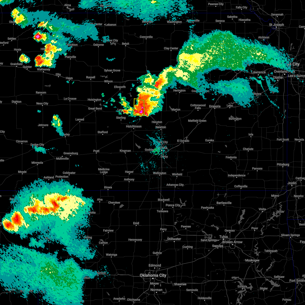 At 831 pm cdt, a severe thunderstorm was located just west of mcpherson, moving east at 15 mph (radar indicated). Hazards include 60 mph wind gusts and half dollar size hail. Hail damage to vehicles is expected. Expect wind damage to roofs, siding, and trees. At 831 pm cdt, a severe thunderstorm was located just west of mcpherson, moving east at 15 mph (radar indicated). Hazards include 60 mph wind gusts and half dollar size hail. Hail damage to vehicles is expected. Expect wind damage to roofs, siding, and trees.
|
| 5/26/2021 8:07 PM CDT |
 At 806 pm cdt, a severe thunderstorm was located just west of windom, or 10 miles west of mcpherson, moving east at 20 mph (radar indicated). Hazards include 60 mph wind gusts and half dollar size hail. Hail damage to vehicles is expected. expect wind damage to roofs, siding, and trees. Windom is in the path of this storm. At 806 pm cdt, a severe thunderstorm was located just west of windom, or 10 miles west of mcpherson, moving east at 20 mph (radar indicated). Hazards include 60 mph wind gusts and half dollar size hail. Hail damage to vehicles is expected. expect wind damage to roofs, siding, and trees. Windom is in the path of this storm.
|
| 5/26/2021 7:58 PM CDT |
 At 758 pm cdt, a severe thunderstorm was located near little river, or 14 miles northeast of lyons, moving east at 15 mph (radar indicated). Hazards include 60 mph wind gusts and half dollar size hail. Hail damage to vehicles is expected. expect wind damage to roofs, siding, and trees. This severe thunderstorm will be near, windom around 810 pm cdt. At 758 pm cdt, a severe thunderstorm was located near little river, or 14 miles northeast of lyons, moving east at 15 mph (radar indicated). Hazards include 60 mph wind gusts and half dollar size hail. Hail damage to vehicles is expected. expect wind damage to roofs, siding, and trees. This severe thunderstorm will be near, windom around 810 pm cdt.
|
| 5/26/2021 7:45 PM CDT |
 At 744 pm cdt, a severe thunderstorm was located 6 miles north of little river, or 14 miles northeast of lyons, moving east at 15 mph (radar indicated). Hazards include 60 mph wind gusts and half dollar size hail. Hail damage to vehicles is expected. expect wind damage to roofs, siding, and trees. Locations impacted include, lyons, marquette, little river, geneseo, windom, frederick, kanopolis lake and kanopolis state park. At 744 pm cdt, a severe thunderstorm was located 6 miles north of little river, or 14 miles northeast of lyons, moving east at 15 mph (radar indicated). Hazards include 60 mph wind gusts and half dollar size hail. Hail damage to vehicles is expected. expect wind damage to roofs, siding, and trees. Locations impacted include, lyons, marquette, little river, geneseo, windom, frederick, kanopolis lake and kanopolis state park.
|
| 5/26/2021 7:35 PM CDT |
 At 734 pm cdt, a severe thunderstorm was located just east of geneseo, or 13 miles northeast of lyons, moving east at 20 mph (radar indicated). Hazards include 60 mph wind gusts and half dollar size hail. Hail damage to vehicles is expected. expect wind damage to roofs, siding, and trees. Locations impacted include, marquette. At 734 pm cdt, a severe thunderstorm was located just east of geneseo, or 13 miles northeast of lyons, moving east at 20 mph (radar indicated). Hazards include 60 mph wind gusts and half dollar size hail. Hail damage to vehicles is expected. expect wind damage to roofs, siding, and trees. Locations impacted include, marquette.
|
| 5/26/2021 7:15 PM CDT |
 At 714 pm cdt, severe thunderstorms were located along a line extending from 12 miles west of marquette to near geneseo to chase, moving east at 25 mph (radar indicated). Hazards include 60 mph wind gusts and half dollar size hail. Hail damage to vehicles is expected. expect wind damage to roofs, siding, and trees. severe thunderstorms will be near, little river around 730 pm cdt. other locations in the path of these severe thunderstorms include marquette and windom. This replaces the tornado warning previously in effect. At 714 pm cdt, severe thunderstorms were located along a line extending from 12 miles west of marquette to near geneseo to chase, moving east at 25 mph (radar indicated). Hazards include 60 mph wind gusts and half dollar size hail. Hail damage to vehicles is expected. expect wind damage to roofs, siding, and trees. severe thunderstorms will be near, little river around 730 pm cdt. other locations in the path of these severe thunderstorms include marquette and windom. This replaces the tornado warning previously in effect.
|
| 4/7/2021 12:19 AM CDT | Quarter sized hail reported 0.4 miles NW of Marquette, KS, pea to quarter size. per social media. |
| 4/6/2021 11:56 PM CDT |
 At 1156 pm cdt, a severe thunderstorm was located near geneseo, or 7 miles north of lyons, moving northeast at 45 mph (law enforcement has reported one inch hail in lyons). Hazards include 60 mph wind gusts and quarter size hail. Hail damage to vehicles is expected. Expect wind damage to roofs, siding, and trees. At 1156 pm cdt, a severe thunderstorm was located near geneseo, or 7 miles north of lyons, moving northeast at 45 mph (law enforcement has reported one inch hail in lyons). Hazards include 60 mph wind gusts and quarter size hail. Hail damage to vehicles is expected. Expect wind damage to roofs, siding, and trees.
|
| 7/30/2020 2:37 AM CDT |
 At 236 am cdt, severe thunderstorms were located along a line extending from 5 miles north of beverly to 7 miles south of brookville to 6 miles northeast of nickerson, moving east at 50 mph (radar indicated). Hazards include 60 mph wind gusts and penny size hail. expect damage to roofs, siding, and trees At 236 am cdt, severe thunderstorms were located along a line extending from 5 miles north of beverly to 7 miles south of brookville to 6 miles northeast of nickerson, moving east at 50 mph (radar indicated). Hazards include 60 mph wind gusts and penny size hail. expect damage to roofs, siding, and trees
|
| 7/3/2020 12:07 AM CDT |
 The severe thunderstorm warning for northern mcpherson and saline counties will expire at 1215 am cdt, the storms which prompted the warning have weakened below severe limits, and no longer pose an immediate threat to life or property. therefore, the warning will be allowed to expire. however gusty winds are still possible with these thunderstorms. a severe thunderstorm watch remains in effect until 200 am cdt for central kansas. The severe thunderstorm warning for northern mcpherson and saline counties will expire at 1215 am cdt, the storms which prompted the warning have weakened below severe limits, and no longer pose an immediate threat to life or property. therefore, the warning will be allowed to expire. however gusty winds are still possible with these thunderstorms. a severe thunderstorm watch remains in effect until 200 am cdt for central kansas.
|
| 7/2/2020 11:41 PM CDT |
 At 1141 pm cdt, severe thunderstorms were located along a line extending from near oak hill to 5 miles north of carlton to near marquette, moving east at 55 mph (66 mph winds have been reported in salina). Hazards include 60 mph wind gusts. Expect damage to roofs, siding, and trees. Locations impacted include, salina, mcpherson, lindsborg, galva, canton, marquette, assaria, gypsum, brookville, smolan, new cambria, falun, glendale, salina airport, roxbury, bridgeport and kipp. At 1141 pm cdt, severe thunderstorms were located along a line extending from near oak hill to 5 miles north of carlton to near marquette, moving east at 55 mph (66 mph winds have been reported in salina). Hazards include 60 mph wind gusts. Expect damage to roofs, siding, and trees. Locations impacted include, salina, mcpherson, lindsborg, galva, canton, marquette, assaria, gypsum, brookville, smolan, new cambria, falun, glendale, salina airport, roxbury, bridgeport and kipp.
|
| 7/2/2020 11:19 PM CDT |
 At 1118 pm cdt, severe thunderstorms were located along a line extending from 5 miles north of minneapolis to near smolan to near geneseo, moving east at 55 mph (radar indicated). Hazards include 60 mph wind gusts. expect damage to roofs, siding, and trees At 1118 pm cdt, severe thunderstorms were located along a line extending from 5 miles north of minneapolis to near smolan to near geneseo, moving east at 55 mph (radar indicated). Hazards include 60 mph wind gusts. expect damage to roofs, siding, and trees
|
| 6/4/2020 12:48 AM CDT |
 At 1248 am cdt, severe thunderstorms were located along a line extending from solomon to near lindsborg, moving east at 35 mph (radar indicated). Hazards include 60 mph wind gusts and quarter size hail. Hail damage to vehicles is expected. expect wind damage to roofs, siding, and trees. Locations impacted include, salina, lindsborg, marquette, assaria, gypsum, smolan, windom, new cambria, falun, bridgeport, salina airport and kipp. At 1248 am cdt, severe thunderstorms were located along a line extending from solomon to near lindsborg, moving east at 35 mph (radar indicated). Hazards include 60 mph wind gusts and quarter size hail. Hail damage to vehicles is expected. expect wind damage to roofs, siding, and trees. Locations impacted include, salina, lindsborg, marquette, assaria, gypsum, smolan, windom, new cambria, falun, bridgeport, salina airport and kipp.
|
| 6/4/2020 12:36 AM CDT |
 At 1235 am cdt, severe thunderstorms were located along a line extending from near new cambria to near marquette, moving east at 35 mph (radar indicated). Hazards include 60 mph wind gusts and quarter size hail. Hail damage to vehicles is expected. expect wind damage to roofs, siding, and trees. Locations impacted include, salina, lindsborg, marquette, little river, assaria, gypsum, smolan, windom, new cambria, falun, salina airport, bridgeport and kipp. At 1235 am cdt, severe thunderstorms were located along a line extending from near new cambria to near marquette, moving east at 35 mph (radar indicated). Hazards include 60 mph wind gusts and quarter size hail. Hail damage to vehicles is expected. expect wind damage to roofs, siding, and trees. Locations impacted include, salina, lindsborg, marquette, little river, assaria, gypsum, smolan, windom, new cambria, falun, salina airport, bridgeport and kipp.
|
| 6/4/2020 12:27 AM CDT |
 At 1226 am cdt, severe thunderstorms were located along a line extending from near new cambria to 6 miles west of marquette, moving east at 35 mph (radar indicated). Hazards include 60 mph wind gusts and quarter size hail. Hail damage to vehicles is expected. Expect wind damage to roofs, siding, and trees. At 1226 am cdt, severe thunderstorms were located along a line extending from near new cambria to 6 miles west of marquette, moving east at 35 mph (radar indicated). Hazards include 60 mph wind gusts and quarter size hail. Hail damage to vehicles is expected. Expect wind damage to roofs, siding, and trees.
|
| 3/11/2020 2:26 AM CDT |
 At 226 am cdt, a severe thunderstorm was located 9 miles northeast of geneseo, or 10 miles southeast of kanopolis, moving east at 40 mph (radar indicated). Hazards include quarter size hail. Damage to vehicles is expected. Locations impacted include, lindsborg, marquette, geneseo, falun, kanopolis lake and kanopolis state park. At 226 am cdt, a severe thunderstorm was located 9 miles northeast of geneseo, or 10 miles southeast of kanopolis, moving east at 40 mph (radar indicated). Hazards include quarter size hail. Damage to vehicles is expected. Locations impacted include, lindsborg, marquette, geneseo, falun, kanopolis lake and kanopolis state park.
|
| 3/11/2020 2:11 AM CDT |
 At 211 am cdt, a severe thunderstorm was located 6 miles north of geneseo, or 7 miles south of kanopolis, moving east at 40 mph (radar indicated). Hazards include half dollar size hail. Damage to vehicles is expected. Locations impacted include, lindsborg, marquette, geneseo, falun, kanopolis lake and kanopolis state park. At 211 am cdt, a severe thunderstorm was located 6 miles north of geneseo, or 7 miles south of kanopolis, moving east at 40 mph (radar indicated). Hazards include half dollar size hail. Damage to vehicles is expected. Locations impacted include, lindsborg, marquette, geneseo, falun, kanopolis lake and kanopolis state park.
|
| 3/11/2020 1:59 AM CDT |
 At 158 am cdt, a severe thunderstorm was located over lorraine, or 11 miles southwest of ellsworth, moving east at 40 mph (radar indicated). Hazards include half dollar size hail. damage to vehicles is expected At 158 am cdt, a severe thunderstorm was located over lorraine, or 11 miles southwest of ellsworth, moving east at 40 mph (radar indicated). Hazards include half dollar size hail. damage to vehicles is expected
|
| 9/27/2019 9:28 PM CDT |
 At 928 pm cdt, a severe thunderstorm was located near marquette, or near lindsborg, moving east at 35 mph (radar indicated). Hazards include half dollar size hail. damage to vehicles is expected At 928 pm cdt, a severe thunderstorm was located near marquette, or near lindsborg, moving east at 35 mph (radar indicated). Hazards include half dollar size hail. damage to vehicles is expected
|
| 9/27/2019 9:23 PM CDT |
 At 923 pm cdt, a severe thunderstorm was located over assaria, or 7 miles north of lindsborg, moving northeast at 35 mph (radar indicated). Hazards include quarter size hail. Damage to vehicles is expected. Locations impacted include, salina, lindsborg, marquette, assaria, gypsum, smolan, new cambria, falun, bridgeport, salina airport and kipp. At 923 pm cdt, a severe thunderstorm was located over assaria, or 7 miles north of lindsborg, moving northeast at 35 mph (radar indicated). Hazards include quarter size hail. Damage to vehicles is expected. Locations impacted include, salina, lindsborg, marquette, assaria, gypsum, smolan, new cambria, falun, bridgeport, salina airport and kipp.
|
| 9/27/2019 9:14 PM CDT | Quarter sized hail reported 0.4 miles NW of Marquette, KS, only hail. no wind. |
| 9/27/2019 9:04 PM CDT |
 At 904 pm cdt, a severe thunderstorm was located near marquette, or 9 miles west of lindsborg, moving east at 10 mph (radar indicated). Hazards include quarter size hail. Damage to vehicles is expected. Locations impacted include, salina, lindsborg, marquette, assaria, gypsum, geneseo, smolan, new cambria, falun, salina airport, bridgeport, kanopolis lake, kanopolis state park and kipp. At 904 pm cdt, a severe thunderstorm was located near marquette, or 9 miles west of lindsborg, moving east at 10 mph (radar indicated). Hazards include quarter size hail. Damage to vehicles is expected. Locations impacted include, salina, lindsborg, marquette, assaria, gypsum, geneseo, smolan, new cambria, falun, salina airport, bridgeport, kanopolis lake, kanopolis state park and kipp.
|
| 9/27/2019 8:41 PM CDT |
 At 841 pm cdt, a severe thunderstorm was located near marquette, or 13 miles west of lindsborg, moving northeast at 20 mph (radar indicated). Hazards include quarter size hail. Damage to vehicles is expected. Locations impacted include, salina, lindsborg, marquette, assaria, gypsum, geneseo, smolan, new cambria, falun, frederick, salina airport, bridgeport, kanopolis lake, kanopolis state park and kipp. At 841 pm cdt, a severe thunderstorm was located near marquette, or 13 miles west of lindsborg, moving northeast at 20 mph (radar indicated). Hazards include quarter size hail. Damage to vehicles is expected. Locations impacted include, salina, lindsborg, marquette, assaria, gypsum, geneseo, smolan, new cambria, falun, frederick, salina airport, bridgeport, kanopolis lake, kanopolis state park and kipp.
|
| 9/27/2019 8:24 PM CDT |
 At 824 pm cdt, a severe thunderstorm was located 8 miles west of marquette, or 14 miles southeast of kanopolis, moving northeast at 35 mph (radar indicated). Hazards include half dollar size hail. damage to vehicles is expected At 824 pm cdt, a severe thunderstorm was located 8 miles west of marquette, or 14 miles southeast of kanopolis, moving northeast at 35 mph (radar indicated). Hazards include half dollar size hail. damage to vehicles is expected
|
| 9/27/2019 7:49 PM CDT |
 At 749 pm cdt, a severe thunderstorm was located over smolan, or 6 miles southwest of salina, moving northeast at 40 mph (radar indicated). Hazards include quarter size hail. Damage to vehicles is expected. Locations impacted include, salina, lindsborg, marquette, assaria, brookville, smolan, new cambria, falun, bridgeport and salina airport. At 749 pm cdt, a severe thunderstorm was located over smolan, or 6 miles southwest of salina, moving northeast at 40 mph (radar indicated). Hazards include quarter size hail. Damage to vehicles is expected. Locations impacted include, salina, lindsborg, marquette, assaria, brookville, smolan, new cambria, falun, bridgeport and salina airport.
|
| 9/27/2019 7:27 PM CDT |
 At 727 pm cdt, a severe thunderstorm was located over marquette, or 10 miles west of lindsborg, moving northeast at 50 mph (radar indicated). Hazards include half dollar size hail. damage to vehicles is expected At 727 pm cdt, a severe thunderstorm was located over marquette, or 10 miles west of lindsborg, moving northeast at 50 mph (radar indicated). Hazards include half dollar size hail. damage to vehicles is expected
|
| 9/7/2019 8:48 PM CDT |
 At 847 pm cdt, a severe thunderstorm was located over gypsum, or 15 miles southeast of salina, moving east at 40 mph (radar indicated). Hazards include 60 mph wind gusts and quarter size hail. Hail damage to vehicles is expected. expect wind damage to roofs, siding, and trees. locations impacted include, mcpherson, lindsborg, galva, canton, marquette, assaria, gypsum, lehigh, durham, falun, bridgeport and roxbury. The thunderstorm is restrengthening. At 847 pm cdt, a severe thunderstorm was located over gypsum, or 15 miles southeast of salina, moving east at 40 mph (radar indicated). Hazards include 60 mph wind gusts and quarter size hail. Hail damage to vehicles is expected. expect wind damage to roofs, siding, and trees. locations impacted include, mcpherson, lindsborg, galva, canton, marquette, assaria, gypsum, lehigh, durham, falun, bridgeport and roxbury. The thunderstorm is restrengthening.
|
| 9/7/2019 8:37 PM CDT |
 At 836 pm cdt, a severe thunderstorm was located over gypsum, or 12 miles southeast of salina, moving east at 40 mph (radar indicated). Hazards include 60 mph wind gusts and quarter size hail. Hail damage to vehicles is expected. expect wind damage to roofs, siding, and trees. Locations impacted include, mcpherson, lindsborg, galva, canton, marquette, assaria, gypsum, lehigh, durham, falun, bridgeport and roxbury. At 836 pm cdt, a severe thunderstorm was located over gypsum, or 12 miles southeast of salina, moving east at 40 mph (radar indicated). Hazards include 60 mph wind gusts and quarter size hail. Hail damage to vehicles is expected. expect wind damage to roofs, siding, and trees. Locations impacted include, mcpherson, lindsborg, galva, canton, marquette, assaria, gypsum, lehigh, durham, falun, bridgeport and roxbury.
|
| 9/7/2019 8:17 PM CDT |
 At 816 pm cdt, a severe thunderstorm was located near marquette, or 6 miles southwest of lindsborg, moving east at 35 mph (radar indicated). Hazards include 60 mph wind gusts and quarter size hail. Hail damage to vehicles is expected. Expect wind damage to roofs, siding, and trees. At 816 pm cdt, a severe thunderstorm was located near marquette, or 6 miles southwest of lindsborg, moving east at 35 mph (radar indicated). Hazards include 60 mph wind gusts and quarter size hail. Hail damage to vehicles is expected. Expect wind damage to roofs, siding, and trees.
|
| 8/29/2019 11:43 PM CDT |
 At 1143 pm cdt, severe thunderstorms were located along a line extending from near solomon to 5 miles east of buhler, moving southeast at 45 mph (radar indicated). Hazards include 60 mph wind gusts and penny size hail. expect damage to roofs, siding, and trees At 1143 pm cdt, severe thunderstorms were located along a line extending from near solomon to 5 miles east of buhler, moving southeast at 45 mph (radar indicated). Hazards include 60 mph wind gusts and penny size hail. expect damage to roofs, siding, and trees
|
| 8/29/2019 11:23 PM CDT |
 A severe thunderstorm warning remains in effect until 1145 pm cdt for mcpherson. northern reno. rice and saline counties. At 1122 pm cdt, severe thunderstorms were located along a line extending from near new cambria to near mcpherson to 7 miles northeast of nickerson to 8 miles north of sylvia, moving southeast at 55 mph. A severe thunderstorm warning remains in effect until 1145 pm cdt for mcpherson. northern reno. rice and saline counties. At 1122 pm cdt, severe thunderstorms were located along a line extending from near new cambria to near mcpherson to 7 miles northeast of nickerson to 8 miles north of sylvia, moving southeast at 55 mph.
|
| 8/29/2019 10:58 PM CDT |
 At 1058 pm cdt, severe thunderstorms were located along a line extending from 5 miles south of beverly to 7 miles east of geneseo to 5 miles east of great bend, moving southeast at 50 mph. these are very dangerous storms (radar indicated). Hazards include 80 mph wind gusts and quarter size hail. Flying debris will be dangerous to those caught without shelter. mobile homes will be heavily damaged. expect considerable damage to roofs, windows, and vehicles. extensive tree damage and power outages are likely. Locations impacted include, salina, mcpherson, lyons, lindsborg, sterling, moundridge, inman, galva, canton, kanopolis, marquette, little river, chase, assaria, gypsum, bushton, geneseo, brookville, smolan and alden. At 1058 pm cdt, severe thunderstorms were located along a line extending from 5 miles south of beverly to 7 miles east of geneseo to 5 miles east of great bend, moving southeast at 50 mph. these are very dangerous storms (radar indicated). Hazards include 80 mph wind gusts and quarter size hail. Flying debris will be dangerous to those caught without shelter. mobile homes will be heavily damaged. expect considerable damage to roofs, windows, and vehicles. extensive tree damage and power outages are likely. Locations impacted include, salina, mcpherson, lyons, lindsborg, sterling, moundridge, inman, galva, canton, kanopolis, marquette, little river, chase, assaria, gypsum, bushton, geneseo, brookville, smolan and alden.
|
| 8/29/2019 10:30 PM CDT |
 At 1030 pm cdt, severe thunderstorms were located along a line extending from 7 miles southeast of victor to near kanopolis to near olmitz, moving southeast at 60 mph (radar indicated). Hazards include 70 mph wind gusts and quarter size hail. Hail damage to vehicles is expected. expect considerable tree damage. Wind damage is also likely to mobile homes, roofs, and outbuildings. At 1030 pm cdt, severe thunderstorms were located along a line extending from 7 miles southeast of victor to near kanopolis to near olmitz, moving southeast at 60 mph (radar indicated). Hazards include 70 mph wind gusts and quarter size hail. Hail damage to vehicles is expected. expect considerable tree damage. Wind damage is also likely to mobile homes, roofs, and outbuildings.
|
| 8/25/2019 1:29 AM CDT |
 At 128 am cdt, severe thunderstorms were located along a line extending from near salina to mcpherson to near hutchinson to near sylvia, moving southeast at 40 mph (radar indicated). Hazards include 60 mph wind gusts and nickel size hail. Expect damage to roofs, siding, and trees. Locations impacted include, salina, hutchinson, mcpherson, lyons, hesston, lindsborg, south hutchinson, sterling, moundridge, inman, buhler, haven, nickerson, burrton, galva, canton, marquette, little river, arlington and assaria. At 128 am cdt, severe thunderstorms were located along a line extending from near salina to mcpherson to near hutchinson to near sylvia, moving southeast at 40 mph (radar indicated). Hazards include 60 mph wind gusts and nickel size hail. Expect damage to roofs, siding, and trees. Locations impacted include, salina, hutchinson, mcpherson, lyons, hesston, lindsborg, south hutchinson, sterling, moundridge, inman, buhler, haven, nickerson, burrton, galva, canton, marquette, little river, arlington and assaria.
|
| 8/25/2019 1:14 AM CDT |
 At 112 am cdt, severe thunderstorms were located along a line extending from 5 miles northwest of assaria to 9 miles west of inman to just north of sylvia, moving southeast at 50 mph (radar indicated). Hazards include 70 mph wind gusts and nickel size hail. Expect considerable tree damage. damage is likely to mobile homes, roofs, and outbuildings. Locations impacted include, salina, hutchinson, mcpherson, lyons, hesston, lindsborg, south hutchinson, sterling, moundridge, inman, buhler, haven, nickerson, burrton, galva, canton, marquette, little river, arlington and assaria. At 112 am cdt, severe thunderstorms were located along a line extending from 5 miles northwest of assaria to 9 miles west of inman to just north of sylvia, moving southeast at 50 mph (radar indicated). Hazards include 70 mph wind gusts and nickel size hail. Expect considerable tree damage. damage is likely to mobile homes, roofs, and outbuildings. Locations impacted include, salina, hutchinson, mcpherson, lyons, hesston, lindsborg, south hutchinson, sterling, moundridge, inman, buhler, haven, nickerson, burrton, galva, canton, marquette, little river, arlington and assaria.
|
| 8/25/2019 12:59 AM CDT |
 At 1258 am cdt, severe thunderstorms were located along a line extending from near brookville to 6 miles southeast of lyons to near hudson, moving southeast at 45 mph (radar indicated). Hazards include 70 mph wind gusts and nickel size hail. Expect considerable tree damage. damage is likely to mobile homes, roofs, and outbuildings. Locations impacted include, salina, hutchinson, mcpherson, lyons, hesston, lindsborg, south hutchinson, sterling, moundridge, inman, buhler, haven, nickerson, burrton, galva, canton, marquette, little river, arlington and assaria. At 1258 am cdt, severe thunderstorms were located along a line extending from near brookville to 6 miles southeast of lyons to near hudson, moving southeast at 45 mph (radar indicated). Hazards include 70 mph wind gusts and nickel size hail. Expect considerable tree damage. damage is likely to mobile homes, roofs, and outbuildings. Locations impacted include, salina, hutchinson, mcpherson, lyons, hesston, lindsborg, south hutchinson, sterling, moundridge, inman, buhler, haven, nickerson, burrton, galva, canton, marquette, little river, arlington and assaria.
|
| 8/25/2019 12:45 AM CDT |
 At 1244 am cdt, severe thunderstorms were located along a line extending from 8 miles northwest of brookville to near lyons to near seward, moving southeast at 50 mph (radar indicated). Hazards include 70 mph wind gusts and nickel size hail. Expect considerable tree damage. Damage is likely to mobile homes, roofs, and outbuildings. At 1244 am cdt, severe thunderstorms were located along a line extending from 8 miles northwest of brookville to near lyons to near seward, moving southeast at 50 mph (radar indicated). Hazards include 70 mph wind gusts and nickel size hail. Expect considerable tree damage. Damage is likely to mobile homes, roofs, and outbuildings.
|
| 8/18/2019 12:06 AM CDT |
 The severe thunderstorm warning for mcpherson, northwestern harvey and west central marion counties will expire at 1215 am cdt, the storms which prompted the warning have moved out of the area. therefore, the warning will be allowed to expire. however gusty winds and heavy rain are still possible with this area of thunderstorms. a severe thunderstorm watch remains in effect until 300 am cdt for south central and central kansas. The severe thunderstorm warning for mcpherson, northwestern harvey and west central marion counties will expire at 1215 am cdt, the storms which prompted the warning have moved out of the area. therefore, the warning will be allowed to expire. however gusty winds and heavy rain are still possible with this area of thunderstorms. a severe thunderstorm watch remains in effect until 300 am cdt for south central and central kansas.
|
| 8/17/2019 11:44 PM CDT |
 At 1143 pm cdt, a severe thunderstorm was located near peabody, moving southeast at 50 mph (radar indicated). Hazards include 60 mph wind gusts and penny size hail. Expect damage to roofs, siding, and trees. Locations impacted include, newton, mcpherson, hesston, lindsborg, moundridge, inman, galva, canton, marquette, windom, mcpherson airport and roxbury. At 1143 pm cdt, a severe thunderstorm was located near peabody, moving southeast at 50 mph (radar indicated). Hazards include 60 mph wind gusts and penny size hail. Expect damage to roofs, siding, and trees. Locations impacted include, newton, mcpherson, hesston, lindsborg, moundridge, inman, galva, canton, marquette, windom, mcpherson airport and roxbury.
|
| 8/17/2019 11:31 PM CDT |
 A severe thunderstorm warning remains in effect until 1215 am cdt for mcpherson. northwestern harvey. west central marion and southeastern saline counties. at 1131 pm cdt, a severe thunderstorm was located over goessel, or 9 miles southeast of canton, moving southeast at 45 mph. hazard. 70 mph wind gusts and nickel size hail. A severe thunderstorm warning remains in effect until 1215 am cdt for mcpherson. northwestern harvey. west central marion and southeastern saline counties. at 1131 pm cdt, a severe thunderstorm was located over goessel, or 9 miles southeast of canton, moving southeast at 45 mph. hazard. 70 mph wind gusts and nickel size hail.
|
| 8/17/2019 10:43 PM CDT |
 At 1043 pm cdt, a severe thunderstorm was located over little river, or 12 miles northeast of lyons, moving southeast at 50 mph (radar indicated). Hazards include 70 mph wind gusts and nickel size hail. Expect considerable tree damage. Damage is likely to mobile homes, roofs, and outbuildings. At 1043 pm cdt, a severe thunderstorm was located over little river, or 12 miles northeast of lyons, moving southeast at 50 mph (radar indicated). Hazards include 70 mph wind gusts and nickel size hail. Expect considerable tree damage. Damage is likely to mobile homes, roofs, and outbuildings.
|
| 6/22/2019 7:23 PM CDT |
 At 722 pm cdt, a severe thunderstorm was located 7 miles southeast of assaria, or 8 miles east of lindsborg, moving northeast at 35 mph (radar indicated). Hazards include 60 mph wind gusts and quarter size hail. Hail damage to vehicles is expected. expect wind damage to roofs, siding, and trees. Locations impacted include, salina, mcpherson, lindsborg, inman, galva, canton, marquette, assaria, gypsum, smolan, falun, salina airport, mcpherson airport, roxbury, bridgeport and kipp. At 722 pm cdt, a severe thunderstorm was located 7 miles southeast of assaria, or 8 miles east of lindsborg, moving northeast at 35 mph (radar indicated). Hazards include 60 mph wind gusts and quarter size hail. Hail damage to vehicles is expected. expect wind damage to roofs, siding, and trees. Locations impacted include, salina, mcpherson, lindsborg, inman, galva, canton, marquette, assaria, gypsum, smolan, falun, salina airport, mcpherson airport, roxbury, bridgeport and kipp.
|
| 6/22/2019 6:56 PM CDT |
 At 655 pm cdt, a severe thunderstorm was located over mcpherson, moving northeast at 35 mph (trained weather spotters. this storm has a history of producing large hail and damaging wind gusts in excess of 60 mph). Hazards include two inch hail and 70 mph wind gusts. People and animals outdoors will be injured. expect hail damage to roofs, siding, windows, and vehicles. expect considerable tree damage. Wind damage is also likely to mobile homes, roofs, and outbuildings. At 655 pm cdt, a severe thunderstorm was located over mcpherson, moving northeast at 35 mph (trained weather spotters. this storm has a history of producing large hail and damaging wind gusts in excess of 60 mph). Hazards include two inch hail and 70 mph wind gusts. People and animals outdoors will be injured. expect hail damage to roofs, siding, windows, and vehicles. expect considerable tree damage. Wind damage is also likely to mobile homes, roofs, and outbuildings.
|
| 6/22/2019 3:02 PM CDT |
 At 301 pm cdt, a severe thunderstorm was located 7 miles northeast of geneseo, or 9 miles southeast of kanopolis, moving northeast at 30 mph (radar indicated). Hazards include 60 mph wind gusts and half dollar size hail. Hail damage to vehicles is expected. expect wind damage to roofs, siding, and trees. Locations impacted include, kanopolis, marquette, assaria, geneseo, brookville, smolan, falun, glendale, kanopolis lake and kanopolis state park. At 301 pm cdt, a severe thunderstorm was located 7 miles northeast of geneseo, or 9 miles southeast of kanopolis, moving northeast at 30 mph (radar indicated). Hazards include 60 mph wind gusts and half dollar size hail. Hail damage to vehicles is expected. expect wind damage to roofs, siding, and trees. Locations impacted include, kanopolis, marquette, assaria, geneseo, brookville, smolan, falun, glendale, kanopolis lake and kanopolis state park.
|
| 6/22/2019 2:52 PM CDT |
 At 251 pm cdt, a severe thunderstorm was located over geneseo, or 12 miles south of kanopolis, moving northeast at 30 mph. this storm is intensifing rapidly (radar indicated). Hazards include 60 mph wind gusts and quarter size hail. Hail damage to vehicles is expected. Expect wind damage to roofs, siding, and trees. At 251 pm cdt, a severe thunderstorm was located over geneseo, or 12 miles south of kanopolis, moving northeast at 30 mph. this storm is intensifing rapidly (radar indicated). Hazards include 60 mph wind gusts and quarter size hail. Hail damage to vehicles is expected. Expect wind damage to roofs, siding, and trees.
|
| 6/9/2019 3:03 AM CDT |
 At 303 am cdt, severe thunderstorms were located along a line extending from 7 miles southwest of brookville to near little river to 6 miles northeast of nickerson to near abbyville, moving east at 50 mph (radar indicated). Hazards include 60 mph wind gusts and penny size hail. Expect damage to roofs, siding, and trees. Locations impacted include, hutchinson, mcpherson, lyons, lindsborg, ellsworth, south hutchinson, sterling, inman, buhler, nickerson, burrton, galva, kanopolis, marquette, little river, chase, assaria, geneseo, alden and lorraine. At 303 am cdt, severe thunderstorms were located along a line extending from 7 miles southwest of brookville to near little river to 6 miles northeast of nickerson to near abbyville, moving east at 50 mph (radar indicated). Hazards include 60 mph wind gusts and penny size hail. Expect damage to roofs, siding, and trees. Locations impacted include, hutchinson, mcpherson, lyons, lindsborg, ellsworth, south hutchinson, sterling, inman, buhler, nickerson, burrton, galva, kanopolis, marquette, little river, chase, assaria, geneseo, alden and lorraine.
|
| 6/9/2019 2:45 AM CDT |
 At 245 am cdt, severe thunderstorms were located along a line extending from ellsworth to near lyons to near sterling to 9 miles east of hudson, moving east at 50 mph (radar indicated). Hazards include 60 mph wind gusts and nickel size hail. expect damage to roofs, siding, and trees At 245 am cdt, severe thunderstorms were located along a line extending from ellsworth to near lyons to near sterling to 9 miles east of hudson, moving east at 50 mph (radar indicated). Hazards include 60 mph wind gusts and nickel size hail. expect damage to roofs, siding, and trees
|
| 5/28/2019 10:08 AM CDT |
 The severe thunderstorm warning for western mcpherson, north central reno and southeastern rice counties will expire at 1015 am cdt, the storm which prompted the warning has weakened below severe limits, and no longer poses an immediate threat to life or property. therefore, the warning will be allowed to expire. however small hail is still possible with this thunderstorm. The severe thunderstorm warning for western mcpherson, north central reno and southeastern rice counties will expire at 1015 am cdt, the storm which prompted the warning has weakened below severe limits, and no longer poses an immediate threat to life or property. therefore, the warning will be allowed to expire. however small hail is still possible with this thunderstorm.
|
| 5/28/2019 9:48 AM CDT |
 At 940 am cdt, a severe thunderstorm was located near partridge, or 6 miles south of nickerson, moving northeast at 55 mph (radar indicated). Hazards include 60 mph wind gusts and quarter size hail. Hail damage to vehicles is expected. Expect wind damage to roofs, siding, and trees. At 940 am cdt, a severe thunderstorm was located near partridge, or 6 miles south of nickerson, moving northeast at 55 mph (radar indicated). Hazards include 60 mph wind gusts and quarter size hail. Hail damage to vehicles is expected. Expect wind damage to roofs, siding, and trees.
|
| 5/28/2019 9:40 AM CDT |
 At 940 am cdt, a severe thunderstorm was located near partridge, or 6 miles south of nickerson, moving northeast at 55 mph (radar indicated). Hazards include 60 mph wind gusts and quarter size hail. Hail damage to vehicles is expected. Expect wind damage to roofs, siding, and trees. At 940 am cdt, a severe thunderstorm was located near partridge, or 6 miles south of nickerson, moving northeast at 55 mph (radar indicated). Hazards include 60 mph wind gusts and quarter size hail. Hail damage to vehicles is expected. Expect wind damage to roofs, siding, and trees.
|
| 5/27/2019 1:30 AM CDT |
 At 129 am cdt, severe thunderstorms were located along a line extending from near delphos to new cambria to near galva, moving northeast at 60 mph (trained weather spotters). Hazards include 70 mph wind gusts and nickel size hail. Expect considerable tree damage. damage is likely to mobile homes, roofs, and outbuildings. Locations impacted include, salina, mcpherson, lindsborg, moundridge, inman, galva, canton, kanopolis, lincoln, marquette, assaria, gypsum, sylvan grove, brookville, smolan, beverly, new cambria, barnard, falun and glendale. At 129 am cdt, severe thunderstorms were located along a line extending from near delphos to new cambria to near galva, moving northeast at 60 mph (trained weather spotters). Hazards include 70 mph wind gusts and nickel size hail. Expect considerable tree damage. damage is likely to mobile homes, roofs, and outbuildings. Locations impacted include, salina, mcpherson, lindsborg, moundridge, inman, galva, canton, kanopolis, lincoln, marquette, assaria, gypsum, sylvan grove, brookville, smolan, beverly, new cambria, barnard, falun and glendale.
|
| 5/27/2019 1:10 AM CDT |
 At 110 am cdt, severe thunderstorms were located along a line extending from 5 miles north of lincoln to near brookville to near inman, moving northeast at 60 mph (radar indicated). Hazards include 70 mph wind gusts and nickel size hail. Expect considerable tree damage. damage is likely to mobile homes, roofs, and outbuildings. Locations impacted include, salina, mcpherson, lindsborg, moundridge, inman, galva, canton, kanopolis, lincoln, marquette, assaria, gypsum, sylvan grove, brookville, smolan, beverly, new cambria, barnard, falun and glendale. At 110 am cdt, severe thunderstorms were located along a line extending from 5 miles north of lincoln to near brookville to near inman, moving northeast at 60 mph (radar indicated). Hazards include 70 mph wind gusts and nickel size hail. Expect considerable tree damage. damage is likely to mobile homes, roofs, and outbuildings. Locations impacted include, salina, mcpherson, lindsborg, moundridge, inman, galva, canton, kanopolis, lincoln, marquette, assaria, gypsum, sylvan grove, brookville, smolan, beverly, new cambria, barnard, falun and glendale.
|
| 5/27/2019 12:38 AM CDT |
 At 1237 am cdt, severe thunderstorms were located along a line extending from near dorrance to 5 miles south of bushton to near plevna, moving northeast at 65 mph (radar indicated). Hazards include 70 mph wind gusts and nickel size hail. Expect considerable tree damage. Damage is likely to mobile homes, roofs, and outbuildings. At 1237 am cdt, severe thunderstorms were located along a line extending from near dorrance to 5 miles south of bushton to near plevna, moving northeast at 65 mph (radar indicated). Hazards include 70 mph wind gusts and nickel size hail. Expect considerable tree damage. Damage is likely to mobile homes, roofs, and outbuildings.
|
| 5/25/2019 8:37 PM CDT |
 The severe thunderstorm warning for western mcpherson, reno, western sedgwick, rice, southeastern ellsworth and eastern kingman counties will expire at 845 pm cdt, the storms which prompted the warning have weakened below severe limits, and no longer pose an immediate threat to life or property. therefore, the warning will be allowed to expire. however gusty winds and heavy rain are still possible with these thunderstorms. a severe thunderstorm watch remains in effect until midnight cdt for central and south central kansas. The severe thunderstorm warning for western mcpherson, reno, western sedgwick, rice, southeastern ellsworth and eastern kingman counties will expire at 845 pm cdt, the storms which prompted the warning have weakened below severe limits, and no longer pose an immediate threat to life or property. therefore, the warning will be allowed to expire. however gusty winds and heavy rain are still possible with these thunderstorms. a severe thunderstorm watch remains in effect until midnight cdt for central and south central kansas.
|
| 5/25/2019 8:10 PM CDT |
 At 809 pm cdt, severe thunderstorms were located along a line extending from 7 miles east of geneseo to near norwich, moving northeast at 40 mph (radar indicated). Hazards include 60 mph wind gusts and penny size hail. Expect damage to roofs, siding, and trees. Locations impacted include, hutchinson, lyons, kingman, south hutchinson, sterling, cheney, inman, buhler, haven, nickerson, pretty prairie, marquette, little river, norwich, arlington, geneseo, partridge, alden, windom and abbyville. At 809 pm cdt, severe thunderstorms were located along a line extending from 7 miles east of geneseo to near norwich, moving northeast at 40 mph (radar indicated). Hazards include 60 mph wind gusts and penny size hail. Expect damage to roofs, siding, and trees. Locations impacted include, hutchinson, lyons, kingman, south hutchinson, sterling, cheney, inman, buhler, haven, nickerson, pretty prairie, marquette, little river, norwich, arlington, geneseo, partridge, alden, windom and abbyville.
|
| 5/25/2019 7:45 PM CDT |
 At 744 pm cdt, severe thunderstorms were located along a line extending from lyons to 11 miles north of harper, moving east at 35 mph (radar indicated). Hazards include 60 mph wind gusts and penny size hail. Expect damage to roofs, siding, and trees. This severe warning replaces the previous warnings that were in effect for the warned areas. At 744 pm cdt, severe thunderstorms were located along a line extending from lyons to 11 miles north of harper, moving east at 35 mph (radar indicated). Hazards include 60 mph wind gusts and penny size hail. Expect damage to roofs, siding, and trees. This severe warning replaces the previous warnings that were in effect for the warned areas.
|
| 5/18/2019 8:20 PM CDT |
 At 819 pm cdt, severe thunderstorms were located along a line extending from near brookville to near lindsborg to 7 miles north of mcpherson to 5 miles west of inman, moving northeast at 25 mph (trained weather spotters). Hazards include 70 mph wind gusts and quarter size hail. Hail damage to vehicles is expected. expect considerable tree damage. wind damage is also likely to mobile homes, roofs, and outbuildings. Locations impacted include, salina, mcpherson, lindsborg, moundridge, inman, galva, canton, marquette, little river, assaria, gypsum, brookville, smolan, windom, falun, salina airport, mcpherson airport, roxbury, bridgeport and kanopolis lake. At 819 pm cdt, severe thunderstorms were located along a line extending from near brookville to near lindsborg to 7 miles north of mcpherson to 5 miles west of inman, moving northeast at 25 mph (trained weather spotters). Hazards include 70 mph wind gusts and quarter size hail. Hail damage to vehicles is expected. expect considerable tree damage. wind damage is also likely to mobile homes, roofs, and outbuildings. Locations impacted include, salina, mcpherson, lindsborg, moundridge, inman, galva, canton, marquette, little river, assaria, gypsum, brookville, smolan, windom, falun, salina airport, mcpherson airport, roxbury, bridgeport and kanopolis lake.
|
| 5/18/2019 8:16 PM CDT | Storm damage reported in mcpherson county KS, 1.1 miles NNW of Marquette, KS |
| 5/18/2019 8:13 PM CDT | Three-inch diameter limb dow in mcpherson county KS, 2.4 miles N of Marquette, KS |
| 5/18/2019 8:09 PM CDT |
 At 744 pm cdt, severe thunderstorms were located along a line extending from 6 miles southeast of kanopolis to near windom to 5 miles northeast of nickerson, moving northeast at 25 mph (radar indicated). Hazards include 70 mph wind gusts and half dollar size hail. Hail damage to vehicles is expected. expect considerable tree damage. Wind damage is also likely to mobile homes, roofs, and outbuildings. At 744 pm cdt, severe thunderstorms were located along a line extending from 6 miles southeast of kanopolis to near windom to 5 miles northeast of nickerson, moving northeast at 25 mph (radar indicated). Hazards include 70 mph wind gusts and half dollar size hail. Hail damage to vehicles is expected. expect considerable tree damage. Wind damage is also likely to mobile homes, roofs, and outbuildings.
|
| 5/18/2019 7:44 PM CDT |
 At 744 pm cdt, severe thunderstorms were located along a line extending from 6 miles southeast of kanopolis to near windom to 5 miles northeast of nickerson, moving northeast at 25 mph (radar indicated). Hazards include 70 mph wind gusts and half dollar size hail. Hail damage to vehicles is expected. expect considerable tree damage. Wind damage is also likely to mobile homes, roofs, and outbuildings. At 744 pm cdt, severe thunderstorms were located along a line extending from 6 miles southeast of kanopolis to near windom to 5 miles northeast of nickerson, moving northeast at 25 mph (radar indicated). Hazards include 70 mph wind gusts and half dollar size hail. Hail damage to vehicles is expected. expect considerable tree damage. Wind damage is also likely to mobile homes, roofs, and outbuildings.
|
| 5/7/2019 1:04 AM CDT |
 At 104 am cdt, severe thunderstorms were located along a line extending from lindsborg to near canton to near moundridge, moving east at 65 mph (radar indicated). Hazards include 60 mph wind gusts and penny size hail. Expect damage to roofs, siding, and trees. Locations impacted include, mcpherson, lindsborg, moundridge, inman, galva, canton, marquette, mcpherson airport and roxbury. At 104 am cdt, severe thunderstorms were located along a line extending from lindsborg to near canton to near moundridge, moving east at 65 mph (radar indicated). Hazards include 60 mph wind gusts and penny size hail. Expect damage to roofs, siding, and trees. Locations impacted include, mcpherson, lindsborg, moundridge, inman, galva, canton, marquette, mcpherson airport and roxbury.
|
| 5/7/2019 12:28 AM CDT |
 At 1228 am cdt, severe thunderstorms were located along a line extending from near geneseo to 5 miles northeast of nickerson, moving east at 45 mph (radar indicated). Hazards include 60 mph wind gusts and penny size hail. expect damage to roofs, siding, and trees At 1228 am cdt, severe thunderstorms were located along a line extending from near geneseo to 5 miles northeast of nickerson, moving east at 45 mph (radar indicated). Hazards include 60 mph wind gusts and penny size hail. expect damage to roofs, siding, and trees
|
| 7/30/2018 6:25 PM CDT |
 At 624 pm cdt, a severe thunderstorm was located 6 miles west of assaria, or 10 miles northwest of lindsborg, moving southeast at 25 mph (radar indicated). Hazards include 60 mph wind gusts. Expect damage to roofs, siding, and trees. Locations impacted include, salina, lindsborg, marquette, assaria, smolan, falun, bridgeport and salina airport. At 624 pm cdt, a severe thunderstorm was located 6 miles west of assaria, or 10 miles northwest of lindsborg, moving southeast at 25 mph (radar indicated). Hazards include 60 mph wind gusts. Expect damage to roofs, siding, and trees. Locations impacted include, salina, lindsborg, marquette, assaria, smolan, falun, bridgeport and salina airport.
|
| 7/30/2018 6:08 PM CDT |
 At 608 pm cdt, a severe thunderstorm was located near smolan, or near salina, moving south at 25 mph (radar indicated). Hazards include 60 mph wind gusts and penny size hail. expect damage to roofs, siding, and trees At 608 pm cdt, a severe thunderstorm was located near smolan, or near salina, moving south at 25 mph (radar indicated). Hazards include 60 mph wind gusts and penny size hail. expect damage to roofs, siding, and trees
|
| 7/29/2018 2:29 AM CDT |
 At 228 am cdt, severe thunderstorms were located along a line extending from 5 miles west of marquette to near windom to near nickerson, moving southeast at 45 mph (radar indicated). Hazards include 70 mph wind gusts. Expect considerable tree damage. Damage is likely to mobile homes, roofs, and outbuildings. At 228 am cdt, severe thunderstorms were located along a line extending from 5 miles west of marquette to near windom to near nickerson, moving southeast at 45 mph (radar indicated). Hazards include 70 mph wind gusts. Expect considerable tree damage. Damage is likely to mobile homes, roofs, and outbuildings.
|
| 6/11/2018 10:04 PM CDT |
 At 1004 pm cdt, a severe thunderstorm was located 7 miles south of little river, or 10 miles northeast of nickerson, and is nearly stationary (radar indicated). Hazards include two inch hail and 70 mph wind gusts. People and animals outdoors will be injured. expect hail damage to roofs, siding, windows, and vehicles. expect considerable tree damage. wind damage is also likely to mobile homes, roofs, and outbuildings. Locations impacted include, mcpherson, lindsborg, galva, canton, marquette, ramona, windom, durham, tampa, lost springs, mcpherson airport and roxbury. At 1004 pm cdt, a severe thunderstorm was located 7 miles south of little river, or 10 miles northeast of nickerson, and is nearly stationary (radar indicated). Hazards include two inch hail and 70 mph wind gusts. People and animals outdoors will be injured. expect hail damage to roofs, siding, windows, and vehicles. expect considerable tree damage. wind damage is also likely to mobile homes, roofs, and outbuildings. Locations impacted include, mcpherson, lindsborg, galva, canton, marquette, ramona, windom, durham, tampa, lost springs, mcpherson airport and roxbury.
|
| 6/11/2018 9:57 PM CDT |
 At 957 pm cdt, a severe thunderstorm was located 6 miles south of lindsborg, and is nearly stationary (radar indicated). Hazards include golf ball size hail and 70 mph wind gusts. People and animals outdoors will be injured. expect hail damage to roofs, siding, windows, and vehicles. expect considerable tree damage. wind damage is also likely to mobile homes, roofs, and outbuildings. Locations impacted include, mcpherson, lindsborg, galva, canton, marquette, ramona, windom, durham, tampa, lost springs, mcpherson airport and roxbury. At 957 pm cdt, a severe thunderstorm was located 6 miles south of lindsborg, and is nearly stationary (radar indicated). Hazards include golf ball size hail and 70 mph wind gusts. People and animals outdoors will be injured. expect hail damage to roofs, siding, windows, and vehicles. expect considerable tree damage. wind damage is also likely to mobile homes, roofs, and outbuildings. Locations impacted include, mcpherson, lindsborg, galva, canton, marquette, ramona, windom, durham, tampa, lost springs, mcpherson airport and roxbury.
|
| 6/11/2018 9:42 PM CDT |
 At 941 pm cdt, a severe thunderstorm was located 6 miles northwest of mcpherson, moving east at 25 mph (radar indicated). Hazards include 70 mph wind gusts and quarter size hail. Hail damage to vehicles is expected. expect considerable tree damage. Wind damage is also likely to mobile homes, roofs, and outbuildings. At 941 pm cdt, a severe thunderstorm was located 6 miles northwest of mcpherson, moving east at 25 mph (radar indicated). Hazards include 70 mph wind gusts and quarter size hail. Hail damage to vehicles is expected. expect considerable tree damage. Wind damage is also likely to mobile homes, roofs, and outbuildings.
|
| 5/29/2018 8:03 PM CDT |
 At 801 pm cdt, severe thunderstorms were located along a line extending from near assaria to near nickerson, and are nearly stationary. at 755 pm cdt a trained spotter reported an estimated 60mph wind gust near inman (trained weather spotters). Hazards include 60 mph wind gusts and quarter size hail. Hail damage to vehicles is expected. expect wind damage to roofs, siding, and trees. Locations impacted include, mcpherson, lindsborg, moundridge, inman, galva, canton, marquette, little river, lehigh, windom, durham, mcpherson airport and roxbury. At 801 pm cdt, severe thunderstorms were located along a line extending from near assaria to near nickerson, and are nearly stationary. at 755 pm cdt a trained spotter reported an estimated 60mph wind gust near inman (trained weather spotters). Hazards include 60 mph wind gusts and quarter size hail. Hail damage to vehicles is expected. expect wind damage to roofs, siding, and trees. Locations impacted include, mcpherson, lindsborg, moundridge, inman, galva, canton, marquette, little river, lehigh, windom, durham, mcpherson airport and roxbury.
|
| 5/29/2018 7:48 PM CDT |
 At 747 pm cdt, severe thunderstorms were located along a line extending from near assaria to nickerson, moving east at 35 mph (radar indicated). Hazards include 60 mph wind gusts and quarter size hail. Hail damage to vehicles is expected. Expect wind damage to roofs, siding, and trees. At 747 pm cdt, severe thunderstorms were located along a line extending from near assaria to nickerson, moving east at 35 mph (radar indicated). Hazards include 60 mph wind gusts and quarter size hail. Hail damage to vehicles is expected. Expect wind damage to roofs, siding, and trees.
|
| 10/6/2017 9:51 PM CDT |
 At 948 pm cdt, a severe thunderstorm was located over lindsborg, moving northeast at 55 mph (radar indicated). Hazards include 60 mph winds and quarter size hail. Hail damage to vehicles is expected. expect wind damage to roofs, siding, and trees. Locations impacted include, mcpherson, lindsborg, marquette, assaria, gypsum, windom, falun, bridgeport and roxbury. At 948 pm cdt, a severe thunderstorm was located over lindsborg, moving northeast at 55 mph (radar indicated). Hazards include 60 mph winds and quarter size hail. Hail damage to vehicles is expected. expect wind damage to roofs, siding, and trees. Locations impacted include, mcpherson, lindsborg, marquette, assaria, gypsum, windom, falun, bridgeport and roxbury.
|
| 10/6/2017 9:37 PM CDT |
 At 936 pm cdt, a severe thunderstorm was located near windom, or 12 miles northwest of mcpherson, moving northeast at 50 mph (radar indicated). Hazards include 60 mph wind gusts and quarter size hail. Hail damage to vehicles is expected. Expect wind damage to roofs, siding, and trees. At 936 pm cdt, a severe thunderstorm was located near windom, or 12 miles northwest of mcpherson, moving northeast at 50 mph (radar indicated). Hazards include 60 mph wind gusts and quarter size hail. Hail damage to vehicles is expected. Expect wind damage to roofs, siding, and trees.
|
| 10/6/2017 9:05 PM CDT |
 At 905 pm cdt, severe thunderstorms were located along a line extending from near culver to near smolan to little river, moving northeast at 55 mph (radar indicated). Hazards include 60 mph wind gusts and quarter size hail. Hail damage to vehicles is expected. expect wind damage to roofs, siding, and trees. Locations impacted include, salina, lyons, lindsborg, marquette, little river, assaria, brookville, smolan, windom, new cambria, falun, glendale, salina airport, bridgeport, kanopolis lake and kanopolis state park. At 905 pm cdt, severe thunderstorms were located along a line extending from near culver to near smolan to little river, moving northeast at 55 mph (radar indicated). Hazards include 60 mph wind gusts and quarter size hail. Hail damage to vehicles is expected. expect wind damage to roofs, siding, and trees. Locations impacted include, salina, lyons, lindsborg, marquette, little river, assaria, brookville, smolan, windom, new cambria, falun, glendale, salina airport, bridgeport, kanopolis lake and kanopolis state park.
|
| 10/6/2017 8:44 PM CDT |
 At 843 pm cdt, severe thunderstorms were located along a line extending from 10 miles southwest of beverly to 8 miles southeast of kanopolis to alden, moving northeast at 45 mph (radar indicated). Hazards include 60 mph wind gusts and nickel size hail. expect damage to roofs, siding, and trees At 843 pm cdt, severe thunderstorms were located along a line extending from 10 miles southwest of beverly to 8 miles southeast of kanopolis to alden, moving northeast at 45 mph (radar indicated). Hazards include 60 mph wind gusts and nickel size hail. expect damage to roofs, siding, and trees
|
| 10/6/2017 7:52 PM CDT |
 The tornado warning for northwestern mcpherson, northeastern rice, southeastern ellsworth and southwestern saline counties will expire at 800 pm cdt, the storm which prompted the warning has weakened below severe limits, and no longer appears capable of producing a tornado. therefore the warning will be allowed to expire. however gusty winds and heavy rain are still possible with this thunderstorm. a severe thunderstorm watch remains in effect until 1100 pm cdt for central kansas. The tornado warning for northwestern mcpherson, northeastern rice, southeastern ellsworth and southwestern saline counties will expire at 800 pm cdt, the storm which prompted the warning has weakened below severe limits, and no longer appears capable of producing a tornado. therefore the warning will be allowed to expire. however gusty winds and heavy rain are still possible with this thunderstorm. a severe thunderstorm watch remains in effect until 1100 pm cdt for central kansas.
|
| 10/6/2017 7:35 PM CDT | 10 to 15 power poles down along k-4 near the ellsworth/mcpherson county lin in ellsworth county KS, 5.2 miles E of Marquette, KS |
| 10/6/2017 7:30 PM CDT |
 At 728 pm cdt, a severe thunderstorm capable of producing a tornado was located 7 miles east of geneseo, or 13 miles southeast of kanopolis, moving northeast at 40 mph (weather spotters reported a funnel cloud). Hazards include tornado and tennis ball size hail. Flying debris will be dangerous to those caught without shelter. mobile homes will be damaged or destroyed. damage to roofs, windows, and vehicles will occur. tree damage is likely. this dangerous storm will be near, marquette around 745 pm cdt. lindsborg around 755 pm cdt. other locations impacted by this tornadic thunderstorm include kanopolis lake, falun and kanopolis state park. At 724 pm, a storm chaser reported a funnel cloud approximately two- thirds of the way to the ground about 6 miles north of mitchell. At 728 pm cdt, a severe thunderstorm capable of producing a tornado was located 7 miles east of geneseo, or 13 miles southeast of kanopolis, moving northeast at 40 mph (weather spotters reported a funnel cloud). Hazards include tornado and tennis ball size hail. Flying debris will be dangerous to those caught without shelter. mobile homes will be damaged or destroyed. damage to roofs, windows, and vehicles will occur. tree damage is likely. this dangerous storm will be near, marquette around 745 pm cdt. lindsborg around 755 pm cdt. other locations impacted by this tornadic thunderstorm include kanopolis lake, falun and kanopolis state park. At 724 pm, a storm chaser reported a funnel cloud approximately two- thirds of the way to the ground about 6 miles north of mitchell.
|
| 10/6/2017 7:17 PM CDT |
 At 716 pm cdt, a severe thunderstorm capable of producing a tornado was located over geneseo, or 11 miles north of lyons, moving northeast at 40 mph (radar indicated rotation). Hazards include tornado and tennis ball size hail. Flying debris will be dangerous to those caught without shelter. mobile homes will be damaged or destroyed. damage to roofs, windows, and vehicles will occur. tree damage is likely. this dangerous storm will be near, marquette around 740 pm cdt. brookville around 755 pm cdt. other locations impacted by this tornadic thunderstorm include kanopolis lake, frederick, falun and kanopolis state park. At 716 pm cdt, a severe thunderstorm capable of producing a tornado was located over geneseo, or 11 miles north of lyons, moving northeast at 40 mph (radar indicated rotation). Hazards include tornado and tennis ball size hail. Flying debris will be dangerous to those caught without shelter. mobile homes will be damaged or destroyed. damage to roofs, windows, and vehicles will occur. tree damage is likely. this dangerous storm will be near, marquette around 740 pm cdt. brookville around 755 pm cdt. other locations impacted by this tornadic thunderstorm include kanopolis lake, frederick, falun and kanopolis state park.
|
| 8/16/2017 6:40 AM CDT |
 The severe thunderstorm warning for northwestern mcpherson, northeastern rice, eastern ellsworth and saline counties will expire at 645 am cdt, the storms which prompted the warning have moved out of the area. therefore the warning will be allowed to expire. however small hail and gusty winds are still possible with these thunderstorms. The severe thunderstorm warning for northwestern mcpherson, northeastern rice, eastern ellsworth and saline counties will expire at 645 am cdt, the storms which prompted the warning have moved out of the area. therefore the warning will be allowed to expire. however small hail and gusty winds are still possible with these thunderstorms.
|
| 8/16/2017 6:21 AM CDT |
 At 620 am cdt, severe thunderstorms were located along a line extending from 5 miles northwest of new cambria to windom, moving east at 45 mph (radar indicated). Hazards include 60 mph wind gusts and penny size hail. Expect damage to roofs, siding, and trees. Locations impacted include, salina, mcpherson, lyons, lindsborg, marquette, little river, assaria, geneseo, brookville, smolan, windom, new cambria, falun, glendale, salina airport, mcpherson airport, bridgeport, kanopolis lake and kanopolis state park. At 620 am cdt, severe thunderstorms were located along a line extending from 5 miles northwest of new cambria to windom, moving east at 45 mph (radar indicated). Hazards include 60 mph wind gusts and penny size hail. Expect damage to roofs, siding, and trees. Locations impacted include, salina, mcpherson, lyons, lindsborg, marquette, little river, assaria, geneseo, brookville, smolan, windom, new cambria, falun, glendale, salina airport, mcpherson airport, bridgeport, kanopolis lake and kanopolis state park.
|
| 8/16/2017 5:49 AM CDT |
 At 549 am cdt, severe thunderstorms were located along a line extending from 5 miles south of beverly to near chase, moving east at 45 mph (radar indicated). Hazards include 60 mph wind gusts and penny size hail. expect damage to roofs, siding, and trees At 549 am cdt, severe thunderstorms were located along a line extending from 5 miles south of beverly to near chase, moving east at 45 mph (radar indicated). Hazards include 60 mph wind gusts and penny size hail. expect damage to roofs, siding, and trees
|
| 6/29/2017 6:54 PM CDT |
 The severe thunderstorm warning for mcpherson, eastern rice and southeastern saline counties will expire at midnight cdt, the storms which prompted the warning have weakened below severe limits, and no longer pose an immediate threat to life or property. therefore the warning will be allowed to expire. a severe thunderstorm watch remains in effect until 500 am cdt for central kansas. The severe thunderstorm warning for mcpherson, eastern rice and southeastern saline counties will expire at midnight cdt, the storms which prompted the warning have weakened below severe limits, and no longer pose an immediate threat to life or property. therefore the warning will be allowed to expire. a severe thunderstorm watch remains in effect until 500 am cdt for central kansas.
|
| 6/29/2017 6:18 PM CDT |
 At 1118 pm cdt, severe thunderstorms were located along a line extending from 7 miles south of gypsum to 7 miles northeast of sterling, moving east at 15 mph (radar indicated). Hazards include 60 mph wind gusts and quarter size hail. Hail damage to vehicles is expected. expect wind damage to roofs, siding, and trees. Locations impacted include, mcpherson, lyons, lindsborg, galva, canton, marquette, little river, assaria, gypsum, windom, mcpherson airport, roxbury and bridgeport. At 1118 pm cdt, severe thunderstorms were located along a line extending from 7 miles south of gypsum to 7 miles northeast of sterling, moving east at 15 mph (radar indicated). Hazards include 60 mph wind gusts and quarter size hail. Hail damage to vehicles is expected. expect wind damage to roofs, siding, and trees. Locations impacted include, mcpherson, lyons, lindsborg, galva, canton, marquette, little river, assaria, gypsum, windom, mcpherson airport, roxbury and bridgeport.
|
| 6/29/2017 5:55 PM CDT |
 At 1054 pm cdt, a severe thunderstorm was located 7 miles northeast of windom, or 9 miles northwest of mcpherson, moving east at 35 mph (radar indicated). Hazards include 60 mph wind gusts and quarter size hail. Hail damage to vehicles is expected. Expect wind damage to roofs, siding, and trees. At 1054 pm cdt, a severe thunderstorm was located 7 miles northeast of windom, or 9 miles northwest of mcpherson, moving east at 35 mph (radar indicated). Hazards include 60 mph wind gusts and quarter size hail. Hail damage to vehicles is expected. Expect wind damage to roofs, siding, and trees.
|
| 6/15/2017 6:29 PM CDT |
 At 628 pm cdt, a severe thunderstorm was located near galva, moving east at 25 mph (radar indicated). Hazards include 60 mph wind gusts and quarter size hail. Hail damage to vehicles is expected. expect wind damage to roofs, siding, and trees. Locations impacted include, mcpherson, lindsborg, galva, canton, marquette, lehigh, durham and roxbury. At 628 pm cdt, a severe thunderstorm was located near galva, moving east at 25 mph (radar indicated). Hazards include 60 mph wind gusts and quarter size hail. Hail damage to vehicles is expected. expect wind damage to roofs, siding, and trees. Locations impacted include, mcpherson, lindsborg, galva, canton, marquette, lehigh, durham and roxbury.
|
| 6/15/2017 6:14 PM CDT |
 At 614 pm cdt, a severe thunderstorm was located near galva, moving east at 25 mph (radar indicated). Hazards include 60 mph wind gusts and quarter size hail. Hail damage to vehicles is expected. Expect wind damage to roofs, siding, and trees. At 614 pm cdt, a severe thunderstorm was located near galva, moving east at 25 mph (radar indicated). Hazards include 60 mph wind gusts and quarter size hail. Hail damage to vehicles is expected. Expect wind damage to roofs, siding, and trees.
|
| 6/15/2017 5:12 PM CDT |
 At 511 pm cdt, a severe thunderstorm was located near lindsborg, moving east at 20 mph (trained weather spotters). Hazards include 60 mph wind gusts and quarter size hail. Hail damage to vehicles is expected. expect wind damage to roofs, siding, and trees. Locations impacted include, salina, mcpherson, lindsborg, galva, canton, marquette, assaria, gypsum, brookville, smolan, windom, new cambria, falun, glendale, salina airport, mcpherson airport, roxbury, bridgeport and kipp. At 511 pm cdt, a severe thunderstorm was located near lindsborg, moving east at 20 mph (trained weather spotters). Hazards include 60 mph wind gusts and quarter size hail. Hail damage to vehicles is expected. expect wind damage to roofs, siding, and trees. Locations impacted include, salina, mcpherson, lindsborg, galva, canton, marquette, assaria, gypsum, brookville, smolan, windom, new cambria, falun, glendale, salina airport, mcpherson airport, roxbury, bridgeport and kipp.
|
| 6/15/2017 5:04 PM CDT |
 At 504 pm cdt, a severe thunderstorm was located over marquette, or 7 miles west of lindsborg, moving east at 20 mph (trained weather spotters). Hazards include 60 mph wind gusts and quarter size hail. Hail damage to vehicles is expected. expect wind damage to roofs, siding, and trees. Locations impacted include, salina, mcpherson, lindsborg, galva, canton, kanopolis, marquette, assaria, gypsum, brookville, smolan, windom, new cambria, falun, glendale, salina airport, mcpherson airport, roxbury, bridgeport and kanopolis lake. At 504 pm cdt, a severe thunderstorm was located over marquette, or 7 miles west of lindsborg, moving east at 20 mph (trained weather spotters). Hazards include 60 mph wind gusts and quarter size hail. Hail damage to vehicles is expected. expect wind damage to roofs, siding, and trees. Locations impacted include, salina, mcpherson, lindsborg, galva, canton, kanopolis, marquette, assaria, gypsum, brookville, smolan, windom, new cambria, falun, glendale, salina airport, mcpherson airport, roxbury, bridgeport and kanopolis lake.
|
| 6/15/2017 4:50 PM CDT |
 At 448 pm cdt, a severe thunderstorm was located near marquette, or 13 miles west of lindsborg, moving east at 25 mph (trained weather spotters have reported 1 inch hail in geneseo). Hazards include 60 mph wind gusts and half dollar size hail. Hail damage to vehicles is expected. expect wind damage to roofs, siding, and trees. Locations impacted include, salina, mcpherson, lindsborg, galva, canton, kanopolis, marquette, little river, assaria, gypsum, geneseo, brookville, smolan, windom, new cambria, falun, glendale, salina airport, mcpherson airport and roxbury. At 448 pm cdt, a severe thunderstorm was located near marquette, or 13 miles west of lindsborg, moving east at 25 mph (trained weather spotters have reported 1 inch hail in geneseo). Hazards include 60 mph wind gusts and half dollar size hail. Hail damage to vehicles is expected. expect wind damage to roofs, siding, and trees. Locations impacted include, salina, mcpherson, lindsborg, galva, canton, kanopolis, marquette, little river, assaria, gypsum, geneseo, brookville, smolan, windom, new cambria, falun, glendale, salina airport, mcpherson airport and roxbury.
|
| 6/15/2017 4:27 PM CDT |
 At 425 pm cdt, a severe thunderstorm was located 8 miles east of geneseo, or 14 miles southeast of kanopolis, moving east at 20 mph (trained weather spotters have reported quarter sized hail but this storm is still capable of producing half dollar sized hail). Hazards include 60 mph wind gusts and half dollar size hail. Hail damage to vehicles is expected. expect wind damage to roofs, siding, and trees. Locations impacted include, salina, mcpherson, lindsborg, galva, canton, kanopolis, lincoln, marquette, little river, assaria, gypsum, geneseo, brookville, smolan, beverly, windom, new cambria, falun, glendale and mcpherson airport. At 425 pm cdt, a severe thunderstorm was located 8 miles east of geneseo, or 14 miles southeast of kanopolis, moving east at 20 mph (trained weather spotters have reported quarter sized hail but this storm is still capable of producing half dollar sized hail). Hazards include 60 mph wind gusts and half dollar size hail. Hail damage to vehicles is expected. expect wind damage to roofs, siding, and trees. Locations impacted include, salina, mcpherson, lindsborg, galva, canton, kanopolis, lincoln, marquette, little river, assaria, gypsum, geneseo, brookville, smolan, beverly, windom, new cambria, falun, glendale and mcpherson airport.
|
| 6/15/2017 4:15 PM CDT |
 At 415 pm cdt, a severe thunderstorm was located near geneseo, or 12 miles south of kanopolis, moving east at 20 mph (radar indicated). Hazards include 60 mph wind gusts and half dollar size hail. Hail damage to vehicles is expected. Expect wind damage to roofs, siding, and trees. At 415 pm cdt, a severe thunderstorm was located near geneseo, or 12 miles south of kanopolis, moving east at 20 mph (radar indicated). Hazards include 60 mph wind gusts and half dollar size hail. Hail damage to vehicles is expected. Expect wind damage to roofs, siding, and trees.
|
| 4/19/2017 8:26 PM CDT |
 At 825 pm cdt, a severe thunderstorm was located over lindsborg, moving east at 20 mph (radar indicated). Hazards include 60 mph wind gusts and quarter size hail. Hail damage to vehicles is expected. Expect wind damage to roofs, siding, and trees. At 825 pm cdt, a severe thunderstorm was located over lindsborg, moving east at 20 mph (radar indicated). Hazards include 60 mph wind gusts and quarter size hail. Hail damage to vehicles is expected. Expect wind damage to roofs, siding, and trees.
|
| 4/19/2017 7:57 PM CDT |
 At 755 pm cdt, a severe thunderstorm was located near marquette, or 11 miles west of lindsborg, moving east at 20 mph (trained weather spotters have reported hail as large as 1 and a half inch). Hazards include ping pong ball size hail and 60 mph wind gusts. People and animals outdoors will be injured. expect hail damage to roofs, siding, windows, and vehicles. expect wind damage to roofs, siding, and trees. Locations impacted include, salina, lindsborg, kanopolis, marquette, assaria, geneseo, brookville, smolan, falun, bridgeport, kanopolis lake, kanopolis state park and kipp. At 755 pm cdt, a severe thunderstorm was located near marquette, or 11 miles west of lindsborg, moving east at 20 mph (trained weather spotters have reported hail as large as 1 and a half inch). Hazards include ping pong ball size hail and 60 mph wind gusts. People and animals outdoors will be injured. expect hail damage to roofs, siding, windows, and vehicles. expect wind damage to roofs, siding, and trees. Locations impacted include, salina, lindsborg, kanopolis, marquette, assaria, geneseo, brookville, smolan, falun, bridgeport, kanopolis lake, kanopolis state park and kipp.
|
| 4/19/2017 7:35 PM CDT |
 At 734 pm cdt, a severe thunderstorm was located 8 miles southeast of kanopolis, moving east at 20 mph (trained weather spotters have reported 2 inch hail near kanopolis). Hazards include two inch hail and 70 mph wind gusts. People and animals outdoors will be injured. expect hail damage to roofs, siding, windows, and vehicles. expect considerable tree damage. Wind damage is also likely to mobile homes, roofs, and outbuildings. At 734 pm cdt, a severe thunderstorm was located 8 miles southeast of kanopolis, moving east at 20 mph (trained weather spotters have reported 2 inch hail near kanopolis). Hazards include two inch hail and 70 mph wind gusts. People and animals outdoors will be injured. expect hail damage to roofs, siding, windows, and vehicles. expect considerable tree damage. Wind damage is also likely to mobile homes, roofs, and outbuildings.
|
| 10/4/2016 5:36 PM CDT | Quarter sized hail reported 11.5 miles SE of Marquette, KS |
| 7/28/2016 7:09 PM CDT |
 At 709 pm cdt, severe thunderstorms were located along a line extending from 5 miles southwest of marquette to raymond, moving southeast at 45 mph (radar indicated). Hazards include 70 mph wind gusts and half dollar size hail. Hail damage to vehicles is expected. expect considerable tree damage. wind damage is also likely to mobile homes, roofs, and outbuildings. Locations impacted include, mcpherson, lyons, sterling, inman, marquette, little river, chase, geneseo, alden, windom, raymond, mcpherson airport and silica. At 709 pm cdt, severe thunderstorms were located along a line extending from 5 miles southwest of marquette to raymond, moving southeast at 45 mph (radar indicated). Hazards include 70 mph wind gusts and half dollar size hail. Hail damage to vehicles is expected. expect considerable tree damage. wind damage is also likely to mobile homes, roofs, and outbuildings. Locations impacted include, mcpherson, lyons, sterling, inman, marquette, little river, chase, geneseo, alden, windom, raymond, mcpherson airport and silica.
|
| 7/28/2016 6:55 PM CDT |
 At 655 pm cdt, severe thunderstorms were located along a line extending from 9 miles southeast of kanopolis to near ellinwood, moving southeast at 40 mph (radar indicated). Hazards include 70 mph wind gusts and quarter size hail. Hail damage to vehicles is expected. expect considerable tree damage. Wind damage is also likely to mobile homes, roofs, and outbuildings. At 655 pm cdt, severe thunderstorms were located along a line extending from 9 miles southeast of kanopolis to near ellinwood, moving southeast at 40 mph (radar indicated). Hazards include 70 mph wind gusts and quarter size hail. Hail damage to vehicles is expected. expect considerable tree damage. Wind damage is also likely to mobile homes, roofs, and outbuildings.
|
| 7/13/2016 7:50 AM CDT |
 At 749 am cdt, severe thunderstorms were located along a line extending from near culver to near assaria to 6 miles south of lindsborg, moving east at 40 mph (radar indicated). Hazards include 60 mph wind gusts. Expect damage to roofs. siding. and trees. Locations impacted include, salina, lindsborg, marquette, assaria, gypsum, brookville, smolan, new cambria, falun, glendale, kipp, salina airport, bridgeport and roxbury. At 749 am cdt, severe thunderstorms were located along a line extending from near culver to near assaria to 6 miles south of lindsborg, moving east at 40 mph (radar indicated). Hazards include 60 mph wind gusts. Expect damage to roofs. siding. and trees. Locations impacted include, salina, lindsborg, marquette, assaria, gypsum, brookville, smolan, new cambria, falun, glendale, kipp, salina airport, bridgeport and roxbury.
|
| 7/13/2016 7:33 AM CDT |
 At 733 am cdt, severe thunderstorms were located along a line extending from tescott to near smolan to marquette, moving east at 35 mph (radar indicated). Hazards include 60 mph wind gusts. Expect damage to roofs. siding. and trees. Locations impacted include, salina, lindsborg, marquette, assaria, gypsum, brookville, smolan, new cambria, falun, glendale, kipp, salina airport, bridgeport and roxbury. At 733 am cdt, severe thunderstorms were located along a line extending from tescott to near smolan to marquette, moving east at 35 mph (radar indicated). Hazards include 60 mph wind gusts. Expect damage to roofs. siding. and trees. Locations impacted include, salina, lindsborg, marquette, assaria, gypsum, brookville, smolan, new cambria, falun, glendale, kipp, salina airport, bridgeport and roxbury.
|
| 7/13/2016 7:26 AM CDT | Twitter report of 65 mph winds. time is estimated from rada in mcpherson county KS, 0.4 miles NW of Marquette, KS |
| 7/13/2016 7:21 AM CDT |
 At 720 am cdt, severe thunderstorms were located along a line extending from near beverly to 5 miles north of brookville to 8 miles northwest of marquette, moving east at 50 mph (radar indicated). Hazards include 70 mph wind gusts. Expect considerable tree damage. damage is likely to mobile homes, roofs, and outbuildings. Locations impacted include, salina, lindsborg, marquette, assaria, gypsum, brookville, smolan, new cambria, falun, glendale, kipp, salina airport, bridgeport and roxbury. At 720 am cdt, severe thunderstorms were located along a line extending from near beverly to 5 miles north of brookville to 8 miles northwest of marquette, moving east at 50 mph (radar indicated). Hazards include 70 mph wind gusts. Expect considerable tree damage. damage is likely to mobile homes, roofs, and outbuildings. Locations impacted include, salina, lindsborg, marquette, assaria, gypsum, brookville, smolan, new cambria, falun, glendale, kipp, salina airport, bridgeport and roxbury.
|
| 7/13/2016 7:05 AM CDT |
 At 703 am cdt, severe thunderstorms were located along a line extending from 5 miles west of lincoln to 9 miles northeast of ellsworth to 6 miles northeast of lorraine, moving east at 45 mph (radar indicated). Hazards include 70 mph wind gusts. Expect considerable tree damage. Damage is likely to mobile homes, roofs, and outbuildings. At 703 am cdt, severe thunderstorms were located along a line extending from 5 miles west of lincoln to 9 miles northeast of ellsworth to 6 miles northeast of lorraine, moving east at 45 mph (radar indicated). Hazards include 70 mph wind gusts. Expect considerable tree damage. Damage is likely to mobile homes, roofs, and outbuildings.
|
| 7/12/2016 3:51 AM CDT |
 The severe thunderstorm warning for southern saline, northern harvey, western marion, eastern rice, mcpherson and southeastern ellsworth counties will expire at 400 am cdt, the storm which prompted the warning has weakened below severe limits and exited the warned area. therefore the warning will be allowed to expire. however gusty winds and heavy rain are still possible with this thunderstorm. The severe thunderstorm warning for southern saline, northern harvey, western marion, eastern rice, mcpherson and southeastern ellsworth counties will expire at 400 am cdt, the storm which prompted the warning has weakened below severe limits and exited the warned area. therefore the warning will be allowed to expire. however gusty winds and heavy rain are still possible with this thunderstorm.
|
| 7/12/2016 3:33 AM CDT |
 At 332 am cdt, a severe thunderstorm was located near canton, moving southeast at 20 mph (radar indicated). Hazards include 60 mph wind gusts and penny size hail. Expect damage to roofs. siding. and trees. Locations impacted include, mcpherson, lyons, lindsborg, hillsboro, sterling, moundridge, inman, galva, canton, marquette, little river, goessel, assaria, gypsum, geneseo, lehigh, windom, durham, tampa and falun. At 332 am cdt, a severe thunderstorm was located near canton, moving southeast at 20 mph (radar indicated). Hazards include 60 mph wind gusts and penny size hail. Expect damage to roofs. siding. and trees. Locations impacted include, mcpherson, lyons, lindsborg, hillsboro, sterling, moundridge, inman, galva, canton, marquette, little river, goessel, assaria, gypsum, geneseo, lehigh, windom, durham, tampa and falun.
|
| 7/12/2016 3:12 AM CDT |
 At 312 am cdt, a severe thunderstorm was located 7 miles northwest of mcpherson, moving southeast at 30 mph (radar indicated). Hazards include 60 mph wind gusts and penny size hail. Expect damage to roofs. siding. and trees. Locations impacted include, mcpherson, lyons, lindsborg, hillsboro, sterling, moundridge, inman, galva, canton, marquette, little river, goessel, assaria, gypsum, geneseo, lehigh, windom, durham, tampa and falun. At 312 am cdt, a severe thunderstorm was located 7 miles northwest of mcpherson, moving southeast at 30 mph (radar indicated). Hazards include 60 mph wind gusts and penny size hail. Expect damage to roofs. siding. and trees. Locations impacted include, mcpherson, lyons, lindsborg, hillsboro, sterling, moundridge, inman, galva, canton, marquette, little river, goessel, assaria, gypsum, geneseo, lehigh, windom, durham, tampa and falun.
|
| 7/12/2016 2:59 AM CDT |
 At 258 am cdt, a severe thunderstorm was located near marquette, or near lindsborg, moving east at 15 mph (radar indicated). Hazards include 60 mph wind gusts and penny size hail. Expect damage to roofs. siding. And trees. At 258 am cdt, a severe thunderstorm was located near marquette, or near lindsborg, moving east at 15 mph (radar indicated). Hazards include 60 mph wind gusts and penny size hail. Expect damage to roofs. siding. And trees.
|
| 7/6/2016 2:01 AM CDT |
 At 200 am cdt, severe thunderstorms were located along a line extending from near new cambria to near mcpherson to near haven, moving east at 55 mph (radar indicated). Hazards include 70 mph wind gusts and nickel size hail. Expect considerable tree damage. damage is likely to mobile homes, roofs, and outbuildings. Locations impacted include, salina, hutchinson, newton, mcpherson, hesston, lindsborg, south hutchinson, halstead, north newton, moundridge, sedgwick, inman, buhler, haven, burrton, galva, canton, marquette, goessel and assaria. At 200 am cdt, severe thunderstorms were located along a line extending from near new cambria to near mcpherson to near haven, moving east at 55 mph (radar indicated). Hazards include 70 mph wind gusts and nickel size hail. Expect considerable tree damage. damage is likely to mobile homes, roofs, and outbuildings. Locations impacted include, salina, hutchinson, newton, mcpherson, hesston, lindsborg, south hutchinson, halstead, north newton, moundridge, sedgwick, inman, buhler, haven, burrton, galva, canton, marquette, goessel and assaria.
|
| 7/6/2016 1:48 AM CDT |
 At 148 am cdt, severe thunderstorms were located along a line extending from near culver to 6 miles east of windom to 7 miles west of haven, moving east at 55 mph (radar indicated). Hazards include 70 mph wind gusts and nickel size hail. Expect considerable tree damage. damage is likely to mobile homes, roofs, and outbuildings. locations impacted include, salina, hutchinson, newton, mcpherson, hesston, lindsborg, south hutchinson, halstead, north newton, moundridge, sedgwick, inman, buhler, haven, burrton, galva, canton, marquette, goessel and assaria. This line of storms has a history of producing severe wind gusts of 60 mph or greater. At 148 am cdt, severe thunderstorms were located along a line extending from near culver to 6 miles east of windom to 7 miles west of haven, moving east at 55 mph (radar indicated). Hazards include 70 mph wind gusts and nickel size hail. Expect considerable tree damage. damage is likely to mobile homes, roofs, and outbuildings. locations impacted include, salina, hutchinson, newton, mcpherson, hesston, lindsborg, south hutchinson, halstead, north newton, moundridge, sedgwick, inman, buhler, haven, burrton, galva, canton, marquette, goessel and assaria. This line of storms has a history of producing severe wind gusts of 60 mph or greater.
|
| 7/6/2016 1:23 AM CDT |
 At 123 am cdt, severe thunderstorms were located along a line extending from near culver to near nickerson, moving east at 55 mph (radar indicated). Hazards include 70 mph wind gusts and nickel size hail. Expect considerable tree damage. Damage is likely to mobile homes, roofs, and outbuildings. At 123 am cdt, severe thunderstorms were located along a line extending from near culver to near nickerson, moving east at 55 mph (radar indicated). Hazards include 70 mph wind gusts and nickel size hail. Expect considerable tree damage. Damage is likely to mobile homes, roofs, and outbuildings.
|
| 6/23/2016 2:32 PM CDT |
 At 231 pm cdt, severe thunderstorms were located along a line extending from 5 miles southwest of mcpherson to halstead, moving northeast at 25 mph (radar indicated). Hazards include 60 mph wind gusts and quarter size hail. Hail damage to vehicles is expected. expect wind damage to roofs, siding, and trees. Locations impacted include, mcpherson, hesston, lindsborg, halstead, moundridge, inman, burrton, galva, canton, marquette, mcpherson airport and roxbury. At 231 pm cdt, severe thunderstorms were located along a line extending from 5 miles southwest of mcpherson to halstead, moving northeast at 25 mph (radar indicated). Hazards include 60 mph wind gusts and quarter size hail. Hail damage to vehicles is expected. expect wind damage to roofs, siding, and trees. Locations impacted include, mcpherson, hesston, lindsborg, halstead, moundridge, inman, burrton, galva, canton, marquette, mcpherson airport and roxbury.
|
| 6/23/2016 2:17 PM CDT |
 At 217 pm cdt, a severe thunderstorm was located near buhler, moving northeast at 25 mph (radar indicated). Hazards include 70 mph wind gusts and quarter size hail. Hail damage to vehicles is expected. expect considerable tree damage. Wind damage is also likely to mobile homes, roofs, and outbuildings. At 217 pm cdt, a severe thunderstorm was located near buhler, moving northeast at 25 mph (radar indicated). Hazards include 70 mph wind gusts and quarter size hail. Hail damage to vehicles is expected. expect considerable tree damage. Wind damage is also likely to mobile homes, roofs, and outbuildings.
|
| 6/15/2016 8:26 PM CDT |
 The severe thunderstorm warning for mcpherson county will expire at 830 pm cdt, the storm which prompted the warning has weakened below severe limits, and no longer pose an immediate threat to life or property. therefore the warning will be allowed to expire. The severe thunderstorm warning for mcpherson county will expire at 830 pm cdt, the storm which prompted the warning has weakened below severe limits, and no longer pose an immediate threat to life or property. therefore the warning will be allowed to expire.
|
| 6/15/2016 8:13 PM CDT |
 At 813 pm cdt, a severe thunderstorm was located near windom, or 10 miles west of mcpherson, moving southeast at 15 mph (radar indicated). Hazards include 60 mph wind gusts and penny size hail. Expect damage to roofs. siding. and trees. Locations impacted include, mcpherson, lindsborg, moundridge, inman, galva, canton, marquette, windom and mcpherson airport. At 813 pm cdt, a severe thunderstorm was located near windom, or 10 miles west of mcpherson, moving southeast at 15 mph (radar indicated). Hazards include 60 mph wind gusts and penny size hail. Expect damage to roofs. siding. and trees. Locations impacted include, mcpherson, lindsborg, moundridge, inman, galva, canton, marquette, windom and mcpherson airport.
|
| 6/15/2016 7:23 PM CDT |
 At 723 pm cdt, a severe thunderstorm was located 6 miles south of mcpherson, moving northeast at 20 mph (radar indicated). Hazards include 60 mph wind gusts and half dollar size hail. Hail damage to vehicles is expected. Expect wind damage to roofs, siding, and trees. At 723 pm cdt, a severe thunderstorm was located 6 miles south of mcpherson, moving northeast at 20 mph (radar indicated). Hazards include 60 mph wind gusts and half dollar size hail. Hail damage to vehicles is expected. Expect wind damage to roofs, siding, and trees.
|
| 5/26/2016 10:06 PM CDT | Quarter sized hail reported 0.4 miles NW of Marquette, KS, law enforcement reports nickel to quarter sized hail. |
| 5/26/2016 9:57 PM CDT |
 At 957 pm cdt, severe thunderstorms were located along a line extending from 6 miles northwest of lindsborg to 5 miles southwest of mcpherson, moving east at 20 mph (radar indicated). Hazards include 60 mph wind gusts and quarter size hail. Hail damage to vehicles is expected. Expect wind damage to roofs, siding, and trees. At 957 pm cdt, severe thunderstorms were located along a line extending from 6 miles northwest of lindsborg to 5 miles southwest of mcpherson, moving east at 20 mph (radar indicated). Hazards include 60 mph wind gusts and quarter size hail. Hail damage to vehicles is expected. Expect wind damage to roofs, siding, and trees.
|
| 5/26/2016 9:53 PM CDT | Law enforcement reports 60 to 70 mph winds and pea sized hai in mcpherson county KS, 0.4 miles NW of Marquette, KS |
| 5/26/2016 9:52 PM CDT |
 The severe thunderstorm warning for southwestern saline, northwestern mcpherson and east central ellsworth counties will expire at 1000 pm cdt, the storms which prompted the warning have weakened below severe limits, and no longer pose an immediate threat to life or property. therefore the warning will be allowed to expire. however gusty winds and heavy rain are still possible with these thunderstorms. a tornado watch remains in effect until 1000 pm cdt for central kansas. The severe thunderstorm warning for southwestern saline, northwestern mcpherson and east central ellsworth counties will expire at 1000 pm cdt, the storms which prompted the warning have weakened below severe limits, and no longer pose an immediate threat to life or property. therefore the warning will be allowed to expire. however gusty winds and heavy rain are still possible with these thunderstorms. a tornado watch remains in effect until 1000 pm cdt for central kansas.
|
| 5/26/2016 9:43 PM CDT |
 At 943 pm cdt, severe thunderstorms were located along a line extending from 8 miles south of brookville to 6 miles southeast of marquette to 6 miles northwest of inman, moving east at 30 mph (radar indicated). Hazards include 60 mph wind gusts and penny size hail. Expect damage to roofs. siding. and trees. locations impacted include, mcpherson, lindsborg, marquette, brookville, windom, falun, kanopolis lake, mcpherson airport and kanopolis state park. A tornado watch remains in effect until 1000 pm cdt for central kansas. At 943 pm cdt, severe thunderstorms were located along a line extending from 8 miles south of brookville to 6 miles southeast of marquette to 6 miles northwest of inman, moving east at 30 mph (radar indicated). Hazards include 60 mph wind gusts and penny size hail. Expect damage to roofs. siding. and trees. locations impacted include, mcpherson, lindsborg, marquette, brookville, windom, falun, kanopolis lake, mcpherson airport and kanopolis state park. A tornado watch remains in effect until 1000 pm cdt for central kansas.
|
| 5/26/2016 9:37 PM CDT |
 At 937 pm cdt, severe thunderstorms were located along a line extending from 7 miles northwest of marquette to 5 miles northeast of windom to 9 miles west of inman, moving east at 25 mph (radar indicated). Hazards include 60 mph wind gusts and penny size hail. Expect damage to roofs. siding. and trees. locations impacted include, mcpherson, lindsborg, marquette, brookville, windom, falun, kanopolis lake, mcpherson airport and kanopolis state park. A tornado watch remains in effect until 1000 pm cdt for central kansas. At 937 pm cdt, severe thunderstorms were located along a line extending from 7 miles northwest of marquette to 5 miles northeast of windom to 9 miles west of inman, moving east at 25 mph (radar indicated). Hazards include 60 mph wind gusts and penny size hail. Expect damage to roofs. siding. and trees. locations impacted include, mcpherson, lindsborg, marquette, brookville, windom, falun, kanopolis lake, mcpherson airport and kanopolis state park. A tornado watch remains in effect until 1000 pm cdt for central kansas.
|
| 5/26/2016 9:32 PM CDT |
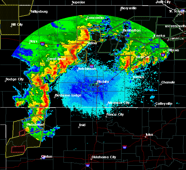 At 932 pm cdt, severe thunderstorms were located along a line extending from brookville to 7 miles northwest of marquette to 6 miles northeast of windom to 8 miles west of inman, moving east at 40 mph (radar indicated). Hazards include 60 mph wind gusts and nickel size hail. Expect damage to roofs. siding. and trees. locations impacted include, mcpherson, lindsborg, marquette, brookville, windom, falun, kanopolis lake, mcpherson airport and kanopolis state park. A tornado watch remains in effect until 1000 pm cdt for central kansas. At 932 pm cdt, severe thunderstorms were located along a line extending from brookville to 7 miles northwest of marquette to 6 miles northeast of windom to 8 miles west of inman, moving east at 40 mph (radar indicated). Hazards include 60 mph wind gusts and nickel size hail. Expect damage to roofs. siding. and trees. locations impacted include, mcpherson, lindsborg, marquette, brookville, windom, falun, kanopolis lake, mcpherson airport and kanopolis state park. A tornado watch remains in effect until 1000 pm cdt for central kansas.
|
| 5/26/2016 9:23 PM CDT |
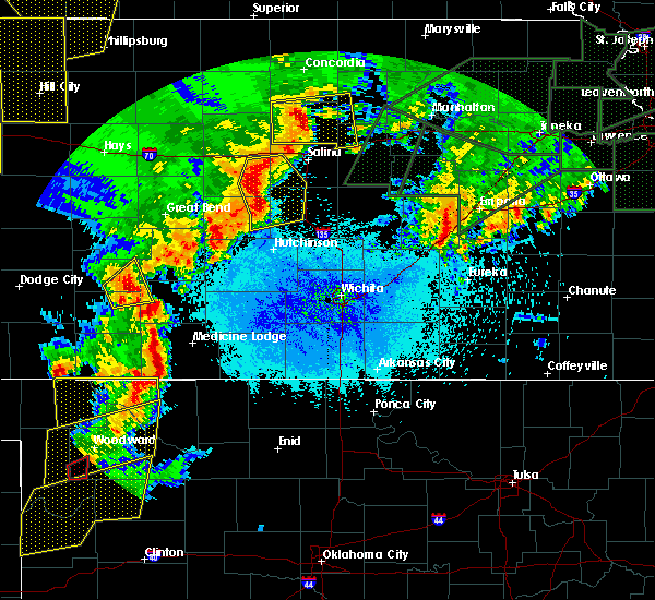 At 923 pm cdt, severe thunderstorms were located along a line extending from 6 miles west of brookville to 9 miles northwest of marquette to near windom to 8 miles northeast of nickerson, moving northeast at 40 mph (radar indicated). Hazards include 60 mph wind gusts and nickel size hail. Expect damage to roofs. siding. and trees. locations impacted include, mcpherson, lindsborg, kanopolis, marquette, little river, brookville, windom, falun, kanopolis lake, mcpherson airport and kanopolis state park. A tornado watch remains in effect until 1000 pm cdt for central kansas. At 923 pm cdt, severe thunderstorms were located along a line extending from 6 miles west of brookville to 9 miles northwest of marquette to near windom to 8 miles northeast of nickerson, moving northeast at 40 mph (radar indicated). Hazards include 60 mph wind gusts and nickel size hail. Expect damage to roofs. siding. and trees. locations impacted include, mcpherson, lindsborg, kanopolis, marquette, little river, brookville, windom, falun, kanopolis lake, mcpherson airport and kanopolis state park. A tornado watch remains in effect until 1000 pm cdt for central kansas.
|
| 5/26/2016 9:10 PM CDT |
 At 910 pm cdt, severe thunderstorms were located along a line extending from kanopolis to geneseo to little river to near sterling, moving east at 40 mph (radar indicated). Hazards include 60 mph wind gusts and quarter size hail. Hail damage to vehicles is expected. expect wind damage to roofs, siding, and trees. locations impacted include, mcpherson, lyons, lindsborg, ellsworth, sterling, kanopolis, marquette, little river, geneseo, brookville, windom, glendale, falun, frederick, mcpherson airport, kanopolis lake, kanopolis state park and ellsworth airport. A tornado watch remains in effect until 1000 pm cdt for central kansas. At 910 pm cdt, severe thunderstorms were located along a line extending from kanopolis to geneseo to little river to near sterling, moving east at 40 mph (radar indicated). Hazards include 60 mph wind gusts and quarter size hail. Hail damage to vehicles is expected. expect wind damage to roofs, siding, and trees. locations impacted include, mcpherson, lyons, lindsborg, ellsworth, sterling, kanopolis, marquette, little river, geneseo, brookville, windom, glendale, falun, frederick, mcpherson airport, kanopolis lake, kanopolis state park and ellsworth airport. A tornado watch remains in effect until 1000 pm cdt for central kansas.
|
| 5/26/2016 8:54 PM CDT |
 At 853 pm cdt, severe thunderstorms were located along a line extending from 6 miles northeast of holyrood to near bushton to near lyons to near alden, moving east at 40 mph (radar indicated). Hazards include 60 mph wind gusts and penny size hail. Expect damage to roofs. siding. And trees. At 853 pm cdt, severe thunderstorms were located along a line extending from 6 miles northeast of holyrood to near bushton to near lyons to near alden, moving east at 40 mph (radar indicated). Hazards include 60 mph wind gusts and penny size hail. Expect damage to roofs. siding. And trees.
|
| 5/26/2016 5:36 PM CDT |
 The severe thunderstorm warning for saline and northwestern mcpherson counties will expire at 545 pm cdt, the storm which prompted the warning has weakened below severe limits and exited the warned area. therefore the warning will be allowed to expire. a tornado watch remains in effect until 1000 pm cdt for central kansas. The severe thunderstorm warning for saline and northwestern mcpherson counties will expire at 545 pm cdt, the storm which prompted the warning has weakened below severe limits and exited the warned area. therefore the warning will be allowed to expire. a tornado watch remains in effect until 1000 pm cdt for central kansas.
|
| 5/26/2016 5:30 PM CDT |
 At 530 pm cdt, a severe thunderstorm was located near marquette, or near lindsborg, moving northeast at 45 mph (trained weather spotters). Hazards include 60 mph wind gusts and quarter size hail. Hail damage to vehicles is expected. expect wind damage to roofs, siding, and trees. locations impacted include, salina, lindsborg, marquette, assaria, brookville, smolan, new cambria, falun, kipp, bridgeport and salina airport. A tornado watch remains in effect until 1000 pm cdt for central kansas. At 530 pm cdt, a severe thunderstorm was located near marquette, or near lindsborg, moving northeast at 45 mph (trained weather spotters). Hazards include 60 mph wind gusts and quarter size hail. Hail damage to vehicles is expected. expect wind damage to roofs, siding, and trees. locations impacted include, salina, lindsborg, marquette, assaria, brookville, smolan, new cambria, falun, kipp, bridgeport and salina airport. A tornado watch remains in effect until 1000 pm cdt for central kansas.
|
| 5/26/2016 5:11 PM CDT |
 At 511 pm cdt, severe thunderstorms were located along a line extending from near windom to near salina, moving northeast at 40 mph (trained weather spotters). Hazards include 60 mph wind gusts and half dollar size hail. Hail damage to vehicles is expected. expect wind damage to roofs, siding, and trees. locations impacted include, salina, lindsborg, marquette, little river, assaria, brookville, smolan, windom, new cambria, falun, kipp, bridgeport, salina airport, kanopolis lake and kanopolis state park. A tornado watch remains in effect until 1000 pm cdt for south central kansas. At 511 pm cdt, severe thunderstorms were located along a line extending from near windom to near salina, moving northeast at 40 mph (trained weather spotters). Hazards include 60 mph wind gusts and half dollar size hail. Hail damage to vehicles is expected. expect wind damage to roofs, siding, and trees. locations impacted include, salina, lindsborg, marquette, little river, assaria, brookville, smolan, windom, new cambria, falun, kipp, bridgeport, salina airport, kanopolis lake and kanopolis state park. A tornado watch remains in effect until 1000 pm cdt for south central kansas.
|
| 5/26/2016 5:05 PM CDT |
 At 504 pm cdt, a severe thunderstorm was located near little river, or 14 miles northeast of lyons, moving northeast at 50 mph (radar indicated). Hazards include 60 mph wind gusts and half dollar size hail. Hail damage to vehicles is expected. expect wind damage to roofs, siding, and trees. locations impacted include, salina, lyons, lindsborg, marquette, little river, assaria, brookville, smolan, windom, new cambria, glendale, falun, kipp, bridgeport, salina airport, kanopolis lake and kanopolis state park. A tornado watch remains in effect until 1000 pm cdt for south central kansas. At 504 pm cdt, a severe thunderstorm was located near little river, or 14 miles northeast of lyons, moving northeast at 50 mph (radar indicated). Hazards include 60 mph wind gusts and half dollar size hail. Hail damage to vehicles is expected. expect wind damage to roofs, siding, and trees. locations impacted include, salina, lyons, lindsborg, marquette, little river, assaria, brookville, smolan, windom, new cambria, glendale, falun, kipp, bridgeport, salina airport, kanopolis lake and kanopolis state park. A tornado watch remains in effect until 1000 pm cdt for south central kansas.
|
| 5/26/2016 5:00 PM CDT |
 At 458 pm cdt, one severe thunderstorm was located near little river, or 11 miles northeast of lyons, a second severe thunderstorm was located near salina moving northeast at 60 mph (trained weather spotters). Hazards include ping pong ball size hail and 60 mph wind gusts. People and animals outdoors will be injured. expect hail damage to roofs, siding, windows, and vehicles. expect wind damage to roofs, siding, and trees. locations impacted include, salina, lyons, lindsborg, ellsworth, kanopolis, lincoln, marquette, little river, assaria, geneseo, brookville, smolan, beverly, lorraine, windom, new cambria, glendale, falun, kipp and frederick. A tornado watch remains in effect until 1000 pm cdt for south central kansas. At 458 pm cdt, one severe thunderstorm was located near little river, or 11 miles northeast of lyons, a second severe thunderstorm was located near salina moving northeast at 60 mph (trained weather spotters). Hazards include ping pong ball size hail and 60 mph wind gusts. People and animals outdoors will be injured. expect hail damage to roofs, siding, windows, and vehicles. expect wind damage to roofs, siding, and trees. locations impacted include, salina, lyons, lindsborg, ellsworth, kanopolis, lincoln, marquette, little river, assaria, geneseo, brookville, smolan, beverly, lorraine, windom, new cambria, glendale, falun, kipp and frederick. A tornado watch remains in effect until 1000 pm cdt for south central kansas.
|
| 5/26/2016 4:46 PM CDT |
 At 446 pm cdt, a severe thunderstorm was located over lyons, moving north at 35 mph (radar indicated). Hazards include 60 mph wind gusts and quarter size hail. Hail damage to vehicles is expected. Expect wind damage to roofs, siding, and trees. At 446 pm cdt, a severe thunderstorm was located over lyons, moving north at 35 mph (radar indicated). Hazards include 60 mph wind gusts and quarter size hail. Hail damage to vehicles is expected. Expect wind damage to roofs, siding, and trees.
|
| 5/11/2016 3:26 AM CDT |
 At 322 am cdt, severe thunderstorms were located along a line extending from 7 miles east of beverly to near geneseo, moving north at 50 mph (radar indicated). Hazards include 70 mph wind gusts and quarter size hail. Hail damage to vehicles is expected. expect considerable tree damage. Wind damage is also likely to mobile homes, roofs, and outbuildings. At 322 am cdt, severe thunderstorms were located along a line extending from 7 miles east of beverly to near geneseo, moving north at 50 mph (radar indicated). Hazards include 70 mph wind gusts and quarter size hail. Hail damage to vehicles is expected. expect considerable tree damage. Wind damage is also likely to mobile homes, roofs, and outbuildings.
|
| 4/24/2016 9:51 PM CDT |
 At 951 pm cdt, a severe thunderstorm was located near lindsborg, moving east at 15 mph (trained weather spotters). Hazards include ping pong ball size hail. People and animals outdoors will be injured. expect damage to roofs, siding, windows, and vehicles. locations impacted include, lindsborg, marquette, assaria, gypsum, falun, roxbury and bridgeport. A tornado watch remains in effect until 1100 pm cdt for central kansas. At 951 pm cdt, a severe thunderstorm was located near lindsborg, moving east at 15 mph (trained weather spotters). Hazards include ping pong ball size hail. People and animals outdoors will be injured. expect damage to roofs, siding, windows, and vehicles. locations impacted include, lindsborg, marquette, assaria, gypsum, falun, roxbury and bridgeport. A tornado watch remains in effect until 1100 pm cdt for central kansas.
|
| 4/24/2016 9:40 PM CDT |
 At 940 pm cdt, a severe thunderstorm was located over lindsborg, moving east at 30 mph (radar indicated). Hazards include tennis ball size hail and 60 mph wind gusts. People and animals outdoors will be injured. expect hail damage to roofs, siding, windows, and vehicles. Expect wind damage to roofs, siding, and trees. At 940 pm cdt, a severe thunderstorm was located over lindsborg, moving east at 30 mph (radar indicated). Hazards include tennis ball size hail and 60 mph wind gusts. People and animals outdoors will be injured. expect hail damage to roofs, siding, windows, and vehicles. Expect wind damage to roofs, siding, and trees.
|
| 4/24/2016 9:20 PM CDT |
 At 920 pm cdt, a severe thunderstorm was located near marquette, or 7 miles west of lindsborg, moving east at 25 mph (radar indicated). Hazards include two inch hail and 60 mph wind gusts. People and animals outdoors will be injured. expect hail damage to roofs, siding, windows, and vehicles. expect wind damage to roofs, siding, and trees. locations impacted include, salina, lindsborg, marquette, assaria, gypsum, smolan, new cambria, falun, kipp, bridgeport, salina airport, roxbury and kanopolis lake. A tornado watch remains in effect until 1100 pm cdt for central kansas. At 920 pm cdt, a severe thunderstorm was located near marquette, or 7 miles west of lindsborg, moving east at 25 mph (radar indicated). Hazards include two inch hail and 60 mph wind gusts. People and animals outdoors will be injured. expect hail damage to roofs, siding, windows, and vehicles. expect wind damage to roofs, siding, and trees. locations impacted include, salina, lindsborg, marquette, assaria, gypsum, smolan, new cambria, falun, kipp, bridgeport, salina airport, roxbury and kanopolis lake. A tornado watch remains in effect until 1100 pm cdt for central kansas.
|
| 4/24/2016 9:12 PM CDT |
 At 911 pm cdt, a severe thunderstorm was located near marquette, or 9 miles west of lindsborg, moving east at 25 mph (radar indicated). Hazards include golf ball size hail and 60 mph wind gusts. People and animals outdoors will be injured. expect hail damage to roofs, siding, windows, and vehicles. expect wind damage to roofs, siding, and trees. locations impacted include, salina, lindsborg, marquette, assaria, gypsum, smolan, new cambria, falun, kipp, bridgeport, salina airport, roxbury, kanopolis state park and kanopolis lake. A tornado watch remains in effect until 1100 pm cdt for central kansas. At 911 pm cdt, a severe thunderstorm was located near marquette, or 9 miles west of lindsborg, moving east at 25 mph (radar indicated). Hazards include golf ball size hail and 60 mph wind gusts. People and animals outdoors will be injured. expect hail damage to roofs, siding, windows, and vehicles. expect wind damage to roofs, siding, and trees. locations impacted include, salina, lindsborg, marquette, assaria, gypsum, smolan, new cambria, falun, kipp, bridgeport, salina airport, roxbury, kanopolis state park and kanopolis lake. A tornado watch remains in effect until 1100 pm cdt for central kansas.
|
| 4/24/2016 9:10 PM CDT | Tennis Ball sized hail reported 3.8 miles SE of Marquette, KS, public report via a twitter picture of tennis ball sized hail. hail has been falling for 30 minutes. |
| 4/24/2016 9:03 PM CDT |
 At 902 pm cdt, a severe thunderstorm was located near marquette, or 8 miles west of lindsborg, moving east at 15 mph (radar indicated). Hazards include golf ball size hail and 60 mph wind gusts. People and animals outdoors will be injured. expect hail damage to roofs, siding, windows, and vehicles. expect wind damage to roofs, siding, and trees. locations impacted include, salina, lindsborg, marquette, assaria, gypsum, brookville, smolan, new cambria, falun, kipp, bridgeport, salina airport, kanopolis state park, roxbury and kanopolis lake. other severe thunderstorms with large hail indications were 2 miles southwest of new cambria, and near gypsum. these storms were also moving east at 15 to 20 mph. A tornado watch remains in effect until 1100 pm cdt for central kansas. At 902 pm cdt, a severe thunderstorm was located near marquette, or 8 miles west of lindsborg, moving east at 15 mph (radar indicated). Hazards include golf ball size hail and 60 mph wind gusts. People and animals outdoors will be injured. expect hail damage to roofs, siding, windows, and vehicles. expect wind damage to roofs, siding, and trees. locations impacted include, salina, lindsborg, marquette, assaria, gypsum, brookville, smolan, new cambria, falun, kipp, bridgeport, salina airport, kanopolis state park, roxbury and kanopolis lake. other severe thunderstorms with large hail indications were 2 miles southwest of new cambria, and near gypsum. these storms were also moving east at 15 to 20 mph. A tornado watch remains in effect until 1100 pm cdt for central kansas.
|
| 4/24/2016 8:53 PM CDT |
 At 852 pm cdt, a severe thunderstorm was located near marquette, or 7 miles northwest of lindsborg, moving east at 35 mph (radar indicated). Hazards include golf ball size hail and 60 mph wind gusts. People and animals outdoors will be injured. expect hail damage to roofs, siding, windows, and vehicles. expect wind damage to roofs, siding, and trees. This thunderstorm warning replaces the previous severe warnings that were in effect for the warned areas. At 852 pm cdt, a severe thunderstorm was located near marquette, or 7 miles northwest of lindsborg, moving east at 35 mph (radar indicated). Hazards include golf ball size hail and 60 mph wind gusts. People and animals outdoors will be injured. expect hail damage to roofs, siding, windows, and vehicles. expect wind damage to roofs, siding, and trees. This thunderstorm warning replaces the previous severe warnings that were in effect for the warned areas.
|
| 4/24/2016 8:22 PM CDT |
 At 821 pm cdt, a severe thunderstorm was located over assaria, or 7 miles south of salina, moving east at 25 mph (radar indicated). Hazards include ping pong ball size hail and 60 mph wind gusts. People and animals outdoors will be injured. expect hail damage to roofs, siding, windows, and vehicles. expect wind damage to roofs, siding, and trees. locations impacted include, salina, lindsborg, marquette, assaria, gypsum, smolan, falun, kipp, roxbury and bridgeport. a second severe thunderstorm was located near lindsborg, moving east at 25 mph. this storm is capable of quarter to pingpong ball sized hail. A tornado watch remains in effect until 1100 pm cdt for central kansas. At 821 pm cdt, a severe thunderstorm was located over assaria, or 7 miles south of salina, moving east at 25 mph (radar indicated). Hazards include ping pong ball size hail and 60 mph wind gusts. People and animals outdoors will be injured. expect hail damage to roofs, siding, windows, and vehicles. expect wind damage to roofs, siding, and trees. locations impacted include, salina, lindsborg, marquette, assaria, gypsum, smolan, falun, kipp, roxbury and bridgeport. a second severe thunderstorm was located near lindsborg, moving east at 25 mph. this storm is capable of quarter to pingpong ball sized hail. A tornado watch remains in effect until 1100 pm cdt for central kansas.
|
| 4/24/2016 8:12 PM CDT |
 At 811 pm cdt, a severe thunderstorm was located over assaria, or 8 miles south of salina, moving east at 40 mph (radar indicated). Hazards include ping pong ball size hail and 60 mph wind gusts. People and animals outdoors will be injured. expect hail damage to roofs, siding, windows, and vehicles. Expect wind damage to roofs, siding, and trees. At 811 pm cdt, a severe thunderstorm was located over assaria, or 8 miles south of salina, moving east at 40 mph (radar indicated). Hazards include ping pong ball size hail and 60 mph wind gusts. People and animals outdoors will be injured. expect hail damage to roofs, siding, windows, and vehicles. Expect wind damage to roofs, siding, and trees.
|
| 8/22/2015 10:40 PM CDT |
 At 1040 pm cdt, a severe thunderstorm was located 8 miles east of lindsborg, moving southeast at 30 mph (trained weather spotters). Hazards include golf ball size hail and 70 mph wind gusts. People and animals outdoors will be injured. expect hail damage to roofs, siding, windows and vehicles. expect considerable tree damage. Wind damage is also likely to mobile homes, roofs and outbuildings. At 1040 pm cdt, a severe thunderstorm was located 8 miles east of lindsborg, moving southeast at 30 mph (trained weather spotters). Hazards include golf ball size hail and 70 mph wind gusts. People and animals outdoors will be injured. expect hail damage to roofs, siding, windows and vehicles. expect considerable tree damage. Wind damage is also likely to mobile homes, roofs and outbuildings.
|
| 8/5/2015 4:25 AM CDT |
 At 425 am cdt, severe thunderstorms were located along a line extending from lehigh to near windom, moving southeast at 25 mph (radar indicated). Hazards include 60 mph wind gusts and nickel size hail. Expect damage to roofs. siding and trees. Locations impacted include, mcpherson, lindsborg, hillsboro, galva, canton, marquette, little river, geneseo, lehigh, windom, tampa, durham, mcpherson airport, marion lake, roxbury and kanopolis lake. At 425 am cdt, severe thunderstorms were located along a line extending from lehigh to near windom, moving southeast at 25 mph (radar indicated). Hazards include 60 mph wind gusts and nickel size hail. Expect damage to roofs. siding and trees. Locations impacted include, mcpherson, lindsborg, hillsboro, galva, canton, marquette, little river, geneseo, lehigh, windom, tampa, durham, mcpherson airport, marion lake, roxbury and kanopolis lake.
|
| 8/5/2015 4:03 AM CDT |
 At 402 am cdt, severe thunderstorms were located along a line extending from 10 miles south of gypsum to near geneseo, moving southeast at 35 mph (radar indicated). Hazards include 60 mph wind gusts and nickel size hail. Expect damage to roofs. Siding and trees. At 402 am cdt, severe thunderstorms were located along a line extending from 10 miles south of gypsum to near geneseo, moving southeast at 35 mph (radar indicated). Hazards include 60 mph wind gusts and nickel size hail. Expect damage to roofs. Siding and trees.
|
| 7/18/2015 7:13 PM CDT | Storm damage reported in mcpherson county KS, 5.2 miles NW of Marquette, KS |
| 5/25/2015 4:36 PM CDT | At 435 pm cdt, a severe thunderstorm capable of producing a tornado was located just east of marquette, or 5 miles southwest of lindsborg, moving northeast at 20 mph (radar indicated rotation). Hazards include tornado and half dollar size hail. Flying debris will be dangerous to those caught without shelter. mobile homes will be damaged or destroyed. damage to roofs, windows and vehicles will occur. tree damage is likely. This dangerous storm will be near, lindsborg around 450 pm cdt. |
| 5/25/2015 4:27 PM CDT | At 426 pm cdt, a severe thunderstorm capable of producing a tornado was located near marquette, or 10 miles west of lindsborg, moving northeast at 15 mph (weather spotters reported funnel cloud). Hazards include tornado and half dollar size hail. Flying debris will be dangerous to those caught without shelter. mobile homes will be damaged or destroyed. damage to roofs, windows and vehicles will occur. tree damage is likely. this dangerous storm will be near, marquette around 440 pm cdt. lindsborg around 500 pm cdt. This includes interstate 135 between mile markers 69 and 73. |
| 4/16/2015 5:29 PM CDT | At 527 pm cdt, a severe thunderstorm was located 6 miles south of marquette, or 9 miles northwest of mcpherson, moving north at 15 mph. another strong to severe thunderstorm was located south of mcpherson, moving north (radar indicated). Hazards include quarter size hail. Damage to vehicles is expected. locations impacted include, mcpherson, moundridge, inman, galva, canton, marquette, windom and mcpherson airport. 1. 00in. |
| 4/16/2015 5:13 PM CDT | At 512 pm cdt, two severe thunderstorms, one located northwest of moundridge and another located near windom were, moving north at 20 mph (radar indicated). Hazards include quarter size hail. damage to vehicles is expected |
| 4/16/2015 5:05 PM CDT | At 505 pm cdt, a severe thunderstorm was located near moundridge, moving north at 20 mph. another strong to severe thunderstorm was located over far western mcpherson county, moving northeast (radar indicated). Hazards include half dollar size hail. Damage to vehicles is expected. locations impacted include, mcpherson, lindsborg, moundridge, inman, galva, canton, marquette, windom, mcpherson airport and roxbury. 1. 25in. |
| 4/16/2015 4:51 PM CDT | At 450 pm cdt, a severe thunderstorm was located near moundridge, moving north at 20 mph. additional strong to severe thunderstorms were located in western mcpherson county (radar indicated). Hazards include quarter size hail. damage to vehicles is expected |
| 4/12/2015 8:24 PM CDT | A severe thunderstorm warning remains in effect until 900 pm cdt for western mcpherson county. at 824 pm cdt. severe thunderstorms were located along a line extending from near windom to 5 miles northwest of inman. moving east at 40 mph. hazard. Half dollar size hail and 60 mph wind gusts. |
| 4/12/2015 8:14 PM CDT | The national weather service in wichita has issued a * severe thunderstorm warning for. western mcpherson county in central kansas. until 900 pm cdt * at 814 pm cdt. Severe thunderstorms were located along a line extending from near windom to 8 miles southeast of little river. |
| 6/5/2014 5:35 AM CDT | A tin shed was blown apart and wrapped around a power pole. time is estimated from rada in mcpherson county KS, 0.4 miles NW of Marquette, KS |
| 6/27/2013 5:30 PM CDT | Large trees knocked down all over in mcpherson county KS, 0.4 miles NW of Marquette, KS |
| 6/27/2013 5:11 PM CDT | 3 to 4 inch limbs dow in ellsworth county KS, 6.8 miles E of Marquette, KS |
| 5/30/2012 5:50 PM CDT | Quarter sized hail reported 5.2 miles N of Marquette, KS |
| 1/1/0001 12:00 AM | Storm damage reported in mcpherson county KS, 4.3 miles NW of Marquette, KS |
| 1/1/0001 12:00 AM | Trained spotter measured 59 mph wind gus in mcpherson county KS, 4.3 miles NW of Marquette, KS |
Hail Maps for Marquette, KS


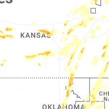


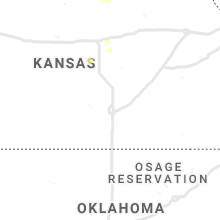


Connect with Interactive Hail Maps