

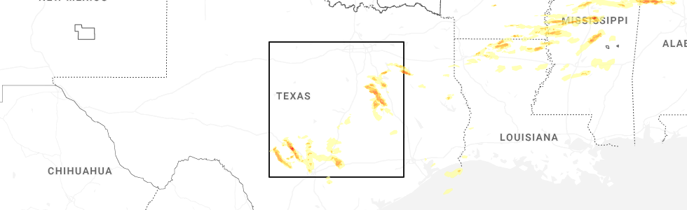
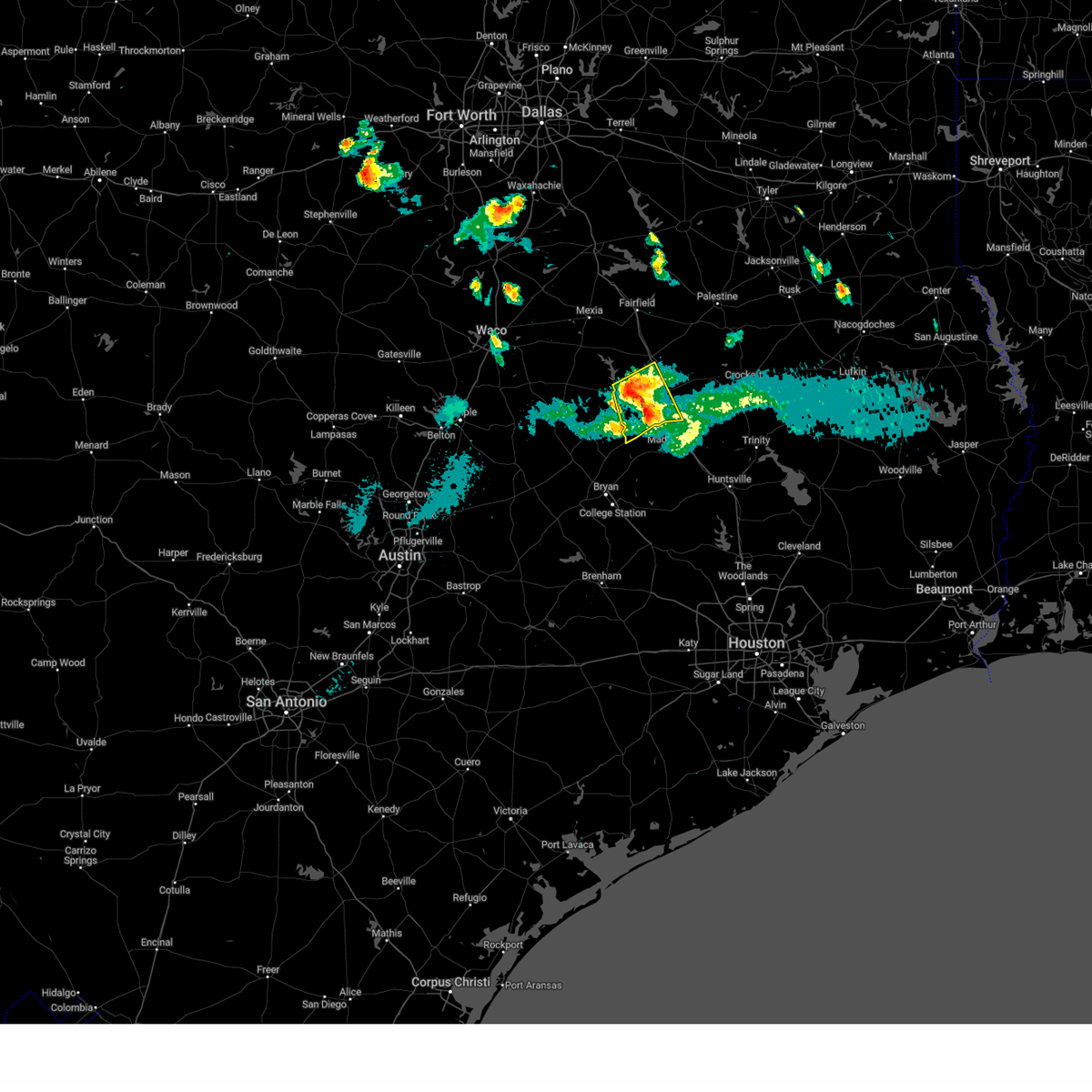
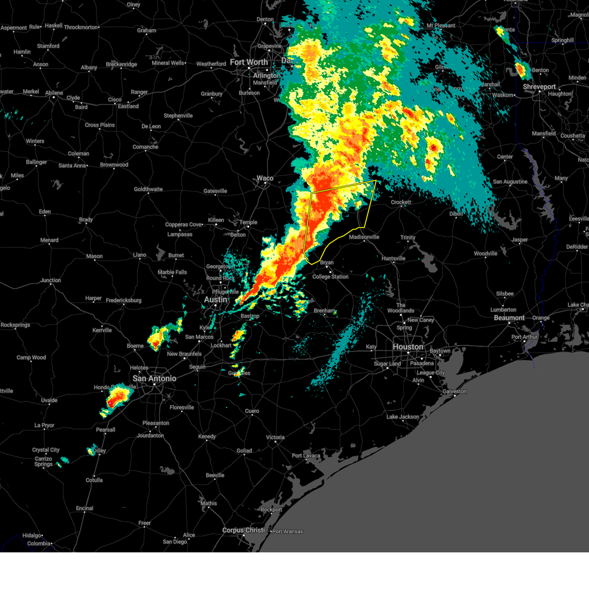
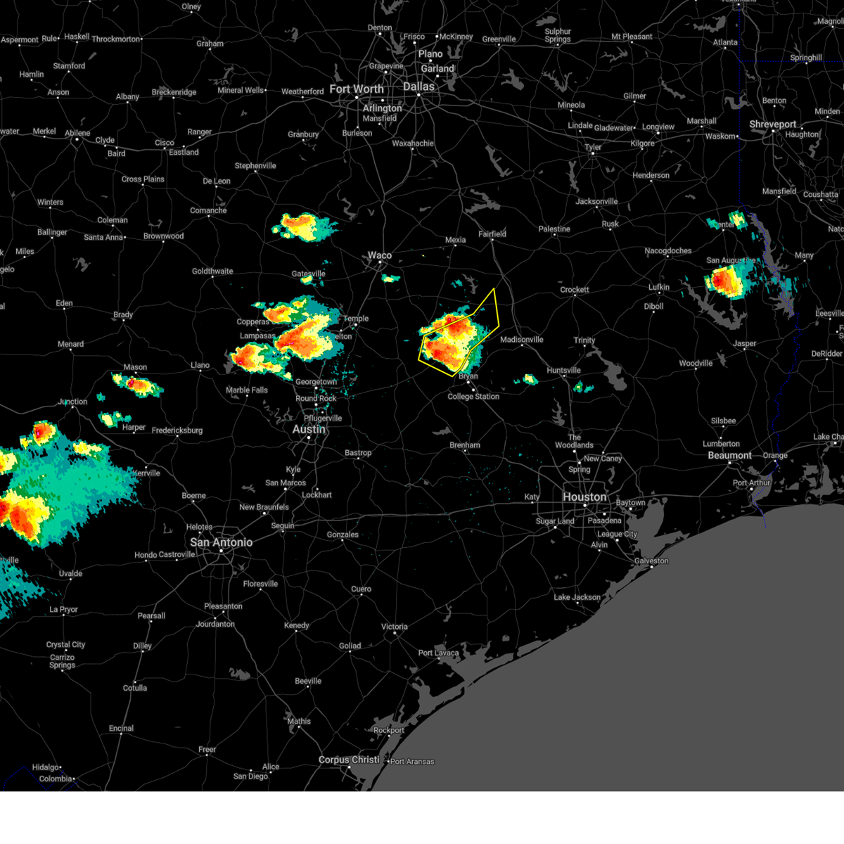
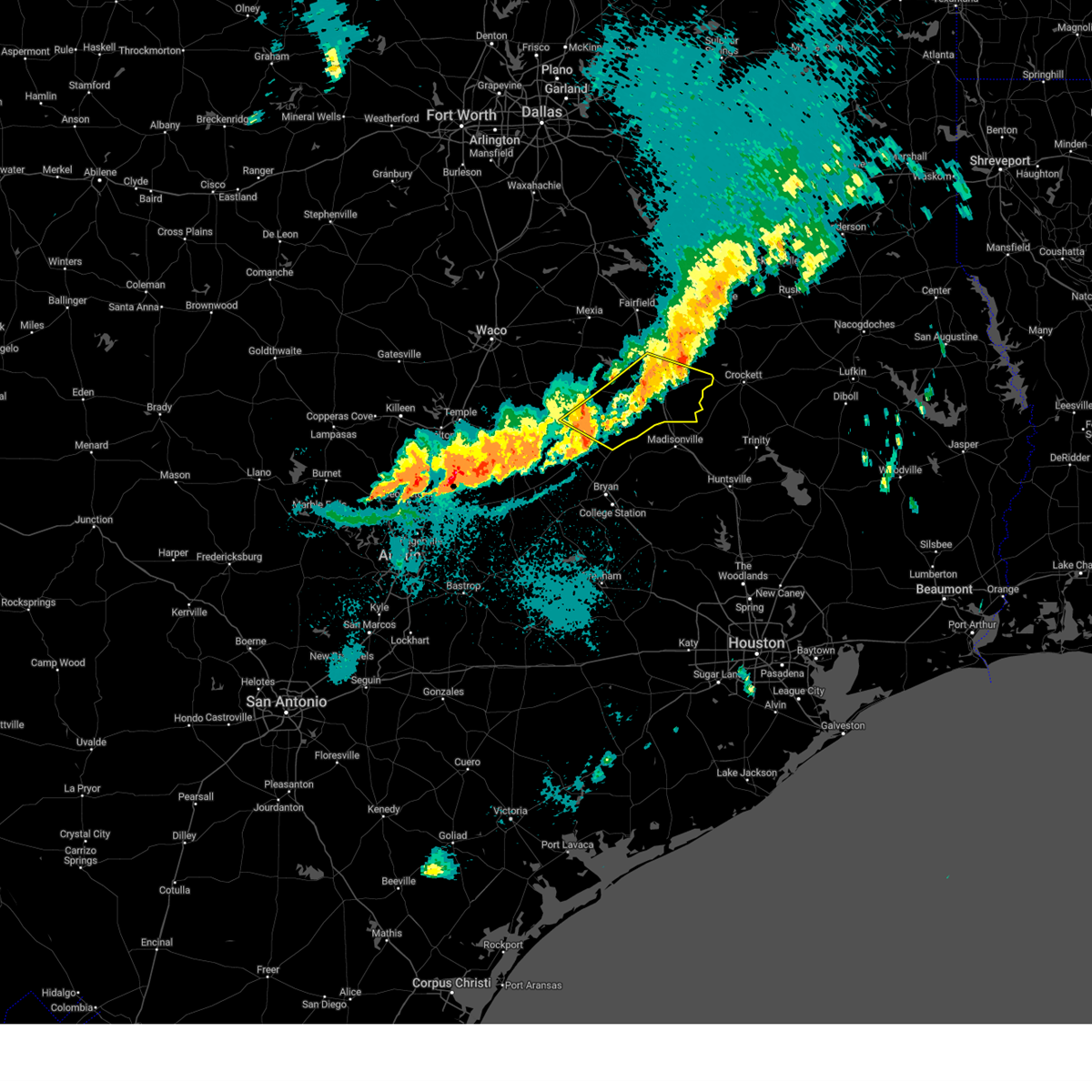
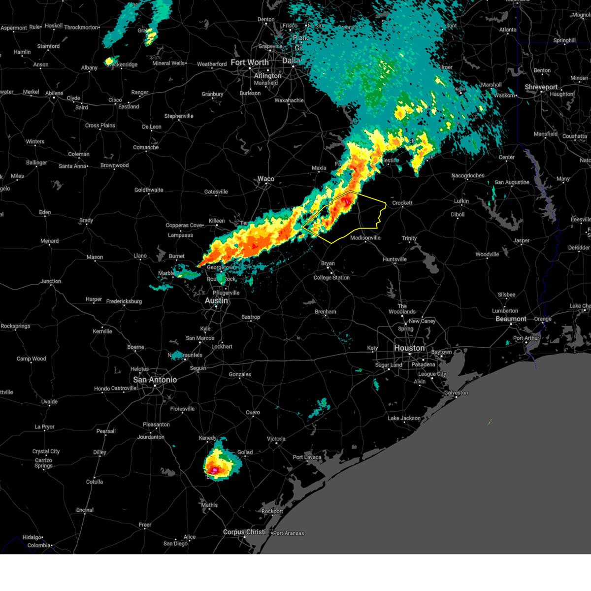
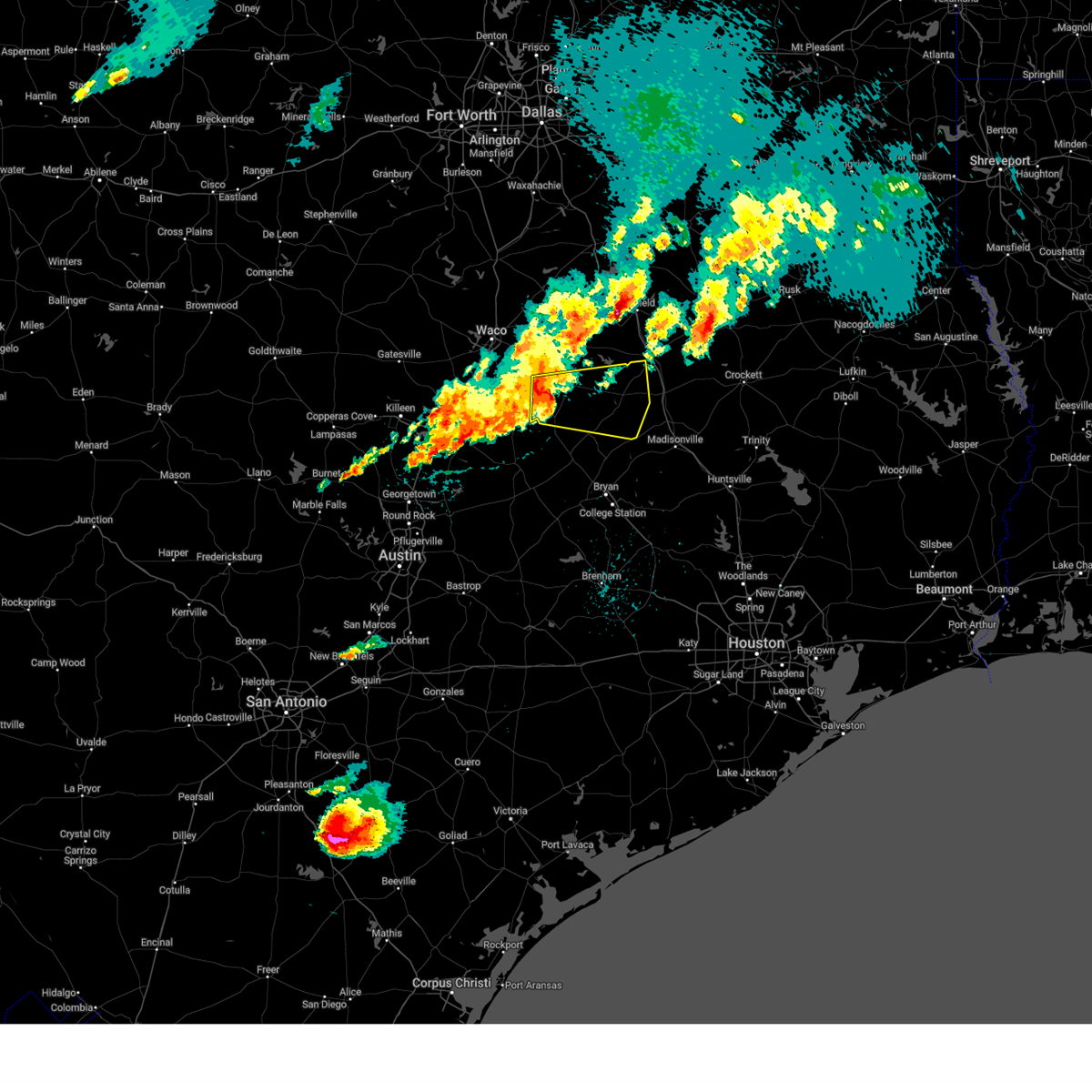
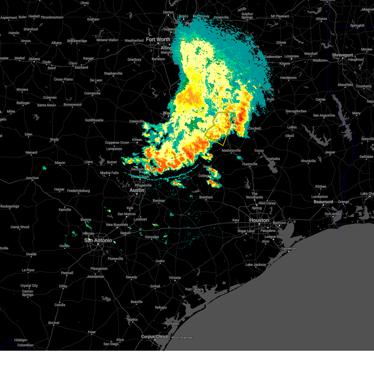
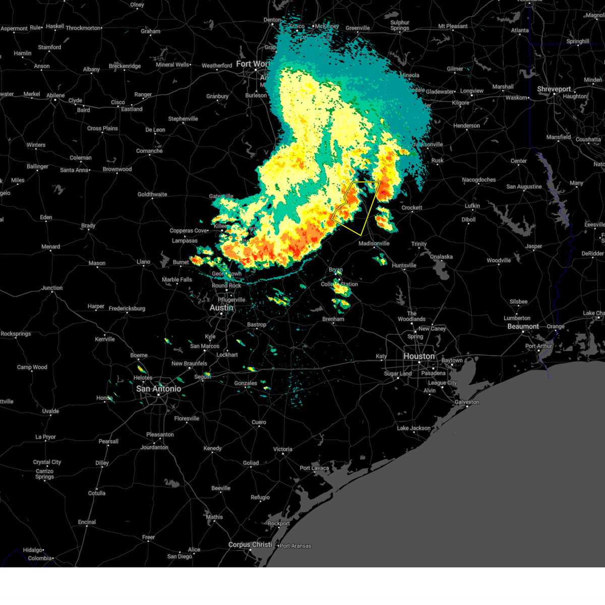
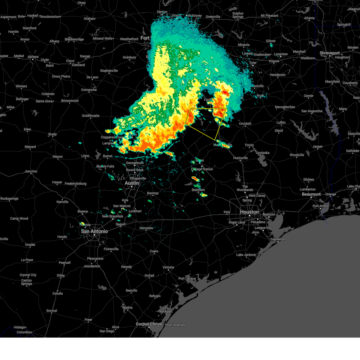
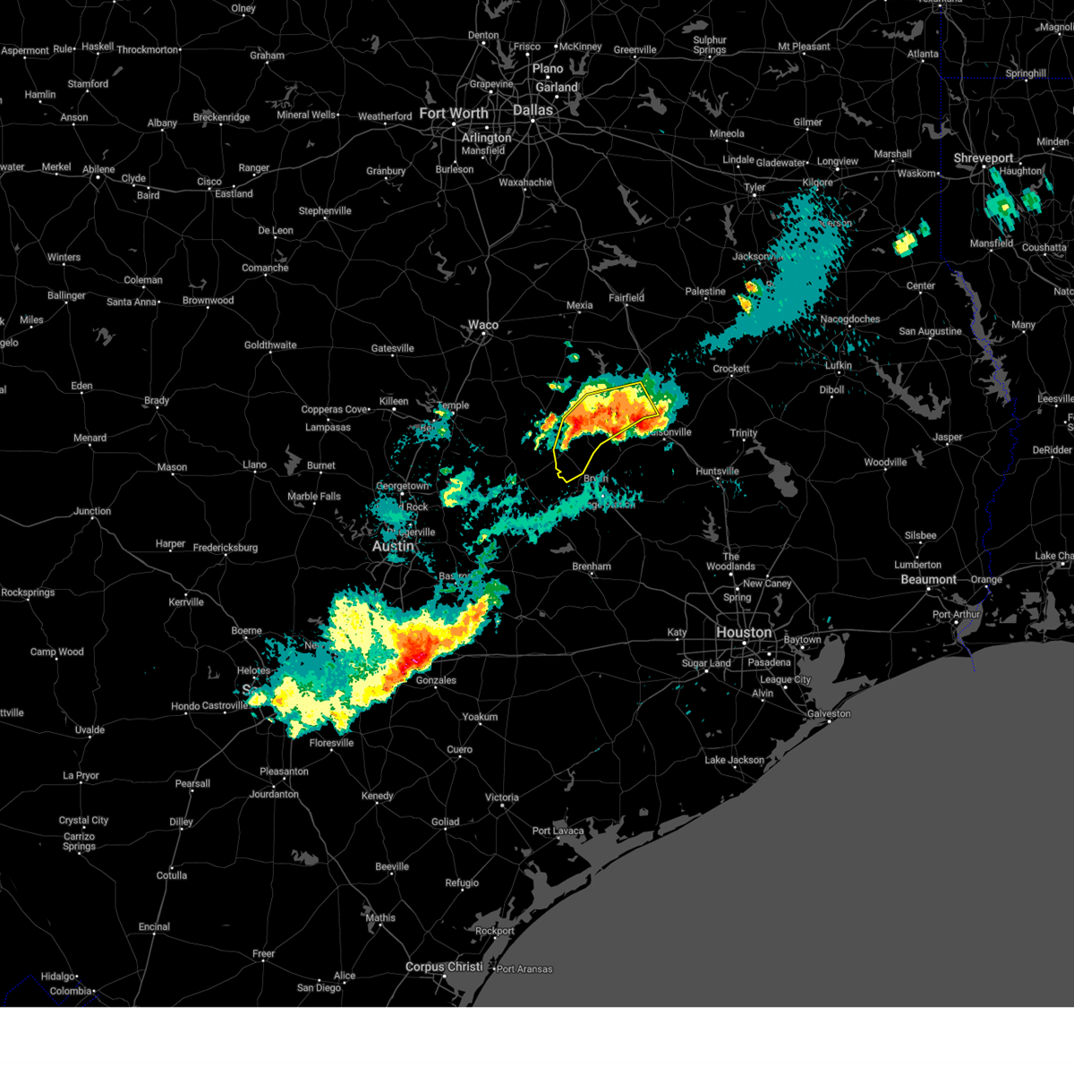
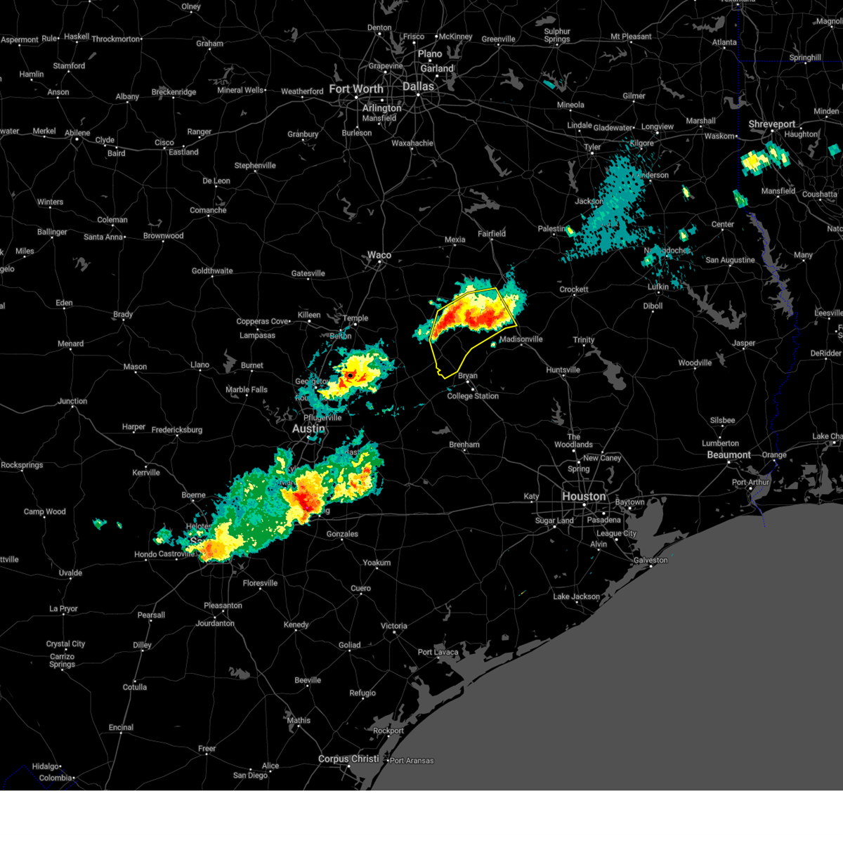
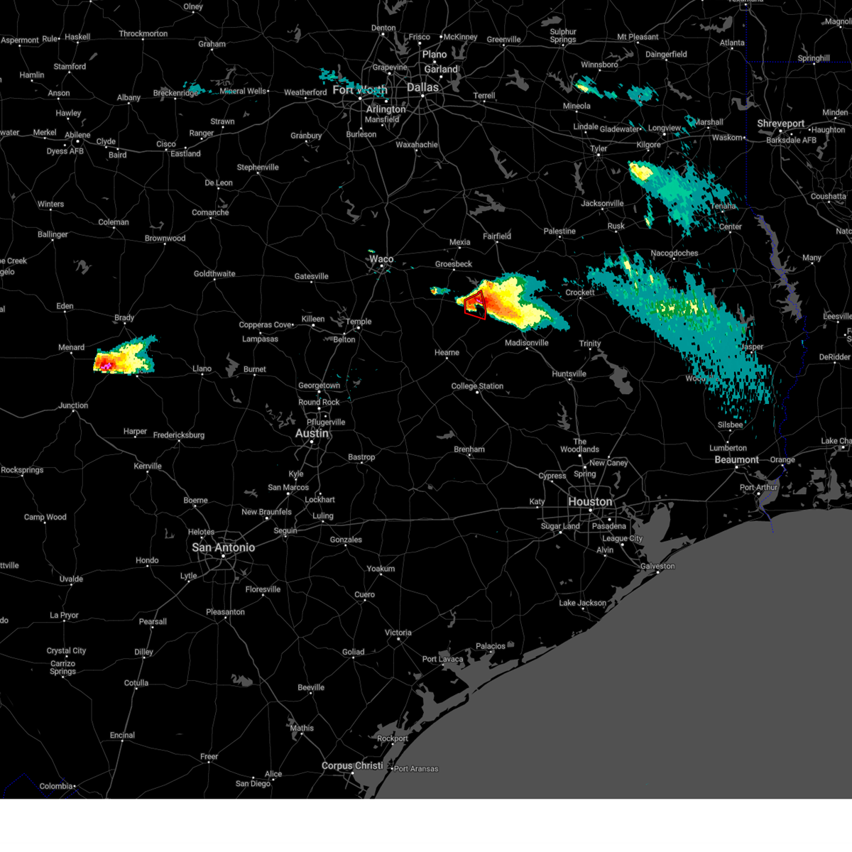
Hail Map for Marquez, TX
The Marquez, TX area has had 5 reports of on-the-ground hail by trained spotters, and has been under severe weather warnings 33 times during the past 12 months. Doppler radar has detected hail at or near Marquez, TX on 48 occasions, including 6 occasions during the past year.
| Name: | Marquez, TX |
| Where Located: | 87.4 miles E of Killeen, TX |
| Map: | Google Map for Marquez, TX |
| Population: | 263 |
| Housing Units: | 138 |
| More Info: | Search Google for Marquez, TX |
5
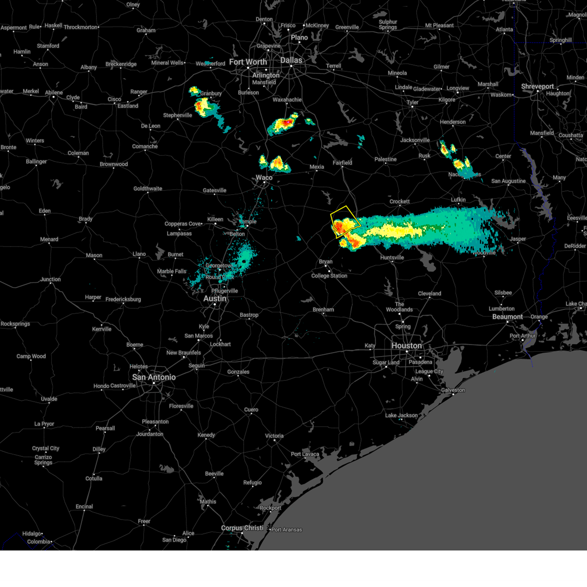
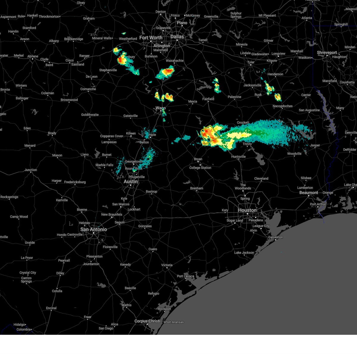
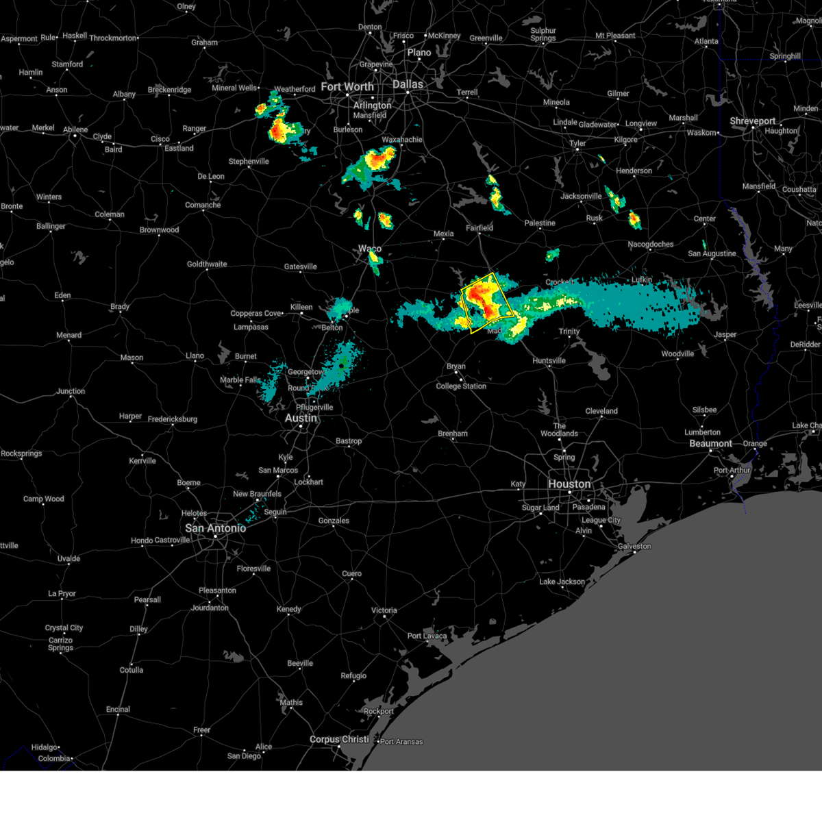
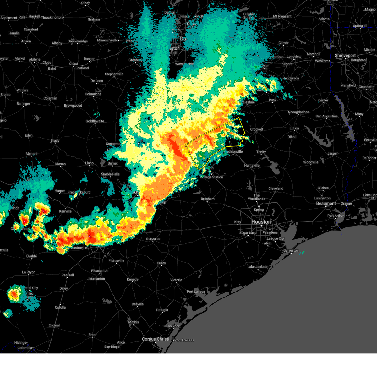
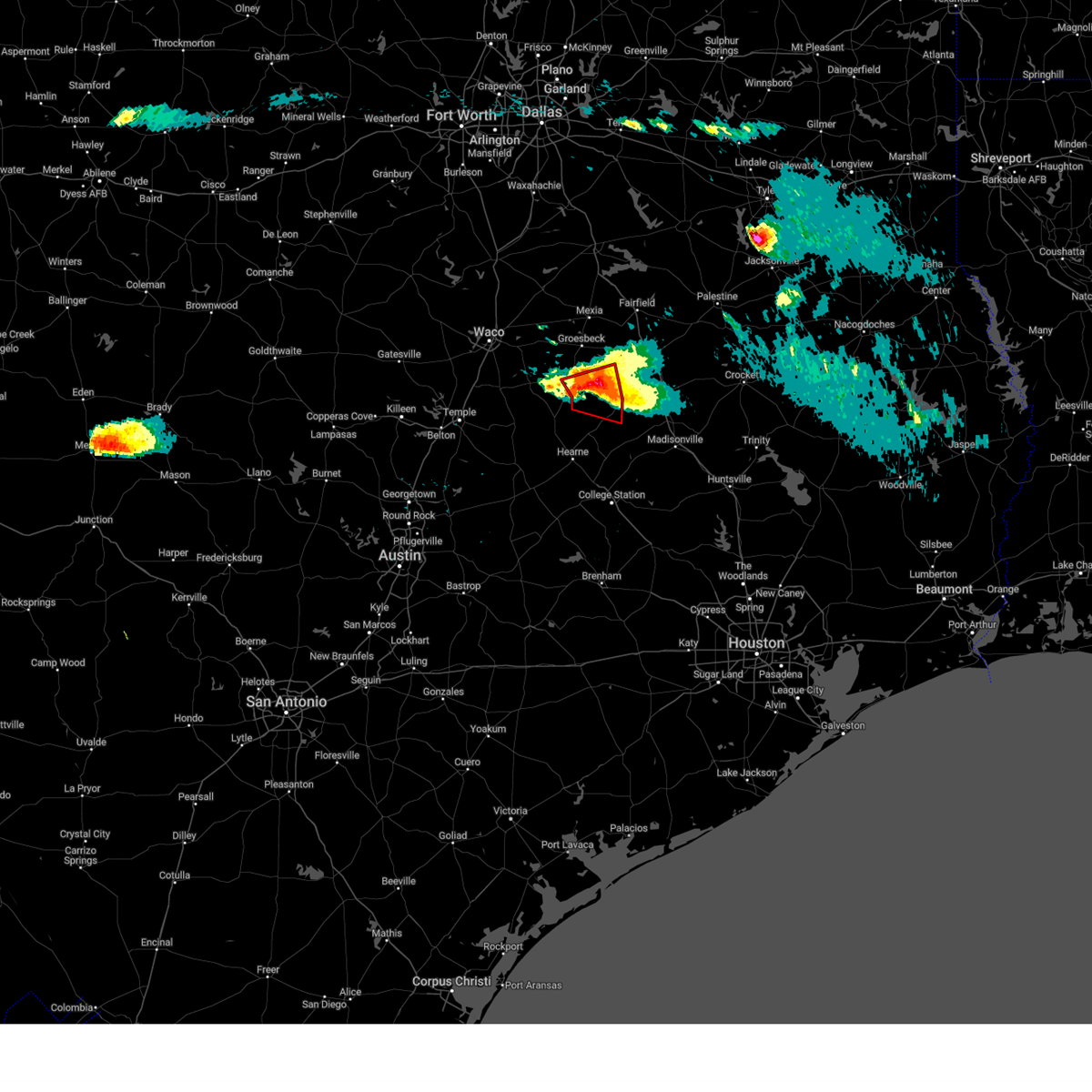
The Top Recent Hail Date for Marquez, TX is Sunday, March 23, 2025 (1st out of 48)
Hail and Wind Damage Spotted near Marquez, TX
| Date / Time | Report Details |
|---|---|
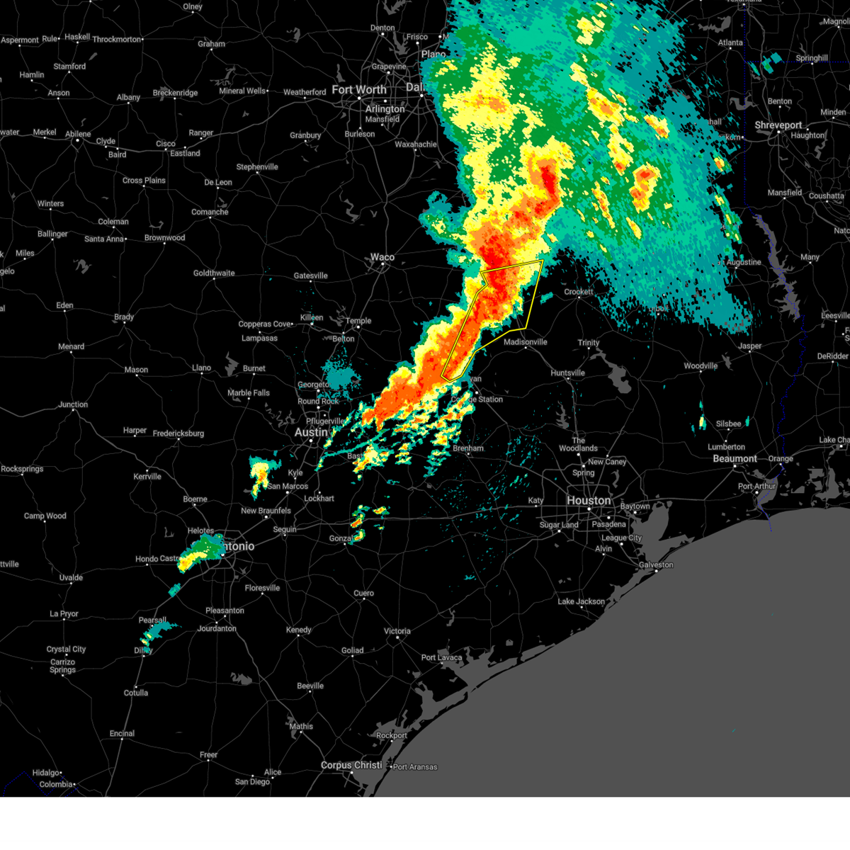
| 6/1/2025 10:47 PM CDT |
 The storm which prompted the warning has weakened below severe limits. therefore the warning has been allowed to expire. however gusty winds and heavy rain are still possible with this thunderstorm. a severe thunderstorm watch remains in effect until midnight cdt for central texas. The storm which prompted the warning has weakened below severe limits. therefore the warning has been allowed to expire. however gusty winds and heavy rain are still possible with this thunderstorm. a severe thunderstorm watch remains in effect until midnight cdt for central texas.
|
| 6/1/2025 10:31 PM CDT |
 At 1031 pm cdt, a severe thunderstorm was located 10 miles northeast of camp creek lake, or 21 miles northwest of madisonville, moving south at 25 mph (radar indicated). Hazards include 60 mph wind gusts and penny size hail. Expect damage to roofs, siding, and trees. Locations impacted include, hilltop lakes, robbins, flynn, marquez, normangee, and leona. At 1031 pm cdt, a severe thunderstorm was located 10 miles northeast of camp creek lake, or 21 miles northwest of madisonville, moving south at 25 mph (radar indicated). Hazards include 60 mph wind gusts and penny size hail. Expect damage to roofs, siding, and trees. Locations impacted include, hilltop lakes, robbins, flynn, marquez, normangee, and leona.
|
| 6/1/2025 10:19 PM CDT |
 At 1019 pm cdt, a severe thunderstorm was located 8 miles west of fort boggy state park, or 20 miles northwest of madisonville, moving southeast at 30 mph (radar indicated). Hazards include 60 mph wind gusts and quarter size hail. Hail damage to vehicles is expected. expect wind damage to roofs, siding, and trees. Locations impacted include, redland, jewett, marquez, leona, hilltop lakes, robbins, flynn, centerville, fort boggy state park, and normangee. At 1019 pm cdt, a severe thunderstorm was located 8 miles west of fort boggy state park, or 20 miles northwest of madisonville, moving southeast at 30 mph (radar indicated). Hazards include 60 mph wind gusts and quarter size hail. Hail damage to vehicles is expected. expect wind damage to roofs, siding, and trees. Locations impacted include, redland, jewett, marquez, leona, hilltop lakes, robbins, flynn, centerville, fort boggy state park, and normangee.
|
| 6/1/2025 10:19 PM CDT |
 the severe thunderstorm warning has been cancelled and is no longer in effect the severe thunderstorm warning has been cancelled and is no longer in effect
|
| 6/1/2025 9:56 PM CDT |
 Svrfwd the national weather service in fort worth has issued a * severe thunderstorm warning for, south central freestone county in central texas, southwestern leon county in central texas, east central limestone county in central texas, * until 1045 pm cdt. * at 955 pm cdt, a severe thunderstorm was located 8 miles east of lake limestone, or 19 miles south of teague, moving southeast at 30 mph (radar indicated). Hazards include 60 mph wind gusts and quarter size hail. Hail damage to vehicles is expected. expect wind damage to roofs, siding, and trees. this severe thunderstorm will remain over mainly rural areas of south central freestone, southwestern leon and east central limestone counties, including the following locations, redland, farrar, jewett, marquez, leona, hilltop lakes, donie, robbins, flynn, and normangee. This includes interstate 45 between mile markers 152 and 171, and between mile markers 176 and 186. Svrfwd the national weather service in fort worth has issued a * severe thunderstorm warning for, south central freestone county in central texas, southwestern leon county in central texas, east central limestone county in central texas, * until 1045 pm cdt. * at 955 pm cdt, a severe thunderstorm was located 8 miles east of lake limestone, or 19 miles south of teague, moving southeast at 30 mph (radar indicated). Hazards include 60 mph wind gusts and quarter size hail. Hail damage to vehicles is expected. expect wind damage to roofs, siding, and trees. this severe thunderstorm will remain over mainly rural areas of south central freestone, southwestern leon and east central limestone counties, including the following locations, redland, farrar, jewett, marquez, leona, hilltop lakes, donie, robbins, flynn, and normangee. This includes interstate 45 between mile markers 152 and 171, and between mile markers 176 and 186.
|
| 6/1/2025 9:41 PM CDT |
 At 940 pm cdt, a severe thunderstorm was located 7 miles northeast of lake limestone, or 12 miles south of teague, moving southeast at 30 mph (radar indicated). Hazards include 60 mph wind gusts and quarter size hail. Hail damage to vehicles is expected. expect wind damage to roofs, siding, and trees. Locations impacted include, pleasant springs, lake limestone, jewett, fallon, flo, donie, robbins, freestone, farrar, marquez, dew, corinth, buffalo, lanely, and teague. At 940 pm cdt, a severe thunderstorm was located 7 miles northeast of lake limestone, or 12 miles south of teague, moving southeast at 30 mph (radar indicated). Hazards include 60 mph wind gusts and quarter size hail. Hail damage to vehicles is expected. expect wind damage to roofs, siding, and trees. Locations impacted include, pleasant springs, lake limestone, jewett, fallon, flo, donie, robbins, freestone, farrar, marquez, dew, corinth, buffalo, lanely, and teague.
|
| 6/1/2025 9:23 PM CDT |
 At 922 pm cdt, a severe thunderstorm was located near teague, moving southeast at 25 mph (radar indicated). Hazards include ping pong ball size hail and 60 mph wind gusts. People and animals outdoors will be injured. expect hail damage to roofs, siding, windows, and vehicles. expect wind damage to roofs, siding, and trees. This severe thunderstorm will remain over mainly rural areas of southwestern freestone, northwestern leon and east central limestone counties, including the following locations, pleasant springs, lanely, farrar, jewett, marquez, fallon, dew, flo, corinth, and donie. At 922 pm cdt, a severe thunderstorm was located near teague, moving southeast at 25 mph (radar indicated). Hazards include ping pong ball size hail and 60 mph wind gusts. People and animals outdoors will be injured. expect hail damage to roofs, siding, windows, and vehicles. expect wind damage to roofs, siding, and trees. This severe thunderstorm will remain over mainly rural areas of southwestern freestone, northwestern leon and east central limestone counties, including the following locations, pleasant springs, lanely, farrar, jewett, marquez, fallon, dew, flo, corinth, and donie.
|
| 6/1/2025 9:07 PM CDT |
 Svrfwd the national weather service in fort worth has issued a * severe thunderstorm warning for, southwestern freestone county in central texas, northwestern leon county in central texas, northeastern limestone county in central texas, * until 1000 pm cdt. * at 907 pm cdt, a severe thunderstorm was located near teague, moving southeast at 30 mph (radar indicated). Hazards include ping pong ball size hail and 60 mph wind gusts. People and animals outdoors will be injured. expect hail damage to roofs, siding, windows, and vehicles. expect wind damage to roofs, siding, and trees. this severe thunderstorm will be near, teague around 910 pm cdt. other locations impacted by this severe thunderstorm include pleasant springs, lanely, jewett, fallon, flo, stewards mill, donie, robbins, freestone, and cotton gin. This includes interstate 45 between mile markers 166 and 206. Svrfwd the national weather service in fort worth has issued a * severe thunderstorm warning for, southwestern freestone county in central texas, northwestern leon county in central texas, northeastern limestone county in central texas, * until 1000 pm cdt. * at 907 pm cdt, a severe thunderstorm was located near teague, moving southeast at 30 mph (radar indicated). Hazards include ping pong ball size hail and 60 mph wind gusts. People and animals outdoors will be injured. expect hail damage to roofs, siding, windows, and vehicles. expect wind damage to roofs, siding, and trees. this severe thunderstorm will be near, teague around 910 pm cdt. other locations impacted by this severe thunderstorm include pleasant springs, lanely, jewett, fallon, flo, stewards mill, donie, robbins, freestone, and cotton gin. This includes interstate 45 between mile markers 166 and 206.
|
| 5/26/2025 10:08 PM CDT |
 Svrfwd the national weather service in fort worth has issued a * severe thunderstorm warning for, robertson county in central texas, leon county in central texas, * until 1115 pm cdt. * at 1007 pm cdt, a severe thunderstorm was located near franklin, or 12 miles north of hearne, moving east at 50 mph (radar indicated). Hazards include 60 mph wind gusts and quarter size hail. Hail damage to vehicles is expected. expect wind damage to roofs, siding, and trees. this severe thunderstorm will be near, franklin around 1015 pm cdt. camp creek lake around 1020 pm cdt. other locations impacted by this severe thunderstorm include pleasant springs, jewett, flo, easterly, benchley, robbins, new baden, eunice, bald prairie, and redland. This includes interstate 45 between mile markers 151 and 177. Svrfwd the national weather service in fort worth has issued a * severe thunderstorm warning for, robertson county in central texas, leon county in central texas, * until 1115 pm cdt. * at 1007 pm cdt, a severe thunderstorm was located near franklin, or 12 miles north of hearne, moving east at 50 mph (radar indicated). Hazards include 60 mph wind gusts and quarter size hail. Hail damage to vehicles is expected. expect wind damage to roofs, siding, and trees. this severe thunderstorm will be near, franklin around 1015 pm cdt. camp creek lake around 1020 pm cdt. other locations impacted by this severe thunderstorm include pleasant springs, jewett, flo, easterly, benchley, robbins, new baden, eunice, bald prairie, and redland. This includes interstate 45 between mile markers 151 and 177.
|
| 5/6/2025 1:18 PM CDT |
 At 117 pm cdt, severe thunderstorms were located along a line extending from near buffalo to camp creek lake, moving east at 45 mph (radar indicated). Hazards include 60 mph wind gusts and quarter size hail. Hail damage to vehicles is expected. expect wind damage to roofs, siding, and trees. these severe storms will be near, centerville and fort boggy state park around 130 pm cdt. Other locations impacted by these severe thunderstorms include pleasant springs, jewett, flo, easterly, benchley, donie, robbins, new baden, redland, and wheelock. At 117 pm cdt, severe thunderstorms were located along a line extending from near buffalo to camp creek lake, moving east at 45 mph (radar indicated). Hazards include 60 mph wind gusts and quarter size hail. Hail damage to vehicles is expected. expect wind damage to roofs, siding, and trees. these severe storms will be near, centerville and fort boggy state park around 130 pm cdt. Other locations impacted by these severe thunderstorms include pleasant springs, jewett, flo, easterly, benchley, donie, robbins, new baden, redland, and wheelock.
|
| 5/6/2025 1:18 PM CDT |
 the severe thunderstorm warning has been cancelled and is no longer in effect the severe thunderstorm warning has been cancelled and is no longer in effect
|
| 5/6/2025 1:11 PM CDT | Torfwd the national weather service in fort worth has issued a * tornado warning for, northeastern robertson county in central texas, leon county in central texas, * until 215 pm cdt. * at 110 pm cdt, a severe thunderstorm capable of producing a tornado was located 5 miles east of franklin, moving east at 40 mph. another severe thunderstorm capable of producing a tornado was near jewett, moving east at 40 mph (radar indicated rotation). Hazards include tornado and quarter size hail. Flying debris will be dangerous to those caught without shelter. mobile homes will be damaged or destroyed. damage to roofs, windows, and vehicles will occur. Tree damage is likely. |
| 5/6/2025 12:51 PM CDT |
 Svrfwd the national weather service in fort worth has issued a * severe thunderstorm warning for, southeastern freestone county in central texas, robertson county in central texas, leon county in central texas, southeastern limestone county in central texas, * until 145 pm cdt. * at 1250 pm cdt, severe thunderstorms were located along a line extending from lake limestone to near hearne, moving east at 35 mph (radar indicated). Hazards include 60 mph wind gusts and quarter size hail. Hail damage to vehicles is expected. expect wind damage to roofs, siding, and trees. severe thunderstorms will be near, twin oak reservoir, franklin, and lake limestone around 1255 pm cdt. camp creek lake around 105 pm cdt. buffalo around 120 pm cdt. centerville and fort boggy state park around 135 pm cdt. other locations impacted by these severe thunderstorms include pleasant springs, jewett, flo, seale, easterly, benchley, donie, robbins, new baden, and bald prairie. This includes interstate 45 between mile markers 152 and 184. Svrfwd the national weather service in fort worth has issued a * severe thunderstorm warning for, southeastern freestone county in central texas, robertson county in central texas, leon county in central texas, southeastern limestone county in central texas, * until 145 pm cdt. * at 1250 pm cdt, severe thunderstorms were located along a line extending from lake limestone to near hearne, moving east at 35 mph (radar indicated). Hazards include 60 mph wind gusts and quarter size hail. Hail damage to vehicles is expected. expect wind damage to roofs, siding, and trees. severe thunderstorms will be near, twin oak reservoir, franklin, and lake limestone around 1255 pm cdt. camp creek lake around 105 pm cdt. buffalo around 120 pm cdt. centerville and fort boggy state park around 135 pm cdt. other locations impacted by these severe thunderstorms include pleasant springs, jewett, flo, seale, easterly, benchley, donie, robbins, new baden, and bald prairie. This includes interstate 45 between mile markers 152 and 184.
|
| 5/2/2025 4:31 PM CDT |
 At 431 pm cdt, a severe thunderstorm was located 10 miles east of camp creek lake, or 17 miles northwest of madisonville, moving east at 35 mph (radar indicated). Hazards include 65 mph wind gusts and quarter size hail. Hail damage to vehicles is expected. expect wind damage to roofs, siding, and trees. This severe thunderstorm will remain over mainly rural areas of northeastern robertson and leon counties, including the following locations, redland, pleasant springs, normangee, jewett, marquez, leona, centerview, hilltop lakes, robbins, and flynn. At 431 pm cdt, a severe thunderstorm was located 10 miles east of camp creek lake, or 17 miles northwest of madisonville, moving east at 35 mph (radar indicated). Hazards include 65 mph wind gusts and quarter size hail. Hail damage to vehicles is expected. expect wind damage to roofs, siding, and trees. This severe thunderstorm will remain over mainly rural areas of northeastern robertson and leon counties, including the following locations, redland, pleasant springs, normangee, jewett, marquez, leona, centerview, hilltop lakes, robbins, and flynn.
|
| 5/2/2025 4:31 PM CDT |
 the severe thunderstorm warning has been cancelled and is no longer in effect the severe thunderstorm warning has been cancelled and is no longer in effect
|
| 5/2/2025 3:46 PM CDT | Svrfwd the national weather service in fort worth has issued a * severe thunderstorm warning for, robertson county in central texas, northeastern milam county in central texas, leon county in central texas, * until 445 pm cdt. * at 345 pm cdt, a severe thunderstorm was located near kosse, or 17 miles south of groesbeck, moving southeast at 35 mph (radar indicated). Hazards include 65 mph wind gusts and quarter size hail. Hail damage to vehicles is expected. expect wind damage to roofs, siding, and trees. this severe thunderstorm will be near, twin oak reservoir around 350 pm cdt. camp creek lake around 425 pm cdt. other locations impacted by this severe thunderstorm include ben arnold, baileyville, crossroads, robbins, new baden, redland, normangee, wheelock, marquez, and burlington. This includes interstate 45 between mile markers 152 and 172. |
| 5/1/2025 5:14 PM CDT |
 Svrfwd the national weather service in fort worth has issued a * severe thunderstorm warning for, robertson county in central texas, northeastern milam county in central texas, southwestern leon county in central texas, * until 600 pm cdt. * at 513 pm cdt, a severe thunderstorm was located over hearne, moving southeast at 5 mph (radar indicated). Hazards include 60 mph wind gusts and half dollar size hail. Hail damage to vehicles is expected. expect wind damage to roofs, siding, and trees. this severe thunderstorm will be near, hearne around 520 pm cdt. Other locations impacted by this severe thunderstorm include wheelock, marquez, branchville, easterly, hilltop lakes, flynn, new baden, ridge, jewett, and benchley. Svrfwd the national weather service in fort worth has issued a * severe thunderstorm warning for, robertson county in central texas, northeastern milam county in central texas, southwestern leon county in central texas, * until 600 pm cdt. * at 513 pm cdt, a severe thunderstorm was located over hearne, moving southeast at 5 mph (radar indicated). Hazards include 60 mph wind gusts and half dollar size hail. Hail damage to vehicles is expected. expect wind damage to roofs, siding, and trees. this severe thunderstorm will be near, hearne around 520 pm cdt. Other locations impacted by this severe thunderstorm include wheelock, marquez, branchville, easterly, hilltop lakes, flynn, new baden, ridge, jewett, and benchley.
|
| 4/30/2025 9:14 PM CDT |
 At 914 pm cdt, a severe thunderstorm was located near fort boggy state park, or 20 miles northwest of madisonville, moving east at 20 mph (radar indicated). Hazards include 60 mph wind gusts and quarter size hail. Hail damage to vehicles is expected. expect wind damage to roofs, siding, and trees. this severe storm will be near, fort boggy state park around 920 pm cdt. Other locations impacted by this severe thunderstorm include pleasant springs, jewett, flo, easterly, robbins, new baden, eunice, bald prairie, redland, and marquez. At 914 pm cdt, a severe thunderstorm was located near fort boggy state park, or 20 miles northwest of madisonville, moving east at 20 mph (radar indicated). Hazards include 60 mph wind gusts and quarter size hail. Hail damage to vehicles is expected. expect wind damage to roofs, siding, and trees. this severe storm will be near, fort boggy state park around 920 pm cdt. Other locations impacted by this severe thunderstorm include pleasant springs, jewett, flo, easterly, robbins, new baden, eunice, bald prairie, redland, and marquez.
|
| 4/30/2025 8:44 PM CDT |
 Svrfwd the national weather service in fort worth has issued a * severe thunderstorm warning for, northeastern robertson county in central texas, leon county in central texas, * until 945 pm cdt. * at 844 pm cdt, a severe thunderstorm was located 10 miles west of centerville, or 24 miles south of teague, moving east at 20 mph (radar indicated). Hazards include 60 mph wind gusts and quarter size hail. Hail damage to vehicles is expected. expect wind damage to roofs, siding, and trees. this severe thunderstorm will be near, centerville around 900 pm cdt. fort boggy state park around 905 pm cdt. other locations impacted by this severe thunderstorm include pleasant springs, jewett, flo, seale, easterly, robbins, new baden, eunice, bald prairie, and redland. This includes interstate 45 between mile markers 152 and 180. Svrfwd the national weather service in fort worth has issued a * severe thunderstorm warning for, northeastern robertson county in central texas, leon county in central texas, * until 945 pm cdt. * at 844 pm cdt, a severe thunderstorm was located 10 miles west of centerville, or 24 miles south of teague, moving east at 20 mph (radar indicated). Hazards include 60 mph wind gusts and quarter size hail. Hail damage to vehicles is expected. expect wind damage to roofs, siding, and trees. this severe thunderstorm will be near, centerville around 900 pm cdt. fort boggy state park around 905 pm cdt. other locations impacted by this severe thunderstorm include pleasant springs, jewett, flo, seale, easterly, robbins, new baden, eunice, bald prairie, and redland. This includes interstate 45 between mile markers 152 and 180.
|
| 4/30/2025 8:22 PM CDT | At 822 pm cdt, a severe thunderstorm was located 10 miles east of twin oak reservoir, or 24 miles southeast of groesbeck, moving east at 35 mph (radar indicated). Hazards include 65 mph wind gusts and nickel size hail. Expect damage to roofs, siding, and trees. Locations impacted include, lake limestone, twin oak reservoir, jewett, seale, easterly, robbins, new baden, bald prairie, oletha, marquez, camp creek lake, hilltop lakes, flynn, ridge, and franklin. |
| 4/30/2025 8:05 PM CDT | the severe thunderstorm warning has been cancelled and is no longer in effect |
| 4/30/2025 8:05 PM CDT | At 805 pm cdt, a severe thunderstorm was located over twin oak reservoir, or 20 miles south of groesbeck, moving east at 40 mph (radar indicated). Hazards include 65 mph wind gusts and nickel size hail. Expect damage to roofs, siding, and trees. This severe thunderstorm will remain over mainly rural areas of northeastern robertson, southwestern leon and southeastern limestone counties, including the following locations, jewett, kosse, oletha, marquez, seale, easterly, hilltop lakes, robbins, flynn, and new baden. |
| 4/30/2025 7:43 PM CDT |
 Svrfwd the national weather service in fort worth has issued a * severe thunderstorm warning for, northern robertson county in central texas, southwestern leon county in central texas, southeastern limestone county in central texas, southeastern falls county in central texas, * until 845 pm cdt. * at 743 pm cdt, a severe thunderstorm was located near bremond, or 9 miles southeast of marlin, moving east at 35 mph (radar indicated). Hazards include 60 mph wind gusts. Expect damage to roofs, siding, and trees. this severe thunderstorm will be near, twin oak reservoir around 800 pm cdt. Other locations impacted by this severe thunderstorm include jewett, seale, easterly, reagan, robbins, new baden, bald prairie, highbank, kosse, and oletha. Svrfwd the national weather service in fort worth has issued a * severe thunderstorm warning for, northern robertson county in central texas, southwestern leon county in central texas, southeastern limestone county in central texas, southeastern falls county in central texas, * until 845 pm cdt. * at 743 pm cdt, a severe thunderstorm was located near bremond, or 9 miles southeast of marlin, moving east at 35 mph (radar indicated). Hazards include 60 mph wind gusts. Expect damage to roofs, siding, and trees. this severe thunderstorm will be near, twin oak reservoir around 800 pm cdt. Other locations impacted by this severe thunderstorm include jewett, seale, easterly, reagan, robbins, new baden, bald prairie, highbank, kosse, and oletha.
|
| 4/24/2025 4:10 PM CDT |
 The storm which prompted the warning has weakened below severe limits. therefore the warning will be allowed to expire. a severe thunderstorm watch remains in effect until 800 pm cdt for central texas. The storm which prompted the warning has weakened below severe limits. therefore the warning will be allowed to expire. a severe thunderstorm watch remains in effect until 800 pm cdt for central texas.
|
| 4/24/2025 4:00 PM CDT |
 the severe thunderstorm warning has been cancelled and is no longer in effect the severe thunderstorm warning has been cancelled and is no longer in effect
|
| 4/24/2025 4:00 PM CDT |
 At 400 pm cdt, a severe thunderstorm was located 7 miles southwest of buffalo, or 18 miles southeast of teague, moving east at 35 mph (radar indicated). Hazards include 60 mph wind gusts and nickel size hail. Expect damage to roofs, siding, and trees. This severe thunderstorm will remain over mainly rural areas of southeastern freestone, northeastern robertson and western leon counties, including the following locations, redland, lanely, jewett, marquez, dew, corinth, donie, robbins, flynn, and seale. At 400 pm cdt, a severe thunderstorm was located 7 miles southwest of buffalo, or 18 miles southeast of teague, moving east at 35 mph (radar indicated). Hazards include 60 mph wind gusts and nickel size hail. Expect damage to roofs, siding, and trees. This severe thunderstorm will remain over mainly rural areas of southeastern freestone, northeastern robertson and western leon counties, including the following locations, redland, lanely, jewett, marquez, dew, corinth, donie, robbins, flynn, and seale.
|
| 4/24/2025 3:23 PM CDT |
 Svrfwd the national weather service in fort worth has issued a * severe thunderstorm warning for, southern freestone county in central texas, northeastern robertson county in central texas, western leon county in central texas, southeastern limestone county in central texas, * until 415 pm cdt. * at 322 pm cdt, a severe thunderstorm was located near groesbeck, moving east at 35 mph (radar indicated). Hazards include 60 mph wind gusts and nickel size hail. Expect damage to roofs, siding, and trees. this severe thunderstorm will be near, groesbeck and lake limestone around 325 pm cdt. other locations impacted by this severe thunderstorm include lanely, jewett, fallon, box church, seale, donie, robbins, freestone, redland, and thornton. This includes interstate 45 between mile markers 165 and 190. Svrfwd the national weather service in fort worth has issued a * severe thunderstorm warning for, southern freestone county in central texas, northeastern robertson county in central texas, western leon county in central texas, southeastern limestone county in central texas, * until 415 pm cdt. * at 322 pm cdt, a severe thunderstorm was located near groesbeck, moving east at 35 mph (radar indicated). Hazards include 60 mph wind gusts and nickel size hail. Expect damage to roofs, siding, and trees. this severe thunderstorm will be near, groesbeck and lake limestone around 325 pm cdt. other locations impacted by this severe thunderstorm include lanely, jewett, fallon, box church, seale, donie, robbins, freestone, redland, and thornton. This includes interstate 45 between mile markers 165 and 190.
|
| 3/23/2025 11:17 PM CDT |
 At 1116 pm cdt, severe thunderstorms were located along a line extending from franklin to near camp creek lake to 10 miles southwest of fort boggy state park, moving southeast at 15 mph (radar indicated). Hazards include 60 mph wind gusts and quarter size hail. Hail damage to vehicles is expected. expect wind damage to roofs, siding, and trees. these severe storms will be near, franklin and camp creek lake around 1120 pm cdt. Other locations impacted by these severe thunderstorms include wheelock, marquez, mumford, easterly, hilltop lakes, robbins, flynn, new baden, ridge, and benchley. At 1116 pm cdt, severe thunderstorms were located along a line extending from franklin to near camp creek lake to 10 miles southwest of fort boggy state park, moving southeast at 15 mph (radar indicated). Hazards include 60 mph wind gusts and quarter size hail. Hail damage to vehicles is expected. expect wind damage to roofs, siding, and trees. these severe storms will be near, franklin and camp creek lake around 1120 pm cdt. Other locations impacted by these severe thunderstorms include wheelock, marquez, mumford, easterly, hilltop lakes, robbins, flynn, new baden, ridge, and benchley.
|
| 3/23/2025 10:57 PM CDT |
 At 1057 pm cdt, severe thunderstorms were located along a line extending from near twin oak reservoir to near camp creek lake to 11 miles west of fort boggy state park, moving south at 20 mph (radar indicated). Hazards include 60 mph wind gusts and half dollar size hail. Hail damage to vehicles is expected. expect wind damage to roofs, siding, and trees. these severe storms will be near, camp creek lake around 1105 pm cdt. franklin around 1110 pm cdt. Other locations impacted by these severe thunderstorms include jewett, seale, easterly, robbins, new baden, bald prairie, wheelock, marquez, mumford, and hilltop lakes. At 1057 pm cdt, severe thunderstorms were located along a line extending from near twin oak reservoir to near camp creek lake to 11 miles west of fort boggy state park, moving south at 20 mph (radar indicated). Hazards include 60 mph wind gusts and half dollar size hail. Hail damage to vehicles is expected. expect wind damage to roofs, siding, and trees. these severe storms will be near, camp creek lake around 1105 pm cdt. franklin around 1110 pm cdt. Other locations impacted by these severe thunderstorms include jewett, seale, easterly, robbins, new baden, bald prairie, wheelock, marquez, mumford, and hilltop lakes.
|
| 3/23/2025 10:43 PM CDT |
 Svrfwd the national weather service in fort worth has issued a * severe thunderstorm warning for, robertson county in central texas, southwestern leon county in central texas, * until 1145 pm cdt. * at 1043 pm cdt, severe thunderstorms were located along a line extending from near twin oak reservoir to 12 miles west of centerville, moving south at 10 mph (radar indicated). Hazards include 60 mph wind gusts and half dollar size hail. Hail damage to vehicles is expected. expect wind damage to roofs, siding, and trees. severe thunderstorms will be near, twin oak reservoir around 1050 pm cdt. franklin and camp creek lake around 1120 pm cdt. other locations impacted by these severe thunderstorms include jewett, seale, easterly, robbins, new baden, bald prairie, wheelock, marquez, mumford, and hilltop lakes. This includes interstate 45 between mile markers 152 and 155. Svrfwd the national weather service in fort worth has issued a * severe thunderstorm warning for, robertson county in central texas, southwestern leon county in central texas, * until 1145 pm cdt. * at 1043 pm cdt, severe thunderstorms were located along a line extending from near twin oak reservoir to 12 miles west of centerville, moving south at 10 mph (radar indicated). Hazards include 60 mph wind gusts and half dollar size hail. Hail damage to vehicles is expected. expect wind damage to roofs, siding, and trees. severe thunderstorms will be near, twin oak reservoir around 1050 pm cdt. franklin and camp creek lake around 1120 pm cdt. other locations impacted by these severe thunderstorms include jewett, seale, easterly, robbins, new baden, bald prairie, wheelock, marquez, mumford, and hilltop lakes. This includes interstate 45 between mile markers 152 and 155.
|
| 3/23/2025 10:26 PM CDT |
 At 1026 pm cdt, severe thunderstorms were located along a line extending from 10 miles southeast of lake limestone to near bremond, moving southeast at 25 mph (radar indicated). Hazards include two inch hail and 60 mph wind gusts. People and animals outdoors will be injured. expect hail damage to roofs, siding, windows, and vehicles. expect wind damage to roofs, siding, and trees. these severe storms will be near, twin oak reservoir around 1030 pm cdt. franklin around 1050 pm cdt. Other locations impacted by these severe thunderstorms include marquez, easterly, robbins, flynn, new baden, bald prairie, ridge, and seale. At 1026 pm cdt, severe thunderstorms were located along a line extending from 10 miles southeast of lake limestone to near bremond, moving southeast at 25 mph (radar indicated). Hazards include two inch hail and 60 mph wind gusts. People and animals outdoors will be injured. expect hail damage to roofs, siding, windows, and vehicles. expect wind damage to roofs, siding, and trees. these severe storms will be near, twin oak reservoir around 1030 pm cdt. franklin around 1050 pm cdt. Other locations impacted by these severe thunderstorms include marquez, easterly, robbins, flynn, new baden, bald prairie, ridge, and seale.
|
| 3/23/2025 10:26 PM CDT |
 the severe thunderstorm warning has been cancelled and is no longer in effect the severe thunderstorm warning has been cancelled and is no longer in effect
|
| 3/23/2025 9:47 PM CDT |
 Svrfwd the national weather service in fort worth has issued a * severe thunderstorm warning for, northern robertson county in central texas, southwestern leon county in central texas, southeastern limestone county in central texas, east central falls county in central texas, * until 1045 pm cdt. * at 947 pm cdt, severe thunderstorms were located along a line extending from near lake limestone to 7 miles east of marlin, moving southeast at 20 mph (radar indicated). Hazards include golf ball size hail and 60 mph wind gusts. People and animals outdoors will be injured. expect hail damage to roofs, siding, windows, and vehicles. expect wind damage to roofs, siding, and trees. severe thunderstorms will be near, lake limestone around 950 pm cdt. twin oak reservoir and bremond around 1010 pm cdt. Other locations impacted by these severe thunderstorms include box church, seale, easterly, robbins, new baden, bald prairie, thornton, farrar, kosse, and oletha. Svrfwd the national weather service in fort worth has issued a * severe thunderstorm warning for, northern robertson county in central texas, southwestern leon county in central texas, southeastern limestone county in central texas, east central falls county in central texas, * until 1045 pm cdt. * at 947 pm cdt, severe thunderstorms were located along a line extending from near lake limestone to 7 miles east of marlin, moving southeast at 20 mph (radar indicated). Hazards include golf ball size hail and 60 mph wind gusts. People and animals outdoors will be injured. expect hail damage to roofs, siding, windows, and vehicles. expect wind damage to roofs, siding, and trees. severe thunderstorms will be near, lake limestone around 950 pm cdt. twin oak reservoir and bremond around 1010 pm cdt. Other locations impacted by these severe thunderstorms include box church, seale, easterly, robbins, new baden, bald prairie, thornton, farrar, kosse, and oletha.
|
| 5/31/2024 4:54 AM CDT |
 At 454 am cdt, severe thunderstorms were located along a line extending from teague to 9 miles west of fort boggy state park to 10 miles east of rockdale, moving east at 50 mph (radar indicated). Hazards include 60 mph wind gusts and penny size hail. Expect damage to roofs, siding, and trees. these severe storms will be near, hearne, buffalo, centerville, fort boggy state park, and camp creek lake around 500 am cdt. Other locations impacted by these severe thunderstorms include hanover, flo, hoyte, oakwood, robbins, donie, new baden, eunice, redland, and elevation. At 454 am cdt, severe thunderstorms were located along a line extending from teague to 9 miles west of fort boggy state park to 10 miles east of rockdale, moving east at 50 mph (radar indicated). Hazards include 60 mph wind gusts and penny size hail. Expect damage to roofs, siding, and trees. these severe storms will be near, hearne, buffalo, centerville, fort boggy state park, and camp creek lake around 500 am cdt. Other locations impacted by these severe thunderstorms include hanover, flo, hoyte, oakwood, robbins, donie, new baden, eunice, redland, and elevation.
|
| 5/31/2024 4:54 AM CDT |
 the severe thunderstorm warning has been cancelled and is no longer in effect the severe thunderstorm warning has been cancelled and is no longer in effect
|
| 5/31/2024 4:24 AM CDT |
 Svrfwd the national weather service in fort worth has issued a * severe thunderstorm warning for, southern freestone county in central texas, robertson county in central texas, milam county in central texas, leon county in central texas, central limestone county in central texas, * until 515 am cdt. * at 423 am cdt, severe thunderstorms were located along a line extending from near lake mexia to near twin oak reservoir to buckholts, moving east at 60 mph (radar indicated). Hazards include 60 mph wind gusts and penny size hail. Expect damage to roofs, siding, and trees. severe thunderstorms will be near, mexia, cameron, groesbeck, calvert, fort parker state park, lake limestone, and twin oak reservoir around 430 am cdt. franklin around 435 am cdt. hearne, teague, and camp creek lake around 440 am cdt. buffalo around 450 am cdt. centerville and fort boggy state park around 455 am cdt. other locations impacted by these severe thunderstorms include hoyte, pettibone, donie, new baden, redland, elevation, oletha, corinth, pleasant springs, and lanely. This includes interstate 45 between mile markers 151 and 194. Svrfwd the national weather service in fort worth has issued a * severe thunderstorm warning for, southern freestone county in central texas, robertson county in central texas, milam county in central texas, leon county in central texas, central limestone county in central texas, * until 515 am cdt. * at 423 am cdt, severe thunderstorms were located along a line extending from near lake mexia to near twin oak reservoir to buckholts, moving east at 60 mph (radar indicated). Hazards include 60 mph wind gusts and penny size hail. Expect damage to roofs, siding, and trees. severe thunderstorms will be near, mexia, cameron, groesbeck, calvert, fort parker state park, lake limestone, and twin oak reservoir around 430 am cdt. franklin around 435 am cdt. hearne, teague, and camp creek lake around 440 am cdt. buffalo around 450 am cdt. centerville and fort boggy state park around 455 am cdt. other locations impacted by these severe thunderstorms include hoyte, pettibone, donie, new baden, redland, elevation, oletha, corinth, pleasant springs, and lanely. This includes interstate 45 between mile markers 151 and 194.
|
| 5/23/2024 8:21 PM CDT |
 At 820 pm cdt, a severe thunderstorm capable of producing a tornado was located 10 miles southeast of lake limestone, or 21 miles south of teague, moving east at 20 mph (radar indicated rotation). Hazards include tornado and half dollar size hail. Flying debris will be dangerous to those caught without shelter. mobile homes will be damaged or destroyed. damage to roofs, windows, and vehicles will occur. tree damage is likely. Locations impacted include, lake limestone, corinth, jewett, marquez, and robbins. At 820 pm cdt, a severe thunderstorm capable of producing a tornado was located 10 miles southeast of lake limestone, or 21 miles south of teague, moving east at 20 mph (radar indicated rotation). Hazards include tornado and half dollar size hail. Flying debris will be dangerous to those caught without shelter. mobile homes will be damaged or destroyed. damage to roofs, windows, and vehicles will occur. tree damage is likely. Locations impacted include, lake limestone, corinth, jewett, marquez, and robbins.
|
| 5/23/2024 8:21 PM CDT |
 the tornado warning has been cancelled and is no longer in effect the tornado warning has been cancelled and is no longer in effect
|
| 5/23/2024 8:15 PM CDT | Half Dollar sized hail reported 7.9 miles SSW of Marquez, TX, half dollar size hail on fm 1469 west of jewett. |
| 5/23/2024 7:49 PM CDT |
 the tornado warning has been cancelled and is no longer in effect the tornado warning has been cancelled and is no longer in effect
|
| 5/23/2024 7:49 PM CDT |
 At 749 pm cdt, a severe thunderstorm capable of producing a tornado was located 7 miles east of twin oak reservoir, or 22 miles southeast of groesbeck, moving east at 15 mph (radar indicated rotation). Hazards include tornado and two inch hail. Flying debris will be dangerous to those caught without shelter. mobile homes will be damaged or destroyed. damage to roofs, windows, and vehicles will occur. tree damage is likely. Locations impacted include, lake limestone, marquez, seale, and bald prairie. At 749 pm cdt, a severe thunderstorm capable of producing a tornado was located 7 miles east of twin oak reservoir, or 22 miles southeast of groesbeck, moving east at 15 mph (radar indicated rotation). Hazards include tornado and two inch hail. Flying debris will be dangerous to those caught without shelter. mobile homes will be damaged or destroyed. damage to roofs, windows, and vehicles will occur. tree damage is likely. Locations impacted include, lake limestone, marquez, seale, and bald prairie.
|
| 5/23/2024 7:48 PM CDT |
 Torfwd the national weather service in fort worth has issued a * tornado warning for, northeastern robertson county in central texas, southwestern leon county in central texas, * until 830 pm cdt. * at 748 pm cdt, a severe thunderstorm capable of producing a tornado was located 7 miles northeast of twin oak reservoir, or 21 miles southeast of groesbeck, moving east at 15 mph (radar indicated rotation). Hazards include tornado and hail up to two inches in diameter. Flying debris will be dangerous to those caught without shelter. mobile homes will be damaged or destroyed. damage to roofs, windows, and vehicles will occur. tree damage is likely. this tornadic thunderstorm will remain over mainly rural areas of northeastern robertson and southwestern leon counties, including the following locations, jewett, marquez, seale, corinth, robbins, flynn, and bald prairie. This includes interstate 45 between mile markers 171 and 173. Torfwd the national weather service in fort worth has issued a * tornado warning for, northeastern robertson county in central texas, southwestern leon county in central texas, * until 830 pm cdt. * at 748 pm cdt, a severe thunderstorm capable of producing a tornado was located 7 miles northeast of twin oak reservoir, or 21 miles southeast of groesbeck, moving east at 15 mph (radar indicated rotation). Hazards include tornado and hail up to two inches in diameter. Flying debris will be dangerous to those caught without shelter. mobile homes will be damaged or destroyed. damage to roofs, windows, and vehicles will occur. tree damage is likely. this tornadic thunderstorm will remain over mainly rural areas of northeastern robertson and southwestern leon counties, including the following locations, jewett, marquez, seale, corinth, robbins, flynn, and bald prairie. This includes interstate 45 between mile markers 171 and 173.
|
| 5/23/2024 7:46 PM CDT |
 At 746 pm cdt, a severe thunderstorm capable of producing a tornado was located near twin oak reservoir, or 21 miles southeast of groesbeck, moving east at 15 mph (radar indicated rotation). Hazards include tornado and two inch hail. Flying debris will be dangerous to those caught without shelter. mobile homes will be damaged or destroyed. damage to roofs, windows, and vehicles will occur. tree damage is likely. Locations impacted include, lake limestone, twin oak reservoir, marquez, oletha, seale, ridge, and bald prairie. At 746 pm cdt, a severe thunderstorm capable of producing a tornado was located near twin oak reservoir, or 21 miles southeast of groesbeck, moving east at 15 mph (radar indicated rotation). Hazards include tornado and two inch hail. Flying debris will be dangerous to those caught without shelter. mobile homes will be damaged or destroyed. damage to roofs, windows, and vehicles will occur. tree damage is likely. Locations impacted include, lake limestone, twin oak reservoir, marquez, oletha, seale, ridge, and bald prairie.
|
| 5/23/2024 7:29 PM CDT |
 At 729 pm cdt, a confirmed large and extremely dangerous tornado was located near twin oak reservoir, or 20 miles south of groesbeck, moving east at 15 mph. this is a particularly dangerous situation. take cover now! (weather spotters confirmed tornado). Hazards include damaging tornado. You are in a life-threatening situation. flying debris may be deadly to those caught without shelter. mobile homes will be destroyed. considerable damage to homes, businesses, and vehicles is likely and complete destruction is possible. This tornadic thunderstorm will remain over mainly rural areas of northeastern robertson, west central leon and southeastern limestone counties, including the following locations, seale, oletha, bald prairie, ridge, and marquez. At 729 pm cdt, a confirmed large and extremely dangerous tornado was located near twin oak reservoir, or 20 miles south of groesbeck, moving east at 15 mph. this is a particularly dangerous situation. take cover now! (weather spotters confirmed tornado). Hazards include damaging tornado. You are in a life-threatening situation. flying debris may be deadly to those caught without shelter. mobile homes will be destroyed. considerable damage to homes, businesses, and vehicles is likely and complete destruction is possible. This tornadic thunderstorm will remain over mainly rural areas of northeastern robertson, west central leon and southeastern limestone counties, including the following locations, seale, oletha, bald prairie, ridge, and marquez.
|
| 5/23/2024 7:21 PM CDT |
 At 721 pm cdt, a confirmed large and extremely dangerous tornado was located over twin oak reservoir, or 20 miles south of groesbeck, moving east at 20 mph. this is a particularly dangerous situation. take cover now! (weather spotters confirmed tornado). Hazards include damaging tornado. You are in a life-threatening situation. flying debris may be deadly to those caught without shelter. mobile homes will be destroyed. considerable damage to homes, businesses, and vehicles is likely and complete destruction is possible. the tornado will be near, twin oak reservoir around 725 pm cdt. Other locations impacted by this tornadic thunderstorm include kosse, oletha, seale, bald prairie, ridge, easterly, and marquez. At 721 pm cdt, a confirmed large and extremely dangerous tornado was located over twin oak reservoir, or 20 miles south of groesbeck, moving east at 20 mph. this is a particularly dangerous situation. take cover now! (weather spotters confirmed tornado). Hazards include damaging tornado. You are in a life-threatening situation. flying debris may be deadly to those caught without shelter. mobile homes will be destroyed. considerable damage to homes, businesses, and vehicles is likely and complete destruction is possible. the tornado will be near, twin oak reservoir around 725 pm cdt. Other locations impacted by this tornadic thunderstorm include kosse, oletha, seale, bald prairie, ridge, easterly, and marquez.
|
| 5/23/2024 7:14 PM CDT |
 Torfwd the national weather service in fort worth has issued a * tornado warning for, northeastern robertson county in central texas, west central leon county in central texas, southeastern limestone county in central texas, * until 800 pm cdt. * at 714 pm cdt, a large and extremely dangerous tornado was located near twin oak reservoir, or 19 miles east of marlin, moving east at 15 mph. this is a particularly dangerous situation. take cover now! (radar indicated rotation). Hazards include damaging tornado. You are in a life-threatening situation. flying debris may be deadly to those caught without shelter. mobile homes will be destroyed. considerable damage to homes, businesses, and vehicles is likely and complete destruction is possible. the tornado will be near, twin oak reservoir around 720 pm cdt. Other locations impacted by this tornadic thunderstorm include kosse, oletha, seale, bald prairie, ridge, easterly, and marquez. Torfwd the national weather service in fort worth has issued a * tornado warning for, northeastern robertson county in central texas, west central leon county in central texas, southeastern limestone county in central texas, * until 800 pm cdt. * at 714 pm cdt, a large and extremely dangerous tornado was located near twin oak reservoir, or 19 miles east of marlin, moving east at 15 mph. this is a particularly dangerous situation. take cover now! (radar indicated rotation). Hazards include damaging tornado. You are in a life-threatening situation. flying debris may be deadly to those caught without shelter. mobile homes will be destroyed. considerable damage to homes, businesses, and vehicles is likely and complete destruction is possible. the tornado will be near, twin oak reservoir around 720 pm cdt. Other locations impacted by this tornadic thunderstorm include kosse, oletha, seale, bald prairie, ridge, easterly, and marquez.
|
| 5/22/2024 8:06 PM CDT |
 At 806 pm cdt, severe thunderstorms were located along a line extending from near fairfield to near buffalo to near fort boggy state park, moving northeast at 50 mph (radar indicated). Hazards include 65 mph wind gusts and quarter size hail. Hail damage to vehicles is expected. expect wind damage to roofs, siding, and trees. these severe storms will be near, centerville, fairfield lake state park, and fairfield lake around 810 pm cdt. Other locations impacted by these severe thunderstorms include pleasant springs, lanely, jewett, flo, stewards mill, streetman, oakwood, robbins, donie, and eunice. At 806 pm cdt, severe thunderstorms were located along a line extending from near fairfield to near buffalo to near fort boggy state park, moving northeast at 50 mph (radar indicated). Hazards include 65 mph wind gusts and quarter size hail. Hail damage to vehicles is expected. expect wind damage to roofs, siding, and trees. these severe storms will be near, centerville, fairfield lake state park, and fairfield lake around 810 pm cdt. Other locations impacted by these severe thunderstorms include pleasant springs, lanely, jewett, flo, stewards mill, streetman, oakwood, robbins, donie, and eunice.
|
| 5/22/2024 7:39 PM CDT |
 Svrfwd the national weather service in fort worth has issued a * severe thunderstorm warning for, freestone county in central texas, leon county in central texas, * until 845 pm cdt. * at 738 pm cdt, severe thunderstorms were located along a line extending from near wortham to franklin, moving northeast at 50 mph (radar indicated). Hazards include 65 mph wind gusts and quarter size hail. Hail damage to vehicles is expected. expect wind damage to roofs, siding, and trees. severe thunderstorms will be near, fairfield around 745 pm cdt. buffalo, fairfield lake state park, and fairfield lake around 750 pm cdt. centerville and fort boggy state park around 755 pm cdt. other locations impacted by these severe thunderstorms include pleasant springs, lanely, jewett, flo, stewards mill, streetman, oakwood, robbins, donie, and eunice. This includes interstate 45 between mile markers 152 and 212. Svrfwd the national weather service in fort worth has issued a * severe thunderstorm warning for, freestone county in central texas, leon county in central texas, * until 845 pm cdt. * at 738 pm cdt, severe thunderstorms were located along a line extending from near wortham to franklin, moving northeast at 50 mph (radar indicated). Hazards include 65 mph wind gusts and quarter size hail. Hail damage to vehicles is expected. expect wind damage to roofs, siding, and trees. severe thunderstorms will be near, fairfield around 745 pm cdt. buffalo, fairfield lake state park, and fairfield lake around 750 pm cdt. centerville and fort boggy state park around 755 pm cdt. other locations impacted by these severe thunderstorms include pleasant springs, lanely, jewett, flo, stewards mill, streetman, oakwood, robbins, donie, and eunice. This includes interstate 45 between mile markers 152 and 212.
|
| 5/12/2024 11:08 AM CDT |
 The storm which prompted the warning has moved out of the area. therefore the warning will be allowed to expire. however heavy rain is still possible with this thunderstorm. a severe thunderstorm watch remains in effect until 300 pm cdt for central texas. The storm which prompted the warning has moved out of the area. therefore the warning will be allowed to expire. however heavy rain is still possible with this thunderstorm. a severe thunderstorm watch remains in effect until 300 pm cdt for central texas.
|
| 5/12/2024 10:41 AM CDT |
 Svrfwd the national weather service in fort worth has issued a * severe thunderstorm warning for, southwestern leon county in central texas, * until 1115 am cdt. * at 1039 am cdt, a severe thunderstorm was located near camp creek lake, or 20 miles east of hearne, moving east at 50 mph (radar indicated). Hazards include 60 mph wind gusts and half dollar size hail. Hail damage to vehicles is expected. Expect wind damage to roofs, siding, and trees. Svrfwd the national weather service in fort worth has issued a * severe thunderstorm warning for, southwestern leon county in central texas, * until 1115 am cdt. * at 1039 am cdt, a severe thunderstorm was located near camp creek lake, or 20 miles east of hearne, moving east at 50 mph (radar indicated). Hazards include 60 mph wind gusts and half dollar size hail. Hail damage to vehicles is expected. Expect wind damage to roofs, siding, and trees.
|
| 5/9/2024 8:41 PM CDT |
 The storm which prompted the warning has moved out of the area. therefore the warning will be allowed to expire. however small hail and gusty winds are still possible with this thunderstorm. a severe thunderstorm watch remains in effect until midnight cdt for central texas. The storm which prompted the warning has moved out of the area. therefore the warning will be allowed to expire. however small hail and gusty winds are still possible with this thunderstorm. a severe thunderstorm watch remains in effect until midnight cdt for central texas.
|
| 5/9/2024 8:17 PM CDT |
 At 816 pm cdt, a severe thunderstorm was located over fort boggy state park, moving southeast at 30 mph (radar indicated). Hazards include 65 mph wind gusts and half dollar size hail. Hail damage to vehicles is expected. expect wind damage to roofs, siding, and trees. Locations impacted include, centerville, fort boggy state park, jewett, hilltop lakes, redland, normangee, marquez, leona, centerview, robbins, and flynn. At 816 pm cdt, a severe thunderstorm was located over fort boggy state park, moving southeast at 30 mph (radar indicated). Hazards include 65 mph wind gusts and half dollar size hail. Hail damage to vehicles is expected. expect wind damage to roofs, siding, and trees. Locations impacted include, centerville, fort boggy state park, jewett, hilltop lakes, redland, normangee, marquez, leona, centerview, robbins, and flynn.
|
| 5/9/2024 8:17 PM CDT |
 the severe thunderstorm warning has been cancelled and is no longer in effect the severe thunderstorm warning has been cancelled and is no longer in effect
|
| 5/9/2024 7:54 PM CDT |
 the severe thunderstorm warning has been cancelled and is no longer in effect the severe thunderstorm warning has been cancelled and is no longer in effect
|
| 5/9/2024 7:54 PM CDT |
 At 754 pm cdt, a severe thunderstorm was located 10 miles southeast of lake limestone, or 23 miles southeast of groesbeck, moving east at 30 mph (radar indicated). Hazards include 60 mph wind gusts and half dollar size hail. Hail damage to vehicles is expected. expect wind damage to roofs, siding, and trees. this severe storm will be near, fort boggy state park around 820 pm cdt. Other locations impacted by this severe thunderstorm include redland, jewett, marquez, leona, centerview, seale, hilltop lakes, robbins, flynn, and ridge. At 754 pm cdt, a severe thunderstorm was located 10 miles southeast of lake limestone, or 23 miles southeast of groesbeck, moving east at 30 mph (radar indicated). Hazards include 60 mph wind gusts and half dollar size hail. Hail damage to vehicles is expected. expect wind damage to roofs, siding, and trees. this severe storm will be near, fort boggy state park around 820 pm cdt. Other locations impacted by this severe thunderstorm include redland, jewett, marquez, leona, centerview, seale, hilltop lakes, robbins, flynn, and ridge.
|
| 5/9/2024 7:45 PM CDT | Multiple trees down on hwys 7 and 79 and 39 in the vicinity of jewett marquez and normangee. time estimated from rada in leon county TX, 1.8 miles WSW of Marquez, TX |
| 5/9/2024 7:28 PM CDT |
 Svrfwd the national weather service in fort worth has issued a * severe thunderstorm warning for, northeastern robertson county in central texas, leon county in central texas, southeastern limestone county in central texas, * until 845 pm cdt. * at 727 pm cdt, severe thunderstorms were located along a line extending from lake limestone to 8 miles northwest of twin oak reservoir, moving east at 30 mph (radar indicated). Hazards include 60 mph wind gusts and quarter size hail. Hail damage to vehicles is expected. expect wind damage to roofs, siding, and trees. severe thunderstorms will be near, lake limestone and twin oak reservoir around 735 pm cdt. centerville around 810 pm cdt. fort boggy state park around 815 pm cdt. other locations impacted by these severe thunderstorms include pleasant springs, jewett, seale, easterly, robbins, new baden, bald prairie, redland, farrar, and kosse. This includes interstate 45 between mile markers 152 and 171. Svrfwd the national weather service in fort worth has issued a * severe thunderstorm warning for, northeastern robertson county in central texas, leon county in central texas, southeastern limestone county in central texas, * until 845 pm cdt. * at 727 pm cdt, severe thunderstorms were located along a line extending from lake limestone to 8 miles northwest of twin oak reservoir, moving east at 30 mph (radar indicated). Hazards include 60 mph wind gusts and quarter size hail. Hail damage to vehicles is expected. expect wind damage to roofs, siding, and trees. severe thunderstorms will be near, lake limestone and twin oak reservoir around 735 pm cdt. centerville around 810 pm cdt. fort boggy state park around 815 pm cdt. other locations impacted by these severe thunderstorms include pleasant springs, jewett, seale, easterly, robbins, new baden, bald prairie, redland, farrar, and kosse. This includes interstate 45 between mile markers 152 and 171.
|
| 4/28/2024 4:40 PM CDT |
 At 439 pm cdt, a severe thunderstorm capable of producing a tornado was located 12 miles north of camp creek lake, or 25 miles southeast of groesbeck, moving east at 20 mph (radar indicated rotation). Hazards include tornado and half dollar size hail. Flying debris will be dangerous to those caught without shelter. mobile homes will be damaged or destroyed. damage to roofs, windows, and vehicles will occur. tree damage is likely. this dangerous storm will be near, centerville around 520 pm cdt. Other locations impacted by this tornadic thunderstorm include redland, jewett, corinth, robbins, and marquez. At 439 pm cdt, a severe thunderstorm capable of producing a tornado was located 12 miles north of camp creek lake, or 25 miles southeast of groesbeck, moving east at 20 mph (radar indicated rotation). Hazards include tornado and half dollar size hail. Flying debris will be dangerous to those caught without shelter. mobile homes will be damaged or destroyed. damage to roofs, windows, and vehicles will occur. tree damage is likely. this dangerous storm will be near, centerville around 520 pm cdt. Other locations impacted by this tornadic thunderstorm include redland, jewett, corinth, robbins, and marquez.
|
| 4/28/2024 4:40 PM CDT |
 the tornado warning has been cancelled and is no longer in effect the tornado warning has been cancelled and is no longer in effect
|
| 4/28/2024 4:09 PM CDT |
 Torfwd the national weather service in fort worth has issued a * tornado warning for, northeastern robertson county in central texas, southwestern leon county in central texas, * until 515 pm cdt. * at 408 pm cdt, a severe thunderstorm capable of producing a tornado was located near twin oak reservoir, or 20 miles north of hearne, moving east at 30 mph (radar indicated rotation). Hazards include tornado and half dollar size hail. Flying debris will be dangerous to those caught without shelter. mobile homes will be damaged or destroyed. damage to roofs, windows, and vehicles will occur. tree damage is likely. this dangerous storm will be near, centerville around 500 pm cdt. other locations impacted by this tornadic thunderstorm include redland, jewett, marquez, leona, easterly, corinth, robbins, flynn, bald prairie, and ridge. This includes interstate 45 between mile markers 153 and 174. Torfwd the national weather service in fort worth has issued a * tornado warning for, northeastern robertson county in central texas, southwestern leon county in central texas, * until 515 pm cdt. * at 408 pm cdt, a severe thunderstorm capable of producing a tornado was located near twin oak reservoir, or 20 miles north of hearne, moving east at 30 mph (radar indicated rotation). Hazards include tornado and half dollar size hail. Flying debris will be dangerous to those caught without shelter. mobile homes will be damaged or destroyed. damage to roofs, windows, and vehicles will occur. tree damage is likely. this dangerous storm will be near, centerville around 500 pm cdt. other locations impacted by this tornadic thunderstorm include redland, jewett, marquez, leona, easterly, corinth, robbins, flynn, bald prairie, and ridge. This includes interstate 45 between mile markers 153 and 174.
|
| 6/21/2023 6:46 PM CDT |
 At 646 pm cdt, severe thunderstorms were located along a line extending from 7 miles northwest of latexo to near centerville to 8 miles east of twin oak reservoir, moving southeast at 45 mph (radar indicated). Hazards include 70 mph wind gusts and ping pong ball size hail. People and animals outdoors will be injured. expect hail damage to roofs, siding, windows, and vehicles. expect considerable tree damage. wind damage is also likely to mobile homes, roofs, and outbuildings. locations impacted include, buffalo, centerville, fort boggy state park, camp creek lake, twin oak reservoir, lake limestone, corinth, jewett, hilltop lakes, redland, normangee, oakwood, marquez, leona, flo, robbins, new baden, eunice, wheelock and flynn. thunderstorm damage threat, considerable hail threat, radar indicated max hail size, 1. 50 in wind threat, radar indicated max wind gust, 70 mph. At 646 pm cdt, severe thunderstorms were located along a line extending from 7 miles northwest of latexo to near centerville to 8 miles east of twin oak reservoir, moving southeast at 45 mph (radar indicated). Hazards include 70 mph wind gusts and ping pong ball size hail. People and animals outdoors will be injured. expect hail damage to roofs, siding, windows, and vehicles. expect considerable tree damage. wind damage is also likely to mobile homes, roofs, and outbuildings. locations impacted include, buffalo, centerville, fort boggy state park, camp creek lake, twin oak reservoir, lake limestone, corinth, jewett, hilltop lakes, redland, normangee, oakwood, marquez, leona, flo, robbins, new baden, eunice, wheelock and flynn. thunderstorm damage threat, considerable hail threat, radar indicated max hail size, 1. 50 in wind threat, radar indicated max wind gust, 70 mph.
|
| 6/21/2023 6:35 PM CDT |
 At 634 pm cdt, severe thunderstorms were located along a line extending from near elkhart to 6 miles southeast of buffalo to near lake limestone, moving southeast at 45 mph (radar indicated). Hazards include 70 mph wind gusts and ping pong ball size hail. People and animals outdoors will be injured. expect hail damage to roofs, siding, windows, and vehicles. expect considerable tree damage. wind damage is also likely to mobile homes, roofs, and outbuildings. locations impacted include, groesbeck, teague, fairfield, buffalo, centerville, lake limestone, fort boggy state park, camp creek lake, twin oak reservoir, fort parker state park, fairfield lake state park, corinth, jewett, hilltop lakes, redland, normangee, oakwood, marquez, leona and fallon. thunderstorm damage threat, considerable hail threat, radar indicated max hail size, 1. 50 in wind threat, radar indicated max wind gust, 70 mph. At 634 pm cdt, severe thunderstorms were located along a line extending from near elkhart to 6 miles southeast of buffalo to near lake limestone, moving southeast at 45 mph (radar indicated). Hazards include 70 mph wind gusts and ping pong ball size hail. People and animals outdoors will be injured. expect hail damage to roofs, siding, windows, and vehicles. expect considerable tree damage. wind damage is also likely to mobile homes, roofs, and outbuildings. locations impacted include, groesbeck, teague, fairfield, buffalo, centerville, lake limestone, fort boggy state park, camp creek lake, twin oak reservoir, fort parker state park, fairfield lake state park, corinth, jewett, hilltop lakes, redland, normangee, oakwood, marquez, leona and fallon. thunderstorm damage threat, considerable hail threat, radar indicated max hail size, 1. 50 in wind threat, radar indicated max wind gust, 70 mph.
|
| 6/21/2023 6:14 PM CDT |
 At 613 pm cdt, severe thunderstorms were located along a line extending from 7 miles south of montalba to 8 miles north of buffalo to groesbeck, moving southeast at 45 mph (radar indicated). Hazards include 70 mph wind gusts and quarter size hail. Hail damage to vehicles is expected. expect considerable tree damage. Wind damage is also likely to mobile homes, roofs, and outbuildings. At 613 pm cdt, severe thunderstorms were located along a line extending from 7 miles south of montalba to 8 miles north of buffalo to groesbeck, moving southeast at 45 mph (radar indicated). Hazards include 70 mph wind gusts and quarter size hail. Hail damage to vehicles is expected. expect considerable tree damage. Wind damage is also likely to mobile homes, roofs, and outbuildings.
|
| 6/10/2023 8:51 PM CDT |
 At 851 pm cdt, severe thunderstorms were located along a line extending from 7 miles west of buffalo to near twin oak reservoir to 8 miles southeast of rosebud, moving southeast at 35 mph (radar indicated). Hazards include 70 mph wind gusts and ping pong ball size hail. People and animals outdoors will be injured. expect hail damage to roofs, siding, windows, and vehicles. expect considerable tree damage. wind damage is also likely to mobile homes, roofs, and outbuildings. locations impacted include, cameron, hearne, buffalo, franklin, rosebud, calvert, bremond, centerville, twin oak reservoir, fort boggy state park, camp creek lake, lake limestone, corinth, jewett, hilltop lakes, redland, normangee, thornton, wilson and kosse. thunderstorm damage threat, considerable hail threat, radar indicated max hail size, 1. 50 in wind threat, radar indicated max wind gust, 70 mph. At 851 pm cdt, severe thunderstorms were located along a line extending from 7 miles west of buffalo to near twin oak reservoir to 8 miles southeast of rosebud, moving southeast at 35 mph (radar indicated). Hazards include 70 mph wind gusts and ping pong ball size hail. People and animals outdoors will be injured. expect hail damage to roofs, siding, windows, and vehicles. expect considerable tree damage. wind damage is also likely to mobile homes, roofs, and outbuildings. locations impacted include, cameron, hearne, buffalo, franklin, rosebud, calvert, bremond, centerville, twin oak reservoir, fort boggy state park, camp creek lake, lake limestone, corinth, jewett, hilltop lakes, redland, normangee, thornton, wilson and kosse. thunderstorm damage threat, considerable hail threat, radar indicated max hail size, 1. 50 in wind threat, radar indicated max wind gust, 70 mph.
|
| 6/10/2023 8:23 PM CDT |
 At 823 pm cdt, severe thunderstorms were located along a line extending from 7 miles east of groesbeck to 6 miles north of bremond to 9 miles west of rosebud, moving southeast at 35 mph (radar indicated). Hazards include 70 mph wind gusts and quarter size hail. Hail damage to vehicles is expected. expect considerable tree damage. wind damage is also likely to mobile homes, roofs, and outbuildings. locations impacted include, cameron, hearne, buffalo, franklin, rosebud, calvert, bremond, centerville, twin oak reservoir, fort boggy state park, camp creek lake, lake limestone, corinth, jewett, hilltop lakes, redland, normangee, thornton, wilson and kosse. thunderstorm damage threat, considerable hail threat, radar indicated max hail size, 1. 00 in wind threat, radar indicated max wind gust, 70 mph. At 823 pm cdt, severe thunderstorms were located along a line extending from 7 miles east of groesbeck to 6 miles north of bremond to 9 miles west of rosebud, moving southeast at 35 mph (radar indicated). Hazards include 70 mph wind gusts and quarter size hail. Hail damage to vehicles is expected. expect considerable tree damage. wind damage is also likely to mobile homes, roofs, and outbuildings. locations impacted include, cameron, hearne, buffalo, franklin, rosebud, calvert, bremond, centerville, twin oak reservoir, fort boggy state park, camp creek lake, lake limestone, corinth, jewett, hilltop lakes, redland, normangee, thornton, wilson and kosse. thunderstorm damage threat, considerable hail threat, radar indicated max hail size, 1. 00 in wind threat, radar indicated max wind gust, 70 mph.
|
| 6/10/2023 8:19 PM CDT |
 At 819 pm cdt, severe thunderstorms were located along a line extending from 7 miles east of groesbeck to 6 miles north of bremond to 8 miles west of rosebud, moving southeast at 35 mph (radar indicated). Hazards include 60 mph wind gusts and quarter size hail. Hail damage to vehicles is expected. Expect wind damage to roofs, siding, and trees. At 819 pm cdt, severe thunderstorms were located along a line extending from 7 miles east of groesbeck to 6 miles north of bremond to 8 miles west of rosebud, moving southeast at 35 mph (radar indicated). Hazards include 60 mph wind gusts and quarter size hail. Hail damage to vehicles is expected. Expect wind damage to roofs, siding, and trees.
|
| 6/10/2023 6:43 PM CDT |
 At 643 pm cdt, a severe thunderstorm was located 9 miles northeast of centerville, or 19 miles northwest of austonio, moving southeast at 25 mph (radar indicated). Hazards include 60 mph wind gusts and quarter size hail. Hail damage to vehicles is expected. Expect wind damage to roofs, siding, and trees. At 643 pm cdt, a severe thunderstorm was located 9 miles northeast of centerville, or 19 miles northwest of austonio, moving southeast at 25 mph (radar indicated). Hazards include 60 mph wind gusts and quarter size hail. Hail damage to vehicles is expected. Expect wind damage to roofs, siding, and trees.
|
| 4/26/2023 8:56 PM CDT |
 At 855 pm cdt, a severe thunderstorm was located near fort boggy state park, moving northeast at 30 mph (radar indicated). Hazards include ping pong ball size hail and 60 mph wind gusts. People and animals outdoors will be injured. expect hail damage to roofs, siding, windows, and vehicles. expect wind damage to roofs, siding, and trees. hail threat, radar indicated max hail size, 1. 50 in wind threat, radar indicated max wind gust, 60 mph. At 855 pm cdt, a severe thunderstorm was located near fort boggy state park, moving northeast at 30 mph (radar indicated). Hazards include ping pong ball size hail and 60 mph wind gusts. People and animals outdoors will be injured. expect hail damage to roofs, siding, windows, and vehicles. expect wind damage to roofs, siding, and trees. hail threat, radar indicated max hail size, 1. 50 in wind threat, radar indicated max wind gust, 60 mph.
|
| 4/26/2023 8:45 PM CDT |
 At 844 pm cdt, a severe thunderstorm was located over fort boggy state park, moving northeast at 20 mph (radar indicated). Hazards include 60 mph wind gusts and half dollar size hail. Hail damage to vehicles is expected. expect wind damage to roofs, siding, and trees. this severe storm will be near, centerville around 855 pm cdt. hail threat, radar indicated max hail size, 1. 25 in wind threat, radar indicated max wind gust, 60 mph. At 844 pm cdt, a severe thunderstorm was located over fort boggy state park, moving northeast at 20 mph (radar indicated). Hazards include 60 mph wind gusts and half dollar size hail. Hail damage to vehicles is expected. expect wind damage to roofs, siding, and trees. this severe storm will be near, centerville around 855 pm cdt. hail threat, radar indicated max hail size, 1. 25 in wind threat, radar indicated max wind gust, 60 mph.
|
| 4/26/2023 8:30 PM CDT |
 At 827 pm cdt, a pair of severe thunderstorms were located in leon county. one was 11 miles northeast of centerville, and the other was 8 miles southwest of buffalo. both were moving east at 35 mph (radar indicated). Hazards include 60 mph wind gusts and half dollar size hail. Hail damage to vehicles is expected. expect wind damage to roofs, siding, and trees. hail threat, observed max hail size, 1. 25 in wind threat, radar indicated max wind gust, 60 mph. At 827 pm cdt, a pair of severe thunderstorms were located in leon county. one was 11 miles northeast of centerville, and the other was 8 miles southwest of buffalo. both were moving east at 35 mph (radar indicated). Hazards include 60 mph wind gusts and half dollar size hail. Hail damage to vehicles is expected. expect wind damage to roofs, siding, and trees. hail threat, observed max hail size, 1. 25 in wind threat, radar indicated max wind gust, 60 mph.
|
| 3/2/2023 9:18 PM CST |
 At 916 pm cst, severe thunderstorms were located along a line extending from 8 miles southwest of palestine to near college station, moving east at 55 mph (radar indicated). Hazards include 60 mph wind gusts and penny size hail. Expect damage to roofs, siding, and trees. locations impacted include, teague, buffalo, centerville, fort boggy state park, lake limestone, corinth, jewett, hilltop lakes, redland, normangee, oakwood, marquez, leona, pleasant springs, lanely, flo, donie, robbins, eunice and freestone. hail threat, radar indicated max hail size, 0. 75 in wind threat, radar indicated max wind gust, 60 mph. At 916 pm cst, severe thunderstorms were located along a line extending from 8 miles southwest of palestine to near college station, moving east at 55 mph (radar indicated). Hazards include 60 mph wind gusts and penny size hail. Expect damage to roofs, siding, and trees. locations impacted include, teague, buffalo, centerville, fort boggy state park, lake limestone, corinth, jewett, hilltop lakes, redland, normangee, oakwood, marquez, leona, pleasant springs, lanely, flo, donie, robbins, eunice and freestone. hail threat, radar indicated max hail size, 0. 75 in wind threat, radar indicated max wind gust, 60 mph.
|
| 3/2/2023 9:04 PM CST |
 At 903 pm cst, severe thunderstorms were located along a line extending from 12 miles southeast of fairfield lake state park to near snook, moving east at 80 mph (radar indicated). Hazards include 60 mph wind gusts and penny size hail. Expect damage to roofs, siding, and trees. locations impacted include, hearne, groesbeck, teague, buffalo, franklin, centerville, lake limestone, twin oak reservoir, fort boggy state park, camp creek lake, corinth, jewett, hilltop lakes, redland, normangee, oakwood, marquez, leona, fallon and flo. hail threat, radar indicated max hail size, 0. 75 in wind threat, radar indicated max wind gust, 60 mph. At 903 pm cst, severe thunderstorms were located along a line extending from 12 miles southeast of fairfield lake state park to near snook, moving east at 80 mph (radar indicated). Hazards include 60 mph wind gusts and penny size hail. Expect damage to roofs, siding, and trees. locations impacted include, hearne, groesbeck, teague, buffalo, franklin, centerville, lake limestone, twin oak reservoir, fort boggy state park, camp creek lake, corinth, jewett, hilltop lakes, redland, normangee, oakwood, marquez, leona, fallon and flo. hail threat, radar indicated max hail size, 0. 75 in wind threat, radar indicated max wind gust, 60 mph.
|
| 3/2/2023 8:54 PM CST |
 At 853 pm cst, severe thunderstorms were located along a line extending from 10 miles northeast of buffalo to snook, moving east at 55 mph (radar indicated). Hazards include 60 mph wind gusts and penny size hail. Expect damage to roofs, siding, and trees. locations impacted include, hearne, groesbeck, teague, buffalo, franklin, calvert, bremond, centerville, twin oak reservoir, fort boggy state park, camp creek lake, lake limestone, fort parker state park, corinth, jewett, hilltop lakes, redland, normangee, thornton and oakwood. hail threat, radar indicated max hail size, 0. 75 in wind threat, radar indicated max wind gust, 60 mph. At 853 pm cst, severe thunderstorms were located along a line extending from 10 miles northeast of buffalo to snook, moving east at 55 mph (radar indicated). Hazards include 60 mph wind gusts and penny size hail. Expect damage to roofs, siding, and trees. locations impacted include, hearne, groesbeck, teague, buffalo, franklin, calvert, bremond, centerville, twin oak reservoir, fort boggy state park, camp creek lake, lake limestone, fort parker state park, corinth, jewett, hilltop lakes, redland, normangee, thornton and oakwood. hail threat, radar indicated max hail size, 0. 75 in wind threat, radar indicated max wind gust, 60 mph.
|
| 3/2/2023 8:35 PM CST |
 At 835 pm cst, severe thunderstorms were located along a line extending from near teague to near caldwell, moving east at 55 mph (radar indicated). Hazards include 60 mph wind gusts and penny size hail. expect damage to roofs, siding, and trees At 835 pm cst, severe thunderstorms were located along a line extending from near teague to near caldwell, moving east at 55 mph (radar indicated). Hazards include 60 mph wind gusts and penny size hail. expect damage to roofs, siding, and trees
|
| 10/24/2022 10:14 PM CDT |
 At 1013 pm cdt, severe thunderstorms were located along a line extending from 9 miles south of teague to 6 miles southeast of lake limestone to 7 miles east of twin oak reservoir, moving east at 45 mph (radar indicated). Hazards include 60 mph wind gusts and quarter size hail. Hail damage to vehicles is expected. Expect wind damage to roofs, siding, and trees. At 1013 pm cdt, severe thunderstorms were located along a line extending from 9 miles south of teague to 6 miles southeast of lake limestone to 7 miles east of twin oak reservoir, moving east at 45 mph (radar indicated). Hazards include 60 mph wind gusts and quarter size hail. Hail damage to vehicles is expected. Expect wind damage to roofs, siding, and trees.
|
| 10/12/2022 6:55 PM CDT |
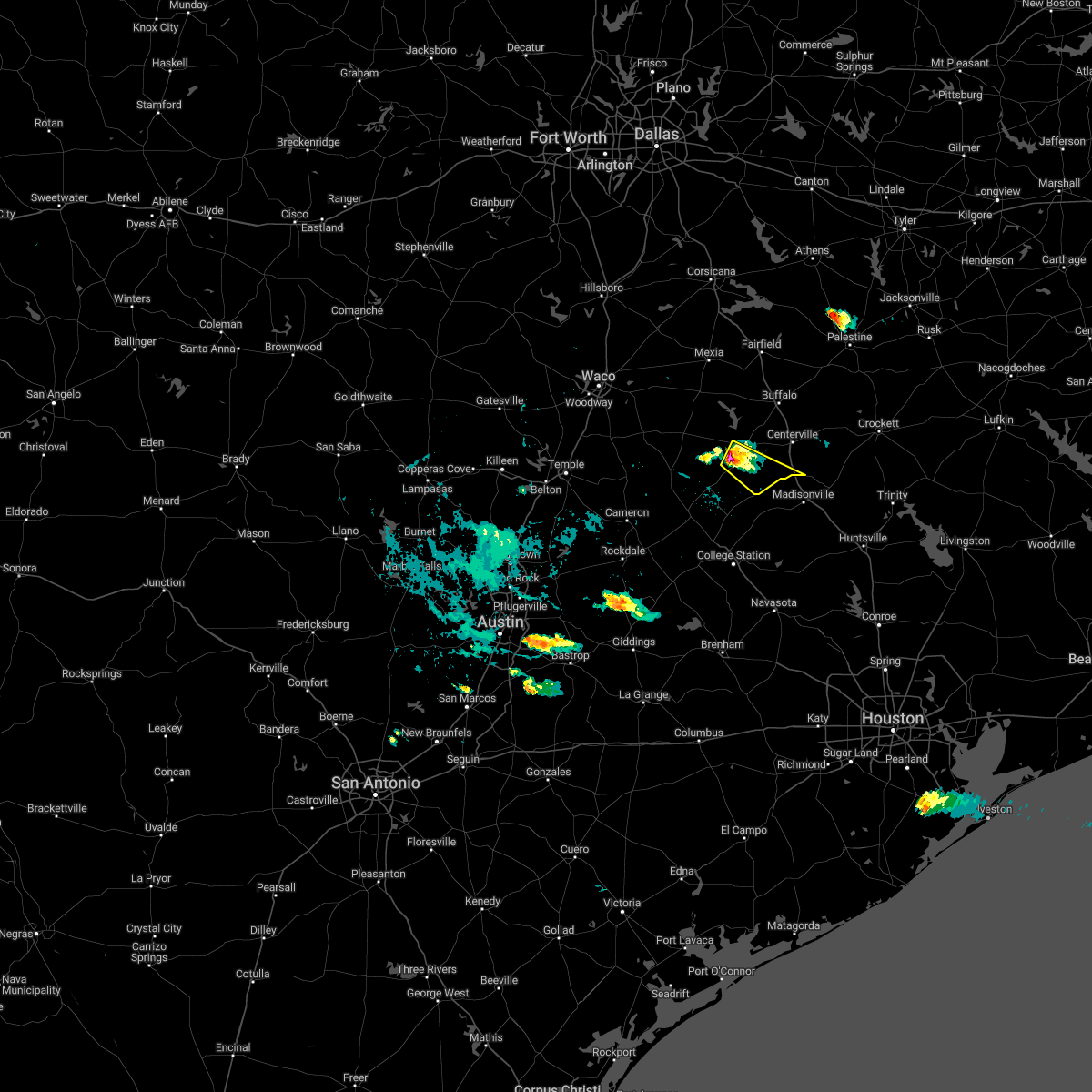 At 654 pm cdt, a severe thunderstorm was located 7 miles north of camp creek lake, or 25 miles northeast of hearne, moving southeast at 20 mph (radar indicated). Hazards include 60 mph wind gusts and quarter size hail. Hail damage to vehicles is expected. Expect wind damage to roofs, siding, and trees. At 654 pm cdt, a severe thunderstorm was located 7 miles north of camp creek lake, or 25 miles northeast of hearne, moving southeast at 20 mph (radar indicated). Hazards include 60 mph wind gusts and quarter size hail. Hail damage to vehicles is expected. Expect wind damage to roofs, siding, and trees.
|
| 3/14/2022 8:34 PM CDT |
 At 831 pm cdt, a line of severe thunderstorms was located from near centerville to hearne , moving east at 40 mph (radar indicated). Hazards include 60 mph wind gusts and quarter size hail. Hail damage to vehicles is expected. expect wind damage to roofs, siding, and trees. locations impacted include, hearne, buffalo, franklin, centerville, jewett, marquez and leona. hail threat, radar indicated max hail size, 1. 00 in wind threat, radar indicated max wind gust, 60 mph. At 831 pm cdt, a line of severe thunderstorms was located from near centerville to hearne , moving east at 40 mph (radar indicated). Hazards include 60 mph wind gusts and quarter size hail. Hail damage to vehicles is expected. expect wind damage to roofs, siding, and trees. locations impacted include, hearne, buffalo, franklin, centerville, jewett, marquez and leona. hail threat, radar indicated max hail size, 1. 00 in wind threat, radar indicated max wind gust, 60 mph.
|
| 3/14/2022 8:10 PM CDT |
 At 809 pm cdt, a line of severe storms was located from buffalo to hearne, moving east at 40 mph (radar indicated). Hazards include 60 mph wind gusts and quarter size hail. Hail damage to vehicles is expected. expect wind damage to roofs, siding, and trees. locations impacted include, hearne, buffalo, franklin, calvert, centerville, jewett, marquez and leona. hail threat, radar indicated max hail size, 1. 00 in wind threat, radar indicated max wind gust, 60 mph. At 809 pm cdt, a line of severe storms was located from buffalo to hearne, moving east at 40 mph (radar indicated). Hazards include 60 mph wind gusts and quarter size hail. Hail damage to vehicles is expected. expect wind damage to roofs, siding, and trees. locations impacted include, hearne, buffalo, franklin, calvert, centerville, jewett, marquez and leona. hail threat, radar indicated max hail size, 1. 00 in wind threat, radar indicated max wind gust, 60 mph.
|
| 3/14/2022 7:42 PM CDT |
 At 740 pm cdt, a line of severe thunderstorms was located just north of cameron to west of buffalo, or 18 miles southeast of marlin, moving east at 40 mph (radar indicated). Hazards include 60 mph wind gusts and quarter size hail. Hail damage to vehicles is expected. Expect wind damage to roofs, siding, and trees. At 740 pm cdt, a line of severe thunderstorms was located just north of cameron to west of buffalo, or 18 miles southeast of marlin, moving east at 40 mph (radar indicated). Hazards include 60 mph wind gusts and quarter size hail. Hail damage to vehicles is expected. Expect wind damage to roofs, siding, and trees.
|
| 7/29/2021 7:54 PM CDT |
 At 754 pm cdt, a severe thunderstorm was located 14 miles east of franklin, or 22 miles northwest of madisonville, moving northwest at 10 mph (radar indicated). Hazards include 60 mph wind gusts and nickel size hail. expect damage to roofs, siding, and trees At 754 pm cdt, a severe thunderstorm was located 14 miles east of franklin, or 22 miles northwest of madisonville, moving northwest at 10 mph (radar indicated). Hazards include 60 mph wind gusts and nickel size hail. expect damage to roofs, siding, and trees
|
| 4/29/2020 3:06 AM CDT |
 At 305 am cdt, severe thunderstorms were located along a line extending from marquez to leona, moving southeast at 40 mph (radar indicated). Hazards include 60 mph wind gusts and quarter size hail. Hail damage to vehicles is expected. expect wind damage to roofs, siding, and trees. Locations impacted include, groesbeck, centerville, jewett, normangee, marquez and leona. At 305 am cdt, severe thunderstorms were located along a line extending from marquez to leona, moving southeast at 40 mph (radar indicated). Hazards include 60 mph wind gusts and quarter size hail. Hail damage to vehicles is expected. expect wind damage to roofs, siding, and trees. Locations impacted include, groesbeck, centerville, jewett, normangee, marquez and leona.
|
| 4/29/2020 2:20 AM CDT |
 At 219 am cdt, severe thunderstorms were located along a line extending from near groesbeck to oakwood, moving southeast at 40 mph (radar indicated). Hazards include 65 mph wind gusts and quarter size hail. Hail damage to vehicles is expected. Expect wind damage to roofs, siding, and trees. At 219 am cdt, severe thunderstorms were located along a line extending from near groesbeck to oakwood, moving southeast at 40 mph (radar indicated). Hazards include 65 mph wind gusts and quarter size hail. Hail damage to vehicles is expected. Expect wind damage to roofs, siding, and trees.
|
| 6/20/2019 5:30 AM CDT |
 At 529 am cdt, a severe thunderstorm was located 15 miles west of centerville, moving east at 20 mph (radar indicated). Hazards include half dollar size hail. damage to vehicles is possible At 529 am cdt, a severe thunderstorm was located 15 miles west of centerville, moving east at 20 mph (radar indicated). Hazards include half dollar size hail. damage to vehicles is possible
|
| 6/9/2019 5:06 PM CDT |
 At 506 pm cdt, a severe thunderstorm was located near franklin, or 15 miles northeast of hearne, moving south at 40 mph (radar indicated). Hazards include 60 mph wind gusts and quarter size hail. Hail damage to vehicles is expected. expect wind damage to roofs, siding, and trees. Locations impacted include, hearne, franklin and marquez. At 506 pm cdt, a severe thunderstorm was located near franklin, or 15 miles northeast of hearne, moving south at 40 mph (radar indicated). Hazards include 60 mph wind gusts and quarter size hail. Hail damage to vehicles is expected. expect wind damage to roofs, siding, and trees. Locations impacted include, hearne, franklin and marquez.
|
| 6/9/2019 4:25 PM CDT |
 At 424 pm cdt, a severe thunderstorm was located near groesbeck, moving south at 40 mph (radar indicated. at 415 pm trained spotters reported quarter size hail in mexia). Hazards include 60 mph wind gusts and quarter size hail. Hail damage to vehicles is expected. Expect wind damage to roofs, siding, and trees. At 424 pm cdt, a severe thunderstorm was located near groesbeck, moving south at 40 mph (radar indicated. at 415 pm trained spotters reported quarter size hail in mexia). Hazards include 60 mph wind gusts and quarter size hail. Hail damage to vehicles is expected. Expect wind damage to roofs, siding, and trees.
|
| 4/18/2019 1:40 AM CDT |
 At 139 am cdt, a severe thunderstorm was located near centerville, or 25 miles northwest of madisonville, moving east at 55 mph (radar indicated). Hazards include 65 mph wind gusts and quarter size hail. Hail damage to vehicles is expected. Expect wind damage to roofs, siding, and trees. At 139 am cdt, a severe thunderstorm was located near centerville, or 25 miles northwest of madisonville, moving east at 55 mph (radar indicated). Hazards include 65 mph wind gusts and quarter size hail. Hail damage to vehicles is expected. Expect wind damage to roofs, siding, and trees.
|
| 4/18/2019 1:25 AM CDT | 20 to 40 trees down on highway 79 near marquez. time estimate in leon county TX, 1 miles NE of Marquez, TX |
| 4/13/2019 11:42 AM CDT |
 At 1140 am cdt, a confirmed large and extremely dangerous tornado was located 12 miles northeast of franklin, or 24 miles northeast of hearne, moving northeast at 40 mph. tornado has already produced significant damage. this is a particularly dangerous situation. take cover now! (weather spotters confirmed tornado). Hazards include damaging tornado. You are in a life-threatening situation. flying debris may be deadly to those caught without shelter. mobile homes will be destroyed. Considerable damage to homes, businesses, and vehicles is likely and complete destruction is possible. At 1140 am cdt, a confirmed large and extremely dangerous tornado was located 12 miles northeast of franklin, or 24 miles northeast of hearne, moving northeast at 40 mph. tornado has already produced significant damage. this is a particularly dangerous situation. take cover now! (weather spotters confirmed tornado). Hazards include damaging tornado. You are in a life-threatening situation. flying debris may be deadly to those caught without shelter. mobile homes will be destroyed. Considerable damage to homes, businesses, and vehicles is likely and complete destruction is possible.
|
| 4/7/2019 8:41 AM CDT |
 The severe thunderstorm warning for northeastern robertson and western leon counties will expire at 845 am cdt, the storm which prompted the warning has weakened below severe limits. therefore the warning will be allowed to expire. however small hail and heavy rain are still possible with this thunderstorm. The severe thunderstorm warning for northeastern robertson and western leon counties will expire at 845 am cdt, the storm which prompted the warning has weakened below severe limits. therefore the warning will be allowed to expire. however small hail and heavy rain are still possible with this thunderstorm.
|
| 4/7/2019 8:20 AM CDT |
 At 819 am cdt, a severe thunderstorm was located 13 miles northeast of franklin, or 25 miles northeast of hearne, moving north at 25 mph (radar indicated). Hazards include 60 mph wind gusts and quarter size hail. Hail damage to vehicles is expected. expect wind damage to roofs, siding, and trees. Locations impacted include, buffalo, franklin, centerville, jewett and marquez. At 819 am cdt, a severe thunderstorm was located 13 miles northeast of franklin, or 25 miles northeast of hearne, moving north at 25 mph (radar indicated). Hazards include 60 mph wind gusts and quarter size hail. Hail damage to vehicles is expected. expect wind damage to roofs, siding, and trees. Locations impacted include, buffalo, franklin, centerville, jewett and marquez.
|
| 4/7/2019 8:00 AM CDT |
 At 759 am cdt, a severe thunderstorm was located 16 miles southwest of centerville, or near flynn, moving northwest at 20 mph (radar indicated). Hazards include 60 mph wind gusts and quarter size hail. Hail damage to vehicles is expected. Expect wind damage to roofs, siding, and trees. At 759 am cdt, a severe thunderstorm was located 16 miles southwest of centerville, or near flynn, moving northwest at 20 mph (radar indicated). Hazards include 60 mph wind gusts and quarter size hail. Hail damage to vehicles is expected. Expect wind damage to roofs, siding, and trees.
|
| 4/6/2019 4:55 PM CDT |
 At 453 pm cdt, a severe thunderstorm capable of producing a tornado was located 9 miles west of centerville, moving northeast at 35 mph (radar indicated rotation). Hazards include tornado and half dollar size hail. Flying debris will be dangerous to those caught without shelter. mobile homes will be damaged or destroyed. damage to roofs, windows, and vehicles will occur. tree damage is likely. the potentially tornadic circulation will be near, i-45 north of centerville around 505 pm cdt. The hail core may impact jewett and buffalo. At 453 pm cdt, a severe thunderstorm capable of producing a tornado was located 9 miles west of centerville, moving northeast at 35 mph (radar indicated rotation). Hazards include tornado and half dollar size hail. Flying debris will be dangerous to those caught without shelter. mobile homes will be damaged or destroyed. damage to roofs, windows, and vehicles will occur. tree damage is likely. the potentially tornadic circulation will be near, i-45 north of centerville around 505 pm cdt. The hail core may impact jewett and buffalo.
|
| 4/6/2019 4:38 PM CDT |
 At 437 pm cdt, a severe thunderstorm capable of producing a tornado was located 17 miles west of centerville, or 25 miles southeast of groesbeck, moving northeast at 35 mph (radar indicated rotation). Hazards include tornado and quarter size hail. Flying debris will be dangerous to those caught without shelter. mobile homes will be damaged or destroyed. damage to roofs, windows, and vehicles will occur. tree damage is likely. this dangerous storm will be near, centerville around 505 pm cdt. other locations impacted by this tornadic thunderstorm include jewett and marquez. This includes interstate 45 between mile markers 160 and 180. At 437 pm cdt, a severe thunderstorm capable of producing a tornado was located 17 miles west of centerville, or 25 miles southeast of groesbeck, moving northeast at 35 mph (radar indicated rotation). Hazards include tornado and quarter size hail. Flying debris will be dangerous to those caught without shelter. mobile homes will be damaged or destroyed. damage to roofs, windows, and vehicles will occur. tree damage is likely. this dangerous storm will be near, centerville around 505 pm cdt. other locations impacted by this tornadic thunderstorm include jewett and marquez. This includes interstate 45 between mile markers 160 and 180.
|
| 4/6/2019 4:33 PM CDT |
 At 432 pm cdt, a severe thunderstorm capable of producing a tornado was located 15 miles northeast of franklin, or 27 miles southeast of groesbeck, moving northeast at 35 mph (radar indicated rotation). Hazards include tornado and quarter size hail. Flying debris will be dangerous to those caught without shelter. mobile homes will be damaged or destroyed. damage to roofs, windows, and vehicles will occur. tree damage is likely. Locations impacted include, marquez. At 432 pm cdt, a severe thunderstorm capable of producing a tornado was located 15 miles northeast of franklin, or 27 miles southeast of groesbeck, moving northeast at 35 mph (radar indicated rotation). Hazards include tornado and quarter size hail. Flying debris will be dangerous to those caught without shelter. mobile homes will be damaged or destroyed. damage to roofs, windows, and vehicles will occur. tree damage is likely. Locations impacted include, marquez.
|
| 4/6/2019 4:05 PM CDT |
 At 404 pm cdt, a severe thunderstorm with a history of producing tornadoes was located north of franklin, or 14 miles north of hearne, moving northeast at 35 mph (radar indicated rotation). Hazards include tornado and quarter size hail. Flying debris will be dangerous to those caught without shelter. mobile homes will be damaged or destroyed. damage to roofs, windows, and vehicles will occur. tree damage is likely. This tornado will remain over mainly rural areas of northeastern robertson and southwestern leon counties, including the following locations, marquez. At 404 pm cdt, a severe thunderstorm with a history of producing tornadoes was located north of franklin, or 14 miles north of hearne, moving northeast at 35 mph (radar indicated rotation). Hazards include tornado and quarter size hail. Flying debris will be dangerous to those caught without shelter. mobile homes will be damaged or destroyed. damage to roofs, windows, and vehicles will occur. tree damage is likely. This tornado will remain over mainly rural areas of northeastern robertson and southwestern leon counties, including the following locations, marquez.
|
| 4/6/2019 3:15 PM CDT | Hen Egg sized hail reported 1 miles NE of Marquez, TX, delayed report of golf ball to hen egg size hail |
| 4/6/2019 3:10 PM CDT |
 At 308 pm cdt, a severe thunderstorm capable of producing a tornado was located 16 miles northeast of franklin, or 27 miles southeast of groesbeck, moving northeast at 30 mph (radar indicated rotation). Hazards include tornado and quarter size hail. Flying debris will be dangerous to those caught without shelter. mobile homes will be damaged or destroyed. damage to roofs, windows, and vehicles will occur. tree damage is likely. this dangerous storm will be near, centerville around 345 pm cdt. other locations impacted by this tornadic thunderstorm include jewett and marquez. This includes interstate 45 between mile markers 163 and 169. At 308 pm cdt, a severe thunderstorm capable of producing a tornado was located 16 miles northeast of franklin, or 27 miles southeast of groesbeck, moving northeast at 30 mph (radar indicated rotation). Hazards include tornado and quarter size hail. Flying debris will be dangerous to those caught without shelter. mobile homes will be damaged or destroyed. damage to roofs, windows, and vehicles will occur. tree damage is likely. this dangerous storm will be near, centerville around 345 pm cdt. other locations impacted by this tornadic thunderstorm include jewett and marquez. This includes interstate 45 between mile markers 163 and 169.
|
| 4/6/2019 2:58 PM CDT |
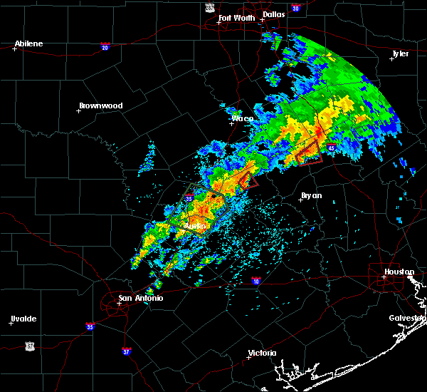 At 257 pm cdt, a severe thunderstorm capable of producing a tornado was located 12 miles northeast of franklin, or 24 miles northeast of hearne, moving northeast at 30 mph (radar indicated rotation). Hazards include tornado and quarter size hail. Flying debris will be dangerous to those caught without shelter. mobile homes will be damaged or destroyed. damage to roofs, windows, and vehicles will occur. tree damage is likely. Locations impacted include, marquez. At 257 pm cdt, a severe thunderstorm capable of producing a tornado was located 12 miles northeast of franklin, or 24 miles northeast of hearne, moving northeast at 30 mph (radar indicated rotation). Hazards include tornado and quarter size hail. Flying debris will be dangerous to those caught without shelter. mobile homes will be damaged or destroyed. damage to roofs, windows, and vehicles will occur. tree damage is likely. Locations impacted include, marquez.
|
| 4/6/2019 2:44 PM CDT |
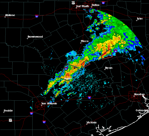 At 243 pm cdt, a severe thunderstorm capable of producing a tornado was located near franklin, or 18 miles northeast of hearne, moving northeast at 30 mph (radar indicated rotation). Hazards include tornado and quarter size hail. Flying debris will be dangerous to those caught without shelter. mobile homes will be damaged or destroyed. damage to roofs, windows, and vehicles will occur. tree damage is likely. Locations impacted include, marquez. At 243 pm cdt, a severe thunderstorm capable of producing a tornado was located near franklin, or 18 miles northeast of hearne, moving northeast at 30 mph (radar indicated rotation). Hazards include tornado and quarter size hail. Flying debris will be dangerous to those caught without shelter. mobile homes will be damaged or destroyed. damage to roofs, windows, and vehicles will occur. tree damage is likely. Locations impacted include, marquez.
|
| 4/6/2019 2:30 PM CDT |
 At 230 pm cdt, a severe thunderstorm capable of producing a tornado was located over franklin, or 11 miles northeast of hearne, moving northeast at 30 mph (radar indicated rotation). Hazards include tornado. Flying debris will be dangerous to those caught without shelter. mobile homes will be damaged or destroyed. damage to roofs, windows, and vehicles will occur. tree damage is likely. This tornadic thunderstorm will remain over mainly rural areas of northeastern robertson and southwestern leon counties, including the following locations, marquez. At 230 pm cdt, a severe thunderstorm capable of producing a tornado was located over franklin, or 11 miles northeast of hearne, moving northeast at 30 mph (radar indicated rotation). Hazards include tornado. Flying debris will be dangerous to those caught without shelter. mobile homes will be damaged or destroyed. damage to roofs, windows, and vehicles will occur. tree damage is likely. This tornadic thunderstorm will remain over mainly rural areas of northeastern robertson and southwestern leon counties, including the following locations, marquez.
|
| 8/28/2018 6:46 PM CDT |
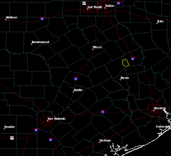 At 644 pm cdt, a severe thunderstorm was located 15 miles southwest of centerville, or 21 miles northwest of madisonville, moving northwest at 15 mph (radar indicated). Hazards include 60 mph wind gusts. Expect damage to roofs, siding, and trees. Locations impacted include, hilltop lakes, flynn. At 644 pm cdt, a severe thunderstorm was located 15 miles southwest of centerville, or 21 miles northwest of madisonville, moving northwest at 15 mph (radar indicated). Hazards include 60 mph wind gusts. Expect damage to roofs, siding, and trees. Locations impacted include, hilltop lakes, flynn.
|
| 8/28/2018 6:30 PM CDT |
 At 629 pm cdt, a severe thunderstorm was located 15 miles southwest of centerville, or just east of hilltop lakes, moving northwest at 10 mph (radar indicated). Hazards include 60 mph wind gusts and penny size hail. expect damage to roofs, siding, and trees At 629 pm cdt, a severe thunderstorm was located 15 miles southwest of centerville, or just east of hilltop lakes, moving northwest at 10 mph (radar indicated). Hazards include 60 mph wind gusts and penny size hail. expect damage to roofs, siding, and trees
|
| 3/17/2018 7:41 PM CDT |
 At 741 pm cdt, a severe thunderstorm was located 14 miles northeast of bremond, or 19 miles south of groesbeck, moving northeast at 25 mph (radar indicated). Hazards include 60 mph wind gusts and half dollar size hail. Hail damage to vehicles is expected. expect wind damage to roofs, siding, and trees. Locations impacted include, jewett and marquez. At 741 pm cdt, a severe thunderstorm was located 14 miles northeast of bremond, or 19 miles south of groesbeck, moving northeast at 25 mph (radar indicated). Hazards include 60 mph wind gusts and half dollar size hail. Hail damage to vehicles is expected. expect wind damage to roofs, siding, and trees. Locations impacted include, jewett and marquez.
|
| 3/17/2018 7:22 PM CDT |
 At 721 pm cdt, a severe thunderstorm was located near bremond, or 19 miles east of marlin, moving northeast at 20 mph (radar indicated). Hazards include 60 mph wind gusts and half dollar size hail. Hail damage to vehicles is expected. Expect wind damage to roofs, siding, and trees. At 721 pm cdt, a severe thunderstorm was located near bremond, or 19 miles east of marlin, moving northeast at 20 mph (radar indicated). Hazards include 60 mph wind gusts and half dollar size hail. Hail damage to vehicles is expected. Expect wind damage to roofs, siding, and trees.
|
| 5/11/2017 6:18 PM CDT |
 At 617 pm cdt, a severe thunderstorm was located 13 miles southwest of buffalo, or 19 miles south of teague, moving east at 30 mph (radar indicated). Hazards include 60 mph wind gusts. expect damage to roofs, siding, and trees At 617 pm cdt, a severe thunderstorm was located 13 miles southwest of buffalo, or 19 miles south of teague, moving east at 30 mph (radar indicated). Hazards include 60 mph wind gusts. expect damage to roofs, siding, and trees
|
| 5/3/2017 4:48 PM CDT |
 At 448 pm cdt, a severe thunderstorm was located near centerville, or 20 miles northwest of madisonville, moving east at 40 mph (radar indicated). Hazards include 60 mph wind gusts and quarter size hail. Hail damage to vehicles is expected. expect wind damage to roofs, siding, and trees. Locations impacted include, centerville, jewett, marquez and leona. At 448 pm cdt, a severe thunderstorm was located near centerville, or 20 miles northwest of madisonville, moving east at 40 mph (radar indicated). Hazards include 60 mph wind gusts and quarter size hail. Hail damage to vehicles is expected. expect wind damage to roofs, siding, and trees. Locations impacted include, centerville, jewett, marquez and leona.
|
| 5/3/2017 4:14 PM CDT |
 At 413 pm cdt, a severe thunderstorm was located 13 miles southeast of groesbeck, moving southeast at 20 mph (radar indicated). Hazards include 60 mph wind gusts and quarter size hail. Hail damage to vehicles is expected. Expect wind damage to roofs, siding, and trees. At 413 pm cdt, a severe thunderstorm was located 13 miles southeast of groesbeck, moving southeast at 20 mph (radar indicated). Hazards include 60 mph wind gusts and quarter size hail. Hail damage to vehicles is expected. Expect wind damage to roofs, siding, and trees.
|
| 4/2/2017 11:47 AM CDT | At 1146 am cdt, severe thunderstorms were located along a line extending from mexia to madisonville, moving northeast at 45 mph (radar indicated). Hazards include 60 mph wind gusts and penny size hail. Expect damage to roofs, siding, and trees. locations impacted include, mexia, teague, fairfield, buffalo, centerville, jewett, marquez and leona. A tornado watch remains in effect until 100 pm cdt for central texas. |
| 4/2/2017 11:15 AM CDT | At 1115 am cdt, severe thunderstorms were located along a line extending from near riesel to 6 miles northeast of college station, moving northeast at 50 mph (radar indicated). Hazards include 60 mph wind gusts. expect damage to roofs, siding, and trees |
| 3/29/2017 4:24 AM CDT |
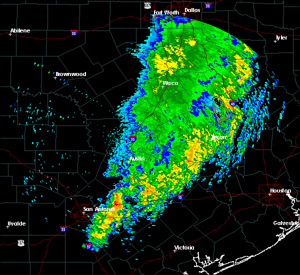 The severe thunderstorm warning for southwestern leon county will expire at 430 am cdt, the storm which prompted the warning has moved out of the area. therefore the warning will be allowed to expire. however, heavy rain is still possible with this thunderstorm. The severe thunderstorm warning for southwestern leon county will expire at 430 am cdt, the storm which prompted the warning has moved out of the area. therefore the warning will be allowed to expire. however, heavy rain is still possible with this thunderstorm.
|
| 3/29/2017 4:16 AM CDT |
 At 415 am cdt, a severe thunderstorm was located 8 miles northwest of centerville, or 24 miles southeast of teague, moving northeast at 55 mph (radar indicated). Hazards include 60 mph wind gusts. Expect damage to roofs, siding, and trees. Locations impacted include, marquez. At 415 am cdt, a severe thunderstorm was located 8 miles northwest of centerville, or 24 miles southeast of teague, moving northeast at 55 mph (radar indicated). Hazards include 60 mph wind gusts. Expect damage to roofs, siding, and trees. Locations impacted include, marquez.
|
| 3/29/2017 3:55 AM CDT |
 At 354 am cdt, a severe thunderstorm was located 10 miles northeast of franklin, or 22 miles northeast of hearne, moving northeast at 45 mph (radar indicated). Hazards include 60 mph wind gusts. Expect damage to roofs, siding, and trees. This severe thunderstorm will remain over mainly rural areas of northeastern robertson, southwestern leon and southeastern limestone counties, including the following locations: kosse and marquez. At 354 am cdt, a severe thunderstorm was located 10 miles northeast of franklin, or 22 miles northeast of hearne, moving northeast at 45 mph (radar indicated). Hazards include 60 mph wind gusts. Expect damage to roofs, siding, and trees. This severe thunderstorm will remain over mainly rural areas of northeastern robertson, southwestern leon and southeastern limestone counties, including the following locations: kosse and marquez.
|
| 3/29/2017 3:33 AM CDT |
 At 333 am cdt, a severe thunderstorm was located over franklin, or 11 miles northeast of hearne, moving northeast at 55 mph (radar indicated). Hazards include 65 mph wind gusts. Expect damage to roofs, siding, and trees. This severe thunderstorm will remain over mainly rural areas of robertson, northeastern milam, southwestern leon, southeastern limestone and southeastern falls counties, including the following locations: kosse and marquez. At 333 am cdt, a severe thunderstorm was located over franklin, or 11 miles northeast of hearne, moving northeast at 55 mph (radar indicated). Hazards include 65 mph wind gusts. Expect damage to roofs, siding, and trees. This severe thunderstorm will remain over mainly rural areas of robertson, northeastern milam, southwestern leon, southeastern limestone and southeastern falls counties, including the following locations: kosse and marquez.
|
| 2/20/2017 2:12 AM CST |
 At 211 am cst, severe thunderstorms were located near buffalo and teague moving northeast at 55 mph. strong winds were also noted near normangee (radar indicated). Hazards include 65 mph wind gusts. Expect damage to roofs, siding, and trees. Locations impacted include, buffalo, centerville, jewett, normangee, oakwood, marquez and leona. At 211 am cst, severe thunderstorms were located near buffalo and teague moving northeast at 55 mph. strong winds were also noted near normangee (radar indicated). Hazards include 65 mph wind gusts. Expect damage to roofs, siding, and trees. Locations impacted include, buffalo, centerville, jewett, normangee, oakwood, marquez and leona.
|
| 2/20/2017 1:43 AM CST | Trees down on hwy 79 in leon county TX, 4.1 miles NE of Marquez, TX |
| 2/20/2017 1:38 AM CST |
 At 137 am cst, a severe thunderstorm was located 14 miles northeast of franklin, or 26 miles northeast of hearne, moving northeast at 55 mph (radar indicated). Hazards include 70 mph wind gusts. Expect considerable tree damage. damage is likely to mobile homes, roofs, and outbuildings. locations impacted by this severe thunderstorm include centerville, normangee, oakwood, jewett, marquez and leona. This includes interstate 45 between mile markers 152 and 196. At 137 am cst, a severe thunderstorm was located 14 miles northeast of franklin, or 26 miles northeast of hearne, moving northeast at 55 mph (radar indicated). Hazards include 70 mph wind gusts. Expect considerable tree damage. damage is likely to mobile homes, roofs, and outbuildings. locations impacted by this severe thunderstorm include centerville, normangee, oakwood, jewett, marquez and leona. This includes interstate 45 between mile markers 152 and 196.
|
| 1/2/2017 6:04 AM CST | 2 to 4 inch tree limbs down in marquez in leon county TX, 1 miles NE of Marquez, TX |
| 1/2/2017 5:56 AM CST |
 At 554 am cst, severe thunderstorms were located along a line extending from 7 miles north of fairfield lake state park to 7 miles west of centerville to 10 miles southeast of franklin, moving east at 60 mph (radar indicated). Hazards include 60 mph wind gusts. Expect damage to roofs, siding, and trees. Locations impacted include, fairfield, buffalo, and centerville. At 554 am cst, severe thunderstorms were located along a line extending from 7 miles north of fairfield lake state park to 7 miles west of centerville to 10 miles southeast of franklin, moving east at 60 mph (radar indicated). Hazards include 60 mph wind gusts. Expect damage to roofs, siding, and trees. Locations impacted include, fairfield, buffalo, and centerville.
|
| 1/2/2017 5:28 AM CST |
 At 527 am cst, severe thunderstorms were located along a line extending from near wortham to 8 miles north of franklin to 11 miles southeast of cameron, moving east at 50 mph (radar indicated). Hazards include 60 mph wind gusts. Expect damage to roofs, siding, and trees. severe thunderstorms will be near, mexia, franklin and wortham around 530 am cst. hearne around 540 am cst. fairfield around 555 am cst. fairfield lake state park around 600 am cst. centerville around 605 am cst. other locations impacted by these severe thunderstorms include leona, marquez, tehuacana, kirvin, thornton, streetman, jewett, normangee and oakwood. This includes interstate 45 between mile markers 152 and 212. At 527 am cst, severe thunderstorms were located along a line extending from near wortham to 8 miles north of franklin to 11 miles southeast of cameron, moving east at 50 mph (radar indicated). Hazards include 60 mph wind gusts. Expect damage to roofs, siding, and trees. severe thunderstorms will be near, mexia, franklin and wortham around 530 am cst. hearne around 540 am cst. fairfield around 555 am cst. fairfield lake state park around 600 am cst. centerville around 605 am cst. other locations impacted by these severe thunderstorms include leona, marquez, tehuacana, kirvin, thornton, streetman, jewett, normangee and oakwood. This includes interstate 45 between mile markers 152 and 212.
|
| 5/2/2016 1:44 AM CDT |
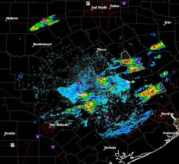 At 142 am cdt, a severe thunderstorm was located 17 miles north of franklin, or 18 miles southeast of groesbeck, moving north at 25 mph (radar indicated). Hazards include quarter size hail. Damage to vehicles is possible. this severe thunderstorm will impact the lake limestone area. another severe thunderstorm was located in far southwestern leon county. this storm will also be capable of quarter size hail. It will pass near normangee. At 142 am cdt, a severe thunderstorm was located 17 miles north of franklin, or 18 miles southeast of groesbeck, moving north at 25 mph (radar indicated). Hazards include quarter size hail. Damage to vehicles is possible. this severe thunderstorm will impact the lake limestone area. another severe thunderstorm was located in far southwestern leon county. this storm will also be capable of quarter size hail. It will pass near normangee.
|
| 4/29/2016 2:57 PM CDT | Golf Ball sized hail reported 1 miles NE of Marquez, TX, golfball size hail reported in marquez. |
| 4/29/2016 2:49 PM CDT |
 At 249 pm cdt, a severe thunderstorm was located 14 miles west of centerville, or 24 miles south of teague, moving northeast at 25 mph (radar indicated). Hazards include half dollar size hail. Damage to vehicles is possible. locations impacted include, buffalo, centerville, jewett, oakwood and marquez. A tornado watch remains in effect until 1000 pm cdt for central texas. At 249 pm cdt, a severe thunderstorm was located 14 miles west of centerville, or 24 miles south of teague, moving northeast at 25 mph (radar indicated). Hazards include half dollar size hail. Damage to vehicles is possible. locations impacted include, buffalo, centerville, jewett, oakwood and marquez. A tornado watch remains in effect until 1000 pm cdt for central texas.
|
| 4/29/2016 2:00 PM CDT |
 At 200 pm cdt, a severe thunderstorm was located near franklin, or 17 miles northeast of hearne, moving northeast at 20 mph (radar indicated). Hazards include half dollar size hail. Damage to vehicles is possible. this severe thunderstorm will remain over mainly rural areas of northeastern robertson and leon counties, including the following locations: jewett, normangee, oakwood, leona and marquez. this includes interstate 45 between mile markers 152 and 180. A tornado watch remains in effect until 1000 pm cdt for central texas. At 200 pm cdt, a severe thunderstorm was located near franklin, or 17 miles northeast of hearne, moving northeast at 20 mph (radar indicated). Hazards include half dollar size hail. Damage to vehicles is possible. this severe thunderstorm will remain over mainly rural areas of northeastern robertson and leon counties, including the following locations: jewett, normangee, oakwood, leona and marquez. this includes interstate 45 between mile markers 152 and 180. A tornado watch remains in effect until 1000 pm cdt for central texas.
|
| 12/26/2015 1:43 PM CST |
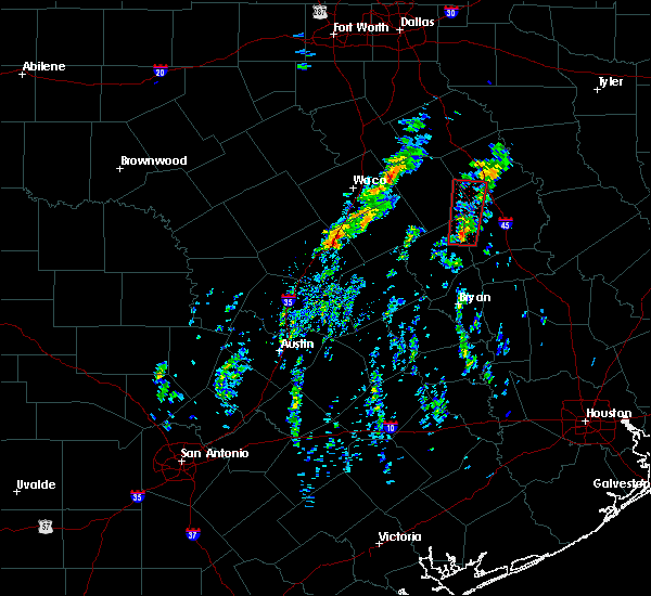 At 143 pm cst, a severe thunderstorm capable of producing a tornado was located 16 miles northeast of franklin, or 23 miles southeast of groesbeck, moving north at 40 mph (radar indicated rotation). Hazards include tornado. Flying debris will be dangerous to those caught without shelter. mobile homes will be damaged or destroyed. damage to roofs, windows and vehicles will occur. tree damage is likely. this dangerous storm will be near, teague around 225 pm cst. other locations impacted by this tornadic thunderstorm include marquez. This includes interstate 45 between mile markers 189 and 191. At 143 pm cst, a severe thunderstorm capable of producing a tornado was located 16 miles northeast of franklin, or 23 miles southeast of groesbeck, moving north at 40 mph (radar indicated rotation). Hazards include tornado. Flying debris will be dangerous to those caught without shelter. mobile homes will be damaged or destroyed. damage to roofs, windows and vehicles will occur. tree damage is likely. this dangerous storm will be near, teague around 225 pm cst. other locations impacted by this tornadic thunderstorm include marquez. This includes interstate 45 between mile markers 189 and 191.
|
| 12/13/2015 4:25 AM CST |
 At 424 am cst, a severe thunderstorm was located 14 miles northeast of franklin, or 24 miles northwest of madisonville, moving northeast at 40 mph (trained weather spotters). Hazards include 60 mph wind gusts. Expect damage to roofs. siding and trees. locations impacted include, buffalo, centerville, jewett, oakwood, marquez and leona. This includes interstate 45 between mile markers 152 and 180. At 424 am cst, a severe thunderstorm was located 14 miles northeast of franklin, or 24 miles northwest of madisonville, moving northeast at 40 mph (trained weather spotters). Hazards include 60 mph wind gusts. Expect damage to roofs. siding and trees. locations impacted include, buffalo, centerville, jewett, oakwood, marquez and leona. This includes interstate 45 between mile markers 152 and 180.
|
| 12/13/2015 4:10 AM CST |
 At 409 am cst, a severe thunderstorm was located 14 miles west of centerville, or 26 miles northwest of madisonville, moving northeast at 35 mph (trained weather spotters). Hazards include 60 mph wind gusts. Expect damage to roofs. Siding and trees. At 409 am cst, a severe thunderstorm was located 14 miles west of centerville, or 26 miles northwest of madisonville, moving northeast at 35 mph (trained weather spotters). Hazards include 60 mph wind gusts. Expect damage to roofs. Siding and trees.
|
| 5/25/2015 5:36 PM CDT | At 535 pm cdt, severe thunderstorms were located along a line extending from 6 miles east of buffalo to 6 miles northeast of centerville to 17 miles northwest of madisonville, moving northeast at 50 mph (radar indicated). Hazards include 60 mph wind gusts. Expect damage to roofs. siding and trees. these severe thunderstorms will remain over mainly rural areas of leon county, including the following locations, normangee, jewett, oakwood, leona and marquez. this includes interstate 45 between mile markers 152 and 180. a tornado watch remains in effect until 600 pm cdt for central texas. A tornado watch also remains in effect until 1000 pm cdt for central texas. |
| 5/25/2015 5:14 PM CDT | At 513 pm cdt, severe thunderstorms were located along a line extending from near buffalo to 7 miles west of centerville to 17 miles east of franklin, moving northeast at 50 mph (radar indicated). Hazards include 60 mph wind gusts. Expect damage to roofs. siding and trees. these severe storms will be near, buffalo and centerville around 520 pm cdt. other locations impacted by these severe thunderstorms include normangee, jewett, oakwood, leona and marquez. this includes interstate 45 between mile markers 152 and 180. A tornado watch also remains in effect until 1000 pm cdt for central texas. |
| 5/25/2015 4:43 PM CDT | At 442 pm cdt, severe thunderstorms were located along a line extending from near bremond to near franklin to near hearne, moving northeast at 55 mph (radar indicated). Hazards include 60 mph wind gusts. Expect damage to roofs. siding and trees. severe thunderstorms will be near, centerville around 520 pm cdt. buffalo around 525 pm cdt. other locations impacted by these severe thunderstorms include jewett, oakwood, leona and marquez. this includes interstate 45 between mile markers 151 and 180. A tornado watch remains in effect until 1000 pm cdt for central texas. |
| 3/28/2014 5:15 PM CDT | Quarter sized hail reported 1 miles NE of Marquez, TX |
| 1/1/0001 12:00 AM | Golf Ball sized hail reported 6.4 miles W of Marquez, TX, golfball size hail reported at concord-robbins 39 & hwy 7 |
Hail Maps for Marquez, TX


Connect with Interactive Hail Maps