

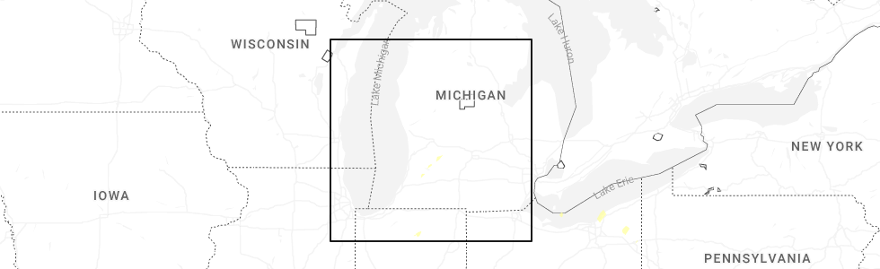
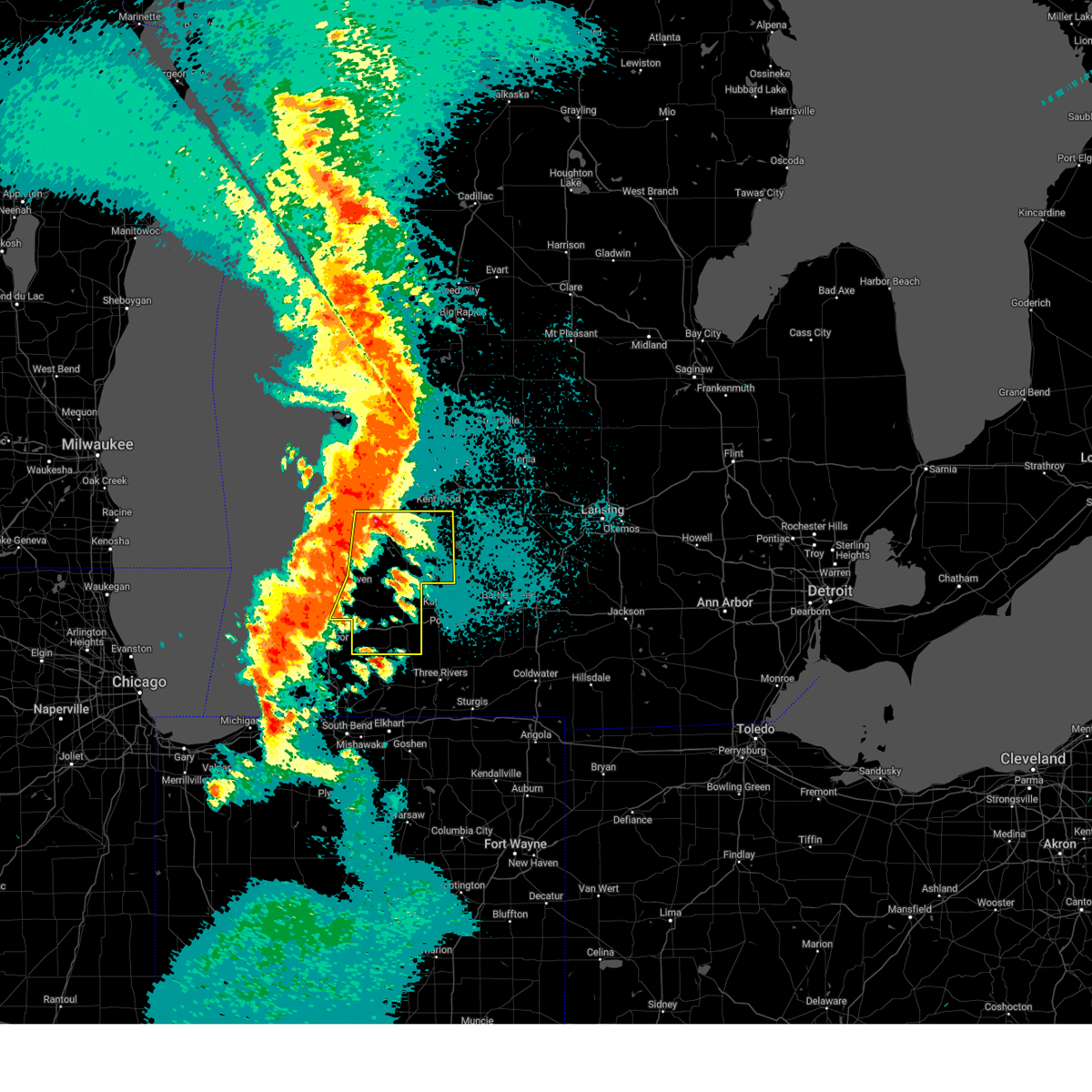
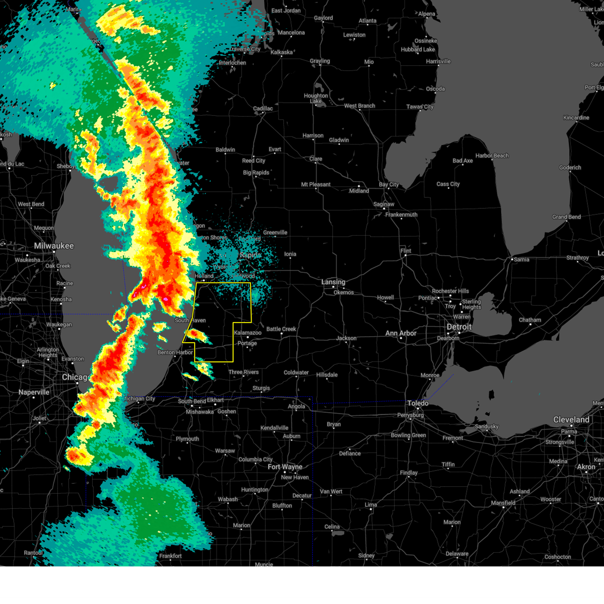
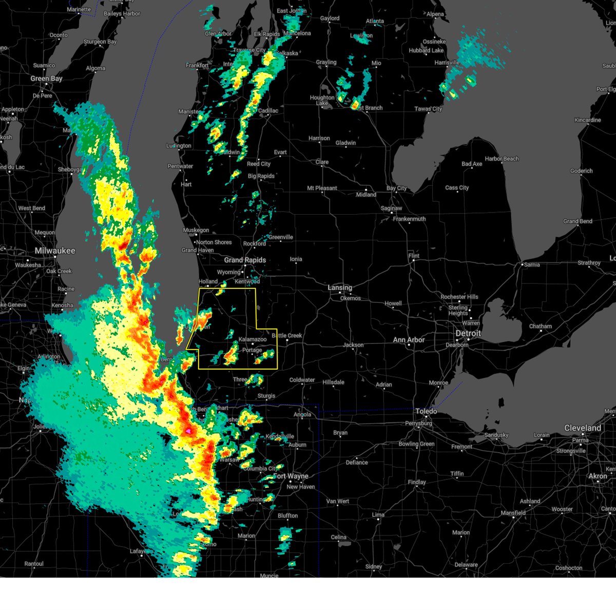
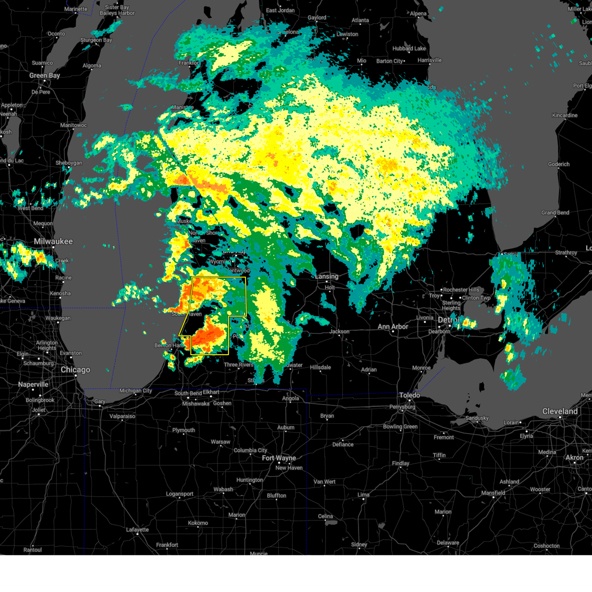
Hail Map for Martin, MI
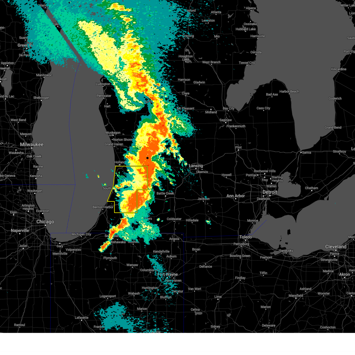
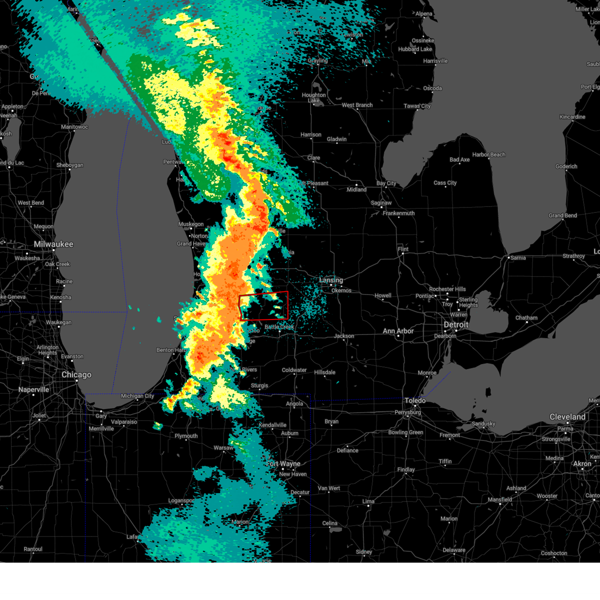
The Martin, MI area has had 2 reports of on-the-ground hail by trained spotters, and has been under severe weather warnings 12 times during the past 12 months. Doppler radar has detected hail at or near Martin, MI on 26 occasions, including 1 occasion during the past year.
| Name: | Martin, MI |
| Where Located: | 29.7 miles S of Grand Rapids, MI |
| Map: | Google Map for Martin, MI |
| Population: | 410 |
| Housing Units: | 176 |
| More Info: | Search Google for Martin, MI |
0
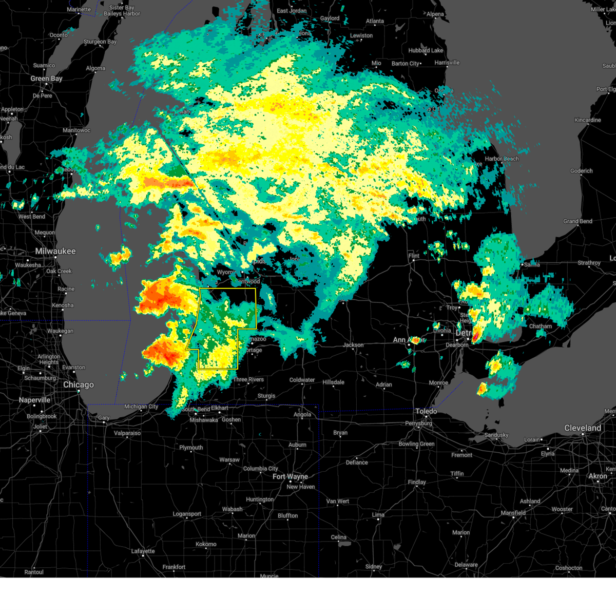
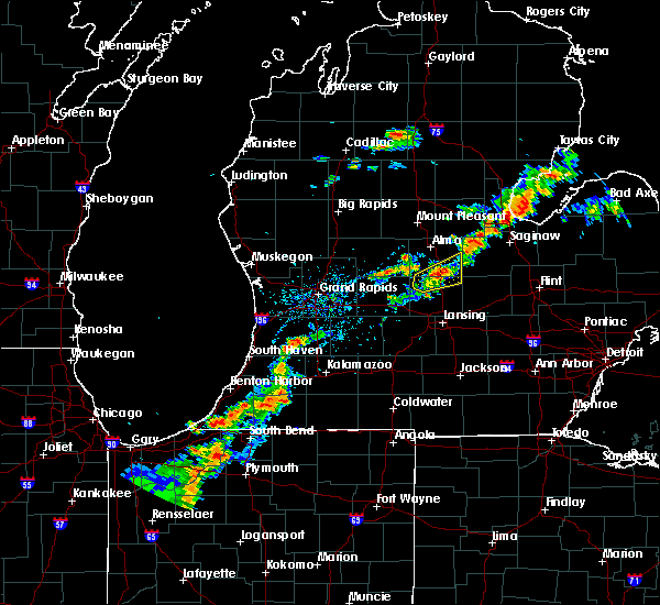
The Top Recent Hail Date for Martin, MI is Friday, June 27, 2025 (15th out of 26)
Hail and Wind Damage Spotted near Martin, MI
| Date / Time | Report Details |
|---|---|
| 5/15/2025 10:58 PM EDT |
 The storms which prompted the warning have moved out of the area. therefore, the warning will be allowed to expire. however, gusty winds and lightning are still possible with these thunderstorms. a tornado watch remains in effect until 300 am edt for southwestern michigan. The storms which prompted the warning have moved out of the area. therefore, the warning will be allowed to expire. however, gusty winds and lightning are still possible with these thunderstorms. a tornado watch remains in effect until 300 am edt for southwestern michigan.
|
| 5/15/2025 10:47 PM EDT |
 At 1046 pm edt, a confirmed tornado was located near martin, or 12 miles east of allegan, moving east at 45 mph (radar confirmed tornado). Hazards include damaging tornado. Flying debris will be dangerous to those caught without shelter. mobile homes will be damaged or destroyed. damage to roofs, windows, and vehicles will occur. tree damage is likely. Locations impacted include, hastings, plainwell, nashville, martin, orangeville, assyria, delton, bradley, banfield, gun lake, yankee springs, prairieville, hickory corners, dowling, pine lake, shelbyville, cloverdale, lacey,. At 1046 pm edt, a confirmed tornado was located near martin, or 12 miles east of allegan, moving east at 45 mph (radar confirmed tornado). Hazards include damaging tornado. Flying debris will be dangerous to those caught without shelter. mobile homes will be damaged or destroyed. damage to roofs, windows, and vehicles will occur. tree damage is likely. Locations impacted include, hastings, plainwell, nashville, martin, orangeville, assyria, delton, bradley, banfield, gun lake, yankee springs, prairieville, hickory corners, dowling, pine lake, shelbyville, cloverdale, lacey,.
|
| 5/15/2025 10:43 PM EDT |
 Torgrr the national weather service in grand rapids has issued a * tornado warning for, southeastern allegan county in southwestern michigan, barry county in southwestern michigan, * until 1130 pm edt. * at 1042 pm edt, a severe thunderstorm capable of producing a tornado was located near martin, or 9 miles east of allegan, moving east at 45 mph (radar indicated rotation). Hazards include tornado. Flying debris will be dangerous to those caught without shelter. mobile homes will be damaged or destroyed. damage to roofs, windows, and vehicles will occur. Tree damage is likely. Torgrr the national weather service in grand rapids has issued a * tornado warning for, southeastern allegan county in southwestern michigan, barry county in southwestern michigan, * until 1130 pm edt. * at 1042 pm edt, a severe thunderstorm capable of producing a tornado was located near martin, or 9 miles east of allegan, moving east at 45 mph (radar indicated rotation). Hazards include tornado. Flying debris will be dangerous to those caught without shelter. mobile homes will be damaged or destroyed. damage to roofs, windows, and vehicles will occur. Tree damage is likely.
|
| 5/15/2025 10:15 PM EDT |
 At 1014 pm edt, severe thunderstorms were located along a line extending from 7 miles east of saugatuck to near fennville to near paw paw lake, moving east at 55 mph (radar indicated). Hazards include 70 mph wind gusts and quarter size hail. Hail damage to vehicles is expected. expect considerable tree damage. wind damage is also likely to mobile homes, roofs, and outbuildings. Locations impacted include, holland, allegan, south haven, paw paw, wayland, otsego, plainwell, hartford, mattawan, lawton, bangor, decatur, fennville, saugatuck, martin, van buren sp, lake michigan beach, dorr, pine grove, covert,. At 1014 pm edt, severe thunderstorms were located along a line extending from 7 miles east of saugatuck to near fennville to near paw paw lake, moving east at 55 mph (radar indicated). Hazards include 70 mph wind gusts and quarter size hail. Hail damage to vehicles is expected. expect considerable tree damage. wind damage is also likely to mobile homes, roofs, and outbuildings. Locations impacted include, holland, allegan, south haven, paw paw, wayland, otsego, plainwell, hartford, mattawan, lawton, bangor, decatur, fennville, saugatuck, martin, van buren sp, lake michigan beach, dorr, pine grove, covert,.
|
| 5/15/2025 9:33 PM EDT |
 Svrgrr the national weather service in grand rapids has issued a * severe thunderstorm warning for, van buren county in southwestern michigan, allegan county in southwestern michigan, * until 1100 pm edt. * at 932 pm edt, severe thunderstorms were located along a line extending from 29 miles west of holland sp to 31 miles west of south haven to 31 miles northwest of stevensville, moving east at 65 mph (radar indicated). Hazards include golf ball size hail and 70 mph wind gusts. People and animals outdoors will be injured. expect hail damage to roofs, siding, windows, and vehicles. expect considerable tree damage. Wind damage is also likely to mobile homes, roofs, and outbuildings. Svrgrr the national weather service in grand rapids has issued a * severe thunderstorm warning for, van buren county in southwestern michigan, allegan county in southwestern michigan, * until 1100 pm edt. * at 932 pm edt, severe thunderstorms were located along a line extending from 29 miles west of holland sp to 31 miles west of south haven to 31 miles northwest of stevensville, moving east at 65 mph (radar indicated). Hazards include golf ball size hail and 70 mph wind gusts. People and animals outdoors will be injured. expect hail damage to roofs, siding, windows, and vehicles. expect considerable tree damage. Wind damage is also likely to mobile homes, roofs, and outbuildings.
|
| 3/30/2025 6:08 PM EDT | The storms which prompted the warning have moved out of the area. therefore, the warning will be allowed to expire. a severe thunderstorm watch remains in effect until 900 pm edt for southwestern michigan. |
| 3/30/2025 5:44 PM EDT | Svrgrr the national weather service in grand rapids has issued a * severe thunderstorm warning for, northeastern van buren county in southwestern michigan, eastern allegan county in southwestern michigan, kalamazoo county in southwestern michigan, * until 615 pm edt. * at 543 pm edt, severe thunderstorms were located along a line extending from 6 miles northwest of wayland to near parchment to 7 miles southeast of climax, moving northeast at 55 mph (radar indicated). Hazards include 70 mph wind gusts and penny size hail. Expect considerable tree damage. Damage is likely to mobile homes, roofs, and outbuildings. |
| 3/30/2025 5:17 PM EDT | At 516 pm edt, severe thunderstorms were located along a line extending from near fennville to near paw paw to near constantine, moving northeast at 60 mph. these are destructive storms for southwest michigan (radar indicated). Hazards include 80 mph wind gusts and penny size hail. Flying debris will be dangerous to those caught without shelter. mobile homes will be heavily damaged. expect considerable damage to roofs, windows, and vehicles. extensive tree damage and power outages are likely. Locations impacted include, saugatuck, moline, kalamazoo, dorr, fennville, richland, oshtemo, glendale, bangor, ganges, climax, parchment, comstock, burnips, wayland, comstock northwest, overisel, lawton, allegan, douglas,. |
| 3/30/2025 4:59 PM EDT | At 457 pm edt, severe thunderstorms were located along a line extending from 6 miles northwest of lake michigan beach to near bristol, moving northeast at 70 mph. these are destructive storms for southwest michigan (benton harbor asos reported a 78 mph winds at 4:55 pm). Hazards include 80 mph wind gusts and penny size hail. Flying debris will be dangerous to those caught without shelter. mobile homes will be heavily damaged. expect considerable damage to roofs, windows, and vehicles. extensive tree damage and power outages are likely. Locations impacted include, saugatuck, moline, kalamazoo, dorr, fennville, richland, oshtemo, glendale, bangor, ganges, climax, parchment, covert, comstock, burnips, wayland, comstock northwest, south haven, overisel, lawton,. |
| 3/30/2025 4:38 PM EDT |
 Svrgrr the national weather service in grand rapids has issued a * severe thunderstorm warning for, van buren county in southwestern michigan, allegan county in southwestern michigan, kalamazoo county in southwestern michigan, * until 545 pm edt. * at 437 pm edt, severe thunderstorms were located along a line extending from 15 miles northwest of stevensville to near lakeville, moving northeast at 70 mph (radar indicated). Hazards include 70 mph wind gusts and penny size hail. Expect considerable tree damage. Damage is likely to mobile homes, roofs, and outbuildings. Svrgrr the national weather service in grand rapids has issued a * severe thunderstorm warning for, van buren county in southwestern michigan, allegan county in southwestern michigan, kalamazoo county in southwestern michigan, * until 545 pm edt. * at 437 pm edt, severe thunderstorms were located along a line extending from 15 miles northwest of stevensville to near lakeville, moving northeast at 70 mph (radar indicated). Hazards include 70 mph wind gusts and penny size hail. Expect considerable tree damage. Damage is likely to mobile homes, roofs, and outbuildings.
|
| 8/6/2024 7:39 AM EDT |
 At 738 am edt, severe thunderstorms were located along a line extending from 6 miles south of saugatuck to near watervliet, moving east at 35 mph (radar indicated). Hazards include 60 mph wind gusts. Expect damage to roofs, siding, and trees. Locations impacted include, holland, allegan, south haven, paw paw, wayland, otsego, plainwell, hartford, mattawan, lawton, bangor, decatur, fennville, saugatuck, martin, van buren sp, lake michigan beach, dorr, pine grove, covert,. At 738 am edt, severe thunderstorms were located along a line extending from 6 miles south of saugatuck to near watervliet, moving east at 35 mph (radar indicated). Hazards include 60 mph wind gusts. Expect damage to roofs, siding, and trees. Locations impacted include, holland, allegan, south haven, paw paw, wayland, otsego, plainwell, hartford, mattawan, lawton, bangor, decatur, fennville, saugatuck, martin, van buren sp, lake michigan beach, dorr, pine grove, covert,.
|
| 8/6/2024 6:54 AM EDT |
 Svrgrr the national weather service in grand rapids has issued a * severe thunderstorm warning for, van buren county in southwestern michigan, allegan county in southwestern michigan, * until 800 am edt. * at 653 am edt, severe thunderstorms were located along a line extending from 19 miles west of saugatuck to 5 miles west of st. joseph, moving east at 40 mph (radar indicated). Hazards include 60 mph wind gusts. expect damage to roofs, siding, and trees Svrgrr the national weather service in grand rapids has issued a * severe thunderstorm warning for, van buren county in southwestern michigan, allegan county in southwestern michigan, * until 800 am edt. * at 653 am edt, severe thunderstorms were located along a line extending from 19 miles west of saugatuck to 5 miles west of st. joseph, moving east at 40 mph (radar indicated). Hazards include 60 mph wind gusts. expect damage to roofs, siding, and trees
|
| 7/8/2024 4:07 PM EDT | Svrgrr the national weather service in grand rapids has issued a * severe thunderstorm warning for, eastern allegan county in southwestern michigan, * until 445 pm edt. * at 406 pm edt, a severe thunderstorm was located 5 miles south of allegan, moving northeast at 30 mph (radar indicated). Hazards include 60 mph wind gusts and penny size hail. expect damage to roofs, siding, and trees |
| 6/25/2024 7:24 AM EDT |
 At 724 am edt, severe thunderstorms were located along a line extending from 9 miles northeast of bangor to near gull lake to 6 miles southeast of nashville to 6 miles east of portland, moving southeast at 50 mph (radar indicated). Hazards include 60 mph wind gusts and penny size hail. Expect damage to roofs, siding, and trees. Locations impacted include, allegan, portland, otsego, plainwell, nashville, martin, orangeville, assyria, sebewa, sunfield, mulliken, delton, banfield, pullman, prairieville, hickory corners, dowling, woodbury, pine lake, cloverdale,. At 724 am edt, severe thunderstorms were located along a line extending from 9 miles northeast of bangor to near gull lake to 6 miles southeast of nashville to 6 miles east of portland, moving southeast at 50 mph (radar indicated). Hazards include 60 mph wind gusts and penny size hail. Expect damage to roofs, siding, and trees. Locations impacted include, allegan, portland, otsego, plainwell, nashville, martin, orangeville, assyria, sebewa, sunfield, mulliken, delton, banfield, pullman, prairieville, hickory corners, dowling, woodbury, pine lake, cloverdale,.
|
| 6/16/2024 10:14 PM EDT |
 the tornado warning has been cancelled and is no longer in effect the tornado warning has been cancelled and is no longer in effect
|
| 6/16/2024 10:00 PM EDT |
 Torgrr the national weather service in grand rapids has issued a * tornado warning for, northeastern van buren county in southwestern michigan, southeastern allegan county in southwestern michigan, northwestern kalamazoo county in southwestern michigan, * until 1045 pm edt. * at 959 pm edt, a confirmed tornado was located 7 miles southwest of otsego, or 11 miles northwest of kalamazoo, moving east at 30 mph. fire department confirmed tornado east of gobles (law enforcement confirmed tornado). Hazards include damaging tornado. Flying debris will be dangerous to those caught without shelter. mobile homes will be damaged or destroyed. damage to roofs, windows, and vehicles will occur. tree damage is likely. the tornado will be near, otsego around 1005 pm edt. Plainwell around 1010 pm edt. Torgrr the national weather service in grand rapids has issued a * tornado warning for, northeastern van buren county in southwestern michigan, southeastern allegan county in southwestern michigan, northwestern kalamazoo county in southwestern michigan, * until 1045 pm edt. * at 959 pm edt, a confirmed tornado was located 7 miles southwest of otsego, or 11 miles northwest of kalamazoo, moving east at 30 mph. fire department confirmed tornado east of gobles (law enforcement confirmed tornado). Hazards include damaging tornado. Flying debris will be dangerous to those caught without shelter. mobile homes will be damaged or destroyed. damage to roofs, windows, and vehicles will occur. tree damage is likely. the tornado will be near, otsego around 1005 pm edt. Plainwell around 1010 pm edt.
|
| 6/16/2024 9:52 PM EDT |
 Svrgrr the national weather service in grand rapids has issued a * severe thunderstorm warning for, southeastern allegan county in southwestern michigan, barry county in southwestern michigan, kalamazoo county in southwestern michigan, * until 1045 pm edt. * at 951 pm edt, severe thunderstorms were located along a line extending from near caledonia to near lawton, moving northeast at 55 mph (radar indicated). Hazards include 60 mph wind gusts and quarter size hail. Hail damage to vehicles is expected. Expect wind damage to roofs, siding, and trees. Svrgrr the national weather service in grand rapids has issued a * severe thunderstorm warning for, southeastern allegan county in southwestern michigan, barry county in southwestern michigan, kalamazoo county in southwestern michigan, * until 1045 pm edt. * at 951 pm edt, severe thunderstorms were located along a line extending from near caledonia to near lawton, moving northeast at 55 mph (radar indicated). Hazards include 60 mph wind gusts and quarter size hail. Hail damage to vehicles is expected. Expect wind damage to roofs, siding, and trees.
|
| 5/7/2024 5:02 PM EDT |
 At 502 pm edt, severe thunderstorms were located along a line extending from 8 miles south of saugatuck to 7 miles north of paw paw, moving northeast at 50 mph (radar indicated). Hazards include 60 mph wind gusts and quarter size hail. Hail damage to vehicles is expected. expect wind damage to roofs, siding, and trees. Locations impacted include, holland, allegan, south haven, paw paw, wayland, otsego, plainwell, hartford, mattawan, lawton, bangor, decatur, fennville, saugatuck, martin, van buren sp, lake michigan beach, dorr, pine grove, covert,. At 502 pm edt, severe thunderstorms were located along a line extending from 8 miles south of saugatuck to 7 miles north of paw paw, moving northeast at 50 mph (radar indicated). Hazards include 60 mph wind gusts and quarter size hail. Hail damage to vehicles is expected. expect wind damage to roofs, siding, and trees. Locations impacted include, holland, allegan, south haven, paw paw, wayland, otsego, plainwell, hartford, mattawan, lawton, bangor, decatur, fennville, saugatuck, martin, van buren sp, lake michigan beach, dorr, pine grove, covert,.
|
| 5/7/2024 4:46 PM EDT |
 Svrgrr the national weather service in grand rapids has issued a * severe thunderstorm warning for, van buren county in southwestern michigan, allegan county in southwestern michigan, * until 615 pm edt. * at 445 pm edt, severe thunderstorms were located along a line extending from 8 miles northwest of south haven to near decatur, moving northeast at 50 mph (radar indicated). Hazards include 60 mph wind gusts and quarter size hail. Hail damage to vehicles is expected. Expect wind damage to roofs, siding, and trees. Svrgrr the national weather service in grand rapids has issued a * severe thunderstorm warning for, van buren county in southwestern michigan, allegan county in southwestern michigan, * until 615 pm edt. * at 445 pm edt, severe thunderstorms were located along a line extending from 8 miles northwest of south haven to near decatur, moving northeast at 50 mph (radar indicated). Hazards include 60 mph wind gusts and quarter size hail. Hail damage to vehicles is expected. Expect wind damage to roofs, siding, and trees.
|
| 4/17/2024 12:43 PM EDT |
 the severe thunderstorm warning has been cancelled and is no longer in effect the severe thunderstorm warning has been cancelled and is no longer in effect
|
| 4/17/2024 12:30 PM EDT |
 the severe thunderstorm warning has been cancelled and is no longer in effect the severe thunderstorm warning has been cancelled and is no longer in effect
|
| 4/17/2024 12:30 PM EDT |
 At 1229 pm edt, severe thunderstorms were located along a line extending from 5 miles north of wayland to near plainwell, moving northeast at 30 mph (radar indicated). Hazards include 60 mph wind gusts. Expect damage to roofs, siding, and trees. These severe thunderstorms will remain over mainly rural areas of eastern allegan county, including the following locations, shelbyville, moline, dorr, green lake, bradley, and hopkins. At 1229 pm edt, severe thunderstorms were located along a line extending from 5 miles north of wayland to near plainwell, moving northeast at 30 mph (radar indicated). Hazards include 60 mph wind gusts. Expect damage to roofs, siding, and trees. These severe thunderstorms will remain over mainly rural areas of eastern allegan county, including the following locations, shelbyville, moline, dorr, green lake, bradley, and hopkins.
|
| 4/17/2024 12:02 PM EDT |
 At 1202 pm edt, severe thunderstorms were located along a line extending from 8 miles north of allegan to 5 miles southwest of otsego to near decatur, moving northeast at 30 mph (radar indicated). Hazards include 60 mph wind gusts. Expect damage to roofs, siding, and trees. these severe storms will be near, allegan, paw paw, otsego, mattawan, and lawton around 1205 pm edt. wayland, plainwell, and martin around 1210 pm edt. Other locations impacted by these severe thunderstorms include burnips, moline, bradley, lawrence, dorr, hopkins, glendale, gobles, green lake, and grand junction. At 1202 pm edt, severe thunderstorms were located along a line extending from 8 miles north of allegan to 5 miles southwest of otsego to near decatur, moving northeast at 30 mph (radar indicated). Hazards include 60 mph wind gusts. Expect damage to roofs, siding, and trees. these severe storms will be near, allegan, paw paw, otsego, mattawan, and lawton around 1205 pm edt. wayland, plainwell, and martin around 1210 pm edt. Other locations impacted by these severe thunderstorms include burnips, moline, bradley, lawrence, dorr, hopkins, glendale, gobles, green lake, and grand junction.
|
| 4/17/2024 11:41 AM EDT |
 Svrgrr the national weather service in grand rapids has issued a * severe thunderstorm warning for, van buren county in southwestern michigan, allegan county in southwestern michigan, * until 115 pm edt. * at 1141 am edt, severe thunderstorms were located along a line extending from near saugatuck to 6 miles north of bangor to near berrien springs, moving east at 20 mph (radar indicated). Hazards include 60 mph wind gusts. Expect damage to roofs, siding, and trees. severe thunderstorms will be near, holland, hartford, bangor, and fennville around 1145 am edt. allegan around 1205 pm edt. decatur around 1210 pm edt. paw paw around 1215 pm edt. otsego and lawton around 1230 pm edt. mattawan around 1235 pm edt. wayland, plainwell, and martin around 1240 pm edt. Other locations impacted by these severe thunderstorms include burnips, moline, bradley, lawrence, castle park, dorr, hopkins, pullman, glendale, and breedsville. Svrgrr the national weather service in grand rapids has issued a * severe thunderstorm warning for, van buren county in southwestern michigan, allegan county in southwestern michigan, * until 115 pm edt. * at 1141 am edt, severe thunderstorms were located along a line extending from near saugatuck to 6 miles north of bangor to near berrien springs, moving east at 20 mph (radar indicated). Hazards include 60 mph wind gusts. Expect damage to roofs, siding, and trees. severe thunderstorms will be near, holland, hartford, bangor, and fennville around 1145 am edt. allegan around 1205 pm edt. decatur around 1210 pm edt. paw paw around 1215 pm edt. otsego and lawton around 1230 pm edt. mattawan around 1235 pm edt. wayland, plainwell, and martin around 1240 pm edt. Other locations impacted by these severe thunderstorms include burnips, moline, bradley, lawrence, castle park, dorr, hopkins, pullman, glendale, and breedsville.
|
| 2/27/2024 11:19 PM EST |
 Svrgrr the national weather service in grand rapids has issued a * severe thunderstorm warning for, eastern allegan county in southwestern michigan, barry county in southwestern michigan, northern kalamazoo county in southwestern michigan, * until 1215 am est. * at 1117 pm est, severe thunderstorms were located along a line extending from plainwell to near westwood, moving northeast at 40 mph. other storms were near allegan moving east (radar indicated). Hazards include 60 mph wind gusts and penny size hail. expect damage to roofs, siding, and trees Svrgrr the national weather service in grand rapids has issued a * severe thunderstorm warning for, eastern allegan county in southwestern michigan, barry county in southwestern michigan, northern kalamazoo county in southwestern michigan, * until 1215 am est. * at 1117 pm est, severe thunderstorms were located along a line extending from plainwell to near westwood, moving northeast at 40 mph. other storms were near allegan moving east (radar indicated). Hazards include 60 mph wind gusts and penny size hail. expect damage to roofs, siding, and trees
|
| 2/27/2024 11:06 PM EST |
 At 1105 pm est, severe thunderstorms were located along a line extending from near fennville to near wayland, moving northeast at 50 mph (radar indicated). Hazards include 60 mph wind gusts. Expect damage to roofs, siding, and trees. Locations impacted include, holland, allegan, wayland, fennville, saugatuck, martin, dorr, hamilton, douglas, hopkins, burnips, bradley, west michigan region, green lake, shelbyville, allegan municipal ai, macatawa, castle park, saugatuck dunes sp, overisel,. At 1105 pm est, severe thunderstorms were located along a line extending from near fennville to near wayland, moving northeast at 50 mph (radar indicated). Hazards include 60 mph wind gusts. Expect damage to roofs, siding, and trees. Locations impacted include, holland, allegan, wayland, fennville, saugatuck, martin, dorr, hamilton, douglas, hopkins, burnips, bradley, west michigan region, green lake, shelbyville, allegan municipal ai, macatawa, castle park, saugatuck dunes sp, overisel,.
|
| 2/27/2024 10:38 PM EST |
 Svrgrr the national weather service in grand rapids has issued a * severe thunderstorm warning for, allegan county in southwestern michigan, * until 1130 pm est. * at 1037 pm est, a severe thunderstorm was located 11 miles southwest of saugatuck, or 13 miles northwest of south haven, moving east at 45 mph (radar indicated). Hazards include 60 mph wind gusts. expect damage to roofs, siding, and trees Svrgrr the national weather service in grand rapids has issued a * severe thunderstorm warning for, allegan county in southwestern michigan, * until 1130 pm est. * at 1037 pm est, a severe thunderstorm was located 11 miles southwest of saugatuck, or 13 miles northwest of south haven, moving east at 45 mph (radar indicated). Hazards include 60 mph wind gusts. expect damage to roofs, siding, and trees
|
| 7/12/2023 10:14 PM EDT | Tree dow in allegan county MI, 1.9 miles W of Martin, MI |
| 7/12/2023 9:56 PM EDT |
 At 955 pm edt, severe thunderstorms were located along a line extending from 5 miles west of wayland to near decatur, moving east at 35 mph. a tornado warning also remains in effect for southeast van buren county (radar indicated). Hazards include 60 mph wind gusts. Expect damage to roofs, siding, and trees. Locations impacted include, allegan, paw paw, wayland, otsego, plainwell, mattawan, lawton, decatur, martin, pine grove, gobles, hopkins, bloomingdale, bradley, plainwell municipal , glendale, kendall, shelbyville, allegan municipal ai, gun lake,. At 955 pm edt, severe thunderstorms were located along a line extending from 5 miles west of wayland to near decatur, moving east at 35 mph. a tornado warning also remains in effect for southeast van buren county (radar indicated). Hazards include 60 mph wind gusts. Expect damage to roofs, siding, and trees. Locations impacted include, allegan, paw paw, wayland, otsego, plainwell, mattawan, lawton, decatur, martin, pine grove, gobles, hopkins, bloomingdale, bradley, plainwell municipal , glendale, kendall, shelbyville, allegan municipal ai, gun lake,.
|
| 7/12/2023 8:43 PM EDT |
 At 842 pm edt, severe thunderstorms were located along a line extending from 5 miles southwest of saugatuck to 14 miles northwest of stevensville, moving east at 25 mph (radar indicated). Hazards include 60 mph wind gusts. expect damage to roofs, siding, and trees At 842 pm edt, severe thunderstorms were located along a line extending from 5 miles southwest of saugatuck to 14 miles northwest of stevensville, moving east at 25 mph (radar indicated). Hazards include 60 mph wind gusts. expect damage to roofs, siding, and trees
|
| 5/7/2023 6:52 AM EDT |
 At 651 am edt, a severe thunderstorm was located near martin, or 14 miles west of hastings, moving east at 40 mph (radar indicated). Hazards include quarter size hail. damage to vehicles is expected At 651 am edt, a severe thunderstorm was located near martin, or 14 miles west of hastings, moving east at 40 mph (radar indicated). Hazards include quarter size hail. damage to vehicles is expected
|
| 4/20/2023 9:32 PM EDT |
 At 931 pm edt, severe thunderstorms were located along a line extending from near allegan to 9 miles northeast of bangor to near van buren sp, moving northeast at 50 mph (radar indicated). Hazards include 60 mph wind gusts. Expect damage to roofs, siding, and trees. locations impacted include, allegan, south haven, paw paw, otsego, plainwell, hartford, mattawan, lawton, bangor, decatur, fennville, martin, van buren sp, lake michigan beach, pine grove, covert, ganges, keeler, lawrence, gobles, hail threat, radar indicated max hail size, <. 75 in wind threat, radar indicated max wind gust, 60 mph. At 931 pm edt, severe thunderstorms were located along a line extending from near allegan to 9 miles northeast of bangor to near van buren sp, moving northeast at 50 mph (radar indicated). Hazards include 60 mph wind gusts. Expect damage to roofs, siding, and trees. locations impacted include, allegan, south haven, paw paw, otsego, plainwell, hartford, mattawan, lawton, bangor, decatur, fennville, martin, van buren sp, lake michigan beach, pine grove, covert, ganges, keeler, lawrence, gobles, hail threat, radar indicated max hail size, <. 75 in wind threat, radar indicated max wind gust, 60 mph.
|
| 4/20/2023 8:56 PM EDT |
 At 856 pm edt, a severe thunderstorm was located near lake michigan beach, or 10 miles southwest of south haven, moving northeast at 55 mph (radar indicated). Hazards include 60 mph wind gusts and penny size hail. expect damage to roofs, siding, and trees At 856 pm edt, a severe thunderstorm was located near lake michigan beach, or 10 miles southwest of south haven, moving northeast at 55 mph (radar indicated). Hazards include 60 mph wind gusts and penny size hail. expect damage to roofs, siding, and trees
|
| 4/5/2023 9:50 AM EDT |
 At 948 am edt, a severe thunderstorm was located near martin, or 6 miles east of allegan, moving northeast at 65 mph. additional thunderstorms were located along the lake michigan shore (radar indicated). Hazards include 60 mph wind gusts and penny size hail. Expect damage to roofs, siding, and trees. locations impacted include, kalamazoo, portage, holland, allegan, south haven, paw paw, wayland, otsego, plainwell, hartford, mattawan, lawton, bangor, decatur, fennville, saugatuck, martin, van buren sp, westwood, lake michigan beach, hail threat, radar indicated max hail size, 0. 75 in wind threat, radar indicated max wind gust, 60 mph. At 948 am edt, a severe thunderstorm was located near martin, or 6 miles east of allegan, moving northeast at 65 mph. additional thunderstorms were located along the lake michigan shore (radar indicated). Hazards include 60 mph wind gusts and penny size hail. Expect damage to roofs, siding, and trees. locations impacted include, kalamazoo, portage, holland, allegan, south haven, paw paw, wayland, otsego, plainwell, hartford, mattawan, lawton, bangor, decatur, fennville, saugatuck, martin, van buren sp, westwood, lake michigan beach, hail threat, radar indicated max hail size, 0. 75 in wind threat, radar indicated max wind gust, 60 mph.
|
| 4/5/2023 9:18 AM EDT |
 At 917 am edt, a severe thunderstorm was located near paw paw lake, or 10 miles south of south haven, moving northeast at 55 mph (radar indicated). Hazards include 60 mph wind gusts and penny size hail. expect damage to roofs, siding, and trees At 917 am edt, a severe thunderstorm was located near paw paw lake, or 10 miles south of south haven, moving northeast at 55 mph (radar indicated). Hazards include 60 mph wind gusts and penny size hail. expect damage to roofs, siding, and trees
|
| 4/5/2023 7:53 AM EDT |
 The severe thunderstorm warning for allegan and southwestern barry counties will expire at 800 am edt, the storms which prompted the warning have moved out of the warned area. therefore, the warning will be allowed to expire. The severe thunderstorm warning for allegan and southwestern barry counties will expire at 800 am edt, the storms which prompted the warning have moved out of the warned area. therefore, the warning will be allowed to expire.
|
| 4/5/2023 7:41 AM EDT |
 At 740 am edt, a severe thunderstorm was located over martin, or 8 miles east of allegan, moving northeast at 60 mph (radar indicated). Hazards include 60 mph wind gusts and quarter size hail. Hail damage to vehicles is expected. expect wind damage to roofs, siding, and trees. locations impacted include, hastings, allegan, otsego, plainwell, fennville, saugatuck, martin, orangeville, ganges, douglas, hopkins, bradley, gun lake, pullman, yankee springs, plainwell municipal , prairieville, pine lake, shelbyville, allegan municipal ai, hail threat, radar indicated max hail size, 1. 00 in wind threat, radar indicated max wind gust, 60 mph. At 740 am edt, a severe thunderstorm was located over martin, or 8 miles east of allegan, moving northeast at 60 mph (radar indicated). Hazards include 60 mph wind gusts and quarter size hail. Hail damage to vehicles is expected. expect wind damage to roofs, siding, and trees. locations impacted include, hastings, allegan, otsego, plainwell, fennville, saugatuck, martin, orangeville, ganges, douglas, hopkins, bradley, gun lake, pullman, yankee springs, plainwell municipal , prairieville, pine lake, shelbyville, allegan municipal ai, hail threat, radar indicated max hail size, 1. 00 in wind threat, radar indicated max wind gust, 60 mph.
|
| 4/5/2023 7:18 AM EDT |
 At 717 am edt, a severe thunderstorm was located near paw paw, moving northeast at 60 mph (radar indicated). Hazards include 60 mph wind gusts and quarter size hail. Hail damage to vehicles is expected. Expect wind damage to roofs, siding, and trees. At 717 am edt, a severe thunderstorm was located near paw paw, moving northeast at 60 mph (radar indicated). Hazards include 60 mph wind gusts and quarter size hail. Hail damage to vehicles is expected. Expect wind damage to roofs, siding, and trees.
|
| 4/4/2023 6:43 PM EDT |
 At 642 pm edt, a severe thunderstorm was located over wayland, or 14 miles northeast of allegan, moving east at 40 mph (radar indicated). Hazards include ping pong ball size hail and 60 mph wind gusts. People and animals outdoors will be injured. expect hail damage to roofs, siding, windows, and vehicles. Expect wind damage to roofs, siding, and trees. At 642 pm edt, a severe thunderstorm was located over wayland, or 14 miles northeast of allegan, moving east at 40 mph (radar indicated). Hazards include ping pong ball size hail and 60 mph wind gusts. People and animals outdoors will be injured. expect hail damage to roofs, siding, windows, and vehicles. Expect wind damage to roofs, siding, and trees.
|
| 11/5/2022 3:27 PM EDT |
 At 326 pm edt, severe thunderstorms were located along a line extending from 10 miles west of grand haven to near st. joseph, moving northeast at 45 mph (radar indicated). Hazards include 60 mph wind gusts. Expect damage to roofs, siding, and trees. locations impacted include, holland, grand haven, allegan, south haven, paw paw, hudsonville, zeeland, coopersville, wayland, otsego, plainwell, ferrysburg, hartford, spring lake, mattawan, lawton, bangor, decatur, fennville, saugatuck, hail threat, radar indicated max hail size, <. 75 in wind threat, radar indicated max wind gust, 60 mph. At 326 pm edt, severe thunderstorms were located along a line extending from 10 miles west of grand haven to near st. joseph, moving northeast at 45 mph (radar indicated). Hazards include 60 mph wind gusts. Expect damage to roofs, siding, and trees. locations impacted include, holland, grand haven, allegan, south haven, paw paw, hudsonville, zeeland, coopersville, wayland, otsego, plainwell, ferrysburg, hartford, spring lake, mattawan, lawton, bangor, decatur, fennville, saugatuck, hail threat, radar indicated max hail size, <. 75 in wind threat, radar indicated max wind gust, 60 mph.
|
| 11/5/2022 2:49 PM EDT |
 At 247 pm edt, severe thunderstorms were located along a line extending from 30 miles west of holland sp to 15 miles west of st. joseph, moving northeast at 55 mph (radar indicated). Hazards include 60 mph wind gusts. expect damage to roofs, siding, and trees At 247 pm edt, severe thunderstorms were located along a line extending from 30 miles west of holland sp to 15 miles west of st. joseph, moving northeast at 55 mph (radar indicated). Hazards include 60 mph wind gusts. expect damage to roofs, siding, and trees
|
| 9/25/2022 9:21 PM EDT |
 At 919 pm edt, severe thunderstorms were located along a line extending from near fruitport to 5 miles southwest of allendale to near saugatuck to 8 miles west of van buren sp, moving southeast at 40 mph. multiple weather stations near holland reported wind gusts around 55 mph with these storms. some power outages have also developed (automated weather stations). Hazards include 60 mph wind gusts. Expect damage to roofs, siding, and trees. locations impacted include, muskegon, holland, grand haven, allegan, walker, muskegon heights, hudsonville, zeeland, coopersville, wayland, otsego, roosevelt park, plainwell, north muskegon, ferrysburg, whitehall, montague, spring lake, fennville, lakewood club, hail threat, radar indicated max hail size, <. 75 in wind threat, observed max wind gust, 60 mph. At 919 pm edt, severe thunderstorms were located along a line extending from near fruitport to 5 miles southwest of allendale to near saugatuck to 8 miles west of van buren sp, moving southeast at 40 mph. multiple weather stations near holland reported wind gusts around 55 mph with these storms. some power outages have also developed (automated weather stations). Hazards include 60 mph wind gusts. Expect damage to roofs, siding, and trees. locations impacted include, muskegon, holland, grand haven, allegan, walker, muskegon heights, hudsonville, zeeland, coopersville, wayland, otsego, roosevelt park, plainwell, north muskegon, ferrysburg, whitehall, montague, spring lake, fennville, lakewood club, hail threat, radar indicated max hail size, <. 75 in wind threat, observed max wind gust, 60 mph.
|
| 9/25/2022 8:45 PM EDT |
 At 844 pm edt, severe thunderstorms were located along a line extending from 5 miles west of montague to 7 miles west of roosevelt park to 18 miles southwest of grand haven to 31 miles northwest of south haven, moving southeast at 40 mph (radar indicated). Hazards include 60 mph wind gusts. expect damage to roofs, siding, and trees At 844 pm edt, severe thunderstorms were located along a line extending from 5 miles west of montague to 7 miles west of roosevelt park to 18 miles southwest of grand haven to 31 miles northwest of south haven, moving southeast at 40 mph (radar indicated). Hazards include 60 mph wind gusts. expect damage to roofs, siding, and trees
|
| 8/29/2022 3:40 PM EDT |
 At 340 pm edt, a severe thunderstorm was located near otsego, or 9 miles southeast of allegan, moving east at 45 mph (radar indicated). Hazards include 60 mph wind gusts and quarter size hail. Hail damage to vehicles is expected. Expect wind damage to roofs, siding, and trees. At 340 pm edt, a severe thunderstorm was located near otsego, or 9 miles southeast of allegan, moving east at 45 mph (radar indicated). Hazards include 60 mph wind gusts and quarter size hail. Hail damage to vehicles is expected. Expect wind damage to roofs, siding, and trees.
|
| 8/3/2022 5:09 PM EDT |
 The severe thunderstorm warning for van buren and eastern allegan counties will expire at 515 pm edt, the storms which prompted the warning have weakened below severe limits, and have exited the warned area. therefore, the warning will be allowed to expire. a severe thunderstorm watch remains in effect until 900 pm edt for southwestern michigan. The severe thunderstorm warning for van buren and eastern allegan counties will expire at 515 pm edt, the storms which prompted the warning have weakened below severe limits, and have exited the warned area. therefore, the warning will be allowed to expire. a severe thunderstorm watch remains in effect until 900 pm edt for southwestern michigan.
|
| 8/3/2022 4:47 PM EDT |
 At 447 pm edt, severe thunderstorms were located along a line extending from 7 miles south of middleville to near mattawan, moving east at 45 mph (radar indicated). Hazards include 60 mph wind gusts and quarter size hail. Hail damage to vehicles is expected. expect wind damage to roofs, siding, and trees. locations impacted include, allegan, paw paw, wayland, otsego, plainwell, mattawan, lawton, decatur, martin, dorr, pine grove, keeler, lawrence, gobles, hopkins, bloomingdale, burnips, bradley, glendale, green lake, hail threat, radar indicated max hail size, 1. 00 in wind threat, radar indicated max wind gust, 60 mph. At 447 pm edt, severe thunderstorms were located along a line extending from 7 miles south of middleville to near mattawan, moving east at 45 mph (radar indicated). Hazards include 60 mph wind gusts and quarter size hail. Hail damage to vehicles is expected. expect wind damage to roofs, siding, and trees. locations impacted include, allegan, paw paw, wayland, otsego, plainwell, mattawan, lawton, decatur, martin, dorr, pine grove, keeler, lawrence, gobles, hopkins, bloomingdale, burnips, bradley, glendale, green lake, hail threat, radar indicated max hail size, 1. 00 in wind threat, radar indicated max wind gust, 60 mph.
|
| 8/3/2022 3:50 PM EDT |
 At 349 pm edt, severe thunderstorms were located along a line extending from near south haven to near st. joseph, moving east at 45 mph (radar indicated). Hazards include 60 mph wind gusts and quarter size hail. Hail damage to vehicles is expected. Expect wind damage to roofs, siding, and trees. At 349 pm edt, severe thunderstorms were located along a line extending from near south haven to near st. joseph, moving east at 45 mph (radar indicated). Hazards include 60 mph wind gusts and quarter size hail. Hail damage to vehicles is expected. Expect wind damage to roofs, siding, and trees.
|
| 8/3/2022 2:33 PM EDT |
 At 233 pm edt, a severe thunderstorm was located near middleville, or 9 miles west of hastings, moving east at 35 mph (radar indicated). Hazards include 60 mph wind gusts and quarter size hail. Hail damage to vehicles is expected. Expect wind damage to roofs, siding, and trees. At 233 pm edt, a severe thunderstorm was located near middleville, or 9 miles west of hastings, moving east at 35 mph (radar indicated). Hazards include 60 mph wind gusts and quarter size hail. Hail damage to vehicles is expected. Expect wind damage to roofs, siding, and trees.
|
| 7/23/2022 10:17 PM EDT |
 At 1016 pm edt, severe thunderstorms were located along a line extending from near caledonia to 6 miles south of fennville, moving east at 65 mph (radar indicated). Hazards include 60 mph wind gusts and quarter size hail. Hail damage to vehicles is expected. Expect wind damage to roofs, siding, and trees. At 1016 pm edt, severe thunderstorms were located along a line extending from near caledonia to 6 miles south of fennville, moving east at 65 mph (radar indicated). Hazards include 60 mph wind gusts and quarter size hail. Hail damage to vehicles is expected. Expect wind damage to roofs, siding, and trees.
|
| 6/13/2022 6:36 PM EDT |
 At 635 pm edt, a severe thunderstorm was located 31 miles west of saugatuck, or 32 miles northwest of south haven, moving east at 50 mph (radar indicated). Hazards include 70 mph wind gusts and ping pong ball size hail. People and animals outdoors will be injured. expect hail damage to roofs, siding, windows, and vehicles. expect considerable tree damage. Wind damage is also likely to mobile homes, roofs, and outbuildings. At 635 pm edt, a severe thunderstorm was located 31 miles west of saugatuck, or 32 miles northwest of south haven, moving east at 50 mph (radar indicated). Hazards include 70 mph wind gusts and ping pong ball size hail. People and animals outdoors will be injured. expect hail damage to roofs, siding, windows, and vehicles. expect considerable tree damage. Wind damage is also likely to mobile homes, roofs, and outbuildings.
|
| 9/7/2021 4:49 PM EDT |
 At 448 pm edt, a severe thunderstorm was located 6 miles west of westwood, or 9 miles northwest of kalamazoo, moving east at 55 mph (radar indicated). Hazards include 60 mph wind gusts and penny size hail. expect damage to roofs, siding, and trees At 448 pm edt, a severe thunderstorm was located 6 miles west of westwood, or 9 miles northwest of kalamazoo, moving east at 55 mph (radar indicated). Hazards include 60 mph wind gusts and penny size hail. expect damage to roofs, siding, and trees
|
| 8/10/2021 10:13 PM EDT |
 At 1013 pm edt, severe thunderstorms were located along a line extending from near free soil to near hartford, moving east at 60 mph (radar indicated). Hazards include 60 mph wind gusts. Expect damage to roofs, siding, and trees. locations impacted include, muskegon, holland, grand haven, ludington, allegan, south haven, paw paw, hart, ludington sp, walker, shelby, muskegon heights, hudsonville, zeeland, coopersville, wayland, otsego, roosevelt park, plainwell, north muskegon, hail threat, radar indicated max hail size, <. 75 in wind threat, radar indicated max wind gust, 60 mph. At 1013 pm edt, severe thunderstorms were located along a line extending from near free soil to near hartford, moving east at 60 mph (radar indicated). Hazards include 60 mph wind gusts. Expect damage to roofs, siding, and trees. locations impacted include, muskegon, holland, grand haven, ludington, allegan, south haven, paw paw, hart, ludington sp, walker, shelby, muskegon heights, hudsonville, zeeland, coopersville, wayland, otsego, roosevelt park, plainwell, north muskegon, hail threat, radar indicated max hail size, <. 75 in wind threat, radar indicated max wind gust, 60 mph.
|
| 8/10/2021 9:40 PM EDT |
 At 939 pm edt, severe thunderstorms were located along a line extending from 20 miles west of ludington state park to 15 miles northwest of st. joseph, moving east at 50 mph (radar indicated). Hazards include 60 mph wind gusts. expect damage to roofs, siding, and trees At 939 pm edt, severe thunderstorms were located along a line extending from 20 miles west of ludington state park to 15 miles northwest of st. joseph, moving east at 50 mph (radar indicated). Hazards include 60 mph wind gusts. expect damage to roofs, siding, and trees
|
| 7/29/2021 4:47 AM EDT |
 At 446 am edt, severe thunderstorms were located along a line extending from 6 miles west of wayland to 9 miles southwest of otsego to near decatur, moving southeast at 45 mph (radar indicated). Hazards include 60 mph wind gusts. expect damage to roofs, siding, and trees At 446 am edt, severe thunderstorms were located along a line extending from 6 miles west of wayland to 9 miles southwest of otsego to near decatur, moving southeast at 45 mph (radar indicated). Hazards include 60 mph wind gusts. expect damage to roofs, siding, and trees
|
| 7/29/2021 4:35 AM EDT |
 At 435 am edt, severe thunderstorms were located along a line extending from 6 miles southeast of zeeland to 5 miles northwest of allegan to near hartford, moving east at 35 mph (public). Hazards include 60 mph wind gusts and penny size hail. Expect damage to roofs, siding, and trees. Locations impacted include, holland, allegan, south haven, paw paw, wayland, otsego, plainwell, hartford, mattawan, lawton, bangor, decatur, fennville, saugatuck, martin, van buren sp, lake michigan beach, dorr, pine grove, covert,. At 435 am edt, severe thunderstorms were located along a line extending from 6 miles southeast of zeeland to 5 miles northwest of allegan to near hartford, moving east at 35 mph (public). Hazards include 60 mph wind gusts and penny size hail. Expect damage to roofs, siding, and trees. Locations impacted include, holland, allegan, south haven, paw paw, wayland, otsego, plainwell, hartford, mattawan, lawton, bangor, decatur, fennville, saugatuck, martin, van buren sp, lake michigan beach, dorr, pine grove, covert,.
|
| 7/29/2021 4:23 AM EDT |
 At 422 am edt, severe thunderstorms were located along a line extending from near zeeland to near fennville to near stevensville, moving east at 50 mph (public observation. at 407 am, a mesonet station near holland reported a 61 mph wind gust). Hazards include 60 mph wind gusts and penny size hail. Expect damage to roofs, siding, and trees. Locations impacted include, holland, allegan, south haven, paw paw, walker, grandville, hudsonville, zeeland, wayland, otsego, plainwell, hartford, mattawan, lawton, bangor, decatur, fennville, saugatuck, martin, van buren sp,. At 422 am edt, severe thunderstorms were located along a line extending from near zeeland to near fennville to near stevensville, moving east at 50 mph (public observation. at 407 am, a mesonet station near holland reported a 61 mph wind gust). Hazards include 60 mph wind gusts and penny size hail. Expect damage to roofs, siding, and trees. Locations impacted include, holland, allegan, south haven, paw paw, walker, grandville, hudsonville, zeeland, wayland, otsego, plainwell, hartford, mattawan, lawton, bangor, decatur, fennville, saugatuck, martin, van buren sp,.
|
| 7/29/2021 4:05 AM EDT |
 At 404 am edt, severe thunderstorms were located along a line extending from 8 miles northwest of holland to 8 miles west of stevensville, moving east at 40 mph (radar indicated). Hazards include 60 mph wind gusts. expect damage to roofs, siding, and trees At 404 am edt, severe thunderstorms were located along a line extending from 8 miles northwest of holland to 8 miles west of stevensville, moving east at 40 mph (radar indicated). Hazards include 60 mph wind gusts. expect damage to roofs, siding, and trees
|
| 6/26/2021 4:05 PM EDT |
 At 405 pm edt, a severe thunderstorm was located near wayland, or 14 miles west of hastings, moving northeast at 45 mph (radar indicated). Hazards include 60 mph wind gusts. Expect damage to roofs, siding, and trees. This severe thunderstorm will remain over mainly rural areas of eastern allegan county, including the following locations, shelbyville, green lake, dorr, bradley and hopkins. At 405 pm edt, a severe thunderstorm was located near wayland, or 14 miles west of hastings, moving northeast at 45 mph (radar indicated). Hazards include 60 mph wind gusts. Expect damage to roofs, siding, and trees. This severe thunderstorm will remain over mainly rural areas of eastern allegan county, including the following locations, shelbyville, green lake, dorr, bradley and hopkins.
|
| 6/26/2021 3:50 PM EDT |
 At 350 pm edt, a severe thunderstorm was located 6 miles southwest of wayland, or 8 miles northeast of allegan, moving northeast at 50 mph (radar indicated). Hazards include 60 mph wind gusts. Expect damage to roofs, siding, and trees. this severe storm will be near, wayland around 400 pm edt. Other locations impacted by this severe thunderstorm include burnips, green lake, bradley, shelbyville, hopkins and dorr. At 350 pm edt, a severe thunderstorm was located 6 miles southwest of wayland, or 8 miles northeast of allegan, moving northeast at 50 mph (radar indicated). Hazards include 60 mph wind gusts. Expect damage to roofs, siding, and trees. this severe storm will be near, wayland around 400 pm edt. Other locations impacted by this severe thunderstorm include burnips, green lake, bradley, shelbyville, hopkins and dorr.
|
| 6/26/2021 3:36 PM EDT |
 At 336 pm edt, a severe thunderstorm was located 7 miles northwest of allegan, moving northeast at 50 mph (radar indicated). Hazards include 60 mph wind gusts and penny size hail. Expect damage to roofs, siding, and trees. this severe storm will be near, allegan around 340 pm edt. Other locations in the path of this severe thunderstorm include wayland. At 336 pm edt, a severe thunderstorm was located 7 miles northwest of allegan, moving northeast at 50 mph (radar indicated). Hazards include 60 mph wind gusts and penny size hail. Expect damage to roofs, siding, and trees. this severe storm will be near, allegan around 340 pm edt. Other locations in the path of this severe thunderstorm include wayland.
|
| 6/26/2021 3:25 PM EDT |
 At 325 pm edt, a severe thunderstorm was located near fennville, or 12 miles northeast of south haven, moving northeast at 55 mph (radar indicated). Hazards include 60 mph wind gusts. Expect damage to roofs, siding, and trees. this severe thunderstorm will be near, allegan around 340 pm edt. Other locations in the path of this severe thunderstorm include wayland. At 325 pm edt, a severe thunderstorm was located near fennville, or 12 miles northeast of south haven, moving northeast at 55 mph (radar indicated). Hazards include 60 mph wind gusts. Expect damage to roofs, siding, and trees. this severe thunderstorm will be near, allegan around 340 pm edt. Other locations in the path of this severe thunderstorm include wayland.
|
| 6/20/2021 8:24 PM EDT |
 At 824 pm edt, severe thunderstorms were located along a line extending from near allegan to near comstock northwest to near union city, moving northeast at 40 mph (radar indicated). Hazards include 60 mph wind gusts and quarter size hail. Hail damage to vehicles is expected. expect wind damage to roofs, siding, and trees. Locations impacted include, kalamazoo, portage, albion, hastings, marshall, battle creek, allegan, wayland, otsego, plainwell, galesburg, homer, union city, fennville, climax, richland, martin, burlington, brownlee park, comstock northwest,. At 824 pm edt, severe thunderstorms were located along a line extending from near allegan to near comstock northwest to near union city, moving northeast at 40 mph (radar indicated). Hazards include 60 mph wind gusts and quarter size hail. Hail damage to vehicles is expected. expect wind damage to roofs, siding, and trees. Locations impacted include, kalamazoo, portage, albion, hastings, marshall, battle creek, allegan, wayland, otsego, plainwell, galesburg, homer, union city, fennville, climax, richland, martin, burlington, brownlee park, comstock northwest,.
|
| 6/20/2021 7:56 PM EDT |
 At 755 pm edt, severe thunderstorms were located along a line extending from near south haven to near mattawan to 5 miles northeast of centreville, moving northeast at 35 mph (radar indicated). Hazards include 60 mph wind gusts and quarter size hail. Hail damage to vehicles is expected. Expect wind damage to roofs, siding, and trees. At 755 pm edt, severe thunderstorms were located along a line extending from near south haven to near mattawan to 5 miles northeast of centreville, moving northeast at 35 mph (radar indicated). Hazards include 60 mph wind gusts and quarter size hail. Hail damage to vehicles is expected. Expect wind damage to roofs, siding, and trees.
|
| 6/18/2021 6:25 AM EDT |
 The severe thunderstorm warning for northeastern allegan and southwestern kent counties will expire at 630 am edt, the storms which prompted the warning have weakened below severe limits, and have exited the warned area. therefore, the warning will be allowed to expire. The severe thunderstorm warning for northeastern allegan and southwestern kent counties will expire at 630 am edt, the storms which prompted the warning have weakened below severe limits, and have exited the warned area. therefore, the warning will be allowed to expire.
|
| 6/18/2021 6:13 AM EDT |
 At 613 am edt, severe thunderstorms were located along a line extending from near grand rapids to near otsego, moving east at 60 mph (radar indicated). Hazards include 60 mph wind gusts and penny size hail. Expect damage to roofs, siding, and trees. Locations impacted include, grand rapids, wyoming, kentwood, walker, grandville, east grand rapids, wayland, caledonia, martin, dorr, hopkins, dutton, cutlerville, bradley, belmont, comstock park, northview, green lake, shelbyville, byron center,. At 613 am edt, severe thunderstorms were located along a line extending from near grand rapids to near otsego, moving east at 60 mph (radar indicated). Hazards include 60 mph wind gusts and penny size hail. Expect damage to roofs, siding, and trees. Locations impacted include, grand rapids, wyoming, kentwood, walker, grandville, east grand rapids, wayland, caledonia, martin, dorr, hopkins, dutton, cutlerville, bradley, belmont, comstock park, northview, green lake, shelbyville, byron center,.
|
| 6/18/2021 5:45 AM EDT |
 At 545 am edt, severe thunderstorms were located along a line extending from near fruitport to near saugatuck, moving southeast at 60 mph (radar indicated). Hazards include 60 mph wind gusts and penny size hail. expect damage to roofs, siding, and trees At 545 am edt, severe thunderstorms were located along a line extending from near fruitport to near saugatuck, moving southeast at 60 mph (radar indicated). Hazards include 60 mph wind gusts and penny size hail. expect damage to roofs, siding, and trees
|
| 11/10/2020 8:33 PM EST |
 At 833 pm est, severe thunderstorms were located along a line extending from 5 miles southeast of ravenna to near zeeland to near south haven, moving east at 50 mph (radar indicated). Hazards include 60 mph wind gusts. Expect damage to roofs, siding, and trees. Locations impacted include, holland, allegan, south haven, paw paw, hudsonville, zeeland, coopersville, wayland, otsego, plainwell, hartford, mattawan, lawton, bangor, decatur, fennville, saugatuck, martin, van buren sp, allendale,. At 833 pm est, severe thunderstorms were located along a line extending from 5 miles southeast of ravenna to near zeeland to near south haven, moving east at 50 mph (radar indicated). Hazards include 60 mph wind gusts. Expect damage to roofs, siding, and trees. Locations impacted include, holland, allegan, south haven, paw paw, hudsonville, zeeland, coopersville, wayland, otsego, plainwell, hartford, mattawan, lawton, bangor, decatur, fennville, saugatuck, martin, van buren sp, allendale,.
|
| 11/10/2020 8:06 PM EST |
 At 805 pm est, severe thunderstorms were located along a line extending from grand haven, to 10 miles west of saugatuck, to 10 miles west of new buffalo, moving northeast at 65 mph (radar indicated). Hazards include 60 mph wind gusts. Expect damage to roofs, siding, and trees. Locations impacted include, holland, grand haven, allegan, south haven, paw paw, hudsonville, zeeland, coopersville, wayland, otsego, plainwell, ferrysburg, hartford, spring lake, mattawan, lawton, bangor, decatur, fennville, saugatuck,. At 805 pm est, severe thunderstorms were located along a line extending from grand haven, to 10 miles west of saugatuck, to 10 miles west of new buffalo, moving northeast at 65 mph (radar indicated). Hazards include 60 mph wind gusts. Expect damage to roofs, siding, and trees. Locations impacted include, holland, grand haven, allegan, south haven, paw paw, hudsonville, zeeland, coopersville, wayland, otsego, plainwell, ferrysburg, hartford, spring lake, mattawan, lawton, bangor, decatur, fennville, saugatuck,.
|
| 11/10/2020 7:42 PM EST |
 At 741 pm est, severe thunderstorms were located along a line extending from 12 miles southwest of muskegon to 20 miles northwest of st. joseph, moving northeast at 65 mph (radar indicated). Hazards include 60 mph wind gusts. expect damage to roofs, siding, and trees At 741 pm est, severe thunderstorms were located along a line extending from 12 miles southwest of muskegon to 20 miles northwest of st. joseph, moving northeast at 65 mph (radar indicated). Hazards include 60 mph wind gusts. expect damage to roofs, siding, and trees
|
| 8/10/2020 7:09 PM EDT |
 The severe thunderstorm warning for allegan, van buren and ottawa counties will expire at 715 pm edt, the storms which prompted the warning have weakened below severe limits, and no longer pose an immediate threat to life or property. therefore, the warning will be allowed to expire. however gusty winds and heavy rain are still possible with these thunderstorms. a severe thunderstorm watch remains in effect until midnight edt for southwestern and west central michigan. The severe thunderstorm warning for allegan, van buren and ottawa counties will expire at 715 pm edt, the storms which prompted the warning have weakened below severe limits, and no longer pose an immediate threat to life or property. therefore, the warning will be allowed to expire. however gusty winds and heavy rain are still possible with these thunderstorms. a severe thunderstorm watch remains in effect until midnight edt for southwestern and west central michigan.
|
| 8/10/2020 6:29 PM EDT |
 At 622 pm edt, severe thunderstorms were located along a line extending from 20 miles west of grand haven to near south haven moving northeast at 40 mph. these thunderstorms have slowed down somewhat, meaning they should arrive onshore around grand haven and holland at approximately 6:45 pm edt (radar indicated). Hazards include 60 mph wind gusts. Expect damage to roofs, siding, and trees. Locations impacted include, holland, grand haven, allegan, south haven, paw paw, hudsonville, zeeland, coopersville, wayland, otsego, plainwell, ferrysburg, hartford, spring lake, mattawan, lawton, bangor, decatur, fennville, saugatuck,. At 622 pm edt, severe thunderstorms were located along a line extending from 20 miles west of grand haven to near south haven moving northeast at 40 mph. these thunderstorms have slowed down somewhat, meaning they should arrive onshore around grand haven and holland at approximately 6:45 pm edt (radar indicated). Hazards include 60 mph wind gusts. Expect damage to roofs, siding, and trees. Locations impacted include, holland, grand haven, allegan, south haven, paw paw, hudsonville, zeeland, coopersville, wayland, otsego, plainwell, ferrysburg, hartford, spring lake, mattawan, lawton, bangor, decatur, fennville, saugatuck,.
|
| 8/10/2020 5:49 PM EDT |
 At 547 pm edt, severe thunderstorms were located along a line extending from 31 miles northeast of wind point to 37 miles west of van buren sp to near new buffalo, moving northeast at 50 mph (radar indicated). Hazards include 60 mph wind gusts. expect damage to roofs, siding, and trees At 547 pm edt, severe thunderstorms were located along a line extending from 31 miles northeast of wind point to 37 miles west of van buren sp to near new buffalo, moving northeast at 50 mph (radar indicated). Hazards include 60 mph wind gusts. expect damage to roofs, siding, and trees
|
| 6/10/2020 1:50 PM EDT |
 At 150 pm edt, a severe thunderstorm was located near plainwell, or 12 miles north of kalamazoo, moving northeast at 50 mph (radar indicated). Hazards include 60 mph wind gusts. expect damage to roofs, siding, and trees At 150 pm edt, a severe thunderstorm was located near plainwell, or 12 miles north of kalamazoo, moving northeast at 50 mph (radar indicated). Hazards include 60 mph wind gusts. expect damage to roofs, siding, and trees
|
| 6/10/2020 12:25 PM EDT |
 The severe thunderstorm warning for eastern allegan and barry counties will expire at 1230 pm edt, the storm which prompted the warning has moved out of the area. therefore, the warning will be allowed to expire. however gusty winds are still possible with thunderstorms in the area. a severe thunderstorm watch remains in effect until 600 pm edt for south central and southwestern michigan. The severe thunderstorm warning for eastern allegan and barry counties will expire at 1230 pm edt, the storm which prompted the warning has moved out of the area. therefore, the warning will be allowed to expire. however gusty winds are still possible with thunderstorms in the area. a severe thunderstorm watch remains in effect until 600 pm edt for south central and southwestern michigan.
|
| 6/10/2020 11:43 AM EDT |
 At 1142 am edt, a severe thunderstorm was located 8 miles southwest of hastings, moving northeast at 55 mph (radar indicated). Hazards include 60 mph wind gusts. Expect damage to roofs, siding, and trees. Locations impacted include, hastings, wayland, otsego, plainwell, middleville, freeport, martin, dorr, orangeville, irving, woodland, delton, bradley, banfield, gun lake, yankee springs, prairieville, hickory corners, green lake, dowling,. At 1142 am edt, a severe thunderstorm was located 8 miles southwest of hastings, moving northeast at 55 mph (radar indicated). Hazards include 60 mph wind gusts. Expect damage to roofs, siding, and trees. Locations impacted include, hastings, wayland, otsego, plainwell, middleville, freeport, martin, dorr, orangeville, irving, woodland, delton, bradley, banfield, gun lake, yankee springs, prairieville, hickory corners, green lake, dowling,.
|
| 6/10/2020 11:06 AM EDT |
 At 1106 am edt, a severe thunderstorm was located near portage, moving northeast at 40 mph (radar indicated). Hazards include 60 mph wind gusts and penny size hail. expect damage to roofs, siding, and trees At 1106 am edt, a severe thunderstorm was located near portage, moving northeast at 40 mph (radar indicated). Hazards include 60 mph wind gusts and penny size hail. expect damage to roofs, siding, and trees
|
| 6/9/2020 8:53 PM EDT |
 The severe thunderstorm warning for allegan, northeastern van buren, southwestern barry and kalamazoo counties will expire at 900 pm edt, the storms which prompted the warning have weakened below severe limits, and no longer pose an immediate threat to life or property. therefore, the warning will be allowed to expire. The severe thunderstorm warning for allegan, northeastern van buren, southwestern barry and kalamazoo counties will expire at 900 pm edt, the storms which prompted the warning have weakened below severe limits, and no longer pose an immediate threat to life or property. therefore, the warning will be allowed to expire.
|
| 6/9/2020 8:30 PM EDT |
 At 830 pm edt, severe thunderstorms were located along a line extending from near south haven to 9 miles north of paw paw to near schoolcraft, moving north at 40 mph (radar indicated). Hazards include 60 mph wind gusts. Expect damage to roofs, siding, and trees. Locations impacted include, kalamazoo, portage, battle creek, allegan, south haven, paw paw, otsego, plainwell, vicksburg, galesburg, mattawan, schoolcraft, fennville, climax, richland, martin, westwood, comstock northwest, gull lake, level park-oak park, people attending stone church, patterson & douglas should seek safe shelter immediately!. At 830 pm edt, severe thunderstorms were located along a line extending from near south haven to 9 miles north of paw paw to near schoolcraft, moving north at 40 mph (radar indicated). Hazards include 60 mph wind gusts. Expect damage to roofs, siding, and trees. Locations impacted include, kalamazoo, portage, battle creek, allegan, south haven, paw paw, otsego, plainwell, vicksburg, galesburg, mattawan, schoolcraft, fennville, climax, richland, martin, westwood, comstock northwest, gull lake, level park-oak park, people attending stone church, patterson & douglas should seek safe shelter immediately!.
|
| 6/9/2020 8:05 PM EDT |
 At 804 pm edt, severe thunderstorms were located along a line extending from near van buren sp to near paw paw moving northeast at 35 mph (radar indicated). Hazards include 60 mph wind gusts. expect damage to roofs, siding, and trees At 804 pm edt, severe thunderstorms were located along a line extending from near van buren sp to near paw paw moving northeast at 35 mph (radar indicated). Hazards include 60 mph wind gusts. expect damage to roofs, siding, and trees
|
| 6/9/2020 6:36 PM EDT |
 At 634 pm edt, a severe thunderstorm was located near plainwell, or 8 miles northwest of kalamazoo, moving north at 60 mph (radar indicated). Hazards include 60 mph wind gusts. expect damage to roofs, siding, and trees At 634 pm edt, a severe thunderstorm was located near plainwell, or 8 miles northwest of kalamazoo, moving north at 60 mph (radar indicated). Hazards include 60 mph wind gusts. expect damage to roofs, siding, and trees
|
| 4/7/2020 8:47 PM EDT |
 At 847 pm edt, severe thunderstorms were located along a line extending from near wayland to 6 miles west of allegan, moving east at 50 mph (radar indicated). Hazards include golf ball size hail and 60 mph wind gusts. People and animals outdoors will be injured. expect hail damage to roofs, siding, windows, and vehicles. expect wind damage to roofs, siding, and trees. Locations impacted include, allegan, plainwell, wayland, otsego, martin, dorr, hopkins, bradley, shelbyville,. At 847 pm edt, severe thunderstorms were located along a line extending from near wayland to 6 miles west of allegan, moving east at 50 mph (radar indicated). Hazards include golf ball size hail and 60 mph wind gusts. People and animals outdoors will be injured. expect hail damage to roofs, siding, windows, and vehicles. expect wind damage to roofs, siding, and trees. Locations impacted include, allegan, plainwell, wayland, otsego, martin, dorr, hopkins, bradley, shelbyville,.
|
| 4/7/2020 8:16 PM EDT |
 At 816 pm edt, severe thunderstorms were located along a line extending from near beechwood to 11 miles west of saugatuck, moving east at 45 mph (radar indicated). Hazards include 60 mph wind gusts and quarter size hail. Hail damage to vehicles is expected. Expect wind damage to roofs, siding, and trees. At 816 pm edt, severe thunderstorms were located along a line extending from near beechwood to 11 miles west of saugatuck, moving east at 45 mph (radar indicated). Hazards include 60 mph wind gusts and quarter size hail. Hail damage to vehicles is expected. Expect wind damage to roofs, siding, and trees.
|
| 7/20/2019 2:12 AM EDT |
 At 211 am edt, severe thunderstorms were located along a line extending from near lake odessa to 7 miles west of allegan, moving southeast at 50 mph (mesonets. multiple wind gusts of 60-70 mph have been reported in kent county with these storms). Hazards include 70 mph wind gusts. the strongest winds will impact wayland to shelbyville. Expect damage to roofs, siding, and trees. Locations impacted include, hastings, allegan, plainwell, wayland, otsego, middleville, nashville, fennville, freeport, martin, dorr, orangeville, irving, ganges, assyria, hamilton, hopkins, woodland, delton, bradley,. At 211 am edt, severe thunderstorms were located along a line extending from near lake odessa to 7 miles west of allegan, moving southeast at 50 mph (mesonets. multiple wind gusts of 60-70 mph have been reported in kent county with these storms). Hazards include 70 mph wind gusts. the strongest winds will impact wayland to shelbyville. Expect damage to roofs, siding, and trees. Locations impacted include, hastings, allegan, plainwell, wayland, otsego, middleville, nashville, fennville, freeport, martin, dorr, orangeville, irving, ganges, assyria, hamilton, hopkins, woodland, delton, bradley,.
|
| 7/20/2019 1:58 AM EDT |
 At 158 am edt, severe thunderstorms were located along a line extending from near saranac to near fennville, moving southeast at 50 mph (radar indicated. a 69 mph wind gust was measured in grand rapids as this storm moved through). Hazards include 70 mph wind gusts. Expect damage to roofs, siding, and trees. Locations impacted include, holland, hastings, allegan, plainwell, wayland, otsego, middleville, nashville, fennville, saugatuck, freeport, martin, saugatuck sp, dorr, orangeville, irving, ganges, assyria, hamilton, douglas,. At 158 am edt, severe thunderstorms were located along a line extending from near saranac to near fennville, moving southeast at 50 mph (radar indicated. a 69 mph wind gust was measured in grand rapids as this storm moved through). Hazards include 70 mph wind gusts. Expect damage to roofs, siding, and trees. Locations impacted include, holland, hastings, allegan, plainwell, wayland, otsego, middleville, nashville, fennville, saugatuck, freeport, martin, saugatuck sp, dorr, orangeville, irving, ganges, assyria, hamilton, douglas,.
|
| 7/20/2019 1:42 AM EDT |
 At 140 am edt, severe thunderstorms were located along a line extending from near holland to rockford, moving southeast at 50 mph (radar indicated). Hazards include 60 mph wind gusts. expect damage to roofs, siding, and trees At 140 am edt, severe thunderstorms were located along a line extending from near holland to rockford, moving southeast at 50 mph (radar indicated). Hazards include 60 mph wind gusts. expect damage to roofs, siding, and trees
|
| 6/1/2019 7:39 PM EDT |
 At 738 pm edt, severe thunderstorms were located along a line extending from 5 miles southwest of wyoming to near allegan, moving east at 55 mph (radar indicated). Hazards include 60 mph wind gusts and quarter size hail. Hail damage to vehicles is expected. Expect wind damage to roofs, siding, and trees. At 738 pm edt, severe thunderstorms were located along a line extending from 5 miles southwest of wyoming to near allegan, moving east at 55 mph (radar indicated). Hazards include 60 mph wind gusts and quarter size hail. Hail damage to vehicles is expected. Expect wind damage to roofs, siding, and trees.
|
| 5/19/2019 5:40 PM EDT |
 The severe thunderstorm warning for southeastern allegan, northeastern van buren and northwestern kalamazoo counties will expire at 545 pm edt, the storm which prompted the warning has weakened below severe limits, and no longer poses an immediate threat to life or property. therefore, the warning will be allowed to expire. however gusty winds up to 40 mph are still possible with this thunderstorm. a severe thunderstorm watch remains in effect until 1000 pm edt for southwestern michigan. The severe thunderstorm warning for southeastern allegan, northeastern van buren and northwestern kalamazoo counties will expire at 545 pm edt, the storm which prompted the warning has weakened below severe limits, and no longer poses an immediate threat to life or property. therefore, the warning will be allowed to expire. however gusty winds up to 40 mph are still possible with this thunderstorm. a severe thunderstorm watch remains in effect until 1000 pm edt for southwestern michigan.
|
| 5/19/2019 5:23 PM EDT |
 At 522 pm edt, a severe thunderstorm was located near bangor, or 8 miles northwest of paw paw, moving northeast at 50 mph (radar indicated). Hazards include 60 mph wind gusts. Expect damage to roofs, siding, and trees. Locations impacted include, plainwell, otsego, bangor, martin, alamo, pine grove, lawrence, gobles, bloomingdale, breedsville, glendale, mcdonald, kendall, mentha, cooper,. At 522 pm edt, a severe thunderstorm was located near bangor, or 8 miles northwest of paw paw, moving northeast at 50 mph (radar indicated). Hazards include 60 mph wind gusts. Expect damage to roofs, siding, and trees. Locations impacted include, plainwell, otsego, bangor, martin, alamo, pine grove, lawrence, gobles, bloomingdale, breedsville, glendale, mcdonald, kendall, mentha, cooper,.
|
| 5/19/2019 5:13 PM EDT |
 At 512 pm edt, a severe thunderstorm was located near bangor, or 9 miles northwest of paw paw, moving northeast at 60 mph (radar indicated). Hazards include 60 mph wind gusts. expect damage to roofs, siding, and trees At 512 pm edt, a severe thunderstorm was located near bangor, or 9 miles northwest of paw paw, moving northeast at 60 mph (radar indicated). Hazards include 60 mph wind gusts. expect damage to roofs, siding, and trees
|
| 3/14/2019 4:53 PM EDT |
 At 453 pm edt, a severe thunderstorm was located near martin, or 8 miles north of plainwell, moving northeast at 50 mph (radar indicated). Hazards include 60 mph wind gusts. expect damage to roofs, siding, and trees At 453 pm edt, a severe thunderstorm was located near martin, or 8 miles north of plainwell, moving northeast at 50 mph (radar indicated). Hazards include 60 mph wind gusts. expect damage to roofs, siding, and trees
|
| 8/27/2018 2:17 AM EDT |
 At 216 am edt, a severe thunderstorm was located 6 miles west of saugatuck, or 12 miles southwest of holland, moving east at 30 mph (radar indicated). Hazards include 60 mph wind gusts. Expect damage to roofs, siding, and trees. this severe thunderstorm will be near, douglas around 225 am edt. saugatuck, saugatuck sp, ganges, castle park and macatawa around 230 am edt. fennville around 240 am edt. holland around 245 am edt. hamilton around 250 am edt. allegan and burnips around 305 am edt. hopkins and north dorr around 315 am edt. Dorr around 320 am edt. At 216 am edt, a severe thunderstorm was located 6 miles west of saugatuck, or 12 miles southwest of holland, moving east at 30 mph (radar indicated). Hazards include 60 mph wind gusts. Expect damage to roofs, siding, and trees. this severe thunderstorm will be near, douglas around 225 am edt. saugatuck, saugatuck sp, ganges, castle park and macatawa around 230 am edt. fennville around 240 am edt. holland around 245 am edt. hamilton around 250 am edt. allegan and burnips around 305 am edt. hopkins and north dorr around 315 am edt. Dorr around 320 am edt.
|
| 8/2/2018 6:02 PM EDT |
 At 602 pm edt, a severe thunderstorm was located near allegan, moving northeast at 30 mph (radar indicated). Hazards include 60 mph wind gusts and quarter size hail. Hail damage to vehicles is expected. Expect wind damage to roofs, siding, and trees. At 602 pm edt, a severe thunderstorm was located near allegan, moving northeast at 30 mph (radar indicated). Hazards include 60 mph wind gusts and quarter size hail. Hail damage to vehicles is expected. Expect wind damage to roofs, siding, and trees.
|
| 5/9/2018 9:05 PM EDT |
 At 905 pm edt, severe thunderstorms were located along a line extending from 5 miles south of middleville to near lawton, moving northeast at 60 mph (radar indicated). Hazards include 60 mph wind gusts and quarter size hail. Hail damage to vehicles is expected. expect wind damage to roofs, siding, and trees. Locations impacted include, kalamazoo, portage, hastings, plainwell, paw paw, westwood, otsego, middleville, vicksburg, galesburg, mattawan, lawton, decatur, schoolcraft, climax, richland, freeport, martin, comstock northwest, south gull lake,. At 905 pm edt, severe thunderstorms were located along a line extending from 5 miles south of middleville to near lawton, moving northeast at 60 mph (radar indicated). Hazards include 60 mph wind gusts and quarter size hail. Hail damage to vehicles is expected. expect wind damage to roofs, siding, and trees. Locations impacted include, kalamazoo, portage, hastings, plainwell, paw paw, westwood, otsego, middleville, vicksburg, galesburg, mattawan, lawton, decatur, schoolcraft, climax, richland, freeport, martin, comstock northwest, south gull lake,.
|
| 5/9/2018 8:51 PM EDT |
 At 851 pm edt, severe thunderstorms were located along a line extending from 5 miles west of martin to near dowagiac, moving northeast at 55 mph (radar indicated). Hazards include 60 mph wind gusts and quarter size hail. Hail damage to vehicles is expected. Expect wind damage to roofs, siding, and trees. At 851 pm edt, severe thunderstorms were located along a line extending from 5 miles west of martin to near dowagiac, moving northeast at 55 mph (radar indicated). Hazards include 60 mph wind gusts and quarter size hail. Hail damage to vehicles is expected. Expect wind damage to roofs, siding, and trees.
|
| 7/12/2017 9:59 AM EDT |
 At 959 am edt, severe thunderstorms were located along a line extending from near holland to near fennville to 5 miles south of saugatuck, moving east at 55 mph (radar indicated). Hazards include 60 mph wind gusts and penny size hail. expect damage to roofs, siding, and trees At 959 am edt, severe thunderstorms were located along a line extending from near holland to near fennville to 5 miles south of saugatuck, moving east at 55 mph (radar indicated). Hazards include 60 mph wind gusts and penny size hail. expect damage to roofs, siding, and trees
|
| 7/7/2017 3:42 AM EDT |
 At 341 am edt, severe thunderstorms were located along a line extending from near lowell to near hastings to near plainwell, moving southeast at 55 mph (radar indicated). Hazards include 60 mph wind gusts. expect damage to roofs, siding, and trees At 341 am edt, severe thunderstorms were located along a line extending from near lowell to near hastings to near plainwell, moving southeast at 55 mph (radar indicated). Hazards include 60 mph wind gusts. expect damage to roofs, siding, and trees
|
| 7/7/2017 3:32 AM EDT |
 At 331 am edt, severe thunderstorms were located along a line extending from near forest hills to near martin, moving southeast at 55 mph (law enforcement). Hazards include 60 mph wind gusts and penny size hail. Expect damage to roofs, siding, and trees. Locations impacted include, grand rapids, hastings, allegan, plainwell, lowell, wyoming, kentwood, east grand rapids, wayland, otsego, middleville, lake odessa, caledonia, freeport, martin, forest hills, ada, dorr, orangeville, irving,. At 331 am edt, severe thunderstorms were located along a line extending from near forest hills to near martin, moving southeast at 55 mph (law enforcement). Hazards include 60 mph wind gusts and penny size hail. Expect damage to roofs, siding, and trees. Locations impacted include, grand rapids, hastings, allegan, plainwell, lowell, wyoming, kentwood, east grand rapids, wayland, otsego, middleville, lake odessa, caledonia, freeport, martin, forest hills, ada, dorr, orangeville, irving,.
|
| 7/7/2017 2:58 AM EDT |
 At 256 am edt, severe thunderstorms were located along a line extending from near coopersville to 6 miles northwest of saugatuck sp, moving southeast at 55 mph. wind gusts to 70 mph have been reported within this line. also, trees have been blown down onto houses (radar indicated). Hazards include 60 to 70 mph wind gusts and penny size hail. expect damage to roofs, siding, and trees At 256 am edt, severe thunderstorms were located along a line extending from near coopersville to 6 miles northwest of saugatuck sp, moving southeast at 55 mph. wind gusts to 70 mph have been reported within this line. also, trees have been blown down onto houses (radar indicated). Hazards include 60 to 70 mph wind gusts and penny size hail. expect damage to roofs, siding, and trees
|
| 6/14/2017 7:49 PM EDT |
 At 748 pm edt, a severe thunderstorm was located 6 miles northwest of allegan, moving northeast at 30 mph (radar indicated). Hazards include 60 mph wind gusts. expect damage to roofs, siding, and trees At 748 pm edt, a severe thunderstorm was located 6 miles northwest of allegan, moving northeast at 30 mph (radar indicated). Hazards include 60 mph wind gusts. expect damage to roofs, siding, and trees
|
| 4/10/2017 8:59 PM EDT |
 At 858 pm edt, a severe thunderstorm was located near fennville, moving east at 55 mph (radar indicated). Hazards include 60 mph wind gusts and quarter size hail. Hail damage to vehicles is expected. expect wind damage to roofs, siding, and trees. Locations impacted include, allegan, plainwell, wayland, otsego, fennville, martin, hopkins, bradley, shelbyville, pullman,. At 858 pm edt, a severe thunderstorm was located near fennville, moving east at 55 mph (radar indicated). Hazards include 60 mph wind gusts and quarter size hail. Hail damage to vehicles is expected. expect wind damage to roofs, siding, and trees. Locations impacted include, allegan, plainwell, wayland, otsego, fennville, martin, hopkins, bradley, shelbyville, pullman,.
|
| 4/10/2017 8:47 PM EDT |
 At 846 pm edt, a severe thunderstorm was located 8 miles north of south haven, moving east at 50 mph (radar indicated). Hazards include 60 mph wind gusts and quarter size hail. Hail damage to vehicles is expected. Expect wind damage to roofs, siding, and trees. At 846 pm edt, a severe thunderstorm was located 8 miles north of south haven, moving east at 50 mph (radar indicated). Hazards include 60 mph wind gusts and quarter size hail. Hail damage to vehicles is expected. Expect wind damage to roofs, siding, and trees.
|
| 6/15/2016 11:29 PM EDT |
 At 1128 pm edt, severe thunderstorms were located along a line extending from near holland to 8 miles northwest of south haven, moving east at 45 mph (radar indicated). Hazards include 60 mph wind gusts and quarter size hail. Hail damage to vehicles is expected. Expect wind damage to roofs, siding and trees. At 1128 pm edt, severe thunderstorms were located along a line extending from near holland to 8 miles northwest of south haven, moving east at 45 mph (radar indicated). Hazards include 60 mph wind gusts and quarter size hail. Hail damage to vehicles is expected. Expect wind damage to roofs, siding and trees.
|
| 4/25/2016 9:43 PM EDT |
 At 943 pm edt, a severe thunderstorm was located near plainwell, moving east at 40 mph (radar indicated). Hazards include 60 mph wind gusts and quarter size hail. Hail damage to vehicles is expected. expect wind damage to roofs, siding and trees. Locations impacted include, hastings, wayland, otsego, middleville, nashville, freeport, martin, orangeville, irving, hopkins, woodland, delton, dowling, bradley, lacey, woodbury, shelbyville,. At 943 pm edt, a severe thunderstorm was located near plainwell, moving east at 40 mph (radar indicated). Hazards include 60 mph wind gusts and quarter size hail. Hail damage to vehicles is expected. expect wind damage to roofs, siding and trees. Locations impacted include, hastings, wayland, otsego, middleville, nashville, freeport, martin, orangeville, irving, hopkins, woodland, delton, dowling, bradley, lacey, woodbury, shelbyville,.
|
| 4/25/2016 9:30 PM EDT | Golf Ball sized hail reported 4.5 miles SSE of Martin, MI, report relayed by emergency management. |
| 4/25/2016 9:29 PM EDT |
 At 928 pm edt, a severe thunderstorm was located near wayland, moving east at 35 mph (radar indicated). Hazards include 60 mph wind gusts and quarter size hail. Hail damage to vehicles is expected. Expect wind damage to roofs, siding and trees. At 928 pm edt, a severe thunderstorm was located near wayland, moving east at 35 mph (radar indicated). Hazards include 60 mph wind gusts and quarter size hail. Hail damage to vehicles is expected. Expect wind damage to roofs, siding and trees.
|
| 4/25/2016 9:15 PM EDT |
 At 914 pm edt, severe thunderstorms were located along a line extending from 8 miles north of allegan to near otsego, moving east at 35 mph (trained weather spotters). Hazards include golf ball size hail and 60 mph wind gusts. People and animals outdoors will be injured. expect hail damage to roofs, siding, windows and vehicles. expect wind damage to roofs, siding and trees. Locations impacted include, allegan, wayland, fennville, saugatuck, martin, dorr, ganges, hamilton, douglas, hopkins, pullman, bradley, burnips, shelbyville, north dorr,. At 914 pm edt, severe thunderstorms were located along a line extending from 8 miles north of allegan to near otsego, moving east at 35 mph (trained weather spotters). Hazards include golf ball size hail and 60 mph wind gusts. People and animals outdoors will be injured. expect hail damage to roofs, siding, windows and vehicles. expect wind damage to roofs, siding and trees. Locations impacted include, allegan, wayland, fennville, saugatuck, martin, dorr, ganges, hamilton, douglas, hopkins, pullman, bradley, burnips, shelbyville, north dorr,.
|
| 4/25/2016 8:47 PM EDT |
 At 846 pm edt, a severe thunderstorm was located near fennville, moving east at 40 mph (radar indicated). Hazards include quarter size hail. damage to vehicles is expected At 846 pm edt, a severe thunderstorm was located near fennville, moving east at 40 mph (radar indicated). Hazards include quarter size hail. damage to vehicles is expected
|
| 7/18/2015 7:07 PM EDT |
 At 706 pm edt, a severe thunderstorm was located near plainwell, moving east at 40 mph (radar indicated). Hazards include 60 mph wind gusts. Expect damage to roofs. Siding and trees. At 706 pm edt, a severe thunderstorm was located near plainwell, moving east at 40 mph (radar indicated). Hazards include 60 mph wind gusts. Expect damage to roofs. Siding and trees.
|
| 7/14/2015 1:04 AM EDT |
 At 104 am edt, a severe thunderstorm was located near caledonia, moving east at 45 mph (radar indicated). Hazards include 60 mph wind gusts. Expect damage to roofs. siding and trees. Locations impacted include, allegan, plainwell, wayland, otsego, martin, dorr, hopkins, burnips, bradley, shelbyville, north dorr,. At 104 am edt, a severe thunderstorm was located near caledonia, moving east at 45 mph (radar indicated). Hazards include 60 mph wind gusts. Expect damage to roofs. siding and trees. Locations impacted include, allegan, plainwell, wayland, otsego, martin, dorr, hopkins, burnips, bradley, shelbyville, north dorr,.
|
| 7/14/2015 12:43 AM EDT |
 At 1240 am edt, a severe thunderstorm was located near zeeland, moving east at 45 mph. the holland asos reported a wind gust to 45 knots at 1234 am edt (trained weather spotters). Hazards include 60 mph wind gusts. Expect damage to roofs. siding and trees. Locations impacted include, holland, allegan, plainwell, wayland, otsego, fennville, saugatuck, martin, dorr, ganges, hamilton, douglas, hopkins, macatawa, pullman, bradley, burnips, castle park, glenn, shelbyville,. At 1240 am edt, a severe thunderstorm was located near zeeland, moving east at 45 mph. the holland asos reported a wind gust to 45 knots at 1234 am edt (trained weather spotters). Hazards include 60 mph wind gusts. Expect damage to roofs. siding and trees. Locations impacted include, holland, allegan, plainwell, wayland, otsego, fennville, saugatuck, martin, dorr, ganges, hamilton, douglas, hopkins, macatawa, pullman, bradley, burnips, castle park, glenn, shelbyville,.
|
| 7/14/2015 12:22 AM EDT |
 At 1222 am edt, a severe thunderstorm was located near saugatuck, moving east at 45 mph (radar indicated). Hazards include 60 mph wind gusts. Expect damage to roofs. Siding and trees. At 1222 am edt, a severe thunderstorm was located near saugatuck, moving east at 45 mph (radar indicated). Hazards include 60 mph wind gusts. Expect damage to roofs. Siding and trees.
|
| 7/13/2015 8:57 AM EDT | The severe thunderstorm warning for ottawa, allegan and van buren counties will expire at 900 am edt, the storms which prompted the warning have weakened below severe limits, and exited the warned area. therefore the warning will be allowed to expire. however gusty winds are still possible with these thunderstorms. |
| 7/13/2015 8:20 AM EDT |
 At 820 am edt, severe thunderstorms were located along a line extending from 8 miles northwest of beechwood to 6 miles south of fennville to 10 miles west of st. joseph, moving east at 50 mph (radar indicated). Hazards include 60 mph wind gusts. Expect damage to roofs. siding and trees. Locations impacted include, holland, grand haven, allegan, south haven, plainwell, paw paw, hudsonville, zeeland, coopersville, wayland, otsego, ferrysburg, hartford, mattawan, lawton, bangor, decatur, fennville, fruitport, saugatuck,. At 820 am edt, severe thunderstorms were located along a line extending from 8 miles northwest of beechwood to 6 miles south of fennville to 10 miles west of st. joseph, moving east at 50 mph (radar indicated). Hazards include 60 mph wind gusts. Expect damage to roofs. siding and trees. Locations impacted include, holland, grand haven, allegan, south haven, plainwell, paw paw, hudsonville, zeeland, coopersville, wayland, otsego, ferrysburg, hartford, mattawan, lawton, bangor, decatur, fennville, fruitport, saugatuck,.
|
| 7/13/2015 7:58 AM EDT |
 At 757 am edt, severe thunderstorms were located along a line extending from 17 miles southwest of grand haven to 13 miles northwest of south haven to 25 miles west of st. joseph, moving east at 50 mph (radar indicated). Hazards include 60 mph wind gusts. Expect damage to roofs. Siding and trees. At 757 am edt, severe thunderstorms were located along a line extending from 17 miles southwest of grand haven to 13 miles northwest of south haven to 25 miles west of st. joseph, moving east at 50 mph (radar indicated). Hazards include 60 mph wind gusts. Expect damage to roofs. Siding and trees.
|
| 6/22/2015 11:20 PM EDT |
 At 1120 pm edt, a severe thunderstorm was located near bangor, moving east at 25 mph (radar indicated). Hazards include 60 mph wind gusts and quarter size hail. Hail damage to vehicles is expected. expect wind damage to roofs, siding and trees. Locations impacted include, allegan, south haven, plainwell, paw paw, otsego, hartford, mattawan, lawton, bangor, decatur, martin, pine grove, covert, ganges, keeler, lawrence, gobles, bloomingdale, breedsville, mentha, a tornado watch remains in effect until 300 am edt for southwestern michigan. At 1120 pm edt, a severe thunderstorm was located near bangor, moving east at 25 mph (radar indicated). Hazards include 60 mph wind gusts and quarter size hail. Hail damage to vehicles is expected. expect wind damage to roofs, siding and trees. Locations impacted include, allegan, south haven, plainwell, paw paw, otsego, hartford, mattawan, lawton, bangor, decatur, martin, pine grove, covert, ganges, keeler, lawrence, gobles, bloomingdale, breedsville, mentha, a tornado watch remains in effect until 300 am edt for southwestern michigan.
|
| 6/22/2015 11:14 PM EDT |
 At 1114 pm edt, a severe thunderstorm was located near martin, moving east at 50 mph (radar indicated). Hazards include 60 mph wind gusts. Expect damage to roofs. Siding and trees. At 1114 pm edt, a severe thunderstorm was located near martin, moving east at 50 mph (radar indicated). Hazards include 60 mph wind gusts. Expect damage to roofs. Siding and trees.
|
| 6/22/2015 10:47 PM EDT |
 At 1046 pm edt, a severe thunderstorm was located just west of south haven, moving east at 45 mph (radar indicated). Hazards include 60 mph wind gusts. Expect damage to roofs. Siding and trees. At 1046 pm edt, a severe thunderstorm was located just west of south haven, moving east at 45 mph (radar indicated). Hazards include 60 mph wind gusts. Expect damage to roofs. Siding and trees.
|
| 6/22/2015 12:51 PM EDT |
 At 1250 pm edt, a severe thunderstorm was located over otsego, moving east at 55 mph. more storms were intensifying south of this cell (radar indicated). Hazards include 60 mph wind gusts. Expect damage to roofs. Siding and trees. At 1250 pm edt, a severe thunderstorm was located over otsego, moving east at 55 mph. more storms were intensifying south of this cell (radar indicated). Hazards include 60 mph wind gusts. Expect damage to roofs. Siding and trees.
|
| 7/21/2013 10:10 PM EDT | Multiple large trees down with blockage of 8th street just north of 112th avenue. one tree... healthy 40 foot tall with a diameter of 12 to 14 inches... was uproote in allegan county MI, 1.9 miles NNW of Martin, MI |
| 7/21/2013 10:10 PM EDT | Multiple large trees down with blockage of 112th avenue between 8th and 10th street in allegan county MI, 1.9 miles NNW of Martin, MI |
| 5/3/2012 5:36 PM EDT | Quarter sized hail reported 4.4 miles S of Martin, MI |
Hail Maps for Martin, MI


Connect with Interactive Hail Maps