

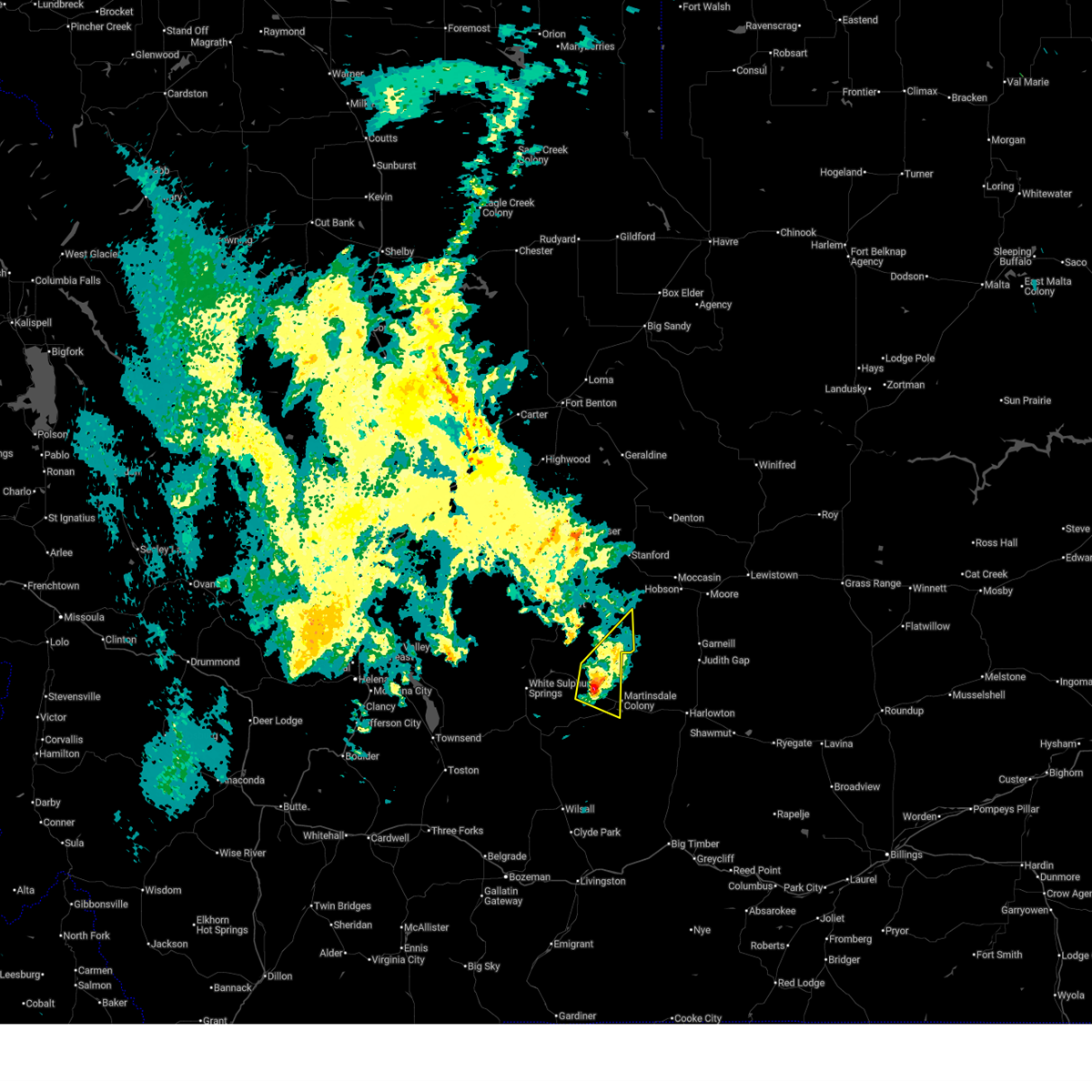
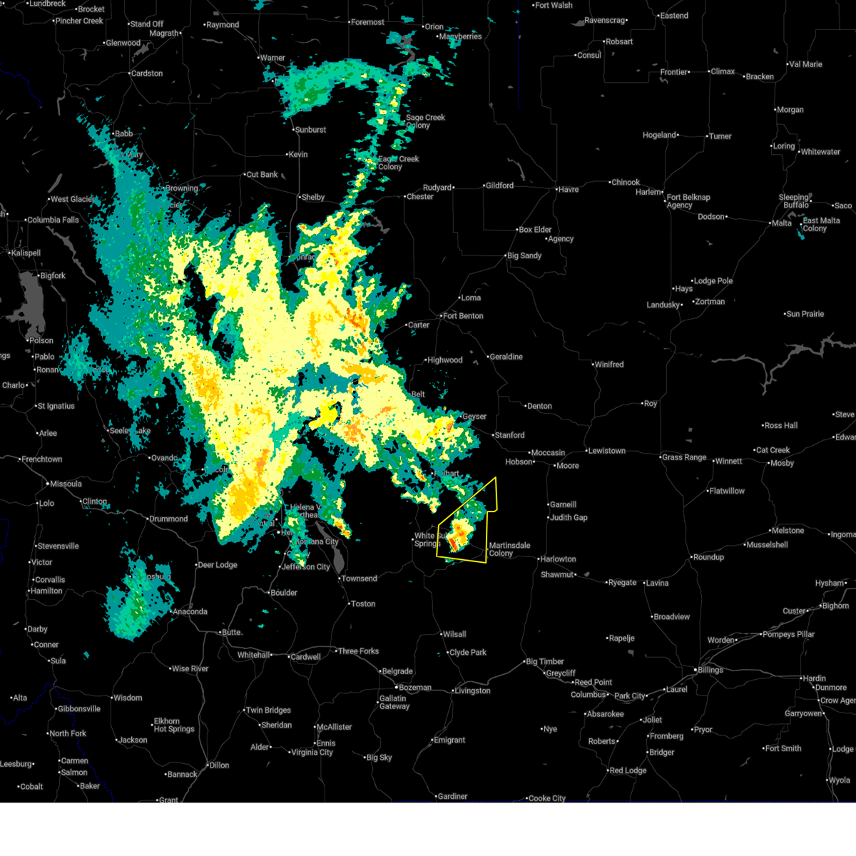
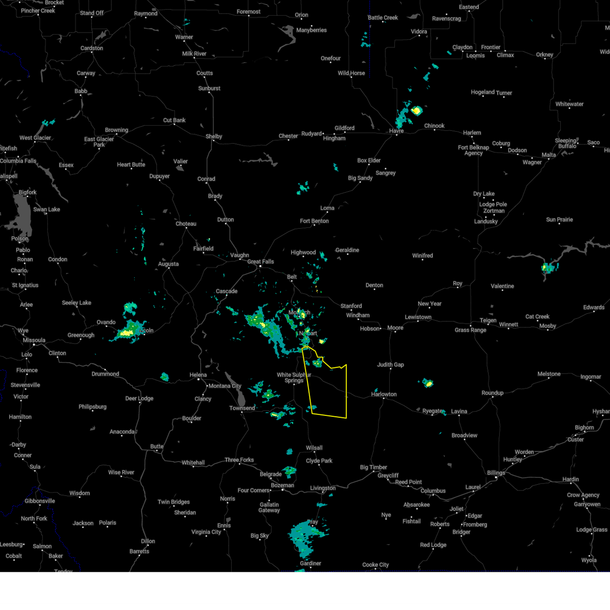
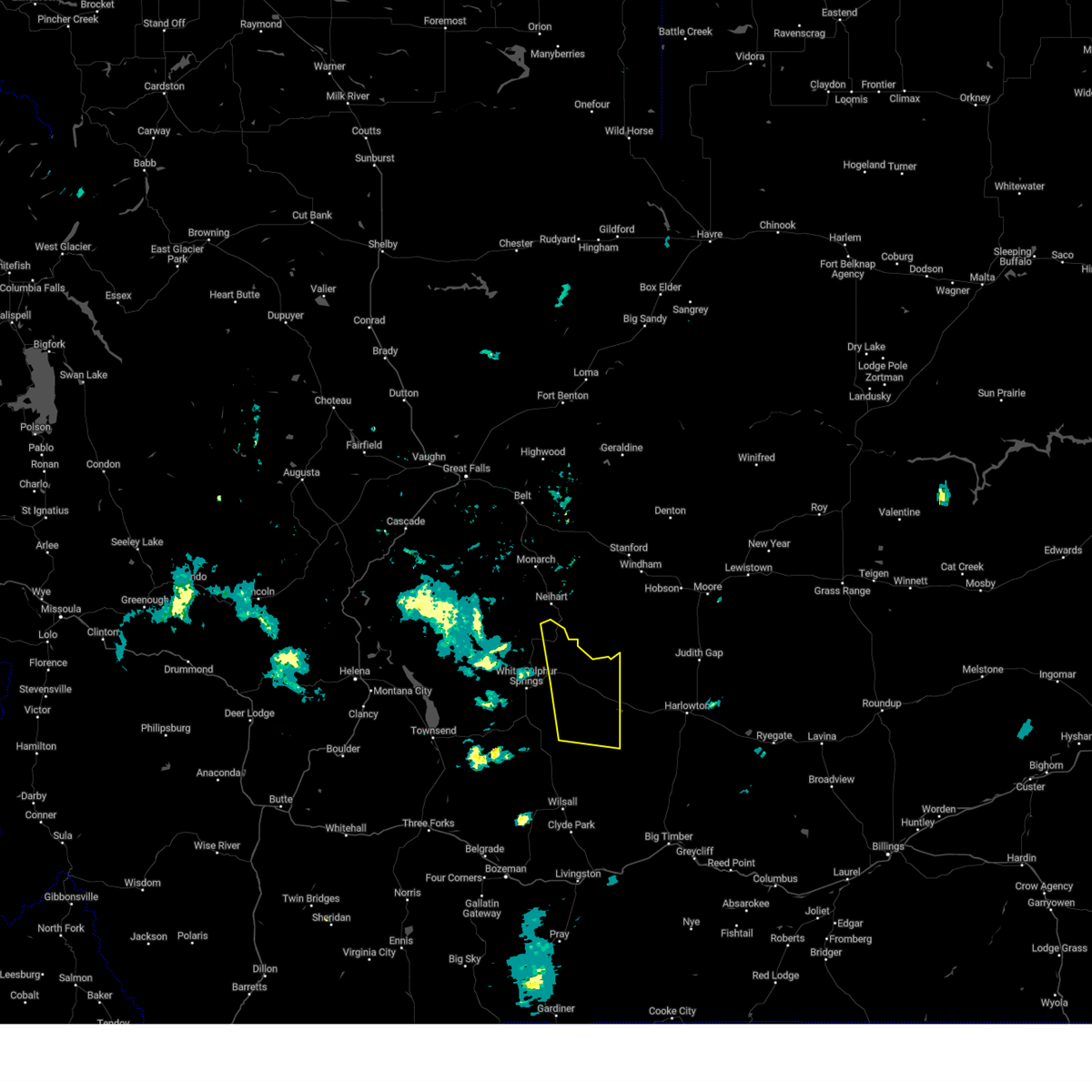
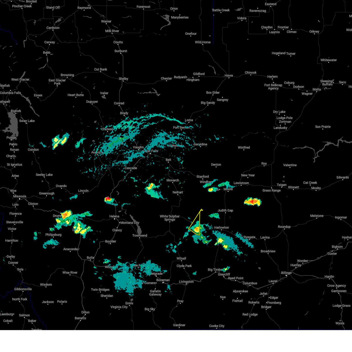
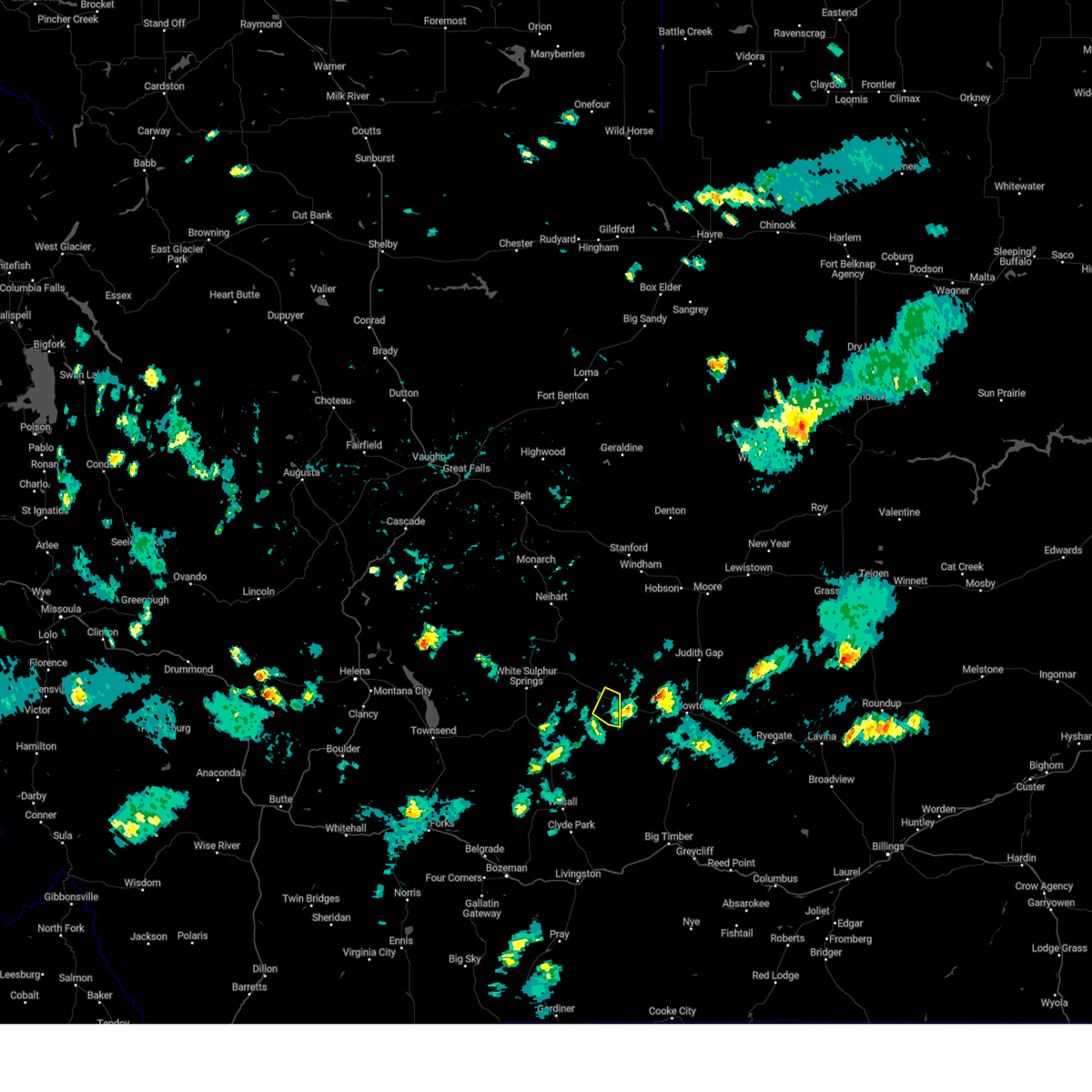
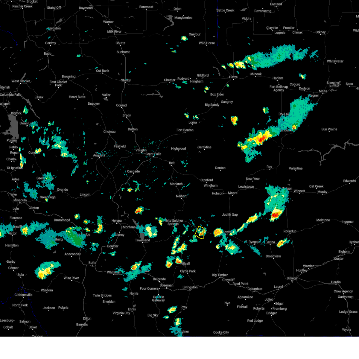
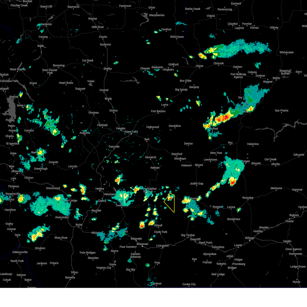
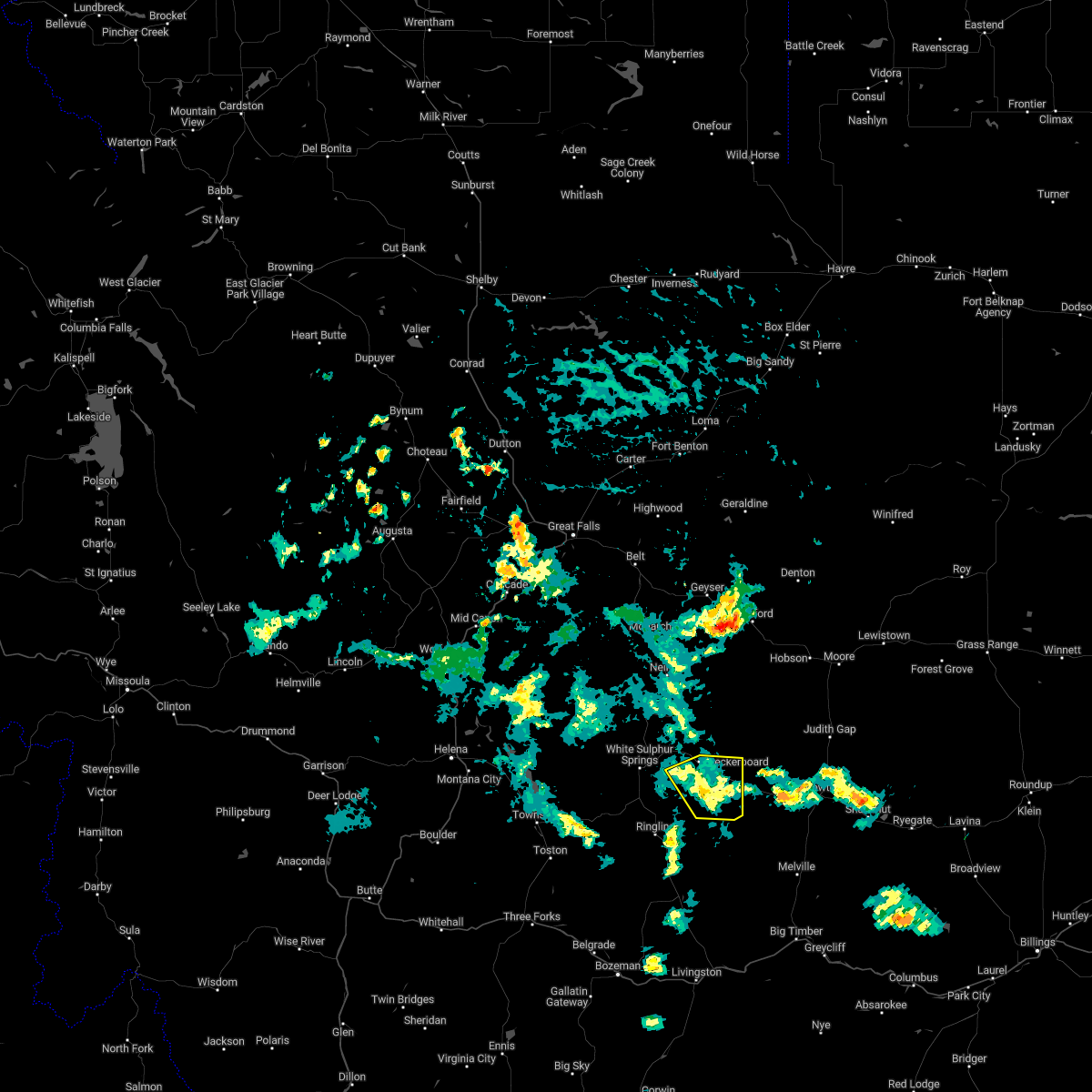
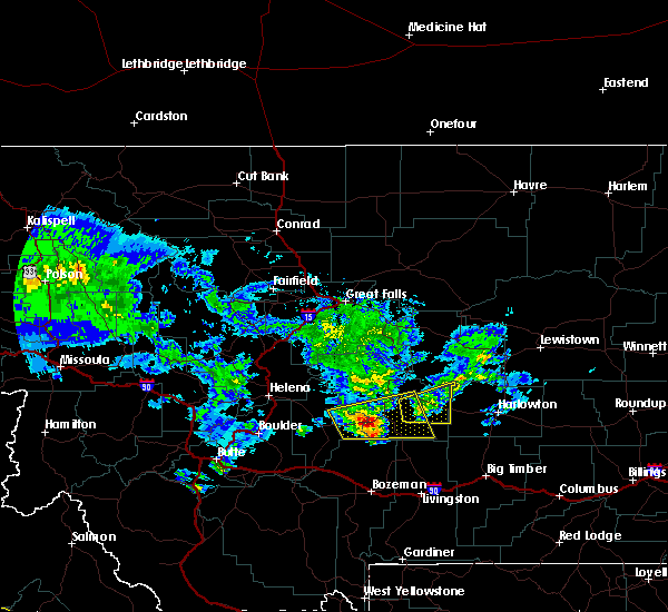
Hail Map for Martinsdale, MT
The Martinsdale, MT area has had 5 reports of on-the-ground hail by trained spotters, and has been under severe weather warnings 2 times during the past 12 months. Doppler radar has detected hail at or near Martinsdale, MT on 21 occasions.
| Name: | Martinsdale, MT |
| Where Located: | 64 miles NNE of Bozeman, MT |
| Map: | Google Map for Martinsdale, MT |
| Population: | 64 |
| Housing Units: | 74 |
| More Info: | Search Google for Martinsdale, MT |
2
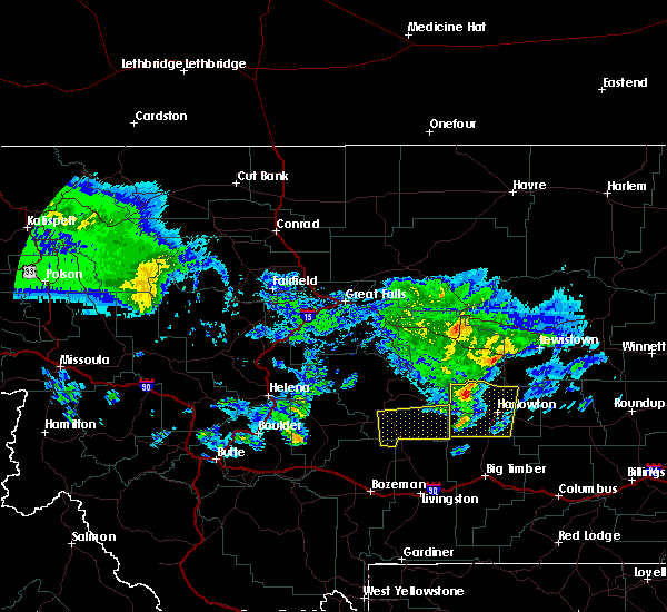
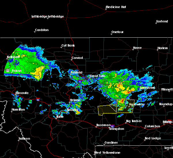
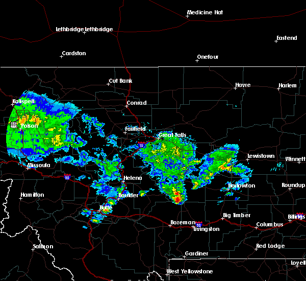
The Top Recent Hail Date for Martinsdale, MT is Friday, July 28, 2023 (4th out of 21)

Hail and Wind Damage Spotted near Martinsdale, MT
| Date / Time | Report Details |
|---|---|
| 6/20/2025 4:25 PM MDT |
 At 425 pm mdt, a severe thunderstorm was located 21 miles east of white sulphur springs, moving east at 25 mph (radar indicated). Hazards include 60 mph wind gusts and quarter size hail. Hail damage to vehicles is expected. expect wind damage to roofs, siding, and trees. Locations impacted include, martinsdale and checkerboard. At 425 pm mdt, a severe thunderstorm was located 21 miles east of white sulphur springs, moving east at 25 mph (radar indicated). Hazards include 60 mph wind gusts and quarter size hail. Hail damage to vehicles is expected. expect wind damage to roofs, siding, and trees. Locations impacted include, martinsdale and checkerboard.
|
| 6/20/2025 4:11 PM MDT |
 Svrtfx the national weather service in great falls has issued a * severe thunderstorm warning for, east central meagher county in central montana, south central judith basin county in central montana, * until 500 pm mdt. * at 411 pm mdt, a severe thunderstorm was located 14 miles east of white sulphur springs, moving east northeast at 25 mph (radar indicated). Hazards include 60 mph wind gusts and quarter size hail. Hail damage to vehicles is expected. Expect wind damage to roofs, siding, and trees. Svrtfx the national weather service in great falls has issued a * severe thunderstorm warning for, east central meagher county in central montana, south central judith basin county in central montana, * until 500 pm mdt. * at 411 pm mdt, a severe thunderstorm was located 14 miles east of white sulphur springs, moving east northeast at 25 mph (radar indicated). Hazards include 60 mph wind gusts and quarter size hail. Hail damage to vehicles is expected. Expect wind damage to roofs, siding, and trees.
|
| 8/20/2024 5:09 PM MDT | Personal weather statio in wheatland county MT, 11.2 miles NNW of Martinsdale, MT |
| 8/18/2023 4:22 PM MDT |
 The severe thunderstorm warning for southeastern meagher county will expire at 430 pm mdt, the storms which prompted the warning have weakened below severe limits, and have exited the warned area. therefore, the warning will be allowed to expire. The severe thunderstorm warning for southeastern meagher county will expire at 430 pm mdt, the storms which prompted the warning have weakened below severe limits, and have exited the warned area. therefore, the warning will be allowed to expire.
|
| 8/18/2023 4:14 PM MDT |
 At 414 pm mdt, severe thunderstorms were located along a line extending from 28 miles southwest of stanford to 19 miles east of white sulphur springs to 33 miles west of harlowton, moving east at 50 mph (radar indicated). Hazards include 60 mph wind gusts. Expect damage to roofs, siding, and trees. locations impacted include, martinsdale, checkerboard and lennep. hail threat, radar indicated max hail size, <. 75 in wind threat, radar indicated max wind gust, 60 mph. At 414 pm mdt, severe thunderstorms were located along a line extending from 28 miles southwest of stanford to 19 miles east of white sulphur springs to 33 miles west of harlowton, moving east at 50 mph (radar indicated). Hazards include 60 mph wind gusts. Expect damage to roofs, siding, and trees. locations impacted include, martinsdale, checkerboard and lennep. hail threat, radar indicated max hail size, <. 75 in wind threat, radar indicated max wind gust, 60 mph.
|
| 8/18/2023 3:50 PM MDT |
 At 349 pm mdt, severe thunderstorms were located along a line extending from 40 miles northeast of townsend to near white sulphur springs to 27 miles northeast of toston, moving east at 50 mph (radar indicated). Hazards include 60 mph wind gusts. expect damage to roofs, siding, and trees At 349 pm mdt, severe thunderstorms were located along a line extending from 40 miles northeast of townsend to near white sulphur springs to 27 miles northeast of toston, moving east at 50 mph (radar indicated). Hazards include 60 mph wind gusts. expect damage to roofs, siding, and trees
|
| 7/28/2023 5:53 PM MDT |
 At 550 pm mdt, a severe thunderstorm was located 25 miles east of white sulphur springs, moving northeast at 20 mph (radar indicated). Hazards include 60 mph wind gusts and half dollar size hail. Hail damage to vehicles is expected. Expect wind damage to roofs, siding, and trees. At 550 pm mdt, a severe thunderstorm was located 25 miles east of white sulphur springs, moving northeast at 20 mph (radar indicated). Hazards include 60 mph wind gusts and half dollar size hail. Hail damage to vehicles is expected. Expect wind damage to roofs, siding, and trees.
|
| 6/26/2023 5:27 PM MDT |
 The severe thunderstorm warning for east central meagher county will expire at 530 pm mdt, the storm which prompted the warning has weakened below severe limits, and has exited the warned area. therefore, the warning will be allowed to expire. however small hail, gusty winds and heavy rain are still possible with this thunderstorm. The severe thunderstorm warning for east central meagher county will expire at 530 pm mdt, the storm which prompted the warning has weakened below severe limits, and has exited the warned area. therefore, the warning will be allowed to expire. however small hail, gusty winds and heavy rain are still possible with this thunderstorm.
|
| 6/26/2023 5:10 PM MDT |
 At 510 pm mdt, a severe thunderstorm was located 22 miles west of harlowton, moving east at 10 mph (radar indicated). Hazards include 60 mph wind gusts and quarter size hail. Hail damage to vehicles is expected. expect wind damage to roofs, siding, and trees. locations impacted include, martinsdale. hail threat, radar indicated max hail size, 1. 00 in wind threat, radar indicated max wind gust, 60 mph. At 510 pm mdt, a severe thunderstorm was located 22 miles west of harlowton, moving east at 10 mph (radar indicated). Hazards include 60 mph wind gusts and quarter size hail. Hail damage to vehicles is expected. expect wind damage to roofs, siding, and trees. locations impacted include, martinsdale. hail threat, radar indicated max hail size, 1. 00 in wind threat, radar indicated max wind gust, 60 mph.
|
| 6/26/2023 4:55 PM MDT |
 At 454 pm mdt, a severe thunderstorm was located 25 miles west of harlowton, moving southeast at 10 mph (radar indicated). Hazards include 60 mph wind gusts and half dollar size hail. Hail damage to vehicles is expected. Expect wind damage to roofs, siding, and trees. At 454 pm mdt, a severe thunderstorm was located 25 miles west of harlowton, moving southeast at 10 mph (radar indicated). Hazards include 60 mph wind gusts and half dollar size hail. Hail damage to vehicles is expected. Expect wind damage to roofs, siding, and trees.
|
| 8/13/2022 12:48 PM MDT | Quarter sized hail reported 13.9 miles SE of Martinsdale, MT, most hail size was dime... with several quarter size stones. |
| 7/24/2022 4:53 PM MDT |
 At 452 pm mdt, a severe thunderstorm was located 19 miles southeast of white sulphur springs, moving northeast at 10 mph (radar indicated). Hazards include 60 mph wind gusts and quarter size hail. Hail damage to vehicles is expected. Expect wind damage to roofs, siding, and trees. At 452 pm mdt, a severe thunderstorm was located 19 miles southeast of white sulphur springs, moving northeast at 10 mph (radar indicated). Hazards include 60 mph wind gusts and quarter size hail. Hail damage to vehicles is expected. Expect wind damage to roofs, siding, and trees.
|
| 7/15/2022 1:06 PM MDT | Storm damage reported in wheatland county MT, 9.4 miles WNW of Martinsdale, MT |
| 7/15/2022 1:02 PM MDT | Storm damage reported in wheatland county MT, 9.4 miles WNW of Martinsdale, MT |
| 7/15/2022 12:54 PM MDT |
 At 1253 pm mdt, severe thunderstorms were located along a line extending from 12 miles southwest of geyser to 25 miles east of white sulphur springs, moving east at 25 mph (radar indicated). Hazards include 60 mph wind gusts. expect damage to roofs, siding, and trees At 1253 pm mdt, severe thunderstorms were located along a line extending from 12 miles southwest of geyser to 25 miles east of white sulphur springs, moving east at 25 mph (radar indicated). Hazards include 60 mph wind gusts. expect damage to roofs, siding, and trees
|
| 6/4/2021 5:00 PM MDT | Golf Ball sized hail reported 17.8 miles NNW of Martinsdale, MT, broken windows on house and extensive damage to siding on house. |
| 7/7/2020 2:10 PM MDT | Golf Ball sized hail reported 1.6 miles SW of Martinsdale, MT |
| 7/7/2020 1:56 PM MDT |
 At 155 pm mdt, a severe thunderstorm was located 23 miles southeast of white sulphur springs, moving northeast at 45 mph (radar indicated). Hazards include 60 mph wind gusts and quarter size hail. Hail damage to vehicles is expected. Expect wind damage to roofs, siding, and trees. At 155 pm mdt, a severe thunderstorm was located 23 miles southeast of white sulphur springs, moving northeast at 45 mph (radar indicated). Hazards include 60 mph wind gusts and quarter size hail. Hail damage to vehicles is expected. Expect wind damage to roofs, siding, and trees.
|
| 8/10/2019 8:44 PM MDT |
 At 844 pm mdt, severe thunderstorms were located along a line extending from 31 miles east of white sulphur springs to 16 miles west of harlowton, moving northeast at 30 mph (radar indicated). Hazards include 60 mph wind gusts and penny size hail. Expect damage to roofs, siding, and trees. Locations impacted include, martinsdale. At 844 pm mdt, severe thunderstorms were located along a line extending from 31 miles east of white sulphur springs to 16 miles west of harlowton, moving northeast at 30 mph (radar indicated). Hazards include 60 mph wind gusts and penny size hail. Expect damage to roofs, siding, and trees. Locations impacted include, martinsdale.
|
| 8/10/2019 8:25 PM MDT |
 At 825 pm mdt, severe thunderstorms were located along a line extending from 23 miles east of white sulphur springs to 24 miles southwest of harlowton, moving east at 55 mph (radar indicated). Hazards include 60 mph wind gusts and quarter size hail. Hail damage to vehicles is expected. expect wind damage to roofs, siding, and trees. Locations impacted include, martinsdale and lennep. At 825 pm mdt, severe thunderstorms were located along a line extending from 23 miles east of white sulphur springs to 24 miles southwest of harlowton, moving east at 55 mph (radar indicated). Hazards include 60 mph wind gusts and quarter size hail. Hail damage to vehicles is expected. expect wind damage to roofs, siding, and trees. Locations impacted include, martinsdale and lennep.
|
| 8/10/2019 8:06 PM MDT |
 A severe thunderstorm warning remains in effect until 900 pm mdt for southeastern meagher county. at 806 pm mdt, a severe thunderstorm was located 16 miles southeast of white sulphur springs, moving east at 30 mph. hazard. 60 mph wind gusts and half dollar size hail. source. Radar indicated. A severe thunderstorm warning remains in effect until 900 pm mdt for southeastern meagher county. at 806 pm mdt, a severe thunderstorm was located 16 miles southeast of white sulphur springs, moving east at 30 mph. hazard. 60 mph wind gusts and half dollar size hail. source. Radar indicated.
|
| 8/10/2019 7:53 PM MDT |
 At 752 pm mdt, severe thunderstorms were located along a line extending from 12 miles south of white sulphur springs to 23 miles northwest of clyde park, moving east at 45 mph (radar indicated). Hazards include ping pong ball size hail and 60 mph wind gusts. People and animals outdoors will be injured. expect hail damage to roofs, siding, windows, and vehicles. Expect wind damage to roofs, siding, and trees. At 752 pm mdt, severe thunderstorms were located along a line extending from 12 miles south of white sulphur springs to 23 miles northwest of clyde park, moving east at 45 mph (radar indicated). Hazards include ping pong ball size hail and 60 mph wind gusts. People and animals outdoors will be injured. expect hail damage to roofs, siding, windows, and vehicles. Expect wind damage to roofs, siding, and trees.
|
| 8/10/2019 7:45 PM MDT |
 At 730 pm mdt, a severe thunderstorm was located 13 miles southeast of white sulphur springs, moving northeast at 20 mph (radar indicated). Hazards include 60 mph wind gusts and half dollar size hail. Hail damage to vehicles is expected. Expect wind damage to roofs, siding, and trees. At 730 pm mdt, a severe thunderstorm was located 13 miles southeast of white sulphur springs, moving northeast at 20 mph (radar indicated). Hazards include 60 mph wind gusts and half dollar size hail. Hail damage to vehicles is expected. Expect wind damage to roofs, siding, and trees.
|
| 8/10/2019 7:31 PM MDT |
 At 730 pm mdt, a severe thunderstorm was located 13 miles southeast of white sulphur springs, moving northeast at 20 mph (radar indicated). Hazards include 60 mph wind gusts and half dollar size hail. Hail damage to vehicles is expected. Expect wind damage to roofs, siding, and trees. At 730 pm mdt, a severe thunderstorm was located 13 miles southeast of white sulphur springs, moving northeast at 20 mph (radar indicated). Hazards include 60 mph wind gusts and half dollar size hail. Hail damage to vehicles is expected. Expect wind damage to roofs, siding, and trees.
|
| 7/6/2019 7:21 PM MDT |
 At 720 pm mdt, a severe thunderstorm was located 21 miles east of white sulphur springs, moving east at 25 mph (radar indicated). Hazards include 60 mph wind gusts and quarter size hail. Hail damage to vehicles is expected. Expect wind damage to roofs, siding, and trees. At 720 pm mdt, a severe thunderstorm was located 21 miles east of white sulphur springs, moving east at 25 mph (radar indicated). Hazards include 60 mph wind gusts and quarter size hail. Hail damage to vehicles is expected. Expect wind damage to roofs, siding, and trees.
|
| 6/1/2015 6:19 PM MDT | Ground covered with small hai in wheatland county MT, 11.1 miles W of Martinsdale, MT |
| 9/16/2013 3:56 PM MDT | Storm damage reported in meagher county MT, 0.2 miles SSE of Martinsdale, MT |
| 7/8/2013 2:55 PM MDT | Ping Pong Ball sized hail reported 13.7 miles NW of Martinsdale, MT, lots of |
| 7/7/2013 4:58 PM MDT | Quarter sized hail reported 15.5 miles ENE of Martinsdale, MT, hail of increasing size at time of call. heavy rain |
Hail Maps for Martinsdale, MT


Connect with Interactive Hail Maps