

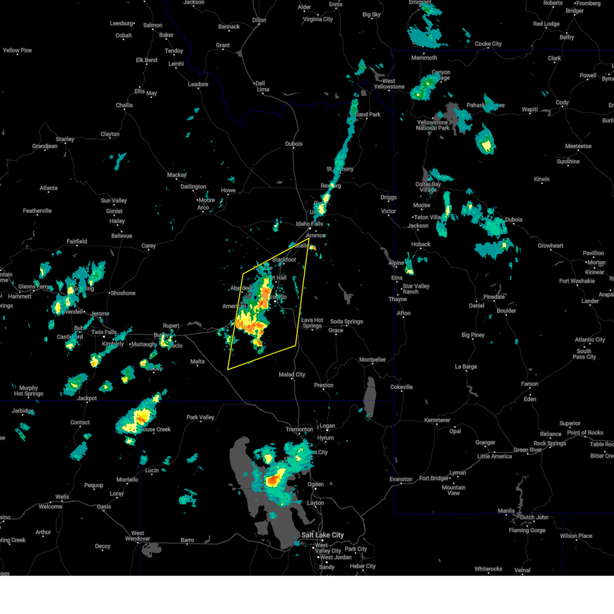
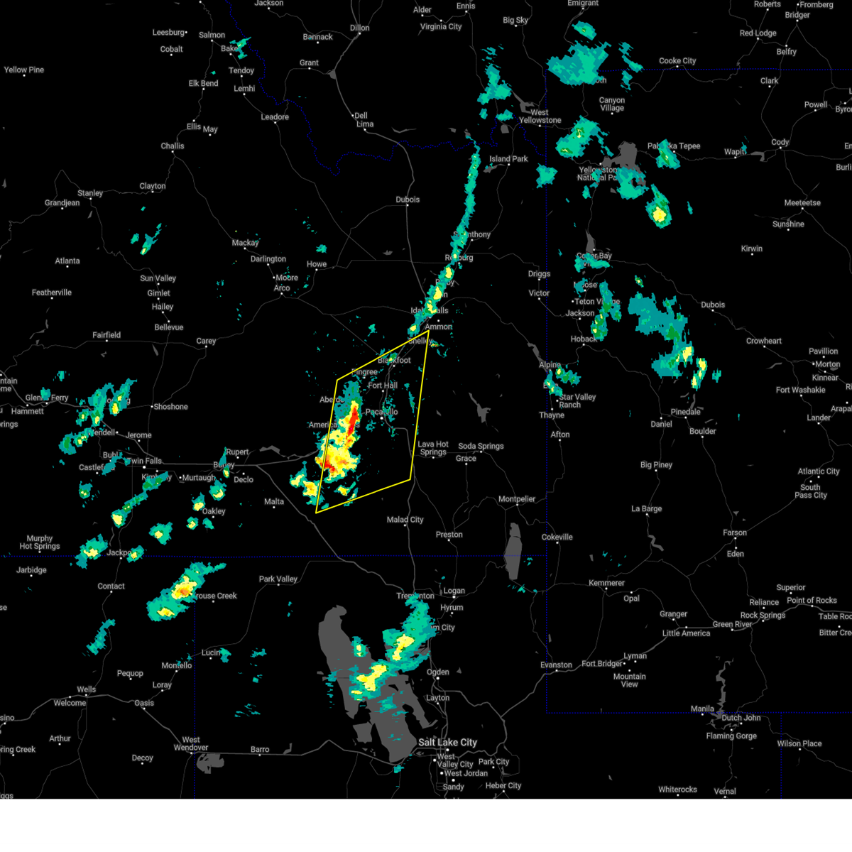
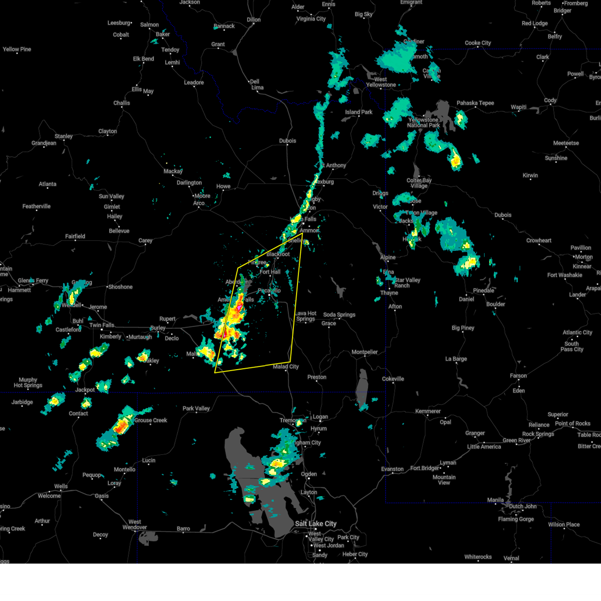
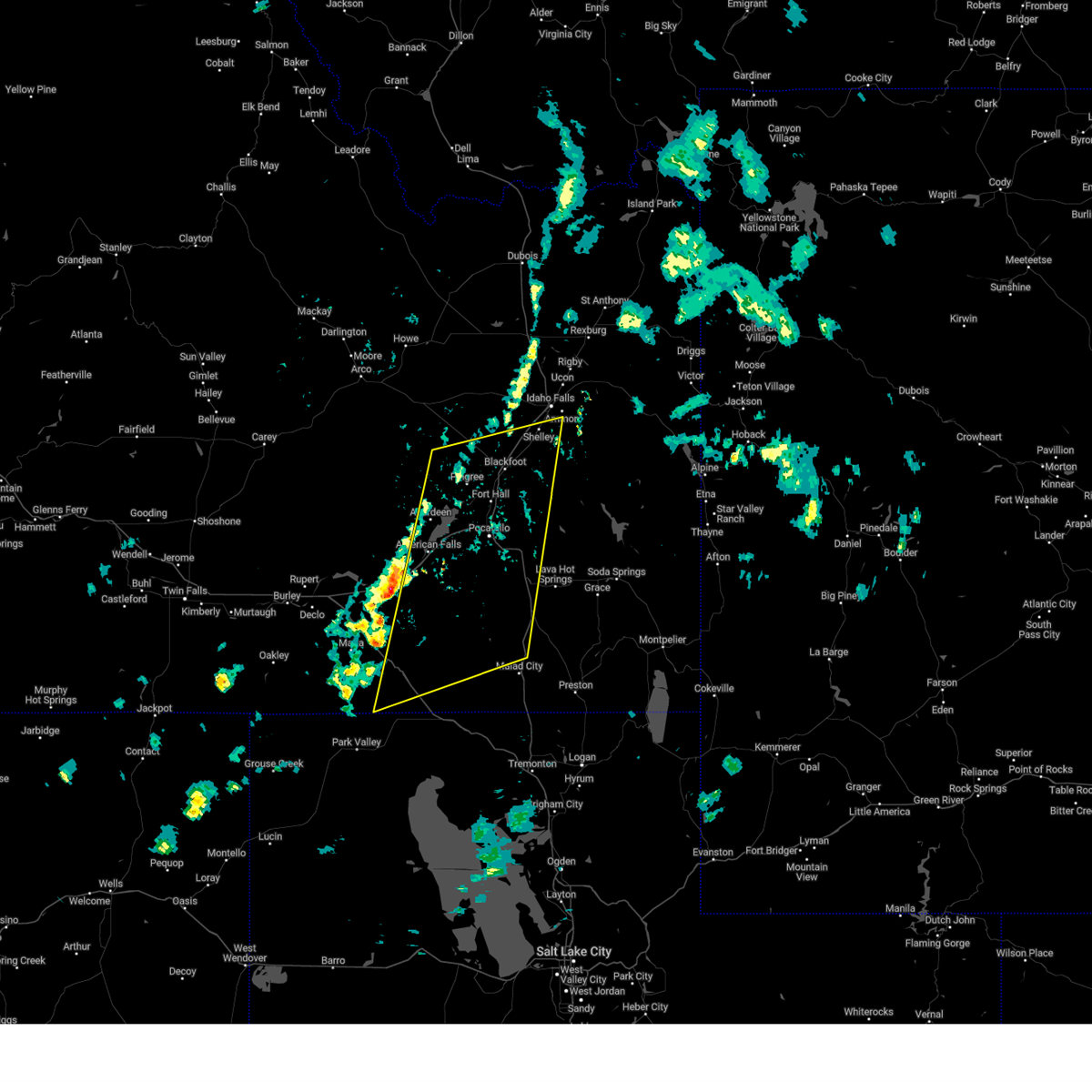
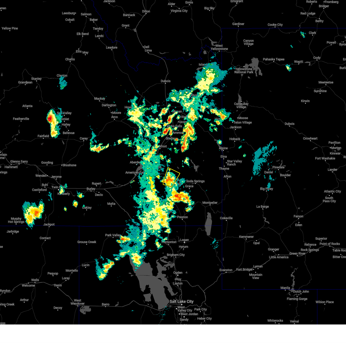
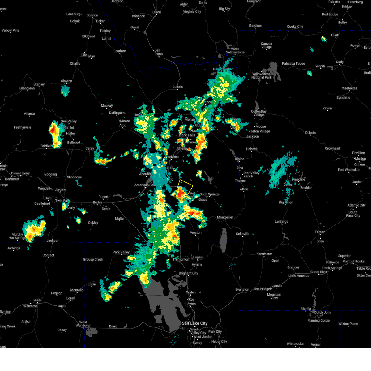
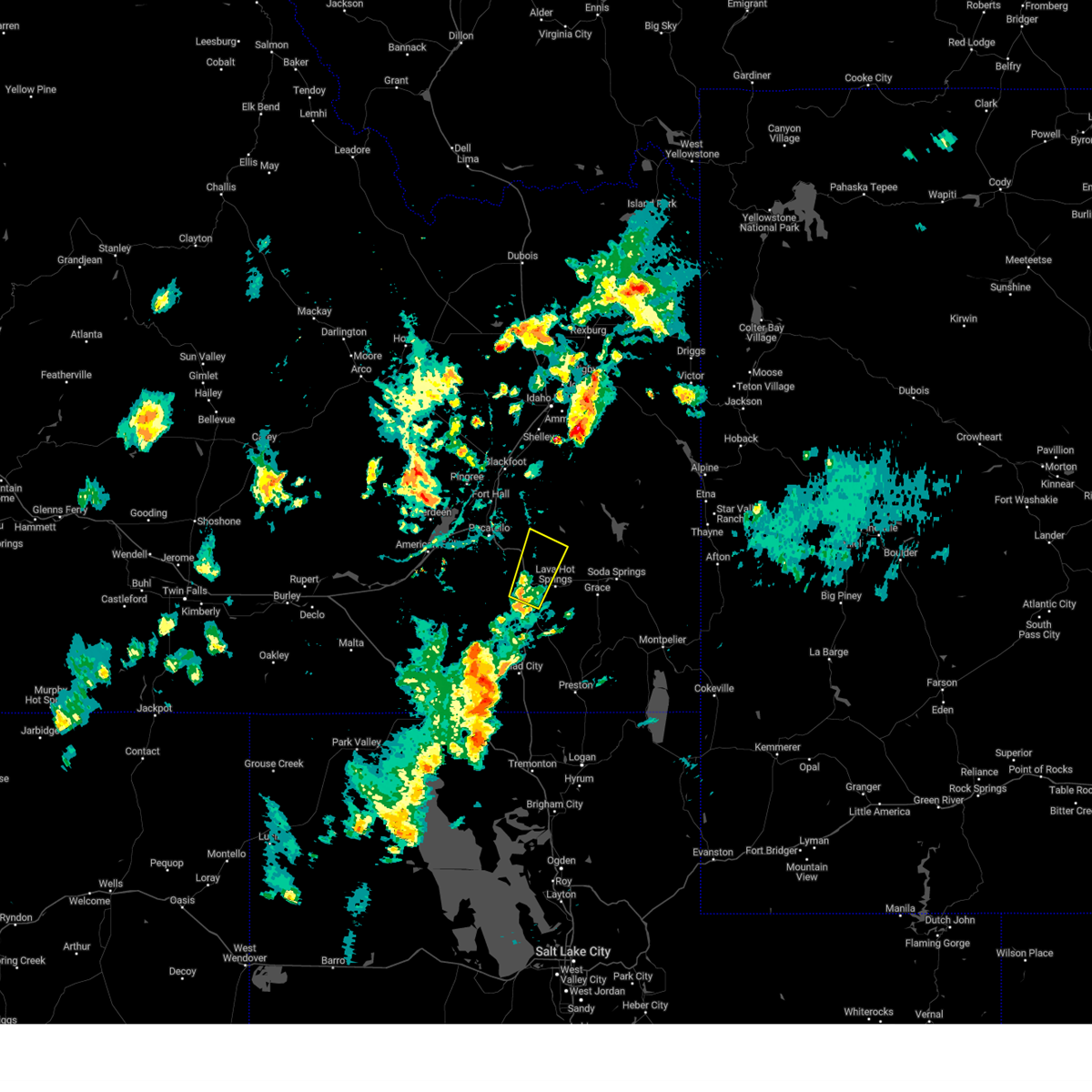
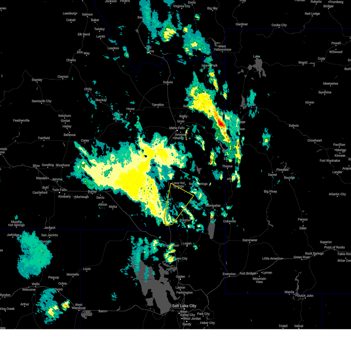
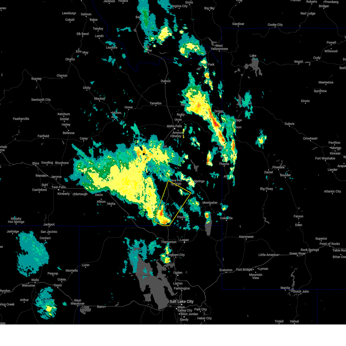
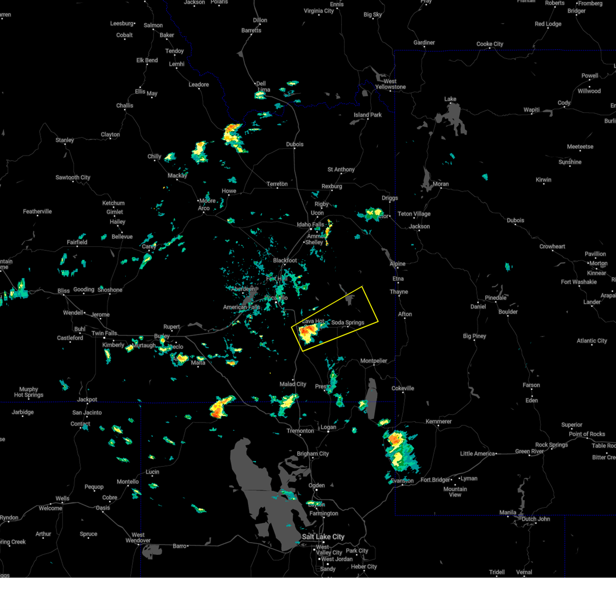
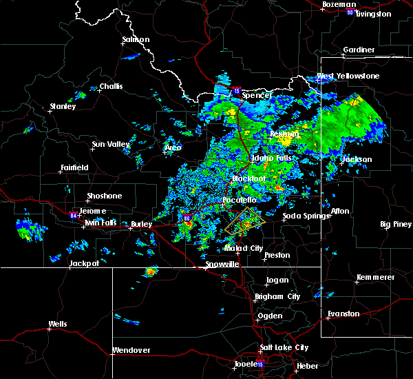
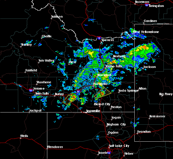
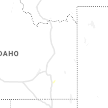
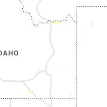
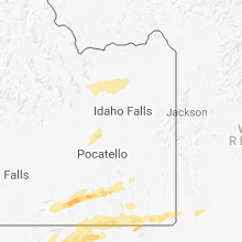
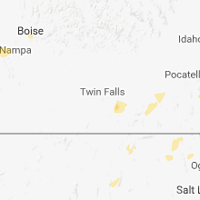
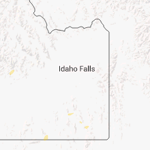
Hail Map for McCammon, ID
The McCammon, ID area has had 0 reports of on-the-ground hail by trained spotters, and has been under severe weather warnings 14 times during the past 12 months. Doppler radar has detected hail at or near McCammon, ID on 14 occasions, including 3 occasions during the past year.
| Name: | McCammon, ID |
| Where Located: | 58.6 miles S of Idaho Falls, ID |
| Map: | Google Map for McCammon, ID |
| Population: | 809 |
| Housing Units: | 333 |
| More Info: | Search Google for McCammon, ID |
5
The Top Recent Hail Date for McCammon, ID is Sunday, August 18, 2024 (1st out of 14)

Hail and Wind Damage Spotted near McCammon, ID
| Date / Time | Report Details |
|---|---|
| 5/11/2025 1:14 PM MDT |
 The storm which prompted the warning has weakened below severe limits, and no longer poses an immediate threat to life or property. therefore, the warning will be allowed to expire. however, gusty winds and heavy rain are still possible with these thunderstorms. a severe thunderstorm watch remains in effect until 800 pm mdt for southeastern idaho. The storm which prompted the warning has weakened below severe limits, and no longer poses an immediate threat to life or property. therefore, the warning will be allowed to expire. however, gusty winds and heavy rain are still possible with these thunderstorms. a severe thunderstorm watch remains in effect until 800 pm mdt for southeastern idaho.
|
| 5/11/2025 1:04 PM MDT |
 At 102 pm mdt, a line of severe thunderstorms was located from near springfield to roy moving northeast at 35 mph (trained weather spotters. a gust to 59 mph was reported at connor summit). Hazards include 60 mph wind gusts. Expect damage to roofs, siding, and trees. Locations impacted include, sterling, aberdeen, rose, rockland, mink creek pass, hawkins reservoir, mccammon, american falls, basalt, arbon, shelley, inkom, fort hall bannock creek lodge, pingree, american falls reservoir, pocatello airport, fort hall putnam lodge, fort hall buffalo lodge, pauline, and pocatello. At 102 pm mdt, a line of severe thunderstorms was located from near springfield to roy moving northeast at 35 mph (trained weather spotters. a gust to 59 mph was reported at connor summit). Hazards include 60 mph wind gusts. Expect damage to roofs, siding, and trees. Locations impacted include, sterling, aberdeen, rose, rockland, mink creek pass, hawkins reservoir, mccammon, american falls, basalt, arbon, shelley, inkom, fort hall bannock creek lodge, pingree, american falls reservoir, pocatello airport, fort hall putnam lodge, fort hall buffalo lodge, pauline, and pocatello.
|
| 5/11/2025 12:51 PM MDT |
 the severe thunderstorm warning has been cancelled and is no longer in effect the severe thunderstorm warning has been cancelled and is no longer in effect
|
| 5/11/2025 12:51 PM MDT |
 At 1249 pm mdt, a line of severe thunderstorms extended from aberdeen to near sweetzer summit, moving northeast at 35 mph (radar indicated and mesonet observations. this storm has a history of producing gusts to near 60 mph). Hazards include 60 mph wind gusts and penny size hail. Expect damage to roofs, siding, and trees. Locations impacted include, sterling, aberdeen, rose, rockland, mink creek pass, sweetzer summit, hawkins reservoir, mccammon, arimo, american falls, basalt, arbon, sublett reservoir, shelley, malad pass, inkom, fort hall bannock creek lodge, pingree, american falls reservoir, and pocatello airport. At 1249 pm mdt, a line of severe thunderstorms extended from aberdeen to near sweetzer summit, moving northeast at 35 mph (radar indicated and mesonet observations. this storm has a history of producing gusts to near 60 mph). Hazards include 60 mph wind gusts and penny size hail. Expect damage to roofs, siding, and trees. Locations impacted include, sterling, aberdeen, rose, rockland, mink creek pass, sweetzer summit, hawkins reservoir, mccammon, arimo, american falls, basalt, arbon, sublett reservoir, shelley, malad pass, inkom, fort hall bannock creek lodge, pingree, american falls reservoir, and pocatello airport.
|
| 5/11/2025 12:27 PM MDT |
 Svrpih the national weather service in pocatello has issued a * severe thunderstorm warning for, northwestern caribou county in southeastern idaho, central oneida county in southeastern idaho, bannock county in southeastern idaho, power county in southeastern idaho, central bonneville county in southeastern idaho, central bingham county in southeastern idaho, southeastern cassia county in southeastern idaho, * until 115 pm mdt. * at 1225 pm mdt, a line of severe thunderstorms extended from near city of rocks to near aberdeen, moving northeast at 45 mph (radar indicated and mesonet observations. a gust to 59 mph was reported at connor summit). Hazards include 60 mph wind gusts. expect damage to roofs, siding, and trees Svrpih the national weather service in pocatello has issued a * severe thunderstorm warning for, northwestern caribou county in southeastern idaho, central oneida county in southeastern idaho, bannock county in southeastern idaho, power county in southeastern idaho, central bonneville county in southeastern idaho, central bingham county in southeastern idaho, southeastern cassia county in southeastern idaho, * until 115 pm mdt. * at 1225 pm mdt, a line of severe thunderstorms extended from near city of rocks to near aberdeen, moving northeast at 45 mph (radar indicated and mesonet observations. a gust to 59 mph was reported at connor summit). Hazards include 60 mph wind gusts. expect damage to roofs, siding, and trees
|
| 8/18/2024 8:33 PM MDT |
 The storm which prompted the warning has weakened below severe limits, and no longer poses an immediate threat to life or property. therefore, the warning has been allowed to expire. however, small hail, gusty winds, and heavy rain are still possible with this thunderstorm as it tracks northeast away from mccammon and east of inkom. if you observed hail or wind damage, please report your observations to the national weather service in pocatello via phone, email, or social media. The storm which prompted the warning has weakened below severe limits, and no longer poses an immediate threat to life or property. therefore, the warning has been allowed to expire. however, small hail, gusty winds, and heavy rain are still possible with this thunderstorm as it tracks northeast away from mccammon and east of inkom. if you observed hail or wind damage, please report your observations to the national weather service in pocatello via phone, email, or social media.
|
| 8/18/2024 8:24 PM MDT |
 At 824 pm mdt, a severe thunderstorm was located just southeast of inkom, or 8 miles north of mccammon, moving northeast at 30 mph (radar indicated). Hazards include 60 mph wind gusts and quarter size hail. Hail damage to vehicles is expected. expect wind damage to roofs, siding, and trees. Locations impacted include, mccammon. At 824 pm mdt, a severe thunderstorm was located just southeast of inkom, or 8 miles north of mccammon, moving northeast at 30 mph (radar indicated). Hazards include 60 mph wind gusts and quarter size hail. Hail damage to vehicles is expected. expect wind damage to roofs, siding, and trees. Locations impacted include, mccammon.
|
| 8/18/2024 8:06 PM MDT |
 Svrpih the national weather service in pocatello has issued a * severe thunderstorm warning for, west central caribou county in southeastern idaho, central bannock county in southeastern idaho, * until 830 pm mdt. * at 805 pm mdt, a severe thunderstorm was located over mccammon, moving northeast at 30 mph (radar indicated). Hazards include 60 mph wind gusts and quarter size hail. Hail damage to vehicles is expected. Expect wind damage to roofs, siding, and trees. Svrpih the national weather service in pocatello has issued a * severe thunderstorm warning for, west central caribou county in southeastern idaho, central bannock county in southeastern idaho, * until 830 pm mdt. * at 805 pm mdt, a severe thunderstorm was located over mccammon, moving northeast at 30 mph (radar indicated). Hazards include 60 mph wind gusts and quarter size hail. Hail damage to vehicles is expected. Expect wind damage to roofs, siding, and trees.
|
| 8/15/2024 5:13 PM MDT |
 The storms which prompted the warning have weakened below severe limits, and no longer pose an immediate threat to life or property. therefore, the warning will be allowed to expire. however, small hail and gusty winds are still possible with these thunderstorms. The storms which prompted the warning have weakened below severe limits, and no longer pose an immediate threat to life or property. therefore, the warning will be allowed to expire. however, small hail and gusty winds are still possible with these thunderstorms.
|
| 8/15/2024 4:25 PM MDT |
 Svrpih the national weather service in pocatello has issued a * severe thunderstorm warning for, southeastern blaine county in central idaho, northwestern caribou county in southeastern idaho, north central oneida county in southeastern idaho, bannock county in southeastern idaho, southeastern butte county in southeastern idaho, power county in southeastern idaho, west central bonneville county in southeastern idaho, bingham county in southeastern idaho, northeastern cassia county in southeastern idaho, * until 515 pm mdt. * at 423 pm mdt, severe thunderstorms were located along a line extending from 6 miles northwest of springfield to near fort hall mount putnam, moving northeast at 45 mph (radar indicated). Hazards include 60 mph wind gusts and penny size hail. expect damage to roofs, siding, and trees Svrpih the national weather service in pocatello has issued a * severe thunderstorm warning for, southeastern blaine county in central idaho, northwestern caribou county in southeastern idaho, north central oneida county in southeastern idaho, bannock county in southeastern idaho, southeastern butte county in southeastern idaho, power county in southeastern idaho, west central bonneville county in southeastern idaho, bingham county in southeastern idaho, northeastern cassia county in southeastern idaho, * until 515 pm mdt. * at 423 pm mdt, severe thunderstorms were located along a line extending from 6 miles northwest of springfield to near fort hall mount putnam, moving northeast at 45 mph (radar indicated). Hazards include 60 mph wind gusts and penny size hail. expect damage to roofs, siding, and trees
|
| 8/13/2024 2:23 PM MDT |
 The storm which prompted the warning has weakened below severe limits, and no longer poses an immediate threat to life or property. therefore, the warning will be allowed to expire. however, small hail is still possible with this thunderstorm. to report severe weather, contact your nearest law enforcement agency. they will relay your report to the national weather service pocatello. The storm which prompted the warning has weakened below severe limits, and no longer poses an immediate threat to life or property. therefore, the warning will be allowed to expire. however, small hail is still possible with this thunderstorm. to report severe weather, contact your nearest law enforcement agency. they will relay your report to the national weather service pocatello.
|
| 8/13/2024 2:11 PM MDT |
 At 208 pm mdt, a severe thunderstorm was located near mccammon, moving northeast at 30 mph (public). Hazards include 60 mph wind gusts and quarter size hail. Hail damage to vehicles is expected. expect wind damage to roofs, siding, and trees. Locations impacted include, mccammon, inkom, portneuf gap, and mink creek pass. At 208 pm mdt, a severe thunderstorm was located near mccammon, moving northeast at 30 mph (public). Hazards include 60 mph wind gusts and quarter size hail. Hail damage to vehicles is expected. expect wind damage to roofs, siding, and trees. Locations impacted include, mccammon, inkom, portneuf gap, and mink creek pass.
|
| 8/13/2024 2:11 PM MDT |
 the severe thunderstorm warning has been cancelled and is no longer in effect the severe thunderstorm warning has been cancelled and is no longer in effect
|
| 8/13/2024 1:39 PM MDT |
 Svrpih the national weather service in pocatello has issued a * severe thunderstorm warning for, northern oneida county in southeastern idaho, central bannock county in southeastern idaho, southeastern power county in southeastern idaho, * until 230 pm mdt. * at 138 pm mdt, a severe thunderstorm was located 7 miles east of fort hall bannock peak, or 19 miles west of mccammon, moving northeast at 35 mph (radar indicated). Hazards include 60 mph wind gusts and quarter size hail. Hail damage to vehicles is expected. Expect wind damage to roofs, siding, and trees. Svrpih the national weather service in pocatello has issued a * severe thunderstorm warning for, northern oneida county in southeastern idaho, central bannock county in southeastern idaho, southeastern power county in southeastern idaho, * until 230 pm mdt. * at 138 pm mdt, a severe thunderstorm was located 7 miles east of fort hall bannock peak, or 19 miles west of mccammon, moving northeast at 35 mph (radar indicated). Hazards include 60 mph wind gusts and quarter size hail. Hail damage to vehicles is expected. Expect wind damage to roofs, siding, and trees.
|
| 5/13/2024 6:05 PM MDT |
 Svrpih the national weather service in pocatello has issued a * severe thunderstorm warning for, western caribou county in southeastern idaho, eastern oneida county in southeastern idaho, bannock county in southeastern idaho, central bonneville county in southeastern idaho, franklin county in southeastern idaho, southeastern bingham county in southeastern idaho, * until 715 pm mdt. * at 604 pm mdt, severe thunderstorms were located along a line extending from rockford to near portneuf gap to 12 miles southwest of pleasantview, moving east at 35 mph (radar indicated). Hazards include 60 mph wind gusts. expect damage to roofs, siding, and trees Svrpih the national weather service in pocatello has issued a * severe thunderstorm warning for, western caribou county in southeastern idaho, eastern oneida county in southeastern idaho, bannock county in southeastern idaho, central bonneville county in southeastern idaho, franklin county in southeastern idaho, southeastern bingham county in southeastern idaho, * until 715 pm mdt. * at 604 pm mdt, severe thunderstorms were located along a line extending from rockford to near portneuf gap to 12 miles southwest of pleasantview, moving east at 35 mph (radar indicated). Hazards include 60 mph wind gusts. expect damage to roofs, siding, and trees
|
| 5/13/2024 5:59 PM MDT |
 At 558 pm mdt, severe thunderstorms were located along a line extending from rockford to chubbuck to 14 miles west of virginia, moving east at 45 mph (radar indicated). Hazards include 60 mph wind gusts. Expect damage to roofs, siding, and trees. Locations impacted include, pocatello, blackfoot, american falls, mccammon, american falls reservoir, chubbuck, aberdeen, inkom, downey, arimo, rockland, rose, fort hall bannock creek lodge, pingree, pocatello airport, fort hall putnam lodge, fort hall buffalo lodge, fort hall eagle lodge, fort hall lincoln creek lodge, and taber. At 558 pm mdt, severe thunderstorms were located along a line extending from rockford to chubbuck to 14 miles west of virginia, moving east at 45 mph (radar indicated). Hazards include 60 mph wind gusts. Expect damage to roofs, siding, and trees. Locations impacted include, pocatello, blackfoot, american falls, mccammon, american falls reservoir, chubbuck, aberdeen, inkom, downey, arimo, rockland, rose, fort hall bannock creek lodge, pingree, pocatello airport, fort hall putnam lodge, fort hall buffalo lodge, fort hall eagle lodge, fort hall lincoln creek lodge, and taber.
|
| 5/13/2024 5:59 PM MDT |
 the severe thunderstorm warning has been cancelled and is no longer in effect the severe thunderstorm warning has been cancelled and is no longer in effect
|
| 5/13/2024 5:19 PM MDT |
 Svrpih the national weather service in pocatello has issued a * severe thunderstorm warning for, southeastern blaine county in central idaho, central oneida county in southeastern idaho, bannock county in southeastern idaho, power county in southeastern idaho, southwestern bingham county in southeastern idaho, * until 615 pm mdt. * at 518 pm mdt, severe thunderstorms were located along a line extending from 13 miles northwest of aberdeen to near neeley to 13 miles south of rockland, moving east at 45 mph (radar indicated). Hazards include 60 mph wind gusts. expect damage to roofs, siding, and trees Svrpih the national weather service in pocatello has issued a * severe thunderstorm warning for, southeastern blaine county in central idaho, central oneida county in southeastern idaho, bannock county in southeastern idaho, power county in southeastern idaho, southwestern bingham county in southeastern idaho, * until 615 pm mdt. * at 518 pm mdt, severe thunderstorms were located along a line extending from 13 miles northwest of aberdeen to near neeley to 13 miles south of rockland, moving east at 45 mph (radar indicated). Hazards include 60 mph wind gusts. expect damage to roofs, siding, and trees
|
| 9/3/2023 6:32 PM MDT |
 At 631 pm mdt, a severe thunderstorm was located 7 miles west of swanlake, moving northeast at 50 mph (radar indicated and mesonet. this storm has a history of producing 50 to 60 mph winds). Hazards include 60 mph wind gusts. Expect damage to roofs, siding, and trees. locations impacted include, malad, mccammon, lava hot springs, swanlake, downey, arimo, cherry creek rest area, virginia, clifton, oxford, niter, and malad pass. hail threat, radar indicated max hail size, <. 75 in wind threat, observed max wind gust, 60 mph. At 631 pm mdt, a severe thunderstorm was located 7 miles west of swanlake, moving northeast at 50 mph (radar indicated and mesonet. this storm has a history of producing 50 to 60 mph winds). Hazards include 60 mph wind gusts. Expect damage to roofs, siding, and trees. locations impacted include, malad, mccammon, lava hot springs, swanlake, downey, arimo, cherry creek rest area, virginia, clifton, oxford, niter, and malad pass. hail threat, radar indicated max hail size, <. 75 in wind threat, observed max wind gust, 60 mph.
|
| 9/3/2023 6:20 PM MDT |
 At 619 pm mdt, a severe thunderstorm was located over malad, moving northeast at 35 mph (radar indicated and mesonet. at 615 pm mdt, 57 mph winds were reported near samaria). Hazards include 60 mph wind gusts. expect damage to roofs, siding, and trees At 619 pm mdt, a severe thunderstorm was located over malad, moving northeast at 35 mph (radar indicated and mesonet. at 615 pm mdt, 57 mph winds were reported near samaria). Hazards include 60 mph wind gusts. expect damage to roofs, siding, and trees
|
| 7/3/2023 1:32 PM MDT |
 At 130 pm mdt, a severe thunderstorm was located over lava hot springs, moving northeast at 35 mph (radar indicated). Hazards include 60 mph wind gusts and quarter size hail. Hail damage to vehicles is expected. Expect wind damage to roofs, siding, and trees. At 130 pm mdt, a severe thunderstorm was located over lava hot springs, moving northeast at 35 mph (radar indicated). Hazards include 60 mph wind gusts and quarter size hail. Hail damage to vehicles is expected. Expect wind damage to roofs, siding, and trees.
|
| 5/2/2022 5:59 PM MDT |
 At 559 pm mdt, severe thunderstorms were located along a line extending from 12 miles southwest of northwest inl to near pingree to near fort hall bannock peak, moving east at 40 mph (radar indicated). Hazards include 70 mph wind gusts and penny size hail. Expect considerable tree damage. Damage is likely to mobile homes, roofs, and outbuildings. At 559 pm mdt, severe thunderstorms were located along a line extending from 12 miles southwest of northwest inl to near pingree to near fort hall bannock peak, moving east at 40 mph (radar indicated). Hazards include 70 mph wind gusts and penny size hail. Expect considerable tree damage. Damage is likely to mobile homes, roofs, and outbuildings.
|
| 4/30/2020 6:25 PM MDT |
 At 624 pm mdt, severe thunderstorms were located along a line extending from near aberdeen to near rockland to 18 miles southeast of cold water rest area, moving east at 40 mph (radar indicated). Hazards include 60 mph wind gusts and up to nickel size hail. Expect damage to roofs, siding, and trees. Locations impacted include, pocatello, american falls, mccammon, american falls reservoir, neeley, chubbuck, aberdeen, inkom, rockland, fort hall bannock creek lodge, pocatello airport, fort hall putnam lodge, cold water rest area, fort hall buffalo lodge, fort hall bannock peak, portneuf gap, fort hall townsite, massacre rocks, mink creek pass and hawkins reservoir. At 624 pm mdt, severe thunderstorms were located along a line extending from near aberdeen to near rockland to 18 miles southeast of cold water rest area, moving east at 40 mph (radar indicated). Hazards include 60 mph wind gusts and up to nickel size hail. Expect damage to roofs, siding, and trees. Locations impacted include, pocatello, american falls, mccammon, american falls reservoir, neeley, chubbuck, aberdeen, inkom, rockland, fort hall bannock creek lodge, pocatello airport, fort hall putnam lodge, cold water rest area, fort hall buffalo lodge, fort hall bannock peak, portneuf gap, fort hall townsite, massacre rocks, mink creek pass and hawkins reservoir.
|
| 4/30/2020 5:59 PM MDT |
 At 558 pm mdt, severe thunderstorms were located along a line extending from 10 miles northeast of minidoka to near lake walcott to near malta, moving east at 45 mph (radar indicated). Hazards include 60 mph wind gusts and nickel size hail. expect damage to roofs, siding, and trees At 558 pm mdt, severe thunderstorms were located along a line extending from 10 miles northeast of minidoka to near lake walcott to near malta, moving east at 45 mph (radar indicated). Hazards include 60 mph wind gusts and nickel size hail. expect damage to roofs, siding, and trees
|
| 5/30/2018 3:04 PM MDT |
 At 239 pm mdt, a severe thunderstorm was located near arimo or 7 miles southwest of mccammon, moving northeast at 20 mph (radar indicated). Hazards include 60 mph wind gusts and quarter size hail. Hail damage to vehicles is expected. Expect wind damage to roofs, siding, and trees. At 239 pm mdt, a severe thunderstorm was located near arimo or 7 miles southwest of mccammon, moving northeast at 20 mph (radar indicated). Hazards include 60 mph wind gusts and quarter size hail. Hail damage to vehicles is expected. Expect wind damage to roofs, siding, and trees.
|
| 5/30/2018 2:39 PM MDT |
 At 239 pm mdt, a severe thunderstorm was located near arimo or 7 miles southwest of mccammon, moving northeast at 20 mph (radar indicated). Hazards include 60 mph wind gusts and quarter size hail. Hail damage to vehicles is expected. Expect wind damage to roofs, siding, and trees. At 239 pm mdt, a severe thunderstorm was located near arimo or 7 miles southwest of mccammon, moving northeast at 20 mph (radar indicated). Hazards include 60 mph wind gusts and quarter size hail. Hail damage to vehicles is expected. Expect wind damage to roofs, siding, and trees.
|
| 10/2/2016 6:27 PM MDT |
 At 627 pm mdt, doppler radar indicated a line of severe thunderstorms capable of producing quarter size hail and damaging winds in excess of 60 mph. these storms were located along a line extending from near mccammon to near arimo, and moving northeast at 45 mph. At 627 pm mdt, doppler radar indicated a line of severe thunderstorms capable of producing quarter size hail and damaging winds in excess of 60 mph. these storms were located along a line extending from near mccammon to near arimo, and moving northeast at 45 mph.
|
| 12/21/2015 9:25 PM MST |
 The severe thunderstorm warning for northwestern caribou, southeastern bingham, eastern power and north central bannock counties will expire at 930 pm mst, the storms which prompted the warning have weakened below severe limits, and no longer poses an immediate threat to life or property. therefore the warning will be allowed to expire. The severe thunderstorm warning for northwestern caribou, southeastern bingham, eastern power and north central bannock counties will expire at 930 pm mst, the storms which prompted the warning have weakened below severe limits, and no longer poses an immediate threat to life or property. therefore the warning will be allowed to expire.
|
| 12/21/2015 9:11 PM MST |
 At 911 pm mst, doppler radar indicated a line of severe thunderstorms capable of producing damaging winds in excess of 60 mph. these storms were located along a line extending from near fort hall mount putnam to 6 miles southwest of portneuf gap, moving east at 45 mph. locations impacted include, inkom, portneuf gap, fort hall mount putnam and mink creek pass. At 911 pm mst, doppler radar indicated a line of severe thunderstorms capable of producing damaging winds in excess of 60 mph. these storms were located along a line extending from near fort hall mount putnam to 6 miles southwest of portneuf gap, moving east at 45 mph. locations impacted include, inkom, portneuf gap, fort hall mount putnam and mink creek pass.
|
| 12/21/2015 8:50 PM MST |
 At 850 pm mst, doppler radar indicated a line of severe thunderstorms capable of producing destructive winds in excess of 70 mph. these storms were located along a line extending from near fort hall eagle lodge to near fort hall bannock creek lodge, and moving east at 50 mph. At 850 pm mst, doppler radar indicated a line of severe thunderstorms capable of producing destructive winds in excess of 70 mph. these storms were located along a line extending from near fort hall eagle lodge to near fort hall bannock creek lodge, and moving east at 50 mph.
|
| 6/15/2015 6:41 PM MDT |
 The severe thunderstorm warning for southwestern bingham, bannock, southeastern blaine, northwestern caribou, western bonneville and northern power counties will expire at 645 pm mdt, the storms which prompted the warning have moved out of the area. therefore the warning will be allowed to expire. The severe thunderstorm warning for southwestern bingham, bannock, southeastern blaine, northwestern caribou, western bonneville and northern power counties will expire at 645 pm mdt, the storms which prompted the warning have moved out of the area. therefore the warning will be allowed to expire.
|
| 6/15/2015 6:17 PM MDT |
 At 617 pm mdt, doppler radar indicated a line of severe thunderstorms capable of producing half dollar size hail. these storms were located along a line extending from 9 miles northwest of springfield to near lava hot springs, moving northeast at 20 mph. locations impacted include, pocatello, blackfoot, mccammon, lava hot springs, chesterfield reservoir, american falls reservoir, chubbuck, aberdeen, inkom, arimo, fort hall buffalo lodge, chesterfield, springfield, fort hall lincoln creek lodge, taber, rockford, pingree, fort hall putnam lodge, fort hall bannock creek lodge and rose. At 617 pm mdt, doppler radar indicated a line of severe thunderstorms capable of producing half dollar size hail. these storms were located along a line extending from 9 miles northwest of springfield to near lava hot springs, moving northeast at 20 mph. locations impacted include, pocatello, blackfoot, mccammon, lava hot springs, chesterfield reservoir, american falls reservoir, chubbuck, aberdeen, inkom, arimo, fort hall buffalo lodge, chesterfield, springfield, fort hall lincoln creek lodge, taber, rockford, pingree, fort hall putnam lodge, fort hall bannock creek lodge and rose.
|
| 6/15/2015 5:45 PM MDT |
 At 543 pm mdt, doppler radar indicated a line of severe thunderstorms capable of producing half dollar size hail. these storms were located along a line extending from 12 miles west of aberdeen to 8 miles west of virginia. these storms were moving northeast at 15 mph. At 543 pm mdt, doppler radar indicated a line of severe thunderstorms capable of producing half dollar size hail. these storms were located along a line extending from 12 miles west of aberdeen to 8 miles west of virginia. these storms were moving northeast at 15 mph.
|
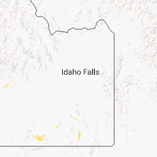
Hail Maps for McCammon, ID


Connect with Interactive Hail Maps