

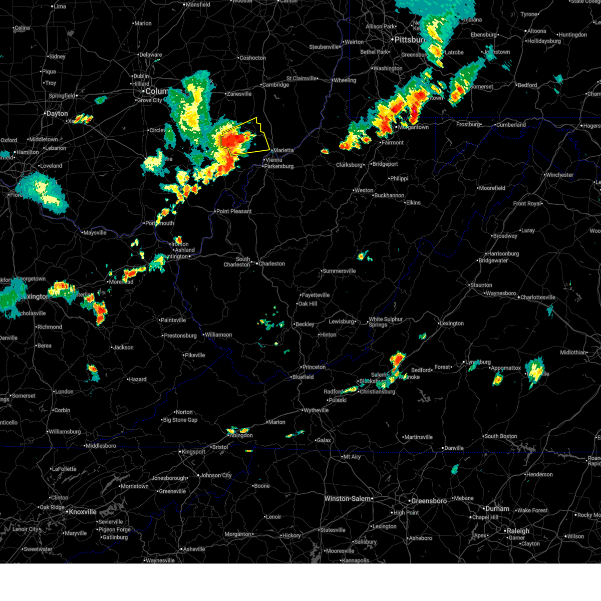
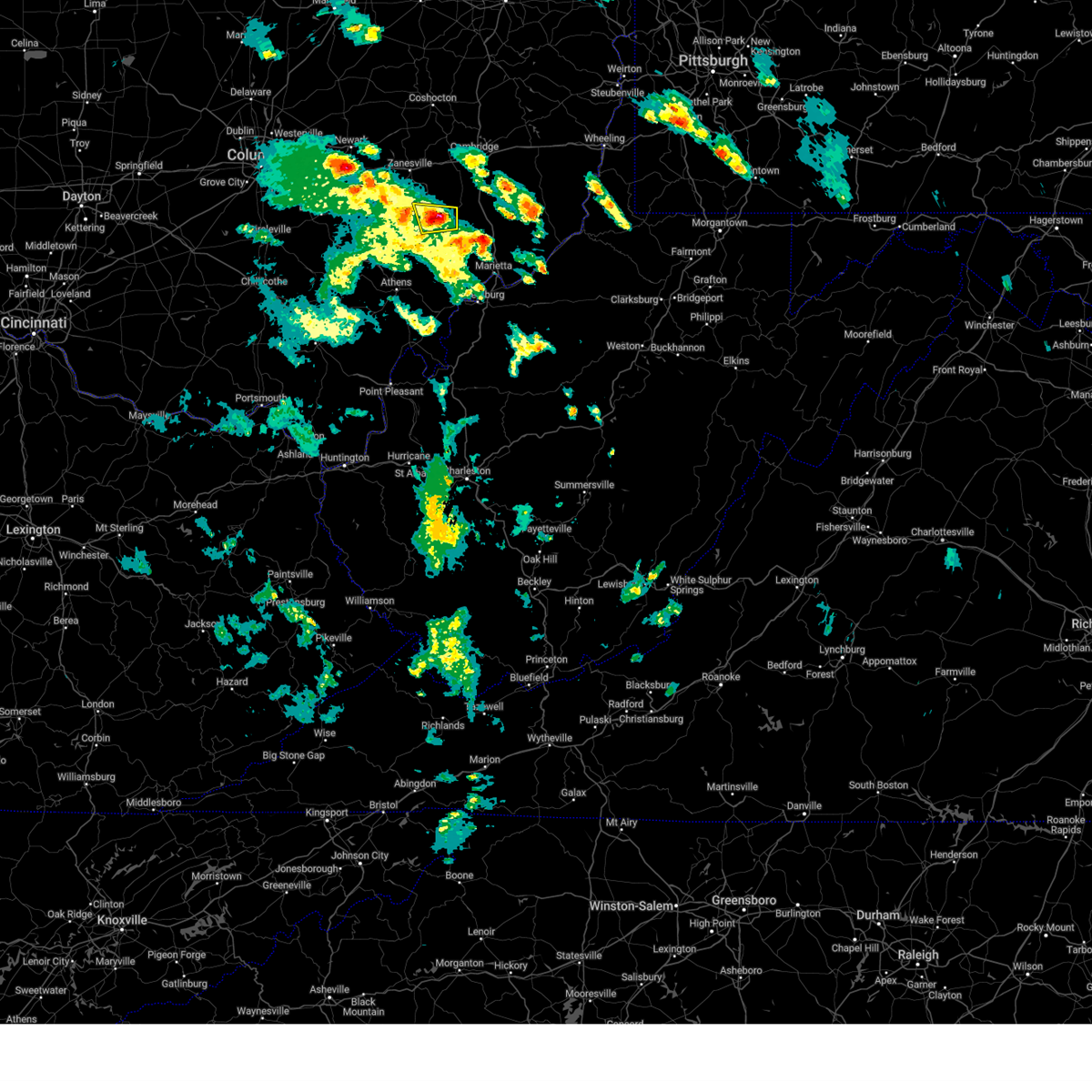
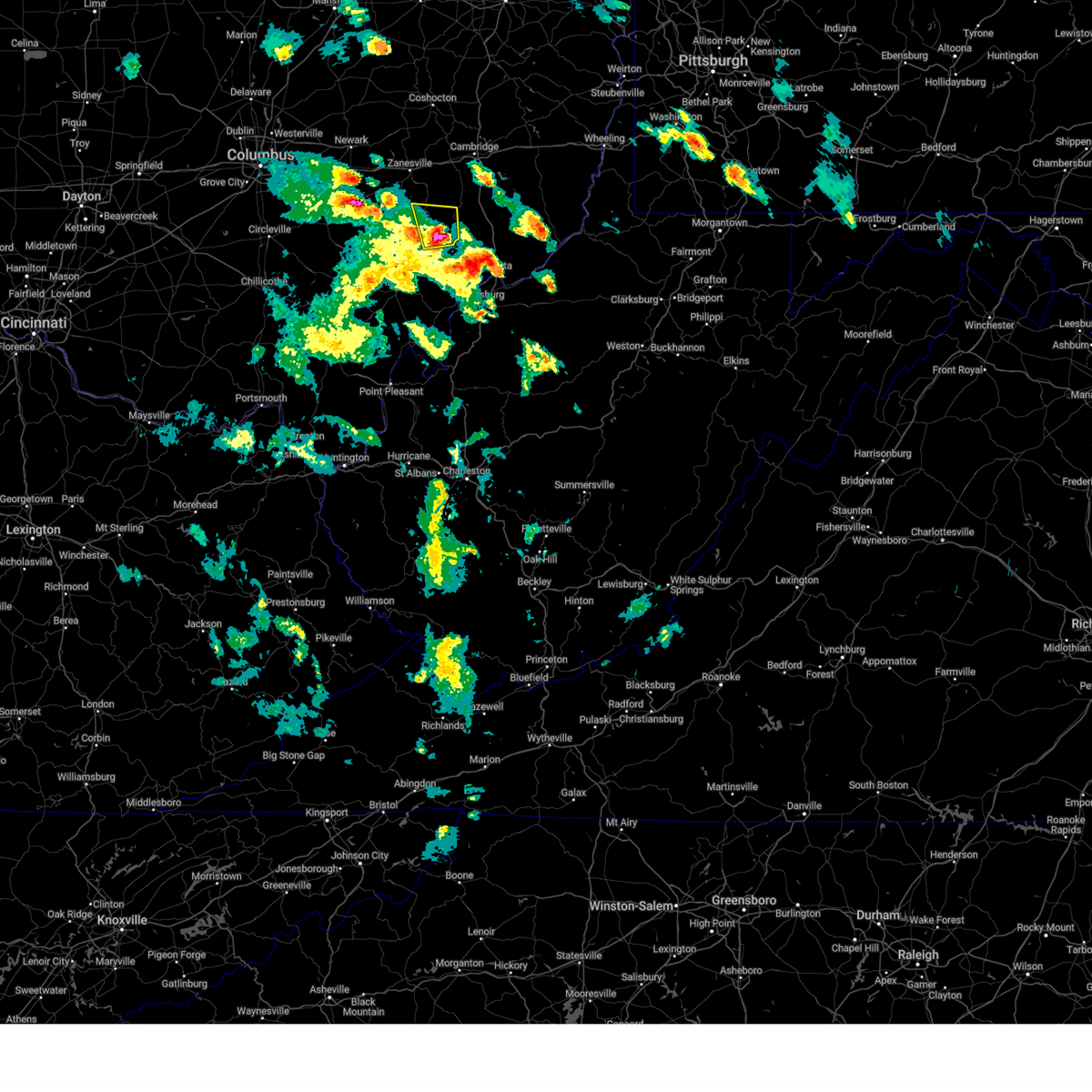
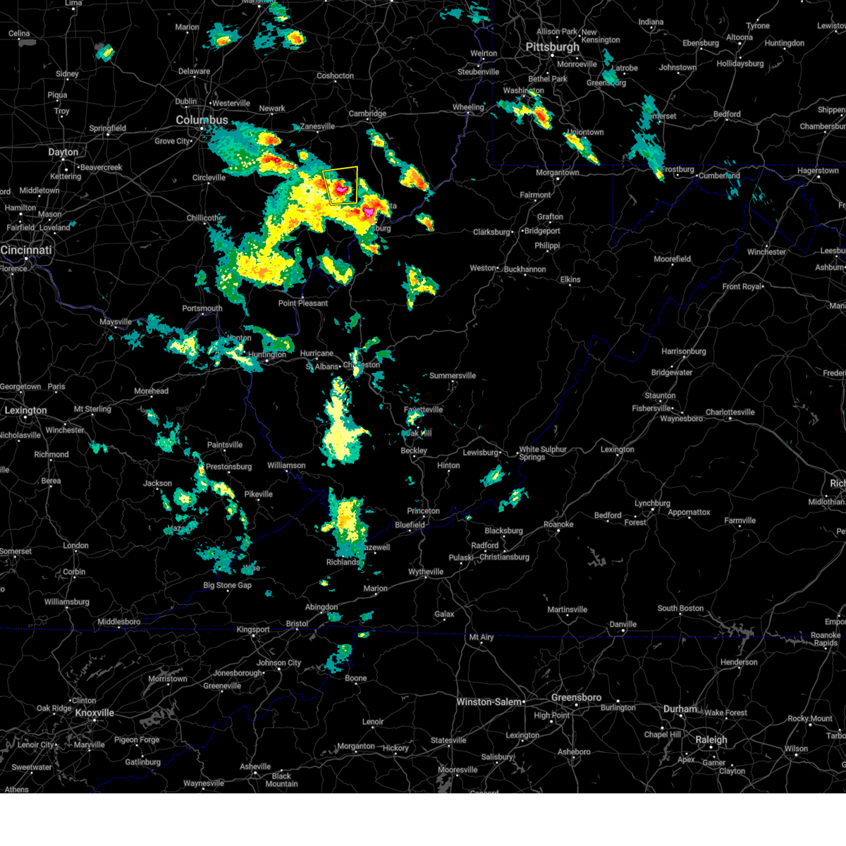
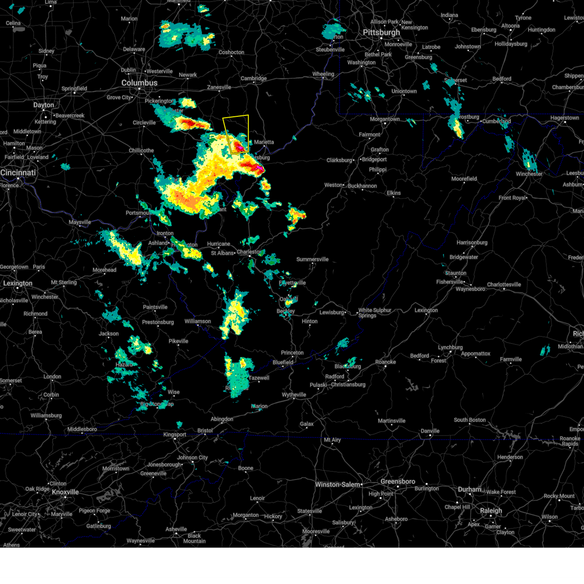
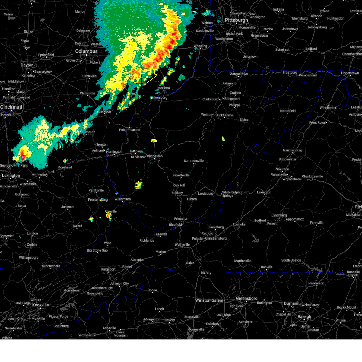
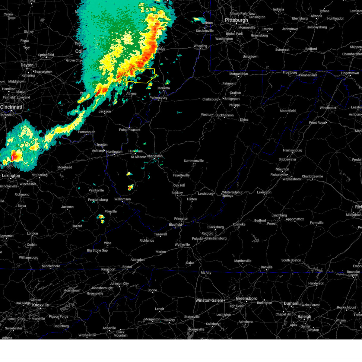
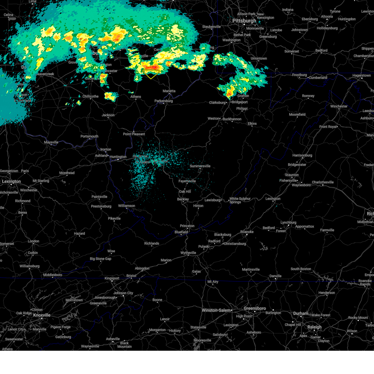
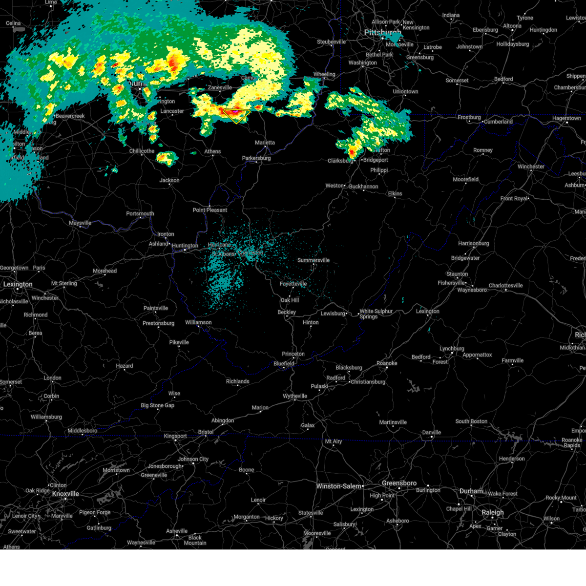
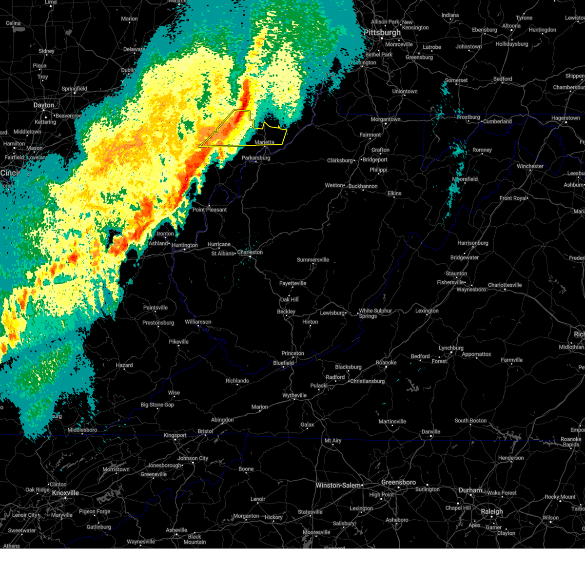
Hail Map for McConnelsville, OH
The McConnelsville, OH area has had 6 reports of on-the-ground hail by trained spotters, and has been under severe weather warnings 36 times during the past 12 months. Doppler radar has detected hail at or near McConnelsville, OH on 44 occasions, including 4 occasions during the past year.
| Name: | McConnelsville, OH |
| Where Located: | 64.9 miles ESE of Columbus, OH |
| Map: | Google Map for McConnelsville, OH |
| Population: | 1784 |
| Housing Units: | 870 |
| More Info: | Search Google for McConnelsville, OH |
5
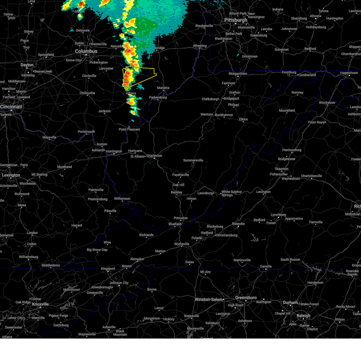
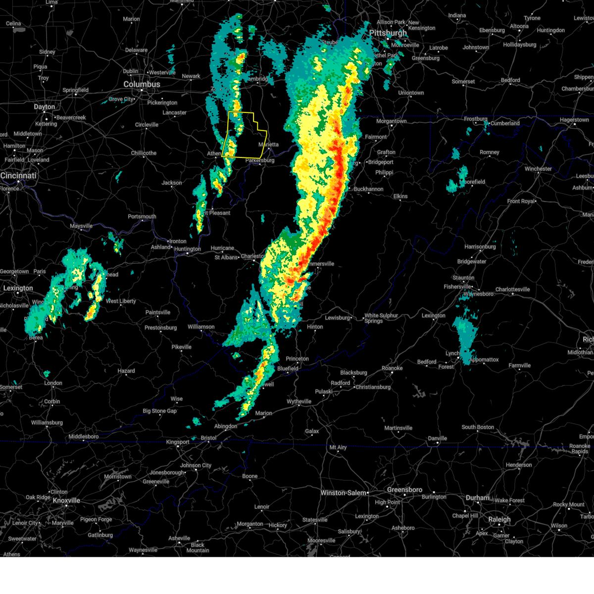
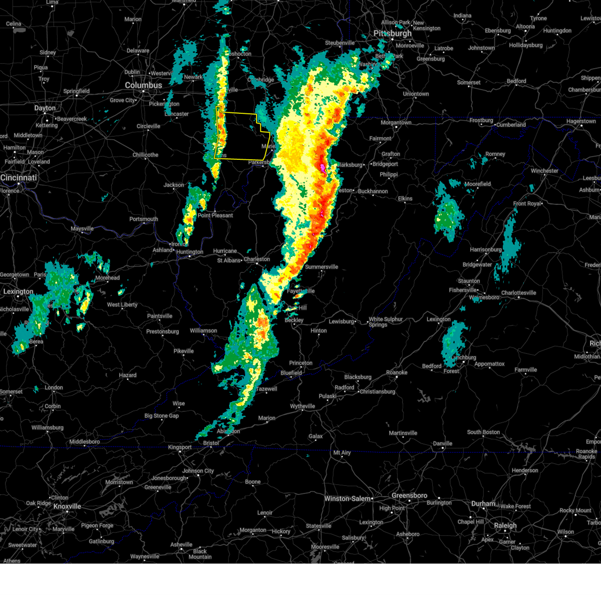
The Top Recent Hail Date for McConnelsville, OH is Wednesday, April 2, 2025 (1st out of 44)

Hail and Wind Damage Spotted near McConnelsville, OH
| Date / Time | Report Details |
|---|---|
| 7/7/2025 7:50 PM EDT | Tree down along buttermilk hill road 3 miles nnw of mcconnelsville. time estimated via rada in morgan county OH, 2.5 miles SSE of McConnelsville, OH |
| 7/7/2025 7:49 PM EDT |
 At 749 pm edt, a severe thunderstorm was located over nelsonville, moving east at 40 mph (radar indicated). Hazards include 60 mph wind gusts. Expect damage to roofs, siding, and trees. Locations impacted include, marietta, glouster, mcconnelsville, beverly, chesterhill, malta, stockport, amesville, burr oak state park, bartlett, and hackney. At 749 pm edt, a severe thunderstorm was located over nelsonville, moving east at 40 mph (radar indicated). Hazards include 60 mph wind gusts. Expect damage to roofs, siding, and trees. Locations impacted include, marietta, glouster, mcconnelsville, beverly, chesterhill, malta, stockport, amesville, burr oak state park, bartlett, and hackney.
|
| 7/7/2025 7:36 PM EDT |
 At 735 pm edt, a severe thunderstorm was located near chesterhill, and is nearly stationary. this is a destructive storm for chesterhill and southern morgan county (radar indicated). Hazards include 80 mph wind gusts. Flying debris will be dangerous to those caught without shelter. mobile homes will be heavily damaged. expect considerable damage to roofs, windows, and vehicles. extensive tree damage and power outages are likely. Locations impacted include, athens, marietta, glouster, mcconnelsville, beverly, chesterhill, chauncey, malta, stockport, jacksonville, trimble, amesville, burr oak state park, hackney, bartlett, and the plains. At 735 pm edt, a severe thunderstorm was located near chesterhill, and is nearly stationary. this is a destructive storm for chesterhill and southern morgan county (radar indicated). Hazards include 80 mph wind gusts. Flying debris will be dangerous to those caught without shelter. mobile homes will be heavily damaged. expect considerable damage to roofs, windows, and vehicles. extensive tree damage and power outages are likely. Locations impacted include, athens, marietta, glouster, mcconnelsville, beverly, chesterhill, chauncey, malta, stockport, jacksonville, trimble, amesville, burr oak state park, hackney, bartlett, and the plains.
|
| 7/7/2025 7:25 PM EDT | Svrrlx the national weather service in charleston west virginia has issued a * severe thunderstorm warning for, northwestern washington county in southeastern ohio, morgan county in southeastern ohio, northeastern athens county in southeastern ohio, * until 815 pm edt. * at 725 pm edt, a severe thunderstorm was located over glouster, moving east at 40 mph (radar indicated). Hazards include 60 mph wind gusts. expect damage to roofs, siding, and trees |
| 5/16/2025 11:43 PM EDT | Svrrlx the national weather service in charleston west virginia has issued a * severe thunderstorm warning for, northern washington county in southeastern ohio, morgan county in southeastern ohio, central athens county in southeastern ohio, * until 1215 am edt. * at 1142 pm edt, severe thunderstorms were located along a line extending from near caldwell to chesterhill, moving east at 60 mph (radar indicated). Hazards include 60 mph wind gusts and quarter size hail. Hail damage to vehicles is expected. Expect wind damage to roofs, siding, and trees. |
| 5/16/2025 11:30 PM EDT |
 At 1129 pm edt, severe thunderstorms were located along a line extending from mcconnelsville to near glouster, moving east at 60 mph (radar indicated). Hazards include 60 mph wind gusts and half dollar size hail. Hail damage to vehicles is expected. expect wind damage to roofs, siding, and trees. Locations impacted include, nelsonville, glouster, mcconnelsville, beverly, chesterhill, chauncey, malta, corning, buchtel, stockport, jacksonville, trimble, bristol, hemlock, amesville, rendville, burr oak state park, hackney, eagleport, and bartlett. At 1129 pm edt, severe thunderstorms were located along a line extending from mcconnelsville to near glouster, moving east at 60 mph (radar indicated). Hazards include 60 mph wind gusts and half dollar size hail. Hail damage to vehicles is expected. expect wind damage to roofs, siding, and trees. Locations impacted include, nelsonville, glouster, mcconnelsville, beverly, chesterhill, chauncey, malta, corning, buchtel, stockport, jacksonville, trimble, bristol, hemlock, amesville, rendville, burr oak state park, hackney, eagleport, and bartlett.
|
| 5/16/2025 11:14 PM EDT | Svrrlx the national weather service in charleston west virginia has issued a * severe thunderstorm warning for, southeastern perry county in southeastern ohio, northwestern washington county in southeastern ohio, morgan county in southeastern ohio, northern athens county in southeastern ohio, * until 1145 pm edt. * at 1113 pm edt, severe thunderstorms were located along a line extending from near shawnee to 6 miles north of lake hope state park, moving east at 60 mph (radar indicated). Hazards include 60 mph wind gusts and half dollar size hail. Hail damage to vehicles is expected. Expect wind damage to roofs, siding, and trees. |
| 5/5/2025 4:59 PM EDT |
 The storm which prompted the warning has moved out of the area. therefore, the warning will be allowed to expire. to report severe weather, contact your nearest law enforcement agency. they will relay your report to the national weather service charleston west virginia. The storm which prompted the warning has moved out of the area. therefore, the warning will be allowed to expire. to report severe weather, contact your nearest law enforcement agency. they will relay your report to the national weather service charleston west virginia.
|
| 5/5/2025 4:42 PM EDT |
 At 441 pm edt, a severe thunderstorm was located near mcconnelsville, moving north at 25 mph (radar indicated). Hazards include 60 mph wind gusts and quarter size hail. Hail damage to vehicles is expected. expect wind damage to roofs, siding, and trees. Locations impacted include, mcconnelsville, malta, bristol, and eagleport. At 441 pm edt, a severe thunderstorm was located near mcconnelsville, moving north at 25 mph (radar indicated). Hazards include 60 mph wind gusts and quarter size hail. Hail damage to vehicles is expected. expect wind damage to roofs, siding, and trees. Locations impacted include, mcconnelsville, malta, bristol, and eagleport.
|
| 5/5/2025 4:30 PM EDT | Ping Pong Ball sized hail reported 0.6 miles N of McConnelsville, OH, lots of golf ball size hail reported. photo provided from mcconnesville. |
| 5/5/2025 4:30 PM EDT |
 Svrrlx the national weather service in charleston west virginia has issued a * severe thunderstorm warning for, northern morgan county in southeastern ohio, * until 500 pm edt. * at 429 pm edt, a severe thunderstorm was located over mcconnelsville, moving north at 30 mph (radar indicated). Hazards include 60 mph wind gusts and quarter size hail. Hail damage to vehicles is expected. Expect wind damage to roofs, siding, and trees. Svrrlx the national weather service in charleston west virginia has issued a * severe thunderstorm warning for, northern morgan county in southeastern ohio, * until 500 pm edt. * at 429 pm edt, a severe thunderstorm was located over mcconnelsville, moving north at 30 mph (radar indicated). Hazards include 60 mph wind gusts and quarter size hail. Hail damage to vehicles is expected. Expect wind damage to roofs, siding, and trees.
|
| 5/5/2025 4:19 PM EDT |
 the severe thunderstorm warning has been cancelled and is no longer in effect the severe thunderstorm warning has been cancelled and is no longer in effect
|
| 5/5/2025 4:19 PM EDT |
 At 418 pm edt, a severe thunderstorm was located near chesterhill, moving north at 25 mph (public). Hazards include 60 mph wind gusts and quarter size hail. Hail damage to vehicles is expected. expect wind damage to roofs, siding, and trees. Locations impacted include, mcconnelsville, chesterhill, malta, stockport, bristol, and hackney. At 418 pm edt, a severe thunderstorm was located near chesterhill, moving north at 25 mph (public). Hazards include 60 mph wind gusts and quarter size hail. Hail damage to vehicles is expected. expect wind damage to roofs, siding, and trees. Locations impacted include, mcconnelsville, chesterhill, malta, stockport, bristol, and hackney.
|
| 5/5/2025 4:00 PM EDT |
 Svrrlx the national weather service in charleston west virginia has issued a * severe thunderstorm warning for, northwestern washington county in southeastern ohio, central morgan county in southeastern ohio, east central athens county in southeastern ohio, * until 430 pm edt. * at 400 pm edt, a severe thunderstorm was located near chesterhill, moving north at 25 mph (public). Hazards include 60 mph wind gusts and quarter size hail. Hail damage to vehicles is expected. Expect wind damage to roofs, siding, and trees. Svrrlx the national weather service in charleston west virginia has issued a * severe thunderstorm warning for, northwestern washington county in southeastern ohio, central morgan county in southeastern ohio, east central athens county in southeastern ohio, * until 430 pm edt. * at 400 pm edt, a severe thunderstorm was located near chesterhill, moving north at 25 mph (public). Hazards include 60 mph wind gusts and quarter size hail. Hail damage to vehicles is expected. Expect wind damage to roofs, siding, and trees.
|
| 4/29/2025 4:27 PM EDT | The storms which prompted the warning have weakened below severe limits, and no longer pose an immediate threat to life or property. therefore, the warning will be allowed to expire. however, gusty winds are still possible with these thunderstorms. a severe thunderstorm watch remains in effect until 700 pm edt for southeastern ohio. |
| 4/29/2025 4:20 PM EDT | Multiple downed trees and power lines reported in the mcconnelsville area. time estimated from rada in morgan county OH, 0.6 miles N of McConnelsville, OH |
| 4/29/2025 4:13 PM EDT |
 At 412 pm edt, severe thunderstorms were located along a line extending from near caldwell to 7 miles northeast of glouster, moving east at 50 mph (radar indicated). Hazards include 60 mph wind gusts. Expect damage to roofs, siding, and trees. Locations impacted include, eagleport, stockport, bristol, mcconnelsville, rendville, hackney, malta, and corning. At 412 pm edt, severe thunderstorms were located along a line extending from near caldwell to 7 miles northeast of glouster, moving east at 50 mph (radar indicated). Hazards include 60 mph wind gusts. Expect damage to roofs, siding, and trees. Locations impacted include, eagleport, stockport, bristol, mcconnelsville, rendville, hackney, malta, and corning.
|
| 4/29/2025 3:57 PM EDT |
 Svrrlx the national weather service in charleston west virginia has issued a * severe thunderstorm warning for, southeastern perry county in southeastern ohio, morgan county in southeastern ohio, * until 430 pm edt. * at 356 pm edt, severe thunderstorms were located along a line extending from 8 miles southeast of south zanesville to near shawnee, moving east at 50 mph (radar indicated). Hazards include 60 mph wind gusts. expect damage to roofs, siding, and trees Svrrlx the national weather service in charleston west virginia has issued a * severe thunderstorm warning for, southeastern perry county in southeastern ohio, morgan county in southeastern ohio, * until 430 pm edt. * at 356 pm edt, severe thunderstorms were located along a line extending from 8 miles southeast of south zanesville to near shawnee, moving east at 50 mph (radar indicated). Hazards include 60 mph wind gusts. expect damage to roofs, siding, and trees
|
| 4/5/2025 1:41 AM EDT |
 The storm which prompted the warning has moved out of the area. therefore, the warning will be allowed to expire. to report severe weather, contact your nearest law enforcement agency. they will relay your report to the national weather service charleston west virginia. The storm which prompted the warning has moved out of the area. therefore, the warning will be allowed to expire. to report severe weather, contact your nearest law enforcement agency. they will relay your report to the national weather service charleston west virginia.
|
| 4/5/2025 1:30 AM EDT |
 Svrrlx the national weather service in charleston west virginia has issued a * severe thunderstorm warning for, northeastern morgan county in southeastern ohio, * until 145 am edt. * at 130 am edt, a severe thunderstorm was located near mcconnelsville, moving northeast at 25 mph (radar indicated). Hazards include 60 mph wind gusts and quarter size hail. Hail damage to vehicles is expected. Expect wind damage to roofs, siding, and trees. Svrrlx the national weather service in charleston west virginia has issued a * severe thunderstorm warning for, northeastern morgan county in southeastern ohio, * until 145 am edt. * at 130 am edt, a severe thunderstorm was located near mcconnelsville, moving northeast at 25 mph (radar indicated). Hazards include 60 mph wind gusts and quarter size hail. Hail damage to vehicles is expected. Expect wind damage to roofs, siding, and trees.
|
| 4/3/2025 3:14 AM EDT |
 the severe thunderstorm warning has been cancelled and is no longer in effect the severe thunderstorm warning has been cancelled and is no longer in effect
|
| 4/3/2025 3:14 AM EDT |
 At 314 am edt, severe thunderstorms were located along a line extending from 8 miles west of caldwell to near chesterhill, moving east at 60 mph (radar indicated). Hazards include 60 mph wind gusts. Expect damage to roofs, siding, and trees. Locations impacted include, lower salem, stockport, buchtel, burr oak state park, mcconnelsville, hackney, beverly, malta, chesterhill, lowell, macksburg, bristol, trimble, glouster, jacksonville, devola, and marietta. At 314 am edt, severe thunderstorms were located along a line extending from 8 miles west of caldwell to near chesterhill, moving east at 60 mph (radar indicated). Hazards include 60 mph wind gusts. Expect damage to roofs, siding, and trees. Locations impacted include, lower salem, stockport, buchtel, burr oak state park, mcconnelsville, hackney, beverly, malta, chesterhill, lowell, macksburg, bristol, trimble, glouster, jacksonville, devola, and marietta.
|
| 4/3/2025 2:55 AM EDT |
 Svrrlx the national weather service in charleston west virginia has issued a * severe thunderstorm warning for, southeastern perry county in southeastern ohio, northern washington county in southeastern ohio, morgan county in southeastern ohio, northern athens county in southeastern ohio, * until 330 am edt. * at 254 am edt, severe thunderstorms were located along a line extending from 8 miles south of south zanesville to buchtel, moving east at 60 mph (radar indicated). Hazards include 60 mph wind gusts. expect damage to roofs, siding, and trees Svrrlx the national weather service in charleston west virginia has issued a * severe thunderstorm warning for, southeastern perry county in southeastern ohio, northern washington county in southeastern ohio, morgan county in southeastern ohio, northern athens county in southeastern ohio, * until 330 am edt. * at 254 am edt, severe thunderstorms were located along a line extending from 8 miles south of south zanesville to buchtel, moving east at 60 mph (radar indicated). Hazards include 60 mph wind gusts. expect damage to roofs, siding, and trees
|
| 4/3/2025 2:16 AM EDT | Svrrlx the national weather service in charleston west virginia has issued a * severe thunderstorm warning for, perry county in southeastern ohio, western morgan county in southeastern ohio, northwestern vinton county in southeastern ohio, northwestern athens county in southeastern ohio, * until 300 am edt. * at 215 am edt, severe thunderstorms were located along a line extending from beechwood trails to 8 miles west of lancaster to 6 miles south of kingston, moving east at 75 mph (radar indicated). Hazards include 60 mph wind gusts. expect damage to roofs, siding, and trees |
| 4/2/2025 12:15 PM EDT |
 The storm which prompted the warning has moved out of the area. therefore, the warning has been allowed to expire. to report severe weather, contact your nearest law enforcement agency. they will relay your report to the national weather service charleston west virginia. The storm which prompted the warning has moved out of the area. therefore, the warning has been allowed to expire. to report severe weather, contact your nearest law enforcement agency. they will relay your report to the national weather service charleston west virginia.
|
| 4/2/2025 12:00 PM EDT | Ping Pong Ball sized hail reported 0.8 miles NE of McConnelsville, OH, picture of ping pong to golf ball size hail on social media. |
| 4/2/2025 12:00 PM EDT | Ping Pong Ball sized hail reported 0.6 miles N of McConnelsville, OH, picture of ping pong size hail in mcconnelsville. |
| 4/2/2025 11:57 AM EDT |
 At 1157 am edt, a severe thunderstorm was located near mcconnelsville, moving northeast at 65 mph (radar indicated). Hazards include 60 mph wind gusts and half dollar size hail. Hail damage to vehicles is expected. expect wind damage to roofs, siding, and trees. Locations impacted include, eagleport, mcconnelsville, hackney, bristol, and malta. At 1157 am edt, a severe thunderstorm was located near mcconnelsville, moving northeast at 65 mph (radar indicated). Hazards include 60 mph wind gusts and half dollar size hail. Hail damage to vehicles is expected. expect wind damage to roofs, siding, and trees. Locations impacted include, eagleport, mcconnelsville, hackney, bristol, and malta.
|
| 4/2/2025 11:57 AM EDT |
 the severe thunderstorm warning has been cancelled and is no longer in effect the severe thunderstorm warning has been cancelled and is no longer in effect
|
| 4/2/2025 11:41 AM EDT |
 Svrrlx the national weather service in charleston west virginia has issued a * severe thunderstorm warning for, southeastern perry county in southeastern ohio, morgan county in southeastern ohio, northwestern athens county in southeastern ohio, * until 1215 pm edt. * at 1141 am edt, a severe thunderstorm was located near shawnee, moving northeast at 70 mph (radar indicated). Hazards include 60 mph wind gusts and half dollar size hail. Hail damage to vehicles is expected. Expect wind damage to roofs, siding, and trees. Svrrlx the national weather service in charleston west virginia has issued a * severe thunderstorm warning for, southeastern perry county in southeastern ohio, morgan county in southeastern ohio, northwestern athens county in southeastern ohio, * until 1215 pm edt. * at 1141 am edt, a severe thunderstorm was located near shawnee, moving northeast at 70 mph (radar indicated). Hazards include 60 mph wind gusts and half dollar size hail. Hail damage to vehicles is expected. Expect wind damage to roofs, siding, and trees.
|
| 3/30/2025 11:45 PM EDT |
 The storms which prompted the warning have weakened below severe limits, and have exited the warned area. therefore, the warning has been allowed to expire. however, gusty winds are still possible with these thunderstorms. a severe thunderstorm watch remains in effect until 300 am edt for southeastern ohio. to report severe weather, contact your nearest law enforcement agency. they will relay your report to the national weather service charleston west virginia. The storms which prompted the warning have weakened below severe limits, and have exited the warned area. therefore, the warning has been allowed to expire. however, gusty winds are still possible with these thunderstorms. a severe thunderstorm watch remains in effect until 300 am edt for southeastern ohio. to report severe weather, contact your nearest law enforcement agency. they will relay your report to the national weather service charleston west virginia.
|
| 3/30/2025 11:27 PM EDT | At 1127 pm edt, severe thunderstorms were located along a line extending from near south zanesville to nelsonville, moving east at 45 mph (radar indicated). Hazards include 60 mph wind gusts and penny size hail. Expect damage to roofs, siding, and trees. Locations impacted include, lake hope state park, chauncey, creola, buchtel, shawnee, new straitsville, burr oak state park, mcconnelsville, rendville, new lexington, malta, eagleport, nelsonville, allensville, trimble, hemlock, glouster, jacksonville, crooksville, and the plains. |
| 3/30/2025 10:53 PM EDT |
 Svrrlx the national weather service in charleston west virginia has issued a * severe thunderstorm warning for, perry county in southeastern ohio, western morgan county in southeastern ohio, northern vinton county in southeastern ohio, northwestern athens county in southeastern ohio, * until 1145 pm edt. * at 1052 pm edt, severe thunderstorms were located along a line extending from near bremen to 10 miles southwest of hocking hills state park, moving east at 45 mph (radar indicated). Hazards include 60 mph wind gusts and penny size hail. expect damage to roofs, siding, and trees Svrrlx the national weather service in charleston west virginia has issued a * severe thunderstorm warning for, perry county in southeastern ohio, western morgan county in southeastern ohio, northern vinton county in southeastern ohio, northwestern athens county in southeastern ohio, * until 1145 pm edt. * at 1052 pm edt, severe thunderstorms were located along a line extending from near bremen to 10 miles southwest of hocking hills state park, moving east at 45 mph (radar indicated). Hazards include 60 mph wind gusts and penny size hail. expect damage to roofs, siding, and trees
|
| 3/16/2025 12:11 PM EDT |
 The storms which prompted the warning have weakened below severe limits, and no longer pose an immediate threat to life or property. therefore, the warning will be allowed to expire. however, gusty winds are still possible with these thunderstorms. a tornado watch remains in effect until 400 pm edt for southeastern ohio, and northwestern west virginia. The storms which prompted the warning have weakened below severe limits, and no longer pose an immediate threat to life or property. therefore, the warning will be allowed to expire. however, gusty winds are still possible with these thunderstorms. a tornado watch remains in effect until 400 pm edt for southeastern ohio, and northwestern west virginia.
|
| 3/16/2025 12:10 PM EDT | Power company reports an outage caused by tree damag in morgan county OH, 7.2 miles SSE of McConnelsville, OH |
| 3/16/2025 12:04 PM EDT |
 At 1204 pm edt, severe thunderstorms were located along a line extending from 10 miles southeast of south zanesville to mcconnelsville to chesterhill to 10 miles east of athens, moving east at 55 mph (radar indicated). Hazards include 60 mph wind gusts. Expect damage to roofs, siding, and trees. Locations impacted include, stockport, stroud run state park, mcconnelsville, hackney, beverly, malta, eagleport, chesterhill, lowell, bristol, fleming, amesville, bartlett, and devola. At 1204 pm edt, severe thunderstorms were located along a line extending from 10 miles southeast of south zanesville to mcconnelsville to chesterhill to 10 miles east of athens, moving east at 55 mph (radar indicated). Hazards include 60 mph wind gusts. Expect damage to roofs, siding, and trees. Locations impacted include, stockport, stroud run state park, mcconnelsville, hackney, beverly, malta, eagleport, chesterhill, lowell, bristol, fleming, amesville, bartlett, and devola.
|
| 3/16/2025 12:04 PM EDT |
 the severe thunderstorm warning has been cancelled and is no longer in effect the severe thunderstorm warning has been cancelled and is no longer in effect
|
| 3/16/2025 11:46 AM EDT | A couple trees reported down north of mcconnelsvill in morgan county OH, 3.1 miles SE of McConnelsville, OH |
| 3/16/2025 11:39 AM EDT |
 Svrrlx the national weather service in charleston west virginia has issued a * severe thunderstorm warning for, southeastern perry county in southeastern ohio, northwestern washington county in southeastern ohio, morgan county in southeastern ohio, central athens county in southeastern ohio, * until 1215 pm edt. * at 1139 am edt, severe thunderstorms were located along a line extending from near south zanesville to 7 miles east of new lexington to near glouster to 6 miles southeast of buchtel, moving east at 60 mph (radar indicated). Hazards include 60 mph wind gusts. expect damage to roofs, siding, and trees Svrrlx the national weather service in charleston west virginia has issued a * severe thunderstorm warning for, southeastern perry county in southeastern ohio, northwestern washington county in southeastern ohio, morgan county in southeastern ohio, central athens county in southeastern ohio, * until 1215 pm edt. * at 1139 am edt, severe thunderstorms were located along a line extending from near south zanesville to 7 miles east of new lexington to near glouster to 6 miles southeast of buchtel, moving east at 60 mph (radar indicated). Hazards include 60 mph wind gusts. expect damage to roofs, siding, and trees
|
| 9/6/2024 6:39 PM EDT | Tree reported down. time is estimated by rada in morgan county OH, 3.6 miles NNW of McConnelsville, OH |
| 7/15/2024 6:57 PM EDT |
 The storm which prompted the warning has weakened below severe limits, and no longer poses an immediate threat to life or property. therefore, the warning will be allowed to expire. however, gusty winds are still possible with this thunderstorm. The storm which prompted the warning has weakened below severe limits, and no longer poses an immediate threat to life or property. therefore, the warning will be allowed to expire. however, gusty winds are still possible with this thunderstorm.
|
| 7/15/2024 6:40 PM EDT | Tree reported down covering most of lemon hill road. time estimated by rada in morgan county OH, 5.2 miles SE of McConnelsville, OH |
| 7/15/2024 6:40 PM EDT |
 the severe thunderstorm warning has been cancelled and is no longer in effect the severe thunderstorm warning has been cancelled and is no longer in effect
|
| 7/15/2024 6:40 PM EDT |
 At 640 pm edt, a severe thunderstorm was located near mcconnelsville, moving east at 35 mph (radar indicated). Hazards include 60 mph wind gusts. Expect damage to roofs, siding, and trees. Locations impacted include, mcconnelsville, malta, bristol, eagleport, and hackney. At 640 pm edt, a severe thunderstorm was located near mcconnelsville, moving east at 35 mph (radar indicated). Hazards include 60 mph wind gusts. Expect damage to roofs, siding, and trees. Locations impacted include, mcconnelsville, malta, bristol, eagleport, and hackney.
|
| 7/15/2024 6:28 PM EDT | Svrrlx the national weather service in charleston west virginia has issued a * severe thunderstorm warning for, east central perry county in southeastern ohio, morgan county in southeastern ohio, * until 700 pm edt. * at 628 pm edt, a severe thunderstorm was located 8 miles east of new lexington, moving east at 35 mph (radar indicated). Hazards include 60 mph wind gusts. expect damage to roofs, siding, and trees |
| 6/14/2024 6:10 PM EDT |
 At 609 pm edt, a severe thunderstorm was located near mcconnelsville, moving southeast at 30 mph (radar indicated). Hazards include 70 mph wind gusts and ping pong ball size hail. People and animals outdoors will be injured. expect hail damage to roofs, siding, windows, and vehicles. expect considerable tree damage. wind damage is also likely to mobile homes, roofs, and outbuildings. Locations impacted include, mcconnelsville, stockport, and hackney. At 609 pm edt, a severe thunderstorm was located near mcconnelsville, moving southeast at 30 mph (radar indicated). Hazards include 70 mph wind gusts and ping pong ball size hail. People and animals outdoors will be injured. expect hail damage to roofs, siding, windows, and vehicles. expect considerable tree damage. wind damage is also likely to mobile homes, roofs, and outbuildings. Locations impacted include, mcconnelsville, stockport, and hackney.
|
| 6/14/2024 5:57 PM EDT | Trees dow in morgan county OH, 3.5 miles WSW of McConnelsville, OH |
| 6/14/2024 5:56 PM EDT | Trees and powerlines down in malt in morgan county OH, 0.7 miles NW of McConnelsville, OH |
| 6/14/2024 5:50 PM EDT |
 At 550 pm edt, a severe thunderstorm was located near mcconnelsville, moving southeast at 35 mph (radar indicated). Hazards include 70 mph wind gusts and ping pong ball size hail. People and animals outdoors will be injured. expect hail damage to roofs, siding, windows, and vehicles. expect considerable tree damage. wind damage is also likely to mobile homes, roofs, and outbuildings. Locations impacted include, mcconnelsville, malta, stockport, bristol, eagleport, and hackney. At 550 pm edt, a severe thunderstorm was located near mcconnelsville, moving southeast at 35 mph (radar indicated). Hazards include 70 mph wind gusts and ping pong ball size hail. People and animals outdoors will be injured. expect hail damage to roofs, siding, windows, and vehicles. expect considerable tree damage. wind damage is also likely to mobile homes, roofs, and outbuildings. Locations impacted include, mcconnelsville, malta, stockport, bristol, eagleport, and hackney.
|
| 6/14/2024 5:47 PM EDT | Trees dow in morgan county OH, 5.1 miles SSE of McConnelsville, OH |
| 6/14/2024 5:32 PM EDT |
 Svrrlx the national weather service in charleston west virginia has issued a * severe thunderstorm warning for, eastern morgan county in southeastern ohio, * until 615 pm edt. * at 530 pm edt, a severe thunderstorm was located near south zanesville, or 9 miles south of zanesville, moving southeast at 35 mph. this is a destructive storm for northeast morgan county (radar indicated). Hazards include 80 mph wind gusts and two inch hail. Flying debris will be dangerous to those caught without shelter. mobile homes will be heavily damaged. expect considerable damage to roofs, windows, and vehicles. Extensive tree damage and power outages are likely. Svrrlx the national weather service in charleston west virginia has issued a * severe thunderstorm warning for, eastern morgan county in southeastern ohio, * until 615 pm edt. * at 530 pm edt, a severe thunderstorm was located near south zanesville, or 9 miles south of zanesville, moving southeast at 35 mph. this is a destructive storm for northeast morgan county (radar indicated). Hazards include 80 mph wind gusts and two inch hail. Flying debris will be dangerous to those caught without shelter. mobile homes will be heavily damaged. expect considerable damage to roofs, windows, and vehicles. Extensive tree damage and power outages are likely.
|
| 5/26/2024 4:51 PM EDT |
 The storms which prompted the warning have moved out of the warned area. therefore, the warning will be allowed to expire. a severe thunderstorm watch remains in effect until 800 pm edt for southeastern ohio. a severe thunderstorm watch also remains in effect until 900 pm edt for southeastern ohio. The storms which prompted the warning have moved out of the warned area. therefore, the warning will be allowed to expire. a severe thunderstorm watch remains in effect until 800 pm edt for southeastern ohio. a severe thunderstorm watch also remains in effect until 900 pm edt for southeastern ohio.
|
| 5/26/2024 4:42 PM EDT |
 At 441 pm edt, severe thunderstorms were located along a line extending from near perry state forest to 6 miles northeast of athens, moving northeast at 30 mph (radar indicated). Hazards include 60 mph wind gusts and penny size hail. Expect damage to roofs, siding, and trees. Locations impacted include, glouster, mcconnelsville, chesterhill, crooksville, malta, corning, stockport, jacksonville, trimble, bristol, rendville, burr oak state park, and eagleport. At 441 pm edt, severe thunderstorms were located along a line extending from near perry state forest to 6 miles northeast of athens, moving northeast at 30 mph (radar indicated). Hazards include 60 mph wind gusts and penny size hail. Expect damage to roofs, siding, and trees. Locations impacted include, glouster, mcconnelsville, chesterhill, crooksville, malta, corning, stockport, jacksonville, trimble, bristol, rendville, burr oak state park, and eagleport.
|
| 5/26/2024 4:42 PM EDT |
 the severe thunderstorm warning has been cancelled and is no longer in effect the severe thunderstorm warning has been cancelled and is no longer in effect
|
| 5/26/2024 4:19 PM EDT |
 Svrrlx the national weather service in charleston west virginia has issued a * severe thunderstorm warning for, perry county in southeastern ohio, northwestern washington county in southeastern ohio, morgan county in southeastern ohio, north central athens county in southeastern ohio, * until 500 pm edt. * at 419 pm edt, a severe thunderstorm was located near bremen, or 8 miles northwest of shawnee, moving east at 45 mph (radar indicated). Hazards include 60 mph wind gusts and penny size hail. expect damage to roofs, siding, and trees Svrrlx the national weather service in charleston west virginia has issued a * severe thunderstorm warning for, perry county in southeastern ohio, northwestern washington county in southeastern ohio, morgan county in southeastern ohio, north central athens county in southeastern ohio, * until 500 pm edt. * at 419 pm edt, a severe thunderstorm was located near bremen, or 8 miles northwest of shawnee, moving east at 45 mph (radar indicated). Hazards include 60 mph wind gusts and penny size hail. expect damage to roofs, siding, and trees
|
| 4/17/2024 7:17 PM EDT |
 At 715 pm edt, severe thunderstorms were located along a line extending from 7 miles northwest of mcconnelsville to 6 miles southeast of bremen, moving east at 35 mph (radar indicated). Hazards include 60 mph wind gusts and quarter size hail. Hail damage to vehicles is expected. expect wind damage to roofs, siding, and trees. Locations impacted include, new lexington, mcconnelsville, shawnee, malta, corning, bristol, hemlock, rendville, and eagleport. At 715 pm edt, severe thunderstorms were located along a line extending from 7 miles northwest of mcconnelsville to 6 miles southeast of bremen, moving east at 35 mph (radar indicated). Hazards include 60 mph wind gusts and quarter size hail. Hail damage to vehicles is expected. expect wind damage to roofs, siding, and trees. Locations impacted include, new lexington, mcconnelsville, shawnee, malta, corning, bristol, hemlock, rendville, and eagleport.
|
| 4/17/2024 6:55 PM EDT |
 Svrrlx the national weather service in charleston west virginia has issued a * severe thunderstorm warning for, perry county in southeastern ohio, northern morgan county in southeastern ohio, * until 730 pm edt. * at 654 pm edt, severe thunderstorms were located along a line extending from near perry state forest to near lancaster, moving east at 40 mph (radar indicated). Hazards include 60 mph wind gusts and quarter size hail. Hail damage to vehicles is expected. Expect wind damage to roofs, siding, and trees. Svrrlx the national weather service in charleston west virginia has issued a * severe thunderstorm warning for, perry county in southeastern ohio, northern morgan county in southeastern ohio, * until 730 pm edt. * at 654 pm edt, severe thunderstorms were located along a line extending from near perry state forest to near lancaster, moving east at 40 mph (radar indicated). Hazards include 60 mph wind gusts and quarter size hail. Hail damage to vehicles is expected. Expect wind damage to roofs, siding, and trees.
|
| 3/30/2024 7:56 PM EDT |
 The storm which prompted the warning has moved out of the area. therefore, the warning will be allowed to expire. a severe thunderstorm watch remains in effect until 1000 pm edt for southeastern ohio. The storm which prompted the warning has moved out of the area. therefore, the warning will be allowed to expire. a severe thunderstorm watch remains in effect until 1000 pm edt for southeastern ohio.
|
| 3/30/2024 7:46 PM EDT |
 the severe thunderstorm warning has been cancelled and is no longer in effect the severe thunderstorm warning has been cancelled and is no longer in effect
|
| 3/30/2024 7:37 PM EDT |
 Svrrlx the national weather service in charleston west virginia has issued a * severe thunderstorm warning for, northwestern washington county in southeastern ohio, southern morgan county in southeastern ohio, * until 800 pm edt. * at 737 pm edt, a severe thunderstorm was located near mcconnelsville, moving southeast at 40 mph (radar indicated). Hazards include 60 mph wind gusts and quarter size hail. Hail damage to vehicles is expected. Expect wind damage to roofs, siding, and trees. Svrrlx the national weather service in charleston west virginia has issued a * severe thunderstorm warning for, northwestern washington county in southeastern ohio, southern morgan county in southeastern ohio, * until 800 pm edt. * at 737 pm edt, a severe thunderstorm was located near mcconnelsville, moving southeast at 40 mph (radar indicated). Hazards include 60 mph wind gusts and quarter size hail. Hail damage to vehicles is expected. Expect wind damage to roofs, siding, and trees.
|
| 3/30/2024 7:21 PM EDT |
 At 721 pm edt, a severe thunderstorm was located 9 miles east of new lexington, moving southeast at 50 mph (radar indicated). Hazards include 60 mph wind gusts and quarter size hail. Hail damage to vehicles is expected. expect wind damage to roofs, siding, and trees. Locations impacted include, mcconnelsville, chesterhill, malta, bristol, rendville, and eagleport. At 721 pm edt, a severe thunderstorm was located 9 miles east of new lexington, moving southeast at 50 mph (radar indicated). Hazards include 60 mph wind gusts and quarter size hail. Hail damage to vehicles is expected. expect wind damage to roofs, siding, and trees. Locations impacted include, mcconnelsville, chesterhill, malta, bristol, rendville, and eagleport.
|
| 3/30/2024 7:12 PM EDT |
 Svrrlx the national weather service in charleston west virginia has issued a * severe thunderstorm warning for, southeastern perry county in southeastern ohio, morgan county in southeastern ohio, * until 800 pm edt. * at 712 pm edt, a severe thunderstorm was located over new lexington, moving east at 45 mph (radar indicated). Hazards include 60 mph wind gusts and quarter size hail. Hail damage to vehicles is expected. Expect wind damage to roofs, siding, and trees. Svrrlx the national weather service in charleston west virginia has issued a * severe thunderstorm warning for, southeastern perry county in southeastern ohio, morgan county in southeastern ohio, * until 800 pm edt. * at 712 pm edt, a severe thunderstorm was located over new lexington, moving east at 45 mph (radar indicated). Hazards include 60 mph wind gusts and quarter size hail. Hail damage to vehicles is expected. Expect wind damage to roofs, siding, and trees.
|
| 3/14/2024 11:45 PM EDT |
 The storms which prompted the warning have weakened below severe limits, and no longer pose an immediate threat to life or property. therefore, the warning will be allowed to expire. however, small hail, gusty winds and heavy rain are still possible with these thunderstorms. a tornado watch remains in effect until 100 am edt for southeastern ohio. to report severe weather, contact your nearest law enforcement agency. they will relay your report to the national weather service charleston west virginia. remember, a tornado warning still remains in effect for perry and morgan counties until 1 am edt. The storms which prompted the warning have weakened below severe limits, and no longer pose an immediate threat to life or property. therefore, the warning will be allowed to expire. however, small hail, gusty winds and heavy rain are still possible with these thunderstorms. a tornado watch remains in effect until 100 am edt for southeastern ohio. to report severe weather, contact your nearest law enforcement agency. they will relay your report to the national weather service charleston west virginia. remember, a tornado warning still remains in effect for perry and morgan counties until 1 am edt.
|
| 3/14/2024 11:28 PM EDT |
 At 1128 pm edt, severe thunderstorms were located along a line extending from near south zanesville to 9 miles east of perry state forest to near shawnee, moving east at 60 mph (radar indicated). Hazards include 60 mph wind gusts and penny size hail. Expect damage to roofs, siding, and trees. Locations impacted include, new lexington, mcconnelsville, shawnee, crooksville, new straitsville, malta, corning, bristol, hemlock, rendville, and eagleport. At 1128 pm edt, severe thunderstorms were located along a line extending from near south zanesville to 9 miles east of perry state forest to near shawnee, moving east at 60 mph (radar indicated). Hazards include 60 mph wind gusts and penny size hail. Expect damage to roofs, siding, and trees. Locations impacted include, new lexington, mcconnelsville, shawnee, crooksville, new straitsville, malta, corning, bristol, hemlock, rendville, and eagleport.
|
| 3/14/2024 11:12 PM EDT |
 Svrrlx the national weather service in charleston west virginia has issued a * severe thunderstorm warning for, perry county in southeastern ohio, northern morgan county in southeastern ohio, * until 1145 pm edt. * at 1112 pm edt, severe thunderstorms were located along a line extending from 9 miles east of thornport to somerset to 8 miles southwest of lancaster, moving east at 60 mph (radar indicated). Hazards include 60 mph wind gusts and nickel size hail. expect damage to roofs, siding, and trees Svrrlx the national weather service in charleston west virginia has issued a * severe thunderstorm warning for, perry county in southeastern ohio, northern morgan county in southeastern ohio, * until 1145 pm edt. * at 1112 pm edt, severe thunderstorms were located along a line extending from 9 miles east of thornport to somerset to 8 miles southwest of lancaster, moving east at 60 mph (radar indicated). Hazards include 60 mph wind gusts and nickel size hail. expect damage to roofs, siding, and trees
|
| 7/28/2023 2:28 PM EDT |
 At 228 pm edt, a severe thunderstorm was located near beverly, moving east at 30 mph (radar indicated). Hazards include 60 mph wind gusts and nickel size hail. expect damage to roofs, siding, and trees At 228 pm edt, a severe thunderstorm was located near beverly, moving east at 30 mph (radar indicated). Hazards include 60 mph wind gusts and nickel size hail. expect damage to roofs, siding, and trees
|
| 7/2/2022 12:25 AM EDT |
 The severe thunderstorm warning for southeastern perry and western morgan counties will expire at 1230 am edt, the storm which prompted the warning has weakened below severe limits, and has exited the warned area. therefore, the warning will be allowed to expire. The severe thunderstorm warning for southeastern perry and western morgan counties will expire at 1230 am edt, the storm which prompted the warning has weakened below severe limits, and has exited the warned area. therefore, the warning will be allowed to expire.
|
| 7/2/2022 12:10 AM EDT |
 At 1209 am edt, a severe thunderstorm was located 9 miles west of mcconnelsville, moving east at 25 mph (radar indicated). Hazards include 60 mph wind gusts and quarter size hail. Hail damage to vehicles is expected. expect wind damage to roofs, siding, and trees. locations impacted include, mcconnelsville, malta, corning, rendville and eagleport. hail threat, radar indicated max hail size, 1. 00 in wind threat, radar indicated max wind gust, 60 mph. At 1209 am edt, a severe thunderstorm was located 9 miles west of mcconnelsville, moving east at 25 mph (radar indicated). Hazards include 60 mph wind gusts and quarter size hail. Hail damage to vehicles is expected. expect wind damage to roofs, siding, and trees. locations impacted include, mcconnelsville, malta, corning, rendville and eagleport. hail threat, radar indicated max hail size, 1. 00 in wind threat, radar indicated max wind gust, 60 mph.
|
| 7/1/2022 11:56 PM EDT |
 At 1156 pm edt, a severe thunderstorm was located near shawnee, moving east at 25 mph (radar indicated). Hazards include 60 mph wind gusts and quarter size hail. Hail damage to vehicles is expected. Expect wind damage to roofs, siding, and trees. At 1156 pm edt, a severe thunderstorm was located near shawnee, moving east at 25 mph (radar indicated). Hazards include 60 mph wind gusts and quarter size hail. Hail damage to vehicles is expected. Expect wind damage to roofs, siding, and trees.
|
| 6/22/2022 6:27 PM EDT | Tree dow in morgan county OH, 0.8 miles NE of McConnelsville, OH |
| 6/16/2022 8:33 PM EDT |
 At 832 pm edt, a severe thunderstorm was located near new lexington, moving southeast at 30 mph (radar indicated). Hazards include 60 mph wind gusts and quarter size hail. Hail damage to vehicles is expected. Expect wind damage to roofs, siding, and trees. At 832 pm edt, a severe thunderstorm was located near new lexington, moving southeast at 30 mph (radar indicated). Hazards include 60 mph wind gusts and quarter size hail. Hail damage to vehicles is expected. Expect wind damage to roofs, siding, and trees.
|
| 6/16/2022 7:43 PM EDT |
 At 742 pm edt, severe thunderstorms were located along a line extending from near caldwell to 8 miles northwest of mcconnelsville, moving southeast at 25 mph (radar indicated). Hazards include 60 mph wind gusts and half dollar size hail. Hail damage to vehicles is expected. Expect wind damage to roofs, siding, and trees. At 742 pm edt, severe thunderstorms were located along a line extending from near caldwell to 8 miles northwest of mcconnelsville, moving southeast at 25 mph (radar indicated). Hazards include 60 mph wind gusts and half dollar size hail. Hail damage to vehicles is expected. Expect wind damage to roofs, siding, and trees.
|
| 6/16/2022 7:38 PM EDT | Tree dow in morgan county OH, 10.2 miles WSW of McConnelsville, OH |
| 6/14/2022 4:21 AM EDT |
 At 420 am edt, severe thunderstorms were located along a line extending from near north zanesville to near granville south, moving southeast at 50 mph (radar indicated). Hazards include 60 mph wind gusts and nickel size hail. expect damage to roofs, siding, and trees At 420 am edt, severe thunderstorms were located along a line extending from near north zanesville to near granville south, moving southeast at 50 mph (radar indicated). Hazards include 60 mph wind gusts and nickel size hail. expect damage to roofs, siding, and trees
|
| 6/14/2022 12:33 AM EDT |
 At 1232 am edt, severe thunderstorms were located along a line extending from 8 miles north of mcconnelsville to near new lexington to near lancaster, moving southeast at 55 mph (radar indicated). Hazards include 60 mph wind gusts and penny size hail. Expect damage to roofs, siding, and trees. locations impacted include, new lexington, mcconnelsville, somerset, shawnee, perry state forest, crooksville, junction city, new straitsville, malta, corning, bristol, hemlock, rendville, burr oak state park, hackney and eagleport. hail threat, radar indicated max hail size, 0. 75 in wind threat, radar indicated max wind gust, 60 mph. At 1232 am edt, severe thunderstorms were located along a line extending from 8 miles north of mcconnelsville to near new lexington to near lancaster, moving southeast at 55 mph (radar indicated). Hazards include 60 mph wind gusts and penny size hail. Expect damage to roofs, siding, and trees. locations impacted include, new lexington, mcconnelsville, somerset, shawnee, perry state forest, crooksville, junction city, new straitsville, malta, corning, bristol, hemlock, rendville, burr oak state park, hackney and eagleport. hail threat, radar indicated max hail size, 0. 75 in wind threat, radar indicated max wind gust, 60 mph.
|
| 6/14/2022 12:20 AM EDT | Tree down across roa in morgan county OH, 7.4 miles SSE of McConnelsville, OH |
| 6/14/2022 12:11 AM EDT |
 At 1210 am edt, severe thunderstorms were located along a line extending from near north zanesville to near pickerington, moving southeast at 55 mph (radar indicated). Hazards include 70 mph wind gusts and penny size hail. Expect considerable tree damage. Damage is likely to mobile homes, roofs, and outbuildings. At 1210 am edt, severe thunderstorms were located along a line extending from near north zanesville to near pickerington, moving southeast at 55 mph (radar indicated). Hazards include 70 mph wind gusts and penny size hail. Expect considerable tree damage. Damage is likely to mobile homes, roofs, and outbuildings.
|
| 6/13/2022 9:21 PM EDT |
 The national weather service in charleston west virginia has issued a * severe thunderstorm warning for. southeastern perry county in southeastern ohio. southwestern morgan county in southeastern ohio. north central athens county in southeastern ohio. Until 945 pm edt. The national weather service in charleston west virginia has issued a * severe thunderstorm warning for. southeastern perry county in southeastern ohio. southwestern morgan county in southeastern ohio. north central athens county in southeastern ohio. Until 945 pm edt.
|
| 3/23/2022 7:10 PM EDT |
 The severe thunderstorm warning for morgan county will expire at 715 pm edt, the storm which prompted the warning has moved out of the area. therefore, the warning will be allowed to expire. a tornado watch remains in effect until 1000 pm edt for southeastern ohio. The severe thunderstorm warning for morgan county will expire at 715 pm edt, the storm which prompted the warning has moved out of the area. therefore, the warning will be allowed to expire. a tornado watch remains in effect until 1000 pm edt for southeastern ohio.
|
| 3/23/2022 7:05 PM EDT |
 At 705 pm edt, a severe thunderstorm was located over glouster, moving northeast at 70 mph (radar indicated). Hazards include 60 mph wind gusts and nickel size hail. Expect damage to roofs, siding, and trees. Locations impacted include, mcconnelsville, malta, bristol, eagleport and hackney. At 705 pm edt, a severe thunderstorm was located over glouster, moving northeast at 70 mph (radar indicated). Hazards include 60 mph wind gusts and nickel size hail. Expect damage to roofs, siding, and trees. Locations impacted include, mcconnelsville, malta, bristol, eagleport and hackney.
|
| 3/23/2022 6:54 PM EDT |
 At 653 pm edt, a severe thunderstorm was located near nelsonville, moving northeast at 70 mph (radar indicated). Hazards include 70 mph wind gusts and quarter size hail. Hail damage to vehicles is expected. expect considerable tree damage. wind damage is also likely to mobile homes, roofs, and outbuildings. Locations impacted include, mcconnelsville, chesterhill, malta, stockport, bristol, eagleport and hackney. At 653 pm edt, a severe thunderstorm was located near nelsonville, moving northeast at 70 mph (radar indicated). Hazards include 70 mph wind gusts and quarter size hail. Hail damage to vehicles is expected. expect considerable tree damage. wind damage is also likely to mobile homes, roofs, and outbuildings. Locations impacted include, mcconnelsville, chesterhill, malta, stockport, bristol, eagleport and hackney.
|
| 3/23/2022 6:44 PM EDT |
 At 643 pm edt, a severe thunderstorm was located near lake hope state park, moving northeast at 70 mph (radar indicated). Hazards include 70 mph wind gusts and quarter size hail. Hail damage to vehicles is expected. expect considerable tree damage. wind damage is also likely to mobile homes, roofs, and outbuildings. Locations impacted include, athens, glouster, mcconnelsville, beverly, chesterhill, chauncey, malta, corning, stockport, jacksonville, trimble, bristol, amesville, rendville, stroud run state park, burr oak state park, hackney, eagleport and the plains. At 643 pm edt, a severe thunderstorm was located near lake hope state park, moving northeast at 70 mph (radar indicated). Hazards include 70 mph wind gusts and quarter size hail. Hail damage to vehicles is expected. expect considerable tree damage. wind damage is also likely to mobile homes, roofs, and outbuildings. Locations impacted include, athens, glouster, mcconnelsville, beverly, chesterhill, chauncey, malta, corning, stockport, jacksonville, trimble, bristol, amesville, rendville, stroud run state park, burr oak state park, hackney, eagleport and the plains.
|
| 3/23/2022 6:28 PM EDT |
 At 628 pm edt, a severe thunderstorm was located over wellston, moving northeast at 70 mph (radar indicated). Hazards include 60 mph wind gusts and quarter size hail. Hail damage to vehicles is expected. Expect wind damage to roofs, siding, and trees. At 628 pm edt, a severe thunderstorm was located over wellston, moving northeast at 70 mph (radar indicated). Hazards include 60 mph wind gusts and quarter size hail. Hail damage to vehicles is expected. Expect wind damage to roofs, siding, and trees.
|
| 3/23/2022 6:25 PM EDT |
 The tornado warning for morgan county will expire at 630 pm edt, the storm which prompted the warning has weakened below severe limits, and no longer appears capable of producing a tornado. therefore, the warning will be allowed to expire. however gusty winds are still possible with this thunderstorm. a tornado watch remains in effect until 1000 pm edt for southeastern ohio. The tornado warning for morgan county will expire at 630 pm edt, the storm which prompted the warning has weakened below severe limits, and no longer appears capable of producing a tornado. therefore, the warning will be allowed to expire. however gusty winds are still possible with this thunderstorm. a tornado watch remains in effect until 1000 pm edt for southeastern ohio.
|
| 3/23/2022 6:15 PM EDT |
 At 614 pm edt, a severe thunderstorm capable of producing a tornado was located near mcconnelsville, moving northeast at 55 mph (radar indicated rotation). Hazards include tornado. Flying debris will be dangerous to those caught without shelter. mobile homes will be damaged or destroyed. damage to roofs, windows, and vehicles will occur. tree damage is likely. This tornadic thunderstorm will remain over mainly rural areas of morgan county, including the following locations, eagleport, burr oak state park, bristol and malta. At 614 pm edt, a severe thunderstorm capable of producing a tornado was located near mcconnelsville, moving northeast at 55 mph (radar indicated rotation). Hazards include tornado. Flying debris will be dangerous to those caught without shelter. mobile homes will be damaged or destroyed. damage to roofs, windows, and vehicles will occur. tree damage is likely. This tornadic thunderstorm will remain over mainly rural areas of morgan county, including the following locations, eagleport, burr oak state park, bristol and malta.
|
| 3/23/2022 5:55 PM EDT |
 At 554 pm edt, a severe thunderstorm capable of producing a tornado was located over buchtel, or near nelsonville, moving northeast at 55 mph (radar indicated rotation). Hazards include tornado. Flying debris will be dangerous to those caught without shelter. mobile homes will be damaged or destroyed. damage to roofs, windows, and vehicles will occur. tree damage is likely. this dangerous storm will be near, glouster around 600 pm edt. mcconnelsville around 620 pm edt. Other locations impacted by this tornadic thunderstorm include eagleport, chauncey, buchtel, bristol, trimble, burr oak state park, rendville, jacksonville, malta and the plains. At 554 pm edt, a severe thunderstorm capable of producing a tornado was located over buchtel, or near nelsonville, moving northeast at 55 mph (radar indicated rotation). Hazards include tornado. Flying debris will be dangerous to those caught without shelter. mobile homes will be damaged or destroyed. damage to roofs, windows, and vehicles will occur. tree damage is likely. this dangerous storm will be near, glouster around 600 pm edt. mcconnelsville around 620 pm edt. Other locations impacted by this tornadic thunderstorm include eagleport, chauncey, buchtel, bristol, trimble, burr oak state park, rendville, jacksonville, malta and the plains.
|
| 11/15/2020 1:32 PM EST |
 At 130 pm est, severe thunderstorms were located along a line extending from near sugarcreek to near beverly to near gallipolis, moving east at 50 mph (radar indicated). Hazards include 60 mph wind gusts. storm damage has been reported with this line of storms across perry county. severe wind gusts were recorded across athens county. Expect damage to roofs, siding, and trees. Locations impacted include, athens, marietta, belpre, mcconnelsville, beverly, coolville, chesterhill, tuppers plains, chester, malta, lowell, stockport, bristol, macksburg, amesville, lower salem, stroud run state park, little hocking, dyesville and darwin. At 130 pm est, severe thunderstorms were located along a line extending from near sugarcreek to near beverly to near gallipolis, moving east at 50 mph (radar indicated). Hazards include 60 mph wind gusts. storm damage has been reported with this line of storms across perry county. severe wind gusts were recorded across athens county. Expect damage to roofs, siding, and trees. Locations impacted include, athens, marietta, belpre, mcconnelsville, beverly, coolville, chesterhill, tuppers plains, chester, malta, lowell, stockport, bristol, macksburg, amesville, lower salem, stroud run state park, little hocking, dyesville and darwin.
|
| 11/15/2020 1:24 PM EST | Tree down along sr 376 north. tree has taken down power lines with i in morgan county OH, 0.9 miles SSW of McConnelsville, OH |
| 11/15/2020 1:24 PM EST | Tree and power lines down along county road 2/south river road and bailey ridge road. time estimated from radar in morgan county OH, 2.5 miles NW of McConnelsville, OH |
| 11/15/2020 1:20 PM EST | Numerous large branches down along sr 60 between rokeby lock and gaysport. time estimated from radar in morgan county OH, 5.7 miles SE of McConnelsville, OH |
| 11/15/2020 1:18 PM EST |
 At 117 pm est, severe thunderstorms were located along a line extending from near farmerstown to near chesterhill to 6 miles southwest of rio grande, moving east at 50 mph (radar indicated. at severe wind gust of 58 mph was recorded at the ohio university airport with this line of storms). Hazards include 60 mph wind gusts. Expect damage to roofs, siding, and trees. Locations impacted include, athens, marietta, belpre, jackson, wellston, glouster, mcconnelsville, beverly, albany, coolville, rutland, chesterhill, tuppers plains, washington, crooksville, chester, chauncey, malta, corning and lowell. At 117 pm est, severe thunderstorms were located along a line extending from near farmerstown to near chesterhill to 6 miles southwest of rio grande, moving east at 50 mph (radar indicated. at severe wind gust of 58 mph was recorded at the ohio university airport with this line of storms). Hazards include 60 mph wind gusts. Expect damage to roofs, siding, and trees. Locations impacted include, athens, marietta, belpre, jackson, wellston, glouster, mcconnelsville, beverly, albany, coolville, rutland, chesterhill, tuppers plains, washington, crooksville, chester, chauncey, malta, corning and lowell.
|
| 11/15/2020 12:51 PM EST |
 At 1249 pm est, severe thunderstorms were located along a line extending from near danville to near logan to clarktown, moving east at 50 mph (radar indicated). Hazards include 60 mph wind gusts. Expect damage to roofs, siding, and trees. Locations impacted include, athens, marietta, belpre, jackson, wellston, nelsonville, new lexington, glouster, mcconnelsville, mcarthur, somerset, beverly, albany, shawnee, coolville, rutland, chesterhill, perry state forest, lake hope state park and tuppers plains. At 1249 pm est, severe thunderstorms were located along a line extending from near danville to near logan to clarktown, moving east at 50 mph (radar indicated). Hazards include 60 mph wind gusts. Expect damage to roofs, siding, and trees. Locations impacted include, athens, marietta, belpre, jackson, wellston, nelsonville, new lexington, glouster, mcconnelsville, mcarthur, somerset, beverly, albany, shawnee, coolville, rutland, chesterhill, perry state forest, lake hope state park and tuppers plains.
|
| 11/15/2020 12:25 PM EST |
 At 1224 pm est, severe thunderstorms were located along a line extending from chesterville to 10 miles northeast of kingston to 10 miles southeast of peebles, moving east at 50 mph. sporadic severe wind gusts are likely with this line of thunderstorms (radar indicated). Hazards include 60 mph wind gusts. expect damage to roofs, siding, and trees At 1224 pm est, severe thunderstorms were located along a line extending from chesterville to 10 miles northeast of kingston to 10 miles southeast of peebles, moving east at 50 mph. sporadic severe wind gusts are likely with this line of thunderstorms (radar indicated). Hazards include 60 mph wind gusts. expect damage to roofs, siding, and trees
|
| 8/25/2020 4:52 PM EDT |
 The severe thunderstorm warning for southeastern perry, morgan and north central athens counties will expire at 500 pm edt, the storm which prompted the warning has weakened below severe limits, and has exited the warned area. therefore, the warning will be allowed to expire. a severe thunderstorm watch remains in effect until 1100 pm edt for southeastern ohio. The severe thunderstorm warning for southeastern perry, morgan and north central athens counties will expire at 500 pm edt, the storm which prompted the warning has weakened below severe limits, and has exited the warned area. therefore, the warning will be allowed to expire. a severe thunderstorm watch remains in effect until 1100 pm edt for southeastern ohio.
|
| 8/25/2020 4:15 PM EDT |
 At 415 pm edt, a severe thunderstorm was located near new lexington, moving southeast at 20 mph (radar indicated). Hazards include 60 mph wind gusts and penny size hail. Expect damage to roofs, siding, and trees. Locations impacted include, new lexington, glouster, mcconnelsville, shawnee, chesterhill, crooksville, malta, corning, stockport, jacksonville, trimble, bristol, hemlock, rendville, burr oak state park, hackney and eagleport. At 415 pm edt, a severe thunderstorm was located near new lexington, moving southeast at 20 mph (radar indicated). Hazards include 60 mph wind gusts and penny size hail. Expect damage to roofs, siding, and trees. Locations impacted include, new lexington, glouster, mcconnelsville, shawnee, chesterhill, crooksville, malta, corning, stockport, jacksonville, trimble, bristol, hemlock, rendville, burr oak state park, hackney and eagleport.
|
| 8/25/2020 3:55 PM EDT |
 At 355 pm edt, a severe thunderstorm was located over perry state forest, moving southeast at 20 mph (radar indicated). Hazards include 60 mph wind gusts and penny size hail. expect damage to roofs, siding, and trees At 355 pm edt, a severe thunderstorm was located over perry state forest, moving southeast at 20 mph (radar indicated). Hazards include 60 mph wind gusts and penny size hail. expect damage to roofs, siding, and trees
|
| 8/25/2020 3:53 PM EDT |
 The severe thunderstorm warning for perry, northwestern morgan and north central athens counties will expire at 400 pm edt, the storm which prompted the warning has weakened below severe limits, and no longer poses an immediate threat to life or property. therefore, the warning will be allowed to expire. however gusty winds are still possible with this thunderstorm. a severe thunderstorm watch remains in effect until 1100 pm edt for southeastern ohio. The severe thunderstorm warning for perry, northwestern morgan and north central athens counties will expire at 400 pm edt, the storm which prompted the warning has weakened below severe limits, and no longer poses an immediate threat to life or property. therefore, the warning will be allowed to expire. however gusty winds are still possible with this thunderstorm. a severe thunderstorm watch remains in effect until 1100 pm edt for southeastern ohio.
|
| 8/25/2020 3:14 PM EDT |
 At 314 pm edt, a severe thunderstorm was located near somerset, moving southeast at 30 mph (radar indicated). Hazards include 60 mph wind gusts and penny size hail. expect damage to roofs, siding, and trees At 314 pm edt, a severe thunderstorm was located near somerset, moving southeast at 30 mph (radar indicated). Hazards include 60 mph wind gusts and penny size hail. expect damage to roofs, siding, and trees
|
| 8/17/2020 5:37 PM EDT |
 The severe thunderstorm warning for central morgan county will expire at 545 pm edt, the storm which prompted the warning has weakened below severe limits. therefore, the warning will be allowed to expire. however gusty winds are still possible with this thunderstorm. The severe thunderstorm warning for central morgan county will expire at 545 pm edt, the storm which prompted the warning has weakened below severe limits. therefore, the warning will be allowed to expire. however gusty winds are still possible with this thunderstorm.
|
| 8/17/2020 5:33 PM EDT | Trees dow in morgan county OH, 4.1 miles WNW of McConnelsville, OH |
| 8/17/2020 5:21 PM EDT |
 At 520 pm edt, a severe thunderstorm was located over mcconnelsville, moving southeast at 25 mph (radar indicated). Hazards include 60 mph wind gusts and quarter size hail. Hail damage to vehicles is expected. expect wind damage to roofs, siding, and trees. Locations impacted include, mcconnelsville, malta and eagleport. At 520 pm edt, a severe thunderstorm was located over mcconnelsville, moving southeast at 25 mph (radar indicated). Hazards include 60 mph wind gusts and quarter size hail. Hail damage to vehicles is expected. expect wind damage to roofs, siding, and trees. Locations impacted include, mcconnelsville, malta and eagleport.
|
| 8/17/2020 4:56 PM EDT |
 At 455 pm edt, a severe thunderstorm was located 9 miles northwest of mcconnelsville, moving southeast at 25 mph (radar indicated). Hazards include 60 mph wind gusts and quarter size hail. Hail damage to vehicles is expected. Expect wind damage to roofs, siding, and trees. At 455 pm edt, a severe thunderstorm was located 9 miles northwest of mcconnelsville, moving southeast at 25 mph (radar indicated). Hazards include 60 mph wind gusts and quarter size hail. Hail damage to vehicles is expected. Expect wind damage to roofs, siding, and trees.
|
| 6/10/2020 7:57 PM EDT |
 At 756 pm edt, severe thunderstorms were located along a line extending from near south zanesville to near chesterhill to near albany, moving northeast at 60 mph (radar indicated). Hazards include 60 mph wind gusts. expect damage to roofs, siding, and trees At 756 pm edt, severe thunderstorms were located along a line extending from near south zanesville to near chesterhill to near albany, moving northeast at 60 mph (radar indicated). Hazards include 60 mph wind gusts. expect damage to roofs, siding, and trees
|
| 4/8/2020 3:15 AM EDT | One tree down aross route 60. no power lines affected. time estimated from rada in morgan county OH, 1.3 miles NNW of McConnelsville, OH |
| 8/8/2019 4:06 PM EDT |
 At 406 pm edt, a severe thunderstorm was located near mcconnelsville, moving southeast at 30 mph (radar indicated). Hazards include 60 mph wind gusts and quarter size hail. Hail damage to vehicles is expected. Expect wind damage to roofs, siding, and trees. At 406 pm edt, a severe thunderstorm was located near mcconnelsville, moving southeast at 30 mph (radar indicated). Hazards include 60 mph wind gusts and quarter size hail. Hail damage to vehicles is expected. Expect wind damage to roofs, siding, and trees.
|
| 7/11/2019 6:09 PM EDT |
 The severe thunderstorm warning for southeastern perry. northwestern morgan and north central athens counties will expire at 615 pm edt. the storm which prompted the warning has weakened below severe limits, and no longer poses an immediate threat to life or property. therefore, the warning will be allowed to expire. However gusty. The severe thunderstorm warning for southeastern perry. northwestern morgan and north central athens counties will expire at 615 pm edt. the storm which prompted the warning has weakened below severe limits, and no longer poses an immediate threat to life or property. therefore, the warning will be allowed to expire. However gusty.
|
| 7/11/2019 5:35 PM EDT |
 The national weather service in charleston west virginia has issued a * severe thunderstorm warning for. southeastern perry county in southeastern ohio. northwestern morgan county in southeastern ohio. north central athens county in southeastern ohio. Until 615 pm edt. The national weather service in charleston west virginia has issued a * severe thunderstorm warning for. southeastern perry county in southeastern ohio. northwestern morgan county in southeastern ohio. north central athens county in southeastern ohio. Until 615 pm edt.
|
| 6/24/2019 5:11 PM EDT |
 The severe thunderstorm warning for northwestern washington and central morgan counties will expire at 515 pm edt, the storms which prompted the warning have weakened and moved out of the warned area. therefore, the warning will be allowed to expire. a severe thunderstorm watch remains in effect until 900 pm edt for southeastern ohio. The severe thunderstorm warning for northwestern washington and central morgan counties will expire at 515 pm edt, the storms which prompted the warning have weakened and moved out of the warned area. therefore, the warning will be allowed to expire. a severe thunderstorm watch remains in effect until 900 pm edt for southeastern ohio.
|
| 6/24/2019 4:45 PM EDT | Trees down... tree on power line... reported from 911. time estimated from rada in morgan county OH, 5.7 miles SSE of McConnelsville, OH |
| 6/24/2019 4:42 PM EDT |
 At 441 pm edt, severe thunderstorms were located along a line extending from 12 miles south of new concord to 10 miles west of caldwell to 6 miles southeast of mcconnelsville, moving northeast at 45 mph (radar indicated). Hazards include 60 mph wind gusts. expect damage to roofs, siding, and trees At 441 pm edt, severe thunderstorms were located along a line extending from 12 miles south of new concord to 10 miles west of caldwell to 6 miles southeast of mcconnelsville, moving northeast at 45 mph (radar indicated). Hazards include 60 mph wind gusts. expect damage to roofs, siding, and trees
|
| 6/24/2019 4:40 PM EDT | Multiple trees and power lines down reported in and around mcconnelsville. time estimated from rada in morgan county OH, 0.7 miles NW of McConnelsville, OH |
| 6/24/2019 4:40 PM EDT | Trees and power lines down... rt. 60 blocked to traffic. time estimated from rada in morgan county OH, 7 miles S of McConnelsville, OH |
| 6/24/2019 4:27 PM EDT |
 At 426 pm edt, severe thunderstorms were located along a line extending from near perry state forest to near glouster to near athens, moving northeast at 40 mph (radar indicated). Hazards include 60 mph wind gusts. Expect damage to roofs, siding, and trees. Locations impacted include, glouster, mcconnelsville, shawnee, new straitsville, malta, corning, stockport, jacksonville, trimble, bristol, hemlock, rendville, burr oak state park and hackney. At 426 pm edt, severe thunderstorms were located along a line extending from near perry state forest to near glouster to near athens, moving northeast at 40 mph (radar indicated). Hazards include 60 mph wind gusts. Expect damage to roofs, siding, and trees. Locations impacted include, glouster, mcconnelsville, shawnee, new straitsville, malta, corning, stockport, jacksonville, trimble, bristol, hemlock, rendville, burr oak state park and hackney.
|
| 6/24/2019 3:59 PM EDT |
 At 358 pm edt, severe thunderstorms were located along a line extending from near logan to near nelsonville to near mcarthur, moving northeast at 50 mph (radar indicated). Hazards include 60 mph wind gusts. expect damage to roofs, siding, and trees At 358 pm edt, severe thunderstorms were located along a line extending from near logan to near nelsonville to near mcarthur, moving northeast at 50 mph (radar indicated). Hazards include 60 mph wind gusts. expect damage to roofs, siding, and trees
|
| 5/28/2019 1:45 AM EDT |
 At 145 am edt, a severe thunderstorm was located near mcconnelsville, moving southeast at 40 mph (radar indicated). Hazards include 65 mph wind gusts and quarter size hail. Hail damage to vehicles is expected. expect considerable tree damage. Wind damage is also likely to mobile homes, roofs, and outbuildings. At 145 am edt, a severe thunderstorm was located near mcconnelsville, moving southeast at 40 mph (radar indicated). Hazards include 65 mph wind gusts and quarter size hail. Hail damage to vehicles is expected. expect considerable tree damage. Wind damage is also likely to mobile homes, roofs, and outbuildings.
|
| 5/25/2019 4:41 PM EDT |
 At 440 pm edt, a severe thunderstorm was located near chesterhill, moving east at 30 mph (radar indicated). Hazards include 60 mph wind gusts and quarter size hail. Hail damage to vehicles is expected. expect wind damage to roofs, siding, and trees. Locations impacted include, mcconnelsville, beverly, chesterhill, malta, lowell, stockport, bristol, eagleport and hackney. At 440 pm edt, a severe thunderstorm was located near chesterhill, moving east at 30 mph (radar indicated). Hazards include 60 mph wind gusts and quarter size hail. Hail damage to vehicles is expected. expect wind damage to roofs, siding, and trees. Locations impacted include, mcconnelsville, beverly, chesterhill, malta, lowell, stockport, bristol, eagleport and hackney.
|
| 5/25/2019 4:17 PM EDT |
 The national weather service in charleston west virginia has issued a * severe thunderstorm warning for. southeastern perry county in southeastern ohio. northwestern washington county in southeastern ohio. morgan county in southeastern ohio. North central athens county in southeastern ohio. The national weather service in charleston west virginia has issued a * severe thunderstorm warning for. southeastern perry county in southeastern ohio. northwestern washington county in southeastern ohio. morgan county in southeastern ohio. North central athens county in southeastern ohio.
|
| 5/25/2019 4:17 PM EDT |
 At 417 pm edt, a severe thunderstorm was located near glouster, moving east at 35 mph (radar indicated). Hazards include 60 mph wind gusts and quarter size hail. Hail damage to vehicles is expected. Expect wind damage to roofs, siding, and trees. At 417 pm edt, a severe thunderstorm was located near glouster, moving east at 35 mph (radar indicated). Hazards include 60 mph wind gusts and quarter size hail. Hail damage to vehicles is expected. Expect wind damage to roofs, siding, and trees.
|
| 4/14/2019 6:09 PM EDT |
 At 608 pm edt, a severe thunderstorm was located near beverly, moving northeast at 55 mph (radar indicated). Hazards include 60 mph wind gusts. Expect damage to roofs, siding, and trees. Locations impacted include, mcconnelsville, beverly, lowell, stockport, bristol, macksburg, lower salem and hackney. At 608 pm edt, a severe thunderstorm was located near beverly, moving northeast at 55 mph (radar indicated). Hazards include 60 mph wind gusts. Expect damage to roofs, siding, and trees. Locations impacted include, mcconnelsville, beverly, lowell, stockport, bristol, macksburg, lower salem and hackney.
|
| 4/14/2019 6:00 PM EDT | Trees down on state route 37 in morgan county OH, 0.7 miles NW of McConnelsville, OH |
| 4/14/2019 5:56 PM EDT |
 At 556 pm edt, a severe thunderstorm was located over chesterhill, moving northeast at 55 mph (radar indicated). Hazards include 60 mph wind gusts. expect damage to roofs, siding, and trees At 556 pm edt, a severe thunderstorm was located over chesterhill, moving northeast at 55 mph (radar indicated). Hazards include 60 mph wind gusts. expect damage to roofs, siding, and trees
|
| 4/14/2019 5:37 PM EDT |
 At 537 pm edt, a severe thunderstorm was located near athens, moving northeast at 70 mph (radar indicated). Hazards include 60 mph wind gusts. expect damage to roofs, siding, and trees At 537 pm edt, a severe thunderstorm was located near athens, moving northeast at 70 mph (radar indicated). Hazards include 60 mph wind gusts. expect damage to roofs, siding, and trees
|
| 3/14/2019 11:03 PM EDT |
 At 1103 pm edt, a severe thunderstorm was located near mcconnelsville, moving northeast at 55 mph (radar indicated). Hazards include 60 mph wind gusts. Expect damage to roofs, siding, and trees. Locations impacted include, mcconnelsville, malta and eagleport. At 1103 pm edt, a severe thunderstorm was located near mcconnelsville, moving northeast at 55 mph (radar indicated). Hazards include 60 mph wind gusts. Expect damage to roofs, siding, and trees. Locations impacted include, mcconnelsville, malta and eagleport.
|
| 3/14/2019 10:37 PM EDT |
 At 1036 pm edt, a severe thunderstorm was located near logan, moving northeast at 55 mph (radar indicated). Hazards include 60 mph wind gusts. expect damage to roofs, siding, and trees At 1036 pm edt, a severe thunderstorm was located near logan, moving northeast at 55 mph (radar indicated). Hazards include 60 mph wind gusts. expect damage to roofs, siding, and trees
|
| 3/14/2019 9:39 PM EDT |
 At 937 pm edt, a severe thunderstorm was located near new lexington, moving northeast at 55 mph (radar indicated). Hazards include 60 mph wind gusts. Expect damage to roofs, siding, and trees. Locations impacted include, new lexington, mcconnelsville, crooksville, corning, bristol, hemlock, rendville and eagleport. At 937 pm edt, a severe thunderstorm was located near new lexington, moving northeast at 55 mph (radar indicated). Hazards include 60 mph wind gusts. Expect damage to roofs, siding, and trees. Locations impacted include, new lexington, mcconnelsville, crooksville, corning, bristol, hemlock, rendville and eagleport.
|
| 3/14/2019 9:18 PM EDT |
 At 917 pm edt, a severe thunderstorm was located over logan, moving northeast at 55 mph (radar indicated). Hazards include 60 mph wind gusts. expect damage to roofs, siding, and trees At 917 pm edt, a severe thunderstorm was located over logan, moving northeast at 55 mph (radar indicated). Hazards include 60 mph wind gusts. expect damage to roofs, siding, and trees
|
| 5/15/2018 5:55 PM EDT | Quarter sized hail reported 0.7 miles NW of McConnelsville, OH, social media report confirming quarter sized hail in mcconnelsville... oh. |
| 5/15/2018 5:50 PM EDT | Road closed due to downed trees along county road 669 and nickel size hai in morgan county OH, 0.8 miles NE of McConnelsville, OH |
| 5/15/2018 5:50 PM EDT | Road closed due to downed trees along county road 669 and nickel size hai in morgan county OH, 0.8 miles NE of McConnelsville, OH |
| 5/15/2018 5:42 PM EDT |
 At 542 pm edt, severe thunderstorms were located along a line extending from near south zanesville to 6 miles west of mcconnelsville to near glouster, moving east at 30 mph (radar indicated). Hazards include 60 mph wind gusts and quarter size hail. Hail damage to vehicles is expected. Expect wind damage to roofs, siding, and trees. At 542 pm edt, severe thunderstorms were located along a line extending from near south zanesville to 6 miles west of mcconnelsville to near glouster, moving east at 30 mph (radar indicated). Hazards include 60 mph wind gusts and quarter size hail. Hail damage to vehicles is expected. Expect wind damage to roofs, siding, and trees.
|
| 5/14/2018 2:23 PM EDT |
 The severe thunderstorm warning for southeastern perry, morgan and north central athens counties will expire at 230 pm edt, the storms which prompted the warning have weakened below severe limits, and no longer pose an immediate threat to life or property. therefore the warning will be allowed to expire. however small hail, gusty winds and heavy rain are still possible with these thunderstorms. a severe thunderstorm watch remains in effect until 900 pm edt for southeastern ohio. The severe thunderstorm warning for southeastern perry, morgan and north central athens counties will expire at 230 pm edt, the storms which prompted the warning have weakened below severe limits, and no longer pose an immediate threat to life or property. therefore the warning will be allowed to expire. however small hail, gusty winds and heavy rain are still possible with these thunderstorms. a severe thunderstorm watch remains in effect until 900 pm edt for southeastern ohio.
|
| 5/14/2018 2:06 PM EDT |
 At 205 pm edt, severe thunderstorms were located along a line extending from near mcconnelsville to near shawnee, moving east at 30 mph (radar indicated). Hazards include 60 mph wind gusts and quarter size hail. Hail damage to vehicles is expected. expect wind damage to roofs, siding, and trees. locations impacted include, glouster, mcconnelsville, shawnee, new straitsville, malta, corning, jacksonville, murray city, trimble, bristol, hemlock, rendville, burr oak state park and eagleport. At 205 pm edt, severe thunderstorms were located along a line extending from near mcconnelsville to near shawnee, moving east at 30 mph (radar indicated). Hazards include 60 mph wind gusts and quarter size hail. Hail damage to vehicles is expected. expect wind damage to roofs, siding, and trees. locations impacted include, glouster, mcconnelsville, shawnee, new straitsville, malta, corning, jacksonville, murray city, trimble, bristol, hemlock, rendville, burr oak state park and eagleport.
|
| 5/14/2018 1:43 PM EDT |
 At 142 pm edt, severe thunderstorms were located along a line extending from 8 miles east of perry state forest to near logan, moving east at 30 mph (radar indicated). Hazards include 60 mph wind gusts and quarter size hail. Hail damage to vehicles is expected. Expect wind damage to roofs, siding, and trees. At 142 pm edt, severe thunderstorms were located along a line extending from 8 miles east of perry state forest to near logan, moving east at 30 mph (radar indicated). Hazards include 60 mph wind gusts and quarter size hail. Hail damage to vehicles is expected. Expect wind damage to roofs, siding, and trees.
|
| 4/3/2018 7:07 PM EDT |
 The severe thunderstorm warning for northeastern morgan county will expire at 715 pm edt, the storms which prompted the warning have weakened below severe limits, and no longer pose an immediate threat to life or property. therefore the warning will be allowed to expire. however gusty winds are still possible with these thunderstorms. a severe thunderstorm watch remains in effect until 100 am edt for southeastern ohio. The severe thunderstorm warning for northeastern morgan county will expire at 715 pm edt, the storms which prompted the warning have weakened below severe limits, and no longer pose an immediate threat to life or property. therefore the warning will be allowed to expire. however gusty winds are still possible with these thunderstorms. a severe thunderstorm watch remains in effect until 100 am edt for southeastern ohio.
|
| 4/3/2018 6:58 PM EDT |
 At 658 pm edt, severe thunderstorms were located along a line extending from near byesville to 7 miles west of caldwell to near mcconnelsville, moving east at 70 mph (radar indicated). Hazards include 60 mph wind gusts. Expect damage to roofs, siding, and trees. locations impacted include, mcconnelsville, malta, bristol and hackney. At 658 pm edt, severe thunderstorms were located along a line extending from near byesville to 7 miles west of caldwell to near mcconnelsville, moving east at 70 mph (radar indicated). Hazards include 60 mph wind gusts. Expect damage to roofs, siding, and trees. locations impacted include, mcconnelsville, malta, bristol and hackney.
|
| 4/3/2018 6:46 PM EDT | Quarter sized hail reported 7 miles S of McConnelsville, OH, right along the morgan/muskingum county line... relayed via broadcast media |
| 4/3/2018 6:40 PM EDT |
 At 640 pm edt, severe thunderstorms were located along a line extending from 8 miles southeast of south zanesville to 9 miles east of new lexington to shawnee, moving east at 70 mph (radar indicated). Hazards include 60 mph wind gusts and quarter size hail. Hail damage to vehicles is expected. Expect wind damage to roofs, siding, and trees. At 640 pm edt, severe thunderstorms were located along a line extending from 8 miles southeast of south zanesville to 9 miles east of new lexington to shawnee, moving east at 70 mph (radar indicated). Hazards include 60 mph wind gusts and quarter size hail. Hail damage to vehicles is expected. Expect wind damage to roofs, siding, and trees.
|
| 7/7/2017 3:37 PM EDT |
 The severe thunderstorm warning for northwestern washington, morgan, northern athens and northeastern vinton counties will expire at 345 pm edt, the storms which prompted the warning have weakened below severe limits, and have exited the warned area. therefore the warning will be allowed to expire. however gusty winds and heavy rain are still possible with these thunderstorms. a severe thunderstorm watch remains in effect until 900 pm edt for southeastern ohio. The severe thunderstorm warning for northwestern washington, morgan, northern athens and northeastern vinton counties will expire at 345 pm edt, the storms which prompted the warning have weakened below severe limits, and have exited the warned area. therefore the warning will be allowed to expire. however gusty winds and heavy rain are still possible with these thunderstorms. a severe thunderstorm watch remains in effect until 900 pm edt for southeastern ohio.
|
| 7/7/2017 2:58 PM EDT |
 At 257 pm edt, severe thunderstorms were located along a line extending from 7 miles west of caldwell to near chesterhill to near logan, moving southeast at 35 mph (radar indicated). Hazards include 60 mph wind gusts. expect damage to roofs, siding, and trees At 257 pm edt, severe thunderstorms were located along a line extending from 7 miles west of caldwell to near chesterhill to near logan, moving southeast at 35 mph (radar indicated). Hazards include 60 mph wind gusts. expect damage to roofs, siding, and trees
|
| 7/7/2017 2:57 PM EDT | Fire department said several trees down around mcconnelsville... rte 376 has southbound lane closed from one tree and both lanes are closed south of town from a large t in morgan county OH, 1.3 miles NNW of McConnelsville, OH |
| 7/7/2017 2:49 PM EDT |
 At 249 pm edt, severe thunderstorms were located along a line extending from near mcconnelsville to near glouster to near nelsonville, moving southeast at 35 mph (radar indicated). Hazards include 60 mph wind gusts. Expect damage to roofs, siding, and trees. locations impacted include, athens, nelsonville, glouster, mcconnelsville, shawnee, chesterhill, chauncey, new straitsville, malta, corning, buchtel, stockport, jacksonville, murray city, trimble, bristol, hemlock, amesville, rendville and burr oak state park. At 249 pm edt, severe thunderstorms were located along a line extending from near mcconnelsville to near glouster to near nelsonville, moving southeast at 35 mph (radar indicated). Hazards include 60 mph wind gusts. Expect damage to roofs, siding, and trees. locations impacted include, athens, nelsonville, glouster, mcconnelsville, shawnee, chesterhill, chauncey, new straitsville, malta, corning, buchtel, stockport, jacksonville, murray city, trimble, bristol, hemlock, amesville, rendville and burr oak state park.
|
| 7/7/2017 2:35 PM EDT |
 At 234 pm edt, severe thunderstorms were located along a line extending from 7 miles south of south zanesville to near new lexington to near logan, moving southeast at 45 mph (radar indicated). Hazards include 60 mph wind gusts. expect damage to roofs, siding, and trees At 234 pm edt, severe thunderstorms were located along a line extending from 7 miles south of south zanesville to near new lexington to near logan, moving southeast at 45 mph (radar indicated). Hazards include 60 mph wind gusts. expect damage to roofs, siding, and trees
|
| 5/19/2017 7:04 PM EDT |
 At 703 pm edt, severe thunderstorms were located along a line extending from 6 miles west of new concord to near mcarthur, moving east at 35 mph (radar indicated). Hazards include 60 mph wind gusts and quarter size hail. Hail damage to vehicles is expected. expect wind damage to roofs, siding, and trees. locations impacted include, nelsonville, new lexington, glouster, mcconnelsville, somerset, shawnee, perry state forest, crooksville, chauncey, junction city, new straitsville, malta, corning, buchtel, jacksonville, murray city, trimble, glenford, hemlock and rendville. At 703 pm edt, severe thunderstorms were located along a line extending from 6 miles west of new concord to near mcarthur, moving east at 35 mph (radar indicated). Hazards include 60 mph wind gusts and quarter size hail. Hail damage to vehicles is expected. expect wind damage to roofs, siding, and trees. locations impacted include, nelsonville, new lexington, glouster, mcconnelsville, somerset, shawnee, perry state forest, crooksville, chauncey, junction city, new straitsville, malta, corning, buchtel, jacksonville, murray city, trimble, glenford, hemlock and rendville.
|
| 5/19/2017 6:48 PM EDT |
 At 647 pm edt, severe thunderstorms were located along a line extending from near north zanesville to 13 miles northwest of wellston, moving east at 35 mph (radar indicated). Hazards include 60 mph wind gusts and quarter size hail. Hail damage to vehicles is expected. expect wind damage to roofs, siding, and trees. locations impacted include, athens, wellston, nelsonville, new lexington, glouster, mcconnelsville, mcarthur, somerset, albany, shawnee, lake hope state park, perry state forest, crooksville, chauncey, hamden, junction city, new straitsville, malta, corning and buchtel. At 647 pm edt, severe thunderstorms were located along a line extending from near north zanesville to 13 miles northwest of wellston, moving east at 35 mph (radar indicated). Hazards include 60 mph wind gusts and quarter size hail. Hail damage to vehicles is expected. expect wind damage to roofs, siding, and trees. locations impacted include, athens, wellston, nelsonville, new lexington, glouster, mcconnelsville, mcarthur, somerset, albany, shawnee, lake hope state park, perry state forest, crooksville, chauncey, hamden, junction city, new straitsville, malta, corning and buchtel.
|
| 5/19/2017 6:19 PM EDT |
 At 618 pm edt, severe thunderstorms were located along a line extending from near thornport to 6 miles northwest of waverly, moving east at 35 mph (radar indicated). Hazards include 60 mph wind gusts and quarter size hail. Hail damage to vehicles is expected. Expect wind damage to roofs, siding, and trees. At 618 pm edt, severe thunderstorms were located along a line extending from near thornport to 6 miles northwest of waverly, moving east at 35 mph (radar indicated). Hazards include 60 mph wind gusts and quarter size hail. Hail damage to vehicles is expected. Expect wind damage to roofs, siding, and trees.
|
| 6/23/2016 2:10 AM EDT | Tree down along state route 669 in morgan county OH, 0.7 miles NW of McConnelsville, OH |
| 6/23/2016 2:04 AM EDT |
 At 204 am edt, a severe thunderstorm capable of producing a tornado was located near mcconnelsville, moving east at 40 mph (radar indicated rotation). Hazards include tornado and quarter size hail. Flying debris will be dangerous to those caught without shelter. mobile homes will be damaged or destroyed. damage to roofs, windows, and vehicles will occur. tree damage is likely. this dangerous storm will be near, beverly around 220 am edt. marietta around 240 am edt. Other locations impacted by this tornadic thunderstorm include lowell, bristol, stockport, devola, lower salem, macksburg, malta and hackney. At 204 am edt, a severe thunderstorm capable of producing a tornado was located near mcconnelsville, moving east at 40 mph (radar indicated rotation). Hazards include tornado and quarter size hail. Flying debris will be dangerous to those caught without shelter. mobile homes will be damaged or destroyed. damage to roofs, windows, and vehicles will occur. tree damage is likely. this dangerous storm will be near, beverly around 220 am edt. marietta around 240 am edt. Other locations impacted by this tornadic thunderstorm include lowell, bristol, stockport, devola, lower salem, macksburg, malta and hackney.
|
| 6/23/2016 1:51 AM EDT |
 At 151 am edt, a severe thunderstorm was located 8 miles south of south zanesville, or 10 miles east of perry state forest, moving east at 45 mph (radar indicated). Hazards include 60 mph wind gusts and quarter size hail. Hail damage to vehicles is expected. expect wind damage to roofs, siding, and trees. Locations impacted include, mcconnelsville, crooksville, bristol and eagleport. At 151 am edt, a severe thunderstorm was located 8 miles south of south zanesville, or 10 miles east of perry state forest, moving east at 45 mph (radar indicated). Hazards include 60 mph wind gusts and quarter size hail. Hail damage to vehicles is expected. expect wind damage to roofs, siding, and trees. Locations impacted include, mcconnelsville, crooksville, bristol and eagleport.
|
| 6/23/2016 1:37 AM EDT |
 At 136 am edt, a severe thunderstorm was located near somerset, moving east at 45 mph (radar indicated). Hazards include 60 mph wind gusts and quarter size hail. Hail damage to vehicles is expected. Expect wind damage to roofs, siding, and trees. At 136 am edt, a severe thunderstorm was located near somerset, moving east at 45 mph (radar indicated). Hazards include 60 mph wind gusts and quarter size hail. Hail damage to vehicles is expected. Expect wind damage to roofs, siding, and trees.
|
| 4/26/2016 3:53 PM EDT | Half Dollar sized hail reported 0.7 miles NW of McConnelsville, OH, social media report relayed via broadcast media - time estimated from radar |
| 4/26/2016 3:47 PM EDT |
 At 347 pm edt, doppler radar indicated a severe thunderstorm capable of producing half dollar size hail and damaging winds in excess of 60 mph. this storm was located near mcconnelsville, and moving east at 30 mph. At 347 pm edt, doppler radar indicated a severe thunderstorm capable of producing half dollar size hail and damaging winds in excess of 60 mph. this storm was located near mcconnelsville, and moving east at 30 mph.
|
| 4/26/2016 2:21 PM EDT |
 At 221 pm edt, a severe thunderstorm was located over perry state forest, moving southeast at 25 mph (radar indicated). Hazards include 60 mph wind gusts and quarter size hail. Hail damage to vehicles is expected. Expect wind damage to roofs, siding, and trees. At 221 pm edt, a severe thunderstorm was located over perry state forest, moving southeast at 25 mph (radar indicated). Hazards include 60 mph wind gusts and quarter size hail. Hail damage to vehicles is expected. Expect wind damage to roofs, siding, and trees.
|
| 5/11/2015 6:49 PM EDT | At 647 pm edt, national weather service doppler radar continued to indicate a line of severe thunderstorms capable of producing damaging winds in excess of 60 mph. these storms were located along a line extending from eagleport to chesterhill to 6 miles southeast of dexter, or along a line extending from 9 miles north of mcconnelsville to chesterhill to rutland, moving east at 35 mph. other locations in the warning include but are not limited to malta, darwin, stockport, bartlett, bristol, hackney, beverly, fleming, marietta, macksburg, lower salem, lowell and devola this will impact the following interstate, i-77 between mile markers 1 and 17 in ohio. very heavy rain will also fall from this line of severe thunderstorms, and will cause water to pond on roads and quickly fill roadside ditches and small streams. a severe thunderstorm watch remains in effect until 1000 pm edt monday evening for central kentucky and southeast ohio and central west virginia. a severe thunderstorm watch also remains in effect until 100 am edt tuesday morning for central west virginia. please report severe weather to the national weather service by calling toll free, 800-401-9535, when you can do so safely. you may also report severe weather by posting your report to the charleston west virginia national weather service facebook page, or by using the twitter hashtag, nwsrlx. |
| 5/11/2015 6:19 PM EDT | At 617 pm edt, national weather service doppler radar indicated a line of severe thunderstorms capable of producing damaging winds in excess of 60 mph. these storms were located along a line extending from 23 miles northwest of mcconnelsville to 7 miles west of glouster to 18 miles southwest of albany, or along a line extending from 8 miles southwest of zanesville to nelsonville to 9 miles north of rio grande, moving northeast at 55 mph. * other locations in the warning include but are not limited to stroud run state park, salem center, harrisonville, hackney, fleming, eagleport, dyesville, dexter, darwin, carpenter, burr oak state park, bristol, bartlett, vinton, stockport, malta, macksburg, lower salem, lowell, devola, trimble, the plains, jacksonville, chauncey, amesville, rendville and corning. this will impact the following interstate, i-77 between mile markers 1 and 17 in ohio. very heavy rain will also fall from this line of severe thunderstorms, and will cause water to pond on roads and quickly fill roadside ditches and small streams. a severe thunderstorm watch remains in effect until 1000 pm edt monday evening for central kentucky and southeast ohio and central west virginia. a severe thunderstorm watch also remains in effect until 100 am edt tuesday morning for central west virginia. please report hail or strong wind to the national weather service by calling toll free, 800-401-9535, when you can do so safely. you may also report severe weather by posting your report to the charleston west virginia national weather service facebook page, or by using the twitter hashtag, nwsrlx. |
| 4/9/2015 3:28 PM EDT | A severe thunderstorm warning remains in effect until 345 pm edt for southeastern perry and western morgan counties. at 326 pm edt. national weather service doppler radar continued to indicate a severe thunderstorm capable of producing ping pong ball size hail. and damaging winds in excess of 60 mph. this storm was located near rendville. or 8 miles west of mcconnelsville. Moving. |
| 4/9/2015 3:23 PM EDT | A severe thunderstorm warning remains in effect until 330 pm edt for morgan county. at 321 pm edt. national weather service doppler radar continued to indicate a severe thunderstorm capable of producing quarter size hail. and damaging winds in excess of 60 mph. this storm was located near hackney. Or 6 miles southeast of mcconnelsville. |
| 4/9/2015 3:07 PM EDT | The national weather service in charleston has issued a * severe thunderstorm warning for. northwestern athens county in southeast ohio. this includes the cities of. nelsonville. glouster. western morgan county in southeast ohio. This includes the city of mcconnelsville. |
| 4/9/2015 2:51 PM EDT | The national weather service in charleston has issued a * severe thunderstorm warning for. central athens county in southeast ohio. this includes the city of athens. morgan county in southeast ohio. this includes the cities of. mcconnelsville. Chesterhill. |
| 11/1/2013 2:10 AM EDT | Trees down on rt 676 and rt 78. time estimated by rada in morgan county OH, 0.7 miles NW of McConnelsville, OH |
| 6/17/2013 3:35 PM EDT | Large limbs down from strong thunderstorm wind in muskingum county OH, 7.1 miles S of McConnelsville, OH |
| 6/13/2013 7:20 AM EDT | Tree down along county road 2 in morgan county OH, 1.2 miles N of McConnelsville, OH |
| 6/13/2013 3:25 AM EDT | Multiple tree limbs down... winds estimated at 60mph in morgan county OH, 0.7 miles NW of McConnelsville, OH |
| 6/13/2013 3:20 AM EDT | Tree down along county road 2 in morgan county OH, 1.2 miles N of McConnelsville, OH |
| 7/26/2012 5:40 PM EDT | Several trees down in the town of mcconnelsville in morgan county OH, 0.7 miles NW of McConnelsville, OH |
| 1/1/0001 12:00 AM | Tree down at the junction of williams-penn road and state route 377 in morgan county OH, 4.7 miles N of McConnelsville, OH |
| 1/1/0001 12:00 AM | Tree down on state route 376 in morgan county OH, 2 miles NNW of McConnelsville, OH |
| 1/1/0001 12:00 AM | Large branches broke in morgan county OH, 4.7 miles WSW of McConnelsville, OH |
| 1/1/0001 12:00 AM | Large branches broke in morgan county OH, 4.7 miles WSW of McConnelsville, OH |
| 1/1/0001 12:00 AM | Tree down on state route 37 near malta in morgan county OH, 0.8 miles NE of McConnelsville, OH |
| 1/1/0001 12:00 AM | Tree down on county road 9 near mcconnelsville in morgan county OH, 0.7 miles NW of McConnelsville, OH |
Hail Maps for McConnelsville, OH
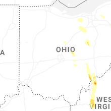

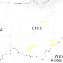


Connect with Interactive Hail Maps