

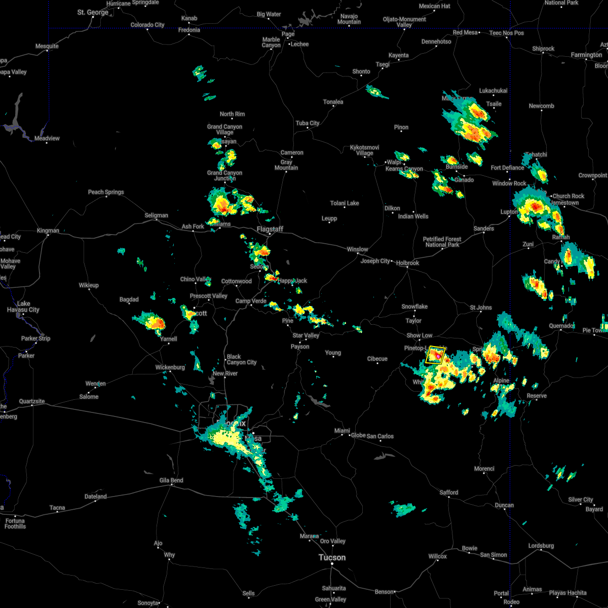
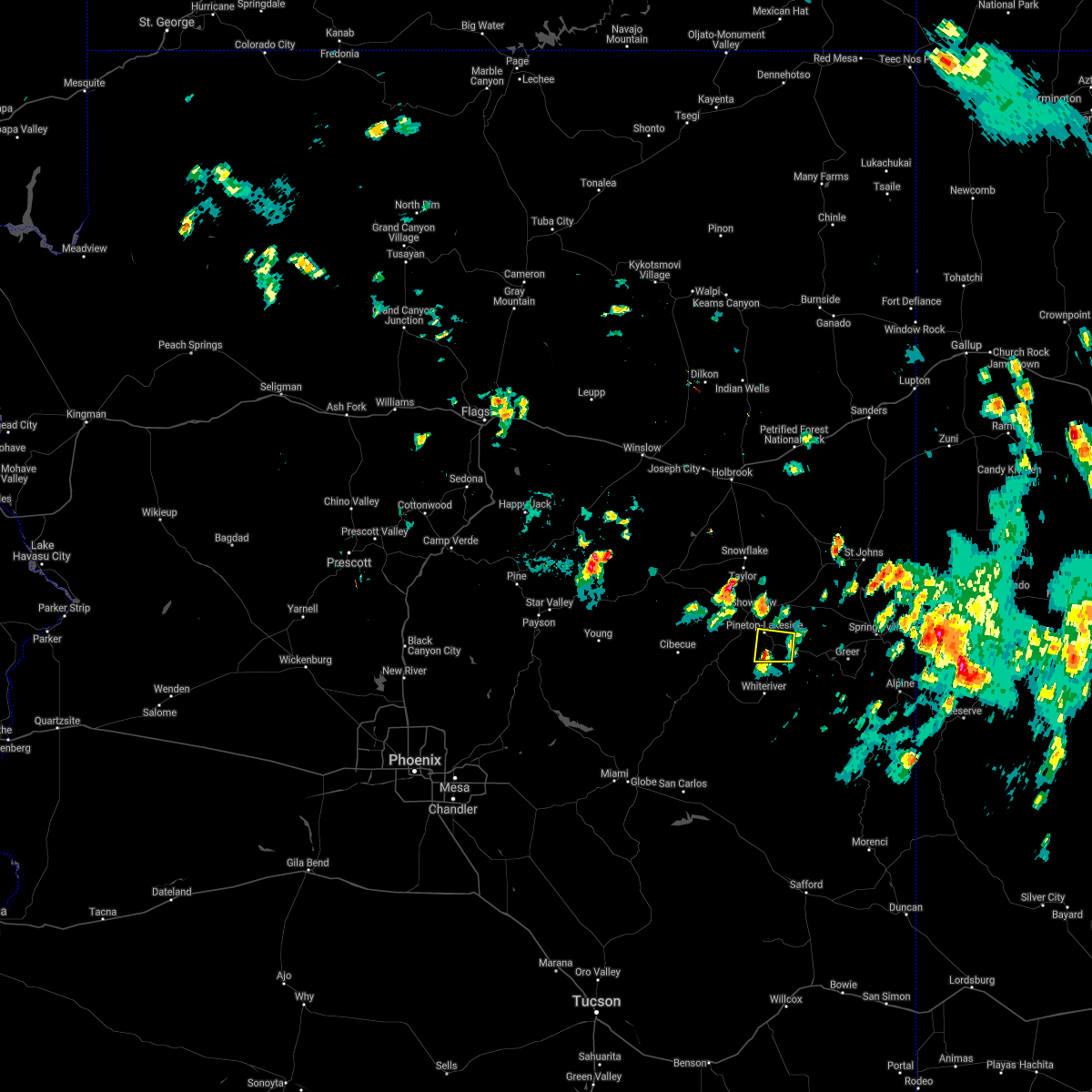
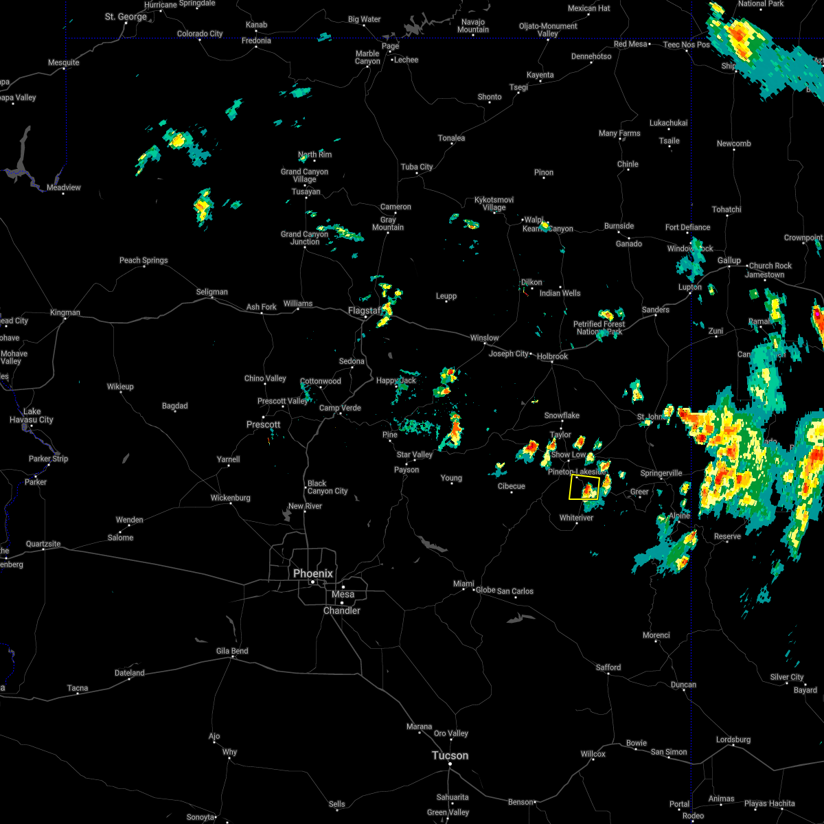
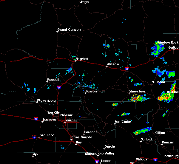
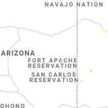
Hail Map for McNary, AZ
The McNary, AZ area has had 0 reports of on-the-ground hail by trained spotters, and has been under severe weather warnings 0 times during the past 12 months. Doppler radar has detected hail at or near McNary, AZ on 26 occasions, including 2 occasions during the past year.
| Name: | McNary, AZ |
| Where Located: | 16 miles SE of Show Low, AZ |
| Map: | Google Map for McNary, AZ |
| Population: | 528 |
| Housing Units: | 136 |
| More Info: | Search Google for McNary, AZ |
3
The Top Recent Hail Date for McNary, AZ is Wednesday, August 21, 2024 (2nd out of 26)

Hail and Wind Damage Spotted near McNary, AZ
| Date / Time | Report Details |
|---|---|
| 5/14/2023 12:27 PM MST |
 At 1227 pm mst, a severe thunderstorm was located near show low, moving northwest at 15 mph (radar indicated). Hazards include 60 mph wind gusts. Expect damage to roofs, siding, and trees. locations impacted include, show low, pinetop-lakeside, lake of the woods--pinetop-lakeside, wagon wheel, pinetop country club, scott reservoir campground, fool hollow lake campground, white mountain lake and lakeside campground. this includes the following highways, state route 260 between mile markers 335 and 356. state route 77 between mile markers 343 and 348. highway 60 between mile markers 337 and 349. hail threat, radar indicated max hail size, <. 75 in wind threat, radar indicated max wind gust, 60 mph. At 1227 pm mst, a severe thunderstorm was located near show low, moving northwest at 15 mph (radar indicated). Hazards include 60 mph wind gusts. Expect damage to roofs, siding, and trees. locations impacted include, show low, pinetop-lakeside, lake of the woods--pinetop-lakeside, wagon wheel, pinetop country club, scott reservoir campground, fool hollow lake campground, white mountain lake and lakeside campground. this includes the following highways, state route 260 between mile markers 335 and 356. state route 77 between mile markers 343 and 348. highway 60 between mile markers 337 and 349. hail threat, radar indicated max hail size, <. 75 in wind threat, radar indicated max wind gust, 60 mph.
|
| 5/14/2023 11:54 AM MST |
 At 1154 am mst, a severe thunderstorm was located near pinetop-lakeside, or 11 miles southeast of show low, moving northwest at 15 mph (radar indicated). Hazards include 60 mph wind gusts and nickel size hail. expect damage to roofs, siding, and trees At 1154 am mst, a severe thunderstorm was located near pinetop-lakeside, or 11 miles southeast of show low, moving northwest at 15 mph (radar indicated). Hazards include 60 mph wind gusts and nickel size hail. expect damage to roofs, siding, and trees
|
| 7/29/2021 11:57 AM MST |
 At 1157 am mst, a severe thunderstorm was located near hondah, or 14 miles southeast of show low, moving west at 10 mph (radar indicated). Hazards include quarter size hail. damage to vehicles is expected At 1157 am mst, a severe thunderstorm was located near hondah, or 14 miles southeast of show low, moving west at 10 mph (radar indicated). Hazards include quarter size hail. damage to vehicles is expected
|
| 7/12/2021 4:12 PM MST |
 The severe thunderstorm warning for gila, apache and navajo counties will expire at 415 pm mst, the near hondah which prompted the severe thunderstorm warning has weakened below severe limits and no longer poses an immediate threat to life or property. therefore, the warning will be allowed to expire. The severe thunderstorm warning for gila, apache and navajo counties will expire at 415 pm mst, the near hondah which prompted the severe thunderstorm warning has weakened below severe limits and no longer poses an immediate threat to life or property. therefore, the warning will be allowed to expire.
|
| 7/12/2021 3:48 PM MST |
 At 347 pm mst, a severe thunderstorm was located over hondah, or 14 miles southeast of show low, moving west at 15 mph (radar indicated). Hazards include 60 mph wind gusts and quarter size hail. Hail damage to vehicles is expected. Expect wind damage to roofs, siding, and trees. At 347 pm mst, a severe thunderstorm was located over hondah, or 14 miles southeast of show low, moving west at 15 mph (radar indicated). Hazards include 60 mph wind gusts and quarter size hail. Hail damage to vehicles is expected. Expect wind damage to roofs, siding, and trees.
|
| 8/1/2019 5:47 PM MST |
 At 545 pm mst, a severe thunderstorm was located over pinetop- lakeside, or 8 miles southeast of show low, the storm is nearly stationary (radar indicated). Hazards include quarter size hail. damage to vehicles is expected At 545 pm mst, a severe thunderstorm was located over pinetop- lakeside, or 8 miles southeast of show low, the storm is nearly stationary (radar indicated). Hazards include quarter size hail. damage to vehicles is expected
|
| 7/27/2018 3:38 PM MST |
 At 337 pm mst, a severe thunderstorm was located over lake of the woods--pinetop-lakeside, or 8 miles southeast of show low, moving southeast at 15 mph (radar indicated). Hazards include 60 mph wind gusts and quarter size hail. Hail damage to vehicles is expected. Expect wind damage to roofs, siding, and trees. At 337 pm mst, a severe thunderstorm was located over lake of the woods--pinetop-lakeside, or 8 miles southeast of show low, moving southeast at 15 mph (radar indicated). Hazards include 60 mph wind gusts and quarter size hail. Hail damage to vehicles is expected. Expect wind damage to roofs, siding, and trees.
|
| 8/14/2017 4:30 PM MST |
 At 429 pm mst, a severe thunderstorm was located near hondah, or 14 miles southeast of show low, moving north at 10 mph (radar indicated). Hazards include quarter size hail. damage to vehicles is expected At 429 pm mst, a severe thunderstorm was located near hondah, or 14 miles southeast of show low, moving north at 10 mph (radar indicated). Hazards include quarter size hail. damage to vehicles is expected
|
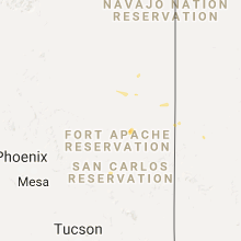
Hail Maps for McNary, AZ


Connect with Interactive Hail Maps