

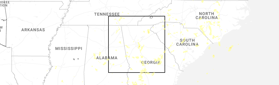
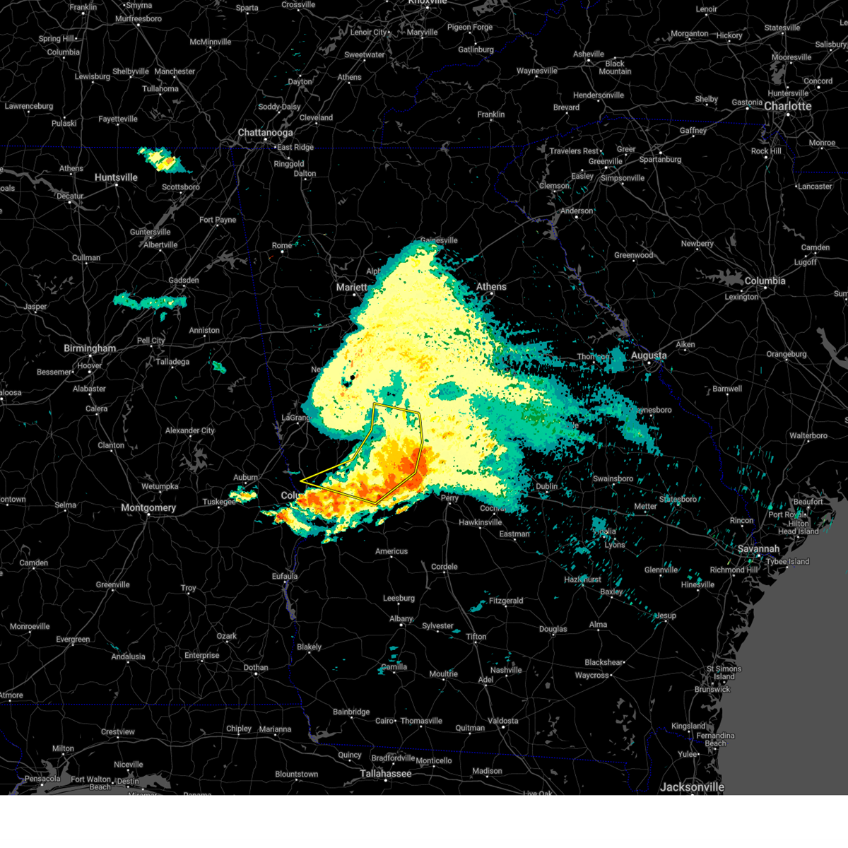
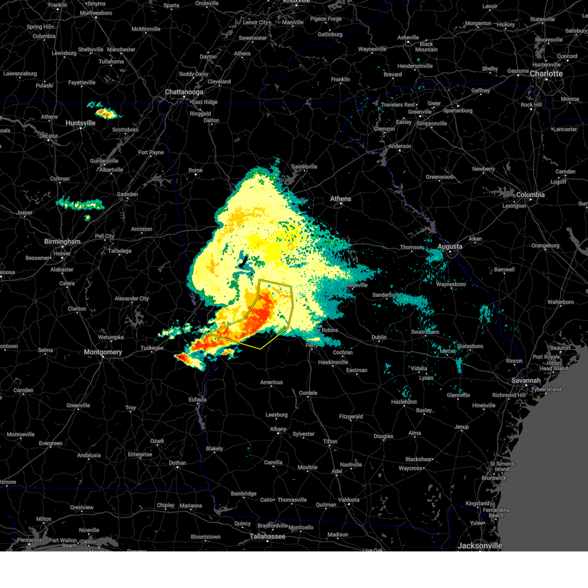
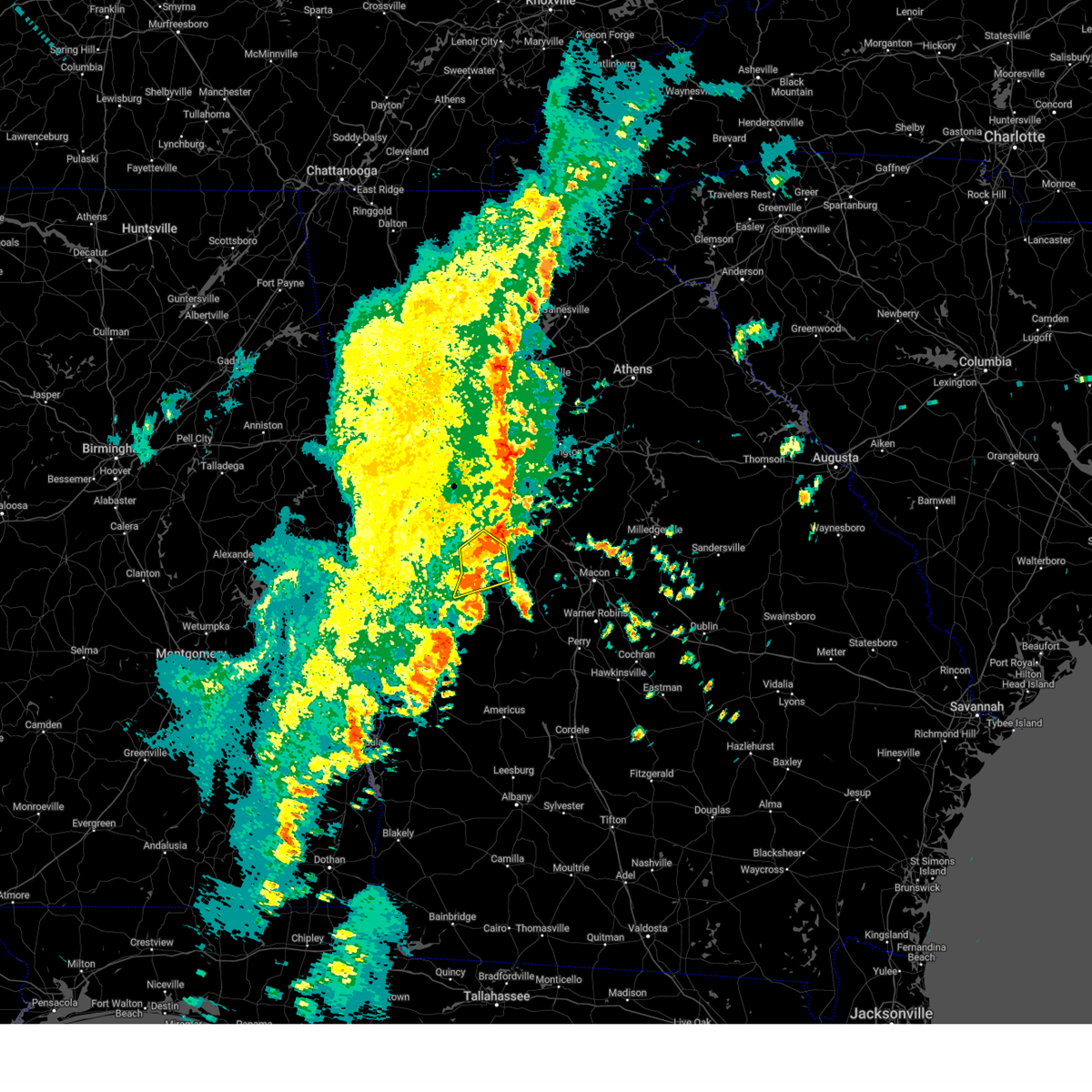
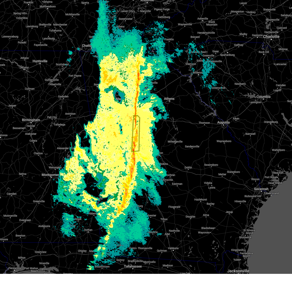
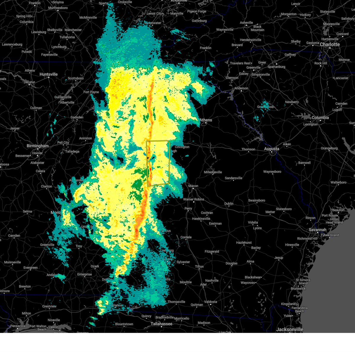
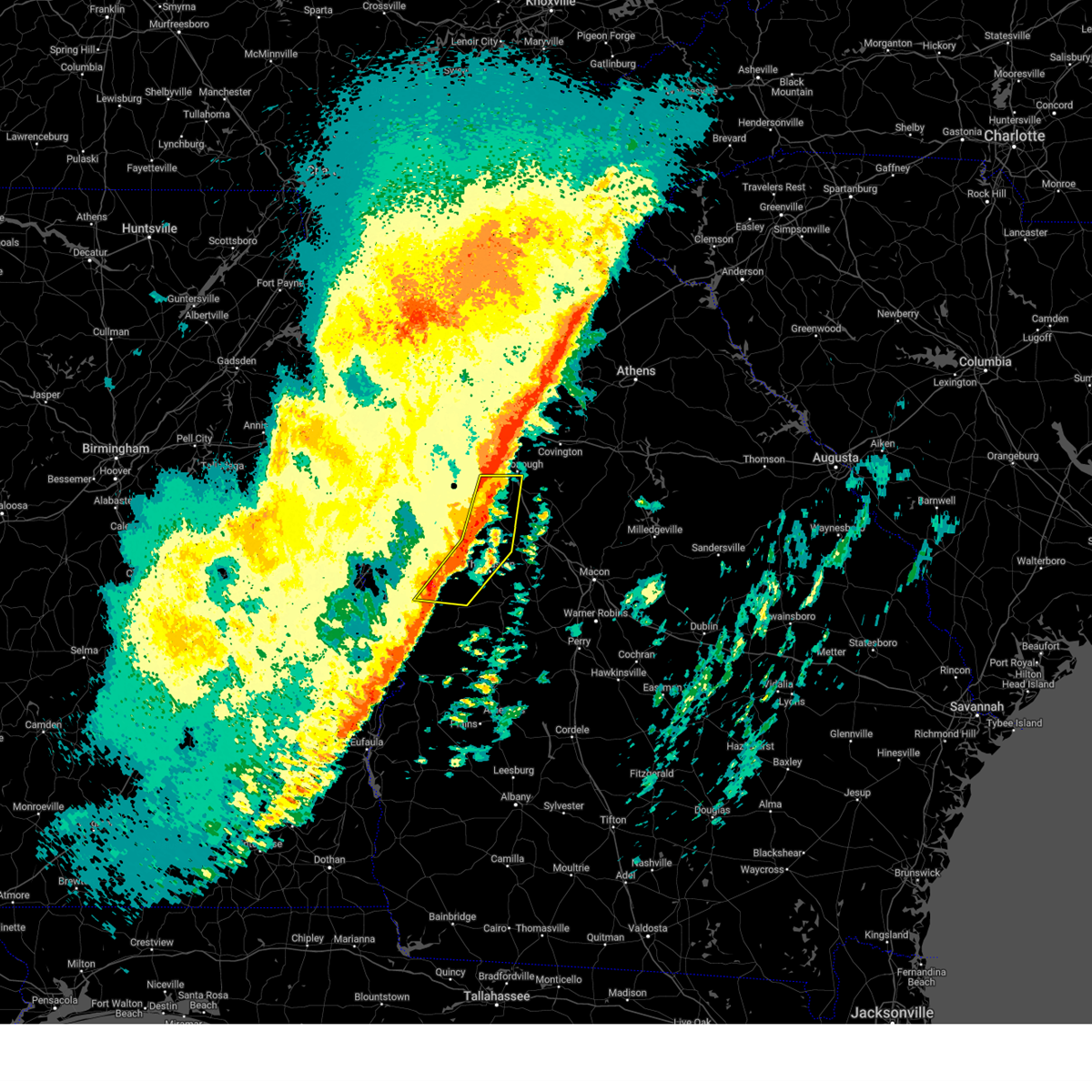
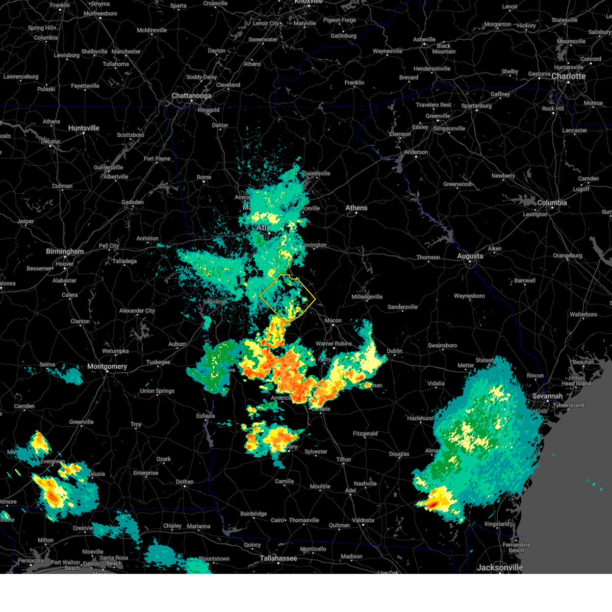
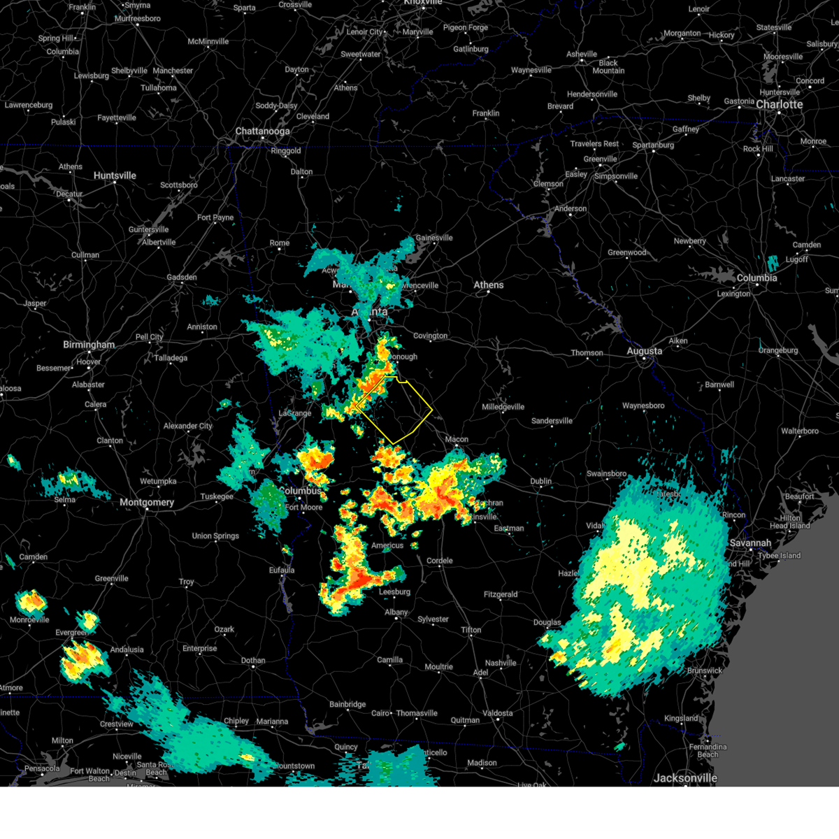
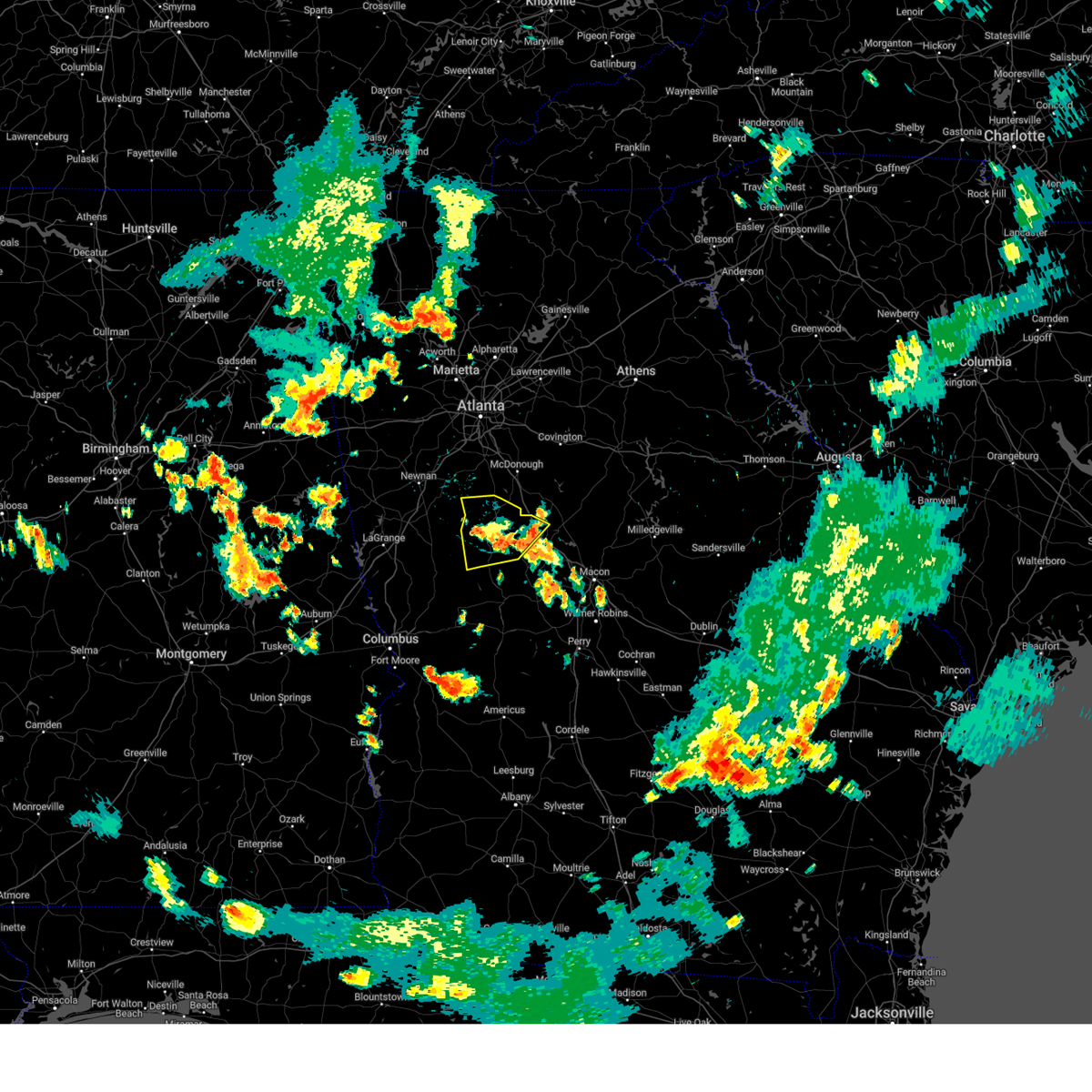
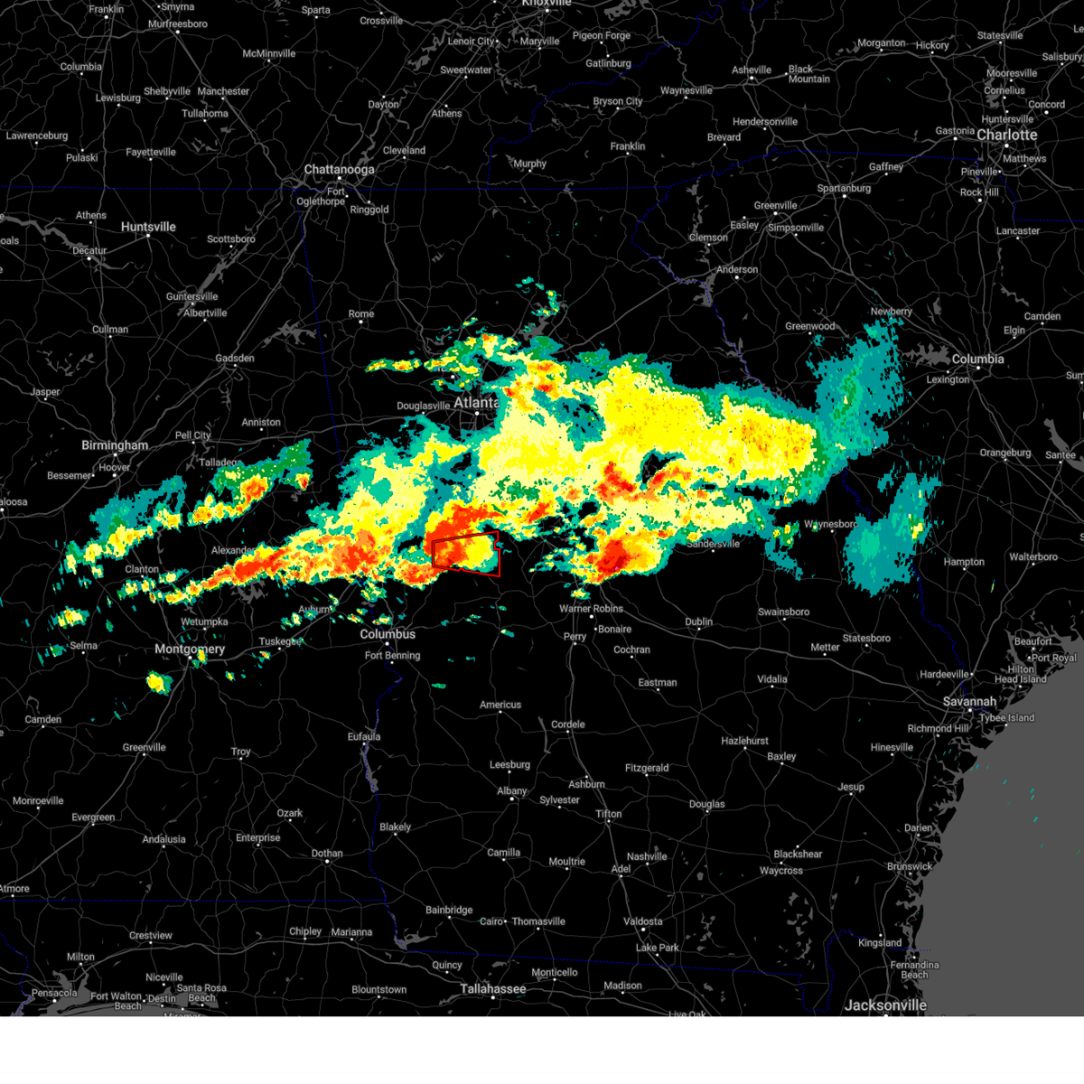
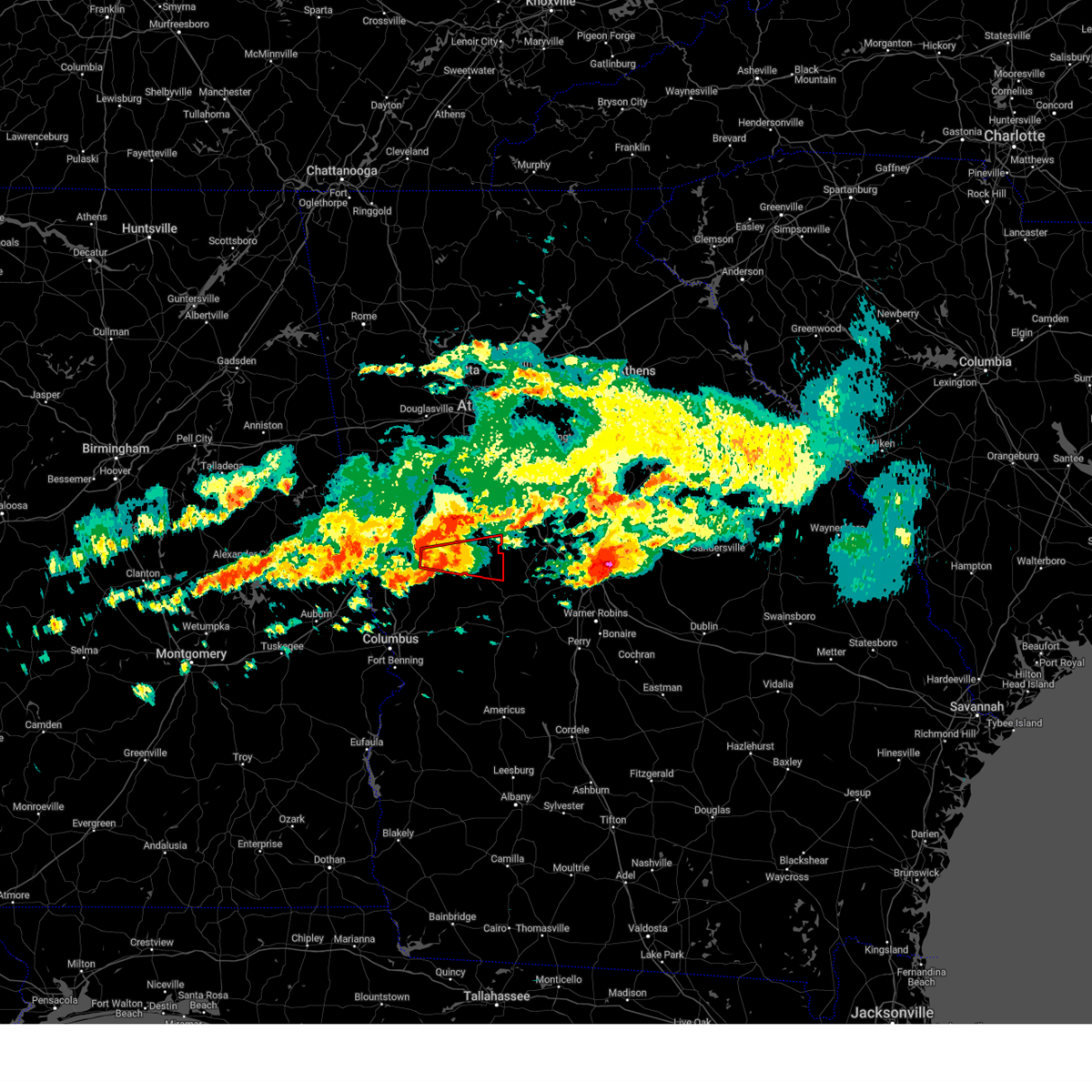
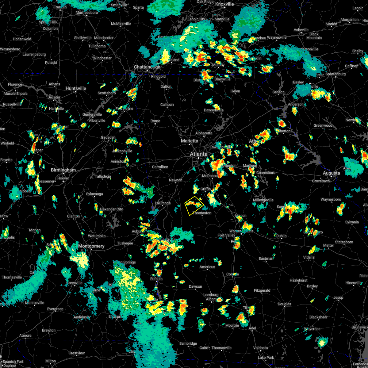
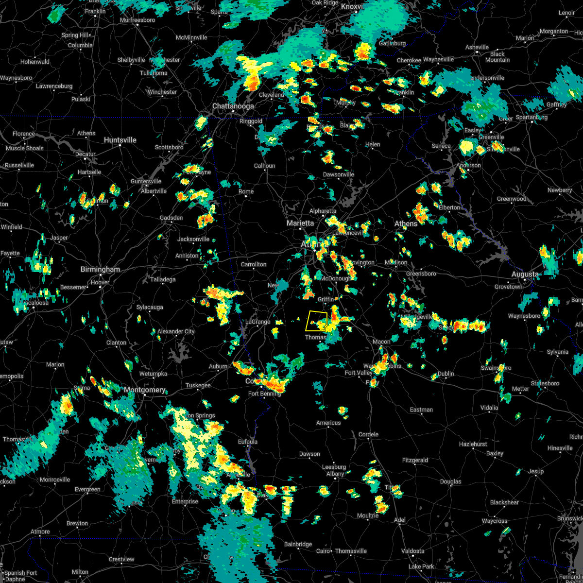
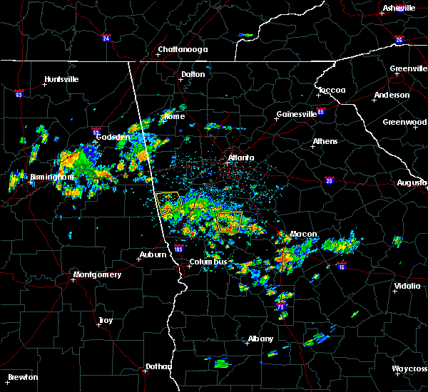
Hail Map for Meansville, GA
The Meansville, GA area has had 2 reports of on-the-ground hail by trained spotters, and has been under severe weather warnings 29 times during the past 12 months. Doppler radar has detected hail at or near Meansville, GA on 44 occasions, including 4 occasions during the past year.
| Name: | Meansville, GA |
| Where Located: | 48.3 miles S of Atlanta, GA |
| Map: | Google Map for Meansville, GA |
| Population: | 182 |
| Housing Units: | 89 |
| More Info: | Search Google for Meansville, GA |
0
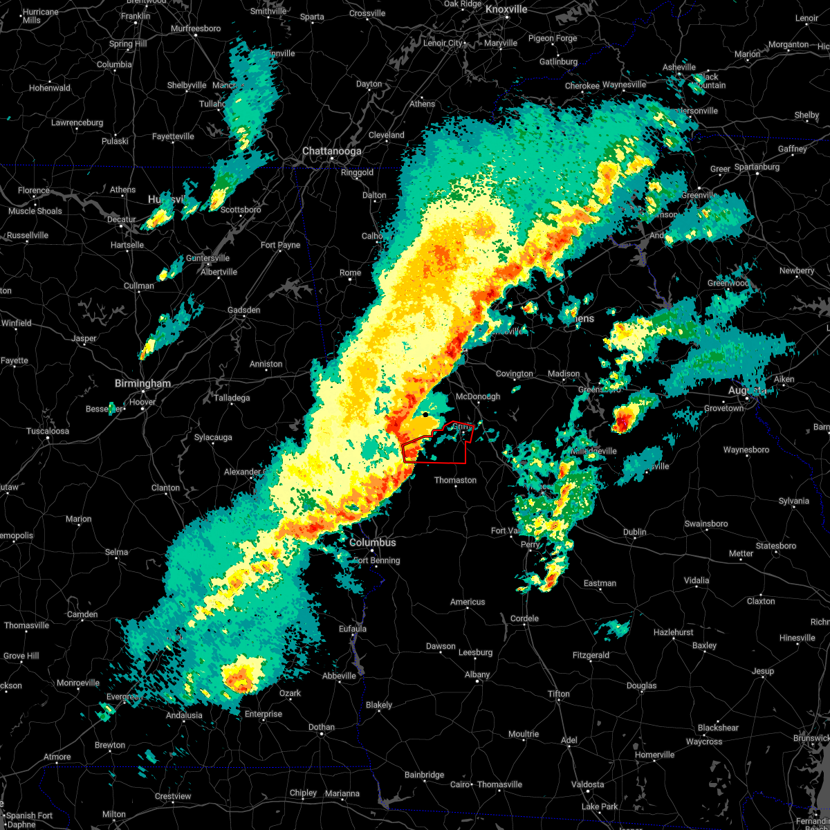
The Top Recent Hail Date for Meansville, GA is Wednesday, June 25, 2025 (25th out of 44)
Hail and Wind Damage Spotted near Meansville, GA
| Date / Time | Report Details |
|---|---|
| 6/26/2025 1:06 AM EDT |
 Svrffc the national weather service in peachtree city has issued a * severe thunderstorm warning for, southeastern meriwether county in west central georgia, pike county in west central georgia, southwestern monroe county in central georgia, upson county in west central georgia, north central talbot county in west central georgia, southern lamar county in west central georgia, * until 145 am edt. * at 106 am edt, a severe thunderstorm was located over the rock, or near thomaston, moving west at 15 mph (radar indicated). Hazards include 60 mph wind gusts. expect damage to roofs, siding, and trees Svrffc the national weather service in peachtree city has issued a * severe thunderstorm warning for, southeastern meriwether county in west central georgia, pike county in west central georgia, southwestern monroe county in central georgia, upson county in west central georgia, north central talbot county in west central georgia, southern lamar county in west central georgia, * until 145 am edt. * at 106 am edt, a severe thunderstorm was located over the rock, or near thomaston, moving west at 15 mph (radar indicated). Hazards include 60 mph wind gusts. expect damage to roofs, siding, and trees
|
| 6/14/2025 8:55 PM EDT |
 Svrffc the national weather service in peachtree city has issued a * severe thunderstorm warning for, southeastern spalding county in west central georgia, southeastern pike county in west central georgia, northwestern monroe county in central georgia, southwestern butts county in central georgia, lamar county in west central georgia, * until 945 pm edt. * at 855 pm edt, a severe thunderstorm was located over milner, or near barnesville, moving southeast at 40 mph (radar indicated). Hazards include 60 mph wind gusts. expect damage to roofs, siding, and trees Svrffc the national weather service in peachtree city has issued a * severe thunderstorm warning for, southeastern spalding county in west central georgia, southeastern pike county in west central georgia, northwestern monroe county in central georgia, southwestern butts county in central georgia, lamar county in west central georgia, * until 945 pm edt. * at 855 pm edt, a severe thunderstorm was located over milner, or near barnesville, moving southeast at 40 mph (radar indicated). Hazards include 60 mph wind gusts. expect damage to roofs, siding, and trees
|
| 5/30/2025 2:45 PM EDT | Trees down at vega road and highway 1 in pike county GA, 2.3 miles NNE of Meansville, GA |
| 5/30/2025 2:42 PM EDT | Report of multiple downed and snapped trees along with minor structural damage along mccard lake rd between hwy 109 and turner rd. radar showed a strong signal for stra in pike county GA, 2.3 miles WNW of Meansville, GA |
| 5/27/2025 3:57 PM EDT |
 Svrffc the national weather service in peachtree city has issued a * severe thunderstorm warning for, southeastern spalding county in west central georgia, pike county in west central georgia, northeastern upson county in west central georgia, lamar county in west central georgia, * until 430 pm edt. * at 357 pm edt, severe thunderstorms were located along a line extending from near zetella to concord to molena, moving east at 40 mph (radar indicated). Hazards include 60 mph wind gusts and penny size hail. expect damage to roofs, siding, and trees Svrffc the national weather service in peachtree city has issued a * severe thunderstorm warning for, southeastern spalding county in west central georgia, pike county in west central georgia, northeastern upson county in west central georgia, lamar county in west central georgia, * until 430 pm edt. * at 357 pm edt, severe thunderstorms were located along a line extending from near zetella to concord to molena, moving east at 40 mph (radar indicated). Hazards include 60 mph wind gusts and penny size hail. expect damage to roofs, siding, and trees
|
| 5/18/2025 10:30 AM EDT |
 The storms which prompted the warning have moved out of the area. therefore, the warning has been allowed to expire. a severe thunderstorm watch remains in effect until 100 pm edt for central and west central georgia. The storms which prompted the warning have moved out of the area. therefore, the warning has been allowed to expire. a severe thunderstorm watch remains in effect until 100 pm edt for central and west central georgia.
|
| 5/18/2025 10:13 AM EDT |
 the severe thunderstorm warning has been cancelled and is no longer in effect the severe thunderstorm warning has been cancelled and is no longer in effect
|
| 5/18/2025 10:13 AM EDT |
 At 1013 am edt, severe thunderstorms were located along a line extending from lake horton to near orchard hill to the rock to near carsonville to near geneva, moving east at 50 mph (radar indicated). Hazards include 60 mph wind gusts and quarter size hail. Hail damage to vehicles is expected. expect wind damage to roofs, siding, and trees. Locations impacted include, thomaston, barnesville, butler, zebulon, roberta, talbotton, waverly hall, milner, woodland, yatesville, williamson, meansville, junction city, culloden, geneva, aldora, sunset village, lincoln park, the rock, and upatoi. At 1013 am edt, severe thunderstorms were located along a line extending from lake horton to near orchard hill to the rock to near carsonville to near geneva, moving east at 50 mph (radar indicated). Hazards include 60 mph wind gusts and quarter size hail. Hail damage to vehicles is expected. expect wind damage to roofs, siding, and trees. Locations impacted include, thomaston, barnesville, butler, zebulon, roberta, talbotton, waverly hall, milner, woodland, yatesville, williamson, meansville, junction city, culloden, geneva, aldora, sunset village, lincoln park, the rock, and upatoi.
|
| 5/18/2025 10:11 AM EDT |
 Svrffc the national weather service in peachtree city has issued a * severe thunderstorm warning for, marion county in west central georgia, bibb county in central georgia, southeastern pike county in west central georgia, muscogee county in west central georgia, monroe county in central georgia, chattahoochee county in west central georgia, northern stewart county in west central georgia, eastern upson county in west central georgia, houston county in central georgia, central jones county in central georgia, southeastern harris county in west central georgia, macon county in west central georgia, western twiggs county in central georgia, northwestern webster county in west central georgia, peach county in central georgia, crawford county in central georgia, schley county in west central georgia, southern talbot county in west central georgia, taylor county in west central georgia, lamar county in west central georgia, * until 1100 am edt. * at 1011 am edt, severe thunderstorms were located along a line extending from piedmont to logtown to near howard to juniper to benning park, moving east at 55 mph (radar indicated). Hazards include 60 mph wind gusts and quarter size hail. Hail damage to vehicles is expected. Expect wind damage to roofs, siding, and trees. Svrffc the national weather service in peachtree city has issued a * severe thunderstorm warning for, marion county in west central georgia, bibb county in central georgia, southeastern pike county in west central georgia, muscogee county in west central georgia, monroe county in central georgia, chattahoochee county in west central georgia, northern stewart county in west central georgia, eastern upson county in west central georgia, houston county in central georgia, central jones county in central georgia, southeastern harris county in west central georgia, macon county in west central georgia, western twiggs county in central georgia, northwestern webster county in west central georgia, peach county in central georgia, crawford county in central georgia, schley county in west central georgia, southern talbot county in west central georgia, taylor county in west central georgia, lamar county in west central georgia, * until 1100 am edt. * at 1011 am edt, severe thunderstorms were located along a line extending from piedmont to logtown to near howard to juniper to benning park, moving east at 55 mph (radar indicated). Hazards include 60 mph wind gusts and quarter size hail. Hail damage to vehicles is expected. Expect wind damage to roofs, siding, and trees.
|
| 5/18/2025 10:00 AM EDT | Power lines down w/ fire along thompson rd in upson count in upson county GA, 5.2 miles NNE of Meansville, GA |
| 5/18/2025 9:43 AM EDT |
 Svrffc the national weather service in peachtree city has issued a * severe thunderstorm warning for, spalding county in west central georgia, southern fayette county in north central georgia, northeastern marion county in west central georgia, meriwether county in west central georgia, pike county in west central georgia, northeastern muscogee county in west central georgia, western monroe county in central georgia, upson county in west central georgia, southwestern butts county in central georgia, harris county in west central georgia, southwestern henry county in north central georgia, northwestern crawford county in central georgia, southern coweta county in west central georgia, southern clayton county in north central georgia, talbot county in west central georgia, northern taylor county in west central georgia, lamar county in west central georgia, * until 1030 am edt. * at 943 am edt, severe thunderstorms were located along a line extending from newnan to near rocky mount to near woodbury to shiloh to near mulberry grove, moving east at 50 mph (radar indicated). Hazards include 60 mph wind gusts and quarter size hail. Hail damage to vehicles is expected. Expect wind damage to roofs, siding, and trees. Svrffc the national weather service in peachtree city has issued a * severe thunderstorm warning for, spalding county in west central georgia, southern fayette county in north central georgia, northeastern marion county in west central georgia, meriwether county in west central georgia, pike county in west central georgia, northeastern muscogee county in west central georgia, western monroe county in central georgia, upson county in west central georgia, southwestern butts county in central georgia, harris county in west central georgia, southwestern henry county in north central georgia, northwestern crawford county in central georgia, southern coweta county in west central georgia, southern clayton county in north central georgia, talbot county in west central georgia, northern taylor county in west central georgia, lamar county in west central georgia, * until 1030 am edt. * at 943 am edt, severe thunderstorms were located along a line extending from newnan to near rocky mount to near woodbury to shiloh to near mulberry grove, moving east at 50 mph (radar indicated). Hazards include 60 mph wind gusts and quarter size hail. Hail damage to vehicles is expected. Expect wind damage to roofs, siding, and trees.
|
| 4/10/2025 9:50 PM EDT |
 Svrffc the national weather service in peachtree city has issued a * severe thunderstorm warning for, spalding county in west central georgia, northeastern meriwether county in west central georgia, pike county in west central georgia, monroe county in central georgia, upson county in west central georgia, butts county in central georgia, northwestern jones county in central georgia, southwestern newton county in north central georgia, southwestern rockdale county in north central georgia, henry county in north central georgia, northwestern crawford county in central georgia, jasper county in central georgia, lamar county in west central georgia, * until 1030 pm edt. * at 949 pm edt, severe thunderstorms were located along a line extending from near kelleytown to near highland mills to near wooster, moving southeast at 40 mph (public). Hazards include half dollar size hail. damage to vehicles is expected Svrffc the national weather service in peachtree city has issued a * severe thunderstorm warning for, spalding county in west central georgia, northeastern meriwether county in west central georgia, pike county in west central georgia, monroe county in central georgia, upson county in west central georgia, butts county in central georgia, northwestern jones county in central georgia, southwestern newton county in north central georgia, southwestern rockdale county in north central georgia, henry county in north central georgia, northwestern crawford county in central georgia, jasper county in central georgia, lamar county in west central georgia, * until 1030 pm edt. * at 949 pm edt, severe thunderstorms were located along a line extending from near kelleytown to near highland mills to near wooster, moving southeast at 40 mph (public). Hazards include half dollar size hail. damage to vehicles is expected
|
| 3/31/2025 1:12 PM EDT |
 At 112 pm edt, a severe thunderstorm was located over atwater, or near thomaston, moving northeast at 45 mph (radar indicated). Hazards include 60 mph wind gusts and quarter size hail. Hail damage to vehicles is expected. expect wind damage to roofs, siding, and trees. Locations impacted include, thomaston, sunset village, atwater, meansville, lifsey springs, redbone crossroads, zebulon, sprewell bluff state park, crest, pleasant hill, sunnyside, lincoln park, hannahs mill, the rock, piedmont, molena, and woodland. At 112 pm edt, a severe thunderstorm was located over atwater, or near thomaston, moving northeast at 45 mph (radar indicated). Hazards include 60 mph wind gusts and quarter size hail. Hail damage to vehicles is expected. expect wind damage to roofs, siding, and trees. Locations impacted include, thomaston, sunset village, atwater, meansville, lifsey springs, redbone crossroads, zebulon, sprewell bluff state park, crest, pleasant hill, sunnyside, lincoln park, hannahs mill, the rock, piedmont, molena, and woodland.
|
| 3/31/2025 1:12 PM EDT |
 the severe thunderstorm warning has been cancelled and is no longer in effect the severe thunderstorm warning has been cancelled and is no longer in effect
|
| 3/31/2025 12:44 PM EDT | Svrffc the national weather service in peachtree city has issued a * severe thunderstorm warning for, southeastern meriwether county in west central georgia, southern pike county in west central georgia, upson county in west central georgia, northwestern talbot county in west central georgia, southwestern lamar county in west central georgia, northeastern harris county in west central georgia, * until 130 pm edt. * at 1244 pm edt, a severe thunderstorm was located over shiloh, or 11 miles northeast of hamilton, moving northeast at 45 mph (radar indicated). Hazards include 60 mph wind gusts and quarter size hail. Hail damage to vehicles is expected. Expect wind damage to roofs, siding, and trees. |
| 3/5/2025 2:45 AM EST |
 the severe thunderstorm warning has been cancelled and is no longer in effect the severe thunderstorm warning has been cancelled and is no longer in effect
|
| 3/5/2025 2:45 AM EST |
 At 245 am est, severe thunderstorms were located along a line extending from clarkston to near the rock, moving east at 25 mph (radar indicated). Hazards include 60 mph wind gusts. Expect damage to roofs, siding, and trees. Locations impacted include, griffin, mcdonough, thomaston, barnesville, stockbridge, hampton, locust grove, milner, orchard hill, meansville, aldora, the rock, east griffin, blacksville, walker mill, hidden valley park, luella, liberty hill, flippen, and towalaga. At 245 am est, severe thunderstorms were located along a line extending from clarkston to near the rock, moving east at 25 mph (radar indicated). Hazards include 60 mph wind gusts. Expect damage to roofs, siding, and trees. Locations impacted include, griffin, mcdonough, thomaston, barnesville, stockbridge, hampton, locust grove, milner, orchard hill, meansville, aldora, the rock, east griffin, blacksville, walker mill, hidden valley park, luella, liberty hill, flippen, and towalaga.
|
| 3/5/2025 2:10 AM EST |
 Svrffc the national weather service in peachtree city has issued a * severe thunderstorm warning for, southwestern rockdale county in north central georgia, spalding county in west central georgia, southwestern dekalb county in north central georgia, fayette county in north central georgia, eastern meriwether county in west central georgia, pike county in west central georgia, henry county in north central georgia, northern upson county in west central georgia, southeastern coweta county in west central georgia, south central fulton county in north central georgia, clayton county in north central georgia, western lamar county in west central georgia, * until 300 am est. * at 210 am est, severe thunderstorms were located along a line extending from near six flags over georgia to near sprewell bluff state park, moving east at 25 mph (radar indicated). Hazards include 60 mph wind gusts. expect damage to roofs, siding, and trees Svrffc the national weather service in peachtree city has issued a * severe thunderstorm warning for, southwestern rockdale county in north central georgia, spalding county in west central georgia, southwestern dekalb county in north central georgia, fayette county in north central georgia, eastern meriwether county in west central georgia, pike county in west central georgia, henry county in north central georgia, northern upson county in west central georgia, southeastern coweta county in west central georgia, south central fulton county in north central georgia, clayton county in north central georgia, western lamar county in west central georgia, * until 300 am est. * at 210 am est, severe thunderstorms were located along a line extending from near six flags over georgia to near sprewell bluff state park, moving east at 25 mph (radar indicated). Hazards include 60 mph wind gusts. expect damage to roofs, siding, and trees
|
| 2/16/2025 5:05 AM EST | Svrffc the national weather service in peachtree city has issued a * severe thunderstorm warning for, eastern spalding county in west central georgia, bibb county in central georgia, southeastern pike county in west central georgia, monroe county in central georgia, upson county in west central georgia, butts county in central georgia, jones county in central georgia, south central newton county in north central georgia, northwestern baldwin county in central georgia, putnam county in central georgia, southeastern henry county in north central georgia, northern crawford county in central georgia, jasper county in central georgia, lamar county in west central georgia, * until 600 am est. * at 505 am est, severe thunderstorms were located along a line extending from blacksville to walker mill to near milner to sprewell bluff state park, moving east at 55 mph (radar indicated). Hazards include 70 mph wind gusts. Expect considerable tree damage. Damage is likely to mobile homes, roofs, and outbuildings. |
| 2/16/2025 4:57 AM EST |
 the severe thunderstorm warning has been cancelled and is no longer in effect the severe thunderstorm warning has been cancelled and is no longer in effect
|
| 2/16/2025 4:57 AM EST |
 At 457 am est, severe thunderstorms were located along a line extending from inman to near molena to near pine mountain valley, moving east at 45 mph (radar indicated). Hazards include 60 mph wind gusts. Expect damage to roofs, siding, and trees. Locations impacted include, griffin, mcdonough, thomaston, barnesville, zebulon, hampton, locust grove, manchester, woodbury, milner, warm springs, woodland, molena, williamson, orchard hill, meansville, woolsey, sunny side, aldora, and sunset village. At 457 am est, severe thunderstorms were located along a line extending from inman to near molena to near pine mountain valley, moving east at 45 mph (radar indicated). Hazards include 60 mph wind gusts. Expect damage to roofs, siding, and trees. Locations impacted include, griffin, mcdonough, thomaston, barnesville, zebulon, hampton, locust grove, manchester, woodbury, milner, warm springs, woodland, molena, williamson, orchard hill, meansville, woolsey, sunny side, aldora, and sunset village.
|
| 2/16/2025 4:32 AM EST |
 Svrffc the national weather service in peachtree city has issued a * severe thunderstorm warning for, spalding county in west central georgia, southern fayette county in north central georgia, meriwether county in west central georgia, pike county in west central georgia, southwestern henry county in north central georgia, northwestern upson county in west central georgia, southeastern troup county in west central georgia, southeastern coweta county in west central georgia, south central clayton county in north central georgia, northwestern talbot county in west central georgia, western lamar county in west central georgia, northern harris county in west central georgia, * until 515 am est. * at 432 am est, severe thunderstorms were located along a line extending from near madras to near saint marks to near whitesville-pine lake, moving east at 45 mph (radar indicated). Hazards include 60 mph wind gusts. expect damage to roofs, siding, and trees Svrffc the national weather service in peachtree city has issued a * severe thunderstorm warning for, spalding county in west central georgia, southern fayette county in north central georgia, meriwether county in west central georgia, pike county in west central georgia, southwestern henry county in north central georgia, northwestern upson county in west central georgia, southeastern troup county in west central georgia, southeastern coweta county in west central georgia, south central clayton county in north central georgia, northwestern talbot county in west central georgia, western lamar county in west central georgia, northern harris county in west central georgia, * until 515 am est. * at 432 am est, severe thunderstorms were located along a line extending from near madras to near saint marks to near whitesville-pine lake, moving east at 45 mph (radar indicated). Hazards include 60 mph wind gusts. expect damage to roofs, siding, and trees
|
| 12/29/2024 4:35 AM EST |
 the severe thunderstorm warning has been cancelled and is no longer in effect the severe thunderstorm warning has been cancelled and is no longer in effect
|
| 12/29/2024 4:35 AM EST |
 At 435 am est, severe thunderstorms were located along a line extending from near inman to griffin to near the rock to near howard, moving northeast at 55 mph (radar indicated). Hazards include 60 mph wind gusts. Expect damage to roofs, siding, and trees. Locations impacted include, griffin, mcdonough, fayetteville, thomaston, barnesville, jackson, forsyth, butler, zebulon, roberta, peachtree city, stockbridge, hampton, lovejoy, locust grove, reynolds, flovilla, milner, brooks, and jenkinsburg. At 435 am est, severe thunderstorms were located along a line extending from near inman to griffin to near the rock to near howard, moving northeast at 55 mph (radar indicated). Hazards include 60 mph wind gusts. Expect damage to roofs, siding, and trees. Locations impacted include, griffin, mcdonough, fayetteville, thomaston, barnesville, jackson, forsyth, butler, zebulon, roberta, peachtree city, stockbridge, hampton, lovejoy, locust grove, reynolds, flovilla, milner, brooks, and jenkinsburg.
|
| 12/29/2024 4:02 AM EST |
 Svrffc the national weather service in peachtree city has issued a * severe thunderstorm warning for, spalding county in west central georgia, southern fayette county in north central georgia, meriwether county in west central georgia, pike county in west central georgia, monroe county in central georgia, upson county in west central georgia, southwestern butts county in central georgia, henry county in north central georgia, crawford county in central georgia, southeastern coweta county in west central georgia, southeastern clayton county in north central georgia, central talbot county in west central georgia, taylor county in west central georgia, lamar county in west central georgia, * until 500 am est. * at 401 am est, severe thunderstorms were located along a line extending from near hogansville to near woodland to near eelbeck/west fort moore, moving east at 45 mph (radar indicated). Hazards include 60 mph wind gusts. expect damage to roofs, siding, and trees Svrffc the national weather service in peachtree city has issued a * severe thunderstorm warning for, spalding county in west central georgia, southern fayette county in north central georgia, meriwether county in west central georgia, pike county in west central georgia, monroe county in central georgia, upson county in west central georgia, southwestern butts county in central georgia, henry county in north central georgia, crawford county in central georgia, southeastern coweta county in west central georgia, southeastern clayton county in north central georgia, central talbot county in west central georgia, taylor county in west central georgia, lamar county in west central georgia, * until 500 am est. * at 401 am est, severe thunderstorms were located along a line extending from near hogansville to near woodland to near eelbeck/west fort moore, moving east at 45 mph (radar indicated). Hazards include 60 mph wind gusts. expect damage to roofs, siding, and trees
|
| 7/30/2024 9:15 PM EDT |
 Svrffc the national weather service in peachtree city has issued a * severe thunderstorm warning for, spalding county in west central georgia, southern fayette county in north central georgia, northeastern meriwether county in west central georgia, pike county in west central georgia, northwestern monroe county in central georgia, southwestern henry county in north central georgia, northeastern upson county in west central georgia, southwestern butts county in central georgia, eastern coweta county in west central georgia, south central clayton county in north central georgia, lamar county in west central georgia, * until 1000 pm edt. * at 915 pm edt, severe thunderstorms were located along a line extending from blacksville to near rover to near sharpsburg, moving southeast at 40 mph (radar indicated). Hazards include 60 mph wind gusts and quarter size hail. Hail damage to vehicles is expected. Expect wind damage to roofs, siding, and trees. Svrffc the national weather service in peachtree city has issued a * severe thunderstorm warning for, spalding county in west central georgia, southern fayette county in north central georgia, northeastern meriwether county in west central georgia, pike county in west central georgia, northwestern monroe county in central georgia, southwestern henry county in north central georgia, northeastern upson county in west central georgia, southwestern butts county in central georgia, eastern coweta county in west central georgia, south central clayton county in north central georgia, lamar county in west central georgia, * until 1000 pm edt. * at 915 pm edt, severe thunderstorms were located along a line extending from blacksville to near rover to near sharpsburg, moving southeast at 40 mph (radar indicated). Hazards include 60 mph wind gusts and quarter size hail. Hail damage to vehicles is expected. Expect wind damage to roofs, siding, and trees.
|
| 7/29/2024 9:49 PM EDT |
 the severe thunderstorm warning has been cancelled and is no longer in effect the severe thunderstorm warning has been cancelled and is no longer in effect
|
| 7/29/2024 9:15 PM EDT |
 Svrffc the national weather service in peachtree city has issued a * severe thunderstorm warning for, spalding county in west central georgia, pike county in west central georgia, northwestern monroe county in central georgia, northeastern upson county in west central georgia, southwestern butts county in central georgia, lamar county in west central georgia, * until 1000 pm edt. * at 915 pm edt, severe thunderstorms were located along a line extending from towalaga to griffin to near hilltop, moving southeast at 30 mph (radar indicated). Hazards include 60 mph wind gusts and quarter size hail. Hail damage to vehicles is expected. Expect wind damage to roofs, siding, and trees. Svrffc the national weather service in peachtree city has issued a * severe thunderstorm warning for, spalding county in west central georgia, pike county in west central georgia, northwestern monroe county in central georgia, northeastern upson county in west central georgia, southwestern butts county in central georgia, lamar county in west central georgia, * until 1000 pm edt. * at 915 pm edt, severe thunderstorms were located along a line extending from towalaga to griffin to near hilltop, moving southeast at 30 mph (radar indicated). Hazards include 60 mph wind gusts and quarter size hail. Hail damage to vehicles is expected. Expect wind damage to roofs, siding, and trees.
|
| 7/29/2024 7:30 PM EDT |
 The storm which prompted the warning has weakened below severe limits, and no longer poses an immediate threat to life or property. therefore, the warning has been allowed to expire. however, gusty winds are still possible with this thunderstorm. to report severe weather, contact your nearest law enforcement agency. they will relay your report to the national weather service peachtree city. The storm which prompted the warning has weakened below severe limits, and no longer poses an immediate threat to life or property. therefore, the warning has been allowed to expire. however, gusty winds are still possible with this thunderstorm. to report severe weather, contact your nearest law enforcement agency. they will relay your report to the national weather service peachtree city.
|
| 7/29/2024 7:05 PM EDT |
 At 704 pm edt, a severe thunderstorm was located over williamson, or near zebulon, moving south at 20 mph (radar indicated). Hazards include 60 mph wind gusts and penny size hail. Expect damage to roofs, siding, and trees. Locations impacted include, griffin, barnesville, zebulon, milner, brooks, molena, williamson, orchard hill, meansville, aldora, the rock, east griffin, sunset village, concord, atwater, hilltop, hollonville, rover, liberty hill, and hannahs mill. At 704 pm edt, a severe thunderstorm was located over williamson, or near zebulon, moving south at 20 mph (radar indicated). Hazards include 60 mph wind gusts and penny size hail. Expect damage to roofs, siding, and trees. Locations impacted include, griffin, barnesville, zebulon, milner, brooks, molena, williamson, orchard hill, meansville, aldora, the rock, east griffin, sunset village, concord, atwater, hilltop, hollonville, rover, liberty hill, and hannahs mill.
|
| 7/29/2024 7:05 PM EDT |
 the severe thunderstorm warning has been cancelled and is no longer in effect the severe thunderstorm warning has been cancelled and is no longer in effect
|
| 7/29/2024 6:46 PM EDT |
 Svrffc the national weather service in peachtree city has issued a * severe thunderstorm warning for, spalding county in west central georgia, southeastern fayette county in north central georgia, pike county in west central georgia, northwestern monroe county in central georgia, southwestern henry county in north central georgia, northern upson county in west central georgia, southwestern butts county in central georgia, lamar county in west central georgia, * until 730 pm edt. * at 646 pm edt, a severe thunderstorm was located over zetella, or 8 miles west of griffin, moving south at 20 mph (radar indicated). Hazards include 60 mph wind gusts and penny size hail. expect damage to roofs, siding, and trees Svrffc the national weather service in peachtree city has issued a * severe thunderstorm warning for, spalding county in west central georgia, southeastern fayette county in north central georgia, pike county in west central georgia, northwestern monroe county in central georgia, southwestern henry county in north central georgia, northern upson county in west central georgia, southwestern butts county in central georgia, lamar county in west central georgia, * until 730 pm edt. * at 646 pm edt, a severe thunderstorm was located over zetella, or 8 miles west of griffin, moving south at 20 mph (radar indicated). Hazards include 60 mph wind gusts and penny size hail. expect damage to roofs, siding, and trees
|
| 5/25/2024 12:30 PM EDT |
 Svrffc the national weather service in peachtree city has issued a * severe thunderstorm warning for, eastern pike county in west central georgia, monroe county in central georgia, northeastern upson county in west central georgia, western jones county in central georgia, lamar county in west central georgia, * until 115 pm edt. * at 1230 pm edt, a severe thunderstorm was located over aldora, or near barnesville, moving east at 35 mph (radar indicated). Hazards include 60 mph wind gusts and penny size hail. expect damage to roofs, siding, and trees Svrffc the national weather service in peachtree city has issued a * severe thunderstorm warning for, eastern pike county in west central georgia, monroe county in central georgia, northeastern upson county in west central georgia, western jones county in central georgia, lamar county in west central georgia, * until 115 pm edt. * at 1230 pm edt, a severe thunderstorm was located over aldora, or near barnesville, moving east at 35 mph (radar indicated). Hazards include 60 mph wind gusts and penny size hail. expect damage to roofs, siding, and trees
|
| 8/15/2023 4:07 PM EDT |
 At 406 pm edt, severe thunderstorms were located along a line extending from near flovilla to piedmont, moving southeast at 15 mph (radar indicated). Hazards include 60 mph wind gusts. Expect damage to roofs, siding, and trees. locations impacted include, barnesville, jackson, forsyth, monticello, flovilla, milner, jenkinsburg, meansville, aldora, blount, liberty hill, mcelheneys crossroads, collier, johnstonville, goggins, berner, mckibben, lifsey springs, brent, and chappel mill. hail threat, radar indicated max hail size, <. 75 in wind threat, radar indicated max wind gust, 60 mph. At 406 pm edt, severe thunderstorms were located along a line extending from near flovilla to piedmont, moving southeast at 15 mph (radar indicated). Hazards include 60 mph wind gusts. Expect damage to roofs, siding, and trees. locations impacted include, barnesville, jackson, forsyth, monticello, flovilla, milner, jenkinsburg, meansville, aldora, blount, liberty hill, mcelheneys crossroads, collier, johnstonville, goggins, berner, mckibben, lifsey springs, brent, and chappel mill. hail threat, radar indicated max hail size, <. 75 in wind threat, radar indicated max wind gust, 60 mph.
|
| 8/15/2023 3:46 PM EDT |
 At 346 pm edt, severe thunderstorms were located along a line extending from jackson to near lifsey springs, moving southeast at 15 mph (radar indicated). Hazards include 60 mph wind gusts. expect damage to roofs, siding, and trees At 346 pm edt, severe thunderstorms were located along a line extending from jackson to near lifsey springs, moving southeast at 15 mph (radar indicated). Hazards include 60 mph wind gusts. expect damage to roofs, siding, and trees
|
| 8/8/2023 4:41 PM EDT |
 The severe thunderstorm warning for southeastern pike, northeastern upson and southern lamar counties will expire at 445 pm edt, the storm which prompted the warning has weakened below severe limits, and has exited the warned area. therefore, the warning will be allowed to expire. The severe thunderstorm warning for southeastern pike, northeastern upson and southern lamar counties will expire at 445 pm edt, the storm which prompted the warning has weakened below severe limits, and has exited the warned area. therefore, the warning will be allowed to expire.
|
| 8/8/2023 4:20 PM EDT | Tree blocking both lanes of thompson r in upson county GA, 5.2 miles NNE of Meansville, GA |
| 8/8/2023 4:19 PM EDT | A tree was reported down across thompson r in upson county GA, 5.2 miles NNE of Meansville, GA |
| 8/8/2023 4:16 PM EDT |
 At 416 pm edt, a severe thunderstorm was located over lifsey springs, or near zebulon, moving east at 35 mph (radar indicated). Hazards include 60 mph wind gusts and quarter size hail. Hail damage to vehicles is expected. expect wind damage to roofs, siding, and trees. locations impacted include, thomaston, barnesville, zebulon, yatesville, meansville, aldora, the rock, atwater, goggins, lifsey springs, redbone, hannahs mill, piedmont, and johnstonville. hail threat, radar indicated max hail size, 1. 00 in wind threat, radar indicated max wind gust, 60 mph. At 416 pm edt, a severe thunderstorm was located over lifsey springs, or near zebulon, moving east at 35 mph (radar indicated). Hazards include 60 mph wind gusts and quarter size hail. Hail damage to vehicles is expected. expect wind damage to roofs, siding, and trees. locations impacted include, thomaston, barnesville, zebulon, yatesville, meansville, aldora, the rock, atwater, goggins, lifsey springs, redbone, hannahs mill, piedmont, and johnstonville. hail threat, radar indicated max hail size, 1. 00 in wind threat, radar indicated max wind gust, 60 mph.
|
| 8/8/2023 4:00 PM EDT |
 At 400 pm edt, a severe thunderstorm was located over molena, or 9 miles southwest of zebulon, moving east at 35 mph (radar indicated). Hazards include 60 mph wind gusts and quarter size hail. Hail damage to vehicles is expected. Expect wind damage to roofs, siding, and trees. At 400 pm edt, a severe thunderstorm was located over molena, or 9 miles southwest of zebulon, moving east at 35 mph (radar indicated). Hazards include 60 mph wind gusts and quarter size hail. Hail damage to vehicles is expected. Expect wind damage to roofs, siding, and trees.
|
| 8/6/2023 3:37 PM EDT |
 At 337 pm edt, severe thunderstorms were located along a line extending from near hampton to near highland mills to near hilltop, moving southeast at 20 mph (radar indicated). Hazards include 60 mph wind gusts and penny size hail. Expect damage to roofs, siding, and trees. locations impacted include, griffin, mcdonough, zebulon, hampton, locust grove, milner, williamson, orchard hill, meansville, sunny side, east griffin, concord, highland mills, blacksville, towalaga, experiment, hilltop, walker mill, hollonville, and rover. hail threat, radar indicated max hail size, 0. 75 in wind threat, radar indicated max wind gust, 60 mph. At 337 pm edt, severe thunderstorms were located along a line extending from near hampton to near highland mills to near hilltop, moving southeast at 20 mph (radar indicated). Hazards include 60 mph wind gusts and penny size hail. Expect damage to roofs, siding, and trees. locations impacted include, griffin, mcdonough, zebulon, hampton, locust grove, milner, williamson, orchard hill, meansville, sunny side, east griffin, concord, highland mills, blacksville, towalaga, experiment, hilltop, walker mill, hollonville, and rover. hail threat, radar indicated max hail size, 0. 75 in wind threat, radar indicated max wind gust, 60 mph.
|
| 8/6/2023 3:26 PM EDT |
 At 326 pm edt, severe thunderstorms were located along a line extending from lovejoy to vaughn to near hollonville, moving southeast at 20 mph (radar indicated). Hazards include 60 mph wind gusts and penny size hail. expect damage to roofs, siding, and trees At 326 pm edt, severe thunderstorms were located along a line extending from lovejoy to vaughn to near hollonville, moving southeast at 20 mph (radar indicated). Hazards include 60 mph wind gusts and penny size hail. expect damage to roofs, siding, and trees
|
| 8/3/2023 6:03 PM EDT |
 At 602 pm edt, severe thunderstorms were located along a line extending from sunny side to near lifsey springs to west point, moving southeast at 45 mph (radar indicated). Hazards include 60 mph wind gusts. expect damage to roofs, siding, and trees At 602 pm edt, severe thunderstorms were located along a line extending from sunny side to near lifsey springs to west point, moving southeast at 45 mph (radar indicated). Hazards include 60 mph wind gusts. expect damage to roofs, siding, and trees
|
| 6/30/2023 3:27 PM EDT |
 At 327 pm edt, severe thunderstorms were located along a line extending from saint marks to near wooster to near zebulon, moving south at 20 mph (radar indicated). Hazards include 60 mph wind gusts and quarter size hail. Hail damage to vehicles is expected. Expect wind damage to roofs, siding, and trees. At 327 pm edt, severe thunderstorms were located along a line extending from saint marks to near wooster to near zebulon, moving south at 20 mph (radar indicated). Hazards include 60 mph wind gusts and quarter size hail. Hail damage to vehicles is expected. Expect wind damage to roofs, siding, and trees.
|
| 6/25/2023 8:10 PM EDT |
 The severe thunderstorm warning for southwestern spalding, pike, central monroe, northern upson, northwestern jones, southeastern jasper and lamar counties will expire at 815 pm edt, the storms which prompted the warning have moved out of the area. therefore, the warning will be allowed to expire. a severe thunderstorm watch remains in effect until 100 am edt for central, north central and west central georgia. The severe thunderstorm warning for southwestern spalding, pike, central monroe, northern upson, northwestern jones, southeastern jasper and lamar counties will expire at 815 pm edt, the storms which prompted the warning have moved out of the area. therefore, the warning will be allowed to expire. a severe thunderstorm watch remains in effect until 100 am edt for central, north central and west central georgia.
|
| 6/25/2023 7:53 PM EDT |
 At 753 pm edt, severe thunderstorms were located along a line extending from near redbone crossroads to james, moving east at 45 mph (radar indicated). Hazards include 60 mph wind gusts. Expect damage to roofs, siding, and trees. locations impacted include, barnesville, forsyth, zebulon, milner, molena, williamson, orchard hill, meansville, aldora, the rock, concord, wayside, atwater, hilltop, round oak, hollonville, rover, liberty hill, collier and juliette. hail threat, radar indicated max hail size, <. 75 in wind threat, radar indicated max wind gust, 60 mph. At 753 pm edt, severe thunderstorms were located along a line extending from near redbone crossroads to james, moving east at 45 mph (radar indicated). Hazards include 60 mph wind gusts. Expect damage to roofs, siding, and trees. locations impacted include, barnesville, forsyth, zebulon, milner, molena, williamson, orchard hill, meansville, aldora, the rock, concord, wayside, atwater, hilltop, round oak, hollonville, rover, liberty hill, collier and juliette. hail threat, radar indicated max hail size, <. 75 in wind threat, radar indicated max wind gust, 60 mph.
|
| 6/25/2023 7:35 PM EDT |
 At 734 pm edt, severe thunderstorms were located along a line extending from near lifsey springs to near bradley, moving southeast at 45 mph (radar indicated). Hazards include 60 mph wind gusts. Expect damage to roofs, siding, and trees. locations impacted include, griffin, mcdonough, fayetteville, barnesville, jackson, forsyth, monticello, zebulon, peachtree city, hampton, tyrone, lovejoy, locust grove, senoia, flovilla, milner, brooks, jenkinsburg, molena and williamson. hail threat, radar indicated max hail size, <. 75 in wind threat, radar indicated max wind gust, 60 mph. At 734 pm edt, severe thunderstorms were located along a line extending from near lifsey springs to near bradley, moving southeast at 45 mph (radar indicated). Hazards include 60 mph wind gusts. Expect damage to roofs, siding, and trees. locations impacted include, griffin, mcdonough, fayetteville, barnesville, jackson, forsyth, monticello, zebulon, peachtree city, hampton, tyrone, lovejoy, locust grove, senoia, flovilla, milner, brooks, jenkinsburg, molena and williamson. hail threat, radar indicated max hail size, <. 75 in wind threat, radar indicated max wind gust, 60 mph.
|
| 6/25/2023 7:10 PM EDT |
 At 710 pm edt, severe thunderstorms were located along a line extending from near digbey to monticello, moving southeast at 45 mph (radar indicated). Hazards include 60 mph wind gusts. expect damage to roofs, siding, and trees At 710 pm edt, severe thunderstorms were located along a line extending from near digbey to monticello, moving southeast at 45 mph (radar indicated). Hazards include 60 mph wind gusts. expect damage to roofs, siding, and trees
|
| 3/27/2023 7:17 AM EDT |
 At 716 am edt, a severe thunderstorm capable of producing a tornado was located over raleigh, or near greenville, moving east at 35 mph (radar indicated rotation). Hazards include tornado and quarter size hail. Flying debris will be dangerous to those caught without shelter. mobile homes will be damaged or destroyed. damage to roofs, windows, and vehicles will occur. tree damage is likely. Locations impacted include, thomaston, woodbury, molena, meansville, sunset village, lincoln park, the rock, raleigh, atwater, lifsey springs, redbone crossroads, crest, sunnyside, hannahs mill and imlac. At 716 am edt, a severe thunderstorm capable of producing a tornado was located over raleigh, or near greenville, moving east at 35 mph (radar indicated rotation). Hazards include tornado and quarter size hail. Flying debris will be dangerous to those caught without shelter. mobile homes will be damaged or destroyed. damage to roofs, windows, and vehicles will occur. tree damage is likely. Locations impacted include, thomaston, woodbury, molena, meansville, sunset village, lincoln park, the rock, raleigh, atwater, lifsey springs, redbone crossroads, crest, sunnyside, hannahs mill and imlac.
|
| 3/27/2023 7:08 AM EDT |
 At 708 am edt, a severe thunderstorm capable of producing a tornado was located over harris city, or near greenville, moving east at 40 mph (radar indicated rotation). Hazards include tornado and quarter size hail. Flying debris will be dangerous to those caught without shelter. mobile homes will be damaged or destroyed. damage to roofs, windows, and vehicles will occur. Tree damage is likely. At 708 am edt, a severe thunderstorm capable of producing a tornado was located over harris city, or near greenville, moving east at 40 mph (radar indicated rotation). Hazards include tornado and quarter size hail. Flying debris will be dangerous to those caught without shelter. mobile homes will be damaged or destroyed. damage to roofs, windows, and vehicles will occur. Tree damage is likely.
|
| 3/27/2023 12:40 AM EDT |
 At 1240 am edt, severe thunderstorms were located along a line extending from gay to near baughville, moving east at 60 mph (radar indicated). Hazards include 60 mph wind gusts. expect damage to roofs, siding, and trees At 1240 am edt, severe thunderstorms were located along a line extending from gay to near baughville, moving east at 60 mph (radar indicated). Hazards include 60 mph wind gusts. expect damage to roofs, siding, and trees
|
| 3/26/2023 7:54 AM EDT |
 At 754 am edt, a severe thunderstorm was located near lifsey springs, or 7 miles southwest of zebulon, moving east at 40 mph (radar indicated). Hazards include 60 mph wind gusts and half dollar size hail. Hail damage to vehicles is expected. expect wind damage to roofs, siding, and trees. locations impacted include, thomaston, barnesville, zebulon, milner, molena, meansville, aldora, sunset village, the rock, lincoln park, concord, atwater, hilltop, lifsey springs, redbone crossroads, crest, sunnyside, hannahs mill and piedmont. hail threat, radar indicated max hail size, 1. 25 in wind threat, radar indicated max wind gust, 60 mph. At 754 am edt, a severe thunderstorm was located near lifsey springs, or 7 miles southwest of zebulon, moving east at 40 mph (radar indicated). Hazards include 60 mph wind gusts and half dollar size hail. Hail damage to vehicles is expected. expect wind damage to roofs, siding, and trees. locations impacted include, thomaston, barnesville, zebulon, milner, molena, meansville, aldora, sunset village, the rock, lincoln park, concord, atwater, hilltop, lifsey springs, redbone crossroads, crest, sunnyside, hannahs mill and piedmont. hail threat, radar indicated max hail size, 1. 25 in wind threat, radar indicated max wind gust, 60 mph.
|
| 3/26/2023 7:45 AM EDT |
 At 745 am edt, a severe thunderstorm was located over imlac, or 10 miles east of greenville, moving east at 40 mph (radar indicated). Hazards include 60 mph wind gusts and quarter size hail. Hail damage to vehicles is expected. Expect wind damage to roofs, siding, and trees. At 745 am edt, a severe thunderstorm was located over imlac, or 10 miles east of greenville, moving east at 40 mph (radar indicated). Hazards include 60 mph wind gusts and quarter size hail. Hail damage to vehicles is expected. Expect wind damage to roofs, siding, and trees.
|
| 3/26/2023 5:47 AM EDT | Half Dollar sized hail reported 0.2 miles ENE of Meansville, GA, report via social media. |
| 3/26/2023 5:47 AM EDT |
 At 547 am edt, a severe thunderstorm was located over meansville, or near zebulon, moving east at 40 mph (radar indicated). Hazards include 60 mph wind gusts and quarter size hail. Hail damage to vehicles is expected. expect wind damage to roofs, siding, and trees. locations impacted include, barnesville, zebulon, milner, meansville, aldora, concord, goggins, hilltop, lifsey springs, chappel mill, redbone, liberty hill, piedmont and johnstonville. hail threat, radar indicated max hail size, 1. 00 in wind threat, radar indicated max wind gust, 60 mph. At 547 am edt, a severe thunderstorm was located over meansville, or near zebulon, moving east at 40 mph (radar indicated). Hazards include 60 mph wind gusts and quarter size hail. Hail damage to vehicles is expected. expect wind damage to roofs, siding, and trees. locations impacted include, barnesville, zebulon, milner, meansville, aldora, concord, goggins, hilltop, lifsey springs, chappel mill, redbone, liberty hill, piedmont and johnstonville. hail threat, radar indicated max hail size, 1. 00 in wind threat, radar indicated max wind gust, 60 mph.
|
| 3/26/2023 5:28 AM EDT | At 528 am edt, a severe thunderstorm was located over imlac, or 9 miles east of greenville, moving east at 40 mph (radar indicated). Hazards include ping pong ball size hail and 60 mph wind gusts. People and animals outdoors will be injured. Expect hail damage to roofs, siding, windows, and vehicles. |
| 1/12/2023 4:42 PM EST |
 The severe thunderstorm warning for southern meriwether, southern pike, upson, talbot, northwestern taylor, harris and southwestern lamar counties will expire at 445 pm est, the storms which prompted the warning have weakened below severe limits, and no longer pose an immediate threat to life or property. therefore, the warning will be allowed to expire. however gusty winds are still possible with these thunderstorms. a tornado watch remains in effect until 700 pm est for central and west central georgia. The severe thunderstorm warning for southern meriwether, southern pike, upson, talbot, northwestern taylor, harris and southwestern lamar counties will expire at 445 pm est, the storms which prompted the warning have weakened below severe limits, and no longer pose an immediate threat to life or property. therefore, the warning will be allowed to expire. however gusty winds are still possible with these thunderstorms. a tornado watch remains in effect until 700 pm est for central and west central georgia.
|
| 1/12/2023 4:04 PM EST |
 At 403 pm est, severe thunderstorms were located along a line extending from raleigh to near hamilton to near mountain hill, moving east at 50 mph (radar indicated). Hazards include 60 mph wind gusts. expect damage to roofs, siding, and trees At 403 pm est, severe thunderstorms were located along a line extending from raleigh to near hamilton to near mountain hill, moving east at 50 mph (radar indicated). Hazards include 60 mph wind gusts. expect damage to roofs, siding, and trees
|
| 1/12/2023 4:00 PM EST |
 At 400 pm est, a tornado producing storm was located over wooster, or 7 miles northeast of greenville, moving east at 50 mph (radar confirmed tornado). Hazards include damaging tornado and quarter size hail. Flying debris will be dangerous to those caught without shelter. mobile homes will be damaged or destroyed. damage to roofs, windows, and vehicles will occur. Tree damage is likely. At 400 pm est, a tornado producing storm was located over wooster, or 7 miles northeast of greenville, moving east at 50 mph (radar confirmed tornado). Hazards include damaging tornado and quarter size hail. Flying debris will be dangerous to those caught without shelter. mobile homes will be damaged or destroyed. damage to roofs, windows, and vehicles will occur. Tree damage is likely.
|
| 8/20/2022 9:54 PM EDT |
 At 954 pm edt, a severe thunderstorm was located over concord, or near zebulon, moving north at 20 mph (radar indicated). Hazards include 60 mph wind gusts. Expect damage to roofs, siding, and trees. locations impacted include, zebulon, molena, meansville, concord, atwater, hilltop, lifsey springs and hannahs mill. hail threat, radar indicated max hail size, <. 75 in wind threat, radar indicated max wind gust, 60 mph. At 954 pm edt, a severe thunderstorm was located over concord, or near zebulon, moving north at 20 mph (radar indicated). Hazards include 60 mph wind gusts. Expect damage to roofs, siding, and trees. locations impacted include, zebulon, molena, meansville, concord, atwater, hilltop, lifsey springs and hannahs mill. hail threat, radar indicated max hail size, <. 75 in wind threat, radar indicated max wind gust, 60 mph.
|
| 8/20/2022 9:44 PM EDT | Trees were downed on power lines on vickery roa in upson county GA, 4.4 miles NNE of Meansville, GA |
| 8/20/2022 9:29 PM EDT |
 At 929 pm edt, a severe thunderstorm was located over crest, or 9 miles west of thomaston, moving north at 20 mph (radar indicated). Hazards include 60 mph wind gusts. expect damage to roofs, siding, and trees At 929 pm edt, a severe thunderstorm was located over crest, or 9 miles west of thomaston, moving north at 20 mph (radar indicated). Hazards include 60 mph wind gusts. expect damage to roofs, siding, and trees
|
| 7/3/2022 5:41 PM EDT |
 At 540 pm edt, a severe thunderstorm was located near molena, or 9 miles west of zebulon, and is nearly stationary (radar indicated). Hazards include 60 mph wind gusts and quarter size hail. Hail damage to vehicles is expected. Expect wind damage to roofs, siding, and trees. At 540 pm edt, a severe thunderstorm was located near molena, or 9 miles west of zebulon, and is nearly stationary (radar indicated). Hazards include 60 mph wind gusts and quarter size hail. Hail damage to vehicles is expected. Expect wind damage to roofs, siding, and trees.
|
| 7/3/2022 5:08 PM EDT |
 At 508 pm edt, a severe thunderstorm was located over hilltop, or near zebulon, and is nearly stationary (radar indicated). Hazards include 60 mph wind gusts and quarter size hail. Hail damage to vehicles is expected. Expect wind damage to roofs, siding, and trees. At 508 pm edt, a severe thunderstorm was located over hilltop, or near zebulon, and is nearly stationary (radar indicated). Hazards include 60 mph wind gusts and quarter size hail. Hail damage to vehicles is expected. Expect wind damage to roofs, siding, and trees.
|
| 12/30/2021 2:18 PM EST |
 At 218 pm est, a severe thunderstorm was located over meansville, or near zebulon, moving east at 50 mph (radar indicated). Hazards include 60 mph wind gusts and penny size hail. expect damage to roofs, siding, and trees At 218 pm est, a severe thunderstorm was located over meansville, or near zebulon, moving east at 50 mph (radar indicated). Hazards include 60 mph wind gusts and penny size hail. expect damage to roofs, siding, and trees
|
| 7/23/2021 4:04 PM EDT |
 At 403 pm edt, a severe thunderstorm was located over aldora, or over barnesville, moving southwest at 10 mph (radar indicated). Hazards include 60 mph wind gusts and quarter size hail. Hail damage to vehicles is expected. Expect wind damage to roofs, siding, and trees. At 403 pm edt, a severe thunderstorm was located over aldora, or over barnesville, moving southwest at 10 mph (radar indicated). Hazards include 60 mph wind gusts and quarter size hail. Hail damage to vehicles is expected. Expect wind damage to roofs, siding, and trees.
|
| 7/12/2021 6:40 PM EDT |
 The severe thunderstorm warning for meriwether, pike, northwestern upson and eastern troup counties will expire at 645 pm edt, the storms which prompted the warning are weakening below severe limits, and therefore, the warning will be allowed to expire. however, gusty winds and heavy rain are still possible with these thunderstorms. to report severe weather, contact your nearest law enforcement agency. they will relay your report to the national weather service peachtree city. The severe thunderstorm warning for meriwether, pike, northwestern upson and eastern troup counties will expire at 645 pm edt, the storms which prompted the warning are weakening below severe limits, and therefore, the warning will be allowed to expire. however, gusty winds and heavy rain are still possible with these thunderstorms. to report severe weather, contact your nearest law enforcement agency. they will relay your report to the national weather service peachtree city.
|
| 7/12/2021 6:27 PM EDT |
 At 627 pm edt, severe thunderstorms were located along a line extending from crest to near greenville to smiths crossroad, moving northeast at 40 mph (radar indicated). Hazards include 60 mph wind gusts. Expect damage to roofs, siding, and trees. Locations impacted include, lagrange, thomaston, zebulon, greenville, manchester, hogansville, woodbury, luthersville, warm springs, molena, williamson, meansville, lone oak, gay, sunset village, mountville, atwater, hilltop, louise and odessadale. At 627 pm edt, severe thunderstorms were located along a line extending from crest to near greenville to smiths crossroad, moving northeast at 40 mph (radar indicated). Hazards include 60 mph wind gusts. Expect damage to roofs, siding, and trees. Locations impacted include, lagrange, thomaston, zebulon, greenville, manchester, hogansville, woodbury, luthersville, warm springs, molena, williamson, meansville, lone oak, gay, sunset village, mountville, atwater, hilltop, louise and odessadale.
|
| 7/12/2021 6:11 PM EDT |
 At 609 pm edt, severe thunderstorms were located along a line extending from near woodland to durand to near whitesville-pine lake, moving northeast at 35 mph (radar indicated). Hazards include 60 mph wind gusts and penny size hail. expect damage to roofs, siding, and trees At 609 pm edt, severe thunderstorms were located along a line extending from near woodland to durand to near whitesville-pine lake, moving northeast at 35 mph (radar indicated). Hazards include 60 mph wind gusts and penny size hail. expect damage to roofs, siding, and trees
|
| 5/4/2021 10:11 PM EDT |
 The severe thunderstorm warning for bibb, southeastern pike, monroe, eastern upson, houston, sumter, crisp, macon, western pulaski, dooly, peach, crawford and lamar counties will expire at 1015 pm edt, the storms which prompted the warning have weakened below severe limits, and no longer pose an immediate threat to life or property. therefore, the warning will be allowed to expire. however gusty winds and heavy rain are still possible with these thunderstorms. a severe thunderstorm watch remains in effect until 100 am edt for central and west central georgia. The severe thunderstorm warning for bibb, southeastern pike, monroe, eastern upson, houston, sumter, crisp, macon, western pulaski, dooly, peach, crawford and lamar counties will expire at 1015 pm edt, the storms which prompted the warning have weakened below severe limits, and no longer pose an immediate threat to life or property. therefore, the warning will be allowed to expire. however gusty winds and heavy rain are still possible with these thunderstorms. a severe thunderstorm watch remains in effect until 100 am edt for central and west central georgia.
|
| 5/4/2021 9:50 PM EDT |
 At 949 pm edt, severe thunderstorms were located along a line extending from meansville to near salem to montezuma to maddox, moving east at 45 mph (radar indicated). Hazards include 60 mph wind gusts and nickel size hail. expect damage to roofs, siding, and trees At 949 pm edt, severe thunderstorms were located along a line extending from meansville to near salem to montezuma to maddox, moving east at 45 mph (radar indicated). Hazards include 60 mph wind gusts and nickel size hail. expect damage to roofs, siding, and trees
|
| 10/10/2020 5:39 PM EDT |
 At 539 pm edt, a severe thunderstorm capable of producing a tornado was located over woodland, or 9 miles north of talbotton, moving north at 40 mph (radar indicated rotation). Hazards include tornado. Flying debris will be dangerous to those caught without shelter. mobile homes will be damaged or destroyed. damage to roofs, windows, and vehicles will occur. tree damage is likely. Locations impacted include, greenville, manchester, woodbury, warm springs, woodland, molena, meansville, gay, sunset village, raleigh, atwater, hilltop, lifsey springs, flint hill, sprewell bluff state park, crest, pleasant hill, sunnyside, harris city and imlac. At 539 pm edt, a severe thunderstorm capable of producing a tornado was located over woodland, or 9 miles north of talbotton, moving north at 40 mph (radar indicated rotation). Hazards include tornado. Flying debris will be dangerous to those caught without shelter. mobile homes will be damaged or destroyed. damage to roofs, windows, and vehicles will occur. tree damage is likely. Locations impacted include, greenville, manchester, woodbury, warm springs, woodland, molena, meansville, gay, sunset village, raleigh, atwater, hilltop, lifsey springs, flint hill, sprewell bluff state park, crest, pleasant hill, sunnyside, harris city and imlac.
|
| 10/10/2020 5:27 PM EDT |
 At 527 pm edt, a severe thunderstorm capable of producing a tornado was located over olive branch, or near talbotton, moving north at 40 mph (radar indicated rotation). Hazards include tornado. Flying debris will be dangerous to those caught without shelter. mobile homes will be damaged or destroyed. damage to roofs, windows, and vehicles will occur. Tree damage is likely. At 527 pm edt, a severe thunderstorm capable of producing a tornado was located over olive branch, or near talbotton, moving north at 40 mph (radar indicated rotation). Hazards include tornado. Flying debris will be dangerous to those caught without shelter. mobile homes will be damaged or destroyed. damage to roofs, windows, and vehicles will occur. Tree damage is likely.
|
| 7/15/2020 7:12 PM EDT |
 The severe thunderstorm warning for central spalding, southeastern fayette, pike, upson and western lamar counties will expire at 715 pm edt, the storms which prompted the warning have weakened below severe limits, and no longer pose an immediate threat to life or property. therefore, the warning will be allowed to expire. however heavy rain is still possible with these thunderstorms. to report severe weather, contact your nearest law enforcement agency. they will relay your report to the national weather service peachtree city. The severe thunderstorm warning for central spalding, southeastern fayette, pike, upson and western lamar counties will expire at 715 pm edt, the storms which prompted the warning have weakened below severe limits, and no longer pose an immediate threat to life or property. therefore, the warning will be allowed to expire. however heavy rain is still possible with these thunderstorms. to report severe weather, contact your nearest law enforcement agency. they will relay your report to the national weather service peachtree city.
|
| 7/15/2020 6:31 PM EDT |
 The national weather service in peachtree city has issued a * severe thunderstorm warning for. central spalding county in west central georgia. southeastern fayette county in north central georgia. pike county in west central georgia. Upson county in west central georgia. The national weather service in peachtree city has issued a * severe thunderstorm warning for. central spalding county in west central georgia. southeastern fayette county in north central georgia. pike county in west central georgia. Upson county in west central georgia.
|
| 6/10/2020 5:37 PM EDT |
 The severe thunderstorm warning for southwestern spalding, southeastern fayette, northeastern meriwether, pike and southeastern coweta counties will expire at 545 pm edt, the storm which prompted the warning is weakening below severe limits, and no longer poses an immediate threat to life or property. therefore, the warning will be allowed to expire. however gusty winds and heavy rain are still possible with this thunderstorm. to report severe weather, contact your nearest law enforcement agency. they will relay your report to the national weather service peachtree city. The severe thunderstorm warning for southwestern spalding, southeastern fayette, northeastern meriwether, pike and southeastern coweta counties will expire at 545 pm edt, the storm which prompted the warning is weakening below severe limits, and no longer poses an immediate threat to life or property. therefore, the warning will be allowed to expire. however gusty winds and heavy rain are still possible with this thunderstorm. to report severe weather, contact your nearest law enforcement agency. they will relay your report to the national weather service peachtree city.
|
| 6/10/2020 5:17 PM EDT |
 At 517 pm edt, a severe thunderstorm was located near greenville, moving northeast at 40 mph (radar indicated). Hazards include 60 mph wind gusts. expect damage to roofs, siding, and trees At 517 pm edt, a severe thunderstorm was located near greenville, moving northeast at 40 mph (radar indicated). Hazards include 60 mph wind gusts. expect damage to roofs, siding, and trees
|
| 3/31/2020 12:14 PM EDT |
 At 1214 pm edt, severe thunderstorms were located along a line extending from near mckibben to near crest, moving east at 45 mph (radar indicated). Hazards include 60 mph wind gusts. Expect damage to roofs, siding, and trees. Locations impacted include, thomaston, barnesville, zebulon, manchester, woodbury, milner, warm springs, woodland, molena, williamson, orchard hill, meansville, aldora, sunset village, lincoln park, the rock, atwater, hilltop, flint hill and sprewell bluff state park. At 1214 pm edt, severe thunderstorms were located along a line extending from near mckibben to near crest, moving east at 45 mph (radar indicated). Hazards include 60 mph wind gusts. Expect damage to roofs, siding, and trees. Locations impacted include, thomaston, barnesville, zebulon, manchester, woodbury, milner, warm springs, woodland, molena, williamson, orchard hill, meansville, aldora, sunset village, lincoln park, the rock, atwater, hilltop, flint hill and sprewell bluff state park.
|
| 3/31/2020 11:32 AM EDT |
 At 1132 am edt, severe thunderstorms were located along a line extending from near haralson to near whitesville-pine lake, moving east at 45 mph (radar indicated). Hazards include 60 mph wind gusts. expect damage to roofs, siding, and trees At 1132 am edt, severe thunderstorms were located along a line extending from near haralson to near whitesville-pine lake, moving east at 45 mph (radar indicated). Hazards include 60 mph wind gusts. expect damage to roofs, siding, and trees
|
| 2/6/2020 12:47 PM EST |
 At 1246 pm est, severe thunderstorms were located along a line extending from near orchard hill to near redbone crossroads to carsonville to near tazewell, moving east at 55 mph (radar indicated). Hazards include 60 mph wind gusts. Expect damage to roofs, siding, and trees. Locations impacted include, thomaston, buena vista, zebulon, talbotton, cusseta, meansville, junction city, geneva, sunset village, lincoln park, brantley, juniper, atwater, jamestown/south fort benning, oakland, manta, howard, tazewell, sunnyside and eelbeck/west fort benning. At 1246 pm est, severe thunderstorms were located along a line extending from near orchard hill to near redbone crossroads to carsonville to near tazewell, moving east at 55 mph (radar indicated). Hazards include 60 mph wind gusts. Expect damage to roofs, siding, and trees. Locations impacted include, thomaston, buena vista, zebulon, talbotton, cusseta, meansville, junction city, geneva, sunset village, lincoln park, brantley, juniper, atwater, jamestown/south fort benning, oakland, manta, howard, tazewell, sunnyside and eelbeck/west fort benning.
|
| 2/6/2020 12:25 PM EST |
 At 1224 pm est, severe thunderstorms were located along a line extending from near gay to near woodland to near baughville to cusseta, moving east at 55 mph (radar indicated). Hazards include 60 mph wind gusts. expect damage to roofs, siding, and trees At 1224 pm est, severe thunderstorms were located along a line extending from near gay to near woodland to near baughville to cusseta, moving east at 55 mph (radar indicated). Hazards include 60 mph wind gusts. expect damage to roofs, siding, and trees
|
| 1/11/2020 5:58 PM EST |
 At 558 pm est, severe thunderstorms were located along a line extending from near jonesboro to near rover to piedmont to near wesley church, moving east at 55 mph (radar indicated). Hazards include 60 mph wind gusts. Expect damage to roofs, siding, and trees. Locations impacted include, griffin, fayetteville, thomaston, barnesville, jonesboro, zebulon, stockbridge, hampton, lovejoy, milner, brooks, williamson, orchard hill, meansville, woolsey, sunny side, aldora, lincoln park, the rock and east griffin. At 558 pm est, severe thunderstorms were located along a line extending from near jonesboro to near rover to piedmont to near wesley church, moving east at 55 mph (radar indicated). Hazards include 60 mph wind gusts. Expect damage to roofs, siding, and trees. Locations impacted include, griffin, fayetteville, thomaston, barnesville, jonesboro, zebulon, stockbridge, hampton, lovejoy, milner, brooks, williamson, orchard hill, meansville, woolsey, sunny side, aldora, lincoln park, the rock and east griffin.
|
| 1/11/2020 5:44 PM EST |
 At 544 pm est, severe thunderstorms were located along a line extending from tyrone to near haralson to near crest to near geneva, moving east at 55 mph (radar indicated). Hazards include 60 mph wind gusts. Expect damage to roofs, siding, and trees. Locations impacted include, newnan, griffin, fayetteville, thomaston, barnesville, jonesboro, zebulon, talbotton, peachtree city, stockbridge, hampton, tyrone, lovejoy, manchester, senoia, woodbury, milner, brooks, warm springs and woodland. At 544 pm est, severe thunderstorms were located along a line extending from tyrone to near haralson to near crest to near geneva, moving east at 55 mph (radar indicated). Hazards include 60 mph wind gusts. Expect damage to roofs, siding, and trees. Locations impacted include, newnan, griffin, fayetteville, thomaston, barnesville, jonesboro, zebulon, talbotton, peachtree city, stockbridge, hampton, tyrone, lovejoy, manchester, senoia, woodbury, milner, brooks, warm springs and woodland.
|
| 1/11/2020 5:29 PM EST |
 At 528 pm est, severe thunderstorms were located along a line extending from dunaway gardens to near luthersville to near warm springs to near upatoi, moving east at 55 mph (radar indicated). Hazards include 60 mph wind gusts. expect damage to roofs, siding, and trees At 528 pm est, severe thunderstorms were located along a line extending from dunaway gardens to near luthersville to near warm springs to near upatoi, moving east at 55 mph (radar indicated). Hazards include 60 mph wind gusts. expect damage to roofs, siding, and trees
|
| 6/29/2019 1:52 PM EDT |
 At 152 pm edt, a severe thunderstorm was located over atwater, or near thomaston, moving north at 10 mph (radar indicated). Hazards include 60 mph wind gusts and quarter size hail. Hail damage to vehicles is expected. Expect wind damage to roofs, siding, and trees. At 152 pm edt, a severe thunderstorm was located over atwater, or near thomaston, moving north at 10 mph (radar indicated). Hazards include 60 mph wind gusts and quarter size hail. Hail damage to vehicles is expected. Expect wind damage to roofs, siding, and trees.
|
| 6/22/2019 7:44 PM EDT |
 At 744 pm edt, severe thunderstorms were located along a line extending from near meansville to near carsonville to junction city, moving southeast at 35 mph (radar indicated). Hazards include 60 mph wind gusts and quarter size hail. Hail damage to vehicles is expected. expect wind damage to roofs, siding, and trees. Locations impacted include, thomaston, barnesville, butler, zebulon, talbotton, woodland, molena, yatesville, meansville, junction city, culloden, geneva, aldora, sunset village, lincoln park, the rock, atwater, hilltop, sprewell bluff state park and howard. At 744 pm edt, severe thunderstorms were located along a line extending from near meansville to near carsonville to junction city, moving southeast at 35 mph (radar indicated). Hazards include 60 mph wind gusts and quarter size hail. Hail damage to vehicles is expected. expect wind damage to roofs, siding, and trees. Locations impacted include, thomaston, barnesville, butler, zebulon, talbotton, woodland, molena, yatesville, meansville, junction city, culloden, geneva, aldora, sunset village, lincoln park, the rock, atwater, hilltop, sprewell bluff state park and howard.
|
| 6/22/2019 7:17 PM EDT |
 At 717 pm edt, severe thunderstorms were located along a line extending from gay to near sprewell bluff state park to near waverly hall, moving southeast at 35 mph (radar indicated). Hazards include 60 mph wind gusts and quarter size hail. Hail damage to vehicles is expected. Expect wind damage to roofs, siding, and trees. At 717 pm edt, severe thunderstorms were located along a line extending from gay to near sprewell bluff state park to near waverly hall, moving southeast at 35 mph (radar indicated). Hazards include 60 mph wind gusts and quarter size hail. Hail damage to vehicles is expected. Expect wind damage to roofs, siding, and trees.
|
| 6/20/2019 3:44 PM EDT |
 At 344 pm edt, a severe thunderstorm was located over the rock, or near barnesville, moving east at 50 mph (radar indicated). Hazards include 60 mph wind gusts and quarter size hail. Hail damage to vehicles is expected. Expect wind damage to roofs, siding, and trees. At 344 pm edt, a severe thunderstorm was located over the rock, or near barnesville, moving east at 50 mph (radar indicated). Hazards include 60 mph wind gusts and quarter size hail. Hail damage to vehicles is expected. Expect wind damage to roofs, siding, and trees.
|
| 6/20/2019 3:23 PM EDT |
 The national weather service in peachtree city has issued a * severe thunderstorm warning for. southern pike county in west central georgia. southwestern monroe county in central georgia. northern upson county in west central georgia. Southern lamar county in west central georgia. The national weather service in peachtree city has issued a * severe thunderstorm warning for. southern pike county in west central georgia. southwestern monroe county in central georgia. northern upson county in west central georgia. Southern lamar county in west central georgia.
|
| 4/14/2019 11:41 AM EDT |
 The tornado warning for southeastern pike, northeastern upson and southwestern lamar counties will expire at 1145 am edt, the storm which prompted the warning has weakened below severe limits, and no longer appears capable of producing a tornado. therefore, the warning will be allowed to expire. a tornado watch remains in effect until 200 pm edt for west central georgia. The tornado warning for southeastern pike, northeastern upson and southwestern lamar counties will expire at 1145 am edt, the storm which prompted the warning has weakened below severe limits, and no longer appears capable of producing a tornado. therefore, the warning will be allowed to expire. a tornado watch remains in effect until 200 pm edt for west central georgia.
|
| 4/14/2019 11:28 AM EDT |
 At 1127 am edt, a severe thunderstorm capable of producing a tornado was located over hannahs mill, or near thomaston, moving northeast at 45 mph (radar indicated rotation). Hazards include tornado. Flying debris will be dangerous to those caught without shelter. mobile homes will be damaged or destroyed. damage to roofs, windows, and vehicles will occur. tree damage is likely. Locations impacted include, thomaston, barnesville, milner, meansville, aldora, the rock, sunset village, sunnyside, atwater, hannahs mill and piedmont. At 1127 am edt, a severe thunderstorm capable of producing a tornado was located over hannahs mill, or near thomaston, moving northeast at 45 mph (radar indicated rotation). Hazards include tornado. Flying debris will be dangerous to those caught without shelter. mobile homes will be damaged or destroyed. damage to roofs, windows, and vehicles will occur. tree damage is likely. Locations impacted include, thomaston, barnesville, milner, meansville, aldora, the rock, sunset village, sunnyside, atwater, hannahs mill and piedmont.
|
| 4/14/2019 11:17 AM EDT |
 At 1117 am edt, a severe thunderstorm capable of producing a tornado was located over sprewell bluff state park, or 7 miles southwest of thomaston, moving northeast at 50 mph (radar indicated rotation). Hazards include tornado. Flying debris will be dangerous to those caught without shelter. mobile homes will be damaged or destroyed. damage to roofs, windows, and vehicles will occur. Tree damage is likely. At 1117 am edt, a severe thunderstorm capable of producing a tornado was located over sprewell bluff state park, or 7 miles southwest of thomaston, moving northeast at 50 mph (radar indicated rotation). Hazards include tornado. Flying debris will be dangerous to those caught without shelter. mobile homes will be damaged or destroyed. damage to roofs, windows, and vehicles will occur. Tree damage is likely.
|
| 2/12/2019 2:15 PM EST | The upson county emergency manager reported trees and power lines blown down along highway 19 near the pike county lin in upson county GA, 4.3 miles N of Meansville, GA |
| 6/28/2018 1:55 PM EDT |
 At 155 pm edt, a severe thunderstorm was located near molena, or 9 miles southwest of zebulon, moving south at 30 mph (radar indicated). Hazards include 60 mph wind gusts and quarter size hail. Hail damage to vehicles is expected. Expect wind damage to roofs, siding, and trees. At 155 pm edt, a severe thunderstorm was located near molena, or 9 miles southwest of zebulon, moving south at 30 mph (radar indicated). Hazards include 60 mph wind gusts and quarter size hail. Hail damage to vehicles is expected. Expect wind damage to roofs, siding, and trees.
|
| 6/3/2018 9:15 PM EDT |
 At 913 pm edt, a severe thunderstorm was located over the rock, or near barnesville, moving southeast at 40 mph (radar indicated). Hazards include 60 mph wind gusts and penny size hail. expect damage to roofs, siding, and trees At 913 pm edt, a severe thunderstorm was located over the rock, or near barnesville, moving southeast at 40 mph (radar indicated). Hazards include 60 mph wind gusts and penny size hail. expect damage to roofs, siding, and trees
|
| 6/3/2018 8:45 PM EDT |
 At 843 pm edt, a severe thunderstorm was located over lake tobesofkee, or 10 miles west of macon, moving southeast at 50 mph (radar indicated). Hazards include 60 mph wind gusts and nickel size hail. expect damage to roofs, siding, and trees At 843 pm edt, a severe thunderstorm was located over lake tobesofkee, or 10 miles west of macon, moving southeast at 50 mph (radar indicated). Hazards include 60 mph wind gusts and nickel size hail. expect damage to roofs, siding, and trees
|
| 6/1/2018 5:21 PM EDT |
 At 521 pm edt, severe thunderstorms were located along a line extending from birdie to hilltop to near saint marks, moving south at 50 mph (radar indicated). Hazards include 60 mph wind gusts. expect damage to roofs, siding, and trees At 521 pm edt, severe thunderstorms were located along a line extending from birdie to hilltop to near saint marks, moving south at 50 mph (radar indicated). Hazards include 60 mph wind gusts. expect damage to roofs, siding, and trees
|
| 12/20/2017 1:41 PM EST |
 The severe thunderstorm warning for central meriwether, southern pike, upson and southwestern lamar counties will expire at 145 pm est, the storm which prompted the warning has weakened below severe limits, and has exited the warned area. therefore, the warning will be allowed to expire. The severe thunderstorm warning for central meriwether, southern pike, upson and southwestern lamar counties will expire at 145 pm est, the storm which prompted the warning has weakened below severe limits, and has exited the warned area. therefore, the warning will be allowed to expire.
|
| 12/20/2017 1:09 PM EST |
 At 109 pm est, a severe thunderstorm was located over harris city, or near greenville, moving east at 50 mph (radar indicated). Hazards include 60 mph wind gusts. expect damage to roofs, siding, and trees At 109 pm est, a severe thunderstorm was located over harris city, or near greenville, moving east at 50 mph (radar indicated). Hazards include 60 mph wind gusts. expect damage to roofs, siding, and trees
|
| 6/15/2017 6:20 PM EDT |
 At 619 pm edt, severe thunderstorms were located along a line extending from madras to near corinth to near glenn, moving southeast at 30 mph (radar indicated). Hazards include 60 mph wind gusts. expect damage to roofs, siding, and trees At 619 pm edt, severe thunderstorms were located along a line extending from madras to near corinth to near glenn, moving southeast at 30 mph (radar indicated). Hazards include 60 mph wind gusts. expect damage to roofs, siding, and trees
|
| 2/7/2017 5:27 PM EST |
 At 526 pm est, a severe thunderstorm was located over woodbury, or near greenville, moving northeast at 30 mph (radar indicated). Hazards include 60 mph wind gusts. Expect damage to roofs, siding, and trees. Locations impacted include, thomaston, zebulon, greenville, manchester, woodbury, warm springs, molena, meansville, gay, sunset village, raleigh, atwater, hilltop, lifsey springs, flint hill, hollonville, alvaton, crest, sunnyside and hannahs mill. At 526 pm est, a severe thunderstorm was located over woodbury, or near greenville, moving northeast at 30 mph (radar indicated). Hazards include 60 mph wind gusts. Expect damage to roofs, siding, and trees. Locations impacted include, thomaston, zebulon, greenville, manchester, woodbury, warm springs, molena, meansville, gay, sunset village, raleigh, atwater, hilltop, lifsey springs, flint hill, hollonville, alvaton, crest, sunnyside and hannahs mill.
|
| 2/7/2017 5:08 PM EST |
 At 507 pm est, a severe thunderstorm was located near durand, moving northeast at 30 mph (radar indicated). Hazards include 60 mph wind gusts. expect damage to roofs, siding, and trees At 507 pm est, a severe thunderstorm was located near durand, moving northeast at 30 mph (radar indicated). Hazards include 60 mph wind gusts. expect damage to roofs, siding, and trees
|
| 1/21/2017 11:39 AM EST |
 At 1139 am est, a severe thunderstorm was located near piedmont, or 7 miles north of thomaston, moving northeast at 40 mph (radar indicated). Hazards include 60 mph wind gusts. expect damage to roofs, siding, and trees At 1139 am est, a severe thunderstorm was located near piedmont, or 7 miles north of thomaston, moving northeast at 40 mph (radar indicated). Hazards include 60 mph wind gusts. expect damage to roofs, siding, and trees
|
| 11/30/2016 2:50 PM EST |
 At 249 pm est, severe thunderstorms were located along a line extending from alvaton to molena to near manchester, moving east at 45 mph (radar indicated). Hazards include 60 mph wind gusts. Expect damage to roofs. siding. And trees. At 249 pm est, severe thunderstorms were located along a line extending from alvaton to molena to near manchester, moving east at 45 mph (radar indicated). Hazards include 60 mph wind gusts. Expect damage to roofs. siding. And trees.
|
| 6/17/2016 3:52 PM EDT |
 At 352 pm edt, a severe thunderstorm was located over zebulon, moving southeast at 35 mph (radar indicated). Hazards include 60 mph wind gusts and half dollar size hail. Hail damage to vehicles is expected. expect wind damage to roofs, siding, and trees. Other locations in the warning include but are not limited to barnesville, zebulon, yatesville, meansville, aldora, the rock, redbone and piedmont. At 352 pm edt, a severe thunderstorm was located over zebulon, moving southeast at 35 mph (radar indicated). Hazards include 60 mph wind gusts and half dollar size hail. Hail damage to vehicles is expected. expect wind damage to roofs, siding, and trees. Other locations in the warning include but are not limited to barnesville, zebulon, yatesville, meansville, aldora, the rock, redbone and piedmont.
|
| 4/7/2016 12:38 AM EDT |
 At 1237 am edt, severe thunderstorms were located along a line extending from near sunny side to warm springs, moving east at 55 mph (radar indicated). Hazards include 60 mph wind gusts and quarter size hail. Hail damage to vehicles is expected. expect wind damage to roofs, siding, and trees. Other locations in the warning include but are not limited to griffin, zebulon, manchester, woodbury, brooks, warm springs, molena, williamson, orchard hill, meansville, sunny side, gay, east griffin, sunset village, digbey, crest, lifsey springs, hollonville, highland mills and atwater. At 1237 am edt, severe thunderstorms were located along a line extending from near sunny side to warm springs, moving east at 55 mph (radar indicated). Hazards include 60 mph wind gusts and quarter size hail. Hail damage to vehicles is expected. expect wind damage to roofs, siding, and trees. Other locations in the warning include but are not limited to griffin, zebulon, manchester, woodbury, brooks, warm springs, molena, williamson, orchard hill, meansville, sunny side, gay, east griffin, sunset village, digbey, crest, lifsey springs, hollonville, highland mills and atwater.
|
| 4/7/2016 12:26 AM EDT |
 At 1226 am edt, severe thunderstorms were located along a line extending from near senoia to near pine mountain, moving east at 50 mph (radar indicated). Hazards include 60 mph wind gusts and quarter size hail. Hail damage to vehicles is expected. expect wind damage to roofs, siding, and trees. Other locations in the warning include but are not limited to griffin, zebulon, greenville, peachtree city, manchester, senoia, pine mountain, woodbury, luthersville, brooks, warm springs, molena, williamson, sharpsburg, turin, orchard hill, meansville, haralson, sunny side and gay. At 1226 am edt, severe thunderstorms were located along a line extending from near senoia to near pine mountain, moving east at 50 mph (radar indicated). Hazards include 60 mph wind gusts and quarter size hail. Hail damage to vehicles is expected. expect wind damage to roofs, siding, and trees. Other locations in the warning include but are not limited to griffin, zebulon, greenville, peachtree city, manchester, senoia, pine mountain, woodbury, luthersville, brooks, warm springs, molena, williamson, sharpsburg, turin, orchard hill, meansville, haralson, sunny side and gay.
|
| 4/7/2016 12:09 AM EDT |
 At 1209 am edt, severe thunderstorms were located along a line extending from near east newnan to 8 miles east of west point, moving east at 50 mph (radar indicated). Hazards include 60 mph wind gusts and quarter size hail. Hail damage to vehicles is expected. expect wind damage to roofs, siding, and trees. Other locations in the warning include but are not limited to lagrange, griffin, zebulon, greenville, peachtree city, manchester, senoia, hogansville, grantville, pine mountain, woodbury, luthersville, brooks, warm springs, moreland, molena, williamson, sharpsburg, turin and orchard hill. At 1209 am edt, severe thunderstorms were located along a line extending from near east newnan to 8 miles east of west point, moving east at 50 mph (radar indicated). Hazards include 60 mph wind gusts and quarter size hail. Hail damage to vehicles is expected. expect wind damage to roofs, siding, and trees. Other locations in the warning include but are not limited to lagrange, griffin, zebulon, greenville, peachtree city, manchester, senoia, hogansville, grantville, pine mountain, woodbury, luthersville, brooks, warm springs, moreland, molena, williamson, sharpsburg, turin and orchard hill.
|
| 6/9/2015 3:34 PM EDT |
 A severe thunderstorm warning remains in effect until 345 pm edt for north central upson. central pike and southwestern lamar counties. at 334 pm edt. a severe thunderstorm was located over zebulon. moving southeast at 15 mph. hazard. 60 mph wind gusts and quarter size hail. A severe thunderstorm warning remains in effect until 345 pm edt for north central upson. central pike and southwestern lamar counties. at 334 pm edt. a severe thunderstorm was located over zebulon. moving southeast at 15 mph. hazard. 60 mph wind gusts and quarter size hail.
|
| 6/9/2015 2:52 PM EDT |
 At 252 pm edt, severe thunderstorms were located along a line extending from near milner to near greenville, moving east at 25 mph (radar indicated). Hazards include 60 mph wind gusts and quarter size hail. Hail damage to vehicles is expected. expect wind damage to roofs, siding and trees. Other locations in the warning include but are not limited to thomaston, barnesville, forsyth, zebulon, greenville, woodbury, milner, warm springs, molena, yatesville, meansville, aldora, the rock, sunset village, collier, crest, harris city, lifsey springs, atwater and johnstonville. At 252 pm edt, severe thunderstorms were located along a line extending from near milner to near greenville, moving east at 25 mph (radar indicated). Hazards include 60 mph wind gusts and quarter size hail. Hail damage to vehicles is expected. expect wind damage to roofs, siding and trees. Other locations in the warning include but are not limited to thomaston, barnesville, forsyth, zebulon, greenville, woodbury, milner, warm springs, molena, yatesville, meansville, aldora, the rock, sunset village, collier, crest, harris city, lifsey springs, atwater and johnstonville.
|
| 4/2/2015 5:00 PM EDT | The national weather service in peachtree city has issued a * severe thunderstorm warning for. northeastern upson county in west central georgia. eastern pike county in west central georgia. lamar county in west central georgia. Until 545 pm edt. |
| 3/31/2015 8:26 PM EDT | The severe thunderstorm warning for monroe. northeastern upson. eastern pike and lamar counties will expire at 830 pm edt. the storms which prompted the warning have weakened below severe limits. and no longer poses an immediate threat to life or property. therefore the warning will be allowed to expire. however wind gusts to 40 mph. Lightning and heavy rain are still possible. |
| 3/31/2015 7:51 PM EDT | The national weather service in peachtree city has issued a * severe thunderstorm warning for. monroe county in central georgia. northeastern upson county in west central georgia. eastern pike county in west central georgia. Lamar county in west central georgia. |
| 3/31/2015 7:09 PM EDT | A severe thunderstorm warning remains in effect until 730 pm edt for northeastern pike and lamar counties. at 708 pm edt. doppler radar indicated a severe thunderstorm capable of producing quarter size hail and damaging winds in excess of 60 mph. this storm was located near williamson. or near zebulon. Moving east at 40 mph. |
| 3/31/2015 6:48 PM EDT | The national weather service in peachtree city has issued a * severe thunderstorm warning for. pike county in west central georgia. southeastern coweta county in west central georgia. spalding county in west central georgia. Northeastern meriwether county in west central georgia. |
| 1/1/0001 12:00 AM | Quarter sized hail reported 0.2 miles ENE of Meansville, GA |
Hail Maps for Meansville, GA


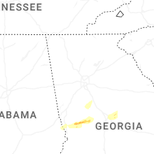


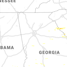


Connect with Interactive Hail Maps