

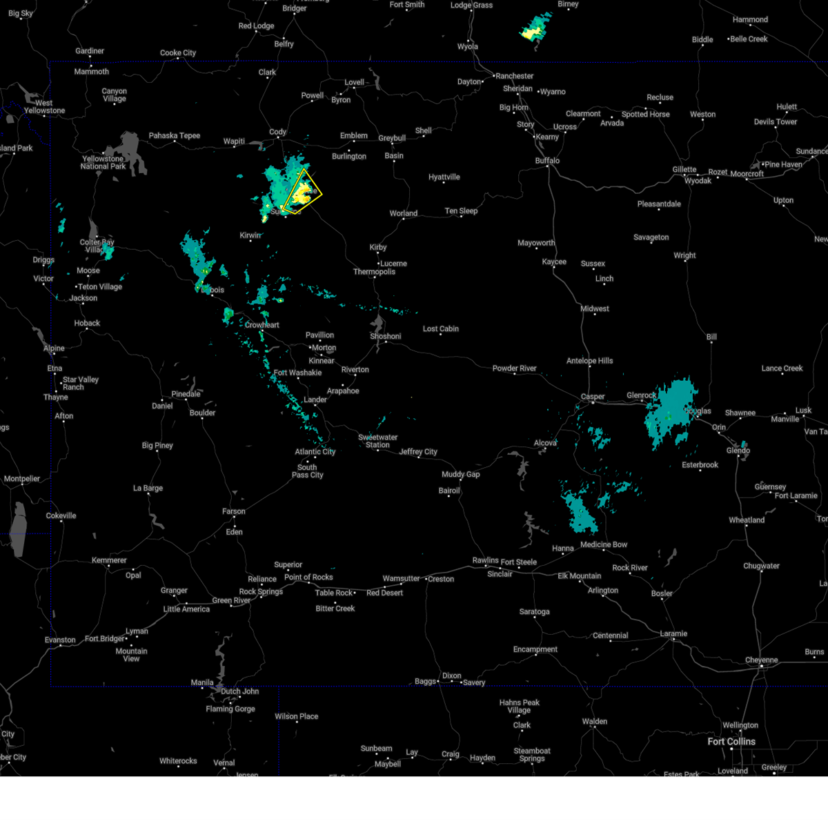
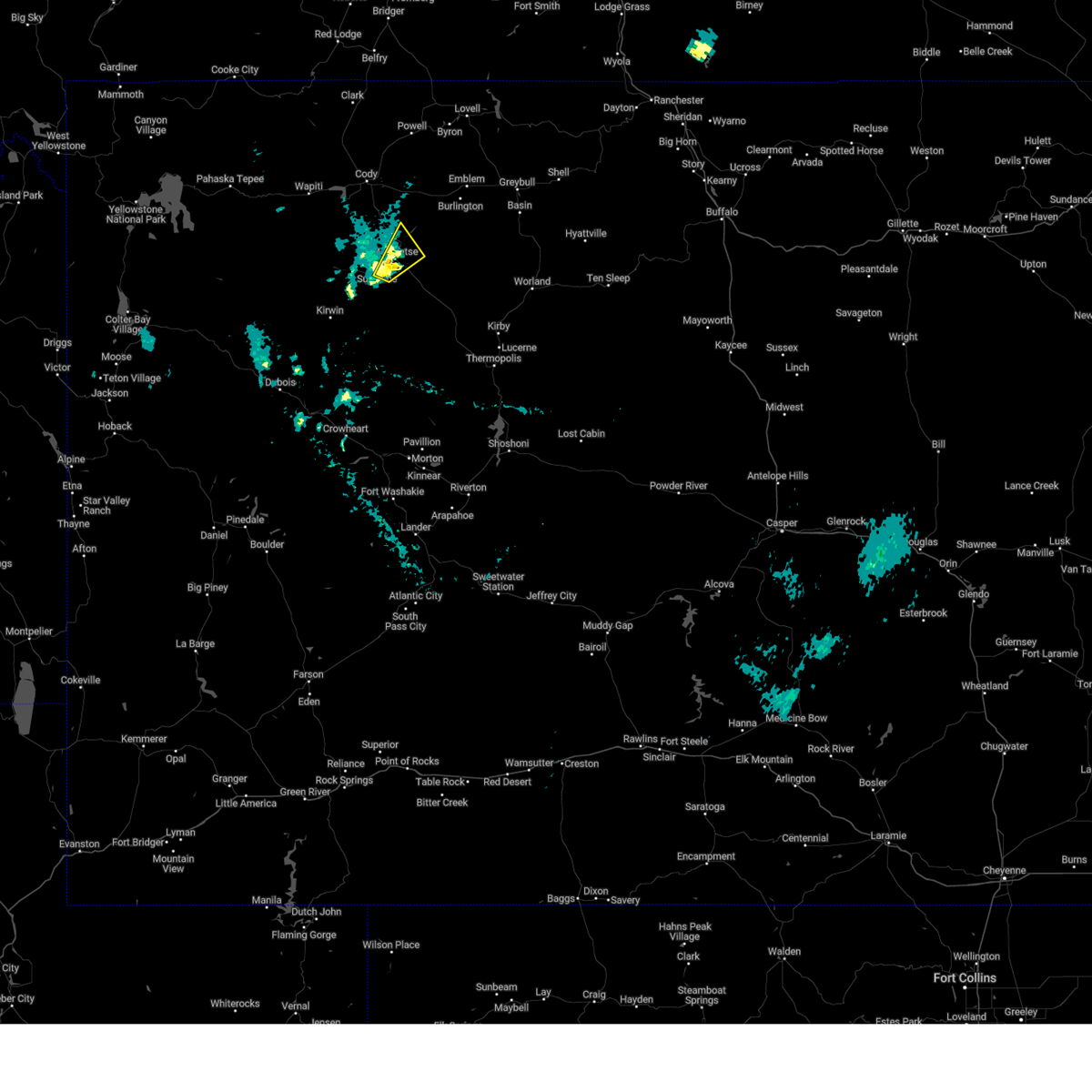
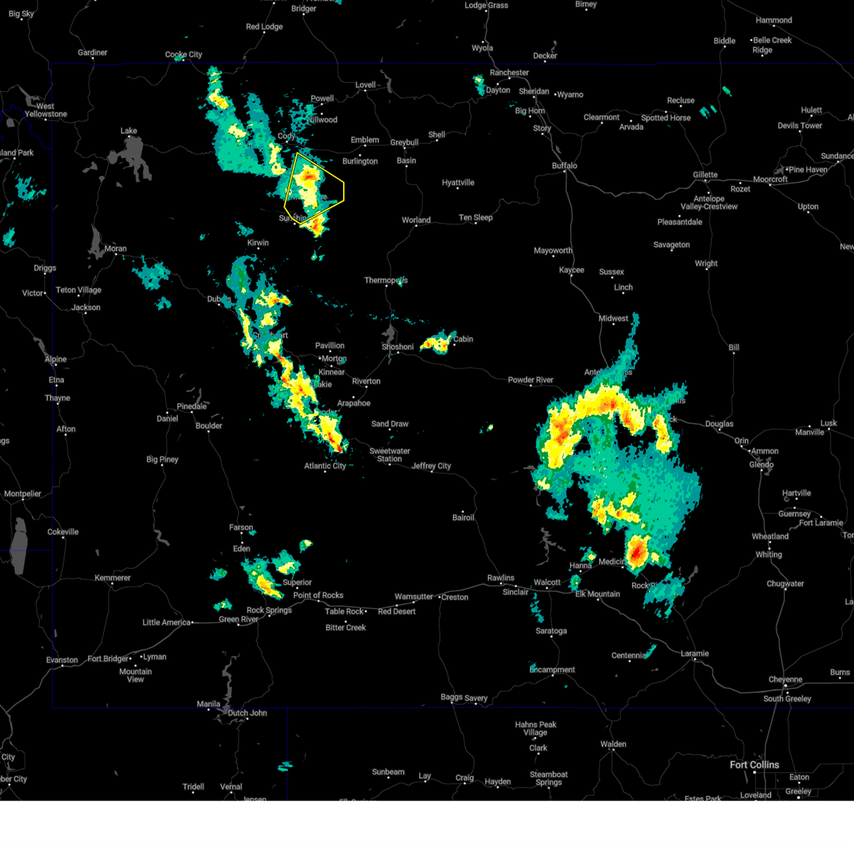
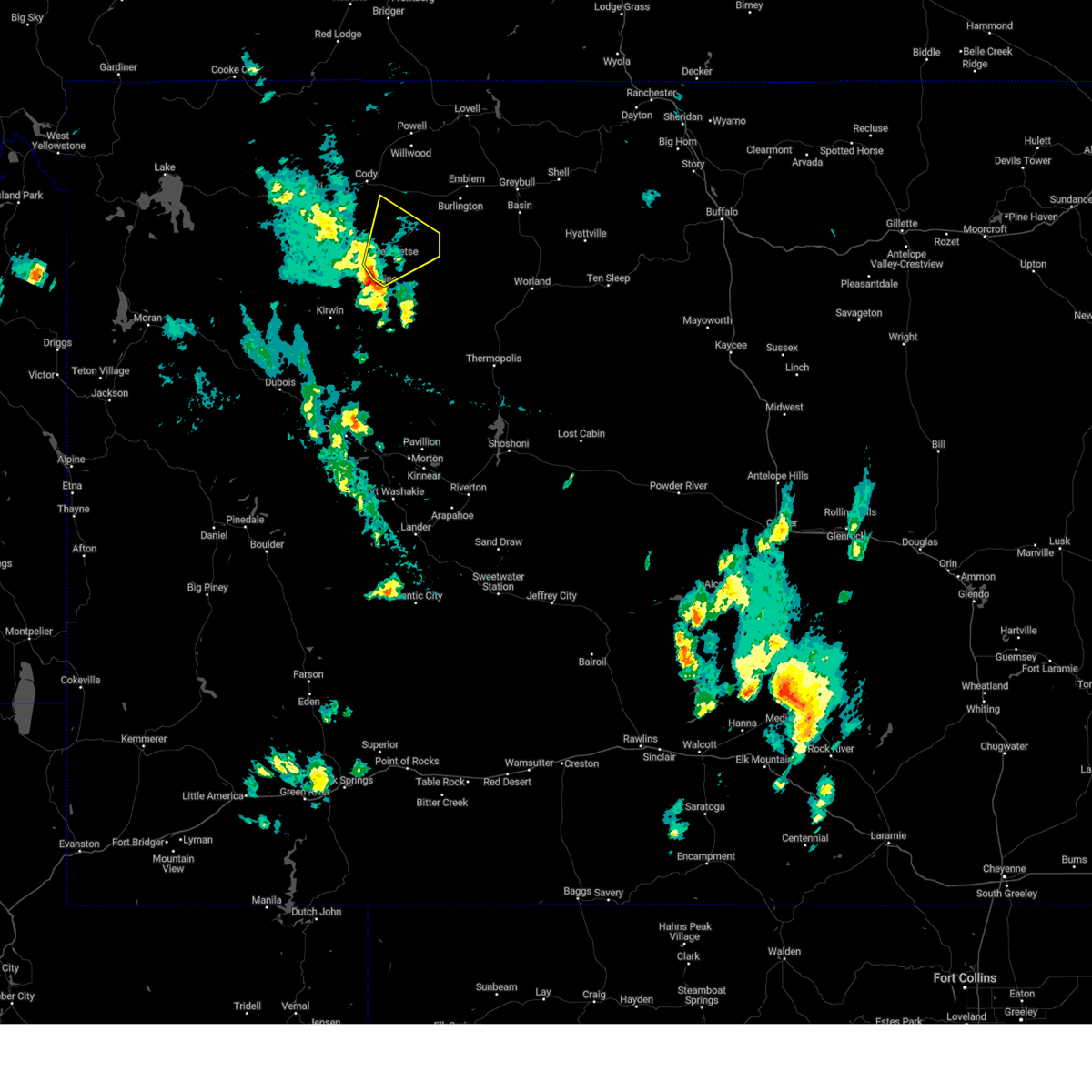
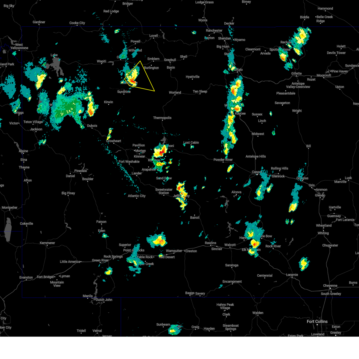
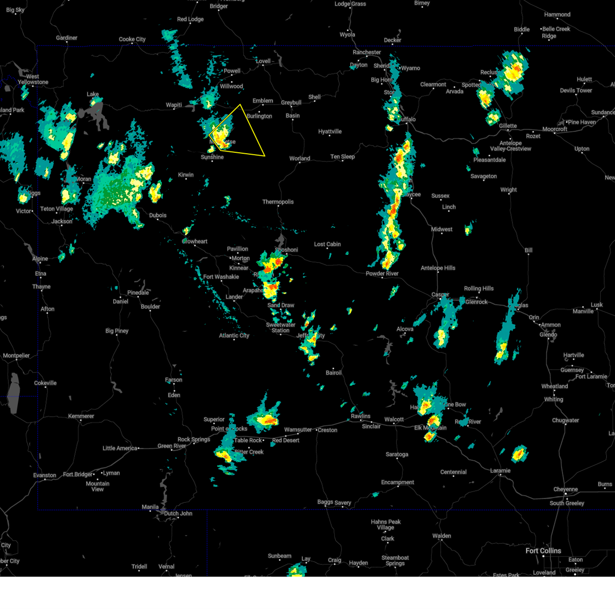
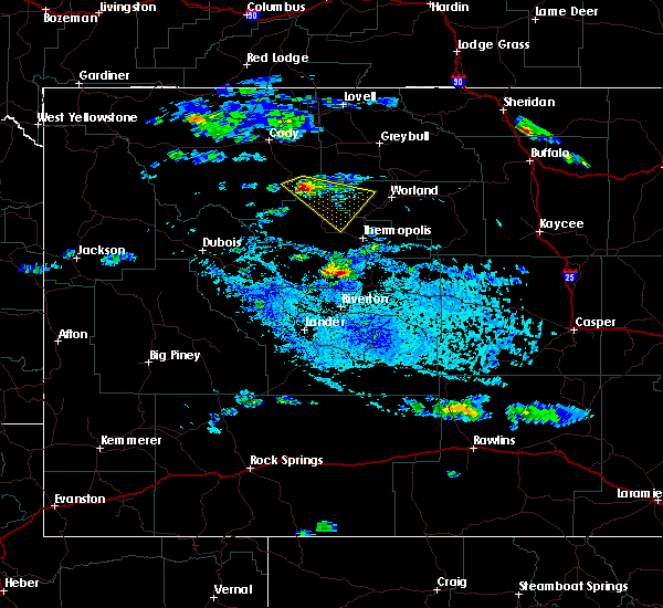
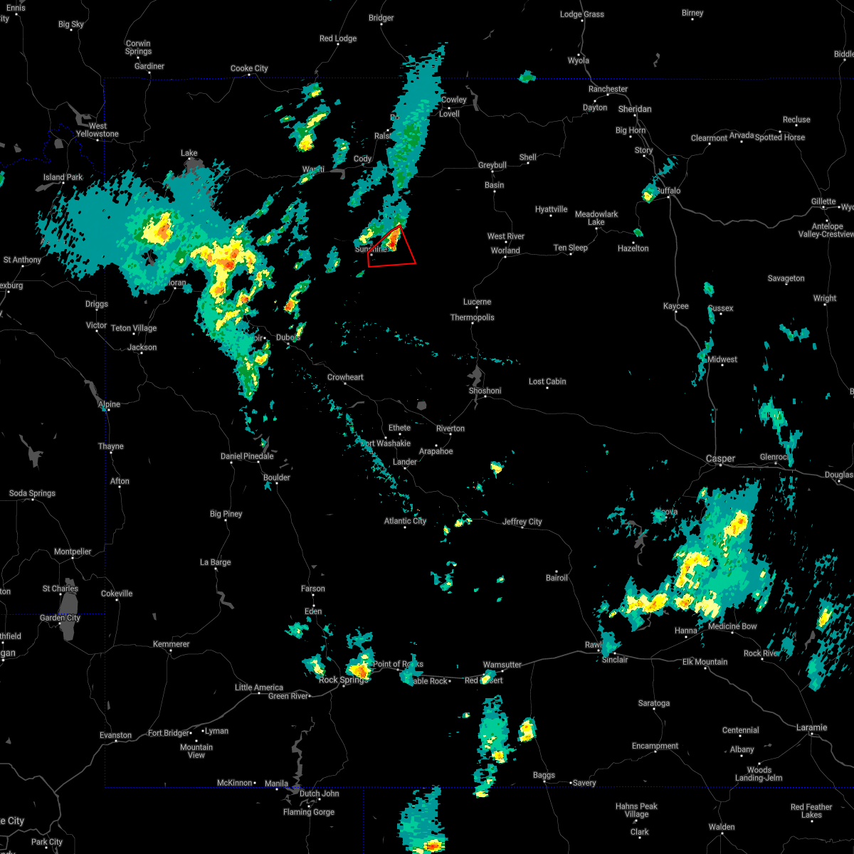
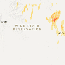
Hail Map for Meeteetse, WY
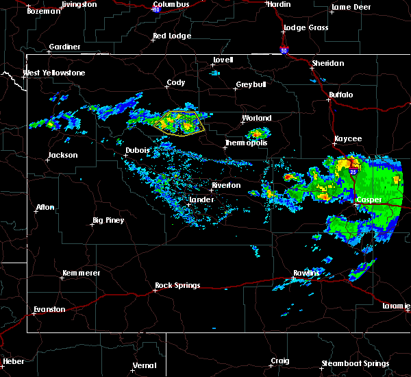
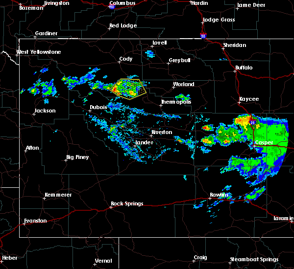
The Meeteetse, WY area has had 6 reports of on-the-ground hail by trained spotters, and has been under severe weather warnings 2 times during the past 12 months. Doppler radar has detected hail at or near Meeteetse, WY on 12 occasions.
| Name: | Meeteetse, WY |
| Where Located: | 81.7 miles NNW of Riverton, WY |
| Map: | Google Map for Meeteetse, WY |
| Population: | 327 |
| Housing Units: | 177 |
| More Info: | Search Google for Meeteetse, WY |
5
The Top Recent Hail Date for Meeteetse, WY is Thursday, May 16, 2019 (1st out of 12)

Hail and Wind Damage Spotted near Meeteetse, WY
| Date / Time | Report Details |
|---|---|
| 4/27/2025 4:05 PM MDT |
 The storm which prompted the warning has weakened below severe limits, and no longer poses an immediate threat to life or property. therefore, the warning will be allowed to expire. however, small hail is still possible with this thunderstorm. The storm which prompted the warning has weakened below severe limits, and no longer poses an immediate threat to life or property. therefore, the warning will be allowed to expire. however, small hail is still possible with this thunderstorm.
|
| 4/27/2025 3:54 PM MDT |
 Svrriw the national weather service in riverton has issued a * severe thunderstorm warning for, east central park county in central wyoming, * until 415 pm mdt. * at 353 pm mdt, a severe thunderstorm was located over meeteetse, moving northeast at 20 mph (public). Hazards include quarter size hail. Damage to vehicles is expected. This severe thunderstorm will remain over mainly rural areas of east central park county. Svrriw the national weather service in riverton has issued a * severe thunderstorm warning for, east central park county in central wyoming, * until 415 pm mdt. * at 353 pm mdt, a severe thunderstorm was located over meeteetse, moving northeast at 20 mph (public). Hazards include quarter size hail. Damage to vehicles is expected. This severe thunderstorm will remain over mainly rural areas of east central park county.
|
| 8/6/2024 3:36 PM MDT | Mesonet station kmtr meeteetse 8 n (wydot in park county WY, 8 miles S of Meeteetse, WY |
| 5/26/2023 2:37 PM MDT |
 The severe thunderstorm warning for east central park county will expire at 245 pm mdt, the storm which prompted the warning has weakened below severe limits, and no longer poses an immediate threat to life or property. therefore, the warning will be allowed to expire. however, small hail and heavy rain are still possible with additional thunderstorms. The severe thunderstorm warning for east central park county will expire at 245 pm mdt, the storm which prompted the warning has weakened below severe limits, and no longer poses an immediate threat to life or property. therefore, the warning will be allowed to expire. however, small hail and heavy rain are still possible with additional thunderstorms.
|
| 5/26/2023 2:08 PM MDT |
 At 207 pm mdt, a severe thunderstorm was located near meeteetse, moving northeast at 35 mph (radar indicated). Hazards include quarter size hail. Damage to vehicles is expected. this severe thunderstorm will be near, meeteetse rim around 225 pm mdt. hail threat, radar indicated max hail size, 1. 00 in wind threat, radar indicated max wind gust, <50 mph. At 207 pm mdt, a severe thunderstorm was located near meeteetse, moving northeast at 35 mph (radar indicated). Hazards include quarter size hail. Damage to vehicles is expected. this severe thunderstorm will be near, meeteetse rim around 225 pm mdt. hail threat, radar indicated max hail size, 1. 00 in wind threat, radar indicated max wind gust, <50 mph.
|
| 5/25/2023 2:38 PM MDT |
 At 238 pm mdt, a severe thunderstorm was located near meeteetse, moving east at 20 mph (trained weather spotters). Hazards include ping pong ball size hail. People and animals outdoors will be injured. expect damage to roofs, siding, windows, and vehicles. locations impacted include, meeteetse and meeteetse rim. hail threat, radar indicated max hail size, 1. 50 in wind threat, radar indicated max wind gust, <50 mph. At 238 pm mdt, a severe thunderstorm was located near meeteetse, moving east at 20 mph (trained weather spotters). Hazards include ping pong ball size hail. People and animals outdoors will be injured. expect damage to roofs, siding, windows, and vehicles. locations impacted include, meeteetse and meeteetse rim. hail threat, radar indicated max hail size, 1. 50 in wind threat, radar indicated max wind gust, <50 mph.
|
| 5/25/2023 2:33 PM MDT | Hen Egg sized hail reported 1.8 miles S of Meeteetse, WY |
| 5/25/2023 2:29 PM MDT |
 At 229 pm mdt, a severe thunderstorm was located over meeteetse, moving east at 20 mph (radar indicated). Hazards include quarter size hail. Damage to vehicles is expected. this severe thunderstorm will remain over mainly rural areas of southwestern big horn, northwestern washakie and east central park counties. hail threat, radar indicated max hail size, 1. 00 in wind threat, radar indicated max wind gust, <50 mph. At 229 pm mdt, a severe thunderstorm was located over meeteetse, moving east at 20 mph (radar indicated). Hazards include quarter size hail. Damage to vehicles is expected. this severe thunderstorm will remain over mainly rural areas of southwestern big horn, northwestern washakie and east central park counties. hail threat, radar indicated max hail size, 1. 00 in wind threat, radar indicated max wind gust, <50 mph.
|
| 5/25/2023 2:25 PM MDT | Golf Ball sized hail reported 0.4 miles SSE of Meeteetse, WY |
| 8/5/2019 3:30 PM MDT |
 At 329 pm mdt, a severe thunderstorm was located 12 miles southeast of meeteetse, moving southeast at 25 mph (radar indicated). Hazards include 60 mph wind gusts and quarter size hail. Hail damage to vehicles is expected. expect wind damage to roofs, siding, and trees. This severe thunderstorm will remain over mainly rural areas of north central hot springs, northwestern washakie and southeastern park counties, including the following locations, badlands overlook and grass creek. At 329 pm mdt, a severe thunderstorm was located 12 miles southeast of meeteetse, moving southeast at 25 mph (radar indicated). Hazards include 60 mph wind gusts and quarter size hail. Hail damage to vehicles is expected. expect wind damage to roofs, siding, and trees. This severe thunderstorm will remain over mainly rural areas of north central hot springs, northwestern washakie and southeastern park counties, including the following locations, badlands overlook and grass creek.
|
| 7/8/2019 1:42 PM MDT |
 The tornado warning for north central hot springs and southeastern park counties will expire at 145 pm mdt, the storm which prompted the warning has weakened below severe limits, and no longer appears capable of producing a tornado. therefore, the warning will be allowed to expire. however hail and gusty winds are still possible with this thunderstorm. a severe thunderstorm watch remains in effect until 900 pm mdt for central wyoming. The tornado warning for north central hot springs and southeastern park counties will expire at 145 pm mdt, the storm which prompted the warning has weakened below severe limits, and no longer appears capable of producing a tornado. therefore, the warning will be allowed to expire. however hail and gusty winds are still possible with this thunderstorm. a severe thunderstorm watch remains in effect until 900 pm mdt for central wyoming.
|
| 7/8/2019 1:29 PM MDT |
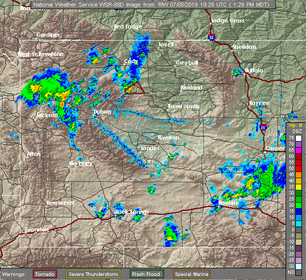 At 129 pm mdt, a severe thunderstorm capable of producing a tornado was located 9 miles south of meeteetse, moving northeast at 10 mph (radar indicated rotation). Hazards include tornado and quarter size hail. Expect damage to mobile homes, roofs, and vehicles. This tornadic thunderstorm will remain over mainly rural areas of north central hot springs and southeastern park counties. At 129 pm mdt, a severe thunderstorm capable of producing a tornado was located 9 miles south of meeteetse, moving northeast at 10 mph (radar indicated rotation). Hazards include tornado and quarter size hail. Expect damage to mobile homes, roofs, and vehicles. This tornadic thunderstorm will remain over mainly rural areas of north central hot springs and southeastern park counties.
|
| 7/8/2019 1:08 PM MDT |
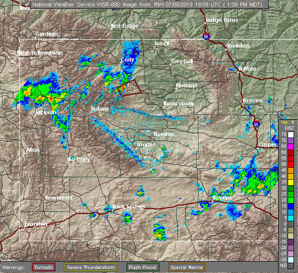 The national weather service in riverton has issued a * tornado warning for. northwestern hot springs county in central wyoming. southeastern park county in central wyoming. until 145 pm mdt. At 107 pm mdt, a severe thunderstorm capable of producing a tornado. The national weather service in riverton has issued a * tornado warning for. northwestern hot springs county in central wyoming. southeastern park county in central wyoming. until 145 pm mdt. At 107 pm mdt, a severe thunderstorm capable of producing a tornado.
|
| 7/5/2018 6:19 PM MDT |
 At 617 pm mdt, a severe thunderstorm was located near gooseberry creek rest area on highway 120, which 14 miles southeast of meeteetse, moving northeast at 20 mph (radar indicated). Hazards include 60 mph wind gusts and quarter size hail. Hail damage to vehicles is expected. expect wind damage to roofs, siding, and trees. Locations impacted include, meeteetse, grass creek and sunshine reservoir. At 617 pm mdt, a severe thunderstorm was located near gooseberry creek rest area on highway 120, which 14 miles southeast of meeteetse, moving northeast at 20 mph (radar indicated). Hazards include 60 mph wind gusts and quarter size hail. Hail damage to vehicles is expected. expect wind damage to roofs, siding, and trees. Locations impacted include, meeteetse, grass creek and sunshine reservoir.
|
| 7/5/2018 6:09 PM MDT |
 At 605 pm mdt, a severe thunderstorm was located 10 miles northwest of legend rock state petroglyph site, which is 17 miles southeast of meeteetse, moving northeast at 10 to 15 mph. another severe thunderstorm was located just south of sunshine reservoir moving slowly northeast at 10 to 15 mph (radar indicated). Hazards include 60 mph wind gusts and quarter size hail. Hail damage to vehicles is expected. expect wind damage to roofs, siding, and trees. Locations impacted include, meeteetse, grass creek and sunshine reservoir. At 605 pm mdt, a severe thunderstorm was located 10 miles northwest of legend rock state petroglyph site, which is 17 miles southeast of meeteetse, moving northeast at 10 to 15 mph. another severe thunderstorm was located just south of sunshine reservoir moving slowly northeast at 10 to 15 mph (radar indicated). Hazards include 60 mph wind gusts and quarter size hail. Hail damage to vehicles is expected. expect wind damage to roofs, siding, and trees. Locations impacted include, meeteetse, grass creek and sunshine reservoir.
|
| 7/5/2018 5:57 PM MDT |
 At 557 pm mdt, a severe thunderstorm was located 10 miles northwest of legend rock state petroglyph site, or 18 miles south of meeteetse, moving northeast at 15 mph (radar indicated). Hazards include 60 mph wind gusts and quarter size hail. Hail damage to vehicles is expected. expect wind damage to roofs, siding, and trees. This severe thunderstorm will remain over mainly rural areas of northwestern hot springs and southeastern park counties, including the following locations, grass creek and sunshine reservoir. At 557 pm mdt, a severe thunderstorm was located 10 miles northwest of legend rock state petroglyph site, or 18 miles south of meeteetse, moving northeast at 15 mph (radar indicated). Hazards include 60 mph wind gusts and quarter size hail. Hail damage to vehicles is expected. expect wind damage to roofs, siding, and trees. This severe thunderstorm will remain over mainly rural areas of northwestern hot springs and southeastern park counties, including the following locations, grass creek and sunshine reservoir.
|
| 6/6/2018 5:03 PM MDT |
 At 503 pm mdt, a severe thunderstorm was located near meeteetse, moving northeast at 15 mph (radar indicated). Hazards include quarter size hail. Damage to vehicles is expected. Locations impacted include, meeteetse. At 503 pm mdt, a severe thunderstorm was located near meeteetse, moving northeast at 15 mph (radar indicated). Hazards include quarter size hail. Damage to vehicles is expected. Locations impacted include, meeteetse.
|
| 6/6/2018 4:48 PM MDT |
 At 448 pm mdt, a severe thunderstorm was located near meeteetse, moving northeast at 15 mph (radar indicated). Hazards include quarter size hail. Damage to vehicles is expected. This severe thunderstorm will remain over mainly rural areas of east central park county. At 448 pm mdt, a severe thunderstorm was located near meeteetse, moving northeast at 15 mph (radar indicated). Hazards include quarter size hail. Damage to vehicles is expected. This severe thunderstorm will remain over mainly rural areas of east central park county.
|
| 6/6/2018 4:34 PM MDT |
 At 432 pm mdt, a severe thunderstorm was located near meeteetse, moving northeast at 25 mph (radar indicated). Hazards include ping pong ball size hail. People and animals outdoors will be injured. expect damage to roofs, siding, windows, and vehicles. Locations impacted include, meeteetse. At 432 pm mdt, a severe thunderstorm was located near meeteetse, moving northeast at 25 mph (radar indicated). Hazards include ping pong ball size hail. People and animals outdoors will be injured. expect damage to roofs, siding, windows, and vehicles. Locations impacted include, meeteetse.
|
| 6/6/2018 4:16 PM MDT |
 At 415 pm mdt, a severe thunderstorm was located near meeteetse, moving northeast at 25 mph (radar indicated). Hazards include half dollar size hail. Damage to vehicles is expected. This severe thunderstorm will remain over mainly rural areas of north central hot springs, northwestern washakie and east central park counties. At 415 pm mdt, a severe thunderstorm was located near meeteetse, moving northeast at 25 mph (radar indicated). Hazards include half dollar size hail. Damage to vehicles is expected. This severe thunderstorm will remain over mainly rural areas of north central hot springs, northwestern washakie and east central park counties.
|
| 6/6/2018 3:50 PM MDT | Quarter sized hail reported 6.6 miles NE of Meeteetse, WY |
| 5/27/2018 6:13 PM MDT |
 At 612 pm mdt, severe thunderstorms were located along a line extending from near bald mountain to near byron to just north of meeteetse rim, moving north at 40 mph (automated weather station). Hazards include 60 to 70 mph wind gusts. Expect considerable tree damage. damage is likely to mobile homes, roofs, and outbuildings. locations impacted include lovell, big horn canyon recreation area, cody, meeteetse rim, garland, and powell. this line of strong wind has a history of producing wind damage to trees and power lines. An automated station along state highway 120 north of meeteetse measured a 66 mph wind gust around 600 pm. At 612 pm mdt, severe thunderstorms were located along a line extending from near bald mountain to near byron to just north of meeteetse rim, moving north at 40 mph (automated weather station). Hazards include 60 to 70 mph wind gusts. Expect considerable tree damage. damage is likely to mobile homes, roofs, and outbuildings. locations impacted include lovell, big horn canyon recreation area, cody, meeteetse rim, garland, and powell. this line of strong wind has a history of producing wind damage to trees and power lines. An automated station along state highway 120 north of meeteetse measured a 66 mph wind gust around 600 pm.
|
| 5/27/2018 6:10 PM MDT | Meeteetse rim wydot sensor measured wind gusts of 66... 70... and 76 mph between 600 pm and 620 pm md in park county WY, 9.4 miles S of Meeteetse, WY |
| 5/27/2018 6:06 PM MDT |
 At 604 pm mdt, severe thunderstorms were located along a line extending from near granite pass in the bighorn mountains to 12 miles south of lovell to near meeteetse, moving north at 40 mph (radar indicated). Hazards include 60 to 70 mph wind gusts. Expect considerable tree damage. damage is likely to mobile homes, roofs, and outbuildings. locations impacted include lovell, big horn canyon recreation area, cody, meeteetse rim, garland, and powell. This line of strong wind has a history of producing wind damage to trees and power lines. At 604 pm mdt, severe thunderstorms were located along a line extending from near granite pass in the bighorn mountains to 12 miles south of lovell to near meeteetse, moving north at 40 mph (radar indicated). Hazards include 60 to 70 mph wind gusts. Expect considerable tree damage. damage is likely to mobile homes, roofs, and outbuildings. locations impacted include lovell, big horn canyon recreation area, cody, meeteetse rim, garland, and powell. This line of strong wind has a history of producing wind damage to trees and power lines.
|
| 5/27/2018 5:43 PM MDT |
 At 541 pm mdt, severe thunderstorms were located along a line extending from near shell falls to emblem to near meeteetse rim, moving north at 40 mph (radar indicated). Hazards include 60 to 70 mph wind gusts. Expect considerable tree damage. damage is likely to mobile homes, roofs, and outbuildings. severe thunderstorms will be near, shell falls and shell canyon around 550 pm mdt. eastern cody and lovell around 615 pm mdt. bighorn lake around 625 pm mdt. Ralston and horseshoe bend around 630 pm mdt. At 541 pm mdt, severe thunderstorms were located along a line extending from near shell falls to emblem to near meeteetse rim, moving north at 40 mph (radar indicated). Hazards include 60 to 70 mph wind gusts. Expect considerable tree damage. damage is likely to mobile homes, roofs, and outbuildings. severe thunderstorms will be near, shell falls and shell canyon around 550 pm mdt. eastern cody and lovell around 615 pm mdt. bighorn lake around 625 pm mdt. Ralston and horseshoe bend around 630 pm mdt.
|
| 5/27/2018 4:56 PM MDT |
 At 455 pm mdt, a severe thunderstorm was located 14 miles east of meeteetse, moving northwest at 35 mph (trained weather spotters). Hazards include 70 mph wind gusts and quarter size hail. Hail damage to vehicles is expected. expect considerable tree damage. wind damage is also likely to mobile homes, roofs, and outbuildings. locations impacted include, meeteetse, gooseberry creek, and state highway 120. An automated sensor reported a wind gust to 64 mph near grass creek around 442 pm mdt. At 455 pm mdt, a severe thunderstorm was located 14 miles east of meeteetse, moving northwest at 35 mph (trained weather spotters). Hazards include 70 mph wind gusts and quarter size hail. Hail damage to vehicles is expected. expect considerable tree damage. wind damage is also likely to mobile homes, roofs, and outbuildings. locations impacted include, meeteetse, gooseberry creek, and state highway 120. An automated sensor reported a wind gust to 64 mph near grass creek around 442 pm mdt.
|
| 5/27/2018 4:38 PM MDT |
 At 437 pm mdt, a severe thunderstorm was located 14 miles northeast of legend rock state petroglyph site, which is 23 miles southeast of meeteetse, moving northwest at 35 mph (radar indicated). Hazards include 60 to 70 mph wind gusts and quarter size hail. Hail damage to vehicles is expected. expect considerable tree damage. wind damage is also likely to mobile homes, roofs, and outbuildings. This severe thunderstorm will impact state highway 120, gooseberry creek rest area, and meeteetse. At 437 pm mdt, a severe thunderstorm was located 14 miles northeast of legend rock state petroglyph site, which is 23 miles southeast of meeteetse, moving northwest at 35 mph (radar indicated). Hazards include 60 to 70 mph wind gusts and quarter size hail. Hail damage to vehicles is expected. expect considerable tree damage. wind damage is also likely to mobile homes, roofs, and outbuildings. This severe thunderstorm will impact state highway 120, gooseberry creek rest area, and meeteetse.
|
| 6/27/2017 7:55 AM MDT |
 The severe thunderstorm warning for hot springs, southwestern big horn, northwestern washakie and southeastern park counties will expire at 200 pm mdt, the storms which prompted the warning have weakened below severe limits, and no longer pose an immediate threat to life or property. therefore the warning will be allowed to expire. however strong winds gusts of 50 to 55 mph are still expected with these thunderstorms. The severe thunderstorm warning for hot springs, southwestern big horn, northwestern washakie and southeastern park counties will expire at 200 pm mdt, the storms which prompted the warning have weakened below severe limits, and no longer pose an immediate threat to life or property. therefore the warning will be allowed to expire. however strong winds gusts of 50 to 55 mph are still expected with these thunderstorms.
|
| 6/27/2017 7:33 AM MDT |
 At 131 pm mdt, severe thunderstorms were located along a line extending from 12 miles south of garland to near hamilton dome, moving east at 40 mph (radar indicated). Hazards include 60 mph wind gusts and half inch size hail. Expect damage to roofs, siding, and trees. these severe storms will be near, hamilton dome and legend rock state petroglyph site around 135 pm mdt. Thermopolis, lucerne, east thermopolis and hot springs state park around 200 pm mdt. At 131 pm mdt, severe thunderstorms were located along a line extending from 12 miles south of garland to near hamilton dome, moving east at 40 mph (radar indicated). Hazards include 60 mph wind gusts and half inch size hail. Expect damage to roofs, siding, and trees. these severe storms will be near, hamilton dome and legend rock state petroglyph site around 135 pm mdt. Thermopolis, lucerne, east thermopolis and hot springs state park around 200 pm mdt.
|
| 6/27/2017 7:19 AM MDT |
 At 118 pm mdt, severe thunderstorms were located along a line extending from 6 miles southeast of ralston to near anchor dam, moving east at 30 mph (radar indicated). Hazards include 60 mph wind gusts. Expect damage to roofs, siding, and trees. severe thunderstorms will be near, legend rock state petroglyph site around 135 pm mdt. Hamilton dome around 140 pm mdt. At 118 pm mdt, severe thunderstorms were located along a line extending from 6 miles southeast of ralston to near anchor dam, moving east at 30 mph (radar indicated). Hazards include 60 mph wind gusts. Expect damage to roofs, siding, and trees. severe thunderstorms will be near, legend rock state petroglyph site around 135 pm mdt. Hamilton dome around 140 pm mdt.
|
| 7/3/2015 5:39 PM MDT | Quarter sized hail reported 13.3 miles SSW of Meeteetse, WY |
| 6/30/2015 2:35 PM MDT |
 At 234 pm mdt, a severe thunderstorm was located 14 miles northwest of winchester, which is 17 miles west of worland, moving southeast at 35 mph (radar indicated). Hazards include 60 mph wind gusts and nickel size hail. Expect damage to roofs. siding and trees. locations impacted include, meeteetse, winchester, gooseberry creek, worland number 21 natural gas processing plant, little buffalo basin natural gas processing plant, park county school 16, meeteetse branch library and badlands overlook. At 234 pm mdt, a severe thunderstorm was located 14 miles northwest of winchester, which is 17 miles west of worland, moving southeast at 35 mph (radar indicated). Hazards include 60 mph wind gusts and nickel size hail. Expect damage to roofs. siding and trees. locations impacted include, meeteetse, winchester, gooseberry creek, worland number 21 natural gas processing plant, little buffalo basin natural gas processing plant, park county school 16, meeteetse branch library and badlands overlook.
|
| 6/30/2015 2:22 PM MDT |
 At 222 pm mdt, a severe thunderstorm was located 12 miles northeast of gooseberry creek, which is 21 miles east of meeteetse, moving southeast at 35 mph (radar indicated). Hazards include 60 mph wind gusts and nickel size hail. Expect damage to roofs. siding and trees. this severe thunderstorm will remain over mainly rural areas of north central hot springs, east central park and northwestern washakie counties, including the following locations, little buffalo basin natural gas processing plant, worland number 21 natural gas processing plant, meeteetse branch library, badlands overlook and park county school 16. At 222 pm mdt, a severe thunderstorm was located 12 miles northeast of gooseberry creek, which is 21 miles east of meeteetse, moving southeast at 35 mph (radar indicated). Hazards include 60 mph wind gusts and nickel size hail. Expect damage to roofs. siding and trees. this severe thunderstorm will remain over mainly rural areas of north central hot springs, east central park and northwestern washakie counties, including the following locations, little buffalo basin natural gas processing plant, worland number 21 natural gas processing plant, meeteetse branch library, badlands overlook and park county school 16.
|
| 6/30/2015 2:06 PM MDT |
 At 206 pm mdt, a severe thunderstorm was located 11 miles north of gooseberry creek, which is 11 miles east of meeteetse, moving southeast at 35 mph (radar indicated). Hazards include 60 mph wind gusts and penny size hail. Expect damage to roofs. siding and trees. This severe thunderstorm will remain over mainly rural areas of north central hot springs, east central park and northwestern washakie counties, including the following locations, little buffalo basin natural gas processing plant, worland number 21 natural gas processing plant, meeteetse branch library, badlands overlook and park county school 16. At 206 pm mdt, a severe thunderstorm was located 11 miles north of gooseberry creek, which is 11 miles east of meeteetse, moving southeast at 35 mph (radar indicated). Hazards include 60 mph wind gusts and penny size hail. Expect damage to roofs. siding and trees. This severe thunderstorm will remain over mainly rural areas of north central hot springs, east central park and northwestern washakie counties, including the following locations, little buffalo basin natural gas processing plant, worland number 21 natural gas processing plant, meeteetse branch library, badlands overlook and park county school 16.
|
| 6/5/2015 7:37 PM MDT | At 735 pm mdt, a severe thunderstorm was located near meeteetse, moving northeast at 10 mph (public). Hazards include 60 mph wind gusts and quarter size hail. Hail damage to vehicles is expected. expect wind damage to roofs, siding and trees. this severe storm will be near, meeteetse around 745 pm mdt. one inch hail has already been reported with this storm just southwest of meeteetse. |
| 6/5/2015 7:24 PM MDT | Quarter sized hail reported 6.6 miles NE of Meeteetse, WY |
| 6/5/2015 7:20 PM MDT | At 719 pm mdt, a severe thunderstorm was located near meeteetse, moving northeast at 10 mph (radar indicated). Hazards include 60 mph wind gusts and quarter size hail. Hail damage to vehicles is expected. expect wind damage to roofs, siding and trees. This severe thunderstorm will be near, meeteetse around 750 pm mdt. |
| 6/13/2013 10:15 PM MDT | Quarter sized hail reported 0.4 miles SSE of Meeteetse, WY |
| 9/10/2012 10:10 AM MDT | Reported at wydot station kmtr in park county WY, 8 miles S of Meeteetse, WY |
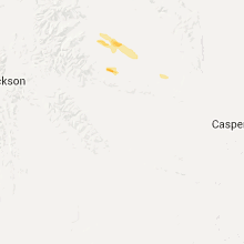
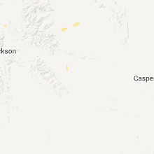
Hail Maps for Meeteetse, WY


Connect with Interactive Hail Maps