

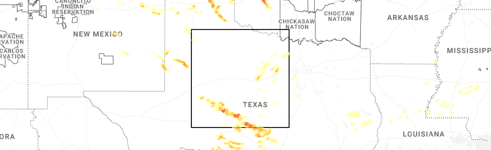
Hail Map for Menard, TX
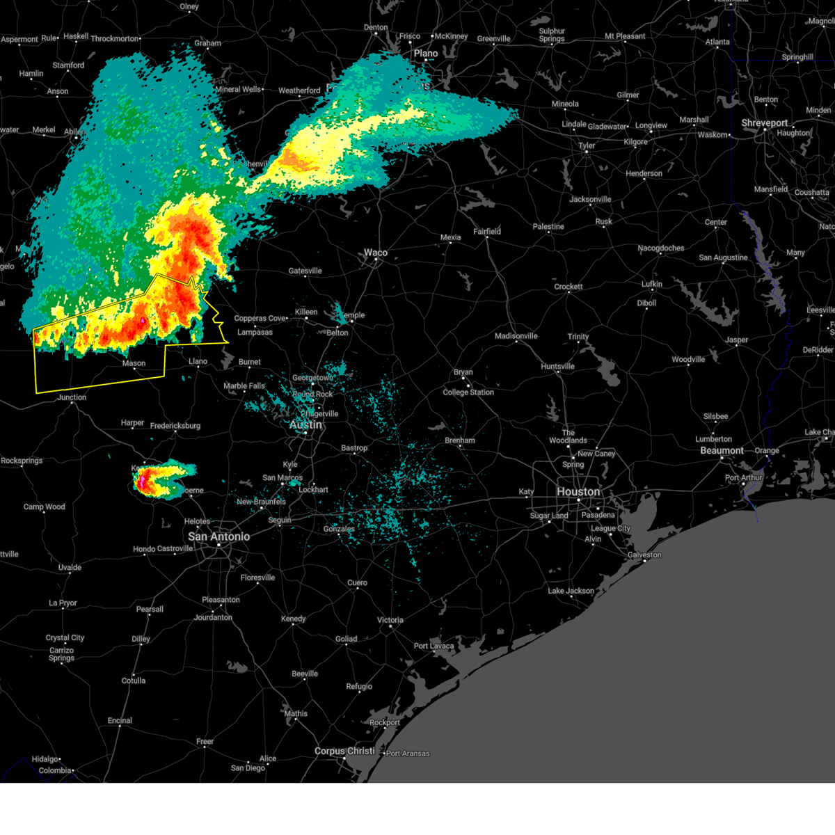
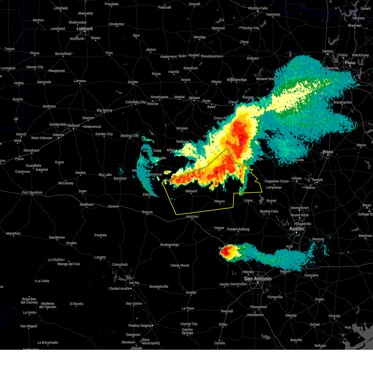
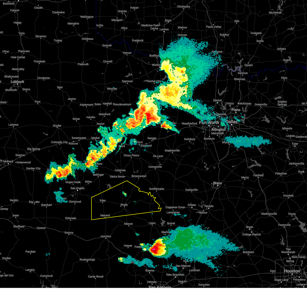
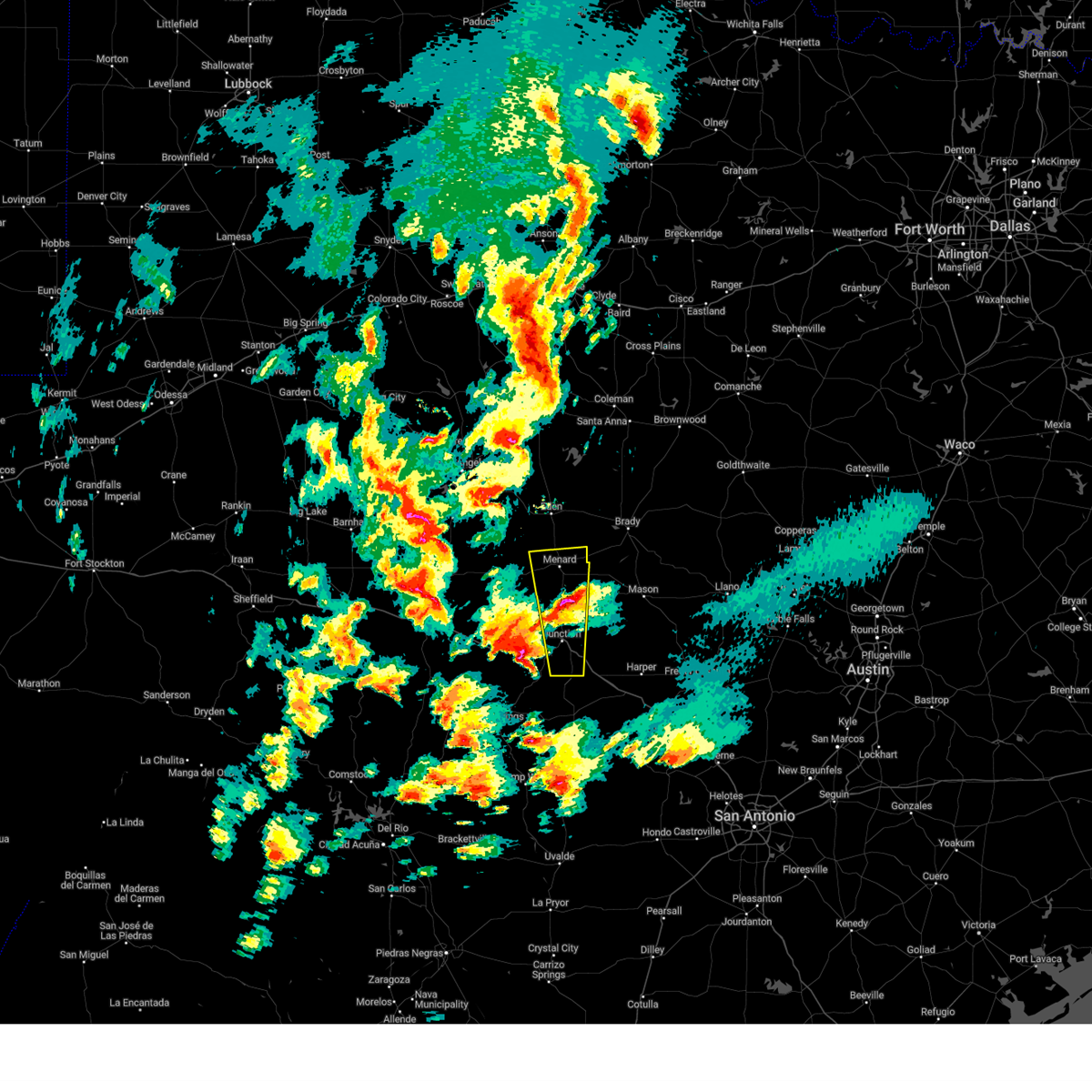
The Menard, TX area has had 53 reports of on-the-ground hail by trained spotters, and has been under severe weather warnings 18 times during the past 12 months. Doppler radar has detected hail at or near Menard, TX on 84 occasions, including 4 occasions during the past year.
| Name: | Menard, TX |
| Where Located: | 105.4 miles S of Abilene, TX |
| Map: | Google Map for Menard, TX |
| Population: | 1471 |
| Housing Units: | 828 |
| More Info: | Search Google for Menard, TX |
0
The Top Recent Hail Date for Menard, TX is Monday, May 26, 2025 (52nd out of 84)
Hail and Wind Damage Spotted near Menard, TX
| Date / Time | Report Details |
|---|---|
| 5/26/2025 4:42 PM CDT |
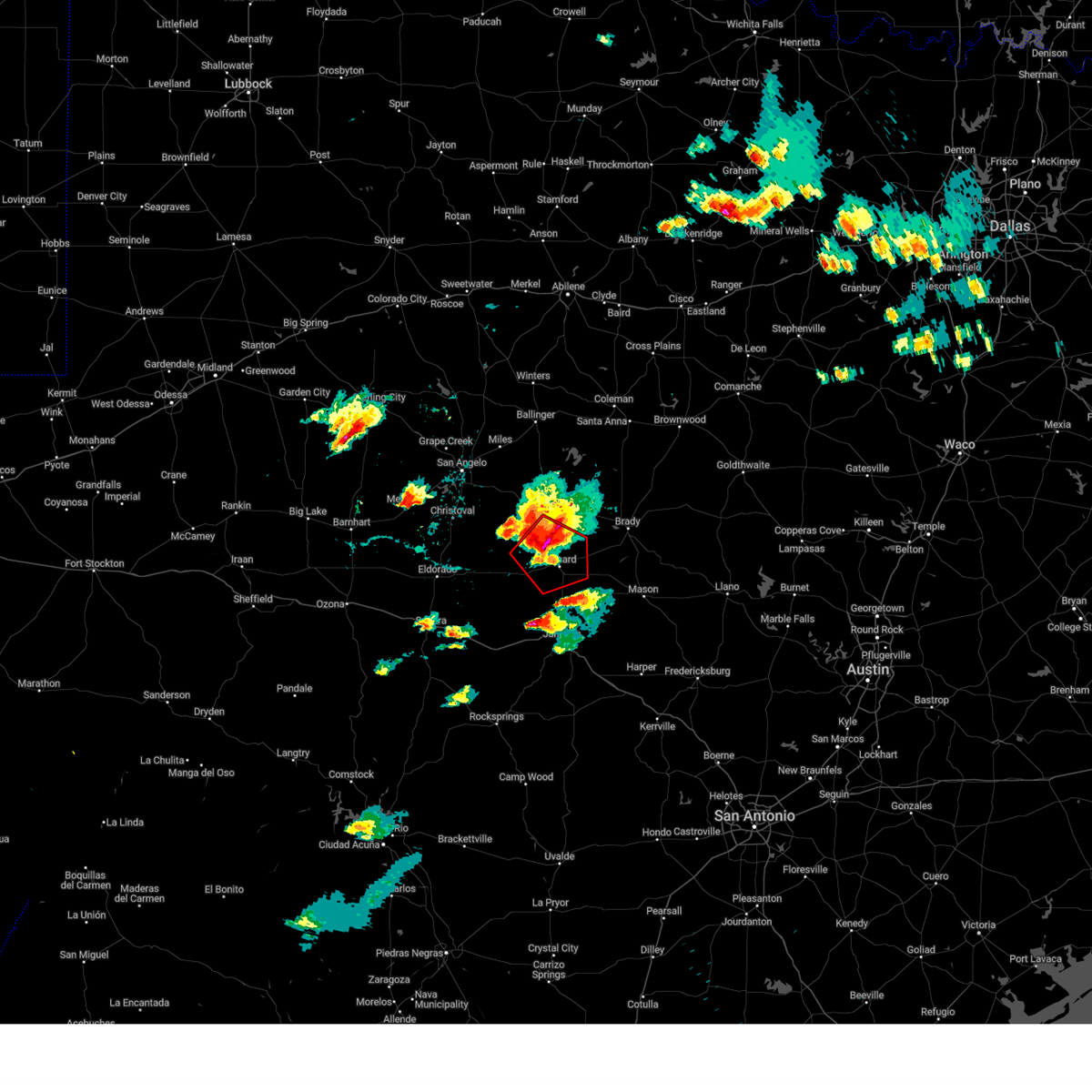
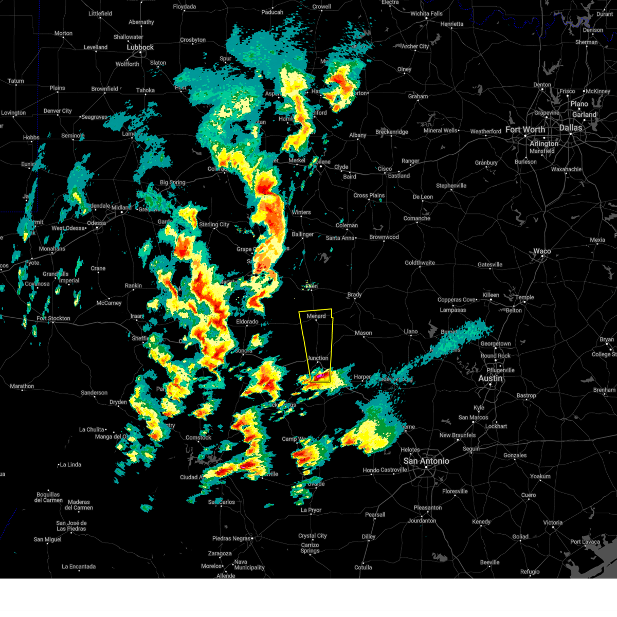
 At 441 pm cdt, a severe thunderstorm capable of producing a new tornadic circulation was located near saline, moving east at 20 mph (radar indicated rotation). Hazards include tornado and baseball size hail. Flying debris will be dangerous to those caught without shelter. mobile homes will be damaged or destroyed. damage to roofs, windows, and vehicles will occur. tree damage is likely. this dangerous storm will be near, saline around 445 pm cdt. Other locations impacted by this tornadic thunderstorm include the intersection of us-83 and ranch road 1773, cleo, us- 377 near the kimble-menard county line, the intersection of us- 83 and highway 29, and us-83 near the kimble-menard county line. At 441 pm cdt, a severe thunderstorm capable of producing a new tornadic circulation was located near saline, moving east at 20 mph (radar indicated rotation). Hazards include tornado and baseball size hail. Flying debris will be dangerous to those caught without shelter. mobile homes will be damaged or destroyed. damage to roofs, windows, and vehicles will occur. tree damage is likely. this dangerous storm will be near, saline around 445 pm cdt. Other locations impacted by this tornadic thunderstorm include the intersection of us-83 and ranch road 1773, cleo, us- 377 near the kimble-menard county line, the intersection of us- 83 and highway 29, and us-83 near the kimble-menard county line.
|
| 5/26/2025 4:26 PM CDT |
 Torsjt the national weather service in san angelo has issued a * tornado warning for, north central kimble county in west central texas, southern menard county in west central texas, * until 515 pm cdt. * at 425 pm cdt, a severe thunderstorm capable of producing a tornado was located near the intersection of us-83 and ranch road 1773, or southwest of menard, moving southeast at 20 mph (radar indicated rotation). Hazards include tornado and baseball size hail. Flying debris will be dangerous to those caught without shelter. mobile homes will be damaged or destroyed. damage to roofs, windows, and vehicles will occur. tree damage is likely. this dangerous storm will be near, london around 445 pm cdt. saline around 450 pm cdt. Other locations impacted by this tornadic thunderstorm include the intersection of us-83 and ranch road 1773, cleo, us- 377 near the kimble-menard county line, the intersection of us- 83 and highway 29, and us-83 near the kimble-menard county line. Torsjt the national weather service in san angelo has issued a * tornado warning for, north central kimble county in west central texas, southern menard county in west central texas, * until 515 pm cdt. * at 425 pm cdt, a severe thunderstorm capable of producing a tornado was located near the intersection of us-83 and ranch road 1773, or southwest of menard, moving southeast at 20 mph (radar indicated rotation). Hazards include tornado and baseball size hail. Flying debris will be dangerous to those caught without shelter. mobile homes will be damaged or destroyed. damage to roofs, windows, and vehicles will occur. tree damage is likely. this dangerous storm will be near, london around 445 pm cdt. saline around 450 pm cdt. Other locations impacted by this tornadic thunderstorm include the intersection of us-83 and ranch road 1773, cleo, us- 377 near the kimble-menard county line, the intersection of us- 83 and highway 29, and us-83 near the kimble-menard county line.
|
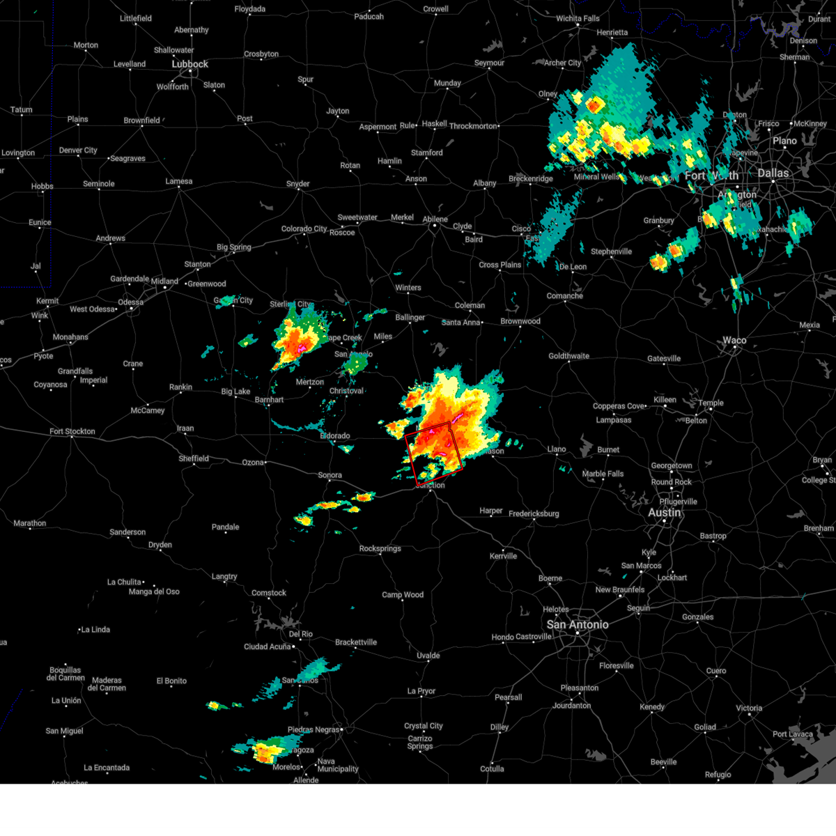
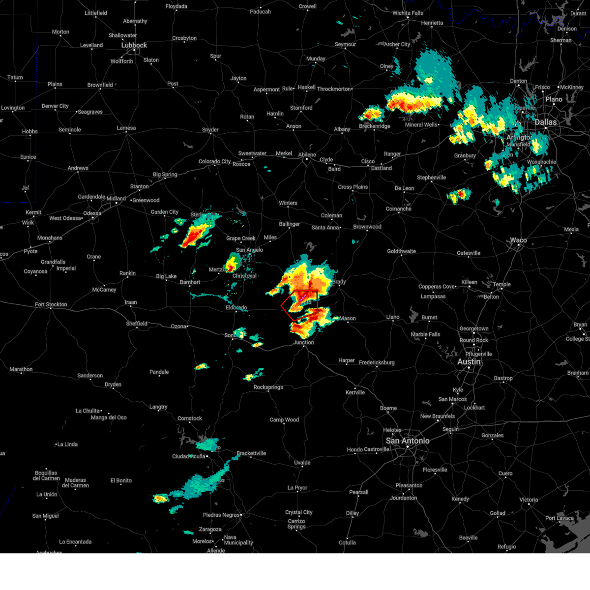
| 5/26/2025 4:23 PM CDT | Softball sized hail reported 1.2 miles SE of Menard, TX, a storm chaser posted pictures on social media and indicated that they measured hail stones between 5.51 to 5.90 inches. |
| 5/26/2025 4:18 PM CDT |
 At 418 pm cdt, a confirmed tornado was located just west of menard, moving south at 20 mph (weather spotters confirmed tornado). Hazards include damaging tornado and baseball size hail. Flying debris will be dangerous to those caught without shelter. mobile homes will be damaged or destroyed. damage to roofs, windows, and vehicles will occur. tree damage is likely. This tornadic thunderstorm will remain over mainly rural areas of central menard county, including the following locations, the intersection of us-83 and highway 29. At 418 pm cdt, a confirmed tornado was located just west of menard, moving south at 20 mph (weather spotters confirmed tornado). Hazards include damaging tornado and baseball size hail. Flying debris will be dangerous to those caught without shelter. mobile homes will be damaged or destroyed. damage to roofs, windows, and vehicles will occur. tree damage is likely. This tornadic thunderstorm will remain over mainly rural areas of central menard county, including the following locations, the intersection of us-83 and highway 29.
|
| 5/26/2025 4:15 PM CDT | Tea Cup sized hail reported 2.3 miles ESE of Menard, TX, report from mping: baseball+ (3.25 in.). |
| 5/26/2025 4:12 PM CDT | Storm damage reported in menard county TX, 1.7 miles ESE of Menard, TX |
| 5/26/2025 4:11 PM CDT |
 the tornado warning has been cancelled and is no longer in effect the tornado warning has been cancelled and is no longer in effect
|
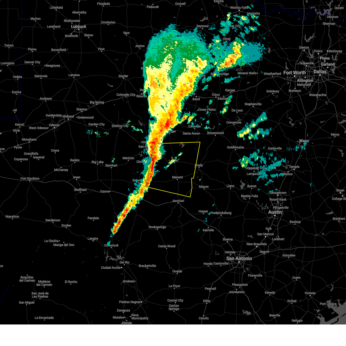
| 5/26/2025 4:11 PM CDT |
 At 410 pm cdt, a severe thunderstorm capable of producing a tornado was located just northwest of menard, moving southeast at 30 mph (radar indicated rotation). Hazards include tornado and baseball size hail. Flying debris will be dangerous to those caught without shelter. mobile homes will be damaged or destroyed. damage to roofs, windows, and vehicles will occur. tree damage is likely. this dangerous storm will be near, menard around 415 pm cdt. Other locations impacted by this tornadic thunderstorm include the intersection of us-83 and highway 29. At 410 pm cdt, a severe thunderstorm capable of producing a tornado was located just northwest of menard, moving southeast at 30 mph (radar indicated rotation). Hazards include tornado and baseball size hail. Flying debris will be dangerous to those caught without shelter. mobile homes will be damaged or destroyed. damage to roofs, windows, and vehicles will occur. tree damage is likely. this dangerous storm will be near, menard around 415 pm cdt. Other locations impacted by this tornadic thunderstorm include the intersection of us-83 and highway 29.
|
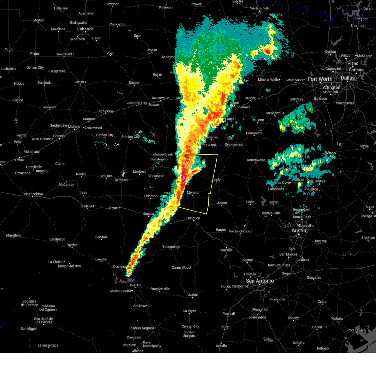
| 5/26/2025 3:59 PM CDT |
 Torsjt the national weather service in san angelo has issued a * tornado warning for, central menard county in west central texas, south central concho county in west central texas, * until 445 pm cdt. * at 358 pm cdt, a severe thunderstorm capable of producing a tornado was located just northwest of menard, moving southeast at 25 mph (radar indicated rotation). Hazards include tornado and baseball size hail. Flying debris will be dangerous to those caught without shelter. mobile homes will be damaged or destroyed. damage to roofs, windows, and vehicles will occur. tree damage is likely. this dangerous storm will be near, menard around 405 pm cdt. Other locations impacted by this tornadic thunderstorm include us- 83 near the menard-concho county line, the intersection of us- 83 and highway 29, and live oak. Torsjt the national weather service in san angelo has issued a * tornado warning for, central menard county in west central texas, south central concho county in west central texas, * until 445 pm cdt. * at 358 pm cdt, a severe thunderstorm capable of producing a tornado was located just northwest of menard, moving southeast at 25 mph (radar indicated rotation). Hazards include tornado and baseball size hail. Flying debris will be dangerous to those caught without shelter. mobile homes will be damaged or destroyed. damage to roofs, windows, and vehicles will occur. tree damage is likely. this dangerous storm will be near, menard around 405 pm cdt. Other locations impacted by this tornadic thunderstorm include us- 83 near the menard-concho county line, the intersection of us- 83 and highway 29, and live oak.
|
| 5/22/2025 11:43 PM CDT |
 Svrsjt the national weather service in san angelo has issued a * severe thunderstorm warning for, kimble county in west central texas, southern menard county in west central texas, mason county in west central texas, san saba county in west central texas, * until 1230 am cdt. * at 1140 pm cdt, severe thunderstorms were located along a line extending from near bend to valley spring to near cleo, moving southeast at 35 mph (radar indicated). Hazards include 60 mph wind gusts and quarter size hail. Hail damage to vehicles is expected. expect wind damage to roofs, siding, and trees. severe thunderstorms will be near, junction, mason, yates crossing, art, hilda, hedwigs hill, loyal valley, segovia, london, and colorado bend state park around 1145 pm cdt. other locations impacted by these severe thunderstorms include the intersection of us-83 and ranch road 1773, erna, us- 377 near the kimble-edwards county line, us-377 near the kimble- menard county line, the intersection of highway 29 and ranch road 1222, harkeyville, cleo, us-83 near the kimble- menard county line, us-87 near the mason- gillespie county line, and spring creek. This includes interstate 10 between mile markers 445 and 477. Svrsjt the national weather service in san angelo has issued a * severe thunderstorm warning for, kimble county in west central texas, southern menard county in west central texas, mason county in west central texas, san saba county in west central texas, * until 1230 am cdt. * at 1140 pm cdt, severe thunderstorms were located along a line extending from near bend to valley spring to near cleo, moving southeast at 35 mph (radar indicated). Hazards include 60 mph wind gusts and quarter size hail. Hail damage to vehicles is expected. expect wind damage to roofs, siding, and trees. severe thunderstorms will be near, junction, mason, yates crossing, art, hilda, hedwigs hill, loyal valley, segovia, london, and colorado bend state park around 1145 pm cdt. other locations impacted by these severe thunderstorms include the intersection of us-83 and ranch road 1773, erna, us- 377 near the kimble-edwards county line, us-377 near the kimble- menard county line, the intersection of highway 29 and ranch road 1222, harkeyville, cleo, us-83 near the kimble- menard county line, us-87 near the mason- gillespie county line, and spring creek. This includes interstate 10 between mile markers 445 and 477.
|
| 5/22/2025 11:33 PM CDT |
 the severe thunderstorm warning has been cancelled and is no longer in effect the severe thunderstorm warning has been cancelled and is no longer in effect
|
| 5/22/2025 11:33 PM CDT |
 At 1132 pm cdt, severe thunderstorms were located along a line extending from 6 miles north of cherokee to 6 miles northeast of art to near long mountain to 9 miles northwest of cleo, moving southeast at 30 mph (radar indicated). Hazards include 60 mph wind gusts and quarter size hail. Hail damage to vehicles is expected. expect wind damage to roofs, siding, and trees. these severe storms will be near, mason, cherokee, saline, art, streeter, london, chappel, and colorado bend state park around 1140 pm cdt. Other locations impacted by these severe thunderstorms include the intersection of us- 83 and ranch road 1773, erna, the intersection of us- 190 and ranch road 1311, us-377 near the kimble- menard county line, the intersection of highway 29 and ranch road 1222, harkeyville, us-190 near the menard- mcculloch county line, cleo, us-83 near the kimble- menard county line, and spring creek. At 1132 pm cdt, severe thunderstorms were located along a line extending from 6 miles north of cherokee to 6 miles northeast of art to near long mountain to 9 miles northwest of cleo, moving southeast at 30 mph (radar indicated). Hazards include 60 mph wind gusts and quarter size hail. Hail damage to vehicles is expected. expect wind damage to roofs, siding, and trees. these severe storms will be near, mason, cherokee, saline, art, streeter, london, chappel, and colorado bend state park around 1140 pm cdt. Other locations impacted by these severe thunderstorms include the intersection of us- 83 and ranch road 1773, erna, the intersection of us- 190 and ranch road 1311, us-377 near the kimble- menard county line, the intersection of highway 29 and ranch road 1222, harkeyville, us-190 near the menard- mcculloch county line, cleo, us-83 near the kimble- menard county line, and spring creek.
|
| 5/22/2025 11:11 PM CDT |
 At 1109 pm cdt, severe thunderstorms were located along a line extending from near harkeyville to fredonia to hext to fort mckavett, moving southeast at 30 mph (radar indicated). Hazards include 60 mph wind gusts and quarter size hail. Hail damage to vehicles is expected. expect wind damage to roofs, siding, and trees. these severe storms will be near, san saba, mason, cherokee, saline, long mountain, grit, art, streeter, london, and pontotoc around 1115 pm cdt. chappel around 1125 pm cdt. colorado bend state park around 1130 pm cdt. Other locations impacted by these severe thunderstorms include the intersection of us- 83 and ranch road 1773, erna, locker, the intersection of us- 190 and ranch road 1311, camp sol mayer, us-83 near the menard- concho county line, us-377 near the kimble- menard county line, the intersection of highway 29 and ranch road 1222, harkeyville, and us-190 near the menard-mcculloch county line. At 1109 pm cdt, severe thunderstorms were located along a line extending from near harkeyville to fredonia to hext to fort mckavett, moving southeast at 30 mph (radar indicated). Hazards include 60 mph wind gusts and quarter size hail. Hail damage to vehicles is expected. expect wind damage to roofs, siding, and trees. these severe storms will be near, san saba, mason, cherokee, saline, long mountain, grit, art, streeter, london, and pontotoc around 1115 pm cdt. chappel around 1125 pm cdt. colorado bend state park around 1130 pm cdt. Other locations impacted by these severe thunderstorms include the intersection of us- 83 and ranch road 1773, erna, locker, the intersection of us- 190 and ranch road 1311, camp sol mayer, us-83 near the menard- concho county line, us-377 near the kimble- menard county line, the intersection of highway 29 and ranch road 1222, harkeyville, and us-190 near the menard-mcculloch county line.
|
| 5/22/2025 11:11 PM CDT |
 the severe thunderstorm warning has been cancelled and is no longer in effect the severe thunderstorm warning has been cancelled and is no longer in effect
|
| 5/22/2025 10:45 PM CDT |
 Svrsjt the national weather service in san angelo has issued a * severe thunderstorm warning for, eastern schleicher county in west central texas, northwestern kimble county in west central texas, southwestern brown county in west central texas, southeastern coleman county in west central texas, mcculloch county in west central texas, southeastern tom green county in west central texas, menard county in west central texas, mason county in west central texas, southern concho county in west central texas, san saba county in west central texas, * until 1145 pm cdt. * at 1044 pm cdt, severe thunderstorms were located along a line extending from near locker to near voca to us-190 near the menard-mcculloch county line to near adams, moving southeast at 25 mph (radar indicated). Hazards include 60 mph wind gusts and quarter size hail. Hail damage to vehicles is expected. expect wind damage to roofs, siding, and trees. severe thunderstorms will be near, san saba, menard, richland springs, algerita, calf creek, camp san saba, sloan, camp air, katemcy, and fredonia around 1050 pm cdt. long mountain, grit, and pontotoc around 1055 pm cdt. saline and streeter around 1100 pm cdt. mason around 1105 pm cdt. art and london around 1110 pm cdt. cherokee around 1115 pm cdt. Other locations impacted by these severe thunderstorms include fife, locker, the intersection of us- 190 and ranch road 1311, camp sol mayer, us-83 near the menard- concho county line, us-377 near the kimble- menard county line, the intersection of highway 29 and ranch road 1222, us-190 near the menard-mcculloch county line, cleo, and us- 83 near the kimble-menard county line. Svrsjt the national weather service in san angelo has issued a * severe thunderstorm warning for, eastern schleicher county in west central texas, northwestern kimble county in west central texas, southwestern brown county in west central texas, southeastern coleman county in west central texas, mcculloch county in west central texas, southeastern tom green county in west central texas, menard county in west central texas, mason county in west central texas, southern concho county in west central texas, san saba county in west central texas, * until 1145 pm cdt. * at 1044 pm cdt, severe thunderstorms were located along a line extending from near locker to near voca to us-190 near the menard-mcculloch county line to near adams, moving southeast at 25 mph (radar indicated). Hazards include 60 mph wind gusts and quarter size hail. Hail damage to vehicles is expected. expect wind damage to roofs, siding, and trees. severe thunderstorms will be near, san saba, menard, richland springs, algerita, calf creek, camp san saba, sloan, camp air, katemcy, and fredonia around 1050 pm cdt. long mountain, grit, and pontotoc around 1055 pm cdt. saline and streeter around 1100 pm cdt. mason around 1105 pm cdt. art and london around 1110 pm cdt. cherokee around 1115 pm cdt. Other locations impacted by these severe thunderstorms include fife, locker, the intersection of us- 190 and ranch road 1311, camp sol mayer, us-83 near the menard- concho county line, us-377 near the kimble- menard county line, the intersection of highway 29 and ranch road 1222, us-190 near the menard-mcculloch county line, cleo, and us- 83 near the kimble-menard county line.
|
| 5/22/2025 10:00 PM CDT |
 Svrsjt the national weather service in san angelo has issued a * severe thunderstorm warning for, southwestern brown county in west central texas, southeastern coleman county in west central texas, mcculloch county in west central texas, northern menard county in west central texas, concho county in west central texas, san saba county in west central texas, * until 1045 pm cdt. * at 958 pm cdt, a line of strong to severe thunderstorms extended across southern coleman and northern concho county, moving southeast at 45 mph (radar indicated). Hazards include 60 mph wind gusts and nickel size hail. Expect damage to roofs, siding, and trees. this severe thunderstorm will be near, brady and brady lake around 1005 pm cdt. calf creek around 1015 pm cdt. camp san saba around 1020 pm cdt. voca around 1030 pm cdt. Other locations impacted by this severe thunderstorm include regency, the intersection of us- 87 and ranch road 2134, fife, locker, the intersection of us- 190 and ranch road 1311, live oak, us-83 near the menard- concho county line, us-283 near the mcculloch- coleman county line, harkeyville, and milburn. Svrsjt the national weather service in san angelo has issued a * severe thunderstorm warning for, southwestern brown county in west central texas, southeastern coleman county in west central texas, mcculloch county in west central texas, northern menard county in west central texas, concho county in west central texas, san saba county in west central texas, * until 1045 pm cdt. * at 958 pm cdt, a line of strong to severe thunderstorms extended across southern coleman and northern concho county, moving southeast at 45 mph (radar indicated). Hazards include 60 mph wind gusts and nickel size hail. Expect damage to roofs, siding, and trees. this severe thunderstorm will be near, brady and brady lake around 1005 pm cdt. calf creek around 1015 pm cdt. camp san saba around 1020 pm cdt. voca around 1030 pm cdt. Other locations impacted by this severe thunderstorm include regency, the intersection of us- 87 and ranch road 2134, fife, locker, the intersection of us- 190 and ranch road 1311, live oak, us-83 near the menard- concho county line, us-283 near the mcculloch- coleman county line, harkeyville, and milburn.
|
| 4/5/2025 12:49 AM CDT |
 At 1248 am cdt, a severe thunderstorm was located over us-83 near the kimble-menard county line, or 11 miles northwest of london, moving north at 60 mph (radar indicated). Hazards include 60 mph wind gusts and half dollar size hail. Hail damage to vehicles is expected. expect wind damage to roofs, siding, and trees. this severe storm will be near, menard around 1255 am cdt. other locations impacted by this severe thunderstorm include the intersection of us- 83 and ranch road 1773, cleo, the intersection of us- 83 and highway 29, us-83 near the kimble-menard county line, and us- 83 near the kerr-kimble county line. This includes interstate 10 between mile markers 448 and 467. At 1248 am cdt, a severe thunderstorm was located over us-83 near the kimble-menard county line, or 11 miles northwest of london, moving north at 60 mph (radar indicated). Hazards include 60 mph wind gusts and half dollar size hail. Hail damage to vehicles is expected. expect wind damage to roofs, siding, and trees. this severe storm will be near, menard around 1255 am cdt. other locations impacted by this severe thunderstorm include the intersection of us- 83 and ranch road 1773, cleo, the intersection of us- 83 and highway 29, us-83 near the kimble-menard county line, and us- 83 near the kerr-kimble county line. This includes interstate 10 between mile markers 448 and 467.
|
| 4/5/2025 12:25 AM CDT |
 Svrsjt the national weather service in san angelo has issued a * severe thunderstorm warning for, central kimble county in west central texas, central menard county in west central texas, * until 115 am cdt. * at 1225 am cdt, a severe thunderstorm was located near south llano river state park, moving north at 60 mph (radar indicated). Hazards include 60 mph wind gusts and half dollar size hail. Hail damage to vehicles is expected. expect wind damage to roofs, siding, and trees. this severe thunderstorm will be near, south llano river state park and junction around 1230 am cdt. menard around 1255 am cdt. other locations impacted by this severe thunderstorm include the intersection of us- 83 and ranch road 1773, cleo, the intersection of us- 83 and highway 29, us-83 near the kimble-menard county line, and us- 83 near the kerr-kimble county line. This includes interstate 10 between mile markers 448 and 467. Svrsjt the national weather service in san angelo has issued a * severe thunderstorm warning for, central kimble county in west central texas, central menard county in west central texas, * until 115 am cdt. * at 1225 am cdt, a severe thunderstorm was located near south llano river state park, moving north at 60 mph (radar indicated). Hazards include 60 mph wind gusts and half dollar size hail. Hail damage to vehicles is expected. expect wind damage to roofs, siding, and trees. this severe thunderstorm will be near, south llano river state park and junction around 1230 am cdt. menard around 1255 am cdt. other locations impacted by this severe thunderstorm include the intersection of us- 83 and ranch road 1773, cleo, the intersection of us- 83 and highway 29, us-83 near the kimble-menard county line, and us- 83 near the kerr-kimble county line. This includes interstate 10 between mile markers 448 and 467.
|
| 3/4/2025 3:20 AM CST |
 the severe thunderstorm warning has been cancelled and is no longer in effect the severe thunderstorm warning has been cancelled and is no longer in effect
|
| 3/4/2025 3:20 AM CST |
 At 319 am cst, severe thunderstorms were located along a line extending from near the intersection of us- 83 and ranch road 1929 to 6 miles south of fort mckavett, moving east at 50 mph (radar indicated). Hazards include 60 mph wind gusts and nickel size hail. Expect damage to roofs, siding, and trees. these severe storms will be near, leaday, stacy, doole, ivie reservoir near concho park marina, millersview, salt gap, eden, and menard around 325 am cst. gouldbusk and melvin around 330 am cst. pear valley and waldrip around 335 am cst. Lohn, calf creek, saline, rockwood, london, hext, and brady around 340 am cst. At 319 am cst, severe thunderstorms were located along a line extending from near the intersection of us- 83 and ranch road 1929 to 6 miles south of fort mckavett, moving east at 50 mph (radar indicated). Hazards include 60 mph wind gusts and nickel size hail. Expect damage to roofs, siding, and trees. these severe storms will be near, leaday, stacy, doole, ivie reservoir near concho park marina, millersview, salt gap, eden, and menard around 325 am cst. gouldbusk and melvin around 330 am cst. pear valley and waldrip around 335 am cst. Lohn, calf creek, saline, rockwood, london, hext, and brady around 340 am cst.
|
| 3/4/2025 3:02 AM CST |
 Svrsjt the national weather service in san angelo has issued a * severe thunderstorm warning for, eastern schleicher county in west central texas, north central kimble county in west central texas, southern coleman county in west central texas, western mcculloch county in west central texas, southeastern tom green county in west central texas, menard county in west central texas, concho county in west central texas, * until 400 am cst. * at 300 am cst, severe thunderstorms were located along a line extending from near miles to near the intersection of us-190 and ranch road 2084, moving east at 45 mph (radar indicated). Hazards include 60 mph wind gusts and nickel size hail. Expect damage to roofs, siding, and trees. severe thunderstorms will be near, lowake, eola, vancourt, mereta, fort mckavett, and paint rock around 305 am cst. eden around 315 am cst. leaday, ivie reservoir near concho park marina, and millersview around 320 am cst. menard around 325 am cst. stacy, doole, and salt gap around 330 am cst. melvin around 335 am cst. gouldbusk, pear valley, and waldrip around 340 am cst. Other locations impacted by these severe thunderstorms include the intersection of us- 83 and ranch road 1773, erna, the intersection of us- 87 and ranch road 2134, the intersection of ranch road 1929 and ranch road 2134, fife, the intersection of us- 190 and ranch road 1311, adams, live oak, camp sol mayer, and us- 83 near the menard-concho county line. Svrsjt the national weather service in san angelo has issued a * severe thunderstorm warning for, eastern schleicher county in west central texas, north central kimble county in west central texas, southern coleman county in west central texas, western mcculloch county in west central texas, southeastern tom green county in west central texas, menard county in west central texas, concho county in west central texas, * until 400 am cst. * at 300 am cst, severe thunderstorms were located along a line extending from near miles to near the intersection of us-190 and ranch road 2084, moving east at 45 mph (radar indicated). Hazards include 60 mph wind gusts and nickel size hail. Expect damage to roofs, siding, and trees. severe thunderstorms will be near, lowake, eola, vancourt, mereta, fort mckavett, and paint rock around 305 am cst. eden around 315 am cst. leaday, ivie reservoir near concho park marina, and millersview around 320 am cst. menard around 325 am cst. stacy, doole, and salt gap around 330 am cst. melvin around 335 am cst. gouldbusk, pear valley, and waldrip around 340 am cst. Other locations impacted by these severe thunderstorms include the intersection of us- 83 and ranch road 1773, erna, the intersection of us- 87 and ranch road 2134, the intersection of ranch road 1929 and ranch road 2134, fife, the intersection of us- 190 and ranch road 1311, adams, live oak, camp sol mayer, and us- 83 near the menard-concho county line.
|
| 5/23/2024 7:29 PM CDT |
 At 729 pm cdt, a severe thunderstorm was located near us-190 near the menard-mcculloch county line, or near hext, moving southeast at 25 mph (radar indicated). Hazards include 60 mph wind gusts and half dollar size hail. Hail damage to vehicles is expected. expect wind damage to roofs, siding, and trees. this severe storm will be near, hext around 735 pm cdt. Other locations impacted by this severe thunderstorm include us- 190 near the menard-mcculloch county line. At 729 pm cdt, a severe thunderstorm was located near us-190 near the menard-mcculloch county line, or near hext, moving southeast at 25 mph (radar indicated). Hazards include 60 mph wind gusts and half dollar size hail. Hail damage to vehicles is expected. expect wind damage to roofs, siding, and trees. this severe storm will be near, hext around 735 pm cdt. Other locations impacted by this severe thunderstorm include us- 190 near the menard-mcculloch county line.
|
| 5/23/2024 7:25 PM CDT | Quarter sized hail reported 4.4 miles W of Menard, TX, five miles east of menard on fm2092. |
| 5/23/2024 7:12 PM CDT |
 At 711 pm cdt, a severe thunderstorm was located near menard, moving southeast at 25 mph (radar indicated). Hazards include ping pong ball size hail and 60 mph wind gusts. People and animals outdoors will be injured. expect hail damage to roofs, siding, windows, and vehicles. expect wind damage to roofs, siding, and trees. this severe storm will be near, menard around 715 pm cdt. hext around 730 pm cdt. Other locations impacted by this severe thunderstorm include the intersection of us-83 and highway 29 and us-190 near the menard- mcculloch county line. At 711 pm cdt, a severe thunderstorm was located near menard, moving southeast at 25 mph (radar indicated). Hazards include ping pong ball size hail and 60 mph wind gusts. People and animals outdoors will be injured. expect hail damage to roofs, siding, windows, and vehicles. expect wind damage to roofs, siding, and trees. this severe storm will be near, menard around 715 pm cdt. hext around 730 pm cdt. Other locations impacted by this severe thunderstorm include the intersection of us-83 and highway 29 and us-190 near the menard- mcculloch county line.
|
| 5/23/2024 7:12 PM CDT |
 the severe thunderstorm warning has been cancelled and is no longer in effect the severe thunderstorm warning has been cancelled and is no longer in effect
|
| 5/23/2024 6:52 PM CDT |
 Svrsjt the national weather service in san angelo has issued a * severe thunderstorm warning for, southwestern mcculloch county in west central texas, central menard county in west central texas, south central concho county in west central texas, * until 745 pm cdt. * at 651 pm cdt, a severe thunderstorm was located near us-83 near the menard-concho county line, or 9 miles northwest of menard, moving southeast at 25 mph (radar indicated). Hazards include ping pong ball size hail and 60 mph wind gusts. People and animals outdoors will be injured. expect hail damage to roofs, siding, windows, and vehicles. expect wind damage to roofs, siding, and trees. this severe thunderstorm will be near, menard around 655 pm cdt. Other locations impacted by this severe thunderstorm include us- 83 near the menard-concho county line, the intersection of us- 83 and highway 29, and us-190 near the menard-mcculloch county line. Svrsjt the national weather service in san angelo has issued a * severe thunderstorm warning for, southwestern mcculloch county in west central texas, central menard county in west central texas, south central concho county in west central texas, * until 745 pm cdt. * at 651 pm cdt, a severe thunderstorm was located near us-83 near the menard-concho county line, or 9 miles northwest of menard, moving southeast at 25 mph (radar indicated). Hazards include ping pong ball size hail and 60 mph wind gusts. People and animals outdoors will be injured. expect hail damage to roofs, siding, windows, and vehicles. expect wind damage to roofs, siding, and trees. this severe thunderstorm will be near, menard around 655 pm cdt. Other locations impacted by this severe thunderstorm include us- 83 near the menard-concho county line, the intersection of us- 83 and highway 29, and us-190 near the menard-mcculloch county line.
|
| 5/23/2024 6:33 AM CDT |
 At 633 am cdt, a severe thunderstorm was located 7 miles southeast of the intersection of us- 83 and highway 29, or 7 miles west of hext, moving east at 40 mph (radar indicated). Hazards include quarter size hail. Damage to vehicles is expected. This severe thunderstorm will remain over mainly rural areas of northeastern kimble and eastern menard counties, including the following locations, the intersection of us- 83 and ranch road 1773, the intersection of us- 83 and highway 29, and us-83 near the kimble-menard county line. At 633 am cdt, a severe thunderstorm was located 7 miles southeast of the intersection of us- 83 and highway 29, or 7 miles west of hext, moving east at 40 mph (radar indicated). Hazards include quarter size hail. Damage to vehicles is expected. This severe thunderstorm will remain over mainly rural areas of northeastern kimble and eastern menard counties, including the following locations, the intersection of us- 83 and ranch road 1773, the intersection of us- 83 and highway 29, and us-83 near the kimble-menard county line.
|
| 5/23/2024 6:14 AM CDT |
 At 614 am cdt, a severe thunderstorm was located 7 miles west of the intersection of us- 83 and ranch road 1773, or 12 miles southwest of menard, moving northeast at 40 mph (radar indicated). Hazards include quarter size hail. Damage to vehicles is expected. this severe storm will be near, menard around 620 am cdt. Other locations impacted by this severe thunderstorm include the intersection of us- 83 and ranch road 1773, camp sol mayer, cleo, the intersection of us- 83 and highway 29, and us-83 near the kimble-menard county line. At 614 am cdt, a severe thunderstorm was located 7 miles west of the intersection of us- 83 and ranch road 1773, or 12 miles southwest of menard, moving northeast at 40 mph (radar indicated). Hazards include quarter size hail. Damage to vehicles is expected. this severe storm will be near, menard around 620 am cdt. Other locations impacted by this severe thunderstorm include the intersection of us- 83 and ranch road 1773, camp sol mayer, cleo, the intersection of us- 83 and highway 29, and us-83 near the kimble-menard county line.
|
| 5/23/2024 6:14 AM CDT |
 the severe thunderstorm warning has been cancelled and is no longer in effect the severe thunderstorm warning has been cancelled and is no longer in effect
|
| 5/23/2024 5:54 AM CDT |
 At 553 am cdt, a severe thunderstorm was located over fort mckavett, moving east at 40 mph (radar indicated). Hazards include half dollar size hail. Damage to vehicles is expected. this severe storm will be near, menard around 605 am cdt. Other locations impacted by this severe thunderstorm include the intersection of us- 83 and ranch road 1773, camp sol mayer, cleo, the intersection of us- 83 and highway 29, and us-83 near the kimble-menard county line. At 553 am cdt, a severe thunderstorm was located over fort mckavett, moving east at 40 mph (radar indicated). Hazards include half dollar size hail. Damage to vehicles is expected. this severe storm will be near, menard around 605 am cdt. Other locations impacted by this severe thunderstorm include the intersection of us- 83 and ranch road 1773, camp sol mayer, cleo, the intersection of us- 83 and highway 29, and us-83 near the kimble-menard county line.
|
| 5/23/2024 5:38 AM CDT |
 Svrsjt the national weather service in san angelo has issued a * severe thunderstorm warning for, southeastern schleicher county in west central texas, northern kimble county in west central texas, menard county in west central texas, northeastern sutton county in west central texas, * until 645 am cdt. * at 538 am cdt, a severe thunderstorm was located 9 miles northeast of the intersection of ranch road 2596 and ranch road 864, or 11 miles southwest of fort mckavett, moving east at 45 mph (radar indicated). Hazards include half dollar size hail. Damage to vehicles is expected. this severe thunderstorm will be near, fort mckavett around 545 am cdt. menard around 610 am cdt. Other locations impacted by this severe thunderstorm include the intersection of us- 83 and ranch road 1773, camp sol mayer, cleo, the intersection of us- 83 and highway 29, the intersection of ranch road 2596 and ranch road 864, and us-83 near the kimble-menard county line. Svrsjt the national weather service in san angelo has issued a * severe thunderstorm warning for, southeastern schleicher county in west central texas, northern kimble county in west central texas, menard county in west central texas, northeastern sutton county in west central texas, * until 645 am cdt. * at 538 am cdt, a severe thunderstorm was located 9 miles northeast of the intersection of ranch road 2596 and ranch road 864, or 11 miles southwest of fort mckavett, moving east at 45 mph (radar indicated). Hazards include half dollar size hail. Damage to vehicles is expected. this severe thunderstorm will be near, fort mckavett around 545 am cdt. menard around 610 am cdt. Other locations impacted by this severe thunderstorm include the intersection of us- 83 and ranch road 1773, camp sol mayer, cleo, the intersection of us- 83 and highway 29, the intersection of ranch road 2596 and ranch road 864, and us-83 near the kimble-menard county line.
|
| 5/16/2024 8:18 PM CDT | Ping Pong Ball sized hail reported 11.4 miles WNW of Menard, TX |
| 5/16/2024 8:15 PM CDT |
 At 815 pm cdt, a severe thunderstorm was located over us- 190 near the menard- mcculloch county line, or near hext, moving east at 40 mph (radar indicated). Hazards include golf ball size hail and 70 mph wind gusts. People and animals outdoors will be injured. expect hail damage to roofs, siding, windows, and vehicles. expect considerable tree damage. wind damage is also likely to mobile homes, roofs, and outbuildings. this severe storm will be near, calf creek and hext around 820 pm cdt. camp air around 830 pm cdt. camp san saba and katemcy around 835 pm cdt. fredonia around 845 pm cdt. pontotoc around 900 pm cdt. Other locations impacted by this severe thunderstorm include the intersection of highway 29 and ranch road 1222, us- 190 near the menard-mcculloch county line, the intersection of us- 190 and ranch road 1311, koockville, and the intersection of us- 83 and highway 29. At 815 pm cdt, a severe thunderstorm was located over us- 190 near the menard- mcculloch county line, or near hext, moving east at 40 mph (radar indicated). Hazards include golf ball size hail and 70 mph wind gusts. People and animals outdoors will be injured. expect hail damage to roofs, siding, windows, and vehicles. expect considerable tree damage. wind damage is also likely to mobile homes, roofs, and outbuildings. this severe storm will be near, calf creek and hext around 820 pm cdt. camp air around 830 pm cdt. camp san saba and katemcy around 835 pm cdt. fredonia around 845 pm cdt. pontotoc around 900 pm cdt. Other locations impacted by this severe thunderstorm include the intersection of highway 29 and ranch road 1222, us- 190 near the menard-mcculloch county line, the intersection of us- 190 and ranch road 1311, koockville, and the intersection of us- 83 and highway 29.
|
| 5/16/2024 8:08 PM CDT |
 Svrsjt the national weather service in san angelo has issued a * severe thunderstorm warning for, southern mcculloch county in west central texas, northeastern menard county in west central texas, northern mason county in west central texas, southeastern concho county in west central texas, southwestern san saba county in west central texas, * until 915 pm cdt. * at 807 pm cdt, a severe thunderstorm was located near us-190 near the menard-mcculloch county line, or near menard, moving east at 40 mph (radar indicated). Hazards include ping pong ball size hail and 60 mph wind gusts. People and animals outdoors will be injured. expect hail damage to roofs, siding, windows, and vehicles. expect wind damage to roofs, siding, and trees. this severe thunderstorm will be near, calf creek and hext around 815 pm cdt. camp air around 830 pm cdt. katemcy around 835 pm cdt. camp san saba and grit around 840 pm cdt. mason and fredonia around 850 pm cdt. art and pontotoc around 900 pm cdt. Other locations impacted by this severe thunderstorm include the intersection of highway 29 and ranch road 1222, us- 190 near the menard-mcculloch county line, the intersection of us- 190 and ranch road 1311, koockville, and the intersection of us- 83 and highway 29. Svrsjt the national weather service in san angelo has issued a * severe thunderstorm warning for, southern mcculloch county in west central texas, northeastern menard county in west central texas, northern mason county in west central texas, southeastern concho county in west central texas, southwestern san saba county in west central texas, * until 915 pm cdt. * at 807 pm cdt, a severe thunderstorm was located near us-190 near the menard-mcculloch county line, or near menard, moving east at 40 mph (radar indicated). Hazards include ping pong ball size hail and 60 mph wind gusts. People and animals outdoors will be injured. expect hail damage to roofs, siding, windows, and vehicles. expect wind damage to roofs, siding, and trees. this severe thunderstorm will be near, calf creek and hext around 815 pm cdt. camp air around 830 pm cdt. katemcy around 835 pm cdt. camp san saba and grit around 840 pm cdt. mason and fredonia around 850 pm cdt. art and pontotoc around 900 pm cdt. Other locations impacted by this severe thunderstorm include the intersection of highway 29 and ranch road 1222, us- 190 near the menard-mcculloch county line, the intersection of us- 190 and ranch road 1311, koockville, and the intersection of us- 83 and highway 29.
|
| 5/16/2024 8:02 PM CDT | Ping Pong Ball sized hail reported 1.4 miles S of Menard, TX |
| 5/16/2024 8:02 PM CDT | Half Dollar sized hail reported 1.4 miles S of Menard, TX, report from mping: half dollar (1.25 in.). |
| 5/16/2024 8:00 PM CDT | Measured gust to 81 mph by the menard west texas mesonet statio in menard county TX, 1.7 miles ESE of Menard, TX |
| 5/16/2024 8:00 PM CDT |
 At 800 pm cdt, a severe thunderstorm was located near menard, moving east at 40 mph (radar indicated). Hazards include ping pong ball size hail and 60 mph wind gusts. People and animals outdoors will be injured. expect hail damage to roofs, siding, windows, and vehicles. expect wind damage to roofs, siding, and trees. this severe storm will be near, menard around 805 pm cdt. Other locations impacted by this severe thunderstorm include us- 83 near the menard-concho county line, the intersection of us- 83 and highway 29, and live oak. At 800 pm cdt, a severe thunderstorm was located near menard, moving east at 40 mph (radar indicated). Hazards include ping pong ball size hail and 60 mph wind gusts. People and animals outdoors will be injured. expect hail damage to roofs, siding, windows, and vehicles. expect wind damage to roofs, siding, and trees. this severe storm will be near, menard around 805 pm cdt. Other locations impacted by this severe thunderstorm include us- 83 near the menard-concho county line, the intersection of us- 83 and highway 29, and live oak.
|
| 5/16/2024 8:00 PM CDT |
 the severe thunderstorm warning has been cancelled and is no longer in effect the severe thunderstorm warning has been cancelled and is no longer in effect
|
| 5/16/2024 7:42 PM CDT |
 the severe thunderstorm warning has been cancelled and is no longer in effect the severe thunderstorm warning has been cancelled and is no longer in effect
|
| 5/16/2024 7:42 PM CDT |
 At 742 pm cdt, a severe thunderstorm was located 8 miles southwest of live oak, or 15 miles southwest of eden, moving east at 40 mph (radar indicated). Hazards include ping pong ball size hail and 60 mph wind gusts. People and animals outdoors will be injured. expect hail damage to roofs, siding, windows, and vehicles. expect wind damage to roofs, siding, and trees. this severe storm will be near, menard around 755 pm cdt. Other locations impacted by this severe thunderstorm include us- 83 near the menard-concho county line, the intersection of us- 83 and highway 29, and live oak. At 742 pm cdt, a severe thunderstorm was located 8 miles southwest of live oak, or 15 miles southwest of eden, moving east at 40 mph (radar indicated). Hazards include ping pong ball size hail and 60 mph wind gusts. People and animals outdoors will be injured. expect hail damage to roofs, siding, windows, and vehicles. expect wind damage to roofs, siding, and trees. this severe storm will be near, menard around 755 pm cdt. Other locations impacted by this severe thunderstorm include us- 83 near the menard-concho county line, the intersection of us- 83 and highway 29, and live oak.
|
| 5/16/2024 7:32 PM CDT |
 Svrsjt the national weather service in san angelo has issued a * severe thunderstorm warning for, northeastern schleicher county in west central texas, southeastern tom green county in west central texas, northwestern menard county in west central texas, southern concho county in west central texas, * until 815 pm cdt. * at 732 pm cdt, a severe thunderstorm was located 11 miles northeast of adams, or 16 miles north of fort mckavett, moving east at 35 mph (radar indicated). Hazards include 60 mph wind gusts and quarter size hail. Hail damage to vehicles is expected. expect wind damage to roofs, siding, and trees. this severe thunderstorm will be near, menard around 800 pm cdt. Other locations impacted by this severe thunderstorm include us- 83 near the menard-concho county line, the intersection of us- 83 and highway 29, and live oak. Svrsjt the national weather service in san angelo has issued a * severe thunderstorm warning for, northeastern schleicher county in west central texas, southeastern tom green county in west central texas, northwestern menard county in west central texas, southern concho county in west central texas, * until 815 pm cdt. * at 732 pm cdt, a severe thunderstorm was located 11 miles northeast of adams, or 16 miles north of fort mckavett, moving east at 35 mph (radar indicated). Hazards include 60 mph wind gusts and quarter size hail. Hail damage to vehicles is expected. expect wind damage to roofs, siding, and trees. this severe thunderstorm will be near, menard around 800 pm cdt. Other locations impacted by this severe thunderstorm include us- 83 near the menard-concho county line, the intersection of us- 83 and highway 29, and live oak.
|
| 5/16/2024 12:39 PM CDT |
 the severe thunderstorm warning has been cancelled and is no longer in effect the severe thunderstorm warning has been cancelled and is no longer in effect
|
| 5/16/2024 12:39 PM CDT |
 At 1238 pm cdt, a severe thunderstorm was located near us- 83 near the menard- concho county line, or 9 miles south of eden, moving northeast at 50 mph (radar indicated). Hazards include 60 mph wind gusts and quarter size hail. Hail damage to vehicles is expected. expect wind damage to roofs, siding, and trees. Locations impacted include, menard, eden, live oak, and us-83 near the menard-concho county line. At 1238 pm cdt, a severe thunderstorm was located near us- 83 near the menard- concho county line, or 9 miles south of eden, moving northeast at 50 mph (radar indicated). Hazards include 60 mph wind gusts and quarter size hail. Hail damage to vehicles is expected. expect wind damage to roofs, siding, and trees. Locations impacted include, menard, eden, live oak, and us-83 near the menard-concho county line.
|
| 5/16/2024 12:27 PM CDT |
 the severe thunderstorm warning has been cancelled and is no longer in effect the severe thunderstorm warning has been cancelled and is no longer in effect
|
| 5/16/2024 12:27 PM CDT |
 At 1226 pm cdt, a severe thunderstorm was located 10 miles southwest of live oak, or 13 miles north of fort mckavett, moving northeast at 35 mph (radar indicated). Hazards include 60 mph wind gusts and quarter size hail. Hail damage to vehicles is expected. expect wind damage to roofs, siding, and trees. Locations impacted include, menard, eden, live oak, us-83 near the menard- concho county line, and the intersection of us-83 and highway 29. At 1226 pm cdt, a severe thunderstorm was located 10 miles southwest of live oak, or 13 miles north of fort mckavett, moving northeast at 35 mph (radar indicated). Hazards include 60 mph wind gusts and quarter size hail. Hail damage to vehicles is expected. expect wind damage to roofs, siding, and trees. Locations impacted include, menard, eden, live oak, us-83 near the menard- concho county line, and the intersection of us-83 and highway 29.
|
| 5/16/2024 12:07 PM CDT |
 Svrsjt the national weather service in san angelo has issued a * severe thunderstorm warning for, northeastern schleicher county in west central texas, southeastern tom green county in west central texas, northern menard county in west central texas, southwestern concho county in west central texas, * until 1245 pm cdt. * at 1206 pm cdt, a severe thunderstorm was located near adams, or 9 miles northwest of fort mckavett, moving northeast at 40 mph (radar indicated). Hazards include 60 mph wind gusts and half dollar size hail. Hail damage to vehicles is expected. expect wind damage to roofs, siding, and trees. This severe thunderstorm will remain over mainly rural areas of northeastern schleicher, southeastern tom green, northern menard and southwestern concho counties, including the following locations, camp sol mayer, us-83 near the menard-concho county line, adams, the intersection of us-83 and highway 29, and live oak. Svrsjt the national weather service in san angelo has issued a * severe thunderstorm warning for, northeastern schleicher county in west central texas, southeastern tom green county in west central texas, northern menard county in west central texas, southwestern concho county in west central texas, * until 1245 pm cdt. * at 1206 pm cdt, a severe thunderstorm was located near adams, or 9 miles northwest of fort mckavett, moving northeast at 40 mph (radar indicated). Hazards include 60 mph wind gusts and half dollar size hail. Hail damage to vehicles is expected. expect wind damage to roofs, siding, and trees. This severe thunderstorm will remain over mainly rural areas of northeastern schleicher, southeastern tom green, northern menard and southwestern concho counties, including the following locations, camp sol mayer, us-83 near the menard-concho county line, adams, the intersection of us-83 and highway 29, and live oak.
|
| 5/10/2024 4:54 PM CDT |
 The storm which prompted the warning has moved out of the area. therefore, the warning will be allowed to expire. The storm which prompted the warning has moved out of the area. therefore, the warning will be allowed to expire.
|
| 5/10/2024 4:45 PM CDT |
 At 445 pm cdt, a severe thunderstorm was located over menard, moving east at 30 mph (radar indicated). Hazards include quarter size hail. Damage to vehicles is expected. This severe thunderstorm will remain over mainly rural areas of central menard county, including the following locations, the intersection of us-83 and highway 29. At 445 pm cdt, a severe thunderstorm was located over menard, moving east at 30 mph (radar indicated). Hazards include quarter size hail. Damage to vehicles is expected. This severe thunderstorm will remain over mainly rural areas of central menard county, including the following locations, the intersection of us-83 and highway 29.
|
| 5/10/2024 4:35 PM CDT | Quarter sized hail reported 0.4 miles E of Menard, TX |
| 5/10/2024 4:35 PM CDT | Ping Pong Ball sized hail reported 0.4 miles E of Menard, TX |
| 5/10/2024 4:33 PM CDT |
 At 433 pm cdt, a severe thunderstorm was located near menard, moving east at 30 mph (radar indicated). Hazards include tennis ball size hail. People and animals outdoors will be injured. expect damage to roofs, siding, windows, and vehicles. this severe storm will be near, menard around 440 pm cdt. Other locations impacted by this severe thunderstorm include the intersection of us-83 and highway 29. At 433 pm cdt, a severe thunderstorm was located near menard, moving east at 30 mph (radar indicated). Hazards include tennis ball size hail. People and animals outdoors will be injured. expect damage to roofs, siding, windows, and vehicles. this severe storm will be near, menard around 440 pm cdt. Other locations impacted by this severe thunderstorm include the intersection of us-83 and highway 29.
|
| 5/10/2024 4:22 PM CDT |
 Svrsjt the national weather service in san angelo has issued a * severe thunderstorm warning for, central menard county in west central texas, * until 500 pm cdt. * at 422 pm cdt, a severe thunderstorm was located 8 miles west of menard, moving east at 30 mph (radar indicated). Hazards include golf ball size hail. People and animals outdoors will be injured. expect damage to roofs, siding, windows, and vehicles. this severe thunderstorm will be near, menard around 425 pm cdt. Other locations impacted by this severe thunderstorm include the intersection of us-83 and highway 29. Svrsjt the national weather service in san angelo has issued a * severe thunderstorm warning for, central menard county in west central texas, * until 500 pm cdt. * at 422 pm cdt, a severe thunderstorm was located 8 miles west of menard, moving east at 30 mph (radar indicated). Hazards include golf ball size hail. People and animals outdoors will be injured. expect damage to roofs, siding, windows, and vehicles. this severe thunderstorm will be near, menard around 425 pm cdt. Other locations impacted by this severe thunderstorm include the intersection of us-83 and highway 29.
|
| 5/3/2024 8:23 PM CDT |
 Svrsjt the national weather service in san angelo has issued a * severe thunderstorm warning for, northern kimble county in west central texas, western menard county in west central texas, * until 930 pm cdt. * at 822 pm cdt, a severe thunderstorm was located 8 miles east of camp sol mayer, or 10 miles southwest of menard, moving south at 15 mph (radar indicated). Hazards include two inch hail and 60 mph wind gusts. People and animals outdoors will be injured. expect hail damage to roofs, siding, windows, and vehicles. expect wind damage to roofs, siding, and trees. this severe thunderstorm will remain over mainly rural areas of northern kimble and western menard counties, including the following locations, the intersection of us-83 and ranch road 1773, camp sol mayer, cleo, the intersection of us-83 and highway 29, and us-83 near the kimble-menard county line. This includes interstate 10 between mile markers 439 and 458. Svrsjt the national weather service in san angelo has issued a * severe thunderstorm warning for, northern kimble county in west central texas, western menard county in west central texas, * until 930 pm cdt. * at 822 pm cdt, a severe thunderstorm was located 8 miles east of camp sol mayer, or 10 miles southwest of menard, moving south at 15 mph (radar indicated). Hazards include two inch hail and 60 mph wind gusts. People and animals outdoors will be injured. expect hail damage to roofs, siding, windows, and vehicles. expect wind damage to roofs, siding, and trees. this severe thunderstorm will remain over mainly rural areas of northern kimble and western menard counties, including the following locations, the intersection of us-83 and ranch road 1773, camp sol mayer, cleo, the intersection of us-83 and highway 29, and us-83 near the kimble-menard county line. This includes interstate 10 between mile markers 439 and 458.
|
| 5/3/2024 8:08 PM CDT |
 At 807 pm cdt, a severe thunderstorm was located 8 miles east of camp sol mayer, or 9 miles southwest of menard, moving south at 15 mph (radar indicated). Hazards include two inch hail and 60 mph wind gusts. People and animals outdoors will be injured. expect hail damage to roofs, siding, windows, and vehicles. expect wind damage to roofs, siding, and trees. Locations impacted include, menard, london, saline, fort mckavett, the intersection of us- 83 and ranch road 1773, erna, cleo, us-83 near the kimble- menard county line, camp sol mayer, us-377 near the kimble- menard county line, and the intersection of us-83 and highway 29. At 807 pm cdt, a severe thunderstorm was located 8 miles east of camp sol mayer, or 9 miles southwest of menard, moving south at 15 mph (radar indicated). Hazards include two inch hail and 60 mph wind gusts. People and animals outdoors will be injured. expect hail damage to roofs, siding, windows, and vehicles. expect wind damage to roofs, siding, and trees. Locations impacted include, menard, london, saline, fort mckavett, the intersection of us- 83 and ranch road 1773, erna, cleo, us-83 near the kimble- menard county line, camp sol mayer, us-377 near the kimble- menard county line, and the intersection of us-83 and highway 29.
|
| 5/3/2024 7:55 PM CDT |
 At 753 pm cdt, a severe thunderstorm was located 7 miles east of camp sol mayer, or 9 miles west of menard, moving south at 15 mph (radar indicated). Hazards include two inch hail and 70 mph wind gusts. People and animals outdoors will be injured. expect hail damage to roofs, siding, windows, and vehicles. expect considerable tree damage. wind damage is also likely to mobile homes, roofs, and outbuildings. This severe thunderstorm will remain over mainly rural areas of southeastern schleicher, northwestern kimble and menard counties, including the following locations, the intersection of us- 83 and ranch road 1773, erna, cleo, us-83 near the kimble- menard county line, camp sol mayer, us-377 near the kimble- menard county line, and the intersection of us-83 and highway 29. At 753 pm cdt, a severe thunderstorm was located 7 miles east of camp sol mayer, or 9 miles west of menard, moving south at 15 mph (radar indicated). Hazards include two inch hail and 70 mph wind gusts. People and animals outdoors will be injured. expect hail damage to roofs, siding, windows, and vehicles. expect considerable tree damage. wind damage is also likely to mobile homes, roofs, and outbuildings. This severe thunderstorm will remain over mainly rural areas of southeastern schleicher, northwestern kimble and menard counties, including the following locations, the intersection of us- 83 and ranch road 1773, erna, cleo, us-83 near the kimble- menard county line, camp sol mayer, us-377 near the kimble- menard county line, and the intersection of us-83 and highway 29.
|
| 5/3/2024 7:55 PM CDT |
 the severe thunderstorm warning has been cancelled and is no longer in effect the severe thunderstorm warning has been cancelled and is no longer in effect
|
| 5/3/2024 7:45 PM CDT | Quarter sized hail reported 13.4 miles E of Menard, TX, quarter size hail occasionally from 715 pm until almost 830 pm. |
| 5/3/2024 7:33 PM CDT | West texas mesonet sit in menard county TX, 1.7 miles ESE of Menard, TX |
| 5/3/2024 7:24 PM CDT |
 Svrsjt the national weather service in san angelo has issued a * severe thunderstorm warning for, eastern schleicher county in west central texas, northwestern kimble county in west central texas, menard county in west central texas, southwestern concho county in west central texas, * until 830 pm cdt. * at 724 pm cdt, a severe thunderstorm was located 9 miles northwest of menard, moving south at 20 mph (radar indicated). Hazards include two inch hail and 70 mph wind gusts. People and animals outdoors will be injured. expect hail damage to roofs, siding, windows, and vehicles. expect considerable tree damage. wind damage is also likely to mobile homes, roofs, and outbuildings. this severe thunderstorm will be near, menard around 730 pm cdt. Other locations impacted by this severe thunderstorm include the intersection of us-83 and ranch road 1773, erna, cleo, live oak, us- 83 near the kimble-menard county line, camp sol mayer, us- 83 near the menard-concho county line, us-377 near the kimble- menard county line, and the intersection of us-83 and highway 29. Svrsjt the national weather service in san angelo has issued a * severe thunderstorm warning for, eastern schleicher county in west central texas, northwestern kimble county in west central texas, menard county in west central texas, southwestern concho county in west central texas, * until 830 pm cdt. * at 724 pm cdt, a severe thunderstorm was located 9 miles northwest of menard, moving south at 20 mph (radar indicated). Hazards include two inch hail and 70 mph wind gusts. People and animals outdoors will be injured. expect hail damage to roofs, siding, windows, and vehicles. expect considerable tree damage. wind damage is also likely to mobile homes, roofs, and outbuildings. this severe thunderstorm will be near, menard around 730 pm cdt. Other locations impacted by this severe thunderstorm include the intersection of us-83 and ranch road 1773, erna, cleo, live oak, us- 83 near the kimble-menard county line, camp sol mayer, us- 83 near the menard-concho county line, us-377 near the kimble- menard county line, and the intersection of us-83 and highway 29.
|
| 5/2/2024 8:21 PM CDT |
 Svrsjt the national weather service in san angelo has issued a * severe thunderstorm warning for, western mcculloch county in west central texas, central menard county in west central texas, northwestern mason county in west central texas, southeastern concho county in west central texas, * until 915 pm cdt. * at 821 pm cdt, a severe thunderstorm was located near the intersection of us-87 and ranch road 2134, or near salt gap, moving south at 30 mph (radar indicated). Hazards include 60 mph wind gusts and quarter size hail. Hail damage to vehicles is expected. expect wind damage to roofs, siding, and trees. this severe thunderstorm will be near, melvin around 825 pm cdt. menard around 855 pm cdt. hext around 905 pm cdt. Other locations impacted by this severe thunderstorm include us- 83 near the menard-concho county line, the intersection of us- 87 and ranch road 2134, us-190 near the menard- mcculloch county line, the intersection of us- 190 and ranch road 1311, the intersection of us- 83 and highway 29, and the intersection of highway 29 and ranch road 1222. Svrsjt the national weather service in san angelo has issued a * severe thunderstorm warning for, western mcculloch county in west central texas, central menard county in west central texas, northwestern mason county in west central texas, southeastern concho county in west central texas, * until 915 pm cdt. * at 821 pm cdt, a severe thunderstorm was located near the intersection of us-87 and ranch road 2134, or near salt gap, moving south at 30 mph (radar indicated). Hazards include 60 mph wind gusts and quarter size hail. Hail damage to vehicles is expected. expect wind damage to roofs, siding, and trees. this severe thunderstorm will be near, melvin around 825 pm cdt. menard around 855 pm cdt. hext around 905 pm cdt. Other locations impacted by this severe thunderstorm include us- 83 near the menard-concho county line, the intersection of us- 87 and ranch road 2134, us-190 near the menard- mcculloch county line, the intersection of us- 190 and ranch road 1311, the intersection of us- 83 and highway 29, and the intersection of highway 29 and ranch road 1222.
|
| 3/15/2024 7:28 AM CDT | Hen Egg sized hail reported 20.3 miles ENE of Menard, TX, the report was received through facebook. |
| 3/15/2024 7:28 AM CDT | Hen Egg sized hail reported 20 miles ESE of Menard, TX, this is correction to a previous report. this report was received through facebook. |
| 2/11/2024 2:20 AM CST |
 At 220 am cst, a severe thunderstorm was located near the intersection of us- 83 and highway 29, or near menard, moving east at 45 mph (radar indicated). Hazards include 60 mph wind gusts and quarter size hail. Hail damage to vehicles is expected. expect wind damage to roofs, siding, and trees. this severe thunderstorm will remain over mainly rural areas of north central menard county, including the following locations, the intersection of us-83 and highway 29. hail threat, radar indicated max hail size, 1. 00 in wind threat, radar indicated max wind gust, 60 mph. At 220 am cst, a severe thunderstorm was located near the intersection of us- 83 and highway 29, or near menard, moving east at 45 mph (radar indicated). Hazards include 60 mph wind gusts and quarter size hail. Hail damage to vehicles is expected. expect wind damage to roofs, siding, and trees. this severe thunderstorm will remain over mainly rural areas of north central menard county, including the following locations, the intersection of us-83 and highway 29. hail threat, radar indicated max hail size, 1. 00 in wind threat, radar indicated max wind gust, 60 mph.
|
| 2/11/2024 2:08 AM CST |
 At 208 am cst, a severe thunderstorm was located near menard, moving east at 45 mph (radar indicated). Hazards include 60 mph wind gusts and quarter size hail. Hail damage to vehicles is expected. expect wind damage to roofs, siding, and trees. this severe storm will be near, menard around 215 am cst. other locations impacted by this severe thunderstorm include us- 83 near the menard-concho county line and the intersection of us- 83 and highway 29. hail threat, radar indicated max hail size, 1. 00 in wind threat, radar indicated max wind gust, 60 mph. At 208 am cst, a severe thunderstorm was located near menard, moving east at 45 mph (radar indicated). Hazards include 60 mph wind gusts and quarter size hail. Hail damage to vehicles is expected. expect wind damage to roofs, siding, and trees. this severe storm will be near, menard around 215 am cst. other locations impacted by this severe thunderstorm include us- 83 near the menard-concho county line and the intersection of us- 83 and highway 29. hail threat, radar indicated max hail size, 1. 00 in wind threat, radar indicated max wind gust, 60 mph.
|
| 2/11/2024 1:45 AM CST |
 At 144 am cst, a severe thunderstorm was located near adams, or near fort mckavett, moving east at 45 mph (radar indicated). Hazards include 60 mph wind gusts and quarter size hail. Hail damage to vehicles is expected. expect wind damage to roofs, siding, and trees. this severe thunderstorm will be near, fort mckavett around 150 am cst. menard around 205 am cst. other locations impacted by this severe thunderstorm include the intersection of us-83 and ranch road 1773, camp sol mayer, us- 83 near the menard- concho county line, adams, and the intersection of us- 83 and highway 29. hail threat, radar indicated max hail size, 1. 00 in wind threat, radar indicated max wind gust, 60 mph. At 144 am cst, a severe thunderstorm was located near adams, or near fort mckavett, moving east at 45 mph (radar indicated). Hazards include 60 mph wind gusts and quarter size hail. Hail damage to vehicles is expected. expect wind damage to roofs, siding, and trees. this severe thunderstorm will be near, fort mckavett around 150 am cst. menard around 205 am cst. other locations impacted by this severe thunderstorm include the intersection of us-83 and ranch road 1773, camp sol mayer, us- 83 near the menard- concho county line, adams, and the intersection of us- 83 and highway 29. hail threat, radar indicated max hail size, 1. 00 in wind threat, radar indicated max wind gust, 60 mph.
|
| 6/21/2023 4:01 PM CDT |
 At 401 pm cdt, a severe thunderstorm was located over the intersection of us-83 and highway 29, or over menard, and is nearly stationary (radar indicated). Hazards include 60 mph wind gusts and quarter size hail. Hail damage to vehicles is expected. expect wind damage to roofs, siding, and trees. locations impacted include, menard, the intersection of us- 83 and ranch road 1773, the intersection of us- 83 and highway 29 and us-83 near the kimble-menard county line. hail threat, radar indicated max hail size, 1. 00 in wind threat, radar indicated max wind gust, 60 mph. At 401 pm cdt, a severe thunderstorm was located over the intersection of us-83 and highway 29, or over menard, and is nearly stationary (radar indicated). Hazards include 60 mph wind gusts and quarter size hail. Hail damage to vehicles is expected. expect wind damage to roofs, siding, and trees. locations impacted include, menard, the intersection of us- 83 and ranch road 1773, the intersection of us- 83 and highway 29 and us-83 near the kimble-menard county line. hail threat, radar indicated max hail size, 1. 00 in wind threat, radar indicated max wind gust, 60 mph.
|
| 6/21/2023 3:55 PM CDT | Em reported multiple limbs... trees... and utility poles down up to 4 miles south of downtown on hwy 83. time estimated on rada in menard county TX, 2 miles N of Menard, TX |
| 6/21/2023 3:53 PM CDT | Quarter sized hail reported 0.4 miles E of Menard, TX, picture sent of dime to quarter sized hail in town. |
| 6/21/2023 3:48 PM CDT | Quarter sized hail reported 1.4 miles NNE of Menard, TX, quarter sized hail. |
| 6/21/2023 3:46 PM CDT |
 At 346 pm cdt, a severe thunderstorm was located over menard, moving south at 5 mph (radar indicated). Hazards include 60 mph wind gusts and quarter size hail. Hail damage to vehicles is expected. expect wind damage to roofs, siding, and trees. this severe thunderstorm will remain over mainly rural areas of southeastern menard county, including the following locations, the intersection of us-83 and ranch road 1773, the intersection of us-83 and highway 29 and us-83 near the kimble-menard county line. hail threat, radar indicated max hail size, 1. 00 in wind threat, radar indicated max wind gust, 60 mph. At 346 pm cdt, a severe thunderstorm was located over menard, moving south at 5 mph (radar indicated). Hazards include 60 mph wind gusts and quarter size hail. Hail damage to vehicles is expected. expect wind damage to roofs, siding, and trees. this severe thunderstorm will remain over mainly rural areas of southeastern menard county, including the following locations, the intersection of us-83 and ranch road 1773, the intersection of us-83 and highway 29 and us-83 near the kimble-menard county line. hail threat, radar indicated max hail size, 1. 00 in wind threat, radar indicated max wind gust, 60 mph.
|
| 6/19/2023 5:30 PM CDT | Quarter sized hail reported 13.8 miles N of Menard, TX, hail is 3 inches deep in spots. completely covers the ground. |
| 6/13/2023 8:06 PM CDT |
 At 805 pm cdt, a severe thunderstorm was located near the intersection of us-83 and ranch road 1773, or 8 miles northwest of saline, moving east at 40 mph (radar indicated). Hazards include 60 mph wind gusts and quarter size hail. Hail damage to vehicles is expected. expect wind damage to roofs, siding, and trees. this severe thunderstorm will be near, saline, london and hext around 815 pm cdt. calf creek around 820 pm cdt. long mountain around 825 pm cdt. streeter around 830 pm cdt. grit around 835 pm cdt. camp air, katemcy and camp san saba around 840 pm cdt. mason and voca around 845 pm cdt. Other locations impacted by this severe thunderstorm include the intersection of highway 29 and ranch road 1222, the intersection of us-83 and ranch road 1773, erna, us-83 near the kimble- menard county line, us-377 near the kimble- menard county line, koockville and the intersection of us- 83 and highway 29. At 805 pm cdt, a severe thunderstorm was located near the intersection of us-83 and ranch road 1773, or 8 miles northwest of saline, moving east at 40 mph (radar indicated). Hazards include 60 mph wind gusts and quarter size hail. Hail damage to vehicles is expected. expect wind damage to roofs, siding, and trees. this severe thunderstorm will be near, saline, london and hext around 815 pm cdt. calf creek around 820 pm cdt. long mountain around 825 pm cdt. streeter around 830 pm cdt. grit around 835 pm cdt. camp air, katemcy and camp san saba around 840 pm cdt. mason and voca around 845 pm cdt. Other locations impacted by this severe thunderstorm include the intersection of highway 29 and ranch road 1222, the intersection of us-83 and ranch road 1773, erna, us-83 near the kimble- menard county line, us-377 near the kimble- menard county line, koockville and the intersection of us- 83 and highway 29.
|
| 6/13/2023 6:27 PM CDT |
 The severe thunderstorm warning for southwestern mcculloch, northeastern menard and southeastern concho counties will expire at 630 pm cdt, the storm which prompted the warning has moved out of much of the area. a downstream warning has been issued for southeastern menard county and far southwestern mcculloch county. therefore, the old warning will be allowed to expire. The severe thunderstorm warning for southwestern mcculloch, northeastern menard and southeastern concho counties will expire at 630 pm cdt, the storm which prompted the warning has moved out of much of the area. a downstream warning has been issued for southeastern menard county and far southwestern mcculloch county. therefore, the old warning will be allowed to expire.
|
| 6/13/2023 6:18 PM CDT |
 At 618 pm cdt, a severe thunderstorm was located near hext, moving southeast at 35 mph (radar indicated). Hazards include 60 mph wind gusts and half dollar size hail. Hail damage to vehicles is expected. expect wind damage to roofs, siding, and trees. this severe thunderstorm will be near, hext and calf creek around 625 pm cdt. long mountain around 635 pm cdt. streeter and camp air around 645 pm cdt. grit and katemcy around 650 pm cdt. mason around 655 pm cdt. fredonia around 700 pm cdt. other locations impacted by this severe thunderstorm include the intersection of highway 29 and ranch road 1222, erna, us- 190 near the menard-mcculloch county line, us-377 near the kimble- menard county line, koockville and the intersection of us- 83 and highway 29. hail threat, radar indicated max hail size, 1. 25 in wind threat, radar indicated max wind gust, 60 mph. At 618 pm cdt, a severe thunderstorm was located near hext, moving southeast at 35 mph (radar indicated). Hazards include 60 mph wind gusts and half dollar size hail. Hail damage to vehicles is expected. expect wind damage to roofs, siding, and trees. this severe thunderstorm will be near, hext and calf creek around 625 pm cdt. long mountain around 635 pm cdt. streeter and camp air around 645 pm cdt. grit and katemcy around 650 pm cdt. mason around 655 pm cdt. fredonia around 700 pm cdt. other locations impacted by this severe thunderstorm include the intersection of highway 29 and ranch road 1222, erna, us- 190 near the menard-mcculloch county line, us-377 near the kimble- menard county line, koockville and the intersection of us- 83 and highway 29. hail threat, radar indicated max hail size, 1. 25 in wind threat, radar indicated max wind gust, 60 mph.
|
| 6/13/2023 6:06 PM CDT |
 At 605 pm cdt, a severe thunderstorm was located near hext, moving east at 55 mph (radar indicated). Hazards include ping pong ball size hail and 60 mph wind gusts. People and animals outdoors will be injured. expect hail damage to roofs, siding, windows, and vehicles. expect wind damage to roofs, siding, and trees. this severe storm will be near, brady around 615 pm cdt. other locations impacted by this severe thunderstorm include us- 83 near the menard-concho county line, the intersection of us- 83 and highway 29 and us-190 near the menard-mcculloch county line. hail threat, radar indicated max hail size, 1. 50 in wind threat, radar indicated max wind gust, 60 mph. At 605 pm cdt, a severe thunderstorm was located near hext, moving east at 55 mph (radar indicated). Hazards include ping pong ball size hail and 60 mph wind gusts. People and animals outdoors will be injured. expect hail damage to roofs, siding, windows, and vehicles. expect wind damage to roofs, siding, and trees. this severe storm will be near, brady around 615 pm cdt. other locations impacted by this severe thunderstorm include us- 83 near the menard-concho county line, the intersection of us- 83 and highway 29 and us-190 near the menard-mcculloch county line. hail threat, radar indicated max hail size, 1. 50 in wind threat, radar indicated max wind gust, 60 mph.
|
| 6/13/2023 6:00 PM CDT | Ping Pong Ball sized hail reported 0.4 miles E of Menard, TX |
| 6/13/2023 5:44 PM CDT |
 At 542 pm cdt, a severe thunderstorm was located near menard, moving east at 40 mph (radar indicated). Hazards include golf ball size hail and 60 mph wind gusts. People and animals outdoors will be injured. expect hail damage to roofs, siding, windows, and vehicles. expect wind damage to roofs, siding, and trees. this severe thunderstorm will be near, menard around 600 pm cdt. other locations impacted by this severe thunderstorm include us-83 near the menard-concho county line, us-190 near the menard-mcculloch county line and the intersection of us-83 and highway 29. thunderstorm damage threat, considerable hail threat, radar indicated max hail size, 1. 75 in wind threat, radar indicated max wind gust, 60 mph. At 542 pm cdt, a severe thunderstorm was located near menard, moving east at 40 mph (radar indicated). Hazards include golf ball size hail and 60 mph wind gusts. People and animals outdoors will be injured. expect hail damage to roofs, siding, windows, and vehicles. expect wind damage to roofs, siding, and trees. this severe thunderstorm will be near, menard around 600 pm cdt. other locations impacted by this severe thunderstorm include us-83 near the menard-concho county line, us-190 near the menard-mcculloch county line and the intersection of us-83 and highway 29. thunderstorm damage threat, considerable hail threat, radar indicated max hail size, 1. 75 in wind threat, radar indicated max wind gust, 60 mph.
|
| 5/8/2023 6:50 PM CDT |
 At 650 pm cdt, a severe thunderstorm was located over the intersection of us-83 and ranch road 1773, or 8 miles south of menard, moving west at 15 mph (radar indicated). Hazards include 60 mph wind gusts and quarter size hail. Hail damage to vehicles is expected. expect wind damage to roofs, siding, and trees. this severe thunderstorm will remain over mainly rural areas of north central kimble and southwestern menard counties, including the following locations, the intersection of us-83 and ranch road 1773, the intersection of us-83 and highway 29 and us-83 near the kimble-menard county line. hail threat, radar indicated max hail size, 1. 00 in wind threat, radar indicated max wind gust, 60 mph. At 650 pm cdt, a severe thunderstorm was located over the intersection of us-83 and ranch road 1773, or 8 miles south of menard, moving west at 15 mph (radar indicated). Hazards include 60 mph wind gusts and quarter size hail. Hail damage to vehicles is expected. expect wind damage to roofs, siding, and trees. this severe thunderstorm will remain over mainly rural areas of north central kimble and southwestern menard counties, including the following locations, the intersection of us-83 and ranch road 1773, the intersection of us-83 and highway 29 and us-83 near the kimble-menard county line. hail threat, radar indicated max hail size, 1. 00 in wind threat, radar indicated max wind gust, 60 mph.
|
| 4/20/2023 5:14 PM CDT |
 At 513 pm cdt, a severe thunderstorm was located near us-190 near the menard-mcculloch county line, or 7 miles northeast of menard, moving east at 30 mph (radar indicated). Hazards include 60 mph wind gusts and half dollar size hail. Hail damage to vehicles is expected. expect wind damage to roofs, siding, and trees. this severe thunderstorm will be near, calf creek around 535 pm cdt. brady lake around 550 pm cdt. brady around 600 pm cdt. other locations impacted by this severe thunderstorm include the intersection of us-190 and ranch road 1311, the intersection of us- 83 and highway 29 and us-190 near the menard-mcculloch county line. hail threat, radar indicated max hail size, 1. 25 in wind threat, radar indicated max wind gust, 60 mph. At 513 pm cdt, a severe thunderstorm was located near us-190 near the menard-mcculloch county line, or 7 miles northeast of menard, moving east at 30 mph (radar indicated). Hazards include 60 mph wind gusts and half dollar size hail. Hail damage to vehicles is expected. expect wind damage to roofs, siding, and trees. this severe thunderstorm will be near, calf creek around 535 pm cdt. brady lake around 550 pm cdt. brady around 600 pm cdt. other locations impacted by this severe thunderstorm include the intersection of us-190 and ranch road 1311, the intersection of us- 83 and highway 29 and us-190 near the menard-mcculloch county line. hail threat, radar indicated max hail size, 1. 25 in wind threat, radar indicated max wind gust, 60 mph.
|
| 4/20/2023 5:05 PM CDT | Quarter sized hail reported 0.4 miles E of Menard, TX |
| 3/2/2023 5:06 PM CST | Telephone lines down on north side of menard on highway 83. roof damage to three buildings. several tree limbs down in the area. possible collapse of an old buildin in menard county TX, 0.4 miles E of Menard, TX |
| 3/2/2023 4:22 PM CST | Storm damage reported in menard county TX, 1.7 miles ESE of Menard, TX |
| 3/2/2023 4:22 PM CST | The west texas mesonet site located in menard measured a 73.4 mph gus in menard county TX, 2.1 miles SE of Menard, TX |
| 3/2/2023 4:22 PM CST |
 At 421 pm cst, severe thunderstorms were located along a line extending from near eden to 8 miles northeast of camp sol mayer, moving rapidly east at 50 mph (radar indicated). Hazards include 60 mph wind gusts and penny size hail. Expect damage to roofs, siding, and trees. these severe storms will be near, eden around 425 pm cst. menard around 435 pm cst. melvin, salt gap and doole around 440 pm cst. pear valley and hext around 450 pm cst. lohn and calf creek around 455 pm cst. other locations impacted by these severe thunderstorms include the intersection of us-87 and ranch road 2134, us-190 near the menard- mcculloch county line, fife, the intersection of us- 190 and ranch road 1311, live oak, us-83 near the menard- concho county line and the intersection of us-83 and highway 29. hail threat, radar indicated max hail size, 0. 75 in wind threat, radar indicated max wind gust, 60 mph. At 421 pm cst, severe thunderstorms were located along a line extending from near eden to 8 miles northeast of camp sol mayer, moving rapidly east at 50 mph (radar indicated). Hazards include 60 mph wind gusts and penny size hail. Expect damage to roofs, siding, and trees. these severe storms will be near, eden around 425 pm cst. menard around 435 pm cst. melvin, salt gap and doole around 440 pm cst. pear valley and hext around 450 pm cst. lohn and calf creek around 455 pm cst. other locations impacted by these severe thunderstorms include the intersection of us-87 and ranch road 2134, us-190 near the menard- mcculloch county line, fife, the intersection of us- 190 and ranch road 1311, live oak, us-83 near the menard- concho county line and the intersection of us-83 and highway 29. hail threat, radar indicated max hail size, 0. 75 in wind threat, radar indicated max wind gust, 60 mph.
|
| 3/2/2023 4:05 PM CST |
 At 404 pm cst, severe thunderstorms were located along a line extending from near vick to 6 miles northwest of fort mckavett, moving east at 50 mph (radar indicated). Hazards include 60 mph wind gusts and penny size hail. Expect damage to roofs, siding, and trees. severe thunderstorms will be near, eden around 420 pm cst. menard around 435 pm cst. melvin, salt gap and doole around 440 pm cst. pear valley, lohn and hext around 445 pm cst. other locations impacted by these severe thunderstorms include the intersection of us-87 and ranch road 2134, us-190 near the menard- mcculloch county line, fife, the intersection of us- 190 and ranch road 1311, live oak, us-83 near the menard- concho county line and the intersection of us-83 and highway 29. hail threat, radar indicated max hail size, 0. 75 in wind threat, radar indicated max wind gust, 60 mph. At 404 pm cst, severe thunderstorms were located along a line extending from near vick to 6 miles northwest of fort mckavett, moving east at 50 mph (radar indicated). Hazards include 60 mph wind gusts and penny size hail. Expect damage to roofs, siding, and trees. severe thunderstorms will be near, eden around 420 pm cst. menard around 435 pm cst. melvin, salt gap and doole around 440 pm cst. pear valley, lohn and hext around 445 pm cst. other locations impacted by these severe thunderstorms include the intersection of us-87 and ranch road 2134, us-190 near the menard- mcculloch county line, fife, the intersection of us- 190 and ranch road 1311, live oak, us-83 near the menard- concho county line and the intersection of us-83 and highway 29. hail threat, radar indicated max hail size, 0. 75 in wind threat, radar indicated max wind gust, 60 mph.
|
| 5/24/2022 7:03 PM CDT |
 At 702 pm cdt, a severe thunderstorm was located over menard, moving northeast at 40 mph (radar indicated). Hazards include 60 mph wind gusts and half dollar size hail. Hail damage to vehicles is expected. expect wind damage to roofs, siding, and trees. this severe thunderstorm will be near, calf creek around 735 pm cdt. brady lake around 750 pm cdt. brady around 800 pm cdt. other locations impacted by this severe thunderstorm include us- 83 near the menard-concho county line, us-190 near the menard- mcculloch county line, the intersection of us- 190 and ranch road 1311 and the intersection of us-83 and highway 29. hail threat, radar indicated max hail size, 1. 25 in wind threat, radar indicated max wind gust, 60 mph. At 702 pm cdt, a severe thunderstorm was located over menard, moving northeast at 40 mph (radar indicated). Hazards include 60 mph wind gusts and half dollar size hail. Hail damage to vehicles is expected. expect wind damage to roofs, siding, and trees. this severe thunderstorm will be near, calf creek around 735 pm cdt. brady lake around 750 pm cdt. brady around 800 pm cdt. other locations impacted by this severe thunderstorm include us- 83 near the menard-concho county line, us-190 near the menard- mcculloch county line, the intersection of us- 190 and ranch road 1311 and the intersection of us-83 and highway 29. hail threat, radar indicated max hail size, 1. 25 in wind threat, radar indicated max wind gust, 60 mph.
|
| 9/30/2021 9:05 PM CDT | Large tree limbs snappe in menard county TX, 18.8 miles NW of Menard, TX |
| 9/30/2021 9:05 PM CDT | Half Dollar sized hail reported 18.8 miles NW of Menard, TX, hail quarter to half dollar reported. |
| 5/28/2021 5:16 PM CDT |
 At 515 pm cdt, a severe thunderstorm was located 7 miles west of menard, moving southeast at 15 mph (radar indicated). Hazards include golf ball size hail. People and animals outdoors will be injured. expect damage to roofs, siding, windows, and vehicles. This severe thunderstorm will remain over mainly rural areas of central menard county, including the following locations, the intersection of us- 83 and ranch road 1773 and the intersection of us-83 and highway 29. At 515 pm cdt, a severe thunderstorm was located 7 miles west of menard, moving southeast at 15 mph (radar indicated). Hazards include golf ball size hail. People and animals outdoors will be injured. expect damage to roofs, siding, windows, and vehicles. This severe thunderstorm will remain over mainly rural areas of central menard county, including the following locations, the intersection of us- 83 and ranch road 1773 and the intersection of us-83 and highway 29.
|
| 5/28/2021 4:58 PM CDT |
 At 457 pm cdt, a severe thunderstorm was located 9 miles northwest of menard, moving southeast at 20 mph. this is a very dangerous storm (radar indicated). Hazards include baseball size hail. People and animals outdoors will be severely injured. expect shattered windows, extensive damage to roofs, siding, and vehicles. this severe storm will be near, menard around 525 pm cdt. Other locations impacted by this severe thunderstorm include the intersection of us-83 and ranch road 1773 and the intersection of us- 83 and highway 29. At 457 pm cdt, a severe thunderstorm was located 9 miles northwest of menard, moving southeast at 20 mph. this is a very dangerous storm (radar indicated). Hazards include baseball size hail. People and animals outdoors will be severely injured. expect shattered windows, extensive damage to roofs, siding, and vehicles. this severe storm will be near, menard around 525 pm cdt. Other locations impacted by this severe thunderstorm include the intersection of us-83 and ranch road 1773 and the intersection of us- 83 and highway 29.
|
| 5/28/2021 4:40 PM CDT |
 At 439 pm cdt, a severe thunderstorm was located 7 miles southwest of live oak, or 14 miles southwest of eden, moving southeast at 20 mph (radar indicated). Hazards include two inch hail. People and animals outdoors will be injured. expect damage to roofs, siding, windows, and vehicles. this severe thunderstorm will be near, menard around 520 pm cdt. Other locations impacted by this severe thunderstorm include the intersection of us-83 and ranch road 1773 and the intersection of us- 83 and highway 29. At 439 pm cdt, a severe thunderstorm was located 7 miles southwest of live oak, or 14 miles southwest of eden, moving southeast at 20 mph (radar indicated). Hazards include two inch hail. People and animals outdoors will be injured. expect damage to roofs, siding, windows, and vehicles. this severe thunderstorm will be near, menard around 520 pm cdt. Other locations impacted by this severe thunderstorm include the intersection of us-83 and ranch road 1773 and the intersection of us- 83 and highway 29.
|
| 5/10/2021 5:34 PM CDT |
 At 534 pm cdt, a severe thunderstorm was located 9 miles west of london, moving north at 30 mph (radar indicated). Hazards include half dollar size hail. Damage to vehicles is expected. this severe storm will be near, menard around 600 pm cdt. Other locations impacted by this severe thunderstorm include the intersection of us- 83 and ranch road 1773, cleo, the intersection of us- 83 and highway 29 and us-83 near the kimble-menard county line. At 534 pm cdt, a severe thunderstorm was located 9 miles west of london, moving north at 30 mph (radar indicated). Hazards include half dollar size hail. Damage to vehicles is expected. this severe storm will be near, menard around 600 pm cdt. Other locations impacted by this severe thunderstorm include the intersection of us- 83 and ranch road 1773, cleo, the intersection of us- 83 and highway 29 and us-83 near the kimble-menard county line.
|
| 5/10/2021 5:18 PM CDT |
 At 517 pm cdt, a severe thunderstorm was located 8 miles northwest of junction, moving north at 30 mph (radar indicated). Hazards include golf ball size hail and frequent lightning. People and animals outdoors will be injured. expect damage to roofs, siding, windows, and vehicles. this severe thunderstorm will be near, menard around 605 pm cdt. Other locations impacted by this severe thunderstorm include the intersection of us- 83 and ranch road 1773, cleo, the intersection of us- 83 and highway 29 and us-83 near the kimble-menard county line. At 517 pm cdt, a severe thunderstorm was located 8 miles northwest of junction, moving north at 30 mph (radar indicated). Hazards include golf ball size hail and frequent lightning. People and animals outdoors will be injured. expect damage to roofs, siding, windows, and vehicles. this severe thunderstorm will be near, menard around 605 pm cdt. Other locations impacted by this severe thunderstorm include the intersection of us- 83 and ranch road 1773, cleo, the intersection of us- 83 and highway 29 and us-83 near the kimble-menard county line.
|
| 4/15/2021 10:27 AM CDT |
 At 1027 am cdt, a severe thunderstorm was located 8 miles southwest of menard, moving northeast at 35 mph (radar indicated). Hazards include ping pong ball size hail. People and animals outdoors will be injured. expect damage to roofs, siding, windows, and vehicles. this severe thunderstorm will be near, menard around 1040 am cdt. Other locations impacted by this severe thunderstorm include the intersection of us-83 and ranch road 1773, the intersection of us- 83 and highway 29 and us-190 near the menard-mcculloch county line. At 1027 am cdt, a severe thunderstorm was located 8 miles southwest of menard, moving northeast at 35 mph (radar indicated). Hazards include ping pong ball size hail. People and animals outdoors will be injured. expect damage to roofs, siding, windows, and vehicles. this severe thunderstorm will be near, menard around 1040 am cdt. Other locations impacted by this severe thunderstorm include the intersection of us-83 and ranch road 1773, the intersection of us- 83 and highway 29 and us-190 near the menard-mcculloch county line.
|
| 3/24/2021 9:51 PM CDT |
 At 948 pm cdt, two severe thunderstorms were located 15 miles northwest of junction and just southeast of menard, and are moving northeast at 20 mph (radar indicated). Hazards include ping pong ball size hail and 60 mph wind gusts. People and animals outdoors will be injured. expect hail damage to roofs, siding, windows, and vehicles. expect wind damage to roofs, siding, and trees. This severe thunderstorm will remain over mainly rural areas of northwestern kimble, southern mcculloch, eastern menard and northwestern mason counties, including the following locations, cleo, the intersection of us-190 and ranch road 1311, us-83 near the kimble-menard county line and the intersection of us-83 and highway 29. At 948 pm cdt, two severe thunderstorms were located 15 miles northwest of junction and just southeast of menard, and are moving northeast at 20 mph (radar indicated). Hazards include ping pong ball size hail and 60 mph wind gusts. People and animals outdoors will be injured. expect hail damage to roofs, siding, windows, and vehicles. expect wind damage to roofs, siding, and trees. This severe thunderstorm will remain over mainly rural areas of northwestern kimble, southern mcculloch, eastern menard and northwestern mason counties, including the following locations, cleo, the intersection of us-190 and ranch road 1311, us-83 near the kimble-menard county line and the intersection of us-83 and highway 29.
|
| 8/22/2020 3:13 AM CDT |
 At 312 am cdt, a severe thunderstorm was located 9 miles west of calf creek, or 12 miles northeast of menard, moving south at 20 mph (radar indicated). Hazards include 60 mph wind gusts and quarter size hail. Hail damage to vehicles is expected. expect wind damage to roofs, siding, and trees. this severe storm will be near, calf creek around 330 am cdt. hext around 350 am cdt. Other locations impacted by this severe thunderstorm include the intersection of highway 29 and ranch road 1222, us- 190 near the menard-mcculloch county line, the intersection of us- 190 and ranch road 1311 and the intersection of us-83 and highway 29. At 312 am cdt, a severe thunderstorm was located 9 miles west of calf creek, or 12 miles northeast of menard, moving south at 20 mph (radar indicated). Hazards include 60 mph wind gusts and quarter size hail. Hail damage to vehicles is expected. expect wind damage to roofs, siding, and trees. this severe storm will be near, calf creek around 330 am cdt. hext around 350 am cdt. Other locations impacted by this severe thunderstorm include the intersection of highway 29 and ranch road 1222, us- 190 near the menard-mcculloch county line, the intersection of us- 190 and ranch road 1311 and the intersection of us-83 and highway 29.
|
| 8/22/2020 2:39 AM CDT |
 The national weather service in san angelo has issued a * severe thunderstorm warning for. southwestern mcculloch county in west central texas. eastern menard county in west central texas. northwestern mason county in west central texas. Southeastern concho county in west central texas. The national weather service in san angelo has issued a * severe thunderstorm warning for. southwestern mcculloch county in west central texas. eastern menard county in west central texas. northwestern mason county in west central texas. Southeastern concho county in west central texas.
|
| 5/28/2020 2:00 PM CDT |
 At 159 pm cdt, a severe thunderstorm was located near menard, moving south at 15 mph (radar indicated). Hazards include 60 mph wind gusts and quarter size hail. Hail damage to vehicles is expected. expect wind damage to roofs, siding, and trees. this severe storm will be near, london around 255 pm cdt. yates crossing around 300 pm cdt. other locations impacted by this severe thunderstorm include the intersection of us-83 and ranch road 1773, erna, cleo, us- 377 near the kimble-menard county line, the intersection of us- 83 and highway 29 and us-83 near the kimble-menard county line. This includes interstate 10 between mile markers 447 and 453. At 159 pm cdt, a severe thunderstorm was located near menard, moving south at 15 mph (radar indicated). Hazards include 60 mph wind gusts and quarter size hail. Hail damage to vehicles is expected. expect wind damage to roofs, siding, and trees. this severe storm will be near, london around 255 pm cdt. yates crossing around 300 pm cdt. other locations impacted by this severe thunderstorm include the intersection of us-83 and ranch road 1773, erna, cleo, us- 377 near the kimble-menard county line, the intersection of us- 83 and highway 29 and us-83 near the kimble-menard county line. This includes interstate 10 between mile markers 447 and 453.
|
| 5/28/2020 1:48 PM CDT |
 At 148 pm cdt, a severe thunderstorm was located near menard, moving south at 15 mph (radar indicated). Hazards include 60 mph wind gusts and half dollar size hail. Hail damage to vehicles is expected. expect wind damage to roofs, siding, and trees. this severe thunderstorm will be near, london around 245 pm cdt. other locations impacted by this severe thunderstorm include the intersection of us-83 and ranch road 1773, erna, cleo, us- 377 near the kimble-menard county line, the intersection of us- 83 and highway 29 and us-83 near the kimble-menard county line. This includes interstate 10 between mile markers 447 and 453. At 148 pm cdt, a severe thunderstorm was located near menard, moving south at 15 mph (radar indicated). Hazards include 60 mph wind gusts and half dollar size hail. Hail damage to vehicles is expected. expect wind damage to roofs, siding, and trees. this severe thunderstorm will be near, london around 245 pm cdt. other locations impacted by this severe thunderstorm include the intersection of us-83 and ranch road 1773, erna, cleo, us- 377 near the kimble-menard county line, the intersection of us- 83 and highway 29 and us-83 near the kimble-menard county line. This includes interstate 10 between mile markers 447 and 453.
|
| 2/10/2020 9:51 AM CST |
 At 951 am cst, a severe thunderstorm was located over menard, moving northeast at 40 mph (radar indicated). Hazards include 60 mph wind gusts and quarter size hail. Hail damage to vehicles is expected. expect wind damage to roofs, siding, and trees. This severe thunderstorm will remain over mainly rural areas of northwestern menard county, including the following locations, camp sol mayer. At 951 am cst, a severe thunderstorm was located over menard, moving northeast at 40 mph (radar indicated). Hazards include 60 mph wind gusts and quarter size hail. Hail damage to vehicles is expected. expect wind damage to roofs, siding, and trees. This severe thunderstorm will remain over mainly rural areas of northwestern menard county, including the following locations, camp sol mayer.
|
| 2/10/2020 9:37 AM CST |
 At 936 am cst, a severe thunderstorm was located 8 miles east of fort mckavett, or 12 miles southwest of menard, moving northeast at 40 mph (radar indicated). Hazards include 60 mph wind gusts and quarter size hail. Hail damage to vehicles is expected. expect wind damage to roofs, siding, and trees. this severe storm will be near, menard around 955 am cst. Other locations impacted by this severe thunderstorm include camp sol mayer, us-83 near the menard- concho county line and the intersection of us-83 and highway 29. At 936 am cst, a severe thunderstorm was located 8 miles east of fort mckavett, or 12 miles southwest of menard, moving northeast at 40 mph (radar indicated). Hazards include 60 mph wind gusts and quarter size hail. Hail damage to vehicles is expected. expect wind damage to roofs, siding, and trees. this severe storm will be near, menard around 955 am cst. Other locations impacted by this severe thunderstorm include camp sol mayer, us-83 near the menard- concho county line and the intersection of us-83 and highway 29.
|
| 2/10/2020 9:21 AM CST |
 At 920 am cst, a severe thunderstorm was located near fort mckavett, or 22 miles southwest of menard, moving northeast at 40 mph (radar indicated). Hazards include ping pong ball size hail and 60 mph wind gusts. People and animals outdoors will be injured. expect hail damage to roofs, siding, windows, and vehicles. expect wind damage to roofs, siding, and trees. this severe thunderstorm will be near, fort mckavett around 925 am cst. menard around 1000 am cst. Other locations impacted by this severe thunderstorm include camp sol mayer, us-83 near the menard- concho county line and the intersection of us-83 and highway 29. At 920 am cst, a severe thunderstorm was located near fort mckavett, or 22 miles southwest of menard, moving northeast at 40 mph (radar indicated). Hazards include ping pong ball size hail and 60 mph wind gusts. People and animals outdoors will be injured. expect hail damage to roofs, siding, windows, and vehicles. expect wind damage to roofs, siding, and trees. this severe thunderstorm will be near, fort mckavett around 925 am cst. menard around 1000 am cst. Other locations impacted by this severe thunderstorm include camp sol mayer, us-83 near the menard- concho county line and the intersection of us-83 and highway 29.
|
| 10/20/2019 11:47 PM CDT |
 At 1146 pm cdt, a severe thunderstorm was located 9 miles east of fort mckavett, or 12 miles southwest of menard, moving southeast at 35 mph (radar indicated). Hazards include 70 mph wind gusts. Expect considerable tree damage. damage is likely to mobile homes, roofs, and outbuildings. this severe thunderstorm will be near, london, saline and yates crossing around 1225 am cdt. other locations impacted by this severe thunderstorm include the intersection of us-83 and ranch road 1773, camp sol mayer, cleo, us- 377 near the kimble-menard county line, the intersection of us- 83 and highway 29 and us-83 near the kimble-menard county line. This includes interstate 10 between mile markers 447 and 455. At 1146 pm cdt, a severe thunderstorm was located 9 miles east of fort mckavett, or 12 miles southwest of menard, moving southeast at 35 mph (radar indicated). Hazards include 70 mph wind gusts. Expect considerable tree damage. damage is likely to mobile homes, roofs, and outbuildings. this severe thunderstorm will be near, london, saline and yates crossing around 1225 am cdt. other locations impacted by this severe thunderstorm include the intersection of us-83 and ranch road 1773, camp sol mayer, cleo, us- 377 near the kimble-menard county line, the intersection of us- 83 and highway 29 and us-83 near the kimble-menard county line. This includes interstate 10 between mile markers 447 and 455.
|
| 6/5/2019 11:52 PM CDT |
 At 1150 pm cdt, a line of severe thunderstorms was located from melvin to menard moving southeast at 35 mph (radar indicated). Hazards include 60 mph wind gusts and half dollar size hail. Hail damage to vehicles is expected. expect wind damage to roofs, siding, and trees. this severe thunderstorm will be near, hext around 1215 am cdt. saline around 1225 am cdt. long mountain and streeter around 1230 am cdt. Brady around 1230 am cdt. At 1150 pm cdt, a line of severe thunderstorms was located from melvin to menard moving southeast at 35 mph (radar indicated). Hazards include 60 mph wind gusts and half dollar size hail. Hail damage to vehicles is expected. expect wind damage to roofs, siding, and trees. this severe thunderstorm will be near, hext around 1215 am cdt. saline around 1225 am cdt. long mountain and streeter around 1230 am cdt. Brady around 1230 am cdt.
|
| 5/30/2019 4:40 PM CDT |
 At 439 pm cdt, a severe thunderstorm was located near menard, moving east at 15 mph (radar indicated). Hazards include 60 mph wind gusts and quarter size hail. Hail damage to vehicles is expected. expect wind damage to roofs, siding, and trees. This severe thunderstorm will remain over mainly rural areas of north central kimble and eastern menard counties, including the following locations, the intersection of us-83 and ranch road 1773, us- 377 near the kimble-menard county line, the intersection of us- 83 and highway 29 and us-83 near the kimble-menard county line. At 439 pm cdt, a severe thunderstorm was located near menard, moving east at 15 mph (radar indicated). Hazards include 60 mph wind gusts and quarter size hail. Hail damage to vehicles is expected. expect wind damage to roofs, siding, and trees. This severe thunderstorm will remain over mainly rural areas of north central kimble and eastern menard counties, including the following locations, the intersection of us-83 and ranch road 1773, us- 377 near the kimble-menard county line, the intersection of us- 83 and highway 29 and us-83 near the kimble-menard county line.
|
| 5/30/2019 4:18 PM CDT |
 At 417 pm cdt, a severe thunderstorm was located 8 miles southwest of menard, moving east at 20 mph (radar indicated). Hazards include 60 mph wind gusts and quarter size hail. Hail damage to vehicles is expected. expect wind damage to roofs, siding, and trees. this severe thunderstorm will be near, menard around 445 pm cdt. Other locations impacted by this severe thunderstorm include the intersection of us-83 and ranch road 1773, us-377 near the kimble- menard county line, the intersection of us-83 and highway 29 and us- 83 near the kimble-menard county line. At 417 pm cdt, a severe thunderstorm was located 8 miles southwest of menard, moving east at 20 mph (radar indicated). Hazards include 60 mph wind gusts and quarter size hail. Hail damage to vehicles is expected. expect wind damage to roofs, siding, and trees. this severe thunderstorm will be near, menard around 445 pm cdt. Other locations impacted by this severe thunderstorm include the intersection of us-83 and ranch road 1773, us-377 near the kimble- menard county line, the intersection of us-83 and highway 29 and us- 83 near the kimble-menard county line.
|
| 5/8/2019 6:47 AM CDT |
 At 647 am cdt, a severe thunderstorm was located 12 miles south of menard, moving east at 30 mph (radar indicated). Hazards include 60 mph wind gusts and penny size hail. Expect damage to roofs, siding, and trees. this severe storm will be near, saline around 715 am cdt. Other locations impacted by this severe thunderstorm include the intersection of us- 83 and ranch road 1773, cleo, the intersection of us- 83 and highway 29 and us-83 near the kimble-menard county line. At 647 am cdt, a severe thunderstorm was located 12 miles south of menard, moving east at 30 mph (radar indicated). Hazards include 60 mph wind gusts and penny size hail. Expect damage to roofs, siding, and trees. this severe storm will be near, saline around 715 am cdt. Other locations impacted by this severe thunderstorm include the intersection of us- 83 and ranch road 1773, cleo, the intersection of us- 83 and highway 29 and us-83 near the kimble-menard county line.
|
| 5/8/2019 6:30 AM CDT |
 The national weather service in san angelo has issued a * severe thunderstorm warning for. northwestern kimble county in west central texas. southern menard county in west central texas. until 715 am cdt. At 629 am cdt, a severe thunderstorm was located 12 miles southeast. The national weather service in san angelo has issued a * severe thunderstorm warning for. northwestern kimble county in west central texas. southern menard county in west central texas. until 715 am cdt. At 629 am cdt, a severe thunderstorm was located 12 miles southeast.
|
| 5/8/2019 6:18 AM CDT |
 At 617 am cdt, a severe thunderstorm capable of producing a tornado was located near menard, moving east at 30 mph (radar indicated rotation). Hazards include tornado. Flying debris will be dangerous to those caught without shelter. mobile homes will be damaged or destroyed. damage to roofs, windows, and vehicles will occur. tree damage is likely. This tornadic thunderstorm will remain over mainly rural areas of north central menard county. At 617 am cdt, a severe thunderstorm capable of producing a tornado was located near menard, moving east at 30 mph (radar indicated rotation). Hazards include tornado. Flying debris will be dangerous to those caught without shelter. mobile homes will be damaged or destroyed. damage to roofs, windows, and vehicles will occur. tree damage is likely. This tornadic thunderstorm will remain over mainly rural areas of north central menard county.
|
| 5/8/2019 6:04 AM CDT |
 At 603 am cdt, a severe thunderstorm capable of producing a tornado was located 8 miles west of menard, moving east at 30 mph (radar indicated rotation). Hazards include tornado. Flying debris will be dangerous to those caught without shelter. mobile homes will be damaged or destroyed. damage to roofs, windows, and vehicles will occur. tree damage is likely. This dangerous storm will be near, menard around 615 am cdt. At 603 am cdt, a severe thunderstorm capable of producing a tornado was located 8 miles west of menard, moving east at 30 mph (radar indicated rotation). Hazards include tornado. Flying debris will be dangerous to those caught without shelter. mobile homes will be damaged or destroyed. damage to roofs, windows, and vehicles will occur. tree damage is likely. This dangerous storm will be near, menard around 615 am cdt.
|
| 5/2/2019 1:33 PM CDT |
 At 131 pm cdt, a severe thunderstorm was located near menard, moving east at 25 mph (radar indicated). Hazards include 60 mph wind gusts and quarter size hail. Hail damage to vehicles is expected. expect wind damage to roofs, siding, and trees. this severe storm will be near, menard around 145 pm cdt. Other locations impacted by this severe thunderstorm include us- 83 near the menard-concho county line, the intersection of us- 83 and highway 29 and us-190 near the menard-mcculloch county line. At 131 pm cdt, a severe thunderstorm was located near menard, moving east at 25 mph (radar indicated). Hazards include 60 mph wind gusts and quarter size hail. Hail damage to vehicles is expected. expect wind damage to roofs, siding, and trees. this severe storm will be near, menard around 145 pm cdt. Other locations impacted by this severe thunderstorm include us- 83 near the menard-concho county line, the intersection of us- 83 and highway 29 and us-190 near the menard-mcculloch county line.
|
| 5/2/2019 1:20 PM CDT |
 The national weather service in san angelo has issued a * severe thunderstorm warning for. southwestern mcculloch county in west central texas. central menard county in west central texas. southeastern concho county in west central texas. Until 200 pm cdt. The national weather service in san angelo has issued a * severe thunderstorm warning for. southwestern mcculloch county in west central texas. central menard county in west central texas. southeastern concho county in west central texas. Until 200 pm cdt.
|
| 4/17/2019 8:51 PM CDT |
 At 848 pm cdt, a severe thunderstorm was located over junction, moving northeast at 35 mph (radar indicated). Hazards include two inch hail and 60 mph wind gusts. People and animals outdoors will be injured. expect hail damage to roofs, siding, windows, and vehicles. expect wind damage to roofs, siding, and trees. Locations impacted include, menard, london, saline, hext, roosevelt, the intersection of us- 83 and ranch road 1773, cleo, us-83 near the kimble- menard county line, i-10 near the sutton-kkmble county line, us- 377 near the kimble-menard county line and the intersection of us- 83 and highway 29. At 848 pm cdt, a severe thunderstorm was located over junction, moving northeast at 35 mph (radar indicated). Hazards include two inch hail and 60 mph wind gusts. People and animals outdoors will be injured. expect hail damage to roofs, siding, windows, and vehicles. expect wind damage to roofs, siding, and trees. Locations impacted include, menard, london, saline, hext, roosevelt, the intersection of us- 83 and ranch road 1773, cleo, us-83 near the kimble- menard county line, i-10 near the sutton-kkmble county line, us- 377 near the kimble-menard county line and the intersection of us- 83 and highway 29.
|
| 4/17/2019 8:40 PM CDT |
 At 838 pm cdt, a severe thunderstorm was located near roosevelt, or 10 miles west of junction, moving northeast at 35 mph (radar indicated). Hazards include two inch hail and 60 mph wind gusts. People and animals outdoors will be injured. expect hail damage to roofs, siding, windows, and vehicles. expect wind damage to roofs, siding, and trees. Locations impacted include, menard, london, saline, hext, roosevelt, the intersection of us- 83 and ranch road 1773, cleo, us-83 near the kimble- menard county line, i-10 near the sutton-kkmble county line, us- 377 near the kimble-menard county line and the intersection of us- 83 and highway 29. At 838 pm cdt, a severe thunderstorm was located near roosevelt, or 10 miles west of junction, moving northeast at 35 mph (radar indicated). Hazards include two inch hail and 60 mph wind gusts. People and animals outdoors will be injured. expect hail damage to roofs, siding, windows, and vehicles. expect wind damage to roofs, siding, and trees. Locations impacted include, menard, london, saline, hext, roosevelt, the intersection of us- 83 and ranch road 1773, cleo, us-83 near the kimble- menard county line, i-10 near the sutton-kkmble county line, us- 377 near the kimble-menard county line and the intersection of us- 83 and highway 29.
|
| 4/17/2019 8:27 PM CDT |
 At 826 pm cdt, a severe thunderstorm was located near roosevelt, or 20 miles west of junction, moving northeast at 35 mph (radar indicated). Hazards include golf ball size hail and 60 mph wind gusts. People and animals outdoors will be injured. expect hail damage to roofs, siding, windows, and vehicles. expect wind damage to roofs, siding, and trees. Locations impacted include, menard, london, saline, hext, roosevelt, the intersection of us- 83 and ranch road 1773, cleo, us-83 near the kimble- menard county line, camp sol mayer, i-10 near the sutton- kkmble county line, us-377 near the kimble- menard county line and the intersection of us-83 and highway 29. At 826 pm cdt, a severe thunderstorm was located near roosevelt, or 20 miles west of junction, moving northeast at 35 mph (radar indicated). Hazards include golf ball size hail and 60 mph wind gusts. People and animals outdoors will be injured. expect hail damage to roofs, siding, windows, and vehicles. expect wind damage to roofs, siding, and trees. Locations impacted include, menard, london, saline, hext, roosevelt, the intersection of us- 83 and ranch road 1773, cleo, us-83 near the kimble- menard county line, camp sol mayer, i-10 near the sutton- kkmble county line, us-377 near the kimble- menard county line and the intersection of us-83 and highway 29.
|
| 4/17/2019 8:11 PM CDT |
 At 810 pm cdt, a severe thunderstorm was located 16 miles west of roosevelt, or 20 miles southeast of sonora, moving east at 35 mph (radar indicated). Hazards include ping pong ball size hail and 60 mph wind gusts. People and animals outdoors will be injured. expect hail damage to roofs, siding, windows, and vehicles. Expect wind damage to roofs, siding, and trees. At 810 pm cdt, a severe thunderstorm was located 16 miles west of roosevelt, or 20 miles southeast of sonora, moving east at 35 mph (radar indicated). Hazards include ping pong ball size hail and 60 mph wind gusts. People and animals outdoors will be injured. expect hail damage to roofs, siding, windows, and vehicles. Expect wind damage to roofs, siding, and trees.
|
| 4/13/2019 7:32 AM CDT |
 At 732 am cdt, a severe thunderstorm capable of producing a tornado was located over menard, moving northeast at 20 mph (radar indicated rotation). Hazards include tornado. Flying debris will be dangerous to those caught without shelter. mobile homes will be damaged or destroyed. damage to roofs, windows, and vehicles will occur. Tree damage is likely. At 732 am cdt, a severe thunderstorm capable of producing a tornado was located over menard, moving northeast at 20 mph (radar indicated rotation). Hazards include tornado. Flying debris will be dangerous to those caught without shelter. mobile homes will be damaged or destroyed. damage to roofs, windows, and vehicles will occur. Tree damage is likely.
|
| 4/13/2019 7:13 AM CDT |
 At 712 am cdt, a severe thunderstorm was located 11 miles north of fort mckavett, or 15 miles west of menard, moving east at 35 mph (radar indicated). Hazards include 60 mph wind gusts and quarter size hail. Hail damage to vehicles is expected. Expect wind damage to roofs, siding, and trees. At 712 am cdt, a severe thunderstorm was located 11 miles north of fort mckavett, or 15 miles west of menard, moving east at 35 mph (radar indicated). Hazards include 60 mph wind gusts and quarter size hail. Hail damage to vehicles is expected. Expect wind damage to roofs, siding, and trees.
|
| 3/13/2019 3:16 AM CDT |
 At 315 am cdt, a severe thunderstorm was located near london, or 14 miles northeast of junction, moving northeast at 65 mph (radar indicated). Hazards include 60 mph wind gusts. Expect damage to roofs, siding, and trees. this severe thunderstorm will be near, saline around 320 am cdt. long mountain and hext around 325 am cdt. streeter and grit around 330 am cdt. camp air around 335 am cdt. katemcy and camp san saba around 340 am cdt. fredonia and voca around 345 am cdt. other locations impacted by this severe thunderstorm include the intersection of highway 29 and ranch road 1222, the intersection of us-83 and ranch road 1773, erna, us-190 near the menard- mcculloch county line, the intersection of us- 190 and ranch road 1311, us-83 near the kimble- menard county line, us-377 near the kimble- menard county line, koockville and the intersection of us- 83 and highway 29. This includes interstate 10 between mile markers 453 and 463. At 315 am cdt, a severe thunderstorm was located near london, or 14 miles northeast of junction, moving northeast at 65 mph (radar indicated). Hazards include 60 mph wind gusts. Expect damage to roofs, siding, and trees. this severe thunderstorm will be near, saline around 320 am cdt. long mountain and hext around 325 am cdt. streeter and grit around 330 am cdt. camp air around 335 am cdt. katemcy and camp san saba around 340 am cdt. fredonia and voca around 345 am cdt. other locations impacted by this severe thunderstorm include the intersection of highway 29 and ranch road 1222, the intersection of us-83 and ranch road 1773, erna, us-190 near the menard- mcculloch county line, the intersection of us- 190 and ranch road 1311, us-83 near the kimble- menard county line, us-377 near the kimble- menard county line, koockville and the intersection of us- 83 and highway 29. This includes interstate 10 between mile markers 453 and 463.
|
| 6/4/2018 4:39 AM CDT |
 At 438 am cdt, a severe thunderstorm was located near melvin, or 15 miles west of brady, moving east at 30 mph (radar indicated). Hazards include 60 mph wind gusts. Expect damage to roofs, siding, and trees. This severe thunderstorm will remain over mainly rural areas of southwestern mcculloch, central menard and southeastern concho counties, including the following locations, us-83 near the menard- concho county line, the intersection of us-83 and highway 29 and us- 190 near the menard-mcculloch county line. At 438 am cdt, a severe thunderstorm was located near melvin, or 15 miles west of brady, moving east at 30 mph (radar indicated). Hazards include 60 mph wind gusts. Expect damage to roofs, siding, and trees. This severe thunderstorm will remain over mainly rural areas of southwestern mcculloch, central menard and southeastern concho counties, including the following locations, us-83 near the menard- concho county line, the intersection of us-83 and highway 29 and us- 190 near the menard-mcculloch county line.
|
| 6/4/2018 4:20 AM CDT |
 At 419 am cdt, a severe thunderstorm was located 7 miles east of eden, or 18 miles north of menard, moving east at 35 mph (radar indicated). Hazards include 60 mph wind gusts. Expect damage to roofs, siding, and trees. this severe thunderstorm will be near, melvin around 435 am cdt. brady around 500 am cdt. Other locations impacted by this severe thunderstorm include us- 83 near the menard-concho county line, us-190 near the menard- mcculloch county line and the intersection of us-83 and highway 29. At 419 am cdt, a severe thunderstorm was located 7 miles east of eden, or 18 miles north of menard, moving east at 35 mph (radar indicated). Hazards include 60 mph wind gusts. Expect damage to roofs, siding, and trees. this severe thunderstorm will be near, melvin around 435 am cdt. brady around 500 am cdt. Other locations impacted by this severe thunderstorm include us- 83 near the menard-concho county line, us-190 near the menard- mcculloch county line and the intersection of us-83 and highway 29.
|
| 5/15/2018 8:08 PM CDT | Storm damage reported in menard county TX, 1.7 miles ESE of Menard, TX |
| 5/15/2018 8:07 PM CDT | Some trees down and a couple of power lines down in menar in menard county TX, 0.4 miles E of Menard, TX |
| 5/15/2018 8:03 PM CDT |
 At 802 pm cdt, a severe thunderstorm was located 8 miles south of menard, moving southeast at 45 mph (radar indicated). Hazards include 60 mph wind gusts and penny size hail. Expect damage to roofs, siding, and trees. This severe thunderstorm will remain over mainly rural areas of menard county, including the following locations: the intersection of us-83 and ranch road 1773, camp sol mayer, us-83 near the menard-concho county line and the intersection of us-83 and highway 29. At 802 pm cdt, a severe thunderstorm was located 8 miles south of menard, moving southeast at 45 mph (radar indicated). Hazards include 60 mph wind gusts and penny size hail. Expect damage to roofs, siding, and trees. This severe thunderstorm will remain over mainly rural areas of menard county, including the following locations: the intersection of us-83 and ranch road 1773, camp sol mayer, us-83 near the menard-concho county line and the intersection of us-83 and highway 29.
|
| 5/15/2018 7:49 PM CDT |
 At 748 pm cdt, a severe thunderstorm was located near menard, moving southeast at 40 mph (radar indicated). Hazards include 60 mph wind gusts. Expect damage to roofs, siding, and trees. this severe thunderstorm will be near, menard around 755 pm cdt. Other locations impacted by this severe thunderstorm include the intersection of us-83 and ranch road 1773, camp sol mayer, us- 83 near the menard-concho county line and the intersection of us- 83 and highway 29. At 748 pm cdt, a severe thunderstorm was located near menard, moving southeast at 40 mph (radar indicated). Hazards include 60 mph wind gusts. Expect damage to roofs, siding, and trees. this severe thunderstorm will be near, menard around 755 pm cdt. Other locations impacted by this severe thunderstorm include the intersection of us-83 and ranch road 1773, camp sol mayer, us- 83 near the menard-concho county line and the intersection of us- 83 and highway 29.
|
| 5/19/2017 11:51 PM CDT |
 At 1148 pm cdt, a severe thunderstorm was located near menard, moving east at 20 mph. at 1136 pm, the sheriff office reported golf ball size hail in menard (radar indicated). Hazards include two inch hail and 60 mph wind gusts. People and animals outdoors will be injured. expect hail damage to roofs, siding, windows, and vehicles. expect wind damage to roofs, siding, and trees. locations impacted include, brady, menard, melvin, pear valley, the intersection of us- 83 and highway 29, us-83 near the menard-concho county line, us- 190 near the menard-mcculloch county line and the intersection of us- 190 and ranch road 1311. A tornado watch remains in effect until 300 am cdt for west central texas. At 1148 pm cdt, a severe thunderstorm was located near menard, moving east at 20 mph. at 1136 pm, the sheriff office reported golf ball size hail in menard (radar indicated). Hazards include two inch hail and 60 mph wind gusts. People and animals outdoors will be injured. expect hail damage to roofs, siding, windows, and vehicles. expect wind damage to roofs, siding, and trees. locations impacted include, brady, menard, melvin, pear valley, the intersection of us- 83 and highway 29, us-83 near the menard-concho county line, us- 190 near the menard-mcculloch county line and the intersection of us- 190 and ranch road 1311. A tornado watch remains in effect until 300 am cdt for west central texas.
|
| 5/19/2017 11:36 PM CDT | Golf Ball sized hail reported 0.4 miles E of Menard, TX, .sherriffs office reports golf ball sized hail in menard |
| 5/19/2017 11:35 PM CDT |
 At 1134 pm cdt, a severe thunderstorm was located over menard, moving east at 15 mph. expect golf ball size hail in menard (radar indicated). Hazards include golf ball size hail and 60 mph wind gusts. People and animals outdoors will be injured. expect hail damage to roofs, siding, windows, and vehicles. expect wind damage to roofs, siding, and trees. locations impacted include, brady, menard, melvin, pear valley, live oak, the intersection of us- 83 and highway 29, us-83 near the menard-concho county line, us- 190 near the menard-mcculloch county line and the intersection of us- 190 and ranch road 1311. A tornado watch remains in effect until 300 am cdt for west central texas. At 1134 pm cdt, a severe thunderstorm was located over menard, moving east at 15 mph. expect golf ball size hail in menard (radar indicated). Hazards include golf ball size hail and 60 mph wind gusts. People and animals outdoors will be injured. expect hail damage to roofs, siding, windows, and vehicles. expect wind damage to roofs, siding, and trees. locations impacted include, brady, menard, melvin, pear valley, live oak, the intersection of us- 83 and highway 29, us-83 near the menard-concho county line, us- 190 near the menard-mcculloch county line and the intersection of us- 190 and ranch road 1311. A tornado watch remains in effect until 300 am cdt for west central texas.
|
| 5/19/2017 11:23 PM CDT |
 At 1123 pm cdt, a severe thunderstorm was located near menard, moving east at 30 mph (radar indicated). Hazards include golf ball size hail and 60 mph wind gusts. People and animals outdoors will be injured. expect hail damage to roofs, siding, windows, and vehicles. expect wind damage to roofs, siding, and trees. this severe thunderstorm will remain over mainly rural areas of southwestern mcculloch, menard and southeastern concho counties, including the following locations: us-83 near the menard-concho county line, the intersection of us-83 and highway 29, us-190 near the menard-mcculloch county line, the intersection of us-190 and ranch road 1311 and live oak. A tornado watch remains in effect until 300 am cdt for west central texas. At 1123 pm cdt, a severe thunderstorm was located near menard, moving east at 30 mph (radar indicated). Hazards include golf ball size hail and 60 mph wind gusts. People and animals outdoors will be injured. expect hail damage to roofs, siding, windows, and vehicles. expect wind damage to roofs, siding, and trees. this severe thunderstorm will remain over mainly rural areas of southwestern mcculloch, menard and southeastern concho counties, including the following locations: us-83 near the menard-concho county line, the intersection of us-83 and highway 29, us-190 near the menard-mcculloch county line, the intersection of us-190 and ranch road 1311 and live oak. A tornado watch remains in effect until 300 am cdt for west central texas.
|
| 4/11/2017 12:09 PM CDT | Quarter sized hail reported 15.5 miles WNW of Menard, TX |
| 4/11/2017 12:05 PM CDT | Quarter sized hail reported 9.8 miles WNW of Menard, TX |
| 3/28/2017 7:52 PM CDT |
 At 751 pm cdt, a severe thunderstorm was located near menard, moving northeast at 50 mph (radar indicated). Hazards include quarter size hail. Damage to vehicles is expected. this severe thunderstorm will be near, menard around 800 pm cdt. other locations impacted by this severe thunderstorm include the intersection of us-83 and highway 29, the intersection of us- 83 and ranch road 1773, i-10 near the sutton- kimble county line, cleo and us-83 near the kimble- menard county line. This includes interstate 10 between mile markers 430 and 444. At 751 pm cdt, a severe thunderstorm was located near menard, moving northeast at 50 mph (radar indicated). Hazards include quarter size hail. Damage to vehicles is expected. this severe thunderstorm will be near, menard around 800 pm cdt. other locations impacted by this severe thunderstorm include the intersection of us-83 and highway 29, the intersection of us- 83 and ranch road 1773, i-10 near the sutton- kimble county line, cleo and us-83 near the kimble- menard county line. This includes interstate 10 between mile markers 430 and 444.
|
| 2/19/2017 6:33 PM CST |
 At 633 pm cst, a severe thunderstorm was located 4 miles south of menard, moving northeast at 40 mph (radar indicated). Hazards include 60 mph wind gusts and quarter size hail. Hail damage to vehicles is expected. expect wind damage to roofs, siding, and trees. this severe thunderstorm will be near, menard around 645 pm cst. Other locations impacted by this severe thunderstorm include the intersection of us-83 and highway 29 and the intersection of us- 83 and ranch road 1773. At 633 pm cst, a severe thunderstorm was located 4 miles south of menard, moving northeast at 40 mph (radar indicated). Hazards include 60 mph wind gusts and quarter size hail. Hail damage to vehicles is expected. expect wind damage to roofs, siding, and trees. this severe thunderstorm will be near, menard around 645 pm cst. Other locations impacted by this severe thunderstorm include the intersection of us-83 and highway 29 and the intersection of us- 83 and ranch road 1773.
|
| 1/2/2017 1:44 AM CST |
 At 143 am cst, a severe thunderstorm was located 9 miles north of menard, moving northeast at 45 mph (radar indicated). Hazards include 60 mph wind gusts and quarter size hail. Hail damage to vehicles is expected. expect wind damage to roofs, siding, and trees. This severe thunderstorm will remain over mainly rural areas of menard, northwestern kimble and southeastern concho counties, including the following locations: us-83 near the kimble-menard county line, camp sol mayer, us-377 near the kimble-menard county line, live oak, us-83 near the menard-concho county line, the intersection of us-83 and ranch road 1773, the intersection of ranch road 1773 and ranch road 1221 and the intersection of us-83 and highway 29. At 143 am cst, a severe thunderstorm was located 9 miles north of menard, moving northeast at 45 mph (radar indicated). Hazards include 60 mph wind gusts and quarter size hail. Hail damage to vehicles is expected. expect wind damage to roofs, siding, and trees. This severe thunderstorm will remain over mainly rural areas of menard, northwestern kimble and southeastern concho counties, including the following locations: us-83 near the kimble-menard county line, camp sol mayer, us-377 near the kimble-menard county line, live oak, us-83 near the menard-concho county line, the intersection of us-83 and ranch road 1773, the intersection of ranch road 1773 and ranch road 1221 and the intersection of us-83 and highway 29.
|
| 1/2/2017 1:15 AM CST |
 At 114 am cst, a severe thunderstorm was located near fort mckavett, or 22 miles west of menard, moving northeast at 45 mph (radar indicated). Hazards include 60 mph wind gusts and quarter size hail. Hail damage to vehicles is expected. expect wind damage to roofs, siding, and trees. this severe thunderstorm will be near, menard around 145 am cst. Other locations impacted by this severe thunderstorm include the intersection of us-190 and ranch road 2084, us-83 near the kimble- menard county line, camp sol mayer, live oak, us-377 near the kimble- menard county line, us-83 near the menard- concho county line, the intersection of us- 83 and ranch road 1773, the intersection of ranch road 1773 and ranch road 1221 and the intersection of us-83 and highway 29. At 114 am cst, a severe thunderstorm was located near fort mckavett, or 22 miles west of menard, moving northeast at 45 mph (radar indicated). Hazards include 60 mph wind gusts and quarter size hail. Hail damage to vehicles is expected. expect wind damage to roofs, siding, and trees. this severe thunderstorm will be near, menard around 145 am cst. Other locations impacted by this severe thunderstorm include the intersection of us-190 and ranch road 2084, us-83 near the kimble- menard county line, camp sol mayer, live oak, us-377 near the kimble- menard county line, us-83 near the menard- concho county line, the intersection of us- 83 and ranch road 1773, the intersection of ranch road 1773 and ranch road 1221 and the intersection of us-83 and highway 29.
|
| 5/30/2016 3:24 AM CDT |
 At 323 am cdt, a severe thunderstorm was located near menard, moving east at 40 mph (radar indicated). Hazards include 60 mph wind gusts and quarter size hail. Hail damage to vehicles is expected. expect wind damage to roofs, siding, and trees. this severe thunderstorm will be near, hext around 340 am cdt. streeter around 355 am cdt. katemcy around 400 am cdt. Other locations impacted by this severe thunderstorm include the intersection of highway 29 and ranch road 1222, the intersection of us-190 and ranch road 1311, us-377/us 87 near the mason- mcculloch county line, us-190 near the menard- mcculloch county line, the intersection of us- 377 and ranch road 1222, erna and the intersection of us- 83 and highway 29. At 323 am cdt, a severe thunderstorm was located near menard, moving east at 40 mph (radar indicated). Hazards include 60 mph wind gusts and quarter size hail. Hail damage to vehicles is expected. expect wind damage to roofs, siding, and trees. this severe thunderstorm will be near, hext around 340 am cdt. streeter around 355 am cdt. katemcy around 400 am cdt. Other locations impacted by this severe thunderstorm include the intersection of highway 29 and ranch road 1222, the intersection of us-190 and ranch road 1311, us-377/us 87 near the mason- mcculloch county line, us-190 near the menard- mcculloch county line, the intersection of us- 377 and ranch road 1222, erna and the intersection of us- 83 and highway 29.
|
| 5/28/2016 6:30 PM CDT |
 At 629 pm cdt, a severe thunderstorm was located near menard, moving northeast at 25 mph (radar indicated). Hazards include golf ball size hail and 70 mph wind gusts. People and animals outdoors will be injured. expect hail damage to roofs, siding, windows, and vehicles. expect considerable tree damage. wind damage is also likely to mobile homes, roofs, and outbuildings. This severe thunderstorm will remain over mainly rural areas of central menard and north central kimble counties, including the following locations: the intersection of us-83 and ranch road 1773, us-83 near the menard-concho county line and the intersection of us-83 and highway 29. At 629 pm cdt, a severe thunderstorm was located near menard, moving northeast at 25 mph (radar indicated). Hazards include golf ball size hail and 70 mph wind gusts. People and animals outdoors will be injured. expect hail damage to roofs, siding, windows, and vehicles. expect considerable tree damage. wind damage is also likely to mobile homes, roofs, and outbuildings. This severe thunderstorm will remain over mainly rural areas of central menard and north central kimble counties, including the following locations: the intersection of us-83 and ranch road 1773, us-83 near the menard-concho county line and the intersection of us-83 and highway 29.
|
| 5/28/2016 6:15 PM CDT |
 At 614 pm cdt, a severe thunderstorm was located 9 miles southwest of menard, moving north at 25 mph (radar indicated). Hazards include 60 mph wind gusts and half dollar size hail. Hail damage to vehicles is expected. expect wind damage to roofs, siding, and trees. this severe thunderstorm will be near, menard around 635 pm cdt. Other locations impacted by this severe thunderstorm include us- 83 near the menard-concho county line, the intersection of us- 83 and ranch road 1773, the intersection of us- 83 and highway 29 and camp sol mayer. At 614 pm cdt, a severe thunderstorm was located 9 miles southwest of menard, moving north at 25 mph (radar indicated). Hazards include 60 mph wind gusts and half dollar size hail. Hail damage to vehicles is expected. expect wind damage to roofs, siding, and trees. this severe thunderstorm will be near, menard around 635 pm cdt. Other locations impacted by this severe thunderstorm include us- 83 near the menard-concho county line, the intersection of us- 83 and ranch road 1773, the intersection of us- 83 and highway 29 and camp sol mayer.
|
| 5/17/2016 7:25 PM CDT | Quarter sized hail reported 15.6 miles ENE of Menard, TX, hail fell for approximately 5 minutes along highway 190. |
| 5/17/2016 6:29 PM CDT | Ping Pong Ball sized hail reported 19.6 miles E of Menard, TX, hail occurred along highway 190 just east of the menard and shleicher county line. |
| 5/10/2016 5:14 PM CDT |
 At 514 pm cdt, a severe thunderstorm was located 8 miles northwest of menard, moving northeast at 15 mph (radar indicated). Hazards include 60 mph wind gusts and half dollar size hail. Hail damage to vehicles is expected. expect wind damage to roofs, siding, and trees. this severe thunderstorm will be near, eden around 600 pm cdt. Other locations impacted by this severe thunderstorm include live oak and us-83 near the menard-concho county line. At 514 pm cdt, a severe thunderstorm was located 8 miles northwest of menard, moving northeast at 15 mph (radar indicated). Hazards include 60 mph wind gusts and half dollar size hail. Hail damage to vehicles is expected. expect wind damage to roofs, siding, and trees. this severe thunderstorm will be near, eden around 600 pm cdt. Other locations impacted by this severe thunderstorm include live oak and us-83 near the menard-concho county line.
|
| 4/26/2016 11:48 PM CDT |
 At 1147 pm cdt, a severe thunderstorm was located 11 miles south of fort mckavett, or 25 miles northwest of junction, moving east at 35 mph (radar indicated). Hazards include 60 mph wind gusts and half dollar size hail. Hail damage to vehicles is expected. expect wind damage to roofs, siding, and trees. this severe thunderstorm will remain over mainly rural areas of menard, northeastern sutton, southeastern schleicher and northwestern kimble counties, including the following locations: us-83 near the kimble-menard county line, the intersection of us-83 and ranch road 1773, cleo, i-10 near the sutton-kimble county line, the intersection of us-83 and highway 29 and camp sol mayer. This includes interstate 10 between mile markers 426 and 454. At 1147 pm cdt, a severe thunderstorm was located 11 miles south of fort mckavett, or 25 miles northwest of junction, moving east at 35 mph (radar indicated). Hazards include 60 mph wind gusts and half dollar size hail. Hail damage to vehicles is expected. expect wind damage to roofs, siding, and trees. this severe thunderstorm will remain over mainly rural areas of menard, northeastern sutton, southeastern schleicher and northwestern kimble counties, including the following locations: us-83 near the kimble-menard county line, the intersection of us-83 and ranch road 1773, cleo, i-10 near the sutton-kimble county line, the intersection of us-83 and highway 29 and camp sol mayer. This includes interstate 10 between mile markers 426 and 454.
|
| 4/26/2016 10:01 PM CDT |
 At 1000 pm cdt, a severe thunderstorm was located 9 miles northeast of menard, moving east at 40 mph (radar indicated). Hazards include 60 mph wind gusts and quarter size hail. Hail damage to vehicles is expected. expect wind damage to roofs, siding, and trees. locations impacted include, us-190 near the menard-mcculloch county line. A tornado watch remains in effect until midnight cdt for west central texas. At 1000 pm cdt, a severe thunderstorm was located 9 miles northeast of menard, moving east at 40 mph (radar indicated). Hazards include 60 mph wind gusts and quarter size hail. Hail damage to vehicles is expected. expect wind damage to roofs, siding, and trees. locations impacted include, us-190 near the menard-mcculloch county line. A tornado watch remains in effect until midnight cdt for west central texas.
|
| 4/26/2016 9:50 PM CDT |
 At 950 pm cdt, a severe thunderstorm was located 5 miles northwest menard, moving east at 45 mph (radar indicated). Hazards include 60 mph wind gusts and half dollar size hail. Hail damage to vehicles is expected. expect wind damage to roofs, siding, and trees. this severe thunderstorm will remain over mainly rural areas of northeastern menard and southwestern mcculloch counties, including the following locations: us-190 near the menard-mcculloch county line. A tornado watch remains in effect until midnight cdt for west central texas. At 950 pm cdt, a severe thunderstorm was located 5 miles northwest menard, moving east at 45 mph (radar indicated). Hazards include 60 mph wind gusts and half dollar size hail. Hail damage to vehicles is expected. expect wind damage to roofs, siding, and trees. this severe thunderstorm will remain over mainly rural areas of northeastern menard and southwestern mcculloch counties, including the following locations: us-190 near the menard-mcculloch county line. A tornado watch remains in effect until midnight cdt for west central texas.
|
| 4/26/2016 9:41 PM CDT |
 At 940 pm cdt, a severe thunderstorm was located 7 miles northwest of menard, moving east at 30 mph (radar indicated). Hazards include 60 mph wind gusts and quarter size hail. Hail damage to vehicles is expected. expect wind damage to roofs, siding, and trees. this severe storm will be near, menard around 955 pm cdt. other locations impacted by this severe thunderstorm include us- 83 near the menard-concho county line and the intersection of us- 83 and highway 29. A tornado watch remains in effect until midnight cdt for west central texas. At 940 pm cdt, a severe thunderstorm was located 7 miles northwest of menard, moving east at 30 mph (radar indicated). Hazards include 60 mph wind gusts and quarter size hail. Hail damage to vehicles is expected. expect wind damage to roofs, siding, and trees. this severe storm will be near, menard around 955 pm cdt. other locations impacted by this severe thunderstorm include us- 83 near the menard-concho county line and the intersection of us- 83 and highway 29. A tornado watch remains in effect until midnight cdt for west central texas.
|
| 4/26/2016 9:31 PM CDT |
 At 930 pm cdt, a severe thunderstorm was located 12 miles northwest of menard, moving east at 30 mph (radar indicated). Hazards include 60 mph wind gusts and quarter size hail. Hail damage to vehicles is expected. expect wind damage to roofs, siding, and trees. this severe storm will be near, menard around 1000 pm cdt. other locations impacted by this severe thunderstorm include us- 83 near the menard-concho county line and the intersection of us- 83 and highway 29. A tornado watch remains in effect until midnight cdt for west central texas. At 930 pm cdt, a severe thunderstorm was located 12 miles northwest of menard, moving east at 30 mph (radar indicated). Hazards include 60 mph wind gusts and quarter size hail. Hail damage to vehicles is expected. expect wind damage to roofs, siding, and trees. this severe storm will be near, menard around 1000 pm cdt. other locations impacted by this severe thunderstorm include us- 83 near the menard-concho county line and the intersection of us- 83 and highway 29. A tornado watch remains in effect until midnight cdt for west central texas.
|
| 4/26/2016 9:15 PM CDT |
 At 915 pm cdt, a severe thunderstorm was located 12 miles north of fort mckavett, or 18 miles west of menard, moving east at 35 mph (radar indicated). Hazards include 60 mph wind gusts and quarter size hail. Hail damage to vehicles is expected. expect wind damage to roofs, siding, and trees. this severe thunderstorm will be near, menard around 945 pm cdt. other locations impacted by this severe thunderstorm include us- 83 near the menard-concho county line and the intersection of us- 83 and highway 29. A tornado watch remains in effect until midnight cdt for west central texas. At 915 pm cdt, a severe thunderstorm was located 12 miles north of fort mckavett, or 18 miles west of menard, moving east at 35 mph (radar indicated). Hazards include 60 mph wind gusts and quarter size hail. Hail damage to vehicles is expected. expect wind damage to roofs, siding, and trees. this severe thunderstorm will be near, menard around 945 pm cdt. other locations impacted by this severe thunderstorm include us- 83 near the menard-concho county line and the intersection of us- 83 and highway 29. A tornado watch remains in effect until midnight cdt for west central texas.
|
| 4/20/2016 7:52 PM CDT | Golf Ball sized hail reported 10.8 miles NNW of Menard, TX, golfball size hail |
| 4/20/2016 7:45 PM CDT | Quarter sized hail reported 12.4 miles NW of Menard, TX, quarter sized hail |
| 4/19/2016 10:38 PM CDT |
 At 1038 pm cdt, a severe thunderstorm was located near hext, or 12 miles east of menard, moving east at 20 mph (radar indicated). Hazards include golf ball size hail and 60 mph wind gusts. People and animals outdoors will be injured. expect hail damage to roofs, siding, windows, and vehicles. expect wind damage to roofs, siding, and trees. this severe storm will be near, hext around 1045 pm cdt. Other locations impacted by this severe thunderstorm include us- 190 near the menard-mcculloch county line, the intersection of us- 83 and highway 29 and the intersection of us-190 and ranch road 1311. At 1038 pm cdt, a severe thunderstorm was located near hext, or 12 miles east of menard, moving east at 20 mph (radar indicated). Hazards include golf ball size hail and 60 mph wind gusts. People and animals outdoors will be injured. expect hail damage to roofs, siding, windows, and vehicles. expect wind damage to roofs, siding, and trees. this severe storm will be near, hext around 1045 pm cdt. Other locations impacted by this severe thunderstorm include us- 190 near the menard-mcculloch county line, the intersection of us- 83 and highway 29 and the intersection of us-190 and ranch road 1311.
|
| 4/19/2016 10:14 PM CDT |
 At 1014 pm cdt, a severe thunderstorm was located near menard, moving east at 20 mph (radar indicated). Hazards include tennis ball size hail and 60 mph wind gusts. People and animals outdoors will be injured. expect hail damage to roofs, siding, windows, and vehicles. expect wind damage to roofs, siding, and trees. this severe thunderstorm will be near, hext around 1035 pm cdt. Other locations impacted by this severe thunderstorm include us- 190 near the menard-mcculloch county line, the intersection of us- 83 and highway 29 and the intersection of us-190 and ranch road 1311. At 1014 pm cdt, a severe thunderstorm was located near menard, moving east at 20 mph (radar indicated). Hazards include tennis ball size hail and 60 mph wind gusts. People and animals outdoors will be injured. expect hail damage to roofs, siding, windows, and vehicles. expect wind damage to roofs, siding, and trees. this severe thunderstorm will be near, hext around 1035 pm cdt. Other locations impacted by this severe thunderstorm include us- 190 near the menard-mcculloch county line, the intersection of us- 83 and highway 29 and the intersection of us-190 and ranch road 1311.
|
| 4/19/2016 9:57 PM CDT |
 At 955 pm cdt, a severe thunderstorm was located over menard, moving east at 10 mph (trained weather spotters). Hazards include two inch hail. People and animals outdoors will be injured. expect damage to roofs, siding, windows, and vehicles. at 947 pm, the menard emergency manager reported 2 inch hail in menard. This severe thunderstorm will remain over mainly rural areas of central menard county, including the following locations: the intersection of us-83 and highway 29 and the intersection of us-83 and ranch road 1773. At 955 pm cdt, a severe thunderstorm was located over menard, moving east at 10 mph (trained weather spotters). Hazards include two inch hail. People and animals outdoors will be injured. expect damage to roofs, siding, windows, and vehicles. at 947 pm, the menard emergency manager reported 2 inch hail in menard. This severe thunderstorm will remain over mainly rural areas of central menard county, including the following locations: the intersection of us-83 and highway 29 and the intersection of us-83 and ranch road 1773.
|
| 4/19/2016 9:47 PM CDT | Tennis Ball sized hail reported 0.4 miles E of Menard, TX |
| 4/19/2016 9:47 PM CDT | Hen Egg sized hail reported 0.4 miles E of Menard, TX |
| 4/19/2016 9:42 PM CDT |
 At 941 pm cdt, a severe thunderstorm was located over menard, moving east at 15 mph (radar indicated). Hazards include tennis ball size hail and 60 mph wind gusts. People and animals outdoors will be injured. expect hail damage to roofs, siding, windows, and vehicles. expect wind damage to roofs, siding, and trees. this severe storm will be near, menard around 945 pm cdt. Other locations impacted by this severe thunderstorm include the intersection of us-83 and highway 29 and the intersection of us- 83 and ranch road 1773. At 941 pm cdt, a severe thunderstorm was located over menard, moving east at 15 mph (radar indicated). Hazards include tennis ball size hail and 60 mph wind gusts. People and animals outdoors will be injured. expect hail damage to roofs, siding, windows, and vehicles. expect wind damage to roofs, siding, and trees. this severe storm will be near, menard around 945 pm cdt. Other locations impacted by this severe thunderstorm include the intersection of us-83 and highway 29 and the intersection of us- 83 and ranch road 1773.
|
| 4/19/2016 9:34 PM CDT |
 At 932 pm cdt, a severe thunderstorm was located near menard, moving east at 15 mph (radar indicated). Hazards include two inch hail and 60 mph wind gusts. People and animals outdoors will be injured. expect hail damage to roofs, siding, windows, and vehicles. expect wind damage to roofs, siding, and trees. at 929 pm, trained spotters reported quarter to half dollar size hail 9 miles west of menard. this severe storm will be near, menard around 940 pm cdt. Other locations impacted by this severe thunderstorm include the intersection of us-83 and highway 29 and the intersection of us- 83 and ranch road 1773. At 932 pm cdt, a severe thunderstorm was located near menard, moving east at 15 mph (radar indicated). Hazards include two inch hail and 60 mph wind gusts. People and animals outdoors will be injured. expect hail damage to roofs, siding, windows, and vehicles. expect wind damage to roofs, siding, and trees. at 929 pm, trained spotters reported quarter to half dollar size hail 9 miles west of menard. this severe storm will be near, menard around 940 pm cdt. Other locations impacted by this severe thunderstorm include the intersection of us-83 and highway 29 and the intersection of us- 83 and ranch road 1773.
|
| 4/19/2016 9:29 PM CDT |
 At 928 pm cdt, a severe thunderstorm was located near menard, moving east at 15 mph (radar indicated). Hazards include two inch hail and 60 mph wind gusts. People and animals outdoors will be injured. expect hail damage to roofs, siding, windows, and vehicles. expect wind damage to roofs, siding, and trees. this severe thunderstorm will be near, menard around 950 pm cdt. Other locations impacted by this severe thunderstorm include the intersection of us-83 and highway 29 and the intersection of us- 83 and ranch road 1773. At 928 pm cdt, a severe thunderstorm was located near menard, moving east at 15 mph (radar indicated). Hazards include two inch hail and 60 mph wind gusts. People and animals outdoors will be injured. expect hail damage to roofs, siding, windows, and vehicles. expect wind damage to roofs, siding, and trees. this severe thunderstorm will be near, menard around 950 pm cdt. Other locations impacted by this severe thunderstorm include the intersection of us-83 and highway 29 and the intersection of us- 83 and ranch road 1773.
|
| 4/19/2016 9:28 PM CDT | Half Dollar sized hail reported 9.3 miles E of Menard, TX, quarter to half dollar size hail along us 190. |
| 4/19/2016 9:08 PM CDT |
 At 907 pm cdt, a severe thunderstorm was located 8 miles west of menard, moving east at 10 mph (radar indicated). Hazards include ping pong ball size hail and 60 mph wind gusts. People and animals outdoors will be injured. expect hail damage to roofs, siding, windows, and vehicles. expect wind damage to roofs, siding, and trees. this severe storm will be near, menard around 930 pm cdt. Other locations impacted by this severe thunderstorm include the intersection of us-83 and highway 29 and camp sol mayer. At 907 pm cdt, a severe thunderstorm was located 8 miles west of menard, moving east at 10 mph (radar indicated). Hazards include ping pong ball size hail and 60 mph wind gusts. People and animals outdoors will be injured. expect hail damage to roofs, siding, windows, and vehicles. expect wind damage to roofs, siding, and trees. this severe storm will be near, menard around 930 pm cdt. Other locations impacted by this severe thunderstorm include the intersection of us-83 and highway 29 and camp sol mayer.
|
| 4/19/2016 8:42 PM CDT |
 At 841 pm cdt, a severe thunderstorm was located 8 miles northeast of fort mckavett, or 12 miles west of menard, moving northeast at 10 mph (radar indicated). Hazards include golf ball size hail and 60 mph wind gusts. People and animals outdoors will be injured. expect hail damage to roofs, siding, windows, and vehicles. expect wind damage to roofs, siding, and trees. this severe thunderstorm will be near, menard around 930 pm cdt. Other locations impacted by this severe thunderstorm include the intersection of us-83 and highway 29 and camp sol mayer. At 841 pm cdt, a severe thunderstorm was located 8 miles northeast of fort mckavett, or 12 miles west of menard, moving northeast at 10 mph (radar indicated). Hazards include golf ball size hail and 60 mph wind gusts. People and animals outdoors will be injured. expect hail damage to roofs, siding, windows, and vehicles. expect wind damage to roofs, siding, and trees. this severe thunderstorm will be near, menard around 930 pm cdt. Other locations impacted by this severe thunderstorm include the intersection of us-83 and highway 29 and camp sol mayer.
|
| 3/8/2016 6:36 PM CST | Hen Egg sized hail reported 15.5 miles WNW of Menard, TX |
| 3/8/2016 6:21 PM CST |
 At 620 pm cst, severe thunderstorms were located along a line extending from 9 miles northeast of fort mckavett to near menard, moving northeast at 40 mph (radar indicated). Hazards include 60 mph wind gusts and quarter size hail. Hail damage to vehicles is expected. expect wind damage to roofs, siding, and trees. these severe storms will be near, menard around 625 pm cst. Other locations impacted by these severe thunderstorms include the intersection of us-83 and highway 29. At 620 pm cst, severe thunderstorms were located along a line extending from 9 miles northeast of fort mckavett to near menard, moving northeast at 40 mph (radar indicated). Hazards include 60 mph wind gusts and quarter size hail. Hail damage to vehicles is expected. expect wind damage to roofs, siding, and trees. these severe storms will be near, menard around 625 pm cst. Other locations impacted by these severe thunderstorms include the intersection of us-83 and highway 29.
|
| 3/8/2016 6:03 PM CST |
 At 602 pm cst, severe thunderstorms were located along a line extending from 11 miles west of fort mckavett to 10 miles south of menard, moving northeast at 35 mph (radar indicated). Hazards include 60 mph wind gusts and quarter size hail. Hail damage to vehicles is expected. expect wind damage to roofs, siding, and trees. these severe storms will be near, menard around 620 pm cst. Other locations impacted by these severe thunderstorms include the intersection of us-190 and ranch road 2084, the intersection of us- 83 and highway 29 and camp sol mayer. At 602 pm cst, severe thunderstorms were located along a line extending from 11 miles west of fort mckavett to 10 miles south of menard, moving northeast at 35 mph (radar indicated). Hazards include 60 mph wind gusts and quarter size hail. Hail damage to vehicles is expected. expect wind damage to roofs, siding, and trees. these severe storms will be near, menard around 620 pm cst. Other locations impacted by these severe thunderstorms include the intersection of us-190 and ranch road 2084, the intersection of us- 83 and highway 29 and camp sol mayer.
|
| 3/8/2016 5:43 PM CST |
 At 543 pm cst, severe thunderstorms were located along a line extending from 14 miles southeast of eldorado to 12 miles northeast of roosevelt, moving northeast at 30 mph (radar indicated). Hazards include 60 mph wind gusts and quarter size hail. Hail damage to vehicles is expected. expect wind damage to roofs, siding, and trees. severe thunderstorms will be near, menard around 625 pm cst. Other locations impacted by these severe thunderstorms include the intersection of us- 190 and ranch road 2084, the intersection of ranch road 2596 and ranch road 864, the intersection of us- 83 and highway 29 and camp sol mayer. At 543 pm cst, severe thunderstorms were located along a line extending from 14 miles southeast of eldorado to 12 miles northeast of roosevelt, moving northeast at 30 mph (radar indicated). Hazards include 60 mph wind gusts and quarter size hail. Hail damage to vehicles is expected. expect wind damage to roofs, siding, and trees. severe thunderstorms will be near, menard around 625 pm cst. Other locations impacted by these severe thunderstorms include the intersection of us- 190 and ranch road 2084, the intersection of ranch road 2596 and ranch road 864, the intersection of us- 83 and highway 29 and camp sol mayer.
|
| 3/8/2016 5:02 AM CST |
 At 502 am cst, a severe thunderstorm was located near hext, or 9 miles east of menard, moving northeast at 45 mph (radar indicated). Hazards include golf ball size hail and 60 mph wind gusts. People and animals outdoors will be injured. expect hail damage to roofs, siding, windows, and vehicles. expect wind damage to roofs, siding, and trees. this severe storm will be near, hext around 505 am cst. brady lake around 530 am cst. brady around 540 am cst. other locations impacted by this severe thunderstorm include koockville, us-190 near the menard- mcculloch county line, the intersection of us- 377 and ranch road 1222, the intersection of us- 377 and ranch road 385, erna, the intersection of us- 83 and ranch road 1773, the intersection of ranch road 1773 and ranch road 1221, the intersection of us- 83 and highway 29, the intersection of us- 87 and ranch road 2134 and the intersection of highway 29 and ranch road 1222. This includes interstate 10 between mile markers 447 and 477. At 502 am cst, a severe thunderstorm was located near hext, or 9 miles east of menard, moving northeast at 45 mph (radar indicated). Hazards include golf ball size hail and 60 mph wind gusts. People and animals outdoors will be injured. expect hail damage to roofs, siding, windows, and vehicles. expect wind damage to roofs, siding, and trees. this severe storm will be near, hext around 505 am cst. brady lake around 530 am cst. brady around 540 am cst. other locations impacted by this severe thunderstorm include koockville, us-190 near the menard- mcculloch county line, the intersection of us- 377 and ranch road 1222, the intersection of us- 377 and ranch road 385, erna, the intersection of us- 83 and ranch road 1773, the intersection of ranch road 1773 and ranch road 1221, the intersection of us- 83 and highway 29, the intersection of us- 87 and ranch road 2134 and the intersection of highway 29 and ranch road 1222. This includes interstate 10 between mile markers 447 and 477.
|
| 3/8/2016 4:44 AM CST |
 At 443 am cst, a severe thunderstorm was located 9 miles south of menard, moving northeast at 45 mph (radar indicated). Hazards include golf ball size hail and 60 mph wind gusts. People and animals outdoors will be injured. expect hail damage to roofs, siding, windows, and vehicles. expect wind damage to roofs, siding, and trees. this severe thunderstorm will be near, menard around 455 am cst. hext around 505 am cst. brady lake around 530 am cst. brady around 540 am cst. other locations impacted by this severe thunderstorm include koockville, us-190 near the menard- mcculloch county line, the intersection of us- 377 and ranch road 1222, the intersection of us- 377 and ranch road 385, erna, the intersection of us- 83 and ranch road 1773, the intersection of ranch road 1773 and ranch road 1221, the intersection of us- 83 and highway 29, the intersection of us- 87 and ranch road 2134 and the intersection of highway 29 and ranch road 1222. This includes interstate 10 between mile markers 436 and 477. At 443 am cst, a severe thunderstorm was located 9 miles south of menard, moving northeast at 45 mph (radar indicated). Hazards include golf ball size hail and 60 mph wind gusts. People and animals outdoors will be injured. expect hail damage to roofs, siding, windows, and vehicles. expect wind damage to roofs, siding, and trees. this severe thunderstorm will be near, menard around 455 am cst. hext around 505 am cst. brady lake around 530 am cst. brady around 540 am cst. other locations impacted by this severe thunderstorm include koockville, us-190 near the menard- mcculloch county line, the intersection of us- 377 and ranch road 1222, the intersection of us- 377 and ranch road 385, erna, the intersection of us- 83 and ranch road 1773, the intersection of ranch road 1773 and ranch road 1221, the intersection of us- 83 and highway 29, the intersection of us- 87 and ranch road 2134 and the intersection of highway 29 and ranch road 1222. This includes interstate 10 between mile markers 436 and 477.
|
| 5/28/2015 8:58 PM CDT | At 857 pm cdt, severe thunderstorms were located along a line extending from eden to 7 miles northwest of fort mckavett, moving southeast at 45 mph (radar indicated). Hazards include 70 mph wind gusts and quarter size hail. Hail damage to vehicles is expected. expect considerable tree damage. wind damage is also likely to mobile homes, roofs and outbuildings. severe thunderstorms will be near, fort mckavett around 905 pm cdt. roosevelt and menard around 920 pm cdt. Other locations in the warning include camp sol mayer, the intersection of us-83 and highway 29, the intersection of us-83 and ranch road 1773 and us-83 near the kimble-menard county line. |
| 5/27/2015 6:51 PM CDT | At 649 pm cdt, a severe thunderstorm was located 9 miles southwest of menard, and moving southwest at 10 mph (radar indicated). Hazards include 60 mph wind gusts and half dollar size hail. Hail damage to vehicles is expected. expect wind damage to roofs, siding and trees. Locations impacted include, camp sol mayer and cleo. |
| 5/27/2015 6:38 PM CDT | At 636 pm cdt, a severe thunderstorm was located 7 miles southwest of menard, moving southwest at 10 mph (radar indicated). Hazards include 60 mph wind gusts and half dollar size hail. Hail damage to vehicles is expected. expect wind damage to roofs, siding and trees. The severe thunderstorm will affect mainly rural areas of northwestern kimble and southwestern menard counties. |
| 5/27/2015 5:41 PM CDT | At 539 pm cdt, a severe thunderstorm was located 11 miles northeast of menard, and moving northwest at 10 mph (radar indicated). Hazards include ping pong ball size hail and 60 mph wind gusts. People and pets outdoors will be injured. expect hail damage to roofs, siding, windows and vehicles. expect wind damage to roofs, siding and trees. Locations impacted include, melvin, us-83 near the menard-concho county line and live oak. |
| 5/27/2015 5:39 PM CDT | Golf Ball sized hail reported 18.8 miles NW of Menard, TX |
| 5/27/2015 5:22 PM CDT | Ping Pong Ball sized hail reported 12.4 miles NW of Menard, TX |
| 5/27/2015 5:20 PM CDT | At 518 pm cdt, a severe thunderstorm was located 9 miles northeast of menard, moving northwest at 10 mph (radar indicated). Hazards include 60 mph wind gusts and half dollar size hail. Hail damage to vehicles is expected. expect wind damage to roofs, siding and trees. The severe thunderstorm will affect mainly rural areas of northeastern menard, southeastern concho and southwestern mcculloch counties. |
| 5/27/2015 4:59 PM CDT | At 457 pm cdt, a severe thunderstorm was located near hext, and moving west at 5 mph (radar indicated). Hazards include golf ball size hail and 70 mph wind gusts. People and pets outdoors will be injured. expect hail damage to roofs, siding, windows and vehicles. expect considerable tree damage. wind damage is also likely to mobile homes, roofs and outbuildings. Locations impacted include, menard, the intersection of us-83 and highway 29, the intersection of us-83 and ranch road 1773, us-190 near the menard-mcculloch county line and us-83 near the kimble-menard county line. |
| 5/27/2015 4:41 PM CDT | At 440 pm cdt, a severe thunderstorm was located near hext, moving west at 5 mph (radar indicated). Hazards include hen egg size hail and 70 mph wind gusts. People and pets outdoors will be injured. expect hail damage to roofs, siding, windows and vehicles. expect considerable tree damage. wind damage is also likely to mobile homes, roofs and outbuildings. The severe thunderstorm will affect mainly rural areas of eastern menard, north central kimble, northwestern mason and southwestern mcculloch counties. |
| 5/18/2015 9:35 PM CDT | At 933 pm cdt, a severe thunderstorm was located 7 miles northeast of menard, and moving north at 20 mph (radar indicated). Hazards include golf ball size hail and 60 mph wind gusts. People and pets outdoors will be injured. expect hail damage to roofs, siding, windows and vehicles. expect wind damage to roofs, siding and trees. the severe thunderstorm will affect mainly rural areas of northeastern menard, southeastern concho and southwestern mcculloch counties, including the following locations, us-83 near the menard-concho county line. 1. 75in. |
| 5/18/2015 9:13 PM CDT | At 912 pm cdt, a severe thunderstorm was located 7 miles east of menard, moving northwest at 20 mph (radar indicated). Hazards include ping pong ball size hail and 60 mph wind gusts. People and pets outdoors will be injured. expect hail damage to roofs, siding, windows and vehicles. expect wind damage to roofs, siding and trees. the severe thunderstorm will be near, menard around 920 pm cdt. other locations in the warning include us-83 near the menard-concho county line. 1. 50in. |
| 4/26/2015 10:06 PM CDT | At 1003 pm cdt, severe thunderstorms were located along a line extending from 6 miles west of placid to 6 miles southwest of hext to 6 miles south of roosevelt, and moving east at 50 mph (radar indicated). Hazards include 60 mph wind gusts and quarter size hail. Hail damage to vehicles is expected. expect wind damage to roofs, siding and trees. severe thunderstorms will be near, south llano river state park and telegraph around 1015 pm cdt. yates around 1020 pm cdt. segovia around 1025 pm cdt. other locations in the warning include us-377 near the kimble-menard county line. this includes interstate 10 between mile markers 411 and 470. 1. 00in. |
| 4/26/2015 9:38 PM CDT | At 936 pm cdt, severe thunderstorms were located along a line extending from salt gap to 7 miles east of fort mckavett to 17 miles southeast of sonora, moving east at 50 mph (radar indicated). Hazards include 60 mph wind gusts and quarter size hail. Hail damage to vehicles is expected. expect wind damage to roofs, siding and trees. severe thunderstorms will be near, menard and melvin around 945 pm cdt. pear valley around 950 pm cdt. lohn and roosevelt around 955 pm cdt. brady lake around 1000 pm cdt. calf creek and hext around 1005 pm cdt. placid and rochelle around 1010 pm cdt. other locations in the warning include the intersection of us-83 and highway 29, us-190 near the menard-mcculloch county line, i-10 near the sutton-kimble county line, the intersection of us-83 and ranch road 1773, us-83 near the kimble-menard county line, cleo, the intersection of us-190 and ranch road 1311, us-377 near the kimble-menard county line and erna. this also includes interstate 10 between mile markers 397 and 470. 1. 00in. |
| 4/18/2015 5:45 PM CDT | At 543 pm cdt, a severe thunderstorm was located 10 miles northwest of roosevelt, moving east at 25 mph (radar indicated). Hazards include 60 mph wind gusts and half dollar size hail. Hail damage to vehicles is expected. expect wind damage to roofs, siding and trees. the severe thunderstorm will affect mainly rural areas of northeastern sutton, northwestern kimble and southwestern menard counties, including the following locations, us-83 near the kimble-menard county line. 1. 25in. |
| 4/18/2015 4:31 PM CDT | At 428 pm cdt, severe thunderstorms were located along a line extending from waldrip to 9 miles northwest of calf creek to 8 miles west of yates, moving southeast at 15 mph (radar indicated). Hazards include 60 mph wind gusts and quarter size hail. Hail damage to vehicles is expected. expect wind damage to roofs, siding and trees. severe thunderstorms will be near, lohn around 450 pm cdt. hext around 455 pm cdt. saline and yates around 500 pm cdt. brady lake around 505 pm cdt. long mountain around 510 pm cdt. brady and streeter around 515 pm cdt. other locations in the warning include fife, the intersection of us-190 and ranch road 1311, us-377 near the kimble-menard county line, erna and the intersection of highway 29 and ranch road 1222. 1. 00in. |
| 4/18/2015 3:38 PM CDT | Hen Egg sized hail reported 15.6 miles NNW of Menard, TX |
| 5/12/2014 4:41 PM CDT | Golf Ball sized hail reported 13.8 miles N of Menard, TX |
| 5/9/2014 2:31 PM CDT | Ping Pong Ball sized hail reported 20.3 miles ENE of Menard, TX, ping pong ball sized hail at fort mckavett state park |
| 5/9/2013 7:50 PM CDT | Quarter sized hail reported 0.4 miles E of Menard, TX |
| 5/9/2013 7:44 PM CDT | Golf Ball sized hail reported 9.3 miles E of Menard, TX |
| 5/9/2013 7:43 PM CDT | Quarter sized hail reported 6 miles SSE of Menard, TX |
| 5/9/2013 7:16 PM CDT | Tennis Ball sized hail reported 15.5 miles WNW of Menard, TX, golf ball to tennis ball size hail lasted approximately 5 minutes |
| 5/9/2013 7:05 PM CDT | Baseball sized hail reported 6.8 miles W of Menard, TX, fire cheif relayed report of baseball size hail on rr 2092. |
| 5/9/2013 6:47 PM CDT | Softball sized hail reported 5 miles W of Menard, TX |
| 5/9/2013 6:42 PM CDT | Ping Pong Ball sized hail reported 6.1 miles SW of Menard, TX |
| 5/9/2013 6:37 PM CDT | Golf Ball sized hail reported 0.8 miles SSE of Menard, TX |
| 5/9/2013 6:30 PM CDT | Golf Ball sized hail reported 5.6 miles S of Menard, TX, numerous cars damaged and off the side of the road on us 83. |
| 5/9/2013 6:20 PM CDT | Golf Ball sized hail reported 6 miles SSE of Menard, TX |
| 5/7/2012 3:30 PM CDT | Golf Ball sized hail reported 21 miles NW of Menard, TX, public report of golfball size hail in erna |
| 5/7/2012 7:26 AM CDT | Golf Ball sized hail reported 16.4 miles NW of Menard, TX, rainfall reported called with 24-hr rain and hail report. hail started at approx 10pm and lasted approx 30 min. |
| 5/6/2012 10:30 PM CDT | Golf Ball sized hail reported 13.3 miles NW of Menard, TX, golfball siz hail started around 1030 pm and lasted appox 30 min. |
| 5/6/2012 10:30 PM CDT | Golf Ball sized hail reported 16.4 miles NW of Menard, TX, rainfall reported called with 24-hr rain and hail report. hail started at approx 10pm and lasted approx 30 min. |
| 5/5/2012 7:52 PM CDT | Quarter sized hail reported 0.4 miles E of Menard, TX, dime to quarter size hail reported in menard |
| 1/1/0001 12:00 AM | Quarter sized hail reported 8.1 miles E of Menard, TX, quarter size hail along us-190 about 8 miles west of menard |
| 1/1/0001 12:00 AM | Quarter sized hail reported 7.6 miles S of Menard, TX, quarter size hail reported 8 miles north of menard |
| 1/1/0001 12:00 AM | Golf Ball sized hail reported 9.6 miles NW of Menard, TX |
| 1/1/0001 12:00 AM | Golf Ball sized hail reported 5 miles W of Menard, TX |
| 1/1/0001 12:00 AM | Roof damage on barn. wind speed estimated 60 mph or more. small hail less than 1 inc in menard county TX, 6 miles SSE of Menard, TX |
| 1/1/0001 12:00 AM | Golf Ball sized hail reported 20.3 miles ENE of Menard, TX |
Hail Maps for Menard, TX


Connect with Interactive Hail Maps