

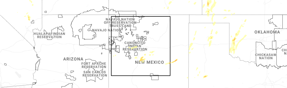
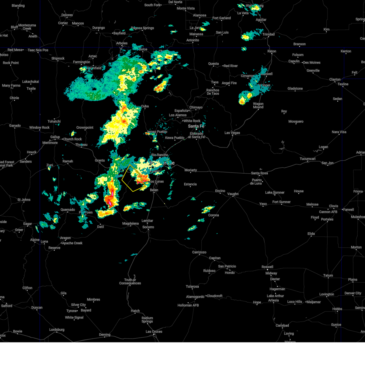
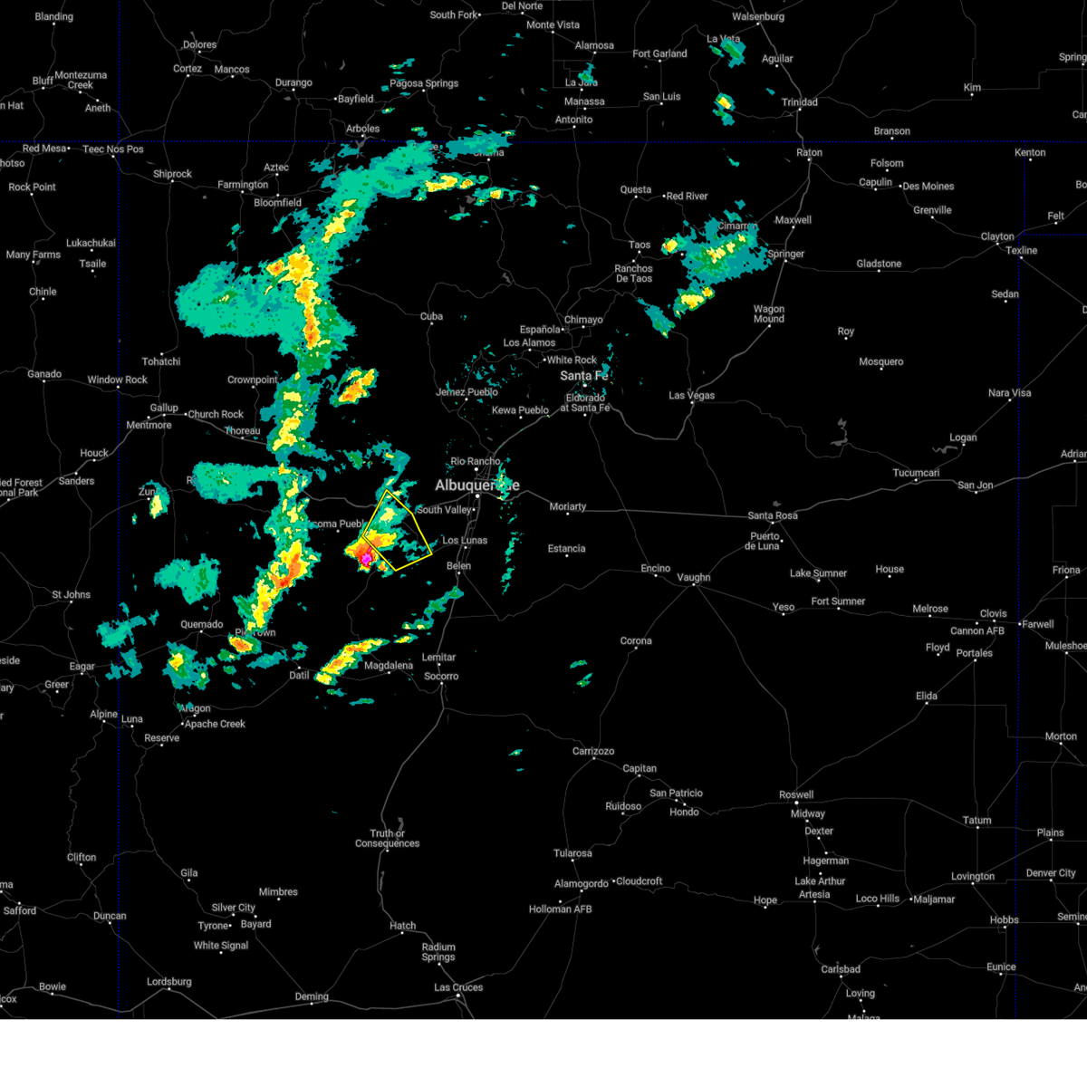
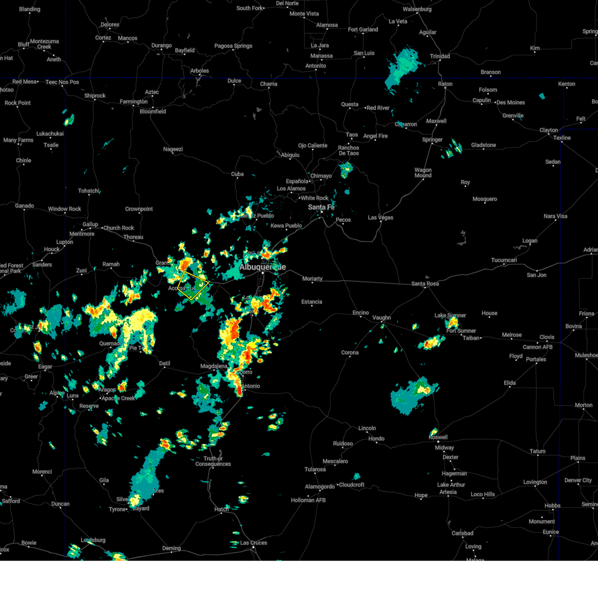
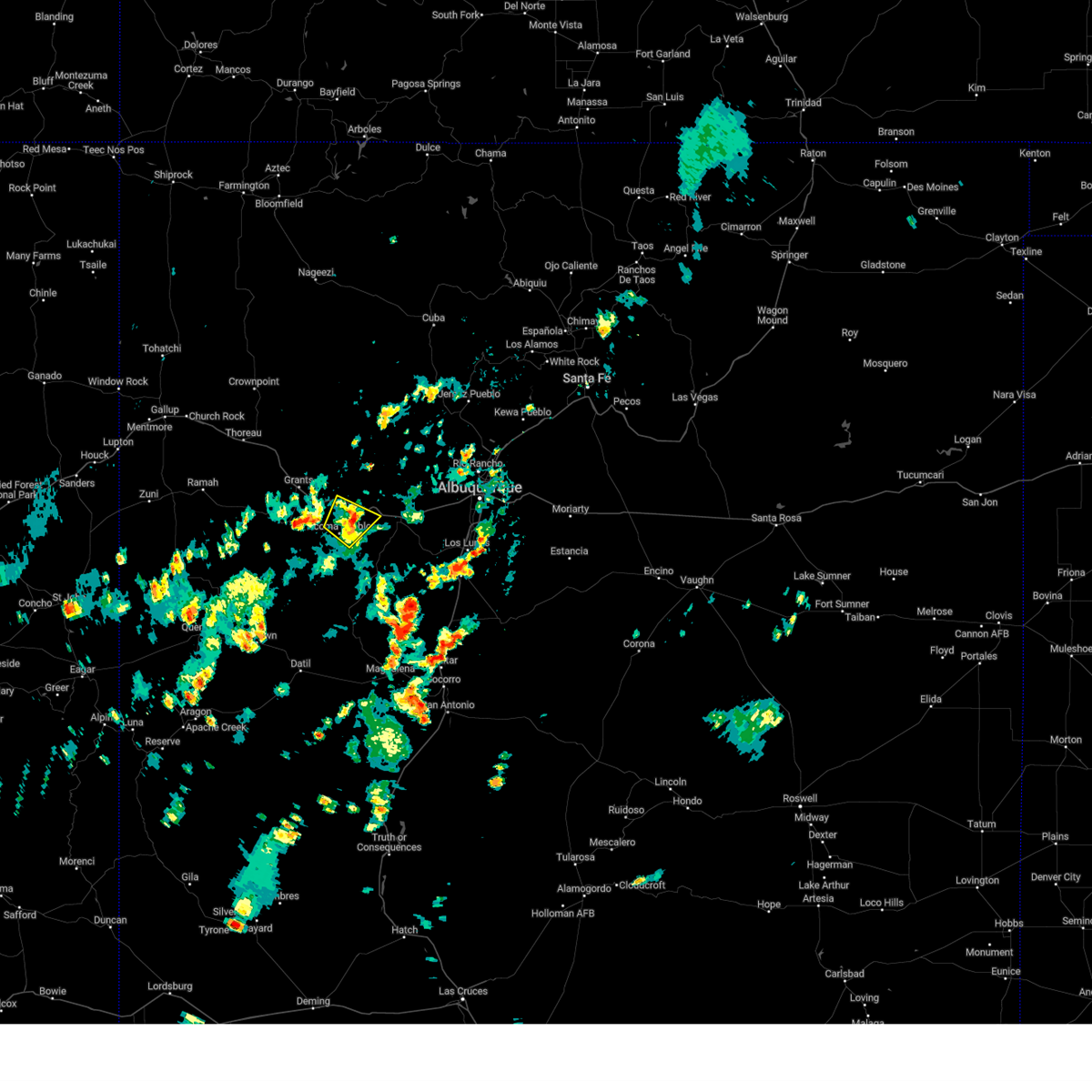
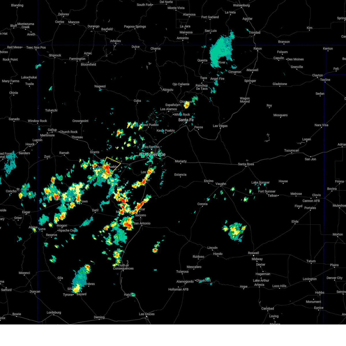
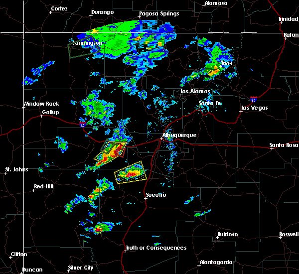
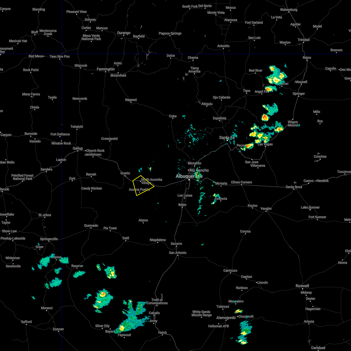
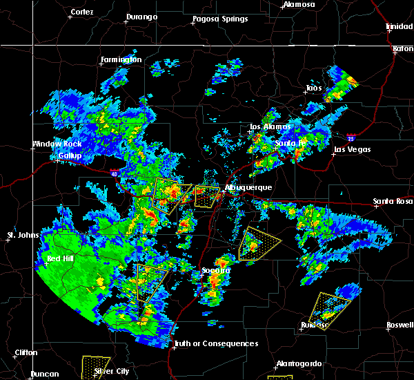
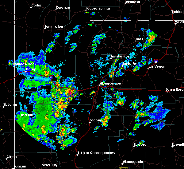
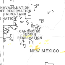
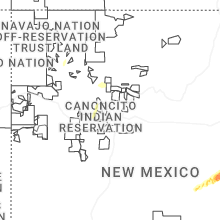
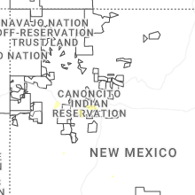
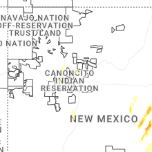
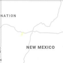
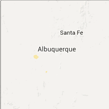
Hail Map for Mesita, NM
The Mesita, NM area has had 0 reports of on-the-ground hail by trained spotters, and has been under severe weather warnings 9 times during the past 12 months. Doppler radar has detected hail at or near Mesita, NM on 33 occasions, including 5 occasions during the past year.
| Name: | Mesita, NM |
| Where Located: | 38.9 miles W of Albuquerque, NM |
| Map: | Google Map for Mesita, NM |
| Population: | 804 |
| Housing Units: | 236 |
| More Info: | Search Google for Mesita, NM |
1
The Top Recent Hail Date for Mesita, NM is Monday, June 2, 2025 (7th out of 33)
Hail and Wind Damage Spotted near Mesita, NM
| Date / Time | Report Details |
|---|---|
| 6/4/2025 2:50 PM MDT |
 the severe thunderstorm warning has been cancelled and is no longer in effect the severe thunderstorm warning has been cancelled and is no longer in effect
|
| 6/4/2025 2:23 PM MDT |
 At 223 pm mdt, a severe thunderstorm was located 14 miles southeast of mesita, or 17 miles southeast of laguna pueblo, moving northeast at 20 mph (radar indicated). Hazards include 60 mph wind gusts and small hail. Expect damage to roofs, siding, and trees. locations impacted include, reservation road 54 and mesita. This includes interstate 40 between mile markers 118 and 131. At 223 pm mdt, a severe thunderstorm was located 14 miles southeast of mesita, or 17 miles southeast of laguna pueblo, moving northeast at 20 mph (radar indicated). Hazards include 60 mph wind gusts and small hail. Expect damage to roofs, siding, and trees. locations impacted include, reservation road 54 and mesita. This includes interstate 40 between mile markers 118 and 131.
|
| 6/4/2025 1:58 PM MDT |
 Svrabq the national weather service in albuquerque has issued a * severe thunderstorm warning for, northwestern valencia county in central new mexico, southeastern cibola county in west central new mexico, * until 300 pm mdt. * at 158 pm mdt, a severe thunderstorm was located 18 miles south of mesita, or 20 miles south of laguna pueblo, moving northeast at 20 mph (radar indicated). Hazards include 60 mph wind gusts and quarter size hail. Hail damage to vehicles is expected. Expect wind damage to roofs, siding, and trees. Svrabq the national weather service in albuquerque has issued a * severe thunderstorm warning for, northwestern valencia county in central new mexico, southeastern cibola county in west central new mexico, * until 300 pm mdt. * at 158 pm mdt, a severe thunderstorm was located 18 miles south of mesita, or 20 miles south of laguna pueblo, moving northeast at 20 mph (radar indicated). Hazards include 60 mph wind gusts and quarter size hail. Hail damage to vehicles is expected. Expect wind damage to roofs, siding, and trees.
|
| 5/2/2025 5:11 PM MDT | The storms which prompted the warning have weakened, and have exited the warned area. therefore, the warning will be allowed to expire. however, significant small hail has accumulated along interstate 40, leading to slick and treacherous travel conditions. exercise caution if traveling through the area. |
| 5/2/2025 4:49 PM MDT | At 449 pm mdt, severe thunderstorms were located along a line from 8 miles south of mesita to 12 miles northwest of isleta pueblo, moving southeast at 15 mph (radar indicated). Hazards include 60 mph wind gusts and small hail. Expect slick conditions on roads due to significant accumulations of small hail. locations impacted include, laguna pueblo, mesita, new laguna and paraje. This includes interstate 40 between mile markers 110 and 144. |
| 5/2/2025 4:28 PM MDT | Svrabq the national weather service in albuquerque has issued a * severe thunderstorm warning for, bernalillo county in central new mexico, northwestern valencia county in central new mexico, east central cibola county in west central new mexico, * until 515 pm mdt. * at 428 pm mdt, severe thunderstorms were located along a line from near laguna pueblo to 15 miles west of south valley, moving southeast at 10 mph (radar indicated). Hazards include 60 mph wind gusts and significant accumulations of small hail. expect damage to roofs, siding, and trees |
| 7/21/2024 6:30 PM MDT |
 the severe thunderstorm warning has been cancelled and is no longer in effect the severe thunderstorm warning has been cancelled and is no longer in effect
|
| 7/21/2024 6:30 PM MDT |
 At 629 pm mdt, severe thunderstorms were located along a line extending from 10 miles northwest of jemez pueblo to near torreon to 8 miles southeast of marquez, moving southeast at 40 mph (radar indicated). Hazards include 60 mph wind gusts. Expect damage to roofs, siding, and trees. locations impacted include, northwestern albuquerque, rio rancho, san ysidro, mesita, northern meadows, mariposa, zia pueblo, rio rancho city center, jemez pueblo, and tohajiilee. this includes the following highways, interstate 40 between mile markers 116 and 146. Highway 550 between mile markers 5 and 45. At 629 pm mdt, severe thunderstorms were located along a line extending from 10 miles northwest of jemez pueblo to near torreon to 8 miles southeast of marquez, moving southeast at 40 mph (radar indicated). Hazards include 60 mph wind gusts. Expect damage to roofs, siding, and trees. locations impacted include, northwestern albuquerque, rio rancho, san ysidro, mesita, northern meadows, mariposa, zia pueblo, rio rancho city center, jemez pueblo, and tohajiilee. this includes the following highways, interstate 40 between mile markers 116 and 146. Highway 550 between mile markers 5 and 45.
|
| 7/21/2024 6:12 PM MDT |
 Svrabq the national weather service in albuquerque has issued a * severe thunderstorm warning for, northeastern cibola county in west central new mexico, east central mckinley county in west central new mexico, northwestern valencia county in central new mexico, south central sandoval county in north central new mexico, bernalillo county in central new mexico, * until 700 pm mdt. * at 612 pm mdt, severe thunderstorms were located along a line extending from 12 miles southwest of fenton lake state park to 9 miles northwest of torreon to marquez, moving south at 45 mph (radar indicated). Hazards include 60 mph wind gusts. expect damage to roofs, siding, and trees Svrabq the national weather service in albuquerque has issued a * severe thunderstorm warning for, northeastern cibola county in west central new mexico, east central mckinley county in west central new mexico, northwestern valencia county in central new mexico, south central sandoval county in north central new mexico, bernalillo county in central new mexico, * until 700 pm mdt. * at 612 pm mdt, severe thunderstorms were located along a line extending from 12 miles southwest of fenton lake state park to 9 miles northwest of torreon to marquez, moving south at 45 mph (radar indicated). Hazards include 60 mph wind gusts. expect damage to roofs, siding, and trees
|
| 7/1/2024 3:21 PM MDT |
 The storm which prompted the warning has weakened below severe limits, and no longer poses an immediate threat to life or property. therefore, the warning will be allowed to expire. however, heavy rain is still possible with this thunderstorm. The storm which prompted the warning has weakened below severe limits, and no longer poses an immediate threat to life or property. therefore, the warning will be allowed to expire. however, heavy rain is still possible with this thunderstorm.
|
| 7/1/2024 3:01 PM MDT |
 At 301 pm mdt, a severe thunderstorm was located near new laguna, or near laguna pueblo, moving northeast at 20 mph (radar indicated). Hazards include 60 mph wind gusts. Expect damage to roofs, siding, and trees. Locations impacted include, acoma pueblo, skyline-ganipa, san fidel, mesita, seama, acomita, paraje, north acomita village, and acomita lake. At 301 pm mdt, a severe thunderstorm was located near new laguna, or near laguna pueblo, moving northeast at 20 mph (radar indicated). Hazards include 60 mph wind gusts. Expect damage to roofs, siding, and trees. Locations impacted include, acoma pueblo, skyline-ganipa, san fidel, mesita, seama, acomita, paraje, north acomita village, and acomita lake.
|
| 7/1/2024 2:48 PM MDT |
 Svrabq the national weather service in albuquerque has issued a * severe thunderstorm warning for, east central cibola county in west central new mexico, * until 330 pm mdt. * at 248 pm mdt, a severe thunderstorm was located near acoma pueblo, or 12 miles southwest of laguna pueblo, moving northeast at 10 mph (radar indicated). Hazards include 60 mph wind gusts. expect damage to roofs, siding, and trees Svrabq the national weather service in albuquerque has issued a * severe thunderstorm warning for, east central cibola county in west central new mexico, * until 330 pm mdt. * at 248 pm mdt, a severe thunderstorm was located near acoma pueblo, or 12 miles southwest of laguna pueblo, moving northeast at 10 mph (radar indicated). Hazards include 60 mph wind gusts. expect damage to roofs, siding, and trees
|
| 6/19/2022 4:12 PM MDT |
 The severe thunderstorm warning for northeastern cibola and east central mckinley counties will expire at 415 pm mdt, the storm which prompted the warning has moved out of the area. therefore, the warning will be allowed to expire. however small hail and heavy rain are still possible with this thunderstorm. The severe thunderstorm warning for northeastern cibola and east central mckinley counties will expire at 415 pm mdt, the storm which prompted the warning has moved out of the area. therefore, the warning will be allowed to expire. however small hail and heavy rain are still possible with this thunderstorm.
|
| 6/19/2022 3:44 PM MDT |
 At 344 pm mdt, a severe thunderstorm was located over cubero, or 10 miles northwest of laguna pueblo, moving east at 15 mph (radar indicated). Hazards include golf ball size hail and 60 mph wind gusts. People and animals outdoors will be injured. expect hail damage to roofs, siding, windows, and vehicles. expect wind damage to roofs, siding, and trees. locations impacted include, laguna pueblo, cubero, cebolletita, new laguna, paraje, paguate, bibo, encinal, seboyeta and mesita. this includes interstate 40 between mile markers 107 and 112, and between mile markers 114 and 115. thunderstorm damage threat, considerable hail threat, radar indicated max hail size, 1. 75 in wind threat, radar indicated max wind gust, 60 mph. At 344 pm mdt, a severe thunderstorm was located over cubero, or 10 miles northwest of laguna pueblo, moving east at 15 mph (radar indicated). Hazards include golf ball size hail and 60 mph wind gusts. People and animals outdoors will be injured. expect hail damage to roofs, siding, windows, and vehicles. expect wind damage to roofs, siding, and trees. locations impacted include, laguna pueblo, cubero, cebolletita, new laguna, paraje, paguate, bibo, encinal, seboyeta and mesita. this includes interstate 40 between mile markers 107 and 112, and between mile markers 114 and 115. thunderstorm damage threat, considerable hail threat, radar indicated max hail size, 1. 75 in wind threat, radar indicated max wind gust, 60 mph.
|
| 6/19/2022 3:25 PM MDT |
 At 324 pm mdt, a severe thunderstorm was located over san fidel, or 13 miles west of laguna pueblo, moving east at 10 mph (radar indicated). Hazards include ping pong ball size hail and 60 mph wind gusts. People and animals outdoors will be injured. expect hail damage to roofs, siding, windows, and vehicles. Expect wind damage to roofs, siding, and trees. At 324 pm mdt, a severe thunderstorm was located over san fidel, or 13 miles west of laguna pueblo, moving east at 10 mph (radar indicated). Hazards include ping pong ball size hail and 60 mph wind gusts. People and animals outdoors will be injured. expect hail damage to roofs, siding, windows, and vehicles. Expect wind damage to roofs, siding, and trees.
|
| 9/1/2020 12:42 PM MDT |
 At 1241 pm mdt, a severe thunderstorm was located 16 miles west of los lunas, moving southeast at 30 mph. several storms continue to move across the warned area capable of producing hail and damaing wind gusts (radar indicated). Hazards include 60 mph wind gusts and quarter size hail. Hail damage to vehicles is expected. expect wind damage to roofs, siding, and trees. locations impacted include, los lunas, bosque farms, peralta and mesita. this includes the following highways, interstate 40 between mile markers 121 and 132. Interstate 25 between mile markers 200 and 210. At 1241 pm mdt, a severe thunderstorm was located 16 miles west of los lunas, moving southeast at 30 mph. several storms continue to move across the warned area capable of producing hail and damaing wind gusts (radar indicated). Hazards include 60 mph wind gusts and quarter size hail. Hail damage to vehicles is expected. expect wind damage to roofs, siding, and trees. locations impacted include, los lunas, bosque farms, peralta and mesita. this includes the following highways, interstate 40 between mile markers 121 and 132. Interstate 25 between mile markers 200 and 210.
|
| 9/1/2020 12:20 PM MDT |
 At 1219 pm mdt, a severe thunderstorm was located 8 miles southeast of mesita, or 11 miles southeast of laguna pueblo, moving southeast at 30 mph (radar indicated). Hazards include 60 mph wind gusts and quarter size hail. Hail damage to vehicles is expected. Expect wind damage to roofs, siding, and trees. At 1219 pm mdt, a severe thunderstorm was located 8 miles southeast of mesita, or 11 miles southeast of laguna pueblo, moving southeast at 30 mph (radar indicated). Hazards include 60 mph wind gusts and quarter size hail. Hail damage to vehicles is expected. Expect wind damage to roofs, siding, and trees.
|
| 6/13/2020 2:50 PM MDT |
 At 250 pm mdt, a severe thunderstorm was located 9 miles east of mesita, or 12 miles east of laguna pueblo, moving east at 15 mph (radar indicated). Hazards include 60 mph wind gusts and quarter size hail. Hail damage to vehicles is expected. expect wind damage to roofs, siding, and trees. locations impacted include, tohajiilee and mesita. This includes interstate 40 between mile markers 119 and 139. At 250 pm mdt, a severe thunderstorm was located 9 miles east of mesita, or 12 miles east of laguna pueblo, moving east at 15 mph (radar indicated). Hazards include 60 mph wind gusts and quarter size hail. Hail damage to vehicles is expected. expect wind damage to roofs, siding, and trees. locations impacted include, tohajiilee and mesita. This includes interstate 40 between mile markers 119 and 139.
|
| 6/13/2020 2:32 PM MDT |
 At 232 pm mdt, a severe thunderstorm was located near mesita, or 8 miles east of laguna pueblo, moving east at 15 mph (radar indicated). Hazards include 60 mph wind gusts and quarter size hail. Hail damage to vehicles is expected. Expect wind damage to roofs, siding, and trees. At 232 pm mdt, a severe thunderstorm was located near mesita, or 8 miles east of laguna pueblo, moving east at 15 mph (radar indicated). Hazards include 60 mph wind gusts and quarter size hail. Hail damage to vehicles is expected. Expect wind damage to roofs, siding, and trees.
|
| 8/27/2019 9:15 PM MDT |
 At 913 pm mdt, a severe thunderstorm was located near mesita, or 9 miles southeast of laguna pueblo, and is nearly stationary (radar indicated). Hazards include ping pong ball size hail and 60 mph wind gusts. People and animals outdoors will be injured. expect hail damage to roofs, siding, windows, and vehicles. expect wind damage to roofs, siding, and trees. locations impacted include, reservation road 55, state road 6, and mesita. This includes interstate 40 between mile markers 120 and 130. At 913 pm mdt, a severe thunderstorm was located near mesita, or 9 miles southeast of laguna pueblo, and is nearly stationary (radar indicated). Hazards include ping pong ball size hail and 60 mph wind gusts. People and animals outdoors will be injured. expect hail damage to roofs, siding, windows, and vehicles. expect wind damage to roofs, siding, and trees. locations impacted include, reservation road 55, state road 6, and mesita. This includes interstate 40 between mile markers 120 and 130.
|
| 8/27/2019 8:59 PM MDT |
 At 859 pm mdt, a severe thunderstorm was located 8 miles east of mesita, or 12 miles southeast of laguna pueblo, moving southeast at 10 mph (radar indicated). Hazards include 60 mph wind gusts and quarter size hail. Hail damage to vehicles is expected. Expect wind damage to roofs, siding, and trees. At 859 pm mdt, a severe thunderstorm was located 8 miles east of mesita, or 12 miles southeast of laguna pueblo, moving southeast at 10 mph (radar indicated). Hazards include 60 mph wind gusts and quarter size hail. Hail damage to vehicles is expected. Expect wind damage to roofs, siding, and trees.
|
| 6/17/2019 2:07 PM MDT |
 At 207 pm mdt, a severe thunderstorm was located 12 miles east of mesita, or 16 miles east of laguna pueblo, moving northeast at 20 mph (radar indicated). Hazards include 60 mph wind gusts and penny size hail. Expect damage to roofs, siding, and trees. locations impacted include, tohajiilee and mesita. This includes interstate 40 between mile markers 119 and 143. At 207 pm mdt, a severe thunderstorm was located 12 miles east of mesita, or 16 miles east of laguna pueblo, moving northeast at 20 mph (radar indicated). Hazards include 60 mph wind gusts and penny size hail. Expect damage to roofs, siding, and trees. locations impacted include, tohajiilee and mesita. This includes interstate 40 between mile markers 119 and 143.
|
| 6/17/2019 1:51 PM MDT |
 At 150 pm mdt, a severe thunderstorm was located 11 miles southeast of mesita, or 14 miles southeast of laguna pueblo, moving northeast at 25 mph (radar indicated). Hazards include 60 mph wind gusts and quarter size hail. Hail damage to vehicles is expected. Expect wind damage to roofs, siding, and trees. At 150 pm mdt, a severe thunderstorm was located 11 miles southeast of mesita, or 14 miles southeast of laguna pueblo, moving northeast at 25 mph (radar indicated). Hazards include 60 mph wind gusts and quarter size hail. Hail damage to vehicles is expected. Expect wind damage to roofs, siding, and trees.
|
| 8/21/2018 2:41 PM MDT |
 At 240 pm mdt, a severe thunderstorm was located near mesita, or 7 miles east of laguna pueblo, moving northeast at 15 mph (radar indicated). Hazards include 60 mph wind gusts and penny size hail. expect damage to roofs, siding, and trees At 240 pm mdt, a severe thunderstorm was located near mesita, or 7 miles east of laguna pueblo, moving northeast at 15 mph (radar indicated). Hazards include 60 mph wind gusts and penny size hail. expect damage to roofs, siding, and trees
|
| 6/3/2018 1:51 PM MDT |
 At 151 pm mdt, a severe thunderstorm was located over new laguna, or over laguna pueblo, moving northeast at 40 mph (radar indicated). Hazards include ping pong ball size hail and 60 mph wind gusts. People and animals outdoors will be injured. expect hail damage to roofs, siding, windows, and vehicles. Expect wind damage to roofs, siding, and trees. At 151 pm mdt, a severe thunderstorm was located over new laguna, or over laguna pueblo, moving northeast at 40 mph (radar indicated). Hazards include ping pong ball size hail and 60 mph wind gusts. People and animals outdoors will be injured. expect hail damage to roofs, siding, windows, and vehicles. Expect wind damage to roofs, siding, and trees.
|
| 6/3/2018 1:38 PM MDT |
 At 138 pm mdt, a severe thunderstorm was located 17 miles south of mesita, or 20 miles south of laguna pueblo, moving northeast at 40 mph (radar indicated). Hazards include 60 mph wind gusts and quarter size hail. Hail damage to vehicles is expected. Expect wind damage to roofs, siding, and trees. At 138 pm mdt, a severe thunderstorm was located 17 miles south of mesita, or 20 miles south of laguna pueblo, moving northeast at 40 mph (radar indicated). Hazards include 60 mph wind gusts and quarter size hail. Hail damage to vehicles is expected. Expect wind damage to roofs, siding, and trees.
|
| 6/3/2018 1:35 PM MDT |
 At 135 pm mdt, a confirmed tornado was located over cubero, or near laguna pueblo, moving northeast at 40 mph (radar confirmed tornado). Hazards include damaging tornado and ping pong ball size hail. Flying debris will be dangerous to those caught without shelter. mobile homes will be damaged or destroyed. damage to roofs, windows, and vehicles will occur. tree damage is likely. this tornado will be near, laguna pueblo and mesita around 140 pm mdt. cebolletita, paguate, bibo and seboyeta around 145 pm mdt. This includes interstate 40 between mile markers 93 and 117. At 135 pm mdt, a confirmed tornado was located over cubero, or near laguna pueblo, moving northeast at 40 mph (radar confirmed tornado). Hazards include damaging tornado and ping pong ball size hail. Flying debris will be dangerous to those caught without shelter. mobile homes will be damaged or destroyed. damage to roofs, windows, and vehicles will occur. tree damage is likely. this tornado will be near, laguna pueblo and mesita around 140 pm mdt. cebolletita, paguate, bibo and seboyeta around 145 pm mdt. This includes interstate 40 between mile markers 93 and 117.
|
| 6/3/2018 1:15 PM MDT |
 At 114 pm mdt, a severe thunderstorm capable of producing a tornado was located near skyline-ganipa, or 14 miles southeast of grants, moving northeast at 40 mph (weather spotters reported funnel cloud). Hazards include tornado and ping pong ball size hail. Flying debris will be dangerous to those caught without shelter. mobile homes will be damaged or destroyed. damage to roofs, windows, and vehicles will occur. tree damage is likely. this dangerous storm will be near, skyline-ganipa around 120 pm mdt. san fidel, acomita and acomita lake around 125 pm mdt. cubero, seama and north acomita village around 130 pm mdt. new laguna and paraje around 135 pm mdt. laguna pueblo and mesita around 140 pm mdt. cebolletita, encinal, paguate, bibo and seboyeta around 145 pm mdt. This includes interstate 40 between mile markers 93 and 117. At 114 pm mdt, a severe thunderstorm capable of producing a tornado was located near skyline-ganipa, or 14 miles southeast of grants, moving northeast at 40 mph (weather spotters reported funnel cloud). Hazards include tornado and ping pong ball size hail. Flying debris will be dangerous to those caught without shelter. mobile homes will be damaged or destroyed. damage to roofs, windows, and vehicles will occur. tree damage is likely. this dangerous storm will be near, skyline-ganipa around 120 pm mdt. san fidel, acomita and acomita lake around 125 pm mdt. cubero, seama and north acomita village around 130 pm mdt. new laguna and paraje around 135 pm mdt. laguna pueblo and mesita around 140 pm mdt. cebolletita, encinal, paguate, bibo and seboyeta around 145 pm mdt. This includes interstate 40 between mile markers 93 and 117.
|
| 6/3/2018 12:30 PM MDT |
 The national weather service in albuquerque has issued a * severe thunderstorm warning for. eastern cibola county in west central new mexico. east central mckinley county in west central new mexico. until 115 pm mdt. At 1229 pm mdt, a severe thunderstorm was located 18 miles south of. The national weather service in albuquerque has issued a * severe thunderstorm warning for. eastern cibola county in west central new mexico. east central mckinley county in west central new mexico. until 115 pm mdt. At 1229 pm mdt, a severe thunderstorm was located 18 miles south of.
|
| 5/21/2018 12:27 PM MDT |
 At 1227 pm mdt, a severe thunderstorm was located over acoma pueblo, or 16 miles southwest of laguna pueblo, moving north at 20 mph (radar indicated). Hazards include 60 mph wind gusts and half dollar size hail. Hail damage to vehicles is expected. Expect wind damage to roofs, siding, and trees. At 1227 pm mdt, a severe thunderstorm was located over acoma pueblo, or 16 miles southwest of laguna pueblo, moving north at 20 mph (radar indicated). Hazards include 60 mph wind gusts and half dollar size hail. Hail damage to vehicles is expected. Expect wind damage to roofs, siding, and trees.
|
| 9/29/2017 3:26 PM MDT |
 At 326 pm mdt, severe thunderstorms were located along a line extending from mesita to 9 miles south of acoma pueblo, moving east at 20 mph (radar indicated). Hazards include 70 mph wind gusts and ping pong ball size hail. People and animals outdoors will be injured. expect hail damage to roofs, siding, windows, and vehicles. expect considerable tree damage. wind damage is also likely to mobile homes, roofs, and outbuildings. locations impacted include, laguna pueblo, mesita, new laguna and paraje. This includes interstate 40 between mile markers 107 and 121. At 326 pm mdt, severe thunderstorms were located along a line extending from mesita to 9 miles south of acoma pueblo, moving east at 20 mph (radar indicated). Hazards include 70 mph wind gusts and ping pong ball size hail. People and animals outdoors will be injured. expect hail damage to roofs, siding, windows, and vehicles. expect considerable tree damage. wind damage is also likely to mobile homes, roofs, and outbuildings. locations impacted include, laguna pueblo, mesita, new laguna and paraje. This includes interstate 40 between mile markers 107 and 121.
|
| 9/29/2017 3:05 PM MDT |
 At 304 pm mdt, severe thunderstorms were located along a line extending from new laguna to near acoma pueblo to 17 miles south of skyline-ganipa, moving east at 25 mph (radar indicated). Hazards include 70 mph wind gusts and ping pong ball size hail. People and animals outdoors will be injured. expect hail damage to roofs, siding, windows, and vehicles. expect considerable tree damage. Wind damage is also likely to mobile homes, roofs, and outbuildings. At 304 pm mdt, severe thunderstorms were located along a line extending from new laguna to near acoma pueblo to 17 miles south of skyline-ganipa, moving east at 25 mph (radar indicated). Hazards include 70 mph wind gusts and ping pong ball size hail. People and animals outdoors will be injured. expect hail damage to roofs, siding, windows, and vehicles. expect considerable tree damage. Wind damage is also likely to mobile homes, roofs, and outbuildings.
|
| 8/13/2016 2:27 PM MDT |
 The severe thunderstorm warning for east central cibola county will expire at 230 pm mdt. the storm which prompted the warning has weakened below severe limits. and has exited the warned area. therefore the warning will be allowed to expire. however. significant hail accumulations will linger on roads. Creating treacherous driving conditions. The severe thunderstorm warning for east central cibola county will expire at 230 pm mdt. the storm which prompted the warning has weakened below severe limits. and has exited the warned area. therefore the warning will be allowed to expire. however. significant hail accumulations will linger on roads. Creating treacherous driving conditions.
|
| 8/13/2016 2:11 PM MDT |
 At 208 pm mdt, a severe thunderstorm was located near skyline- ganipa, or 11 miles west of laguna pueblo, moving southeast at 15 mph (radar indicated). Hazards include significant hail accumulation...wind gusts to 55 mph. Hail damage to vehicles is expected. expect wind damage to roofs, siding, and trees. accumulations of hail on roads will create treacherous driving conditions. locations impacted include, cubero, acoma pueblo, skyline-ganipa, mccartys, new laguna, san fidel, mesita, acomita, north acomita village and seama. This includes interstate 40 between mile markers 94 and 113. At 208 pm mdt, a severe thunderstorm was located near skyline- ganipa, or 11 miles west of laguna pueblo, moving southeast at 15 mph (radar indicated). Hazards include significant hail accumulation...wind gusts to 55 mph. Hail damage to vehicles is expected. expect wind damage to roofs, siding, and trees. accumulations of hail on roads will create treacherous driving conditions. locations impacted include, cubero, acoma pueblo, skyline-ganipa, mccartys, new laguna, san fidel, mesita, acomita, north acomita village and seama. This includes interstate 40 between mile markers 94 and 113.
|
| 8/13/2016 1:51 PM MDT |
 At 150 pm mdt, a severe thunderstorm was located over skyline- ganipa, or 13 miles west of laguna pueblo, moving southeast at 10 mph (radar indicated). Hazards include 60 mph wind gusts and half dollar size hail. Hail damage to vehicles is expected. expect wind damage to roofs, siding, and trees. Hail may accumulate on roads, creating slick and treacherous driving conditions. At 150 pm mdt, a severe thunderstorm was located over skyline- ganipa, or 13 miles west of laguna pueblo, moving southeast at 10 mph (radar indicated). Hazards include 60 mph wind gusts and half dollar size hail. Hail damage to vehicles is expected. expect wind damage to roofs, siding, and trees. Hail may accumulate on roads, creating slick and treacherous driving conditions.
|
| 10/20/2015 2:22 PM MDT |
 At 222 pm mdt, a severe thunderstorm was located 6 miles northeast of mesita, or 8 miles east of laguna pueblo, moving northeast at 25 mph (radar indicated). Hazards include 60 mph wind gusts and half dollar size hail. Hail damage to vehicles is expected. expect wind damage to roofs, siding and trees. locations impacted include, mesita and paguate. This includes interstate 40 between mile markers 121 and 125. At 222 pm mdt, a severe thunderstorm was located 6 miles northeast of mesita, or 8 miles east of laguna pueblo, moving northeast at 25 mph (radar indicated). Hazards include 60 mph wind gusts and half dollar size hail. Hail damage to vehicles is expected. expect wind damage to roofs, siding and trees. locations impacted include, mesita and paguate. This includes interstate 40 between mile markers 121 and 125.
|
| 10/20/2015 1:55 PM MDT |
 At 155 pm mdt, a severe thunderstorm was located near new laguna, or near laguna pueblo, moving north at 25 mph (radar indicated). Hazards include golf ball size hail and 60 mph wind gusts. People and animals outdoors will be injured. expect hail damage to roofs, siding, windows and vehicles. Expect wind damage to roofs, siding and trees. At 155 pm mdt, a severe thunderstorm was located near new laguna, or near laguna pueblo, moving north at 25 mph (radar indicated). Hazards include golf ball size hail and 60 mph wind gusts. People and animals outdoors will be injured. expect hail damage to roofs, siding, windows and vehicles. Expect wind damage to roofs, siding and trees.
|
| 10/20/2015 1:50 PM MDT |
 At 150 pm mdt, a severe thunderstorm capable of producing a tornado was located 6 miles southwest of mesita, or 7 miles south of laguna pueblo, moving northeast at 25 mph (radar indicated rotation). Hazards include tornado and quarter size hail. Flying debris will be dangerous to those caught without shelter. mobile homes will be damaged or destroyed. damage to roofs, windows and vehicles will occur. tree damage is likely. this dangerous storm will be near, mesita around 210 pm mdt. This includes interstate 40 near mile marker 120. At 150 pm mdt, a severe thunderstorm capable of producing a tornado was located 6 miles southwest of mesita, or 7 miles south of laguna pueblo, moving northeast at 25 mph (radar indicated rotation). Hazards include tornado and quarter size hail. Flying debris will be dangerous to those caught without shelter. mobile homes will be damaged or destroyed. damage to roofs, windows and vehicles will occur. tree damage is likely. this dangerous storm will be near, mesita around 210 pm mdt. This includes interstate 40 near mile marker 120.
|
| 10/20/2015 1:42 PM MDT |
 At 141 pm mdt, a severe thunderstorm capable of producing a tornado was located 9 miles east of acoma pueblo, or 11 miles south of laguna pueblo, moving northeast at 25 mph (radar indicated rotation). Hazards include tornado and quarter size hail. Flying debris will be dangerous to those caught without shelter. mobile homes will be damaged or destroyed. damage to roofs, windows and vehicles will occur. tree damage is likely. This dangerous storm will be near, mesita around 210 pm mdt. At 141 pm mdt, a severe thunderstorm capable of producing a tornado was located 9 miles east of acoma pueblo, or 11 miles south of laguna pueblo, moving northeast at 25 mph (radar indicated rotation). Hazards include tornado and quarter size hail. Flying debris will be dangerous to those caught without shelter. mobile homes will be damaged or destroyed. damage to roofs, windows and vehicles will occur. tree damage is likely. This dangerous storm will be near, mesita around 210 pm mdt.
|
| 10/5/2015 4:56 PM MDT |
 At 456 pm mdt, a severe thunderstorm was located over cebolletita, or 8 miles north of laguna pueblo, moving east at 15 mph (radar indicated). Hazards include 70 mph wind gusts and half dollar size hail. Hail damage to vehicles is expected. expect considerable tree damage. wind damage is also likely to mobile homes, roofs and outbuildings. locations impacted include, laguna pueblo, cubero, new laguna, cebolletita, paguate, bibo, seboyeta, paraje, encinal and seama. other locations affected include water canyon wildlife area. This includes interstate 40 between mile markers 103 and 108. At 456 pm mdt, a severe thunderstorm was located over cebolletita, or 8 miles north of laguna pueblo, moving east at 15 mph (radar indicated). Hazards include 70 mph wind gusts and half dollar size hail. Hail damage to vehicles is expected. expect considerable tree damage. wind damage is also likely to mobile homes, roofs and outbuildings. locations impacted include, laguna pueblo, cubero, new laguna, cebolletita, paguate, bibo, seboyeta, paraje, encinal and seama. other locations affected include water canyon wildlife area. This includes interstate 40 between mile markers 103 and 108.
|
| 10/5/2015 4:44 PM MDT |
 At 444 pm mdt, a severe thunderstorm was located near cubero, or 10 miles northwest of laguna pueblo, moving east at 15 mph (radar indicated). Hazards include quarter size hail and 60 mph wind gusts. Hail damage to vehicles is expected. Expect wind damage to roofs, siding and trees. At 444 pm mdt, a severe thunderstorm was located near cubero, or 10 miles northwest of laguna pueblo, moving east at 15 mph (radar indicated). Hazards include quarter size hail and 60 mph wind gusts. Hail damage to vehicles is expected. Expect wind damage to roofs, siding and trees.
|
| 7/11/2015 2:32 PM MDT |
 At 232 pm mdt, a severe thunderstorm was located 8 miles south of mesita, or 11 miles south of laguna pueblo, moving northeast at 30 mph (radar indicated). Hazards include 60 mph wind gusts and quarter size hail. Hail damage to vehicles is expected. expect wind damage to roofs, siding and trees. this severe thunderstorm will remain over mainly rural areas of east central cibola and northwestern valencia counties. This includes interstate 40 between mile markers 121 and 126. At 232 pm mdt, a severe thunderstorm was located 8 miles south of mesita, or 11 miles south of laguna pueblo, moving northeast at 30 mph (radar indicated). Hazards include 60 mph wind gusts and quarter size hail. Hail damage to vehicles is expected. expect wind damage to roofs, siding and trees. this severe thunderstorm will remain over mainly rural areas of east central cibola and northwestern valencia counties. This includes interstate 40 between mile markers 121 and 126.
|
| 7/11/2015 2:08 PM MDT |
 At 208 pm mdt, a severe thunderstorm was located 7 miles southeast of acoma pueblo, or 16 miles southwest of laguna pueblo, moving northeast at 30 mph (radar indicated). Hazards include quarter size hail and 60 mph wind gusts. Hail damage to vehicles is expected. Expect wind damage to roofs, siding and trees. At 208 pm mdt, a severe thunderstorm was located 7 miles southeast of acoma pueblo, or 16 miles southwest of laguna pueblo, moving northeast at 30 mph (radar indicated). Hazards include quarter size hail and 60 mph wind gusts. Hail damage to vehicles is expected. Expect wind damage to roofs, siding and trees.
|
| 7/11/2015 1:14 PM MDT |
 At 114 pm mdt, a severe thunderstorm was located near mesita, or near laguna pueblo, moving northeast at 20 mph (radar indicated). Hazards include 60 mph wind gusts and quarter size hail. Hail damage to vehicles is expected. expect wind damage to roofs, siding and trees. locations impacted include, mesita. This includes interstate 40 between mile markers 115 and 127. At 114 pm mdt, a severe thunderstorm was located near mesita, or near laguna pueblo, moving northeast at 20 mph (radar indicated). Hazards include 60 mph wind gusts and quarter size hail. Hail damage to vehicles is expected. expect wind damage to roofs, siding and trees. locations impacted include, mesita. This includes interstate 40 between mile markers 115 and 127.
|
| 7/11/2015 12:58 PM MDT |
 At 1257 pm mdt, a severe thunderstorm was located 7 miles south of new laguna, or 8 miles southwest of laguna pueblo, moving northeast at 20 mph (radar indicated). Hazards include quarter size hail and 60 mph wind gusts. Hail damage to vehicles is expected. Expect wind damage to roofs, siding and trees. At 1257 pm mdt, a severe thunderstorm was located 7 miles south of new laguna, or 8 miles southwest of laguna pueblo, moving northeast at 20 mph (radar indicated). Hazards include quarter size hail and 60 mph wind gusts. Hail damage to vehicles is expected. Expect wind damage to roofs, siding and trees.
|
Hail Maps for Mesita, NM


Connect with Interactive Hail Maps