

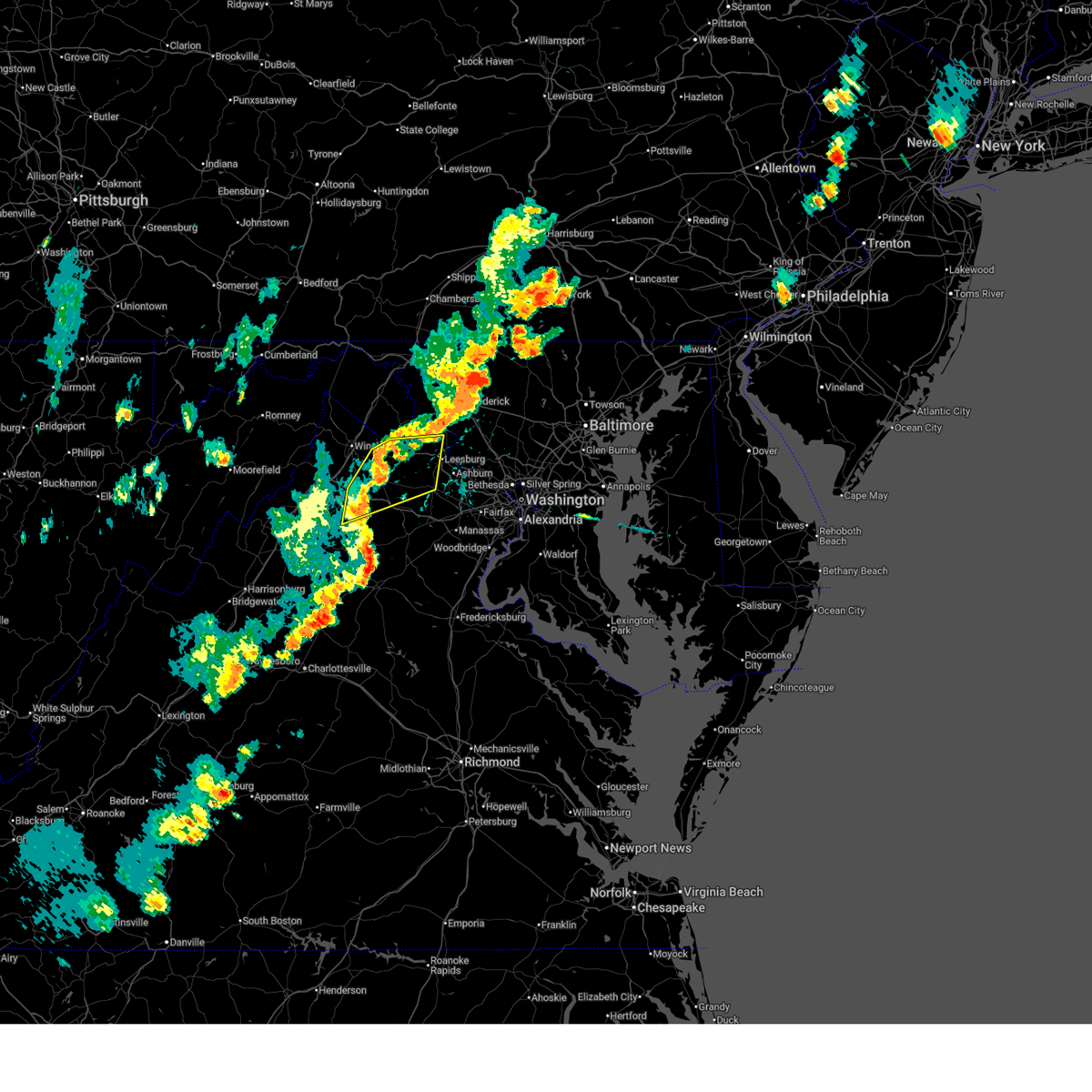
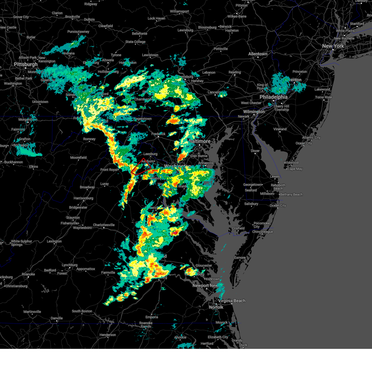
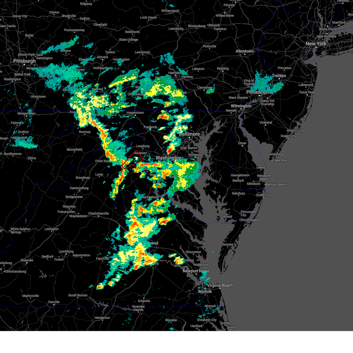
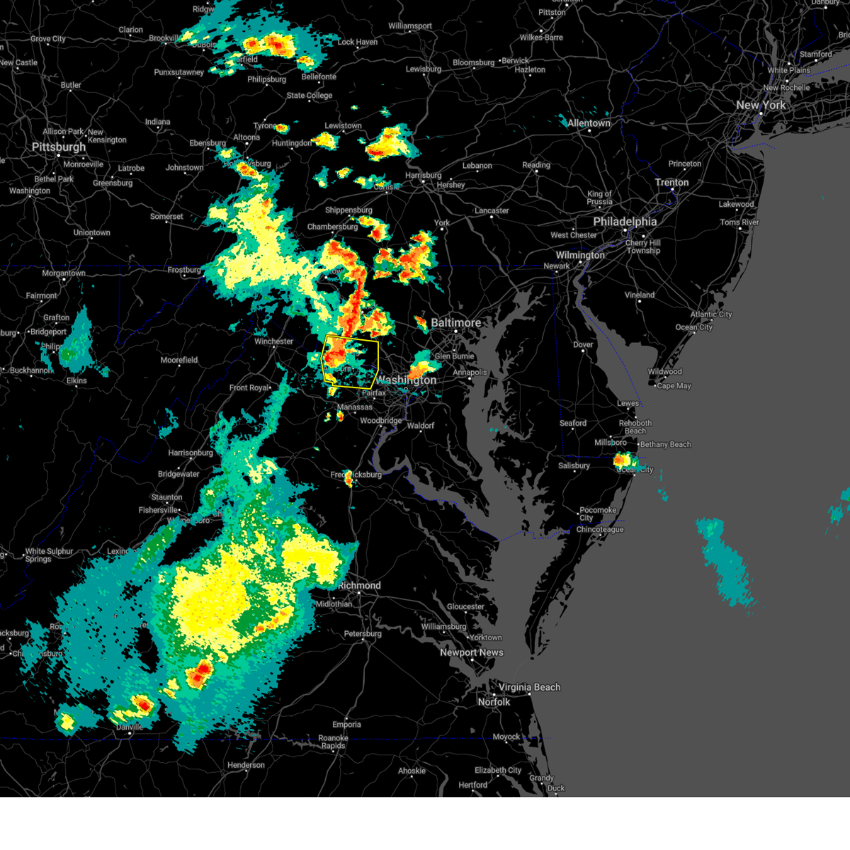
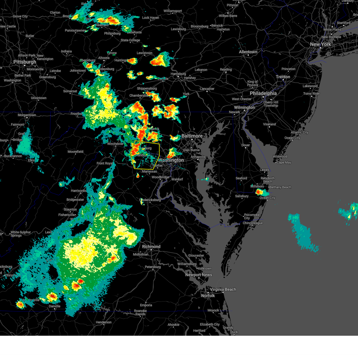
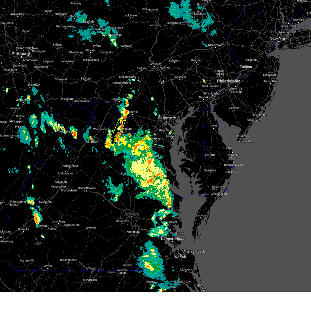
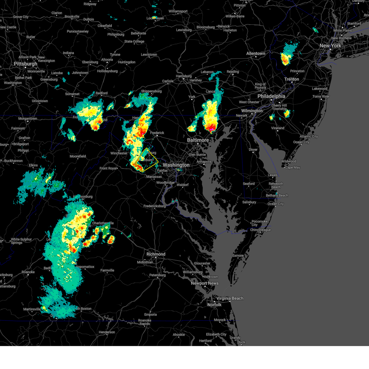
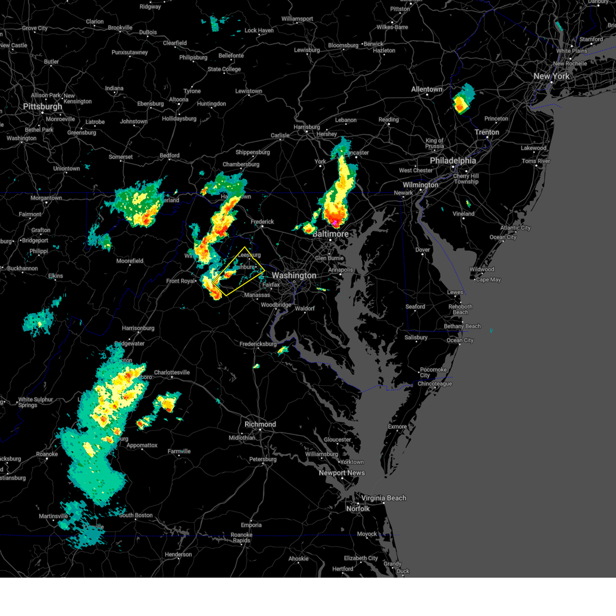
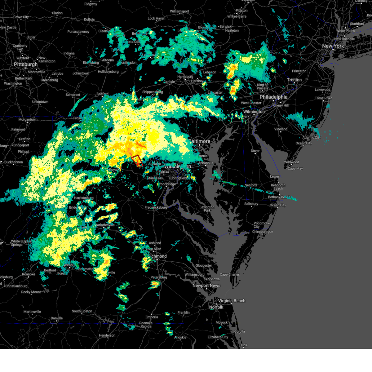
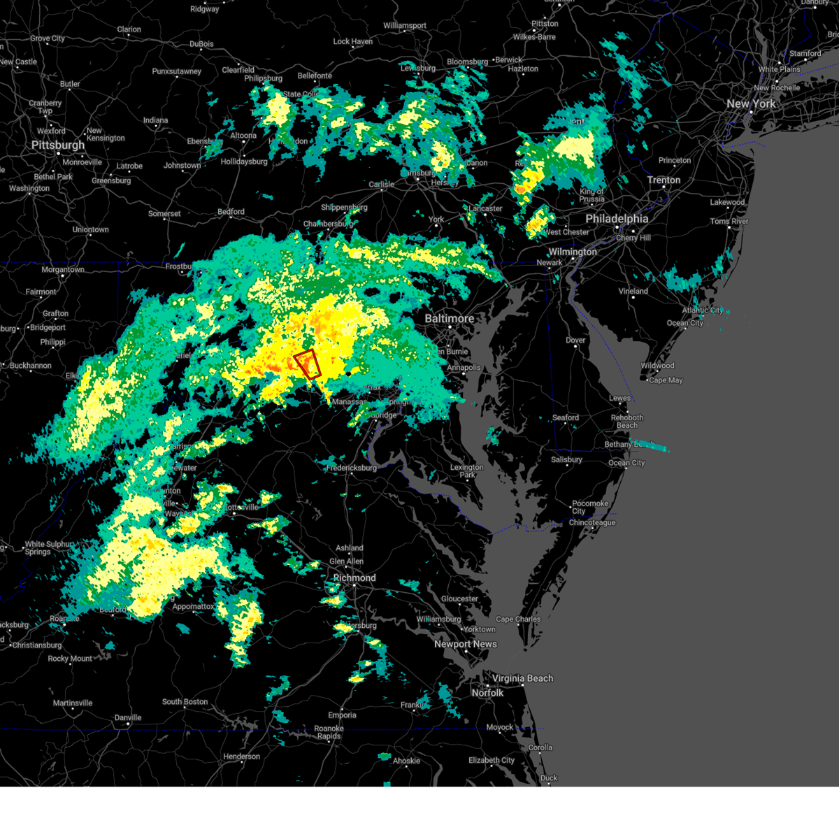
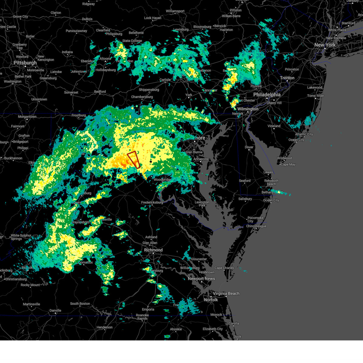
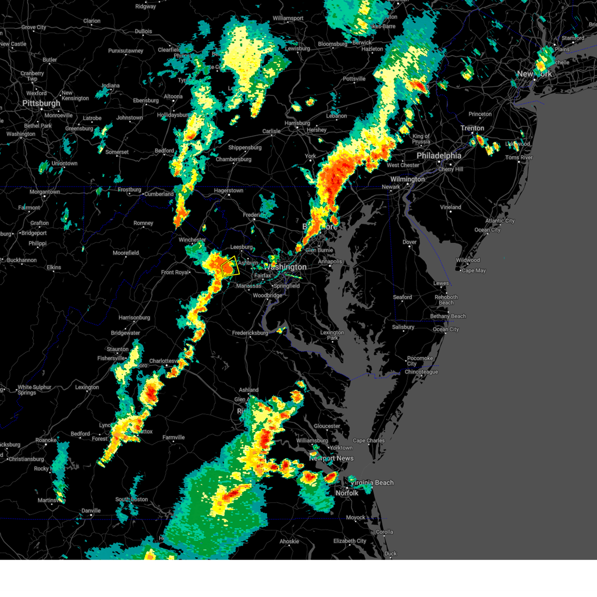
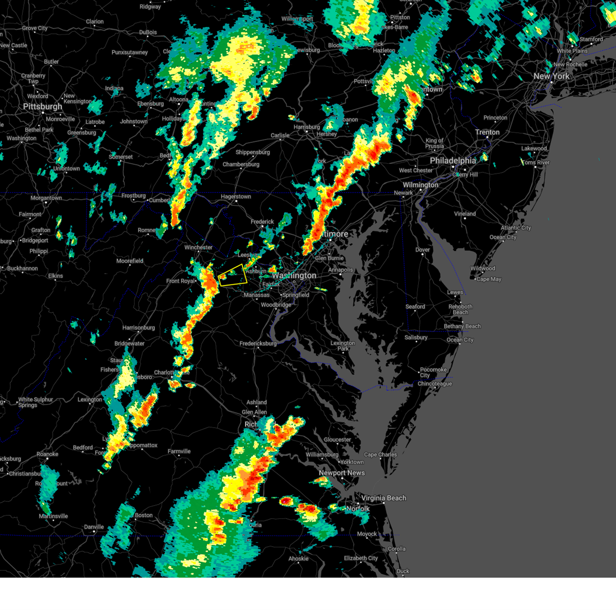
Hail Map for Middleburg, VA
The Middleburg, VA area has had 7 reports of on-the-ground hail by trained spotters, and has been under severe weather warnings 35 times during the past 12 months. Doppler radar has detected hail at or near Middleburg, VA on 38 occasions, including 3 occasions during the past year.
| Name: | Middleburg, VA |
| Where Located: | 64.6 miles WSW of Baltimore, MD |
| Map: | Google Map for Middleburg, VA |
| Population: | 673 |
| Housing Units: | 414 |
| More Info: | Search Google for Middleburg, VA |
1
The Top Recent Hail Date for Middleburg, VA is Saturday, August 3, 2024 (12th out of 38)

Hail and Wind Damage Spotted near Middleburg, VA
| Date / Time | Report Details |
|---|---|
| 6/19/2025 3:27 PM EDT | Svrlwx the national weather service in sterling virginia has issued a * severe thunderstorm warning for, south central carroll county in north central maryland, northwestern howard county in central maryland, montgomery county in central maryland, southeastern frederick county in north central maryland, loudoun county in northern virginia, north central fairfax county in northern virginia, north central fauquier county in northern virginia, northwestern prince william county in northern virginia, * until 400 pm edt. * at 327 pm edt, a severe thunderstorm was located near purcellville, or near leesburg, moving east at 50 mph (radar indicated). Hazards include emergency management reports a history of downed trees with this line of storms. Damaging winds will cause some trees and large branches to fall. this could injure those outdoors, as well as damage homes and vehicles. roadways may become blocked by downed trees. localized power outages are possible. Unsecured light objects may become projectiles. |
| 6/19/2025 3:12 PM EDT |
 At 312 pm edt, a severe thunderstorm was located over linden, or near front royal, moving east at 40 mph (emergency management reports a history of downed trees with this line of storms). Hazards include 60 mph wind gusts. Damaging winds will cause some trees and large branches to fall. this could injure those outdoors, as well as damage homes and vehicles. roadways may become blocked by downed trees. localized power outages are possible. unsecured light objects may become projectiles. Locations impacted include, leesburg, front royal, purcellville, berryville, middleburg, round hill, delaplane, linden, oatlands, bluemont, chester gap, boyce, hamilton, hillsboro, huntly, gleedsville, white post, waterford, gaylord, and aldie. At 312 pm edt, a severe thunderstorm was located over linden, or near front royal, moving east at 40 mph (emergency management reports a history of downed trees with this line of storms). Hazards include 60 mph wind gusts. Damaging winds will cause some trees and large branches to fall. this could injure those outdoors, as well as damage homes and vehicles. roadways may become blocked by downed trees. localized power outages are possible. unsecured light objects may become projectiles. Locations impacted include, leesburg, front royal, purcellville, berryville, middleburg, round hill, delaplane, linden, oatlands, bluemont, chester gap, boyce, hamilton, hillsboro, huntly, gleedsville, white post, waterford, gaylord, and aldie.
|
| 6/19/2025 3:12 PM EDT |
 the severe thunderstorm warning has been cancelled and is no longer in effect the severe thunderstorm warning has been cancelled and is no longer in effect
|
| 6/19/2025 2:53 PM EDT |
 Svrlwx the national weather service in sterling virginia has issued a * severe thunderstorm warning for, central loudoun county in northern virginia, east central shenandoah county in northwestern virginia, southeastern frederick county in northwestern virginia, warren county in northwestern virginia, clarke county in northwestern virginia, northeastern page county in northwestern virginia, north central rappahannock county in northwestern virginia, northwestern fauquier county in northern virginia, southeastern jefferson county in the panhandle of west virginia, * until 330 pm edt. * at 252 pm edt, a severe thunderstorm was located 7 miles southwest of front royal, moving east at 40 mph (emergency management reports a history of downed trees with this line of storms). Hazards include 60 mph wind gusts. Damaging winds will cause some trees and large branches to fall. this could injure those outdoors, as well as damage homes and vehicles. roadways may become blocked by downed trees. localized power outages are possible. Unsecured light objects may become projectiles. Svrlwx the national weather service in sterling virginia has issued a * severe thunderstorm warning for, central loudoun county in northern virginia, east central shenandoah county in northwestern virginia, southeastern frederick county in northwestern virginia, warren county in northwestern virginia, clarke county in northwestern virginia, northeastern page county in northwestern virginia, north central rappahannock county in northwestern virginia, northwestern fauquier county in northern virginia, southeastern jefferson county in the panhandle of west virginia, * until 330 pm edt. * at 252 pm edt, a severe thunderstorm was located 7 miles southwest of front royal, moving east at 40 mph (emergency management reports a history of downed trees with this line of storms). Hazards include 60 mph wind gusts. Damaging winds will cause some trees and large branches to fall. this could injure those outdoors, as well as damage homes and vehicles. roadways may become blocked by downed trees. localized power outages are possible. Unsecured light objects may become projectiles.
|
| 5/30/2025 7:28 PM EDT |
 Svrlwx the national weather service in sterling virginia has issued a * severe thunderstorm warning for, southeastern washington county in north central maryland, southwestern montgomery county in central maryland, southwestern frederick county in north central maryland, loudoun county in northern virginia, east central frederick county in northwestern virginia, northwestern fairfax county in northern virginia, central clarke county in northwestern virginia, north central fauquier county in northern virginia, northwestern prince william county in northern virginia, jefferson county in the panhandle of west virginia, central berkeley county in the panhandle of west virginia, * until 815 pm edt. * at 728 pm edt, severe thunderstorms were located along a line extending from near inwood to near round hill to near middleburg, moving northeast at 35 mph (radar indicated). Hazards include 60 mph wind gusts. Damaging winds will cause some trees and large branches to fall. this could injure those outdoors, as well as damage homes and vehicles. roadways may become blocked by downed trees. localized power outages are possible. Unsecured light objects may become projectiles. Svrlwx the national weather service in sterling virginia has issued a * severe thunderstorm warning for, southeastern washington county in north central maryland, southwestern montgomery county in central maryland, southwestern frederick county in north central maryland, loudoun county in northern virginia, east central frederick county in northwestern virginia, northwestern fairfax county in northern virginia, central clarke county in northwestern virginia, north central fauquier county in northern virginia, northwestern prince william county in northern virginia, jefferson county in the panhandle of west virginia, central berkeley county in the panhandle of west virginia, * until 815 pm edt. * at 728 pm edt, severe thunderstorms were located along a line extending from near inwood to near round hill to near middleburg, moving northeast at 35 mph (radar indicated). Hazards include 60 mph wind gusts. Damaging winds will cause some trees and large branches to fall. this could injure those outdoors, as well as damage homes and vehicles. roadways may become blocked by downed trees. localized power outages are possible. Unsecured light objects may become projectiles.
|
| 5/30/2025 7:18 PM EDT |
 the tornado warning has been cancelled and is no longer in effect the tornado warning has been cancelled and is no longer in effect
|
| 5/30/2025 7:05 PM EDT |
 At 705 pm edt, a severe thunderstorm capable of producing a tornado was located near the plains, or 12 miles north of warrenton, moving northeast at 35 mph (radar indicated rotation). Hazards include tornado. For those in the direct path of a tornado touchdown, flying debris will be dangerous to those caught without shelter. damage to roofs, siding, and windows may occur. mobile homes may be damaged or destroyed. tree damage is likely. this dangerous storm will be near, middleburg around 710 pm edt. Other locations impacted by this tornadic thunderstorm include saint louis, marshall, aldie, halfway, and rectortown. At 705 pm edt, a severe thunderstorm capable of producing a tornado was located near the plains, or 12 miles north of warrenton, moving northeast at 35 mph (radar indicated rotation). Hazards include tornado. For those in the direct path of a tornado touchdown, flying debris will be dangerous to those caught without shelter. damage to roofs, siding, and windows may occur. mobile homes may be damaged or destroyed. tree damage is likely. this dangerous storm will be near, middleburg around 710 pm edt. Other locations impacted by this tornadic thunderstorm include saint louis, marshall, aldie, halfway, and rectortown.
|
| 5/30/2025 6:55 PM EDT |
 Torlwx the national weather service in sterling virginia has issued a * tornado warning for, southwestern loudoun county in northern virginia, northwestern fauquier county in northern virginia, northwestern prince william county in northern virginia, * until 730 pm edt. * at 654 pm edt, a severe thunderstorm capable of producing a tornado was located near hume, or 10 miles northwest of warrenton, moving northeast at 35 mph (radar indicated rotation). Hazards include tornado. For those in the direct path of a tornado touchdown, flying debris will be dangerous to those caught without shelter. damage to roofs, siding, and windows may occur. mobile homes may be damaged or destroyed. tree damage is likely. this dangerous storm will be near, the plains around 700 pm edt. middleburg around 705 pm edt. Other locations impacted by this tornadic thunderstorm include saint louis, aldie, halfway, marshall, philomont, ashville, rectortown, and ada. Torlwx the national weather service in sterling virginia has issued a * tornado warning for, southwestern loudoun county in northern virginia, northwestern fauquier county in northern virginia, northwestern prince william county in northern virginia, * until 730 pm edt. * at 654 pm edt, a severe thunderstorm capable of producing a tornado was located near hume, or 10 miles northwest of warrenton, moving northeast at 35 mph (radar indicated rotation). Hazards include tornado. For those in the direct path of a tornado touchdown, flying debris will be dangerous to those caught without shelter. damage to roofs, siding, and windows may occur. mobile homes may be damaged or destroyed. tree damage is likely. this dangerous storm will be near, the plains around 700 pm edt. middleburg around 705 pm edt. Other locations impacted by this tornadic thunderstorm include saint louis, aldie, halfway, marshall, philomont, ashville, rectortown, and ada.
|
| 5/16/2025 4:54 PM EDT |
 the severe thunderstorm warning has been cancelled and is no longer in effect the severe thunderstorm warning has been cancelled and is no longer in effect
|
| 5/16/2025 4:54 PM EDT |
 At 454 pm edt, severe thunderstorms were located along a line extending from point of rocks to leesburg to near oatlands, moving east at 45 mph (radar indicated). Hazards include 70 mph wind gusts. Damaging winds will cause some trees and large branches to fall. this could injure those outdoors, as well as damage homes and vehicles. roadways may become blocked by downed trees. localized power outages are possible. unsecured light objects may become projectiles. Locations impacted include, gleedsville, sterling, purcellville, leesburg, waterford, belmont, broadlands, arcola, aldie, poolesville, hamilton, philomont, lincoln, herndon, darnestown, reston, paeonian springs, lowes island, dulles international airport, and lucketts. At 454 pm edt, severe thunderstorms were located along a line extending from point of rocks to leesburg to near oatlands, moving east at 45 mph (radar indicated). Hazards include 70 mph wind gusts. Damaging winds will cause some trees and large branches to fall. this could injure those outdoors, as well as damage homes and vehicles. roadways may become blocked by downed trees. localized power outages are possible. unsecured light objects may become projectiles. Locations impacted include, gleedsville, sterling, purcellville, leesburg, waterford, belmont, broadlands, arcola, aldie, poolesville, hamilton, philomont, lincoln, herndon, darnestown, reston, paeonian springs, lowes island, dulles international airport, and lucketts.
|
| 5/16/2025 4:46 PM EDT |
 At 446 pm edt, severe thunderstorms were located along a line extending from near brunswick to near purcellville to near middleburg, moving east at 50 mph (radar indicated). Hazards include 70 mph wind gusts. Damaging winds will cause some trees and large branches to fall. this could injure those outdoors, as well as damage homes and vehicles. roadways may become blocked by downed trees. localized power outages are possible. unsecured light objects may become projectiles. Locations impacted include, catharpin, gleedsville, waterford, woolsey, belmont, aldie, poolesville, philomont, lincoln, herndon, darnestown, the plains, saint louis, paeonian springs, lowes island, neersville, lucketts, brambleton, lansdowne, and great falls. At 446 pm edt, severe thunderstorms were located along a line extending from near brunswick to near purcellville to near middleburg, moving east at 50 mph (radar indicated). Hazards include 70 mph wind gusts. Damaging winds will cause some trees and large branches to fall. this could injure those outdoors, as well as damage homes and vehicles. roadways may become blocked by downed trees. localized power outages are possible. unsecured light objects may become projectiles. Locations impacted include, catharpin, gleedsville, waterford, woolsey, belmont, aldie, poolesville, philomont, lincoln, herndon, darnestown, the plains, saint louis, paeonian springs, lowes island, neersville, lucketts, brambleton, lansdowne, and great falls.
|
| 5/16/2025 4:30 PM EDT | Svrlwx the national weather service in sterling virginia has issued a * severe thunderstorm warning for, west central montgomery county in central maryland, southern frederick county in north central maryland, loudoun county in northern virginia, northwestern fairfax county in northern virginia, northwestern fauquier county in northern virginia, northwestern prince william county in northern virginia, * until 515 pm edt. * at 430 pm edt, severe thunderstorms were located along a line extending from near berryville to near bluemont to near hume, moving east at 45 mph (radar indicated). Hazards include 60 mph wind gusts. Damaging winds will cause some trees and large branches to fall. this could injure those outdoors, as well as damage homes and vehicles. roadways may become blocked by downed trees. localized power outages are possible. Unsecured light objects may become projectiles. |
| 5/5/2025 7:44 PM EDT |
 Svrlwx the national weather service in sterling virginia has issued a * severe thunderstorm warning for, northwestern loudoun county in northern virginia, * until 815 pm edt. * at 743 pm edt, severe thunderstorms were located along a line extending from near brunswick to near middleburg, and are nearly stationary (radar indicated). Hazards include quarter size hail. some hail damage to agriculture is expected Svrlwx the national weather service in sterling virginia has issued a * severe thunderstorm warning for, northwestern loudoun county in northern virginia, * until 815 pm edt. * at 743 pm edt, severe thunderstorms were located along a line extending from near brunswick to near middleburg, and are nearly stationary (radar indicated). Hazards include quarter size hail. some hail damage to agriculture is expected
|
| 5/5/2025 7:41 PM EDT |
 The storms which prompted the warning have weakened below severe limits, and no longer pose an immediate threat to life or property. therefore, the warning will be allowed to expire. a severe thunderstorm watch remains in effect until midnight edt for northern virginia. The storms which prompted the warning have weakened below severe limits, and no longer pose an immediate threat to life or property. therefore, the warning will be allowed to expire. a severe thunderstorm watch remains in effect until midnight edt for northern virginia.
|
| 5/5/2025 7:36 PM EDT | Multiple trees down on zulla roa in fauquier county VA, 1.8 miles ENE of Middleburg, VA |
| 5/5/2025 7:24 PM EDT |
 the severe thunderstorm warning has been cancelled and is no longer in effect the severe thunderstorm warning has been cancelled and is no longer in effect
|
| 5/5/2025 7:24 PM EDT |
 At 724 pm edt, severe thunderstorms were located along a line extending from near chantilly to near haymarket to near warrenton, moving northwest at 40 mph (radar indicated). Hazards include 60 mph wind gusts and quarter size hail. Damaging winds will cause some trees and large branches to fall. this could injure those outdoors, as well as damage homes and vehicles. roadways may become blocked by downed trees. localized power outages are possible. unsecured light objects may become projectiles. Locations impacted include, catharpin, woolsey, aldie, linton hall, herndon, the plains, burke, oakton, lake ridge, clifton, brambleton, great falls, fairfax, greenwich, gainesville, manassas, sterling, wolf trap, broken hill, and manassas park. At 724 pm edt, severe thunderstorms were located along a line extending from near chantilly to near haymarket to near warrenton, moving northwest at 40 mph (radar indicated). Hazards include 60 mph wind gusts and quarter size hail. Damaging winds will cause some trees and large branches to fall. this could injure those outdoors, as well as damage homes and vehicles. roadways may become blocked by downed trees. localized power outages are possible. unsecured light objects may become projectiles. Locations impacted include, catharpin, woolsey, aldie, linton hall, herndon, the plains, burke, oakton, lake ridge, clifton, brambleton, great falls, fairfax, greenwich, gainesville, manassas, sterling, wolf trap, broken hill, and manassas park.
|
| 5/5/2025 6:58 PM EDT |
 Svrlwx the national weather service in sterling virginia has issued a * severe thunderstorm warning for, northwestern stafford county in northern virginia, southeastern loudoun county in northern virginia, the city of fairfax in northern virginia, western fairfax county in northern virginia, fauquier county in northern virginia, the city of manassas park in northern virginia, prince william county in northern virginia, the city of manassas in northern virginia, * until 745 pm edt. * at 658 pm edt, severe thunderstorms were located along a line extending from woodbridge to near dale city to 6 miles southeast of bealeton, moving northwest at 25 mph (radar indicated). Hazards include 60 mph wind gusts and quarter size hail. Damaging winds will cause some trees and large branches to fall. this could injure those outdoors, as well as damage homes and vehicles. roadways may become blocked by downed trees. localized power outages are possible. Unsecured light objects may become projectiles. Svrlwx the national weather service in sterling virginia has issued a * severe thunderstorm warning for, northwestern stafford county in northern virginia, southeastern loudoun county in northern virginia, the city of fairfax in northern virginia, western fairfax county in northern virginia, fauquier county in northern virginia, the city of manassas park in northern virginia, prince william county in northern virginia, the city of manassas in northern virginia, * until 745 pm edt. * at 658 pm edt, severe thunderstorms were located along a line extending from woodbridge to near dale city to 6 miles southeast of bealeton, moving northwest at 25 mph (radar indicated). Hazards include 60 mph wind gusts and quarter size hail. Damaging winds will cause some trees and large branches to fall. this could injure those outdoors, as well as damage homes and vehicles. roadways may become blocked by downed trees. localized power outages are possible. Unsecured light objects may become projectiles.
|
| 5/3/2025 5:32 PM EDT |
 At 532 pm edt, a severe thunderstorm was located over middleburg, or 9 miles west of brambleton, moving northeast at 35 mph (radar indicated). Hazards include 60 mph wind gusts and quarter size hail. Damaging winds will cause some trees and large branches to fall. this could injure those outdoors, as well as damage homes and vehicles. roadways may become blocked by downed trees. localized power outages are possible. unsecured light objects may become projectiles. Locations impacted include, saint louis, paeonian springs, gleedsville, sterling, purcellville, leesburg, waterford, belmont, brambleton, lansdowne, middleburg, oatlands, broadlands, arcola, aldie, halfway, hamilton, sterling park, philomont, and lincoln. At 532 pm edt, a severe thunderstorm was located over middleburg, or 9 miles west of brambleton, moving northeast at 35 mph (radar indicated). Hazards include 60 mph wind gusts and quarter size hail. Damaging winds will cause some trees and large branches to fall. this could injure those outdoors, as well as damage homes and vehicles. roadways may become blocked by downed trees. localized power outages are possible. unsecured light objects may become projectiles. Locations impacted include, saint louis, paeonian springs, gleedsville, sterling, purcellville, leesburg, waterford, belmont, brambleton, lansdowne, middleburg, oatlands, broadlands, arcola, aldie, halfway, hamilton, sterling park, philomont, and lincoln.
|
| 5/3/2025 5:07 PM EDT |
 Svrlwx the national weather service in sterling virginia has issued a * severe thunderstorm warning for, central loudoun county in northern virginia, north central fauquier county in northern virginia, northwestern prince william county in northern virginia, * until 600 pm edt. * at 507 pm edt, a severe thunderstorm was located near delaplane, or 10 miles northwest of warrenton, moving northeast at 35 mph (radar indicated). Hazards include 60 mph wind gusts and quarter size hail. Damaging winds will cause some trees and large branches to fall. this could injure those outdoors, as well as damage homes and vehicles. roadways may become blocked by downed trees. localized power outages are possible. Unsecured light objects may become projectiles. Svrlwx the national weather service in sterling virginia has issued a * severe thunderstorm warning for, central loudoun county in northern virginia, north central fauquier county in northern virginia, northwestern prince william county in northern virginia, * until 600 pm edt. * at 507 pm edt, a severe thunderstorm was located near delaplane, or 10 miles northwest of warrenton, moving northeast at 35 mph (radar indicated). Hazards include 60 mph wind gusts and quarter size hail. Damaging winds will cause some trees and large branches to fall. this could injure those outdoors, as well as damage homes and vehicles. roadways may become blocked by downed trees. localized power outages are possible. Unsecured light objects may become projectiles.
|
| 8/29/2024 5:42 PM EDT | Tree down on hatchers mill road near route 5 in fauquier county VA, 2.7 miles E of Middleburg, VA |
| 8/29/2024 5:37 PM EDT |
 At 537 pm edt, severe thunderstorms were located along a line extending from near leesburg to oatlands to middleburg, moving northwest at 15 mph (radar indicated). Hazards include 60 mph wind gusts and penny size hail. Damaging winds will cause some trees and large branches to fall. this could injure those outdoors, as well as damage homes and vehicles. roadways may become blocked by downed trees. localized power outages are possible. unsecured light objects may become projectiles. Locations impacted include, leesburg, broadlands, lansdowne, brambleton, ashburn, middleburg, the plains, oatlands, belmont, marshall, saint louis, paeonian springs, gleedsville, rectortown, aldie, halfway, philomont, and hughesville. At 537 pm edt, severe thunderstorms were located along a line extending from near leesburg to oatlands to middleburg, moving northwest at 15 mph (radar indicated). Hazards include 60 mph wind gusts and penny size hail. Damaging winds will cause some trees and large branches to fall. this could injure those outdoors, as well as damage homes and vehicles. roadways may become blocked by downed trees. localized power outages are possible. unsecured light objects may become projectiles. Locations impacted include, leesburg, broadlands, lansdowne, brambleton, ashburn, middleburg, the plains, oatlands, belmont, marshall, saint louis, paeonian springs, gleedsville, rectortown, aldie, halfway, philomont, and hughesville.
|
| 8/29/2024 5:29 PM EDT |
 At 529 pm edt, severe thunderstorms were located along a line extending from near leesburg to oatlands to near middleburg, and are nearly stationary (radar indicated). Hazards include 60 mph wind gusts and penny size hail. Damaging winds will cause some trees and large branches to fall. this could injure those outdoors, as well as damage homes and vehicles. roadways may become blocked by downed trees. localized power outages are possible. unsecured light objects may become projectiles. Locations impacted include, leesburg, broadlands, lansdowne, brambleton, ashburn, middleburg, the plains, oatlands, belmont, marshall, saint louis, paeonian springs, gleedsville, rectortown, aldie, halfway, philomont, and hughesville. At 529 pm edt, severe thunderstorms were located along a line extending from near leesburg to oatlands to near middleburg, and are nearly stationary (radar indicated). Hazards include 60 mph wind gusts and penny size hail. Damaging winds will cause some trees and large branches to fall. this could injure those outdoors, as well as damage homes and vehicles. roadways may become blocked by downed trees. localized power outages are possible. unsecured light objects may become projectiles. Locations impacted include, leesburg, broadlands, lansdowne, brambleton, ashburn, middleburg, the plains, oatlands, belmont, marshall, saint louis, paeonian springs, gleedsville, rectortown, aldie, halfway, philomont, and hughesville.
|
| 8/29/2024 5:16 PM EDT |
 Svrlwx the national weather service in sterling virginia has issued a * severe thunderstorm warning for, central loudoun county in northern virginia, north central fauquier county in northern virginia, northwestern prince william county in northern virginia, * until 545 pm edt. * at 516 pm edt, severe thunderstorms were located along a line extending from near broadlands to near oatlands to near the plains, moving northwest at 15 mph (radar indicated). Hazards include 60 mph wind gusts and quarter size hail. Damaging winds will cause some trees and large branches to fall. this could injure those outdoors, as well as damage homes and vehicles. roadways may become blocked by downed trees. localized power outages are possible. Unsecured light objects may become projectiles. Svrlwx the national weather service in sterling virginia has issued a * severe thunderstorm warning for, central loudoun county in northern virginia, north central fauquier county in northern virginia, northwestern prince william county in northern virginia, * until 545 pm edt. * at 516 pm edt, severe thunderstorms were located along a line extending from near broadlands to near oatlands to near the plains, moving northwest at 15 mph (radar indicated). Hazards include 60 mph wind gusts and quarter size hail. Damaging winds will cause some trees and large branches to fall. this could injure those outdoors, as well as damage homes and vehicles. roadways may become blocked by downed trees. localized power outages are possible. Unsecured light objects may become projectiles.
|
| 8/8/2024 9:40 PM EDT |
 Torlwx the national weather service in sterling virginia has issued a * tornado warning for, west central loudoun county in northern virginia, east central clarke county in northwestern virginia, northern fauquier county in northern virginia, * until 1015 pm edt. * at 939 pm edt, a severe thunderstorm capable of producing a tornado was located over middleburg, or 13 miles west of brambleton, moving northwest at 25 mph (radar indicated rotation). Hazards include tornado. For those in the direct path of a tornado touchdown, flying debris will be dangerous to those caught without shelter. damage to roofs, siding, and windows may occur. mobile homes may be damaged or destroyed. tree damage is likely. this dangerous storm will be near, bluemont around 945 pm edt. Other locations impacted by this tornadic thunderstorm include saint louis. Torlwx the national weather service in sterling virginia has issued a * tornado warning for, west central loudoun county in northern virginia, east central clarke county in northwestern virginia, northern fauquier county in northern virginia, * until 1015 pm edt. * at 939 pm edt, a severe thunderstorm capable of producing a tornado was located over middleburg, or 13 miles west of brambleton, moving northwest at 25 mph (radar indicated rotation). Hazards include tornado. For those in the direct path of a tornado touchdown, flying debris will be dangerous to those caught without shelter. damage to roofs, siding, and windows may occur. mobile homes may be damaged or destroyed. tree damage is likely. this dangerous storm will be near, bluemont around 945 pm edt. Other locations impacted by this tornadic thunderstorm include saint louis.
|
| 8/8/2024 9:17 PM EDT |
 At 917 pm edt, a severe thunderstorm capable of producing a tornado was located near middleburg, or 14 miles west of brambleton, moving northwest at 35 mph (radar indicated rotation). Hazards include tornado. For those in the direct path of a tornado touchdown, flying debris will be dangerous to those caught without shelter. damage to roofs, siding, and windows may occur. mobile homes may be damaged or destroyed. tree damage is likely. this dangerous storm will be near, bluemont around 920 pm edt. Other locations impacted by this tornadic thunderstorm include saint louis. At 917 pm edt, a severe thunderstorm capable of producing a tornado was located near middleburg, or 14 miles west of brambleton, moving northwest at 35 mph (radar indicated rotation). Hazards include tornado. For those in the direct path of a tornado touchdown, flying debris will be dangerous to those caught without shelter. damage to roofs, siding, and windows may occur. mobile homes may be damaged or destroyed. tree damage is likely. this dangerous storm will be near, bluemont around 920 pm edt. Other locations impacted by this tornadic thunderstorm include saint louis.
|
| 8/8/2024 9:07 PM EDT |
 Torlwx the national weather service in sterling virginia has issued a * tornado warning for, west central loudoun county in northern virginia, southeastern clarke county in northwestern virginia, north central fauquier county in northern virginia, * until 930 pm edt. * at 907 pm edt, a severe thunderstorm capable of producing a tornado was located near middleburg, or 12 miles west of brambleton, moving northwest at 35 mph (radar indicated rotation). Hazards include tornado. For those in the direct path of a tornado touchdown, flying debris will be dangerous to those caught without shelter. damage to roofs, siding, and windows may occur. mobile homes may be damaged or destroyed. tree damage is likely. this dangerous storm will be near, middleburg around 910 pm edt. bluemont around 920 pm edt. Other locations impacted by this tornadic thunderstorm include saint louis and halfway. Torlwx the national weather service in sterling virginia has issued a * tornado warning for, west central loudoun county in northern virginia, southeastern clarke county in northwestern virginia, north central fauquier county in northern virginia, * until 930 pm edt. * at 907 pm edt, a severe thunderstorm capable of producing a tornado was located near middleburg, or 12 miles west of brambleton, moving northwest at 35 mph (radar indicated rotation). Hazards include tornado. For those in the direct path of a tornado touchdown, flying debris will be dangerous to those caught without shelter. damage to roofs, siding, and windows may occur. mobile homes may be damaged or destroyed. tree damage is likely. this dangerous storm will be near, middleburg around 910 pm edt. bluemont around 920 pm edt. Other locations impacted by this tornadic thunderstorm include saint louis and halfway.
|
| 8/3/2024 5:23 PM EDT | Tree reported down near the interesection of oakham road and john mosby highwa in loudoun county VA, 2.1 miles W of Middleburg, VA |
| 8/3/2024 5:20 PM EDT |
 Svrlwx the national weather service in sterling virginia has issued a * severe thunderstorm warning for, west central montgomery county in central maryland, loudoun county in northern virginia, northwestern fairfax county in northern virginia, east central clarke county in northwestern virginia, north central fauquier county in northern virginia, northwestern prince william county in northern virginia, south central jefferson county in the panhandle of west virginia, * until 545 pm edt. * at 520 pm edt, severe thunderstorms were located along a line extending from round hill to near brambleton to near warrenton, moving northeast at 45 mph (radar indicated). Hazards include 60 mph wind gusts. Damaging winds will cause some trees and large branches to fall. this could injure those outdoors, as well as damage homes and vehicles. roadways may become blocked by downed trees. localized power outages are possible. Unsecured light objects may become projectiles. Svrlwx the national weather service in sterling virginia has issued a * severe thunderstorm warning for, west central montgomery county in central maryland, loudoun county in northern virginia, northwestern fairfax county in northern virginia, east central clarke county in northwestern virginia, north central fauquier county in northern virginia, northwestern prince william county in northern virginia, south central jefferson county in the panhandle of west virginia, * until 545 pm edt. * at 520 pm edt, severe thunderstorms were located along a line extending from round hill to near brambleton to near warrenton, moving northeast at 45 mph (radar indicated). Hazards include 60 mph wind gusts. Damaging winds will cause some trees and large branches to fall. this could injure those outdoors, as well as damage homes and vehicles. roadways may become blocked by downed trees. localized power outages are possible. Unsecured light objects may become projectiles.
|
| 8/3/2024 5:16 PM EDT | Tree reported near the intersection of washington street and pinckney stree in loudoun county VA, 0.5 miles W of Middleburg, VA |
| 8/3/2024 5:15 PM EDT |
 At 515 pm edt, a severe thunderstorm was located over middleburg, or 9 miles west of brambleton, moving east at 35 mph. this is a destructive storm for middleburg and aldie (radar indicated). Hazards include 80 mph wind gusts. Expect considerable damage to trees and power lines. your life is at significant risk if outdoors. in addition to some trees falling into homes, wind damage is possible to roofs, sheds, open garages, and mobile homes. Locations impacted include, middleburg, halfway, and aldie. At 515 pm edt, a severe thunderstorm was located over middleburg, or 9 miles west of brambleton, moving east at 35 mph. this is a destructive storm for middleburg and aldie (radar indicated). Hazards include 80 mph wind gusts. Expect considerable damage to trees and power lines. your life is at significant risk if outdoors. in addition to some trees falling into homes, wind damage is possible to roofs, sheds, open garages, and mobile homes. Locations impacted include, middleburg, halfway, and aldie.
|
| 8/3/2024 5:02 PM EDT |
 Svrlwx the national weather service in sterling virginia has issued a * severe thunderstorm warning for, southwestern loudoun county in northern virginia, north central fauquier county in northern virginia, northwestern prince william county in northern virginia, * until 530 pm edt. * at 500 pm edt, a severe thunderstorm was located near delaplane, or 15 miles north of warrenton, moving east at 40 mph. this is a destructive storm for delaplane, middleburg, and aldie (radar indicated). Hazards include 80 mph wind gusts. Expect considerable damage to trees and power lines. your life is at significant risk if outdoors. In addition to some trees falling into homes, wind damage is possible to roofs, sheds, open garages, and mobile homes. Svrlwx the national weather service in sterling virginia has issued a * severe thunderstorm warning for, southwestern loudoun county in northern virginia, north central fauquier county in northern virginia, northwestern prince william county in northern virginia, * until 530 pm edt. * at 500 pm edt, a severe thunderstorm was located near delaplane, or 15 miles north of warrenton, moving east at 40 mph. this is a destructive storm for delaplane, middleburg, and aldie (radar indicated). Hazards include 80 mph wind gusts. Expect considerable damage to trees and power lines. your life is at significant risk if outdoors. In addition to some trees falling into homes, wind damage is possible to roofs, sheds, open garages, and mobile homes.
|
| 7/17/2024 4:58 PM EDT |
 The storms which prompted the warning have weakened below severe limits, and have exited the warned area. therefore, the warning will be allowed to expire. however, gusty winds and heavy rain are still possible with these thunderstorms. a severe thunderstorm watch remains in effect until 1000 pm edt for central maryland, and northern virginia. The storms which prompted the warning have weakened below severe limits, and have exited the warned area. therefore, the warning will be allowed to expire. however, gusty winds and heavy rain are still possible with these thunderstorms. a severe thunderstorm watch remains in effect until 1000 pm edt for central maryland, and northern virginia.
|
| 7/17/2024 4:45 PM EDT |
 At 444 pm edt, severe thunderstorms were located along a line extending from purcellville to near oatlands to near the plains, moving east at 35 mph (radar indicated). Hazards include 60 mph wind gusts. Damaging winds will cause some trees and large branches to fall. this could injure those outdoors, as well as damage homes and vehicles. roadways may become blocked by downed trees. localized power outages are possible. unsecured light objects may become projectiles. Locations impacted include, leesburg, broadlands, lansdowne, brambleton, ashburn, purcellville, middleburg, round hill, the plains, delaplane, oatlands, bluemont, belmont, marshall, hamilton, hillsboro, gleedsville, waterford, aldie, and halfway. At 444 pm edt, severe thunderstorms were located along a line extending from purcellville to near oatlands to near the plains, moving east at 35 mph (radar indicated). Hazards include 60 mph wind gusts. Damaging winds will cause some trees and large branches to fall. this could injure those outdoors, as well as damage homes and vehicles. roadways may become blocked by downed trees. localized power outages are possible. unsecured light objects may become projectiles. Locations impacted include, leesburg, broadlands, lansdowne, brambleton, ashburn, purcellville, middleburg, round hill, the plains, delaplane, oatlands, bluemont, belmont, marshall, hamilton, hillsboro, gleedsville, waterford, aldie, and halfway.
|
| 7/17/2024 4:45 PM EDT |
 the severe thunderstorm warning has been cancelled and is no longer in effect the severe thunderstorm warning has been cancelled and is no longer in effect
|
| 7/17/2024 4:30 PM EDT | At 429 pm edt, severe thunderstorms were located along a line extending from bluemont to near middleburg to near delaplane, moving east at 35 mph (radar indicated). Hazards include 60 mph wind gusts. Damaging winds will cause some trees and large branches to fall. this could injure those outdoors, as well as damage homes and vehicles. roadways may become blocked by downed trees. localized power outages are possible. unsecured light objects may become projectiles. Locations impacted include, leesburg, broadlands, lansdowne, brambleton, ashburn, purcellville, berryville, middleburg, round hill, the plains, delaplane, hume, oatlands, bluemont, belmont, marshall, hamilton, hillsboro, gleedsville, and waterford. |
| 7/17/2024 4:30 PM EDT | the severe thunderstorm warning has been cancelled and is no longer in effect |
| 7/17/2024 4:14 PM EDT |
 Svrlwx the national weather service in sterling virginia has issued a * severe thunderstorm warning for, loudoun county in northern virginia, southeastern frederick county in northwestern virginia, northeastern warren county in northwestern virginia, clarke county in northwestern virginia, northeastern rappahannock county in northwestern virginia, northwestern fauquier county in northern virginia, northwestern prince william county in northern virginia, southeastern jefferson county in the panhandle of west virginia, * until 500 pm edt. * at 414 pm edt, severe thunderstorms were located along a line extending from near berryville to 6 miles north of delaplane to near hume, moving east at 35 mph (radar indicated). Hazards include 60 mph wind gusts. Damaging winds will cause some trees and large branches to fall. this could injure those outdoors, as well as damage homes and vehicles. roadways may become blocked by downed trees. localized power outages are possible. Unsecured light objects may become projectiles. Svrlwx the national weather service in sterling virginia has issued a * severe thunderstorm warning for, loudoun county in northern virginia, southeastern frederick county in northwestern virginia, northeastern warren county in northwestern virginia, clarke county in northwestern virginia, northeastern rappahannock county in northwestern virginia, northwestern fauquier county in northern virginia, northwestern prince william county in northern virginia, southeastern jefferson county in the panhandle of west virginia, * until 500 pm edt. * at 414 pm edt, severe thunderstorms were located along a line extending from near berryville to 6 miles north of delaplane to near hume, moving east at 35 mph (radar indicated). Hazards include 60 mph wind gusts. Damaging winds will cause some trees and large branches to fall. this could injure those outdoors, as well as damage homes and vehicles. roadways may become blocked by downed trees. localized power outages are possible. Unsecured light objects may become projectiles.
|
| 7/16/2024 8:16 PM EDT | Multiple trees down across the roadway south of philomont v in loudoun county VA, 4.1 miles S of Middleburg, VA |
| 7/16/2024 8:11 PM EDT |
 Svrlwx the national weather service in sterling virginia has issued a * severe thunderstorm warning for, southern loudoun county in northern virginia, north central fauquier county in northern virginia, northwestern prince william county in northern virginia, * until 845 pm edt. * at 811 pm edt, a severe thunderstorm was located near middleburg, or 11 miles west of brambleton, moving east at 15 mph (radar indicated). Hazards include 60 mph wind gusts. Damaging winds will cause some trees and large branches to fall. this could injure those outdoors, as well as damage homes and vehicles. roadways may become blocked by downed trees. localized power outages are possible. Unsecured light objects may become projectiles. Svrlwx the national weather service in sterling virginia has issued a * severe thunderstorm warning for, southern loudoun county in northern virginia, north central fauquier county in northern virginia, northwestern prince william county in northern virginia, * until 845 pm edt. * at 811 pm edt, a severe thunderstorm was located near middleburg, or 11 miles west of brambleton, moving east at 15 mph (radar indicated). Hazards include 60 mph wind gusts. Damaging winds will cause some trees and large branches to fall. this could injure those outdoors, as well as damage homes and vehicles. roadways may become blocked by downed trees. localized power outages are possible. Unsecured light objects may become projectiles.
|
| 6/26/2024 8:33 PM EDT |
 Svrlwx the national weather service in sterling virginia has issued a * severe thunderstorm warning for, loudoun county in northern virginia, eastern frederick county in northwestern virginia, clarke county in northwestern virginia, north central rappahannock county in northwestern virginia, northwestern fauquier county in northern virginia, northwestern prince william county in northern virginia, southern jefferson county in the panhandle of west virginia, * until 900 pm edt. * at 832 pm edt, severe thunderstorms were located along a line extending from stephens city to near linden to 6 miles south of front royal, moving east at 55 mph (radar indicated). Hazards include 60 mph wind gusts. Damaging winds will cause some trees and large branches to fall. this could injure those outdoors, as well as damage homes and vehicles. roadways may become blocked by downed trees. localized power outages are possible. Unsecured light objects may become projectiles. Svrlwx the national weather service in sterling virginia has issued a * severe thunderstorm warning for, loudoun county in northern virginia, eastern frederick county in northwestern virginia, clarke county in northwestern virginia, north central rappahannock county in northwestern virginia, northwestern fauquier county in northern virginia, northwestern prince william county in northern virginia, southern jefferson county in the panhandle of west virginia, * until 900 pm edt. * at 832 pm edt, severe thunderstorms were located along a line extending from stephens city to near linden to 6 miles south of front royal, moving east at 55 mph (radar indicated). Hazards include 60 mph wind gusts. Damaging winds will cause some trees and large branches to fall. this could injure those outdoors, as well as damage homes and vehicles. roadways may become blocked by downed trees. localized power outages are possible. Unsecured light objects may become projectiles.
|
| 5/26/2024 10:18 PM EDT |
 the severe thunderstorm warning has been cancelled and is no longer in effect the severe thunderstorm warning has been cancelled and is no longer in effect
|
| 5/26/2024 9:50 PM EDT |
 Svrlwx the national weather service in sterling virginia has issued a * severe thunderstorm warning for, stafford county in northern virginia, south central loudoun county in northern virginia, king george county in central virginia, northeastern orange county in central virginia, the city of fredericksburg in central virginia, southwestern fairfax county in northern virginia, fauquier county in northern virginia, northeastern culpeper county in northern virginia, the city of manassas park in northern virginia, prince william county in northern virginia, the city of manassas in northern virginia, eastern spotsylvania county in central virginia, * until 1045 pm edt. * at 950 pm edt, severe thunderstorms were located along a line extending from 10 miles south of hume to 11 miles southeast of culpeper to near montpelier, moving northeast at 30 mph (radar indicated). Hazards include 60 mph wind gusts and quarter size hail. Damaging winds will cause some trees and large branches to fall. this could injure those outdoors, as well as damage homes and vehicles. roadways may become blocked by downed trees. localized power outages are possible. Unsecured light objects may become projectiles. Svrlwx the national weather service in sterling virginia has issued a * severe thunderstorm warning for, stafford county in northern virginia, south central loudoun county in northern virginia, king george county in central virginia, northeastern orange county in central virginia, the city of fredericksburg in central virginia, southwestern fairfax county in northern virginia, fauquier county in northern virginia, northeastern culpeper county in northern virginia, the city of manassas park in northern virginia, prince william county in northern virginia, the city of manassas in northern virginia, eastern spotsylvania county in central virginia, * until 1045 pm edt. * at 950 pm edt, severe thunderstorms were located along a line extending from 10 miles south of hume to 11 miles southeast of culpeper to near montpelier, moving northeast at 30 mph (radar indicated). Hazards include 60 mph wind gusts and quarter size hail. Damaging winds will cause some trees and large branches to fall. this could injure those outdoors, as well as damage homes and vehicles. roadways may become blocked by downed trees. localized power outages are possible. Unsecured light objects may become projectiles.
|
| 9/8/2023 6:21 PM EDT |
 At 621 pm edt, a severe thunderstorm was located over middleburg, or 9 miles west of brambleton, moving east at 20 mph (radar indicated). Hazards include 60 mph wind gusts and quarter size hail. Damaging winds will cause some trees and large branches to fall. this could injure those outdoors, as well as damage homes and vehicles. roadways may become blocked by downed trees. localized power outages are possible. unsecured light objects may become projectiles. locations impacted include, leesburg, middleburg, oatlands, saint louis, gleedsville, aldie, and philomont. hail threat, radar indicated max hail size, 1. 00 in wind threat, radar indicated max wind gust, 60 mph. At 621 pm edt, a severe thunderstorm was located over middleburg, or 9 miles west of brambleton, moving east at 20 mph (radar indicated). Hazards include 60 mph wind gusts and quarter size hail. Damaging winds will cause some trees and large branches to fall. this could injure those outdoors, as well as damage homes and vehicles. roadways may become blocked by downed trees. localized power outages are possible. unsecured light objects may become projectiles. locations impacted include, leesburg, middleburg, oatlands, saint louis, gleedsville, aldie, and philomont. hail threat, radar indicated max hail size, 1. 00 in wind threat, radar indicated max wind gust, 60 mph.
|
| 9/8/2023 6:12 PM EDT |
 At 612 pm edt, a severe thunderstorm was located over middleburg, or 12 miles west of brambleton, moving east at 20 mph (radar indicated). Hazards include golf ball size hail and 60 mph wind gusts. Expect wind damage to trees and power lines. hail is large enough to dent and damage vehicles. some hail damage to roofs, siding, and windows is possible. locations impacted include, leesburg, middleburg, oatlands, saint louis, gleedsville, aldie, and philomont. thunderstorm damage threat, considerable hail threat, radar indicated max hail size, 1. 75 in wind threat, radar indicated max wind gust, 60 mph. At 612 pm edt, a severe thunderstorm was located over middleburg, or 12 miles west of brambleton, moving east at 20 mph (radar indicated). Hazards include golf ball size hail and 60 mph wind gusts. Expect wind damage to trees and power lines. hail is large enough to dent and damage vehicles. some hail damage to roofs, siding, and windows is possible. locations impacted include, leesburg, middleburg, oatlands, saint louis, gleedsville, aldie, and philomont. thunderstorm damage threat, considerable hail threat, radar indicated max hail size, 1. 75 in wind threat, radar indicated max wind gust, 60 mph.
|
| 9/8/2023 6:04 PM EDT |
 At 604 pm edt, a severe thunderstorm was located near middleburg, or 14 miles west of brambleton, moving east at 20 mph (radar indicated). Hazards include 60 mph wind gusts and quarter size hail. Damaging winds will cause some trees and large branches to fall. this could injure those outdoors, as well as damage homes and vehicles. roadways may become blocked by downed trees. localized power outages are possible. Unsecured light objects may become projectiles. At 604 pm edt, a severe thunderstorm was located near middleburg, or 14 miles west of brambleton, moving east at 20 mph (radar indicated). Hazards include 60 mph wind gusts and quarter size hail. Damaging winds will cause some trees and large branches to fall. this could injure those outdoors, as well as damage homes and vehicles. roadways may become blocked by downed trees. localized power outages are possible. Unsecured light objects may become projectiles.
|
| 9/7/2023 4:02 PM EDT |
 At 402 pm edt, a severe thunderstorm was located near delaplane, or 17 miles east of front royal, moving northeast at 25 mph (radar indicated). Hazards include 60 mph wind gusts and quarter size hail. Damaging winds will cause some trees and large branches to fall. this could injure those outdoors, as well as damage homes and vehicles. roadways may become blocked by downed trees. localized power outages are possible. unsecured light objects may become projectiles. locations impacted include, middleburg, saint louis, upperville, and rectortown. hail threat, radar indicated max hail size, 1. 00 in wind threat, radar indicated max wind gust, 60 mph. At 402 pm edt, a severe thunderstorm was located near delaplane, or 17 miles east of front royal, moving northeast at 25 mph (radar indicated). Hazards include 60 mph wind gusts and quarter size hail. Damaging winds will cause some trees and large branches to fall. this could injure those outdoors, as well as damage homes and vehicles. roadways may become blocked by downed trees. localized power outages are possible. unsecured light objects may become projectiles. locations impacted include, middleburg, saint louis, upperville, and rectortown. hail threat, radar indicated max hail size, 1. 00 in wind threat, radar indicated max wind gust, 60 mph.
|
| 9/7/2023 3:54 PM EDT |
 At 354 pm edt, a severe thunderstorm was located over delaplane, or 14 miles east of front royal, moving northeast at 25 mph (radar indicated). Hazards include 60 mph wind gusts and quarter size hail. Damaging winds will cause some trees and large branches to fall. this could injure those outdoors, as well as damage homes and vehicles. roadways may become blocked by downed trees. localized power outages are possible. unsecured light objects may become projectiles. locations impacted include, middleburg, delaplane, saint louis, upperville, and rectortown. hail threat, radar indicated max hail size, 1. 00 in wind threat, radar indicated max wind gust, 60 mph. At 354 pm edt, a severe thunderstorm was located over delaplane, or 14 miles east of front royal, moving northeast at 25 mph (radar indicated). Hazards include 60 mph wind gusts and quarter size hail. Damaging winds will cause some trees and large branches to fall. this could injure those outdoors, as well as damage homes and vehicles. roadways may become blocked by downed trees. localized power outages are possible. unsecured light objects may become projectiles. locations impacted include, middleburg, delaplane, saint louis, upperville, and rectortown. hail threat, radar indicated max hail size, 1. 00 in wind threat, radar indicated max wind gust, 60 mph.
|
| 9/7/2023 3:44 PM EDT |
 At 343 pm edt, a severe thunderstorm was located near delaplane, or 12 miles east of front royal, moving northeast at 25 mph (radar indicated). Hazards include 60 mph wind gusts and quarter size hail. Damaging winds will cause some trees and large branches to fall. this could injure those outdoors, as well as damage homes and vehicles. roadways may become blocked by downed trees. localized power outages are possible. Unsecured light objects may become projectiles. At 343 pm edt, a severe thunderstorm was located near delaplane, or 12 miles east of front royal, moving northeast at 25 mph (radar indicated). Hazards include 60 mph wind gusts and quarter size hail. Damaging winds will cause some trees and large branches to fall. this could injure those outdoors, as well as damage homes and vehicles. roadways may become blocked by downed trees. localized power outages are possible. Unsecured light objects may become projectiles.
|
| 8/7/2023 4:40 PM EDT |
 At 440 pm edt, a severe thunderstorm capable of producing a tornado was located near middleburg, or 16 miles west of brambleton, moving northeast at 50 mph (radar indicated rotation). Hazards include tornado and quarter size hail. For those in the direct path of a tornado touchdown, flying debris will be dangerous to those caught without shelter. damage to roofs, siding, and windows may occur. mobile homes may be damaged or destroyed. tree damage is likely. this dangerous storm will be near, middleburg around 445 pm edt. oatlands around 455 pm edt. leesburg around 505 pm edt. Other locations impacted by this tornadic thunderstorm include saint louis, paeonian springs, gleedsville, upperville, hamilton, philomont, lincoln, hughesville and belmont. At 440 pm edt, a severe thunderstorm capable of producing a tornado was located near middleburg, or 16 miles west of brambleton, moving northeast at 50 mph (radar indicated rotation). Hazards include tornado and quarter size hail. For those in the direct path of a tornado touchdown, flying debris will be dangerous to those caught without shelter. damage to roofs, siding, and windows may occur. mobile homes may be damaged or destroyed. tree damage is likely. this dangerous storm will be near, middleburg around 445 pm edt. oatlands around 455 pm edt. leesburg around 505 pm edt. Other locations impacted by this tornadic thunderstorm include saint louis, paeonian springs, gleedsville, upperville, hamilton, philomont, lincoln, hughesville and belmont.
|
| 8/7/2023 4:29 PM EDT |
 At 428 pm edt, severe thunderstorms were located along a line extending from near berryville to 6 miles east of big meadows, moving east at 25 mph (radar indicated). Hazards include 60 mph wind gusts and quarter size hail. Damaging winds will cause some trees and large branches to fall. this could injure those outdoors, as well as damage homes and vehicles. roadways may become blocked by downed trees. localized power outages are possible. Unsecured light objects may become projectiles. At 428 pm edt, severe thunderstorms were located along a line extending from near berryville to 6 miles east of big meadows, moving east at 25 mph (radar indicated). Hazards include 60 mph wind gusts and quarter size hail. Damaging winds will cause some trees and large branches to fall. this could injure those outdoors, as well as damage homes and vehicles. roadways may become blocked by downed trees. localized power outages are possible. Unsecured light objects may become projectiles.
|
| 7/27/2023 6:18 PM EDT | Trees blew down along va-629 cobb house roa in loudoun county VA, 3.8 miles W of Middleburg, VA |
| 7/27/2023 6:15 PM EDT | Trees and wires blew down in middlebur in loudoun county VA, 0.1 miles NNE of Middleburg, VA |
| 7/27/2023 6:13 PM EDT |
 At 613 pm edt, severe thunderstorms were located along a line extending from lansdowne to near oatlands to near middleburg, moving east at 20 mph (radar indicated). Hazards include 60 mph wind gusts and nickel size hail. Damaging winds will cause some trees and large branches to fall. this could injure those outdoors, as well as damage homes and vehicles. roadways may become blocked by downed trees. localized power outages are possible. unsecured light objects may become projectiles. locations impacted include, leesburg, south riding, broadlands, lansdowne, brambleton, ashburn, sterling, countryside, middleburg, arcola, oatlands, belmont, gleedsville, woolsey, aldie, halfway and hughesville. hail threat, radar indicated max hail size, 0. 88 in wind threat, radar indicated max wind gust, 60 mph. At 613 pm edt, severe thunderstorms were located along a line extending from lansdowne to near oatlands to near middleburg, moving east at 20 mph (radar indicated). Hazards include 60 mph wind gusts and nickel size hail. Damaging winds will cause some trees and large branches to fall. this could injure those outdoors, as well as damage homes and vehicles. roadways may become blocked by downed trees. localized power outages are possible. unsecured light objects may become projectiles. locations impacted include, leesburg, south riding, broadlands, lansdowne, brambleton, ashburn, sterling, countryside, middleburg, arcola, oatlands, belmont, gleedsville, woolsey, aldie, halfway and hughesville. hail threat, radar indicated max hail size, 0. 88 in wind threat, radar indicated max wind gust, 60 mph.
|
| 7/27/2023 6:04 PM EDT |
 At 604 pm edt, severe thunderstorms were located along a line extending from leesburg to near middleburg to near the plains, moving east at 20 mph (radar indicated). Hazards include 60 mph wind gusts and nickel size hail. Damaging winds will cause some trees and large branches to fall. this could injure those outdoors, as well as damage homes and vehicles. roadways may become blocked by downed trees. localized power outages are possible. unsecured light objects may become projectiles. locations impacted include, leesburg, south riding, broadlands, lansdowne, brambleton, ashburn, sterling, countryside, purcellville, middleburg, arcola, oatlands, belmont, hamilton, saint louis, paeonian springs, gleedsville, woolsey, rectortown and aldie. hail threat, radar indicated max hail size, 0. 88 in wind threat, radar indicated max wind gust, 60 mph. At 604 pm edt, severe thunderstorms were located along a line extending from leesburg to near middleburg to near the plains, moving east at 20 mph (radar indicated). Hazards include 60 mph wind gusts and nickel size hail. Damaging winds will cause some trees and large branches to fall. this could injure those outdoors, as well as damage homes and vehicles. roadways may become blocked by downed trees. localized power outages are possible. unsecured light objects may become projectiles. locations impacted include, leesburg, south riding, broadlands, lansdowne, brambleton, ashburn, sterling, countryside, purcellville, middleburg, arcola, oatlands, belmont, hamilton, saint louis, paeonian springs, gleedsville, woolsey, rectortown and aldie. hail threat, radar indicated max hail size, 0. 88 in wind threat, radar indicated max wind gust, 60 mph.
|
| 7/27/2023 5:55 PM EDT |
 At 555 pm edt, severe thunderstorms were located along a line extending from near leesburg to near middleburg to near delaplane, moving east at 15 mph (radar indicated). Hazards include 60 mph wind gusts. Damaging winds will cause some trees and large branches to fall. this could injure those outdoors, as well as damage homes and vehicles. roadways may become blocked by downed trees. localized power outages are possible. Unsecured light objects may become projectiles. At 555 pm edt, severe thunderstorms were located along a line extending from near leesburg to near middleburg to near delaplane, moving east at 15 mph (radar indicated). Hazards include 60 mph wind gusts. Damaging winds will cause some trees and large branches to fall. this could injure those outdoors, as well as damage homes and vehicles. roadways may become blocked by downed trees. localized power outages are possible. Unsecured light objects may become projectiles.
|
| 7/25/2023 7:31 PM EDT |
 At 730 pm edt, a severe thunderstorm was located near bluemont, or 13 miles west of leesburg, moving southeast at 15 mph (radar indicated). Hazards include 60 mph wind gusts and quarter size hail. Damaging winds will cause some trees and large branches to fall. this could injure those outdoors, as well as damage homes and vehicles. roadways may become blocked by downed trees. localized power outages are possible. Unsecured light objects may become projectiles. At 730 pm edt, a severe thunderstorm was located near bluemont, or 13 miles west of leesburg, moving southeast at 15 mph (radar indicated). Hazards include 60 mph wind gusts and quarter size hail. Damaging winds will cause some trees and large branches to fall. this could injure those outdoors, as well as damage homes and vehicles. roadways may become blocked by downed trees. localized power outages are possible. Unsecured light objects may become projectiles.
|
| 7/3/2023 9:37 PM EDT |
 The severe thunderstorm warning for south central loudoun county will expire at 945 pm edt, the storm which prompted the warning has weakened below severe limits, and no longer poses an immediate threat to life or property. therefore, the warning will be allowed to expire. however gusty winds and heavy rain are still possible with this thunderstorm. a severe thunderstorm watch remains in effect until 1000 pm edt for northern virginia. The severe thunderstorm warning for south central loudoun county will expire at 945 pm edt, the storm which prompted the warning has weakened below severe limits, and no longer poses an immediate threat to life or property. therefore, the warning will be allowed to expire. however gusty winds and heavy rain are still possible with this thunderstorm. a severe thunderstorm watch remains in effect until 1000 pm edt for northern virginia.
|
| 7/3/2023 9:28 PM EDT |
 At 927 pm edt, a severe thunderstorm was located over oatlands, or near brambleton, moving east at 15 mph (radar indicated). Hazards include 60 mph wind gusts. Damaging winds will cause some trees and large branches to fall. this could injure those outdoors, as well as damage homes and vehicles. roadways may become blocked by downed trees. localized power outages are possible. unsecured light objects may become projectiles. locations impacted include, brambleton, middleburg, arcola, oatlands, gleedsville and aldie. hail threat, radar indicated max hail size, <. 75 in wind threat, radar indicated max wind gust, 60 mph. At 927 pm edt, a severe thunderstorm was located over oatlands, or near brambleton, moving east at 15 mph (radar indicated). Hazards include 60 mph wind gusts. Damaging winds will cause some trees and large branches to fall. this could injure those outdoors, as well as damage homes and vehicles. roadways may become blocked by downed trees. localized power outages are possible. unsecured light objects may become projectiles. locations impacted include, brambleton, middleburg, arcola, oatlands, gleedsville and aldie. hail threat, radar indicated max hail size, <. 75 in wind threat, radar indicated max wind gust, 60 mph.
|
| 7/3/2023 8:57 PM EDT |
 At 857 pm edt, a severe thunderstorm was located near bluemont, or 14 miles west of leesburg, moving east at 15 mph (radar indicated). Hazards include 60 mph wind gusts. Damaging winds will cause some trees and large branches to fall. this could injure those outdoors, as well as damage homes and vehicles. roadways may become blocked by downed trees. localized power outages are possible. Unsecured light objects may become projectiles. At 857 pm edt, a severe thunderstorm was located near bluemont, or 14 miles west of leesburg, moving east at 15 mph (radar indicated). Hazards include 60 mph wind gusts. Damaging winds will cause some trees and large branches to fall. this could injure those outdoors, as well as damage homes and vehicles. roadways may become blocked by downed trees. localized power outages are possible. Unsecured light objects may become projectiles.
|
| 4/22/2023 1:12 PM EDT |
 At 112 pm edt, a severe thunderstorm was located near the plains, or near warrenton, moving northeast at 45 mph (radar indicated). Hazards include 60 mph wind gusts. Damaging winds will cause some trees and large branches to fall. this could injure those outdoors, as well as damage homes and vehicles. roadways may become blocked by downed trees. localized power outages are possible. unsecured light objects may become projectiles. Locations impacted include, warrenton, linton hall, bull run, haymarket, middleburg, the plains, manassas, sudley, manassas park, gainesville, new baltimore, independent hill, marshall, nokesville, catlett, calverton, catharpin, woolsey, broken hill and meadowville. At 112 pm edt, a severe thunderstorm was located near the plains, or near warrenton, moving northeast at 45 mph (radar indicated). Hazards include 60 mph wind gusts. Damaging winds will cause some trees and large branches to fall. this could injure those outdoors, as well as damage homes and vehicles. roadways may become blocked by downed trees. localized power outages are possible. unsecured light objects may become projectiles. Locations impacted include, warrenton, linton hall, bull run, haymarket, middleburg, the plains, manassas, sudley, manassas park, gainesville, new baltimore, independent hill, marshall, nokesville, catlett, calverton, catharpin, woolsey, broken hill and meadowville.
|
| 9/25/2022 1:39 PM EDT |
 At 139 pm edt, severe thunderstorms were located along a line extending from near inwood to near millwood pike to near stephens city, moving east at 55 mph (radar indicated). Hazards include 70 mph wind gusts and quarter size hail. Damaging winds will cause some trees and large branches to fall. this could injure those outdoors, as well as damage homes and vehicles. roadways may become blocked by downed trees. localized power outages are possible. Unsecured light objects may become projectiles. At 139 pm edt, severe thunderstorms were located along a line extending from near inwood to near millwood pike to near stephens city, moving east at 55 mph (radar indicated). Hazards include 70 mph wind gusts and quarter size hail. Damaging winds will cause some trees and large branches to fall. this could injure those outdoors, as well as damage homes and vehicles. roadways may become blocked by downed trees. localized power outages are possible. Unsecured light objects may become projectiles.
|
| 8/4/2022 8:44 PM EDT |
 At 844 pm edt, a severe thunderstorm was located over the plains, or 10 miles north of warrenton, moving northeast at 25 mph (radar indicated). Hazards include 60 mph wind gusts. Damaging winds will cause some trees and large branches to fall. this could injure those outdoors, as well as damage homes and vehicles. roadways may become blocked by downed trees. localized power outages are possible. Unsecured light objects may become projectiles. At 844 pm edt, a severe thunderstorm was located over the plains, or 10 miles north of warrenton, moving northeast at 25 mph (radar indicated). Hazards include 60 mph wind gusts. Damaging winds will cause some trees and large branches to fall. this could injure those outdoors, as well as damage homes and vehicles. roadways may become blocked by downed trees. localized power outages are possible. Unsecured light objects may become projectiles.
|
| 7/18/2022 3:46 PM EDT | Trees and wires blew down along us-50 john mosby highway near va-748 sam fred road/melmore plac in loudoun county VA, 1 miles W of Middleburg, VA |
| 7/18/2022 3:44 PM EDT |
 At 344 pm edt, a severe thunderstorm was located near oatlands, or 8 miles southwest of leesburg, moving northeast at 35 mph (radar indicated). Hazards include 60 mph wind gusts and quarter size hail. Damaging winds will cause some trees and large branches to fall. this could injure those outdoors, as well as damage homes and vehicles. roadways may become blocked by downed trees. localized power outages are possible. Unsecured light objects may become projectiles. At 344 pm edt, a severe thunderstorm was located near oatlands, or 8 miles southwest of leesburg, moving northeast at 35 mph (radar indicated). Hazards include 60 mph wind gusts and quarter size hail. Damaging winds will cause some trees and large branches to fall. this could injure those outdoors, as well as damage homes and vehicles. roadways may become blocked by downed trees. localized power outages are possible. Unsecured light objects may become projectiles.
|
| 7/12/2022 4:53 PM EDT |
 At 452 pm edt, severe thunderstorms were located along a line extending from near leesburg to near hume, moving east at 55 mph (radar indicated). Hazards include 60 mph wind gusts and quarter size hail. Damaging winds will cause some trees and large branches to fall. this could injure those outdoors, as well as damage homes and vehicles. roadways may become blocked by downed trees. localized power outages are possible. unsecured light objects may become projectiles. locations impacted include, leesburg, south riding, broadlands, lansdowne, brambleton, ashburn, linton hall, purcellville, haymarket, middleburg, round hill, arcola, the plains, delaplane, hume, oatlands, bluemont, gainesville, new baltimore and belmont. hail threat, radar indicated max hail size, 1. 00 in wind threat, radar indicated max wind gust, 60 mph. At 452 pm edt, severe thunderstorms were located along a line extending from near leesburg to near hume, moving east at 55 mph (radar indicated). Hazards include 60 mph wind gusts and quarter size hail. Damaging winds will cause some trees and large branches to fall. this could injure those outdoors, as well as damage homes and vehicles. roadways may become blocked by downed trees. localized power outages are possible. unsecured light objects may become projectiles. locations impacted include, leesburg, south riding, broadlands, lansdowne, brambleton, ashburn, linton hall, purcellville, haymarket, middleburg, round hill, arcola, the plains, delaplane, hume, oatlands, bluemont, gainesville, new baltimore and belmont. hail threat, radar indicated max hail size, 1. 00 in wind threat, radar indicated max wind gust, 60 mph.
|
| 7/12/2022 4:27 PM EDT |
 At 427 pm edt, severe thunderstorms were located along a line extending from near berryville to 9 miles southwest of front royal, moving east at 55 mph (radar indicated). Hazards include 60 mph wind gusts and quarter size hail. Damaging winds will cause some trees and large branches to fall. this could injure those outdoors, as well as damage homes and vehicles. roadways may become blocked by downed trees. localized power outages are possible. Unsecured light objects may become projectiles. At 427 pm edt, severe thunderstorms were located along a line extending from near berryville to 9 miles southwest of front royal, moving east at 55 mph (radar indicated). Hazards include 60 mph wind gusts and quarter size hail. Damaging winds will cause some trees and large branches to fall. this could injure those outdoors, as well as damage homes and vehicles. roadways may become blocked by downed trees. localized power outages are possible. Unsecured light objects may become projectiles.
|
| 7/1/2022 5:29 PM EDT |
 At 529 pm edt, a severe thunderstorm was located over broadlands, moving east at 25 mph (radar indicated). Hazards include 60 mph wind gusts and quarter size hail. Damaging winds will cause some trees and large branches to fall. this could injure those outdoors, as well as damage homes and vehicles. roadways may become blocked by downed trees. localized power outages are possible. unsecured light objects may become projectiles. locations impacted include, middleburg, oatlands, gleedsville, aldie and philomont. hail threat, radar indicated max hail size, 1. 00 in wind threat, radar indicated max wind gust, 60 mph. At 529 pm edt, a severe thunderstorm was located over broadlands, moving east at 25 mph (radar indicated). Hazards include 60 mph wind gusts and quarter size hail. Damaging winds will cause some trees and large branches to fall. this could injure those outdoors, as well as damage homes and vehicles. roadways may become blocked by downed trees. localized power outages are possible. unsecured light objects may become projectiles. locations impacted include, middleburg, oatlands, gleedsville, aldie and philomont. hail threat, radar indicated max hail size, 1. 00 in wind threat, radar indicated max wind gust, 60 mph.
|
| 7/1/2022 5:07 PM EDT |
 At 507 pm edt, a severe thunderstorm was located over middleburg, or 13 miles west of brambleton, moving east at 40 mph (radar indicated). Hazards include 60 mph wind gusts and quarter size hail. Damaging winds will cause some trees and large branches to fall. this could injure those outdoors, as well as damage homes and vehicles. roadways may become blocked by downed trees. localized power outages are possible. Unsecured light objects may become projectiles. At 507 pm edt, a severe thunderstorm was located over middleburg, or 13 miles west of brambleton, moving east at 40 mph (radar indicated). Hazards include 60 mph wind gusts and quarter size hail. Damaging winds will cause some trees and large branches to fall. this could injure those outdoors, as well as damage homes and vehicles. roadways may become blocked by downed trees. localized power outages are possible. Unsecured light objects may become projectiles.
|
| 6/22/2022 4:20 PM EDT |
 At 420 pm edt, severe thunderstorms were located along a line extending from inwood to middleburg, moving southwest at 30 mph (radar indicated). Hazards include 60 mph wind gusts and quarter size hail. Damaging winds will cause some trees and large branches to fall. this could injure those outdoors, as well as damage homes and vehicles. roadways may become blocked by downed trees. localized power outages are possible. unsecured light objects may become projectiles. locations impacted include, winchester, millwood pike, berryville, middleburg, the plains, delaplane, bluemont, marshall, boyce, gaylord, clear brook, ridgeway, stephenson, halfway, cedar hill, philomont, stringtown, rippon, saint louis and brucetown. hail threat, radar indicated max hail size, 1. 00 in wind threat, radar indicated max wind gust, 60 mph. At 420 pm edt, severe thunderstorms were located along a line extending from inwood to middleburg, moving southwest at 30 mph (radar indicated). Hazards include 60 mph wind gusts and quarter size hail. Damaging winds will cause some trees and large branches to fall. this could injure those outdoors, as well as damage homes and vehicles. roadways may become blocked by downed trees. localized power outages are possible. unsecured light objects may become projectiles. locations impacted include, winchester, millwood pike, berryville, middleburg, the plains, delaplane, bluemont, marshall, boyce, gaylord, clear brook, ridgeway, stephenson, halfway, cedar hill, philomont, stringtown, rippon, saint louis and brucetown. hail threat, radar indicated max hail size, 1. 00 in wind threat, radar indicated max wind gust, 60 mph.
|
| 6/22/2022 4:18 PM EDT |
 At 417 pm edt, a severe thunderstorm was located near middleburg, or 14 miles west of brambleton, moving south at 45 mph. this is a destructive storm for near middleburg moving south towards marshall (radar indicated). Hazards include 80 mph wind gusts and quarter size hail. Expect considerable damage to trees and power lines. your life is at significant risk if outdoors. In addition to some trees falling into homes, wind damage is possible to roofs, sheds, open garages, and mobile homes. At 417 pm edt, a severe thunderstorm was located near middleburg, or 14 miles west of brambleton, moving south at 45 mph. this is a destructive storm for near middleburg moving south towards marshall (radar indicated). Hazards include 80 mph wind gusts and quarter size hail. Expect considerable damage to trees and power lines. your life is at significant risk if outdoors. In addition to some trees falling into homes, wind damage is possible to roofs, sheds, open garages, and mobile homes.
|
| 6/22/2022 4:12 PM EDT | Several large trees and several powerlines down along st. louis rd in loudoun county VA, 5 miles SSE of Middleburg, VA |
| 6/22/2022 4:08 PM EDT |
 At 407 pm edt, severe thunderstorms were located along a line extending from near martinsburg to near oatlands, moving southwest at 30 mph (radar indicated). Hazards include 60 mph wind gusts and quarter size hail. Damaging winds will cause some trees and large branches to fall. this could injure those outdoors, as well as damage homes and vehicles. roadways may become blocked by downed trees. localized power outages are possible. Unsecured light objects may become projectiles. At 407 pm edt, severe thunderstorms were located along a line extending from near martinsburg to near oatlands, moving southwest at 30 mph (radar indicated). Hazards include 60 mph wind gusts and quarter size hail. Damaging winds will cause some trees and large branches to fall. this could injure those outdoors, as well as damage homes and vehicles. roadways may become blocked by downed trees. localized power outages are possible. Unsecured light objects may become projectiles.
|
| 5/27/2022 11:19 AM EDT |
 At 1118 am edt, severe thunderstorms were located along a line extending from near charles town to near bluemont to delaplane, moving northeast at 45 mph (radar indicated). Hazards include 60 mph wind gusts. Damaging winds will cause some trees and large branches to fall. this could injure those outdoors, as well as damage homes and vehicles. roadways may become blocked by downed trees. localized power outages are possible. unsecured light objects may become projectiles. locations impacted include, purcellville, berryville, middleburg, round hill, oatlands, delaplane, bluemont, lovettsville, hamilton, hillsboro, saint louis, gaylord, neersville, rectortown, wickliffe, aldie, upperville, philomont, lincoln and hughesville. hail threat, radar indicated max hail size, <. 75 in wind threat, radar indicated max wind gust, 60 mph. At 1118 am edt, severe thunderstorms were located along a line extending from near charles town to near bluemont to delaplane, moving northeast at 45 mph (radar indicated). Hazards include 60 mph wind gusts. Damaging winds will cause some trees and large branches to fall. this could injure those outdoors, as well as damage homes and vehicles. roadways may become blocked by downed trees. localized power outages are possible. unsecured light objects may become projectiles. locations impacted include, purcellville, berryville, middleburg, round hill, oatlands, delaplane, bluemont, lovettsville, hamilton, hillsboro, saint louis, gaylord, neersville, rectortown, wickliffe, aldie, upperville, philomont, lincoln and hughesville. hail threat, radar indicated max hail size, <. 75 in wind threat, radar indicated max wind gust, 60 mph.
|
| 5/27/2022 11:07 AM EDT |
 At 1107 am edt, severe thunderstorms were located along a line extending from near millwood pike to 7 miles south of berryville to hume, moving northeast at 40 mph (radar indicated). Hazards include 60 mph wind gusts. Damaging winds will cause some trees and large branches to fall. this could injure those outdoors, as well as damage homes and vehicles. roadways may become blocked by downed trees. localized power outages are possible. Unsecured light objects may become projectiles. At 1107 am edt, severe thunderstorms were located along a line extending from near millwood pike to 7 miles south of berryville to hume, moving northeast at 40 mph (radar indicated). Hazards include 60 mph wind gusts. Damaging winds will cause some trees and large branches to fall. this could injure those outdoors, as well as damage homes and vehicles. roadways may become blocked by downed trees. localized power outages are possible. Unsecured light objects may become projectiles.
|
| 5/22/2022 3:58 PM EDT |
 At 358 pm edt, a severe thunderstorm was located over middleburg, or 8 miles west of brambleton, moving east at 15 mph (radar indicated). Hazards include 60 mph wind gusts and quarter size hail. Damaging winds will cause some trees and large branches to fall. this could injure those outdoors, as well as damage homes and vehicles. roadways may become blocked by downed trees. localized power outages are possible. Unsecured light objects may become projectiles. At 358 pm edt, a severe thunderstorm was located over middleburg, or 8 miles west of brambleton, moving east at 15 mph (radar indicated). Hazards include 60 mph wind gusts and quarter size hail. Damaging winds will cause some trees and large branches to fall. this could injure those outdoors, as well as damage homes and vehicles. roadways may become blocked by downed trees. localized power outages are possible. Unsecured light objects may become projectiles.
|
| 8/25/2021 7:10 PM EDT |
 The severe thunderstorm warning for west central loudoun county will expire at 715 pm edt, the storm which prompted the warning has weakened below severe limits, and has exited the warned area. therefore, the warning will be allowed to expire. to report severe weather, contact your nearest law enforcement agency. they will relay your report to the national weather service sterling virginia. The severe thunderstorm warning for west central loudoun county will expire at 715 pm edt, the storm which prompted the warning has weakened below severe limits, and has exited the warned area. therefore, the warning will be allowed to expire. to report severe weather, contact your nearest law enforcement agency. they will relay your report to the national weather service sterling virginia.
|
| 8/25/2021 6:50 PM EDT |
 At 650 pm edt, a severe thunderstorm was located near bluemont, or 13 miles west of leesburg, and is nearly stationary (radar indicated). Hazards include 60 mph wind gusts. Damaging winds will cause some trees and large branches to fall. this could injure those outdoors, as well as damage homes and vehicles. roadways may become blocked by downed trees. localized power outages are possible. unsecured light objects may become projectiles. locations impacted include, purcellville, middleburg, saint louis, philomont and lincoln. hail threat, radar indicated max hail size, <. 75 in wind threat, radar indicated max wind gust, 60 mph. At 650 pm edt, a severe thunderstorm was located near bluemont, or 13 miles west of leesburg, and is nearly stationary (radar indicated). Hazards include 60 mph wind gusts. Damaging winds will cause some trees and large branches to fall. this could injure those outdoors, as well as damage homes and vehicles. roadways may become blocked by downed trees. localized power outages are possible. unsecured light objects may become projectiles. locations impacted include, purcellville, middleburg, saint louis, philomont and lincoln. hail threat, radar indicated max hail size, <. 75 in wind threat, radar indicated max wind gust, 60 mph.
|
| 8/25/2021 6:29 PM EDT |
 At 629 pm edt, a severe thunderstorm was located over bluemont, or 13 miles south of charles town, and is nearly stationary (radar indicated). Hazards include 60 mph wind gusts. Damaging winds will cause some trees and large branches to fall. this could injure those outdoors, as well as damage homes and vehicles. roadways may become blocked by downed trees. localized power outages are possible. Unsecured light objects may become projectiles. At 629 pm edt, a severe thunderstorm was located over bluemont, or 13 miles south of charles town, and is nearly stationary (radar indicated). Hazards include 60 mph wind gusts. Damaging winds will cause some trees and large branches to fall. this could injure those outdoors, as well as damage homes and vehicles. roadways may become blocked by downed trees. localized power outages are possible. Unsecured light objects may become projectiles.
|
| 8/11/2021 3:24 PM EDT |
 At 324 pm edt, severe thunderstorms were located along a line extending from near purcellville to near hume, moving east at 20 mph (radar indicated). Hazards include 60 mph wind gusts and quarter size hail. Damaging winds will cause some trees and large branches to fall. this could injure those outdoors, as well as damage homes and vehicles. roadways may become blocked by downed trees. localized power outages are possible. unsecured light objects may become projectiles. locations impacted include, leesburg, warrenton, purcellville, middleburg, round hill, the plains, oatlands, bluemont, marshall, hamilton, saint louis, paeonian springs, gleedsville, rectortown, orlean, aldie, meadowville, halfway, airlie and philomont. hail threat, radar indicated max hail size, 1. 00 in wind threat, radar indicated max wind gust, 60 mph. At 324 pm edt, severe thunderstorms were located along a line extending from near purcellville to near hume, moving east at 20 mph (radar indicated). Hazards include 60 mph wind gusts and quarter size hail. Damaging winds will cause some trees and large branches to fall. this could injure those outdoors, as well as damage homes and vehicles. roadways may become blocked by downed trees. localized power outages are possible. unsecured light objects may become projectiles. locations impacted include, leesburg, warrenton, purcellville, middleburg, round hill, the plains, oatlands, bluemont, marshall, hamilton, saint louis, paeonian springs, gleedsville, rectortown, orlean, aldie, meadowville, halfway, airlie and philomont. hail threat, radar indicated max hail size, 1. 00 in wind threat, radar indicated max wind gust, 60 mph.
|
| 8/11/2021 3:18 PM EDT |
 At 318 pm edt, severe thunderstorms were located along a line extending from near round hill to near hume, moving east at 20 mph (radar indicated). Hazards include 60 mph wind gusts and quarter size hail. Damaging winds will cause some trees and large branches to fall. this could injure those outdoors, as well as damage homes and vehicles. roadways may become blocked by downed trees. localized power outages are possible. Unsecured light objects may become projectiles. At 318 pm edt, severe thunderstorms were located along a line extending from near round hill to near hume, moving east at 20 mph (radar indicated). Hazards include 60 mph wind gusts and quarter size hail. Damaging winds will cause some trees and large branches to fall. this could injure those outdoors, as well as damage homes and vehicles. roadways may become blocked by downed trees. localized power outages are possible. Unsecured light objects may become projectiles.
|
| 8/10/2021 5:49 PM EDT |
 At 549 pm edt, severe thunderstorms were located along a line extending from near round hill to middleburg to near the plains, moving east at 20 mph (radar indicated). Hazards include 60 mph wind gusts. Damaging winds will cause some trees and large branches to fall. this could injure those outdoors, as well as damage homes and vehicles. roadways may become blocked by downed trees. localized power outages are possible. unsecured light objects may become projectiles. locations impacted include, middleburg and philomont. hail threat, radar indicated max hail size, <. 75 in wind threat, radar indicated max wind gust, 60 mph. At 549 pm edt, severe thunderstorms were located along a line extending from near round hill to middleburg to near the plains, moving east at 20 mph (radar indicated). Hazards include 60 mph wind gusts. Damaging winds will cause some trees and large branches to fall. this could injure those outdoors, as well as damage homes and vehicles. roadways may become blocked by downed trees. localized power outages are possible. unsecured light objects may become projectiles. locations impacted include, middleburg and philomont. hail threat, radar indicated max hail size, <. 75 in wind threat, radar indicated max wind gust, 60 mph.
|
| 8/10/2021 5:43 PM EDT | 3 trees down on the 22000 block of foxcroft road in loudoun county VA, 1.3 miles S of Middleburg, VA |
| 8/10/2021 5:31 PM EDT |
 At 531 pm edt, severe thunderstorms were located along a line extending from near bluemont to 6 miles west of middleburg to near delaplane, moving east at 20 mph (radar indicated). Hazards include 70 mph wind gusts and quarter size hail. Damaging winds will cause some trees and large branches to fall. this could injure those outdoors, as well as damage homes and vehicles. roadways may become blocked by downed trees. localized power outages are possible. unsecured light objects may become projectiles. locations impacted include, purcellville, middleburg, delaplane, hamilton, saint louis, halfway, upperville, philomont, lincoln and rectortown. thunderstorm damage threat, considerable hail threat, radar indicated max hail size, 1. 00 in wind threat, radar indicated max wind gust, 70 mph. At 531 pm edt, severe thunderstorms were located along a line extending from near bluemont to 6 miles west of middleburg to near delaplane, moving east at 20 mph (radar indicated). Hazards include 70 mph wind gusts and quarter size hail. Damaging winds will cause some trees and large branches to fall. this could injure those outdoors, as well as damage homes and vehicles. roadways may become blocked by downed trees. localized power outages are possible. unsecured light objects may become projectiles. locations impacted include, purcellville, middleburg, delaplane, hamilton, saint louis, halfway, upperville, philomont, lincoln and rectortown. thunderstorm damage threat, considerable hail threat, radar indicated max hail size, 1. 00 in wind threat, radar indicated max wind gust, 70 mph.
|
| 8/10/2021 5:29 PM EDT | Tree down near the intersection of newstead lane and greengarden road in loudoun county VA, 7.2 miles SE of Middleburg, VA |
| 8/10/2021 5:16 PM EDT |
 At 516 pm edt, severe thunderstorms were located along a line extending from near berryville to near hume, moving east at 20 mph (radar indicated). Hazards include 60 mph wind gusts. Damaging winds will cause some trees and large branches to fall. this could injure those outdoors, as well as damage homes and vehicles. roadways may become blocked by downed trees. localized power outages are possible. Unsecured light objects may become projectiles. At 516 pm edt, severe thunderstorms were located along a line extending from near berryville to near hume, moving east at 20 mph (radar indicated). Hazards include 60 mph wind gusts. Damaging winds will cause some trees and large branches to fall. this could injure those outdoors, as well as damage homes and vehicles. roadways may become blocked by downed trees. localized power outages are possible. Unsecured light objects may become projectiles.
|
| 7/17/2021 3:09 PM EDT |
 At 308 pm edt, a severe thunderstorm was located near warrenton, moving northeast at 35 mph (radar indicated). Hazards include 60 mph wind gusts and quarter size hail. Damaging winds will cause some trees and large branches to fall. this could injure those outdoors, as well as damage homes and vehicles. roadways may become blocked by downed trees. localized power outages are possible. Unsecured light objects may become projectiles. At 308 pm edt, a severe thunderstorm was located near warrenton, moving northeast at 35 mph (radar indicated). Hazards include 60 mph wind gusts and quarter size hail. Damaging winds will cause some trees and large branches to fall. this could injure those outdoors, as well as damage homes and vehicles. roadways may become blocked by downed trees. localized power outages are possible. Unsecured light objects may become projectiles.
|
| 7/14/2021 4:34 PM EDT |
 At 434 pm edt, severe thunderstorms were located along a line extending from near arcola to near warrenton, moving east at 25 mph (radar indicated). Hazards include 60 mph wind gusts. Damaging winds will cause some trees and large branches to fall. this could injure those outdoors, as well as damage homes and vehicles. roadways may become blocked by downed trees. localized power outages are possible. unsecured light objects may become projectiles. Locations impacted include, south riding, brambleton, warrenton, linton hall, haymarket, middleburg, arcola, the plains, gainesville, new baltimore, marshall, nokesville, catlett, catharpin, woolsey, broken hill, auburn, greenwich, meadowville and halfway. At 434 pm edt, severe thunderstorms were located along a line extending from near arcola to near warrenton, moving east at 25 mph (radar indicated). Hazards include 60 mph wind gusts. Damaging winds will cause some trees and large branches to fall. this could injure those outdoors, as well as damage homes and vehicles. roadways may become blocked by downed trees. localized power outages are possible. unsecured light objects may become projectiles. Locations impacted include, south riding, brambleton, warrenton, linton hall, haymarket, middleburg, arcola, the plains, gainesville, new baltimore, marshall, nokesville, catlett, catharpin, woolsey, broken hill, auburn, greenwich, meadowville and halfway.
|
| 7/14/2021 4:01 PM EDT |
 At 401 pm edt, severe thunderstorms were located along a line extending from near delaplane to near hume, moving east at 25 mph (radar indicated). Hazards include 60 mph wind gusts and quarter size hail. Damaging winds will cause some trees and large branches to fall. this could injure those outdoors, as well as damage homes and vehicles. roadways may become blocked by downed trees. localized power outages are possible. Unsecured light objects may become projectiles. At 401 pm edt, severe thunderstorms were located along a line extending from near delaplane to near hume, moving east at 25 mph (radar indicated). Hazards include 60 mph wind gusts and quarter size hail. Damaging winds will cause some trees and large branches to fall. this could injure those outdoors, as well as damage homes and vehicles. roadways may become blocked by downed trees. localized power outages are possible. Unsecured light objects may become projectiles.
|
| 6/21/2021 5:14 PM EDT |
 At 514 pm edt, a severe thunderstorm was located near middleburg, or 8 miles west of brambleton, moving east at 35 mph (radar indicated). Hazards include 70 mph wind gusts. Damaging winds will cause some trees and large branches to fall. this could injure those outdoors, as well as damage homes and vehicles. roadways may become blocked by downed trees. localized power outages are possible. Unsecured light objects may become projectiles. At 514 pm edt, a severe thunderstorm was located near middleburg, or 8 miles west of brambleton, moving east at 35 mph (radar indicated). Hazards include 70 mph wind gusts. Damaging winds will cause some trees and large branches to fall. this could injure those outdoors, as well as damage homes and vehicles. roadways may become blocked by downed trees. localized power outages are possible. Unsecured light objects may become projectiles.
|
| 6/21/2021 5:09 PM EDT | All lanes of w washington shut down due to trees in the area of chesnut s in loudoun county VA, 0.1 miles NNE of Middleburg, VA |
| 6/21/2021 5:09 PM EDT | Tree down on us-50e at melmore plac in loudoun county VA, 1 miles W of Middleburg, VA |
| 6/21/2021 5:04 PM EDT | Tree down on us-50 near chesnut stree in loudoun county VA, 0.1 miles NNE of Middleburg, VA |
| 6/21/2021 4:43 PM EDT |
 At 442 pm edt, severe thunderstorms were located along a line extending from near delaplane to near hume, moving east at 30 mph (radar indicated). Hazards include 60 mph wind gusts. Damaging winds will cause some trees and large branches to fall. this could injure those outdoors, as well as damage homes and vehicles. roadways may become blocked by downed trees. localized power outages are possible. Unsecured light objects may become projectiles. At 442 pm edt, severe thunderstorms were located along a line extending from near delaplane to near hume, moving east at 30 mph (radar indicated). Hazards include 60 mph wind gusts. Damaging winds will cause some trees and large branches to fall. this could injure those outdoors, as well as damage homes and vehicles. roadways may become blocked by downed trees. localized power outages are possible. Unsecured light objects may become projectiles.
|
| 6/3/2021 4:55 PM EDT |
 The severe thunderstorm warning for southwestern loudoun, southeastern clarke, north central fauquier and southeastern jefferson counties will expire at 500 pm edt, the storms which prompted the warning have moved out of the area. therefore, the warning will be allowed to expire. a severe thunderstorm watch remains in effect until 900 pm edt for northern and northwestern virginia, and the panhandle of west virginia. The severe thunderstorm warning for southwestern loudoun, southeastern clarke, north central fauquier and southeastern jefferson counties will expire at 500 pm edt, the storms which prompted the warning have moved out of the area. therefore, the warning will be allowed to expire. a severe thunderstorm watch remains in effect until 900 pm edt for northern and northwestern virginia, and the panhandle of west virginia.
|
| 6/3/2021 4:28 PM EDT |
 At 427 pm edt, severe thunderstorms were located along a line extending from near charles town to bluemont to 6 miles north of delaplane, moving east at 25 mph (radar indicated). Hazards include 60 mph wind gusts and quarter size hail. Damaging winds will cause some trees and large branches to fall. this could injure those outdoors, as well as damage homes and vehicles. roadways may become blocked by downed trees. localized power outages are possible. unsecured light objects may become projectiles. Locations impacted include, purcellville, middleburg, round hill, bluemont, hamilton, hillsboro, saint louis, paeonian springs, waterford, upperville, philomont, lincoln and hughesville. At 427 pm edt, severe thunderstorms were located along a line extending from near charles town to bluemont to 6 miles north of delaplane, moving east at 25 mph (radar indicated). Hazards include 60 mph wind gusts and quarter size hail. Damaging winds will cause some trees and large branches to fall. this could injure those outdoors, as well as damage homes and vehicles. roadways may become blocked by downed trees. localized power outages are possible. unsecured light objects may become projectiles. Locations impacted include, purcellville, middleburg, round hill, bluemont, hamilton, hillsboro, saint louis, paeonian springs, waterford, upperville, philomont, lincoln and hughesville.
|
| 6/3/2021 4:08 PM EDT |
 At 408 pm edt, severe thunderstorms were located along a line extending from 7 miles west of charles town to berryville to 9 miles southeast of millwood pike, moving east at 25 mph (radar indicated). Hazards include 60 mph wind gusts and quarter size hail. Damaging winds will cause some trees and large branches to fall. this could injure those outdoors, as well as damage homes and vehicles. roadways may become blocked by downed trees. localized power outages are possible. Unsecured light objects may become projectiles. At 408 pm edt, severe thunderstorms were located along a line extending from 7 miles west of charles town to berryville to 9 miles southeast of millwood pike, moving east at 25 mph (radar indicated). Hazards include 60 mph wind gusts and quarter size hail. Damaging winds will cause some trees and large branches to fall. this could injure those outdoors, as well as damage homes and vehicles. roadways may become blocked by downed trees. localized power outages are possible. Unsecured light objects may become projectiles.
|
| 5/26/2021 7:31 PM EDT | Tree blew down on va 734 east (snickersville turnpike)near sam fred roa in loudoun county VA, 3.4 miles SW of Middleburg, VA |
| 5/26/2021 7:30 PM EDT | Numerous trees and powerlines down near the intersection of windfields service lane and state rout 734/snickersville turnpike in loudoun county VA, 3.8 miles WSW of Middleburg, VA |
| 5/26/2021 7:27 PM EDT |
 At 727 pm edt, a severe thunderstorm was located over middleburg, or 11 miles west of brambleton, moving east at 35 mph (radar indicated). Hazards include 60 mph wind gusts. Damaging winds will cause some trees and large branches to fall. this could injure those outdoors, as well as damage homes and vehicles. roadways may become blocked by downed trees. localized power outages are possible. Unsecured light objects may become projectiles. At 727 pm edt, a severe thunderstorm was located over middleburg, or 11 miles west of brambleton, moving east at 35 mph (radar indicated). Hazards include 60 mph wind gusts. Damaging winds will cause some trees and large branches to fall. this could injure those outdoors, as well as damage homes and vehicles. roadways may become blocked by downed trees. localized power outages are possible. Unsecured light objects may become projectiles.
|
| 5/26/2021 4:01 PM EDT |
 At 340 pm edt, severe thunderstorms were located along a line extending from purcellville to 7 miles southwest of berryville, moving east at 20 mph (radar indicated). Hazards include 60 mph wind gusts. Damaging winds will cause some trees and large branches to fall. this could injure those outdoors, as well as damage homes and vehicles. roadways may become blocked by downed trees. localized power outages are possible. Unsecured light objects may become projectiles. At 340 pm edt, severe thunderstorms were located along a line extending from purcellville to 7 miles southwest of berryville, moving east at 20 mph (radar indicated). Hazards include 60 mph wind gusts. Damaging winds will cause some trees and large branches to fall. this could injure those outdoors, as well as damage homes and vehicles. roadways may become blocked by downed trees. localized power outages are possible. Unsecured light objects may become projectiles.
|
| 5/26/2021 4:01 PM EDT |
 At 401 pm edt, severe thunderstorms were located along a line extending from near leesburg to near berryville, moving east at 20 mph (radar indicated). Hazards include 60 mph wind gusts. Damaging winds will cause some trees and large branches to fall. this could injure those outdoors, as well as damage homes and vehicles. roadways may become blocked by downed trees. localized power outages are possible. unsecured light objects may become projectiles. Locations impacted include, leesburg, lansdowne, poolesville, purcellville, round hill, bluemont, hamilton, barnesville, saint louis, paeonian springs, gleedsville, waterford, upperville, dickerson, beallsville, philomont, lincoln and hughesville. At 401 pm edt, severe thunderstorms were located along a line extending from near leesburg to near berryville, moving east at 20 mph (radar indicated). Hazards include 60 mph wind gusts. Damaging winds will cause some trees and large branches to fall. this could injure those outdoors, as well as damage homes and vehicles. roadways may become blocked by downed trees. localized power outages are possible. unsecured light objects may become projectiles. Locations impacted include, leesburg, lansdowne, poolesville, purcellville, round hill, bluemont, hamilton, barnesville, saint louis, paeonian springs, gleedsville, waterford, upperville, dickerson, beallsville, philomont, lincoln and hughesville.
|
| 5/26/2021 3:40 PM EDT |
 At 340 pm edt, severe thunderstorms were located along a line extending from purcellville to 7 miles southwest of berryville, moving east at 20 mph (radar indicated). Hazards include 60 mph wind gusts. Damaging winds will cause some trees and large branches to fall. this could injure those outdoors, as well as damage homes and vehicles. roadways may become blocked by downed trees. localized power outages are possible. Unsecured light objects may become projectiles. At 340 pm edt, severe thunderstorms were located along a line extending from purcellville to 7 miles southwest of berryville, moving east at 20 mph (radar indicated). Hazards include 60 mph wind gusts. Damaging winds will cause some trees and large branches to fall. this could injure those outdoors, as well as damage homes and vehicles. roadways may become blocked by downed trees. localized power outages are possible. Unsecured light objects may become projectiles.
|
| 5/4/2021 4:01 PM EDT |
 At 400 pm edt, a severe thunderstorm was located near middleburg, or 8 miles west of brambleton, moving east at 30 mph (radar indicated). Hazards include 60 mph wind gusts. Damaging winds will cause some trees and large branches to fall. this could injure those outdoors, as well as damage homes and vehicles. roadways may become blocked by downed trees. localized power outages are possible. Unsecured light objects may become projectiles. At 400 pm edt, a severe thunderstorm was located near middleburg, or 8 miles west of brambleton, moving east at 30 mph (radar indicated). Hazards include 60 mph wind gusts. Damaging winds will cause some trees and large branches to fall. this could injure those outdoors, as well as damage homes and vehicles. roadways may become blocked by downed trees. localized power outages are possible. Unsecured light objects may become projectiles.
|
| 8/28/2020 6:00 PM EDT | Downed power lines at 2042 burrland l in loudoun county VA, 3.5 miles SSE of Middleburg, VA |
| 8/28/2020 5:53 PM EDT |
 At 553 pm edt, a severe thunderstorm was located near middleburg, or 8 miles west of brambleton, moving east at 15 mph (radar indicated). Hazards include ping pong ball size hail and 60 mph wind gusts. Damaging winds will cause some trees and large branches to fall. this could injure those outdoors, as well as damage homes and vehicles. roadways may become blocked by downed trees. localized power outages are possible. unsecured light objects may become projectiles. Locations impacted include, broadlands, brambleton, middleburg, arcola, oatlands, gleedsville, aldie and woolsey. At 553 pm edt, a severe thunderstorm was located near middleburg, or 8 miles west of brambleton, moving east at 15 mph (radar indicated). Hazards include ping pong ball size hail and 60 mph wind gusts. Damaging winds will cause some trees and large branches to fall. this could injure those outdoors, as well as damage homes and vehicles. roadways may become blocked by downed trees. localized power outages are possible. unsecured light objects may become projectiles. Locations impacted include, broadlands, brambleton, middleburg, arcola, oatlands, gleedsville, aldie and woolsey.
|
| 8/28/2020 5:42 PM EDT |
 At 542 pm edt, a severe thunderstorm was located over middleburg, or 10 miles west of brambleton, moving east at 15 mph (radar indicated). Hazards include 60 mph wind gusts and half dollar size hail. Damaging winds will cause some trees and large branches to fall. this could injure those outdoors, as well as damage homes and vehicles. roadways may become blocked by downed trees. localized power outages are possible. unsecured light objects may become projectiles. Locations impacted include, broadlands, brambleton, middleburg, arcola, oatlands, saint louis, gleedsville, aldie, halfway and woolsey. At 542 pm edt, a severe thunderstorm was located over middleburg, or 10 miles west of brambleton, moving east at 15 mph (radar indicated). Hazards include 60 mph wind gusts and half dollar size hail. Damaging winds will cause some trees and large branches to fall. this could injure those outdoors, as well as damage homes and vehicles. roadways may become blocked by downed trees. localized power outages are possible. unsecured light objects may become projectiles. Locations impacted include, broadlands, brambleton, middleburg, arcola, oatlands, saint louis, gleedsville, aldie, halfway and woolsey.
|
| 8/28/2020 5:41 PM EDT |
 At 541 pm edt, a severe thunderstorm was located over middleburg, or 10 miles west of brambleton, moving east at 15 mph (radar indicated). Hazards include 60 mph wind gusts and half dollar size hail. Damaging winds will cause some trees and large branches to fall. this could injure those outdoors, as well as damage homes and vehicles. roadways may become blocked by downed trees. localized power outages are possible. unsecured light objects may become projectiles. Locations impacted include, broadlands, brambleton, middleburg, arcola, oatlands, saint louis, gleedsville, woolsey, rectortown, aldie, halfway, upperville and philomont. At 541 pm edt, a severe thunderstorm was located over middleburg, or 10 miles west of brambleton, moving east at 15 mph (radar indicated). Hazards include 60 mph wind gusts and half dollar size hail. Damaging winds will cause some trees and large branches to fall. this could injure those outdoors, as well as damage homes and vehicles. roadways may become blocked by downed trees. localized power outages are possible. unsecured light objects may become projectiles. Locations impacted include, broadlands, brambleton, middleburg, arcola, oatlands, saint louis, gleedsville, woolsey, rectortown, aldie, halfway, upperville and philomont.
|
| 8/28/2020 5:33 PM EDT |
 At 532 pm edt, a severe thunderstorm was located near middleburg, or 14 miles west of brambleton, moving east at 15 mph (radar indicated). Hazards include 60 mph wind gusts and half dollar size hail. Damaging winds will cause some trees and large branches to fall. this could injure those outdoors, as well as damage homes and vehicles. roadways may become blocked by downed trees. localized power outages are possible. unsecured light objects may become projectiles. Locations impacted include, broadlands, brambleton, middleburg, arcola, oatlands, saint louis, gleedsville, woolsey, rectortown, aldie, halfway, upperville and philomont. At 532 pm edt, a severe thunderstorm was located near middleburg, or 14 miles west of brambleton, moving east at 15 mph (radar indicated). Hazards include 60 mph wind gusts and half dollar size hail. Damaging winds will cause some trees and large branches to fall. this could injure those outdoors, as well as damage homes and vehicles. roadways may become blocked by downed trees. localized power outages are possible. unsecured light objects may become projectiles. Locations impacted include, broadlands, brambleton, middleburg, arcola, oatlands, saint louis, gleedsville, woolsey, rectortown, aldie, halfway, upperville and philomont.
|
| 8/28/2020 5:29 PM EDT |
 At 528 pm edt, a severe thunderstorm was located near middleburg, or 15 miles west of brambleton, moving east at 10 mph (radar indicated). Hazards include 60 mph wind gusts and quarter size hail. Damaging winds will cause some trees and large branches to fall. this could injure those outdoors, as well as damage homes and vehicles. roadways may become blocked by downed trees. localized power outages are possible. Unsecured light objects may become projectiles. At 528 pm edt, a severe thunderstorm was located near middleburg, or 15 miles west of brambleton, moving east at 10 mph (radar indicated). Hazards include 60 mph wind gusts and quarter size hail. Damaging winds will cause some trees and large branches to fall. this could injure those outdoors, as well as damage homes and vehicles. roadways may become blocked by downed trees. localized power outages are possible. Unsecured light objects may become projectiles.
|
| 8/25/2020 6:42 PM EDT |
 At 642 pm edt, severe thunderstorms were located along a line extending from near delaplane to 7 miles south of strasburg, moving southeast at 25 mph (radar indicated). Hazards include 60 mph wind gusts. Damaging winds will cause some trees and large branches to fall. this could injure those outdoors, as well as damage homes and vehicles. roadways may become blocked by downed trees. localized power outages are possible. Unsecured light objects may become projectiles. At 642 pm edt, severe thunderstorms were located along a line extending from near delaplane to 7 miles south of strasburg, moving southeast at 25 mph (radar indicated). Hazards include 60 mph wind gusts. Damaging winds will cause some trees and large branches to fall. this could injure those outdoors, as well as damage homes and vehicles. roadways may become blocked by downed trees. localized power outages are possible. Unsecured light objects may become projectiles.
|
| 8/25/2020 6:34 PM EDT | Tree down near the intersection of va-734 snickersville turnpike and va-650 oatlands roa in loudoun county VA, 4.5 miles WSW of Middleburg, VA |
| 8/25/2020 6:28 PM EDT | Tree down near the intersection of va-733 mountville road and va-734 snickersville turnpik in loudoun county VA, 3.7 miles SSW of Middleburg, VA |
| 8/25/2020 6:20 PM EDT |
 At 619 pm edt, a severe thunderstorm was located near berryville, or 8 miles southeast of millwood pike, moving southeast at 25 mph (radar indicated). Hazards include 60 mph wind gusts and quarter size hail. Damaging winds will cause some trees and large branches to fall. this could injure those outdoors, as well as damage homes and vehicles. roadways may become blocked by downed trees. localized power outages are possible. unsecured light objects may become projectiles. Locations impacted include, berryville, middleburg, hume, delaplane, marshall, boyce, saint louis, howellsville, white post, briggs, rectortown, blue mountain, millwood, upperville, markham, bethel, ashville, paris, ada and halfway. At 619 pm edt, a severe thunderstorm was located near berryville, or 8 miles southeast of millwood pike, moving southeast at 25 mph (radar indicated). Hazards include 60 mph wind gusts and quarter size hail. Damaging winds will cause some trees and large branches to fall. this could injure those outdoors, as well as damage homes and vehicles. roadways may become blocked by downed trees. localized power outages are possible. unsecured light objects may become projectiles. Locations impacted include, berryville, middleburg, hume, delaplane, marshall, boyce, saint louis, howellsville, white post, briggs, rectortown, blue mountain, millwood, upperville, markham, bethel, ashville, paris, ada and halfway.
|
| 8/25/2020 6:06 PM EDT |
 At 606 pm edt, a severe thunderstorm was located near millwood pike, moving southeast at 25 mph (radar indicated). Hazards include 60 mph wind gusts and quarter size hail. Damaging winds will cause some trees and large branches to fall. this could injure those outdoors, as well as damage homes and vehicles. roadways may become blocked by downed trees. localized power outages are possible. Unsecured light objects may become projectiles. At 606 pm edt, a severe thunderstorm was located near millwood pike, moving southeast at 25 mph (radar indicated). Hazards include 60 mph wind gusts and quarter size hail. Damaging winds will cause some trees and large branches to fall. this could injure those outdoors, as well as damage homes and vehicles. roadways may become blocked by downed trees. localized power outages are possible. Unsecured light objects may become projectiles.
|
| 8/25/2020 11:43 AM EDT |
 At 1143 am edt, a severe thunderstorm was located near bluemont, or 14 miles southeast of millwood pike, moving southeast at 35 mph (radar indicated). Hazards include 60 mph wind gusts. Damaging winds will cause some trees and large branches to fall. this could injure those outdoors, as well as damage homes and vehicles. roadways may become blocked by downed trees. localized power outages are possible. unsecured light objects may become projectiles. Locations impacted include, middleburg, the plains, bluemont, oatlands, saint louis, aldie, halfway, upperville, philomont, rectortown and paris. At 1143 am edt, a severe thunderstorm was located near bluemont, or 14 miles southeast of millwood pike, moving southeast at 35 mph (radar indicated). Hazards include 60 mph wind gusts. Damaging winds will cause some trees and large branches to fall. this could injure those outdoors, as well as damage homes and vehicles. roadways may become blocked by downed trees. localized power outages are possible. unsecured light objects may become projectiles. Locations impacted include, middleburg, the plains, bluemont, oatlands, saint louis, aldie, halfway, upperville, philomont, rectortown and paris.
|
| 8/25/2020 11:27 AM EDT |
 At 1127 am edt, a severe thunderstorm was located near berryville, or 8 miles east of millwood pike, moving southeast at 45 mph (radar indicated). Hazards include 60 mph wind gusts and quarter size hail. Damaging winds will cause some trees and large branches to fall. this could injure those outdoors, as well as damage homes and vehicles. roadways may become blocked by downed trees. localized power outages are possible. Unsecured light objects may become projectiles. At 1127 am edt, a severe thunderstorm was located near berryville, or 8 miles east of millwood pike, moving southeast at 45 mph (radar indicated). Hazards include 60 mph wind gusts and quarter size hail. Damaging winds will cause some trees and large branches to fall. this could injure those outdoors, as well as damage homes and vehicles. roadways may become blocked by downed trees. localized power outages are possible. Unsecured light objects may become projectiles.
|
| 7/22/2020 3:03 PM EDT |
 At 303 pm edt, severe thunderstorms were located along a line extending from near leesburg to middleburg to near hume, moving east at 10 mph (radar indicated). Hazards include scattered damaging wind gusts up to 60 mph and isolated hail up to quarter size. Damaging winds will cause some trees and large branches to fall. this could injure those outdoors, as well as damage homes and vehicles. roadways may become blocked by downed trees. localized power outages are possible. unsecured light objects may become projectiles. Locations impacted include, leesburg, south riding, broadlands, lansdowne, lowes island, brambleton, dulles international airport, ashburn, sterling, chantilly, countryside, haymarket, middleburg, arcola, the plains, oatlands, gainesville, belmont, marshall and catharpin. At 303 pm edt, severe thunderstorms were located along a line extending from near leesburg to middleburg to near hume, moving east at 10 mph (radar indicated). Hazards include scattered damaging wind gusts up to 60 mph and isolated hail up to quarter size. Damaging winds will cause some trees and large branches to fall. this could injure those outdoors, as well as damage homes and vehicles. roadways may become blocked by downed trees. localized power outages are possible. unsecured light objects may become projectiles. Locations impacted include, leesburg, south riding, broadlands, lansdowne, lowes island, brambleton, dulles international airport, ashburn, sterling, chantilly, countryside, haymarket, middleburg, arcola, the plains, oatlands, gainesville, belmont, marshall and catharpin.
|
| 7/22/2020 2:46 PM EDT |
 At 246 pm edt, severe thunderstorms were located along a line extending from near purcellville to near middleburg to near hume, moving east at 10 mph (radar indicated). Hazards include scattered damaging wind gusts up to 60 mph and isolated hail up to quarter size. Damaging winds will cause some trees and large branches to fall. this could injure those outdoors, as well as damage homes and vehicles. roadways may become blocked by downed trees. localized power outages are possible. unsecured light objects may become projectiles. Locations impacted include, leesburg, south riding, broadlands, lansdowne, lowes island, brambleton, dulles international airport, ashburn, sterling, chantilly, countryside, haymarket, middleburg, arcola, the plains, delaplane, oatlands, gainesville, belmont and marshall. At 246 pm edt, severe thunderstorms were located along a line extending from near purcellville to near middleburg to near hume, moving east at 10 mph (radar indicated). Hazards include scattered damaging wind gusts up to 60 mph and isolated hail up to quarter size. Damaging winds will cause some trees and large branches to fall. this could injure those outdoors, as well as damage homes and vehicles. roadways may become blocked by downed trees. localized power outages are possible. unsecured light objects may become projectiles. Locations impacted include, leesburg, south riding, broadlands, lansdowne, lowes island, brambleton, dulles international airport, ashburn, sterling, chantilly, countryside, haymarket, middleburg, arcola, the plains, delaplane, oatlands, gainesville, belmont and marshall.
|
| 7/22/2020 2:36 PM EDT |
 At 236 pm edt, severe thunderstorms were located along a line extending from near purcellville to near middleburg to near hume, moving southeast at 10 mph (radar indicated). Hazards include 60 mph wind gusts. Damaging winds will cause some trees and large branches to fall. this could injure those outdoors, as well as damage homes and vehicles. roadways may become blocked by downed trees. localized power outages are possible. Unsecured light objects may become projectiles. At 236 pm edt, severe thunderstorms were located along a line extending from near purcellville to near middleburg to near hume, moving southeast at 10 mph (radar indicated). Hazards include 60 mph wind gusts. Damaging winds will cause some trees and large branches to fall. this could injure those outdoors, as well as damage homes and vehicles. roadways may become blocked by downed trees. localized power outages are possible. Unsecured light objects may become projectiles.
|
| 7/22/2020 2:35 PM EDT | Tree down near the intersection of va-744 snake hill road and va-743 millville roa in loudoun county VA, 2.3 miles SSE of Middleburg, VA |
| 7/22/2020 2:27 PM EDT |
 At 227 pm edt, severe thunderstorms were located along a line extending from near point of rocks to near oatlands to near middleburg, moving southeast at 25 mph (radar indicated). Hazards include 65 mph wind gusts and quarter size hail. Damaging winds will cause some trees and large branches to fall. this could injure those outdoors, as well as damage homes and vehicles. roadways may become blocked by downed trees. localized power outages are possible. unsecured light objects may become projectiles. Locations impacted include, leesburg, purcellville, middleburg, round hill, oatlands, bluemont, lovettsville, hamilton, hillsboro, saint louis, paeonian springs, gleedsville, waterford, neersville, lucketts, aldie, halfway, upperville, philomont and lincoln. At 227 pm edt, severe thunderstorms were located along a line extending from near point of rocks to near oatlands to near middleburg, moving southeast at 25 mph (radar indicated). Hazards include 65 mph wind gusts and quarter size hail. Damaging winds will cause some trees and large branches to fall. this could injure those outdoors, as well as damage homes and vehicles. roadways may become blocked by downed trees. localized power outages are possible. unsecured light objects may become projectiles. Locations impacted include, leesburg, purcellville, middleburg, round hill, oatlands, bluemont, lovettsville, hamilton, hillsboro, saint louis, paeonian springs, gleedsville, waterford, neersville, lucketts, aldie, halfway, upperville, philomont and lincoln.
|
| 7/22/2020 2:03 PM EDT |
 At 203 pm edt, severe thunderstorms were located along a line extending from near harpers ferry to round hill to 6 miles southwest of bluemont, moving east at 25 mph (radar indicated). Hazards include 60 mph wind gusts and quarter size hail. Damaging winds will cause some trees and large branches to fall. this could injure those outdoors, as well as damage homes and vehicles. roadways may become blocked by downed trees. localized power outages are possible. Unsecured light objects may become projectiles. At 203 pm edt, severe thunderstorms were located along a line extending from near harpers ferry to round hill to 6 miles southwest of bluemont, moving east at 25 mph (radar indicated). Hazards include 60 mph wind gusts and quarter size hail. Damaging winds will cause some trees and large branches to fall. this could injure those outdoors, as well as damage homes and vehicles. roadways may become blocked by downed trees. localized power outages are possible. Unsecured light objects may become projectiles.
|
| 6/4/2020 7:07 PM EDT |
 At 706 pm edt, a severe thunderstorm was located over middleburg, or 11 miles west of brambleton, moving northeast at 25 mph (radar indicated). Hazards include 60 mph wind gusts. Damaging winds will cause some trees and large branches to fall. this could injure those outdoors, as well as damage homes and vehicles. roadways may become blocked by downed trees. localized power outages are possible. Unsecured light objects may become projectiles. At 706 pm edt, a severe thunderstorm was located over middleburg, or 11 miles west of brambleton, moving northeast at 25 mph (radar indicated). Hazards include 60 mph wind gusts. Damaging winds will cause some trees and large branches to fall. this could injure those outdoors, as well as damage homes and vehicles. roadways may become blocked by downed trees. localized power outages are possible. Unsecured light objects may become projectiles.
|
| 6/4/2020 7:04 PM EDT |
 At 703 pm edt, a severe thunderstorm was located over middleburg, or 10 miles west of brambleton, moving northeast at 30 mph (radar indicated). Hazards include 60 mph wind gusts. Damaging winds will cause some trees and large branches to fall. this could injure those outdoors, as well as damage homes and vehicles. roadways may become blocked by downed trees. localized power outages are possible. unsecured light objects may become projectiles. Locations impacted include, brambleton, middleburg, the plains, oatlands, delaplane, marshall, saint louis, rectortown, aldie, halfway, meadowville, upperville and philomont. At 703 pm edt, a severe thunderstorm was located over middleburg, or 10 miles west of brambleton, moving northeast at 30 mph (radar indicated). Hazards include 60 mph wind gusts. Damaging winds will cause some trees and large branches to fall. this could injure those outdoors, as well as damage homes and vehicles. roadways may become blocked by downed trees. localized power outages are possible. unsecured light objects may become projectiles. Locations impacted include, brambleton, middleburg, the plains, oatlands, delaplane, marshall, saint louis, rectortown, aldie, halfway, meadowville, upperville and philomont.
|
| 6/4/2020 6:56 PM EDT |
 At 656 pm edt, a severe thunderstorm was located near middleburg, or 14 miles north of warrenton, moving northeast at 30 mph (trained weather spotters reported multiple trees down at a residence in marshall, virgiia, with one falling on a structure). Hazards include 60 mph wind gusts and quarter size hail. Damaging winds will cause some trees and large branches to fall. this could injure those outdoors, as well as damage homes and vehicles. roadways may become blocked by downed trees. localized power outages are possible. unsecured light objects may become projectiles. Locations impacted include, brambleton, middleburg, the plains, oatlands, delaplane, marshall, saint louis, rectortown, aldie, halfway, meadowville, upperville, markham, philomont, ashville and ada. At 656 pm edt, a severe thunderstorm was located near middleburg, or 14 miles north of warrenton, moving northeast at 30 mph (trained weather spotters reported multiple trees down at a residence in marshall, virgiia, with one falling on a structure). Hazards include 60 mph wind gusts and quarter size hail. Damaging winds will cause some trees and large branches to fall. this could injure those outdoors, as well as damage homes and vehicles. roadways may become blocked by downed trees. localized power outages are possible. unsecured light objects may become projectiles. Locations impacted include, brambleton, middleburg, the plains, oatlands, delaplane, marshall, saint louis, rectortown, aldie, halfway, meadowville, upperville, markham, philomont, ashville and ada.
|
| 6/4/2020 6:51 PM EDT |
 At 651 pm edt, a severe thunderstorm was located near middleburg, or 14 miles north of warrenton, moving northeast at 30 mph (radar indicated). Hazards include 60 mph wind gusts and quarter size hail. Damaging winds will cause some trees and large branches to fall. this could injure those outdoors, as well as damage homes and vehicles. roadways may become blocked by downed trees. localized power outages are possible. unsecured light objects may become projectiles. Locations impacted include, brambleton, middleburg, the plains, oatlands, delaplane, marshall, saint louis, rectortown, aldie, halfway, meadowville, upperville, markham, philomont, ashville and ada. At 651 pm edt, a severe thunderstorm was located near middleburg, or 14 miles north of warrenton, moving northeast at 30 mph (radar indicated). Hazards include 60 mph wind gusts and quarter size hail. Damaging winds will cause some trees and large branches to fall. this could injure those outdoors, as well as damage homes and vehicles. roadways may become blocked by downed trees. localized power outages are possible. unsecured light objects may become projectiles. Locations impacted include, brambleton, middleburg, the plains, oatlands, delaplane, marshall, saint louis, rectortown, aldie, halfway, meadowville, upperville, markham, philomont, ashville and ada.
|
| 6/4/2020 6:41 PM EDT |
 At 641 pm edt, a severe thunderstorm was located over hume, or 11 miles northwest of warrenton, moving northeast at 30 mph (radar indicated). Hazards include 60 mph wind gusts and quarter size hail. Damaging winds will cause some trees and large branches to fall. this could injure those outdoors, as well as damage homes and vehicles. roadways may become blocked by downed trees. localized power outages are possible. Unsecured light objects may become projectiles. At 641 pm edt, a severe thunderstorm was located over hume, or 11 miles northwest of warrenton, moving northeast at 30 mph (radar indicated). Hazards include 60 mph wind gusts and quarter size hail. Damaging winds will cause some trees and large branches to fall. this could injure those outdoors, as well as damage homes and vehicles. roadways may become blocked by downed trees. localized power outages are possible. Unsecured light objects may become projectiles.
|
| 4/8/2020 4:20 AM EDT |
 The severe thunderstorm warning for southwestern carroll county in north central maryland, western montgomery county in central maryland, southeastern frederick county in north central maryland, loudoun county in northern virginia, southeastern clarke county in northwestern virginia and south central jefferson counties in the panhandle of west virginia will expire at 430 am edt, the storms which prompted the warning have moved out of the area. therefore, the warning will be allowed to expire. a severe thunderstorm watch remains in effect until 600 am edt for the panhandle of west virginia. The severe thunderstorm warning for southwestern carroll county in north central maryland, western montgomery county in central maryland, southeastern frederick county in north central maryland, loudoun county in northern virginia, southeastern clarke county in northwestern virginia and south central jefferson counties in the panhandle of west virginia will expire at 430 am edt, the storms which prompted the warning have moved out of the area. therefore, the warning will be allowed to expire. a severe thunderstorm watch remains in effect until 600 am edt for the panhandle of west virginia.
|
| 4/8/2020 4:05 AM EDT |
 At 405 am edt, severe thunderstorms were located along a line extending from damascus to near countryside to delaplane, moving southeast at 60 mph (radar indicated). Hazards include 60 mph wind gusts and quarter size hail. Damaging winds will cause some trees and large branches to fall. this could injure those outdoors, as well as damage homes and vehicles. roadways may become blocked by downed trees. localized power outages are possible. unsecured light objects may become projectiles. Locations impacted include, germantown, gaithersburg, leesburg, south riding, damascus, broadlands, lansdowne, lowes island, brambleton, poolesville, ashburn, montgomery village, sterling, north potomac, countryside, mount airy, purcellville, middleburg, round hill and arcola. At 405 am edt, severe thunderstorms were located along a line extending from damascus to near countryside to delaplane, moving southeast at 60 mph (radar indicated). Hazards include 60 mph wind gusts and quarter size hail. Damaging winds will cause some trees and large branches to fall. this could injure those outdoors, as well as damage homes and vehicles. roadways may become blocked by downed trees. localized power outages are possible. unsecured light objects may become projectiles. Locations impacted include, germantown, gaithersburg, leesburg, south riding, damascus, broadlands, lansdowne, lowes island, brambleton, poolesville, ashburn, montgomery village, sterling, north potomac, countryside, mount airy, purcellville, middleburg, round hill and arcola.
|
| 4/8/2020 3:43 AM EDT |
 At 343 am edt, severe thunderstorms were located along a line extending from clover hill to 6 miles southwest of brunswick to near berryville, moving southeast at 60 mph (radar indicated). Hazards include 60 mph wind gusts and quarter size hail. Damaging winds will cause some trees and large branches to fall. this could injure those outdoors, as well as damage homes and vehicles. roadways may become blocked by downed trees. localized power outages are possible. Unsecured light objects may become projectiles. At 343 am edt, severe thunderstorms were located along a line extending from clover hill to 6 miles southwest of brunswick to near berryville, moving southeast at 60 mph (radar indicated). Hazards include 60 mph wind gusts and quarter size hail. Damaging winds will cause some trees and large branches to fall. this could injure those outdoors, as well as damage homes and vehicles. roadways may become blocked by downed trees. localized power outages are possible. Unsecured light objects may become projectiles.
|
| 10/31/2019 7:48 PM EDT |
 At 724 pm edt, severe thunderstorms were located along a line extending from near carroll valley to middleburg, moving east at 45 mph (radar indicated). Hazards include 60 mph wind gusts. Damaging winds will cause some trees and large branches to fall. this could injure those outdoors, as well as damage homes and vehicles. roadways may become blocked by downed trees. localized power outages are possible. Unsecured light objects may become projectiles. At 724 pm edt, severe thunderstorms were located along a line extending from near carroll valley to middleburg, moving east at 45 mph (radar indicated). Hazards include 60 mph wind gusts. Damaging winds will cause some trees and large branches to fall. this could injure those outdoors, as well as damage homes and vehicles. roadways may become blocked by downed trees. localized power outages are possible. Unsecured light objects may become projectiles.
|
| 10/31/2019 7:48 PM EDT |
 At 747 pm edt, severe thunderstorms were located along a line extending from emmitsburg to near ballenger creek to near middleburg, moving east at 40 mph (radar indicated). Hazards include 60 mph wind gusts. Damaging winds will cause some trees and large branches to fall. this could injure those outdoors, as well as damage homes and vehicles. roadways may become blocked by downed trees. localized power outages are possible. unsecured light objects may become projectiles. Locations impacted include, germantown, frederick, gaithersburg, leesburg, westminster, damascus, broadlands, lansdowne, lowes island, brambleton, thurmont, poolesville, emmitsburg, harry grove stadium, ashburn, montgomery village, sterling, north potomac, ballenger creek and countryside. At 747 pm edt, severe thunderstorms were located along a line extending from emmitsburg to near ballenger creek to near middleburg, moving east at 40 mph (radar indicated). Hazards include 60 mph wind gusts. Damaging winds will cause some trees and large branches to fall. this could injure those outdoors, as well as damage homes and vehicles. roadways may become blocked by downed trees. localized power outages are possible. unsecured light objects may become projectiles. Locations impacted include, germantown, frederick, gaithersburg, leesburg, westminster, damascus, broadlands, lansdowne, lowes island, brambleton, thurmont, poolesville, emmitsburg, harry grove stadium, ashburn, montgomery village, sterling, north potomac, ballenger creek and countryside.
|
| 10/31/2019 7:24 PM EDT |
 At 724 pm edt, severe thunderstorms were located along a line extending from near carroll valley to middleburg, moving east at 45 mph (radar indicated). Hazards include 60 mph wind gusts. Damaging winds will cause some trees and large branches to fall. this could injure those outdoors, as well as damage homes and vehicles. roadways may become blocked by downed trees. localized power outages are possible. Unsecured light objects may become projectiles. At 724 pm edt, severe thunderstorms were located along a line extending from near carroll valley to middleburg, moving east at 45 mph (radar indicated). Hazards include 60 mph wind gusts. Damaging winds will cause some trees and large branches to fall. this could injure those outdoors, as well as damage homes and vehicles. roadways may become blocked by downed trees. localized power outages are possible. Unsecured light objects may become projectiles.
|
| 9/11/2019 4:14 PM EDT |
 A severe thunderstorm warning remains in effect until 430 pm edt for central loudoun. north central fauquier and northwestern prince william counties. at 414 pm edt, a severe thunderstorm was located near round hill, or 10 miles west of leesburg, moving southeast at 15 mph. hazard. 60 mph wind gusts and quarter size hail. A severe thunderstorm warning remains in effect until 430 pm edt for central loudoun. north central fauquier and northwestern prince william counties. at 414 pm edt, a severe thunderstorm was located near round hill, or 10 miles west of leesburg, moving southeast at 15 mph. hazard. 60 mph wind gusts and quarter size hail.
|
| 9/11/2019 3:54 PM EDT |
 At 354 pm edt, a severe thunderstorm was located near middleburg, or 14 miles west of brambleton, moving east at 20 mph (radar indicated). Hazards include 60 mph wind gusts and quarter size hail. Damaging winds will cause some trees and large branches to fall. this could injure those outdoors, as well as damage homes and vehicles. roadways may become blocked by downed trees. localized power outages are possible. unsecured light objects may become projectiles. Locations impacted include, middleburg, the plains, delaplane, marshall, saint louis, halfway, upperville, ashville, rectortown and ada. At 354 pm edt, a severe thunderstorm was located near middleburg, or 14 miles west of brambleton, moving east at 20 mph (radar indicated). Hazards include 60 mph wind gusts and quarter size hail. Damaging winds will cause some trees and large branches to fall. this could injure those outdoors, as well as damage homes and vehicles. roadways may become blocked by downed trees. localized power outages are possible. unsecured light objects may become projectiles. Locations impacted include, middleburg, the plains, delaplane, marshall, saint louis, halfway, upperville, ashville, rectortown and ada.
|
| 9/11/2019 3:48 PM EDT |
 At 348 pm edt, a severe thunderstorm was located over bluemont, or 10 miles south of charles town, moving southeast at 20 mph (radar indicated). Hazards include 60 mph wind gusts and quarter size hail. Damaging winds will cause some trees and large branches to fall. this could injure those outdoors, as well as damage homes and vehicles. roadways may become blocked by downed trees. localized power outages are possible. unsecured light objects may become projectiles. this severe thunderstorm will be near, round hill around 400 pm edt. purcellville around 405 pm edt. middleburg around 420 pm edt. broadlands, brambleton and oatlands around 430 pm edt. Other locations impacted by this severe thunderstorm include saint louis, gleedsville, aldie, halfway, woolsey, belmont, philomont, lincoln and hughesville. At 348 pm edt, a severe thunderstorm was located over bluemont, or 10 miles south of charles town, moving southeast at 20 mph (radar indicated). Hazards include 60 mph wind gusts and quarter size hail. Damaging winds will cause some trees and large branches to fall. this could injure those outdoors, as well as damage homes and vehicles. roadways may become blocked by downed trees. localized power outages are possible. unsecured light objects may become projectiles. this severe thunderstorm will be near, round hill around 400 pm edt. purcellville around 405 pm edt. middleburg around 420 pm edt. broadlands, brambleton and oatlands around 430 pm edt. Other locations impacted by this severe thunderstorm include saint louis, gleedsville, aldie, halfway, woolsey, belmont, philomont, lincoln and hughesville.
|
| 9/11/2019 3:48 PM EDT |
 The national weather service in sterling virginia has issued a * severe thunderstorm warning for. central loudoun county in northern virginia. southeastern clarke county in northwestern virginia. north central fauquier county in northern virginia. Northwestern prince william county in northern virginia. The national weather service in sterling virginia has issued a * severe thunderstorm warning for. central loudoun county in northern virginia. southeastern clarke county in northwestern virginia. north central fauquier county in northern virginia. Northwestern prince william county in northern virginia.
|
| 9/11/2019 3:43 PM EDT |
 A severe thunderstorm warning remains in effect until 415 pm edt for southwestern loudoun. southeastern clarke and north central fauquier counties. at 342 pm edt, a severe thunderstorm was located near delaplane, or 17 miles east of front royal, moving east at 35 mph. This is a very dangerous storm. A severe thunderstorm warning remains in effect until 415 pm edt for southwestern loudoun. southeastern clarke and north central fauquier counties. at 342 pm edt, a severe thunderstorm was located near delaplane, or 17 miles east of front royal, moving east at 35 mph. This is a very dangerous storm.
|
| 9/11/2019 3:37 PM EDT |
 At 322 pm edt, a severe thunderstorm was located near linden, or 8 miles northeast of front royal, moving east at 20 mph (radar indicated). Hazards include 60 mph wind gusts and quarter size hail. Damaging winds will cause some trees and large branches to fall. this could injure those outdoors, as well as damage homes and vehicles. roadways may become blocked by downed trees. localized power outages are possible. Unsecured light objects may become projectiles. At 322 pm edt, a severe thunderstorm was located near linden, or 8 miles northeast of front royal, moving east at 20 mph (radar indicated). Hazards include 60 mph wind gusts and quarter size hail. Damaging winds will cause some trees and large branches to fall. this could injure those outdoors, as well as damage homes and vehicles. roadways may become blocked by downed trees. localized power outages are possible. Unsecured light objects may become projectiles.
|
| 9/11/2019 3:23 PM EDT |
 The national weather service in sterling virginia has issued a * severe thunderstorm warning for. southwestern loudoun county in northern virginia. southeastern clarke county in northwestern virginia. northeastern warren county in northwestern virginia. Northwestern fauquier county in northern virginia. The national weather service in sterling virginia has issued a * severe thunderstorm warning for. southwestern loudoun county in northern virginia. southeastern clarke county in northwestern virginia. northeastern warren county in northwestern virginia. Northwestern fauquier county in northern virginia.
|
| 9/2/2019 4:57 PM EDT |
 At 447 pm edt, a severe thunderstorm was located near oatlands, or near brambleton, moving east at 20 mph (radar indicated). Hazards include 60 mph wind gusts and quarter size hail. Damaging winds will cause some trees and large branches to fall. this could injure those outdoors, as well as damage homes and vehicles. roadways may become blocked by downed trees. localized power outages are possible. unsecured light objects may become projectiles. Locations impacted include, broadlands, brambleton, middleburg, saint louis and aldie. At 447 pm edt, a severe thunderstorm was located near oatlands, or near brambleton, moving east at 20 mph (radar indicated). Hazards include 60 mph wind gusts and quarter size hail. Damaging winds will cause some trees and large branches to fall. this could injure those outdoors, as well as damage homes and vehicles. roadways may become blocked by downed trees. localized power outages are possible. unsecured light objects may become projectiles. Locations impacted include, broadlands, brambleton, middleburg, saint louis and aldie.
|
| 9/2/2019 4:53 PM EDT |
 At 452 pm edt, a severe thunderstorm with a history of producing wind damage was located near middleburg, or 7 miles west of brambleton, moving southeast at 20 mph (tree damage and radar indicated). Hazards include 60 mph wind gusts and quarter size hail. Damaging winds will cause some trees and large branches to fall. this could injure those outdoors, as well as damage homes and vehicles. roadways may become blocked by downed trees. localized power outages are possible. Unsecured light objects may become projectiles. At 452 pm edt, a severe thunderstorm with a history of producing wind damage was located near middleburg, or 7 miles west of brambleton, moving southeast at 20 mph (tree damage and radar indicated). Hazards include 60 mph wind gusts and quarter size hail. Damaging winds will cause some trees and large branches to fall. this could injure those outdoors, as well as damage homes and vehicles. roadways may become blocked by downed trees. localized power outages are possible. Unsecured light objects may become projectiles.
|
| 9/2/2019 4:47 PM EDT |
 At 447 pm edt, a severe thunderstorm was located near oatlands, or near brambleton, moving east at 20 mph (radar indicated). Hazards include 60 mph wind gusts and quarter size hail. Damaging winds will cause some trees and large branches to fall. this could injure those outdoors, as well as damage homes and vehicles. roadways may become blocked by downed trees. localized power outages are possible. unsecured light objects may become projectiles. Locations impacted include, broadlands, brambleton, middleburg, saint louis and aldie. At 447 pm edt, a severe thunderstorm was located near oatlands, or near brambleton, moving east at 20 mph (radar indicated). Hazards include 60 mph wind gusts and quarter size hail. Damaging winds will cause some trees and large branches to fall. this could injure those outdoors, as well as damage homes and vehicles. roadways may become blocked by downed trees. localized power outages are possible. unsecured light objects may become projectiles. Locations impacted include, broadlands, brambleton, middleburg, saint louis and aldie.
|
| 9/2/2019 4:40 PM EDT | Large tree limbs down near us-50 john mosby highway/lee jackson memorial highway between middleburg and aldi in loudoun county VA, 3.2 miles W of Middleburg, VA |
| 9/2/2019 4:27 PM EDT |
 At 426 pm edt, a severe thunderstorm was located over middleburg, or 11 miles west of brambleton, moving southeast at 5 mph (radar indicated). Hazards include 60 mph wind gusts and quarter size hail. Damaging winds will cause some trees and large branches to fall. this could injure those outdoors, as well as damage homes and vehicles. roadways may become blocked by downed trees. localized power outages are possible. Unsecured light objects may become projectiles. At 426 pm edt, a severe thunderstorm was located over middleburg, or 11 miles west of brambleton, moving southeast at 5 mph (radar indicated). Hazards include 60 mph wind gusts and quarter size hail. Damaging winds will cause some trees and large branches to fall. this could injure those outdoors, as well as damage homes and vehicles. roadways may become blocked by downed trees. localized power outages are possible. Unsecured light objects may become projectiles.
|
| 8/20/2019 6:16 PM EDT |
 A severe thunderstorm warning remains in effect until 630 pm edt for central loudoun county. at 615 pm edt, a severe thunderstorm was located over oatlands, or 7 miles southwest of leesburg, moving northeast at 25 mph. hazard. 60 mph wind gusts and quarter size hail. source. Radar indicated. A severe thunderstorm warning remains in effect until 630 pm edt for central loudoun county. at 615 pm edt, a severe thunderstorm was located over oatlands, or 7 miles southwest of leesburg, moving northeast at 25 mph. hazard. 60 mph wind gusts and quarter size hail. source. Radar indicated.
|
| 8/20/2019 6:00 PM EDT | Wires down on st. louis roa in loudoun county VA, 3.4 miles SE of Middleburg, VA |
| 8/20/2019 5:52 PM EDT |
 At 551 pm edt, a severe thunderstorm was located near middleburg, or 16 miles west of brambleton, moving northeast at 15 mph (radar indicated). Hazards include 60 mph wind gusts and quarter size hail. Damaging winds will cause some trees and large branches to fall. this could injure those outdoors, as well as damage homes and vehicles. roadways may become blocked by downed trees. localized power outages are possible. Unsecured light objects may become projectiles. At 551 pm edt, a severe thunderstorm was located near middleburg, or 16 miles west of brambleton, moving northeast at 15 mph (radar indicated). Hazards include 60 mph wind gusts and quarter size hail. Damaging winds will cause some trees and large branches to fall. this could injure those outdoors, as well as damage homes and vehicles. roadways may become blocked by downed trees. localized power outages are possible. Unsecured light objects may become projectiles.
|
| 8/19/2019 9:00 PM EDT |
 At 859 pm edt, a severe thunderstorm was located near middleburg, or 8 miles west of brambleton, moving east at 15 mph (radar indicated). Hazards include 60 mph wind gusts. Damaging winds will cause some trees and large branches to fall. this could injure those outdoors, as well as damage homes and vehicles. roadways may become blocked by downed trees. localized power outages are possible. Unsecured light objects may become projectiles. At 859 pm edt, a severe thunderstorm was located near middleburg, or 8 miles west of brambleton, moving east at 15 mph (radar indicated). Hazards include 60 mph wind gusts. Damaging winds will cause some trees and large branches to fall. this could injure those outdoors, as well as damage homes and vehicles. roadways may become blocked by downed trees. localized power outages are possible. Unsecured light objects may become projectiles.
|
| 8/15/2019 2:41 PM EDT | Tree down on us-5 in loudoun county VA, 2.7 miles W of Middleburg, VA |
| 8/15/2019 2:40 PM EDT | Tree down blocking driveway to briar patch bed and breakfast in in loudoun county VA, 4.3 miles W of Middleburg, VA |
| 8/15/2019 2:31 PM EDT |
 At 231 pm edt, a severe thunderstorm was located near oatlands, or 7 miles west of brambleton, moving east at 15 mph (radar indicated). Hazards include 60 mph wind gusts and quarter size hail. Damaging winds will cause some trees and large branches to fall. this could injure those outdoors, as well as damage homes and vehicles. roadways may become blocked by downed trees. localized power outages are possible. unsecured light objects may become projectiles. Locations impacted include, middleburg, oatlands, saint louis, philomont, gleedsville and aldie. At 231 pm edt, a severe thunderstorm was located near oatlands, or 7 miles west of brambleton, moving east at 15 mph (radar indicated). Hazards include 60 mph wind gusts and quarter size hail. Damaging winds will cause some trees and large branches to fall. this could injure those outdoors, as well as damage homes and vehicles. roadways may become blocked by downed trees. localized power outages are possible. unsecured light objects may become projectiles. Locations impacted include, middleburg, oatlands, saint louis, philomont, gleedsville and aldie.
|
| 8/15/2019 2:20 PM EDT | Rt 50 both lanes shut down at four chimneys ln due to power lines dow in loudoun county VA, 2.1 miles W of Middleburg, VA |
| 8/15/2019 2:09 PM EDT |
 At 208 pm edt, a severe thunderstorm was located near middleburg, or 15 miles west of brambleton, moving east at 5 mph (radar indicated). Hazards include 60 mph wind gusts and quarter size hail. Damaging winds will cause some trees and large branches to fall. this could injure those outdoors, as well as damage homes and vehicles. roadways may become blocked by downed trees. localized power outages are possible. Unsecured light objects may become projectiles. At 208 pm edt, a severe thunderstorm was located near middleburg, or 15 miles west of brambleton, moving east at 5 mph (radar indicated). Hazards include 60 mph wind gusts and quarter size hail. Damaging winds will cause some trees and large branches to fall. this could injure those outdoors, as well as damage homes and vehicles. roadways may become blocked by downed trees. localized power outages are possible. Unsecured light objects may become projectiles.
|
| 8/7/2019 3:05 PM EDT |
 At 305 pm edt, a severe thunderstorm was located near middleburg, or 15 miles west of brambleton, moving east at 30 mph (radar indicated). Hazards include 60 mph wind gusts and quarter size hail. Damaging winds will cause some trees and large branches to fall. this could injure those outdoors, as well as damage homes and vehicles. roadways may become blocked by downed trees. localized power outages are possible. unsecured light objects may become projectiles. Locations impacted include, purcellville, middleburg, round hill, bluemont, delaplane, saint louis, aldie, upperville, philomont, lincoln, rectortown and paris. At 305 pm edt, a severe thunderstorm was located near middleburg, or 15 miles west of brambleton, moving east at 30 mph (radar indicated). Hazards include 60 mph wind gusts and quarter size hail. Damaging winds will cause some trees and large branches to fall. this could injure those outdoors, as well as damage homes and vehicles. roadways may become blocked by downed trees. localized power outages are possible. unsecured light objects may become projectiles. Locations impacted include, purcellville, middleburg, round hill, bluemont, delaplane, saint louis, aldie, upperville, philomont, lincoln, rectortown and paris.
|
| 8/7/2019 2:38 PM EDT |
 At 238 pm edt, a severe thunderstorm was located over linden, or near front royal, moving east at 30 mph (radar indicated). Hazards include 60 mph wind gusts and quarter size hail. Damaging winds will cause some trees and large branches to fall. this could injure those outdoors, as well as damage homes and vehicles. roadways may become blocked by downed trees. localized power outages are possible. Unsecured light objects may become projectiles. At 238 pm edt, a severe thunderstorm was located over linden, or near front royal, moving east at 30 mph (radar indicated). Hazards include 60 mph wind gusts and quarter size hail. Damaging winds will cause some trees and large branches to fall. this could injure those outdoors, as well as damage homes and vehicles. roadways may become blocked by downed trees. localized power outages are possible. Unsecured light objects may become projectiles.
|
| 7/30/2019 7:38 PM EDT |
 The national weather service in sterling virginia has issued a * severe thunderstorm warning for. north central fauquier county in northern virginia. northwestern prince william county in northern virginia. until 815 pm edt. At 738 pm edt, a severe thunderstorm was located near the plains,. The national weather service in sterling virginia has issued a * severe thunderstorm warning for. north central fauquier county in northern virginia. northwestern prince william county in northern virginia. until 815 pm edt. At 738 pm edt, a severe thunderstorm was located near the plains,.
|
| 7/30/2019 5:56 PM EDT |
 The severe thunderstorm warning for north central fauquier county will expire at 600 pm edt, the severe thunderstorm which prompted the warning has weakened. therefore, the warning will be allowed to expire. however heavy rain and frequent lightning are still possible with this thunderstorm. to report severe weather, contact your nearest law enforcement agency. they will relay your report to the national weather service sterling virginia. The severe thunderstorm warning for north central fauquier county will expire at 600 pm edt, the severe thunderstorm which prompted the warning has weakened. therefore, the warning will be allowed to expire. however heavy rain and frequent lightning are still possible with this thunderstorm. to report severe weather, contact your nearest law enforcement agency. they will relay your report to the national weather service sterling virginia.
|
| 7/30/2019 5:49 PM EDT |
 At 548 pm edt, a severe thunderstorm was located near delaplane, or 13 miles north of warrenton, moving northeast at 10 mph (radar indicated). Hazards include 60 mph wind gusts. Damaging winds will cause some trees and large branches to fall. this could injure those outdoors, as well as damage homes and vehicles. roadways may become blocked by downed trees. localized power outages are possible. unsecured light objects may become projectiles. Locations impacted include, the plains, marshall, halfway and rectortown. At 548 pm edt, a severe thunderstorm was located near delaplane, or 13 miles north of warrenton, moving northeast at 10 mph (radar indicated). Hazards include 60 mph wind gusts. Damaging winds will cause some trees and large branches to fall. this could injure those outdoors, as well as damage homes and vehicles. roadways may become blocked by downed trees. localized power outages are possible. unsecured light objects may become projectiles. Locations impacted include, the plains, marshall, halfway and rectortown.
|
| 7/30/2019 5:31 PM EDT |
 At 531 pm edt, a severe thunderstorm was located over the plains, or 9 miles north of warrenton, moving north at 10 mph (radar indicated). Hazards include 60 mph wind gusts. Damaging winds will cause some trees and large branches to fall. this could injure those outdoors, as well as damage homes and vehicles. roadways may become blocked by downed trees. localized power outages are possible. Unsecured light objects may become projectiles. At 531 pm edt, a severe thunderstorm was located over the plains, or 9 miles north of warrenton, moving north at 10 mph (radar indicated). Hazards include 60 mph wind gusts. Damaging winds will cause some trees and large branches to fall. this could injure those outdoors, as well as damage homes and vehicles. roadways may become blocked by downed trees. localized power outages are possible. Unsecured light objects may become projectiles.
|
| 7/20/2019 8:35 PM EDT |
 The severe thunderstorm warning for southwestern loudoun, southeastern clarke, north central fauquier and south central jefferson counties will expire at 845 pm edt, the storms which prompted the warning have weakened below severe limits, and have exited the warned area. therefore, the warning will be allowed to expire. however gusty winds and heavy rain are still possible with these thunderstorms. The severe thunderstorm warning for southwestern loudoun, southeastern clarke, north central fauquier and south central jefferson counties will expire at 845 pm edt, the storms which prompted the warning have weakened below severe limits, and have exited the warned area. therefore, the warning will be allowed to expire. however gusty winds and heavy rain are still possible with these thunderstorms.
|
| 7/20/2019 8:10 PM EDT |
 At 810 pm edt, severe thunderstorms were located along a line extending from near round hill to near bluemont to near delaplane, moving southeast at 20 mph (radar indicated). Hazards include 60 mph wind gusts and quarter size hail. Damaging winds will cause some trees and large branches to fall. this could injure those outdoors, as well as damage homes and vehicles. roadways may become blocked by downed trees. localized power outages are possible. unsecured light objects may become projectiles. Locations impacted include, purcellville, middleburg, round hill, bluemont, hamilton, saint louis, paeonian springs, rectortown, upperville, philomont, lincoln, hughesville and paris. At 810 pm edt, severe thunderstorms were located along a line extending from near round hill to near bluemont to near delaplane, moving southeast at 20 mph (radar indicated). Hazards include 60 mph wind gusts and quarter size hail. Damaging winds will cause some trees and large branches to fall. this could injure those outdoors, as well as damage homes and vehicles. roadways may become blocked by downed trees. localized power outages are possible. unsecured light objects may become projectiles. Locations impacted include, purcellville, middleburg, round hill, bluemont, hamilton, saint louis, paeonian springs, rectortown, upperville, philomont, lincoln, hughesville and paris.
|
| 7/20/2019 7:53 PM EDT |
 At 753 pm edt, severe thunderstorms were located along a line extending from near berryville to 6 miles west of bluemont to 6 miles north of linden, moving southeast at 20 mph (radar indicated). Hazards include 60 mph wind gusts and quarter size hail. Damaging winds will cause some trees and large branches to fall. this could injure those outdoors, as well as damage homes and vehicles. roadways may become blocked by downed trees. localized power outages are possible. Unsecured light objects may become projectiles. At 753 pm edt, severe thunderstorms were located along a line extending from near berryville to 6 miles west of bluemont to 6 miles north of linden, moving southeast at 20 mph (radar indicated). Hazards include 60 mph wind gusts and quarter size hail. Damaging winds will cause some trees and large branches to fall. this could injure those outdoors, as well as damage homes and vehicles. roadways may become blocked by downed trees. localized power outages are possible. Unsecured light objects may become projectiles.
|
| 7/17/2019 4:57 PM EDT |
 At 423 pm edt, a severe thunderstorm was located over middleburg, or 11 miles west of brambleton, moving east at 40 mph (radar indicated). Hazards include 60 mph wind gusts. Damaging winds will cause some trees and large branches to fall. this could injure those outdoors, as well as damage homes and vehicles. roadways may become blocked by downed trees. localized power outages are possible. unsecured light objects may become projectiles. Locations impacted include, leesburg, broadlands, lansdowne, brambleton, ashburn, sterling, countryside, purcellville, middleburg, round hill, arcola, oatlands, belmont, hamilton, gleedsville, waterford, aldie, halfway, philomont and lincoln. At 423 pm edt, a severe thunderstorm was located over middleburg, or 11 miles west of brambleton, moving east at 40 mph (radar indicated). Hazards include 60 mph wind gusts. Damaging winds will cause some trees and large branches to fall. this could injure those outdoors, as well as damage homes and vehicles. roadways may become blocked by downed trees. localized power outages are possible. unsecured light objects may become projectiles. Locations impacted include, leesburg, broadlands, lansdowne, brambleton, ashburn, sterling, countryside, purcellville, middleburg, round hill, arcola, oatlands, belmont, hamilton, gleedsville, waterford, aldie, halfway, philomont and lincoln.
|
| 7/17/2019 4:24 PM EDT |
 At 423 pm edt, a severe thunderstorm was located over middleburg, or 11 miles west of brambleton, moving east at 40 mph (radar indicated). Hazards include 60 mph wind gusts. Damaging winds will cause some trees and large branches to fall. this could injure those outdoors, as well as damage homes and vehicles. roadways may become blocked by downed trees. localized power outages are possible. unsecured light objects may become projectiles. Locations impacted include, leesburg, broadlands, lansdowne, brambleton, ashburn, sterling, countryside, purcellville, middleburg, round hill, arcola, oatlands, belmont, hamilton, gleedsville, waterford, aldie, halfway, philomont and lincoln. At 423 pm edt, a severe thunderstorm was located over middleburg, or 11 miles west of brambleton, moving east at 40 mph (radar indicated). Hazards include 60 mph wind gusts. Damaging winds will cause some trees and large branches to fall. this could injure those outdoors, as well as damage homes and vehicles. roadways may become blocked by downed trees. localized power outages are possible. unsecured light objects may become projectiles. Locations impacted include, leesburg, broadlands, lansdowne, brambleton, ashburn, sterling, countryside, purcellville, middleburg, round hill, arcola, oatlands, belmont, hamilton, gleedsville, waterford, aldie, halfway, philomont and lincoln.
|
| 7/17/2019 4:19 PM EDT | Tree down on st. louis r in loudoun county VA, 4.4 miles SSE of Middleburg, VA |
| 7/17/2019 4:12 PM EDT |
 At 411 pm edt, a severe thunderstorm was located near delaplane, or 16 miles east of front royal, moving east at 35 mph (radar indicated). Hazards include 60 mph wind gusts. Damaging winds will cause some trees and large branches to fall. this could injure those outdoors, as well as damage homes and vehicles. roadways may become blocked by downed trees. localized power outages are possible. Unsecured light objects may become projectiles. At 411 pm edt, a severe thunderstorm was located near delaplane, or 16 miles east of front royal, moving east at 35 mph (radar indicated). Hazards include 60 mph wind gusts. Damaging winds will cause some trees and large branches to fall. this could injure those outdoors, as well as damage homes and vehicles. roadways may become blocked by downed trees. localized power outages are possible. Unsecured light objects may become projectiles.
|
| 7/6/2019 6:05 PM EDT |
 At 605 pm edt, a severe thunderstorm was located over middleburg, or 10 miles west of brambleton, moving east at 15 mph (radar indicated). Hazards include 60 mph wind gusts. Damaging winds will cause some trees and large branches to fall. this could injure those outdoors, as well as damage homes and vehicles. roadways may become blocked by downed trees. localized power outages are possible. unsecured light objects may become projectiles. Locations impacted include, leesburg, south riding, broadlands, brambleton, ashburn, middleburg, arcola, oatlands, saint louis, gleedsville, aldie, halfway and philomont. At 605 pm edt, a severe thunderstorm was located over middleburg, or 10 miles west of brambleton, moving east at 15 mph (radar indicated). Hazards include 60 mph wind gusts. Damaging winds will cause some trees and large branches to fall. this could injure those outdoors, as well as damage homes and vehicles. roadways may become blocked by downed trees. localized power outages are possible. unsecured light objects may become projectiles. Locations impacted include, leesburg, south riding, broadlands, brambleton, ashburn, middleburg, arcola, oatlands, saint louis, gleedsville, aldie, halfway and philomont.
|
| 7/6/2019 5:49 PM EDT |
 At 549 pm edt, a severe thunderstorm was located near middleburg, or 14 miles west of brambleton, moving east at 15 mph (radar indicated). Hazards include 60 mph wind gusts. Damaging winds will cause some trees and large branches to fall. this could injure those outdoors, as well as damage homes and vehicles. roadways may become blocked by downed trees. localized power outages are possible. Unsecured light objects may become projectiles. At 549 pm edt, a severe thunderstorm was located near middleburg, or 14 miles west of brambleton, moving east at 15 mph (radar indicated). Hazards include 60 mph wind gusts. Damaging winds will cause some trees and large branches to fall. this could injure those outdoors, as well as damage homes and vehicles. roadways may become blocked by downed trees. localized power outages are possible. Unsecured light objects may become projectiles.
|
| 7/2/2019 7:11 PM EDT |
 The severe thunderstorm warning for southwestern loudoun, north central fauquier and northwestern prince william counties will expire at 715 pm edt, the storm which prompted the warning has weakened below severe limits, and no longer poses an immediate threat to life or property. therefore, the warning will be allowed to expire. The severe thunderstorm warning for southwestern loudoun, north central fauquier and northwestern prince william counties will expire at 715 pm edt, the storm which prompted the warning has weakened below severe limits, and no longer poses an immediate threat to life or property. therefore, the warning will be allowed to expire.
|
| 7/2/2019 6:40 PM EDT |
 At 640 pm edt, a severe thunderstorm was located near middleburg, or 14 miles west of brambleton, moving east at 15 mph (radar indicated). Hazards include 60 mph wind gusts. Damaging winds will cause some trees and large branches to fall. this could injure those outdoors, as well as damage homes and vehicles. roadways may become blocked by downed trees. localized power outages are possible. Unsecured light objects may become projectiles. At 640 pm edt, a severe thunderstorm was located near middleburg, or 14 miles west of brambleton, moving east at 15 mph (radar indicated). Hazards include 60 mph wind gusts. Damaging winds will cause some trees and large branches to fall. this could injure those outdoors, as well as damage homes and vehicles. roadways may become blocked by downed trees. localized power outages are possible. Unsecured light objects may become projectiles.
|
| 6/28/2019 6:07 PM EDT |
 At 607 pm edt, severe thunderstorms were located along a line extending from near bluemont to near delaplane, moving east at 15 mph (radar indicated). Hazards include 60 mph wind gusts. Damaging winds will cause some trees and large branches to fall. this could injure those outdoors, as well as damage homes and vehicles. roadways may become blocked by downed trees. localized power outages are possible. unsecured light objects may become projectiles. Locations impacted include, purcellville, middleburg, round hill, delaplane, linden, bluemont, marshall, hamilton, saint louis, howellsville, rectortown, wickliffe, blue mountain, upperville, markham, philomont, lincoln, ashville, hughesville and paris. At 607 pm edt, severe thunderstorms were located along a line extending from near bluemont to near delaplane, moving east at 15 mph (radar indicated). Hazards include 60 mph wind gusts. Damaging winds will cause some trees and large branches to fall. this could injure those outdoors, as well as damage homes and vehicles. roadways may become blocked by downed trees. localized power outages are possible. unsecured light objects may become projectiles. Locations impacted include, purcellville, middleburg, round hill, delaplane, linden, bluemont, marshall, hamilton, saint louis, howellsville, rectortown, wickliffe, blue mountain, upperville, markham, philomont, lincoln, ashville, hughesville and paris.
|
| 6/28/2019 5:42 PM EDT |
 At 542 pm edt, severe thunderstorms were located along a line extending from near berryville to linden, moving southeast at 15 mph (radar indicated). Hazards include 60 mph wind gusts. Damaging winds will cause some trees and large branches to fall. this could injure those outdoors, as well as damage homes and vehicles. roadways may become blocked by downed trees. localized power outages are possible. Unsecured light objects may become projectiles. At 542 pm edt, severe thunderstorms were located along a line extending from near berryville to linden, moving southeast at 15 mph (radar indicated). Hazards include 60 mph wind gusts. Damaging winds will cause some trees and large branches to fall. this could injure those outdoors, as well as damage homes and vehicles. roadways may become blocked by downed trees. localized power outages are possible. Unsecured light objects may become projectiles.
|
| 6/27/2019 6:58 PM EDT |
 The severe thunderstorm warning for south central loudoun, north central fauquier and northwestern prince william counties will expire at 700 pm edt, the storm which prompted the warning has weakened below severe limits, and no longer poses an immediate threat to life or property. therefore, the warning will be allowed to expire. however small hail and gusty winds are still possible with this thunderstorm. The severe thunderstorm warning for south central loudoun, north central fauquier and northwestern prince william counties will expire at 700 pm edt, the storm which prompted the warning has weakened below severe limits, and no longer poses an immediate threat to life or property. therefore, the warning will be allowed to expire. however small hail and gusty winds are still possible with this thunderstorm.
|
| 6/27/2019 6:51 PM EDT |
 At 651 pm edt, a severe thunderstorm was located near middleburg, or 12 miles west of brambleton, moving southeast at 15 mph (radar indicated). Hazards include 60 mph wind gusts and quarter size hail. Damaging winds will cause some trees and large branches to fall. this could injure those outdoors, as well as damage homes and vehicles. roadways may become blocked by downed trees. localized power outages are possible. unsecured light objects may become projectiles. Locations impacted include, middleburg, the plains, marshall, aldie and halfway. At 651 pm edt, a severe thunderstorm was located near middleburg, or 12 miles west of brambleton, moving southeast at 15 mph (radar indicated). Hazards include 60 mph wind gusts and quarter size hail. Damaging winds will cause some trees and large branches to fall. this could injure those outdoors, as well as damage homes and vehicles. roadways may become blocked by downed trees. localized power outages are possible. unsecured light objects may become projectiles. Locations impacted include, middleburg, the plains, marshall, aldie and halfway.
|
| 6/27/2019 6:40 PM EDT |
 At 640 pm edt, a severe thunderstorm was located over middleburg, or 12 miles west of brambleton, moving southeast at 15 mph (radar indicated). Hazards include 60 mph wind gusts and quarter size hail. Damaging winds will cause some trees and large branches to fall. this could injure those outdoors, as well as damage homes and vehicles. roadways may become blocked by downed trees. localized power outages are possible. unsecured light objects may become projectiles. Locations impacted include, middleburg, the plains, marshall, saint louis, aldie, halfway and rectortown. At 640 pm edt, a severe thunderstorm was located over middleburg, or 12 miles west of brambleton, moving southeast at 15 mph (radar indicated). Hazards include 60 mph wind gusts and quarter size hail. Damaging winds will cause some trees and large branches to fall. this could injure those outdoors, as well as damage homes and vehicles. roadways may become blocked by downed trees. localized power outages are possible. unsecured light objects may become projectiles. Locations impacted include, middleburg, the plains, marshall, saint louis, aldie, halfway and rectortown.
|
| 6/27/2019 6:14 PM EDT |
 At 614 pm edt, a severe thunderstorm was located near middleburg, or 14 miles west of leesburg, moving south at 15 mph (radar indicated). Hazards include 60 mph wind gusts and quarter size hail. Damaging winds will cause some trees and large branches to fall. this could injure those outdoors, as well as damage homes and vehicles. roadways may become blocked by downed trees. localized power outages are possible. Unsecured light objects may become projectiles. At 614 pm edt, a severe thunderstorm was located near middleburg, or 14 miles west of leesburg, moving south at 15 mph (radar indicated). Hazards include 60 mph wind gusts and quarter size hail. Damaging winds will cause some trees and large branches to fall. this could injure those outdoors, as well as damage homes and vehicles. roadways may become blocked by downed trees. localized power outages are possible. Unsecured light objects may become projectiles.
|
| 6/27/2019 5:32 PM EDT |
 At 531 pm edt, a severe thunderstorm was located near bluemont, or 10 miles south of charles town, and is nearly stationary (radar indicated). Hazards include 60 mph wind gusts and quarter size hail. Damaging winds will cause some trees and large branches to fall. this could injure those outdoors, as well as damage homes and vehicles. roadways may become blocked by downed trees. localized power outages are possible. Unsecured light objects may become projectiles. At 531 pm edt, a severe thunderstorm was located near bluemont, or 10 miles south of charles town, and is nearly stationary (radar indicated). Hazards include 60 mph wind gusts and quarter size hail. Damaging winds will cause some trees and large branches to fall. this could injure those outdoors, as well as damage homes and vehicles. roadways may become blocked by downed trees. localized power outages are possible. Unsecured light objects may become projectiles.
|
| 6/27/2019 5:12 PM EDT |
 At 511 pm edt, the front edge of damaging winds ahead of a line of severe thunderstorms was located along a line extending from 7 miles northwest of boyds to round hill, moving southeast at 25 mph (radar indicated). Hazards include 60 mph wind gusts. Damaging winds will cause some trees and large branches to fall. this could injure those outdoors, as well as damage homes and vehicles. roadways may become blocked by downed trees. localized power outages are possible. Unsecured light objects may become projectiles. At 511 pm edt, the front edge of damaging winds ahead of a line of severe thunderstorms was located along a line extending from 7 miles northwest of boyds to round hill, moving southeast at 25 mph (radar indicated). Hazards include 60 mph wind gusts. Damaging winds will cause some trees and large branches to fall. this could injure those outdoors, as well as damage homes and vehicles. roadways may become blocked by downed trees. localized power outages are possible. Unsecured light objects may become projectiles.
|
| 6/17/2019 9:20 PM EDT |
 At 920 pm edt, a severe thunderstorm was located near bluemont, or 12 miles west of leesburg, moving northeast at 25 mph (radar indicated). Hazards include 60 mph wind gusts and quarter size hail. Damaging winds will cause some trees and large branches to fall. this could injure those outdoors, as well as damage homes and vehicles. roadways may become blocked by downed trees. localized power outages are possible. Unsecured light objects may become projectiles. At 920 pm edt, a severe thunderstorm was located near bluemont, or 12 miles west of leesburg, moving northeast at 25 mph (radar indicated). Hazards include 60 mph wind gusts and quarter size hail. Damaging winds will cause some trees and large branches to fall. this could injure those outdoors, as well as damage homes and vehicles. roadways may become blocked by downed trees. localized power outages are possible. Unsecured light objects may become projectiles.
|
| 6/2/2019 5:52 PM EDT |
 At 552 pm edt, a severe thunderstorm was located over oatlands, or near broadlands, moving southeast at 30 mph (radar indicated). Hazards include 60 mph wind gusts and quarter size hail. Damaging winds will cause some trees and large branches to fall. this could injure those outdoors, as well as damage homes and vehicles. roadways may become blocked by downed trees. localized power outages are possible. Unsecured light objects may become projectiles. At 552 pm edt, a severe thunderstorm was located over oatlands, or near broadlands, moving southeast at 30 mph (radar indicated). Hazards include 60 mph wind gusts and quarter size hail. Damaging winds will cause some trees and large branches to fall. this could injure those outdoors, as well as damage homes and vehicles. roadways may become blocked by downed trees. localized power outages are possible. Unsecured light objects may become projectiles.
|
| 6/2/2019 4:36 PM EDT |
 At 436 pm edt, a severe thunderstorm was located near delaplane, or 15 miles north of warrenton, moving east at 30 mph (radar indicated). Hazards include 60 mph wind gusts. Damaging winds will cause some trees and large branches to fall. this could injure those outdoors, as well as damage homes and vehicles. roadways may become blocked by downed trees. localized power outages are possible. unsecured light objects may become projectiles. Locations impacted include, middleburg, delaplane, saint louis, aldie, halfway and rectortown. At 436 pm edt, a severe thunderstorm was located near delaplane, or 15 miles north of warrenton, moving east at 30 mph (radar indicated). Hazards include 60 mph wind gusts. Damaging winds will cause some trees and large branches to fall. this could injure those outdoors, as well as damage homes and vehicles. roadways may become blocked by downed trees. localized power outages are possible. unsecured light objects may become projectiles. Locations impacted include, middleburg, delaplane, saint louis, aldie, halfway and rectortown.
|
| 6/2/2019 4:31 PM EDT |
 At 431 pm edt, a severe thunderstorm was located over delaplane, or 15 miles north of warrenton, moving east at 30 mph (radar indicated). Hazards include 60 mph wind gusts and quarter size hail. Damaging winds will cause some trees and large branches to fall. this could injure those outdoors, as well as damage homes and vehicles. roadways may become blocked by downed trees. localized power outages are possible. unsecured light objects may become projectiles. Locations impacted include, middleburg, delaplane, saint louis, aldie, halfway and rectortown. At 431 pm edt, a severe thunderstorm was located over delaplane, or 15 miles north of warrenton, moving east at 30 mph (radar indicated). Hazards include 60 mph wind gusts and quarter size hail. Damaging winds will cause some trees and large branches to fall. this could injure those outdoors, as well as damage homes and vehicles. roadways may become blocked by downed trees. localized power outages are possible. unsecured light objects may become projectiles. Locations impacted include, middleburg, delaplane, saint louis, aldie, halfway and rectortown.
|
| 6/2/2019 4:21 PM EDT |
 At 421 pm edt, a severe thunderstorm was located over delaplane, or 11 miles east of front royal, moving east at 25 mph (radar indicated). Hazards include 60 mph wind gusts and quarter size hail. Damaging winds will cause some trees and large branches to fall. this could injure those outdoors, as well as damage homes and vehicles. roadways may become blocked by downed trees. localized power outages are possible. Unsecured light objects may become projectiles. At 421 pm edt, a severe thunderstorm was located over delaplane, or 11 miles east of front royal, moving east at 25 mph (radar indicated). Hazards include 60 mph wind gusts and quarter size hail. Damaging winds will cause some trees and large branches to fall. this could injure those outdoors, as well as damage homes and vehicles. roadways may become blocked by downed trees. localized power outages are possible. Unsecured light objects may become projectiles.
|
| 5/30/2019 2:32 PM EDT |
 At 232 pm edt, a severe thunderstorm was located over the plains, or 11 miles north of warrenton, moving east at 40 mph (radar indicated). Hazards include 60 mph wind gusts and quarter size hail. Damaging winds will cause some trees and large branches to fall. this could injure those outdoors, as well as damage homes and vehicles. roadways may become blocked by downed trees. localized power outages are possible. Unsecured light objects may become projectiles. At 232 pm edt, a severe thunderstorm was located over the plains, or 11 miles north of warrenton, moving east at 40 mph (radar indicated). Hazards include 60 mph wind gusts and quarter size hail. Damaging winds will cause some trees and large branches to fall. this could injure those outdoors, as well as damage homes and vehicles. roadways may become blocked by downed trees. localized power outages are possible. Unsecured light objects may become projectiles.
|
| 5/2/2019 3:03 PM EDT |
 At 303 pm edt, severe thunderstorms were located along a line extending from near poolesville to near middleburg, moving east at 25 mph (radar indicated). Hazards include 60 mph wind gusts and quarter size hail. Damaging winds will cause some trees and large branches to fall. this could injure those outdoors, as well as damage homes and vehicles. roadways may become blocked by downed trees. localized power outages are possible. Unsecured light objects may become projectiles. At 303 pm edt, severe thunderstorms were located along a line extending from near poolesville to near middleburg, moving east at 25 mph (radar indicated). Hazards include 60 mph wind gusts and quarter size hail. Damaging winds will cause some trees and large branches to fall. this could injure those outdoors, as well as damage homes and vehicles. roadways may become blocked by downed trees. localized power outages are possible. Unsecured light objects may become projectiles.
|
| 4/15/2019 1:54 AM EDT |
 At 154 am edt, severe thunderstorms were located along a line extending from near leesburg to bealeton, moving northeast at 55 mph (radar indicated). Hazards include 60 mph wind gusts. Damaging winds will cause some trees and large branches to fall. this could injure those outdoors, as well as damage homes and vehicles. roadways may become blocked by downed trees. localized power outages are possible. unsecured light objects may become projectiles. Locations impacted include, centreville, reston, leesburg, south riding, herndon, broadlands, lansdowne, lowes island, brambleton, warrenton, dulles international airport, ashburn, linton hall, sterling, chantilly, great falls, bull run, countryside, bealeton and haymarket. At 154 am edt, severe thunderstorms were located along a line extending from near leesburg to bealeton, moving northeast at 55 mph (radar indicated). Hazards include 60 mph wind gusts. Damaging winds will cause some trees and large branches to fall. this could injure those outdoors, as well as damage homes and vehicles. roadways may become blocked by downed trees. localized power outages are possible. unsecured light objects may become projectiles. Locations impacted include, centreville, reston, leesburg, south riding, herndon, broadlands, lansdowne, lowes island, brambleton, warrenton, dulles international airport, ashburn, linton hall, sterling, chantilly, great falls, bull run, countryside, bealeton and haymarket.
|
| 4/15/2019 1:43 AM EDT |
 At 142 am edt, severe thunderstorms were located along a line extending from near purcellville to 7 miles west of bealeton, moving northeast at 55 mph (radar indicated). Hazards include 60 mph wind gusts. Damaging winds will cause some trees and large branches to fall. this could injure those outdoors, as well as damage homes and vehicles. roadways may become blocked by downed trees. localized power outages are possible. Unsecured light objects may become projectiles. At 142 am edt, severe thunderstorms were located along a line extending from near purcellville to 7 miles west of bealeton, moving northeast at 55 mph (radar indicated). Hazards include 60 mph wind gusts. Damaging winds will cause some trees and large branches to fall. this could injure those outdoors, as well as damage homes and vehicles. roadways may become blocked by downed trees. localized power outages are possible. Unsecured light objects may become projectiles.
|
| 3/22/2019 3:36 PM EDT |
 At 335 pm edt, severe thunderstorms were located along a line extending from near poolesville to near middleburg, moving east at 55 mph (radar indicated). Hazards include 60 mph wind gusts. wind gusts over 50 mph were reported at winchester regional airport. small hail is covering the ground in leesburg. Damaging winds will cause some trees and large branches to fall. this could injure those outdoors, as well as damage homes and vehicles. roadways may become blocked by downed trees. localized power outages are possible. unsecured light objects may become projectiles. Locations impacted include, germantown, centreville, rockville, bethesda, gaithersburg, reston, leesburg, olney, south riding, herndon, fairfax, vienna, broadlands, lansdowne, lowes island, brambleton, mantua, pimmit hills, poolesville and mclean. At 335 pm edt, severe thunderstorms were located along a line extending from near poolesville to near middleburg, moving east at 55 mph (radar indicated). Hazards include 60 mph wind gusts. wind gusts over 50 mph were reported at winchester regional airport. small hail is covering the ground in leesburg. Damaging winds will cause some trees and large branches to fall. this could injure those outdoors, as well as damage homes and vehicles. roadways may become blocked by downed trees. localized power outages are possible. unsecured light objects may become projectiles. Locations impacted include, germantown, centreville, rockville, bethesda, gaithersburg, reston, leesburg, olney, south riding, herndon, fairfax, vienna, broadlands, lansdowne, lowes island, brambleton, mantua, pimmit hills, poolesville and mclean.
|
| 3/22/2019 3:26 PM EDT |
 At 326 pm edt, severe thunderstorms were located along a line extending from near point of rocks to near bluemont, moving east at 55 mph (radar indicated). Hazards include 60 mph wind gusts. Damaging winds will cause some trees and large branches to fall. this could injure those outdoors, as well as damage homes and vehicles. roadways may become blocked by downed trees. localized power outages are possible. Unsecured light objects may become projectiles. At 326 pm edt, severe thunderstorms were located along a line extending from near point of rocks to near bluemont, moving east at 55 mph (radar indicated). Hazards include 60 mph wind gusts. Damaging winds will cause some trees and large branches to fall. this could injure those outdoors, as well as damage homes and vehicles. roadways may become blocked by downed trees. localized power outages are possible. Unsecured light objects may become projectiles.
|
| 7/27/2018 5:28 PM EDT | Tree down near the intersection of john mosby highway and rokeby roa in loudoun county VA, 5.6 miles ESE of Middleburg, VA |
| 6/24/2018 2:32 PM EDT |
 At 232 pm edt, a severe thunderstorm was located near delaplane, or 13 miles northeast of front royal, moving northeast at 40 mph (radar indicated). Hazards include 60 mph wind gusts and quarter size hail. Damaging winds will cause some trees and large branches to fall. this could injure those outdoors, as well as damage homes and vehicles. roadways may become blocked by downed trees. localized power outages are possible. Unsecured light objects may become projectiles. At 232 pm edt, a severe thunderstorm was located near delaplane, or 13 miles northeast of front royal, moving northeast at 40 mph (radar indicated). Hazards include 60 mph wind gusts and quarter size hail. Damaging winds will cause some trees and large branches to fall. this could injure those outdoors, as well as damage homes and vehicles. roadways may become blocked by downed trees. localized power outages are possible. Unsecured light objects may become projectiles.
|
| 6/19/2018 2:51 PM EDT |
 The severe thunderstorm warning for southern loudoun, northwestern fairfax, north central fauquier and northwestern prince william counties will expire at 300 pm edt, the storm which prompted the warning has weakened below severe limits, and no longer pose an immediate threat to life or property. therefore the warning will be allowed to expire. The severe thunderstorm warning for southern loudoun, northwestern fairfax, north central fauquier and northwestern prince william counties will expire at 300 pm edt, the storm which prompted the warning has weakened below severe limits, and no longer pose an immediate threat to life or property. therefore the warning will be allowed to expire.
|
| 6/19/2018 2:47 PM EDT |
 At 247 pm edt, a severe thunderstorm was located near oatlands, or near brambleton, moving southeast at 35 mph (radar indicated). Hazards include 60 mph wind gusts. Damaging winds will cause some trees and large branches to fall. this could injure those outdoors, as well as damage homes and vehicles. roadways may become blocked by downed trees. localized power outages are possible. unsecured light objects may become projectiles. Locations impacted include, centreville, reston, south riding, herndon, broadlands, brambleton, dulles international airport, ashburn, linton hall, chantilly, bull run, haymarket, middleburg, arcola, oatlands, sudley, gainesville, catharpin, gleedsville and woolsey. At 247 pm edt, a severe thunderstorm was located near oatlands, or near brambleton, moving southeast at 35 mph (radar indicated). Hazards include 60 mph wind gusts. Damaging winds will cause some trees and large branches to fall. this could injure those outdoors, as well as damage homes and vehicles. roadways may become blocked by downed trees. localized power outages are possible. unsecured light objects may become projectiles. Locations impacted include, centreville, reston, south riding, herndon, broadlands, brambleton, dulles international airport, ashburn, linton hall, chantilly, bull run, haymarket, middleburg, arcola, oatlands, sudley, gainesville, catharpin, gleedsville and woolsey.
|
| 6/19/2018 2:32 PM EDT |
 At 231 pm edt, a severe thunderstorm was located over bluemont, or 12 miles west of leesburg, moving southeast at 35 mph (radar indicated). Hazards include 60 mph wind gusts. Damaging winds will cause some trees and large branches to fall. this could injure those outdoors, as well as damage homes and vehicles. roadways may become blocked by downed trees. localized power outages are possible. Unsecured light objects may become projectiles. At 231 pm edt, a severe thunderstorm was located over bluemont, or 12 miles west of leesburg, moving southeast at 35 mph (radar indicated). Hazards include 60 mph wind gusts. Damaging winds will cause some trees and large branches to fall. this could injure those outdoors, as well as damage homes and vehicles. roadways may become blocked by downed trees. localized power outages are possible. Unsecured light objects may become projectiles.
|
| 6/9/2018 7:38 PM EDT |
 The severe thunderstorm warning for southwestern loudoun and north central fauquier counties will expire at 745 pm edt, the storm which prompted the warning has weakened below severe limits, and no longer pose an immediate threat to life or property. therefore the warning will be allowed to expire. to report severe weather, contact your nearest law enforcement agency. they will relay your report to the national weather service sterling virginia. The severe thunderstorm warning for southwestern loudoun and north central fauquier counties will expire at 745 pm edt, the storm which prompted the warning has weakened below severe limits, and no longer pose an immediate threat to life or property. therefore the warning will be allowed to expire. to report severe weather, contact your nearest law enforcement agency. they will relay your report to the national weather service sterling virginia.
|
| 6/9/2018 7:16 PM EDT |
 At 716 pm edt, a severe thunderstorm was located over delaplane, or 14 miles east of front royal, moving southeast at 20 mph (radar indicated). Hazards include 60 mph wind gusts and quarter size hail. Damaging winds will cause some trees and large branches to fall. this could injure those outdoors, as well as damage homes and vehicles. roadways may become blocked by downed trees. localized power outages are possible. Unsecured light objects may become projectiles. At 716 pm edt, a severe thunderstorm was located over delaplane, or 14 miles east of front royal, moving southeast at 20 mph (radar indicated). Hazards include 60 mph wind gusts and quarter size hail. Damaging winds will cause some trees and large branches to fall. this could injure those outdoors, as well as damage homes and vehicles. roadways may become blocked by downed trees. localized power outages are possible. Unsecured light objects may become projectiles.
|
| 5/14/2018 6:05 PM EDT |
 At 605 pm edt, severe thunderstorms were located along a line extending from oatlands to 8 miles north of madison, moving southeast at 40 mph (radar indicated). Hazards include 60 mph wind gusts and quarter size hail. Damaging winds will cause some trees and large branches to fall. this could injure those outdoors, as well as damage homes and vehicles. roadways may become blocked by downed trees. localized power outages are possible. unsecured light objects may become projectiles. Locations impacted include, culpeper, warrenton, haymarket, middleburg, sperryville, the plains, hume, delaplane, gainesville, new baltimore, marshall, chester gap, flint hill, washington, castleton, catharpin, huntly, woolsey, hackleys crossroads and cresthill. At 605 pm edt, severe thunderstorms were located along a line extending from oatlands to 8 miles north of madison, moving southeast at 40 mph (radar indicated). Hazards include 60 mph wind gusts and quarter size hail. Damaging winds will cause some trees and large branches to fall. this could injure those outdoors, as well as damage homes and vehicles. roadways may become blocked by downed trees. localized power outages are possible. unsecured light objects may become projectiles. Locations impacted include, culpeper, warrenton, haymarket, middleburg, sperryville, the plains, hume, delaplane, gainesville, new baltimore, marshall, chester gap, flint hill, washington, castleton, catharpin, huntly, woolsey, hackleys crossroads and cresthill.
|
| 5/14/2018 5:35 PM EDT |
 At 535 pm edt, severe thunderstorms were located along a line extending from near berryville to near luray, moving southeast at 40 mph (radar indicated). Hazards include 70 mph wind gusts and quarter size hail. Damaging winds will cause some trees and large branches to fall. this could injure those outdoors, as well as damage homes and vehicles. roadways may become blocked by downed trees. localized power outages are possible. Unsecured light objects may become projectiles. At 535 pm edt, severe thunderstorms were located along a line extending from near berryville to near luray, moving southeast at 40 mph (radar indicated). Hazards include 70 mph wind gusts and quarter size hail. Damaging winds will cause some trees and large branches to fall. this could injure those outdoors, as well as damage homes and vehicles. roadways may become blocked by downed trees. localized power outages are possible. Unsecured light objects may become projectiles.
|
| 9/5/2017 5:43 PM EDT |
 At 543 pm edt, severe thunderstorms were located along a line extending from near purcellville to near linden, moving east at 40 mph (radar indicated). Hazards include 60 mph wind gusts and quarter size hail. Damaging winds will cause some trees and large branches to fall. this could injure those outdoors, as well as damage homes and vehicles. roadways may become blocked by downed trees. localized power outages are possible. unsecured light objects may become projectiles. Locations impacted include, leesburg, lansdowne, purcellville, middleburg, round hill, oatlands, delaplane, linden, bluemont, hamilton, saint louis, paeonian springs, gleedsville, rectortown, aldie, blue mountain, upperville, markham, philomont and lincoln. At 543 pm edt, severe thunderstorms were located along a line extending from near purcellville to near linden, moving east at 40 mph (radar indicated). Hazards include 60 mph wind gusts and quarter size hail. Damaging winds will cause some trees and large branches to fall. this could injure those outdoors, as well as damage homes and vehicles. roadways may become blocked by downed trees. localized power outages are possible. unsecured light objects may become projectiles. Locations impacted include, leesburg, lansdowne, purcellville, middleburg, round hill, oatlands, delaplane, linden, bluemont, hamilton, saint louis, paeonian springs, gleedsville, rectortown, aldie, blue mountain, upperville, markham, philomont and lincoln.
|
| 9/5/2017 5:34 PM EDT |
 At 534 pm edt, severe thunderstorms were located along a line extending from near bluemont to near linden, moving east at 45 mph (radar indicated). Hazards include 60 mph wind gusts and quarter size hail. Damaging winds will cause some trees and large branches to fall. this could injure those outdoors, as well as damage homes and vehicles. roadways may become blocked by downed trees. localized power outages are possible. Unsecured light objects may become projectiles. At 534 pm edt, severe thunderstorms were located along a line extending from near bluemont to near linden, moving east at 45 mph (radar indicated). Hazards include 60 mph wind gusts and quarter size hail. Damaging winds will cause some trees and large branches to fall. this could injure those outdoors, as well as damage homes and vehicles. roadways may become blocked by downed trees. localized power outages are possible. Unsecured light objects may become projectiles.
|
| 9/5/2017 5:21 PM EDT |
 At 521 pm edt, severe thunderstorms were located along a line extending from near purcellville to near round hill to near delaplane, moving northeast at 35 mph (radar indicated). Hazards include 60 mph wind gusts. Damaging winds will cause some trees and large branches to fall. this could injure those outdoors, as well as damage homes and vehicles. roadways may become blocked by downed trees. localized power outages are possible. unsecured light objects may become projectiles. Locations impacted include, front royal, purcellville, middleburg, round hill, delaplane, bluemont, hamilton, hillsboro, saint louis, howellsville, rectortown, blue mountain, upperville, philomont, bethel, lincoln, paris and waterford. At 521 pm edt, severe thunderstorms were located along a line extending from near purcellville to near round hill to near delaplane, moving northeast at 35 mph (radar indicated). Hazards include 60 mph wind gusts. Damaging winds will cause some trees and large branches to fall. this could injure those outdoors, as well as damage homes and vehicles. roadways may become blocked by downed trees. localized power outages are possible. unsecured light objects may become projectiles. Locations impacted include, front royal, purcellville, middleburg, round hill, delaplane, bluemont, hamilton, hillsboro, saint louis, howellsville, rectortown, blue mountain, upperville, philomont, bethel, lincoln, paris and waterford.
|
| 9/5/2017 5:01 PM EDT |
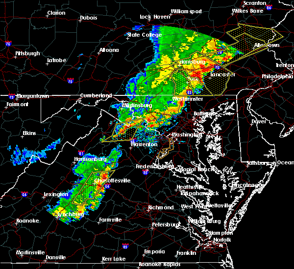 At 501 pm edt, severe thunderstorms were located along a line extending from near bluemont to 7 miles north of delaplane to near linden, moving east at 35 mph (radar indicated). Hazards include 60 mph wind gusts. Damaging winds will cause some trees and large branches to fall. this could injure those outdoors, as well as damage homes and vehicles. roadways may become blocked by downed trees. localized power outages are possible. unsecured light objects may become projectiles. Locations impacted include, front royal, purcellville, berryville, middleburg, round hill, delaplane, linden, bluemont, marshall, hamilton, hillsboro, gaylord, blue mountain, philomont, bethel, lincoln, saint louis, howellsville, briggs and rectortown. At 501 pm edt, severe thunderstorms were located along a line extending from near bluemont to 7 miles north of delaplane to near linden, moving east at 35 mph (radar indicated). Hazards include 60 mph wind gusts. Damaging winds will cause some trees and large branches to fall. this could injure those outdoors, as well as damage homes and vehicles. roadways may become blocked by downed trees. localized power outages are possible. unsecured light objects may become projectiles. Locations impacted include, front royal, purcellville, berryville, middleburg, round hill, delaplane, linden, bluemont, marshall, hamilton, hillsboro, gaylord, blue mountain, philomont, bethel, lincoln, saint louis, howellsville, briggs and rectortown.
|
| 9/5/2017 4:46 PM EDT |
 At 446 pm edt, severe thunderstorms were located along a line extending from near berryville to near linden to near front royal, moving northeast at 35 mph (radar indicated). Hazards include 60 mph wind gusts. Damaging winds will cause some trees and large branches to fall. this could injure those outdoors, as well as damage homes and vehicles. roadways may become blocked by downed trees. localized power outages are possible. Unsecured light objects may become projectiles. At 446 pm edt, severe thunderstorms were located along a line extending from near berryville to near linden to near front royal, moving northeast at 35 mph (radar indicated). Hazards include 60 mph wind gusts. Damaging winds will cause some trees and large branches to fall. this could injure those outdoors, as well as damage homes and vehicles. roadways may become blocked by downed trees. localized power outages are possible. Unsecured light objects may become projectiles.
|
| 7/22/2017 1:42 PM EDT | Tree down on willisville road near john mosby highwa in loudoun county VA, 6.1 miles ESE of Middleburg, VA |
| 7/14/2017 3:57 PM EDT |
 At 356 pm edt, a severe thunderstorm was located near the plains, or 13 miles north of warrenton, moving east at 10 mph (radar indicated). Hazards include 60 mph wind gusts. Damaging winds will cause some trees and large branches to fall. this could injure those outdoors, as well as damage homes and vehicles. roadways may become blocked by downed trees. localized power outages are possible. unsecured light objects may become projectiles. Locations impacted include, middleburg, the plains, delaplane, marshall, halfway and rectortown. At 356 pm edt, a severe thunderstorm was located near the plains, or 13 miles north of warrenton, moving east at 10 mph (radar indicated). Hazards include 60 mph wind gusts. Damaging winds will cause some trees and large branches to fall. this could injure those outdoors, as well as damage homes and vehicles. roadways may become blocked by downed trees. localized power outages are possible. unsecured light objects may become projectiles. Locations impacted include, middleburg, the plains, delaplane, marshall, halfway and rectortown.
|
| 7/14/2017 3:38 PM EDT |
 At 338 pm edt, a severe thunderstorm was located near delaplane, or 17 miles west of brambleton, moving east at 10 mph (radar indicated). Hazards include 60 mph wind gusts and quarter size hail. Damaging winds will cause some trees and large branches to fall. this could injure those outdoors, as well as damage homes and vehicles. roadways may become blocked by downed trees. localized power outages are possible. unsecured light objects may become projectiles. Locations impacted include, middleburg, delaplane, marshall, saint louis, halfway, upperville, markham and rectortown. At 338 pm edt, a severe thunderstorm was located near delaplane, or 17 miles west of brambleton, moving east at 10 mph (radar indicated). Hazards include 60 mph wind gusts and quarter size hail. Damaging winds will cause some trees and large branches to fall. this could injure those outdoors, as well as damage homes and vehicles. roadways may become blocked by downed trees. localized power outages are possible. unsecured light objects may become projectiles. Locations impacted include, middleburg, delaplane, marshall, saint louis, halfway, upperville, markham and rectortown.
|
| 7/14/2017 3:27 PM EDT |
 At 327 pm edt, a severe thunderstorm was located near delaplane, or 16 miles east of front royal, moving east at 10 mph (radar indicated). Hazards include 60 mph wind gusts and quarter size hail. Damaging winds will cause some trees and large branches to fall. this could injure those outdoors, as well as damage homes and vehicles. roadways may become blocked by downed trees. localized power outages are possible. unsecured light objects may become projectiles. Locations impacted include, middleburg, delaplane, marshall, saint louis, halfway, upperville, markham, rectortown and paris. At 327 pm edt, a severe thunderstorm was located near delaplane, or 16 miles east of front royal, moving east at 10 mph (radar indicated). Hazards include 60 mph wind gusts and quarter size hail. Damaging winds will cause some trees and large branches to fall. this could injure those outdoors, as well as damage homes and vehicles. roadways may become blocked by downed trees. localized power outages are possible. unsecured light objects may become projectiles. Locations impacted include, middleburg, delaplane, marshall, saint louis, halfway, upperville, markham, rectortown and paris.
|
| 7/14/2017 3:24 PM EDT |
 At 324 pm edt, a severe thunderstorm was located near delaplane, or 15 miles east of front royal, moving east at 10 mph (radar indicated). Hazards include 60 mph wind gusts and quarter size hail. Damaging winds will cause some trees and large branches to fall. this could injure those outdoors, as well as damage homes and vehicles. roadways may become blocked by downed trees. localized power outages are possible. Unsecured light objects may become projectiles. At 324 pm edt, a severe thunderstorm was located near delaplane, or 15 miles east of front royal, moving east at 10 mph (radar indicated). Hazards include 60 mph wind gusts and quarter size hail. Damaging winds will cause some trees and large branches to fall. this could injure those outdoors, as well as damage homes and vehicles. roadways may become blocked by downed trees. localized power outages are possible. Unsecured light objects may become projectiles.
|
| 7/11/2017 6:25 PM EDT |
 The severe thunderstorm warning for southwestern loudoun and north central fauquier counties will expire at 630 pm edt, the storm which prompted the warning has weakened below severe limits, and no longer pose an immediate threat to life or property. therefore the warning will be allowed to expire. The severe thunderstorm warning for southwestern loudoun and north central fauquier counties will expire at 630 pm edt, the storm which prompted the warning has weakened below severe limits, and no longer pose an immediate threat to life or property. therefore the warning will be allowed to expire.
|
| 7/11/2017 6:12 PM EDT |
 At 612 pm edt, a severe thunderstorm was located near bluemont, or 14 miles southeast of millwood pike, moving southeast at 20 mph (trained weather spotters). Hazards include 60 mph wind gusts and quarter size hail. Damaging winds will cause some trees and large branches to fall. this could injure those outdoors, as well as damage homes and vehicles. roadways may become blocked by downed trees. localized power outages are possible. unsecured light objects may become projectiles. Locations impacted include, middleburg, oatlands, saint louis, philomont and aldie. At 612 pm edt, a severe thunderstorm was located near bluemont, or 14 miles southeast of millwood pike, moving southeast at 20 mph (trained weather spotters). Hazards include 60 mph wind gusts and quarter size hail. Damaging winds will cause some trees and large branches to fall. this could injure those outdoors, as well as damage homes and vehicles. roadways may become blocked by downed trees. localized power outages are possible. unsecured light objects may become projectiles. Locations impacted include, middleburg, oatlands, saint louis, philomont and aldie.
|
| 7/11/2017 6:01 PM EDT |
 At 601 pm edt, a severe thunderstorm was located near berryville, or 11 miles east of millwood pike, moving southeast at 20 mph (trained weather spotters). Hazards include 60 mph wind gusts and quarter size hail. Damaging winds will cause some trees and large branches to fall. this could injure those outdoors, as well as damage homes and vehicles. roadways may become blocked by downed trees. localized power outages are possible. unsecured light objects may become projectiles. Locations impacted include, middleburg, the plains, bluemont, oatlands, saint louis, aldie, halfway, upperville and philomont. At 601 pm edt, a severe thunderstorm was located near berryville, or 11 miles east of millwood pike, moving southeast at 20 mph (trained weather spotters). Hazards include 60 mph wind gusts and quarter size hail. Damaging winds will cause some trees and large branches to fall. this could injure those outdoors, as well as damage homes and vehicles. roadways may become blocked by downed trees. localized power outages are possible. unsecured light objects may become projectiles. Locations impacted include, middleburg, the plains, bluemont, oatlands, saint louis, aldie, halfway, upperville and philomont.
|
| 7/11/2017 6:00 PM EDT | Tree down on us 50 at willisville road in loudoun county VA, 6.1 miles ESE of Middleburg, VA |
| 7/11/2017 5:41 PM EDT |
 The national weather service in sterling virginia has issued a * severe thunderstorm warning for. southwestern loudoun county in northern virginia. southeastern clarke county in northwestern virginia. north central fauquier county in northern virginia. Until 630 pm edt. The national weather service in sterling virginia has issued a * severe thunderstorm warning for. southwestern loudoun county in northern virginia. southeastern clarke county in northwestern virginia. north central fauquier county in northern virginia. Until 630 pm edt.
|
| 7/1/2017 2:38 PM EDT |
 At 237 pm edt, a severe thunderstorm was located near oatlands, or near brambleton, moving east at 25 mph (radar indicated). Hazards include 60 mph wind gusts. Damaging winds will cause some trees and large branches to fall. this could injure those outdoors, as well as damage homes and vehicles. roadways may become blocked by downed trees. localized power outages are possible. Unsecured light objects may become projectiles. At 237 pm edt, a severe thunderstorm was located near oatlands, or near brambleton, moving east at 25 mph (radar indicated). Hazards include 60 mph wind gusts. Damaging winds will cause some trees and large branches to fall. this could injure those outdoors, as well as damage homes and vehicles. roadways may become blocked by downed trees. localized power outages are possible. Unsecured light objects may become projectiles.
|
| 5/30/2017 6:24 PM EDT |
 At 623 pm edt, a severe thunderstorm was located over bluemont, or 11 miles south of charles town, moving southeast at 25 mph (radar indicated). Hazards include 60 mph wind gusts and quarter size hail. Damaging winds will cause some trees and large branches to fall. this could injure those outdoors, as well as damage homes and vehicles. roadways may become blocked by downed trees. localized power outages are possible. unsecured light objects may become projectiles. Locations impacted include, leesburg, broadlands, lansdowne, brambleton, ashburn, purcellville, middleburg, round hill, arcola, oatlands, bluemont, belmont, hamilton, saint louis, paeonian springs, gleedsville, gaylord, wickliffe, aldie and philomont. At 623 pm edt, a severe thunderstorm was located over bluemont, or 11 miles south of charles town, moving southeast at 25 mph (radar indicated). Hazards include 60 mph wind gusts and quarter size hail. Damaging winds will cause some trees and large branches to fall. this could injure those outdoors, as well as damage homes and vehicles. roadways may become blocked by downed trees. localized power outages are possible. unsecured light objects may become projectiles. Locations impacted include, leesburg, broadlands, lansdowne, brambleton, ashburn, purcellville, middleburg, round hill, arcola, oatlands, bluemont, belmont, hamilton, saint louis, paeonian springs, gleedsville, gaylord, wickliffe, aldie and philomont.
|
| 5/30/2017 6:15 PM EDT |
 At 614 pm edt, a severe thunderstorm was located over berryville, or 10 miles southwest of charles town, moving southeast at 25 mph (radar indicated). Hazards include 60 mph wind gusts and quarter size hail. Damaging winds will cause some trees and large branches to fall. this could injure those outdoors, as well as damage homes and vehicles. roadways may become blocked by downed trees. localized power outages are possible. Unsecured light objects may become projectiles. At 614 pm edt, a severe thunderstorm was located over berryville, or 10 miles southwest of charles town, moving southeast at 25 mph (radar indicated). Hazards include 60 mph wind gusts and quarter size hail. Damaging winds will cause some trees and large branches to fall. this could injure those outdoors, as well as damage homes and vehicles. roadways may become blocked by downed trees. localized power outages are possible. Unsecured light objects may become projectiles.
|
| 5/18/2017 7:40 PM EDT |
 The severe thunderstorm warning for west central montgomery, central loudoun, northwestern fairfax, north central fauquier and northwestern prince william counties will expire at 745 pm edt, the storms which prompted the warning have moved out of the area. therefore the warning will be allowed to expire. remember, a severe thunderstorm warning still remains in effect for eastern portions of the area. The severe thunderstorm warning for west central montgomery, central loudoun, northwestern fairfax, north central fauquier and northwestern prince william counties will expire at 745 pm edt, the storms which prompted the warning have moved out of the area. therefore the warning will be allowed to expire. remember, a severe thunderstorm warning still remains in effect for eastern portions of the area.
|
| 5/18/2017 7:26 PM EDT |
 The severe thunderstorm warning for southwestern loudoun and north central fauquier counties will expire at 730 pm edt, the storms which prompted the warning have moved out of the area. therefore the warning will be allowed to expire. remember, a severe thunderstorm warning still remains in effect farther east. The severe thunderstorm warning for southwestern loudoun and north central fauquier counties will expire at 730 pm edt, the storms which prompted the warning have moved out of the area. therefore the warning will be allowed to expire. remember, a severe thunderstorm warning still remains in effect farther east.
|
| 5/18/2017 7:19 PM EDT |
 At 719 pm edt, severe thunderstorms were located along a line extending from near purcellville to near middleburg, moving east at 30 mph (trained weather spotters). Hazards include ping pong ball size hail and 60 mph wind gusts. Damaging winds will cause some trees and large branches to fall. this could injure those outdoors, as well as damage homes and vehicles. roadways may become blocked by downed trees. localized power outages are possible. unsecured light objects may become projectiles. Locations impacted include, centreville, reston, leesburg, south riding, herndon, broadlands, lansdowne, brambleton, poolesville, dulles international airport, ashburn, sterling, chantilly, countryside, purcellville, middleburg, arcola, oatlands, belmont and hamilton. At 719 pm edt, severe thunderstorms were located along a line extending from near purcellville to near middleburg, moving east at 30 mph (trained weather spotters). Hazards include ping pong ball size hail and 60 mph wind gusts. Damaging winds will cause some trees and large branches to fall. this could injure those outdoors, as well as damage homes and vehicles. roadways may become blocked by downed trees. localized power outages are possible. unsecured light objects may become projectiles. Locations impacted include, centreville, reston, leesburg, south riding, herndon, broadlands, lansdowne, brambleton, poolesville, dulles international airport, ashburn, sterling, chantilly, countryside, purcellville, middleburg, arcola, oatlands, belmont and hamilton.
|
| 5/18/2017 7:14 PM EDT |
 At 714 pm edt, severe thunderstorms were located along a line extending from near purcellville to near delaplane, moving east at 25 mph (trained weather spotters). Hazards include ping pong ball size hail and 60 mph wind gusts. Damaging winds will cause some trees and large branches to fall. this could injure those outdoors, as well as damage homes and vehicles. roadways may become blocked by downed trees. localized power outages are possible. unsecured light objects may become projectiles. Locations impacted include, purcellville, middleburg, round hill, hamilton, saint louis, halfway, upperville, philomont, lincoln, rectortown and hughesville. At 714 pm edt, severe thunderstorms were located along a line extending from near purcellville to near delaplane, moving east at 25 mph (trained weather spotters). Hazards include ping pong ball size hail and 60 mph wind gusts. Damaging winds will cause some trees and large branches to fall. this could injure those outdoors, as well as damage homes and vehicles. roadways may become blocked by downed trees. localized power outages are possible. unsecured light objects may become projectiles. Locations impacted include, purcellville, middleburg, round hill, hamilton, saint louis, halfway, upperville, philomont, lincoln, rectortown and hughesville.
|
| 5/18/2017 7:03 PM EDT |
 At 703 pm edt, severe thunderstorms were located along a line extending from near purcellville to middleburg, moving east at 25 mph (radar indicated). Hazards include 60 mph wind gusts and half dollar size hail. Damaging winds will cause some trees and large branches to fall. this could injure those outdoors, as well as damage homes and vehicles. roadways may become blocked by downed trees. localized power outages are possible. Unsecured light objects may become projectiles. At 703 pm edt, severe thunderstorms were located along a line extending from near purcellville to middleburg, moving east at 25 mph (radar indicated). Hazards include 60 mph wind gusts and half dollar size hail. Damaging winds will cause some trees and large branches to fall. this could injure those outdoors, as well as damage homes and vehicles. roadways may become blocked by downed trees. localized power outages are possible. Unsecured light objects may become projectiles.
|
| 5/18/2017 7:01 PM EDT |
 At 700 pm edt, severe thunderstorms were located along a line extending from round hill to near linden, moving east at 15 mph (radar indicated). Hazards include 70 mph wind gusts and ping pong ball size hail. Damaging winds will cause some trees and large branches to fall. this could injure those outdoors, as well as damage homes and vehicles. roadways may become blocked by downed trees. localized power outages are possible. unsecured light objects may become projectiles. Locations impacted include, purcellville, middleburg, round hill, bluemont, hamilton, saint louis, howellsville, rectortown, blue mountain, halfway, upperville, philomont, lincoln, hughesville and paris. At 700 pm edt, severe thunderstorms were located along a line extending from round hill to near linden, moving east at 15 mph (radar indicated). Hazards include 70 mph wind gusts and ping pong ball size hail. Damaging winds will cause some trees and large branches to fall. this could injure those outdoors, as well as damage homes and vehicles. roadways may become blocked by downed trees. localized power outages are possible. unsecured light objects may become projectiles. Locations impacted include, purcellville, middleburg, round hill, bluemont, hamilton, saint louis, howellsville, rectortown, blue mountain, halfway, upperville, philomont, lincoln, hughesville and paris.
|
| 5/18/2017 6:27 PM EDT |
 At 627 pm edt, severe thunderstorms were located along a line extending from berryville to 8 miles northeast of linden, moving east at 20 mph (radar indicated). Hazards include 60 mph wind gusts and half dollar size hail. Damaging winds will cause some trees and large branches to fall. this could injure those outdoors, as well as damage homes and vehicles. roadways may become blocked by downed trees. localized power outages are possible. Unsecured light objects may become projectiles. At 627 pm edt, severe thunderstorms were located along a line extending from berryville to 8 miles northeast of linden, moving east at 20 mph (radar indicated). Hazards include 60 mph wind gusts and half dollar size hail. Damaging winds will cause some trees and large branches to fall. this could injure those outdoors, as well as damage homes and vehicles. roadways may become blocked by downed trees. localized power outages are possible. Unsecured light objects may become projectiles.
|
| 4/30/2017 3:08 PM EDT |
 At 308 pm edt, a severe thunderstorm was located near middleburg, or 11 miles southwest of leesburg, moving northeast at 20 mph (radar indicated). Hazards include 60 mph wind gusts and quarter size hail. Damaging winds will cause some trees and large branches to fall. this could injure those outdoors, as well as damage homes and vehicles. roadways may become blocked by downed trees. localized power outages are possible. unsecured light objects may become projectiles. Locations impacted include, brambleton, middleburg, arcola, saint louis, philomont and aldie. At 308 pm edt, a severe thunderstorm was located near middleburg, or 11 miles southwest of leesburg, moving northeast at 20 mph (radar indicated). Hazards include 60 mph wind gusts and quarter size hail. Damaging winds will cause some trees and large branches to fall. this could injure those outdoors, as well as damage homes and vehicles. roadways may become blocked by downed trees. localized power outages are possible. unsecured light objects may become projectiles. Locations impacted include, brambleton, middleburg, arcola, saint louis, philomont and aldie.
|
| 4/30/2017 2:54 PM EDT |
 At 253 pm edt, a severe thunderstorm was located near middleburg, or 15 miles west of brambleton, moving northeast at 20 mph (radar indicated). Hazards include 60 mph wind gusts and quarter size hail. Damaging winds will cause some trees and large branches to fall. this could injure those outdoors, as well as damage homes and vehicles. roadways may become blocked by downed trees. localized power outages are possible. unsecured light objects may become projectiles. Locations impacted include, south riding, brambleton, middleburg, arcola, marshall, saint louis, aldie, halfway, upperville, philomont and rectortown. At 253 pm edt, a severe thunderstorm was located near middleburg, or 15 miles west of brambleton, moving northeast at 20 mph (radar indicated). Hazards include 60 mph wind gusts and quarter size hail. Damaging winds will cause some trees and large branches to fall. this could injure those outdoors, as well as damage homes and vehicles. roadways may become blocked by downed trees. localized power outages are possible. unsecured light objects may become projectiles. Locations impacted include, south riding, brambleton, middleburg, arcola, marshall, saint louis, aldie, halfway, upperville, philomont and rectortown.
|
| 4/30/2017 2:39 PM EDT |
 At 238 pm edt, a severe thunderstorm was located over delaplane, or 15 miles north of warrenton, moving northeast at 20 mph (radar indicated). Hazards include 60 mph wind gusts and quarter size hail. Damaging winds will cause some trees and large branches to fall. this could injure those outdoors, as well as damage homes and vehicles. roadways may become blocked by downed trees. localized power outages are possible. Unsecured light objects may become projectiles. At 238 pm edt, a severe thunderstorm was located over delaplane, or 15 miles north of warrenton, moving northeast at 20 mph (radar indicated). Hazards include 60 mph wind gusts and quarter size hail. Damaging winds will cause some trees and large branches to fall. this could injure those outdoors, as well as damage homes and vehicles. roadways may become blocked by downed trees. localized power outages are possible. Unsecured light objects may become projectiles.
|
| 3/1/2017 1:01 PM EST |
 At 100 pm est, severe thunderstorms were located along a line extending from near middleburg to near culpeper, moving east at 55 mph (radar indicated). Hazards include 60 mph wind gusts. Damaging winds will cause some trees and large branches to fall. this could injure those outdoors, as well as damage homes and vehicles. roadways may become blocked by downed trees. localized power outages are possible. unsecured light objects may become projectiles. Locations impacted include, leesburg, culpeper, broadlands, lansdowne, brambleton, warrenton, orange, madison, ashburn, linton hall, bealeton, haymarket, middleburg, arcola, the plains, oatlands, delaplane, gainesville, new baltimore and belmont. At 100 pm est, severe thunderstorms were located along a line extending from near middleburg to near culpeper, moving east at 55 mph (radar indicated). Hazards include 60 mph wind gusts. Damaging winds will cause some trees and large branches to fall. this could injure those outdoors, as well as damage homes and vehicles. roadways may become blocked by downed trees. localized power outages are possible. unsecured light objects may become projectiles. Locations impacted include, leesburg, culpeper, broadlands, lansdowne, brambleton, warrenton, orange, madison, ashburn, linton hall, bealeton, haymarket, middleburg, arcola, the plains, oatlands, delaplane, gainesville, new baltimore and belmont.
|
| 3/1/2017 12:47 PM EST |
 At 1247 pm est, severe thunderstorms were located along a line extending from 6 miles northwest of delaplane to madison, moving east at 55 mph (radar indicated). Hazards include 60 mph wind gusts. Damaging winds will cause some trees and large branches to fall. this could injure those outdoors, as well as damage homes and vehicles. roadways may become blocked by downed trees. localized power outages are possible. unsecured light objects may become projectiles. Locations impacted include, leesburg, culpeper, broadlands, lansdowne, brambleton, warrenton, orange, madison, ashburn, linton hall, bealeton, haymarket, middleburg, stanardsville, sperryville, arcola, the plains, delaplane, linden and hume. At 1247 pm est, severe thunderstorms were located along a line extending from 6 miles northwest of delaplane to madison, moving east at 55 mph (radar indicated). Hazards include 60 mph wind gusts. Damaging winds will cause some trees and large branches to fall. this could injure those outdoors, as well as damage homes and vehicles. roadways may become blocked by downed trees. localized power outages are possible. unsecured light objects may become projectiles. Locations impacted include, leesburg, culpeper, broadlands, lansdowne, brambleton, warrenton, orange, madison, ashburn, linton hall, bealeton, haymarket, middleburg, stanardsville, sperryville, arcola, the plains, delaplane, linden and hume.
|
| 3/1/2017 12:26 PM EST |
 At 1226 pm est, severe thunderstorms were located along a line extending from near strasburg to 8 miles southeast of massanutten, moving east at 55 mph (radar indicated). Hazards include 60 mph wind gusts. Damaging winds will cause some trees and large branches to fall. this could injure those outdoors, as well as damage homes and vehicles. roadways may become blocked by downed trees. localized power outages are possible. Unsecured light objects may become projectiles. At 1226 pm est, severe thunderstorms were located along a line extending from near strasburg to 8 miles southeast of massanutten, moving east at 55 mph (radar indicated). Hazards include 60 mph wind gusts. Damaging winds will cause some trees and large branches to fall. this could injure those outdoors, as well as damage homes and vehicles. roadways may become blocked by downed trees. localized power outages are possible. Unsecured light objects may become projectiles.
|
| 2/25/2017 2:12 PM EST |
 At 212 pm est, severe thunderstorms were located along a line extending from purcellville to near middleburg, moving east at 30 mph (radar indicated). Hazards include 60 mph wind gusts. Damaging winds will cause some trees and large branches to fall. this could injure those outdoors, as well as damage homes and vehicles. roadways may become blocked by downed trees. localized power outages are possible. Unsecured light objects may become projectiles. At 212 pm est, severe thunderstorms were located along a line extending from purcellville to near middleburg, moving east at 30 mph (radar indicated). Hazards include 60 mph wind gusts. Damaging winds will cause some trees and large branches to fall. this could injure those outdoors, as well as damage homes and vehicles. roadways may become blocked by downed trees. localized power outages are possible. Unsecured light objects may become projectiles.
|
| 2/12/2017 10:38 PM EST |
 At 1037 pm est, severe thunderstorms were located along a line extending from near point of rocks to near round hill to near berryville, moving east at 50 mph (radar indicated). Hazards include 60 mph wind gusts. Damaging winds will cause some trees and large branches to fall. this could injure those outdoors, as well as damage homes and vehicles. roadways may become blocked by downed trees. localized power outages are possible. Unsecured light objects may become projectiles. At 1037 pm est, severe thunderstorms were located along a line extending from near point of rocks to near round hill to near berryville, moving east at 50 mph (radar indicated). Hazards include 60 mph wind gusts. Damaging winds will cause some trees and large branches to fall. this could injure those outdoors, as well as damage homes and vehicles. roadways may become blocked by downed trees. localized power outages are possible. Unsecured light objects may become projectiles.
|
| 2/12/2017 10:01 PM EST |
 At 1001 pm est, severe thunderstorms were located along a line extending from hagerstown to near inwood to 6 miles south of romney, moving southeast at 45 mph (radar indicated). Hazards include 60 mph wind gusts. Damaging winds will cause some trees and large branches to fall. this could injure those outdoors, as well as damage homes and vehicles. roadways may become blocked by downed trees. localized power outages are possible. Unsecured light objects may become projectiles. At 1001 pm est, severe thunderstorms were located along a line extending from hagerstown to near inwood to 6 miles south of romney, moving southeast at 45 mph (radar indicated). Hazards include 60 mph wind gusts. Damaging winds will cause some trees and large branches to fall. this could injure those outdoors, as well as damage homes and vehicles. roadways may become blocked by downed trees. localized power outages are possible. Unsecured light objects may become projectiles.
|
| 8/17/2016 8:28 PM EDT |
 The severe thunderstorm warning for northwestern prince william, central loudoun and northeastern fauquier counties will expire at 830 pm edt, the storms which prompted the warning have weakened below severe limits, and no longer pose an immediate threat to life or property. therefore the warning will be allowed to expire. however gusty winds are still possible with these thunderstorms. The severe thunderstorm warning for northwestern prince william, central loudoun and northeastern fauquier counties will expire at 830 pm edt, the storms which prompted the warning have weakened below severe limits, and no longer pose an immediate threat to life or property. therefore the warning will be allowed to expire. however gusty winds are still possible with these thunderstorms.
|
| 8/17/2016 8:18 PM EDT |
 At 817 pm edt, severe thunderstorms were located along a line extending from near middleburg to near warrenton, moving northeast at 45 mph (law enforcement). Hazards include 70 mph wind gusts. Damaging winds will cause some trees and large branches to fall. this could injure those outdoors, as well as damage homes and vehicles. roadways may become blocked by downed trees. localized power outages are possible. unsecured light objects may become projectiles. Locations impacted include, leesburg, south riding, brambleton, warrenton, linton hall, bull run, haymarket, middleburg, arcola, the plains, oatlands, gainesville, new baltimore, marshall, nokesville, hamilton, woolsey, broad run, philomont and hughesville. At 817 pm edt, severe thunderstorms were located along a line extending from near middleburg to near warrenton, moving northeast at 45 mph (law enforcement). Hazards include 70 mph wind gusts. Damaging winds will cause some trees and large branches to fall. this could injure those outdoors, as well as damage homes and vehicles. roadways may become blocked by downed trees. localized power outages are possible. unsecured light objects may become projectiles. Locations impacted include, leesburg, south riding, brambleton, warrenton, linton hall, bull run, haymarket, middleburg, arcola, the plains, oatlands, gainesville, new baltimore, marshall, nokesville, hamilton, woolsey, broad run, philomont and hughesville.
|
| 8/17/2016 7:58 PM EDT |
 At 757 pm edt, severe thunderstorms were located along a line extending from near linden to 10 miles west of warrenton, moving northeast at 45 mph (law enforcement). Hazards include 70 mph wind gusts. Damaging winds will cause some trees and large branches to fall. this could injure those outdoors, as well as damage homes and vehicles. roadways may become blocked by downed trees. localized power outages are possible. Unsecured light objects may become projectiles. At 757 pm edt, severe thunderstorms were located along a line extending from near linden to 10 miles west of warrenton, moving northeast at 45 mph (law enforcement). Hazards include 70 mph wind gusts. Damaging winds will cause some trees and large branches to fall. this could injure those outdoors, as well as damage homes and vehicles. roadways may become blocked by downed trees. localized power outages are possible. Unsecured light objects may become projectiles.
|
| 8/16/2016 5:00 PM EDT |
 At 500 pm edt, a severe thunderstorm was located near middleburg, or 10 miles southwest of leesburg, moving east at 30 mph (radar indicated). Hazards include 60 mph wind gusts. Damaging winds will cause some trees and large branches to fall. this could injure those outdoors, as well as damage homes and vehicles. roadways may become blocked by downed trees. localized power outages are possible. unsecured light objects may become projectiles. Locations impacted include, middleburg, aldie, rectortown, saint louis, halfway and philomont. At 500 pm edt, a severe thunderstorm was located near middleburg, or 10 miles southwest of leesburg, moving east at 30 mph (radar indicated). Hazards include 60 mph wind gusts. Damaging winds will cause some trees and large branches to fall. this could injure those outdoors, as well as damage homes and vehicles. roadways may become blocked by downed trees. localized power outages are possible. unsecured light objects may become projectiles. Locations impacted include, middleburg, aldie, rectortown, saint louis, halfway and philomont.
|
| 8/16/2016 4:46 PM EDT |
 At 446 pm edt, a severe thunderstorm was located near middleburg, or 16 miles west of brambleton, moving east at 30 mph (radar indicated). Hazards include 60 mph wind gusts. Damaging winds will cause some trees and large branches to fall. this could injure those outdoors, as well as damage homes and vehicles. roadways may become blocked by downed trees. localized power outages are possible. unsecured light objects may become projectiles. Locations impacted include, middleburg, delaplane, aldie, rectortown, upperville, saint louis, halfway and philomont. At 446 pm edt, a severe thunderstorm was located near middleburg, or 16 miles west of brambleton, moving east at 30 mph (radar indicated). Hazards include 60 mph wind gusts. Damaging winds will cause some trees and large branches to fall. this could injure those outdoors, as well as damage homes and vehicles. roadways may become blocked by downed trees. localized power outages are possible. unsecured light objects may become projectiles. Locations impacted include, middleburg, delaplane, aldie, rectortown, upperville, saint louis, halfway and philomont.
|
| 8/16/2016 4:40 PM EDT |
 At 440 pm edt, a severe thunderstorm was located near delaplane, or 16 miles east of front royal, moving east at 30 mph (radar indicated). Hazards include 60 mph wind gusts. Damaging winds will cause some trees and large branches to fall. this could injure those outdoors, as well as damage homes and vehicles. roadways may become blocked by downed trees. localized power outages are possible. Unsecured light objects may become projectiles. At 440 pm edt, a severe thunderstorm was located near delaplane, or 16 miles east of front royal, moving east at 30 mph (radar indicated). Hazards include 60 mph wind gusts. Damaging winds will cause some trees and large branches to fall. this could injure those outdoors, as well as damage homes and vehicles. roadways may become blocked by downed trees. localized power outages are possible. Unsecured light objects may become projectiles.
|
| 7/30/2016 7:21 PM EDT |
 At 720 pm edt, severe thunderstorms were located along a line extending from near boyds to near brambleton, moving east at 25 mph (radar indicated). Hazards include 60 mph wind gusts. Damaging winds will cause some trees and large branches to fall. this could injure those outdoors, as well as damage homes and vehicles. roadways may become blocked by downed trees. localized power outages are possible. unsecured light objects may become projectiles. Locations impacted include, germantown, centreville, rockville, gaithersburg, reston, leesburg, south riding, herndon, broadlands, lansdowne, lowes island, brambleton, poolesville, dulles international airport, ashburn, montgomery village, sterling, north potomac, chantilly and redland. At 720 pm edt, severe thunderstorms were located along a line extending from near boyds to near brambleton, moving east at 25 mph (radar indicated). Hazards include 60 mph wind gusts. Damaging winds will cause some trees and large branches to fall. this could injure those outdoors, as well as damage homes and vehicles. roadways may become blocked by downed trees. localized power outages are possible. unsecured light objects may become projectiles. Locations impacted include, germantown, centreville, rockville, gaithersburg, reston, leesburg, south riding, herndon, broadlands, lansdowne, lowes island, brambleton, poolesville, dulles international airport, ashburn, montgomery village, sterling, north potomac, chantilly and redland.
|
| 7/30/2016 7:00 PM EDT |
 At 659 pm edt, severe thunderstorms were located along a line extending from point of rocks to near middleburg, moving southeast at 25 mph (radar indicated). Hazards include 60 mph wind gusts. Damaging winds will cause some trees and large branches to fall. this could injure those outdoors, as well as damage homes and vehicles. roadways may become blocked by downed trees. localized power outages are possible. Unsecured light objects may become projectiles. At 659 pm edt, severe thunderstorms were located along a line extending from point of rocks to near middleburg, moving southeast at 25 mph (radar indicated). Hazards include 60 mph wind gusts. Damaging winds will cause some trees and large branches to fall. this could injure those outdoors, as well as damage homes and vehicles. roadways may become blocked by downed trees. localized power outages are possible. Unsecured light objects may become projectiles.
|
| 7/30/2016 5:01 PM EDT |
 At 500 pm edt, a severe thunderstorm was located over delaplane, or 13 miles east of front royal, moving east at 10 mph (radar indicated). Hazards include 60 mph wind gusts. Damaging winds will cause some trees and large branches to fall. this could injure those outdoors, as well as damage homes and vehicles. roadways may become blocked by downed trees. localized power outages are possible. unsecured light objects may become projectiles. Locations impacted include, middleburg, the plains, hume, delaplane, marshall, aldie, markham, rectortown, upperville, saint louis, halfway, ada and ashville. At 500 pm edt, a severe thunderstorm was located over delaplane, or 13 miles east of front royal, moving east at 10 mph (radar indicated). Hazards include 60 mph wind gusts. Damaging winds will cause some trees and large branches to fall. this could injure those outdoors, as well as damage homes and vehicles. roadways may become blocked by downed trees. localized power outages are possible. unsecured light objects may become projectiles. Locations impacted include, middleburg, the plains, hume, delaplane, marshall, aldie, markham, rectortown, upperville, saint louis, halfway, ada and ashville.
|
| 7/30/2016 4:46 PM EDT |
 At 446 pm edt, a severe thunderstorm was located near delaplane, or 11 miles east of front royal, moving east at 20 mph (radar indicated). Hazards include 60 mph wind gusts. Damaging winds will cause some trees and large branches to fall. this could injure those outdoors, as well as damage homes and vehicles. roadways may become blocked by downed trees. localized power outages are possible. Unsecured light objects may become projectiles. At 446 pm edt, a severe thunderstorm was located near delaplane, or 11 miles east of front royal, moving east at 20 mph (radar indicated). Hazards include 60 mph wind gusts. Damaging winds will cause some trees and large branches to fall. this could injure those outdoors, as well as damage homes and vehicles. roadways may become blocked by downed trees. localized power outages are possible. Unsecured light objects may become projectiles.
|
| 7/25/2016 5:26 PM EDT | Trees down on foxcroft rd in loudoun county VA, 0.1 miles NNE of Middleburg, VA |
| 7/25/2016 5:24 PM EDT | Tree down on st. louis rd in loudoun county VA, 3 miles ESE of Middleburg, VA |
| 7/25/2016 5:17 PM EDT |
 At 517 pm edt, a severe thunderstorm was located near bluemont, or 12 miles west of leesburg, moving east at 30 mph (radar indicated). Hazards include 70 mph wind gusts and quarter size hail. Damaging winds will cause some trees and large branches to fall. this could injure those outdoors, as well as damage homes and vehicles. roadways may become blocked by downed trees. localized power outages are possible. unsecured light objects may become projectiles. Locations impacted include, leesburg, purcellville, middleburg, round hill, oatlands, bluemont, hamilton, hillsboro, paeonian springs, upperville, philomont, waterford, hughesville, gleedsville, aldie, saint louis, lincoln and wickliffe. At 517 pm edt, a severe thunderstorm was located near bluemont, or 12 miles west of leesburg, moving east at 30 mph (radar indicated). Hazards include 70 mph wind gusts and quarter size hail. Damaging winds will cause some trees and large branches to fall. this could injure those outdoors, as well as damage homes and vehicles. roadways may become blocked by downed trees. localized power outages are possible. unsecured light objects may become projectiles. Locations impacted include, leesburg, purcellville, middleburg, round hill, oatlands, bluemont, hamilton, hillsboro, paeonian springs, upperville, philomont, waterford, hughesville, gleedsville, aldie, saint louis, lincoln and wickliffe.
|
| 7/25/2016 4:58 PM EDT |
 At 458 pm edt, a severe thunderstorm was located over bluemont, or 10 miles south of charles town, moving east at 40 mph (radar indicated). Hazards include 70 mph wind gusts and quarter size hail. Damaging winds will cause some trees and large branches to fall. this could injure those outdoors, as well as damage homes and vehicles. roadways may become blocked by downed trees. localized power outages are possible. unsecured light objects may become projectiles. Locations impacted include, leesburg, purcellville, berryville, middleburg, round hill, oatlands, bluemont, boyce, hamilton, hillsboro, white post, philomont, waterford, hughesville, rippon, gleedsville, aldie, millwood, saint louis and lincoln. At 458 pm edt, a severe thunderstorm was located over bluemont, or 10 miles south of charles town, moving east at 40 mph (radar indicated). Hazards include 70 mph wind gusts and quarter size hail. Damaging winds will cause some trees and large branches to fall. this could injure those outdoors, as well as damage homes and vehicles. roadways may become blocked by downed trees. localized power outages are possible. unsecured light objects may become projectiles. Locations impacted include, leesburg, purcellville, berryville, middleburg, round hill, oatlands, bluemont, boyce, hamilton, hillsboro, white post, philomont, waterford, hughesville, rippon, gleedsville, aldie, millwood, saint louis and lincoln.
|
| 7/25/2016 4:42 PM EDT |
 At 441 pm edt, a severe thunderstorm was located near berryville, or near millwood pike, moving east at 35 mph (radar indicated). Hazards include 60 mph wind gusts and quarter size hail. Damaging winds will cause some trees and large branches to fall. this could injure those outdoors, as well as damage homes and vehicles. roadways may become blocked by downed trees. localized power outages are possible. Unsecured light objects may become projectiles. At 441 pm edt, a severe thunderstorm was located near berryville, or near millwood pike, moving east at 35 mph (radar indicated). Hazards include 60 mph wind gusts and quarter size hail. Damaging winds will cause some trees and large branches to fall. this could injure those outdoors, as well as damage homes and vehicles. roadways may become blocked by downed trees. localized power outages are possible. Unsecured light objects may become projectiles.
|
| 7/18/2016 3:01 PM EDT |
 At 300 pm edt, a severe thunderstorm was located 7 miles south of berryville, or 12 miles southeast of millwood pike, moving east at 35 mph (trained weather spotters). Hazards include 60 mph wind gusts. Damaging winds will cause some trees and large branches to fall. this could injure those outdoors, as well as damage homes and vehicles. roadways may become blocked by downed trees. localized power outages are possible. Unsecured light objects may become projectiles. At 300 pm edt, a severe thunderstorm was located 7 miles south of berryville, or 12 miles southeast of millwood pike, moving east at 35 mph (trained weather spotters). Hazards include 60 mph wind gusts. Damaging winds will cause some trees and large branches to fall. this could injure those outdoors, as well as damage homes and vehicles. roadways may become blocked by downed trees. localized power outages are possible. Unsecured light objects may become projectiles.
|
| 7/16/2016 3:42 PM EDT |
 At 342 pm edt, a severe thunderstorm was located near middleburg, or 7 miles west of brambleton, moving east at 10 mph (radar indicated). Hazards include 60 mph wind gusts. Damaging winds will cause some trees and large branches to fall. this could injure those outdoors, as well as damage homes and vehicles. roadways may become blocked by downed trees. localized power outages are possible. Unsecured light objects may become projectiles. At 342 pm edt, a severe thunderstorm was located near middleburg, or 7 miles west of brambleton, moving east at 10 mph (radar indicated). Hazards include 60 mph wind gusts. Damaging winds will cause some trees and large branches to fall. this could injure those outdoors, as well as damage homes and vehicles. roadways may become blocked by downed trees. localized power outages are possible. Unsecured light objects may become projectiles.
|
| 7/16/2016 3:22 PM EDT |
 At 320 pm edt, a severe thunderstorm was located over middleburg, or 9 miles west of brambleton, moving east at 15 mph (radar indicated). Hazards include 60 mph wind gusts and quarter size hail. Damaging winds will cause some trees and large branches to fall. this could injure those outdoors, as well as damage homes and vehicles. roadways may become blocked by downed trees. localized power outages are possible. unsecured light objects may become projectiles. Locations impacted include, middleburg, oatlands, aldie, gleedsville, saint louis and philomont. At 320 pm edt, a severe thunderstorm was located over middleburg, or 9 miles west of brambleton, moving east at 15 mph (radar indicated). Hazards include 60 mph wind gusts and quarter size hail. Damaging winds will cause some trees and large branches to fall. this could injure those outdoors, as well as damage homes and vehicles. roadways may become blocked by downed trees. localized power outages are possible. unsecured light objects may become projectiles. Locations impacted include, middleburg, oatlands, aldie, gleedsville, saint louis and philomont.
|
| 7/16/2016 3:06 PM EDT |
 At 306 pm edt, a severe thunderstorm was located over middleburg, or 12 miles west of brambleton, moving east at 15 mph (radar indicated). Hazards include 60 mph wind gusts and quarter size hail. Damaging winds will cause some trees and large branches to fall. this could injure those outdoors, as well as damage homes and vehicles. roadways may become blocked by downed trees. localized power outages are possible. Unsecured light objects may become projectiles. At 306 pm edt, a severe thunderstorm was located over middleburg, or 12 miles west of brambleton, moving east at 15 mph (radar indicated). Hazards include 60 mph wind gusts and quarter size hail. Damaging winds will cause some trees and large branches to fall. this could injure those outdoors, as well as damage homes and vehicles. roadways may become blocked by downed trees. localized power outages are possible. Unsecured light objects may become projectiles.
|
| 6/28/2016 5:21 PM EDT |
 The severe thunderstorm warning for west central fairfax, northwestern prince william, south central loudoun and northeastern fauquier counties will expire at 530 pm edt, the storm which prompted the warning has weakened below severe limits, and no longer pose an immediate threat to life or property. therefore the warning will be allowed to expire. however small hail and gusty winds are still possible with this thunderstorm. a severe thunderstorm watch remains in effect until 1000 pm edt for northern virginia. The severe thunderstorm warning for west central fairfax, northwestern prince william, south central loudoun and northeastern fauquier counties will expire at 530 pm edt, the storm which prompted the warning has weakened below severe limits, and no longer pose an immediate threat to life or property. therefore the warning will be allowed to expire. however small hail and gusty winds are still possible with this thunderstorm. a severe thunderstorm watch remains in effect until 1000 pm edt for northern virginia.
|
| 6/28/2016 5:05 PM EDT | Multiple trees down near the intersection of zulla road and muster lan in fauquier county VA, 3.1 miles NE of Middleburg, VA |
| 6/28/2016 5:03 PM EDT |
 At 503 pm edt, a severe thunderstorm was located near middleburg, or 11 miles southwest of brambleton, moving southeast at 15 mph (radar indicated). Hazards include 60 mph wind gusts and quarter size hail. Damaging winds will cause some trees and large branches to fall. this could injure those outdoors, as well as damage homes and vehicles. roadways may become blocked by downed trees. localized power outages are possible. unsecured light objects may become projectiles. Locations impacted include, centreville, south riding, linton hall, chantilly, bull run, haymarket, middleburg, arcola, the plains, sudley, gainesville, new baltimore, marshall, nokesville, greenwich, woolsey, broad run, aldie, catharpin and halfway. At 503 pm edt, a severe thunderstorm was located near middleburg, or 11 miles southwest of brambleton, moving southeast at 15 mph (radar indicated). Hazards include 60 mph wind gusts and quarter size hail. Damaging winds will cause some trees and large branches to fall. this could injure those outdoors, as well as damage homes and vehicles. roadways may become blocked by downed trees. localized power outages are possible. unsecured light objects may become projectiles. Locations impacted include, centreville, south riding, linton hall, chantilly, bull run, haymarket, middleburg, arcola, the plains, sudley, gainesville, new baltimore, marshall, nokesville, greenwich, woolsey, broad run, aldie, catharpin and halfway.
|
| 6/28/2016 4:51 PM EDT | Multiple trees down on route 50 in fauquier county VA, 3.3 miles E of Middleburg, VA |
| 6/28/2016 4:46 PM EDT |
 At 446 pm edt, a severe thunderstorm was located over middleburg, or 12 miles west of brambleton, moving southeast at 25 mph (radar indicated). Hazards include 60 mph wind gusts and quarter size hail. Damaging winds will cause some trees and large branches to fall. this could injure those outdoors, as well as damage homes and vehicles. roadways may become blocked by downed trees. localized power outages are possible. Unsecured light objects may become projectiles. At 446 pm edt, a severe thunderstorm was located over middleburg, or 12 miles west of brambleton, moving southeast at 25 mph (radar indicated). Hazards include 60 mph wind gusts and quarter size hail. Damaging winds will cause some trees and large branches to fall. this could injure those outdoors, as well as damage homes and vehicles. roadways may become blocked by downed trees. localized power outages are possible. Unsecured light objects may become projectiles.
|
| 6/21/2016 5:15 PM EDT |
 At 515 pm edt, a severe thunderstorm was located over middleburg, or 8 miles west of brambleton, moving southeast at 25 mph (radar indicated). Hazards include golf ball size hail and 60 mph wind gusts. Expect wind damage to trees and power lines. hail is large enough to dent and damage vehicles. some hail damage to roofs, siding, and windows is possible. Locations impacted include, centreville, reston, south riding, herndon, broadlands, brambleton, dulles international airport, ashburn, sterling, chantilly, bull run, middleburg, arcola, oatlands, sudley, woolsey, philomont, gleedsville, aldie and catharpin. At 515 pm edt, a severe thunderstorm was located over middleburg, or 8 miles west of brambleton, moving southeast at 25 mph (radar indicated). Hazards include golf ball size hail and 60 mph wind gusts. Expect wind damage to trees and power lines. hail is large enough to dent and damage vehicles. some hail damage to roofs, siding, and windows is possible. Locations impacted include, centreville, reston, south riding, herndon, broadlands, brambleton, dulles international airport, ashburn, sterling, chantilly, bull run, middleburg, arcola, oatlands, sudley, woolsey, philomont, gleedsville, aldie and catharpin.
|
| 6/21/2016 4:53 PM EDT |
 At 453 pm edt, a severe thunderstorm was located near bluemont, or 16 miles south of charles town, moving southeast at 25 mph (radar indicated). Hazards include golf ball size hail and 70 mph wind gusts. Expect wind damage to trees and power lines. hail is large enough to dent and damage vehicles. Some hail damage to roofs, siding, and windows is possible. At 453 pm edt, a severe thunderstorm was located near bluemont, or 16 miles south of charles town, moving southeast at 25 mph (radar indicated). Hazards include golf ball size hail and 70 mph wind gusts. Expect wind damage to trees and power lines. hail is large enough to dent and damage vehicles. Some hail damage to roofs, siding, and windows is possible.
|
| 6/21/2016 3:07 PM EDT |
 At 307 pm edt, a severe thunderstorm was located near middleburg, or 9 miles west of brambleton, moving southeast at 35 mph (radar indicated). Hazards include 60 mph wind gusts and quarter size hail. Damaging winds will cause some trees and large branches to fall. this could injure those outdoors, as well as damage homes and vehicles. roadways may become blocked by downed trees. localized power outages are possible. unsecured light objects may become projectiles. Locations impacted include, centreville, reston, south riding, herndon, broadlands, brambleton, dulles international airport, ashburn, linton hall, sterling, chantilly, bull run, haymarket, middleburg, arcola, oatlands, sudley, gainesville, woolsey and gleedsville. At 307 pm edt, a severe thunderstorm was located near middleburg, or 9 miles west of brambleton, moving southeast at 35 mph (radar indicated). Hazards include 60 mph wind gusts and quarter size hail. Damaging winds will cause some trees and large branches to fall. this could injure those outdoors, as well as damage homes and vehicles. roadways may become blocked by downed trees. localized power outages are possible. unsecured light objects may become projectiles. Locations impacted include, centreville, reston, south riding, herndon, broadlands, brambleton, dulles international airport, ashburn, linton hall, sterling, chantilly, bull run, haymarket, middleburg, arcola, oatlands, sudley, gainesville, woolsey and gleedsville.
|
| 6/21/2016 2:54 PM EDT |
 At 254 pm edt, a severe thunderstorm was located over bluemont, or 13 miles south of charles town, moving southeast at 35 mph (radar indicated). Hazards include 60 mph wind gusts and quarter size hail. Damaging winds will cause some trees and large branches to fall. this could injure those outdoors, as well as damage homes and vehicles. roadways may become blocked by downed trees. localized power outages are possible. Unsecured light objects may become projectiles. At 254 pm edt, a severe thunderstorm was located over bluemont, or 13 miles south of charles town, moving southeast at 35 mph (radar indicated). Hazards include 60 mph wind gusts and quarter size hail. Damaging winds will cause some trees and large branches to fall. this could injure those outdoors, as well as damage homes and vehicles. roadways may become blocked by downed trees. localized power outages are possible. Unsecured light objects may become projectiles.
|
| 6/21/2016 1:16 PM EDT |
 At 116 pm edt, a severe thunderstorm was located near middleburg, or 10 miles west of brambleton, moving east at 40 mph (radar indicated). Hazards include two inch hail and 70 mph wind gusts. Expect wind damage to trees and power lines. hail is large enough to dent and damage vehicles. some hail damage to roofs, siding, and windows is possible. Locations impacted include, centreville, reston, south riding, herndon, fairfax, broadlands, lowes island, brambleton, dulles international airport, ashburn, oakton, sterling, chantilly, wolf trap, great falls, countryside, middleburg, arcola, the plains and oatlands. At 116 pm edt, a severe thunderstorm was located near middleburg, or 10 miles west of brambleton, moving east at 40 mph (radar indicated). Hazards include two inch hail and 70 mph wind gusts. Expect wind damage to trees and power lines. hail is large enough to dent and damage vehicles. some hail damage to roofs, siding, and windows is possible. Locations impacted include, centreville, reston, south riding, herndon, fairfax, broadlands, lowes island, brambleton, dulles international airport, ashburn, oakton, sterling, chantilly, wolf trap, great falls, countryside, middleburg, arcola, the plains and oatlands.
|
| 6/21/2016 1:12 PM EDT |
 At 112 pm edt, doppler radar indicated a severe thunderstorm capable of producing quarter size hail and destructive winds in excess of 70 mph. this storm was located near middleburg, or 13 miles west of brambleton, and moving east at 40 mph. At 112 pm edt, doppler radar indicated a severe thunderstorm capable of producing quarter size hail and destructive winds in excess of 70 mph. this storm was located near middleburg, or 13 miles west of brambleton, and moving east at 40 mph.
|
| 6/16/2016 8:39 PM EDT |
 The severe thunderstorm warning for northwestern prince william, southeastern rappahannock, loudoun, western culpeper, east central madison, central fauquier and southeastern jefferson counties will expire at 845 pm edt, the storms which prompted the warning have moved out of the area. therefore the warning will be allowed to expire. a severe thunderstorm watch remains in effect until 1000 pm edt for northwestern virginia, and central west virginia. The severe thunderstorm warning for northwestern prince william, southeastern rappahannock, loudoun, western culpeper, east central madison, central fauquier and southeastern jefferson counties will expire at 845 pm edt, the storms which prompted the warning have moved out of the area. therefore the warning will be allowed to expire. a severe thunderstorm watch remains in effect until 1000 pm edt for northwestern virginia, and central west virginia.
|
| 6/16/2016 8:39 PM EDT | The severe thunderstorm warning for northwestern prince william, southeastern rappahannock, loudoun, western culpeper, east central madison, central fauquier and southeastern jefferson counties will expire at 845 pm edt, the storms which prompted the warning have moved out of the area. therefore the warning will be allowed to expire. a severe thunderstorm watch remains in effect until 1000 pm edt for northwestern virginia, and central west virginia. |
| 6/16/2016 8:25 PM EDT |
 At 824 pm edt, severe thunderstorms were located along a line extending from near lansdowne to near centreville to near culpeper, moving east at 50 mph (radar indicated). Hazards include 60 mph wind gusts. Damaging winds will cause some trees and large branches to fall. this could injure those outdoors, as well as damage homes and vehicles. roadways may become blocked by downed trees. localized power outages are possible. unsecured light objects may become projectiles. Locations impacted include, leesburg, south riding, culpeper, brambleton, warrenton, charles town, linton hall, purcellville, ranson, bealeton, haymarket, middleburg, round hill, arcola, the plains, oatlands, gainesville, new baltimore, lovettsville and marshall. At 824 pm edt, severe thunderstorms were located along a line extending from near lansdowne to near centreville to near culpeper, moving east at 50 mph (radar indicated). Hazards include 60 mph wind gusts. Damaging winds will cause some trees and large branches to fall. this could injure those outdoors, as well as damage homes and vehicles. roadways may become blocked by downed trees. localized power outages are possible. unsecured light objects may become projectiles. Locations impacted include, leesburg, south riding, culpeper, brambleton, warrenton, charles town, linton hall, purcellville, ranson, bealeton, haymarket, middleburg, round hill, arcola, the plains, oatlands, gainesville, new baltimore, lovettsville and marshall.
|
| 6/16/2016 8:02 PM EDT |
 At 801 pm edt, severe thunderstorms were located along a line extending from near round hill to near the plains and marshall to near sperryville, moving east at 45 mph (radar indicated). Hazards include 60 mph wind gusts. Damaging winds will cause some trees and large branches to fall. this could injure those outdoors, as well as damage homes and vehicles. roadways may become blocked by downed trees. localized power outages are possible. unsecured light objects may become projectiles. Locations impacted include, leesburg, south riding, culpeper, brambleton, warrenton, charles town, linton hall, purcellville, ranson, bealeton, haymarket, middleburg, round hill, sperryville, arcola, the plains, hume, delaplane, bluemont and oatlands. At 801 pm edt, severe thunderstorms were located along a line extending from near round hill to near the plains and marshall to near sperryville, moving east at 45 mph (radar indicated). Hazards include 60 mph wind gusts. Damaging winds will cause some trees and large branches to fall. this could injure those outdoors, as well as damage homes and vehicles. roadways may become blocked by downed trees. localized power outages are possible. unsecured light objects may become projectiles. Locations impacted include, leesburg, south riding, culpeper, brambleton, warrenton, charles town, linton hall, purcellville, ranson, bealeton, haymarket, middleburg, round hill, sperryville, arcola, the plains, hume, delaplane, bluemont and oatlands.
|
| 6/16/2016 7:39 PM EDT |
 At 739 pm edt, severe thunderstorms were located along a line extending from near charles town to near linden to 7 miles south of front royal to stanley, moving east at 50 mph (radar indicated). Hazards include 60 mph wind gusts and quarter size hail. Damaging winds will cause some trees and large branches to fall. this could injure those outdoors, as well as damage homes and vehicles. roadways may become blocked by downed trees. localized power outages are possible. Unsecured light objects may become projectiles. At 739 pm edt, severe thunderstorms were located along a line extending from near charles town to near linden to 7 miles south of front royal to stanley, moving east at 50 mph (radar indicated). Hazards include 60 mph wind gusts and quarter size hail. Damaging winds will cause some trees and large branches to fall. this could injure those outdoors, as well as damage homes and vehicles. roadways may become blocked by downed trees. localized power outages are possible. Unsecured light objects may become projectiles.
|
| 6/16/2016 6:38 PM EDT |
 The tornado warning for northwestern prince william, southwestern loudoun and north central fauquier counties will expire at 645 pm edt, the tornado threat has diminished and the tornado warning has been cancelled. however, large hail remains likely and a severe thunderstorm warning remains in effect for the area. however small hail is still possible with this thunderstorm. a severe thunderstorm watch remains in effect until 1000 pm edt for northern virginia. remember, a severe thunderstorm warning still remains in effect. The tornado warning for northwestern prince william, southwestern loudoun and north central fauquier counties will expire at 645 pm edt, the tornado threat has diminished and the tornado warning has been cancelled. however, large hail remains likely and a severe thunderstorm warning remains in effect for the area. however small hail is still possible with this thunderstorm. a severe thunderstorm watch remains in effect until 1000 pm edt for northern virginia. remember, a severe thunderstorm warning still remains in effect.
|
| 6/16/2016 6:37 PM EDT |
 At 637 pm edt, a severe thunderstorm was located near middleburg, or 8 miles west of south riding, moving southeast at 25 mph (radar indicated). Hazards include tennis ball size hail and 60 mph wind gusts. Expect wind damage to trees and power lines. hail is large enough to dent and damage vehicles. Some hail damage to roofs, siding, and windows is possible. At 637 pm edt, a severe thunderstorm was located near middleburg, or 8 miles west of south riding, moving southeast at 25 mph (radar indicated). Hazards include tennis ball size hail and 60 mph wind gusts. Expect wind damage to trees and power lines. hail is large enough to dent and damage vehicles. Some hail damage to roofs, siding, and windows is possible.
|
| 6/16/2016 6:30 PM EDT | Ping Pong Ball sized hail reported 0.1 miles NNE of Middleburg, VA |
| 6/16/2016 6:25 PM EDT | Multiple trees down. windows damaged by hai in loudoun county VA, 0.1 miles NNE of Middleburg, VA |
| 6/16/2016 6:22 PM EDT | Golf Ball sized hail reported 2.3 miles ESE of Middleburg, VA, golf ball size hail |
| 6/16/2016 6:20 PM EDT |
 At 619 pm edt, a severe thunderstorm capable of producing a tornado was near over middleburg, or 13 miles west of brambleton, moving southeast at 25 mph (radar indicated rotation). Hazards include tornado and two inch hail. For those in the direct path of a tornado touchdown, flying debris will be dangerous to those caught without shelter. damage to roofs, siding, and windows may occur. mobile homes may be damaged or destroyed. tree damage is likely. this dangerous storm will be near, the plains around 635 pm edt. Other locations impacted by this tornadic thunderstorm include aldie, broad run, saint louis, halfway, woolsey and marshall. At 619 pm edt, a severe thunderstorm capable of producing a tornado was near over middleburg, or 13 miles west of brambleton, moving southeast at 25 mph (radar indicated rotation). Hazards include tornado and two inch hail. For those in the direct path of a tornado touchdown, flying debris will be dangerous to those caught without shelter. damage to roofs, siding, and windows may occur. mobile homes may be damaged or destroyed. tree damage is likely. this dangerous storm will be near, the plains around 635 pm edt. Other locations impacted by this tornadic thunderstorm include aldie, broad run, saint louis, halfway, woolsey and marshall.
|
| 6/16/2016 6:17 PM EDT | Ping Pong Ball sized hail reported 3.9 miles E of Middleburg, VA |
| 6/16/2016 6:13 PM EDT |
 At 612 pm edt, a severe thunderstorm was located near middleburg, or 17 miles west of leesburg, moving southeast at 25 mph (radar indicated). Hazards include tornado and two inch hail. Expect wind damage to trees and power lines. hail is large enough to dent and damage vehicles. some hail damage to roofs, siding, and windows is possible. Locations impacted include, middleburg, marshall, rectortown, upperville, saint louis and philomont. At 612 pm edt, a severe thunderstorm was located near middleburg, or 17 miles west of leesburg, moving southeast at 25 mph (radar indicated). Hazards include tornado and two inch hail. Expect wind damage to trees and power lines. hail is large enough to dent and damage vehicles. some hail damage to roofs, siding, and windows is possible. Locations impacted include, middleburg, marshall, rectortown, upperville, saint louis and philomont.
|
| 6/16/2016 6:05 PM EDT |
 At 604 pm edt, a severe thunderstorm capable of producing a tornado was located near bluemont, or 15 miles south of charles town, moving southeast at 25 mph (radar indicated rotation). Hazards include tornado and hail up to two inches in diameter. For those in the direct path of a tornado touchdown. flying debris will be dangerous to those caught without shelter. damage to roofs, siding, and windows may occur. mobile homes may be damaged or destroyed. tree damage is likely. this dangerous storm will be near, middleburg around 625 pm edt. the plains around 635 pm edt. Other locations impacted by this tornadic thunderstorm include aldie, woolsey, broad run, rectortown, upperville, saint louis, meadowville, halfway, philomont and marshall. At 604 pm edt, a severe thunderstorm capable of producing a tornado was located near bluemont, or 15 miles south of charles town, moving southeast at 25 mph (radar indicated rotation). Hazards include tornado and hail up to two inches in diameter. For those in the direct path of a tornado touchdown. flying debris will be dangerous to those caught without shelter. damage to roofs, siding, and windows may occur. mobile homes may be damaged or destroyed. tree damage is likely. this dangerous storm will be near, middleburg around 625 pm edt. the plains around 635 pm edt. Other locations impacted by this tornadic thunderstorm include aldie, woolsey, broad run, rectortown, upperville, saint louis, meadowville, halfway, philomont and marshall.
|
| 6/16/2016 5:58 PM EDT |
 At 557 pm edt, a severe thunderstorm capable of producing a tornado was located near berryville, or 12 miles southeast of millwood pike, moving southeast at 25 mph (radar indicated rotation). Hazards include tornado and two inch hail. For those in the direct path of a tornado touchdown, flying debris will be dangerous to those caught without shelter. damage to roofs, siding, and windows may occur. mobile homes may be damaged or destroyed. tree damage is likely. this dangerous storm will be near, delaplane around 620 pm edt. middleburg around 630 pm edt. Other locations impacted by this tornadic thunderstorm include rectortown, briggs, upperville, saint louis, paris, philomont and marshall. At 557 pm edt, a severe thunderstorm capable of producing a tornado was located near berryville, or 12 miles southeast of millwood pike, moving southeast at 25 mph (radar indicated rotation). Hazards include tornado and two inch hail. For those in the direct path of a tornado touchdown, flying debris will be dangerous to those caught without shelter. damage to roofs, siding, and windows may occur. mobile homes may be damaged or destroyed. tree damage is likely. this dangerous storm will be near, delaplane around 620 pm edt. middleburg around 630 pm edt. Other locations impacted by this tornadic thunderstorm include rectortown, briggs, upperville, saint louis, paris, philomont and marshall.
|
| 6/16/2016 5:50 PM EDT |
 At 550 pm edt, a severe thunderstorm capable of producing a tornado was located over berryville, or 10 miles east of millwood pike, moving southeast at 25 mph (radar indicated rotation). Hazards include tornado and half dollar size hail. For those in the direct path of a tornado touchdown. flying debris will be dangerous to those caught without shelter. damage to roofs, siding, and windows may occur. mobile homes may be damaged or destroyed. tree damage is likely. this dangerous storm will be near, bluemont around 605 pm edt. delaplane around 620 pm edt. middleburg around 630 pm edt. Other locations impacted by this tornadic thunderstorm include rectortown, briggs, upperville, saint louis, paris, philomont and marshall. At 550 pm edt, a severe thunderstorm capable of producing a tornado was located over berryville, or 10 miles east of millwood pike, moving southeast at 25 mph (radar indicated rotation). Hazards include tornado and half dollar size hail. For those in the direct path of a tornado touchdown. flying debris will be dangerous to those caught without shelter. damage to roofs, siding, and windows may occur. mobile homes may be damaged or destroyed. tree damage is likely. this dangerous storm will be near, bluemont around 605 pm edt. delaplane around 620 pm edt. middleburg around 630 pm edt. Other locations impacted by this tornadic thunderstorm include rectortown, briggs, upperville, saint louis, paris, philomont and marshall.
|
| 6/16/2016 5:47 PM EDT |
 At 546 pm edt, a severe thunderstorm was located over berryville, or 9 miles east of millwood pike, moving southeast at 30 mph (radar indicated). Hazards include 70 mph wind gusts and half dollar size hail. Damaging winds will cause some trees and large branches to fall. this could injure those outdoors, as well as damage homes and vehicles. roadways may become blocked by downed trees. localized power outages are possible. Unsecured light objects may become projectiles. At 546 pm edt, a severe thunderstorm was located over berryville, or 9 miles east of millwood pike, moving southeast at 30 mph (radar indicated). Hazards include 70 mph wind gusts and half dollar size hail. Damaging winds will cause some trees and large branches to fall. this could injure those outdoors, as well as damage homes and vehicles. roadways may become blocked by downed trees. localized power outages are possible. Unsecured light objects may become projectiles.
|
| 2/24/2016 4:51 PM EST |
 At 451 pm est, doppler radar indicated a line of severe thunderstorms capable of producing quarter size hail and damaging winds in excess of 60 mph. these storms were located along a line extending from near shepherdstown to middleburg, and moving northeast at 40 mph. At 451 pm est, doppler radar indicated a line of severe thunderstorms capable of producing quarter size hail and damaging winds in excess of 60 mph. these storms were located along a line extending from near shepherdstown to middleburg, and moving northeast at 40 mph.
|
| 7/27/2015 2:40 PM EDT | Several trees down north of middlebur in loudoun county VA, 2.3 miles SSE of Middleburg, VA |
| 7/14/2015 7:15 PM EDT |
 At 715 pm edt, doppler radar indicated a severe thunderstorm capable of producing quarter size hail and damaging winds in excess of 60 mph. this storm was located near middleburg, or 14 miles west of brambleton, moving east at 25 mph. locations impacted include, the plains, middleburg, delaplane, aldie, rectortown, upperville, saint louis, halfway, marshall, ashville and broad run. At 715 pm edt, doppler radar indicated a severe thunderstorm capable of producing quarter size hail and damaging winds in excess of 60 mph. this storm was located near middleburg, or 14 miles west of brambleton, moving east at 25 mph. locations impacted include, the plains, middleburg, delaplane, aldie, rectortown, upperville, saint louis, halfway, marshall, ashville and broad run.
|
| 7/14/2015 7:06 PM EDT |
 At 705 pm edt, doppler radar indicated a severe thunderstorm capable of producing quarter size hail and damaging winds in excess of 60 mph. this storm was located over delaplane, or 16 miles east of front royal, moving east at 25 mph. locations impacted include, the plains, middleburg, delaplane, markham, rectortown, upperville, philomont, ashville, aldie, saint louis, halfway, marshall, broad run and ada. At 705 pm edt, doppler radar indicated a severe thunderstorm capable of producing quarter size hail and damaging winds in excess of 60 mph. this storm was located over delaplane, or 16 miles east of front royal, moving east at 25 mph. locations impacted include, the plains, middleburg, delaplane, markham, rectortown, upperville, philomont, ashville, aldie, saint louis, halfway, marshall, broad run and ada.
|
| 7/14/2015 6:58 PM EDT |
 At 657 pm edt, doppler radar indicated a severe thunderstorm capable of producing quarter size hail and damaging winds in excess of 60 mph. this storm was located near delaplane, or 12 miles east of front royal, and moving east at 25 mph. At 657 pm edt, doppler radar indicated a severe thunderstorm capable of producing quarter size hail and damaging winds in excess of 60 mph. this storm was located near delaplane, or 12 miles east of front royal, and moving east at 25 mph.
|
| 6/30/2015 11:36 PM EDT |
 At 1136 pm edt, doppler radar indicated a severe thunderstorm capable of producing quarter size hail and damaging winds in excess of 60 mph. this storm was located 9 miles south of hume, or 9 miles west of warrenton, and moving northeast at 30 mph. At 1136 pm edt, doppler radar indicated a severe thunderstorm capable of producing quarter size hail and damaging winds in excess of 60 mph. this storm was located 9 miles south of hume, or 9 miles west of warrenton, and moving northeast at 30 mph.
|
| 6/23/2015 6:46 PM EDT |
 At 645 pm edt, doppler radar indicated a line of severe thunderstorms capable of producing quarter size hail and damaging winds in excess of 60 mph. these storms were located along a line extending from near arcola to near luray, and moving southeast at 40 mph. At 645 pm edt, doppler radar indicated a line of severe thunderstorms capable of producing quarter size hail and damaging winds in excess of 60 mph. these storms were located along a line extending from near arcola to near luray, and moving southeast at 40 mph.
|
| 6/19/2015 1:01 AM EDT | At 100 am edt, doppler radar indicated a severe thunderstorm capable of producing damaging winds in excess of 60 mph. this storm was located near middleburg, or 15 miles west of brambleton, moving east at 25 mph. locations impacted include, the plains, middleburg, delaplane, rectortown, upperville, saint louis, halfway, marshall and ashville. |
| 6/19/2015 12:50 AM EDT | At 1249 am edt, doppler radar indicated a severe thunderstorm capable of producing damaging winds in excess of 60 mph. this storm was located near delaplane, or 14 miles east of front royal, and moving east at 25 mph. |
| 6/8/2015 6:56 PM EDT | The severe thunderstorm warning for northeastern warren, northwestern fauquier, southern clarke and west central loudoun counties will expire at 700 pm edt, the storm which prompted the warning has weakened below severe limits, and no longer poses an immediate threat to life or property. therefore the warning will be allowed to expire. |
| 6/8/2015 6:45 PM EDT | At 644 pm edt, doppler radar indicated a severe thunderstorm capable of producing damaging winds in excess of 60 mph. this storm was located 7 miles northwest of delaplane, or 11 miles northeast of front royal, moving east at 40 mph. locations impacted include, purcellville, round hill, the plains, middleburg, linden, delaplane, bluemont, markham, white post, rectortown, upperville, philomont, howellsville, blue mountain, millwood, saint louis, halfway, paris, marshall and ashville. a tornado watch remains in effect until 800 pm edt for northwestern virginia. |
| 6/8/2015 6:43 PM EDT | At 643 pm edt, doppler radar indicated a severe thunderstorm capable of producing quarter size hail and damaging winds in excess of 60 mph. this storm was located near haymarket, or 9 miles west of south riding, and moving east at 45 mph. |
| 6/8/2015 6:27 PM EDT | At 627 pm edt, doppler radar indicated a severe thunderstorm capable of producing damaging winds in excess of 60 mph. this storm was located near front royal, and moving east at 35 mph. |
| 5/16/2015 4:51 PM EDT | At 450 pm edt, doppler radar indicated a severe thunderstorm capable of producing quarter size hail and damaging winds in excess of 60 mph. this storm was located near oatlands, moving east at 35 mph. locations impacted include, leesburg, oatlands, brambleton, saint louis, purcellville, round hill, arcola, bluemont, paeonian springs, middleburg, philomont, hughesville, gleedsville, aldie, hamilton, lincoln and waterford. |
| 5/16/2015 4:51 PM EDT | At 450 pm edt, doppler radar indicated a severe thunderstorm capable of producing quarter size hail and damaging winds in excess of 60 mph. this storm was located near oatlands, moving east at 35 mph. locations impacted include, leesburg, oatlands, brambleton, saint louis, purcellville, round hill, arcola, bluemont, paeonian springs, middleburg, philomont, hughesville, gleedsville, aldie, hamilton, lincoln and waterford. |
| 5/16/2015 4:39 PM EDT | At 438 pm edt, doppler radar indicated a severe thunderstorm capable of producing damaging winds in excess of 60 mph. this storm was located over saint louis, moving east at 35 mph. another thunderstorm capable of producing 50 mph winds and nickel size hail was located near philomont, moving northeast at 35 mph, and may become severe shortly. locations impacted include, leesburg, oatlands, brambleton, saint louis, purcellville, round hill, arcola, bluemont, paeonian springs, middleburg, upperville, philomont, hughesville, gleedsville, aldie, hamilton, lincoln, paris and waterford. |
| 5/16/2015 4:39 PM EDT | At 438 pm edt, doppler radar indicated a severe thunderstorm capable of producing damaging winds in excess of 60 mph. this storm was located over saint louis, moving east at 35 mph. another thunderstorm capable of producing 50 mph winds and nickel size hail was located near philomont, moving northeast at 35 mph, and may become severe shortly. locations impacted include, leesburg, oatlands, brambleton, saint louis, purcellville, round hill, arcola, bluemont, paeonian springs, middleburg, upperville, philomont, hughesville, gleedsville, aldie, hamilton, lincoln, paris and waterford. |
| 5/16/2015 4:31 PM EDT | At 431 pm edt, doppler radar indicated a severe thunderstorm capable of producing damaging winds in excess of 60 mph. this storm was located near delaplane, or near saint louis, and moving east at 35 mph. |
| 5/16/2015 4:31 PM EDT | At 431 pm edt, doppler radar indicated a severe thunderstorm capable of producing damaging winds in excess of 60 mph. this storm was located near delaplane, or near saint louis, and moving east at 35 mph. |
| 5/6/2015 4:55 PM EDT | At 454 pm edt, doppler radar indicated a severe thunderstorm capable of producing large damaging hail up to golf ball size and damaging winds in excess of 60 mph. this storm was located 7 miles north of delaplane, or 8 miles west of saint louis. this storm was nearly stationary. golf ball size hail was reported in berryville around 450 pm with this storm. take shelter immediately inside a sturdy structure away from windows. locations impacted include, saint louis, berryville, delaplane, bluemont, boyce, markham, white post, middleburg, rectortown, briggs, upperville, philomont, blue mountain, ashville, stringtown, millwood, gaylord, paris, wickliffe and bethel. |
| 5/6/2015 4:41 PM EDT | At 440 pm edt, doppler radar indicated a severe thunderstorm capable of producing quarter size hail and damaging winds in excess of 60 mph. this storm was located near berryville, or 10 miles southeast of greenwood, and moving southeast at 25 mph. |
| 8/31/2014 5:11 PM EDT | Large tree limb down on road near snickersville turnpike and cobb house r in loudoun county VA, 3.9 miles WSW of Middleburg, VA |
| 9/27/2012 6:59 PM EDT | Quarter sized hail reported 2.6 miles SE of Middleburg, VA |
| 9/18/2012 2:00 PM EDT | Tree down on snickersville pik in loudoun county VA, 3.4 miles SW of Middleburg, VA |
| 9/8/2012 3:05 PM EDT | Tree down along landmark school road in fauquier county VA, 1.8 miles NW of Middleburg, VA |
| 7/8/2012 3:38 PM EDT | Large tree limbs down on rt 50 near horsefields ln in fauquier county VA, 7.2 miles E of Middleburg, VA |
| 7/4/2012 10:04 PM EDT | Tree limb down in loudoun county VA, 2.2 miles E of Middleburg, VA |
| 6/22/2012 6:30 PM EDT | Tree down near intersection of snickersville turnpike and mountville roa in loudoun county VA, 4.3 miles SSW of Middleburg, VA |
| 1/1/0001 12:00 AM | 4 large trees blown down from thunderstorm win in loudoun county VA, 5.6 miles ESE of Middleburg, VA |
| 1/1/0001 12:00 AM | Large limbs blown off in tremendous thunderstorm wind. time estimated from radar in loudoun county VA, 6.1 miles ESE of Middleburg, VA |
| 8/21/2011 1:21 PM EDT | Quarter sized hail reported 6.1 miles ESE of Middleburg, VA |
| 8/21/2011 1:21 PM EDT | Golf Ball sized hail reported 6.1 miles ESE of Middleburg, VA |
| 1/1/0001 12:00 AM | Large tree broken in loudoun county VA, 3.8 miles ESE of Middleburg, VA |
| 1/1/0001 12:00 AM | Trees down along polecat hill road in loudoun county VA, 1.4 miles SSW of Middleburg, VA |
| 1/1/0001 12:00 AM | Trees down along st louis road and foxcroft rd in loudoun county VA, 3.7 miles SSE of Middleburg, VA |
| 1/1/0001 12:00 AM | Tree on house in 20000 block of furr rd in loudoun county VA, 6.3 miles SSE of Middleburg, VA |
| 1/1/0001 12:00 AM | Tree limbs a foot in diameter were blown down along route 50 in loudoun county VA, 0.6 miles E of Middleburg, VA |
| 6/9/2011 7:24 PM EDT | Half Dollar sized hail reported 2.1 miles SE of Middleburg, VA |
| 1/1/0001 12:00 AM | Multiple trees and limbs down along foxcroft...snakehill road and millville road in loudoun county VA, 2.1 miles SE of Middleburg, VA |
| 1/1/0001 12:00 AM | Tree down onto fence on takaro farm lan in loudoun county VA, 4.6 miles SE of Middleburg, VA |
| 1/1/0001 12:00 AM | Tree down on takaro farm lane in loudoun county VA, 4.6 miles SE of Middleburg, VA |
| 1/1/0001 12:00 AM | Tree down on wire in loudoun county VA, 0.1 miles NNE of Middleburg, VA |
| 1/1/0001 12:00 AM | Tree and powerlines down on foxcroft roa in loudoun county VA, 0.6 miles S of Middleburg, VA |
Hail Maps for Middleburg, VA
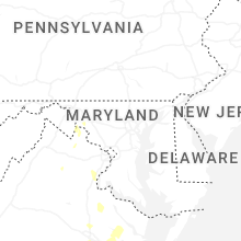


Connect with Interactive Hail Maps