

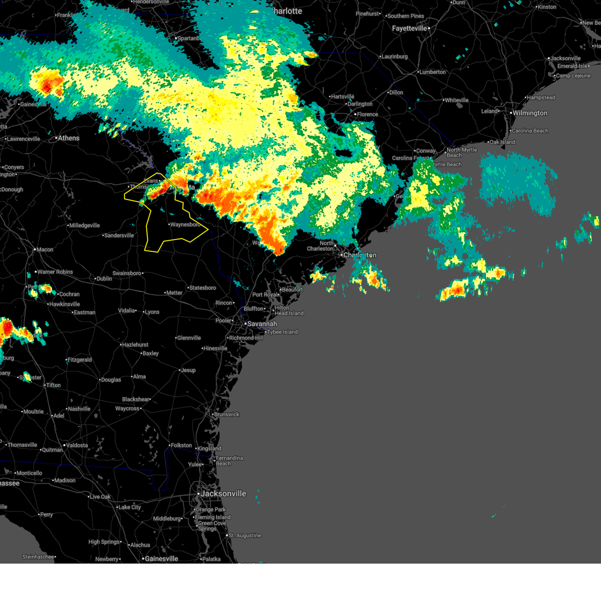
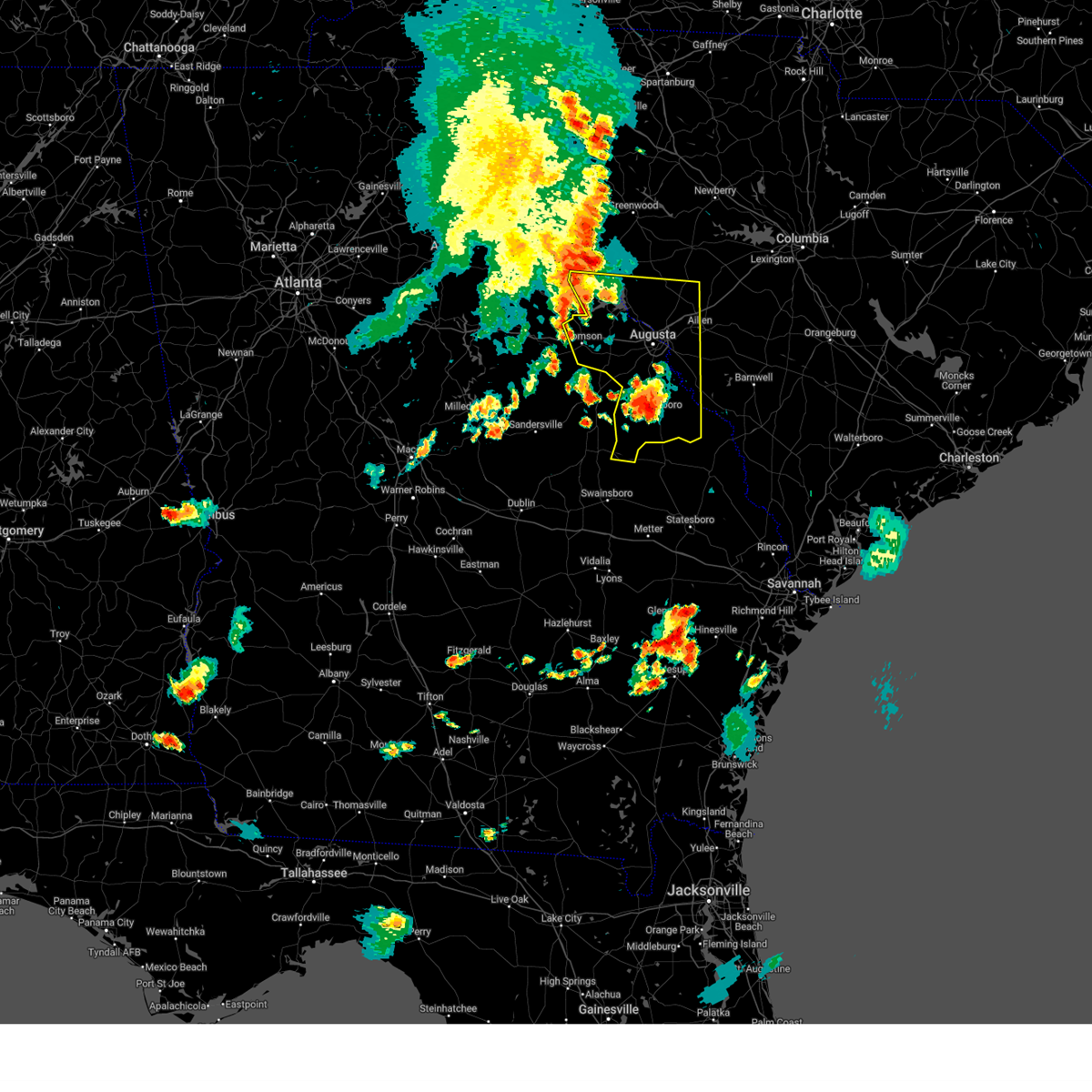
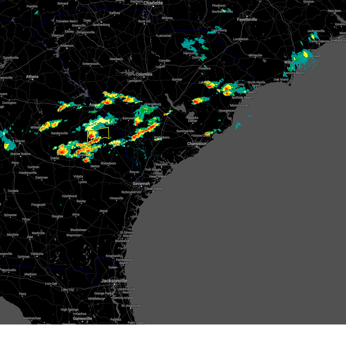
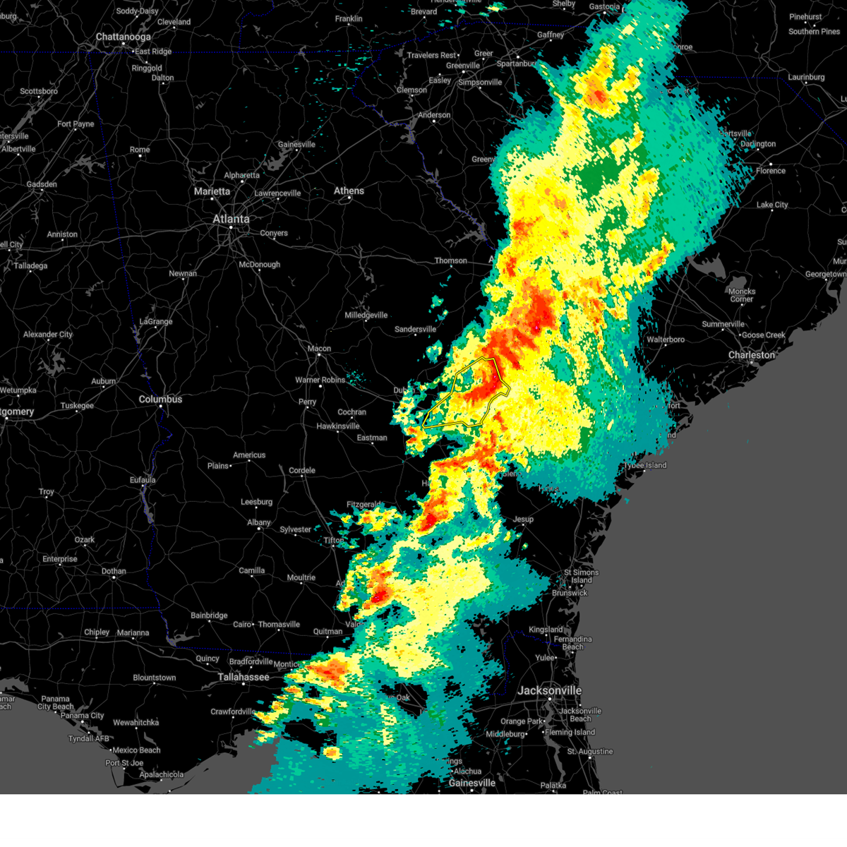
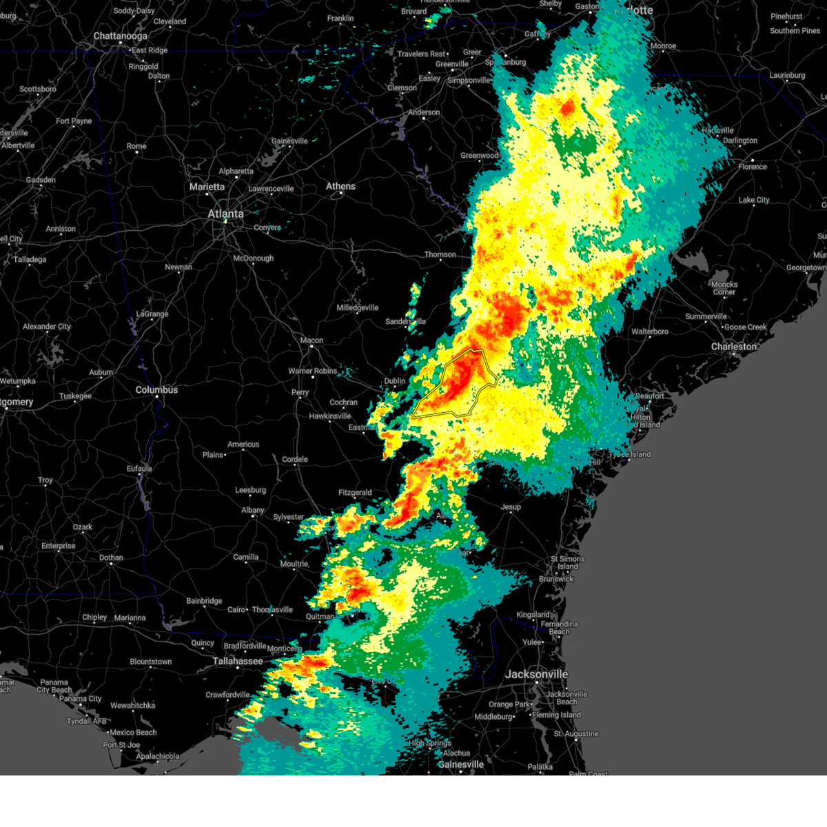
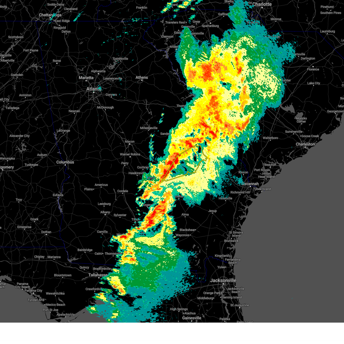
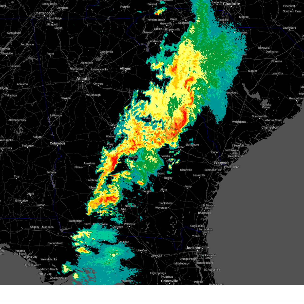
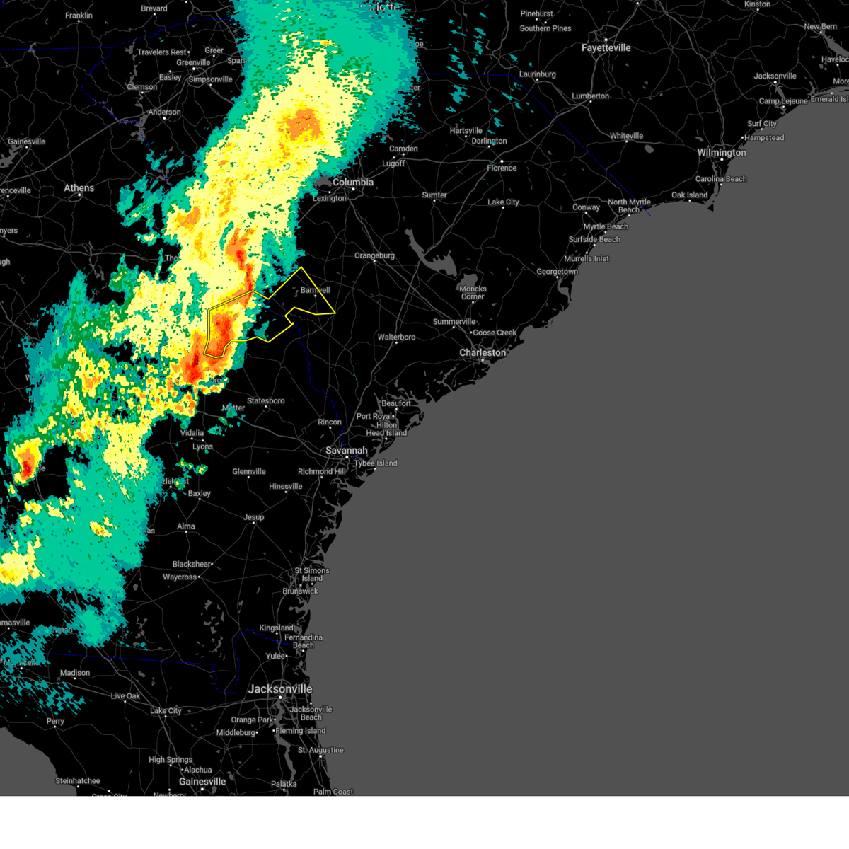
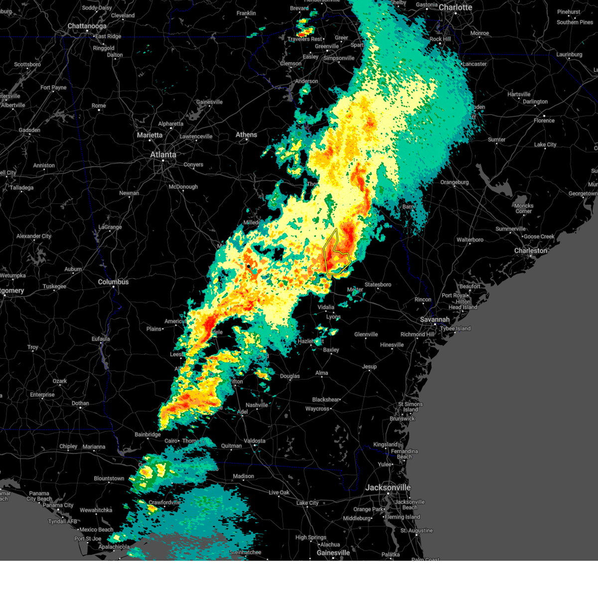
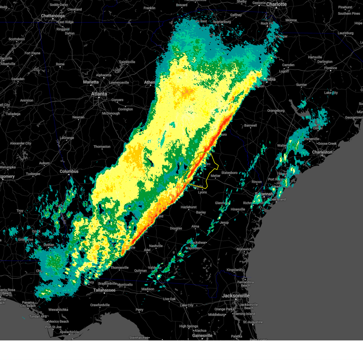
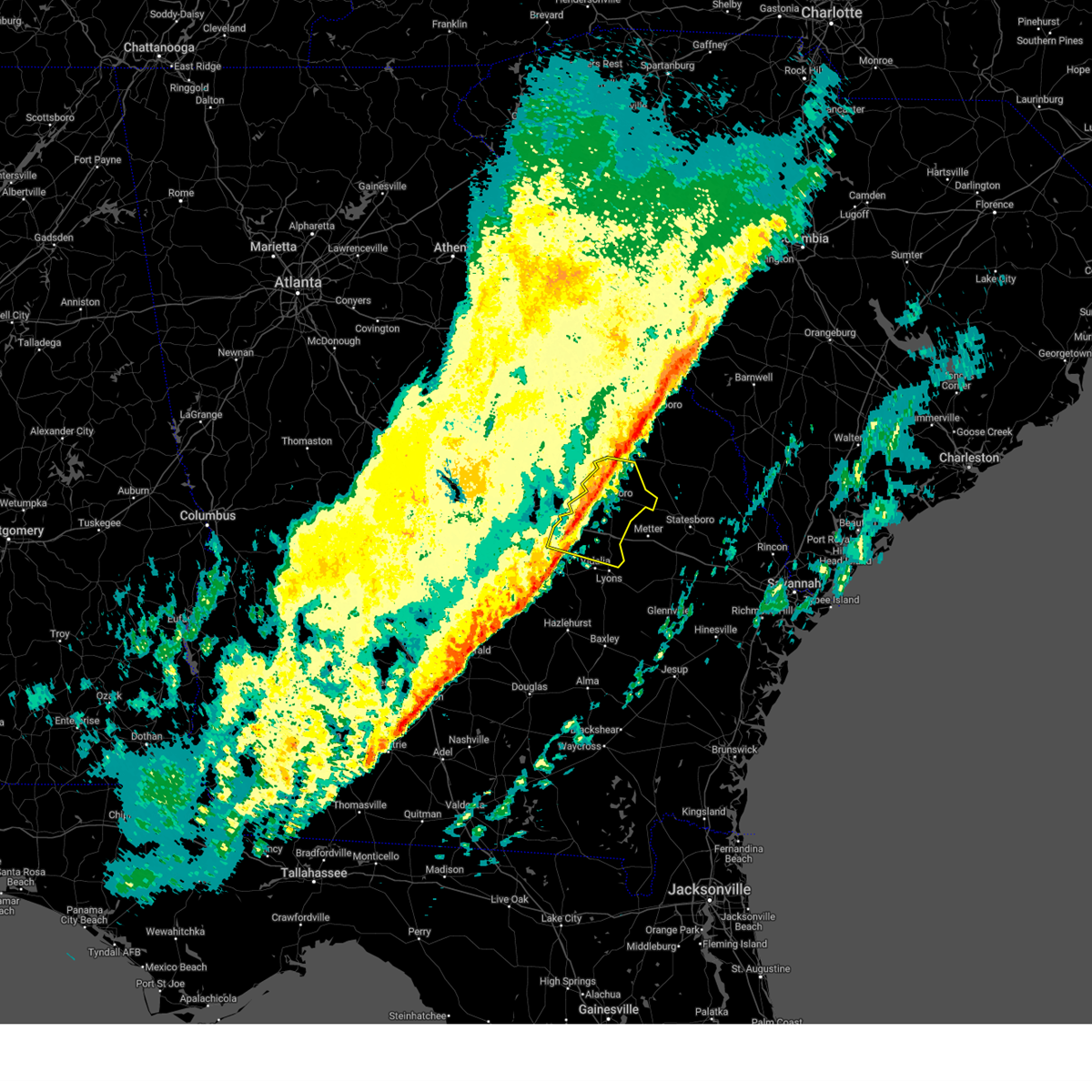
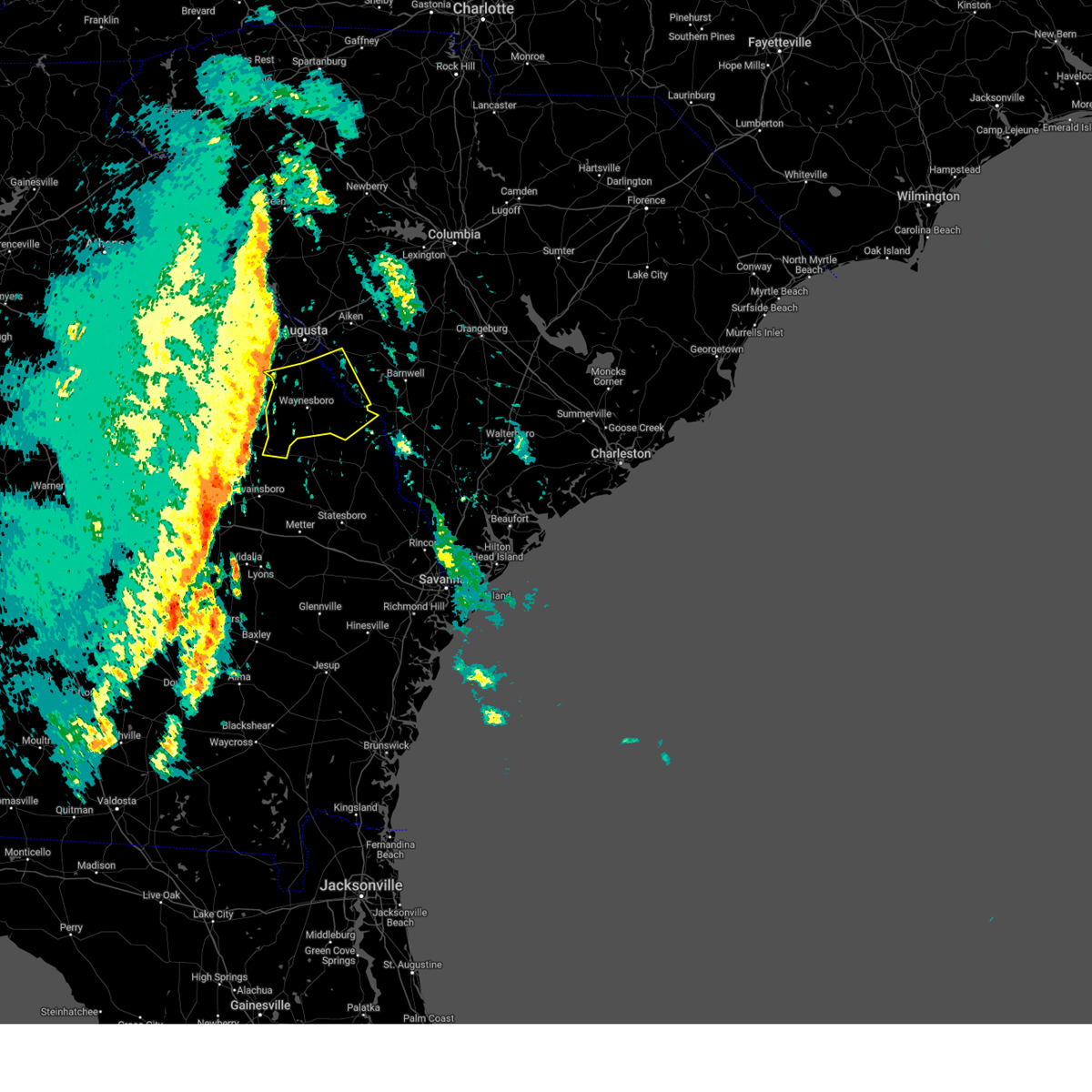
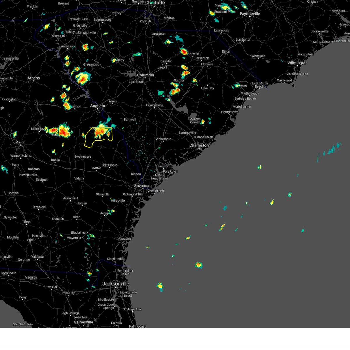
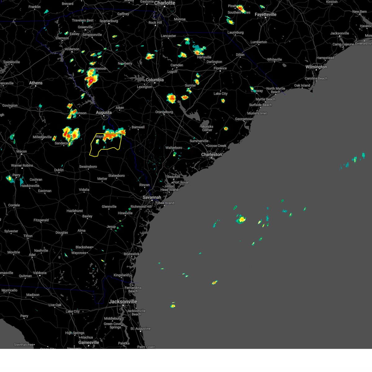
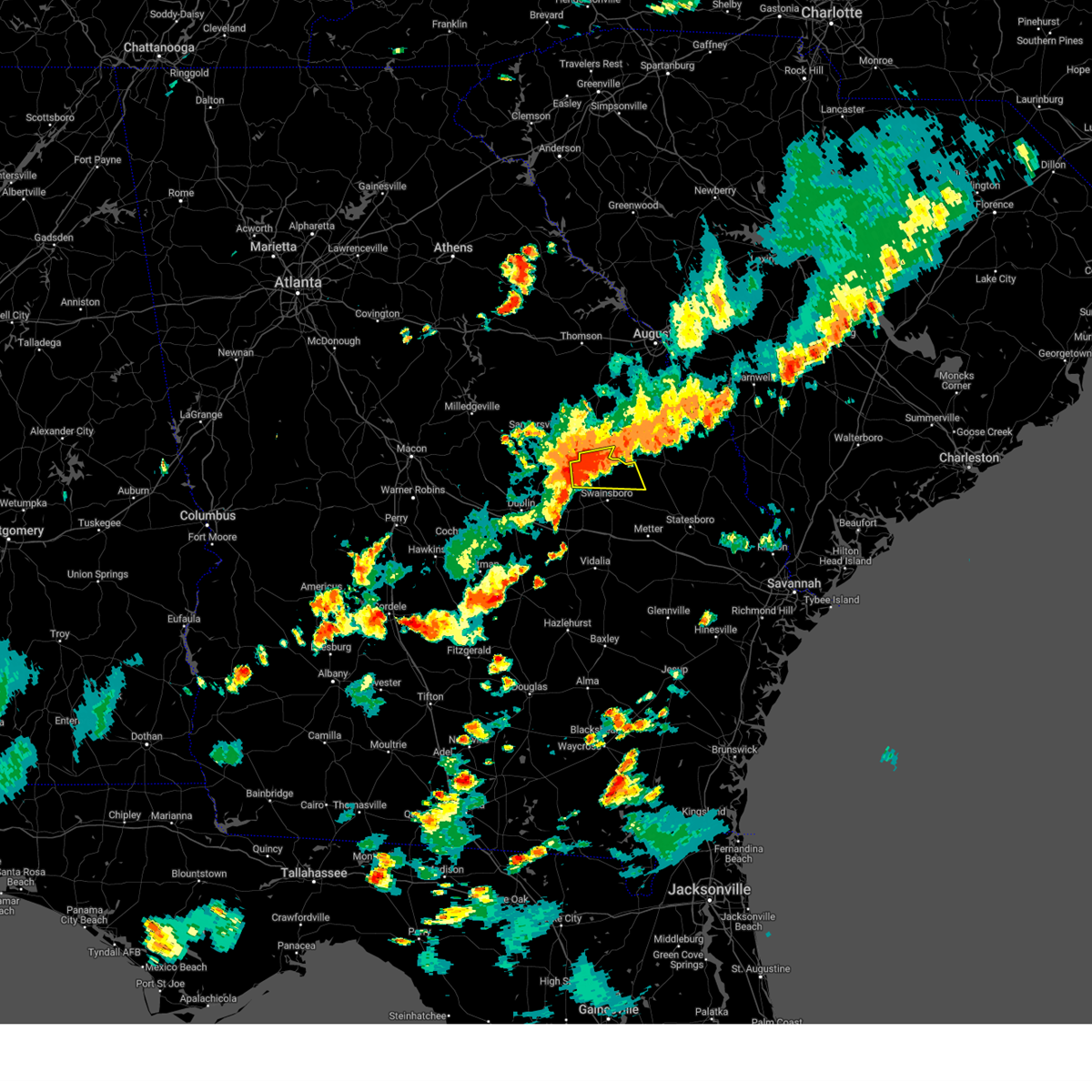
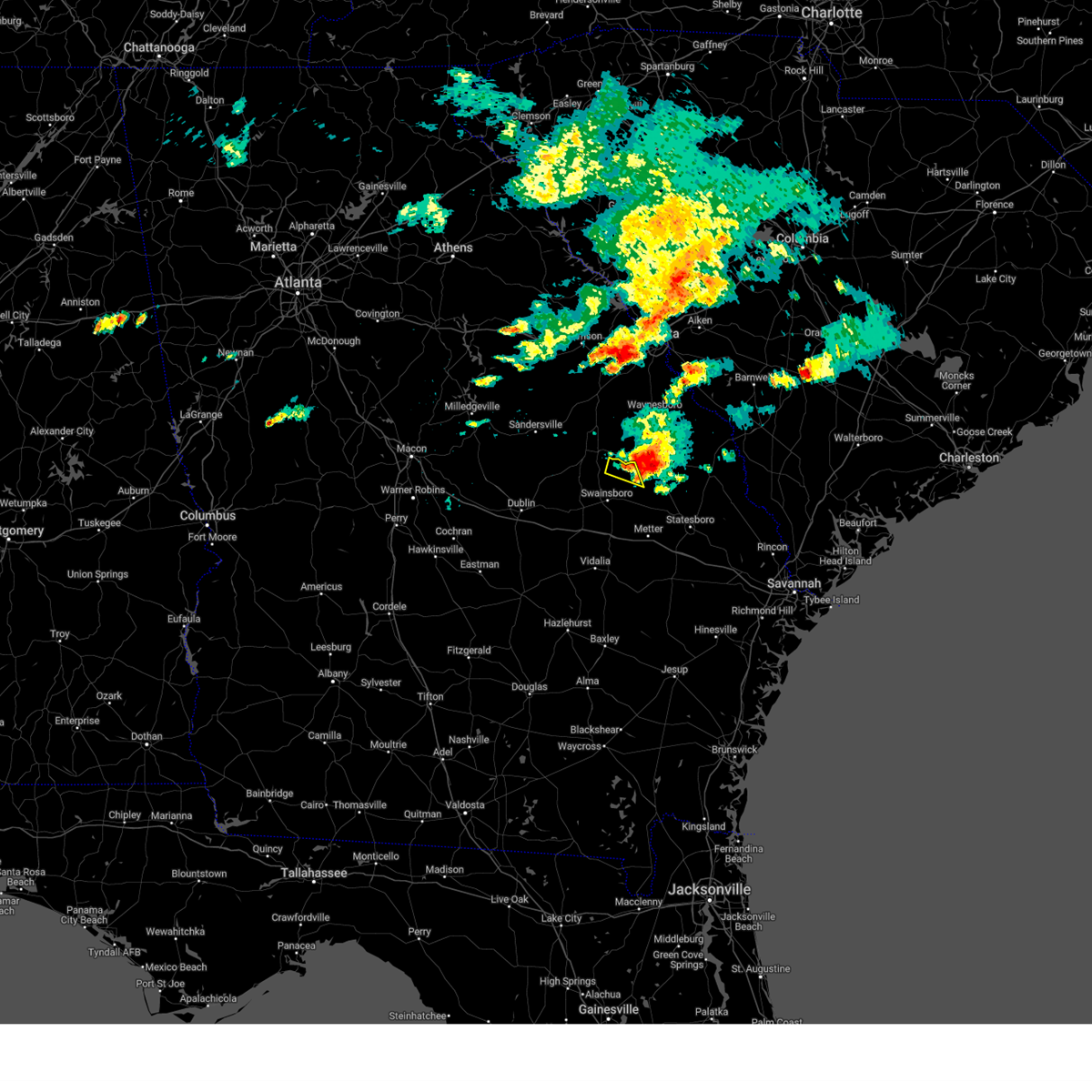
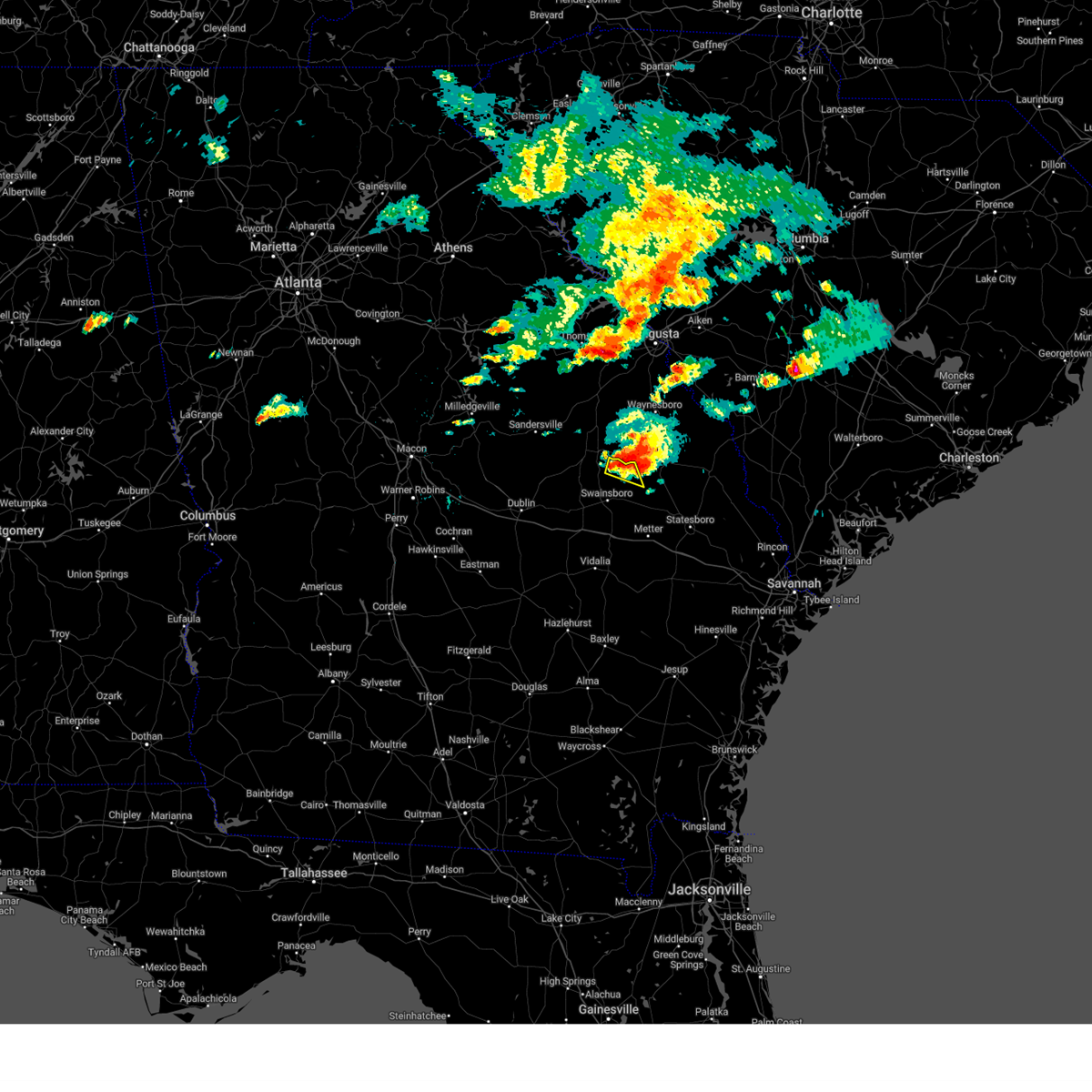
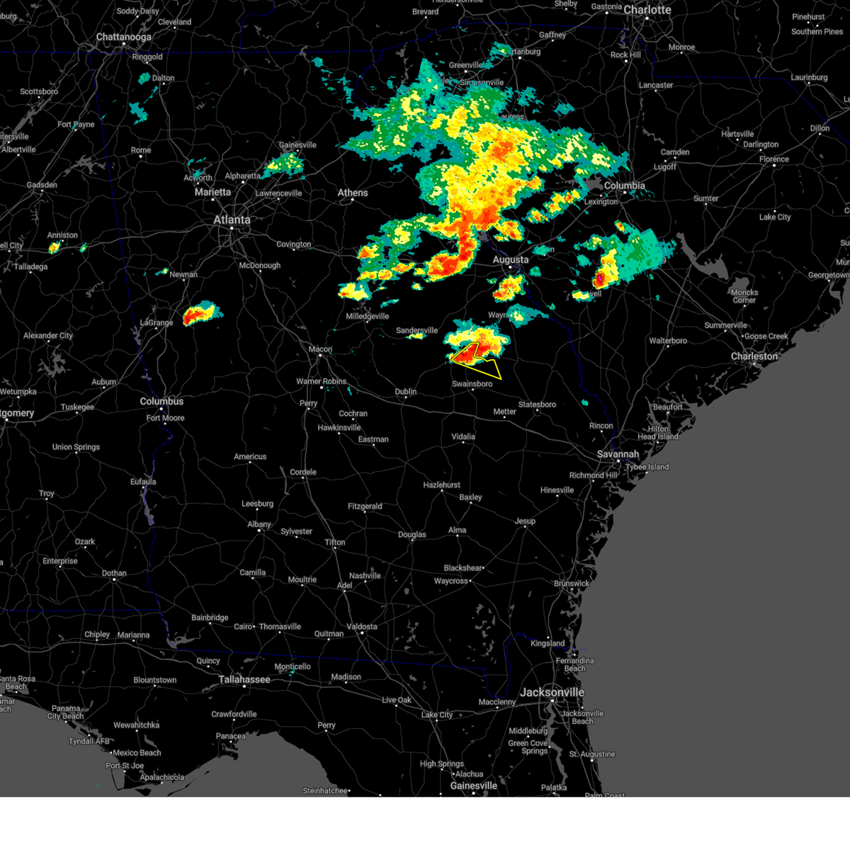
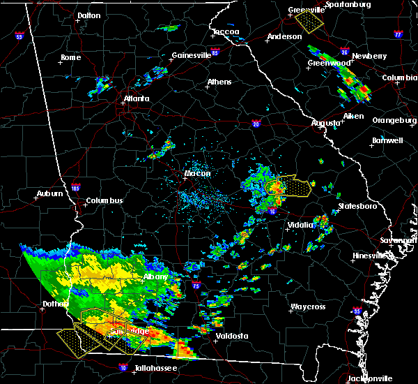
Hail Map for Midville, GA
The Midville, GA area has had 2 reports of on-the-ground hail by trained spotters, and has been under severe weather warnings 27 times during the past 12 months. Doppler radar has detected hail at or near Midville, GA on 37 occasions, including 2 occasions during the past year.
| Name: | Midville, GA |
| Where Located: | 47.9 miles SSW of Augusta, GA |
| Map: | Google Map for Midville, GA |
| Population: | 269 |
| Housing Units: | 140 |
| More Info: | Search Google for Midville, GA |
0
The Top Recent Hail Date for Midville, GA is Wednesday, April 2, 2025 (35th out of 37)

Hail and Wind Damage Spotted near Midville, GA
| Date / Time | Report Details |
|---|---|
| 6/25/2025 10:09 PM EDT |
 Svrcae the national weather service in columbia has issued a * severe thunderstorm warning for, southeastern mcduffie county in east central georgia, central columbia county in east central georgia, burke county in east central georgia, richmond county in east central georgia, * until 1115 pm edt. * at 1009 pm edt, severe thunderstorms were located along a line extending from near ulmer to fort eisenhower, moving southwest at 55 mph (radar indicated). Hazards include 60 mph wind gusts and quarter size hail. Hail damage to vehicles is expected. Expect wind damage to trees and powerlines. Svrcae the national weather service in columbia has issued a * severe thunderstorm warning for, southeastern mcduffie county in east central georgia, central columbia county in east central georgia, burke county in east central georgia, richmond county in east central georgia, * until 1115 pm edt. * at 1009 pm edt, severe thunderstorms were located along a line extending from near ulmer to fort eisenhower, moving southwest at 55 mph (radar indicated). Hazards include 60 mph wind gusts and quarter size hail. Hail damage to vehicles is expected. Expect wind damage to trees and powerlines.
|
| 6/7/2025 7:53 PM EDT |
 Svrcae the national weather service in columbia has issued a * severe thunderstorm warning for, mcduffie county in east central georgia, columbia county in east central georgia, lincoln county in east central georgia, burke county in east central georgia, richmond county in east central georgia, edgefield county in central south carolina, southwestern barnwell county in central south carolina, western aiken county in central south carolina, southeastern mccormick county in central south carolina, * until 845 pm edt. * at 753 pm edt, severe thunderstorms were located along a line extending from lincolnton to near louisville, moving east at 40 mph (radar indicated). Hazards include 60 mph wind gusts. expect damage to trees and powerlines Svrcae the national weather service in columbia has issued a * severe thunderstorm warning for, mcduffie county in east central georgia, columbia county in east central georgia, lincoln county in east central georgia, burke county in east central georgia, richmond county in east central georgia, edgefield county in central south carolina, southwestern barnwell county in central south carolina, western aiken county in central south carolina, southeastern mccormick county in central south carolina, * until 845 pm edt. * at 753 pm edt, severe thunderstorms were located along a line extending from lincolnton to near louisville, moving east at 40 mph (radar indicated). Hazards include 60 mph wind gusts. expect damage to trees and powerlines
|
| 4/23/2025 2:42 PM EDT |
 Svrcae the national weather service in columbia has issued a * severe thunderstorm warning for, southwestern burke county in east central georgia, * until 330 pm edt. * at 242 pm edt, a severe thunderstorm was located 9 miles southwest of burke county airport, or 11 miles southwest of waynesboro, moving east at 15 mph (radar indicated). Hazards include 60 mph wind gusts and quarter size hail. Hail damage to vehicles is expected. Expect wind damage to trees and powerlines. Svrcae the national weather service in columbia has issued a * severe thunderstorm warning for, southwestern burke county in east central georgia, * until 330 pm edt. * at 242 pm edt, a severe thunderstorm was located 9 miles southwest of burke county airport, or 11 miles southwest of waynesboro, moving east at 15 mph (radar indicated). Hazards include 60 mph wind gusts and quarter size hail. Hail damage to vehicles is expected. Expect wind damage to trees and powerlines.
|
| 3/16/2025 8:32 AM EDT |
 The storms which prompted the warning have moved out of the area. therefore, the warning has been allowed to expire. a tornado watch remains in effect until 1000 am edt for central, southeastern and east central georgia. The storms which prompted the warning have moved out of the area. therefore, the warning has been allowed to expire. a tornado watch remains in effect until 1000 am edt for central, southeastern and east central georgia.
|
| 3/16/2025 8:14 AM EDT |
 the severe thunderstorm warning has been cancelled and is no longer in effect the severe thunderstorm warning has been cancelled and is no longer in effect
|
| 3/16/2025 8:14 AM EDT |
 At 814 am edt, severe thunderstorms were located along a line extending from summertown to tarrytown, moving northeast at 45 mph (radar indicated). Hazards include 60 mph wind gusts. Expect damage to roofs, siding, and trees. Locations impacted include, garfield, lothair, twin city, covena, modoc, canoochee, oak park, orland, stillmore, soperton, swainsboro, norristown, barnhill, three points, norristown junction, dellwood, summertown, lexsy, blackville, and zaidee. At 814 am edt, severe thunderstorms were located along a line extending from summertown to tarrytown, moving northeast at 45 mph (radar indicated). Hazards include 60 mph wind gusts. Expect damage to roofs, siding, and trees. Locations impacted include, garfield, lothair, twin city, covena, modoc, canoochee, oak park, orland, stillmore, soperton, swainsboro, norristown, barnhill, three points, norristown junction, dellwood, summertown, lexsy, blackville, and zaidee.
|
| 3/16/2025 7:47 AM EDT |
 Svrffc the national weather service in peachtree city has issued a * severe thunderstorm warning for, southeastern laurens county in central georgia, emanuel county in east central georgia, treutlen county in east central georgia, southeastern johnson county in east central georgia, northwestern wheeler county in central georgia, northern montgomery county in central georgia, * until 830 am edt. * at 746 am edt, severe thunderstorms were located along a line extending from near meeks to near cedar grove, moving northeast at 45 mph (radar indicated). Hazards include 60 mph wind gusts. expect damage to roofs, siding, and trees Svrffc the national weather service in peachtree city has issued a * severe thunderstorm warning for, southeastern laurens county in central georgia, emanuel county in east central georgia, treutlen county in east central georgia, southeastern johnson county in east central georgia, northwestern wheeler county in central georgia, northern montgomery county in central georgia, * until 830 am edt. * at 746 am edt, severe thunderstorms were located along a line extending from near meeks to near cedar grove, moving northeast at 45 mph (radar indicated). Hazards include 60 mph wind gusts. expect damage to roofs, siding, and trees
|
| 3/16/2025 6:42 AM EDT |
 The storms which prompted the warning have moved out of the area. therefore, the warning will be allowed to expire. a tornado watch remains in effect until 1000 am edt for east central georgia. The storms which prompted the warning have moved out of the area. therefore, the warning will be allowed to expire. a tornado watch remains in effect until 1000 am edt for east central georgia.
|
| 3/16/2025 6:29 AM EDT |
 Svrcae the national weather service in columbia has issued a * severe thunderstorm warning for, burke county in east central georgia, southeastern richmond county in east central georgia, barnwell county in central south carolina, south central aiken county in central south carolina, * until 715 am edt. * at 629 am edt, a severe thunderstorm was located over burke county airport, or near waynesboro, moving northeast at 55 mph (radar indicated). Hazards include 60 mph wind gusts. expect damage to trees and powerlines Svrcae the national weather service in columbia has issued a * severe thunderstorm warning for, burke county in east central georgia, southeastern richmond county in east central georgia, barnwell county in central south carolina, south central aiken county in central south carolina, * until 715 am edt. * at 629 am edt, a severe thunderstorm was located over burke county airport, or near waynesboro, moving northeast at 55 mph (radar indicated). Hazards include 60 mph wind gusts. expect damage to trees and powerlines
|
| 3/16/2025 6:29 AM EDT |
 At 628 am edt, severe thunderstorms were located along a line extending from shell bluff to near perkins to near dellwood, moving northeast at 60 mph (radar indicated). Hazards include 60 mph wind gusts. Expect damage to roofs, siding, and trees. Locations impacted include, three points, dellwood, summertown, modoc, canoochee, blundale, colemans lake, wadley, and swainsboro. At 628 am edt, severe thunderstorms were located along a line extending from shell bluff to near perkins to near dellwood, moving northeast at 60 mph (radar indicated). Hazards include 60 mph wind gusts. Expect damage to roofs, siding, and trees. Locations impacted include, three points, dellwood, summertown, modoc, canoochee, blundale, colemans lake, wadley, and swainsboro.
|
| 3/16/2025 6:29 AM EDT |
 the severe thunderstorm warning has been cancelled and is no longer in effect the severe thunderstorm warning has been cancelled and is no longer in effect
|
| 3/16/2025 6:18 AM EDT |
 the severe thunderstorm warning has been cancelled and is no longer in effect the severe thunderstorm warning has been cancelled and is no longer in effect
|
| 3/16/2025 6:18 AM EDT |
 At 617 am edt, severe thunderstorms were located along a line extending from waynesboro to near herndon to near adrian, moving northeast at 60 mph (radar indicated). Hazards include 60 mph wind gusts. Expect damage to roofs, siding, and trees. Locations impacted include, bartow, modoc, canoochee, louisville, blundale, swainsboro, kite, three points, moxley, norristown junction, dellwood, summertown, meeks, colemans lake, and wadley. At 617 am edt, severe thunderstorms were located along a line extending from waynesboro to near herndon to near adrian, moving northeast at 60 mph (radar indicated). Hazards include 60 mph wind gusts. Expect damage to roofs, siding, and trees. Locations impacted include, bartow, modoc, canoochee, louisville, blundale, swainsboro, kite, three points, moxley, norristown junction, dellwood, summertown, meeks, colemans lake, and wadley.
|
| 3/16/2025 5:55 AM EDT |
 Svrffc the national weather service in peachtree city has issued a * severe thunderstorm warning for, northeastern laurens county in central georgia, northern emanuel county in east central georgia, northern treutlen county in east central georgia, southeastern washington county in east central georgia, johnson county in east central georgia, southeastern jefferson county in east central georgia, * until 645 am edt. * at 555 am edt, severe thunderstorms were located along a line extending from near moxley to near kite to near rentz, moving northeast at 60 mph (radar indicated). Hazards include 60 mph wind gusts. expect damage to roofs, siding, and trees Svrffc the national weather service in peachtree city has issued a * severe thunderstorm warning for, northeastern laurens county in central georgia, northern emanuel county in east central georgia, northern treutlen county in east central georgia, southeastern washington county in east central georgia, johnson county in east central georgia, southeastern jefferson county in east central georgia, * until 645 am edt. * at 555 am edt, severe thunderstorms were located along a line extending from near moxley to near kite to near rentz, moving northeast at 60 mph (radar indicated). Hazards include 60 mph wind gusts. expect damage to roofs, siding, and trees
|
| 3/16/2025 5:39 AM EDT |
 Svrcae the national weather service in columbia has issued a * severe thunderstorm warning for, burke county in east central georgia, * until 630 am edt. * at 538 am edt, a severe thunderstorm was located near louisville, moving northeast at 55 mph (radar indicated). Hazards include 60 mph wind gusts. expect damage to trees and powerlines Svrcae the national weather service in columbia has issued a * severe thunderstorm warning for, burke county in east central georgia, * until 630 am edt. * at 538 am edt, a severe thunderstorm was located near louisville, moving northeast at 55 mph (radar indicated). Hazards include 60 mph wind gusts. expect damage to trees and powerlines
|
| 2/16/2025 7:35 AM EST |
 At 735 am est, severe thunderstorms were located along a line extending from near shell bluff landing to rogers to near gillis springs, moving east at 60 mph (radar indicated). Hazards include 60 mph wind gusts. Expect damage to roofs, siding, and trees. Locations impacted include, swainsboro, soperton, twin city, adrian, stillmore, oak park, midville, garfield, summertown, nunez, tarrytown, lothair, covena, modoc, canoochee, norristown, barnhill, dellwood, zaidee, and george l smith state park. At 735 am est, severe thunderstorms were located along a line extending from near shell bluff landing to rogers to near gillis springs, moving east at 60 mph (radar indicated). Hazards include 60 mph wind gusts. Expect damage to roofs, siding, and trees. Locations impacted include, swainsboro, soperton, twin city, adrian, stillmore, oak park, midville, garfield, summertown, nunez, tarrytown, lothair, covena, modoc, canoochee, norristown, barnhill, dellwood, zaidee, and george l smith state park.
|
| 2/16/2025 7:35 AM EST |
 the severe thunderstorm warning has been cancelled and is no longer in effect the severe thunderstorm warning has been cancelled and is no longer in effect
|
| 2/16/2025 7:30 AM EST | Svrcae the national weather service in columbia has issued a * severe thunderstorm warning for, burke county in east central georgia, southeastern richmond county in east central georgia, southern calhoun county in central south carolina, barnwell county in central south carolina, bamberg county in central south carolina, aiken county in central south carolina, western orangeburg county in central south carolina, * until 830 am est. * at 730 am est, severe thunderstorms were located along a line extending from 6 miles northeast of aiken municipal airport to near summertown, moving east at 45 mph (radar indicated). Hazards include 60 mph wind gusts. expect damage to trees and powerlines |
| 2/16/2025 7:28 AM EST | Burke county em reported powerlines down at highway 305 and magruder road. time estimated by rada in burke county GA, 6.9 miles S of Midville, GA |
| 2/16/2025 6:36 AM EST |
 Svrcae the national weather service in columbia has issued a * severe thunderstorm warning for, columbia county in east central georgia, burke county in east central georgia, southeastern mcduffie county in east central georgia, southeastern lincoln county in east central georgia, richmond county in east central georgia, fairfield county in central south carolina, newberry county in central south carolina, western lexington county in central south carolina, saluda county in central south carolina, aiken county in central south carolina, southeastern mccormick county in central south carolina, edgefield county in central south carolina, northwestern richland county in central south carolina, * until 730 am est. * at 635 am est, severe thunderstorms were located along a line extending from near clinton to near thomson-mcduffie county airport, moving east at 65 mph (radar indicated). Hazards include 60 mph wind gusts. expect damage to trees and powerlines Svrcae the national weather service in columbia has issued a * severe thunderstorm warning for, columbia county in east central georgia, burke county in east central georgia, southeastern mcduffie county in east central georgia, southeastern lincoln county in east central georgia, richmond county in east central georgia, fairfield county in central south carolina, newberry county in central south carolina, western lexington county in central south carolina, saluda county in central south carolina, aiken county in central south carolina, southeastern mccormick county in central south carolina, edgefield county in central south carolina, northwestern richland county in central south carolina, * until 730 am est. * at 635 am est, severe thunderstorms were located along a line extending from near clinton to near thomson-mcduffie county airport, moving east at 65 mph (radar indicated). Hazards include 60 mph wind gusts. expect damage to trees and powerlines
|
| 12/29/2024 7:26 AM EST |
 Svrcae the national weather service in columbia has issued a * severe thunderstorm warning for, burke county in east central georgia, southern richmond county in east central georgia, southwestern barnwell county in central south carolina, southwestern aiken county in central south carolina, * until 815 am est. * at 725 am est, a severe thunderstorm was located near gough, or 11 miles northeast of louisville, moving east at 45 mph (radar indicated). Hazards include 60 mph wind gusts. expect damage to trees and powerlines Svrcae the national weather service in columbia has issued a * severe thunderstorm warning for, burke county in east central georgia, southern richmond county in east central georgia, southwestern barnwell county in central south carolina, southwestern aiken county in central south carolina, * until 815 am est. * at 725 am est, a severe thunderstorm was located near gough, or 11 miles northeast of louisville, moving east at 45 mph (radar indicated). Hazards include 60 mph wind gusts. expect damage to trees and powerlines
|
| 8/29/2024 4:41 PM EDT | The storm which prompted the warning has weakened below severe limits, and no longer poses an immediate threat to life or property. therefore, the warning will be allowed to expire. |
| 8/29/2024 4:36 PM EDT | At 436 pm edt, a severe thunderstorm was located near perkins, or 10 miles northwest of millen, moving south at 15 mph (radar indicated). Hazards include 60 mph wind gusts. Expect damage to trees and powerlines. Locations impacted include, waynesboro, midville, alexander, burke county airport, di- lane wildlife management area, and magruder. |
| 8/29/2024 4:14 PM EDT |
 the severe thunderstorm warning has been cancelled and is no longer in effect the severe thunderstorm warning has been cancelled and is no longer in effect
|
| 8/29/2024 4:14 PM EDT |
 At 414 pm edt, a severe thunderstorm was located near burke county airport, or near waynesboro, moving south at 15 mph (radar indicated). Hazards include 60 mph wind gusts. Expect damage to trees and powerlines. Locations impacted include, waynesboro, plant vogtle, sardis, midville, alexander, burke county airport, vidette, di- lane wildlife management area, magruder, and rosier. At 414 pm edt, a severe thunderstorm was located near burke county airport, or near waynesboro, moving south at 15 mph (radar indicated). Hazards include 60 mph wind gusts. Expect damage to trees and powerlines. Locations impacted include, waynesboro, plant vogtle, sardis, midville, alexander, burke county airport, vidette, di- lane wildlife management area, magruder, and rosier.
|
| 8/29/2024 3:46 PM EDT |
 Svrcae the national weather service in columbia has issued a * severe thunderstorm warning for, burke county in east central georgia, southwestern barnwell county in central south carolina, * until 445 pm edt. * at 346 pm edt, a severe thunderstorm was located over burke county airport, or over waynesboro, moving south at 15 mph (radar indicated). Hazards include 60 mph wind gusts. expect damage to trees and powerlines Svrcae the national weather service in columbia has issued a * severe thunderstorm warning for, burke county in east central georgia, southwestern barnwell county in central south carolina, * until 445 pm edt. * at 346 pm edt, a severe thunderstorm was located over burke county airport, or over waynesboro, moving south at 15 mph (radar indicated). Hazards include 60 mph wind gusts. expect damage to trees and powerlines
|
| 8/3/2024 6:46 PM EDT | Svrcae the national weather service in columbia has issued a * severe thunderstorm warning for, southwestern burke county in east central georgia, * until 715 pm edt. * at 646 pm edt, a severe thunderstorm was located over midville, or 15 miles southeast of louisville, moving east at 45 mph (radar indicated). Hazards include 60 mph wind gusts. expect damage to trees and powerlines |
| 8/3/2024 6:27 PM EDT |
 Svrffc the national weather service in peachtree city has issued a * severe thunderstorm warning for, northeastern emanuel county in east central georgia, northeastern johnson county in east central georgia, southeastern jefferson county in east central georgia, * until 715 pm edt. * at 626 pm edt, a severe thunderstorm was located near blundale, or 14 miles east of wrightsville, moving east at 30 mph (radar indicated). Hazards include 70 mph wind gusts and quarter size hail. Hail damage to vehicles is expected. expect considerable tree damage. Wind damage is also likely to mobile homes, roofs, and outbuildings. Svrffc the national weather service in peachtree city has issued a * severe thunderstorm warning for, northeastern emanuel county in east central georgia, northeastern johnson county in east central georgia, southeastern jefferson county in east central georgia, * until 715 pm edt. * at 626 pm edt, a severe thunderstorm was located near blundale, or 14 miles east of wrightsville, moving east at 30 mph (radar indicated). Hazards include 70 mph wind gusts and quarter size hail. Hail damage to vehicles is expected. expect considerable tree damage. Wind damage is also likely to mobile homes, roofs, and outbuildings.
|
| 6/10/2024 4:59 AM EDT |
 The storm which prompted the warning has moved out of the area. therefore, the warning will be allowed to expire. however, gusty winds are still possible with this thunderstorm. The storm which prompted the warning has moved out of the area. therefore, the warning will be allowed to expire. however, gusty winds are still possible with this thunderstorm.
|
| 6/10/2024 4:49 AM EDT |
 At 449 am edt, a severe thunderstorm was located over birdsville, or 8 miles west of millen, moving east at 35 mph (radar indicated). Hazards include 60 mph wind gusts and quarter size hail. Hail damage to vehicles is expected. expect wind damage to roofs, siding, and trees. Locations impacted include, summertown, colemans lake, and three points. At 449 am edt, a severe thunderstorm was located over birdsville, or 8 miles west of millen, moving east at 35 mph (radar indicated). Hazards include 60 mph wind gusts and quarter size hail. Hail damage to vehicles is expected. expect wind damage to roofs, siding, and trees. Locations impacted include, summertown, colemans lake, and three points.
|
| 6/10/2024 4:49 AM EDT |
 the severe thunderstorm warning has been cancelled and is no longer in effect the severe thunderstorm warning has been cancelled and is no longer in effect
|
| 6/10/2024 4:38 AM EDT | Burke county dispatch reports multiple trees down on hwy 56 near frank farmer rd. time estimated from kclx rada in burke county GA, 3.8 miles SSW of Midville, GA |
| 6/10/2024 4:33 AM EDT |
 Svrffc the national weather service in peachtree city has issued a * severe thunderstorm warning for, northeastern emanuel county in east central georgia, southeastern jefferson county in east central georgia, * until 500 am edt. * at 432 am edt, a severe thunderstorm was located near magruder, or 11 miles southeast of louisville, moving east at 35 mph (radar indicated). Hazards include 60 mph wind gusts and quarter size hail. Hail damage to vehicles is expected. Expect wind damage to roofs, siding, and trees. Svrffc the national weather service in peachtree city has issued a * severe thunderstorm warning for, northeastern emanuel county in east central georgia, southeastern jefferson county in east central georgia, * until 500 am edt. * at 432 am edt, a severe thunderstorm was located near magruder, or 11 miles southeast of louisville, moving east at 35 mph (radar indicated). Hazards include 60 mph wind gusts and quarter size hail. Hail damage to vehicles is expected. Expect wind damage to roofs, siding, and trees.
|
| 6/10/2024 4:23 AM EDT |
 At 422 am edt, a severe thunderstorm was located over wadley, or 7 miles south of louisville, moving east at 35 mph (radar indicated). Hazards include 60 mph wind gusts and quarter size hail. Hail damage to vehicles is expected. expect wind damage to roofs, siding, and trees. Locations impacted include, louisville, wadley, bartow, three points, moxley, and colemans lake. At 422 am edt, a severe thunderstorm was located over wadley, or 7 miles south of louisville, moving east at 35 mph (radar indicated). Hazards include 60 mph wind gusts and quarter size hail. Hail damage to vehicles is expected. expect wind damage to roofs, siding, and trees. Locations impacted include, louisville, wadley, bartow, three points, moxley, and colemans lake.
|
| 6/10/2024 4:23 AM EDT |
 the severe thunderstorm warning has been cancelled and is no longer in effect the severe thunderstorm warning has been cancelled and is no longer in effect
|
| 6/10/2024 4:21 AM EDT |
 Svrcae the national weather service in columbia has issued a * severe thunderstorm warning for, southwestern burke county in east central georgia, * until 500 am edt. * at 420 am edt, a severe thunderstorm was located near midville, or 8 miles southeast of louisville, moving east at 35 mph (radar indicated). Hazards include 60 mph wind gusts and quarter size hail. Hail damage to vehicles is expected. Expect wind damage to trees and powerlines. Svrcae the national weather service in columbia has issued a * severe thunderstorm warning for, southwestern burke county in east central georgia, * until 500 am edt. * at 420 am edt, a severe thunderstorm was located near midville, or 8 miles southeast of louisville, moving east at 35 mph (radar indicated). Hazards include 60 mph wind gusts and quarter size hail. Hail damage to vehicles is expected. Expect wind damage to trees and powerlines.
|
| 6/10/2024 4:03 AM EDT |
 Svrffc the national weather service in peachtree city has issued a * severe thunderstorm warning for, north central emanuel county in east central georgia, southeastern washington county in east central georgia, southern jefferson county in east central georgia, * until 430 am edt. * at 403 am edt, a severe thunderstorm was located near davisboro, or 12 miles west of louisville, moving east at 35 mph (radar indicated). Hazards include 60 mph wind gusts and quarter size hail. Hail damage to vehicles is expected. Expect wind damage to roofs, siding, and trees. Svrffc the national weather service in peachtree city has issued a * severe thunderstorm warning for, north central emanuel county in east central georgia, southeastern washington county in east central georgia, southern jefferson county in east central georgia, * until 430 am edt. * at 403 am edt, a severe thunderstorm was located near davisboro, or 12 miles west of louisville, moving east at 35 mph (radar indicated). Hazards include 60 mph wind gusts and quarter size hail. Hail damage to vehicles is expected. Expect wind damage to roofs, siding, and trees.
|
| 1/9/2024 12:53 PM EST |
 At 1253 pm est, a severe thunderstorm was located over modoc, or near swainsboro, moving east at 55 mph (radar indicated). Hazards include 60 mph wind gusts. expect damage to roofs, siding, and trees At 1253 pm est, a severe thunderstorm was located over modoc, or near swainsboro, moving east at 55 mph (radar indicated). Hazards include 60 mph wind gusts. expect damage to roofs, siding, and trees
|
| 1/9/2024 12:47 PM EST |
 At 1247 pm est, severe thunderstorms were located along a line extending from near wrens to near nunez, moving east at 45 mph (radar indicated). Hazards include 70 mph wind gusts. Expect considerable tree damage. Damage is likely to mobile homes, roofs, and outbuildings. At 1247 pm est, severe thunderstorms were located along a line extending from near wrens to near nunez, moving east at 45 mph (radar indicated). Hazards include 70 mph wind gusts. Expect considerable tree damage. Damage is likely to mobile homes, roofs, and outbuildings.
|
| 8/7/2023 7:36 PM EDT |
 The severe thunderstorm warning for northeastern emanuel county will expire at 745 pm edt, the storm which prompted the warning has moved out of the area. therefore, the warning will be allowed to expire. however, gusty winds are still possible with this thunderstorm. a severe thunderstorm watch remains in effect until midnight edt for east central georgia. The severe thunderstorm warning for northeastern emanuel county will expire at 745 pm edt, the storm which prompted the warning has moved out of the area. therefore, the warning will be allowed to expire. however, gusty winds are still possible with this thunderstorm. a severe thunderstorm watch remains in effect until midnight edt for east central georgia.
|
| 8/7/2023 7:23 PM EDT |
 At 722 pm edt, a severe thunderstorm was located over summertown, or 11 miles north of swainsboro, moving east at 40 mph (radar indicated). Hazards include 60 mph wind gusts. Expect damage to roofs, siding, and trees. locations impacted include, swainsboro, garfield, summertown, three points, dellwood, modoc, canoochee, blundale, and colemans lake. hail threat, radar indicated max hail size, <. 75 in wind threat, radar indicated max wind gust, 60 mph. At 722 pm edt, a severe thunderstorm was located over summertown, or 11 miles north of swainsboro, moving east at 40 mph (radar indicated). Hazards include 60 mph wind gusts. Expect damage to roofs, siding, and trees. locations impacted include, swainsboro, garfield, summertown, three points, dellwood, modoc, canoochee, blundale, and colemans lake. hail threat, radar indicated max hail size, <. 75 in wind threat, radar indicated max wind gust, 60 mph.
|
| 8/7/2023 7:05 PM EDT |
 At 705 pm edt, a severe thunderstorm was located over kite, or 12 miles northwest of swainsboro, moving east at 40 mph (radar indicated). Hazards include 60 mph wind gusts. expect damage to roofs, siding, and trees At 705 pm edt, a severe thunderstorm was located over kite, or 12 miles northwest of swainsboro, moving east at 40 mph (radar indicated). Hazards include 60 mph wind gusts. expect damage to roofs, siding, and trees
|
| 7/20/2023 8:54 PM EDT |
 At 853 pm edt, severe thunderstorms were located along a line extending from near ridge spring to near savannah river site to near waynesboro, moving east at 60 mph (radar indicated). Hazards include 60 mph wind gusts. Expect damage to trees and powerlines. locations impacted include, aiken, waynesboro, barnwell, denmark, savannah river site, aiken mall, plant vogtle, hephzibah, williston, blackville, new ellenton, jackson, sardis, midville, gough, citizens park, barnwell state park, alexander, burke county airport and mcbean. this includes interstate 20 in south carolina between mile markers 24 and 41. hail threat, radar indicated max hail size, <. 75 in wind threat, radar indicated max wind gust, 60 mph. At 853 pm edt, severe thunderstorms were located along a line extending from near ridge spring to near savannah river site to near waynesboro, moving east at 60 mph (radar indicated). Hazards include 60 mph wind gusts. Expect damage to trees and powerlines. locations impacted include, aiken, waynesboro, barnwell, denmark, savannah river site, aiken mall, plant vogtle, hephzibah, williston, blackville, new ellenton, jackson, sardis, midville, gough, citizens park, barnwell state park, alexander, burke county airport and mcbean. this includes interstate 20 in south carolina between mile markers 24 and 41. hail threat, radar indicated max hail size, <. 75 in wind threat, radar indicated max wind gust, 60 mph.
|
| 7/20/2023 8:29 PM EDT |
 At 829 pm edt, severe thunderstorms were located along a line extending from near saluda to near glendale to near wrens, moving east at 60 mph (radar indicated). Hazards include 60 mph wind gusts. expect damage to trees and powerlines At 829 pm edt, severe thunderstorms were located along a line extending from near saluda to near glendale to near wrens, moving east at 60 mph (radar indicated). Hazards include 60 mph wind gusts. expect damage to trees and powerlines
|
| 6/7/2023 6:00 PM EDT | Tree down at ralph smith rd and henry rowland rd... ne of midville. time estimate in burke county GA, 1.2 miles SW of Midville, GA |
| 1/4/2023 10:05 AM EST |
 The severe thunderstorm warning for southeastern columbia, burke, richmond, southeastern edgefield and western aiken counties will expire at 1015 am est, the storms which prompted the warning have moved out of the area. therefore, the warning will be allowed to expire. a tornado watch remains in effect until 200 pm est for east central georgia, and central south carolina. remember, a severe thunderstorm warning still remains in effect for portions of aiken, burke, and richmond counties until 1045a!. The severe thunderstorm warning for southeastern columbia, burke, richmond, southeastern edgefield and western aiken counties will expire at 1015 am est, the storms which prompted the warning have moved out of the area. therefore, the warning will be allowed to expire. a tornado watch remains in effect until 200 pm est for east central georgia, and central south carolina. remember, a severe thunderstorm warning still remains in effect for portions of aiken, burke, and richmond counties until 1045a!.
|
| 1/4/2023 9:44 AM EST |
 At 944 am est, severe thunderstorms were located along a line extending from near martinez to 7 miles southeast of gough, moving east at 45 mph (radar indicated). Hazards include 60 mph wind gusts. Expect damage to trees and powerlines. locations impacted include, aiken, north augusta, grovetown, evans, waynesboro, martinez, fort gordon, augusta, clearwater, belvedere, hephzibah, jackson, midville, glendale, gough, south augusta, midtown, summerville, augusta mall and daniel field. this includes the following highways, interstate 20 in georgia between mile markers 189 and 201. interstate 20 in south carolina between mile markers 0 and 16. interstate 520 in georgia between mile markers 1 and 15. Interstate 520 in south carolina between mile markers 16 and 23. At 944 am est, severe thunderstorms were located along a line extending from near martinez to 7 miles southeast of gough, moving east at 45 mph (radar indicated). Hazards include 60 mph wind gusts. Expect damage to trees and powerlines. locations impacted include, aiken, north augusta, grovetown, evans, waynesboro, martinez, fort gordon, augusta, clearwater, belvedere, hephzibah, jackson, midville, glendale, gough, south augusta, midtown, summerville, augusta mall and daniel field. this includes the following highways, interstate 20 in georgia between mile markers 189 and 201. interstate 20 in south carolina between mile markers 0 and 16. interstate 520 in georgia between mile markers 1 and 15. Interstate 520 in south carolina between mile markers 16 and 23.
|
| 1/4/2023 9:34 AM EST |
 At 934 am est, severe thunderstorms were located along a line extending from near evans to 8 miles south of gough, moving east at 45 mph (radar indicated). Hazards include 60 mph wind gusts. Expect damage to trees and powerlines. locations impacted include, aiken, north augusta, grovetown, evans, waynesboro, martinez, fort gordon, augusta, clearwater, belvedere, hephzibah, harlem, jackson, midville, glendale, gough, south augusta, midtown, summerville and augusta mall. this includes the following highways, interstate 20 in georgia between mile markers 183 and 201. interstate 20 in south carolina between mile markers 0 and 16. interstate 520 in georgia between mile markers 1 and 15. Interstate 520 in south carolina between mile markers 16 and 23. At 934 am est, severe thunderstorms were located along a line extending from near evans to 8 miles south of gough, moving east at 45 mph (radar indicated). Hazards include 60 mph wind gusts. Expect damage to trees and powerlines. locations impacted include, aiken, north augusta, grovetown, evans, waynesboro, martinez, fort gordon, augusta, clearwater, belvedere, hephzibah, harlem, jackson, midville, glendale, gough, south augusta, midtown, summerville and augusta mall. this includes the following highways, interstate 20 in georgia between mile markers 183 and 201. interstate 20 in south carolina between mile markers 0 and 16. interstate 520 in georgia between mile markers 1 and 15. Interstate 520 in south carolina between mile markers 16 and 23.
|
| 1/4/2023 9:21 AM EST |
 At 920 am est, severe thunderstorms were located along a line extending from near harlem to near wadley, moving east at 45 mph (radar indicated). Hazards include 60 mph wind gusts. expect damage to trees and powerlines At 920 am est, severe thunderstorms were located along a line extending from near harlem to near wadley, moving east at 45 mph (radar indicated). Hazards include 60 mph wind gusts. expect damage to trees and powerlines
|
| 9/1/2022 3:29 PM EDT |
 At 329 pm edt, a severe thunderstorm was located near gough, or 8 miles east of louisville, moving northwest at 10 mph (radar indicated). Hazards include 60 mph wind gusts and quarter size hail. Hail damage to vehicles is expected. Expect wind damage to trees and powerlines. At 329 pm edt, a severe thunderstorm was located near gough, or 8 miles east of louisville, moving northwest at 10 mph (radar indicated). Hazards include 60 mph wind gusts and quarter size hail. Hail damage to vehicles is expected. Expect wind damage to trees and powerlines.
|
| 7/24/2022 7:38 PM EDT |
 At 738 pm edt, a severe thunderstorm was located over summertown, or 8 miles north of swainsboro, moving south at 25 mph (radar indicated). Hazards include 60 mph wind gusts. expect damage to roofs, siding, and trees At 738 pm edt, a severe thunderstorm was located over summertown, or 8 miles north of swainsboro, moving south at 25 mph (radar indicated). Hazards include 60 mph wind gusts. expect damage to roofs, siding, and trees
|
| 6/14/2022 1:00 PM EDT | Burke county dispatch reported a tree down and power outages in midville. time estimated by rada in burke county GA, 0.2 miles E of Midville, GA |
| 6/14/2022 12:05 PM EDT |
 The national weather service in columbia has issued a * severe thunderstorm warning for. burke county in east central georgia. western barnwell county in central south carolina. until 1245 pm edt. At 1204 pm edt, a severe thunderstorm was located over burke county. The national weather service in columbia has issued a * severe thunderstorm warning for. burke county in east central georgia. western barnwell county in central south carolina. until 1245 pm edt. At 1204 pm edt, a severe thunderstorm was located over burke county.
|
| 5/6/2022 4:03 PM EDT | A few trees... along with powerlines... reported down near the intersection of hwy 56 n and hwy 192 n in emanuel county GA, 5.9 miles NNE of Midville, GA |
| 5/6/2022 4:03 PM EDT |
 At 402 pm edt, a severe thunderstorm was located over midville, or 14 miles north of swainsboro, moving northeast at 55 mph (radar indicated). Hazards include 60 mph wind gusts and quarter size hail. Hail damage to vehicles is expected. Expect wind damage to trees and powerlines. At 402 pm edt, a severe thunderstorm was located over midville, or 14 miles north of swainsboro, moving northeast at 55 mph (radar indicated). Hazards include 60 mph wind gusts and quarter size hail. Hail damage to vehicles is expected. Expect wind damage to trees and powerlines.
|
| 4/6/2022 8:36 PM EDT |
 At 835 pm edt, a tornado producing storm was located over blundale, or 9 miles northwest of swainsboro, moving east at 55 mph. persons in blundale and summertown should move to a safe place now! (radar confirmed tornado). Hazards include damaging tornado. Flying debris will be dangerous to those caught without shelter. mobile homes will be damaged or destroyed. damage to roofs, windows, and vehicles will occur. Tree damage is likely. At 835 pm edt, a tornado producing storm was located over blundale, or 9 miles northwest of swainsboro, moving east at 55 mph. persons in blundale and summertown should move to a safe place now! (radar confirmed tornado). Hazards include damaging tornado. Flying debris will be dangerous to those caught without shelter. mobile homes will be damaged or destroyed. damage to roofs, windows, and vehicles will occur. Tree damage is likely.
|
| 4/5/2022 5:58 PM EDT |
 The severe thunderstorm warning for east central columbia, burke, richmond and western barnwell counties will expire at 600 pm edt, the storms which prompted the warning have moved out of the area. therefore, the warning will be allowed to expire but a severe thunderstorm warning still remains in effect for eastern burke county. a tornado watch remains in effect until 900 pm edt for east central georgia, and central south carolina. The severe thunderstorm warning for east central columbia, burke, richmond and western barnwell counties will expire at 600 pm edt, the storms which prompted the warning have moved out of the area. therefore, the warning will be allowed to expire but a severe thunderstorm warning still remains in effect for eastern burke county. a tornado watch remains in effect until 900 pm edt for east central georgia, and central south carolina.
|
| 4/5/2022 5:37 PM EDT |
 At 537 pm edt, severe thunderstorms were located along a line extending from near belvedere to midville, moving northeast at 65 mph (radar indicated). Hazards include 60 mph wind gusts. Expect damage to trees and powerlines. locations impacted include, north augusta, evans, waynesboro, martinez, fort gordon, augusta, hephzibah, midville, glendale, gough, south augusta, midtown, summerville, augusta mall, daniel field, augusta regional airport, village plaza shopping center, augusta national golf club, alexander and burke county airport. this includes the following highways, interstate 20 in georgia between mile markers 195 and 201. interstate 520 in georgia between mile markers 1 and 14. hail threat, radar indicated max hail size, <. 75 in wind threat, radar indicated max wind gust, 60 mph. At 537 pm edt, severe thunderstorms were located along a line extending from near belvedere to midville, moving northeast at 65 mph (radar indicated). Hazards include 60 mph wind gusts. Expect damage to trees and powerlines. locations impacted include, north augusta, evans, waynesboro, martinez, fort gordon, augusta, hephzibah, midville, glendale, gough, south augusta, midtown, summerville, augusta mall, daniel field, augusta regional airport, village plaza shopping center, augusta national golf club, alexander and burke county airport. this includes the following highways, interstate 20 in georgia between mile markers 195 and 201. interstate 520 in georgia between mile markers 1 and 14. hail threat, radar indicated max hail size, <. 75 in wind threat, radar indicated max wind gust, 60 mph.
|
| 4/5/2022 5:10 PM EDT |
 At 510 pm edt, severe thunderstorms were located along a line extending from near harlem to 6 miles northwest of adrian, moving northeast at 65 mph (radar indicated). Hazards include 60 mph wind gusts. expect damage to trees and powerlines At 510 pm edt, severe thunderstorms were located along a line extending from near harlem to 6 miles northwest of adrian, moving northeast at 65 mph (radar indicated). Hazards include 60 mph wind gusts. expect damage to trees and powerlines
|
| 3/28/2021 5:01 PM EDT |
 At 501 pm edt, severe thunderstorms were located along a line extending from 6 miles northeast of waynesboro to perkins to near emmalane, moving east at 50 mph (radar indicated). Hazards include 60 mph wind gusts. Expect damage to roofs, siding, and trees. Locations impacted include, waynesboro, plant vogtle, sardis, midville, alexander, burke county airport, girard, shell bluff, shell bluff landing, di- lane wildlife management area and magruder. At 501 pm edt, severe thunderstorms were located along a line extending from 6 miles northeast of waynesboro to perkins to near emmalane, moving east at 50 mph (radar indicated). Hazards include 60 mph wind gusts. Expect damage to roofs, siding, and trees. Locations impacted include, waynesboro, plant vogtle, sardis, midville, alexander, burke county airport, girard, shell bluff, shell bluff landing, di- lane wildlife management area and magruder.
|
| 3/28/2021 4:53 PM EDT |
 At 453 pm edt, severe thunderstorms were located along a line extending from 6 miles east of vidette to near herndon to near covena, moving east at 55 mph (radar indicated). Hazards include 60 mph wind gusts. Expect damage to roofs, siding, and trees. Locations impacted include, louisville, wadley, bartow, summertown, three points, moxley, blundale and colemans lake. At 453 pm edt, severe thunderstorms were located along a line extending from 6 miles east of vidette to near herndon to near covena, moving east at 55 mph (radar indicated). Hazards include 60 mph wind gusts. Expect damage to roofs, siding, and trees. Locations impacted include, louisville, wadley, bartow, summertown, three points, moxley, blundale and colemans lake.
|
| 3/28/2021 4:27 PM EDT |
 At 427 pm edt, severe thunderstorms were located along a line extending from 6 miles south of wrens to wadley to 9 miles southeast of wrightsville, moving east at 55 mph (radar indicated). Hazards include 60 mph wind gusts. expect damage to roofs, siding, and trees At 427 pm edt, severe thunderstorms were located along a line extending from 6 miles south of wrens to wadley to 9 miles southeast of wrightsville, moving east at 55 mph (radar indicated). Hazards include 60 mph wind gusts. expect damage to roofs, siding, and trees
|
| 8/7/2020 5:51 PM EDT |
 At 550 pm edt, a severe thunderstorm was located near wadley, or 12 miles south of louisville, moving north at 15 mph (radar indicated). Hazards include 60 mph wind gusts and quarter size hail. Hail damage to vehicles is expected. Expect wind damage to roofs, siding, and trees. At 550 pm edt, a severe thunderstorm was located near wadley, or 12 miles south of louisville, moving north at 15 mph (radar indicated). Hazards include 60 mph wind gusts and quarter size hail. Hail damage to vehicles is expected. Expect wind damage to roofs, siding, and trees.
|
| 7/1/2020 3:08 PM EDT |
 At 308 pm edt, a severe thunderstorm was located over blundale, or 11 miles northwest of swainsboro, moving east at 35 mph (radar indicated). Hazards include 60 mph wind gusts and nickel size hail. Expect damage to roofs, siding, and trees. Locations impacted include, wadley, summertown, three points, dellwood, modoc, canoochee, blundale and colemans lake. At 308 pm edt, a severe thunderstorm was located over blundale, or 11 miles northwest of swainsboro, moving east at 35 mph (radar indicated). Hazards include 60 mph wind gusts and nickel size hail. Expect damage to roofs, siding, and trees. Locations impacted include, wadley, summertown, three points, dellwood, modoc, canoochee, blundale and colemans lake.
|
| 7/1/2020 2:56 PM EDT |
 At 256 pm edt, a severe thunderstorm was located near kite, or 11 miles east of wrightsville, moving east at 35 mph (radar indicated). Hazards include 60 mph wind gusts and nickel size hail. Expect damage to roofs, siding, and trees. Locations impacted include, wadley, summertown, kite, three points, dellwood, modoc, canoochee, new home, blundale and colemans lake. At 256 pm edt, a severe thunderstorm was located near kite, or 11 miles east of wrightsville, moving east at 35 mph (radar indicated). Hazards include 60 mph wind gusts and nickel size hail. Expect damage to roofs, siding, and trees. Locations impacted include, wadley, summertown, kite, three points, dellwood, modoc, canoochee, new home, blundale and colemans lake.
|
| 7/1/2020 2:38 PM EDT |
 At 238 pm edt, a severe thunderstorm was located over wrightsville, moving east at 35 mph (radar indicated). Hazards include 60 mph wind gusts and nickel size hail. expect damage to roofs, siding, and trees At 238 pm edt, a severe thunderstorm was located over wrightsville, moving east at 35 mph (radar indicated). Hazards include 60 mph wind gusts and nickel size hail. expect damage to roofs, siding, and trees
|
| 6/24/2020 7:43 PM EDT |
 At 743 pm edt, a severe thunderstorm was located over wadley, or 11 miles south of louisville, moving east at 45 mph (radar indicated). Hazards include 60 mph wind gusts. Expect damage to roofs, siding, and trees. Locations impacted include, louisville, wadley, bartow, summertown, three points, moxley, blundale and colemans lake. At 743 pm edt, a severe thunderstorm was located over wadley, or 11 miles south of louisville, moving east at 45 mph (radar indicated). Hazards include 60 mph wind gusts. Expect damage to roofs, siding, and trees. Locations impacted include, louisville, wadley, bartow, summertown, three points, moxley, blundale and colemans lake.
|
| 6/24/2020 7:24 PM EDT |
 At 723 pm edt, a severe thunderstorm was located over harrison, or near wrightsville, moving east at 45 mph (radar indicated). Hazards include 60 mph wind gusts. expect damage to roofs, siding, and trees At 723 pm edt, a severe thunderstorm was located over harrison, or near wrightsville, moving east at 45 mph (radar indicated). Hazards include 60 mph wind gusts. expect damage to roofs, siding, and trees
|
| 4/13/2020 5:14 AM EDT |
 At 514 am edt, severe thunderstorms were located along a line extending from 8 miles south of jackson to olifftown, moving east at 45 mph (radar indicated). Hazards include 60 mph wind gusts. Expect damage to roofs, siding, and trees. Locations impacted include, swainsboro, twin city, stillmore, oak park, midville, garfield, summertown, nunez, covena, modoc, canoochee, three points, lexsy and george l smith state park. At 514 am edt, severe thunderstorms were located along a line extending from 8 miles south of jackson to olifftown, moving east at 45 mph (radar indicated). Hazards include 60 mph wind gusts. Expect damage to roofs, siding, and trees. Locations impacted include, swainsboro, twin city, stillmore, oak park, midville, garfield, summertown, nunez, covena, modoc, canoochee, three points, lexsy and george l smith state park.
|
| 4/13/2020 4:54 AM EDT |
 At 452 am edt, severe thunderstorms were located along a line extending from near hephzibah to covena, moving east at 45 mph (radar indicated). Hazards include 60 mph wind gusts. Expect damage to roofs, siding, and trees. Locations impacted include, swainsboro, twin city, adrian, stillmore, oak park, midville, garfield, summertown, nunez, covena, modoc, canoochee, blundale, norristown, three points, norristown junction, dellwood, lexsy, colemans lake and george l smith state park. At 452 am edt, severe thunderstorms were located along a line extending from near hephzibah to covena, moving east at 45 mph (radar indicated). Hazards include 60 mph wind gusts. Expect damage to roofs, siding, and trees. Locations impacted include, swainsboro, twin city, adrian, stillmore, oak park, midville, garfield, summertown, nunez, covena, modoc, canoochee, blundale, norristown, three points, norristown junction, dellwood, lexsy, colemans lake and george l smith state park.
|
| 4/13/2020 4:41 AM EDT |
 At 440 am edt, a severe thunderstorm capable of producing a tornado was located near wadley, or near louisville, moving northeast at 55 mph (radar indicated rotation). Hazards include tornado. Flying debris will be dangerous to those caught without shelter. mobile homes will be damaged or destroyed. damage to roofs, windows, and vehicles will occur. tree damage is likely. this dangerous storm will be near, gough around 450 am edt. waynesboro and burke county airport around 505 am edt. alexander around 510 am edt. plant vogtle around 515 am edt. Other locations impacted by this tornadic thunderstorm include shell bluff, shell bluff landing, di- lane wildlife management area, vidette, girard, magruder, bennock mill and rosier. At 440 am edt, a severe thunderstorm capable of producing a tornado was located near wadley, or near louisville, moving northeast at 55 mph (radar indicated rotation). Hazards include tornado. Flying debris will be dangerous to those caught without shelter. mobile homes will be damaged or destroyed. damage to roofs, windows, and vehicles will occur. tree damage is likely. this dangerous storm will be near, gough around 450 am edt. waynesboro and burke county airport around 505 am edt. alexander around 510 am edt. plant vogtle around 515 am edt. Other locations impacted by this tornadic thunderstorm include shell bluff, shell bluff landing, di- lane wildlife management area, vidette, girard, magruder, bennock mill and rosier.
|
| 4/13/2020 4:32 AM EDT |
 At 432 am edt, severe thunderstorms were located along a line extending from wrens to near scott, moving east at 45 mph (radar indicated). Hazards include 60 mph wind gusts. Expect damage to roofs, siding, and trees. Locations impacted include, dublin, swainsboro, louisville, wrightsville, east dublin, wrens, wadley, davisboro, twin city, adrian, stillmore, harrison, oak park, stapleton, bartow, midville, avera, garfield, summertown and nunez. At 432 am edt, severe thunderstorms were located along a line extending from wrens to near scott, moving east at 45 mph (radar indicated). Hazards include 60 mph wind gusts. Expect damage to roofs, siding, and trees. Locations impacted include, dublin, swainsboro, louisville, wrightsville, east dublin, wrens, wadley, davisboro, twin city, adrian, stillmore, harrison, oak park, stapleton, bartow, midville, avera, garfield, summertown and nunez.
|
| 4/13/2020 4:20 AM EDT |
 At 420 am edt, severe thunderstorms were located along a line extending from near mitchell to 6 miles east of east dublin, moving east at 55 mph (radar indicated). Hazards include 70 mph wind gusts and penny size hail. Expect considerable tree damage. Damage is likely to mobile homes, roofs, and outbuildings. At 420 am edt, severe thunderstorms were located along a line extending from near mitchell to 6 miles east of east dublin, moving east at 55 mph (radar indicated). Hazards include 70 mph wind gusts and penny size hail. Expect considerable tree damage. Damage is likely to mobile homes, roofs, and outbuildings.
|
| 4/13/2020 4:10 AM EDT |
 At 410 am edt, severe thunderstorms were located along a line extending from mitchell to near harlow, moving east at 45 mph (radar indicated). Hazards include 60 mph wind gusts. expect damage to roofs, siding, and trees At 410 am edt, severe thunderstorms were located along a line extending from mitchell to near harlow, moving east at 45 mph (radar indicated). Hazards include 60 mph wind gusts. expect damage to roofs, siding, and trees
|
| 6/22/2019 3:35 PM EDT |
 At 332 pm edt, a severe thunderstorm was located near thrift, or 11 miles southwest of millen, moving east at 30 mph (radar indicated). Hazards include 60 mph wind gusts and quarter size hail. Hail damage to vehicles is expected. Expect wind damage to roofs, siding, and trees. At 332 pm edt, a severe thunderstorm was located near thrift, or 11 miles southwest of millen, moving east at 30 mph (radar indicated). Hazards include 60 mph wind gusts and quarter size hail. Hail damage to vehicles is expected. Expect wind damage to roofs, siding, and trees.
|
| 6/22/2019 4:58 AM EDT |
 The severe thunderstorm warning for burke county will expire at 500 am edt, the storms which prompted the warning have moved out of the area. therefore, the warning will be allowed to expire. to report severe weather, contact your nearest law enforcement agency. they will relay your report to the national weather service columbia. The severe thunderstorm warning for burke county will expire at 500 am edt, the storms which prompted the warning have moved out of the area. therefore, the warning will be allowed to expire. to report severe weather, contact your nearest law enforcement agency. they will relay your report to the national weather service columbia.
|
| 6/22/2019 4:26 AM EDT |
 At 426 am edt, severe thunderstorms were located along a line extending from near plant vogtle to near gough, moving southeast at 65 mph (radar indicated). Hazards include 60 mph wind gusts and penny size hail. expect damage to roofs, siding, and trees At 426 am edt, severe thunderstorms were located along a line extending from near plant vogtle to near gough, moving southeast at 65 mph (radar indicated). Hazards include 60 mph wind gusts and penny size hail. expect damage to roofs, siding, and trees
|
| 6/20/2019 6:01 PM EDT |
 At 600 pm edt, severe thunderstorms were located along a line extending from williston to near waynesboro, moving east at 45 mph (radar indicated). Hazards include 70 mph wind gusts. Expect considerable tree damage. damage is likely to mobile homes, roofs, and outbuildings. Locations impacted include, waynesboro, barnwell, denmark, savannah river site, plant vogtle, williston, blackville, sardis, midville, alexander, burke county airport, barnwell state park, hilda, snelling, kline, elko, girard, vidette, govan and rosier. At 600 pm edt, severe thunderstorms were located along a line extending from williston to near waynesboro, moving east at 45 mph (radar indicated). Hazards include 70 mph wind gusts. Expect considerable tree damage. damage is likely to mobile homes, roofs, and outbuildings. Locations impacted include, waynesboro, barnwell, denmark, savannah river site, plant vogtle, williston, blackville, sardis, midville, alexander, burke county airport, barnwell state park, hilda, snelling, kline, elko, girard, vidette, govan and rosier.
|
| 6/20/2019 5:39 PM EDT |
 At 539 pm edt, severe thunderstorms were located along a line extending from three points to kite, moving east at 55 mph (radar indicated). Hazards include 60 mph wind gusts and quarter size hail. Hail damage to vehicles is expected. Expect wind damage to roofs, siding, and trees. At 539 pm edt, severe thunderstorms were located along a line extending from three points to kite, moving east at 55 mph (radar indicated). Hazards include 60 mph wind gusts and quarter size hail. Hail damage to vehicles is expected. Expect wind damage to roofs, siding, and trees.
|
| 6/20/2019 5:30 PM EDT |
 The national weather service in columbia has issued a * severe thunderstorm warning for. burke county in east central georgia. richmond county in east central georgia. barnwell county in central south carolina. West central bamberg county in central south carolina. The national weather service in columbia has issued a * severe thunderstorm warning for. burke county in east central georgia. richmond county in east central georgia. barnwell county in central south carolina. West central bamberg county in central south carolina.
|
| 6/20/2019 5:30 PM EDT |
 At 529 pm edt, severe thunderstorms were located along a line extending from near new ellenton to near gough, moving east at 45 mph (radar indicated). Hazards include 70 mph wind gusts. Expect considerable tree damage. Damage is likely to mobile homes, roofs, and outbuildings. At 529 pm edt, severe thunderstorms were located along a line extending from near new ellenton to near gough, moving east at 45 mph (radar indicated). Hazards include 70 mph wind gusts. Expect considerable tree damage. Damage is likely to mobile homes, roofs, and outbuildings.
|
| 6/20/2019 5:17 PM EDT |
 At 517 pm edt, a severe thunderstorm was located near riddleville, or 11 miles east of sandersville, moving east at 50 mph (radar indicated). Hazards include 60 mph wind gusts and quarter size hail. Hail damage to vehicles is expected. Expect wind damage to roofs, siding, and trees. At 517 pm edt, a severe thunderstorm was located near riddleville, or 11 miles east of sandersville, moving east at 50 mph (radar indicated). Hazards include 60 mph wind gusts and quarter size hail. Hail damage to vehicles is expected. Expect wind damage to roofs, siding, and trees.
|
| 6/20/2019 5:00 PM EDT |
 At 459 pm edt, severe thunderstorms were located along a line extending from belvedere to near gibson, moving east at 60 mph (radar indicated). Hazards include 70 mph wind gusts. Expect considerable tree damage. Damage is likely to mobile homes, roofs, and outbuildings. At 459 pm edt, severe thunderstorms were located along a line extending from belvedere to near gibson, moving east at 60 mph (radar indicated). Hazards include 70 mph wind gusts. Expect considerable tree damage. Damage is likely to mobile homes, roofs, and outbuildings.
|
| 6/5/2019 4:04 PM EDT |
 At 404 pm edt, a severe thunderstorm was located over modoc, or near swainsboro, moving northeast at 20 mph (radar indicated). Hazards include 60 mph wind gusts. expect damage to roofs, siding, and trees At 404 pm edt, a severe thunderstorm was located over modoc, or near swainsboro, moving northeast at 20 mph (radar indicated). Hazards include 60 mph wind gusts. expect damage to roofs, siding, and trees
|
| 4/19/2019 12:00 PM EDT |
 At 1159 am edt, severe thunderstorms were located along a line extending from near wrightsboro to near wrens to midville, moving north at 40 mph (radar indicated). Hazards include 60 mph wind gusts. Expect damage to roofs, siding, and trees. Locations impacted include, north augusta, grovetown, evans, thomson, waynesboro, fort gordon, augusta, martinez, plant vogtle, hephzibah, harlem, lincolnton, sardis, midville, glendale, gough, south augusta, elijah clark state park, mistletoe state park and summerville. At 1159 am edt, severe thunderstorms were located along a line extending from near wrightsboro to near wrens to midville, moving north at 40 mph (radar indicated). Hazards include 60 mph wind gusts. Expect damage to roofs, siding, and trees. Locations impacted include, north augusta, grovetown, evans, thomson, waynesboro, fort gordon, augusta, martinez, plant vogtle, hephzibah, harlem, lincolnton, sardis, midville, glendale, gough, south augusta, elijah clark state park, mistletoe state park and summerville.
|
| 4/19/2019 11:35 AM EDT |
 At 1134 am edt, severe thunderstorms were located along a line extending from 6 miles northeast of sharon to near louisville to oak park, moving northeast at 60 mph (radar indicated). Hazards include 60 mph wind gusts. expect damage to roofs, siding, and trees At 1134 am edt, severe thunderstorms were located along a line extending from 6 miles northeast of sharon to near louisville to oak park, moving northeast at 60 mph (radar indicated). Hazards include 60 mph wind gusts. expect damage to roofs, siding, and trees
|
| 3/3/2019 3:28 PM EST |
 At 328 pm est, a severe thunderstorm capable of producing a tornado was located over three points, moving northeast at 30 mph (radar indicated rotation). Hazards include tornado and quarter size hail. Flying debris will be dangerous to those caught without shelter. mobile homes will be damaged or destroyed. damage to roofs, windows, and vehicles will occur. tree damage is likely. Locations impacted include, summertown, colemans lake and three points. At 328 pm est, a severe thunderstorm capable of producing a tornado was located over three points, moving northeast at 30 mph (radar indicated rotation). Hazards include tornado and quarter size hail. Flying debris will be dangerous to those caught without shelter. mobile homes will be damaged or destroyed. damage to roofs, windows, and vehicles will occur. tree damage is likely. Locations impacted include, summertown, colemans lake and three points.
|
| 3/3/2019 3:27 PM EST |
 At 326 pm est, a severe thunderstorm was located over midville, or 22 miles southwest of waynesboro, moving northeast at 40 mph (radar indicated). Hazards include 60 mph wind gusts and quarter size hail. Hail damage to vehicles is expected. Expect wind damage to roofs, siding, and trees. At 326 pm est, a severe thunderstorm was located over midville, or 22 miles southwest of waynesboro, moving northeast at 40 mph (radar indicated). Hazards include 60 mph wind gusts and quarter size hail. Hail damage to vehicles is expected. Expect wind damage to roofs, siding, and trees.
|
| 3/3/2019 3:13 PM EST |
 At 312 pm est, a severe thunderstorm capable of producing a tornado was located over blundale, moving northeast at 30 mph (radar indicated rotation). Hazards include tornado and quarter size hail. Flying debris will be dangerous to those caught without shelter. mobile homes will be damaged or destroyed. damage to roofs, windows, and vehicles will occur. Tree damage is likely. At 312 pm est, a severe thunderstorm capable of producing a tornado was located over blundale, moving northeast at 30 mph (radar indicated rotation). Hazards include tornado and quarter size hail. Flying debris will be dangerous to those caught without shelter. mobile homes will be damaged or destroyed. damage to roofs, windows, and vehicles will occur. Tree damage is likely.
|
| 3/3/2019 2:52 PM EST |
 At 251 pm est, a severe thunderstorm was located over kite, moving northeast at 35 mph (radar indicated). Hazards include 60 mph wind gusts and quarter size hail. Hail damage to vehicles is expected. Expect wind damage to roofs, siding, and trees. At 251 pm est, a severe thunderstorm was located over kite, moving northeast at 35 mph (radar indicated). Hazards include 60 mph wind gusts and quarter size hail. Hail damage to vehicles is expected. Expect wind damage to roofs, siding, and trees.
|
| 7/30/2018 8:25 PM EDT |
 At 825 pm edt, a severe thunderstorm was located over new home, or 7 miles northeast of wrightsville, moving northeast at 20 mph (radar indicated). Hazards include 60 mph wind gusts and penny size hail. expect damage to roofs, siding, and trees At 825 pm edt, a severe thunderstorm was located over new home, or 7 miles northeast of wrightsville, moving northeast at 20 mph (radar indicated). Hazards include 60 mph wind gusts and penny size hail. expect damage to roofs, siding, and trees
|
| 7/3/2018 5:39 PM EDT |
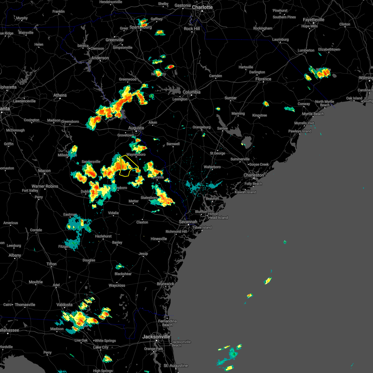 The severe thunderstorm warning for southwestern burke county will expire at 545 pm edt, the storm which prompted the warning has moved out of the area. therefore, the warning will be allowed to expire. The severe thunderstorm warning for southwestern burke county will expire at 545 pm edt, the storm which prompted the warning has moved out of the area. therefore, the warning will be allowed to expire.
|
| 7/3/2018 5:29 PM EDT |
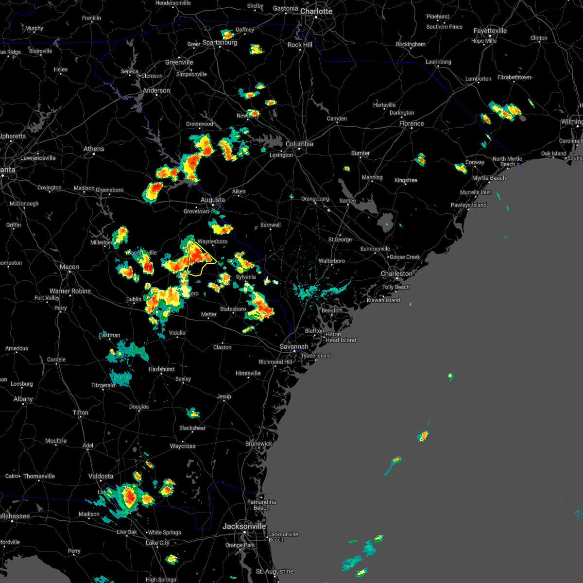 At 529 pm edt, a severe thunderstorm was located 10 miles north of midville, or 14 miles southwest of waynesboro, moving southwest at 30 mph (radar indicated). Hazards include 60 mph wind gusts. Expect damage to roofs, siding, and trees. Locations impacted include, midville and vidette. At 529 pm edt, a severe thunderstorm was located 10 miles north of midville, or 14 miles southwest of waynesboro, moving southwest at 30 mph (radar indicated). Hazards include 60 mph wind gusts. Expect damage to roofs, siding, and trees. Locations impacted include, midville and vidette.
|
| 7/3/2018 5:17 PM EDT |
 At 517 pm edt, a severe thunderstorm was located 9 miles southwest of waynesboro, moving southwest at 30 mph (radar indicated). Hazards include 60 mph wind gusts. Expect damage to roofs, siding, and trees. Locations impacted include, waynesboro, midville and vidette. At 517 pm edt, a severe thunderstorm was located 9 miles southwest of waynesboro, moving southwest at 30 mph (radar indicated). Hazards include 60 mph wind gusts. Expect damage to roofs, siding, and trees. Locations impacted include, waynesboro, midville and vidette.
|
| 7/3/2018 4:59 PM EDT |
 At 459 pm edt, a severe thunderstorm was located over waynesboro, moving southwest at 30 mph (radar indicated). Hazards include 60 mph wind gusts. expect damage to roofs, siding, and trees At 459 pm edt, a severe thunderstorm was located over waynesboro, moving southwest at 30 mph (radar indicated). Hazards include 60 mph wind gusts. expect damage to roofs, siding, and trees
|
| 6/25/2018 8:46 PM EDT |
 At 844 pm edt, a severe thunderstorm was located near waynesboro, moving east at 20 mph (radar indicated. burke county dispatch reported multiple trees down across the county associated with this storm). Hazards include 60 mph wind gusts and nickel size hail. expect damage to roofs, siding, and trees At 844 pm edt, a severe thunderstorm was located near waynesboro, moving east at 20 mph (radar indicated. burke county dispatch reported multiple trees down across the county associated with this storm). Hazards include 60 mph wind gusts and nickel size hail. expect damage to roofs, siding, and trees
|
| 6/25/2018 8:06 PM EDT |
 At 806 pm edt, a severe thunderstorm was located 10 miles southeast of wrens, or 13 miles west of waynesboro, moving east at 20 mph (radar indicated). Hazards include 60 mph wind gusts and quarter size hail. Hail damage to vehicles is expected. Expect wind damage to roofs, siding, and trees. At 806 pm edt, a severe thunderstorm was located 10 miles southeast of wrens, or 13 miles west of waynesboro, moving east at 20 mph (radar indicated). Hazards include 60 mph wind gusts and quarter size hail. Hail damage to vehicles is expected. Expect wind damage to roofs, siding, and trees.
|
| 6/24/2018 10:52 PM EDT |
 At 1051 pm edt, severe thunderstorms were located along a line extending from bowman to 10 miles north of blackville to near new ellenton to 7 miles south of hephzibah, moving southeast at 20 mph (radar indicated). Hazards include 60 mph wind gusts and quarter size hail. Hail damage to vehicles is expected. Expect wind damage to roofs, siding, and trees. At 1051 pm edt, severe thunderstorms were located along a line extending from bowman to 10 miles north of blackville to near new ellenton to 7 miles south of hephzibah, moving southeast at 20 mph (radar indicated). Hazards include 60 mph wind gusts and quarter size hail. Hail damage to vehicles is expected. Expect wind damage to roofs, siding, and trees.
|
| 6/14/2018 5:30 PM EDT | Trees down on hwy 56. trees and powerlines downed on drake road in emanuel county GA, 3.5 miles N of Midville, GA |
| 6/14/2018 5:30 PM EDT | Trees down on stevens cemetary and stevens crossing rd in emanuel county GA, 3.5 miles NNE of Midville, GA |
| 3/20/2018 3:11 AM EDT |
 At 310 am edt, a severe thunderstorm was nearing the alexander area and moving east near 45 mph and toward the girard and sardis areas. this is a very dangerous storm (radar indicated). Hazards include 80 mph wind gusts. Flying debris will be dangerous to those caught without shelter. mobile homes will be heavily damaged. expect considerable damage to roofs, windows, and vehicles. extensive tree damage and power outages are likely. Locations impacted include, alexander. At 310 am edt, a severe thunderstorm was nearing the alexander area and moving east near 45 mph and toward the girard and sardis areas. this is a very dangerous storm (radar indicated). Hazards include 80 mph wind gusts. Flying debris will be dangerous to those caught without shelter. mobile homes will be heavily damaged. expect considerable damage to roofs, windows, and vehicles. extensive tree damage and power outages are likely. Locations impacted include, alexander.
|
| 3/20/2018 3:08 AM EDT |
 At 308 am edt, a severe thunderstorm was located over wadley, or 9 miles south of louisville, moving east at 50 mph (radar indicated). Hazards include 60 mph wind gusts and quarter size hail. Hail damage to vehicles is expected. expect wind damage to roofs, siding, and trees. locations impacted include, wadley, bartow, blundale, three points, moxley and colemans lake. A tornado watch remains in effect until 400 am edt for east central georgia. At 308 am edt, a severe thunderstorm was located over wadley, or 9 miles south of louisville, moving east at 50 mph (radar indicated). Hazards include 60 mph wind gusts and quarter size hail. Hail damage to vehicles is expected. expect wind damage to roofs, siding, and trees. locations impacted include, wadley, bartow, blundale, three points, moxley and colemans lake. A tornado watch remains in effect until 400 am edt for east central georgia.
|
| 3/20/2018 3:04 AM EDT |
 At 302 am edt, a severe thunderstorm was in the idlewood area just south of waynesboro moving eastward near 45 mph and toward the alexander area. radar indications were close to the criteria for issuance of a tornado warning. this is a very dangerous storm (radar indicated). Hazards include 80 mph wind gusts. Flying debris will be dangerous to those caught without shelter. mobile homes will be heavily damaged. expect considerable damage to roofs, windows, and vehicles. extensive tree damage and power outages are likely. Locations impacted include, waynesboro, idlewood and alexander. At 302 am edt, a severe thunderstorm was in the idlewood area just south of waynesboro moving eastward near 45 mph and toward the alexander area. radar indications were close to the criteria for issuance of a tornado warning. this is a very dangerous storm (radar indicated). Hazards include 80 mph wind gusts. Flying debris will be dangerous to those caught without shelter. mobile homes will be heavily damaged. expect considerable damage to roofs, windows, and vehicles. extensive tree damage and power outages are likely. Locations impacted include, waynesboro, idlewood and alexander.
|
| 3/20/2018 2:53 AM EDT |
 At 251 am edt, a severe thunderstorm was located just west and southwest of waynesboro, moving east at 45 mph. radar indications were close to the criteria for issuance of a tornado warning. this is a dangerous storm (radar indicated). Hazards include 70 to 80 mph wind gusts. Expect considerable tree damage. damage is likely to mobile homes, roofs, and outbuildings. Locations impacted include, waynesboro and midville. At 251 am edt, a severe thunderstorm was located just west and southwest of waynesboro, moving east at 45 mph. radar indications were close to the criteria for issuance of a tornado warning. this is a dangerous storm (radar indicated). Hazards include 70 to 80 mph wind gusts. Expect considerable tree damage. damage is likely to mobile homes, roofs, and outbuildings. Locations impacted include, waynesboro and midville.
|
| 3/20/2018 2:46 AM EDT |
 At 246 am edt, severe thunderstorms were located along a line extending from 6 miles south of vidette to near riddleville, moving east at 55 mph (radar indicated). Hazards include 60 mph wind gusts and quarter size hail. Hail damage to vehicles is expected. Expect wind damage to roofs, siding, and trees. At 246 am edt, severe thunderstorms were located along a line extending from 6 miles south of vidette to near riddleville, moving east at 55 mph (radar indicated). Hazards include 60 mph wind gusts and quarter size hail. Hail damage to vehicles is expected. Expect wind damage to roofs, siding, and trees.
|
| 3/20/2018 2:43 AM EDT |
 At 241 am edt, there were strong radar indications of a severe thunderstorm in the rosier area of western burke county. movement was east near 45 mph (radar indicated). Hazards include 60 to 80 mph wind gusts. Expect damage to roofs, siding, and trees. Locations impacted include, waynesboro, midville and vidette. At 241 am edt, there were strong radar indications of a severe thunderstorm in the rosier area of western burke county. movement was east near 45 mph (radar indicated). Hazards include 60 to 80 mph wind gusts. Expect damage to roofs, siding, and trees. Locations impacted include, waynesboro, midville and vidette.
|
| 3/20/2018 2:26 AM EDT |
 At 225 am edt, likely severe thunderstorms were approaching the western border of burke county. movement was east near 45 mph (radar indicated). Hazards include 60 mph wind gusts. expect damage to roofs, siding, and trees At 225 am edt, likely severe thunderstorms were approaching the western border of burke county. movement was east near 45 mph (radar indicated). Hazards include 60 mph wind gusts. expect damage to roofs, siding, and trees
|
| 9/21/2017 7:16 PM EDT |
 At 716 pm edt, severe thunderstorms were located along a line extending from near lovett to near dellwood, moving southwest at 15 mph (radar indicated). Hazards include 60 mph wind gusts and quarter size hail. Hail damage to vehicles is expected. expect wind damage to roofs, siding, and trees. Locations impacted include, swainsboro, wrightsville, adrian, summertown, kite, spann, modoc, blundale, three points, norristown junction, dellwood, new home, meeks and scott. At 716 pm edt, severe thunderstorms were located along a line extending from near lovett to near dellwood, moving southwest at 15 mph (radar indicated). Hazards include 60 mph wind gusts and quarter size hail. Hail damage to vehicles is expected. expect wind damage to roofs, siding, and trees. Locations impacted include, swainsboro, wrightsville, adrian, summertown, kite, spann, modoc, blundale, three points, norristown junction, dellwood, new home, meeks and scott.
|
| 9/21/2017 6:40 PM EDT |
 At 640 pm edt, severe thunderstorms were located along a line extending from near wrightsville to summertown, moving southwest at 15 mph (radar indicated). Hazards include 60 mph wind gusts and quarter size hail. Hail damage to vehicles is expected. Expect wind damage to roofs, siding, and trees. At 640 pm edt, severe thunderstorms were located along a line extending from near wrightsville to summertown, moving southwest at 15 mph (radar indicated). Hazards include 60 mph wind gusts and quarter size hail. Hail damage to vehicles is expected. Expect wind damage to roofs, siding, and trees.
|
| 4/3/2017 3:48 PM EDT |
 At 347 pm edt, severe thunderstorms were located along a line extending from 13 miles south of batesburg-leesville to near savannah river site, moving northeast at 55 mph (radar indicated). Hazards include 70 mph wind gusts and quarter size hail. Hail damage to vehicles is expected. expect considerable tree damage. wind damage is also likely to mobile homes, roofs, and outbuildings. locations impacted include, aiken, north augusta, waynesboro, savannah river site, augusta, clearwater, belvedere, hephzibah, williston, new ellenton, jackson, sardis, midville, gloverville, burnettown, blythe, snelling, girard, windsor and vidette. a second line of strong to severe thunderstorms is located from august to waynesboro. A tornado watch remains in effect until 900 pm edt for east central georgia, and central south carolina. At 347 pm edt, severe thunderstorms were located along a line extending from 13 miles south of batesburg-leesville to near savannah river site, moving northeast at 55 mph (radar indicated). Hazards include 70 mph wind gusts and quarter size hail. Hail damage to vehicles is expected. expect considerable tree damage. wind damage is also likely to mobile homes, roofs, and outbuildings. locations impacted include, aiken, north augusta, waynesboro, savannah river site, augusta, clearwater, belvedere, hephzibah, williston, new ellenton, jackson, sardis, midville, gloverville, burnettown, blythe, snelling, girard, windsor and vidette. a second line of strong to severe thunderstorms is located from august to waynesboro. A tornado watch remains in effect until 900 pm edt for east central georgia, and central south carolina.
|
| 4/3/2017 3:31 PM EDT |
 At 331 pm edt, a severe thunderstorm was located over kite, or 11 miles northwest of swainsboro, moving northeast at 50 mph (radar indicated). Hazards include 60 mph wind gusts and nickel size hail. expect damage to roofs, siding, and trees At 331 pm edt, a severe thunderstorm was located over kite, or 11 miles northwest of swainsboro, moving northeast at 50 mph (radar indicated). Hazards include 60 mph wind gusts and nickel size hail. expect damage to roofs, siding, and trees
|
| 4/3/2017 3:26 PM EDT |
 At 325 pm edt, severe thunderstorms were located along a line extending from near aiken to 7 miles northwest of sardis, moving northeast at 55 mph (radar indicated). Hazards include 70 mph wind gusts and quarter size hail. Hail damage to vehicles is expected. expect considerable tree damage. wind damage is also likely to mobile homes, roofs, and outbuildings. locations impacted include, aiken, north augusta, waynesboro, savannah river site, augusta, clearwater, fort gordon, belvedere, hephzibah, williston, new ellenton, jackson, sardis, midville, gloverville, burnettown, blythe, keysville, snelling and girard. multiple lines of severe thunderstorms are moving through the warned area. small hail and possible tornadoes have already been reported this afternoon, as well as wind damage. A tornado watch remains in effect until 900 pm edt for east central georgia, and central south carolina. At 325 pm edt, severe thunderstorms were located along a line extending from near aiken to 7 miles northwest of sardis, moving northeast at 55 mph (radar indicated). Hazards include 70 mph wind gusts and quarter size hail. Hail damage to vehicles is expected. expect considerable tree damage. wind damage is also likely to mobile homes, roofs, and outbuildings. locations impacted include, aiken, north augusta, waynesboro, savannah river site, augusta, clearwater, fort gordon, belvedere, hephzibah, williston, new ellenton, jackson, sardis, midville, gloverville, burnettown, blythe, keysville, snelling and girard. multiple lines of severe thunderstorms are moving through the warned area. small hail and possible tornadoes have already been reported this afternoon, as well as wind damage. A tornado watch remains in effect until 900 pm edt for east central georgia, and central south carolina.
|
| 4/3/2017 3:07 PM EDT |
 At 307 pm edt, severe thunderstorms were located along a line extending from near jackson to near herndon, moving northeast at 55 mph (radar indicated). Hazards include 70 mph wind gusts and quarter size hail. Hail damage to vehicles is expected. expect considerable tree damage. Wind damage is also likely to mobile homes, roofs, and outbuildings. At 307 pm edt, severe thunderstorms were located along a line extending from near jackson to near herndon, moving northeast at 55 mph (radar indicated). Hazards include 70 mph wind gusts and quarter size hail. Hail damage to vehicles is expected. expect considerable tree damage. Wind damage is also likely to mobile homes, roofs, and outbuildings.
|
| 1/21/2017 2:13 PM EST | Public reported trees and power lines down across highway 17 nw of midville ga. wind damage extends north of highway 17 as well. irrigation system flipped and destroyed in burke county GA, 4.3 miles SE of Midville, GA |
| 9/11/2016 6:57 PM EDT |
 The severe thunderstorm warning for southwestern burke county will expire at 700 pm edt, the storm which prompted the warning has weakened below severe limits, and has exited the warned area. therefore the warning will be allowed to expire. The severe thunderstorm warning for southwestern burke county will expire at 700 pm edt, the storm which prompted the warning has weakened below severe limits, and has exited the warned area. therefore the warning will be allowed to expire.
|
| 9/11/2016 6:40 PM EDT |
 At 640 pm edt, a severe thunderstorm was located near herndon, or 14 miles southwest of waynesboro, moving northeast at 15 mph (radar indicated). Hazards include 60 mph wind gusts. Expect damage to roofs. siding. and trees. Locations impacted include, midville. At 640 pm edt, a severe thunderstorm was located near herndon, or 14 miles southwest of waynesboro, moving northeast at 15 mph (radar indicated). Hazards include 60 mph wind gusts. Expect damage to roofs. siding. and trees. Locations impacted include, midville.
|
| 9/11/2016 6:19 PM EDT |
 At 619 pm edt, a severe thunderstorm was located near herndon, or 17 miles southwest of waynesboro, moving northeast at 20 mph (radar indicated). Hazards include 60 mph wind gusts and quarter size hail. Hail damage to vehicles is expected. Expect wind damage to roofs, siding, and trees. At 619 pm edt, a severe thunderstorm was located near herndon, or 17 miles southwest of waynesboro, moving northeast at 20 mph (radar indicated). Hazards include 60 mph wind gusts and quarter size hail. Hail damage to vehicles is expected. Expect wind damage to roofs, siding, and trees.
|
| 7/9/2016 12:56 AM EDT |
 At 1254 am edt, severe thunderstorms were located along a line extending from near canadys to gifford to near woodcliff, moving southeast at 35 mph (radar indicated). Hazards include 60 mph wind gusts. Expect damage to roofs. siding. and trees. Locations impacted include, waynesboro, barnwell, bamberg, denmark, savannah river site, hephzibah, williston, blackville, jackson, branchville, sardis, midville, ehrhardt, hilda, keysville, rowesville, snelling, olar, kline and elko. At 1254 am edt, severe thunderstorms were located along a line extending from near canadys to gifford to near woodcliff, moving southeast at 35 mph (radar indicated). Hazards include 60 mph wind gusts. Expect damage to roofs. siding. and trees. Locations impacted include, waynesboro, barnwell, bamberg, denmark, savannah river site, hephzibah, williston, blackville, jackson, branchville, sardis, midville, ehrhardt, hilda, keysville, rowesville, snelling, olar, kline and elko.
|
| 7/9/2016 12:27 AM EDT |
 At 1227 am edt, severe thunderstorms were located along a line extending from 9 miles north of denmark to savannah river site to 8 miles east of wrens, moving southeast at 80 mph (radar indicated). Hazards include 60 mph wind gusts. Expect damage to roofs. siding. And trees. At 1227 am edt, severe thunderstorms were located along a line extending from 9 miles north of denmark to savannah river site to 8 miles east of wrens, moving southeast at 80 mph (radar indicated). Hazards include 60 mph wind gusts. Expect damage to roofs. siding. And trees.
|
| 7/6/2016 4:23 PM EDT |
 At 423 pm edt, severe thunderstorms were located along a line extending from near orangeburg to 9 miles east of savannah river site to near perkins, moving southeast at 40 mph (radar indicated). Hazards include 60 mph wind gusts. Expect damage to roofs. siding. And trees. At 423 pm edt, severe thunderstorms were located along a line extending from near orangeburg to 9 miles east of savannah river site to near perkins, moving southeast at 40 mph (radar indicated). Hazards include 60 mph wind gusts. Expect damage to roofs. siding. And trees.
|
| 7/5/2016 4:38 PM EDT |
 At 436 pm edt, a line of thunderstorms extended from just west of thomson in mcduffie county southward to just west of burke county. movement was eastward near 30 mph. some of the thunderstorms likely contained wind of 40 to 60 mph (radar indicated). Hazards include 60 mph wind gusts. Expect damage to roofs. siding. And trees. At 436 pm edt, a line of thunderstorms extended from just west of thomson in mcduffie county southward to just west of burke county. movement was eastward near 30 mph. some of the thunderstorms likely contained wind of 40 to 60 mph (radar indicated). Hazards include 60 mph wind gusts. Expect damage to roofs. siding. And trees.
|
| 6/17/2016 4:12 PM EDT |
 At 412 pm edt, severe thunderstorms were located along a line extending from millhaven to 8 miles north of midville, moving southeast at 40 mph (radar indicated). Hazards include 60 mph wind gusts. Expect damage to roofs. siding. And trees. At 412 pm edt, severe thunderstorms were located along a line extending from millhaven to 8 miles north of midville, moving southeast at 40 mph (radar indicated). Hazards include 60 mph wind gusts. Expect damage to roofs. siding. And trees.
|
| 6/17/2016 3:35 PM EDT |
 At 334 pm edt, a severe thunderstorm was located 10 miles northeast of waynesboro, moving southeast at 35 mph (radar indicated). Hazards include 60 mph wind gusts and quarter size hail. Hail damage to vehicles is expected. expect wind damage to roofs, siding, and trees. Locations impacted include, waynesboro, barnwell, savannah river site, hephzibah, new ellenton, sardis, midville, blythe, ehrhardt, hilda, keysville, snelling, olar, kline, girard, vidette and govan. At 334 pm edt, a severe thunderstorm was located 10 miles northeast of waynesboro, moving southeast at 35 mph (radar indicated). Hazards include 60 mph wind gusts and quarter size hail. Hail damage to vehicles is expected. expect wind damage to roofs, siding, and trees. Locations impacted include, waynesboro, barnwell, savannah river site, hephzibah, new ellenton, sardis, midville, blythe, ehrhardt, hilda, keysville, snelling, olar, kline, girard, vidette and govan.
|
| 6/17/2016 3:17 PM EDT |
 At 317 pm edt, a severe thunderstorm was located near millett, or 8 miles southeast of savannah river site, moving southeast at 30 mph (radar indicated). Hazards include 60 mph wind gusts and quarter size hail. Hail damage to vehicles is expected. Expect wind damage to roofs, siding, and trees. At 317 pm edt, a severe thunderstorm was located near millett, or 8 miles southeast of savannah river site, moving southeast at 30 mph (radar indicated). Hazards include 60 mph wind gusts and quarter size hail. Hail damage to vehicles is expected. Expect wind damage to roofs, siding, and trees.
|
| 9/5/2015 3:13 PM EDT |
 At 312 pm edt, doppler radar indicated a severe thunderstorm capable of producing quarter size hail and damaging winds in excess of 60 mph. this storm was located 10 miles north of herndon, or 12 miles southwest of waynesboro, and moving southwest at 10 mph. At 312 pm edt, doppler radar indicated a severe thunderstorm capable of producing quarter size hail and damaging winds in excess of 60 mph. this storm was located 10 miles north of herndon, or 12 miles southwest of waynesboro, and moving southwest at 10 mph.
|
| 9/4/2015 3:57 PM EDT |
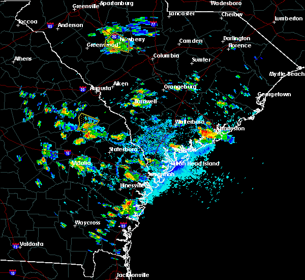 At 357 pm edt, doppler radar indicated a severe thunderstorm capable of producing damaging winds in excess of 60 mph. this storm was located near midville, or 14 miles west of millen, moving southwest at 10 mph. locations impacted include, midville. At 357 pm edt, doppler radar indicated a severe thunderstorm capable of producing damaging winds in excess of 60 mph. this storm was located near midville, or 14 miles west of millen, moving southwest at 10 mph. locations impacted include, midville.
|
| 9/4/2015 3:37 PM EDT |
 At 336 pm edt, doppler radar indicated a severe thunderstorm capable of producing damaging winds in excess of 60 mph. this storm was located near herndon, or 14 miles southeast of louisville, and moving southwest at 10 mph. nickel size hail may also accompany the damaging winds. At 336 pm edt, doppler radar indicated a severe thunderstorm capable of producing damaging winds in excess of 60 mph. this storm was located near herndon, or 14 miles southeast of louisville, and moving southwest at 10 mph. nickel size hail may also accompany the damaging winds.
|
| 8/23/2015 1:03 PM EDT |
 At 1pm edt, doppler radar indicated a line of severe thunderstorms capable of producing damaging winds in excess of 60 mph. these storms were located along a line extending from near edgehill to 8 miles south of bartow, and moving east at 30 mph. At 1pm edt, doppler radar indicated a line of severe thunderstorms capable of producing damaging winds in excess of 60 mph. these storms were located along a line extending from near edgehill to 8 miles south of bartow, and moving east at 30 mph.
|
| 8/6/2015 5:48 PM EDT |
 At 548 pm edt, doppler radar indicated a line of severe thunderstorms capable of producing damaging winds in excess of 60 mph. these storms were located along a line extending from 8 miles south of prosperity to near garfield, and moving east at 25 mph. At 548 pm edt, doppler radar indicated a line of severe thunderstorms capable of producing damaging winds in excess of 60 mph. these storms were located along a line extending from 8 miles south of prosperity to near garfield, and moving east at 25 mph.
|
| 8/6/2015 5:27 PM EDT |
 At 526 pm edt, a severe thunderstorm was located 7 miles northeast of adrian, or 9 miles west of swainsboro, moving east at 30 mph (radar indicated). Hazards include 60 mph wind gusts and penny size hail. Expect damage to roofs. siding and trees. Other locations in the warning include but are not limited to swainsboro, twin city, adrian, midville, garfield, summertown, nunez, kite, modoc, covena, blundale, meeks, norristown junction, canoochee, colemans lake, dellwood, three points, george l smith state park and norristown. At 526 pm edt, a severe thunderstorm was located 7 miles northeast of adrian, or 9 miles west of swainsboro, moving east at 30 mph (radar indicated). Hazards include 60 mph wind gusts and penny size hail. Expect damage to roofs. siding and trees. Other locations in the warning include but are not limited to swainsboro, twin city, adrian, midville, garfield, summertown, nunez, kite, modoc, covena, blundale, meeks, norristown junction, canoochee, colemans lake, dellwood, three points, george l smith state park and norristown.
|
| 8/6/2015 4:50 PM EDT |
 At 449 pm edt, doppler radar indicated an area of severe thunderstorms over the csra capable of producing damaging winds in excess of 60 mph. these storms were moving east at 30 mph. At 449 pm edt, doppler radar indicated an area of severe thunderstorms over the csra capable of producing damaging winds in excess of 60 mph. these storms were moving east at 30 mph.
|
| 7/3/2015 1:06 PM EDT | Burke ema reported tree down on hwy 56 at mile marker 15...which is 15 miles sw of waynesboro. time estimate in burke county GA, 7.6 miles SW of Midville, GA |
| 7/3/2015 1:00 PM EDT |
 At 100 pm edt, doppler radar indicated a line of severe thunderstorms capable of producing damaging winds in excess of 60 mph. these storms were located along a line extending from 6 miles southwest of williston to 8 miles northeast of louisville to near wadley, moving southeast at 25 mph. locations impacted include, waynesboro, barnwell, savannah river site, sardis, midville, hilda, snelling, kline, girard, vidette and colemans lake. At 100 pm edt, doppler radar indicated a line of severe thunderstorms capable of producing damaging winds in excess of 60 mph. these storms were located along a line extending from 6 miles southwest of williston to 8 miles northeast of louisville to near wadley, moving southeast at 25 mph. locations impacted include, waynesboro, barnwell, savannah river site, sardis, midville, hilda, snelling, kline, girard, vidette and colemans lake.
|
| 7/3/2015 12:24 PM EDT |
 At 1224 pm edt, doppler radar indicated a line of severe thunderstorms capable of producing damaging winds in excess of 60 mph. these storms were located along a line extending from near augusta to 7 miles northeast of wrens to near sandersville, and moving east at 35 mph. At 1224 pm edt, doppler radar indicated a line of severe thunderstorms capable of producing damaging winds in excess of 60 mph. these storms were located along a line extending from near augusta to 7 miles northeast of wrens to near sandersville, and moving east at 35 mph.
|
| 7/2/2015 5:00 PM EDT |
 At 459 pm edt, doppler radar indicated a line of severe thunderstorms capable of producing damaging winds in excess of 60 mph. these storms were located along a line extending from near hephzibah to near midville, and moving east at 30 mph. At 459 pm edt, doppler radar indicated a line of severe thunderstorms capable of producing damaging winds in excess of 60 mph. these storms were located along a line extending from near hephzibah to near midville, and moving east at 30 mph.
|
| 8/2/2012 2:40 PM EDT | Quarter sized hail reported 3.9 miles W of Midville, GA, post office reported 1-inch hail on bunn store road |
| 8/2/2012 2:40 PM EDT | Post office reported two trees down on shady lane near midvill in burke county GA, 3.9 miles W of Midville, GA |
| 11/16/2011 5:56 PM EST | Quarter sized hail reported 5.6 miles NE of Midville, GA, amateur radio relayed reports of trees blocking mcgarrs mill pond road and quarter-sized hail. |
Hail Maps for Midville, GA
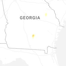


Connect with Interactive Hail Maps