

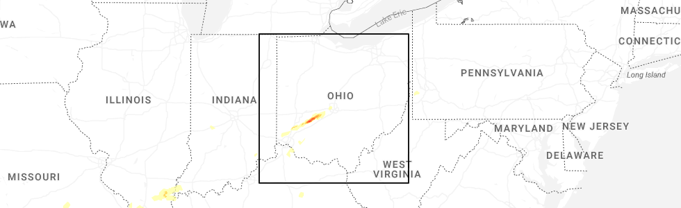
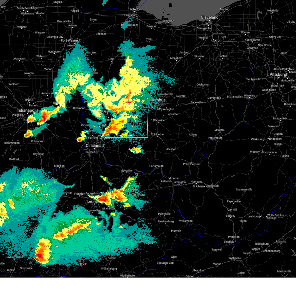
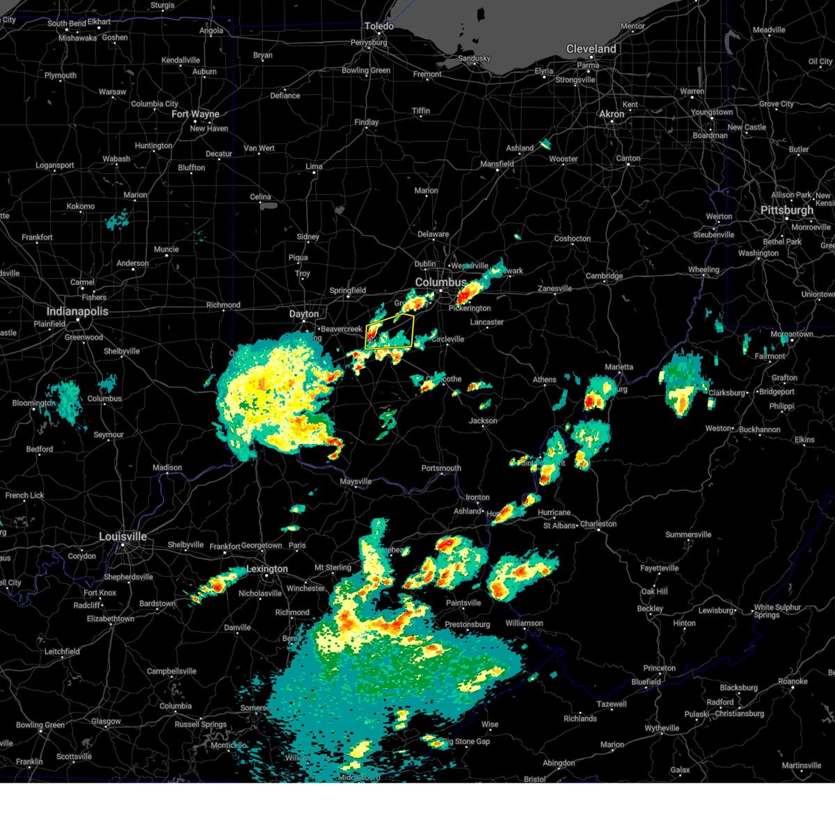
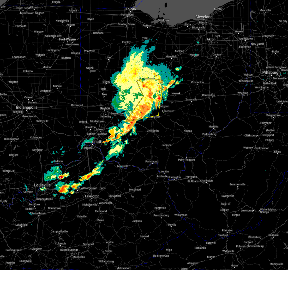
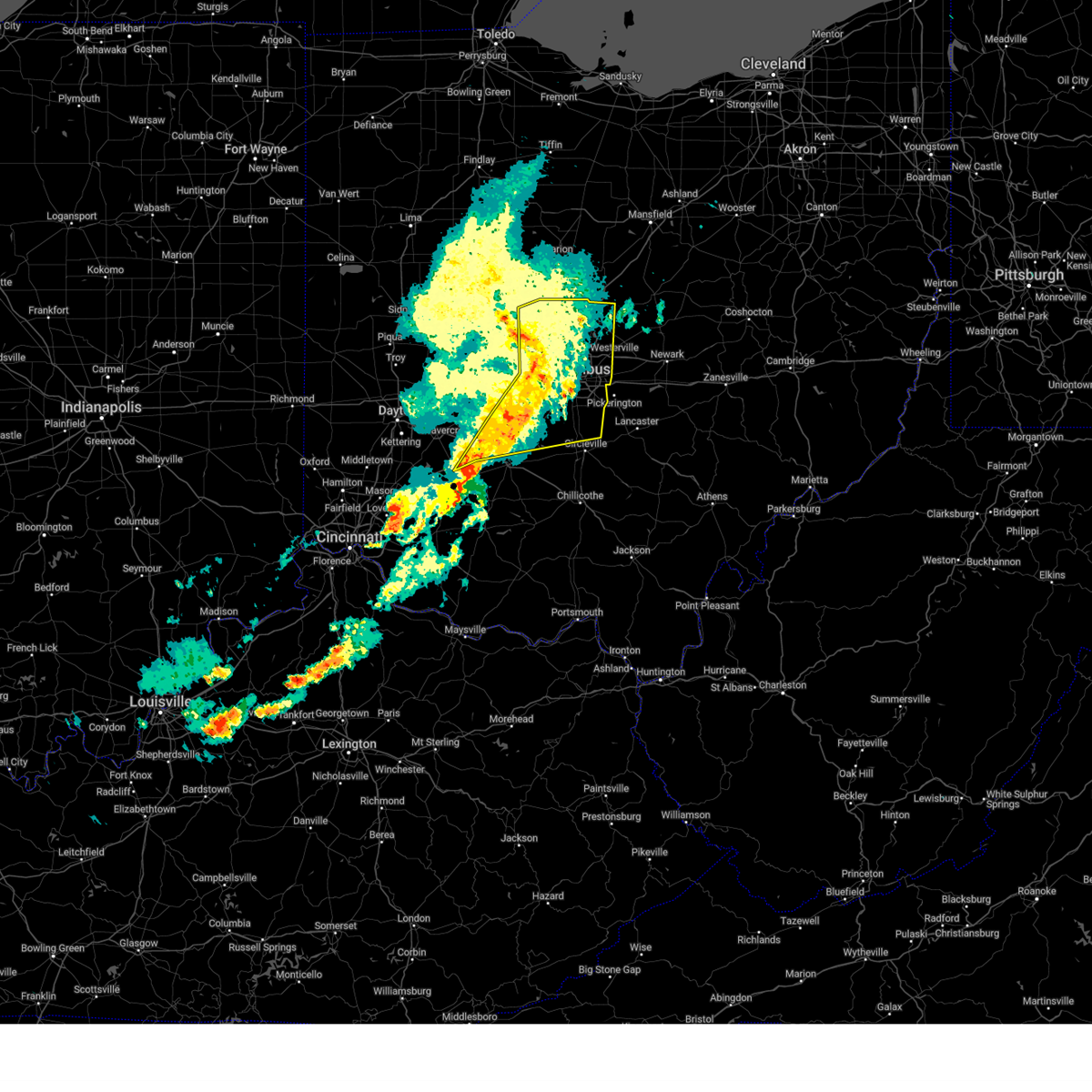
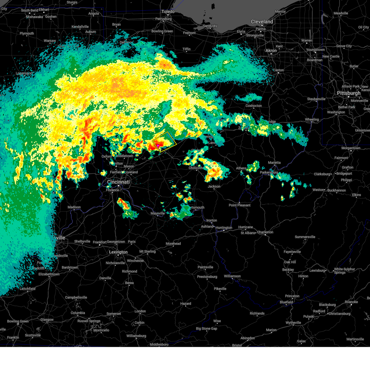
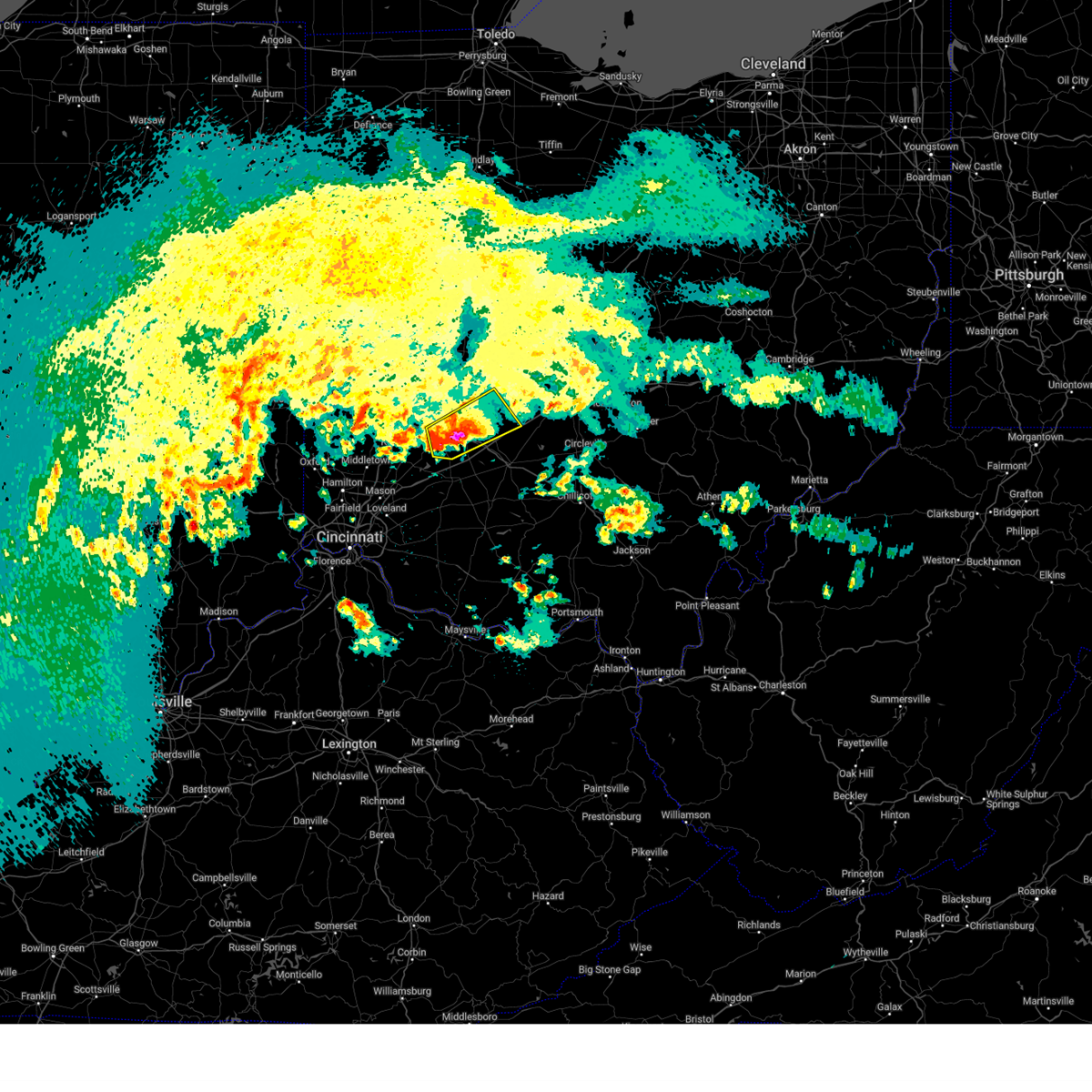
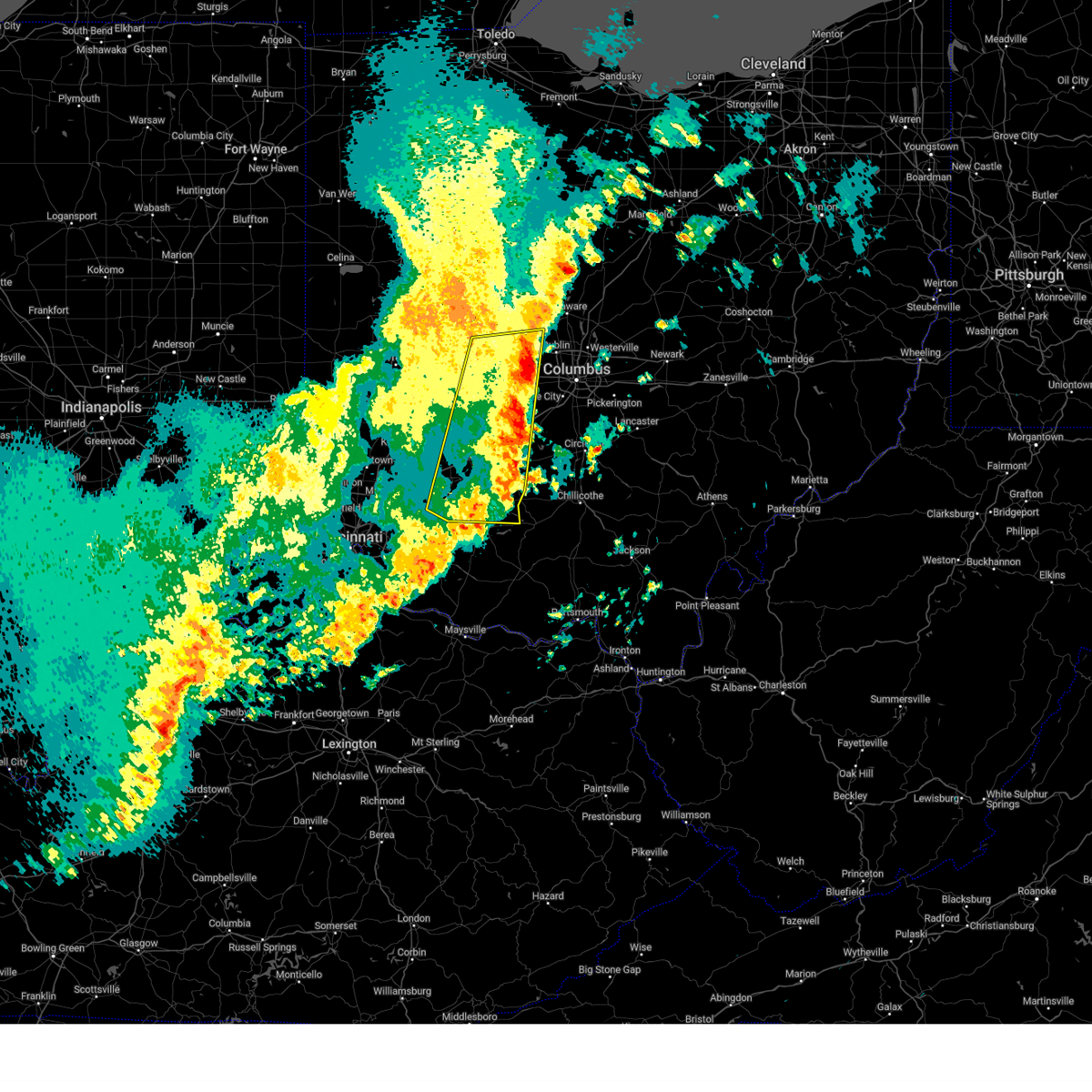
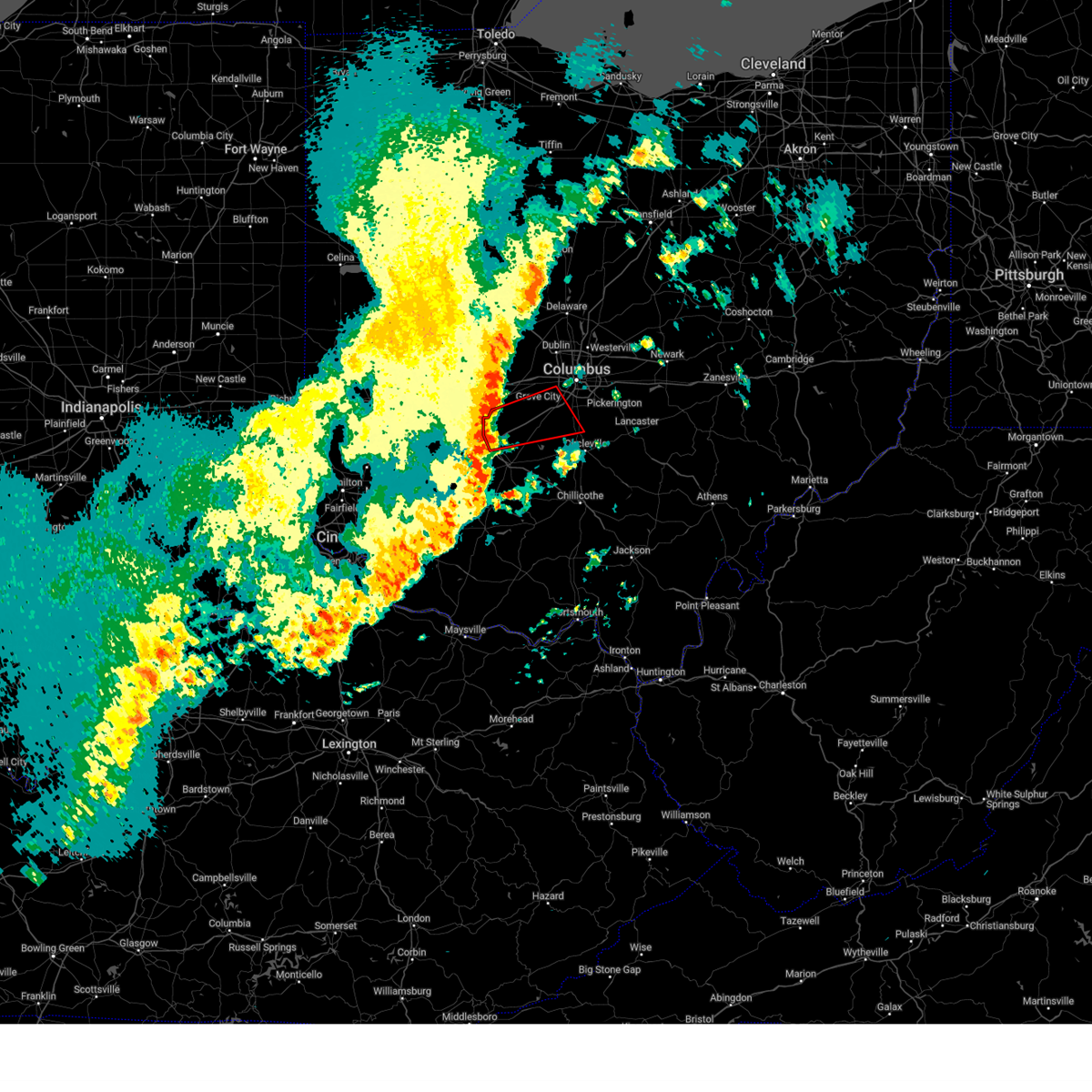
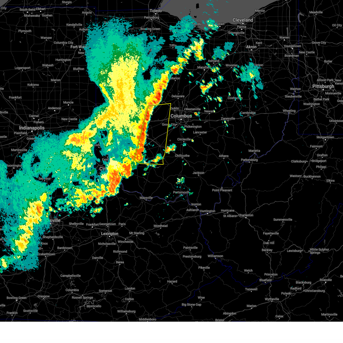
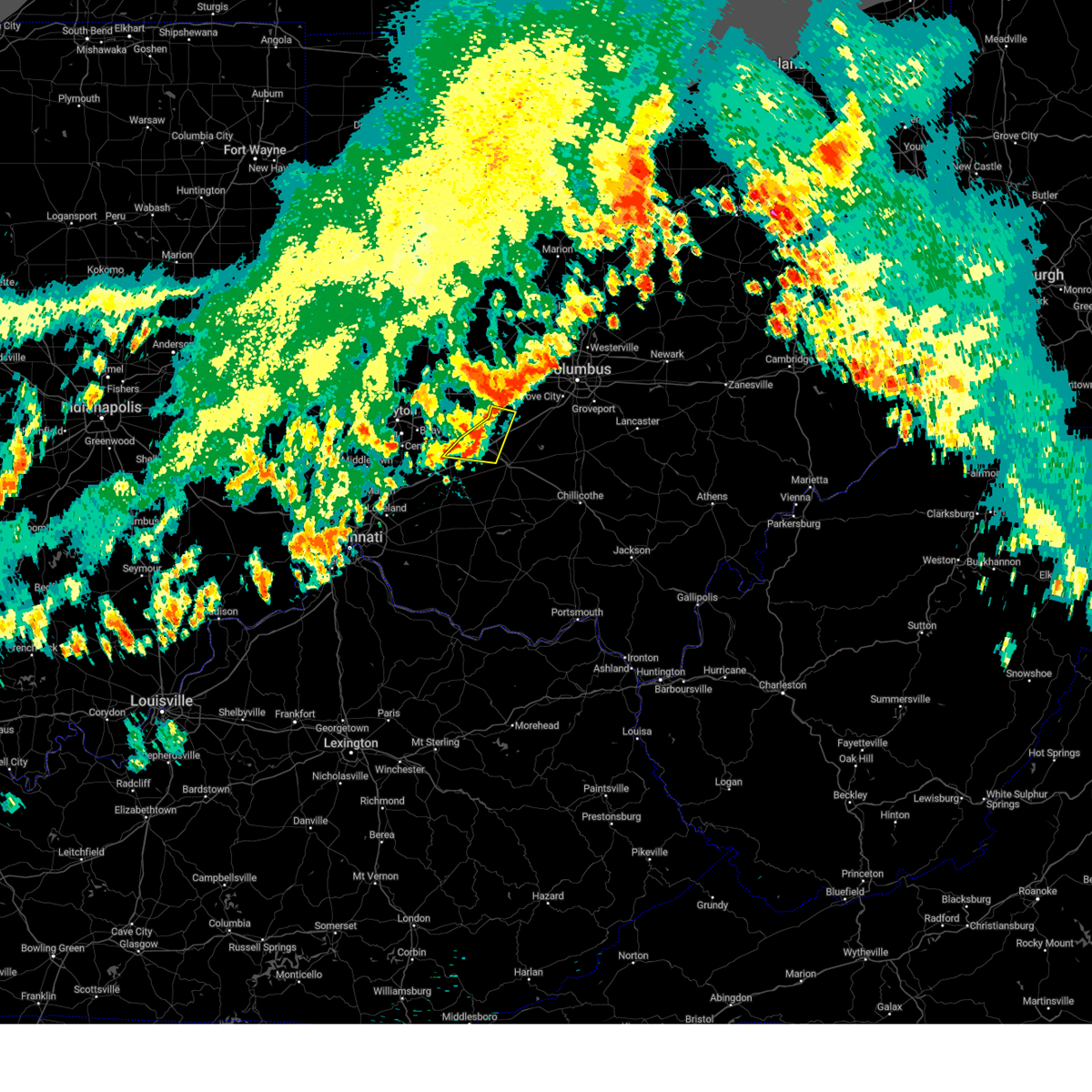
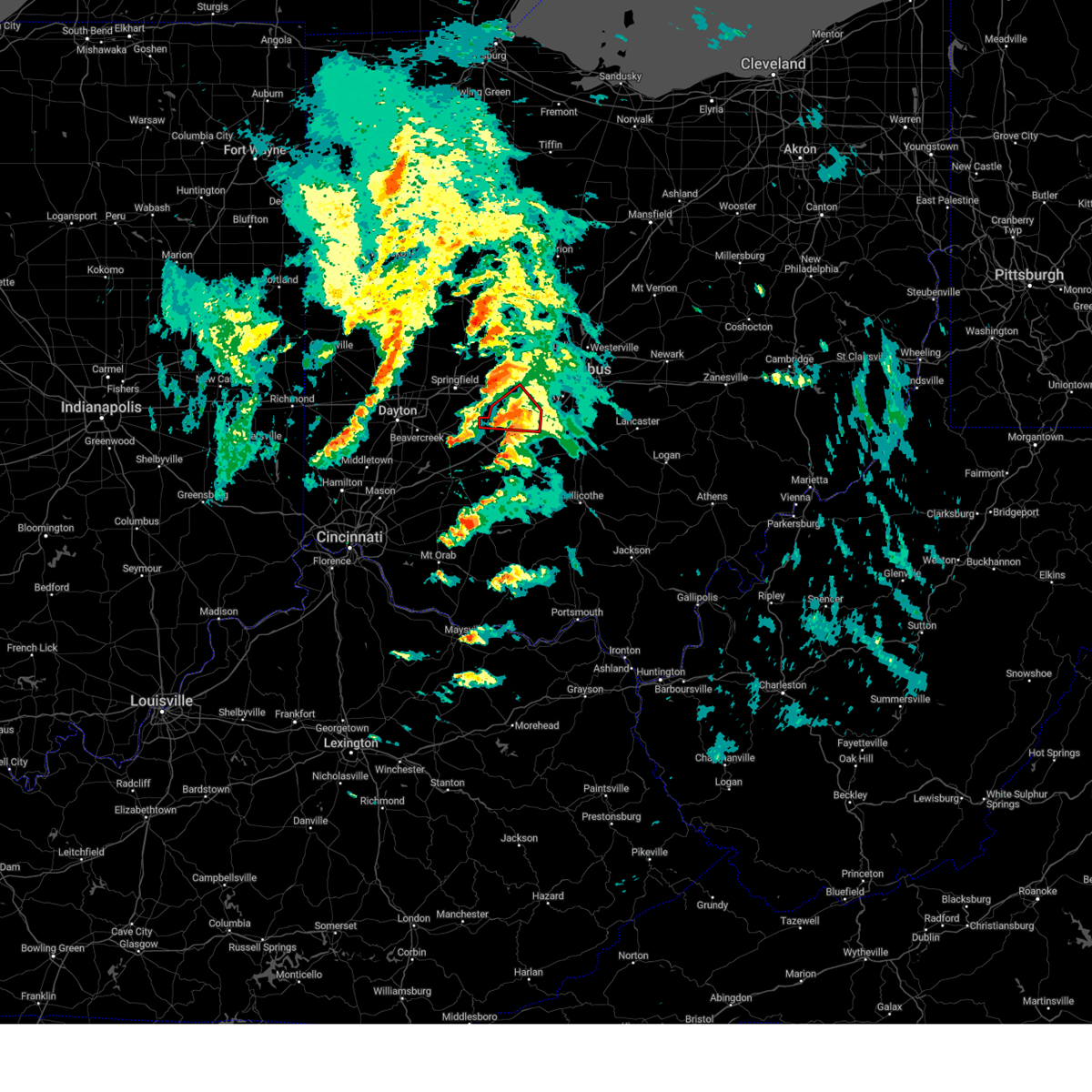
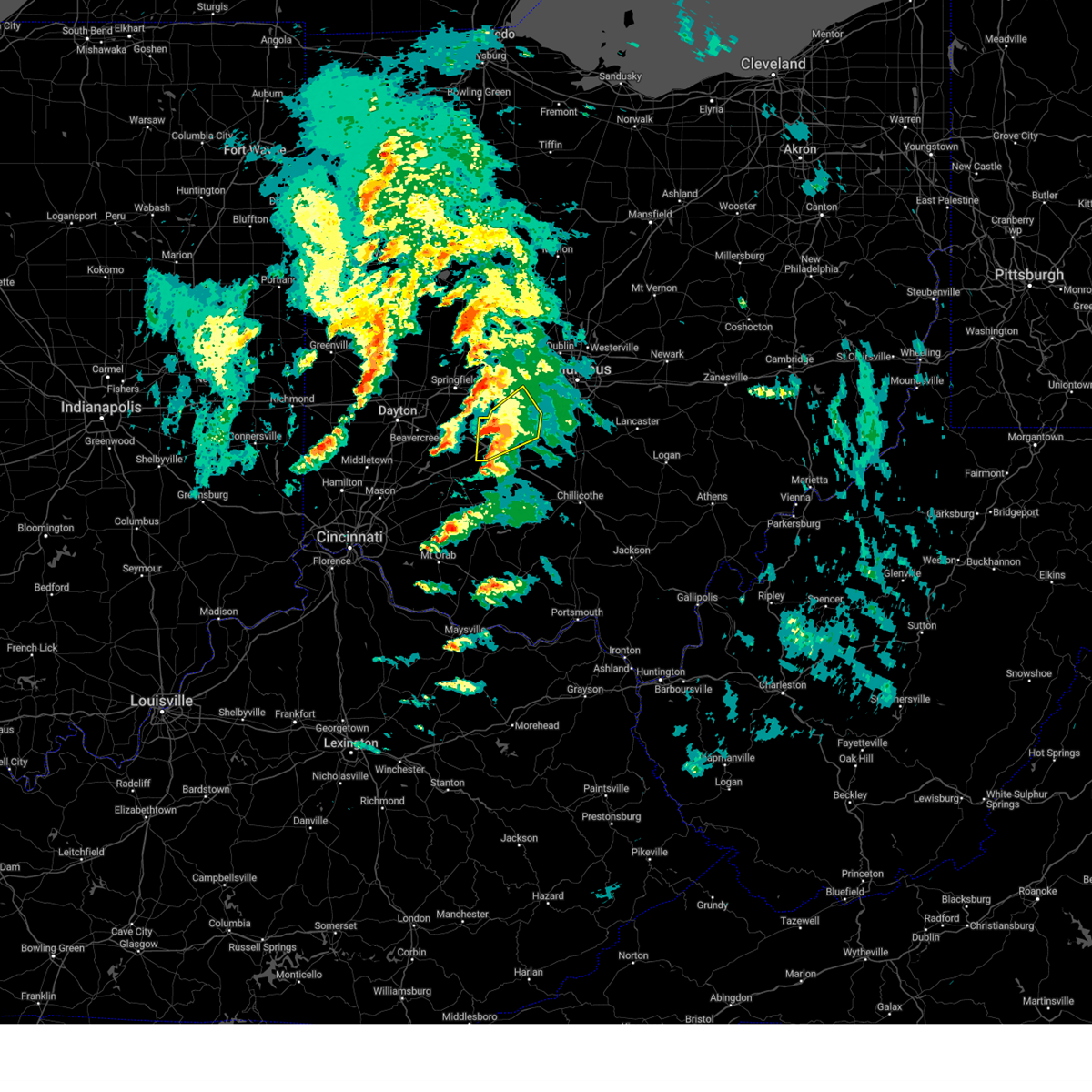
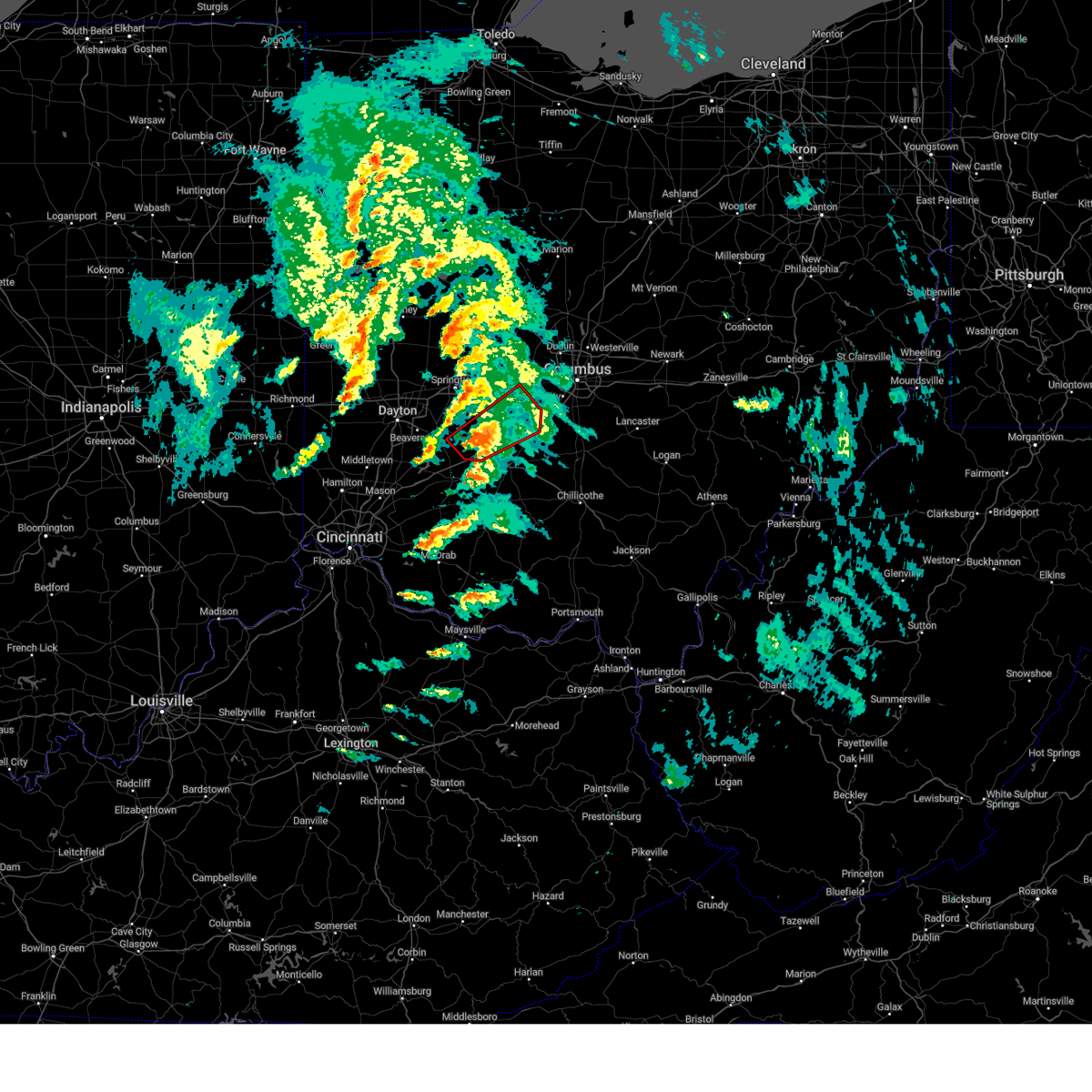
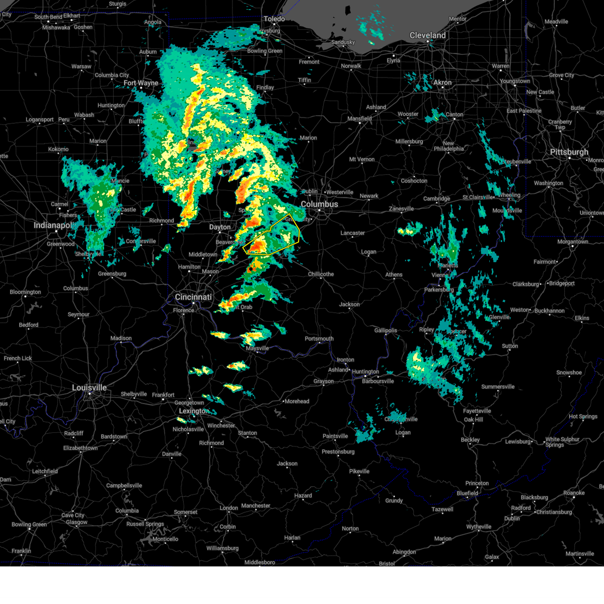
Hail Map for Midway, OH
The Midway, OH area has had 0 reports of on-the-ground hail by trained spotters, and has been under severe weather warnings 45 times during the past 12 months. Doppler radar has detected hail at or near Midway, OH on 49 occasions, including 2 occasions during the past year.
| Name: | Midway, OH |
| Where Located: | 29.6 miles WSW of Columbus, OH |
| Map: | Google Map for Midway, OH |
| Population: | 322 |
| Housing Units: | 127 |
| More Info: | Search Google for Midway, OH |
2
The Top Recent Hail Date for Midway, OH is Friday, April 4, 2025 (11th out of 49)
Hail and Wind Damage Spotted near Midway, OH
| Date / Time | Report Details |
|---|---|
| 6/18/2025 8:11 PM EDT |
 the severe thunderstorm warning has been cancelled and is no longer in effect the severe thunderstorm warning has been cancelled and is no longer in effect
|
| 6/18/2025 8:11 PM EDT |
 At 810 pm edt, severe thunderstorms were located along a line extending from new california to jeffersonville, moving east at 35 mph (a 56 mph wind gust was reported at columbus ohio state university aiport at 759 pm). Hazards include 60 mph wind gusts. Expect damage to trees and power lines. locations impacted include, columbus, dublin, grove city, upper arlington, hilliard, washington court house, worthington, london, jefferson, powell, plain city, west jefferson, mount sterling, jeffersonville, bloomingburg, new holland, lake darby, valleyview, marble cliff, and riverlea. this includes the following interstates, i-70 in ohio between mile markers 75 and 95. I-71 in ohio between mile markers 59 and 94. At 810 pm edt, severe thunderstorms were located along a line extending from new california to jeffersonville, moving east at 35 mph (a 56 mph wind gust was reported at columbus ohio state university aiport at 759 pm). Hazards include 60 mph wind gusts. Expect damage to trees and power lines. locations impacted include, columbus, dublin, grove city, upper arlington, hilliard, washington court house, worthington, london, jefferson, powell, plain city, west jefferson, mount sterling, jeffersonville, bloomingburg, new holland, lake darby, valleyview, marble cliff, and riverlea. this includes the following interstates, i-70 in ohio between mile markers 75 and 95. I-71 in ohio between mile markers 59 and 94.
|
| 6/18/2025 7:35 PM EDT | At 735 pm edt, severe thunderstorms were located along a line extending from mechanicsburg to 6 miles southeast of xenia, moving east at 35 mph (radar indicated). Hazards include 60 mph wind gusts. Expect damage to trees and power lines. locations impacted include, columbus, springfield, dublin, grove city, upper arlington, hilliard, washington court house, worthington, london, jefferson, powell, plain city, west jefferson, cedarville, jamestown, mount sterling, south charleston, mechanicsburg, jeffersonville, and bloomingburg. this includes the following interstates, i-70 in ohio between mile markers 59 and 95. I-71 in ohio between mile markers 58 and 94. |
| 6/18/2025 7:26 PM EDT |
 Svriln the national weather service in wilmington has issued a * severe thunderstorm warning for, southeastern champaign county in west central ohio, western franklin county in central ohio, fayette county in central ohio, northwestern pickaway county in central ohio, south central delaware county in central ohio, eastern greene county in west central ohio, eastern clark county in west central ohio, madison county in central ohio, * until 830 pm edt. * at 725 pm edt, severe thunderstorms were located along a line extending from near mechanicsburg to 6 miles south of xenia, moving east at 35 mph (a 69 mph wind gust was reported at dayton airport at 654 pm). Hazards include 70 mph wind gusts. Expect considerable tree damage. Damage is likely to mobile homes, roofs, and outbuildings. Svriln the national weather service in wilmington has issued a * severe thunderstorm warning for, southeastern champaign county in west central ohio, western franklin county in central ohio, fayette county in central ohio, northwestern pickaway county in central ohio, south central delaware county in central ohio, eastern greene county in west central ohio, eastern clark county in west central ohio, madison county in central ohio, * until 830 pm edt. * at 725 pm edt, severe thunderstorms were located along a line extending from near mechanicsburg to 6 miles south of xenia, moving east at 35 mph (a 69 mph wind gust was reported at dayton airport at 654 pm). Hazards include 70 mph wind gusts. Expect considerable tree damage. Damage is likely to mobile homes, roofs, and outbuildings.
|
| 5/16/2025 9:57 PM EDT | Svriln the national weather service in wilmington has issued a * severe thunderstorm warning for, fayette county in central ohio, northeastern clinton county in southwestern ohio, pickaway county in central ohio, southeastern greene county in west central ohio, northeastern highland county in south central ohio, southern madison county in central ohio, northern ross county in south central ohio, * until 1045 pm edt. * at 957 pm edt, a severe thunderstorm was located near sabina, moving east at 55 mph (radar indicated). Hazards include 70 mph wind gusts and quarter size hail. Minor hail damage to vehicles is possible. expect considerable tree damage. Wind damage is also likely to mobile homes, roofs, and outbuildings. |
| 5/16/2025 9:52 PM EDT | At 950 pm edt, a severe thunderstorm was located over washington court house, moving east at 50 mph (radar indicated). Hazards include 70 mph wind gusts and half dollar size hail. Minor hail damage to vehicles is possible. expect considerable tree damage. wind damage is also likely to mobile homes, roofs, and outbuildings. locations impacted include, clarksville, interstate 71 at state route 38, new vienna, east monroe, lumberton, austin, oakland, sabina, lees creek, madison mills, martinsville, midway, morrisville, south salem, new holland, wilmington, ogden, kingman, cowan lake state park, and milledgeville. This includes i-71 in ohio between mile markers 43 and 57, and between mile markers 62 and 88. |
| 5/16/2025 9:52 PM EDT | the severe thunderstorm warning has been cancelled and is no longer in effect |
| 5/16/2025 9:32 PM EDT |
 At 932 pm edt, a severe thunderstorm was located near sabina, moving east at 50 mph (radar indicated). Hazards include 70 mph wind gusts and half dollar size hail. Minor hail damage to vehicles is possible. expect considerable tree damage. wind damage is also likely to mobile homes, roofs, and outbuildings. locations impacted include, paintersville, clarksville, interstate 71 at state route 38, new vienna, fort ancient, east monroe, rosemoor, lumberton, austin, oakland, selma, sabina, corwin, genntown, lees creek, madison mills, oldtown, gladstone, caesar creek state park, and yellow springs. This includes i-71 in ohio between mile markers 29 and 88. At 932 pm edt, a severe thunderstorm was located near sabina, moving east at 50 mph (radar indicated). Hazards include 70 mph wind gusts and half dollar size hail. Minor hail damage to vehicles is possible. expect considerable tree damage. wind damage is also likely to mobile homes, roofs, and outbuildings. locations impacted include, paintersville, clarksville, interstate 71 at state route 38, new vienna, fort ancient, east monroe, rosemoor, lumberton, austin, oakland, selma, sabina, corwin, genntown, lees creek, madison mills, oldtown, gladstone, caesar creek state park, and yellow springs. This includes i-71 in ohio between mile markers 29 and 88.
|
| 5/16/2025 9:19 PM EDT |
 Svriln the national weather service in wilmington has issued a * severe thunderstorm warning for, eastern warren county in southwestern ohio, fayette county in central ohio, clinton county in southwestern ohio, northwestern pickaway county in central ohio, greene county in west central ohio, southeastern clark county in west central ohio, northeastern highland county in south central ohio, southern madison county in central ohio, northwestern ross county in south central ohio, * until 1000 pm edt. * at 919 pm edt, a severe thunderstorm was located near wilmington, moving east at 50 mph (radar indicated). Hazards include 60 mph wind gusts and quarter size hail. Minor hail damage to vehicles is possible. Expect wind damage to trees and power lines. Svriln the national weather service in wilmington has issued a * severe thunderstorm warning for, eastern warren county in southwestern ohio, fayette county in central ohio, clinton county in southwestern ohio, northwestern pickaway county in central ohio, greene county in west central ohio, southeastern clark county in west central ohio, northeastern highland county in south central ohio, southern madison county in central ohio, northwestern ross county in south central ohio, * until 1000 pm edt. * at 919 pm edt, a severe thunderstorm was located near wilmington, moving east at 50 mph (radar indicated). Hazards include 60 mph wind gusts and quarter size hail. Minor hail damage to vehicles is possible. Expect wind damage to trees and power lines.
|
| 5/2/2025 7:01 PM EDT | the severe thunderstorm warning has been cancelled and is no longer in effect |
| 5/2/2025 6:53 PM EDT | At 653 pm edt, a severe thunderstorm was located over jeffersonville, moving east at 25 mph (radar indicated). Hazards include quarter size hail. Minor damage to vehicles is possible. locations impacted include, jeffersonville, chenoweth, madison mills, bookwalter, midway, mount sterling, pancoastburg, and bloomingburg. This includes i-71 in ohio between mile markers 66 and 88. |
| 5/2/2025 6:44 PM EDT |
 Svriln the national weather service in wilmington has issued a * severe thunderstorm warning for, northern fayette county in central ohio, southern madison county in central ohio, * until 715 pm edt. * at 644 pm edt, a severe thunderstorm was located over jeffersonville, moving east at 20 mph (radar indicated). Hazards include quarter size hail. minor damage to vehicles is possible Svriln the national weather service in wilmington has issued a * severe thunderstorm warning for, northern fayette county in central ohio, southern madison county in central ohio, * until 715 pm edt. * at 644 pm edt, a severe thunderstorm was located over jeffersonville, moving east at 20 mph (radar indicated). Hazards include quarter size hail. minor damage to vehicles is possible
|
| 4/29/2025 2:41 PM EDT |
 At 241 pm edt, a severe thunderstorm was located over upper arlington, moving east at 55 mph (radar indicated). Hazards include 60 mph wind gusts and penny size hail. Expect damage to trees and power lines. locations impacted include, port columbus airport, east ringgold, alum creek state park, interstate 71 at state route 38, dublin, gahanna, upper arlington, sunbury, clintonville, westerville, warrensburg, center village, madison mills, worthington, kilbourne, hilliard, midway, new california, grandview heights, and whitehall. this includes the following interstates, i-70 in ohio between mile markers 85 and 111. I-71 in ohio between mile markers 66 and 138. At 241 pm edt, a severe thunderstorm was located over upper arlington, moving east at 55 mph (radar indicated). Hazards include 60 mph wind gusts and penny size hail. Expect damage to trees and power lines. locations impacted include, port columbus airport, east ringgold, alum creek state park, interstate 71 at state route 38, dublin, gahanna, upper arlington, sunbury, clintonville, westerville, warrensburg, center village, madison mills, worthington, kilbourne, hilliard, midway, new california, grandview heights, and whitehall. this includes the following interstates, i-70 in ohio between mile markers 85 and 111. I-71 in ohio between mile markers 66 and 138.
|
| 4/29/2025 2:41 PM EDT |
 the severe thunderstorm warning has been cancelled and is no longer in effect the severe thunderstorm warning has been cancelled and is no longer in effect
|
| 4/29/2025 2:35 PM EDT |
 At 235 pm edt, a severe thunderstorm was located over hilliard, moving east at 55 mph (radar indicated). Hazards include 60 mph wind gusts and penny size hail. Expect damage to trees and power lines. locations impacted include, port columbus airport, east ringgold, interstate 71 at state route 38, rosemoor, gahanna, center village, madison mills, worthington, kilbourne, hilliard, new california, grandview heights, whitehall, orient, amity, ostrander, south solon, delaware, duvall, and riverlea. this includes the following interstates, i-70 in ohio between mile markers 77 and 111. I-71 in ohio between mile markers 54 and 138. At 235 pm edt, a severe thunderstorm was located over hilliard, moving east at 55 mph (radar indicated). Hazards include 60 mph wind gusts and penny size hail. Expect damage to trees and power lines. locations impacted include, port columbus airport, east ringgold, interstate 71 at state route 38, rosemoor, gahanna, center village, madison mills, worthington, kilbourne, hilliard, new california, grandview heights, whitehall, orient, amity, ostrander, south solon, delaware, duvall, and riverlea. this includes the following interstates, i-70 in ohio between mile markers 77 and 111. I-71 in ohio between mile markers 54 and 138.
|
| 4/29/2025 2:17 PM EDT |
 At 216 pm edt, a severe thunderstorm was located over choctaw lake, moving east at 60 mph (radar indicated). Hazards include 60 mph wind gusts and penny size hail. Expect damage to trees and power lines. locations impacted include, port columbus airport, paintersville, east ringgold, interstate 71 at state route 38, rosemoor, gahanna, lumberton, center village, madison mills, worthington, kilbourne, hilliard, new california, grandview heights, whitehall, orient, amity, ostrander, south solon, and delaware. this includes the following interstates, i-70 in ohio between mile markers 71 and 111. I-71 in ohio between mile markers 47 and 138. At 216 pm edt, a severe thunderstorm was located over choctaw lake, moving east at 60 mph (radar indicated). Hazards include 60 mph wind gusts and penny size hail. Expect damage to trees and power lines. locations impacted include, port columbus airport, paintersville, east ringgold, interstate 71 at state route 38, rosemoor, gahanna, lumberton, center village, madison mills, worthington, kilbourne, hilliard, new california, grandview heights, whitehall, orient, amity, ostrander, south solon, and delaware. this includes the following interstates, i-70 in ohio between mile markers 71 and 111. I-71 in ohio between mile markers 47 and 138.
|
| 4/29/2025 2:03 PM EDT |
 Svriln the national weather service in wilmington has issued a * severe thunderstorm warning for, franklin county in central ohio, northern fayette county in central ohio, northwestern clinton county in southwestern ohio, northern pickaway county in central ohio, delaware county in central ohio, southeastern greene county in west central ohio, southern union county in central ohio, madison county in central ohio, * until 300 pm edt. * at 202 pm edt, a severe thunderstorm was located near springfield, moving east at 55 mph (radar indicated). Hazards include 60 mph wind gusts and penny size hail. expect damage to trees and power lines Svriln the national weather service in wilmington has issued a * severe thunderstorm warning for, franklin county in central ohio, northern fayette county in central ohio, northwestern clinton county in southwestern ohio, northern pickaway county in central ohio, delaware county in central ohio, southeastern greene county in west central ohio, southern union county in central ohio, madison county in central ohio, * until 300 pm edt. * at 202 pm edt, a severe thunderstorm was located near springfield, moving east at 55 mph (radar indicated). Hazards include 60 mph wind gusts and penny size hail. expect damage to trees and power lines
|
| 4/5/2025 12:29 AM EDT |
 The storm which prompted the warning has moved out of the area. therefore, the warning will be allowed to expire. please report previous wind damage or hail to the national weather service by going to our website at weather.gov/iln and submitting your report via social media. remember, a severe thunderstorm warning still remains in effect for central and east central madison county until 1245 am edt. The storm which prompted the warning has moved out of the area. therefore, the warning will be allowed to expire. please report previous wind damage or hail to the national weather service by going to our website at weather.gov/iln and submitting your report via social media. remember, a severe thunderstorm warning still remains in effect for central and east central madison county until 1245 am edt.
|
| 4/5/2025 12:21 AM EDT |
 the severe thunderstorm warning has been cancelled and is no longer in effect the severe thunderstorm warning has been cancelled and is no longer in effect
|
| 4/5/2025 12:21 AM EDT |
 At 1221 am edt, a severe thunderstorm was located near london, moving northeast at 55 mph (radar indicated). Hazards include ping pong ball size hail. People and animals outdoors will be injured. expect damage to roofs, siding, windows, and vehicles. locations impacted include, newport, interstate 70 at us route 42, west jefferson, amity, jefferson, lilly chapel, lake darby, georgesville, lafayette, interstate 70 at state route 56, london, madison lake, hilliard, harrisburg, darbydale, midway, big plain, wrightsville, new rome, and dublin. this includes the following interstates, i-70 in ohio between mile markers 72 and 91. I-71 in ohio near mile marker 87, and between mile markers 92 and 94. At 1221 am edt, a severe thunderstorm was located near london, moving northeast at 55 mph (radar indicated). Hazards include ping pong ball size hail. People and animals outdoors will be injured. expect damage to roofs, siding, windows, and vehicles. locations impacted include, newport, interstate 70 at us route 42, west jefferson, amity, jefferson, lilly chapel, lake darby, georgesville, lafayette, interstate 70 at state route 56, london, madison lake, hilliard, harrisburg, darbydale, midway, big plain, wrightsville, new rome, and dublin. this includes the following interstates, i-70 in ohio between mile markers 72 and 91. I-71 in ohio near mile marker 87, and between mile markers 92 and 94.
|
| 4/5/2025 12:20 AM EDT |
 At 1220 am edt, a severe thunderstorm was located near london, moving northeast at 45 mph (radar indicated). Hazards include two inch hail. People and animals outdoors will be injured. expect damage to roofs, siding, windows, and vehicles. locations impacted include, midway. This includes i-71 in ohio between mile markers 76 and 80. At 1220 am edt, a severe thunderstorm was located near london, moving northeast at 45 mph (radar indicated). Hazards include two inch hail. People and animals outdoors will be injured. expect damage to roofs, siding, windows, and vehicles. locations impacted include, midway. This includes i-71 in ohio between mile markers 76 and 80.
|
| 4/5/2025 12:20 AM EDT |
 the severe thunderstorm warning has been cancelled and is no longer in effect the severe thunderstorm warning has been cancelled and is no longer in effect
|
| 4/5/2025 12:13 AM EDT |
 Svriln the national weather service in wilmington has issued a * severe thunderstorm warning for, western franklin county in central ohio, east central clark county in west central ohio, madison county in central ohio, * until 1245 am edt. * at 1213 am edt, a severe thunderstorm was located near south charleston, moving northeast at 55 mph (radar indicated). Hazards include two inch hail. People and animals outdoors will be injured. Expect damage to roofs, siding, windows, and vehicles. Svriln the national weather service in wilmington has issued a * severe thunderstorm warning for, western franklin county in central ohio, east central clark county in west central ohio, madison county in central ohio, * until 1245 am edt. * at 1213 am edt, a severe thunderstorm was located near south charleston, moving northeast at 55 mph (radar indicated). Hazards include two inch hail. People and animals outdoors will be injured. Expect damage to roofs, siding, windows, and vehicles.
|
| 4/5/2025 12:13 AM EDT |
 the severe thunderstorm warning has been cancelled and is no longer in effect the severe thunderstorm warning has been cancelled and is no longer in effect
|
| 4/5/2025 12:13 AM EDT |
 At 1212 am edt, a severe thunderstorm was located near south charleston, moving northeast at 45 mph (radar indicated). Hazards include two inch hail. People and animals outdoors will be injured. expect damage to roofs, siding, windows, and vehicles. locations impacted include, south charleston, south solon, bookwalter, midway, lisbon, and selma. This includes i-71 in ohio between mile markers 76 and 80. At 1212 am edt, a severe thunderstorm was located near south charleston, moving northeast at 45 mph (radar indicated). Hazards include two inch hail. People and animals outdoors will be injured. expect damage to roofs, siding, windows, and vehicles. locations impacted include, south charleston, south solon, bookwalter, midway, lisbon, and selma. This includes i-71 in ohio between mile markers 76 and 80.
|
| 4/5/2025 12:06 AM EDT |
 At 1206 am edt, a severe thunderstorm was located near south charleston, moving northeast at 40 mph (radar indicated). Hazards include two inch hail. People and animals outdoors will be injured. expect damage to roofs, siding, windows, and vehicles. locations impacted include, lisbon, rosemoor, south solon, selma, gladstone, south charleston, bookwalter, midway, cedarville, bell center, shady grove, jamestown, and jeffersonville. This includes i-71 in ohio between mile markers 78 and 80. At 1206 am edt, a severe thunderstorm was located near south charleston, moving northeast at 40 mph (radar indicated). Hazards include two inch hail. People and animals outdoors will be injured. expect damage to roofs, siding, windows, and vehicles. locations impacted include, lisbon, rosemoor, south solon, selma, gladstone, south charleston, bookwalter, midway, cedarville, bell center, shady grove, jamestown, and jeffersonville. This includes i-71 in ohio between mile markers 78 and 80.
|
| 4/4/2025 11:53 PM EDT |
 Svriln the national weather service in wilmington has issued a * severe thunderstorm warning for, northwestern fayette county in central ohio, central greene county in west central ohio, southeastern clark county in west central ohio, southwestern madison county in central ohio, * until 1230 am edt. * at 1152 pm edt, a severe thunderstorm was located over jamestown, moving northeast at 45 mph (radar indicated). Hazards include two inch hail. People and animals outdoors will be injured. Expect damage to roofs, siding, windows, and vehicles. Svriln the national weather service in wilmington has issued a * severe thunderstorm warning for, northwestern fayette county in central ohio, central greene county in west central ohio, southeastern clark county in west central ohio, southwestern madison county in central ohio, * until 1230 am edt. * at 1152 pm edt, a severe thunderstorm was located over jamestown, moving northeast at 45 mph (radar indicated). Hazards include two inch hail. People and animals outdoors will be injured. Expect damage to roofs, siding, windows, and vehicles.
|
| 4/3/2025 1:56 AM EDT | The storm which prompted the warning has moved out of the area. therefore, the warning will be allowed to expire. a tornado watch remains in effect until 400 am edt for central, south central, southwestern and west central ohio. please report previous wind damage or hail to the national weather service by going to our website at weather.gov/iln and submitting your report via social media. |
| 4/3/2025 1:39 AM EDT | At 138 am edt, a severe thunderstorm was located near bloomingburg, moving northeast at 65 mph (radar indicated). Hazards include 70 mph wind gusts and penny size hail. Expect considerable tree damage. damage is likely to mobile homes, roofs, and outbuildings. locations impacted include, interstate 71 at state route 38, new vienna, east monroe, samantha, choctaw lake, state route 32 at us route 68, madison mills, highland holiday, martinsville, hilliard, midway, new holland, highland county airport, rocky fork lake, orient, milledgeville, lilly chapel, marshall, jasper mills, and russell. this includes the following interstates, i-70 in ohio between mile markers 71 and 93. I-71 in ohio between mile markers 66 and 93. |
| 4/3/2025 1:39 AM EDT | the severe thunderstorm warning has been cancelled and is no longer in effect |
| 4/3/2025 1:14 AM EDT | Svriln the national weather service in wilmington has issued a * severe thunderstorm warning for, western franklin county in central ohio, northwestern brown county in southwestern ohio, fayette county in central ohio, clinton county in southwestern ohio, northwestern pickaway county in central ohio, southeastern greene county in west central ohio, highland county in south central ohio, madison county in central ohio, northwestern ross county in south central ohio, * until 200 am edt. * at 114 am edt, a severe thunderstorm was located near wilmington, moving northeast at 65 mph (radar indicated). Hazards include 70 mph wind gusts and penny size hail. Expect considerable tree damage. Damage is likely to mobile homes, roofs, and outbuildings. |
| 3/30/2025 9:52 PM EDT |
 The storms which prompted the warning have moved out of the area. therefore, the warning will be allowed to expire. a tornado watch remains in effect until 100 am edt for central, south central, southwestern and west central ohio. please report previous wind damage or hail to the national weather service by going to our website at weather.gov/iln and submitting your report via social media. remember, a severe thunderstorm warning still remains in effect for southeastern union county, eastern madison county, eastern fayette county, and eastern highland county! remember, a tornado warning still remains in effect for eastern fayette county, northern highland county, and southeast madison county!. The storms which prompted the warning have moved out of the area. therefore, the warning will be allowed to expire. a tornado watch remains in effect until 100 am edt for central, south central, southwestern and west central ohio. please report previous wind damage or hail to the national weather service by going to our website at weather.gov/iln and submitting your report via social media. remember, a severe thunderstorm warning still remains in effect for southeastern union county, eastern madison county, eastern fayette county, and eastern highland county! remember, a tornado warning still remains in effect for eastern fayette county, northern highland county, and southeast madison county!.
|
| 3/30/2025 9:38 PM EDT |
 Toriln the national weather service in wilmington has issued a * tornado warning for, southwestern franklin county in central ohio, northern fayette county in central ohio, northwestern pickaway county in central ohio, southern madison county in central ohio, * until 1015 pm edt. * at 938 pm edt, a severe thunderstorm capable of producing a tornado was located near jeffersonville, moving east at 55 mph (radar indicated rotation). Hazards include tornado and quarter size hail. Flying debris will be dangerous to those caught without shelter. mobile homes will be damaged or destroyed. damage to roofs, windows, and vehicles will occur. Tree damage is likely. Toriln the national weather service in wilmington has issued a * tornado warning for, southwestern franklin county in central ohio, northern fayette county in central ohio, northwestern pickaway county in central ohio, southern madison county in central ohio, * until 1015 pm edt. * at 938 pm edt, a severe thunderstorm capable of producing a tornado was located near jeffersonville, moving east at 55 mph (radar indicated rotation). Hazards include tornado and quarter size hail. Flying debris will be dangerous to those caught without shelter. mobile homes will be damaged or destroyed. damage to roofs, windows, and vehicles will occur. Tree damage is likely.
|
| 3/30/2025 9:31 PM EDT |
 At 930 pm edt, severe thunderstorms were located along a line extending from near north lewisburg to near lynchburg, moving east at 45 mph (radar indicated). Hazards include 60 mph wind gusts and quarter size hail. Minor hail damage to vehicles is possible. expect wind damage to trees and power lines. locations impacted include, paintersville, interstate 71 at state route 38, east monroe, rosemoor, samantha, lumberton, south vienna, lees creek, madison mills, gladstone, martinsville, new california, morrisville, cowan lake state park, amity, harmony, lisbon, south solon, jasper mills, and midland. this includes the following interstates, i-70 in ohio between mile markers 56 and 85. I-71 in ohio between mile markers 46 and 84. At 930 pm edt, severe thunderstorms were located along a line extending from near north lewisburg to near lynchburg, moving east at 45 mph (radar indicated). Hazards include 60 mph wind gusts and quarter size hail. Minor hail damage to vehicles is possible. expect wind damage to trees and power lines. locations impacted include, paintersville, interstate 71 at state route 38, east monroe, rosemoor, samantha, lumberton, south vienna, lees creek, madison mills, gladstone, martinsville, new california, morrisville, cowan lake state park, amity, harmony, lisbon, south solon, jasper mills, and midland. this includes the following interstates, i-70 in ohio between mile markers 56 and 85. I-71 in ohio between mile markers 46 and 84.
|
| 3/30/2025 9:31 PM EDT |
 the severe thunderstorm warning has been cancelled and is no longer in effect the severe thunderstorm warning has been cancelled and is no longer in effect
|
| 3/30/2025 9:07 PM EDT |
 Svriln the national weather service in wilmington has issued a * severe thunderstorm warning for, southern champaign county in west central ohio, north central brown county in southwestern ohio, eastern warren county in southwestern ohio, fayette county in central ohio, clinton county in southwestern ohio, greene county in west central ohio, clark county in west central ohio, northern highland county in south central ohio, southern union county in central ohio, madison county in central ohio, * until 1000 pm edt. * at 906 pm edt, severe thunderstorms were located along a line extending from near urbana to near morrow, moving east at 50 mph (radar indicated). Hazards include 60 mph wind gusts and quarter size hail. Minor hail damage to vehicles is possible. Expect wind damage to trees and power lines. Svriln the national weather service in wilmington has issued a * severe thunderstorm warning for, southern champaign county in west central ohio, north central brown county in southwestern ohio, eastern warren county in southwestern ohio, fayette county in central ohio, clinton county in southwestern ohio, greene county in west central ohio, clark county in west central ohio, northern highland county in south central ohio, southern union county in central ohio, madison county in central ohio, * until 1000 pm edt. * at 906 pm edt, severe thunderstorms were located along a line extending from near urbana to near morrow, moving east at 50 mph (radar indicated). Hazards include 60 mph wind gusts and quarter size hail. Minor hail damage to vehicles is possible. Expect wind damage to trees and power lines.
|
| 12/29/2024 2:14 PM EST |
 The storm which prompted the warning has weakened below severe limits and no longer poses an immediate threat to life or property. therefore, the warning will be allowed to expire. however, gusty winds are still possible with this thunderstorm. please report previous wind damage or hail to the national weather service by going to our website at weather.gov/iln and submitting your report via social media. The storm which prompted the warning has weakened below severe limits and no longer poses an immediate threat to life or property. therefore, the warning will be allowed to expire. however, gusty winds are still possible with this thunderstorm. please report previous wind damage or hail to the national weather service by going to our website at weather.gov/iln and submitting your report via social media.
|
| 12/29/2024 2:02 PM EST |
 the severe thunderstorm warning has been cancelled and is no longer in effect the severe thunderstorm warning has been cancelled and is no longer in effect
|
| 12/29/2024 2:02 PM EST |
 At 201 pm est, a severe thunderstorm was located near jamestown, moving northeast at 25 mph (radar indicated). Hazards include 60 mph wind gusts. Expect damage to trees and power lines. locations impacted include, london, west jefferson, jamestown, south charleston, jeffersonville, choctaw lake, lisbon, brighton, lafayette, south solon, midway, bowersville, octa, newport, chenoweth, interstate 71 at state route 38, rosemoor, selma, gladstone, and madison lake. this includes the following interstates, i-70 in ohio between mile markers 71 and 80. I-71 in ohio between mile markers 58 and 86. At 201 pm est, a severe thunderstorm was located near jamestown, moving northeast at 25 mph (radar indicated). Hazards include 60 mph wind gusts. Expect damage to trees and power lines. locations impacted include, london, west jefferson, jamestown, south charleston, jeffersonville, choctaw lake, lisbon, brighton, lafayette, south solon, midway, bowersville, octa, newport, chenoweth, interstate 71 at state route 38, rosemoor, selma, gladstone, and madison lake. this includes the following interstates, i-70 in ohio between mile markers 71 and 80. I-71 in ohio between mile markers 58 and 86.
|
| 12/29/2024 1:46 PM EST |
 Svriln the national weather service in wilmington has issued a * severe thunderstorm warning for, northwestern fayette county in central ohio, north central clinton county in southwestern ohio, southeastern clark county in west central ohio, eastern greene county in west central ohio, madison county in central ohio, * until 215 pm est. * at 145 pm est, a severe thunderstorm was located over jamestown, moving northeast at 55 mph (radar indicated). Hazards include 60 mph wind gusts. expect damage to trees and power lines Svriln the national weather service in wilmington has issued a * severe thunderstorm warning for, northwestern fayette county in central ohio, north central clinton county in southwestern ohio, southeastern clark county in west central ohio, eastern greene county in west central ohio, madison county in central ohio, * until 215 pm est. * at 145 pm est, a severe thunderstorm was located over jamestown, moving northeast at 55 mph (radar indicated). Hazards include 60 mph wind gusts. expect damage to trees and power lines
|
| 7/14/2024 3:58 PM EDT |
 the severe thunderstorm warning has been cancelled and is no longer in effect the severe thunderstorm warning has been cancelled and is no longer in effect
|
| 7/14/2024 3:58 PM EDT |
 At 357 pm edt, severe thunderstorms were located along a line extending from near mount sterling to new vienna, moving east at 65 mph. a 66 mph wind gust was observed at wilmington airpark (radar indicated). Hazards include 60 mph wind gusts. Expect damage to trees and power lines. locations impacted include, washington court house, wilmington, hillsboro, blanchester, sabina, mount sterling, lynchburg, leesburg, new vienna, jeffersonville, bloomingburg, russell, staunton, good hope, martinsville, midway, midland, highland, milledgeville, and octa. This includes i-71 in ohio between mile markers 66 and 81. At 357 pm edt, severe thunderstorms were located along a line extending from near mount sterling to new vienna, moving east at 65 mph. a 66 mph wind gust was observed at wilmington airpark (radar indicated). Hazards include 60 mph wind gusts. Expect damage to trees and power lines. locations impacted include, washington court house, wilmington, hillsboro, blanchester, sabina, mount sterling, lynchburg, leesburg, new vienna, jeffersonville, bloomingburg, russell, staunton, good hope, martinsville, midway, midland, highland, milledgeville, and octa. This includes i-71 in ohio between mile markers 66 and 81.
|
| 7/14/2024 3:47 PM EDT |
 At 347 pm edt, severe thunderstorms were located along a line extending from 7 miles northwest of mount sterling to 6 miles southwest of wilmington, moving east at 65 mph (radar indicated). Hazards include 60 mph wind gusts. Expect damage to trees and power lines. locations impacted include, washington court house, wilmington, hillsboro, blanchester, sabina, jamestown, mount sterling, lynchburg, leesburg, new vienna, jeffersonville, morrow, bloomingburg, russell, staunton, good hope, clarksville, martinsville, south solon, and midway. This includes i-71 in ohio between mile markers 47 and 81. At 347 pm edt, severe thunderstorms were located along a line extending from 7 miles northwest of mount sterling to 6 miles southwest of wilmington, moving east at 65 mph (radar indicated). Hazards include 60 mph wind gusts. Expect damage to trees and power lines. locations impacted include, washington court house, wilmington, hillsboro, blanchester, sabina, jamestown, mount sterling, lynchburg, leesburg, new vienna, jeffersonville, morrow, bloomingburg, russell, staunton, good hope, clarksville, martinsville, south solon, and midway. This includes i-71 in ohio between mile markers 47 and 81.
|
| 7/14/2024 3:47 PM EDT |
 the severe thunderstorm warning has been cancelled and is no longer in effect the severe thunderstorm warning has been cancelled and is no longer in effect
|
| 7/14/2024 3:38 PM EDT |
 Svriln the national weather service in wilmington has issued a * severe thunderstorm warning for, east central warren county in southwestern ohio, fayette county in central ohio, clinton county in southwestern ohio, south central clark county in west central ohio, southeastern greene county in west central ohio, northwestern highland county in south central ohio, southwestern madison county in central ohio, * until 415 pm edt. * at 338 pm edt, severe thunderstorms were located along a line extending from near south charleston to near morrow, moving east at 65 mph (radar indicated). Hazards include 60 mph wind gusts. expect damage to trees and power lines Svriln the national weather service in wilmington has issued a * severe thunderstorm warning for, east central warren county in southwestern ohio, fayette county in central ohio, clinton county in southwestern ohio, south central clark county in west central ohio, southeastern greene county in west central ohio, northwestern highland county in south central ohio, southwestern madison county in central ohio, * until 415 pm edt. * at 338 pm edt, severe thunderstorms were located along a line extending from near south charleston to near morrow, moving east at 65 mph (radar indicated). Hazards include 60 mph wind gusts. expect damage to trees and power lines
|
| 4/17/2024 5:35 PM EDT |
 Svriln the national weather service in wilmington has issued a * severe thunderstorm warning for, northeastern fayette county in central ohio, northwestern pickaway county in central ohio, southeastern madison county in central ohio, * until 600 pm edt. * at 534 pm edt, a severe thunderstorm was located near bloomingburg, moving east at 45 mph (radar indicated). Hazards include 60 mph wind gusts and quarter size hail. Minor hail damage to vehicles is possible. Expect wind damage to trees and power lines. Svriln the national weather service in wilmington has issued a * severe thunderstorm warning for, northeastern fayette county in central ohio, northwestern pickaway county in central ohio, southeastern madison county in central ohio, * until 600 pm edt. * at 534 pm edt, a severe thunderstorm was located near bloomingburg, moving east at 45 mph (radar indicated). Hazards include 60 mph wind gusts and quarter size hail. Minor hail damage to vehicles is possible. Expect wind damage to trees and power lines.
|
| 4/2/2024 7:45 PM EDT |
 The storm which prompted the warning has moved out of the area. therefore, the warning has been allowed to expire. a tornado watch remains in effect until 1000 pm edt for central ohio. please report previous wind damage or hail to the national weather service by going to our website at weather.gov/iln and submitting your report via social media. The storm which prompted the warning has moved out of the area. therefore, the warning has been allowed to expire. a tornado watch remains in effect until 1000 pm edt for central ohio. please report previous wind damage or hail to the national weather service by going to our website at weather.gov/iln and submitting your report via social media.
|
| 4/2/2024 7:16 PM EDT |
 At 716 pm edt, a severe thunderstorm was located near mount sterling, moving northeast at 40 mph (radar indicated). Hazards include 60 mph wind gusts and quarter size hail. Minor hail damage to vehicles is possible. expect wind damage to trees and power lines. locations impacted include, columbus, grove city, washington court house, mount sterling, south bloomfield, williamsport, bloomingburg, new holland, commercial point, fox, urbancrest, midway, harrisburg, orient, darbyville, deer creek lake, chenoweth, interstate 71 at state route 38, madison mills, and darbydale. This includes i-71 in ohio between mile markers 73 and 100. At 716 pm edt, a severe thunderstorm was located near mount sterling, moving northeast at 40 mph (radar indicated). Hazards include 60 mph wind gusts and quarter size hail. Minor hail damage to vehicles is possible. expect wind damage to trees and power lines. locations impacted include, columbus, grove city, washington court house, mount sterling, south bloomfield, williamsport, bloomingburg, new holland, commercial point, fox, urbancrest, midway, harrisburg, orient, darbyville, deer creek lake, chenoweth, interstate 71 at state route 38, madison mills, and darbydale. This includes i-71 in ohio between mile markers 73 and 100.
|
| 4/2/2024 7:16 PM EDT |
 the severe thunderstorm warning has been cancelled and is no longer in effect the severe thunderstorm warning has been cancelled and is no longer in effect
|
| 4/2/2024 6:54 PM EDT |
 Svriln the national weather service in wilmington has issued a * severe thunderstorm warning for, southwestern franklin county in central ohio, fayette county in central ohio, northeastern clinton county in southwestern ohio, northwestern pickaway county in central ohio, southeastern greene county in west central ohio, southern madison county in central ohio, * until 745 pm edt. * at 653 pm edt, a severe thunderstorm was located near sabina, moving northeast at 45 mph (radar indicated). Hazards include 60 mph wind gusts and quarter size hail. Minor hail damage to vehicles is possible. Expect wind damage to trees and power lines. Svriln the national weather service in wilmington has issued a * severe thunderstorm warning for, southwestern franklin county in central ohio, fayette county in central ohio, northeastern clinton county in southwestern ohio, northwestern pickaway county in central ohio, southeastern greene county in west central ohio, southern madison county in central ohio, * until 745 pm edt. * at 653 pm edt, a severe thunderstorm was located near sabina, moving northeast at 45 mph (radar indicated). Hazards include 60 mph wind gusts and quarter size hail. Minor hail damage to vehicles is possible. Expect wind damage to trees and power lines.
|
| 2/28/2024 5:08 AM EST |
 At 508 am est, a severe thunderstorm capable of producing a tornado was located over choctaw lake, moving east at 55 mph (radar indicated rotation). Hazards include tornado. Flying debris will be dangerous to those caught without shelter. mobile homes will be damaged or destroyed. damage to roofs, windows, and vehicles will occur. tree damage is likely. locations impacted include, london, west jefferson, choctaw lake, lafayette, midway, newport, interstate 70 at state route 56, madison lake, and interstate 70 at us route 42. this includes the following interstates, i-70 in ohio between mile markers 71 and 79. I-71 in ohio near mile marker 80. At 508 am est, a severe thunderstorm capable of producing a tornado was located over choctaw lake, moving east at 55 mph (radar indicated rotation). Hazards include tornado. Flying debris will be dangerous to those caught without shelter. mobile homes will be damaged or destroyed. damage to roofs, windows, and vehicles will occur. tree damage is likely. locations impacted include, london, west jefferson, choctaw lake, lafayette, midway, newport, interstate 70 at state route 56, madison lake, and interstate 70 at us route 42. this includes the following interstates, i-70 in ohio between mile markers 71 and 79. I-71 in ohio near mile marker 80.
|
| 2/28/2024 4:57 AM EST |
 At 457 am est, a confirmed tornado was located southeast of springfield, moving east at 45 mph (radar confirmed tornado. radar shows tornado debris in the air). Hazards include damaging tornado. Flying debris will be dangerous to those caught without shelter. mobile homes will be damaged or destroyed. damage to roofs, windows, and vehicles will occur. tree damage is likely. locations impacted include, springfield, south vienna, london, west jefferson, south charleston, choctaw lake, harmony, lisbon, brighton, lafayette, south solon, midway, newport, selma, pitchin, gladstone, madison lake and plattsburg. this includes the following interstates, i-70 in ohio between mile markers 58 and 79. I-71 in ohio near mile marker 80. At 457 am est, a confirmed tornado was located southeast of springfield, moving east at 45 mph (radar confirmed tornado. radar shows tornado debris in the air). Hazards include damaging tornado. Flying debris will be dangerous to those caught without shelter. mobile homes will be damaged or destroyed. damage to roofs, windows, and vehicles will occur. tree damage is likely. locations impacted include, springfield, south vienna, london, west jefferson, south charleston, choctaw lake, harmony, lisbon, brighton, lafayette, south solon, midway, newport, selma, pitchin, gladstone, madison lake and plattsburg. this includes the following interstates, i-70 in ohio between mile markers 58 and 79. I-71 in ohio near mile marker 80.
|
| 2/28/2024 4:54 AM EST |
 Toriln the national weather service in wilmington has issued a * tornado warning for, southeastern clark county in west central ohio, northeastern greene county in west central ohio, southwestern madison county in central ohio, * until 530 am est. * at 454 am est, a severe thunderstorm capable of producing a tornado was located near springfield, moving east at 45 mph (radar indicated rotation). Hazards include tornado. Flying debris will be dangerous to those caught without shelter. mobile homes will be damaged or destroyed. damage to roofs, windows, and vehicles will occur. Tree damage is likely. Toriln the national weather service in wilmington has issued a * tornado warning for, southeastern clark county in west central ohio, northeastern greene county in west central ohio, southwestern madison county in central ohio, * until 530 am est. * at 454 am est, a severe thunderstorm capable of producing a tornado was located near springfield, moving east at 45 mph (radar indicated rotation). Hazards include tornado. Flying debris will be dangerous to those caught without shelter. mobile homes will be damaged or destroyed. damage to roofs, windows, and vehicles will occur. Tree damage is likely.
|
| 7/29/2023 5:22 AM EDT |
 At 522 am edt, a severe thunderstorm was located near london, moving east at 45 mph (radar indicated). Hazards include 60 mph wind gusts. Expect damage to trees and power lines. locations impacted include, columbus, grove city, london, jefferson, west jefferson, mount sterling, jeffersonville, bloomingburg, lake darby, commercial point, urbancrest, valleyview, midway, harrisburg, orient, octa, newport, deer creek lake, chenoweth and interstate 71 at state route 38. this includes the following interstates, i-70 in ohio between mile markers 81 and 84, and between mile markers 96 and 97. i-71 in ohio between mile markers 66 and 101. hail threat, radar indicated max hail size, <. 75 in wind threat, radar indicated max wind gust, 60 mph. At 522 am edt, a severe thunderstorm was located near london, moving east at 45 mph (radar indicated). Hazards include 60 mph wind gusts. Expect damage to trees and power lines. locations impacted include, columbus, grove city, london, jefferson, west jefferson, mount sterling, jeffersonville, bloomingburg, lake darby, commercial point, urbancrest, valleyview, midway, harrisburg, orient, octa, newport, deer creek lake, chenoweth and interstate 71 at state route 38. this includes the following interstates, i-70 in ohio between mile markers 81 and 84, and between mile markers 96 and 97. i-71 in ohio between mile markers 66 and 101. hail threat, radar indicated max hail size, <. 75 in wind threat, radar indicated max wind gust, 60 mph.
|
| 7/29/2023 5:18 AM EDT |
 At 518 am edt, a severe thunderstorm was located over jeffersonville, moving southeast at 50 mph (radar indicated). Hazards include 60 mph wind gusts. Expect damage to trees and power lines. locations impacted include, jamestown, jeffersonville, south solon, midway, bowersville, milledgeville, octa, paintersville, rosemoor, middleton corner, bookwalter, bell center, shady grove and interstate 71 at us route 35. this includes i-71 in ohio between mile markers 58 and 74. hail threat, radar indicated max hail size, <. 75 in wind threat, radar indicated max wind gust, 60 mph. At 518 am edt, a severe thunderstorm was located over jeffersonville, moving southeast at 50 mph (radar indicated). Hazards include 60 mph wind gusts. Expect damage to trees and power lines. locations impacted include, jamestown, jeffersonville, south solon, midway, bowersville, milledgeville, octa, paintersville, rosemoor, middleton corner, bookwalter, bell center, shady grove and interstate 71 at us route 35. this includes i-71 in ohio between mile markers 58 and 74. hail threat, radar indicated max hail size, <. 75 in wind threat, radar indicated max wind gust, 60 mph.
|
| 7/29/2023 5:12 AM EDT |
 At 512 am edt, a severe thunderstorm was located near london, moving east at 45 mph (radar indicated). Hazards include 60 mph wind gusts. expect damage to trees and power lines At 512 am edt, a severe thunderstorm was located near london, moving east at 45 mph (radar indicated). Hazards include 60 mph wind gusts. expect damage to trees and power lines
|
| 7/29/2023 5:08 AM EDT |
 At 508 am edt, a severe thunderstorm was located near cedarville, moving southeast at 50 mph (radar indicated). Hazards include 60 mph wind gusts. Expect damage to trees and power lines. locations impacted include, xenia, cedarville, jamestown, south charleston, jeffersonville, wilberforce, lisbon, new jasper, spring valley, south vienna, south solon, midway, bowersville, clifton, milledgeville, octa, paintersville, newport, rosemoor and selma. this includes the following interstates, i-70 in ohio between mile markers 65 and 67. i-71 in ohio between mile markers 58 and 74. hail threat, radar indicated max hail size, <. 75 in wind threat, radar indicated max wind gust, 60 mph. At 508 am edt, a severe thunderstorm was located near cedarville, moving southeast at 50 mph (radar indicated). Hazards include 60 mph wind gusts. Expect damage to trees and power lines. locations impacted include, xenia, cedarville, jamestown, south charleston, jeffersonville, wilberforce, lisbon, new jasper, spring valley, south vienna, south solon, midway, bowersville, clifton, milledgeville, octa, paintersville, newport, rosemoor and selma. this includes the following interstates, i-70 in ohio between mile markers 65 and 67. i-71 in ohio between mile markers 58 and 74. hail threat, radar indicated max hail size, <. 75 in wind threat, radar indicated max wind gust, 60 mph.
|
| 7/29/2023 4:56 AM EDT |
 At 456 am edt, a severe thunderstorm was located over yellow springs, moving southeast at 50 mph (radar indicated). Hazards include 60 mph wind gusts. expect damage to trees and power lines At 456 am edt, a severe thunderstorm was located over yellow springs, moving southeast at 50 mph (radar indicated). Hazards include 60 mph wind gusts. expect damage to trees and power lines
|
| 7/28/2023 12:22 PM EDT |
 At 1222 pm edt, a severe thunderstorm was located 8 miles west of mount sterling, moving east at 25 mph (radar indicated). Hazards include 60 mph wind gusts and penny size hail. Expect damage to trees and power lines. locations impacted include, mount sterling, midway, newport, chenoweth, interstate 71 at state route 38, madison mills, bookwalter, big plain and pancoastburg. This includes i-71 in ohio between mile markers 71 and 88. At 1222 pm edt, a severe thunderstorm was located 8 miles west of mount sterling, moving east at 25 mph (radar indicated). Hazards include 60 mph wind gusts and penny size hail. Expect damage to trees and power lines. locations impacted include, mount sterling, midway, newport, chenoweth, interstate 71 at state route 38, madison mills, bookwalter, big plain and pancoastburg. This includes i-71 in ohio between mile markers 71 and 88.
|
| 7/28/2023 12:18 PM EDT |
 At 1218 pm edt, a severe thunderstorm capable of producing a tornado was located 8 miles west of mount sterling, moving east at 25 mph (radar indicated rotation). Hazards include tornado. Flying debris will be dangerous to those caught without shelter. mobile homes will be damaged or destroyed. damage to roofs, windows, and vehicles will occur. tree damage is likely. locations impacted include, midway, interstate 71 at state route 38 and chenoweth. This includes i-71 in ohio between mile markers 75 and 81. At 1218 pm edt, a severe thunderstorm capable of producing a tornado was located 8 miles west of mount sterling, moving east at 25 mph (radar indicated rotation). Hazards include tornado. Flying debris will be dangerous to those caught without shelter. mobile homes will be damaged or destroyed. damage to roofs, windows, and vehicles will occur. tree damage is likely. locations impacted include, midway, interstate 71 at state route 38 and chenoweth. This includes i-71 in ohio between mile markers 75 and 81.
|
| 7/28/2023 12:08 PM EDT |
 At 1208 pm edt, a severe thunderstorm capable of producing a tornado was located 7 miles north of jeffersonville, moving east at 25 mph (radar indicated rotation). Hazards include tornado. Flying debris will be dangerous to those caught without shelter. mobile homes will be damaged or destroyed. damage to roofs, windows, and vehicles will occur. Tree damage is likely. At 1208 pm edt, a severe thunderstorm capable of producing a tornado was located 7 miles north of jeffersonville, moving east at 25 mph (radar indicated rotation). Hazards include tornado. Flying debris will be dangerous to those caught without shelter. mobile homes will be damaged or destroyed. damage to roofs, windows, and vehicles will occur. Tree damage is likely.
|
| 7/28/2023 12:03 PM EDT |
 At 1203 pm edt, a severe thunderstorm was located near south charleston, moving east at 25 mph (radar indicated). Hazards include 60 mph wind gusts and penny size hail. expect damage to trees and power lines At 1203 pm edt, a severe thunderstorm was located near south charleston, moving east at 25 mph (radar indicated). Hazards include 60 mph wind gusts and penny size hail. expect damage to trees and power lines
|
| 2/27/2023 3:47 PM EST |
 At 347 pm est, a severe thunderstorm was located 7 miles south of london, moving northeast at 50 mph (radar indicated). Hazards include 60 mph wind gusts and quarter size hail. Minor hail damage to vehicles is possible. expect wind damage to trees and power lines. locations impacted include, london, mount sterling, south solon, midway, newport, chenoweth, madison lake and big plain. This includes i-71 in ohio between mile markers 77 and 88. At 347 pm est, a severe thunderstorm was located 7 miles south of london, moving northeast at 50 mph (radar indicated). Hazards include 60 mph wind gusts and quarter size hail. Minor hail damage to vehicles is possible. expect wind damage to trees and power lines. locations impacted include, london, mount sterling, south solon, midway, newport, chenoweth, madison lake and big plain. This includes i-71 in ohio between mile markers 77 and 88.
|
| 2/27/2023 3:45 PM EST |
 At 345 pm est, a severe thunderstorm capable of producing a tornado was located 8 miles northeast of jeffersonville, moving northeast at 55 mph (radar indicated rotation). Hazards include tornado and quarter size hail. Flying debris will be dangerous to those caught without shelter. mobile homes will be damaged or destroyed. damage to roofs, windows, and vehicles will occur. tree damage is likely. locations impacted include, london, mount sterling, south solon, midway, newport, chenoweth, madison lake and big plain. This includes i-71 in ohio between mile markers 77 and 88. At 345 pm est, a severe thunderstorm capable of producing a tornado was located 8 miles northeast of jeffersonville, moving northeast at 55 mph (radar indicated rotation). Hazards include tornado and quarter size hail. Flying debris will be dangerous to those caught without shelter. mobile homes will be damaged or destroyed. damage to roofs, windows, and vehicles will occur. tree damage is likely. locations impacted include, london, mount sterling, south solon, midway, newport, chenoweth, madison lake and big plain. This includes i-71 in ohio between mile markers 77 and 88.
|
| 2/27/2023 3:38 PM EST |
 At 337 pm est, a severe thunderstorm was located near jeffersonville, moving northeast at 55 mph (radar indicated). Hazards include 60 mph wind gusts and quarter size hail. Minor hail damage to vehicles is possible. expect wind damage to trees and power lines. locations impacted include, london, mount sterling, jeffersonville, south solon, midway, milledgeville, octa, newport, chenoweth, interstate 71 at state route 38, madison mills, madison lake, bookwalter, big plain, shady grove and interstate 71 at us route 35. This includes i-71 in ohio between mile markers 62 and 88. At 337 pm est, a severe thunderstorm was located near jeffersonville, moving northeast at 55 mph (radar indicated). Hazards include 60 mph wind gusts and quarter size hail. Minor hail damage to vehicles is possible. expect wind damage to trees and power lines. locations impacted include, london, mount sterling, jeffersonville, south solon, midway, milledgeville, octa, newport, chenoweth, interstate 71 at state route 38, madison mills, madison lake, bookwalter, big plain, shady grove and interstate 71 at us route 35. This includes i-71 in ohio between mile markers 62 and 88.
|
| 2/27/2023 3:38 PM EST |
 At 337 pm est, a severe thunderstorm capable of producing a tornado was located near jeffersonville, moving northeast at 50 mph (radar indicated rotation). Hazards include tornado and quarter size hail. Flying debris will be dangerous to those caught without shelter. mobile homes will be damaged or destroyed. damage to roofs, windows, and vehicles will occur. tree damage is likely. locations impacted include, london, mount sterling, jeffersonville, south solon, midway, milledgeville, octa, newport, chenoweth, interstate 71 at state route 38, madison lake, bookwalter, big plain, shady grove and interstate 71 at us route 35. This includes i-71 in ohio between mile markers 62 and 88. At 337 pm est, a severe thunderstorm capable of producing a tornado was located near jeffersonville, moving northeast at 50 mph (radar indicated rotation). Hazards include tornado and quarter size hail. Flying debris will be dangerous to those caught without shelter. mobile homes will be damaged or destroyed. damage to roofs, windows, and vehicles will occur. tree damage is likely. locations impacted include, london, mount sterling, jeffersonville, south solon, midway, milledgeville, octa, newport, chenoweth, interstate 71 at state route 38, madison lake, bookwalter, big plain, shady grove and interstate 71 at us route 35. This includes i-71 in ohio between mile markers 62 and 88.
|
| 2/27/2023 3:28 PM EST |
 At 328 pm est, a severe thunderstorm capable of producing a tornado was located over jamestown, moving northeast at 50 mph (radar indicated rotation). Hazards include tornado and quarter size hail. Flying debris will be dangerous to those caught without shelter. mobile homes will be damaged or destroyed. damage to roofs, windows, and vehicles will occur. Tree damage is likely. At 328 pm est, a severe thunderstorm capable of producing a tornado was located over jamestown, moving northeast at 50 mph (radar indicated rotation). Hazards include tornado and quarter size hail. Flying debris will be dangerous to those caught without shelter. mobile homes will be damaged or destroyed. damage to roofs, windows, and vehicles will occur. Tree damage is likely.
|
| 2/27/2023 3:23 PM EST |
 At 322 pm est, a severe thunderstorm was located near jamestown, moving northeast at 50 mph (radar indicated). Hazards include 60 mph wind gusts and quarter size hail. Minor hail damage to vehicles is possible. Expect wind damage to trees and power lines. At 322 pm est, a severe thunderstorm was located near jamestown, moving northeast at 50 mph (radar indicated). Hazards include 60 mph wind gusts and quarter size hail. Minor hail damage to vehicles is possible. Expect wind damage to trees and power lines.
|
| 6/13/2022 6:55 PM EDT |
 At 654 pm edt, severe thunderstorms were located along a line extending from near mount sterling to near cynthiana, moving east at 45 mph (radar indicated). Hazards include 60 mph wind gusts and penny size hail. Expect damage to trees and power lines. locations impacted include, washington court house, hillsboro, greenfield, sabina, mount sterling, south charleston, lynchburg, leesburg, jeffersonville, marshall, bloomingburg, new holland, belfast, highland holiday, rocky fork point, russell, lisbon, staunton, new market and good hope. this includes i-71 in ohio between mile markers 65 and 87. hail threat, radar indicated max hail size, 0. 75 in wind threat, radar indicated max wind gust, 60 mph. At 654 pm edt, severe thunderstorms were located along a line extending from near mount sterling to near cynthiana, moving east at 45 mph (radar indicated). Hazards include 60 mph wind gusts and penny size hail. Expect damage to trees and power lines. locations impacted include, washington court house, hillsboro, greenfield, sabina, mount sterling, south charleston, lynchburg, leesburg, jeffersonville, marshall, bloomingburg, new holland, belfast, highland holiday, rocky fork point, russell, lisbon, staunton, new market and good hope. this includes i-71 in ohio between mile markers 65 and 87. hail threat, radar indicated max hail size, 0. 75 in wind threat, radar indicated max wind gust, 60 mph.
|
| 6/13/2022 6:12 PM EDT |
 At 611 pm edt, severe thunderstorms were located along a line extending from near xenia to blanchester, moving east at 45 mph (radar indicated). Hazards include 70 mph wind gusts and penny size hail. Expect considerable tree damage. Damage is likely to mobile homes, roofs, and outbuildings. At 611 pm edt, severe thunderstorms were located along a line extending from near xenia to blanchester, moving east at 45 mph (radar indicated). Hazards include 70 mph wind gusts and penny size hail. Expect considerable tree damage. Damage is likely to mobile homes, roofs, and outbuildings.
|
| 6/6/2022 2:23 PM EDT |
 The severe thunderstorm warning for northern fayette, northwestern pickaway, southeastern clark, east central greene and southern madison counties will expire at 230 pm edt, the storm which prompted the warning has weakened below severe limits, and no longer poses an immediate threat to life or property. therefore, the warning will be allowed to expire. however gusty winds are still possible with this thunderstorm. please report previous wind damage or hail to the national weather service by going to our website at weather.gov/iln and submitting your report via social media. The severe thunderstorm warning for northern fayette, northwestern pickaway, southeastern clark, east central greene and southern madison counties will expire at 230 pm edt, the storm which prompted the warning has weakened below severe limits, and no longer poses an immediate threat to life or property. therefore, the warning will be allowed to expire. however gusty winds are still possible with this thunderstorm. please report previous wind damage or hail to the national weather service by going to our website at weather.gov/iln and submitting your report via social media.
|
| 6/6/2022 2:06 PM EDT |
 At 205 pm edt, a severe thunderstorm was located near jeffersonville, moving northeast at 45 mph (radar indicated). Hazards include 60 mph wind gusts. Expect damage to trees and power lines. locations impacted include, washington court house, mount sterling, jeffersonville, bloomingburg, south solon, midway, milledgeville, octa, newport, chenoweth, interstate 71 at state route 38, derby, rosemoor, madison mills, bookwalter, shady grove and interstate 71 at us route 35. this includes i-71 in ohio between mile markers 64 and 88. hail threat, radar indicated max hail size, <. 75 in wind threat, radar indicated max wind gust, 60 mph. At 205 pm edt, a severe thunderstorm was located near jeffersonville, moving northeast at 45 mph (radar indicated). Hazards include 60 mph wind gusts. Expect damage to trees and power lines. locations impacted include, washington court house, mount sterling, jeffersonville, bloomingburg, south solon, midway, milledgeville, octa, newport, chenoweth, interstate 71 at state route 38, derby, rosemoor, madison mills, bookwalter, shady grove and interstate 71 at us route 35. this includes i-71 in ohio between mile markers 64 and 88. hail threat, radar indicated max hail size, <. 75 in wind threat, radar indicated max wind gust, 60 mph.
|
| 6/6/2022 1:50 PM EDT |
 At 149 pm edt, a severe thunderstorm was located near sabina, moving northeast at 45 mph (radar indicated). Hazards include 60 mph wind gusts. expect damage to trees and power lines At 149 pm edt, a severe thunderstorm was located near sabina, moving northeast at 45 mph (radar indicated). Hazards include 60 mph wind gusts. expect damage to trees and power lines
|
| 6/1/2022 7:41 PM EDT |
 At 741 pm edt, a severe thunderstorm was located over jeffersonville, moving east at 25 mph (radar indicated). Hazards include 60 mph wind gusts and quarter size hail. Minor hail damage to vehicles is possible. expect wind damage to trees and power lines. locations impacted include, mount sterling, jeffersonville, bloomingburg, south solon, midway, octa, chenoweth, madison mills, bookwalter, shady grove and interstate 71 at us route 35. this includes i-71 in ohio between mile markers 64 and 85. hail threat, radar indicated max hail size, 1. 00 in wind threat, radar indicated max wind gust, 60 mph. At 741 pm edt, a severe thunderstorm was located over jeffersonville, moving east at 25 mph (radar indicated). Hazards include 60 mph wind gusts and quarter size hail. Minor hail damage to vehicles is possible. expect wind damage to trees and power lines. locations impacted include, mount sterling, jeffersonville, bloomingburg, south solon, midway, octa, chenoweth, madison mills, bookwalter, shady grove and interstate 71 at us route 35. this includes i-71 in ohio between mile markers 64 and 85. hail threat, radar indicated max hail size, 1. 00 in wind threat, radar indicated max wind gust, 60 mph.
|
| 6/1/2022 7:34 PM EDT |
 At 733 pm edt, a severe thunderstorm was located near jeffersonville, moving east at 30 mph (radar indicated). Hazards include 60 mph wind gusts and quarter size hail. Minor hail damage to vehicles is possible. Expect wind damage to trees and power lines. At 733 pm edt, a severe thunderstorm was located near jeffersonville, moving east at 30 mph (radar indicated). Hazards include 60 mph wind gusts and quarter size hail. Minor hail damage to vehicles is possible. Expect wind damage to trees and power lines.
|
| 5/3/2022 4:52 PM EDT |
 The severe thunderstorm warning for fayette and southern madison counties will expire at 500 pm edt, the storm which prompted the warning has moved out of the area. therefore, the warning will be allowed to expire. a tornado watch remains in effect until 900 pm edt for central, southwestern and west central ohio. please report previous wind damage or hail to the national weather service by going to our website at weather.gov/iln and submitting your report via social media. remember, a severe thunderstorm warning still remains in effect for franklin, northeast fayette, northern pickaway, southeast madison counties!. The severe thunderstorm warning for fayette and southern madison counties will expire at 500 pm edt, the storm which prompted the warning has moved out of the area. therefore, the warning will be allowed to expire. a tornado watch remains in effect until 900 pm edt for central, southwestern and west central ohio. please report previous wind damage or hail to the national weather service by going to our website at weather.gov/iln and submitting your report via social media. remember, a severe thunderstorm warning still remains in effect for franklin, northeast fayette, northern pickaway, southeast madison counties!.
|
| 5/3/2022 4:35 PM EDT |
 At 434 pm edt, a severe thunderstorm was located 7 miles north of bloomingburg, moving east at 35 mph (radar indicated). Hazards include ping pong ball size hail and 60 mph wind gusts. People and animals outdoors will be injured. expect hail damage to roofs, siding, windows, and vehicles. expect wind damage to trees and power lines. locations impacted include, washington court house, mount sterling, jeffersonville, bloomingburg, new holland, south solon, midway, milledgeville, octa, newport, chenoweth, interstate 71 at state route 38, lilly chapel, madison mills, madison lake, bookwalter, big plain, shady grove, interstate 71 at us route 35 and pancoastburg. this includes i-71 in ohio between mile markers 62 and 87. hail threat, radar indicated max hail size, 1. 50 in wind threat, radar indicated max wind gust, 60 mph. At 434 pm edt, a severe thunderstorm was located 7 miles north of bloomingburg, moving east at 35 mph (radar indicated). Hazards include ping pong ball size hail and 60 mph wind gusts. People and animals outdoors will be injured. expect hail damage to roofs, siding, windows, and vehicles. expect wind damage to trees and power lines. locations impacted include, washington court house, mount sterling, jeffersonville, bloomingburg, new holland, south solon, midway, milledgeville, octa, newport, chenoweth, interstate 71 at state route 38, lilly chapel, madison mills, madison lake, bookwalter, big plain, shady grove, interstate 71 at us route 35 and pancoastburg. this includes i-71 in ohio between mile markers 62 and 87. hail threat, radar indicated max hail size, 1. 50 in wind threat, radar indicated max wind gust, 60 mph.
|
| 5/3/2022 4:24 PM EDT |
 At 423 pm edt, a severe thunderstorm was located near jeffersonville, moving northeast at 40 mph (radar indicated). Hazards include 60 mph wind gusts and quarter size hail. Minor hail damage to vehicles is possible. expect wind damage to trees and power lines. locations impacted include, washington court house, mount sterling, jeffersonville, bloomingburg, new holland, south solon, midway, milledgeville, octa, newport, chenoweth, interstate 71 at state route 38, lilly chapel, madison mills, madison lake, bookwalter, big plain, shady grove, interstate 71 at us route 35 and pancoastburg. this includes i-71 in ohio between mile markers 62 and 87. hail threat, radar indicated max hail size, 1. 00 in wind threat, radar indicated max wind gust, 60 mph. At 423 pm edt, a severe thunderstorm was located near jeffersonville, moving northeast at 40 mph (radar indicated). Hazards include 60 mph wind gusts and quarter size hail. Minor hail damage to vehicles is possible. expect wind damage to trees and power lines. locations impacted include, washington court house, mount sterling, jeffersonville, bloomingburg, new holland, south solon, midway, milledgeville, octa, newport, chenoweth, interstate 71 at state route 38, lilly chapel, madison mills, madison lake, bookwalter, big plain, shady grove, interstate 71 at us route 35 and pancoastburg. this includes i-71 in ohio between mile markers 62 and 87. hail threat, radar indicated max hail size, 1. 00 in wind threat, radar indicated max wind gust, 60 mph.
|
| 5/3/2022 4:08 PM EDT |
 At 408 pm edt, a severe thunderstorm was located near jamestown, moving northeast at 40 mph (radar indicated). Hazards include 60 mph wind gusts and quarter size hail. Minor hail damage to vehicles is possible. Expect wind damage to trees and power lines. At 408 pm edt, a severe thunderstorm was located near jamestown, moving northeast at 40 mph (radar indicated). Hazards include 60 mph wind gusts and quarter size hail. Minor hail damage to vehicles is possible. Expect wind damage to trees and power lines.
|
| 7/29/2021 5:22 PM EDT |
 The severe thunderstorm warning for northeastern fayette and southwestern madison counties will expire at 530 pm edt, an additional severe thunderstorm warning is in effect for portions of fayette county until 545 pm. a severe thunderstorm watch remains in effect until 1000 pm edt for central ohio. please report previous wind damage or hail to the national weather service by going to our website at weather.gov/iln and submitting your report via social media. The severe thunderstorm warning for northeastern fayette and southwestern madison counties will expire at 530 pm edt, an additional severe thunderstorm warning is in effect for portions of fayette county until 545 pm. a severe thunderstorm watch remains in effect until 1000 pm edt for central ohio. please report previous wind damage or hail to the national weather service by going to our website at weather.gov/iln and submitting your report via social media.
|
| 7/29/2021 5:08 PM EDT |
 At 508 pm edt, a severe thunderstorm was located near bloomingburg, moving southeast at 35 mph (radar indicated). Hazards include 60 mph wind gusts and quarter size hail. Minor hail damage to vehicles is possible. expect wind damage to trees and power lines. locations impacted include, jeffersonville, bloomingburg, midway, chenoweth, interstate 71 at state route 38, madison mills and bookwalter. This includes i-71 in ohio between mile markers 68 and 80. At 508 pm edt, a severe thunderstorm was located near bloomingburg, moving southeast at 35 mph (radar indicated). Hazards include 60 mph wind gusts and quarter size hail. Minor hail damage to vehicles is possible. expect wind damage to trees and power lines. locations impacted include, jeffersonville, bloomingburg, midway, chenoweth, interstate 71 at state route 38, madison mills and bookwalter. This includes i-71 in ohio between mile markers 68 and 80.
|
| 7/29/2021 4:55 PM EDT |
 At 455 pm edt, a severe thunderstorm was located 7 miles southwest of london, moving southeast at 25 mph (radar indicated). Hazards include 60 mph wind gusts and quarter size hail. Minor hail damage to vehicles is possible. expect wind damage to trees and power lines. locations impacted include, london, south charleston, jeffersonville, bloomingburg, lisbon, midway, newport, chenoweth, interstate 71 at state route 38, madison mills and bookwalter. This includes i-71 in ohio between mile markers 68 and 80. At 455 pm edt, a severe thunderstorm was located 7 miles southwest of london, moving southeast at 25 mph (radar indicated). Hazards include 60 mph wind gusts and quarter size hail. Minor hail damage to vehicles is possible. expect wind damage to trees and power lines. locations impacted include, london, south charleston, jeffersonville, bloomingburg, lisbon, midway, newport, chenoweth, interstate 71 at state route 38, madison mills and bookwalter. This includes i-71 in ohio between mile markers 68 and 80.
|
| 7/29/2021 4:48 PM EDT |
 At 448 pm edt, a severe thunderstorm was located near south charleston, moving southeast at 20 mph (radar indicated). Hazards include 60 mph wind gusts and quarter size hail. Minor hail damage to vehicles is possible. Expect wind damage to trees and power lines. At 448 pm edt, a severe thunderstorm was located near south charleston, moving southeast at 20 mph (radar indicated). Hazards include 60 mph wind gusts and quarter size hail. Minor hail damage to vehicles is possible. Expect wind damage to trees and power lines.
|
| 7/16/2021 3:36 PM EDT |
 At 335 pm edt, a severe thunderstorm was located near mount sterling, moving northeast at 45 mph (radar indicated). Hazards include 60 mph wind gusts. Expect damage to trees and power lines. locations impacted include, london, mount sterling, bloomingburg, midway, newport, chenoweth, interstate 71 at state route 38, madison mills, madison lake, lilly chapel, bookwalter and big plain. This includes i-71 in ohio between mile markers 71 and 87. At 335 pm edt, a severe thunderstorm was located near mount sterling, moving northeast at 45 mph (radar indicated). Hazards include 60 mph wind gusts. Expect damage to trees and power lines. locations impacted include, london, mount sterling, bloomingburg, midway, newport, chenoweth, interstate 71 at state route 38, madison mills, madison lake, lilly chapel, bookwalter and big plain. This includes i-71 in ohio between mile markers 71 and 87.
|
| 7/16/2021 3:27 PM EDT |
 At 327 pm edt, a severe thunderstorm was located near jeffersonville, moving northeast at 45 mph (radar indicated). Hazards include 60 mph wind gusts. Expect damage to trees and power lines. locations impacted include, washington court house, london, mount sterling, jeffersonville, bloomingburg, new holland, south solon, midway, milledgeville, octa, newport, chenoweth, interstate 71 at state route 38, lilly chapel, jasper mills, madison mills, madison lake, bookwalter, big plain and shady grove. This includes i-71 in ohio between mile markers 62 and 87. At 327 pm edt, a severe thunderstorm was located near jeffersonville, moving northeast at 45 mph (radar indicated). Hazards include 60 mph wind gusts. Expect damage to trees and power lines. locations impacted include, washington court house, london, mount sterling, jeffersonville, bloomingburg, new holland, south solon, midway, milledgeville, octa, newport, chenoweth, interstate 71 at state route 38, lilly chapel, jasper mills, madison mills, madison lake, bookwalter, big plain and shady grove. This includes i-71 in ohio between mile markers 62 and 87.
|
| 7/16/2021 3:19 PM EDT |
 At 318 pm edt, a severe thunderstorm was located over jeffersonville, moving northeast at 45 mph (radar indicated). Hazards include 60 mph wind gusts. Expect damage to trees and power lines. locations impacted include, washington court house, wilmington, london, sabina, jamestown, mount sterling, jeffersonville, bloomingburg, new holland, new jasper, south solon, midway, bowersville, port william, milledgeville, octa, paintersville, newport, melvin and chenoweth. This includes i-71 in ohio between mile markers 52 and 88. At 318 pm edt, a severe thunderstorm was located over jeffersonville, moving northeast at 45 mph (radar indicated). Hazards include 60 mph wind gusts. Expect damage to trees and power lines. locations impacted include, washington court house, wilmington, london, sabina, jamestown, mount sterling, jeffersonville, bloomingburg, new holland, new jasper, south solon, midway, bowersville, port william, milledgeville, octa, paintersville, newport, melvin and chenoweth. This includes i-71 in ohio between mile markers 52 and 88.
|
| 7/16/2021 3:08 PM EDT |
 At 308 pm edt, a severe thunderstorm was located near jamestown, moving northeast at 45 mph (radar indicated). Hazards include 60 mph wind gusts. expect damage to trees and power lines At 308 pm edt, a severe thunderstorm was located near jamestown, moving northeast at 45 mph (radar indicated). Hazards include 60 mph wind gusts. expect damage to trees and power lines
|
| 11/15/2020 11:45 AM EST |
 At 1144 am est, severe thunderstorms were located along a line extending from la rue to near plain city to 6 miles southeast of south charleston, moving east at 40 mph (radar indicated). Hazards include 60 mph wind gusts. Expect damage to trees and power lines. locations impacted include, columbus, dublin, westerville, reynoldsburg, grove city, delaware, upper arlington, gahanna, hilliard, marysville, worthington, bexley, london, jefferson, powell, canal winchester, groveport, sunbury, plain city and west jefferson. this includes the following interstates, i-70 in ohio between mile markers 71 and 111. I-71 in ohio between mile markers 76 and 138. At 1144 am est, severe thunderstorms were located along a line extending from la rue to near plain city to 6 miles southeast of south charleston, moving east at 40 mph (radar indicated). Hazards include 60 mph wind gusts. Expect damage to trees and power lines. locations impacted include, columbus, dublin, westerville, reynoldsburg, grove city, delaware, upper arlington, gahanna, hilliard, marysville, worthington, bexley, london, jefferson, powell, canal winchester, groveport, sunbury, plain city and west jefferson. this includes the following interstates, i-70 in ohio between mile markers 71 and 111. I-71 in ohio between mile markers 76 and 138.
|
| 11/15/2020 11:34 AM EST |
 At 1133 am est, severe thunderstorms were located along a line extending from 6 miles southwest of la rue to near mechanicsburg to cedarville, moving east at 40 mph (radar indicated). Hazards include 60 mph wind gusts. expect damage to trees and power lines At 1133 am est, severe thunderstorms were located along a line extending from 6 miles southwest of la rue to near mechanicsburg to cedarville, moving east at 40 mph (radar indicated). Hazards include 60 mph wind gusts. expect damage to trees and power lines
|
| 7/19/2020 5:36 PM EDT |
 At 536 pm edt, a severe thunderstorm was located near jamestown, moving east at 30 mph (radar indicated). Hazards include 60 mph wind gusts. Expect damage to trees and power lines. locations impacted include, xenia, washington court house, wilmington, sabina, jamestown, mount sterling, jeffersonville, bloomingburg, new jasper, clarksville, harveysburg, spring valley, south solon, midway, bowersville, port william, milledgeville, octa, paintersville and newport. This includes i-71 in ohio between mile markers 40 and 87. At 536 pm edt, a severe thunderstorm was located near jamestown, moving east at 30 mph (radar indicated). Hazards include 60 mph wind gusts. Expect damage to trees and power lines. locations impacted include, xenia, washington court house, wilmington, sabina, jamestown, mount sterling, jeffersonville, bloomingburg, new jasper, clarksville, harveysburg, spring valley, south solon, midway, bowersville, port william, milledgeville, octa, paintersville and newport. This includes i-71 in ohio between mile markers 40 and 87.
|
| 7/19/2020 5:15 PM EDT |
 At 514 pm edt, a severe thunderstorm was located near wilberforce, moving east at 30 mph (radar indicated). Hazards include 60 mph wind gusts. expect damage to trees and power lines At 514 pm edt, a severe thunderstorm was located near wilberforce, moving east at 30 mph (radar indicated). Hazards include 60 mph wind gusts. expect damage to trees and power lines
|
| 6/10/2020 5:53 PM EDT |
 The severe thunderstorm warning for northwestern fayette, southeastern clark and southwestern madison counties will expire at 600 pm edt, the storm which prompted the warning has moved out of the area. therefore, the warning will be allowed to expire. a separate severe thunderstorm warning is in effect for madison county until 615 pm. a severe thunderstorm watch remains in effect until 1000 pm edt for central and west central ohio. please report previous wind damage or hail to the national weather service by going to our website at weather.gov/iln and submitting your report via social media. The severe thunderstorm warning for northwestern fayette, southeastern clark and southwestern madison counties will expire at 600 pm edt, the storm which prompted the warning has moved out of the area. therefore, the warning will be allowed to expire. a separate severe thunderstorm warning is in effect for madison county until 615 pm. a severe thunderstorm watch remains in effect until 1000 pm edt for central and west central ohio. please report previous wind damage or hail to the national weather service by going to our website at weather.gov/iln and submitting your report via social media.
|
| 6/10/2020 5:41 PM EDT |
 At 541 pm edt, a severe thunderstorm was located over london, moving northeast at 35 mph (trained weather spotters). Hazards include 70 mph wind gusts. Expect considerable tree damage. damage is likely to mobile homes, roofs, and outbuildings. locations impacted include, london, south charleston, jeffersonville, south vienna, south solon, midway, newport, interstate 71 at state route 38, bookwalter, plattsburg and shady grove. this includes the following interstates, i-70 in ohio between mile markers 66 and 67. I-71 in ohio between mile markers 68 and 76. At 541 pm edt, a severe thunderstorm was located over london, moving northeast at 35 mph (trained weather spotters). Hazards include 70 mph wind gusts. Expect considerable tree damage. damage is likely to mobile homes, roofs, and outbuildings. locations impacted include, london, south charleston, jeffersonville, south vienna, south solon, midway, newport, interstate 71 at state route 38, bookwalter, plattsburg and shady grove. this includes the following interstates, i-70 in ohio between mile markers 66 and 67. I-71 in ohio between mile markers 68 and 76.
|
| 6/10/2020 5:36 PM EDT |
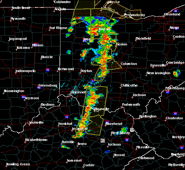 At 535 pm edt, a severe thunderstorm was located near london, moving northeast at 55 mph (trained weather spotters). Hazards include 75 mph wind gusts. Expect considerable tree damage. damage is likely to mobile homes, roofs, and outbuildings. locations impacted include, london, south charleston, jeffersonville, lisbon, south vienna, south solon, midway, newport, interstate 71 at state route 38, gladstone, bookwalter, plattsburg, bell center and shady grove. this includes the following interstates, i-70 in ohio between mile markers 66 and 67. I-71 in ohio between mile markers 68 and 76. At 535 pm edt, a severe thunderstorm was located near london, moving northeast at 55 mph (trained weather spotters). Hazards include 75 mph wind gusts. Expect considerable tree damage. damage is likely to mobile homes, roofs, and outbuildings. locations impacted include, london, south charleston, jeffersonville, lisbon, south vienna, south solon, midway, newport, interstate 71 at state route 38, gladstone, bookwalter, plattsburg, bell center and shady grove. this includes the following interstates, i-70 in ohio between mile markers 66 and 67. I-71 in ohio between mile markers 68 and 76.
|
| 6/10/2020 5:27 PM EDT |
 At 527 pm edt, a severe thunderstorm was located near jamestown, moving northeast at 35 mph (radar indicated). Hazards include 75 mph wind gusts. Expect considerable tree damage. damage is likely to mobile homes, roofs, and outbuildings. locations impacted include, london, jamestown, south charleston, jeffersonville, lisbon, south vienna, south solon, midway, bowersville, milledgeville, octa, newport, interstate 71 at state route 38, rosemoor, gladstone, bookwalter, plattsburg, bell center, shady grove and interstate 71 at us route 35. this includes the following interstates, i-70 in ohio near mile marker 66. I-71 in ohio between mile markers 58 and 76. At 527 pm edt, a severe thunderstorm was located near jamestown, moving northeast at 35 mph (radar indicated). Hazards include 75 mph wind gusts. Expect considerable tree damage. damage is likely to mobile homes, roofs, and outbuildings. locations impacted include, london, jamestown, south charleston, jeffersonville, lisbon, south vienna, south solon, midway, bowersville, milledgeville, octa, newport, interstate 71 at state route 38, rosemoor, gladstone, bookwalter, plattsburg, bell center, shady grove and interstate 71 at us route 35. this includes the following interstates, i-70 in ohio near mile marker 66. I-71 in ohio between mile markers 58 and 76.
|
| 6/10/2020 5:21 PM EDT |
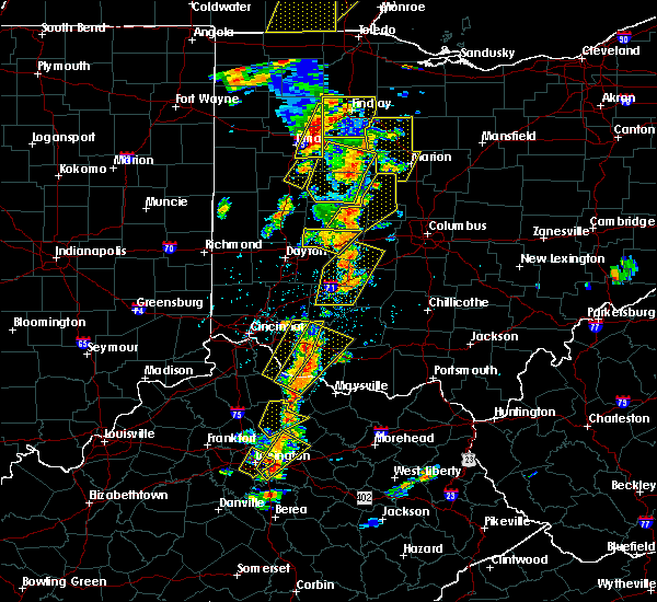 At 521 pm edt, a severe thunderstorm was located near wilmington, moving northeast at 35 mph (radar indicated). Hazards include 70 mph wind gusts. Expect considerable tree damage. damage is likely to mobile homes, roofs, and outbuildings. locations impacted include, london, sabina, jamestown, south charleston, jeffersonville, lisbon, south vienna, south solon, midway, bowersville, port william, milledgeville, octa, newport, interstate 71 at state route 38, rosemoor, selma, gladstone, bookwalter and shady grove. this includes the following interstates, i-70 in ohio near mile marker 66. I-71 in ohio between mile markers 52 and 76. At 521 pm edt, a severe thunderstorm was located near wilmington, moving northeast at 35 mph (radar indicated). Hazards include 70 mph wind gusts. Expect considerable tree damage. damage is likely to mobile homes, roofs, and outbuildings. locations impacted include, london, sabina, jamestown, south charleston, jeffersonville, lisbon, south vienna, south solon, midway, bowersville, port william, milledgeville, octa, newport, interstate 71 at state route 38, rosemoor, selma, gladstone, bookwalter and shady grove. this includes the following interstates, i-70 in ohio near mile marker 66. I-71 in ohio between mile markers 52 and 76.
|
| 6/10/2020 5:19 PM EDT |
 At 519 pm edt, a severe thunderstorm was located near wilmington, moving northeast at 35 mph (radar indicated). Hazards include 60 mph wind gusts. Expect damage to trees and power lines. locations impacted include, london, cedarville, sabina, jamestown, south charleston, jeffersonville, wilberforce, lisbon, new jasper, south vienna, south solon, midway, bowersville, port william, milledgeville, octa, paintersville, newport, melvin and interstate 71 at state route 38. this includes the following interstates, i-70 in ohio near mile marker 66. I-71 in ohio between mile markers 47 and 76. At 519 pm edt, a severe thunderstorm was located near wilmington, moving northeast at 35 mph (radar indicated). Hazards include 60 mph wind gusts. Expect damage to trees and power lines. locations impacted include, london, cedarville, sabina, jamestown, south charleston, jeffersonville, wilberforce, lisbon, new jasper, south vienna, south solon, midway, bowersville, port william, milledgeville, octa, paintersville, newport, melvin and interstate 71 at state route 38. this includes the following interstates, i-70 in ohio near mile marker 66. I-71 in ohio between mile markers 47 and 76.
|
| 6/10/2020 5:10 PM EDT |
 At 510 pm edt, a severe thunderstorm was located over wilmington, moving northeast at 35 mph (radar indicated). Hazards include 60 mph wind gusts and penny size hail. expect damage to trees and power lines At 510 pm edt, a severe thunderstorm was located over wilmington, moving northeast at 35 mph (radar indicated). Hazards include 60 mph wind gusts and penny size hail. expect damage to trees and power lines
|
| 5/10/2020 4:51 PM EDT |
 The severe thunderstorm warning for western franklin and madison counties will expire at 500 pm edt, the storms which prompted the warning have moved out of the warned area. therefore, the warning will be allowed to expire. an additional severe thunderstorm warning remains in effect for franklin county until 530 pm. please report previous wind damage or hail to the national weather service by going to our website at weather.gov/iln and submitting your report via social media. The severe thunderstorm warning for western franklin and madison counties will expire at 500 pm edt, the storms which prompted the warning have moved out of the warned area. therefore, the warning will be allowed to expire. an additional severe thunderstorm warning remains in effect for franklin county until 530 pm. please report previous wind damage or hail to the national weather service by going to our website at weather.gov/iln and submitting your report via social media.
|
| 5/10/2020 4:40 PM EDT |
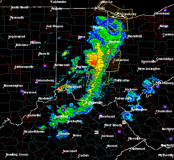 The severe thunderstorm warning for western fayette, eastern clinton, southeastern greene and southwestern madison counties will expire at 445 pm edt, the storms which prompted the warning have moved out of the area. therefore, the warning will be allowed to expire. additional severe thunderstorm warnings remain in effect for portions of fayette and madison counties. please report previous wind damage or hail to the national weather service by going to our website at weather.gov/iln and submitting your report via social media. The severe thunderstorm warning for western fayette, eastern clinton, southeastern greene and southwestern madison counties will expire at 445 pm edt, the storms which prompted the warning have moved out of the area. therefore, the warning will be allowed to expire. additional severe thunderstorm warnings remain in effect for portions of fayette and madison counties. please report previous wind damage or hail to the national weather service by going to our website at weather.gov/iln and submitting your report via social media.
|
| 5/10/2020 4:37 PM EDT |
 At 436 pm edt, severe thunderstorms were located along a line extending from near hilliard to near mount sterling, moving east at 45 mph (radar indicated). Hazards include 60 mph wind gusts. Expect damage to trees and power lines. locations impacted include, columbus, dublin, upper arlington, hilliard, london, jefferson, plain city, west jefferson, mount sterling, lake darby, lafayette, south solon, midway, newport, chenoweth, georgesville, madison lake, darbydale, interstate 70 at us route 42 and amity. this includes the following interstates, i-70 in ohio between mile markers 78 and 92. I-71 in ohio between mile markers 76 and 88. At 436 pm edt, severe thunderstorms were located along a line extending from near hilliard to near mount sterling, moving east at 45 mph (radar indicated). Hazards include 60 mph wind gusts. Expect damage to trees and power lines. locations impacted include, columbus, dublin, upper arlington, hilliard, london, jefferson, plain city, west jefferson, mount sterling, lake darby, lafayette, south solon, midway, newport, chenoweth, georgesville, madison lake, darbydale, interstate 70 at us route 42 and amity. this includes the following interstates, i-70 in ohio between mile markers 78 and 92. I-71 in ohio between mile markers 76 and 88.
|
| 5/10/2020 4:25 PM EDT |
 At 425 pm edt, severe thunderstorms were located along a line extending from near plain city to 7 miles south of london, moving east at 45 mph (radar indicated). Hazards include 60 mph wind gusts. Expect damage to trees and power lines. locations impacted include, columbus, dublin, upper arlington, hilliard, london, jefferson, plain city, west jefferson, mount sterling, choctaw lake, lake darby, lafayette, south solon, midway, newport, chenoweth, rosedale, resaca, georgesville and madison lake. this includes the following interstates, i-70 in ohio between mile markers 71 and 92. I-71 in ohio between mile markers 76 and 88. At 425 pm edt, severe thunderstorms were located along a line extending from near plain city to 7 miles south of london, moving east at 45 mph (radar indicated). Hazards include 60 mph wind gusts. Expect damage to trees and power lines. locations impacted include, columbus, dublin, upper arlington, hilliard, london, jefferson, plain city, west jefferson, mount sterling, choctaw lake, lake darby, lafayette, south solon, midway, newport, chenoweth, rosedale, resaca, georgesville and madison lake. this includes the following interstates, i-70 in ohio between mile markers 71 and 92. I-71 in ohio between mile markers 76 and 88.
|
| 5/10/2020 4:25 PM EDT |
 At 424 pm edt, severe thunderstorms were located along a line extending from near springfield to near blanchester, moving northeast at 45 mph (radar indicated). Hazards include 60 mph wind gusts. Expect damage to trees and power lines. locations impacted include, wilmington, sabina, jamestown, new vienna, jeffersonville, martinsville, south solon, midway, bowersville, milledgeville, octa, melvin, rosemoor, bloomington, new antioch, lees creek, reesville, gladstone, bookwalter and morrisville. This includes i-71 in ohio between mile markers 56 and 72. At 424 pm edt, severe thunderstorms were located along a line extending from near springfield to near blanchester, moving northeast at 45 mph (radar indicated). Hazards include 60 mph wind gusts. Expect damage to trees and power lines. locations impacted include, wilmington, sabina, jamestown, new vienna, jeffersonville, martinsville, south solon, midway, bowersville, milledgeville, octa, melvin, rosemoor, bloomington, new antioch, lees creek, reesville, gladstone, bookwalter and morrisville. This includes i-71 in ohio between mile markers 56 and 72.
|
| 5/10/2020 4:16 PM EDT |
 At 416 pm edt, severe thunderstorms were located along a line extending from near springfield to near blanchester, moving northeast at 50 mph (radar indicated). Hazards include 60 mph wind gusts. Expect damage to trees and power lines. locations impacted include, xenia, wilmington, blanchester, yellow springs, cedarville, sabina, jamestown, new vienna, jeffersonville, wilberforce, new jasper, clarksville, martinsville, south solon, midway, midland, bowersville, port william, st. martin and milledgeville. This includes i-71 in ohio between mile markers 43 and 72. At 416 pm edt, severe thunderstorms were located along a line extending from near springfield to near blanchester, moving northeast at 50 mph (radar indicated). Hazards include 60 mph wind gusts. Expect damage to trees and power lines. locations impacted include, xenia, wilmington, blanchester, yellow springs, cedarville, sabina, jamestown, new vienna, jeffersonville, wilberforce, new jasper, clarksville, martinsville, south solon, midway, midland, bowersville, port william, st. martin and milledgeville. This includes i-71 in ohio between mile markers 43 and 72.
|
| 5/10/2020 4:05 PM EDT |
 At 405 pm edt, severe thunderstorms were located along a line extending from near mechanicsburg to near south charleston, moving east at 45 mph (radar indicated). Hazards include 60 mph wind gusts. expect damage to trees and power lines At 405 pm edt, severe thunderstorms were located along a line extending from near mechanicsburg to near south charleston, moving east at 45 mph (radar indicated). Hazards include 60 mph wind gusts. expect damage to trees and power lines
|
| 5/10/2020 3:57 PM EDT |
 At 357 pm edt, severe thunderstorms were located along a line extending from near fairborn to near batavia, moving northeast at 45 mph (radar indicated). Hazards include 60 mph wind gusts. expect damage to trees and power lines At 357 pm edt, severe thunderstorms were located along a line extending from near fairborn to near batavia, moving northeast at 45 mph (radar indicated). Hazards include 60 mph wind gusts. expect damage to trees and power lines
|
| 4/8/2020 4:55 AM EDT |
 The severe thunderstorm warning for northern fayette, southeastern greene and southern madison counties will expire at 500 am edt, the storm which prompted the warning has weakened below severe limits, and no longer poses an immediate threat to life or property. therefore, the warning will be allowed to expire. a severe thunderstorm watch remains in effect until 600 am edt for central and west central ohio. please report previous wind damage or hail to the national weather service by going to our website at weather.gov/iln and submitting your report via social media. The severe thunderstorm warning for northern fayette, southeastern greene and southern madison counties will expire at 500 am edt, the storm which prompted the warning has weakened below severe limits, and no longer poses an immediate threat to life or property. therefore, the warning will be allowed to expire. a severe thunderstorm watch remains in effect until 600 am edt for central and west central ohio. please report previous wind damage or hail to the national weather service by going to our website at weather.gov/iln and submitting your report via social media.
|
| 4/8/2020 4:42 AM EDT |
 At 442 am edt, a severe thunderstorm was located 7 miles south of london, moving east at 40 mph (radar indicated). Hazards include 60 mph wind gusts and quarter size hail. Minor hail damage to vehicles is possible. expect wind damage to trees and power lines. locations impacted include, xenia, washington court house, london, cedarville, jamestown, mount sterling, jeffersonville, bloomingburg, new holland, wilberforce, new jasper, south solon, midway, milledgeville, octa, newport, chenoweth, rosemoor and madison mills. This includes i-71 in ohio between mile markers 63 and 87. At 442 am edt, a severe thunderstorm was located 7 miles south of london, moving east at 40 mph (radar indicated). Hazards include 60 mph wind gusts and quarter size hail. Minor hail damage to vehicles is possible. expect wind damage to trees and power lines. locations impacted include, xenia, washington court house, london, cedarville, jamestown, mount sterling, jeffersonville, bloomingburg, new holland, wilberforce, new jasper, south solon, midway, milledgeville, octa, newport, chenoweth, rosemoor and madison mills. This includes i-71 in ohio between mile markers 63 and 87.
|
| 4/8/2020 4:27 AM EDT |
 At 426 am edt, a severe thunderstorm was located over south charleston. another severe thunderstorm was located near bloomingburg. these storms are moving east at 40 mph (radar indicated). Hazards include 60 mph wind gusts and half dollar size hail. Minor hail damage to vehicles is possible. expect wind damage to trees and power lines. locations impacted include, springfield, fairborn, xenia, washington court house, london, yellow springs, cedarville, enon, jamestown, mount sterling, south charleston, jeffersonville, bloomingburg, new holland, wilberforce, lisbon, new jasper, south solon, midway and clifton. this includes the following interstates, i-70 in ohio between mile markers 52 and 61. I-71 in ohio between mile markers 63 and 87. At 426 am edt, a severe thunderstorm was located over south charleston. another severe thunderstorm was located near bloomingburg. these storms are moving east at 40 mph (radar indicated). Hazards include 60 mph wind gusts and half dollar size hail. Minor hail damage to vehicles is possible. expect wind damage to trees and power lines. locations impacted include, springfield, fairborn, xenia, washington court house, london, yellow springs, cedarville, enon, jamestown, mount sterling, south charleston, jeffersonville, bloomingburg, new holland, wilberforce, lisbon, new jasper, south solon, midway and clifton. this includes the following interstates, i-70 in ohio between mile markers 52 and 61. I-71 in ohio between mile markers 63 and 87.
|
| 4/8/2020 4:15 AM EDT |
 At 414 am edt, a severe thunderstorm was located near yellow springs. this storm is capable of producing golf ball size hail. another severe thunderstorm is located 3 miles northwest of jeffersonville. this storm is capable of producing half dollar size hail. these storms are moving east at 35 mph (radar indicated). Hazards include golf ball size hail and 60 mph wind gusts. People and animals outdoors will be injured. expect hail damage to roofs, siding, windows, and vehicles. expect wind damage to trees and power lines. locations impacted include, springfield, kettering, beavercreek, huber heights, fairborn, xenia, washington court house, london, new carlisle, yellow springs, wright-patterson afb, cedarville, enon, jamestown, mount sterling, south charleston, jeffersonville, bloomingburg, new holland and wilberforce. this includes the following interstates, i-70 in ohio between mile markers 42 and 61. I-71 in ohio between mile markers 62 and 87. At 414 am edt, a severe thunderstorm was located near yellow springs. this storm is capable of producing golf ball size hail. another severe thunderstorm is located 3 miles northwest of jeffersonville. this storm is capable of producing half dollar size hail. these storms are moving east at 35 mph (radar indicated). Hazards include golf ball size hail and 60 mph wind gusts. People and animals outdoors will be injured. expect hail damage to roofs, siding, windows, and vehicles. expect wind damage to trees and power lines. locations impacted include, springfield, kettering, beavercreek, huber heights, fairborn, xenia, washington court house, london, new carlisle, yellow springs, wright-patterson afb, cedarville, enon, jamestown, mount sterling, south charleston, jeffersonville, bloomingburg, new holland and wilberforce. this includes the following interstates, i-70 in ohio between mile markers 42 and 61. I-71 in ohio between mile markers 62 and 87.
|
| 4/8/2020 4:12 AM EDT |
 At 412 am edt, a severe thunderstorm was located near yellow springs, moving east at 30 mph (radar indicated). Hazards include golf ball size hail and 60 mph wind gusts. People and animals outdoors will be injured. expect hail damage to roofs, siding, windows, and vehicles. expect wind damage to trees and power lines. locations impacted include, springfield, kettering, beavercreek, huber heights, fairborn, xenia, washington court house, london, new carlisle, yellow springs, wright-patterson afb, cedarville, enon, jamestown, mount sterling, south charleston, jeffersonville, bloomingburg, new holland and wilberforce. this includes the following interstates, i-70 in ohio between mile markers 42 and 61. I-71 in ohio between mile markers 62 and 87. At 412 am edt, a severe thunderstorm was located near yellow springs, moving east at 30 mph (radar indicated). Hazards include golf ball size hail and 60 mph wind gusts. People and animals outdoors will be injured. expect hail damage to roofs, siding, windows, and vehicles. expect wind damage to trees and power lines. locations impacted include, springfield, kettering, beavercreek, huber heights, fairborn, xenia, washington court house, london, new carlisle, yellow springs, wright-patterson afb, cedarville, enon, jamestown, mount sterling, south charleston, jeffersonville, bloomingburg, new holland and wilberforce. this includes the following interstates, i-70 in ohio between mile markers 42 and 61. I-71 in ohio between mile markers 62 and 87.
|
| 4/8/2020 4:11 AM EDT |
 The severe thunderstorm warning for northern fayette, southern clark, greene, northeastern montgomery, southern madison and southeastern miami counties will expire at 415 am edt, this warning has been replaced by a new severe thunderstorm warning, which is in effect for portions of clark, greene, madison, and fayette counties until 500 am. a severe thunderstorm watch remains in effect until 600 am edt for central and west central ohio. please report previous wind damage or hail to the national weather service by going to our website at weather.gov/iln and submitting your report via social media. The severe thunderstorm warning for northern fayette, southern clark, greene, northeastern montgomery, southern madison and southeastern miami counties will expire at 415 am edt, this warning has been replaced by a new severe thunderstorm warning, which is in effect for portions of clark, greene, madison, and fayette counties until 500 am. a severe thunderstorm watch remains in effect until 600 am edt for central and west central ohio. please report previous wind damage or hail to the national weather service by going to our website at weather.gov/iln and submitting your report via social media.
|
| 4/8/2020 4:08 AM EDT |
 At 408 am edt, a severe thunderstorm was located over yellow springs, moving east at 35 mph (radar indicated). Hazards include 60 mph wind gusts and quarter size hail. Minor hail damage to vehicles is possible. Expect wind damage to trees and power lines. At 408 am edt, a severe thunderstorm was located over yellow springs, moving east at 35 mph (radar indicated). Hazards include 60 mph wind gusts and quarter size hail. Minor hail damage to vehicles is possible. Expect wind damage to trees and power lines.
|
| 4/8/2020 4:02 AM EDT |
 At 401 am edt, a severe thunderstorm was located over yellow springs, moving east at 35 mph (radar indicated). Hazards include 60 mph wind gusts and quarter size hail. Minor hail damage to vehicles is possible. expect wind damage to trees and power lines. locations impacted include, dayton, springfield, kettering, beavercreek, huber heights, fairborn, xenia, trotwood, vandalia, englewood, london, new carlisle, oakwood, yellow springs, wright-patterson afb, cedarville, enon, jamestown, mount sterling and south charleston. this includes the following interstates, i-70 in ohio between mile markers 27 and 60. i-71 in ohio between mile markers 64 and 87. I-75 in ohio between mile markers 52 and 65. At 401 am edt, a severe thunderstorm was located over yellow springs, moving east at 35 mph (radar indicated). Hazards include 60 mph wind gusts and quarter size hail. Minor hail damage to vehicles is possible. expect wind damage to trees and power lines. locations impacted include, dayton, springfield, kettering, beavercreek, huber heights, fairborn, xenia, trotwood, vandalia, englewood, london, new carlisle, oakwood, yellow springs, wright-patterson afb, cedarville, enon, jamestown, mount sterling and south charleston. this includes the following interstates, i-70 in ohio between mile markers 27 and 60. i-71 in ohio between mile markers 64 and 87. I-75 in ohio between mile markers 52 and 65.
|
| 4/8/2020 3:51 AM EDT |
 At 350 am edt, a severe thunderstorm was located near park layne, moving east at 45 mph. trained spotters in northern montgomery county have reported one inch diameter hail with this storm (radar indicated). Hazards include 60 mph wind gusts and quarter size hail. Minor hail damage to vehicles is possible. expect wind damage to trees and power lines. locations impacted include, dayton, springfield, kettering, beavercreek, huber heights, fairborn, xenia, trotwood, vandalia, englewood, london, tipp city, moraine, new carlisle, west milton, oakwood, yellow springs, wright-patterson afb, west jefferson and cedarville. this includes the following interstates, i-70 in ohio between mile markers 18 and 70. i-71 in ohio between mile markers 64 and 87. I-75 in ohio between mile markers 51 and 67. At 350 am edt, a severe thunderstorm was located near park layne, moving east at 45 mph. trained spotters in northern montgomery county have reported one inch diameter hail with this storm (radar indicated). Hazards include 60 mph wind gusts and quarter size hail. Minor hail damage to vehicles is possible. expect wind damage to trees and power lines. locations impacted include, dayton, springfield, kettering, beavercreek, huber heights, fairborn, xenia, trotwood, vandalia, englewood, london, tipp city, moraine, new carlisle, west milton, oakwood, yellow springs, wright-patterson afb, west jefferson and cedarville. this includes the following interstates, i-70 in ohio between mile markers 18 and 70. i-71 in ohio between mile markers 64 and 87. I-75 in ohio between mile markers 51 and 67.
|
| 4/8/2020 3:40 AM EDT |
 At 339 am edt, a severe thunderstorm was located over huber heights. another severe thunderstorm was located 6 miles southwest of london. these storms are moving southeast at 40 mph (radar indicated). Hazards include 60 mph wind gusts and quarter size hail. Minor hail damage to vehicles is possible. expect wind damage to trees and power lines. locations impacted include, dayton, springfield, kettering, beavercreek, huber heights, fairborn, xenia, trotwood, vandalia, englewood, london, tipp city, moraine, new carlisle, west milton, oakwood, yellow springs, wright-patterson afb, west jefferson and cedarville. this includes the following interstates, i-70 in ohio between mile markers 18 and 75. i-71 in ohio between mile markers 64 and 87. I-75 in ohio between mile markers 51 and 69. At 339 am edt, a severe thunderstorm was located over huber heights. another severe thunderstorm was located 6 miles southwest of london. these storms are moving southeast at 40 mph (radar indicated). Hazards include 60 mph wind gusts and quarter size hail. Minor hail damage to vehicles is possible. expect wind damage to trees and power lines. locations impacted include, dayton, springfield, kettering, beavercreek, huber heights, fairborn, xenia, trotwood, vandalia, englewood, london, tipp city, moraine, new carlisle, west milton, oakwood, yellow springs, wright-patterson afb, west jefferson and cedarville. this includes the following interstates, i-70 in ohio between mile markers 18 and 75. i-71 in ohio between mile markers 64 and 87. I-75 in ohio between mile markers 51 and 69.
|
| 4/8/2020 3:26 AM EDT |
 At 325 am edt, a severe thunderstorm was located near tipp city. another severe thunderstorm was located 5 miles southeast of springfield. these storms are moving east at 55 mph (radar indicated). Hazards include 60 mph wind gusts and quarter size hail. Minor hail damage to vehicles is possible. Expect wind damage to trees and power lines. At 325 am edt, a severe thunderstorm was located near tipp city. another severe thunderstorm was located 5 miles southeast of springfield. these storms are moving east at 55 mph (radar indicated). Hazards include 60 mph wind gusts and quarter size hail. Minor hail damage to vehicles is possible. Expect wind damage to trees and power lines.
|
| 3/28/2020 2:12 PM EDT |
 At 212 pm edt, a severe thunderstorm was located near south charleston, moving east at 55 mph (radar indicated). Hazards include 60 mph wind gusts and quarter size hail. Minor hail damage to vehicles is possible. Expect wind damage to trees and power lines. At 212 pm edt, a severe thunderstorm was located near south charleston, moving east at 55 mph (radar indicated). Hazards include 60 mph wind gusts and quarter size hail. Minor hail damage to vehicles is possible. Expect wind damage to trees and power lines.
|
| 8/8/2019 6:33 PM EDT |
 At 632 pm edt, a severe thunderstorm was located 7 miles northeast of springfield, moving southeast at 35 mph. law enforcement reported trees down in southern champaign county near the clark county line (law enforcement). Hazards include 60 mph wind gusts and quarter size hail. Minor hail damage to vehicles is possible. expect wind damage to trees and power lines. locations impacted include, springfield, london, south charleston, choctaw lake, harmony, lisbon, brighton, lafayette, south vienna, tremont city, midway, catawba, newport, buck creek state park, lilly chapel, powhattan, catawba station, interstate 70 at state route 56, madison lake and new moorefield. this includes the following interstates, i-70 in ohio between mile markers 61 and 77. I-71 in ohio near mile marker 76. At 632 pm edt, a severe thunderstorm was located 7 miles northeast of springfield, moving southeast at 35 mph. law enforcement reported trees down in southern champaign county near the clark county line (law enforcement). Hazards include 60 mph wind gusts and quarter size hail. Minor hail damage to vehicles is possible. expect wind damage to trees and power lines. locations impacted include, springfield, london, south charleston, choctaw lake, harmony, lisbon, brighton, lafayette, south vienna, tremont city, midway, catawba, newport, buck creek state park, lilly chapel, powhattan, catawba station, interstate 70 at state route 56, madison lake and new moorefield. this includes the following interstates, i-70 in ohio between mile markers 61 and 77. I-71 in ohio near mile marker 76.
|
| 8/8/2019 6:18 PM EDT |
 At 617 pm edt, a severe thunderstorm was located near urbana, moving southeast at 35 mph (radar indicated). Hazards include 60 mph wind gusts and nickel size hail. expect damage to trees and power lines At 617 pm edt, a severe thunderstorm was located near urbana, moving southeast at 35 mph (radar indicated). Hazards include 60 mph wind gusts and nickel size hail. expect damage to trees and power lines
|
| 5/28/2019 12:29 AM EDT |
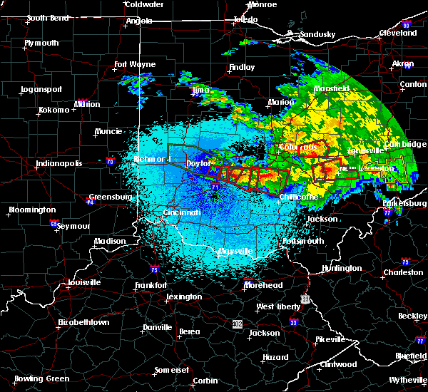 At 1229 am edt, a confirmed tornado was located near bell center, moving southeast at 35 mph (radar confirmed tornado. radar shows tornado debris in the air). Hazards include damaging tornado and half dollar size hail. Flying debris will be dangerous to those caught without shelter. mobile homes will be damaged or destroyed. damage to roofs, windows, and vehicles will occur. tree damage is likely. locations impacted include, jamestown, jeffersonville, south solon, midway, milledgeville, octa, rosemoor, selma, gladstone, bookwalter, bell center, shady grove and interstate 71 at us route 35. This includes i-71 in ohio between mile markers 64 and 71. At 1229 am edt, a confirmed tornado was located near bell center, moving southeast at 35 mph (radar confirmed tornado. radar shows tornado debris in the air). Hazards include damaging tornado and half dollar size hail. Flying debris will be dangerous to those caught without shelter. mobile homes will be damaged or destroyed. damage to roofs, windows, and vehicles will occur. tree damage is likely. locations impacted include, jamestown, jeffersonville, south solon, midway, milledgeville, octa, rosemoor, selma, gladstone, bookwalter, bell center, shady grove and interstate 71 at us route 35. This includes i-71 in ohio between mile markers 64 and 71.
|
| 5/28/2019 12:26 AM EDT |
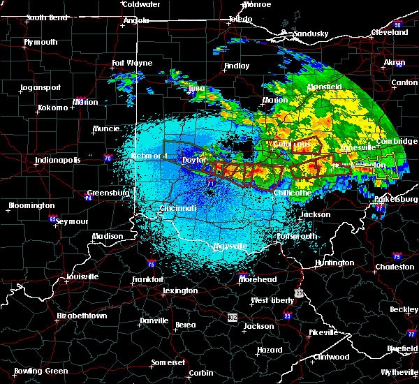 At 1225 am edt, a severe thunderstorm capable of producing a tornado was located near jamestown, moving southeast at 35 mph (weather spotters reported a funnel cloud near bell center). Hazards include tornado and half dollar size hail. Flying debris will be dangerous to those caught without shelter. mobile homes will be damaged or destroyed. damage to roofs, windows, and vehicles will occur. tree damage is likely. locations impacted include, jamestown, jeffersonville, south solon, midway, milledgeville, octa, rosemoor, selma, gladstone, bookwalter, bell center, shady grove and interstate 71 at us route 35. This includes i-71 in ohio between mile markers 64 and 71. At 1225 am edt, a severe thunderstorm capable of producing a tornado was located near jamestown, moving southeast at 35 mph (weather spotters reported a funnel cloud near bell center). Hazards include tornado and half dollar size hail. Flying debris will be dangerous to those caught without shelter. mobile homes will be damaged or destroyed. damage to roofs, windows, and vehicles will occur. tree damage is likely. locations impacted include, jamestown, jeffersonville, south solon, midway, milledgeville, octa, rosemoor, selma, gladstone, bookwalter, bell center, shady grove and interstate 71 at us route 35. This includes i-71 in ohio between mile markers 64 and 71.
|
| 5/28/2019 12:15 AM EDT |
 At 1215 am edt, a severe thunderstorm capable of producing a tornado was located over cedarville, moving southeast at 35 mph (radar indicated rotation). Hazards include tornado and half dollar size hail. Flying debris will be dangerous to those caught without shelter. mobile homes will be damaged or destroyed. damage to roofs, windows, and vehicles will occur. Tree damage is likely. At 1215 am edt, a severe thunderstorm capable of producing a tornado was located over cedarville, moving southeast at 35 mph (radar indicated rotation). Hazards include tornado and half dollar size hail. Flying debris will be dangerous to those caught without shelter. mobile homes will be damaged or destroyed. damage to roofs, windows, and vehicles will occur. Tree damage is likely.
|
| 5/28/2019 12:03 AM EDT |
 At 1203 am edt, a severe thunderstorm capable of producing a tornado was located two miles north of jeffersonville, moving east at 45 mph (radar indicated rotation). Hazards include tornado and golf ball size hail. Flying debris will be dangerous to those caught without shelter. mobile homes will be damaged or destroyed. damage to roofs, windows, and vehicles will occur. tree damage is likely. locations impacted include, washington court house, mount sterling, jeffersonville, bloomingburg, new holland, midway, milledgeville, octa, chenoweth, interstate 71 at state route 38, madison mills, bookwalter, interstate 71 at us route 35 and pancoastburg. This includes i-71 in ohio between mile markers 65 and 87. At 1203 am edt, a severe thunderstorm capable of producing a tornado was located two miles north of jeffersonville, moving east at 45 mph (radar indicated rotation). Hazards include tornado and golf ball size hail. Flying debris will be dangerous to those caught without shelter. mobile homes will be damaged or destroyed. damage to roofs, windows, and vehicles will occur. tree damage is likely. locations impacted include, washington court house, mount sterling, jeffersonville, bloomingburg, new holland, midway, milledgeville, octa, chenoweth, interstate 71 at state route 38, madison mills, bookwalter, interstate 71 at us route 35 and pancoastburg. This includes i-71 in ohio between mile markers 65 and 87.
|
| 5/27/2019 11:56 PM EDT |
 At 1156 pm edt, a confirmed tornado was located 4 miles east of jamestown, moving southeast at 40 mph (radar confirmed tornado. radar shows tornado debris in the air). Hazards include damaging tornado and golf ball size hail. Flying debris will be dangerous to those caught without shelter. mobile homes will be damaged or destroyed. damage to roofs, windows, and vehicles will occur. tree damage is likely. locations impacted include, washington court house, mount sterling, jeffersonville, bloomingburg, new holland, south solon, midway, milledgeville, octa, chenoweth, interstate 71 at state route 38, madison mills, bookwalter, shady grove, interstate 71 at us route 35 and pancoastburg. This includes i-71 in ohio between mile markers 62 and 87. At 1156 pm edt, a confirmed tornado was located 4 miles east of jamestown, moving southeast at 40 mph (radar confirmed tornado. radar shows tornado debris in the air). Hazards include damaging tornado and golf ball size hail. Flying debris will be dangerous to those caught without shelter. mobile homes will be damaged or destroyed. damage to roofs, windows, and vehicles will occur. tree damage is likely. locations impacted include, washington court house, mount sterling, jeffersonville, bloomingburg, new holland, south solon, midway, milledgeville, octa, chenoweth, interstate 71 at state route 38, madison mills, bookwalter, shady grove, interstate 71 at us route 35 and pancoastburg. This includes i-71 in ohio between mile markers 62 and 87.
|
| 5/27/2019 11:48 PM EDT |
 At 1148 pm edt, a severe thunderstorm capable of producing a tornado was located near jamestown, moving east at 40 mph (radar indicated rotation). Hazards include tornado and golf ball size hail. Flying debris will be dangerous to those caught without shelter. mobile homes will be damaged or destroyed. damage to roofs, windows, and vehicles will occur. Tree damage is likely. At 1148 pm edt, a severe thunderstorm capable of producing a tornado was located near jamestown, moving east at 40 mph (radar indicated rotation). Hazards include tornado and golf ball size hail. Flying debris will be dangerous to those caught without shelter. mobile homes will be damaged or destroyed. damage to roofs, windows, and vehicles will occur. Tree damage is likely.
|
| 3/14/2019 7:10 PM EDT |
 At 710 pm edt, severe thunderstorms were located along a line extending from near london to 6 miles southwest of washington court house, moving east at 65 mph (radar indicated). Hazards include 70 mph wind gusts and quarter size hail. Minor hail damage to vehicles is possible. expect considerable tree damage. wind damage is also likely to mobile homes, roofs, and outbuildings. locations impacted include, columbus, grove city, washington court house, mount sterling, south bloomfield, jeffersonville, williamsport, bloomingburg, new holland, staunton, commercial point, fox, midway, harrisburg, orient, lockbourne, darbyville, deer creek lake, chenoweth and interstate 71 at state route 38. This includes i-71 in ohio between mile markers 70 and 97. At 710 pm edt, severe thunderstorms were located along a line extending from near london to 6 miles southwest of washington court house, moving east at 65 mph (radar indicated). Hazards include 70 mph wind gusts and quarter size hail. Minor hail damage to vehicles is possible. expect considerable tree damage. wind damage is also likely to mobile homes, roofs, and outbuildings. locations impacted include, columbus, grove city, washington court house, mount sterling, south bloomfield, jeffersonville, williamsport, bloomingburg, new holland, staunton, commercial point, fox, midway, harrisburg, orient, lockbourne, darbyville, deer creek lake, chenoweth and interstate 71 at state route 38. This includes i-71 in ohio between mile markers 70 and 97.
|
| 3/14/2019 7:02 PM EDT |
 At 702 pm edt, severe thunderstorms were located along a line extending from near london to near sabina, moving east at 65 mph (radar indicated). Hazards include 70 mph wind gusts and quarter size hail. Minor hail damage to vehicles is possible. expect considerable tree damage. wind damage is also likely to mobile homes, roofs, and outbuildings. locations impacted include, columbus, grove city, washington court house, sabina, mount sterling, south bloomfield, jeffersonville, williamsport, bloomingburg, new holland, staunton, commercial point, good hope, fox, south solon, midway, harrisburg, orient, lockbourne and darbyville. This includes i-71 in ohio between mile markers 62 and 97. At 702 pm edt, severe thunderstorms were located along a line extending from near london to near sabina, moving east at 65 mph (radar indicated). Hazards include 70 mph wind gusts and quarter size hail. Minor hail damage to vehicles is possible. expect considerable tree damage. wind damage is also likely to mobile homes, roofs, and outbuildings. locations impacted include, columbus, grove city, washington court house, sabina, mount sterling, south bloomfield, jeffersonville, williamsport, bloomingburg, new holland, staunton, commercial point, good hope, fox, south solon, midway, harrisburg, orient, lockbourne and darbyville. This includes i-71 in ohio between mile markers 62 and 97.
|
| 3/14/2019 6:56 PM EDT |
 At 656 pm edt, severe thunderstorms were located along a line extending from near south charleston to near new vienna, moving east at 65 mph (radar indicated). Hazards include 70 mph wind gusts and quarter size hail. Minor hail damage to vehicles is possible. expect considerable tree damage. Wind damage is also likely to mobile homes, roofs, and outbuildings. At 656 pm edt, severe thunderstorms were located along a line extending from near south charleston to near new vienna, moving east at 65 mph (radar indicated). Hazards include 70 mph wind gusts and quarter size hail. Minor hail damage to vehicles is possible. expect considerable tree damage. Wind damage is also likely to mobile homes, roofs, and outbuildings.
|
| 9/5/2018 5:01 PM EDT |
 At 500 pm edt, a severe thunderstorm was located near jeffersonville, and is nearly stationary (radar indicated). Hazards include 60 mph wind gusts and quarter size hail. Minor hail damage to vehicles is possible. Expect wind damage to trees and power lines. At 500 pm edt, a severe thunderstorm was located near jeffersonville, and is nearly stationary (radar indicated). Hazards include 60 mph wind gusts and quarter size hail. Minor hail damage to vehicles is possible. Expect wind damage to trees and power lines.
|
| 9/5/2018 5:01 PM EDT |
 The national weather service in wilmington has issued a * severe thunderstorm warning for. north central fayette county in central ohio. southwestern madison county in central ohio. until 530 pm edt. At 500 pm edt, a severe thunderstorm was located near. The national weather service in wilmington has issued a * severe thunderstorm warning for. north central fayette county in central ohio. southwestern madison county in central ohio. until 530 pm edt. At 500 pm edt, a severe thunderstorm was located near.
|
| 9/5/2018 4:57 PM EDT |
 At 457 pm edt, a severe thunderstorm was located 7 miles southeast of south charleston, and is nearly stationary (radar indicated). Hazards include 60 mph wind gusts and quarter size hail. Minor hail damage to vehicles is possible. expect wind damage to trees and power lines. locations impacted include, london, choctaw lake, lafayette, midway, newport, interstate 70 at state route 56 and madison lake. This includes i-70 in ohio between mile markers 72 and 78. At 457 pm edt, a severe thunderstorm was located 7 miles southeast of south charleston, and is nearly stationary (radar indicated). Hazards include 60 mph wind gusts and quarter size hail. Minor hail damage to vehicles is possible. expect wind damage to trees and power lines. locations impacted include, london, choctaw lake, lafayette, midway, newport, interstate 70 at state route 56 and madison lake. This includes i-70 in ohio between mile markers 72 and 78.
|
| 9/5/2018 4:47 PM EDT |
 At 447 pm edt, a severe thunderstorm was located 7 miles southeast of south charleston, moving northeast at 20 mph (radar indicated). Hazards include 60 mph wind gusts and penny size hail. expect damage to trees and power lines At 447 pm edt, a severe thunderstorm was located 7 miles southeast of south charleston, moving northeast at 20 mph (radar indicated). Hazards include 60 mph wind gusts and penny size hail. expect damage to trees and power lines
|
| 4/3/2018 5:19 PM EDT |
 At 519 pm edt, a severe thunderstorm capable of producing a tornado was located near london, moving east at 45 mph (radar indicated rotation). Hazards include tornado and quarter size hail. Flying debris will be dangerous to those caught without shelter. mobile homes will be damaged or destroyed. damage to roofs, windows, and vehicles will occur. tree damage is likely. locations impacted include, london, jefferson, west jefferson, choctaw lake, lake darby, lafayette, midway, newport, interstate 70 at us route 42, amity, lilly chapel, state route 29 at state route 38, interstate 70 at state route 56, madison lake, big plain and plumwood. this includes the following interstates, i-70 in ohio between mile markers 71 and 86. I-71 in ohio between mile markers 83 and 87. At 519 pm edt, a severe thunderstorm capable of producing a tornado was located near london, moving east at 45 mph (radar indicated rotation). Hazards include tornado and quarter size hail. Flying debris will be dangerous to those caught without shelter. mobile homes will be damaged or destroyed. damage to roofs, windows, and vehicles will occur. tree damage is likely. locations impacted include, london, jefferson, west jefferson, choctaw lake, lake darby, lafayette, midway, newport, interstate 70 at us route 42, amity, lilly chapel, state route 29 at state route 38, interstate 70 at state route 56, madison lake, big plain and plumwood. this includes the following interstates, i-70 in ohio between mile markers 71 and 86. I-71 in ohio between mile markers 83 and 87.
|
| 4/3/2018 5:04 PM EDT |
 At 503 pm edt, a severe thunderstorm capable of producing a tornado was located near south charleston, moving east at 45 mph (radar indicated rotation). Hazards include tornado. Flying debris will be dangerous to those caught without shelter. mobile homes will be damaged or destroyed. damage to roofs, windows, and vehicles will occur. Tree damage is likely. At 503 pm edt, a severe thunderstorm capable of producing a tornado was located near south charleston, moving east at 45 mph (radar indicated rotation). Hazards include tornado. Flying debris will be dangerous to those caught without shelter. mobile homes will be damaged or destroyed. damage to roofs, windows, and vehicles will occur. Tree damage is likely.
|
| 4/3/2018 4:42 PM EDT |
 At 442 pm edt, a severe thunderstorm capable of producing a tornado was located near xenia, moving east at 45 mph (radar indicated rotation). Hazards include tornado. Flying debris will be dangerous to those caught without shelter. mobile homes will be damaged or destroyed. damage to roofs, windows, and vehicles will occur. Tree damage is likely. At 442 pm edt, a severe thunderstorm capable of producing a tornado was located near xenia, moving east at 45 mph (radar indicated rotation). Hazards include tornado. Flying debris will be dangerous to those caught without shelter. mobile homes will be damaged or destroyed. damage to roofs, windows, and vehicles will occur. Tree damage is likely.
|
| 11/5/2017 7:42 PM EDT |
 The severe thunderstorm warning for southeastern clark, northeastern greene and central madison counties will expire at 645 pm est, the storm which prompted the warning has weakened below severe limits, and no longer poses an immediate threat to life or property. therefore, the warning will be allowed to expire. however gusty winds and heavy rain are still possible with this thunderstorm. a severe thunderstorm watch remains in effect until 100 am est for central and west central ohio. please report previous wind damage or hail to the national weather service by going to our website at weather.gov/iln and submitting your report via social media. The severe thunderstorm warning for southeastern clark, northeastern greene and central madison counties will expire at 645 pm est, the storm which prompted the warning has weakened below severe limits, and no longer poses an immediate threat to life or property. therefore, the warning will be allowed to expire. however gusty winds and heavy rain are still possible with this thunderstorm. a severe thunderstorm watch remains in effect until 100 am est for central and west central ohio. please report previous wind damage or hail to the national weather service by going to our website at weather.gov/iln and submitting your report via social media.
|
| 11/5/2017 7:31 PM EDT |
 At 631 pm est, a severe thunderstorm was located near london, moving east at 40 mph (radar indicated). Hazards include 60 mph wind gusts. Expect damage to trees and power lines. locations impacted include, london, jefferson, west jefferson, south charleston, choctaw lake, lisbon, brighton, lafayette, midway, newport, interstate 70 at us route 42, selma, interstate 70 at state route 56, madison lake and plattsburg. this includes i-70 in ohio between mile markers 68 and 79. A tornado watch remains in effect until 700 pm est for central and west central ohio. At 631 pm est, a severe thunderstorm was located near london, moving east at 40 mph (radar indicated). Hazards include 60 mph wind gusts. Expect damage to trees and power lines. locations impacted include, london, jefferson, west jefferson, south charleston, choctaw lake, lisbon, brighton, lafayette, midway, newport, interstate 70 at us route 42, selma, interstate 70 at state route 56, madison lake and plattsburg. this includes i-70 in ohio between mile markers 68 and 79. A tornado watch remains in effect until 700 pm est for central and west central ohio.
|
| 11/5/2017 7:18 PM EDT |
 At 618 pm est, a severe thunderstorm was located over south charleston, moving east at 40 mph (radar indicated). Hazards include 60 mph wind gusts. expect damage to trees and power lines At 618 pm est, a severe thunderstorm was located over south charleston, moving east at 40 mph (radar indicated). Hazards include 60 mph wind gusts. expect damage to trees and power lines
|
| 7/21/2017 8:40 AM EDT |
 The severe thunderstorm warning for southern shelby, champaign, southern logan, northern fayette, northeastern clinton, clark, eastern greene, madison and northeastern miami counties will expire at 845 am edt, the storms which prompted the warning have weakened below severe limits, and no longer pose an immediate threat to life or property. therefore, the warning will be allowed to expire. however gusty winds are still possible with these thunderstorms. please report previous wind damage or hail to the national weather service by going to our website at weather.gov/iln and submitting your report via social media. The severe thunderstorm warning for southern shelby, champaign, southern logan, northern fayette, northeastern clinton, clark, eastern greene, madison and northeastern miami counties will expire at 845 am edt, the storms which prompted the warning have weakened below severe limits, and no longer pose an immediate threat to life or property. therefore, the warning will be allowed to expire. however gusty winds are still possible with these thunderstorms. please report previous wind damage or hail to the national weather service by going to our website at weather.gov/iln and submitting your report via social media.
|
| 7/21/2017 8:22 AM EDT |
 At 821 am edt, severe thunderstorms were located along a line extending from sidney to near jeffersonville, moving east at 65 mph (radar indicated). Hazards include 60 mph wind gusts. Expect damage to trees and power lines. locations impacted include, springfield, sidney, piqua, washington court house, urbana, london, new carlisle, yellow springs, west jefferson, cedarville, enon, st. paris, jamestown, west liberty, south charleston, mechanicsburg, north lewisburg, fort loramie, de graff and jeffersonville. this includes the following interstates, i-70 in ohio between mile markers 47 and 81. i-71 in ohio between mile markers 53 and 81. I-75 in ohio between mile markers 84 and 99. At 821 am edt, severe thunderstorms were located along a line extending from sidney to near jeffersonville, moving east at 65 mph (radar indicated). Hazards include 60 mph wind gusts. Expect damage to trees and power lines. locations impacted include, springfield, sidney, piqua, washington court house, urbana, london, new carlisle, yellow springs, west jefferson, cedarville, enon, st. paris, jamestown, west liberty, south charleston, mechanicsburg, north lewisburg, fort loramie, de graff and jeffersonville. this includes the following interstates, i-70 in ohio between mile markers 47 and 81. i-71 in ohio between mile markers 53 and 81. I-75 in ohio between mile markers 84 and 99.
|
| 7/21/2017 8:08 AM EDT |
 At 808 am edt, severe thunderstorms were located along a line extending from near newport to 7 miles south of xenia, moving east at 65 mph (radar indicated). Hazards include 60 mph wind gusts. expect damage to trees and power lines At 808 am edt, severe thunderstorms were located along a line extending from near newport to 7 miles south of xenia, moving east at 65 mph (radar indicated). Hazards include 60 mph wind gusts. expect damage to trees and power lines
|
| 5/19/2017 2:16 AM EDT |
 At 216 am edt, a severe thunderstorm was located near south charleston, moving east at 20 mph (radar indicated). Hazards include 60 mph wind gusts and quarter size hail. Hail damage to vehicles is expected. expect wind damage to roofs, siding, and trees. locations impacted include, london, south charleston, lisbon, lafayette, south solon, midway, newport, chenoweth, madison lake and plattsburg. This includes i-71 in ohio between mile markers 77 and 81. At 216 am edt, a severe thunderstorm was located near south charleston, moving east at 20 mph (radar indicated). Hazards include 60 mph wind gusts and quarter size hail. Hail damage to vehicles is expected. expect wind damage to roofs, siding, and trees. locations impacted include, london, south charleston, lisbon, lafayette, south solon, midway, newport, chenoweth, madison lake and plattsburg. This includes i-71 in ohio between mile markers 77 and 81.
|
| 5/19/2017 1:59 AM EDT |
 At 159 am edt, a severe thunderstorm was located over south charleston, moving east at 20 mph (radar indicated). Hazards include 60 mph wind gusts and quarter size hail. Hail damage to vehicles is expected. Expect wind damage to roofs, siding, and trees. At 159 am edt, a severe thunderstorm was located over south charleston, moving east at 20 mph (radar indicated). Hazards include 60 mph wind gusts and quarter size hail. Hail damage to vehicles is expected. Expect wind damage to roofs, siding, and trees.
|
| 3/1/2017 6:11 AM EST |
 At 611 am est, a severe thunderstorm was located near jeffersonville, moving east at 30 mph (radar indicated). Hazards include 60 mph wind gusts. Expect damage to roofs, siding, and trees. locations impacted include, washington court house, mount sterling, jeffersonville, bloomingburg, midway, milledgeville, octa, chenoweth, interstate 71 at state route 38, lilly chapel, madison mills, madison lake, bookwalter, big plain, wrightsville and interstate 71 at us route 35. this includes i-71 in ohio between mile markers 64 and 88. a tornado watch remains in effect until 700 am est for central and west central ohio. A tornado watch also remains in effect until 1100 am est for central and southwestern ohio. At 611 am est, a severe thunderstorm was located near jeffersonville, moving east at 30 mph (radar indicated). Hazards include 60 mph wind gusts. Expect damage to roofs, siding, and trees. locations impacted include, washington court house, mount sterling, jeffersonville, bloomingburg, midway, milledgeville, octa, chenoweth, interstate 71 at state route 38, lilly chapel, madison mills, madison lake, bookwalter, big plain, wrightsville and interstate 71 at us route 35. this includes i-71 in ohio between mile markers 64 and 88. a tornado watch remains in effect until 700 am est for central and west central ohio. A tornado watch also remains in effect until 1100 am est for central and southwestern ohio.
|
| 3/1/2017 5:53 AM EST |
 At 553 am est, a severe thunderstorm was located over jamestown, moving east at 30 mph (radar indicated). Hazards include 60 mph wind gusts. expect damage to roofs, siding, and trees At 553 am est, a severe thunderstorm was located over jamestown, moving east at 30 mph (radar indicated). Hazards include 60 mph wind gusts. expect damage to roofs, siding, and trees
|
| 2/24/2017 10:02 PM EST |
 At 1002 pm est, severe thunderstorms were located along a line extending from near lake darby to 6 miles northeast of mount sterling to near new holland, moving east at 50 mph (radar indicated). Hazards include 60 mph wind gusts. Expect damage to roofs, siding, and trees. locations impacted include, columbus, westerville, grove city, upper arlington, gahanna, hilliard, worthington, circleville, bexley, london, jefferson, canal winchester, groveport, west jefferson, ashville, mount sterling, south bloomfield, minerva park, bloomingburg and choctaw lake. this includes the following interstates, i-70 in ohio between mile markers 74 and 108. I-71 in ohio between mile markers 75 and 120. At 1002 pm est, severe thunderstorms were located along a line extending from near lake darby to 6 miles northeast of mount sterling to near new holland, moving east at 50 mph (radar indicated). Hazards include 60 mph wind gusts. Expect damage to roofs, siding, and trees. locations impacted include, columbus, westerville, grove city, upper arlington, gahanna, hilliard, worthington, circleville, bexley, london, jefferson, canal winchester, groveport, west jefferson, ashville, mount sterling, south bloomfield, minerva park, bloomingburg and choctaw lake. this includes the following interstates, i-70 in ohio between mile markers 74 and 108. I-71 in ohio between mile markers 75 and 120.
|
| 2/24/2017 9:48 PM EST |
 At 948 pm est, severe thunderstorms were located along a line extending from choctaw lake to near mount sterling to near washington court house, moving east at 50 mph (radar indicated). Hazards include 60 mph wind gusts. expect damage to roofs, siding, and trees At 948 pm est, severe thunderstorms were located along a line extending from choctaw lake to near mount sterling to near washington court house, moving east at 50 mph (radar indicated). Hazards include 60 mph wind gusts. expect damage to roofs, siding, and trees
|
| 1/10/2017 10:09 PM EST |
 The severe thunderstorm warning for southeastern union, northwestern pickaway and franklin counties in central ohio, southeastern clark county in west central ohio, southern delaware and madison counties in central ohio will expire at 1015 pm est, the storms which prompted the warning have weakened below severe limits, and are exiting the warned area. therefore, the warning will be allowed to expire. please report previous wind damage or hail to the national weather service by going to our website at weather.gov/iln and submitting your report via social media. The severe thunderstorm warning for southeastern union, northwestern pickaway and franklin counties in central ohio, southeastern clark county in west central ohio, southern delaware and madison counties in central ohio will expire at 1015 pm est, the storms which prompted the warning have weakened below severe limits, and are exiting the warned area. therefore, the warning will be allowed to expire. please report previous wind damage or hail to the national weather service by going to our website at weather.gov/iln and submitting your report via social media.
|
| 1/10/2017 9:55 PM EST |
 At 954 pm est, severe thunderstorms were located along a line extending from worthington to near bloomingburg, moving east at 75 mph (radar indicated). Hazards include 60 mph wind gusts. Expect damage to roofs, siding, and trees. locations impacted include, columbus, dublin, westerville, grove city, delaware, upper arlington, gahanna, hilliard, marysville, worthington, bexley, london, jefferson, powell, sunbury, plain city, west jefferson, mount sterling, south charleston and minerva park. this includes the following interstates, i-70 in ohio between mile markers 69 and 106. I-71 in ohio between mile markers 77 and 129. At 954 pm est, severe thunderstorms were located along a line extending from worthington to near bloomingburg, moving east at 75 mph (radar indicated). Hazards include 60 mph wind gusts. Expect damage to roofs, siding, and trees. locations impacted include, columbus, dublin, westerville, grove city, delaware, upper arlington, gahanna, hilliard, marysville, worthington, bexley, london, jefferson, powell, sunbury, plain city, west jefferson, mount sterling, south charleston and minerva park. this includes the following interstates, i-70 in ohio between mile markers 69 and 106. I-71 in ohio between mile markers 77 and 129.
|
| 1/10/2017 9:39 PM EST |
 At 939 pm est, severe thunderstorms were located along a line extending from near new california to near south charleston, moving east at 105 mph (radar indicated). Hazards include 60 mph wind gusts. expect damage to roofs, siding, and trees At 939 pm est, severe thunderstorms were located along a line extending from near new california to near south charleston, moving east at 105 mph (radar indicated). Hazards include 60 mph wind gusts. expect damage to roofs, siding, and trees
|
| 1/10/2017 9:33 PM EST |
 At 931 pm est, severe thunderstorms were located along a line extending from mechanicsburg to near yellow springs, moving east at 55 mph (radar indicated). Hazards include 60 mph wind gusts. Expect damage to roofs, siding, and trees. locations impacted include, springfield, huber heights, fairborn, vandalia, urbana, london, tipp city, new carlisle, yellow springs, wright-patterson afb, northridge, plain city, west jefferson, enon, st. paris, south charleston, mechanicsburg, new california, choctaw lake and brown. strong to severe winds can be expected to continue for 20 minutes after the rain ends. this includes the following interstates, i-70 in ohio between mile markers 35 and 82. I-75 in ohio between mile markers 62 and 63. At 931 pm est, severe thunderstorms were located along a line extending from mechanicsburg to near yellow springs, moving east at 55 mph (radar indicated). Hazards include 60 mph wind gusts. Expect damage to roofs, siding, and trees. locations impacted include, springfield, huber heights, fairborn, vandalia, urbana, london, tipp city, new carlisle, yellow springs, wright-patterson afb, northridge, plain city, west jefferson, enon, st. paris, south charleston, mechanicsburg, new california, choctaw lake and brown. strong to severe winds can be expected to continue for 20 minutes after the rain ends. this includes the following interstates, i-70 in ohio between mile markers 35 and 82. I-75 in ohio between mile markers 62 and 63.
|
| 1/10/2017 9:00 PM EST |
 At 859 pm est, severe thunderstorms were located along a line extending from near piqua to near englewood, moving east at 65 mph (radar indicated). Hazards include 60 mph wind gusts. expect damage to roofs, siding, and trees At 859 pm est, severe thunderstorms were located along a line extending from near piqua to near englewood, moving east at 65 mph (radar indicated). Hazards include 60 mph wind gusts. expect damage to roofs, siding, and trees
|
| 8/28/2016 9:15 PM EDT |
 At 915 pm edt, a severe thunderstorm was located near jamestown, moving southeast at 15 mph (radar indicated). Hazards include 60 mph wind gusts. Expect damage to roofs. siding. and trees. Locations impacted include, xenia, washington court house, cedarville, sabina, jamestown, south charleston, jeffersonville, bloomingburg, wilberforce, new jasper, south solon, midway, bowersville, port william, milledgeville, octa, gladstone, jasper mills, paintersville and bell center. At 915 pm edt, a severe thunderstorm was located near jamestown, moving southeast at 15 mph (radar indicated). Hazards include 60 mph wind gusts. Expect damage to roofs. siding. and trees. Locations impacted include, xenia, washington court house, cedarville, sabina, jamestown, south charleston, jeffersonville, bloomingburg, wilberforce, new jasper, south solon, midway, bowersville, port william, milledgeville, octa, gladstone, jasper mills, paintersville and bell center.
|
| 8/28/2016 8:58 PM EDT |
 At 858 pm edt, a severe thunderstorm was located near jamestown, moving southeast at 15 mph (radar indicated). Hazards include 60 mph wind gusts. Expect damage to roofs. siding. And trees. At 858 pm edt, a severe thunderstorm was located near jamestown, moving southeast at 15 mph (radar indicated). Hazards include 60 mph wind gusts. Expect damage to roofs. siding. And trees.
|
| 6/23/2016 3:05 AM EDT |
 At 304 am edt, severe thunderstorms were located along a line extending from near plain city to near jeffersonville, moving southeast at 50 mph (radar indicated). Hazards include 60 mph wind gusts. Expect damage to roofs. siding. and trees. locations impacted include, marysville, london, jefferson, plain city, west jefferson, choctaw lake, brighton, milford center, lafayette, south solon, midway, unionville center, newport in adams county, interstate 70 at us route 42, interstate 71 at state route 38, plumwood, amity, us route 33 at us route 42, chenoweth and madison lake. A tornado watch remains in effect until 500 am edt for west central and central ohio. At 304 am edt, severe thunderstorms were located along a line extending from near plain city to near jeffersonville, moving southeast at 50 mph (radar indicated). Hazards include 60 mph wind gusts. Expect damage to roofs. siding. and trees. locations impacted include, marysville, london, jefferson, plain city, west jefferson, choctaw lake, brighton, milford center, lafayette, south solon, midway, unionville center, newport in adams county, interstate 70 at us route 42, interstate 71 at state route 38, plumwood, amity, us route 33 at us route 42, chenoweth and madison lake. A tornado watch remains in effect until 500 am edt for west central and central ohio.
|
| 6/23/2016 2:41 AM EDT |
 At 240 am edt, severe thunderstorms were located along a line extending from near urbana to fairborn, moving east at 70 mph (radar indicated). Hazards include 70 mph wind gusts and penny size hail. Expect considerable tree damage. Damage is likely to mobile homes, roofs, and outbuildings. At 240 am edt, severe thunderstorms were located along a line extending from near urbana to fairborn, moving east at 70 mph (radar indicated). Hazards include 70 mph wind gusts and penny size hail. Expect considerable tree damage. Damage is likely to mobile homes, roofs, and outbuildings.
|
| 6/15/2016 8:11 PM EDT |
 At 811 pm edt, severe thunderstorms were located along a line extending from 8 miles south of london to 6 miles south of jamestown, moving southeast at 30 mph (radar indicated). Hazards include 60 mph wind gusts. Expect damage to roofs. siding. and trees. Locations impacted include, washington court house, sabina, jamestown, washington, mount sterling, jeffersonville, bloomingburg, new jasper, south solon, midway, bowersville, port william, milledgeville, octa, jasper mills, bell center, bookwalter, interstate 71 at us route 35, shady grove and rosemoor. At 811 pm edt, severe thunderstorms were located along a line extending from 8 miles south of london to 6 miles south of jamestown, moving southeast at 30 mph (radar indicated). Hazards include 60 mph wind gusts. Expect damage to roofs. siding. and trees. Locations impacted include, washington court house, sabina, jamestown, washington, mount sterling, jeffersonville, bloomingburg, new jasper, south solon, midway, bowersville, port william, milledgeville, octa, jasper mills, bell center, bookwalter, interstate 71 at us route 35, shady grove and rosemoor.
|
| 6/15/2016 7:58 PM EDT |
 At 757 pm edt, severe thunderstorms were located along a line extending from near london to near jamestown, moving southeast at 30 mph (radar indicated). Hazards include 60 mph wind gusts. Expect damage to roofs. siding. And trees. At 757 pm edt, severe thunderstorms were located along a line extending from near london to near jamestown, moving southeast at 30 mph (radar indicated). Hazards include 60 mph wind gusts. Expect damage to roofs. siding. And trees.
|
| 5/1/2016 9:36 PM EDT |
 The severe thunderstorm warning for north central fayette, southeastern clark and southern madison counties will expire at 945 pm edt, the severe thunderstorm which prompted the warning has weakened and moved out of the warned area. therefore the warning will be allowed to expire. however gusty winds and heavy rain are still possible with this thunderstorm. please report previous wind damage or hail to the national weather service by going to our website at weather.gov/iln and submitting your report via social media. The severe thunderstorm warning for north central fayette, southeastern clark and southern madison counties will expire at 945 pm edt, the severe thunderstorm which prompted the warning has weakened and moved out of the warned area. therefore the warning will be allowed to expire. however gusty winds and heavy rain are still possible with this thunderstorm. please report previous wind damage or hail to the national weather service by going to our website at weather.gov/iln and submitting your report via social media.
|
| 5/1/2016 8:57 PM EDT |
 At 856 pm edt, a severe thunderstorm was located near jeffersonville, moving northeast at 25 mph (radar indicated). Hazards include 60 mph wind gusts and quarter size hail. Hail damage to vehicles is expected. Expect wind damage to roofs, siding, and trees. At 856 pm edt, a severe thunderstorm was located near jeffersonville, moving northeast at 25 mph (radar indicated). Hazards include 60 mph wind gusts and quarter size hail. Hail damage to vehicles is expected. Expect wind damage to roofs, siding, and trees.
|
| 5/1/2016 8:40 PM EDT |
 At 840 pm edt, a severe thunderstorm was located near jamestown, moving northeast at 35 mph (radar indicated). Hazards include 60 mph wind gusts and quarter size hail. Hail damage to vehicles is expected. expect wind damage to roofs, siding, and trees. Locations impacted include, jamestown, jeffersonville, south solon, midway, bowersville, milledgeville, octa, bell center, bookwalter, interstate 71 at us route 35, shady grove, rosemoor and interstate 71 at state route 38. At 840 pm edt, a severe thunderstorm was located near jamestown, moving northeast at 35 mph (radar indicated). Hazards include 60 mph wind gusts and quarter size hail. Hail damage to vehicles is expected. expect wind damage to roofs, siding, and trees. Locations impacted include, jamestown, jeffersonville, south solon, midway, bowersville, milledgeville, octa, bell center, bookwalter, interstate 71 at us route 35, shady grove, rosemoor and interstate 71 at state route 38.
|
| 5/1/2016 8:32 PM EDT |
 At 832 pm edt, a severe thunderstorm was located near jamestown, moving northeast at 35 mph (radar indicated). Hazards include 60 mph wind gusts and quarter size hail. Hail damage to vehicles is expected. Expect wind damage to roofs, siding, and trees. At 832 pm edt, a severe thunderstorm was located near jamestown, moving northeast at 35 mph (radar indicated). Hazards include 60 mph wind gusts and quarter size hail. Hail damage to vehicles is expected. Expect wind damage to roofs, siding, and trees.
|
| 2/24/2016 3:39 PM EST |
 At 337 pm est, radar indicated severe thunderstorms located along a line extending from near jamestown to washington, moving northeast at 50 mph. storm hazards include, winds to 60 mph, locations impacted include, washington court house, jamestown, washington, jeffersonville, bloomingburg, south solon, midway, milledgeville, octa, gladstone, jasper mills, bell center, bookwalter, chenoweth, interstate 71 at us route 35, shady grove, rosemoor, madison mills and interstate 71 at state route 38. this includes i-71 in ohio between mile markers 63 and 81. At 337 pm est, radar indicated severe thunderstorms located along a line extending from near jamestown to washington, moving northeast at 50 mph. storm hazards include, winds to 60 mph, locations impacted include, washington court house, jamestown, washington, jeffersonville, bloomingburg, south solon, midway, milledgeville, octa, gladstone, jasper mills, bell center, bookwalter, chenoweth, interstate 71 at us route 35, shady grove, rosemoor, madison mills and interstate 71 at state route 38. this includes i-71 in ohio between mile markers 63 and 81.
|
| 2/24/2016 3:28 PM EST |
 At 328 pm est, radar indicated severe thunderstorms located along a line extending from near jamestown to 6 miles southwest of washington court house, moving northeast at 45 mph. storm hazards include, winds to 60 mph, locations impacted include, washington court house, sabina, jamestown, washington, jeffersonville, bloomingburg, south solon, midway, bowersville, port william, milledgeville, octa, gladstone, jasper mills, bell center, paintersville, bookwalter, interstate 71 at us route 35, shady grove and rosemoor. this includes i-71 in ohio between mile markers 54 and 81. At 328 pm est, radar indicated severe thunderstorms located along a line extending from near jamestown to 6 miles southwest of washington court house, moving northeast at 45 mph. storm hazards include, winds to 60 mph, locations impacted include, washington court house, sabina, jamestown, washington, jeffersonville, bloomingburg, south solon, midway, bowersville, port william, milledgeville, octa, gladstone, jasper mills, bell center, paintersville, bookwalter, interstate 71 at us route 35, shady grove and rosemoor. this includes i-71 in ohio between mile markers 54 and 81.
|
| 2/24/2016 3:17 PM EST |
 At 317 pm est, radar indicated severe thunderstorms located along a line extending from 6 miles southwest of jamestown to near leesburg, moving northeast at 50 mph. storm hazards include, winds to 60 mph, penny size hail,. At 317 pm est, radar indicated severe thunderstorms located along a line extending from 6 miles southwest of jamestown to near leesburg, moving northeast at 50 mph. storm hazards include, winds to 60 mph, penny size hail,.
|
| 7/19/2015 2:56 PM EDT |
 The severe thunderstorm warning for southwestern madison and southeastern clark counties will expire at 300 pm edt, the storm which prompted the warning has weakend and was moving out of this warned area. other severe thunderstorm warnings still remain in effect for other parts of clar and madison counties. gusty winds and heavy rain are still possible with this particular storm. please report previous wind damage or hail to the national weather service by going to our website at weather.gov/iln and submit your report via social media. The severe thunderstorm warning for southwestern madison and southeastern clark counties will expire at 300 pm edt, the storm which prompted the warning has weakend and was moving out of this warned area. other severe thunderstorm warnings still remain in effect for other parts of clar and madison counties. gusty winds and heavy rain are still possible with this particular storm. please report previous wind damage or hail to the national weather service by going to our website at weather.gov/iln and submit your report via social media.
|
| 7/19/2015 2:40 PM EDT |
 At 240 pm edt, radar indicated a severe thunderstorm located near london, moving east at 35 mph. storm hazards include, winds to 60 mph, penny size hail, very heavy rain which may cause minor flooding,. At 240 pm edt, radar indicated a severe thunderstorm located near london, moving east at 35 mph. storm hazards include, winds to 60 mph, penny size hail, very heavy rain which may cause minor flooding,.
|
| 7/19/2015 2:36 PM EDT |
 At 236 pm edt, radar indicated a severe thunderstorm located near london, moving east at 40 mph. storm hazards include, winds to 60 mph, penny size hail, very heavy rain which may cause minor flooding, locations impacted include, london, south charleston, lisbon, south solon, midway, plattsburg, chenoweth, newport in madison county, madison lake and newport in adams county. At 236 pm edt, radar indicated a severe thunderstorm located near london, moving east at 40 mph. storm hazards include, winds to 60 mph, penny size hail, very heavy rain which may cause minor flooding, locations impacted include, london, south charleston, lisbon, south solon, midway, plattsburg, chenoweth, newport in madison county, madison lake and newport in adams county.
|
| 7/19/2015 2:21 PM EDT |
 At 221 pm edt, radar indicated a severe thunderstorm located near cedarville, moving east at 30 mph. storm hazards include, winds to 60 mph, penny size hail, very heavy rain which may cause minor flooding,. At 221 pm edt, radar indicated a severe thunderstorm located near cedarville, moving east at 30 mph. storm hazards include, winds to 60 mph, penny size hail, very heavy rain which may cause minor flooding,.
|
| 7/14/2015 2:51 PM EDT |
 At 251 pm edt, radar indicated a severe thunderstorm located near bloomingburg, moving east at 40 mph. storm hazards include, winds to 60 mph, quarter size hail,. At 251 pm edt, radar indicated a severe thunderstorm located near bloomingburg, moving east at 40 mph. storm hazards include, winds to 60 mph, quarter size hail,.
|
| 6/12/2015 4:29 PM EDT | Couple of power poles knocked dow in madison county OH, 0.4 miles ENE of Midway, OH |
| 5/11/2015 4:19 PM EDT | Damage at a home on shepherd road. utility shed moved 40 feet. large branches downed. shingles removed from hous in madison county OH, 4.4 miles SW of Midway, OH |
| 4/8/2015 11:38 AM EDT | A severe thunderstorm warning remains in effect until 1145 am edt for southern madison and northeastern fayette counties in central ohio. at 1135 am edt. radar continued to indicate severe thunderstorms located along a line extending from madison lake to chenoweth to bloomingburg. Moving east at 45 mph. |
| 4/8/2015 11:26 AM EDT | A severe thunderstorm warning remains in effect until 1145 am edt for southern madison and northern fayette counties in central ohio. and southeastern greene and southeastern clark counties in west central ohio. at 1123 am edt. Radar continued to indicate severe thunderstorms located along a line extending from plattsburg to bookwalter to. |
| 4/8/2015 11:09 AM EDT | The national weather service in wilmington has issued a * severe thunderstorm warning for. southern madison county in central ohio. eastern greene county in west central ohio. northern fayette county in central ohio. Southeastern clark county in west central ohio. |
| 11/17/2013 7:12 PM EST | Via odot mesonet in fayette county OH, 2 miles NW of Midway, OH |
| 1/30/2013 6:44 AM EST | Tree down near route 323 in madison county OH, 0.4 miles ENE of Midway, OH |
| 1/1/0001 12:00 AM | Tree down bocking road wesley chapel roa in fayette county OH, 3.3 miles NE of Midway, OH |
| 1/1/0001 12:00 AM | 2 pines trees snapped off along with numerous limbs and branches broken at 4025 st. rte 32 in madison county OH, 3.9 miles W of Midway, OH |
Hail Maps for Midway, OH

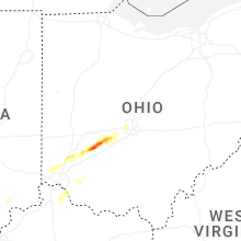


Connect with Interactive Hail Maps