

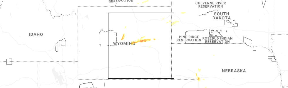
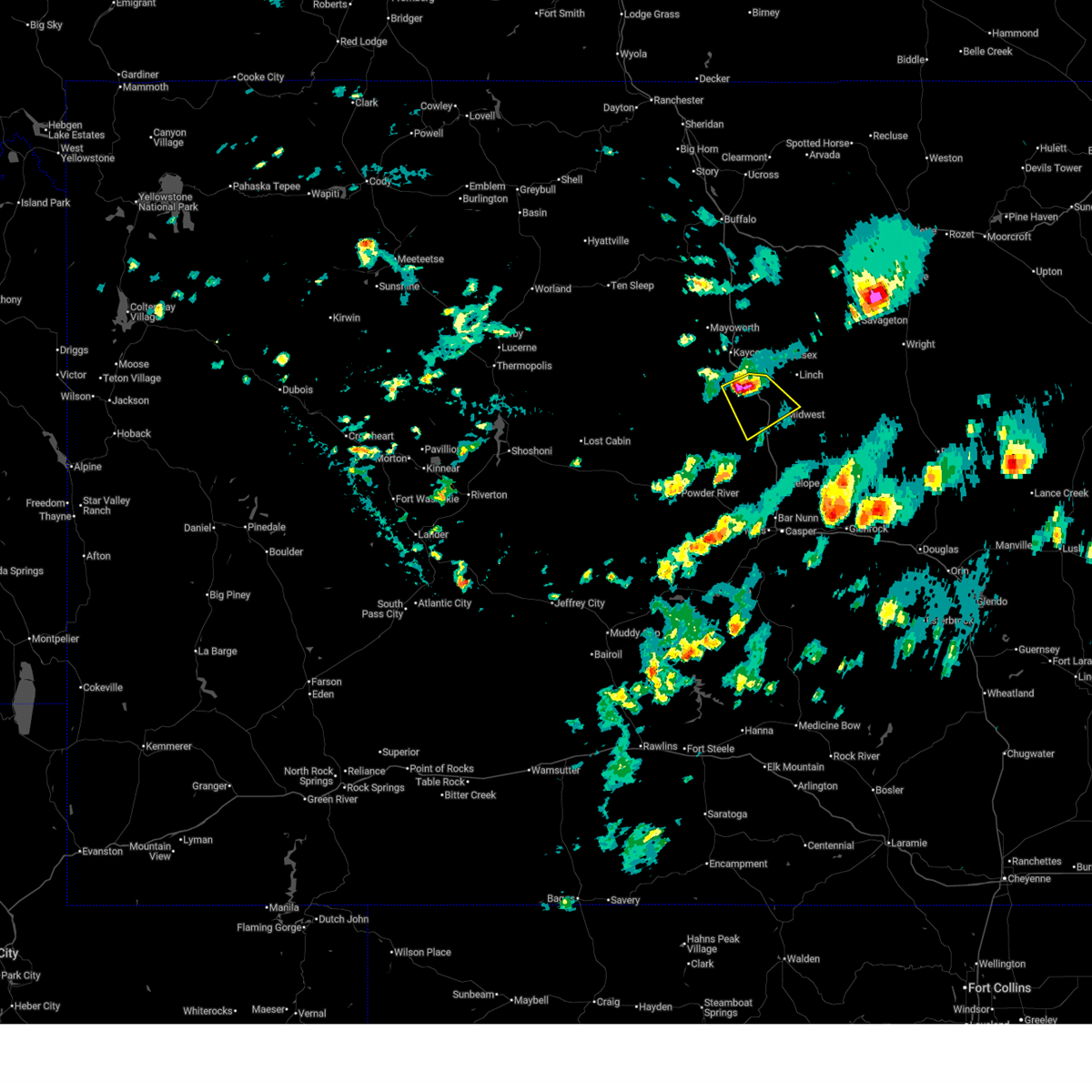
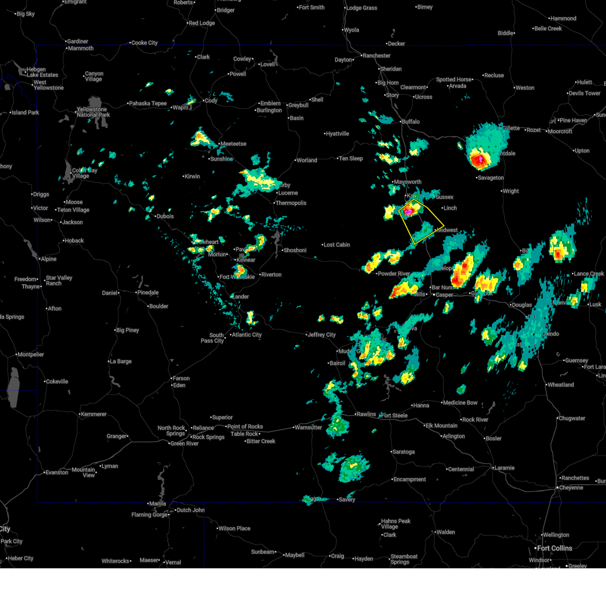
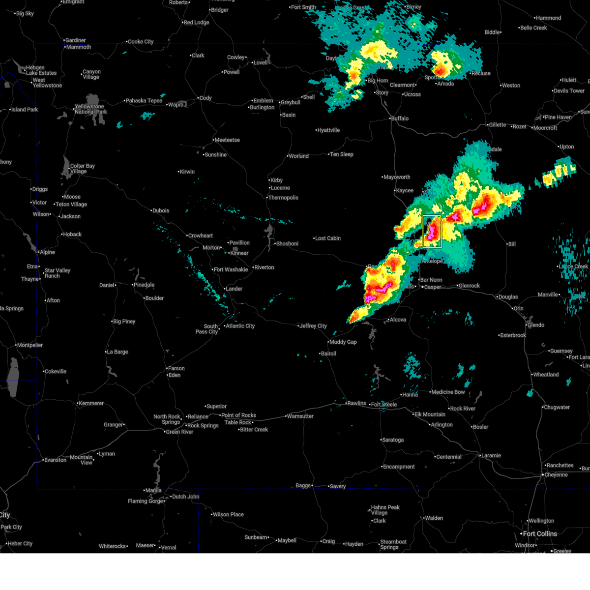
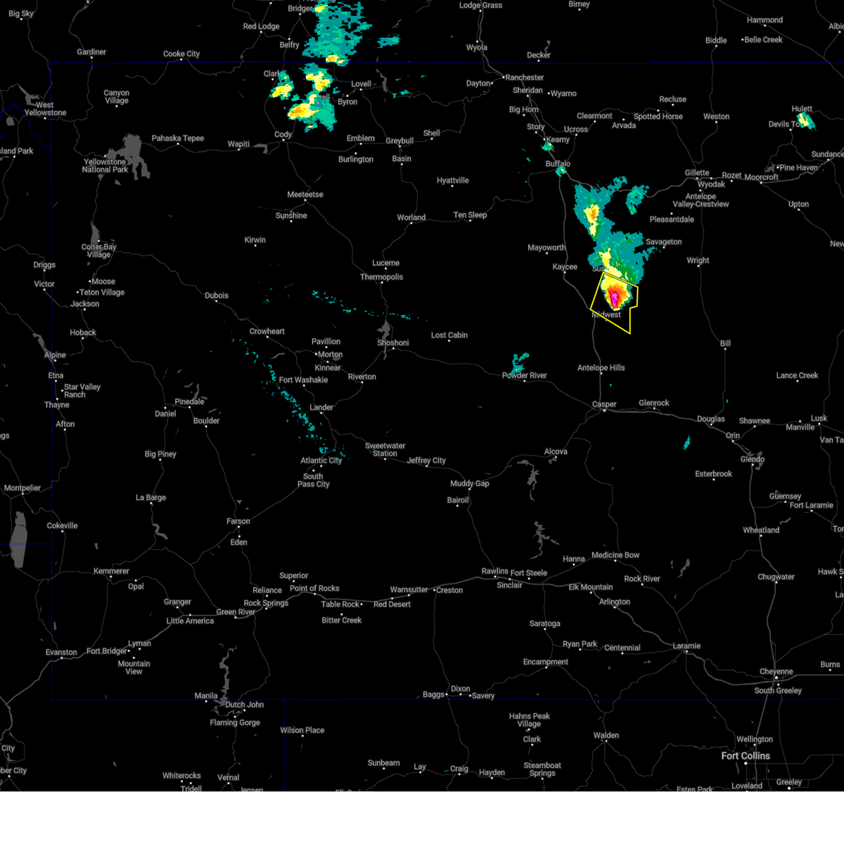
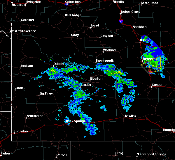
Hail Map for Midwest, WY
The Midwest, WY area has had 12 reports of on-the-ground hail by trained spotters, and has been under severe weather warnings 10 times during the past 12 months. Doppler radar has detected hail at or near Midwest, WY on 34 occasions, including 2 occasions during the past year.
| Name: | Midwest, WY |
| Where Located: | 38.6 miles N of Casper, WY |
| Map: | Google Map for Midwest, WY |
| Population: | 404 |
| Housing Units: | 200 |
| More Info: | Search Google for Midwest, WY |
0
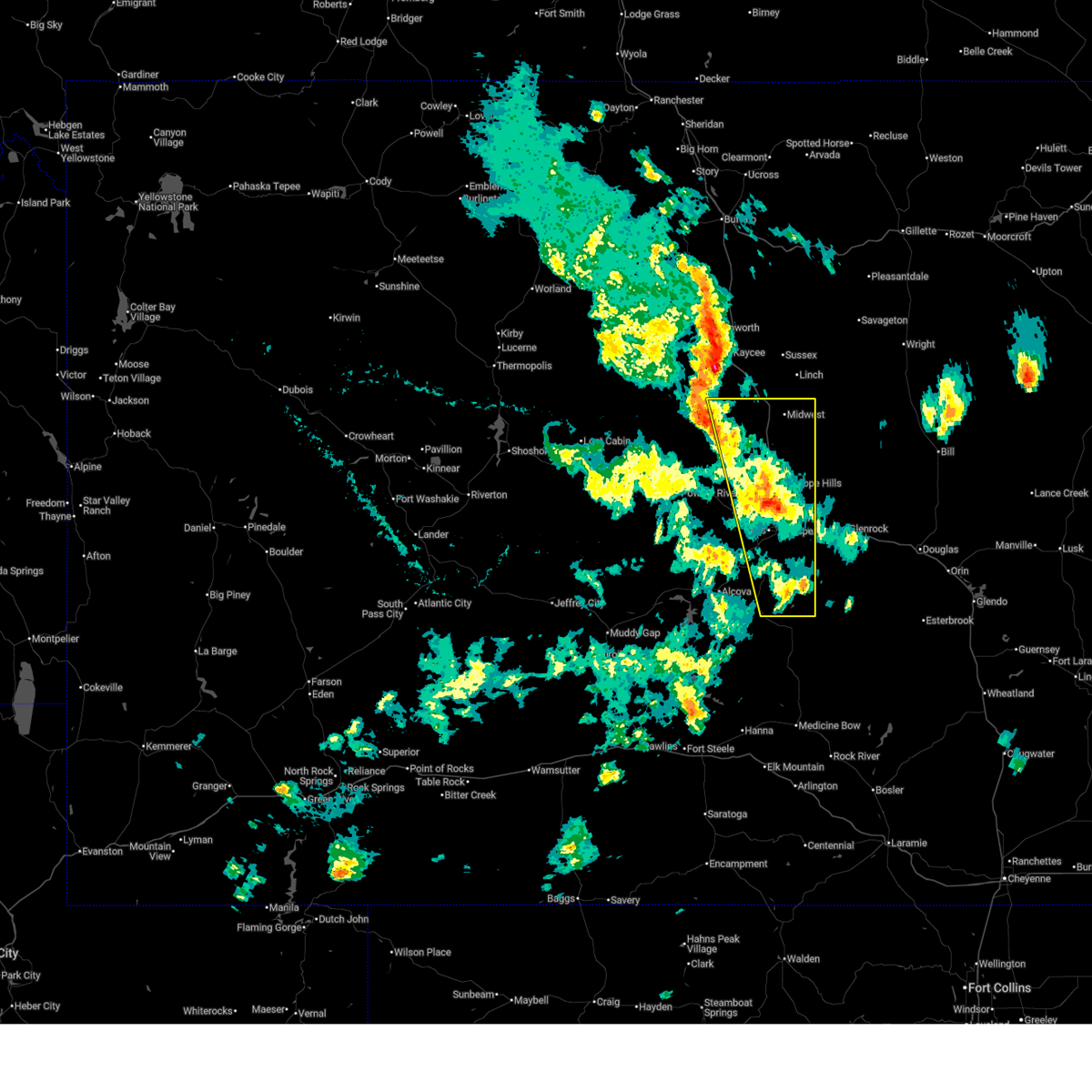
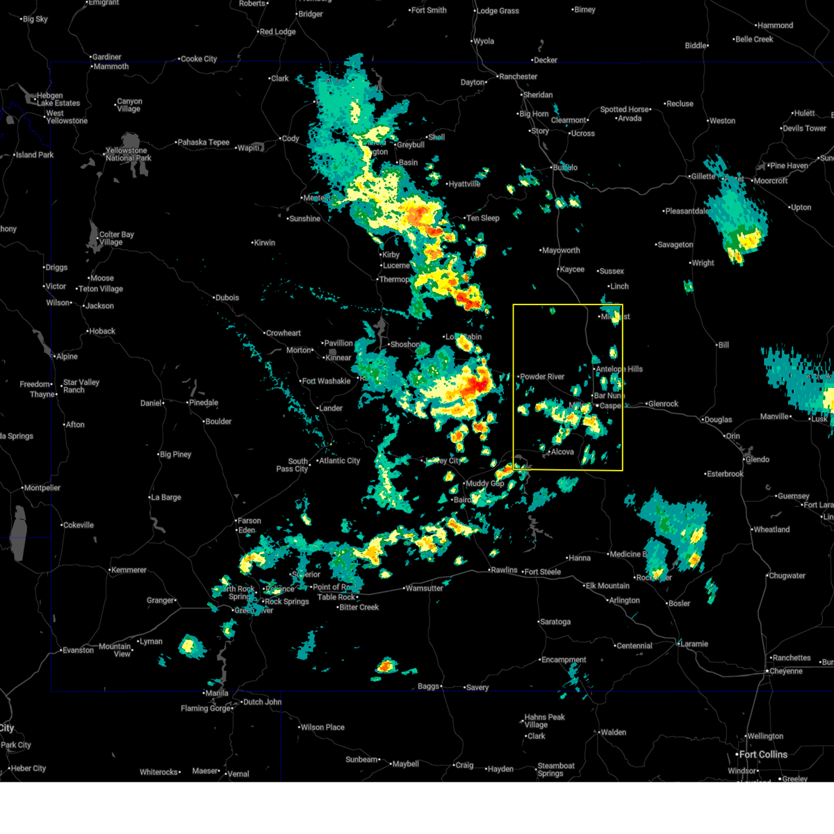
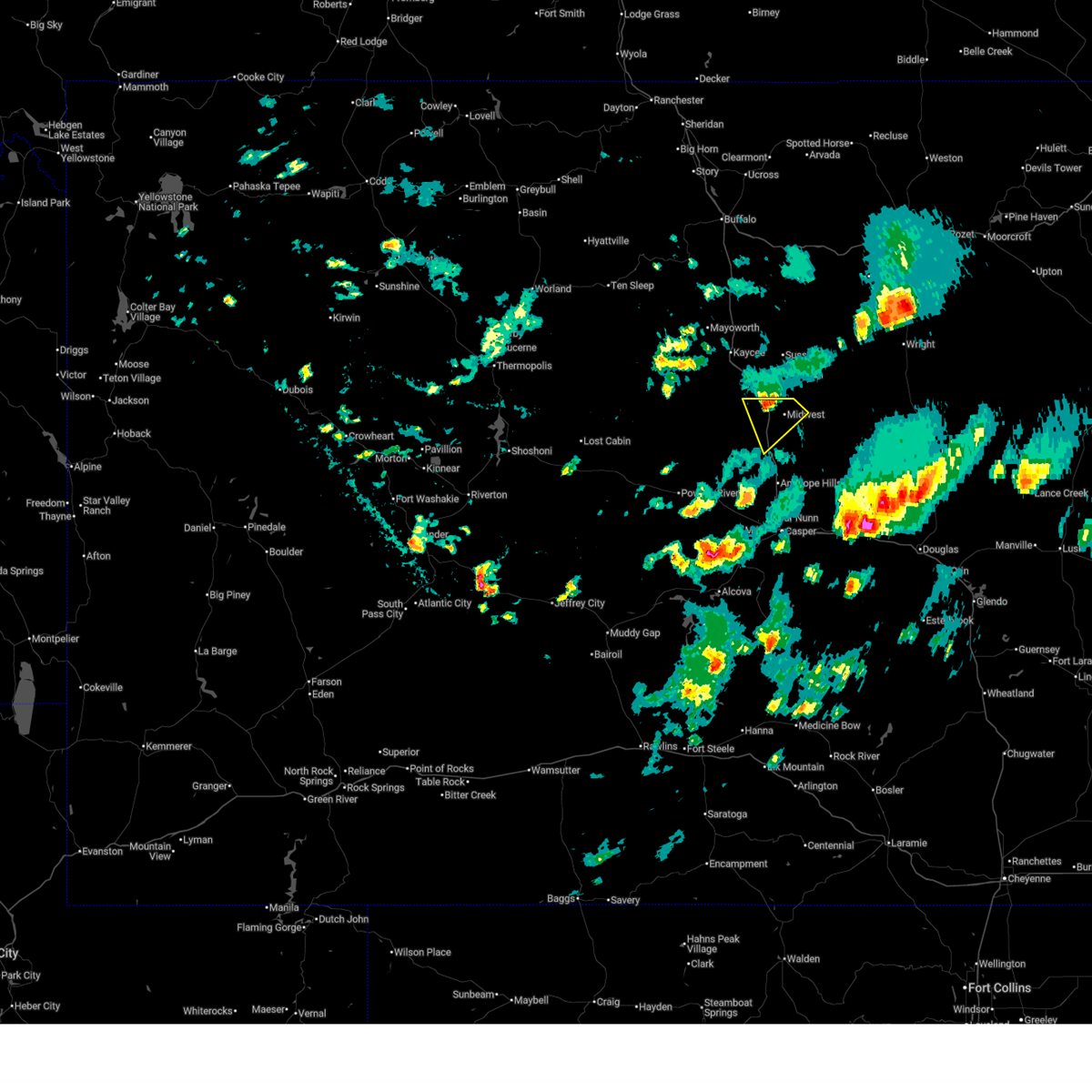
The Top Recent Hail Date for Midwest, WY is Tuesday, June 24, 2025 (31st out of 34)
Hail and Wind Damage Spotted near Midwest, WY
| Date / Time | Report Details |
|---|---|
| 7/4/2025 5:45 PM MDT |
 Svrriw the national weather service in riverton has issued a * severe thunderstorm warning for, eastern natrona county in central wyoming, * until 600 pm mdt. * at 544 pm mdt, a severe thunderstorm was located over bar nunn, which is near casper, moving east at 70 mph (radar indicated). Hazards include 60 mph wind gusts. Expect damage to roofs, siding, and trees. this severe thunderstorm will be near, evansville around 550 pm mdt. This includes interstate 25 between mile markers 176 and 234. Svrriw the national weather service in riverton has issued a * severe thunderstorm warning for, eastern natrona county in central wyoming, * until 600 pm mdt. * at 544 pm mdt, a severe thunderstorm was located over bar nunn, which is near casper, moving east at 70 mph (radar indicated). Hazards include 60 mph wind gusts. Expect damage to roofs, siding, and trees. this severe thunderstorm will be near, evansville around 550 pm mdt. This includes interstate 25 between mile markers 176 and 234.
|
| 7/4/2025 4:54 PM MDT |
 Svrriw the national weather service in riverton has issued a * severe thunderstorm warning for, natrona county in central wyoming, * until 545 pm mdt. * at 452 pm mdt, a severe thunderstorm was located over powder river, which is 37 miles west of casper, moving east at 70 mph (radar indicated. at 4:47 pm a 69 mph wind gust was reported at hiland). Hazards include 70 mph wind gusts. Expect considerable tree damage. damage is likely to mobile homes, roofs, and outbuildings. this severe thunderstorm will be near, goldeneye reservoir around 505 pm mdt. other locations in the path of this severe thunderstorm include homa hills and antelope hills. This includes interstate 25 between mile markers 176 and 234. Svrriw the national weather service in riverton has issued a * severe thunderstorm warning for, natrona county in central wyoming, * until 545 pm mdt. * at 452 pm mdt, a severe thunderstorm was located over powder river, which is 37 miles west of casper, moving east at 70 mph (radar indicated. at 4:47 pm a 69 mph wind gust was reported at hiland). Hazards include 70 mph wind gusts. Expect considerable tree damage. damage is likely to mobile homes, roofs, and outbuildings. this severe thunderstorm will be near, goldeneye reservoir around 505 pm mdt. other locations in the path of this severe thunderstorm include homa hills and antelope hills. This includes interstate 25 between mile markers 176 and 234.
|
| 6/17/2025 3:12 PM MDT |
 the severe thunderstorm warning has been cancelled and is no longer in effect the severe thunderstorm warning has been cancelled and is no longer in effect
|
| 6/17/2025 3:06 PM MDT | the severe thunderstorm warning has been cancelled and is no longer in effect |
| 6/17/2025 3:06 PM MDT | At 305 pm mdt, a severe thunderstorm was located 8 miles west of midwest, which is 21 miles southeast of kaycee, moving southeast at 15 mph (radar indicated). Hazards include quarter size hail. Damage to vehicles is expected. locations impacted include, midwest and edgerton. This includes interstate 25 between mile markers 217 and 234. |
| 6/17/2025 2:53 PM MDT | Svrriw the national weather service in riverton has issued a * severe thunderstorm warning for, northeastern natrona county in central wyoming, south central johnson county in north central wyoming, * until 330 pm mdt. * at 253 pm mdt, a severe thunderstorm was located 11 miles northwest of midwest, which is 17 miles southeast of kaycee, moving southeast at 15 mph (radar indicated). Hazards include quarter size hail. Damage to vehicles is expected. this severe thunderstorm will remain over mainly rural areas of northeastern natrona and south central johnson counties. This includes interstate 25 between mile markers 217 and 239. |
| 6/17/2025 2:41 PM MDT |
 At 241 pm mdt, a severe thunderstorm was located 14 miles east of hole in the wall, which is 14 miles south of kaycee, moving southeast at 15 mph (radar indicated). Hazards include quarter size hail. Damage to vehicles is expected. locations impacted include, midwest and edgerton. This includes interstate 25 between mile markers 224 and 243. At 241 pm mdt, a severe thunderstorm was located 14 miles east of hole in the wall, which is 14 miles south of kaycee, moving southeast at 15 mph (radar indicated). Hazards include quarter size hail. Damage to vehicles is expected. locations impacted include, midwest and edgerton. This includes interstate 25 between mile markers 224 and 243.
|
| 6/17/2025 2:33 PM MDT |
 Svrriw the national weather service in riverton has issued a * severe thunderstorm warning for, north central natrona county in central wyoming, southern johnson county in north central wyoming, * until 300 pm mdt. * at 233 pm mdt, a severe thunderstorm was located 12 miles south of kaycee, moving southeast at 15 mph (radar indicated). Hazards include quarter size hail. Damage to vehicles is expected. this severe thunderstorm will remain over mainly rural areas of north central natrona and southern johnson counties. This includes interstate 25 between mile markers 224 and 248. Svrriw the national weather service in riverton has issued a * severe thunderstorm warning for, north central natrona county in central wyoming, southern johnson county in north central wyoming, * until 300 pm mdt. * at 233 pm mdt, a severe thunderstorm was located 12 miles south of kaycee, moving southeast at 15 mph (radar indicated). Hazards include quarter size hail. Damage to vehicles is expected. this severe thunderstorm will remain over mainly rural areas of north central natrona and southern johnson counties. This includes interstate 25 between mile markers 224 and 248.
|
| 6/16/2025 7:33 PM MDT |
 Svrriw the national weather service in riverton has issued a * severe thunderstorm warning for, northeastern natrona county in central wyoming, * until 800 pm mdt. * at 733 pm mdt, a severe thunderstorm was located 7 miles southeast of edgerton, which is 35 miles southeast of kaycee, moving east at 20 mph (radar indicated). Hazards include 60 mph wind gusts and half dollar size hail. Hail damage to vehicles is expected. expect wind damage to roofs, siding, and trees. This severe thunderstorm will remain over mainly rural areas of northeastern natrona county. Svrriw the national weather service in riverton has issued a * severe thunderstorm warning for, northeastern natrona county in central wyoming, * until 800 pm mdt. * at 733 pm mdt, a severe thunderstorm was located 7 miles southeast of edgerton, which is 35 miles southeast of kaycee, moving east at 20 mph (radar indicated). Hazards include 60 mph wind gusts and half dollar size hail. Hail damage to vehicles is expected. expect wind damage to roofs, siding, and trees. This severe thunderstorm will remain over mainly rural areas of northeastern natrona county.
|
| 8/19/2024 8:07 PM MDT |
 Svrriw the national weather service in riverton has issued a * severe thunderstorm warning for, northeastern natrona county in central wyoming, southeastern johnson county in north central wyoming, * until 830 pm mdt. * at 807 pm mdt, a severe thunderstorm was located 7 miles southeast of linch, which is 29 miles southeast of kaycee, moving southeast at 30 mph (radar indicated). Hazards include 60 mph wind gusts and quarter size hail. Hail damage to vehicles is expected. expect wind damage to roofs, siding, and trees. this severe thunderstorm will remain over mainly rural areas of northeastern natrona and southeastern johnson counties, including the following locations, sussex. This includes interstate 25 between mile markers 232 and 233. Svrriw the national weather service in riverton has issued a * severe thunderstorm warning for, northeastern natrona county in central wyoming, southeastern johnson county in north central wyoming, * until 830 pm mdt. * at 807 pm mdt, a severe thunderstorm was located 7 miles southeast of linch, which is 29 miles southeast of kaycee, moving southeast at 30 mph (radar indicated). Hazards include 60 mph wind gusts and quarter size hail. Hail damage to vehicles is expected. expect wind damage to roofs, siding, and trees. this severe thunderstorm will remain over mainly rural areas of northeastern natrona and southeastern johnson counties, including the following locations, sussex. This includes interstate 25 between mile markers 232 and 233.
|
| 7/1/2024 6:05 PM MDT |
 The storm which prompted the warning has weakened below severe limits, and no longer poses an immediate threat to life or property. therefore, the warning will be allowed to expire. however, small hail, gusty winds and heavy rain are still possible with this thunderstorm. The storm which prompted the warning has weakened below severe limits, and no longer poses an immediate threat to life or property. therefore, the warning will be allowed to expire. however, small hail, gusty winds and heavy rain are still possible with this thunderstorm.
|
| 7/1/2024 5:50 PM MDT |
 At 550 pm mdt, a severe thunderstorm was located near midwest, which is 32 miles southeast of kaycee, moving east at 35 mph (radar indicated). Hazards include quarter size hail. Damage to vehicles is expected. This severe thunderstorm will remain over mainly rural areas of northeastern natrona county. At 550 pm mdt, a severe thunderstorm was located near midwest, which is 32 miles southeast of kaycee, moving east at 35 mph (radar indicated). Hazards include quarter size hail. Damage to vehicles is expected. This severe thunderstorm will remain over mainly rural areas of northeastern natrona county.
|
| 7/1/2024 5:39 PM MDT |
 At 539 pm mdt, a severe thunderstorm was located near midwest, which is 26 miles southeast of kaycee, moving east at 35 mph (radar indicated). Hazards include 60 mph wind gusts and quarter size hail. Hail damage to vehicles is expected. expect wind damage to roofs, siding, and trees. this severe storm will be near, midwest around 545 pm mdt. This includes interstate 25 between mile markers 220 and 232. At 539 pm mdt, a severe thunderstorm was located near midwest, which is 26 miles southeast of kaycee, moving east at 35 mph (radar indicated). Hazards include 60 mph wind gusts and quarter size hail. Hail damage to vehicles is expected. expect wind damage to roofs, siding, and trees. this severe storm will be near, midwest around 545 pm mdt. This includes interstate 25 between mile markers 220 and 232.
|
| 7/1/2024 5:26 PM MDT |
 Svrriw the national weather service in riverton has issued a * severe thunderstorm warning for, northeastern natrona county in central wyoming, * until 615 pm mdt. * at 526 pm mdt, a severe thunderstorm was located 13 miles west of midwest, which is 21 miles south of kaycee, moving east at 35 mph (radar indicated). Hazards include 60 mph wind gusts and quarter size hail. Hail damage to vehicles is expected. expect wind damage to roofs, siding, and trees. this severe thunderstorm will be near, midwest around 545 pm mdt. This includes interstate 25 between mile markers 213 and 232. Svrriw the national weather service in riverton has issued a * severe thunderstorm warning for, northeastern natrona county in central wyoming, * until 615 pm mdt. * at 526 pm mdt, a severe thunderstorm was located 13 miles west of midwest, which is 21 miles south of kaycee, moving east at 35 mph (radar indicated). Hazards include 60 mph wind gusts and quarter size hail. Hail damage to vehicles is expected. expect wind damage to roofs, siding, and trees. this severe thunderstorm will be near, midwest around 545 pm mdt. This includes interstate 25 between mile markers 213 and 232.
|
| 6/30/2024 1:12 PM MDT | Mesonet station wy62 i25 us87 - smokey ga in natrona county WY, 5.8 miles ESE of Midwest, WY |
| 9/10/2023 2:33 PM MDT | Golf Ball sized hail reported 5.2 miles ENE of Midwest, WY, traveler on i25 reported quarter to golf ball sized hail on road. |
| 9/10/2023 1:59 PM MDT |
 At 158 pm mdt, a severe thunderstorm was located 11 miles northwest of midwest, which is also 17 miles southeast of kaycee, moving southeast at 15 mph (radar indicated). Hazards include quarter size hail. damage to vehicles is expected At 158 pm mdt, a severe thunderstorm was located 11 miles northwest of midwest, which is also 17 miles southeast of kaycee, moving southeast at 15 mph (radar indicated). Hazards include quarter size hail. damage to vehicles is expected
|
| 7/8/2023 3:40 PM MDT |
 The severe thunderstorm warning for northeastern natrona county will expire at 345 pm mdt, the storm which prompted the warning has weakened below severe limits, and has exited the warned area. therefore, the warning will be allowed to expire. The severe thunderstorm warning for northeastern natrona county will expire at 345 pm mdt, the storm which prompted the warning has weakened below severe limits, and has exited the warned area. therefore, the warning will be allowed to expire.
|
| 7/8/2023 3:26 PM MDT |
 At 325 pm mdt, a severe thunderstorm was located near edgerton, which is also 32 miles southeast of kaycee, moving southeast at 25 mph (radar indicated). Hazards include quarter size hail. Damage to vehicles is expected. this severe thunderstorm will remain over mainly rural areas of northeastern natrona county. hail threat, radar indicated max hail size, 1. 00 in wind threat, radar indicated max wind gust, <50 mph. At 325 pm mdt, a severe thunderstorm was located near edgerton, which is also 32 miles southeast of kaycee, moving southeast at 25 mph (radar indicated). Hazards include quarter size hail. Damage to vehicles is expected. this severe thunderstorm will remain over mainly rural areas of northeastern natrona county. hail threat, radar indicated max hail size, 1. 00 in wind threat, radar indicated max wind gust, <50 mph.
|
| 7/8/2023 3:05 PM MDT |
 At 305 pm mdt, a severe thunderstorm was located near edgerton, which is also 24 miles southeast of kaycee, moving southeast at 30 mph (radar indicated). Hazards include half dollar size hail. Damage to vehicles is expected. this severe thunderstorm will be near, midwest around 310 pm mdt. edgerton around 315 pm mdt. hail threat, radar indicated max hail size, 1. 25 in wind threat, radar indicated max wind gust, <50 mph. At 305 pm mdt, a severe thunderstorm was located near edgerton, which is also 24 miles southeast of kaycee, moving southeast at 30 mph (radar indicated). Hazards include half dollar size hail. Damage to vehicles is expected. this severe thunderstorm will be near, midwest around 310 pm mdt. edgerton around 315 pm mdt. hail threat, radar indicated max hail size, 1. 25 in wind threat, radar indicated max wind gust, <50 mph.
|
| 7/6/2023 8:28 PM MDT |
 At 827 pm mdt, a severe thunderstorm was located near teapot rock, which is also 30 miles north of casper, moving southeast at 45 mph (radar indicated). Hazards include 60 mph wind gusts and half dollar size hail. Hail damage to vehicles is expected. expect wind damage to roofs, siding, and trees. locations impacted include, midwest, edgerton and teapot rock. this includes interstate 25 between mile markers 209 and 232. hail threat, radar indicated max hail size, 1. 25 in wind threat, radar indicated max wind gust, 60 mph. At 827 pm mdt, a severe thunderstorm was located near teapot rock, which is also 30 miles north of casper, moving southeast at 45 mph (radar indicated). Hazards include 60 mph wind gusts and half dollar size hail. Hail damage to vehicles is expected. expect wind damage to roofs, siding, and trees. locations impacted include, midwest, edgerton and teapot rock. this includes interstate 25 between mile markers 209 and 232. hail threat, radar indicated max hail size, 1. 25 in wind threat, radar indicated max wind gust, 60 mph.
|
| 7/6/2023 8:19 PM MDT |
 At 819 pm mdt, a severe thunderstorm was located 11 miles northwest of teapot rock, which is also 27 miles south of kaycee, moving east at 60 mph (public). Hazards include 60 mph wind gusts and half dollar size hail. Hail damage to vehicles is expected. expect wind damage to roofs, siding, and trees. locations impacted include, midwest, edgerton and teapot rock. this includes interstate 25 between mile markers 209 and 236. hail threat, radar indicated max hail size, 1. 25 in wind threat, radar indicated max wind gust, 60 mph. At 819 pm mdt, a severe thunderstorm was located 11 miles northwest of teapot rock, which is also 27 miles south of kaycee, moving east at 60 mph (public). Hazards include 60 mph wind gusts and half dollar size hail. Hail damage to vehicles is expected. expect wind damage to roofs, siding, and trees. locations impacted include, midwest, edgerton and teapot rock. this includes interstate 25 between mile markers 209 and 236. hail threat, radar indicated max hail size, 1. 25 in wind threat, radar indicated max wind gust, 60 mph.
|
| 7/6/2023 8:06 PM MDT |
 At 805 pm mdt, a severe thunderstorm was located 11 miles east of red wall, which is also 21 miles south of kaycee, moving east at 45 mph (public). Hazards include golf ball size hail. People and animals outdoors will be injured. Expect damage to roofs, siding, windows, and vehicles. At 805 pm mdt, a severe thunderstorm was located 11 miles east of red wall, which is also 21 miles south of kaycee, moving east at 45 mph (public). Hazards include golf ball size hail. People and animals outdoors will be injured. Expect damage to roofs, siding, windows, and vehicles.
|
| 7/3/2023 7:20 PM MDT |
 At 719 pm mdt, severe thunderstorms were located between midwest and antelope hills, moving east at 30 mph (surface observation). Hazards include 70 mph wind gusts and ping pong ball size hail. People and animals outdoors will be injured. expect hail damage to roofs, siding, windows, and vehicles. expect considerable tree damage. wind damage is also likely to mobile homes, roofs, and outbuildings. locations impacted include, midwest, edgerton, antelope hills and teapot rock. this includes interstate 25 between mile markers 199 and 234. thunderstorm damage threat, considerable hail threat, radar indicated max hail size, 1. 50 in wind threat, observed max wind gust, 70 mph. At 719 pm mdt, severe thunderstorms were located between midwest and antelope hills, moving east at 30 mph (surface observation). Hazards include 70 mph wind gusts and ping pong ball size hail. People and animals outdoors will be injured. expect hail damage to roofs, siding, windows, and vehicles. expect considerable tree damage. wind damage is also likely to mobile homes, roofs, and outbuildings. locations impacted include, midwest, edgerton, antelope hills and teapot rock. this includes interstate 25 between mile markers 199 and 234. thunderstorm damage threat, considerable hail threat, radar indicated max hail size, 1. 50 in wind threat, observed max wind gust, 70 mph.
|
| 7/3/2023 7:15 PM MDT |
 At 713 pm mdt, severe thunderstorms were located between midwest and casper, moving east at 35 mph (surface observations). Hazards include golf ball size hail and 70 mph wind gusts. People and animals outdoors will be injured. expect hail damage to roofs, siding, windows, and vehicles. expect considerable tree damage. wind damage is also likely to mobile homes, roofs, and outbuildings. these severe thunderstorms will remain over mainly rural areas of northeastern natrona county, including the following locations, casper mountain, casper-natrona county international airport, casper events center, fort caspar campground, central wyoming fairgrounds, bessemer bend, casper mountain county park, rotary park and casper natural gas processing plant. This includes interstate 25 between mile markers 176 and 234. At 713 pm mdt, severe thunderstorms were located between midwest and casper, moving east at 35 mph (surface observations). Hazards include golf ball size hail and 70 mph wind gusts. People and animals outdoors will be injured. expect hail damage to roofs, siding, windows, and vehicles. expect considerable tree damage. wind damage is also likely to mobile homes, roofs, and outbuildings. these severe thunderstorms will remain over mainly rural areas of northeastern natrona county, including the following locations, casper mountain, casper-natrona county international airport, casper events center, fort caspar campground, central wyoming fairgrounds, bessemer bend, casper mountain county park, rotary park and casper natural gas processing plant. This includes interstate 25 between mile markers 176 and 234.
|
| 7/3/2023 6:58 PM MDT |
 At 656 pm mdt, severe thunderstorms were located near casper and north to the johnson county border, moving east at 30 mph (emergency management). Hazards include 70 mph wind gusts and ping pong ball size hail. People and animals outdoors will be injured. expect hail damage to roofs, siding, windows, and vehicles. expect considerable tree damage. wind damage is also likely to mobile homes, roofs, and outbuildings. severe thunderstorms will be near, red butte, antelope hills and paradise valley around 700 pm mdt. mills and bar nunn around 705 pm mdt. casper and beartrap meadows county park around 710 pm mdt. evansville around 715 pm mdt. other locations in the path of these severe thunderstorms include midwest, teapot rock and edgerton. This includes interstate 25 between mile markers 176 and 234. At 656 pm mdt, severe thunderstorms were located near casper and north to the johnson county border, moving east at 30 mph (emergency management). Hazards include 70 mph wind gusts and ping pong ball size hail. People and animals outdoors will be injured. expect hail damage to roofs, siding, windows, and vehicles. expect considerable tree damage. wind damage is also likely to mobile homes, roofs, and outbuildings. severe thunderstorms will be near, red butte, antelope hills and paradise valley around 700 pm mdt. mills and bar nunn around 705 pm mdt. casper and beartrap meadows county park around 710 pm mdt. evansville around 715 pm mdt. other locations in the path of these severe thunderstorms include midwest, teapot rock and edgerton. This includes interstate 25 between mile markers 176 and 234.
|
| 7/3/2023 6:41 PM MDT |
 At 640 pm mdt, severe thunderstorms were moving through natrona county, moving east at 50 mph (emergency management). Hazards include 70 mph wind gusts and half dollar size hail. Hail damage to vehicles is expected. expect considerable tree damage. wind damage is also likely to mobile homes, roofs, and outbuildings. locations impacted include, casper, mills, evansville, bar nunn, red butte, midwest, homa hills, edgerton, antelope hills, alcova, teapot rock, goldeneye reservoir, bates hole, emigrant gap, beartrap meadows county park, paradise valley, red wall, natrona, casper natural gas processing plant and fort caspar campground. This includes interstate 25 between mile markers 176 and 234. At 640 pm mdt, severe thunderstorms were moving through natrona county, moving east at 50 mph (emergency management). Hazards include 70 mph wind gusts and half dollar size hail. Hail damage to vehicles is expected. expect considerable tree damage. wind damage is also likely to mobile homes, roofs, and outbuildings. locations impacted include, casper, mills, evansville, bar nunn, red butte, midwest, homa hills, edgerton, antelope hills, alcova, teapot rock, goldeneye reservoir, bates hole, emigrant gap, beartrap meadows county park, paradise valley, red wall, natrona, casper natural gas processing plant and fort caspar campground. This includes interstate 25 between mile markers 176 and 234.
|
| 7/3/2023 6:20 PM MDT |
 At 617 pm mdt, severe thunderstorms were located along a line extending across most of natrona county, moving east at 60 mph. the strongest storms are currently north of powder river (radar indicated). Hazards include 70 mph wind gusts and half dollar size hail. Hail damage to vehicles is expected. expect considerable tree damage. wind damage is also likely to mobile homes, roofs, and outbuildings. locations impacted include, casper, mills, evansville, bar nunn, red butte, midwest, homa hills, edgerton, antelope hills, alcova, powder river, waltman, teapot rock, goldeneye reservoir, devil`s gate, independence rock, bates hole, emigrant gap, beartrap meadows county park and paradise valley. This includes interstate 25 between mile markers 176 and 234. At 617 pm mdt, severe thunderstorms were located along a line extending across most of natrona county, moving east at 60 mph. the strongest storms are currently north of powder river (radar indicated). Hazards include 70 mph wind gusts and half dollar size hail. Hail damage to vehicles is expected. expect considerable tree damage. wind damage is also likely to mobile homes, roofs, and outbuildings. locations impacted include, casper, mills, evansville, bar nunn, red butte, midwest, homa hills, edgerton, antelope hills, alcova, powder river, waltman, teapot rock, goldeneye reservoir, devil`s gate, independence rock, bates hole, emigrant gap, beartrap meadows county park and paradise valley. This includes interstate 25 between mile markers 176 and 234.
|
| 7/3/2023 6:13 PM MDT |
 At 610 pm mdt, severe thunderstorms were moving east across natrona county at 55 mph (surface observation. at 606 pm mdt, wind gusts to 67 mph were reported near alcova reservoir). Hazards include 70 mph wind gusts and quarter size hail. Hail damage to vehicles is expected. expect considerable tree damage. wind damage is also likely to mobile homes, roofs, and outbuildings. locations impacted include, casper, mills, evansville, bar nunn, red butte, midwest, homa hills, edgerton, antelope hills, alcova, powder river, hiland, waltman, ervay, teapot rock, goldeneye reservoir, devil`s gate, independence rock, bates hole and emigrant gap. this includes interstate 25 between mile markers 176 and 234. thunderstorm damage threat, considerable hail threat, radar indicated max hail size, 1. 00 in wind threat, observed max wind gust, 70 mph. At 610 pm mdt, severe thunderstorms were moving east across natrona county at 55 mph (surface observation. at 606 pm mdt, wind gusts to 67 mph were reported near alcova reservoir). Hazards include 70 mph wind gusts and quarter size hail. Hail damage to vehicles is expected. expect considerable tree damage. wind damage is also likely to mobile homes, roofs, and outbuildings. locations impacted include, casper, mills, evansville, bar nunn, red butte, midwest, homa hills, edgerton, antelope hills, alcova, powder river, hiland, waltman, ervay, teapot rock, goldeneye reservoir, devil`s gate, independence rock, bates hole and emigrant gap. this includes interstate 25 between mile markers 176 and 234. thunderstorm damage threat, considerable hail threat, radar indicated max hail size, 1. 00 in wind threat, observed max wind gust, 70 mph.
|
| 7/3/2023 6:00 PM MDT |
 At 559 pm mdt, severe thunderstorms were located along a line extending from 9 miles west of red wall to near waltman to 11 miles east of independence rock, moving east at 50 mph (public). Hazards include 60 mph wind gusts. expect damage to roofs, siding, and trees At 559 pm mdt, severe thunderstorms were located along a line extending from 9 miles west of red wall to near waltman to 11 miles east of independence rock, moving east at 50 mph (public). Hazards include 60 mph wind gusts. expect damage to roofs, siding, and trees
|
| 6/29/2023 1:03 PM MDT |
 At 103 pm mdt, a severe thunderstorm was located near edgerton, which is also 31 miles southeast of kaycee, moving east at 10 mph (radar indicated). Hazards include ping pong ball size hail and 60 mph wind gusts. People and animals outdoors will be injured. expect hail damage to roofs, siding, windows, and vehicles. expect wind damage to roofs, siding, and trees. This severe thunderstorm will remain over mainly rural areas of northeastern natrona county. At 103 pm mdt, a severe thunderstorm was located near edgerton, which is also 31 miles southeast of kaycee, moving east at 10 mph (radar indicated). Hazards include ping pong ball size hail and 60 mph wind gusts. People and animals outdoors will be injured. expect hail damage to roofs, siding, windows, and vehicles. expect wind damage to roofs, siding, and trees. This severe thunderstorm will remain over mainly rural areas of northeastern natrona county.
|
| 6/19/2022 2:30 PM MDT | Tree damage and a power line down from strong win in natrona county WY, 0.2 miles S of Midwest, WY |
| 6/3/2022 8:19 PM MDT |
 At 818 pm mdt, a severe thunderstorm was located near midwest, moving east at 25 mph (radar indicated). Hazards include quarter size hail. Damage to vehicles is expected. locations impacted include, midwest and edgerton. this includes interstate 25 between mile markers 219 and 234. hail threat, observed max hail size, 1. 00 in wind threat, radar indicated max wind gust, <50 mph. At 818 pm mdt, a severe thunderstorm was located near midwest, moving east at 25 mph (radar indicated). Hazards include quarter size hail. Damage to vehicles is expected. locations impacted include, midwest and edgerton. this includes interstate 25 between mile markers 219 and 234. hail threat, observed max hail size, 1. 00 in wind threat, radar indicated max wind gust, <50 mph.
|
| 6/3/2022 8:06 PM MDT |
 At 804 pm mdt, a severe thunderstorm was located around midwest. one inch hail has been reported weather spotter at 800 pm. another severe thunderstorms was located about 11 miles west of midwest, moving east at 20 mph (trained weather spotters). Hazards include quarter size hail. damage to vehicles is expected At 804 pm mdt, a severe thunderstorm was located around midwest. one inch hail has been reported weather spotter at 800 pm. another severe thunderstorms was located about 11 miles west of midwest, moving east at 20 mph (trained weather spotters). Hazards include quarter size hail. damage to vehicles is expected
|
| 6/3/2022 8:05 PM MDT | Quarter sized hail reported 0.2 miles S of Midwest, WY, a trained spotter reported quarter size hail. there are also numerous reports on nickel size hail around midwest and edgerton. |
| 7/13/2021 7:25 PM MDT |
 The severe thunderstorm warning for northeastern natrona county will expire at 730 pm mdt, the storm which prompted the warning has weakened below severe limits, and has exited the warned area. therefore, the warning will be allowed to expire. however gusty winds are still possible with this thunderstorm. a severe thunderstorm watch remains in effect until 1100 pm mdt for central wyoming. The severe thunderstorm warning for northeastern natrona county will expire at 730 pm mdt, the storm which prompted the warning has weakened below severe limits, and has exited the warned area. therefore, the warning will be allowed to expire. however gusty winds are still possible with this thunderstorm. a severe thunderstorm watch remains in effect until 1100 pm mdt for central wyoming.
|
| 7/13/2021 7:06 PM MDT |
 At 706 pm mdt, a severe thunderstorm was located near teapot rock, or 30 miles southeast of kaycee, moving east at 55 mph (radar indicated). Hazards include 60 mph wind gusts and nickel size hail. Expect damage to roofs, siding, and trees. this severe thunderstorm will remain over mainly rural areas of northeastern natrona county. This includes interstate 25 between mile markers 209 and 229. At 706 pm mdt, a severe thunderstorm was located near teapot rock, or 30 miles southeast of kaycee, moving east at 55 mph (radar indicated). Hazards include 60 mph wind gusts and nickel size hail. Expect damage to roofs, siding, and trees. this severe thunderstorm will remain over mainly rural areas of northeastern natrona county. This includes interstate 25 between mile markers 209 and 229.
|
| 6/28/2020 5:41 PM MDT |
 The severe thunderstorm warning for northern natrona and southeastern johnson counties will expire at 545 pm mdt, the storm which prompted the warning has weakened below severe limits, and no longer poses an immediate threat to life or property. therefore, the warning will be allowed to expire. The severe thunderstorm warning for northern natrona and southeastern johnson counties will expire at 545 pm mdt, the storm which prompted the warning has weakened below severe limits, and no longer poses an immediate threat to life or property. therefore, the warning will be allowed to expire.
|
| 6/28/2020 5:35 PM MDT |
 At 534 pm mdt, a severe thunderstorm was located near linch, which is 25 miles east of kaycee, moving northeast at 30 mph (radar indicated). Hazards include 60 mph wind gusts. Expect damage to roofs, siding, and trees. this severe thunderstorm will remain over mainly rural areas of northern natrona and southeastern johnson counties, including the following locations, sussex. This includes interstate 25 between mile markers 225 and 234. At 534 pm mdt, a severe thunderstorm was located near linch, which is 25 miles east of kaycee, moving northeast at 30 mph (radar indicated). Hazards include 60 mph wind gusts. Expect damage to roofs, siding, and trees. this severe thunderstorm will remain over mainly rural areas of northern natrona and southeastern johnson counties, including the following locations, sussex. This includes interstate 25 between mile markers 225 and 234.
|
| 6/28/2020 5:32 PM MDT | Wydot station wy62 i25 us87 - smokey ga in natrona county WY, 5.8 miles ESE of Midwest, WY |
| 6/28/2020 5:18 PM MDT |
 At 517 pm mdt, a severe thunderstorm was located near linch, which is 21 miles southeast of kaycee, moving northeast at 45 mph (radar indicated). Hazards include 60 mph wind gusts and penny size hail. Expect damage to roofs, siding, and trees. this severe storm will be near, linch around 525 pm mdt. other locations impacted by this severe thunderstorm include sussex. This includes interstate 25 between mile markers 221 and 246. At 517 pm mdt, a severe thunderstorm was located near linch, which is 21 miles southeast of kaycee, moving northeast at 45 mph (radar indicated). Hazards include 60 mph wind gusts and penny size hail. Expect damage to roofs, siding, and trees. this severe storm will be near, linch around 525 pm mdt. other locations impacted by this severe thunderstorm include sussex. This includes interstate 25 between mile markers 221 and 246.
|
| 6/28/2020 5:01 PM MDT |
 At 501 pm mdt, a severe thunderstorm was located 12 miles west of midwest, which is 19 miles south of kaycee, moving northeast at 30 mph (radar indicated). Hazards include 60 mph wind gusts and penny size hail. Expect damage to roofs, siding, and trees. this severe thunderstorm will be near, midwest around 520 pm mdt. linch around 540 pm mdt. other locations impacted by this severe thunderstorm include sussex. This includes interstate 25 between mile markers 214 and 246. At 501 pm mdt, a severe thunderstorm was located 12 miles west of midwest, which is 19 miles south of kaycee, moving northeast at 30 mph (radar indicated). Hazards include 60 mph wind gusts and penny size hail. Expect damage to roofs, siding, and trees. this severe thunderstorm will be near, midwest around 520 pm mdt. linch around 540 pm mdt. other locations impacted by this severe thunderstorm include sussex. This includes interstate 25 between mile markers 214 and 246.
|
| 6/28/2020 2:21 PM MDT |
 The severe thunderstorm warning for northeastern natrona and southeastern johnson counties will expire at 230 pm mdt, the storm which prompted the warning has moved out of the area. therefore, the warning will be allowed to expire. however gusty winds are still possible with this thunderstorm. The severe thunderstorm warning for northeastern natrona and southeastern johnson counties will expire at 230 pm mdt, the storm which prompted the warning has moved out of the area. therefore, the warning will be allowed to expire. however gusty winds are still possible with this thunderstorm.
|
| 6/28/2020 2:05 PM MDT |
 At 204 pm mdt, a severe thunderstorm was located 12 miles east of teapot rock, which is 31 miles northeast of casper, moving northeast at 35 mph (radar indicated). Hazards include 60 mph wind gusts. Expect damage to roofs, siding, and trees. locations impacted include, midwest, edgerton and teapot rock. This includes interstate 25 between mile markers 209 and 229. At 204 pm mdt, a severe thunderstorm was located 12 miles east of teapot rock, which is 31 miles northeast of casper, moving northeast at 35 mph (radar indicated). Hazards include 60 mph wind gusts. Expect damage to roofs, siding, and trees. locations impacted include, midwest, edgerton and teapot rock. This includes interstate 25 between mile markers 209 and 229.
|
| 6/28/2020 1:39 PM MDT |
 At 138 pm mdt, a severe thunderstorm was located near antelope hills, which is 20 miles north of casper, moving northeast at 35 mph (radar indicated). Hazards include 60 mph wind gusts. Expect damage to roofs, siding, and trees. this severe thunderstorm will remain over mainly rural areas of northeastern natrona and southeastern johnson counties, including the following locations, casper-natrona county international airport. This includes interstate 25 between mile markers 195 and 229. At 138 pm mdt, a severe thunderstorm was located near antelope hills, which is 20 miles north of casper, moving northeast at 35 mph (radar indicated). Hazards include 60 mph wind gusts. Expect damage to roofs, siding, and trees. this severe thunderstorm will remain over mainly rural areas of northeastern natrona and southeastern johnson counties, including the following locations, casper-natrona county international airport. This includes interstate 25 between mile markers 195 and 229.
|
| 6/6/2020 4:23 PM MDT |
 At 421 pm mdt, severe thunderstorms were located along a line extending from near red wall to 6 miles northeast of evansville, moving northeast at 65 mph (radar indicated. at 412pm mdt, 76 mph was reported near tisdale). Hazards include 70 mph wind gusts. Expect considerable tree damage. damage is likely to mobile homes, roofs, and outbuildings. locations impacted include, kaycee, midwest, mayoworth, edgerton, linch, hole in the wall, teapot rock, fort reno historical site, red wall, barnum and sussex. This includes interstate 25 between mile markers 207 and 268. At 421 pm mdt, severe thunderstorms were located along a line extending from near red wall to 6 miles northeast of evansville, moving northeast at 65 mph (radar indicated. at 412pm mdt, 76 mph was reported near tisdale). Hazards include 70 mph wind gusts. Expect considerable tree damage. damage is likely to mobile homes, roofs, and outbuildings. locations impacted include, kaycee, midwest, mayoworth, edgerton, linch, hole in the wall, teapot rock, fort reno historical site, red wall, barnum and sussex. This includes interstate 25 between mile markers 207 and 268.
|
| 6/6/2020 4:08 PM MDT | Smokey gap wydot anemometer in natrona county WY, 5.1 miles E of Midwest, WY |
| 6/6/2020 4:02 PM MDT |
 At 401 pm mdt, severe thunderstorms were located along a line extending from 10 miles south of red wall to near beartrap meadows county park, moving northeast at 65 mph (radar indicated). Hazards include 70 mph wind gusts. Expect considerable tree damage. damage is likely to mobile homes, roofs, and outbuildings. locations impacted include, kaycee, midwest, mayoworth, edgerton, linch, hole in the wall, teapot rock, fort reno historical site, red wall, barnum and sussex. This includes interstate 25 between mile markers 207 and 268. At 401 pm mdt, severe thunderstorms were located along a line extending from 10 miles south of red wall to near beartrap meadows county park, moving northeast at 65 mph (radar indicated). Hazards include 70 mph wind gusts. Expect considerable tree damage. damage is likely to mobile homes, roofs, and outbuildings. locations impacted include, kaycee, midwest, mayoworth, edgerton, linch, hole in the wall, teapot rock, fort reno historical site, red wall, barnum and sussex. This includes interstate 25 between mile markers 207 and 268.
|
| 6/6/2020 3:53 PM MDT |
 At 352 pm mdt, severe thunderstorms were located along a line extending from 12 miles south of red wall to beartrap meadows county park, moving northeast at 65 mph (radar indicated). Hazards include 60 mph wind gusts. expect damage to roofs, siding, and trees At 352 pm mdt, severe thunderstorms were located along a line extending from 12 miles south of red wall to beartrap meadows county park, moving northeast at 65 mph (radar indicated). Hazards include 60 mph wind gusts. expect damage to roofs, siding, and trees
|
| 6/6/2020 1:46 AM MDT |
 At 142 am mdt, weak showers with damaging winds were located along a line extending from near anchor dam to near midwest, moving north at 45 mph (radar indicated. at 1235 am, the casper airport measured a wind gust of 60 mph. at 125 am, the riverton airport measured a 59 mph wind gust). Hazards include 60 mph wind gusts. Expect damage to roofs, siding, and trees. severe thunderstorms will be near, midwest and edgerton around 150 am mdt. hamilton dome around 200 am mdt. linch and legend rock state petroglyph site around 205 am mdt. fort reno historical site around 225 am mdt. other locations impacted by these severe thunderstorms include badlands overlook, hot springs county airport, hot springs county fairgrounds, grass creek, leigh creek campground, wigwam fish rearing station, washakie county fairgrounds, sussex, lost cabin campground and barnum. This includes interstate 25 between mile markers 220 and 285. At 142 am mdt, weak showers with damaging winds were located along a line extending from near anchor dam to near midwest, moving north at 45 mph (radar indicated. at 1235 am, the casper airport measured a wind gust of 60 mph. at 125 am, the riverton airport measured a 59 mph wind gust). Hazards include 60 mph wind gusts. Expect damage to roofs, siding, and trees. severe thunderstorms will be near, midwest and edgerton around 150 am mdt. hamilton dome around 200 am mdt. linch and legend rock state petroglyph site around 205 am mdt. fort reno historical site around 225 am mdt. other locations impacted by these severe thunderstorms include badlands overlook, hot springs county airport, hot springs county fairgrounds, grass creek, leigh creek campground, wigwam fish rearing station, washakie county fairgrounds, sussex, lost cabin campground and barnum. This includes interstate 25 between mile markers 220 and 285.
|
| 8/23/2019 5:12 PM MDT |
 At 510 pm mdt, a severe thunderstorm capable of producing a tornado was located over midwest, which is 27 miles southeast of kaycee, moving north at 30 mph. a second thunderstorm between midwest and linch is also capable of producing a tornado and is moving north at 30 mph (radar indicated rotation). Hazards include tornado and quarter size hail. Flying debris will be dangerous to those caught without shelter. mobile homes will be damaged or destroyed. damage to roofs, windows, and vehicles will occur. tree damage is likely. this tornadic thunderstorm will remain over mainly rural areas of southeastern johnson and northeastern natrona counties, including the following locations, sussex. This includes interstate 25 between mile markers 226 and 247. At 510 pm mdt, a severe thunderstorm capable of producing a tornado was located over midwest, which is 27 miles southeast of kaycee, moving north at 30 mph. a second thunderstorm between midwest and linch is also capable of producing a tornado and is moving north at 30 mph (radar indicated rotation). Hazards include tornado and quarter size hail. Flying debris will be dangerous to those caught without shelter. mobile homes will be damaged or destroyed. damage to roofs, windows, and vehicles will occur. tree damage is likely. this tornadic thunderstorm will remain over mainly rural areas of southeastern johnson and northeastern natrona counties, including the following locations, sussex. This includes interstate 25 between mile markers 226 and 247.
|
| 8/23/2019 5:06 PM MDT |
 At 505 pm mdt, a severe thunderstorm capable of producing a tornado was located near linch, which is 23 miles east of kaycee, moving north at 45 mph (radar indicated rotation). Hazards include tornado and quarter size hail. Flying debris will be dangerous to those caught without shelter. mobile homes will be damaged or destroyed. damage to roofs, windows, and vehicles will occur. tree damage is likely. This tornadic thunderstorm will remain over mainly rural areas of southeastern johnson and northeastern natrona counties. At 505 pm mdt, a severe thunderstorm capable of producing a tornado was located near linch, which is 23 miles east of kaycee, moving north at 45 mph (radar indicated rotation). Hazards include tornado and quarter size hail. Flying debris will be dangerous to those caught without shelter. mobile homes will be damaged or destroyed. damage to roofs, windows, and vehicles will occur. tree damage is likely. This tornadic thunderstorm will remain over mainly rural areas of southeastern johnson and northeastern natrona counties.
|
| 8/23/2019 4:42 PM MDT |
 At 442 pm mdt, a severe thunderstorm capable of producing a tornado was located over edgerton, which is 29 miles southeast of kaycee, moving north at 45 mph (radar indicated rotation). Hazards include tornado and quarter size hail. Flying debris will be dangerous to those caught without shelter. mobile homes will be damaged or destroyed. damage to roofs, windows, and vehicles will occur. tree damage is likely. This dangerous storm will be near, linch around 500 pm mdt. At 442 pm mdt, a severe thunderstorm capable of producing a tornado was located over edgerton, which is 29 miles southeast of kaycee, moving north at 45 mph (radar indicated rotation). Hazards include tornado and quarter size hail. Flying debris will be dangerous to those caught without shelter. mobile homes will be damaged or destroyed. damage to roofs, windows, and vehicles will occur. tree damage is likely. This dangerous storm will be near, linch around 500 pm mdt.
|
| 7/3/2019 9:43 PM MDT |
 At 942 pm mdt, a severe thunderstorm was located 9 miles west of teapot rock, which is 30 miles south of kaycee, moving east at 30 mph (radar indicated). Hazards include 60 mph wind gusts and quarter size hail. Hail damage to vehicles is expected. expect wind damage to roofs, siding, and trees. this severe storm will be near, midwest around 1000 pm mdt. This includes interstate 25 between mile markers 216 and 227. At 942 pm mdt, a severe thunderstorm was located 9 miles west of teapot rock, which is 30 miles south of kaycee, moving east at 30 mph (radar indicated). Hazards include 60 mph wind gusts and quarter size hail. Hail damage to vehicles is expected. expect wind damage to roofs, siding, and trees. this severe storm will be near, midwest around 1000 pm mdt. This includes interstate 25 between mile markers 216 and 227.
|
| 7/3/2019 9:22 PM MDT |
 At 921 pm mdt, a severe thunderstorm was located 13 miles north of goldeneye reservoir, which is 31 miles northwest of casper, moving east at 30 mph (radar indicated). Hazards include 60 mph wind gusts and quarter size hail. Hail damage to vehicles is expected. expect wind damage to roofs, siding, and trees. this severe thunderstorm will be near, teapot rock around 955 pm mdt. This includes interstate 25 between mile markers 211 and 227. At 921 pm mdt, a severe thunderstorm was located 13 miles north of goldeneye reservoir, which is 31 miles northwest of casper, moving east at 30 mph (radar indicated). Hazards include 60 mph wind gusts and quarter size hail. Hail damage to vehicles is expected. expect wind damage to roofs, siding, and trees. this severe thunderstorm will be near, teapot rock around 955 pm mdt. This includes interstate 25 between mile markers 211 and 227.
|
| 7/1/2019 4:25 PM MDT |
 The severe thunderstorm warning for south central johnson and northeastern natrona counties will expire at 430 pm mdt, the storm which prompted the warning has weakened below severe limits, and no longer poses an immediate threat to life or property. therefore, the warning will be allowed to expire. however small hail and gusty winds are still possible with this thunderstorm. The severe thunderstorm warning for south central johnson and northeastern natrona counties will expire at 430 pm mdt, the storm which prompted the warning has weakened below severe limits, and no longer poses an immediate threat to life or property. therefore, the warning will be allowed to expire. however small hail and gusty winds are still possible with this thunderstorm.
|
| 7/1/2019 4:12 PM MDT |
 At 411 pm mdt, a severe thunderstorm was located 8 miles east of hole in the wall, which is 12 miles south of kaycee, moving southeast at 25 mph (radar indicated). Hazards include 60 mph wind gusts and quarter size hail. Hail damage to vehicles is expected. expect wind damage to roofs, siding, and trees. this severe thunderstorm will remain over mainly rural areas of south central johnson and northeastern natrona counties. This includes interstate 25 between mile markers 215 and 244. At 411 pm mdt, a severe thunderstorm was located 8 miles east of hole in the wall, which is 12 miles south of kaycee, moving southeast at 25 mph (radar indicated). Hazards include 60 mph wind gusts and quarter size hail. Hail damage to vehicles is expected. expect wind damage to roofs, siding, and trees. this severe thunderstorm will remain over mainly rural areas of south central johnson and northeastern natrona counties. This includes interstate 25 between mile markers 215 and 244.
|
| 7/1/2019 3:50 PM MDT |
 At 349 pm mdt, a severe thunderstorm was located near hole in the wall, which is 9 miles southwest of kaycee, moving southeast at 35 mph (radar indicated). Hazards include 60 mph wind gusts and quarter size hail. Hail damage to vehicles is expected. expect wind damage to roofs, siding, and trees. this severe thunderstorm will be near, midwest and edgerton around 430 pm mdt. other locations impacted by this severe thunderstorm include barnum. This includes interstate 25 between mile markers 215 and 257. At 349 pm mdt, a severe thunderstorm was located near hole in the wall, which is 9 miles southwest of kaycee, moving southeast at 35 mph (radar indicated). Hazards include 60 mph wind gusts and quarter size hail. Hail damage to vehicles is expected. expect wind damage to roofs, siding, and trees. this severe thunderstorm will be near, midwest and edgerton around 430 pm mdt. other locations impacted by this severe thunderstorm include barnum. This includes interstate 25 between mile markers 215 and 257.
|
| 7/1/2019 2:11 PM MDT |
 The severe thunderstorm warning for southeastern johnson and northeastern natrona counties will expire at 215 pm mdt, the storm which prompted the warning has weakened below severe limits, and has exited the warned area. therefore, the warning will be allowed to expire. however small hail and gusty winds are still possible with this thunderstorm. The severe thunderstorm warning for southeastern johnson and northeastern natrona counties will expire at 215 pm mdt, the storm which prompted the warning has weakened below severe limits, and has exited the warned area. therefore, the warning will be allowed to expire. however small hail and gusty winds are still possible with this thunderstorm.
|
| 7/1/2019 1:37 PM MDT |
 At 137 pm mdt, a severe thunderstorm was located near midwest, which is 22 miles southeast of kaycee, moving east at 20 mph (radar indicated). Hazards include 60 mph wind gusts and quarter size hail. Hail damage to vehicles is expected. expect wind damage to roofs, siding, and trees. this severe storm will be near, midwest around 145 pm mdt. edgerton around 150 pm mdt. This includes interstate 25 between mile markers 226 and 239. At 137 pm mdt, a severe thunderstorm was located near midwest, which is 22 miles southeast of kaycee, moving east at 20 mph (radar indicated). Hazards include 60 mph wind gusts and quarter size hail. Hail damage to vehicles is expected. expect wind damage to roofs, siding, and trees. this severe storm will be near, midwest around 145 pm mdt. edgerton around 150 pm mdt. This includes interstate 25 between mile markers 226 and 239.
|
| 7/1/2019 1:28 PM MDT |
 At 128 pm mdt, a severe thunderstorm was located 7 miles northwest of midwest, which is 19 miles southeast of kaycee, moving east at 20 mph (radar indicated). Hazards include 60 mph wind gusts and quarter size hail. Hail damage to vehicles is expected. expect wind damage to roofs, siding, and trees. this severe thunderstorm will be near, midwest around 145 pm mdt. edgerton around 150 pm mdt. This includes interstate 25 between mile markers 226 and 239. At 128 pm mdt, a severe thunderstorm was located 7 miles northwest of midwest, which is 19 miles southeast of kaycee, moving east at 20 mph (radar indicated). Hazards include 60 mph wind gusts and quarter size hail. Hail damage to vehicles is expected. expect wind damage to roofs, siding, and trees. this severe thunderstorm will be near, midwest around 145 pm mdt. edgerton around 150 pm mdt. This includes interstate 25 between mile markers 226 and 239.
|
| 5/16/2019 3:59 PM MDT |
 At 338 pm mdt, a severe thunderstorm was located 7 miles south of edgerton, which is 33 miles north of casper, moving northeast at 25 mph (radar indicated). Hazards include half dollar size hail. Damage to vehicles is expected. This severe thunderstorm will be near, edgerton around 350 pm mdt. At 338 pm mdt, a severe thunderstorm was located 7 miles south of edgerton, which is 33 miles north of casper, moving northeast at 25 mph (radar indicated). Hazards include half dollar size hail. Damage to vehicles is expected. This severe thunderstorm will be near, edgerton around 350 pm mdt.
|
| 5/16/2019 3:39 PM MDT |
 At 338 pm mdt, a severe thunderstorm was located 7 miles south of edgerton, which is 33 miles north of casper, moving northeast at 25 mph (radar indicated). Hazards include half dollar size hail. Damage to vehicles is expected. This severe thunderstorm will be near, edgerton around 350 pm mdt. At 338 pm mdt, a severe thunderstorm was located 7 miles south of edgerton, which is 33 miles north of casper, moving northeast at 25 mph (radar indicated). Hazards include half dollar size hail. Damage to vehicles is expected. This severe thunderstorm will be near, edgerton around 350 pm mdt.
|
| 7/28/2018 2:37 PM MDT |
 At 237 pm mdt, a severe thunderstorm was located near teapot rock, or 29 miles north of casper, moving southeast at 30 mph (radar indicated). Hazards include 60 mph wind gusts and quarter size hail. Hail damage to vehicles is expected. expect wind damage to roofs, siding, and trees. this severe thunderstorm will remain over mainly rural areas of northeastern natrona county. A tornado watch remains in effect until 1000 pm mdt for central and north central wyoming. At 237 pm mdt, a severe thunderstorm was located near teapot rock, or 29 miles north of casper, moving southeast at 30 mph (radar indicated). Hazards include 60 mph wind gusts and quarter size hail. Hail damage to vehicles is expected. expect wind damage to roofs, siding, and trees. this severe thunderstorm will remain over mainly rural areas of northeastern natrona county. A tornado watch remains in effect until 1000 pm mdt for central and north central wyoming.
|
| 7/28/2018 2:27 PM MDT | Quarter sized hail reported 0.2 miles S of Midwest, WY, quarter size hail was reported in midwest. |
| 7/28/2018 2:17 PM MDT |
 At 217 pm mdt, a severe thunderstorm was located near midwest, or 28 miles southeast of kaycee, moving southeast at 30 mph (radar indicated). Hazards include 60 mph wind gusts and quarter size hail. Hail damage to vehicles is expected. expect wind damage to roofs, siding, and trees. this severe thunderstorm will be near, midwest and edgerton around 220 pm mdt. teapot rock around 230 pm mdt. This includes interstate 25 between mile markers 216 and 231. At 217 pm mdt, a severe thunderstorm was located near midwest, or 28 miles southeast of kaycee, moving southeast at 30 mph (radar indicated). Hazards include 60 mph wind gusts and quarter size hail. Hail damage to vehicles is expected. expect wind damage to roofs, siding, and trees. this severe thunderstorm will be near, midwest and edgerton around 220 pm mdt. teapot rock around 230 pm mdt. This includes interstate 25 between mile markers 216 and 231.
|
| 7/26/2018 7:21 PM MDT |
 The severe thunderstorm warning for south central johnson and northeastern natrona counties will expire at 730 pm mdt, the storm which prompted the warning has weakened below severe limits, and no longer poses an immediate threat to life or property. therefore, the warning will be allowed to expire. however small hail and heavy rain are still possible with this thunderstorm. The severe thunderstorm warning for south central johnson and northeastern natrona counties will expire at 730 pm mdt, the storm which prompted the warning has weakened below severe limits, and no longer poses an immediate threat to life or property. therefore, the warning will be allowed to expire. however small hail and heavy rain are still possible with this thunderstorm.
|
| 7/26/2018 7:00 PM MDT |
 At 659 pm mdt, a severe thunderstorm was located 8 miles northwest of midwest, or 19 miles southeast of kaycee, moving southeast at 40 mph (trained weather spotters. ping pong size hail was reported in kaycee with this storm). Hazards include half dollar size hail. Damage to vehicles is expected. this severe storm will be near, midwest around 710 pm mdt. edgerton around 715 pm mdt. This includes interstate 25 between mile markers 217 and 238. At 659 pm mdt, a severe thunderstorm was located 8 miles northwest of midwest, or 19 miles southeast of kaycee, moving southeast at 40 mph (trained weather spotters. ping pong size hail was reported in kaycee with this storm). Hazards include half dollar size hail. Damage to vehicles is expected. this severe storm will be near, midwest around 710 pm mdt. edgerton around 715 pm mdt. This includes interstate 25 between mile markers 217 and 238.
|
| 7/26/2018 6:46 PM MDT |
 At 645 pm mdt, a severe thunderstorm was located 10 miles southeast of kaycee, moving southeast at 35 mph (trained weather spotters. ping pong size hail was reported on teh east side of kaycee). Hazards include ping pong ball size hail. People and animals outdoors will be injured. expect damage to roofs, siding, windows, and vehicles. this severe thunderstorm will be near, midwest and edgerton around 715 pm mdt. This includes interstate 25 between mile markers 217 and 247. At 645 pm mdt, a severe thunderstorm was located 10 miles southeast of kaycee, moving southeast at 35 mph (trained weather spotters. ping pong size hail was reported on teh east side of kaycee). Hazards include ping pong ball size hail. People and animals outdoors will be injured. expect damage to roofs, siding, windows, and vehicles. this severe thunderstorm will be near, midwest and edgerton around 715 pm mdt. This includes interstate 25 between mile markers 217 and 247.
|
| 7/26/2018 3:27 PM MDT |
 The tornado warning for southeastern johnson and northeastern natrona counties will expire at 330 pm mdt. the storm which prompted the warning has moved out of the area. therefore, the warning will be allowed to expire. to report severe weather, contact your nearest law enforcement agency. They will relay your report to the national weather service. The tornado warning for southeastern johnson and northeastern natrona counties will expire at 330 pm mdt. the storm which prompted the warning has moved out of the area. therefore, the warning will be allowed to expire. to report severe weather, contact your nearest law enforcement agency. They will relay your report to the national weather service.
|
| 7/26/2018 2:57 PM MDT | Golf Ball sized hail reported 0.2 miles S of Midwest, WY, a trained spotter reported golf ball size hail in midwest via facebook. |
| 7/26/2018 2:55 PM MDT |
 At 254 pm mdt, a severe thunderstorm capable of producing a tornado was located over edgerton, or 30 miles southeast of kaycee, moving southeast at 40 mph (radar indicated rotation). Hazards include tornado and golf ball size hail. Flying debris will be dangerous to those caught without shelter. mobile homes will be damaged or destroyed. damage to roofs, windows, and vehicles will occur. tree damage is likely. this tornadic thunderstorm will remain over mainly rural areas of southeastern johnson and northeastern natrona counties. This includes interstate 25 between mile markers 208 and 240. At 254 pm mdt, a severe thunderstorm capable of producing a tornado was located over edgerton, or 30 miles southeast of kaycee, moving southeast at 40 mph (radar indicated rotation). Hazards include tornado and golf ball size hail. Flying debris will be dangerous to those caught without shelter. mobile homes will be damaged or destroyed. damage to roofs, windows, and vehicles will occur. tree damage is likely. this tornadic thunderstorm will remain over mainly rural areas of southeastern johnson and northeastern natrona counties. This includes interstate 25 between mile markers 208 and 240.
|
| 7/26/2018 2:31 PM MDT |
 At 231 pm mdt, a severe thunderstorm capable of producing a tornado was located 7 miles west of linch, or 16 miles southeast of kaycee, moving southeast at 35 mph (radar indicated rotation). Hazards include tornado and hail up to two inches in diameter. Flying debris will be dangerous to those caught without shelter. mobile homes will be damaged or destroyed. damage to roofs, windows, and vehicles will occur. tree damage is likely. this dangerous storm will be near, linch around 235 pm mdt. midwest and edgerton around 255 pm mdt. other locations impacted by this tornadic thunderstorm include sussex. This includes interstate 25 between mile markers 224 and 245. At 231 pm mdt, a severe thunderstorm capable of producing a tornado was located 7 miles west of linch, or 16 miles southeast of kaycee, moving southeast at 35 mph (radar indicated rotation). Hazards include tornado and hail up to two inches in diameter. Flying debris will be dangerous to those caught without shelter. mobile homes will be damaged or destroyed. damage to roofs, windows, and vehicles will occur. tree damage is likely. this dangerous storm will be near, linch around 235 pm mdt. midwest and edgerton around 255 pm mdt. other locations impacted by this tornadic thunderstorm include sussex. This includes interstate 25 between mile markers 224 and 245.
|
| 7/3/2018 4:24 PM MDT | Quarter sized hail reported 0.2 miles S of Midwest, WY, covering the ground |
| 7/3/2018 4:20 PM MDT |
 At 419 pm mdt, a severe thunderstorm was located near edgerton, which is 25 miles southeast of kaycee, moving north northeast at 30 mph (radar indicated). Hazards include golf ball size hail and 60 mph wind gusts. People and animals outdoors will be injured. expect damage to roofs, siding, windows, and vehicles from hail and wind. this severe storm will be near, linch around 440 pm mdt. This includes interstate 25 between mile markers 225 and 233. At 419 pm mdt, a severe thunderstorm was located near edgerton, which is 25 miles southeast of kaycee, moving north northeast at 30 mph (radar indicated). Hazards include golf ball size hail and 60 mph wind gusts. People and animals outdoors will be injured. expect damage to roofs, siding, windows, and vehicles from hail and wind. this severe storm will be near, linch around 440 pm mdt. This includes interstate 25 between mile markers 225 and 233.
|
| 7/3/2018 4:07 PM MDT |
 At 406 pm mdt, a severe thunderstorm was located just south of midwest, which is 28 miles southeast of kaycee, moving north northeast at 35 mph (radar indicated). Hazards include golf ball size hail and 60 mph wind gusts. People and animals outdoors will be injured. expect damage to roofs, siding, windows, and vehicles from hail and wind. this severe storm will be near, midwest around 410 pm mdt. edgerton around 415 pm mdt. linch around 435 pm mdt. This includes interstate 25 between mile markers 213 and 235. At 406 pm mdt, a severe thunderstorm was located just south of midwest, which is 28 miles southeast of kaycee, moving north northeast at 35 mph (radar indicated). Hazards include golf ball size hail and 60 mph wind gusts. People and animals outdoors will be injured. expect damage to roofs, siding, windows, and vehicles from hail and wind. this severe storm will be near, midwest around 410 pm mdt. edgerton around 415 pm mdt. linch around 435 pm mdt. This includes interstate 25 between mile markers 213 and 235.
|
| 7/3/2018 3:59 PM MDT |
 At 358 pm mdt, a severe thunderstorm was located near teapot rock, or 30 miles north of casper, moving north northeast at 25 mph (radar indicated). Hazards include 60 mph wind gusts and quarter size hail. Hail damage to vehicles is expected. expect wind damage to roofs, siding, and trees. this severe thunderstorm will be near, midwest and edgerton around 430 pm mdt. linch around 500 pm mdt. This includes interstate 25 between mile markers 211 and 236. At 358 pm mdt, a severe thunderstorm was located near teapot rock, or 30 miles north of casper, moving north northeast at 25 mph (radar indicated). Hazards include 60 mph wind gusts and quarter size hail. Hail damage to vehicles is expected. expect wind damage to roofs, siding, and trees. this severe thunderstorm will be near, midwest and edgerton around 430 pm mdt. linch around 500 pm mdt. This includes interstate 25 between mile markers 211 and 236.
|
| 6/23/2018 4:23 PM MDT |
 At 423 pm mdt, a severe thunderstorm was located over midwest and edgerton moving northeast at 20 mph (radar indicated). Hazards include 60 mph wind gusts and half dollar size hail. Hail damage to vehicles is expected. expect wind damage to roofs, siding, and trees. locations impacted include, midwest and edgerton, interstate 25 between mile markers 224 and 234, and state highways 259 and 387. Penny sized hail has been reported in midwest and the hail covered the ground. At 423 pm mdt, a severe thunderstorm was located over midwest and edgerton moving northeast at 20 mph (radar indicated). Hazards include 60 mph wind gusts and half dollar size hail. Hail damage to vehicles is expected. expect wind damage to roofs, siding, and trees. locations impacted include, midwest and edgerton, interstate 25 between mile markers 224 and 234, and state highways 259 and 387. Penny sized hail has been reported in midwest and the hail covered the ground.
|
| 6/23/2018 4:20 PM MDT | Quarter sized hail reported 0.2 miles S of Midwest, WY, nickel to quarter sized hail fell in midwest with accumulations one inch deep. |
| 6/23/2018 4:11 PM MDT |
 At 410 pm mdt, a severe thunderstorm was located over midwest moving east-northeast at 35 mph (radar indicated). Hazards include 60 mph wind gusts and half dollar size hail. Hail damage to vehicles is expected. expect wind damage to roofs, siding, and trees. this severe thunderstorm will impact midwest and edgerton through 425 pm mdt with a high likelihood of large hail. Other impacted locations include interstate 25 between mile markers 224 and 239 and state highways 387 and 259. At 410 pm mdt, a severe thunderstorm was located over midwest moving east-northeast at 35 mph (radar indicated). Hazards include 60 mph wind gusts and half dollar size hail. Hail damage to vehicles is expected. expect wind damage to roofs, siding, and trees. this severe thunderstorm will impact midwest and edgerton through 425 pm mdt with a high likelihood of large hail. Other impacted locations include interstate 25 between mile markers 224 and 239 and state highways 387 and 259.
|
| 6/23/2018 4:01 PM MDT |
 At 359 pm mdt, a severe thunderstorm was located 8 miles northwest of midwest, or 18 miles southeast of kaycee, moving east at 30 mph (radar indicated). Hazards include 60 mph wind gusts and quarter size hail. Hail damage to vehicles is expected. expect wind damage to roofs, siding, and trees. this severe storm will be near, midwest and edgerton around 415 pm mdt. a second thundersorms was moving north toward midwest and edgerton. the two thunderstorms are expected to merge over northeast natrona county and produce large hail and gusty outflow wind. This includes interstate 25 between mile markers 224 and 247. At 359 pm mdt, a severe thunderstorm was located 8 miles northwest of midwest, or 18 miles southeast of kaycee, moving east at 30 mph (radar indicated). Hazards include 60 mph wind gusts and quarter size hail. Hail damage to vehicles is expected. expect wind damage to roofs, siding, and trees. this severe storm will be near, midwest and edgerton around 415 pm mdt. a second thundersorms was moving north toward midwest and edgerton. the two thunderstorms are expected to merge over northeast natrona county and produce large hail and gusty outflow wind. This includes interstate 25 between mile markers 224 and 247.
|
| 6/23/2018 3:44 PM MDT |
 At 344 pm mdt, a severe thunderstorm was located 12 miles south of kaycee, moving east at 30 mph (radar indicated). Hazards include 60 mph wind gusts and quarter size hail. Hail damage to vehicles is expected. expect wind damage to roofs, siding, and trees. this severe thunderstorm will be near, midwest and edgerton around 415 pm mdt. This includes interstate 25 between mile markers 224 and 247. At 344 pm mdt, a severe thunderstorm was located 12 miles south of kaycee, moving east at 30 mph (radar indicated). Hazards include 60 mph wind gusts and quarter size hail. Hail damage to vehicles is expected. expect wind damage to roofs, siding, and trees. this severe thunderstorm will be near, midwest and edgerton around 415 pm mdt. This includes interstate 25 between mile markers 224 and 247.
|
| 6/15/2018 5:34 PM MDT | Quarter sized hail reported 0.2 miles S of Midwest, WY |
| 6/15/2018 5:31 PM MDT |
 At 529 pm mdt, a severe thunderstorm was located near edgerton, or 32 miles southeast of kaycee, moving northeast at 20 mph (public. at 526 pm, golf ball size hail was reported at the fire department in midwest). Hazards include golf ball size hail. People and animals outdoors will be injured. expect damage to roofs, siding, windows, and vehicles. This severe thunderstorm will remain over mainly rural areas of southeastern johnson and northeastern natrona counties, and will impact midwest and edgerton. At 529 pm mdt, a severe thunderstorm was located near edgerton, or 32 miles southeast of kaycee, moving northeast at 20 mph (public. at 526 pm, golf ball size hail was reported at the fire department in midwest). Hazards include golf ball size hail. People and animals outdoors will be injured. expect damage to roofs, siding, windows, and vehicles. This severe thunderstorm will remain over mainly rural areas of southeastern johnson and northeastern natrona counties, and will impact midwest and edgerton.
|
| 6/15/2018 5:26 PM MDT | Golf Ball sized hail reported 0.2 miles S of Midwest, WY |
| 6/27/2017 11:22 AM MDT |
 The severe thunderstorm warning for eastern natrona county will expire at 530 pm mdt, the storms which prompted the warning have weakened below severe limits, and no longer pose an immediate threat to life or property. therefore the warning will be allowed to expire. however gusty winds are still possible with these showers and thunderstorms. The severe thunderstorm warning for eastern natrona county will expire at 530 pm mdt, the storms which prompted the warning have weakened below severe limits, and no longer pose an immediate threat to life or property. therefore the warning will be allowed to expire. however gusty winds are still possible with these showers and thunderstorms.
|
| 6/27/2017 11:07 AM MDT |
 At 504 pm mdt, a line of showers and an isolated thunderstorm or two were located along a line extending from near edgerton to casper, moving east at 35 mph (natrona county airport reported a wind gust to 64 mph at 426 pm). Hazards include 60 mph wind gusts. Expect damage to roofs, siding, and trees. This includes interstate 25 between mile markers 176 and 230. At 504 pm mdt, a line of showers and an isolated thunderstorm or two were located along a line extending from near edgerton to casper, moving east at 35 mph (natrona county airport reported a wind gust to 64 mph at 426 pm). Hazards include 60 mph wind gusts. Expect damage to roofs, siding, and trees. This includes interstate 25 between mile markers 176 and 230.
|
| 6/27/2017 10:39 AM MDT |
 At 437 pm mdt, severe thunderstorms were located along a line extending from 11 miles west of midwest to near bates hole, moving east at 35 mph (natrona county airport reported a wind gust to 64 mph at 426 pm). Hazards include 60 to 65 mph wind gusts. expect damage to roofs, siding, and trees At 437 pm mdt, severe thunderstorms were located along a line extending from 11 miles west of midwest to near bates hole, moving east at 35 mph (natrona county airport reported a wind gust to 64 mph at 426 pm). Hazards include 60 to 65 mph wind gusts. expect damage to roofs, siding, and trees
|
| 6/12/2017 7:32 PM MDT |
 At 732 pm mdt, severe thunderstorms were located along a line extending from near teapot rock to near glenrock to near campbell creek campground, moving northeast at 50 mph (radar indicated). Hazards include 60 mph wind gusts and quarter size hail. Hail damage to vehicles is expected. expect wind damage to roofs, siding, and trees. these severe storms will be near, teapot rock around 735 pm mdt. midwest and edgerton around 740 pm mdt. This includes interstate 25 between mile markers 176 and 180, and between mile markers 201 and 229. At 732 pm mdt, severe thunderstorms were located along a line extending from near teapot rock to near glenrock to near campbell creek campground, moving northeast at 50 mph (radar indicated). Hazards include 60 mph wind gusts and quarter size hail. Hail damage to vehicles is expected. expect wind damage to roofs, siding, and trees. these severe storms will be near, teapot rock around 735 pm mdt. midwest and edgerton around 740 pm mdt. This includes interstate 25 between mile markers 176 and 180, and between mile markers 201 and 229.
|
| 6/12/2017 7:22 PM MDT |
 At 721 pm mdt, severe thunderstorms were located along a line extending from near teapot rock to near glenrock to near campbell creek campground, moving northeast at 50 mph (radar indicated). Hazards include 60 mph wind gusts and quarter size hail. Hail damage to vehicles is expected. expect wind damage to roofs, siding, and trees. these severe storms will be near, teapot rock around 725 pm mdt. midwest and edgerton around 735 pm mdt. This includes interstate 25 between mile markers 176 and 180, and between mile markers 201 and 229. At 721 pm mdt, severe thunderstorms were located along a line extending from near teapot rock to near glenrock to near campbell creek campground, moving northeast at 50 mph (radar indicated). Hazards include 60 mph wind gusts and quarter size hail. Hail damage to vehicles is expected. expect wind damage to roofs, siding, and trees. these severe storms will be near, teapot rock around 725 pm mdt. midwest and edgerton around 735 pm mdt. This includes interstate 25 between mile markers 176 and 180, and between mile markers 201 and 229.
|
| 6/12/2017 7:18 PM MDT |
 At 718 pm mdt, severe thunderstorms were located along a line extending from near teapot rock to near glenrock to near campbell creek campground, moving northeast at 50 mph (radar indicated). Hazards include 60 mph wind gusts and quarter size hail. Hail damage to vehicles is expected. expect wind damage to roofs, siding, and trees. severe thunderstorms will be near, teapot rock around 725 pm mdt. midwest and edgerton around 730 pm mdt. other locations impacted by these severe thunderstorms include midwest school, salt creek country club, edness kimball wilkins state park and casper wind enxco incorporation wind farm. This includes interstate 25 between mile markers 176 and 180, and between mile markers 201 and 229. At 718 pm mdt, severe thunderstorms were located along a line extending from near teapot rock to near glenrock to near campbell creek campground, moving northeast at 50 mph (radar indicated). Hazards include 60 mph wind gusts and quarter size hail. Hail damage to vehicles is expected. expect wind damage to roofs, siding, and trees. severe thunderstorms will be near, teapot rock around 725 pm mdt. midwest and edgerton around 730 pm mdt. other locations impacted by these severe thunderstorms include midwest school, salt creek country club, edness kimball wilkins state park and casper wind enxco incorporation wind farm. This includes interstate 25 between mile markers 176 and 180, and between mile markers 201 and 229.
|
| 6/12/2017 6:53 PM MDT |
 At 652 pm mdt, a confirmed tornado was located earlier near bar nunn, which is 11 miles north of casper, moving north at 30 mph (emergency management confirmed tornadoearlier just north of casper near bar nunn. radar indicated other weak tornadoes are also possible in north central natrona county). Hazards include damaging tornado and ping pong ball size hail. Flying debris will be dangerous to those caught without shelter. mobile homes will be damaged or destroyed. damage to roofs, windows, and vehicles will occur. tree damage is likely. This includes interstate 25 between mile markers 191 and 234. At 652 pm mdt, a confirmed tornado was located earlier near bar nunn, which is 11 miles north of casper, moving north at 30 mph (emergency management confirmed tornadoearlier just north of casper near bar nunn. radar indicated other weak tornadoes are also possible in north central natrona county). Hazards include damaging tornado and ping pong ball size hail. Flying debris will be dangerous to those caught without shelter. mobile homes will be damaged or destroyed. damage to roofs, windows, and vehicles will occur. tree damage is likely. This includes interstate 25 between mile markers 191 and 234.
|
| 6/12/2017 6:40 PM MDT |
 The national weather service in riverton has issued a * tornado warning for. northeastern natrona county in central wyoming. Until 715 pm mdt * at 640 pm mdt, a confirmed tornado was located just west of bar nunn, which is 8 miles north of casper, moving north at 60 mph. The national weather service in riverton has issued a * tornado warning for. northeastern natrona county in central wyoming. Until 715 pm mdt * at 640 pm mdt, a confirmed tornado was located just west of bar nunn, which is 8 miles north of casper, moving north at 60 mph.
|
| 6/23/2016 6:36 PM MDT |
 The severe thunderstorm warning for northern natrona county will expire at 645 pm mdt, the storms which prompted the warning have weakened below severe limits, and exited the warned area. therefore the warning will be allowed to expire. however gusty winds are still possible with these thunderstorms. The severe thunderstorm warning for northern natrona county will expire at 645 pm mdt, the storms which prompted the warning have weakened below severe limits, and exited the warned area. therefore the warning will be allowed to expire. however gusty winds are still possible with these thunderstorms.
|
| 6/23/2016 6:23 PM MDT |
 At 622 pm mdt, severe thunderstorms were located along a line extending from near edgerton to near antelope hills to near goldeneye reservoir, moving east at 50 mph (radar indicated). Hazards include 60 mph wind gusts and penny size hail. Expect damage to roofs. siding and trees. these severe storms will be near, antelope hills and teapot rock around 630 pm mdt. homa hills around 645 pm mdt. This includes interstate 25 between mile markers 176 and 227. At 622 pm mdt, severe thunderstorms were located along a line extending from near edgerton to near antelope hills to near goldeneye reservoir, moving east at 50 mph (radar indicated). Hazards include 60 mph wind gusts and penny size hail. Expect damage to roofs. siding and trees. these severe storms will be near, antelope hills and teapot rock around 630 pm mdt. homa hills around 645 pm mdt. This includes interstate 25 between mile markers 176 and 227.
|
| 6/23/2016 6:12 PM MDT |
 At 612 pm mdt, severe thunderstorms were located along a line extending from near midwest to 10 miles west of antelope hills to 6 miles southeast of powder river, moving east at 50 mph (radar indicated). Hazards include 60 mph wind gusts and penny size hail. Expect damage to roofs. siding and trees. these severe storms will be near, midwest and edgerton around 615 pm mdt. teapot rock around 625 pm mdt. homa hills and antelope hills around 645 pm mdt. This includes interstate 25 between mile markers 176 and 227. At 612 pm mdt, severe thunderstorms were located along a line extending from near midwest to 10 miles west of antelope hills to 6 miles southeast of powder river, moving east at 50 mph (radar indicated). Hazards include 60 mph wind gusts and penny size hail. Expect damage to roofs. siding and trees. these severe storms will be near, midwest and edgerton around 615 pm mdt. teapot rock around 625 pm mdt. homa hills and antelope hills around 645 pm mdt. This includes interstate 25 between mile markers 176 and 227.
|
| 6/23/2016 6:10 PM MDT |
 At 612 pm mdt, severe thunderstorms were located along a line extending from near midwest to 10 miles west of antelope hills to 6 miles southeast of powder river, moving east at 50 mph (radar indicated). Hazards include 60 mph wind gusts and penny size hail. Expect damage to roofs. siding and trees. these severe storms will be near, midwest and edgerton around 615 pm mdt. teapot rock around 625 pm mdt. homa hills and antelope hills around 645 pm mdt. This includes interstate 25 between mile markers 176 and 227. At 612 pm mdt, severe thunderstorms were located along a line extending from near midwest to 10 miles west of antelope hills to 6 miles southeast of powder river, moving east at 50 mph (radar indicated). Hazards include 60 mph wind gusts and penny size hail. Expect damage to roofs. siding and trees. these severe storms will be near, midwest and edgerton around 615 pm mdt. teapot rock around 625 pm mdt. homa hills and antelope hills around 645 pm mdt. This includes interstate 25 between mile markers 176 and 227.
|
| 6/23/2016 6:02 PM MDT |
 At 600 pm mdt, severe thunderstorms were located along a line extending from near midwest to 8 miles northeast of goldeneye reservoir to near powder river, moving east at 50 mph (radar indicated). Hazards include 60 mph wind gusts and half inch size hail. Expect damage to roofs. siding and trees. severe thunderstorms will be near, midwest and edgerton around 605 pm mdt. goldeneye reservoir around 615 pm mdt. teapot rock around 620 pm mdt. homa hills around 635 pm mdt. antelope hills around 640 pm mdt. other locations impacted by these severe thunderstorms include alternative learning center school, westwood elementary school, casper wyoming medical center, paradise valley country club, st anthony`s catholic school, casper wind enxco incorporation wind farm, mckinley elementary school, casper natrona county airport, casper mountain county park and woods learning center. This includes interstate 25 between mile markers 176 and 227. At 600 pm mdt, severe thunderstorms were located along a line extending from near midwest to 8 miles northeast of goldeneye reservoir to near powder river, moving east at 50 mph (radar indicated). Hazards include 60 mph wind gusts and half inch size hail. Expect damage to roofs. siding and trees. severe thunderstorms will be near, midwest and edgerton around 605 pm mdt. goldeneye reservoir around 615 pm mdt. teapot rock around 620 pm mdt. homa hills around 635 pm mdt. antelope hills around 640 pm mdt. other locations impacted by these severe thunderstorms include alternative learning center school, westwood elementary school, casper wyoming medical center, paradise valley country club, st anthony`s catholic school, casper wind enxco incorporation wind farm, mckinley elementary school, casper natrona county airport, casper mountain county park and woods learning center. This includes interstate 25 between mile markers 176 and 227.
|
| 8/17/2015 7:42 PM MDT | The severe thunderstorm warning for northeastern natrona and southeastern johnson counties will expire at 745 pm mdt, the storm which prompted the warning has moved out of the area. therefore the warning will be allowed to expire. a severe thunderstorm watch remains in effect until 1000 pm mdt for north central wyoming. |
| 8/17/2015 7:26 PM MDT |
 At 725 pm mdt, a severe thunderstorm was located near edgerton, which is 33 miles southeast of kaycee, moving east at 40 mph (trained weather spotters). Hazards include ping pong ball size hail. People and animals outdoors will be injured. expect damage to roofs, siding, windows and vehicles. this severe thunderstorm will remain over mainly rural areas of northeastern natrona and southeastern johnson counties. this storm produced hail as large as a ping pong ball in edgerton around 715 pm mdt, with many stones of dime to quarter size. At 725 pm mdt, a severe thunderstorm was located near edgerton, which is 33 miles southeast of kaycee, moving east at 40 mph (trained weather spotters). Hazards include ping pong ball size hail. People and animals outdoors will be injured. expect damage to roofs, siding, windows and vehicles. this severe thunderstorm will remain over mainly rural areas of northeastern natrona and southeastern johnson counties. this storm produced hail as large as a ping pong ball in edgerton around 715 pm mdt, with many stones of dime to quarter size.
|
| 8/17/2015 7:16 PM MDT | Storm damage reported in natrona county WY, 0.2 miles S of Midwest, WY |
| 8/17/2015 7:09 PM MDT |
 At 708 pm mdt, a severe thunderstorm was located near midwest, which is 22 miles southeast of kaycee, moving southeast at 35 mph (radar indicated). Hazards include quarter to ping pong ball sized hail and 60 mph wind gusts. People and animals outdoors will be injured. expect hail damage to roofs, siding, windows and vehicles. expect wind damage to roofs, siding and trees. this severe storm will be near, midwest around 715 pm mdt. edgerton around 720 pm mdt. This includes interstate 25 between mile markers 226 and 239 as well as highway 387 from midwest to the campbell county line. At 708 pm mdt, a severe thunderstorm was located near midwest, which is 22 miles southeast of kaycee, moving southeast at 35 mph (radar indicated). Hazards include quarter to ping pong ball sized hail and 60 mph wind gusts. People and animals outdoors will be injured. expect hail damage to roofs, siding, windows and vehicles. expect wind damage to roofs, siding and trees. this severe storm will be near, midwest around 715 pm mdt. edgerton around 720 pm mdt. This includes interstate 25 between mile markers 226 and 239 as well as highway 387 from midwest to the campbell county line.
|
| 8/17/2015 6:57 PM MDT |
 At 655 pm mdt, a severe thunderstorm was located 11 miles southwest of linch, which is 16 miles southeast of kaycee, moving east at 40 to 45 mph (radar indicated). Hazards include ping pong ball size hail and 60 mph wind gusts. People and animals outdoors will be injured. expect hail damage to roofs, siding, windows and vehicles. expect wind damage to roofs, siding and trees. this severe thunderstorm will be near, midwest and linch around 705 pm mdt. edgerton around 710 pm mdt. this includes interstate 25 between mile markers 226 and 246. this will also impact state highway 387 from midwest to the campbell county line. This storm has a history of producing quarter sized hail. At 655 pm mdt, a severe thunderstorm was located 11 miles southwest of linch, which is 16 miles southeast of kaycee, moving east at 40 to 45 mph (radar indicated). Hazards include ping pong ball size hail and 60 mph wind gusts. People and animals outdoors will be injured. expect hail damage to roofs, siding, windows and vehicles. expect wind damage to roofs, siding and trees. this severe thunderstorm will be near, midwest and linch around 705 pm mdt. edgerton around 710 pm mdt. this includes interstate 25 between mile markers 226 and 246. this will also impact state highway 387 from midwest to the campbell county line. This storm has a history of producing quarter sized hail.
|
| 8/17/2015 5:45 PM MDT |
 At 545 pm mdt, a severe thunderstorm was located 11 miles northwest of teapot rock, which is 27 miles south of kaycee, moving southeast at 20 mph (radar indicated). Hazards include 60 mph wind gusts and half dollar size hail. Hail damage to vehicles is expected. expect wind damage to roofs, siding and trees. this severe storm will be near, teapot rock around 615 pm mdt. other locations impacted by this severe thunderstorm include midwest school and salt creek country club. This includes interstate 25 between mile markers 207 and 228. At 545 pm mdt, a severe thunderstorm was located 11 miles northwest of teapot rock, which is 27 miles south of kaycee, moving southeast at 20 mph (radar indicated). Hazards include 60 mph wind gusts and half dollar size hail. Hail damage to vehicles is expected. expect wind damage to roofs, siding and trees. this severe storm will be near, teapot rock around 615 pm mdt. other locations impacted by this severe thunderstorm include midwest school and salt creek country club. This includes interstate 25 between mile markers 207 and 228.
|
| 8/17/2015 5:32 PM MDT |
 At 531 pm mdt, a severe thunderstorm was located 15 miles east of red wall, which is 24 miles south of kaycee, moving southeast at 20 mph (radar indicated). Hazards include 60 mph wind gusts and half dollar size hail. Hail damage to vehicles is expected. expect wind damage to roofs, siding and trees. this severe thunderstorm will be near, teapot rock around 615 pm mdt. other locations impacted by this severe thunderstorm include midwest school and salt creek country club. This includes interstate 25 between mile markers 206 and 229. At 531 pm mdt, a severe thunderstorm was located 15 miles east of red wall, which is 24 miles south of kaycee, moving southeast at 20 mph (radar indicated). Hazards include 60 mph wind gusts and half dollar size hail. Hail damage to vehicles is expected. expect wind damage to roofs, siding and trees. this severe thunderstorm will be near, teapot rock around 615 pm mdt. other locations impacted by this severe thunderstorm include midwest school and salt creek country club. This includes interstate 25 between mile markers 206 and 229.
|
| 6/3/2015 10:47 PM MDT | At 1046 pm mdt, a severe thunderstorm was located near edgerton, which is 25 miles southeast of kaycee, moving northeast at 25 mph (radar indicated). Hazards include 60 mph wind gusts and half dollar size hail. Hail damage to vehicles is expected. expect wind damage to roofs, siding and trees. this severe storm will be near, linch around 1100 pm mdt. other locations impacted by this severe thunderstorm include sussex and wyoming state highway 387 and 192. |
| 6/3/2015 10:32 PM MDT | At 1031 pm mdt, a severe thunderstorm was located near midwest, which is 23 miles southeast of kaycee, moving northeast at 25 mph (radar indicated). Hazards include 60 mph wind gusts and half dollar size hail. Hail damage to vehicles is expected. expect wind damage to roofs, siding and trees. this severe storm will be near, midwest around 1035 pm mdt. edgerton around 1040 pm mdt. linch around 1100 pm mdt. other locations impacted by this severe thunderstorm include sussex. this includes interstate 25 between mile markers 220 and 238. |
| 6/3/2015 10:20 PM MDT | At 1019 pm mdt, a severe thunderstorm was located 7 miles west of midwest, which is 23 miles southeast of kaycee, moving east-northeast at 25 mph (radar indicated). Hazards include 60 mph wind gusts and half dollar size hail. Hail damage to vehicles is expected. expect wind damage to roofs, siding and trees. this severe thunderstorm will be near, midwest around 1035 pm mdt. edgerton around 1040 pm mdt. linch around 1100 pm mdt. other locations impacted by this severe thunderstorm include sussex. This includes interstate 25 between mile markers 220 and 238. |
| 6/3/2015 5:55 PM MDT | At 555 pm mdt, a severe thunderstorm was located over edgerton, which is 28 miles southeast of kaycee, moving northeast at 20 mph (trained weather spotters). Hazards include 60 mph wind gusts and quarter size hail. Hail damage to vehicles is expected. expect wind damage to roofs, siding and trees. this severe thunderstorm will be near, linch around 635 pm mdt. other locations impacted by this severe thunderstorm include midwest school and salt creek country club. this includes interstate 25 near mile marker 227. A tornado watch remains in effect until 900 pm mdt for north central wyoming. |
| 6/3/2015 5:54 PM MDT | Quarter sized hail reported 0.2 miles S of Midwest, WY, a trained spotter reported quarter size hail at midwest. |
| 5/6/2014 5:55 PM MDT | Half Dollar sized hail reported 0.2 miles S of Midwest, WY, a trained spotter estimated half dollar size hail in midwest. |
| 7/5/2013 7:05 PM MDT | Ping Pong Ball sized hail reported 0.2 miles S of Midwest, WY |
| 7/5/2013 7:00 PM MDT | Wooden garage wall blown dow in natrona county WY, 0.2 miles S of Midwest, WY |
| 7/5/2013 6:47 PM MDT | 7 inch limbs down. 60 mph winds estimate in natrona county WY, 15.1 miles E of Midwest, WY |
| 7/5/2013 6:47 PM MDT | Quarter sized hail reported 15.1 miles E of Midwest, WY, 7 inch limbs off trees. |
Hail Maps for Midwest, WY
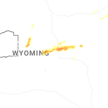
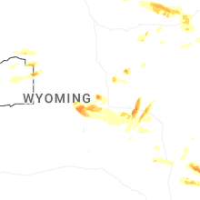


Connect with Interactive Hail Maps