

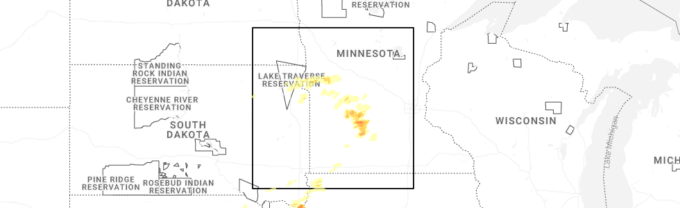
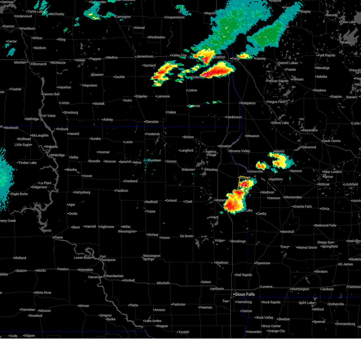
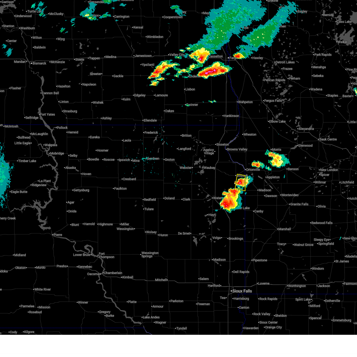
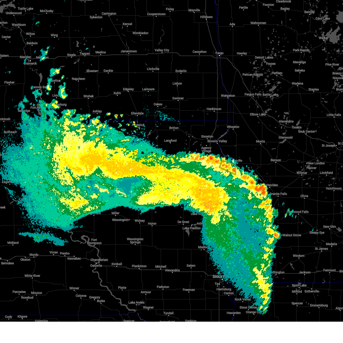
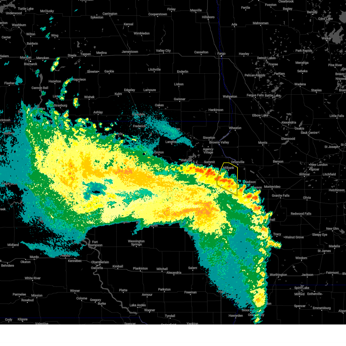
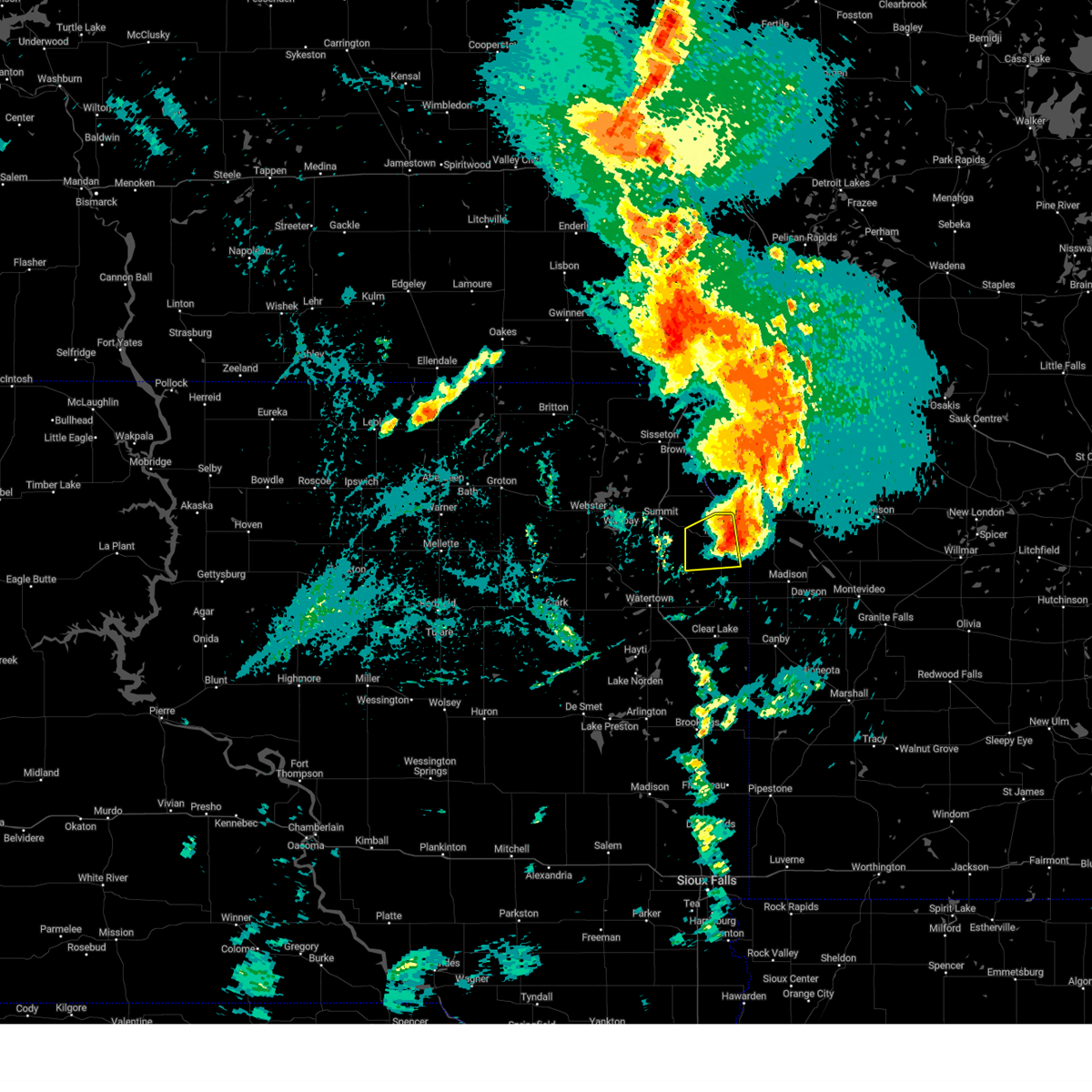
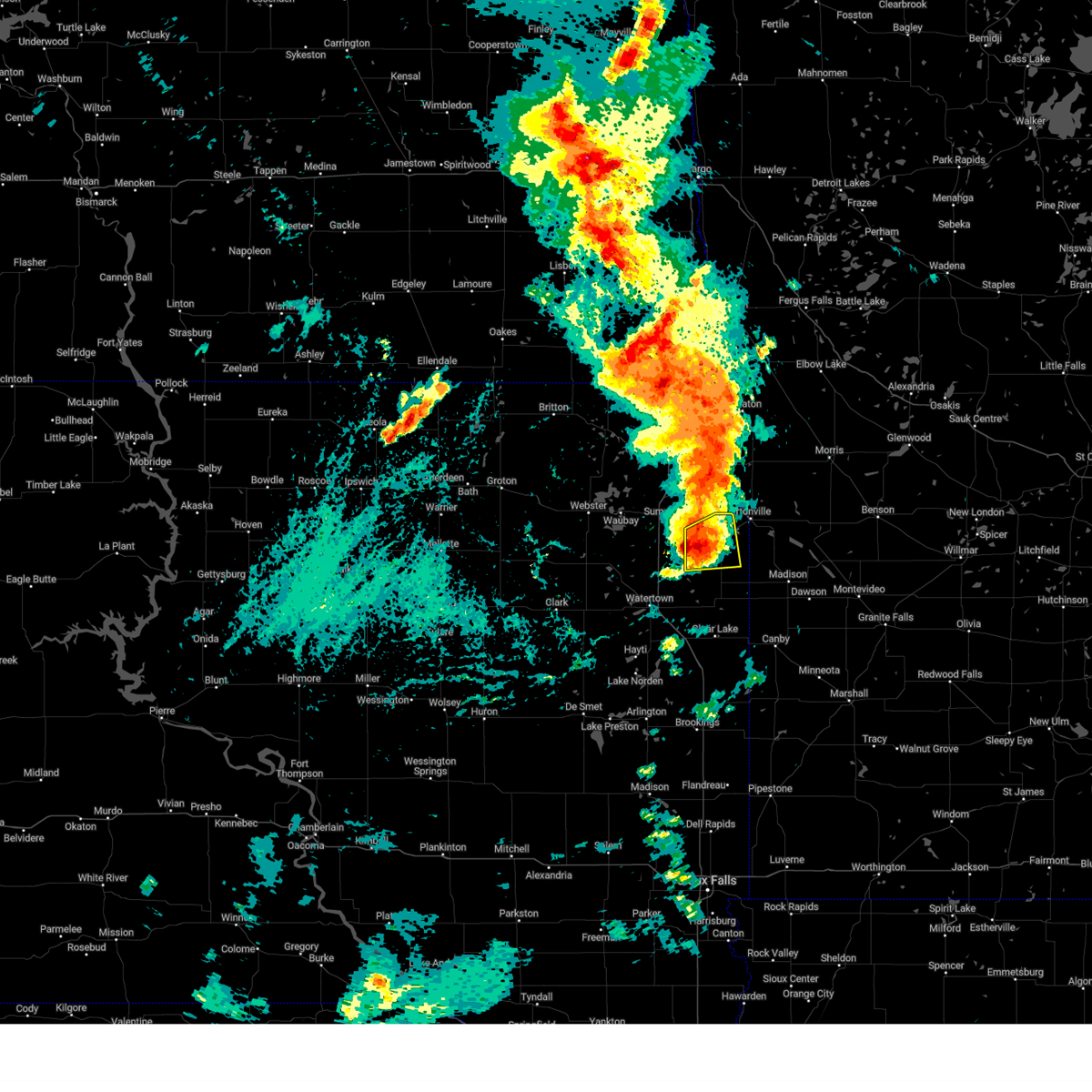
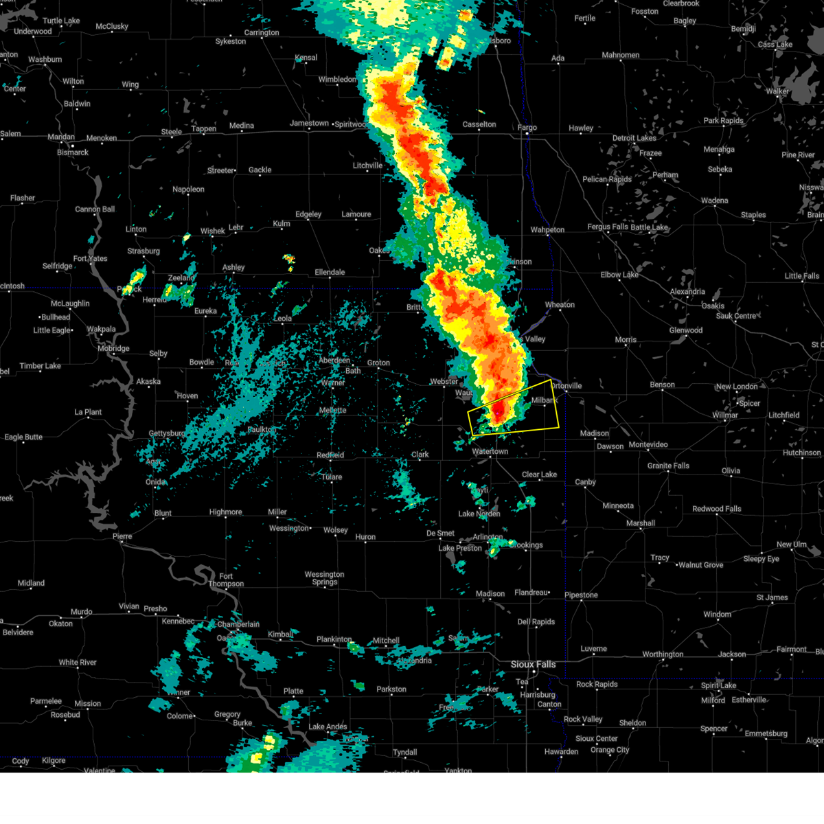
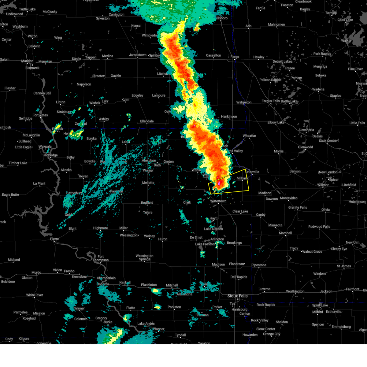
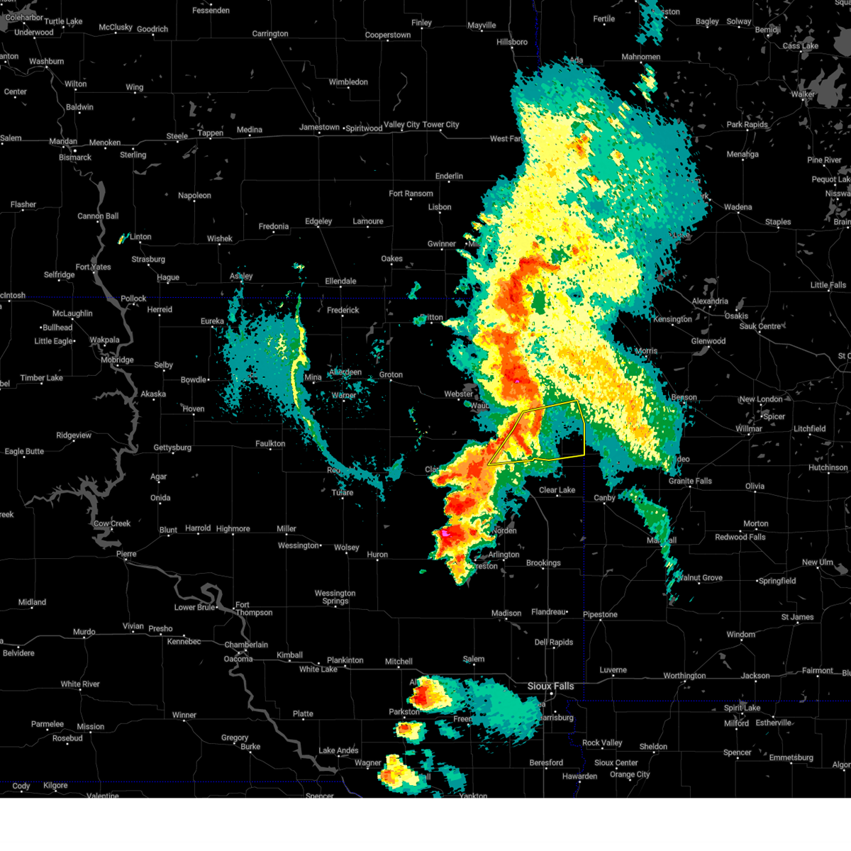
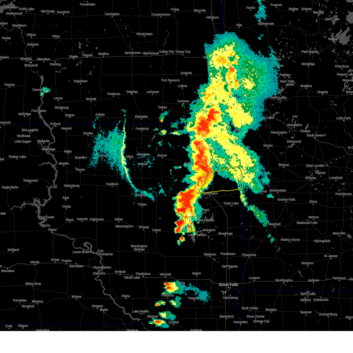
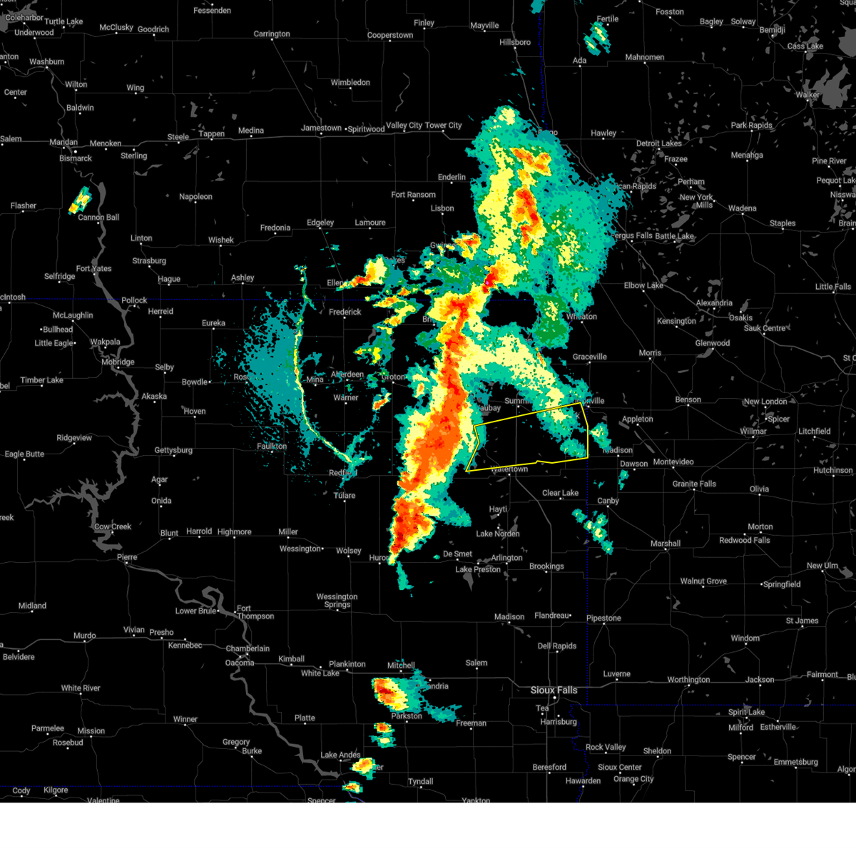
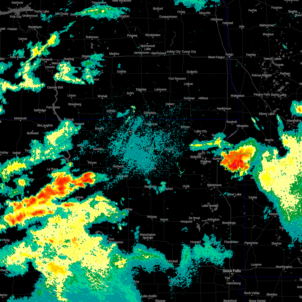
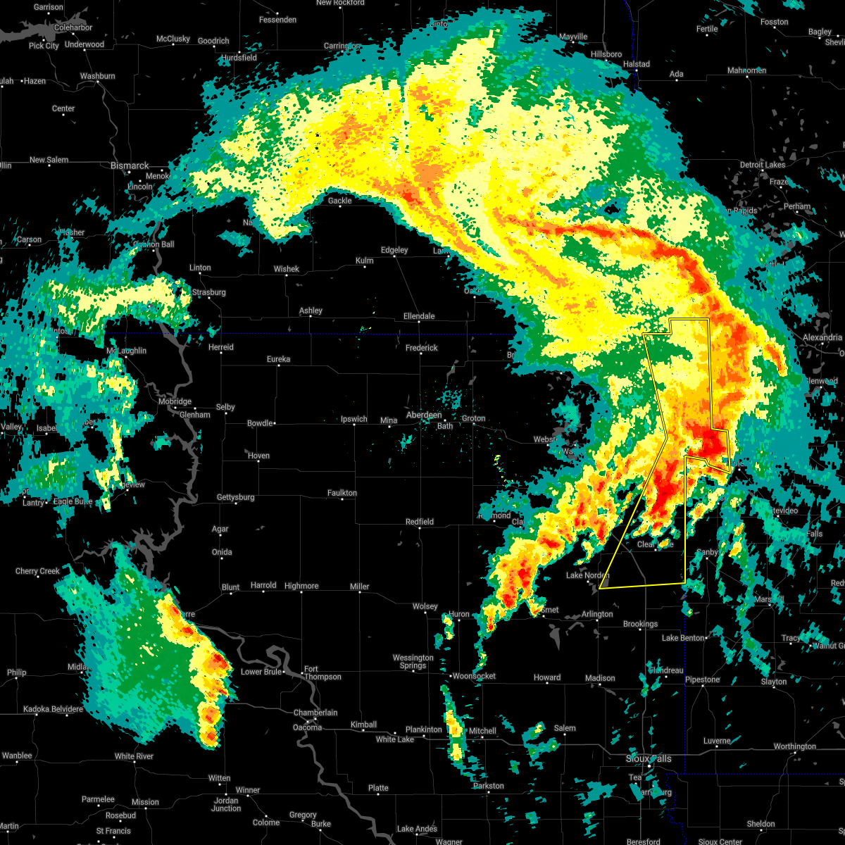
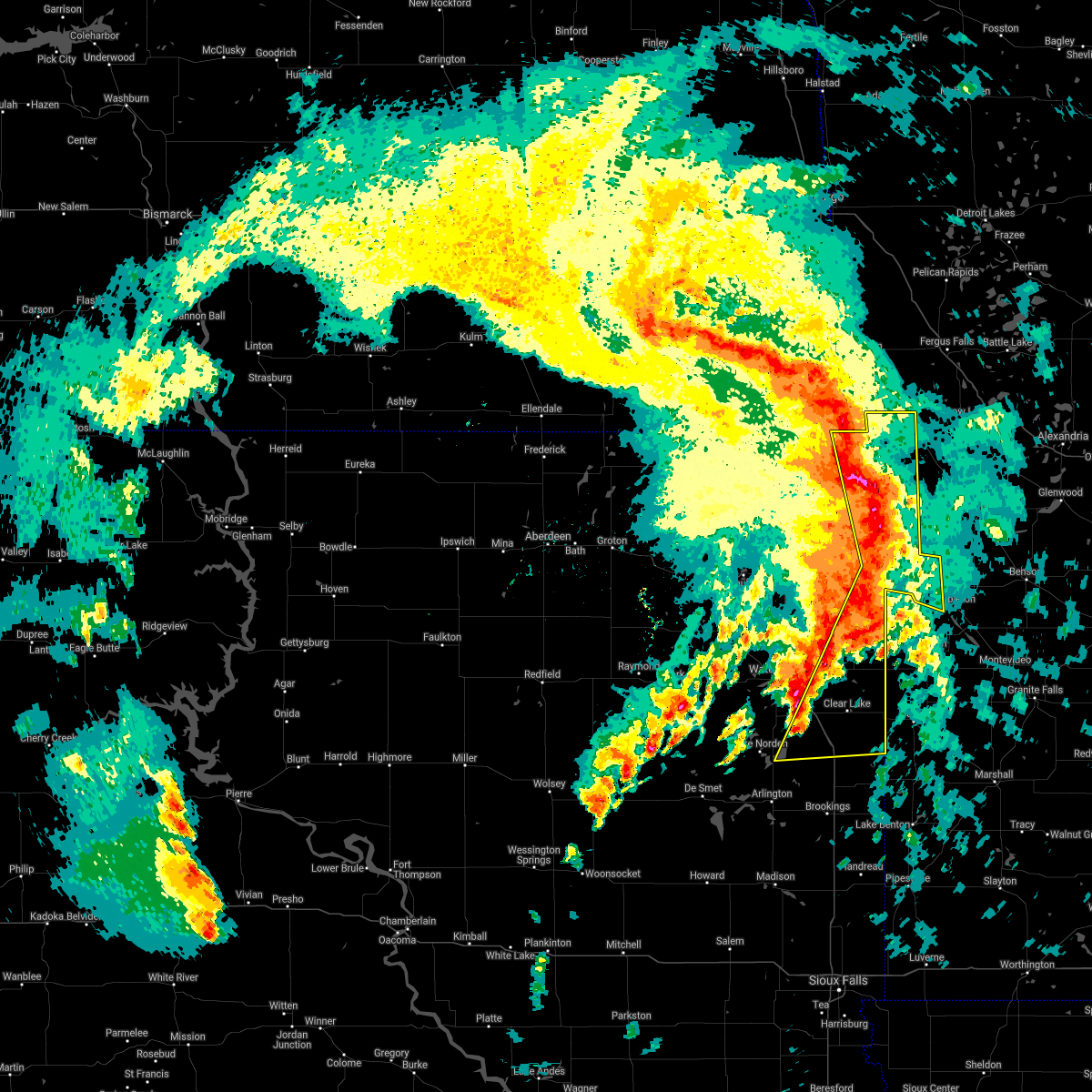
Hail Map for Milbank, SD
The Milbank, SD area has had 15 reports of on-the-ground hail by trained spotters, and has been under severe weather warnings 13 times during the past 12 months. Doppler radar has detected hail at or near Milbank, SD on 46 occasions, including 5 occasions during the past year.
| Name: | Milbank, SD |
| Where Located: | 48.1 miles WNW of Montevideo, MN |
| Map: | Google Map for Milbank, SD |
| Population: | 3353 |
| Housing Units: | 1683 |
| More Info: | Search Google for Milbank, SD |
1
The Top Recent Hail Date for Milbank, SD is Monday, June 2, 2025 (6th out of 46)
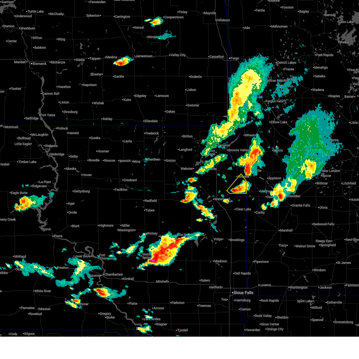
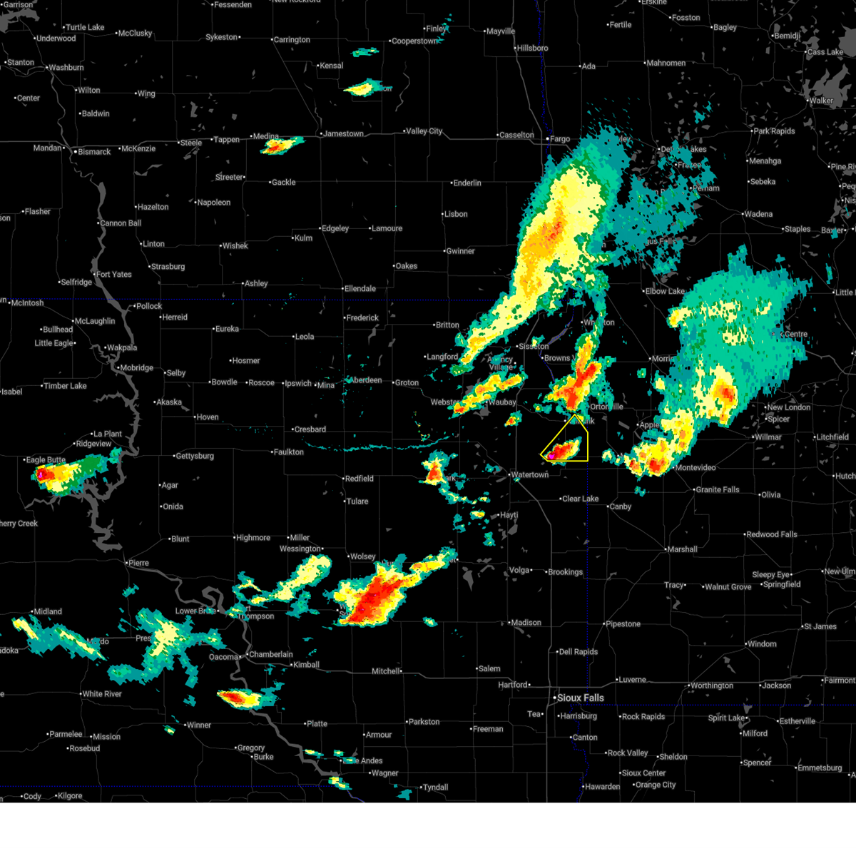
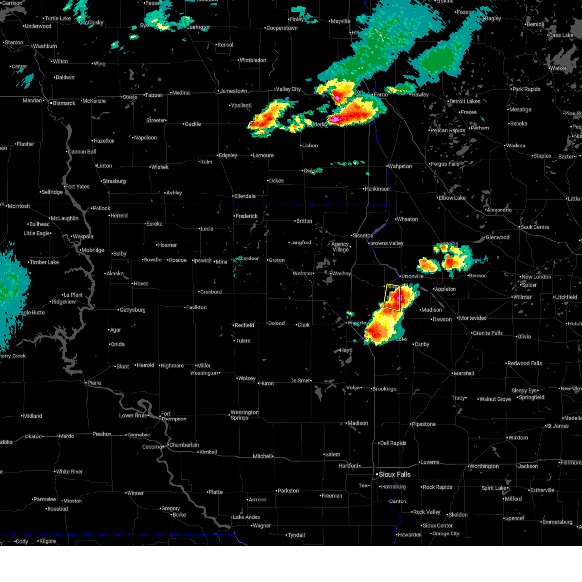
Hail and Wind Damage Spotted near Milbank, SD
| Date / Time | Report Details |
|---|---|
| 7/7/2025 3:34 PM CDT |
 the severe thunderstorm warning has been cancelled and is no longer in effect the severe thunderstorm warning has been cancelled and is no longer in effect
|
| 7/7/2025 3:12 PM CDT |
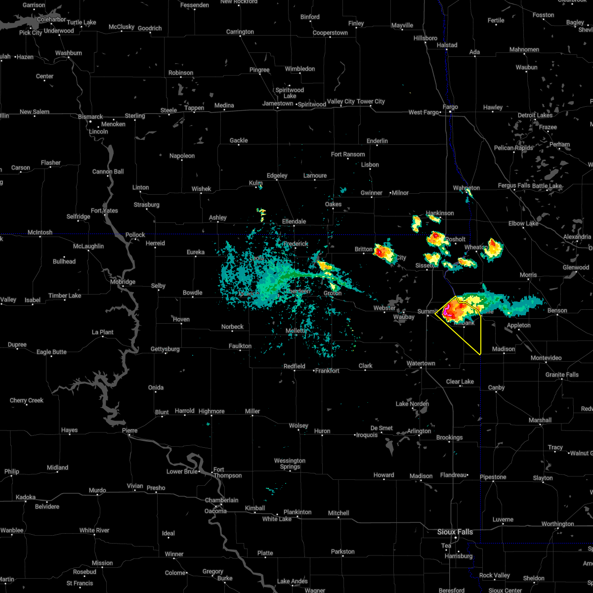
 Svrabr the national weather service in aberdeen has issued a * severe thunderstorm warning for, southeastern grant county in northeastern south dakota, * until 400 pm cdt. * at 312 pm cdt, a severe thunderstorm was located over strandburg, or 14 miles south of milbank, moving northeast at 15 mph (radar indicated). Hazards include 60 mph wind gusts and quarter size hail. Hail damage to vehicles is expected. expect wind damage to roofs, siding, and trees. this severe thunderstorm will be near, strandburg and la bolt around 315 pm cdt. Revillo and albee around 325 pm cdt. Svrabr the national weather service in aberdeen has issued a * severe thunderstorm warning for, southeastern grant county in northeastern south dakota, * until 400 pm cdt. * at 312 pm cdt, a severe thunderstorm was located over strandburg, or 14 miles south of milbank, moving northeast at 15 mph (radar indicated). Hazards include 60 mph wind gusts and quarter size hail. Hail damage to vehicles is expected. expect wind damage to roofs, siding, and trees. this severe thunderstorm will be near, strandburg and la bolt around 315 pm cdt. Revillo and albee around 325 pm cdt.
|
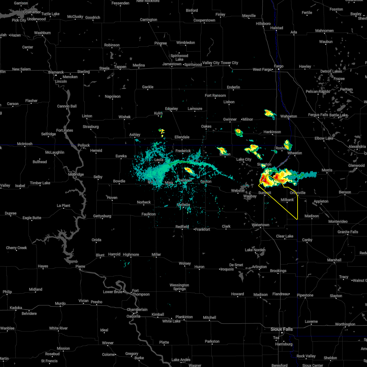
| 6/28/2025 6:48 PM CDT |
 At 647 pm cdt, a severe thunderstorm was located near bellingham, or 13 miles south of ortonville, moving east at 20 mph (radar indicated). Hazards include golf ball size hail and 60 mph wind gusts. People and animals outdoors will be injured. expect hail damage to roofs, siding, windows, and vehicles. expect wind damage to roofs, siding, and trees. Locations impacted include, milbank and albee. At 647 pm cdt, a severe thunderstorm was located near bellingham, or 13 miles south of ortonville, moving east at 20 mph (radar indicated). Hazards include golf ball size hail and 60 mph wind gusts. People and animals outdoors will be injured. expect hail damage to roofs, siding, windows, and vehicles. expect wind damage to roofs, siding, and trees. Locations impacted include, milbank and albee.
|
| 6/28/2025 6:35 PM CDT |
 At 635 pm cdt, a severe thunderstorm was located near albee, or 11 miles southeast of milbank, moving east at 20 mph (radar indicated). Hazards include ping pong ball size hail and 60 mph wind gusts. People and animals outdoors will be injured. expect hail damage to roofs, siding, windows, and vehicles. expect wind damage to roofs, siding, and trees. Locations impacted include, milbank and albee. At 635 pm cdt, a severe thunderstorm was located near albee, or 11 miles southeast of milbank, moving east at 20 mph (radar indicated). Hazards include ping pong ball size hail and 60 mph wind gusts. People and animals outdoors will be injured. expect hail damage to roofs, siding, windows, and vehicles. expect wind damage to roofs, siding, and trees. Locations impacted include, milbank and albee.
|
| 6/28/2025 6:30 PM CDT |
 Svrabr the national weather service in aberdeen has issued a * severe thunderstorm warning for, southeastern grant county in northeastern south dakota, * until 715 pm cdt. * at 630 pm cdt, a severe thunderstorm was located near albee, or 10 miles southeast of milbank, moving east at 20 mph (radar indicated). Hazards include 60 mph wind gusts and quarter size hail. Hail damage to vehicles is expected. expect wind damage to roofs, siding, and trees. This severe thunderstorm will remain over mainly rural areas of southeastern grant county. Svrabr the national weather service in aberdeen has issued a * severe thunderstorm warning for, southeastern grant county in northeastern south dakota, * until 715 pm cdt. * at 630 pm cdt, a severe thunderstorm was located near albee, or 10 miles southeast of milbank, moving east at 20 mph (radar indicated). Hazards include 60 mph wind gusts and quarter size hail. Hail damage to vehicles is expected. expect wind damage to roofs, siding, and trees. This severe thunderstorm will remain over mainly rural areas of southeastern grant county.
|
| 5/15/2025 4:32 AM CDT |
 At 431 am cdt, a severe thunderstorm was located near big stone city, moving north at 45 mph (radar indicated). Hazards include 60 mph wind gusts and penny size hail. Expect damage to roofs, siding, and trees. This severe thunderstorm will remain over mainly rural areas of northeastern grant county. At 431 am cdt, a severe thunderstorm was located near big stone city, moving north at 45 mph (radar indicated). Hazards include 60 mph wind gusts and penny size hail. Expect damage to roofs, siding, and trees. This severe thunderstorm will remain over mainly rural areas of northeastern grant county.
|
| 5/15/2025 4:32 AM CDT |
 the severe thunderstorm warning has been cancelled and is no longer in effect the severe thunderstorm warning has been cancelled and is no longer in effect
|
| 5/15/2025 4:11 AM CDT |
 Svrabr the national weather service in aberdeen has issued a * severe thunderstorm warning for, northeastern deuel county in northeastern south dakota, grant county in northeastern south dakota, * until 445 am cdt. * at 410 am cdt, a severe thunderstorm was located over revillo, or 13 miles south of milbank, moving northeast at 45 mph (radar indicated). Hazards include 60 mph wind gusts and penny size hail. Expect damage to roofs, siding, and trees. This severe thunderstorm will be near, albee around 415 am cdt. Svrabr the national weather service in aberdeen has issued a * severe thunderstorm warning for, northeastern deuel county in northeastern south dakota, grant county in northeastern south dakota, * until 445 am cdt. * at 410 am cdt, a severe thunderstorm was located over revillo, or 13 miles south of milbank, moving northeast at 45 mph (radar indicated). Hazards include 60 mph wind gusts and penny size hail. Expect damage to roofs, siding, and trees. This severe thunderstorm will be near, albee around 415 am cdt.
|
| 7/31/2024 1:07 PM CDT |
 The storm which prompted the warning has weakened below severe limits, and no longer poses an immediate threat to life or property. therefore, the warning will be allowed to expire. however, small hail and gusty winds are still possible with this thunderstorm. a severe thunderstorm watch remains in effect until 700 pm cdt for northeastern south dakota. The storm which prompted the warning has weakened below severe limits, and no longer poses an immediate threat to life or property. therefore, the warning will be allowed to expire. however, small hail and gusty winds are still possible with this thunderstorm. a severe thunderstorm watch remains in effect until 700 pm cdt for northeastern south dakota.
|
| 7/31/2024 12:47 PM CDT |
 At 1246 pm cdt, a severe thunderstorm was located over twin brooks, or near milbank, moving east at 30 mph (radar indicated). Hazards include 60 mph wind gusts and quarter size hail. Hail damage to vehicles is expected. expect wind damage to roofs, siding, and trees. Locations impacted include, milbank. At 1246 pm cdt, a severe thunderstorm was located over twin brooks, or near milbank, moving east at 30 mph (radar indicated). Hazards include 60 mph wind gusts and quarter size hail. Hail damage to vehicles is expected. expect wind damage to roofs, siding, and trees. Locations impacted include, milbank.
|
| 7/31/2024 12:47 PM CDT |
 the severe thunderstorm warning has been cancelled and is no longer in effect the severe thunderstorm warning has been cancelled and is no longer in effect
|
| 7/31/2024 12:20 PM CDT |
 At 1220 pm cdt, a severe thunderstorm was located 7 miles southwest of marvin, or 16 miles southeast of waubay, moving east at 25 mph (radar indicated). Hazards include ping pong ball size hail and 60 mph wind gusts. People and animals outdoors will be injured. expect hail damage to roofs, siding, windows, and vehicles. expect wind damage to roofs, siding, and trees. this severe storm will be near, marvin around 1225 pm cdt. twin brooks around 1235 pm cdt. Other locations in the path of this severe thunderstorm include milbank. At 1220 pm cdt, a severe thunderstorm was located 7 miles southwest of marvin, or 16 miles southeast of waubay, moving east at 25 mph (radar indicated). Hazards include ping pong ball size hail and 60 mph wind gusts. People and animals outdoors will be injured. expect hail damage to roofs, siding, windows, and vehicles. expect wind damage to roofs, siding, and trees. this severe storm will be near, marvin around 1225 pm cdt. twin brooks around 1235 pm cdt. Other locations in the path of this severe thunderstorm include milbank.
|
| 7/31/2024 12:18 PM CDT |
 Svrabr the national weather service in aberdeen has issued a * severe thunderstorm warning for, southeastern roberts county in northeastern south dakota, southeastern day county in northeastern south dakota, central grant county in northeastern south dakota, northeastern codington county in northeastern south dakota, * until 115 pm cdt. * at 1217 pm cdt, a severe thunderstorm was located 8 miles south of summit, or 15 miles southeast of waubay, moving east at 25 mph (radar indicated). Hazards include 60 mph wind gusts and quarter size hail. Hail damage to vehicles is expected. expect wind damage to roofs, siding, and trees. this severe thunderstorm will be near, marvin around 1225 pm cdt. twin brooks around 1235 pm cdt. Other locations in the path of this severe thunderstorm include milbank. Svrabr the national weather service in aberdeen has issued a * severe thunderstorm warning for, southeastern roberts county in northeastern south dakota, southeastern day county in northeastern south dakota, central grant county in northeastern south dakota, northeastern codington county in northeastern south dakota, * until 115 pm cdt. * at 1217 pm cdt, a severe thunderstorm was located 8 miles south of summit, or 15 miles southeast of waubay, moving east at 25 mph (radar indicated). Hazards include 60 mph wind gusts and quarter size hail. Hail damage to vehicles is expected. expect wind damage to roofs, siding, and trees. this severe thunderstorm will be near, marvin around 1225 pm cdt. twin brooks around 1235 pm cdt. Other locations in the path of this severe thunderstorm include milbank.
|
| 8/10/2023 7:40 PM CDT |
 At 740 pm cdt, severe thunderstorms were located along a line extending from near corona to near milbank to strandburg, moving east at 45 mph (radar indicated). Hazards include 60 mph wind gusts and nickel size hail. Expect damage to roofs, siding, and trees. locations impacted include, watertown, milbank, rauville, south shore, waverly, revillo, stockholm, strandburg, twin brooks, la bolt, troy, marvin, albee, dakota sioux casino and lake kampeska. hail threat, radar indicated max hail size, 0. 88 in wind threat, radar indicated max wind gust, 60 mph. At 740 pm cdt, severe thunderstorms were located along a line extending from near corona to near milbank to strandburg, moving east at 45 mph (radar indicated). Hazards include 60 mph wind gusts and nickel size hail. Expect damage to roofs, siding, and trees. locations impacted include, watertown, milbank, rauville, south shore, waverly, revillo, stockholm, strandburg, twin brooks, la bolt, troy, marvin, albee, dakota sioux casino and lake kampeska. hail threat, radar indicated max hail size, 0. 88 in wind threat, radar indicated max wind gust, 60 mph.
|
| 8/10/2023 7:20 PM CDT |
 At 719 pm cdt, severe thunderstorms were located along a line extending from near marvin to near south shore to near waverly, moving east at 45 mph (radar indicated). Hazards include 60 mph wind gusts and nickel size hail. Expect damage to roofs, siding, and trees. locations impacted include, twin brooks, troy, stockholm, strandburg, milbank, la bolt, revillo and albee. hail threat, radar indicated max hail size, 0. 88 in wind threat, radar indicated max wind gust, 60 mph. At 719 pm cdt, severe thunderstorms were located along a line extending from near marvin to near south shore to near waverly, moving east at 45 mph (radar indicated). Hazards include 60 mph wind gusts and nickel size hail. Expect damage to roofs, siding, and trees. locations impacted include, twin brooks, troy, stockholm, strandburg, milbank, la bolt, revillo and albee. hail threat, radar indicated max hail size, 0. 88 in wind threat, radar indicated max wind gust, 60 mph.
|
| 8/10/2023 6:57 PM CDT |
 At 656 pm cdt, severe thunderstorms were located along a line extending from near bitter lake to near florence to medicine lake, moving east at 45 mph (radar indicated). Hazards include 60 mph wind gusts and nickel size hail. Expect damage to roofs, siding, and trees. severe thunderstorms will be near, watertown around 705 pm cdt. rauville and dakota sioux casino around 710 pm cdt. south shore around 715 pm cdt. other locations in the path of these severe thunderstorms include waverly, marvin, stockholm, twin brooks, troy, strandburg, milbank and la bolt. hail threat, radar indicated max hail size, 0. 88 in wind threat, radar indicated max wind gust, 60 mph. At 656 pm cdt, severe thunderstorms were located along a line extending from near bitter lake to near florence to medicine lake, moving east at 45 mph (radar indicated). Hazards include 60 mph wind gusts and nickel size hail. Expect damage to roofs, siding, and trees. severe thunderstorms will be near, watertown around 705 pm cdt. rauville and dakota sioux casino around 710 pm cdt. south shore around 715 pm cdt. other locations in the path of these severe thunderstorms include waverly, marvin, stockholm, twin brooks, troy, strandburg, milbank and la bolt. hail threat, radar indicated max hail size, 0. 88 in wind threat, radar indicated max wind gust, 60 mph.
|
| 8/6/2022 1:01 AM CDT |
 At 100 am cdt, a severe thunderstorm was located near big stone city, moving east at 20 mph (radar indicated). Hazards include 60 mph wind gusts and quarter size hail. Hail damage to vehicles is expected. expect wind damage to roofs, siding, and trees. locations impacted include, milbank, ortonville, big stone city, twin brooks, lagoona beach and big stone lake. hail threat, radar indicated max hail size, 1. 00 in wind threat, radar indicated max wind gust, 60 mph. At 100 am cdt, a severe thunderstorm was located near big stone city, moving east at 20 mph (radar indicated). Hazards include 60 mph wind gusts and quarter size hail. Hail damage to vehicles is expected. expect wind damage to roofs, siding, and trees. locations impacted include, milbank, ortonville, big stone city, twin brooks, lagoona beach and big stone lake. hail threat, radar indicated max hail size, 1. 00 in wind threat, radar indicated max wind gust, 60 mph.
|
| 8/6/2022 12:42 AM CDT |
 At 1241 am cdt, a severe thunderstorm was located near milbank, moving east at 30 mph (trained weather spotters. at 12:24 am, a 58 mph wind gust was measured 2 miles west of corona). Hazards include 60 mph wind gusts and quarter size hail. Hail damage to vehicles is expected. expect wind damage to roofs, siding, and trees. locations impacted include, lagoona beach, ortonville and big stone city. hail threat, radar indicated max hail size, 1. 00 in wind threat, observed max wind gust, 60 mph. At 1241 am cdt, a severe thunderstorm was located near milbank, moving east at 30 mph (trained weather spotters. at 12:24 am, a 58 mph wind gust was measured 2 miles west of corona). Hazards include 60 mph wind gusts and quarter size hail. Hail damage to vehicles is expected. expect wind damage to roofs, siding, and trees. locations impacted include, lagoona beach, ortonville and big stone city. hail threat, radar indicated max hail size, 1. 00 in wind threat, observed max wind gust, 60 mph.
|
| 8/6/2022 12:11 AM CDT |
 At 1211 am cdt, a severe thunderstorm was located over marvin, or 8 miles southwest of wilmot, moving east at 30 mph (radar indicated). Hazards include 60 mph wind gusts and quarter size hail. Hail damage to vehicles is expected. expect wind damage to roofs, siding, and trees. this severe thunderstorm will be near, corona and twin brooks around 1225 am cdt. other locations in the path of this severe thunderstorm include milbank, lagoona beach, big stone city and ortonville. hail threat, radar indicated max hail size, 1. 00 in wind threat, radar indicated max wind gust, 60 mph. At 1211 am cdt, a severe thunderstorm was located over marvin, or 8 miles southwest of wilmot, moving east at 30 mph (radar indicated). Hazards include 60 mph wind gusts and quarter size hail. Hail damage to vehicles is expected. expect wind damage to roofs, siding, and trees. this severe thunderstorm will be near, corona and twin brooks around 1225 am cdt. other locations in the path of this severe thunderstorm include milbank, lagoona beach, big stone city and ortonville. hail threat, radar indicated max hail size, 1. 00 in wind threat, radar indicated max wind gust, 60 mph.
|
| 7/23/2022 8:33 AM CDT |
 At 829 am cdt, severe thunderstorms were located along a line extending from near lismore colony to near stockholm to near kranzburg to near thomas, moving southeast at 60 mph (radar indicated). Hazards include 70 mph wind gusts and penny size hail. Expect considerable tree damage. damage is likely to mobile homes, roofs, and outbuildings. locations impacted include, goodwin, la bolt, lagoona beach, bullhead lake, ortonville, big stone city, revillo, altamont, albee, tunerville, lake alice, clear lake, stone bridge, moritz, lake poinsett, claremont colony, lake albert, gary, odessa, brandt, dempster, poinsett colony, artichoke lake, estelline, correll and lake cochrane rec area. thunderstorm damage threat, considerable hail threat, radar indicated max hail size, 0. 75 in wind threat, observed max wind gust, 70 mph. At 829 am cdt, severe thunderstorms were located along a line extending from near lismore colony to near stockholm to near kranzburg to near thomas, moving southeast at 60 mph (radar indicated). Hazards include 70 mph wind gusts and penny size hail. Expect considerable tree damage. damage is likely to mobile homes, roofs, and outbuildings. locations impacted include, goodwin, la bolt, lagoona beach, bullhead lake, ortonville, big stone city, revillo, altamont, albee, tunerville, lake alice, clear lake, stone bridge, moritz, lake poinsett, claremont colony, lake albert, gary, odessa, brandt, dempster, poinsett colony, artichoke lake, estelline, correll and lake cochrane rec area. thunderstorm damage threat, considerable hail threat, radar indicated max hail size, 0. 75 in wind threat, observed max wind gust, 70 mph.
|
| 7/23/2022 7:59 AM CDT |
 At 759 am cdt, severe thunderstorms were located along a line extending from near browns valley to garden city, moving southeast at 40 mph (radar indicated). Hazards include 60 mph wind gusts and penny size hail. Expect damage to roofs, siding, and trees. severe thunderstorms will be near, browns valley, lake traverse housing units and peever flats housing around 805 am cdt. long lake around 810 am cdt. beardsley, yankeetown and tinkertown around 815 am cdt. other locations in the path of these severe thunderstorms include hazel, bonanza grove, barry, goose lake, big stone lake, lismore colony, thomas, kellerton church, big stone colony, clinton, hamlin education center, hayti and lagoona beach. hail threat, radar indicated max hail size, 0. 75 in wind threat, radar indicated max wind gust, 60 mph. At 759 am cdt, severe thunderstorms were located along a line extending from near browns valley to garden city, moving southeast at 40 mph (radar indicated). Hazards include 60 mph wind gusts and penny size hail. Expect damage to roofs, siding, and trees. severe thunderstorms will be near, browns valley, lake traverse housing units and peever flats housing around 805 am cdt. long lake around 810 am cdt. beardsley, yankeetown and tinkertown around 815 am cdt. other locations in the path of these severe thunderstorms include hazel, bonanza grove, barry, goose lake, big stone lake, lismore colony, thomas, kellerton church, big stone colony, clinton, hamlin education center, hayti and lagoona beach. hail threat, radar indicated max hail size, 0. 75 in wind threat, radar indicated max wind gust, 60 mph.
|
| 7/20/2022 8:59 PM CDT |
 At 858 pm cdt, a severe thunderstorm was located over milbank, moving southeast at 45 mph (radar indicated). Hazards include 60 mph wind gusts and nickel size hail. Expect damage to roofs, siding, and trees. this severe thunderstorm will remain over mainly rural areas of northeastern grant county. hail threat, radar indicated max hail size, 0. 88 in wind threat, radar indicated max wind gust, 60 mph. At 858 pm cdt, a severe thunderstorm was located over milbank, moving southeast at 45 mph (radar indicated). Hazards include 60 mph wind gusts and nickel size hail. Expect damage to roofs, siding, and trees. this severe thunderstorm will remain over mainly rural areas of northeastern grant county. hail threat, radar indicated max hail size, 0. 88 in wind threat, radar indicated max wind gust, 60 mph.
|
| 7/20/2022 8:47 PM CDT |
 At 846 pm cdt, a severe thunderstorm was located over corona, or 9 miles northwest of milbank, moving southeast at 45 mph (trained weather spotters. at 741 pm cdt, one inch hail was reported 5 miles west of corona). Hazards include 60 mph wind gusts and half dollar size hail. Hail damage to vehicles is expected. expect wind damage to roofs, siding, and trees. this severe storm will be near, twin brooks around 850 pm cdt. other locations in the path of this severe thunderstorm include milbank. hail threat, observed max hail size, 1. 25 in wind threat, radar indicated max wind gust, 60 mph. At 846 pm cdt, a severe thunderstorm was located over corona, or 9 miles northwest of milbank, moving southeast at 45 mph (trained weather spotters. at 741 pm cdt, one inch hail was reported 5 miles west of corona). Hazards include 60 mph wind gusts and half dollar size hail. Hail damage to vehicles is expected. expect wind damage to roofs, siding, and trees. this severe storm will be near, twin brooks around 850 pm cdt. other locations in the path of this severe thunderstorm include milbank. hail threat, observed max hail size, 1. 25 in wind threat, radar indicated max wind gust, 60 mph.
|
| 7/20/2022 8:39 PM CDT |
 At 839 pm cdt, a severe thunderstorm was located near wilmot, or 14 miles northwest of milbank, moving southeast at 45 mph (radar indicated). Hazards include golf ball size hail and 60 mph wind gusts. People and animals outdoors will be injured. expect hail damage to roofs, siding, windows, and vehicles. expect wind damage to roofs, siding, and trees. this severe storm will be near, corona around 845 pm cdt. other locations in the path of this severe thunderstorm include twin brooks and milbank. thunderstorm damage threat, considerable hail threat, radar indicated max hail size, 1. 75 in wind threat, radar indicated max wind gust, 60 mph. At 839 pm cdt, a severe thunderstorm was located near wilmot, or 14 miles northwest of milbank, moving southeast at 45 mph (radar indicated). Hazards include golf ball size hail and 60 mph wind gusts. People and animals outdoors will be injured. expect hail damage to roofs, siding, windows, and vehicles. expect wind damage to roofs, siding, and trees. this severe storm will be near, corona around 845 pm cdt. other locations in the path of this severe thunderstorm include twin brooks and milbank. thunderstorm damage threat, considerable hail threat, radar indicated max hail size, 1. 75 in wind threat, radar indicated max wind gust, 60 mph.
|
| 7/20/2022 8:26 PM CDT |
 At 826 pm cdt, a severe thunderstorm was located near finley heights housing, or 16 miles south of sisseton, moving southeast at 45 mph (radar indicated). Hazards include golf ball size hail and 60 mph wind gusts. People and animals outdoors will be injured. expect hail damage to roofs, siding, windows, and vehicles. expect wind damage to roofs, siding, and trees. this severe thunderstorm will be near, wilmot around 835 pm cdt. corona around 840 pm cdt. other locations in the path of this severe thunderstorm include twin brooks and milbank. thunderstorm damage threat, considerable hail threat, radar indicated max hail size, 1. 75 in wind threat, radar indicated max wind gust, 60 mph. At 826 pm cdt, a severe thunderstorm was located near finley heights housing, or 16 miles south of sisseton, moving southeast at 45 mph (radar indicated). Hazards include golf ball size hail and 60 mph wind gusts. People and animals outdoors will be injured. expect hail damage to roofs, siding, windows, and vehicles. expect wind damage to roofs, siding, and trees. this severe thunderstorm will be near, wilmot around 835 pm cdt. corona around 840 pm cdt. other locations in the path of this severe thunderstorm include twin brooks and milbank. thunderstorm damage threat, considerable hail threat, radar indicated max hail size, 1. 75 in wind threat, radar indicated max wind gust, 60 mph.
|
| 6/25/2022 12:07 AM CDT |
 At 1207 am cdt, severe thunderstorms were located along a line extending from near stockholm to near altamont to near estelline, moving east at 45 mph (radar indicated). Hazards include 60 mph wind gusts. Expect damage to roofs, siding, and trees. these severe storms will be near, clear lake, la bolt, altamont and tunerville around 1210 am cdt. other locations in the path of these severe thunderstorms include lake alice, revillo, albee, moritz, gary, lake cochrane rec area, toronto and astoria. hail threat, radar indicated max hail size, <. 75 in wind threat, observed max wind gust, 60 mph. At 1207 am cdt, severe thunderstorms were located along a line extending from near stockholm to near altamont to near estelline, moving east at 45 mph (radar indicated). Hazards include 60 mph wind gusts. Expect damage to roofs, siding, and trees. these severe storms will be near, clear lake, la bolt, altamont and tunerville around 1210 am cdt. other locations in the path of these severe thunderstorms include lake alice, revillo, albee, moritz, gary, lake cochrane rec area, toronto and astoria. hail threat, radar indicated max hail size, <. 75 in wind threat, observed max wind gust, 60 mph.
|
| 6/24/2022 11:51 PM CDT |
 At 1150 pm cdt, severe thunderstorms were located along a line extending from south shore to near kranzburg to lake albert, moving east at 45 mph (radar indicated). Hazards include 60 mph wind gusts. Expect damage to roofs, siding, and trees. these severe storms will be near, south shore, kranzburg, goodwin and troy around 1155 pm cdt. other locations in the path of these severe thunderstorms include stockholm, twin brooks, school lake, bullhead lake, strandburg, dempster, clear lake, estelline, la bolt, altamont, lake alice, tunerville, poinsett colony, revillo, albee, moritz, gary, toronto and astoria. hail threat, radar indicated max hail size, <. 75 in wind threat, observed max wind gust, 60 mph. At 1150 pm cdt, severe thunderstorms were located along a line extending from south shore to near kranzburg to lake albert, moving east at 45 mph (radar indicated). Hazards include 60 mph wind gusts. Expect damage to roofs, siding, and trees. these severe storms will be near, south shore, kranzburg, goodwin and troy around 1155 pm cdt. other locations in the path of these severe thunderstorms include stockholm, twin brooks, school lake, bullhead lake, strandburg, dempster, clear lake, estelline, la bolt, altamont, lake alice, tunerville, poinsett colony, revillo, albee, moritz, gary, toronto and astoria. hail threat, radar indicated max hail size, <. 75 in wind threat, observed max wind gust, 60 mph.
|
| 6/24/2022 11:38 PM CDT |
 At 1138 pm cdt, severe thunderstorms were located along a line extending from 7 miles west of south shore to near pelican lake to near lake norden, moving east at 45 mph (radar indicated). Hazards include 60 mph wind gusts. Expect damage to roofs, siding, and trees. severe thunderstorms will be near, castlewood and waverly around 1145 pm cdt. south shore, kranzburg and claremont colony around 1150 pm cdt. goodwin, troy, lake poinsett and stone bridge around 1155 pm cdt. other locations in the path of these severe thunderstorms include stockholm, strandburg, dempster, clear lake, estelline, la bolt, altamont, tunerville, lake alice, revillo, albee, moritz, gary and lake cochrane rec area. hail threat, radar indicated max hail size, <. 75 in wind threat, observed max wind gust, 60 mph. At 1138 pm cdt, severe thunderstorms were located along a line extending from 7 miles west of south shore to near pelican lake to near lake norden, moving east at 45 mph (radar indicated). Hazards include 60 mph wind gusts. Expect damage to roofs, siding, and trees. severe thunderstorms will be near, castlewood and waverly around 1145 pm cdt. south shore, kranzburg and claremont colony around 1150 pm cdt. goodwin, troy, lake poinsett and stone bridge around 1155 pm cdt. other locations in the path of these severe thunderstorms include stockholm, strandburg, dempster, clear lake, estelline, la bolt, altamont, tunerville, lake alice, revillo, albee, moritz, gary and lake cochrane rec area. hail threat, radar indicated max hail size, <. 75 in wind threat, observed max wind gust, 60 mph.
|
| 6/20/2022 10:40 PM CDT |
 At 1040 pm cdt, severe thunderstorms were located along a line extending from 6 miles north of new effington to near corona to near toronto, moving east at 50 mph (trained weather spotters). Hazards include 60 mph wind gusts. Expect damage to roofs, siding, and trees. Locations impacted include, milbank, brandt, lismore colony, big stone city, astoria, lagoona beach, ortonville, whiterock colony, odessa, artichoke, correll, artichoke lake, immanuel church, tintah and charlesville. At 1040 pm cdt, severe thunderstorms were located along a line extending from 6 miles north of new effington to near corona to near toronto, moving east at 50 mph (trained weather spotters). Hazards include 60 mph wind gusts. Expect damage to roofs, siding, and trees. Locations impacted include, milbank, brandt, lismore colony, big stone city, astoria, lagoona beach, ortonville, whiterock colony, odessa, artichoke, correll, artichoke lake, immanuel church, tintah and charlesville.
|
| 6/20/2022 10:20 PM CDT |
 At 1019 pm cdt, severe thunderstorms were located along a line extending from near veblen flats housing to near summit to near estelline, moving east at 50 mph (trained weather spotters). Hazards include 60 mph wind gusts. Expect damage to roofs, siding, and trees. severe thunderstorms will be near, toronto, brandt and marvin around 1030 pm cdt. wilmot and astoria around 1035 pm cdt. Other locations in the path of these severe thunderstorms include new effington, corona, twin brooks, victor, big stone lake, milbank, rosholt, lismore colony, big stone city, whiterock colony, lagoona beach, ortonville, odessa and immanuel church. At 1019 pm cdt, severe thunderstorms were located along a line extending from near veblen flats housing to near summit to near estelline, moving east at 50 mph (trained weather spotters). Hazards include 60 mph wind gusts. Expect damage to roofs, siding, and trees. severe thunderstorms will be near, toronto, brandt and marvin around 1030 pm cdt. wilmot and astoria around 1035 pm cdt. Other locations in the path of these severe thunderstorms include new effington, corona, twin brooks, victor, big stone lake, milbank, rosholt, lismore colony, big stone city, whiterock colony, lagoona beach, ortonville, odessa and immanuel church.
|
| 5/30/2022 3:14 PM CDT |
 At 314 pm cdt, a severe thunderstorm capable of producing a tornado was located near milbank, moving north at 60 mph (radar indicated rotation). Hazards include tornado. Flying debris will be dangerous to those caught without shelter. mobile homes will be damaged or destroyed. damage to roofs, windows, and vehicles will occur. tree damage is likely. this dangerous storm will be near, big stone city and corona around 325 pm cdt. lismore colony, big stone lake, lagoona beach and bonanza grove around 330 pm cdt. Other locations in the path of this tornadic thunderstorm include clinton, barry, big stone colony and graceville. At 314 pm cdt, a severe thunderstorm capable of producing a tornado was located near milbank, moving north at 60 mph (radar indicated rotation). Hazards include tornado. Flying debris will be dangerous to those caught without shelter. mobile homes will be damaged or destroyed. damage to roofs, windows, and vehicles will occur. tree damage is likely. this dangerous storm will be near, big stone city and corona around 325 pm cdt. lismore colony, big stone lake, lagoona beach and bonanza grove around 330 pm cdt. Other locations in the path of this tornadic thunderstorm include clinton, barry, big stone colony and graceville.
|
| 5/30/2022 2:55 PM CDT |
 At 255 pm cdt, a severe thunderstorm capable of producing a tornado was located near school lake, or 11 miles northwest of clear lake, moving northeast at 50 mph (radar indicated rotation). Hazards include tornado. Flying debris will be dangerous to those caught without shelter. mobile homes will be damaged or destroyed. damage to roofs, windows, and vehicles will occur. tree damage is likely. this dangerous storm will be near, strandburg around 305 pm cdt. revillo, stockholm, la bolt and albee around 310 pm cdt. Other locations in the path of this tornadic thunderstorm include milbank. At 255 pm cdt, a severe thunderstorm capable of producing a tornado was located near school lake, or 11 miles northwest of clear lake, moving northeast at 50 mph (radar indicated rotation). Hazards include tornado. Flying debris will be dangerous to those caught without shelter. mobile homes will be damaged or destroyed. damage to roofs, windows, and vehicles will occur. tree damage is likely. this dangerous storm will be near, strandburg around 305 pm cdt. revillo, stockholm, la bolt and albee around 310 pm cdt. Other locations in the path of this tornadic thunderstorm include milbank.
|
| 5/12/2022 6:37 PM CDT |
 The severe thunderstorm warning for northwestern deuel, southwestern roberts, day, southeastern brown, northern hamlin, grant, northern clark, northeastern spink and codington counties will expire at 645 pm cdt, the storms which prompted the warning have moved out of the area. therefore, the warning will be allowed to expire. a tornado watch remains in effect until 1000 pm cdt for northeastern south dakota. remember, severe thunderstorm and tornado warnings remains in effect for portions of brown, day, grant, and roberts counties. The severe thunderstorm warning for northwestern deuel, southwestern roberts, day, southeastern brown, northern hamlin, grant, northern clark, northeastern spink and codington counties will expire at 645 pm cdt, the storms which prompted the warning have moved out of the area. therefore, the warning will be allowed to expire. a tornado watch remains in effect until 1000 pm cdt for northeastern south dakota. remember, severe thunderstorm and tornado warnings remains in effect for portions of brown, day, grant, and roberts counties.
|
| 5/12/2022 6:24 PM CDT |
 At 623 pm cdt, severe thunderstorms capable of producing both tornadoes and extensive straight line wind damage were located along a line extending from near ortley to near milbank to near correll, moving north at 70 mph (radar indicated rotation). Hazards include tornado. Flying debris will be dangerous to those caught without shelter. mobile homes will be damaged or destroyed. damage to roofs, windows, and vehicles will occur. tree damage is likely. these dangerous storms will be near, ortonville and big stone city around 630 pm cdt. artichoke, rudebusch corner, artichoke lake, lismore colony, lagoona beach, finley heights housing and big stone lake around 635 pm cdt. clinton around 640 pm cdt. Other locations in the path of these tornadic storms include graceville, barry, big stone colony, agency village, sisseton, siloah country church, long hollow housing, collis, dakota connection & casino, sica hollow state park, dumont and lake traverse. At 623 pm cdt, severe thunderstorms capable of producing both tornadoes and extensive straight line wind damage were located along a line extending from near ortley to near milbank to near correll, moving north at 70 mph (radar indicated rotation). Hazards include tornado. Flying debris will be dangerous to those caught without shelter. mobile homes will be damaged or destroyed. damage to roofs, windows, and vehicles will occur. tree damage is likely. these dangerous storms will be near, ortonville and big stone city around 630 pm cdt. artichoke, rudebusch corner, artichoke lake, lismore colony, lagoona beach, finley heights housing and big stone lake around 635 pm cdt. clinton around 640 pm cdt. Other locations in the path of these tornadic storms include graceville, barry, big stone colony, agency village, sisseton, siloah country church, long hollow housing, collis, dakota connection & casino, sica hollow state park, dumont and lake traverse.
|
| 5/12/2022 6:17 PM CDT |
 At 616 pm cdt, severe thunderstorms were located along a line extending from bitter lake to near milbank to near correll, moving north at 75 mph. these are destructive storms for grant, roberts, big stone and traverse counties (trained weather spotters). Hazards include 80 mph wind gusts and penny size hail. Flying debris will be dangerous to those caught without shelter. mobile homes will be heavily damaged. expect considerable damage to roofs, windows, and vehicles. extensive tree damage and power outages are likely. severe thunderstorms will be near, correll around 620 pm cdt. big stone city, enemy swim lake, artichoke lake and rudebusch corner around 625 pm cdt. ortonville, artichoke, lagoona beach, lismore colony, big stone lake and finley heights housing around 630 pm cdt. clinton and agency village around 635 pm cdt. Other locations in the path of these severe thunderstorms include sisseton, graceville, barry, big stone colony, long hollow housing, sica hollow state park, dakota connection & casino, johnson, collis, trinity lutheran country church, siloah country church, dumont, claire city, wheaton and new effington. At 616 pm cdt, severe thunderstorms were located along a line extending from bitter lake to near milbank to near correll, moving north at 75 mph. these are destructive storms for grant, roberts, big stone and traverse counties (trained weather spotters). Hazards include 80 mph wind gusts and penny size hail. Flying debris will be dangerous to those caught without shelter. mobile homes will be heavily damaged. expect considerable damage to roofs, windows, and vehicles. extensive tree damage and power outages are likely. severe thunderstorms will be near, correll around 620 pm cdt. big stone city, enemy swim lake, artichoke lake and rudebusch corner around 625 pm cdt. ortonville, artichoke, lagoona beach, lismore colony, big stone lake and finley heights housing around 630 pm cdt. clinton and agency village around 635 pm cdt. Other locations in the path of these severe thunderstorms include sisseton, graceville, barry, big stone colony, long hollow housing, sica hollow state park, dakota connection & casino, johnson, collis, trinity lutheran country church, siloah country church, dumont, claire city, wheaton and new effington.
|
| 5/12/2022 6:15 PM CDT |
 At 615 pm cdt, a severe squall line capable of producing both tornadoes and extensive straight line wind damage was located along a line extending from near south shore to near la bolt to near albee, moving north at 65 mph (radar indicated rotation). Hazards include tornado and quarter size hail. Flying debris will be dangerous to those caught without shelter. mobile homes will be damaged or destroyed. damage to roofs, windows, and vehicles will occur. tree damage is likely. these dangerous storms will be near, twin brooks around 620 pm cdt. Other locations in the path of these tornadic storms include milbank, odessa, marvin, ortonville, big stone city, corona, wilmot and big stone lake. At 615 pm cdt, a severe squall line capable of producing both tornadoes and extensive straight line wind damage was located along a line extending from near south shore to near la bolt to near albee, moving north at 65 mph (radar indicated rotation). Hazards include tornado and quarter size hail. Flying debris will be dangerous to those caught without shelter. mobile homes will be damaged or destroyed. damage to roofs, windows, and vehicles will occur. tree damage is likely. these dangerous storms will be near, twin brooks around 620 pm cdt. Other locations in the path of these tornadic storms include milbank, odessa, marvin, ortonville, big stone city, corona, wilmot and big stone lake.
|
| 5/12/2022 6:03 PM CDT |
 At 603 pm cdt, severe thunderstorms capable of producing a tornado were located along a line extending from near kranzburg to near tunerville to near moritz, moving north at 80 mph (radar indicated rotation). Hazards include tornado and quarter size hail. Flying debris will be dangerous to those caught without shelter. mobile homes will be damaged or destroyed. damage to roofs, windows, and vehicles will occur. tree damage is likely. these dangerous storms will be near, revillo, la bolt and albee around 610 pm cdt. stockholm around 615 pm cdt. milbank, twin brooks and marvin around 620 pm cdt. Other locations in the path of these tornadic storms include ortonville, big stone city, odessa, corona, wilmot and big stone lake. At 603 pm cdt, severe thunderstorms capable of producing a tornado were located along a line extending from near kranzburg to near tunerville to near moritz, moving north at 80 mph (radar indicated rotation). Hazards include tornado and quarter size hail. Flying debris will be dangerous to those caught without shelter. mobile homes will be damaged or destroyed. damage to roofs, windows, and vehicles will occur. tree damage is likely. these dangerous storms will be near, revillo, la bolt and albee around 610 pm cdt. stockholm around 615 pm cdt. milbank, twin brooks and marvin around 620 pm cdt. Other locations in the path of these tornadic storms include ortonville, big stone city, odessa, corona, wilmot and big stone lake.
|
| 5/12/2022 5:51 PM CDT |
 At 548 pm cdt, severe thunderstorms were located along a line extending from near camrose colony to clark to near hayti, moving north at 50 mph. these are destructive storms for codington, clark, day, grant counties (trained weather spotters. 70 to 80 mph winds were reported near lake poinsett). Hazards include 80 mph wind gusts and quarter size hail. Flying debris will be dangerous to those caught without shelter. mobile homes will be heavily damaged. expect considerable damage to roofs, windows, and vehicles. extensive tree damage and power outages are likely. severe thunderstorms will be near, garden city and hillcrest colony around 555 pm cdt. brentford and goose lake around 600 pm cdt. conde, bradley, pelican lake, lake kampeska, sandy shore rec area, memorial park camping site and crocker around 605 pm cdt. Other locations in the path of these severe thunderstorms include watertown, wallace, verdon, lily, swan lake, watertown city park, rauville, butler, dakota sioux casino, waverly, ferney, antelope lake, webster, groton, south shore, andover and rush lake. At 548 pm cdt, severe thunderstorms were located along a line extending from near camrose colony to clark to near hayti, moving north at 50 mph. these are destructive storms for codington, clark, day, grant counties (trained weather spotters. 70 to 80 mph winds were reported near lake poinsett). Hazards include 80 mph wind gusts and quarter size hail. Flying debris will be dangerous to those caught without shelter. mobile homes will be heavily damaged. expect considerable damage to roofs, windows, and vehicles. extensive tree damage and power outages are likely. severe thunderstorms will be near, garden city and hillcrest colony around 555 pm cdt. brentford and goose lake around 600 pm cdt. conde, bradley, pelican lake, lake kampeska, sandy shore rec area, memorial park camping site and crocker around 605 pm cdt. Other locations in the path of these severe thunderstorms include watertown, wallace, verdon, lily, swan lake, watertown city park, rauville, butler, dakota sioux casino, waverly, ferney, antelope lake, webster, groton, south shore, andover and rush lake.
|
| 10/9/2021 7:57 PM CDT |
 The severe thunderstorm warning for traverse, big stone, deuel, eastern roberts, eastern hamlin, eastern grant and southeastern codington counties will expire at 800 pm cdt, the storms which prompted the warning have weakened below severe limits, and no longer pose an immediate threat to life or property. therefore, the warning will be allowed to expire. a severe thunderstorm watch remains in effect until 1000 pm cdt for west central minnesota, and northeastern south dakota. to report severe weather, contact your nearest law enforcement agency. they will relay your report to the national weather service aberdeen. The severe thunderstorm warning for traverse, big stone, deuel, eastern roberts, eastern hamlin, eastern grant and southeastern codington counties will expire at 800 pm cdt, the storms which prompted the warning have weakened below severe limits, and no longer pose an immediate threat to life or property. therefore, the warning will be allowed to expire. a severe thunderstorm watch remains in effect until 1000 pm cdt for west central minnesota, and northeastern south dakota. to report severe weather, contact your nearest law enforcement agency. they will relay your report to the national weather service aberdeen.
|
| 10/9/2021 7:17 PM CDT |
 At 717 pm cdt, severe thunderstorms were located along a line extending from near fairmount to near lagoona beach to dempster, moving east at 40 mph (radar indicated). Hazards include 60 mph wind gusts and quarter size hail. Hail damage to vehicles is expected. expect wind damage to roofs, siding, and trees. severe thunderstorms will be near, ortonville, big stone city, clinton, lagoona beach and whiterock colony around 720 pm cdt. toronto, artichoke and artichoke lake around 735 pm cdt. Other locations in the path of these severe thunderstorms include clear lake, brandt, tintah, lake cochrane rec area and gary. At 717 pm cdt, severe thunderstorms were located along a line extending from near fairmount to near lagoona beach to dempster, moving east at 40 mph (radar indicated). Hazards include 60 mph wind gusts and quarter size hail. Hail damage to vehicles is expected. expect wind damage to roofs, siding, and trees. severe thunderstorms will be near, ortonville, big stone city, clinton, lagoona beach and whiterock colony around 720 pm cdt. toronto, artichoke and artichoke lake around 735 pm cdt. Other locations in the path of these severe thunderstorms include clear lake, brandt, tintah, lake cochrane rec area and gary.
|
| 10/9/2021 7:00 PM CDT |
 At 659 pm cdt, severe thunderstorms were located along a line extending from 6 miles south of hankinson to near lismore colony to near dempster, moving south at 45 mph (radar indicated). Hazards include 60 mph wind gusts and quarter size hail. Hail damage to vehicles is expected. expect wind damage to roofs, siding, and trees. Locations impacted include, estelline, lake poinsett, dempster, stone bridge, poinsett colony, milbank, odessa, lake traverse housing units, rainbow island, halls landing, lake traverse, traverse country park, browns valley, albee, beardsley and yankeetown. At 659 pm cdt, severe thunderstorms were located along a line extending from 6 miles south of hankinson to near lismore colony to near dempster, moving south at 45 mph (radar indicated). Hazards include 60 mph wind gusts and quarter size hail. Hail damage to vehicles is expected. expect wind damage to roofs, siding, and trees. Locations impacted include, estelline, lake poinsett, dempster, stone bridge, poinsett colony, milbank, odessa, lake traverse housing units, rainbow island, halls landing, lake traverse, traverse country park, browns valley, albee, beardsley and yankeetown.
|
| 10/9/2021 6:15 PM CDT |
 At 615 pm cdt, severe thunderstorms were located along a line extending from 6 miles southwest of rutland to near dakota connection & casino to near badger, moving east at 50 mph (radar indicated). Hazards include 60 mph wind gusts and penny size hail. Expect damage to roofs, siding, and trees. severe thunderstorms will be near, peever, dakota connection & casino and peever flats housing around 620 pm cdt. browns valley, lake poinsett, lake traverse housing units and stone bridge around 625 pm cdt. veblen, beardsley, traverse country park, rainbow island and veblen flats housing around 630 pm cdt. estelline around 635 pm cdt. Other locations in the path of these severe thunderstorms include barry, siloah country church, claire city, big stone colony, graceville, toronto, dumont, collis, new effington, johnson and trinity lutheran country church. At 615 pm cdt, severe thunderstorms were located along a line extending from 6 miles southwest of rutland to near dakota connection & casino to near badger, moving east at 50 mph (radar indicated). Hazards include 60 mph wind gusts and penny size hail. Expect damage to roofs, siding, and trees. severe thunderstorms will be near, peever, dakota connection & casino and peever flats housing around 620 pm cdt. browns valley, lake poinsett, lake traverse housing units and stone bridge around 625 pm cdt. veblen, beardsley, traverse country park, rainbow island and veblen flats housing around 630 pm cdt. estelline around 635 pm cdt. Other locations in the path of these severe thunderstorms include barry, siloah country church, claire city, big stone colony, graceville, toronto, dumont, collis, new effington, johnson and trinity lutheran country church.
|
| 8/28/2021 9:39 AM CDT |
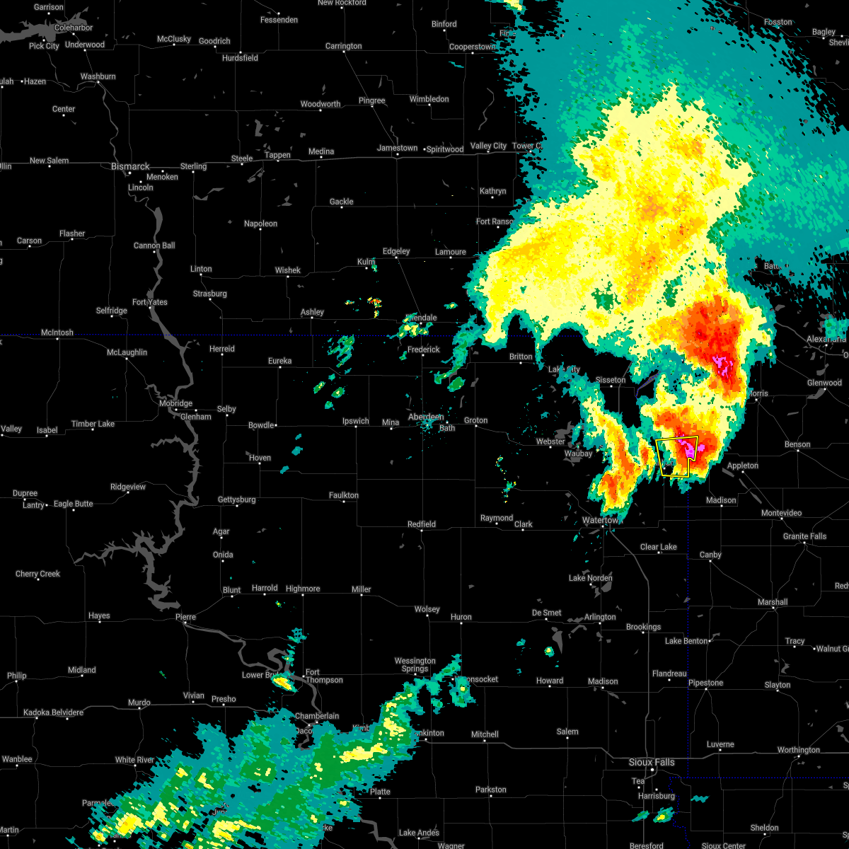 The severe thunderstorm warning for south central big stone, southeastern roberts and northeastern grant counties will expire at 945 am cdt, the storm which prompted the warning is moving out of the area. therefore, the warning will be allowed to expire. however small hail is still possible with this thunderstorm. a severe thunderstorm watch remains in effect until noon cdt for west central minnesota, and northeastern south dakota. remember, a severe thunderstorm warning still remains in effect for far eastern grant, and southern big stone county until 1015 am, cdt. The severe thunderstorm warning for south central big stone, southeastern roberts and northeastern grant counties will expire at 945 am cdt, the storm which prompted the warning is moving out of the area. therefore, the warning will be allowed to expire. however small hail is still possible with this thunderstorm. a severe thunderstorm watch remains in effect until noon cdt for west central minnesota, and northeastern south dakota. remember, a severe thunderstorm warning still remains in effect for far eastern grant, and southern big stone county until 1015 am, cdt.
|
| 8/28/2021 9:28 AM CDT |
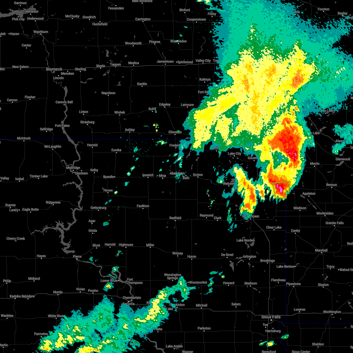 At 927 am cdt, a severe thunderstorm was located near big stone city, moving east at 40 mph (trained weather spotters). Hazards include golf ball size hail and 60 mph wind gusts. People and animals outdoors will be injured. expect hail damage to roofs, siding, windows, and vehicles. expect wind damage to roofs, siding, and trees. this severe thunderstorm will remain over mainly rural areas of south central big stone, southeastern roberts and northeastern grant counties. thunderstorm damage threat, considerable hail threat, observed max hail size, 1. 75 in wind threat, radar indicated max wind gust, 60 mph. At 927 am cdt, a severe thunderstorm was located near big stone city, moving east at 40 mph (trained weather spotters). Hazards include golf ball size hail and 60 mph wind gusts. People and animals outdoors will be injured. expect hail damage to roofs, siding, windows, and vehicles. expect wind damage to roofs, siding, and trees. this severe thunderstorm will remain over mainly rural areas of south central big stone, southeastern roberts and northeastern grant counties. thunderstorm damage threat, considerable hail threat, observed max hail size, 1. 75 in wind threat, radar indicated max wind gust, 60 mph.
|
| 8/28/2021 9:21 AM CDT |
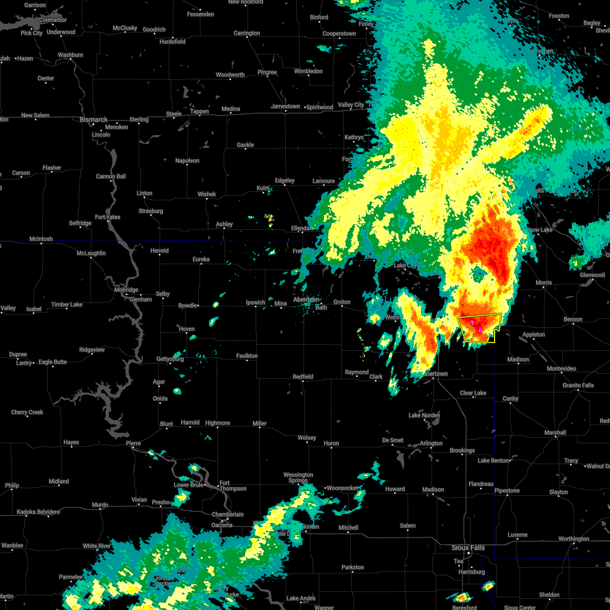 At 919 am cdt, a severe thunderstorm was located near milbank, moving east at 40 mph (trained weather spotters. at 919 am cdt, golfball size hail was reported in milbank). Hazards include golf ball size hail and 60 mph wind gusts. People and animals outdoors will be injured. expect hail damage to roofs, siding, windows, and vehicles. expect wind damage to roofs, siding, and trees. this severe storm will be near, big stone city and lagoona beach around 930 am cdt. Other locations in the path of this severe thunderstorm include ortonville. At 919 am cdt, a severe thunderstorm was located near milbank, moving east at 40 mph (trained weather spotters. at 919 am cdt, golfball size hail was reported in milbank). Hazards include golf ball size hail and 60 mph wind gusts. People and animals outdoors will be injured. expect hail damage to roofs, siding, windows, and vehicles. expect wind damage to roofs, siding, and trees. this severe storm will be near, big stone city and lagoona beach around 930 am cdt. Other locations in the path of this severe thunderstorm include ortonville.
|
| 8/28/2021 9:19 AM CDT | Golf Ball sized hail reported 0.7 miles ESE of Milbank, SD |
| 8/28/2021 9:15 AM CDT | Tennis Ball sized hail reported 4 miles SE of Milbank, SD, relayed through grant co em. |
| 8/28/2021 9:14 AM CDT |
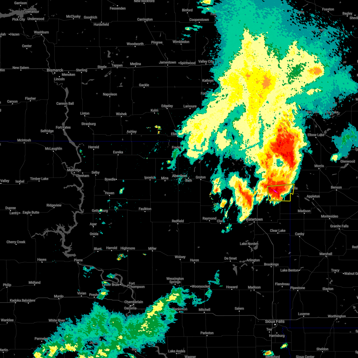 At 914 am cdt, a severe thunderstorm was located near corona, or near milbank, moving east at 40 mph (radar indicated). Hazards include ping pong ball size hail and 60 mph wind gusts. People and animals outdoors will be injured. expect hail damage to roofs, siding, windows, and vehicles. expect wind damage to roofs, siding, and trees. this severe thunderstorm will be near, milbank around 920 am cdt. big stone city and lagoona beach around 930 am cdt. Other locations in the path of this severe thunderstorm include ortonville. At 914 am cdt, a severe thunderstorm was located near corona, or near milbank, moving east at 40 mph (radar indicated). Hazards include ping pong ball size hail and 60 mph wind gusts. People and animals outdoors will be injured. expect hail damage to roofs, siding, windows, and vehicles. expect wind damage to roofs, siding, and trees. this severe thunderstorm will be near, milbank around 920 am cdt. big stone city and lagoona beach around 930 am cdt. Other locations in the path of this severe thunderstorm include ortonville.
|
| 8/28/2021 9:04 AM CDT |
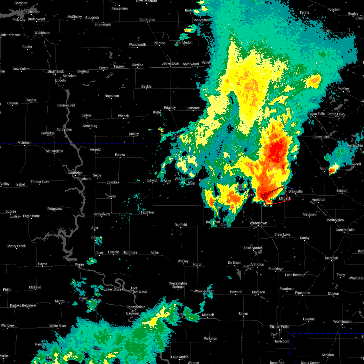 At 904 am cdt, a severe thunderstorm capable of producing a tornado was located over twin brooks, or 7 miles west of milbank, moving east at 35 mph (radar indicated rotation). Hazards include tornado and golf ball size hail. Flying debris will be dangerous to those caught without shelter. mobile homes will be damaged or destroyed. damage to roofs, windows, and vehicles will occur. tree damage is likely. Locations impacted include, milbank. At 904 am cdt, a severe thunderstorm capable of producing a tornado was located over twin brooks, or 7 miles west of milbank, moving east at 35 mph (radar indicated rotation). Hazards include tornado and golf ball size hail. Flying debris will be dangerous to those caught without shelter. mobile homes will be damaged or destroyed. damage to roofs, windows, and vehicles will occur. tree damage is likely. Locations impacted include, milbank.
|
| 8/28/2021 8:50 AM CDT |
 At 850 am cdt, a severe thunderstorm capable of producing a tornado was located near marvin, or 17 miles west of milbank, moving east at 40 mph (radar indicated rotation). Hazards include tornado and half dollar size hail. Flying debris will be dangerous to those caught without shelter. mobile homes will be damaged or destroyed. damage to roofs, windows, and vehicles will occur. tree damage is likely. this dangerous storm will be near, marvin around 855 am cdt. twin brooks around 905 am cdt. corona around 910 am cdt. Other locations in the path of this tornadic thunderstorm include milbank. At 850 am cdt, a severe thunderstorm capable of producing a tornado was located near marvin, or 17 miles west of milbank, moving east at 40 mph (radar indicated rotation). Hazards include tornado and half dollar size hail. Flying debris will be dangerous to those caught without shelter. mobile homes will be damaged or destroyed. damage to roofs, windows, and vehicles will occur. tree damage is likely. this dangerous storm will be near, marvin around 855 am cdt. twin brooks around 905 am cdt. corona around 910 am cdt. Other locations in the path of this tornadic thunderstorm include milbank.
|
| 8/28/2021 7:33 AM CDT | Half Dollar sized hail reported 2.6 miles E of Milbank, SD, hailed for 5 to 10 minutes. |
| 8/28/2021 7:28 AM CDT |
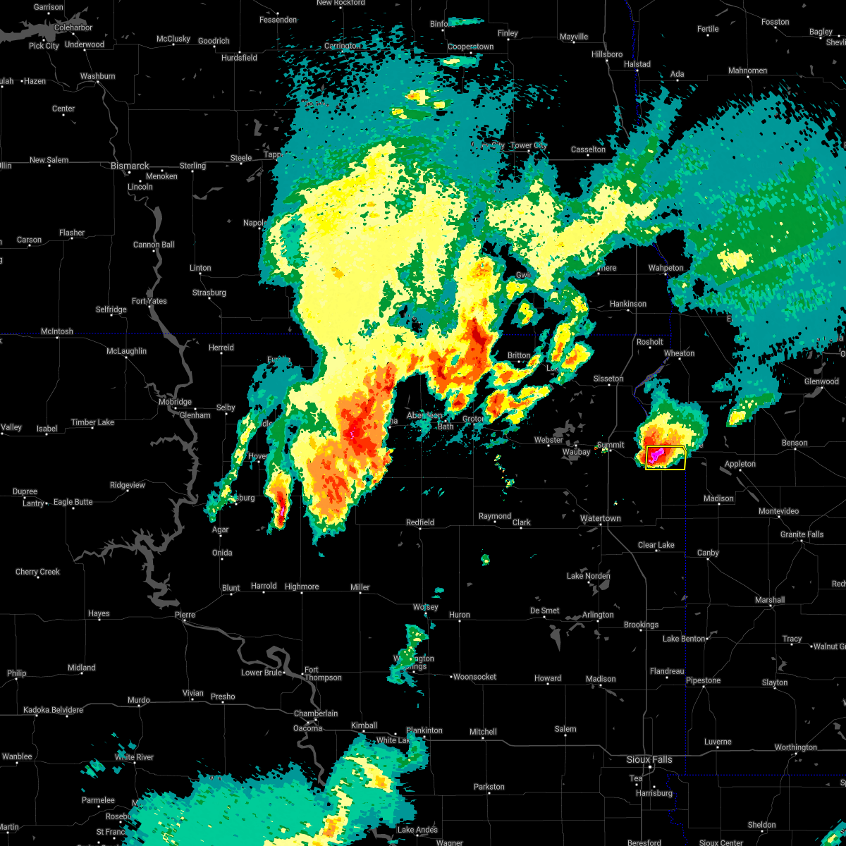 At 728 am cdt, a severe thunderstorm was located near milbank, moving east at 35 mph (radar indicated). Hazards include golf ball size hail and 60 mph wind gusts. People and animals outdoors will be injured. expect hail damage to roofs, siding, windows, and vehicles. expect wind damage to roofs, siding, and trees. locations impacted include, big stone city and ortonville. thunderstorm damage threat, considerable hail threat, radar indicated max hail size, 1. 75 in wind threat, radar indicated max wind gust, 60 mph. At 728 am cdt, a severe thunderstorm was located near milbank, moving east at 35 mph (radar indicated). Hazards include golf ball size hail and 60 mph wind gusts. People and animals outdoors will be injured. expect hail damage to roofs, siding, windows, and vehicles. expect wind damage to roofs, siding, and trees. locations impacted include, big stone city and ortonville. thunderstorm damage threat, considerable hail threat, radar indicated max hail size, 1. 75 in wind threat, radar indicated max wind gust, 60 mph.
|
| 8/28/2021 7:01 AM CDT |
 At 700 am cdt, a severe thunderstorm was located over marvin, or 13 miles west of milbank, moving east at 40 mph (radar indicated). Hazards include golf ball size hail and 60 mph wind gusts. People and animals outdoors will be injured. expect hail damage to roofs, siding, windows, and vehicles. expect wind damage to roofs, siding, and trees. this severe thunderstorm will be near, twin brooks around 710 am cdt. milbank around 720 am cdt. other locations in the path of this severe thunderstorm include big stone city and ortonville. thunderstorm damage threat, considerable hail threat, radar indicated max hail size, 1. 75 in wind threat, radar indicated max wind gust, 60 mph. At 700 am cdt, a severe thunderstorm was located over marvin, or 13 miles west of milbank, moving east at 40 mph (radar indicated). Hazards include golf ball size hail and 60 mph wind gusts. People and animals outdoors will be injured. expect hail damage to roofs, siding, windows, and vehicles. expect wind damage to roofs, siding, and trees. this severe thunderstorm will be near, twin brooks around 710 am cdt. milbank around 720 am cdt. other locations in the path of this severe thunderstorm include big stone city and ortonville. thunderstorm damage threat, considerable hail threat, radar indicated max hail size, 1. 75 in wind threat, radar indicated max wind gust, 60 mph.
|
| 6/11/2021 5:49 AM CDT |
 At 549 am cdt, severe thunderstorms were located along a line extending from near immanuel church to near bullhead lake, moving southeast at 25 mph (radar indicated). Hazards include 60 mph wind gusts and quarter size hail. Hail damage to vehicles is expected. expect wind damage to roofs, siding, and trees. severe thunderstorms will be near, strandburg and la bolt around 555 am cdt. Wheaton and revillo around 605 am cdt. At 549 am cdt, severe thunderstorms were located along a line extending from near immanuel church to near bullhead lake, moving southeast at 25 mph (radar indicated). Hazards include 60 mph wind gusts and quarter size hail. Hail damage to vehicles is expected. expect wind damage to roofs, siding, and trees. severe thunderstorms will be near, strandburg and la bolt around 555 am cdt. Wheaton and revillo around 605 am cdt.
|
| 6/11/2021 5:02 AM CDT |
 At 501 am cdt, severe thunderstorms were located along a line extending from near claire city to near florence, moving east at 60 mph (radar indicated). Hazards include 60 mph wind gusts and quarter size hail. Hail damage to vehicles is expected. expect wind damage to roofs, siding, and trees. severe thunderstorms will be near, new effington around 505 am cdt. victor around 510 am cdt. rosholt around 515 am cdt. south shore, waverly, whiterock colony and mud lake landing around 520 am cdt. Other locations in the path of these severe thunderstorms include wheaton, stockholm, troy, strandburg, twin brooks, immanuel church, la bolt, tintah, charlesville, revillo and albee. At 501 am cdt, severe thunderstorms were located along a line extending from near claire city to near florence, moving east at 60 mph (radar indicated). Hazards include 60 mph wind gusts and quarter size hail. Hail damage to vehicles is expected. expect wind damage to roofs, siding, and trees. severe thunderstorms will be near, new effington around 505 am cdt. victor around 510 am cdt. rosholt around 515 am cdt. south shore, waverly, whiterock colony and mud lake landing around 520 am cdt. Other locations in the path of these severe thunderstorms include wheaton, stockholm, troy, strandburg, twin brooks, immanuel church, la bolt, tintah, charlesville, revillo and albee.
|
| 8/21/2020 7:18 PM CDT | Ping Pong Ball sized hail reported 2.4 miles S of Milbank, SD, report relayed via social media. radar estimated time. |
| 8/21/2020 6:27 PM CDT |
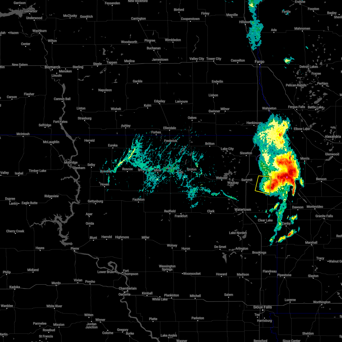 The severe thunderstorm warning for southeastern roberts and northeastern grant counties will expire at 630 pm cdt, the storm which prompted the warning has weakened below severe limits, and has exited the warned area. therefore, the warning will be allowed to expire. however small hail and gusty winds are still possible with this thunderstorm. The severe thunderstorm warning for southeastern roberts and northeastern grant counties will expire at 630 pm cdt, the storm which prompted the warning has weakened below severe limits, and has exited the warned area. therefore, the warning will be allowed to expire. however small hail and gusty winds are still possible with this thunderstorm.
|
| 8/21/2020 6:18 PM CDT | Ping Pong Ball sized hail reported 2.4 miles S of Milbank, SD, report relayed via social media. radar estimated time. this corrects timing for prior lsr at this location. |
| 8/21/2020 6:13 PM CDT |
 At 612 pm cdt, a severe thunderstorm was located near milbank, moving east at 20 mph (radar indicated). Hazards include golf ball size hail and 60 mph wind gusts. People and animals outdoors will be injured. expect hail damage to roofs, siding, windows, and vehicles. expect wind damage to roofs, siding, and trees. Locations impacted include, milbank, corona and twin brooks. At 612 pm cdt, a severe thunderstorm was located near milbank, moving east at 20 mph (radar indicated). Hazards include golf ball size hail and 60 mph wind gusts. People and animals outdoors will be injured. expect hail damage to roofs, siding, windows, and vehicles. expect wind damage to roofs, siding, and trees. Locations impacted include, milbank, corona and twin brooks.
|
| 8/21/2020 5:56 PM CDT |
 At 556 pm cdt, a severe thunderstorm was located near corona, or 10 miles northwest of milbank, moving east at 15 mph (radar indicated). Hazards include golf ball size hail and 60 mph wind gusts. People and animals outdoors will be injured. expect hail damage to roofs, siding, windows, and vehicles. expect wind damage to roofs, siding, and trees. Locations impacted include, milbank, corona, twin brooks and marvin. At 556 pm cdt, a severe thunderstorm was located near corona, or 10 miles northwest of milbank, moving east at 15 mph (radar indicated). Hazards include golf ball size hail and 60 mph wind gusts. People and animals outdoors will be injured. expect hail damage to roofs, siding, windows, and vehicles. expect wind damage to roofs, siding, and trees. Locations impacted include, milbank, corona, twin brooks and marvin.
|
| 8/21/2020 5:50 PM CDT |
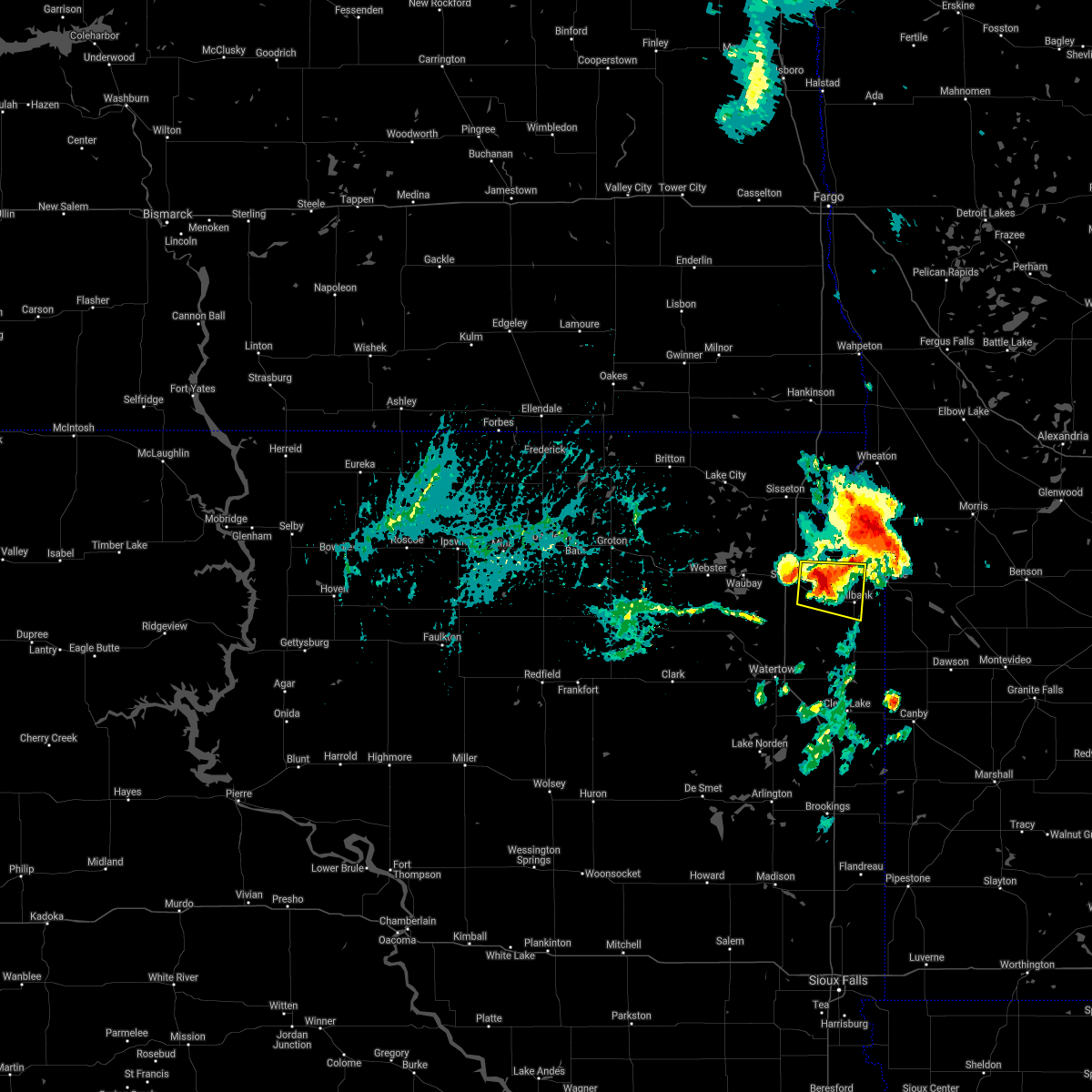 At 550 pm cdt, a severe thunderstorm was located near marvin, or 12 miles northwest of milbank, moving east at 15 mph (radar indicated). Hazards include ping pong ball size hail and 60 mph wind gusts. People and animals outdoors will be injured. expect hail damage to roofs, siding, windows, and vehicles. Expect wind damage to roofs, siding, and trees. At 550 pm cdt, a severe thunderstorm was located near marvin, or 12 miles northwest of milbank, moving east at 15 mph (radar indicated). Hazards include ping pong ball size hail and 60 mph wind gusts. People and animals outdoors will be injured. expect hail damage to roofs, siding, windows, and vehicles. Expect wind damage to roofs, siding, and trees.
|
| 8/12/2020 5:40 AM CDT |
 The severe thunderstorm warning for central big stone, southeastern roberts and northeastern grant counties will expire at 545 am cdt, the storms which prompted the warning have weakened below severe limits, and no longer pose an immediate threat to life or property. therefore, the warning will be allowed to expire. however small hail and gusty winds are still possible with these thunderstorms. to report severe weather, contact your nearest law enforcement agency. they will relay your report to the national weather service aberdeen. The severe thunderstorm warning for central big stone, southeastern roberts and northeastern grant counties will expire at 545 am cdt, the storms which prompted the warning have weakened below severe limits, and no longer pose an immediate threat to life or property. therefore, the warning will be allowed to expire. however small hail and gusty winds are still possible with these thunderstorms. to report severe weather, contact your nearest law enforcement agency. they will relay your report to the national weather service aberdeen.
|
| 8/12/2020 5:40 AM CDT |
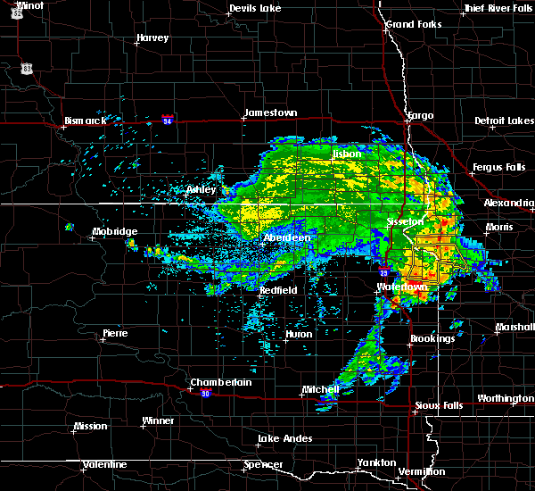 The severe thunderstorm warning for central big stone, southeastern roberts and northeastern grant counties will expire at 545 am cdt, the storms which prompted the warning have weakened below severe limits, and no longer pose an immediate threat to life or property. therefore, the warning will be allowed to expire. however small hail and gusty winds are still possible with these thunderstorms. to report severe weather, contact your nearest law enforcement agency. they will relay your report to the national weather service aberdeen. The severe thunderstorm warning for central big stone, southeastern roberts and northeastern grant counties will expire at 545 am cdt, the storms which prompted the warning have weakened below severe limits, and no longer pose an immediate threat to life or property. therefore, the warning will be allowed to expire. however small hail and gusty winds are still possible with these thunderstorms. to report severe weather, contact your nearest law enforcement agency. they will relay your report to the national weather service aberdeen.
|
| 8/12/2020 5:27 AM CDT |
 At 527 am cdt, severe thunderstorms were located along a line extending from near big stone lake to big stone city to 6 miles north of marietta, moving east at 45 mph (radar indicated). Hazards include 60 mph wind gusts. Expect damage to roofs, siding, and trees. Locations impacted include, milbank, ortonville, big stone city, clinton, odessa, stockholm, correll, albee, big stone lake, bonanza grove and lagoona beach. At 527 am cdt, severe thunderstorms were located along a line extending from near big stone lake to big stone city to 6 miles north of marietta, moving east at 45 mph (radar indicated). Hazards include 60 mph wind gusts. Expect damage to roofs, siding, and trees. Locations impacted include, milbank, ortonville, big stone city, clinton, odessa, stockholm, correll, albee, big stone lake, bonanza grove and lagoona beach.
|
| 8/12/2020 5:01 AM CDT |
 At 500 am cdt, severe thunderstorms were located along a line extending from near peever flats housing to near marvin to near stockholm, moving east at 45 mph (radar indicated). Hazards include 60 mph wind gusts. expect damage to roofs, siding, and trees At 500 am cdt, severe thunderstorms were located along a line extending from near peever flats housing to near marvin to near stockholm, moving east at 45 mph (radar indicated). Hazards include 60 mph wind gusts. expect damage to roofs, siding, and trees
|
| 7/26/2020 2:31 AM CDT |
 At 230 am cdt, severe thunderstorms were located along a line extending from near twin brooks to near school lake to near castlewood, moving southeast at 40 mph (trained weather spotters. at 211 am cdt a 61 mph wind gust was reported in watertown). Hazards include 60 mph wind gusts and quarter size hail. Hail damage to vehicles is expected. Expect wind damage to roofs, siding, and trees. At 230 am cdt, severe thunderstorms were located along a line extending from near twin brooks to near school lake to near castlewood, moving southeast at 40 mph (trained weather spotters. at 211 am cdt a 61 mph wind gust was reported in watertown). Hazards include 60 mph wind gusts and quarter size hail. Hail damage to vehicles is expected. Expect wind damage to roofs, siding, and trees.
|
| 7/18/2020 12:26 AM CDT |
 The severe thunderstorm warning for southern traverse, big stone, southeastern roberts and northeastern grant counties will expire at 1230 am cdt, the storm which prompted the warning has weakened below severe limits, and no longer poses an immediate threat to life or property. therefore, the warning will be allowed to expire. however gusty winds and heavy rain are still possible with this thunderstorm. a severe thunderstorm watch remains in effect until 100 am cdt for west central minnesota, and northeastern south dakota. The severe thunderstorm warning for southern traverse, big stone, southeastern roberts and northeastern grant counties will expire at 1230 am cdt, the storm which prompted the warning has weakened below severe limits, and no longer poses an immediate threat to life or property. therefore, the warning will be allowed to expire. however gusty winds and heavy rain are still possible with this thunderstorm. a severe thunderstorm watch remains in effect until 100 am cdt for west central minnesota, and northeastern south dakota.
|
| 7/17/2020 11:52 PM CDT |
 At 1151 pm cdt, a severe thunderstorm was located near browns valley, or 14 miles southeast of sisseton, moving southeast at 45 mph (trained weather spotters). Hazards include 60 mph wind gusts. expect damage to roofs, siding, and trees At 1151 pm cdt, a severe thunderstorm was located near browns valley, or 14 miles southeast of sisseton, moving southeast at 45 mph (trained weather spotters). Hazards include 60 mph wind gusts. expect damage to roofs, siding, and trees
|
| 6/18/2020 12:54 AM CDT |
 At 1254 am cdt, severe thunderstorms were located along a line extending from 9 miles southwest of summit to near waverly to 6 miles north of castlewood, moving northeast at 45 mph (radar indicated). Hazards include 60 mph wind gusts. expect damage to roofs, siding, and trees At 1254 am cdt, severe thunderstorms were located along a line extending from 9 miles southwest of summit to near waverly to 6 miles north of castlewood, moving northeast at 45 mph (radar indicated). Hazards include 60 mph wind gusts. expect damage to roofs, siding, and trees
|
| 6/4/2020 8:48 PM CDT |
 At 847 pm cdt, severe thunderstorms were located along a line extending from near marvin to waverly, moving east at 40 mph (radar indicated). Hazards include 70 mph wind gusts. Expect considerable tree damage. Damage is likely to mobile homes, roofs, and outbuildings. At 847 pm cdt, severe thunderstorms were located along a line extending from near marvin to waverly, moving east at 40 mph (radar indicated). Hazards include 70 mph wind gusts. Expect considerable tree damage. Damage is likely to mobile homes, roofs, and outbuildings.
|
| 6/4/2019 7:40 PM CDT |
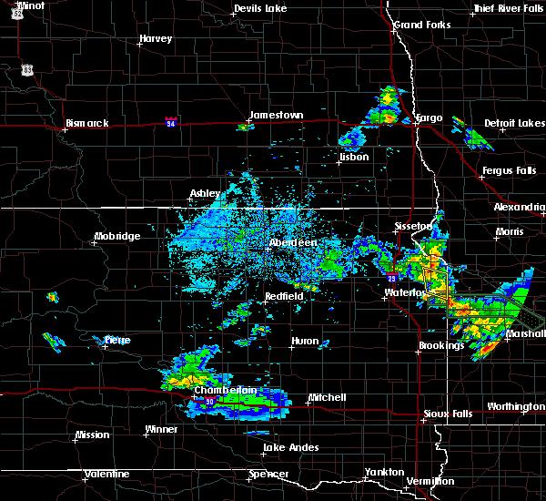 The severe thunderstorm warning for northeastern deuel and eastern grant counties will expire at 745 pm cdt, the storm which prompted the warning has weakened below severe limits, and no longer poses an immediate threat to life or property. therefore, the warning will be allowed to expire. however gusty winds are still possible with this thunderstorm. The severe thunderstorm warning for northeastern deuel and eastern grant counties will expire at 745 pm cdt, the storm which prompted the warning has weakened below severe limits, and no longer poses an immediate threat to life or property. therefore, the warning will be allowed to expire. however gusty winds are still possible with this thunderstorm.
|
| 6/4/2019 7:25 PM CDT |
 At 725 pm cdt, a severe thunderstorm was located over revillo, or 14 miles south of milbank, moving east at 35 mph (radar indicated). Hazards include 60 mph wind gusts and quarter size hail. Hail damage to vehicles is expected. expect wind damage to roofs, siding, and trees. Locations impacted include, milbank, revillo, la bolt and albee. At 725 pm cdt, a severe thunderstorm was located over revillo, or 14 miles south of milbank, moving east at 35 mph (radar indicated). Hazards include 60 mph wind gusts and quarter size hail. Hail damage to vehicles is expected. expect wind damage to roofs, siding, and trees. Locations impacted include, milbank, revillo, la bolt and albee.
|
| 6/4/2019 7:01 PM CDT |
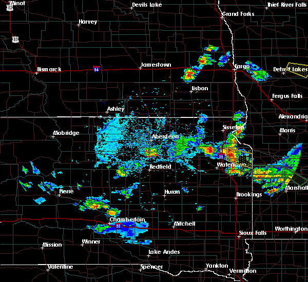 At 701 pm cdt, a severe thunderstorm was located over stockholm, or 10 miles southwest of milbank, moving southeast at 60 mph (radar indicated). Hazards include 60 mph wind gusts and quarter size hail. Hail damage to vehicles is expected. Expect wind damage to roofs, siding, and trees. At 701 pm cdt, a severe thunderstorm was located over stockholm, or 10 miles southwest of milbank, moving southeast at 60 mph (radar indicated). Hazards include 60 mph wind gusts and quarter size hail. Hail damage to vehicles is expected. Expect wind damage to roofs, siding, and trees.
|
| 7/10/2018 6:25 AM CDT | Quarter sized hail reported 2.6 miles E of Milbank, SD, estimated 1 inch hail and .67 inches of rain. |
| 7/10/2018 5:56 AM CDT |
 At 556 am cdt, a severe thunderstorm was located near twin brooks, or near milbank, moving southeast at 25 mph (radar indicated). Hazards include 60 mph wind gusts and quarter size hail. Hail damage to vehicles is expected. Expect wind damage to roofs, siding, and trees. At 556 am cdt, a severe thunderstorm was located near twin brooks, or near milbank, moving southeast at 25 mph (radar indicated). Hazards include 60 mph wind gusts and quarter size hail. Hail damage to vehicles is expected. Expect wind damage to roofs, siding, and trees.
|
| 6/24/2018 4:56 PM CDT |
 At 455 pm cdt, a severe thunderstorm was located near albee, or 8 miles south of milbank, moving north at 10 mph (radar indicated). Hazards include 60 mph wind gusts and quarter size hail. Hail damage to vehicles is expected. expect wind damage to roofs, siding, and trees. Locations impacted include, milbank, ortonville, big stone city, revillo, twin brooks, la bolt, albee and big stone lake. At 455 pm cdt, a severe thunderstorm was located near albee, or 8 miles south of milbank, moving north at 10 mph (radar indicated). Hazards include 60 mph wind gusts and quarter size hail. Hail damage to vehicles is expected. expect wind damage to roofs, siding, and trees. Locations impacted include, milbank, ortonville, big stone city, revillo, twin brooks, la bolt, albee and big stone lake.
|
| 6/24/2018 4:38 PM CDT |
 At 437 pm cdt, a severe thunderstorm was located over albee, or 12 miles south of milbank, moving north at 10 mph (radar indicated). Hazards include 60 mph wind gusts and quarter size hail. Hail damage to vehicles is expected. Expect wind damage to roofs, siding, and trees. At 437 pm cdt, a severe thunderstorm was located over albee, or 12 miles south of milbank, moving north at 10 mph (radar indicated). Hazards include 60 mph wind gusts and quarter size hail. Hail damage to vehicles is expected. Expect wind damage to roofs, siding, and trees.
|
| 6/6/2018 2:26 AM CDT |
 The severe thunderstorm warning for southern traverse. big stone. southern roberts and northern grant counties will expire at 230 am cdt. the storm which prompted the warning has weakened below severe limits, and no longer poses an immediate threat to life or property. Therefore, the warning will be allowed to expire. The severe thunderstorm warning for southern traverse. big stone. southern roberts and northern grant counties will expire at 230 am cdt. the storm which prompted the warning has weakened below severe limits, and no longer poses an immediate threat to life or property. Therefore, the warning will be allowed to expire.
|
| 6/6/2018 2:26 AM CDT |
 The severe thunderstorm warning for southern traverse, big stone, southern roberts and northern grant counties will expire at 230 am cdt, the storm which prompted the warning has weakened below severe limits, and no longer poses an immediate threat to life or property. therefore, the warning will be allowed to expire. a severe thunderstorm watch remains in effect until 300 am cdt for west central minnesota, and northeastern south dakota. The severe thunderstorm warning for southern traverse, big stone, southern roberts and northern grant counties will expire at 230 am cdt, the storm which prompted the warning has weakened below severe limits, and no longer poses an immediate threat to life or property. therefore, the warning will be allowed to expire. a severe thunderstorm watch remains in effect until 300 am cdt for west central minnesota, and northeastern south dakota.
|
| 6/6/2018 1:53 AM CDT |
 At 153 am cdt, severe thunderstorms were located along a line extending from near ortley to watertown city park to badger, moving east at 50 mph (radar indicated). Hazards include 60 mph wind gusts. expect damage to roofs, siding, and trees At 153 am cdt, severe thunderstorms were located along a line extending from near ortley to watertown city park to badger, moving east at 50 mph (radar indicated). Hazards include 60 mph wind gusts. expect damage to roofs, siding, and trees
|
| 6/6/2018 1:49 AM CDT |
 At 147 am cdt, a severe thunderstorm was located near wilmot, or 18 miles south of sisseton, moving east at 60 mph (trained weather spotters. at 133 am cdt...a 63 mph wind gusts was reported at webster). Hazards include 60 mph wind gusts. expect damage to roofs, siding, and trees At 147 am cdt, a severe thunderstorm was located near wilmot, or 18 miles south of sisseton, moving east at 60 mph (trained weather spotters. at 133 am cdt...a 63 mph wind gusts was reported at webster). Hazards include 60 mph wind gusts. expect damage to roofs, siding, and trees
|
| 9/19/2017 11:09 PM CDT |
 At 1109 pm cdt, a severe thunderstorm was located near big stone city, moving northeast at 40 mph (radar indicated). Hazards include 60 mph wind gusts and quarter size hail. Hail damage to vehicles is expected. expect wind damage to roofs, siding, and trees. locations impacted include, milbank, ortonville, big stone city, graceville, clinton, johnson, barry, big stone lake, bonanza grove and lagoona beach. A tornado watch remains in effect until midnight cdt for west central minnesota, and northeastern south dakota. At 1109 pm cdt, a severe thunderstorm was located near big stone city, moving northeast at 40 mph (radar indicated). Hazards include 60 mph wind gusts and quarter size hail. Hail damage to vehicles is expected. expect wind damage to roofs, siding, and trees. locations impacted include, milbank, ortonville, big stone city, graceville, clinton, johnson, barry, big stone lake, bonanza grove and lagoona beach. A tornado watch remains in effect until midnight cdt for west central minnesota, and northeastern south dakota.
|
| 9/19/2017 10:49 PM CDT |
 At 1048 pm cdt, a severe thunderstorm was located over twin brooks, or 7 miles west of milbank, moving northeast at 50 mph (radar indicated). Hazards include 60 mph wind gusts and half dollar size hail. Hail damage to vehicles is expected. Expect wind damage to roofs, siding, and trees. At 1048 pm cdt, a severe thunderstorm was located over twin brooks, or 7 miles west of milbank, moving northeast at 50 mph (radar indicated). Hazards include 60 mph wind gusts and half dollar size hail. Hail damage to vehicles is expected. Expect wind damage to roofs, siding, and trees.
|
| 8/25/2017 6:42 PM CDT |
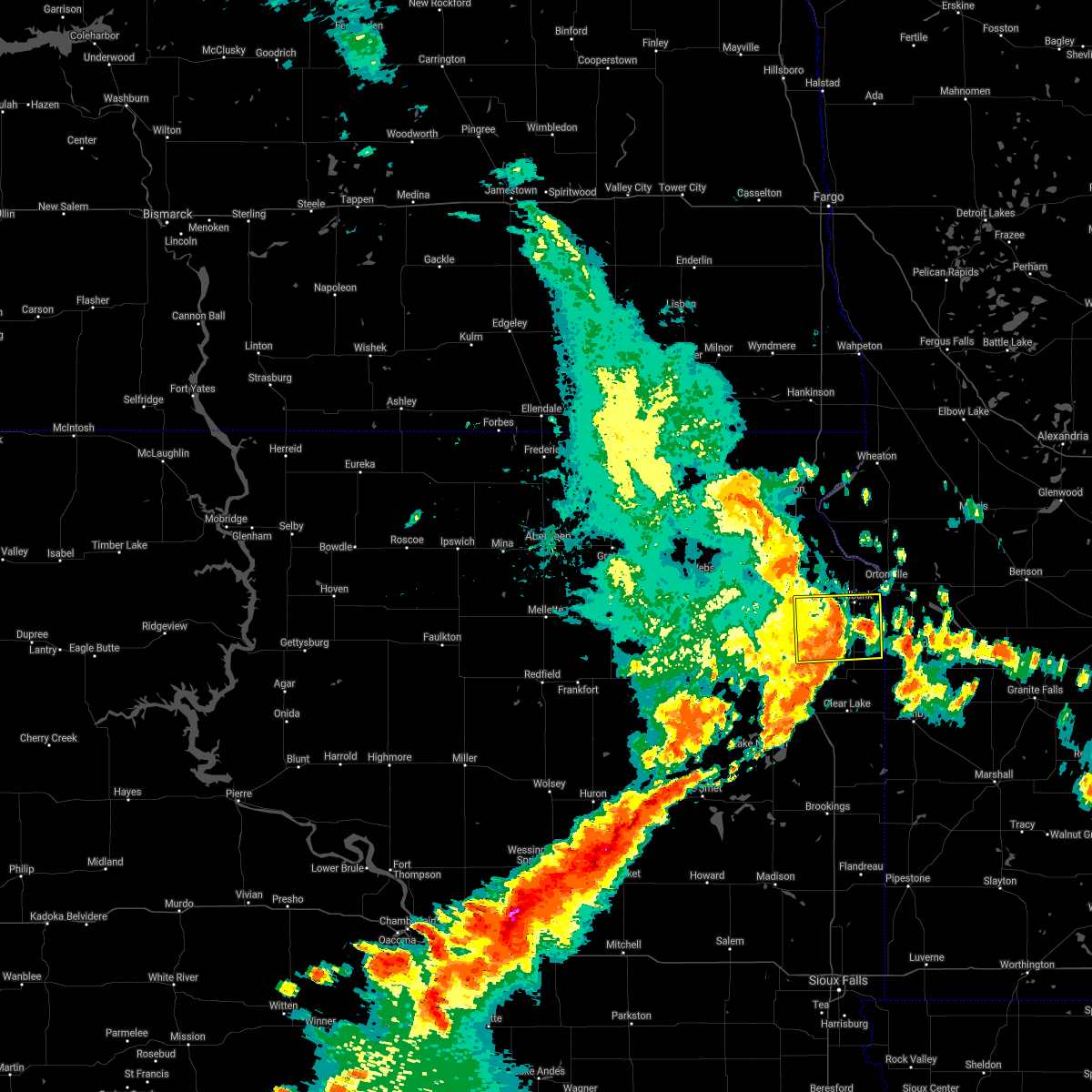 The severe thunderstorm warning for northwestern deuel, southeastern grant and northeastern codington counties will expire at 645 pm cdt, the storm which prompted the warning has weakened below severe limits, and no longer poses an immediate threat to life or property. therefore the warning will be allowed to expire. however gusty winds are still possible with this thunderstorm. The severe thunderstorm warning for northwestern deuel, southeastern grant and northeastern codington counties will expire at 645 pm cdt, the storm which prompted the warning has weakened below severe limits, and no longer poses an immediate threat to life or property. therefore the warning will be allowed to expire. however gusty winds are still possible with this thunderstorm.
|
| 8/25/2017 6:24 PM CDT |
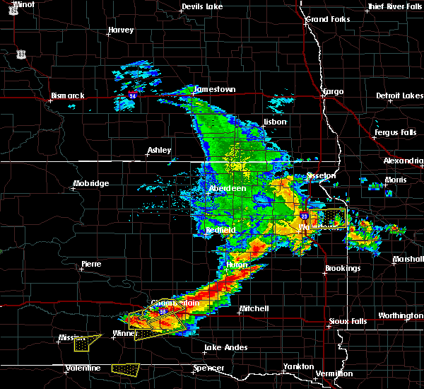 At 624 pm cdt, a severe thunderstorm was located over stockholm, or 13 miles southwest of milbank, moving east at 50 mph (radar indicated). Hazards include 60 mph wind gusts. Expect damage to roofs, siding, and trees. Locations impacted include, milbank, south shore, waverly, revillo, stockholm, strandburg, twin brooks, la bolt, troy and albee. At 624 pm cdt, a severe thunderstorm was located over stockholm, or 13 miles southwest of milbank, moving east at 50 mph (radar indicated). Hazards include 60 mph wind gusts. Expect damage to roofs, siding, and trees. Locations impacted include, milbank, south shore, waverly, revillo, stockholm, strandburg, twin brooks, la bolt, troy and albee.
|
| 8/25/2017 6:03 PM CDT |
 The national weather service in aberdeen has issued a * severe thunderstorm warning for. northwestern deuel county in northeastern south dakota. southeastern day county in northeastern south dakota. grant county in northeastern south dakota. Northern codington county in northeastern south dakota. The national weather service in aberdeen has issued a * severe thunderstorm warning for. northwestern deuel county in northeastern south dakota. southeastern day county in northeastern south dakota. grant county in northeastern south dakota. Northern codington county in northeastern south dakota.
|
| 8/18/2017 3:15 PM CDT |
 At 315 pm cdt, a severe thunderstorm was located 7 miles east of milbank, moving east at 15 mph (radar indicated). Hazards include quarter size hail. Damage to vehicles is expected. This severe thunderstorm will remain over mainly rural areas of east central grant county. At 315 pm cdt, a severe thunderstorm was located 7 miles east of milbank, moving east at 15 mph (radar indicated). Hazards include quarter size hail. Damage to vehicles is expected. This severe thunderstorm will remain over mainly rural areas of east central grant county.
|
| 8/18/2017 3:06 PM CDT | Quarter sized hail reported 3.7 miles WNW of Milbank, SD, radar estimated time. |
| 8/18/2017 2:59 PM CDT |
 At 259 pm cdt, a severe thunderstorm was located near milbank, moving east at 15 mph (emergency management). Hazards include 60 mph wind gusts and quarter size hail. Hail damage to vehicles is expected. Expect wind damage to roofs, siding, and trees. At 259 pm cdt, a severe thunderstorm was located near milbank, moving east at 15 mph (emergency management). Hazards include 60 mph wind gusts and quarter size hail. Hail damage to vehicles is expected. Expect wind damage to roofs, siding, and trees.
|
| 8/18/2017 2:52 PM CDT |
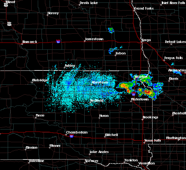 At 252 pm cdt, a severe thunderstorm was located near milbank, moving east at 20 mph (emergency management). Hazards include 60 mph wind gusts and quarter size hail. Hail damage to vehicles is expected. expect wind damage to roofs, siding, and trees. Locations impacted include, milbank and twin brooks. At 252 pm cdt, a severe thunderstorm was located near milbank, moving east at 20 mph (emergency management). Hazards include 60 mph wind gusts and quarter size hail. Hail damage to vehicles is expected. expect wind damage to roofs, siding, and trees. Locations impacted include, milbank and twin brooks.
|
| 8/18/2017 2:50 PM CDT | Mobile mesonet instruments measured the strong wind in grant county SD, 1.1 miles ESE of Milbank, SD |
| 8/18/2017 2:42 PM CDT | Golf Ball sized hail reported 1.6 miles ESE of Milbank, SD, report and video relayed through social media. hail blanketed the entire u.s. highway 12 roadway. |
| 8/18/2017 2:40 PM CDT | Half Dollar sized hail reported 0.7 miles ESE of Milbank, SD, report relayed through social media. |
| 8/18/2017 2:35 PM CDT | Quarter sized hail reported 0.4 miles SSE of Milbank, SD, no damage apparent at time of call. |
| 8/18/2017 2:29 PM CDT |
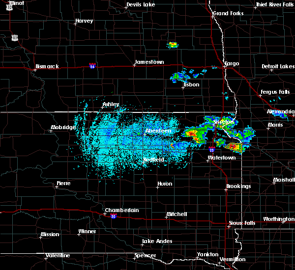 At 228 pm cdt, a severe thunderstorm was located over milbank, moving southeast at 15 mph (radar indicated). Hazards include golf ball size hail. People and animals outdoors will be injured. expect damage to roofs, siding, windows, and vehicles. Locations impacted include, milbank and twin brooks. At 228 pm cdt, a severe thunderstorm was located over milbank, moving southeast at 15 mph (radar indicated). Hazards include golf ball size hail. People and animals outdoors will be injured. expect damage to roofs, siding, windows, and vehicles. Locations impacted include, milbank and twin brooks.
|
| 8/18/2017 2:26 PM CDT |
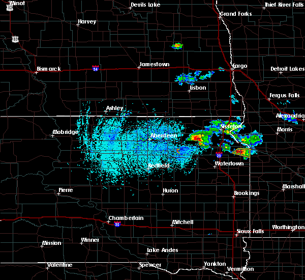 At 226 pm cdt, a severe thunderstorm was located over milbank, moving southeast at 15 mph (radar indicated). Hazards include ping pong ball size hail. People and animals outdoors will be injured. expect damage to roofs, siding, windows, and vehicles. Locations impacted include, milbank and twin brooks. At 226 pm cdt, a severe thunderstorm was located over milbank, moving southeast at 15 mph (radar indicated). Hazards include ping pong ball size hail. People and animals outdoors will be injured. expect damage to roofs, siding, windows, and vehicles. Locations impacted include, milbank and twin brooks.
|
| 8/18/2017 2:16 PM CDT |
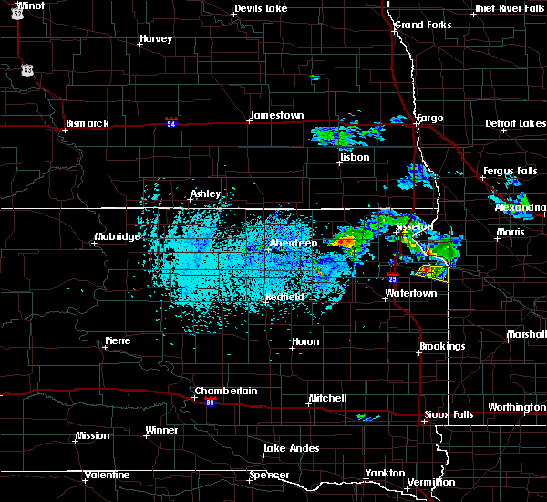 At 216 pm cdt, a severe thunderstorm was located near milbank, moving east at 15 mph (radar indicated). Hazards include quarter size hail. damage to vehicles is expected At 216 pm cdt, a severe thunderstorm was located near milbank, moving east at 15 mph (radar indicated). Hazards include quarter size hail. damage to vehicles is expected
|
| 7/25/2017 12:19 AM CDT |
 At 1218 am cdt, a severe thunderstorm was located near twin brooks, or near milbank, moving east at 20 mph (radar indicated). Hazards include 60 mph wind gusts and half dollar size hail. Hail damage to vehicles is expected. Expect wind damage to roofs, siding, and trees. At 1218 am cdt, a severe thunderstorm was located near twin brooks, or near milbank, moving east at 20 mph (radar indicated). Hazards include 60 mph wind gusts and half dollar size hail. Hail damage to vehicles is expected. Expect wind damage to roofs, siding, and trees.
|
| 6/13/2017 8:10 PM CDT | Multiple trees down... electrical lines down. possible fires started due to electrical lines dow in grant county SD, 0.7 miles ESE of Milbank, SD |
| 6/13/2017 8:06 PM CDT |
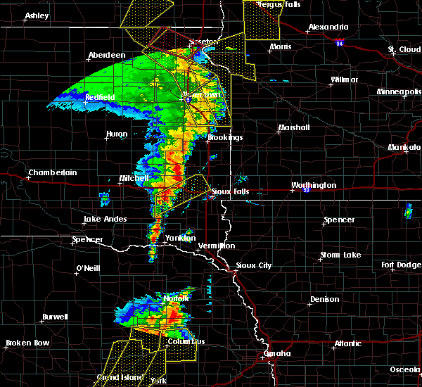 The severe thunderstorm warning for deuel, northeastern hamlin, eastern grant and southeastern codington counties will expire at 815 pm cdt, the storm which prompted the warning has moved out of the area. therefore the warning will be allowed to expire. however gusty winds are still possible with this thunderstorm. a tornado watch remains in effect until 1000 pm cdt for northeastern south dakota. The severe thunderstorm warning for deuel, northeastern hamlin, eastern grant and southeastern codington counties will expire at 815 pm cdt, the storm which prompted the warning has moved out of the area. therefore the warning will be allowed to expire. however gusty winds are still possible with this thunderstorm. a tornado watch remains in effect until 1000 pm cdt for northeastern south dakota.
|
| 6/13/2017 8:03 PM CDT |
 At 802 pm cdt, severe thunderstorms were located along a line extending from peever flats housing to near milbank to astoria, moving east at 60 mph (radar indicated). Hazards include 60 mph wind gusts and penny size hail. expect damage to roofs, siding, and trees At 802 pm cdt, severe thunderstorms were located along a line extending from peever flats housing to near milbank to astoria, moving east at 60 mph (radar indicated). Hazards include 60 mph wind gusts and penny size hail. expect damage to roofs, siding, and trees
|
| 6/13/2017 7:54 PM CDT |
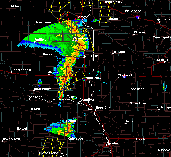 At 753 pm cdt, a severe thunderstorm was located near altamont, or near clear lake, moving northeast at 65 mph (radar indicated). Hazards include 60 mph wind gusts and penny size hail. Expect damage to roofs, siding, and trees. locations impacted include, watertown, milbank, clear lake, estelline, toronto, waverly, kranzburg, goodwin, astoria, revillo, stockholm, brandt, strandburg, la bolt, troy, altamont, bullhead lake, moritz, claremont colony and dempster. A tornado watch remains in effect until 1000 pm cdt for northeastern south dakota. At 753 pm cdt, a severe thunderstorm was located near altamont, or near clear lake, moving northeast at 65 mph (radar indicated). Hazards include 60 mph wind gusts and penny size hail. Expect damage to roofs, siding, and trees. locations impacted include, watertown, milbank, clear lake, estelline, toronto, waverly, kranzburg, goodwin, astoria, revillo, stockholm, brandt, strandburg, la bolt, troy, altamont, bullhead lake, moritz, claremont colony and dempster. A tornado watch remains in effect until 1000 pm cdt for northeastern south dakota.
|
| 6/13/2017 7:35 PM CDT |
 At 735 pm cdt, a severe thunderstorm was located over castlewood, or 12 miles southeast of watertown, moving northeast at 60 mph (radar indicated). Hazards include 60 mph wind gusts and penny size hail. Expect damage to roofs, siding, and trees. locations impacted include, watertown, milbank, clear lake, estelline, castlewood, lake norden, hayti, toronto, waverly, kranzburg, goodwin, astoria, revillo, stockholm, brandt, strandburg, la bolt, troy, altamont and bullhead lake. A tornado watch remains in effect until 1000 pm cdt for northeastern south dakota. At 735 pm cdt, a severe thunderstorm was located over castlewood, or 12 miles southeast of watertown, moving northeast at 60 mph (radar indicated). Hazards include 60 mph wind gusts and penny size hail. Expect damage to roofs, siding, and trees. locations impacted include, watertown, milbank, clear lake, estelline, castlewood, lake norden, hayti, toronto, waverly, kranzburg, goodwin, astoria, revillo, stockholm, brandt, strandburg, la bolt, troy, altamont and bullhead lake. A tornado watch remains in effect until 1000 pm cdt for northeastern south dakota.
|
| 6/13/2017 7:16 PM CDT |
 At 716 pm cdt, a severe thunderstorm was located near bryant, or 20 miles north of lake thompson state recreation area, moving northeast at 50 mph (radar indicated). Hazards include 60 mph wind gusts and penny size hail. expect damage to roofs, siding, and trees At 716 pm cdt, a severe thunderstorm was located near bryant, or 20 miles north of lake thompson state recreation area, moving northeast at 50 mph (radar indicated). Hazards include 60 mph wind gusts and penny size hail. expect damage to roofs, siding, and trees
|
| 6/11/2017 6:02 AM CDT |
 At 601 am cdt, severe thunderstorms were located along a line extending from peever to near big stone city to 7 miles southeast of marietta to 7 miles southeast of lake cochrane rec area, moving northeast at 60 mph (radar indicated). Hazards include 70 mph wind gusts and quarter size hail. Hail damage to vehicles is expected. expect considerable tree damage. Wind damage is also likely to mobile homes, roofs, and outbuildings. At 601 am cdt, severe thunderstorms were located along a line extending from peever to near big stone city to 7 miles southeast of marietta to 7 miles southeast of lake cochrane rec area, moving northeast at 60 mph (radar indicated). Hazards include 70 mph wind gusts and quarter size hail. Hail damage to vehicles is expected. expect considerable tree damage. Wind damage is also likely to mobile homes, roofs, and outbuildings.
|
| 6/11/2017 5:52 AM CDT |
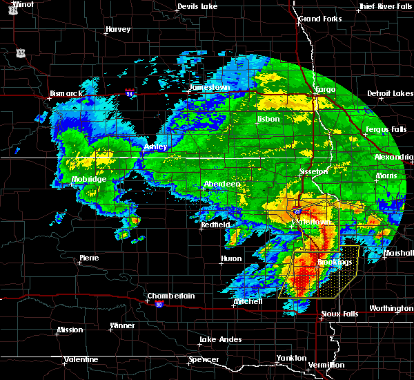 At 550 am cdt, severe thunderstorms were located along a line extending from near twin brooks to near lake alice to brandt, moving northeast at 55 mph (law enforcement reported some trees down and power outages in watertown at 540 am). Hazards include 70 mph wind gusts and quarter size hail. Hail damage to vehicles is expected. expect considerable tree damage. wind damage is also likely to mobile homes, roofs, and outbuildings. Locations impacted include, milbank, clear lake, estelline, gary, south shore, toronto, waverly, kranzburg, goodwin, astoria, revillo, stockholm, brandt, strandburg, twin brooks, la bolt, troy, altamont, albee and bullhead lake. At 550 am cdt, severe thunderstorms were located along a line extending from near twin brooks to near lake alice to brandt, moving northeast at 55 mph (law enforcement reported some trees down and power outages in watertown at 540 am). Hazards include 70 mph wind gusts and quarter size hail. Hail damage to vehicles is expected. expect considerable tree damage. wind damage is also likely to mobile homes, roofs, and outbuildings. Locations impacted include, milbank, clear lake, estelline, gary, south shore, toronto, waverly, kranzburg, goodwin, astoria, revillo, stockholm, brandt, strandburg, twin brooks, la bolt, troy, altamont, albee and bullhead lake.
|
| 6/11/2017 5:23 AM CDT |
 At 522 am cdt, severe thunderstorms were located along a line extending from 7 miles northeast of florence to near castlewood to near lake poinsett, moving northeast at 55 mph (radar indicated). Hazards include 70 mph wind gusts and quarter size hail. Hail damage to vehicles is expected. expect considerable tree damage. Wind damage is also likely to mobile homes, roofs, and outbuildings. At 522 am cdt, severe thunderstorms were located along a line extending from 7 miles northeast of florence to near castlewood to near lake poinsett, moving northeast at 55 mph (radar indicated). Hazards include 70 mph wind gusts and quarter size hail. Hail damage to vehicles is expected. expect considerable tree damage. Wind damage is also likely to mobile homes, roofs, and outbuildings.
|
| 8/28/2016 2:15 AM CDT |
 At 215 am cdt, a severe thunderstorm was located over south shore, or 16 miles west of milbank, moving northeast at 35 mph (radar indicated). Hazards include quarter size hail. Damage to vehicles is expected. this severe thunderstorm will be near, twin brooks around 230 am cdt. Milbank around 245 am cdt. At 215 am cdt, a severe thunderstorm was located over south shore, or 16 miles west of milbank, moving northeast at 35 mph (radar indicated). Hazards include quarter size hail. Damage to vehicles is expected. this severe thunderstorm will be near, twin brooks around 230 am cdt. Milbank around 245 am cdt.
|
| 8/16/2016 6:35 PM CDT |
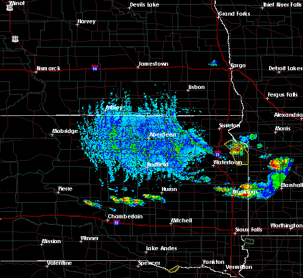 At 635 pm cdt, a severe thunderstorm was located over milbank, moving southeast at 30 mph (radar indicated). Hazards include 60 mph wind gusts and quarter size hail. Hail damage to vehicles is expected. expect wind damage to roofs, siding, and trees. this severe thunderstorm will be near, la bolt around 655 pm cdt. albee around 700 pm cdt. Revillo around 705 pm cdt. At 635 pm cdt, a severe thunderstorm was located over milbank, moving southeast at 30 mph (radar indicated). Hazards include 60 mph wind gusts and quarter size hail. Hail damage to vehicles is expected. expect wind damage to roofs, siding, and trees. this severe thunderstorm will be near, la bolt around 655 pm cdt. albee around 700 pm cdt. Revillo around 705 pm cdt.
|
| 8/10/2016 6:37 PM CDT | . in grant county SD, 0.7 miles ESE of Milbank, SD |
| 8/10/2016 6:03 PM CDT |
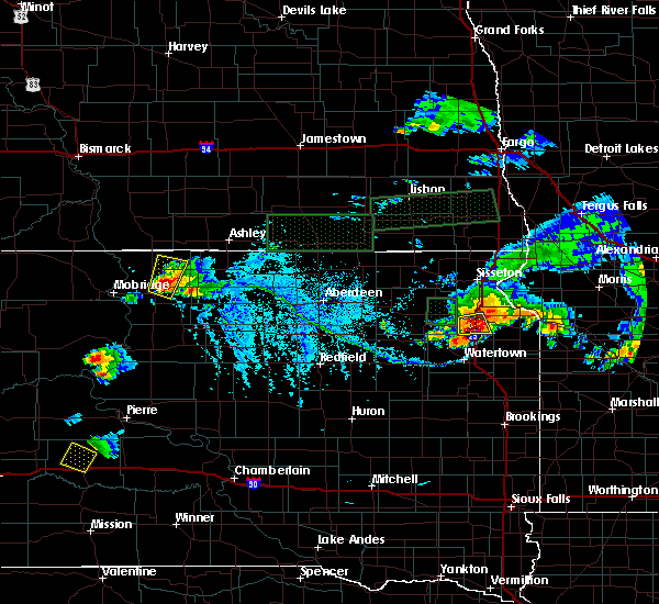 At 603 pm cdt, a severe thunderstorm was located over marvin, or 13 miles west of milbank, moving east at 25 mph (radar indicated). Hazards include 70 mph wind gusts and quarter size hail. Hail damage to vehicles is expected. expect considerable tree damage. wind damage is also likely to mobile homes, roofs, and outbuildings. this severe thunderstorm will be near, twin brooks around 620 pm cdt. Milbank around 640 pm cdt. At 603 pm cdt, a severe thunderstorm was located over marvin, or 13 miles west of milbank, moving east at 25 mph (radar indicated). Hazards include 70 mph wind gusts and quarter size hail. Hail damage to vehicles is expected. expect considerable tree damage. wind damage is also likely to mobile homes, roofs, and outbuildings. this severe thunderstorm will be near, twin brooks around 620 pm cdt. Milbank around 640 pm cdt.
|
| 7/23/2016 7:21 AM CDT |
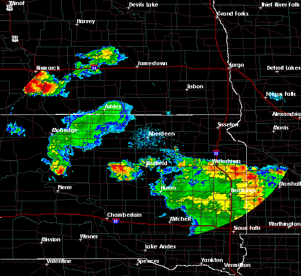 At 721 am cdt, a severe thunderstorm was located over oakwood state park, or near clear lake, moving north at 40 mph (radar indicated). Hazards include 60 mph wind gusts and quarter size hail. Hail damage to vehicles is expected. expect wind damage to roofs, siding, and trees. this severe thunderstorm will be near, tunerville around 725 am cdt. bullhead lake and school lake around 730 am cdt. revillo and strandburg around 740 am cdt. la bolt and albee around 745 am cdt. stockholm around 750 am cdt. Milbank and twin brooks around 800 am cdt. At 721 am cdt, a severe thunderstorm was located over oakwood state park, or near clear lake, moving north at 40 mph (radar indicated). Hazards include 60 mph wind gusts and quarter size hail. Hail damage to vehicles is expected. expect wind damage to roofs, siding, and trees. this severe thunderstorm will be near, tunerville around 725 am cdt. bullhead lake and school lake around 730 am cdt. revillo and strandburg around 740 am cdt. la bolt and albee around 745 am cdt. stockholm around 750 am cdt. Milbank and twin brooks around 800 am cdt.
|
| 7/16/2016 5:50 PM CDT |
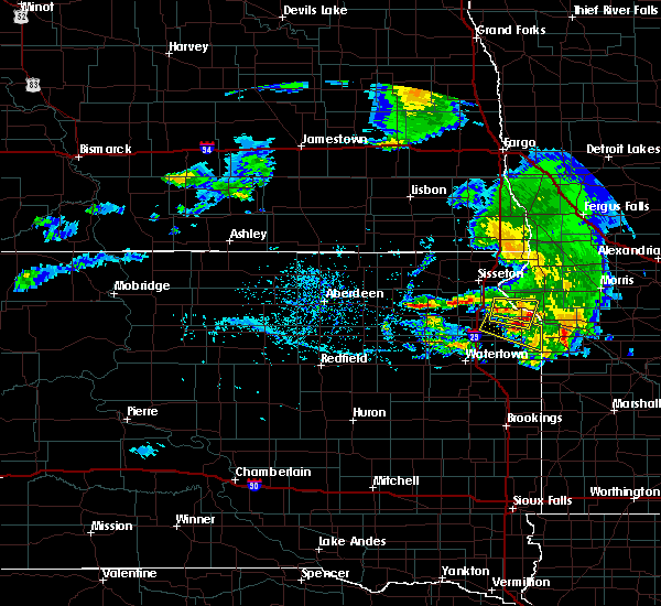 The severe thunderstorm warning for west central big stone, northeastern grant and southeastern roberts counties will expire at 600 pm cdt, the storm which prompted the warning has weakened below severe limits, and no longer poses an immediate threat to life or property. therefore, the warning will be allowed to expire. however gusty winds are still possible with this thunderstorm. a severe thunderstorm watch remains in effect until 700 pm cdt for west central minnesota, and northeastern south dakota. The severe thunderstorm warning for west central big stone, northeastern grant and southeastern roberts counties will expire at 600 pm cdt, the storm which prompted the warning has weakened below severe limits, and no longer poses an immediate threat to life or property. therefore, the warning will be allowed to expire. however gusty winds are still possible with this thunderstorm. a severe thunderstorm watch remains in effect until 700 pm cdt for west central minnesota, and northeastern south dakota.
|
| 7/16/2016 5:43 PM CDT |
 At 543 pm cdt, a severe thunderstorm was located near big stone lake, or 11 miles north of milbank, moving east at 40 mph (radar indicated). Hazards include 60 mph wind gusts and quarter size hail. Hail damage to vehicles is expected. expect wind damage to roofs, siding, and trees. This severe thunderstorm will remain over mainly rural areas of west central big stone, northeastern grant and southeastern roberts counties. At 543 pm cdt, a severe thunderstorm was located near big stone lake, or 11 miles north of milbank, moving east at 40 mph (radar indicated). Hazards include 60 mph wind gusts and quarter size hail. Hail damage to vehicles is expected. expect wind damage to roofs, siding, and trees. This severe thunderstorm will remain over mainly rural areas of west central big stone, northeastern grant and southeastern roberts counties.
|
| 7/16/2016 5:43 PM CDT |
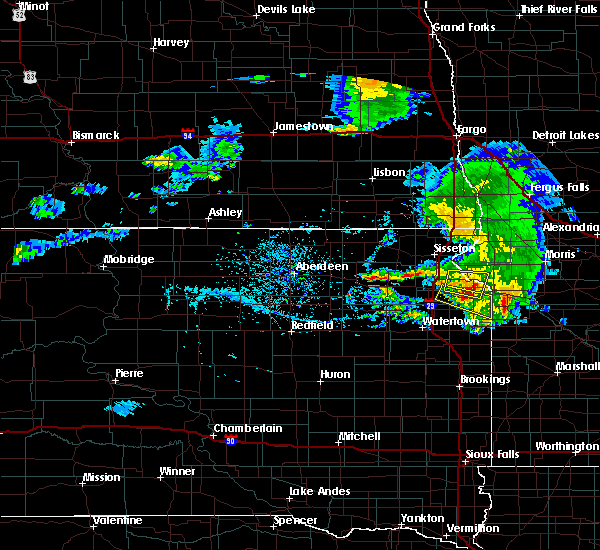 At 543 pm cdt, a severe thunderstorm was located near big stone lake, or 11 miles north of milbank, moving east at 40 mph (radar indicated). Hazards include 60 mph wind gusts and quarter size hail. Hail damage to vehicles is expected. expect wind damage to roofs, siding, and trees. This severe thunderstorm will remain over mainly rural areas of west central big stone, northeastern grant and southeastern roberts counties. At 543 pm cdt, a severe thunderstorm was located near big stone lake, or 11 miles north of milbank, moving east at 40 mph (radar indicated). Hazards include 60 mph wind gusts and quarter size hail. Hail damage to vehicles is expected. expect wind damage to roofs, siding, and trees. This severe thunderstorm will remain over mainly rural areas of west central big stone, northeastern grant and southeastern roberts counties.
|
| 7/16/2016 5:30 PM CDT |
 At 530 pm cdt, a severe thunderstorm was located over marvin, or 12 miles west of milbank, moving east at 45 mph (radar indicated). Hazards include 60 mph wind gusts. Expect damage to roofs. siding. and trees. this severe thunderstorm will be near, twin brooks around 540 pm cdt. milbank around 550 pm cdt. Albee around 555 pm cdt. At 530 pm cdt, a severe thunderstorm was located over marvin, or 12 miles west of milbank, moving east at 45 mph (radar indicated). Hazards include 60 mph wind gusts. Expect damage to roofs. siding. and trees. this severe thunderstorm will be near, twin brooks around 540 pm cdt. milbank around 550 pm cdt. Albee around 555 pm cdt.
|
| 7/16/2016 5:19 PM CDT |
 At 518 pm cdt, a severe thunderstorm was located near marvin, or 13 miles west of milbank, moving east at 50 mph (radar indicated). Hazards include 60 mph wind gusts and quarter size hail. Hail damage to vehicles is expected. expect wind damage to roofs, siding, and trees. this severe storm will be near, twin brooks around 525 pm cdt. Milbank and stockholm around 530 pm cdt. At 518 pm cdt, a severe thunderstorm was located near marvin, or 13 miles west of milbank, moving east at 50 mph (radar indicated). Hazards include 60 mph wind gusts and quarter size hail. Hail damage to vehicles is expected. expect wind damage to roofs, siding, and trees. this severe storm will be near, twin brooks around 525 pm cdt. Milbank and stockholm around 530 pm cdt.
|
| 7/16/2016 5:15 PM CDT |
 At 515 pm cdt, a severe thunderstorm was located over finley heights housing, or 16 miles south of sisseton, moving east at 40 mph (radar indicated). Hazards include 60 mph wind gusts and quarter size hail. Hail damage to vehicles is expected. expect wind damage to roofs, siding, and trees. this severe thunderstorm will be near, wilmot around 530 pm cdt. corona, bonanza grove and yankeetown around 540 pm cdt. Big stone lake around 545 pm cdt. At 515 pm cdt, a severe thunderstorm was located over finley heights housing, or 16 miles south of sisseton, moving east at 40 mph (radar indicated). Hazards include 60 mph wind gusts and quarter size hail. Hail damage to vehicles is expected. expect wind damage to roofs, siding, and trees. this severe thunderstorm will be near, wilmot around 530 pm cdt. corona, bonanza grove and yankeetown around 540 pm cdt. Big stone lake around 545 pm cdt.
|
| 7/16/2016 5:15 PM CDT |
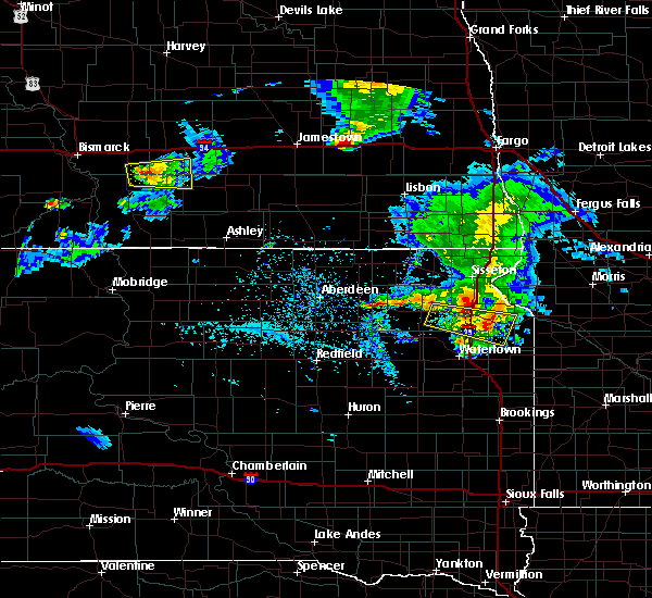 At 515 pm cdt, a severe thunderstorm was located over finley heights housing, or 16 miles south of sisseton, moving east at 40 mph (radar indicated). Hazards include 60 mph wind gusts and quarter size hail. Hail damage to vehicles is expected. expect wind damage to roofs, siding, and trees. this severe thunderstorm will be near, wilmot around 530 pm cdt. corona, bonanza grove and yankeetown around 540 pm cdt. Big stone lake around 545 pm cdt. At 515 pm cdt, a severe thunderstorm was located over finley heights housing, or 16 miles south of sisseton, moving east at 40 mph (radar indicated). Hazards include 60 mph wind gusts and quarter size hail. Hail damage to vehicles is expected. expect wind damage to roofs, siding, and trees. this severe thunderstorm will be near, wilmot around 530 pm cdt. corona, bonanza grove and yankeetown around 540 pm cdt. Big stone lake around 545 pm cdt.
|
| 7/16/2016 4:51 PM CDT |
 At 451 pm cdt, a severe thunderstorm was located over bitter lake, or 8 miles east of webster, moving east at 50 mph (radar indicated). Hazards include 70 mph wind gusts and quarter size hail. Hail damage to vehicles is expected. expect considerable tree damage. wind damage is also likely to mobile homes, roofs, and outbuildings. this severe thunderstorm will be near, ortley around 500 pm cdt. summit around 510 pm cdt. marvin around 515 pm cdt. south shore around 520 pm cdt. twin brooks around 525 pm cdt. Milbank and stockholm around 530 pm cdt. At 451 pm cdt, a severe thunderstorm was located over bitter lake, or 8 miles east of webster, moving east at 50 mph (radar indicated). Hazards include 70 mph wind gusts and quarter size hail. Hail damage to vehicles is expected. expect considerable tree damage. wind damage is also likely to mobile homes, roofs, and outbuildings. this severe thunderstorm will be near, ortley around 500 pm cdt. summit around 510 pm cdt. marvin around 515 pm cdt. south shore around 520 pm cdt. twin brooks around 525 pm cdt. Milbank and stockholm around 530 pm cdt.
|
| 7/17/2015 8:46 PM CDT |
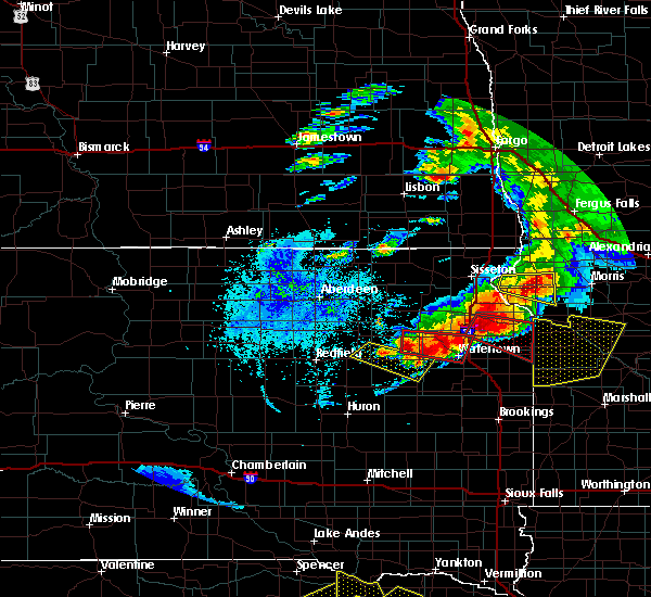 At 845 pm cdt, a severe thunderstorm capable of producing a tornado was located over stockholm, or 11 miles southwest of milbank, moving southeast at 35 mph (radar indicated rotation. at 840 pm cdt...ping pong size hail was reported by trained weather spotters 8 miles northeast of south shore). Hazards include tornado and ping pong ball size hail. Flying debris will be dangerous to those caught without shelter. mobile homes will be damaged or destroyed. damage to roofs, windows and vehicles will occur. tree damage is likely. this dangerous storm will be near, strandburg around 850 pm cdt. la bolt around 855 pm cdt. Revillo and albee around 905 pm cdt. At 845 pm cdt, a severe thunderstorm capable of producing a tornado was located over stockholm, or 11 miles southwest of milbank, moving southeast at 35 mph (radar indicated rotation. at 840 pm cdt...ping pong size hail was reported by trained weather spotters 8 miles northeast of south shore). Hazards include tornado and ping pong ball size hail. Flying debris will be dangerous to those caught without shelter. mobile homes will be damaged or destroyed. damage to roofs, windows and vehicles will occur. tree damage is likely. this dangerous storm will be near, strandburg around 850 pm cdt. la bolt around 855 pm cdt. Revillo and albee around 905 pm cdt.
|
| 7/17/2015 8:21 PM CDT |
 At 821 pm cdt, a severe thunderstorm capable of producing a tornado was located 8 miles south of summit, or 19 miles north of watertown, moving southeast at 35 mph (radar indicated rotation). Hazards include tornado and half dollar size hail. Flying debris will be dangerous to those caught without shelter. mobile homes will be damaged or destroyed. damage to roofs, windows and vehicles will occur. tree damage is likely. this dangerous storm will be near, marvin around 830 pm cdt. south shore around 835 pm cdt. twin brooks around 840 pm cdt. stockholm and troy around 845 pm cdt. strandburg around 850 pm cdt. la bolt around 855 pm cdt. Revillo and albee around 905 pm cdt. At 821 pm cdt, a severe thunderstorm capable of producing a tornado was located 8 miles south of summit, or 19 miles north of watertown, moving southeast at 35 mph (radar indicated rotation). Hazards include tornado and half dollar size hail. Flying debris will be dangerous to those caught without shelter. mobile homes will be damaged or destroyed. damage to roofs, windows and vehicles will occur. tree damage is likely. this dangerous storm will be near, marvin around 830 pm cdt. south shore around 835 pm cdt. twin brooks around 840 pm cdt. stockholm and troy around 845 pm cdt. strandburg around 850 pm cdt. la bolt around 855 pm cdt. Revillo and albee around 905 pm cdt.
|
| 7/5/2015 8:27 PM CDT | The severe thunderstorm warning for northeastern grant county will expire at 830 pm cdt, the storm which prompted the warning has weakened below severe limits, and no longer pose an immediate threat to life or property. therefore the warning will be allowed to expire. however small. |
| 7/5/2015 8:18 PM CDT |
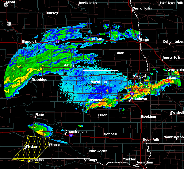 At 817 pm cdt, a severe thunderstorm was located near milbank, moving south at 20 mph (radar indicated. at 710 pm cdt...nickel size hail was reported 1 mile south of corona). Hazards include 60 mph wind gusts and quarter size hail. Hail damage to vehicles is expected. expect wind damage to roofs, siding and trees. This severe storm will be near, milbank around 825 pm cdt. At 817 pm cdt, a severe thunderstorm was located near milbank, moving south at 20 mph (radar indicated. at 710 pm cdt...nickel size hail was reported 1 mile south of corona). Hazards include 60 mph wind gusts and quarter size hail. Hail damage to vehicles is expected. expect wind damage to roofs, siding and trees. This severe storm will be near, milbank around 825 pm cdt.
|
| 7/5/2015 7:46 PM CDT |
 At 746 pm cdt, a severe thunderstorm was located over corona, or 8 miles northwest of milbank, moving southeast at 20 mph (radar indicated). Hazards include 60 mph wind gusts and quarter size hail. Hail damage to vehicles is expected. expect wind damage to roofs, siding and trees. this severe thunderstorm will be near, twin brooks around 805 pm cdt. Milbank around 810 pm cdt. At 746 pm cdt, a severe thunderstorm was located over corona, or 8 miles northwest of milbank, moving southeast at 20 mph (radar indicated). Hazards include 60 mph wind gusts and quarter size hail. Hail damage to vehicles is expected. expect wind damage to roofs, siding and trees. this severe thunderstorm will be near, twin brooks around 805 pm cdt. Milbank around 810 pm cdt.
|
| 6/22/2015 2:13 AM CDT |
 At 213 am cdt, a severe thunderstorm was located near ortley, or 19 miles east of webster, moving east at 40 mph (radar indicated). Hazards include 60 mph wind gusts and quarter size hail. Hail damage to vehicles is expected. expect wind damage to roofs, siding and trees. this severe thunderstorm will be near, summit around 220 am cdt. marvin around 230 am cdt. twin brooks around 240 am cdt. Milbank around 255 am cdt. At 213 am cdt, a severe thunderstorm was located near ortley, or 19 miles east of webster, moving east at 40 mph (radar indicated). Hazards include 60 mph wind gusts and quarter size hail. Hail damage to vehicles is expected. expect wind damage to roofs, siding and trees. this severe thunderstorm will be near, summit around 220 am cdt. marvin around 230 am cdt. twin brooks around 240 am cdt. Milbank around 255 am cdt.
|
| 5/19/2014 5:20 AM CDT | Quarter sized hail reported 2.4 miles S of Milbank, SD, social media report... location estimated based on radar north of milbank |
| 6/21/2013 4:55 PM CDT | Law enforcement reports major tree and structural damage in and around milbank in grant county SD, 0.4 miles SSE of Milbank, SD |
| 6/21/2013 4:50 PM CDT | Wind damage started 2 miles north of milbank and continued south into town on state highway 15 in grant county SD, 2.4 miles S of Milbank, SD |
| 6/21/2013 4:40 PM CDT | Law enforcement reports major tree and structural damage in and around milbank in grant county SD, 0.4 miles SSE of Milbank, SD |
| 6/17/2012 8:35 PM CDT | Quarter sized hail reported 6.7 miles NNW of Milbank, SD |
| 6/17/2012 8:25 PM CDT | Ping Pong Ball sized hail reported 6.6 miles N of Milbank, SD |
| 6/17/2012 8:25 PM CDT | Quarter sized hail reported 0.4 miles NNE of Milbank, SD, mostly pea size. no strong winds. |
| 5/2/2012 9:30 PM CDT | Quarter sized hail reported 7.9 miles N of Milbank, SD |
| 1/1/0001 12:00 AM | Storm damage reported in grant county SD, 0.4 miles SSE of Milbank, SD |
Hail Maps for Milbank, SD

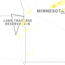


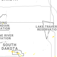


Connect with Interactive Hail Maps