

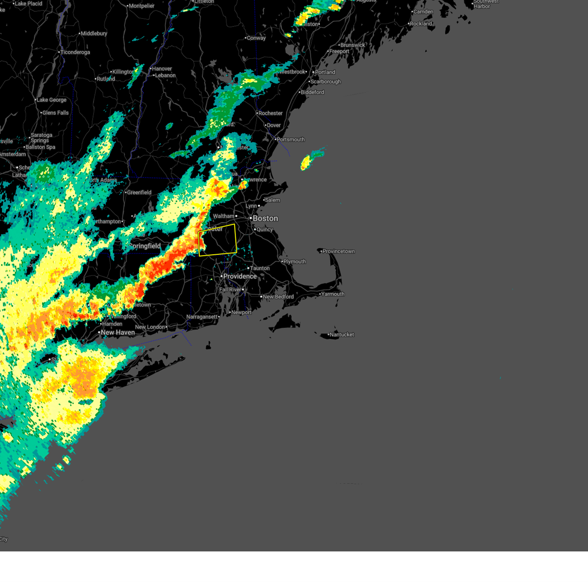
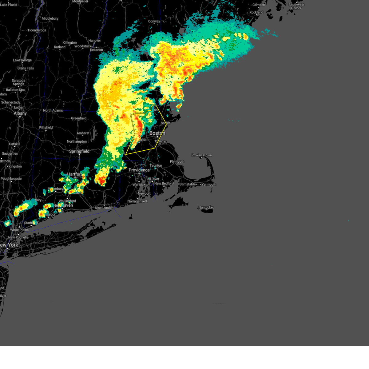
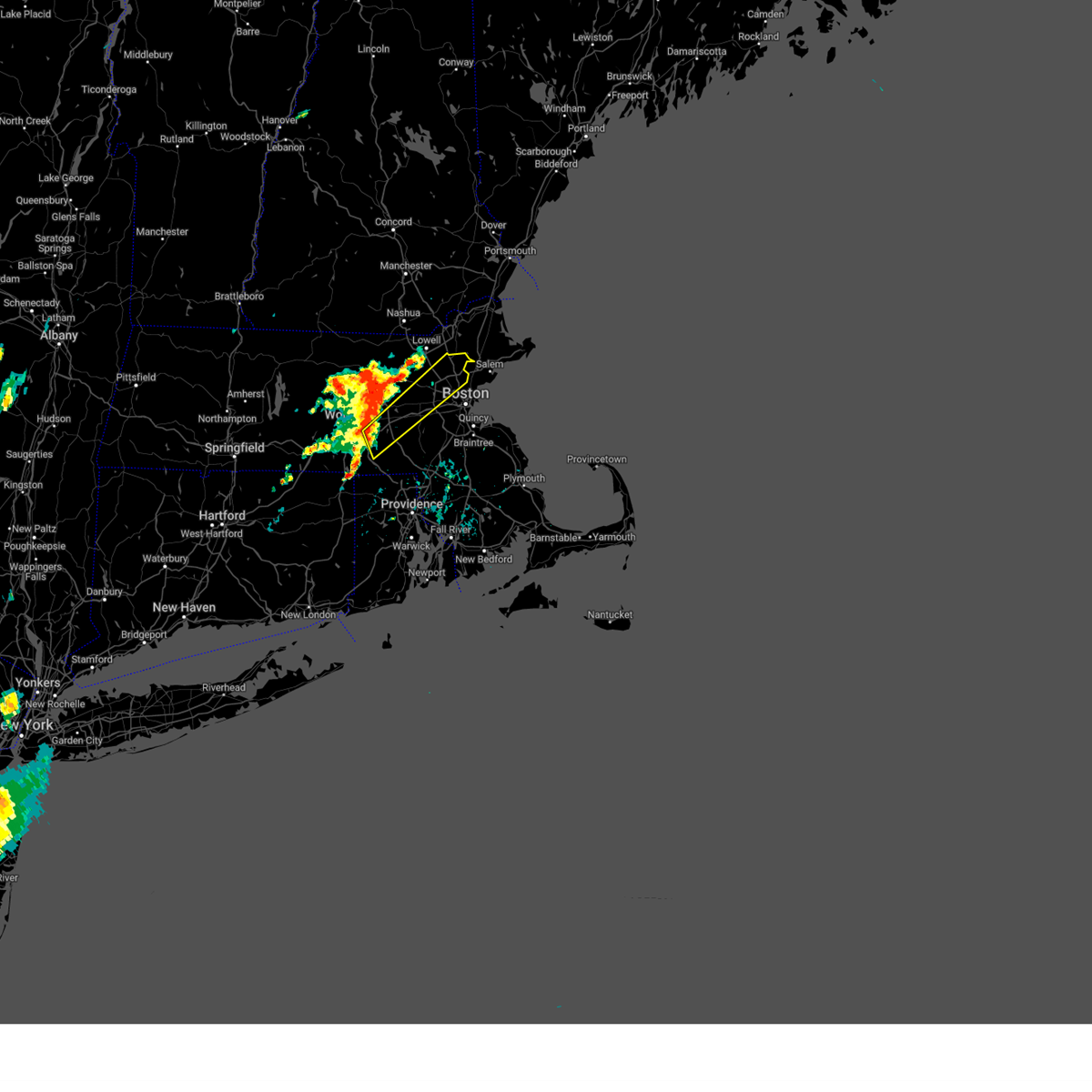
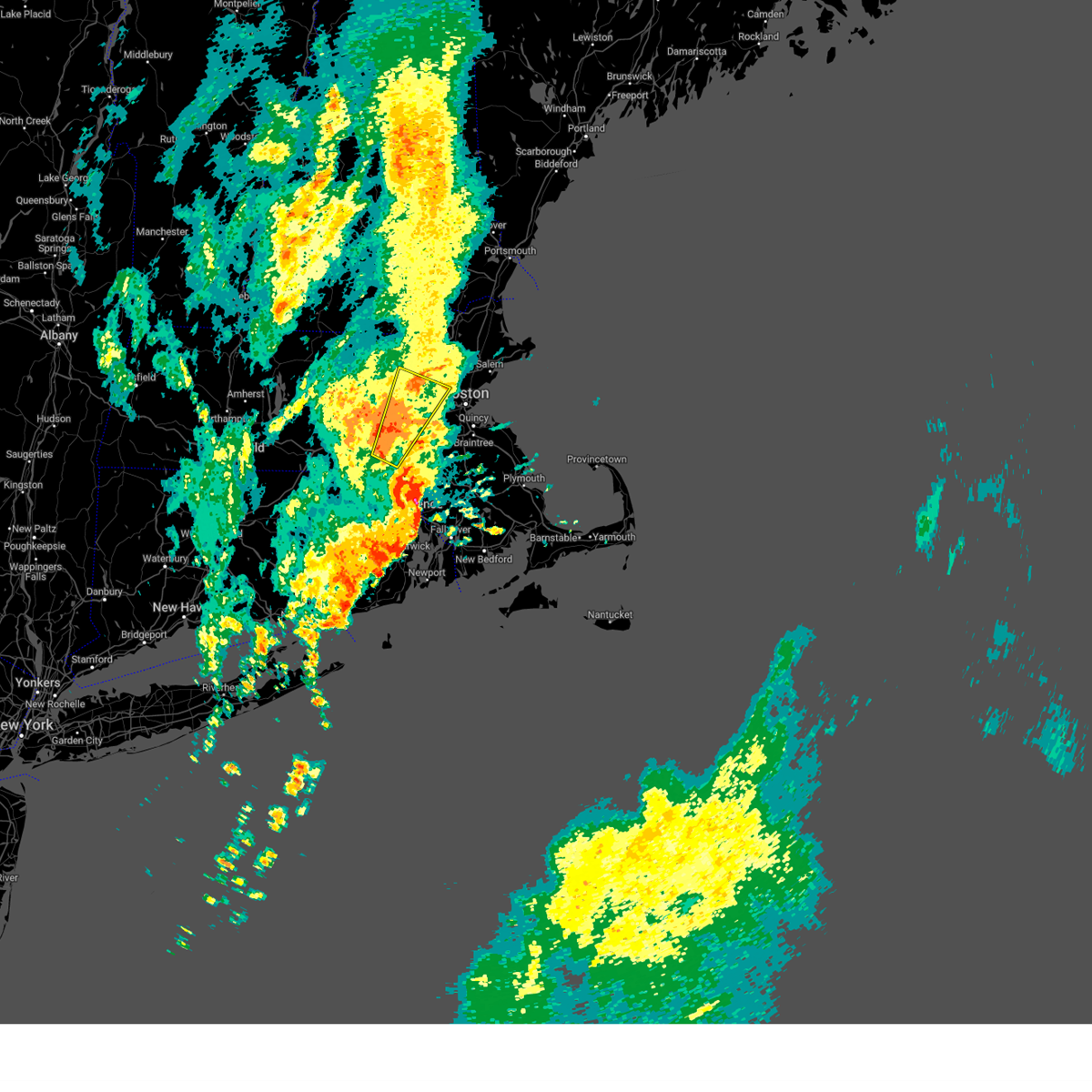
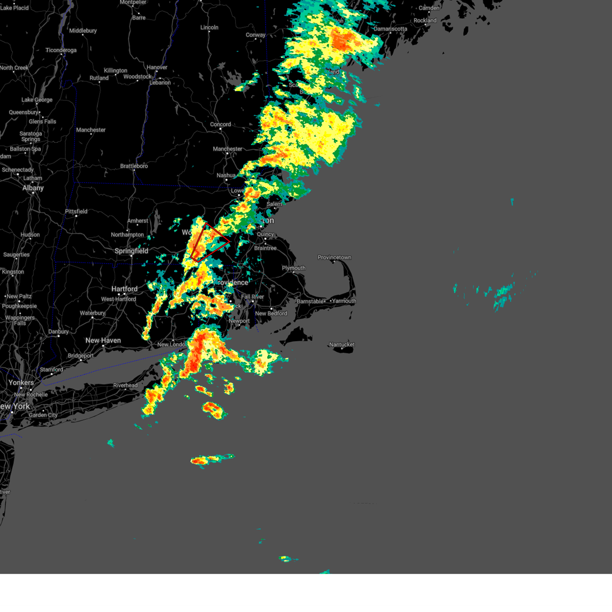
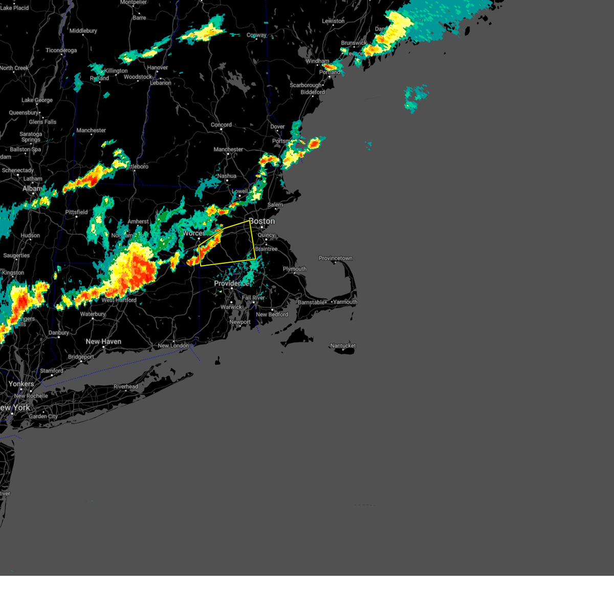
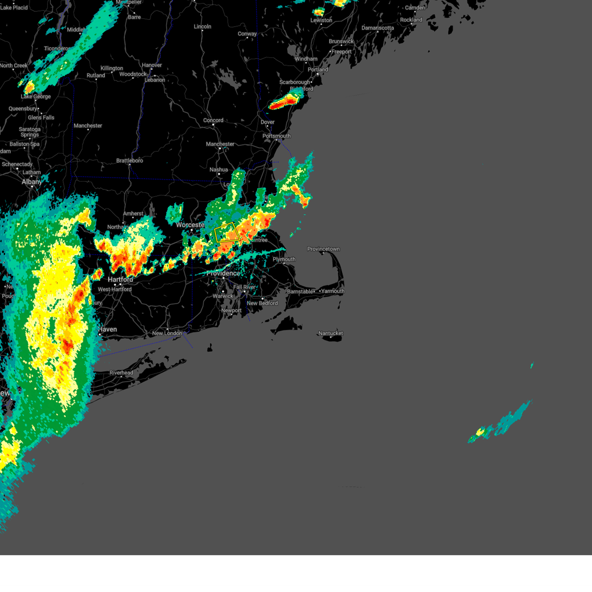
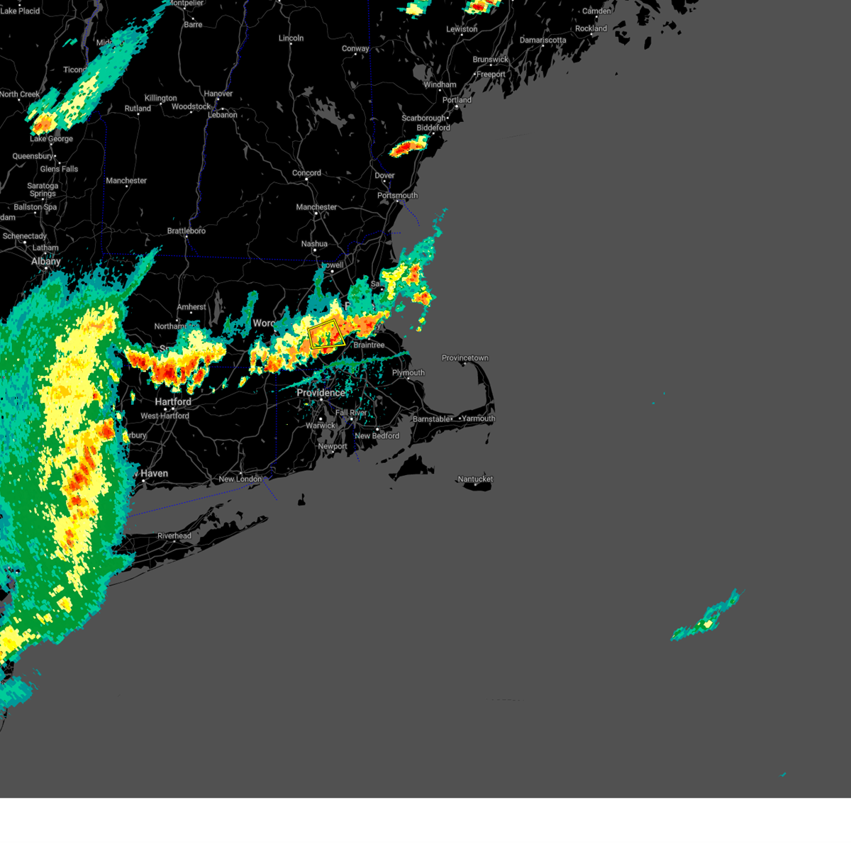
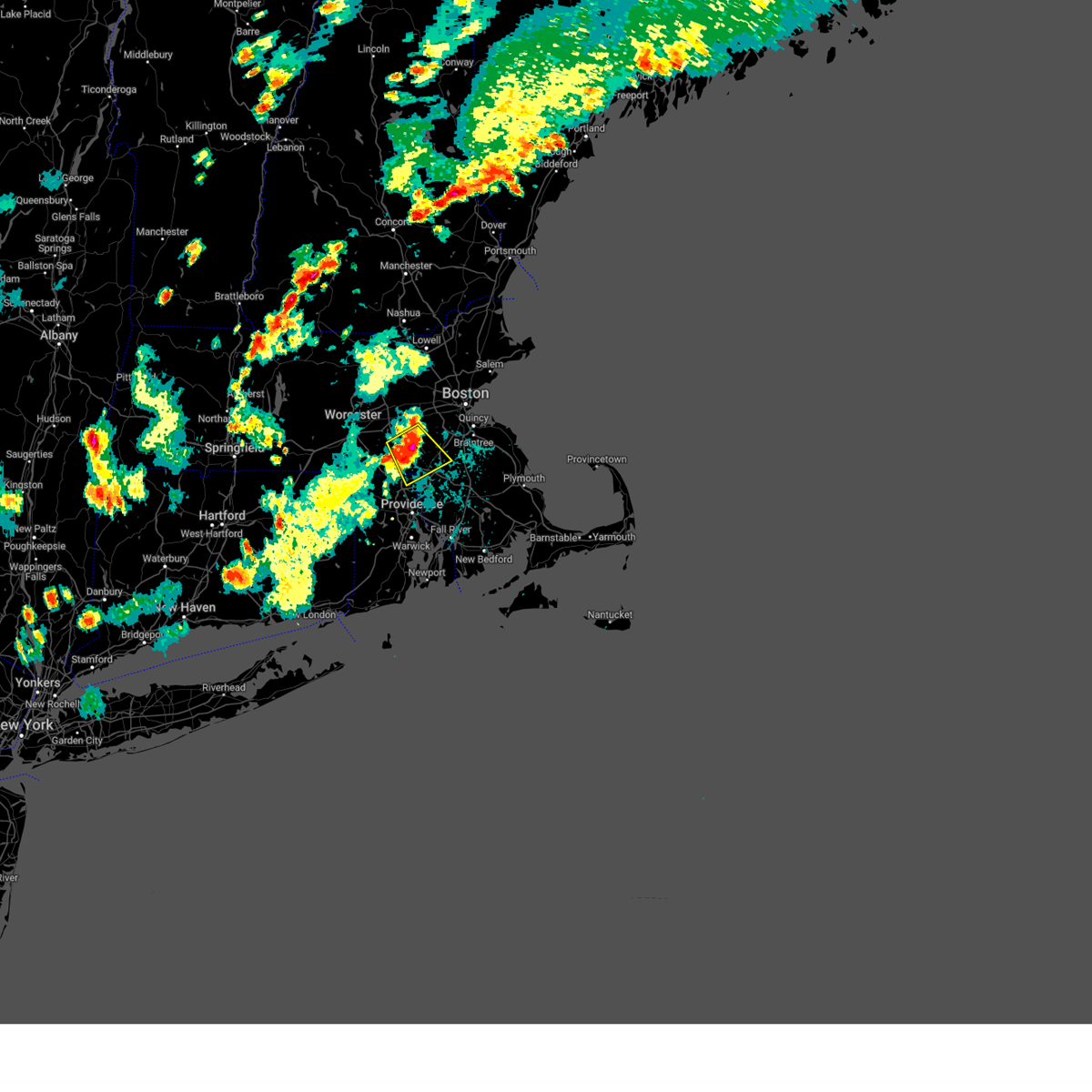
Hail Map for Milford, MA
The Milford, MA area has had 5 reports of on-the-ground hail by trained spotters, and has been under severe weather warnings 5 times during the past 12 months. Doppler radar has detected hail at or near Milford, MA on 20 occasions, including 1 occasion during the past year.
| Name: | Milford, MA |
| Where Located: | 23.6 miles NNW of Providence, RI |
| Map: | Google Map for Milford, MA |
| Population: | 25055 |
| Housing Units: | 10337 |
| More Info: | Search Google for Milford, MA |
0
The Top Recent Hail Date for Milford, MA is Thursday, August 15, 2024 (18th out of 20)

Hail and Wind Damage Spotted near Milford, MA
| Date / Time | Report Details |
|---|---|
| 7/1/2025 7:15 PM EDT |
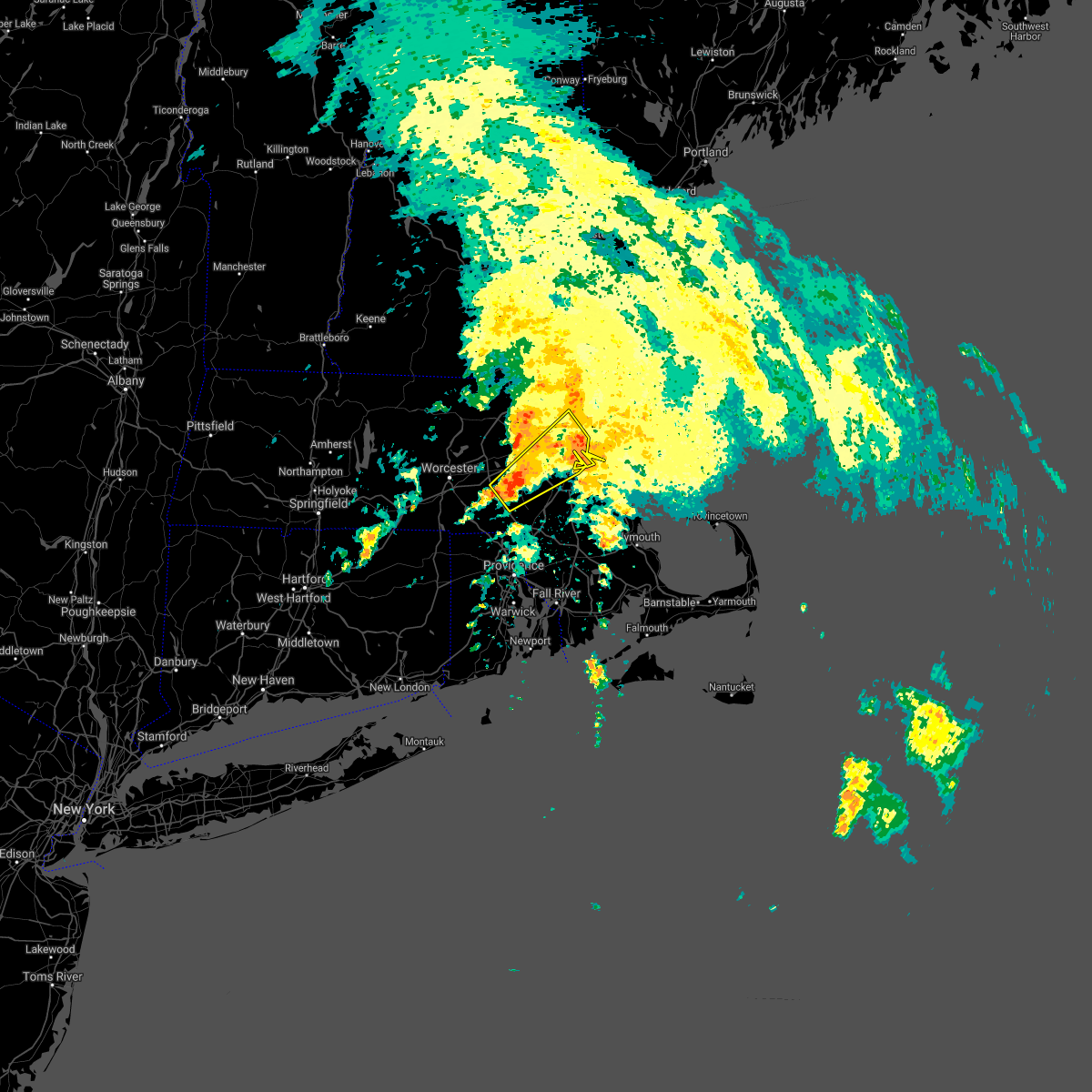
 Svrbox the national weather service in boston/norton has issued a * severe thunderstorm warning for, southeastern worcester county in central massachusetts, western norfolk county in eastern massachusetts, south central middlesex county in northeastern massachusetts, * until 745 pm edt. * at 715 pm edt, a severe thunderstorm was located over northbridge, or near milford, moving east at 35 mph (radar indicated). Hazards include 60 mph wind gusts. expect damage to trees and power lines Svrbox the national weather service in boston/norton has issued a * severe thunderstorm warning for, southeastern worcester county in central massachusetts, western norfolk county in eastern massachusetts, south central middlesex county in northeastern massachusetts, * until 745 pm edt. * at 715 pm edt, a severe thunderstorm was located over northbridge, or near milford, moving east at 35 mph (radar indicated). Hazards include 60 mph wind gusts. expect damage to trees and power lines
|
| 5/3/2025 5:29 PM EDT |
 the severe thunderstorm warning has been cancelled and is no longer in effect the severe thunderstorm warning has been cancelled and is no longer in effect
|
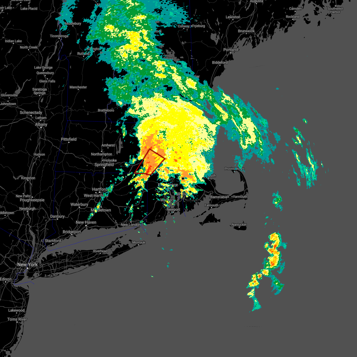
| 5/3/2025 5:29 PM EDT |
 At 528 pm edt, severe thunderstorms were located along a line extending from tyngsborough to near concord to hopedale, moving east at 40 mph (automated weather station reported. at 455 pm edt, a wind gust of 61 mph was reported at worcester airport). Hazards include 60 mph wind gusts. Expect damage to trees and power lines. Locations impacted include, sudbury, woburn, belmont, lynn, dunstable, everett, carlisle, cambridge, lexington, waltham, dracut, acton, north reading, dedham, hopedale, chelsea, wilmington, lincoln, arlington, and methuen. At 528 pm edt, severe thunderstorms were located along a line extending from tyngsborough to near concord to hopedale, moving east at 40 mph (automated weather station reported. at 455 pm edt, a wind gust of 61 mph was reported at worcester airport). Hazards include 60 mph wind gusts. Expect damage to trees and power lines. Locations impacted include, sudbury, woburn, belmont, lynn, dunstable, everett, carlisle, cambridge, lexington, waltham, dracut, acton, north reading, dedham, hopedale, chelsea, wilmington, lincoln, arlington, and methuen.
|
| 5/3/2025 5:06 PM EDT | Svrbox the national weather service in boston/norton has issued a * severe thunderstorm warning for, northeastern windham county in northern connecticut, western essex county in northeastern massachusetts, suffolk county in eastern massachusetts, eastern worcester county in central massachusetts, central norfolk county in eastern massachusetts, middlesex county in northeastern massachusetts, * until 545 pm edt. * at 505 pm edt, severe thunderstorms were located along a line extending from fitchburg to near berlin to webster, moving east at 40 mph (automated weather station reported. at 455 pm edt, a wind gust of 61 mph was reported at worcester airport). Hazards include 60 mph wind gusts. expect damage to trees and power lines |
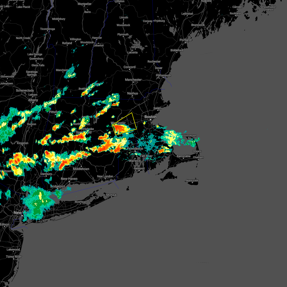
| 7/17/2024 6:23 PM EDT | Svrbox the national weather service in boston/norton has issued a * severe thunderstorm warning for, worcester county in central massachusetts, central middlesex county in northeastern massachusetts, southeastern hampden county in western massachusetts, * until 730 pm edt. * at 622 pm edt, severe thunderstorms were located along a line extending from near ashburnham to spencer to near monson, moving east at 30 mph (radar indicated). Hazards include 60 mph wind gusts and penny size hail. expect damage to roofs, siding, and trees |
| 6/26/2024 11:29 PM EDT |
 the severe thunderstorm warning has been cancelled and is no longer in effect the severe thunderstorm warning has been cancelled and is no longer in effect
|
| 6/26/2024 10:46 PM EDT |
 Svrbox the national weather service in boston/norton has issued a * severe thunderstorm warning for, northeastern windham county in northern connecticut, southeastern worcester county in central massachusetts, southwestern norfolk county in eastern massachusetts, south central middlesex county in northeastern massachusetts, washington county in rhode island, kent county in rhode island, providence county in rhode island, * until 1145 pm edt. * at 1045 pm edt, severe thunderstorms were located along a line extending from union to canterbury to near groton, moving east at 55 mph (radar indicated). Hazards include 70 mph wind gusts. Expect considerable tree damage. Damage is likely to mobile homes, roofs, and outbuildings. Svrbox the national weather service in boston/norton has issued a * severe thunderstorm warning for, northeastern windham county in northern connecticut, southeastern worcester county in central massachusetts, southwestern norfolk county in eastern massachusetts, south central middlesex county in northeastern massachusetts, washington county in rhode island, kent county in rhode island, providence county in rhode island, * until 1145 pm edt. * at 1045 pm edt, severe thunderstorms were located along a line extending from union to canterbury to near groton, moving east at 55 mph (radar indicated). Hazards include 70 mph wind gusts. Expect considerable tree damage. Damage is likely to mobile homes, roofs, and outbuildings.
|
| 6/14/2024 1:35 PM EDT |
 At 133 pm edt, severe thunderstorms were located along a line extending from wakefield to newton to medfield, moving east at 35 mph (trained weather spotters. several reports of downed trees and powerlines have been reported between 125 and 130 pm in the towns of cambridge, arlington and medford). Hazards include 60 mph wind gusts. Expect damage to roofs, siding, and trees. Locations impacted include, boston, cambridge, quincy, lynn, newton, somerville, framingham, waltham, malden, brookline, medford, weymouth, revere, peabody, arlington, everett, salem, beverly, woburn, and braintree. At 133 pm edt, severe thunderstorms were located along a line extending from wakefield to newton to medfield, moving east at 35 mph (trained weather spotters. several reports of downed trees and powerlines have been reported between 125 and 130 pm in the towns of cambridge, arlington and medford). Hazards include 60 mph wind gusts. Expect damage to roofs, siding, and trees. Locations impacted include, boston, cambridge, quincy, lynn, newton, somerville, framingham, waltham, malden, brookline, medford, weymouth, revere, peabody, arlington, everett, salem, beverly, woburn, and braintree.
|
| 6/14/2024 1:22 PM EDT |
 Svrbox the national weather service in boston/norton has issued a * severe thunderstorm warning for, southeastern essex county in northeastern massachusetts, southeastern worcester county in central massachusetts, norfolk county in eastern massachusetts, suffolk county in eastern massachusetts, southeastern middlesex county in northeastern massachusetts, northwestern plymouth county in southeastern massachusetts, * until 215 pm edt. * at 122 pm edt, severe thunderstorms were located along a line extending from woburn to wellesley to medway, moving east at 35 mph (radar indicated). Hazards include 60 mph wind gusts. expect damage to roofs, siding, and trees Svrbox the national weather service in boston/norton has issued a * severe thunderstorm warning for, southeastern essex county in northeastern massachusetts, southeastern worcester county in central massachusetts, norfolk county in eastern massachusetts, suffolk county in eastern massachusetts, southeastern middlesex county in northeastern massachusetts, northwestern plymouth county in southeastern massachusetts, * until 215 pm edt. * at 122 pm edt, severe thunderstorms were located along a line extending from woburn to wellesley to medway, moving east at 35 mph (radar indicated). Hazards include 60 mph wind gusts. expect damage to roofs, siding, and trees
|
| 9/8/2023 2:15 PM EDT |
 At 215 pm edt, a severe thunderstorm was located over grafton, or near shrewsbury, moving northeast at 35 mph (radar indicated). Hazards include 60 mph wind gusts and quarter size hail. Hail damage to vehicles is expected. Expect wind damage to roofs, siding, and trees. At 215 pm edt, a severe thunderstorm was located over grafton, or near shrewsbury, moving northeast at 35 mph (radar indicated). Hazards include 60 mph wind gusts and quarter size hail. Hail damage to vehicles is expected. Expect wind damage to roofs, siding, and trees.
|
| 8/18/2023 8:56 AM EDT |
 At 855 am edt, a severe thunderstorm was located over hopedale, or near milford, moving northeast at 40 mph (radar indicated). Hazards include 60 mph wind gusts and nickel size hail. expect damage to roofs, siding, and trees At 855 am edt, a severe thunderstorm was located over hopedale, or near milford, moving northeast at 40 mph (radar indicated). Hazards include 60 mph wind gusts and nickel size hail. expect damage to roofs, siding, and trees
|
| 8/18/2023 8:46 AM EDT |
 At 845 am edt, a severe thunderstorm was located over woonsocket, moving northeast at 40 mph (radar indicated). Hazards include 60 mph wind gusts and quarter size hail. Hail damage to vehicles is expected. expect wind damage to roofs, siding, and trees. Locations impacted include, providence, warwick, cranston, pawtucket, taunton, east providence, woonsocket, coventry, cumberland, north providence, franklin, west warwick, johnston, north attleborough, milford, attleboro, smithfield, lincoln, central falls, and killingly. At 845 am edt, a severe thunderstorm was located over woonsocket, moving northeast at 40 mph (radar indicated). Hazards include 60 mph wind gusts and quarter size hail. Hail damage to vehicles is expected. expect wind damage to roofs, siding, and trees. Locations impacted include, providence, warwick, cranston, pawtucket, taunton, east providence, woonsocket, coventry, cumberland, north providence, franklin, west warwick, johnston, north attleborough, milford, attleboro, smithfield, lincoln, central falls, and killingly.
|
| 8/18/2023 8:05 AM EDT |
 At 805 am edt, a severe thunderstorm was located over brooklyn, or near plainfield, moving northeast at 40 mph (radar indicated). Hazards include 60 mph wind gusts and quarter size hail. Hail damage to vehicles is expected. Expect wind damage to roofs, siding, and trees. At 805 am edt, a severe thunderstorm was located over brooklyn, or near plainfield, moving northeast at 40 mph (radar indicated). Hazards include 60 mph wind gusts and quarter size hail. Hail damage to vehicles is expected. Expect wind damage to roofs, siding, and trees.
|
| 8/8/2023 8:58 AM EDT |
 At 858 am edt, a severe thunderstorm capable of producing a tornado was located near sutton, or 11 miles south of worcester, moving northeast at 25 mph (radar indicated rotation). Hazards include tornado. Flying debris will be dangerous to those caught without shelter. mobile homes will be damaged or destroyed. damage to roofs, windows, and vehicles will occur. tree damage is likely. this dangerous storm will be near, worcester, shrewsbury, westborough, grafton, auburn, northbridge, oxford, millbury, sutton, and upton around 905 am edt. hopkinton around 910 am edt. Milford around 915 am edt. At 858 am edt, a severe thunderstorm capable of producing a tornado was located near sutton, or 11 miles south of worcester, moving northeast at 25 mph (radar indicated rotation). Hazards include tornado. Flying debris will be dangerous to those caught without shelter. mobile homes will be damaged or destroyed. damage to roofs, windows, and vehicles will occur. tree damage is likely. this dangerous storm will be near, worcester, shrewsbury, westborough, grafton, auburn, northbridge, oxford, millbury, sutton, and upton around 905 am edt. hopkinton around 910 am edt. Milford around 915 am edt.
|
| 7/29/2023 7:54 PM EDT |
 At 753 pm edt, a severe thunderstorm was located over mendon, or near milford, moving east at 45 mph (radar indicated). Hazards include 60 mph wind gusts. Expect damage to trees and power lines. locations impacted include, franklin, milford, bellingham, northbridge, uxbridge, medway, medfield, norfolk, wrentham, blackstone, plainville, millis, upton, hopedale, mendon and millville. hail threat, radar indicated max hail size, <. 75 in wind threat, radar indicated max wind gust, 60 mph. At 753 pm edt, a severe thunderstorm was located over mendon, or near milford, moving east at 45 mph (radar indicated). Hazards include 60 mph wind gusts. Expect damage to trees and power lines. locations impacted include, franklin, milford, bellingham, northbridge, uxbridge, medway, medfield, norfolk, wrentham, blackstone, plainville, millis, upton, hopedale, mendon and millville. hail threat, radar indicated max hail size, <. 75 in wind threat, radar indicated max wind gust, 60 mph.
|
| 7/29/2023 7:41 PM EDT |
 At 740 pm edt, a severe thunderstorm was located over douglas, or 12 miles southwest of milford, moving east at 50 mph (radar indicated). Hazards include 60 mph wind gusts. expect damage to trees and power lines At 740 pm edt, a severe thunderstorm was located over douglas, or 12 miles southwest of milford, moving east at 50 mph (radar indicated). Hazards include 60 mph wind gusts. expect damage to trees and power lines
|
| 7/27/2023 6:21 PM EDT |
 At 620 pm edt, a severe thunderstorm was located over hull, or near quincy, moving east at 40 mph (radar indicated). Hazards include 60 mph wind gusts. Expect damage to trees and power lines. locations impacted include, boston, cambridge, brockton, quincy, newton, framingham, brookline, weymouth, braintree, natick, randolph, franklin, needham, norwood, milford, wellesley, milton, stoughton, marshfield and dedham. hail threat, radar indicated max hail size, <. 75 in wind threat, radar indicated max wind gust, 60 mph. At 620 pm edt, a severe thunderstorm was located over hull, or near quincy, moving east at 40 mph (radar indicated). Hazards include 60 mph wind gusts. Expect damage to trees and power lines. locations impacted include, boston, cambridge, brockton, quincy, newton, framingham, brookline, weymouth, braintree, natick, randolph, franklin, needham, norwood, milford, wellesley, milton, stoughton, marshfield and dedham. hail threat, radar indicated max hail size, <. 75 in wind threat, radar indicated max wind gust, 60 mph.
|
| 7/27/2023 6:01 PM EDT |
 At 600 pm edt, a severe thunderstorm was located over dedham, or over norwood, moving east at 40 mph (radar indicated). Hazards include 60 mph wind gusts and penny size hail. expect damage to trees and power lines At 600 pm edt, a severe thunderstorm was located over dedham, or over norwood, moving east at 40 mph (radar indicated). Hazards include 60 mph wind gusts and penny size hail. expect damage to trees and power lines
|
| 7/27/2023 5:46 PM EDT |
 At 546 pm edt, a severe thunderstorm was located over holliston, or near milford, moving east at 40 mph (radar indicated). Hazards include 60 mph wind gusts. Expect damage to trees and power lines. locations impacted include, boston, newton, framingham, waltham, marlborough, natick, watertown, franklin, lexington, needham, norwood, milford, wellesley, stoughton, dedham, belmont, walpole, canton, westborough and grafton. hail threat, radar indicated max hail size, <. 75 in wind threat, radar indicated max wind gust, 60 mph. At 546 pm edt, a severe thunderstorm was located over holliston, or near milford, moving east at 40 mph (radar indicated). Hazards include 60 mph wind gusts. Expect damage to trees and power lines. locations impacted include, boston, newton, framingham, waltham, marlborough, natick, watertown, franklin, lexington, needham, norwood, milford, wellesley, stoughton, dedham, belmont, walpole, canton, westborough and grafton. hail threat, radar indicated max hail size, <. 75 in wind threat, radar indicated max wind gust, 60 mph.
|
| 7/27/2023 5:27 PM EDT |
 At 527 pm edt, a severe thunderstorm was located over northbridge, or near milford, moving east at 40 mph (radar indicated). Hazards include 60 mph wind gusts. expect damage to trees and power lines At 527 pm edt, a severe thunderstorm was located over northbridge, or near milford, moving east at 40 mph (radar indicated). Hazards include 60 mph wind gusts. expect damage to trees and power lines
|
| 7/25/2023 4:50 PM EDT |
 The severe thunderstorm warning for southeastern worcester, northwestern norfolk and south central middlesex counties will expire at 500 pm edt, the storm which prompted the warning has weakened below severe limits, and no longer poses an immediate threat to life or property. therefore, the warning will be allowed to expire. The severe thunderstorm warning for southeastern worcester, northwestern norfolk and south central middlesex counties will expire at 500 pm edt, the storm which prompted the warning has weakened below severe limits, and no longer poses an immediate threat to life or property. therefore, the warning will be allowed to expire.
|
| 7/25/2023 4:33 PM EDT |
 At 433 pm edt, a severe thunderstorm was located over ashland, or near milford, moving east at 20 mph (radar indicated). Hazards include 60 mph wind gusts and quarter size hail. Expect wind damage to trees and power lines. minor hail damage to vehicles is possible. locations impacted include, framingham, natick, needham, norwood, milford, wellesley, walpole, ashland, hopkinton, westwood, holliston, medway, medfield, weston, southborough, millis, dover and sherborn. hail threat, radar indicated max hail size, 1. 00 in wind threat, radar indicated max wind gust, 60 mph. At 433 pm edt, a severe thunderstorm was located over ashland, or near milford, moving east at 20 mph (radar indicated). Hazards include 60 mph wind gusts and quarter size hail. Expect wind damage to trees and power lines. minor hail damage to vehicles is possible. locations impacted include, framingham, natick, needham, norwood, milford, wellesley, walpole, ashland, hopkinton, westwood, holliston, medway, medfield, weston, southborough, millis, dover and sherborn. hail threat, radar indicated max hail size, 1. 00 in wind threat, radar indicated max wind gust, 60 mph.
|
| 7/25/2023 4:28 PM EDT | Tree down on power lines on esther drive. relayed by amateur radi in worcester county MA, 1.9 miles S of Milford, MA |
| 7/25/2023 4:00 PM EDT |
 At 359 pm edt, a severe thunderstorm was located over grafton, or 7 miles south of shrewsbury, moving east at 20 mph (radar indicated). Hazards include 60 mph wind gusts and quarter size hail. Expect wind damage to trees and power lines. Minor hail damage to vehicles is possible. At 359 pm edt, a severe thunderstorm was located over grafton, or 7 miles south of shrewsbury, moving east at 20 mph (radar indicated). Hazards include 60 mph wind gusts and quarter size hail. Expect wind damage to trees and power lines. Minor hail damage to vehicles is possible.
|
| 6/2/2023 5:02 PM EDT |
 At 502 pm edt, a severe thunderstorm was located over medway, or near milford, moving southeast at 10 mph (radar indicated). Hazards include 60 mph wind gusts and quarter size hail. Expect wind damage to trees and power lines. Minor hail damage to vehicles is possible. At 502 pm edt, a severe thunderstorm was located over medway, or near milford, moving southeast at 10 mph (radar indicated). Hazards include 60 mph wind gusts and quarter size hail. Expect wind damage to trees and power lines. Minor hail damage to vehicles is possible.
|
| 8/26/2022 4:07 PM EDT | At 407 pm edt, severe thunderstorms were located along a line extending from everett to norfolk to near killingly, moving east at 30 mph (radar indicated). Hazards include 60 mph wind gusts and nickel size hail. Expect damage to trees and power lines. locations impacted include, boston, cambridge, quincy, lynn, newton, somerville, framingham, waltham, malden, brookline, medford, revere, peabody, arlington, everett, salem, woonsocket, marlborough, woburn and chelsea. hail threat, radar indicated max hail size, 0. 88 in wind threat, radar indicated max wind gust, 60 mph. |
| 8/26/2022 4:07 PM EDT | At 407 pm edt, severe thunderstorms were located along a line extending from everett to norfolk to near killingly, moving east at 30 mph (radar indicated). Hazards include 60 mph wind gusts and nickel size hail. Expect damage to trees and power lines. locations impacted include, boston, cambridge, quincy, lynn, newton, somerville, framingham, waltham, malden, brookline, medford, revere, peabody, arlington, everett, salem, woonsocket, marlborough, woburn and chelsea. hail threat, radar indicated max hail size, 0. 88 in wind threat, radar indicated max wind gust, 60 mph. |
| 8/26/2022 4:07 PM EDT | At 407 pm edt, severe thunderstorms were located along a line extending from everett to norfolk to near killingly, moving east at 30 mph (radar indicated). Hazards include 60 mph wind gusts and nickel size hail. Expect damage to trees and power lines. locations impacted include, boston, cambridge, quincy, lynn, newton, somerville, framingham, waltham, malden, brookline, medford, revere, peabody, arlington, everett, salem, woonsocket, marlborough, woburn and chelsea. hail threat, radar indicated max hail size, 0. 88 in wind threat, radar indicated max wind gust, 60 mph. |
| 8/26/2022 3:47 PM EDT | At 346 pm edt, severe thunderstorms were located along a line extending from waltham to bellingham to near scotland, moving east at 35 mph (radar indicated). Hazards include 60 mph wind gusts and nickel size hail. Expect damage to trees and power lines. locations impacted include, boston, worcester, cambridge, quincy, lynn, newton, somerville, framingham, waltham, malden, brookline, medford, revere, peabody, arlington, everett, salem, woonsocket, marlborough and woburn. hail threat, radar indicated max hail size, 0. 88 in wind threat, radar indicated max wind gust, 60 mph. |
| 8/26/2022 3:47 PM EDT | At 346 pm edt, severe thunderstorms were located along a line extending from waltham to bellingham to near scotland, moving east at 35 mph (radar indicated). Hazards include 60 mph wind gusts and nickel size hail. Expect damage to trees and power lines. locations impacted include, boston, worcester, cambridge, quincy, lynn, newton, somerville, framingham, waltham, malden, brookline, medford, revere, peabody, arlington, everett, salem, woonsocket, marlborough and woburn. hail threat, radar indicated max hail size, 0. 88 in wind threat, radar indicated max wind gust, 60 mph. |
| 8/26/2022 3:47 PM EDT | At 346 pm edt, severe thunderstorms were located along a line extending from waltham to bellingham to near scotland, moving east at 35 mph (radar indicated). Hazards include 60 mph wind gusts and nickel size hail. Expect damage to trees and power lines. locations impacted include, boston, worcester, cambridge, quincy, lynn, newton, somerville, framingham, waltham, malden, brookline, medford, revere, peabody, arlington, everett, salem, woonsocket, marlborough and woburn. hail threat, radar indicated max hail size, 0. 88 in wind threat, radar indicated max wind gust, 60 mph. |
| 8/26/2022 3:24 PM EDT | At 324 pm edt, severe thunderstorms were located along a line extending from near framingham to douglas to columbia, moving east at 35 mph (radar indicated). Hazards include 60 mph wind gusts and nickel size hail. expect damage to trees and power lines |
| 8/26/2022 3:24 PM EDT | At 324 pm edt, severe thunderstorms were located along a line extending from near framingham to douglas to columbia, moving east at 35 mph (radar indicated). Hazards include 60 mph wind gusts and nickel size hail. expect damage to trees and power lines |
| 8/26/2022 3:24 PM EDT | At 324 pm edt, severe thunderstorms were located along a line extending from near framingham to douglas to columbia, moving east at 35 mph (radar indicated). Hazards include 60 mph wind gusts and nickel size hail. expect damage to trees and power lines |
| 3/7/2022 10:42 PM EST |
 At 1042 pm est, severe thunderstorms were located along a line extending from 13 miles northeast of rockport to bellingham, moving east at 70 mph (radar indicated). Hazards include 60 mph wind gusts. Expect damage to trees and power lines. locations impacted include, boston, cambridge, quincy, lynn, newton, somerville, framingham, waltham, malden, brookline, medford, revere, peabody, arlington, everett, salem, beverly, woburn, chelsea and natick. hail threat, radar indicated max hail size, <. 75 in wind threat, radar indicated max wind gust, 60 mph. At 1042 pm est, severe thunderstorms were located along a line extending from 13 miles northeast of rockport to bellingham, moving east at 70 mph (radar indicated). Hazards include 60 mph wind gusts. Expect damage to trees and power lines. locations impacted include, boston, cambridge, quincy, lynn, newton, somerville, framingham, waltham, malden, brookline, medford, revere, peabody, arlington, everett, salem, beverly, woburn, chelsea and natick. hail threat, radar indicated max hail size, <. 75 in wind threat, radar indicated max wind gust, 60 mph.
|
| 3/7/2022 10:16 PM EST |
 At 1015 pm est, severe thunderstorms were located along a line extending from near haverhill to near southbridge, moving east at 70 mph (radar indicated). Hazards include 60 mph wind gusts. expect damage to trees and power lines At 1015 pm est, severe thunderstorms were located along a line extending from near haverhill to near southbridge, moving east at 70 mph (radar indicated). Hazards include 60 mph wind gusts. expect damage to trees and power lines
|
| 11/13/2021 5:34 PM EST |
 At 534 pm est, severe thunderstorms were located along a line extending from framingham to near dighton, moving northeast at 50 mph (radar indicated). Hazards include 60 mph wind gusts and penny size hail. Expect damage to trees and power lines. Locations impacted include, boston, cambridge, brockton, quincy, newton, framingham, waltham, brookline, taunton, weymouth, arlington, braintree, natick, randolph, watertown, franklin, needham, north attleborough, norwood and milford. At 534 pm est, severe thunderstorms were located along a line extending from framingham to near dighton, moving northeast at 50 mph (radar indicated). Hazards include 60 mph wind gusts and penny size hail. Expect damage to trees and power lines. Locations impacted include, boston, cambridge, brockton, quincy, newton, framingham, waltham, brookline, taunton, weymouth, arlington, braintree, natick, randolph, watertown, franklin, needham, north attleborough, norwood and milford.
|
| 11/13/2021 5:26 PM EST |
 At 526 pm est, severe thunderstorms were located along a line extending from westborough to seekonk, moving northeast at 50 mph (radar indicated). Hazards include 60 mph wind gusts and penny size hail. expect damage to trees and power lines At 526 pm est, severe thunderstorms were located along a line extending from westborough to seekonk, moving northeast at 50 mph (radar indicated). Hazards include 60 mph wind gusts and penny size hail. expect damage to trees and power lines
|
| 11/13/2021 5:17 PM EST |
 At 517 pm est, severe thunderstorms were located along a line extending from sutton to north smithfield to near providence, moving northeast at 50 mph (radar indicated). Hazards include 60 mph wind gusts and penny size hail. expect damage to trees and power lines At 517 pm est, severe thunderstorms were located along a line extending from sutton to north smithfield to near providence, moving northeast at 50 mph (radar indicated). Hazards include 60 mph wind gusts and penny size hail. expect damage to trees and power lines
|
| 9/28/2021 10:24 AM EDT |
 The severe thunderstorm warning for southwestern suffolk, norfolk, southeastern worcester, southeastern middlesex, northwestern bristol and northeastern providence counties will expire at 1030 am edt, additional thunderstorms with heavy rain, small hail and gusty winds will continue to impact this region over the next hour. however, the core of the strongest storm has exited the region. therefore, the warning will be allowed to expire. however small hail, gusty winds and heavy rain are still possible with this thunderstorm. The severe thunderstorm warning for southwestern suffolk, norfolk, southeastern worcester, southeastern middlesex, northwestern bristol and northeastern providence counties will expire at 1030 am edt, additional thunderstorms with heavy rain, small hail and gusty winds will continue to impact this region over the next hour. however, the core of the strongest storm has exited the region. therefore, the warning will be allowed to expire. however small hail, gusty winds and heavy rain are still possible with this thunderstorm.
|
| 9/28/2021 10:03 AM EDT |
 At 1002 am edt, a severe thunderstorm was located over holbrook, or near randolph, moving east at 40 mph (trained weather spotters reported penny sized hail in cumberland rhode island at 940 am). Hazards include quarter size hail. Minor hail damage to vehicles is possible. locations impacted include, boston, worcester, quincy, newton, framingham, waltham, brookline, weymouth, arlington, woonsocket, braintree, shrewsbury, cumberland, natick, randolph, watertown, franklin, lexington, needham and north attleborough. hail threat, radar indicated max hail size, 1. 00 in wind threat, radar indicated max wind gust, <50 mph. At 1002 am edt, a severe thunderstorm was located over holbrook, or near randolph, moving east at 40 mph (trained weather spotters reported penny sized hail in cumberland rhode island at 940 am). Hazards include quarter size hail. Minor hail damage to vehicles is possible. locations impacted include, boston, worcester, quincy, newton, framingham, waltham, brookline, weymouth, arlington, woonsocket, braintree, shrewsbury, cumberland, natick, randolph, watertown, franklin, lexington, needham and north attleborough. hail threat, radar indicated max hail size, 1. 00 in wind threat, radar indicated max wind gust, <50 mph.
|
| 9/28/2021 9:29 AM EDT |
 At 928 am edt, a severe thunderstorm was located over woonsocket, moving northeast at 35 mph (radar indicated). Hazards include quarter size hail. minor hail damage to vehicles is possible At 928 am edt, a severe thunderstorm was located over woonsocket, moving northeast at 35 mph (radar indicated). Hazards include quarter size hail. minor hail damage to vehicles is possible
|
| 8/19/2021 11:36 AM EDT |
 At 1136 am edt, a severe thunderstorm was located over holliston, or near natick, moving northeast at 25 mph (radar indicated). Hazards include 60 mph wind gusts and quarter size hail. Expect wind damage to trees and power lines. Minor hail damage to vehicles is possible. At 1136 am edt, a severe thunderstorm was located over holliston, or near natick, moving northeast at 25 mph (radar indicated). Hazards include 60 mph wind gusts and quarter size hail. Expect wind damage to trees and power lines. Minor hail damage to vehicles is possible.
|
| 8/19/2021 10:21 AM EDT |
 At 1021 am edt, a severe thunderstorm capable of producing a tornado was located over webster, or 13 miles south of worcester, moving northeast at 25 mph (radar indicated rotation). Hazards include tornado and quarter size hail. Flying debris will be dangerous to those caught without shelter. mobile homes will be damaged or destroyed. damage to roofs, windows, and vehicles will occur. tree damage is likely. this dangerous storm will be near, douglas around 1030 am edt. oxford around 1035 am edt. auburn and sutton around 1045 am edt. northbridge and millbury around 1050 am edt. worcester and grafton around 1100 am edt. upton around 1105 am edt. shrewsbury around 1110 am edt. Westborough, hopkinton, northborough and boylston around 1115 am edt. At 1021 am edt, a severe thunderstorm capable of producing a tornado was located over webster, or 13 miles south of worcester, moving northeast at 25 mph (radar indicated rotation). Hazards include tornado and quarter size hail. Flying debris will be dangerous to those caught without shelter. mobile homes will be damaged or destroyed. damage to roofs, windows, and vehicles will occur. tree damage is likely. this dangerous storm will be near, douglas around 1030 am edt. oxford around 1035 am edt. auburn and sutton around 1045 am edt. northbridge and millbury around 1050 am edt. worcester and grafton around 1100 am edt. upton around 1105 am edt. shrewsbury around 1110 am edt. Westborough, hopkinton, northborough and boylston around 1115 am edt.
|
| 8/19/2021 10:14 AM EDT |
 At 1014 am edt, a severe thunderstorm was located over webster, or 16 miles south of worcester, moving northeast at 25 mph (radar indicated). Hazards include 60 mph wind gusts and quarter size hail. Expect wind damage to trees and power lines. Minor hail damage to vehicles is possible. At 1014 am edt, a severe thunderstorm was located over webster, or 16 miles south of worcester, moving northeast at 25 mph (radar indicated). Hazards include 60 mph wind gusts and quarter size hail. Expect wind damage to trees and power lines. Minor hail damage to vehicles is possible.
|
| 8/12/2021 6:13 PM EDT |
 At 612 pm edt, severe thunderstorms were located along a line extending from spencer to near willington, moving east at 45 mph (radar indicated). Hazards include 60 mph wind gusts. expect damage to trees and power lines At 612 pm edt, severe thunderstorms were located along a line extending from spencer to near willington, moving east at 45 mph (radar indicated). Hazards include 60 mph wind gusts. expect damage to trees and power lines
|
| 7/30/2021 7:57 PM EDT |
 At 757 pm edt, a severe thunderstorm was located near putnam, or 15 miles west of woonsocket, moving east at 30 mph (radar indicated). Hazards include 60 mph wind gusts. Expect damage to trees and power lines. Locations impacted include, vernon, johnston, milford, mansfield, smithfield, killingly, webster, southbridge, burrillville, northbridge, ellington, tolland, wilbraham, oxford, uxbridge, millbury, charlton, coventry, stafford and north smithfield. At 757 pm edt, a severe thunderstorm was located near putnam, or 15 miles west of woonsocket, moving east at 30 mph (radar indicated). Hazards include 60 mph wind gusts. Expect damage to trees and power lines. Locations impacted include, vernon, johnston, milford, mansfield, smithfield, killingly, webster, southbridge, burrillville, northbridge, ellington, tolland, wilbraham, oxford, uxbridge, millbury, charlton, coventry, stafford and north smithfield.
|
| 7/27/2021 7:14 PM EDT |
 At 713 pm edt, severe thunderstorms were located along a line extending from littleton to near sutton, moving east at 40 mph (trained weather spotters. multiple trees and powerlines have been downed in worcester and westborough from these severe thunderstorms). Hazards include 60 mph wind gusts and nickel size hail. Expect damage to trees and power lines. Locations impacted include, boston, worcester, cambridge, brockton, quincy, newton, somerville, framingham, waltham, malden, brookline, medford, weymouth, revere, arlington, everett, billerica, marlborough, woburn and braintree. At 713 pm edt, severe thunderstorms were located along a line extending from littleton to near sutton, moving east at 40 mph (trained weather spotters. multiple trees and powerlines have been downed in worcester and westborough from these severe thunderstorms). Hazards include 60 mph wind gusts and nickel size hail. Expect damage to trees and power lines. Locations impacted include, boston, worcester, cambridge, brockton, quincy, newton, somerville, framingham, waltham, malden, brookline, medford, weymouth, revere, arlington, everett, billerica, marlborough, woburn and braintree.
|
| 7/27/2021 6:57 PM EDT |
 At 656 pm edt, severe thunderstorms were located along a line extending from ayer to auburn, moving east at 35 mph (trained weather spotters. multiple trees and powerlines been downed in worcester from these severe thunderstorms. in addition, a 52 mph wind gust was reported at worcester airport at 633 pm). Hazards include 60 mph wind gusts and quarter size hail. Expect wind damage to trees and power lines. minor hail damage to vehicles is possible. Locations impacted include, boston, worcester, cambridge, brockton, quincy, newton, somerville, framingham, waltham, malden, brookline, medford, weymouth, revere, arlington, everett, leominster, fitchburg, billerica and marlborough. At 656 pm edt, severe thunderstorms were located along a line extending from ayer to auburn, moving east at 35 mph (trained weather spotters. multiple trees and powerlines been downed in worcester from these severe thunderstorms. in addition, a 52 mph wind gust was reported at worcester airport at 633 pm). Hazards include 60 mph wind gusts and quarter size hail. Expect wind damage to trees and power lines. minor hail damage to vehicles is possible. Locations impacted include, boston, worcester, cambridge, brockton, quincy, newton, somerville, framingham, waltham, malden, brookline, medford, weymouth, revere, arlington, everett, leominster, fitchburg, billerica and marlborough.
|
| 7/27/2021 6:33 PM EDT |
 At 632 pm edt, severe thunderstorms were located along a line extending from near fitchburg to leicester, moving east at 40 mph (radar indicated). Hazards include 60 mph wind gusts and nickel size hail. expect damage to trees and power lines At 632 pm edt, severe thunderstorms were located along a line extending from near fitchburg to leicester, moving east at 40 mph (radar indicated). Hazards include 60 mph wind gusts and nickel size hail. expect damage to trees and power lines
|
| 7/17/2021 4:34 PM EDT |
 At 434 pm edt, a severe thunderstorm was located near shrewsbury, moving northeast at 25 mph (radar indicated). Hazards include 60 mph wind gusts and quarter size hail. Expect wind damage to trees and power lines. Minor hail damage to vehicles is possible. At 434 pm edt, a severe thunderstorm was located near shrewsbury, moving northeast at 25 mph (radar indicated). Hazards include 60 mph wind gusts and quarter size hail. Expect wind damage to trees and power lines. Minor hail damage to vehicles is possible.
|
| 7/16/2021 5:47 PM EDT |
 The national weather service in boston/norton has issued a * severe thunderstorm warning for. southwestern suffolk county in eastern massachusetts. norfolk county in eastern massachusetts. southeastern worcester county in central massachusetts. South central middlesex county in northeastern massachusetts. The national weather service in boston/norton has issued a * severe thunderstorm warning for. southwestern suffolk county in eastern massachusetts. norfolk county in eastern massachusetts. southeastern worcester county in central massachusetts. South central middlesex county in northeastern massachusetts.
|
| 7/16/2021 5:47 PM EDT |
 At 546 pm edt, severe thunderstorms were located along a line extending from dover to norfolk to franklin to uxbridge, moving east at 30 mph (radar indicated). Hazards include 60 mph wind gusts. expect damage to trees and power lines At 546 pm edt, severe thunderstorms were located along a line extending from dover to norfolk to franklin to uxbridge, moving east at 30 mph (radar indicated). Hazards include 60 mph wind gusts. expect damage to trees and power lines
|
| 7/16/2021 4:36 PM EDT |
 At 435 pm edt, a severe thunderstorm was located over auburn, or near worcester, moving east at 25 mph (radar indicated). Hazards include 60 mph wind gusts, torrential rainfall and minor flooding. expect damage to trees and power lines At 435 pm edt, a severe thunderstorm was located over auburn, or near worcester, moving east at 25 mph (radar indicated). Hazards include 60 mph wind gusts, torrential rainfall and minor flooding. expect damage to trees and power lines
|
| 7/7/2021 7:08 PM EDT |
 The severe thunderstorm warning for western norfolk, southeastern worcester, southeastern middlesex, northwestern bristol, northeastern washington, northwestern newport, kent, providence and western bristol counties will expire at 715 pm edt, the storms which prompted the warning have moved out of the area. therefore, the warning will be allowed to expire. a severe thunderstorm watch remains in effect until 1100 pm edt for eastern, central, southeastern and northeastern massachusetts, and rhode island. The severe thunderstorm warning for western norfolk, southeastern worcester, southeastern middlesex, northwestern bristol, northeastern washington, northwestern newport, kent, providence and western bristol counties will expire at 715 pm edt, the storms which prompted the warning have moved out of the area. therefore, the warning will be allowed to expire. a severe thunderstorm watch remains in effect until 1100 pm edt for eastern, central, southeastern and northeastern massachusetts, and rhode island.
|
| 7/7/2021 6:55 PM EDT |
 At 654 pm edt, severe thunderstorms were located along a line extending from sherborn to north providence to near exeter, moving east at 40 mph (radar indicated). Hazards include 60 mph wind gusts and penny size hail. Expect damage to trees and power lines. Locations impacted include, providence, newton, warwick, cranston, pawtucket, framingham, east providence, woonsocket, coventry, cumberland, natick, north providence, franklin, west warwick, needham, johnston, north attleborough, norwood, milford and wellesley. At 654 pm edt, severe thunderstorms were located along a line extending from sherborn to north providence to near exeter, moving east at 40 mph (radar indicated). Hazards include 60 mph wind gusts and penny size hail. Expect damage to trees and power lines. Locations impacted include, providence, newton, warwick, cranston, pawtucket, framingham, east providence, woonsocket, coventry, cumberland, natick, north providence, franklin, west warwick, needham, johnston, north attleborough, norwood, milford and wellesley.
|
| 7/7/2021 6:17 PM EDT |
 At 616 pm edt, severe thunderstorms were located along a line extending from auburn to near pomfret to preston, moving east at 40 mph (radar indicated). Hazards include 60 mph wind gusts and penny size hail. expect damage to trees and power lines At 616 pm edt, severe thunderstorms were located along a line extending from auburn to near pomfret to preston, moving east at 40 mph (radar indicated). Hazards include 60 mph wind gusts and penny size hail. expect damage to trees and power lines
|
| 7/6/2021 5:52 PM EDT |
 At 552 pm edt, severe thunderstorms were located along a line extending from near holliston to willimantic, moving southeast at 25 mph (radar indicated). Hazards include 60 mph wind gusts and penny size hail. expect damage to trees and power lines At 552 pm edt, severe thunderstorms were located along a line extending from near holliston to willimantic, moving southeast at 25 mph (radar indicated). Hazards include 60 mph wind gusts and penny size hail. expect damage to trees and power lines
|
| 7/6/2021 5:47 PM EDT |
 At 546 pm edt, a severe thunderstorm was located near douglas, or 11 miles west of woonsocket, moving east at 30 mph (radar indicated). Hazards include 60 mph wind gusts and penny size hail. Expect damage to trees and power lines. Locations impacted include, cranston, framingham, woonsocket, cumberland, north providence, johnston, milford, plainfield, smithfield, lincoln, grafton, killingly, webster, southbridge, ashland, bellingham, burrillville, northbridge, hopkinton and oxford. At 546 pm edt, a severe thunderstorm was located near douglas, or 11 miles west of woonsocket, moving east at 30 mph (radar indicated). Hazards include 60 mph wind gusts and penny size hail. Expect damage to trees and power lines. Locations impacted include, cranston, framingham, woonsocket, cumberland, north providence, johnston, milford, plainfield, smithfield, lincoln, grafton, killingly, webster, southbridge, ashland, bellingham, burrillville, northbridge, hopkinton and oxford.
|
| 7/6/2021 5:21 PM EDT |
 At 521 pm edt, a severe thunderstorm was located over dudley, or 16 miles southwest of worcester, moving east at 30 mph (radar indicated). Hazards include 60 mph wind gusts and penny size hail. expect damage to trees and power lines At 521 pm edt, a severe thunderstorm was located over dudley, or 16 miles southwest of worcester, moving east at 30 mph (radar indicated). Hazards include 60 mph wind gusts and penny size hail. expect damage to trees and power lines
|
| 6/30/2021 8:08 PM EDT |
 At 808 pm edt, a severe thunderstorm was located over mansfield, moving east at 30 mph (radar indicated). Hazards include 60 mph wind gusts and quarter size hail. Expect wind damage to trees and power lines. Minor hail damage to vehicles is possible. At 808 pm edt, a severe thunderstorm was located over mansfield, moving east at 30 mph (radar indicated). Hazards include 60 mph wind gusts and quarter size hail. Expect wind damage to trees and power lines. Minor hail damage to vehicles is possible.
|
| 6/30/2021 7:57 PM EDT |
 At 735 pm edt, a severe thunderstorm was located over woodstock, or 15 miles northeast of mansfield, moving east at 30 mph (radar indicated. at 727 pm tree an wires were knocked down in ellington, connecticut. at 732 pm, there was a tree down on 27 sturbridge road). Hazards include 60 mph wind gusts and penny size hail. Expect damage to trees and power lines. Locations impacted include, vernon, johnston, milford, mansfield, smithfield, killingly, webster, southbridge, burrillville, northbridge, ellington, tolland, wilbraham, oxford, uxbridge, millbury, charlton, coventry, stafford and north smithfield. At 735 pm edt, a severe thunderstorm was located over woodstock, or 15 miles northeast of mansfield, moving east at 30 mph (radar indicated. at 727 pm tree an wires were knocked down in ellington, connecticut. at 732 pm, there was a tree down on 27 sturbridge road). Hazards include 60 mph wind gusts and penny size hail. Expect damage to trees and power lines. Locations impacted include, vernon, johnston, milford, mansfield, smithfield, killingly, webster, southbridge, burrillville, northbridge, ellington, tolland, wilbraham, oxford, uxbridge, millbury, charlton, coventry, stafford and north smithfield.
|
| 6/30/2021 7:57 PM EDT |
 At 757 pm edt, a severe thunderstorm was located near putnam, or 15 miles west of woonsocket, moving east at 30 mph (radar indicated). Hazards include 60 mph wind gusts. Expect damage to trees and power lines. Locations impacted include, vernon, johnston, milford, mansfield, smithfield, killingly, webster, southbridge, burrillville, northbridge, ellington, tolland, wilbraham, oxford, uxbridge, millbury, charlton, coventry, stafford and north smithfield. At 757 pm edt, a severe thunderstorm was located near putnam, or 15 miles west of woonsocket, moving east at 30 mph (radar indicated). Hazards include 60 mph wind gusts. Expect damage to trees and power lines. Locations impacted include, vernon, johnston, milford, mansfield, smithfield, killingly, webster, southbridge, burrillville, northbridge, ellington, tolland, wilbraham, oxford, uxbridge, millbury, charlton, coventry, stafford and north smithfield.
|
| 6/30/2021 7:37 PM EDT |
 At 735 pm edt, a severe thunderstorm was located over woodstock, or 15 miles northeast of mansfield, moving east at 30 mph (radar indicated. at 727 pm tree an wires were knocked down in ellington, connecticut. at 732 pm, there was a tree down on 27 sturbridge road). Hazards include 60 mph wind gusts and penny size hail. Expect damage to trees and power lines. Locations impacted include, vernon, johnston, milford, mansfield, smithfield, killingly, webster, southbridge, burrillville, northbridge, ellington, tolland, wilbraham, oxford, uxbridge, millbury, charlton, coventry, stafford and north smithfield. At 735 pm edt, a severe thunderstorm was located over woodstock, or 15 miles northeast of mansfield, moving east at 30 mph (radar indicated. at 727 pm tree an wires were knocked down in ellington, connecticut. at 732 pm, there was a tree down on 27 sturbridge road). Hazards include 60 mph wind gusts and penny size hail. Expect damage to trees and power lines. Locations impacted include, vernon, johnston, milford, mansfield, smithfield, killingly, webster, southbridge, burrillville, northbridge, ellington, tolland, wilbraham, oxford, uxbridge, millbury, charlton, coventry, stafford and north smithfield.
|
| 6/30/2021 7:31 PM EDT |
 At 731 pm edt, a severe thunderstorm was located over woodstock, or 14 miles northeast of mansfield, moving east at 30 mph (radar indicated). Hazards include 60 mph wind gusts and penny size hail. Expect damage to trees and power lines. Locations impacted include, vernon, johnston, milford, mansfield, smithfield, killingly, webster, southbridge, burrillville, northbridge, ellington, tolland, wilbraham, oxford, uxbridge, millbury, charlton, coventry, stafford and north smithfield. At 731 pm edt, a severe thunderstorm was located over woodstock, or 14 miles northeast of mansfield, moving east at 30 mph (radar indicated). Hazards include 60 mph wind gusts and penny size hail. Expect damage to trees and power lines. Locations impacted include, vernon, johnston, milford, mansfield, smithfield, killingly, webster, southbridge, burrillville, northbridge, ellington, tolland, wilbraham, oxford, uxbridge, millbury, charlton, coventry, stafford and north smithfield.
|
| 6/30/2021 7:15 PM EDT |
 At 714 pm edt, a severe thunderstorm was located near stafford, or 11 miles north of mansfield, moving east at 30 mph (radar indicated). Hazards include 60 mph wind gusts and penny size hail. expect damage to trees and power lines At 714 pm edt, a severe thunderstorm was located near stafford, or 11 miles north of mansfield, moving east at 30 mph (radar indicated). Hazards include 60 mph wind gusts and penny size hail. expect damage to trees and power lines
|
| 6/30/2021 6:36 PM EDT |
 At 636 pm edt, a severe thunderstorm was located over westwood, or near norwood, moving east at 35 mph (radar indicated). Hazards include 60 mph wind gusts. Expect damage to trees and power lines. Locations impacted include, boston, quincy, framingham, weymouth, braintree, natick, randolph, needham, norwood, milford, wellesley, milton, stoughton, dedham, walpole, hingham, canton, sharon, rockland and ashland. At 636 pm edt, a severe thunderstorm was located over westwood, or near norwood, moving east at 35 mph (radar indicated). Hazards include 60 mph wind gusts. Expect damage to trees and power lines. Locations impacted include, boston, quincy, framingham, weymouth, braintree, natick, randolph, needham, norwood, milford, wellesley, milton, stoughton, dedham, walpole, hingham, canton, sharon, rockland and ashland.
|
| 6/30/2021 6:12 PM EDT |
 At 612 pm edt, a severe thunderstorm was located over upton, or near milford, moving east at 40 mph (radar indicated). Hazards include 60 mph wind gusts and quarter size hail. Expect wind damage to trees and power lines. Minor hail damage to vehicles is possible. At 612 pm edt, a severe thunderstorm was located over upton, or near milford, moving east at 40 mph (radar indicated). Hazards include 60 mph wind gusts and quarter size hail. Expect wind damage to trees and power lines. Minor hail damage to vehicles is possible.
|
| 6/29/2021 6:35 PM EDT |
 At 633 pm edt, a severe thunderstorm was located near burrillville, or 7 miles west of woonsocket, moving east at 30 mph (trained spotters and broadcast media. at 620 pm, multiple trees were downed on route 169 in woodstock, ct). Hazards include 60 mph wind gusts and penny size hail. Expect damage to trees and power lines. Locations impacted include, providence, pawtucket, east providence, woonsocket, cumberland, north providence, franklin, johnston, north attleborough, milford, attleboro, walpole, mansfield, smithfield, lincoln, central falls, grafton, killingly, foxborough and webster. At 633 pm edt, a severe thunderstorm was located near burrillville, or 7 miles west of woonsocket, moving east at 30 mph (trained spotters and broadcast media. at 620 pm, multiple trees were downed on route 169 in woodstock, ct). Hazards include 60 mph wind gusts and penny size hail. Expect damage to trees and power lines. Locations impacted include, providence, pawtucket, east providence, woonsocket, cumberland, north providence, franklin, johnston, north attleborough, milford, attleboro, walpole, mansfield, smithfield, lincoln, central falls, grafton, killingly, foxborough and webster.
|
| 6/29/2021 6:11 PM EDT |
 At 610 pm edt, a severe thunderstorm was located over webster, or 16 miles south of worcester, moving east at 30 mph (radar indicated). Hazards include 60 mph wind gusts and penny size hail. expect damage to trees and power lines At 610 pm edt, a severe thunderstorm was located over webster, or 16 miles south of worcester, moving east at 30 mph (radar indicated). Hazards include 60 mph wind gusts and penny size hail. expect damage to trees and power lines
|
| 6/8/2021 5:40 PM EDT |
 At 539 pm edt, a severe thunderstorm was located over franklin, moving east at 20 mph. up to 25 percent of customers without power in mendon and bellingham, ma as of 530 pm edt (radar indicated). Hazards include 60 mph wind gusts and quarter size hail. Expect wind damage to trees and power lines. minor hail damage to vehicles is possible. Locations impacted include, woonsocket, cumberland, franklin, north attleborough, milford, walpole, mansfield, norton, sharon, foxborough, bellingham, westwood, holliston, medway, medfield, north smithfield, norfolk, wrentham, blackstone and plainville. At 539 pm edt, a severe thunderstorm was located over franklin, moving east at 20 mph. up to 25 percent of customers without power in mendon and bellingham, ma as of 530 pm edt (radar indicated). Hazards include 60 mph wind gusts and quarter size hail. Expect wind damage to trees and power lines. minor hail damage to vehicles is possible. Locations impacted include, woonsocket, cumberland, franklin, north attleborough, milford, walpole, mansfield, norton, sharon, foxborough, bellingham, westwood, holliston, medway, medfield, north smithfield, norfolk, wrentham, blackstone and plainville.
|
| 6/8/2021 5:40 PM EDT |
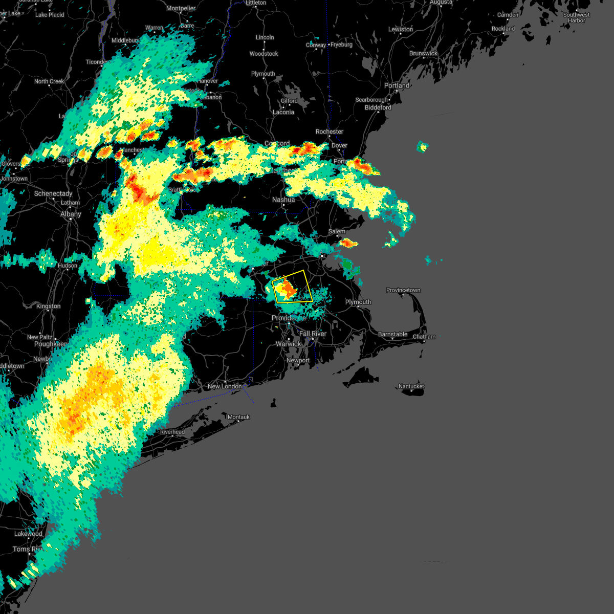 At 539 pm edt, a severe thunderstorm was located over franklin, moving east at 20 mph. up to 25 percent of customers without power in mendon and bellingham, ma as of 530 pm edt (radar indicated). Hazards include 60 mph wind gusts and quarter size hail. Expect wind damage to trees and power lines. minor hail damage to vehicles is possible. Locations impacted include, woonsocket, cumberland, franklin, north attleborough, milford, walpole, mansfield, norton, sharon, foxborough, bellingham, westwood, holliston, medway, medfield, north smithfield, norfolk, wrentham, blackstone and plainville. At 539 pm edt, a severe thunderstorm was located over franklin, moving east at 20 mph. up to 25 percent of customers without power in mendon and bellingham, ma as of 530 pm edt (radar indicated). Hazards include 60 mph wind gusts and quarter size hail. Expect wind damage to trees and power lines. minor hail damage to vehicles is possible. Locations impacted include, woonsocket, cumberland, franklin, north attleborough, milford, walpole, mansfield, norton, sharon, foxborough, bellingham, westwood, holliston, medway, medfield, north smithfield, norfolk, wrentham, blackstone and plainville.
|
| 6/8/2021 5:17 PM EDT |
 At 517 pm edt, a severe thunderstorm was located over millville, or near woonsocket, moving east at 20 mph (radar indicated). Hazards include 60 mph wind gusts and quarter size hail. Expect wind damage to trees and power lines. Minor hail damage to vehicles is possible. At 517 pm edt, a severe thunderstorm was located over millville, or near woonsocket, moving east at 20 mph (radar indicated). Hazards include 60 mph wind gusts and quarter size hail. Expect wind damage to trees and power lines. Minor hail damage to vehicles is possible.
|
| 6/8/2021 5:17 PM EDT |
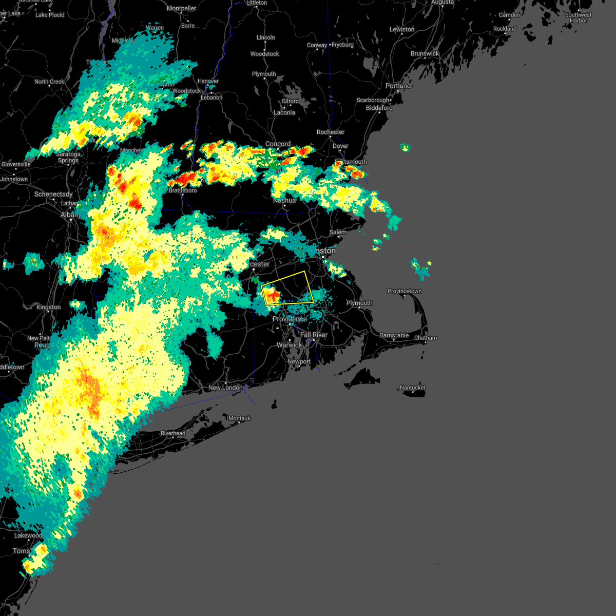 At 517 pm edt, a severe thunderstorm was located over millville, or near woonsocket, moving east at 20 mph (radar indicated). Hazards include 60 mph wind gusts and quarter size hail. Expect wind damage to trees and power lines. Minor hail damage to vehicles is possible. At 517 pm edt, a severe thunderstorm was located over millville, or near woonsocket, moving east at 20 mph (radar indicated). Hazards include 60 mph wind gusts and quarter size hail. Expect wind damage to trees and power lines. Minor hail damage to vehicles is possible.
|
| 11/15/2020 10:48 PM EST |
 At 1047 pm est, severe thunderstorms were located along a line extending from litchfield to near littleton to near mendon, moving east at 50 mph (radar indicated). Hazards include 60 mph wind gusts. Expect damage to trees and power lines. Locations impacted include, boston, lowell, cambridge, brockton, quincy, lynn, newton, lawrence, somerville, framingham, haverhill, waltham, malden, brookline, medford, weymouth, revere, peabody, methuen and arlington. At 1047 pm est, severe thunderstorms were located along a line extending from litchfield to near littleton to near mendon, moving east at 50 mph (radar indicated). Hazards include 60 mph wind gusts. Expect damage to trees and power lines. Locations impacted include, boston, lowell, cambridge, brockton, quincy, lynn, newton, lawrence, somerville, framingham, haverhill, waltham, malden, brookline, medford, weymouth, revere, peabody, methuen and arlington.
|
| 11/15/2020 10:24 PM EST |
 At 1024 pm est, severe thunderstorms were located along a line extending from near southbridge to preston to gardner`s island, moving east at 45 mph (radar indicated). Hazards include 60 mph wind gusts. expect damage to trees and power lines At 1024 pm est, severe thunderstorms were located along a line extending from near southbridge to preston to gardner`s island, moving east at 45 mph (radar indicated). Hazards include 60 mph wind gusts. expect damage to trees and power lines
|
| 11/15/2020 10:22 PM EST |
 At 1022 pm est, severe thunderstorms were located along a line extending from new ipswich to princeton to near woodstock, moving east at 50 mph (radar indicated). Hazards include 60 mph wind gusts. expect damage to trees and power lines At 1022 pm est, severe thunderstorms were located along a line extending from new ipswich to princeton to near woodstock, moving east at 50 mph (radar indicated). Hazards include 60 mph wind gusts. expect damage to trees and power lines
|
| 10/7/2020 5:38 PM EDT |
 At 537 pm edt, severe thunderstorms were located along a line extending from westborough to near enfield, moving east at 65 mph (radar indicated). Hazards include 70 mph wind gusts. Expect considerable damage to trees and power lines. Damage is likely to mobile homes and outbuildings. At 537 pm edt, severe thunderstorms were located along a line extending from westborough to near enfield, moving east at 65 mph (radar indicated). Hazards include 70 mph wind gusts. Expect considerable damage to trees and power lines. Damage is likely to mobile homes and outbuildings.
|
| 8/27/2020 2:30 PM EDT |
 At 229 pm edt, severe thunderstorms were located along a line extending from blackstone to thompson, moving southeast at 60 mph (radar indicated). Hazards include 60 mph wind gusts. Expect damage to trees and power lines. Locations impacted include, providence, new bedford, fall river, warwick, cranston, pawtucket, plymouth, taunton, east providence, woonsocket, dartmouth, cumberland, north providence, franklin, west warwick, johnston, north attleborough, milford, bristol and marion. At 229 pm edt, severe thunderstorms were located along a line extending from blackstone to thompson, moving southeast at 60 mph (radar indicated). Hazards include 60 mph wind gusts. Expect damage to trees and power lines. Locations impacted include, providence, new bedford, fall river, warwick, cranston, pawtucket, plymouth, taunton, east providence, woonsocket, dartmouth, cumberland, north providence, franklin, west warwick, johnston, north attleborough, milford, bristol and marion.
|
| 8/27/2020 2:24 PM EDT |
 At 224 pm edt, severe thunderstorms were located along a line extending from near uxbridge to near dudley, moving southeast at 60 mph (radar indicated). Hazards include 60 mph wind gusts. expect damage to trees and power lines At 224 pm edt, severe thunderstorms were located along a line extending from near uxbridge to near dudley, moving southeast at 60 mph (radar indicated). Hazards include 60 mph wind gusts. expect damage to trees and power lines
|
| 8/23/2020 6:39 PM EDT |
 At 617 pm edt, a severe thunderstorm was located over mendon, or near milford, moving east at 15 mph (radar indicated. these storms have a history of producing pockets of significant wind damage. this includes downed trees and scattered power outages. seek an indoor shelter immediately). Hazards include 60 mph wind gusts and quarter size hail. Expect wind damage to trees and power lines. Minor hail damage to vehicles is possible. At 617 pm edt, a severe thunderstorm was located over mendon, or near milford, moving east at 15 mph (radar indicated. these storms have a history of producing pockets of significant wind damage. this includes downed trees and scattered power outages. seek an indoor shelter immediately). Hazards include 60 mph wind gusts and quarter size hail. Expect wind damage to trees and power lines. Minor hail damage to vehicles is possible.
|
| 8/23/2020 6:39 PM EDT |
 At 638 pm edt, a severe thunderstorm was located over franklin, moving east at 15 mph (radar indicated). Hazards include 60 mph wind gusts and penny size hail. Expect damage to trees and power lines. Locations impacted include, brockton, plymouth, taunton, woonsocket, cumberland, franklin, north attleborough, milford, stoughton, bridgewater, marshfield, attleboro, walpole, mansfield, middleborough, easton, smithfield, lincoln, norton and pembroke. At 638 pm edt, a severe thunderstorm was located over franklin, moving east at 15 mph (radar indicated). Hazards include 60 mph wind gusts and penny size hail. Expect damage to trees and power lines. Locations impacted include, brockton, plymouth, taunton, woonsocket, cumberland, franklin, north attleborough, milford, stoughton, bridgewater, marshfield, attleboro, walpole, mansfield, middleborough, easton, smithfield, lincoln, norton and pembroke.
|
| 8/23/2020 6:20 PM EDT |
 At 617 pm edt, a severe thunderstorm was located over mendon, or near milford, moving east at 15 mph (radar indicated. these storms have a history of producing pockets of significant wind damage. this includes downed trees and scattered power outages. seek an indoor shelter immediately). Hazards include 60 mph wind gusts and quarter size hail. Expect wind damage to trees and power lines. Minor hail damage to vehicles is possible. At 617 pm edt, a severe thunderstorm was located over mendon, or near milford, moving east at 15 mph (radar indicated. these storms have a history of producing pockets of significant wind damage. this includes downed trees and scattered power outages. seek an indoor shelter immediately). Hazards include 60 mph wind gusts and quarter size hail. Expect wind damage to trees and power lines. Minor hail damage to vehicles is possible.
|
| 8/23/2020 5:54 PM EDT |
 At 552 pm edt, a severe thunderstorm was located over grafton, or 7 miles south of shrewsbury, moving east at 15 mph (radar indicated. in addition, these storms have a history of significant wind damage across the region. norwood airport reported a 59 mph wind gust at 547 pm. these are dangerous storms, seek an indoor shelter immediately). Hazards include 60 mph wind gusts and quarter size hail. Expect wind damage to trees and power lines. minor hail damage to vehicles is possible. Locations impacted include, boston, worcester, brockton, quincy, newton, framingham, brookline, weymouth, braintree, shrewsbury, natick, randolph, franklin, needham, norwood, milford, wellesley, milton, stoughton and marshfield. At 552 pm edt, a severe thunderstorm was located over grafton, or 7 miles south of shrewsbury, moving east at 15 mph (radar indicated. in addition, these storms have a history of significant wind damage across the region. norwood airport reported a 59 mph wind gust at 547 pm. these are dangerous storms, seek an indoor shelter immediately). Hazards include 60 mph wind gusts and quarter size hail. Expect wind damage to trees and power lines. minor hail damage to vehicles is possible. Locations impacted include, boston, worcester, brockton, quincy, newton, framingham, brookline, weymouth, braintree, shrewsbury, natick, randolph, franklin, needham, norwood, milford, wellesley, milton, stoughton and marshfield.
|
| 8/23/2020 5:38 PM EDT |
 At 537 pm edt, a severe thunderstorm was located over millbury, or near worcester, moving east at 15 mph (radar indicated. in addition, these storms have a history of significant wind damage. this includes downed trees and scattered power outages. seek an indoor shelter immediately). Hazards include 60 mph wind gusts and quarter size hail. Expect wind damage to trees and power lines. Minor hail damage to vehicles is possible. At 537 pm edt, a severe thunderstorm was located over millbury, or near worcester, moving east at 15 mph (radar indicated. in addition, these storms have a history of significant wind damage. this includes downed trees and scattered power outages. seek an indoor shelter immediately). Hazards include 60 mph wind gusts and quarter size hail. Expect wind damage to trees and power lines. Minor hail damage to vehicles is possible.
|
| 8/19/2020 5:28 PM EDT |
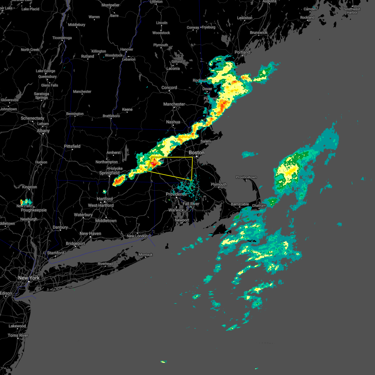 At 527 pm edt, a severe thunderstorm was located over shrewsbury, moving east at 40 mph (radar indicated). Hazards include 60 mph wind gusts and penny size hail. expect damage to trees and power lines At 527 pm edt, a severe thunderstorm was located over shrewsbury, moving east at 40 mph (radar indicated). Hazards include 60 mph wind gusts and penny size hail. expect damage to trees and power lines
|
| 7/23/2020 4:38 PM EDT |
 At 438 pm edt, a severe thunderstorm was located near douglas, or 10 miles west of woonsocket, moving east at 40 mph (radar indicated). Hazards include 60 mph wind gusts and penny size hail. expect damage to trees and power lines At 438 pm edt, a severe thunderstorm was located near douglas, or 10 miles west of woonsocket, moving east at 40 mph (radar indicated). Hazards include 60 mph wind gusts and penny size hail. expect damage to trees and power lines
|
| 7/5/2020 10:28 PM EDT |
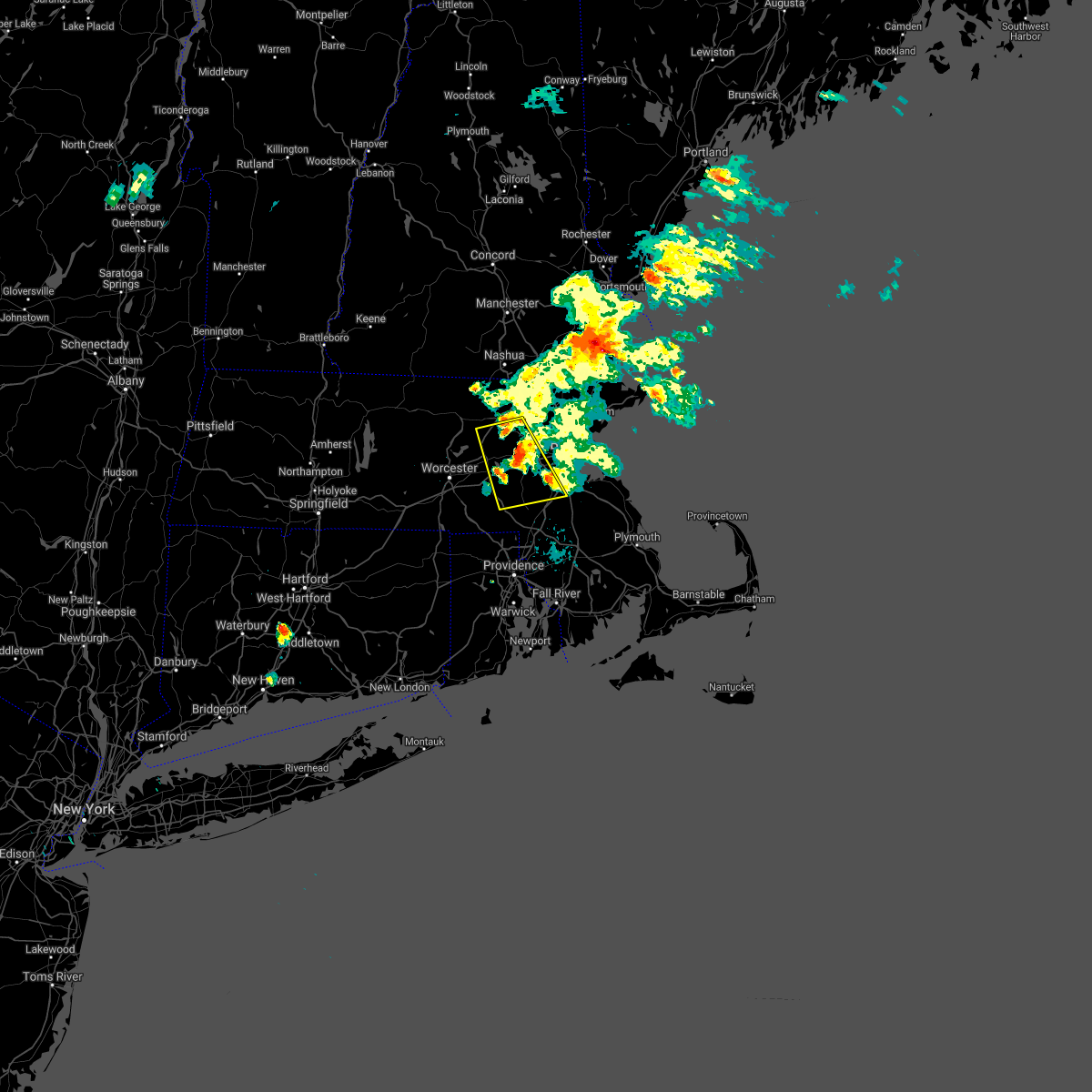 The severe thunderstorm warning for southwestern suffolk, northwestern norfolk, east central worcester and southeastern middlesex counties will expire at 1030 pm edt, the severe thunderstorm which prompted the warning remains severe. a new severe thunderstorm warning has been issued for suffolk and norfolk counties until 1130 pm. The severe thunderstorm warning for southwestern suffolk, northwestern norfolk, east central worcester and southeastern middlesex counties will expire at 1030 pm edt, the severe thunderstorm which prompted the warning remains severe. a new severe thunderstorm warning has been issued for suffolk and norfolk counties until 1130 pm.
|
| 7/5/2020 10:17 PM EDT |
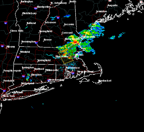 At 1015 pm edt, a severe thunderstorm was located over dover, or over natick. another severe thunderstorm was over maynard. each of these storms were moving southeast at 25 mph (radar indicated. at 1012 pm, mutiple trees and wires were downed in wayland). Hazards include 60 mph wind gusts and quarter size hail. Expect wind damage to trees and power lines. minor hail damage to vehicles is possible. Locations impacted include, boston, newton, framingham, waltham, marlborough, natick, franklin, needham, norwood, milford, wellesley, dedham, walpole, acton, canton, hudson, westborough, concord, sudbury and ashland. At 1015 pm edt, a severe thunderstorm was located over dover, or over natick. another severe thunderstorm was over maynard. each of these storms were moving southeast at 25 mph (radar indicated. at 1012 pm, mutiple trees and wires were downed in wayland). Hazards include 60 mph wind gusts and quarter size hail. Expect wind damage to trees and power lines. minor hail damage to vehicles is possible. Locations impacted include, boston, newton, framingham, waltham, marlborough, natick, franklin, needham, norwood, milford, wellesley, dedham, walpole, acton, canton, hudson, westborough, concord, sudbury and ashland.
|
| 7/5/2020 10:02 PM EDT |
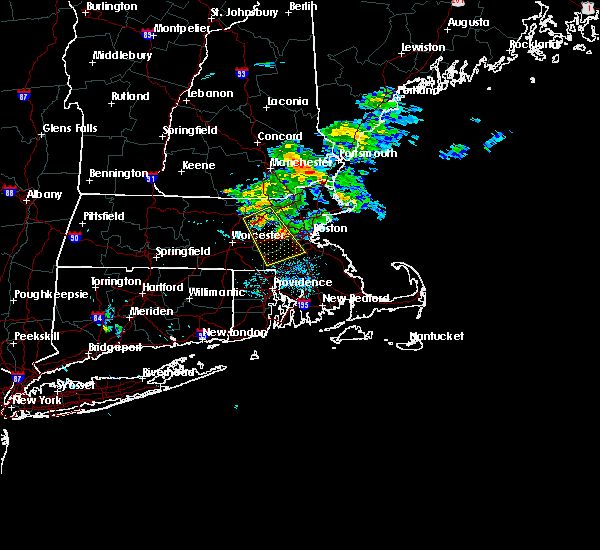 At 1000 pm edt, a severe thunderstorm was located over wayland. another severe thunderstorm was located 2 miles west of harvard. each of these storms were moving southeast at 25 mph (radar indicated. several trees have been downed in the acton and boxborough between 935 and 945 pm). Hazards include hail up to ping pong ball size and 60 mph wind gusts. Expect wind damage to trees and power lines. minor hail damage to vehicles is possible. Locations impacted include, boston, newton, framingham, waltham, marlborough, chelmsford, natick, franklin, needham, norwood, milford, wellesley, dedham, walpole, westford, acton, canton, hudson, westborough and concord. At 1000 pm edt, a severe thunderstorm was located over wayland. another severe thunderstorm was located 2 miles west of harvard. each of these storms were moving southeast at 25 mph (radar indicated. several trees have been downed in the acton and boxborough between 935 and 945 pm). Hazards include hail up to ping pong ball size and 60 mph wind gusts. Expect wind damage to trees and power lines. minor hail damage to vehicles is possible. Locations impacted include, boston, newton, framingham, waltham, marlborough, chelmsford, natick, franklin, needham, norwood, milford, wellesley, dedham, walpole, westford, acton, canton, hudson, westborough and concord.
|
| 7/5/2020 9:45 PM EDT |
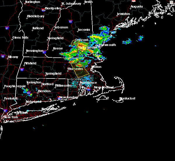 At 944 pm edt, a severe thunderstorm was located over stow, or near maynard, moving southeast at 25 mph (radar indicated. at 924 pm, a tree was downed in harvard, ma from this severe storm). Hazards include ping pong ball size hail and 60 mph wind gusts. Expect wind damage to trees and power lines. minor hail damage to vehicles is possible. Locations impacted include, boston, newton, framingham, waltham, marlborough, chelmsford, natick, franklin, needham, norwood, milford, wellesley, dedham, walpole, westford, acton, canton, hudson, westborough and concord. At 944 pm edt, a severe thunderstorm was located over stow, or near maynard, moving southeast at 25 mph (radar indicated. at 924 pm, a tree was downed in harvard, ma from this severe storm). Hazards include ping pong ball size hail and 60 mph wind gusts. Expect wind damage to trees and power lines. minor hail damage to vehicles is possible. Locations impacted include, boston, newton, framingham, waltham, marlborough, chelmsford, natick, franklin, needham, norwood, milford, wellesley, dedham, walpole, westford, acton, canton, hudson, westborough and concord.
|
| 7/5/2020 9:31 PM EDT |
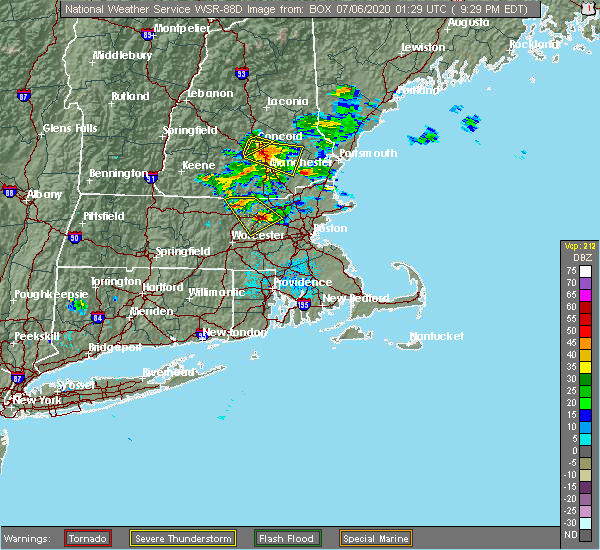 At 930 pm edt, a severe thunderstorm was located over boxborough, or 8 miles north of marlborough, moving southeast at 25 mph (radar indicated). Hazards include ping pong ball size hail and 60 mph wind gusts. Expect wind damage to trees and power lines. Minor hail damage to vehicles is possible. At 930 pm edt, a severe thunderstorm was located over boxborough, or 8 miles north of marlborough, moving southeast at 25 mph (radar indicated). Hazards include ping pong ball size hail and 60 mph wind gusts. Expect wind damage to trees and power lines. Minor hail damage to vehicles is possible.
|
| 6/28/2020 6:25 PM EDT |
 At 624 pm edt, very severe thunderstorms were located along a line extending from blackstone to near glocester, moving southeast at 10 mph (radar indicated). Hazards include two inch hail and 60 mph wind gusts. Large hail may injure people caught outdoors. expect hail damage to roofs, siding, windows, and vehicles. expect wind damage to trees and power lines. Locations impacted include, woonsocket, cumberland, franklin, johnston, north attleborough, milford, smithfield, lincoln, bellingham, burrillville, northbridge, uxbridge, north smithfield, wrentham, scituate, glocester, thompson, blackstone, douglas and plainville. At 624 pm edt, very severe thunderstorms were located along a line extending from blackstone to near glocester, moving southeast at 10 mph (radar indicated). Hazards include two inch hail and 60 mph wind gusts. Large hail may injure people caught outdoors. expect hail damage to roofs, siding, windows, and vehicles. expect wind damage to trees and power lines. Locations impacted include, woonsocket, cumberland, franklin, johnston, north attleborough, milford, smithfield, lincoln, bellingham, burrillville, northbridge, uxbridge, north smithfield, wrentham, scituate, glocester, thompson, blackstone, douglas and plainville.
|
| 6/28/2020 6:25 PM EDT |
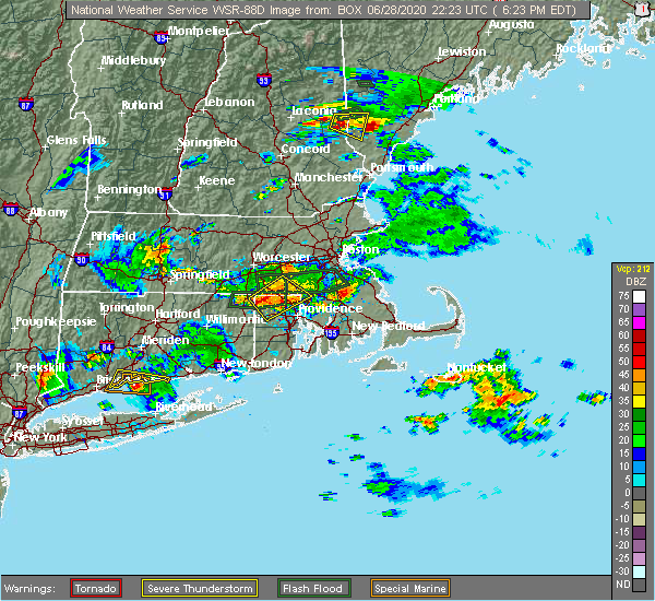 At 624 pm edt, very severe thunderstorms were located along a line extending from blackstone to near glocester, moving southeast at 10 mph (radar indicated). Hazards include two inch hail and 60 mph wind gusts. Large hail may injure people caught outdoors. expect hail damage to roofs, siding, windows, and vehicles. expect wind damage to trees and power lines. Locations impacted include, woonsocket, cumberland, franklin, johnston, north attleborough, milford, smithfield, lincoln, bellingham, burrillville, northbridge, uxbridge, north smithfield, wrentham, scituate, glocester, thompson, blackstone, douglas and plainville. At 624 pm edt, very severe thunderstorms were located along a line extending from blackstone to near glocester, moving southeast at 10 mph (radar indicated). Hazards include two inch hail and 60 mph wind gusts. Large hail may injure people caught outdoors. expect hail damage to roofs, siding, windows, and vehicles. expect wind damage to trees and power lines. Locations impacted include, woonsocket, cumberland, franklin, johnston, north attleborough, milford, smithfield, lincoln, bellingham, burrillville, northbridge, uxbridge, north smithfield, wrentham, scituate, glocester, thompson, blackstone, douglas and plainville.
|
| 6/28/2020 6:04 PM EDT |
 At 603 pm edt, severe thunderstorms were located along a line extending from mendon to burrillville, moving southeast at 10 mph (radar indicated). Hazards include 60 mph wind gusts and quarter size hail. Expect wind damage to trees and power lines. Minor hail damage to vehicles is possible. At 603 pm edt, severe thunderstorms were located along a line extending from mendon to burrillville, moving southeast at 10 mph (radar indicated). Hazards include 60 mph wind gusts and quarter size hail. Expect wind damage to trees and power lines. Minor hail damage to vehicles is possible.
|
| 6/28/2020 6:04 PM EDT |
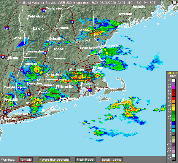 At 603 pm edt, severe thunderstorms were located along a line extending from mendon to burrillville, moving southeast at 10 mph (radar indicated). Hazards include 60 mph wind gusts and quarter size hail. Expect wind damage to trees and power lines. Minor hail damage to vehicles is possible. At 603 pm edt, severe thunderstorms were located along a line extending from mendon to burrillville, moving southeast at 10 mph (radar indicated). Hazards include 60 mph wind gusts and quarter size hail. Expect wind damage to trees and power lines. Minor hail damage to vehicles is possible.
|
| 6/28/2020 5:52 PM EDT |
 The severe thunderstorm warning for western norfolk, southeastern worcester and northeastern providence counties will expire at 600 pm edt, the storm which prompted the warning has weakened below severe limits, and no longer poses an immediate threat to life or property. therefore, the warning will be allowed to expire. however heavy rain is still occurring with these thunderstorms. a severe thunderstorm watch remains in effect until 800 pm edt for eastern and central massachusetts, and rhode island. The severe thunderstorm warning for western norfolk, southeastern worcester and northeastern providence counties will expire at 600 pm edt, the storm which prompted the warning has weakened below severe limits, and no longer poses an immediate threat to life or property. therefore, the warning will be allowed to expire. however heavy rain is still occurring with these thunderstorms. a severe thunderstorm watch remains in effect until 800 pm edt for eastern and central massachusetts, and rhode island.
|
| 6/28/2020 5:52 PM EDT |
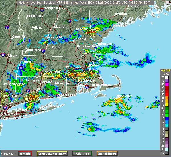 The severe thunderstorm warning for western norfolk, southeastern worcester and northeastern providence counties will expire at 600 pm edt, the storm which prompted the warning has weakened below severe limits, and no longer poses an immediate threat to life or property. therefore, the warning will be allowed to expire. however heavy rain is still occurring with these thunderstorms. a severe thunderstorm watch remains in effect until 800 pm edt for eastern and central massachusetts, and rhode island. The severe thunderstorm warning for western norfolk, southeastern worcester and northeastern providence counties will expire at 600 pm edt, the storm which prompted the warning has weakened below severe limits, and no longer poses an immediate threat to life or property. therefore, the warning will be allowed to expire. however heavy rain is still occurring with these thunderstorms. a severe thunderstorm watch remains in effect until 800 pm edt for eastern and central massachusetts, and rhode island.
|
| 6/28/2020 5:05 PM EDT |
 At 504 pm edt, a severe thunderstorm was located over northbridge, or 7 miles southwest of milford, moving southeast at 10 mph (radar indicated). Hazards include 60 mph wind gusts and half dollar size hail. Expect wind damage to trees and power lines. Minor hail damage to vehicles is possible. At 504 pm edt, a severe thunderstorm was located over northbridge, or 7 miles southwest of milford, moving southeast at 10 mph (radar indicated). Hazards include 60 mph wind gusts and half dollar size hail. Expect wind damage to trees and power lines. Minor hail damage to vehicles is possible.
|
| 6/28/2020 5:05 PM EDT |
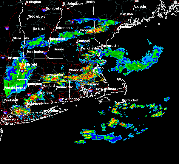 At 504 pm edt, a severe thunderstorm was located over northbridge, or 7 miles southwest of milford, moving southeast at 10 mph (radar indicated). Hazards include 60 mph wind gusts and half dollar size hail. Expect wind damage to trees and power lines. Minor hail damage to vehicles is possible. At 504 pm edt, a severe thunderstorm was located over northbridge, or 7 miles southwest of milford, moving southeast at 10 mph (radar indicated). Hazards include 60 mph wind gusts and half dollar size hail. Expect wind damage to trees and power lines. Minor hail damage to vehicles is possible.
|
| 6/28/2020 4:58 PM EDT |
 The national weather service in boston/norton has issued a * severe thunderstorm warning for. norfolk county in eastern massachusetts. southeastern worcester county in central massachusetts. northwestern plymouth county in southeastern massachusetts. Northwestern bristol county in southeastern massachusetts. The national weather service in boston/norton has issued a * severe thunderstorm warning for. norfolk county in eastern massachusetts. southeastern worcester county in central massachusetts. northwestern plymouth county in southeastern massachusetts. Northwestern bristol county in southeastern massachusetts.
|
| 6/28/2020 4:39 PM EDT |
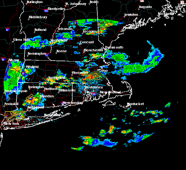 At 438 pm edt, a severe thunderstorm was located over medway, or over milford, moving east at 15 mph (radar indicated). Hazards include 60 mph wind gusts and half dollar size hail. Expect wind damage to trees and power lines. Minor hail damage to vehicles is possible. At 438 pm edt, a severe thunderstorm was located over medway, or over milford, moving east at 15 mph (radar indicated). Hazards include 60 mph wind gusts and half dollar size hail. Expect wind damage to trees and power lines. Minor hail damage to vehicles is possible.
|
| 6/6/2020 3:38 PM EDT |
 The severe thunderstorm warning for southwestern norfolk, southeastern worcester, south central middlesex, northwestern bristol and northeastern providence counties will expire at 345 pm edt, the warning has been allowed to expire. however the storm still remains severe and a replacement severe thunderstorm warning is in effect for western bristol, western norfolk, southern middlesex and northern providence counties until 430 pm. a severe thunderstorm watch remains in effect until 800 pm edt for eastern, central, southeastern and northeastern massachusetts, and rhode island. remember, a severe thunderstorm warning still remains in effect for western bristol, western norfolk, southern middlesex and northern providence counties until 430 pm. The severe thunderstorm warning for southwestern norfolk, southeastern worcester, south central middlesex, northwestern bristol and northeastern providence counties will expire at 345 pm edt, the warning has been allowed to expire. however the storm still remains severe and a replacement severe thunderstorm warning is in effect for western bristol, western norfolk, southern middlesex and northern providence counties until 430 pm. a severe thunderstorm watch remains in effect until 800 pm edt for eastern, central, southeastern and northeastern massachusetts, and rhode island. remember, a severe thunderstorm warning still remains in effect for western bristol, western norfolk, southern middlesex and northern providence counties until 430 pm.
|
| 6/6/2020 3:38 PM EDT |
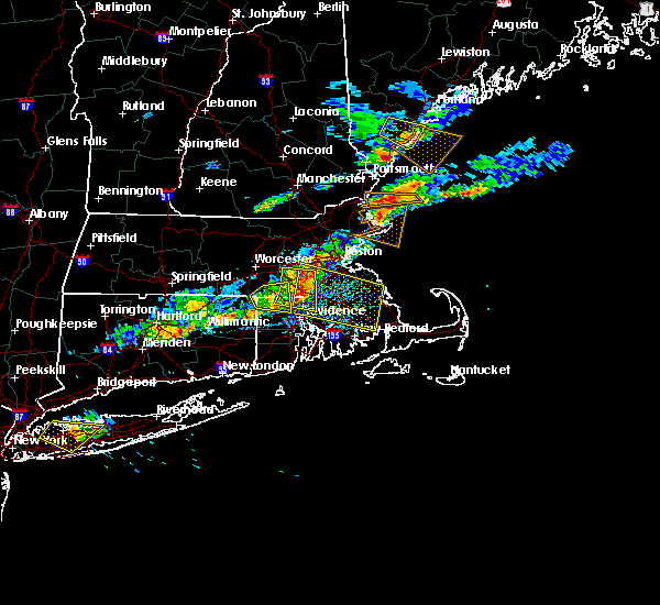 The severe thunderstorm warning for southwestern norfolk, southeastern worcester, south central middlesex, northwestern bristol and northeastern providence counties will expire at 345 pm edt, the warning has been allowed to expire. however the storm still remains severe and a replacement severe thunderstorm warning is in effect for western bristol, western norfolk, southern middlesex and northern providence counties until 430 pm. a severe thunderstorm watch remains in effect until 800 pm edt for eastern, central, southeastern and northeastern massachusetts, and rhode island. remember, a severe thunderstorm warning still remains in effect for western bristol, western norfolk, southern middlesex and northern providence counties until 430 pm. The severe thunderstorm warning for southwestern norfolk, southeastern worcester, south central middlesex, northwestern bristol and northeastern providence counties will expire at 345 pm edt, the warning has been allowed to expire. however the storm still remains severe and a replacement severe thunderstorm warning is in effect for western bristol, western norfolk, southern middlesex and northern providence counties until 430 pm. a severe thunderstorm watch remains in effect until 800 pm edt for eastern, central, southeastern and northeastern massachusetts, and rhode island. remember, a severe thunderstorm warning still remains in effect for western bristol, western norfolk, southern middlesex and northern providence counties until 430 pm.
|
| 6/6/2020 3:36 PM EDT |
 The severe thunderstorm warning for northeastern windham, southeastern worcester and northwestern providence counties will expire at 345 pm edt, the storm which prompted the warning has moved out of the area. therefore, the warning will be allowed to expire. a severe thunderstorm watch remains in effect until 800 pm edt for northern connecticut, eastern and central massachusetts, and rhode island. The severe thunderstorm warning for northeastern windham, southeastern worcester and northwestern providence counties will expire at 345 pm edt, the storm which prompted the warning has moved out of the area. therefore, the warning will be allowed to expire. a severe thunderstorm watch remains in effect until 800 pm edt for northern connecticut, eastern and central massachusetts, and rhode island.
|
| 6/6/2020 3:31 PM EDT |
 At 331 pm edt, a severe thunderstorm was located over bellingham, or near franklin, moving east at 30 mph (radar indicated. this storm has a history of downing multiple trees and power lines in parts of southern worcester county). Hazards include 70 mph wind gusts and quarter size hail. Expect considerable damage to trees and power lines. wind damage is also likely to mobile homes, roofs, and outbuildings. minor hail damage to vehicles is possible. Locations impacted include, woonsocket, cumberland, franklin, north attleborough, milford, attleboro, walpole, mansfield, smithfield, lincoln, foxborough, ashland, bellingham, burrillville, hopkinton, seekonk, holliston, uxbridge, medway and medfield. At 331 pm edt, a severe thunderstorm was located over bellingham, or near franklin, moving east at 30 mph (radar indicated. this storm has a history of downing multiple trees and power lines in parts of southern worcester county). Hazards include 70 mph wind gusts and quarter size hail. Expect considerable damage to trees and power lines. wind damage is also likely to mobile homes, roofs, and outbuildings. minor hail damage to vehicles is possible. Locations impacted include, woonsocket, cumberland, franklin, north attleborough, milford, attleboro, walpole, mansfield, smithfield, lincoln, foxborough, ashland, bellingham, burrillville, hopkinton, seekonk, holliston, uxbridge, medway and medfield.
|
| 6/6/2020 3:31 PM EDT |
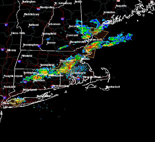 At 331 pm edt, a severe thunderstorm was located over bellingham, or near franklin, moving east at 30 mph (radar indicated. this storm has a history of downing multiple trees and power lines in parts of southern worcester county). Hazards include 70 mph wind gusts and quarter size hail. Expect considerable damage to trees and power lines. wind damage is also likely to mobile homes, roofs, and outbuildings. minor hail damage to vehicles is possible. Locations impacted include, woonsocket, cumberland, franklin, north attleborough, milford, attleboro, walpole, mansfield, smithfield, lincoln, foxborough, ashland, bellingham, burrillville, hopkinton, seekonk, holliston, uxbridge, medway and medfield. At 331 pm edt, a severe thunderstorm was located over bellingham, or near franklin, moving east at 30 mph (radar indicated. this storm has a history of downing multiple trees and power lines in parts of southern worcester county). Hazards include 70 mph wind gusts and quarter size hail. Expect considerable damage to trees and power lines. wind damage is also likely to mobile homes, roofs, and outbuildings. minor hail damage to vehicles is possible. Locations impacted include, woonsocket, cumberland, franklin, north attleborough, milford, attleboro, walpole, mansfield, smithfield, lincoln, foxborough, ashland, bellingham, burrillville, hopkinton, seekonk, holliston, uxbridge, medway and medfield.
|
| 6/6/2020 3:26 PM EDT |
 At 326 pm edt, a severe thunderstorm was located over burrillville, or 9 miles west of woonsocket, moving east at 35 mph (radar indicated). Hazards include 60 mph wind gusts and quarter size hail. Expect wind damage to trees and power lines. minor hail damage to vehicles is possible. Locations impacted include, woonsocket, milford, smithfield, webster, burrillville, northbridge, uxbridge, north smithfield, glocester, thompson, blackstone, sutton, douglas, upton, hopedale, mendon and millville. At 326 pm edt, a severe thunderstorm was located over burrillville, or 9 miles west of woonsocket, moving east at 35 mph (radar indicated). Hazards include 60 mph wind gusts and quarter size hail. Expect wind damage to trees and power lines. minor hail damage to vehicles is possible. Locations impacted include, woonsocket, milford, smithfield, webster, burrillville, northbridge, uxbridge, north smithfield, glocester, thompson, blackstone, sutton, douglas, upton, hopedale, mendon and millville.
|
| 6/6/2020 3:26 PM EDT |
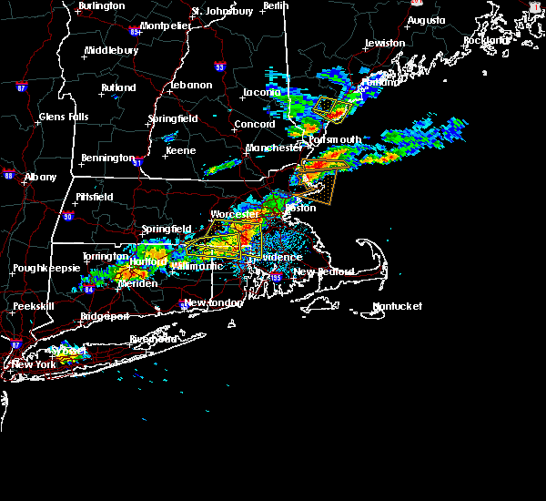 At 326 pm edt, a severe thunderstorm was located over burrillville, or 9 miles west of woonsocket, moving east at 35 mph (radar indicated). Hazards include 60 mph wind gusts and quarter size hail. Expect wind damage to trees and power lines. minor hail damage to vehicles is possible. Locations impacted include, woonsocket, milford, smithfield, webster, burrillville, northbridge, uxbridge, north smithfield, glocester, thompson, blackstone, sutton, douglas, upton, hopedale, mendon and millville. At 326 pm edt, a severe thunderstorm was located over burrillville, or 9 miles west of woonsocket, moving east at 35 mph (radar indicated). Hazards include 60 mph wind gusts and quarter size hail. Expect wind damage to trees and power lines. minor hail damage to vehicles is possible. Locations impacted include, woonsocket, milford, smithfield, webster, burrillville, northbridge, uxbridge, north smithfield, glocester, thompson, blackstone, sutton, douglas, upton, hopedale, mendon and millville.
|
| 6/6/2020 3:12 PM EDT |
 At 311 pm edt, a severe thunderstorm was located over thompson, or 18 miles west of woonsocket, moving east at 35 mph (radar indicated). Hazards include 60 mph wind gusts and quarter size hail. Expect wind damage to trees and power lines. minor hail damage to vehicles is possible. Locations impacted include, woonsocket, milford, smithfield, webster, southbridge, burrillville, northbridge, oxford, uxbridge, north smithfield, dudley, glocester, putnam, thompson, blackstone, sutton, douglas, woodstock, upton and hopedale. At 311 pm edt, a severe thunderstorm was located over thompson, or 18 miles west of woonsocket, moving east at 35 mph (radar indicated). Hazards include 60 mph wind gusts and quarter size hail. Expect wind damage to trees and power lines. minor hail damage to vehicles is possible. Locations impacted include, woonsocket, milford, smithfield, webster, southbridge, burrillville, northbridge, oxford, uxbridge, north smithfield, dudley, glocester, putnam, thompson, blackstone, sutton, douglas, woodstock, upton and hopedale.
|
| 6/6/2020 3:12 PM EDT |
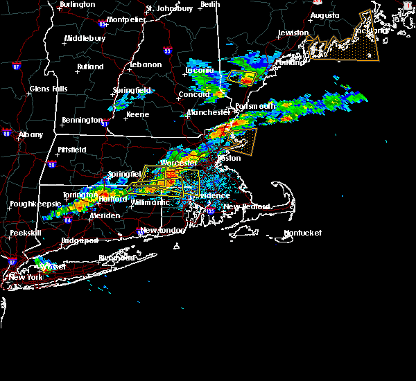 At 310 pm edt, a severe thunderstorm was located over northbridge, or 9 miles southwest of milford, moving east at 30 mph (radar indicated. this storm has a history of downing numerous trees and powerlines). Hazards include 70 mph wind gusts and quarter size hail. Expect considerable damage to trees and power lines. wind damage is also likely to mobile homes, roofs, and outbuildings. minor hail damage to vehicles is possible. Locations impacted include, worcester, woonsocket, shrewsbury, cumberland, franklin, north attleborough, milford, attleboro, walpole, mansfield, smithfield, lincoln, westborough, grafton, foxborough, webster, southbridge, ashland, bellingham and auburn. At 310 pm edt, a severe thunderstorm was located over northbridge, or 9 miles southwest of milford, moving east at 30 mph (radar indicated. this storm has a history of downing numerous trees and powerlines). Hazards include 70 mph wind gusts and quarter size hail. Expect considerable damage to trees and power lines. wind damage is also likely to mobile homes, roofs, and outbuildings. minor hail damage to vehicles is possible. Locations impacted include, worcester, woonsocket, shrewsbury, cumberland, franklin, north attleborough, milford, attleboro, walpole, mansfield, smithfield, lincoln, westborough, grafton, foxborough, webster, southbridge, ashland, bellingham and auburn.
|
| 6/6/2020 3:12 PM EDT |
 At 311 pm edt, a severe thunderstorm was located over thompson, or 18 miles west of woonsocket, moving east at 35 mph (radar indicated). Hazards include 60 mph wind gusts and quarter size hail. Expect wind damage to trees and power lines. minor hail damage to vehicles is possible. Locations impacted include, woonsocket, milford, smithfield, webster, southbridge, burrillville, northbridge, oxford, uxbridge, north smithfield, dudley, glocester, putnam, thompson, blackstone, sutton, douglas, woodstock, upton and hopedale. At 311 pm edt, a severe thunderstorm was located over thompson, or 18 miles west of woonsocket, moving east at 35 mph (radar indicated). Hazards include 60 mph wind gusts and quarter size hail. Expect wind damage to trees and power lines. minor hail damage to vehicles is possible. Locations impacted include, woonsocket, milford, smithfield, webster, southbridge, burrillville, northbridge, oxford, uxbridge, north smithfield, dudley, glocester, putnam, thompson, blackstone, sutton, douglas, woodstock, upton and hopedale.
|
| 6/6/2020 3:12 PM EDT |
 At 310 pm edt, a severe thunderstorm was located over northbridge, or 9 miles southwest of milford, moving east at 30 mph (radar indicated. this storm has a history of downing numerous trees and powerlines). Hazards include 70 mph wind gusts and quarter size hail. Expect considerable damage to trees and power lines. wind damage is also likely to mobile homes, roofs, and outbuildings. minor hail damage to vehicles is possible. Locations impacted include, worcester, woonsocket, shrewsbury, cumberland, franklin, north attleborough, milford, attleboro, walpole, mansfield, smithfield, lincoln, westborough, grafton, foxborough, webster, southbridge, ashland, bellingham and auburn. At 310 pm edt, a severe thunderstorm was located over northbridge, or 9 miles southwest of milford, moving east at 30 mph (radar indicated. this storm has a history of downing numerous trees and powerlines). Hazards include 70 mph wind gusts and quarter size hail. Expect considerable damage to trees and power lines. wind damage is also likely to mobile homes, roofs, and outbuildings. minor hail damage to vehicles is possible. Locations impacted include, worcester, woonsocket, shrewsbury, cumberland, franklin, north attleborough, milford, attleboro, walpole, mansfield, smithfield, lincoln, westborough, grafton, foxborough, webster, southbridge, ashland, bellingham and auburn.
|
| 6/6/2020 3:12 PM EDT |
 At 310 pm edt, a severe thunderstorm was located over northbridge, or 9 miles southwest of milford, moving east at 30 mph (radar indicated. this storm has a history of downing numerous trees and powerlines). Hazards include 70 mph wind gusts and quarter size hail. Expect considerable damage to trees and power lines. wind damage is also likely to mobile homes, roofs, and outbuildings. minor hail damage to vehicles is possible. Locations impacted include, worcester, woonsocket, shrewsbury, cumberland, franklin, north attleborough, milford, attleboro, walpole, mansfield, smithfield, lincoln, westborough, grafton, foxborough, webster, southbridge, ashland, bellingham and auburn. At 310 pm edt, a severe thunderstorm was located over northbridge, or 9 miles southwest of milford, moving east at 30 mph (radar indicated. this storm has a history of downing numerous trees and powerlines). Hazards include 70 mph wind gusts and quarter size hail. Expect considerable damage to trees and power lines. wind damage is also likely to mobile homes, roofs, and outbuildings. minor hail damage to vehicles is possible. Locations impacted include, worcester, woonsocket, shrewsbury, cumberland, franklin, north attleborough, milford, attleboro, walpole, mansfield, smithfield, lincoln, westborough, grafton, foxborough, webster, southbridge, ashland, bellingham and auburn.
|
| 6/6/2020 2:54 PM EDT |
 At 253 pm edt, a severe thunderstorm was located over woodstock, or 15 miles northeast of mansfield, moving east at 45 mph (radar indicated). Hazards include 60 mph wind gusts and quarter size hail. Expect wind damage to trees and power lines. minor hail damage to vehicles is possible. Locations impacted include, woonsocket, milford, smithfield, killingly, webster, southbridge, burrillville, northbridge, oxford, uxbridge, charlton, stafford, north smithfield, dudley, glocester, putnam, thompson, sturbridge, blackstone and sutton. At 253 pm edt, a severe thunderstorm was located over woodstock, or 15 miles northeast of mansfield, moving east at 45 mph (radar indicated). Hazards include 60 mph wind gusts and quarter size hail. Expect wind damage to trees and power lines. minor hail damage to vehicles is possible. Locations impacted include, woonsocket, milford, smithfield, killingly, webster, southbridge, burrillville, northbridge, oxford, uxbridge, charlton, stafford, north smithfield, dudley, glocester, putnam, thompson, sturbridge, blackstone and sutton.
|
| 6/6/2020 2:51 PM EDT |
 At 250 pm edt, a severe thunderstorm was located over oxford, or 10 miles south of worcester, moving east at 30 mph (radar indicated. this storm has a history of producing wind damage in west brookfield and monson). Hazards include 60 mph wind gusts and nickel size hail. expect damage to trees and power lines At 250 pm edt, a severe thunderstorm was located over oxford, or 10 miles south of worcester, moving east at 30 mph (radar indicated. this storm has a history of producing wind damage in west brookfield and monson). Hazards include 60 mph wind gusts and nickel size hail. expect damage to trees and power lines
|
| 6/6/2020 2:39 PM EDT |
 At 239 pm edt, a severe thunderstorm was located over stafford, or 12 miles north of mansfield, moving east at 35 mph (radar indicated). Hazards include 60 mph wind gusts and quarter size hail. Expect wind damage to trees and power lines. Minor hail damage to vehicles is possible. At 239 pm edt, a severe thunderstorm was located over stafford, or 12 miles north of mansfield, moving east at 35 mph (radar indicated). Hazards include 60 mph wind gusts and quarter size hail. Expect wind damage to trees and power lines. Minor hail damage to vehicles is possible.
|
| 5/15/2020 9:21 PM EDT |
 At 921 pm edt, severe thunderstorms were located along a line extending from beverly to near nahant to medway, moving east at 45 mph (radar indicated). Hazards include 60 mph wind gusts. Expect damage to trees and power lines. Locations impacted include, boston, cambridge, brockton, quincy, newton, somerville, malden, brookline, medford, weymouth, revere, everett, braintree, chelsea, natick, randolph, watertown, franklin, needham and norwood. At 921 pm edt, severe thunderstorms were located along a line extending from beverly to near nahant to medway, moving east at 45 mph (radar indicated). Hazards include 60 mph wind gusts. Expect damage to trees and power lines. Locations impacted include, boston, cambridge, brockton, quincy, newton, somerville, malden, brookline, medford, weymouth, revere, everett, braintree, chelsea, natick, randolph, watertown, franklin, needham and norwood.
|
| 5/15/2020 9:02 PM EDT |
 At 902 pm edt, severe thunderstorms were located along a line extending from boylston to near grafton to near woodstock, moving east at 50 mph (radar indicated. a 63 mph wind gust was reported at the worcester airport at 843 pm from these storms). Hazards include 60 mph wind gusts and penny size hail. Expect damage to trees and power lines. Locations impacted include, worcester, framingham, woonsocket, marlborough, shrewsbury, natick, franklin, milford, westborough, grafton, holden, webster, southbridge, ashland, bellingham, auburn, burrillville, northbridge, hopkinton and northborough. At 902 pm edt, severe thunderstorms were located along a line extending from boylston to near grafton to near woodstock, moving east at 50 mph (radar indicated. a 63 mph wind gust was reported at the worcester airport at 843 pm from these storms). Hazards include 60 mph wind gusts and penny size hail. Expect damage to trees and power lines. Locations impacted include, worcester, framingham, woonsocket, marlborough, shrewsbury, natick, franklin, milford, westborough, grafton, holden, webster, southbridge, ashland, bellingham, auburn, burrillville, northbridge, hopkinton and northborough.
|
| 5/15/2020 8:59 PM EDT |
 At 858 pm edt, severe thunderstorms were located along a line extending from reading to belmont to northbridge, moving east at 45 mph (radar indicated). Hazards include 60 mph wind gusts. expect damage to trees and power lines At 858 pm edt, severe thunderstorms were located along a line extending from reading to belmont to northbridge, moving east at 45 mph (radar indicated). Hazards include 60 mph wind gusts. expect damage to trees and power lines
|
| 5/15/2020 8:34 PM EDT |
 At 833 pm edt, severe thunderstorms were located along a line extending from barre to near west brookfield to hampden, moving east at 50 mph (radar indicated. at 817, trees and power lines were downed in belchertown). Hazards include 60 mph wind gusts and penny size hail. expect damage to trees and power lines At 833 pm edt, severe thunderstorms were located along a line extending from barre to near west brookfield to hampden, moving east at 50 mph (radar indicated. at 817, trees and power lines were downed in belchertown). Hazards include 60 mph wind gusts and penny size hail. expect damage to trees and power lines
|
| 3/29/2020 9:15 PM EDT |
 At 914 pm edt, a severe thunderstorm was located over westborough, or near shrewsbury, moving northeast at 60 mph (radar indicated). Hazards include quarter size hail. Minor hail damage to vehicles is possible. Locations impacted include, worcester, newton, framingham, marlborough, shrewsbury, chelmsford, natick, needham, milford, wellesley, dedham, westford, acton, hudson, westborough, grafton, concord, sudbury, holden and ashland. At 914 pm edt, a severe thunderstorm was located over westborough, or near shrewsbury, moving northeast at 60 mph (radar indicated). Hazards include quarter size hail. Minor hail damage to vehicles is possible. Locations impacted include, worcester, newton, framingham, marlborough, shrewsbury, chelmsford, natick, needham, milford, wellesley, dedham, westford, acton, hudson, westborough, grafton, concord, sudbury, holden and ashland.
|
| 3/29/2020 9:03 PM EDT |
 At 903 pm edt, a severe thunderstorm was located over berlin, or near marlborough, moving northeast at 55 mph (radar indicated). Hazards include quarter size hail. Minor hail damage to vehicles is possible. Locations impacted include, worcester, newton, framingham, marlborough, shrewsbury, chelmsford, natick, needham, milford, wellesley, dedham, westford, acton, hudson, westborough, grafton, concord, sudbury, holden and webster. At 903 pm edt, a severe thunderstorm was located over berlin, or near marlborough, moving northeast at 55 mph (radar indicated). Hazards include quarter size hail. Minor hail damage to vehicles is possible. Locations impacted include, worcester, newton, framingham, marlborough, shrewsbury, chelmsford, natick, needham, milford, wellesley, dedham, westford, acton, hudson, westborough, grafton, concord, sudbury, holden and webster.
|
| 3/29/2020 8:56 PM EDT |
 At 856 pm edt, a severe thunderstorm was located over shrewsbury, moving northeast at 55 mph (radar indicated. a spotter reported golf ball size hail in the western part of worcester at 8:53 pm). Hazards include golf ball size hail. Large hail may injure people caught outdoors. expect damage to roofs, siding, windows, and vehicles. Locations impacted include, worcester, newton, framingham, marlborough, shrewsbury, chelmsford, natick, needham, milford, wellesley, dedham, westford, acton, hudson, westborough, grafton, concord, sudbury, holden and webster. At 856 pm edt, a severe thunderstorm was located over shrewsbury, moving northeast at 55 mph (radar indicated. a spotter reported golf ball size hail in the western part of worcester at 8:53 pm). Hazards include golf ball size hail. Large hail may injure people caught outdoors. expect damage to roofs, siding, windows, and vehicles. Locations impacted include, worcester, newton, framingham, marlborough, shrewsbury, chelmsford, natick, needham, milford, wellesley, dedham, westford, acton, hudson, westborough, grafton, concord, sudbury, holden and webster.
|
| 3/29/2020 8:55 PM EDT |
 At 854 pm edt, a severe thunderstorm was located over shrewsbury, moving northeast at 55 mph (radar indicated). Hazards include quarter size hail. minor hail damage to vehicles is possible At 854 pm edt, a severe thunderstorm was located over shrewsbury, moving northeast at 55 mph (radar indicated). Hazards include quarter size hail. minor hail damage to vehicles is possible
|
| 3/29/2020 8:45 PM EDT |
 At 845 pm edt, a severe thunderstorm was located over auburn, or near worcester, moving northeast at 55 mph (radar indicated). Hazards include half dollar size hail. Minor hail damage to vehicles is possible. Locations impacted include, worcester, marlborough, shrewsbury, milford, hudson, westborough, grafton, holden, webster, southbridge, ashland, auburn, northbridge, hopkinton, northborough, oxford, clinton, holliston, millbury and charlton. At 845 pm edt, a severe thunderstorm was located over auburn, or near worcester, moving northeast at 55 mph (radar indicated). Hazards include half dollar size hail. Minor hail damage to vehicles is possible. Locations impacted include, worcester, marlborough, shrewsbury, milford, hudson, westborough, grafton, holden, webster, southbridge, ashland, auburn, northbridge, hopkinton, northborough, oxford, clinton, holliston, millbury and charlton.
|
| 3/29/2020 8:43 PM EDT |
 At 842 pm edt, a severe thunderstorm was located near auburn, or 8 miles southwest of worcester, moving northeast at 55 mph (radar indicated). Hazards include quarter size hail. Minor hail damage to vehicles is possible. Locations impacted include, worcester, marlborough, shrewsbury, milford, hudson, westborough, grafton, holden, webster, southbridge, ashland, auburn, northbridge, hopkinton, northborough, oxford, clinton, holliston, millbury and charlton. At 842 pm edt, a severe thunderstorm was located near auburn, or 8 miles southwest of worcester, moving northeast at 55 mph (radar indicated). Hazards include quarter size hail. Minor hail damage to vehicles is possible. Locations impacted include, worcester, marlborough, shrewsbury, milford, hudson, westborough, grafton, holden, webster, southbridge, ashland, auburn, northbridge, hopkinton, northborough, oxford, clinton, holliston, millbury and charlton.
|
| 3/29/2020 8:34 PM EDT |
 At 834 pm edt, a severe thunderstorm was located over sturbridge, or 16 miles southwest of worcester, moving northeast at 55 mph (radar indicated). Hazards include quarter size hail. minor hail damage to vehicles is possible At 834 pm edt, a severe thunderstorm was located over sturbridge, or 16 miles southwest of worcester, moving northeast at 55 mph (radar indicated). Hazards include quarter size hail. minor hail damage to vehicles is possible
|
| 8/18/2019 6:43 PM EDT |
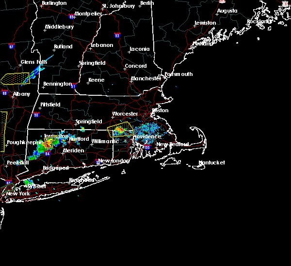 At 642 pm edt, a severe thunderstorm was located over uxbridge, or 7 miles west of woonsocket, moving east at 25 mph (radar indicated). Hazards include 60 mph wind gusts and penny size hail. Expect damage to trees and power lines. Locations impacted include, woonsocket, cumberland, franklin, north attleborough, milford, smithfield, lincoln, bellingham, burrillville, northbridge, holliston, uxbridge, medway, north smithfield, wrentham, glocester, blackstone, sutton, douglas and plainville. At 642 pm edt, a severe thunderstorm was located over uxbridge, or 7 miles west of woonsocket, moving east at 25 mph (radar indicated). Hazards include 60 mph wind gusts and penny size hail. Expect damage to trees and power lines. Locations impacted include, woonsocket, cumberland, franklin, north attleborough, milford, smithfield, lincoln, bellingham, burrillville, northbridge, holliston, uxbridge, medway, north smithfield, wrentham, glocester, blackstone, sutton, douglas and plainville.
|
| 8/18/2019 6:43 PM EDT |
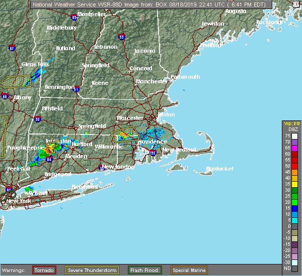 At 623 pm edt, a severe thunderstorm was located near thompson, or 15 miles west of woonsocket, moving east at 25 mph (radar indicated). Hazards include 60 mph wind gusts and quarter size hail. Hail damage to vehicles is possible. Expect damage to trees and power lines. At 623 pm edt, a severe thunderstorm was located near thompson, or 15 miles west of woonsocket, moving east at 25 mph (radar indicated). Hazards include 60 mph wind gusts and quarter size hail. Hail damage to vehicles is possible. Expect damage to trees and power lines.
|
| 8/18/2019 6:24 PM EDT |
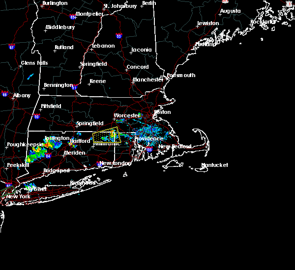 At 623 pm edt, a severe thunderstorm was located near thompson, or 15 miles west of woonsocket, moving east at 25 mph (radar indicated). Hazards include 60 mph wind gusts and quarter size hail. Hail damage to vehicles is possible. Expect damage to trees and power lines. At 623 pm edt, a severe thunderstorm was located near thompson, or 15 miles west of woonsocket, moving east at 25 mph (radar indicated). Hazards include 60 mph wind gusts and quarter size hail. Hail damage to vehicles is possible. Expect damage to trees and power lines.
|
| 8/7/2019 9:45 PM EDT |
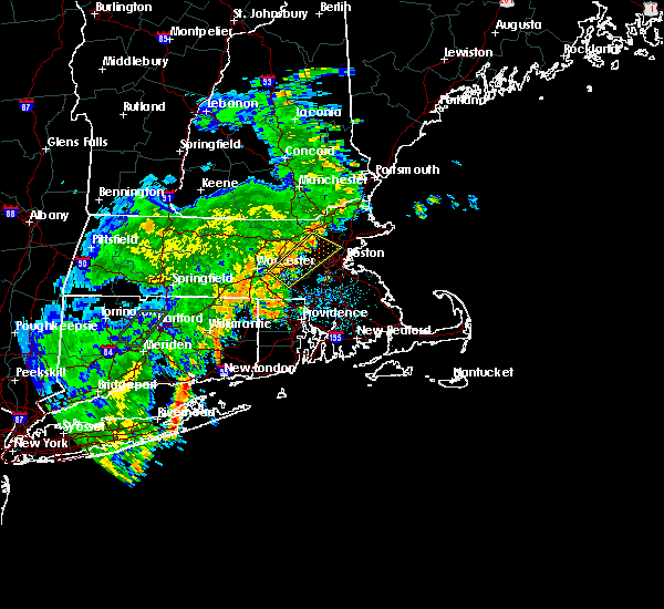 At 945 pm edt, a severe thunderstorm was located over bedford, or near lexington, moving northeast at 25 mph (radar indicated). Hazards include 60 mph wind gusts. Expect damage to trees and power lines. Locations impacted include, cambridge, newton, somerville, framingham, waltham, medford, arlington, billerica, marlborough, woburn, shrewsbury, chelmsford, natick, watertown, lexington, milford, wellesley, melrose, belmont and burlington. At 945 pm edt, a severe thunderstorm was located over bedford, or near lexington, moving northeast at 25 mph (radar indicated). Hazards include 60 mph wind gusts. Expect damage to trees and power lines. Locations impacted include, cambridge, newton, somerville, framingham, waltham, medford, arlington, billerica, marlborough, woburn, shrewsbury, chelmsford, natick, watertown, lexington, milford, wellesley, melrose, belmont and burlington.
|
| 8/7/2019 9:31 PM EDT |
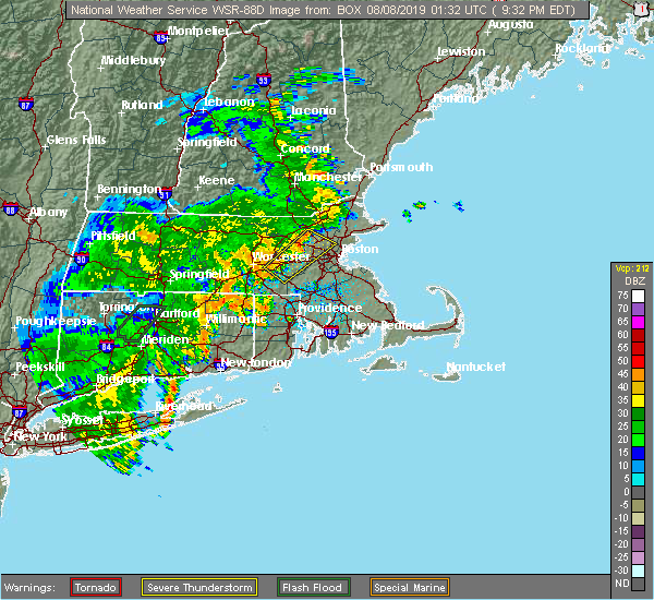 At 931 pm edt, a severe thunderstorm was located over lincoln, or near waltham, moving northeast at 25 mph (radar indicated). Hazards include 60 mph wind gusts. Expect damage to trees and power lines. Locations impacted include, cambridge, newton, somerville, framingham, waltham, medford, arlington, billerica, marlborough, woburn, shrewsbury, chelmsford, natick, watertown, lexington, milford, wellesley, melrose, belmont and burlington. At 931 pm edt, a severe thunderstorm was located over lincoln, or near waltham, moving northeast at 25 mph (radar indicated). Hazards include 60 mph wind gusts. Expect damage to trees and power lines. Locations impacted include, cambridge, newton, somerville, framingham, waltham, medford, arlington, billerica, marlborough, woburn, shrewsbury, chelmsford, natick, watertown, lexington, milford, wellesley, melrose, belmont and burlington.
|
| 8/7/2019 9:14 PM EDT |
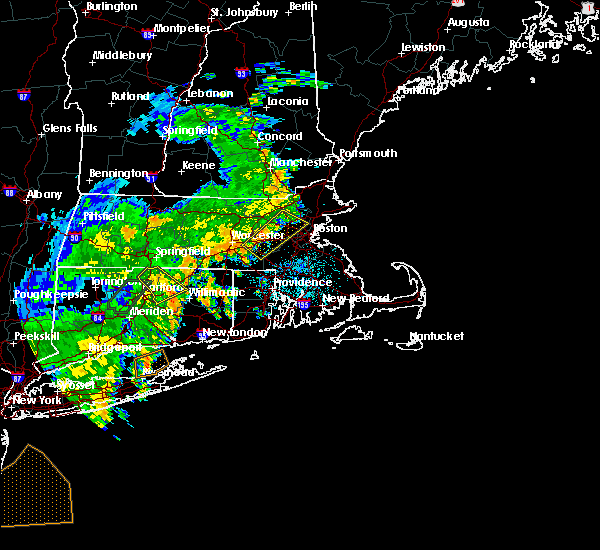 At 858 pm edt, a severe thunderstorm was located over southborough, or near framingham, moving northeast at 25 mph (radar indicated). Hazards include 60 mph wind gusts. expect damage to trees and power lines At 858 pm edt, a severe thunderstorm was located over southborough, or near framingham, moving northeast at 25 mph (radar indicated). Hazards include 60 mph wind gusts. expect damage to trees and power lines
|
| 8/7/2019 8:58 PM EDT |
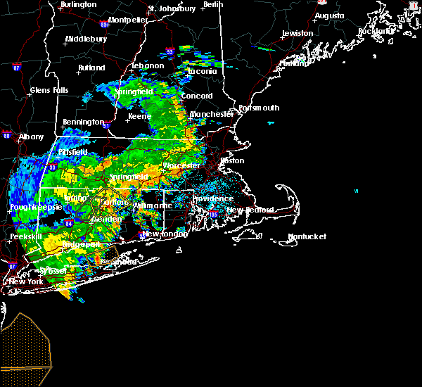 At 858 pm edt, a severe thunderstorm was located over southborough, or near framingham, moving northeast at 25 mph (radar indicated). Hazards include 60 mph wind gusts. expect damage to trees and power lines At 858 pm edt, a severe thunderstorm was located over southborough, or near framingham, moving northeast at 25 mph (radar indicated). Hazards include 60 mph wind gusts. expect damage to trees and power lines
|
| 7/20/2019 8:56 PM EDT |
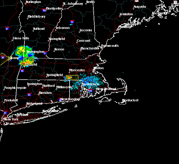 At 855 pm edt, a severe thunderstorm was located near oxford, or 11 miles south of worcester, moving east at 25 mph (radar indicated). Hazards include 50 mph wind gusts and quarter size hail. Hail damage to vehicles is possible. Expect damage to trees and power lines. At 855 pm edt, a severe thunderstorm was located near oxford, or 11 miles south of worcester, moving east at 25 mph (radar indicated). Hazards include 50 mph wind gusts and quarter size hail. Hail damage to vehicles is possible. Expect damage to trees and power lines.
|
| 7/17/2019 5:39 PM EDT | Tree down on house on east street extension in worcester county MA, 0.9 miles W of Milford, MA |
| 7/17/2019 5:38 PM EDT |
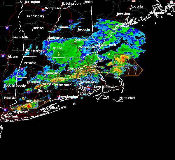 At 537 pm edt, a severe thunderstorm was located over medfield. another severe thunderstorm was over milford and mendon. both storms were moving east at 40mph (radar indicated). Hazards include 60 mph wind gusts. expect damage to trees and power lines At 537 pm edt, a severe thunderstorm was located over medfield. another severe thunderstorm was over milford and mendon. both storms were moving east at 40mph (radar indicated). Hazards include 60 mph wind gusts. expect damage to trees and power lines
|
| 7/17/2019 5:04 PM EDT |
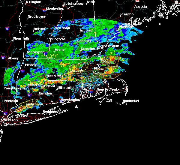 At 504 pm edt, a severe thunderstorm was located over northbridge, or 9 miles southwest of milford, moving east at 35 mph (radar indicated). Hazards include 60 mph wind gusts. expect damage to trees and power lines At 504 pm edt, a severe thunderstorm was located over northbridge, or 9 miles southwest of milford, moving east at 35 mph (radar indicated). Hazards include 60 mph wind gusts. expect damage to trees and power lines
|
| 7/17/2019 3:53 PM EDT |
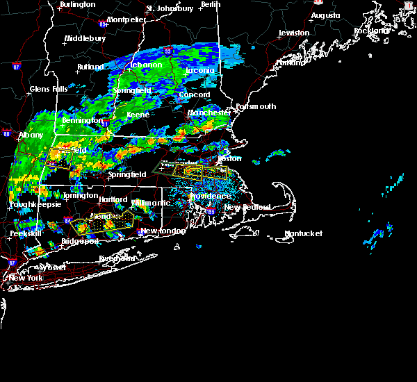 The severe thunderstorm warning for east central worcester, northwestern norfolk and southeastern middlesex counties will expire at 400 pm edt, the storm which prompted the warning was moving out of the area. therefore, the warning will be allowed to expire. a severe thunderstorm watch remains in effect until 1000 pm edt for eastern, central and northeastern massachusetts. &&. The severe thunderstorm warning for east central worcester, northwestern norfolk and southeastern middlesex counties will expire at 400 pm edt, the storm which prompted the warning was moving out of the area. therefore, the warning will be allowed to expire. a severe thunderstorm watch remains in effect until 1000 pm edt for eastern, central and northeastern massachusetts. &&.
|
| 7/17/2019 3:39 PM EDT |
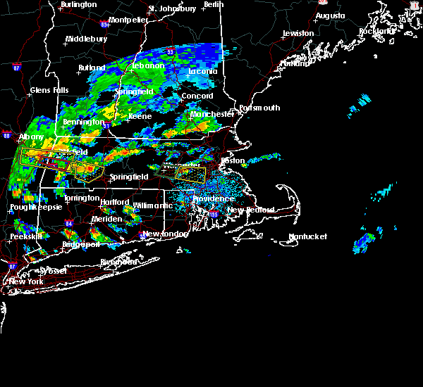 At 338 pm edt, a severe thunderstorm was located over hopkinton, or near milford, moving east at 25 mph (radar indicated). Hazards include 60 mph wind gusts and penny size hail. Expect damage to trees and power lines. this severe storm will be near, holliston around 350 pm edt. franklin, medway and sherborn around 355 pm edt. Walpole, medfield, norfolk, millis and dover around 400 pm edt. At 338 pm edt, a severe thunderstorm was located over hopkinton, or near milford, moving east at 25 mph (radar indicated). Hazards include 60 mph wind gusts and penny size hail. Expect damage to trees and power lines. this severe storm will be near, holliston around 350 pm edt. franklin, medway and sherborn around 355 pm edt. Walpole, medfield, norfolk, millis and dover around 400 pm edt.
|
| 7/17/2019 3:17 PM EDT |
 At 316 pm edt, a severe thunderstorm was located over westborough, or near shrewsbury, moving east at 30 mph (radar indicated). Hazards include 60 mph wind gusts and penny size hail. Expect damage to trees and power lines. this severe storm will be near, hopkinton around 325 pm edt. marlborough, milford and southborough around 330 pm edt. framingham, ashland and holliston around 335 pm edt. franklin, medway and sherborn around 340 pm edt. natick, millis and dover around 345 pm edt. wellesley, walpole, medfield and norfolk around 350 pm edt. needham around 355 pm edt. Dedham and westwood around 400 pm edt. At 316 pm edt, a severe thunderstorm was located over westborough, or near shrewsbury, moving east at 30 mph (radar indicated). Hazards include 60 mph wind gusts and penny size hail. Expect damage to trees and power lines. this severe storm will be near, hopkinton around 325 pm edt. marlborough, milford and southborough around 330 pm edt. framingham, ashland and holliston around 335 pm edt. franklin, medway and sherborn around 340 pm edt. natick, millis and dover around 345 pm edt. wellesley, walpole, medfield and norfolk around 350 pm edt. needham around 355 pm edt. Dedham and westwood around 400 pm edt.
|
| 7/17/2019 2:59 PM EDT |
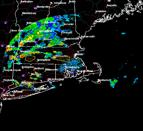 At 259 pm edt, a severe thunderstorm was located over worcester, moving east at 30 mph (radar indicated). Hazards include 60 mph wind gusts and quarter size hail. Hail damage to vehicles is possible. expect damage to trees and power lines. this severe thunderstorm will be near, shrewsbury and grafton around 310 pm edt. northborough around 315 pm edt. upton around 320 pm edt. westborough and hopkinton around 325 pm edt. milford and southborough around 330 pm edt. framingham, ashland and holliston around 335 pm edt. franklin, medway and sherborn around 340 pm edt. Natick, millis and dover around 345 pm edt. At 259 pm edt, a severe thunderstorm was located over worcester, moving east at 30 mph (radar indicated). Hazards include 60 mph wind gusts and quarter size hail. Hail damage to vehicles is possible. expect damage to trees and power lines. this severe thunderstorm will be near, shrewsbury and grafton around 310 pm edt. northborough around 315 pm edt. upton around 320 pm edt. westborough and hopkinton around 325 pm edt. milford and southborough around 330 pm edt. framingham, ashland and holliston around 335 pm edt. franklin, medway and sherborn around 340 pm edt. Natick, millis and dover around 345 pm edt.
|
| 7/6/2019 5:41 PM EDT |
 At 504 pm edt, severe thunderstorms were located along a line extending from near worcester to near enfield, moving east at 45 mph (radar indicated). Hazards include 60 mph wind gusts. expect damage to trees and power lines At 504 pm edt, severe thunderstorms were located along a line extending from near worcester to near enfield, moving east at 45 mph (radar indicated). Hazards include 60 mph wind gusts. expect damage to trees and power lines
|
| 7/6/2019 5:41 PM EDT |
 The severe thunderstorm warning for northern windham, northern tolland, northeastern hartford, southern worcester, north central norfolk, southeastern middlesex and southeastern hampden counties will expire at 545 pm edt, the storms which prompted the warning have weakened below severe limits, and no longer pose an immediate threat to life or property. therefore, the warning will be allowed to expire. however gusty winds and heavy rain are still possible with these thunderstorms. The severe thunderstorm warning for northern windham, northern tolland, northeastern hartford, southern worcester, north central norfolk, southeastern middlesex and southeastern hampden counties will expire at 545 pm edt, the storms which prompted the warning have weakened below severe limits, and no longer pose an immediate threat to life or property. therefore, the warning will be allowed to expire. however gusty winds and heavy rain are still possible with these thunderstorms.
|
| 7/6/2019 5:05 PM EDT |
 At 504 pm edt, severe thunderstorms were located along a line extending from near worcester to near enfield, moving east at 45 mph (radar indicated). Hazards include 60 mph wind gusts. expect damage to trees and power lines At 504 pm edt, severe thunderstorms were located along a line extending from near worcester to near enfield, moving east at 45 mph (radar indicated). Hazards include 60 mph wind gusts. expect damage to trees and power lines
|
| 7/6/2019 5:05 PM EDT |
 The national weather service in boston/norton has issued a * severe thunderstorm warning for. northern windham county in northern connecticut. northern tolland county in northern connecticut. northeastern hartford county in northern connecticut. Southern worcester county in central massachusetts. The national weather service in boston/norton has issued a * severe thunderstorm warning for. northern windham county in northern connecticut. northern tolland county in northern connecticut. northeastern hartford county in northern connecticut. Southern worcester county in central massachusetts.
|
| 6/30/2019 2:00 PM EDT |
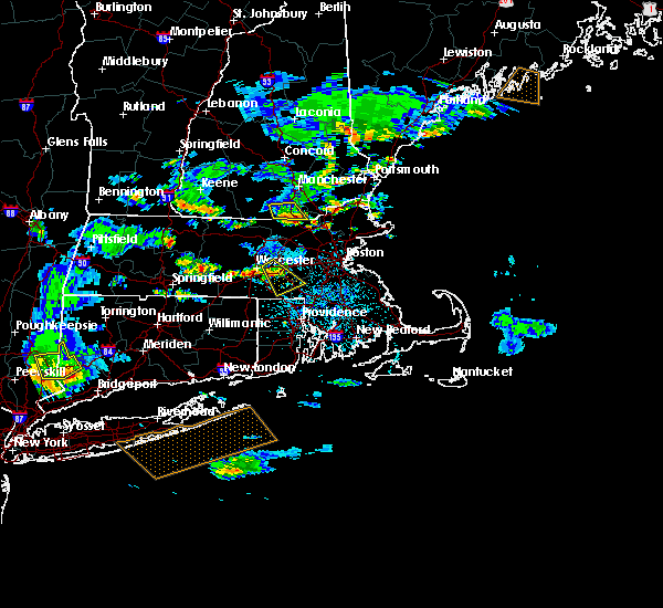 At 157 pm edt, a severe thunderstorm was located over upton, or near milford, moving southeast at 25 mph. dime size hail was reported in shrewsbury. this storm has weakened but still has some potential to produce large hail and wind gusts to 30 to 40 mph (radar indicated). Hazards include quarter size hail. Some damage to crops or vehicles is possible. Locations impacted include, franklin, milford, westborough, grafton, bellingham, northbridge, hopkinton, holliston, uxbridge, medway, blackstone, millis, upton, hopedale, mendon and millville. At 157 pm edt, a severe thunderstorm was located over upton, or near milford, moving southeast at 25 mph. dime size hail was reported in shrewsbury. this storm has weakened but still has some potential to produce large hail and wind gusts to 30 to 40 mph (radar indicated). Hazards include quarter size hail. Some damage to crops or vehicles is possible. Locations impacted include, franklin, milford, westborough, grafton, bellingham, northbridge, hopkinton, holliston, uxbridge, medway, blackstone, millis, upton, hopedale, mendon and millville.
|
| 6/30/2019 1:43 PM EDT |
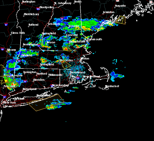 At 143 pm edt, a severe thunderstorm was located over shrewsbury, moving southeast at 25 mph (radar indicated). Hazards include 60 mph wind gusts and quarter size hail. Hail damage to vehicles is possible. Expect damage to trees and power lines. At 143 pm edt, a severe thunderstorm was located over shrewsbury, moving southeast at 25 mph (radar indicated). Hazards include 60 mph wind gusts and quarter size hail. Hail damage to vehicles is possible. Expect damage to trees and power lines.
|
| 5/20/2019 1:26 AM EDT |
 At 125 am edt, a severe thunderstorm was located over woodstock, or 18 miles northeast of mansfield, moving northeast at 50 mph (radar indicated). Hazards include 60 mph wind gusts and quarter size hail. Hail damage to vehicles is possible. Expect damage to trees and power lines. At 125 am edt, a severe thunderstorm was located over woodstock, or 18 miles northeast of mansfield, moving northeast at 50 mph (radar indicated). Hazards include 60 mph wind gusts and quarter size hail. Hail damage to vehicles is possible. Expect damage to trees and power lines.
|
| 10/11/2018 4:50 PM EDT |
 At 449 pm edt, a severe thunderstorm was located over norfolk, or near franklin, moving east at 50 mph (public. reports of wind damage in milford, ma). Hazards include 60 mph wind gusts. Expect damage to trees and power lines. Locations impacted include, brockton, quincy, braintree, randolph, franklin, norwood, milford, milton, stoughton, walpole, mansfield, easton, canton, norton, sharon, foxborough, bellingham, westwood, holliston and medway. At 449 pm edt, a severe thunderstorm was located over norfolk, or near franklin, moving east at 50 mph (public. reports of wind damage in milford, ma). Hazards include 60 mph wind gusts. Expect damage to trees and power lines. Locations impacted include, brockton, quincy, braintree, randolph, franklin, norwood, milford, milton, stoughton, walpole, mansfield, easton, canton, norton, sharon, foxborough, bellingham, westwood, holliston and medway.
|
| 10/11/2018 4:46 PM EDT | Tree down on parked suv on courtland street in worcester county MA, 0.9 miles W of Milford, MA |
| 10/11/2018 4:40 PM EDT | Several trees down on courtland street and central and beaver streets in worcester county MA, 0.9 miles W of Milford, MA |
| 10/11/2018 4:40 PM EDT |
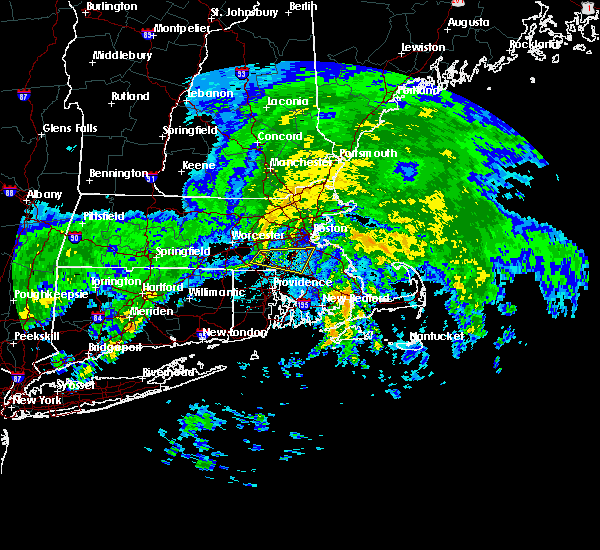 At 440 pm edt, a severe thunderstorm was located over hopedale, or near milford, moving east at 50 mph (radar indicated). Hazards include 60 mph wind gusts. expect damage to trees and power lines At 440 pm edt, a severe thunderstorm was located over hopedale, or near milford, moving east at 50 mph (radar indicated). Hazards include 60 mph wind gusts. expect damage to trees and power lines
|
| 9/6/2018 4:45 PM EDT |
 At 444 pm edt, a severe thunderstorm was located over needham, moving east at 45 mph (radar indicated). Hazards include 60 mph wind gusts. Expect damage to trees and power lines. Locations impacted include, boston, quincy, newton, framingham, brookline, weymouth, braintree, natick, randolph, franklin, needham, norwood, wellesley, milton, stoughton, dedham, walpole, hingham, canton and scituate. At 444 pm edt, a severe thunderstorm was located over needham, moving east at 45 mph (radar indicated). Hazards include 60 mph wind gusts. Expect damage to trees and power lines. Locations impacted include, boston, quincy, newton, framingham, brookline, weymouth, braintree, natick, randolph, franklin, needham, norwood, wellesley, milton, stoughton, dedham, walpole, hingham, canton and scituate.
|
| 9/6/2018 4:23 PM EDT |
 At 422 pm edt, a severe thunderstorm was located over hopkinton, or near milford, moving east at 45 mph (radar indicated). Hazards include 60 mph wind gusts and quarter size hail. Hail damage to vehicles is possible. Expect damage to trees and power lines. At 422 pm edt, a severe thunderstorm was located over hopkinton, or near milford, moving east at 45 mph (radar indicated). Hazards include 60 mph wind gusts and quarter size hail. Hail damage to vehicles is possible. Expect damage to trees and power lines.
|
| 8/8/2018 7:50 PM EDT |
 At 749 pm edt, a severe thunderstorm was located over lincoln, or near lexington, moving east at 40 mph (radar indicated). Hazards include 60 mph wind gusts. expect damage to trees and power lines At 749 pm edt, a severe thunderstorm was located over lincoln, or near lexington, moving east at 40 mph (radar indicated). Hazards include 60 mph wind gusts. expect damage to trees and power lines
|
| 8/2/2018 6:10 PM EDT |
 The severe thunderstorm warning for southern worcester and south central middlesex counties will expire at 615 pm edt, the severe thunderstorm which prompted the warning has weakened. therefore, the warning will be allowed to expire. The severe thunderstorm warning for southern worcester and south central middlesex counties will expire at 615 pm edt, the severe thunderstorm which prompted the warning has weakened. therefore, the warning will be allowed to expire.
|
| 8/2/2018 5:28 PM EDT |
 At 528 pm edt, a severe thunderstorm was located near sturbridge, or 14 miles southwest of worcester, moving east at 35 mph (radar indicated). Hazards include 60 mph wind gusts. expect damage to trees and power lines At 528 pm edt, a severe thunderstorm was located near sturbridge, or 14 miles southwest of worcester, moving east at 35 mph (radar indicated). Hazards include 60 mph wind gusts. expect damage to trees and power lines
|
| 7/26/2018 2:32 AM EDT |
 At 232 am edt, a severe thunderstorm was located over uxbridge, or 9 miles southwest of milford, moving northeast at 35 mph (radar indicated). Hazards include 60 mph wind gusts. expect damage to trees and power lines At 232 am edt, a severe thunderstorm was located over uxbridge, or 9 miles southwest of milford, moving northeast at 35 mph (radar indicated). Hazards include 60 mph wind gusts. expect damage to trees and power lines
|
| 7/17/2018 5:06 PM EDT |
 At 506 pm edt, a severe thunderstorm was located over north smithfield, or near woonsocket, moving east at 35 mph (radar indicated). Hazards include 60 mph wind gusts and penny size hail. expect damage to trees and power lines At 506 pm edt, a severe thunderstorm was located over north smithfield, or near woonsocket, moving east at 35 mph (radar indicated). Hazards include 60 mph wind gusts and penny size hail. expect damage to trees and power lines
|
| 6/18/2018 7:42 PM EDT |
 At 742 pm edt, a severe thunderstorm was located over oxford, or 11 miles south of worcester, moving east at 35 mph (radar indicated). Hazards include 60 mph wind gusts and quarter size hail. Hail damage to vehicles is possible. expect damage to trees and power lines. Locations impacted include, woonsocket, cumberland, franklin, milford, smithfield, lincoln, grafton, webster, southbridge, bellingham, auburn, burrillville, northbridge, oxford, holliston, uxbridge, millbury, charlton, medway and north smithfield. At 742 pm edt, a severe thunderstorm was located over oxford, or 11 miles south of worcester, moving east at 35 mph (radar indicated). Hazards include 60 mph wind gusts and quarter size hail. Hail damage to vehicles is possible. expect damage to trees and power lines. Locations impacted include, woonsocket, cumberland, franklin, milford, smithfield, lincoln, grafton, webster, southbridge, bellingham, auburn, burrillville, northbridge, oxford, holliston, uxbridge, millbury, charlton, medway and north smithfield.
|
| 6/18/2018 7:23 PM EDT |
 At 723 pm edt, a severe thunderstorm was located over sturbridge, or 16 miles southwest of worcester, moving east at 35 mph (radar indicated). Hazards include 60 mph wind gusts and quarter size hail. Hail damage to vehicles is possible. Expect damage to trees and power lines. At 723 pm edt, a severe thunderstorm was located over sturbridge, or 16 miles southwest of worcester, moving east at 35 mph (radar indicated). Hazards include 60 mph wind gusts and quarter size hail. Hail damage to vehicles is possible. Expect damage to trees and power lines.
|
| 8/2/2017 5:11 PM EDT | Quarter sized hail reported 0.9 miles W of Milford, MA |
| 8/2/2017 5:11 PM EDT | Tree down on south main street and tree down on route 140 in worcester county MA, 0.9 miles W of Milford, MA |
| 8/2/2017 5:09 PM EDT |
 At 509 pm edt, a severe thunderstorm was located over mendon, or near woonsocket, and is nearly stationary (radar indicated). Hazards include 60 mph wind gusts and quarter size hail. Hail damage to vehicles is possible. Expect damage to trees and power lines. At 509 pm edt, a severe thunderstorm was located over mendon, or near woonsocket, and is nearly stationary (radar indicated). Hazards include 60 mph wind gusts and quarter size hail. Hail damage to vehicles is possible. Expect damage to trees and power lines.
|
| 8/2/2017 5:06 PM EDT | Quarter sized hail reported 0.9 miles W of Milford, MA |
| 7/12/2017 1:00 PM EDT | Half Dollar sized hail reported 0.9 miles W of Milford, MA |
| 7/12/2017 12:57 PM EDT | Quarter sized hail reported 0.9 miles W of Milford, MA |
| 7/12/2017 12:46 PM EDT |
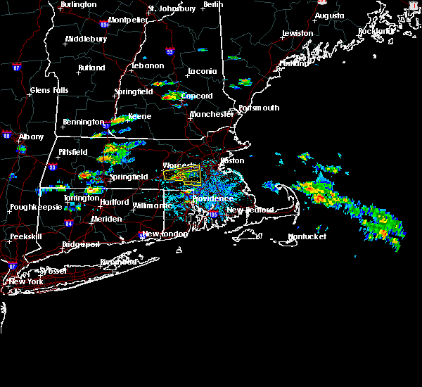 At 1246 pm edt, a severe thunderstorm was located over upton, or near milford, moving east at 15 mph (radar indicated). Hazards include golf ball size hail and 60 mph wind gusts. People and animals outdoors will be injured. expect hail damage to roofs, siding, windows, and vehicles. Expect damage to trees and power lines. At 1246 pm edt, a severe thunderstorm was located over upton, or near milford, moving east at 15 mph (radar indicated). Hazards include golf ball size hail and 60 mph wind gusts. People and animals outdoors will be injured. expect hail damage to roofs, siding, windows, and vehicles. Expect damage to trees and power lines.
|
| 7/12/2017 12:24 PM EDT |
 At 1223 pm edt, a severe thunderstorm was located over grafton, or near shrewsbury, moving east at 20 mph (radar indicated). Hazards include 60 mph wind gusts and quarter size hail. Hail damage to vehicles is possible. Expect damage to trees and power lines. At 1223 pm edt, a severe thunderstorm was located over grafton, or near shrewsbury, moving east at 20 mph (radar indicated). Hazards include 60 mph wind gusts and quarter size hail. Hail damage to vehicles is possible. Expect damage to trees and power lines.
|
| 6/27/2017 3:56 PM EDT |
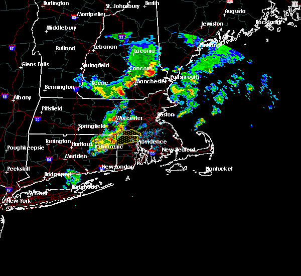 At 755 pm edt, a severe thunderstorm was located over putnam, or 15 miles north of plainfield, moving east at 35 mph (radar indicated). Hazards include 60 mph wind gusts and quarter size hail. Hail damage to vehicles is possible. Expect damage to trees and power lines. At 755 pm edt, a severe thunderstorm was located over putnam, or 15 miles north of plainfield, moving east at 35 mph (radar indicated). Hazards include 60 mph wind gusts and quarter size hail. Hail damage to vehicles is possible. Expect damage to trees and power lines.
|
| 5/19/2017 12:26 AM EDT |
 At 1225 am edt, severe thunderstorms were located along a line extending from near concord to near mendon to near putnam, moving east at 45 mph (radar indicated). Hazards include 60 mph wind gusts. Expect damage to trees and power lines. Locations impacted include, boston, cambridge, quincy, newton, somerville, pawtucket, framingham, waltham, malden, brookline, medford, revere, arlington, everett, woonsocket, billerica, woburn, chelsea, coventry and cumberland. At 1225 am edt, severe thunderstorms were located along a line extending from near concord to near mendon to near putnam, moving east at 45 mph (radar indicated). Hazards include 60 mph wind gusts. Expect damage to trees and power lines. Locations impacted include, boston, cambridge, quincy, newton, somerville, pawtucket, framingham, waltham, malden, brookline, medford, revere, arlington, everett, woonsocket, billerica, woburn, chelsea, coventry and cumberland.
|
| 5/19/2017 12:04 AM EDT |
 At 1204 am edt, severe thunderstorms were located along a line extending from clinton to near douglas to near ashford, moving east at 40 mph (radar indicated). Hazards include 60 mph wind gusts. expect damage to trees and power lines At 1204 am edt, severe thunderstorms were located along a line extending from clinton to near douglas to near ashford, moving east at 40 mph (radar indicated). Hazards include 60 mph wind gusts. expect damage to trees and power lines
|
| 5/18/2017 11:45 PM EDT |
 At 1144 pm edt, a severe thunderstorm was located over paxton, or near worcester, moving east at 35 mph (radar indicated). Hazards include 60 mph wind gusts. expect damage to trees and power lines At 1144 pm edt, a severe thunderstorm was located over paxton, or near worcester, moving east at 35 mph (radar indicated). Hazards include 60 mph wind gusts. expect damage to trees and power lines
|
| 10/21/2016 8:08 PM EDT |
 At 808 pm edt, a severe thunderstorm was located over hopkinton, or near milford, moving northeast at 30 mph (radar indicated). Hazards include 60 mph wind gusts. Expect damage to roofs. siding. And trees. At 808 pm edt, a severe thunderstorm was located over hopkinton, or near milford, moving northeast at 30 mph (radar indicated). Hazards include 60 mph wind gusts. Expect damage to roofs. siding. And trees.
|
| 9/11/2016 10:14 AM EDT |
 At 1014 am edt, severe thunderstorms were located along a line extending from north andover to hopedale, moving east at 45 mph (radar indicated). Hazards include 60 mph wind gusts. Expect damage to roofs. siding. and trees. Locations impacted include, boston, cambridge, brockton, quincy, lynn, newton, lawrence, somerville, framingham, haverhill, waltham, malden, brookline, medford, weymouth, revere, peabody, methuen, arlington and everett. At 1014 am edt, severe thunderstorms were located along a line extending from north andover to hopedale, moving east at 45 mph (radar indicated). Hazards include 60 mph wind gusts. Expect damage to roofs. siding. and trees. Locations impacted include, boston, cambridge, brockton, quincy, lynn, newton, lawrence, somerville, framingham, haverhill, waltham, malden, brookline, medford, weymouth, revere, peabody, methuen, arlington and everett.
|
| 9/11/2016 10:10 AM EDT |
 The severe thunderstorm warning for northwestern essex, southeastern hampshire, southeastern hampden, worcester and middlesex counties will expire at 1015 am edt, the storms which prompted the warning have moved out of the area. therefore, the warning will be allowed to expire. The severe thunderstorm warning for northwestern essex, southeastern hampshire, southeastern hampden, worcester and middlesex counties will expire at 1015 am edt, the storms which prompted the warning have moved out of the area. therefore, the warning will be allowed to expire.
|
| 9/11/2016 9:53 AM EDT |
 At 952 am edt, severe thunderstorms were located along a line extending from tyngsborough to near oxford, moving east at 45 mph (radar indicated). Hazards include 60 mph wind gusts. Expect damage to roofs. siding. And trees. At 952 am edt, severe thunderstorms were located along a line extending from tyngsborough to near oxford, moving east at 45 mph (radar indicated). Hazards include 60 mph wind gusts. Expect damage to roofs. siding. And trees.
|
| 9/11/2016 9:23 AM EDT |
 At 922 am edt, severe thunderstorms were located along a line extending from near new boston to near westminster to north brookfield to west hartford, moving east at 45 mph (radar indicated). Hazards include 60 mph wind gusts. Expect damage to roofs. siding. And trees. At 922 am edt, severe thunderstorms were located along a line extending from near new boston to near westminster to north brookfield to west hartford, moving east at 45 mph (radar indicated). Hazards include 60 mph wind gusts. Expect damage to roofs. siding. And trees.
|
| 8/14/2016 8:30 PM EDT |
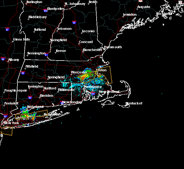 At 830 pm edt, severe thunderstorms were located along a line extending from medfield to franklin to near blackstone, moving east at 35 mph (radar indicated). Hazards include 60 mph wind gusts. Expect damage to roofs. siding. and trees. Locations impacted include, franklin, norwood, milford, stoughton, walpole, canton, sharon, foxborough, bellingham, holliston, medway, medfield, norfolk, wrentham, plainville, millis and sherborn. At 830 pm edt, severe thunderstorms were located along a line extending from medfield to franklin to near blackstone, moving east at 35 mph (radar indicated). Hazards include 60 mph wind gusts. Expect damage to roofs. siding. and trees. Locations impacted include, franklin, norwood, milford, stoughton, walpole, canton, sharon, foxborough, bellingham, holliston, medway, medfield, norfolk, wrentham, plainville, millis and sherborn.
|
| 8/14/2016 8:24 PM EDT |
 At 822 pm edt, severe thunderstorms were located along a line extending from holliston to near hopedale to millville, moving east at 30 mph (radar indicated). Hazards include 60 mph wind gusts. Expect damage to roofs. siding. and trees. locations impacted include, medway, norfolk,. Franklin, bellingham, wrentham, foxborough. At 822 pm edt, severe thunderstorms were located along a line extending from holliston to near hopedale to millville, moving east at 30 mph (radar indicated). Hazards include 60 mph wind gusts. Expect damage to roofs. siding. and trees. locations impacted include, medway, norfolk,. Franklin, bellingham, wrentham, foxborough.
|
| 8/14/2016 8:16 PM EDT |
 At 816 pm edt, severe thunderstorms were located along a line extending from ashland to milford to northbridge, moving east at 30 mph (radar indicated). Hazards include 60 mph wind gusts. Expect damage to roofs. siding. and trees. Locations impacted include, framingham, marlborough, natick, milford, westborough, sudbury, ashland, northbridge, hopkinton, holliston, uxbridge, wayland, medway, southborough, blackstone, douglas, upton, hopedale, mendon and sherborn. At 816 pm edt, severe thunderstorms were located along a line extending from ashland to milford to northbridge, moving east at 30 mph (radar indicated). Hazards include 60 mph wind gusts. Expect damage to roofs. siding. and trees. Locations impacted include, framingham, marlborough, natick, milford, westborough, sudbury, ashland, northbridge, hopkinton, holliston, uxbridge, wayland, medway, southborough, blackstone, douglas, upton, hopedale, mendon and sherborn.
|
| 8/14/2016 8:08 PM EDT |
 At 808 pm edt, severe thunderstorms were located along a line extending from hopkinton to near upton to near uxbridge, moving east northeast at 35 mph (radar indicated). Hazards include 60 mph wind gusts. Expect damage to roofs. siding. And trees. At 808 pm edt, severe thunderstorms were located along a line extending from hopkinton to near upton to near uxbridge, moving east northeast at 35 mph (radar indicated). Hazards include 60 mph wind gusts. Expect damage to roofs. siding. And trees.
|
| 8/14/2016 7:49 PM EDT |
 At 748 pm edt, severe thunderstorms were located along a line extending from shrewsbury to millbury to near oxford, moving east at 30 mph (radar indicated). Hazards include 60 mph wind gusts. Expect damage to roofs. siding. And trees. At 748 pm edt, severe thunderstorms were located along a line extending from shrewsbury to millbury to near oxford, moving east at 30 mph (radar indicated). Hazards include 60 mph wind gusts. Expect damage to roofs. siding. And trees.
|
| 8/14/2016 1:50 AM EDT |
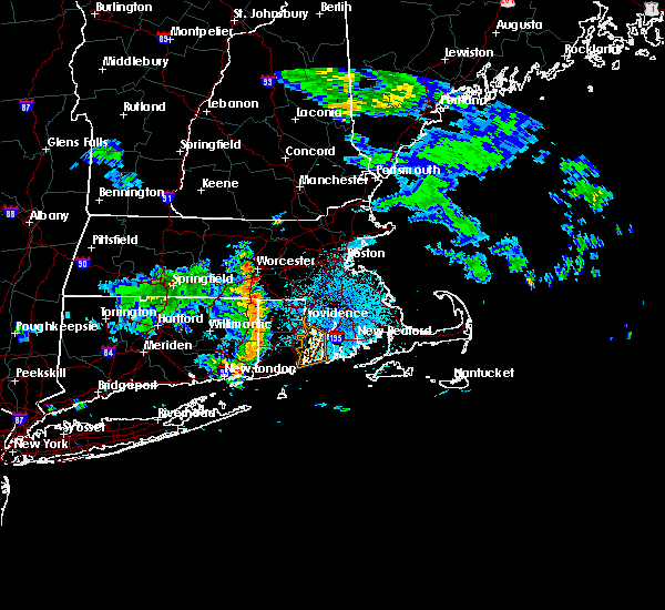 At 149 am edt, severe thunderstorms were located along a line extending from douglas to near voluntown, moving east at 30 mph (radar indicated). Hazards include 60 mph wind gusts. Expect damage to roofs. siding. And trees. At 149 am edt, severe thunderstorms were located along a line extending from douglas to near voluntown, moving east at 30 mph (radar indicated). Hazards include 60 mph wind gusts. Expect damage to roofs. siding. And trees.
|
| 8/13/2016 10:38 PM EDT |
 At 1038 pm edt, severe thunderstorms were located along a line extending from near rutland to near charlton to southbridge, moving east at 35 mph (radar indicated). Hazards include 60 mph wind gusts. Expect damage to roofs. siding. And trees. At 1038 pm edt, severe thunderstorms were located along a line extending from near rutland to near charlton to southbridge, moving east at 35 mph (radar indicated). Hazards include 60 mph wind gusts. Expect damage to roofs. siding. And trees.
|
| 8/6/2016 6:13 PM EDT |
 At 612 pm edt, severe thunderstorms were located along a line extending from medway massachusetts to near killingly connecticut, moving east at 30 mph (radar indicated). Hazards include 60 mph wind gusts and penny size hail. expect trees and wires down At 612 pm edt, severe thunderstorms were located along a line extending from medway massachusetts to near killingly connecticut, moving east at 30 mph (radar indicated). Hazards include 60 mph wind gusts and penny size hail. expect trees and wires down
|
| 8/6/2016 5:58 PM EDT |
 At 556 pm edt, a severe thunderstorm was located over northbridge, or near milford, moving east at 30 mph. doppler radar continued to indicate winds near 60 mph near whitinsville (radar indicated). Hazards include 60 mph wind gusts and quarter size hail. Expect wind damage to roofs. siding. and trees. hail damage to vehicles is possible. Locations impacted include, woonsocket, cumberland, franklin, milford, grafton, webster, bellingham, burrillville, northbridge, uxbridge, medway, north smithfield, norfolk, wrentham, thompson, blackstone, sutton, douglas, millis and upton. At 556 pm edt, a severe thunderstorm was located over northbridge, or near milford, moving east at 30 mph. doppler radar continued to indicate winds near 60 mph near whitinsville (radar indicated). Hazards include 60 mph wind gusts and quarter size hail. Expect wind damage to roofs. siding. and trees. hail damage to vehicles is possible. Locations impacted include, woonsocket, cumberland, franklin, milford, grafton, webster, bellingham, burrillville, northbridge, uxbridge, medway, north smithfield, norfolk, wrentham, thompson, blackstone, sutton, douglas, millis and upton.
|
| 8/6/2016 5:42 PM EDT |
 At 541 pm edt, a severe thunderstorm was located over sutton, or 9 miles west of milford, moving east at 40 mph. amateur radio operators reported wires down in auburn (radar indicated). Hazards include 60 mph wind gusts and quarter size hail. Hail damage to vehicles is expected. Expect wind damage to roofs, siding, and trees. At 541 pm edt, a severe thunderstorm was located over sutton, or 9 miles west of milford, moving east at 40 mph. amateur radio operators reported wires down in auburn (radar indicated). Hazards include 60 mph wind gusts and quarter size hail. Hail damage to vehicles is expected. Expect wind damage to roofs, siding, and trees.
|
| 7/22/2016 8:12 PM EDT |
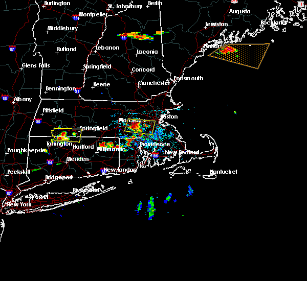 At 810 pm edt, a severe thunderstorm was located over hopkinton, or near milford, moving east at 25 mph. this is a very dangerous storm. widespread wind damage has been reported in westborough! natick, needham, and hopkinton are in the path of this very dangerous storm (trained weather spotters). Hazards include 80 mph wind gusts and half dollar size hail. Flying debris will be dangerous to those caught without shelter. mobile homes will be heavily damaged. expect considerable damage to roofs, windows, and vehicles. extensive tree damage and power outages are likely. Locations impacted include, boston, newton, framingham, brookline, marlborough, natick, franklin, needham, norwood, milford, wellesley, dedham, walpole, canton, westborough, grafton, sudbury, sharon, foxborough and ashland. At 810 pm edt, a severe thunderstorm was located over hopkinton, or near milford, moving east at 25 mph. this is a very dangerous storm. widespread wind damage has been reported in westborough! natick, needham, and hopkinton are in the path of this very dangerous storm (trained weather spotters). Hazards include 80 mph wind gusts and half dollar size hail. Flying debris will be dangerous to those caught without shelter. mobile homes will be heavily damaged. expect considerable damage to roofs, windows, and vehicles. extensive tree damage and power outages are likely. Locations impacted include, boston, newton, framingham, brookline, marlborough, natick, franklin, needham, norwood, milford, wellesley, dedham, walpole, canton, westborough, grafton, sudbury, sharon, foxborough and ashland.
|
| 7/22/2016 8:02 PM EDT |
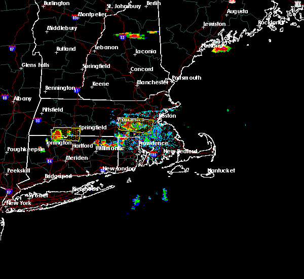 At 802 pm edt, a severe thunderstorm was located over westborough, or near shrewsbury, moving east at 25 mph (radar indicated). Hazards include 70 mph wind gusts and half dollar size hail. Hail damage to vehicles is expected. expect considerable tree damage. wind damage is also likely to mobile homes, roofs, and outbuildings. Locations impacted include, boston, worcester, newton, framingham, brookline, marlborough, shrewsbury, natick, franklin, needham, norwood, milford, wellesley, dedham, walpole, canton, hudson, westborough, grafton and sudbury. At 802 pm edt, a severe thunderstorm was located over westborough, or near shrewsbury, moving east at 25 mph (radar indicated). Hazards include 70 mph wind gusts and half dollar size hail. Hail damage to vehicles is expected. expect considerable tree damage. wind damage is also likely to mobile homes, roofs, and outbuildings. Locations impacted include, boston, worcester, newton, framingham, brookline, marlborough, shrewsbury, natick, franklin, needham, norwood, milford, wellesley, dedham, walpole, canton, hudson, westborough, grafton and sudbury.
|
| 7/22/2016 7:57 PM EDT |
 At 756 pm edt, a severe thunderstorm was located over shrewsbury, moving east at 25 mph (radar indicated). Hazards include 60 mph wind gusts and quarter size hail. Hail damage to vehicles is expected. Expect wind damage to roofs, siding, and trees. At 756 pm edt, a severe thunderstorm was located over shrewsbury, moving east at 25 mph (radar indicated). Hazards include 60 mph wind gusts and quarter size hail. Hail damage to vehicles is expected. Expect wind damage to roofs, siding, and trees.
|
| 7/22/2016 7:16 PM EDT |
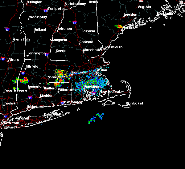 At 715 pm edt, a severe thunderstorm was located over worcester, moving east at 25 mph (radar indicated). Hazards include 60 mph wind gusts. Expect damage to roofs. siding. And trees. At 715 pm edt, a severe thunderstorm was located over worcester, moving east at 25 mph (radar indicated). Hazards include 60 mph wind gusts. Expect damage to roofs. siding. And trees.
|
| 7/7/2016 3:33 PM EDT |
 At 332 pm edt, a severe thunderstorm was located over northbridge, or 7 miles southwest of milford, moving northeast at 15 mph (radar indicated). Hazards include 60 mph wind gusts and quarter size hail. Hail damage to vehicles is expected. expect wind damage to roofs, siding, and trees. Locations impacted include, franklin, milford, grafton, ashland, bellingham, northbridge, hopkinton, holliston, uxbridge, medway, wrentham, southborough, blackstone, sutton, upton, hopedale, mendon and millville. At 332 pm edt, a severe thunderstorm was located over northbridge, or 7 miles southwest of milford, moving northeast at 15 mph (radar indicated). Hazards include 60 mph wind gusts and quarter size hail. Hail damage to vehicles is expected. expect wind damage to roofs, siding, and trees. Locations impacted include, franklin, milford, grafton, ashland, bellingham, northbridge, hopkinton, holliston, uxbridge, medway, wrentham, southborough, blackstone, sutton, upton, hopedale, mendon and millville.
|
| 7/7/2016 3:17 PM EDT |
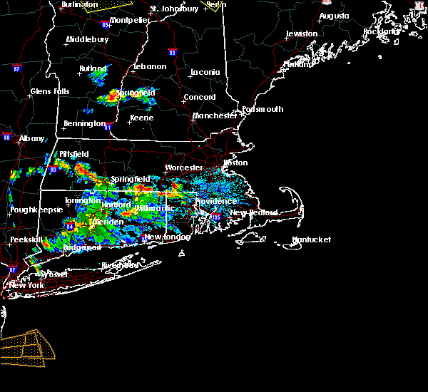 At 316 pm edt, a severe thunderstorm was located over douglas, or 11 miles southwest of milford, moving northeast at 15 mph (radar indicated). Hazards include 60 mph wind gusts and quarter size hail. Hail damage to vehicles is expected. Expect wind damage to roofs, siding, and trees. At 316 pm edt, a severe thunderstorm was located over douglas, or 11 miles southwest of milford, moving northeast at 15 mph (radar indicated). Hazards include 60 mph wind gusts and quarter size hail. Hail damage to vehicles is expected. Expect wind damage to roofs, siding, and trees.
|
| 6/21/2016 4:41 AM EDT |
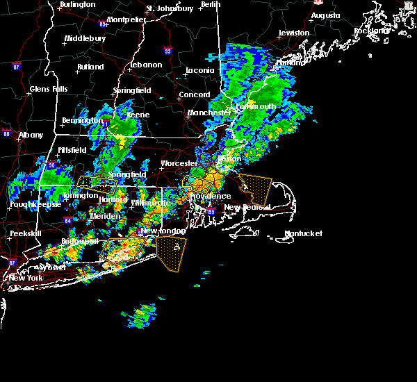 The severe thunderstorm warning for northwestern bristol and southwestern norfolk counties will expire at 445 am edt, the storm which prompted the warning has weakened below severe limits, and no longer poses an immediate threat to life or property. therefore, the warning will be allowed to expire. however heavy rain is still possible with this thunderstorm. The severe thunderstorm warning for northwestern bristol and southwestern norfolk counties will expire at 445 am edt, the storm which prompted the warning has weakened below severe limits, and no longer poses an immediate threat to life or property. therefore, the warning will be allowed to expire. however heavy rain is still possible with this thunderstorm.
|
| 6/21/2016 4:24 AM EDT |
 At 423 am edt, a severe thunderstorm was located over plainville and north attleborough, moving east at 35 mph (radar indicated). Hazards include 60 mph wind gusts. Expect damage to roofs. siding. and trees. Locations impacted include, franklin, north attleborough, milford, stoughton, attleboro, walpole, mansfield, easton, norton, sharon, foxborough, bellingham, holliston, medway, norfolk, wrentham, blackstone, plainville, millis and mendon. At 423 am edt, a severe thunderstorm was located over plainville and north attleborough, moving east at 35 mph (radar indicated). Hazards include 60 mph wind gusts. Expect damage to roofs. siding. and trees. Locations impacted include, franklin, north attleborough, milford, stoughton, attleboro, walpole, mansfield, easton, norton, sharon, foxborough, bellingham, holliston, medway, norfolk, wrentham, blackstone, plainville, millis and mendon.
|
| 6/21/2016 4:02 AM EDT |
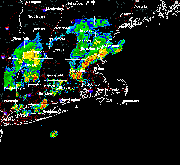 At 400 am edt, a severe thunderstorm was located over mendon and milford, moving southeast at 35 mph (radar indicated). Hazards include 60 mph wind gusts. Expect damage to roofs. siding. And trees. At 400 am edt, a severe thunderstorm was located over mendon and milford, moving southeast at 35 mph (radar indicated). Hazards include 60 mph wind gusts. Expect damage to roofs. siding. And trees.
|
| 2/25/2016 3:21 AM EST |
 The severe thunderstorm warning for northwestern bristol, west central essex, western norfolk, southeastern worcester and middlesex counties will expire at 330 am est, the storm which prompted the warning has weakened below severe limits although strong winds may linger. The severe thunderstorm warning for northwestern bristol, west central essex, western norfolk, southeastern worcester and middlesex counties will expire at 330 am est, the storm which prompted the warning has weakened below severe limits although strong winds may linger.
|
| 2/25/2016 2:40 AM EST |
 At 239 am est, doppler radar indicated a severe thunderstorm capable of producing destructive winds in excess of 70 mph. this storm was located over upton, or near milford, and was moving northeast at 115 mph. At 239 am est, doppler radar indicated a severe thunderstorm capable of producing destructive winds in excess of 70 mph. this storm was located over upton, or near milford, and was moving northeast at 115 mph.
|
| 8/4/2015 4:09 PM EDT |
 At 409 pm edt, doppler radar indicated a line of severe thunderstorms capable of producing large damaging hail up to golf ball size and damaging winds in excess of 60 mph. these storms were located along a line extending from bedford to needham to medway, moving east at 40 mph. locations impacted include, boston, cambridge, brockton, quincy, lynn, newton, somerville, framingham, waltham, malden, brookline, medford, weymouth, revere, peabody, arlington, everett, salem, billerica and beverly. At 409 pm edt, doppler radar indicated a line of severe thunderstorms capable of producing large damaging hail up to golf ball size and damaging winds in excess of 60 mph. these storms were located along a line extending from bedford to needham to medway, moving east at 40 mph. locations impacted include, boston, cambridge, brockton, quincy, lynn, newton, somerville, framingham, waltham, malden, brookline, medford, weymouth, revere, peabody, arlington, everett, salem, billerica and beverly.
|
| 8/4/2015 4:09 PM EDT |
 A severe thunderstorm warning remains in effect until 445 pm edt for southern essex. northwestern plymouth. norfolk. suffolk and southeastern middlesex counties. at 409 pm edt. doppler radar indicated a line of severe thunderstorms capable of producing large damaging hail up to golf ball size and damaging winds in excess of 60 mph. These storms were. A severe thunderstorm warning remains in effect until 445 pm edt for southern essex. northwestern plymouth. norfolk. suffolk and southeastern middlesex counties. at 409 pm edt. doppler radar indicated a line of severe thunderstorms capable of producing large damaging hail up to golf ball size and damaging winds in excess of 60 mph. These storms were.
|
| 8/4/2015 3:50 PM EDT |
 The national weather service in taunton has issued a * severe thunderstorm warning for. southern essex county in northeastern massachusetts. northwestern plymouth county in southeastern massachusetts. norfolk county in eastern massachusetts. Southeastern worcester county in central massachusetts. The national weather service in taunton has issued a * severe thunderstorm warning for. southern essex county in northeastern massachusetts. northwestern plymouth county in southeastern massachusetts. norfolk county in eastern massachusetts. Southeastern worcester county in central massachusetts.
|
| 8/4/2015 3:50 PM EDT |
 At 349 pm edt, doppler radar indicated a line of severe thunderstorms capable of producing half dollar size hail and damaging winds in excess of 60 mph. these storms were located along a line extending from littleton to framingham to near northbridge, and was moving east at 40 mph. * some locations impacted include, boston, cambridge, brockton, quincy, lynn, newton, somerville, framingham, waltham, malden, brookline, medford, weymouth, revere, peabody, arlington, everett, salem, billerica and beverly. At 349 pm edt, doppler radar indicated a line of severe thunderstorms capable of producing half dollar size hail and damaging winds in excess of 60 mph. these storms were located along a line extending from littleton to framingham to near northbridge, and was moving east at 40 mph. * some locations impacted include, boston, cambridge, brockton, quincy, lynn, newton, somerville, framingham, waltham, malden, brookline, medford, weymouth, revere, peabody, arlington, everett, salem, billerica and beverly.
|
| 8/4/2015 3:45 PM EDT |
 At 344 pm edt, doppler radar indicated a severe thunderstorm capable of producing large damaging hail up to golf ball size and damaging winds in excess of 60 mph. this storm was located over marlborough, moving east at 30 mph. in addition, at 3:44 pm, golf ball size hail was reported in marlborough. locations impacted include, worcester, framingham, waltham, billerica, marlborough, shrewsbury, chelmsford, natick, lexington, milford, burlington, wilmington, westford, acton, hudson, westborough, grafton, concord, sudbury and ashland. At 344 pm edt, doppler radar indicated a severe thunderstorm capable of producing large damaging hail up to golf ball size and damaging winds in excess of 60 mph. this storm was located over marlborough, moving east at 30 mph. in addition, at 3:44 pm, golf ball size hail was reported in marlborough. locations impacted include, worcester, framingham, waltham, billerica, marlborough, shrewsbury, chelmsford, natick, lexington, milford, burlington, wilmington, westford, acton, hudson, westborough, grafton, concord, sudbury and ashland.
|
| 8/4/2015 3:35 PM EDT |
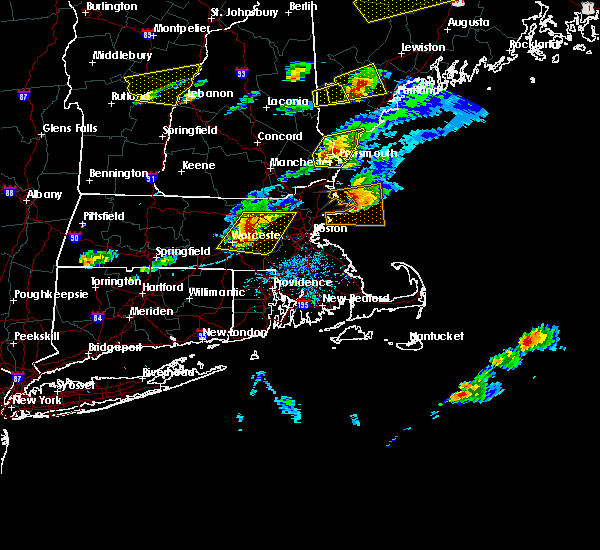 At 335 pm edt, doppler radar indicated a severe thunderstorm capable of producing large hail up to ping pong ball size and damaging winds in excess of 60 mph. this storm was located over northborough, or near marlborough, moving east at 40 mph. locations impacted include, worcester, framingham, waltham, leominster, billerica, marlborough, shrewsbury, chelmsford, natick, lexington, milford, burlington, wilmington, westford, acton, hudson, westborough, grafton, concord and sudbury. At 335 pm edt, doppler radar indicated a severe thunderstorm capable of producing large hail up to ping pong ball size and damaging winds in excess of 60 mph. this storm was located over northborough, or near marlborough, moving east at 40 mph. locations impacted include, worcester, framingham, waltham, leominster, billerica, marlborough, shrewsbury, chelmsford, natick, lexington, milford, burlington, wilmington, westford, acton, hudson, westborough, grafton, concord and sudbury.
|
| 8/4/2015 3:24 PM EDT |
 At 323 pm edt, doppler radar indicated a severe thunderstorm capable of producing quarter size hail and damaging winds in excess of 60 mph. this storm was located over princeton, or 8 miles southwest of leominster, and was moving east at 30 mph. * some locations impacted include, worcester, framingham, waltham, leominster, fitchburg, billerica, marlborough, shrewsbury, chelmsford, natick, lexington, milford, burlington, wilmington, westford, acton, hudson, westborough, grafton and concord. At 323 pm edt, doppler radar indicated a severe thunderstorm capable of producing quarter size hail and damaging winds in excess of 60 mph. this storm was located over princeton, or 8 miles southwest of leominster, and was moving east at 30 mph. * some locations impacted include, worcester, framingham, waltham, leominster, fitchburg, billerica, marlborough, shrewsbury, chelmsford, natick, lexington, milford, burlington, wilmington, westford, acton, hudson, westborough, grafton and concord.
|
| 7/28/2015 3:10 PM EDT | Trees and wires down on main and hollis street in worcester county MA, 1.2 miles NW of Milford, MA |
| 7/28/2015 3:05 PM EDT |
 At 305 pm edt, doppler radar indicated a severe thunderstorm capable of producing quarter size hail and damaging winds in excess of 60 mph. this storm was located over milford, and was moving south at 15 mph. * some locations impacted include, woonsocket, cumberland, franklin, milford, lincoln, bellingham, holliston, medway, north smithfield, wrentham, blackstone, plainville, upton, hopedale, mendon and millville. At 305 pm edt, doppler radar indicated a severe thunderstorm capable of producing quarter size hail and damaging winds in excess of 60 mph. this storm was located over milford, and was moving south at 15 mph. * some locations impacted include, woonsocket, cumberland, franklin, milford, lincoln, bellingham, holliston, medway, north smithfield, wrentham, blackstone, plainville, upton, hopedale, mendon and millville.
|
| 7/28/2015 3:05 PM EDT |
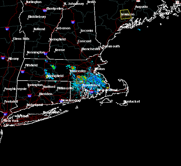 At 305 pm edt, doppler radar indicated a severe thunderstorm capable of producing quarter size hail and damaging winds in excess of 60 mph. this storm was located over milford, and was moving south at 15 mph. * some locations impacted include, woonsocket, cumberland, franklin, milford, lincoln, bellingham, holliston, medway, north smithfield, wrentham, blackstone, plainville, upton, hopedale, mendon and millville. At 305 pm edt, doppler radar indicated a severe thunderstorm capable of producing quarter size hail and damaging winds in excess of 60 mph. this storm was located over milford, and was moving south at 15 mph. * some locations impacted include, woonsocket, cumberland, franklin, milford, lincoln, bellingham, holliston, medway, north smithfield, wrentham, blackstone, plainville, upton, hopedale, mendon and millville.
|
| 8/7/2014 4:30 PM EDT | Quarter sized hail reported 0.9 miles W of Milford, MA |
Hail Maps for Milford, MA


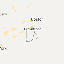

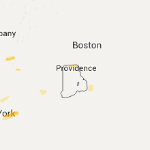


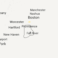
Connect with Interactive Hail Maps