

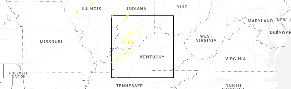
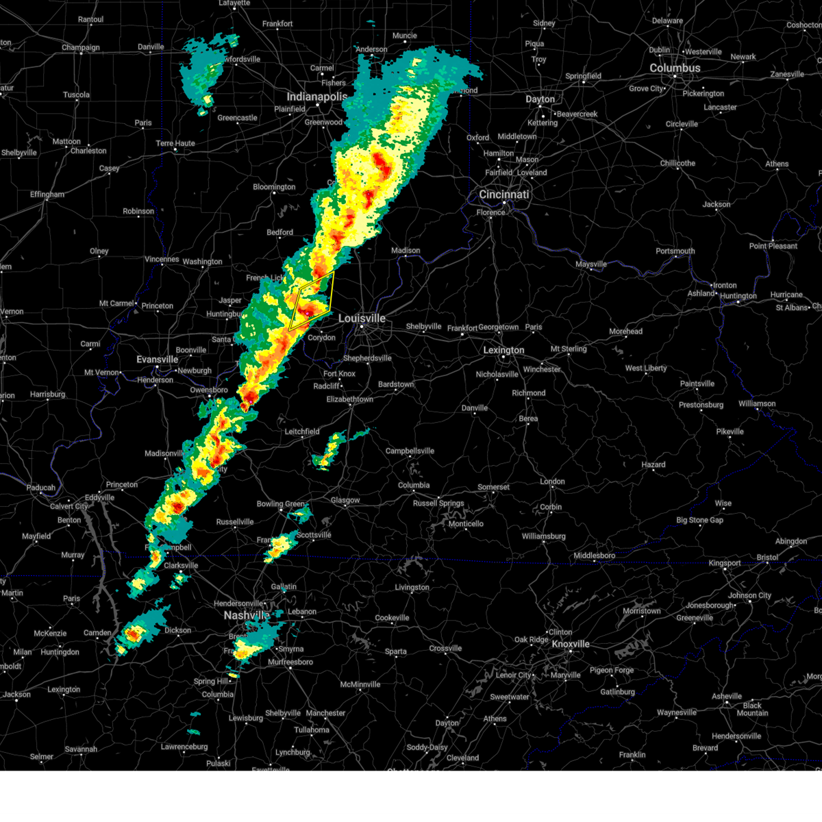
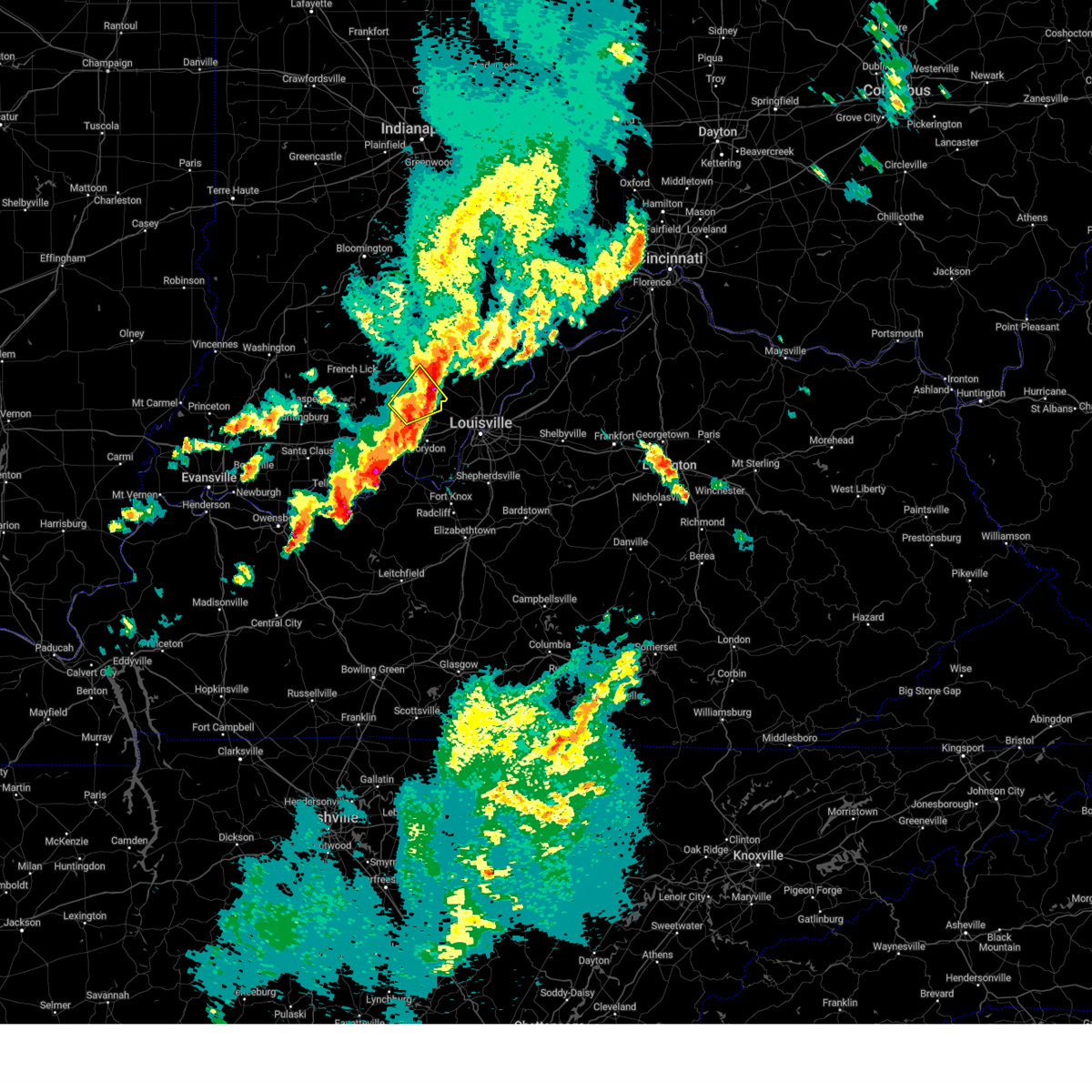
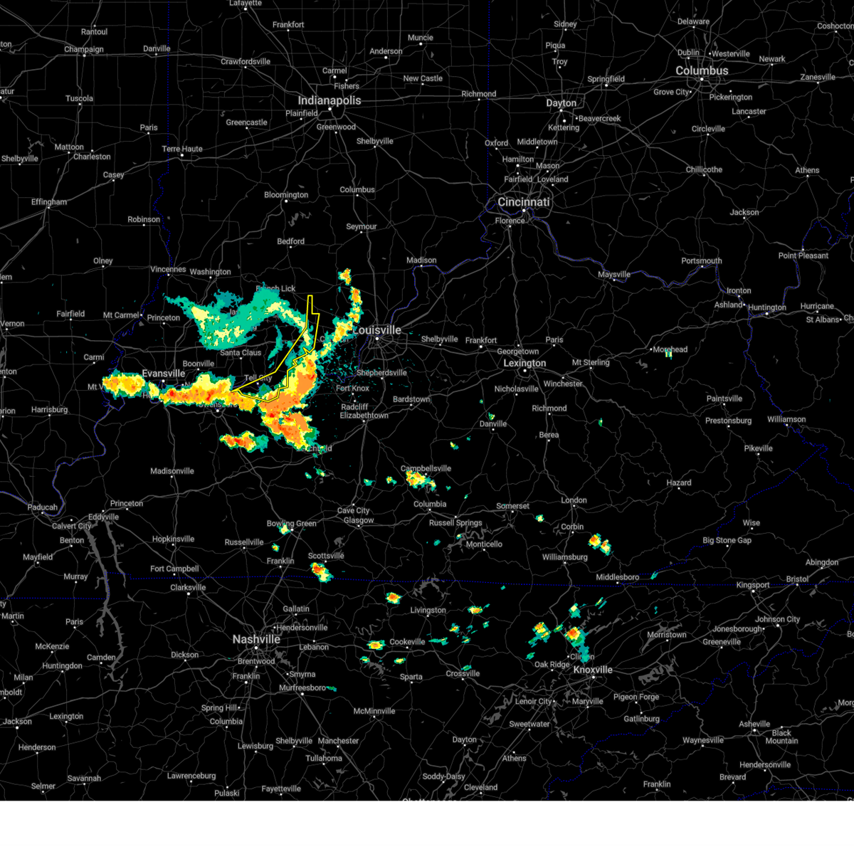
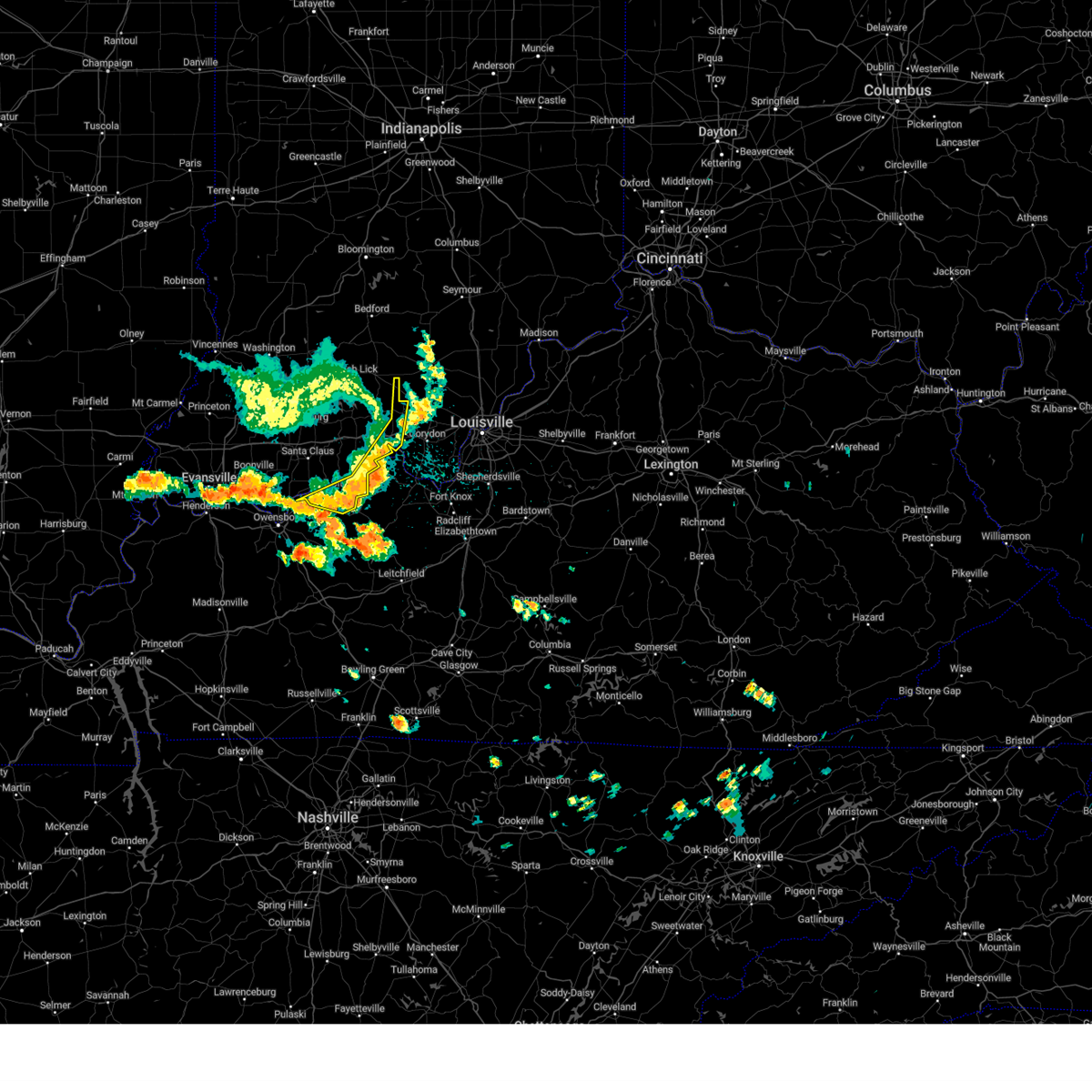
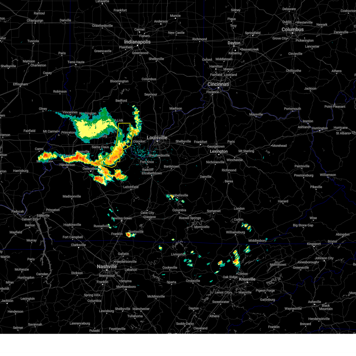
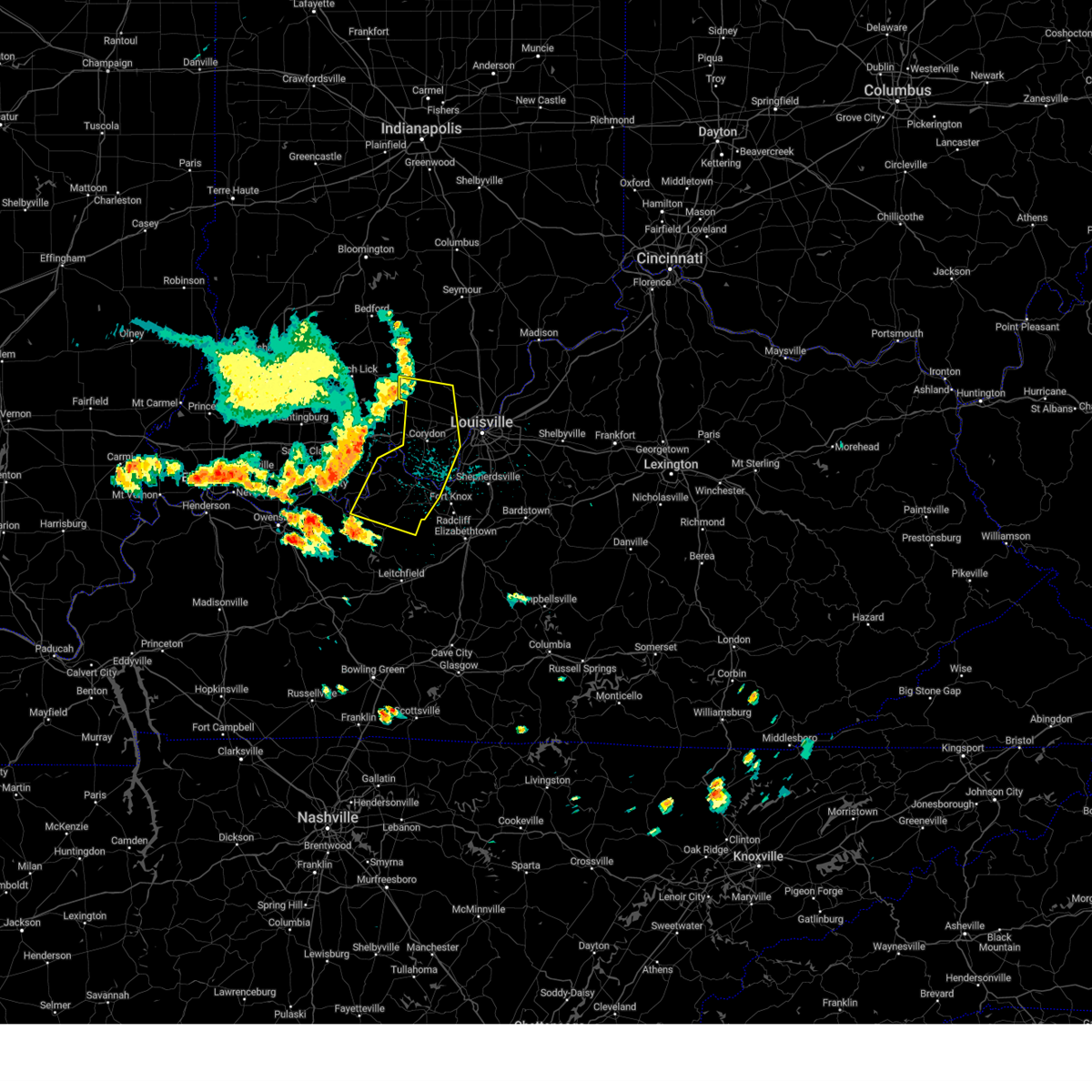
Hail Map for Milltown, IN
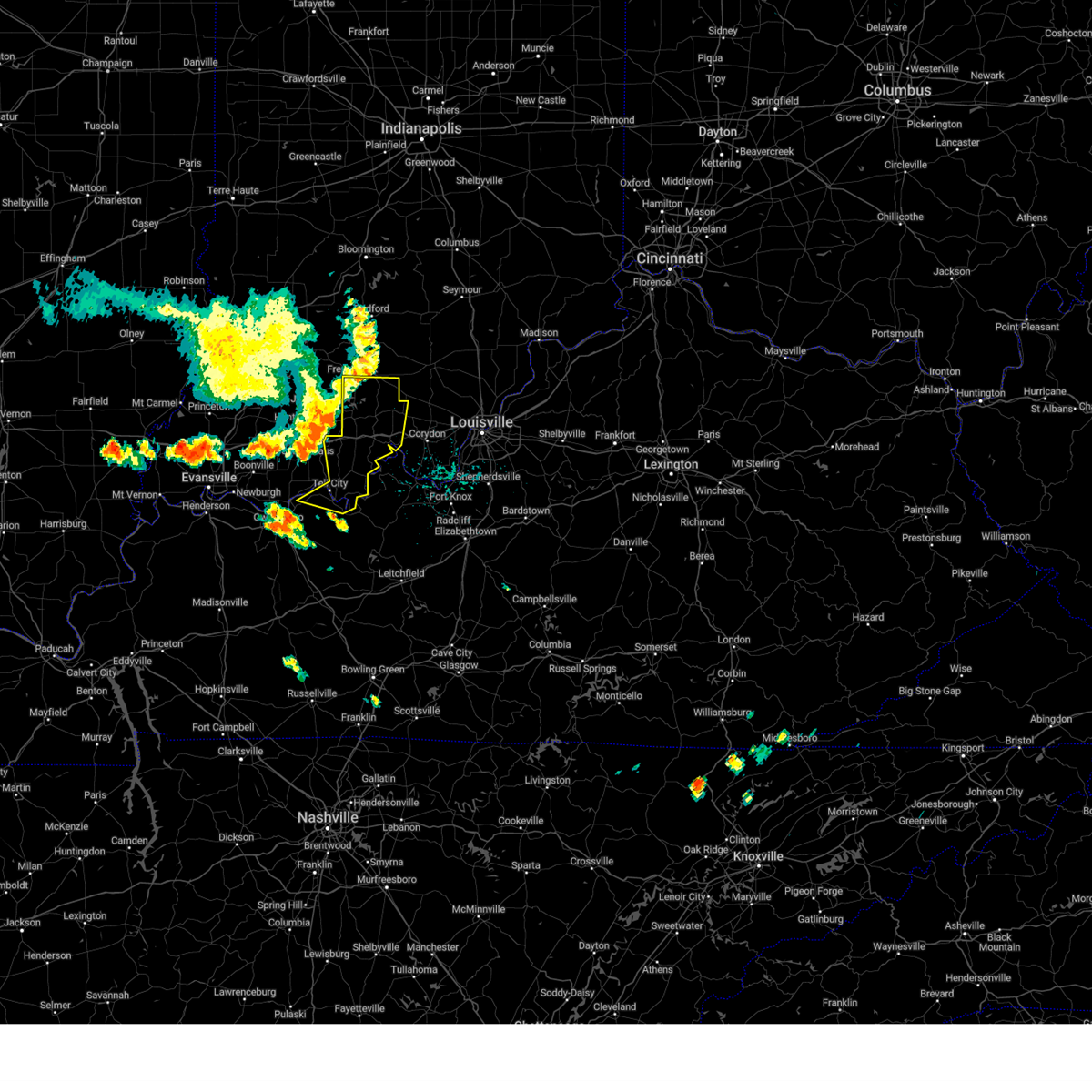
The Milltown, IN area has had 9 reports of on-the-ground hail by trained spotters, and has been under severe weather warnings 39 times during the past 12 months. Doppler radar has detected hail at or near Milltown, IN on 65 occasions, including 2 occasions during the past year.
| Name: | Milltown, IN |
| Where Located: | 38.9 miles NW of Louisville, KY |
| Map: | Google Map for Milltown, IN |
| Population: | 818 |
| Housing Units: | 396 |
| More Info: | Search Google for Milltown, IN |
1
The Top Recent Hail Date for Milltown, IN is Wednesday, March 19, 2025 (9th out of 65)
Hail and Wind Damage Spotted near Milltown, IN
| Date / Time | Report Details |
|---|---|
| 4/10/2025 7:14 PM EDT |
 The storm which prompted the warning has weakened below severe limits, and no longer poses an immediate threat to life or property. therefore, the warning will be allowed to expire. however, heavy rain is still possible with this thunderstorm. to report severe weather, contact your nearest law enforcement agency. they will relay your report to the national weather service louisville. The storm which prompted the warning has weakened below severe limits, and no longer poses an immediate threat to life or property. therefore, the warning will be allowed to expire. however, heavy rain is still possible with this thunderstorm. to report severe weather, contact your nearest law enforcement agency. they will relay your report to the national weather service louisville.
|
| 4/10/2025 7:06 PM EDT | At 706 pm edt, a severe thunderstorm was located 9 miles west of new albany, moving east at 30 mph (radar indicated). Hazards include 60 mph wind gusts and penny size hail. Expect damage to roofs, siding, and trees. Locations impacted include, palmyra, milltown, greenville, crandall, moberly, byrneville, bradford, fairdale, hancock chapel, and new salisbury. |
| 4/10/2025 6:46 PM EDT | Svrlmk the national weather service in louisville has issued a * severe thunderstorm warning for, northwestern harrison county in south central indiana, northeastern crawford county in south central indiana, northwestern floyd county in south central indiana, * until 715 pm edt. * at 646 pm edt, a severe thunderstorm was located 7 miles northwest of corydon, moving east at 30 mph (radar indicated). Hazards include 60 mph wind gusts and quarter size hail. Hail damage to vehicles is expected. Expect wind damage to roofs, siding, and trees. |
| 4/2/2025 10:26 PM CDT |
 the severe thunderstorm warning has been cancelled and is no longer in effect the severe thunderstorm warning has been cancelled and is no longer in effect
|
| 4/2/2025 10:26 PM CDT |
 At 1125 pm edt/1025 pm cdt/, severe thunderstorms were located along a line extending from brownstown to 13 miles north of corydon to 8 miles northeast of hardinsburg, moving east at 60 mph (radar indicated). Hazards include 60 mph wind gusts. Expect damage to roofs, siding, and trees. Locations impacted include, tell city, salem, corydon, brandenburg, hardinsburg, hawesville, english, carefree town, mount pleasant, and webster. At 1125 pm edt/1025 pm cdt/, severe thunderstorms were located along a line extending from brownstown to 13 miles north of corydon to 8 miles northeast of hardinsburg, moving east at 60 mph (radar indicated). Hazards include 60 mph wind gusts. Expect damage to roofs, siding, and trees. Locations impacted include, tell city, salem, corydon, brandenburg, hardinsburg, hawesville, english, carefree town, mount pleasant, and webster.
|
| 4/2/2025 10:00 PM CDT | The storms which prompted the warning have moved out of the area. therefore, the warning will be allowed to expire. however, gusty winds and heavy rain are still possible with these thunderstorms. a tornado watch remains in effect until 200 am edt/100 am cdt/ for south central indiana, and central kentucky. to report severe weather, contact your nearest law enforcement agency. they will relay your report to the national weather service louisville. remember, a severe thunderstorm warning still remains in effect. |
| 4/2/2025 9:58 PM CDT | Svrlmk the national weather service in louisville has issued a * severe thunderstorm warning for, harrison county in south central indiana, northwestern clark county in south central indiana, crawford county in south central indiana, perry county in south central indiana, floyd county in south central indiana, orange county in south central indiana, washington county in south central indiana, meade county in central kentucky, hancock county in central kentucky, breckinridge county in central kentucky, northeastern ohio county in central kentucky, * until midnight edt/1100 pm cdt/. * at 1058 pm edt/958 pm cdt/, severe thunderstorms were located along a line extending from 10 miles south of bedford to 7 miles southwest of english to near whitesville, moving northeast at 55 mph (radar indicated). Hazards include 60 mph wind gusts. expect damage to roofs, siding, and trees |
| 4/2/2025 9:37 PM CDT | At 1037 pm edt/937 pm cdt/, severe thunderstorms were located along a line extending from 11 miles southwest of shoals to 10 miles northeast of santa claus to grandview, moving northeast at 60 mph (radar indicated). Hazards include 70 mph wind gusts and nickel size hail. Expect considerable tree damage. damage is likely to mobile homes, roofs, and outbuildings. Locations impacted include, jasper, tell city, paoli, corydon, brandenburg, hardinsburg, hawesville, english, carefree town, and mount pleasant. |
| 4/2/2025 9:19 PM CDT | Svrlmk the national weather service in louisville has issued a * severe thunderstorm warning for, harrison county in south central indiana, dubois county in south central indiana, crawford county in south central indiana, perry county in south central indiana, orange county in south central indiana, western washington county in south central indiana, meade county in central kentucky, hancock county in central kentucky, breckinridge county in central kentucky, northeastern ohio county in central kentucky, * until 1100 pm edt/1000 pm cdt/. * at 1018 pm edt/918 pm cdt/, severe thunderstorms were located along a line extending from near petersburg to near folsomville to stanley, moving northeast at 75 mph (radar indicated). Hazards include 70 mph wind gusts and nickel size hail. Expect considerable tree damage. Damage is likely to mobile homes, roofs, and outbuildings. |
| 3/30/2025 8:13 PM EDT |
 The storm which prompted the warning has weakened below severe limits, and no longer poses an immediate threat to life or property. therefore, the warning will be allowed to expire. however, gusty winds and heavy rain are still possible with this thunderstorm. a tornado watch remains in effect until 100 am edt for south central indiana. to report severe weather, contact your nearest law enforcement agency. they will relay your report to the national weather service louisville. The storm which prompted the warning has weakened below severe limits, and no longer poses an immediate threat to life or property. therefore, the warning will be allowed to expire. however, gusty winds and heavy rain are still possible with this thunderstorm. a tornado watch remains in effect until 100 am edt for south central indiana. to report severe weather, contact your nearest law enforcement agency. they will relay your report to the national weather service louisville.
|
| 3/30/2025 7:48 PM EDT |
 Svrlmk the national weather service in louisville has issued a * severe thunderstorm warning for, northwestern harrison county in south central indiana, west central clark county in south central indiana, northeastern crawford county in south central indiana, southern washington county in south central indiana, * until 815 pm edt. * at 748 pm edt, a severe thunderstorm was located 12 miles northeast of carefree town, moving northeast at 45 mph (radar indicated). Hazards include 60 mph wind gusts and quarter size hail. Hail damage to vehicles is expected. Expect wind damage to roofs, siding, and trees. Svrlmk the national weather service in louisville has issued a * severe thunderstorm warning for, northwestern harrison county in south central indiana, west central clark county in south central indiana, northeastern crawford county in south central indiana, southern washington county in south central indiana, * until 815 pm edt. * at 748 pm edt, a severe thunderstorm was located 12 miles northeast of carefree town, moving northeast at 45 mph (radar indicated). Hazards include 60 mph wind gusts and quarter size hail. Hail damage to vehicles is expected. Expect wind damage to roofs, siding, and trees.
|
| 3/19/2025 9:15 PM EDT |
 The storm which prompted the warning has moved out of the area. therefore, the warning has been allowed to expire. a new severe thunderstorm warning has been issued. a tornado watch remains in effect until midnight edt for south central indiana. to report severe weather, contact your nearest law enforcement agency. they will relay your report to the national weather service louisville. The storm which prompted the warning has moved out of the area. therefore, the warning has been allowed to expire. a new severe thunderstorm warning has been issued. a tornado watch remains in effect until midnight edt for south central indiana. to report severe weather, contact your nearest law enforcement agency. they will relay your report to the national weather service louisville.
|
| 3/19/2025 9:12 PM EDT |
 Svrlmk the national weather service in louisville has issued a * severe thunderstorm warning for, northern harrison county in south central indiana, northwestern jefferson county in south central indiana, northwestern clark county in south central indiana, northeastern crawford county in south central indiana, northern floyd county in south central indiana, southeastern orange county in south central indiana, scott county in south central indiana, washington county in south central indiana, * until 1000 pm edt. * at 912 pm edt, a severe thunderstorm was located near salem, moving northeast at 60 mph (radar indicated). Hazards include 60 mph wind gusts and quarter size hail. Hail damage to vehicles is expected. Expect wind damage to roofs, siding, and trees. Svrlmk the national weather service in louisville has issued a * severe thunderstorm warning for, northern harrison county in south central indiana, northwestern jefferson county in south central indiana, northwestern clark county in south central indiana, northeastern crawford county in south central indiana, northern floyd county in south central indiana, southeastern orange county in south central indiana, scott county in south central indiana, washington county in south central indiana, * until 1000 pm edt. * at 912 pm edt, a severe thunderstorm was located near salem, moving northeast at 60 mph (radar indicated). Hazards include 60 mph wind gusts and quarter size hail. Hail damage to vehicles is expected. Expect wind damage to roofs, siding, and trees.
|
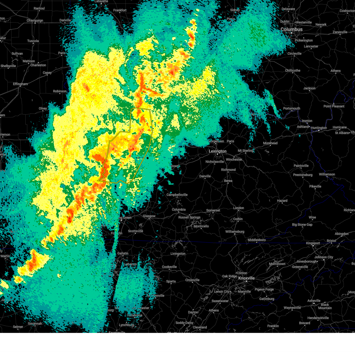
| 3/19/2025 9:11 PM EDT | Quarter sized hail reported 0.2 miles NW of Milltown, IN, quarter sized hail reported in milltown. |
| 3/19/2025 9:09 PM EDT |
 At 909 pm edt, a severe thunderstorm was located near salem, moving northeast at 60 mph (radar indicated). Hazards include 60 mph wind gusts and quarter size hail. Hail damage to vehicles is expected. expect wind damage to roofs, siding, and trees. Locations impacted include, salem, carefree town, new pekin, palmyra, marengo, milltown, hardinsburg, fredericksburg, shorts corner, and bradford. At 909 pm edt, a severe thunderstorm was located near salem, moving northeast at 60 mph (radar indicated). Hazards include 60 mph wind gusts and quarter size hail. Hail damage to vehicles is expected. expect wind damage to roofs, siding, and trees. Locations impacted include, salem, carefree town, new pekin, palmyra, marengo, milltown, hardinsburg, fredericksburg, shorts corner, and bradford.
|
| 3/19/2025 9:09 PM EDT |
 the severe thunderstorm warning has been cancelled and is no longer in effect the severe thunderstorm warning has been cancelled and is no longer in effect
|
| 3/19/2025 8:44 PM EDT |
 Svrlmk the national weather service in louisville has issued a * severe thunderstorm warning for, northwestern harrison county in south central indiana, crawford county in south central indiana, northern perry county in south central indiana, southeastern orange county in south central indiana, southwestern washington county in south central indiana, * until 915 pm edt/815 pm cdt/. * at 844 pm edt/744 pm cdt/, a severe thunderstorm was located over english, moving northeast at 60 mph (radar indicated). Hazards include 60 mph wind gusts and nickel size hail. expect damage to roofs, siding, and trees Svrlmk the national weather service in louisville has issued a * severe thunderstorm warning for, northwestern harrison county in south central indiana, crawford county in south central indiana, northern perry county in south central indiana, southeastern orange county in south central indiana, southwestern washington county in south central indiana, * until 915 pm edt/815 pm cdt/. * at 844 pm edt/744 pm cdt/, a severe thunderstorm was located over english, moving northeast at 60 mph (radar indicated). Hazards include 60 mph wind gusts and nickel size hail. expect damage to roofs, siding, and trees
|
| 3/19/2025 8:38 PM EDT |
 At 838 pm edt/738 pm cdt/, a severe thunderstorm was located near english, moving northeast at 60 mph (radar indicated). Hazards include 60 mph wind gusts and penny size hail. Expect damage to roofs, siding, and trees. Locations impacted include, english, carefree town, marengo, milltown, west fork, taswell, chambersburg, bacon, sulphur, and eckerty. At 838 pm edt/738 pm cdt/, a severe thunderstorm was located near english, moving northeast at 60 mph (radar indicated). Hazards include 60 mph wind gusts and penny size hail. Expect damage to roofs, siding, and trees. Locations impacted include, english, carefree town, marengo, milltown, west fork, taswell, chambersburg, bacon, sulphur, and eckerty.
|
| 3/19/2025 8:08 PM EDT |
 Svrlmk the national weather service in louisville has issued a * severe thunderstorm warning for, southeastern dubois county in south central indiana, crawford county in south central indiana, northern perry county in south central indiana, southeastern orange county in south central indiana, * until 845 pm edt/745 pm cdt/. * at 808 pm edt/708 pm cdt/, a severe thunderstorm was located over santa claus, moving northeast at 60 mph (radar indicated). Hazards include 60 mph wind gusts and penny size hail. expect damage to roofs, siding, and trees Svrlmk the national weather service in louisville has issued a * severe thunderstorm warning for, southeastern dubois county in south central indiana, crawford county in south central indiana, northern perry county in south central indiana, southeastern orange county in south central indiana, * until 845 pm edt/745 pm cdt/. * at 808 pm edt/708 pm cdt/, a severe thunderstorm was located over santa claus, moving northeast at 60 mph (radar indicated). Hazards include 60 mph wind gusts and penny size hail. expect damage to roofs, siding, and trees
|
| 3/15/2025 6:42 AM EDT |
 The storm which prompted the warning has moved out of the area. therefore, the warning will be allowed to expire. a tornado watch remains in effect until 1000 am edt for south central indiana. remember, a severe thunderstorm warning still remains in effect for portions of washington county until 715 am edt. The storm which prompted the warning has moved out of the area. therefore, the warning will be allowed to expire. a tornado watch remains in effect until 1000 am edt for south central indiana. remember, a severe thunderstorm warning still remains in effect for portions of washington county until 715 am edt.
|
| 3/15/2025 6:29 AM EDT |
 At 628 am edt, a severe thunderstorm was located 12 miles east of english, moving northeast at 60 mph (trained weather spotters reported quarter sized hail near carefree). Hazards include ping pong ball size hail and 60 mph wind gusts. People and animals outdoors will be injured. expect hail damage to roofs, siding, windows, and vehicles. expect wind damage to roofs, siding, and trees. Locations impacted include, palmyra, marengo, milltown, hardinsburg, fredericksburg, shorts corner, martinsburg, bradford, rosebud, and hancock chapel. At 628 am edt, a severe thunderstorm was located 12 miles east of english, moving northeast at 60 mph (trained weather spotters reported quarter sized hail near carefree). Hazards include ping pong ball size hail and 60 mph wind gusts. People and animals outdoors will be injured. expect hail damage to roofs, siding, windows, and vehicles. expect wind damage to roofs, siding, and trees. Locations impacted include, palmyra, marengo, milltown, hardinsburg, fredericksburg, shorts corner, martinsburg, bradford, rosebud, and hancock chapel.
|
| 3/15/2025 6:28 AM EDT | Ping Pong Ball sized hail reported 6 miles NE of Milltown, IN, report from mping: ping pong ball (1.50 in.). |
| 3/15/2025 6:27 AM EDT | Quarter sized hail reported 0.2 miles NW of Milltown, IN, picture of various size hail. |
| 3/15/2025 6:25 AM EDT | At 624 am edt, a severe thunderstorm was located 8 miles east of english, moving northeast at 60 mph. trained spotters observed quarter sized hail was near carefree (radar indicated and trained spotters confirmed). Hazards include 60 mph wind gusts and quarter size hail. Hail damage to vehicles is expected. expect wind damage to roofs, siding, and trees. Locations impacted include, english, palmyra, marengo, milltown, hardinsburg, fredericksburg, shorts corner, martinsburg, bradford, and fairdale. |
| 3/15/2025 6:25 AM EDT | the severe thunderstorm warning has been cancelled and is no longer in effect |
| 3/15/2025 6:14 AM EDT |
 Svrlmk the national weather service in louisville has issued a * severe thunderstorm warning for, northwestern harrison county in south central indiana, crawford county in south central indiana, northeastern perry county in south central indiana, southeastern orange county in south central indiana, southwestern washington county in south central indiana, * until 645 am edt/545 am cdt/. * at 613 am edt/513 am cdt/, a severe thunderstorm was located near english, moving northeast at 60 mph (radar indicated). Hazards include 60 mph wind gusts and half dollar size hail. Hail damage to vehicles is expected. Expect wind damage to roofs, siding, and trees. Svrlmk the national weather service in louisville has issued a * severe thunderstorm warning for, northwestern harrison county in south central indiana, crawford county in south central indiana, northeastern perry county in south central indiana, southeastern orange county in south central indiana, southwestern washington county in south central indiana, * until 645 am edt/545 am cdt/. * at 613 am edt/513 am cdt/, a severe thunderstorm was located near english, moving northeast at 60 mph (radar indicated). Hazards include 60 mph wind gusts and half dollar size hail. Hail damage to vehicles is expected. Expect wind damage to roofs, siding, and trees.
|
| 3/15/2025 4:51 AM CDT |
 The storms which prompted the warning have weakened. more storms will approach the region from the southwest in the next 20 to 30 minutes, which will likely lead to another issued severe thunderstorm warning. a tornado watch remains in effect until 1000 am edt/900 am cdt/ for south central indiana, and central kentucky. The storms which prompted the warning have weakened. more storms will approach the region from the southwest in the next 20 to 30 minutes, which will likely lead to another issued severe thunderstorm warning. a tornado watch remains in effect until 1000 am edt/900 am cdt/ for south central indiana, and central kentucky.
|
| 3/15/2025 4:20 AM CDT | Svrlmk the national weather service in louisville has issued a * severe thunderstorm warning for, harrison county in south central indiana, northwestern clark county in south central indiana, crawford county in south central indiana, perry county in south central indiana, floyd county in south central indiana, south central washington county in south central indiana, northwestern meade county in central kentucky, hancock county in central kentucky, northwestern breckinridge county in central kentucky, northern ohio county in central kentucky, * until 600 am edt/500 am cdt/. * at 520 am edt/420 am cdt/, severe thunderstorms were located along a line extending from near english to 13 miles northeast of tell city to near st. joseph, moving east at 60 mph (radar indicated). Hazards include 60 mph wind gusts and quarter size hail. Hail damage to vehicles is expected. Expect wind damage to roofs, siding, and trees. |
| 3/15/2025 5:12 AM EDT | The storms which prompted the warning have moved out of the warned area. therefore, the warning will be allowed to expire. a tornado watch remains in effect until 1000 am edt/900 am cdt/ for south central indiana. remember, a severe thunderstorm warning still remains in effect for eastern dubois county, crawford, orange, and perry counties. |
| 3/15/2025 4:34 AM EDT | Svrlmk the national weather service in louisville has issued a * severe thunderstorm warning for, eastern dubois county in south central indiana, crawford county in south central indiana, northern perry county in south central indiana, orange county in south central indiana, western washington county in south central indiana, * until 515 am edt/415 am cdt/. * at 433 am edt/333 am cdt/, severe thunderstorms were located along a line extending from 7 miles west of shoals to near jasper to near folsomville, moving east at 55 mph (radar indicated). Hazards include 70 mph wind gusts and quarter size hail. Hail damage to vehicles is expected. expect considerable tree damage. Wind damage is also likely to mobile homes, roofs, and outbuildings. |
| 7/30/2024 12:21 PM CDT |
 the severe thunderstorm warning has been cancelled and is no longer in effect the severe thunderstorm warning has been cancelled and is no longer in effect
|
| 7/30/2024 12:14 PM CDT |
 At 113 pm edt/1213 pm cdt/, a severe thunderstorm was located 8 miles northeast of carefree town, moving east at 30 mph (radar indicated). Hazards include 60 mph wind gusts. Expect damage to roofs, siding, and trees. Locations impacted include, tell city, hawesville, carefree town, mount pleasant, lewisport, cannelton, marengo, milltown, leavenworth, and skillman. At 113 pm edt/1213 pm cdt/, a severe thunderstorm was located 8 miles northeast of carefree town, moving east at 30 mph (radar indicated). Hazards include 60 mph wind gusts. Expect damage to roofs, siding, and trees. Locations impacted include, tell city, hawesville, carefree town, mount pleasant, lewisport, cannelton, marengo, milltown, leavenworth, and skillman.
|
| 7/30/2024 12:07 PM CDT |
 At 106 pm edt/1206 pm cdt/, a severe thunderstorm was located near carefree town, moving east at 40 mph (radar indicated). Hazards include 60 mph wind gusts. Expect damage to roofs, siding, and trees. Locations impacted include, tell city, hawesville, english, carefree town, mount pleasant, lewisport, cannelton, marengo, milltown, and leopold. At 106 pm edt/1206 pm cdt/, a severe thunderstorm was located near carefree town, moving east at 40 mph (radar indicated). Hazards include 60 mph wind gusts. Expect damage to roofs, siding, and trees. Locations impacted include, tell city, hawesville, english, carefree town, mount pleasant, lewisport, cannelton, marengo, milltown, and leopold.
|
| 7/30/2024 12:07 PM CDT |
 the severe thunderstorm warning has been cancelled and is no longer in effect the severe thunderstorm warning has been cancelled and is no longer in effect
|
| 7/30/2024 1:04 PM EDT |
 Svrlmk the national weather service in louisville has issued a * severe thunderstorm warning for, harrison county in south central indiana, west central clark county in south central indiana, eastern crawford county in south central indiana, southeastern perry county in south central indiana, western floyd county in south central indiana, southwestern washington county in south central indiana, meade county in central kentucky, central breckinridge county in central kentucky, * until 130 pm edt/1230 pm cdt/. * at 103 pm edt/1203 pm cdt/, a severe thunderstorm was located 12 miles south of carefree town, moving east at 50 mph (radar indicated). Hazards include 60 mph wind gusts. expect damage to roofs, siding, and trees Svrlmk the national weather service in louisville has issued a * severe thunderstorm warning for, harrison county in south central indiana, west central clark county in south central indiana, eastern crawford county in south central indiana, southeastern perry county in south central indiana, western floyd county in south central indiana, southwestern washington county in south central indiana, meade county in central kentucky, central breckinridge county in central kentucky, * until 130 pm edt/1230 pm cdt/. * at 103 pm edt/1203 pm cdt/, a severe thunderstorm was located 12 miles south of carefree town, moving east at 50 mph (radar indicated). Hazards include 60 mph wind gusts. expect damage to roofs, siding, and trees
|
| 7/30/2024 11:38 AM CDT |
 Svrlmk the national weather service in louisville has issued a * severe thunderstorm warning for, northwestern harrison county in south central indiana, southeastern dubois county in south central indiana, crawford county in south central indiana, perry county in south central indiana, southern orange county in south central indiana, northwestern meade county in central kentucky, northern hancock county in central kentucky, * until 130 pm edt/1230 pm cdt/. * at 1238 pm edt/1138 am cdt/, a severe thunderstorm was located 11 miles northwest of english, moving east at 40 mph (radar indicated). Hazards include 60 mph wind gusts. expect damage to roofs, siding, and trees Svrlmk the national weather service in louisville has issued a * severe thunderstorm warning for, northwestern harrison county in south central indiana, southeastern dubois county in south central indiana, crawford county in south central indiana, perry county in south central indiana, southern orange county in south central indiana, northwestern meade county in central kentucky, northern hancock county in central kentucky, * until 130 pm edt/1230 pm cdt/. * at 1238 pm edt/1138 am cdt/, a severe thunderstorm was located 11 miles northwest of english, moving east at 40 mph (radar indicated). Hazards include 60 mph wind gusts. expect damage to roofs, siding, and trees
|
| 7/9/2024 4:31 PM EDT |
 At 431 pm edt, a severe thunderstorm was located 9 miles northeast of carefree town, moving northeast at 25 mph (radar indicated). Hazards include 60 mph wind gusts. Expect damage to roofs, siding, and trees. Locations impacted include, palmyra, milltown, fredericksburg, depauw, frenchtown, and hancock chapel. At 431 pm edt, a severe thunderstorm was located 9 miles northeast of carefree town, moving northeast at 25 mph (radar indicated). Hazards include 60 mph wind gusts. Expect damage to roofs, siding, and trees. Locations impacted include, palmyra, milltown, fredericksburg, depauw, frenchtown, and hancock chapel.
|
| 7/9/2024 4:26 PM EDT |
 Svrlmk the national weather service in louisville has issued a * severe thunderstorm warning for, northwestern harrison county in south central indiana, northeastern crawford county in south central indiana, southwestern washington county in south central indiana, * until 500 pm edt. * at 426 pm edt, a severe thunderstorm was located 7 miles northeast of carefree town, moving northeast at 25 mph (radar indicated). Hazards include 60 mph wind gusts. expect damage to roofs, siding, and trees Svrlmk the national weather service in louisville has issued a * severe thunderstorm warning for, northwestern harrison county in south central indiana, northeastern crawford county in south central indiana, southwestern washington county in south central indiana, * until 500 pm edt. * at 426 pm edt, a severe thunderstorm was located 7 miles northeast of carefree town, moving northeast at 25 mph (radar indicated). Hazards include 60 mph wind gusts. expect damage to roofs, siding, and trees
|
| 7/9/2024 4:21 PM EDT |
 At 421 pm edt, a severe thunderstorm was located 7 miles northeast of carefree town, moving northeast at 25 mph (radar indicated). Hazards include 60 mph wind gusts. Expect damage to roofs, siding, and trees. Locations impacted include, milltown, depauw, fairdale, pilot knob, ramsey, hogtown, and frenchtown. At 421 pm edt, a severe thunderstorm was located 7 miles northeast of carefree town, moving northeast at 25 mph (radar indicated). Hazards include 60 mph wind gusts. Expect damage to roofs, siding, and trees. Locations impacted include, milltown, depauw, fairdale, pilot knob, ramsey, hogtown, and frenchtown.
|
| 7/9/2024 4:15 PM EDT |
 At 415 pm edt, a severe thunderstorm was located near carefree town, moving northeast at 25 mph (radar indicated). Hazards include 60 mph wind gusts. Expect damage to roofs, siding, and trees. Locations impacted include, carefree town, milltown, curby, depauw, fairdale, wyandotte, carefree, pilot knob, ramsey, and hogtown. At 415 pm edt, a severe thunderstorm was located near carefree town, moving northeast at 25 mph (radar indicated). Hazards include 60 mph wind gusts. Expect damage to roofs, siding, and trees. Locations impacted include, carefree town, milltown, curby, depauw, fairdale, wyandotte, carefree, pilot knob, ramsey, and hogtown.
|
| 7/9/2024 4:06 PM EDT |
 Svrlmk the national weather service in louisville has issued a * severe thunderstorm warning for, northwestern harrison county in south central indiana, northeastern crawford county in south central indiana, * until 430 pm edt. * at 405 pm edt, a severe thunderstorm was located over carefree town, moving northeast at 25 mph (radar indicated). Hazards include 60 mph wind gusts. expect damage to roofs, siding, and trees Svrlmk the national weather service in louisville has issued a * severe thunderstorm warning for, northwestern harrison county in south central indiana, northeastern crawford county in south central indiana, * until 430 pm edt. * at 405 pm edt, a severe thunderstorm was located over carefree town, moving northeast at 25 mph (radar indicated). Hazards include 60 mph wind gusts. expect damage to roofs, siding, and trees
|
| 7/4/2024 12:40 PM EDT |
 Svrlmk the national weather service in louisville has issued a * severe thunderstorm warning for, northwestern harrison county in south central indiana, northeastern crawford county in south central indiana, * until 115 pm edt. * at 1239 pm edt, a severe thunderstorm was located near carefree town, moving east at 35 mph (radar indicated). Hazards include 60 mph wind gusts. expect damage to roofs, siding, and trees Svrlmk the national weather service in louisville has issued a * severe thunderstorm warning for, northwestern harrison county in south central indiana, northeastern crawford county in south central indiana, * until 115 pm edt. * at 1239 pm edt, a severe thunderstorm was located near carefree town, moving east at 35 mph (radar indicated). Hazards include 60 mph wind gusts. expect damage to roofs, siding, and trees
|
| 5/22/2024 6:59 PM EDT |
 The storm which prompted the warning has weakened below severe limits, and no longer poses an immediate threat to life or property. therefore, the warning will be allowed to expire. to report severe weather, contact your nearest law enforcement agency. they will relay your report to the national weather service louisville. The storm which prompted the warning has weakened below severe limits, and no longer poses an immediate threat to life or property. therefore, the warning will be allowed to expire. to report severe weather, contact your nearest law enforcement agency. they will relay your report to the national weather service louisville.
|
| 5/22/2024 6:50 PM EDT |
 the severe thunderstorm warning has been cancelled and is no longer in effect the severe thunderstorm warning has been cancelled and is no longer in effect
|
| 5/22/2024 6:50 PM EDT |
 At 650 pm edt, a severe thunderstorm was located 10 miles northeast of carefree town, moving east at 30 mph (radar indicated). Hazards include 60 mph wind gusts. Expect damage to roofs, siding, and trees. Locations impacted include, milltown, curby, moberly, depauw, pilot knob, hogtown, and frenchtown. At 650 pm edt, a severe thunderstorm was located 10 miles northeast of carefree town, moving east at 30 mph (radar indicated). Hazards include 60 mph wind gusts. Expect damage to roofs, siding, and trees. Locations impacted include, milltown, curby, moberly, depauw, pilot knob, hogtown, and frenchtown.
|
| 5/22/2024 6:30 PM EDT |
 Svrlmk the national weather service in louisville has issued a * severe thunderstorm warning for, northwestern harrison county in south central indiana, northeastern crawford county in south central indiana, southeastern orange county in south central indiana, * until 700 pm edt. * at 629 pm edt, a severe thunderstorm was located over english, moving east at 30 mph (radar indicated). Hazards include 60 mph wind gusts and quarter size hail. Hail damage to vehicles is expected. Expect wind damage to roofs, siding, and trees. Svrlmk the national weather service in louisville has issued a * severe thunderstorm warning for, northwestern harrison county in south central indiana, northeastern crawford county in south central indiana, southeastern orange county in south central indiana, * until 700 pm edt. * at 629 pm edt, a severe thunderstorm was located over english, moving east at 30 mph (radar indicated). Hazards include 60 mph wind gusts and quarter size hail. Hail damage to vehicles is expected. Expect wind damage to roofs, siding, and trees.
|
| 5/7/2024 8:41 PM EDT |
 Torlmk the national weather service in louisville has issued a * tornado warning for, northwestern harrison county in south central indiana, southeastern crawford county in south central indiana, northeastern perry county in south central indiana, north central meade county in central kentucky, * until 915 pm edt/815 pm cdt/. * at 841 pm edt/741 pm cdt/, a severe thunderstorm capable of producing a tornado was located 8 miles west of carefree town, moving east at 30 mph (radar indicated rotation). Hazards include tornado and quarter size hail. Flying debris will be dangerous to those caught without shelter. mobile homes will be damaged or destroyed. damage to roofs, windows, and vehicles will occur. tree damage is likely. this dangerous storm will be near, carefree town around 850 pm edt. Other locations impacted by this tornadic thunderstorm include moberly, fredonia, beechwood, white cloud, west fork, switzer crossroads, sulphur, carefree, pilot knob, and curby. Torlmk the national weather service in louisville has issued a * tornado warning for, northwestern harrison county in south central indiana, southeastern crawford county in south central indiana, northeastern perry county in south central indiana, north central meade county in central kentucky, * until 915 pm edt/815 pm cdt/. * at 841 pm edt/741 pm cdt/, a severe thunderstorm capable of producing a tornado was located 8 miles west of carefree town, moving east at 30 mph (radar indicated rotation). Hazards include tornado and quarter size hail. Flying debris will be dangerous to those caught without shelter. mobile homes will be damaged or destroyed. damage to roofs, windows, and vehicles will occur. tree damage is likely. this dangerous storm will be near, carefree town around 850 pm edt. Other locations impacted by this tornadic thunderstorm include moberly, fredonia, beechwood, white cloud, west fork, switzer crossroads, sulphur, carefree, pilot knob, and curby.
|
| 4/19/2024 12:01 AM EDT |
 The storms which prompted the warning have moved out of the originial warning area and a new warning has been issued downstream. a severe thunderstorm watch remains in effect until 300 am edt for south central indiana, and central kentucky. remember, a severe thunderstorm warning still remains in effect for eastern harrison, floyd, and clark county until 1230 am edt. The storms which prompted the warning have moved out of the originial warning area and a new warning has been issued downstream. a severe thunderstorm watch remains in effect until 300 am edt for south central indiana, and central kentucky. remember, a severe thunderstorm warning still remains in effect for eastern harrison, floyd, and clark county until 1230 am edt.
|
| 4/18/2024 11:44 PM EDT |
 the severe thunderstorm warning has been cancelled and is no longer in effect the severe thunderstorm warning has been cancelled and is no longer in effect
|
| 4/18/2024 11:44 PM EDT |
 At 1143 pm edt, severe thunderstorms were located along a line extending from 11 miles northeast of carefree town to near corydon to 9 miles northwest of brandenburg, moving east at 45 mph (radar indicated). Hazards include 60 mph wind gusts. Expect damage to roofs, siding, and trees. Locations impacted include, new albany, corydon, brandenburg, galena, new pekin, palmyra, milltown, borden, and greenville. At 1143 pm edt, severe thunderstorms were located along a line extending from 11 miles northeast of carefree town to near corydon to 9 miles northwest of brandenburg, moving east at 45 mph (radar indicated). Hazards include 60 mph wind gusts. Expect damage to roofs, siding, and trees. Locations impacted include, new albany, corydon, brandenburg, galena, new pekin, palmyra, milltown, borden, and greenville.
|
| 4/18/2024 11:26 PM EDT |
 Svrlmk the national weather service in louisville has issued a * severe thunderstorm warning for, harrison county in south central indiana, west central clark county in south central indiana, crawford county in south central indiana, east central perry county in south central indiana, floyd county in south central indiana, southeastern orange county in south central indiana, southern washington county in south central indiana, northern meade county in central kentucky, * until midnight edt/1100 pm cdt/. * at 1126 pm edt/1026 pm cdt/, severe thunderstorms were located along a line extending from near english to carefree town to 17 miles northeast of tell city, moving east at 50 mph (radar indicated). Hazards include 60 mph wind gusts. expect damage to roofs, siding, and trees Svrlmk the national weather service in louisville has issued a * severe thunderstorm warning for, harrison county in south central indiana, west central clark county in south central indiana, crawford county in south central indiana, east central perry county in south central indiana, floyd county in south central indiana, southeastern orange county in south central indiana, southern washington county in south central indiana, northern meade county in central kentucky, * until midnight edt/1100 pm cdt/. * at 1126 pm edt/1026 pm cdt/, severe thunderstorms were located along a line extending from near english to carefree town to 17 miles northeast of tell city, moving east at 50 mph (radar indicated). Hazards include 60 mph wind gusts. expect damage to roofs, siding, and trees
|
| 4/18/2024 11:16 PM EDT |
 The storms which prompted the warning have weakened below severe limits, and no longer pose an immediate threat to life or property. therefore, the warning has been allowed to expire. however, gusty winds are still possible with these thunderstorms. a severe thunderstorm watch remains in effect until 300 am edt/200 am cdt/ for south central indiana, and central kentucky. The storms which prompted the warning have weakened below severe limits, and no longer pose an immediate threat to life or property. therefore, the warning has been allowed to expire. however, gusty winds are still possible with these thunderstorms. a severe thunderstorm watch remains in effect until 300 am edt/200 am cdt/ for south central indiana, and central kentucky.
|
| 4/18/2024 10:52 PM EDT |
 Svrlmk the national weather service in louisville has issued a * severe thunderstorm warning for, dubois county in south central indiana, crawford county in south central indiana, northern perry county in south central indiana, southern orange county in south central indiana, * until 1115 pm edt/1015 pm cdt/. * at 1051 pm edt/951 pm cdt/, severe thunderstorms were located along a line extending from 13 miles southwest of shoals to near jasper to near dale, moving east at 60 mph (radar indicated). Hazards include 60 mph wind gusts. expect damage to roofs, siding, and trees Svrlmk the national weather service in louisville has issued a * severe thunderstorm warning for, dubois county in south central indiana, crawford county in south central indiana, northern perry county in south central indiana, southern orange county in south central indiana, * until 1115 pm edt/1015 pm cdt/. * at 1051 pm edt/951 pm cdt/, severe thunderstorms were located along a line extending from 13 miles southwest of shoals to near jasper to near dale, moving east at 60 mph (radar indicated). Hazards include 60 mph wind gusts. expect damage to roofs, siding, and trees
|
| 4/2/2024 4:53 PM EDT |
 At 452 pm edt/352 pm cdt/, severe thunderstorms were located along a line extending from 12 miles northeast of english to near carefree town to 12 miles east of tell city, moving east at 45 mph (radar indicated). Hazards include 60 mph wind gusts and nickel size hail. Expect damage to roofs, siding, and trees. Locations impacted include, corydon, carefree town, mount pleasant, galena, blue river, new pekin, palmyra, marengo, milltown, and leopold. At 452 pm edt/352 pm cdt/, severe thunderstorms were located along a line extending from 12 miles northeast of english to near carefree town to 12 miles east of tell city, moving east at 45 mph (radar indicated). Hazards include 60 mph wind gusts and nickel size hail. Expect damage to roofs, siding, and trees. Locations impacted include, corydon, carefree town, mount pleasant, galena, blue river, new pekin, palmyra, marengo, milltown, and leopold.
|
| 4/2/2024 4:45 PM EDT |
 Svrlmk the national weather service in louisville has issued a * severe thunderstorm warning for, harrison county in south central indiana, eastern crawford county in south central indiana, northern perry county in south central indiana, northwestern floyd county in south central indiana, southeastern orange county in south central indiana, southern washington county in south central indiana, northwestern meade county in central kentucky, north central breckinridge county in central kentucky, * until 515 pm edt/415 pm cdt/. * at 444 pm edt/344 pm cdt/, severe thunderstorms were located along a line extending from 7 miles northeast of english to carefree town to 6 miles northeast of tell city, moving east at 45 mph (radar indicated). Hazards include 60 mph wind gusts and nickel size hail. expect damage to roofs, siding, and trees Svrlmk the national weather service in louisville has issued a * severe thunderstorm warning for, harrison county in south central indiana, eastern crawford county in south central indiana, northern perry county in south central indiana, northwestern floyd county in south central indiana, southeastern orange county in south central indiana, southern washington county in south central indiana, northwestern meade county in central kentucky, north central breckinridge county in central kentucky, * until 515 pm edt/415 pm cdt/. * at 444 pm edt/344 pm cdt/, severe thunderstorms were located along a line extending from 7 miles northeast of english to carefree town to 6 miles northeast of tell city, moving east at 45 mph (radar indicated). Hazards include 60 mph wind gusts and nickel size hail. expect damage to roofs, siding, and trees
|
| 4/2/2024 12:58 PM EDT |
 The storm which prompted the warning has weakened below severe limits, and no longer poses an immediate threat to life or property. therefore, the warning will be allowed to expire. however, gusty winds are still possible with this thunderstorm. The storm which prompted the warning has weakened below severe limits, and no longer poses an immediate threat to life or property. therefore, the warning will be allowed to expire. however, gusty winds are still possible with this thunderstorm.
|
| 4/2/2024 12:48 PM EDT |
 the severe thunderstorm warning has been cancelled and is no longer in effect the severe thunderstorm warning has been cancelled and is no longer in effect
|
| 4/2/2024 12:48 PM EDT |
 At 1247 pm edt, a severe thunderstorm was located 8 miles northwest of corydon, moving northeast at 60 mph (radar indicated). Hazards include 60 mph wind gusts and quarter size hail. Hail damage to vehicles is expected. expect wind damage to roofs, siding, and trees. Locations impacted include, palmyra, milltown, crandall, fredericksburg, moberly, fairdale, hancock chapel, new salisbury, depauw, and central barren. At 1247 pm edt, a severe thunderstorm was located 8 miles northwest of corydon, moving northeast at 60 mph (radar indicated). Hazards include 60 mph wind gusts and quarter size hail. Hail damage to vehicles is expected. expect wind damage to roofs, siding, and trees. Locations impacted include, palmyra, milltown, crandall, fredericksburg, moberly, fairdale, hancock chapel, new salisbury, depauw, and central barren.
|
| 4/2/2024 12:33 PM EDT |
 Svrlmk the national weather service in louisville has issued a * severe thunderstorm warning for, northwestern harrison county in south central indiana, southeastern crawford county in south central indiana, northeastern perry county in south central indiana, south central washington county in south central indiana, * until 100 pm edt/noon cdt/. * at 1233 pm edt/1133 am cdt/, a severe thunderstorm was located near carefree town, moving northeast at 55 mph (radar indicated). Hazards include 60 mph wind gusts and quarter size hail. Hail damage to vehicles is expected. Expect wind damage to roofs, siding, and trees. Svrlmk the national weather service in louisville has issued a * severe thunderstorm warning for, northwestern harrison county in south central indiana, southeastern crawford county in south central indiana, northeastern perry county in south central indiana, south central washington county in south central indiana, * until 100 pm edt/noon cdt/. * at 1233 pm edt/1133 am cdt/, a severe thunderstorm was located near carefree town, moving northeast at 55 mph (radar indicated). Hazards include 60 mph wind gusts and quarter size hail. Hail damage to vehicles is expected. Expect wind damage to roofs, siding, and trees.
|
| 3/14/2024 11:15 PM EDT | Several telephone poles down on state road 6 in crawford county IN, 2.7 miles S of Milltown, IN |
| 8/7/2023 3:55 AM EDT |
 The severe thunderstorm warning for northwestern harrison, crawford and south central washington counties will expire at 400 am edt, the storm which prompted the warning has weakened below severe limits, and no longer poses an immediate threat to life or property. therefore, the warning will be allowed to expire. however, heavy rain is still possible with this thunderstorm. a tornado watch remains in effect until 500 am edt for south central indiana, and central kentucky. The severe thunderstorm warning for northwestern harrison, crawford and south central washington counties will expire at 400 am edt, the storm which prompted the warning has weakened below severe limits, and no longer poses an immediate threat to life or property. therefore, the warning will be allowed to expire. however, heavy rain is still possible with this thunderstorm. a tornado watch remains in effect until 500 am edt for south central indiana, and central kentucky.
|
| 8/7/2023 3:36 AM EDT |
 At 335 am edt, a severe thunderstorm was located near english, moving east at 55 mph (radar indicated). Hazards include 60 mph wind gusts and quarter size hail. Hail damage to vehicles is expected. Expect wind damage to roofs, siding, and trees. At 335 am edt, a severe thunderstorm was located near english, moving east at 55 mph (radar indicated). Hazards include 60 mph wind gusts and quarter size hail. Hail damage to vehicles is expected. Expect wind damage to roofs, siding, and trees.
|
| 8/7/2023 1:01 AM EDT |
 At 101 am edt, severe thunderstorms were located along a line extending from 9 miles southeast of paoli to 8 miles north of carefree town to near english, moving east at 55 mph (radar indicated). Hazards include 60 mph wind gusts and penny size hail. expect damage to roofs, siding, and trees At 101 am edt, severe thunderstorms were located along a line extending from 9 miles southeast of paoli to 8 miles north of carefree town to near english, moving east at 55 mph (radar indicated). Hazards include 60 mph wind gusts and penny size hail. expect damage to roofs, siding, and trees
|
| 7/29/2023 9:12 PM CDT |
 At 1012 pm edt/912 pm cdt/, severe thunderstorms were located along a line extending from 9 miles southeast of jasper to 11 miles northeast of tell city to 6 miles east of hawesville, moving east at 35 mph (radar indicated). Hazards include 60 mph wind gusts. expect damage to roofs, siding, and trees At 1012 pm edt/912 pm cdt/, severe thunderstorms were located along a line extending from 9 miles southeast of jasper to 11 miles northeast of tell city to 6 miles east of hawesville, moving east at 35 mph (radar indicated). Hazards include 60 mph wind gusts. expect damage to roofs, siding, and trees
|
| 7/2/2023 4:56 PM EDT |
 At 455 pm edt/355 pm cdt/, a severe thunderstorm was located 11 miles southwest of carefree town, moving east at 45 mph (radar indicated). Hazards include 70 mph wind gusts and penny size hail. Expect considerable tree damage. Damage is likely to mobile homes, roofs, and outbuildings. At 455 pm edt/355 pm cdt/, a severe thunderstorm was located 11 miles southwest of carefree town, moving east at 45 mph (radar indicated). Hazards include 70 mph wind gusts and penny size hail. Expect considerable tree damage. Damage is likely to mobile homes, roofs, and outbuildings.
|
| 7/2/2023 3:04 PM EDT |
 At 304 pm edt, a severe thunderstorm was located over carefree town, moving east at 40 mph (radar indicated). Hazards include 60 mph wind gusts and quarter size hail. Hail damage to vehicles is expected. expect wind damage to roofs, siding, and trees. locations impacted include, carefree town, milltown, leavenworth, moberly, fredonia, beechwood, white cloud, switzer crossroads, sulphur and carefree. hail threat, radar indicated max hail size, 1. 00 in wind threat, radar indicated max wind gust, 60 mph. At 304 pm edt, a severe thunderstorm was located over carefree town, moving east at 40 mph (radar indicated). Hazards include 60 mph wind gusts and quarter size hail. Hail damage to vehicles is expected. expect wind damage to roofs, siding, and trees. locations impacted include, carefree town, milltown, leavenworth, moberly, fredonia, beechwood, white cloud, switzer crossroads, sulphur and carefree. hail threat, radar indicated max hail size, 1. 00 in wind threat, radar indicated max wind gust, 60 mph.
|
| 7/2/2023 3:02 PM EDT |
 At 302 pm edt, a severe thunderstorm was located over english, moving northeast at 50 mph (radar indicated). Hazards include 60 mph wind gusts and quarter size hail. Hail damage to vehicles is expected. Expect wind damage to roofs, siding, and trees. At 302 pm edt, a severe thunderstorm was located over english, moving northeast at 50 mph (radar indicated). Hazards include 60 mph wind gusts and quarter size hail. Hail damage to vehicles is expected. Expect wind damage to roofs, siding, and trees.
|
| 7/2/2023 2:49 PM EDT |
 At 248 pm edt/148 pm cdt/, a severe thunderstorm was located 10 miles west of carefree town, moving east at 40 mph (radar indicated). Hazards include 60 mph wind gusts and quarter size hail. Hail damage to vehicles is expected. Expect wind damage to roofs, siding, and trees. At 248 pm edt/148 pm cdt/, a severe thunderstorm was located 10 miles west of carefree town, moving east at 40 mph (radar indicated). Hazards include 60 mph wind gusts and quarter size hail. Hail damage to vehicles is expected. Expect wind damage to roofs, siding, and trees.
|
| 6/29/2023 3:25 PM CDT |
 At 425 pm edt/325 pm cdt/, severe thunderstorms were located along a line extending from 7 miles northeast of english to near grandview, moving southeast at 55 mph (trained weather spotters). Hazards include 60 mph wind gusts and penny size hail. Expect damage to roofs, siding, and trees. locations impacted include, tell city, corydon, hawesville, carefree town, mount pleasant, lewisport, cannelton, cloverport, palmyra and marengo. hail threat, radar indicated max hail size, 0. 75 in wind threat, observed max wind gust, 60 mph. At 425 pm edt/325 pm cdt/, severe thunderstorms were located along a line extending from 7 miles northeast of english to near grandview, moving southeast at 55 mph (trained weather spotters). Hazards include 60 mph wind gusts and penny size hail. Expect damage to roofs, siding, and trees. locations impacted include, tell city, corydon, hawesville, carefree town, mount pleasant, lewisport, cannelton, cloverport, palmyra and marengo. hail threat, radar indicated max hail size, 0. 75 in wind threat, observed max wind gust, 60 mph.
|
| 6/29/2023 3:13 PM CDT |
 At 412 pm edt/312 pm cdt/, severe thunderstorms were located along a line extending from near paoli to near folsomville, moving southeast at 55 mph (radar indicated). Hazards include 60 mph wind gusts and penny size hail. expect damage to roofs, siding, and trees At 412 pm edt/312 pm cdt/, severe thunderstorms were located along a line extending from near paoli to near folsomville, moving southeast at 55 mph (radar indicated). Hazards include 60 mph wind gusts and penny size hail. expect damage to roofs, siding, and trees
|
| 6/25/2023 6:20 PM EDT | Picture of uprooted tree relayed on social medi in harrison county IN, 2.9 miles W of Milltown, IN |
| 6/25/2023 6:05 PM EDT |
 At 605 pm edt, a severe thunderstorm was located 7 miles northeast of carefree town, moving east at 45 mph (radar indicated). Hazards include 60 mph wind gusts and quarter size hail. Hail damage to vehicles is expected. Expect wind damage to roofs, siding, and trees. At 605 pm edt, a severe thunderstorm was located 7 miles northeast of carefree town, moving east at 45 mph (radar indicated). Hazards include 60 mph wind gusts and quarter size hail. Hail damage to vehicles is expected. Expect wind damage to roofs, siding, and trees.
|
| 6/25/2023 5:40 PM EDT |
 At 540 pm edt, a severe thunderstorm was located 7 miles northwest of corydon, moving southeast at 40 mph (radar indicated). Hazards include golf ball size hail and 60 mph wind gusts. People and animals outdoors will be injured. expect hail damage to roofs, siding, windows, and vehicles. expect wind damage to roofs, siding, and trees. Locations impacted include, corydon, palmyra, milltown, greenville, crandall, fredericksburg, moberly, byrneville, bradford and fairdale. At 540 pm edt, a severe thunderstorm was located 7 miles northwest of corydon, moving southeast at 40 mph (radar indicated). Hazards include golf ball size hail and 60 mph wind gusts. People and animals outdoors will be injured. expect hail damage to roofs, siding, windows, and vehicles. expect wind damage to roofs, siding, and trees. Locations impacted include, corydon, palmyra, milltown, greenville, crandall, fredericksburg, moberly, byrneville, bradford and fairdale.
|
| 6/25/2023 5:25 PM EDT |
 At 524 pm edt, a severe thunderstorm was located 7 miles south of paoli, moving southeast at 35 mph. this storm has a history of golf ball to baseball size hail (radar indicated). Hazards include two inch hail and 60 mph wind gusts. People and animals outdoors will be injured. expect hail damage to roofs, siding, windows, and vehicles. Expect wind damage to roofs, siding, and trees. At 524 pm edt, a severe thunderstorm was located 7 miles south of paoli, moving southeast at 35 mph. this storm has a history of golf ball to baseball size hail (radar indicated). Hazards include two inch hail and 60 mph wind gusts. People and animals outdoors will be injured. expect hail damage to roofs, siding, windows, and vehicles. Expect wind damage to roofs, siding, and trees.
|
| 6/25/2023 5:21 PM EDT |
 At 520 pm edt, a severe thunderstorm was located 12 miles south of salem, moving east at 40 mph (radar indicated). Hazards include golf ball size hail and 60 mph wind gusts. People and animals outdoors will be injured. expect hail damage to roofs, siding, windows, and vehicles. expect wind damage to roofs, siding, and trees. Locations impacted include, palmyra, marengo, milltown, hardinsburg, fredericksburg, trotter crossing, valeene, pine valley, fairdale and bacon. At 520 pm edt, a severe thunderstorm was located 12 miles south of salem, moving east at 40 mph (radar indicated). Hazards include golf ball size hail and 60 mph wind gusts. People and animals outdoors will be injured. expect hail damage to roofs, siding, windows, and vehicles. expect wind damage to roofs, siding, and trees. Locations impacted include, palmyra, marengo, milltown, hardinsburg, fredericksburg, trotter crossing, valeene, pine valley, fairdale and bacon.
|
| 6/25/2023 5:10 PM EDT |
 At 509 pm edt, a severe thunderstorm was located 11 miles southeast of paoli, moving east at 40 mph (radar indicated). Hazards include golf ball size hail and 60 mph wind gusts. People and animals outdoors will be injured. expect hail damage to roofs, siding, windows, and vehicles. expect wind damage to roofs, siding, and trees. Locations impacted include, paoli, new pekin, stampers creek, palmyra, marengo, milltown, hardinsburg, livonia, fredericksburg and shorts corner. At 509 pm edt, a severe thunderstorm was located 11 miles southeast of paoli, moving east at 40 mph (radar indicated). Hazards include golf ball size hail and 60 mph wind gusts. People and animals outdoors will be injured. expect hail damage to roofs, siding, windows, and vehicles. expect wind damage to roofs, siding, and trees. Locations impacted include, paoli, new pekin, stampers creek, palmyra, marengo, milltown, hardinsburg, livonia, fredericksburg and shorts corner.
|
| 6/25/2023 4:56 PM EDT |
 At 456 pm edt, a severe thunderstorm was located over paoli, moving east at 35 mph (radar indicated). Hazards include ping pong ball size hail. People and animals outdoors will be injured. Expect damage to roofs, siding, windows, and vehicles. At 456 pm edt, a severe thunderstorm was located over paoli, moving east at 35 mph (radar indicated). Hazards include ping pong ball size hail. People and animals outdoors will be injured. Expect damage to roofs, siding, windows, and vehicles.
|
| 3/3/2023 2:55 PM EST |
 The severe thunderstorm warning for harrison, northeastern crawford and eastern meade counties will expire at 300 pm est, the storms which prompted the warning have moved out of the area. therefore, the warning will be allowed to expire. a tornado watch remains in effect until 500 pm est for south central indiana, and central kentucky. The severe thunderstorm warning for harrison, northeastern crawford and eastern meade counties will expire at 300 pm est, the storms which prompted the warning have moved out of the area. therefore, the warning will be allowed to expire. a tornado watch remains in effect until 500 pm est for south central indiana, and central kentucky.
|
| 3/3/2023 2:47 PM EST |
 At 246 pm est, severe thunderstorms were located along a line extending from 7 miles southeast of paoli to 8 miles northeast of brandenburg, moving northeast at 70 mph (trained weather spotters and weather observing stations). Hazards include 70 mph wind gusts. Expect considerable tree damage. damage is likely to mobile homes, roofs, and outbuildings. Locations impacted include, corydon, palmyra, milltown, lanesville, elizabeth, crandall, new middletown, laconia, byrneville and white cloud. At 246 pm est, severe thunderstorms were located along a line extending from 7 miles southeast of paoli to 8 miles northeast of brandenburg, moving northeast at 70 mph (trained weather spotters and weather observing stations). Hazards include 70 mph wind gusts. Expect considerable tree damage. damage is likely to mobile homes, roofs, and outbuildings. Locations impacted include, corydon, palmyra, milltown, lanesville, elizabeth, crandall, new middletown, laconia, byrneville and white cloud.
|
| 3/3/2023 2:35 PM EST |
 At 234 pm est/134 pm cst/, severe thunderstorms were located along a line extending from 6 miles southwest of carefree town to 16 miles east of hardinsburg, moving northeast at 75 mph. these are destructive storms! (trained weather spotters). Hazards include 80 mph wind gusts. Flying debris will be dangerous to those caught without shelter. mobile homes will be heavily damaged. expect considerable damage to roofs, windows, and vehicles. extensive tree damage and power outages are likely. Locations impacted include, corydon, brandenburg, carefree town, mount pleasant, webster, irvington, palmyra, milltown, lanesville and leavenworth. At 234 pm est/134 pm cst/, severe thunderstorms were located along a line extending from 6 miles southwest of carefree town to 16 miles east of hardinsburg, moving northeast at 75 mph. these are destructive storms! (trained weather spotters). Hazards include 80 mph wind gusts. Flying debris will be dangerous to those caught without shelter. mobile homes will be heavily damaged. expect considerable damage to roofs, windows, and vehicles. extensive tree damage and power outages are likely. Locations impacted include, corydon, brandenburg, carefree town, mount pleasant, webster, irvington, palmyra, milltown, lanesville and leavenworth.
|
| 3/3/2023 2:32 PM EST |
 At 231 pm est/131 pm cst/, severe thunderstorms were located along a line extending from near english to near brandenburg, moving northeast at 80 mph. these are destructive storms! (weather observing stations). Hazards include 80 mph wind gusts. Flying debris will be dangerous to those caught without shelter. mobile homes will be heavily damaged. expect considerable damage to roofs, windows, and vehicles. extensive tree damage and power outages are likely. Locations impacted include, corydon. At 231 pm est/131 pm cst/, severe thunderstorms were located along a line extending from near english to near brandenburg, moving northeast at 80 mph. these are destructive storms! (weather observing stations). Hazards include 80 mph wind gusts. Flying debris will be dangerous to those caught without shelter. mobile homes will be heavily damaged. expect considerable damage to roofs, windows, and vehicles. extensive tree damage and power outages are likely. Locations impacted include, corydon.
|
| 3/3/2023 2:20 PM EST |
 At 220 pm est/120 pm cst/, severe thunderstorms were located along a line extending from 11 miles southwest of english to 8 miles east of hardinsburg, moving northeast at 80 mph (radar indicated). Hazards include 70 mph wind gusts. Expect considerable tree damage. damage is likely to mobile homes, roofs, and outbuildings. severe thunderstorms will be near, brandenburg around 235 pm est. Other locations in the path of these severe thunderstorms include corydon. At 220 pm est/120 pm cst/, severe thunderstorms were located along a line extending from 11 miles southwest of english to 8 miles east of hardinsburg, moving northeast at 80 mph (radar indicated). Hazards include 70 mph wind gusts. Expect considerable tree damage. damage is likely to mobile homes, roofs, and outbuildings. severe thunderstorms will be near, brandenburg around 235 pm est. Other locations in the path of these severe thunderstorms include corydon.
|
| 3/1/2023 6:19 PM EST |
 At 619 pm est/519 pm cst/, a severe thunderstorm was located 10 miles southwest of carefree town, moving northeast at 45 mph (radar indicated). Hazards include 60 mph wind gusts and half dollar size hail. Hail damage to vehicles is expected. expect wind damage to roofs, siding, and trees. this severe thunderstorm will be near, carefree town around 630 pm est. other locations in the path of this severe thunderstorm include corydon. hail threat, radar indicated max hail size, 1. 25 in wind threat, radar indicated max wind gust, 60 mph. At 619 pm est/519 pm cst/, a severe thunderstorm was located 10 miles southwest of carefree town, moving northeast at 45 mph (radar indicated). Hazards include 60 mph wind gusts and half dollar size hail. Hail damage to vehicles is expected. expect wind damage to roofs, siding, and trees. this severe thunderstorm will be near, carefree town around 630 pm est. other locations in the path of this severe thunderstorm include corydon. hail threat, radar indicated max hail size, 1. 25 in wind threat, radar indicated max wind gust, 60 mph.
|
| 1/12/2023 5:58 AM EST |
 At 558 am est, a severe thunderstorm was located 11 miles northeast of carefree town, moving northeast at 60 mph (radar indicated). Hazards include quarter size hail. Damage to vehicles is expected. this severe thunderstorm will remain over mainly rural areas of northern harrison, eastern crawford, northwestern floyd and south central washington counties, including the following locations, crandall, byrneville, shorts corner, martinsburg, bradford, greenville, fairdale, palmyra, hancock chapel and new salisbury. hail threat, radar indicated max hail size, 1. 00 in wind threat, radar indicated max wind gust, <50 mph. At 558 am est, a severe thunderstorm was located 11 miles northeast of carefree town, moving northeast at 60 mph (radar indicated). Hazards include quarter size hail. Damage to vehicles is expected. this severe thunderstorm will remain over mainly rural areas of northern harrison, eastern crawford, northwestern floyd and south central washington counties, including the following locations, crandall, byrneville, shorts corner, martinsburg, bradford, greenville, fairdale, palmyra, hancock chapel and new salisbury. hail threat, radar indicated max hail size, 1. 00 in wind threat, radar indicated max wind gust, <50 mph.
|
| 1/12/2023 5:42 AM EST |
 At 542 am est, a severe thunderstorm was located near carefree town, moving northeast at 55 mph (radar indicated). Hazards include 60 mph wind gusts and quarter size hail. Hail damage to vehicles is expected. expect wind damage to roofs, siding, and trees. this severe thunderstorm will be near, carefree town around 545 am est. hail threat, radar indicated max hail size, 1. 00 in wind threat, radar indicated max wind gust, 60 mph. At 542 am est, a severe thunderstorm was located near carefree town, moving northeast at 55 mph (radar indicated). Hazards include 60 mph wind gusts and quarter size hail. Hail damage to vehicles is expected. expect wind damage to roofs, siding, and trees. this severe thunderstorm will be near, carefree town around 545 am est. hail threat, radar indicated max hail size, 1. 00 in wind threat, radar indicated max wind gust, 60 mph.
|
| 6/17/2022 9:25 AM EDT |
 At 925 am edt, severe thunderstorms were located along a line extending from near bedford to 7 miles east of jasper, moving east at 45 mph (radar indicated). Hazards include 60 mph wind gusts. expect damage to roofs, siding, and trees At 925 am edt, severe thunderstorms were located along a line extending from near bedford to 7 miles east of jasper, moving east at 45 mph (radar indicated). Hazards include 60 mph wind gusts. expect damage to roofs, siding, and trees
|
| 5/26/2022 7:04 PM EDT |
 At 704 pm edt/604 pm cdt/, a severe thunderstorm was located 14 miles southwest of carefree town, moving northeast at 55 mph (radar indicated). Hazards include 60 mph wind gusts. Expect damage to roofs, siding, and trees. This severe thunderstorm will be near, carefree town around 720 pm edt. At 704 pm edt/604 pm cdt/, a severe thunderstorm was located 14 miles southwest of carefree town, moving northeast at 55 mph (radar indicated). Hazards include 60 mph wind gusts. Expect damage to roofs, siding, and trees. This severe thunderstorm will be near, carefree town around 720 pm edt.
|
| 5/21/2022 4:11 PM EDT |
 The severe thunderstorm warning for crawford, northeastern perry and southeastern orange counties will expire at 415 pm edt/315 pm cdt/, the storms which prompted the warning have moved out of the area. therefore, the warning will be allowed to expire. a severe thunderstorm watch remains in effect until 700 pm edt/600 pm cdt/ for south central indiana, and central kentucky. The severe thunderstorm warning for crawford, northeastern perry and southeastern orange counties will expire at 415 pm edt/315 pm cdt/, the storms which prompted the warning have moved out of the area. therefore, the warning will be allowed to expire. a severe thunderstorm watch remains in effect until 700 pm edt/600 pm cdt/ for south central indiana, and central kentucky.
|
| 5/21/2022 4:07 PM EDT | Trees are down near milltow in crawford county IN, 0.4 miles ENE of Milltown, IN |
| 5/21/2022 3:58 PM EDT |
 At 358 pm edt, severe thunderstorms were located along a line extending from 10 miles southwest of salem to 12 miles south of carefree town, moving east at 50 mph (trained weather spotters). Hazards include 60 mph wind gusts. Expect damage to roofs, siding, and trees. these severe thunderstorms will remain over mainly rural areas of harrison, northwestern clark, western floyd and southern washington counties, including the following locations, crandall, starlight, byrneville, white cloud, shorts corner, martinsburg, bradford, south boston, livonia and fairdale. hail threat, radar indicated max hail size, <. 75 in wind threat, observed max wind gust, 60 mph. At 358 pm edt, severe thunderstorms were located along a line extending from 10 miles southwest of salem to 12 miles south of carefree town, moving east at 50 mph (trained weather spotters). Hazards include 60 mph wind gusts. Expect damage to roofs, siding, and trees. these severe thunderstorms will remain over mainly rural areas of harrison, northwestern clark, western floyd and southern washington counties, including the following locations, crandall, starlight, byrneville, white cloud, shorts corner, martinsburg, bradford, south boston, livonia and fairdale. hail threat, radar indicated max hail size, <. 75 in wind threat, observed max wind gust, 60 mph.
|
| 5/21/2022 3:52 PM EDT |
 At 352 pm edt/252 pm cdt/, severe thunderstorms were located along a line extending from 6 miles northeast of paoli to 14 miles southwest of carefree town, moving east at 35 mph (trained weather spotters). Hazards include 60 mph wind gusts. Expect damage to roofs, siding, and trees. locations impacted include, english, carefree town, mount pleasant, stampers creek, marengo, milltown, leopold, leavenworth, alton and beechwood. hail threat, radar indicated max hail size, <. 75 in wind threat, observed max wind gust, 60 mph. At 352 pm edt/252 pm cdt/, severe thunderstorms were located along a line extending from 6 miles northeast of paoli to 14 miles southwest of carefree town, moving east at 35 mph (trained weather spotters). Hazards include 60 mph wind gusts. Expect damage to roofs, siding, and trees. locations impacted include, english, carefree town, mount pleasant, stampers creek, marengo, milltown, leopold, leavenworth, alton and beechwood. hail threat, radar indicated max hail size, <. 75 in wind threat, observed max wind gust, 60 mph.
|
| 5/21/2022 3:18 PM EDT |
 At 317 pm edt/217 pm cdt/, severe thunderstorms were located along a line extending from near shoals to 7 miles south of santa claus, moving east at 50 mph (trained weather spotters). Hazards include 60 mph wind gusts and quarter size hail. Hail damage to vehicles is expected. Expect wind damage to roofs, siding, and trees. At 317 pm edt/217 pm cdt/, severe thunderstorms were located along a line extending from near shoals to 7 miles south of santa claus, moving east at 50 mph (trained weather spotters). Hazards include 60 mph wind gusts and quarter size hail. Hail damage to vehicles is expected. Expect wind damage to roofs, siding, and trees.
|
| 5/19/2022 3:41 PM EDT |
 At 341 pm edt/241 pm cdt/, a severe thunderstorm was located 12 miles southwest of english, moving east at 25 mph (radar indicated). Hazards include 60 mph wind gusts and quarter size hail. Hail damage to vehicles is expected. Expect wind damage to roofs, siding, and trees. At 341 pm edt/241 pm cdt/, a severe thunderstorm was located 12 miles southwest of english, moving east at 25 mph (radar indicated). Hazards include 60 mph wind gusts and quarter size hail. Hail damage to vehicles is expected. Expect wind damage to roofs, siding, and trees.
|
| 3/7/2022 3:57 AM EST |
 At 357 am est, a severe thunderstorm was located near salem, moving east at 60 mph (radar indicated). Hazards include 60 mph wind gusts and penny size hail. Expect damage to roofs, siding, and trees. This severe thunderstorm will remain over mainly rural areas of northwestern harrison, northeastern crawford, southeastern orange and central washington counties, including the following locations, smedley, shorts corner, martinsburg, south boston, hitchcock, palmyra, rosebud, hancock chapel, harristown and little york. At 357 am est, a severe thunderstorm was located near salem, moving east at 60 mph (radar indicated). Hazards include 60 mph wind gusts and penny size hail. Expect damage to roofs, siding, and trees. This severe thunderstorm will remain over mainly rural areas of northwestern harrison, northeastern crawford, southeastern orange and central washington counties, including the following locations, smedley, shorts corner, martinsburg, south boston, hitchcock, palmyra, rosebud, hancock chapel, harristown and little york.
|
| 3/7/2022 3:41 AM EST |
 At 341 am est, a severe thunderstorm was located 7 miles south of paoli, moving east at 60 mph (radar indicated). Hazards include 60 mph wind gusts. Expect damage to roofs, siding, and trees. This severe thunderstorm will be near, salem around 400 am est. At 341 am est, a severe thunderstorm was located 7 miles south of paoli, moving east at 60 mph (radar indicated). Hazards include 60 mph wind gusts. Expect damage to roofs, siding, and trees. This severe thunderstorm will be near, salem around 400 am est.
|
| 6/29/2021 7:18 PM EDT | Trained spotter received reports of trees and powerlines down in depau in harrison county IN, 2.9 miles W of Milltown, IN |
| 7/11/2020 9:03 PM EDT |
 At 902 pm edt, severe thunderstorms were from near carefree town to near hollyvilla, moving southeast at 35 mph (radar indicated). Hazards include 60 mph wind gusts. Expect damage to roofs, siding, and trees. locations impacted include, louisville, jeffersonville, new albany, jeffersontown, st. Matthews, shively, shepherdsville, lyndon, hurstbourne, and corydon. At 902 pm edt, severe thunderstorms were from near carefree town to near hollyvilla, moving southeast at 35 mph (radar indicated). Hazards include 60 mph wind gusts. Expect damage to roofs, siding, and trees. locations impacted include, louisville, jeffersonville, new albany, jeffersontown, st. Matthews, shively, shepherdsville, lyndon, hurstbourne, and corydon.
|
| 7/11/2020 8:40 PM EDT |
 At 840 pm edt, severe thunderstorms were from near english to near pleasure ridge park, moving southeast at 35 mph (radar indicated). Hazards include 60 mph wind gusts and penny size hail. expect damage to roofs, siding, and trees At 840 pm edt, severe thunderstorms were from near english to near pleasure ridge park, moving southeast at 35 mph (radar indicated). Hazards include 60 mph wind gusts and penny size hail. expect damage to roofs, siding, and trees
|
| 7/11/2020 8:27 PM EDT |
 At 827 pm edt, severe thunderstorms were from near coldstream to fern creek to near corydon, moving southeast at 45 mph (radar indicated). Hazards include 60 mph wind gusts and nickel size hail. Expect damage to roofs, siding, and trees. locations impacted include, louisville, jeffersonville, new albany, jeffersontown, st. Matthews, shively, shepherdsville, lyndon, middletown, and douglass hills. At 827 pm edt, severe thunderstorms were from near coldstream to fern creek to near corydon, moving southeast at 45 mph (radar indicated). Hazards include 60 mph wind gusts and nickel size hail. Expect damage to roofs, siding, and trees. locations impacted include, louisville, jeffersonville, new albany, jeffersontown, st. Matthews, shively, shepherdsville, lyndon, middletown, and douglass hills.
|
| 7/11/2020 8:09 PM EDT |
 At 807 pm edt, severe thunderstorms were from 10 miles north of prospect to near jeffersonville to 6 miles north of corydon, moving southeast at 45 mph (radar indicated). Hazards include 60 mph wind gusts and nickel size hail. Expect damage to roofs, siding, and trees. severe thunderstorms will be near, louisville around 815 pm edt. jeffersontown around 820 pm edt. anchorage around 825 pm edt. middletown around 830 pm edt. Other locations impacted by these severe thunderstorms include crandall, clarksville, bradford, clark siding, buckner, watson, floyds knobs, and utica. At 807 pm edt, severe thunderstorms were from 10 miles north of prospect to near jeffersonville to 6 miles north of corydon, moving southeast at 45 mph (radar indicated). Hazards include 60 mph wind gusts and nickel size hail. Expect damage to roofs, siding, and trees. severe thunderstorms will be near, louisville around 815 pm edt. jeffersontown around 820 pm edt. anchorage around 825 pm edt. middletown around 830 pm edt. Other locations impacted by these severe thunderstorms include crandall, clarksville, bradford, clark siding, buckner, watson, floyds knobs, and utica.
|
| 7/11/2020 8:02 PM EDT |
 At 801 pm edt, severe thunderstorms were from 9 miles southeast of scottsburg to 9 miles north of new albany to 12 miles southeast of paoli, moving southeast at 50 mph (radar indicated). Hazards include 60 mph wind gusts and quarter size hail. Hail damage to vehicles is expected. expect wind damage to roofs, siding, and trees. Locations impacted include, new albany, scottsburg, salem, clarksville, vienna, charlestown, sellersburg, austin, galena, and blue river. At 801 pm edt, severe thunderstorms were from 9 miles southeast of scottsburg to 9 miles north of new albany to 12 miles southeast of paoli, moving southeast at 50 mph (radar indicated). Hazards include 60 mph wind gusts and quarter size hail. Hail damage to vehicles is expected. expect wind damage to roofs, siding, and trees. Locations impacted include, new albany, scottsburg, salem, clarksville, vienna, charlestown, sellersburg, austin, galena, and blue river.
|
| 7/11/2020 7:40 PM EDT |
 At 739 pm edt, severe thunderstorms were from near scottsburg to 6 miles east of salem to 9 miles east of paoli, moving southeast at 45 mph (radar indicated). Hazards include 60 mph wind gusts and quarter size hail. Hail damage to vehicles is expected. Expect wind damage to roofs, siding, and trees. At 739 pm edt, severe thunderstorms were from near scottsburg to 6 miles east of salem to 9 miles east of paoli, moving southeast at 45 mph (radar indicated). Hazards include 60 mph wind gusts and quarter size hail. Hail damage to vehicles is expected. Expect wind damage to roofs, siding, and trees.
|
| 6/27/2020 5:57 PM EDT |
 At 557 pm edt, a severe thunderstorm was located near carefree town, moving southeast at 35 mph (radar indicated). Hazards include 60 mph wind gusts. expect damage to roofs, siding, and trees At 557 pm edt, a severe thunderstorm was located near carefree town, moving southeast at 35 mph (radar indicated). Hazards include 60 mph wind gusts. expect damage to roofs, siding, and trees
|
| 4/8/2020 10:20 PM EDT | Milltown fire department measured a 76 mph wind gus in harrison county IN, 0.2 miles NW of Milltown, IN |
| 4/8/2020 10:02 PM EDT |
 At 1001 pm edt/901 pm cdt/, a severe thunderstorm was located 8 miles west of english, moving southeast at 70 mph (radar indicated). Hazards include 70 mph wind gusts. Expect considerable tree damage. Damage is likely to mobile homes, roofs, and outbuildings. At 1001 pm edt/901 pm cdt/, a severe thunderstorm was located 8 miles west of english, moving southeast at 70 mph (radar indicated). Hazards include 70 mph wind gusts. Expect considerable tree damage. Damage is likely to mobile homes, roofs, and outbuildings.
|
| 3/28/2020 9:30 PM CDT |
 The severe thunderstorm warning for northwestern harrison, southeastern crawford, central perry, northwestern meade and north central hancock counties has expired, the storm which prompted the warning has moved out of the area. therefore, the warning has been allowed to expire. however gusty winds and heavy rain are still possible with this thunderstorm. a tornado watch remains in effect until 300 am edt/200 am cdt/ for south central indiana, and central kentucky. The severe thunderstorm warning for northwestern harrison, southeastern crawford, central perry, northwestern meade and north central hancock counties has expired, the storm which prompted the warning has moved out of the area. therefore, the warning has been allowed to expire. however gusty winds and heavy rain are still possible with this thunderstorm. a tornado watch remains in effect until 300 am edt/200 am cdt/ for south central indiana, and central kentucky.
|
| 3/28/2020 10:28 PM EDT |
 At 1028 pm edt, a severe thunderstorm was located near corydon, moving east at 55 mph (radar indicated). Hazards include 60 mph wind gusts. expect damage to roofs, siding, and trees At 1028 pm edt, a severe thunderstorm was located near corydon, moving east at 55 mph (radar indicated). Hazards include 60 mph wind gusts. expect damage to roofs, siding, and trees
|
| 3/28/2020 10:19 PM EDT |
 At 1019 pm edt, a severe thunderstorm capable of producing a tornado was located near carefree town, moving northeast at 60 mph (radar indicated rotation). Hazards include tornado. Flying debris will be dangerous to those caught without shelter. mobile homes will be damaged or destroyed. damage to roofs, windows, and vehicles will occur. tree damage is likely. Locations impacted include, corydon, carefree town, milltown, leavenworth, alton, moberly, fredonia, beechwood, white cloud and switzer crossroads. At 1019 pm edt, a severe thunderstorm capable of producing a tornado was located near carefree town, moving northeast at 60 mph (radar indicated rotation). Hazards include tornado. Flying debris will be dangerous to those caught without shelter. mobile homes will be damaged or destroyed. damage to roofs, windows, and vehicles will occur. tree damage is likely. Locations impacted include, corydon, carefree town, milltown, leavenworth, alton, moberly, fredonia, beechwood, white cloud and switzer crossroads.
|
| 3/28/2020 10:14 PM EDT |
 At 1013 pm edt/913 pm cdt/, a severe thunderstorm capable of producing a tornado was located 7 miles southwest of carefree town, moving northeast at 60 mph (radar indicated rotation). Hazards include tornado. Flying debris will be dangerous to those caught without shelter. mobile homes will be damaged or destroyed. damage to roofs, windows, and vehicles will occur. tree damage is likely. Locations impacted include, corydon, carefree town, mount pleasant, milltown, leavenworth, alton, beechwood, white cloud, fairdale and sulphur. At 1013 pm edt/913 pm cdt/, a severe thunderstorm capable of producing a tornado was located 7 miles southwest of carefree town, moving northeast at 60 mph (radar indicated rotation). Hazards include tornado. Flying debris will be dangerous to those caught without shelter. mobile homes will be damaged or destroyed. damage to roofs, windows, and vehicles will occur. tree damage is likely. Locations impacted include, corydon, carefree town, mount pleasant, milltown, leavenworth, alton, beechwood, white cloud, fairdale and sulphur.
|
| 3/28/2020 10:02 PM EDT |
 At 1002 pm edt/902 pm cdt/, a severe thunderstorm capable of producing a tornado was located 15 miles northeast of tell city, moving northeast at 60 mph (radar indicated rotation). Hazards include tornado. Flying debris will be dangerous to those caught without shelter. mobile homes will be damaged or destroyed. damage to roofs, windows, and vehicles will occur. Tree damage is likely. At 1002 pm edt/902 pm cdt/, a severe thunderstorm capable of producing a tornado was located 15 miles northeast of tell city, moving northeast at 60 mph (radar indicated rotation). Hazards include tornado. Flying debris will be dangerous to those caught without shelter. mobile homes will be damaged or destroyed. damage to roofs, windows, and vehicles will occur. Tree damage is likely.
|
| 3/28/2020 8:54 PM CDT |
 At 954 pm edt/854 pm cdt/, a severe thunderstorm was located over grandview, moving northeast at 65 mph (radar indicated). Hazards include 60 mph wind gusts. expect damage to roofs, siding, and trees At 954 pm edt/854 pm cdt/, a severe thunderstorm was located over grandview, moving northeast at 65 mph (radar indicated). Hazards include 60 mph wind gusts. expect damage to roofs, siding, and trees
|
| 10/26/2019 6:07 PM EDT |
 At 606 pm edt, severe thunderstorms were located along a line extending from 7 miles northeast of shoals to 7 miles northeast of corydon, moving northeast at 70 mph (radar indicated). Hazards include 60 mph wind gusts. Expect damage to roofs, siding, and trees. Locations impacted include, paoli, corydon, english, carefree town, orleans, french lick, stampers creek, marengo, milltown, and orangeville. At 606 pm edt, severe thunderstorms were located along a line extending from 7 miles northeast of shoals to 7 miles northeast of corydon, moving northeast at 70 mph (radar indicated). Hazards include 60 mph wind gusts. Expect damage to roofs, siding, and trees. Locations impacted include, paoli, corydon, english, carefree town, orleans, french lick, stampers creek, marengo, milltown, and orangeville.
|
| 10/26/2019 5:44 PM EDT |
 At 543 pm edt/443 pm cdt/, severe thunderstorms were located along a line extending from near jasper to near brandenburg, moving north at 65 mph (radar indicated). Hazards include 65 mph wind gusts. expect damage to roofs, siding, and trees At 543 pm edt/443 pm cdt/, severe thunderstorms were located along a line extending from near jasper to near brandenburg, moving north at 65 mph (radar indicated). Hazards include 65 mph wind gusts. expect damage to roofs, siding, and trees
|
| 8/22/2019 2:43 AM EDT |
 The national weather service in louisville has issued a * severe thunderstorm warning for. central harrison county in south central indiana. southwestern floyd county in south central indiana. until 315 am edt. At 242 am edt, a severe thunderstorm was located near carefree. The national weather service in louisville has issued a * severe thunderstorm warning for. central harrison county in south central indiana. southwestern floyd county in south central indiana. until 315 am edt. At 242 am edt, a severe thunderstorm was located near carefree.
|
| 8/20/2019 2:52 PM CDT |
 At 351 pm edt/251 pm cdt/, a severe thunderstorm was located near english, moving southeast at 35 mph (radar indicated). Hazards include 60 mph wind gusts. expect damage to roofs, siding, and trees At 351 pm edt/251 pm cdt/, a severe thunderstorm was located near english, moving southeast at 35 mph (radar indicated). Hazards include 60 mph wind gusts. expect damage to roofs, siding, and trees
|
| 8/20/2019 2:52 PM CDT |
 The national weather service in louisville has issued a * severe thunderstorm warning for. northwestern harrison county in south central indiana. eastern crawford county in south central indiana. perry county in south central indiana. Northwestern meade county in central kentucky. The national weather service in louisville has issued a * severe thunderstorm warning for. northwestern harrison county in south central indiana. eastern crawford county in south central indiana. perry county in south central indiana. Northwestern meade county in central kentucky.
|
| 6/30/2019 8:10 PM EDT |
 At 809 pm edt/709 pm cdt/, severe thunderstorms were located along a line extending from near carefree town to 11 miles southeast of brandenburg, moving southwest at 15 mph (radar indicated). Hazards include 60 mph wind gusts. Expect damage to roofs, siding, and trees. Locations impacted include, corydon, brandenburg, carefree town, radcliff, webster, vine grove, irvington, muldraugh, milltown and west point. At 809 pm edt/709 pm cdt/, severe thunderstorms were located along a line extending from near carefree town to 11 miles southeast of brandenburg, moving southwest at 15 mph (radar indicated). Hazards include 60 mph wind gusts. Expect damage to roofs, siding, and trees. Locations impacted include, corydon, brandenburg, carefree town, radcliff, webster, vine grove, irvington, muldraugh, milltown and west point.
|
| 6/30/2019 7:45 PM EDT |
 At 745 pm edt/645 pm cdt/, severe thunderstorms were located along a line extending from 9 miles northeast of carefree town to 11 miles southeast of brandenburg, moving southwest at 15 mph (radar indicated). Hazards include 60 mph wind gusts. expect damage to roofs, siding, and trees At 745 pm edt/645 pm cdt/, severe thunderstorms were located along a line extending from 9 miles northeast of carefree town to 11 miles southeast of brandenburg, moving southwest at 15 mph (radar indicated). Hazards include 60 mph wind gusts. expect damage to roofs, siding, and trees
|
| 6/16/2019 4:11 PM EDT |
 At 411 pm edt, a severe thunderstorm was located 8 miles northeast of carefree town, moving northeast at 30 mph (radar indicated). Hazards include 60 mph wind gusts and quarter size hail. Hail damage to vehicles is expected. expect wind damage to roofs, siding, and trees. Locations impacted include, marengo, milltown, moberly, depauw, fairdale, ramsey, frenchtown, hancock chapel and hogtown. At 411 pm edt, a severe thunderstorm was located 8 miles northeast of carefree town, moving northeast at 30 mph (radar indicated). Hazards include 60 mph wind gusts and quarter size hail. Hail damage to vehicles is expected. expect wind damage to roofs, siding, and trees. Locations impacted include, marengo, milltown, moberly, depauw, fairdale, ramsey, frenchtown, hancock chapel and hogtown.
|
| 6/16/2019 3:59 PM EDT |
 At 359 pm edt, a severe thunderstorm was located near carefree town, moving northeast at 30 mph (radar indicated). Hazards include 60 mph wind gusts and quarter size hail. Hail damage to vehicles is expected. Expect wind damage to roofs, siding, and trees. At 359 pm edt, a severe thunderstorm was located near carefree town, moving northeast at 30 mph (radar indicated). Hazards include 60 mph wind gusts and quarter size hail. Hail damage to vehicles is expected. Expect wind damage to roofs, siding, and trees.
|
| 6/5/2019 9:17 PM EDT |
 At 915 pm edt/815 pm cdt/, severe thunderstorms were located along a line extending from 9 miles southwest of new providence town to near english, moving south at 35 mph (radar indicated). Hazards include 60 to 70 mph wind gusts. Expect considerable tree damage. damage is likely to mobile homes, roofs, and outbuildings. Widespread trees down reported in orange county from this storm. At 915 pm edt/815 pm cdt/, severe thunderstorms were located along a line extending from 9 miles southwest of new providence town to near english, moving south at 35 mph (radar indicated). Hazards include 60 to 70 mph wind gusts. Expect considerable tree damage. damage is likely to mobile homes, roofs, and outbuildings. Widespread trees down reported in orange county from this storm.
|
| 6/5/2019 8:54 PM EDT |
 The severe thunderstorm warning for northwestern harrison and northeastern crawford counties will expire at 900 pm edt, the severe thunderstorm which prompted the warning has weakened. therefore, the warning will be allowed to expire. however addition severe storms are expected to move into the area so a new severe thunderstorm warning has been issued. a severe thunderstorm watch remains in effect until 1100 pm edt for south central indiana. report severe weather to local law enforcement, post your report to the national weather service louisville facebook page, or tweet your report using hashtag l, m, k, spotter. The severe thunderstorm warning for northwestern harrison and northeastern crawford counties will expire at 900 pm edt, the severe thunderstorm which prompted the warning has weakened. therefore, the warning will be allowed to expire. however addition severe storms are expected to move into the area so a new severe thunderstorm warning has been issued. a severe thunderstorm watch remains in effect until 1100 pm edt for south central indiana. report severe weather to local law enforcement, post your report to the national weather service louisville facebook page, or tweet your report using hashtag l, m, k, spotter.
|
| 6/5/2019 8:52 PM EDT |
 At 852 pm edt/752 pm cdt/, severe thunderstorms were located along a line extending from 7 miles southwest of salem to 9 miles southwest of paoli, moving southeast at 35 mph (radar indicated). Hazards include 60 mph wind gusts and nickel size hail. expect damage to roofs, siding, and trees At 852 pm edt/752 pm cdt/, severe thunderstorms were located along a line extending from 7 miles southwest of salem to 9 miles southwest of paoli, moving southeast at 35 mph (radar indicated). Hazards include 60 mph wind gusts and nickel size hail. expect damage to roofs, siding, and trees
|
| 6/5/2019 8:23 PM EDT |
 At 823 pm edt, a severe thunderstorm was located near english, moving southeast at 15 mph (radar indicated). Hazards include 60 mph wind gusts and penny size hail. expect damage to roofs, siding, and trees At 823 pm edt, a severe thunderstorm was located near english, moving southeast at 15 mph (radar indicated). Hazards include 60 mph wind gusts and penny size hail. expect damage to roofs, siding, and trees
|
| 3/14/2019 3:50 PM EDT | Tree down...reported at wetzel drive and west st harrisson county indian in harrison county IN, 3 miles WNW of Milltown, IN |
| 8/15/2018 7:22 PM EDT |
 At 721 pm edt, severe thunderstorms were located along a line extending from near bedford to 10 miles west of salem to 9 miles east of english to 6 miles south of carefree town, moving northeast at 35 mph (radar indicated). Hazards include 60 mph wind gusts. expect damage to roofs, siding, and trees At 721 pm edt, severe thunderstorms were located along a line extending from near bedford to 10 miles west of salem to 9 miles east of english to 6 miles south of carefree town, moving northeast at 35 mph (radar indicated). Hazards include 60 mph wind gusts. expect damage to roofs, siding, and trees
|
| 8/15/2018 7:22 PM EDT |
 The national weather service in louisville has issued a * severe thunderstorm warning for. northwestern harrison county in south central indiana. eastern crawford county in south central indiana. western washington county in south central indiana. Northwestern meade county in central kentucky. The national weather service in louisville has issued a * severe thunderstorm warning for. northwestern harrison county in south central indiana. eastern crawford county in south central indiana. western washington county in south central indiana. Northwestern meade county in central kentucky.
|
| 8/15/2018 7:19 PM EDT |
 At 718 pm edt/618 pm cdt/, severe thunderstorms were located along a line extending from 9 miles northeast of shoals to near paoli to near english to 11 miles northeast of tell city, moving northeast at 30 mph (radar indicated). Hazards include 70 mph wind gusts. Expect considerable tree damage. damage is likely to mobile homes, roofs, and outbuildings. Locations impacted include, paoli, english, carefree town, mount pleasant, orleans, french lick, stampers creek, marengo, milltown and orangeville. At 718 pm edt/618 pm cdt/, severe thunderstorms were located along a line extending from 9 miles northeast of shoals to near paoli to near english to 11 miles northeast of tell city, moving northeast at 30 mph (radar indicated). Hazards include 70 mph wind gusts. Expect considerable tree damage. damage is likely to mobile homes, roofs, and outbuildings. Locations impacted include, paoli, english, carefree town, mount pleasant, orleans, french lick, stampers creek, marengo, milltown and orangeville.
|
| 8/15/2018 7:19 PM EDT |
 At 703 pm edt/603 pm cdt/, severe thunderstorms were located along a line extending from near shoals to near paoli to 6 miles southwest of english to near tell city, moving northeast at 30 mph. winds gusted to 67 mph at french lick as the storm went through (radar indicated). Hazards include 70 mph wind gusts. Expect considerable tree damage. Damage is likely to mobile homes, roofs, and outbuildings. At 703 pm edt/603 pm cdt/, severe thunderstorms were located along a line extending from near shoals to near paoli to 6 miles southwest of english to near tell city, moving northeast at 30 mph. winds gusted to 67 mph at french lick as the storm went through (radar indicated). Hazards include 70 mph wind gusts. Expect considerable tree damage. Damage is likely to mobile homes, roofs, and outbuildings.
|
| 8/15/2018 7:05 PM EDT |
 The national weather service in louisville has issued a * severe thunderstorm warning for. crawford county in south central indiana. central perry county in south central indiana. orange county in south central indiana. Northwestern meade county in central kentucky. The national weather service in louisville has issued a * severe thunderstorm warning for. crawford county in south central indiana. central perry county in south central indiana. orange county in south central indiana. Northwestern meade county in central kentucky.
|
| 8/15/2018 7:05 PM EDT |
 At 703 pm edt/603 pm cdt/, severe thunderstorms were located along a line extending from near shoals to near paoli to 6 miles southwest of english to near tell city, moving northeast at 30 mph. winds gusted to 67 mph at french lick as the storm went through (radar indicated). Hazards include 70 mph wind gusts. Expect considerable tree damage. Damage is likely to mobile homes, roofs, and outbuildings. At 703 pm edt/603 pm cdt/, severe thunderstorms were located along a line extending from near shoals to near paoli to 6 miles southwest of english to near tell city, moving northeast at 30 mph. winds gusted to 67 mph at french lick as the storm went through (radar indicated). Hazards include 70 mph wind gusts. Expect considerable tree damage. Damage is likely to mobile homes, roofs, and outbuildings.
|
| 7/20/2018 8:49 PM EDT |
 At 848 pm edt, a severe thunderstorm was located northeast of english, moving east at 40 mph (radar indicated). Hazards include quarter size hail. Damage to vehicles is expected. locations impacted include, marengo, milltown, temple, valeene, bacon, and hogtown. A tornado watch remains in effect until 300 am edt for south central indiana. At 848 pm edt, a severe thunderstorm was located northeast of english, moving east at 40 mph (radar indicated). Hazards include quarter size hail. Damage to vehicles is expected. locations impacted include, marengo, milltown, temple, valeene, bacon, and hogtown. A tornado watch remains in effect until 300 am edt for south central indiana.
|
| 7/20/2018 8:36 PM EDT |
 At 835 pm edt, a severe thunderstorm was located 7 miles northwest of english, moving east at 40 mph (radar indicated). Hazards include quarter size hail. damage to vehicles is expected At 835 pm edt, a severe thunderstorm was located 7 miles northwest of english, moving east at 40 mph (radar indicated). Hazards include quarter size hail. damage to vehicles is expected
|
| 7/20/2018 1:06 PM EDT |
 At 105 pm edt/1205 pm cdt/, a severe thunderstorm was located 9 miles northeast of corydon, moving northeast at 30 mph (radar indicated). Hazards include ping pong ball size hail and 60 mph wind gusts. People and animals outdoors will be injured. expect hail damage to roofs, siding, windows, and vehicles. expect wind damage to roofs, siding, and trees. Locations impacted include, corydon, carefree town, leavenworth, alton, roberta, oriole, moberly, fredonia, beechwood and white cloud. At 105 pm edt/1205 pm cdt/, a severe thunderstorm was located 9 miles northeast of corydon, moving northeast at 30 mph (radar indicated). Hazards include ping pong ball size hail and 60 mph wind gusts. People and animals outdoors will be injured. expect hail damage to roofs, siding, windows, and vehicles. expect wind damage to roofs, siding, and trees. Locations impacted include, corydon, carefree town, leavenworth, alton, roberta, oriole, moberly, fredonia, beechwood and white cloud.
|
| 7/20/2018 12:54 PM EDT |
 At 1254 pm edt/1154 am cdt/, a severe thunderstorm was located 10 miles southwest of carefree town, moving northeast at 30 mph (radar indicated). Hazards include 60 mph wind gusts and quarter size hail. Hail damage to vehicles is expected. Expect wind damage to roofs, siding, and trees. At 1254 pm edt/1154 am cdt/, a severe thunderstorm was located 10 miles southwest of carefree town, moving northeast at 30 mph (radar indicated). Hazards include 60 mph wind gusts and quarter size hail. Hail damage to vehicles is expected. Expect wind damage to roofs, siding, and trees.
|
| 6/26/2018 12:51 PM EDT | A one mile wide swath of tree damage running north and south just west of state road 66 near hillcrest driv in crawford county IN, 6 miles NE of Milltown, IN |
| 6/26/2018 12:40 PM EDT |
 At 1240 pm edt/1140 am cdt/, severe thunderstorms were located along a line extending from near paoli to 6 miles south of carefree town to 9 miles north of hardinsburg, moving east at 55 mph (radar indicated). Hazards include 60 mph wind gusts. expect damage to roofs, siding, and trees At 1240 pm edt/1140 am cdt/, severe thunderstorms were located along a line extending from near paoli to 6 miles south of carefree town to 9 miles north of hardinsburg, moving east at 55 mph (radar indicated). Hazards include 60 mph wind gusts. expect damage to roofs, siding, and trees
|
| 6/13/2018 8:40 PM EDT | State trooper reported trees down in the milltown are in crawford county IN, 0.2 miles NW of Milltown, IN |
| 5/31/2018 2:26 PM EDT |
 The severe thunderstorm warning for northern harrison, west central clark, northwestern floyd and washington counties will expire at 230 pm edt, the storms which prompted the warning have moved out of the area. therefore the warning will be allowed to expire. a severe thunderstorm watch remains in effect until 600 pm edt for south central indiana. report severe weather to local law enforcement, post your report to the national weather service louisville facebook page, or tweet your report using hashtag l, m, k, spotter. The severe thunderstorm warning for northern harrison, west central clark, northwestern floyd and washington counties will expire at 230 pm edt, the storms which prompted the warning have moved out of the area. therefore the warning will be allowed to expire. a severe thunderstorm watch remains in effect until 600 pm edt for south central indiana. report severe weather to local law enforcement, post your report to the national weather service louisville facebook page, or tweet your report using hashtag l, m, k, spotter.
|
| 5/31/2018 1:52 PM EDT |
 At 152 pm edt, severe thunderstorms were located along a line extending from 11 miles northwest of salem to near carefree town, moving east at 55 mph (radar indicated). Hazards include 70 mph wind gusts. Expect considerable tree damage. Damage is likely to mobile homes, roofs, and outbuildings. At 152 pm edt, severe thunderstorms were located along a line extending from 11 miles northwest of salem to near carefree town, moving east at 55 mph (radar indicated). Hazards include 70 mph wind gusts. Expect considerable tree damage. Damage is likely to mobile homes, roofs, and outbuildings.
|
| 7/23/2017 3:36 AM EDT |
 At 335 am edt/235 am cdt/, severe thunderstorms were located along a line extending from near st. dennis to 8 miles east of holiday world, moving southeast at 40 mph (radar indicated). Hazards include 60 mph wind gusts. Expect damage to roofs, siding, and trees. Locations impacted include, corydon, carefree town, palmyra, milltown, lanesville, leavenworth, crandall, new middletown, alton and new amsterdam. At 335 am edt/235 am cdt/, severe thunderstorms were located along a line extending from near st. dennis to 8 miles east of holiday world, moving southeast at 40 mph (radar indicated). Hazards include 60 mph wind gusts. Expect damage to roofs, siding, and trees. Locations impacted include, corydon, carefree town, palmyra, milltown, lanesville, leavenworth, crandall, new middletown, alton and new amsterdam.
|
| 7/23/2017 3:15 AM EDT | A few trees dow in crawford county IN, 0.4 miles ENE of Milltown, IN |
| 7/23/2017 3:12 AM EDT |
 At 312 am edt/212 am cdt/, severe thunderstorms were located along a line extending from 7 miles north of corydon to near dale, moving southeast at 40 mph (radar indicated). Hazards include 60 mph wind gusts. expect damage to roofs, siding, and trees At 312 am edt/212 am cdt/, severe thunderstorms were located along a line extending from 7 miles north of corydon to near dale, moving southeast at 40 mph (radar indicated). Hazards include 60 mph wind gusts. expect damage to roofs, siding, and trees
|
| 7/23/2017 2:04 AM EDT |
 At 203 am edt, severe thunderstorms were located along a line extending from 6 miles southwest of scottsburg to 9 miles southwest of new providence town to near paoli, moving southeast at 35 mph (radar indicated). Hazards include 60 mph wind gusts. Expect damage to roofs, siding, and trees. Locations impacted include, scottsburg, salem, paoli, english, carefree town, new providence town, vienna, austin, galena and french lick. At 203 am edt, severe thunderstorms were located along a line extending from 6 miles southwest of scottsburg to 9 miles southwest of new providence town to near paoli, moving southeast at 35 mph (radar indicated). Hazards include 60 mph wind gusts. Expect damage to roofs, siding, and trees. Locations impacted include, scottsburg, salem, paoli, english, carefree town, new providence town, vienna, austin, galena and french lick.
|
| 7/23/2017 1:44 AM EDT |
 At 143 am edt, the leading edge of a line of severe thunderstorms was from 10 miles south of brownstown to 8 miles southwest of salem to near paoli, moving southeast at 35 mph (radar indicated). Hazards include 60 mph wind gusts. expect damage to roofs, siding, and trees At 143 am edt, the leading edge of a line of severe thunderstorms was from 10 miles south of brownstown to 8 miles southwest of salem to near paoli, moving southeast at 35 mph (radar indicated). Hazards include 60 mph wind gusts. expect damage to roofs, siding, and trees
|
| 7/7/2017 10:09 PM EDT |
 At 1008 pm edt/908 pm cdt/, severe thunderstorms were located along a line extending from 9 miles east of english to near carefree town to 13 miles northeast of holiday world, moving southeast at 25 mph (radar indicated). Hazards include 60 mph wind gusts. expect damage to roofs, siding, and trees At 1008 pm edt/908 pm cdt/, severe thunderstorms were located along a line extending from 9 miles east of english to near carefree town to 13 miles northeast of holiday world, moving southeast at 25 mph (radar indicated). Hazards include 60 mph wind gusts. expect damage to roofs, siding, and trees
|
| 7/7/2017 9:18 PM EDT | Downed tree blocking pilot knob roa in crawford county IN, 4.7 miles ENE of Milltown, IN |
| 7/7/2017 9:06 PM EDT |
 At 906 pm edt, a severe thunderstorm was located 12 miles west of new providence town, moving southeast at 50 mph (radar indicated). Hazards include 60 mph wind gusts. expect damage to roofs, siding, and trees At 906 pm edt, a severe thunderstorm was located 12 miles west of new providence town, moving southeast at 50 mph (radar indicated). Hazards include 60 mph wind gusts. expect damage to roofs, siding, and trees
|
| 5/20/2017 5:45 PM EDT |
 At 545 pm edt, a severe thunderstorm was located 8 miles west of new providence town, moving northeast at 30 mph (radar indicated). Hazards include 60 mph wind gusts. Expect damage to roofs, siding, and trees. Locations impacted include, palmyra, milltown, fredericksburg, shorts corner, martinsburg, bradford, fairdale, hancock chapel, depauw and central barren. At 545 pm edt, a severe thunderstorm was located 8 miles west of new providence town, moving northeast at 30 mph (radar indicated). Hazards include 60 mph wind gusts. Expect damage to roofs, siding, and trees. Locations impacted include, palmyra, milltown, fredericksburg, shorts corner, martinsburg, bradford, fairdale, hancock chapel, depauw and central barren.
|
| 5/20/2017 5:28 PM EDT |
 At 528 pm edt, a severe thunderstorm was located 10 miles northeast of carefree town, moving northeast at 30 mph (radar indicated). Hazards include 60 mph wind gusts and quarter size hail. Hail damage to vehicles is expected. Expect wind damage to roofs, siding, and trees. At 528 pm edt, a severe thunderstorm was located 10 miles northeast of carefree town, moving northeast at 30 mph (radar indicated). Hazards include 60 mph wind gusts and quarter size hail. Hail damage to vehicles is expected. Expect wind damage to roofs, siding, and trees.
|
| 5/20/2017 5:16 PM EDT |
 At 516 pm edt, a severe thunderstorm was located 7 miles northeast of carefree town, moving northeast at 35 mph (radar indicated). Hazards include 60 mph wind gusts and quarter size hail. Hail damage to vehicles is expected. expect wind damage to roofs, siding, and trees. Locations impacted include, carefree town, milltown, leavenworth, curby, depauw, switzer crossroads, fairdale, carefree, pilot knob and frenchtown. At 516 pm edt, a severe thunderstorm was located 7 miles northeast of carefree town, moving northeast at 35 mph (radar indicated). Hazards include 60 mph wind gusts and quarter size hail. Hail damage to vehicles is expected. expect wind damage to roofs, siding, and trees. Locations impacted include, carefree town, milltown, leavenworth, curby, depauw, switzer crossroads, fairdale, carefree, pilot knob and frenchtown.
|
| 5/20/2017 5:13 PM EDT | Quarter sized hail reported 6.4 miles NNE of Milltown, IN, spotter also saw a brief funnel cloud 1.5 northeast of carefree but it didn't drop down much. |
| 5/20/2017 4:58 PM EDT |
 At 458 pm edt, a severe thunderstorm was located near carefree town, moving northeast at 35 mph (radar indicated). Hazards include 60 mph wind gusts and quarter size hail. Hail damage to vehicles is expected. Expect wind damage to roofs, siding, and trees. At 458 pm edt, a severe thunderstorm was located near carefree town, moving northeast at 35 mph (radar indicated). Hazards include 60 mph wind gusts and quarter size hail. Hail damage to vehicles is expected. Expect wind damage to roofs, siding, and trees.
|
| 5/19/2017 2:45 PM EDT | Golf Ball sized hail reported 2.9 miles W of Milltown, IN |
| 5/19/2017 2:40 PM EDT | Half Dollar sized hail reported 5.8 miles NNW of Milltown, IN, hail nearly covered ground. |
| 5/19/2017 2:30 PM EDT |
 At 230 pm edt, a severe thunderstorm was located 7 miles south of carefree town, moving northeast at 40 mph (radar indicated). Hazards include 60 mph wind gusts and quarter size hail. Hail damage to vehicles is expected. expect wind damage to roofs, siding, and trees. Locations impacted include, corydon, carefree town, milltown, leavenworth, new amsterdam, battletown, moberly, fredonia, white cloud and carefree. At 230 pm edt, a severe thunderstorm was located 7 miles south of carefree town, moving northeast at 40 mph (radar indicated). Hazards include 60 mph wind gusts and quarter size hail. Hail damage to vehicles is expected. expect wind damage to roofs, siding, and trees. Locations impacted include, corydon, carefree town, milltown, leavenworth, new amsterdam, battletown, moberly, fredonia, white cloud and carefree.
|
| 5/19/2017 2:17 PM EDT |
 At 217 pm edt/117 pm cdt/, a severe thunderstorm was located 11 miles south of carefree town, moving northeast at 40 mph (radar indicated). Hazards include 60 mph wind gusts and quarter size hail. Hail damage to vehicles is expected. Expect wind damage to roofs, siding, and trees. At 217 pm edt/117 pm cdt/, a severe thunderstorm was located 11 miles south of carefree town, moving northeast at 40 mph (radar indicated). Hazards include 60 mph wind gusts and quarter size hail. Hail damage to vehicles is expected. Expect wind damage to roofs, siding, and trees.
|
| 4/28/2017 11:52 PM EDT |
 At 1151 pm edt, a severe thunderstorm was located near corydon, moving east at 55 mph (radar indicated). Hazards include 60 mph wind gusts and quarter size hail. Hail damage to vehicles is expected. expect wind damage to roofs, siding, and trees. locations impacted include, corydon, palmyra, milltown, crandall, moberly, white cloud, fairdale, hancock chapel, new salisbury and depauw. A tornado watch remains in effect until 200 am edt for south central indiana. At 1151 pm edt, a severe thunderstorm was located near corydon, moving east at 55 mph (radar indicated). Hazards include 60 mph wind gusts and quarter size hail. Hail damage to vehicles is expected. expect wind damage to roofs, siding, and trees. locations impacted include, corydon, palmyra, milltown, crandall, moberly, white cloud, fairdale, hancock chapel, new salisbury and depauw. A tornado watch remains in effect until 200 am edt for south central indiana.
|
| 4/28/2017 11:30 PM EDT |
 At 1130 pm edt/1030 pm cdt/, a severe thunderstorm was located near english, moving east at 55 mph (radar indicated). Hazards include 60 mph wind gusts and quarter size hail. Hail damage to vehicles is expected. Expect wind damage to roofs, siding, and trees. At 1130 pm edt/1030 pm cdt/, a severe thunderstorm was located near english, moving east at 55 mph (radar indicated). Hazards include 60 mph wind gusts and quarter size hail. Hail damage to vehicles is expected. Expect wind damage to roofs, siding, and trees.
|
| 4/28/2017 10:39 PM EDT |
 At 1039 pm edt, a severe thunderstorm was located near english, moving east at 55 mph (radar indicated). Hazards include 60 mph wind gusts. expect damage to roofs, siding, and trees At 1039 pm edt, a severe thunderstorm was located near english, moving east at 55 mph (radar indicated). Hazards include 60 mph wind gusts. expect damage to roofs, siding, and trees
|
| 4/28/2017 11:56 AM EDT | Quarter sized hail reported 4.6 miles W of Milltown, IN, quarter size hail in ramsey and depauw. |
| 4/5/2017 5:15 PM EDT |
 At 515 pm edt, severe thunderstorms were located along a line extending from 7 miles west of new providence town to 7 miles northeast of carefree town, moving northeast at 60 mph (radar indicated). Hazards include 60 mph wind gusts and half dollar size hail. Hail damage to vehicles is expected. Expect wind damage to roofs, siding, and trees. At 515 pm edt, severe thunderstorms were located along a line extending from 7 miles west of new providence town to 7 miles northeast of carefree town, moving northeast at 60 mph (radar indicated). Hazards include 60 mph wind gusts and half dollar size hail. Hail damage to vehicles is expected. Expect wind damage to roofs, siding, and trees.
|
| 4/5/2017 5:08 PM EDT |
 At 508 pm edt, a severe thunderstorm was located near carefree town, moving northeast at 50 mph (radar indicated). Hazards include quarter size hail. Damage to vehicles is expected. locations impacted include, carefree town, milltown, leavenworth, depauw, wyandotte, carefree, pilot knob, frenchtown and hogtown. A tornado watch remains in effect until 1000 pm edt for south central indiana. At 508 pm edt, a severe thunderstorm was located near carefree town, moving northeast at 50 mph (radar indicated). Hazards include quarter size hail. Damage to vehicles is expected. locations impacted include, carefree town, milltown, leavenworth, depauw, wyandotte, carefree, pilot knob, frenchtown and hogtown. A tornado watch remains in effect until 1000 pm edt for south central indiana.
|
| 4/5/2017 5:00 PM EDT |
 At 500 pm edt, a severe thunderstorm was located over carefree town, moving northeast at 50 mph (radar indicated). Hazards include quarter size hail. damage to vehicles is expected At 500 pm edt, a severe thunderstorm was located over carefree town, moving northeast at 50 mph (radar indicated). Hazards include quarter size hail. damage to vehicles is expected
|
| 3/1/2017 5:57 AM EST |
 At 556 am est/456 am cst/, severe thunderstorms were located along a line extending from 9 miles northwest of scottsburg to 10 miles southwest of carefree town, moving east at 55 mph (radar indicated). Hazards include 60 mph wind gusts. expect damage to roofs, siding, and trees At 556 am est/456 am cst/, severe thunderstorms were located along a line extending from 9 miles northwest of scottsburg to 10 miles southwest of carefree town, moving east at 55 mph (radar indicated). Hazards include 60 mph wind gusts. expect damage to roofs, siding, and trees
|
| 3/1/2017 5:33 AM EST |
 At 532 am est, severe thunderstorms were located along a line extending from 8 miles north of paoli to 8 miles south of jasper, moving east at 60 mph (radar indicated). Hazards include 60 mph wind gusts. expect damage to roofs, siding, and trees At 532 am est, severe thunderstorms were located along a line extending from 8 miles north of paoli to 8 miles south of jasper, moving east at 60 mph (radar indicated). Hazards include 60 mph wind gusts. expect damage to roofs, siding, and trees
|
| 7/13/2016 8:04 PM EDT |
 At 804 pm edt/704 pm cdt/, severe thunderstorms were located along a line extending from near shoals to near jasper to near rockport, moving east at 40 mph (radar indicated). Hazards include 60 mph wind gusts. Expect damage to roofs. siding. And trees. At 804 pm edt/704 pm cdt/, severe thunderstorms were located along a line extending from near shoals to near jasper to near rockport, moving east at 40 mph (radar indicated). Hazards include 60 mph wind gusts. Expect damage to roofs. siding. And trees.
|
| 7/8/2016 7:32 PM EDT | Trees down... transformers blow in harrison county IN, 2.9 miles W of Milltown, IN |
| 7/8/2016 7:25 PM EDT |
 At 725 pm edt, a severe thunderstorm was located over english, moving southeast at 40 mph (radar indicated). Hazards include 60 mph wind gusts. Expect damage to roofs. siding. And trees. At 725 pm edt, a severe thunderstorm was located over english, moving southeast at 40 mph (radar indicated). Hazards include 60 mph wind gusts. Expect damage to roofs. siding. And trees.
|
| 7/8/2016 10:24 AM EDT |
 At 1024 am edt, a severe thunderstorm was located 7 miles northeast of carefree town, moving east at 50 mph (radar indicated). Hazards include 60 mph wind gusts and penny size hail. Expect damage to roofs. siding. and trees. Locations impacted include, english, carefree town, marengo, milltown, leavenworth, alton, valeene, sulphur, youngs creek and cape sandy. At 1024 am edt, a severe thunderstorm was located 7 miles northeast of carefree town, moving east at 50 mph (radar indicated). Hazards include 60 mph wind gusts and penny size hail. Expect damage to roofs. siding. and trees. Locations impacted include, english, carefree town, marengo, milltown, leavenworth, alton, valeene, sulphur, youngs creek and cape sandy.
|
| 7/8/2016 10:16 AM EDT |
 At 1015 am edt/915 am cdt/, a severe thunderstorm was located near english, moving east at 50 mph (radar indicated). Hazards include 60 mph wind gusts and nickel size hail. Expect damage to roofs. siding. and trees. Locations impacted include, english, carefree town, mount pleasant, marengo, milltown, leopold, leavenworth, alton, valeene and sulphur. At 1015 am edt/915 am cdt/, a severe thunderstorm was located near english, moving east at 50 mph (radar indicated). Hazards include 60 mph wind gusts and nickel size hail. Expect damage to roofs. siding. and trees. Locations impacted include, english, carefree town, mount pleasant, marengo, milltown, leopold, leavenworth, alton, valeene and sulphur.
|
| 7/8/2016 10:07 AM EDT |
 At 1007 am edt/907 am cdt/, a severe thunderstorm was located near english, moving east at 40 mph (radar indicated). Hazards include 60 mph wind gusts and nickel size hail. Expect damage to roofs. siding. and trees. Locations impacted include, english, carefree town, mount pleasant, marengo, milltown, leopold, birdseye, leavenworth, alton and valeene. At 1007 am edt/907 am cdt/, a severe thunderstorm was located near english, moving east at 40 mph (radar indicated). Hazards include 60 mph wind gusts and nickel size hail. Expect damage to roofs. siding. and trees. Locations impacted include, english, carefree town, mount pleasant, marengo, milltown, leopold, birdseye, leavenworth, alton and valeene.
|
| 7/8/2016 9:51 AM EDT |
 At 950 am edt/850 am cdt/, a severe thunderstorm was located 11 miles east of jasper, moving east at 55 mph (radar indicated). Hazards include 60 mph wind gusts and quarter size hail. Hail damage to vehicles is expected. Expect wind damage to roofs, siding, and trees. At 950 am edt/850 am cdt/, a severe thunderstorm was located 11 miles east of jasper, moving east at 55 mph (radar indicated). Hazards include 60 mph wind gusts and quarter size hail. Hail damage to vehicles is expected. Expect wind damage to roofs, siding, and trees.
|
| 6/23/2016 3:27 PM EDT |
 At 327 pm edt, a severe thunderstorm was located 8 miles northeast of english, moving east at 30 mph (radar indicated). Hazards include 60 mph wind gusts and quarter size hail. Hail damage to vehicles is expected. expect wind damage to roofs, siding, and trees. Locations impacted include, marengo, milltown, hardinsburg, fredericksburg, valeene, pine valley, rego, bacon, hogtown and organ springs. At 327 pm edt, a severe thunderstorm was located 8 miles northeast of english, moving east at 30 mph (radar indicated). Hazards include 60 mph wind gusts and quarter size hail. Hail damage to vehicles is expected. expect wind damage to roofs, siding, and trees. Locations impacted include, marengo, milltown, hardinsburg, fredericksburg, valeene, pine valley, rego, bacon, hogtown and organ springs.
|
| 6/23/2016 3:15 PM EDT |
 At 315 pm edt, a severe thunderstorm was located near english, moving east at 30 mph (radar indicated). Hazards include 60 mph wind gusts and penny size hail. Expect damage to roofs. siding. And trees. At 315 pm edt, a severe thunderstorm was located near english, moving east at 30 mph (radar indicated). Hazards include 60 mph wind gusts and penny size hail. Expect damage to roofs. siding. And trees.
|
| 5/11/2016 8:16 PM EDT |
 At 815 pm edt, a severe thunderstorm was located near carefree town, moving east at 40 mph (radar indicated). Hazards include 60 mph wind gusts and quarter size hail. Hail damage to vehicles is expected. expect wind damage to roofs, siding, and trees. Locations impacted include, corydon, carefree town, milltown, lanesville, leavenworth, crandall, new middletown, ramsey, cape sandy and hogtown. At 815 pm edt, a severe thunderstorm was located near carefree town, moving east at 40 mph (radar indicated). Hazards include 60 mph wind gusts and quarter size hail. Hail damage to vehicles is expected. expect wind damage to roofs, siding, and trees. Locations impacted include, corydon, carefree town, milltown, lanesville, leavenworth, crandall, new middletown, ramsey, cape sandy and hogtown.
|
| 5/11/2016 8:00 PM EDT |
 At 759 pm edt/659 pm cdt/, a severe thunderstorm was located near english, moving east at 40 mph (radar indicated). Hazards include 60 mph wind gusts and quarter size hail. Hail damage to vehicles is expected. Expect wind damage to roofs, siding, and trees. At 759 pm edt/659 pm cdt/, a severe thunderstorm was located near english, moving east at 40 mph (radar indicated). Hazards include 60 mph wind gusts and quarter size hail. Hail damage to vehicles is expected. Expect wind damage to roofs, siding, and trees.
|
| 5/11/2016 7:53 PM EDT |
 At 752 pm edt/652 pm cdt/, a severe thunderstorm was located near english, moving east at 50 mph (radar indicated). Hazards include 60 mph wind gusts and quarter size hail. Hail damage to vehicles is expected. expect wind damage to roofs, siding, and trees. Locations impacted include, english, carefree town, marengo, milltown, leavenworth, celina, riceville, sulphur, hogtown and wyandotte. At 752 pm edt/652 pm cdt/, a severe thunderstorm was located near english, moving east at 50 mph (radar indicated). Hazards include 60 mph wind gusts and quarter size hail. Hail damage to vehicles is expected. expect wind damage to roofs, siding, and trees. Locations impacted include, english, carefree town, marengo, milltown, leavenworth, celina, riceville, sulphur, hogtown and wyandotte.
|
| 5/11/2016 7:35 PM EDT |
 At 734 pm edt/634 pm cdt/, a severe thunderstorm was located 10 miles northeast of dale, moving east at 50 mph (radar indicated). Hazards include 60 mph wind gusts and quarter size hail. Hail damage to vehicles is expected. Expect wind damage to roofs, siding, and trees. At 734 pm edt/634 pm cdt/, a severe thunderstorm was located 10 miles northeast of dale, moving east at 50 mph (radar indicated). Hazards include 60 mph wind gusts and quarter size hail. Hail damage to vehicles is expected. Expect wind damage to roofs, siding, and trees.
|
| 5/7/2016 9:18 PM EDT |
 At 917 pm edt/817 pm cdt/, severe thunderstorms were located along a line extending from 9 miles southwest of salem to 10 miles northeast of hardinsburg, moving east at 60 mph (trained weather spotters. these line of storms has a history of producing wind damage and 60 mph gusts). Hazards include 60 mph wind gusts and quarter size hail. Hail damage to vehicles is expected. Expect wind damage to roofs, siding, and trees. At 917 pm edt/817 pm cdt/, severe thunderstorms were located along a line extending from 9 miles southwest of salem to 10 miles northeast of hardinsburg, moving east at 60 mph (trained weather spotters. these line of storms has a history of producing wind damage and 60 mph gusts). Hazards include 60 mph wind gusts and quarter size hail. Hail damage to vehicles is expected. Expect wind damage to roofs, siding, and trees.
|
| 5/7/2016 8:48 PM EDT |
 At 847 pm edt/747 pm cdt/, severe thunderstorms were located along a line extending from 9 miles north of paoli to 6 miles southwest of english to 9 miles southeast of whitesville, moving east at 40 mph (trained weather spotters. this line of storms has produced wind damage and 60 mph gusts across dubois county indiana). Hazards include 60 mph wind gusts and quarter size hail. Hail damage to vehicles is expected. Expect wind damage to roofs, siding, and trees. At 847 pm edt/747 pm cdt/, severe thunderstorms were located along a line extending from 9 miles north of paoli to 6 miles southwest of english to 9 miles southeast of whitesville, moving east at 40 mph (trained weather spotters. this line of storms has produced wind damage and 60 mph gusts across dubois county indiana). Hazards include 60 mph wind gusts and quarter size hail. Hail damage to vehicles is expected. Expect wind damage to roofs, siding, and trees.
|
| 4/26/2016 8:05 PM EDT |
 At 804 pm edt/704 pm cdt/, severe thunderstorms were located along a line extending from near english to 8 miles southeast of hawesville, moving east at 40 mph (trained weather spotters). Hazards include 60 mph wind gusts and quarter size hail. Hail damage to vehicles is expected. Expect wind damage to roofs, siding, and trees. At 804 pm edt/704 pm cdt/, severe thunderstorms were located along a line extending from near english to 8 miles southeast of hawesville, moving east at 40 mph (trained weather spotters). Hazards include 60 mph wind gusts and quarter size hail. Hail damage to vehicles is expected. Expect wind damage to roofs, siding, and trees.
|
| 6/19/2015 6:57 PM EDT | The severe thunderstorm warning for east central crawford and northwestern harrison counties will expire at 700 pm edt/600 pm cdt/, the storm which prompted the warning has weakened below severe limits, and no longer poses an immediate threat to life or property. however, gusty winds are still possible with this thunderstorm. to report severe weather, contact your nearest law enforcement agency. they will relay your report to the national weather service in louisville. |
| 6/19/2015 6:49 PM EDT |
 At 648 pm edt, a severe thunderstorm was located 8 miles northwest of corydon, and moving northeast at 20 mph (radar indicated). Hazards include 60 mph wind gusts and penny size hail. Expect damage to roofs. siding and trees. Locations impacted include, depauw, fairdale, ramsey, central barren, new salisbury, hancock chapel, bradford and byrneville. At 648 pm edt, a severe thunderstorm was located 8 miles northwest of corydon, and moving northeast at 20 mph (radar indicated). Hazards include 60 mph wind gusts and penny size hail. Expect damage to roofs. siding and trees. Locations impacted include, depauw, fairdale, ramsey, central barren, new salisbury, hancock chapel, bradford and byrneville.
|
| 6/19/2015 6:29 PM EDT |
 At 626 pm edt, a severe thunderstorm was located 9 miles west of corydon, and moving northeast at 15 mph (radar indicated). Hazards include 60 mph wind gusts and quarter size hail. Hail damage to vehicles is expected. Expect wind damage to roofs, siding and trees. At 626 pm edt, a severe thunderstorm was located 9 miles west of corydon, and moving northeast at 15 mph (radar indicated). Hazards include 60 mph wind gusts and quarter size hail. Hail damage to vehicles is expected. Expect wind damage to roofs, siding and trees.
|
| 4/10/2015 1:52 AM EDT | The national weather service in louisville has issued a * severe thunderstorm warning for. northeastern crawford county in south central indiana. northern harrison county in south central indiana. eastern orange county in south central indiana. Washington county in south central indiana. |
| 4/10/2015 1:44 AM EDT | A severe thunderstorm warning remains in effect for crawford and northeastern perry counties until 200 am edt/100 am cdt/. at 141 am edt. a severe thunderstorm was located 5 miles south of english. and moving east at 55 mph. hazard. 60 mph wind gusts. source. Radar indicated. |
| 4/10/2015 1:32 AM EDT | The national weather service in louisville has issued a * severe thunderstorm warning for. crawford county in south central indiana. southeastern dubois county in south central indiana. northern perry county in south central indiana. Until 200 am edt/100 am cdt/. |
| 4/7/2015 5:16 PM EDT | A severe thunderstorm warning remains in effect for floyd and northern harrison counties until 525 pm edt. at 513 pm edt. a severe thunderstorm was located near corydon. and moving east at 40 mph. hazard. 60 mph wind gusts and quarter size hail. source. Radar indicated. |
| 4/7/2015 4:56 PM EDT | The national weather service in louisville has issued a * severe thunderstorm warning for. eastern crawford county in south central indiana. floyd county in south central indiana. northern harrison county in south central indiana. Until 525 pm edt. |
| 4/7/2015 4:49 PM EDT | A tornado warning remains in effect for central crawford and northwestern harrison counties until 455 pm edt. at 448 pm edt. a severe squall line capable of producing tornadoes that may not be visible due to heavy rain was located 8 miles southeast of english. and moving east at 35 mph. hazard. Tornado. |
| 4/7/2015 4:43 PM EDT | A severe thunderstorm warning remains in effect for crawford county until 445 pm edt. at 440 pm edt. a severe thunderstorm was located 5 miles southeast of english. and moving east at 50 mph. hazard. 60 mph wind gusts and quarter size hail. source. Radar indicated. |
| 4/7/2015 4:34 PM EDT | The national weather service in louisville has issued a * tornado warning for. crawford county in south central indiana. northwestern harrison county in south central indiana. northeastern perry county in south central indiana. Until 455 pm edt/355 pm cdt/. |
| 4/7/2015 4:21 PM EDT | The national weather service in louisville has issued a * severe thunderstorm warning for. crawford county in south central indiana. southeastern dubois county in south central indiana. northwestern perry county in south central indiana. Until 445 pm edt/345 pm cdt/. |
| 4/2/2015 2:49 PM EDT | A severe thunderstorm warning remains in effect for extreme north central meade. southeastern crawford and harrison counties until 305 pm edt. at 246 pm edt. a severe thunderstorm was located 6 miles west of corydon. and moving east at 50 mph. hazard. Ping pong ball size hail and 60 mph wind gusts. |
| 4/2/2015 2:49 PM EDT | A severe thunderstorm warning remains in effect for extreme north central meade. southeastern crawford and harrison counties until 305 pm edt. at 246 pm edt. a severe thunderstorm was located 6 miles west of corydon. and moving east at 50 mph. hazard. Ping pong ball size hail and 60 mph wind gusts. |
| 4/2/2015 2:42 PM EDT | A severe thunderstorm warning remains in effect for northwestern meade. southeastern crawford. harrison and east central perry counties until 305 pm edt/205 pm cdt/. at 240 pm edt. a severe thunderstorm was located 10 miles west of corydon. and moving east at 60 mph. hazard. 60 mph wind gusts and quarter size hail. |
| 4/2/2015 2:42 PM EDT | A severe thunderstorm warning remains in effect for northwestern meade. southeastern crawford. harrison and east central perry counties until 305 pm edt/205 pm cdt/. at 240 pm edt. a severe thunderstorm was located 10 miles west of corydon. and moving east at 60 mph. hazard. 60 mph wind gusts and quarter size hail. |
| 4/2/2015 2:36 PM EDT | A severe thunderstorm warning remains in effect for northwestern meade. southeastern crawford. harrison and east central perry counties until 305 pm edt/205 pm cdt/. at 235 pm edt. a severe thunderstorm was located 12 miles west of corydon. and moving east at 50 mph. hazard. 60 mph wind gusts and quarter size hail. |
| 4/2/2015 2:36 PM EDT | A severe thunderstorm warning remains in effect for northwestern meade. southeastern crawford. harrison and east central perry counties until 305 pm edt/205 pm cdt/. at 235 pm edt. a severe thunderstorm was located 12 miles west of corydon. and moving east at 50 mph. hazard. 60 mph wind gusts and quarter size hail. |
| 4/2/2015 2:19 PM EDT | The national weather service in louisville has issued a * severe thunderstorm warning for. southern crawford county in south central indiana. harrison county in south central indiana. east central perry county in south central indiana. Northwestern meade county in north central kentucky. |
| 4/2/2015 2:19 PM EDT | The national weather service in louisville has issued a * severe thunderstorm warning for. southern crawford county in south central indiana. harrison county in south central indiana. east central perry county in south central indiana. Northwestern meade county in north central kentucky. |
| 8/16/2012 7:48 PM EDT | Storm damage reported in crawford county IN, 0.2 miles NW of Milltown, IN |
| 7/18/2012 6:30 PM EDT | Trees down on north copeland road and hwy. 337 in depau in harrison county IN, 3 miles WNW of Milltown, IN |
| 4/28/2012 7:12 PM EDT | Golf Ball sized hail reported 0.2 miles NW of Milltown, IN, report relayed by harrison co. em. |
| 4/28/2012 7:10 PM EDT | Quarter sized hail reported 0.2 miles NW of Milltown, IN |
| 1/1/0001 12:00 AM | Storm damage reported in crawford county IN, 6 miles NE of Milltown, IN |
| 1/1/0001 12:00 AM | Dispatch reports power lines down along speed r in crawford county IN, 0.2 miles NW of Milltown, IN |
| 1/1/0001 12:00 AM | Storm damage reported in crawford county IN, 0.2 miles NW of Milltown, IN |
Hail Maps for Milltown, IN

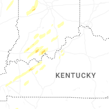


Connect with Interactive Hail Maps