

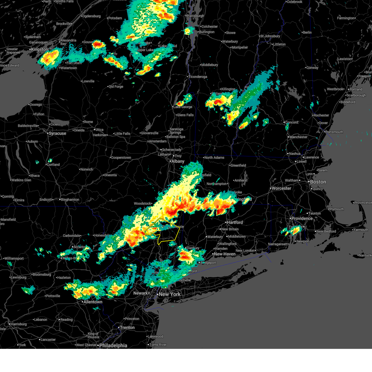
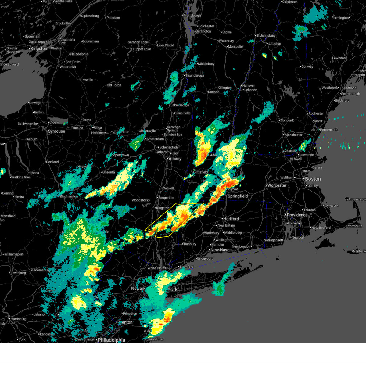
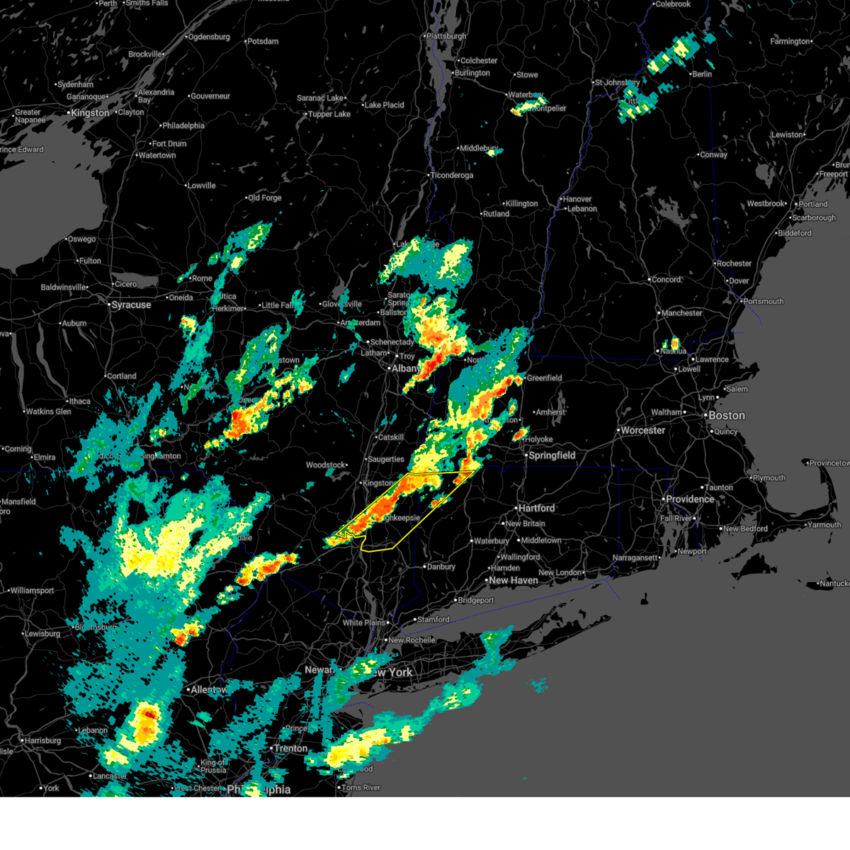
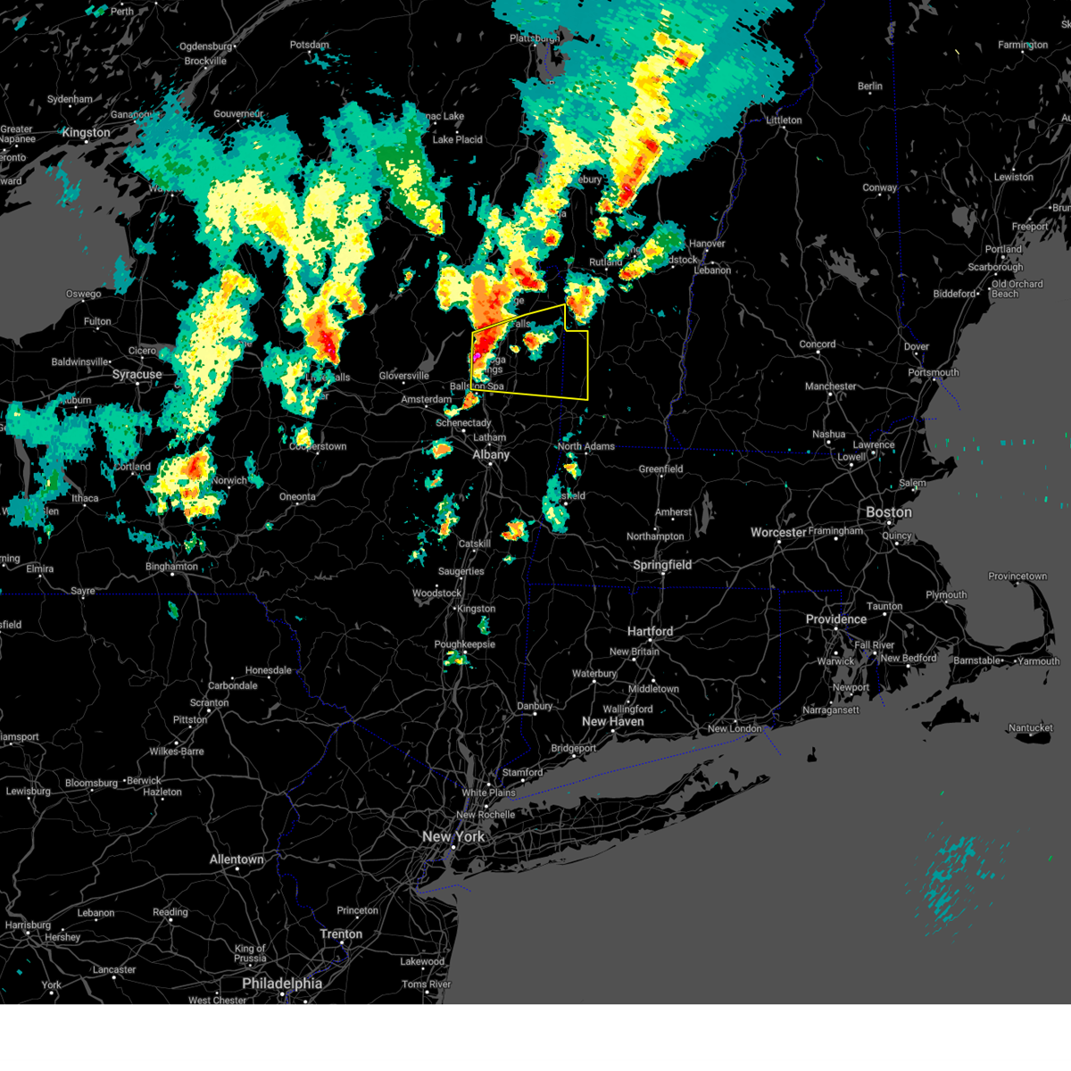
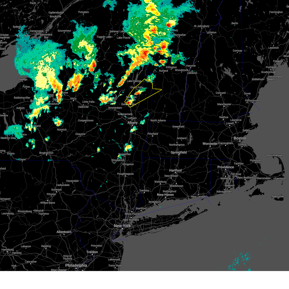
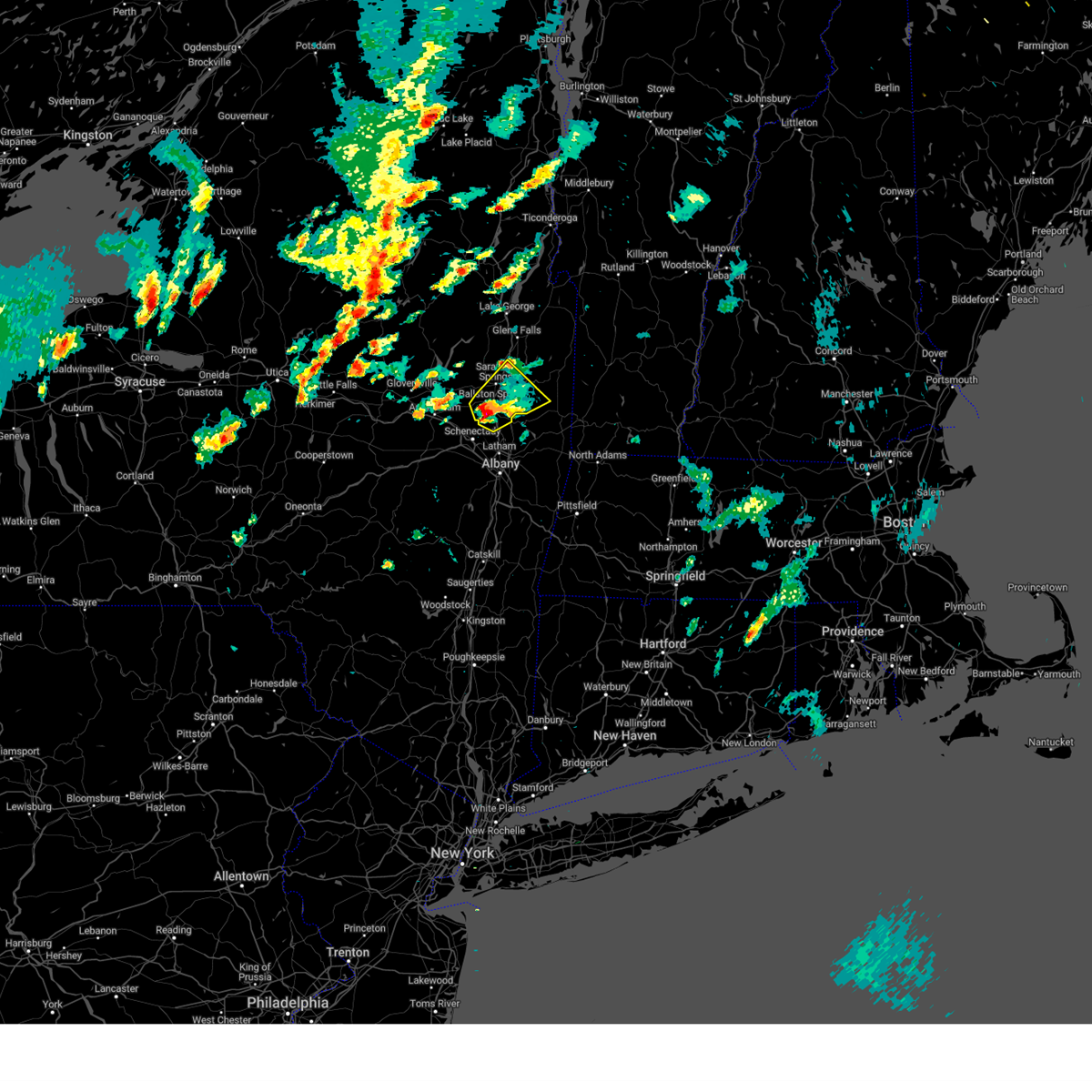
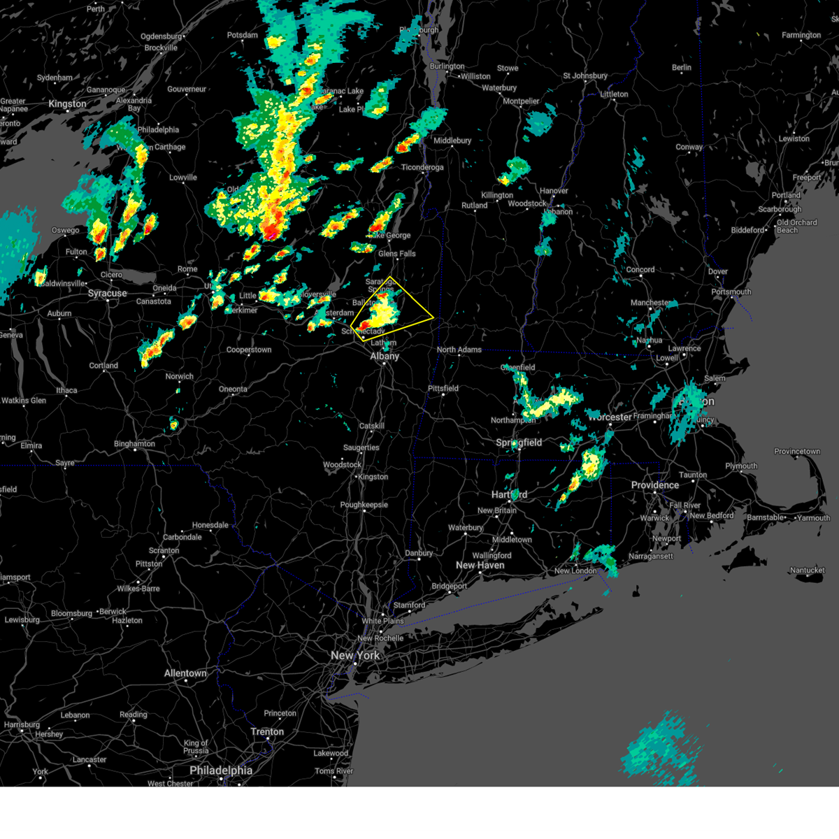
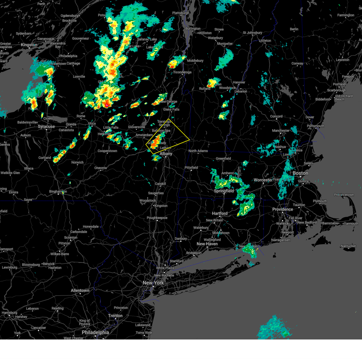
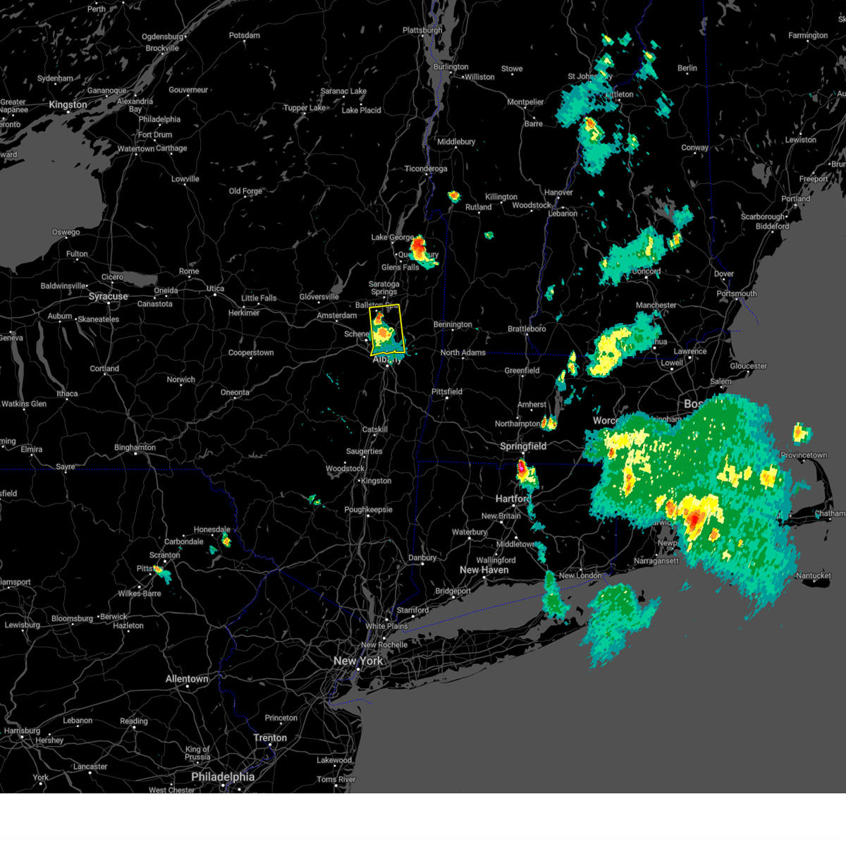
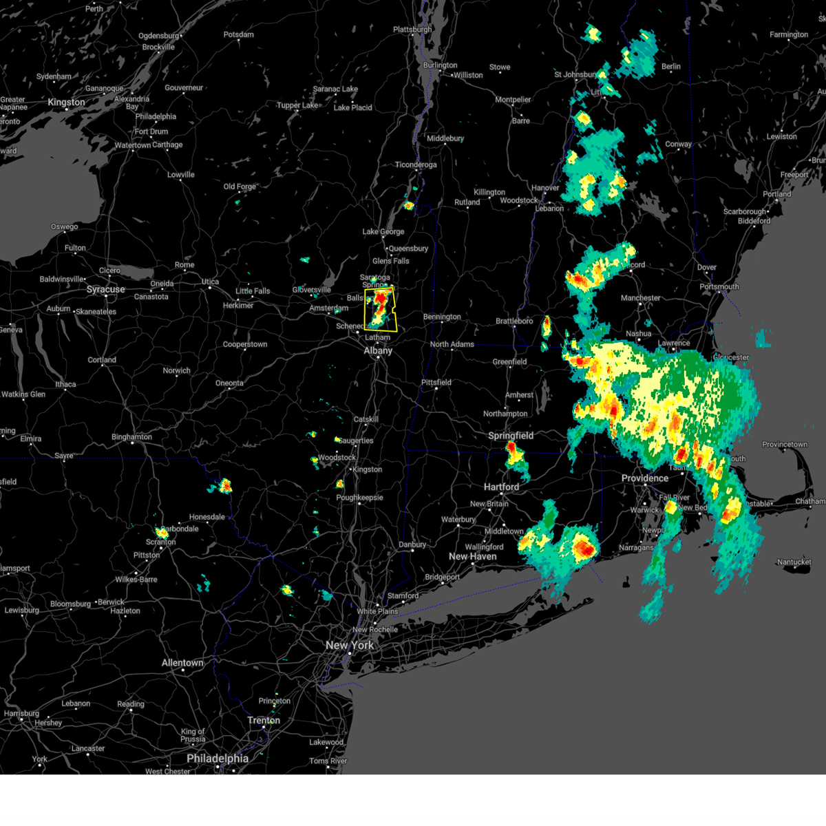
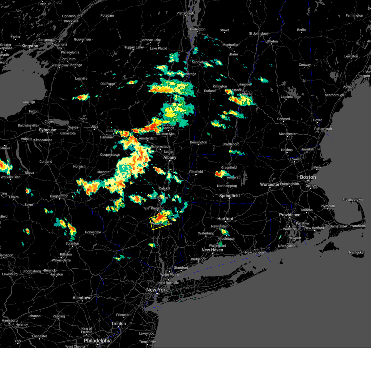
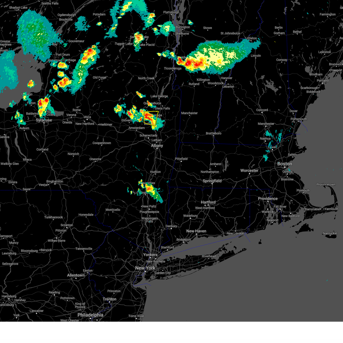
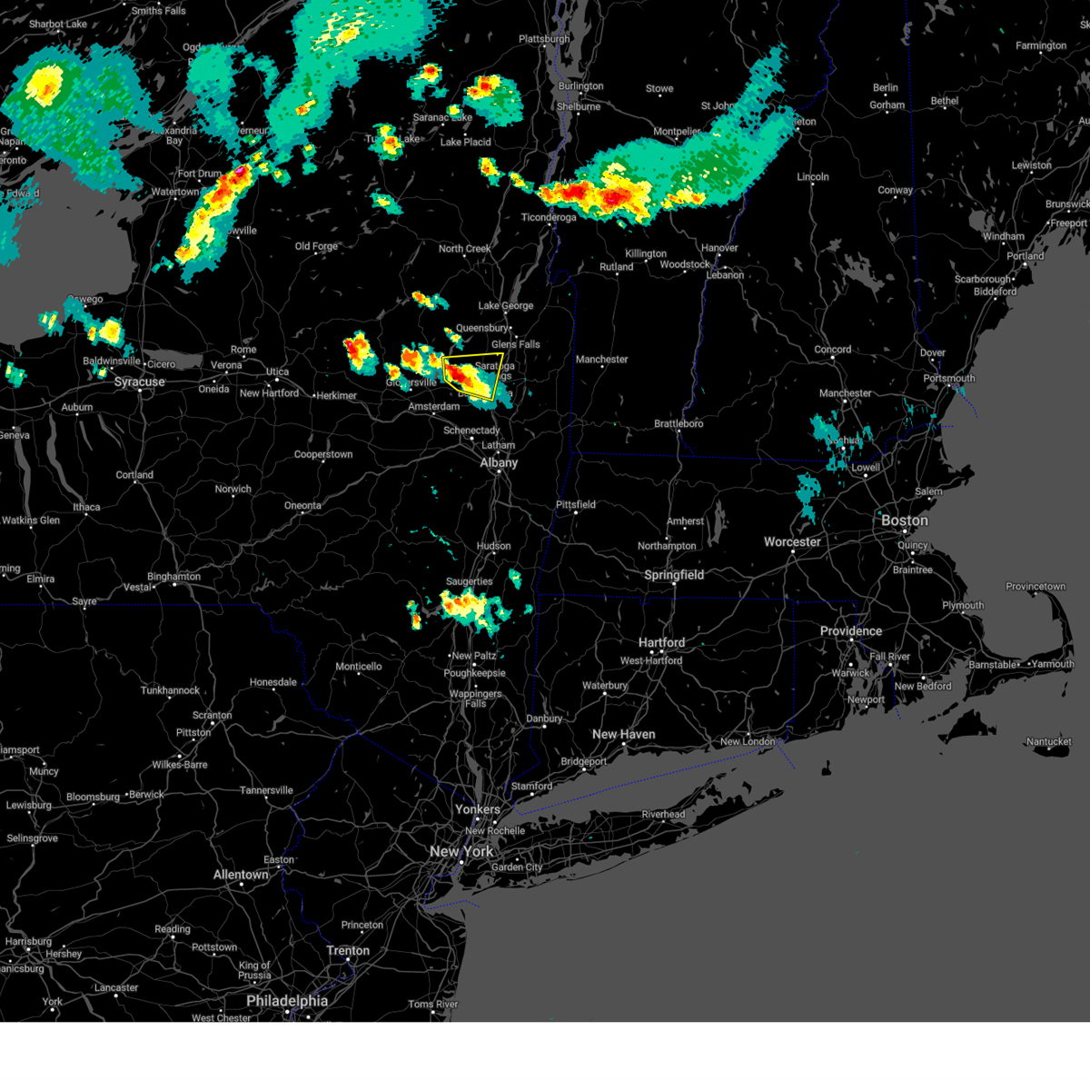
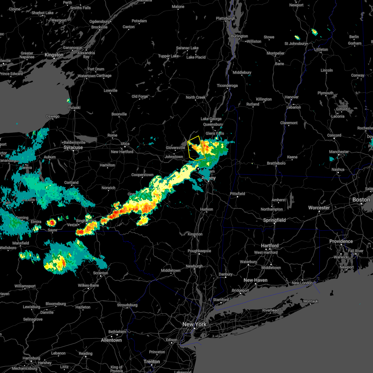
Hail Map for Milton, NY
The Milton, NY area has had 1 report of on-the-ground hail by trained spotters, and has been under severe weather warnings 23 times during the past 12 months. Doppler radar has detected hail at or near Milton, NY on 69 occasions, including 4 occasions during the past year.
| Name: | Milton, NY |
| Where Located: | 16 miles NNE of Schenectady, NY |
| Map: | Google Map for Milton, NY |
| Population: | 3087 |
| Housing Units: | 1292 |
| More Info: | Search Google for Milton, NY |
1
The Top Recent Hail Date for Milton, NY is Thursday, August 15, 2024 (20th out of 69)

Hail and Wind Damage Spotted near Milton, NY
| Date / Time | Report Details |
|---|---|
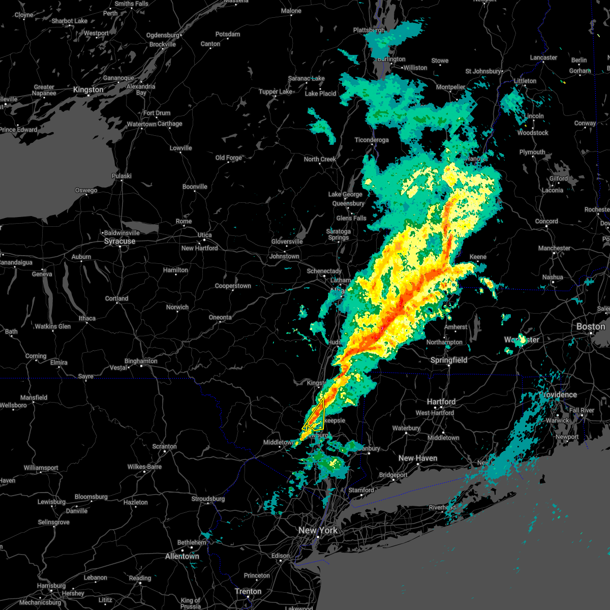
| 7/3/2025 5:54 PM EDT | Tree and wires down on mahoney roa in ulster county NY, 0.9 miles S of Milton, NY |
| 7/3/2025 5:23 PM EDT |
 Svraly the national weather service in albany has issued a * severe thunderstorm warning for, southeastern ulster county in east central new york, southern dutchess county in east central new york, * until 630 pm edt. * at 523 pm edt, a severe thunderstorm was located near walden, moving east at 30 mph (radar indicated). Hazards include 60 mph wind gusts and quarter size hail. Hail damage to vehicles is expected. Expect wind damage to roofs, siding, and trees. Svraly the national weather service in albany has issued a * severe thunderstorm warning for, southeastern ulster county in east central new york, southern dutchess county in east central new york, * until 630 pm edt. * at 523 pm edt, a severe thunderstorm was located near walden, moving east at 30 mph (radar indicated). Hazards include 60 mph wind gusts and quarter size hail. Hail damage to vehicles is expected. Expect wind damage to roofs, siding, and trees.
|
| 7/1/2025 5:26 PM EDT |
 the severe thunderstorm warning has been cancelled and is no longer in effect the severe thunderstorm warning has been cancelled and is no longer in effect
|
| 7/1/2025 4:48 PM EDT |
 Svraly the national weather service in albany has issued a * severe thunderstorm warning for, northwestern litchfield county in northern connecticut, southeastern ulster county in east central new york, dutchess county in east central new york, * until 545 pm edt. * at 447 pm edt, severe thunderstorms were located along a line extending from near pine plains to plattekill, moving east at 15 mph (radar indicated). Hazards include 60 mph wind gusts. expect damage to roofs, siding, and trees Svraly the national weather service in albany has issued a * severe thunderstorm warning for, northwestern litchfield county in northern connecticut, southeastern ulster county in east central new york, dutchess county in east central new york, * until 545 pm edt. * at 447 pm edt, severe thunderstorms were located along a line extending from near pine plains to plattekill, moving east at 15 mph (radar indicated). Hazards include 60 mph wind gusts. expect damage to roofs, siding, and trees
|
| 5/17/2025 4:27 PM EDT |
 Svraly the national weather service in albany has issued a * severe thunderstorm warning for, southeastern warren county in east central new york, northeastern saratoga county in east central new york, southern washington county in east central new york, northwestern bennington county in southern vermont, * until 530 pm edt. * at 426 pm edt, a severe thunderstorm was located near saratoga springs, moving east at 30 mph (radar indicated). Hazards include ping pong ball size hail and 60 mph wind gusts. People and animals outdoors will be injured. expect hail damage to roofs, siding, windows, and vehicles. Expect wind damage to roofs, siding, and trees. Svraly the national weather service in albany has issued a * severe thunderstorm warning for, southeastern warren county in east central new york, northeastern saratoga county in east central new york, southern washington county in east central new york, northwestern bennington county in southern vermont, * until 530 pm edt. * at 426 pm edt, a severe thunderstorm was located near saratoga springs, moving east at 30 mph (radar indicated). Hazards include ping pong ball size hail and 60 mph wind gusts. People and animals outdoors will be injured. expect hail damage to roofs, siding, windows, and vehicles. Expect wind damage to roofs, siding, and trees.
|
| 5/17/2025 3:32 PM EDT |
 Svraly the national weather service in albany has issued a * severe thunderstorm warning for, southeastern warren county in east central new york, northeastern saratoga county in east central new york, central washington county in east central new york, northwestern bennington county in southern vermont, * until 430 pm edt. * at 332 pm edt, a severe thunderstorm was located over saratoga springs, moving northeast at 30 mph (radar indicated). Hazards include 60 mph wind gusts and quarter size hail. Hail damage to vehicles is expected. Expect wind damage to roofs, siding, and trees. Svraly the national weather service in albany has issued a * severe thunderstorm warning for, southeastern warren county in east central new york, northeastern saratoga county in east central new york, central washington county in east central new york, northwestern bennington county in southern vermont, * until 430 pm edt. * at 332 pm edt, a severe thunderstorm was located over saratoga springs, moving northeast at 30 mph (radar indicated). Hazards include 60 mph wind gusts and quarter size hail. Hail damage to vehicles is expected. Expect wind damage to roofs, siding, and trees.
|
| 5/17/2025 1:43 PM EDT |
 At 143 pm edt, a severe thunderstorm was located over round lake, or near saratoga springs, moving northeast at 35 mph (radar indicated). Hazards include 60 mph wind gusts and quarter size hail. Hail damage to vehicles is expected. expect wind damage to roofs, siding, and trees. Locations impacted include, deans corners, grangerville, kings station, willow glen, coons, garrison manor, wayville, elnora, country knolls, halls corner, mannings cove, north ballston spa, eddy corners, saratoga race course, saratoga springs, burgoyne, archdale, quaker springs, dimmick corners, and ketchums corners. At 143 pm edt, a severe thunderstorm was located over round lake, or near saratoga springs, moving northeast at 35 mph (radar indicated). Hazards include 60 mph wind gusts and quarter size hail. Hail damage to vehicles is expected. expect wind damage to roofs, siding, and trees. Locations impacted include, deans corners, grangerville, kings station, willow glen, coons, garrison manor, wayville, elnora, country knolls, halls corner, mannings cove, north ballston spa, eddy corners, saratoga race course, saratoga springs, burgoyne, archdale, quaker springs, dimmick corners, and ketchums corners.
|
| 5/17/2025 1:43 PM EDT |
 the severe thunderstorm warning has been cancelled and is no longer in effect the severe thunderstorm warning has been cancelled and is no longer in effect
|
| 5/17/2025 1:30 PM EDT |
 the severe thunderstorm warning has been cancelled and is no longer in effect the severe thunderstorm warning has been cancelled and is no longer in effect
|
| 5/17/2025 1:30 PM EDT |
 At 130 pm edt, a severe thunderstorm was located over burnt hills, or near scotia, moving northeast at 20 mph (radar indicated). Hazards include 60 mph wind gusts and quarter size hail. Hail damage to vehicles is expected. expect wind damage to roofs, siding, and trees. Locations impacted include, deans corners, glenridge, grangerville, johnsonville, harding crossing, willow glen, garrison manor, wayville, woodruff heights, elnora, halls corner, mannings cove, hutchinson crossing, clifton park center, rexford, saratoga race course, dimmick corners, valley falls, ushers, and the saratoga battllefield. At 130 pm edt, a severe thunderstorm was located over burnt hills, or near scotia, moving northeast at 20 mph (radar indicated). Hazards include 60 mph wind gusts and quarter size hail. Hail damage to vehicles is expected. expect wind damage to roofs, siding, and trees. Locations impacted include, deans corners, glenridge, grangerville, johnsonville, harding crossing, willow glen, garrison manor, wayville, woodruff heights, elnora, halls corner, mannings cove, hutchinson crossing, clifton park center, rexford, saratoga race course, dimmick corners, valley falls, ushers, and the saratoga battllefield.
|
| 5/17/2025 1:12 PM EDT |
 Svraly the national weather service in albany has issued a * severe thunderstorm warning for, schenectady county in east central new york, northeastern albany county in east central new york, southern saratoga county in east central new york, southwestern washington county in east central new york, northern rensselaer county in east central new york, * until 215 pm edt. * at 111 pm edt, a severe thunderstorm was located over scotia, moving northeast at 25 mph (radar indicated). Hazards include 60 mph wind gusts and quarter size hail. Hail damage to vehicles is expected. Expect wind damage to roofs, siding, and trees. Svraly the national weather service in albany has issued a * severe thunderstorm warning for, schenectady county in east central new york, northeastern albany county in east central new york, southern saratoga county in east central new york, southwestern washington county in east central new york, northern rensselaer county in east central new york, * until 215 pm edt. * at 111 pm edt, a severe thunderstorm was located over scotia, moving northeast at 25 mph (radar indicated). Hazards include 60 mph wind gusts and quarter size hail. Hail damage to vehicles is expected. Expect wind damage to roofs, siding, and trees.
|
| 8/15/2024 5:37 PM EDT |
 the severe thunderstorm warning has been cancelled and is no longer in effect the severe thunderstorm warning has been cancelled and is no longer in effect
|
| 8/15/2024 5:17 PM EDT |
 Svraly the national weather service in albany has issued a * severe thunderstorm warning for, east central schenectady county in east central new york, northeastern albany county in east central new york, southeastern saratoga county in east central new york, northwestern rensselaer county in east central new york, * until 600 pm edt. * at 517 pm edt, a severe thunderstorm was located over round lake, or near clifton park, moving south at 20 mph (radar indicated). Hazards include 60 mph wind gusts and quarter size hail. Hail damage to vehicles is expected. Expect wind damage to roofs, siding, and trees. Svraly the national weather service in albany has issued a * severe thunderstorm warning for, east central schenectady county in east central new york, northeastern albany county in east central new york, southeastern saratoga county in east central new york, northwestern rensselaer county in east central new york, * until 600 pm edt. * at 517 pm edt, a severe thunderstorm was located over round lake, or near clifton park, moving south at 20 mph (radar indicated). Hazards include 60 mph wind gusts and quarter size hail. Hail damage to vehicles is expected. Expect wind damage to roofs, siding, and trees.
|
| 8/15/2024 5:05 PM EDT |
 At 505 pm edt, a severe thunderstorm was located near mechanicville, moving south at 20 mph (broadcast media). Hazards include golf ball size hail and 60 mph wind gusts. People and animals outdoors will be injured. expect hail damage to roofs, siding, windows, and vehicles. expect wind damage to roofs, siding, and trees. Locations impacted include, clifton park, saratoga springs, mechanicville, ballston spa, round lake, country knolls, north ballston spa, halfmoon, malta, stillwater, maltaville, malta ridge, schaghticoke hill, groom corners, melrose, francis corners, willow glen, coons, wayville, and myers corners. At 505 pm edt, a severe thunderstorm was located near mechanicville, moving south at 20 mph (broadcast media). Hazards include golf ball size hail and 60 mph wind gusts. People and animals outdoors will be injured. expect hail damage to roofs, siding, windows, and vehicles. expect wind damage to roofs, siding, and trees. Locations impacted include, clifton park, saratoga springs, mechanicville, ballston spa, round lake, country knolls, north ballston spa, halfmoon, malta, stillwater, maltaville, malta ridge, schaghticoke hill, groom corners, melrose, francis corners, willow glen, coons, wayville, and myers corners.
|
| 8/15/2024 4:58 PM EDT |
 At 457 pm edt, a severe thunderstorm was located over mechanicville, moving south at 20 mph (broadcast media). Hazards include golf ball size hail. People and animals outdoors will be injured. expect damage to roofs, siding, windows, and vehicles. locations impacted include, clifton park, saratoga springs, mechanicville, ballston spa, round lake, country knolls, north ballston spa, halfmoon, malta, stillwater, maltaville, malta ridge, schaghticoke hill, groom corners, melrose, francis corners, willow glen, coons, wayville, and myers corners. The golf ball size hail was near exit 13 on the northway. At 457 pm edt, a severe thunderstorm was located over mechanicville, moving south at 20 mph (broadcast media). Hazards include golf ball size hail. People and animals outdoors will be injured. expect damage to roofs, siding, windows, and vehicles. locations impacted include, clifton park, saratoga springs, mechanicville, ballston spa, round lake, country knolls, north ballston spa, halfmoon, malta, stillwater, maltaville, malta ridge, schaghticoke hill, groom corners, melrose, francis corners, willow glen, coons, wayville, and myers corners. The golf ball size hail was near exit 13 on the northway.
|
| 8/15/2024 4:47 PM EDT |
 Svraly the national weather service in albany has issued a * severe thunderstorm warning for, southeastern saratoga county in east central new york, northwestern rensselaer county in east central new york, * until 515 pm edt. * at 446 pm edt, a severe thunderstorm was located near round lake, or near mechanicville, moving south at 20 mph (radar indicated). Hazards include golf ball size hail and 60 mph wind gusts. People and animals outdoors will be injured. expect hail damage to roofs, siding, windows, and vehicles. Expect wind damage to roofs, siding, and trees. Svraly the national weather service in albany has issued a * severe thunderstorm warning for, southeastern saratoga county in east central new york, northwestern rensselaer county in east central new york, * until 515 pm edt. * at 446 pm edt, a severe thunderstorm was located near round lake, or near mechanicville, moving south at 20 mph (radar indicated). Hazards include golf ball size hail and 60 mph wind gusts. People and animals outdoors will be injured. expect hail damage to roofs, siding, windows, and vehicles. Expect wind damage to roofs, siding, and trees.
|
| 8/15/2024 4:30 PM EDT |
 Svraly the national weather service in albany has issued a * severe thunderstorm warning for, southeastern saratoga county in east central new york, northwestern rensselaer county in east central new york, * until 500 pm edt. * at 430 pm edt, a severe thunderstorm was located near saratoga springs, moving south at 20 mph (radar indicated). Hazards include 60 mph wind gusts and quarter size hail. Hail damage to vehicles is expected. Expect wind damage to roofs, siding, and trees. Svraly the national weather service in albany has issued a * severe thunderstorm warning for, southeastern saratoga county in east central new york, northwestern rensselaer county in east central new york, * until 500 pm edt. * at 430 pm edt, a severe thunderstorm was located near saratoga springs, moving south at 20 mph (radar indicated). Hazards include 60 mph wind gusts and quarter size hail. Hail damage to vehicles is expected. Expect wind damage to roofs, siding, and trees.
|
| 8/14/2024 3:06 PM EDT |
 Svraly the national weather service in albany has issued a * severe thunderstorm warning for, northeastern schenectady county in east central new york, southeastern fulton county in eastern new york, southwestern saratoga county in east central new york, east central montgomery county in eastern new york, * until 400 pm edt. * at 306 pm edt, a severe thunderstorm was located over galway, or 10 miles northeast of amsterdam, moving south at 15 mph (radar indicated). Hazards include 60 mph wind gusts and quarter size hail. Hail damage to vehicles is expected. Expect wind damage to roofs, siding, and trees. Svraly the national weather service in albany has issued a * severe thunderstorm warning for, northeastern schenectady county in east central new york, southeastern fulton county in eastern new york, southwestern saratoga county in east central new york, east central montgomery county in eastern new york, * until 400 pm edt. * at 306 pm edt, a severe thunderstorm was located over galway, or 10 miles northeast of amsterdam, moving south at 15 mph (radar indicated). Hazards include 60 mph wind gusts and quarter size hail. Hail damage to vehicles is expected. Expect wind damage to roofs, siding, and trees.
|
| 8/5/2024 5:29 PM EDT |
 Svraly the national weather service in albany has issued a * severe thunderstorm warning for, south central warren county in east central new york, saratoga county in east central new york, southern washington county in east central new york, northeastern rensselaer county in east central new york, bennington county in southern vermont, * until 630 pm edt. * at 529 pm edt, a severe thunderstorm was located near saratoga springs, moving east at 30 mph (radar indicated). Hazards include 60 mph wind gusts and quarter size hail. Hail damage to vehicles is expected. Expect wind damage to roofs, siding, and trees. Svraly the national weather service in albany has issued a * severe thunderstorm warning for, south central warren county in east central new york, saratoga county in east central new york, southern washington county in east central new york, northeastern rensselaer county in east central new york, bennington county in southern vermont, * until 630 pm edt. * at 529 pm edt, a severe thunderstorm was located near saratoga springs, moving east at 30 mph (radar indicated). Hazards include 60 mph wind gusts and quarter size hail. Hail damage to vehicles is expected. Expect wind damage to roofs, siding, and trees.
|
| 7/17/2024 3:17 PM EDT |
 Svraly the national weather service in albany has issued a * severe thunderstorm warning for, southeastern ulster county in east central new york, southern dutchess county in east central new york, * until 415 pm edt. * at 317 pm edt, a severe thunderstorm was located over beacon, moving east at 25 mph (radar indicated). Hazards include 60 mph wind gusts. expect damage to roofs, siding, and trees Svraly the national weather service in albany has issued a * severe thunderstorm warning for, southeastern ulster county in east central new york, southern dutchess county in east central new york, * until 415 pm edt. * at 317 pm edt, a severe thunderstorm was located over beacon, moving east at 25 mph (radar indicated). Hazards include 60 mph wind gusts. expect damage to roofs, siding, and trees
|
| 7/16/2024 5:35 PM EDT |
 At 534 pm edt, severe thunderstorms were located along a line extending from 7 miles east of chestertown to 6 miles northwest of salem to near mechanicville, moving east at 50 mph. these are destructive storms for the lake george and glens falls area into washington county (public). Hazards include 80 mph wind gusts. Flying debris will be dangerous to those caught without shelter. mobile homes will be heavily damaged. expect considerable damage to roofs, windows, and vehicles. extensive tree damage and power outages are likely. Locations impacted include, bennington, saratoga springs, hudson falls, mechanicville, hoosick falls, whitehall, arlington, salem, manchester, stratton, ballston spa, shaftsbury, fort edward, granville, hartford, dorset, cambridge, greenwich, round lake, and eagle point campground. At 534 pm edt, severe thunderstorms were located along a line extending from 7 miles east of chestertown to 6 miles northwest of salem to near mechanicville, moving east at 50 mph. these are destructive storms for the lake george and glens falls area into washington county (public). Hazards include 80 mph wind gusts. Flying debris will be dangerous to those caught without shelter. mobile homes will be heavily damaged. expect considerable damage to roofs, windows, and vehicles. extensive tree damage and power outages are likely. Locations impacted include, bennington, saratoga springs, hudson falls, mechanicville, hoosick falls, whitehall, arlington, salem, manchester, stratton, ballston spa, shaftsbury, fort edward, granville, hartford, dorset, cambridge, greenwich, round lake, and eagle point campground.
|
| 7/16/2024 5:29 PM EDT | Svraly the national weather service in albany has issued a * severe thunderstorm warning for, eastern warren county in east central new york, southeastern saratoga county in east central new york, washington county in east central new york, northeastern rensselaer county in east central new york, bennington county in southern vermont, west central windham county in southern vermont, * until 615 pm edt. * at 528 pm edt, severe thunderstorms were located along a line extending from 6 miles east of chestertown to 6 miles southeast of fort edward to near round lake, moving east at 50 mph (public). Hazards include 70 mph wind gusts. Expect considerable tree damage. Damage is likely to mobile homes, roofs, and outbuildings. |
| 7/16/2024 5:21 PM EDT |
 At 521 pm edt, a severe thunderstorm capable of producing a tornado was located 7 miles west of comstock, or 7 miles east of lake george village, moving east at 50 mph (radar indicated rotation). Hazards include tornado. Flying debris will be dangerous to those caught without shelter. mobile homes will be damaged or destroyed. damage to roofs, windows, and vehicles will occur. tree damage is likely. this dangerous storm will be near, comstock around 525 pm edt. Other locations impacted by this tornadic thunderstorm include deans corners, lake luzerne, grangerville, south bay village, west milton, northumberland, wayville, greenfield center, conklingville, and truthville. At 521 pm edt, a severe thunderstorm capable of producing a tornado was located 7 miles west of comstock, or 7 miles east of lake george village, moving east at 50 mph (radar indicated rotation). Hazards include tornado. Flying debris will be dangerous to those caught without shelter. mobile homes will be damaged or destroyed. damage to roofs, windows, and vehicles will occur. tree damage is likely. this dangerous storm will be near, comstock around 525 pm edt. Other locations impacted by this tornadic thunderstorm include deans corners, lake luzerne, grangerville, south bay village, west milton, northumberland, wayville, greenfield center, conklingville, and truthville.
|
| 7/16/2024 4:52 PM EDT |
 Toraly the national weather service in albany has issued a * tornado warning for, central warren county in east central new york, saratoga county in east central new york, washington county in east central new york, northeastern rensselaer county in east central new york, * until 530 pm edt. * at 451 pm edt, a severe thunderstorm capable of producing a tornado was located 9 miles north of day center, or 15 miles west of warrensburg, moving east at 50 mph (radar indicated rotation). Hazards include tornado. Flying debris will be dangerous to those caught without shelter. mobile homes will be damaged or destroyed. damage to roofs, windows, and vehicles will occur. tree damage is likely. this dangerous storm will be near, warrensburg around 505 pm edt. lake george village around 510 pm edt. comstock around 525 pm edt. Other locations impacted by this tornadic thunderstorm include parkis mills, deans corners, grangerville, south bay village, glenwild, northumberland, wayville, wiley corners, middle falls, and halls corner. Toraly the national weather service in albany has issued a * tornado warning for, central warren county in east central new york, saratoga county in east central new york, washington county in east central new york, northeastern rensselaer county in east central new york, * until 530 pm edt. * at 451 pm edt, a severe thunderstorm capable of producing a tornado was located 9 miles north of day center, or 15 miles west of warrensburg, moving east at 50 mph (radar indicated rotation). Hazards include tornado. Flying debris will be dangerous to those caught without shelter. mobile homes will be damaged or destroyed. damage to roofs, windows, and vehicles will occur. tree damage is likely. this dangerous storm will be near, warrensburg around 505 pm edt. lake george village around 510 pm edt. comstock around 525 pm edt. Other locations impacted by this tornadic thunderstorm include parkis mills, deans corners, grangerville, south bay village, glenwild, northumberland, wayville, wiley corners, middle falls, and halls corner.
|
| 6/26/2024 8:55 PM EDT |
 At 854 pm edt, severe thunderstorms were located along a line extending from highland to near hopewell junction to near lake carmel, moving northeast at 45 mph (radar indicated). Hazards include 60 mph wind gusts. Expect damage to roofs, siding, and trees. these severe storms will be near, poughkeepsie, pawling, pleasant valley, highland, and fairview around 900 pm edt. sherman, millbrook, wingdale, and dover plains around 905 pm edt. Other locations impacted by these severe thunderstorms include tuckers corner, stormville, salt point, baker corner, knapps corner, beekman, south dover, lithgow, hoxie corner, and new hamburg. At 854 pm edt, severe thunderstorms were located along a line extending from highland to near hopewell junction to near lake carmel, moving northeast at 45 mph (radar indicated). Hazards include 60 mph wind gusts. Expect damage to roofs, siding, and trees. these severe storms will be near, poughkeepsie, pawling, pleasant valley, highland, and fairview around 900 pm edt. sherman, millbrook, wingdale, and dover plains around 905 pm edt. Other locations impacted by these severe thunderstorms include tuckers corner, stormville, salt point, baker corner, knapps corner, beekman, south dover, lithgow, hoxie corner, and new hamburg.
|
| 6/26/2024 8:24 PM EDT |
 Svraly the national weather service in albany has issued a * severe thunderstorm warning for, southeastern ulster county in east central new york, southern dutchess county in east central new york, * until 915 pm edt. * at 823 pm edt, severe thunderstorms were located along a line extending from near montgomery to near west point to ramsey, moving northeast at 50 mph (radar indicated). Hazards include 60 mph wind gusts. Expect damage to roofs, siding, and trees. severe thunderstorms will be near, beacon and wallkill around 830 pm edt. plattekill, fishkill, modena, and marlboro around 835 pm edt. milton, wappingers falls, hopewell junction, and myers corner around 840 pm edt. poughkeepsie, highland, and red oaks mill around 845 pm edt. pawling, pleasant valley, and fairview around 850 pm edt. sherman, millbrook, and wingdale around 900 pm edt. dover plains around 905 pm edt. Other locations impacted by these severe thunderstorms include tuckers corner, stormville, salt point, baker corner, knapps corner, beekman, south dover, lithgow, hoxie corner, and new hamburg. Svraly the national weather service in albany has issued a * severe thunderstorm warning for, southeastern ulster county in east central new york, southern dutchess county in east central new york, * until 915 pm edt. * at 823 pm edt, severe thunderstorms were located along a line extending from near montgomery to near west point to ramsey, moving northeast at 50 mph (radar indicated). Hazards include 60 mph wind gusts. Expect damage to roofs, siding, and trees. severe thunderstorms will be near, beacon and wallkill around 830 pm edt. plattekill, fishkill, modena, and marlboro around 835 pm edt. milton, wappingers falls, hopewell junction, and myers corner around 840 pm edt. poughkeepsie, highland, and red oaks mill around 845 pm edt. pawling, pleasant valley, and fairview around 850 pm edt. sherman, millbrook, and wingdale around 900 pm edt. dover plains around 905 pm edt. Other locations impacted by these severe thunderstorms include tuckers corner, stormville, salt point, baker corner, knapps corner, beekman, south dover, lithgow, hoxie corner, and new hamburg.
|
| 6/23/2024 4:11 PM EDT |
 Svraly the national weather service in albany has issued a * severe thunderstorm warning for, northwestern litchfield county in northern connecticut, southeastern ulster county in east central new york, dutchess county in east central new york, south central columbia county in east central new york, * until 445 pm edt. * at 411 pm edt, a severe thunderstorm was located over hyde park, or 7 miles north of poughkeepsie, moving east at 50 mph (radar indicated). Hazards include 60 mph wind gusts and quarter size hail. Hail damage to vehicles is expected. Expect wind damage to roofs, siding, and trees. Svraly the national weather service in albany has issued a * severe thunderstorm warning for, northwestern litchfield county in northern connecticut, southeastern ulster county in east central new york, dutchess county in east central new york, south central columbia county in east central new york, * until 445 pm edt. * at 411 pm edt, a severe thunderstorm was located over hyde park, or 7 miles north of poughkeepsie, moving east at 50 mph (radar indicated). Hazards include 60 mph wind gusts and quarter size hail. Hail damage to vehicles is expected. Expect wind damage to roofs, siding, and trees.
|
| 6/21/2024 2:01 PM EDT |
 At 200 pm edt, a severe thunderstorm was located over hyde park, or near new paltz, moving south at 10 mph (public. this storm has produced wind damage and pea size hail). Hazards include 60 mph wind gusts and quarter size hail. Hail damage to vehicles is expected. expect wind damage to roofs, siding, and trees. this severe storm will be near, hyde park and highland around 205 pm edt. poughkeepsie and fairview around 210 pm edt. Other locations impacted by this severe thunderstorm include tuckers corner, norrie heights, esopus, dewitt mills, elting corners, haviland, pleasant plains, timothy heights, ardonia, and colonial heights. At 200 pm edt, a severe thunderstorm was located over hyde park, or near new paltz, moving south at 10 mph (public. this storm has produced wind damage and pea size hail). Hazards include 60 mph wind gusts and quarter size hail. Hail damage to vehicles is expected. expect wind damage to roofs, siding, and trees. this severe storm will be near, hyde park and highland around 205 pm edt. poughkeepsie and fairview around 210 pm edt. Other locations impacted by this severe thunderstorm include tuckers corner, norrie heights, esopus, dewitt mills, elting corners, haviland, pleasant plains, timothy heights, ardonia, and colonial heights.
|
| 6/21/2024 1:30 PM EDT |
 Svraly the national weather service in albany has issued a * severe thunderstorm warning for, southeastern ulster county in east central new york, west central dutchess county in east central new york, * until 215 pm edt. * at 130 pm edt, a severe thunderstorm was located near port ewen, or near kingston, moving south at 10 mph (radar indicated). Hazards include 60 mph wind gusts and quarter size hail. Hail damage to vehicles is expected. expect wind damage to roofs, siding, and trees. this severe thunderstorm will be near, tillson and staatsburg around 135 pm edt. hyde park around 145 pm edt. Other locations impacted by this severe thunderstorm include rolling meadows, norrie heights, rosendale, maple hill, atwood, pacama, hillside, stone ridge, elting corners, and haviland. Svraly the national weather service in albany has issued a * severe thunderstorm warning for, southeastern ulster county in east central new york, west central dutchess county in east central new york, * until 215 pm edt. * at 130 pm edt, a severe thunderstorm was located near port ewen, or near kingston, moving south at 10 mph (radar indicated). Hazards include 60 mph wind gusts and quarter size hail. Hail damage to vehicles is expected. expect wind damage to roofs, siding, and trees. this severe thunderstorm will be near, tillson and staatsburg around 135 pm edt. hyde park around 145 pm edt. Other locations impacted by this severe thunderstorm include rolling meadows, norrie heights, rosendale, maple hill, atwood, pacama, hillside, stone ridge, elting corners, and haviland.
|
| 9/8/2023 4:54 PM EDT |
 At 454 pm edt, a severe thunderstorm was located near north ballston spa, or near saratoga springs, moving northeast at 25 mph (radar indicated). Hazards include 60 mph wind gusts and quarter size hail. Hail damage to vehicles is expected. expect wind damage to roofs, siding, and trees. locations impacted include, saratoga springs, ballston spa, north ballston spa, rock city falls, kings, gates, wilton, malta, greenfield, northumberland, schuylerville, victory, deans corners, grangerville, kings station, west milton, greenfield center, north greenfield, porter corners and halls corner. hail threat, radar indicated max hail size, 1. 00 in wind threat, radar indicated max wind gust, 60 mph. At 454 pm edt, a severe thunderstorm was located near north ballston spa, or near saratoga springs, moving northeast at 25 mph (radar indicated). Hazards include 60 mph wind gusts and quarter size hail. Hail damage to vehicles is expected. expect wind damage to roofs, siding, and trees. locations impacted include, saratoga springs, ballston spa, north ballston spa, rock city falls, kings, gates, wilton, malta, greenfield, northumberland, schuylerville, victory, deans corners, grangerville, kings station, west milton, greenfield center, north greenfield, porter corners and halls corner. hail threat, radar indicated max hail size, 1. 00 in wind threat, radar indicated max wind gust, 60 mph.
|
| 9/8/2023 4:31 PM EDT |
 At 431 pm edt, a severe thunderstorm was located near burnt hills, or 8 miles north of scotia, moving northeast at 25 mph (radar indicated). Hazards include 60 mph wind gusts and quarter size hail. Hail damage to vehicles is expected. Expect wind damage to roofs, siding, and trees. At 431 pm edt, a severe thunderstorm was located near burnt hills, or 8 miles north of scotia, moving northeast at 25 mph (radar indicated). Hazards include 60 mph wind gusts and quarter size hail. Hail damage to vehicles is expected. Expect wind damage to roofs, siding, and trees.
|
| 9/7/2023 8:00 PM EDT |
 At 800 pm edt, severe thunderstorms were located along a line extending from near hunter to rhinebeck to near fishkill, moving east at 35 mph (radar indicated). Hazards include 60 mph wind gusts and quarter size hail. Hail damage to vehicles is expected. Expect wind damage to roofs, siding, and trees. At 800 pm edt, severe thunderstorms were located along a line extending from near hunter to rhinebeck to near fishkill, moving east at 35 mph (radar indicated). Hazards include 60 mph wind gusts and quarter size hail. Hail damage to vehicles is expected. Expect wind damage to roofs, siding, and trees.
|
| 9/7/2023 7:54 PM EDT |
 At 754 pm edt, a severe thunderstorm was located near highland, or near poughkeepsie, moving north at 40 mph (radar indicated). Hazards include 60 mph wind gusts and quarter size hail. Hail damage to vehicles is expected. expect wind damage to roofs, siding, and trees. locations impacted include, kingston, new paltz, hudson, catskill, saugerties, rhinebeck, hunter, wallkill, hyde park, milton, plattekill, hurley, woodstock, highland, red hook, windham, athens, prattsville, high falls and tillson. hail threat, radar indicated max hail size, 1. 00 in wind threat, radar indicated max wind gust, 60 mph. At 754 pm edt, a severe thunderstorm was located near highland, or near poughkeepsie, moving north at 40 mph (radar indicated). Hazards include 60 mph wind gusts and quarter size hail. Hail damage to vehicles is expected. expect wind damage to roofs, siding, and trees. locations impacted include, kingston, new paltz, hudson, catskill, saugerties, rhinebeck, hunter, wallkill, hyde park, milton, plattekill, hurley, woodstock, highland, red hook, windham, athens, prattsville, high falls and tillson. hail threat, radar indicated max hail size, 1. 00 in wind threat, radar indicated max wind gust, 60 mph.
|
| 9/7/2023 7:21 PM EDT |
 At 721 pm edt, a severe thunderstorm was located near kerhonkson, or 7 miles northeast of ellenville, moving northeast at 50 mph (radar indicated). Hazards include 60 mph wind gusts and quarter size hail. Hail damage to vehicles is expected. Expect wind damage to roofs, siding, and trees. At 721 pm edt, a severe thunderstorm was located near kerhonkson, or 7 miles northeast of ellenville, moving northeast at 50 mph (radar indicated). Hazards include 60 mph wind gusts and quarter size hail. Hail damage to vehicles is expected. Expect wind damage to roofs, siding, and trees.
|
| 8/12/2023 8:56 PM EDT |
 The severe thunderstorm warning for southwestern litchfield, southeastern ulster and southern dutchess counties will expire at 900 pm edt, the storms which prompted the warning are moving out of the area. therefore, the warning will be allowed to expire. however hail, gusty winds and heavy rain are still possible with these thunderstorms, and another severe thunderstorm warning has been issued for southeastern dutchess and southwestern litchfield counties until 930 pm edt. a severe thunderstorm watch remains in effect until midnight edt for northern connecticut, and east central new york. remember, a severe thunderstorm warning still remains in effect for southeastern dutchess and southwestern litchfield counties until 930 pm edt. The severe thunderstorm warning for southwestern litchfield, southeastern ulster and southern dutchess counties will expire at 900 pm edt, the storms which prompted the warning are moving out of the area. therefore, the warning will be allowed to expire. however hail, gusty winds and heavy rain are still possible with these thunderstorms, and another severe thunderstorm warning has been issued for southeastern dutchess and southwestern litchfield counties until 930 pm edt. a severe thunderstorm watch remains in effect until midnight edt for northern connecticut, and east central new york. remember, a severe thunderstorm warning still remains in effect for southeastern dutchess and southwestern litchfield counties until 930 pm edt.
|
| 8/12/2023 8:23 PM EDT |
 The severe thunderstorm warning for southeastern ulster and southwestern dutchess counties will expire at 830 pm edt, the storms which prompted the warning have moved out of portions of the warned area. therefore, the warning will be allowed to expire. however hail, gusty winds, and heavy rain are still possible with these thunderstorms, and another severe thudnerstorm warning has been issed for southeastern ulster and southern dutchess counties until 900 pm edt. a severe thunderstorm watch remains in effect until midnight edt for east central new york. remember, a severe thunderstorm warning still remains in effect for southeastern ulster and southern dutchess counties until 900 pm edt. The severe thunderstorm warning for southeastern ulster and southwestern dutchess counties will expire at 830 pm edt, the storms which prompted the warning have moved out of portions of the warned area. therefore, the warning will be allowed to expire. however hail, gusty winds, and heavy rain are still possible with these thunderstorms, and another severe thudnerstorm warning has been issed for southeastern ulster and southern dutchess counties until 900 pm edt. a severe thunderstorm watch remains in effect until midnight edt for east central new york. remember, a severe thunderstorm warning still remains in effect for southeastern ulster and southern dutchess counties until 900 pm edt.
|
| 8/12/2023 8:11 PM EDT |
 At 811 pm edt, severe thunderstorms were located along a line extending from dover plains to myers corner to near bloomingburg, moving east at 30 mph (radar indicated). Hazards include 60 mph wind gusts and half dollar size hail. Hail damage to vehicles is expected. Expect wind damage to roofs, siding, and trees. At 811 pm edt, severe thunderstorms were located along a line extending from dover plains to myers corner to near bloomingburg, moving east at 30 mph (radar indicated). Hazards include 60 mph wind gusts and half dollar size hail. Hail damage to vehicles is expected. Expect wind damage to roofs, siding, and trees.
|
| 8/12/2023 8:06 PM EDT | Multiple trees down at milton turnpike in clintondale... ny in ulster county NY, 1.9 miles ESE of Milton, NY |
| 8/12/2023 8:03 PM EDT |
 At 802 pm edt, severe thunderstorms were located along a line extending from fairview to near gardnertown to wurtsboro, moving east at 35 mph (radar indicated). Hazards include 60 mph wind gusts and half dollar size hail. Hail damage to vehicles is expected. expect wind damage to roofs, siding, and trees. Locations impacted include, poughkeepsie, beacon, new paltz, ellenville, wallkill, plattekill, wappingers falls, highland, fishkill, modena, marlboro, red oaks mill, myers corner, hopewell junction, lloyd, crawford, gardiner, tuckers corner, forest glen and knapps corner. At 802 pm edt, severe thunderstorms were located along a line extending from fairview to near gardnertown to wurtsboro, moving east at 35 mph (radar indicated). Hazards include 60 mph wind gusts and half dollar size hail. Hail damage to vehicles is expected. expect wind damage to roofs, siding, and trees. Locations impacted include, poughkeepsie, beacon, new paltz, ellenville, wallkill, plattekill, wappingers falls, highland, fishkill, modena, marlboro, red oaks mill, myers corner, hopewell junction, lloyd, crawford, gardiner, tuckers corner, forest glen and knapps corner.
|
| 8/12/2023 7:39 PM EDT |
 At 739 pm edt, severe thunderstorms were located along a line extending from near new paltz to near rock hill, moving east at 40 mph (radar indicated). Hazards include 60 mph wind gusts and quarter size hail. Hail damage to vehicles is expected. Expect wind damage to roofs, siding, and trees. At 739 pm edt, severe thunderstorms were located along a line extending from near new paltz to near rock hill, moving east at 40 mph (radar indicated). Hazards include 60 mph wind gusts and quarter size hail. Hail damage to vehicles is expected. Expect wind damage to roofs, siding, and trees.
|
| 8/12/2023 7:32 PM EDT |
 At 732 pm edt, severe thunderstorms were located along a line extending from port ewen to 6 miles west of wingdale, moving east at 55 mph (radar indicated). Hazards include 60 mph wind gusts and half dollar size hail. Hail damage to vehicles is expected. Expect wind damage to roofs, siding, and trees. At 732 pm edt, severe thunderstorms were located along a line extending from port ewen to 6 miles west of wingdale, moving east at 55 mph (radar indicated). Hazards include 60 mph wind gusts and half dollar size hail. Hail damage to vehicles is expected. Expect wind damage to roofs, siding, and trees.
|
| 8/3/2023 8:32 PM EDT |
 At 832 pm edt, a severe thunderstorm was located near rock city falls, or 9 miles west of saratoga springs, moving east at 10 mph (radar indicated). Hazards include 60 mph wind gusts and quarter size hail. Hail damage to vehicles is expected. expect wind damage to roofs, siding, and trees. locations impacted include, saratoga springs, ballston spa, north ballston spa, rock city falls, kings, mount pleasant, wilton, greenfield, milton center, kings station, west milton, greenfield center, wiley corners, north greenfield, porter corners, east galway, chatfield corner, north milton, randall corner and lake desolation. hail threat, radar indicated max hail size, 1. 00 in wind threat, radar indicated max wind gust, 60 mph. At 832 pm edt, a severe thunderstorm was located near rock city falls, or 9 miles west of saratoga springs, moving east at 10 mph (radar indicated). Hazards include 60 mph wind gusts and quarter size hail. Hail damage to vehicles is expected. expect wind damage to roofs, siding, and trees. locations impacted include, saratoga springs, ballston spa, north ballston spa, rock city falls, kings, mount pleasant, wilton, greenfield, milton center, kings station, west milton, greenfield center, wiley corners, north greenfield, porter corners, east galway, chatfield corner, north milton, randall corner and lake desolation. hail threat, radar indicated max hail size, 1. 00 in wind threat, radar indicated max wind gust, 60 mph.
|
| 8/3/2023 7:56 PM EDT |
 At 756 pm edt, a severe thunderstorm was located near rock city falls, or 12 miles west of saratoga springs, moving east at 10 mph (radar indicated). Hazards include 60 mph wind gusts and quarter size hail. Hail damage to vehicles is expected. Expect wind damage to roofs, siding, and trees. At 756 pm edt, a severe thunderstorm was located near rock city falls, or 12 miles west of saratoga springs, moving east at 10 mph (radar indicated). Hazards include 60 mph wind gusts and quarter size hail. Hail damage to vehicles is expected. Expect wind damage to roofs, siding, and trees.
|
| 7/29/2023 2:24 PM EDT |
 At 223 pm edt, a severe thunderstorm was located over glenville, or near amsterdam, moving east at 20 mph (radar indicated). Hazards include 60 mph wind gusts and quarter size hail. Hail damage to vehicles is expected. expect wind damage to roofs, siding, and trees. Locations impacted include, schenectady, clifton park, saratoga springs, amsterdam, scotia, mechanicville, glenville, niskayuna, ballston spa, hagaman, round lake, galway, rotterdam junction, east glenville, burnt hills, country knolls, north ballston spa, alplaus, pattersonville-rotterdam junction and halfmoon. At 223 pm edt, a severe thunderstorm was located over glenville, or near amsterdam, moving east at 20 mph (radar indicated). Hazards include 60 mph wind gusts and quarter size hail. Hail damage to vehicles is expected. expect wind damage to roofs, siding, and trees. Locations impacted include, schenectady, clifton park, saratoga springs, amsterdam, scotia, mechanicville, glenville, niskayuna, ballston spa, hagaman, round lake, galway, rotterdam junction, east glenville, burnt hills, country knolls, north ballston spa, alplaus, pattersonville-rotterdam junction and halfmoon.
|
| 7/29/2023 2:15 PM EDT |
 At 215 pm edt, a severe thunderstorm was located near amsterdam, moving east at 25 mph (radar indicated). Hazards include 60 mph wind gusts and quarter size hail. Hail damage to vehicles is expected. Expect wind damage to roofs, siding, and trees. At 215 pm edt, a severe thunderstorm was located near amsterdam, moving east at 25 mph (radar indicated). Hazards include 60 mph wind gusts and quarter size hail. Hail damage to vehicles is expected. Expect wind damage to roofs, siding, and trees.
|
| 7/27/2023 5:42 PM EDT |
 The severe thunderstorm warning for litchfield, southeastern ulster and dutchess counties will expire at 545 pm edt, the storms which prompted the warning have moved out portions of the area and another warning has been issued. therefore, this warning will be allowed to expire. a severe thunderstorm watch remains in effect until 800 pm edt for northern connecticut, and east central new york. remember, a severe thunderstorm warning still remains in effect for portions of dutchess and litchfield county until 630 pm edt. The severe thunderstorm warning for litchfield, southeastern ulster and dutchess counties will expire at 545 pm edt, the storms which prompted the warning have moved out portions of the area and another warning has been issued. therefore, this warning will be allowed to expire. a severe thunderstorm watch remains in effect until 800 pm edt for northern connecticut, and east central new york. remember, a severe thunderstorm warning still remains in effect for portions of dutchess and litchfield county until 630 pm edt.
|
| 7/27/2023 4:55 PM EDT |
 At 454 pm edt, severe thunderstorms were located along a line extending from near hartland to near litchfield to new paltz, moving south at 40 mph (radar indicated). Hazards include 60 mph wind gusts and penny size hail. expect damage to roofs, siding, and trees At 454 pm edt, severe thunderstorms were located along a line extending from near hartland to near litchfield to new paltz, moving south at 40 mph (radar indicated). Hazards include 60 mph wind gusts and penny size hail. expect damage to roofs, siding, and trees
|
| 7/27/2023 3:54 PM EDT |
 At 354 pm edt, a severe thunderstorm was located over rhinebeck, moving east at 40 mph (radar indicated). Hazards include 60 mph wind gusts and quarter size hail. Hail damage to vehicles is expected. Expect wind damage to roofs, siding, and trees. At 354 pm edt, a severe thunderstorm was located over rhinebeck, moving east at 40 mph (radar indicated). Hazards include 60 mph wind gusts and quarter size hail. Hail damage to vehicles is expected. Expect wind damage to roofs, siding, and trees.
|
| 7/13/2023 6:43 PM EDT |
 At 642 pm edt, severe thunderstorms were located along a line extending from near fair haven to near round lake, moving east at 30 mph. these are destructive storms for washington and saratoga counties (radar indicated). Hazards include 80 mph wind gusts and penny size hail. Flying debris will be dangerous to those caught without shelter. mobile homes will be heavily damaged. expect considerable damage to roofs, windows, and vehicles. Extensive tree damage and power outages are likely. At 642 pm edt, severe thunderstorms were located along a line extending from near fair haven to near round lake, moving east at 30 mph. these are destructive storms for washington and saratoga counties (radar indicated). Hazards include 80 mph wind gusts and penny size hail. Flying debris will be dangerous to those caught without shelter. mobile homes will be heavily damaged. expect considerable damage to roofs, windows, and vehicles. Extensive tree damage and power outages are likely.
|
| 7/13/2023 6:34 PM EDT |
 At 633 pm edt, severe thunderstorms were located along a line extending from near whitehall to near ballston spa, moving east at 30 mph (radar indicated). Hazards include 60 mph wind gusts and quarter size hail. Hail damage to vehicles is expected. Expect wind damage to roofs, siding, and trees. At 633 pm edt, severe thunderstorms were located along a line extending from near whitehall to near ballston spa, moving east at 30 mph (radar indicated). Hazards include 60 mph wind gusts and quarter size hail. Hail damage to vehicles is expected. Expect wind damage to roofs, siding, and trees.
|
| 7/13/2023 6:02 PM EDT |
 At 602 pm edt, severe thunderstorms were located along a line extending from 6 miles northwest of huletts landing to near corinth to near galway, moving east at 35 mph (radar indicated). Hazards include 60 mph wind gusts and penny size hail. expect damage to roofs, siding, and trees At 602 pm edt, severe thunderstorms were located along a line extending from 6 miles northwest of huletts landing to near corinth to near galway, moving east at 35 mph (radar indicated). Hazards include 60 mph wind gusts and penny size hail. expect damage to roofs, siding, and trees
|
| 7/4/2023 7:18 PM EDT |
 At 718 pm edt, a severe thunderstorm was located near galway, or 9 miles east of amsterdam, moving south at 15 mph (radar indicated). Hazards include 60 mph wind gusts and quarter size hail. Hail damage to vehicles is expected. Expect wind damage to roofs, siding, and trees. At 718 pm edt, a severe thunderstorm was located near galway, or 9 miles east of amsterdam, moving south at 15 mph (radar indicated). Hazards include 60 mph wind gusts and quarter size hail. Hail damage to vehicles is expected. Expect wind damage to roofs, siding, and trees.
|
| 6/26/2023 11:51 AM EDT |
 The severe thunderstorm warning for southeastern ulster and west central dutchess counties will expire at noon edt, the storm which prompted the warning has weakened below severe limits, and no longer poses an immediate threat to life or property. therefore, the warning will be allowed to expire. The severe thunderstorm warning for southeastern ulster and west central dutchess counties will expire at noon edt, the storm which prompted the warning has weakened below severe limits, and no longer poses an immediate threat to life or property. therefore, the warning will be allowed to expire.
|
| 6/26/2023 11:38 AM EDT |
 At 1138 am edt, a severe thunderstorm was located near staatsburg, or 7 miles southeast of rhinebeck, moving northeast at 35 mph (radar indicated). Hazards include 60 mph wind gusts. Expect damage to roofs, siding, and trees. locations impacted include, poughkeepsie, new paltz, hyde park, pleasant valley, highland, tillson, fairview, port ewen, staatsburg, red oaks mill, lloyd, esopus, norrie heights, knapps corner, titusville, elting corners, haviland, crown heights, timothy heights and stoneco. hail threat, radar indicated max hail size, <. 75 in wind threat, radar indicated max wind gust, 60 mph. At 1138 am edt, a severe thunderstorm was located near staatsburg, or 7 miles southeast of rhinebeck, moving northeast at 35 mph (radar indicated). Hazards include 60 mph wind gusts. Expect damage to roofs, siding, and trees. locations impacted include, poughkeepsie, new paltz, hyde park, pleasant valley, highland, tillson, fairview, port ewen, staatsburg, red oaks mill, lloyd, esopus, norrie heights, knapps corner, titusville, elting corners, haviland, crown heights, timothy heights and stoneco. hail threat, radar indicated max hail size, <. 75 in wind threat, radar indicated max wind gust, 60 mph.
|
| 6/26/2023 11:04 AM EDT |
 At 1104 am edt, a severe thunderstorm was located over plattekill, or 7 miles northeast of walden, moving northeast at 35 mph (radar indicated). Hazards include 60 mph wind gusts. expect damage to roofs, siding, and trees At 1104 am edt, a severe thunderstorm was located over plattekill, or 7 miles northeast of walden, moving northeast at 35 mph (radar indicated). Hazards include 60 mph wind gusts. expect damage to roofs, siding, and trees
|
| 9/26/2022 3:18 PM EDT |
 At 317 pm edt, a severe thunderstorm was located over north ballston spa, or near saratoga springs, moving northeast at 35 mph (radar indicated). Hazards include 60 mph wind gusts and penny size hail. expect damage to roofs, siding, and trees At 317 pm edt, a severe thunderstorm was located over north ballston spa, or near saratoga springs, moving northeast at 35 mph (radar indicated). Hazards include 60 mph wind gusts and penny size hail. expect damage to roofs, siding, and trees
|
| 9/19/2022 2:05 PM EDT |
 At 204 pm edt, a severe thunderstorm was located near saratoga springs, moving northeast at 20 mph (radar indicated). Hazards include 60 mph wind gusts and quarter size hail. Hail damage to vehicles is expected. Expect wind damage to roofs, siding, and trees. At 204 pm edt, a severe thunderstorm was located near saratoga springs, moving northeast at 20 mph (radar indicated). Hazards include 60 mph wind gusts and quarter size hail. Hail damage to vehicles is expected. Expect wind damage to roofs, siding, and trees.
|
| 9/13/2022 1:38 PM EDT |
 At 138 pm edt, a severe thunderstorm was located near saratoga springs, moving northeast at 20 mph (radar indicated). Hazards include 60 mph wind gusts and quarter size hail. Hail damage to vehicles is expected. expect wind damage to roofs, siding, and trees. this severe thunderstorm will be near, greenwich around 215 pm edt. fort edward around 235 pm edt. hudson falls around 245 pm edt. other locations impacted by this severe thunderstorm include deans corners, cossayuna, dunham basin, center falls, grangerville, willow glen, northumberland, coons, wayville and middle falls. please report hail size, damaging winds and reports of trees down to the national weather service by email at alb. stormreport@noaa. gov, on facebook at www. facebook. com/nwsalbany or twitter @nwsalbany hail threat, radar indicated max hail size, 1. 00 in wind threat, radar indicated max wind gust, 60 mph. At 138 pm edt, a severe thunderstorm was located near saratoga springs, moving northeast at 20 mph (radar indicated). Hazards include 60 mph wind gusts and quarter size hail. Hail damage to vehicles is expected. expect wind damage to roofs, siding, and trees. this severe thunderstorm will be near, greenwich around 215 pm edt. fort edward around 235 pm edt. hudson falls around 245 pm edt. other locations impacted by this severe thunderstorm include deans corners, cossayuna, dunham basin, center falls, grangerville, willow glen, northumberland, coons, wayville and middle falls. please report hail size, damaging winds and reports of trees down to the national weather service by email at alb. stormreport@noaa. gov, on facebook at www. facebook. com/nwsalbany or twitter @nwsalbany hail threat, radar indicated max hail size, 1. 00 in wind threat, radar indicated max wind gust, 60 mph.
|
| 8/23/2022 5:50 PM EDT | The severe thunderstorm warning for east central saratoga county will expire at 600 pm edt, the storm which prompted the warning has weakened below severe limits, and no longer poses an immediate threat to life or property. therefore, the warning will be allowed to expire. however heavy rain is still possible with this thunderstorm. |
| 8/23/2022 5:32 PM EDT | At 532 pm edt, a severe thunderstorm was located over saratoga springs, moving east at 10 mph (radar indicated). Hazards include 60 mph wind gusts and nickel size hail. Expect damage to roofs, siding, and trees. locations impacted include, saratoga springs, north ballston spa, deans corners, malta ridge, francis corners, hickeys corners, kings station, wayville, myers corners, yaddo, mannings cove, cedar bluffs, eddy corners, riley cove, maple shade, snake hill, saratoga race course, ballard corners, burgoyne and saratoga performing arts center. hail threat, radar indicated max hail size, 0. 88 in wind threat, radar indicated max wind gust, 60 mph. |
| 8/23/2022 5:15 PM EDT | At 515 pm edt, a severe thunderstorm was located over saratoga springs, moving east at 10 mph (radar indicated). Hazards include 60 mph wind gusts and nickel size hail. expect damage to roofs, siding, and trees |
| 8/4/2022 4:00 PM EDT |
 At 400 pm edt, a severe thunderstorm was located over ballston spa, or 7 miles southwest of saratoga springs, moving east at 30 mph (radar indicated). Hazards include 60 mph wind gusts and quarter size hail. Hail damage to vehicles is expected. Expect wind damage to roofs, siding, and trees. At 400 pm edt, a severe thunderstorm was located over ballston spa, or 7 miles southwest of saratoga springs, moving east at 30 mph (radar indicated). Hazards include 60 mph wind gusts and quarter size hail. Hail damage to vehicles is expected. Expect wind damage to roofs, siding, and trees.
|
| 7/24/2022 8:22 PM EDT |
 At 821 pm edt, severe thunderstorms were located along a line extending from near athens to near red hook to near newburgh, moving east at 40 mph (radar indicated. at 8:15 pm the red hook mesonet site reported a wind gust of 45 mph). Hazards include 60 mph wind gusts. Expect damage to roofs, siding, and trees. locations impacted include, poughkeepsie, kingston, beacon, new paltz, hudson, catskill, saugerties, rhinebeck, pawling, chatham, wallkill, hyde park, milton, plattekill, pleasant valley, hurley, claverack, wappingers falls, amenia and livingston. hail threat, radar indicated max hail size, <. 75 in wind threat, observed max wind gust, 60 mph. At 821 pm edt, severe thunderstorms were located along a line extending from near athens to near red hook to near newburgh, moving east at 40 mph (radar indicated. at 8:15 pm the red hook mesonet site reported a wind gust of 45 mph). Hazards include 60 mph wind gusts. Expect damage to roofs, siding, and trees. locations impacted include, poughkeepsie, kingston, beacon, new paltz, hudson, catskill, saugerties, rhinebeck, pawling, chatham, wallkill, hyde park, milton, plattekill, pleasant valley, hurley, claverack, wappingers falls, amenia and livingston. hail threat, radar indicated max hail size, <. 75 in wind threat, observed max wind gust, 60 mph.
|
| 7/24/2022 8:11 PM EDT |
 At 810 pm edt, severe thunderstorms were located along a line extending from 7 miles north of north-south lake campground to rhinebeck to near gardnertown, moving east at 40 mph (between 7:45 and 7:50 pm, the high falls mesonet camera showed large downed tree limbs as a result of this storm). Hazards include 60 mph wind gusts. Expect damage to roofs, siding, and trees. locations impacted include, poughkeepsie, kingston, beacon, new paltz, hudson, ellenville, catskill, saugerties, rhinebeck, pawling, chatham, hunter, wallkill, hyde park, milton, plattekill, pleasant valley, hurley, claverack and woodstock. hail threat, radar indicated max hail size, <. 75 in wind threat, observed max wind gust, 60 mph. At 810 pm edt, severe thunderstorms were located along a line extending from 7 miles north of north-south lake campground to rhinebeck to near gardnertown, moving east at 40 mph (between 7:45 and 7:50 pm, the high falls mesonet camera showed large downed tree limbs as a result of this storm). Hazards include 60 mph wind gusts. Expect damage to roofs, siding, and trees. locations impacted include, poughkeepsie, kingston, beacon, new paltz, hudson, ellenville, catskill, saugerties, rhinebeck, pawling, chatham, hunter, wallkill, hyde park, milton, plattekill, pleasant valley, hurley, claverack and woodstock. hail threat, radar indicated max hail size, <. 75 in wind threat, observed max wind gust, 60 mph.
|
| 7/24/2022 7:51 PM EDT |
 At 749 pm edt, severe thunderstorms were located along a line extending from near windham to near olivebridge to near bloomingburg, moving east at 40 mph (emergency management reported trees and wires down in the towns of kerhonkson with this line of storms). Hazards include 60 mph wind gusts. expect damage to roofs, siding, and trees At 749 pm edt, severe thunderstorms were located along a line extending from near windham to near olivebridge to near bloomingburg, moving east at 40 mph (emergency management reported trees and wires down in the towns of kerhonkson with this line of storms). Hazards include 60 mph wind gusts. expect damage to roofs, siding, and trees
|
| 7/21/2022 12:32 PM EDT |
 At 1232 pm edt, a severe thunderstorm was located near saratoga springs, moving northeast at 30 mph (radar indicated). Hazards include 60 mph wind gusts and quarter size hail. Hail damage to vehicles is expected. Expect wind damage to roofs, siding, and trees. At 1232 pm edt, a severe thunderstorm was located near saratoga springs, moving northeast at 30 mph (radar indicated). Hazards include 60 mph wind gusts and quarter size hail. Hail damage to vehicles is expected. Expect wind damage to roofs, siding, and trees.
|
| 7/1/2022 9:48 PM EDT |
 At 948 pm edt, a severe thunderstorm was located near saratoga springs, moving east at 40 mph (radar indicated). Hazards include 60 mph wind gusts and quarter size hail. Hail damage to vehicles is expected. expect wind damage to roofs, siding, and trees. locations impacted include, ballston spa, galway, north ballston spa, rock city falls, mount pleasant, charlton, parkis mills, holsapple corners, shaw corners, milton center, barkersville, west milton, glenwild, wiley corners, holbrook corners, long corners, east galway, chatfield corner, blue corners and whiteside corners. hail threat, radar indicated max hail size, 1. 00 in wind threat, radar indicated max wind gust, 60 mph. At 948 pm edt, a severe thunderstorm was located near saratoga springs, moving east at 40 mph (radar indicated). Hazards include 60 mph wind gusts and quarter size hail. Hail damage to vehicles is expected. expect wind damage to roofs, siding, and trees. locations impacted include, ballston spa, galway, north ballston spa, rock city falls, mount pleasant, charlton, parkis mills, holsapple corners, shaw corners, milton center, barkersville, west milton, glenwild, wiley corners, holbrook corners, long corners, east galway, chatfield corner, blue corners and whiteside corners. hail threat, radar indicated max hail size, 1. 00 in wind threat, radar indicated max wind gust, 60 mph.
|
| 7/1/2022 9:36 PM EDT |
 At 935 pm edt, a severe thunderstorm was located over rock city falls, or near saratoga springs, moving east at 40 mph (radar indicated). Hazards include 60 mph wind gusts. expect damage to roofs, siding, and trees At 935 pm edt, a severe thunderstorm was located over rock city falls, or near saratoga springs, moving east at 40 mph (radar indicated). Hazards include 60 mph wind gusts. expect damage to roofs, siding, and trees
|
| 7/1/2022 9:16 PM EDT |
 At 916 pm edt, a severe thunderstorm was located near hagaman, or near amsterdam, moving east at 40 mph (radar indicated). Hazards include 60 mph wind gusts and quarter size hail. Hail damage to vehicles is expected. Expect wind damage to roofs, siding, and trees. At 916 pm edt, a severe thunderstorm was located near hagaman, or near amsterdam, moving east at 40 mph (radar indicated). Hazards include 60 mph wind gusts and quarter size hail. Hail damage to vehicles is expected. Expect wind damage to roofs, siding, and trees.
|
| 5/22/2022 6:37 PM EDT |
 At 637 pm edt, a severe thunderstorm was located over modena, or near walden, moving east at 30 mph (radar indicated). Hazards include 60 mph wind gusts and penny size hail. expect damage to roofs, siding, and trees At 637 pm edt, a severe thunderstorm was located over modena, or near walden, moving east at 30 mph (radar indicated). Hazards include 60 mph wind gusts and penny size hail. expect damage to roofs, siding, and trees
|
| 5/16/2022 4:46 PM EDT |
 At 446 pm edt, severe thunderstorms were located along a line extending from near fort edward to cohoes, moving northeast at 25 mph (radar indicated). Hazards include 60 mph wind gusts. expect damage to roofs, siding, and trees At 446 pm edt, severe thunderstorms were located along a line extending from near fort edward to cohoes, moving northeast at 25 mph (radar indicated). Hazards include 60 mph wind gusts. expect damage to roofs, siding, and trees
|
| 5/16/2022 4:27 PM EDT |
 At 426 pm edt, severe thunderstorms were located along a line extending from near chatham to near pine plains to near hopewell junction, moving northeast at 75 mph (radar indicated). Hazards include 60 mph wind gusts and quarter size hail. Hail damage to vehicles is expected. Expect wind damage to roofs, siding, and trees. At 426 pm edt, severe thunderstorms were located along a line extending from near chatham to near pine plains to near hopewell junction, moving northeast at 75 mph (radar indicated). Hazards include 60 mph wind gusts and quarter size hail. Hail damage to vehicles is expected. Expect wind damage to roofs, siding, and trees.
|
| 5/16/2022 3:26 PM EDT |
 At 326 pm edt, severe thunderstorms were located along a line extending from near grahamsville to near ellenville to near sussex, moving northeast at 50 mph (radar indicated). Hazards include 60 mph wind gusts and quarter size hail. Hail damage to vehicles is expected. Expect wind damage to roofs, siding, and trees. At 326 pm edt, severe thunderstorms were located along a line extending from near grahamsville to near ellenville to near sussex, moving northeast at 50 mph (radar indicated). Hazards include 60 mph wind gusts and quarter size hail. Hail damage to vehicles is expected. Expect wind damage to roofs, siding, and trees.
|
| 3/7/2022 8:59 PM EST |
 At 859 pm est, severe thunderstorms were located along a line extending from staatsburg to plattekill, moving east at 60 mph (radar indicated). Hazards include 60 mph wind gusts. expect damage to roofs, siding, and trees At 859 pm est, severe thunderstorms were located along a line extending from staatsburg to plattekill, moving east at 60 mph (radar indicated). Hazards include 60 mph wind gusts. expect damage to roofs, siding, and trees
|
| 3/7/2022 8:50 PM EST |
 At 849 pm est, severe thunderstorms were located along a line extending from near new lebanon to new paltz, moving east at 55 mph (radar indicated). Hazards include 60 mph wind gusts. Expect damage to roofs, siding, and trees. these severe storms will be near, new lebanon around 855 pm est. lenox around 900 pm est. pittsfield, pleasant valley, lee and red oaks mill around 905 pm est. becket and millbrook around 910 pm est. middlefield, dover plains and wingdale around 920 pm est. sherman, kent and gaylordsville around 925 pm est. new milford around 930 pm est. new preston around 935 pm est. Other locations impacted by these severe thunderstorms include norrie heights, lithgow, hoxie corner, south amenia, pleasant ridge, jackson corners, verbank, bulls bridge, niverville and dempsey landing. At 849 pm est, severe thunderstorms were located along a line extending from near new lebanon to new paltz, moving east at 55 mph (radar indicated). Hazards include 60 mph wind gusts. Expect damage to roofs, siding, and trees. these severe storms will be near, new lebanon around 855 pm est. lenox around 900 pm est. pittsfield, pleasant valley, lee and red oaks mill around 905 pm est. becket and millbrook around 910 pm est. middlefield, dover plains and wingdale around 920 pm est. sherman, kent and gaylordsville around 925 pm est. new milford around 930 pm est. new preston around 935 pm est. Other locations impacted by these severe thunderstorms include norrie heights, lithgow, hoxie corner, south amenia, pleasant ridge, jackson corners, verbank, bulls bridge, niverville and dempsey landing.
|
| 3/7/2022 8:48 PM EST |
 At 847 pm est, severe thunderstorms were located along a line extending from near claverack to near red hook, moving east at 60 mph (radar indicated). Hazards include 60 mph wind gusts. Expect damage to roofs, siding, and trees. These severe thunderstorms will remain over mainly rural areas of eastern ulster county, including the following locations, tuckers corner, rolling meadows, maple hill, glenford, atwood, manorville, katsbaan, shultis corners, sweet meadows and pacama. At 847 pm est, severe thunderstorms were located along a line extending from near claverack to near red hook, moving east at 60 mph (radar indicated). Hazards include 60 mph wind gusts. Expect damage to roofs, siding, and trees. These severe thunderstorms will remain over mainly rural areas of eastern ulster county, including the following locations, tuckers corner, rolling meadows, maple hill, glenford, atwood, manorville, katsbaan, shultis corners, sweet meadows and pacama.
|
| 3/7/2022 8:41 PM EST |
 At 841 pm est, severe thunderstorms were located along a line extending from near valatie to near kerhonkson, moving east at 55 mph (radar indicated). Hazards include 60 mph wind gusts. Expect damage to roofs, siding, and trees. severe thunderstorms will be near, chatham and valatie around 845 pm est. austerlitz around 850 pm est. hyde park, highland and new lebanon around 855 pm est. poughkeepsie, lenox, fairview and red oaks mill around 900 pm est. pittsfield, pleasant valley and lee around 905 pm est. becket and millbrook around 910 pm est. dover plains around 915 pm est. sherman, kent, middlefield, gaylordsville and wingdale around 920 pm est. other locations impacted by these severe thunderstorms include norrie heights, lithgow, hoxie corner, south amenia, pleasant ridge, jackson corners, verbank, bulls bridge, niverville and dempsey landing. please report hail size, damaging winds and reports of trees down to the national weather service by email at alb. stormreport@noaa. gov, on facebook at www. facebook. com/nwsalbany or twitter @nwsalbany hail threat, radar indicated max hail size, <. 75 in wind threat, radar indicated max wind gust, 60 mph. At 841 pm est, severe thunderstorms were located along a line extending from near valatie to near kerhonkson, moving east at 55 mph (radar indicated). Hazards include 60 mph wind gusts. Expect damage to roofs, siding, and trees. severe thunderstorms will be near, chatham and valatie around 845 pm est. austerlitz around 850 pm est. hyde park, highland and new lebanon around 855 pm est. poughkeepsie, lenox, fairview and red oaks mill around 900 pm est. pittsfield, pleasant valley and lee around 905 pm est. becket and millbrook around 910 pm est. dover plains around 915 pm est. sherman, kent, middlefield, gaylordsville and wingdale around 920 pm est. other locations impacted by these severe thunderstorms include norrie heights, lithgow, hoxie corner, south amenia, pleasant ridge, jackson corners, verbank, bulls bridge, niverville and dempsey landing. please report hail size, damaging winds and reports of trees down to the national weather service by email at alb. stormreport@noaa. gov, on facebook at www. facebook. com/nwsalbany or twitter @nwsalbany hail threat, radar indicated max hail size, <. 75 in wind threat, radar indicated max wind gust, 60 mph.
|
| 3/7/2022 8:21 PM EST |
 At 821 pm est, severe thunderstorms were located along a line extending from near lanesville to near grahamsville, moving east at 60 mph (radar indicated). Hazards include 60 mph wind gusts. Expect damage to roofs, siding, and trees. severe thunderstorms will be near, phoenicia and mount tremper around 825 pm est. woodstock and west shokan around 830 pm est. saugerties, olivebridge, west hurley, kenneth l wilson campground, saugerties south and tillson around 835 pm est. kingston, hurley, lake katrine and port ewen around 840 pm est. other locations impacted by these severe thunderstorms include cherrytown, tuckers corner, rolling meadows, maple hill, glenford, atwood, manorville, katsbaan, shultis corners and sweet meadows. please report hail size, damaging winds and reports of trees down to the national weather service by email at alb. stormreport@noaa. gov, on facebook at www. facebook. com/nwsalbany or twitter @nwsalbany hail threat, radar indicated max hail size, <. 75 in wind threat, radar indicated max wind gust, 60 mph. At 821 pm est, severe thunderstorms were located along a line extending from near lanesville to near grahamsville, moving east at 60 mph (radar indicated). Hazards include 60 mph wind gusts. Expect damage to roofs, siding, and trees. severe thunderstorms will be near, phoenicia and mount tremper around 825 pm est. woodstock and west shokan around 830 pm est. saugerties, olivebridge, west hurley, kenneth l wilson campground, saugerties south and tillson around 835 pm est. kingston, hurley, lake katrine and port ewen around 840 pm est. other locations impacted by these severe thunderstorms include cherrytown, tuckers corner, rolling meadows, maple hill, glenford, atwood, manorville, katsbaan, shultis corners and sweet meadows. please report hail size, damaging winds and reports of trees down to the national weather service by email at alb. stormreport@noaa. gov, on facebook at www. facebook. com/nwsalbany or twitter @nwsalbany hail threat, radar indicated max hail size, <. 75 in wind threat, radar indicated max wind gust, 60 mph.
|
| 12/11/2021 8:38 PM EST |
 At 837 pm est, showers with very strong winds were moving across the area along a line from fort edward to near middleburgh, moving east at 55 mph (radar indicated). Hazards include 60 mph wind gusts. expect damage to roofs, siding, and trees At 837 pm est, showers with very strong winds were moving across the area along a line from fort edward to near middleburgh, moving east at 55 mph (radar indicated). Hazards include 60 mph wind gusts. expect damage to roofs, siding, and trees
|
| 9/18/2021 4:29 PM EDT |
 At 429 pm edt, a severe thunderstorm was located over round lake, or near mechanicville, moving southeast at 25 mph (radar indicated). Hazards include 60 mph wind gusts and quarter size hail. Hail damage to vehicles is expected. expect wind damage to roofs, siding, and trees. this severe thunderstorm will be near, mechanicville around 445 pm edt. waterford around 455 pm edt. troy around 500 pm edt. center brunswick around 510 pm edt. other locations impacted by this severe thunderstorm include schaghticoke hill, johnsonville, west milton, willow glen, coons, garrison manor, wayville, schaghticoke, pleasantdale and tamarack. please report hail size, damaging winds and reports of trees down to the national weather service by email at alb. stormreport@noaa. gov, on facebook at www. facebook. com/nwsalbany or twitter @nwsalbany hail threat, radar indicated max hail size, 1. 00 in wind threat, radar indicated max wind gust, 60 mph. At 429 pm edt, a severe thunderstorm was located over round lake, or near mechanicville, moving southeast at 25 mph (radar indicated). Hazards include 60 mph wind gusts and quarter size hail. Hail damage to vehicles is expected. expect wind damage to roofs, siding, and trees. this severe thunderstorm will be near, mechanicville around 445 pm edt. waterford around 455 pm edt. troy around 500 pm edt. center brunswick around 510 pm edt. other locations impacted by this severe thunderstorm include schaghticoke hill, johnsonville, west milton, willow glen, coons, garrison manor, wayville, schaghticoke, pleasantdale and tamarack. please report hail size, damaging winds and reports of trees down to the national weather service by email at alb. stormreport@noaa. gov, on facebook at www. facebook. com/nwsalbany or twitter @nwsalbany hail threat, radar indicated max hail size, 1. 00 in wind threat, radar indicated max wind gust, 60 mph.
|
| 9/15/2021 1:46 PM EDT |
 At 145 pm edt, a severe thunderstorm was located over saratoga springs, moving east at 35 mph (radar indicated). Hazards include 60 mph wind gusts and half dollar size hail. Hail damage to vehicles is expected. expect wind damage to roofs, siding, and trees. this severe thunderstorm will be near, greenwich around 210 pm edt. cambridge around 220 pm edt. other locations impacted by this severe thunderstorm include deans corners, grangerville, west milton, willow glen, northumberland, garrison manor, wayville, greenfield center, middle falls and elnora. please report hail size, damaging winds and reports of trees down to the national weather service by email at alb. stormreport@noaa. gov, on facebook at www. facebook. com/nwsalbany or twitter @nwsalbany hail threat, radar indicated max hail size, 1. 25 in wind threat, radar indicated max wind gust, 60 mph. At 145 pm edt, a severe thunderstorm was located over saratoga springs, moving east at 35 mph (radar indicated). Hazards include 60 mph wind gusts and half dollar size hail. Hail damage to vehicles is expected. expect wind damage to roofs, siding, and trees. this severe thunderstorm will be near, greenwich around 210 pm edt. cambridge around 220 pm edt. other locations impacted by this severe thunderstorm include deans corners, grangerville, west milton, willow glen, northumberland, garrison manor, wayville, greenfield center, middle falls and elnora. please report hail size, damaging winds and reports of trees down to the national weather service by email at alb. stormreport@noaa. gov, on facebook at www. facebook. com/nwsalbany or twitter @nwsalbany hail threat, radar indicated max hail size, 1. 25 in wind threat, radar indicated max wind gust, 60 mph.
|
| 9/15/2021 12:54 PM EDT |
 At 1254 pm edt, a severe thunderstorm was located over fonda, moving east at 35 mph (radar indicated). Hazards include 60 mph wind gusts and half dollar size hail. Hail damage to vehicles is expected. expect wind damage to roofs, siding, and trees. this severe thunderstorm will be near, fort johnson around 100 pm edt. amsterdam around 105 pm edt. broadalbin and hagaman around 110 pm edt. glenville around 115 pm edt. galway around 120 pm edt. rock city falls around 130 pm edt. milton, ballston spa and north ballston spa around 135 pm edt. saratoga springs around 145 pm edt. other locations impacted by this severe thunderstorm include parkis mills, meco, charleston, west perth, fultonville, west milton, glenwild, young corners, greenfield center and wiley corners. please report hail size, damaging winds and reports of trees down to the national weather service by email at alb. stormreport@noaa. gov, on facebook at www. facebook. com/nwsalbany or twitter @nwsalbany hail threat, radar indicated max hail size, 1. 25 in wind threat, radar indicated max wind gust, 60 mph. At 1254 pm edt, a severe thunderstorm was located over fonda, moving east at 35 mph (radar indicated). Hazards include 60 mph wind gusts and half dollar size hail. Hail damage to vehicles is expected. expect wind damage to roofs, siding, and trees. this severe thunderstorm will be near, fort johnson around 100 pm edt. amsterdam around 105 pm edt. broadalbin and hagaman around 110 pm edt. glenville around 115 pm edt. galway around 120 pm edt. rock city falls around 130 pm edt. milton, ballston spa and north ballston spa around 135 pm edt. saratoga springs around 145 pm edt. other locations impacted by this severe thunderstorm include parkis mills, meco, charleston, west perth, fultonville, west milton, glenwild, young corners, greenfield center and wiley corners. please report hail size, damaging winds and reports of trees down to the national weather service by email at alb. stormreport@noaa. gov, on facebook at www. facebook. com/nwsalbany or twitter @nwsalbany hail threat, radar indicated max hail size, 1. 25 in wind threat, radar indicated max wind gust, 60 mph.
|
| 8/13/2021 4:40 PM EDT |
 At 440 pm edt, a severe thunderstorm was located over ballston spa, or 7 miles southwest of saratoga springs, moving east at 35 mph (radar indicated). Hazards include 60 mph wind gusts and quarter size hail. Hail damage to vehicles is expected. expect wind damage to roofs, siding, and trees. locations impacted include, saratoga springs, mechanicville, ballston spa, round lake, galway, country knolls, north ballston spa, rock city falls, malta, charlton, parkis mills, deans corners, shaw corners, barkersville, west milton, willow glen, coons, wayville, wiley corners and halls corner. hail threat, radar indicated max hail size, 1. 00 in wind threat, radar indicated max wind gust, 60 mph. At 440 pm edt, a severe thunderstorm was located over ballston spa, or 7 miles southwest of saratoga springs, moving east at 35 mph (radar indicated). Hazards include 60 mph wind gusts and quarter size hail. Hail damage to vehicles is expected. expect wind damage to roofs, siding, and trees. locations impacted include, saratoga springs, mechanicville, ballston spa, round lake, galway, country knolls, north ballston spa, rock city falls, malta, charlton, parkis mills, deans corners, shaw corners, barkersville, west milton, willow glen, coons, wayville, wiley corners and halls corner. hail threat, radar indicated max hail size, 1. 00 in wind threat, radar indicated max wind gust, 60 mph.
|
| 8/13/2021 4:33 PM EDT |
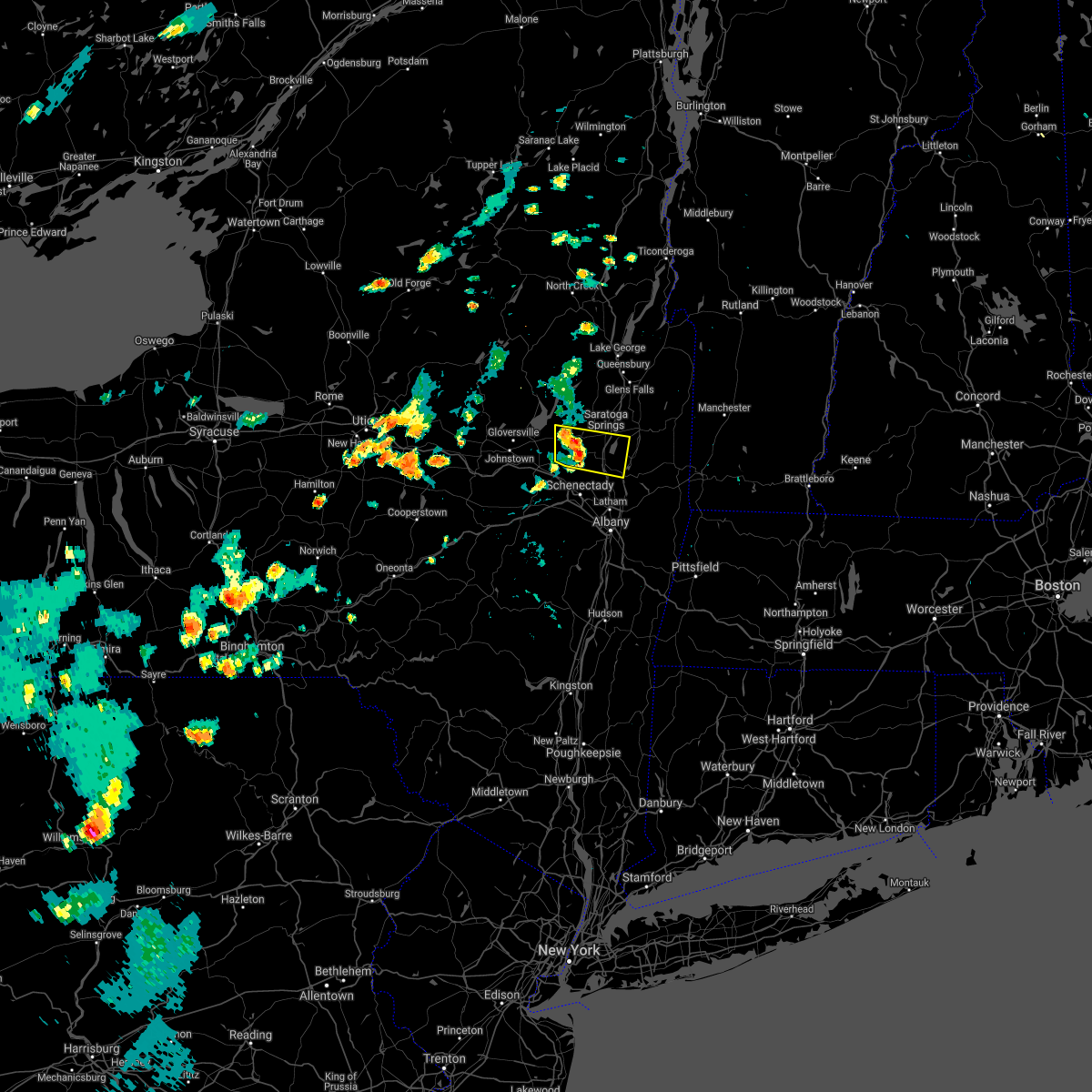 At 433 pm edt, a severe thunderstorm was located near ballston spa, or 9 miles southwest of saratoga springs, moving east at 35 mph (radar indicated). Hazards include 60 mph wind gusts and penny size hail. expect damage to roofs, siding, and trees At 433 pm edt, a severe thunderstorm was located near ballston spa, or 9 miles southwest of saratoga springs, moving east at 35 mph (radar indicated). Hazards include 60 mph wind gusts and penny size hail. expect damage to roofs, siding, and trees
|
| 8/11/2021 4:20 PM EDT |
 At 419 pm edt, a severe thunderstorm was located over fairview, or over poughkeepsie, moving east at 40 mph (radar indicated). Hazards include 60 mph wind gusts and quarter size hail. Hail damage to vehicles is expected. Expect wind damage to roofs, siding, and trees. At 419 pm edt, a severe thunderstorm was located over fairview, or over poughkeepsie, moving east at 40 mph (radar indicated). Hazards include 60 mph wind gusts and quarter size hail. Hail damage to vehicles is expected. Expect wind damage to roofs, siding, and trees.
|
| 7/29/2021 7:56 PM EDT |
 At 756 pm edt, a severe thunderstorm was located near mechanicville, moving east at 45 mph (radar indicated). Hazards include 60 mph wind gusts. Expect damage to roofs, siding, and trees. Locations impacted include, schenectady, bennington, clifton park, saratoga springs, scotia, mechanicville, hoosick falls, arlington, salem, manchester, glenville, niskayuna, ballston spa, shaftsbury, cambridge, greenwich, round lake, rotterdam junction, east glenville and burnt hills. At 756 pm edt, a severe thunderstorm was located near mechanicville, moving east at 45 mph (radar indicated). Hazards include 60 mph wind gusts. Expect damage to roofs, siding, and trees. Locations impacted include, schenectady, bennington, clifton park, saratoga springs, scotia, mechanicville, hoosick falls, arlington, salem, manchester, glenville, niskayuna, ballston spa, shaftsbury, cambridge, greenwich, round lake, rotterdam junction, east glenville and burnt hills.
|
| 7/29/2021 7:41 PM EDT |
 At 741 pm edt, a severe thunderstorm was located over burnt hills, or near scotia, moving east at 85 mph (radar indicated). Hazards include 60 mph wind gusts. expect damage to roofs, siding, and trees At 741 pm edt, a severe thunderstorm was located over burnt hills, or near scotia, moving east at 85 mph (radar indicated). Hazards include 60 mph wind gusts. expect damage to roofs, siding, and trees
|
| 7/27/2021 3:16 PM EDT |
 At 316 pm edt, a severe thunderstorm was located over glenville, or near amsterdam, moving east at 30 mph (radar indicated). Hazards include 60 mph wind gusts and quarter size hail. Hail damage to vehicles is expected. expect wind damage to roofs, siding, and trees. Locations impacted include, schenectady, rotterdam, amsterdam, scotia, fonda, glenville, niskayuna, ballston spa, hagaman, fort johnson, galway, tribes hill, north ballston spa, rotterdam junction, alplaus, east glenville, burnt hills, pattersonville-rotterdam junction, charlton and glen. At 316 pm edt, a severe thunderstorm was located over glenville, or near amsterdam, moving east at 30 mph (radar indicated). Hazards include 60 mph wind gusts and quarter size hail. Hail damage to vehicles is expected. expect wind damage to roofs, siding, and trees. Locations impacted include, schenectady, rotterdam, amsterdam, scotia, fonda, glenville, niskayuna, ballston spa, hagaman, fort johnson, galway, tribes hill, north ballston spa, rotterdam junction, alplaus, east glenville, burnt hills, pattersonville-rotterdam junction, charlton and glen.
|
| 7/27/2021 2:51 PM EDT |
 At 250 pm edt, a severe thunderstorm was located over tribes hill, or over fonda, moving east at 30 mph (radar indicated). Hazards include 60 mph wind gusts and quarter size hail. Hail damage to vehicles is expected. Expect wind damage to roofs, siding, and trees. At 250 pm edt, a severe thunderstorm was located over tribes hill, or over fonda, moving east at 30 mph (radar indicated). Hazards include 60 mph wind gusts and quarter size hail. Hail damage to vehicles is expected. Expect wind damage to roofs, siding, and trees.
|
| 7/20/2021 8:31 PM EDT |
 At 831 pm edt, severe thunderstorms were located along a line extending from near lake george village to near corinth to near galway, moving east at 25 mph (radar indicated). Hazards include 60 mph wind gusts. expect damage to roofs, siding, and trees At 831 pm edt, severe thunderstorms were located along a line extending from near lake george village to near corinth to near galway, moving east at 25 mph (radar indicated). Hazards include 60 mph wind gusts. expect damage to roofs, siding, and trees
|
| 7/17/2021 4:47 PM EDT |
 At 447 pm edt, a severe thunderstorm was located over high falls, or near new paltz, moving northeast at 25 mph (radar indicated). Hazards include 60 mph wind gusts and quarter size hail. Hail damage to vehicles is expected. Expect wind damage to roofs, siding, and trees. At 447 pm edt, a severe thunderstorm was located over high falls, or near new paltz, moving northeast at 25 mph (radar indicated). Hazards include 60 mph wind gusts and quarter size hail. Hail damage to vehicles is expected. Expect wind damage to roofs, siding, and trees.
|
| 7/6/2021 3:56 PM EDT |
 At 356 pm edt, a severe thunderstorm was located over highland, or near poughkeepsie, moving east at 30 mph (radar indicated). Hazards include 70 mph wind gusts and penny size hail. Expect considerable tree damage. damage is likely to mobile homes, roofs, and outbuildings. Locations impacted include, poughkeepsie, new paltz, hyde park, pleasant valley, highland, millbrook, fairview, red oaks mill, stanfordville, staatsburg, tillson, beekman, lloyd, esopus, tuckers corner, salt point, norrie heights, maple hill, knapps corner and lithgow. At 356 pm edt, a severe thunderstorm was located over highland, or near poughkeepsie, moving east at 30 mph (radar indicated). Hazards include 70 mph wind gusts and penny size hail. Expect considerable tree damage. damage is likely to mobile homes, roofs, and outbuildings. Locations impacted include, poughkeepsie, new paltz, hyde park, pleasant valley, highland, millbrook, fairview, red oaks mill, stanfordville, staatsburg, tillson, beekman, lloyd, esopus, tuckers corner, salt point, norrie heights, maple hill, knapps corner and lithgow.
|
| 7/6/2021 3:43 PM EDT |
 At 343 pm edt, a severe thunderstorm was located over high falls, or near new paltz, moving east at 20 mph (radar indicated). Hazards include 60 mph wind gusts and penny size hail. expect damage to roofs, siding, and trees At 343 pm edt, a severe thunderstorm was located over high falls, or near new paltz, moving east at 20 mph (radar indicated). Hazards include 60 mph wind gusts and penny size hail. expect damage to roofs, siding, and trees
|
| 6/30/2021 6:56 PM EDT |
 At 656 pm edt, a severe thunderstorm was located over wappingers falls, or near poughkeepsie, moving east at 25 mph (radar indicated). Hazards include 70 mph wind gusts and quarter size hail. Hail damage to vehicles is expected. expect considerable tree damage. wind damage is also likely to mobile homes, roofs, and outbuildings. Locations impacted include, poughkeepsie, wappingers falls, highland, hopewell junction, marlboro, red oaks mill, myers corner, wingdale, dover plains, beekman, tuckers corner, knapps corner, south dover, hoxie corner, new hamburg, clove valley, south amenia, poughquag, billings and pleasant ridge. At 656 pm edt, a severe thunderstorm was located over wappingers falls, or near poughkeepsie, moving east at 25 mph (radar indicated). Hazards include 70 mph wind gusts and quarter size hail. Hail damage to vehicles is expected. expect considerable tree damage. wind damage is also likely to mobile homes, roofs, and outbuildings. Locations impacted include, poughkeepsie, wappingers falls, highland, hopewell junction, marlboro, red oaks mill, myers corner, wingdale, dover plains, beekman, tuckers corner, knapps corner, south dover, hoxie corner, new hamburg, clove valley, south amenia, poughquag, billings and pleasant ridge.
|
| 6/30/2021 6:34 PM EDT |
 At 634 pm edt, a severe thunderstorm was located over marlboro, or 7 miles southwest of poughkeepsie, moving east at 45 mph (radar indicated). Hazards include 60 mph wind gusts and penny size hail. expect damage to roofs, siding, and trees At 634 pm edt, a severe thunderstorm was located over marlboro, or 7 miles southwest of poughkeepsie, moving east at 45 mph (radar indicated). Hazards include 60 mph wind gusts and penny size hail. expect damage to roofs, siding, and trees
|
| 6/30/2021 2:42 PM EDT |
 At 242 pm edt, severe thunderstorms were located along a line extending from near west glens falls to near hagaman, moving east at 50 mph (radar indicated). Hazards include 60 mph wind gusts. Expect damage to roofs, siding, and trees. Locations impacted include, saratoga springs, amsterdam, glenville, ballston spa, corinth, hagaman, round lake, fort johnson, galway, burnt hills, rock city falls, tribes hill, country knolls, north ballston spa, west glens falls, pattersonville-rotterdam junction, lake luzerne-hadley, east glenville, kings and mount pleasant. At 242 pm edt, severe thunderstorms were located along a line extending from near west glens falls to near hagaman, moving east at 50 mph (radar indicated). Hazards include 60 mph wind gusts. Expect damage to roofs, siding, and trees. Locations impacted include, saratoga springs, amsterdam, glenville, ballston spa, corinth, hagaman, round lake, fort johnson, galway, burnt hills, rock city falls, tribes hill, country knolls, north ballston spa, west glens falls, pattersonville-rotterdam junction, lake luzerne-hadley, east glenville, kings and mount pleasant.
|
| 6/30/2021 2:18 PM EDT |
 At 218 pm edt, severe thunderstorms were located along a line extending from near edinburg to near fonda, moving east at 50 mph (radar indicated). Hazards include 60 mph wind gusts. expect damage to roofs, siding, and trees At 218 pm edt, severe thunderstorms were located along a line extending from near edinburg to near fonda, moving east at 50 mph (radar indicated). Hazards include 60 mph wind gusts. expect damage to roofs, siding, and trees
|
| 6/21/2021 9:30 PM EDT |
 At 928 pm edt, severe thunderstorms were located along a line extending from near fort edward to near country knolls, moving east at 20 mph (emergency management. a few reports of trees and wires downed were received between 845 and 900 pm edt in galway and porters corners). Hazards include 60 mph wind gusts. Expect damage to roofs, siding, and trees. Locations impacted include, schenectady, clifton park, saratoga springs, scotia, mechanicville, niskayuna, ballston spa, fort edward, waterford, round lake, rotterdam junction, east glenville, burnt hills, country knolls, north ballston spa, alplaus, pattersonville-rotterdam junction, gates, halfmoon and malta. At 928 pm edt, severe thunderstorms were located along a line extending from near fort edward to near country knolls, moving east at 20 mph (emergency management. a few reports of trees and wires downed were received between 845 and 900 pm edt in galway and porters corners). Hazards include 60 mph wind gusts. Expect damage to roofs, siding, and trees. Locations impacted include, schenectady, clifton park, saratoga springs, scotia, mechanicville, niskayuna, ballston spa, fort edward, waterford, round lake, rotterdam junction, east glenville, burnt hills, country knolls, north ballston spa, alplaus, pattersonville-rotterdam junction, gates, halfmoon and malta.
|
| 6/21/2021 9:04 PM EDT |
 At 903 pm edt, severe thunderstorms were located along a line extending from near fort edward to east glenville, moving east at 25 mph (emergency management. at 844 pm, trees and wires were reported down in the vicinity of corinth and galway). Hazards include 60 mph wind gusts and penny size hail. Expect damage to roofs, siding, and trees. Locations impacted include, schenectady, clifton park, saratoga springs, scotia, mechanicville, glenville, niskayuna, ballston spa, fort edward, corinth, waterford, round lake, rotterdam junction, east glenville, burnt hills, rock city falls, country knolls, north ballston spa, alplaus and pattersonville-rotterdam junction. At 903 pm edt, severe thunderstorms were located along a line extending from near fort edward to east glenville, moving east at 25 mph (emergency management. at 844 pm, trees and wires were reported down in the vicinity of corinth and galway). Hazards include 60 mph wind gusts and penny size hail. Expect damage to roofs, siding, and trees. Locations impacted include, schenectady, clifton park, saratoga springs, scotia, mechanicville, glenville, niskayuna, ballston spa, fort edward, corinth, waterford, round lake, rotterdam junction, east glenville, burnt hills, rock city falls, country knolls, north ballston spa, alplaus and pattersonville-rotterdam junction.
|
| 6/21/2021 8:43 PM EDT |
 At 842 pm edt, severe thunderstorms were located along a line extending from near corinth to near pattersonville-rotterdam junction, moving east at 20 mph (radar indicated). Hazards include 60 mph wind gusts and quarter size hail. Hail damage to vehicles is expected. Expect wind damage to roofs, siding, and trees. At 842 pm edt, severe thunderstorms were located along a line extending from near corinth to near pattersonville-rotterdam junction, moving east at 20 mph (radar indicated). Hazards include 60 mph wind gusts and quarter size hail. Hail damage to vehicles is expected. Expect wind damage to roofs, siding, and trees.
|
| 6/8/2021 1:42 PM EDT |
 At 142 pm edt, a severe thunderstorm was located over marlboro, or near poughkeepsie, moving northeast at 10 mph (radar indicated). Hazards include 60 mph wind gusts. Expect damage to roofs, siding, and trees. Locations impacted include, poughkeepsie, beacon, pawling, plattekill, wappingers falls, fishkill, hopewell junction, marlboro, red oaks mill, myers corner, wingdale, dover plains, east fishkill, beekman, tuckers corner, stormville, baker corner, knapps corner, south dover and hoxie corner. At 142 pm edt, a severe thunderstorm was located over marlboro, or near poughkeepsie, moving northeast at 10 mph (radar indicated). Hazards include 60 mph wind gusts. Expect damage to roofs, siding, and trees. Locations impacted include, poughkeepsie, beacon, pawling, plattekill, wappingers falls, fishkill, hopewell junction, marlboro, red oaks mill, myers corner, wingdale, dover plains, east fishkill, beekman, tuckers corner, stormville, baker corner, knapps corner, south dover and hoxie corner.
|
| 6/8/2021 1:16 PM EDT |
 At 115 pm edt, a severe thunderstorm was located over marlboro, or near newburgh, moving northeast at 10 mph (radar indicated). Hazards include 60 mph wind gusts. expect damage to roofs, siding, and trees At 115 pm edt, a severe thunderstorm was located over marlboro, or near newburgh, moving northeast at 10 mph (radar indicated). Hazards include 60 mph wind gusts. expect damage to roofs, siding, and trees
|
| 5/26/2021 6:55 PM EDT |
 The severe thunderstorm warning for southeastern ulster and central dutchess counties will expire at 700 pm edt, the storm which prompted the warning has moved out of the area. therefore, the warning will be allowed to expire. a severe thunderstorm watch remains in effect until 800 pm edt for east central new york. The severe thunderstorm warning for southeastern ulster and central dutchess counties will expire at 700 pm edt, the storm which prompted the warning has moved out of the area. therefore, the warning will be allowed to expire. a severe thunderstorm watch remains in effect until 800 pm edt for east central new york.
|
| 5/26/2021 6:32 PM EDT |
 At 632 pm edt, a severe thunderstorm was located over highland, or near poughkeepsie, moving southeast at 50 mph (radar indicated). Hazards include 60 mph wind gusts and quarter size hail. Hail damage to vehicles is expected. expect wind damage to roofs, siding, and trees. Locations impacted include, poughkeepsie, kingston, new paltz, rhinebeck, hyde park, pleasant valley, hurley, amenia, highland, millbrook, high falls, stanfordville, tillson, port ewen, fairview, red oaks mill, staatsburg, dover plains, lloyd and esopus. At 632 pm edt, a severe thunderstorm was located over highland, or near poughkeepsie, moving southeast at 50 mph (radar indicated). Hazards include 60 mph wind gusts and quarter size hail. Hail damage to vehicles is expected. expect wind damage to roofs, siding, and trees. Locations impacted include, poughkeepsie, kingston, new paltz, rhinebeck, hyde park, pleasant valley, hurley, amenia, highland, millbrook, high falls, stanfordville, tillson, port ewen, fairview, red oaks mill, staatsburg, dover plains, lloyd and esopus.
|
| 5/26/2021 5:53 PM EDT |
 At 553 pm edt, a severe thunderstorm was located 7 miles southwest of west shokan, or 12 miles north of ellenville, moving east at 50 mph (radar indicated). Hazards include 60 mph wind gusts and quarter size hail. Hail damage to vehicles is expected. Expect wind damage to roofs, siding, and trees. At 553 pm edt, a severe thunderstorm was located 7 miles southwest of west shokan, or 12 miles north of ellenville, moving east at 50 mph (radar indicated). Hazards include 60 mph wind gusts and quarter size hail. Hail damage to vehicles is expected. Expect wind damage to roofs, siding, and trees.
|
| 4/21/2021 2:04 PM EDT |
 At 203 pm edt, a severe thunderstorm was located near gardnertown, or near newburgh, moving northeast at 40 mph (radar indicated). Hazards include 60 mph wind gusts and quarter size hail. Hail damage to vehicles is expected. Expect wind damage to roofs, siding, and trees. At 203 pm edt, a severe thunderstorm was located near gardnertown, or near newburgh, moving northeast at 40 mph (radar indicated). Hazards include 60 mph wind gusts and quarter size hail. Hail damage to vehicles is expected. Expect wind damage to roofs, siding, and trees.
|
| 11/15/2020 8:18 PM EST |
 At 817 pm est, severe thunderstorms were located along a line extending from near saugerties south to new windsor, moving northeast at 45 mph (radar indicated). Hazards include 60 mph wind gusts. expect damage to roofs, siding, and trees At 817 pm est, severe thunderstorms were located along a line extending from near saugerties south to new windsor, moving northeast at 45 mph (radar indicated). Hazards include 60 mph wind gusts. expect damage to roofs, siding, and trees
|
| 11/15/2020 8:08 PM EST |
 The severe thunderstorm warning for ulster, northwestern dutchess and southern greene counties will expire at 815 pm est, the storms which prompted the warning have weakened below severe limits, and no longer pose an immediate threat to life or property. therefore, the warning will be allowed to expire. a severe thunderstorm watch remains in effect until 200 am est for east central new york. The severe thunderstorm warning for ulster, northwestern dutchess and southern greene counties will expire at 815 pm est, the storms which prompted the warning have weakened below severe limits, and no longer pose an immediate threat to life or property. therefore, the warning will be allowed to expire. a severe thunderstorm watch remains in effect until 200 am est for east central new york.
|
| 11/15/2020 7:51 PM EST |
 At 751 pm est, severe thunderstorms were located along a line extending from 7 miles southeast of prattsville to near bloomingburg, moving northeast at 55 mph (radar indicated). Hazards include 60 mph wind gusts. Expect damage to roofs, siding, and trees. Locations impacted include, poughkeepsie, kingston, new paltz, ellenville, saugerties, wallkill, hyde park, plattekill, hurley, woodstock, highland, high falls, tillson, napanoch, woodland valley campground, phoenicia, mount tremper, olivebridge, modena and kerhonkson. At 751 pm est, severe thunderstorms were located along a line extending from 7 miles southeast of prattsville to near bloomingburg, moving northeast at 55 mph (radar indicated). Hazards include 60 mph wind gusts. Expect damage to roofs, siding, and trees. Locations impacted include, poughkeepsie, kingston, new paltz, ellenville, saugerties, wallkill, hyde park, plattekill, hurley, woodstock, highland, high falls, tillson, napanoch, woodland valley campground, phoenicia, mount tremper, olivebridge, modena and kerhonkson.
|
| 11/15/2020 7:14 PM EST |
 At 712 pm est, severe thunderstorms were located along a line extending from near roscoe to paradise valley, moving northeast at 65 mph (radar indicated). Hazards include 60 mph wind gusts. expect damage to roofs, siding, and trees At 712 pm est, severe thunderstorms were located along a line extending from near roscoe to paradise valley, moving northeast at 65 mph (radar indicated). Hazards include 60 mph wind gusts. expect damage to roofs, siding, and trees
|
| 10/7/2020 4:47 PM EDT |
 At 447 pm edt, a severe thunderstorm was located over pleasant valley, or near poughkeepsie, moving southeast at 35 mph (radar indicated). Hazards include 60 mph wind gusts and penny size hail. expect damage to roofs, siding, and trees At 447 pm edt, a severe thunderstorm was located over pleasant valley, or near poughkeepsie, moving southeast at 35 mph (radar indicated). Hazards include 60 mph wind gusts and penny size hail. expect damage to roofs, siding, and trees
|
| 10/7/2020 3:48 PM EDT |
 At 347 pm edt, severe thunderstorms were located along a line extending from near dorset to 7 miles southwest of cambridge to middleburgh, moving east at 60 mph (radar indicated). Hazards include 70 mph wind gusts. Expect considerable tree damage. damage is likely to mobile homes, roofs, and outbuildings. Locations impacted include, albany, schenectady, troy, bennington, clifton park, rotterdam, saratoga springs, amsterdam, east greenbush, cohoes, north adams, watervliet, rensselaer, colonie, scotia, hudson falls, mechanicville, cobleskill, hoosick falls and bellows falls. At 347 pm edt, severe thunderstorms were located along a line extending from near dorset to 7 miles southwest of cambridge to middleburgh, moving east at 60 mph (radar indicated). Hazards include 70 mph wind gusts. Expect considerable tree damage. damage is likely to mobile homes, roofs, and outbuildings. Locations impacted include, albany, schenectady, troy, bennington, clifton park, rotterdam, saratoga springs, amsterdam, east greenbush, cohoes, north adams, watervliet, rensselaer, colonie, scotia, hudson falls, mechanicville, cobleskill, hoosick falls and bellows falls.
|
| 10/7/2020 3:43 PM EDT |
 At 342 pm edt, severe thunderstorms were located along a line extending from near dorset to 6 miles northeast of mechanicville to near middleburgh, moving east southeast at 60 mph (radar indicated). Hazards include 60 mph wind gusts. Expect damage to roofs, siding, and trees. Locations impacted include, albany, schenectady, troy, bennington, clifton park, rotterdam, saratoga springs, amsterdam, east greenbush, cohoes, north adams, watervliet, rensselaer, colonie, scotia, hudson falls, mechanicville, cobleskill, hoosick falls and bellows falls. At 342 pm edt, severe thunderstorms were located along a line extending from near dorset to 6 miles northeast of mechanicville to near middleburgh, moving east southeast at 60 mph (radar indicated). Hazards include 60 mph wind gusts. Expect damage to roofs, siding, and trees. Locations impacted include, albany, schenectady, troy, bennington, clifton park, rotterdam, saratoga springs, amsterdam, east greenbush, cohoes, north adams, watervliet, rensselaer, colonie, scotia, hudson falls, mechanicville, cobleskill, hoosick falls and bellows falls.
|
| 10/7/2020 3:21 PM EDT |
 At 320 pm edt, severe thunderstorms were located along a line extending from near lake george village to near broadalbin to cooperstown, moving east at 60 mph (radar indicated). Hazards include 70 mph wind gusts. Expect considerable tree damage. Damage is likely to mobile homes, roofs, and outbuildings. At 320 pm edt, severe thunderstorms were located along a line extending from near lake george village to near broadalbin to cooperstown, moving east at 60 mph (radar indicated). Hazards include 70 mph wind gusts. Expect considerable tree damage. Damage is likely to mobile homes, roofs, and outbuildings.
|
| 8/29/2020 5:11 PM EDT |
 At 511 pm edt, a severe thunderstorm capable of producing a tornado was located over round lake, or near mechanicville, moving northeast at 45 mph (radar indicated rotation). Hazards include tornado and quarter size hail. Flying debris will be dangerous to those caught without shelter. mobile homes will be damaged or destroyed. damage to roofs, windows, and vehicles will occur. tree damage is likely. this dangerous storm will be near, greenwich around 530 pm edt. cambridge around 535 pm edt. salem around 545 pm edt. other locations impacted by this tornadic thunderstorm include deans corners, cossayuna, center falls, grangerville, willow glen, northumberland, coons, wayville, middle falls and eagleville. please report hail size, damaging winds and reports of trees down to the national weather service by email at alb. stormreport@noaa. gov, on facebook at www. facebook. Com/nwsalbany or twitter @nwsalbany. At 511 pm edt, a severe thunderstorm capable of producing a tornado was located over round lake, or near mechanicville, moving northeast at 45 mph (radar indicated rotation). Hazards include tornado and quarter size hail. Flying debris will be dangerous to those caught without shelter. mobile homes will be damaged or destroyed. damage to roofs, windows, and vehicles will occur. tree damage is likely. this dangerous storm will be near, greenwich around 530 pm edt. cambridge around 535 pm edt. salem around 545 pm edt. other locations impacted by this tornadic thunderstorm include deans corners, cossayuna, center falls, grangerville, willow glen, northumberland, coons, wayville, middle falls and eagleville. please report hail size, damaging winds and reports of trees down to the national weather service by email at alb. stormreport@noaa. gov, on facebook at www. facebook. Com/nwsalbany or twitter @nwsalbany.
|
| 8/29/2020 4:54 PM EDT |
 At 454 pm edt, severe thunderstorms were located along a line extending from near west glens falls to near galway, moving east at 30 mph (radar indicated). Hazards include 60 mph wind gusts. expect damage to roofs, siding, and trees At 454 pm edt, severe thunderstorms were located along a line extending from near west glens falls to near galway, moving east at 30 mph (radar indicated). Hazards include 60 mph wind gusts. expect damage to roofs, siding, and trees
|
| 8/27/2020 2:31 PM EDT |
 At 231 pm edt, severe thunderstorms were located along a line extending from near ancram to red hook to phoenicia, moving southeast at 50 mph (radar indicated). Hazards include 60 mph wind gusts and quarter size hail. Hail damage to vehicles is expected. Expect wind damage to roofs, siding, and trees. At 231 pm edt, severe thunderstorms were located along a line extending from near ancram to red hook to phoenicia, moving southeast at 50 mph (radar indicated). Hazards include 60 mph wind gusts and quarter size hail. Hail damage to vehicles is expected. Expect wind damage to roofs, siding, and trees.
|
| 7/22/2020 4:28 PM EDT |
 At 428 pm edt, a severe thunderstorm was located over plattekill, or near poughkeepsie, moving northeast at 30 mph (radar indicated). Hazards include 60 mph wind gusts and quarter size hail. Hail damage to vehicles is expected. Expect wind damage to roofs, siding, and trees. At 428 pm edt, a severe thunderstorm was located over plattekill, or near poughkeepsie, moving northeast at 30 mph (radar indicated). Hazards include 60 mph wind gusts and quarter size hail. Hail damage to vehicles is expected. Expect wind damage to roofs, siding, and trees.
|
| 7/19/2020 8:08 PM EDT |
 At 808 pm edt, severe thunderstorms were located along a line extending from near tillson to near new paltz to near ellenville, moving east at 30 mph (radar indicated). Hazards include 60 mph wind gusts. Expect damage to roofs, siding, and trees. severe thunderstorms will be near, new paltz, hurley, tillson and high falls around 815 pm edt. kingston and port ewen around 820 pm edt. highland around 825 pm edt. wallkill, hyde park, fairview, staatsburg and modena around 830 pm edt. poughkeepsie and plattekill around 835 pm edt. red oaks mill and myers corner around 840 pm edt. pleasant valley and marlboro around 845 pm edt. beacon, hopewell junction and stanfordville around 850 pm edt. please report hail size, damaging winds and reports of trees down to the national weather service by email at alb. stormreport@noaa. gov, on facebook at www. facebook. Com/nwsalbany or twitter @nwsalbany. At 808 pm edt, severe thunderstorms were located along a line extending from near tillson to near new paltz to near ellenville, moving east at 30 mph (radar indicated). Hazards include 60 mph wind gusts. Expect damage to roofs, siding, and trees. severe thunderstorms will be near, new paltz, hurley, tillson and high falls around 815 pm edt. kingston and port ewen around 820 pm edt. highland around 825 pm edt. wallkill, hyde park, fairview, staatsburg and modena around 830 pm edt. poughkeepsie and plattekill around 835 pm edt. red oaks mill and myers corner around 840 pm edt. pleasant valley and marlboro around 845 pm edt. beacon, hopewell junction and stanfordville around 850 pm edt. please report hail size, damaging winds and reports of trees down to the national weather service by email at alb. stormreport@noaa. gov, on facebook at www. facebook. Com/nwsalbany or twitter @nwsalbany.
|
| 7/14/2020 2:48 PM EDT | Trees and wires dow in saratoga county NY, 3.9 miles ESE of Milton, NY |
| 7/14/2020 2:10 PM EDT |
 At 209 pm edt, a severe thunderstorm was located near round lake, or 7 miles north of clifton park, moving south at 20 mph (radar indicated). Hazards include 60 mph wind gusts and quarter size hail. Hail damage to vehicles is expected. Expect wind damage to roofs, siding, and trees. At 209 pm edt, a severe thunderstorm was located near round lake, or 7 miles north of clifton park, moving south at 20 mph (radar indicated). Hazards include 60 mph wind gusts and quarter size hail. Hail damage to vehicles is expected. Expect wind damage to roofs, siding, and trees.
|
| 7/11/2020 6:56 PM EDT |
 At 656 pm edt, a severe thunderstorm was located over modena, or near new paltz, moving northeast at 25 mph (radar indicated). Hazards include 60 mph wind gusts and penny size hail. expect damage to roofs, siding, and trees At 656 pm edt, a severe thunderstorm was located over modena, or near new paltz, moving northeast at 25 mph (radar indicated). Hazards include 60 mph wind gusts and penny size hail. expect damage to roofs, siding, and trees
|
| 7/3/2020 4:49 PM EDT |
 At 449 pm edt, a severe thunderstorm was located near pleasant valley, or 7 miles northeast of poughkeepsie, moving south at 20 mph (radar indicated). Hazards include 60 mph wind gusts and penny size hail. Expect damage to roofs, siding, and trees. Locations impacted include, poughkeepsie, beacon, hyde park, pleasant valley, wappingers falls, highland, fishkill, fairview, hopewell junction, marlboro, red oaks mill, myers corner, staatsburg, east fishkill, beekman, lloyd, esopus, stormville, salt point and norrie heights. At 449 pm edt, a severe thunderstorm was located near pleasant valley, or 7 miles northeast of poughkeepsie, moving south at 20 mph (radar indicated). Hazards include 60 mph wind gusts and penny size hail. Expect damage to roofs, siding, and trees. Locations impacted include, poughkeepsie, beacon, hyde park, pleasant valley, wappingers falls, highland, fishkill, fairview, hopewell junction, marlboro, red oaks mill, myers corner, staatsburg, east fishkill, beekman, lloyd, esopus, stormville, salt point and norrie heights.
|
| 7/3/2020 4:22 PM EDT |
 At 421 pm edt, a severe thunderstorm was located over staatsburg, or near rhinebeck, moving south at 30 mph (radar indicated). Hazards include 60 mph wind gusts and penny size hail. expect damage to roofs, siding, and trees At 421 pm edt, a severe thunderstorm was located over staatsburg, or near rhinebeck, moving south at 30 mph (radar indicated). Hazards include 60 mph wind gusts and penny size hail. expect damage to roofs, siding, and trees
|
| 6/29/2020 4:22 PM EDT |
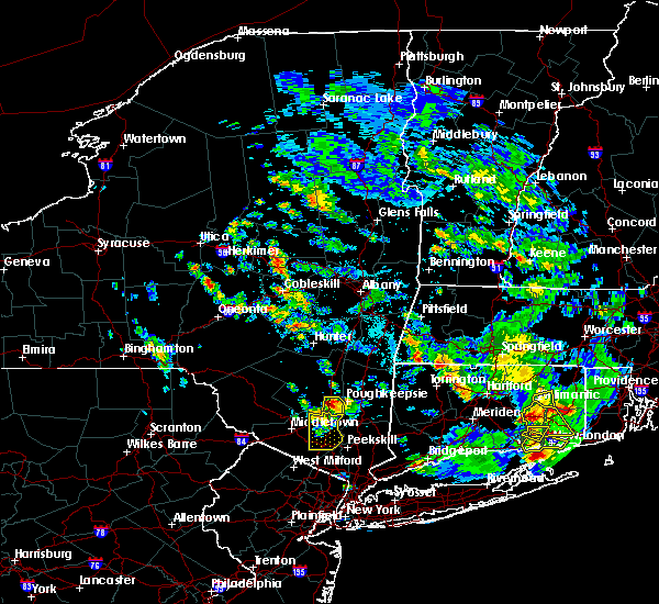 At 421 pm edt, a severe thunderstorm was located over modena, or near new paltz, moving south at 15 mph (radar indicated). Hazards include golf ball size hail and 60 mph wind gusts. People and animals outdoors will be injured. expect hail damage to roofs, siding, windows, and vehicles. expect wind damage to roofs, siding, and trees. Locations impacted include, plattekill, highland, modena, marlboro, barnegat, jenkinstown, oakes, tuckers corner, lattintown, stoneco, clintondale, ardonia, sylva, baileys gap, clintondale station, van keurens and crown heights. At 421 pm edt, a severe thunderstorm was located over modena, or near new paltz, moving south at 15 mph (radar indicated). Hazards include golf ball size hail and 60 mph wind gusts. People and animals outdoors will be injured. expect hail damage to roofs, siding, windows, and vehicles. expect wind damage to roofs, siding, and trees. Locations impacted include, plattekill, highland, modena, marlboro, barnegat, jenkinstown, oakes, tuckers corner, lattintown, stoneco, clintondale, ardonia, sylva, baileys gap, clintondale station, van keurens and crown heights.
|
| 6/29/2020 4:15 PM EDT |
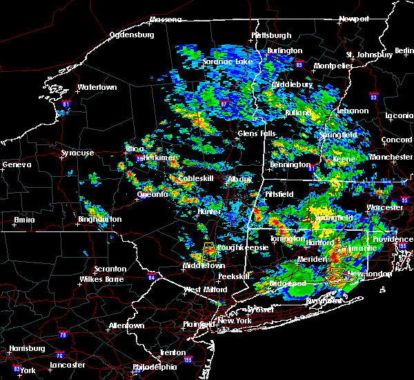 At 414 pm edt, a severe thunderstorm was located near modena, or near new paltz, moving south at 15 mph (radar indicated). Hazards include ping pong ball size hail and 60 mph wind gusts. People and animals outdoors will be injured. expect hail damage to roofs, siding, windows, and vehicles. expect wind damage to roofs, siding, and trees. Locations impacted include, new paltz, plattekill, highland, modena, marlboro, lloyd, barnegat, jenkinstown, oakes, tuckers corner, lattintown, elting corners, ohioville, stoneco, clintondale, ardonia, sylva, baileys gap, clintondale station and putt corners. At 414 pm edt, a severe thunderstorm was located near modena, or near new paltz, moving south at 15 mph (radar indicated). Hazards include ping pong ball size hail and 60 mph wind gusts. People and animals outdoors will be injured. expect hail damage to roofs, siding, windows, and vehicles. expect wind damage to roofs, siding, and trees. Locations impacted include, new paltz, plattekill, highland, modena, marlboro, lloyd, barnegat, jenkinstown, oakes, tuckers corner, lattintown, elting corners, ohioville, stoneco, clintondale, ardonia, sylva, baileys gap, clintondale station and putt corners.
|
| 6/29/2020 4:10 PM EDT |
 At 409 pm edt, a severe thunderstorm was located over new paltz, moving south at 20 mph (radar indicated). Hazards include 60 mph wind gusts and half dollar size hail. Hail damage to vehicles is expected. expect wind damage to roofs, siding, and trees. Locations impacted include, new paltz, plattekill, highland, modena, marlboro, lloyd, barnegat, jenkinstown, oakes, tuckers corner, lattintown, elting corners, ohioville, stoneco, clintondale, ardonia, sylva, baileys gap, clintondale station and putt corners. At 409 pm edt, a severe thunderstorm was located over new paltz, moving south at 20 mph (radar indicated). Hazards include 60 mph wind gusts and half dollar size hail. Hail damage to vehicles is expected. expect wind damage to roofs, siding, and trees. Locations impacted include, new paltz, plattekill, highland, modena, marlboro, lloyd, barnegat, jenkinstown, oakes, tuckers corner, lattintown, elting corners, ohioville, stoneco, clintondale, ardonia, sylva, baileys gap, clintondale station and putt corners.
|
| 6/29/2020 3:52 PM EDT |
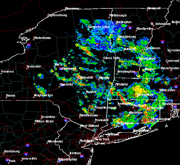 At 352 pm edt, a severe thunderstorm was located near tillson, or near new paltz, moving south at 15 mph (radar indicated). Hazards include quarter size hail. damage to vehicles is expected At 352 pm edt, a severe thunderstorm was located near tillson, or near new paltz, moving south at 15 mph (radar indicated). Hazards include quarter size hail. damage to vehicles is expected
|
| 5/29/2020 6:28 PM EDT |
 At 628 pm edt, severe thunderstorms were located along a line extending from near poultney village to 7 miles north of mechanicville, moving northeast at 50 mph (radar indicated). Hazards include 70 mph wind gusts and quarter size hail. Hail damage to vehicles is expected. expect considerable tree damage. wind damage is also likely to mobile homes, roofs, and outbuildings. these severe storms will be near, granville, poultney village and wells around 635 pm edt. Other locations impacted by these severe thunderstorms include deans corners, glenridge, grangerville, harding crossing, west milton, willow glen, northumberland, garrison manor, wayville and greenfield center. At 628 pm edt, severe thunderstorms were located along a line extending from near poultney village to 7 miles north of mechanicville, moving northeast at 50 mph (radar indicated). Hazards include 70 mph wind gusts and quarter size hail. Hail damage to vehicles is expected. expect considerable tree damage. wind damage is also likely to mobile homes, roofs, and outbuildings. these severe storms will be near, granville, poultney village and wells around 635 pm edt. Other locations impacted by these severe thunderstorms include deans corners, glenridge, grangerville, harding crossing, west milton, willow glen, northumberland, garrison manor, wayville and greenfield center.
|
| 5/29/2020 5:57 PM EDT |
 At 556 pm edt, severe thunderstorms were located along a line extending from near corinth to rotterdam junction, moving northeast at 45 mph (radar indicated). Hazards include 60 mph wind gusts and quarter size hail. Hail damage to vehicles is expected. expect wind damage to roofs, siding, and trees. severe thunderstorms will be near, corinth around 600 pm edt. glens falls, hudson falls, glens falls north, west glens falls and country knolls around 610 pm edt. ballston spa, round lake, north ballston spa and rock city falls around 615 pm edt. milton around 620 pm edt. saratoga springs and comstock around 625 pm edt. poultney village around 640 pm edt. fort edward around 645 pm edt. granville and hartford around 700 pm edt. Other locations impacted by these severe thunderstorms include deans corners, glenridge, grangerville, harding crossing, west milton, willow glen, northumberland, garrison manor, wayville and greenfield center. At 556 pm edt, severe thunderstorms were located along a line extending from near corinth to rotterdam junction, moving northeast at 45 mph (radar indicated). Hazards include 60 mph wind gusts and quarter size hail. Hail damage to vehicles is expected. expect wind damage to roofs, siding, and trees. severe thunderstorms will be near, corinth around 600 pm edt. glens falls, hudson falls, glens falls north, west glens falls and country knolls around 610 pm edt. ballston spa, round lake, north ballston spa and rock city falls around 615 pm edt. milton around 620 pm edt. saratoga springs and comstock around 625 pm edt. poultney village around 640 pm edt. fort edward around 645 pm edt. granville and hartford around 700 pm edt. Other locations impacted by these severe thunderstorms include deans corners, glenridge, grangerville, harding crossing, west milton, willow glen, northumberland, garrison manor, wayville and greenfield center.
|
| 5/29/2020 5:32 PM EDT |
 At 531 pm edt, severe thunderstorms were located along a line extending from near day center to near amsterdam, moving east at 30 mph (radar indicated). Hazards include 60 mph wind gusts and quarter size hail. Hail damage to vehicles is expected. expect wind damage to roofs, siding, and trees. Locations impacted include, saratoga springs, amsterdam, milton, broadalbin, hagaman, edinburg, fort johnson, galway, day center, northampton beach public campground, rock city falls, tribes hill, kings, mount pleasant, greenfield, perth, charleston, parkis mills, west milton and glenwild. At 531 pm edt, severe thunderstorms were located along a line extending from near day center to near amsterdam, moving east at 30 mph (radar indicated). Hazards include 60 mph wind gusts and quarter size hail. Hail damage to vehicles is expected. expect wind damage to roofs, siding, and trees. Locations impacted include, saratoga springs, amsterdam, milton, broadalbin, hagaman, edinburg, fort johnson, galway, day center, northampton beach public campground, rock city falls, tribes hill, kings, mount pleasant, greenfield, perth, charleston, parkis mills, west milton and glenwild.
|
| 5/29/2020 5:03 PM EDT |
 At 503 pm edt, severe thunderstorms were located along a line extending from johnstown to 8 miles southeast of canajoharie, moving northeast at 45 mph (radar indicated). Hazards include 60 mph wind gusts and quarter size hail. Hail damage to vehicles is expected. Expect wind damage to roofs, siding, and trees. At 503 pm edt, severe thunderstorms were located along a line extending from johnstown to 8 miles southeast of canajoharie, moving northeast at 45 mph (radar indicated). Hazards include 60 mph wind gusts and quarter size hail. Hail damage to vehicles is expected. Expect wind damage to roofs, siding, and trees.
|
| 5/15/2020 6:08 PM EDT |
 At 608 pm edt, a severe thunderstorm was located near greenwich, or 10 miles east of saratoga springs, moving east at 50 mph (radar indicated). Hazards include 70 mph wind gusts and quarter size hail. Hail damage to vehicles is expected. expect considerable tree damage. wind damage is also likely to mobile homes, roofs, and outbuildings. Locations impacted include, saratoga springs, glens falls, hudson falls, mechanicville, hoosick falls, salem, glenville, milton, ballston spa, fort edward, cambridge, greenwich, round lake, rotterdam junction, burnt hills, glens falls north, country knolls, north ballston spa, west glens falls and pattersonville-rotterdam junction. At 608 pm edt, a severe thunderstorm was located near greenwich, or 10 miles east of saratoga springs, moving east at 50 mph (radar indicated). Hazards include 70 mph wind gusts and quarter size hail. Hail damage to vehicles is expected. expect considerable tree damage. wind damage is also likely to mobile homes, roofs, and outbuildings. Locations impacted include, saratoga springs, glens falls, hudson falls, mechanicville, hoosick falls, salem, glenville, milton, ballston spa, fort edward, cambridge, greenwich, round lake, rotterdam junction, burnt hills, glens falls north, country knolls, north ballston spa, west glens falls and pattersonville-rotterdam junction.
|
| 5/15/2020 5:42 PM EDT |
 At 541 pm edt, a severe thunderstorm was located near galway, or 12 miles west of saratoga springs, moving east at 55 mph (radar indicated). Hazards include 60 mph wind gusts and quarter size hail. Hail damage to vehicles is expected. Expect wind damage to roofs, siding, and trees. At 541 pm edt, a severe thunderstorm was located near galway, or 12 miles west of saratoga springs, moving east at 55 mph (radar indicated). Hazards include 60 mph wind gusts and quarter size hail. Hail damage to vehicles is expected. Expect wind damage to roofs, siding, and trees.
|
| 4/13/2020 5:34 PM EDT |
 At 534 pm edt, severe thunderstorms were located along a line extending from 6 miles southwest of corinth to pattersonville-rotterdam junction, moving east at 45 mph (radar indicated). Hazards include 60 mph wind gusts. Expect damage to roofs, siding, and trees. Locations impacted include, schenectady, rotterdam, saratoga springs, scotia, glenville, niskayuna, milton, ballston spa, round lake, galway, rotterdam junction, east glenville, burnt hills, rock city falls, country knolls, north ballston spa, alplaus, pattersonville-rotterdam junction, kings and mount pleasant. At 534 pm edt, severe thunderstorms were located along a line extending from 6 miles southwest of corinth to pattersonville-rotterdam junction, moving east at 45 mph (radar indicated). Hazards include 60 mph wind gusts. Expect damage to roofs, siding, and trees. Locations impacted include, schenectady, rotterdam, saratoga springs, scotia, glenville, niskayuna, milton, ballston spa, round lake, galway, rotterdam junction, east glenville, burnt hills, rock city falls, country knolls, north ballston spa, alplaus, pattersonville-rotterdam junction, kings and mount pleasant.
|
| 4/13/2020 5:10 PM EDT |
 At 510 pm edt, severe thunderstorms were located along a line extending from cranberry creek to near fonda, moving east at 45 mph (radar indicated). Hazards include 60 mph wind gusts. expect damage to roofs, siding, and trees At 510 pm edt, severe thunderstorms were located along a line extending from cranberry creek to near fonda, moving east at 45 mph (radar indicated). Hazards include 60 mph wind gusts. expect damage to roofs, siding, and trees
|
| 3/20/2020 4:51 PM EDT |
 The severe thunderstorm warning for central schenectady, northeastern albany, southern saratoga, fulton and northern montgomery counties will expire at 500 pm edt, the severe thunderstorm which prompted the warning has weakened. therefore, the warning will be allowed to expire. The severe thunderstorm warning for central schenectady, northeastern albany, southern saratoga, fulton and northern montgomery counties will expire at 500 pm edt, the severe thunderstorm which prompted the warning has weakened. therefore, the warning will be allowed to expire.
|
| 3/20/2020 4:51 PM EDT |
 The severe thunderstorm warning for northeastern schenectady, northeastern albany, southern saratoga, fulton, southeastern herkimer and northern montgomery counties will expire at 500 pm edt, the severe thunderstorm which prompted the warning has weakened. therefore, the warning will be allowed to expire. The severe thunderstorm warning for northeastern schenectady, northeastern albany, southern saratoga, fulton, southeastern herkimer and northern montgomery counties will expire at 500 pm edt, the severe thunderstorm which prompted the warning has weakened. therefore, the warning will be allowed to expire.
|
| 3/20/2020 4:18 PM EDT |
 At 418 pm edt, a severe thunderstorm was located near stratford, or 10 miles northeast of little falls, moving east at 60 mph (radar indicated). Hazards include 60 mph wind gusts. expect damage to roofs, siding, and trees At 418 pm edt, a severe thunderstorm was located near stratford, or 10 miles northeast of little falls, moving east at 60 mph (radar indicated). Hazards include 60 mph wind gusts. expect damage to roofs, siding, and trees
|
| 3/20/2020 4:16 PM EDT |
 At 415 pm edt, a severe thunderstorm was located near stratford, or 9 miles northeast of little falls, moving east at 60 mph (radar indicated). Hazards include 60 mph wind gusts. expect damage to roofs, siding, and trees At 415 pm edt, a severe thunderstorm was located near stratford, or 9 miles northeast of little falls, moving east at 60 mph (radar indicated). Hazards include 60 mph wind gusts. expect damage to roofs, siding, and trees
|
| 9/23/2019 7:26 PM EDT |
 At 725 pm edt, a severe thunderstorm was located near burnt hills, or 7 miles north of scotia, moving east at 55 mph (radar indicated). Hazards include 60 mph wind gusts. expect damage to roofs, siding, and trees At 725 pm edt, a severe thunderstorm was located near burnt hills, or 7 miles north of scotia, moving east at 55 mph (radar indicated). Hazards include 60 mph wind gusts. expect damage to roofs, siding, and trees
|
| 8/21/2019 3:45 PM EDT |
 At 344 pm edt, severe thunderstorms were located along a line extending from near fort edward to near alplaus, moving east at 25 mph. these are very dangerous storms (radar indicated). Hazards include 80 mph wind gusts and penny size hail. Flying debris will be dangerous to those caught without shelter. mobile homes will be heavily damaged. expect considerable damage to roofs, windows, and vehicles. extensive tree damage and power outages are likely. Locations impacted include, clifton park, saratoga springs, hudson falls, mechanicville, hoosick falls, salem, ballston spa, fort edward, cambridge, greenwich, round lake, burnt hills, country knolls, north ballston spa, gates, malta, hoosick, porter, lee and pittstown. At 344 pm edt, severe thunderstorms were located along a line extending from near fort edward to near alplaus, moving east at 25 mph. these are very dangerous storms (radar indicated). Hazards include 80 mph wind gusts and penny size hail. Flying debris will be dangerous to those caught without shelter. mobile homes will be heavily damaged. expect considerable damage to roofs, windows, and vehicles. extensive tree damage and power outages are likely. Locations impacted include, clifton park, saratoga springs, hudson falls, mechanicville, hoosick falls, salem, ballston spa, fort edward, cambridge, greenwich, round lake, burnt hills, country knolls, north ballston spa, gates, malta, hoosick, porter, lee and pittstown.
|
| 8/21/2019 3:35 PM EDT |
 At 335 pm edt, severe thunderstorms were located along a line extending from near fort edward to alplaus, moving east at 25 mph (radar indicated). Hazards include 70 mph wind gusts and penny size hail. Expect considerable tree damage. damage is likely to mobile homes, roofs, and outbuildings. Locations impacted include, clifton park, saratoga springs, glens falls, hudson falls, mechanicville, hoosick falls, salem, milton, ballston spa, fort edward, cambridge, greenwich, round lake, burnt hills, country knolls, north ballston spa, east glenville, gates, wilton and malta. At 335 pm edt, severe thunderstorms were located along a line extending from near fort edward to alplaus, moving east at 25 mph (radar indicated). Hazards include 70 mph wind gusts and penny size hail. Expect considerable tree damage. damage is likely to mobile homes, roofs, and outbuildings. Locations impacted include, clifton park, saratoga springs, glens falls, hudson falls, mechanicville, hoosick falls, salem, milton, ballston spa, fort edward, cambridge, greenwich, round lake, burnt hills, country knolls, north ballston spa, east glenville, gates, wilton and malta.
|
| 8/21/2019 3:28 PM EDT |
 The national weather service in albany has issued a * severe thunderstorm warning for. northeastern schenectady county in east central new york. eastern saratoga county in east central new york. southern washington county in east central new york. Northern rensselaer county in east central new york. The national weather service in albany has issued a * severe thunderstorm warning for. northeastern schenectady county in east central new york. eastern saratoga county in east central new york. southern washington county in east central new york. Northern rensselaer county in east central new york.
|
| 8/21/2019 3:19 PM EDT |
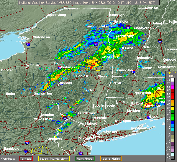 At 319 pm edt, a severe thunderstorm was located over rock city falls, or near saratoga springs, moving east at 25 mph (radar indicated). Hazards include 60 mph wind gusts and penny size hail. Expect damage to roofs, siding, and trees. Locations impacted include, saratoga springs, milton, ballston spa, round lake, galway, north ballston spa, rock city falls, gates, malta, greenfield, stillwater, parkis mills, deans corners, west milton, wayville, halls corner, mannings cove, eddy corners, north milton and saratoga race course. At 319 pm edt, a severe thunderstorm was located over rock city falls, or near saratoga springs, moving east at 25 mph (radar indicated). Hazards include 60 mph wind gusts and penny size hail. Expect damage to roofs, siding, and trees. Locations impacted include, saratoga springs, milton, ballston spa, round lake, galway, north ballston spa, rock city falls, gates, malta, greenfield, stillwater, parkis mills, deans corners, west milton, wayville, halls corner, mannings cove, eddy corners, north milton and saratoga race course.
|
| 8/21/2019 3:00 PM EDT |
 At 259 pm edt, a severe thunderstorm was located over galway, or 9 miles northeast of amsterdam, moving east at 25 mph (radar indicated). Hazards include 60 mph wind gusts and penny size hail. expect damage to roofs, siding, and trees At 259 pm edt, a severe thunderstorm was located over galway, or 9 miles northeast of amsterdam, moving east at 25 mph (radar indicated). Hazards include 60 mph wind gusts and penny size hail. expect damage to roofs, siding, and trees
|
| 8/21/2019 5:25 AM EDT |
 The national weather service in albany has issued a * severe thunderstorm warning for. southeastern saratoga county in east central new york. southwestern washington county in east central new york. northern rensselaer county in east central new york. Until 615 am edt. The national weather service in albany has issued a * severe thunderstorm warning for. southeastern saratoga county in east central new york. southwestern washington county in east central new york. northern rensselaer county in east central new york. Until 615 am edt.
|
| 8/21/2019 5:09 AM EDT |
 At 509 am edt, a severe thunderstorm was located over burnt hills, or near scotia, moving northeast at 45 mph (radar indicated). Hazards include 60 mph wind gusts and quarter size hail. Hail damage to vehicles is expected. expect wind damage to roofs, siding, and trees. Locations impacted include, schenectady, clifton park, rotterdam, saratoga springs, scotia, mechanicville, glenville, niskayuna, milton, duanesburg, ballston spa, round lake, delanson, rotterdam junction, east glenville, burnt hills, country knolls, north ballston spa, alplaus and pattersonville-rotterdam junction. At 509 am edt, a severe thunderstorm was located over burnt hills, or near scotia, moving northeast at 45 mph (radar indicated). Hazards include 60 mph wind gusts and quarter size hail. Hail damage to vehicles is expected. expect wind damage to roofs, siding, and trees. Locations impacted include, schenectady, clifton park, rotterdam, saratoga springs, scotia, mechanicville, glenville, niskayuna, milton, duanesburg, ballston spa, round lake, delanson, rotterdam junction, east glenville, burnt hills, country knolls, north ballston spa, alplaus and pattersonville-rotterdam junction.
|
| 8/21/2019 4:48 AM EDT |
 At 448 am edt, a severe thunderstorm was located near delanson, or 7 miles south of amsterdam, moving east at 40 mph (radar indicated). Hazards include 60 mph wind gusts and penny size hail. expect damage to roofs, siding, and trees At 448 am edt, a severe thunderstorm was located near delanson, or 7 miles south of amsterdam, moving east at 40 mph (radar indicated). Hazards include 60 mph wind gusts and penny size hail. expect damage to roofs, siding, and trees
|
| 8/18/2019 7:19 PM EDT |
 At 718 pm edt, severe thunderstorms were located along a line extending from near westerlo to near north-south lake campground to hurley, moving northeast at 25 mph (radar indicated). Hazards include 60 mph wind gusts. expect damage to roofs, siding, and trees At 718 pm edt, severe thunderstorms were located along a line extending from near westerlo to near north-south lake campground to hurley, moving northeast at 25 mph (radar indicated). Hazards include 60 mph wind gusts. expect damage to roofs, siding, and trees
|
| 8/18/2019 6:14 PM EDT |
 At 613 pm edt, severe thunderstorms were located along a line extending from hobart to monticello, moving east at 30 mph (radar indicated). Hazards include 60 mph wind gusts and quarter size hail. Hail damage to vehicles is expected. Expect wind damage to roofs, siding, and trees. At 613 pm edt, severe thunderstorms were located along a line extending from hobart to monticello, moving east at 30 mph (radar indicated). Hazards include 60 mph wind gusts and quarter size hail. Hail damage to vehicles is expected. Expect wind damage to roofs, siding, and trees.
|
| 8/18/2019 6:12 PM EDT |
 The national weather service in albany has issued a * severe thunderstorm warning for. central saratoga county in east central new york. southwestern washington county in east central new york. until 715 pm edt. At 611 pm edt, a severe thunderstorm was located over milton, or. The national weather service in albany has issued a * severe thunderstorm warning for. central saratoga county in east central new york. southwestern washington county in east central new york. until 715 pm edt. At 611 pm edt, a severe thunderstorm was located over milton, or.
|
| 8/18/2019 5:55 PM EDT |
 At 554 pm edt, a severe thunderstorm was located near rock city falls, or 7 miles northwest of saratoga springs, moving east at 35 mph (radar indicated). Hazards include 60 mph wind gusts and quarter size hail. Hail damage to vehicles is expected. expect wind damage to roofs, siding, and trees. Locations impacted include, corinth, edinburg, rock city falls, greenfield. At 554 pm edt, a severe thunderstorm was located near rock city falls, or 7 miles northwest of saratoga springs, moving east at 35 mph (radar indicated). Hazards include 60 mph wind gusts and quarter size hail. Hail damage to vehicles is expected. expect wind damage to roofs, siding, and trees. Locations impacted include, corinth, edinburg, rock city falls, greenfield.
|
| 8/18/2019 5:20 PM EDT |
 At 519 pm edt, a severe thunderstorm was located near fort johnson, or near amsterdam, moving east at 20 mph (radar indicated). Hazards include 70 mph wind gusts and half dollar size hail. Hail damage to vehicles is expected. expect considerable tree damage. Wind damage is also likely to mobile homes, roofs, and outbuildings. At 519 pm edt, a severe thunderstorm was located near fort johnson, or near amsterdam, moving east at 20 mph (radar indicated). Hazards include 70 mph wind gusts and half dollar size hail. Hail damage to vehicles is expected. expect considerable tree damage. Wind damage is also likely to mobile homes, roofs, and outbuildings.
|
| 8/18/2019 5:11 PM EDT |
 At 510 pm edt, a severe thunderstorm was located near caroga lake public campground, or near gloversville, moving east at 35 mph (radar indicated). Hazards include 70 mph wind gusts and half dollar size hail. Hail damage to vehicles is expected. expect considerable tree damage. Wind damage is also likely to mobile homes, roofs, and outbuildings. At 510 pm edt, a severe thunderstorm was located near caroga lake public campground, or near gloversville, moving east at 35 mph (radar indicated). Hazards include 70 mph wind gusts and half dollar size hail. Hail damage to vehicles is expected. expect considerable tree damage. Wind damage is also likely to mobile homes, roofs, and outbuildings.
|
| 8/17/2019 5:17 PM EDT |
 At 516 pm edt, severe thunderstorms were located along a line extending from near west glens falls to saratoga springs, moving east at 35 mph (radar indicated). Hazards include 60 mph wind gusts and quarter size hail. Hail damage to vehicles is expected. expect wind damage to roofs, siding, and trees. these severe storms will be near, glens falls, glens falls north and west glens falls around 525 pm edt. hudson falls and fort edward around 530 pm edt. Other locations impacted by these severe thunderstorms include parkis mills, deans corners, lake luzerne, grangerville, west milton, glenwild, northumberland, wayville, greenfield center and wiley corners. At 516 pm edt, severe thunderstorms were located along a line extending from near west glens falls to saratoga springs, moving east at 35 mph (radar indicated). Hazards include 60 mph wind gusts and quarter size hail. Hail damage to vehicles is expected. expect wind damage to roofs, siding, and trees. these severe storms will be near, glens falls, glens falls north and west glens falls around 525 pm edt. hudson falls and fort edward around 530 pm edt. Other locations impacted by these severe thunderstorms include parkis mills, deans corners, lake luzerne, grangerville, west milton, glenwild, northumberland, wayville, greenfield center and wiley corners.
|
| 8/17/2019 5:06 PM EDT |
 A severe thunderstorm warning remains in effect until 600 pm edt for southeastern warren. saratoga. southeastern fulton and southwestern washington counties. At 506 pm edt, severe thunderstorms were located along a line extending from lake luzerne-hadley to rock city falls, moving east at 35 mph. A severe thunderstorm warning remains in effect until 600 pm edt for southeastern warren. saratoga. southeastern fulton and southwestern washington counties. At 506 pm edt, severe thunderstorms were located along a line extending from lake luzerne-hadley to rock city falls, moving east at 35 mph.
|
| 8/17/2019 4:55 PM EDT |
 At 454 pm edt, severe thunderstorms were located along a line extending from near day center to galway, moving east at 35 mph (radar indicated). Hazards include 60 mph wind gusts and penny size hail. Expect damage to roofs, siding, and trees. severe thunderstorms will be near, ballston spa around 505 pm edt. milton, corinth, north ballston spa, lake luzerne-hadley and lake luzerne campground around 510 pm edt. saratoga springs around 520 pm edt. glens falls, west glens falls and glens falls north around 525 pm edt. Hudson falls and fort edward around 530 pm edt. At 454 pm edt, severe thunderstorms were located along a line extending from near day center to galway, moving east at 35 mph (radar indicated). Hazards include 60 mph wind gusts and penny size hail. Expect damage to roofs, siding, and trees. severe thunderstorms will be near, ballston spa around 505 pm edt. milton, corinth, north ballston spa, lake luzerne-hadley and lake luzerne campground around 510 pm edt. saratoga springs around 520 pm edt. glens falls, west glens falls and glens falls north around 525 pm edt. Hudson falls and fort edward around 530 pm edt.
|
| 8/8/2019 6:16 PM EDT |
 At 615 pm edt, severe thunderstorms were located along a line extending from near falls village to plattekill, moving east at 40 mph (trained weather spotters). Hazards include 60 mph wind gusts. Expect damage to roofs, siding, and trees. these severe storms will be near, falls village and cornwall bridge around 620 pm edt. norfolk around 625 pm edt. torrington and myers corner around 630 pm edt. fishkill around 635 pm edt. hopewell junction and winsted around 640 pm edt. canton, new hartford, new hartford center and northwest harwinton around 645 pm edt. Other locations impacted by these severe thunderstorms include south canaan, lithgow, hoxie corner, wrightville, salisbury, south amenia, pleasant ridge, east litchfield, washington hollow and plymouth green. At 615 pm edt, severe thunderstorms were located along a line extending from near falls village to plattekill, moving east at 40 mph (trained weather spotters). Hazards include 60 mph wind gusts. Expect damage to roofs, siding, and trees. these severe storms will be near, falls village and cornwall bridge around 620 pm edt. norfolk around 625 pm edt. torrington and myers corner around 630 pm edt. fishkill around 635 pm edt. hopewell junction and winsted around 640 pm edt. canton, new hartford, new hartford center and northwest harwinton around 645 pm edt. Other locations impacted by these severe thunderstorms include south canaan, lithgow, hoxie corner, wrightville, salisbury, south amenia, pleasant ridge, east litchfield, washington hollow and plymouth green.
|
| 8/8/2019 5:53 PM EDT |
 The severe thunderstorm warning for central saratoga county will expire at 600 pm edt, the storm which prompted the warning has moved out of the area. therefore, the warning will be allowed to expire. a severe thunderstorm watch remains in effect until 800 pm edt for east central new york. remember, a severe thunderstorm warning still remains in effect for southeastern saratoga county until 615 pm. The severe thunderstorm warning for central saratoga county will expire at 600 pm edt, the storm which prompted the warning has moved out of the area. therefore, the warning will be allowed to expire. a severe thunderstorm watch remains in effect until 800 pm edt for east central new york. remember, a severe thunderstorm warning still remains in effect for southeastern saratoga county until 615 pm.
|
| 8/8/2019 5:48 PM EDT |
 At 547 pm edt, severe thunderstorms were located along a line extending from near pine plains to near ellenville, moving east at 40 mph (trained weather spotters reported trees and wires down near glasco and kingston). Hazards include 60 mph wind gusts. Expect damage to roofs, siding, and trees. severe thunderstorms will be near, pine plains around 555 pm edt. amenia and millerton around 600 pm edt. sharon around 605 pm edt. wallkill and modena around 610 pm edt. plattekill, falls village and cornwall bridge around 615 pm edt. beacon, norfolk and marlboro around 625 pm edt. torrington, wappingers falls, fishkill and myers corner around 630 pm edt. hopewell junction and winsted around 635 pm edt. Other locations impacted by these severe thunderstorms include norrie heights, atwood, lithgow, hoxie corner, south amenia, pleasant ridge, jackson corners, verbank, bulls bridge and dempsey landing. At 547 pm edt, severe thunderstorms were located along a line extending from near pine plains to near ellenville, moving east at 40 mph (trained weather spotters reported trees and wires down near glasco and kingston). Hazards include 60 mph wind gusts. Expect damage to roofs, siding, and trees. severe thunderstorms will be near, pine plains around 555 pm edt. amenia and millerton around 600 pm edt. sharon around 605 pm edt. wallkill and modena around 610 pm edt. plattekill, falls village and cornwall bridge around 615 pm edt. beacon, norfolk and marlboro around 625 pm edt. torrington, wappingers falls, fishkill and myers corner around 630 pm edt. hopewell junction and winsted around 635 pm edt. Other locations impacted by these severe thunderstorms include norrie heights, atwood, lithgow, hoxie corner, south amenia, pleasant ridge, jackson corners, verbank, bulls bridge and dempsey landing.
|
| 8/8/2019 5:46 PM EDT |
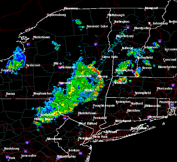 At 546 pm edt, a severe thunderstorm was located near rock city falls, or near saratoga springs, moving northeast at 35 mph (trained weather spotters). Hazards include 60 mph wind gusts and quarter size hail. Hail damage to vehicles is expected. expect wind damage to roofs, siding, and trees. this severe storm will be near, saratoga springs around 550 pm edt. corinth around 555 pm edt. Other locations impacted by this severe thunderstorm include milton center, hickeys corners, kings station, west milton, kings, greenfield center, wiley corners, north greenfield, yaddo and porter corners. At 546 pm edt, a severe thunderstorm was located near rock city falls, or near saratoga springs, moving northeast at 35 mph (trained weather spotters). Hazards include 60 mph wind gusts and quarter size hail. Hail damage to vehicles is expected. expect wind damage to roofs, siding, and trees. this severe storm will be near, saratoga springs around 550 pm edt. corinth around 555 pm edt. Other locations impacted by this severe thunderstorm include milton center, hickeys corners, kings station, west milton, kings, greenfield center, wiley corners, north greenfield, yaddo and porter corners.
|
| 8/8/2019 5:36 PM EDT |
 At 536 pm edt, severe thunderstorms were located along a line extending from near ballston spa to near mechanicville to troy, moving east at 50 mph (radar indicated). Hazards include 60 mph wind gusts and quarter size hail. Hail damage to vehicles is expected. Expect wind damage to roofs, siding, and trees. At 536 pm edt, severe thunderstorms were located along a line extending from near ballston spa to near mechanicville to troy, moving east at 50 mph (radar indicated). Hazards include 60 mph wind gusts and quarter size hail. Hail damage to vehicles is expected. Expect wind damage to roofs, siding, and trees.
|
| 8/8/2019 5:13 PM EDT |
 At 512 pm edt, a severe thunderstorm was located near hagaman, or near amsterdam, moving northeast at 35 mph (trained weather spotters reported trees down near amsterdam). Hazards include 60 mph wind gusts and quarter size hail. Hail damage to vehicles is expected. expect wind damage to roofs, siding, and trees. this severe thunderstorm will be near, glenville around 520 pm edt. galway around 525 pm edt. milton, ballston spa, rock city falls and north ballston spa around 540 pm edt. saratoga springs around 555 pm edt. corinth around 600 pm edt. Other locations impacted by this severe thunderstorm include parkis mills, deans corners, west perth, munsonville, shaw corners, church corners, kings station, barkersville, west milton and glenwild. At 512 pm edt, a severe thunderstorm was located near hagaman, or near amsterdam, moving northeast at 35 mph (trained weather spotters reported trees down near amsterdam). Hazards include 60 mph wind gusts and quarter size hail. Hail damage to vehicles is expected. expect wind damage to roofs, siding, and trees. this severe thunderstorm will be near, glenville around 520 pm edt. galway around 525 pm edt. milton, ballston spa, rock city falls and north ballston spa around 540 pm edt. saratoga springs around 555 pm edt. corinth around 600 pm edt. Other locations impacted by this severe thunderstorm include parkis mills, deans corners, west perth, munsonville, shaw corners, church corners, kings station, barkersville, west milton and glenwild.
|
| 7/30/2019 5:52 PM EDT |
 At 551 pm edt, severe thunderstorms were located along a line extending from lake george village to ballston spa, moving northeast at 25 mph (radar indicated). Hazards include 70 mph wind gusts and quarter size hail. Hail damage to vehicles is expected. expect considerable tree damage. wind damage is also likely to mobile homes, roofs, and outbuildings. Locations impacted include, saratoga springs, glens falls, hudson falls, lake george village, milton, ballston spa, fort edward, corinth, greenwich, comstock, rock city falls, glens falls north, north ballston spa, west glens falls, lake luzerne campground, kings, gates, queensbury, wilton and malta. At 551 pm edt, severe thunderstorms were located along a line extending from lake george village to ballston spa, moving northeast at 25 mph (radar indicated). Hazards include 70 mph wind gusts and quarter size hail. Hail damage to vehicles is expected. expect considerable tree damage. wind damage is also likely to mobile homes, roofs, and outbuildings. Locations impacted include, saratoga springs, glens falls, hudson falls, lake george village, milton, ballston spa, fort edward, corinth, greenwich, comstock, rock city falls, glens falls north, north ballston spa, west glens falls, lake luzerne campground, kings, gates, queensbury, wilton and malta.
|
| 7/30/2019 5:44 PM EDT |
 At 544 pm edt, severe thunderstorms were located along a line extending from near lake george village to near ballston spa, moving northeast at 20 mph (radar indicated). Hazards include 60 mph wind gusts and quarter size hail. Hail damage to vehicles is expected. expect wind damage to roofs, siding, and trees. Locations impacted include, saratoga springs, glens falls, hudson falls, lake george village, milton, ballston spa, fort edward, corinth, greenwich, round lake, comstock, burnt hills, rock city falls, glens falls north, north ballston spa, west glens falls, lake luzerne campground, kings, mount pleasant and gates. At 544 pm edt, severe thunderstorms were located along a line extending from near lake george village to near ballston spa, moving northeast at 20 mph (radar indicated). Hazards include 60 mph wind gusts and quarter size hail. Hail damage to vehicles is expected. expect wind damage to roofs, siding, and trees. Locations impacted include, saratoga springs, glens falls, hudson falls, lake george village, milton, ballston spa, fort edward, corinth, greenwich, round lake, comstock, burnt hills, rock city falls, glens falls north, north ballston spa, west glens falls, lake luzerne campground, kings, mount pleasant and gates.
|
| 7/30/2019 5:23 PM EDT |
 The national weather service in albany has issued a * severe thunderstorm warning for. southeastern warren county in east central new york. saratoga county in east central new york. southwestern washington county in east central new york. Until 630 pm edt. The national weather service in albany has issued a * severe thunderstorm warning for. southeastern warren county in east central new york. saratoga county in east central new york. southwestern washington county in east central new york. Until 630 pm edt.
|
| 7/29/2019 8:57 PM EDT |
 At 857 pm edt, severe thunderstorms were located along a line extending from near galway to colonie, moving northeast at 15 mph (radar indicated). Hazards include 60 mph wind gusts and penny size hail. expect damage to roofs, siding, and trees At 857 pm edt, severe thunderstorms were located along a line extending from near galway to colonie, moving northeast at 15 mph (radar indicated). Hazards include 60 mph wind gusts and penny size hail. expect damage to roofs, siding, and trees
|
| 7/29/2019 7:08 PM EDT |
 The severe thunderstorm warning for southeastern ulster and west central dutchess counties will expire at 715 pm edt, the storm which prompted the warning has weakened below severe limits, and has exited the warned area. therefore, the warning will be allowed to expire. however gusty winds and heavy rain are still possible with this thunderstorm. The severe thunderstorm warning for southeastern ulster and west central dutchess counties will expire at 715 pm edt, the storm which prompted the warning has weakened below severe limits, and has exited the warned area. therefore, the warning will be allowed to expire. however gusty winds and heavy rain are still possible with this thunderstorm.
|
| 7/29/2019 6:45 PM EDT |
 At 645 pm edt, a severe thunderstorm was located over highland, or near poughkeepsie, moving east at 15 mph (radar indicated). Hazards include 70 mph wind gusts and quarter size hail. Hail damage to vehicles is expected. expect considerable tree damage. wind damage is also likely to mobile homes, roofs, and outbuildings. Locations impacted include, poughkeepsie, hyde park, highland, fairview, red oaks mill, lloyd, oakes, macdonnell heights, highland landing, plutarch, titusville, elting corners, haviland, rombout ridge, manchester bridge, clintondale, colonial heights, baileys gap, dongan place and arlington. At 645 pm edt, a severe thunderstorm was located over highland, or near poughkeepsie, moving east at 15 mph (radar indicated). Hazards include 70 mph wind gusts and quarter size hail. Hail damage to vehicles is expected. expect considerable tree damage. wind damage is also likely to mobile homes, roofs, and outbuildings. Locations impacted include, poughkeepsie, hyde park, highland, fairview, red oaks mill, lloyd, oakes, macdonnell heights, highland landing, plutarch, titusville, elting corners, haviland, rombout ridge, manchester bridge, clintondale, colonial heights, baileys gap, dongan place and arlington.
|
| 7/29/2019 6:28 PM EDT |
 At 628 pm edt, a severe thunderstorm was located over hyde park, or near poughkeepsie, moving east at 15 mph (radar indicated). Hazards include 60 mph wind gusts and penny size hail. expect damage to roofs, siding, and trees At 628 pm edt, a severe thunderstorm was located over hyde park, or near poughkeepsie, moving east at 15 mph (radar indicated). Hazards include 60 mph wind gusts and penny size hail. expect damage to roofs, siding, and trees
|
| 7/20/2019 8:16 PM EDT |
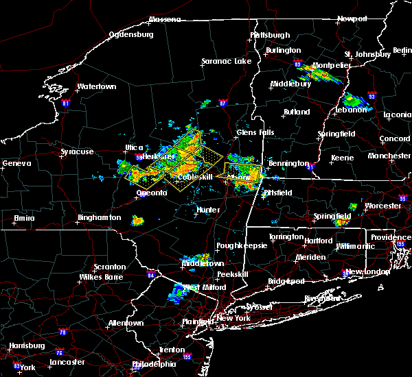 At 816 pm edt, a severe thunderstorm was located over cranberry creek, or 8 miles northeast of gloversville, moving southeast at 30 mph (radar indicated). Hazards include 60 mph wind gusts. expect damage to roofs, siding, and trees At 816 pm edt, a severe thunderstorm was located over cranberry creek, or 8 miles northeast of gloversville, moving southeast at 30 mph (radar indicated). Hazards include 60 mph wind gusts. expect damage to roofs, siding, and trees
|
| 7/20/2019 7:31 PM EDT |
 At 730 pm edt, a severe thunderstorm was located over clifton park, moving east at 30 mph (radar indicated). Hazards include 60 mph wind gusts. Expect damage to roofs, siding, and trees. Locations impacted include, schenectady, clifton park, rotterdam, scotia, mechanicville, glenville, niskayuna, duanesburg, ballston spa, waterford, broadalbin, round lake, galway, rotterdam junction, east glenville, burnt hills, country knolls, north ballston spa, alplaus and pattersonville-rotterdam junction. At 730 pm edt, a severe thunderstorm was located over clifton park, moving east at 30 mph (radar indicated). Hazards include 60 mph wind gusts. Expect damage to roofs, siding, and trees. Locations impacted include, schenectady, clifton park, rotterdam, scotia, mechanicville, glenville, niskayuna, duanesburg, ballston spa, waterford, broadalbin, round lake, galway, rotterdam junction, east glenville, burnt hills, country knolls, north ballston spa, alplaus and pattersonville-rotterdam junction.
|
| 7/20/2019 6:53 PM EDT |
 At 653 pm edt, a severe thunderstorm was located over amsterdam, moving east at 30 mph (radar indicated). Hazards include 60 mph wind gusts. expect damage to roofs, siding, and trees At 653 pm edt, a severe thunderstorm was located over amsterdam, moving east at 30 mph (radar indicated). Hazards include 60 mph wind gusts. expect damage to roofs, siding, and trees
|
| 6/30/2019 1:32 PM EDT |
 At 132 pm edt, a severe thunderstorm was located over wappingers falls, or near poughkeepsie, moving southeast at 30 mph (radar indicated). Hazards include 60 mph wind gusts and quarter size hail. Hail damage to vehicles is expected. expect wind damage to roofs, siding, and trees. this severe thunderstorm will be near, beacon and myers corner around 140 pm edt. fishkill and hopewell junction around 145 pm edt. Other locations impacted by this severe thunderstorm include tuckers corner, stormville, knapps corner, new hamburg, glenham, stoneco, chelsea, wiccopee, colonial heights and groveville. At 132 pm edt, a severe thunderstorm was located over wappingers falls, or near poughkeepsie, moving southeast at 30 mph (radar indicated). Hazards include 60 mph wind gusts and quarter size hail. Hail damage to vehicles is expected. expect wind damage to roofs, siding, and trees. this severe thunderstorm will be near, beacon and myers corner around 140 pm edt. fishkill and hopewell junction around 145 pm edt. Other locations impacted by this severe thunderstorm include tuckers corner, stormville, knapps corner, new hamburg, glenham, stoneco, chelsea, wiccopee, colonial heights and groveville.
|
| 6/26/2019 7:57 PM EDT |
 At 757 pm edt, severe thunderstorms were located along a line extending from near millbrook to near gardnertown, moving east at 25 mph (radar indicated). Hazards include 60 mph wind gusts. Expect damage to roofs, siding, and trees. Locations impacted include, poughkeepsie, beacon, pawling, wallkill, hyde park, plattekill, pleasant valley, wappingers falls, highland, fishkill, millbrook, modena, fairview, hopewell junction, marlboro, red oaks mill, myers corner, wingdale, dover plains and east fishkill. At 757 pm edt, severe thunderstorms were located along a line extending from near millbrook to near gardnertown, moving east at 25 mph (radar indicated). Hazards include 60 mph wind gusts. Expect damage to roofs, siding, and trees. Locations impacted include, poughkeepsie, beacon, pawling, wallkill, hyde park, plattekill, pleasant valley, wappingers falls, highland, fishkill, millbrook, modena, fairview, hopewell junction, marlboro, red oaks mill, myers corner, wingdale, dover plains and east fishkill.
|
| 6/26/2019 7:52 PM EDT | Downed tree closed us hwy 9w southbound in ulster county NY, 0.6 miles NW of Milton, NY |
| 6/26/2019 7:32 PM EDT |
 At 731 pm edt, severe thunderstorms were located along a line extending from near pleasant valley to walden, moving east at 40 mph (radar indicated). Hazards include 60 mph wind gusts. expect damage to roofs, siding, and trees At 731 pm edt, severe thunderstorms were located along a line extending from near pleasant valley to walden, moving east at 40 mph (radar indicated). Hazards include 60 mph wind gusts. expect damage to roofs, siding, and trees
|
| 5/23/2019 9:12 PM EDT |
 At 911 pm edt, a severe thunderstorm was located over fonda, moving east at 40 mph (radar indicated). Hazards include 60 mph wind gusts. expect damage to roofs, siding, and trees At 911 pm edt, a severe thunderstorm was located over fonda, moving east at 40 mph (radar indicated). Hazards include 60 mph wind gusts. expect damage to roofs, siding, and trees
|
| 5/23/2019 8:42 PM EDT |
 At 842 pm edt, a severe thunderstorm was located near galway, or 12 miles west of saratoga springs, moving southeast at 35 mph (radar indicated). Hazards include 60 mph wind gusts. expect damage to roofs, siding, and trees At 842 pm edt, a severe thunderstorm was located near galway, or 12 miles west of saratoga springs, moving southeast at 35 mph (radar indicated). Hazards include 60 mph wind gusts. expect damage to roofs, siding, and trees
|
| 4/15/2019 4:22 AM EDT |
 At 422 am edt, a severe thunderstorm was located over fairview, or over poughkeepsie, moving northeast at 50 mph (radar indicated). Hazards include 60 mph wind gusts and quarter size hail. Hail damage to vehicles is expected. Expect wind damage to roofs, siding, and trees. At 422 am edt, a severe thunderstorm was located over fairview, or over poughkeepsie, moving northeast at 50 mph (radar indicated). Hazards include 60 mph wind gusts and quarter size hail. Hail damage to vehicles is expected. Expect wind damage to roofs, siding, and trees.
|
| 9/26/2018 5:10 PM EDT | Tree down on wires at armer road and shaw hill road in saratoga county NY, 5.6 miles ESE of Milton, NY |
| 9/5/2018 5:39 PM EDT |
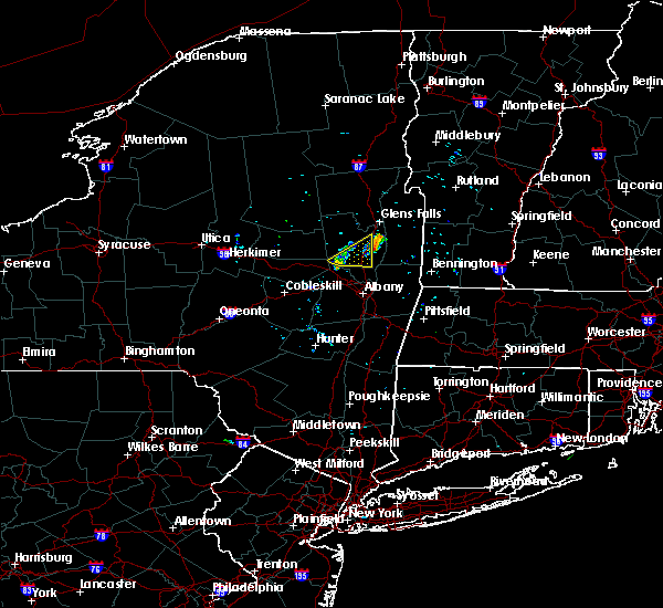 At 538 pm edt, a severe thunderstorm was located over milton, or over saratoga springs, moving east at 30 mph (radar indicated). Hazards include 60 mph wind gusts and penny size hail. Expect damage to roofs, siding, and trees. This severe thunderstorm will remain over mainly rural areas of central saratoga county, including the following locations, maltaville, holsapple corners, gurn spring, malta ridge, francis corners, milton center, kings station, west milton, greenfield center and malta. At 538 pm edt, a severe thunderstorm was located over milton, or over saratoga springs, moving east at 30 mph (radar indicated). Hazards include 60 mph wind gusts and penny size hail. Expect damage to roofs, siding, and trees. This severe thunderstorm will remain over mainly rural areas of central saratoga county, including the following locations, maltaville, holsapple corners, gurn spring, malta ridge, francis corners, milton center, kings station, west milton, greenfield center and malta.
|
| 9/5/2018 4:55 PM EDT |
 At 455 pm edt, a severe thunderstorm was located over broadalbin, or near gloversville, moving east at 25 mph (radar indicated). Hazards include 60 mph wind gusts and penny size hail. Expect damage to roofs, siding, and trees. this severe thunderstorm will be near, hagaman around 505 pm edt. galway around 515 pm edt. rock city falls around 530 pm edt. milton, ballston spa and north ballston spa around 535 pm edt. Saratoga springs and round lake around 545 pm edt. At 455 pm edt, a severe thunderstorm was located over broadalbin, or near gloversville, moving east at 25 mph (radar indicated). Hazards include 60 mph wind gusts and penny size hail. Expect damage to roofs, siding, and trees. this severe thunderstorm will be near, hagaman around 505 pm edt. galway around 515 pm edt. rock city falls around 530 pm edt. milton, ballston spa and north ballston spa around 535 pm edt. Saratoga springs and round lake around 545 pm edt.
|
| 8/17/2018 6:52 PM EDT |
 At 650 pm edt, severe thunderstorms were located along a line extending from ballston spa to near country knolls to near guilderland to 6 miles southeast of westerlo to near windham, moving east at 40 mph (radar indicated). Hazards include 60 mph wind gusts and quarter size hail. Hail damage to vehicles is expected. expect wind damage to roofs, siding, and trees. these severe storms will be near, albany, clifton park, colonie, delmar, guilderland, milton, ballston spa, round lake, north ballston spa and country knolls around 655 pm edt. saratoga springs, rensselaer, mechanicville, latham, menands, new baltimore, ravena, loudonville and selkirk around 700 pm edt. cohoes, watervliet, green island, waterford, castleton-on-hudson and wyantskill around 705 pm edt. troy, center brunswick, west sand lake and averill park around 710 pm edt. East greenbush, nassau, coxsackie, grafton, cambridge and greenwich around 715 pm edt. At 650 pm edt, severe thunderstorms were located along a line extending from ballston spa to near country knolls to near guilderland to 6 miles southeast of westerlo to near windham, moving east at 40 mph (radar indicated). Hazards include 60 mph wind gusts and quarter size hail. Hail damage to vehicles is expected. expect wind damage to roofs, siding, and trees. these severe storms will be near, albany, clifton park, colonie, delmar, guilderland, milton, ballston spa, round lake, north ballston spa and country knolls around 655 pm edt. saratoga springs, rensselaer, mechanicville, latham, menands, new baltimore, ravena, loudonville and selkirk around 700 pm edt. cohoes, watervliet, green island, waterford, castleton-on-hudson and wyantskill around 705 pm edt. troy, center brunswick, west sand lake and averill park around 710 pm edt. East greenbush, nassau, coxsackie, grafton, cambridge and greenwich around 715 pm edt.
|
| 8/17/2018 6:22 PM EDT |
 At 621 pm edt, severe thunderstorms were located along a line extending from near amsterdam to near duanesburg to near berne to near preston-potter hollow to near fleischmanns, moving east at 40 mph (radar indicated). Hazards include 60 mph wind gusts and quarter size hail. Hail damage to vehicles is expected. expect wind damage to roofs, siding, and trees. severe thunderstorms will be near, amsterdam, duanesburg, berne, delanson and pattersonville-rotterdam junction around 625 pm edt. rotterdam, glenville and rotterdam junction around 630 pm edt. schenectady, scotia, niskayuna, altamont, alplaus and east glenville around 635 pm edt. westerlo, voorheesville, burnt hills and feura bush around 640 pm edt. clifton park, guilderland, ballston spa, north ballston spa and country knolls around 645 pm edt. albany, colonie, delmar, milton and round lake around 650 pm edt. saratoga springs, rensselaer, mechanicville, latham, new baltimore, ravena and loudonville around 655 pm edt. Cohoes, watervliet, menands, green island, selkirk and wyantskill around 700 pm edt. At 621 pm edt, severe thunderstorms were located along a line extending from near amsterdam to near duanesburg to near berne to near preston-potter hollow to near fleischmanns, moving east at 40 mph (radar indicated). Hazards include 60 mph wind gusts and quarter size hail. Hail damage to vehicles is expected. expect wind damage to roofs, siding, and trees. severe thunderstorms will be near, amsterdam, duanesburg, berne, delanson and pattersonville-rotterdam junction around 625 pm edt. rotterdam, glenville and rotterdam junction around 630 pm edt. schenectady, scotia, niskayuna, altamont, alplaus and east glenville around 635 pm edt. westerlo, voorheesville, burnt hills and feura bush around 640 pm edt. clifton park, guilderland, ballston spa, north ballston spa and country knolls around 645 pm edt. albany, colonie, delmar, milton and round lake around 650 pm edt. saratoga springs, rensselaer, mechanicville, latham, new baltimore, ravena and loudonville around 655 pm edt. Cohoes, watervliet, menands, green island, selkirk and wyantskill around 700 pm edt.
|
| 8/7/2018 1:29 PM EDT |
 At 128 pm edt, a severe thunderstorm was located over pattersonville-rotterdam junction, or near scotia, moving east at 30 mph (radar indicated). Hazards include 60 mph wind gusts. Expect damage to roofs, siding, and trees. this severe thunderstorm will be near, scotia around 135 pm edt. schenectady, niskayuna, east glenville around 140 pm edt. burnt hills around 145 pm edt. clifton park, ballston spa, country knolls and north ballston spa around 150 pm edt. round lake around 155 pm edt. mechanicville around 205 pm edt. Other locations impacted by this severe thunderstorm include deans corners, glenridge, hoffmans, harding crossing, willow glen, coons, garrison manor, wayville, aqueduct and woodruff heights. At 128 pm edt, a severe thunderstorm was located over pattersonville-rotterdam junction, or near scotia, moving east at 30 mph (radar indicated). Hazards include 60 mph wind gusts. Expect damage to roofs, siding, and trees. this severe thunderstorm will be near, scotia around 135 pm edt. schenectady, niskayuna, east glenville around 140 pm edt. burnt hills around 145 pm edt. clifton park, ballston spa, country knolls and north ballston spa around 150 pm edt. round lake around 155 pm edt. mechanicville around 205 pm edt. Other locations impacted by this severe thunderstorm include deans corners, glenridge, hoffmans, harding crossing, willow glen, coons, garrison manor, wayville, aqueduct and woodruff heights.
|
| 8/4/2018 6:52 PM EDT |
 The severe thunderstorm warning for southeastern saratoga, southwestern washington and northern rensselaer counties will expire at 700 pm edt, the storm which prompted the warning has weakened below severe limits, and has exited the warned area. therefore, the warning will be allowed to expire. another severe thunderstorm warning remains in effect for southern rensselaer county until 730 pm. The severe thunderstorm warning for southeastern saratoga, southwestern washington and northern rensselaer counties will expire at 700 pm edt, the storm which prompted the warning has weakened below severe limits, and has exited the warned area. therefore, the warning will be allowed to expire. another severe thunderstorm warning remains in effect for southern rensselaer county until 730 pm.
|
| 8/4/2018 6:10 PM EDT |
 At 610 pm edt, a severe thunderstorm was located near mechanicville, moving southeast at 25 mph (radar indicated). Hazards include 60 mph wind gusts and quarter size hail. Hail damage to vehicles is expected. expect wind damage to roofs, siding, and trees. this severe thunderstorm will be near, mechanicville around 615 pm edt. hoosick falls around 650 pm edt. grafton around 655 pm edt. Other locations impacted by this severe thunderstorm include deans corners, schaghticoke hill, center white creek, hoosick junction, johnsonville, willow glen, coons, wayville, schaghticoke and barberville. At 610 pm edt, a severe thunderstorm was located near mechanicville, moving southeast at 25 mph (radar indicated). Hazards include 60 mph wind gusts and quarter size hail. Hail damage to vehicles is expected. expect wind damage to roofs, siding, and trees. this severe thunderstorm will be near, mechanicville around 615 pm edt. hoosick falls around 650 pm edt. grafton around 655 pm edt. Other locations impacted by this severe thunderstorm include deans corners, schaghticoke hill, center white creek, hoosick junction, johnsonville, willow glen, coons, wayville, schaghticoke and barberville.
|
| 8/3/2018 3:54 PM EDT |
 At 354 pm edt, a severe thunderstorm was located over red oaks mill, or near poughkeepsie, moving north at 35 mph (radar indicated). Hazards include 70 mph wind gusts and quarter size hail. Hail damage to vehicles is expected. expect considerable tree damage. wind damage is also likely to mobile homes, roofs, and outbuildings. this severe storm will be near, poughkeepsie, highland and fairview around 405 pm edt. hyde park and pleasant valley around 410 pm edt. staatsburg around 420 pm edt. kingston, rhinebeck and port ewen around 430 pm edt. red hook and lake katrine around 440 pm edt. saugerties south around 445 pm edt. saugerties around 450 pm edt. Other locations impacted by this severe thunderstorm include norrie heights, maple hill, atwood, lithgow, katsbaan, shultis corners, pacama, hoxie corner, linden acres and elting corners. At 354 pm edt, a severe thunderstorm was located over red oaks mill, or near poughkeepsie, moving north at 35 mph (radar indicated). Hazards include 70 mph wind gusts and quarter size hail. Hail damage to vehicles is expected. expect considerable tree damage. wind damage is also likely to mobile homes, roofs, and outbuildings. this severe storm will be near, poughkeepsie, highland and fairview around 405 pm edt. hyde park and pleasant valley around 410 pm edt. staatsburg around 420 pm edt. kingston, rhinebeck and port ewen around 430 pm edt. red hook and lake katrine around 440 pm edt. saugerties south around 445 pm edt. saugerties around 450 pm edt. Other locations impacted by this severe thunderstorm include norrie heights, maple hill, atwood, lithgow, katsbaan, shultis corners, pacama, hoxie corner, linden acres and elting corners.
|
| 8/3/2018 3:36 PM EDT |
 At 336 pm edt, a severe thunderstorm was located near fahnestock state park, or near beacon, moving north at 35 mph (radar indicated). Hazards include 60 mph wind gusts and quarter size hail. Hail damage to vehicles is expected. expect wind damage to roofs, siding, and trees. this severe thunderstorm will be near, fishkill around 345 pm edt. wappingers falls, hopewell junction and marlboro around 350 pm edt. myers corner around 355 pm edt. red oaks mill around 400 pm edt. poughkeepsie and fairview around 405 pm edt. pleasant valley and highland around 410 pm edt. hyde park around 415 pm edt. staatsburg and stanfordville around 425 pm edt. Other locations impacted by this severe thunderstorm include norrie heights, maple hill, atwood, lithgow, katsbaan, shultis corners, pacama, hoxie corner, linden acres and elting corners. At 336 pm edt, a severe thunderstorm was located near fahnestock state park, or near beacon, moving north at 35 mph (radar indicated). Hazards include 60 mph wind gusts and quarter size hail. Hail damage to vehicles is expected. expect wind damage to roofs, siding, and trees. this severe thunderstorm will be near, fishkill around 345 pm edt. wappingers falls, hopewell junction and marlboro around 350 pm edt. myers corner around 355 pm edt. red oaks mill around 400 pm edt. poughkeepsie and fairview around 405 pm edt. pleasant valley and highland around 410 pm edt. hyde park around 415 pm edt. staatsburg and stanfordville around 425 pm edt. Other locations impacted by this severe thunderstorm include norrie heights, maple hill, atwood, lithgow, katsbaan, shultis corners, pacama, hoxie corner, linden acres and elting corners.
|
| 7/28/2018 2:52 PM EDT |
 At 252 pm edt, a severe thunderstorm was located over marlboro, or near poughkeepsie, moving northeast at 20 mph (radar indicated). Hazards include 60 mph wind gusts and quarter size hail. Hail damage to vehicles is expected. expect wind damage to roofs, siding, and trees. this severe thunderstorm will be near, wappingers falls around 255 pm edt. poughkeepsie and myers corner around 305 pm edt. red oaks mill around 310 pm edt. pleasant valley and hopewell junction around 315 pm edt. Other locations impacted by this severe thunderstorm include stormville, lattintown, knapps corner, freedom plains, beekman, swartoutville, green haven, titusville, new hamburg and crown heights. At 252 pm edt, a severe thunderstorm was located over marlboro, or near poughkeepsie, moving northeast at 20 mph (radar indicated). Hazards include 60 mph wind gusts and quarter size hail. Hail damage to vehicles is expected. expect wind damage to roofs, siding, and trees. this severe thunderstorm will be near, wappingers falls around 255 pm edt. poughkeepsie and myers corner around 305 pm edt. red oaks mill around 310 pm edt. pleasant valley and hopewell junction around 315 pm edt. Other locations impacted by this severe thunderstorm include stormville, lattintown, knapps corner, freedom plains, beekman, swartoutville, green haven, titusville, new hamburg and crown heights.
|
| 7/27/2018 5:23 PM EDT |
 At 523 pm edt, a severe thunderstorm was located over hyde park, or 7 miles north of poughkeepsie, moving northeast at 40 mph (radar indicated). Hazards include 60 mph wind gusts and quarter size hail. Hail damage to vehicles is expected. expect wind damage to roofs, siding, and trees. this severe thunderstorm will be near, millbrook and stanfordville around 540 pm edt. amenia and pine plains around 550 pm edt. sharon and millerton around 555 pm edt. falls village around 605 pm edt. sheffield, canaan and ashley falls around 615 pm edt. norfolk around 620 pm edt. sandisfield around 630 pm edt. Other locations impacted by this severe thunderstorm include salt point, ancramdale, norrie heights, south canaan, maple hill, lithgow, hillside, salisbury, smithfield and alander. At 523 pm edt, a severe thunderstorm was located over hyde park, or 7 miles north of poughkeepsie, moving northeast at 40 mph (radar indicated). Hazards include 60 mph wind gusts and quarter size hail. Hail damage to vehicles is expected. expect wind damage to roofs, siding, and trees. this severe thunderstorm will be near, millbrook and stanfordville around 540 pm edt. amenia and pine plains around 550 pm edt. sharon and millerton around 555 pm edt. falls village around 605 pm edt. sheffield, canaan and ashley falls around 615 pm edt. norfolk around 620 pm edt. sandisfield around 630 pm edt. Other locations impacted by this severe thunderstorm include salt point, ancramdale, norrie heights, south canaan, maple hill, lithgow, hillside, salisbury, smithfield and alander.
|
| 7/17/2018 1:25 PM EDT |
 At 125 pm edt, severe thunderstorms were located along a line extending from near livingston to near pine plains to near pleasant valley to newburgh, moving east at 40 mph (radar indicated). Hazards include 60 mph wind gusts. Expect damage to roofs, siding, and trees. severe thunderstorms will be near, pine plains and stanfordville around 130 pm edt. ancram and millbrook around 135 pm edt. copake, millerton and hopewell junction around 140 pm edt. amenia and dover plains around 145 pm edt. pawling around 155 pm edt. Other locations impacted by these severe thunderstorms include tuckers corner, salt point, ancramdale, norrie heights, kerleys corners, baker corner, beekman, lithgow, hoxie corner and linden acres. At 125 pm edt, severe thunderstorms were located along a line extending from near livingston to near pine plains to near pleasant valley to newburgh, moving east at 40 mph (radar indicated). Hazards include 60 mph wind gusts. Expect damage to roofs, siding, and trees. severe thunderstorms will be near, pine plains and stanfordville around 130 pm edt. ancram and millbrook around 135 pm edt. copake, millerton and hopewell junction around 140 pm edt. amenia and dover plains around 145 pm edt. pawling around 155 pm edt. Other locations impacted by these severe thunderstorms include tuckers corner, salt point, ancramdale, norrie heights, kerleys corners, baker corner, beekman, lithgow, hoxie corner and linden acres.
|
| 6/18/2018 6:48 PM EDT |
 At 648 pm edt, a severe thunderstorm was located over marlboro, or near beacon, moving east at 45 mph (radar indicated). Hazards include 60 mph wind gusts. Expect damage to roofs, siding, and trees. this severe thunderstorm will be near, myers corner around 655 pm edt. hopewell junction around 700 pm edt. pawling and wingdale around 715 pm edt. Other locations impacted by this severe thunderstorm include tuckers corner, stormville, baker corner, knapps corner, beekman, south dover, new hamburg, glenham, clove valley and poughquag. At 648 pm edt, a severe thunderstorm was located over marlboro, or near beacon, moving east at 45 mph (radar indicated). Hazards include 60 mph wind gusts. Expect damage to roofs, siding, and trees. this severe thunderstorm will be near, myers corner around 655 pm edt. hopewell junction around 700 pm edt. pawling and wingdale around 715 pm edt. Other locations impacted by this severe thunderstorm include tuckers corner, stormville, baker corner, knapps corner, beekman, south dover, new hamburg, glenham, clove valley and poughquag.
|
| 5/15/2018 4:27 PM EDT |
 The severe thunderstorm warning for eastern ulster county will expire at 430 pm edt, the storms which prompted the warning have moved out of the area. therefore, the warning will be allowed to expire. a tornado watch remains in effect until 800 pm edt for east central new york. The severe thunderstorm warning for eastern ulster county will expire at 430 pm edt, the storms which prompted the warning have moved out of the area. therefore, the warning will be allowed to expire. a tornado watch remains in effect until 800 pm edt for east central new york.
|
| 5/15/2018 4:17 PM EDT |
 At 417 pm edt, severe thunderstorms were located along a line extending from near west hurley to beacon, moving east at 60 mph (radar indicated). Hazards include 70 mph wind gusts and quarter size hail. Hail damage to vehicles is expected. expect considerable tree damage. wind damage is also likely to mobile homes, roofs, and outbuildings. these severe storms will be near, saugerties around 420 pm edt. saugerties south around 425 pm edt. other locations impacted by these severe thunderstorms include tuckers corner, rolling meadows, rosendale, maple hill, glenford, forest glen, atwood, katsbaan, shultis corners and sweet meadows. A tornado watch remains in effect until 800 pm edt for east central new york. At 417 pm edt, severe thunderstorms were located along a line extending from near west hurley to beacon, moving east at 60 mph (radar indicated). Hazards include 70 mph wind gusts and quarter size hail. Hail damage to vehicles is expected. expect considerable tree damage. wind damage is also likely to mobile homes, roofs, and outbuildings. these severe storms will be near, saugerties around 420 pm edt. saugerties south around 425 pm edt. other locations impacted by these severe thunderstorms include tuckers corner, rolling meadows, rosendale, maple hill, glenford, forest glen, atwood, katsbaan, shultis corners and sweet meadows. A tornado watch remains in effect until 800 pm edt for east central new york.
|
| 5/15/2018 4:15 PM EDT |
 At 414 pm edt, a severe thunderstorm capable of producing a tornado was located near plattekill, or near poughkeepsie, moving east at 65 mph (radar indicated rotation). Hazards include tornado and quarter size hail. Flying debris will be dangerous to those caught without shelter. mobile homes will be damaged or destroyed. damage to roofs, windows, and vehicles will occur. tree damage is likely. this dangerous storm will be near, poughkeepsie, myers corner and fairview around 420 pm edt. pleasant valley, red oaks mill and hopewell junction around 425 pm edt. millbrook, dover plains and wingdale around 435 pm edt. Other locations impacted by this tornadic thunderstorm include tuckers corner, salt point, baker corner, beekman, lithgow, hoxie corner, smithfield, south amenia, pleasant ridge and bains corner. At 414 pm edt, a severe thunderstorm capable of producing a tornado was located near plattekill, or near poughkeepsie, moving east at 65 mph (radar indicated rotation). Hazards include tornado and quarter size hail. Flying debris will be dangerous to those caught without shelter. mobile homes will be damaged or destroyed. damage to roofs, windows, and vehicles will occur. tree damage is likely. this dangerous storm will be near, poughkeepsie, myers corner and fairview around 420 pm edt. pleasant valley, red oaks mill and hopewell junction around 425 pm edt. millbrook, dover plains and wingdale around 435 pm edt. Other locations impacted by this tornadic thunderstorm include tuckers corner, salt point, baker corner, beekman, lithgow, hoxie corner, smithfield, south amenia, pleasant ridge and bains corner.
|
| 5/15/2018 4:07 PM EDT |
 At 407 pm edt, a severe thunderstorm capable of producing a tornado was located over wallkill, or near walden, moving east at 50 mph (radar indicated rotation). Hazards include tornado and quarter size hail. Flying debris will be dangerous to those caught without shelter. mobile homes will be damaged or destroyed. damage to roofs, windows, and vehicles will occur. tree damage is likely. this dangerous storm will be near, modena around 410 pm edt. plattekill and marlboro around 415 pm edt. Other locations impacted by this tornadic thunderstorm include tuckers corner, forest glen, dwaarkill, fantinekill, awosting, elting corners, ireland corners, stoneco, honk hill and sylva. At 407 pm edt, a severe thunderstorm capable of producing a tornado was located over wallkill, or near walden, moving east at 50 mph (radar indicated rotation). Hazards include tornado and quarter size hail. Flying debris will be dangerous to those caught without shelter. mobile homes will be damaged or destroyed. damage to roofs, windows, and vehicles will occur. tree damage is likely. this dangerous storm will be near, modena around 410 pm edt. plattekill and marlboro around 415 pm edt. Other locations impacted by this tornadic thunderstorm include tuckers corner, forest glen, dwaarkill, fantinekill, awosting, elting corners, ireland corners, stoneco, honk hill and sylva.
|
| 5/15/2018 3:51 PM EDT |
 At 350 pm edt, a severe thunderstorm capable of producing a tornado was located over phillipsport, or 8 miles southwest of ellenville, moving east at 65 mph (radar indicated rotation). Hazards include tornado and quarter size hail. Flying debris will be dangerous to those caught without shelter. mobile homes will be damaged or destroyed. damage to roofs, windows, and vehicles will occur. tree damage is likely. this dangerous storm will be near, ellenville around 355 pm edt. wallkill around 405 pm edt. plattekill and modena around 410 pm edt. marlboro around 415 pm edt. Other locations impacted by this tornadic thunderstorm include tuckers corner, forest glen, dwaarkill, fantinekill, awosting, elting corners, ireland corners, cragsmoor, stoneco and honk hill. At 350 pm edt, a severe thunderstorm capable of producing a tornado was located over phillipsport, or 8 miles southwest of ellenville, moving east at 65 mph (radar indicated rotation). Hazards include tornado and quarter size hail. Flying debris will be dangerous to those caught without shelter. mobile homes will be damaged or destroyed. damage to roofs, windows, and vehicles will occur. tree damage is likely. this dangerous storm will be near, ellenville around 355 pm edt. wallkill around 405 pm edt. plattekill and modena around 410 pm edt. marlboro around 415 pm edt. Other locations impacted by this tornadic thunderstorm include tuckers corner, forest glen, dwaarkill, fantinekill, awosting, elting corners, ireland corners, cragsmoor, stoneco and honk hill.
|
| 5/15/2018 3:42 PM EDT |
 At 342 pm edt, severe thunderstorms were located along a line extending from near willowemoc to otisville, moving east at 55 mph (radar indicated). Hazards include 70 mph wind gusts and quarter size hail. Hail damage to vehicles is expected. expect considerable tree damage. wind damage is also likely to mobile homes, roofs, and outbuildings. severe thunderstorms will be near, west shokan, woodland valley campground and phoenicia around 400 pm edt. kenneth l wilson campground, mount tremper and olivebridge around 405 pm edt. woodstock and west hurley around 410 pm edt. hurley and marlboro around 415 pm edt. kingston, saugerties, lake katrine, saugerties south and port ewen around 420 pm edt. other locations impacted by these severe thunderstorms include cherrytown, tuckers corner, rolling meadows, maple hill, glenford, atwood, katsbaan, shultis corners, sweet meadows and pacama. A tornado watch remains in effect until 800 pm edt for east central new york. At 342 pm edt, severe thunderstorms were located along a line extending from near willowemoc to otisville, moving east at 55 mph (radar indicated). Hazards include 70 mph wind gusts and quarter size hail. Hail damage to vehicles is expected. expect considerable tree damage. wind damage is also likely to mobile homes, roofs, and outbuildings. severe thunderstorms will be near, west shokan, woodland valley campground and phoenicia around 400 pm edt. kenneth l wilson campground, mount tremper and olivebridge around 405 pm edt. woodstock and west hurley around 410 pm edt. hurley and marlboro around 415 pm edt. kingston, saugerties, lake katrine, saugerties south and port ewen around 420 pm edt. other locations impacted by these severe thunderstorms include cherrytown, tuckers corner, rolling meadows, maple hill, glenford, atwood, katsbaan, shultis corners, sweet meadows and pacama. A tornado watch remains in effect until 800 pm edt for east central new york.
|
| 5/4/2018 8:14 PM EDT |
 At 813 pm edt, severe thunderstorms were located along a line extending from near hague to near fort edward to near mechanicville, moving east at 70 mph (radar indicated). Hazards include 60 mph wind gusts. Expect damage to roofs, siding, and trees. these severe storms will be near, salem and west haven around 820 pm edt. cambridge around 830 pm edt. A tornado watch remains in effect until 1000 pm edt for east central new york. At 813 pm edt, severe thunderstorms were located along a line extending from near hague to near fort edward to near mechanicville, moving east at 70 mph (radar indicated). Hazards include 60 mph wind gusts. Expect damage to roofs, siding, and trees. these severe storms will be near, salem and west haven around 820 pm edt. cambridge around 830 pm edt. A tornado watch remains in effect until 1000 pm edt for east central new york.
|
| 5/4/2018 7:50 PM EDT |
 At 749 pm edt, severe thunderstorms were located along a line extending from near eagle point campground to 7 miles north of rock city falls to fort johnson, moving east at 55 mph (radar indicated). Hazards include 60 mph wind gusts. Expect damage to roofs, siding, and trees. severe thunderstorms will be near, eagle point campground around 755 pm edt. saratoga springs and corinth around 800 pm edt. hague and huletts landing around 805 pm edt. milton, ballston spa, country knolls and north ballston spa around 810 pm edt. greenwich, round lake and west haven around 815 pm edt. salem around 825 pm edt. A tornado watch remains in effect until 1000 pm edt for eastern and east central new york. At 749 pm edt, severe thunderstorms were located along a line extending from near eagle point campground to 7 miles north of rock city falls to fort johnson, moving east at 55 mph (radar indicated). Hazards include 60 mph wind gusts. Expect damage to roofs, siding, and trees. severe thunderstorms will be near, eagle point campground around 755 pm edt. saratoga springs and corinth around 800 pm edt. hague and huletts landing around 805 pm edt. milton, ballston spa, country knolls and north ballston spa around 810 pm edt. greenwich, round lake and west haven around 815 pm edt. salem around 825 pm edt. A tornado watch remains in effect until 1000 pm edt for eastern and east central new york.
|
| 10/24/2017 3:15 PM EDT |
 At 314 pm edt, severe thunderstorms were located along a line extending from 6 miles southeast of corinth to waterford, moving north at 70 mph (radar indicated). Hazards include 60 mph wind gusts. Expect damage to trees, and power lines. Locations impacted include, troy, clifton park, saratoga springs, cohoes, glens falls, watervliet, rensselaer, hudson falls, mechanicville, hoosick falls, nassau, milton, menands, fort edward, stephentown, green island, grafton, waterford, berlin and cambridge. At 314 pm edt, severe thunderstorms were located along a line extending from 6 miles southeast of corinth to waterford, moving north at 70 mph (radar indicated). Hazards include 60 mph wind gusts. Expect damage to trees, and power lines. Locations impacted include, troy, clifton park, saratoga springs, cohoes, glens falls, watervliet, rensselaer, hudson falls, mechanicville, hoosick falls, nassau, milton, menands, fort edward, stephentown, green island, grafton, waterford, berlin and cambridge.
|
| 10/24/2017 2:54 PM EDT |
 At 254 pm edt, severe thunderstorms were located along a line extending from near cohoes to near coxsackie, moving north at 45 mph (radar indicated). Hazards include 60 mph wind gusts. Expect damage to trees, and power lines. severe thunderstorms will be near, clifton park around 300 pm edt. mechanicville, round lake and country knolls around 305 pm edt. ravena around 310 pm edt. castleton-on-hudson, selkirk and feura bush around 315 pm edt. east greenbush, delmar and greenwich around 325 pm edt. albany, rensselaer, colonie, menands, loudonville, wyantskill and west sand lake around 330 pm edt. watervliet, latham and green island around 335 pm edt. troy, cohoes, glens falls, fort edward, waterford and center brunswick around 340 pm edt. Other locations impacted by these severe thunderstorms include parkis mills, deans corners, shakers, bleecker stadium, brookview, glenridge, van hoesen station, grangerville, northumberland and beckers corners. At 254 pm edt, severe thunderstorms were located along a line extending from near cohoes to near coxsackie, moving north at 45 mph (radar indicated). Hazards include 60 mph wind gusts. Expect damage to trees, and power lines. severe thunderstorms will be near, clifton park around 300 pm edt. mechanicville, round lake and country knolls around 305 pm edt. ravena around 310 pm edt. castleton-on-hudson, selkirk and feura bush around 315 pm edt. east greenbush, delmar and greenwich around 325 pm edt. albany, rensselaer, colonie, menands, loudonville, wyantskill and west sand lake around 330 pm edt. watervliet, latham and green island around 335 pm edt. troy, cohoes, glens falls, fort edward, waterford and center brunswick around 340 pm edt. Other locations impacted by these severe thunderstorms include parkis mills, deans corners, shakers, bleecker stadium, brookview, glenridge, van hoesen station, grangerville, northumberland and beckers corners.
|
| 9/5/2017 4:53 PM EDT |
 At 453 pm edt, a severe thunderstorm was located near duanesburg, or near scotia, moving northeast at 35 mph (radar indicated). Hazards include 60 mph wind gusts and quarter size hail. Minor damage to vehicles is possible. expect wind damage to trees, and power lines. this severe thunderstorm will be near, schenectady, rotterdam and scotia around 505 pm edt. niskayuna, east glenville, alplaus and burnt hills around 510 pm edt. clifton park around 515 pm edt. ballston spa, country knolls and north ballston spa around 520 pm edt. mechanicville and round lake around 525 pm edt. Other locations impacted by this severe thunderstorm include deans corners, glenridge, hoffmans, grangerville, harding crossing, gifford, willow glen, coons, garrison manor and wayville. At 453 pm edt, a severe thunderstorm was located near duanesburg, or near scotia, moving northeast at 35 mph (radar indicated). Hazards include 60 mph wind gusts and quarter size hail. Minor damage to vehicles is possible. expect wind damage to trees, and power lines. this severe thunderstorm will be near, schenectady, rotterdam and scotia around 505 pm edt. niskayuna, east glenville, alplaus and burnt hills around 510 pm edt. clifton park around 515 pm edt. ballston spa, country knolls and north ballston spa around 520 pm edt. mechanicville and round lake around 525 pm edt. Other locations impacted by this severe thunderstorm include deans corners, glenridge, hoffmans, grangerville, harding crossing, gifford, willow glen, coons, garrison manor and wayville.
|
| 8/22/2017 10:01 PM EDT |
 At 1000 pm edt, a severe thunderstorm was located over myers corner, or near poughkeepsie, moving east at 35 mph (radar indicated). Hazards include 60 mph wind gusts and penny size hail. Expect damage to trees, and power lines. This severe storm will be near, wingdale, poughkeepsie and dover plains around 1025 pm edt. At 1000 pm edt, a severe thunderstorm was located over myers corner, or near poughkeepsie, moving east at 35 mph (radar indicated). Hazards include 60 mph wind gusts and penny size hail. Expect damage to trees, and power lines. This severe storm will be near, wingdale, poughkeepsie and dover plains around 1025 pm edt.
|
| 8/22/2017 9:23 PM EDT |
 At 922 pm edt, a severe thunderstorm was located near montgomery, or near walden, moving east at 35 mph (radar indicated). Hazards include 60 mph wind gusts and penny size hail. Expect damage to trees, and power lines. this severe thunderstorm will be near, wallkill around 935 pm edt. plattekill and modena around 940 pm edt. beacon and marlboro around 950 pm edt. wappingers falls, fishkill and fairview around 955 pm edt. poughkeepsie, myers corner and red oaks mill around 1000 pm edt. hopewell junction around 1005 pm edt. pawling around 1020 pm edt. Wingdale and dover plains around 1025 pm edt. At 922 pm edt, a severe thunderstorm was located near montgomery, or near walden, moving east at 35 mph (radar indicated). Hazards include 60 mph wind gusts and penny size hail. Expect damage to trees, and power lines. this severe thunderstorm will be near, wallkill around 935 pm edt. plattekill and modena around 940 pm edt. beacon and marlboro around 950 pm edt. wappingers falls, fishkill and fairview around 955 pm edt. poughkeepsie, myers corner and red oaks mill around 1000 pm edt. hopewell junction around 1005 pm edt. pawling around 1020 pm edt. Wingdale and dover plains around 1025 pm edt.
|
| 8/22/2017 6:18 PM EDT |
 At 617 pm edt, severe thunderstorms were located along a line extending from near day center to edinburg to fort johnson, moving southeast at 40 mph (radar indicated). Hazards include 60 mph wind gusts. Expect damage to trees, and power lines. these severe storms will be near, lake luzerne-hadle and lake luzerne campground around 625 pm edt. corinth around 630 pm edt. rock city falls around 635 pm edt. glens falls, milton, ballston spa, west glens falls, glens falls north and north ballston spa around 640 pm edt. saratoga springs around 645 pm edt. other locations impacted by these severe thunderstorms include parkis mills, meco, west perth, girards sugarbush, sweets crossing, lake luzerne, west milton, glenwild, greenfield center and wiley corners. A tornado watch remains in effect until 900 pm edt for eastern and east central new york. At 617 pm edt, severe thunderstorms were located along a line extending from near day center to edinburg to fort johnson, moving southeast at 40 mph (radar indicated). Hazards include 60 mph wind gusts. Expect damage to trees, and power lines. these severe storms will be near, lake luzerne-hadle and lake luzerne campground around 625 pm edt. corinth around 630 pm edt. rock city falls around 635 pm edt. glens falls, milton, ballston spa, west glens falls, glens falls north and north ballston spa around 640 pm edt. saratoga springs around 645 pm edt. other locations impacted by these severe thunderstorms include parkis mills, meco, west perth, girards sugarbush, sweets crossing, lake luzerne, west milton, glenwild, greenfield center and wiley corners. A tornado watch remains in effect until 900 pm edt for eastern and east central new york.
|
| 8/22/2017 5:39 PM EDT |
 At 538 pm edt, severe thunderstorms were located along a line extending from moffitt beach campground to 10 miles southwest of lake pleasant to near dolgeville, moving southeast at 35 mph (radar indicated). Hazards include 60 mph wind gusts. Expect damage to trees, and power lines. severe thunderstorms will be near, wells, caroga lake public campground and caroga lake around 550 pm edt. sacandaga campground around 555 pm edt. gloversville and johnstown around 605 pm edt. northville, northampton beach public campground and cranberry creek around 610 pm edt. edinburg and day center around 615 pm edt. hagaman around 620 pm edt. lake luzerne-hadle and lake luzerne campground around 625 pm edt. corinth around 630 pm edt. A tornado watch remains in effect until 900 pm edt for eastern and east central new york. At 538 pm edt, severe thunderstorms were located along a line extending from moffitt beach campground to 10 miles southwest of lake pleasant to near dolgeville, moving southeast at 35 mph (radar indicated). Hazards include 60 mph wind gusts. Expect damage to trees, and power lines. severe thunderstorms will be near, wells, caroga lake public campground and caroga lake around 550 pm edt. sacandaga campground around 555 pm edt. gloversville and johnstown around 605 pm edt. northville, northampton beach public campground and cranberry creek around 610 pm edt. edinburg and day center around 615 pm edt. hagaman around 620 pm edt. lake luzerne-hadle and lake luzerne campground around 625 pm edt. corinth around 630 pm edt. A tornado watch remains in effect until 900 pm edt for eastern and east central new york.
|
| 8/12/2017 5:19 PM EDT |
 At 518 pm edt, a severe thunderstorm was located near saratoga springs, moving east at 20 mph (radar indicated). Hazards include 60 mph wind gusts and quarter size hail. Minor damage to vehicles is possible. expect wind damage to trees, and power lines. this severe storm will be near, greenwich around 545 pm edt. Other locations impacted by this severe thunderstorm include deans corners, maltaville, malta ridge, coveville, francis corners, hickeys corners, center falls, grangerville, wayville and myers corners. At 518 pm edt, a severe thunderstorm was located near saratoga springs, moving east at 20 mph (radar indicated). Hazards include 60 mph wind gusts and quarter size hail. Minor damage to vehicles is possible. expect wind damage to trees, and power lines. this severe storm will be near, greenwich around 545 pm edt. Other locations impacted by this severe thunderstorm include deans corners, maltaville, malta ridge, coveville, francis corners, hickeys corners, center falls, grangerville, wayville and myers corners.
|
| 8/12/2017 4:56 PM EDT |
 At 454 pm edt, a severe thunderstorm was located over ballston spa, or near saratoga springs, moving east at 20 mph (radar indicated. at 445 pm, one inch hail was reported in the town of factory village). Hazards include 60 mph wind gusts and quarter size hail. Minor damage to vehicles is possible. expect wind damage to trees, and power lines. this severe thunderstorm will be near, mechanicville around 510 pm edt. greenwich around 540 pm edt. Other locations impacted by this severe thunderstorm include deans corners, center falls, grangerville, johnsonville, west milton, willow glen, coons, garrison manor, wayville and schaghticoke. At 454 pm edt, a severe thunderstorm was located over ballston spa, or near saratoga springs, moving east at 20 mph (radar indicated. at 445 pm, one inch hail was reported in the town of factory village). Hazards include 60 mph wind gusts and quarter size hail. Minor damage to vehicles is possible. expect wind damage to trees, and power lines. this severe thunderstorm will be near, mechanicville around 510 pm edt. greenwich around 540 pm edt. Other locations impacted by this severe thunderstorm include deans corners, center falls, grangerville, johnsonville, west milton, willow glen, coons, garrison manor, wayville and schaghticoke.
|
| 8/12/2017 4:43 PM EDT |
 At 443 pm edt, a severe thunderstorm was located over ballston spa, or 8 miles southwest of saratoga springs, moving east at 15 mph (radar indicated). Hazards include 60 mph wind gusts and quarter size hail. Minor damage to vehicles is possible. expect wind damage to trees, and power lines. this severe storm will be near, ballston spa and north ballston spa around 450 pm edt. milton around 455 pm edt. saratoga springs, round lake and country knolls around 500 pm edt. Other locations impacted by this severe thunderstorm include parkis mills, maltaville, holsapple corners, malta ridge, francis corners, milton center, west milton, coons, garrison manor and malta. At 443 pm edt, a severe thunderstorm was located over ballston spa, or 8 miles southwest of saratoga springs, moving east at 15 mph (radar indicated). Hazards include 60 mph wind gusts and quarter size hail. Minor damage to vehicles is possible. expect wind damage to trees, and power lines. this severe storm will be near, ballston spa and north ballston spa around 450 pm edt. milton around 455 pm edt. saratoga springs, round lake and country knolls around 500 pm edt. Other locations impacted by this severe thunderstorm include parkis mills, maltaville, holsapple corners, malta ridge, francis corners, milton center, west milton, coons, garrison manor and malta.
|
| 8/12/2017 4:15 PM EDT |
 At 415 pm edt, a severe thunderstorm was located over galway, or 7 miles northeast of amsterdam, moving east at 15 mph (radar indicated). Hazards include 60 mph wind gusts and quarter size hail. Minor damage to vehicles is possible. expect wind damage to trees, and power lines. this severe thunderstorm will be near, galway around 420 pm edt. rock city falls around 440 pm edt. burnt hills around 445 pm edt. ballston spa and north ballston spa around 450 pm edt. milton around 455 pm edt. round lake and country knolls around 500 pm edt. Other locations impacted by this severe thunderstorm include parkis mills, west milton, coons, garrison manor, elnora, halls corner, mannings cove, eddy corners, west galway and north milton. At 415 pm edt, a severe thunderstorm was located over galway, or 7 miles northeast of amsterdam, moving east at 15 mph (radar indicated). Hazards include 60 mph wind gusts and quarter size hail. Minor damage to vehicles is possible. expect wind damage to trees, and power lines. this severe thunderstorm will be near, galway around 420 pm edt. rock city falls around 440 pm edt. burnt hills around 445 pm edt. ballston spa and north ballston spa around 450 pm edt. milton around 455 pm edt. round lake and country knolls around 500 pm edt. Other locations impacted by this severe thunderstorm include parkis mills, west milton, coons, garrison manor, elnora, halls corner, mannings cove, eddy corners, west galway and north milton.
|
| 8/2/2017 2:43 PM EDT |
 At 242 pm edt, a severe thunderstorm was located over gardnertown, or near newburgh, moving east at 25 mph (radar indicated). Hazards include quarter size hail. Minor damage to vehicles is possible. this severe thunderstorm will be near, beacon and marlboro around 250 pm edt. wappingers falls and fishkill around 300 pm edt. myers corner and red oaks mill around 305 pm edt. hopewell junction around 315 pm edt. pawling around 340 pm edt. wingdale around 345 pm edt. Other locations impacted by this severe thunderstorm include stormville, baker corner, knapps corner, beekman, south dover, new hamburg, glenham, clove valley, poughquag and billings. At 242 pm edt, a severe thunderstorm was located over gardnertown, or near newburgh, moving east at 25 mph (radar indicated). Hazards include quarter size hail. Minor damage to vehicles is possible. this severe thunderstorm will be near, beacon and marlboro around 250 pm edt. wappingers falls and fishkill around 300 pm edt. myers corner and red oaks mill around 305 pm edt. hopewell junction around 315 pm edt. pawling around 340 pm edt. wingdale around 345 pm edt. Other locations impacted by this severe thunderstorm include stormville, baker corner, knapps corner, beekman, south dover, new hamburg, glenham, clove valley, poughquag and billings.
|
| 7/17/2017 5:12 PM EDT |
 The severe thunderstorm warning for central schenectady and southern saratoga counties will expire at 515 pm edt, the storms which prompted the warning have weakened below severe limits, and no longer pose an immediate threat to life or property. therefore the warning will be allowed to expire. however heavy rain is still possible with these thunderstorms. a severe thunderstorm watch remains in effect until 800 pm edt for eastern and east central new york. The severe thunderstorm warning for central schenectady and southern saratoga counties will expire at 515 pm edt, the storms which prompted the warning have weakened below severe limits, and no longer pose an immediate threat to life or property. therefore the warning will be allowed to expire. however heavy rain is still possible with these thunderstorms. a severe thunderstorm watch remains in effect until 800 pm edt for eastern and east central new york.
|
| 7/17/2017 4:30 PM EDT |
 At 430 pm edt, severe thunderstorms were located along a line extending from near saratoga springs to scotia, moving east at 35 mph (radar indicated). Hazards include 60 mph wind gusts and quarter size hail. Minor damage to vehicles is possible. expect wind damage to trees, and power lines. severe thunderstorms will be near, saratoga springs, milton, ballston spa and north ballston spa around 435 pm edt. country knolls around 445 pm edt. round lake around 450 pm edt. mechanicville around 455 pm edt. Other locations impacted by these severe thunderstorms include parkis mills, deans corners, glenridge, hoffmans, grangerville, harding crossing, west milton, willow glen, northumberland and coons. At 430 pm edt, severe thunderstorms were located along a line extending from near saratoga springs to scotia, moving east at 35 mph (radar indicated). Hazards include 60 mph wind gusts and quarter size hail. Minor damage to vehicles is possible. expect wind damage to trees, and power lines. severe thunderstorms will be near, saratoga springs, milton, ballston spa and north ballston spa around 435 pm edt. country knolls around 445 pm edt. round lake around 450 pm edt. mechanicville around 455 pm edt. Other locations impacted by these severe thunderstorms include parkis mills, deans corners, glenridge, hoffmans, grangerville, harding crossing, west milton, willow glen, northumberland and coons.
|
| 7/13/2017 3:17 PM EDT |
 At 317 pm edt, a severe thunderstorm was located over new paltz, moving east at 20 mph (radar indicated). Hazards include 60 mph wind gusts and quarter size hail. Minor damage to vehicles is possible. expect wind damage to trees, and power lines. this severe thunderstorm will be near, high falls around 320 pm edt. highland around 330 pm edt. hyde park and fairview around 340 pm edt. poughkeepsie and wappingers falls around 345 pm edt. red oaks mill and myers corner around 350 pm edt. pleasant valley around 355 pm edt. hopewell junction around 405 pm edt. millbrook, dover plains and wingdale around 415 pm edt. Other locations impacted by this severe thunderstorm include tuckers corner, stormville, salt point, forest glen, knapps corner, beekman, south dover, hoxie corner, elting corners and clove valley. At 317 pm edt, a severe thunderstorm was located over new paltz, moving east at 20 mph (radar indicated). Hazards include 60 mph wind gusts and quarter size hail. Minor damage to vehicles is possible. expect wind damage to trees, and power lines. this severe thunderstorm will be near, high falls around 320 pm edt. highland around 330 pm edt. hyde park and fairview around 340 pm edt. poughkeepsie and wappingers falls around 345 pm edt. red oaks mill and myers corner around 350 pm edt. pleasant valley around 355 pm edt. hopewell junction around 405 pm edt. millbrook, dover plains and wingdale around 415 pm edt. Other locations impacted by this severe thunderstorm include tuckers corner, stormville, salt point, forest glen, knapps corner, beekman, south dover, hoxie corner, elting corners and clove valley.
|
| 6/30/2017 4:43 PM EDT |
 At 442 pm edt, a severe thunderstorm was located over plattekill, or 7 miles south of new paltz, moving east at 35 mph (radar indicated). Hazards include 60 mph wind gusts and quarter size hail. Minor damage to vehicles is possible. expect wind damage to trees, and power lines. this severe thunderstorm will be near, marlboro around 450 pm edt. wappingers falls and highland around 455 pm edt. poughkeepsie, red oaks mill, myers corner and fairview around 500 pm edt. pleasant valley and hopewell junction around 505 pm edt. millbrook around 520 pm edt. wingdale and dover plains around 530 pm edt. Other locations impacted by this severe thunderstorm include tuckers corner, forest glen, knapps corner, beekman, south dover, hoxie corner, new hamburg, clove valley, ireland corners and poughquag. At 442 pm edt, a severe thunderstorm was located over plattekill, or 7 miles south of new paltz, moving east at 35 mph (radar indicated). Hazards include 60 mph wind gusts and quarter size hail. Minor damage to vehicles is possible. expect wind damage to trees, and power lines. this severe thunderstorm will be near, marlboro around 450 pm edt. wappingers falls and highland around 455 pm edt. poughkeepsie, red oaks mill, myers corner and fairview around 500 pm edt. pleasant valley and hopewell junction around 505 pm edt. millbrook around 520 pm edt. wingdale and dover plains around 530 pm edt. Other locations impacted by this severe thunderstorm include tuckers corner, forest glen, knapps corner, beekman, south dover, hoxie corner, new hamburg, clove valley, ireland corners and poughquag.
|
| 6/30/2017 4:23 PM EDT |
 The severe thunderstorm warning for west central saratoga county will expire at 430 pm edt, the storm which prompted the warning has weakened below severe limits, and has exited the warned area. therefore, the warning will be allowed to expire. however heavy rain is still possible with this thunderstorm. a severe thunderstorm watch remains in effect until 900 pm edt for east central new york. The severe thunderstorm warning for west central saratoga county will expire at 430 pm edt, the storm which prompted the warning has weakened below severe limits, and has exited the warned area. therefore, the warning will be allowed to expire. however heavy rain is still possible with this thunderstorm. a severe thunderstorm watch remains in effect until 900 pm edt for east central new york.
|
| 6/30/2017 4:05 PM EDT |
 At 405 pm edt, a severe thunderstorm was located near galway, or 10 miles northeast of amsterdam, moving east at 35 mph (radar indicated). Hazards include 60 mph wind gusts and quarter size hail. Minor damage to vehicles is possible. expect wind damage to trees, and power lines. this severe storm will be near, rock city falls around 420 pm edt. milton, ballston spa and north ballston spa around 425 pm edt. Other locations impacted by this severe thunderstorm include parkis mills, holsapple corners, shaw corners, milton center, barkersville, west milton, glenwild, kings, greenfield center and wiley corners. At 405 pm edt, a severe thunderstorm was located near galway, or 10 miles northeast of amsterdam, moving east at 35 mph (radar indicated). Hazards include 60 mph wind gusts and quarter size hail. Minor damage to vehicles is possible. expect wind damage to trees, and power lines. this severe storm will be near, rock city falls around 420 pm edt. milton, ballston spa and north ballston spa around 425 pm edt. Other locations impacted by this severe thunderstorm include parkis mills, holsapple corners, shaw corners, milton center, barkersville, west milton, glenwild, kings, greenfield center and wiley corners.
|
| 6/30/2017 12:05 PM EDT |
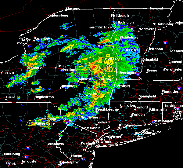 At 405 pm edt, a severe thunderstorm was located near galway, or 10 miles northeast of amsterdam, moving east at 35 mph (radar indicated). Hazards include 60 mph wind gusts and quarter size hail. Minor damage to vehicles is possible. expect wind damage to trees, and power lines. this severe storm will be near, rock city falls around 420 pm edt. milton, ballston spa and north ballston spa around 425 pm edt. Other locations impacted by this severe thunderstorm include parkis mills, holsapple corners, shaw corners, milton center, barkersville, west milton, glenwild, kings, greenfield center and wiley corners. At 405 pm edt, a severe thunderstorm was located near galway, or 10 miles northeast of amsterdam, moving east at 35 mph (radar indicated). Hazards include 60 mph wind gusts and quarter size hail. Minor damage to vehicles is possible. expect wind damage to trees, and power lines. this severe storm will be near, rock city falls around 420 pm edt. milton, ballston spa and north ballston spa around 425 pm edt. Other locations impacted by this severe thunderstorm include parkis mills, holsapple corners, shaw corners, milton center, barkersville, west milton, glenwild, kings, greenfield center and wiley corners.
|
| 6/30/2017 11:41 AM EDT |
 At 341 pm edt, a severe thunderstorm was located over gloversville, moving east at 25 mph (radar indicated). Hazards include 60 mph wind gusts and quarter size hail. Minor damage to vehicles is possible. expect wind damage to trees, and power lines. this severe thunderstorm will be near, mayfield around 350 pm edt. cranberry creek around 355 pm edt. broadalbin around 400 pm edt. galway around 420 pm edt. milton, ballston spa, rock city falls and north ballston spa around 430 pm edt. Other locations impacted by this severe thunderstorm include parkis mills, meco, west perth, munsonville, sweets crossing, shaw corners, pinnacle, barkersville, west milton and glenwild. At 341 pm edt, a severe thunderstorm was located over gloversville, moving east at 25 mph (radar indicated). Hazards include 60 mph wind gusts and quarter size hail. Minor damage to vehicles is possible. expect wind damage to trees, and power lines. this severe thunderstorm will be near, mayfield around 350 pm edt. cranberry creek around 355 pm edt. broadalbin around 400 pm edt. galway around 420 pm edt. milton, ballston spa, rock city falls and north ballston spa around 430 pm edt. Other locations impacted by this severe thunderstorm include parkis mills, meco, west perth, munsonville, sweets crossing, shaw corners, pinnacle, barkersville, west milton and glenwild.
|
| 6/30/2017 11:31 AM EDT |
 At 331 pm edt, a severe thunderstorm was located near saratoga springs, moving northeast at 20 mph (radar indicated). Hazards include 60 mph wind gusts and quarter size hail. Minor damage to vehicles is possible. expect wind damage to trees, and power lines. this severe thunderstorm will be near, greenwich around 405 pm edt. salem around 415 pm edt. Other locations impacted by this severe thunderstorm include deans corners, cossayuna, center falls, goose island, grangerville, northumberland, wayville, middle falls, eagleville and halls corner. At 331 pm edt, a severe thunderstorm was located near saratoga springs, moving northeast at 20 mph (radar indicated). Hazards include 60 mph wind gusts and quarter size hail. Minor damage to vehicles is possible. expect wind damage to trees, and power lines. this severe thunderstorm will be near, greenwich around 405 pm edt. salem around 415 pm edt. Other locations impacted by this severe thunderstorm include deans corners, cossayuna, center falls, goose island, grangerville, northumberland, wayville, middle falls, eagleville and halls corner.
|
| 6/27/2017 12:51 PM EDT |
 At 450 pm edt, severe thunderstorms were located along a line extending from near warrensburg to near glens falls north to near west glens falls to 8 miles southeast of corinth to near saratoga springs, moving northeast at 40 mph (radar indicated). Hazards include 60 mph wind gusts and quarter size hail. Minor damage to vehicles is possible. expect wind damage to trees, and power lines. Locations impacted include, saratoga springs, glens falls, hudson falls, warrensburg, whitehall, lake george village, milton, ballston spa, fort edward, corinth, hartford, greenwich, hague, comstock, bolton landing, glens falls north, north ballston spa, lake luzerne-hadley and west glens falls. At 450 pm edt, severe thunderstorms were located along a line extending from near warrensburg to near glens falls north to near west glens falls to 8 miles southeast of corinth to near saratoga springs, moving northeast at 40 mph (radar indicated). Hazards include 60 mph wind gusts and quarter size hail. Minor damage to vehicles is possible. expect wind damage to trees, and power lines. Locations impacted include, saratoga springs, glens falls, hudson falls, warrensburg, whitehall, lake george village, milton, ballston spa, fort edward, corinth, hartford, greenwich, hague, comstock, bolton landing, glens falls north, north ballston spa, lake luzerne-hadley and west glens falls.
|
| 6/27/2017 12:16 PM EDT |
 At 415 pm edt, severe thunderstorms were located along a line extending from near northville to near edinburg to near galway to near hagaman to near pattersonville-rotterdam junction, moving northeast at 40 mph (radar indicated). Hazards include 60 mph wind gusts and quarter size hail. Minor damage to vehicles is possible. expect wind damage to trees, and power lines. severe thunderstorms will be near, edinburg around 420 pm edt. day center around 425 pm edt. rock city falls and east glenville around 430 pm edt. milton and burnt hills around 435 pm edt. ballston spa, corinth and lake luzerne-hadle around 440 pm edt. saratoga springs, round lake, north ballston spa and lake luzerne campground around 445 pm edt. warrensburg, lake george village, glens falls north and west glens falls around 455 pm edt. Glens falls and fort edward around 500 pm edt. At 415 pm edt, severe thunderstorms were located along a line extending from near northville to near edinburg to near galway to near hagaman to near pattersonville-rotterdam junction, moving northeast at 40 mph (radar indicated). Hazards include 60 mph wind gusts and quarter size hail. Minor damage to vehicles is possible. expect wind damage to trees, and power lines. severe thunderstorms will be near, edinburg around 420 pm edt. day center around 425 pm edt. rock city falls and east glenville around 430 pm edt. milton and burnt hills around 435 pm edt. ballston spa, corinth and lake luzerne-hadle around 440 pm edt. saratoga springs, round lake, north ballston spa and lake luzerne campground around 445 pm edt. warrensburg, lake george village, glens falls north and west glens falls around 455 pm edt. Glens falls and fort edward around 500 pm edt.
|
| 6/19/2017 3:33 PM EDT |
 At 333 pm edt, a severe thunderstorm was located over highland, or over poughkeepsie, moving northeast at 30 mph (radar indicated). Hazards include 60 mph wind gusts and quarter size hail. Minor damage to vehicles is possible. expect wind damage to trees, and power lines. this severe storm will be near, fairview and red oaks mill around 340 pm edt. hyde park around 345 pm edt. pleasant valley and staatsburg around 350 pm edt. millbrook and stanfordville around 405 pm edt. Other locations impacted by this severe thunderstorm include tuckers corner, rolling meadows, salt point, norrie heights, kerleys corners, maple hill, lithgow, hoxie corner, linden acres and hillside. At 333 pm edt, a severe thunderstorm was located over highland, or over poughkeepsie, moving northeast at 30 mph (radar indicated). Hazards include 60 mph wind gusts and quarter size hail. Minor damage to vehicles is possible. expect wind damage to trees, and power lines. this severe storm will be near, fairview and red oaks mill around 340 pm edt. hyde park around 345 pm edt. pleasant valley and staatsburg around 350 pm edt. millbrook and stanfordville around 405 pm edt. Other locations impacted by this severe thunderstorm include tuckers corner, rolling meadows, salt point, norrie heights, kerleys corners, maple hill, lithgow, hoxie corner, linden acres and hillside.
|
| 6/19/2017 3:19 PM EDT |
 At 318 pm edt, a severe thunderstorm was located over modena, or near walden, moving northeast at 30 mph (radar indicated). Hazards include 60 mph wind gusts and quarter size hail. Minor damage to vehicles is possible. expect wind damage to trees, and power lines. this severe thunderstorm will be near, new paltz and marlboro around 330 pm edt. poughkeepsie, highland and fairview around 340 pm edt. hyde park and red oaks mill around 345 pm edt. pleasant valley and staatsburg around 350 pm edt. millbrook around 405 pm edt. stanfordville around 410 pm edt. dover plains around 415 pm edt. Other locations impacted by this severe thunderstorm include tuckers corner, rolling meadows, salt point, norrie heights, kerleys corners, maple hill, lithgow, hoxie corner, linden acres and hillside. At 318 pm edt, a severe thunderstorm was located over modena, or near walden, moving northeast at 30 mph (radar indicated). Hazards include 60 mph wind gusts and quarter size hail. Minor damage to vehicles is possible. expect wind damage to trees, and power lines. this severe thunderstorm will be near, new paltz and marlboro around 330 pm edt. poughkeepsie, highland and fairview around 340 pm edt. hyde park and red oaks mill around 345 pm edt. pleasant valley and staatsburg around 350 pm edt. millbrook around 405 pm edt. stanfordville around 410 pm edt. dover plains around 415 pm edt. Other locations impacted by this severe thunderstorm include tuckers corner, rolling meadows, salt point, norrie heights, kerleys corners, maple hill, lithgow, hoxie corner, linden acres and hillside.
|
| 6/19/2017 12:27 PM EDT |
 At 1227 pm edt, a severe thunderstorm was located over wappingers falls, or near poughkeepsie, moving northeast at 30 mph (radar indicated). Hazards include 60 mph wind gusts and quarter size hail. Minor damage to vehicles is possible. expect wind damage to trees, and power lines. this severe thunderstorm will be near, poughkeepsie and myers corner around 1235 pm edt. red oaks mill, fairview and hopewell junction around 1240 pm edt. pleasant valley around 1245 pm edt. millbrook around 100 pm edt. dover plains around 110 pm edt. kent around 115 pm edt. amenia around 120 pm edt. sharon around 125 pm edt. Other locations impacted by this severe thunderstorm include tuckers corner, cornwall, salt point, lithgow, hoxie corner, salisbury, smithfield, south amenia, bains corner and washington hollow. At 1227 pm edt, a severe thunderstorm was located over wappingers falls, or near poughkeepsie, moving northeast at 30 mph (radar indicated). Hazards include 60 mph wind gusts and quarter size hail. Minor damage to vehicles is possible. expect wind damage to trees, and power lines. this severe thunderstorm will be near, poughkeepsie and myers corner around 1235 pm edt. red oaks mill, fairview and hopewell junction around 1240 pm edt. pleasant valley around 1245 pm edt. millbrook around 100 pm edt. dover plains around 110 pm edt. kent around 115 pm edt. amenia around 120 pm edt. sharon around 125 pm edt. Other locations impacted by this severe thunderstorm include tuckers corner, cornwall, salt point, lithgow, hoxie corner, salisbury, smithfield, south amenia, bains corner and washington hollow.
|
| 5/31/2017 6:56 PM EDT |
 At 655 pm edt, severe thunderstorms were located along a line extending from near great barrington to near millerton to stanfordville to marlboro, moving east at 40 mph (radar indicated). Hazards include golf ball size hail and 60 mph wind gusts. People and animals outdoors will be injured. expect hail damage to roofs, siding, windows, and vehicles. expect wind damage to roofs, siding, and trees. these severe storms will be near, great barrington, copake, sheffield, millerton and housatonic around 700 pm edt. dover plains around 705 pm edt. amenia, canaan, ashley falls and falls village around 710 pm edt. sharon and sandisfield around 715 pm edt. norfolk, otis, tolland and cornwall bridge around 720 pm edt. pawling around 725 pm edt. wingdale around 730 pm edt. gaylordsville and winsted around 735 pm edt. Other locations impacted by these severe thunderstorms include norrie heights, south canaan, lithgow, hoxie corner, elting corners, wrightville, salisbury, south amenia, harlemville and pleasant ridge. At 655 pm edt, severe thunderstorms were located along a line extending from near great barrington to near millerton to stanfordville to marlboro, moving east at 40 mph (radar indicated). Hazards include golf ball size hail and 60 mph wind gusts. People and animals outdoors will be injured. expect hail damage to roofs, siding, windows, and vehicles. expect wind damage to roofs, siding, and trees. these severe storms will be near, great barrington, copake, sheffield, millerton and housatonic around 700 pm edt. dover plains around 705 pm edt. amenia, canaan, ashley falls and falls village around 710 pm edt. sharon and sandisfield around 715 pm edt. norfolk, otis, tolland and cornwall bridge around 720 pm edt. pawling around 725 pm edt. wingdale around 730 pm edt. gaylordsville and winsted around 735 pm edt. Other locations impacted by these severe thunderstorms include norrie heights, south canaan, lithgow, hoxie corner, elting corners, wrightville, salisbury, south amenia, harlemville and pleasant ridge.
|
| 5/31/2017 6:44 PM EDT |
 At 643 pm edt, severe thunderstorms were located along a line extending from near philmont to ancram to near rhinebeck to wallkill, moving east at 40 mph (radar indicated). Hazards include 60 mph wind gusts and quarter size hail. Hail damage to vehicles is expected. expect wind damage to roofs, siding, and trees. severe thunderstorms will be near, copake, pine plains and ancram around 650 pm edt. great barrington, millerton, stanfordville and housatonic around 655 pm edt. sheffield and millbrook around 700 pm edt. amenia, fishkill and myers corner around 705 pm edt. canaan, falls village, hopewell junction, ashley falls and dover plains around 710 pm edt. kent, sharon and sandisfield around 715 pm edt. norfolk, otis, tolland and cornwall bridge around 720 pm edt. pawling around 725 pm edt. Other locations impacted by these severe thunderstorms include norrie heights, south canaan, lithgow, hoxie corner, elting corners, wrightville, salisbury, south amenia, harlemville and pleasant ridge. At 643 pm edt, severe thunderstorms were located along a line extending from near philmont to ancram to near rhinebeck to wallkill, moving east at 40 mph (radar indicated). Hazards include 60 mph wind gusts and quarter size hail. Hail damage to vehicles is expected. expect wind damage to roofs, siding, and trees. severe thunderstorms will be near, copake, pine plains and ancram around 650 pm edt. great barrington, millerton, stanfordville and housatonic around 655 pm edt. sheffield and millbrook around 700 pm edt. amenia, fishkill and myers corner around 705 pm edt. canaan, falls village, hopewell junction, ashley falls and dover plains around 710 pm edt. kent, sharon and sandisfield around 715 pm edt. norfolk, otis, tolland and cornwall bridge around 720 pm edt. pawling around 725 pm edt. Other locations impacted by these severe thunderstorms include norrie heights, south canaan, lithgow, hoxie corner, elting corners, wrightville, salisbury, south amenia, harlemville and pleasant ridge.
|
| 5/31/2017 4:40 PM EDT |
 At 439 pm edt, a severe thunderstorm was located over waterford, or over cohoes, moving east at 40 mph (radar indicated). Hazards include 60 mph wind gusts and quarter size hail. Hail damage to vehicles is expected. expect wind damage to roofs, siding, and trees. this severe storm will be near, grafton around 455 pm edt. hoosick falls around 500 pm edt. Other locations impacted by this severe thunderstorm include deans corners, shakers, albia, johnsonville, willow glen, wayville, elnora, halls corner, grays corners and mannings cove. At 439 pm edt, a severe thunderstorm was located over waterford, or over cohoes, moving east at 40 mph (radar indicated). Hazards include 60 mph wind gusts and quarter size hail. Hail damage to vehicles is expected. expect wind damage to roofs, siding, and trees. this severe storm will be near, grafton around 455 pm edt. hoosick falls around 500 pm edt. Other locations impacted by this severe thunderstorm include deans corners, shakers, albia, johnsonville, willow glen, wayville, elnora, halls corner, grays corners and mannings cove.
|
| 5/31/2017 4:18 PM EDT |
 At 418 pm edt, a severe thunderstorm was located over schenectady, moving east at 40 mph (radar indicated). Hazards include ping pong ball size hail and 60 mph wind gusts. People and animals outdoors will be injured. expect hail damage to roofs, siding, windows, and vehicles. expect wind damage to roofs, siding, and trees. this severe storm will be near, albany and clifton park around 425 pm edt. latham and loudonville around 430 pm edt. troy, cohoes, watervliet, mechanicville, menands, green island and waterford around 435 pm edt. center brunswick around 440 pm edt. grafton around 455 pm edt. hoosick falls around 500 pm edt. Other locations impacted by this severe thunderstorm include parkis mills, deans corners, shakers, glenridge, albia, johnsonville, harding crossing, west milton, willow glen and garrison manor. At 418 pm edt, a severe thunderstorm was located over schenectady, moving east at 40 mph (radar indicated). Hazards include ping pong ball size hail and 60 mph wind gusts. People and animals outdoors will be injured. expect hail damage to roofs, siding, windows, and vehicles. expect wind damage to roofs, siding, and trees. this severe storm will be near, albany and clifton park around 425 pm edt. latham and loudonville around 430 pm edt. troy, cohoes, watervliet, mechanicville, menands, green island and waterford around 435 pm edt. center brunswick around 440 pm edt. grafton around 455 pm edt. hoosick falls around 500 pm edt. Other locations impacted by this severe thunderstorm include parkis mills, deans corners, shakers, glenridge, albia, johnsonville, harding crossing, west milton, willow glen and garrison manor.
|
| 5/31/2017 4:06 PM EDT |
 At 405 pm edt, a severe thunderstorm was located near rotterdam, moving east at 40 mph (radar indicated). Hazards include 60 mph wind gusts and quarter size hail. Hail damage to vehicles is expected. expect wind damage to roofs, siding, and trees. this severe thunderstorm will be near, albany, schenectady, rotterdam, scotia, niskayuna and alplaus around 415 pm edt. colonie, east glenville and burnt hills around 420 pm edt. clifton park and loudonville around 425 pm edt. cohoes, watervliet, latham and menands around 430 pm edt. troy, mechanicville, green island and waterford around 435 pm edt. center brunswick around 440 pm edt. grafton around 455 pm edt. Hoosick falls around 500 pm edt. At 405 pm edt, a severe thunderstorm was located near rotterdam, moving east at 40 mph (radar indicated). Hazards include 60 mph wind gusts and quarter size hail. Hail damage to vehicles is expected. expect wind damage to roofs, siding, and trees. this severe thunderstorm will be near, albany, schenectady, rotterdam, scotia, niskayuna and alplaus around 415 pm edt. colonie, east glenville and burnt hills around 420 pm edt. clifton park and loudonville around 425 pm edt. cohoes, watervliet, latham and menands around 430 pm edt. troy, mechanicville, green island and waterford around 435 pm edt. center brunswick around 440 pm edt. grafton around 455 pm edt. Hoosick falls around 500 pm edt.
|
| 5/18/2017 7:37 PM EDT |
 At 736 pm edt, severe thunderstorms were located along a line extending from near hartford to near fort edward to near galway, moving east at 35 mph (radar indicated). Hazards include 60 mph wind gusts and quarter size hail. Hail damage to vehicles is expected. expect wind damage to roofs, siding, and trees. these severe storms will be near, glens falls and hartford around 740 pm edt. hudson falls and fort edward around 745 pm edt. granville around 750 pm edt. saratoga springs around 755 pm edt. salem around 805 pm edt. greenwich around 815 pm edt. Other locations impacted by these severe thunderstorms include parkis mills, grangerville, west milton, northumberland, greenfield center, wiley corners, middle falls, porter corners, north milton and saratoga race course. At 736 pm edt, severe thunderstorms were located along a line extending from near hartford to near fort edward to near galway, moving east at 35 mph (radar indicated). Hazards include 60 mph wind gusts and quarter size hail. Hail damage to vehicles is expected. expect wind damage to roofs, siding, and trees. these severe storms will be near, glens falls and hartford around 740 pm edt. hudson falls and fort edward around 745 pm edt. granville around 750 pm edt. saratoga springs around 755 pm edt. salem around 805 pm edt. greenwich around 815 pm edt. Other locations impacted by these severe thunderstorms include parkis mills, grangerville, west milton, northumberland, greenfield center, wiley corners, middle falls, porter corners, north milton and saratoga race course.
|
| 5/18/2017 7:10 PM EDT |
 At 710 pm edt, severe thunderstorms were located along a line extending from lake luzerne campground to 6 miles east of edinburg to gloversville, moving east at 30 mph (radar indicated). Hazards include 60 mph wind gusts and quarter size hail. Hail damage to vehicles is expected. expect wind damage to roofs, siding, and trees. severe thunderstorms will be near, lake luzerne campground and lake luzerne-hadley around 715 pm edt. lake george village around 720 pm edt. glens falls, corinth, glens falls north and west glens falls around 725 pm edt. fort edward and northampton beach public campground around 730 pm edt. hudson falls around 735 pm edt. galway around 745 pm edt. hartford and rock city falls around 755 pm edt. milton, ballston spa, greenwich and north ballston spa around 800 pm edt. Other locations impacted by these severe thunderstorms include parkis mills, meco, sweets crossing, lake luzerne, grangerville, west milton, glenwild, northumberland, greenfield center and wiley corners. At 710 pm edt, severe thunderstorms were located along a line extending from lake luzerne campground to 6 miles east of edinburg to gloversville, moving east at 30 mph (radar indicated). Hazards include 60 mph wind gusts and quarter size hail. Hail damage to vehicles is expected. expect wind damage to roofs, siding, and trees. severe thunderstorms will be near, lake luzerne campground and lake luzerne-hadley around 715 pm edt. lake george village around 720 pm edt. glens falls, corinth, glens falls north and west glens falls around 725 pm edt. fort edward and northampton beach public campground around 730 pm edt. hudson falls around 735 pm edt. galway around 745 pm edt. hartford and rock city falls around 755 pm edt. milton, ballston spa, greenwich and north ballston spa around 800 pm edt. Other locations impacted by these severe thunderstorms include parkis mills, meco, sweets crossing, lake luzerne, grangerville, west milton, glenwild, northumberland, greenfield center and wiley corners.
|
| 5/1/2017 9:25 PM EDT |
 At 925 pm edt, severe thunderstorms were located along a line extending from near galway to duanesburg to near windham to hortonville, moving east at 65 mph (radar indicated). Hazards include 70 mph wind gusts. Expect considerable tree damage. Damage is likely to mobile homes, roofs, and outbuildings. At 925 pm edt, severe thunderstorms were located along a line extending from near galway to duanesburg to near windham to hortonville, moving east at 65 mph (radar indicated). Hazards include 70 mph wind gusts. Expect considerable tree damage. Damage is likely to mobile homes, roofs, and outbuildings.
|
| 5/1/2017 9:25 PM EDT |
At 925 pm edt, severe thunderstorms were located along a line extending from near galway to duanesburg to near windham to hortonville, moving east at 65 mph (radar indicated). Hazards include 70 mph wind gusts. Expect considerable tree damage. Damage is likely to mobile homes, roofs, and outbuildings.
|
| 3/8/2017 2:41 PM EST |
 The severe thunderstorm warning for eastern schenectady. columbia. albany. eastern greene. saratoga. southern washington and rensselaer counties will expire at 245 pm est. the storms which prompted the warning have moved out of the warned area. Therefore, the warning will be allowed to expire. The severe thunderstorm warning for eastern schenectady. columbia. albany. eastern greene. saratoga. southern washington and rensselaer counties will expire at 245 pm est. the storms which prompted the warning have moved out of the warned area. Therefore, the warning will be allowed to expire.
|
| 3/8/2017 2:11 PM EST |
 At 211 pm est, severe thunderstorms were located along a line extending from near fort edward to catskill, moving east at 50 mph (radar indicated). Hazards include 60 mph wind gusts. Expect damage to roofs, siding, and trees. these severe storms will be near, fort edward around 215 pm est. philmont around 225 pm est. chatham and salem around 230 pm est. Austerlitz around 235 pm est. At 211 pm est, severe thunderstorms were located along a line extending from near fort edward to catskill, moving east at 50 mph (radar indicated). Hazards include 60 mph wind gusts. Expect damage to roofs, siding, and trees. these severe storms will be near, fort edward around 215 pm est. philmont around 225 pm est. chatham and salem around 230 pm est. Austerlitz around 235 pm est.
|
| 3/8/2017 1:45 PM EST |
 At 145 pm est, severe thunderstorms were located along a line extending from edinburg to near hunter, moving east at 55 mph (radar indicated). Hazards include 60 mph wind gusts. Expect damage to roofs, siding, and trees. severe thunderstorms will be near, corinth around 200 pm est. saratoga springs and catskill around 205 pm est. hudson, claverack, livingston, athens, claverack-red mills and lorenz park around 210 pm est. fort edward and philmont around 215 pm est. austerlitz around 225 pm est. salem around 230 pm est. Other locations impacted by these severe thunderstorms include deans corners, charleston, bleecker stadium, glenridge, hoffmans, west berne, huntersland, wayville, broome center and wiley corners. At 145 pm est, severe thunderstorms were located along a line extending from edinburg to near hunter, moving east at 55 mph (radar indicated). Hazards include 60 mph wind gusts. Expect damage to roofs, siding, and trees. severe thunderstorms will be near, corinth around 200 pm est. saratoga springs and catskill around 205 pm est. hudson, claverack, livingston, athens, claverack-red mills and lorenz park around 210 pm est. fort edward and philmont around 215 pm est. austerlitz around 225 pm est. salem around 230 pm est. Other locations impacted by these severe thunderstorms include deans corners, charleston, bleecker stadium, glenridge, hoffmans, west berne, huntersland, wayville, broome center and wiley corners.
|
| 2/25/2017 6:04 PM EST |
 At 603 pm est, severe thunderstorms were located along a line extending from near west hurley to near hyde park to near wappingers falls, moving northeast at 65 mph (radar indicated). Hazards include 60 mph wind gusts and penny size hail. Expect damage to roofs, siding, and trees. Locations impacted include, eastern ulster county toward the hudson river. At 603 pm est, severe thunderstorms were located along a line extending from near west hurley to near hyde park to near wappingers falls, moving northeast at 65 mph (radar indicated). Hazards include 60 mph wind gusts and penny size hail. Expect damage to roofs, siding, and trees. Locations impacted include, eastern ulster county toward the hudson river.
|
| 2/25/2017 5:33 PM EST |
 At 532 pm est, a severe thunderstorm was located near phillipsport, or near ellenville, moving northeast at 40 mph (radar indicated). Hazards include 60 mph wind gusts and penny size hail. Expect damage to roofs, siding, and trees. this severe thunderstorm will be near, ellenville around 540 pm est. napanoch around 545 pm est. kerhonkson around 550 pm est. new paltz and olivebridge around 600 pm est. tillson and high falls around 605 pm est. hurley around 610 pm est. port ewen around 615 pm est. kingston and lake katrine around 620 pm est. Other locations impacted by this severe thunderstorm include cherrytown, tuckers corner, rolling meadows, maple hill, glenford, atwood, sweet meadows, pacama, brodhead and hillside. At 532 pm est, a severe thunderstorm was located near phillipsport, or near ellenville, moving northeast at 40 mph (radar indicated). Hazards include 60 mph wind gusts and penny size hail. Expect damage to roofs, siding, and trees. this severe thunderstorm will be near, ellenville around 540 pm est. napanoch around 545 pm est. kerhonkson around 550 pm est. new paltz and olivebridge around 600 pm est. tillson and high falls around 605 pm est. hurley around 610 pm est. port ewen around 615 pm est. kingston and lake katrine around 620 pm est. Other locations impacted by this severe thunderstorm include cherrytown, tuckers corner, rolling meadows, maple hill, glenford, atwood, sweet meadows, pacama, brodhead and hillside.
|
| 8/13/2016 7:07 PM EDT |
 At 706 pm edt, severe thunderstorms were located along a line extending from near north creek to 6 miles southwest of corinth to near pattersonville-rotterdam junction, moving northeast at 60 mph (radar indicated). Hazards include 60 mph wind gusts and quarter size hail. Hail damage to vehicles is expected. expect wind damage to roofs, siding, and trees. severe thunderstorms will be near, chestertown and north creek around 710 pm edt. corinth, scaroon manor public campground, eagle point campground and lake luzerne-hadle around 715 pm edt. ballston spa, country knolls and rock city falls around 720 pm edt. glens falls, hudson falls, milton, fort edward, round lake, west glens falls, glens falls north and north ballston spa around 725 pm edt. rogers rock campground around 730 pm edt. hartford and comstock around 735 pm edt. greenwich around 740 pm edt. other locations impacted by these severe thunderstorms include goose island, ballard corners, west milton, dresden center, north bolton, glenburnie, overlook, saratoga performing arts center, french mountain and fly summit. this includes the following highways, interstate 90 near mile marker 10-9. Interstate 87 near mile marker 13, near mile marker 12-13, near mile marker 13, and between mile markers 14 and 16. At 706 pm edt, severe thunderstorms were located along a line extending from near north creek to 6 miles southwest of corinth to near pattersonville-rotterdam junction, moving northeast at 60 mph (radar indicated). Hazards include 60 mph wind gusts and quarter size hail. Hail damage to vehicles is expected. expect wind damage to roofs, siding, and trees. severe thunderstorms will be near, chestertown and north creek around 710 pm edt. corinth, scaroon manor public campground, eagle point campground and lake luzerne-hadle around 715 pm edt. ballston spa, country knolls and rock city falls around 720 pm edt. glens falls, hudson falls, milton, fort edward, round lake, west glens falls, glens falls north and north ballston spa around 725 pm edt. rogers rock campground around 730 pm edt. hartford and comstock around 735 pm edt. greenwich around 740 pm edt. other locations impacted by these severe thunderstorms include goose island, ballard corners, west milton, dresden center, north bolton, glenburnie, overlook, saratoga performing arts center, french mountain and fly summit. this includes the following highways, interstate 90 near mile marker 10-9. Interstate 87 near mile marker 13, near mile marker 12-13, near mile marker 13, and between mile markers 14 and 16.
|
| 8/13/2016 6:46 PM EDT |
 At 645 pm edt, a severe thunderstorm was located near saratoga springs, moving northeast at 35 mph (radar indicated). Hazards include 60 mph wind gusts and quarter size hail. Hail damage to vehicles is expected. expect wind damage to roofs, siding, and trees. this severe storm will be near, greenwich around 700 pm edt. Other locations impacted by this severe thunderstorm include francis corners, schuylerville, the saratoga battllefield, deans corners, ballard corners, thomson, clarks mills, starks knob, burgoyne and eddy corners. At 645 pm edt, a severe thunderstorm was located near saratoga springs, moving northeast at 35 mph (radar indicated). Hazards include 60 mph wind gusts and quarter size hail. Hail damage to vehicles is expected. expect wind damage to roofs, siding, and trees. this severe storm will be near, greenwich around 700 pm edt. Other locations impacted by this severe thunderstorm include francis corners, schuylerville, the saratoga battllefield, deans corners, ballard corners, thomson, clarks mills, starks knob, burgoyne and eddy corners.
|
| 8/13/2016 6:22 PM EDT |
 At 621 pm edt, a severe thunderstorm was located near burnt hills, or 7 miles north of scotia, moving northeast at 30 mph (radar indicated). Hazards include 60 mph wind gusts and quarter size hail. Hail damage to vehicles is expected. expect wind damage to roofs, siding, and trees. this severe thunderstorm will be near, burnt hills around 625 pm edt. country knolls around 630 pm edt. milton, ballston spa, round lake and north ballston spa around 635 pm edt. saratoga springs around 650 pm edt. greenwich around 700 pm edt. other locations impacted by this severe thunderstorm include francis corners, schuylerville, the saratoga battllefield, maltaville, deans corners, ballard corners, west milton, burgoyne, eddy corners and glenville center. this includes the following highways, interstate 90 near mile marker 10-9. Interstate 87 near mile marker 13, near mile marker 12-13, near mile marker 13, and between mile markers 14 and 16. At 621 pm edt, a severe thunderstorm was located near burnt hills, or 7 miles north of scotia, moving northeast at 30 mph (radar indicated). Hazards include 60 mph wind gusts and quarter size hail. Hail damage to vehicles is expected. expect wind damage to roofs, siding, and trees. this severe thunderstorm will be near, burnt hills around 625 pm edt. country knolls around 630 pm edt. milton, ballston spa, round lake and north ballston spa around 635 pm edt. saratoga springs around 650 pm edt. greenwich around 700 pm edt. other locations impacted by this severe thunderstorm include francis corners, schuylerville, the saratoga battllefield, maltaville, deans corners, ballard corners, west milton, burgoyne, eddy corners and glenville center. this includes the following highways, interstate 90 near mile marker 10-9. Interstate 87 near mile marker 13, near mile marker 12-13, near mile marker 13, and between mile markers 14 and 16.
|
| 8/12/2016 4:06 PM EDT |
 At 404 pm edt, a severe thunderstorm was located near greenwich, or 9 miles west of salem, moving east at 40 mph (radar indicated. this storm has a history of producing damage). Hazards include 60 mph wind gusts. Expect damage to roofs. siding. and trees. this severe storm will be near, salem around 415 pm edt. Other locations impacted by this severe thunderstorm include francis corners, schuylerville, goose island, ballard corners, south greenfield, eddy corners, saratoga performing arts center, fly summit, gilbert corners and northumberland. At 404 pm edt, a severe thunderstorm was located near greenwich, or 9 miles west of salem, moving east at 40 mph (radar indicated. this storm has a history of producing damage). Hazards include 60 mph wind gusts. Expect damage to roofs. siding. and trees. this severe storm will be near, salem around 415 pm edt. Other locations impacted by this severe thunderstorm include francis corners, schuylerville, goose island, ballard corners, south greenfield, eddy corners, saratoga performing arts center, fly summit, gilbert corners and northumberland.
|
| 8/12/2016 3:51 PM EDT |
 At 350 pm edt, a severe thunderstorm was located 7 miles southwest of fort edward, or 8 miles south of glens falls, moving east at 45 mph (radar indicated). Hazards include 60 mph wind gusts. Expect damage to roofs. siding. and trees. this severe thunderstorm will be near, fort edward around 355 pm edt. greenwich around 405 pm edt. salem around 415 pm edt. Other locations impacted by this severe thunderstorm include francis corners, schuylerville, goose island, ballard corners, south greenfield, eddy corners, saratoga performing arts center, fly summit, gilbert corners and northumberland. At 350 pm edt, a severe thunderstorm was located 7 miles southwest of fort edward, or 8 miles south of glens falls, moving east at 45 mph (radar indicated). Hazards include 60 mph wind gusts. Expect damage to roofs. siding. and trees. this severe thunderstorm will be near, fort edward around 355 pm edt. greenwich around 405 pm edt. salem around 415 pm edt. Other locations impacted by this severe thunderstorm include francis corners, schuylerville, goose island, ballard corners, south greenfield, eddy corners, saratoga performing arts center, fly summit, gilbert corners and northumberland.
|
| 7/18/2016 2:35 PM EDT |
 At 235 pm edt, a severe thunderstorm was located over wappingers falls, or near poughkeepsie, moving east at 40 mph (radar indicated). Hazards include 60 mph wind gusts. Expect damage to roofs. siding. And trees. At 235 pm edt, a severe thunderstorm was located over wappingers falls, or near poughkeepsie, moving east at 40 mph (radar indicated). Hazards include 60 mph wind gusts. Expect damage to roofs. siding. And trees.
|
| 7/1/2016 3:29 PM EDT |
 At 328 pm edt, a severe thunderstorm was located over marlboro, or near poughkeepsie, moving northeast at 15 mph (radar indicated). Hazards include 60 mph wind gusts and quarter size hail. Hail damage to vehicles is expected. Expect wind damage to roofs, siding, and trees. At 328 pm edt, a severe thunderstorm was located over marlboro, or near poughkeepsie, moving northeast at 15 mph (radar indicated). Hazards include 60 mph wind gusts and quarter size hail. Hail damage to vehicles is expected. Expect wind damage to roofs, siding, and trees.
|
| 7/1/2016 3:23 PM EDT |
 At 322 pm edt, a severe thunderstorm was located over fairview, or over poughkeepsie, moving northeast at 30 mph (radar indicated). Hazards include 60 mph wind gusts and quarter size hail. Hail damage to vehicles is expected. expect wind damage to roofs, siding, and trees. this severe thunderstorm will remain over mainly rural areas of southeastern ulster and central dutchess counties, including the following locations: pleasant plains, arthursburg, colonial heights, haviland, hillside lake, jenkinstown, clove, highland landing, macdonnell heights and netherwood. A tornado watch remains in effect until 1000 pm edt for east central new york. At 322 pm edt, a severe thunderstorm was located over fairview, or over poughkeepsie, moving northeast at 30 mph (radar indicated). Hazards include 60 mph wind gusts and quarter size hail. Hail damage to vehicles is expected. expect wind damage to roofs, siding, and trees. this severe thunderstorm will remain over mainly rural areas of southeastern ulster and central dutchess counties, including the following locations: pleasant plains, arthursburg, colonial heights, haviland, hillside lake, jenkinstown, clove, highland landing, macdonnell heights and netherwood. A tornado watch remains in effect until 1000 pm edt for east central new york.
|
| 7/1/2016 2:52 PM EDT |
 At 251 pm edt, a severe thunderstorm was located over wallkill, or over walden, moving northeast at 30 mph (radar indicated). Hazards include 60 mph wind gusts and quarter size hail. Hail damage to vehicles is expected. expect wind damage to roofs, siding, and trees. this severe thunderstorm will be near, plattekill around 300 pm edt. modena around 305 pm edt. marlboro around 310 pm edt. new paltz and wappingers falls around 315 pm edt. highland around 320 pm edt. poughkeepsie, hyde park, fairview and red oaks mill around 325 pm edt. pleasant valley and staatsburg around 330 pm edt. other locations impacted by this severe thunderstorm include libertyville, tuthilltown, pleasant plains, ohioville, galeville, arthursburg, colonial heights, haviland, saint elmo and hillside lake. A tornado watch remains in effect until 1000 pm edt for east central new york. At 251 pm edt, a severe thunderstorm was located over wallkill, or over walden, moving northeast at 30 mph (radar indicated). Hazards include 60 mph wind gusts and quarter size hail. Hail damage to vehicles is expected. expect wind damage to roofs, siding, and trees. this severe thunderstorm will be near, plattekill around 300 pm edt. modena around 305 pm edt. marlboro around 310 pm edt. new paltz and wappingers falls around 315 pm edt. highland around 320 pm edt. poughkeepsie, hyde park, fairview and red oaks mill around 325 pm edt. pleasant valley and staatsburg around 330 pm edt. other locations impacted by this severe thunderstorm include libertyville, tuthilltown, pleasant plains, ohioville, galeville, arthursburg, colonial heights, haviland, saint elmo and hillside lake. A tornado watch remains in effect until 1000 pm edt for east central new york.
|
| 4/7/2016 4:28 PM EDT |
 At 427 pm edt, severe thunderstorms were located along a line extending from near johnsburg to near averill park, moving east at 25 mph (radar indicated). Hazards include 60 mph wind gusts and penny size hail. Expect damage to roofs. siding. And trees. At 427 pm edt, severe thunderstorms were located along a line extending from near johnsburg to near averill park, moving east at 25 mph (radar indicated). Hazards include 60 mph wind gusts and penny size hail. Expect damage to roofs. siding. And trees.
|
| 2/24/2016 11:22 PM EST |
 At 1121 pm est, severe thunderstorms were located along a line extending from near saugerties to near fahnestock state park, moving northeast at 70 mph (radar indicated). Hazards include 60 mph wind gusts. Expect damage to roofs. siding and trees. severe thunderstorms will be near, saugerties, woodstock, saugerties south and lake katrine around 1125 pm est. clermont, hopewell junction and myers corner around 1130 pm est. hudson, catskill, pawling and livingston around 1135 pm est. claverack, athens, philmont, wingdale, claverack-red mills and lorenz park around 1140 pm est. new milford, sherman, kent, gaylordsville and dover plains around 1145 pm est. new preston around 1150 pm est. cornwall bridge around 1155 pm est. litchfield around 1200 am est. Other locations impacted by these severe thunderstorms include ohioville, arthursburg, the cedars, sharon valley, birch groves, macdonnell heights, east cornwall, mount ross, east kingston and kelly corner. At 1121 pm est, severe thunderstorms were located along a line extending from near saugerties to near fahnestock state park, moving northeast at 70 mph (radar indicated). Hazards include 60 mph wind gusts. Expect damage to roofs. siding and trees. severe thunderstorms will be near, saugerties, woodstock, saugerties south and lake katrine around 1125 pm est. clermont, hopewell junction and myers corner around 1130 pm est. hudson, catskill, pawling and livingston around 1135 pm est. claverack, athens, philmont, wingdale, claverack-red mills and lorenz park around 1140 pm est. new milford, sherman, kent, gaylordsville and dover plains around 1145 pm est. new preston around 1150 pm est. cornwall bridge around 1155 pm est. litchfield around 1200 am est. Other locations impacted by these severe thunderstorms include ohioville, arthursburg, the cedars, sharon valley, birch groves, macdonnell heights, east cornwall, mount ross, east kingston and kelly corner.
|
| 9/3/2015 3:01 PM EDT |
 At 301 pm edt, a severe thunderstorm was located over burnt hills, or 7 miles northwest of clifton park, moving southeast at 10 mph (radar indicated). Hazards include 60 mph wind gusts and quarter size hail. Hail damage to vehicles is expected. expect wind damage to roofs, siding and trees. this severe storm will be near, round lake around 310 pm edt. schenectady, scotia, niskayuna, burnt hills, country knolls, east glenville and alplaus around 315 pm edt. Other locations impacted by this severe thunderstorm include francis corners, maltaville, south galway corner, east saratoga junciton, stoodley corners, west milton, eddy corners, glenville center, saratoga performing arts center and charlton. At 301 pm edt, a severe thunderstorm was located over burnt hills, or 7 miles northwest of clifton park, moving southeast at 10 mph (radar indicated). Hazards include 60 mph wind gusts and quarter size hail. Hail damage to vehicles is expected. expect wind damage to roofs, siding and trees. this severe storm will be near, round lake around 310 pm edt. schenectady, scotia, niskayuna, burnt hills, country knolls, east glenville and alplaus around 315 pm edt. Other locations impacted by this severe thunderstorm include francis corners, maltaville, south galway corner, east saratoga junciton, stoodley corners, west milton, eddy corners, glenville center, saratoga performing arts center and charlton.
|
| 9/3/2015 2:47 PM EDT |
 At 247 pm edt, a severe thunderstorm was located near ballston spa, or 9 miles southwest of saratoga springs, moving southeast at 10 mph (radar indicated). Hazards include 60 mph wind gusts. Expect damage to roofs. siding and trees. this severe storm will be near, round lake and burnt hills around 310 pm edt. schenectady, scotia, niskayuna, country knolls, east glenville and alplaus around 315 pm edt. Other locations impacted by this severe thunderstorm include francis corners, fairweather corners, maltaville, south galway corner, east saratoga junciton, stoodley corners, holsapple corners, west milton, eddy corners and glenville center. At 247 pm edt, a severe thunderstorm was located near ballston spa, or 9 miles southwest of saratoga springs, moving southeast at 10 mph (radar indicated). Hazards include 60 mph wind gusts. Expect damage to roofs. siding and trees. this severe storm will be near, round lake and burnt hills around 310 pm edt. schenectady, scotia, niskayuna, country knolls, east glenville and alplaus around 315 pm edt. Other locations impacted by this severe thunderstorm include francis corners, fairweather corners, maltaville, south galway corner, east saratoga junciton, stoodley corners, holsapple corners, west milton, eddy corners and glenville center.
|
| 9/3/2015 2:32 PM EDT |
 At 231 pm edt, a severe thunderstorm was located over rock city falls, or 9 miles west of saratoga springs, moving south at 15 mph (radar indicated). Hazards include 60 mph wind gusts and quarter size hail. Hail damage to vehicles is expected. expect wind damage to roofs, siding and trees. this severe storm will be near, milton and north ballston spa around 235 pm edt. ballston spa around 240 pm edt. round lake and burnt hills around 300 pm edt. country knolls around 305 pm edt. schenectady, rotterdam, scotia, niskayuna, east glenville and alplaus around 315 pm edt. Other locations impacted by this severe thunderstorm include francis corners, fairweather corners, maltaville, south galway corner, east saratoga junciton, stoodley corners, holsapple corners, west milton, south greenfield and eddy corners. At 231 pm edt, a severe thunderstorm was located over rock city falls, or 9 miles west of saratoga springs, moving south at 15 mph (radar indicated). Hazards include 60 mph wind gusts and quarter size hail. Hail damage to vehicles is expected. expect wind damage to roofs, siding and trees. this severe storm will be near, milton and north ballston spa around 235 pm edt. ballston spa around 240 pm edt. round lake and burnt hills around 300 pm edt. country knolls around 305 pm edt. schenectady, rotterdam, scotia, niskayuna, east glenville and alplaus around 315 pm edt. Other locations impacted by this severe thunderstorm include francis corners, fairweather corners, maltaville, south galway corner, east saratoga junciton, stoodley corners, holsapple corners, west milton, south greenfield and eddy corners.
|
| 9/3/2015 2:13 PM EDT |
 At 212 pm edt, a severe thunderstorm was located near rock city falls, or 10 miles west of saratoga springs, moving southeast at 10 mph (radar indicated). Hazards include 60 mph wind gusts and quarter size hail. Hail damage to vehicles is expected. expect wind damage to roofs, siding and trees. this severe thunderstorm will be near, rock city falls around 230 pm edt. galway around 235 pm edt. milton around 245 pm edt. ballston spa and north ballston spa around 250 pm edt. schenectady, scotia, niskayuna, round lake, burnt hills, country knolls, east glenville and alplaus around 315 pm edt. Other locations impacted by this severe thunderstorm include francis corners, fairweather corners, maltaville, south galway corner, east saratoga junciton, stoodley corners, holsapple corners, west milton, sky ranch and south greenfield. At 212 pm edt, a severe thunderstorm was located near rock city falls, or 10 miles west of saratoga springs, moving southeast at 10 mph (radar indicated). Hazards include 60 mph wind gusts and quarter size hail. Hail damage to vehicles is expected. expect wind damage to roofs, siding and trees. this severe thunderstorm will be near, rock city falls around 230 pm edt. galway around 235 pm edt. milton around 245 pm edt. ballston spa and north ballston spa around 250 pm edt. schenectady, scotia, niskayuna, round lake, burnt hills, country knolls, east glenville and alplaus around 315 pm edt. Other locations impacted by this severe thunderstorm include francis corners, fairweather corners, maltaville, south galway corner, east saratoga junciton, stoodley corners, holsapple corners, west milton, sky ranch and south greenfield.
|
| 7/26/2015 2:47 PM EDT |
 At 247 pm edt, a severe thunderstorm was located over ellenville, moving northeast at 55 mph (trained weather spotters). Hazards include 60 mph wind gusts and quarter size hail. Hail damage to vehicles is expected. expect wind damage to roofs, siding and trees. this severe thunderstorm will be near, kerhonkson around 250 pm edt. modena around 255 pm edt. new paltz and high falls around 300 pm edt. highland and tillson around 305 pm edt. hyde park and fairview around 310 pm edt. kingston, rhinebeck, staatsburg and port ewen around 315 pm edt. red hook around 320 pm edt. Other locations impacted by this severe thunderstorm include pataukunk, libertyville, ohioville, ulsterville, colonial heights, jenkinstown, highland landing, awosting, hillside and macdonnell heights. At 247 pm edt, a severe thunderstorm was located over ellenville, moving northeast at 55 mph (trained weather spotters). Hazards include 60 mph wind gusts and quarter size hail. Hail damage to vehicles is expected. expect wind damage to roofs, siding and trees. this severe thunderstorm will be near, kerhonkson around 250 pm edt. modena around 255 pm edt. new paltz and high falls around 300 pm edt. highland and tillson around 305 pm edt. hyde park and fairview around 310 pm edt. kingston, rhinebeck, staatsburg and port ewen around 315 pm edt. red hook around 320 pm edt. Other locations impacted by this severe thunderstorm include pataukunk, libertyville, ohioville, ulsterville, colonial heights, jenkinstown, highland landing, awosting, hillside and macdonnell heights.
|
| 7/19/2015 6:25 PM EDT |
 At 624 pm edt, a severe thunderstorm was located over phillipsport, or near ellenville, moving east at 35 mph (radar indicated). Hazards include 60 mph wind gusts and quarter size hail. Hail damage to vehicles is expected. expect wind damage to roofs, siding and trees. this severe thunderstorm will be near, ellenville and napanoch around 635 pm edt. wallkill around 650 pm edt. plattekill and modena around 655 pm edt. new paltz around 700 pm edt. highland around 710 pm edt. Other locations impacted by this severe thunderstorm include pataukunk, libertyville, tuthilltown, ohioville, galeville, springtown, ulsterville, saint elmo, jenkinstown and highland landing. At 624 pm edt, a severe thunderstorm was located over phillipsport, or near ellenville, moving east at 35 mph (radar indicated). Hazards include 60 mph wind gusts and quarter size hail. Hail damage to vehicles is expected. expect wind damage to roofs, siding and trees. this severe thunderstorm will be near, ellenville and napanoch around 635 pm edt. wallkill around 650 pm edt. plattekill and modena around 655 pm edt. new paltz around 700 pm edt. highland around 710 pm edt. Other locations impacted by this severe thunderstorm include pataukunk, libertyville, tuthilltown, ohioville, galeville, springtown, ulsterville, saint elmo, jenkinstown and highland landing.
|
| 7/19/2015 6:22 PM EDT |
 At 621 pm edt, severe thunderstorms were located along a line extending from near edinburg to saratoga springs, moving northeast at 30 mph (radar indicated). Hazards include 60 mph wind gusts and quarter size hail. Hail damage to vehicles is expected. expect wind damage to roofs, siding and trees. these severe storms will be near, saratoga springs around 625 pm edt. corinth around 645 pm edt. Other locations impacted by these severe thunderstorms include francis corners, south galway corner, holsapple corners, west milton, south greenfield, eddy corners, hagedorns mills, saratoga performing arts center, lake view and gilbert corners. At 621 pm edt, severe thunderstorms were located along a line extending from near edinburg to saratoga springs, moving northeast at 30 mph (radar indicated). Hazards include 60 mph wind gusts and quarter size hail. Hail damage to vehicles is expected. expect wind damage to roofs, siding and trees. these severe storms will be near, saratoga springs around 625 pm edt. corinth around 645 pm edt. Other locations impacted by these severe thunderstorms include francis corners, south galway corner, holsapple corners, west milton, south greenfield, eddy corners, hagedorns mills, saratoga performing arts center, lake view and gilbert corners.
|
| 7/19/2015 5:45 PM EDT |
 At 545 pm edt, severe thunderstorms were located along a line extending from near broadalbin to rotterdam junction, moving northeast at 25 mph (radar indicated). Hazards include 60 mph wind gusts and quarter size hail. Hail damage to vehicles is expected. expect wind damage to roofs, siding and trees. severe thunderstorms will be near, scotia, glenville and alplaus around 550 pm edt. galway, burnt hills and east glenville around 555 pm edt. cranberry creek around 600 pm edt. country knolls and northampton beach public campground around 605 pm edt. ballston spa, northville, round lake, north ballston spa and rock city falls around 610 pm edt. milton around 615 pm edt. edinburg around 620 pm edt. saratoga springs around 625 pm edt. Other locations impacted by these severe thunderstorms include francis corners, smiths corners, south galway corner, kingsboro, holsapple corners, west milton, jackson summit, munsonville, south greenfield and eddy corners. At 545 pm edt, severe thunderstorms were located along a line extending from near broadalbin to rotterdam junction, moving northeast at 25 mph (radar indicated). Hazards include 60 mph wind gusts and quarter size hail. Hail damage to vehicles is expected. expect wind damage to roofs, siding and trees. severe thunderstorms will be near, scotia, glenville and alplaus around 550 pm edt. galway, burnt hills and east glenville around 555 pm edt. cranberry creek around 600 pm edt. country knolls and northampton beach public campground around 605 pm edt. ballston spa, northville, round lake, north ballston spa and rock city falls around 610 pm edt. milton around 615 pm edt. edinburg around 620 pm edt. saratoga springs around 625 pm edt. Other locations impacted by these severe thunderstorms include francis corners, smiths corners, south galway corner, kingsboro, holsapple corners, west milton, jackson summit, munsonville, south greenfield and eddy corners.
|
| 6/12/2015 5:23 PM EDT |
 At 522 pm edt, a severe thunderstorm was located near poughkeepsie, moving east at 25 mph (radar indicated). Hazards include 60 mph wind gusts and quarter size hail. Hail damage to vehicles is expected. expect wind damage to roofs, siding and trees. this severe thunderstorm will be near, fairview around 525 pm edt. poughkeepsie and wappingers falls around 530 pm edt. red oaks mill and myers corner around 535 pm edt. pleasant valley around 540 pm edt. hopewell junction around 545 pm edt. pawling and wingdale around 610 pm edt. other locations impacted by this severe thunderstorm include arthursburg, colonial heights, haviland, hillside lake, clove, highland landing, macdonnell heights, dover furnace, new hamburg and lloyd. A tornado watch remains in effect until 1100 pm edt for east central new york. At 522 pm edt, a severe thunderstorm was located near poughkeepsie, moving east at 25 mph (radar indicated). Hazards include 60 mph wind gusts and quarter size hail. Hail damage to vehicles is expected. expect wind damage to roofs, siding and trees. this severe thunderstorm will be near, fairview around 525 pm edt. poughkeepsie and wappingers falls around 530 pm edt. red oaks mill and myers corner around 535 pm edt. pleasant valley around 540 pm edt. hopewell junction around 545 pm edt. pawling and wingdale around 610 pm edt. other locations impacted by this severe thunderstorm include arthursburg, colonial heights, haviland, hillside lake, clove, highland landing, macdonnell heights, dover furnace, new hamburg and lloyd. A tornado watch remains in effect until 1100 pm edt for east central new york.
|
| 6/12/2015 5:20 PM EDT |
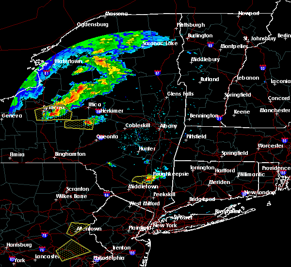 At 519 pm edt, a severe thunderstorm was located near highland, or near poughkeepsie, moving east at 20 mph (radar indicated). Hazards include 60 mph wind gusts and nickel size hail. Expect damage to roofs. siding and trees. this severe storm will be just west of, poughkeepsie around 530 pm edt. other locations impacted by this severe thunderstorm include stoneco, jenkinstown, highland landing, lloyd, clintondale station, oakes, lattintown, tuckers corner, sylva and ardonia. A tornado watch remains in effect until 1100 pm edt for east central new york. At 519 pm edt, a severe thunderstorm was located near highland, or near poughkeepsie, moving east at 20 mph (radar indicated). Hazards include 60 mph wind gusts and nickel size hail. Expect damage to roofs. siding and trees. this severe storm will be just west of, poughkeepsie around 530 pm edt. other locations impacted by this severe thunderstorm include stoneco, jenkinstown, highland landing, lloyd, clintondale station, oakes, lattintown, tuckers corner, sylva and ardonia. A tornado watch remains in effect until 1100 pm edt for east central new york.
|
| 6/12/2015 4:53 PM EDT |
 At 452 pm edt, a severe thunderstorm was located near wallkill, or 7 miles east of ellenville, moving east at 25 mph (radar indicated). Hazards include 60 mph wind gusts and nickel size hail. Expect damage to roofs. siding and trees. this severe storm will be near, new paltz, plattekill and modena around 510 pm edt. highland and marlboro around 525 pm edt. other locations impacted by this severe thunderstorm include libertyville, tuthilltown, galeville, saint elmo, jenkinstown, highland landing, awosting, crawford, lloyd and bruynswick. A tornado watch remains in effect until 1100 pm edt for east central new york. At 452 pm edt, a severe thunderstorm was located near wallkill, or 7 miles east of ellenville, moving east at 25 mph (radar indicated). Hazards include 60 mph wind gusts and nickel size hail. Expect damage to roofs. siding and trees. this severe storm will be near, new paltz, plattekill and modena around 510 pm edt. highland and marlboro around 525 pm edt. other locations impacted by this severe thunderstorm include libertyville, tuthilltown, galeville, saint elmo, jenkinstown, highland landing, awosting, crawford, lloyd and bruynswick. A tornado watch remains in effect until 1100 pm edt for east central new york.
|
| 6/12/2015 4:27 PM EDT |
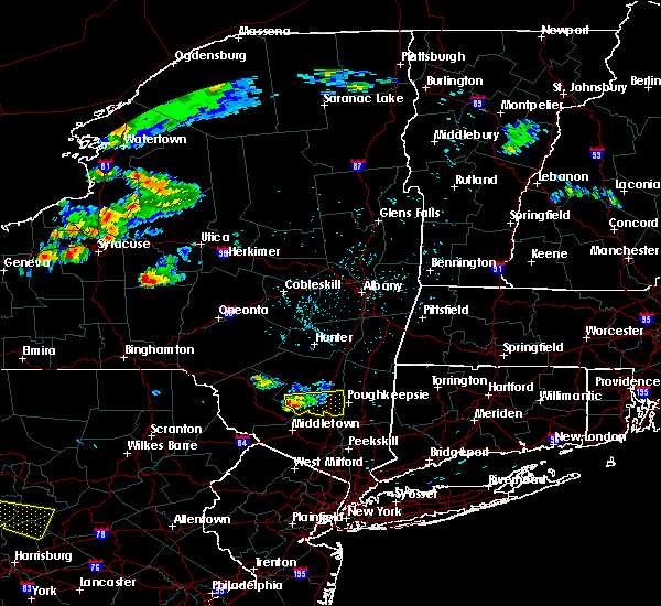 At 427 pm edt, a severe thunderstorm was located over ellenville, moving east at 30 mph (radar indicated). Hazards include 60 mph wind gusts and penny size hail. Expect damage to roofs. siding and trees. this severe thunderstorm will be near, kerhonkson around 430 pm edt. wallkill around 445 pm edt. modena around 450 pm edt. new paltz and plattekill around 455 pm edt. highland and marlboro around 505 pm edt. poughkeepsie around 510 pm edt. other locations impacted by this severe thunderstorm include libertyville, tuthilltown, ohioville, galeville, springtown, ulsterville, saint elmo, jenkinstown, highland landing and awosting. A tornado watch remains in effect until 1100 pm edt for east central new york. At 427 pm edt, a severe thunderstorm was located over ellenville, moving east at 30 mph (radar indicated). Hazards include 60 mph wind gusts and penny size hail. Expect damage to roofs. siding and trees. this severe thunderstorm will be near, kerhonkson around 430 pm edt. wallkill around 445 pm edt. modena around 450 pm edt. new paltz and plattekill around 455 pm edt. highland and marlboro around 505 pm edt. poughkeepsie around 510 pm edt. other locations impacted by this severe thunderstorm include libertyville, tuthilltown, ohioville, galeville, springtown, ulsterville, saint elmo, jenkinstown, highland landing and awosting. A tornado watch remains in effect until 1100 pm edt for east central new york.
|
| 6/9/2015 2:41 PM EDT |
 At 240 pm edt, a severe thunderstorm was located over burnt hills, or near clifton park, moving northeast at 45 mph (radar indicated). Hazards include 60 mph wind gusts and quarter size hail. Hail damage to vehicles is expected. expect wind damage to roofs, siding and trees. this severe thunderstorm will be near, ballston spa, country knolls and north ballston spa around 245 pm edt. mechanicville, milton and round lake around 250 pm edt. greenwich around 310 pm edt. cambridge around 315 pm edt. salem around 325 pm edt. this storm has shown some rotation and will continue to be monitored. Other locations impacted by this severe thunderstorm include francis corners, schuylerville, south galway corner, east saratoga junciton, lincolnville, holsapple corners, west milton, eddy corners, saratoga performing arts center and fly summit. At 240 pm edt, a severe thunderstorm was located over burnt hills, or near clifton park, moving northeast at 45 mph (radar indicated). Hazards include 60 mph wind gusts and quarter size hail. Hail damage to vehicles is expected. expect wind damage to roofs, siding and trees. this severe thunderstorm will be near, ballston spa, country knolls and north ballston spa around 245 pm edt. mechanicville, milton and round lake around 250 pm edt. greenwich around 310 pm edt. cambridge around 315 pm edt. salem around 325 pm edt. this storm has shown some rotation and will continue to be monitored. Other locations impacted by this severe thunderstorm include francis corners, schuylerville, south galway corner, east saratoga junciton, lincolnville, holsapple corners, west milton, eddy corners, saratoga performing arts center and fly summit.
|
| 5/27/2015 5:40 PM EDT | At 539 pm edt, severe thunderstorms were located along a line extending from stanfordville to cold spring, moving east at 50 mph (radar indicated). Hazards include 60 mph wind gusts and penny size hail. Expect damage to roofs. siding and trees. severe thunderstorms will be near, millbrook around 545 pm edt. amenia around 550 pm edt. sharon and hopewell junction around 555 pm edt. pawling around 605 pm edt. brookfield, new fairfield and wingdale around 610 pm edt. sherman and gaylordsville around 615 pm edt. new milford and winsted around 620 pm edt. hartland, new preston and woodbury center around 625 pm edt. Other locations impacted by these severe thunderstorms include dean corners, ohioville, arthursburg, sharon valley, birch groves, minortown, macdonnell heights, netherwood, east cornwall and clintondale station. |
| 5/27/2015 5:40 PM EDT | At 539 pm edt, severe thunderstorms were located along a line extending from stanfordville to cold spring, moving east at 50 mph (radar indicated). Hazards include 60 mph wind gusts and penny size hail. Expect damage to roofs. siding and trees. severe thunderstorms will be near, millbrook around 545 pm edt. amenia around 550 pm edt. sharon and hopewell junction around 555 pm edt. pawling around 605 pm edt. brookfield, new fairfield and wingdale around 610 pm edt. sherman and gaylordsville around 615 pm edt. new milford and winsted around 620 pm edt. hartland, new preston and woodbury center around 625 pm edt. Other locations impacted by these severe thunderstorms include dean corners, ohioville, arthursburg, sharon valley, birch groves, minortown, macdonnell heights, netherwood, east cornwall and clintondale station. |
| 7/13/2014 9:07 PM EDT | Tree down on house at ridgecrest roa in ulster county NY, 0.5 miles WSW of Milton, NY |
| 7/13/2014 7:20 PM EDT | Tree down on house at ridgecrest road. time estimated by radar in ulster county NY, 0.5 miles WSW of Milton, NY |
| 6/25/2014 3:46 PM EDT | One tree down. transformer blow in saratoga county NY, 3.9 miles ESE of Milton, NY |
| 6/17/2014 11:46 PM EDT | Tree and wires down on rowland s in saratoga county NY, 0.3 miles N of Milton, NY |
| 5/30/2014 5:10 PM EDT | Numerous trees down and power outages in saratoga county NY, 0.3 miles N of Milton, NY |
| 1/1/0001 12:00 AM | Half Dollar sized hail reported 94.3 miles S of Milton, NY, estimated 60 mph winds too. |
Hail Maps for Milton, NY


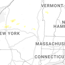


Connect with Interactive Hail Maps