

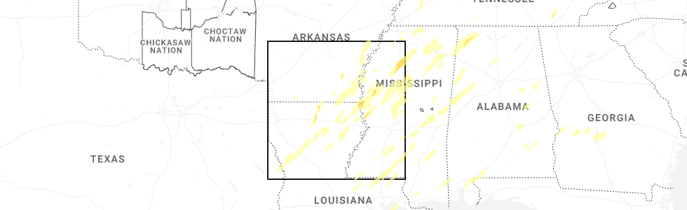
Hail Map for Monticello, AR
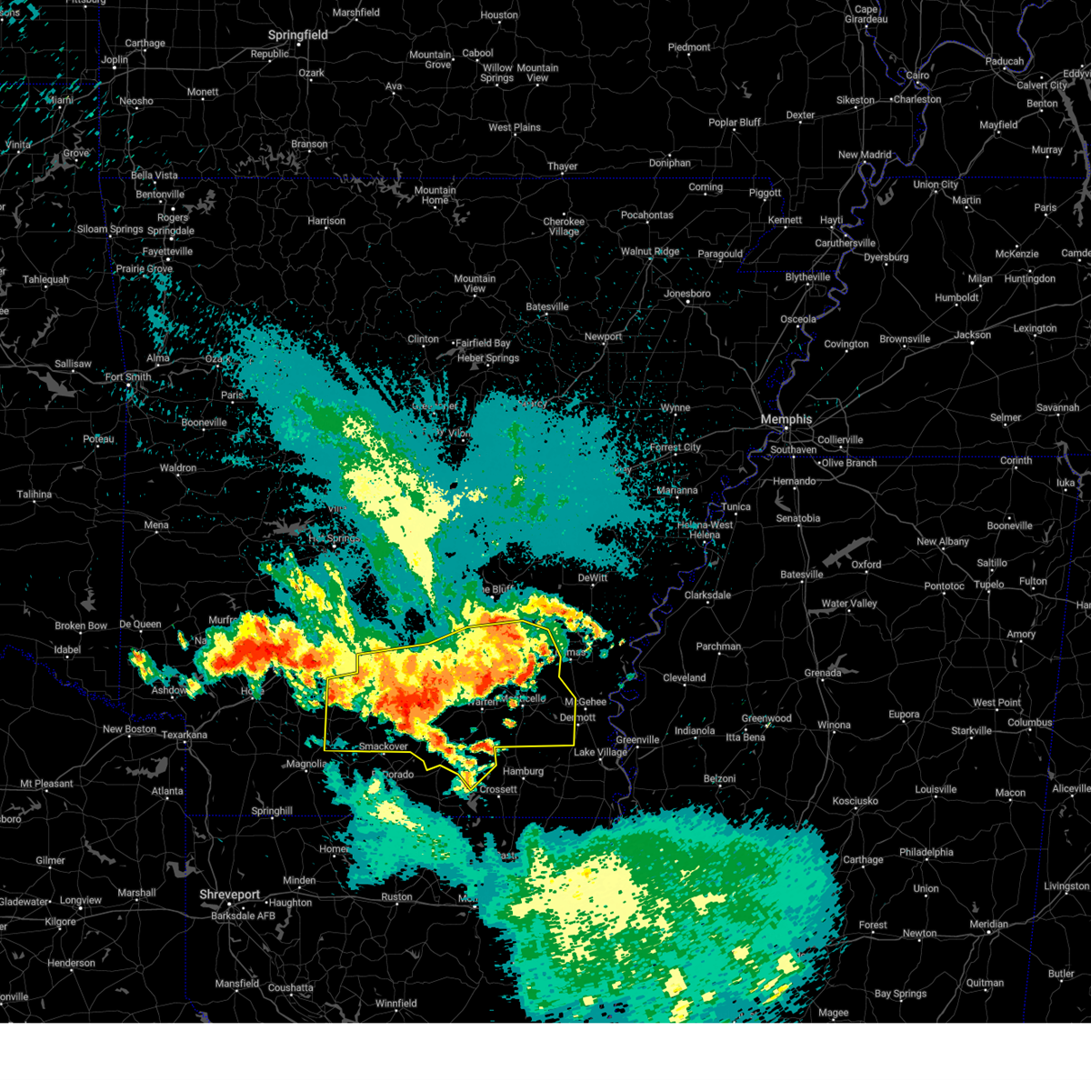
The Monticello, AR area has had 11 reports of on-the-ground hail by trained spotters, and has been under severe weather warnings 52 times during the past 12 months. Doppler radar has detected hail at or near Monticello, AR on 63 occasions, including 5 occasions during the past year.
| Name: | Monticello, AR |
| Where Located: | 58.7 miles N of Bastrop, LA |
| Map: | Google Map for Monticello, AR |
| Population: | 9467 |
| Housing Units: | 4093 |
| More Info: | Search Google for Monticello, AR |
2
The Top Recent Hail Date for Monticello, AR is Saturday, March 15, 2025 (15th out of 63)
Hail and Wind Damage Spotted near Monticello, AR
| Date / Time | Report Details |
|---|---|
| 6/19/2025 5:11 PM CDT |
 The storm which prompted the warning has weakened below severe limits, and no longer poses an immediate threat to life or property. therefore, the warning will be allowed to expire. The storm which prompted the warning has weakened below severe limits, and no longer poses an immediate threat to life or property. therefore, the warning will be allowed to expire.
|
| 6/19/2025 5:09 PM CDT |
 the tornado warning has been cancelled and is no longer in effect the tornado warning has been cancelled and is no longer in effect
|
| 6/19/2025 5:06 PM CDT |
 At 506 pm cdt, a severe thunderstorm was located 8 miles east of ladelle, or 12 miles west of dermott, moving southeast at 30 mph (radar indicated). Hazards include 60 mph wind gusts and quarter size hail. Hail damage to vehicles is expected. expect wind damage to roofs, siding, and trees. Locations impacted include, dermott, ladelle, jerome, baxter, enon, and collins. At 506 pm cdt, a severe thunderstorm was located 8 miles east of ladelle, or 12 miles west of dermott, moving southeast at 30 mph (radar indicated). Hazards include 60 mph wind gusts and quarter size hail. Hail damage to vehicles is expected. expect wind damage to roofs, siding, and trees. Locations impacted include, dermott, ladelle, jerome, baxter, enon, and collins.
|
| 6/19/2025 5:03 PM CDT | At 459 pm cdt, a severe thunderstorm capable of producing a tornado was located near ladelle, or 9 miles southeast of monticello, moving southeast at 25 mph (radar indicated rotation). Hazards include tornado and quarter size hail. Flying debris will be dangerous to those caught without shelter. mobile homes will be damaged or destroyed. damage to roofs, windows, and vehicles will occur. tree damage is likely. Locations impacted include, monticello, jerome, enon, and collins. |
| 6/19/2025 4:41 PM CDT |
 Torlzk the national weather service in little rock has issued a * tornado warning for, southern drew county in southeastern arkansas, * until 530 pm cdt. * at 441 pm cdt, a severe thunderstorm capable of producing a tornado was located near monticello, moving southeast at 30 mph (radar indicated rotation). Hazards include tornado and quarter size hail. Flying debris will be dangerous to those caught without shelter. mobile homes will be damaged or destroyed. damage to roofs, windows, and vehicles will occur. Tree damage is likely. Torlzk the national weather service in little rock has issued a * tornado warning for, southern drew county in southeastern arkansas, * until 530 pm cdt. * at 441 pm cdt, a severe thunderstorm capable of producing a tornado was located near monticello, moving southeast at 30 mph (radar indicated rotation). Hazards include tornado and quarter size hail. Flying debris will be dangerous to those caught without shelter. mobile homes will be damaged or destroyed. damage to roofs, windows, and vehicles will occur. Tree damage is likely.
|
| 6/19/2025 4:37 PM CDT |
 Svrlzk the national weather service in little rock has issued a * severe thunderstorm warning for, drew county in southeastern arkansas, * until 515 pm cdt. * at 437 pm cdt, a severe thunderstorm was located over monticello, moving southeast at 30 mph (radar indicated). Hazards include 60 mph wind gusts and quarter size hail. Hail damage to vehicles is expected. Expect wind damage to roofs, siding, and trees. Svrlzk the national weather service in little rock has issued a * severe thunderstorm warning for, drew county in southeastern arkansas, * until 515 pm cdt. * at 437 pm cdt, a severe thunderstorm was located over monticello, moving southeast at 30 mph (radar indicated). Hazards include 60 mph wind gusts and quarter size hail. Hail damage to vehicles is expected. Expect wind damage to roofs, siding, and trees.
|
| 6/19/2025 4:21 PM CDT | the severe thunderstorm warning has been cancelled and is no longer in effect |
| 6/19/2025 4:21 PM CDT | At 420 pm cdt, severe thunderstorms were located along a line extending from near monticello to near warren, moving southeast at 25 mph (radar indicated). Hazards include 60 mph wind gusts and quarter size hail. Hail damage to vehicles is expected. expect wind damage to roofs, siding, and trees. Locations impacted include, monticello, warren, wilmar, green hill, ladelle, prairie grove, jerome, new hope in drew county, carmel, enon, johnsonville, collins, montongo, valley, mt olive in bradley county, coleman, sumpter, lacey,. |
| 6/19/2025 3:48 PM CDT | Svrlzk the national weather service in little rock has issued a * severe thunderstorm warning for, bradley county in southeastern arkansas, southeastern cleveland county in southeastern arkansas, drew county in southeastern arkansas, southwestern lincoln county in southeastern arkansas, * until 445 pm cdt. * at 348 pm cdt, severe thunderstorms were located along a line extending from plantersville to near weeks, moving south at 20 mph (radar indicated). Hazards include 60 mph wind gusts and quarter size hail. Hail damage to vehicles is expected. Expect wind damage to roofs, siding, and trees. |
| 6/8/2025 12:37 AM CDT |
 At 1237 am cdt, a severe thunderstorm was located near ladelle, or 11 miles southwest of monticello, moving southeast at 30 mph (radar indicated). Hazards include 60 mph wind gusts and quarter size hail. Hail damage to vehicles is expected. expect wind damage to roofs, siding, and trees. Locations impacted include, new hope in drew county, green hill, monticello, wilmar, sumpter, valley,. At 1237 am cdt, a severe thunderstorm was located near ladelle, or 11 miles southwest of monticello, moving southeast at 30 mph (radar indicated). Hazards include 60 mph wind gusts and quarter size hail. Hail damage to vehicles is expected. expect wind damage to roofs, siding, and trees. Locations impacted include, new hope in drew county, green hill, monticello, wilmar, sumpter, valley,.
|
| 6/8/2025 12:31 AM CDT |
 At 1231 am cdt, a severe thunderstorm was located near green hill, or 10 miles southeast of warren, moving southeast at 30 mph (radar indicated). Hazards include 60 mph wind gusts and quarter size hail. Hail damage to vehicles is expected. expect wind damage to roofs, siding, and trees. Locations impacted include, new hope in drew county, green hill, carmel, warren, valley, monticello, wilmar, sumpter,. At 1231 am cdt, a severe thunderstorm was located near green hill, or 10 miles southeast of warren, moving southeast at 30 mph (radar indicated). Hazards include 60 mph wind gusts and quarter size hail. Hail damage to vehicles is expected. expect wind damage to roofs, siding, and trees. Locations impacted include, new hope in drew county, green hill, carmel, warren, valley, monticello, wilmar, sumpter,.
|
| 6/8/2025 12:31 AM CDT |
 the severe thunderstorm warning has been cancelled and is no longer in effect the severe thunderstorm warning has been cancelled and is no longer in effect
|
| 6/8/2025 12:16 AM CDT |
 At 1215 am cdt, a severe thunderstorm was located over warren, moving southeast at 30 mph (radar indicated). Hazards include 60 mph wind gusts and quarter size hail. Hail damage to vehicles is expected. expect wind damage to roofs, siding, and trees. Locations impacted include, new hope in drew county, green hill, carmel, warren, mckinney, valley, monticello, wilmar, sumpter, farmville,. At 1215 am cdt, a severe thunderstorm was located over warren, moving southeast at 30 mph (radar indicated). Hazards include 60 mph wind gusts and quarter size hail. Hail damage to vehicles is expected. expect wind damage to roofs, siding, and trees. Locations impacted include, new hope in drew county, green hill, carmel, warren, mckinney, valley, monticello, wilmar, sumpter, farmville,.
|
| 6/8/2025 12:16 AM CDT |
 the severe thunderstorm warning has been cancelled and is no longer in effect the severe thunderstorm warning has been cancelled and is no longer in effect
|
| 6/7/2025 11:59 PM CDT |
 Svrlzk the national weather service in little rock has issued a * severe thunderstorm warning for, northern bradley county in southeastern arkansas, south central cleveland county in southeastern arkansas, northeastern calhoun county in southwestern arkansas, southwestern drew county in southeastern arkansas, * until 1245 am cdt. * at 1159 pm cdt, a severe thunderstorm was located over weeks, or 7 miles west of warren, moving southeast at 35 mph (radar indicated). Hazards include 60 mph wind gusts and quarter size hail. Hail damage to vehicles is expected. Expect wind damage to roofs, siding, and trees. Svrlzk the national weather service in little rock has issued a * severe thunderstorm warning for, northern bradley county in southeastern arkansas, south central cleveland county in southeastern arkansas, northeastern calhoun county in southwestern arkansas, southwestern drew county in southeastern arkansas, * until 1245 am cdt. * at 1159 pm cdt, a severe thunderstorm was located over weeks, or 7 miles west of warren, moving southeast at 35 mph (radar indicated). Hazards include 60 mph wind gusts and quarter size hail. Hail damage to vehicles is expected. Expect wind damage to roofs, siding, and trees.
|
| 4/5/2025 2:05 PM CDT |
 At 205 pm cdt, severe thunderstorms were located along a line extending from near watkins corner to 6 miles northwest of pea ridge to 8 miles southwest of dermott, moving northeast at 50 mph (radar indicated). Hazards include 60 mph wind gusts and quarter size hail. Hail damage to vehicles is expected. expect wind damage to roofs, siding, and trees. Locations impacted include, de luce, florence, tyro, watson, tichnor, reedville, selma, lucca landing, morgan point recreation area, pea ridge, mcgehee, reed, tillar, little bayou meto park, weber, baxter, halley, fresno, collins, douglas,. At 205 pm cdt, severe thunderstorms were located along a line extending from near watkins corner to 6 miles northwest of pea ridge to 8 miles southwest of dermott, moving northeast at 50 mph (radar indicated). Hazards include 60 mph wind gusts and quarter size hail. Hail damage to vehicles is expected. expect wind damage to roofs, siding, and trees. Locations impacted include, de luce, florence, tyro, watson, tichnor, reedville, selma, lucca landing, morgan point recreation area, pea ridge, mcgehee, reed, tillar, little bayou meto park, weber, baxter, halley, fresno, collins, douglas,.
|
| 4/5/2025 1:47 PM CDT | the severe thunderstorm warning has been cancelled and is no longer in effect |
| 4/5/2025 1:47 PM CDT | At 147 pm cdt, severe thunderstorms were located along a line extending from near st. charles to near mills to near ladelle, moving east at 45 mph (radar indicated). Hazards include 60 mph wind gusts and quarter size hail. Hail damage to vehicles is expected. expect wind damage to roofs, siding, and trees. Locations impacted include, de luce, florence, tyro, watson, wilmar, tichnor, reedville, selma, plantersville, lucca landing, morgan point recreation area, pea ridge, mcgehee, reed, tillar, little bayou meto park, weber, star city, relfs bluff, baxter,. |
| 4/5/2025 1:31 PM CDT |
 Torlzk the national weather service in little rock has issued a * tornado warning for, southwestern desha county in southeastern arkansas, northeastern drew county in southeastern arkansas, south central lincoln county in southeastern arkansas, * until 215 pm cdt. * at 131 pm cdt, a severe thunderstorm capable of producing a tornado was located over monticello, moving northeast at 35 mph (radar indicated rotation). Hazards include tornado. Flying debris will be dangerous to those caught without shelter. mobile homes will be damaged or destroyed. damage to roofs, windows, and vehicles will occur. Tree damage is likely. Torlzk the national weather service in little rock has issued a * tornado warning for, southwestern desha county in southeastern arkansas, northeastern drew county in southeastern arkansas, south central lincoln county in southeastern arkansas, * until 215 pm cdt. * at 131 pm cdt, a severe thunderstorm capable of producing a tornado was located over monticello, moving northeast at 35 mph (radar indicated rotation). Hazards include tornado. Flying debris will be dangerous to those caught without shelter. mobile homes will be damaged or destroyed. damage to roofs, windows, and vehicles will occur. Tree damage is likely.
|
| 4/5/2025 1:28 PM CDT |
 Svrlzk the national weather service in little rock has issued a * severe thunderstorm warning for, bradley county in southeastern arkansas, southeastern cleveland county in southeastern arkansas, desha county in southeastern arkansas, southeastern monroe county in eastern arkansas, drew county in southeastern arkansas, southeastern jefferson county in southeastern arkansas, lincoln county in southeastern arkansas, arkansas county in southeastern arkansas, * until 215 pm cdt. * at 128 pm cdt, severe thunderstorms were located along a line extending from near st. charles to near mills to 6 miles west of old milo, moving northeast at 50 mph (radar indicated). Hazards include 60 mph wind gusts and nickel size hail. expect damage to roofs, siding, and trees Svrlzk the national weather service in little rock has issued a * severe thunderstorm warning for, bradley county in southeastern arkansas, southeastern cleveland county in southeastern arkansas, desha county in southeastern arkansas, southeastern monroe county in eastern arkansas, drew county in southeastern arkansas, southeastern jefferson county in southeastern arkansas, lincoln county in southeastern arkansas, arkansas county in southeastern arkansas, * until 215 pm cdt. * at 128 pm cdt, severe thunderstorms were located along a line extending from near st. charles to near mills to 6 miles west of old milo, moving northeast at 50 mph (radar indicated). Hazards include 60 mph wind gusts and nickel size hail. expect damage to roofs, siding, and trees
|
| 3/31/2025 2:04 AM CDT |
 At 203 am cdt, a severe thunderstorm was located near monticello, moving northeast at 40 mph (radar indicated). Hazards include 60 mph wind gusts and quarter size hail. Hail damage to vehicles is expected. expect wind damage to roofs, siding, and trees. Locations impacted include, enon, omega, selma, lucca landing, masonville, yukon, pea ridge, mcgehee, reed, tillar, kelso, ladelle, new hope in drew county, green hill, rohwer, baxter, monticello, halley, prairie grove, collins,. At 203 am cdt, a severe thunderstorm was located near monticello, moving northeast at 40 mph (radar indicated). Hazards include 60 mph wind gusts and quarter size hail. Hail damage to vehicles is expected. expect wind damage to roofs, siding, and trees. Locations impacted include, enon, omega, selma, lucca landing, masonville, yukon, pea ridge, mcgehee, reed, tillar, kelso, ladelle, new hope in drew county, green hill, rohwer, baxter, monticello, halley, prairie grove, collins,.
|
| 3/31/2025 1:52 AM CDT |
 Svrlzk the national weather service in little rock has issued a * severe thunderstorm warning for, southwestern desha county in southeastern arkansas, drew county in southeastern arkansas, * until 230 am cdt. * at 151 am cdt, a severe thunderstorm was located near monticello, moving northeast at 40 mph (radar indicated). Hazards include 60 mph wind gusts and quarter size hail. Hail damage to vehicles is expected. Expect wind damage to roofs, siding, and trees. Svrlzk the national weather service in little rock has issued a * severe thunderstorm warning for, southwestern desha county in southeastern arkansas, drew county in southeastern arkansas, * until 230 am cdt. * at 151 am cdt, a severe thunderstorm was located near monticello, moving northeast at 40 mph (radar indicated). Hazards include 60 mph wind gusts and quarter size hail. Hail damage to vehicles is expected. Expect wind damage to roofs, siding, and trees.
|
| 3/15/2025 9:00 AM CDT |
 the severe thunderstorm warning has been cancelled and is no longer in effect the severe thunderstorm warning has been cancelled and is no longer in effect
|
| 3/15/2025 8:33 AM CDT |
 At 832 am cdt, severe thunderstorms were located along a line extending from 8 miles southwest of tillar to near monticello to wilmar, moving north at 50 mph (radar indicated). Hazards include 60 mph wind gusts and penny size hail. Expect damage to roofs, siding, and trees. Locations impacted include, garrett bridge, gourd, florence, enon, tyro, rose hill, wilmar, reedville, omega, selma, plantersville, yukon, montongo, cane creek state park, mills, relfs bluff, green hill, pendleton, calhoun, mitchellville,. At 832 am cdt, severe thunderstorms were located along a line extending from 8 miles southwest of tillar to near monticello to wilmar, moving north at 50 mph (radar indicated). Hazards include 60 mph wind gusts and penny size hail. Expect damage to roofs, siding, and trees. Locations impacted include, garrett bridge, gourd, florence, enon, tyro, rose hill, wilmar, reedville, omega, selma, plantersville, yukon, montongo, cane creek state park, mills, relfs bluff, green hill, pendleton, calhoun, mitchellville,.
|
| 3/15/2025 8:33 AM CDT |
 the severe thunderstorm warning has been cancelled and is no longer in effect the severe thunderstorm warning has been cancelled and is no longer in effect
|
| 3/15/2025 8:25 AM CDT |
 the severe thunderstorm warning has been cancelled and is no longer in effect the severe thunderstorm warning has been cancelled and is no longer in effect
|
| 3/15/2025 8:16 AM CDT |
 Svrlzk the national weather service in little rock has issued a * severe thunderstorm warning for, east central bradley county in southeastern arkansas, southwestern desha county in southeastern arkansas, drew county in southeastern arkansas, southern lincoln county in southeastern arkansas, southern arkansas county in southeastern arkansas, * until 915 am cdt. * at 815 am cdt, severe thunderstorms were located along a line extending from near dermott to 12 miles southeast of monticello to near ladelle to 8 miles west of fountain hill, moving north at 30 mph (radar indicated). Hazards include 60 mph wind gusts and quarter size hail. Hail damage to vehicles is expected. Expect wind damage to roofs, siding, and trees. Svrlzk the national weather service in little rock has issued a * severe thunderstorm warning for, east central bradley county in southeastern arkansas, southwestern desha county in southeastern arkansas, drew county in southeastern arkansas, southern lincoln county in southeastern arkansas, southern arkansas county in southeastern arkansas, * until 915 am cdt. * at 815 am cdt, severe thunderstorms were located along a line extending from near dermott to 12 miles southeast of monticello to near ladelle to 8 miles west of fountain hill, moving north at 30 mph (radar indicated). Hazards include 60 mph wind gusts and quarter size hail. Hail damage to vehicles is expected. Expect wind damage to roofs, siding, and trees.
|
| 3/15/2025 8:02 AM CDT |
 Svrlzk the national weather service in little rock has issued a * severe thunderstorm warning for, west central desha county in southeastern arkansas, north central drew county in southeastern arkansas, southeastern lincoln county in southeastern arkansas, * until 845 am cdt. * at 802 am cdt, a severe thunderstorm was located near monticello, moving northeast at 35 mph (radar indicated). Hazards include 60 mph wind gusts and quarter size hail. Hail damage to vehicles is expected. Expect wind damage to roofs, siding, and trees. Svrlzk the national weather service in little rock has issued a * severe thunderstorm warning for, west central desha county in southeastern arkansas, north central drew county in southeastern arkansas, southeastern lincoln county in southeastern arkansas, * until 845 am cdt. * at 802 am cdt, a severe thunderstorm was located near monticello, moving northeast at 35 mph (radar indicated). Hazards include 60 mph wind gusts and quarter size hail. Hail damage to vehicles is expected. Expect wind damage to roofs, siding, and trees.
|
| 3/15/2025 7:34 AM CDT |
 At 734 am cdt, a severe thunderstorm was located over ladelle, or 8 miles south of monticello, moving northeast at 45 mph (radar indicated). Hazards include 60 mph wind gusts and quarter size hail. Hail damage to vehicles is expected. expect wind damage to roofs, siding, and trees. Locations impacted include, wilmar, plantersville, lucca landing, masonville, mcgehee, reed, montongo, tillar, kelso, relfs bluff, ladelle, new hope in drew county, green hill, rohwer, baxter, brandon, monticello, prairie grove, collins, mcarthur,. At 734 am cdt, a severe thunderstorm was located over ladelle, or 8 miles south of monticello, moving northeast at 45 mph (radar indicated). Hazards include 60 mph wind gusts and quarter size hail. Hail damage to vehicles is expected. expect wind damage to roofs, siding, and trees. Locations impacted include, wilmar, plantersville, lucca landing, masonville, mcgehee, reed, montongo, tillar, kelso, relfs bluff, ladelle, new hope in drew county, green hill, rohwer, baxter, brandon, monticello, prairie grove, collins, mcarthur,.
|
| 3/15/2025 7:19 AM CDT |
 At 719 am cdt, severe thunderstorms were located along a line extending from near old milo to near ladelle to 7 miles west of dermott to near lucca landing, moving northeast at 40 mph (public). Hazards include 70 mph wind gusts and quarter size hail. Hail damage to vehicles is expected. expect considerable tree damage. wind damage is also likely to mobile homes, roofs, and outbuildings. Locations impacted include, wilmar, plantersville, lucca landing, masonville, mcgehee, reed, montongo, tillar, kelso, relfs bluff, ladelle, new hope in drew county, green hill, rohwer, baxter, brandon, monticello, prairie grove, collins, mcarthur,. At 719 am cdt, severe thunderstorms were located along a line extending from near old milo to near ladelle to 7 miles west of dermott to near lucca landing, moving northeast at 40 mph (public). Hazards include 70 mph wind gusts and quarter size hail. Hail damage to vehicles is expected. expect considerable tree damage. wind damage is also likely to mobile homes, roofs, and outbuildings. Locations impacted include, wilmar, plantersville, lucca landing, masonville, mcgehee, reed, montongo, tillar, kelso, relfs bluff, ladelle, new hope in drew county, green hill, rohwer, baxter, brandon, monticello, prairie grove, collins, mcarthur,.
|
| 3/15/2025 7:16 AM CDT |
 Svrlzk the national weather service in little rock has issued a * severe thunderstorm warning for, northeastern bradley county in southeastern arkansas, southwestern desha county in southeastern arkansas, drew county in southeastern arkansas, southern lincoln county in southeastern arkansas, * until 745 am cdt. * at 716 am cdt, severe thunderstorms were located along a line extending from near old milo to near ladelle to 8 miles west of dermott to near arkansas city, moving northeast at 70 mph (public). Hazards include 60 mph wind gusts and quarter size hail. Hail damage to vehicles is expected. Expect wind damage to roofs, siding, and trees. Svrlzk the national weather service in little rock has issued a * severe thunderstorm warning for, northeastern bradley county in southeastern arkansas, southwestern desha county in southeastern arkansas, drew county in southeastern arkansas, southern lincoln county in southeastern arkansas, * until 745 am cdt. * at 716 am cdt, severe thunderstorms were located along a line extending from near old milo to near ladelle to 8 miles west of dermott to near arkansas city, moving northeast at 70 mph (public). Hazards include 60 mph wind gusts and quarter size hail. Hail damage to vehicles is expected. Expect wind damage to roofs, siding, and trees.
|
| 3/15/2025 7:06 AM CDT |
 Svrlzk the national weather service in little rock has issued a * severe thunderstorm warning for, northern desha county in southeastern arkansas, southeastern monroe county in eastern arkansas, eastern drew county in southeastern arkansas, southeastern jefferson county in southeastern arkansas, central lincoln county in southeastern arkansas, southeastern arkansas county in southeastern arkansas, * until 800 am cdt. * at 706 am cdt, severe thunderstorms were located along a line extending from near yancopin to winchester to 6 miles southeast of monticello, moving north at 30 mph (radar indicated). Hazards include 60 mph wind gusts and quarter size hail. Hail damage to vehicles is expected. Expect wind damage to roofs, siding, and trees. Svrlzk the national weather service in little rock has issued a * severe thunderstorm warning for, northern desha county in southeastern arkansas, southeastern monroe county in eastern arkansas, eastern drew county in southeastern arkansas, southeastern jefferson county in southeastern arkansas, central lincoln county in southeastern arkansas, southeastern arkansas county in southeastern arkansas, * until 800 am cdt. * at 706 am cdt, severe thunderstorms were located along a line extending from near yancopin to winchester to 6 miles southeast of monticello, moving north at 30 mph (radar indicated). Hazards include 60 mph wind gusts and quarter size hail. Hail damage to vehicles is expected. Expect wind damage to roofs, siding, and trees.
|
| 3/15/2025 6:18 AM CDT |
 Svrlzk the national weather service in little rock has issued a * severe thunderstorm warning for, eastern bradley county in southeastern arkansas, southern desha county in southeastern arkansas, drew county in southeastern arkansas, * until 715 am cdt. * at 617 am cdt, severe thunderstorms were located along a line extending from near mcmillan corner to near berlin, moving north at 35 mph (radar indicated). Hazards include 60 mph wind gusts and quarter size hail. Hail damage to vehicles is expected. Expect wind damage to roofs, siding, and trees. Svrlzk the national weather service in little rock has issued a * severe thunderstorm warning for, eastern bradley county in southeastern arkansas, southern desha county in southeastern arkansas, drew county in southeastern arkansas, * until 715 am cdt. * at 617 am cdt, severe thunderstorms were located along a line extending from near mcmillan corner to near berlin, moving north at 35 mph (radar indicated). Hazards include 60 mph wind gusts and quarter size hail. Hail damage to vehicles is expected. Expect wind damage to roofs, siding, and trees.
|
| 3/4/2025 11:51 AM CST |
 At 1150 am cst, severe thunderstorms were located along a line extending from 7 miles southwest of cane creek state park to 6 miles east of monticello to near hamburg, moving east at 40 mph (radar indicated). Hazards include 60 mph wind gusts and penny size hail. Expect damage to roofs, siding, and trees. Locations impacted include, collins, gourd, florence, baxter, enon, tyro, jerome, prairie grove, selma, winchester,. At 1150 am cst, severe thunderstorms were located along a line extending from 7 miles southwest of cane creek state park to 6 miles east of monticello to near hamburg, moving east at 40 mph (radar indicated). Hazards include 60 mph wind gusts and penny size hail. Expect damage to roofs, siding, and trees. Locations impacted include, collins, gourd, florence, baxter, enon, tyro, jerome, prairie grove, selma, winchester,.
|
| 3/4/2025 11:48 AM CST |
 At 1147 am cst, severe thunderstorms were located along a line extending from 7 miles southeast of cane creek state park to near monticello to hamburg, moving east at 45 mph (radar indicated). Hazards include 60 mph wind gusts and penny size hail. Expect damage to roofs, siding, and trees. Locations impacted include, new hope in drew county, green hill, gourd, florence, baxter, brandon, enon, tyro, monticello, wilmar, prairie grove, selma, plantersville, collins, valley, montongo, rock springs, coleman, jerome, lacey,. At 1147 am cst, severe thunderstorms were located along a line extending from 7 miles southeast of cane creek state park to near monticello to hamburg, moving east at 45 mph (radar indicated). Hazards include 60 mph wind gusts and penny size hail. Expect damage to roofs, siding, and trees. Locations impacted include, new hope in drew county, green hill, gourd, florence, baxter, brandon, enon, tyro, monticello, wilmar, prairie grove, selma, plantersville, collins, valley, montongo, rock springs, coleman, jerome, lacey,.
|
| 3/4/2025 11:20 AM CST |
 Svrlzk the national weather service in little rock has issued a * severe thunderstorm warning for, drew county in southeastern arkansas, southwestern lincoln county in southeastern arkansas, * until 1215 pm cst. * at 1119 am cst, severe thunderstorms were located along a line extending from grapevine to warren to near west crossett, moving east at 45 mph (radar indicated). Hazards include 60 mph wind gusts and penny size hail. expect damage to roofs, siding, and trees Svrlzk the national weather service in little rock has issued a * severe thunderstorm warning for, drew county in southeastern arkansas, southwestern lincoln county in southeastern arkansas, * until 1215 pm cst. * at 1119 am cst, severe thunderstorms were located along a line extending from grapevine to warren to near west crossett, moving east at 45 mph (radar indicated). Hazards include 60 mph wind gusts and penny size hail. expect damage to roofs, siding, and trees
|
| 1/5/2025 2:27 PM CST |
 Svrlzk the national weather service in little rock has issued a * severe thunderstorm warning for, desha county in southeastern arkansas, drew county in southeastern arkansas, southeastern jefferson county in southeastern arkansas, southeastern lincoln county in southeastern arkansas, southeastern arkansas county in southeastern arkansas, * until 330 pm cst. * at 226 pm cst, severe thunderstorms were located along a line extending from near douglas to near monticello, moving east at 55 mph (radar indicated). Hazards include 60 mph wind gusts and quarter size hail. Hail damage to vehicles is expected. Expect wind damage to roofs, siding, and trees. Svrlzk the national weather service in little rock has issued a * severe thunderstorm warning for, desha county in southeastern arkansas, drew county in southeastern arkansas, southeastern jefferson county in southeastern arkansas, southeastern lincoln county in southeastern arkansas, southeastern arkansas county in southeastern arkansas, * until 330 pm cst. * at 226 pm cst, severe thunderstorms were located along a line extending from near douglas to near monticello, moving east at 55 mph (radar indicated). Hazards include 60 mph wind gusts and quarter size hail. Hail damage to vehicles is expected. Expect wind damage to roofs, siding, and trees.
|
| 12/28/2024 10:54 AM CST |
 The storm which prompted the warning has weakened below severe limits, and no longer poses an immediate threat to life or property. therefore, the warning will be allowed to expire. however small hail and gusty winds are still possible with this thunderstorm. The storm which prompted the warning has weakened below severe limits, and no longer poses an immediate threat to life or property. therefore, the warning will be allowed to expire. however small hail and gusty winds are still possible with this thunderstorm.
|
| 12/28/2024 10:32 AM CST |
 the severe thunderstorm warning has been cancelled and is no longer in effect the severe thunderstorm warning has been cancelled and is no longer in effect
|
| 12/28/2024 10:32 AM CST |
 At 1032 am cst, a severe thunderstorm was located near ladelle, or 12 miles southwest of monticello, moving northeast at 30 mph (radar indicated). Hazards include 60 mph wind gusts and quarter size hail. Hail damage to vehicles is expected. expect wind damage to roofs, siding, and trees. Locations impacted include, monticello, green hill, ladelle, prairie grove, new hope in drew county, enon, lacey,. At 1032 am cst, a severe thunderstorm was located near ladelle, or 12 miles southwest of monticello, moving northeast at 30 mph (radar indicated). Hazards include 60 mph wind gusts and quarter size hail. Hail damage to vehicles is expected. expect wind damage to roofs, siding, and trees. Locations impacted include, monticello, green hill, ladelle, prairie grove, new hope in drew county, enon, lacey,.
|
| 12/28/2024 10:23 AM CST |
 Svrlzk the national weather service in little rock has issued a * severe thunderstorm warning for, southeastern bradley county in southeastern arkansas, southwestern drew county in southeastern arkansas, * until 1100 am cst. * at 1023 am cst, a severe thunderstorm was located near fountain hill, or 14 miles northwest of hamburg, moving northeast at 30 mph (radar indicated). Hazards include 60 mph wind gusts and quarter size hail. Hail damage to vehicles is expected. Expect wind damage to roofs, siding, and trees. Svrlzk the national weather service in little rock has issued a * severe thunderstorm warning for, southeastern bradley county in southeastern arkansas, southwestern drew county in southeastern arkansas, * until 1100 am cst. * at 1023 am cst, a severe thunderstorm was located near fountain hill, or 14 miles northwest of hamburg, moving northeast at 30 mph (radar indicated). Hazards include 60 mph wind gusts and quarter size hail. Hail damage to vehicles is expected. Expect wind damage to roofs, siding, and trees.
|
| 8/18/2024 10:35 PM CDT |
 the severe thunderstorm warning has been cancelled and is no longer in effect the severe thunderstorm warning has been cancelled and is no longer in effect
|
| 8/18/2024 10:35 PM CDT |
 At 1035 pm cdt, severe thunderstorms were located along a line extending from 8 miles east of monticello to near ingalls to near lisbon, moving southeast at 60 mph (radar indicated). Hazards include 60 mph wind gusts. Expect damage to roofs, siding, and trees. Locations impacted include, camden, monticello, warren, hampton, stephens, hermitage, wilmar, harrell, louann, ingalls, plantersville, hampton municipal airport, moro bay, weeks, poison springs state park, cullendale, ellisville, hilo, ladelle, green hill,. At 1035 pm cdt, severe thunderstorms were located along a line extending from 8 miles east of monticello to near ingalls to near lisbon, moving southeast at 60 mph (radar indicated). Hazards include 60 mph wind gusts. Expect damage to roofs, siding, and trees. Locations impacted include, camden, monticello, warren, hampton, stephens, hermitage, wilmar, harrell, louann, ingalls, plantersville, hampton municipal airport, moro bay, weeks, poison springs state park, cullendale, ellisville, hilo, ladelle, green hill,.
|
| 8/18/2024 10:30 PM CDT |
 At 1030 pm cdt, severe thunderstorms were located along a line extending from 7 miles east of monticello to ingalls to near lisbon, moving southeast at 60 mph (radar indicated). Hazards include 60 mph wind gusts. Expect damage to roofs, siding, and trees. Locations impacted include, camden, monticello, warren, hampton, stephens, hermitage, wilmar, harrell, louann, ingalls, plantersville, hampton municipal airport, moro bay, weeks, poison springs state park, cullendale, ellisville, hilo, ladelle, green hill,. At 1030 pm cdt, severe thunderstorms were located along a line extending from 7 miles east of monticello to ingalls to near lisbon, moving southeast at 60 mph (radar indicated). Hazards include 60 mph wind gusts. Expect damage to roofs, siding, and trees. Locations impacted include, camden, monticello, warren, hampton, stephens, hermitage, wilmar, harrell, louann, ingalls, plantersville, hampton municipal airport, moro bay, weeks, poison springs state park, cullendale, ellisville, hilo, ladelle, green hill,.
|
| 8/18/2024 10:30 PM CDT |
 the severe thunderstorm warning has been cancelled and is no longer in effect the severe thunderstorm warning has been cancelled and is no longer in effect
|
| 8/18/2024 10:20 PM CDT |
 the severe thunderstorm warning has been cancelled and is no longer in effect the severe thunderstorm warning has been cancelled and is no longer in effect
|
| 8/18/2024 10:20 PM CDT |
 At 1020 pm cdt, severe thunderstorms were located along a line extending from 8 miles northeast of monticello to hermitage to near louann, moving south at 60 mph (radar indicated). Hazards include 60 mph wind gusts. Expect damage to roofs, siding, and trees. Locations impacted include, camden, monticello, warren, fordyce, star city, rison, hampton, bearden, stephens, hermitage, wilmar, grady, kingsland, sparkman, thornton, chidester, harrell, louann, whitefield, weeks,. At 1020 pm cdt, severe thunderstorms were located along a line extending from 8 miles northeast of monticello to hermitage to near louann, moving south at 60 mph (radar indicated). Hazards include 60 mph wind gusts. Expect damage to roofs, siding, and trees. Locations impacted include, camden, monticello, warren, fordyce, star city, rison, hampton, bearden, stephens, hermitage, wilmar, grady, kingsland, sparkman, thornton, chidester, harrell, louann, whitefield, weeks,.
|
| 8/18/2024 10:10 PM CDT |
 At 1010 pm cdt, severe thunderstorms were located along a line extending from near cane creek state park to near lanark to 7 miles east of stephens, moving south at 50 mph (radar indicated). Hazards include 70 mph wind gusts and nickel size hail. Expect considerable tree damage. damage is likely to mobile homes, roofs, and outbuildings. Locations impacted include, camden, monticello, warren, fordyce, star city, rison, hampton, bearden, stephens, hermitage, wilmar, grady, kingsland, sparkman, thornton, chidester, harrell, louann, whelen springs, whitefield,. At 1010 pm cdt, severe thunderstorms were located along a line extending from near cane creek state park to near lanark to 7 miles east of stephens, moving south at 50 mph (radar indicated). Hazards include 70 mph wind gusts and nickel size hail. Expect considerable tree damage. damage is likely to mobile homes, roofs, and outbuildings. Locations impacted include, camden, monticello, warren, fordyce, star city, rison, hampton, bearden, stephens, hermitage, wilmar, grady, kingsland, sparkman, thornton, chidester, harrell, louann, whelen springs, whitefield,.
|
| 8/18/2024 9:54 PM CDT |
 Svrlzk the national weather service in little rock has issued a * severe thunderstorm warning for, bradley county in southeastern arkansas, cleveland county in southeastern arkansas, southeastern clark county in southwestern arkansas, west central desha county in southeastern arkansas, calhoun county in southwestern arkansas, southern dallas county in southwestern arkansas, ouachita county in southwestern arkansas, drew county in southeastern arkansas, southwestern jefferson county in southeastern arkansas, lincoln county in southeastern arkansas, * until 1045 pm cdt. * at 953 pm cdt, severe thunderstorms were located along a line extending from 6 miles northwest of feenyville to near fordyce to near bluff city, moving southeast at 60 mph (radar indicated). Hazards include 70 mph wind gusts and nickel size hail. Expect considerable tree damage. Damage is likely to mobile homes, roofs, and outbuildings. Svrlzk the national weather service in little rock has issued a * severe thunderstorm warning for, bradley county in southeastern arkansas, cleveland county in southeastern arkansas, southeastern clark county in southwestern arkansas, west central desha county in southeastern arkansas, calhoun county in southwestern arkansas, southern dallas county in southwestern arkansas, ouachita county in southwestern arkansas, drew county in southeastern arkansas, southwestern jefferson county in southeastern arkansas, lincoln county in southeastern arkansas, * until 1045 pm cdt. * at 953 pm cdt, severe thunderstorms were located along a line extending from 6 miles northwest of feenyville to near fordyce to near bluff city, moving southeast at 60 mph (radar indicated). Hazards include 70 mph wind gusts and nickel size hail. Expect considerable tree damage. Damage is likely to mobile homes, roofs, and outbuildings.
|
| 8/18/2024 6:53 PM CDT | Tree limbs blown dow in drew county AR, 1.9 miles SSE of Monticello, AR |
| 8/18/2024 6:53 PM CDT |
 At 653 pm cdt, severe thunderstorms were located along a line extending from near pea ridge to near monticello, moving south at 25 mph (radar indicated). Hazards include 60 mph wind gusts and quarter size hail. Hail damage to vehicles is expected. expect wind damage to roofs, siding, and trees. Locations impacted include, monticello, pea ridge, dumas, dermott, rohwer, gould, wilmar, arkansas city, mitchellville, tillar, watson, winchester, plantersville, lucca landing, mcgehee, yancopin, omega, mills, kelso, ladelle,. At 653 pm cdt, severe thunderstorms were located along a line extending from near pea ridge to near monticello, moving south at 25 mph (radar indicated). Hazards include 60 mph wind gusts and quarter size hail. Hail damage to vehicles is expected. expect wind damage to roofs, siding, and trees. Locations impacted include, monticello, pea ridge, dumas, dermott, rohwer, gould, wilmar, arkansas city, mitchellville, tillar, watson, winchester, plantersville, lucca landing, mcgehee, yancopin, omega, mills, kelso, ladelle,.
|
| 8/18/2024 6:53 PM CDT |
 the severe thunderstorm warning has been cancelled and is no longer in effect the severe thunderstorm warning has been cancelled and is no longer in effect
|
| 8/18/2024 6:52 PM CDT | Trees blown dow in drew county AR, 0.7 miles SE of Monticello, AR |
| 8/18/2024 6:31 PM CDT |
 Svrlzk the national weather service in little rock has issued a * severe thunderstorm warning for, southeastern cleveland county in southeastern arkansas, desha county in southeastern arkansas, drew county in southeastern arkansas, southern lincoln county in southeastern arkansas, * until 730 pm cdt. * at 631 pm cdt, severe thunderstorms were located along a line extending from near mitchellville to 6 miles southeast of cane creek state park, moving southeast at 20 mph (radar indicated). Hazards include 60 mph wind gusts and quarter size hail. Hail damage to vehicles is expected. Expect wind damage to roofs, siding, and trees. Svrlzk the national weather service in little rock has issued a * severe thunderstorm warning for, southeastern cleveland county in southeastern arkansas, desha county in southeastern arkansas, drew county in southeastern arkansas, southern lincoln county in southeastern arkansas, * until 730 pm cdt. * at 631 pm cdt, severe thunderstorms were located along a line extending from near mitchellville to 6 miles southeast of cane creek state park, moving southeast at 20 mph (radar indicated). Hazards include 60 mph wind gusts and quarter size hail. Hail damage to vehicles is expected. Expect wind damage to roofs, siding, and trees.
|
| 6/3/2024 7:28 PM CDT |
 the severe thunderstorm warning has been cancelled and is no longer in effect the severe thunderstorm warning has been cancelled and is no longer in effect
|
| 6/3/2024 7:24 PM CDT |
 The storms which prompted the warning have weakened below severe limits, and no longer pose an immediate threat to life or property. therefore, the warning will be allowed to expire. however gusty winds are still possible with these thunderstorms. a severe thunderstorm watch remains in effect until 900 pm cdt for southeastern arkansas. The storms which prompted the warning have weakened below severe limits, and no longer pose an immediate threat to life or property. therefore, the warning will be allowed to expire. however gusty winds are still possible with these thunderstorms. a severe thunderstorm watch remains in effect until 900 pm cdt for southeastern arkansas.
|
| 6/3/2024 7:20 PM CDT |
 the severe thunderstorm warning has been cancelled and is no longer in effect the severe thunderstorm warning has been cancelled and is no longer in effect
|
| 6/3/2024 7:20 PM CDT |
 At 719 pm cdt, severe thunderstorms were located along a line extending from near stuttgart to near douglas to near monticello to 8 miles southeast of ingalls, moving east at 35 mph (radar indicated). Hazards include 60 mph wind gusts. Expect damage to roofs, siding, and trees. Locations impacted include, monticello, pea ridge, dumas, dermott, rosedale, rohwer, gould, gillett, wilmar, grady, arkansas city, mitchellville, tillar, watson, winchester, ingalls, plantersville, lucca landing, mcgehee, little bayou meto park,. At 719 pm cdt, severe thunderstorms were located along a line extending from near stuttgart to near douglas to near monticello to 8 miles southeast of ingalls, moving east at 35 mph (radar indicated). Hazards include 60 mph wind gusts. Expect damage to roofs, siding, and trees. Locations impacted include, monticello, pea ridge, dumas, dermott, rosedale, rohwer, gould, gillett, wilmar, grady, arkansas city, mitchellville, tillar, watson, winchester, ingalls, plantersville, lucca landing, mcgehee, little bayou meto park,.
|
| 6/3/2024 7:18 PM CDT |
 the severe thunderstorm warning has been cancelled and is no longer in effect the severe thunderstorm warning has been cancelled and is no longer in effect
|
| 6/3/2024 7:18 PM CDT |
 At 717 pm cdt, severe thunderstorms were located along a line extending from near monticello to near old milo to 6 miles west of west crossett, moving southeast at 40 mph (radar indicated). Hazards include 60 mph wind gusts. Expect damage to roofs, siding, and trees. Locations impacted include, monticello, warren, hermitage, wilmar, green hill, ingalls, brandon, plantersville, ladelle, new hope in drew county, carmel, florence, johnsonville, blanchton, vick, valley, montongo, mt olive in bradley county, rock springs, coleman,. At 717 pm cdt, severe thunderstorms were located along a line extending from near monticello to near old milo to 6 miles west of west crossett, moving southeast at 40 mph (radar indicated). Hazards include 60 mph wind gusts. Expect damage to roofs, siding, and trees. Locations impacted include, monticello, warren, hermitage, wilmar, green hill, ingalls, brandon, plantersville, ladelle, new hope in drew county, carmel, florence, johnsonville, blanchton, vick, valley, montongo, mt olive in bradley county, rock springs, coleman,.
|
| 6/3/2024 7:11 PM CDT |
 Svrlzk the national weather service in little rock has issued a * severe thunderstorm warning for, southeastern bradley county in southeastern arkansas, desha county in southeastern arkansas, southeastern monroe county in eastern arkansas, drew county in southeastern arkansas, southeastern jefferson county in southeastern arkansas, central lincoln county in southeastern arkansas, arkansas county in southeastern arkansas, * until 800 pm cdt. * at 711 pm cdt, severe thunderstorms were located along a line extending from near stuttgart to douglas to near monticello to 6 miles south of ingalls, moving east at 35 mph (radar indicated). Hazards include 60 mph wind gusts. expect damage to roofs, siding, and trees Svrlzk the national weather service in little rock has issued a * severe thunderstorm warning for, southeastern bradley county in southeastern arkansas, desha county in southeastern arkansas, southeastern monroe county in eastern arkansas, drew county in southeastern arkansas, southeastern jefferson county in southeastern arkansas, central lincoln county in southeastern arkansas, arkansas county in southeastern arkansas, * until 800 pm cdt. * at 711 pm cdt, severe thunderstorms were located along a line extending from near stuttgart to douglas to near monticello to 6 miles south of ingalls, moving east at 35 mph (radar indicated). Hazards include 60 mph wind gusts. expect damage to roofs, siding, and trees
|
| 6/3/2024 7:04 PM CDT |
 At 704 pm cdt, severe thunderstorms were located along a line extending from brandon to near ingalls to 7 miles southeast of moro bay state park, moving southeast at 35 mph (radar indicated). Hazards include 60 mph wind gusts. Expect damage to roofs, siding, and trees. Locations impacted include, monticello, warren, hermitage, wilmar, ingalls, hilo, plantersville, moro bay, ladelle, green hill, brandon, moro bay state park, herbine, carmel, farmville, florence, johnsonville, vick, montongo, gravelridge,. At 704 pm cdt, severe thunderstorms were located along a line extending from brandon to near ingalls to 7 miles southeast of moro bay state park, moving southeast at 35 mph (radar indicated). Hazards include 60 mph wind gusts. Expect damage to roofs, siding, and trees. Locations impacted include, monticello, warren, hermitage, wilmar, ingalls, hilo, plantersville, moro bay, ladelle, green hill, brandon, moro bay state park, herbine, carmel, farmville, florence, johnsonville, vick, montongo, gravelridge,.
|
| 6/3/2024 6:54 PM CDT |
 At 653 pm cdt, severe thunderstorms were located along a line extending from near brandon to hermitage to near moro bay state park, moving southeast at 40 mph (radar indicated). Hazards include 60 mph wind gusts. Expect damage to roofs, siding, and trees. Locations impacted include, monticello, warren, hermitage, wilmar, ingalls, hilo, plantersville, moro bay, ladelle, green hill, weeks, brandon, moro bay state park, lanark, herbine, banks, carmel, farmville, florence, johnsonville,. At 653 pm cdt, severe thunderstorms were located along a line extending from near brandon to hermitage to near moro bay state park, moving southeast at 40 mph (radar indicated). Hazards include 60 mph wind gusts. Expect damage to roofs, siding, and trees. Locations impacted include, monticello, warren, hermitage, wilmar, ingalls, hilo, plantersville, moro bay, ladelle, green hill, weeks, brandon, moro bay state park, lanark, herbine, banks, carmel, farmville, florence, johnsonville,.
|
| 6/3/2024 6:42 PM CDT |
 Svrlzk the national weather service in little rock has issued a * severe thunderstorm warning for, bradley county in southeastern arkansas, southeastern cleveland county in southeastern arkansas, southeastern calhoun county in southwestern arkansas, western drew county in southeastern arkansas, southwestern lincoln county in southeastern arkansas, * until 730 pm cdt. * at 641 pm cdt, severe thunderstorms were located along a line extending from near mt elba to near lanark to near calion, moving southeast at 35 mph (radar indicated). Hazards include 60 mph wind gusts. expect damage to roofs, siding, and trees Svrlzk the national weather service in little rock has issued a * severe thunderstorm warning for, bradley county in southeastern arkansas, southeastern cleveland county in southeastern arkansas, southeastern calhoun county in southwestern arkansas, western drew county in southeastern arkansas, southwestern lincoln county in southeastern arkansas, * until 730 pm cdt. * at 641 pm cdt, severe thunderstorms were located along a line extending from near mt elba to near lanark to near calion, moving southeast at 35 mph (radar indicated). Hazards include 60 mph wind gusts. expect damage to roofs, siding, and trees
|
| 5/27/2024 1:38 AM CDT |
 At 137 am cdt, a severe thunderstorm capable of producing a tornado was located 8 miles northeast of ladelle, or 8 miles southeast of monticello, moving southeast at 50 mph (radar indicated rotation). Hazards include tornado. Flying debris will be dangerous to those caught without shelter. mobile homes will be damaged or destroyed. damage to roofs, windows, and vehicles will occur. tree damage is likely. Locations impacted include, dermott, jerome, baxter, masonville, collins, enon, halley,. At 137 am cdt, a severe thunderstorm capable of producing a tornado was located 8 miles northeast of ladelle, or 8 miles southeast of monticello, moving southeast at 50 mph (radar indicated rotation). Hazards include tornado. Flying debris will be dangerous to those caught without shelter. mobile homes will be damaged or destroyed. damage to roofs, windows, and vehicles will occur. tree damage is likely. Locations impacted include, dermott, jerome, baxter, masonville, collins, enon, halley,.
|
| 5/27/2024 1:23 AM CDT |
 Svrlzk the national weather service in little rock has issued a * severe thunderstorm warning for, east central bradley county in southeastern arkansas, desha county in southeastern arkansas, drew county in southeastern arkansas, southeastern lincoln county in southeastern arkansas, * until 215 am cdt. * at 123 am cdt, severe thunderstorms were located along a line extending from near pea ridge to 9 miles southwest of green hill, moving southeast at 60 mph (radar indicated). Hazards include 60 mph wind gusts and quarter size hail. Hail damage to vehicles is expected. Expect wind damage to roofs, siding, and trees. Svrlzk the national weather service in little rock has issued a * severe thunderstorm warning for, east central bradley county in southeastern arkansas, desha county in southeastern arkansas, drew county in southeastern arkansas, southeastern lincoln county in southeastern arkansas, * until 215 am cdt. * at 123 am cdt, severe thunderstorms were located along a line extending from near pea ridge to 9 miles southwest of green hill, moving southeast at 60 mph (radar indicated). Hazards include 60 mph wind gusts and quarter size hail. Hail damage to vehicles is expected. Expect wind damage to roofs, siding, and trees.
|
| 5/27/2024 1:20 AM CDT |
 Torlzk the national weather service in little rock has issued a * tornado warning for, southwestern desha county in southeastern arkansas, central drew county in southeastern arkansas, * until 200 am cdt. * at 120 am cdt, a severe thunderstorm capable of producing a tornado was located near monticello, moving east at 45 mph (radar indicated rotation). Hazards include tornado. Flying debris will be dangerous to those caught without shelter. mobile homes will be damaged or destroyed. damage to roofs, windows, and vehicles will occur. Tree damage is likely. Torlzk the national weather service in little rock has issued a * tornado warning for, southwestern desha county in southeastern arkansas, central drew county in southeastern arkansas, * until 200 am cdt. * at 120 am cdt, a severe thunderstorm capable of producing a tornado was located near monticello, moving east at 45 mph (radar indicated rotation). Hazards include tornado. Flying debris will be dangerous to those caught without shelter. mobile homes will be damaged or destroyed. damage to roofs, windows, and vehicles will occur. Tree damage is likely.
|
| 5/27/2024 1:07 AM CDT |
 At 107 am cdt, a severe thunderstorm was located near wilmar, or near warren, moving east at 45 mph (radar indicated). Hazards include 60 mph wind gusts and quarter size hail. Hail damage to vehicles is expected. expect wind damage to roofs, siding, and trees. Locations impacted include, monticello, warren, wilmar, winchester, ellisville, plantersville, hebron, ladelle, green hill, weeks, brandon, tipton, marks mill state park, herbine, banks, tinsman, carmel, farmville, cornerville, florence,. At 107 am cdt, a severe thunderstorm was located near wilmar, or near warren, moving east at 45 mph (radar indicated). Hazards include 60 mph wind gusts and quarter size hail. Hail damage to vehicles is expected. expect wind damage to roofs, siding, and trees. Locations impacted include, monticello, warren, wilmar, winchester, ellisville, plantersville, hebron, ladelle, green hill, weeks, brandon, tipton, marks mill state park, herbine, banks, tinsman, carmel, farmville, cornerville, florence,.
|
| 5/27/2024 12:52 AM CDT |
 Svrlzk the national weather service in little rock has issued a * severe thunderstorm warning for, northern bradley county in southeastern arkansas, eastern cleveland county in southeastern arkansas, western desha county in southeastern arkansas, northeastern calhoun county in southwestern arkansas, drew county in southeastern arkansas, southwestern lincoln county in southeastern arkansas, * until 130 am cdt. * at 1252 am cdt, a severe thunderstorm was located over weeks, or 10 miles northwest of warren, moving east at 50 mph (radar indicated). Hazards include 60 mph wind gusts and quarter size hail. Hail damage to vehicles is expected. Expect wind damage to roofs, siding, and trees. Svrlzk the national weather service in little rock has issued a * severe thunderstorm warning for, northern bradley county in southeastern arkansas, eastern cleveland county in southeastern arkansas, western desha county in southeastern arkansas, northeastern calhoun county in southwestern arkansas, drew county in southeastern arkansas, southwestern lincoln county in southeastern arkansas, * until 130 am cdt. * at 1252 am cdt, a severe thunderstorm was located over weeks, or 10 miles northwest of warren, moving east at 50 mph (radar indicated). Hazards include 60 mph wind gusts and quarter size hail. Hail damage to vehicles is expected. Expect wind damage to roofs, siding, and trees.
|
| 5/13/2024 8:38 PM CDT |
 Svrlzk the national weather service in little rock has issued a * severe thunderstorm warning for, southwestern desha county in southeastern arkansas, drew county in southeastern arkansas, * until 930 pm cdt. * at 838 pm cdt, a severe thunderstorm was located 10 miles west of dermott, moving northeast at 30 mph (radar indicated). Hazards include 60 mph wind gusts and quarter size hail. Hail damage to vehicles is expected. Expect wind damage to roofs, siding, and trees. Svrlzk the national weather service in little rock has issued a * severe thunderstorm warning for, southwestern desha county in southeastern arkansas, drew county in southeastern arkansas, * until 930 pm cdt. * at 838 pm cdt, a severe thunderstorm was located 10 miles west of dermott, moving northeast at 30 mph (radar indicated). Hazards include 60 mph wind gusts and quarter size hail. Hail damage to vehicles is expected. Expect wind damage to roofs, siding, and trees.
|
| 5/4/2024 6:06 PM CDT |
 Svrlzk the national weather service in little rock has issued a * severe thunderstorm warning for, north central drew county in southeastern arkansas, southwestern lincoln county in southeastern arkansas, * until 630 pm cdt. * at 605 pm cdt, a severe thunderstorm was located near star city, moving southeast at 15 mph (radar indicated). Hazards include 60 mph wind gusts and quarter size hail. Hail damage to vehicles is expected. Expect wind damage to roofs, siding, and trees. Svrlzk the national weather service in little rock has issued a * severe thunderstorm warning for, north central drew county in southeastern arkansas, southwestern lincoln county in southeastern arkansas, * until 630 pm cdt. * at 605 pm cdt, a severe thunderstorm was located near star city, moving southeast at 15 mph (radar indicated). Hazards include 60 mph wind gusts and quarter size hail. Hail damage to vehicles is expected. Expect wind damage to roofs, siding, and trees.
|
| 5/4/2024 5:54 PM CDT |
 At 553 pm cdt, a severe thunderstorm was located over monticello, moving southeast at 15 mph (radar indicated). Hazards include 60 mph wind gusts and quarter size hail. Hail damage to vehicles is expected. expect wind damage to roofs, siding, and trees. Locations impacted include, monticello, wilmar, green hill, ladelle, prairie grove, new hope in drew county, collins, enon,. At 553 pm cdt, a severe thunderstorm was located over monticello, moving southeast at 15 mph (radar indicated). Hazards include 60 mph wind gusts and quarter size hail. Hail damage to vehicles is expected. expect wind damage to roofs, siding, and trees. Locations impacted include, monticello, wilmar, green hill, ladelle, prairie grove, new hope in drew county, collins, enon,.
|
| 5/4/2024 5:38 PM CDT |
 At 538 pm cdt, a severe thunderstorm was located over monticello, moving southeast at 15 mph (radar indicated). Hazards include golf ball size hail and 60 mph wind gusts. People and animals outdoors will be injured. expect hail damage to roofs, siding, windows, and vehicles. expect wind damage to roofs, siding, and trees. Locations impacted include, monticello, wilmar, green hill, ladelle, prairie grove, new hope in drew county, collins, enon,. At 538 pm cdt, a severe thunderstorm was located over monticello, moving southeast at 15 mph (radar indicated). Hazards include golf ball size hail and 60 mph wind gusts. People and animals outdoors will be injured. expect hail damage to roofs, siding, windows, and vehicles. expect wind damage to roofs, siding, and trees. Locations impacted include, monticello, wilmar, green hill, ladelle, prairie grove, new hope in drew county, collins, enon,.
|
| 5/4/2024 5:31 PM CDT |
 Svrlzk the national weather service in little rock has issued a * severe thunderstorm warning for, central drew county in southeastern arkansas, * until 615 pm cdt. * at 531 pm cdt, a severe thunderstorm was located near wilmar, or near monticello, moving southeast at 15 mph (radar indicated). Hazards include ping pong ball size hail and 60 mph wind gusts. People and animals outdoors will be injured. expect hail damage to roofs, siding, windows, and vehicles. Expect wind damage to roofs, siding, and trees. Svrlzk the national weather service in little rock has issued a * severe thunderstorm warning for, central drew county in southeastern arkansas, * until 615 pm cdt. * at 531 pm cdt, a severe thunderstorm was located near wilmar, or near monticello, moving southeast at 15 mph (radar indicated). Hazards include ping pong ball size hail and 60 mph wind gusts. People and animals outdoors will be injured. expect hail damage to roofs, siding, windows, and vehicles. Expect wind damage to roofs, siding, and trees.
|
| 4/28/2024 10:26 PM CDT |
 The storms which prompted the warning have weakened below severe limits, and no longer pose an immediate threat to life or property. therefore, the warning will be allowed to expire. however gusty winds are still possible with these thunderstorms. a tornado watch remains in effect until 200 am cdt for southeastern arkansas. a tornado watch also remains in effect until 200 am cdt for southeastern arkansas. The storms which prompted the warning have weakened below severe limits, and no longer pose an immediate threat to life or property. therefore, the warning will be allowed to expire. however gusty winds are still possible with these thunderstorms. a tornado watch remains in effect until 200 am cdt for southeastern arkansas. a tornado watch also remains in effect until 200 am cdt for southeastern arkansas.
|
| 4/28/2024 10:14 PM CDT |
 At 1013 pm cdt, severe thunderstorms were located along a line extending from 7 miles west of feenyville to near monticello to near old milo, moving northeast at 35 mph (radar indicated). Hazards include 70 mph wind gusts and penny size hail. Expect considerable tree damage. damage is likely to mobile homes, roofs, and outbuildings. Locations impacted include, monticello, warren, star city, hermitage, wilmar, kingsland, tillar, ingalls, plantersville, weeks, herbine, nebo, feenyville, cane creek state park, hebron, ladelle, green hill, brandon, mt elba, marks mill state park,. At 1013 pm cdt, severe thunderstorms were located along a line extending from 7 miles west of feenyville to near monticello to near old milo, moving northeast at 35 mph (radar indicated). Hazards include 70 mph wind gusts and penny size hail. Expect considerable tree damage. damage is likely to mobile homes, roofs, and outbuildings. Locations impacted include, monticello, warren, star city, hermitage, wilmar, kingsland, tillar, ingalls, plantersville, weeks, herbine, nebo, feenyville, cane creek state park, hebron, ladelle, green hill, brandon, mt elba, marks mill state park,.
|
| 4/28/2024 10:14 PM CDT |
 the severe thunderstorm warning has been cancelled and is no longer in effect the severe thunderstorm warning has been cancelled and is no longer in effect
|
| 4/28/2024 9:33 PM CDT |
 At 931 pm cdt, severe thunderstorms were located along a line extending from near fordyce to near hermitage and strong, moving northeast at 45 mph (radar indicated). Hazards include 70 mph wind gusts and penny size hail. Expect considerable tree damage. damage is likely to mobile homes, roofs, and outbuildings. Locations impacted include, monticello, warren, fordyce, star city, hermitage, wilmar, kingsland, thornton, tillar, ingalls, plantersville, moro bay, weeks, tipton, herbine, nebo, feenyville, ellisville, hilo, cane creek state park,. At 931 pm cdt, severe thunderstorms were located along a line extending from near fordyce to near hermitage and strong, moving northeast at 45 mph (radar indicated). Hazards include 70 mph wind gusts and penny size hail. Expect considerable tree damage. damage is likely to mobile homes, roofs, and outbuildings. Locations impacted include, monticello, warren, fordyce, star city, hermitage, wilmar, kingsland, thornton, tillar, ingalls, plantersville, moro bay, weeks, tipton, herbine, nebo, feenyville, ellisville, hilo, cane creek state park,.
|
| 4/28/2024 9:26 PM CDT |
 Svrlzk the national weather service in little rock has issued a * severe thunderstorm warning for, bradley county in southeastern arkansas, southeastern cleveland county in southeastern arkansas, eastern calhoun county in southwestern arkansas, southeastern dallas county in southwestern arkansas, drew county in southeastern arkansas, southwestern lincoln county in southeastern arkansas, * until 1030 pm cdt. * at 924 pm cdt, severe thunderstorms were located along a line extending from near thornton to 5 miles west of hermitage to strong, moving northeast at 45 mph (radar indicated). Hazards include 60 mph wind gusts and penny size hail. expect damage to roofs, siding, and trees Svrlzk the national weather service in little rock has issued a * severe thunderstorm warning for, bradley county in southeastern arkansas, southeastern cleveland county in southeastern arkansas, eastern calhoun county in southwestern arkansas, southeastern dallas county in southwestern arkansas, drew county in southeastern arkansas, southwestern lincoln county in southeastern arkansas, * until 1030 pm cdt. * at 924 pm cdt, severe thunderstorms were located along a line extending from near thornton to 5 miles west of hermitage to strong, moving northeast at 45 mph (radar indicated). Hazards include 60 mph wind gusts and penny size hail. expect damage to roofs, siding, and trees
|
| 4/27/2024 1:28 AM CDT |
 The storm which prompted the warning has weakened below severe limits, and no longer poses an immediate threat to life or property. therefore, the warning will be allowed to expire. however small hail is still possible with this thunderstorm. The storm which prompted the warning has weakened below severe limits, and no longer poses an immediate threat to life or property. therefore, the warning will be allowed to expire. however small hail is still possible with this thunderstorm.
|
| 4/27/2024 1:01 AM CDT |
 Svrlzk the national weather service in little rock has issued a * severe thunderstorm warning for, drew county in southeastern arkansas, * until 130 am cdt. * at 100 am cdt, a severe thunderstorm was located over fountain hill, or 11 miles north of hamburg, moving northeast at 30 mph (radar indicated). Hazards include 60 mph wind gusts and quarter size hail. Hail damage to vehicles is expected. Expect wind damage to roofs, siding, and trees. Svrlzk the national weather service in little rock has issued a * severe thunderstorm warning for, drew county in southeastern arkansas, * until 130 am cdt. * at 100 am cdt, a severe thunderstorm was located over fountain hill, or 11 miles north of hamburg, moving northeast at 30 mph (radar indicated). Hazards include 60 mph wind gusts and quarter size hail. Hail damage to vehicles is expected. Expect wind damage to roofs, siding, and trees.
|
| 3/4/2024 3:29 PM CST |
 Svrlzk the national weather service in little rock has issued a * severe thunderstorm warning for, northeastern bradley county in southeastern arkansas, southeastern cleveland county in southeastern arkansas, western drew county in southeastern arkansas, southwestern lincoln county in southeastern arkansas, * until 400 pm cst. * at 327 pm cst, a severe thunderstorm was located 8 miles south of warren, moving northeast at 50 mph (radar indicated). Hazards include 60 mph wind gusts and quarter size hail. Hail damage to vehicles is expected. Expect wind damage to roofs, siding, and trees. Svrlzk the national weather service in little rock has issued a * severe thunderstorm warning for, northeastern bradley county in southeastern arkansas, southeastern cleveland county in southeastern arkansas, western drew county in southeastern arkansas, southwestern lincoln county in southeastern arkansas, * until 400 pm cst. * at 327 pm cst, a severe thunderstorm was located 8 miles south of warren, moving northeast at 50 mph (radar indicated). Hazards include 60 mph wind gusts and quarter size hail. Hail damage to vehicles is expected. Expect wind damage to roofs, siding, and trees.
|
| 12/9/2023 2:34 PM CST |
 At 233 pm cst, a severe thunderstorm was located near monticello, moving east at 45 mph (radar indicated). Hazards include 60 mph wind gusts and quarter size hail. Hail damage to vehicles is expected. expect wind damage to roofs, siding, and trees. locations impacted include, monticello, gourd, selma, florence, hail threat, radar indicated max hail size, 1. 00 in wind threat, radar indicated max wind gust, 60 mph. At 233 pm cst, a severe thunderstorm was located near monticello, moving east at 45 mph (radar indicated). Hazards include 60 mph wind gusts and quarter size hail. Hail damage to vehicles is expected. expect wind damage to roofs, siding, and trees. locations impacted include, monticello, gourd, selma, florence, hail threat, radar indicated max hail size, 1. 00 in wind threat, radar indicated max wind gust, 60 mph.
|
| 12/9/2023 2:24 PM CST | Quarter sized hail reported 3.4 miles SSE of Monticello, AR |
| 12/9/2023 2:23 PM CST |
 At 223 pm cst, a severe thunderstorm was located over monticello, moving east at 45 mph (radar indicated). Hazards include golf ball size hail and 60 mph wind gusts. People and animals outdoors will be injured. expect hail damage to roofs, siding, windows, and vehicles. expect wind damage to roofs, siding, and trees. locations impacted include, monticello, wilmar, green hill, gourd, montongo, florence, enon, coleman, selma, thunderstorm damage threat, considerable hail threat, radar indicated max hail size, 1. 75 in wind threat, radar indicated max wind gust, 60 mph. At 223 pm cst, a severe thunderstorm was located over monticello, moving east at 45 mph (radar indicated). Hazards include golf ball size hail and 60 mph wind gusts. People and animals outdoors will be injured. expect hail damage to roofs, siding, windows, and vehicles. expect wind damage to roofs, siding, and trees. locations impacted include, monticello, wilmar, green hill, gourd, montongo, florence, enon, coleman, selma, thunderstorm damage threat, considerable hail threat, radar indicated max hail size, 1. 75 in wind threat, radar indicated max wind gust, 60 mph.
|
| 12/9/2023 2:15 PM CST |
 At 215 pm cst, a severe thunderstorm was located over wilmar, or 7 miles east of warren, moving east at 45 mph (radar indicated). Hazards include 60 mph wind gusts and half dollar size hail. Hail damage to vehicles is expected. Expect wind damage to roofs, siding, and trees. At 215 pm cst, a severe thunderstorm was located over wilmar, or 7 miles east of warren, moving east at 45 mph (radar indicated). Hazards include 60 mph wind gusts and half dollar size hail. Hail damage to vehicles is expected. Expect wind damage to roofs, siding, and trees.
|
| 9/6/2023 6:28 PM CDT |
 At 628 pm cdt, a severe thunderstorm was located near monticello, moving southeast at 25 mph (radar indicated). Hazards include 60 mph wind gusts and quarter size hail. Hail damage to vehicles is expected. Expect wind damage to roofs, siding, and trees. At 628 pm cdt, a severe thunderstorm was located near monticello, moving southeast at 25 mph (radar indicated). Hazards include 60 mph wind gusts and quarter size hail. Hail damage to vehicles is expected. Expect wind damage to roofs, siding, and trees.
|
| 9/6/2023 6:23 PM CDT | Tree down across ar highway 35 near enon baptist church blocking the highwa in drew county AR, 6.8 miles WNW of Monticello, AR |
| 9/6/2023 6:19 PM CDT | Large tree down on highway 278 just east of monticello near the airpor in drew county AR, 1.8 miles WSW of Monticello, AR |
| 9/6/2023 6:18 PM CDT | Monticello airport reported a wind gust of 59 mp in drew county AR, 1.8 miles WSW of Monticello, AR |
| 9/6/2023 6:16 PM CDT |
 At 615 pm cdt, a severe thunderstorm was located near tillar, or near rohwer, moving southeast at 30 mph (radar indicated). Hazards include 60 mph wind gusts and quarter size hail. Hail damage to vehicles is expected. expect wind damage to roofs, siding, and trees. locations impacted include, monticello, dermott, rohwer, arkansas city, tillar, watson, winchester, jersey point, omega, lucca landing, mcgehee, kelso, ladelle, prairie grove, reed, jerome, baxter, enon, halley, selma, hail threat, radar indicated max hail size, 1. 00 in wind threat, radar indicated max wind gust, 60 mph. At 615 pm cdt, a severe thunderstorm was located near tillar, or near rohwer, moving southeast at 30 mph (radar indicated). Hazards include 60 mph wind gusts and quarter size hail. Hail damage to vehicles is expected. expect wind damage to roofs, siding, and trees. locations impacted include, monticello, dermott, rohwer, arkansas city, tillar, watson, winchester, jersey point, omega, lucca landing, mcgehee, kelso, ladelle, prairie grove, reed, jerome, baxter, enon, halley, selma, hail threat, radar indicated max hail size, 1. 00 in wind threat, radar indicated max wind gust, 60 mph.
|
| 9/6/2023 5:57 PM CDT |
 At 556 pm cdt, a severe thunderstorm was located near winchester, or 9 miles southwest of dumas, moving southeast at 25 mph (radar indicated). Hazards include 60 mph wind gusts and quarter size hail. Hail damage to vehicles is expected. expect wind damage to roofs, siding, and trees. locations impacted include, monticello, dumas, dermott, rohwer, arkansas city, tillar, watson, winchester, jersey point, omega, lucca landing, mcgehee, kelso, ladelle, plantersville, prairie grove, reed, jerome, baxter, gourd, hail threat, radar indicated max hail size, 1. 00 in wind threat, radar indicated max wind gust, 60 mph. At 556 pm cdt, a severe thunderstorm was located near winchester, or 9 miles southwest of dumas, moving southeast at 25 mph (radar indicated). Hazards include 60 mph wind gusts and quarter size hail. Hail damage to vehicles is expected. expect wind damage to roofs, siding, and trees. locations impacted include, monticello, dumas, dermott, rohwer, arkansas city, tillar, watson, winchester, jersey point, omega, lucca landing, mcgehee, kelso, ladelle, plantersville, prairie grove, reed, jerome, baxter, gourd, hail threat, radar indicated max hail size, 1. 00 in wind threat, radar indicated max wind gust, 60 mph.
|
| 9/6/2023 5:38 PM CDT |
 At 538 pm cdt, a severe thunderstorm was located 7 miles southeast of cane creek state park, or 10 miles southeast of star city, moving southeast at 40 mph (radar indicated). Hazards include 60 mph wind gusts and quarter size hail. Hail damage to vehicles is expected. Expect wind damage to roofs, siding, and trees. At 538 pm cdt, a severe thunderstorm was located 7 miles southeast of cane creek state park, or 10 miles southeast of star city, moving southeast at 40 mph (radar indicated). Hazards include 60 mph wind gusts and quarter size hail. Hail damage to vehicles is expected. Expect wind damage to roofs, siding, and trees.
|
| 7/6/2023 6:29 PM CDT | Awning of a gas station displaced in monticello. winds estimated by radar to be 45 to 50 mp in drew county AR, 0.5 miles S of Monticello, AR |
| 6/25/2023 11:24 PM CDT |
 At 1122 pm cdt, a severe thunderstorm was located over monticello, moving east at 35 mph (radar indicated). Hazards include 60 mph wind gusts and quarter size hail. Hail damage to vehicles is expected. expect wind damage to roofs, siding, and trees. locations impacted include, monticello, dermott, wilmar, green hill, brandon, mcgehee, jerome, baxter, enon, masonville, collins, montongo, rock springs, hail threat, radar indicated max hail size, 1. 00 in wind threat, radar indicated max wind gust, 60 mph. At 1122 pm cdt, a severe thunderstorm was located over monticello, moving east at 35 mph (radar indicated). Hazards include 60 mph wind gusts and quarter size hail. Hail damage to vehicles is expected. expect wind damage to roofs, siding, and trees. locations impacted include, monticello, dermott, wilmar, green hill, brandon, mcgehee, jerome, baxter, enon, masonville, collins, montongo, rock springs, hail threat, radar indicated max hail size, 1. 00 in wind threat, radar indicated max wind gust, 60 mph.
|
| 6/25/2023 11:10 PM CDT |
 At 1110 pm cdt, a severe thunderstorm was located near wilmar, or 7 miles northwest of monticello, moving east at 35 mph (radar indicated). Hazards include 60 mph wind gusts and quarter size hail. Hail damage to vehicles is expected. Expect wind damage to roofs, siding, and trees. At 1110 pm cdt, a severe thunderstorm was located near wilmar, or 7 miles northwest of monticello, moving east at 35 mph (radar indicated). Hazards include 60 mph wind gusts and quarter size hail. Hail damage to vehicles is expected. Expect wind damage to roofs, siding, and trees.
|
| 6/25/2023 9:34 PM CDT |
 At 933 pm cdt, a severe thunderstorm was located 9 miles east of ingalls, or 13 miles south of warren, moving southeast at 35 mph (radar indicated). Hazards include 60 mph wind gusts and quarter size hail. Hail damage to vehicles is expected. expect wind damage to roofs, siding, and trees. locations impacted include, monticello, hermitage, green hill, ingalls, ladelle, prairie grove, new hope in drew county, johnsonville, vick, valley, mt olive in bradley county, sumpter, lacey, hail threat, radar indicated max hail size, 1. 00 in wind threat, radar indicated max wind gust, 60 mph. At 933 pm cdt, a severe thunderstorm was located 9 miles east of ingalls, or 13 miles south of warren, moving southeast at 35 mph (radar indicated). Hazards include 60 mph wind gusts and quarter size hail. Hail damage to vehicles is expected. expect wind damage to roofs, siding, and trees. locations impacted include, monticello, hermitage, green hill, ingalls, ladelle, prairie grove, new hope in drew county, johnsonville, vick, valley, mt olive in bradley county, sumpter, lacey, hail threat, radar indicated max hail size, 1. 00 in wind threat, radar indicated max wind gust, 60 mph.
|
| 6/25/2023 9:28 PM CDT |
 At 928 pm cdt, a severe thunderstorm was located 7 miles east of hermitage, or 10 miles south of warren, moving southeast at 35 mph (radar indicated). Hazards include 60 mph wind gusts and quarter size hail. Hail damage to vehicles is expected. expect wind damage to roofs, siding, and trees. locations impacted include, monticello, warren, hermitage, wilmar, green hill, ingalls, ladelle, prairie grove, new hope in drew county, carmel, johnsonville, vick, valley, gravelridge, mt olive in bradley county, sumpter, lacey, farmville, hail threat, radar indicated max hail size, 1. 00 in wind threat, radar indicated max wind gust, 60 mph. At 928 pm cdt, a severe thunderstorm was located 7 miles east of hermitage, or 10 miles south of warren, moving southeast at 35 mph (radar indicated). Hazards include 60 mph wind gusts and quarter size hail. Hail damage to vehicles is expected. expect wind damage to roofs, siding, and trees. locations impacted include, monticello, warren, hermitage, wilmar, green hill, ingalls, ladelle, prairie grove, new hope in drew county, carmel, johnsonville, vick, valley, gravelridge, mt olive in bradley county, sumpter, lacey, farmville, hail threat, radar indicated max hail size, 1. 00 in wind threat, radar indicated max wind gust, 60 mph.
|
| 6/25/2023 9:19 PM CDT |
 At 919 pm cdt, a severe thunderstorm was located near warren, moving southeast at 35 mph (radar indicated). Hazards include 60 mph wind gusts and quarter size hail. Hail damage to vehicles is expected. Expect wind damage to roofs, siding, and trees. At 919 pm cdt, a severe thunderstorm was located near warren, moving southeast at 35 mph (radar indicated). Hazards include 60 mph wind gusts and quarter size hail. Hail damage to vehicles is expected. Expect wind damage to roofs, siding, and trees.
|
| 6/25/2023 9:12 PM CDT |
 At 911 pm cdt, a severe thunderstorm was located near brandon, or 7 miles northeast of warren, moving southeast at 35 mph (radar indicated). Hazards include 60 mph wind gusts and quarter size hail. Hail damage to vehicles is expected. expect wind damage to roofs, siding, and trees. locations impacted include, monticello, warren, wilmar, plantersville, green hill, brandon, new hope in drew county, montongo, rock springs, rye, lacey, hail threat, radar indicated max hail size, 1. 00 in wind threat, radar indicated max wind gust, 60 mph. At 911 pm cdt, a severe thunderstorm was located near brandon, or 7 miles northeast of warren, moving southeast at 35 mph (radar indicated). Hazards include 60 mph wind gusts and quarter size hail. Hail damage to vehicles is expected. expect wind damage to roofs, siding, and trees. locations impacted include, monticello, warren, wilmar, plantersville, green hill, brandon, new hope in drew county, montongo, rock springs, rye, lacey, hail threat, radar indicated max hail size, 1. 00 in wind threat, radar indicated max wind gust, 60 mph.
|
| 6/25/2023 9:01 PM CDT |
 At 900 pm cdt, a severe thunderstorm was located near herbine, or 10 miles north of warren, moving southeast at 35 mph (radar indicated). Hazards include 60 mph wind gusts and quarter size hail. Hail damage to vehicles is expected. expect wind damage to roofs, siding, and trees. locations impacted include, monticello, warren, wilmar, green hill, brandon, plantersville, herbine, new hope in drew county, orlando, montongo, pansy, rock springs, rye, lacey, hail threat, radar indicated max hail size, 1. 00 in wind threat, radar indicated max wind gust, 60 mph. At 900 pm cdt, a severe thunderstorm was located near herbine, or 10 miles north of warren, moving southeast at 35 mph (radar indicated). Hazards include 60 mph wind gusts and quarter size hail. Hail damage to vehicles is expected. expect wind damage to roofs, siding, and trees. locations impacted include, monticello, warren, wilmar, green hill, brandon, plantersville, herbine, new hope in drew county, orlando, montongo, pansy, rock springs, rye, lacey, hail threat, radar indicated max hail size, 1. 00 in wind threat, radar indicated max wind gust, 60 mph.
|
| 6/25/2023 8:48 PM CDT |
 At 847 pm cdt, a severe thunderstorm was located over hebron, or 8 miles south of rison, moving southeast at 35 mph (radar indicated). Hazards include 60 mph wind gusts and quarter size hail. Hail damage to vehicles is expected. Expect wind damage to roofs, siding, and trees. At 847 pm cdt, a severe thunderstorm was located over hebron, or 8 miles south of rison, moving southeast at 35 mph (radar indicated). Hazards include 60 mph wind gusts and quarter size hail. Hail damage to vehicles is expected. Expect wind damage to roofs, siding, and trees.
|
| 6/25/2023 8:36 PM CDT |
 At 834 pm cdt, severe thunderstorms were located along a line extending from watson to 7 miles southwest of tillar to wilmar, moving southeast at 50 mph (radar indicated). Hazards include 60 mph wind gusts and nickel size hail. Expect damage to roofs, siding, and trees. locations impacted include, monticello, warren, dumas, dermott, rohwer, wilmar, arkansas city, tillar, watson, winchester, yancopin, jersey point, omega, lucca landing, mcgehee, kelso, ladelle, green hill, merrisach lake, prairie grove, hail threat, radar indicated max hail size, 0. 88 in wind threat, radar indicated max wind gust, 60 mph. At 834 pm cdt, severe thunderstorms were located along a line extending from watson to 7 miles southwest of tillar to wilmar, moving southeast at 50 mph (radar indicated). Hazards include 60 mph wind gusts and nickel size hail. Expect damage to roofs, siding, and trees. locations impacted include, monticello, warren, dumas, dermott, rohwer, wilmar, arkansas city, tillar, watson, winchester, yancopin, jersey point, omega, lucca landing, mcgehee, kelso, ladelle, green hill, merrisach lake, prairie grove, hail threat, radar indicated max hail size, 0. 88 in wind threat, radar indicated max wind gust, 60 mph.
|
| 6/25/2023 8:17 PM CDT |
 At 817 pm cdt, severe thunderstorms were located along a line extending from 6 miles southeast of douglas to 8 miles south of cane creek state park to near herbine, moving southeast at 50 mph (radar indicated). Hazards include 60 mph wind gusts and nickel size hail. Expect damage to roofs, siding, and trees. locations impacted include, monticello, warren, dumas, dermott, rohwer, gould, gillett, wilmar, arkansas city, mitchellville, tillar, watson, winchester, jersey point, plantersville, lucca landing, mcgehee, douglas, herbine, yancopin, hail threat, radar indicated max hail size, 0. 88 in wind threat, radar indicated max wind gust, 60 mph. At 817 pm cdt, severe thunderstorms were located along a line extending from 6 miles southeast of douglas to 8 miles south of cane creek state park to near herbine, moving southeast at 50 mph (radar indicated). Hazards include 60 mph wind gusts and nickel size hail. Expect damage to roofs, siding, and trees. locations impacted include, monticello, warren, dumas, dermott, rohwer, gould, gillett, wilmar, arkansas city, mitchellville, tillar, watson, winchester, jersey point, plantersville, lucca landing, mcgehee, douglas, herbine, yancopin, hail threat, radar indicated max hail size, 0. 88 in wind threat, radar indicated max wind gust, 60 mph.
|
| 6/25/2023 7:59 PM CDT |
 At 759 pm cdt, severe thunderstorms were located along a line extending from langford to near feenyville to near rison, moving southeast at 50 mph (radar indicated). Hazards include 60 mph wind gusts and quarter size hail. Hail damage to vehicles is expected. Expect wind damage to roofs, siding, and trees. At 759 pm cdt, severe thunderstorms were located along a line extending from langford to near feenyville to near rison, moving southeast at 50 mph (radar indicated). Hazards include 60 mph wind gusts and quarter size hail. Hail damage to vehicles is expected. Expect wind damage to roofs, siding, and trees.
|
| 6/18/2023 3:56 AM CDT |
 The severe thunderstorm warning for east central bradley, western desha, drew, southeastern jefferson, lincoln and central arkansas counties will expire at 400 am cdt, the storms which prompted the warning have mostly weakened. therefore, the warning will be allowed to expire. a severe thunderstorm watch remains in effect until 600 am cdt for southeastern arkansas. &&. The severe thunderstorm warning for east central bradley, western desha, drew, southeastern jefferson, lincoln and central arkansas counties will expire at 400 am cdt, the storms which prompted the warning have mostly weakened. therefore, the warning will be allowed to expire. a severe thunderstorm watch remains in effect until 600 am cdt for southeastern arkansas. &&.
|
| 6/18/2023 3:34 AM CDT |
 At 333 am cdt, severe thunderstorms were located along a line extending from 6 miles north of richardson to 6 miles southwest of mills to near fountain hill, moving east at 50 mph (radar indicated). Hazards include 70 mph wind gusts and penny size hail. Expect considerable tree damage. damage is likely to mobile homes, roofs, and outbuildings. locations impacted include, monticello, dumas, dermott, star city, rohwer, gould, gillett, wilmar, grady, mitchellville, almyra, tillar, watson, winchester, whitefield, mcgehee, little bayou meto park, woodville, douglas, nebo, thunderstorm damage threat, considerable hail threat, radar indicated max hail size, 0. 75 in wind threat, radar indicated max wind gust, 70 mph. At 333 am cdt, severe thunderstorms were located along a line extending from 6 miles north of richardson to 6 miles southwest of mills to near fountain hill, moving east at 50 mph (radar indicated). Hazards include 70 mph wind gusts and penny size hail. Expect considerable tree damage. damage is likely to mobile homes, roofs, and outbuildings. locations impacted include, monticello, dumas, dermott, star city, rohwer, gould, gillett, wilmar, grady, mitchellville, almyra, tillar, watson, winchester, whitefield, mcgehee, little bayou meto park, woodville, douglas, nebo, thunderstorm damage threat, considerable hail threat, radar indicated max hail size, 0. 75 in wind threat, radar indicated max wind gust, 70 mph.
|
| 6/18/2023 3:02 AM CDT |
 At 302 am cdt, severe thunderstorms were located along a line extending from 6 miles west of white hall to herbine to near ingalls, moving east at 55 mph (radar indicated). Hazards include 70 mph wind gusts and penny size hail. Expect considerable tree damage. Damage is likely to mobile homes, roofs, and outbuildings. At 302 am cdt, severe thunderstorms were located along a line extending from 6 miles west of white hall to herbine to near ingalls, moving east at 55 mph (radar indicated). Hazards include 70 mph wind gusts and penny size hail. Expect considerable tree damage. Damage is likely to mobile homes, roofs, and outbuildings.
|
| 6/14/2023 11:49 PM CDT |
 At 1149 pm cdt, a severe thunderstorm was located 7 miles northeast of ladelle, or 7 miles southeast of monticello, moving east at 35 mph (radar indicated). Hazards include tennis ball size hail and 60 mph wind gusts. People and animals outdoors will be injured. expect hail damage to roofs, siding, windows, and vehicles. expect wind damage to roofs, siding, and trees. locations impacted include, monticello, enon, collins, thunderstorm damage threat, considerable hail threat, radar indicated max hail size, 2. 50 in wind threat, radar indicated max wind gust, 60 mph. At 1149 pm cdt, a severe thunderstorm was located 7 miles northeast of ladelle, or 7 miles southeast of monticello, moving east at 35 mph (radar indicated). Hazards include tennis ball size hail and 60 mph wind gusts. People and animals outdoors will be injured. expect hail damage to roofs, siding, windows, and vehicles. expect wind damage to roofs, siding, and trees. locations impacted include, monticello, enon, collins, thunderstorm damage threat, considerable hail threat, radar indicated max hail size, 2. 50 in wind threat, radar indicated max wind gust, 60 mph.
|
| 6/14/2023 11:40 PM CDT |
 At 1140 pm cdt, a severe thunderstorm was located near monticello, moving east at 40 mph (radar indicated). Hazards include two inch hail and 60 mph wind gusts. People and animals outdoors will be injured. expect hail damage to roofs, siding, windows, and vehicles. expect wind damage to roofs, siding, and trees. locations impacted include, monticello, green hill, new hope in drew county, enon, collins, thunderstorm damage threat, considerable hail threat, radar indicated max hail size, 2. 00 in wind threat, radar indicated max wind gust, 60 mph. At 1140 pm cdt, a severe thunderstorm was located near monticello, moving east at 40 mph (radar indicated). Hazards include two inch hail and 60 mph wind gusts. People and animals outdoors will be injured. expect hail damage to roofs, siding, windows, and vehicles. expect wind damage to roofs, siding, and trees. locations impacted include, monticello, green hill, new hope in drew county, enon, collins, thunderstorm damage threat, considerable hail threat, radar indicated max hail size, 2. 00 in wind threat, radar indicated max wind gust, 60 mph.
|
| 6/14/2023 11:30 PM CDT |
 At 1130 pm cdt, a severe thunderstorm was located over green hill, or near monticello, moving east at 35 mph (radar indicated). Hazards include golf ball size hail and 60 mph wind gusts. People and animals outdoors will be injured. expect hail damage to roofs, siding, windows, and vehicles. expect wind damage to roofs, siding, and trees. locations impacted include, monticello, wilmar, green hill, new hope in drew county, collins, florence, enon, selma, thunderstorm damage threat, considerable hail threat, radar indicated max hail size, 1. 75 in wind threat, radar indicated max wind gust, 60 mph. At 1130 pm cdt, a severe thunderstorm was located over green hill, or near monticello, moving east at 35 mph (radar indicated). Hazards include golf ball size hail and 60 mph wind gusts. People and animals outdoors will be injured. expect hail damage to roofs, siding, windows, and vehicles. expect wind damage to roofs, siding, and trees. locations impacted include, monticello, wilmar, green hill, new hope in drew county, collins, florence, enon, selma, thunderstorm damage threat, considerable hail threat, radar indicated max hail size, 1. 75 in wind threat, radar indicated max wind gust, 60 mph.
|
| 6/14/2023 11:23 PM CDT |
 At 1122 pm cdt, a severe thunderstorm was located over wilmar, or near warren, moving east at 35 mph (radar indicated). Hazards include ping pong ball size hail and 60 mph wind gusts. People and animals outdoors will be injured. expect hail damage to roofs, siding, windows, and vehicles. expect wind damage to roofs, siding, and trees. locations impacted include, monticello, warren, wilmar, green hill, brandon, new hope in drew county, collins, montongo, florence, enon, selma, carmel, hail threat, radar indicated max hail size, 1. 50 in wind threat, radar indicated max wind gust, 60 mph. At 1122 pm cdt, a severe thunderstorm was located over wilmar, or near warren, moving east at 35 mph (radar indicated). Hazards include ping pong ball size hail and 60 mph wind gusts. People and animals outdoors will be injured. expect hail damage to roofs, siding, windows, and vehicles. expect wind damage to roofs, siding, and trees. locations impacted include, monticello, warren, wilmar, green hill, brandon, new hope in drew county, collins, montongo, florence, enon, selma, carmel, hail threat, radar indicated max hail size, 1. 50 in wind threat, radar indicated max wind gust, 60 mph.
|
| 6/14/2023 11:12 PM CDT |
 At 1112 pm cdt, a severe thunderstorm was located over warren, moving east at 35 mph (radar indicated). Hazards include 60 mph wind gusts and half dollar size hail. Hail damage to vehicles is expected. Expect wind damage to roofs, siding, and trees. At 1112 pm cdt, a severe thunderstorm was located over warren, moving east at 35 mph (radar indicated). Hazards include 60 mph wind gusts and half dollar size hail. Hail damage to vehicles is expected. Expect wind damage to roofs, siding, and trees.
|
| 6/14/2023 7:14 PM CDT |
 At 714 pm cdt, a severe thunderstorm was located 7 miles south of green hill, or 13 miles southeast of warren, moving east at 45 mph (radar indicated). Hazards include 60 mph wind gusts and quarter size hail. Hail damage to vehicles is expected. expect wind damage to roofs, siding, and trees. locations impacted include, monticello, green hill, ladelle, prairie grove, jerome, baxter, new hope in drew county, collins, valley, enon, lacey, hail threat, radar indicated max hail size, 1. 00 in wind threat, radar indicated max wind gust, 60 mph. At 714 pm cdt, a severe thunderstorm was located 7 miles south of green hill, or 13 miles southeast of warren, moving east at 45 mph (radar indicated). Hazards include 60 mph wind gusts and quarter size hail. Hail damage to vehicles is expected. expect wind damage to roofs, siding, and trees. locations impacted include, monticello, green hill, ladelle, prairie grove, jerome, baxter, new hope in drew county, collins, valley, enon, lacey, hail threat, radar indicated max hail size, 1. 00 in wind threat, radar indicated max wind gust, 60 mph.
|
| 6/14/2023 7:03 PM CDT |
 At 703 pm cdt, a severe thunderstorm was located near hermitage, or 10 miles south of warren, moving east at 45 mph (radar indicated). Hazards include 60 mph wind gusts and quarter size hail. Hail damage to vehicles is expected. Expect wind damage to roofs, siding, and trees. At 703 pm cdt, a severe thunderstorm was located near hermitage, or 10 miles south of warren, moving east at 45 mph (radar indicated). Hazards include 60 mph wind gusts and quarter size hail. Hail damage to vehicles is expected. Expect wind damage to roofs, siding, and trees.
|
| 4/15/2023 8:34 PM CDT |
 At 833 pm cdt, a severe thunderstorm was located over brandon, or 11 miles northeast of warren, moving northeast at 40 mph (radar indicated). Hazards include 60 mph wind gusts and quarter size hail. Hail damage to vehicles is expected. expect wind damage to roofs, siding, and trees. locations impacted include, monticello, warren, dumas, star city, wilmar, grady, winchester, nebo, omega, plantersville, cane creek state park, mills, brandon, herbine, garrett bridge, gourd, cornerville, florence, tyro, palmyra, hail threat, radar indicated max hail size, 1. 00 in wind threat, radar indicated max wind gust, 60 mph. At 833 pm cdt, a severe thunderstorm was located over brandon, or 11 miles northeast of warren, moving northeast at 40 mph (radar indicated). Hazards include 60 mph wind gusts and quarter size hail. Hail damage to vehicles is expected. expect wind damage to roofs, siding, and trees. locations impacted include, monticello, warren, dumas, star city, wilmar, grady, winchester, nebo, omega, plantersville, cane creek state park, mills, brandon, herbine, garrett bridge, gourd, cornerville, florence, tyro, palmyra, hail threat, radar indicated max hail size, 1. 00 in wind threat, radar indicated max wind gust, 60 mph.
|
| 4/15/2023 8:18 PM CDT |
 At 818 pm cdt, a severe thunderstorm was located over warren, moving northeast at 50 mph (radar indicated). Hazards include 60 mph wind gusts and quarter size hail. Hail damage to vehicles is expected. Expect wind damage to roofs, siding, and trees. At 818 pm cdt, a severe thunderstorm was located over warren, moving northeast at 50 mph (radar indicated). Hazards include 60 mph wind gusts and quarter size hail. Hail damage to vehicles is expected. Expect wind damage to roofs, siding, and trees.
|
| 3/12/2023 1:20 AM CDT |
 At 1219 am cst, severe thunderstorms were located along a line extending from 6 miles east of trusten holder wma to jersey point to 7 miles north of mcmillan corner to 10 miles north of snyder, moving east at 55 mph (radar indicated). Hazards include 60 mph wind gusts and quarter size hail. Hail damage to vehicles is expected. expect wind damage to roofs, siding, and trees. locations impacted include, monticello, dumas, dermott, rosedale, rohwer, arkansas city, tillar, watson, winchester, yancopin, omega, lucca landing, mcgehee, merrisach lake, kelso, ladelle, trusten holder wma, prairie grove, reed, jerome, hail threat, radar indicated max hail size, 1. 00 in wind threat, radar indicated max wind gust, 60 mph. At 1219 am cst, severe thunderstorms were located along a line extending from 6 miles east of trusten holder wma to jersey point to 7 miles north of mcmillan corner to 10 miles north of snyder, moving east at 55 mph (radar indicated). Hazards include 60 mph wind gusts and quarter size hail. Hail damage to vehicles is expected. expect wind damage to roofs, siding, and trees. locations impacted include, monticello, dumas, dermott, rosedale, rohwer, arkansas city, tillar, watson, winchester, yancopin, omega, lucca landing, mcgehee, merrisach lake, kelso, ladelle, trusten holder wma, prairie grove, reed, jerome, hail threat, radar indicated max hail size, 1. 00 in wind threat, radar indicated max wind gust, 60 mph.
|
| 3/12/2023 1:04 AM CDT |
 At 1204 am cst, severe thunderstorms were located along a line extending from merrisach lake to near rohwer to near dermott to ladelle, moving east at 55 mph (radar indicated). Hazards include 60 mph wind gusts and quarter size hail. Hail damage to vehicles is expected. expect wind damage to roofs, siding, and trees. locations impacted include, monticello, warren, dumas, dermott, rosedale, hampton, rohwer, gould, hermitage, gillett, wilmar, arkansas city, mitchellville, harrell, tillar, watson, winchester, ingalls, lucca landing, hampton municipal airport, hail threat, radar indicated max hail size, 1. 00 in wind threat, radar indicated max wind gust, 60 mph. At 1204 am cst, severe thunderstorms were located along a line extending from merrisach lake to near rohwer to near dermott to ladelle, moving east at 55 mph (radar indicated). Hazards include 60 mph wind gusts and quarter size hail. Hail damage to vehicles is expected. expect wind damage to roofs, siding, and trees. locations impacted include, monticello, warren, dumas, dermott, rosedale, hampton, rohwer, gould, hermitage, gillett, wilmar, arkansas city, mitchellville, harrell, tillar, watson, winchester, ingalls, lucca landing, hampton municipal airport, hail threat, radar indicated max hail size, 1. 00 in wind threat, radar indicated max wind gust, 60 mph.
|
| 3/12/2023 12:49 AM CDT |
 At 1148 pm cst, severe thunderstorms were located along a line extending from douglas to near winchester to near monticello to 7 miles east of hermitage, moving east at 55 mph (radar indicated). Hazards include 60 mph wind gusts and quarter size hail. Hail damage to vehicles is expected. expect wind damage to roofs, siding, and trees. locations impacted include, camden, monticello, warren, dumas, dermott, rosedale, hampton, rohwer, gould, hermitage, gillett, wilmar, grady, arkansas city, mitchellville, harrell, tillar, watson, winchester, ingalls, hail threat, radar indicated max hail size, 1. 00 in wind threat, radar indicated max wind gust, 60 mph. At 1148 pm cst, severe thunderstorms were located along a line extending from douglas to near winchester to near monticello to 7 miles east of hermitage, moving east at 55 mph (radar indicated). Hazards include 60 mph wind gusts and quarter size hail. Hail damage to vehicles is expected. expect wind damage to roofs, siding, and trees. locations impacted include, camden, monticello, warren, dumas, dermott, rosedale, hampton, rohwer, gould, hermitage, gillett, wilmar, grady, arkansas city, mitchellville, harrell, tillar, watson, winchester, ingalls, hail threat, radar indicated max hail size, 1. 00 in wind threat, radar indicated max wind gust, 60 mph.
|
| 3/12/2023 12:25 AM CDT |
 At 1125 pm cst, severe thunderstorms were located along a line extending from cottondale to near star city to near warren to 6 miles north of harrell, moving east at 55 mph (radar indicated). Hazards include 60 mph wind gusts and quarter size hail. Hail damage to vehicles is expected. Expect wind damage to roofs, siding, and trees. At 1125 pm cst, severe thunderstorms were located along a line extending from cottondale to near star city to near warren to 6 miles north of harrell, moving east at 55 mph (radar indicated). Hazards include 60 mph wind gusts and quarter size hail. Hail damage to vehicles is expected. Expect wind damage to roofs, siding, and trees.
|
| 1/3/2023 12:45 AM CST |
 At 1244 am cst, severe thunderstorms were located along a line extending from near douglas to near mitchellville to 8 miles southwest of winchester, moving northeast at 55 mph (radar indicated). Hazards include 60 mph wind gusts. Expect damage to roofs, siding, and trees. locations impacted include, dumas, rohwer, gould, gillett, mitchellville, tillar, watson, winchester, yancopin, omega, lucca landing, mills, merrisach lake, kelso, douglas, trusten holder wma, reed, arkansas post, garrett bridge, gourd, hail threat, radar indicated max hail size, <. 75 in wind threat, radar indicated max wind gust, 60 mph. At 1244 am cst, severe thunderstorms were located along a line extending from near douglas to near mitchellville to 8 miles southwest of winchester, moving northeast at 55 mph (radar indicated). Hazards include 60 mph wind gusts. Expect damage to roofs, siding, and trees. locations impacted include, dumas, rohwer, gould, gillett, mitchellville, tillar, watson, winchester, yancopin, omega, lucca landing, mills, merrisach lake, kelso, douglas, trusten holder wma, reed, arkansas post, garrett bridge, gourd, hail threat, radar indicated max hail size, <. 75 in wind threat, radar indicated max wind gust, 60 mph.
|
| 1/3/2023 12:31 AM CST |
 At 1230 am cst, severe thunderstorms were located along a line extending from near gould to 6 miles south of mills to near monticello, moving northeast at 60 mph (radar indicated). Hazards include 60 mph wind gusts. expect damage to roofs, siding, and trees At 1230 am cst, severe thunderstorms were located along a line extending from near gould to 6 miles south of mills to near monticello, moving northeast at 60 mph (radar indicated). Hazards include 60 mph wind gusts. expect damage to roofs, siding, and trees
|
| 1/2/2023 10:07 PM CST |
 At 1007 pm cst, severe thunderstorms were located along a line extending from near douglas to 6 miles west of watson to near mcgehee, moving northeast at 60 mph (radar indicated). Hazards include 60 mph wind gusts and penny size hail. Expect damage to roofs, siding, and trees. locations impacted include, monticello, dumas, dermott, star city, rohwer, gould, arkansas city, mitchellville, tillar, watson, winchester, lucca landing, mcgehee, trusten holder wma, yancopin, omega, cane creek state park, mills, merrisach lake, kelso, hail threat, radar indicated max hail size, 0. 75 in wind threat, radar indicated max wind gust, 60 mph. At 1007 pm cst, severe thunderstorms were located along a line extending from near douglas to 6 miles west of watson to near mcgehee, moving northeast at 60 mph (radar indicated). Hazards include 60 mph wind gusts and penny size hail. Expect damage to roofs, siding, and trees. locations impacted include, monticello, dumas, dermott, star city, rohwer, gould, arkansas city, mitchellville, tillar, watson, winchester, lucca landing, mcgehee, trusten holder wma, yancopin, omega, cane creek state park, mills, merrisach lake, kelso, hail threat, radar indicated max hail size, 0. 75 in wind threat, radar indicated max wind gust, 60 mph.
|
| 1/2/2023 9:51 PM CST |
 At 951 pm cst, severe thunderstorms were located along a line extending from near cane creek state park to 7 miles west of tillar to 11 miles west of dermott to near ladelle, moving northeast at 55 mph (radar indicated). Hazards include 60 mph wind gusts and penny size hail. Expect damage to roofs, siding, and trees. locations impacted include, monticello, star city, cane creek state park, ladelle, prairie grove, garrett bridge, calhoun, florence, enon, tyro, rose hill, crigler, fresno, garnett, montongo, coleman, avery, lacey, relfs bluff, hail threat, radar indicated max hail size, 0. 75 in wind threat, radar indicated max wind gust, 60 mph. At 951 pm cst, severe thunderstorms were located along a line extending from near cane creek state park to 7 miles west of tillar to 11 miles west of dermott to near ladelle, moving northeast at 55 mph (radar indicated). Hazards include 60 mph wind gusts and penny size hail. Expect damage to roofs, siding, and trees. locations impacted include, monticello, star city, cane creek state park, ladelle, prairie grove, garrett bridge, calhoun, florence, enon, tyro, rose hill, crigler, fresno, garnett, montongo, coleman, avery, lacey, relfs bluff, hail threat, radar indicated max hail size, 0. 75 in wind threat, radar indicated max wind gust, 60 mph.
|
| 1/2/2023 9:42 PM CST |
 At 941 pm cst, severe thunderstorms were located along a line extending from near cane creek state park to 6 miles southeast of monticello to fountain hill, moving east at 55 mph (radar indicated). Hazards include 60 mph wind gusts and penny size hail. expect damage to roofs, siding, and trees At 941 pm cst, severe thunderstorms were located along a line extending from near cane creek state park to 6 miles southeast of monticello to fountain hill, moving east at 55 mph (radar indicated). Hazards include 60 mph wind gusts and penny size hail. expect damage to roofs, siding, and trees
|
| 1/2/2023 9:39 PM CST |
 At 939 pm cst, a severe thunderstorm capable of producing a tornado was located 4 miles southwest of monticello, moving northeast at 55 mph (radar indicated rotation). Hazards include tornado. Flying debris will be dangerous to those caught without shelter. mobile homes will be damaged or destroyed. damage to roofs, windows, and vehicles will occur. Tree damage is likely. At 939 pm cst, a severe thunderstorm capable of producing a tornado was located 4 miles southwest of monticello, moving northeast at 55 mph (radar indicated rotation). Hazards include tornado. Flying debris will be dangerous to those caught without shelter. mobile homes will be damaged or destroyed. damage to roofs, windows, and vehicles will occur. Tree damage is likely.
|
| 1/2/2023 9:33 PM CST |
 At 932 pm cst, severe thunderstorms were located along a line extending from near plantersville to near green hill to 7 miles north of west crossett, moving northeast at 55 mph (radar indicated). Hazards include 60 mph wind gusts and penny size hail. Expect damage to roofs, siding, and trees. locations impacted include, monticello, warren, star city, wilmar, ingalls, plantersville, cane creek state park, ladelle, green hill, brandon, herbine, prairie grove, garrett bridge, carmel, cornerville, florence, enon, johnsonville, tyro, rose hill, hail threat, radar indicated max hail size, 0. 75 in wind threat, radar indicated max wind gust, 60 mph. At 932 pm cst, severe thunderstorms were located along a line extending from near plantersville to near green hill to 7 miles north of west crossett, moving northeast at 55 mph (radar indicated). Hazards include 60 mph wind gusts and penny size hail. Expect damage to roofs, siding, and trees. locations impacted include, monticello, warren, star city, wilmar, ingalls, plantersville, cane creek state park, ladelle, green hill, brandon, herbine, prairie grove, garrett bridge, carmel, cornerville, florence, enon, johnsonville, tyro, rose hill, hail threat, radar indicated max hail size, 0. 75 in wind threat, radar indicated max wind gust, 60 mph.
|
| 1/2/2023 9:21 PM CST |
 At 921 pm cst, severe thunderstorms were located along a line extending from 6 miles south of herbine to 7 miles east of ingalls to 6 miles northeast of lapile, moving northeast at 45 mph (radar indicated). Hazards include 60 mph wind gusts and penny size hail. Expect damage to roofs, siding, and trees. locations impacted include, monticello, warren, star city, hermitage, wilmar, ingalls, hilo, plantersville, cane creek state park, ladelle, green hill, weeks, brandon, lanark, herbine, prairie grove, banks, garrett bridge, carmel, farmville, hail threat, radar indicated max hail size, 0. 75 in wind threat, radar indicated max wind gust, 60 mph. At 921 pm cst, severe thunderstorms were located along a line extending from 6 miles south of herbine to 7 miles east of ingalls to 6 miles northeast of lapile, moving northeast at 45 mph (radar indicated). Hazards include 60 mph wind gusts and penny size hail. Expect damage to roofs, siding, and trees. locations impacted include, monticello, warren, star city, hermitage, wilmar, ingalls, hilo, plantersville, cane creek state park, ladelle, green hill, weeks, brandon, lanark, herbine, prairie grove, banks, garrett bridge, carmel, farmville, hail threat, radar indicated max hail size, 0. 75 in wind threat, radar indicated max wind gust, 60 mph.
|
| 1/2/2023 9:10 PM CST |
 At 910 pm cst, severe thunderstorms were located along a line extending from near lanark to near moro bay state park to 7 miles southwest of strong, moving northeast at 55 mph (radar indicated). Hazards include 60 mph wind gusts and penny size hail. expect damage to roofs, siding, and trees At 910 pm cst, severe thunderstorms were located along a line extending from near lanark to near moro bay state park to 7 miles southwest of strong, moving northeast at 55 mph (radar indicated). Hazards include 60 mph wind gusts and penny size hail. expect damage to roofs, siding, and trees
|
| 1/2/2023 7:21 PM CST |
 At 721 pm cst, severe thunderstorms were located along a line extending from 6 miles east of ladelle to near dermott to mcmillan corner to near eudora, moving northeast at 50 mph (radar indicated). Hazards include 60 mph wind gusts. Expect damage to roofs, siding, and trees. locations impacted include, dermott, arkansas city, tillar, winchester, mcgehee, ladelle, prairie grove, reed, jerome, baxter, enon, halley, selma, masonville, yukon, collins, mcarthur, lacey, hail threat, radar indicated max hail size, <. 75 in wind threat, radar indicated max wind gust, 60 mph. At 721 pm cst, severe thunderstorms were located along a line extending from 6 miles east of ladelle to near dermott to mcmillan corner to near eudora, moving northeast at 50 mph (radar indicated). Hazards include 60 mph wind gusts. Expect damage to roofs, siding, and trees. locations impacted include, dermott, arkansas city, tillar, winchester, mcgehee, ladelle, prairie grove, reed, jerome, baxter, enon, halley, selma, masonville, yukon, collins, mcarthur, lacey, hail threat, radar indicated max hail size, <. 75 in wind threat, radar indicated max wind gust, 60 mph.
|
| 1/2/2023 7:03 PM CST |
 At 702 pm cst, severe thunderstorms were located along a line extending from near fountain hill to near portland to 8 miles northwest of oak grove, moving northeast at 45 mph (radar indicated). Hazards include 60 mph wind gusts. expect damage to roofs, siding, and trees At 702 pm cst, severe thunderstorms were located along a line extending from near fountain hill to near portland to 8 miles northwest of oak grove, moving northeast at 45 mph (radar indicated). Hazards include 60 mph wind gusts. expect damage to roofs, siding, and trees
|
| 12/13/2022 8:12 PM CST |
 At 812 pm cst, a severe thunderstorm capable of producing a tornado was located near ingalls, or 15 miles northwest of west crossett, moving northeast at 45 mph (radar indicated rotation). Hazards include tornado. Flying debris will be dangerous to those caught without shelter. mobile homes will be damaged or destroyed. damage to roofs, windows, and vehicles will occur. tree damage is likely. Locations impacted include, monticello, warren, hermitage, wilmar, green hill, ingalls, ladelle, new hope in drew county, carmel, johnsonville, vick, valley, mt olive in bradley county, marsden, sumpter, lacey,. At 812 pm cst, a severe thunderstorm capable of producing a tornado was located near ingalls, or 15 miles northwest of west crossett, moving northeast at 45 mph (radar indicated rotation). Hazards include tornado. Flying debris will be dangerous to those caught without shelter. mobile homes will be damaged or destroyed. damage to roofs, windows, and vehicles will occur. tree damage is likely. Locations impacted include, monticello, warren, hermitage, wilmar, green hill, ingalls, ladelle, new hope in drew county, carmel, johnsonville, vick, valley, mt olive in bradley county, marsden, sumpter, lacey,.
|
| 12/13/2022 8:03 PM CST |
 At 803 pm cst, a severe thunderstorm capable of producing a tornado was located near moro bay state park, or 17 miles northwest of huttig, moving northeast at 40 mph (radar indicated rotation). Hazards include tornado. Flying debris will be dangerous to those caught without shelter. mobile homes will be damaged or destroyed. damage to roofs, windows, and vehicles will occur. tree damage is likely. Locations impacted include, monticello, warren, hermitage, wilmar, green hill, ingalls, hilo, moro bay state park, moro bay, ladelle, new hope in drew county, carmel, johnsonville, vick, valley, gravelridge, mt olive in bradley county, marsden, sumpter, lacey,. At 803 pm cst, a severe thunderstorm capable of producing a tornado was located near moro bay state park, or 17 miles northwest of huttig, moving northeast at 40 mph (radar indicated rotation). Hazards include tornado. Flying debris will be dangerous to those caught without shelter. mobile homes will be damaged or destroyed. damage to roofs, windows, and vehicles will occur. tree damage is likely. Locations impacted include, monticello, warren, hermitage, wilmar, green hill, ingalls, hilo, moro bay state park, moro bay, ladelle, new hope in drew county, carmel, johnsonville, vick, valley, gravelridge, mt olive in bradley county, marsden, sumpter, lacey,.
|
| 12/13/2022 7:54 PM CST |
 At 754 pm cst, a severe thunderstorm was located over lanark, or 10 miles southwest of warren, moving northeast at 40 mph (radar indicated). Hazards include 60 mph wind gusts. Expect damage to roofs, siding, and trees. locations impacted include, monticello, warren, star city, hermitage, wilmar, plantersville, green hill, weeks, brandon, lanark, herbine, banks, carmel, farmville, cornerville, enon, montongo, gravelridge, jersey, sumpter, hail threat, radar indicated max hail size, <. 75 in wind threat, radar indicated max wind gust, 60 mph. At 754 pm cst, a severe thunderstorm was located over lanark, or 10 miles southwest of warren, moving northeast at 40 mph (radar indicated). Hazards include 60 mph wind gusts. Expect damage to roofs, siding, and trees. locations impacted include, monticello, warren, star city, hermitage, wilmar, plantersville, green hill, weeks, brandon, lanark, herbine, banks, carmel, farmville, cornerville, enon, montongo, gravelridge, jersey, sumpter, hail threat, radar indicated max hail size, <. 75 in wind threat, radar indicated max wind gust, 60 mph.
|
| 12/13/2022 7:51 PM CST |
 At 751 pm cst, a severe thunderstorm capable of producing a tornado was located near urbana, or 15 miles northwest of huttig, moving northeast at 50 mph (radar indicated rotation). Hazards include tornado. Flying debris will be dangerous to those caught without shelter. mobile homes will be damaged or destroyed. damage to roofs, windows, and vehicles will occur. Tree damage is likely. At 751 pm cst, a severe thunderstorm capable of producing a tornado was located near urbana, or 15 miles northwest of huttig, moving northeast at 50 mph (radar indicated rotation). Hazards include tornado. Flying debris will be dangerous to those caught without shelter. mobile homes will be damaged or destroyed. damage to roofs, windows, and vehicles will occur. Tree damage is likely.
|
| 12/13/2022 7:37 PM CST |
 At 737 pm cst, a severe thunderstorm was located over harrell, or near hampton, moving northeast at 45 mph (radar indicated). Hazards include 60 mph wind gusts and quarter size hail. Hail damage to vehicles is expected. Expect wind damage to roofs, siding, and trees. At 737 pm cst, a severe thunderstorm was located over harrell, or near hampton, moving northeast at 45 mph (radar indicated). Hazards include 60 mph wind gusts and quarter size hail. Hail damage to vehicles is expected. Expect wind damage to roofs, siding, and trees.
|
| 12/13/2022 6:02 PM CST |
 At 602 pm cst, a severe thunderstorm was located over green hill, or near monticello, moving northeast at 60 mph (radar indicated). Hazards include 60 mph wind gusts and penny size hail. expect damage to roofs, siding, and trees At 602 pm cst, a severe thunderstorm was located over green hill, or near monticello, moving northeast at 60 mph (radar indicated). Hazards include 60 mph wind gusts and penny size hail. expect damage to roofs, siding, and trees
|
| 11/5/2022 12:26 AM CDT |
 At 1225 am cdt, severe thunderstorms were located along a line extending from near richardson to 9 miles southeast of moro bay state park, moving east at 55 mph (radar indicated). Hazards include 60 mph wind gusts and penny size hail. expect damage to roofs, siding, and trees At 1225 am cdt, severe thunderstorms were located along a line extending from near richardson to 9 miles southeast of moro bay state park, moving east at 55 mph (radar indicated). Hazards include 60 mph wind gusts and penny size hail. expect damage to roofs, siding, and trees
|
| 8/16/2022 3:51 PM CDT |
 The severe thunderstorm warning for southeastern cleveland, northern drew and southwestern lincoln counties will expire at 400 pm cdt, the severe thunderstorm which prompted the warning has weakened. therefore, the warning will be allowed to expire. however, gusty winds are still possible with this thunderstorm. The severe thunderstorm warning for southeastern cleveland, northern drew and southwestern lincoln counties will expire at 400 pm cdt, the severe thunderstorm which prompted the warning has weakened. therefore, the warning will be allowed to expire. however, gusty winds are still possible with this thunderstorm.
|
| 8/16/2022 3:46 PM CDT |
 At 346 pm cdt, a severe thunderstorm was located near herbine, or 7 miles southwest of star city, moving southeast at 10 mph (radar indicated). Hazards include 60 mph wind gusts and penny size hail. Expect damage to roofs, siding, and trees. locations impacted include, monticello, star city, plantersville, cane creek state park, brandon, herbine, garrett bridge, gourd, cornerville, florence, tyro, palmyra, rose hill, crigler, selma, montongo, relfs bluff, rye, glendale in lincoln county, calhoun, hail threat, radar indicated max hail size, 0. 75 in wind threat, radar indicated max wind gust, 60 mph. At 346 pm cdt, a severe thunderstorm was located near herbine, or 7 miles southwest of star city, moving southeast at 10 mph (radar indicated). Hazards include 60 mph wind gusts and penny size hail. Expect damage to roofs, siding, and trees. locations impacted include, monticello, star city, plantersville, cane creek state park, brandon, herbine, garrett bridge, gourd, cornerville, florence, tyro, palmyra, rose hill, crigler, selma, montongo, relfs bluff, rye, glendale in lincoln county, calhoun, hail threat, radar indicated max hail size, 0. 75 in wind threat, radar indicated max wind gust, 60 mph.
|
| 8/16/2022 3:22 PM CDT |
 At 321 pm cdt, a severe thunderstorm was located near herbine, or 9 miles southwest of star city, moving southeast at 10 mph. additional severe thunderstorms were located across northern drew county, also moving southeast at 10 mph (radar indicated). Hazards include 60 mph wind gusts and penny size hail. expect damage to roofs, siding, and trees At 321 pm cdt, a severe thunderstorm was located near herbine, or 9 miles southwest of star city, moving southeast at 10 mph. additional severe thunderstorms were located across northern drew county, also moving southeast at 10 mph (radar indicated). Hazards include 60 mph wind gusts and penny size hail. expect damage to roofs, siding, and trees
|
| 7/21/2022 5:28 PM CDT |
 At 528 pm cdt, a severe thunderstorm was located 7 miles west of dermott, moving southeast at 10 mph (radar indicated). Hazards include 60 mph wind gusts and quarter size hail. Hail damage to vehicles is expected. Expect wind damage to roofs, siding, and trees. At 528 pm cdt, a severe thunderstorm was located 7 miles west of dermott, moving southeast at 10 mph (radar indicated). Hazards include 60 mph wind gusts and quarter size hail. Hail damage to vehicles is expected. Expect wind damage to roofs, siding, and trees.
|
| 7/9/2022 4:41 PM CDT |
 At 440 pm cdt, a severe thunderstorm was located near cane creek state park, or 7 miles southeast of star city, moving southeast at 40 mph (radar indicated). Hazards include 60 mph wind gusts and penny size hail. expect damage to roofs, siding, and trees At 440 pm cdt, a severe thunderstorm was located near cane creek state park, or 7 miles southeast of star city, moving southeast at 40 mph (radar indicated). Hazards include 60 mph wind gusts and penny size hail. expect damage to roofs, siding, and trees
|
| 6/10/2022 8:37 AM CDT |
 At 837 am cdt, a severe thunderstorm was located near harrell, or 10 miles southeast of hampton, moving southeast at 55 mph (radar indicated). Hazards include 60 mph wind gusts. expect damage to roofs, siding, and trees At 837 am cdt, a severe thunderstorm was located near harrell, or 10 miles southeast of hampton, moving southeast at 55 mph (radar indicated). Hazards include 60 mph wind gusts. expect damage to roofs, siding, and trees
|
| 6/10/2022 7:55 AM CDT |
 At 755 am cdt, a severe thunderstorm was located 7 miles south of sparkman, or 16 miles north of camden, moving southeast at 60 mph (radar indicated). Hazards include 60 mph wind gusts. expect damage to roofs, siding, and trees At 755 am cdt, a severe thunderstorm was located 7 miles south of sparkman, or 16 miles north of camden, moving southeast at 60 mph (radar indicated). Hazards include 60 mph wind gusts. expect damage to roofs, siding, and trees
|
| 6/8/2022 3:15 PM CDT | A tree was blown down across hwy 42 in drew county AR, 10.4 miles SSE of Monticello, AR |
| 5/21/2022 11:37 PM CDT |
 At 1137 pm cdt, severe thunderstorms were located along a line extending from near gillett to 10 miles southwest of mills to near warren to near harrell to cullendale, moving southeast at 30 mph (radar indicated). Hazards include 60 mph wind gusts and penny size hail. Expect damage to roofs, siding, and trees. locations impacted include, camden, monticello, warren, dumas, star city, hampton, rohwer, bearden, stephens, gould, hermitage, gillett, wilmar, calion, grady, thornton, mitchellville, chidester, harrell, tillar, hail threat, radar indicated max hail size, 0. 75 in wind threat, radar indicated max wind gust, 60 mph. At 1137 pm cdt, severe thunderstorms were located along a line extending from near gillett to 10 miles southwest of mills to near warren to near harrell to cullendale, moving southeast at 30 mph (radar indicated). Hazards include 60 mph wind gusts and penny size hail. Expect damage to roofs, siding, and trees. locations impacted include, camden, monticello, warren, dumas, star city, hampton, rohwer, bearden, stephens, gould, hermitage, gillett, wilmar, calion, grady, thornton, mitchellville, chidester, harrell, tillar, hail threat, radar indicated max hail size, 0. 75 in wind threat, radar indicated max wind gust, 60 mph.
|
| 5/21/2022 11:05 PM CDT |
 At 1104 pm cdt, severe thunderstorms were located along a line extending from 9 miles southwest of almyra to near nebo to near hebron to near harlow to near chidester, moving southeast at 30 mph (radar indicated). Hazards include 60 mph wind gusts and quarter size hail. Hail damage to vehicles is expected. Expect wind damage to roofs, siding, and trees. At 1104 pm cdt, severe thunderstorms were located along a line extending from 9 miles southwest of almyra to near nebo to near hebron to near harlow to near chidester, moving southeast at 30 mph (radar indicated). Hazards include 60 mph wind gusts and quarter size hail. Hail damage to vehicles is expected. Expect wind damage to roofs, siding, and trees.
|
| 5/15/2022 6:09 PM CDT |
 At 609 pm cdt, severe thunderstorms were located along a line extending from yancopin to winchester to near warren, moving southeast at 45 mph (radar indicated). Hazards include 60 mph wind gusts and penny size hail. expect damage to roofs, siding, and trees At 609 pm cdt, severe thunderstorms were located along a line extending from yancopin to winchester to near warren, moving southeast at 45 mph (radar indicated). Hazards include 60 mph wind gusts and penny size hail. expect damage to roofs, siding, and trees
|
| 5/5/2022 4:36 PM CDT |
 At 435 pm cdt, a severe thunderstorm was located near ladelle, or 12 miles south of monticello, moving east at 25 mph (radar indicated). Hazards include 60 mph wind gusts and quarter size hail. Hail damage to vehicles is expected. Expect wind damage to roofs, siding, and trees. At 435 pm cdt, a severe thunderstorm was located near ladelle, or 12 miles south of monticello, moving east at 25 mph (radar indicated). Hazards include 60 mph wind gusts and quarter size hail. Hail damage to vehicles is expected. Expect wind damage to roofs, siding, and trees.
|
| 4/17/2022 3:08 PM CDT |
 The severe thunderstorm warning for central bradley, southeastern calhoun and southwestern drew counties will expire at 315 pm cdt, the storm which prompted the warning has weakened below severe limits, and no longer poses an immediate threat to life or property. therefore, the warning will be allowed to expire. to report severe weather, contact your nearest law enforcement agency. they will relay your report to the national weather service little rock. The severe thunderstorm warning for central bradley, southeastern calhoun and southwestern drew counties will expire at 315 pm cdt, the storm which prompted the warning has weakened below severe limits, and no longer poses an immediate threat to life or property. therefore, the warning will be allowed to expire. to report severe weather, contact your nearest law enforcement agency. they will relay your report to the national weather service little rock.
|
| 4/17/2022 2:34 PM CDT |
 At 233 pm cdt, a severe thunderstorm was located near lanark, or 11 miles southeast of hampton, moving east at 40 mph (radar indicated). Hazards include quarter size hail. damage to vehicles is expected At 233 pm cdt, a severe thunderstorm was located near lanark, or 11 miles southeast of hampton, moving east at 40 mph (radar indicated). Hazards include quarter size hail. damage to vehicles is expected
|
| 4/13/2022 5:00 PM CDT | Powerlines and powerpoles were damaged by thunderstorm winds. there were approximately 3...600 people without power in monticello (approximately half of the city) at th in drew county AR, 0.2 miles N of Monticello, AR |
| 4/13/2022 4:46 PM CDT |
 At 445 pm cdt, scattered strong to severe thunderstorms were located along a line extending from near plantersville to near monticello to near ingalls, moving east at 60 mph (radar indicated). Hazards include 60 mph wind gusts and penny size hail. Expect damage to roofs, siding, and trees. Locations impacted include, monticello, warren, hermitage, wilmar, ingalls, hilo, plantersville, moro bay, ladelle, green hill, brandon, moro bay state park, prairie grove, carmel, cornerville, enon, johnsonville, tyro, vick, montongo,. At 445 pm cdt, scattered strong to severe thunderstorms were located along a line extending from near plantersville to near monticello to near ingalls, moving east at 60 mph (radar indicated). Hazards include 60 mph wind gusts and penny size hail. Expect damage to roofs, siding, and trees. Locations impacted include, monticello, warren, hermitage, wilmar, ingalls, hilo, plantersville, moro bay, ladelle, green hill, brandon, moro bay state park, prairie grove, carmel, cornerville, enon, johnsonville, tyro, vick, montongo,.
|
| 4/13/2022 4:05 PM CDT |
 The national weather service in little rock has issued a * severe thunderstorm warning for. southeastern cleveland county in southeastern arkansas. bradley county in southeastern arkansas. calhoun county in southwestern arkansas. Drew county in southeastern arkansas. The national weather service in little rock has issued a * severe thunderstorm warning for. southeastern cleveland county in southeastern arkansas. bradley county in southeastern arkansas. calhoun county in southwestern arkansas. Drew county in southeastern arkansas.
|
| 4/13/2022 4:05 PM CDT |
 At 404 pm cdt, severe thunderstorms were located along a line extending from near thornton to near hampton to near norphlet, moving east at 60 mph (radar indicated). Hazards include 60 mph wind gusts and penny size hail. expect damage to roofs, siding, and trees At 404 pm cdt, severe thunderstorms were located along a line extending from near thornton to near hampton to near norphlet, moving east at 60 mph (radar indicated). Hazards include 60 mph wind gusts and penny size hail. expect damage to roofs, siding, and trees
|
| 12/29/2021 2:49 PM CST |
 At 249 pm cst, a severe thunderstorm was located near monticello, moving east at 35 mph (radar indicated). Hazards include 60 mph wind gusts and half dollar size hail. Hail damage to vehicles is expected. expect wind damage to roofs, siding, and trees. locations impacted include, monticello, baxter, enon, collins, selma, hail threat, radar indicated max hail size, 1. 25 in wind threat, radar indicated max wind gust, 60 mph. At 249 pm cst, a severe thunderstorm was located near monticello, moving east at 35 mph (radar indicated). Hazards include 60 mph wind gusts and half dollar size hail. Hail damage to vehicles is expected. expect wind damage to roofs, siding, and trees. locations impacted include, monticello, baxter, enon, collins, selma, hail threat, radar indicated max hail size, 1. 25 in wind threat, radar indicated max wind gust, 60 mph.
|
| 12/29/2021 2:43 PM CST | Golf Ball sized hail reported 3.7 miles N of Monticello, AR, report of broken windshield on car driving on highway 425 south of monticello. |
| 12/29/2021 2:41 PM CST |
 At 241 pm cst, a severe thunderstorm was located near green hill, or near monticello, moving east at 40 mph (radar indicated). Hazards include ping pong ball size hail and 60 mph wind gusts. People and animals outdoors will be injured. expect hail damage to roofs, siding, windows, and vehicles. expect wind damage to roofs, siding, and trees. locations impacted include, monticello, green hill, baxter, new hope in drew county, collins, enon, selma, hail threat, radar indicated max hail size, 1. 50 in wind threat, radar indicated max wind gust, 60 mph. At 241 pm cst, a severe thunderstorm was located near green hill, or near monticello, moving east at 40 mph (radar indicated). Hazards include ping pong ball size hail and 60 mph wind gusts. People and animals outdoors will be injured. expect hail damage to roofs, siding, windows, and vehicles. expect wind damage to roofs, siding, and trees. locations impacted include, monticello, green hill, baxter, new hope in drew county, collins, enon, selma, hail threat, radar indicated max hail size, 1. 50 in wind threat, radar indicated max wind gust, 60 mph.
|
| 12/29/2021 2:35 PM CST |
 At 235 pm cst, a severe thunderstorm was located over green hill, or 7 miles southwest of monticello, moving east at 45 mph (radar indicated). Hazards include 60 mph wind gusts and quarter size hail. Hail damage to vehicles is expected. expect wind damage to roofs, siding, and trees. locations impacted include, monticello, green hill, ladelle, baxter, new hope in drew county, collins, valley, enon, lacey, selma, hail threat, radar indicated max hail size, 1. 00 in wind threat, radar indicated max wind gust, 60 mph. At 235 pm cst, a severe thunderstorm was located over green hill, or 7 miles southwest of monticello, moving east at 45 mph (radar indicated). Hazards include 60 mph wind gusts and quarter size hail. Hail damage to vehicles is expected. expect wind damage to roofs, siding, and trees. locations impacted include, monticello, green hill, ladelle, baxter, new hope in drew county, collins, valley, enon, lacey, selma, hail threat, radar indicated max hail size, 1. 00 in wind threat, radar indicated max wind gust, 60 mph.
|
| 12/29/2021 2:13 PM CST |
 At 213 pm cst, a severe thunderstorm was located over hermitage, or 10 miles south of warren, moving east at 45 mph (radar indicated). Hazards include 60 mph wind gusts and quarter size hail. Hail damage to vehicles is expected. Expect wind damage to roofs, siding, and trees. At 213 pm cst, a severe thunderstorm was located over hermitage, or 10 miles south of warren, moving east at 45 mph (radar indicated). Hazards include 60 mph wind gusts and quarter size hail. Hail damage to vehicles is expected. Expect wind damage to roofs, siding, and trees.
|
| 9/21/2021 2:10 PM CDT | Golf Ball sized hail reported 2.6 miles WSW of Monticello, AR |
| 9/21/2021 2:03 PM CDT |
 At 203 pm cdt, severe thunderstorms were located along a line extending from near omega to near monticello, moving southeast at 20 mph (radar indicated). Hazards include 60 mph wind gusts and quarter size hail. Hail damage to vehicles is expected. expect wind damage to roofs, siding, and trees. locations impacted include, monticello, dumas, dermott, rohwer, arkansas city, mitchellville, tillar, watson, winchester, jersey point, omega, lucca landing, mcgehee, kelso, reed, jerome, baxter, gourd, florence, enon, hail threat, radar indicated max hail size, 1. 00 in wind threat, radar indicated max wind gust, 60 mph. At 203 pm cdt, severe thunderstorms were located along a line extending from near omega to near monticello, moving southeast at 20 mph (radar indicated). Hazards include 60 mph wind gusts and quarter size hail. Hail damage to vehicles is expected. expect wind damage to roofs, siding, and trees. locations impacted include, monticello, dumas, dermott, rohwer, arkansas city, mitchellville, tillar, watson, winchester, jersey point, omega, lucca landing, mcgehee, kelso, reed, jerome, baxter, gourd, florence, enon, hail threat, radar indicated max hail size, 1. 00 in wind threat, radar indicated max wind gust, 60 mph.
|
| 9/21/2021 1:33 PM CDT |
 At 133 pm cdt, a severe thunderstorm was located over mills, or 7 miles northwest of dumas, moving southeast at 30 mph (radar indicated). Hazards include 60 mph wind gusts and quarter size hail. Hail damage to vehicles is expected. Expect wind damage to roofs, siding, and trees. At 133 pm cdt, a severe thunderstorm was located over mills, or 7 miles northwest of dumas, moving southeast at 30 mph (radar indicated). Hazards include 60 mph wind gusts and quarter size hail. Hail damage to vehicles is expected. Expect wind damage to roofs, siding, and trees.
|
| 6/7/2021 5:57 PM CDT |
 At 556 pm cdt, severe thunderstorms were located along a line extending from 6 miles east of plantersville to near winchester to near tillar to lucca landing, moving northeast at 40 mph (radar indicated). Hazards include 60 mph wind gusts and penny size hail. Expect damage to roofs, siding, and trees. Locations impacted include, monticello, dumas, rohwer, arkansas city, mitchellville, tillar, winchester, jersey point, omega, lucca landing, mcgehee, mills, kelso, cane creek state park, reed, garrett bridge, gourd, florence, tyro, rose hill,. At 556 pm cdt, severe thunderstorms were located along a line extending from 6 miles east of plantersville to near winchester to near tillar to lucca landing, moving northeast at 40 mph (radar indicated). Hazards include 60 mph wind gusts and penny size hail. Expect damage to roofs, siding, and trees. Locations impacted include, monticello, dumas, rohwer, arkansas city, mitchellville, tillar, winchester, jersey point, omega, lucca landing, mcgehee, mills, kelso, cane creek state park, reed, garrett bridge, gourd, florence, tyro, rose hill,.
|
| 6/7/2021 5:55 PM CDT |
 At 555 pm cdt, severe thunderstorms were located along a line extending from near orion to near white hall to 6 miles southeast of pine bluff to near brandon, moving northeast at 45 mph (radar indicated). Hazards include 60 mph wind gusts. Expect damage to roofs, siding, and trees. Locations impacted include, pine bluff, star city, white hall, wrightsville, redfield, altheimer, grady, whitefield, cane creek, plantersville, ironton, east end, woodville, orion, hensley island, herbine, nebo, feenyville, cottondale, linwood, this includes interstate 530 between mile markers 6 and 46. At 555 pm cdt, severe thunderstorms were located along a line extending from near orion to near white hall to 6 miles southeast of pine bluff to near brandon, moving northeast at 45 mph (radar indicated). Hazards include 60 mph wind gusts. Expect damage to roofs, siding, and trees. Locations impacted include, pine bluff, star city, white hall, wrightsville, redfield, altheimer, grady, whitefield, cane creek, plantersville, ironton, east end, woodville, orion, hensley island, herbine, nebo, feenyville, cottondale, linwood, this includes interstate 530 between mile markers 6 and 46.
|
| 6/7/2021 5:44 PM CDT |
 At 544 pm cdt, severe thunderstorms were located along a line extending from near monticello to 10 miles southwest of tillar to near mcgehee to near arkansas city, moving northeast at 60 mph (radar indicated). Hazards include 60 mph wind gusts and nickel size hail. Expect damage to roofs, siding, and trees. Locations impacted include, monticello, dumas, dermott, rohwer, arkansas city, mitchellville, tillar, winchester, jersey point, omega, lucca landing, mcgehee, mills, kelso, ladelle, green hill, cane creek state park, prairie grove, reed, jerome,. At 544 pm cdt, severe thunderstorms were located along a line extending from near monticello to 10 miles southwest of tillar to near mcgehee to near arkansas city, moving northeast at 60 mph (radar indicated). Hazards include 60 mph wind gusts and nickel size hail. Expect damage to roofs, siding, and trees. Locations impacted include, monticello, dumas, dermott, rohwer, arkansas city, mitchellville, tillar, winchester, jersey point, omega, lucca landing, mcgehee, mills, kelso, ladelle, green hill, cane creek state park, prairie grove, reed, jerome,.
|
| 6/7/2021 5:25 PM CDT |
 At 524 pm cdt, severe thunderstorms were located along a line extending from 6 miles northwest of fountain hill to near ladelle to near snyder, moving northeast at 40 mph (radar indicated). Hazards include 60 mph wind gusts and quarter size hail. Hail damage to vehicles is expected. Expect wind damage to roofs, siding, and trees. At 524 pm cdt, severe thunderstorms were located along a line extending from 6 miles northwest of fountain hill to near ladelle to near snyder, moving northeast at 40 mph (radar indicated). Hazards include 60 mph wind gusts and quarter size hail. Hail damage to vehicles is expected. Expect wind damage to roofs, siding, and trees.
|
| 5/9/2021 6:12 PM CDT |
 At 611 pm cdt, a severe thunderstorm was located over warren, moving east at 20 mph (radar indicated). Hazards include 60 mph wind gusts and quarter size hail. Hail damage to vehicles is expected. expect wind damage to roofs, siding, and trees. Locations impacted include, monticello, warren, wilmar, green hill, new hope in drew county, montongo,. At 611 pm cdt, a severe thunderstorm was located over warren, moving east at 20 mph (radar indicated). Hazards include 60 mph wind gusts and quarter size hail. Hail damage to vehicles is expected. expect wind damage to roofs, siding, and trees. Locations impacted include, monticello, warren, wilmar, green hill, new hope in drew county, montongo,.
|
| 5/9/2021 5:58 PM CDT |
 At 557 pm cdt, a severe thunderstorm was located near warren, moving east at 15 mph (radar indicated). Hazards include 60 mph wind gusts and quarter size hail. Hail damage to vehicles is expected. expect wind damage to roofs, siding, and trees. Locations impacted include, monticello, warren, wilmar, green hill, brandon, new hope in drew county, montongo, orlando, rye,. At 557 pm cdt, a severe thunderstorm was located near warren, moving east at 15 mph (radar indicated). Hazards include 60 mph wind gusts and quarter size hail. Hail damage to vehicles is expected. expect wind damage to roofs, siding, and trees. Locations impacted include, monticello, warren, wilmar, green hill, brandon, new hope in drew county, montongo, orlando, rye,.
|
| 5/9/2021 5:40 PM CDT |
 The national weather service in little rock has issued a * severe thunderstorm warning for. northeastern bradley county in southeastern arkansas. southeastern cleveland county in southeastern arkansas. western drew county in southeastern arkansas. Until 630 pm cdt. The national weather service in little rock has issued a * severe thunderstorm warning for. northeastern bradley county in southeastern arkansas. southeastern cleveland county in southeastern arkansas. western drew county in southeastern arkansas. Until 630 pm cdt.
|
| 4/9/2021 4:53 PM CDT |
 At 453 pm cdt, severe thunderstorms were located along a line extending from near mills to near winchester to near dermott, moving east at 40 mph (radar indicated). Hazards include 60 mph wind gusts and quarter size hail. Hail damage to vehicles is expected. Expect wind damage to roofs, siding, and trees. At 453 pm cdt, severe thunderstorms were located along a line extending from near mills to near winchester to near dermott, moving east at 40 mph (radar indicated). Hazards include 60 mph wind gusts and quarter size hail. Hail damage to vehicles is expected. Expect wind damage to roofs, siding, and trees.
|
| 4/9/2021 4:40 PM CDT |
 At 440 pm cdt, severe thunderstorms were located along a line extending from whitefield to near omega to 10 miles northeast of ladelle, moving east at 60 mph (radar indicated). Hazards include 60 mph wind gusts and quarter size hail. Hail damage to vehicles is expected. expect wind damage to roofs, siding, and trees. Locations impacted include, monticello, dumas, dermott, star city, rohwer, gould, wilmar, grady, arkansas city, mitchellville, tillar, winchester, ingalls, whitefield, plantersville, mcgehee, little bayou meto park, douglas, nebo, feenyville,. At 440 pm cdt, severe thunderstorms were located along a line extending from whitefield to near omega to 10 miles northeast of ladelle, moving east at 60 mph (radar indicated). Hazards include 60 mph wind gusts and quarter size hail. Hail damage to vehicles is expected. expect wind damage to roofs, siding, and trees. Locations impacted include, monticello, dumas, dermott, star city, rohwer, gould, wilmar, grady, arkansas city, mitchellville, tillar, winchester, ingalls, whitefield, plantersville, mcgehee, little bayou meto park, douglas, nebo, feenyville,.
|
| 4/9/2021 4:25 PM CDT |
 At 423 pm cdt, severe thunderstorms were located along a line extending from near feenyville to near plantersville to near ladelle, moving east at 50 mph (trained weather spotters). Hazards include 70 mph wind gusts and quarter size hail. Hail damage to vehicles is expected. expect considerable tree damage. wind damage is also likely to mobile homes, roofs, and outbuildings. Locations impacted include, monticello, warren, dumas, dermott, star city, rison, rohwer, gould, hermitage, wilmar, grady, arkansas city, mitchellville, tillar, winchester, ingalls, whitefield, plantersville, mcgehee, little bayou meto park,. At 423 pm cdt, severe thunderstorms were located along a line extending from near feenyville to near plantersville to near ladelle, moving east at 50 mph (trained weather spotters). Hazards include 70 mph wind gusts and quarter size hail. Hail damage to vehicles is expected. expect considerable tree damage. wind damage is also likely to mobile homes, roofs, and outbuildings. Locations impacted include, monticello, warren, dumas, dermott, star city, rison, rohwer, gould, hermitage, wilmar, grady, arkansas city, mitchellville, tillar, winchester, ingalls, whitefield, plantersville, mcgehee, little bayou meto park,.
|
| 4/9/2021 3:55 PM CDT |
 At 354 pm cdt, severe thunderstorms were located along a line extending from near kingsland to weeks to near moro bay state park, moving east at 60 mph (trained weather spotters). Hazards include 70 mph wind gusts and half dollar size hail. Hail damage to vehicles is expected. expect considerable tree damage. Wind damage is also likely to mobile homes, roofs, and outbuildings. At 354 pm cdt, severe thunderstorms were located along a line extending from near kingsland to weeks to near moro bay state park, moving east at 60 mph (trained weather spotters). Hazards include 70 mph wind gusts and half dollar size hail. Hail damage to vehicles is expected. expect considerable tree damage. Wind damage is also likely to mobile homes, roofs, and outbuildings.
|
| 3/31/2021 3:28 AM CDT |
 At 328 am cdt, a severe thunderstorm was located over monticello, moving east at 50 mph (radar indicated). Hazards include golf ball size hail and 60 mph wind gusts. People and animals outdoors will be injured. expect hail damage to roofs, siding, windows, and vehicles. expect wind damage to roofs, siding, and trees. Locations impacted include, monticello, dermott, wilmar, arkansas city, green hill, mcgehee, baxter, new hope in drew county, enon, halley, masonville, collins, mcarthur, selma,. At 328 am cdt, a severe thunderstorm was located over monticello, moving east at 50 mph (radar indicated). Hazards include golf ball size hail and 60 mph wind gusts. People and animals outdoors will be injured. expect hail damage to roofs, siding, windows, and vehicles. expect wind damage to roofs, siding, and trees. Locations impacted include, monticello, dermott, wilmar, arkansas city, green hill, mcgehee, baxter, new hope in drew county, enon, halley, masonville, collins, mcarthur, selma,.
|
| 3/31/2021 3:25 AM CDT |
 A severe thunderstorm warning remains in effect until 400 am cdt for southwestern desha and central drew counties. at 324 am cdt, a severe thunderstorm was located over monticello, moving east at 50 mph. hazard. 60 mph wind gusts and half dollar size hail. source. Radar indicated. A severe thunderstorm warning remains in effect until 400 am cdt for southwestern desha and central drew counties. at 324 am cdt, a severe thunderstorm was located over monticello, moving east at 50 mph. hazard. 60 mph wind gusts and half dollar size hail. source. Radar indicated.
|
| 3/31/2021 3:24 AM CDT | Golf Ball sized hail reported 1.7 miles E of Monticello, AR |
| 3/31/2021 3:14 AM CDT |
 At 314 am cdt, a severe thunderstorm was located over wilmar, or near warren, moving east at 50 mph (radar indicated). Hazards include 60 mph wind gusts and quarter size hail. Hail damage to vehicles is expected. Expect wind damage to roofs, siding, and trees. At 314 am cdt, a severe thunderstorm was located over wilmar, or near warren, moving east at 50 mph (radar indicated). Hazards include 60 mph wind gusts and quarter size hail. Hail damage to vehicles is expected. Expect wind damage to roofs, siding, and trees.
|
| 3/27/2021 10:37 PM CDT |
 The tornado warning for northwestern drew county will expire at 1045 pm cdt, the tornadic thunderstorm which prompted the warning does not have as much rotation, and has transitioned into more of a straight-line wind producing storm. therefore, the warning will be allowed to expire. a tornado watch remains in effect until 100 am cdt for southeastern arkansas. &&. The tornado warning for northwestern drew county will expire at 1045 pm cdt, the tornadic thunderstorm which prompted the warning does not have as much rotation, and has transitioned into more of a straight-line wind producing storm. therefore, the warning will be allowed to expire. a tornado watch remains in effect until 100 am cdt for southeastern arkansas. &&.
|
| 3/27/2021 10:23 PM CDT |
 At 1022 pm cdt, a severe thunderstorm capable of producing a tornado was located 2 miles southwest of monticello, moving east at 35 mph (radar indicated rotation). Hazards include tornado and ping pong ball size hail. Flying debris will be dangerous to those caught without shelter. mobile homes will be damaged or destroyed. damage to roofs, windows, and vehicles will occur. tree damage is likely. Locations impacted include, monticello, wilmar, plantersville, brandon, green hill, montongo, rock springs, coleman,. At 1022 pm cdt, a severe thunderstorm capable of producing a tornado was located 2 miles southwest of monticello, moving east at 35 mph (radar indicated rotation). Hazards include tornado and ping pong ball size hail. Flying debris will be dangerous to those caught without shelter. mobile homes will be damaged or destroyed. damage to roofs, windows, and vehicles will occur. tree damage is likely. Locations impacted include, monticello, wilmar, plantersville, brandon, green hill, montongo, rock springs, coleman,.
|
| 3/27/2021 10:19 PM CDT |
 At 1018 pm cdt, a severe thunderstorm capable of producing a tornado was located 2 miles south of wilmar, or 7 miles west of monticello, moving east at 35 mph (radar indicated rotation). Hazards include tornado and ping pong ball size hail. Flying debris will be dangerous to those caught without shelter. mobile homes will be damaged or destroyed. damage to roofs, windows, and vehicles will occur. tree damage is likely. Locations impacted include, monticello, wilmar, plantersville, brandon, green hill, garnett, montongo, rock springs, coleman, tyro, relfs bluff, rye,. At 1018 pm cdt, a severe thunderstorm capable of producing a tornado was located 2 miles south of wilmar, or 7 miles west of monticello, moving east at 35 mph (radar indicated rotation). Hazards include tornado and ping pong ball size hail. Flying debris will be dangerous to those caught without shelter. mobile homes will be damaged or destroyed. damage to roofs, windows, and vehicles will occur. tree damage is likely. Locations impacted include, monticello, wilmar, plantersville, brandon, green hill, garnett, montongo, rock springs, coleman, tyro, relfs bluff, rye,.
|
| 3/27/2021 10:13 PM CDT |
 At 1012 pm cdt, a severe thunderstorm capable of producing a tornado was located near herbine, or 9 miles north of warren, moving east at 40 mph. another area of rotation was being monitored farther south toward wilmar, and was headed toward monticello (radar indicated rotation). Hazards include tornado and ping pong ball size hail. Flying debris will be dangerous to those caught without shelter. mobile homes will be damaged or destroyed. damage to roofs, windows, and vehicles will occur. tree damage is likely. Locations impacted include, monticello, warren, wilmar, brandon, plantersville, herbine, green hill, cane creek state park, calhoun, cornerville, tyro, garnett, montongo, orlando, pansy, rock springs, coleman, relfs bluff, rye, carmel,. At 1012 pm cdt, a severe thunderstorm capable of producing a tornado was located near herbine, or 9 miles north of warren, moving east at 40 mph. another area of rotation was being monitored farther south toward wilmar, and was headed toward monticello (radar indicated rotation). Hazards include tornado and ping pong ball size hail. Flying debris will be dangerous to those caught without shelter. mobile homes will be damaged or destroyed. damage to roofs, windows, and vehicles will occur. tree damage is likely. Locations impacted include, monticello, warren, wilmar, brandon, plantersville, herbine, green hill, cane creek state park, calhoun, cornerville, tyro, garnett, montongo, orlando, pansy, rock springs, coleman, relfs bluff, rye, carmel,.
|
| 3/27/2021 10:08 PM CDT |
 At 1008 pm cdt, a severe thunderstorm capable of producing a tornado was located 7 miles north of warren, moving east at 40 mph (radar indicated rotation). Hazards include tornado and quarter size hail. Flying debris will be dangerous to those caught without shelter. mobile homes will be damaged or destroyed. damage to roofs, windows, and vehicles will occur. tree damage is likely. Locations impacted include, monticello, warren, wilmar, brandon, plantersville, herbine, green hill, cane creek state park, calhoun, cornerville, tyro, garnett, montongo, orlando, pansy, rock springs, coleman, relfs bluff, rye, carmel,. At 1008 pm cdt, a severe thunderstorm capable of producing a tornado was located 7 miles north of warren, moving east at 40 mph (radar indicated rotation). Hazards include tornado and quarter size hail. Flying debris will be dangerous to those caught without shelter. mobile homes will be damaged or destroyed. damage to roofs, windows, and vehicles will occur. tree damage is likely. Locations impacted include, monticello, warren, wilmar, brandon, plantersville, herbine, green hill, cane creek state park, calhoun, cornerville, tyro, garnett, montongo, orlando, pansy, rock springs, coleman, relfs bluff, rye, carmel,.
|
| 3/27/2021 9:57 PM CDT |
 At 957 pm cdt, a severe thunderstorm capable of producing a tornado was located over weeks, or 8 miles northwest of warren, moving northeast at 40 mph (radar indicated rotation). Hazards include tornado and quarter size hail. Flying debris will be dangerous to those caught without shelter. mobile homes will be damaged or destroyed. damage to roofs, windows, and vehicles will occur. Tree damage is likely. At 957 pm cdt, a severe thunderstorm capable of producing a tornado was located over weeks, or 8 miles northwest of warren, moving northeast at 40 mph (radar indicated rotation). Hazards include tornado and quarter size hail. Flying debris will be dangerous to those caught without shelter. mobile homes will be damaged or destroyed. damage to roofs, windows, and vehicles will occur. Tree damage is likely.
|
| 3/27/2021 7:56 PM CDT |
 At 756 pm cdt, a severe thunderstorm capable of producing a tornado was located over weeks, or 11 miles northwest of warren, moving east at 45 mph (radar indicated rotation). Hazards include tornado and ping pong ball size hail. Flying debris will be dangerous to those caught without shelter. mobile homes will be damaged or destroyed. damage to roofs, windows, and vehicles will occur. Tree damage is likely. At 756 pm cdt, a severe thunderstorm capable of producing a tornado was located over weeks, or 11 miles northwest of warren, moving east at 45 mph (radar indicated rotation). Hazards include tornado and ping pong ball size hail. Flying debris will be dangerous to those caught without shelter. mobile homes will be damaged or destroyed. damage to roofs, windows, and vehicles will occur. Tree damage is likely.
|
| 3/17/2021 3:50 PM CDT |
 At 348 pm cdt, a severe thunderstorm capable of producing a tornado was located over fountain hill, or 8 miles north of hamburg, moving northeast at 45 mph (radar indicated rotation. a storm spotter also reported a wall cloud under the updraft of this storm). Hazards include tornado and quarter size hail. Flying debris will be dangerous to those caught without shelter. mobile homes will be damaged or destroyed. damage to roofs, windows, and vehicles will occur. Tree damage is likely. At 348 pm cdt, a severe thunderstorm capable of producing a tornado was located over fountain hill, or 8 miles north of hamburg, moving northeast at 45 mph (radar indicated rotation. a storm spotter also reported a wall cloud under the updraft of this storm). Hazards include tornado and quarter size hail. Flying debris will be dangerous to those caught without shelter. mobile homes will be damaged or destroyed. damage to roofs, windows, and vehicles will occur. Tree damage is likely.
|
| 3/17/2021 5:14 AM CDT |
 At 514 am cdt, a severe thunderstorm was located 9 miles northeast of monticello, moving northeast at 45 mph (radar indicated). Hazards include 60 mph wind gusts and quarter size hail. Hail damage to vehicles is expected. expect wind damage to roofs, siding, and trees. Locations impacted include, monticello, dumas, rohwer, gould, mitchellville, tillar, winchester, omega, plantersville, cane creek state park, mills, kelso, brandon, douglas, little bayou meto park, reed, garrett bridge, gourd, florence, tyro,. At 514 am cdt, a severe thunderstorm was located 9 miles northeast of monticello, moving northeast at 45 mph (radar indicated). Hazards include 60 mph wind gusts and quarter size hail. Hail damage to vehicles is expected. expect wind damage to roofs, siding, and trees. Locations impacted include, monticello, dumas, rohwer, gould, mitchellville, tillar, winchester, omega, plantersville, cane creek state park, mills, kelso, brandon, douglas, little bayou meto park, reed, garrett bridge, gourd, florence, tyro,.
|
| 3/17/2021 5:01 AM CDT |
 At 500 am cdt, a severe thunderstorm was located near brandon, or near monticello, moving northeast at 45 mph (radar indicated). Hazards include 60 mph wind gusts and quarter size hail. Hail damage to vehicles is expected. Expect wind damage to roofs, siding, and trees. At 500 am cdt, a severe thunderstorm was located near brandon, or near monticello, moving northeast at 45 mph (radar indicated). Hazards include 60 mph wind gusts and quarter size hail. Hail damage to vehicles is expected. Expect wind damage to roofs, siding, and trees.
|
| 3/17/2021 1:27 AM CDT |
 The severe thunderstorm warning for bradley, south central cleveland, northeastern calhoun and southwestern drew counties will expire at 130 am cdt, the storms which prompted the warning have weakened below severe limits, and no longer pose an immediate threat to life or property. therefore, the warning will be allowed to expire. however heavy rain is still possible with these thunderstorms. The severe thunderstorm warning for bradley, south central cleveland, northeastern calhoun and southwestern drew counties will expire at 130 am cdt, the storms which prompted the warning have weakened below severe limits, and no longer pose an immediate threat to life or property. therefore, the warning will be allowed to expire. however heavy rain is still possible with these thunderstorms.
|
| 3/17/2021 1:11 AM CDT |
 At 111 am cdt, severe thunderstorms were located along a line extending from near harrell to 8 miles northeast of ingalls, moving northeast at 35 mph (radar indicated). Hazards include ping pong ball size hail and 60 mph wind gusts. People and animals outdoors will be injured. expect hail damage to roofs, siding, windows, and vehicles. expect wind damage to roofs, siding, and trees. Locations impacted include, monticello, warren, hampton, hermitage, wilmar, harrell, green hill, ingalls, weeks, ellisville, hampton municipal airport, lanark, banks, tinsman, new hope in drew county, carmel, farmville, johnsonville, valley, gravelridge,. At 111 am cdt, severe thunderstorms were located along a line extending from near harrell to 8 miles northeast of ingalls, moving northeast at 35 mph (radar indicated). Hazards include ping pong ball size hail and 60 mph wind gusts. People and animals outdoors will be injured. expect hail damage to roofs, siding, windows, and vehicles. expect wind damage to roofs, siding, and trees. Locations impacted include, monticello, warren, hampton, hermitage, wilmar, harrell, green hill, ingalls, weeks, ellisville, hampton municipal airport, lanark, banks, tinsman, new hope in drew county, carmel, farmville, johnsonville, valley, gravelridge,.
|
| 3/17/2021 1:05 AM CDT |
 At 105 am cdt, severe thunderstorms were located along a line extending from 6 miles northeast of calion to near ingalls, moving northeast at 35 mph (radar indicated). Hazards include 60 mph wind gusts and quarter size hail. Hail damage to vehicles is expected. expect wind damage to roofs, siding, and trees. Locations impacted include, monticello, warren, hampton, hermitage, wilmar, harrell, ingalls, hilo, ellisville, hampton municipal airport, green hill, weeks, lanark, highland industrial park, banks, tinsman, artesian, delhi, carmel, farmville,. At 105 am cdt, severe thunderstorms were located along a line extending from 6 miles northeast of calion to near ingalls, moving northeast at 35 mph (radar indicated). Hazards include 60 mph wind gusts and quarter size hail. Hail damage to vehicles is expected. expect wind damage to roofs, siding, and trees. Locations impacted include, monticello, warren, hampton, hermitage, wilmar, harrell, ingalls, hilo, ellisville, hampton municipal airport, green hill, weeks, lanark, highland industrial park, banks, tinsman, artesian, delhi, carmel, farmville,.
|
| 3/17/2021 12:34 AM CDT |
 At 1234 am cdt, severe thunderstorms were located along a line extending from wesson to near strong, moving northeast at 30 mph (radar indicated). Hazards include 60 mph wind gusts and quarter size hail. Hail damage to vehicles is expected. Expect wind damage to roofs, siding, and trees. At 1234 am cdt, severe thunderstorms were located along a line extending from wesson to near strong, moving northeast at 30 mph (radar indicated). Hazards include 60 mph wind gusts and quarter size hail. Hail damage to vehicles is expected. Expect wind damage to roofs, siding, and trees.
|
| 11/25/2020 3:26 AM CST |
 At 325 am cst, severe thunderstorms were located along a line extending from near woodville to near mills to 7 miles northeast of monticello, moving east at 50 mph (radar indicated). Hazards include 60 mph wind gusts. Expect damage to roofs, siding, and trees. Locations impacted include, monticello, dumas, gould, gillett, grady, mitchellville, tillar, winchester, omega, little bayou meto park, mills, merrisach lake, woodville, langford, douglas, green hill, reed, arkansas post, garrett bridge, de luce,. At 325 am cst, severe thunderstorms were located along a line extending from near woodville to near mills to 7 miles northeast of monticello, moving east at 50 mph (radar indicated). Hazards include 60 mph wind gusts. Expect damage to roofs, siding, and trees. Locations impacted include, monticello, dumas, gould, gillett, grady, mitchellville, tillar, winchester, omega, little bayou meto park, mills, merrisach lake, woodville, langford, douglas, green hill, reed, arkansas post, garrett bridge, de luce,.
|
| 11/25/2020 2:56 AM CST |
 The national weather service in little rock has issued a * severe thunderstorm warning for. northeastern bradley county in southeastern arkansas. eastern cleveland county in southeastern arkansas. northwestern desha county in southeastern arkansas. Northern drew county in southeastern arkansas. The national weather service in little rock has issued a * severe thunderstorm warning for. northeastern bradley county in southeastern arkansas. eastern cleveland county in southeastern arkansas. northwestern desha county in southeastern arkansas. Northern drew county in southeastern arkansas.
|
| 7/2/2020 6:46 PM CDT |
 At 646 pm cdt, a severe thunderstorm was located near plantersville, or 9 miles north of monticello, moving southwest at 10 mph (radar indicated). Hazards include 60 mph wind gusts and quarter size hail. Hail damage to vehicles is expected. expect wind damage to roofs, siding, and trees. Locations impacted include, monticello, brandon, plantersville, rock springs, coleman, montongo,. At 646 pm cdt, a severe thunderstorm was located near plantersville, or 9 miles north of monticello, moving southwest at 10 mph (radar indicated). Hazards include 60 mph wind gusts and quarter size hail. Hail damage to vehicles is expected. expect wind damage to roofs, siding, and trees. Locations impacted include, monticello, brandon, plantersville, rock springs, coleman, montongo,.
|
| 7/2/2020 6:33 PM CDT |
 At 633 pm cdt, a severe thunderstorm was located 7 miles east of plantersville, or 11 miles north of monticello, moving southwest at 10 mph (radar indicated). Hazards include 60 mph wind gusts and quarter size hail. Hail damage to vehicles is expected. Expect wind damage to roofs, siding, and trees. At 633 pm cdt, a severe thunderstorm was located 7 miles east of plantersville, or 11 miles north of monticello, moving southwest at 10 mph (radar indicated). Hazards include 60 mph wind gusts and quarter size hail. Hail damage to vehicles is expected. Expect wind damage to roofs, siding, and trees.
|
| 6/21/2020 2:33 PM CDT |
 At 233 pm cdt, a severe thunderstorm was located near monticello, moving northeast at 25 mph (radar indicated). Hazards include 60 mph wind gusts and quarter size hail. Hail damage to vehicles is expected. expect wind damage to roofs, siding, and trees. Locations impacted include, monticello, wilmar, garrett bridge, gourd, montongo, florence, coleman, tyro, rose hill, avery, selma,. At 233 pm cdt, a severe thunderstorm was located near monticello, moving northeast at 25 mph (radar indicated). Hazards include 60 mph wind gusts and quarter size hail. Hail damage to vehicles is expected. expect wind damage to roofs, siding, and trees. Locations impacted include, monticello, wilmar, garrett bridge, gourd, montongo, florence, coleman, tyro, rose hill, avery, selma,.
|
| 6/21/2020 2:23 PM CDT |
 At 222 pm cdt, a severe thunderstorm was located near wilmar, or near monticello, moving northeast at 30 mph (radar indicated). Hazards include 60 mph wind gusts and quarter size hail. Hail damage to vehicles is expected. Expect wind damage to roofs, siding, and trees. At 222 pm cdt, a severe thunderstorm was located near wilmar, or near monticello, moving northeast at 30 mph (radar indicated). Hazards include 60 mph wind gusts and quarter size hail. Hail damage to vehicles is expected. Expect wind damage to roofs, siding, and trees.
|
| 4/29/2020 1:22 AM CDT |
 At 121 am cdt, severe thunderstorms were located along a line extending from jersey point to near dermott to near fountain hill, moving southeast at 55 mph (radar indicated). Hazards include 60 mph wind gusts and quarter size hail. Hail damage to vehicles is expected. expect wind damage to roofs, siding, and trees. Locations impacted include, monticello, dermott, rohwer, arkansas city, tillar, green hill, lucca landing, mcgehee, ladelle, prairie grove, jerome, baxter, new hope in drew county, enon, johnsonville, halley, blanchton, masonville, collins, vick,. At 121 am cdt, severe thunderstorms were located along a line extending from jersey point to near dermott to near fountain hill, moving southeast at 55 mph (radar indicated). Hazards include 60 mph wind gusts and quarter size hail. Hail damage to vehicles is expected. expect wind damage to roofs, siding, and trees. Locations impacted include, monticello, dermott, rohwer, arkansas city, tillar, green hill, lucca landing, mcgehee, ladelle, prairie grove, jerome, baxter, new hope in drew county, enon, johnsonville, halley, blanchton, masonville, collins, vick,.
|
| 4/29/2020 12:57 AM CDT |
 At 1256 am cdt, severe thunderstorms were located along a line extending from near deeson to near yancopin to 7 miles southeast of cane creek state park to brandon to near weeks to near moro bay, moving east at 60 mph (radar indicated). Hazards include 60 mph wind gusts and quarter size hail. Hail damage to vehicles is expected. Expect wind damage to roofs, siding, and trees. At 1256 am cdt, severe thunderstorms were located along a line extending from near deeson to near yancopin to 7 miles southeast of cane creek state park to brandon to near weeks to near moro bay, moving east at 60 mph (radar indicated). Hazards include 60 mph wind gusts and quarter size hail. Hail damage to vehicles is expected. Expect wind damage to roofs, siding, and trees.
|
| 4/25/2020 1:42 AM CDT |
 At 142 am cdt, a severe thunderstorm was located near monticello, moving southeast at 30 mph (radar indicated). Hazards include 60 mph wind gusts and quarter size hail. Hail damage to vehicles is expected. Expect wind damage to roofs, siding, and trees. At 142 am cdt, a severe thunderstorm was located near monticello, moving southeast at 30 mph (radar indicated). Hazards include 60 mph wind gusts and quarter size hail. Hail damage to vehicles is expected. Expect wind damage to roofs, siding, and trees.
|
| 4/12/2020 8:43 PM CDT |
 At 843 pm cdt, a severe thunderstorm was located 9 miles northeast of ladelle, or 10 miles southeast of monticello, moving east at 45 mph (radar indicated). Hazards include 60 mph wind gusts and quarter size hail. Hail damage to vehicles is expected. Expect wind damage to roofs, siding, and trees. At 843 pm cdt, a severe thunderstorm was located 9 miles northeast of ladelle, or 10 miles southeast of monticello, moving east at 45 mph (radar indicated). Hazards include 60 mph wind gusts and quarter size hail. Hail damage to vehicles is expected. Expect wind damage to roofs, siding, and trees.
|
| 4/12/2020 8:34 PM CDT | Observation from the raws station at university of arkansas at monticello campu in drew county AR, 2.6 miles NNE of Monticello, AR |
| 4/12/2020 8:34 PM CDT | Multiple trees and powerlines knocked down in monticell in drew county AR, 0.2 miles N of Monticello, AR |
| 4/12/2020 8:28 PM CDT |
 At 827 pm cdt, severe thunderstorms were located along a line extending from estes to 7 miles northwest of altheimer to near cottondale to near feenyville to 6 miles east of herbine to near warren, moving east at 65 mph (radar indicated). Hazards include 70 mph wind gusts and quarter size hail. Hail damage to vehicles is expected. expect considerable tree damage. Wind damage is also likely to mobile homes, roofs, and outbuildings. At 827 pm cdt, severe thunderstorms were located along a line extending from estes to 7 miles northwest of altheimer to near cottondale to near feenyville to 6 miles east of herbine to near warren, moving east at 65 mph (radar indicated). Hazards include 70 mph wind gusts and quarter size hail. Hail damage to vehicles is expected. expect considerable tree damage. Wind damage is also likely to mobile homes, roofs, and outbuildings.
|
| 4/12/2020 8:26 PM CDT |
 At 825 pm cdt, a severe thunderstorm was located over green hill, or near monticello, moving east at 60 mph (radar indicated). Hazards include 70 mph wind gusts and quarter size hail. Hail damage to vehicles is expected. expect considerable tree damage. wind damage is also likely to mobile homes, roofs, and outbuildings. Locations impacted include, monticello, wilmar, tillar, green hill, ladelle, prairie grove, jerome, baxter, new hope in drew county, enon, selma, collins, valley, lacey,. At 825 pm cdt, a severe thunderstorm was located over green hill, or near monticello, moving east at 60 mph (radar indicated). Hazards include 70 mph wind gusts and quarter size hail. Hail damage to vehicles is expected. expect considerable tree damage. wind damage is also likely to mobile homes, roofs, and outbuildings. Locations impacted include, monticello, wilmar, tillar, green hill, ladelle, prairie grove, jerome, baxter, new hope in drew county, enon, selma, collins, valley, lacey,.
|
| 4/12/2020 7:56 PM CDT |
 At 756 pm cdt, a severe thunderstorm was located over harrell, or near hampton, moving east at 60 mph (radar indicated). Hazards include 70 mph wind gusts and ping pong ball size hail. People and animals outdoors will be injured. expect hail damage to roofs, siding, windows, and vehicles. expect considerable tree damage. Wind damage is also likely to mobile homes, roofs, and outbuildings. At 756 pm cdt, a severe thunderstorm was located over harrell, or near hampton, moving east at 60 mph (radar indicated). Hazards include 70 mph wind gusts and ping pong ball size hail. People and animals outdoors will be injured. expect hail damage to roofs, siding, windows, and vehicles. expect considerable tree damage. Wind damage is also likely to mobile homes, roofs, and outbuildings.
|
| 3/28/2020 5:59 PM CDT |
 At 559 pm cdt, a severe thunderstorm was located near ladelle, or near monticello, moving northeast at 50 mph (radar indicated). Hazards include 60 mph wind gusts and quarter size hail. Hail damage to vehicles is expected. Expect wind damage to roofs, siding, and trees. At 559 pm cdt, a severe thunderstorm was located near ladelle, or near monticello, moving northeast at 50 mph (radar indicated). Hazards include 60 mph wind gusts and quarter size hail. Hail damage to vehicles is expected. Expect wind damage to roofs, siding, and trees.
|
| 1/11/2020 3:00 AM CST | The raws site at the university of arkansas at monticello measured a 71 mph gus in drew county AR, 3.3 miles NE of Monticello, AR |
| 1/11/2020 2:45 AM CST | Power lines were blown down between university drive and bowser roa in drew county AR, 0.2 miles N of Monticello, AR |
| 1/11/2020 2:31 AM CST |
 At 231 am cst, severe thunderstorms were located along a line extending from cane creek state park to plantersville to 7 miles south of warren to moro bay, moving east at 50 mph (radar indicated). Hazards include 60 mph wind gusts. expect damage to roofs, siding, and trees At 231 am cst, severe thunderstorms were located along a line extending from cane creek state park to plantersville to 7 miles south of warren to moro bay, moving east at 50 mph (radar indicated). Hazards include 60 mph wind gusts. expect damage to roofs, siding, and trees
|
| 1/11/2020 1:31 AM CST |
 At 130 am cst, severe thunderstorms were located along a line extending from near kedron to marks mill state park to near hampton to near louann, moving east at 25 mph (radar indicated). Hazards include 60 mph wind gusts. expect damage to roofs, siding, and trees At 130 am cst, severe thunderstorms were located along a line extending from near kedron to marks mill state park to near hampton to near louann, moving east at 25 mph (radar indicated). Hazards include 60 mph wind gusts. expect damage to roofs, siding, and trees
|
| 11/30/2019 12:27 PM CST |
 At 1227 pm cst, a severe thunderstorm was located near weeks, or 10 miles west of warren, moving northeast at 65 mph (radar indicated). Hazards include 60 mph wind gusts and quarter size hail. Hail damage to vehicles is expected. expect wind damage to roofs, siding, and trees. Locations impacted include, monticello, warren, star city, wilmar, plantersville, cane creek state park, weeks, brandon, herbine, banks, garrett bridge, gourd, cornerville, florence, tyro, rose hill, crigler, selma, montongo, relfs bluff,. At 1227 pm cst, a severe thunderstorm was located near weeks, or 10 miles west of warren, moving northeast at 65 mph (radar indicated). Hazards include 60 mph wind gusts and quarter size hail. Hail damage to vehicles is expected. expect wind damage to roofs, siding, and trees. Locations impacted include, monticello, warren, star city, wilmar, plantersville, cane creek state park, weeks, brandon, herbine, banks, garrett bridge, gourd, cornerville, florence, tyro, rose hill, crigler, selma, montongo, relfs bluff,.
|
| 11/30/2019 12:21 PM CST |
 At 1221 pm cst, a severe thunderstorm was located near harrell, or near hampton, moving northeast at 65 mph (radar indicated). Hazards include 60 mph wind gusts and quarter size hail. Hail damage to vehicles is expected. Expect wind damage to roofs, siding, and trees. At 1221 pm cst, a severe thunderstorm was located near harrell, or near hampton, moving northeast at 65 mph (radar indicated). Hazards include 60 mph wind gusts and quarter size hail. Hail damage to vehicles is expected. Expect wind damage to roofs, siding, and trees.
|
| 10/21/2019 6:32 AM CDT |
 At 632 am cdt, severe thunderstorms were located along a line extending from rosedale to west crossett, moving east at 45 mph (radar indicated). Hazards include 60 mph wind gusts. Expect damage to roofs, siding, and trees. Locations impacted include, monticello, dumas, dermott, rohwer, arkansas city, mitchellville, tillar, watson, winchester, yancopin, omega, lucca landing, mcgehee, kelso, ladelle, green hill, prairie grove, reed, jerome, baxter,. At 632 am cdt, severe thunderstorms were located along a line extending from rosedale to west crossett, moving east at 45 mph (radar indicated). Hazards include 60 mph wind gusts. Expect damage to roofs, siding, and trees. Locations impacted include, monticello, dumas, dermott, rohwer, arkansas city, mitchellville, tillar, watson, winchester, yancopin, omega, lucca landing, mcgehee, kelso, ladelle, green hill, prairie grove, reed, jerome, baxter,.
|
| 10/21/2019 6:22 AM CDT |
 At 621 am cdt, severe thunderstorms were located along a line extending from near gunnison to near old milo, moving east at 45 mph (radar indicated). Hazards include 60 mph wind gusts. Expect damage to roofs, siding, and trees. Locations impacted include, monticello, dumas, dermott, rohwer, wilmar, arkansas city, mitchellville, tillar, watson, winchester, yancopin, omega, lucca landing, mcgehee, kelso, ladelle, green hill, prairie grove, reed, jerome,. At 621 am cdt, severe thunderstorms were located along a line extending from near gunnison to near old milo, moving east at 45 mph (radar indicated). Hazards include 60 mph wind gusts. Expect damage to roofs, siding, and trees. Locations impacted include, monticello, dumas, dermott, rohwer, wilmar, arkansas city, mitchellville, tillar, watson, winchester, yancopin, omega, lucca landing, mcgehee, kelso, ladelle, green hill, prairie grove, reed, jerome,.
|
| 10/21/2019 5:55 AM CDT |
 At 554 am cdt, severe thunderstorms were located along a line extending from near douglas to near hilo, moving east at 50 mph (radar indicated). Hazards include 60 mph wind gusts. expect damage to roofs, siding, and trees At 554 am cdt, severe thunderstorms were located along a line extending from near douglas to near hilo, moving east at 50 mph (radar indicated). Hazards include 60 mph wind gusts. expect damage to roofs, siding, and trees
|
| 10/21/2019 5:19 AM CDT |
 At 519 am cdt, severe thunderstorms were located along a line extending from 6 miles southeast of kedron to near smackover, moving east at 55 mph (radar indicated). Hazards include 60 mph wind gusts. expect damage to roofs, siding, and trees At 519 am cdt, severe thunderstorms were located along a line extending from 6 miles southeast of kedron to near smackover, moving east at 55 mph (radar indicated). Hazards include 60 mph wind gusts. expect damage to roofs, siding, and trees
|
| 6/23/2019 8:40 PM CDT | Several large trees were blown dow in drew county AR, 0.2 miles N of Monticello, AR |
| 6/23/2019 8:37 PM CDT |
 At 836 pm cdt, severe thunderstorms were located along a line extending from near wilmar to green hill to near fountain hill, moving east at 45 mph (radar indicated). Hazards include 60 mph wind gusts and penny size hail. Expect damage to roofs, siding, and trees. Locations impacted include, monticello, wilmar, green hill, ladelle, prairie grove, new hope in drew county, lacey, valley,. At 836 pm cdt, severe thunderstorms were located along a line extending from near wilmar to green hill to near fountain hill, moving east at 45 mph (radar indicated). Hazards include 60 mph wind gusts and penny size hail. Expect damage to roofs, siding, and trees. Locations impacted include, monticello, wilmar, green hill, ladelle, prairie grove, new hope in drew county, lacey, valley,.
|
| 6/23/2019 8:22 PM CDT |
 At 822 pm cdt, severe thunderstorms were located along a line extending from near weeks to 6 miles east of hermitage to 8 miles southeast of ingalls, moving east at 45 mph (radar indicated). Hazards include 60 mph wind gusts and penny size hail. Expect damage to roofs, siding, and trees. Locations impacted include, monticello, warren, hermitage, wilmar, green hill, ladelle, prairie grove, new hope in drew county, carmel, farmville, valley, mt olive in bradley county, sumpter, lacey,. At 822 pm cdt, severe thunderstorms were located along a line extending from near weeks to 6 miles east of hermitage to 8 miles southeast of ingalls, moving east at 45 mph (radar indicated). Hazards include 60 mph wind gusts and penny size hail. Expect damage to roofs, siding, and trees. Locations impacted include, monticello, warren, hermitage, wilmar, green hill, ladelle, prairie grove, new hope in drew county, carmel, farmville, valley, mt olive in bradley county, sumpter, lacey,.
|
| 6/23/2019 8:05 PM CDT |
 At 805 pm cdt, severe thunderstorms were located along a line extending from near harrell to near hilo to 6 miles southeast of moro bay state park, moving east at 40 mph (radar indicated). Hazards include 60 mph wind gusts and penny size hail. expect damage to roofs, siding, and trees At 805 pm cdt, severe thunderstorms were located along a line extending from near harrell to near hilo to 6 miles southeast of moro bay state park, moving east at 40 mph (radar indicated). Hazards include 60 mph wind gusts and penny size hail. expect damage to roofs, siding, and trees
|
| 6/23/2019 7:40 PM CDT | Several large trees were blown dow in drew county AR, 0.2 miles N of Monticello, AR |
| 6/19/2019 9:58 PM CDT |
 At 958 pm cdt, severe thunderstorms were located along a line extending from near dumas to 8 miles southwest of dermott to near hamburg, moving east at 65 mph. these are very dangerous storms (radar indicated). Hazards include 80 mph wind gusts and nickel size hail. Flying debris will be dangerous to those caught without shelter. mobile homes will be heavily damaged. expect considerable damage to roofs, windows, and vehicles. extensive tree damage and power outages are likely. Locations impacted include, monticello, dumas, dermott, rohwer, arkansas city, tillar, winchester, omega, mcgehee, kelso, ladelle, prairie grove, reed, jerome, baxter, garrett bridge, gourd, florence, enon, tyro,. At 958 pm cdt, severe thunderstorms were located along a line extending from near dumas to 8 miles southwest of dermott to near hamburg, moving east at 65 mph. these are very dangerous storms (radar indicated). Hazards include 80 mph wind gusts and nickel size hail. Flying debris will be dangerous to those caught without shelter. mobile homes will be heavily damaged. expect considerable damage to roofs, windows, and vehicles. extensive tree damage and power outages are likely. Locations impacted include, monticello, dumas, dermott, rohwer, arkansas city, tillar, winchester, omega, mcgehee, kelso, ladelle, prairie grove, reed, jerome, baxter, garrett bridge, gourd, florence, enon, tyro,.
|
| 6/19/2019 9:53 PM CDT | Mobile home damaged in florence. one person possibly trapped inside the building. numerous trees down around the propert in drew county AR, 12.9 miles SW of Monticello, AR |
| 6/19/2019 9:45 PM CDT | Damage to houses reported in montongo. trees and powerlines are down county wid in drew county AR, 7.5 miles SSE of Monticello, AR |
| 6/19/2019 9:44 PM CDT |
 At 944 pm cdt, a severe thunderstorm capable of producing a tornado was located 5 miles north of monticello, moving east at 60 mph (radar indicated rotation). Hazards include tornado. Flying debris will be dangerous to those caught without shelter. mobile homes will be damaged or destroyed. damage to roofs, windows, and vehicles will occur. Tree damage is likely. At 944 pm cdt, a severe thunderstorm capable of producing a tornado was located 5 miles north of monticello, moving east at 60 mph (radar indicated rotation). Hazards include tornado. Flying debris will be dangerous to those caught without shelter. mobile homes will be damaged or destroyed. damage to roofs, windows, and vehicles will occur. Tree damage is likely.
|
| 6/19/2019 9:21 PM CDT |
 At 920 pm cdt, severe thunderstorms were located along a line extending from hebron to near hermitage to near urbana, moving east at 65 mph. these are very dangerous storms (radar indicated). Hazards include 80 mph wind gusts and nickel size hail. Flying debris will be dangerous to those caught without shelter. mobile homes will be heavily damaged. expect considerable damage to roofs, windows, and vehicles. Extensive tree damage and power outages are likely. At 920 pm cdt, severe thunderstorms were located along a line extending from hebron to near hermitage to near urbana, moving east at 65 mph. these are very dangerous storms (radar indicated). Hazards include 80 mph wind gusts and nickel size hail. Flying debris will be dangerous to those caught without shelter. mobile homes will be heavily damaged. expect considerable damage to roofs, windows, and vehicles. Extensive tree damage and power outages are likely.
|
| 5/8/2019 6:03 PM CDT |
 At 602 pm cdt, a severe thunderstorm was located over star city, moving east at 50 mph (radar indicated). Hazards include 60 mph wind gusts. Expect damage to roofs, siding, and trees. Locations impacted include, monticello, star city, grady, nebo, feenyville, whitefield, plantersville, linwood, cane creek state park, brandon, garrett bridge, tarry, cornerville, florence, tamo, tyro, palmyra, rose hill, moscow, crigler,. At 602 pm cdt, a severe thunderstorm was located over star city, moving east at 50 mph (radar indicated). Hazards include 60 mph wind gusts. Expect damage to roofs, siding, and trees. Locations impacted include, monticello, star city, grady, nebo, feenyville, whitefield, plantersville, linwood, cane creek state park, brandon, garrett bridge, tarry, cornerville, florence, tamo, tyro, palmyra, rose hill, moscow, crigler,.
|
| 5/8/2019 6:01 PM CDT |
 At 601 pm cdt, a severe thunderstorm was located near wilmar, or near monticello, moving east at 45 mph (radar indicated). Hazards include 60 mph wind gusts. Expect damage to roofs, siding, and trees. Locations impacted include, monticello, dumas, dermott, wilmar, mitchellville, tillar, winchester, omega, plantersville, mcgehee, ladelle, green hill, brandon, prairie grove, reed, jerome, baxter, garrett bridge, gourd, florence,. At 601 pm cdt, a severe thunderstorm was located near wilmar, or near monticello, moving east at 45 mph (radar indicated). Hazards include 60 mph wind gusts. Expect damage to roofs, siding, and trees. Locations impacted include, monticello, dumas, dermott, wilmar, mitchellville, tillar, winchester, omega, plantersville, mcgehee, ladelle, green hill, brandon, prairie grove, reed, jerome, baxter, garrett bridge, gourd, florence,.
|
| 5/8/2019 5:45 PM CDT |
 At 545 pm cdt, a severe thunderstorm was located near warren, moving northeast at 55 mph (radar indicated). Hazards include 60 mph wind gusts. expect damage to roofs, siding, and trees At 545 pm cdt, a severe thunderstorm was located near warren, moving northeast at 55 mph (radar indicated). Hazards include 60 mph wind gusts. expect damage to roofs, siding, and trees
|
| 5/8/2019 5:42 PM CDT |
 At 540 pm cdt, a severe thunderstorm was located over mt elba, or 7 miles southeast of rison, moving east at 50 mph (trained weather spotters). Hazards include 60 mph wind gusts. expect damage to roofs, siding, and trees At 540 pm cdt, a severe thunderstorm was located over mt elba, or 7 miles southeast of rison, moving east at 50 mph (trained weather spotters). Hazards include 60 mph wind gusts. expect damage to roofs, siding, and trees
|
| 4/13/2019 2:50 PM CDT |
 At 250 pm cdt, a severe thunderstorm was located 10 miles south of ingalls, or 10 miles northwest of west crossett, moving northeast at 55 mph (radar indicated). Hazards include 60 mph wind gusts. expect damage to roofs, siding, and trees At 250 pm cdt, a severe thunderstorm was located 10 miles south of ingalls, or 10 miles northwest of west crossett, moving northeast at 55 mph (radar indicated). Hazards include 60 mph wind gusts. expect damage to roofs, siding, and trees
|
| 4/7/2019 9:07 AM CDT |
 At 906 am cdt, a severe thunderstorm was located over dumas, moving northeast at 50 mph (radar indicated). Hazards include 60 mph wind gusts and quarter size hail. Hail damage to vehicles is expected. expect wind damage to roofs, siding, and trees. Locations impacted include, monticello, dumas, dermott, rohwer, gould, gillett, arkansas city, mitchellville, tillar, watson, winchester, plantersville, lucca landing, mcgehee, douglas, trusten holder wma, yancopin, omega, cane creek state park, mills,. At 906 am cdt, a severe thunderstorm was located over dumas, moving northeast at 50 mph (radar indicated). Hazards include 60 mph wind gusts and quarter size hail. Hail damage to vehicles is expected. expect wind damage to roofs, siding, and trees. Locations impacted include, monticello, dumas, dermott, rohwer, gould, gillett, arkansas city, mitchellville, tillar, watson, winchester, plantersville, lucca landing, mcgehee, douglas, trusten holder wma, yancopin, omega, cane creek state park, mills,.
|
| 4/7/2019 8:40 AM CDT | Golf Ball sized hail reported 0.2 miles N of Monticello, AR, received a picture of golfball sized hail via twitter in monticello. |
| 4/7/2019 8:39 AM CDT | Quarter sized hail reported 0.2 miles N of Monticello, AR, received a picture of several 1" hailstones on the ground in monticello via facebook. |
| 4/7/2019 8:37 AM CDT |
 At 837 am cdt, a severe thunderstorm was located 8 miles east of monticello, moving northeast at 55 mph (radar indicated). Hazards include 60 mph wind gusts and quarter size hail. Hail damage to vehicles is expected. Expect wind damage to roofs, siding, and trees. At 837 am cdt, a severe thunderstorm was located 8 miles east of monticello, moving northeast at 55 mph (radar indicated). Hazards include 60 mph wind gusts and quarter size hail. Hail damage to vehicles is expected. Expect wind damage to roofs, siding, and trees.
|
| 4/7/2019 8:22 AM CDT |
 At 821 am cdt, a severe thunderstorm was located near warren, moving northeast at 35 mph (radar indicated). Hazards include golf ball size hail. People and animals outdoors will be injured. expect damage to roofs, siding, windows, and vehicles. Locations impacted include, monticello, warren, wilmar, green hill, brandon, plantersville, new hope in drew county, carmel, farmville, enon, valley, montongo, mt olive in bradley county, rock springs, sumpter, relfs bluff,. At 821 am cdt, a severe thunderstorm was located near warren, moving northeast at 35 mph (radar indicated). Hazards include golf ball size hail. People and animals outdoors will be injured. expect damage to roofs, siding, windows, and vehicles. Locations impacted include, monticello, warren, wilmar, green hill, brandon, plantersville, new hope in drew county, carmel, farmville, enon, valley, montongo, mt olive in bradley county, rock springs, sumpter, relfs bluff,.
|
| 4/7/2019 8:14 AM CDT |
 At 814 am cdt, a severe thunderstorm was located near hermitage, or 8 miles south of warren, moving northeast at 35 mph (radar indicated). Hazards include quarter size hail. damage to vehicles is expected At 814 am cdt, a severe thunderstorm was located near hermitage, or 8 miles south of warren, moving northeast at 35 mph (radar indicated). Hazards include quarter size hail. damage to vehicles is expected
|
| 4/7/2019 8:07 AM CDT |
 At 807 am cdt, a severe thunderstorm was located near hermitage, or 9 miles southwest of warren, moving northeast at 30 mph (radar indicated). Hazards include quarter size hail. Damage to vehicles is expected. Locations impacted include, warren, hermitage, wilmar, green hill, new hope in drew county, carmel, farmville, valley, gravelridge, mt olive in bradley county, sumpter,. At 807 am cdt, a severe thunderstorm was located near hermitage, or 9 miles southwest of warren, moving northeast at 30 mph (radar indicated). Hazards include quarter size hail. Damage to vehicles is expected. Locations impacted include, warren, hermitage, wilmar, green hill, new hope in drew county, carmel, farmville, valley, gravelridge, mt olive in bradley county, sumpter,.
|
| 4/7/2019 7:47 AM CDT |
 At 747 am cdt, a severe thunderstorm was located near hilo, or 11 miles southeast of hampton, moving northeast at 50 mph (radar indicated). Hazards include quarter size hail. Damage to vehicles is expected. Locations impacted include, warren, hermitage, wilmar, harrell, green hill, ingalls, weeks, hilo, moro bay state park, lanark, moro bay, banks, artesian, new hope in drew county, carmel, farmville, valley, orlando, gravelridge, mt olive in bradley county,. At 747 am cdt, a severe thunderstorm was located near hilo, or 11 miles southeast of hampton, moving northeast at 50 mph (radar indicated). Hazards include quarter size hail. Damage to vehicles is expected. Locations impacted include, warren, hermitage, wilmar, harrell, green hill, ingalls, weeks, hilo, moro bay state park, lanark, moro bay, banks, artesian, new hope in drew county, carmel, farmville, valley, orlando, gravelridge, mt olive in bradley county,.
|
| 4/7/2019 7:23 AM CDT |
 At 723 am cdt, a severe thunderstorm was located near moro bay, or 14 miles east of norphlet, moving northeast at 50 mph (radar indicated). Hazards include quarter size hail. damage to vehicles is expected At 723 am cdt, a severe thunderstorm was located near moro bay, or 14 miles east of norphlet, moving northeast at 50 mph (radar indicated). Hazards include quarter size hail. damage to vehicles is expected
|
| 4/7/2019 5:48 AM CDT |
 At 547 am cdt, a severe thunderstorm was located 7 miles west of winchester, or 10 miles southwest of dumas, moving northeast at 55 mph (trained weather spotters). Hazards include 60 mph wind gusts and quarter size hail. Hail damage to vehicles is expected. expect wind damage to roofs, siding, and trees. Locations impacted include, monticello, dumas, dermott, rohwer, gould, mitchellville, tillar, watson, winchester, omega, lucca landing, mcgehee, mills, kelso, douglas, reed, baxter, garrett bridge, gourd, florence,. At 547 am cdt, a severe thunderstorm was located 7 miles west of winchester, or 10 miles southwest of dumas, moving northeast at 55 mph (trained weather spotters). Hazards include 60 mph wind gusts and quarter size hail. Hail damage to vehicles is expected. expect wind damage to roofs, siding, and trees. Locations impacted include, monticello, dumas, dermott, rohwer, gould, mitchellville, tillar, watson, winchester, omega, lucca landing, mcgehee, mills, kelso, douglas, reed, baxter, garrett bridge, gourd, florence,.
|
| 4/7/2019 5:40 AM CDT | Quarter sized hail reported 0.2 miles N of Monticello, AR |
| 4/7/2019 5:29 AM CDT |
 At 529 am cdt, a severe thunderstorm was located near monticello, moving northeast at 55 mph (radar indicated). Hazards include 60 mph wind gusts and quarter size hail. Hail damage to vehicles is expected. Expect wind damage to roofs, siding, and trees. At 529 am cdt, a severe thunderstorm was located near monticello, moving northeast at 55 mph (radar indicated). Hazards include 60 mph wind gusts and quarter size hail. Hail damage to vehicles is expected. Expect wind damage to roofs, siding, and trees.
|
| 3/14/2019 6:30 AM CDT |
 At 629 am cdt, a severe thunderstorm was located near warren, moving northeast at 60 mph (radar indicated). Hazards include 60 mph wind gusts. Expect damage to roofs, siding, and trees. Locations impacted include, monticello, warren, hermitage, wilmar, ingalls, plantersville, ladelle, green hill, weeks, brandon, lanark, herbine, prairie grove, banks, carmel, farmville, cornerville, johnsonville, palmyra, vick, a tornado watch remains in effect until noon cdt for southeastern arkansas. At 629 am cdt, a severe thunderstorm was located near warren, moving northeast at 60 mph (radar indicated). Hazards include 60 mph wind gusts. Expect damage to roofs, siding, and trees. Locations impacted include, monticello, warren, hermitage, wilmar, ingalls, plantersville, ladelle, green hill, weeks, brandon, lanark, herbine, prairie grove, banks, carmel, farmville, cornerville, johnsonville, palmyra, vick, a tornado watch remains in effect until noon cdt for southeastern arkansas.
|
| 3/14/2019 6:10 AM CDT |
 At 609 am cdt, a severe thunderstorm was located near hilo, or 13 miles southeast of hampton, moving northeast at 55 mph (radar indicated). Hazards include 60 mph wind gusts and nickel size hail. expect damage to roofs, siding, and trees At 609 am cdt, a severe thunderstorm was located near hilo, or 13 miles southeast of hampton, moving northeast at 55 mph (radar indicated). Hazards include 60 mph wind gusts and nickel size hail. expect damage to roofs, siding, and trees
|
| 3/9/2019 1:08 PM CST |
 At 107 pm cst, a severe thunderstorm was located over green hill, or 8 miles southwest of monticello, moving northeast at 45 mph (radar indicated). Hazards include 60 mph wind gusts and quarter size hail. Hail damage to vehicles is expected. expect wind damage to roofs, siding, and trees. Locations impacted include, monticello, warren, wilmar, green hill, ladelle, prairie grove, new hope in drew county, florence, enon, johnsonville, collins, vick, valley, mt olive in bradley county, sumpter, lacey, a tornado watch remains in effect until 500 pm cst for southeastern arkansas. At 107 pm cst, a severe thunderstorm was located over green hill, or 8 miles southwest of monticello, moving northeast at 45 mph (radar indicated). Hazards include 60 mph wind gusts and quarter size hail. Hail damage to vehicles is expected. expect wind damage to roofs, siding, and trees. Locations impacted include, monticello, warren, wilmar, green hill, ladelle, prairie grove, new hope in drew county, florence, enon, johnsonville, collins, vick, valley, mt olive in bradley county, sumpter, lacey, a tornado watch remains in effect until 500 pm cst for southeastern arkansas.
|
| 3/9/2019 12:41 PM CST |
 At 1240 pm cst, a severe thunderstorm was located near hermitage, or 9 miles southwest of warren, moving east at 65 mph (radar indicated). Hazards include 60 mph wind gusts and quarter size hail. Hail damage to vehicles is expected. expect wind damage to roofs, siding, and trees. Locations impacted include, monticello, warren, hermitage, wilmar, ingalls, hilo, moro bay, ladelle, green hill, moro bay state park, lanark, prairie grove, carmel, farmville, florence, enon, johnsonville, vick, gravelridge, mt olive in bradley county, a tornado watch remains in effect until 500 pm cst for southeastern arkansas. At 1240 pm cst, a severe thunderstorm was located near hermitage, or 9 miles southwest of warren, moving east at 65 mph (radar indicated). Hazards include 60 mph wind gusts and quarter size hail. Hail damage to vehicles is expected. expect wind damage to roofs, siding, and trees. Locations impacted include, monticello, warren, hermitage, wilmar, ingalls, hilo, moro bay, ladelle, green hill, moro bay state park, lanark, prairie grove, carmel, farmville, florence, enon, johnsonville, vick, gravelridge, mt olive in bradley county, a tornado watch remains in effect until 500 pm cst for southeastern arkansas.
|
| 3/9/2019 12:25 PM CST |
 At 1225 pm cst, a severe thunderstorm was located near harrell, or 8 miles south of hampton, moving east at 65 mph (radar indicated). Hazards include 60 mph wind gusts and quarter size hail. Hail damage to vehicles is expected. Expect wind damage to roofs, siding, and trees. At 1225 pm cst, a severe thunderstorm was located near harrell, or 8 miles south of hampton, moving east at 65 mph (radar indicated). Hazards include 60 mph wind gusts and quarter size hail. Hail damage to vehicles is expected. Expect wind damage to roofs, siding, and trees.
|
| 12/1/2018 5:46 AM CST |
 At 546 am cst, a severe thunderstorm was located near brandon, or 7 miles northeast of warren, moving northeast at 55 mph (radar indicated). Hazards include 60 mph wind gusts and quarter size hail. Hail damage to vehicles is expected. expect wind damage to roofs, siding, and trees. Locations impacted include, monticello, star city, wilmar, plantersville, brandon, garnett, montongo, rock springs, coleman, relfs bluff, rye, a tornado watch remains in effect until 800 am cst for southeastern arkansas. At 546 am cst, a severe thunderstorm was located near brandon, or 7 miles northeast of warren, moving northeast at 55 mph (radar indicated). Hazards include 60 mph wind gusts and quarter size hail. Hail damage to vehicles is expected. expect wind damage to roofs, siding, and trees. Locations impacted include, monticello, star city, wilmar, plantersville, brandon, garnett, montongo, rock springs, coleman, relfs bluff, rye, a tornado watch remains in effect until 800 am cst for southeastern arkansas.
|
| 12/1/2018 5:34 AM CST |
 At 534 am cst, a severe thunderstorm was located over warren, moving northeast at 35 mph (radar indicated). Hazards include 60 mph wind gusts and quarter size hail. Hail damage to vehicles is expected. Expect wind damage to roofs, siding, and trees. At 534 am cst, a severe thunderstorm was located over warren, moving northeast at 35 mph (radar indicated). Hazards include 60 mph wind gusts and quarter size hail. Hail damage to vehicles is expected. Expect wind damage to roofs, siding, and trees.
|
| 7/17/2018 2:20 PM CDT |
 The severe thunderstorm warning for northeastern drew county will expire at 230 pm cdt, the storm which prompted the warning has weakened below severe limits, and no longer poses an immediate threat to life or property. therefore, the warning will be allowed to expire. however heavy rain is still possible with this thunderstorm. The severe thunderstorm warning for northeastern drew county will expire at 230 pm cdt, the storm which prompted the warning has weakened below severe limits, and no longer poses an immediate threat to life or property. therefore, the warning will be allowed to expire. however heavy rain is still possible with this thunderstorm.
|
| 7/17/2018 1:50 PM CDT |
 At 150 pm cdt, a severe thunderstorm was located 10 miles northeast of monticello, moving east at 10 mph (radar indicated). Hazards include 60 mph wind gusts and quarter size hail. Hail damage to vehicles is expected. Expect wind damage to roofs, siding, and trees. At 150 pm cdt, a severe thunderstorm was located 10 miles northeast of monticello, moving east at 10 mph (radar indicated). Hazards include 60 mph wind gusts and quarter size hail. Hail damage to vehicles is expected. Expect wind damage to roofs, siding, and trees.
|
| 7/6/2018 7:12 PM CDT |
 At 712 pm cdt, a severe thunderstorm was located over monticello, moving southwest at 35 mph (radar indicated). Hazards include 60 mph wind gusts and penny size hail. expect damage to roofs, siding, and trees At 712 pm cdt, a severe thunderstorm was located over monticello, moving southwest at 35 mph (radar indicated). Hazards include 60 mph wind gusts and penny size hail. expect damage to roofs, siding, and trees
|
| 6/22/2018 2:08 PM CDT |
 The severe thunderstorm warning for central drew county will expire at 215 pm cdt, the storm which prompted the warning has moved out of the area. therefore, the warning will be allowed to expire. however heavy rain is still possible with this thunderstorm. to report severe weather, contact your nearest law enforcement agency. they will relay your report to the national weather service little rock. remember, a severe thunderstorm warning still remains in effect for desha and drew counties until 2:30 pm. The severe thunderstorm warning for central drew county will expire at 215 pm cdt, the storm which prompted the warning has moved out of the area. therefore, the warning will be allowed to expire. however heavy rain is still possible with this thunderstorm. to report severe weather, contact your nearest law enforcement agency. they will relay your report to the national weather service little rock. remember, a severe thunderstorm warning still remains in effect for desha and drew counties until 2:30 pm.
|
| 6/22/2018 1:36 PM CDT |
 At 136 pm cdt, a severe thunderstorm capable of producing a tornado was located over monticello, moving east at 30 mph (radar indicated rotation). Hazards include tornado and ping pong ball size hail. Flying debris will be dangerous to those caught without shelter. mobile homes will be damaged or destroyed. damage to roofs, windows, and vehicles will occur. tree damage is likely. Locations impacted include, monticello, enon,. At 136 pm cdt, a severe thunderstorm capable of producing a tornado was located over monticello, moving east at 30 mph (radar indicated rotation). Hazards include tornado and ping pong ball size hail. Flying debris will be dangerous to those caught without shelter. mobile homes will be damaged or destroyed. damage to roofs, windows, and vehicles will occur. tree damage is likely. Locations impacted include, monticello, enon,.
|
| 6/22/2018 1:34 PM CDT | Trees reported to be blown dow in drew county AR, 1.1 miles S of Monticello, AR |
| 6/22/2018 1:29 PM CDT |
 At 129 pm cdt, a severe thunderstorm capable of producing a tornado was located near green hill, or near monticello, moving southeast at 30 mph (radar indicated rotation). Hazards include tornado. Flying debris will be dangerous to those caught without shelter. mobile homes will be damaged or destroyed. damage to roofs, windows, and vehicles will occur. Tree damage is likely. At 129 pm cdt, a severe thunderstorm capable of producing a tornado was located near green hill, or near monticello, moving southeast at 30 mph (radar indicated rotation). Hazards include tornado. Flying debris will be dangerous to those caught without shelter. mobile homes will be damaged or destroyed. damage to roofs, windows, and vehicles will occur. Tree damage is likely.
|
| 6/22/2018 1:26 PM CDT |
 At 125 pm cdt, a severe thunderstorm was located over wilmar, or near monticello, moving southeast at 30 mph (radar indicated). Hazards include 60 mph wind gusts and quarter size hail. Hail damage to vehicles is expected. Expect wind damage to roofs, siding, and trees. At 125 pm cdt, a severe thunderstorm was located over wilmar, or near monticello, moving southeast at 30 mph (radar indicated). Hazards include 60 mph wind gusts and quarter size hail. Hail damage to vehicles is expected. Expect wind damage to roofs, siding, and trees.
|
| 6/13/2018 6:00 PM CDT | A tree was blown down across rose hill cutoff roa in drew county AR, 1.1 miles S of Monticello, AR |
| 6/13/2018 5:35 PM CDT | A large tree was blown over onto west mt. zion roa in drew county AR, 11.5 miles SSE of Monticello, AR |
| 6/13/2018 5:34 PM CDT |
 At 533 pm cdt, a severe thunderstorm was located over brandon, or 10 miles northwest of monticello, moving southeast at 15 mph (radar indicated). Hazards include 60 mph wind gusts and quarter size hail. Hail damage to vehicles is expected. Expect wind damage to roofs, siding, and trees. At 533 pm cdt, a severe thunderstorm was located over brandon, or 10 miles northwest of monticello, moving southeast at 15 mph (radar indicated). Hazards include 60 mph wind gusts and quarter size hail. Hail damage to vehicles is expected. Expect wind damage to roofs, siding, and trees.
|
| 4/14/2018 12:38 AM CDT |
 At 1238 am cdt, a severe thunderstorm capable of producing a tornado was located over warren, moving northeast at 55 mph (radar indicated rotation). Hazards include tornado and quarter size hail. Flying debris will be dangerous to those caught without shelter. mobile homes will be damaged or destroyed. damage to roofs, windows, and vehicles will occur. tree damage is likely. Locations impacted include, monticello, warren, wilmar, brandon, farmville, orlando, rock springs, rye, carmel,. At 1238 am cdt, a severe thunderstorm capable of producing a tornado was located over warren, moving northeast at 55 mph (radar indicated rotation). Hazards include tornado and quarter size hail. Flying debris will be dangerous to those caught without shelter. mobile homes will be damaged or destroyed. damage to roofs, windows, and vehicles will occur. tree damage is likely. Locations impacted include, monticello, warren, wilmar, brandon, farmville, orlando, rock springs, rye, carmel,.
|
| 4/14/2018 12:28 AM CDT |
 At 1228 am cdt, a severe thunderstorm capable of producing a tornado was located near lanark, or 7 miles southwest of warren, moving northeast at 55 mph (radar indicated rotation). Hazards include tornado and quarter size hail. Flying debris will be dangerous to those caught without shelter. mobile homes will be damaged or destroyed. damage to roofs, windows, and vehicles will occur. tree damage is likely. Locations impacted include, monticello, warren, hermitage, wilmar, weeks, brandon, lanark, green hill, banks, carmel, farmville, orlando, gravelridge, rock springs, rye, sumpter,. At 1228 am cdt, a severe thunderstorm capable of producing a tornado was located near lanark, or 7 miles southwest of warren, moving northeast at 55 mph (radar indicated rotation). Hazards include tornado and quarter size hail. Flying debris will be dangerous to those caught without shelter. mobile homes will be damaged or destroyed. damage to roofs, windows, and vehicles will occur. tree damage is likely. Locations impacted include, monticello, warren, hermitage, wilmar, weeks, brandon, lanark, green hill, banks, carmel, farmville, orlando, gravelridge, rock springs, rye, sumpter,.
|
| 4/14/2018 12:21 AM CDT |
 At 1221 am cdt, a severe thunderstorm capable of producing a tornado was located near lanark, or 13 miles east of hampton, moving northeast at 55 mph (radar indicated rotation). Hazards include tornado and quarter size hail. Flying debris will be dangerous to those caught without shelter. mobile homes will be damaged or destroyed. damage to roofs, windows, and vehicles will occur. Tree damage is likely. At 1221 am cdt, a severe thunderstorm capable of producing a tornado was located near lanark, or 13 miles east of hampton, moving northeast at 55 mph (radar indicated rotation). Hazards include tornado and quarter size hail. Flying debris will be dangerous to those caught without shelter. mobile homes will be damaged or destroyed. damage to roofs, windows, and vehicles will occur. Tree damage is likely.
|
| 3/11/2018 12:24 AM CDT |
 The severe thunderstorm warning for southwestern desha and drew counties will expire at 1130 pm cst, the storms which prompted the warning have weakened below severe limits, and no longer pose an immediate threat to life or property. therefore, the warning will be allowed to expire. however heavy rain is still possible with these thunderstorms. The severe thunderstorm warning for southwestern desha and drew counties will expire at 1130 pm cst, the storms which prompted the warning have weakened below severe limits, and no longer pose an immediate threat to life or property. therefore, the warning will be allowed to expire. however heavy rain is still possible with these thunderstorms.
|
| 3/10/2018 11:56 PM CDT |
 At 1056 pm cst, severe thunderstorms were located along a line extending from near monticello to near dermott, moving southeast at 30 mph (radar indicated). Hazards include half dollar size hail. Damage to vehicles is expected. Locations impacted include, monticello, dermott, wilmar, green hill, mcgehee, jerome, baxter, new hope in drew county, masonville, collins, enon, halley,. At 1056 pm cst, severe thunderstorms were located along a line extending from near monticello to near dermott, moving southeast at 30 mph (radar indicated). Hazards include half dollar size hail. Damage to vehicles is expected. Locations impacted include, monticello, dermott, wilmar, green hill, mcgehee, jerome, baxter, new hope in drew county, masonville, collins, enon, halley,.
|
| 3/10/2018 11:38 PM CDT |
 At 1038 pm cst, severe thunderstorms were located along a line extending from near monticello to 7 miles west of dermott, moving southeast at 30 mph (radar indicated). Hazards include half dollar size hail. damage to vehicles is expected At 1038 pm cst, severe thunderstorms were located along a line extending from near monticello to 7 miles west of dermott, moving southeast at 30 mph (radar indicated). Hazards include half dollar size hail. damage to vehicles is expected
|
| 3/10/2018 11:26 PM CDT |
 At 1025 pm cst, severe thunderstorms were located along a line extending from near jersey point to 10 miles east of monticello to near brandon, moving southeast at 20 mph (radar indicated). Hazards include half dollar size hail. Damage to vehicles is expected. Locations impacted include, monticello, dermott, rohwer, wilmar, arkansas city, tillar, winchester, jersey point, plantersville, lucca landing, mcgehee, kelso, ladelle, green hill, brandon, prairie grove, reed, jerome, baxter, florence,. At 1025 pm cst, severe thunderstorms were located along a line extending from near jersey point to 10 miles east of monticello to near brandon, moving southeast at 20 mph (radar indicated). Hazards include half dollar size hail. Damage to vehicles is expected. Locations impacted include, monticello, dermott, rohwer, wilmar, arkansas city, tillar, winchester, jersey point, plantersville, lucca landing, mcgehee, kelso, ladelle, green hill, brandon, prairie grove, reed, jerome, baxter, florence,.
|
| 3/10/2018 11:22 PM CDT | Half Dollar sized hail reported 4.6 miles W of Monticello, AR |
| 3/10/2018 11:10 PM CDT | Ping Pong Ball sized hail reported 5.3 miles WSW of Monticello, AR |
| 3/10/2018 11:07 PM CDT |
 At 1007 pm cst, severe thunderstorms were located along a line extending from near kelso to near monticello to 7 miles north of snyder, moving southeast at 40 mph (radar indicated). Hazards include 60 mph wind gusts and quarter size hail. Hail damage to vehicles is expected. Expect wind damage to roofs, siding, and trees. At 1007 pm cst, severe thunderstorms were located along a line extending from near kelso to near monticello to 7 miles north of snyder, moving southeast at 40 mph (radar indicated). Hazards include 60 mph wind gusts and quarter size hail. Hail damage to vehicles is expected. Expect wind damage to roofs, siding, and trees.
|
| 3/10/2018 10:41 PM CDT |
 At 941 pm cst, a severe thunderstorm was located near plantersville, or 9 miles south of star city, moving southeast at 35 mph (radar indicated). Hazards include golf ball size hail. People and animals outdoors will be injured. expect damage to roofs, siding, windows, and vehicles. Locations impacted include, monticello, star city, wilmar, tillar, green hill, brandon, plantersville, cane creek state park, ladelle, prairie grove, new hope in drew county, calhoun, cornerville, florence, enon, tyro, rose hill, selma, garnett, montongo,. At 941 pm cst, a severe thunderstorm was located near plantersville, or 9 miles south of star city, moving southeast at 35 mph (radar indicated). Hazards include golf ball size hail. People and animals outdoors will be injured. expect damage to roofs, siding, windows, and vehicles. Locations impacted include, monticello, star city, wilmar, tillar, green hill, brandon, plantersville, cane creek state park, ladelle, prairie grove, new hope in drew county, calhoun, cornerville, florence, enon, tyro, rose hill, selma, garnett, montongo,.
|
| 3/10/2018 10:25 PM CDT |
 At 925 pm cst, a severe thunderstorm was located near herbine, or 10 miles west of star city, moving southeast at 35 mph (radar indicated). Hazards include ping pong ball size hail. People and animals outdoors will be injured. Expect damage to roofs, siding, windows, and vehicles. At 925 pm cst, a severe thunderstorm was located near herbine, or 10 miles west of star city, moving southeast at 35 mph (radar indicated). Hazards include ping pong ball size hail. People and animals outdoors will be injured. Expect damage to roofs, siding, windows, and vehicles.
|
| 2/24/2018 6:56 PM CST |
 At 656 pm cst, a severe thunderstorm was located 7 miles southeast of moro bay state park, or 13 miles northwest of west crossett, moving northeast at 55 mph (radar indicated). Hazards include 60 mph wind gusts. Expect damage to roofs, siding, and trees. Locations impacted include, monticello, hermitage, green hill, ingalls, hilo, moro bay state park, moro bay, ladelle, prairie grove, new hope in drew county, johnsonville, blanchton, vick, valley, gravelridge, mt olive in bradley county, marsden, sumpter, lacey, a tornado watch remains in effect until 700 pm cst for southeastern arkansas. At 656 pm cst, a severe thunderstorm was located 7 miles southeast of moro bay state park, or 13 miles northwest of west crossett, moving northeast at 55 mph (radar indicated). Hazards include 60 mph wind gusts. Expect damage to roofs, siding, and trees. Locations impacted include, monticello, hermitage, green hill, ingalls, hilo, moro bay state park, moro bay, ladelle, prairie grove, new hope in drew county, johnsonville, blanchton, vick, valley, gravelridge, mt olive in bradley county, marsden, sumpter, lacey, a tornado watch remains in effect until 700 pm cst for southeastern arkansas.
|
| 2/24/2018 6:41 PM CST |
 At 641 pm cst, a severe thunderstorm was located near urbana, or 15 miles east of el dorado, moving northeast at 60 mph (radar indicated). Hazards include 60 mph wind gusts. expect damage to roofs, siding, and trees At 641 pm cst, a severe thunderstorm was located near urbana, or 15 miles east of el dorado, moving northeast at 60 mph (radar indicated). Hazards include 60 mph wind gusts. expect damage to roofs, siding, and trees
|
| 8/11/2017 2:28 PM CDT | Trees were reported to be blown dow in drew county AR, 4 miles E of Monticello, AR |
| 6/15/2017 8:30 PM CDT | A large tree was blown down on old dermott rd near cherry st. power lines were also blown dow in drew county AR, 1.5 miles NW of Monticello, AR |
| 6/15/2017 7:59 PM CDT |
 At 759 pm cdt, a severe thunderstorm was located 10 miles northeast of ladelle, or 11 miles west of dermott, moving southeast at 15 mph (radar indicated). Hazards include 60 mph wind gusts and quarter size hail. Hail damage to vehicles is expected. Expect wind damage to roofs, siding, and trees. At 759 pm cdt, a severe thunderstorm was located 10 miles northeast of ladelle, or 11 miles west of dermott, moving southeast at 15 mph (radar indicated). Hazards include 60 mph wind gusts and quarter size hail. Hail damage to vehicles is expected. Expect wind damage to roofs, siding, and trees.
|
| 4/26/2017 6:22 PM CDT |
 At 620 pm cdt, a severe thunderstorm was located 5 miles north of monticello, moving northeast at 50 mph (radar indicated). Hazards include 60 mph wind gusts and penny size hail. Expect damage to roofs, siding, and trees. Locations impacted include, monticello, wilmar, winchester, montongo, florence, enon, coleman, selma, a tornado watch remains in effect until 1100 pm cdt for southeastern arkansas. At 620 pm cdt, a severe thunderstorm was located 5 miles north of monticello, moving northeast at 50 mph (radar indicated). Hazards include 60 mph wind gusts and penny size hail. Expect damage to roofs, siding, and trees. Locations impacted include, monticello, wilmar, winchester, montongo, florence, enon, coleman, selma, a tornado watch remains in effect until 1100 pm cdt for southeastern arkansas.
|
| 4/26/2017 6:02 PM CDT |
 At 602 pm cdt, a severe thunderstorm was located 8 miles southwest of green hill, or 12 miles southeast of warren, moving northeast at 50 mph (radar indicated). Hazards include 60 mph wind gusts and penny size hail. expect damage to roofs, siding, and trees At 602 pm cdt, a severe thunderstorm was located 8 miles southwest of green hill, or 12 miles southeast of warren, moving northeast at 50 mph (radar indicated). Hazards include 60 mph wind gusts and penny size hail. expect damage to roofs, siding, and trees
|
| 4/2/2017 4:51 PM CDT |
 At 450 pm cdt, severe thunderstorms were located along a line extending from 9 miles northeast of monticello to near dermott to 8 miles west of eudora, moving east at 65 mph (radar indicated). Hazards include 60 mph wind gusts and quarter size hail. Hail damage to vehicles is expected. expect wind damage to roofs, siding, and trees. Locations impacted include, monticello, dumas, dermott, rohwer, arkansas city, mitchellville, tillar, watson, winchester, yancopin, omega, plantersville, lucca landing, mcgehee, kelso, trusten holder wma, reed, jerome, baxter, garrett bridge,. At 450 pm cdt, severe thunderstorms were located along a line extending from 9 miles northeast of monticello to near dermott to 8 miles west of eudora, moving east at 65 mph (radar indicated). Hazards include 60 mph wind gusts and quarter size hail. Hail damage to vehicles is expected. expect wind damage to roofs, siding, and trees. Locations impacted include, monticello, dumas, dermott, rohwer, arkansas city, mitchellville, tillar, watson, winchester, yancopin, omega, plantersville, lucca landing, mcgehee, kelso, trusten holder wma, reed, jerome, baxter, garrett bridge,.
|
| 4/2/2017 4:28 PM CDT |
 At 428 pm cdt, severe thunderstorms were located along a line extending from warren to near fountain hill to near berlin, moving east at 65 mph (radar indicated). Hazards include 60 mph wind gusts and quarter size hail. Hail damage to vehicles is expected. Expect wind damage to roofs, siding, and trees. At 428 pm cdt, severe thunderstorms were located along a line extending from warren to near fountain hill to near berlin, moving east at 65 mph (radar indicated). Hazards include 60 mph wind gusts and quarter size hail. Hail damage to vehicles is expected. Expect wind damage to roofs, siding, and trees.
|
| 4/2/2017 4:23 PM CDT |
 At 423 pm cdt, severe thunderstorms were located along a line extending from near lanark to near old milo to 6 miles northeast of beekman, moving east at 65 mph (radar indicated). Hazards include 60 mph wind gusts and quarter size hail. Hail damage to vehicles is expected. expect wind damage to roofs, siding, and trees. Locations impacted include, monticello, warren, hermitage, wilmar, green hill, weeks, lanark, ladelle, prairie grove, banks, new hope in drew county, carmel, farmville, johnsonville, valley, mt olive in bradley county, sumpter, lacey,. At 423 pm cdt, severe thunderstorms were located along a line extending from near lanark to near old milo to 6 miles northeast of beekman, moving east at 65 mph (radar indicated). Hazards include 60 mph wind gusts and quarter size hail. Hail damage to vehicles is expected. expect wind damage to roofs, siding, and trees. Locations impacted include, monticello, warren, hermitage, wilmar, green hill, weeks, lanark, ladelle, prairie grove, banks, new hope in drew county, carmel, farmville, johnsonville, valley, mt olive in bradley county, sumpter, lacey,.
|
| 4/2/2017 4:10 PM CDT |
 At 409 pm cdt, severe thunderstorms were located along a line extending from near hampton municipal airport to 9 miles northeast of lapile to 11 miles southeast of huttig, moving east at 55 mph (radar indicated). Hazards include 60 mph wind gusts and quarter size hail. Hail damage to vehicles is expected. expect wind damage to roofs, siding, and trees. Locations impacted include, monticello, warren, hampton, hermitage, wilmar, harrell, ingalls, hilo, hampton municipal airport, moro bay, ladelle, green hill, weeks, moro bay state park, lanark, highland industrial park, prairie grove, banks, tinsman, carmel,. At 409 pm cdt, severe thunderstorms were located along a line extending from near hampton municipal airport to 9 miles northeast of lapile to 11 miles southeast of huttig, moving east at 55 mph (radar indicated). Hazards include 60 mph wind gusts and quarter size hail. Hail damage to vehicles is expected. expect wind damage to roofs, siding, and trees. Locations impacted include, monticello, warren, hampton, hermitage, wilmar, harrell, ingalls, hilo, hampton municipal airport, moro bay, ladelle, green hill, weeks, moro bay state park, lanark, highland industrial park, prairie grove, banks, tinsman, carmel,.
|
| 4/2/2017 3:41 PM CDT |
 At 340 pm cdt, severe thunderstorms were located along a line extending from near mount holly to 6 miles south of el dorado to 7 miles west of farmerville, moving east at 55 mph (radar indicated). Hazards include 60 mph wind gusts and quarter size hail. Hail damage to vehicles is expected. Expect wind damage to roofs, siding, and trees. At 340 pm cdt, severe thunderstorms were located along a line extending from near mount holly to 6 miles south of el dorado to 7 miles west of farmerville, moving east at 55 mph (radar indicated). Hazards include 60 mph wind gusts and quarter size hail. Hail damage to vehicles is expected. Expect wind damage to roofs, siding, and trees.
|
| 1/21/2017 8:58 PM CST |
 At 858 pm cst, severe thunderstorms were located along a line extending from 6 miles north of monticello to 11 miles west of dermott to 8 miles east of ladelle, moving east at 45 mph (radar indicated). Hazards include 60 mph wind gusts and penny size hail. Expect damage to roofs, siding, and trees. Locations impacted include, monticello, dermott, arkansas city, tillar, winchester, mcgehee, omega, lucca landing, ladelle, prairie grove, reed, jerome, baxter, gourd, enon, masonville, rose hill, florence, garrett bridge, mcarthur, a tornado watch remains in effect until 300 am cst for southeastern arkansas. At 858 pm cst, severe thunderstorms were located along a line extending from 6 miles north of monticello to 11 miles west of dermott to 8 miles east of ladelle, moving east at 45 mph (radar indicated). Hazards include 60 mph wind gusts and penny size hail. Expect damage to roofs, siding, and trees. Locations impacted include, monticello, dermott, arkansas city, tillar, winchester, mcgehee, omega, lucca landing, ladelle, prairie grove, reed, jerome, baxter, gourd, enon, masonville, rose hill, florence, garrett bridge, mcarthur, a tornado watch remains in effect until 300 am cst for southeastern arkansas.
|
| 1/21/2017 8:55 PM CST | A few trees were blown down on florence roa in drew county AR, 4.3 miles SW of Monticello, AR |
| 1/21/2017 8:45 PM CST | A few trees were blown down on old highway 1 in drew county AR, 2.2 miles SSE of Monticello, AR |
| 1/21/2017 8:40 PM CST | A few trees were blown down on old warren roa in drew county AR, 3.3 miles NE of Monticello, AR |
| 1/21/2017 8:34 PM CST |
 At 833 pm cst, severe thunderstorms were located along a line extending from near green hill to near fountain hill to near hamburg, moving northeast at 35 mph (radar indicated). Hazards include 60 mph wind gusts and penny size hail. expect damage to roofs, siding, and trees At 833 pm cst, severe thunderstorms were located along a line extending from near green hill to near fountain hill to near hamburg, moving northeast at 35 mph (radar indicated). Hazards include 60 mph wind gusts and penny size hail. expect damage to roofs, siding, and trees
|
| 1/21/2017 8:21 PM CST |
 At 821 pm cst, severe thunderstorms were located along a line extending from near ellisville to near marks mill state park to near weeks to 7 miles west of old milo, moving northeast at 50 mph (radar indicated). Hazards include 70 mph wind gusts and nickel size hail. Expect considerable tree damage. damage is likely to mobile homes, roofs, and outbuildings. locations impacted include, monticello, warren, fordyce, star city, rison, hermitage, wilmar, kingsland, thornton, hebron, tipton, lanark, green hill, herbine, ladelle, ingalls, cane creek state park, toledo, weeks, brandon, a tornado watch remains in effect until 900 pm cst for southeastern, central and southwestern arkansas. A tornado watch also remains in effect until 300 am cst for southeastern arkansas. At 821 pm cst, severe thunderstorms were located along a line extending from near ellisville to near marks mill state park to near weeks to 7 miles west of old milo, moving northeast at 50 mph (radar indicated). Hazards include 70 mph wind gusts and nickel size hail. Expect considerable tree damage. damage is likely to mobile homes, roofs, and outbuildings. locations impacted include, monticello, warren, fordyce, star city, rison, hermitage, wilmar, kingsland, thornton, hebron, tipton, lanark, green hill, herbine, ladelle, ingalls, cane creek state park, toledo, weeks, brandon, a tornado watch remains in effect until 900 pm cst for southeastern, central and southwestern arkansas. A tornado watch also remains in effect until 300 am cst for southeastern arkansas.
|
| 1/21/2017 8:05 PM CST |
 At 805 pm cst, severe thunderstorms were located along a line extending from 6 miles north of hampton to near ellisville to lanark to ingalls, moving northeast at 40 mph (radar indicated). Hazards include 70 mph wind gusts and nickel size hail. Expect considerable tree damage. Damage is likely to mobile homes, roofs, and outbuildings. At 805 pm cst, severe thunderstorms were located along a line extending from 6 miles north of hampton to near ellisville to lanark to ingalls, moving northeast at 40 mph (radar indicated). Hazards include 70 mph wind gusts and nickel size hail. Expect considerable tree damage. Damage is likely to mobile homes, roofs, and outbuildings.
|
| 8/7/2016 6:40 PM CDT | A large tree was blown ove in drew county AR, 0.2 miles N of Monticello, AR |
| 7/14/2016 7:28 PM CDT | The roof was blown off of three businesses in tow in drew county AR, 0.5 miles S of Monticello, AR |
| 7/14/2016 7:25 PM CDT | Trees and signs were blown dow in drew county AR, 0.5 miles S of Monticello, AR |
| 7/14/2016 7:13 PM CDT |
 At 713 pm cdt, severe thunderstorms were located along a line extending from 7 miles southeast of humphrey to near green hill, moving east at 50 mph (radar indicated). Hazards include 60 mph wind gusts. Expect damage to roofs. siding. And trees. At 713 pm cdt, severe thunderstorms were located along a line extending from 7 miles southeast of humphrey to near green hill, moving east at 50 mph (radar indicated). Hazards include 60 mph wind gusts. Expect damage to roofs. siding. And trees.
|
| 7/14/2016 7:08 PM CDT |
 At 705 pm cdt, severe thunderstorms were located along a line extending from woodville to near warren, moving southeast at 45 mph (radar indicated). Hazards include 60 mph wind gusts. Expect damage to roofs. siding. and trees. Locations impacted include, pine bluff, monticello, warren, star city, rison, white hall, altheimer, gould, hermitage, humphrey, wilmar, grady, kingsland, little bayou meto park, hebron, pine bluff arsenal, tipton, madding, woodville, douglas,. At 705 pm cdt, severe thunderstorms were located along a line extending from woodville to near warren, moving southeast at 45 mph (radar indicated). Hazards include 60 mph wind gusts. Expect damage to roofs. siding. and trees. Locations impacted include, pine bluff, monticello, warren, star city, rison, white hall, altheimer, gould, hermitage, humphrey, wilmar, grady, kingsland, little bayou meto park, hebron, pine bluff arsenal, tipton, madding, woodville, douglas,.
|
| 7/14/2016 6:30 PM CDT |
 At 630 pm cdt, severe thunderstorms were located along a line extending from near pine bluff arsenal to near thornton, moving southeast at 45 mph (radar indicated). Hazards include 60 mph wind gusts. Expect damage to roofs. siding. And trees. At 630 pm cdt, severe thunderstorms were located along a line extending from near pine bluff arsenal to near thornton, moving southeast at 45 mph (radar indicated). Hazards include 60 mph wind gusts. Expect damage to roofs. siding. And trees.
|
| 7/10/2016 2:20 PM CDT | Downburst winds up to 50 mph damaged the roofs of several homes on deer run roa in drew county AR, 2.6 miles WSW of Monticello, AR |
| 6/27/2016 7:54 PM CDT |
 The severe thunderstorm warning for central drew county will expire at 800 pm cdt, the severe thunderstorm which prompted the warning has weakened and moved out of the warned area. the warning will be allowed to expire. The severe thunderstorm warning for central drew county will expire at 800 pm cdt, the severe thunderstorm which prompted the warning has weakened and moved out of the warned area. the warning will be allowed to expire.
|
| 6/27/2016 7:38 PM CDT |
 At 737 pm cdt, a severe thunderstorm was located near monticello, moving south at 10 mph (radar indicated). Hazards include 60 mph wind gusts and quarter size hail. Hail damage to vehicles is expected. expect wind damage to roofs, siding, and trees. Locations impacted include, monticello,. At 737 pm cdt, a severe thunderstorm was located near monticello, moving south at 10 mph (radar indicated). Hazards include 60 mph wind gusts and quarter size hail. Hail damage to vehicles is expected. expect wind damage to roofs, siding, and trees. Locations impacted include, monticello,.
|
| 6/27/2016 7:30 PM CDT |
 At 730 pm cdt, a severe thunderstorm was located near monticello, moving south at 10 mph (radar indicated). Hazards include 60 mph wind gusts and quarter size hail. Hail damage to vehicles is expected. Expect wind damage to roofs, siding, and trees. At 730 pm cdt, a severe thunderstorm was located near monticello, moving south at 10 mph (radar indicated). Hazards include 60 mph wind gusts and quarter size hail. Hail damage to vehicles is expected. Expect wind damage to roofs, siding, and trees.
|
| 4/11/2016 1:56 PM CDT |
 At 155 pm cdt, severe thunderstorms were located along a line extending from near ellisville to near harrell to near el dorado, moving east at 50 mph (radar indicated). Hazards include 70 mph wind gusts. Expect some tree damage. Damage is possible to mobile homes, roofs, and outbuildings. At 155 pm cdt, severe thunderstorms were located along a line extending from near ellisville to near harrell to near el dorado, moving east at 50 mph (radar indicated). Hazards include 70 mph wind gusts. Expect some tree damage. Damage is possible to mobile homes, roofs, and outbuildings.
|
| 4/11/2016 1:14 PM CDT |
 At 113 pm cdt, severe thunderstorms were located along a line extending from near de witt to near mills to wilmar, moving southeast at 45 mph (radar indicated). Hazards include 70 mph wind gusts and nickel size hail. Expect considerable tree damage. damage is likely to mobile homes, roofs, and outbuildings. Locations impacted include, monticello, warren, dumas, gould, gillett, wilmar, mitchellville, winchester, merrisach lake, mills, douglas, green hill, omega, de witt, arkansas post, gourd, enon, pendleton, rose hill, reedville,. At 113 pm cdt, severe thunderstorms were located along a line extending from near de witt to near mills to wilmar, moving southeast at 45 mph (radar indicated). Hazards include 70 mph wind gusts and nickel size hail. Expect considerable tree damage. damage is likely to mobile homes, roofs, and outbuildings. Locations impacted include, monticello, warren, dumas, gould, gillett, wilmar, mitchellville, winchester, merrisach lake, mills, douglas, green hill, omega, de witt, arkansas post, gourd, enon, pendleton, rose hill, reedville,.
|
| 4/11/2016 12:40 PM CDT |
 At 1240 pm cdt, severe thunderstorms were located along a line extending from 6 miles north of richardson to near nebo to near mt elba, moving east at 45 mph (radar indicated). Hazards include 70 mph wind gusts and nickel size hail. Expect considerable tree damage. Damage is likely to mobile homes, roofs, and outbuildings. At 1240 pm cdt, severe thunderstorms were located along a line extending from 6 miles north of richardson to near nebo to near mt elba, moving east at 45 mph (radar indicated). Hazards include 70 mph wind gusts and nickel size hail. Expect considerable tree damage. Damage is likely to mobile homes, roofs, and outbuildings.
|
| 3/30/2016 6:53 PM CDT |
 At 653 pm cdt, a severe thunderstorm was located over ladelle, or 11 miles south of monticello, moving northeast at 40 mph (radar indicated). Hazards include quarter size hail. damage to vehicles is expected At 653 pm cdt, a severe thunderstorm was located over ladelle, or 11 miles south of monticello, moving northeast at 40 mph (radar indicated). Hazards include quarter size hail. damage to vehicles is expected
|
| 3/13/2016 8:57 PM CDT |
 At 856 pm cdt, a severe thunderstorm was located near ladelle, or 9 miles southeast of monticello, moving east at 35 mph (radar indicated). Hazards include 60 mph wind gusts and quarter size hail. Hail damage to vehicles is expected. Expect wind damage to roofs, siding, and trees. At 856 pm cdt, a severe thunderstorm was located near ladelle, or 9 miles southeast of monticello, moving east at 35 mph (radar indicated). Hazards include 60 mph wind gusts and quarter size hail. Hail damage to vehicles is expected. Expect wind damage to roofs, siding, and trees.
|
| 3/13/2016 8:40 PM CDT |
 At 838 pm cdt, a severe thunderstorm was located near green hill, or 11 miles southwest of monticello, moving east at 25 mph (radar indicated). Hazards include 60 mph wind gusts and quarter size hail. Hail damage to vehicles is expected. expect wind damage to roofs, siding, and trees. locations impacted include, monticello, wilmar, tillar, winchester, green hill, ladelle, prairie grove, jerome, baxter, enon, valley, selma, lacey, collins and new hope in drew county. A tornado watch remains in effect until 200 am cdt for southeastern arkansas. At 838 pm cdt, a severe thunderstorm was located near green hill, or 11 miles southwest of monticello, moving east at 25 mph (radar indicated). Hazards include 60 mph wind gusts and quarter size hail. Hail damage to vehicles is expected. expect wind damage to roofs, siding, and trees. locations impacted include, monticello, wilmar, tillar, winchester, green hill, ladelle, prairie grove, jerome, baxter, enon, valley, selma, lacey, collins and new hope in drew county. A tornado watch remains in effect until 200 am cdt for southeastern arkansas.
|
| 3/13/2016 8:17 PM CDT |
 At 817 pm cdt, a severe thunderstorm was located near warren, moving east at 35 mph (radar indicated). Hazards include 60 mph wind gusts and quarter size hail. Hail damage to vehicles is expected. Expect wind damage to roofs, siding, and trees. At 817 pm cdt, a severe thunderstorm was located near warren, moving east at 35 mph (radar indicated). Hazards include 60 mph wind gusts and quarter size hail. Hail damage to vehicles is expected. Expect wind damage to roofs, siding, and trees.
|
| 12/28/2015 2:25 AM CST |
 At 225 am cst, severe thunderstorms were located along a line extending from near monticello to 8 miles southeast of ladelle to near snyder, moving northeast at 35 mph (radar indicated). Hazards include 60 mph wind gusts. Expect damage to roofs. siding. And trees. At 225 am cst, severe thunderstorms were located along a line extending from near monticello to 8 miles southeast of ladelle to near snyder, moving northeast at 35 mph (radar indicated). Hazards include 60 mph wind gusts. Expect damage to roofs. siding. And trees.
|
| 11/17/2015 3:20 PM CST |
 A severe thunderstorm warning remains in effect until 345 pm cst for south central arkansas. western desha. southeastern jefferson. eastern drew and lincoln counties. at 319 pm cst. severe thunderstorms were located along a line extending from woodville to 10 miles southwest of mills to 7 miles southeast of ladelle. Moving northeast at 45 mph. A severe thunderstorm warning remains in effect until 345 pm cst for south central arkansas. western desha. southeastern jefferson. eastern drew and lincoln counties. at 319 pm cst. severe thunderstorms were located along a line extending from woodville to 10 miles southwest of mills to 7 miles southeast of ladelle. Moving northeast at 45 mph.
|
| 11/17/2015 3:05 PM CST | The roof was blown off a house on east mount zion road. trees were also blown down. this is close to the lincoln and drew county lin in drew county AR, 10.8 miles S of Monticello, AR |
| 11/17/2015 2:59 PM CST |
 At 258 pm cst, severe thunderstorms were located along a line extending from 6 miles north of feenyville to near plantersville to near fountain hill, moving east at 45 mph (radar indicated). Hazards include 60 mph wind gusts. Expect damage to roofs. Siding and trees. At 258 pm cst, severe thunderstorms were located along a line extending from 6 miles north of feenyville to near plantersville to near fountain hill, moving east at 45 mph (radar indicated). Hazards include 60 mph wind gusts. Expect damage to roofs. Siding and trees.
|
| 6/30/2015 5:21 AM CDT |
 At 519 am cdt, a severe thunderstorm was located 8 miles northeast of monticello, and moving east at 35 mph (radar indicated). Hazards include 60 mph wind gusts and quarter size hail. Hail damage to vehicles is expected. Expect wind damage to roofs, siding and trees. At 519 am cdt, a severe thunderstorm was located 8 miles northeast of monticello, and moving east at 35 mph (radar indicated). Hazards include 60 mph wind gusts and quarter size hail. Hail damage to vehicles is expected. Expect wind damage to roofs, siding and trees.
|
| 5/24/2015 4:35 PM CDT | At 432 pm cdt, severe thunderstorms were located along a line extending from star city to fountain hill, and moving northeast at 45 mph (radar indicated). Hazards include 60 mph wind gusts. Expect damage to roofs. Siding and trees. |
| 5/24/2015 3:45 PM CDT | At 342 pm cdt, severe thunderstorms were located along a line extending from grays lake to weeks to 8 miles southeast of warren, and moving northeast at 45 mph (radar indicated). Hazards include 60 mph wind gusts. Expect damage to roofs. Siding and trees. |
| 5/24/2015 3:34 PM CDT | At 332 pm cdt, severe thunderstorms were located along a line extending from fordyce to weeks to hermitage, and moving northeast at 45 mph (radar indicated). Hazards include 60 mph wind gusts and nickel size hail. Expect damage to roofs. Siding and trees. |
| 5/24/2015 3:19 PM CDT | At 316 pm cdt, severe thunderstorms were located along a line extending from thornton to harrell to hilo, and moving northeast at 45 mph (radar indicated). Hazards include 60 mph wind gusts and penny size hail. Expect damage to roofs. Siding and trees. |
| 4/24/2015 10:55 PM CDT | The severe thunderstorm warning for lincoln, southeastern jefferson, drew, desha, southeastern cleveland, northern bradley and southeastern arkansas counties will expire at 1100 pm cdt, the line of storms which prompted the warning has weakened below severe limits, and no longer poses an immediate threat to life or property. additional strong thunderstorms are still possible, and a tornado watch remains in effect until 2 am cdt. |
| 4/24/2015 10:05 PM CDT | At 1003 pm cdt, severe thunderstorms were located along a line extending from grady to star city to lanark, and moving east at 50 mph (radar indicated). Hazards include 60 mph wind gusts. Expect damage to roofs. Siding and trees. |
| 8/18/2014 9:50 PM CDT | Trees were reported down on several county and city roads south of the cit in drew county AR, 9.8 miles NNW of Monticello, AR |
| 4/24/2014 4:15 PM CDT | Quarter sized hail reported 11.1 miles NNE of Monticello, AR |
| 4/4/2014 1:20 AM CDT | Lots of trees and powerlines are down across the count in drew county AR, 0.2 miles N of Monticello, AR |
| 12/21/2013 2:44 PM CST | Measured wind gust of 58 mp in drew county AR, 0.2 miles N of Monticello, AR |
| 6/28/2013 4:40 PM CDT | Quarter sized hail reported 10 miles WSW of Monticello, AR |
| 6/6/2013 1:10 PM CDT | Large trees were reported down in monticell in drew county AR, 0.2 miles N of Monticello, AR |
| 1/29/2013 8:55 PM CST | Tree and power line down blocking highway 13 in drew county AR, 5.8 miles WSW of Monticello, AR |
| 1/29/2013 8:53 PM CST | Tree debris in the along highway 13 in drew county AR, 2.6 miles WSW of Monticello, AR |
| 1/29/2013 8:52 PM CST | Storm damage reported in drew county AR, 0.2 miles N of Monticello, AR |
| 1/29/2013 8:50 PM CST | A tree was blown down on old troy road. two vehicles then ran into the tree. there were no injuries. the event time is based on radar dat in drew county AR, 1.1 miles NNW of Monticello, AR |
| 1/29/2013 8:46 PM CST | Trees are down in several areas of monticell in drew county AR, 0.2 miles N of Monticello, AR |
| 1/29/2013 8:45 PM CST | A large metal barn was destroyed on the campus of the university of arkansas at monticello. the event time is based on radar dat in drew county AR, 0.2 miles N of Monticello, AR |
| 10/17/2012 9:50 PM CDT | Large limbs and power lines down throughout the city of monticell in drew county AR, 0.2 miles N of Monticello, AR |
| 8/9/2012 8:45 PM CDT | Trees were blown down at comint in drew county AR, 10.5 miles WNW of Monticello, AR |
| 8/9/2012 8:32 PM CDT | The monticello municpal airport reported a gust of 63 miles per hou in drew county AR, 0.7 miles SW of Monticello, AR |
| 8/9/2012 8:31 PM CDT | Numerous trees are down across the city of monticell in drew county AR, 0.2 miles N of Monticello, AR |
| 8/9/2012 8:06 PM CDT | Trees were blown dow in drew county AR, 10.4 miles SSW of Monticello, AR |
| 6/11/2012 6:44 PM CDT | Tree limbs reported downe in drew county AR, 6.4 miles SSW of Monticello, AR |
| 4/2/2012 4:52 PM CDT | Several trees are down along drew 22 lane east of monticell in drew county AR, 4.1 miles W of Monticello, AR |
| 1/1/0001 12:00 AM | A barn was blown dow in drew county AR, 5.3 miles S of Monticello, AR |
| 1/1/0001 12:00 AM | A small tree was blown down in town. some small trees and a few power lines were also reported down in rural areas just outside of monticell in drew county AR, 0.2 miles N of Monticello, AR |
| 1/1/0001 12:00 AM | At least 20 trees were blown down...one of which fell on a parked car. other trees just barely missed falling on a car and a hous in drew county AR, 0.2 miles N of Monticello, AR |
| 1/1/0001 12:00 AM | Trees were blown dow in drew county AR, 0.2 miles N of Monticello, AR |
| 1/1/0001 12:00 AM | Trees were downed in and around town...with power outages reporte in drew county AR, 0.2 miles N of Monticello, AR |
Hail Maps for Monticello, AR
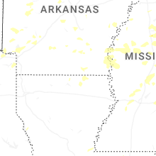
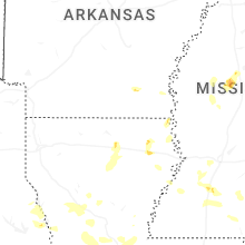


Connect with Interactive Hail Maps