

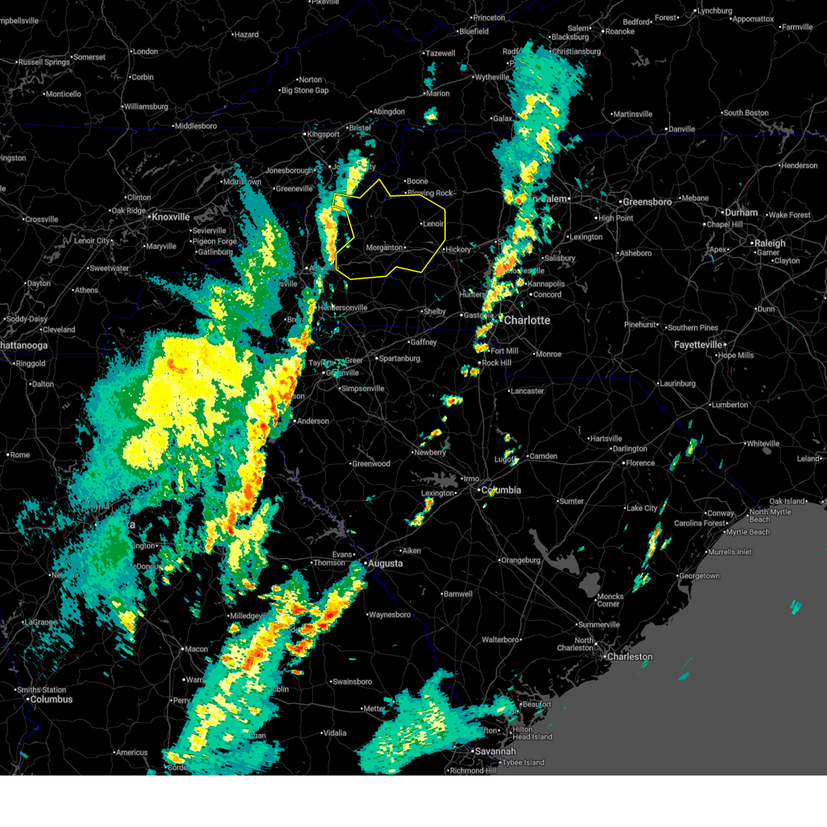
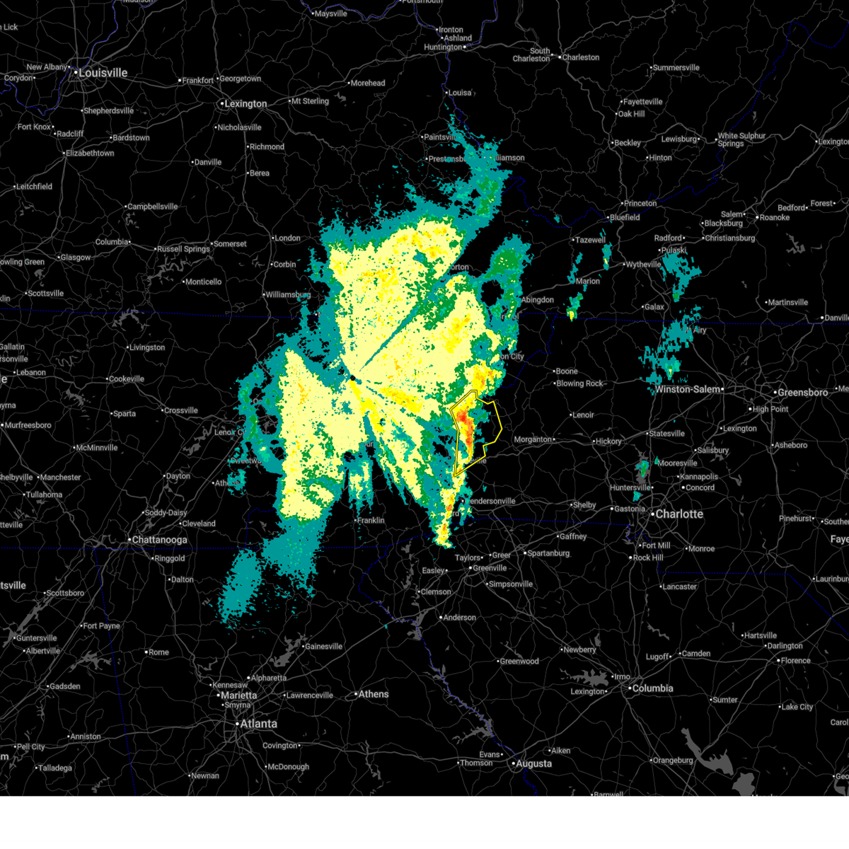
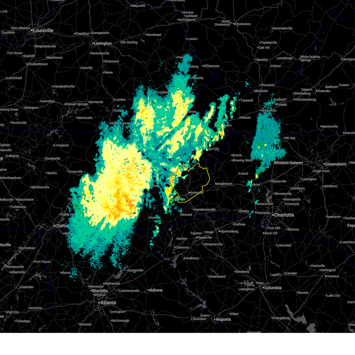
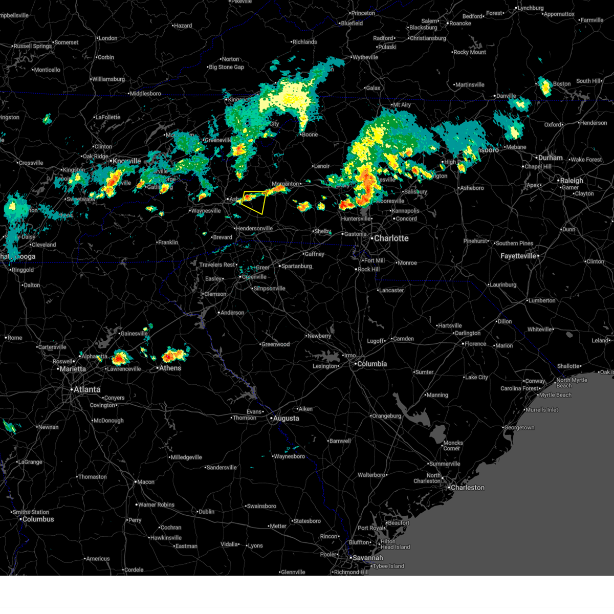
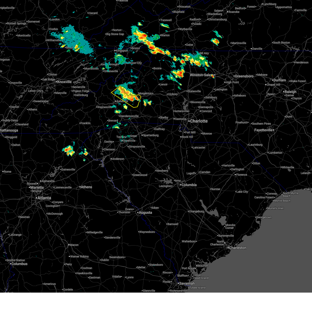
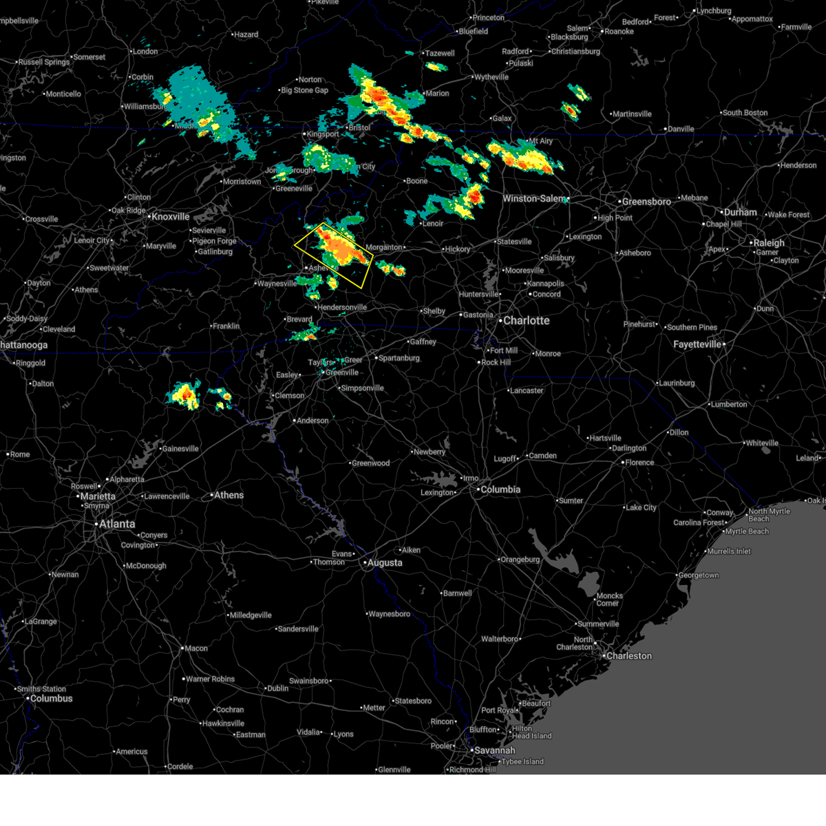
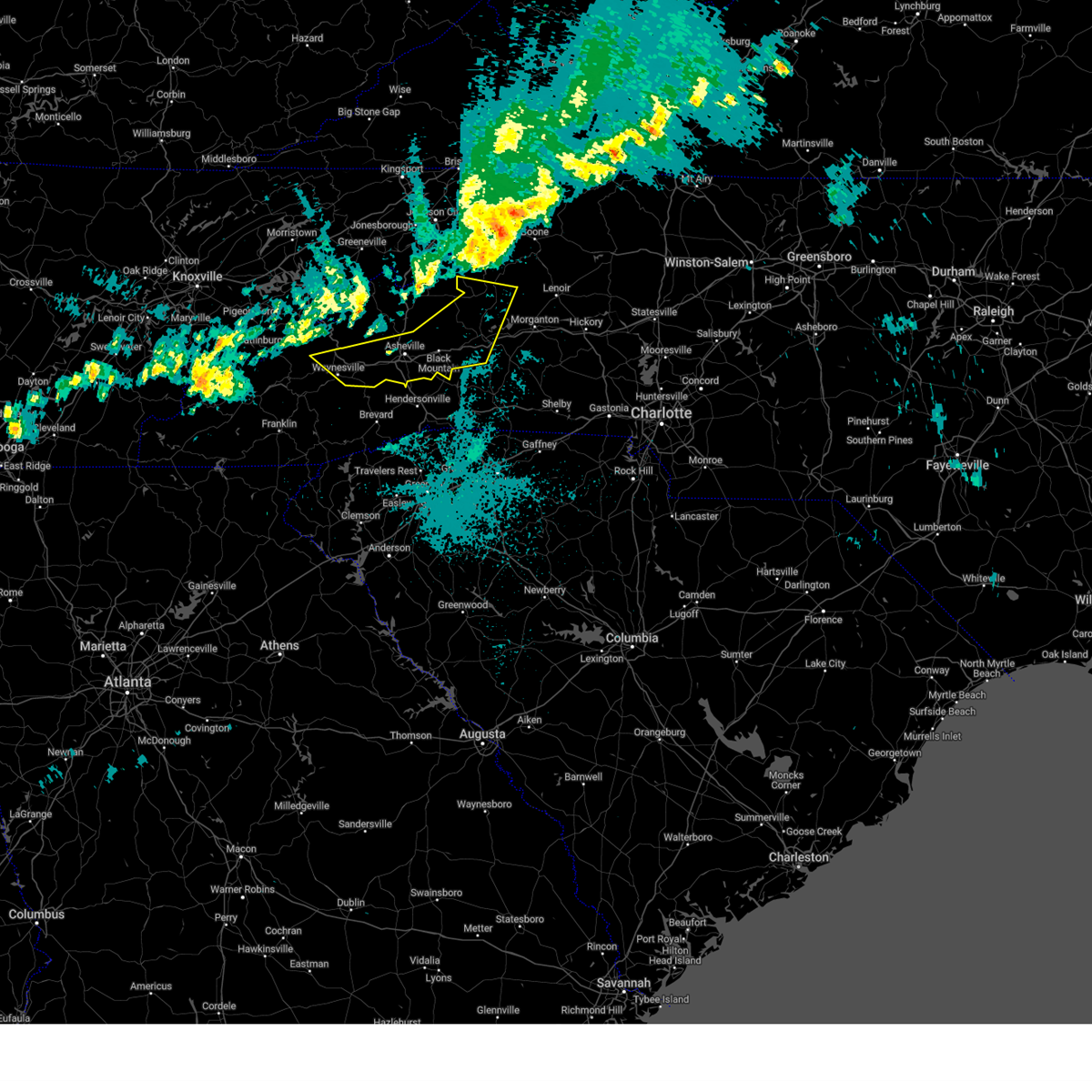
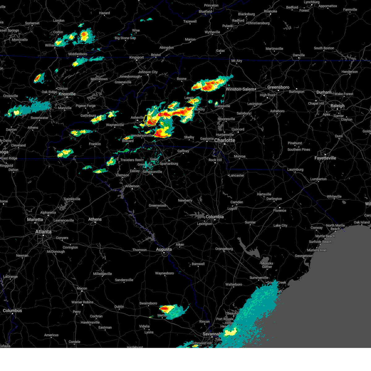
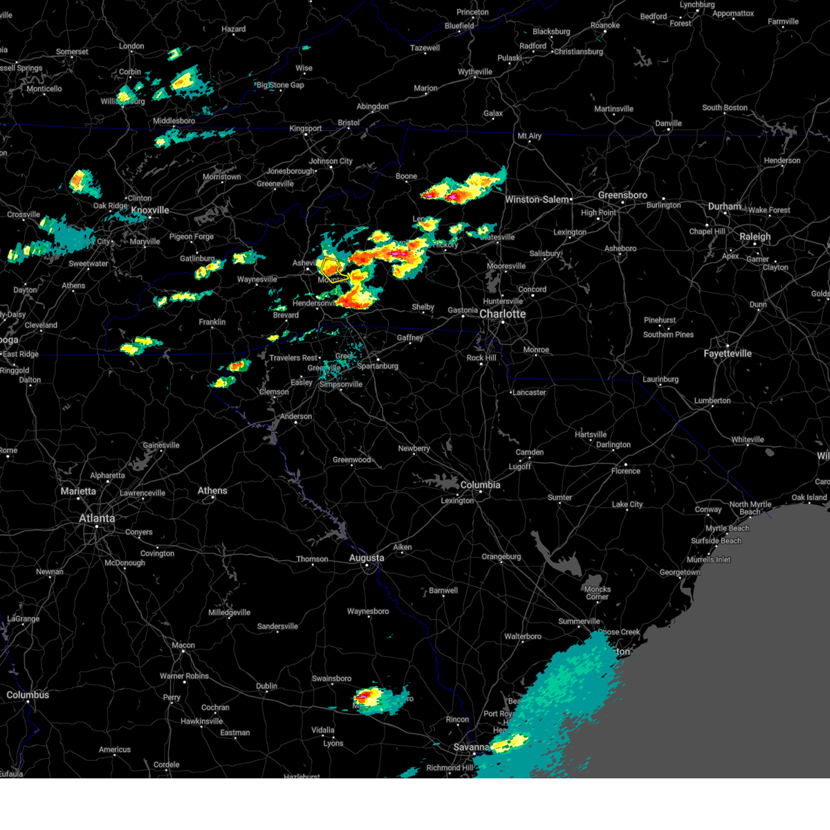
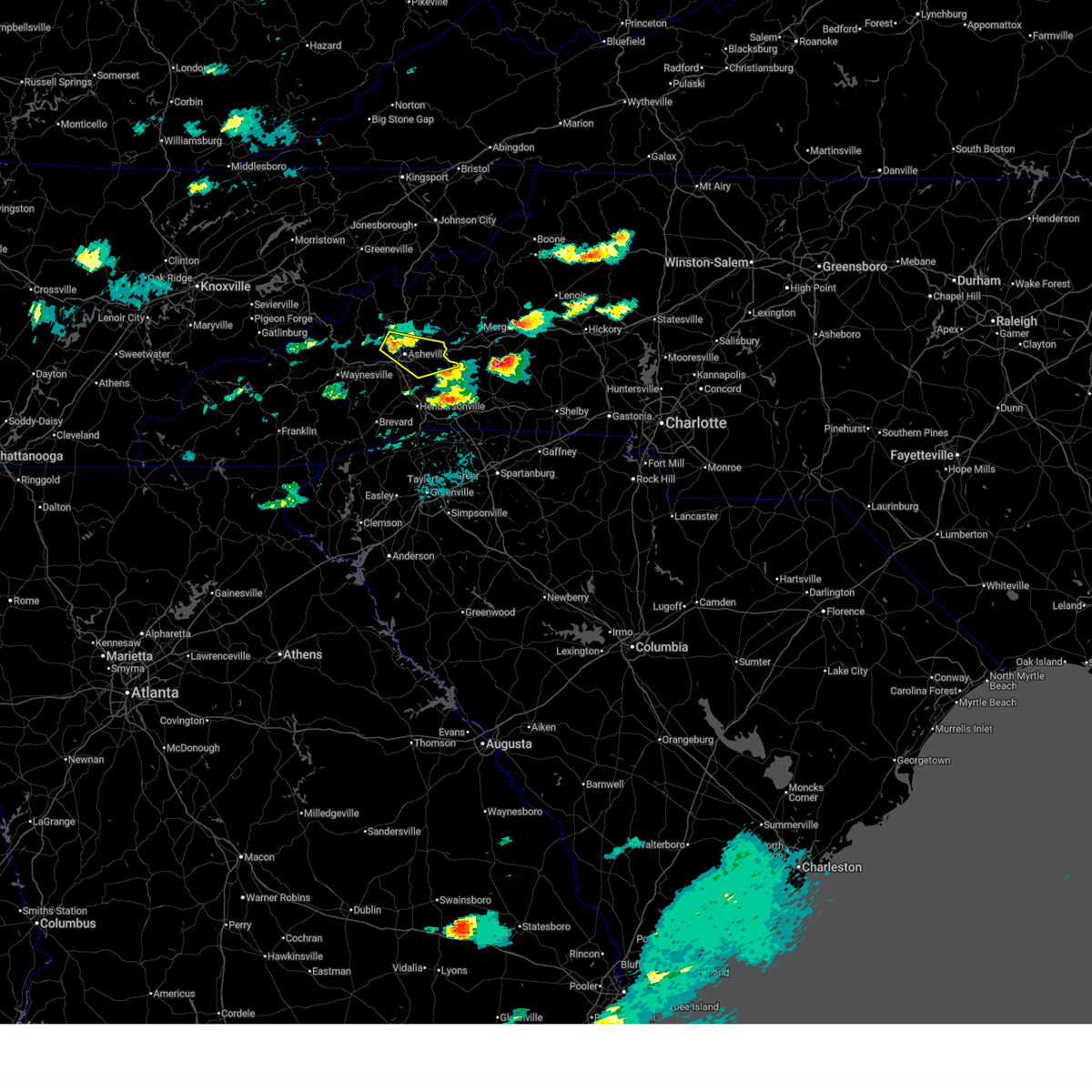
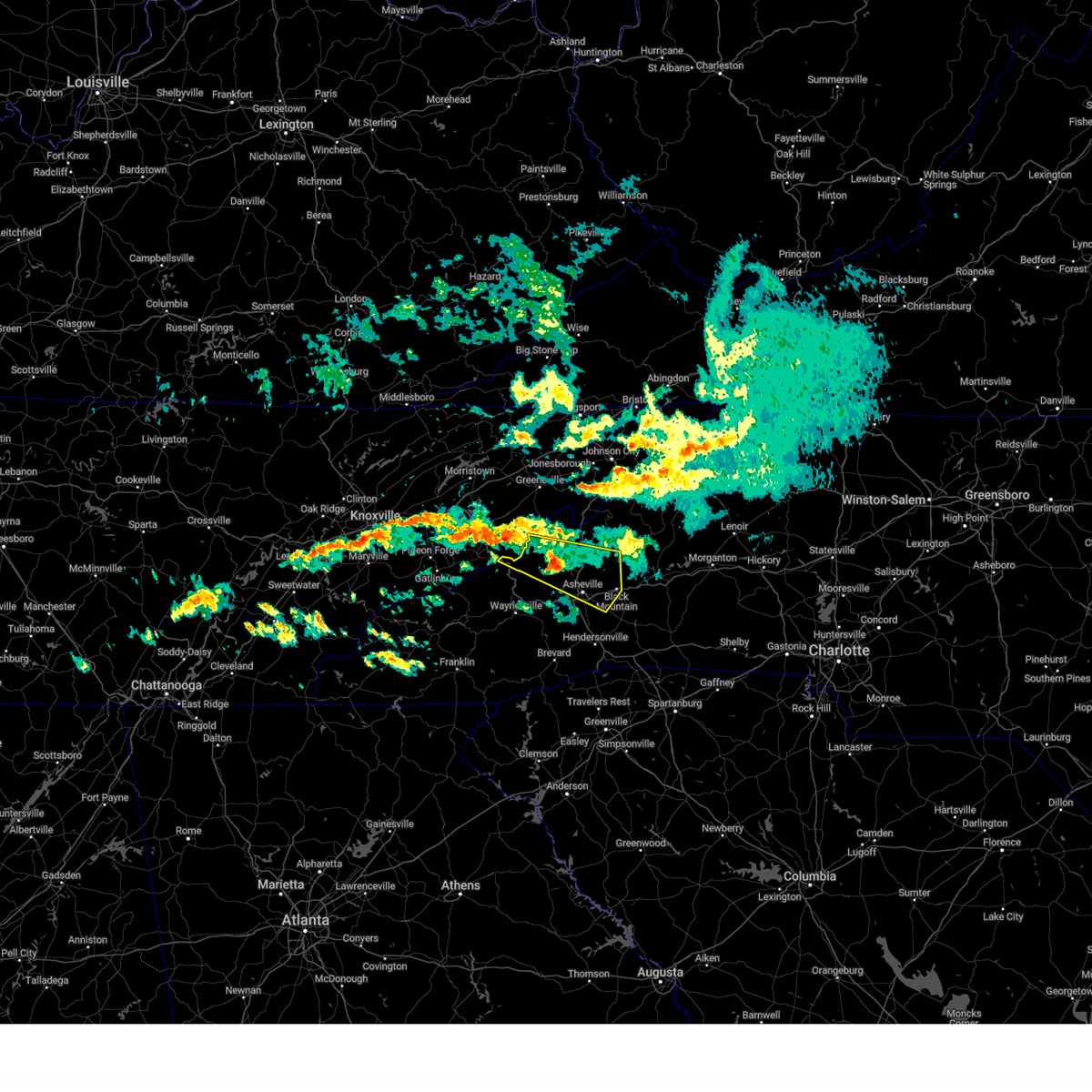
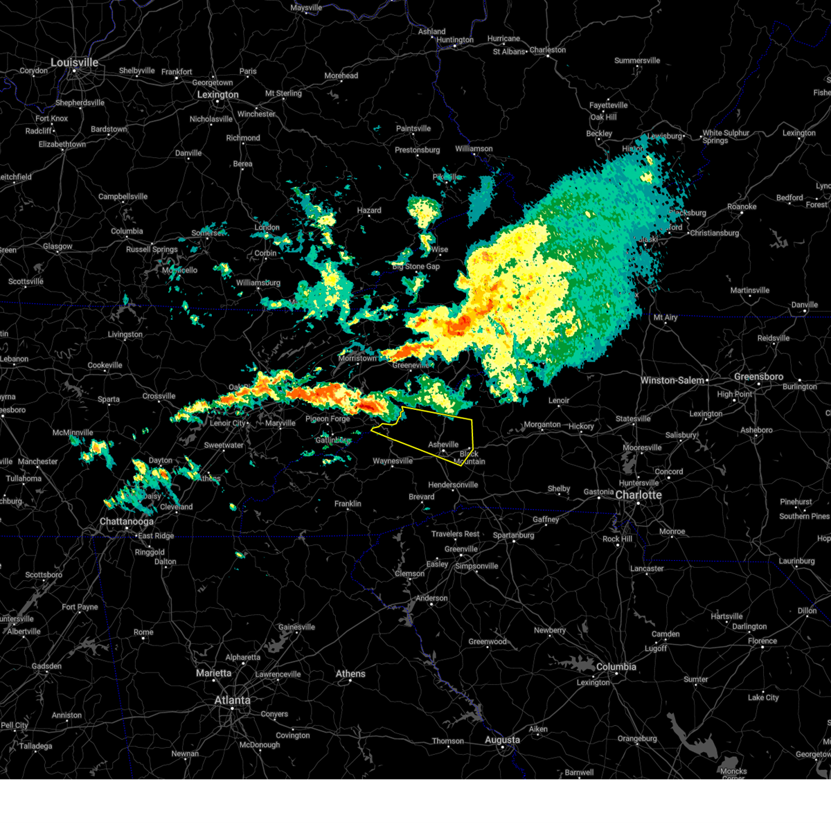
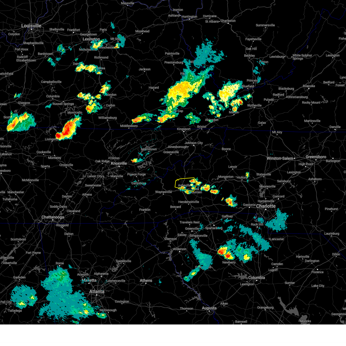
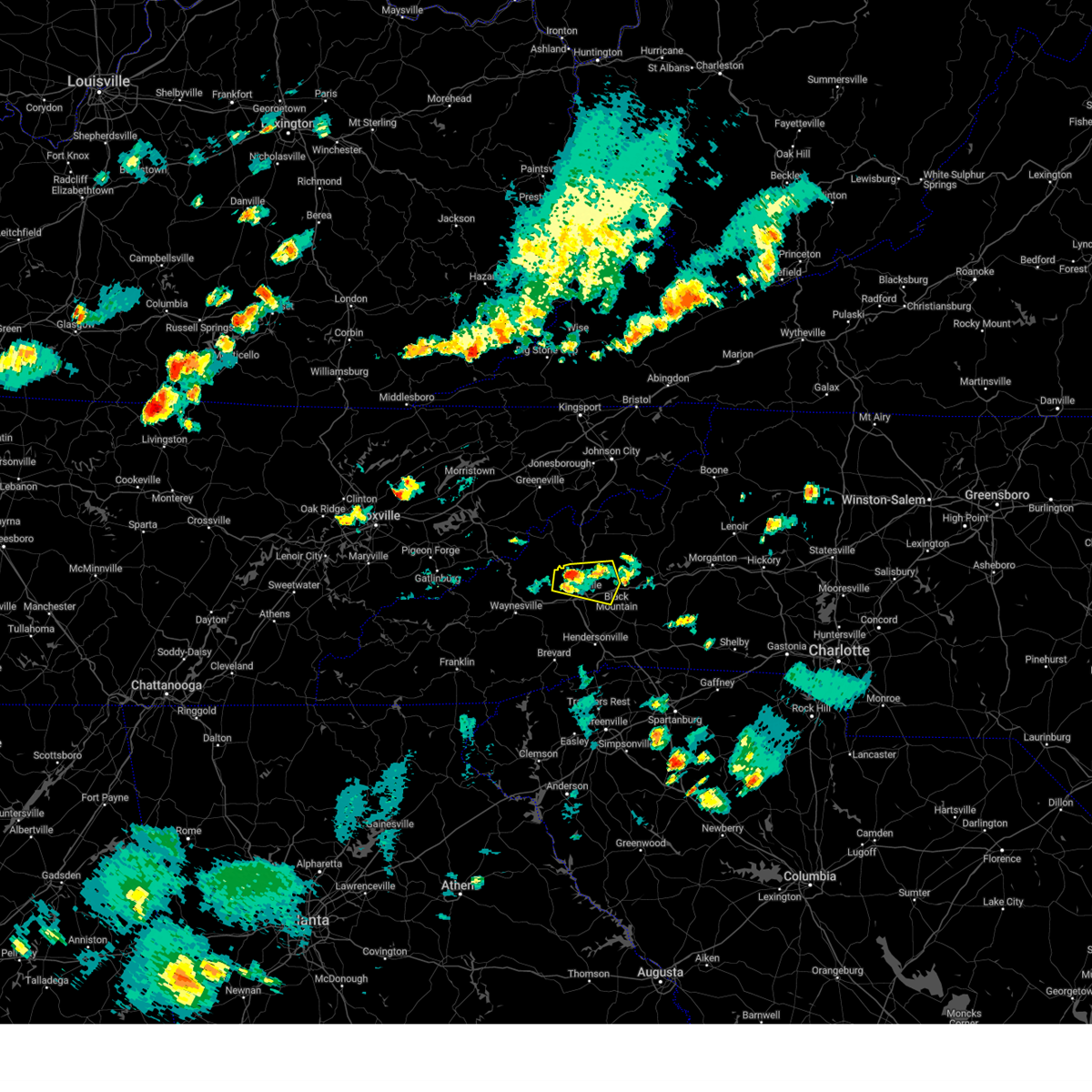
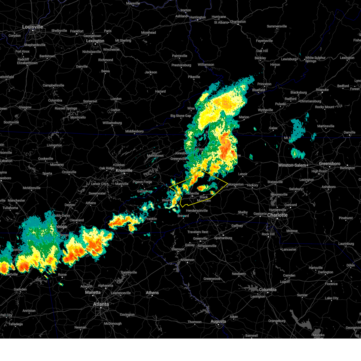
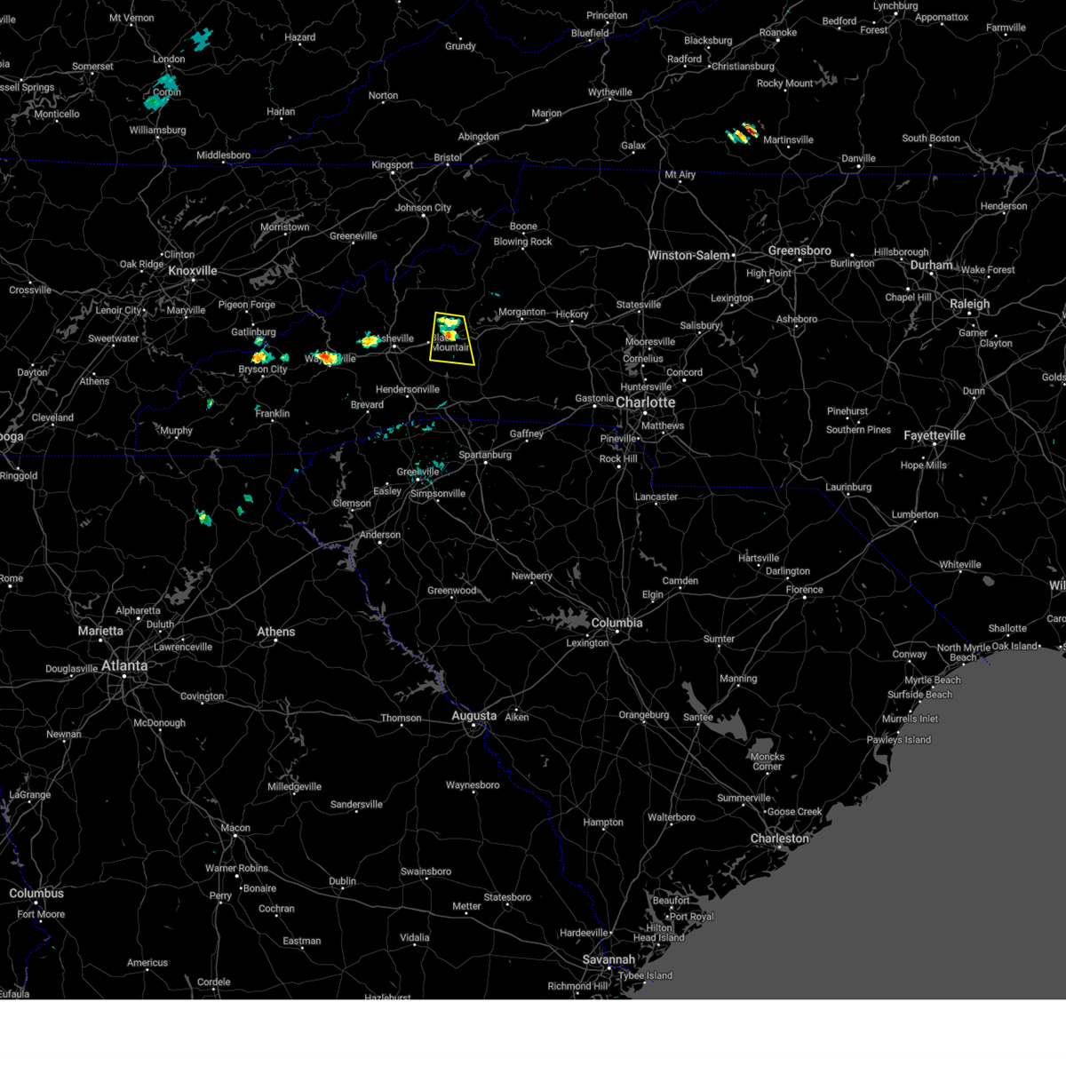
Hail Map for Montreat, NC
The Montreat, NC area has had 2 reports of on-the-ground hail by trained spotters, and has been under severe weather warnings 4 times during the past 12 months. Doppler radar has detected hail at or near Montreat, NC on 26 occasions.
| Name: | Montreat, NC |
| Where Located: | 58.6 miles NNE of Greenville, SC |
| Map: | Google Map for Montreat, NC |
| Population: | 723 |
| Housing Units: | 666 |
| More Info: | Search Google for Montreat, NC |
0
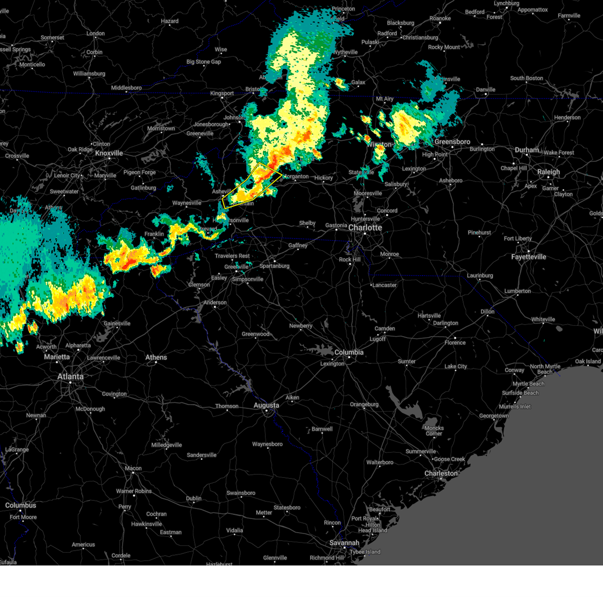
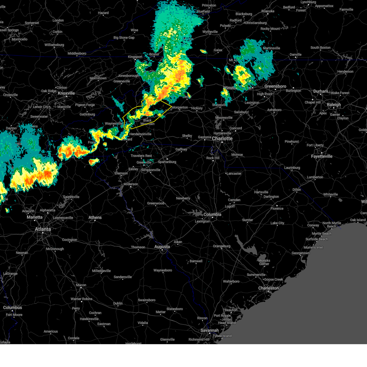
The Top Recent Hail Date for Montreat, NC is Thursday, May 8, 2025 (12th out of 26)

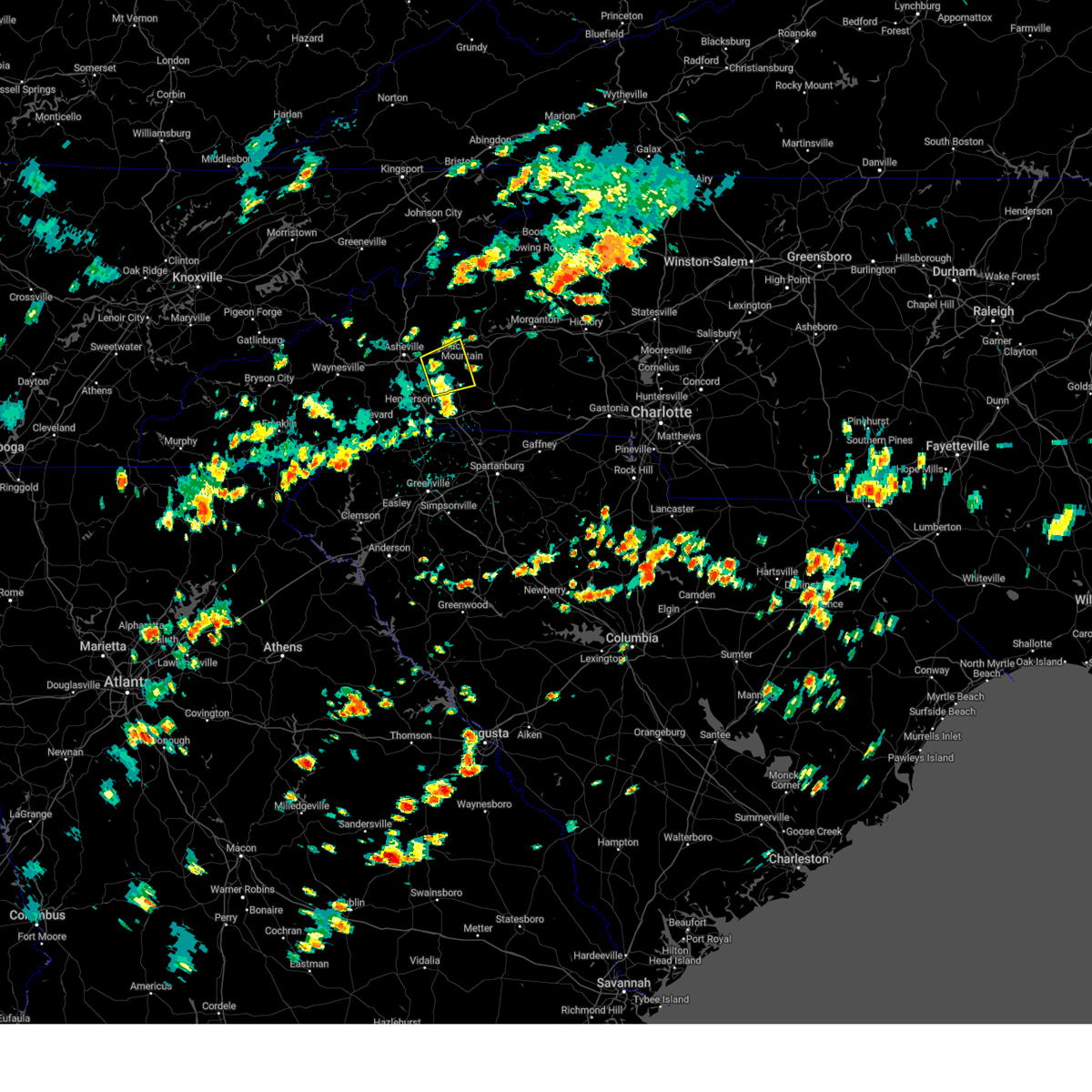
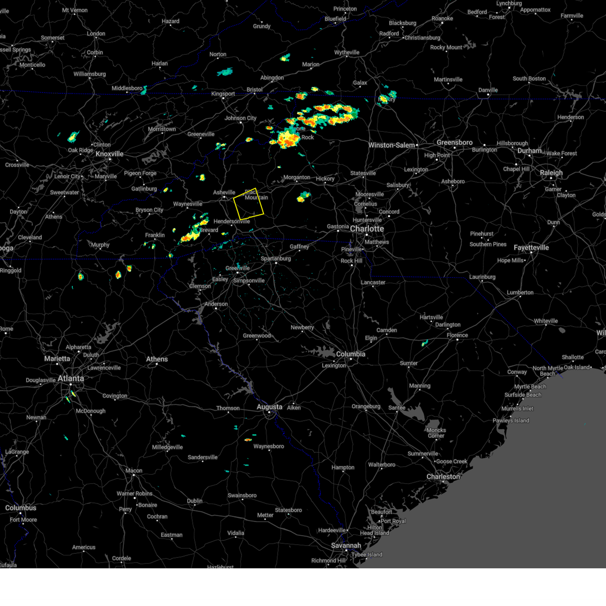
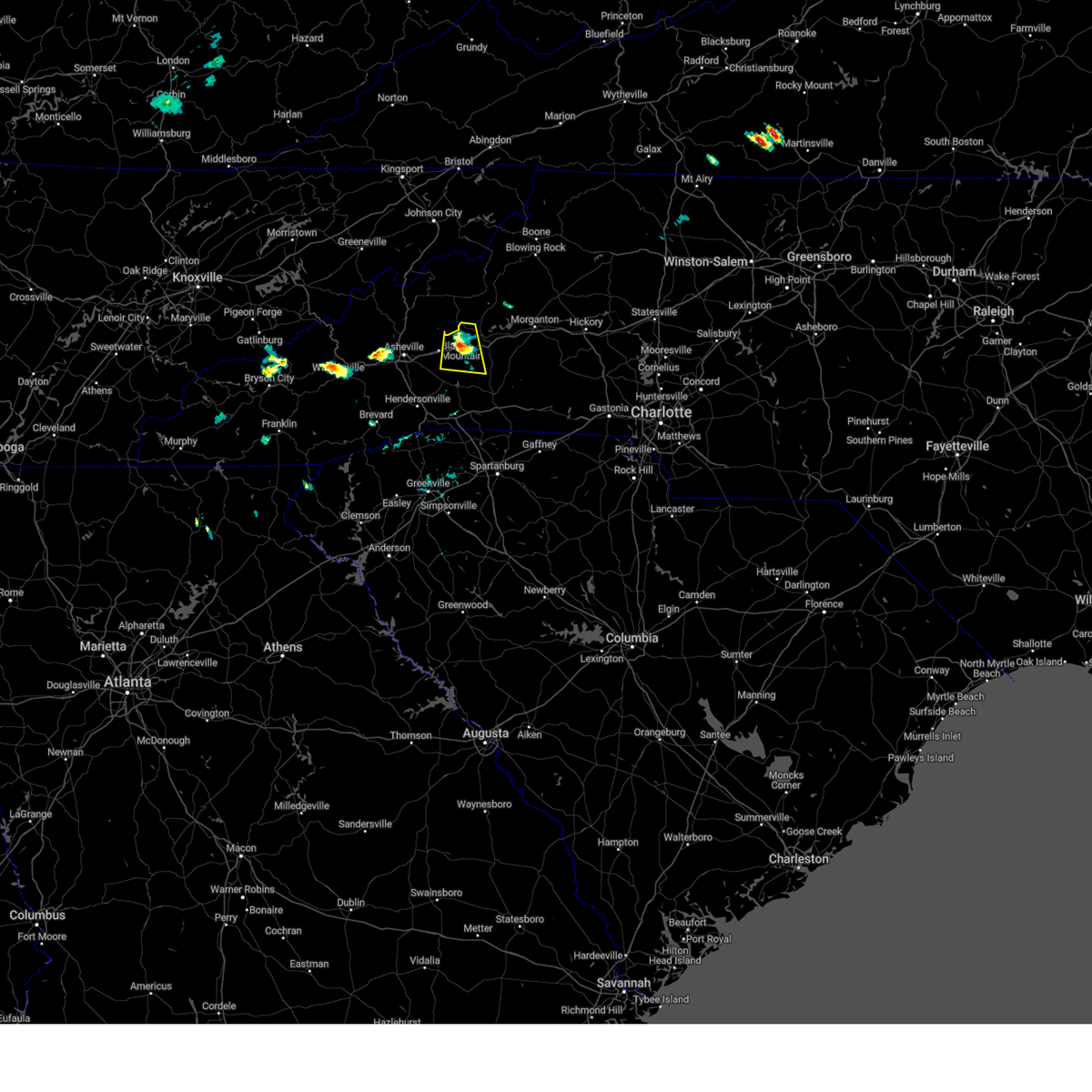
Hail and Wind Damage Spotted near Montreat, NC
| Date / Time | Report Details |
|---|---|
| 3/16/2026 7:31 AM EDT |
 Svrgsp the national weather service in greenville-spartanburg has issued a * severe thunderstorm warning for, mcdowell county in western north carolina, mitchell county in western north carolina, caldwell county in western north carolina, avery county in western north carolina, burke county in western north carolina, * until 830 am edt. * at 731 am edt, severe thunderstorms were located along a line extending from 9 miles east of erwin to 14 miles east of downtown asheville, moving east at 55 mph (radar indicated). Hazards include 60 mph wind gusts. expect damage to trees and power lines Svrgsp the national weather service in greenville-spartanburg has issued a * severe thunderstorm warning for, mcdowell county in western north carolina, mitchell county in western north carolina, caldwell county in western north carolina, avery county in western north carolina, burke county in western north carolina, * until 830 am edt. * at 731 am edt, severe thunderstorms were located along a line extending from 9 miles east of erwin to 14 miles east of downtown asheville, moving east at 55 mph (radar indicated). Hazards include 60 mph wind gusts. expect damage to trees and power lines
|
| 3/16/2026 7:20 AM EDT |
 At 719 am edt, severe thunderstorms were located along a line extending from 13 miles northeast of marshall to 10 miles southwest of burnsville to 5 miles southeast of downtown asheville, moving northeast at 95 mph (radar indicated). Hazards include 60 mph wind gusts. Expect damage to trees and power lines. locations impacted include, burnsville, black mountain, swannanoa, mount mitchell state park, b. r. parkway-nc arboretum to east asheville, b. r. parkway-east asheville to craggy gardens, b. r. Parkway-craggy to little switzerland, warren wilson college, montreat, and ramseytown. At 719 am edt, severe thunderstorms were located along a line extending from 13 miles northeast of marshall to 10 miles southwest of burnsville to 5 miles southeast of downtown asheville, moving northeast at 95 mph (radar indicated). Hazards include 60 mph wind gusts. Expect damage to trees and power lines. locations impacted include, burnsville, black mountain, swannanoa, mount mitchell state park, b. r. parkway-nc arboretum to east asheville, b. r. parkway-east asheville to craggy gardens, b. r. Parkway-craggy to little switzerland, warren wilson college, montreat, and ramseytown.
|
| 3/16/2026 6:40 AM EDT |
 Svrgsp the national weather service in greenville-spartanburg has issued a * severe thunderstorm warning for, madison county in western north carolina, buncombe county in western north carolina, yancey county in western north carolina, * until 745 am edt. * at 640 am edt, a severe thunderstorm was located 10 miles west of marshall, or 7 miles south of hot springs, moving northeast at 45 mph (radar indicated). Hazards include 60 mph wind gusts. expect damage to trees and power lines Svrgsp the national weather service in greenville-spartanburg has issued a * severe thunderstorm warning for, madison county in western north carolina, buncombe county in western north carolina, yancey county in western north carolina, * until 745 am edt. * at 640 am edt, a severe thunderstorm was located 10 miles west of marshall, or 7 miles south of hot springs, moving northeast at 45 mph (radar indicated). Hazards include 60 mph wind gusts. expect damage to trees and power lines
|
| 9/4/2025 5:12 PM EDT |
 Svrgsp the national weather service in greenville-spartanburg has issued a * severe thunderstorm warning for, southwestern mcdowell county in western north carolina, northwestern rutherford county in western north carolina, east central buncombe county in western north carolina, * until 600 pm edt. * at 512 pm edt, a severe thunderstorm was located 13 miles east of downtown asheville, or near black mountain, moving east at 10 mph (public). Hazards include 60 mph wind gusts and quarter size hail. Minor hail damage to vehicles is expected. Expect wind damage to trees and power lines. Svrgsp the national weather service in greenville-spartanburg has issued a * severe thunderstorm warning for, southwestern mcdowell county in western north carolina, northwestern rutherford county in western north carolina, east central buncombe county in western north carolina, * until 600 pm edt. * at 512 pm edt, a severe thunderstorm was located 13 miles east of downtown asheville, or near black mountain, moving east at 10 mph (public). Hazards include 60 mph wind gusts and quarter size hail. Minor hail damage to vehicles is expected. Expect wind damage to trees and power lines.
|
| 6/26/2025 2:25 PM EDT |
 the severe thunderstorm warning has been cancelled and is no longer in effect the severe thunderstorm warning has been cancelled and is no longer in effect
|
| 6/26/2025 2:25 PM EDT |
 At 224 pm edt, severe thunderstorms were located along a line extending from 10 miles southwest of burnsville to 20 miles south of spruce pine to 3 miles southwest of marion, moving southwest at 5 mph (radar indicated). Hazards include 60 mph wind gusts and quarter size hail. Minor hail damage to vehicles is expected. expect wind damage to trees and power lines. locations impacted include, marion, black mountain, old fort, the b. r. Parkway from east asheville to little switzerland, montreat, pleasant gardens, flat creek, sugar hill, and barnardsville. At 224 pm edt, severe thunderstorms were located along a line extending from 10 miles southwest of burnsville to 20 miles south of spruce pine to 3 miles southwest of marion, moving southwest at 5 mph (radar indicated). Hazards include 60 mph wind gusts and quarter size hail. Minor hail damage to vehicles is expected. expect wind damage to trees and power lines. locations impacted include, marion, black mountain, old fort, the b. r. Parkway from east asheville to little switzerland, montreat, pleasant gardens, flat creek, sugar hill, and barnardsville.
|
| 6/26/2025 2:11 PM EDT |
 Svrgsp the national weather service in greenville-spartanburg has issued a * severe thunderstorm warning for, southwestern mcdowell county in western north carolina, northwestern rutherford county in western north carolina, southeastern madison county in western north carolina, northeastern buncombe county in western north carolina, southern yancey county in western north carolina, * until 315 pm edt. * at 210 pm edt, severe thunderstorms were located along a line extending from 7 miles southwest of burnsville to 3 miles southwest of marion, and are nearly stationary (radar indicated). Hazards include 60 mph wind gusts and quarter size hail. Minor hail damage to vehicles is expected. Expect wind damage to trees and power lines. Svrgsp the national weather service in greenville-spartanburg has issued a * severe thunderstorm warning for, southwestern mcdowell county in western north carolina, northwestern rutherford county in western north carolina, southeastern madison county in western north carolina, northeastern buncombe county in western north carolina, southern yancey county in western north carolina, * until 315 pm edt. * at 210 pm edt, severe thunderstorms were located along a line extending from 7 miles southwest of burnsville to 3 miles southwest of marion, and are nearly stationary (radar indicated). Hazards include 60 mph wind gusts and quarter size hail. Minor hail damage to vehicles is expected. Expect wind damage to trees and power lines.
|
| 6/25/2025 4:31 PM EDT |
 the severe thunderstorm warning has been cancelled and is no longer in effect the severe thunderstorm warning has been cancelled and is no longer in effect
|
| 6/25/2025 4:26 PM EDT |
 Svrgsp the national weather service in greenville-spartanburg has issued a * severe thunderstorm warning for, southwestern mcdowell county in western north carolina, northwestern rutherford county in western north carolina, northeastern henderson county in western north carolina, southeastern buncombe county in western north carolina, * until 545 pm edt. * at 426 pm edt, a severe thunderstorm was located 10 miles west of marion, or near old fort, moving southeast at 5 mph (radar indicated). Hazards include 60 mph wind gusts and nickel size hail. expect damage to trees and power lines Svrgsp the national weather service in greenville-spartanburg has issued a * severe thunderstorm warning for, southwestern mcdowell county in western north carolina, northwestern rutherford county in western north carolina, northeastern henderson county in western north carolina, southeastern buncombe county in western north carolina, * until 545 pm edt. * at 426 pm edt, a severe thunderstorm was located 10 miles west of marion, or near old fort, moving southeast at 5 mph (radar indicated). Hazards include 60 mph wind gusts and nickel size hail. expect damage to trees and power lines
|
| 6/25/2025 3:54 PM EDT |
 Svrgsp the national weather service in greenville-spartanburg has issued a * severe thunderstorm warning for, central buncombe county in western north carolina, * until 445 pm edt. * at 354 pm edt, a severe thunderstorm was located 5 miles northeast of downtown asheville, or near b.r. parkway-east asheville to craggy gardens, and is nearly stationary (radar indicated). Hazards include 60 mph wind gusts and nickel size hail. expect damage to trees and power lines Svrgsp the national weather service in greenville-spartanburg has issued a * severe thunderstorm warning for, central buncombe county in western north carolina, * until 445 pm edt. * at 354 pm edt, a severe thunderstorm was located 5 miles northeast of downtown asheville, or near b.r. parkway-east asheville to craggy gardens, and is nearly stationary (radar indicated). Hazards include 60 mph wind gusts and nickel size hail. expect damage to trees and power lines
|
| 5/17/2025 3:42 AM EDT |
 Svrgsp the national weather service in greenville-spartanburg has issued a * severe thunderstorm warning for, mcdowell county in western north carolina, southeastern mitchell county in western north carolina, southwestern avery county in western north carolina, buncombe county in western north carolina, central haywood county in western north carolina, southeastern yancey county in western north carolina, northwestern burke county in western north carolina, * until 430 am edt. * at 341 am edt, severe thunderstorms were located along a line extending from 5 miles northeast of burnsville to 13 miles northeast of downtown asheville to 8 miles north of waynesville, moving southeast at 45 mph (radar indicated). Hazards include 60 mph wind gusts and nickel size hail. expect damage to trees and power lines Svrgsp the national weather service in greenville-spartanburg has issued a * severe thunderstorm warning for, mcdowell county in western north carolina, southeastern mitchell county in western north carolina, southwestern avery county in western north carolina, buncombe county in western north carolina, central haywood county in western north carolina, southeastern yancey county in western north carolina, northwestern burke county in western north carolina, * until 430 am edt. * at 341 am edt, severe thunderstorms were located along a line extending from 5 miles northeast of burnsville to 13 miles northeast of downtown asheville to 8 miles north of waynesville, moving southeast at 45 mph (radar indicated). Hazards include 60 mph wind gusts and nickel size hail. expect damage to trees and power lines
|
| 5/8/2025 5:01 PM EDT |
 the severe thunderstorm warning has been cancelled and is no longer in effect the severe thunderstorm warning has been cancelled and is no longer in effect
|
| 5/8/2025 4:35 PM EDT |
 At 435 pm edt, a severe thunderstorm was located 15 miles east of downtown asheville, or 4 miles southeast of black mountain, moving east at 45 mph (radar indicated). Hazards include ping pong ball size hail and 60 mph wind gusts. People and animals outdoors will be injured. expect hail damage to roofs, siding, windows, and vehicles. expect wind damage to trees and power lines. Locations impacted include, swannanoa, montreat, and black mountain. At 435 pm edt, a severe thunderstorm was located 15 miles east of downtown asheville, or 4 miles southeast of black mountain, moving east at 45 mph (radar indicated). Hazards include ping pong ball size hail and 60 mph wind gusts. People and animals outdoors will be injured. expect hail damage to roofs, siding, windows, and vehicles. expect wind damage to trees and power lines. Locations impacted include, swannanoa, montreat, and black mountain.
|
| 5/8/2025 4:16 PM EDT |
 Svrgsp the national weather service in greenville-spartanburg has issued a * severe thunderstorm warning for, central buncombe county in western north carolina, * until 515 pm edt. * at 416 pm edt, a severe thunderstorm was located near downtown asheville, or over unc-asheville, moving east at 25 mph (radar indicated). Hazards include 60 mph wind gusts and quarter size hail. Minor hail damage to vehicles is expected. Expect wind damage to trees and power lines. Svrgsp the national weather service in greenville-spartanburg has issued a * severe thunderstorm warning for, central buncombe county in western north carolina, * until 515 pm edt. * at 416 pm edt, a severe thunderstorm was located near downtown asheville, or over unc-asheville, moving east at 25 mph (radar indicated). Hazards include 60 mph wind gusts and quarter size hail. Minor hail damage to vehicles is expected. Expect wind damage to trees and power lines.
|
| 2/6/2025 10:49 PM EST |
 Svrgsp the national weather service in greenville-spartanburg has issued a * severe thunderstorm warning for, southern madison county in western north carolina, buncombe county in western north carolina, north central haywood county in western north carolina, south central yancey county in western north carolina, * until 1130 pm est. * at 1048 pm est, a severe thunderstorm was located 15 miles west of marshall, or 9 miles southwest of hot springs, moving east at 45 mph (radar indicated). Hazards include 60 mph wind gusts and quarter size hail. Minor hail damage to vehicles is expected. Expect wind damage to trees and power lines. Svrgsp the national weather service in greenville-spartanburg has issued a * severe thunderstorm warning for, southern madison county in western north carolina, buncombe county in western north carolina, north central haywood county in western north carolina, south central yancey county in western north carolina, * until 1130 pm est. * at 1048 pm est, a severe thunderstorm was located 15 miles west of marshall, or 9 miles southwest of hot springs, moving east at 45 mph (radar indicated). Hazards include 60 mph wind gusts and quarter size hail. Minor hail damage to vehicles is expected. Expect wind damage to trees and power lines.
|
| 2/6/2025 10:09 PM EST |
 Svrgsp the national weather service in greenville-spartanburg has issued a * severe thunderstorm warning for, southern madison county in western north carolina, buncombe county in western north carolina, northeastern haywood county in western north carolina, south central yancey county in western north carolina, * until 1100 pm est. * at 1007 pm est, a severe thunderstorm was located near sevierville, moving east at 45 mph (radar indicated). Hazards include 60 mph wind gusts and quarter size hail. Minor hail damage to vehicles is expected. Expect wind damage to trees and power lines. Svrgsp the national weather service in greenville-spartanburg has issued a * severe thunderstorm warning for, southern madison county in western north carolina, buncombe county in western north carolina, northeastern haywood county in western north carolina, south central yancey county in western north carolina, * until 1100 pm est. * at 1007 pm est, a severe thunderstorm was located near sevierville, moving east at 45 mph (radar indicated). Hazards include 60 mph wind gusts and quarter size hail. Minor hail damage to vehicles is expected. Expect wind damage to trees and power lines.
|
| 12/29/2024 7:43 AM EST |
 At 743 am est, severe thunderstorms were located along a line extending from 13 miles northeast of brevard to near hendersonville to 11 miles southwest of columbus to 13 miles north of greenville downtown, moving northeast at 50 mph (radar indicated). Hazards include 60 mph wind gusts. Expect damage to trees and power lines. Locations impacted include, hendersonville, forest city, rutherfordton, columbus, travelers rest, spindale, flat rock, landrum, mountain home, and laurel park. At 743 am est, severe thunderstorms were located along a line extending from 13 miles northeast of brevard to near hendersonville to 11 miles southwest of columbus to 13 miles north of greenville downtown, moving northeast at 50 mph (radar indicated). Hazards include 60 mph wind gusts. Expect damage to trees and power lines. Locations impacted include, hendersonville, forest city, rutherfordton, columbus, travelers rest, spindale, flat rock, landrum, mountain home, and laurel park.
|
| 12/29/2024 7:43 AM EST |
 the severe thunderstorm warning has been cancelled and is no longer in effect the severe thunderstorm warning has been cancelled and is no longer in effect
|
| 12/29/2024 7:26 AM EST |
 Svrgsp the national weather service in greenville-spartanburg has issued a * severe thunderstorm warning for, southwestern mcdowell county in western north carolina, central rutherford county in western north carolina, east central transylvania county in western north carolina, henderson county in western north carolina, polk county in western north carolina, southeastern buncombe county in western north carolina, southeastern yancey county in western north carolina, northern greenville county in upstate south carolina, northwestern spartanburg county in upstate south carolina, * until 845 am est. * at 726 am est, severe thunderstorms were located along a line extending from near brevard to 14 miles southwest of hendersonville to 13 miles northeast of pickens to 6 miles north of easley, moving northeast at 50 mph (radar indicated). Hazards include 60 mph wind gusts. expect damage to trees and power lines Svrgsp the national weather service in greenville-spartanburg has issued a * severe thunderstorm warning for, southwestern mcdowell county in western north carolina, central rutherford county in western north carolina, east central transylvania county in western north carolina, henderson county in western north carolina, polk county in western north carolina, southeastern buncombe county in western north carolina, southeastern yancey county in western north carolina, northern greenville county in upstate south carolina, northwestern spartanburg county in upstate south carolina, * until 845 am est. * at 726 am est, severe thunderstorms were located along a line extending from near brevard to 14 miles southwest of hendersonville to 13 miles northeast of pickens to 6 miles north of easley, moving northeast at 50 mph (radar indicated). Hazards include 60 mph wind gusts. expect damage to trees and power lines
|
| 8/17/2024 8:31 PM EDT |
 the severe thunderstorm warning has been cancelled and is no longer in effect the severe thunderstorm warning has been cancelled and is no longer in effect
|
| 8/17/2024 7:52 PM EDT |
 Svrgsp the national weather service in greenville-spartanburg has issued a * severe thunderstorm warning for, central buncombe county in western north carolina, * until 845 pm edt. * at 750 pm edt, a severe thunderstorm was located 8 miles south of marshall, or near leicester, moving east at 15 mph (radar indicated). Hazards include 60 mph wind gusts and quarter size hail. Minor hail damage to vehicles is expected. Expect wind damage to trees and power lines. Svrgsp the national weather service in greenville-spartanburg has issued a * severe thunderstorm warning for, central buncombe county in western north carolina, * until 845 pm edt. * at 750 pm edt, a severe thunderstorm was located 8 miles south of marshall, or near leicester, moving east at 15 mph (radar indicated). Hazards include 60 mph wind gusts and quarter size hail. Minor hail damage to vehicles is expected. Expect wind damage to trees and power lines.
|
| 8/16/2024 7:48 PM EDT |
 At 748 pm edt, severe thunderstorms were located along a line extending from 3 miles north of spruce pine to 8 miles south of burnsville to near downtown asheville, moving east at 25 mph (radar indicated). Hazards include 60 mph wind gusts and penny size hail. Expect damage to trees and power lines. locations impacted include, east asheville, black mountain, swannanoa, fairview in buncombe county, biltmore forest, old fort, b. r. parkway-little switzerland to linville, b. r. parkway-nc arboretum to east asheville, skyland, and b. r. Parkway-craggy to little switzerland. At 748 pm edt, severe thunderstorms were located along a line extending from 3 miles north of spruce pine to 8 miles south of burnsville to near downtown asheville, moving east at 25 mph (radar indicated). Hazards include 60 mph wind gusts and penny size hail. Expect damage to trees and power lines. locations impacted include, east asheville, black mountain, swannanoa, fairview in buncombe county, biltmore forest, old fort, b. r. parkway-little switzerland to linville, b. r. parkway-nc arboretum to east asheville, skyland, and b. r. Parkway-craggy to little switzerland.
|
| 8/16/2024 7:29 PM EDT |
 the severe thunderstorm warning has been cancelled and is no longer in effect the severe thunderstorm warning has been cancelled and is no longer in effect
|
| 8/16/2024 7:29 PM EDT |
 At 729 pm edt, severe thunderstorms were located along a line extending from 6 miles northeast of burnsville to 16 miles east of marshall to 9 miles west of downtown asheville, moving east at 25 mph (radar indicated). Hazards include 60 mph wind gusts and penny size hail. Expect damage to trees and power lines. Locations impacted include, downtown asheville, burnsville, east asheville, west asheville, north asheville, black mountain, woodfin, swannanoa, weaverville, and fairview in buncombe county. At 729 pm edt, severe thunderstorms were located along a line extending from 6 miles northeast of burnsville to 16 miles east of marshall to 9 miles west of downtown asheville, moving east at 25 mph (radar indicated). Hazards include 60 mph wind gusts and penny size hail. Expect damage to trees and power lines. Locations impacted include, downtown asheville, burnsville, east asheville, west asheville, north asheville, black mountain, woodfin, swannanoa, weaverville, and fairview in buncombe county.
|
| 8/16/2024 7:04 PM EDT |
 Svrgsp the national weather service in greenville-spartanburg has issued a * severe thunderstorm warning for, central mcdowell county in western north carolina, southern madison county in western north carolina, southeastern mitchell county in western north carolina, northeastern haywood county in western north carolina, buncombe county in western north carolina, yancey county in western north carolina, west central burke county in western north carolina, * until 800 pm edt. * at 704 pm edt, severe thunderstorms were located along a line extending from 6 miles northwest of burnsville to 9 miles east of marshall to 12 miles northeast of waynesville, moving east at 25 mph (radar indicated). Hazards include 60 mph wind gusts and penny size hail. expect damage to trees and power lines Svrgsp the national weather service in greenville-spartanburg has issued a * severe thunderstorm warning for, central mcdowell county in western north carolina, southern madison county in western north carolina, southeastern mitchell county in western north carolina, northeastern haywood county in western north carolina, buncombe county in western north carolina, yancey county in western north carolina, west central burke county in western north carolina, * until 800 pm edt. * at 704 pm edt, severe thunderstorms were located along a line extending from 6 miles northwest of burnsville to 9 miles east of marshall to 12 miles northeast of waynesville, moving east at 25 mph (radar indicated). Hazards include 60 mph wind gusts and penny size hail. expect damage to trees and power lines
|
| 5/26/2024 8:00 PM EDT |
 Svrgsp the national weather service in greenville-spartanburg has issued a * severe thunderstorm warning for, southwestern catawba county in the piedmont of north carolina, mcdowell county in western north carolina, rutherford county in western north carolina, northeastern polk county in western north carolina, western lincoln county in the piedmont of north carolina, southwestern caldwell county in western north carolina, east central buncombe county in western north carolina, western cleveland county in the piedmont of north carolina, burke county in western north carolina, * until 900 pm edt. * at 759 pm edt, severe thunderstorms were located along a line extending from 9 miles northwest of morganton to 16 miles east of downtown asheville, moving southeast at 35 mph (radar indicated). Hazards include 60 mph wind gusts and quarter size hail. Minor hail damage to vehicles is expected. Expect wind damage to trees and power lines. Svrgsp the national weather service in greenville-spartanburg has issued a * severe thunderstorm warning for, southwestern catawba county in the piedmont of north carolina, mcdowell county in western north carolina, rutherford county in western north carolina, northeastern polk county in western north carolina, western lincoln county in the piedmont of north carolina, southwestern caldwell county in western north carolina, east central buncombe county in western north carolina, western cleveland county in the piedmont of north carolina, burke county in western north carolina, * until 900 pm edt. * at 759 pm edt, severe thunderstorms were located along a line extending from 9 miles northwest of morganton to 16 miles east of downtown asheville, moving southeast at 35 mph (radar indicated). Hazards include 60 mph wind gusts and quarter size hail. Minor hail damage to vehicles is expected. Expect wind damage to trees and power lines.
|
| 5/9/2024 12:35 AM EDT |
 The storm which prompted the warning has moved out of the area. therefore, the warning will be allowed to expire. a tornado watch remains in effect until 400 am edt for western north carolina. The storm which prompted the warning has moved out of the area. therefore, the warning will be allowed to expire. a tornado watch remains in effect until 400 am edt for western north carolina.
|
| 5/9/2024 12:15 AM EDT |
 Torgsp the national weather service in greenville-spartanburg has issued a * tornado warning for, southern mcdowell county in western north carolina, northwestern rutherford county in western north carolina, east central buncombe county in western north carolina, * until 100 am edt. * at 1214 am edt, a severe thunderstorm capable of producing a tornado was located 11 miles northeast of downtown asheville, or near black mountain, moving southeast at 30 mph (radar indicated rotation). Hazards include tornado. Flying debris will be dangerous to those caught without shelter. mobile homes will be damaged or destroyed. damage to roofs, windows, and vehicles will occur. tree damage is likely. this dangerous storm will be near, black mountain around 1220 am edt. old fort around 1230 am edt. Other locations impacted by this dangerous thunderstorm include glenwood, shingle hollow, sugar hill, thermal city, and fero. Torgsp the national weather service in greenville-spartanburg has issued a * tornado warning for, southern mcdowell county in western north carolina, northwestern rutherford county in western north carolina, east central buncombe county in western north carolina, * until 100 am edt. * at 1214 am edt, a severe thunderstorm capable of producing a tornado was located 11 miles northeast of downtown asheville, or near black mountain, moving southeast at 30 mph (radar indicated rotation). Hazards include tornado. Flying debris will be dangerous to those caught without shelter. mobile homes will be damaged or destroyed. damage to roofs, windows, and vehicles will occur. tree damage is likely. this dangerous storm will be near, black mountain around 1220 am edt. old fort around 1230 am edt. Other locations impacted by this dangerous thunderstorm include glenwood, shingle hollow, sugar hill, thermal city, and fero.
|
| 5/8/2024 11:56 PM EDT |
 Svrgsp the national weather service in greenville-spartanburg has issued a * severe thunderstorm warning for, southwestern mcdowell county in western north carolina, northeastern henderson county in western north carolina, east central haywood county in western north carolina, buncombe county in western north carolina, * until 1245 am edt. * at 1155 pm edt, a severe thunderstorm was located 8 miles west of downtown asheville, or near leicester, moving southeast at 45 mph (radar indicated). Hazards include 60 mph wind gusts. expect damage to trees and power lines Svrgsp the national weather service in greenville-spartanburg has issued a * severe thunderstorm warning for, southwestern mcdowell county in western north carolina, northeastern henderson county in western north carolina, east central haywood county in western north carolina, buncombe county in western north carolina, * until 1245 am edt. * at 1155 pm edt, a severe thunderstorm was located 8 miles west of downtown asheville, or near leicester, moving southeast at 45 mph (radar indicated). Hazards include 60 mph wind gusts. expect damage to trees and power lines
|
| 5/8/2024 2:34 PM EDT |
 the severe thunderstorm warning has been cancelled and is no longer in effect the severe thunderstorm warning has been cancelled and is no longer in effect
|
| 5/8/2024 2:16 PM EDT |
 the severe thunderstorm warning has been cancelled and is no longer in effect the severe thunderstorm warning has been cancelled and is no longer in effect
|
| 5/8/2024 2:16 PM EDT |
 At 215 pm edt, a severe thunderstorm was located 5 miles east of downtown asheville, or over warren wilson college, moving east at 40 mph (radar indicated). Hazards include 60 mph wind gusts and quarter size hail. Minor hail damage to vehicles is expected. expect wind damage to trees and power lines. Locations impacted include, downtown asheville, east asheville, arden, west asheville, north asheville, black mountain, woodfin, swannanoa, weaverville, and fairview in buncombe county. At 215 pm edt, a severe thunderstorm was located 5 miles east of downtown asheville, or over warren wilson college, moving east at 40 mph (radar indicated). Hazards include 60 mph wind gusts and quarter size hail. Minor hail damage to vehicles is expected. expect wind damage to trees and power lines. Locations impacted include, downtown asheville, east asheville, arden, west asheville, north asheville, black mountain, woodfin, swannanoa, weaverville, and fairview in buncombe county.
|
| 5/8/2024 1:57 PM EDT |
 At 157 pm edt, a severe thunderstorm was located 8 miles west of marion, or near old fort, moving east at 40 mph (radar indicated). Hazards include golf ball size hail and 70 mph wind gusts. People and animals outdoors will be injured. expect hail damage to roofs, siding, windows, and vehicles. expect considerable tree damage. wind damage is also likely to mobile homes, roofs, and outbuildings. locations impacted include, marion, glen alpine, old fort, lake james state park, lake james, b. r. Parkway-craggy to little switzerland, nebo, pleasant gardens, glenwood, and woodlawn. At 157 pm edt, a severe thunderstorm was located 8 miles west of marion, or near old fort, moving east at 40 mph (radar indicated). Hazards include golf ball size hail and 70 mph wind gusts. People and animals outdoors will be injured. expect hail damage to roofs, siding, windows, and vehicles. expect considerable tree damage. wind damage is also likely to mobile homes, roofs, and outbuildings. locations impacted include, marion, glen alpine, old fort, lake james state park, lake james, b. r. Parkway-craggy to little switzerland, nebo, pleasant gardens, glenwood, and woodlawn.
|
| 5/8/2024 1:50 PM EDT |
 Svrgsp the national weather service in greenville-spartanburg has issued a * severe thunderstorm warning for, southwestern madison county in western north carolina, east central haywood county in western north carolina, buncombe county in western north carolina, * until 245 pm edt. * at 150 pm edt, a severe thunderstorm was located 13 miles west of downtown asheville, or 5 miles northeast of canton, moving east at 45 mph (radar indicated). Hazards include 60 mph wind gusts and half dollar size hail. Minor hail damage to vehicles is expected. Expect wind damage to trees and power lines. Svrgsp the national weather service in greenville-spartanburg has issued a * severe thunderstorm warning for, southwestern madison county in western north carolina, east central haywood county in western north carolina, buncombe county in western north carolina, * until 245 pm edt. * at 150 pm edt, a severe thunderstorm was located 13 miles west of downtown asheville, or 5 miles northeast of canton, moving east at 45 mph (radar indicated). Hazards include 60 mph wind gusts and half dollar size hail. Minor hail damage to vehicles is expected. Expect wind damage to trees and power lines.
|
| 5/8/2024 1:43 PM EDT |
 Svrgsp the national weather service in greenville-spartanburg has issued a * severe thunderstorm warning for, mcdowell county in western north carolina, southwestern burke county in western north carolina, * until 245 pm edt. * at 142 pm edt, a severe thunderstorm was located 12 miles northwest of marion, or near b.r. parkway-little switzerland to linville, moving east at 35 mph (radar indicated). Hazards include 60 mph wind gusts and half dollar size hail. Minor hail damage to vehicles is expected. Expect wind damage to trees and power lines. Svrgsp the national weather service in greenville-spartanburg has issued a * severe thunderstorm warning for, mcdowell county in western north carolina, southwestern burke county in western north carolina, * until 245 pm edt. * at 142 pm edt, a severe thunderstorm was located 12 miles northwest of marion, or near b.r. parkway-little switzerland to linville, moving east at 35 mph (radar indicated). Hazards include 60 mph wind gusts and half dollar size hail. Minor hail damage to vehicles is expected. Expect wind damage to trees and power lines.
|
| 5/8/2024 1:13 PM EDT |
 At 113 pm edt, severe thunderstorms were located along a line extending from 5 miles southeast of erwin to 10 miles east of marshall to 13 miles west of downtown asheville, moving east at 40 mph (radar indicated). Hazards include two inch hail and 70 mph wind gusts. People and animals outdoors will be injured. expect hail damage to roofs, siding, windows, and vehicles. expect considerable tree damage. wind damage is also likely to mobile homes, roofs, and outbuildings. locations impacted include, burnsville, north asheville, woodfin, weaverville, leicester, mount mitchell state park, b. r. parkway-east asheville to craggy gardens, b. r. Parkway-craggy to little switzerland, montreat, and ramseytown. At 113 pm edt, severe thunderstorms were located along a line extending from 5 miles southeast of erwin to 10 miles east of marshall to 13 miles west of downtown asheville, moving east at 40 mph (radar indicated). Hazards include two inch hail and 70 mph wind gusts. People and animals outdoors will be injured. expect hail damage to roofs, siding, windows, and vehicles. expect considerable tree damage. wind damage is also likely to mobile homes, roofs, and outbuildings. locations impacted include, burnsville, north asheville, woodfin, weaverville, leicester, mount mitchell state park, b. r. parkway-east asheville to craggy gardens, b. r. Parkway-craggy to little switzerland, montreat, and ramseytown.
|
| 5/8/2024 1:04 PM EDT |
 Svrgsp the national weather service in greenville-spartanburg has issued a * severe thunderstorm warning for, northern buncombe county in western north carolina, yancey county in western north carolina, * until 200 pm edt. * at 104 pm edt, severe thunderstorms were located along a line extending from 3 miles south of erwin to 6 miles east of marshall to 14 miles northeast of waynesville, moving east at 40 mph (radar indicated). Hazards include golf ball size hail and 70 mph wind gusts. People and animals outdoors will be injured. expect hail damage to roofs, siding, windows, and vehicles. expect considerable tree damage. Wind damage is also likely to mobile homes, roofs, and outbuildings. Svrgsp the national weather service in greenville-spartanburg has issued a * severe thunderstorm warning for, northern buncombe county in western north carolina, yancey county in western north carolina, * until 200 pm edt. * at 104 pm edt, severe thunderstorms were located along a line extending from 3 miles south of erwin to 6 miles east of marshall to 14 miles northeast of waynesville, moving east at 40 mph (radar indicated). Hazards include golf ball size hail and 70 mph wind gusts. People and animals outdoors will be injured. expect hail damage to roofs, siding, windows, and vehicles. expect considerable tree damage. Wind damage is also likely to mobile homes, roofs, and outbuildings.
|
| 4/16/2024 1:46 PM EDT |
 Svrgsp the national weather service in greenville-spartanburg has issued a * severe thunderstorm warning for, southwestern mcdowell county in western north carolina, east central buncombe county in western north carolina, southeastern yancey county in western north carolina, * until 245 pm edt. * at 146 pm edt, a severe thunderstorm was located 12 miles west of marion, or near b.r. parkway-craggy to little switzerland, moving east at 5 mph (radar indicated). Hazards include 60 mph wind gusts and quarter size hail. Minor hail damage to vehicles is expected. Expect wind damage to trees and power lines. Svrgsp the national weather service in greenville-spartanburg has issued a * severe thunderstorm warning for, southwestern mcdowell county in western north carolina, east central buncombe county in western north carolina, southeastern yancey county in western north carolina, * until 245 pm edt. * at 146 pm edt, a severe thunderstorm was located 12 miles west of marion, or near b.r. parkway-craggy to little switzerland, moving east at 5 mph (radar indicated). Hazards include 60 mph wind gusts and quarter size hail. Minor hail damage to vehicles is expected. Expect wind damage to trees and power lines.
|
| 8/27/2023 3:21 PM EDT |
 The severe thunderstorm warning for southwestern mcdowell, northwestern rutherford, northeastern henderson and southeastern buncombe counties will expire at 330 pm edt, the storm which prompted the warning has weakened below severe limits, and no longer poses an immediate threat to life or property. therefore, the warning will be allowed to expire. however gusty winds are still possible with thunderstorms across the area. The severe thunderstorm warning for southwestern mcdowell, northwestern rutherford, northeastern henderson and southeastern buncombe counties will expire at 330 pm edt, the storm which prompted the warning has weakened below severe limits, and no longer poses an immediate threat to life or property. therefore, the warning will be allowed to expire. however gusty winds are still possible with thunderstorms across the area.
|
| 8/27/2023 3:03 PM EDT |
 At 302 pm edt, a severe thunderstorm was located 13 miles southeast of downtown asheville, or near fairview in buncombe county, moving east at 15 mph (radar indicated). Hazards include 60 mph wind gusts. Expect damage to trees and power lines. locations impacted include, black mountain, fairview in buncombe county, lake lure, old fort, chimney rock village, chimney rock state park, bat cave, gerton, edneyville and swannanoa. hail threat, radar indicated max hail size, <. 75 in wind threat, radar indicated max wind gust, 60 mph. At 302 pm edt, a severe thunderstorm was located 13 miles southeast of downtown asheville, or near fairview in buncombe county, moving east at 15 mph (radar indicated). Hazards include 60 mph wind gusts. Expect damage to trees and power lines. locations impacted include, black mountain, fairview in buncombe county, lake lure, old fort, chimney rock village, chimney rock state park, bat cave, gerton, edneyville and swannanoa. hail threat, radar indicated max hail size, <. 75 in wind threat, radar indicated max wind gust, 60 mph.
|
| 8/27/2023 2:40 PM EDT |
 At 240 pm edt, a severe thunderstorm was located 10 miles southeast of downtown asheville, or near fairview in buncombe county, moving east at 15 mph (radar indicated). Hazards include 60 mph wind gusts. expect damage to trees and power lines At 240 pm edt, a severe thunderstorm was located 10 miles southeast of downtown asheville, or near fairview in buncombe county, moving east at 15 mph (radar indicated). Hazards include 60 mph wind gusts. expect damage to trees and power lines
|
| 8/12/2023 5:40 PM EDT |
 At 540 pm edt, severe thunderstorms were located along a line extending from 12 miles west of marion to 14 miles northwest of rutherfordton to 6 miles southwest of columbus, moving east at 20 mph (radar indicated). Hazards include 60 mph wind gusts and penny size hail. Expect damage to trees and power lines. locations impacted include, forest city, marion, rutherfordton, columbus, black mountain, spindale, tryon, lake lure, old fort and saluda. hail threat, radar indicated max hail size, 0. 75 in wind threat, radar indicated max wind gust, 60 mph. At 540 pm edt, severe thunderstorms were located along a line extending from 12 miles west of marion to 14 miles northwest of rutherfordton to 6 miles southwest of columbus, moving east at 20 mph (radar indicated). Hazards include 60 mph wind gusts and penny size hail. Expect damage to trees and power lines. locations impacted include, forest city, marion, rutherfordton, columbus, black mountain, spindale, tryon, lake lure, old fort and saluda. hail threat, radar indicated max hail size, 0. 75 in wind threat, radar indicated max wind gust, 60 mph.
|
| 8/12/2023 5:27 PM EDT |
 At 527 pm edt, severe thunderstorms were located along a line extending from 12 miles south of burnsville to 16 miles southwest of marion to 6 miles west of columbus, moving east at 20 mph (radar indicated). Hazards include 60 mph wind gusts and penny size hail. expect damage to trees and power lines At 527 pm edt, severe thunderstorms were located along a line extending from 12 miles south of burnsville to 16 miles southwest of marion to 6 miles west of columbus, moving east at 20 mph (radar indicated). Hazards include 60 mph wind gusts and penny size hail. expect damage to trees and power lines
|
| 8/7/2023 4:02 PM EDT |
 At 401 pm edt, severe thunderstorms were located along a line extending from 9 miles east of downtown asheville to 9 miles southwest of brevard, moving east at 50 mph (radar indicated). Hazards include 70 mph wind gusts and penny size hail. Expect considerable tree damage. Damage is likely to mobile homes, roofs, and outbuildings. At 401 pm edt, severe thunderstorms were located along a line extending from 9 miles east of downtown asheville to 9 miles southwest of brevard, moving east at 50 mph (radar indicated). Hazards include 70 mph wind gusts and penny size hail. Expect considerable tree damage. Damage is likely to mobile homes, roofs, and outbuildings.
|
| 8/7/2023 3:50 PM EDT |
 At 349 pm edt, severe thunderstorms were located along a line extending from 4 miles north of downtown asheville to 8 miles northwest of brevard to 15 miles southeast of sylva, moving east at 50 mph (radar indicated). Hazards include 70 mph wind gusts and penny size hail. Expect considerable tree damage. damage is likely to mobile homes, roofs, and outbuildings. locations impacted include, downtown asheville, brevard, sylva, waynesville, burnsville, east asheville, arden, west asheville, north asheville and black mountain. thunderstorm damage threat, considerable hail threat, radar indicated max hail size, 0. 75 in wind threat, radar indicated max wind gust, 70 mph. At 349 pm edt, severe thunderstorms were located along a line extending from 4 miles north of downtown asheville to 8 miles northwest of brevard to 15 miles southeast of sylva, moving east at 50 mph (radar indicated). Hazards include 70 mph wind gusts and penny size hail. Expect considerable tree damage. damage is likely to mobile homes, roofs, and outbuildings. locations impacted include, downtown asheville, brevard, sylva, waynesville, burnsville, east asheville, arden, west asheville, north asheville and black mountain. thunderstorm damage threat, considerable hail threat, radar indicated max hail size, 0. 75 in wind threat, radar indicated max wind gust, 70 mph.
|
| 8/7/2023 3:34 PM EDT |
 At 334 pm edt, severe thunderstorms were located along a line extending from 14 miles southwest of marshall to 7 miles south of waynesville to 9 miles south of sylva, moving east at 50 mph (radar indicated). Hazards include 70 mph wind gusts and quarter size hail. Minor hail damage to vehicles is expected. expect considerable tree damage. Wind damage is also likely to mobile homes, roofs, and outbuildings. At 334 pm edt, severe thunderstorms were located along a line extending from 14 miles southwest of marshall to 7 miles south of waynesville to 9 miles south of sylva, moving east at 50 mph (radar indicated). Hazards include 70 mph wind gusts and quarter size hail. Minor hail damage to vehicles is expected. expect considerable tree damage. Wind damage is also likely to mobile homes, roofs, and outbuildings.
|
| 7/29/2023 6:46 PM EDT |
 At 645 pm edt, severe thunderstorms were located along a line extending from 9 miles northeast of lenoir to near marion to 8 miles southwest of downtown asheville, moving east at 40 mph (radar indicated). Hazards include 60 mph wind gusts. Expect damage to trees and power lines. locations impacted include, lenoir, marion, black mountain, gamewell, fairview in buncombe county, biltmore forest, bent creek, glen alpine, old fort and cedar rock. hail threat, radar indicated max hail size, <. 75 in wind threat, radar indicated max wind gust, 60 mph. At 645 pm edt, severe thunderstorms were located along a line extending from 9 miles northeast of lenoir to near marion to 8 miles southwest of downtown asheville, moving east at 40 mph (radar indicated). Hazards include 60 mph wind gusts. Expect damage to trees and power lines. locations impacted include, lenoir, marion, black mountain, gamewell, fairview in buncombe county, biltmore forest, bent creek, glen alpine, old fort and cedar rock. hail threat, radar indicated max hail size, <. 75 in wind threat, radar indicated max wind gust, 60 mph.
|
| 7/29/2023 6:11 PM EDT |
 At 610 pm edt, severe thunderstorms were located along a line extending from 4 miles northeast of newland to 9 miles southwest of burnsville to 7 miles north of waynesville, moving east at 35 mph (radar indicated). Hazards include 60 mph wind gusts. expect damage to trees and power lines At 610 pm edt, severe thunderstorms were located along a line extending from 4 miles northeast of newland to 9 miles southwest of burnsville to 7 miles north of waynesville, moving east at 35 mph (radar indicated). Hazards include 60 mph wind gusts. expect damage to trees and power lines
|
| 7/2/2023 7:53 PM EDT |
 The severe thunderstorm warning for mcdowell and east central buncombe counties will expire at 800 pm edt, the storm which prompted the warning has weakened below severe limits, and has exited the warned area. therefore, the warning will be allowed to expire. a severe thunderstorm watch remains in effect until midnight edt for western north carolina. to report severe weather to the national weather service greenville-spartanburg, call toll free, 1, 800, 2 6 7, 8 1 0 1, or post on our facebook page, or tweet it using hashtag nwsgsp. your message should describe the event and the specific location where it occurred. The severe thunderstorm warning for mcdowell and east central buncombe counties will expire at 800 pm edt, the storm which prompted the warning has weakened below severe limits, and has exited the warned area. therefore, the warning will be allowed to expire. a severe thunderstorm watch remains in effect until midnight edt for western north carolina. to report severe weather to the national weather service greenville-spartanburg, call toll free, 1, 800, 2 6 7, 8 1 0 1, or post on our facebook page, or tweet it using hashtag nwsgsp. your message should describe the event and the specific location where it occurred.
|
| 7/2/2023 7:11 PM EDT |
 At 711 pm edt, a severe thunderstorm was located 6 miles southwest of marion, or near old fort, moving northeast at 15 mph (radar indicated). Hazards include 60 mph wind gusts and quarter size hail. Minor hail damage to vehicles is expected. Expect wind damage to trees and power lines. At 711 pm edt, a severe thunderstorm was located 6 miles southwest of marion, or near old fort, moving northeast at 15 mph (radar indicated). Hazards include 60 mph wind gusts and quarter size hail. Minor hail damage to vehicles is expected. Expect wind damage to trees and power lines.
|
| 7/1/2023 2:16 PM EDT |
 At 216 pm edt, a severe thunderstorm was located 10 miles southwest of marion, or near old fort, moving south at 15 mph (radar indicated). Hazards include 60 mph wind gusts and quarter size hail. Minor hail damage to vehicles is expected. expect wind damage to trees and power lines. locations impacted include, old fort, sugar hill, pleasant gardens, b. r. parkway-craggy to little switzerland, montreat and busick. hail threat, radar indicated max hail size, 1. 00 in wind threat, radar indicated max wind gust, 60 mph. At 216 pm edt, a severe thunderstorm was located 10 miles southwest of marion, or near old fort, moving south at 15 mph (radar indicated). Hazards include 60 mph wind gusts and quarter size hail. Minor hail damage to vehicles is expected. expect wind damage to trees and power lines. locations impacted include, old fort, sugar hill, pleasant gardens, b. r. parkway-craggy to little switzerland, montreat and busick. hail threat, radar indicated max hail size, 1. 00 in wind threat, radar indicated max wind gust, 60 mph.
|
| 7/1/2023 2:08 PM EDT |
 At 208 pm edt, a severe thunderstorm was located 10 miles west of marion, or over old fort, moving south at 15 mph (radar indicated). Hazards include 60 mph wind gusts and quarter size hail. Minor hail damage to vehicles is expected. Expect wind damage to trees and power lines. At 208 pm edt, a severe thunderstorm was located 10 miles west of marion, or over old fort, moving south at 15 mph (radar indicated). Hazards include 60 mph wind gusts and quarter size hail. Minor hail damage to vehicles is expected. Expect wind damage to trees and power lines.
|
| 3/3/2023 4:41 PM EST |
 At 440 pm est, a severe thunderstorm was located 12 miles southwest of marshall, or 7 miles west of leicester, moving northeast at 70 mph (radar indicated). Hazards include 60 mph wind gusts. expect damage to trees and power lines At 440 pm est, a severe thunderstorm was located 12 miles southwest of marshall, or 7 miles west of leicester, moving northeast at 70 mph (radar indicated). Hazards include 60 mph wind gusts. expect damage to trees and power lines
|
| 8/3/2022 8:57 PM EDT |
 The severe thunderstorm warning for southwestern mcdowell, northwestern rutherford and southeastern buncombe counties will expire at 900 pm edt, the storm which prompted the warning has weakened below severe limits, and no longer poses an immediate threat to life or property. therefore, the warning will be allowed to expire. however gusty winds are still possible with this thunderstorm. The severe thunderstorm warning for southwestern mcdowell, northwestern rutherford and southeastern buncombe counties will expire at 900 pm edt, the storm which prompted the warning has weakened below severe limits, and no longer poses an immediate threat to life or property. therefore, the warning will be allowed to expire. however gusty winds are still possible with this thunderstorm.
|
| 8/3/2022 8:38 PM EDT |
 At 837 pm edt, a severe thunderstorm was located 16 miles east of downtown asheville, or 4 miles north of bat cave, moving northwest at 10 mph (radar indicated). Hazards include 60 mph wind gusts and penny size hail. Expect damage to trees and power lines. locations impacted include, black mountain, swannanoa, old fort, chimney rock village, chimney rock state park, shingle hollow, lake lure, montreat and bat cave. hail threat, radar indicated max hail size, 0. 75 in wind threat, radar indicated max wind gust, 60 mph. At 837 pm edt, a severe thunderstorm was located 16 miles east of downtown asheville, or 4 miles north of bat cave, moving northwest at 10 mph (radar indicated). Hazards include 60 mph wind gusts and penny size hail. Expect damage to trees and power lines. locations impacted include, black mountain, swannanoa, old fort, chimney rock village, chimney rock state park, shingle hollow, lake lure, montreat and bat cave. hail threat, radar indicated max hail size, 0. 75 in wind threat, radar indicated max wind gust, 60 mph.
|
| 8/3/2022 8:16 PM EDT |
 At 815 pm edt, a severe thunderstorm was located 13 miles northwest of rutherfordton, or near lake lure, moving north at 10 mph (radar indicated). Hazards include 60 mph wind gusts and penny size hail. expect damage to trees and power lines At 815 pm edt, a severe thunderstorm was located 13 miles northwest of rutherfordton, or near lake lure, moving north at 10 mph (radar indicated). Hazards include 60 mph wind gusts and penny size hail. expect damage to trees and power lines
|
| 7/23/2022 9:54 PM EDT |
 The severe thunderstorm warning for east central madison and northeastern buncombe counties will expire at 1000 pm edt, the storm which prompted the warning has weakened below severe limits, and no longer poses an immediate threat to life or property. therefore, the warning will be allowed to expire. however, gusty winds and heavy rain are still possible with this thunderstorm. The severe thunderstorm warning for east central madison and northeastern buncombe counties will expire at 1000 pm edt, the storm which prompted the warning has weakened below severe limits, and no longer poses an immediate threat to life or property. therefore, the warning will be allowed to expire. however, gusty winds and heavy rain are still possible with this thunderstorm.
|
| 7/23/2022 9:38 PM EDT |
 At 938 pm edt, a severe thunderstorm was located 9 miles east of downtown asheville, or near swannanoa, moving southeast at 15 mph (radar indicated). Hazards include 60 mph wind gusts and quarter size hail. Minor hail damage to vehicles is expected. expect wind damage to trees and power lines. locations impacted include, north asheville, black mountain, woodfin, weaverville, mars hill, b. r. parkway-east asheville to craggy gardens, barnardsville, flat creek and swannanoa. hail threat, radar indicated max hail size, 1. 00 in wind threat, radar indicated max wind gust, 60 mph. At 938 pm edt, a severe thunderstorm was located 9 miles east of downtown asheville, or near swannanoa, moving southeast at 15 mph (radar indicated). Hazards include 60 mph wind gusts and quarter size hail. Minor hail damage to vehicles is expected. expect wind damage to trees and power lines. locations impacted include, north asheville, black mountain, woodfin, weaverville, mars hill, b. r. parkway-east asheville to craggy gardens, barnardsville, flat creek and swannanoa. hail threat, radar indicated max hail size, 1. 00 in wind threat, radar indicated max wind gust, 60 mph.
|
| 7/23/2022 9:12 PM EDT |
 The severe thunderstorm warning for west central mcdowell, northeastern buncombe and southeastern yancey counties will expire at 915 pm edt, the initial storm which prompted the warning has weakened below severe limits, and no longer poses an immediate threat to life or property. however, a newly warned storm in northeast buncombe county is now covered in a new, separate warning. please see that product. the previous warning will be allowed to expire with no current threat in yancey and mcdowell counties. The severe thunderstorm warning for west central mcdowell, northeastern buncombe and southeastern yancey counties will expire at 915 pm edt, the initial storm which prompted the warning has weakened below severe limits, and no longer poses an immediate threat to life or property. however, a newly warned storm in northeast buncombe county is now covered in a new, separate warning. please see that product. the previous warning will be allowed to expire with no current threat in yancey and mcdowell counties.
|
| 7/23/2022 9:10 PM EDT |
 At 910 pm edt, a severe thunderstorm was located 12 miles north of downtown asheville, or 6 miles north of b.r. parkway-east asheville to craggy gardens, and is nearly stationary (radar indicated). Hazards include 60 mph wind gusts and quarter size hail. Minor hail damage to vehicles is expected. Expect wind damage to trees and power lines. At 910 pm edt, a severe thunderstorm was located 12 miles north of downtown asheville, or 6 miles north of b.r. parkway-east asheville to craggy gardens, and is nearly stationary (radar indicated). Hazards include 60 mph wind gusts and quarter size hail. Minor hail damage to vehicles is expected. Expect wind damage to trees and power lines.
|
| 7/23/2022 8:53 PM EDT |
 At 853 pm edt, a severe thunderstorm was located 12 miles south of burnsville, or 4 miles southwest of mount mitchell state park, and is nearly stationary (radar indicated). Hazards include 60 mph wind gusts and quarter size hail. Minor hail damage to vehicles is expected. expect wind damage to trees and power lines. locations impacted include, old fort, b. r. parkway-east asheville to craggy gardens, mount mitchell state park, b. r. parkway-craggy to little switzerland, montreat, busick and barnardsville. hail threat, radar indicated max hail size, 1. 00 in wind threat, radar indicated max wind gust, 60 mph. At 853 pm edt, a severe thunderstorm was located 12 miles south of burnsville, or 4 miles southwest of mount mitchell state park, and is nearly stationary (radar indicated). Hazards include 60 mph wind gusts and quarter size hail. Minor hail damage to vehicles is expected. expect wind damage to trees and power lines. locations impacted include, old fort, b. r. parkway-east asheville to craggy gardens, mount mitchell state park, b. r. parkway-craggy to little switzerland, montreat, busick and barnardsville. hail threat, radar indicated max hail size, 1. 00 in wind threat, radar indicated max wind gust, 60 mph.
|
| 7/23/2022 8:35 PM EDT |
 At 835 pm edt, a severe thunderstorm was located 10 miles south of burnsville, or near mount mitchell state park, and is nearly stationary (radar indicated). Hazards include 60 mph wind gusts and quarter size hail. Minor hail damage to vehicles is expected. Expect wind damage to trees and power lines. At 835 pm edt, a severe thunderstorm was located 10 miles south of burnsville, or near mount mitchell state park, and is nearly stationary (radar indicated). Hazards include 60 mph wind gusts and quarter size hail. Minor hail damage to vehicles is expected. Expect wind damage to trees and power lines.
|
| 6/17/2022 3:41 PM EDT |
 At 340 pm edt, severe thunderstorms were located along a line extending from 4 miles south of burnsville to 15 miles east of marshall, moving southeast at 20 mph (radar indicated). Hazards include 60 mph wind gusts and nickel size hail. expect damage to trees and power lines At 340 pm edt, severe thunderstorms were located along a line extending from 4 miles south of burnsville to 15 miles east of marshall, moving southeast at 20 mph (radar indicated). Hazards include 60 mph wind gusts and nickel size hail. expect damage to trees and power lines
|
| 6/14/2022 7:46 AM EDT |
 At 746 am edt, severe thunderstorms were located along a line extending from 7 miles west of morganton to 9 miles southwest of spruce pine, moving southwest at 15 mph (radar indicated). Hazards include 60 mph wind gusts and nickel size hail. expect damage to trees and power lines At 746 am edt, severe thunderstorms were located along a line extending from 7 miles west of morganton to 9 miles southwest of spruce pine, moving southwest at 15 mph (radar indicated). Hazards include 60 mph wind gusts and nickel size hail. expect damage to trees and power lines
|
| 7/13/2021 12:10 AM EDT |
 The severe thunderstorm warning for southwestern mcdowell and southeastern yancey counties will expire at 1215 am edt, the storm which prompted the warning has moved out of the area. therefore, the warning will be allowed to expire. however, gusty winds to 35 mph are still possible in the area through 1230 am edt. The severe thunderstorm warning for southwestern mcdowell and southeastern yancey counties will expire at 1215 am edt, the storm which prompted the warning has moved out of the area. therefore, the warning will be allowed to expire. however, gusty winds to 35 mph are still possible in the area through 1230 am edt.
|
| 7/13/2021 12:00 AM EDT |
 A severe thunderstorm warning remains in effect until 1215 am edt for southwestern mcdowell and southeastern yancey counties. at 1159 pm edt, a severe thunderstorm was located 8 miles west of marion, or near old fort, moving north at 25 mph. hazard. 60 mph wind gusts. source. Radar indicated. A severe thunderstorm warning remains in effect until 1215 am edt for southwestern mcdowell and southeastern yancey counties. at 1159 pm edt, a severe thunderstorm was located 8 miles west of marion, or near old fort, moving north at 25 mph. hazard. 60 mph wind gusts. source. Radar indicated.
|
| 7/12/2021 11:45 PM EDT |
 At 1144 pm edt, a severe thunderstorm was located 15 miles northwest of rutherfordton, or 4 miles north of lake lure, moving north at 25 mph (radar indicated). Hazards include 60 mph wind gusts. Expect damage to trees and power lines. Locations impacted include, marion, lake lure, old fort, chimney rock village, chimney rock state park, blue ridge parkway-craggy to little switzerland, pleasant gardens, shingle hollow, sugar hill and busick. At 1144 pm edt, a severe thunderstorm was located 15 miles northwest of rutherfordton, or 4 miles north of lake lure, moving north at 25 mph (radar indicated). Hazards include 60 mph wind gusts. Expect damage to trees and power lines. Locations impacted include, marion, lake lure, old fort, chimney rock village, chimney rock state park, blue ridge parkway-craggy to little switzerland, pleasant gardens, shingle hollow, sugar hill and busick.
|
| 7/12/2021 11:32 PM EDT |
 At 1132 pm edt, a severe thunderstorm was located 11 miles north of columbus, or near lake lure, moving north at 25 mph (radar indicated). Hazards include 60 mph wind gusts. expect damage to trees and power lines At 1132 pm edt, a severe thunderstorm was located 11 miles north of columbus, or near lake lure, moving north at 25 mph (radar indicated). Hazards include 60 mph wind gusts. expect damage to trees and power lines
|
| 3/27/2021 1:30 PM EDT |
 At 130 pm edt, a severe thunderstorm was located 12 miles northeast of waynesville, or near canton, moving east at 55 mph (radar indicated). Hazards include 60 mph wind gusts. expect damage to trees and power lines At 130 pm edt, a severe thunderstorm was located 12 miles northeast of waynesville, or near canton, moving east at 55 mph (radar indicated). Hazards include 60 mph wind gusts. expect damage to trees and power lines
|
| 7/31/2020 7:37 PM EDT |
 At 737 pm edt, a severe thunderstorm was located 9 miles west of marion, or near old fort, moving northeast at 30 mph (radar indicated). Hazards include 60 mph wind gusts and quarter size hail. Minor hail damage to vehicles is expected. Expect wind damage to trees and power lines. At 737 pm edt, a severe thunderstorm was located 9 miles west of marion, or near old fort, moving northeast at 30 mph (radar indicated). Hazards include 60 mph wind gusts and quarter size hail. Minor hail damage to vehicles is expected. Expect wind damage to trees and power lines.
|
| 1/11/2020 7:32 PM EST |
 At 732 pm est, severe thunderstorms were located along a line extending from 10 miles southwest of burnsville to 10 miles south of hendersonville, moving northeast at 40 mph (radar indicated). Hazards include 60 mph wind gusts. expect damage to trees and power lines At 732 pm est, severe thunderstorms were located along a line extending from 10 miles southwest of burnsville to 10 miles south of hendersonville, moving northeast at 40 mph (radar indicated). Hazards include 60 mph wind gusts. expect damage to trees and power lines
|
| 10/31/2019 3:38 PM EDT |
 At 337 pm edt, rain showers capable of producing damaging winds were located along a line extending from 6 miles west of spruce pine to 11 miles west of marion to 14 miles east of downtown asheville, moving northeast at 55 mph (radar indicated). Hazards include 60 mph wind gusts. Expect damage to trees and power lines. locations impacted include, spruce pine, old fort, b. r. parkway-little switzerland to linville, mount mitchell state park, b. r. parkway-craggy to little switzerland, pleasant gardens, woodlawn, north cove, busick and micaville. A tornado watch remains in effect until 1100 pm edt for western north carolina. At 337 pm edt, rain showers capable of producing damaging winds were located along a line extending from 6 miles west of spruce pine to 11 miles west of marion to 14 miles east of downtown asheville, moving northeast at 55 mph (radar indicated). Hazards include 60 mph wind gusts. Expect damage to trees and power lines. locations impacted include, spruce pine, old fort, b. r. parkway-little switzerland to linville, mount mitchell state park, b. r. parkway-craggy to little switzerland, pleasant gardens, woodlawn, north cove, busick and micaville. A tornado watch remains in effect until 1100 pm edt for western north carolina.
|
| 10/31/2019 3:12 PM EDT |
 At 312 pm edt, rain showers capable of producing damaging winds were located along a line extending from 13 miles southwest of burnsville to 5 miles southeast of downtown asheville to 8 miles northwest of hendersonville, moving northeast at 55 mph (radar indicated). Hazards include 60 mph wind gusts. expect damage to trees and power lines At 312 pm edt, rain showers capable of producing damaging winds were located along a line extending from 13 miles southwest of burnsville to 5 miles southeast of downtown asheville to 8 miles northwest of hendersonville, moving northeast at 55 mph (radar indicated). Hazards include 60 mph wind gusts. expect damage to trees and power lines
|
| 6/25/2018 4:38 PM EDT |
 At 437 pm edt, severe thunderstorms were located along a line extending from 5 miles southeast of deep gap to 8 miles east of marion to 15 miles east of downtown asheville, moving east at 45 mph (radar indicated). Hazards include 60 mph wind gusts and quarter size hail. Minor hail damage to vehicles is expected. Expect wind damage to trees and power lines. At 437 pm edt, severe thunderstorms were located along a line extending from 5 miles southeast of deep gap to 8 miles east of marion to 15 miles east of downtown asheville, moving east at 45 mph (radar indicated). Hazards include 60 mph wind gusts and quarter size hail. Minor hail damage to vehicles is expected. Expect wind damage to trees and power lines.
|
| 6/25/2018 4:26 PM EDT |
 At 426 pm edt, severe thunderstorms were located along a line extending from near todd to 8 miles northeast of marion to 12 miles northeast of downtown asheville, moving east at 35 mph (radar indicated). Hazards include 60 mph wind gusts and quarter size hail. Minor hail damage to vehicles is expected. expect wind damage to trees and power lines. Locations impacted include, downtown asheville, marion, spruce pine, burnsville, newland, east asheville, west asheville, north asheville, black mountain and woodfin. At 426 pm edt, severe thunderstorms were located along a line extending from near todd to 8 miles northeast of marion to 12 miles northeast of downtown asheville, moving east at 35 mph (radar indicated). Hazards include 60 mph wind gusts and quarter size hail. Minor hail damage to vehicles is expected. expect wind damage to trees and power lines. Locations impacted include, downtown asheville, marion, spruce pine, burnsville, newland, east asheville, west asheville, north asheville, black mountain and woodfin.
|
| 6/25/2018 4:00 PM EDT |
 At 359 pm edt, severe thunderstorms were located along a line extending from 4 miles north of beech mountain to 11 miles northwest of marion to 6 miles south of marshall, moving east at 35 mph (radar indicated). Hazards include 60 mph wind gusts and quarter size hail. Minor hail damage to vehicles is expected. Expect wind damage to trees and power lines. At 359 pm edt, severe thunderstorms were located along a line extending from 4 miles north of beech mountain to 11 miles northwest of marion to 6 miles south of marshall, moving east at 35 mph (radar indicated). Hazards include 60 mph wind gusts and quarter size hail. Minor hail damage to vehicles is expected. Expect wind damage to trees and power lines.
|
| 6/24/2018 6:05 PM EDT |
 At 604 pm edt, a severe thunderstorm was located 6 miles east of downtown asheville, or near warren wilson college, moving southeast at 20 mph (radar indicated). Hazards include 60 mph wind gusts and quarter size hail. Minor hail damage to vehicles is expected. expect wind damage to trees and power lines. locations impacted include, east asheville, black mountain, swannanoa, fairview in buncombe county, biltmore forest, b. r. parkway-east asheville to craggy gardens, b. r. Parkway-nc arboretum to east asheville, warren wilson college, montreat and downtown asheville. At 604 pm edt, a severe thunderstorm was located 6 miles east of downtown asheville, or near warren wilson college, moving southeast at 20 mph (radar indicated). Hazards include 60 mph wind gusts and quarter size hail. Minor hail damage to vehicles is expected. expect wind damage to trees and power lines. locations impacted include, east asheville, black mountain, swannanoa, fairview in buncombe county, biltmore forest, b. r. parkway-east asheville to craggy gardens, b. r. Parkway-nc arboretum to east asheville, warren wilson college, montreat and downtown asheville.
|
| 6/24/2018 5:43 PM EDT |
 At 543 pm edt, a severe thunderstorm was located near downtown asheville, or over unc asheville, moving southeast at 15 mph (radar indicated). Hazards include 60 mph wind gusts and quarter size hail. Minor hail damage to vehicles is expected. expect wind damage to trees and power lines. Locations impacted include, downtown asheville, east asheville, west asheville, north asheville, black mountain, woodfin, swannanoa, weaverville, fairview in buncombe county and biltmore forest. At 543 pm edt, a severe thunderstorm was located near downtown asheville, or over unc asheville, moving southeast at 15 mph (radar indicated). Hazards include 60 mph wind gusts and quarter size hail. Minor hail damage to vehicles is expected. expect wind damage to trees and power lines. Locations impacted include, downtown asheville, east asheville, west asheville, north asheville, black mountain, woodfin, swannanoa, weaverville, fairview in buncombe county and biltmore forest.
|
| 6/24/2018 5:29 PM EDT |
 At 529 pm edt, a severe thunderstorm was located 7 miles northwest of downtown asheville, or near leicester, moving east at 15 mph (radar indicated). Hazards include 60 mph wind gusts and quarter size hail. Minor hail damage to vehicles is expected. Expect wind damage to trees and power lines. At 529 pm edt, a severe thunderstorm was located 7 miles northwest of downtown asheville, or near leicester, moving east at 15 mph (radar indicated). Hazards include 60 mph wind gusts and quarter size hail. Minor hail damage to vehicles is expected. Expect wind damage to trees and power lines.
|
| 5/31/2018 9:03 PM EDT |
 A severe thunderstorm warning remains in effect until 930 pm edt for southwestern mcdowell. northern henderson. east central haywood and buncombe counties. At 903 pm edt, a severe thunderstorm was located 10 miles southeast of downtown asheville, or near fairview in buncombe county, moving southeast at 25 mph. A severe thunderstorm warning remains in effect until 930 pm edt for southwestern mcdowell. northern henderson. east central haywood and buncombe counties. At 903 pm edt, a severe thunderstorm was located 10 miles southeast of downtown asheville, or near fairview in buncombe county, moving southeast at 25 mph.
|
| 5/31/2018 8:41 PM EDT |
 At 840 pm edt, severe thunderstorms were located along a line extending from 12 miles southwest of burnsville to 4 miles north of downtown asheville, moving southeast at 25 mph (radar indicated). Hazards include 60 mph wind gusts. expect damage to trees and power lines At 840 pm edt, severe thunderstorms were located along a line extending from 12 miles southwest of burnsville to 4 miles north of downtown asheville, moving southeast at 25 mph (radar indicated). Hazards include 60 mph wind gusts. expect damage to trees and power lines
|
| 5/5/2018 3:56 PM EDT |
 At 355 pm edt, a severe thunderstorm was located 10 miles northeast of downtown asheville, moving northeast at 15 mph (radar indicated). Hazards include half dollar size hail. damage to vehicles is expected At 355 pm edt, a severe thunderstorm was located 10 miles northeast of downtown asheville, moving northeast at 15 mph (radar indicated). Hazards include half dollar size hail. damage to vehicles is expected
|
| 9/5/2017 4:11 PM EDT |
 The severe thunderstorm warning for southwestern mcdowell, eastern buncombe and southeastern yancey counties will expire at 415 pm edt, the storm which prompted the warning has weakened below severe limits, and no longer poses an immediate threat to life or property. therefore the warning will be allowed to expire. The severe thunderstorm warning for southwestern mcdowell, eastern buncombe and southeastern yancey counties will expire at 415 pm edt, the storm which prompted the warning has weakened below severe limits, and no longer poses an immediate threat to life or property. therefore the warning will be allowed to expire.
|
| 9/5/2017 4:02 PM EDT |
 At 402 pm edt, a severe thunderstorm was located 13 miles east of downtown asheville, or near black mountain, moving east at 15 mph (radar indicated). Hazards include 60 mph wind gusts and quarter size hail. Minor hail damage to vehicles is expected. expect wind damage to trees and power lines. locations impacted include, black mountain, old fort, mount mitchell state park, b. r. parkway-craggy to little switzerland, montreat, busick, swannanoa, sugar hill and b. r. Parkway-east asheville to craggy gardens. At 402 pm edt, a severe thunderstorm was located 13 miles east of downtown asheville, or near black mountain, moving east at 15 mph (radar indicated). Hazards include 60 mph wind gusts and quarter size hail. Minor hail damage to vehicles is expected. expect wind damage to trees and power lines. locations impacted include, black mountain, old fort, mount mitchell state park, b. r. parkway-craggy to little switzerland, montreat, busick, swannanoa, sugar hill and b. r. Parkway-east asheville to craggy gardens.
|
| 9/5/2017 3:52 PM EDT |
 At 352 pm edt, a severe thunderstorm was located 10 miles east of downtown asheville, or near black mountain, moving east at 15 mph (radar indicated). Hazards include 60 mph wind gusts and quarter size hail. Minor hail damage to vehicles is expected. expect wind damage to trees and power lines. locations impacted include, black mountain, swannanoa, old fort, b. r. parkway-east asheville to craggy gardens, mount mitchell state park, b. r. Parkway-craggy to little switzerland, montreat, busick, sugar hill and fairview in buncombe county. At 352 pm edt, a severe thunderstorm was located 10 miles east of downtown asheville, or near black mountain, moving east at 15 mph (radar indicated). Hazards include 60 mph wind gusts and quarter size hail. Minor hail damage to vehicles is expected. expect wind damage to trees and power lines. locations impacted include, black mountain, swannanoa, old fort, b. r. parkway-east asheville to craggy gardens, mount mitchell state park, b. r. Parkway-craggy to little switzerland, montreat, busick, sugar hill and fairview in buncombe county.
|
| 9/5/2017 3:36 PM EDT |
 At 336 pm edt, a severe thunderstorm was located 5 miles east of downtown asheville, or over warren wilson college, moving east at 15 mph (radar indicated). Hazards include 60 mph wind gusts and quarter size hail. Minor hail damage to vehicles is expected. Expect wind damage to trees and power lines. At 336 pm edt, a severe thunderstorm was located 5 miles east of downtown asheville, or over warren wilson college, moving east at 15 mph (radar indicated). Hazards include 60 mph wind gusts and quarter size hail. Minor hail damage to vehicles is expected. Expect wind damage to trees and power lines.
|
| 7/18/2017 4:36 PM EDT |
 The severe thunderstorm warning for southeastern buncombe county will expire at 445 pm edt, the severe thunderstorm which prompted the warning has weakened. therefore, the warning will be allowed to expire. however heavy rain is still possible with this thunderstorm. if you observed large hail or wind damage, please report it to the national weather service greenville-spartanburg by calling toll free, 1, 800, 2 6 7, 8 1 0 1, or by posting on our facebook page, or tweet it using hashtag nwsgsp. your message should describe the event and the specific location where it occurred. The severe thunderstorm warning for southeastern buncombe county will expire at 445 pm edt, the severe thunderstorm which prompted the warning has weakened. therefore, the warning will be allowed to expire. however heavy rain is still possible with this thunderstorm. if you observed large hail or wind damage, please report it to the national weather service greenville-spartanburg by calling toll free, 1, 800, 2 6 7, 8 1 0 1, or by posting on our facebook page, or tweet it using hashtag nwsgsp. your message should describe the event and the specific location where it occurred.
|
| 7/18/2017 4:30 PM EDT |
 At 429 pm edt, a severe thunderstorm was located 10 miles east of downtown asheville, or near swannanoa, moving southwest at 10 mph (radar indicated). Hazards include 60 mph wind gusts and quarter size hail. Minor hail damage to vehicles is expected. expect wind damage to trees and power lines. locations impacted include, downtown asheville, east asheville, black mountain, swannanoa, fairview in buncombe county, b. r. parkway-nc arboretum to east asheville, warren wilson college, biltmore forest, west asheville and b. r. Parkway-east asheville to craggy gardens. At 429 pm edt, a severe thunderstorm was located 10 miles east of downtown asheville, or near swannanoa, moving southwest at 10 mph (radar indicated). Hazards include 60 mph wind gusts and quarter size hail. Minor hail damage to vehicles is expected. expect wind damage to trees and power lines. locations impacted include, downtown asheville, east asheville, black mountain, swannanoa, fairview in buncombe county, b. r. parkway-nc arboretum to east asheville, warren wilson college, biltmore forest, west asheville and b. r. Parkway-east asheville to craggy gardens.
|
| 7/18/2017 4:03 PM EDT |
 At 403 pm edt, a severe thunderstorm was located 12 miles east of downtown asheville, or over black mountain, moving west at 10 mph (radar indicated). Hazards include 60 mph wind gusts and quarter size hail. Minor hail damage to vehicles is expected. Expect wind damage to trees and power lines. At 403 pm edt, a severe thunderstorm was located 12 miles east of downtown asheville, or over black mountain, moving west at 10 mph (radar indicated). Hazards include 60 mph wind gusts and quarter size hail. Minor hail damage to vehicles is expected. Expect wind damage to trees and power lines.
|
| 7/14/2017 4:54 PM EDT |
 At 453 pm edt, a severe thunderstorm was located 11 miles northwest of morganton, or near table rock, moving east at 10 mph. another severe thunderstorm cell was located near woodlawn, and a third was located north of old fort (radar indicated). Hazards include 60 mph wind gusts and quarter size hail. Minor hail damage to vehicles is expected. expect wind damage to trees and power lines. locations impacted include, marion, old fort, lake james state park, b. r. parkway-little switzerland to linville, lake james, b. r. Parkway-craggy to little switzerland, nebo, pleasant gardens, ashford and woodlawn. At 453 pm edt, a severe thunderstorm was located 11 miles northwest of morganton, or near table rock, moving east at 10 mph. another severe thunderstorm cell was located near woodlawn, and a third was located north of old fort (radar indicated). Hazards include 60 mph wind gusts and quarter size hail. Minor hail damage to vehicles is expected. expect wind damage to trees and power lines. locations impacted include, marion, old fort, lake james state park, b. r. parkway-little switzerland to linville, lake james, b. r. Parkway-craggy to little switzerland, nebo, pleasant gardens, ashford and woodlawn.
|
| 7/14/2017 4:38 PM EDT |
 At 437 pm edt, a severe thunderstorm was located 8 miles southeast of downtown asheville, or over fairview in buncombe county, moving east at 10 mph. another storm between bent creek and avery creek could become severe at any time (radar indicated). Hazards include 60 mph wind gusts and quarter size hail. Minor hail damage to vehicles is expected. expect wind damage to trees and power lines. locations impacted include, arden, black mountain, swannanoa, fairview in buncombe county, biltmore forest, bent creek, b. r. Parkway-nc arboretum to east asheville, skyland, warren wilson college and avery creek. At 437 pm edt, a severe thunderstorm was located 8 miles southeast of downtown asheville, or over fairview in buncombe county, moving east at 10 mph. another storm between bent creek and avery creek could become severe at any time (radar indicated). Hazards include 60 mph wind gusts and quarter size hail. Minor hail damage to vehicles is expected. expect wind damage to trees and power lines. locations impacted include, arden, black mountain, swannanoa, fairview in buncombe county, biltmore forest, bent creek, b. r. Parkway-nc arboretum to east asheville, skyland, warren wilson college and avery creek.
|
| 7/14/2017 4:34 PM EDT |
 At 433 pm edt, a severe thunderstorm was located 7 miles south of spruce pine, moving east at 15 mph. several other strong to severe thunderstorms were developing near the blue ridge escarpment inside the warned area (radar indicated). Hazards include 60 mph wind gusts and quarter size hail. Minor hail damage to vehicles is expected. Expect wind damage to trees and power lines. At 433 pm edt, a severe thunderstorm was located 7 miles south of spruce pine, moving east at 15 mph. several other strong to severe thunderstorms were developing near the blue ridge escarpment inside the warned area (radar indicated). Hazards include 60 mph wind gusts and quarter size hail. Minor hail damage to vehicles is expected. Expect wind damage to trees and power lines.
|
| 7/14/2017 4:25 PM EDT |
 At 425 pm edt, a severe thunderstorm was located 7 miles southeast of downtown asheville, or near fairview in buncombe county, moving east at 10 mph (radar indicated). Hazards include 60 mph wind gusts and quarter size hail. Minor hail damage to vehicles is expected. Expect wind damage to trees and power lines. At 425 pm edt, a severe thunderstorm was located 7 miles southeast of downtown asheville, or near fairview in buncombe county, moving east at 10 mph (radar indicated). Hazards include 60 mph wind gusts and quarter size hail. Minor hail damage to vehicles is expected. Expect wind damage to trees and power lines.
|
| 7/14/2017 4:06 PM EDT |
 At 406 pm edt, a severe thunderstorm was located 4 miles east of downtown asheville, or near warren wilson college, moving east at 10 mph (radar indicated). Hazards include 60 mph wind gusts and quarter size hail. Minor hail damage to vehicles is expected. expect wind damage to trees and power lines. locations impacted include, downtown asheville, east asheville, black mountain, swannanoa, fairview in buncombe county, biltmore forest, b. r. parkway-east asheville to craggy gardens, b. r. Parkway-nc arboretum to east asheville, warren wilson college and montreat. At 406 pm edt, a severe thunderstorm was located 4 miles east of downtown asheville, or near warren wilson college, moving east at 10 mph (radar indicated). Hazards include 60 mph wind gusts and quarter size hail. Minor hail damage to vehicles is expected. expect wind damage to trees and power lines. locations impacted include, downtown asheville, east asheville, black mountain, swannanoa, fairview in buncombe county, biltmore forest, b. r. parkway-east asheville to craggy gardens, b. r. Parkway-nc arboretum to east asheville, warren wilson college and montreat.
|
| 7/14/2017 3:49 PM EDT |
 At 349 pm edt, a severe thunderstorm was located 4 miles east of downtown asheville, or near warren wilson college, moving east at 15 mph (radar indicated). Hazards include 60 mph wind gusts and quarter size hail. Minor hail damage to vehicles is expected. Expect wind damage to trees and power lines. At 349 pm edt, a severe thunderstorm was located 4 miles east of downtown asheville, or near warren wilson college, moving east at 15 mph (radar indicated). Hazards include 60 mph wind gusts and quarter size hail. Minor hail damage to vehicles is expected. Expect wind damage to trees and power lines.
|
| 6/13/2017 4:29 PM EDT |
 At 429 pm edt, a severe thunderstorm was located 11 miles southwest of marion, or near old fort, moving southeast at 10 mph (radar indicated). Hazards include 60 mph wind gusts and quarter size hail. Minor hail damage to vehicles is expected. Expect wind damage to trees and power lines. At 429 pm edt, a severe thunderstorm was located 11 miles southwest of marion, or near old fort, moving southeast at 10 mph (radar indicated). Hazards include 60 mph wind gusts and quarter size hail. Minor hail damage to vehicles is expected. Expect wind damage to trees and power lines.
|
| 5/28/2017 1:07 AM EDT |
 At 107 am edt, severe thunderstorms were located along a line extending from 6 miles west of rutherfordton to 12 miles south of columbus to near greenville downtown, moving southeast at 50 mph (radar indicated). Hazards include 60 mph wind gusts and penny size hail. Expect damage to trees and power lines. Locations impacted include, marion, rutherfordton, columbus, spindale, tryon, old fort, chimney rock state park, green hill, mill spring and thermal city. At 107 am edt, severe thunderstorms were located along a line extending from 6 miles west of rutherfordton to 12 miles south of columbus to near greenville downtown, moving southeast at 50 mph (radar indicated). Hazards include 60 mph wind gusts and penny size hail. Expect damage to trees and power lines. Locations impacted include, marion, rutherfordton, columbus, spindale, tryon, old fort, chimney rock state park, green hill, mill spring and thermal city.
|
| 5/28/2017 12:48 AM EDT |
 At 1248 am edt, severe thunderstorms were located along a line extending from 15 miles northeast of hendersonville to 9 miles southwest of columbus to 6 miles north of easley, moving southeast at 50 mph (radar indicated). Hazards include 60 mph wind gusts and penny size hail. Expect damage to trees and power lines. Locations impacted include, marion, rutherfordton, columbus, taylors, berea, welcome, travelers rest, spindale, landrum and slater-marietta. At 1248 am edt, severe thunderstorms were located along a line extending from 15 miles northeast of hendersonville to 9 miles southwest of columbus to 6 miles north of easley, moving southeast at 50 mph (radar indicated). Hazards include 60 mph wind gusts and penny size hail. Expect damage to trees and power lines. Locations impacted include, marion, rutherfordton, columbus, taylors, berea, welcome, travelers rest, spindale, landrum and slater-marietta.
|
| 5/28/2017 12:18 AM EDT |
 At 1217 am edt, severe thunderstorms were located along a line extending from 4 miles northwest of downtown asheville to 6 miles northeast of brevard to 17 miles northwest of pickens, moving southeast at 45 mph (radar indicated). Hazards include 60 mph wind gusts and penny size hail. expect damage to trees and power lines At 1217 am edt, severe thunderstorms were located along a line extending from 4 miles northwest of downtown asheville to 6 miles northeast of brevard to 17 miles northwest of pickens, moving southeast at 45 mph (radar indicated). Hazards include 60 mph wind gusts and penny size hail. expect damage to trees and power lines
|
| 8/27/2016 5:45 PM EDT |
 At 545 pm edt, a severe thunderstorm was located 10 miles west of marion, or near old fort, moving northwest at 15 mph (radar indicated). Hazards include 60 mph wind gusts. Expect damage to roofs. siding and trees. locations impacted include, marion, spruce pine, burnsville, old fort, b. r. parkway-little switzerland to linville, lake james, b. r. Parkway-craggy to little switzerland, mount mitchell state park, lake james state park and montreat. At 545 pm edt, a severe thunderstorm was located 10 miles west of marion, or near old fort, moving northwest at 15 mph (radar indicated). Hazards include 60 mph wind gusts. Expect damage to roofs. siding and trees. locations impacted include, marion, spruce pine, burnsville, old fort, b. r. parkway-little switzerland to linville, lake james, b. r. Parkway-craggy to little switzerland, mount mitchell state park, lake james state park and montreat.
|
| 8/27/2016 5:18 PM EDT |
 At 518 pm edt, a severe thunderstorm was located 4 miles northwest of marion, moving northwest at 20 mph (radar indicated). Hazards include 60 mph wind gusts. Expect damage to roofs. Siding and trees. At 518 pm edt, a severe thunderstorm was located 4 miles northwest of marion, moving northwest at 20 mph (radar indicated). Hazards include 60 mph wind gusts. Expect damage to roofs. Siding and trees.
|
| 7/19/2016 5:51 PM EDT |
 The severe thunderstorm warning for northeastern buncombe and southwestern mcdowell counties will expire at 600 pm edt, the storm which prompted the warning has weakened below severe limits, and no longer poses an immediate threat to life or property. therefore the warning will be allowed to expire. however heavy rain is still possible with this thunderstorm. if you observed large hail or wind damage, please report it to the national weather service greenville-spartanburg by calling toll free, 1, 800, 2 6 7, 8 1 0 1, or by posting on our facebook page, or tweet it using hashtag nwsgsp. your message should describe the event and the specific location where it occurred. The severe thunderstorm warning for northeastern buncombe and southwestern mcdowell counties will expire at 600 pm edt, the storm which prompted the warning has weakened below severe limits, and no longer poses an immediate threat to life or property. therefore the warning will be allowed to expire. however heavy rain is still possible with this thunderstorm. if you observed large hail or wind damage, please report it to the national weather service greenville-spartanburg by calling toll free, 1, 800, 2 6 7, 8 1 0 1, or by posting on our facebook page, or tweet it using hashtag nwsgsp. your message should describe the event and the specific location where it occurred.
|
| 7/19/2016 5:40 PM EDT |
 At 539 pm edt, a severe thunderstorm was located 13 miles east of downtown asheville, or near black mountain, moving south at 10 mph (radar indicated). Hazards include 60 mph wind gusts. Expect damage to roofs. siding and trees. locations impacted include, black mountain, montreat, old fort, swannanoa, b. r. parkway-east asheville to craggy gardens and b. r. Parkway-craggy to little switzerland. At 539 pm edt, a severe thunderstorm was located 13 miles east of downtown asheville, or near black mountain, moving south at 10 mph (radar indicated). Hazards include 60 mph wind gusts. Expect damage to roofs. siding and trees. locations impacted include, black mountain, montreat, old fort, swannanoa, b. r. parkway-east asheville to craggy gardens and b. r. Parkway-craggy to little switzerland.
|
| 7/19/2016 5:27 PM EDT |
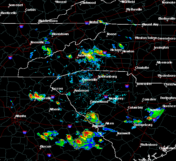 At 527 pm edt, a severe thunderstorm was located 13 miles northeast of downtown asheville, or 4 miles north of black mountain, moving south at 10 mph (radar indicated). Hazards include 60 mph wind gusts and quarter size hail. Hail damage to vehicles is expected. expect wind damage to roofs, siding and trees. locations impacted include, black mountain, montreat, mount mitchell state park, old fort, swannanoa, b. r. parkway-craggy to little switzerland and b. r. Parkway-east asheville to craggy gardens. At 527 pm edt, a severe thunderstorm was located 13 miles northeast of downtown asheville, or 4 miles north of black mountain, moving south at 10 mph (radar indicated). Hazards include 60 mph wind gusts and quarter size hail. Hail damage to vehicles is expected. expect wind damage to roofs, siding and trees. locations impacted include, black mountain, montreat, mount mitchell state park, old fort, swannanoa, b. r. parkway-craggy to little switzerland and b. r. Parkway-east asheville to craggy gardens.
|
| 7/19/2016 5:05 PM EDT |
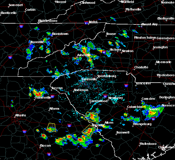 At 505 pm edt, a severe thunderstorm was located 13 miles south of burnsville, or 4 miles southwest of mount mitchell state park, moving south at 10 mph (radar indicated). Hazards include 60 mph wind gusts and quarter size hail. Hail damage to vehicles is expected. Expect wind damage to roofs, siding and trees. At 505 pm edt, a severe thunderstorm was located 13 miles south of burnsville, or 4 miles southwest of mount mitchell state park, moving south at 10 mph (radar indicated). Hazards include 60 mph wind gusts and quarter size hail. Hail damage to vehicles is expected. Expect wind damage to roofs, siding and trees.
|
| 7/8/2016 6:36 PM EDT |
 The severe thunderstorm warning for east central buncombe and southwestern mcdowell counties will expire at 645 pm edt, the storm which prompted the warning has weakened below severe limits, and has exited the warned area. therefore the warning will be allowed to expire. a severe thunderstorm watch remains in effect until midnight edt for western north carolina. The severe thunderstorm warning for east central buncombe and southwestern mcdowell counties will expire at 645 pm edt, the storm which prompted the warning has weakened below severe limits, and has exited the warned area. therefore the warning will be allowed to expire. a severe thunderstorm watch remains in effect until midnight edt for western north carolina.
|
| 7/8/2016 6:20 PM EDT |
 At 619 pm edt, a severe thunderstorm was located 14 miles southwest of marion, or 5 miles southwest of old fort, moving southeast at 25 mph (radar indicated). Hazards include ping pong ball size hail and 60 mph wind gusts. People and animals outdoors will be injured. expect hail damage to roofs, siding, windows and vehicles. expect wind damage to roofs, siding and trees. Locations impacted include, old fort, montreat and black mountain. At 619 pm edt, a severe thunderstorm was located 14 miles southwest of marion, or 5 miles southwest of old fort, moving southeast at 25 mph (radar indicated). Hazards include ping pong ball size hail and 60 mph wind gusts. People and animals outdoors will be injured. expect hail damage to roofs, siding, windows and vehicles. expect wind damage to roofs, siding and trees. Locations impacted include, old fort, montreat and black mountain.
|
| 7/8/2016 5:59 PM EDT |
 At 558 pm edt, a severe thunderstorm was located 10 miles east of downtown asheville, or near swannanoa, moving east at 20 mph (radar indicated). Hazards include 60 mph wind gusts and quarter size hail. Hail damage to vehicles is expected. Expect wind damage to roofs, siding and trees. At 558 pm edt, a severe thunderstorm was located 10 miles east of downtown asheville, or near swannanoa, moving east at 20 mph (radar indicated). Hazards include 60 mph wind gusts and quarter size hail. Hail damage to vehicles is expected. Expect wind damage to roofs, siding and trees.
|
| 7/7/2016 7:59 PM EDT |
 At 759 pm edt, severe thunderstorms were located along a line extending from 12 miles southwest of greeneville to 5 miles west of waynesville, moving southeast at 60 mph (radar indicated). Hazards include 60 mph wind gusts. Expect damage to roofs. Siding and trees. At 759 pm edt, severe thunderstorms were located along a line extending from 12 miles southwest of greeneville to 5 miles west of waynesville, moving southeast at 60 mph (radar indicated). Hazards include 60 mph wind gusts. Expect damage to roofs. Siding and trees.
|
| 7/5/2016 2:02 PM EDT |
 At 201 pm edt, severe thunderstorms were located along a line extending from 11 miles west of marion to 13 miles southeast of downtown asheville, moving east at 35 mph (radar indicated). Hazards include 60 mph wind gusts and penny size hail. Expect damage to roofs. Siding and trees. At 201 pm edt, severe thunderstorms were located along a line extending from 11 miles west of marion to 13 miles southeast of downtown asheville, moving east at 35 mph (radar indicated). Hazards include 60 mph wind gusts and penny size hail. Expect damage to roofs. Siding and trees.
|
| 5/2/2016 2:53 PM EDT |
 At 253 pm edt, a severe thunderstorm was located 9 miles southwest of marion, or near old fort, moving east at 25 mph (radar indicated). Hazards include golf ball size hail and 60 mph wind gusts. People and animals outdoors will be injured. expect hail damage to roofs, siding, windows and vehicles. expect wind damage to roofs, siding and trees. Locations impacted include, marion, old fort, sugar hill, fero, glenwood, pleasant gardens, montreat and woodlawn. At 253 pm edt, a severe thunderstorm was located 9 miles southwest of marion, or near old fort, moving east at 25 mph (radar indicated). Hazards include golf ball size hail and 60 mph wind gusts. People and animals outdoors will be injured. expect hail damage to roofs, siding, windows and vehicles. expect wind damage to roofs, siding and trees. Locations impacted include, marion, old fort, sugar hill, fero, glenwood, pleasant gardens, montreat and woodlawn.
|
| 5/2/2016 2:46 PM EDT |
 At 246 pm edt, a severe thunderstorm was located 11 miles southwest of marion, or near old fort, moving northeast at 15 mph (radar indicated). Hazards include 60 mph wind gusts and quarter size hail. Hail damage to vehicles is expected. expect wind damage to roofs, siding and trees. Locations impacted include, marion, old fort, sugar hill, fero, glenwood, pleasant gardens, montreat and woodlawn. At 246 pm edt, a severe thunderstorm was located 11 miles southwest of marion, or near old fort, moving northeast at 15 mph (radar indicated). Hazards include 60 mph wind gusts and quarter size hail. Hail damage to vehicles is expected. expect wind damage to roofs, siding and trees. Locations impacted include, marion, old fort, sugar hill, fero, glenwood, pleasant gardens, montreat and woodlawn.
|
| 5/2/2016 2:25 PM EDT |
 At 225 pm edt, a severe thunderstorm was located 14 miles east of downtown asheville, or near black mountain, moving northeast at 15 mph (radar indicated). Hazards include 60 mph wind gusts and quarter size hail. Hail damage to vehicles is expected. Expect wind damage to roofs, siding and trees. At 225 pm edt, a severe thunderstorm was located 14 miles east of downtown asheville, or near black mountain, moving northeast at 15 mph (radar indicated). Hazards include 60 mph wind gusts and quarter size hail. Hail damage to vehicles is expected. Expect wind damage to roofs, siding and trees.
|
| 5/1/2016 5:26 PM EDT |
 At 526 pm edt, a severe thunderstorm was located 10 miles west of marion, or over old fort, moving east at 30 mph (radar indicated). Hazards include ping pong ball size hail and 60 mph wind gusts. People and animals outdoors will be injured. expect hail damage to roofs, siding, windows and vehicles. expect wind damage to roofs, siding and trees. Locations impacted include, marion, old fort, sugar hill, fero, glenwood, pleasant gardens, thermal city and nebo. At 526 pm edt, a severe thunderstorm was located 10 miles west of marion, or over old fort, moving east at 30 mph (radar indicated). Hazards include ping pong ball size hail and 60 mph wind gusts. People and animals outdoors will be injured. expect hail damage to roofs, siding, windows and vehicles. expect wind damage to roofs, siding and trees. Locations impacted include, marion, old fort, sugar hill, fero, glenwood, pleasant gardens, thermal city and nebo.
|
| 5/1/2016 5:15 PM EDT | Ping Pong Ball sized hail reported 0.4 miles SW of Montreat, NC, social media posting of a photo of hail at least the size of a ping pong ball. |
| 5/1/2016 5:12 PM EDT | Quarter sized hail reported 0.4 miles SW of Montreat, NC, quarter sized hail. |
| 5/1/2016 5:06 PM EDT |
 At 506 pm edt, a severe thunderstorm was located 13 miles east of downtown asheville, or near black mountain, moving east at 30 mph (radar indicated). Hazards include 60 mph wind gusts and quarter size hail. Hail damage to vehicles is expected. Expect wind damage to roofs, siding and trees. At 506 pm edt, a severe thunderstorm was located 13 miles east of downtown asheville, or near black mountain, moving east at 30 mph (radar indicated). Hazards include 60 mph wind gusts and quarter size hail. Hail damage to vehicles is expected. Expect wind damage to roofs, siding and trees.
|
| 5/1/2016 4:27 PM EDT |
 At 427 pm edt, a severe thunderstorm was located 10 miles south of burnsville, or 5 miles west of mount mitchell state park, moving east at 20 mph (radar indicated). Hazards include 60 mph wind gusts and quarter size hail. Hail damage to vehicles is expected. Expect wind damage to roofs, siding and trees. At 427 pm edt, a severe thunderstorm was located 10 miles south of burnsville, or 5 miles west of mount mitchell state park, moving east at 20 mph (radar indicated). Hazards include 60 mph wind gusts and quarter size hail. Hail damage to vehicles is expected. Expect wind damage to roofs, siding and trees.
|
| 5/1/2016 4:07 PM EDT |
 At 407 pm edt, a severe thunderstorm was located 9 miles east of marshall, or near mars hill, moving east at 20 mph (radar indicated). Hazards include 60 mph wind gusts and quarter size hail. Hail damage to vehicles is expected. Expect wind damage to roofs, siding and trees. At 407 pm edt, a severe thunderstorm was located 9 miles east of marshall, or near mars hill, moving east at 20 mph (radar indicated). Hazards include 60 mph wind gusts and quarter size hail. Hail damage to vehicles is expected. Expect wind damage to roofs, siding and trees.
|
| 9/4/2015 4:10 PM EDT |
 The severe thunderstorm warning for northeastern buncombe and southwestern mcdowell counties will expire at 415 pm edt, the storm which prompted the warning has weakened below severe limits, and no longer poses an immediate threat to life or property. therefore the warning will be allowed to expire. however gusty winds and heavy rain are still possible with this thunderstorm. The severe thunderstorm warning for northeastern buncombe and southwestern mcdowell counties will expire at 415 pm edt, the storm which prompted the warning has weakened below severe limits, and no longer poses an immediate threat to life or property. therefore the warning will be allowed to expire. however gusty winds and heavy rain are still possible with this thunderstorm.
|
| 9/4/2015 3:43 PM EDT |
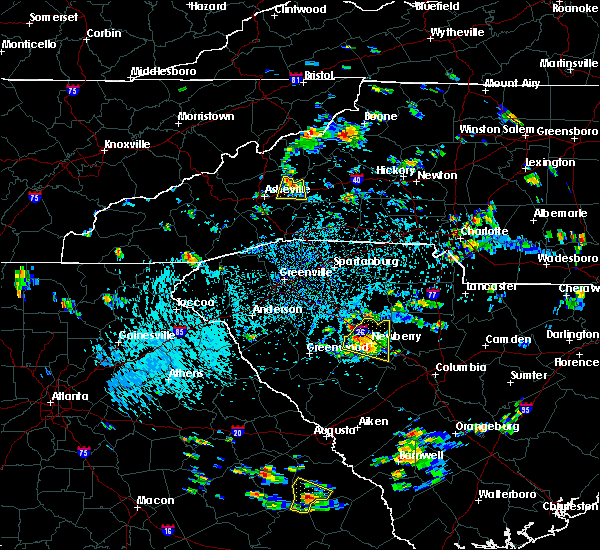 At 343 pm edt, doppler radar indicated a severe thunderstorm capable of producing quarter size hail and damaging winds in excess of 60 mph. this storm was located 15 miles northeast of downtown asheville, or 5 miles north of black mountain, moving south at 5 mph. locations impacted include, black mountain, swannanoa, montreat, b.r. parkway-craggy to little switzerland, old fort and b.r. parkway-east asheville to craggy gardens. At 343 pm edt, doppler radar indicated a severe thunderstorm capable of producing quarter size hail and damaging winds in excess of 60 mph. this storm was located 15 miles northeast of downtown asheville, or 5 miles north of black mountain, moving south at 5 mph. locations impacted include, black mountain, swannanoa, montreat, b.r. parkway-craggy to little switzerland, old fort and b.r. parkway-east asheville to craggy gardens.
|
| 9/4/2015 3:25 PM EDT |
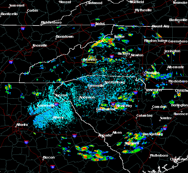 At 325 pm edt, doppler radar indicated a severe thunderstorm capable of producing quarter size hail and damaging winds in excess of 60 mph. this storm was located 15 miles west of marion, or 5 miles southwest of b.r. parkway-craggy to little switzerland, and moving south at 10 mph. * locations in the warning include, black mountain, swannanoa, montreat, b.r. parkway-craggy to little switzerland, old fort and b.r. parkway-east asheville to craggy gardens. At 325 pm edt, doppler radar indicated a severe thunderstorm capable of producing quarter size hail and damaging winds in excess of 60 mph. this storm was located 15 miles west of marion, or 5 miles southwest of b.r. parkway-craggy to little switzerland, and moving south at 10 mph. * locations in the warning include, black mountain, swannanoa, montreat, b.r. parkway-craggy to little switzerland, old fort and b.r. parkway-east asheville to craggy gardens.
|
| 7/14/2015 7:47 AM EDT |
 At 747 am edt, doppler radar indicated a line of severe thunderstorms capable of producing damaging winds in excess of 60 mph. these storms were located along a line extending from 9 miles north of marion to 11 miles northeast of downtown asheville to 9 miles northeast of waynesville, and moving southeast at 50 mph. penny size hail may also accompany the damaging winds. At 747 am edt, doppler radar indicated a line of severe thunderstorms capable of producing damaging winds in excess of 60 mph. these storms were located along a line extending from 9 miles north of marion to 11 miles northeast of downtown asheville to 9 miles northeast of waynesville, and moving southeast at 50 mph. penny size hail may also accompany the damaging winds.
|
| 7/13/2015 7:48 PM EDT |
 At 747 pm edt, doppler radar indicated a line of severe thunderstorms with a history of producing damaging winds in excess of 60 mph. these storms were located along a line extending from 7 miles south of burnsville to 10 miles north of downtown asheville to 5 miles southwest of marshall, moving southeast at 35 mph. penny size hail may also accompany the damaging winds. locations impacted include, asheville, marshall, black mountain, woodfin, swannanoa, weaverville, fairview in buncombe county, biltmore forest, bent creek and old fort. At 747 pm edt, doppler radar indicated a line of severe thunderstorms with a history of producing damaging winds in excess of 60 mph. these storms were located along a line extending from 7 miles south of burnsville to 10 miles north of downtown asheville to 5 miles southwest of marshall, moving southeast at 35 mph. penny size hail may also accompany the damaging winds. locations impacted include, asheville, marshall, black mountain, woodfin, swannanoa, weaverville, fairview in buncombe county, biltmore forest, bent creek and old fort.
|
| 7/13/2015 7:29 PM EDT |
 At 729 pm edt, doppler radar indicated a line of severe thunderstorms with a history of producing damaging winds in excess of 60 mph. these storms were located along a line extending from 4 miles west of burnsville to 3 miles northeast of marshall to 20 miles southeast of newport, and moving southeast at 35 mph. penny size hail may also accompany the damaging winds. At 729 pm edt, doppler radar indicated a line of severe thunderstorms with a history of producing damaging winds in excess of 60 mph. these storms were located along a line extending from 4 miles west of burnsville to 3 miles northeast of marshall to 20 miles southeast of newport, and moving southeast at 35 mph. penny size hail may also accompany the damaging winds.
|
| 6/30/2015 5:38 PM EDT |
 At 537 pm edt, doppler radar indicated a severe thunderstorm capable of producing damaging winds in excess of 60 mph. this storm was located 10 miles west of marion, moving east at 40 mph. penny size hail may also accompany the damaging winds. locations impacted include, marion, old fort, pleasant gardens, sugar hill, glenwood and montreat. At 537 pm edt, doppler radar indicated a severe thunderstorm capable of producing damaging winds in excess of 60 mph. this storm was located 10 miles west of marion, moving east at 40 mph. penny size hail may also accompany the damaging winds. locations impacted include, marion, old fort, pleasant gardens, sugar hill, glenwood and montreat.
|
| 6/30/2015 5:19 PM EDT |
 At 519 pm edt, doppler radar indicated a severe thunderstorm capable of producing damaging winds in excess of 60 mph. this storm was located 9 miles east of north asheville, and moving east at 30 mph. nickel size hail may also accompany the damaging winds. At 519 pm edt, doppler radar indicated a severe thunderstorm capable of producing damaging winds in excess of 60 mph. this storm was located 9 miles east of north asheville, and moving east at 30 mph. nickel size hail may also accompany the damaging winds.
|
| 6/21/2015 7:01 PM EDT |
 At 701 pm edt, doppler radar indicated a severe thunderstorm capable of producing quarter size hail and damaging winds in excess of 60 mph. this storm was located 7 miles south of west asheville, or 4 miles east of b.r. parkway, mount pisgah to the nc arboretum, and moving east at 15 mph. At 701 pm edt, doppler radar indicated a severe thunderstorm capable of producing quarter size hail and damaging winds in excess of 60 mph. this storm was located 7 miles south of west asheville, or 4 miles east of b.r. parkway, mount pisgah to the nc arboretum, and moving east at 15 mph.
|
| 6/19/2015 4:03 PM EDT |
 At 403 pm edt, doppler radar indicated a severe thunderstorm capable of producing quarter size hail and damaging winds in excess of 60 mph. this storm was located 14 miles east of east asheville, or near black mountain, moving east at 15 mph. locations impacted include, black mountain, old fort, b.r. parkway, craggy to little switzerland, montreat, sugar hill, fero, pleasant gardens, glenwood, marion and busick. At 403 pm edt, doppler radar indicated a severe thunderstorm capable of producing quarter size hail and damaging winds in excess of 60 mph. this storm was located 14 miles east of east asheville, or near black mountain, moving east at 15 mph. locations impacted include, black mountain, old fort, b.r. parkway, craggy to little switzerland, montreat, sugar hill, fero, pleasant gardens, glenwood, marion and busick.
|
| 6/19/2015 3:47 PM EDT |
 At 346 pm edt, doppler radar indicated a severe thunderstorm capable of producing quarter size hail and damaging winds in excess of 60 mph. this storm was located 8 miles east of east asheville, or near swannanoa, moving east at 10 mph. locations impacted include, black mountain, swannanoa, old fort, b.r. parkway, craggy to little switzerland, mount mitchell state park, montreat, sugar hill, glenwood, busick and fero. At 346 pm edt, doppler radar indicated a severe thunderstorm capable of producing quarter size hail and damaging winds in excess of 60 mph. this storm was located 8 miles east of east asheville, or near swannanoa, moving east at 10 mph. locations impacted include, black mountain, swannanoa, old fort, b.r. parkway, craggy to little switzerland, mount mitchell state park, montreat, sugar hill, glenwood, busick and fero.
|
| 6/19/2015 3:23 PM EDT |
 At 323 pm edt, doppler radar indicated a severe thunderstorm capable of producing quarter size hail and damaging winds in excess of 60 mph. this storm was located 5 miles northeast of east asheville, or over warren wilson college, and moving northeast at 15 mph. At 323 pm edt, doppler radar indicated a severe thunderstorm capable of producing quarter size hail and damaging winds in excess of 60 mph. this storm was located 5 miles northeast of east asheville, or over warren wilson college, and moving northeast at 15 mph.
|
| 6/18/2015 2:22 PM EDT | At 221 pm edt, doppler radar indicated a severe thunderstorm capable of producing quarter size hail and damaging winds in excess of 60 mph. this storm was located near west asheville, or over biltmore forest, and moving east at 15 mph. |
| 1/1/0001 12:00 AM | The mill creek road area in far western mcdowell county was especially hard hit with numerous trees down. no reports of any injuries as the earlier mobile home hit by a in mcdowell county NC, 4.4 miles WSW of Montreat, NC |
Hail Maps for Montreat, NC


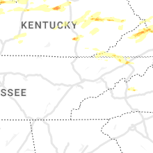


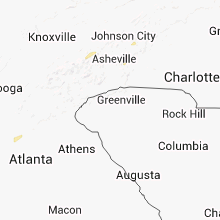


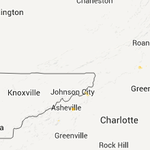


Connect with Interactive Hail Maps